West Hermosa Street Corridor and Neighborhood Enhancement Plan
Transforming the Gateway Corridor for the City of Lindsay
Final: February 2023
Caltrans Agreement Number: 74A1203

2020-21 Caltrans Sustainable Transportation Planning Grant (Sustainable Communities Grant)

Acknowledgements
City of Lindsay
Neyba Amezcua, Director of City Services & Planning
Edna Hubbard, Engineer Technician
KTUA
Joe Punsalan, Principal
Jacob Leon, Associate, Project Manager
Alex Samarin, GIS Manager
Mariella Delfino, Planner
CivicWell
Tony Leonard, Project Manager
Josh Meyer, Program Director
STC Traffic Engineering
Stephen Manganiello, T.E., Principal
Myles Baidy, EIT
A Very Special Thanks To:
West Hermosa Corridor Community Advisory Committee
All stakeholder and community members that participated in the planning process
Street
Plan II
West Hermosa
Corridor
List of Figures
List of Tables
Table of Contents III
1 4 2 5 3 Introduction 1 1.1 Introduction ................................................................. 2 1.2 Study Area ................................................................... 2 1.3 Project Vision ............................................................. 4 Existing Conditions 5 2.1 Existing Conditions ..................................................... 6 Community Outreach 25 3.1 Community Outreach ................................................26 Recommendations 33 4.1 Recommendations Overview ................................... 34 4.2 Preferred Concept ..................................................... 36 Funding Opportunities 55 5.1 Funding Opportunities .............................................. 56
Table of Contents
Figure 1-1: Study Area ........................................................ 3 Figure 2-1: Land Use Map (From General Plan) ................. 13 Figure 2-2: Corridor Conditions ........................................ 15 Figure 2-3: Transit Stops ................................................... 17 Figure 2-4: Primary Mode of Travel ................................... 18 Figure 2-5: Origins and Destinations ................................ 19 Figure 2-6: Crash Diagram #1 .......................................... 20 Figure 2-7: Crash Diagram #2 .......................................... 20 Figure 2-8: Collision Data Map ......................................... 21 Figure 2-9: 24 Hour Counts, Olivewood Center ................ 22 Figure 2-10: 24 Hour Counts, Mount Vernon Avenue ........ 22 Figure 2-11: Traffic Counts and Speed Captured ............... 23 Figure 2-12: Turning Movement Counts by Mode............. 24 Figure 4-1: Preliminary Concept A .................................... 35 Figure 4-2: Preliminary Concept B .................................... 35 Figure 4-3: Preferred Concept Cutsheets .........................38 Figure 4-4: ATP Neighborhood Recommendations ......... 49 Figure 4-5: Recommendations 3D Renderings .................50
Table 5-1: Implementations Table .................................... 57 Table 5-2: Federal Funding Sources ................................. 59 Table 5-3: State Funding Sources .................................... 63
This Page Left Intentionally Blank

West Hermosa Street Corridor Plan IV

Chapter 1 - Introduction 1
Chapter 1 Introduction
1.1 Introduction
The West Hermosa Street Corridor and Neighborhood Enhancement Plan (Plan) is focused on creating enhanced transportation improvements that support the local community. The goal of this project is to redesign a three-quarter mile length stretch of West Hermosa Street into a pedestrian and bicycle-friendly street that improves safety, access, and connectivity while being consistent with the community’s character and their desires. The Plan also includes recommendations that support placemaking opportunities to enhance the visual appearance of the corridor since West Hermosa serves as one of two primary “gateway” entrances into the City of Lindsay. Recommendations in this Plan are comprehensive and multi-purpose. Topics such as active transportation, urban greening, stormwater, and placemaking are included and are meant to help the City pursue funding opportunities and compete well when applying for federal, state, or regional grant applications.
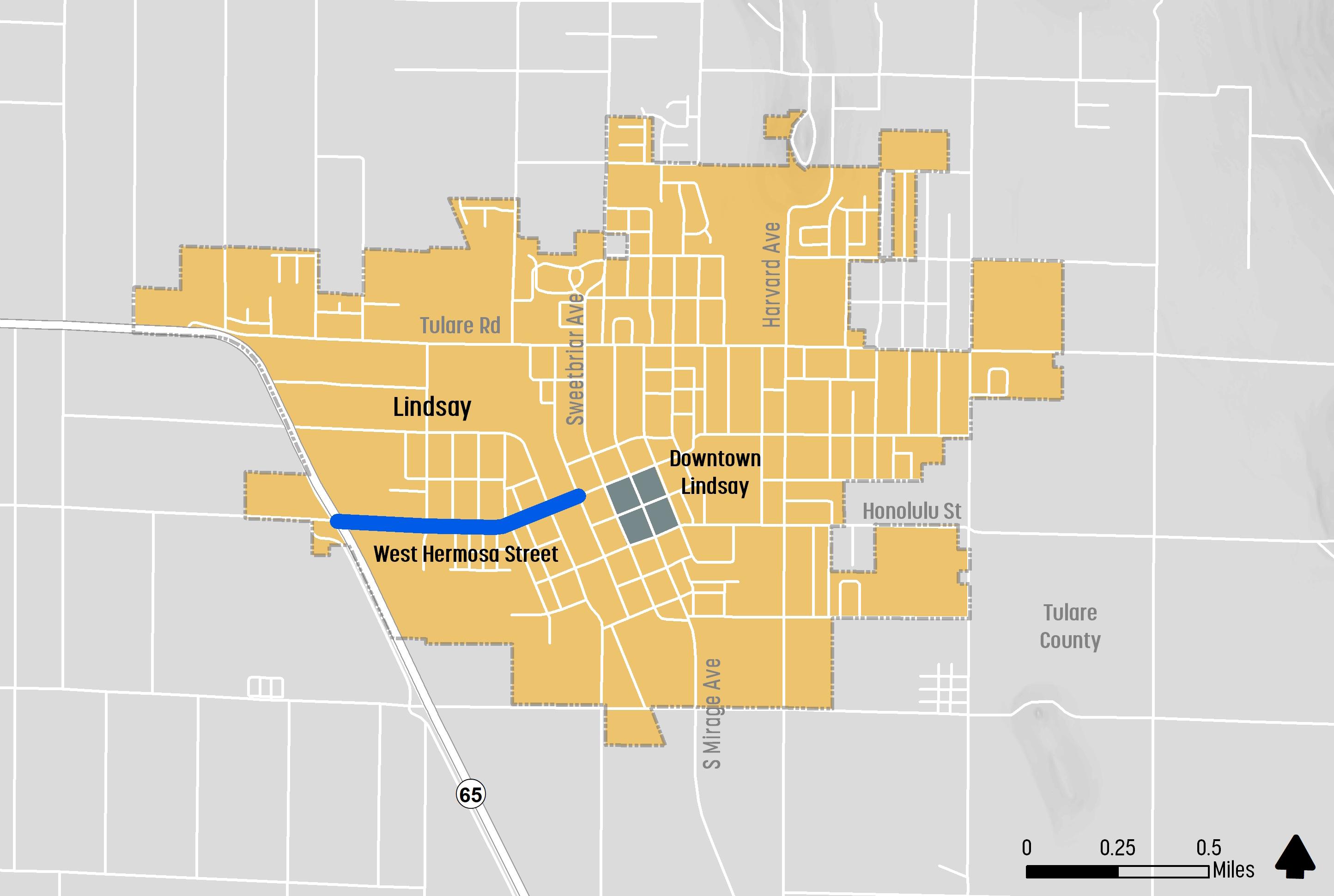
The project boundary begins on the western edge at the intersection of State Route 65 to Sweetbriar Avenue on the eastern edge. The West Hermosa Street Corridor and Neighborhood Enhancement Plan project is funded through a 2020-21 Caltrans Sustainable Transportation Planning Grant.
1.2 Study Area
The City of Lindsay is located in Tulare County, in the southern portion of the San Joaquin Valley. Lindsay has a population of 12,630 (2021 U.S. Census) and an area of 2.7 square miles. West Hermosa Street is the primary connector into the City from the state highway. The lack of bicycle facilities and vehicle speeds impact safety, access, and comfort for all users of the corridor.
West Hermosa Street provides access to a highway commercial and neighborhood serving shopping center, an elementary school, numerous apartment communities, single-family homes and neighborhoods, a park and a community recreation center. Tulare County Area Transit (TCAT) uses Highway 65 and West Hermosa Street at the shopping center as the central hub to connect southern and northern Tulare County transit routes. The City is exploring development of a transit center at the intersection of Hermosa Street and Mt. Vernon Avenue that can act as multi-modal hub for the community and the region. See Figure 1-1 for project location.
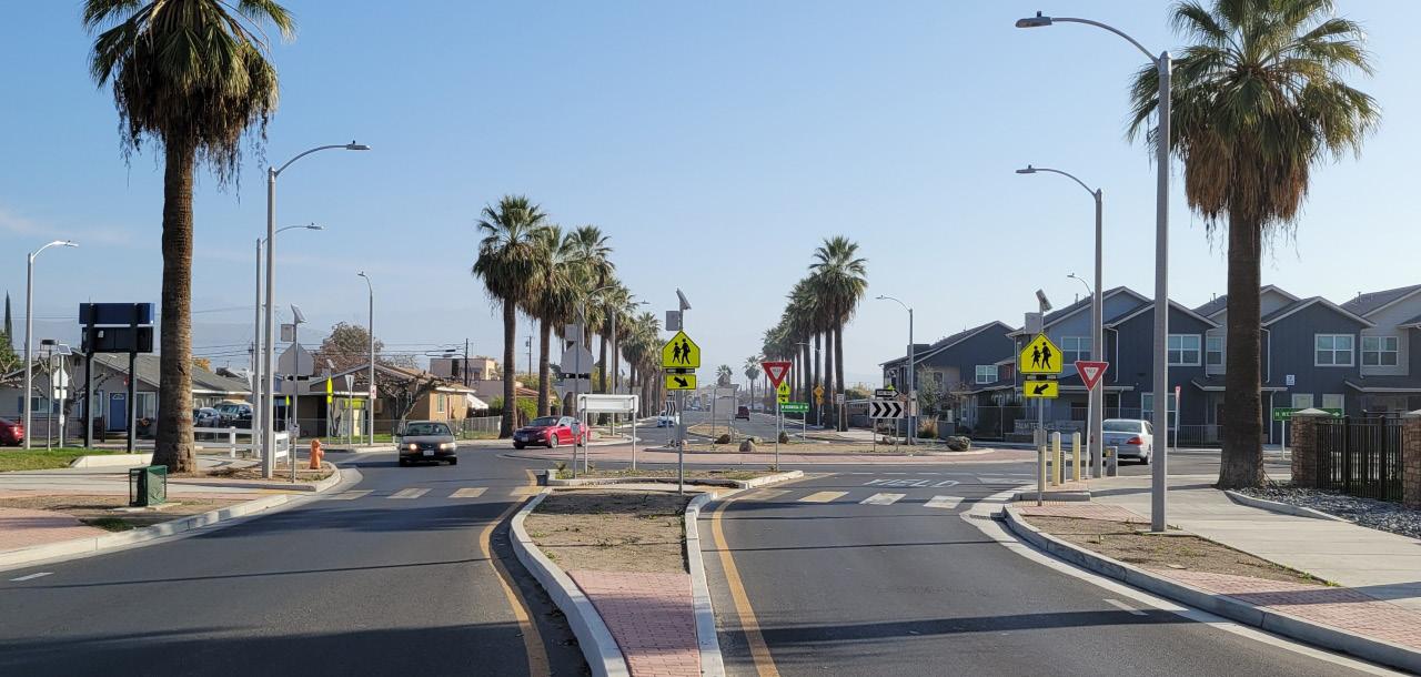
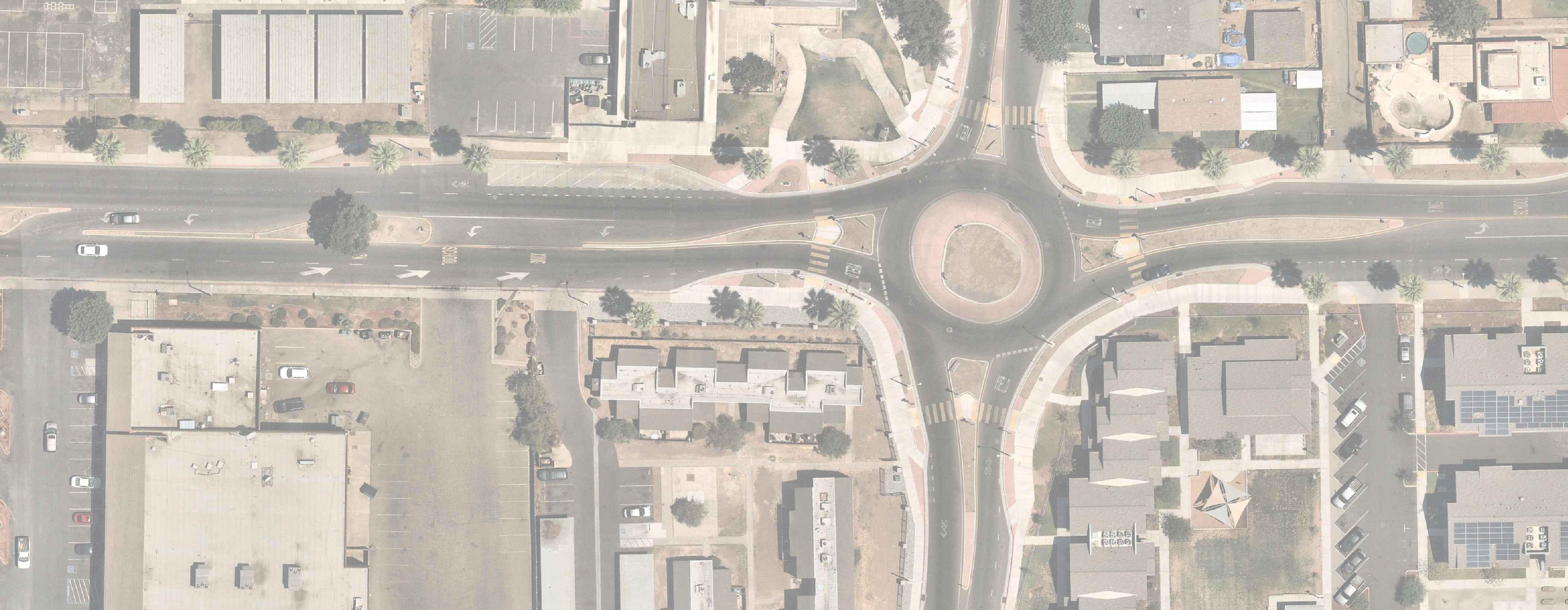
The City has already taken major steps in redesigning the corridor with the recently completed roundabouts at Westwood Avenue and at Elmwood Avenue. These roundabout improvements also include marked crosswalks and signage. Other improvements that can affect the West Hermosa Corridor include the second phase construction of the Palm Terrace community as well as an approved plan for future realignment of State Route 65 west of the current alignment that intersects with West Hermosa Street.
West Hermosa Street Corridor Plan 2
Chapter 1 - Introduction 3
Figure 1-1: Study Area
1.3 Project Vision
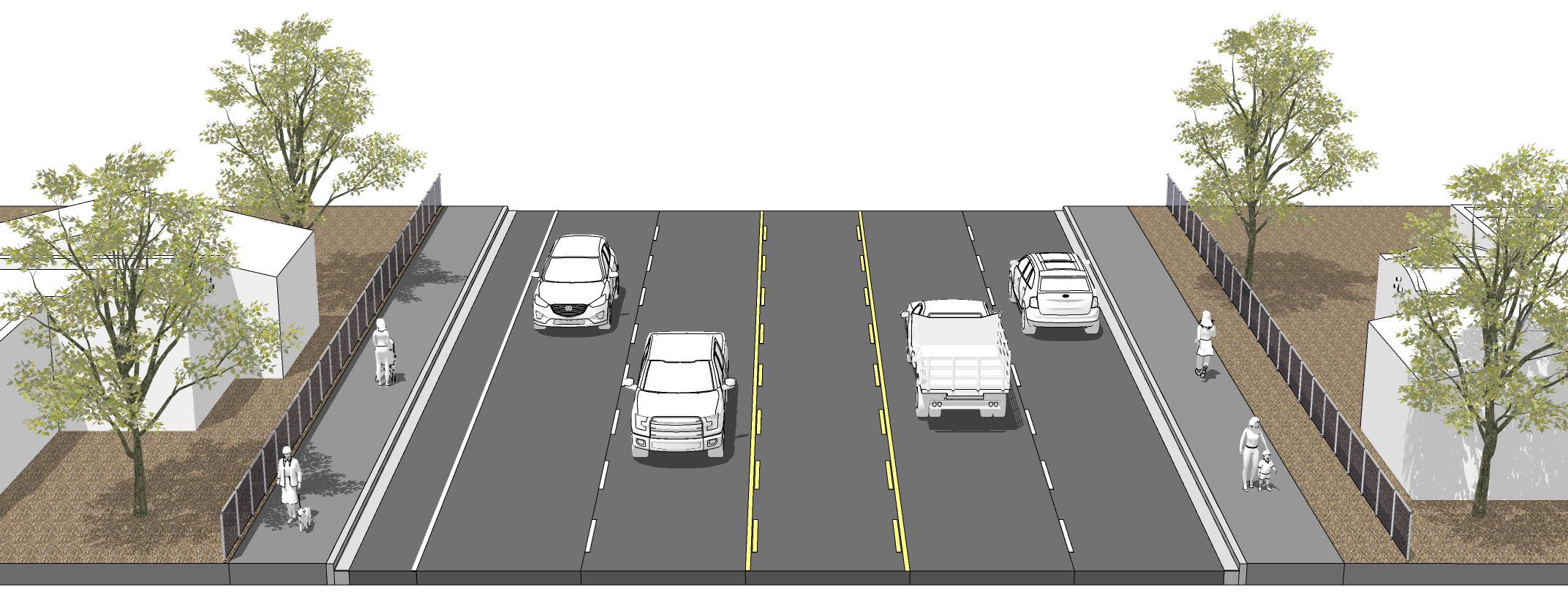
This Plan is the City’s opportunity to re-imagine how West Hermosa Street can better serve Lindsay residents and visitors. The vision for this corridor is rooted in complete street and active transportation planning principles that focus on serving all people’s transportation needs, not just those traveling by car. Understanding the community’s needs and the street enhancements the corridor offers are critical to developing an exciting and implementable plan.
How Can We Further Improve W.
Hermosa Street?
How can we improve the sidewalks? Does the street currently meet your daily needs?
What kinds of bicycle improvements would you like?
Would you like lighting, signage, and other types of improvements?
West Hermosa Street Corridor Plan 4
Chapter 2
Existing Conditions

Chapter 2 - Existing Conditions 5
2.1 Existing Conditions
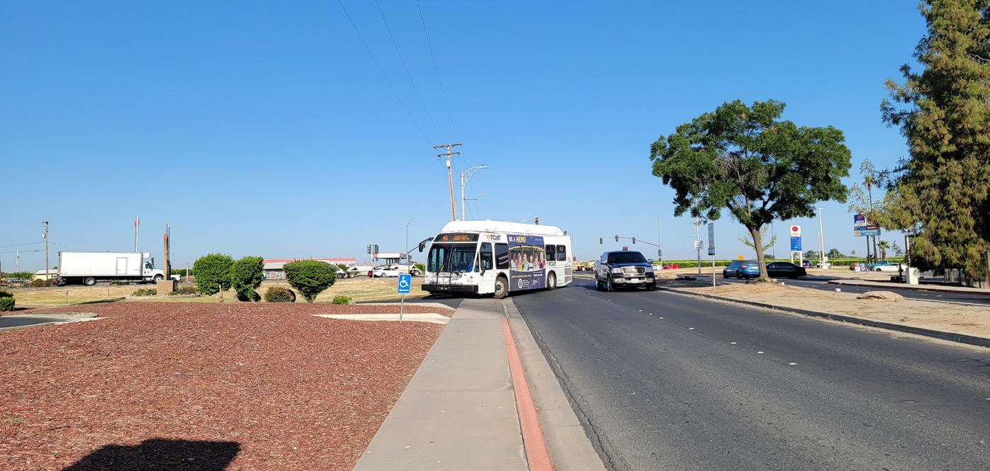
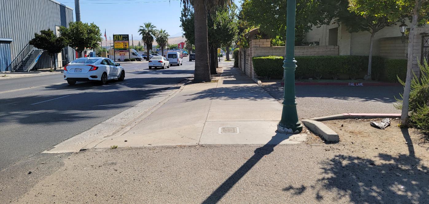
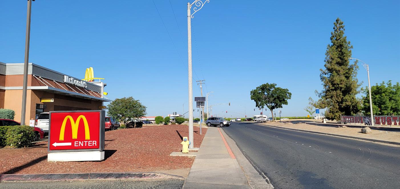
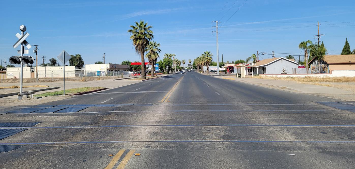
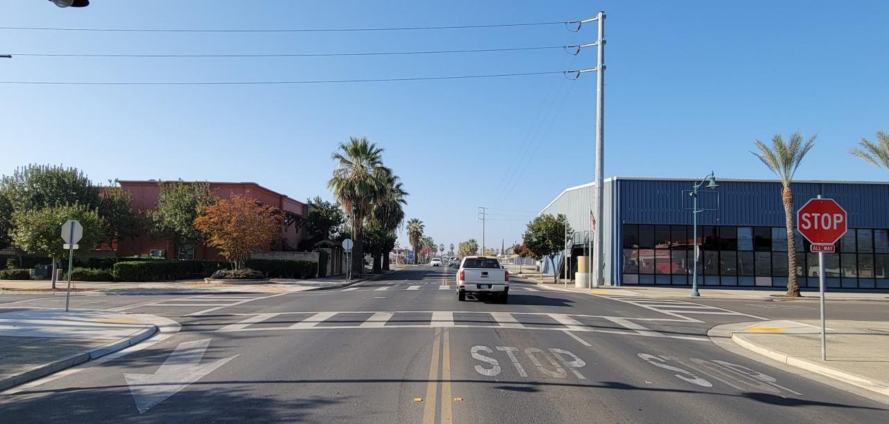
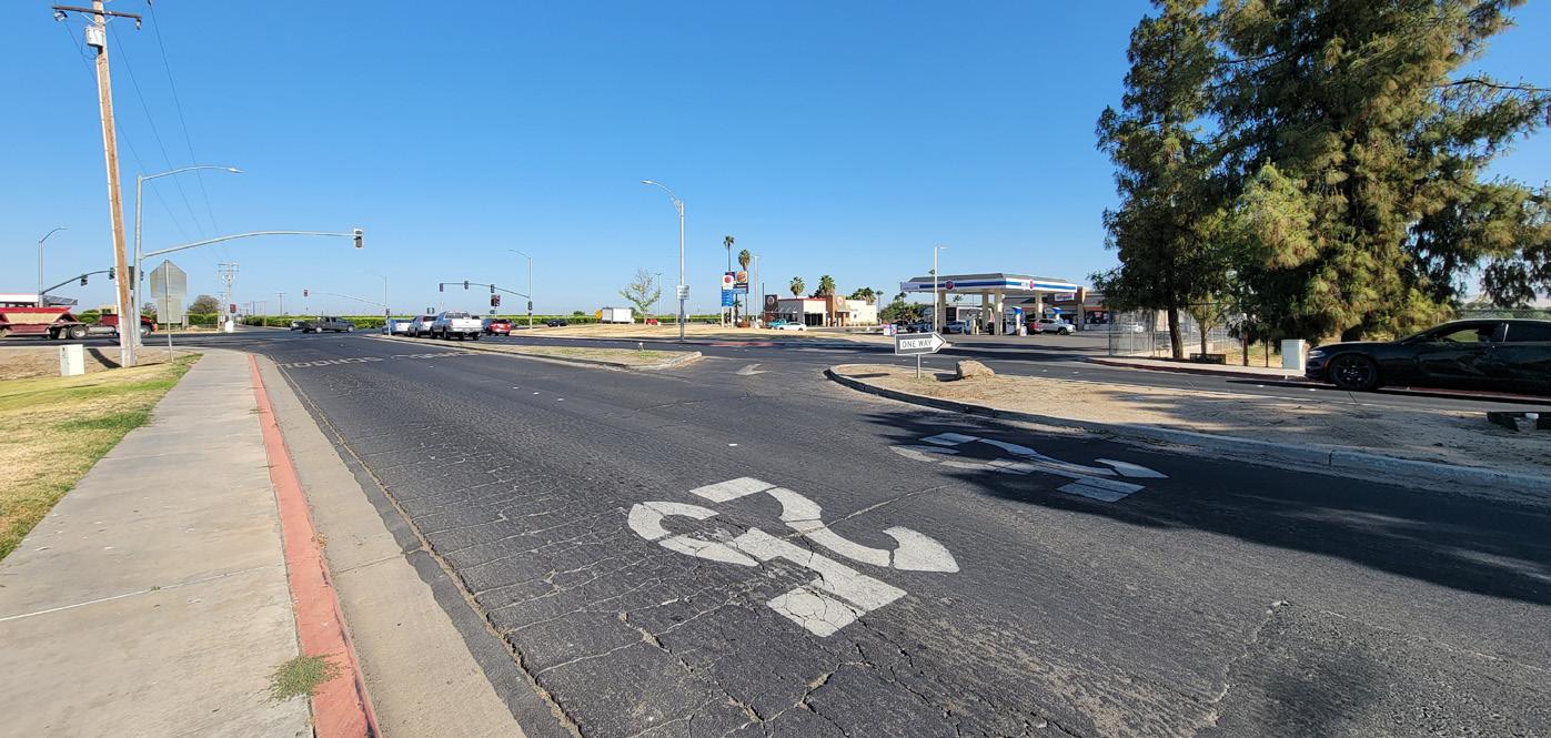
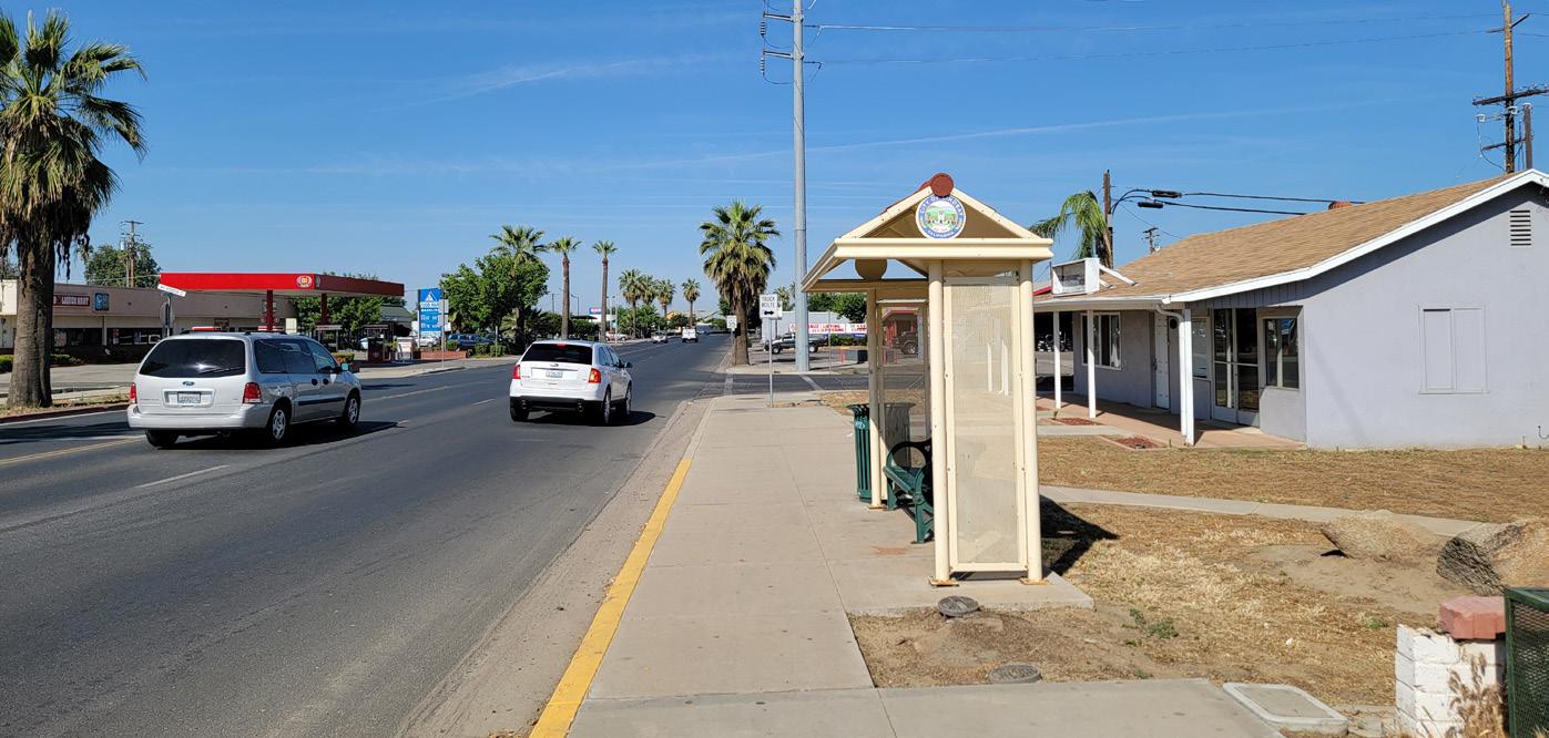
Photos of West Hermosa Street between State Route 65 and Sweetbriar Avenue are depicted below. The team conducted multiple site visits to observe “everyday” conditions, to measure existing sidewalks and travel lane widths, and to identify potential improvements. The photos depict existing challenges and opportunities such as sidewalks with no parkways, crossing multiple driveways, lack of bicycle facilities, lack of shade from trees, lack of pedestrian-scale lighting, wayfinding signage, long distances without a north-south crossing, and maintenance issues such as cracked sidewalks and overgrown landscaping.


West
Street
Plan 6
Hermosa
Corridor
“Slip lane” is an area of concern
Planted center median, speed limit and school signage
Existing sidewalk near State Route 65, lack of parkway
Signage indicating upcoming roundabout
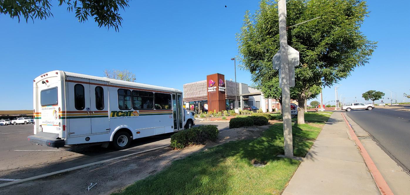
Transit enters Olivewood Plaza




Chapter 2 - Existing Conditions 7
Roundabout at Westwood Avenue
Narrow sidewalks and palm trees planted in sidewalk cutouts
Transit stop with shelter, bench, & trash receptacle near Mt Vernon Ave. Speed limit and truck route signage
Sidewalk maintenance needed over at-grade railroad crossing
Sidewalk maintenance needed in various sections
2.1.1 Planning Context Summary
This project is particularly focused on the community need for mobility options and improvements that support active modes of transportation. Lindsay is a majority Hispanic/Latino community, with over 85% of residents considering themselves to be Hispanic or Latino. According to the 2019 Housing Element Update, Lindsay has seen an annual population growth rate of 1.5% from 20102018, while the number of housing units has increased by 1.1%. The City projects that Lindsay’s population will increase by 25% from 2018 to 2040. This increase would equal approximately 3,263 additional persons, or an average annual growth rate of 1.1%.
Lindsay also faces poverty issues which directly affect the ability of residents to secure affordable housing and reliable transportation options. Data suggests that 26.5% of households own one vehicle or less and that they rely on walking, bicycling, or public transit for transportation. Lindsay ranks in the top 5% of California communities in terms of its poverty rate. Community-wide median household income is $37,073 accounting for 32% (2021 US Census estimates) of the City’s population living below the poverty line.
This context influences the Plan’s goals of providing safe, comfortable, and convenient mobility options for the community. People already walk to local destinations such as Jefferson Elementary School, Olivewood Plaza, commercial shopping centers along the eastern side of the corridor, and the start of Downtown Lindsay at Sweetbriar Avenue. Understanding that many community members have access to only one vehicle or no vehicle at all also influences the need to improve bikeway facilities along the corridor to assist with everyday transportation needs.
2.1.2 Policy and Regulatory Documents
2022 Tulare County Regional Transportation Plan / Sustainable Communities Strategy (RTP/SCS)
The Regional Transportation Plan is a long-range plan that is meant to provide a long-range, fiscally constrained guide for the future of Tulare County’s Transportation system. The long-range plan extends to the year 2046 in its scope and accomplishes its goals by forecasting future growth, identifying regional priorities, and planning for infrastructure improvements. The growth scenario that was selected by the public and by the various stakeholder committees during the outreach process was titled the Cross Valley Corridor, Blueprint Plus Scenario. The Cross Valley Corridor was built around the planned High Speed Rail Station in the Hanford Area with connections to an existing east-west rail corridor that stretches from Huron in Fresno County to the west, through Naval Air Station Lemoore, the City of Lemoore, Hanford, and eastward into Tulare County through Goshen, Visalia, Farmersville, Exeter, Lindsay, Strathmore, and Porterville.
The ultimate vision of passenger rail is to concentrate future growth in urban centers surrounding future passenger rail stations that are planned or now operating as bus transit centers. Under this new plan, higher residential and commercial densities would be encouraged to allow a greater number of residents and businesses to be located within walking distance of the new stations, reducing some dependency on the automobile. Those who did not live within walking distance of a station would be served by new and improved transit service and active transportation corridor improvements that bring people into planned transit centers.
West Hermosa Street Corridor Plan 8
Community members and visitors to Downtown Lindsay and the surrounding neighborhoods along West Hermosa Street would benefit from planned improvements. Goals and policies from the RTP that are met by this Plan include:
Goal: Improve, enhance, and expand the region’s bicycle and pedestrian systems and connectivity to those systems, while keeping them safe and convenient.
» Convene public outreach and implement strategies for Share the Road concepts.
» Encourage local agencies to support implementation of bicycle support facilities such as bike racks, showers, and other facilities during the project review process.
» Coordinate bicycle planning and implementation with other modes of transportation, particularly with transit.
» Support development of designated regional bicycle paths adjacent to or separate from commute corridors, connecting cities and communities.
» Support implementation of local bicycle and trail plans.
» Support the closure of gaps in the bicycle and pedestrian systems to improve connectivity and attractiveness of these modes of transportation.
» Encourage removal of barriers (walls, fences, etc.) for safe and convenient movement of pedestrians. Special emphasis should be placed on Americans with Disabilities Act (ADA) compliance.
2022 Walk’n Bike Tulare County, Tulare County Association Governments
The objective of 2022 Walk ‘n Bike Tulare County was to make walking and biking around the County safer and easier. The plan has two main purposes. The first is to be the foundation for the pedestrian and bicycle component of the soon-to-be updated Tulare County Regional Transportation Plan / Sustainable Communities Strategy (RTP/SCS). The second main purpose is to position these high-priority projects to compete better for funding from federal, state and regional sources. This plan develops active transportation recommendations for each City in Tulare County. For the City of Lindsay, recommendations include:
» Bike lanes on West Hermosa Street
» Pedestrian connection improvements along West Hermosa Street and Mount Vernon Avenue.
Implementation strategies from this Plan that align with the West Hermosa Street Neighborhood Enhancement Project include:
» Encourage local agencies to prepare complete streets plans that accommodate all users, including pedestrians and cyclists.
» Provide funding for the development of complete streets and active transportation plans and projects.
» Coordinate bicycle planning and implementation with other modes of transportation, particularly transit.
» Support implementation of local bicycle and trail plans.
» Promote the placement of compatible land uses near each other and design them as high-quality environments for pedestrians and cyclists.
Chapter 2 - Existing Conditions 9
City of Lindsay General Plan (1989)
The General Plan reflects the City’s long-range aspirations of maintaining a healthy and prosperous community. The General Plan provides guidance to development regulations and other programs approved by the City Council to carry out the Plan over time.
Components of the Circulation Element include state highways, arterial and collector streets, minor streets, pedestrian ways, alleys, bicycle routes and railroad service. It is the policy of the General Plan to guide and provide for the development of an integrated system of internal circulation and access to serve all citizens of the Lindsay area, including the young, senior population, and the physically handicapped, by seeking the following:
» Increased safety for citizens.
» The efficient movement of people and goods.
» Lower vehicle operating costs.
» Lower vehicle miles traveled and therefore lower quantities and impacts of vehicle emissions.
» Economy in street construction and maintenance.
» A circulation system which is correlated and consistent with the needs of land use patterns fostered by the Land Use Element.
» Minimizing and (where possible) avoiding the disruption of residential areas caused by through traffic.
Bicycle Route and Pedestrian Circulation Policies that are compliant with this Plan include:
» Separately striped Class II bikeway facilities are not required within the community, except along Tulare Road and Hermosa Streets. Bikeways which do not require separate lanes should be provided along an integrated system of Minor and Collector streets that provide access between residential neighborhoods and important generators of activity, including schools, parks, commercial centers, and employment centers.
City of Lindsay, 2019 Housing Element Update
The 2019 Element serves as the primary policy document and resource guide for housing development in Lindsay. This Element provides initiatives to improve and expand housing choice in Lindsay so that all residents may have the opportunity to enjoy safe, decent, and affordable housing. While this plan primarily focuses on housing within the City, there are a few elements that provide guidance to street improvements as housing developments increase in the City. This plan also addresses Environmental Stewardship by suggesting affordable housing projects with green design, water conservation, grey water recycling, vanpooling, and pedestrian improvements which can result in net zero energy projects.
New residential development in Lindsay is required by ordinance and policy to install urban infrastructure improvements consistent with surrounding development and the practices of other communities in the region. Requirements related to street improvements include installation of:
» Concrete curb and gutters
» Landscaped parkways
» Masonry walls where residential lots are directly adjacent to arterial or collector streets
» Paveout of adjoining street surfaces to assist with planned rightof-way improvements
» Sidewalks
Other improvements may be required, depending on project scope, existing and surrounding site conditions, and site-specific infrastructure issues. These may include:
» Streetlights
» Turn lane installation, markings, and signage
West Hermosa Street Corridor Plan 10
2.1.3 Demographics (2020 ACS 5-Year Estimates, US Census)
TOTAL HOUSEHOLDS: 3,866


UNDER 16: 29.5%
TOTAL EMPLOYED: 5,483
TOTAL POPULATION: 12,630
HOUSEHOLDS WITHOUT VEHICLES: 337


OVER 65 11.4%
PERSONS IN POVERTY 32.8%


Chapter 2 - Existing Conditions 11
2.1.4 Land Use
The land use within the City of Lindsay is dominated by residential, commercial and industrial use, with supporting public and semi-public facilities such as schools, parks, government offices, churches, hospital and public utilities. The City is surrounded by agricultural land which is mostly devoted to orange and olive groves, with some irrigated pasture and field crops to the north.
Land uses adjacent to West Hermosa Street are primarily commercial, residential and semi-public (Jefferson Elementary School). The project corridor will also connect to the proposed future transit center on Mount Vernon Avenue.


In comparison with other cities of Tulare County, the Lindsay urban area is compact with relatively little developed area within the unincorporated fringe. The largest developed area outside of the city limits is a 47 acre area developed as single family use immediately west of the High School north of Tulare Road. A portion of Lindsay High School is just outside the City limits in Tulare County.
West Hermosa Street Corridor Plan 12
Figure 2-1: Land Use Map (From General Plan)
LINDSAY GENERAL PLAN
Cottonwood
Chapter 2 - Existing Conditions 13 ! ! ! ! ! ! ! ! ! ! ! ! ! ! ! ! ! ! ! ! ! ! ! ! ! ! ! ! ! ! ! ! ! ! ! ! ! ! ! ! ! ! ! ! ! ! ! ! ! ! ! Tu re T a e Tu a e L ndmor Lewis Fost e Tu re Tu F e o Tu re T a e Mount V e non Mount Vernon Fra er He m a Hermosa V en a Va nc H c o y S e ra V ew V i s a M u b e r r y A s h S e a V w P m L o c k e C a m b d g Honolu u Hono u H no u u W e s w o o d P nce ton Apa Ros wo Elmwood F h F o h B u e G u m Mon e V s a Samoa Tu a e Tu a e S y c a m o r e O x o d M o n t e G a l e H Gal e Hill Ap Ap a M p Mountain nd O r a n g e w o o d Dawn C e G r o v e LindaVista G nwo d S h e r m a n P ea an HGale ill F hav n S moa Le C n wood Fa ew Fremont H a m n D nve nd W e 1 P a k s i d e P a r k s d e 3 d Rosewood B e a h H nd Wh n y A med S t a n f o d F v ew B d H m a s s e Ma hew H a d Harvard C b d g B d M hew Ke n A am da A nwo d M e m o y H g h d M osa Ma pos He mosa He mo He mo a M h L y n n Sindli n ger S t H mos H mos A u t u m n G d S y c a S e c e Frazie M a r c A n h y M g Hon u u Samoa G enwood O vewood Ce e E m w o o d A he e Elmwood M r a g e Mirage D e n v e C a m b d g Ashland M i ra ge G r en H o m a s s e Homassel L dsa Y a e Olive R o o s e v e t S w e e b a Sweetbriar Bu em E a s w o o d Kirb y B l ue G u L e a n n g L o c k e B e h A med S h e r w o o d B e a h Map e Val ey C e d a r H S a n o r d Mandarin O d Alameda W e s m o e Mon V s S a n o d V a n N C t D a San a Fe Ha v rd T r ace H O a n g e Mountai n View H m assel Orange Mon V s G a e H B e a h
E d L n d s a y W d L S y c a m o e O a k O r a n g e Ono C y Pa kway H c r H ko y H a d H a r d H a d C b d g S a h L n d e r o L f y L a y e t e S y S q o a S q FRIANT KERN CANAL ± Base Da a Prov ded by Tu are County Created By Ede ma Gonza ez Ci y of L ndsay P ann ng and Commun ty Deve opment Departmen Last Update on January 20 2021 The Features Produced by hese Da a Are Only Represen at ona and Are No ntended or Legal or Survey Legend City L mits City Parce Addresses Ci y Stree s State H ghway Ra lroad Wa er Flow L ne GENERAL PLAN Central Commerc al Heavy ndus rial High Densi y Highway Commercia Highway Commercia (Reserve) Light ndus ria Light ndus ria (Reserve) Low Dens ty Low Dens ty (Reserve) Med um Density M xed-Use Mob e Homes Ne ghborhood Commercia Off ce (Medica & O her) Park & Recreation Pub c & Semi-Pub c Faci ty Service Commercia Very Low Dens ty Very Low Dens ty (Reserve) Unknown 0 5,000 1,250 2,500 3,750 Feet
2.1.5 Corridor Conditions
The West Hermosa Street right-of-way varies between 69’ and 83’ between State Route 65 and Sweetbriar Avenue. The narrowest section is roughly between Eastwood Avenue and Ashland Avenue. The widest part of the street is between Westwood Avenue and Central Avenue. While the varying widths do play a part in developing recommendations, the four-lane road still provides plenty of redesign opportunities. Speed limits are between 25 and 35 mph.
Currently, a roundabout exists at Westwood Avenue providing much needed traffic calming from State Route 65 into Downtown Lindsay. The roundabout also provides traffic calming and enhanced pedestrian crossings around Jefferson Elementary School and the adjacent residential neighborhoods. There are no bike facilities throughout the corridor. Bike ramps and shared space for bicyclists and pedestrians were installed at the Westwood Avenue roundabout. These spaces help people navigate the roundabout for those not comfortable sharing the road with vehicles. Green conflict striping is present here for bicyclists exiting the roundabout.
Sidewalks are installed throughout the entire length of the corridor. Street trees planted in tree grates or in sidewalk cutouts exist in certain sections of the corridor, but the corridor lacks a dedicated planted parkway strip spanning the entire length of the project area.
High visibility crosswalks are only located at Westwood Avenue and at Sweetbriar Avenue. These is only one north-south crossing location along West Hermosa Avenue between the project boundary and it’s located at the Westwood Avenue.
West Hermosa Street Corridor Plan 14

Chapter 2 - Existing Conditions 15
Figure 2-2: Corridor Conditions
2.1.6 Transit Routes and Stops
Tulare County Area Transit serves Lindsay by bus routes 40 and 60. Route 40 connects Lindsay to Visalia to the north and Porterville to the south. Bus route 60, the Lindsay Route, is an intra-connected bus route that connects Olivewood Plaza, Lindsay Wellness Center and City Hall. Both bus routes travel along West Hermosa Street with bus stops at the Olivewood Plaza parking lot near State Route 65 and near Downtown Lindsay. The bus stops along West Hermosa Street have shelters, benches and trash receptacles.
According to the TCAG Regional Transportation Plan, Tulare County Regional Transit Agency (TRCTA), is planning to expand its on-demand service to six additional communities: Dinuba, Exeter, Farmersville, Lindsay, Tulare, and Woodlake.
West Hermosa Street Corridor Plan 16

Chapter 2 - Existing Conditions 17
Figure 2-3: Transit Stops
2.1.7 Analysis
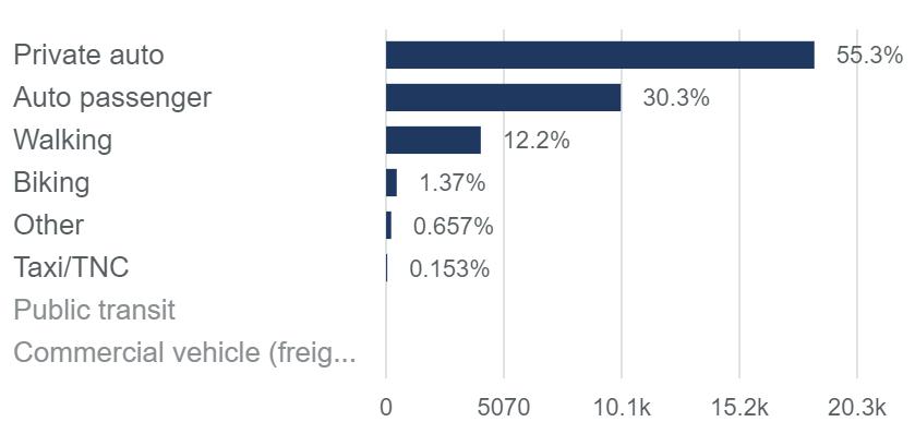
The following table summarizes the transportation characteristics of the City of Lindsay that help support the needs for improving West Hermosa Street. The information for the map and table was obtained from Replica, a big data resource that is used by transportation planners and engineers. The data is derived from a typical weekday in November of 2021.
The primary mode of transportation in Lindsay is by car with 85.6% followed by walking with 12.2% of mode share. Bicycling accounts for 1.4% followed by other modes and by a Transportation Network Company (TNC) such as taxi or rideshare.
Coinciding with the summarized mode share, the trip distance summary highlights 43.3% of trips are under one mile which makes walking and bicycling an important mode within the City.
Figure 2-5 shows the percentage of trips within the different parts of the City by census tracts. Twenty-nine percent of trip purposes was to home with 21.1% for shopping and 10.9% for work. Census tracts 28 and 26.02 have the highest percentage of trip destinations which is where most of the population resides as well as Lindsay High School and Downtown Lindsay. The location of West Hermosa Street is a critical corridor that connects the residential neighborhoods to the north with Downtown Lindsay and a majority of the commercial areas.
West Hermosa Street Corridor Plan 18
Figure 2-4: Primary Mode of Travel

Chapter 2 - Existing Conditions 19
Figure 2-5: Origins and Destinations
2.1.8 Bicycle and Pedestrian Collisions

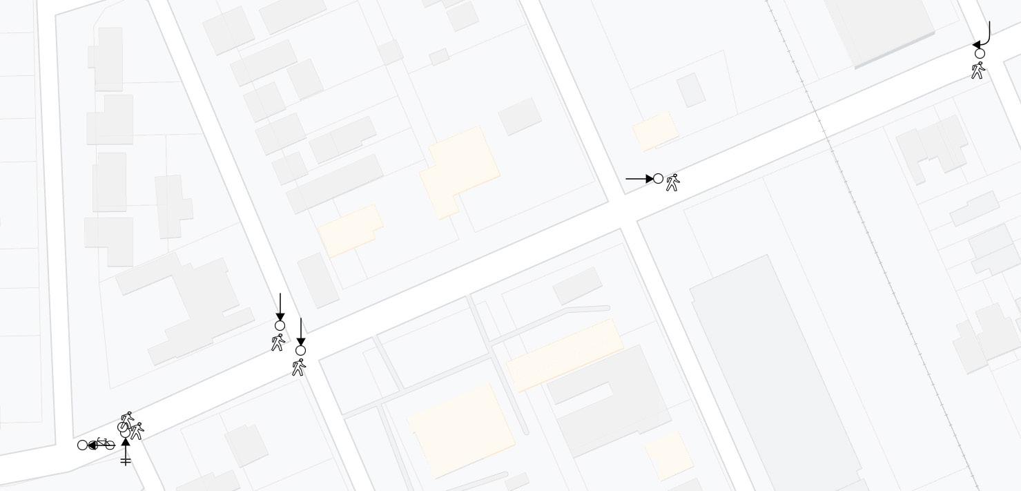
Collision data collected from the UC Berkeley Transportation Injury Mapping System (TIMS) from 2011-2020 summarized 10 bicycle and pedestrian-related collisions along the project study area. Three of the bicycle collisions occurred at Olivewood Plaza where further analysis revealed two of the collisions occurred as bicyclists were attempting to cross West Hermosa Street mid-block. The other collision occurred as the bicyclist was entering West Hermosa Street from the westernmost driveway.
Pedestrian collisions occurred primarily between Eastwood Avenue and Sweetbriar Avenue which include vehicle and pedestrian violations including not yielding to each other or violating a vehicle or pedestrian right-of-way. Fortunately, no fatalities were reported. The following collision diagrams summarize the bicycle and pedestrian related collisions to help support design recommendations.
West Hermosa Street Corridor Plan 20
Figure 2-6: Crash Diagram #1
Figure 2-7: Crash Diagram #2

Chapter 2 - Existing Conditions 21
Figure 2-8: Collision Data Map
2.1.9 Traffic Count Analysis
The project team conducted a comprehensive traffic count and survey analysis to get a better understanding of the existing traffic conditions along the corridor. The analysis consisted of road tubes at two locations as well as cameras at seven intersections to capture traffic counts by mode, turning movements, and traffic speeds.
The analysis took place during the month of March 2022 and a summary of the results are depicted in the following section. The raw data that was collected for this analysis can be found in Appendix B of this Plan.
Major highlights of the traffic count analysis include:
» The majority of people travel by car


» A large number of commercial and agricultural trucks use West Hermosa to reach their destinations
» Average miles per hour hovered around 35 MPH
» Average daily traffic remained relative low at around 10,500 vehicles per day
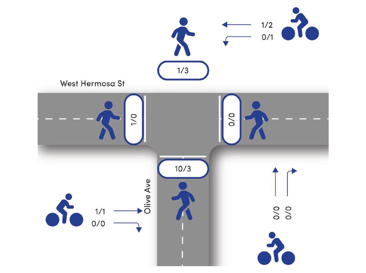
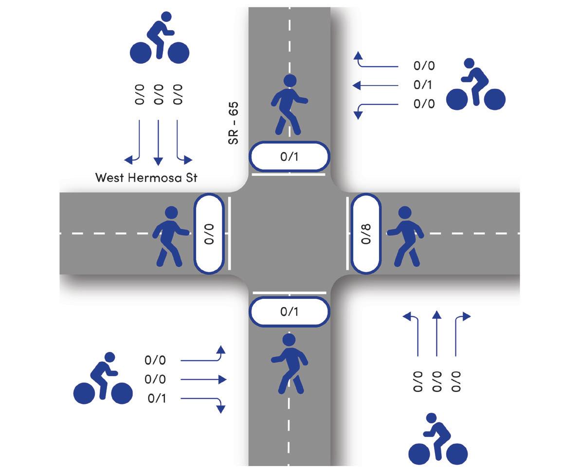
» Pedestrian traffic remains high at the Westwood Avenue intersection due to its proximity to Jefferson Elementary School
» Bicycle use remains low to non-existent under existing conditions, may be due to the lack of bicycle facilities on the corridor
Total Traffic Counts by Mode
West Hermosa Street Corridor Plan 22
Figure 2-9: 24 Hour Classification Counts, East Driveway of Olivewood Center
Figure 2-10: 24 Hour Classification Counts, Mount Vernon Avenue to Ashland Avenue

Chapter 2 - Existing Conditions 23
MPH: 36
ADT: 10,680
MPH: 35
ADT: 9,776
Figure 2-11: Traffic Counts and Speed Captured
AM/PM Bicycle Volumes
AM/PM Pedestrian Volumes xx/yy


West Hermosa Street Corridor Plan 24
Figure 2-12: Turning Movement Counts by Mode
Chapter 3
Community Outreach

Chapter 3 - Community Outreach 25
3.1 Community Outreach
The West Hermosa Street Corridor and Neighborhood Enhancement Plan was developed through a robust public process that engaged residents, businesses, and community stakeholders, to transform this important corridor into a pedestrian and bicycle-friendly street and improve connections in adjacent neighborhoods. The project employed a variety of engagement strategies to engage various stakeholders to identify the barriers to walking, bicycling, and other modes of travel.
The main engagement activities to inform the public about the June Lake Loop ATP and to get meaningful input included:
» Project Advisory Group Meetings
» Interactive Map Survey
» Design Workshop
» Informational Pop-ups
» Walk Audits
» Stakeholder Meetings
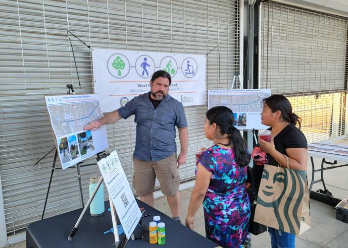
» Draft Plan Pop-up Workshops
3.1.1 Outreach Methods
Several outreach methods were used to connect with, and engage residents, businesses and other stakeholders about the project and upcoming events, and to maximize engagement.
» Creating a logo to brand the project and to increase its visibility.
» Flyers and posters to publicize events were produced in English and Spanish for community-wide distribution. They were distributed at City building locations, local businesses and community centers.
» Project Advisory Group and other community members were asked to distribute flyers through other channels.
» The City used social media to encourage public participation and announce events.
» The City sent out media releases.
» Meeting announcements and project updates were posted on the project website.
» The link to the interactive map survey was shared on the main website and advertised on social media and flyers.
3.1.2 Project Advisory Group (PAG)
A Project Advisory Group was formed for the project to inform the team of the best ways to engage the public and discuss the plan concepts. Members included residents, business owners, City staff, Tulare County Association of Governments, and Caltrans. Members were selected who could provide local knowledge of the issues and people of Lindsay. They also served as champions for the project—helping to spread the word about events and to carry the recommendations forward.
Meetings with the PAG were held on the following dates to discuss engagement strategies, plan recommendations, and to provide project updates to the PAG:
West Hermosa Street Corridor Plan 26
Project branding
Meeting #1, March 4, 2022
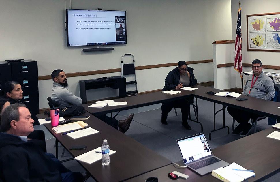
During the first meeting, the team introduced themselves and the project, provided an overview of the PAG’s role in the process, the scope of work, and the timeline. Participants engaged on discussions around key study area issues and locations to study further, as well as potential ways to best conduct outreach to the community.
Meeting #2, April 29, 2022
This meeting focused on the existing conditions analysis and discussing the constrains and opportunities within the corridor. The group also discussed the public engagement strategy for popups and the charrette.
Meeting #3, September 20, 2022
The CAC was updated about what the team learned from the popups and community input during the charrette. During the meeting, the team reviewed the proposed infrastructure recommendations for the corridor and discussed plans for the draft plan pop-up workshop.
3.1.3 Pop-Up Events
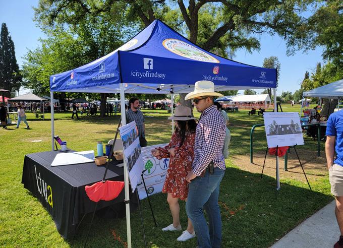
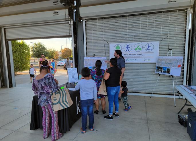
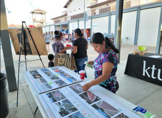
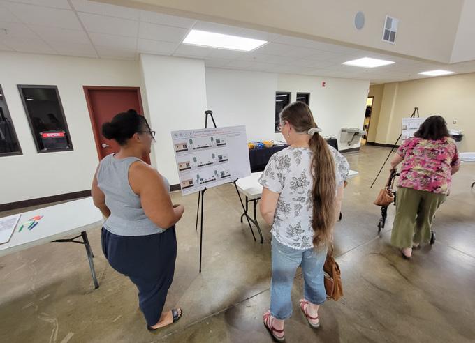
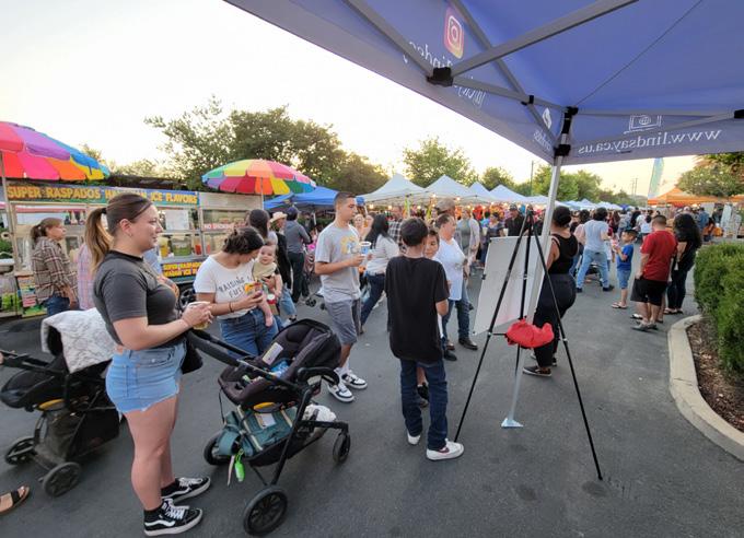
During the project the team travelled to Lindsay and held multiple pop-up activities. These were held in conjunction with existing events and provided opportunities to “go to” residents and engage them directly. The team was able to engage community members on identifying issues they felt needed to be addressed in the corridor, dot voting on complete street features and project recommendations, and spreading the word about future project outreach opportunities.
» Orange Blossom Festival on April 9, 2022
» Friday Night Market on April 29, 2022
» National Night Out event on August 2, 2022
Sticker Exercise
» Pedestrian Lighting – 52
» Urban Greening — 40
» Art in the Streets — 38
» Bicycle lanes – 31
» Decorative Crosswalks — 27
» High Visibility Crosswalks — 26
» Traffic Calming — 26
» Wayfinding Signage — 19
» Pubic seating w/ Shade — 9
Chapter 3 - Community Outreach 27
Advisory Group Meeting
3.1.4 Multi-Day Charrette
The team visited Lindsay from May 22–25, 2022 to hold a multi-day charrette. The purpose of the charrette was to engage people in various activities to identify issues and locations the plan should address, and to develop initial infrastructure recommendations for the corridor that the community would like to see. In consultation with the PAG, the team scheduled a variety of activities to engage the community:
» Stakeholder Engagement
» Opening Workshop
» Walk Audit
» Jefferson Elementary Classroom activities
» Closing Workshop
Stakeholder Meetings and Surveys
The team engaged stakeholders on May 23 at two levels:

City Departments: A meeting was held with representatives from City departments on May 23. These included the City Manager, City Services, Planning, Fire and Police. This was an opportunity to discuss current planned projects, issues from their perspectives, and potential project implementation.
Business: Team members went to business located on the corridor and conducted brief surveys. This included markets, restaurants, auto repair providers, insurance providers and the Sequoia Family Medical Center. They were asked to describe their customer base, how customers arrived to their business, and observed traffic safety issues among other questions. The majority of customers used cars to arrive at these locations, however the medical center reported that about 50% of their patrons walked. The majority of reported issues were on Hermosa Street near the Olivewood Shopping Center.
Opening Design Workshop
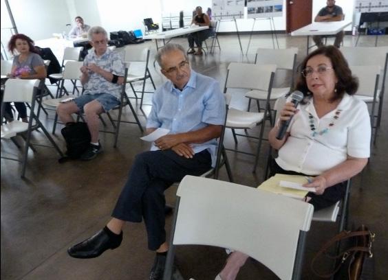
The opening workshop was held on May 23 at the Lindsay Wellness Center. At the beginning of the workshop, the team asked participants to write down their visions for Lindsay over the next 20 years. Participants then had the opportunity to share those visions with the rest of the group. CivicWell and KTUA then did a short presentation to highlight the existing conditions and Complete Streets tools and strategies that could be applied on the corridor. After the presentation, large aerial maps were laid out on the tables and participants were asked to break up into groups to write down their concerns and issues related to walking and bicycling They were then encouraged to provide their ideas and suggestions for infrastructure projects that should happen along the corridor.
West Hermosa Street Corridor Plan 28
Classroom Activities
Team members joined the 5th Grade classes of Mr. Vega and Ms. Knutson to engage the students. This offered the opportunity to get their perspectives about conditions on the corridor and any issues getting to and from school. Students were asked about the
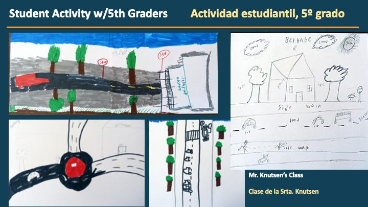
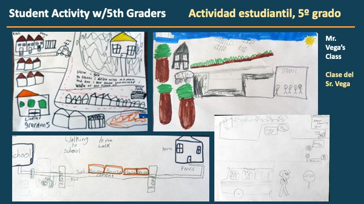

mode of transportation they used to get to school and from school. They were then led in an activity to draw their route to school, and what they see along the way.

Chapter 3 - Community Outreach 29
How do you normally get to school? (Mark down results)
Walking Audit from Jefferson Elementary
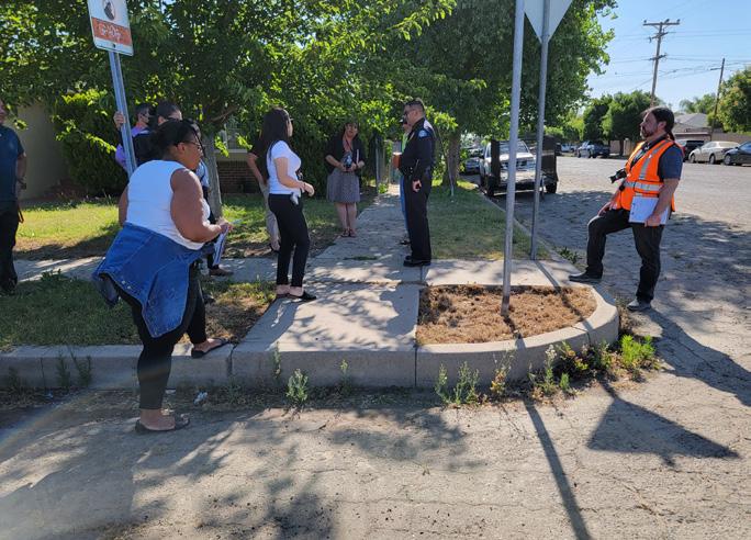
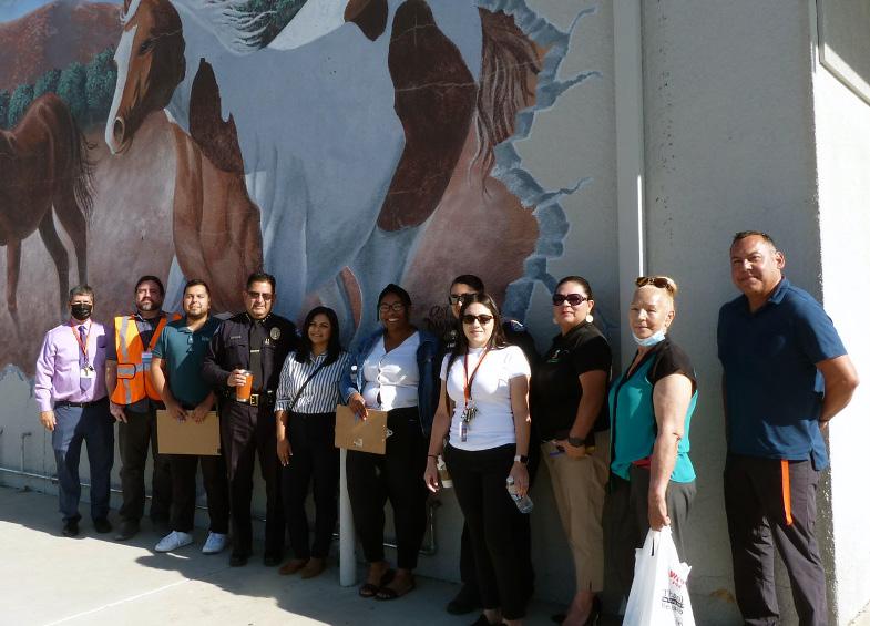
On May 23 the team also led a group with parents, Principal Gonzales, and the Police Department on a walking audit from Jefferson Elementary. This was an opportunity for participants and the team to discuss specific issues to address along the walk and provide a different perspective for discussion from maps. The route took participants along a portion of West Hermosa street and the side streets in the neighborhood near the school.
Closing Workshop
0
The closing workshop for the charrette was held the evening of May 25. The team was able to report to the participants on the activities held earlier in the charrette and some of the feedback heard from the community. Boards were available to highlight different concepts for the corridor that emphasized pedestrian improvements, bicycling improvements, and transit improvements based on community feedback. Participants were asked to offer their feedback on these initial ideas. Other boards provided an opportunity to identify potential design themes and inspirations for the corridor.
Key Takeaways
General recommendations supported by the community include:
» Address high vehicular speeds
» Add better pedestrian lighting
» Add shade /evergreen street trees
» Include a center turn-lane for the whole corridor
» Address road paving issues on adjacent / connecting streets
Pedestrian and Bicycle-focused concepts were supported
» People believed it improved safety and comfort
3 0
By another way? (skateboard, scooter, etc) 0 1 (skateboard)
» Encouraged team to explore these ideas in the design concepts phase
Quote from Pedestrian Focus Board
“This concept is best because it accommodates pedestrians and cyclists. It also creates flexibility in traffic flow.”
West Hermosa Street Corridor Plan 30
Question Mr. Vega’s Class Ms. Knutson’s Class
By walking?
By bicycle?
By school bus? 2
By car with your family?
By car with children from other families?
By walking?
By bicycle?
By school bus?
car
7 4
0 0
1
12 12
2
By another way? (skateboard, scooter, etc) 0 1 (skateboard) How do you get home from school?
8 6
0 0
2 1 By
with your family? 12 10 By car with children from other families?







Chapter 3 - Community Outreach 31
3.1.5 Draft Plan Pop-up Workshops

In consultation with the PAG, the team decided to make use of existing events to hold pop-up workshops so more residents could be engaged.

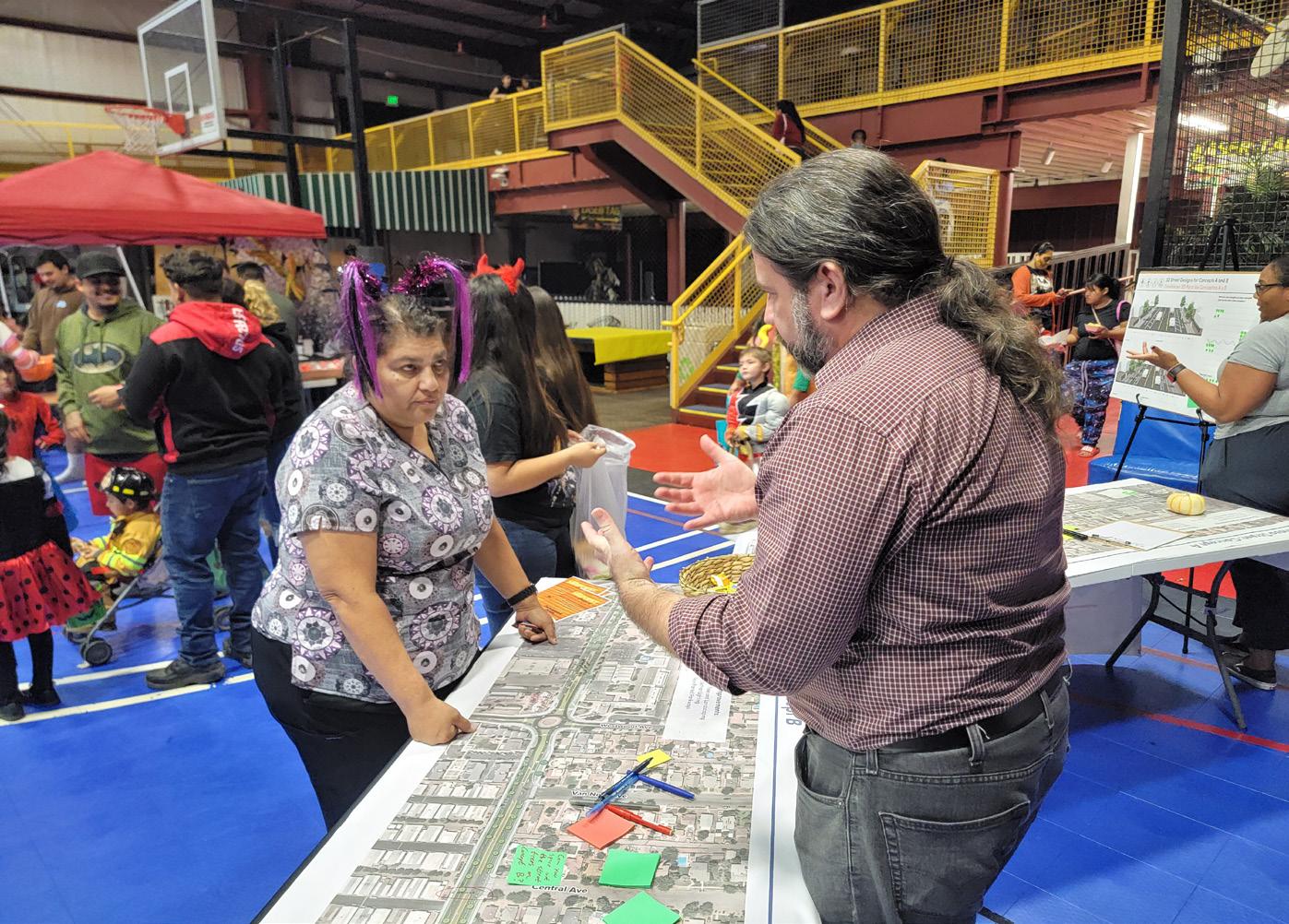
» Harvest Festival on October 31, 2022
» Lindsay Rib Cook-off on November 5, 2022
During these events team members presented the draft plan recommendations in two main options and phasing. Participants were provided an opportunity to give comments on the recommendations and identify their preferred alternative. Most people preferred Option B which showed Class 4 separated Bikeways, curb extensions, and more trees, planting and lighting.
West Hermosa Street Corridor Plan 32
Chapter 4
Recommendations

Chapter 4 - Recommendations 33
4.1 Recommendations Overview
The recommendations chapter summarizes the efforts conducted to develop a Preferred Concept that the City of Lindsay can use to pursue future funding opportunities. The chapter includes an overview of the feedback that was collected during the preliminary concept phase, inspiration photos that depict proposed improvements, and “20% level” design cutsheets that depict the physical recommendations of the Preferred Concept. Active transportation recommendations for the streets of the surrounding neighborhood that connect to West Hermosa Street are also included.
4.1.1 Concept A and B Summary
Two preliminary concepts were developed during the middle of the outreach process to help the community compare and contrast the types of improvements they’d like to see for West Hermosa. The planning team created a concept that focused on pedestrian improvements and one that focused on bicycling improvements. The community reacted positively to both concepts because they each addressed many of the issues that were shared during the early outreach phase of this Plan. Major comments for these concepts included:
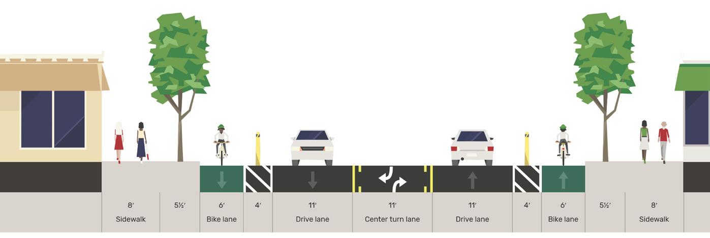
» Bikeways that provide as much separation as possible was requested. Class IV separated bikeways were more popular than striped Class II bike lanes.
» Additional north-south high-visibility crosswalks with flashing beacons were viewed positively
» Planted parkways to increase separation from adjacent travel lanes was viewed positively
» People generally supported anything that would help slow down vehicular speeds along the corridor

» People admitted to positively supporting the roundabout at Westwood Avenue after witnessing over time that it was helping with morning and afternoon school rush hours
» People had mixed feelings about the existing palm trees. Some people supported removing them, some consider them “sacred trees” that should remain
» People support adding additional pedestrian-scale lighting since the corridor is considered dark during evening hours
» Some people shared concerns about the cost to construct certain elements of the project
» Some people shared concerns about maintenance commitments and costs for the project
» Some concerns about separated bikeways and how they interact with driveway entrances along the corridor
West Hermosa Street Corridor Plan 34
Class II Bike Lanes and Pedestrian Enhancements Concept
Class IV Separated Bikeway and Pedestrian Enhancements Concept


Chapter 4 - Recommendations 35
Figure 4-1: Preliminary Concept A: Bicycle Improvements
Figure 4-2: Preliminary Concept B: Pedestrian Improvements
4.2 Preferred Concept
The Preferred Concept depicted in the following pages is based on the feedback that was collected through the community and stakeholder engagement process. The planning and design team compared the results of the two previous concepts plans and made suggested edits to create the Preferred Concept. This design includes complete street and active transportation design principles that were described in the Vision section of Chapter 1 of this plan.
The Preferred Concept includes:
» Class IV separated bikeways

» High-visibility crosswalks
» Enhanced crossings with rectangular rapid flashing beacons
» Pedestrian-scale lighting

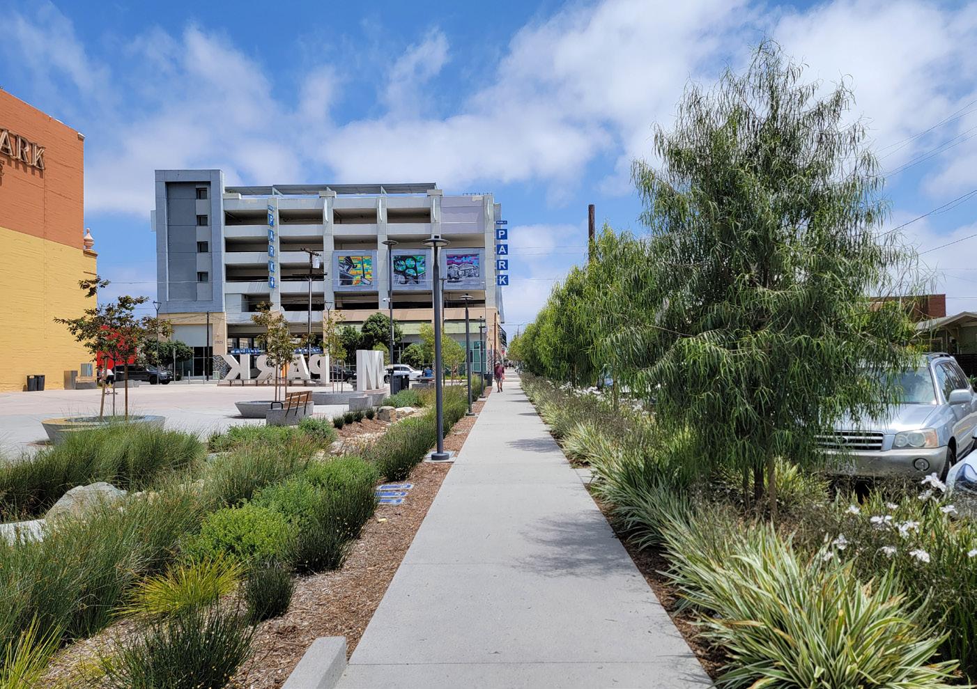
» Planted buffers (parkways) adjacent to the sidewalks with sustainable landscaping for beautification and shading purposes
» Opportunities for stormwater management enhancements
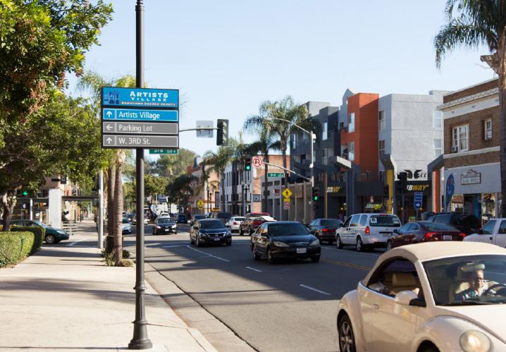
» Opportunities for placemaking elements such as a repositioned gateway sign at the western edge and locally-branded wayfinding signage and art
The corridor design is depicted at a conceptual drawing level. This level of detail provides enough direction for how to envision the proposed recommendations within the existing right-of-way of West Hermosa Street. The recommendations make full use of the physical widths from “back-of sidewalk to back-of-sidewalk”, meaning that the recommendations fit within the City’s public right-ofway and would not require coordination with private properties. This level of design can be used to submit grant applications that would allow the City to take this design into a Plans, Specifications, and Estimates (PSE) phase for project implementation when additional funds are secured. This concept also provides flexibility to make adjustments and other improvements.
West Hermosa Street Corridor Plan 36
Class IV Separated Bikeways
Pedestrian-scale lighting
High-Visibility Crosswalks


Enhanced Crossings
Sustainable Landscaping
Wayfinding Signage
Chapter 4 - Recommendations 37
Separated bikeways w/ either planted buffer or paved buffer StateRoute65
City to coordinate w/ Caltrans on State Route 65 improvements i.e. dedicated left-turn signal for southbound traffic, crosswalk, curb radii, etc. Gateway opportunity


Existing “slip lane” is closed off


Dedicated right-turn lanes for the shopping center entrances
Jefferson Elementary School
West Hermosa Street Corridor Plan 38 Transition
High-visibility crosswalk Key Map Planted center median A B A B
striping
Olivewood Plaza
Figure 4-3: Preferred Concept Cutsheets
Existing median converted to two-way-left-turn-lane

Consider upgrading planter spaces around entire roundabout to add stormwater and urban greening enhancements
Shared-lane markings in the roundabout


Transition striping to indicate shared lane


Existing roundabout remains in-place; suggest reducing number of signs in center

Chapter 4 - Recommendations 39 Key Map C C
W e s tw oo d Ave
Jefferson Elementary School
Green bike lane transition striping
High visibility continental crosswalks
Separated bikeways w/ either planted buffer or paved buffer
High visibility continental crosswalks
Separated bikeways w/ either planted buffer or paved buffer
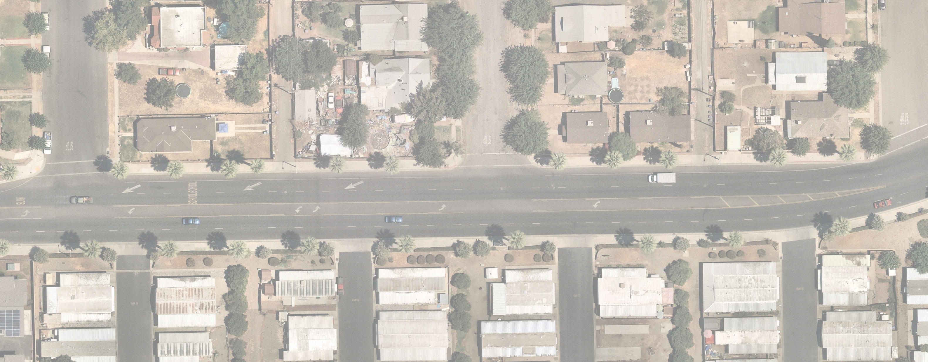
Planted parkway added for additional pedestrian separation
Green bike lane transition striping

West Hermosa Street Corridor Plan 40
Key Map
D D
Van Ness Ave Central Ave
Green bike lane transition striping & high-visibility
continental crosswalks
Separated bikeways w/ either planted buffer or paved buffer
Green bike lane transition striping & high-visibility
continental crosswalks
Green bike lane transition striping & high-visibility
continental crosswalks

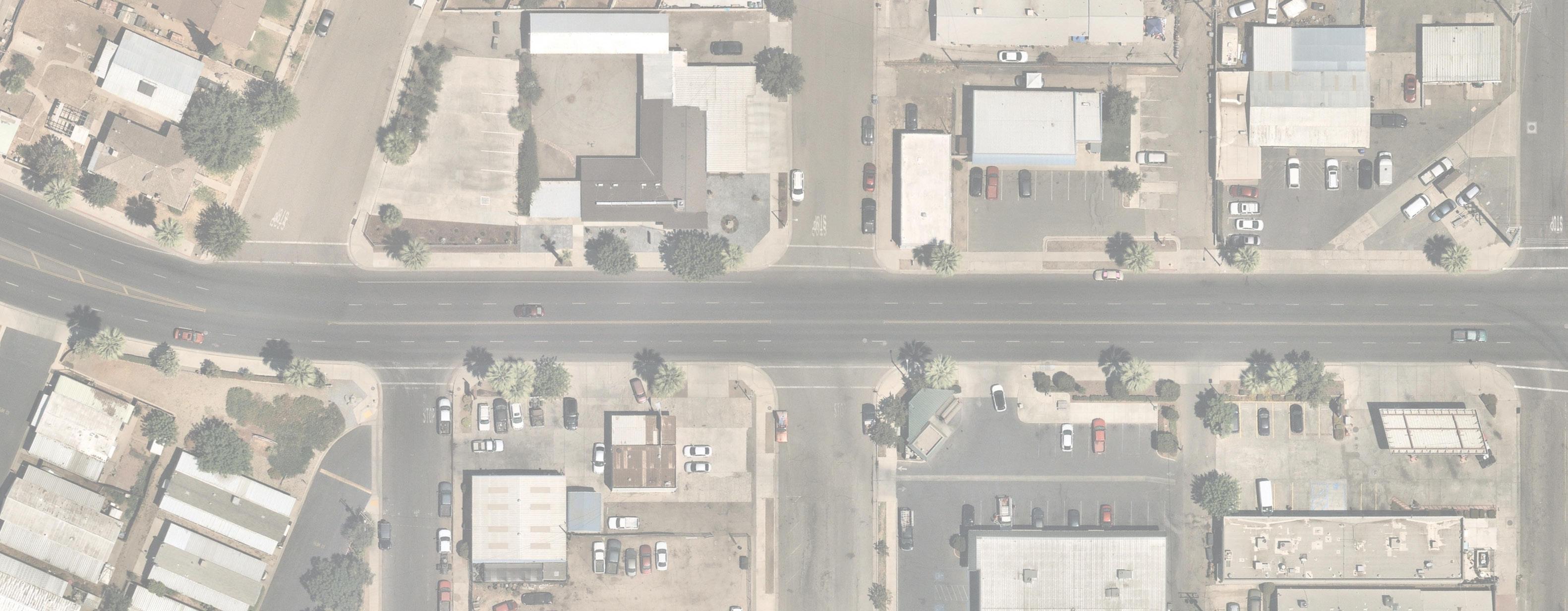
Rapid rectangular flashing beacon and high-visibility crosswalk
Separated bikeways w/ either planted buffer or paved buffer
Chapter 4 - Recommendations 41
Map
Key
Olive Ave
Ashland Ave
Eastwood Ave
Sidewalk improvements over railroad crossing
Green bike lane transition striping & high-visibility
continental crosswalks
Separated bikeways
w/ either planted buffer or paved buffer
High visibility
continental crosswalks
Consider four-way stop at this intersection to manage future traffic due to Transit Center; Option to phase by installing rectangular rapid flashing beacon with high-visibility crosswalks

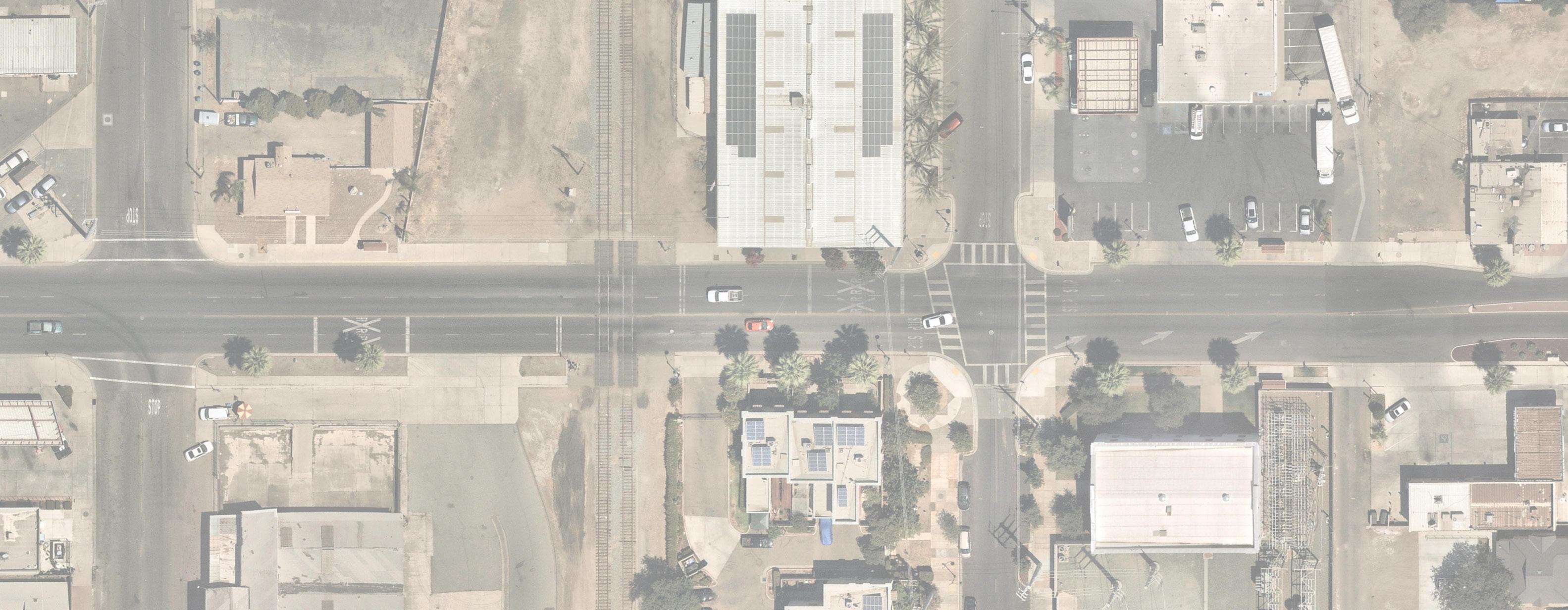
Separated bikeways
w/ either planted buffer or paved buffer
West Hermosa Street Corridor Plan 42
Key Map
*Location of Planned Transit Center
Mt. Vernon Ave
Sweetbriar Ave
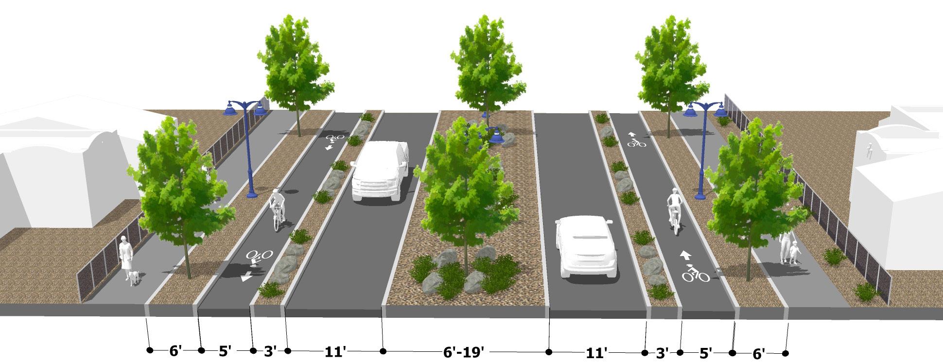
Preferred Concept: Section A-A
Class IV separated bikeway with either planted or paved buffer
Planted parkway provides space for sustainable landscaping and pedestrian-scale lighting
Reconfigured planted center median with sustainable landscaping
New right-turn lane into Olivewood Plaza

Chapter 4 - Recommendations 43
Preferred Concept: Section B-B
Class IV separated bikeway with either planted or paved buffer
Planted parkway provides space for sustainable landscaping and pedestrian-scale lighting
Reconfigured planted center median with sustainable landscaping
Planted parkway provides space for sustainable landscaping and pedestrian-scale lighting
West Hermosa Street Corridor Plan 44
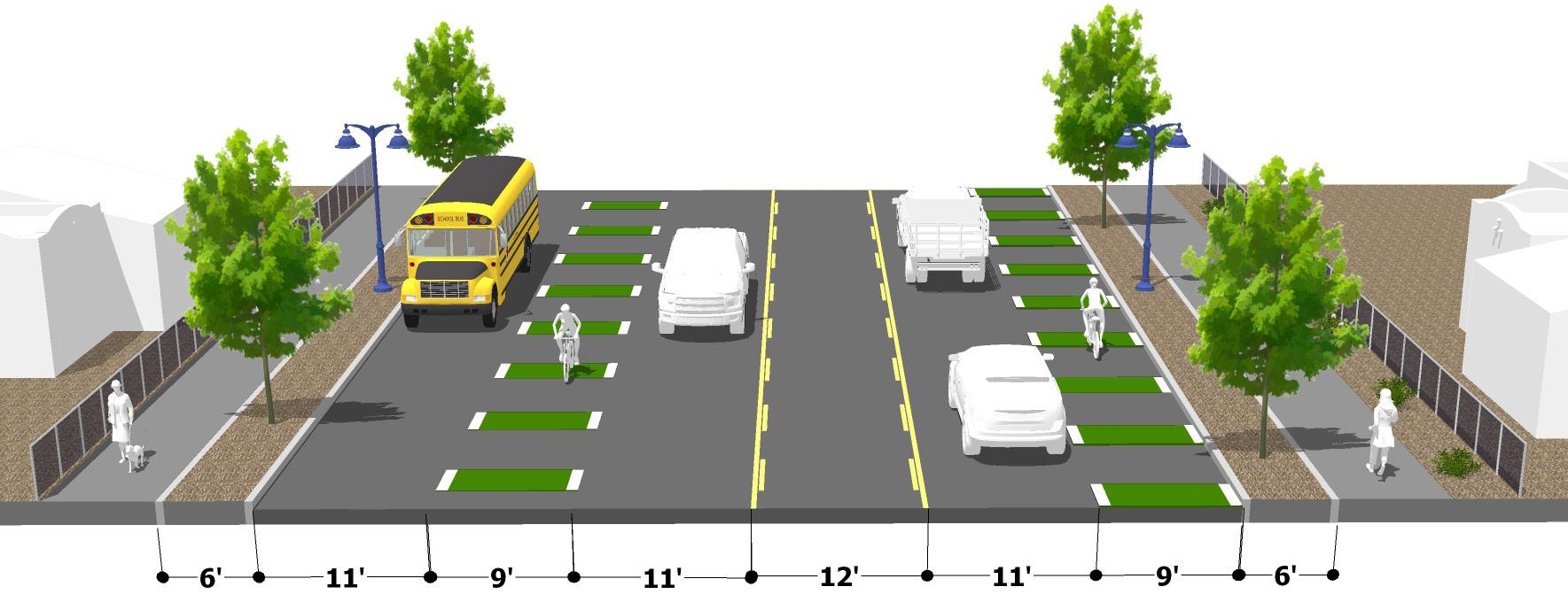
Preferred Concept: Section C-C
Green transition striping to create awareness between bicyclists and drivers
Existing parkway can be upgraded with sustainable landscaping and stormwater management features
Center turn lane provides better access to driveway
entrances
Existing parkway can be upgraded with sustainable landscaping and stormwater management features; parkway can also include pedestrian-scale lighting
Chapter 4 - Recommendations 45
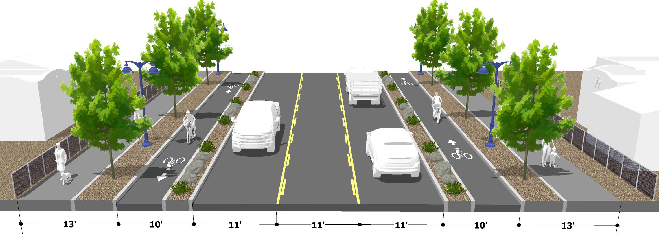
Preferred Concept: Section D-D
Class IV separated bikeway with either planted or paved buffer
Planted parkway provides space for sustainable landscaping and pedestrian-scale lighting
Center turn lane provides better access to driveway entrances
Planted parkway provides space for sustainable landscaping and pedestrian-scale lighting
West Hermosa Street Corridor Plan 46
4.2.1 Additional Corridor Recommendations

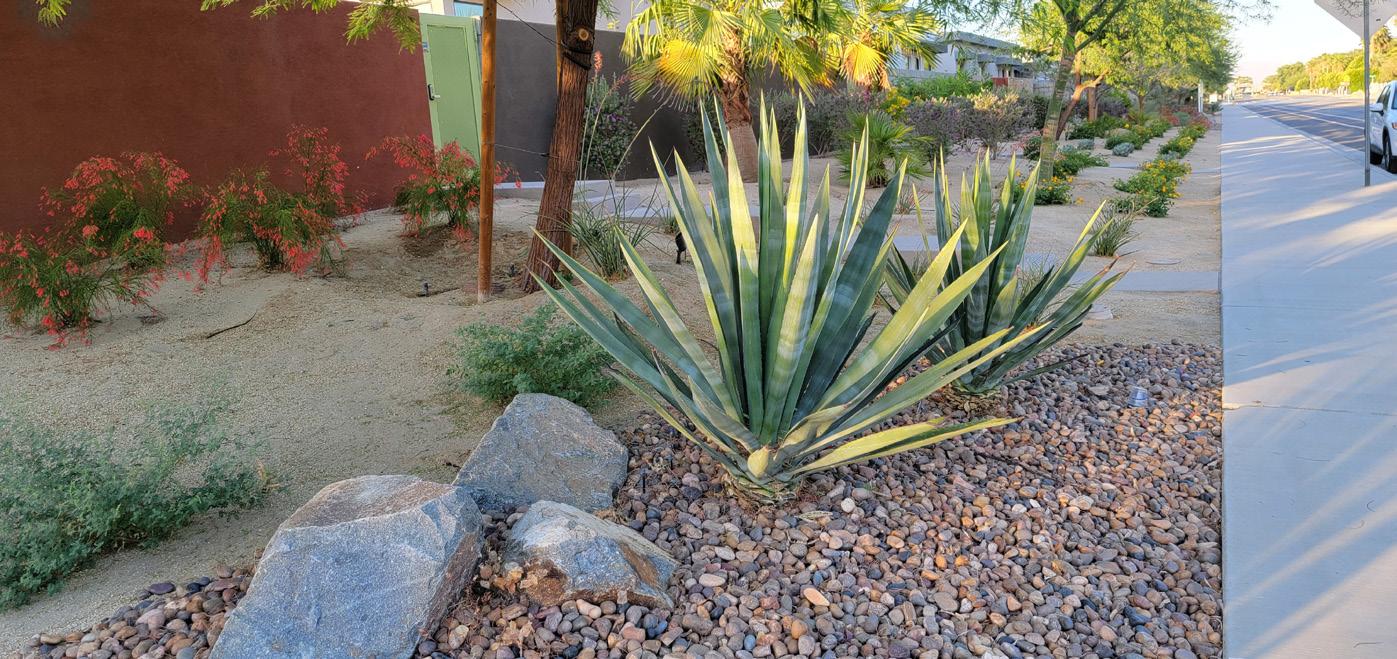
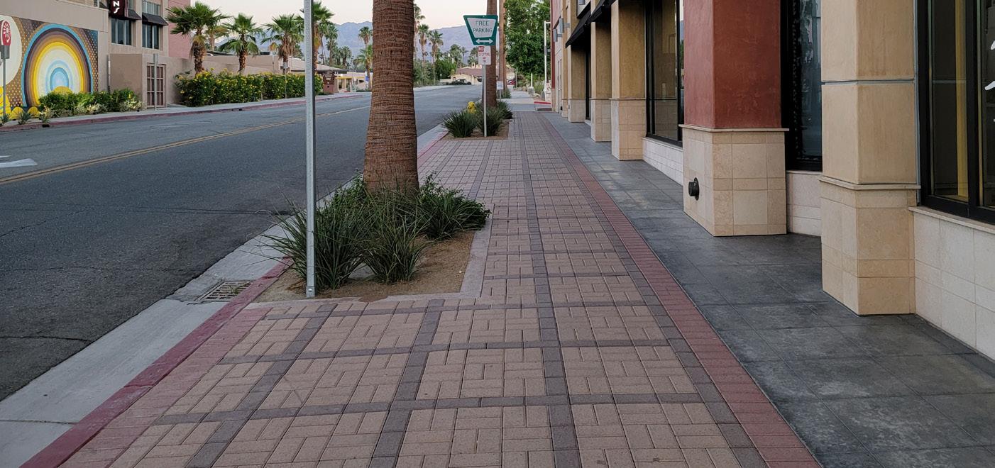

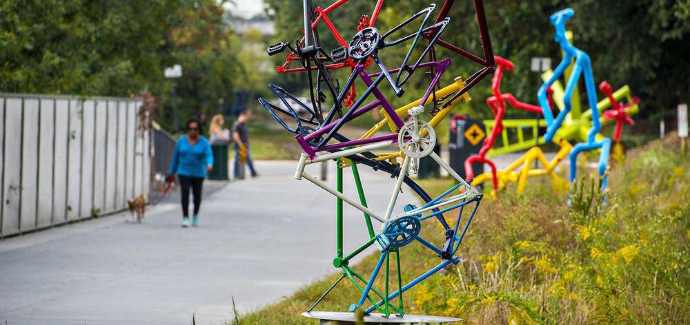
The following images depict placemaking and stormwater infrastructure ideas that can be implemented into the Preferred Concept. These can be explored in future design phases to ensure proper integration into the active transportation design elements. The City is encouraged to explore items that are as multi-purpose as possible to maximize future funding opportunities. Encouraging local residents to participate in these future design processes is also important to ensure the desires from the local community are captured in items such as wayfinding signage, crosswalks, and other art-based placemaking and transportation elements.
Chapter 4 - Recommendations 47
Artistically-painted crosswalks
Art integrated into parkways
Sustainable landscaping
Enhanced sidewalks; paving patterns
Stormwater management enhancements
4.2.2 Neighborhood ATP Enhancements


Recommendations were also created for the streets in the immediate neighborhood adjacent to West Hermosa Street. The planning team assessed existing conditions such as sidewalks, curb ramps, bicycle facilities, trees, and overall right-of-way widths to develop appropriate recommendations. Figure 4-4 depicts recommendations that will help improve the experience for community members that want to walk or bike to their local destinations along West Hermosa Street. The City is encouraged to implement these recommendations as funding becomes available.

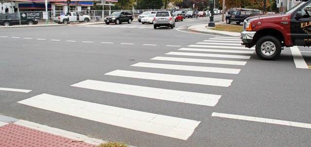
West Hermosa Street Corridor Plan 48
High-visibility crosswalks
Class II bike lanes
Class III bike routes
Sidewalks
Curb ramps
Chapter 4 - Recommendations 49 ! ! ! ! ! ! ! ! ! ! ! ! ! ! ! ! ! ! ! ! ! ! ! ! ! ! ! ! ! ! ! ! ! ! ! ! ! ! ! !! ! W HERM OSA ST W MARIPOSA ST KERN ST N MT VERNON AVE N W E S T W O O D A V E C E N T R A L A V E V A N N E S S A V E NASHLAND AVE E A S T W O O D A V E N SWEETBRIAR AVE N OLIVE AVE BUREM LN WHONOLULUST W E S T M O R E C T WSAMOAST WFRAZIERST WFRAZIERST Olive B ow l Park Sweet Brier Plaz a Park Jef ferso n Elem entary U 65 ¸ 0 1,000 500 Feet Recom mend ati on s ! High -Vis ibility C ro ss W alk s ! Curb Ramps Sidewa lk Clas s 2 B ike La ne Clas s 3 B ike Rout e Park School ! ! ! ! ! ! ! ! ! ! ! ! ! ! ! ! ! ! ! ! ! ! ! ! Propose d f uture transit center Figure 4-4: ATP Neighborhood Recommendations
Transition striping
Planted center median
Separated bikeways w/ either planted buffer or paved buffer

Existing “slip lane” is closed off
Gateway opportunity
City to coordinate w/ Caltrans on State Route 65 improvements i.e. dedicated left-turn signal for southbound traffic, crosswalk, curb radii, etc.

Dedicated right-turn lanes for the shopping center entrances
Transition striping
West Hermosa Street Corridor Plan 50
High-visibility crosswalk
Olivewood Plaza
Key Map
Jefferson Elementary School
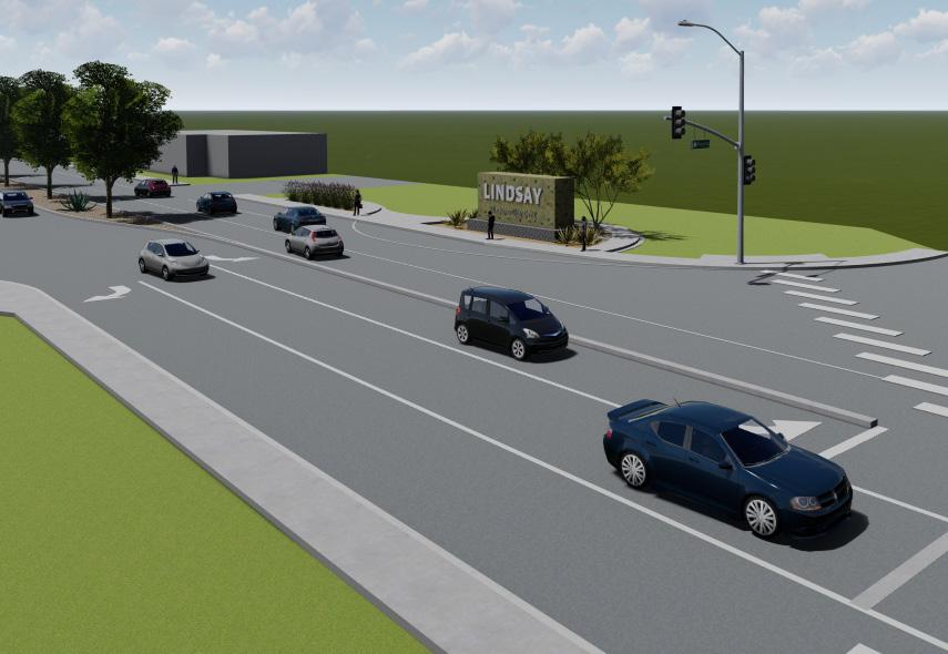
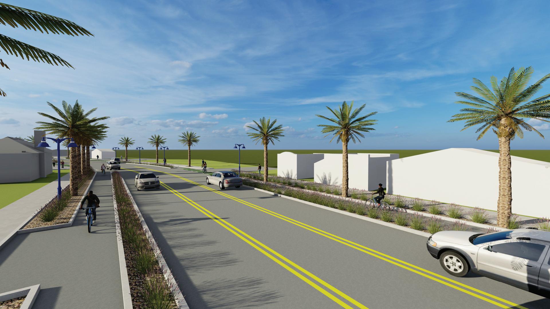
Figure 4-5: Proposed Recommendations 3D Renderings
State Route65


Chapter 4 - Recommendations 51
New entry experience by relocating City monument closer to street; looking southeast towards Olivewood Plaza
Urban greening and pedestrian enhancements supported by Class IV separated bikeways; looking east
Class IV separated bikeways on both sides of road; left turn lane remains to keep dedicated access into Olivewood Plaza; looking east
Proposed Class IV separated bikeway with transition striping placed at intersections or busy driveways; looking east
Center turn lane throughout corridor between Sweetbriar Ave and Van Ness Ave

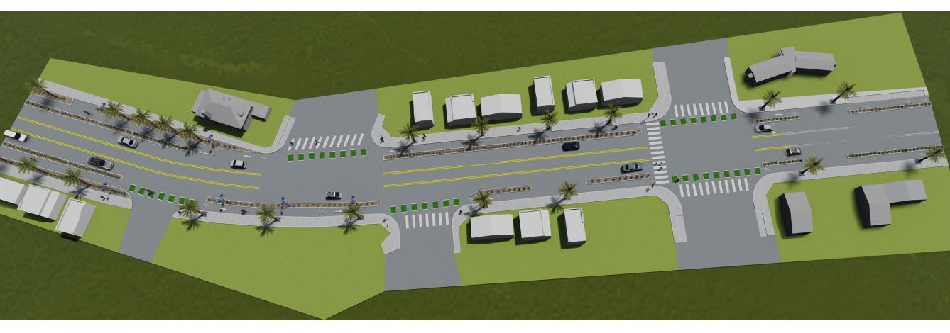
Pedestrian enhancements include planted parkway and lighting
Separated bikeways w/ either planted buffer or paved buffer
Green bike lane transition striping & high-visibility continental crosswalks
Rapid rectangular flashing beacon and high-visibility crosswalk
Separated bikeways w/ either planted buffer or paved buffer
West Hermosa Street Corridor Plan 52
Ashland Ave
Eastwood Ave
Map
Olive Ave
Key


Chapter 4 - Recommendations 53
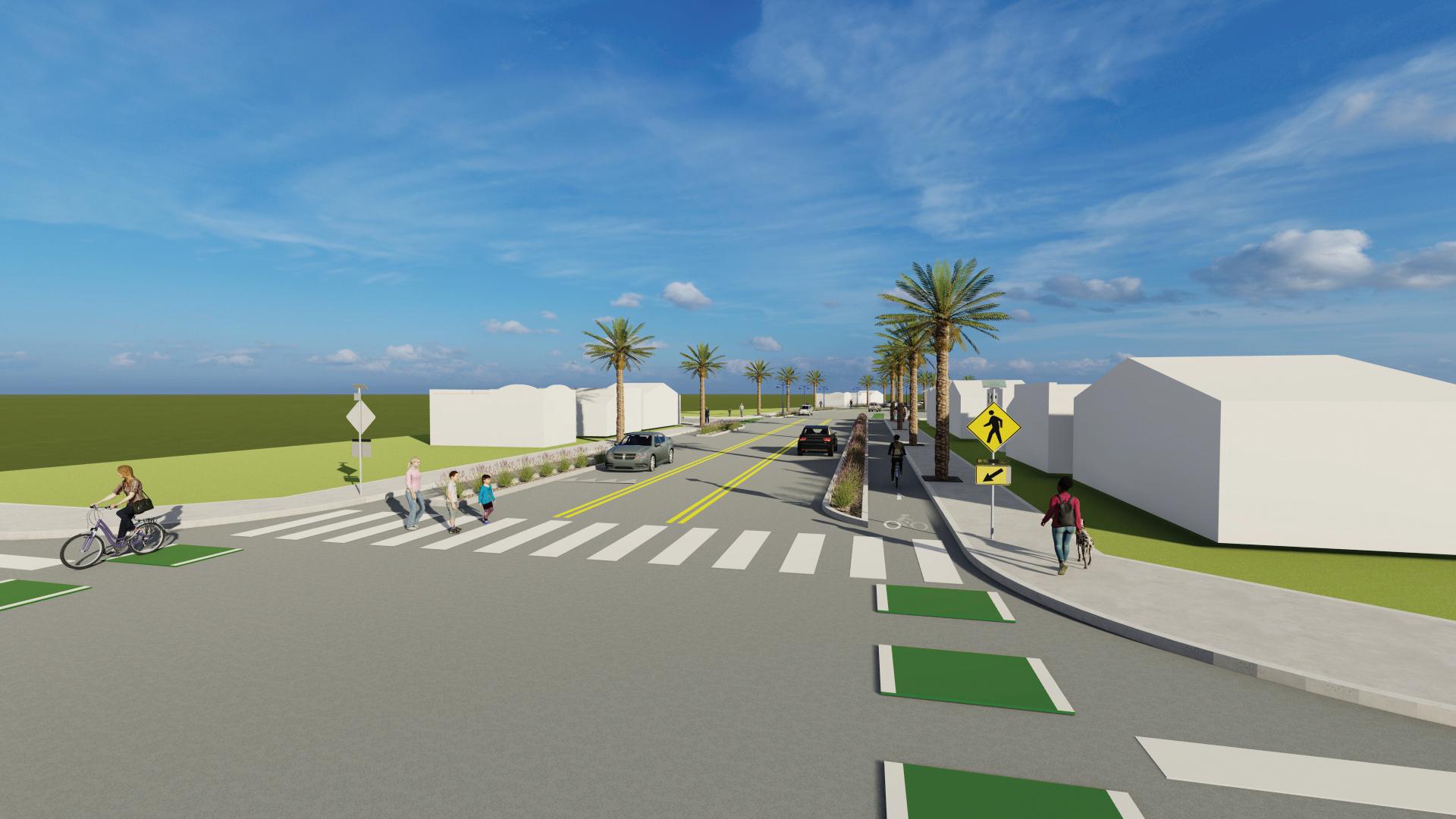
New north-south crossing with rapid rectangular flashing beacons high-visibility crosswalk, and signage; looking east
Proposed Class IV separated bikeway with transition striping, pedestrian lighting, and high-visibility crosswalks; looking east
Proposed Class IV separated bikeway with transition striping and pedestrian lighting, looking west
Proposed Class IV separated bikeway, center turn lane, and pedestrian enhancements such as lighting; looking west
This Page Left Intentionally Blank

West Hermosa Street Corridor Plan 54
Chapter 5
Funding Opportunities

Chapter 5- Funding Opportunities 55
5.1 Funding Opportunities
5.1.1 Phasing and Implementation Strategies
The City of Lindsay will need to determine how to pursue funding opportunities to move the conceptual design of the Preferred Concept forward. For example, the City can pursue a multi-million dollar large infrastructure grant to implement as much of the Preferred Concept as possible, or they can pursue smaller grants to implemented parts of the design in phases over time. The following suggestions and Table 5-1 can be used by the City to help with project phasing and implementation:
Phase Option 1: Large Infrastructure Project
This option can be considered a one-phase approach that is meant to implement the entire concept in one take. This is considered the most expensive option and would require a comprehensive and thorough grant application to stand out against other large infrastructure projects.
Phase Option 2: Bikeway Improvements
Pursue funding to implement bikeway improvements. The City can consider installing striped buffered bike lanes as a first phase. When additional funding becomes available, then the bike lanes can be upgraded to the recommended Class IV separated bikeways with either planted for paved buffered.
Phase Option 3: Pedestrian Improvements
Pursue funding to implement the pedestrian improvements that include high-visibility crosswalks, enhanced crossings with rectangular rapid flashing beacons, sidewalk maintenance and/or replacement, and wayfinding/regulatory signage.
Phase Option 4: Green Infrastructure Improvements
Pursue funding to implement green infrastructure elements that include stormwater management, trees, and sustainable landscaping. Elements such as curb inlets that allow stormwater to flow into the recommended parkways so water can be filtered, designing parkways as bioswales, or adding street trees most often qualify under grants dedicated to green infrastructure.
West Hermosa Street Corridor Plan 56
The City should consider combining project elements to minimize phasing and to maximize points on competitive grant applications
No Actions Lead Notes
1 Identify improvements on the corridor plan that can be incorporated into the City’s CIP list City of Lindsay
2 Identify opportunities to incorporate plan recommendations and projects into proposed redevelopment projects
City of Lindsay
Paint the the recommended street reconfiguration of lanes, geometry, bike lanes and crosswalks when repaving or resurfacing West Hermosa Street.
For major projects, the improvements should go beyond the immediate project parcel boundaries.
3 Integrate the recommendations and projects from this Plan into all applicable grant applications City of Lindsay
4 Identify sources of funding for ongoing maintenance of street enhancements City of Lindsay
5 Develop a volunteer program focused on implementation and sustainment of this Plan
City of Lindsay, community organizations
Pursue grants for further engineering, design and construction. Grants that the improvements would be eligible for include the Caltrans Active Transportation Program, Prop 68 Urban Greening, the Federal Safe Streets for All, and Highway Safety Improvement Program.
Ongoing maintenance responsibilities will likely need to be identified prior to implementation.
Utilize neighborhood residents, community leaders, and volunteers from schools, churches, community organizations and businesses. Tasks would include development of a growing grounds for street trees, the installation and ongoing maintenance of trees and maintenance of public realm spaces.
6 Identify alternative funding sources and fundraising opportunities
City of Lindsay, community organizations and community stakeholders
Examples include philanthropic offers, donations, endowment funds, corporate sponsorships, capital fundraising efforts, grants, government sources. Highlight the economic, environmental, health, engagement, urban forestry, safety and connectivity improvements that this project will bring to the City of Lindsay.
Chapter 5- Funding Opportunities 57
Table 5-1: Implementations Table
5.1.2 Funding Sources
The following section describes potential federal and state funding sources that the City of Lindsay can pursue to advance the recommendations in this Plan. The funding sources vary in purpose and scope, but are intended to help an agency implement complete street, active transportation, placemaking, and urban greening elements. The tables in this section include information on their funding sources, a general description of the program, funding cycle, and project examples.
The City is encouraged to pursue state level grants through programs such as Caltrans’ Active Transportation Planning (ATP), Sustainable Transportation Planning grants, the Strategic Growth Council’s Sustainable Community Planning Grants, Urban Greening Grants, and the Highway Safety Improvement Program (HSIP). Projects that are not funded through the Caltrans ATP cycle are sent to the local MPO for consideration for funding through their programs.
It is important to coordinate efforts with adjacent jurisdictions on projects that affect and benefit multiple agencies. Joint applications also strengthen a grant application because grant distributors value projects that will benefit more than one audience.
On a related note, funding agencies also encourage applicants to design their projects to be as “multi-benefit / multi-purpose” as possible. The City is encouraged to refine their infrastructure projects as needed to ensure the project provides multiple benefits. The Preferred Concept is an excellent example of a multi-benefit project that would be positively competitive in a grant application.
The projects addresses:
» Increasing safety and comfort for pedestrians and bicyclists traveling to and from their destinations
» Creating vital links to local destinations such as Olivewood Plaza, Jefferson Elementary School, and other commercial destinations
» Improving stormwater management facilities through green infrastructure and low-impact development design principles
» Promoting healthy habits and well-being by having a physically-separated facility that can be enjoyed by people of all ages and abilities.
West Hermosa Street Corridor Plan 58
1 Safe Streets and Roads for All (SS4A) Grant Program
The SS4A program funds regional, local, and Tribal initiatives through grants to prevent roadway deaths and serious injuries. There are two types of SS4A grants: Action Plan Grants and Implementation Grants.
- Action Plan Grants assist in developing or complete an Action Plan or to conduct supplemental planning activities.
- Implementation Grant includes infrastructure, behavioral, and operational safety activities identified in an Action Plan
Inf.
Annual, $1B for the next five years starting in 2022 X X X
• Safety analysis
• Engagement & Collaboration
• Planning structure
• Transforming a roadway corridor
• Installing pedestrian safety enhancements and closing network gaps
• Supporting the development of bikeway networks
• Evaluating and improving the safety of intersections
2
The purpose of the CMAQ program is to provide a flexible funding source to State and local governments for transportation projects and programs to help meet the requirements of the Clean Air Act. The program supports surface transportation projects and other related efforts that contribute air quality improvement and provide congestion relief.
Annual X
• Travel Demand Management to promote clean commutes
• Public Education and Outreach
• Bicycle amenities; Class I, II, III, & IV bike lanes
3 Highway Safety Improvement Program (HSIP)
The Program funds work on any public road or publicly owned bicycle or pedestrian pathway or trail, or on tribal lands for general use of tribal members, that improves the safety for its users. Project maximum funding- $10M. Solicitation varies from annually to semi-annually.
Table
Annual X X
• Install hybrid pedestrian signals
• Improve pedestrian and bicycle safety at locations with uncontrolled crossings
• Plans
* Inf - Infrastructure NI - Non Infrastructure Plan - Planning and Design
Chapter 5- Funding Opportunities 59
Funding
Active Transportation
Funding Source Purpose/ Description
Cycle
Project Examples
NI
Plan
Congestion Mitigation and Air Quality Improvement (CMAQ) Program
5-2: Federal Funding Sources
4
Funding Source Purpose/ Description Funding Cycle Active Transportation Project Examples
Inf. NI Plan
Enhanced Mobility of Seniors and Individuals with Disabilities
The goal of this program is to improve mobility for seniors and individuals with disabilities by removing barriers to transportation service and expanding transportation mobility options.
Unavailable X X
• Mobility management programs
• Building an accessible path to a bus stop
• improving signage, or wayfinding technology
7
Rural Transportation Assistance Program - 5311(b) (3)
8 Safety Research and Demonstration Program
Provides funding to states for developing training, technical assistance, research, and related support services in rural areas. The program also includes a national program that provides information and materials for use by local operators and state administering agencies and supports research and technical assistance projects of national interest.
The Safety Research and Demonstration (SRD) Program is part of a larger safety research effort at the U.S. Department of Transportation that provides technical and financial support for transit agencies to pursue innovative approaches to eliminate or mitigate safety hazards. The SRD program focuses on demonstration of technologies and safer designs.
Annual X
• Training, technical assistance, research, and related support services
Annual X
• Operational safety programs
9 Tribal Transit Formula Grants5311(c)(1)(B)
Provides funding to federally recognized Indian tribes to provide public transportation services on and around Indian reservations or tribal land in rural areas. Funding is provided as a set-aside within of the Formula Grants to Rural Areas program and allocated both by statutory formula and through a competitive discretionary program.
Annual X
• Capital, operating, planning, and administrative expenses for public transit projects
* Inf - Infrastructure NI - Non Infrastructure Plan - Planning and Design
West Hermosa Street Corridor Plan 60
12
Enhanced Mobility of Seniors & Individuals with DisabilitiesSection 5310
Formula funding to states for the purpose of assisting private nonprofit groups in meeting transportation needs of the elderly and persons with disabilities.
Annual X
• Planning program to meet the special transportation needs of seniors and individuals with disabilities
13
Flexible Funding ProgramsCongestion Mitigation and Air Quality Program23 USC 149
CMAQ provides funding to areas in nonattainment or maintenance for ozone, carbon monoxide, and/or particulate matter. States that have no nonattainment or maintenance areas still receive a minimum apportionment of CMAQ funding for either air quality projects or other elements of flexible spending. Funds may be used for any transit capital expenditures otherwise eligible for FTA funding as long as they have an air quality benefit.
Annual X • Mobility projects
14 Formula Grants for Rural Areas5311
Provides capital, planning, and operating assistance to states to support public transportation in rural areas with populations less than 50,000, where many residents often rely on public transit to reach their destinations.
Annual X
• Planning, capital, operating, job access and reverse commute projects, and the acquisition of public transportation services.
15 Grants for Buses and Bus Facilities Formula Program - 5339(a)
Provides funding to states and transit agencies through a statutory formula to replace, rehabilitate and purchase buses and related equipment and to construct bus-related facilities. In addition to the formula allocation, this program includes two discretionary components: The Bus and Bus Facilities Discretionary Program and the Low or No Emissions Bus Discretionary Program.
Annual X
• Projects to replace, rehabilitate and purchase buses, vans, and related equipment, and to construct bus-related facilities
* Inf - Infrastructure NI - Non Infrastructure Plan - Planning and Design
Chapter 5- Funding Opportunities 61
Funding Source Purpose/ Description Funding Cycle Active Transportation Project Examples Inf. NI Plan
16
Funding Source Purpose/ Description
Low and NoEmission Component Assessment Program (LoNoCAP)
17 Mobility for All Pilot Program Grants
On September 29, 2016, FTA announced the opportunity for eligible institutions of higher education to apply for funding to conduct testing, evaluation, and analysis of low or no emission (LoNo) components intended for use in LoNo transit buses used to provide public transportation. The deadline for applications is November 28, 2016.
This funding opportunity seeks to improve mobility options through employing innovative coordination of transportation strategies and building partnerships to enhance mobility and access to vital community services for older adults, individuals with disabilities, and people of low income.
Funding Cycle Active Transportation Project Examples
Inf. NI Plan
April X
January X
• Programs that have zeroemission and low emission transit buses
18
Mobility on Demand (MOD) Sandbox Demonstration Program - 5312
Funds projects that promote innovative business models to deliver high quality, seamless and equitable mobility options for all travelers.
Annual X
• Transportation projects with a focus on employing mobility management strategies, vehicle purchase, IT purchase, leasing equipment or a facility for use in public transportation etc
• Private for-profit and not-forprofit organizations, including shared use mobility providers, and technology system suppliers
• Operators of transportation services, such as employee shuttle services, airport connector services, university transportation systems, or parking and tolling authorities
• State or local government entities, and other organizations that may contribute to the success of the project team including consultants, research consortia or not-for-profit industry organizations, and institutions of higher education
West Hermosa Street Corridor Plan 62
* Inf - Infrastructure NI - Non Infrastructure Plan - Planning and Design
Funding Source Purpose/ Description
Clean Mobility Options
The Program makes $20 million available for zero-emissions shared mobility projects (such as car sharing, bike sharing, and on-demand sharing) in disadvantaged and low-income communities, including some tribal and affordable housing communities (California Climate Investments)
The Program makes $2 million available for planning and capacity building grants. Funding is intended to help low-income and disadvantaged communities identify residents’ transportation needs and prepare to implement clean transportation and land use projects.
Funding Cycle Active Transportation Project Examples
Inf. NI Plan
July X
• Bikeshare programs
• “Quick build” right-of-way safety improvements for bicycles and scooters
Sustainable Transportation Equity Project (STEP)
The Program makes $20 million available for one to three implementation block grants to fund clean transportation and land use projects in disadvantaged communities. Funded projects will work together to increase community residents’ access to key destinations so they can get where they need to go without the use
August X X X
• New bike routes (Class I, Class II, or Class IV) and supporting infrastructure
• Publicly-accessible bike parking, storage, and repair infrastructure (e.g., bike racks, bike lockers, bike repair kiosks)
• New walkways that improve mobility/access/safety of pedestrians (nonmotorized users)
• Street crossing enhancements, including accessible pedestrian signals
Local Streets and Roads (LSR) Program
The purpose of the program is to provide approximately $1.5 billion per year to cities and counties for basic road maintenance, rehabilitation, and critical safety projects on the local streets and roads system.
Annual X
• Implement enhanced crosswalk signing and striping
• Create safety separation between motorists, bicyclists and pedestrians
• Design and construction of school access and safety improvements to six schools (SRTS)
Table 5-3: State Funding Sources
* Inf - Infrastructure NI - Non Infrastructure Plan - Planning and Design
Chapter 5- Funding Opportunities 63
Funding Source Purpose/ Description Funding Cycle Active Transportation Project Examples
Solutions for Congested Corridors (SCCP)
The purpose of the program is to provide funding to achieve a balanced set of transportation, environmental, and community access improvements to reduce congestion throughout the state. This statewide, competitive program makes $250 million available annually for projects that implement specific transportation performance improvements and are part of a comprehensive corridor plan by providing more transportation choices while preserving the character of local communities and creating opportunities for neighborhood enhancement.
Every Two Years X
• Construct Class I and Class II bikeways
• Pedestrian improvements and plaza at a transit station
• Intersection improvements
State Transportation Improvement Program (STIP)
The STIP is the biennial five-year plan adopted by the Commission for future allocations of certain state transportation funds for state highway improvements, intercity rail, and regional highway and transit improvements. Local agencies should work through their Regional Transportation Planning Agency (RTPA), County Transportation Commission, or Metropolitan Planning Organization (MPO), as appropriate, to nominate projects for inclusion in the STIP.
Every Two Years X
• Bike/ped Overcrossing and Access Improvements and bicycle and pedestrian bridge
• Class I, II, III, & IV bike lanes
• Multi-Use paths
• Complete Streets improvements
Urban Forestry Program
This program funds Urban Greening projects that result in the conversion of an existing built environment into green space that uses natural and green infrastructure approaches to create sustainable and vibrant communities.
Annual x x
• Urban Forest Expansion and Improvement
• Urban Forest Management Activities
• Urban Wood and Biomass Utilization
West Hermosa Street Corridor Plan 64
* Inf - Infrastructure NI - Non Infrastructure Plan - Planning and Design
Inf. NI Plan
Funding Source Purpose/ Description Funding Cycle
Infill Infrastructure Grant Program for Small Jurisdictions
The purpose of the program is to provide grants for Capital Improvement Projects in support of Qualifying Infill Projects or Qualifying Infill Areas. Funding for this NOFA and program requirements are provided under Assembly Bill 101 (Stats. 2019, ch. 159, 20) and Part 12.5 (commencing with section 53559) of Division 31 of the Health and Safety Code.
Inf. NI Plan
Varies X
Land and Water Conservation Fund (LCWF)
The Land and Water Conservation Fund (LWCF) is a program to conserve irreplaceable lands and improve outdoor recreation opportunities. The program can be used for local efforts to support state and local parks and playgrounds and to provide the tools that communities need to meet their diverse conservation and recreation needs.
Annual X X
• Recreational areas, trails
• Support for community parks, trails recreational access sites and open spaces
Regional Park Program (Prop 68)
This program provide competitive grants to create, expand, or improve regional parks and regional park facilities. This is a Proposition 68 (2018 Bond Act) program.
Annual X X
• Acquisition for public access and use
• Multiuse trails
• Acquisition of land
Statewide Park Program (SPP)
The goal of this program is to create new parks and new recreation opportunities in underserved communities across California.
December X X
• Jogging and walking loop, par course, running track
• Non-motorized trail, pedestrian/ bicycle bridge, greenbelt/linear
* Inf - Infrastructure NI - Non Infrastructure Plan - Planning and Design
Chapter 5- Funding Opportunities 65
Active Transportation Project Examples
Funding Source Purpose/ Description
Recreational Trails Program (Prop 68)
The Recreational Trails Program (RTP) provides funds to the States to develop and maintain Recreational Trails and trail-related facilities for both non-motorized and motorized Recreational Trail uses.
Funding Cycle Active Transportation Project Examples
Inf. NI Plan
Annual X X
• Acquisition of land
• Rehabilitation of trails, Trailside and Trailhead Facilities
• Construction of new trails
• Maintenance of existing trails
Habitat Conservation Fund (Prop 117)
The Habitat Conservation Fund allocates approximately $2 million each year to cities, counties, and districts for nature interpretation programs to bring urban residents into park and wildlife areas, protection of various plant and animal species, and acquisition and development of wildlife corridors and trails.
Annual X X
• Acquisition of land
• Trail Development
Active Transportation Planning Grants (ATP)
Funding for Sidewalks, bike lanes, trails, Safe Routes to School programs, and pedestrian and bicycle plans. The ATP consolidates existing federal and state transportation programs, including the Transportation Alternatives Program (TAP), Bicycle Transportation Account (BTA), and State Safe Routes to School (SRTS), into a single program.
JulySeptember X X X
• Capital Improvements
• Bicycle, pedestrian Plan
• Safe Routes to School Plan
• Active Transportation Plan
• Education, Encouragement, and Enforcement Activities
• Quick-Build Project
Transportation Development Act (TDA) Article 3 (SB 821)
The goal of this act is to improve existing public transportation services and encourage regional transportation coordination. TDA established two funding sources; the Local Transportation Fund (LTF), and the State Transit Assistance (STA) fund. Providing certain conditions are met, counties with a population under 500,000 (according to the 1970 federal census) may also use the LTF for local streets and roads, construction and maintenance. The STA funding can only be used for transportation planning and mass transportation purposes.
Annual X X
* Inf - Infrastructure NI - Non Infrastructure Plan - Planning and Design
West Hermosa Street Corridor Plan 66
Funding Source Purpose/ Description
Sustainable Transportation Planning Grants
The program includes $29.5 million to encourage local and regional planning that furthers state goals, including, but not limited to, the goals and best practices cited in the Regional Transportation Plan Guidelines adopted by the California Transportation Commission.
The Program supports the development of green infrastructure projects that reduce GHG emissions and provide multiple benefits. Must include at least one of the following:
- Sequester and store carbon by planting trees
Funding Cycle Active Transportation Project Examples
Inf. NI Plan
Annual X
• Safe Routes to School Plan
• Active Transportation Plan
• Bike/ped Trail/Path Feasibility Study
• Complete Streets Plan
• Sustainable Communities Plan
• Transit-Oriented Development Plan
• First/Last Mile Connectivity Plan
• Non-motorized urban trails that provide safe routes for both recreation and travel between residences, workplaces, commercial centers, and schools
Urban Greening
- Reduce building energy use by strategically planting trees to shade buildings
- Reduce commute vehicle miles traveled by constructing bicycle paths, bicycle lanes or pedestrian facilities that provide safe routes for travel between residences, workplaces, commercial centers, and schools.
(California Climate Investments)
Annual X
• Projects that expand or improve the usability of existing active transportation routes (e.g., walking or bicycle paths) or create new active transportation routes that are publicly accessible by walking
• Complete Green Streets
Local Partnership ProgramCompetitive and Formulaic
The primary objective of this program is to provide funding to counties, cities, districts, and regional transportation agencies in which voters have approved fees or taxes dedicated solely to transportation improvements or that have imposed fees, including uniform developer fees, dedicated solely to transportation improvements. Funding includes $200M/year to improve aging Infrastructure, Road Conditions, Active Transportation, Transit and rail, Health and Safety Benefits
March - June X X X
• Close sidewalk gap, install class II bike lanes and cycle track, curb extensions, pedestrian enhancements, improvements to lighting and signage
• Construct 4 single-lane and 1 multi-lane roundabouts, and improvements to street, pedestrian and bicycle facilities
• Expressway pedestrian overcrossing
* Inf - Infrastructure NI - Non Infrastructure Plan - Planning and Design
Chapter 5- Funding Opportunities 67
Funding Source Purpose/ Description
Transit and Intercity Rail Capital Program (TIRCP)
The TIRCP provides grants from the Greenhouse Gas Reduction Fund (GGRF) to fund transformative capital improvements that will modernize California’s intercity, commuter, and urban rail systems, and bus and ferry transit systems, to significantly reduce emissions of greenhouse gases, vehicle miles traveled, and congestion.
Funding Cycle Active Transportation Project Examples
Inf. NI Plan
January X X X
• Pedestrian and bike trail
• First/last mile connections via bike lanes and separated paths
• Bike share programs
• Bike parking facilities
• Plans
State Highway Operations and Protection Program (SHOPP)
The Office of SHOPP Management is responsible for planning, developing, managing and reporting the fouryear SHOPP portfolio of projects. The Program is the State Highway System’s “fix it first” program that funds repairs and preservation, emergency repairs, safety improvements, and some highway operational improvements on the State Highway System.
Annual X
• Upgrade sidewalks to ADA compliance
• Reconstruct damaged pavement
• Add bike lanes to updated corridors
• Upgrade pedestrian push buttons, refresh striping, and improve pedestrian and bicycle access
Office of Traffic Safety Grant Program
The Program provides annual funds to prevent serious injury and death resulting from motor vehicle crashes so that all roadway users arrive at their destination safely. Funds can be used for bicycle and pedestrian safety
Due in January X
• Safety education and encouragement
• Campaigns to promote safety
• SRTS safety programs
Transformative Climate Communities (TCC)
The Program funds community-led development and infrastructure projects that achieve major environmental, health, and economic benefits in California’s most disadvantaged communities. (California Climate Investments)
February X
• Bike share program
• Creating and considering active transportation corridors for better non-motorized connections
• Multi-use paths
• Urban greening for pedestrian facilities
Placemaking Grants
(must partner with Realtor Asst.)
Placemaking means many things to different people, but NAR looks as placemaking as a way to make communities better places to live by transforming unused and underused sites and “eyesores” into welcoming destinations accessible to everyone in a community.
October 2021 X
• Amenities (street furniture, paint, signage, materials, landscaping, murals, etc.)
• Site preparation
• Artist fees
West Hermosa Street Corridor Plan 68
* Inf - Infrastructure NI - Non Infrastructure Plan - Planning and Design

Chapter 5- Funding Opportunities 69
This Page Left
Intentionally Blank


