The Rural Land Management Plan


Lexington-Fayette Urban County Government - Division of Planning
101 East Vine Street, 7th Floor Lexington, KY 40507
phone: 859-258-3160 | fax: 859-258-3163
Jim Duncan, AICP Director
Pam Whitaker
Admin. Specialist, Principal
Long Range Planning
Chris Woodall, AICP Manager
Janice Westlund, AICP
Planner Senior
Cindy Deitz, RLA*
Planner Senior (retired July 2017)
Chris Taylor Planner Senior
Keyu Yan, AICP, LEED AP ND
Planner Senior
Meghan Jennings
Planning Tech
Stephanie Cunningham
Admin. Specialist
Planning Services
Traci Wade, AICP Manager
Tom Martin, AICP
Planner Senior
Cheryl Gallt Planner
Denice Bullock
Admin. Specialist
Debbie Woods
Admin. Specialist
Christine Wu
Staff Assistant
Transportation Planning
Max Conyers Manager
Kenzie Gleason
Administrative Officer
Joey David
Planner Senior
Sam Hu
Planner Senior
Scott Thompson
Planner Senior
Jimmy Emmons, AICP
Planner Senior
Parker Sherwood Planner
Brenda Whittington Admin. Specialist
Zoning Compliance
Jim Marx Manager
Barbara Rackers Admin. Officer
Autumn Goderwis
Planner Senior
David Jarman Planner
Jan Bolton
Compliance Officer
Pam Brown
Compliance Officer
Jim Hume
Compliance Officer
Greg Walker
Compliance Officer
Tammye McMullen
Admin. Specialist
Rural Land Management Plan approved on 11/30/2017
RLMP Working Group

Charlie Farmer
RLMB designee
Greg Butler
Cindy Deitz
Jim Duncan
Mariana Marye
Jamie Millard
Beth Overman
Mike Owens
Frank Penn
Chris Woodall
Greenspace Commission
Karen Angelucci (former member)
Brad Boaz
Greg Butler
Chris Cooperrider
John Hackworth
Raymond Isenhour
Elisabeth Jensen
Joe Kane
Patricia Knight
Jamie Millard
Jennifer Mossotti
Maxine Rudder
Dawn Schroyer
Jack Wilson
Rural Land Management Board
Dennis Anderson
Headley Bell
Gregory Bibb
Zach Davis
Mary Delaney
Lucy Ferguson
Mariana Marye
John McNamara
Philip Meyer
Frank Penn
Don Robinson Planning Commission
Headley Bell
Will L. Berkley
Patrick Brewer
Mike Cravens
Larry Forester
Karen Mundy
Mike Owens
Frank Penn
Carolyn Plumlee
Carolyn Richardson
William H. Wilson
2 | Division of Planning
*Principal author of the 2017 Rural Land Management Plan.
Rural Land Management Plan | 3 Chapter 4 - Special Plan Elements ............. 67 A. Overview ...................................................................................... 68 B. Natural Resources ....................................................................... 70 C. Historic and Cultural Landscapes and Rural Heritage 77 D. Transportation .............................................................................. 95 E. Tourism ........................................................................................ 97 F. Purchase Development Rights Program ................................... 101 G. Development Considerations..................................................... 104 Appendix ............................................................. 109 A. Glossary..................................................................................... 110 B. Sources, Bibliography ................................................................ 118 C. Changes from 1999 Rural Land Management Plan .................. 120 D. Special Natural Protection Areas ............................................... 123 E. Operational Plan ........................................................................ 126 Executive Summary .............................................. 4 Chapter 1 - Managing Our Rural Heritage for Future Generations ................ 7 A. Our History of Rural Preservation .................................................... 8 B. The Importance of the Rural Service Area to the Community ....... 10 C. Challenges to Rural Preservation .................................................. 14 D. Current Trends ............................................................................... 16 E. Goals and Objectives..................................................................... 17 Chapter 2 - Land Use Summaries ................. 19 A. Overview ........................................................................................ 20 B. General Information Summary....................................................... 22 C. Agricultural Cluster ........................................................................ 29 D. Non-agricultural Land Uses 37 Chapter 3 - Land Use Categories ................ 43 A. Overview ........................................................................................ 44 B. Core Agricultural Land ................................................................... 46 C. Natural Area 49 D. Rural Settlement ............................................................................ 52 E. Buffer Area 55 F. Small Lot Residential ..................................................................... 59 G. Rural Activity Center ...................................................................... 62 Table of Contents
Executive Summary
In 1999, the first Rural Service Area Land Management Plan was adopted as an element of the 1996 Comprehensive Plan. The groundbreaking document was the first extensive effort dedicated to the planning and management of land uses in the Rural Service Area. The 1999 Plan presented the case for the preservation of our rural land and suggested the implementation of an extensive land capability analysis. The Plan also recommended minimum lot sizes, establishment of rural land use categories, utilization of greenways and Focus Areas for recreation, preservation of rural settlements and scenic roads, infill and redevelopment, considerations for potential adjustments to the Urban Service Boundary, buffering of the urban edge, and the creation of a Purchase of Development Rights Program. Implementation would include changes to Lexington-Fayette County’s Zoning Ordinance and land use maps and the development of further studies, plans and programs.
Major recommendations from the Plan were implemented, while others are ongoing or no longer applicable. While the group determined early in the update process that there would be no substantial policy changes from the 1999 Plan, the text needed significant alterations to reflect current conditions in the Rural Service Area.
Process
Work by Long Range Planning to update the 1999 Rural Land Management Plan has been ongoing since 2014. A working group consisting of LFUCG staff and members of the Greenspace Commission, Planning Commission and Rural Land Management Board have assisted in writing the update.
The working group included:
• Greenspace Commission - Jamie Millard and Greg Butler
• Rural Land Management Board - Mariana Marye and Charlie Farmer (designee)
• Planning Commission - Frank Penn and Mike Owens
• LFUCG - Cindy Deitz, Jim Duncan, Chris Woodall and Beth Overman
Methodology included a windshield survey conducted by the Greenspace Commission, a review of relevant plans and regulations by the working group, a review of the 1999 Plan for recommendations completed, no longer relevant or ongoing, and a review of new or revised data prepared by staff.
Data was collected from sources within and outside of LFUCG. Examples of the many sources utilized in the preparation of the draft included VisitLex, numerous state agencies, Floracliff, Helm Place, Fayette County PVA office, Locust Trace AgriScience Center, Fayette Alliance, University of Kentucky’s Department of Agricultural Economics, the Kentucky Thoroughbred Association and the Fayette County Farm Bureau.
An initial draft of the text prepared by the working group was distributed to the Greenspace Commission and Rural Land Management Board members for their comments. Staff from various LFUCG Divisions, including Transportation Planning, Environmental Services, Parks and Recreation, Historic Preservation, as well as the Local Food Coordinator, also reviewed the draft.
4 | Division of Planning
Key Changes to the 1999 Rural Service Area Land Management Plan
Below is a summary of key changes from the 1999 Plan to the 2017 update. Refer to Appendix C for the complete listing.
1. The Purchase of Development Rights Program is removed as a recommendation as it was initiated shortly after the 1999 Plan was approved.
2. The 10-acre lot recommendation was removed as the minimum lot size has been increased to 40 acres.
3. A zoning text amendment was approved to allow for more recreational activities in the Rural Service Area. It is referenced in this document as REC ZOTA.
4. Geographic Information Systems (GIS) have enabled more comprehensive analyses of the Rural Service Area.
Rural Land Management Plan | 5

6 | Division of Planning
CHAPTER 1

Managing Our Rural Heritage for Future Generations

A. Our History of Rural Preservation
The residents of Lexington-Fayette County have long been aware of how important the agricultural industry is to the county’s identity. Unlike most other communities, Lexington has had a long history of taking positive action to ensure our rural heritage is preserved from unmanaged suburban sprawl. In 1958, Lexington-Fayette County became the first community in the nation to manage urban growth and save surrounding farmland by creating an Urban Service Area. This would divide the county into two parts, an Urban Service Area concentrating urban growth into a compact and contiguous area, and a Rural Service Area intact for agricultural uses. In 1991, the Urban Service Area approach to planning was recognized by the American Planning Association as a National Planning Landmark. Currently, of the 285 square miles that comprise Fayette County, approximately 85 square miles (30%) of the county are in the Urban Service Area and 200 square miles (70%) are in the Rural Service Area.
In 1999, the first Rural Service Area Land Management Plan was adopted as an element of the Comprehensive Plan. The 1999 Plan was a significant milestone in the history of planning for Lexington-Fayette County. Never before had the Rural Service Area been the subject of such extensive research, analysis, review, debate and discussion. Many of the recommendations from the 1999 Plan have been implemented, which have resulted in strengthening the protection of agriculture, natural resources and cultural landscapes.
Highlights of the 1999 Plan include:
• an increase in minimum parcel size
• the designation of land use categories based on the 1999 Plan’s land capability analysis
• the establishment of a land conservation program
• the improved protection of agricultural and environmental resources
• the increased ability to engage the public in recreational pursuits
• the same Rural Service Area boundary except for a small extraction of 180 acres in 2000
A timeline of historical actions important to Lexington-Fayette County’s rural land and heritage is below:
1958 Urban Service Area Boundary created
1964 10-acre minimum lot size adopted
1967 Major contraction of the Urban Service Area
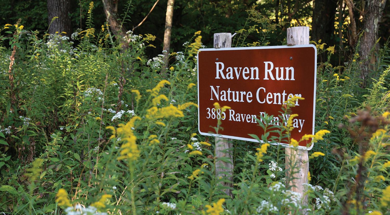
1975 Raven Run Nature Sanctuary dedicated
1978 Kentucky Horse Park opened
1986 Keeneland Racetrack designated as a National Historic Landmark
1989 Floracliff Nature Sanctuary established and the National Register of Historic Districts created
1990 Helm Place designated a Local Landmark (H-1 Overlay Zone)
1994 Greenspace Plan adopted, Stone Wall Preservation Ordinance adopted, and the Kentucky Agriculture Water Quality Act calling for Water Quality Plans
8 | Division of Planning
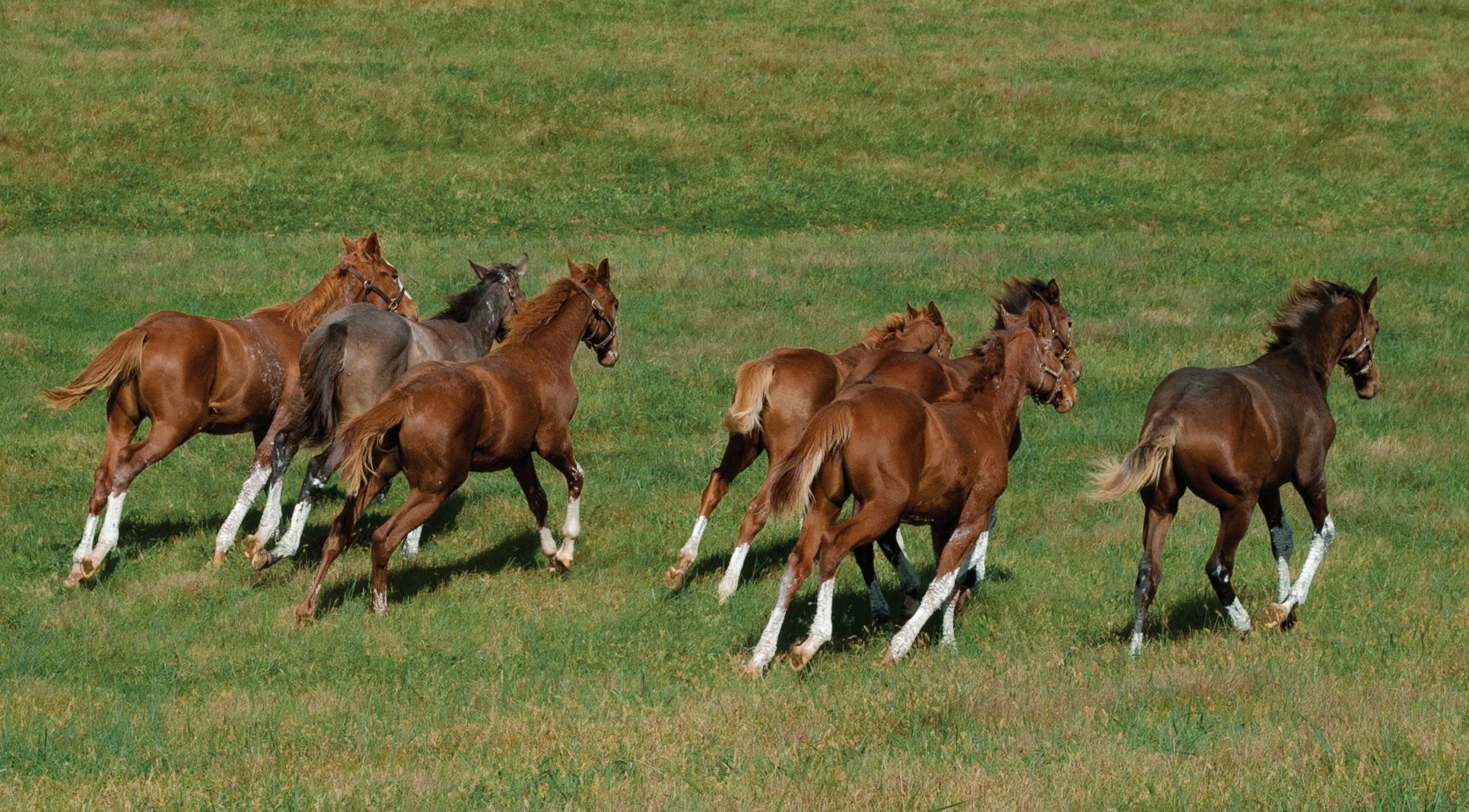
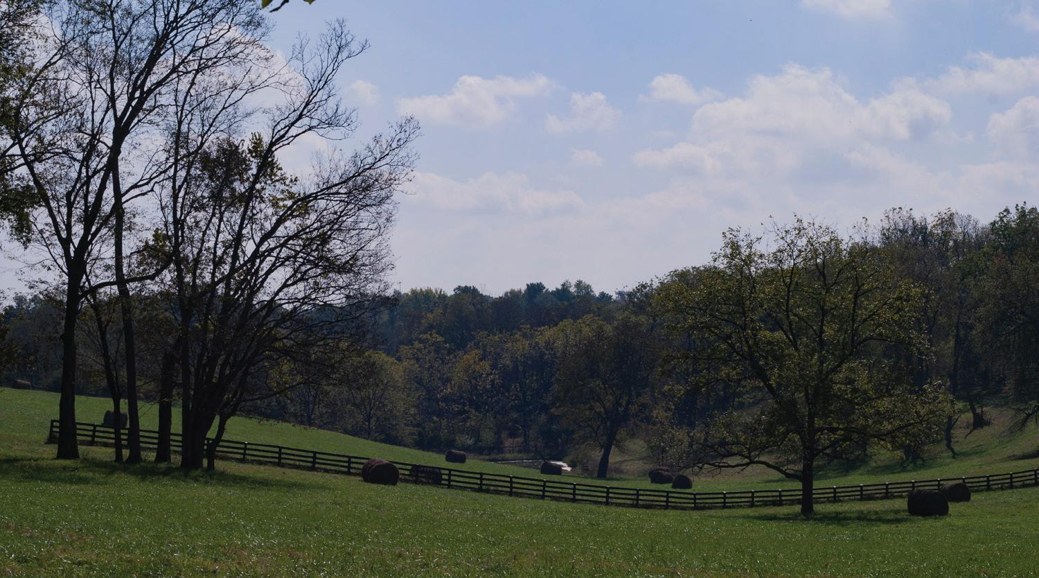
Colts gallop across Frankfort Park Farm along Elkchester Road.
1995 A number of conditional uses in the Rural Service Area reduced to a 10,000 sq. ft. maximum building size; Paris Pike Corridor Plan completed; Seven Scenic Byways designated
1996 Expansion of the Urban Service Area (included 100-foot agricultural buffer), and Floracliff Nature Sanctuary dedicated as State Nature Preserve
1999 Rural Service Area Land Management Plan adopted, Agricultural Rural (A-R), Buffer (A-B) and Natural Areas (A-N) zones adopted, Forty-acre minimum lot size adopted in A-R and A-N zones, and the Agricultural and Rural Corridor Overlay adopted (Paris Pike)
2000 Purchase of Development Rights Ordinance adopted, Cell Tower Ordinance adopted, and a 180-acre Urban Service Area adjustment
2001 Royal Springs Wellhead Protection Plan adopted
2002 Infill and Redevelopment Ordinance and Greenway Master Plan adopted
2003 Agricultural Market conditional use in A-R zone adopted and Paris Pike road project completed
2004 Better screening and buffering along the Urban Service Boundary adopted
2005 A-R overlay zone created
2006 Bluegrass Cultural Landscape listed as endangered by the World Monuments Fund
2007 Rural Settlement Study completed
2007 Green Infrastructure inclusion of soils, water resources and cultural landscapes introduced in 2007 Comprehensive Plan
2008 Another Scenic Byway designated, totaling 8
2010 World Equestrian Games held at the Kentucky Horse Park, the Legacy Trail built from the Northside YMCA to Kentucky Horse Park
2011 Rural Corridor Protection Report completed; another Scenic Byway designated, totaling 9; Zoning Ordinance text amendment approved to allow a Historic House Museum as a conditional use in the A-R zone
2013 Strong emphasis on balance between infill/redevelopment and rural preservation in the 2013 Comprehensive Plan and The Influence of the Agricultural Cluster on the Fayette County Economy Study completed
2015 Breeders Cup
2016 Recreational conditional uses in agricultural zones adopted (REC ZOTA), and improved protection of environmentally sensitive areas for BOA cases adopted
2017 Bluegrass Regional Stockyards and Marketplace relocated to Iron Works Pike, the Legacy Trail extended through the Kentucky Horse Park, and The Influence of the Agricultural Cluster on the Fayette County Economy Study updated
Related Planning Documents
Numerous adopted plans, ordinances, regulations, studies and reports, either totally or partially, have had a bearing on the Rural Service Area. It is the intent of this update to the 1999 Rural Service Area Land Management Plan to dovetail with the goals, policies and provisions of these various planning documents. For a complete listing, see Chapter 2, Land Use Summaries, Overview.
Rural Land Management Plan, Chapter 1 | 9
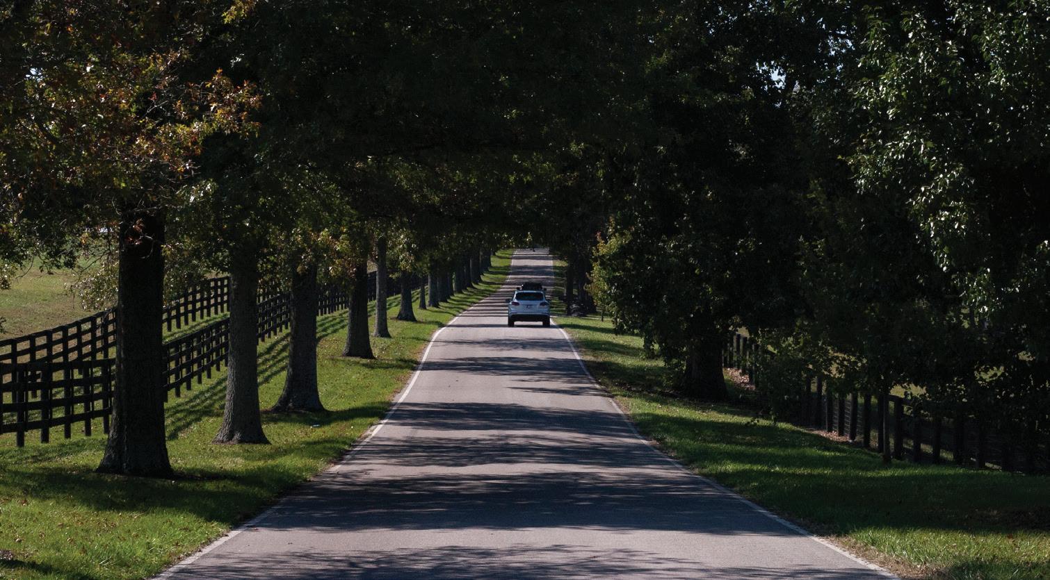
Lexington has had a long history of taking positive action to ensure our rural heritage is preserved from unmanaged suburban sprawl.
B. The Importance of the Rural Service Area to the Community
Many specific aspects and elements contribute to the importance of the Rural Service Area, including the agricultural economy, tourism, long-term preservation, sustainability, the rural landscape and cultural heritage. For a complete listing of benefits, see Chapter 4, Green Infrastructure Services.
Agricultural Economy
The most basic and often overlooked aspect of the importance of the Rural Service Area is the role that agriculture plays in the overall economy of Fayette County. Farmland itself may be considered a “factory floor” that provides jobs and income for farmers, but, according to a study, The Influence of the Agricultural Cluster on the Fayette County Economy, it is also a driver of Fayette County’s entire economy. Published in May 2017, and written by Dr. Alison Davis and Simona Balazs from the University of Kentucky College of Agriculture, Food and Environment, the study addresses the newly extended definition of agriculture that includes not only agricultural inputs, food processing and manufacturing, but servicebased (finance, veterinary, recreation), transportation, communications, as well as wholesale and retail businesses. All of these aspects are known together as the Agricultural Cluster (Ag. Cluster). There are hundreds of these establishments in Fayette County that are 100% dedicated to agriculture. Significant, as well, is Fayette County’s equine industry, which is first in the nation in sales. Using the state of Kentucky
as a base area, Fayette County’s location quotient is 4.47, which indicates a likelihood of supporting industries in close proximity because of the opportunities for horizontal and vertical integration. Analysis of the Ag Cluster and its effects on Fayette County show that farming has a larger impact on the economy than what is seen at surface level. For instance, the study estimates that one out of every 12 jobs is directly or indirectly associated with the Ag Cluster. Not only does the Ag Cluster supply a large percentage of Fayette County’s jobs, it also generates approximately $2.3 billion in output annually and $1.3 billion in additional income, profits and dividends. By expanding the definition of Ag Cluster to include businesses that strictly support agriculture, a more accurate economic value of agriculture in Fayette County is captured. This is still a conservative estimate, as the study does not include businesses with less than 100% dedication to agriculture, such as the hotels, restaurants, retail shops, accounting, insurance and banking establishments, which also prosper from a strong agricultural industry.
Tourism
Fayette County possesses a globally recognized character that brings visitors to our area. Tourism is a thriving industry in Fayette County and opinion polls conducted by VisitLex indicate that viewing horses and the landscape is a major draw for the region. The analysis from The Influence of the Agricultural Cluster on the Fayette County Economy quantifies how important Fayette County’s distinctive brand is to major components of the local economy.
Nationally, agritourism, ecotourism and cultural tourism are the fastest growing segments of the tourism industry (see Chapter 4, Special Elements, Tourism). In 2016, local barriers to agritourism and ecotourism opportunities were lifted with the adoption of a Zoning Ordinance text amendment that allows them in agricultural and natural area zones
10 | Division of Planning
One out of every 12 jobs is directly or indirectly associated with the Ag Cluster.
as conditional uses. Agritourism, ecotourism and cultural tourism are important as supplemental income to farmers, and as a means for residents and visitors to experience the Rural Service Area in ways they historically could not.
Sustainability
Preservation of rural land provides the community with benefits necessary for a sustainable future. The Purchase of Development Rights (PDR) program annually receives federal, state and local dollars to protect farmland. Funding through the United States Natural Resources Conservation Service is appropriated specifically to safeguard the nation’s future food supply by preventing the conversion of productive working lands to non-agricultural uses. Fayette County is in an advantageous position to feed the nation in the future because:
• the high percentage of Fayette County that is in prime soils or soils of statewide significance
• its proximity (within 600 miles) to 50% of the U.S. population
• the PDR program’s goal to conserve a critical mass of land and the county’s strong preservation ethic
• projections that indicate less severe adverse impacts in the region from climate change than other parts of the nation
Besides food security, environmental services provided by farm and forest lands will be important for long-term clean air and water, as well as the ability to produce food and maintain natural ecosystems, including:
• Resupplying groundwater; and filtering and cooling water
• Regulating local climate and evapotranspiration
• Providing pollinators and photosynthesizers
• Providing energy exchange, food and fuel
• Improving air quality due to carbon sequestering through forest and pasture land
Cultural Heritage
“Cultural heritage” refers to the legacy of physical artifacts (such as a landscape) and intangible attributes (such as customs and way of life) that are passed from generation to generation. The Central Bluegrass Region developed its heritage from early settlements and forts, through the pre-Civil War agriculture and cultural growth, the development of the horse industry, the reliance on tobacco as the main cash crop and more recently, Lexington’s growth into an urban city. Yet despite the rise of urbanization, the agricultural-based cultural heritage is still strong, and city residents are aware of the rural landscape and its contribution to our collective sense of place. The connection between the physical environment and regional identity is especially strong for places steeped in tradition.
If Fayette County’s cultural landscape is allowed to disappear, a major part of the Bluegrass identity will have been lost. Keeping agriculture strong and viable passes this cultural heritage forward and prevents it from becoming a mere interpretation, seen only at a horse park or on a logo for a shopping center.
Cultural Landscape
The rural landscape of Fayette County creates a strong sense of place. It is an agriculturally, historically, culturally and aesthetically valuable geography that qualifies as a cultural landscape. From Native Americans to early settlers and modern-day inhabitants, the land has reflected the physical, biological and cultural character of everyday lives. Some of the character-defining features that create this irreplaceable cultural
Rural Land Management Plan, Chapter 1 | 11
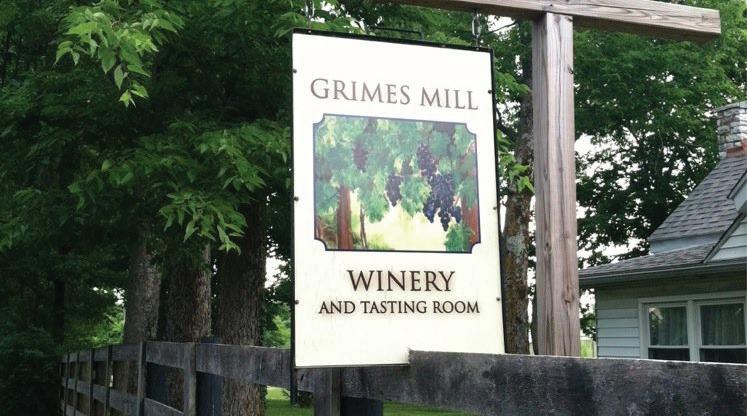
Grimes Mill Winery is a local tourism destination.
landscape include gently rolling hills, green pastures, spring-fed streams and stately groves of oaks. Other features include scenic rural roads, stone fences, plank fences, horse farms and rural settlements. This image is what people around the world picture when they think of Kentucky. Those who live in the Bluegrass Region take pride in Fayette County’s identity as one of the most unique, picturesque and beautiful landscapes in the world.
In Fayette County, the vernacular landscape functions as working lands rooted in agriculture. It is more than the iconic scenery centered on the horse. Fayette County’s rural countryside also includes general farming, country stores, historic churches, forest, the Kentucky River and its tributaries. For years, Fayette County’s rural policies, starting with the establishment of the Urban Service Boundary, have strived to keep the integrity of the unique cultural landscape intact.
Community Appreciation
The community recognizes the many reasons why the Rural Service Area is important and chooses to take action to preserve it. LexingtonFayette County citizens have a deep appreciation for the benefits that the rural economy and character bring to the community. Early settlers
chose this location to establish their farmsteads because of its fertile soils, abundant wildlife, natural springs and clear creeks. The resulting agrarian landscape is the predominant element in the mixture of urban and rural values that define the essence of the community’s identity. The unique blend of a sharply-defined urban boundary and beautiful countryside distinguishes the setting that makes Lexington-Fayette County unlike any other.
Over the years, in public meetings, surveys and other displays of the public’s attitude, it is clear that a vast majority of Fayette County residents cherish their surrounding agricultural and natural areas. Perhaps the most remarkable aspect of the 1999 Rural Service Area Land Management Plan effort was the consensus - from all segments of the communitythat the Bluegrass is a precious resource and deserving of commitment to the goal of ensuring its preservation into the future. Since 1999, citizens have continued to voice their desire to strengthen the agricultural industry, preserve the rural landscape, and protect environmentally sensitive areas, wildlife habitats and historic areas. Each of these desires have been adopted in succeeding Comprehensive Plans. Citizens also recognize the challenge that preservation must be balanced with the need to accommodate expected population growth. The question of whether the Urban Service Area will be expanded has brought many residents to public meetings and hearings throughout the years.
The Comprehensive Planning process provides an opportunity for the public, elected officials and citizen boards and commissions to give their input. The Mission Statement from the adopted 2013 Comprehensive Plan declares that the Plan “seeks to provide guidance to ensure that development of our community’s resources and infrastructure preserves our quality of life, and fosters regional planning and economic development. This will be accomplished while protecting the environment…and preserving the unique Bluegrass landscape that has made Lexington-Fayette County the Horse Capital of the World.” In 2008, citizens participated in the Destination 2040 survey conducted by the Lexington-Fayette Urban County Government (LFUCG). A vision statement said, “We will continue to place a high value on how close our rural and urban areas are to each other, and on how quickly we can move from one to the other. The unusual closeness between the city and the adjacent countryside, helps make Lexington truly unique, and
12 | Division of Planning
Fayette County’s beautiful rural landscape as captured along Elkchester Road.
requires vigorous protection for that delicate co-existence of urban and agricultural land use.” Respondents considered, “Programs designed to preserve Fayette County’s landscape” as the most important aspect of the community’s physical growth. This appreciation translated into ardent efforts for infill and redevelopment and the continual monetary support for purchasing conservation easements on agricultural land.
According to the business leaders interviewed in the 2017 study The Influence of the Agricultural Cluster on the Fayette County Economy, having a strong local character is an advantage when recruiting and creating new businesses. Fayette County’s distinctive beauty and quality of life were listed as factors that attract and retain businesses and their workforce.
In the fall of 2016, Fayette County residents participated in a Greenspace Survey. The self-selecting survey may not be projectable to the entire population and it does not allow for probability statistics; however, notice of the online and hard-copy survey was widely distributed through the LFUCG website, the Mayor’s and Councilmembers’ emails and social media accounts, libraries, community centers and health centers. Results showed a strong support for preservation of the Rural Service Area.
A few summary statistics are as follows:
• 70% responded that they had visited a farm or scenic rural road in the past year
• 63% of those who had visited a farm or scenic rural road, visited in order to tour the scenic countryside
• 80% valued farms, scenic rural roads and stone fences as very important
• 83% value nature parks as very important
• 72% opposed expansion of the Urban Service Area (12% were in favor, 16% didn’t know)
• 81% supported utilizing public funds for the permanent protection of 50,000 acres in the rural area for agriculture, food security and environmental protection
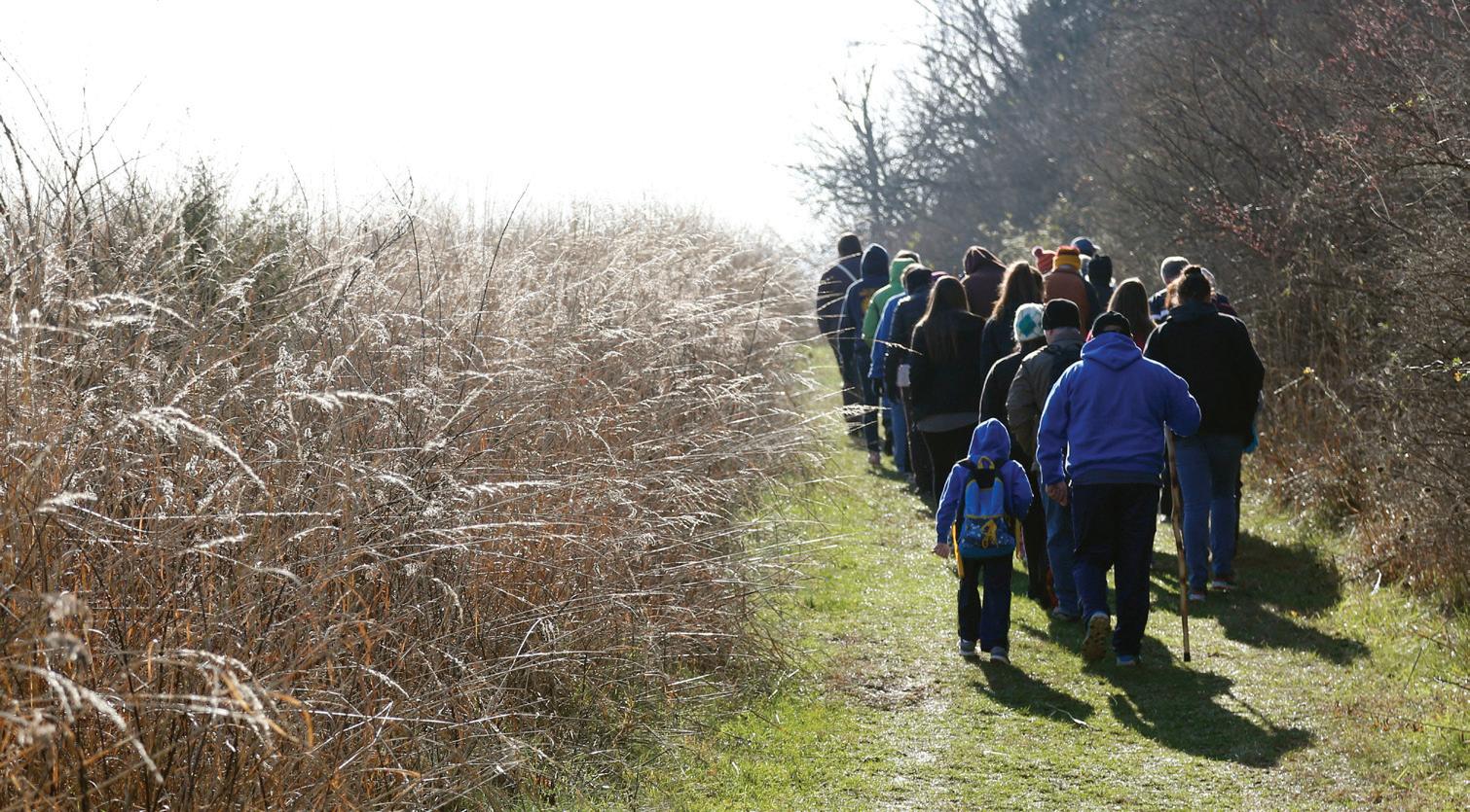
• 73% said they would be interested in participating in rural nature recreation, events/festivals, tours, homegrown restaurants and biking/ hiking/equestrian trails
In 2017, there were public input meetings, surveys and an On the Table event for the 2018 Comprehensive Plan, Imagine Lexington. Over 11,000 individuals participated to voice their thoughts about Lexington-Fayette County. Over a thousand comments were not in favor of expansion to the Urban Service Boundary. A strong appreciation of greenspace, horse farms and the rural landscape was indicated, as well as the desire to see infill and redevelopment work.
Rural Land Management Plan, Chapter 1 | 13
The unique blend of sharply-defined urban boundary and beautiful countryside distinguishes the setting that makes Lexington-Fayette County unlike any other.
C. Challenges to Rural Preservation
The preservation of the soils, landscape, and way of life found in the Rural Service Area can never be taken for granted. Some challenges are ongoing; such as how to balance preservation and urban growth, and whether that means expansion of the Urban Service Area. Other challenges come and go; such as the changes associated with the decline of tobacco as the main cash crop.
Challenges identified in the 1999 Rural Service Area Land Management Plan included the proliferation of 10-acre lots, which resulted in serious erosion of the land area available for agricultural use. By following a recommendation from the 1999 Plan to increase the minimum lot size, that threat was reduced. Other challenges identified in the Plan are ongoing, such as the need for clean water of sufficient quantity, skilled and unskilled labor, access to equipment, materials and services, and a market for goods.
Agriculture is much like any other industry, with the “factory” being the land itself. Thus, a critical mass of land is needed to sustain agriculture as an industry and to allow it to operate with the most efficiency possible. Since the 1999 Plan, the PDR program has successfully begun the preservation of land to attain a critical mass.
The 1999 Plan did not list regional planning as a challenge; however, it did discuss regionalism numerous times (e.g. environmental resources and road systems) and listed it as a recommendation. While Fayette County alone has aggressively worked toward preserving its farmland, the rural landscape, natural resources, and historic places, regional planning and management, along with an optimal critical mass, is critical to their success. In 2006, the World Monuments Fund listed the Bluegrass Cultural Landscape of Kentucky as one of the world’s 100 most endangered places. The Fund recognized the threat to the mostly intact landscape from rapid suburbanization. The increasing development found in the region is resulting in a loss of farmland, a compromise to sense of place, an undermining of traditional industries such as horse breeding and an endangerment to historic structures. The Fund’s recognition of the Bluegrass cultural landscape highlights the importance for regional efforts to ensure coordination and cooperation to preserve farmland and the rural heritage of the area.
Additional challenges to rural preservation not listed in the 1999 Plan include:
• changes in farming (e.g. aging farming population, loss of family farms, loss of inheritance [next generation choosing not to farm], and the obsolescence of tobacco as a crop)
• competition from other states for stallions
• an unpredictable economy
• a dedicated source of funding for land conservation
14 | Division of Planning
Iconic bluegrass landscape pictured here along Old Versailles Road.
Other challenges concern the perception of rural preservation by the public and officials, including:
• a perception that funding for conservation easements is only for wealthy horse farms
• a lack of understanding about the bigger picture; including the need to protect the land for food security, the preservation of the agricultural industry (both equine and general), and the “brand” on which so much of the local economy depends
• awareness of the importance of the Rural Service Area must be instilled with each generation as support can never be assumed
• a lack of knowledge about the Natural Areas and Kentucky River
There are many references in both the 1994 Greenspace Plan and the 1999 Rural Service Area Land Management Plan about the importance of allowing the public to experience the rural landscape up close, in order to gain and keep their support for rural preservation and a strong agricultural economy. Both plans called for increases in tourism and recreation due to the public’s desire to come into contact with the rural countryside; not just by driving through it. The Greenspace Plan stated that increasing public recreational access should be approached with great flexibility in order to take advantage of the remarkable natural and historic resources in the rural area. The 1999 Plan says that public access to scenic resources, wildlife programs, botanical areas, environmental education and similar uses can and should be accomplished wherever possible without creating interference with agricultural activities. The Greenspace Plan stated that providing access does not equate to changing the look of the land or how agriculture functions; however, public access to working farms and nature areas is fundamental to gaining support for preservation.
The challenge is to encourage tourism while at the same time protecting the integrity of the Bluegrass from overuse and development. As
conditional uses, any application for recreation, including agritourism and ecotourism, must be scrutinized to ensure that it does not ruin the local character or interfere with adjoining agricultural interests.
Rural Land Management Plan, Chapter 1 | 15
A critical mass of land is needed to sustain agriculture as an industry and to allow it to operate with the most efficiency possible.
D. Current Trends
Since 1999, there have been changes in the agricultural industry and land uses worthy of noting, including:
• an increase in the diversity of horse breeds and horse farms; in particular, the commercial sport horse industry and pleasure horse farms
• protected land in conservation easements
• an increase in usage and number of events held at the Kentucky Horse Park
• an increase in interest for tourism and recreation, including agritourism, ecotourism, and cultural tourism, now enhanced by the 2016 adoption of changes to the Zoning Ordinance for recreational opportunities
• a robust local food movement including organic farming; increasing share in wholesale distribution
• expansion of the Bluegrass Airport
• continued reduction in tobacco farming
• increases in wineries and farm production for breweries
16 | Division of Planning
Local foods and farmers markets have become robust movements nationwide and in Fayette County.
E. Goals and Objectives
In order to protect the land, natural resources and character of the Bluegrass Region, safeguard cultural heritage and maintain viable agriculture, the planning and management of the Rural Service Area must be responsive to all of the complex interactions between the physical, social, and economic factors at play. The following broad goals and objectives should guide future planning and management efforts based on the importance of maintaining rural assets.
A. Empower the agricultural industry.
A.1 Maintain a viable and strong agricultural economy.
A.2. Protect land for agriculture uses and promote sustainable agricultural practices.
B. Protect the integrity of the rural landscape.
B.1. Rural Settlements, crossroads
B.2. Scenic corridors, Natural Areas
C. Protect environmentally sensitive areas and wildlife habitat.
C.1. Protect prime and statewide significant soils.
C.2. Protect riparian zones and water quality.
C.3. Protect the Kentucky River and Boone Creek forest, ravines and water resources.
C.4. Protect native flora and fauna.
C.5 Support and protect existing nature preserves and encourage the establishment of new conservation areas.
D. Protect our cultural and historic heritage.
D.1. Support the family farm.
D.2. Protect rural resources from adverse effects associated with urban development.
E. Ensure continued community support.
E.1. Develop public outreach initiatives to educate the public on rural and agricultural issues, including: environmentally sensitive areas, the importance of the agricultural economy, infill and redevelopment, and tourism opportunities such as the Kentucky Horse Park and related activities.
E.2. Explore a dedicated funding source for the Purchase of Development Rights Program.
E.3. Ensure adequate public access to the Rural Service Area through tourism opportunities, including strategically placed staging areas for trails.
E.4. Engage in meaningful regional planning efforts to ensure responsible stewardship of the Bluegrass Region’s rural resources.
Rural Land Management Plan, Chapter 1 | 17
18 | Division of Planning
CHAPTER 2
Land Use Summaries
A. Overview
Recommendations from the 1999 Rural Service Area Land Management Plan were based on a comprehensive land capability analysis that was performed as a complex interrelationship of physical and social factors. Information was collected on land characteristics and land management units, including natural resources, greenways and focus areas, topography, land use, ownership patterns, historic sites and districts, scenic areas, sewerable areas, and existing zoning. Values, as expressed in planning documents and input from public officials, property owners and interested citizens, were added into the analysis. The recommended land use categories are as follows: core agricultural land, natural area, rural settlement, buffer area, small lot residential, and rural activity center.
Data, interpretation and mapping from the updated comprehensive land capability analysis are found throughout the chapters in this Plan. For this chapter, the analysis is grouped into summaries of General Information, the Agricultural Cluster and for Non-Agricultural Land Uses.
Similar to the 1999 Plan, this update has reviewed physical characteristics, conditions, and values (public opinion surveys, and planning documents, regulations and studies).
Physical features included topography, soil associations, streams, floodplains, wetlands, sinkholes, aquifer recharge area and forested areas.
Conditions were revised by conducting a new land use inventory and updating related data and maps. The land use inventory was obtained through a 2014 windshield survey carried out by the Lexington-Fayette County Greenspace Commission and supplemented with the LFUCG 2013 aerial photography and PVA data. The emphasis for gathering land use and associated information was to identify agricultural cluster uses, non-agricultural uses, as well as a closer look at parcels under 40 acres in size. Many parcels have more than one land use.
Land use data included the following categories and were based on parcel size:
Parcels ≥ 40 acres
• Agriculture
• Agriculture-Related Education
• Agriculture-Related Recreation
• Agriculture-Related Park
• Ag Service-based Business
• Agritourism
• Business
• Communications
• Ecotourism
• Education
• Group Residential
• Historic
• Mining/Excavation
• Natural Area
• Nature-Related Park
• Office Park
• Other Public Use
• Recreation
• Religious
• Transportation
• Utility
Parcels < 40 acres
• All data listed under Parcels ≥ 40 (except for Ag-Related Education)
• Archaeology
• Industrial
• Greenspace/Open Space
• Parking
• Residential
20 | Division of Planning
•
Residential (owned by adjacent farm)
• Underutilized Business
• Underutilized Housing
• Underutilized Mixed Use
• Vacant
In addition to land use, other data collected on a parcel basis for mapping included the following:
• parcel acreage
• frontage and adjacency
• lotting patterns
• conservation easements
• types of agricultural facilities
• focus areas
• types of recreational activities
• zoning
• scenic roads
• Rural land use categories
• streams
• forestry (generalized estimations from aerial photography)
Several public opinion surveys have been conducted since 1999. Values for rural protection have remained strong; and, public officials have continued to support the PDR program and its counter-balance, infill and redevelopment initiatives. See Chapter 1, Managing Our Rural Heritage for Future Generations, Community Appreciation for more information about public surveys.
Planning documents informing the update of the 1999 Plan include:
• 1994 Greenspace Plan
• 1994 Stone Wall Preservation Ordinance adopted
• 1995 Paris Pike Corridor Plan
• 1996 Expansion Area Master Plan
• 1999 Rural Service Area Land Management Plan
• 2000 Purchase of Development Rights Ordinance
• 2002 Greenway Master Plan
• 2007 Rural Settlement Study
• 2008 Bicycle/Pedestrian Master Plan
• 2010 Legacy Trail Public Art Master Plan
• 2011 Rural Corridors Protection Project Report
• 2012 Empower Lexington (draft)
• 2013 Comprehensive Plan
• 2013 Airport Master Plan Update
• 2013 The Influence of the Agricultural Cluster on the Fayette County Economy
• 2014 MPO 2040 Transportation Plan
• 2017 The Influence of the Agricultural Cluster on the Fayette County Economy Update
• Code of Ordinances (PDR, Stone Wall Preservation)
• Zoning Ordinance: Article 8, Article 11 (B-5P), Article 13 (Historic Preservation), Article 24 (Rural Corridor Overlay Zone), Article 25 (Telecommunication Towers), Article 1 Definitions. Subdivision Regulations (Definitions), Buffers, ESAs, GHAs
Rural Land Management Plan, Chapter 2 | 21
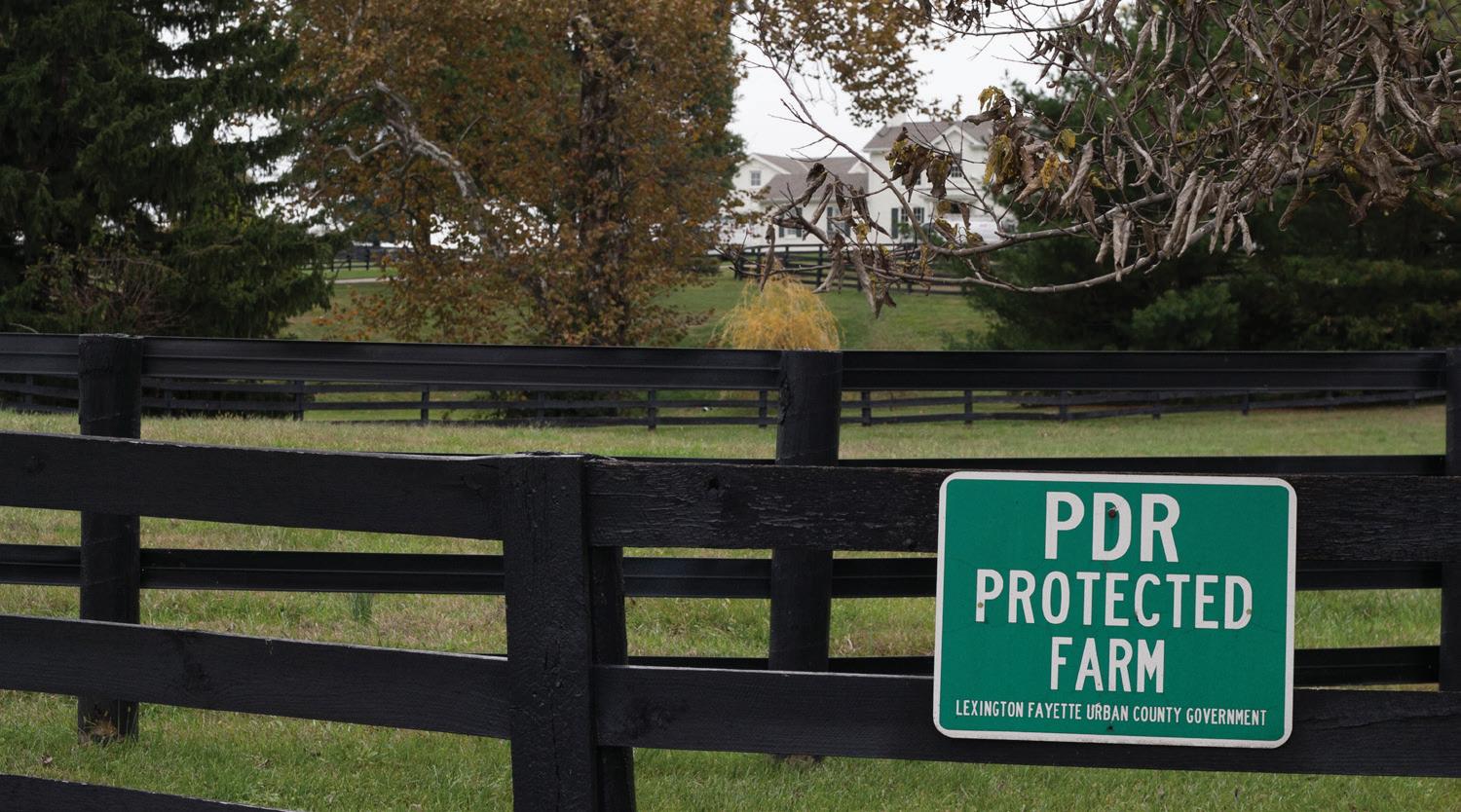
This PDR protected farm is located along Newtown Pike.
B. General Information Summary
Parcel Size
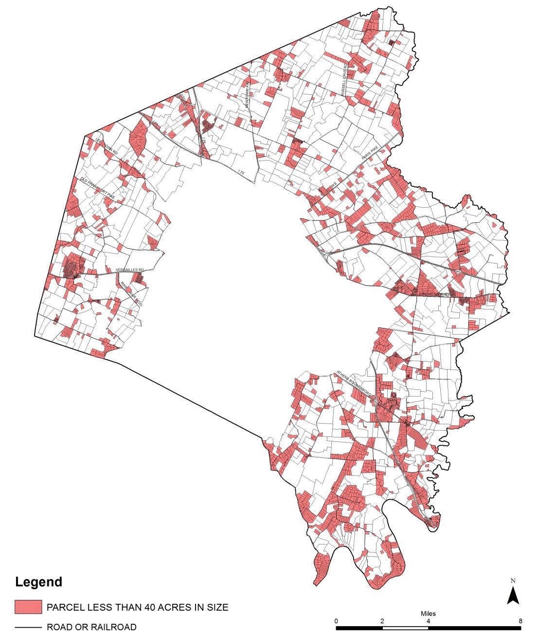
There are 128,129 acres within 4,136 parcels in the Rural Service Area. The smallest parcel is 0.001 acre (cell tower); the largest parcel is 1,063 acres. 39% of all parcels are less than 5 acres (with 1.7% of the total acreage). 20% of all parcels are in 10-acre lots (with 6.6% of the total acreage).
There is a near inverse relationship between the number of parcels in the RSA under 40 acres in size and the RSA acreage: 3,414 parcels (82.5%) are < 40 acres; they total 25,957 acres (20%) of the total land mass
Almost half of the < 40 acre parcels are less than 5 acres in size. Onethird of the < 40 acreage is in 10-acre lots.
• 47% of parcels < 40 ac. are 5 acres or less in size, with 8.3% of the under 40 acreage
• 5% of parcels < 40 ac. are between 5 and 10 acres in size, with 4.4% of the under 40 acreage
• 25% of parcels < 40 ac. are 10 acre lots, with 32.6% of the under 40 acreage
• 16% of parcels < 40 ac. are between 11 & 20 acres; with 29% of the under 40 acreage
• 7% of parcels < 40 ac. are between 20 & 40 acres in size, with 25.7% of the under 40 acreage.
As a disclaimer, the size of parcels at the county or urban service boundary should be qualified since it is apparent from aerial photography that most of the fencing, field or yard patterns continue into adjacent counties and the USA (24 parcels are affected by this phenomenon). PVA records from adjoining counties were not checked to quantitate the degree of contiguous ownership. A more definitive split occurs at the urban and rural interface.
Lotting Patterns
In the western, northern and northeastern parts of the county, where the land gently rolls and is exceptionally fertile, farms tend to be larger and there are fewer residential lots. In the southeastern section, where slopes are steeper as the land drains toward the Kentucky River and its tributaries, there is a higher percentage of parcels in forest.
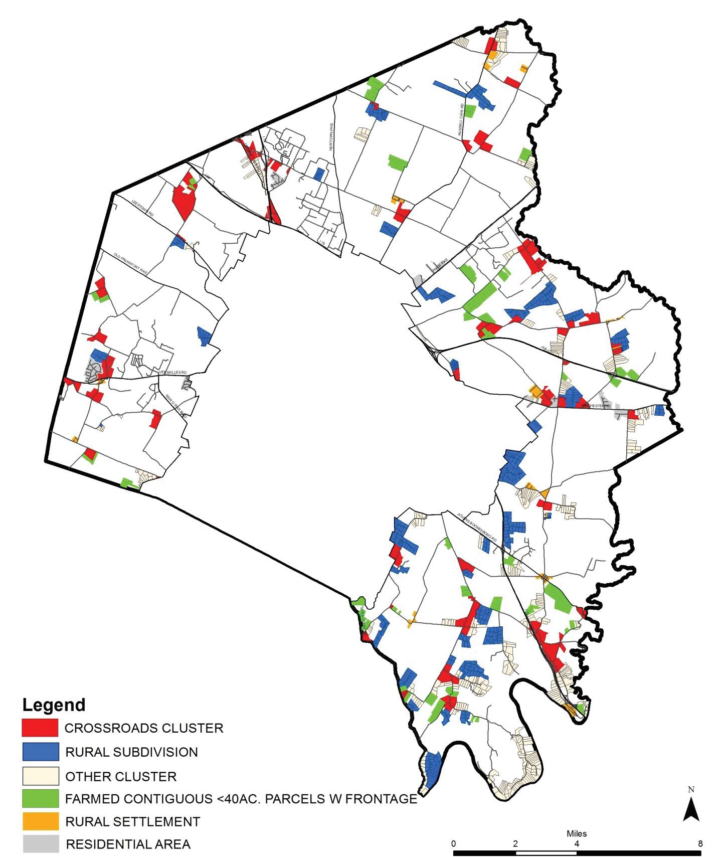
Throughout the RSA, there are clusters of lots under 40 acres in size. Thirty-nine percent of parcels less than 40 acres are located in Buffer Areas, Small Lot Residential, Rural Settlements or the Blue Sky Rural Activity Center. These areas are land use categories created in the 1999 Plan. However, there are rural subdivisions and crossroad clusters within Core Agriculture and Natural Areas land use categories that increase the lots under 40 acres in concentrated locations to sixty-nine percent.
22 | Division of Planning
This crossroad cluster is found at the intersection of Tates Creek and Spears Road.
Map 1
Patterns
Rural Land Management Plan, Chapter 2 | 23
Lotting
April 2017
Although this update does not propose to create new land use categories for crossroad clusters and rural subdivisions, they are identified as distinct development patterns contributing to the rural form.
Crossroad Clusters
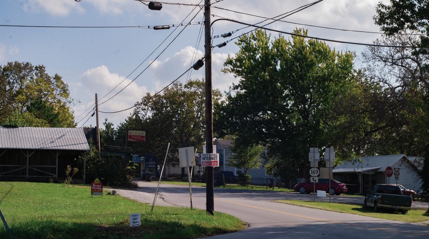
Crossroad communities played an important role in the settling of Fayette County. Historically, they provided services to residents without the necessity to travel into Lexington. Numerous intersections of rural roads are surrounded by parcels smaller than 40 acres in size. There are clusters of parcels less than 40 acres that, together with rural subdivisions, Small Lot Residential and Rural Settlements, form pockets of small lots. Examples include the Westmoreland subdivision/ Jennie Kate subdivision and the Versailles/Rosalie Rd. cluster and there are numerous rural subdivisions, clusters and a Rural Settlements in proximity to each other along Winchester Road. Some clusters encircle intersections and extend further along the road and merge with another crossroad cluster. These super-sized clusters include the South Cleveland/Old Richmond/LeeAnn Lane/McCalls Mill/Grimes Mill area and the Yarnallton/Bethel/Falcon Wood Way area.
Crossroad clusters are predominately residential while the remainder have a mix of land uses. These include agriculture, natural area, store, restaurant, gas station, auto repair, fire station, school, cell tower, kennel, motel, residential, truck leasing, religious facility, winery, garden/orchard/ art studio, utility, vacancy, equine hospital, and equestrian trailer sales.
Rural Subdivisions
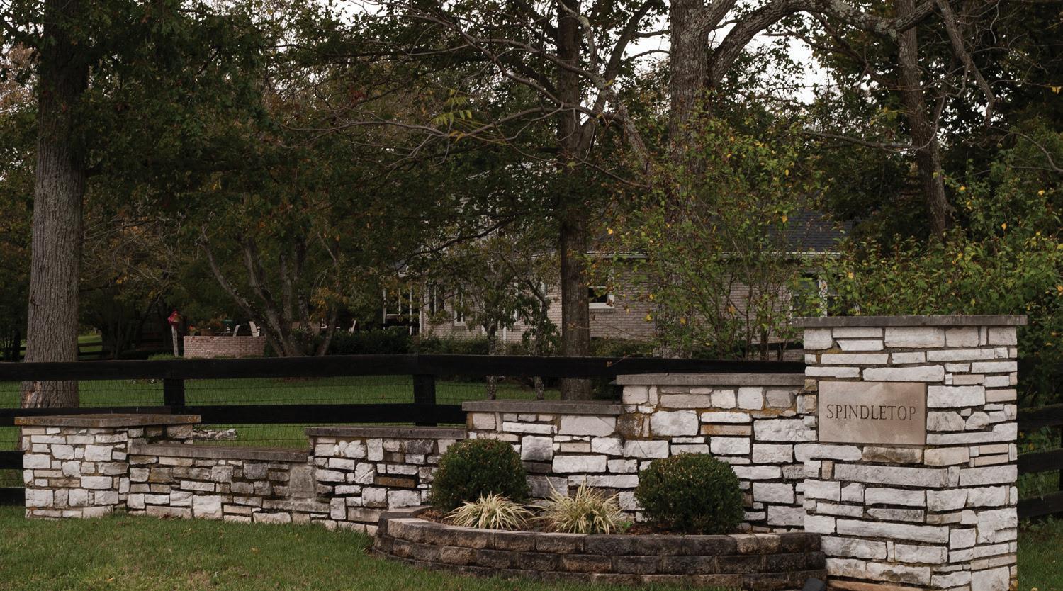
As important as the 1958 designation of the Urban and Rural Service Areas was, two other policy changes also had profound effects on rural preservation. The first was the 1964 institution of the change to a 10-acre minimum for lots utilizing septic tanks. This was done in response to the one-half to one-acre lot subdivisions, such as Westmoreland, Wellesley Heights, Greenbrier, Spindletop Estates, and others. This trending development pattern would have continued during the growth booms of the 1960s and 1970s. The 1999 Rural Service Area Land Management Plan gave these existing residential developments their own land use category, Rural Subdivision.
The second policy was the 1999 change to a 40-acre minimum lot size in the rural area. As in 1958, then in 1964, it also thwarted suburban sprawl. From 1964 through the 1990s, the rural area experienced a proliferation of 10-acre lots in new subdivisions. There are 461 parcels in 45 subdivisions that total 4,684 acres.
2.2 - Rural Subdivision Statistics
in Buffer Area 7 & 3 partial
subdivisions in Natural Area 4 & 1 partial # subdivisions in Core Agriculture 27
Contiguous and Shared Operations Parcels
Contiguous parcels are defined here as adjacent properties in the same ownership. As the 2013 aerial photography was scanned to verify the land use windshield inventory, it became apparent that many of the < 40 acre
24 | Division of Planning
# Subdivisions 45 # Parcels 461 Average lot size 11.55 Total acreage 4,684 Lot size range (acreage)
# subdivisions
Table
0.25 - 33
#
Spindletop Estates is a rural subdivision along Berea Rd.
Map 2
Rural Subdivisions, Crossroad Clusters & Farms w/ Contiguous <40ac
April 2017
Parcels
Rural Land Management Plan, Chapter 2 | 25
parcels shared farming operations or forested land with their neighbors. Parcel ownership was verified through PVA records. Of particular interest included the following:
• 35 sets of contiguous parcels whose acreage per set totaled 40 or more acres. The total acreage for all sets is 2,119 acres, and parcel sizes ranged between 6 and 33 acres. The sets were composed of 2 to 20 parcels; the largest set is located near the Athens Rural Settlement. Only 41 of the parcels had a residence; it is possible that the remaining parcels now in agriculture could become rows of new housing
• 230 parcels were contiguous with an adjacent farm or forest, which is over forty acres in size. The total acreage is 3,411 acres. These parcels are of interest since points are awarded for them if they are included in a PDR application for the adjacent farm or forest
• Nearly one in five (19%) of all rural subdivision lots are contiguous. In particular, subdivisions with contiguous lots in agriculture that have not been developed include four parcels on Long Valley Lane (owned by the adjacent farm); all six parcels on Sunnybrooke Lane and 11 parcels along Canebrake Drive
Additional parcels checked for contiguous ownership included ones located in Buffer Areas, Residential Areas, Rural Activity Centers, Rural Settlements, rural subdivisions or crossroad clusters. Recorded land uses for them included agriculture, forest, business, industrial, parking, religious, residential, airport or vacant. Some parcels that shared field patterns across parcel lines or shared an entrance were not contiguous.
In total, the ownership for 930 parcels representing 27% of the parcels under 40 acres in size was checked. While an ownership study of all 3,414 parcels less than 40 acres would be necessary to verify every contiguous lot, the visual scanning with aerials gave a reasonable representation of how various land uses crossed parcel lines, demonstrating how farming was possible on smaller lots.
Frontage
There are 99 parcels under 40 acres in size that are located on private roads. There are 154 parcels under 40 acres in size that do not have road frontage, including:
• 44 parcels at the county line
• 16 of the 24 split parcels at the USA boundary
• 4 parcels (not split) without frontage that are accessed through the USA
• 90 parcels without frontage scattered throughout the remaining RSA
Zoning
Since 1999, there have been eight zone changes on 20 parcels detailed in the table below:
Table 2.3 – RSA Map Amendment Requests (MAR)
From To # Parcels Location
A-R A-N 2 & 1 partial Natural Area
A-R B-1 1 Avon Rural Settlement
A-R B-5P 1 Blue Sky RAC
A-R I-1 1 Blue Sky RAC
A-R A-B 4 Tates Creek Buffer Area
A-R A-B 5 Tates Creek Buffer Area
B-1 A-R 1 Core Agriculture
I-1 A-R 3 & 1 partial Core Agriculture
The A-B and A-N zones were created in 1999 to match the Buffer Areas and Natural Areas land use categories. All parcels in the Buffer Area were platted prior to 1999, except for nine that were created 2005-2006. The three A-N-zoned parcels were approved after the 2016 Zoning Ordinance Text Amendment allowing ecotourism there.
The list below totals parcels with a single zoning classification:
• A-B – 9 parcels
• A-N – 2 parcels
• A-R – 3,560 parcels
• B-1 – 34 parcels
• B-3 – 17 parcels
• B-5P – 23 parcels
• EX-1 – 1 parcel
• I-1 – 114 parcels
• I-2 – 3 parcels
26 | Division of Planning
M-1P – 1 parcel
• P-1 – 3 parcels
• R-1A – 83 parcels
• R-1B – 18 parcels
• R-1D – 177 parcels
The list below totals parcels with more than one zoning classification:
• A-R & A-N – 1 parcel
• A-R & B-1 – 28 parcels
• A-R & B-3 – 6 parcels
• A-R & M-1P – 2 parcels
• A-R & R-1D – 3 parcels
• A-R, R-1D & B-1 – 1 parcel
• B-1 & A-R – 14 parcels
• B-1 & R-1D – 6 parcels
• B-3 & A-R – 9 parcels
• B-3 & I-1 – 2 parcels
• B-5P & A-R – 1 parcel
• B-5P, B-3 & I-1 – 1 parcel
• I-1 & I-2 – 1 parcel
• P-1 & A-R – 1 parcel
• R-1B & A-R – 2 parcels
• R-1D & A-R – 10 parcels
• R-1D & B-1 – 2 parcels
• R-1D, B-1 & A-R – 1 parcel
There are 10 parcels completely within the Paris Pike / Lexington Road Corridor Overlay Zone and another 19 parcels that lie partially within the overlay; the underlying zone is A-R. There is one parcel with an H-1 overlay. It has a conditional use as an historic house museum. For more information about zoning, see Chapter 2, Agricultural Cluster and NonAgriculture Summaries.
For more information, see Chapter 4, Historic and Cultural Landscapes and Rural Heritage.
Ownership
Public Ownership
LFUCG owns 37 parcels totaling 3,593 acres in the RSA. Parcels include the Bluegrass Airport, Athens Ballfield Complex, Cardinal Run North Park, Hisle Park, Kearney Hill Golf Links, Masterson Station Park, Raven Run Nature Sanctuary, the police firing range, three fire stations, composting facilities, and a closed landfill. The Airport is compiled of 18 parcels totaling 1,021 acres.
The Commonwealth of Kentucky owns 24 parcels totaling 4,255 acres in the RSA. Parcels include Avon and Spindletop Rural Activity Centers, Blackburn Correctional Complex, Fayette Regional Juvenile Detention Center, the Kentucky Horse Park, two U.K. farms (Maine Chance and Spindletop), and one archaeological site.
The Federal government owns one parcel, the Federal Medical Center, a correctional facility on 293 acres.
The Fayette County School Board owns three sites totaling 125 acres: Locust Trace AgriScience Center, Russell Cave Elementary and a vacant site proposed for a new elementary school.
Rural Land Management Plan, Chapter 2 | 27
•
Raven Run Nature Sanctuary is owned and managed by LFUCG.
Homeowner Associations
There are four parcels totaling 18.2 acres owned by an HOA. One is owned by an adjacent subdivision in the USA; the remaining three are in rural subdivisions. Uses include utilities, tennis club, greenspace, walking trail, and an access to an adjacent farm.
Nonprofit Organizations
There are many known nonprofit organizations located in the Rural Service Area. Parcels include: 30 national, state and regional equine organizations, a group residential facility, a domestic abuse facility, recreation (country club, thoroughbred club, museums, hunt club, tennis association, summer camps, equine), and religious organizations.
28 | Division of Planning
C. Agricultural Cluster
Agricultural Cluster Composition
The breadth of the agriculture industry in Fayette County encompasses more than the farm; it includes the businesses that support the farm. It also includes agriculture-associated learning opportunities, parks and recreation; all of which allow tourists and residents to enjoy, understand and appreciate farming operations, heritage and the land.
Farming
Farming is the predominate land use in the Rural Service Area. To be counted as a farm for the USDA’s Census of Agriculture, the operation must be income-producing (minimum $1,000 per year). According to the latest Census of Agriculture in 2012, there were 718 farms covering 114,857 acres in Fayette County (including farms inside the Urban Service Area). The profile shows that farming was down from 2002; however, the Census relies on voluntary participation by farmers, so it is not possible to know an exact count of farms in Fayette County.
Based on the survey information reported to the 2012 Census of Agriculture, the average age of a farmer was 58.5 years, which was 2.2 years older than the average reported in the 2007 Census. Fifty-six percent of farmers surveyed indicated that farming was their principal occupation.
2.4 – 2002-2012 Farm Statistics
Table 2.5 – Farms by Use
*There was a significant conversion from cropland to pastureland between 2002 and 2012. The change was primarily due to the decreasing acreage planted in tobacco.
For the purposes of a land use inventory, the Census of Agriculture does not portray the complete picture. Agriculture, as a land use category, does not distinguish between income-producing or hobby farms. For this Plan’s inventory, parcels under 40 acres in size were identified as a smallholder farm if an agricultural facility was present, including barns, paddocks, pastures, fields, greenhouses, or if an agricultural operation producing crops or raising livestock was indicated.
Based on the windshield survey and aerial photography, the following table represents Rural Service Area parcels in private ownership that appeared to be in agriculture only. The fourth column shows the number of parcels that were in contiguous ownership with the adjacent property, or they appeared to share in an agricultural operation with the presence of a pasture, field or paddock.
The breadth of the agriculture industry in Fayette County encompasses more than the farm; it includes the businesses that support the farm.
Rural Land Management Plan, Chapter 2 | 29
Farms by Use* (%) 2002 2007 2012 Change from 2002 Pasture 27.3 39.2 47.9 +75.5% Cropland 56.3 45.4 35.1 -37.7% Woodland 7.1 6.9 5.2 -26.8% Other 9.2 8.4 11.8 +28.3%
Farm Info 2002 2012 Change from 2002 Number of farms 738 718 -2.7% Farm acreage 119,098 114,857 -3.6% Avg. Farm Acreage 161 160 -0.62%
Table
Rural Service Area Parcels in Private Ownership in Agricultural Use
Table 2.6 – RSA Privately Owned Parcels
*For 10-acre lots, the number represents the parcels that were contiguous to an adjacent 40-acre farm or combined with multiple parcels to equal 40 acres.
Beyond these statistics, acquiring the remaining number of parcels in agriculture is difficult to determine. Many parcels 10 acres or less may have had a barn or shed and a paddock built decades ago, but without any evidence of an active operation, this is relevant in particular to rural subdivisions. In addition, it is difficult to calculate acreage in agriculture for smaller parcels that include additional land uses, as determined by windshield survey and aerial photography. Approximately 775 parcels under 40 acres in size were identified as having an additional land use along with an agricultural facility. Most of these parcels were a combination of agriculture with a residence and yard; wooded areas were also considered a non-agricultural land use. The primary land use for many of these parcels 10 acres or less is residential.
The Fayette County Property Valuation Administrator’s office also desired to accurately identify which parcels were in agriculture. Beginning in January 2017, they determined that a farm is generally defined as 10 acres or more devoted to agricultural purposes (after removing the land under house, driveway, yard and other family recreational areas). Exceptions to the acreage requirement can be made if the farm is involved in commercial horticulture, commercial aquaculture, or participating in a federal or state agricultural program. Parcels that do not meet the 10-acre minimum but are in contiguous ownership with
an adjacent farm are assessed as agriculture. The improvements on the property for personal use by the owner, such as the house, garage, swimming pool, etc., are assessed at their fair cash value; however, the land and agricultural related improvements, such as barns, sheds, etc., are assessed at an “agricultural use” value. The PVA assessed 1,736 properties in the Rural Service Area as agriculture or “farms”.
Equine
In 2015, there were 7,991 foals born in Kentucky, representing about 36% of the overall crop nationally. Fayette County has a large percentage of the state total. This represented a steady rise from a low in 2012 (7,181), but not as high as the 10,517 born in 2012. While nationally foal crops have dropped significantly, the number of thoroughbreds born in Kentucky has been more stable. Keeneland September 2016 sales grossed $250M.
In 2016, gross receipts for wagering at Kentucky horse racing were higher than receipts for the Kentucky Lottery or charitable gaming. In 2014, Keeneland hosted 521,667 visitors over 32 days of racing. Purses totaled $20.2M, live, on-track wagers exceeded $36.5M, and off-track handle was $224.3M.
30 | Division of Planning
Parcel Size (Acres) # Parcels Acres # Parcels in Contiguous Ownership or Shared Facility/Operation > 40 651 85,724 0 20 - 40 81 2,246 67 10 - 20 100 1,396 91 10 199 1,200 73* <10 49 205 48 Total: 1,080 90,774 279
Sport horse events have gained attention since Fayette County hosted the World Equestrian Games.
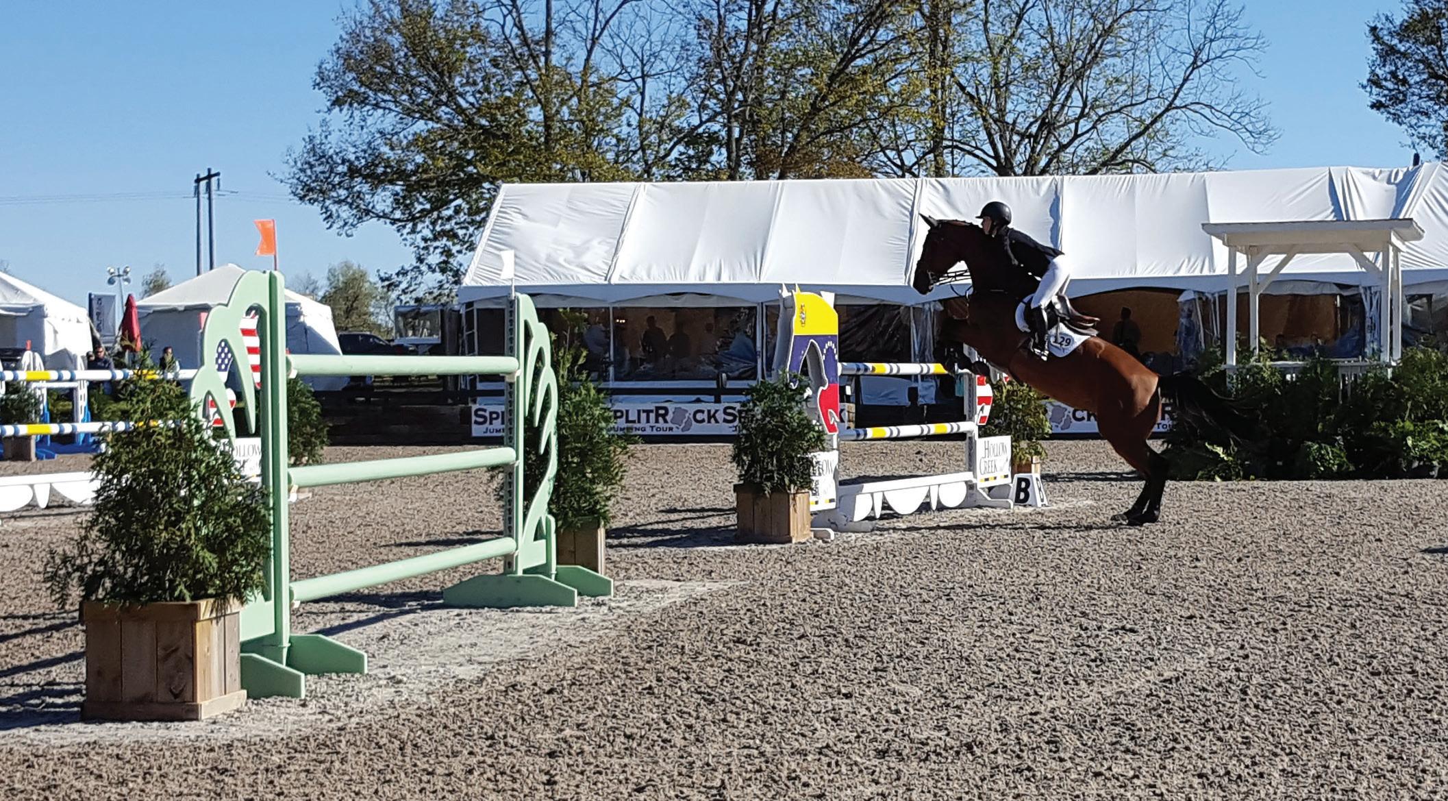
A significant change since the 1999 Rural Service Area Land Management Plan has been the influx of sport-horse enthusiasts. Since the global exposure from the 2010 World Equestrian Games, properties purchased in Fayette County for small hobby horse farms (for personal use) and for sport horse businesses (that provide lessons, training, selling and boarding of horses) are on the rise.
A 2012 Equine Survey showed a diversification in equine breeds; Fayette County had 17,510 Thoroughbreds, 1,240 Standardbreds, 960 Quarter Horses, 360 Walking Horses, 400 Saddlebreds, 300 Arabians, 220 Paint, 1,090 Mountain Horse Breeds, 110 Appaloosas, 100 Belgians, and 120 Donkeys/Mules/Burros. Fayette County was first in Kentucky with 36% of the state total for Thoroughbreds and 48% of their value. Fayette County was also number one in the state for Standardbreds.
The 2012 Equine Survey listed Fayette County as having the most horses of any other county, with 24,600 equine animals in 1,130 operations over 89,000 acres. The second and third highest counties (Bourbon and Woodford) combined to equal the number of animals in Fayette County. The value of the equine animals in Fayette County was $2.6B, far more than any other county.
The Influence of the Agricultural Cluster on the Fayette County Economy was a defining study published originally published in May, 2017, by the University of Kentucky College of Agriculture, Food and Environment. The update revealed that 92% of agricultural sales in the county were from cattle and equine operations; plus, the equine industry (particularly sales and racing) affects six other industries: hospitality, recreation, finance, real estate, professional services and retail trade. To demonstrate the influence of the equine industry on Fayette County’s economy, the previous study, in 2013, determined that a 10% addition in equine sales ($40M) is associated with $45M of additional annual sales in professional services, real estate and retail. The presence of a racetrack in a county is linked to $88M additional payroll throughout the agricultural cluster, including 15 additional recreation establishments. This far-reaching impact of the equine industry showed a stronger linkage throughout the local economy than from manufacturing.
The analysis recognized the strong influence of Fayette County’s
distinctive brand on the local economy. A conservative estimate attributed 25-50% of all hotel visits for the purpose of visiting the Kentucky Horse Park, Keeneland or equine-related sales. The brand also has a positive influence on workforce recruitment and retention. The Kentucky Horse Park generates more than $3.2 million in fee revenue annually (2016). Studies show that the Park contributes $1.5 million in economic impact to the state.
Crops and Other Livestock
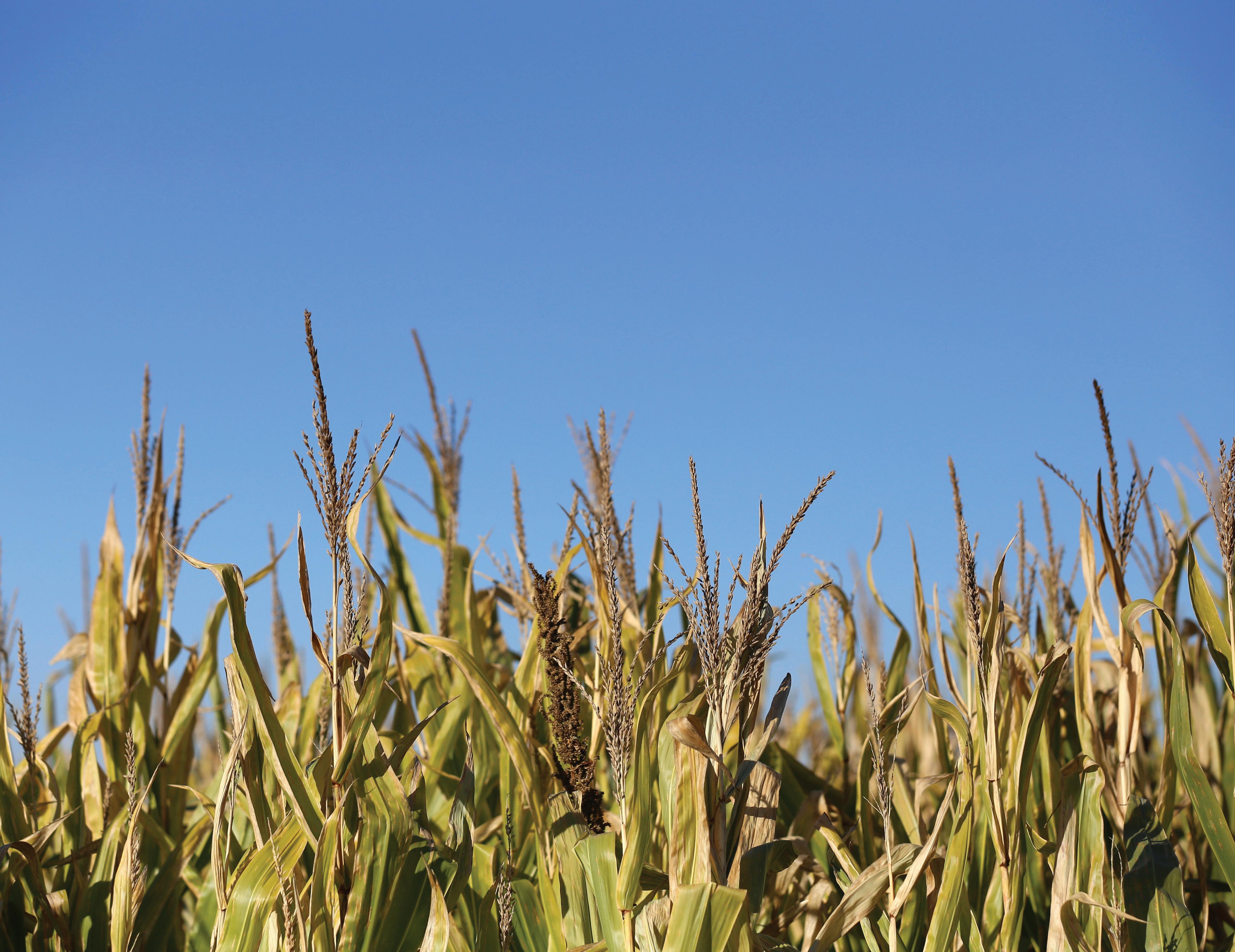
According to the 2012 Census of Agriculture, crops accounted for eight percent of sales in Fayette County. Livestock, including horses, totaled 92%. Cropland has been decreasing in acreage since World War II. A profile of non-equine agriculture in Fayette County from the National Agricultural Statistics Service showed that for 2016, there were 14,500 head of cattle, 16,600 acres in hay and alfalfa, and 9,600 acres in corn and soybeans. Burley tobacco has shrunk to 1,000 acres. According to their websites, there are three vineyards in the Rural Service Area: Grimes Mill (28 acres), Jean Farris (13 acres), and Talon Winery (297 acres). A fourth winery processes grapes grown in California.
The 2017 Influence of the Agricultural Cluster on the Fayette County Economy studies looked at the impacts for all aspects of farming in the county. Fayette County has crops and other types of livestock that expand the number of businesses in the cluster serving agriculture. These additional inputs come from retail and wholesale trade, food processing and manufacturing, distribution and wineries, fertilizer manufacturing, feed mills, construction/fencing, farm equipment, restaurants and professional services. The total agricultural cluster, with a value-added multiplier, created 14,091 jobs, of which 6,853 were for the Production Agriculture and Food Processing Cluster. If production agriculture declined by 10% ($54.5M), then there would be an additional overall decrease of $26.5M in output and another $3.5M reduction in sales from business spending.
Local Food
Since the 1999 Plan, there has been a worldwide movement for supporting local food systems because of the important economic, health, social and environmental benefits. The LFUCG Bluegrass Farm to Table Program defines local food, for its purposes, as any agricultural
Rural Land Management Plan, Chapter 2 | 31
food product grown or raised in Kentucky. As defined in the 2015 Local Food Demand Study, the local food shed for the Lexington Area is an approximately 100-mile radius that includes the 23 counties surrounding Fayette County. According to a 2014 survey conducted by CEDIK (Community and Economic Development Initiative of Kentucky), The Food Connection at U.K. and the LFUCG’s Bluegrass Farm to Table Program, there were 18 distributors/wholesalers in the county and 55 regionally, 8 food processors in the county and 21 regionally, 4 agricultural cooperatives in the county and 9 regionally.
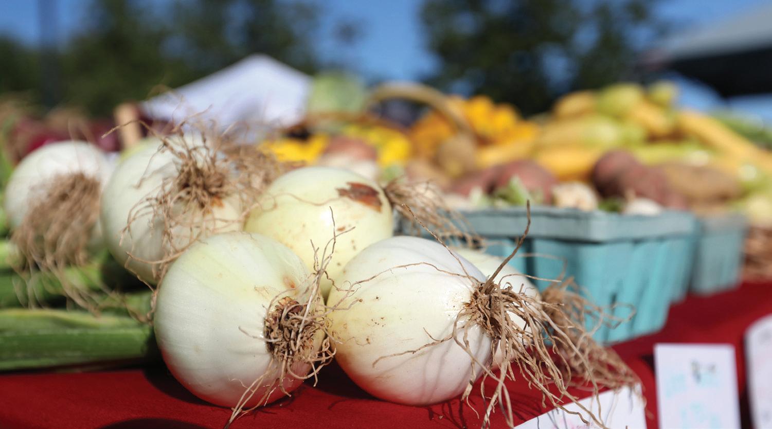
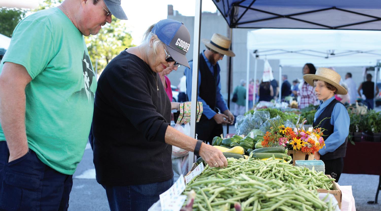
Local food in Lexington is an emerging consumer market with a bright future for continued growth and demand. There is a farmers’ market available five days a week somewhere in Lexington during the growing season, and one market is open year round on Saturdays. Many restaurants serve local food (67 in 2014), more grocery stores and retailers are providing food produced locally, universities are requiring a percentage of food served on-campus be locally sourced, and community-supported agriculture (CSA) programs are popular (27 farms regionally in 2014). Total Kentucky farm products purchased in Lexington in 2014 through direct sales or through distributors was $14.2M. Adding the resale of these products by retailers, restaurants and other channels, consumers spent approximately $34M. Purchases of local farm products are expected to increase by 5–10% annually by 2020.
According to the 2012 Census of Agriculture, fruits and vegetables accounted for four percent of crop sales in Fayette County. Hay, soybean, corn and tobacco were the top crops grown. Data measuring farm sales of animal products for local markets is unavailable. According to the Census, the rate of direct sales decreased from 2007 to 2012. However, their data does not include intermediated regional sourcing, or production for nearby institutions or large retailers that went through distributors or aggregators.
Based on the 2012 Census of Agriculture, there were 38 farms totaling
127 acres in Fayette County producing vegetables in the open air. Fayette County, with its fertile soils, adequate rainfall and growing season, has great potential for a variety of crops. Each year more farmers at the farmers’ markets are growing in hydroponic systems in order to produce vegetables earlier in the spring and later into the fall/winter months.
In 2014, LFUCG hired a Local Food Coordinator and launched the Bluegrass Farm to Table Program. The Program’s mission is to promote the development of a more vibrant local food economy by supporting food-related agricultural development. Bluegrass Farm to Table initiated the first local food demand assessment and collaborated on a research project to identify gaps in the produce value chain and the specific needs for additional processing capacity in partnership with CEDIK and the Food Connection. Bluegrass Farm to Table has initiated several programs including the Bluegrass Double Dollars Program, aimed at making healthy, local produce more affordable for SNAP participants, and the LFUCG CSA pilot program that incentivizes employees to participate in community-supported agriculture. Bluegrass Farm to Table also regularly works with buyers (restaurants, schools, universities, hospitals, etc.) to source food from Kentucky farmers.
32 | Division of Planning
A December 2015 assessment of local food demand for Fayette County
Farmers markets are a great way for the residents of Lexington to get fresh produce.
Local food in Lexington is an emerging consumer market with a bright future for continued growth and demand.
was prepared by CEDIK in partnership with The Food Connection at U.K. and Bluegrass Farm to Table. The assessment identified challenges to growing the local food economy, including production planning and season extension, consumer education, communication between farmers and purchasers, and the lack of infrastructure for local food systems development.
Recommendations from the assessment to help overcome the challenges include the following:
• Support for local food coordinators to serve as brokers between farmers and buyers
• Easy access to market resources and information to help producers be aware of market trends and requirements
• Market research to help producers learn about new production techniques and marketing skills, determine the availability of products used by institutions, conduct consumer surveys, to identify ethnic food buyers/producers, and create cost-saving or subsidy strategies
• Distribution and process research to identify specific distribution issues
• Supply side research to identify supply issues, such as seasonality, farm size and local proteins
• Policy evaluation to address issues such as land prices, national and global competition, affordable and accessible local food to low income households, and safety standards
Farmland Preservation
The best preservation tools for the Rural Service Area are those that keep the agricultural economy viable and strong. For information about farmland protection, see Chapter 4 Special Elements, Natural Resources (protection of soils), Chapter 4, Historic and Cultural Landscapes (protection through Comprehensive Planning, LFUCG Code of Ordinances and LFUCG Zoning Ordinance), and Chapter 4, Purchase of Development Rights Program.
Agribusiness
Agribusiness is the group of industries dealing with agricultural produce and services required in farming. Local businesses that support a farming
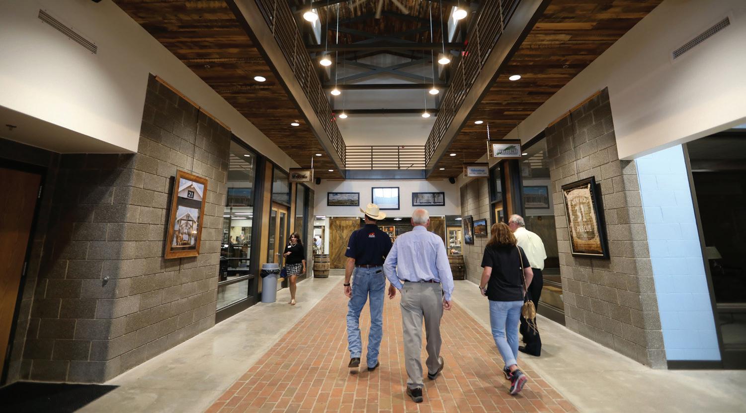
operation extend the tremendous economic impacts of agriculture beyond the farm. For instance, the Blue Grass Stockyards’ new facility (opened in September, 2017), is anticipated to generate $250–300M per year for the local economy. Besides the sales pavilion, the new facility will house numerous agricultural businesses, a museum, learning center and restaurant. It aims to bring in producers, consumers, students and tourists.
The following ag-service-based businesses are located in the Rural Service Area, including:
• Keeneland (equine sales, agritourism)
• The Thoroughbred Center (equine training and sales, fencing, farm maintenance and construction, hay, tack, agritourism)
• Fasig-Tipton (equine sales)
• Blue Grass Stockyards (livestock sales, media, other ag servicebased businesses, agritourism)
• three equine hospitals
• equine transportation; Horse Hearse
• horse trailers; a horseshoes and supply store
• two garden centers; a retail/wholesale plant nursery; turf grass research/consultants
• Windy Corner, a local food restaurant with locally-sourced gifts
Rural Land Management Plan, Chapter 2 | 33
The Blue Grass Stockyards offers many types of agribusiness.
Keeneland, The Thoroughbred Center, Fasig-Tipton and the Blue Grass Stockyards include non-agricultural business uses as well, such as venues for conferences, seminars, meetings, events, receptions, private parties, dining and weddings. One garden center also has a driving range.
All businesses are located in Core Agriculture land use category except for the horseshoes/supplies store, which is located in a Rural Settlement. Three parcels are zoned B-1 (garden center, restaurant and horseshoes/ supplies); one is zoned B-3 (horse trailers), while the remainder are zoned A-R.
Ag-Related Parks
The Kentucky Horse Park is a year-round destination that attracts over 800,000 people every year. The Park occupies 1,010 acres in Fayette County with a portion of the park that continues into Scott County. The equine-themed park has a wide variety of attractions: gift shop, trail and pony rides, museums, parade of breeds, competitions and over 200 events and shows throughout the year.
Masterson Station Park, owned by LFUCG, is 652 acres. A portion of the park is dedicated to an equine program, which offers riding lessons, summer camps, competitions and access to ride on cross country and hunter jumper courses, an indoor arena and dressage rings. The Park is also host to the Sheep and Fiber Festival and the Bluegrass Classic Stockdog Trials each May.
Hisle Park is a 280-acre park owned by LFUCG. Previously a farm, the Park, when fully developed, will provide the public with access to rural greenspace and an opportunity to connect with nature and Fayette County’s farm heritage. Horseback riding and archery are activities already underway. The park’s master plan calls for a working garden and orchards, interpretive areas, scout day camping, and programs.
Ag-Related Recreation
The 2016 Greenspace Survey and 2017 On the Table comments revealed that Fayette County residents want more access to rural recreation.
The best preservation tools for the Rural Service Area are those that keep the agricultural economy viable and strong.
Examples of desired activities include: seasonal events, farm and winery tours, homegrown restaurants and trails. Besides the State and LFUCG parks, the sport-horse businesses, private clubs and agritourism provide agricultural-related recreational opportunities in the Rural Service Area.
It is unknown how many farms in the county are commercial sport horse operations. Facilities at a commercial sport horse farm might include indoor and outdoor arenas and riding trails for horses boarded there. Activities might include events, competitions, horse shows, clinics and camps.
The Thoroughbred Club and the Iroquois Hunt Club are private spaces that provide recreational opportunities for their members.
Agritourism
The Rural Service Area is a very popular destination for tourists and Fayette County residents alike. Agritourism is about the “experience,” and Fayette County has many opportunities for people to enjoy, learn and be involved in its rich agricultural heritage, working farms, agribusiness operations and farmland/landscape. See also Chapter 4, Special Elements, Tourism.
Examples of agritourism activities include:
• farm visits that offer seasonal activities, petting zoos, corn mazes, hay rides, picnics, botanical or vegetable gardens, and orchards or pumpkin patches
• tours of farms, wineries, Keeneland, The Thoroughbred Center, FasigTipton, and the Blue Grass Stockyards
• attend horse races and rodeos
• attend equine and agricultural events, shows and competitions
34 | Division of Planning
• go horseback riding and take riding lessons
• participate in hands-on caring for horses and/or learn about agriculture
• buy u-pick or value-added products where produced, such as roadside stands or wineries, or u-pick berries, orchards, vegetables or Christmas tree farms
• buy locally-sourced food, fiber and horticulture products in gift shops on farms and other locations
• go fishing or hunting .
• stay at a farm bed and breakfast or retreat center where visitors can experience rural life set on, or adjacent to, a working farm
Existing ag-related recreational facilities in the Rural Service Area include: four wineries, family farms, a botanic garden, tree farms, plant nurseries, bed and breakfasts, the farmstead at Helm Place, thoroughbred farms, sport horse farms, riding stables, Keeneland, The Thoroughbred Center, Fasig-Tipton, and the Blue Grass Stockyards.
Ag-Related Education and Learning Opportunities
The University of Kentucky has two teaching farms adjacent to one another, Maine Chance Farm and Spindletop Farm. Both farms have agricultural research, and Maine Chance Farm is home to the school’s equine program. Combined, the two farms total 1,876 acres. Locust Trace AgriScience Center is a public high school sitting on 81 acres. The net-zero energy facility includes an equine barn and arena, aquaculture, state-of-the-art greenhouse and veterinary clinic. Students may choose among seven pathways in agricultural instruction; sustainable agricultural practices are emphasized in all pathways.
Both the Kentucky Horse Park and the Thoroughbred Center offer tours that teach visitors about the care and/or training of horses and different breeds. Individual farms also give tours to visitors with a ‘behind the scenes’ understanding of working farms. Hosted at the Kentucky Horse Park, Central Kentucky Riding for Hope and PATH International offer persons with special needs, veterans, and their families an enriched learning experience with horses under supervision. One private farm also provides animal assisted activities. There are also three equine-related
museums are located at the Kentucky Horse Park. Helm Place Historic House Museum and Farm, located on Bowman Mill Road, shows a glimpse into Fayette County’s agricultural past. However, it is not open to the public at present.
The Bluegrass Community and Technical College offers an associate degree and certificate programs in Equine Studies. It also offers the first equine industry workforce training program and jockey school, which is located at the Thoroughbred Center.
Policy Emphasis
The policy emphasis for the agricultural cluster is to support and strengthen farming and to encourage the retention and growth of indigenous agriculture-related businesses, recreation and education that are a good fit in the agricultural industry of Fayette County.
Recommendations
1. Support local agriculture and family farms in land use decisions and economic development strategies and policies.
Rural Land Management Plan, Chapter 2 | 35
Group educational hikes are offered at Raven Run Nature Sanctuary
Protect Fayette County’s “brand” by promoting and supporting the distinctiveness of Fayette County’s equine industry, including the diversity of horse breeds.
3. Continue to support the Local Food Coordinator and the Bluegrass Farm to Table Program in its mission to develop a vibrant local food economy.
4. Recognize the full importance of the agricultural cluster and its impact on the local economy.
5. Support farms and agribusiness operations that provide learning opportunities, hospitality and ag-related recreation for the general public while protecting agricultural operations.
6. Support and expand ag-related recreation in local parks, including full funding for the development of Hisle Park according to its Master Plan.
36 | Division of Planning 2.
D. Non-Agricultural Land Uses
Overview
Based on the Greenspace Commission’s windshield survey, there was a wide array of land uses in the Rural Service Area that were not related to agriculture. Roughly 60% of the parcels in the RSA did not have an agricultural operation. There were 355 parcels that had an active business operation or an unused business zone, including the land uses below. See Chapter 2, Agricultural Cluster for information and businesses, education and recreation associated with agriculture.
• General Business
• Communications
• Education
• Greenspace/Open Space
• Historic
• Industrial
• Mining
• Nature
• Office Park
• Other Public Use
• Parking
• Recreation
• Religious
• Residential
• Transportation
• Utility
General Business
There were 52 general businesses in the Rural Service Area including: auto repair shops, 8 motels, 20 restaurants, stores and/or gas stations, an office building, a distribution business, general contractor, 3 kennels, a pet cemetery, adult entertainment, 4 contiguous car lots, truck leasing, trucking, retail, wholesale distribution, roofing and home renovations.
Locations for general businesses included: 19 parcels in a Rural Activity Center, 19 parcels in Core Agriculture (13 are in a crossroad cluster), 10 parcels in a Rural Settlement, two parcels in Buffer Areas, and one parcel each in Natural Area and Small Lot Residential. Zoning for general business parcels are below:
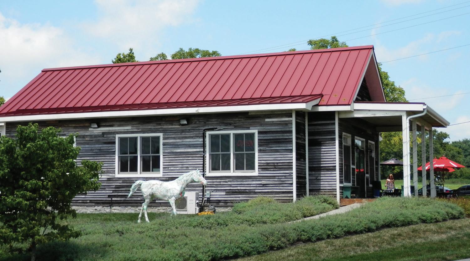
• A-R – 9 parcels
• B-1 – 8 parcels
• B-1 (partial) – 5 parcels
• B-3 – 10 parcels
• B-3 (partial) – 5 parcels
• B-5P – 12 parcels
• P-1 – 1 parcel
• R-1B – 1 parcel
• R-1D (partial) – 1 parcel
Rural Land Management Plan, Chapter 2 | 37
Windy Corner is a popular restaurant in the Rural Service Area.
The nine parcels zoned A-R included kennels, store, gas station, restaurant, pet cemetery and motel. The R-1D (partial) parcel is an antiques mall.
Unused Business Zones
There were 96 parcels with a B-1, B-3 or B-5P business zone that were not in use as a business. Parcels with an unused business zone were vacant lots, an abandoned or vacant building, or had a different use than intended for that zone. An additional five B-3 lots in the Blue Sky RAC are underutilized. One is a lot that is vacant except for a small portion of the building from the adjacent property and four parcels were a portion of an extensive car lot.
Table 2.7 – RSA Unused Business-Zoned Parcels
Communications
There were 17 parcels with a cell tower. All are located in Core Agriculture and zoned A-R, except one B-5P zoned parcel in a Rural Activity Center. Nine of them are on scenic roads; three are in the Old Frankfort Pike Focus Area, two are in historic districts, and one is at Keeneland, a National Historic Landmark. Two radio stations are located on farms that are larger than 40 acres in size. A television station is on a 20-acre parcel. For additional information, see Chapter 4, Special Elements, Communication Facilities. Most businesses and farms in the Rural Service Area have access to data connectivity services through an internet or telecommunications provider. High-capacity broadband infrastructure is not available due to the cost associated with the relatively small number of customers in a rural area. Yet, because of the importance of the global agricultural industry located here, this is an unmet need. LFUCG has begun exploring potential options.
Education / Learning Opportunities
There are numerous learning opportunities in the Rural Service Area, including:
• Fayette County Public Schools: Locust Trace High School*, Russell Cave Elementary, and a proposed site for a new elementary school adjacent to the Urban Service Area
• The University of Kentucky: Maine Chance and Spindletop teaching farms* and Mt. Horeb archeological site
• A Bible College on a 24-acre site
• Ecotourism
• Interpretive signage along the Legacy Trail
• Historic markers
• Five museums* (see Chapter 4 Special Elements, Historic and Cultural Landscapes)
• Tours on farms, the Kentucky Horse Park and the Thoroughbred Center*
• Equine-assisted therapy*
• Equine Studies at the Thoroughbred Center*
*Includes 5 parcels in the Iron Works Crossroad Cluster and 2 parcels in the Muir Station Crossroad Cluster.
**23 of the residential parcels are in Rural Settlements
* Educational / learning opportunities also included in the Agricultural Cluster Land Uses, Ag-Related Education
38 | Division of Planning
Property Type # Parcels Zone Underutilized Lot 5 B-3 Vacant Building 6 5 B-1 & 1 B-1/R-1D Vacant 30 Core Ag 9* 2 B-3, 3 A-R/B-1, 3 A-R/B-3, & 1 A-R/M-1P Core Ag/Natural Area 1 B-3/A-R Blue Sky RAC 12 10 B-5P, 1 B-5P/B-3/I-1, & 1 B-3/I-1 Rural Settlement 8 7 B-1 & 1 B-2/A-R Other Use 60 Religious 4 2 B-1, 1 B-1/A-R & 1 B-1/R-1D Residential 33** 10 B-1, 2 B-3, 18 B-1 (partial), 1 I-1, & 2 I-2 Agriculture 10 8 A-R/B-1, 3 A-R/B-3, & 1 A-R/M1P Residential & Agriculture 10 9 A-R/B-1 & 1 B-1 Natural Area & Agriculture 3 1 A-R/B-1, 1 A-R/B-3, & 1 B-5P/ A-R
Greenspace / Open Space
Farms and natural areas in the Rural Service Area are the largest greenspaces in Fayette County. There is a seven-acre open space zoned A-R that is owned by the Pine Needles HOA. It includes a walking trail for residents. Housing for the development is in the Urban Service Area.
Historic Sites and Districts
There are 39 National Register of Historic Sites on 45 parcels and 7,207 acres. The seven National Register of Historic Districts include 194 parcels totaling 12,301 acres. Boone Station is a 44-acre State Historic Site located near Athens Rural Settlement. See Chapter 4, Special Elements, Historic and Cultural Landscapes.
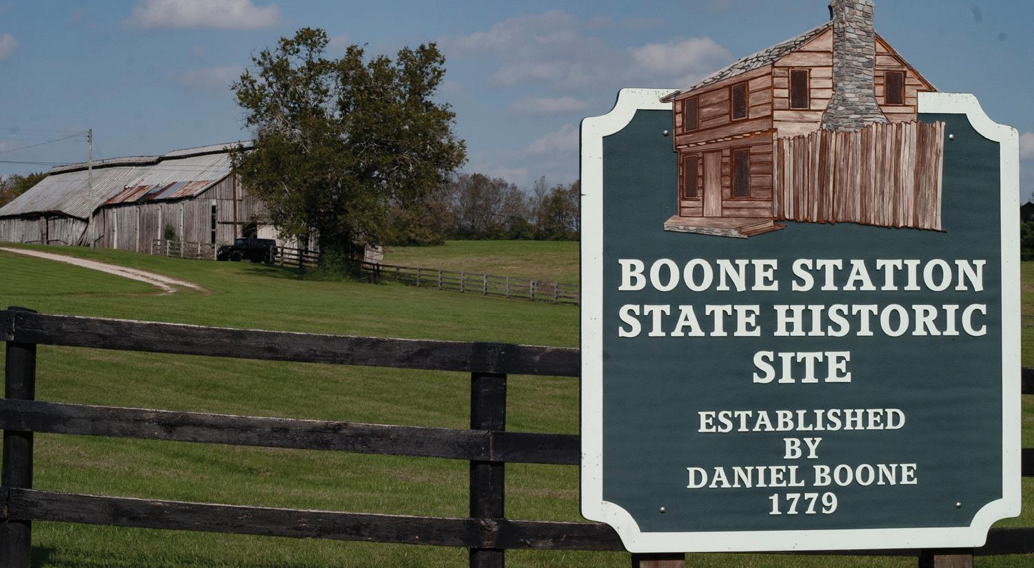
Museums
Museums in the Rural Service Area are the International Museum of the Horse*, the American Saddlebred Museum* and the Wheeler Museum* which are at the Kentucky Horse Park. The Horse Park is on a Scenic Byway and a major destination with event venues. Another rural museum is the Headley Whitney Museum, in the Old Frankfort Pike Focus Area and on a Scenic Byway. The Whitney Museum includes space for events, meetings, parties, weddings. Helm Place*, a historic house museum which is within the Bowman Mill Road Historic District and South Elkhorn Focus Area. Helm Place is not currently open to the public. And finally, the Aviation Museum of Kentucky which is located at Bluegrass Airport.
Industrial
The Blue Sky and Avon Rural Activity Centers can accommodate industrial uses. There are 113 parcels zoned I-1 in Blue Sky and two parcels zoned I-1 and I-1/I-2 are located in Avon. See Chapter 3, Land Use Categories, Rural Activity Centers. Additionally, there is a 1.5-acre parcel in Core Agriculture zoned A-R owned by Environmental Recycling.
Mining
Vulcan Materials Company operates two rock quarries in the Rural Service Area; a 133-acre site on Elk Lick Falls Road in a Natural Area land use category, and 122 acres on Georgetown Road in Core Agriculture. The quarry in the Natural Area is in a Focus Area and has some forest.
Excavation
From scanning aerial photography, there were four parcels that appeared to have a significant amount of soil removed. Three of these excavation sites were in Core Agriculture, the other parcel was in the Blue Sky RAC on a vacant B-5P lot. Three of the parcels are on a scenic rural road.
Archaeology
One 5.9-acre parcel, Mr. Horeb Earthworks, is owned by U.K..
Rural Land Management Plan, Chapter 2 | 39
Boone Station is a State Historic Site located near Athens Rural Settlement.
Nature
From scanning aerial photography, there were entire parcels or portions of parcels with forests, woods, streams, tributaries and a significant riparian buffer along the Kentucky River. See Chapter 4, Natural Resources and below, Recreation/Ecotourism.
Office Park
The Spindletop Research Campus is an office park owned by the Commonwealth of Kentucky. The Rural Activity Center is zoned P-1 over 127.5 acres, plus approximately 55 acres on the adjacent Spindletop Farm. The Research Campus is located on a Scenic Byway and provides a staging area for the Legacy Trail.
Other Public Use
There are ten parcels classified as Other Public Use. Five of the parcels are > 40 acres.
• A 600-acre Composting and Closed Landfill (LFUCG)
• A 60-acre Demolition Landfill (Private) Zoned EX-1
• Three fire stations totaling 3.2 acres (LFUCG)
• A 48-acre Police Firing Range in a Rural Activity Center (LFUCG)
• Three parcels on 715 acres are Correctional Facilities:
○ 297-acre Federal Medical Center (Federal)
○ 388-acre Blackburn Correctional Complex (State)
○ 14-acre Fayette Regional Juvenile Detention Center (State)
• The National Guard Armory is located at the Bluegrass Airport
Parking
There are six parcels that are parking lots. All are in Rural Settlements or adjacent to one. All are owned by religious organizations, except one owned by Athens Schoolhouse Antiques.
Recreation
There are 112 parcels in the RSA that provide recreation:
• 54 parcels have an ag-related recreation use (see Chapter 2, Agricultural Cluster)
• 51 parcels have a non-agricultural recreation use
• 7 parcels have both ag-related and non-agricultural recreation
• 41 of the parcels provide a venue for events
• 13 of the parcels provide ecotourism
Recent surveys showed a very strong interest by residents for access to nature and nature-related recreation
Non-Agricultural Recreation
Recent surveys, including the Greenspace Survey, the Parks and Recreation Master Plan survey and the Comprehensive Plan’s On the Table Event, showed a very strong interest by residents for access to nature and nature-related recreation. Activities most mentioned were hiking, biking, tree canopy tours, climbing, camping, mountain biking, birdwatching and access to water. There is ecotourism potential in the Rural Service Area, especially in the Nature Area land use category. The places on the following list are located within the Boone Creek or Kentucky River Focus Areas. See also Chapter 4, Special Elements, Tourism.
• Raven Run Nature Sanctuary, an LFUCG Park, offers hiking, lectures, bird-watching, yoga, tours, campouts, outdoor classroom and visitor nature center.
• Floracliff Nature Sanctuary, owned by a nonprofit, offers hiking, lectures, workshops, events and visitor nature center by appointment.
• Boone Creek Outdoors and Sports Club offers fishing, hiking, tree canopy tours, events, weddings, meetings and lodging. The areas are zoned A-N.
• The Kentucky River has untapped ecotourism potential. Boat ramps at Clay’s Ferry and at Valley View are accessible for launching canoes or kayaks. The Clay’s Ferry location is a partial B-3 zone
40 | Division of Planning
Future plans for natural areas at Hisle Park. This will provide a geographic balance for access to nature between the southern and northern halves of the county.
Besides ecotourism, other non-agricultural recreational facilities are located at LFUCG parks, ballfields, golf courses and driving ranges, historic places (Valley View ferry, Boone Station State Historic Site, Helm Place, Headley-Whitney and the Aviation museums), indoor athletic facilities, private clubs, the Kentucky Horse Park campground, the Legacy Trail, church recreational facilities, a private school’s athletic fields, camps, retreats, a sculpture garden, numerous afterschool/ summer camps, and outdoor classrooms and campouts. Rolex Stadium at the Kentucky Horse Park is the largest outdoor event venue in Central Kentucky. Besides horse shows, the stadium can seat 52,000 for concerts and other sporting events.
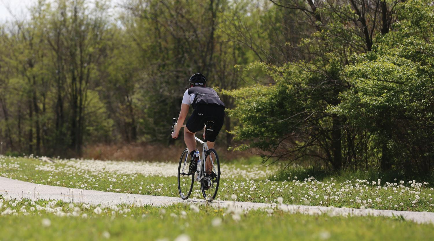
Non-agricultural recreational activities include the Bluegrass Fair, Southern Lights, music festivals, track events, dog shows, cheerleading competitions, basketball, baseball, soccer, archery, indoor basketball and baseball practice, golf, tennis, tennis leagues, swimming pools, extreme sports, fishing, picnicking, walking trail, biking/hiking trail, climbing wall, tire swing, tire pyramid, balance beam, creek activities, camping, yoga, dancing, playgrounds and play structures, tournaments, workshops, guided tours, parties, and events.
Based on their websites, many locations provide venues for conferences, meetings, dining, weddings, receptions, events and private parties. Venues are available at Fasig-Tipton, Keeneland, the Kentucky Horse Park, Spindletop, Masterson Station Park, Hisle Park, Raven Run, Floracliff, Headley-Whitney Museum, Iroquois Hunt Club, Lexington Country Club, The Thoroughbred Center, the University Club, Bluegrass Christian Camp, Genesis Center, Gardens at China Grove, Prometheus Farm, Botanica Farm, Kelly Farm, Boone Creek Outdoors, Bluegrass Stockyards, wineries and bed and breakfast establishments.
Religious
There were 82 parcels with a religious use or owned by a religious organization, including:
• 61-acre farm owned by a church with a large unused parking lot
• Bible College, Bluegrass Christian Camp, preschool, cemeteries
• residences, recreation and 5 parcels that were parking lots
• 20 parcels were vacant, of which 10 were in a Rural Settlement and three in Buffer Areas
• a parcel on the National Register of Historic Places (Walnut Hill Presbyterian)
• seven parcels were in Buffer Areas, one parcel was in Natural Area, 42 parcels were in Core Agriculture, 32 were in Rural Settlements, 4 parcels were in Rural Subdivisions, and 12 in Crossroad Clusters
• four parcels are zoned B-1 and 24 parcels are zoned R-1D (all except one B-1 are in Rural Settlements)
Residential
Using the 2013 aerial photography, 2,316 (68%) of the parcels under 40 acres in size had a residential structure. 935 (40%) of the parcels were in Buffer Areas, Small Lot Residential or Rural Settlements. 705 (30%) of the parcels were in a rural subdivision or crossroad cluster. Of the 30% remaining parcels in Core Agriculture or Natural Area, 1/3 of them were owned by adjacent farms. There were nine parcels in Small Lot
Residential, 136 parcels in Rural Settlements, and 57 parcels in rural subdivisions were vacant.
Rural Land Management Plan, Chapter 2 | 41 •
An example of non-agricultural recreation is the Legacy Trail, which is heavily utlized by citizens.
Multiple Housing Units per Parcel
Using aerial photography, there appeared to be 78 parcels with more than one residence on the parcel. All except two of the parcels in Group Quarters were less than 40 acres in size.
Group Quarters:
• 2-acre nursing home in Small Lot Residential
• 27-acre Bluegrass Boys Ranch in Core Agriculture
• 40-acre Greenhouse 17 (domestic abuse facility) in Core Agriculture
Utilities
There are 18 parcels totaling 261 acres with a utility use. Parcels are owned by AT&T, Columbia Gas, East Kentucky Power, Kentucky American Water Company, Kentucky Utilities and LFUCG. Uses include substations, a waste water treatment plant in a Rural Activity Center, a portion of the reservoir, water tanks, stormwater basins, utility buildings, and pump stations. The intake for Fayette County’s drinking water is at the Kentucky River.
Mobile Home Parks:
• a 12-acre M-1P parcel had 99 manufactured homes and 3 vacant spaces. A portion of the park is in Scott County.
• a 10-acre B-3 parcel on Georgetown Road had 60 manufactured homes and 40 vacant spaces.
Known Rental Properties:
• a 20-acre parcel with 10 houses on it, a >40 acre parcel with 4 houses, and a >40 acre parcel with 6 houses on it
• an abandoned apartment building in the Athens Rural Settlement
Transportation
There were 27 parcels totaling 1,044 acres associated with Transportation, including:
• six parcels totaling 16.2 acres owned by the Commonwealth of Kentucky; including two parcels that are vacant, a driveway access, a right-of-way, and an equipment facility
• a vacant parcel owned by RJ Corman adjacent to a rail line
• a parcel that is classified as a county road
• an HOA parcel that provides access to the adjacent farm
• 18 parcels totaling 1,021 acres owned by the LFUCG Airport Board. Parcels expand beyond the designated Airport Rural Activity Center to include area in Core Agriculture
• 10 parcels across from the airport along Parkers Mill Road are vacant; they were once part of a Rural Settlement and some lots have R-1D or B-1 zoning
Policy Emphasis
The policy emphasis for non-agricultural land uses is to allow necessary services to the rural community without them creating a detriment to agricultural operations, natural areas, or residential areas.
Recommendations
1. Continue to explore options and provide high-capacity broadband infrastructure to businesses and homes in the Rural Service Area.
2. Acknowledge the variety of existing non-agricultural land uses that support the Rural Service Area, such as restaurants, gas stations, corner stores, utilities and cell towers; and those land uses with historic and cultural significance, such as historic sites and places of worship. Expansion of, or new non-agricultural uses should only be considered following the guidelines discussed in Chapter 4, Development Considerations.
3. Support only those non-agricultural recreational opportunities and event venues that provide the public with access into the rural landscape while protecting the surrounding agricultural, residential or natural areas; or ones that provide general recreation to residents within a Rural Settlement. In particular, encourage ecotourism activities that connect people to nature, provide tourism opportunities at state and local parks, and opportunities that showcase historic and cultural assets and trails.
42 | Division of Planning
CHAPTER 3
Land Use Categories
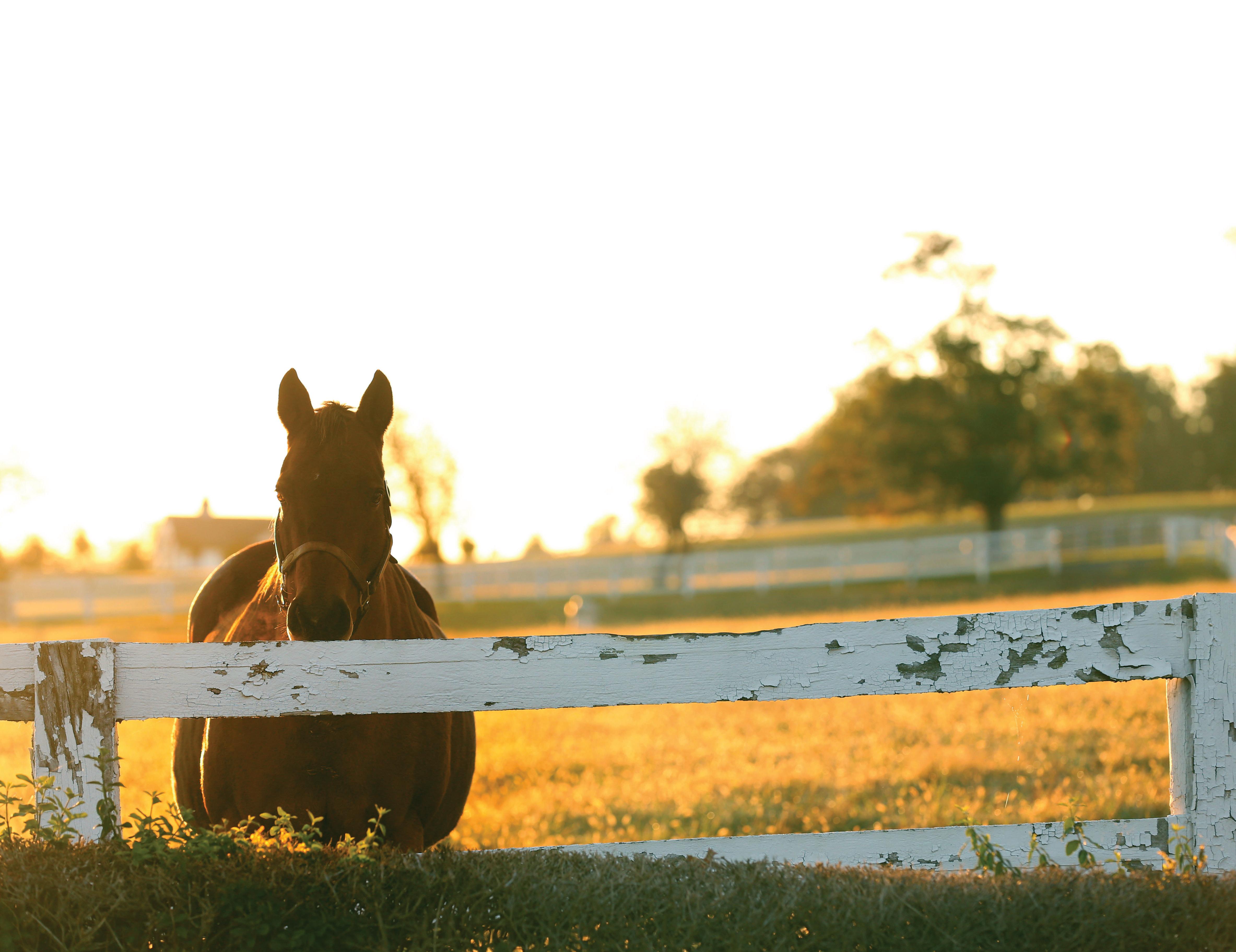
A. Overview
The rural land use categories, as adopted in the 1999 Plan, have become the central planning tool for the management of the Rural Service Area. Based on the successful implementation of the 1999 Plan to adopt the Categories and affiliated zones, the completion of the Rural Settlement Study, and the recent land use inventory, the rural land use categories continue to be relevant today. The Categories should remain the basis for meeting the 2017 goals to preserve a core of land for the agricultural industry, protect environmentally sensitive areas and our rural landscapes, and support our cultural/historic heritage.
Adjustments to the 1999 land use categories reflect a better representation of acreages within the Categories, update changes that have occurred since 1999, or correct errors, including the following:
• Removal of 3,296 acres in the Rural Service Area that are road or railroad right-of-way
• Transfer of 12 acres in the Avon RAC to the 2007 addition of Avon Rural Settlement (RS)
• Transfer of 23 acres in Core Agriculture to the 2007 addition of Little Georgetown RS
• Transfer of 3.4 acres in Core Agriculture to Small Lot Residential (Spindletop Estates Development)
• Transfer of 14 acres from the Blue Sky RAC to circulation (medians in interstate interchange)
• Transfer of 54 acres in Public Recreation to Core Agriculture (Masterson Station Park)
• Transfer of 47 acres in Water to Core Agriculture (reservoir)
The following table is a summary of the land use categories and their relative size:
Table 3.1 – Rural Land Use Categories
44 | Division of Planning
Category Acreage % of RSA Core Agricultural Land 111,048 86.68% Natural Area 8,475 6.61% Rural Activity Center 1,562 1.22% Buffer Area 2,525 1.97% Small Lot Residential 719 0.56% Rural Settlement 505 0.39% Circulation 3,296 2.57 Total: 128,129 100%
Map 3 Land Use Categories
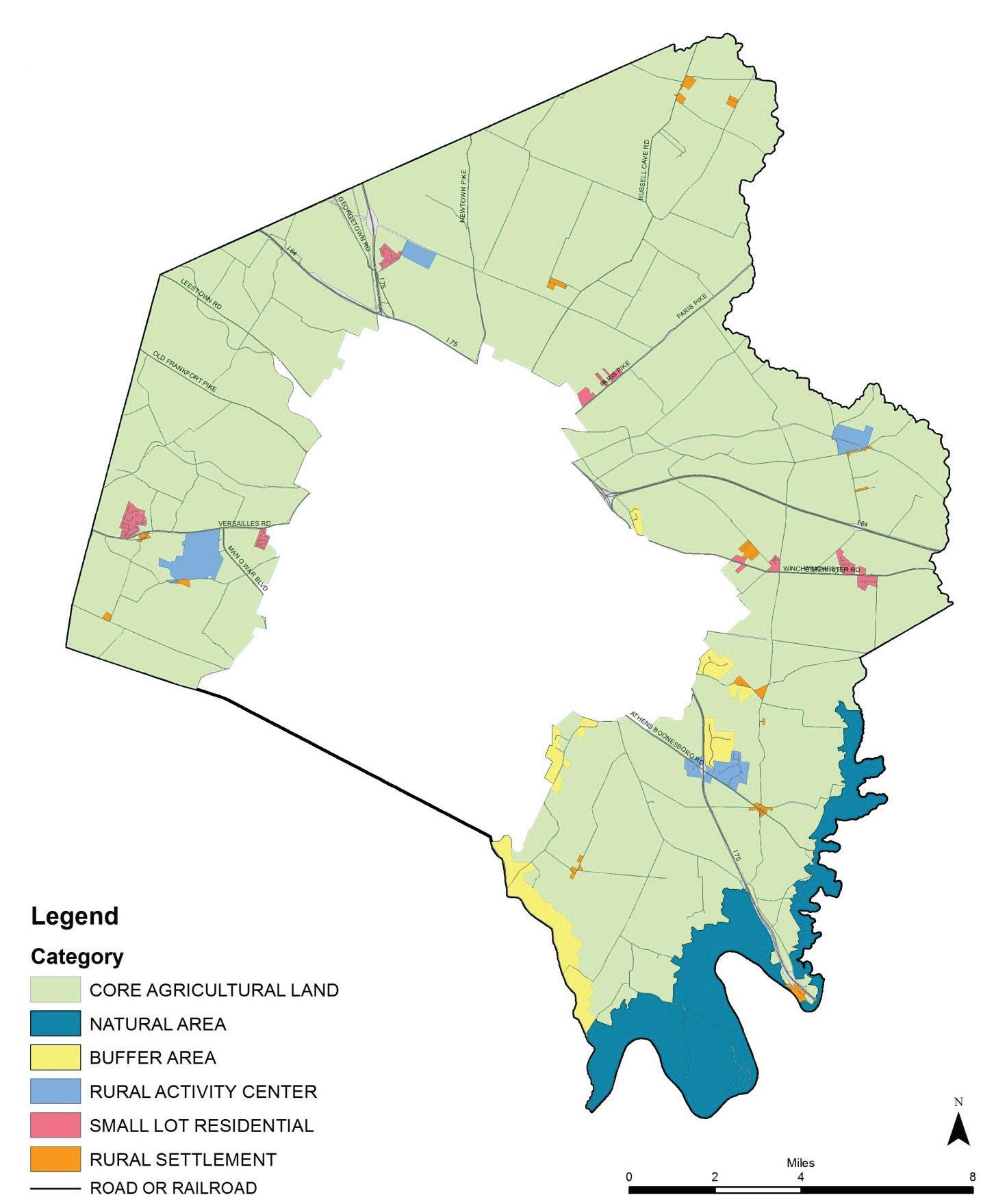
Rural Land Management Plan, Chapter 3 | 45
April 2017
B. Core Agricultural Land (CORE)
Core Agricultural Land is the primary category associated with agriculture in Fayette County. The 111,048 acres is the largest land use category, representing 86.7% of the Rural Service Area. This category consists of fertile lands comprised of at least 50% prime soils or 75% prime/soils of statewide significance. This is the main location for crop and pasture lands, including equine farms that have a high improvement-to-land value ratio.
Core Agricultural Land is the largest land use category, representing 86.7% of the RSA.
There are 2,589 parcels within Core Agricultural Land. Portions of the area are recognized as historic and scenic. The minimum parcel size for newly created lots is 40 acres. The following table represents the number of parcels and acreage by size:
Land use for Core Agricultural Land is predominately agriculture. Ag-cluster establishments/uses include The Kentucky Horse Park, Keeneland, Fasig-Tipton, The Thoroughbred Center, equine hospitals, The Bluegrass Stockyards, wineries, agritourism, B&Bs, animal transportation sales and service, animal disposal, a garden center and nursery, an agricultural high school, university farms, and private farms.
Non-agricultural land uses include a public elementary school, a proposed elementary school, a ballfield complex, radio and television stations, cell towers, utilities, a quarry, a closed landfill, an active solid waste site, three correctional facilities, fire station, two local parks, tennis facility, the Legacy Trail, sculpture/botanic garden, after-school programs, playgrounds, five golf/driving ranges, nature-related areas, motels, kennels, stores, gas stations, event venues, clubhouses and recreation, campground, HOA open space, group quarters, museums, the National Guard Armory, solely residential, religious facilities, a state historic site, vacant lots, and truck leasing.
The LFUCG Airport Board owns 357 acres within Core Agricultural outside of the Airport Rural Activity Center and the Commonwealth of Kentucky controls an additional 314 acres within Core Agricultural outside of the Avon Rural Activity Center.
Policy Emphasis
The policy emphasis for land use in this category is preservation and enhancement of the land for agricultural purposes in order to ensure the continued viability of the local agricultural economy.
* Sixty-seven parcels are split between two land use categories. Six parcels are split with a Rural Activity Center, four are split with a Rural Settlement, forty are split with a Natural Area, and 17 are split with a Buffer Area.
46 | Division of Planning
Parcel Size Range # Parcels Total Acreage* < 5 acres 450 820 5 – 9.99 acres 116 812 10 acres 677 6,812 11 – 19.99 acres 447 6,020 20 – 39.99 acres 223 5,928 > 40 acres 676 90,656
Table 3.2 – CORE parcel distribution
Map 4
Core Agricultural Land
Land Use Category
April 2017
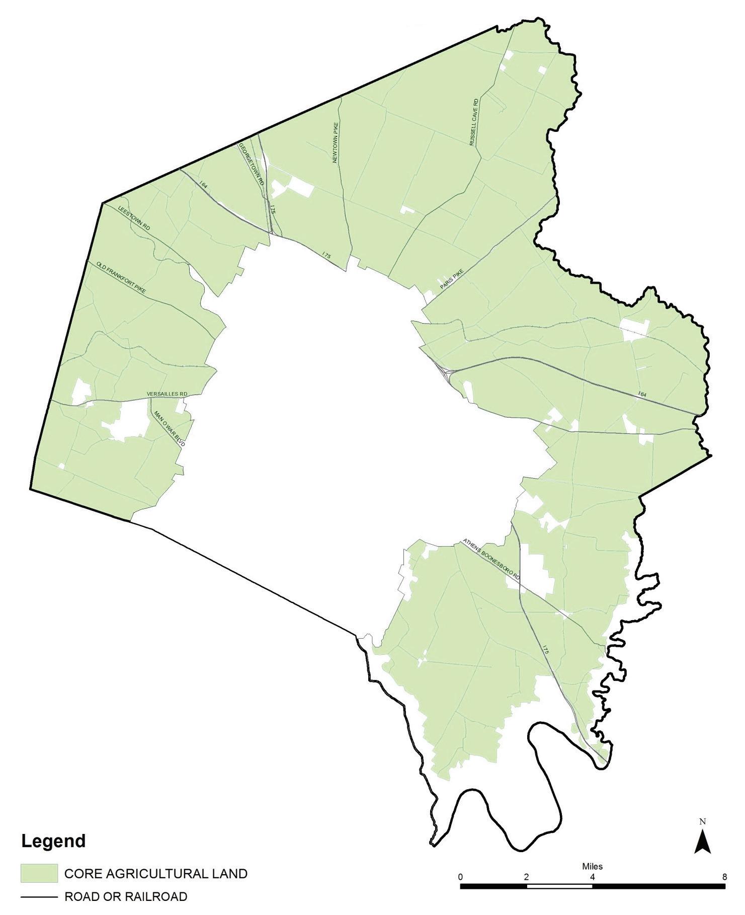
Rural Land Management Plan, Chapter 3 | 47
Recommendations
1. Continue regulatory measures that ensure principal and accessory uses permitted in the associated A-R zone are conducive to agricultural operations and the preservation of the rural character.
2. Continue regulatory measures that ensure parcel size is conducive to agricultural operations and the preservation of the rural character, including the 40-acre minimum.
3. Continue Core Agriculture as a high priority area for the Purchase of Development Rights Program with a goal to preserve a critical mass of land for agricultural uses.
4. Agritourism and cultural tourism should be facilitated in order to improve and manage public access, and to provide supplemental income for farmers and agribusinesses for the enjoyment, education and active participation by the public.
5. The list of permitted non-agricultural conditional uses should be kept to a minimum. All conditional uses shall be appropriately placed and designed in ways that avoid conflict with agricultural uses.
6. Continue to monitor conditional uses.
48 | Division of Planning
C. Natural Area (NAT)
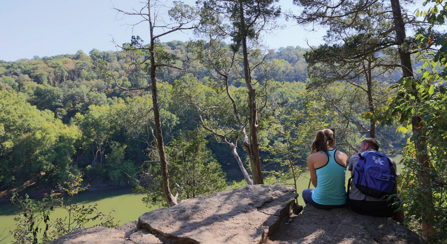
The Natural Area land use category encompasses an area that is a physically unique landscape in rural Fayette County. Located in the extreme southeastern portion of the county, the Natural Area contains 241 parcels totaling 8,475 acres. At 6.61% of the Rural Service Area, it is the second largest land use category.
Land in this area exhibits distinctive characteristics associated with the Kentucky River watershed and its tributaries. Approximately 80% of the land has a high degree of environmental sensitivity; including floodplains, riparian vegetation, the palisades, steep slopes, extended canopy coverage, poorer/thin soils and aquatic and wildlife habitat. Portions of the area are recognized as historic, scenic, and home to rare and unusual flora and fauna. Although agriculture may, and does, occur in portions of the Natural Area, it is not the predominant character or intent of the land use category.
The following table represents the number of parcels and acreage by size in Natural Areas:
Table 3.3 – NAT parcel distribution
*Forty-two parcels are split with another land use category. Three are split with a Rural Settlement and the remainder are split with Core Agriculture Land.
Nature-related land uses in the Natural Area Category include nature sanctuaries, forest, a sports club offering ecotourism activities and a boat ramp. Non-nature-related land uses include agriculture, solely residential, the Iroquois Hunt Club, a quarry, a retreat/camp, a public park, a restaurant, the public drinking water intake and a wedding/events venue.
Since the 1999 Plan, the Agricultural-Natural (A-N) zone was created for this category. The intent of the zone is to preserve the physically unique lands associated with the Kentucky River and its tributaries and to ensure that uses are compatible with conservation and preservation of these lands. However, the only principal permitted uses for the A-N zone are agricultural and single family dwellings. As with Core Agriculture, the minimum parcel size is 40 acres. Agritourism and ecotourism were added as conditional uses in 2016. Upon the approval of the recreational text amendment, two parcels were approved for A-N zoning.
Rural Land Management Plan, Chapter 3 | 49
Parcel Size Range # Parcels Total Acreage* < 5 acres 24 38 5 – 9.99 acres 11 55 10 acres 52 478 11 – 19.99 acres 77 979 20 – 39.99 acres 20 543 > 40 acres 57 6,381
Raven Run Nature Sanctuary is in the Natural Area land use category.
Policy Emphasis
The policy emphasis for land use in this category shall be for the preservation and enhancement of the land, vegetation and water in a natural state with a minimum of intrusions.
Recommendations
1. A text amendment should be considered to allow natural areas, such as nature sanctuaries and forest land, as principle permitted uses in the Agricultural-Natural (A-N) zone.
2. Continue regulatory measures that ensure principal and accessory uses permitted in the associated A-N zone are conducive to minimal disturbance of the land and natural settings.
3. Continue regulatory measures that ensure parcel size, including the 40-acre minimum, is conducive to minimal disturbance of the land and natural settings.
4. The Natural Area land use category shall be a priority area for a Purchase of Development Rights Program. The PDR program should find funding sources to preserve lands which are environmentally sensitive and which can serve multiple purposes associated with the conservation of natural resources and areas; such as providing public access for passive recreation (i.e. hiking and nature trails), protecting wildlife habitat, providing opportunities for environmental education, and other similar uses.
5. All land uses, including agriculture, rural housing and conditional uses, shall be placed and designed to minimize disturbance of the land and natural areas.
6. Ecotourism should be facilitated in order to improve and manage public accessibility to the resources in this area, and to provide supplemental income for property owners and agribusinesses for the enjoyment, education and active participation by the public.
7. Public acquisition of Natural Area land should be priority. A major preserve of 1,000-2,000 acres is desirable. A priority for acquisition should be for locations that would provide links to areas that have already been acquired, where conservation/scenic easements are proposed, or where public access is proposed.
50 | Division of Planning
Map 5
Natural Area Land
Land Use Category
April 2017
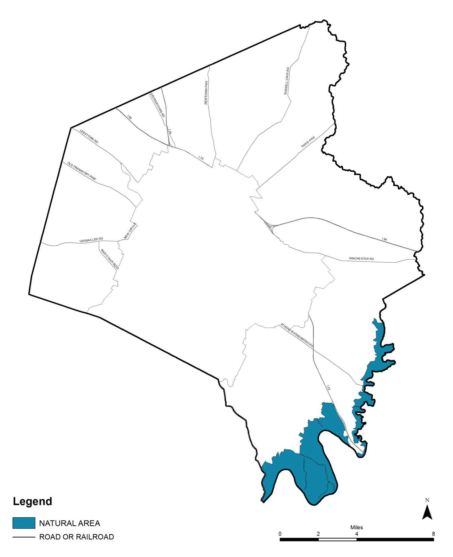
Rural Land Management Plan, Chapter 3 | 51
D. Rural Settlement (RS)
Of the 491 parcels, there are 197 parcels zoned (or partially zoned) R-1D; they are located in the Little Georgetown, Ft. Springs, Maddoxtown, Jimtown, Utingertown/Columbus, and Athens Rural Settlements. There are 151 vacant parcels, of which nearly half (48%) are owned by adjacent property owners. These owners include churches and the LFUCG Airport Board. Nine vacant parcels are zoned B-1. There are 47 parcels zoned (or partially zoned) for business. However, there are only 11 active businesses in use. Four parcels are zoned for industrial adjacent to the Avon RAC and one parcel is in industrial usage.
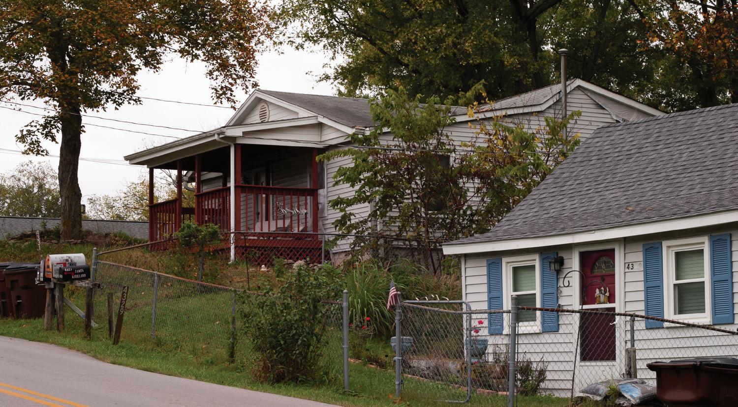
Historic Rural Settlements are essential to the rural character of Fayette County. There are 505 acres within 16 settlements in the Rural Service Area. Since the 1999 Plan, a study was conducted by the University of Kentucky’s Center for Historic Architecture and Preservation. The 2007 Study of Fayette County’s Small Rural Communities updated the land use and parcel inventory, researched each settlement’s history and historic boundaries and proposed recommendations. Changes from the 1999 Plan map include the addition of Avon and Little Georgetown Rural Settlements and boundary line changes to six other Rural Settlements.
There are 491 parcels within the Rural Settlements. Land use in Rural Settlements is predominately residential. There is one ag-cluster business (horseshoes and supplies), numerous churches, stores, restaurants, auto repair, industrial uses, an antiques mall, an indoor athletic recreation, other general businesses, and parking lots.
52 | Division of Planning
Rural Settlements # Parcels Total Acreage Avg. Acreage Range of Acreages Athens 56 46 0.8 0.1 – 5.8 Avon 29 17 0.6 0.1 – 2.2 Centerville 11 5 0.5 0.2 – 0.7 Clays Ferry 62 54 0.9 0.05 – 5.4 Coletown 17 33 1.9 0.1 – 5.7 Columbus 30 55 1.8 0.3 – 8.8 Ft. Springs 36 21 0.6 0.1 – 2.9 Jimtown 27 31 1.1 0.3 – 6.9 Little Georgetown 20 23 1.2 0.03 – 4.3 Little Texas 28 18 0.6 0.1 – 2.0 Loradale 24 66 2.7 0.3 – 17.1 Maddoxtown 47 42 0.9 0.1 – 4.9 Nihizertown 21 31 1.5 0.5 – 4.6 Pricetown 29 30 1 0.1 – 3.5 Uttinger 33 23 0.7 0.05 – 2.1 Willow Ln 21 9 0.4 0.2 – 0.9
Table 3.4 – RS parcel distribution
Little Texas, a rural settlement, is at the intersection of Military Pike and Fort Springs Pinckard Road.
Map 6 Rural Settlement
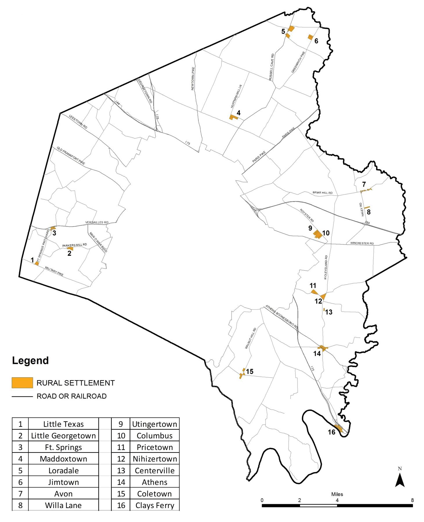
Land Use Category
Rural Land Management Plan, Chapter 3 | 53
2017
April
Policy Emphasis
The policy emphasis for land in the Rural Settlements land use category is the preservation and enhancement of the community from both a use and design perspective compatible with their historic nature.
Recommendations
Recommendations for Rural Settlements include highlights from the 2007 Study of Fayette County’s Small Rural Communities
1. Prohibit any further subdivision or consolidation of parcels unless the action would restore the parcel’s historic lotting pattern.
2. Improve the settlements’ viability and longevity by focusing efforts to stabilize and enhance existing housing, provide new housing opportunities on vacant lots, and support existing businesses.
3. Programs and funding mechanisms should be explored that would offer more protection, explore public/private partnerships and infuse the properties with capital.
4. Consider ND-1 or H-1 overlays, Small Area Plans or National Register of Historic District designation in order to protect the character of Rural Settlements. Evaluate compatible infill and rehabilitation opportunities and detail specific preservation strategies.
5. Implement the recommendations from the 2007 Study of Fayette County’s Small Rural Communities and refine the implementation process for achieving action.
54 | Division of Planning
Historic Rural Settlements are essential to the rural character of Fayette County.
E. Buffer Area (BUF)
This land use category encompasses the areas that can serve as buffers between conflicting urban uses and/or between higher intensive uses in adjoining counties and agricultural land. All but one of the buffer areas are located on or near the edge of the Urban Service Boundary. The other buffer area is along Tates Creek Road, and it is intended to transition from possible incompatible land uses in Jessamine County. Buffer Areas are predominated by lots that are ten acres or less in size. The total land area for this category is 2,525 acres.
Since the 1999 Plan, the Agriculture-Buffer (A-B) zone was created for this land use category. The intent is to separate the conflicting uses by requiring appropriate landscaping, fencing and compatible uses. The principal permitted uses for the zone are agricultural and single family dwellings. A 10-acre minimum is required. There are only nine parcels with an A-B zone; all are contiguous lots created in 2005. Zoning for the remaining parcels are four parcels zoned B-1, 24 parcels zoned R-1A, and the remainder are zoned A-R. All seven Buffer Areas are in the eastern/southeastern portion of the Rural Service Area. Of the total 210 parcels, 107 of them are in a rural subdivision. The remainder are along a county or state road.
The land uses for parcels in the Buffer Area, as they appeared from the windshield survey and 2013 aerial photographs, were: 50% solely residential, and approximately 14% were agriculture (all of which are contiguous to adjacent parcels in agriculture). The remainder of the parcels were primarily residential with an agricultural facility/operation onsite, or other uses; such as vacant lots, religious properties, store, athletic fields, a kennel and one 50-acre parcel that is wooded.
Twenty-two percent of all Buffer Area parcels are contiguous; 87% of these adjoining parcels are either totally in agriculture or a residential/ agricultural mix. They include:
• Tates Creek Road: four contiguous lots totaling 40 acres (house and farm)
• Tates Creek/Delong Roads: 11 parcels, ranging from 2-20 acres, are a portion of Overbrook farm
• Canebrake Subdivision: 13 parcels in common ownership (farm)
The Canebrake Subdivision off Athens Boonesboro Road is a Buffer Area wedged between the Blue Sky Industrial Park and I-75. The subdivision has 27 lots, of which 24 are 10-acre parcels. There are only four residences built, and Sayre School has its athletic facilities on one 50acre tract. The remaining 22 parcels are vacant/agriculture, including one 22-acre lot and one 42-acre parcel without road frontage.
There are 12 parcels between 20 and 226 acres in size with sufficient road frontage that have the potential for subdividing. All are along Tates Creek Road except for three parcels on Canebrake Court.
Rural Land Management Plan, Chapter 3 | 55
Buffer Area # Parcels Total Acreage Avg. Acreage Range of Acreages Ami/Hume Rd 24 89 3.7 2.7 – 14.7 Canebrake Dr 27 361 13.3 9.4 – 50.2 Delong Pl/Cir 27 275 10.2 7.8 – 12.9 Delong Rd 11 75 6.8 1.2 – 12.3 Tates Creek Rd 84 1,376 16.4 0.3 – 226.2 Todds Rd 13 106 8.1 0.4 – 15.6 Todds Station 24 241 10 9.4 – 11.5
Table 3.5 – BUF parcel distribution
Policy Emphasis
The policy consideration for Buffer Areas is to create suitable transitional areas between urban or higher intensity uses and Core Agricultural Lands or Natural Areas. Land uses should be predominately residential and/or smallholder farm uses.
Recommendations
1. Continue regulatory measures associated with the A-B zone to ensure that parcel size, usages and design can provide a transition between incompatible uses and agriculture, including:
a. the 10-acre minimum parcel size
b. principal, accessory and conditional uses
c. the monitoring of conditional uses
d. appropriate buffer yard plant material and fencing
2. Any proposed development or use must be rigorously reviewed to ensure it is compatible with any housing on the parcel, housing in its vicinity, or with surrounding agricultural activities.
56 | Division of Planning
Map 7 Buffer Area
Land Use Category April 2017
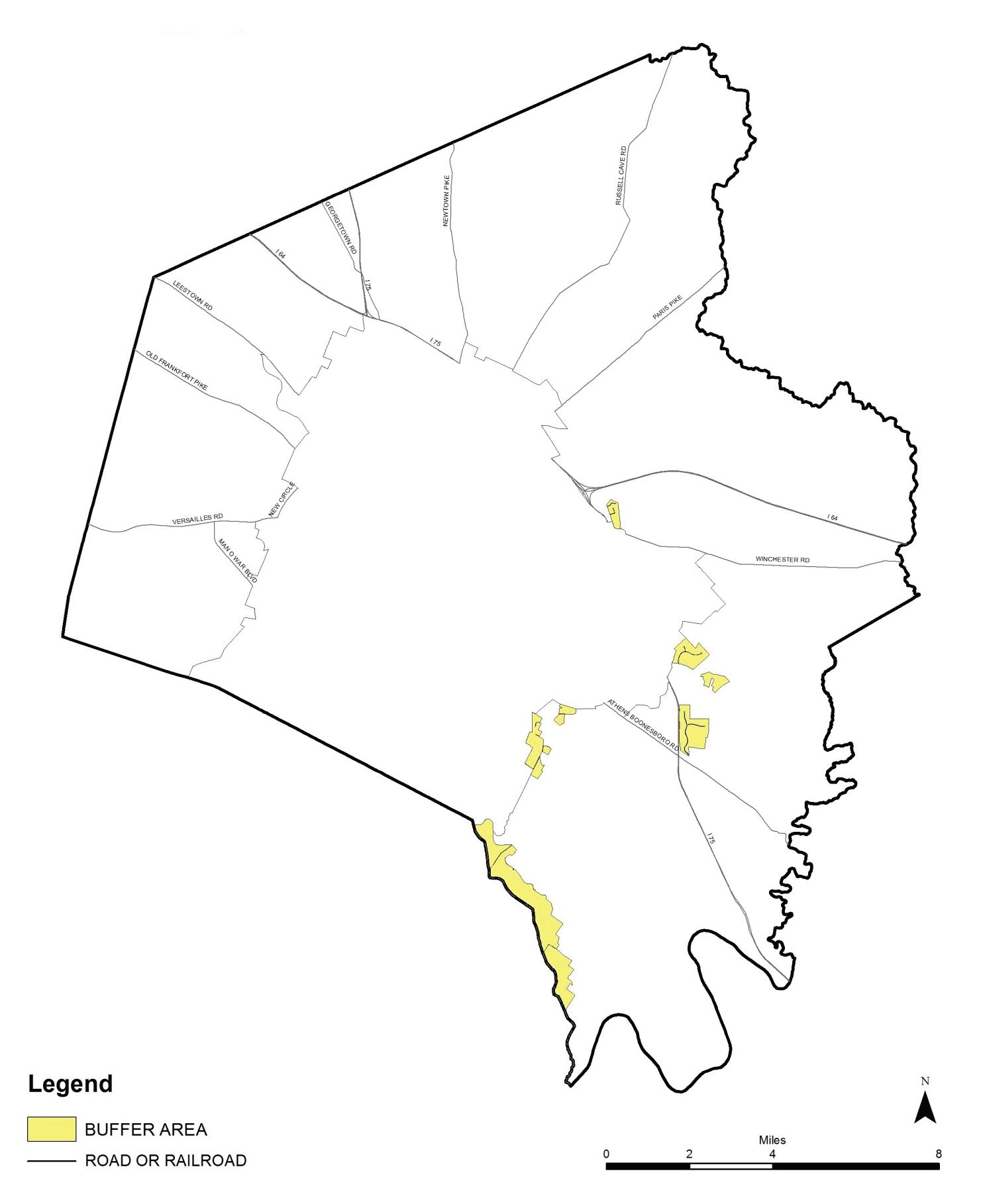
Rural Land Management Plan, Chapter 3 | 57
Map 8
Parcels with Potential for Subdivision in the Buffer Areas
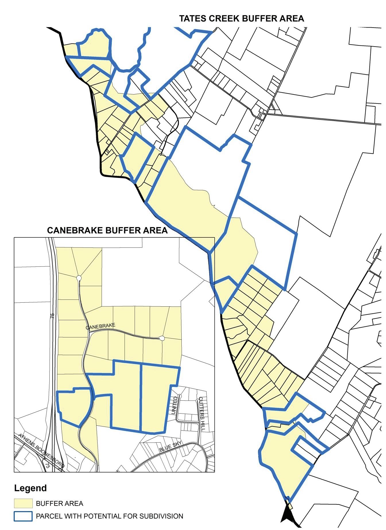
April 2017
58 | Division of Planning
F. Small Lot Residential (SLR)
This category encompasses residential areas in the Rural Service Area, which are not associated with historic rural settlements. These areas are predominately post-World War II “suburban estate” developments created prior to the institution of the 10-acre minimum of 1964. The total land area for this category is 719 acres, and 92% of the 514 lots are under two acres.
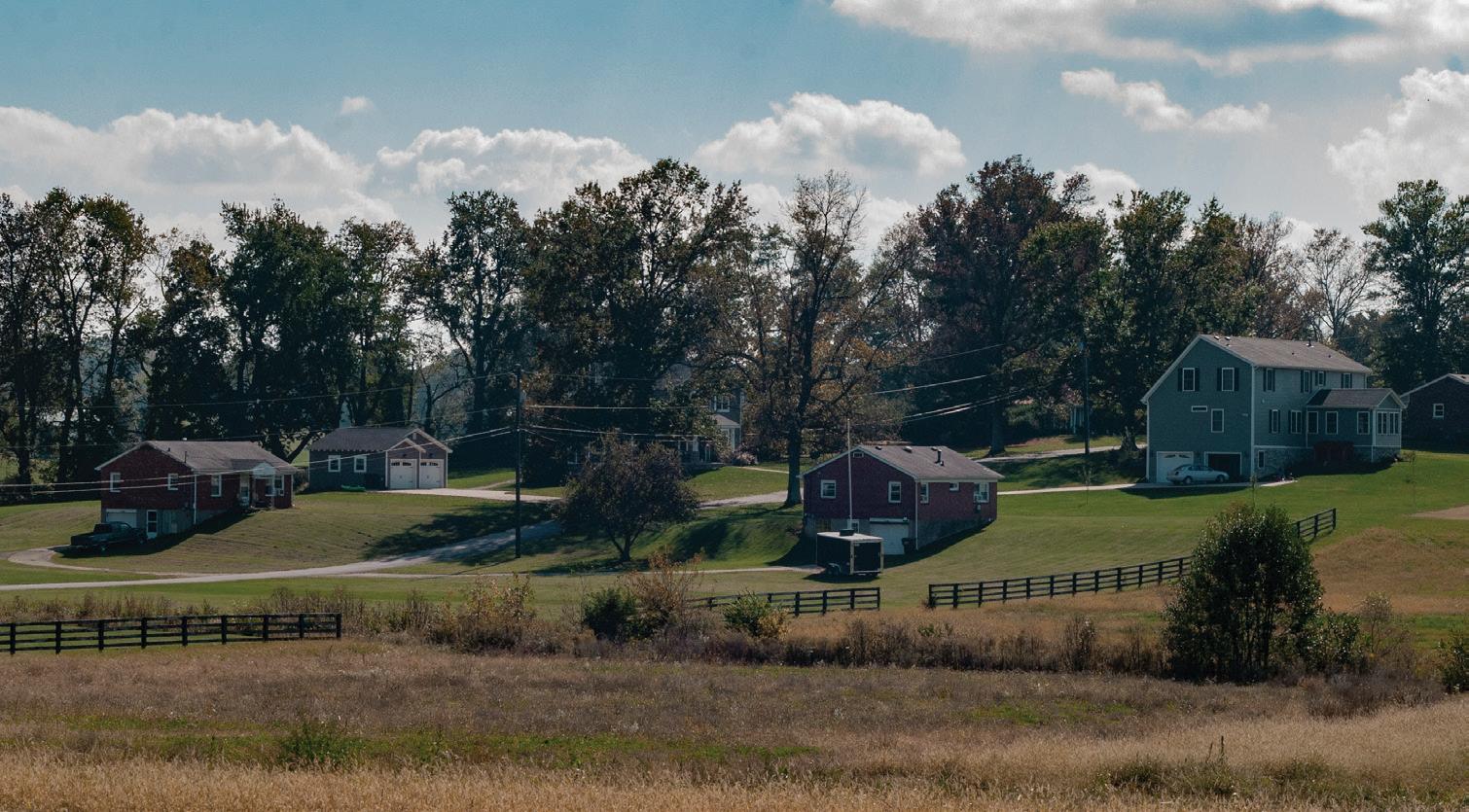
small tracts, and conflicts between farm operations (particularly livestock/ horses) with subdivision property owners and their household pets. Other land uses include utilities, businesses, a fire stations, and a nursing home. Only 9 of the 514 parcels are vacant; of which 7 are contiguous lots.
Policy Emphasis
*Swigert lots are split with remainder in the Urban Service Area.
These residential developments exist in the rural domain as urban anomalies. Most are self-contained subdivisions while a few of them are clusters of small lots along rural roads. They have the potential to create adverse conditions for adjoining agricultural activities due to their suburban development pattern, traffic generation, septic facilities on
The policy emphasis for the Small Lot Residential land use category is to prohibit expansion or creation of any new Small Lot Residential areas.
Rural Land Management Plan, Chapter 3 | 59
Elam Village Drive, located off of Winchester Road, is an example of Small Lot Residential.
Small Lot Residences # Parcels Total Acreage Avg. Acreage Range of Acreages Carterbrook Lane 17 19 1.1 0.3 – 4.1 Dan Patch Drive 79 93 1.2 0.9 – 1.9 Eastpoint Drive 54 85 1.6 0.9 – 11.2 Elam Village Drive 15 15 1 0.5 – 1.4 Kensington Way 56 59 1 0.9 – 1.4 Paris Pike 8 39 4.9 1.3 – 9.9 Rivera Drive 53 72 1.4 0.8 – 6.6 Rolling Hills Drive 48 46 1 0.3 – 4.2 Swigert/Blue Ribbon* 21 64 3.1 0.1 – 8.4 Westmoreland Road 144 186 1.3 0.9 – 7.1 Winchester Road 2 17 8.5 0.6 – 16.4 Winchester/ Windowpane Ln 17 24 1.4 0.2 – 3.5
Table 3.6 – SLR parcel distribution
Recommendations
1. No existing lots within these subdivisions shall be permitted to be further subdivided.
2. The total number of principal units shall not exceed the number approved originally. In isolated cases where additional homes may be built on vacant lots within previously approved subdivisions:
a. Building setbacks for principal and accessory buildings should be established at the depth typical for the development to improve design compatibility for these areas.
b. Buffer yard regulations for fencing and plant material adjoining agricultural areas shall be followed.
60 | Division of Planning
Map 9
Small Lot Residential Land Use Category
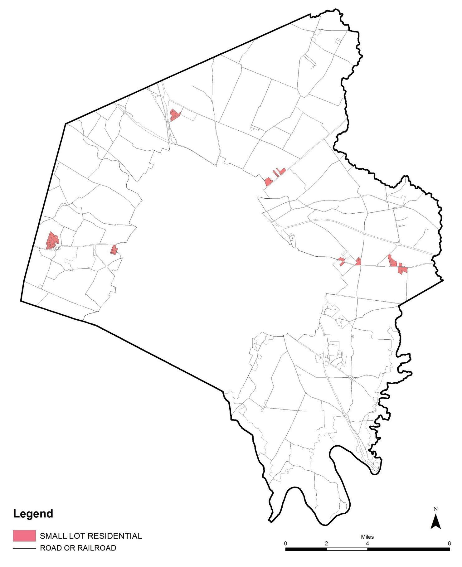
April 2017
Rural Land Management Plan, Chapter 3 | 61
G. Rural Activity Center (RAC)
The four Rural Activity Centers were first identified in the 1980 Comprehensive Plan as hubs of existing employment. Over time, they have not been eligible to receive major public investments for urban services. However, they have received specific public facilities and services to accommodate the planned amount of non-residential land uses.
The total acreage for all Rural Activity Centers is 1,562. The 1999 Rural Service Area Land Management Plan recommended that the boundaries of the Rural Activity Centers should not change. However, two of the publicly/quasi-publicly-owned RAC’s with autonomous jurisdiction (the Airport and Avon) have since added land to their properties outside of the boundary. Yet, because it is possible that in the future these additions will no longer be operated as a Rural Activity Center, the recommendation to maintain RAC boundaries unchanged from the 1999 Plan is still endorsed.
Blue Sky Industrial Park
Located at the intersection of Athens-Boonesboro Road and I-75, this 406-acre area is the only RAC not in public ownership. It is recommended primarily for warehousing, light industrial and interstate commercial development. However, many parcels zoned industrial are underutilized surface car lots.
Of the 113 parcels zoned industrial, 100 parcels are under five acres in size, and 58 parcels are less than one acre in size. Along with the industrial uses, Highway Commercial uses exist which include gas stations, restaurants, five motels and adult entertainment. Much of this B-5P land east of the interstate is heavily wooded or farmed and has development restraints due to topography.
Zoning for Blue Sky RAC includes the following:
• A-R – 1 parcel
• B-3 – 5 parcels
• B-3 & I-1 – 2 parcels
• B-5P – 23 parcels
• B-5P & A-R – 1 parcel
• B-5P, B-3 & I-1 – 1 parcel
• I-1 – 113 parcels
• P-1 – 1 parcel
In response to the 2011 EPA Consent Decree, the Lexington-Fayette Urban County Government closed the sewage treatment plant and connected the industrial park to the municipal sanitary sewer system.
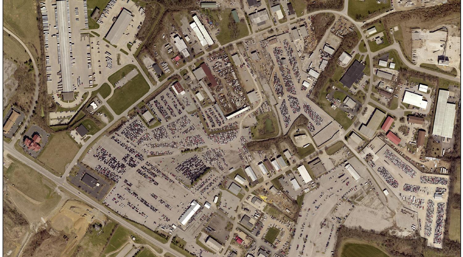
Avon (Blue Grass Station)
Located on Briar Hill Road and Houston-Antioch Road, this 271-acre RAC is under the control of the Commonwealth of Kentucky except for 5 parcels totaling 79 acres along Houston Antioch Road that are privately
62 | Division of Planning
Blue Sky Industrial Park is a RAC in the eastern portion of the county.
owned. The land use and zoning for these 5 parcels are industrial (2 parcels totaling 36 acres) and residential or residential/agriculture (3 parcels totaling 43 acres). The recommended land use for the RAC is office/warehouse and light industrial. There are several tenants located in the State’s portion of the RAC, including Lockheed Martin who contracts for the U.S. Department of Defense. An additional 469 acres outside of the RAC boundary are also controlled by the Commonwealth of Kentucky.
Spindletop Research Park
Located at the intersection of Iron Works Pike and Berea Road, this 178 acre RAC is owned by the Commonwealth of Kentucky. It is recommended for professional office uses; tenants include the Asphalt Institute. The Legacy Trail runs through the office-park and a staging area at the research park is accessed from Berea Road.
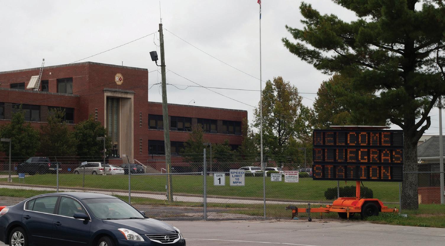
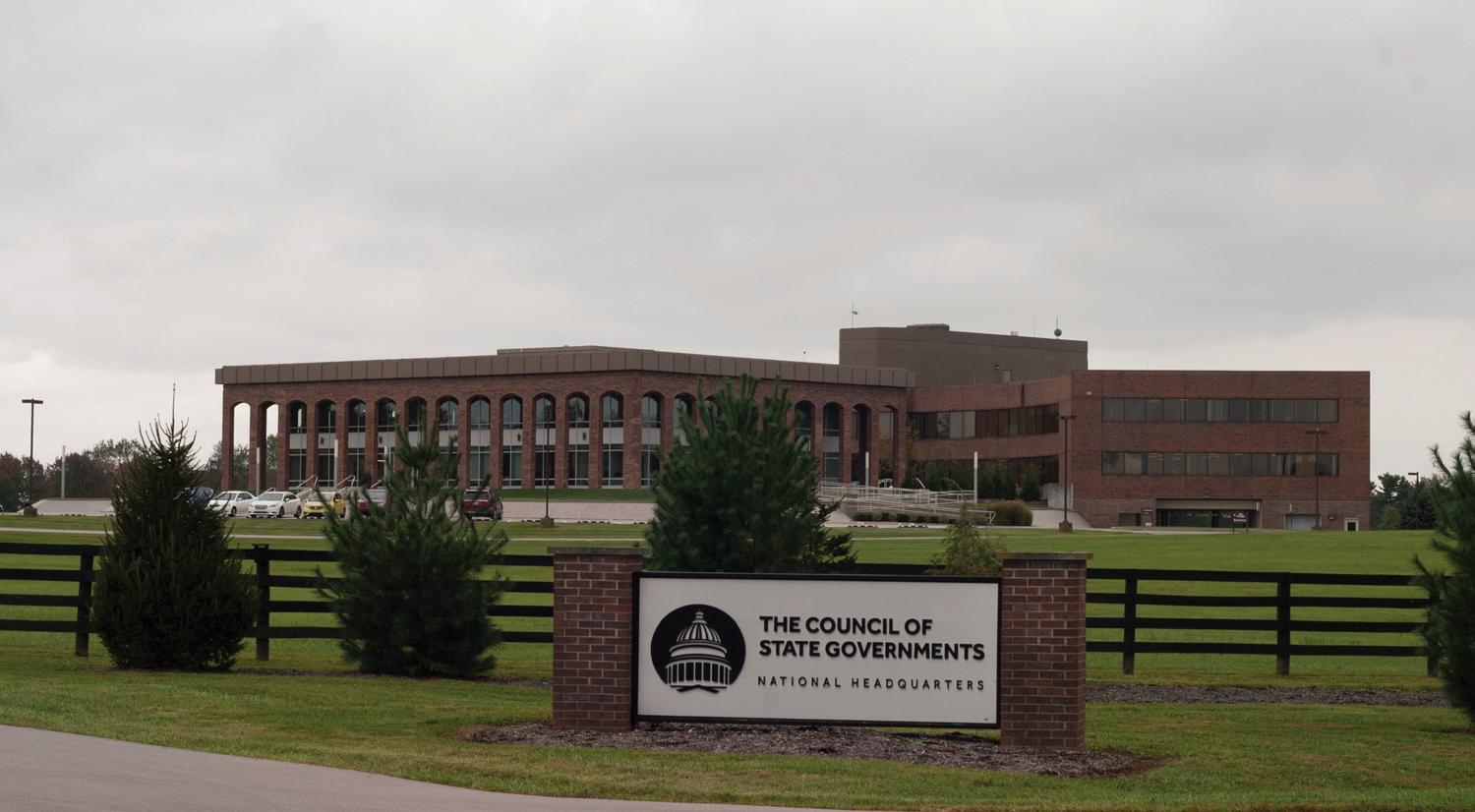
Blue Grass Airport
Located at Versailles Road and Man o’ War Boulevard, the 707-acre Airport RAC is owned by the Lexington-Fayette Urban County Airport Board. Since the 1999 Plan, the Airport Board acquired another 314 acres and constructed an additional runway outside of the RAC boundary to improve safety. In addition to the terminal, the RAC includes warehousing and office uses to support the facilities and the LFUCG Police shooting range. The Board owns 27 acres within eight parcels south of Parkers Mill Road; four of the parcels are in the Little Georgetown Rural Settlement and the remaining four parcels are within the RAC boundary.
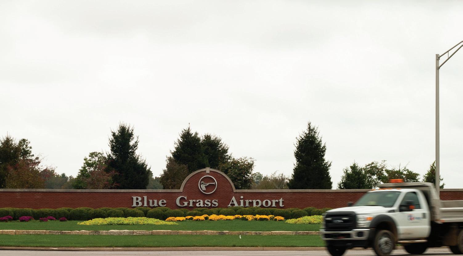
Rural Land Management Plan, Chapter 3 | 63
Spindletop Research Park is a Rural Activity Center in the northern part of the county.
The Blue Grass Airport, a Rural Activity Center, is in the western part of the county.
Avon (Bllue Grass Station) is a Rural Activity Center in the northeastern portion of the county.
Policy Emphasis
The policy emphasis for Rural Activity Centers is to maximize their potential for jobs while maintaining their boundaries and minimizing impacts to the rural area.
Recommendations
1. To ensure the protection of rural farm uses, prevent inappropriate growth pressures on farmland, and to eliminate premature and costly noncontiguous growth, there should be no changes made to the existing boundaries for the Rural Activity Centers at this time or new centers created. However, the RACs should continue to be periodically reviewed as a part of the comprehensive planning process.
2. Maximize employment potential within the existing boundaries of the Rural Activity Centers while avoiding impacts to surrounding agriculture, Rural Settlements and viewsheds.
3. Conduct a Small Area Plan for Blue Sky RAC in order to evaluate its potential for maximizing jobs and economic development.
4. Modification to the boundaries of any of the Rural Activity Centers should only be considered after extensive studies regarding land needs, the adequacy of sewers and other pertinent factors. The modification must be in substantial agreement with the Comprehensive Plan as a whole or an individual Small Area Plan. Other considerations to include are impacts from the proposed expansion’s location and extent on traffic, noise, the environment and viewsheds. Design would have to provide adequate screening and buffering to protect surrounding agricultural uses and residential properties from the negative effects of the more intensive uses contemplated for the Rural Activity Centers.
64 | Division of Planning
Map 10
Rural Activity Center
Land Use Category
April 2017
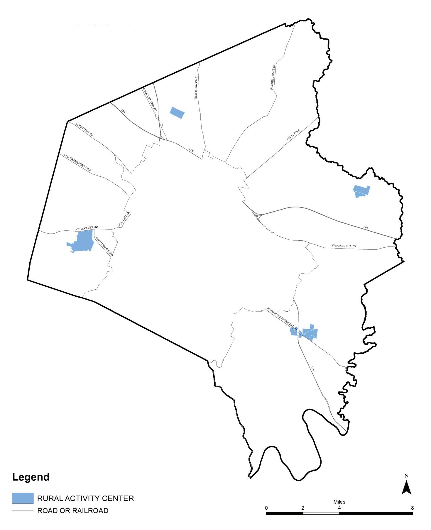
Rural Land Management Plan, Chapter 3 | 65
66 | Division of Planning
CHAPTER 4
Special Plan Elements
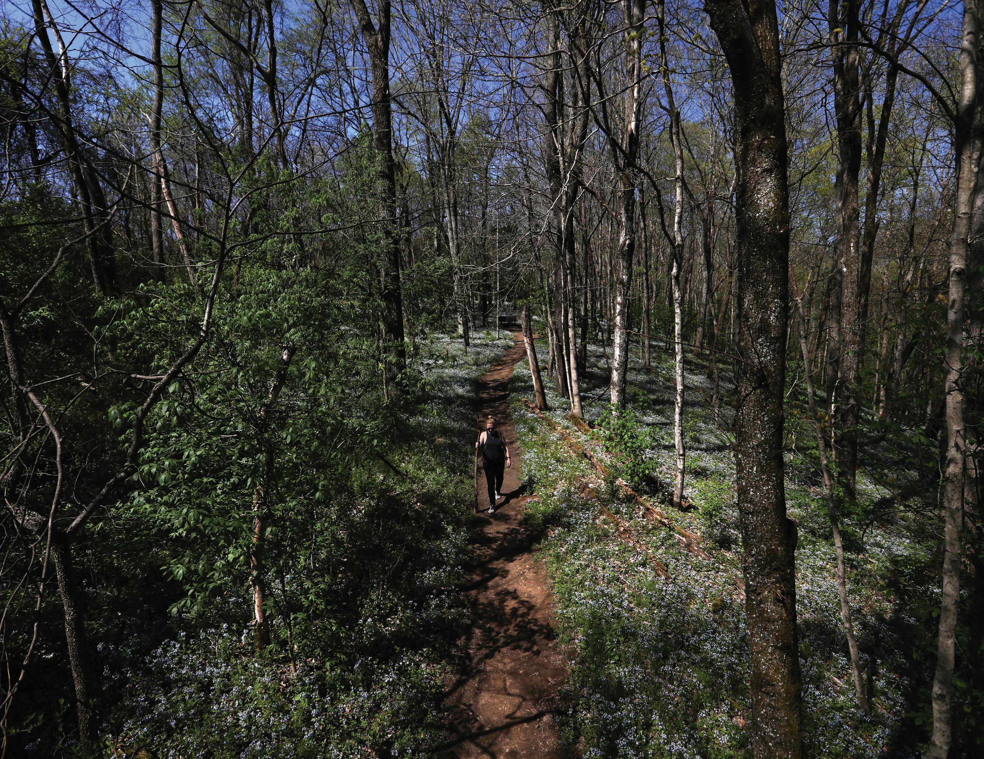
A. Overview
The scope of planning for the Rural Service Area extends beyond the land use categories described in Chapter 3. There are special plan elements found throughout the rural area that need specific analysis and policy recommendations. These elements are superimposed over the land use categories as another layer of consideration in the planning and management of the RSA to ensure that the goals and objectives in Chapter 1 are met.
The special plan elements include the following: natural resources, historic and cultural landscapes and rural heritage, rural transportation, tourism, the Purchase of Development Rights Program and development considerations.
Green Infrastructure
Some of the Special Plan Elements from the 1999 Plan, such as Environmentally Sensitive Areas (ESAs), Rural Road Aesthetics, Special Natural Protection Areas and Rural Greenways, have since gained an elevated status through the introduction of green infrastructure in the 2007 Comprehensive Plan. Green infrastructure is an interconnected network of landscapes and natural resources that contributes to health and quality of life for the environment and citizens of Lexington-Fayette County. Within the Rural Service Area, green infrastructure stands out, with an intact natural landscape composed of ESAs, natural areas and greenways predominating the southeastern section of the county, a cultural landscape with iconic farms and scenic rural roads encompassing the remaining countryside, and soil, water and biotic natural resources that are of exemplary quality.
Infrastructure is defined as the underlying foundation on which the continuance and growth of a community depends. Like gray infrastructure, designating natural resources and landscapes as infrastructure raises
them equally as essential and necessary to the functioning of the community. Green infrastructure planning broadens previous preservation efforts by recognizing it as the fundamental framework for meeting current and future ecological, economic and social needs. Decisions about the natural landscapes, cultural landscapes and natural resources located in the Rural Service Area have socioeconomic consequences as well as environmental. As stated in the 2013 Comprehensive Plan, successful implementation of green infrastructure planning requires that it is considered and incorporated into plans and policies for land use, transportation and economic development.
Green infrastructure is an interconnected network of landscapes and natural resources that contributes to health and quality of life for the environment and citizens of Lexington-Fayette County.
Ecological, economic and community services provided by rural green infrastructure are critical, not just for the RSA, but also the urban areas and region. Examples are below.
Economic Services
• makes agricultural industry possible
• provides working lands and employment
• attracts/retains workforce through quality of life
• attracts tourists and provides recreational opportunities
• appreciates value over time
• lowers public and private costs for health care
68 | Division of Planning
Ecological Services
• filters, cools and cleanses water
• supplies drinking water and irrigation
• maintains streams, wetlands and aquifers
• regulates hydrological cycle
• cleanses the air
• sequesters carbon
• regulates local climate
• provides evapotranspiration
• provides pollinators and photosynthesizers
• provides energy exchange, food and fuel
• stores and recycles nutrients
• decomposes waste
• provides important plant-animal interactions
• maintains biodiversity, habitat and wildlife corridors
• conserves and develops soils
• conserves native biota
• builds resilience against future weather extremes
• creates a green infrastructure network
Community Services
• connects people to nature and outdoors
• provides recreational and leisure opportunities; integrates nature into recreation
• reinforces values
• provides greenspace and visual relief
• shapes and protects the natural, historic and cultural heritage and landscapes
• provides opportunity for appreciation and inspiration from natural and cultural heritage
• improves quality of life
• contributes to a desirable place to live
• maintains and improves mental, emotional, social, and physical health and wellbeing
• provides beauty, enhances scenery; protects viewsheds; provides visual interest
• enhances community, placemaking, coherent identity, character, and sense of place
• integrates rural natural and cultural assets into sustainable land use planning
• provides opportunity for learning and scientific study
• provides opportunity for environmental responsibility
Rural Land Management Plan, Chapter 4 | 69
B. Natural Resources
Besides the recreational and leisure opportunities that nature can provide, there are important physical, mental and cognitive health benefits when residents from the urban community can interact with natural areas and greenspaces.
The 1999 Land Capability Analysis defined the boundaries of an extensive inventory of environmentally sensitive areas (ESAs) that totaled 38,261 acres, or just under 30% of the entire RSA. The ESAs identified in 1999 were primarily stream corridors, karst areas (sinkholes), steep slopes, areas of poor soils, wetlands, mature tree stands, and similar areas. Of special concern was the recharge area of the Royal Spring Aquifer. Covering 7,687 acres, the Aquifer was 20% of the Environmentally Sensitive Areas identified in 1999. An additional 8,850 acres of the identified ESAs formed the basis for the newly created Natural Areas land use category (NAT). Excluding the Aquifer acreage, the NAT acreage is 29% of the 1999 Environmentally Sensitive Areas.
ESAs, as defined by the LFUCG Subdivision Regulations, are those areas that have “environmental problems with regard to development.” That is why poor soils are listed as an ESA but fertile soils are not. Restricting an inventory to only the areas relevant for urban development is both limiting and at cross-purposes with nature conservation. By embracing the full scope of green infrastructure, ESAs become a component within an interrelated system; incorporating biotic (flora and fauna) and physical (soil, hydrology) natural resources are included in the total picture of natural assets.
Natural Resources include biotic (flora and fauna) assets and physical properties (soil, hydrology). Natural resources are defined as “something, such as a forest, a mineral deposit, or fresh water that is found in nature and is necessary or useful to humans.” Indeed, the list of ecological services on page 55 points out that they are essential for all life itself. Many of the listed economic and community services come from our natural resources as well. Economically, the inner Bluegrass region is fortunate to have water and soils whose properties support a high quality of agricultural production. In fact, it is the high mineral content in the water and soils that has been cited as one of the reasons for the region’s success in the raising of thoroughbred horses. The underlying limestone not only provides the high mineral content for agricultural purposes, but also a supplies productive quarry in the RSA. Besides the recreational and leisure opportunities that nature can provide, there are important physical, mental and cognitive health benefits when residents from the urban community can interact with natural areas and greenspaces.
Natural Landscape includes those areas/hubs with a concentration of natural resources, including agricultural lands, nature sanctuaries, and lands with character-defining features, such as a large expanse of trees, habitat, steep slopes and interconnecting corridors.
Soils
There are 22 soil series identified in Fayette County, six of which total 80% of all soils in the RSA. Most of the soils are deep to very deep and moderately to highly productive. Soils in Fayette County are extremely fertile; prime farmland soils cover 73,998 acres and soils of statewide significance cover an additional 38,150 acres. Combined, prime farmland and soils of statewide significance are 88% of the Rural Service Area. Those areas without fertile soils are primarily non-agricultural lands, including the Natural Area, Rural Activity Center, Residential Area and
70 | Division of Planning
Map 11
Soils & Conservation Easements

January 2017
Rural Land Management Plan, Chapter 4 | 71
Rural Settlement land use categories. Approximately 30% of LexingtonFayette County’s pre-settlement prime farmland and 30% of the soils of statewide significance have been removed from production, in favor of urban development.
Water Resources
Hydrology in the Rural Service Area consist of the Kentucky River, numerous creeks and tributaries, spring-fed ponds and wetlands. From the underlying limestone rock, a karst topography formed; therefore, sinkholes, underground streams and caverns can be expected. Drainage corridors across the county vary greatly; from flat lands with no riparian buffer, to steep slopes that are heavily forested.
Stream corridors are essential to creating a green infrastructure network. They provide linkage between and within agricultural and natural landscapes, which enables an expansion in services beyond the boundaries of isolated areas/hubs of resources and natural areas.
Facts about water resources in the Rural Service Area include:
• Only the Kentucky River, 2.5 miles of the South Elkhorn Creek and 15 miles of the North Elkhorn Creek have a stream order of 3 or greater, indicating significant size.
• There are 500 miles of streams within the RSA.
• There are 45 acres of the Jacobson Reservoir.
• There are 7,783 acres of FEMA floodplain.
• 90% of the 1,006 wetlands are impounded or diked.
• The centerline of the Kentucky River forms 14 miles of Fayette County’s southeastern border. The 14 mile-stretch is approximately 300 feet wide and ranges between 15-40 feet deep. The River is the primary source of drinking water for Fayette County residents.
• The drinking water source for Georgetown and Scott County is the Royal Spring Aquifer; 47% of the Aquifer recharge area is located in the Rural Service Area.
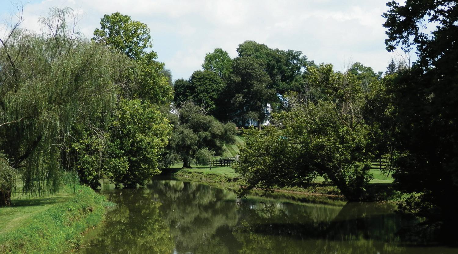
• According to the Integrated Water Quality 305 (b) Report (2014), the following streams are impaired for designated uses: Cane Run, David Fork, East Hickman, Kentucky River, North Elkhorn, South Elkhorn, Steeles Run, Town Branch and portions of Baughman Fork and Boone Creek. Of the streams assessed, only the remaining portions of Baughman Fork and Boone Creek are not impaired. Impairment is primarily for warm water aquatic habitat.
• Major watersheds include the following:
○ North Elkhorn – 56,129 acres
○ South Elkhorn – 24,185 acres
○ Boone Creek – 19,796 acres
○ Cane Run – 18, 201 acres
○ East Hickman – 17,420 acres
○ Kentucky River – 11,758 acres
○ Town Branch – 11,681 acres
○ Wolf Run – 6,494 acres
Flora and Fauna
Before the European settlement of Kentucky began in the late 1700s, large areas of the Bluegrass were covered with cane and running buffalo clover. These plants provided food for the wildlife that was abundant in the region. Today, very little is left of native plants. However, according to local forest scientist, Dr. Tom Kimmerer, many of the venerable trees
72 | Division of Planning
North Elkhorn Creek is an essential water resource to the northern portion of the county.
sparsely scattered in pastures today existed hundreds of years ago when bison grazed here. The highly productive soils, which were a key factor in the settlement of the region, now sustain the growing of grasses that are better suited for feeding horses and cattle. Potential habitats in the Rural Service Area include forests, forest edges, meadows, streams, the Kentucky River and Palisades, wetlands and caves.
The largest intact concentration of forest left in the Inner Bluegrass Region is along a 100-mile stretch of the Kentucky River that includes Fayette County. This area is predominated by tributaries, steep slopes, mixed hardwood forest, river bottomlands, caves and gorges. The limestone cliffs called The Palisades rise several hundred feet above the north side of the River and are considered a unique ecosystem for plants and animals, including endangered bats.
Located on the Kentucky River are two nature sanctuaries. Floracliff State Nature Sanctuary is home to a robust variety of flora and fauna and a rich aquatic life with over 500 species of plants and 200 species of birds. There is one state threatened species, the hispid false mallow. The Sanctuary is known for its spring display of wildflowers and trees dating from the 1600s. It was officially dedicated as a State Nature Preserve in 1996. An overlook provides viewing of the river and palisades. Located nearby, Raven Run Nature Sanctuary has paths to the palisades and an overlook at the river. It sees over 200 species of birds throughout the year, as well as over 600 species of plants throughout its meadows and woodlands.
The last tree canopy survey for the Rural Service Area was created using the 1998 aerial photography. Scanning that data in comparison with the 2016 aerials shows much of it is the same; however, some canopy has been removed for agriculture, with additional small areas of canopy created. The 2016 aerials were studied to derive a generalization about the tree canopy. The data reflects parcels that have a canopy coverage that is roughly a minimum of 10 acres in size. Mostly, the canopy coverage crosses parcel lines. The parcels are located in the Natural Areas land use category, with just a few exceptions.
• There appear to be 178 parcels that are 50 – 99% covered by tree canopy; including Raven Run, Boone Creek Outdoors and the Iroquois Hunt Club.
• There appear to be 132 parcels that are 100% tree canopy:
Table 4.1 – Parcels with 100% Tree Canopy Coverage
Parcel size # Parcels
<10 acres 79
10 acres 14
11 – 19 acres 27
20 – 39 acres 6
>40 acres* 6
*Includes 384 acres protected at Floracliff and a 13-acres site with a conservation easement through Bluegrass Conservancy
• 65 parcels include a 200 foot riparian corridor with a stream: Table 4.2 – Parcels with a 200’ Riparian Corridor
Riparian Corridor # Parcels
Baughman Fork 4
Boggs Fork 2
Boone Creek 14
Kentucky River 39
North Elkhorn 2
South Elkhorn 5
Protection of Natural Resources
Just as we preserve historic buildings, archeological sites, stone fences and other man-made remnants of our past, we must also preserve our natural history. Of particular importance is the protection of fertile soils; plus the unique Palisades and extensive forest located in the Natural Area land use category. As with agriculture in the CORE land use category, the forests in NAT form a critical mass.
Where appropriate, linkages should be provided between protected sites and community parks, stream corridors and other preservation areas as
Rural Land Management Plan, Chapter 4 | 73
both wildlife and recreational corridors. Access to nature provides many benefits to the public, and an appreciation for nature is necessary for securing the public support needed to protect these areas.
Numerous voluntary programs through the U.S. Department of Agriculture, the Commonwealth of KY and U.K.’s Cooperative Extension Service provide financial and/or technical assistance to landowners towards conservation practices to improve soil, water quality, habitat or agricultural production on their farm or forestland.
Just as we preserve historic buildings, archeological sites, stone fences and other man-made remnants of our past, we must also preserve our natural history.
Special Natural Protection Areas
The 1999 Rural Service Area Land Management Plan provided a list of 38 Special Natural Protection Areas. It was recommended that these isolated areas be designated a priority for the PDR Program or placed in a special conservation easement program. They have opportunities to provide educational and ecotourism (including hiking and biking trails) opportunities, and should be a priority for LFUCG acquisition. The Nature Conservancy evaluated the top eleven sites on the list; however, they no longer keep the list. All but a few of the areas are on private property so it is not possible to determine if any of them still exist.
The PDR Program recognizes the Special Natural Protection Areas and awards points for them; therefore, a list and map can be found in Appendix D. Protection of these areas should be given when their exisitence is verified. Regardless of the status or exact locations of the listed Special Natural Protection Areas, the original 1999 Plan’s established criteria should continue to be used to guide the protection of the areas that meet the standards, as the criteria are still valid. The criteria are as follows:
• A solid block of wooded areas over 10 acres in size with native trees at least 40-50 years old
• Woodland pastures of 10 acres or more with venerable native trees at least 150 years old
• 100 acres or more of abandoned fields, thickets or young forest where native plants dominate
• Areas with state or federally designated endangered or threatened species
• Areas with a group of species that have become threatened or endangered within Fayette County, but not necessarily rare elsewhere in the state
• Well-forested riparian forests, especially near the Kentucky River
Since the 1999 Plan, nine of the original 38 Special Natural Protection Areas have been preserved by development easements. Seven of these nine are preserved by PDR, one is preserved by the Bluegrass Conservancy and one is preserved within Floracliff Nature Sanctuary.
Additionally, the PDR Ordinance grants points for applications where it is demonstrated that the property includes rare or unusual flora or fauna, special indigenous plants, wildlife habitat, or wildlife ecosystem linkages.
Conservation Easements
The PDR Program is the primary conservation mechanism for the protection of natural resources in the Rural Service Area. Besides farmland protection, the 1999 Plan recommended that natural areas be prioritized for PDR based on locations that can best preserve environmental quality, protect habitat for flora and fauna, and be part of a network of preserved land, which can serve multiple purposes. As a result, the PDR Ordinance outlines natural resources that can receive points towards acceptance into the Program, including the following:
• Quality Soils - up to 30 points
• Environmentally Sensitive Areas - up to 5 points
• Designated Rural Greenways - up to 5 points
• Special Natural Protection Areas or other areas not on the list - up to 5 points
74 | Division of Planning
Linkages to nearby parks, nature preserves, sanctuaries, historic sites or other lands specifically designated for long term natural resource use, conservation or preservation purposes - up to 4 points
Federal funding for PDR conservation easements is for national security purposes in order to protect the nation’s future food supply. By using federal matching dollars, local PDR funding goes further and more acreage can be protected. Map 11, on page 71, shows the correlation between conservation easements and the location of fertile, quality soils. Farms conserved with matching funds for their soils may have other natural resources on the property. However, parcels without quality soils but with other natural resources such as forest, woods, streams, native species and habitat must be funded 100% with local PDR dollars or through other funding means. The PDR Program also accepts donations. See Chapter 4, Special Elements, Purchase of Development Rights Program for more information.
An additional 2,463 acres are protected through conservation easements held by the Bluegrass Conservancy. The nonprofit organization works to protect agricultural, scenic, historic and natural lands throughout the Bluegrass Region. The State’s agricultural preservation program, Purchase Agricultural Conservation Easements (PACE), has one 98-acre farm in Fayette County.
The Floracliff State Nature Preserve’s 287 acres are also in a conservation easement. The Preserve is protected through a nonprofit board in conjunction with the Kentucky State Nature Preserves Commission. In the Board’s vision statement, “Floracliff’s uplands and gorges are a prime example of the Inner Bluegrass watershed of the Kentucky River. Its land and native flora and fauna will be a living model and inspiration for promoting understanding and appreciation of the region’s ecology, landscape and cultural heritage.” The Nature Preserve is raising funds to purchase an additional 60 acres.
Of the 307 parcels with a conservation easement, 68 of them have woods or forest, a major stream or the Kentucky River. Another 22 have a named blue-line stream with some riparian vegetation, and 32 parcels have a smaller tributary with some riparian vegetation.
Publicly-Owned Lands
The LFUCG Division of Parks manages two parks with natural areas: the 734-acre Raven Run Sanctuary and the 280-acre Hisle Park. Raven Run Nature Sanctuary’s mission is to preserve the natural beauty of the Kentucky River Palisades and early Kentucky history. A portion of the funding to acquire the land was through the Kentucky Heritage Land Conservation Fund.
Hisle Park is not yet fully developed. Its master plan calls for fishing ponds, habitat reconstruction, areas of birding, native grasses and savanna, interpretive areas, hiking, scout day camping, and programs.
In 2006, the Kentucky Horse Park initiated a partnership a team with the University of Kentucky to make improvements in the Cane Run watershed. Numerous projects, including stream restoration, riparian planting and management, the use of pervious pavement, and muck control have been implemented in the park and University of Kentucky farms. Informational brochures for horse farm owners and the public showcase best management practices.
Regulations
Numerous federal, state and local regulations govern the use of the Rural Service Area’s land and water. The Kentucky Agriculture Water Quality Act was enacted in 1994. It requires a Water Quality Plan for agriculture and silviculture operations situated on 10 contiguous acres or more. Benefits to best management practices aim to:
• improve the quality of drinking water
• control flooding
• restore and enhance wildlife habitat
• improve the overall water quality through streambed and streambank protection
• reduce nutrient and other pollutants
• control erosion
Implementation to correct impaired streams is voluntary, unless a point source discharge has been identified. The voluntary implementation to improve farming practices that could impact water quality should be carried out as specified in the farm’s Water Quality Plan.
Rural Land Management Plan, Chapter 4 | 75
•
The Commonwealth considers Steeles Run an Exceptional Water source and an Outstanding State Resource Water (OSRW) for its scoring on the macroinvertebrate bioassessment index. The stream is impaired for primary and secondary contact recreation due to fecal coliform. However, the impairment does not impact the designation of the biological community. There are protective measures to reduce antidegradation for Exceptional Waters and OSRW found in 401 KAR 10:031.
The 7,687-acre Royal Spring Aquifer Recharge Area in the northcentral portion of the county is monitored by the Royal Spring Water Supply Protection Committee. The joint two-county Committee evaluates the hydrology and potential groundwater contamination problems that could occur with development or redevelopment in the area. The Fayette and Scott County Wellhead Protection Plan (WPP) was adopted in 2003. It delineates the protection area, identifies existing and potential contaminant sources and steps to minimize their threat, and develops a contingency plan.
As of January 2016, the Kentucky State Nature Preserves Commission lists 16 vascular plants, four insects, one amphibian, eight breeding birds and two mammals as endangered, threatened or of special concern on either their list or the U.S. Fish and Wildlife Service list. One species, Short’s bladderpod, is listed on the critical habitat list. Endangered and threatened species are protected under the 1973 Endangered Species Act and KRS 150.025.
Policy Emphasis
The policy emphasis for natural resources is to provide a context for better protection, management, and enhancement of natural areas, and to increase awareness of their benefits.
Recommendations
1. Protect natural resources and natural landscapes in order to ensure that they can continue to provide the many ecological, economic and community-based services they currently deliver.
2. Protect the green infrastructure network of hubs and corridors. Agricultural and natural area hubs consist of fertile soils and other natural resources connected by stream corridors.
3. Strive to preserve a critical mass of the RSA in order to keep natural landscapes intact, provide sufficient land and corridors for habitat, and to maximize services provided by natural resources.
4. Conduct a tree canopy inventory in the Natural Area land use category to determine a baseline.
5. As with gray infrastructure, continue and enhance funding of green infrastructure as a primary public investment, including the funding of the PDR Program, the management of public nature sanctuaries, the public acquisition of an additional 1,000 to 2,000 acres of nature sanctuaries and corridors, and educational programs.
6. Continue adding value to PDR applications by assigning priority for all types of natural resources.
7. Through the PDR or another special conservation easement program, find funding sources and/or partners for the protection of non-fertilesoil natural resources and landscapes, with an emphasis and priority on the Palisades, forest, endangered species, venerable trees or other biotic / hydrologic areas of importance.
8. Develop a strategy to encourage property owners to establish and maintain riparian buffers along streams to improve water quality (prevent improper encroachment and create habitat). Floodplains should be left in their natural states except where necessary to alleviate flooding conditions.
9. Continue monitoring development within the Royal Spring Aquifer recharge area.
10. Where appropriate, link people with nature to provide recreational and educational opportunities, to improve quality of life, and to grow the public’s awareness, appreciation and support.
11. Because natural resources and landscapes function at different scales, the planning and management of them should be considered at the site, Rural Service Area and regional levels.
12. At the site level, when a subdivision of land or conditional use is proposed, the review process shall include an assessment of the impacts on the natural resources and natural landscape within and adjoining the development. To the extent possible, protect the resources and landscape, and require sufficient buffering.
76 | Division of Planning
C. Historic and Cultural Landscapes and Rural Heritage
A cultural landscape is a geographic area that reveals how humans have affected, influenced or shaped the land and its natural resources over time. The iconic Inner Bluegrass landscape has given rise to a strong rural heritage and worldwide identity. This working agrarian landscape reflects the physical, historic and cultural character that defines everyday lives and economy. See Chapter 4, Overview, on page 55 for examples of economic and community services provided by cultural landscapes.
Characteristics of the Bluegrass cultural landscape originate from the land’s historic and present physical form, land use, vegetation and response to the natural environment, including:
• gently rolling hills, streams and radial rural roads that create the base upon which patterns of fields, pastures and settlements were added
• narrow scenic lanes traversing over small hills and around curves
• tree-lined roads, streams, fencerows and driveways
• long scenic vistas
• venerable trees
• farmsteads, world-renowned horse farms, crop and other livestock farms
• tobacco barns, equestrian barns, run-in sheds, tracks, plank fences, stone fences, stone wall entrances, greenhouses
• historic houses and outbuildings, spring houses, ice houses, vernacular farm houses, churches, and country stores
• archeological sites
• Keeneland, The Kentucky Horse Park, The Legacy Trail
• Kentucky River, the palisades, forested slopes and ridgelines that create the base upon which historic river settlements once thrived, ridgetops and bottomlands farmed, and nature preserved in sanctuaries
The juxtaposition of these historic and vernacular characteristics forms a unique landscape that supports a way of life for those living in it and the Bluegrass experience for those who visit it. Yet, cultural landscapes
are not frozen in time: they are expected to evolve with human use. Land use decisions must be made within the context of how changes will affect visual and functioning characteristics, since their loss might diminish the integrity of the landscape. For instance, the change to a 40-acre minimum lot size positively affected the rural landscape as a whole. It helped preserve and protect agriculture, viewsheds, the natural environment and historic properties. Without a continued proliferation of ten-acre lots, scenic roads were safeguarded from an increase in traffic and road widening.
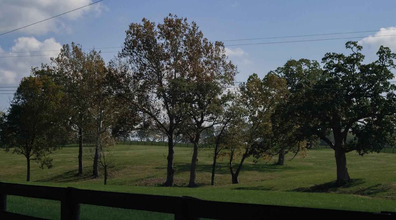
Rural Land Management Plan, Chapter 4 | 77
Royster Road hosts an array of scenic cultural landscapes.
The iconic Inner Bluegrass landscape has given rise to a strong rural heritage and worldwide identity.
Historic Uses, Sites, Districts and Communities
The history of Fayette County tells the story of our agrarian heritage and how sustainable land use practices have protected the land upon which that heritage is founded. Inherited from past generations, and properly maintained in the present, the landscape and heritage can last for future generations.
Gently rolling hills, fertile grasslands, spring-fed streams and stately groves of oaks have been an attraction to both humans and animals for thousands of years. Native Americans shaped the landscape by hunting game animals, clearing land, and growing and collecting wild plants for food. The Adena people were ancient Native Americans who were mobile hunters and gatherers and lived in camps. They constructed an earthwork approximately 2,000 years ago, located near Mt. Horeb Pike. It is the oldest known structure in Fayette County.
By the time Kentucky became a state in 1792, all Indian land cessions in the Bluegrass Region had been negotiated and the region shifted from a hunter/gatherer/farmer society to a more complex agrarian landscape. European settlers quickly replaced canebrakes with fields of corn and hemp, while cattle, horses and chickens replaced buffalo in the pastures of planted bluegrass.
One route into Fayette County for pioneers was across the Kentucky River. The Valley View Ferry first crossed the River at the mouth of Tates Creek in 1780, and was petitioned to operate continuously in 1785. Ferry crossings became areas with vibrant activity that usually included housing and taverns. Here, goods were unloaded to haul supplies 15 miles inland to Lexington. Twelve miles away, the Clays Ferry community at Boone Creek eventually had a shipyard, warehouses and mills. Later, there were numerous boat ramps, a marina, restaurants, and Star of Lexington slot machines. Railroads, turnpikes and interstates eventually crossed the River and these ferry-dependent businesses closed. The Valley View Ferry continues to operate, and is regarded as the oldest continually operating business in the Commonwealth.
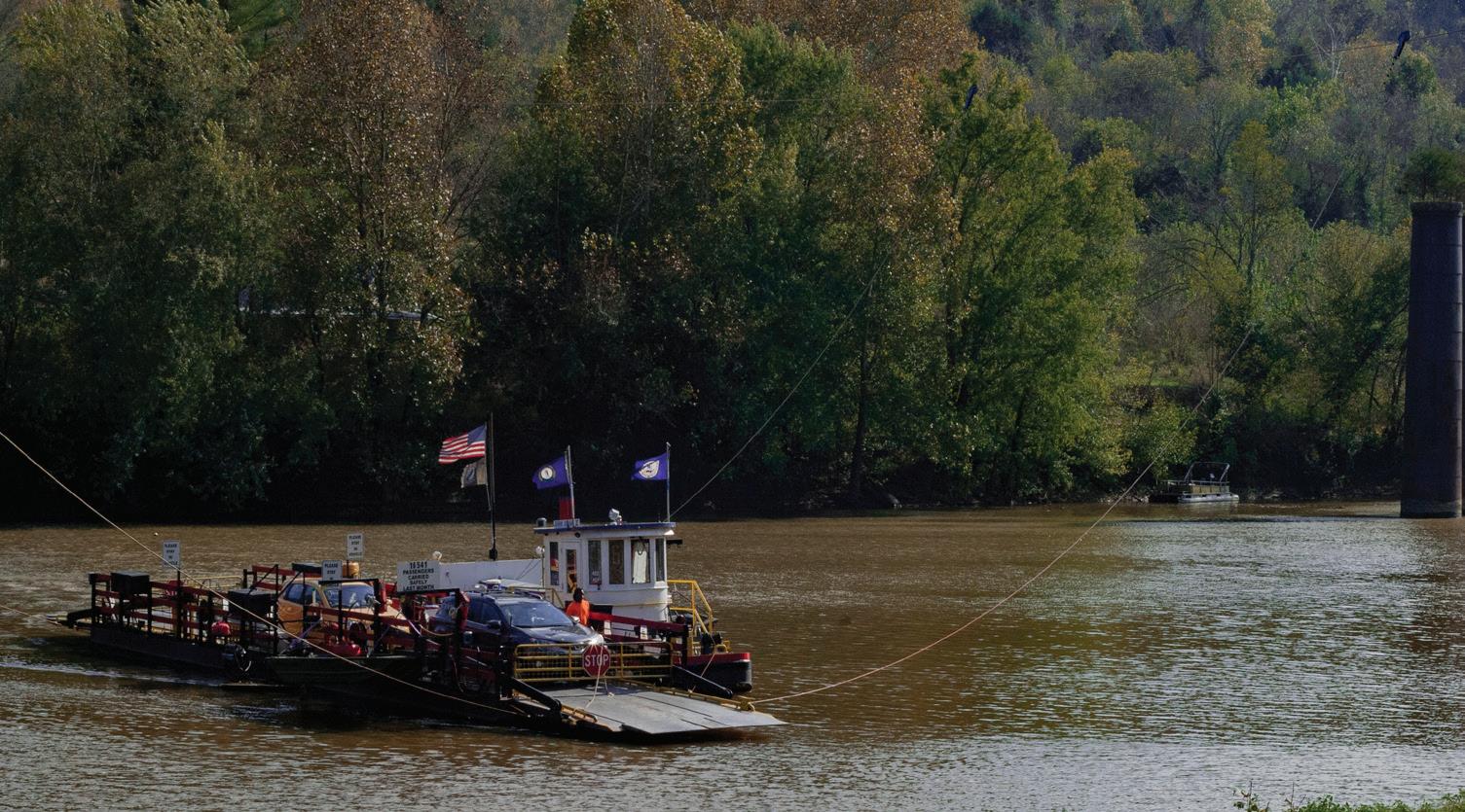
Rural Settlements
During the 1800s, Lexington became an economic center to the smaller surrounding towns and villages. The radial system of roads today has its origins in the historic trade paths. Numerous settlements were built in conjunction with large farms and crossroads, which provided easy access to stores for rural residents without traveling into Lexington. Athens, Fort Springs, Little Texas and Loradale are Rural Settlements located at the intersection of two roads.
Rural Settlements were significant to early settlement patterns, and remain an integral component of the cultural landscape. A 1971 study identified twenty remaining settlements with at least 15 homes. Each community had its own sense of identity and place. According to the study, Athens, Clays Ferry, Loradale, Spears, Fort Springs and Little Texas were settled before the Civil War. Athens was a village first known as Cross Plains and eventually had manufacturing, taverns, stores and distilleries. Eleven Rural Settlements were settled by freed slaves, who were either given the land or purchased it. The settlements provided housing in proximity to farms where workers found employment. Loradale, Maddoxtown and Willa Lane Settlements included tracts that were farmed. Some settlements might have had a church, school or post office, while some were residential only.
78 | Division of Planning
Valley View Ferry has been in operation since 1785.
Map 12 Historic Resources
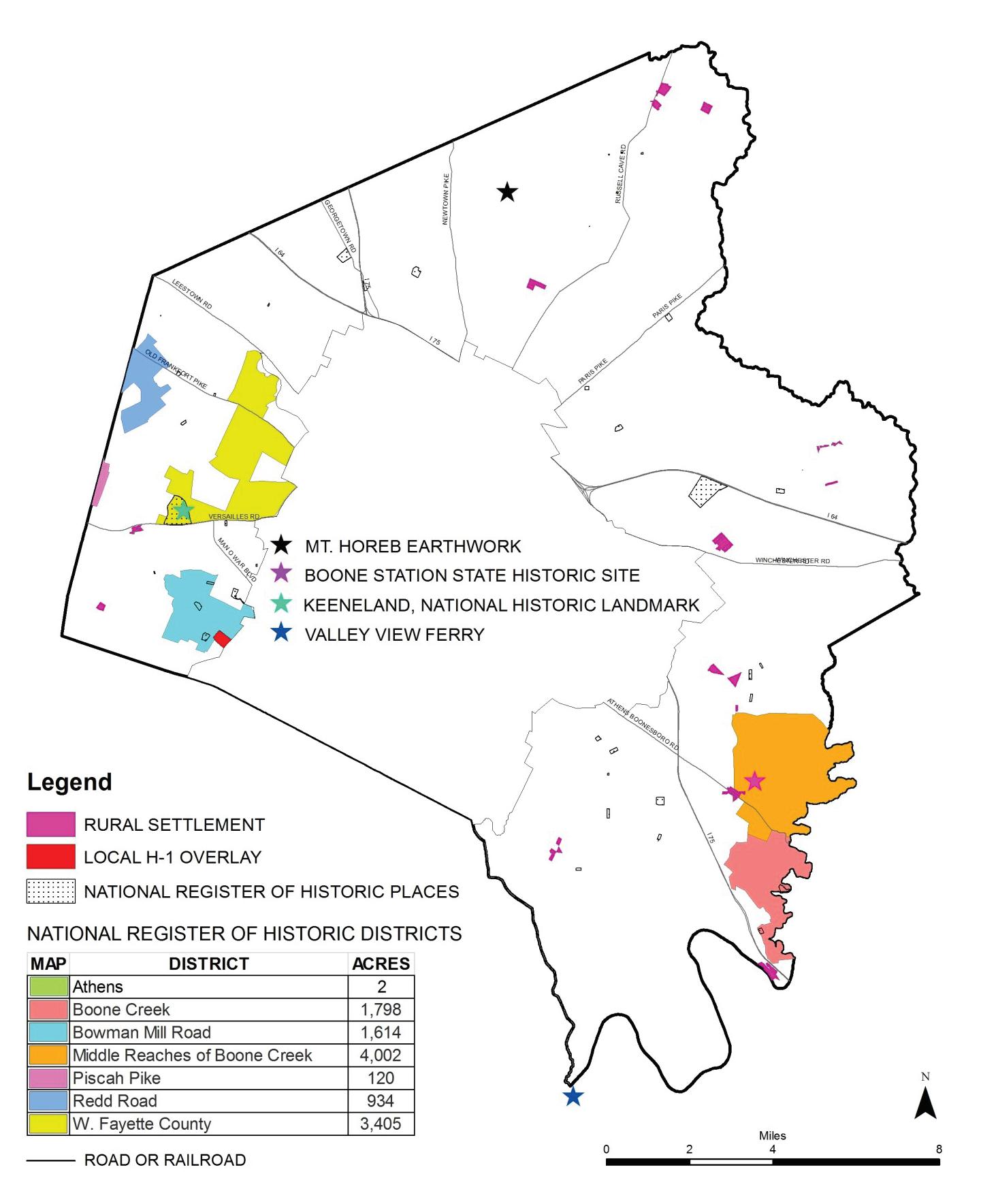
Rural Land Management Plan, Chapter 4 | 79
April
2017
Another inventory was performed in 2007 to refine the boundaries and physical condition of the Rural Settlements. The historic physical layout, density and composition were assessed for the settlements and mechanisms for the protection and enhancement for each were recommended. A decreasing population and loss of historic integrity and character were identified as threats to the viability of settlements. Other issues included vacant lots, vacant businesses, old or abandoned housing stock and infrastructure needs. See Chapter 3, Rural Settlements for more information.
Lot Size
The association with horses began early. The first race track, constructed in 1788, was located in downtown Lexington. Nearby farms started breeding thoroughbreds, trotters and saddle horses. After the Civil War, the production of tobacco increased, creating a unique culture and way of life centered around the crop. Nearly one hundred years later, in 1958, the Urban Service Area was created to protect agriculture. Still, one-acre subdivisions were allowed. In 1964, the minimum lot size was increased to 10 acres, based on the land needed for adequate septic systems. Yet, due to the proliferation of 10-acre lots reducing potential agricultural production (in 1998 alone there were 400 created), in 1999 the minimum lot size was increased to 40 acres. New zoning categories were created to coincide with the new land use categories established in the 1999 Rural Service Area Land Management Plan.
National Register of Historic Places
Besides historic Rural Settlements, there are 39 listings on the National Register of Historic Places and seven National Register Historic Districts within the Rural Service Area. These places include single room log structures and cabins, early stone buildings (houses, barns, taverns), a church, a grain mill, cemeteries, springhouses, and elaborate estate houses. Most of the sites are sized only for the structure and immediate surroundings, but there are six sites over 20 acres in size. These include 200 acres at Keeneland (a National Historic Landmark), a 211-acre farm on Royster Road, and 22 acres at Spindletop Hall.
Helm Place on Bowman Mill Road is listed on the National Register and is a local H-1 Zoning Overlay. It is a local historic landmark dating from the
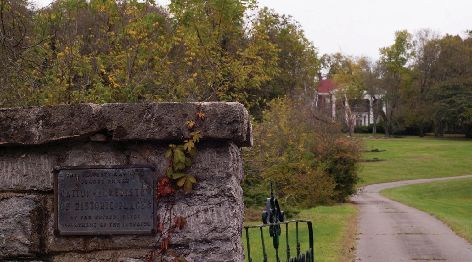
1770s and is associated with the Mary Todd Lincoln family. The Kentucky Mansion Preservation Foundation began management of the property in 2011, and has been raising funds to restore the property as a house museum. However, the future of the 58-acre site is unclear. Currently, the Foundation is exploring other options for the mansion, due to the expense of renovations necessary to open the house to the public.
Corridors
Focus Areas and Greenways
The 1994 Greenspace Plan identified five focus areas that are considered to be the best examples of the iconic Bluegrass landscape, with the greatest concentration of valuable resources. The 1994 Plan envisioned protection of significant tree stands, environmentally sensitive and geologic hazard areas, protection of scenic beauty, and opportunities for biking and hiking along the corridor and connecting country roads. It called for Small Area Plans to develop strategies for long-term protection (i.e. conservation/scenic easements) and to acquire new public park properties and staging areas in some locations.
80 | Division of Planning
Helm Place is on the National Register of Historic Places and is associated with Mary Todd Lincoln.
Map 13
Focus Areas and Greenways

April 2017
Rural Land Management Plan, Chapter 4 | 81
The five focus areas include:
• North Elkhorn Drainageway: North Elkhorn Creek, Goose Creek, and David Fork
• Boone Creek Drainageway: Boone Creek, Jones Creek, Baughman Run, and Boggs Fork
• South Elkhorn Drainageway: South Elk horn Creek, and Cave Creek
• Kentucky River Palisades and major tributaries
• Old Frankfort Pike Area
The 1999 Rural Service Area Land Management Plan defined greenways as relatively undisturbed floodplains and areas along roadways that present the greatest opportunity for preserving plant and animal species, protecting scenic areas, and providing access to rural areas for urban residents. The 1999 Plan cited the importance of the Five Focus Areas and added other corridors, including:
• Cane Run Creek
• Town Branch Drainageway: Town Branch and Steeples Run
• East Hickman Drainageway: East Hickman Creek and Shelby Branch
To create a countywide and regional greenway trail system, the 1999 Plan recommended the addition of abandoned and active rail lines and water trails. The 2011 Rural Corridors Protection Project Report recommended listing the Kentucky River Palisades as a scenic corridor, as well.
The adopted 2012 Greenway Master Plan created a community-wide system of conservation and trail greenways. It called for the protection of all blue-line streams and floodplains, and the wildlife and natural areas, cultural and historic resources and scenic viewsheds within the greenways. Additions to the 1999 Plan’s rural greenway trail system included Paris Pike, Winchester Pike, Man O’ War Boulevard and Bryan Station Creek. It is recommended that the Five Focus Areas and greenways be protected for their high degree of environmental and scenic qualities. Public access and the greenway trail system is currently under review as a component of the update to the 2006 Bicycle and Pedestrian Master Plan. For more information, see Chapter 4, Special Elements, Tourism.
Historic and Scenic Roadways
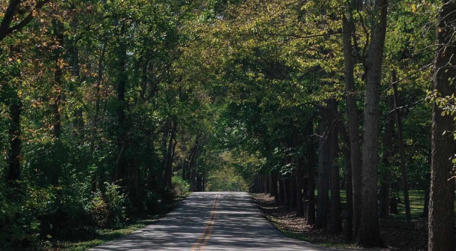
The 1999 Plan referenced the 1992 Corridor Enhancement Study to include roads that should be protected because of their scenic and/ or historic assets. In many cases, historic turnpikes and scenic roads provide a glimpse of the rural area as it was in the past. Since 1999, numerous plans, corridor studies and the Rural Corridor Overlay Zone have also addressed rural road aesthetics and historic significance.
As a recommendation from the 2007 Comprehensive Plan, the Division of Planning staff reviewed in 2011 all of the pertinent documents to compile their recommendations and evaluate the effectiveness of current protection measures. The 2011 Rural Corridors Protection Project Report assessed 58 urban and rural roads based on their quality and the threat to their scenic integrity. The assessment included the historic turnpikes, state designated scenic byways, and other scenic roads listed in the 1999 Plan.
Historic Turnpikes
Athens-Walnut Hill Road Bryan Station Road Cleveland Road
Crawley Lane Georgetown Road Iron Works Pike
Jacks Creek Pike Leestown Road Military Pike
82 | Division of Planning
Bryan Station Road is a historic turnpike in the northern portion of Fayette County.
Newtown Pike Old Frankfort Pike Old Richmond Road
Paris Pike Parkers Mill Road Russell Cave Road
Sulphur Well Road Tates Creek Road Versailles Road
Walnut Hill Road Winchester Road
Spears Road Van Meter Road Walnut Grove
Yarnallton Pike
State Designated Scenic Byways
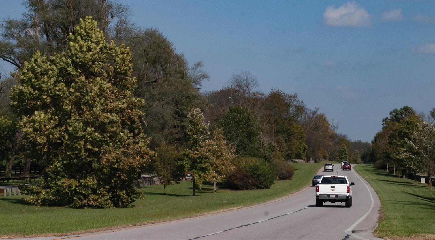
Athens-Boonesboro Road Elkchester Road Grimes Mill Road
Hughes Lane Iron Works Pike McCalls Mill Road
North Cleveland Road Old Frankfort Pike Old Richmond Road
Paris Pike Rice Road Russell Cave Road
Other scenic roads
Armstrong Mill Road Bosworth Lane Bowman Mill Road
Briar Hill Road Delong Road Dry Branch Road
Elkchester Road Evans Mill Road Fort Springs Pinckard Road
Gentry Road Huffman Mill Pike Hughes Lane
Hume Bedford Pike Johnston Road Keene Road
Kenny Lane Lemons Mill Pike Mt. Horeb Pike
Redd Road Royster Road Shelby Lane
The 1999 Plan recommended that measures should be developed to preserve and enhance views from I-64 and I-75. The interstates were not included in the 2011 Study for analysis, but the recommendation from 1999 should be carried forward. For instance, to call attention to the Legacy Trail, flag poles with revolving artwork can be seen by motorists traveling on I-75.
As Map 14 on page 84 illustrates, almost every road in the Rural Service Area is considered significant for its historic and/or scenic value. To stress the point, the 1992 Corridor Enhancement Study stated that even the roads not mapped might be scenic upon further consideration, and historic turnpikes should also be evaluated for scenic qualities. The 2011 Rural Corridors Protection Project Report included a windshield survey to assess scenic assets. Regardless of the prioritization scoring assigned in the Project Report, all of the scenic roads are mapped to reinforce their important historic or scenic value in the cultural landscape.
Based on the 1877 Atlas, there are 123.5 miles of rural roads that are historic turnpikes, and according to the Kentucky Transportation Cabinet
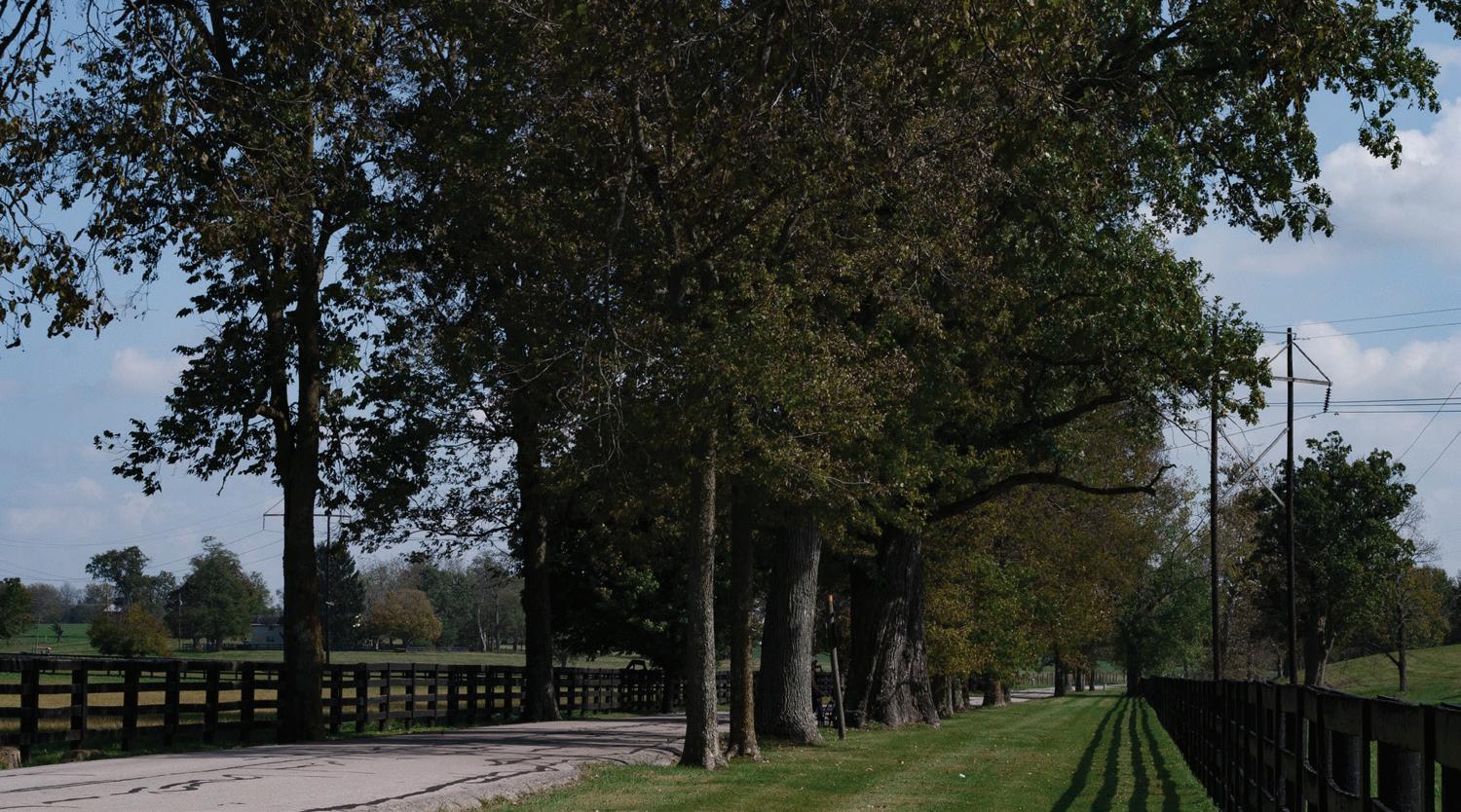
Rural Land Management Plan, Chapter 4 | 83
Paris Pike is a state designated scenic byway, as well as a historic turnpike.
Royster Road is another scenic road in Fayette County.
Map 14 Significant Rural Roads
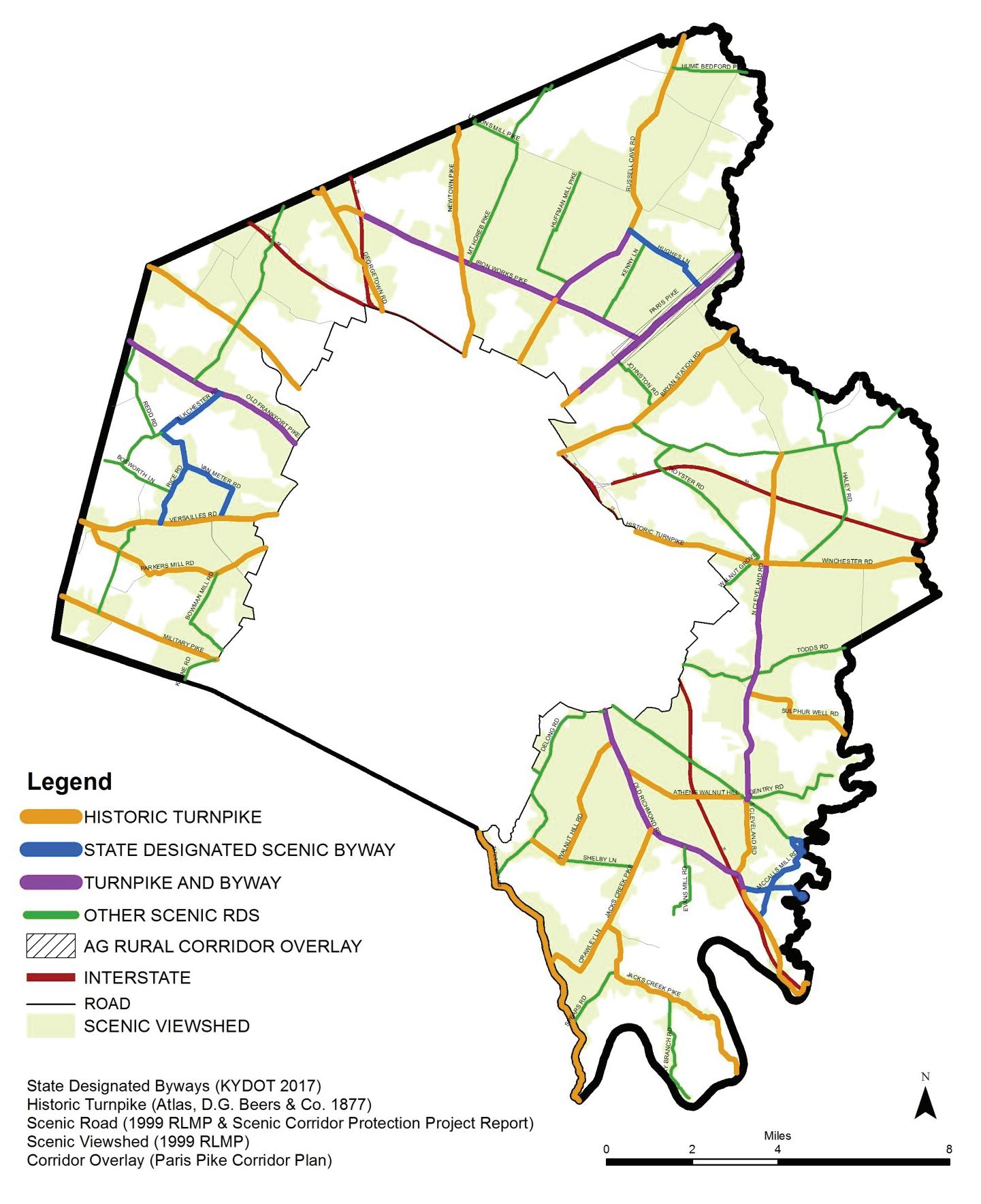
84 | Division of Planning
2017
April
(KYTC), there are 53 miles of state designated scenic byways. Forty of the historic turnpikes and byway mileages overlap and are both. The nonprofit organization, Lexington-Frankfort Scenic Corridor, Inc. applied for a National Scenic Byways designation; however, there has been a loss of federal funding for the program. The PDR Program uses the Rural Service Area Land Management Plan’s list of scenic roads, byways or historic byway/highways, as a part of property assessments.
Roadways are scenic for both the aesthetic value within the right-of-way itself and beyond the right-of-way to the surrounding viewsheds. Scenic roads appear to “fit” onto the landscape by traversing the hillsides without major cuts into them. Most roads classified as scenic have stretches with arching tree canopy, plank fences or historic stone fences. Except for the southeastern portion of the county, views are often visible for miles from the roadway.
Healthy and well-maintained trees along rural roadways are essential to the preservation of the visual beauty and character of the roads. Unlike in urban areas, rural roadway trees are almost always volunteer trees, usually growing along old fence rows. As a service, LFUCG prunes trees, removes honeysuckle, and eliminates hazardous trees within the rightof-way along county roads. The state maintains trees within their rightof-way. For some state roads, LFUCG will coordinate with the state on their cutback operations to protect the trees. Hazardous or leaning trees that impact the right-of-way, but are located on private property, are the responsibility of the property owner to address.
Paris Pike has an outstanding collection of traditional Bluegrass landscape characteristics (including stone fences and farm gate relics) and is nationally known for its scenic qualities. Paris Pike is unique as a state road improvement project, because of the Corridor Plan that coincided with the proposed widening. Completed in 2003, many of the historic, cultural and scenic features along the corridor were preserved and the road design itself was context sensitive. The four-lane parkwaytype highway includes an extra wide green median, hundreds of planted trees, grass reinforced shoulders, and repaired or relocated stone fences. Besides Paris Pike, KYTC did stone fence work at Maine Chance Farm along Newtown Pike.
The 1990 Stone Fences of Fayette County Study provided an important inventory of the stone fences that are located along the right-of-way of rural roads. The iconic fences were built throughout the 1800s. Stone was chosen because of its abundance as a building material, its strength and durability, its aesthetics and the influx of skilled artisans. The study listed the reasons for the demise of the fences, including the construction of turnpikes, selling of the rock, and vehicular crashes. It was stated that an estimated 90% of the stone fences in the region are gone, and since 1950, the primary reason for the destruction of the fences was the development of adjacent property. As a result of the recommendations, several steps were taken to protect these fences, including:
• a matching funds program through LFUCG for fence repair
• a program through the Dry Stone Conservancy was initiated to train stone masons
• the Stone Fence Ordinance was adopted
Since the 1990 inventory, the fate of stone fences remains in peril. An update to the 1990 inventory could inform LFUCG and the public as to the number of remaining fences, and their current condition. As a recognizable feature within Fayette County’s rural cultural landscape, the preservation and maintenance of stone fences should be addressed. Current issues include:
• The local Ordinance does not address the maintenance of the fences. For instance, during the development process, applicants cannot remove a fence, but they are not required to remediate poor conditions.
• The only protection for stone fences on private property is through the PDR program or National Register listing.
• The State and LFUCG once had grants to assist farm and property owners with maintenance, but the grants are no longer funded.
• There is a lack of suitable building stone quarries (done so in a sustainable practice) to restore fences or build new ones.
Rural Land Management Plan, Chapter 4 | 85
Roadways are scenic for both the aesthetic value within the right-of-way itself, and beyond the right-of-way to the surrounding viewsheds.
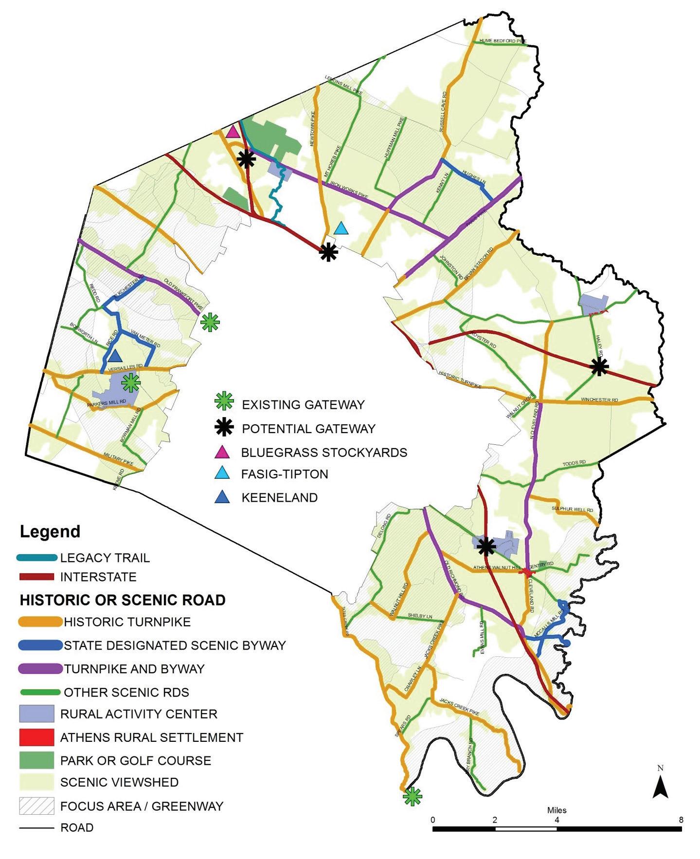
86 | Division of Planning
April
Map 15 Gateways
2017
The State of Kentucky should relocate or repair stone fences as they are impacted by road projects. However, not all fences are interpreted to be within the right-of-way.
• Continued maintenance for the stone fences within the Paris Pike right-of-way.
Gateways
First impressions for those entering the Rural Service Area should be favorable and lasting, whether arriving at the county line, Urban Service Boundary, interstate or airport. Gateway planning and design should reflect the values of the community to protect the beauty of the rural landscape while welcoming visitors. Features in a gateway might include welcome or directional signage, trees and landscaping, a pull-off for viewing, grass medians, focal points (such as the proposed statue at Old Frankfort Pike) or screening. Gateways should share common, recognizable design elements, such as signage; but the sizes for each gateway will be different, depending on their opportunities and challenges. While gateway improvements are generally within the public right-of-way, proposed changes may be tied to building permits.
Legacy Trail
The Legacy Trail is the first shared use public trail in the Rural Service Area. It was planned in the 2002 Greenway Master Plan as the Cane Run Trail, and was constructed in 2010. The trail is very successful and gives trail users a glimpse of the beauty of the rural landscape. The design of the trail was carefully constructed to the specifications of the adjacent working farms and professional office campus. Interpretive signage along the trail informs the public about the area’s history, the Cane Creek watershed, Royal Spring Aquifer, limestone and karst geology, and the University of Kentucky farms. A Public Art Master Plan was also developed since the Legacy Trail was envisioned as a signature feature for the community. As evidenced by the remnants of stone fences that once extensively lined roads, the theme for the trail is limestone. Retaining walls, trail identification walls and pylons, mile markers and bridge piers, tie design elements into an unified motif celebrating the area’s limestone geology. For more information, see Chapter 4, Special Elements, Tourism.
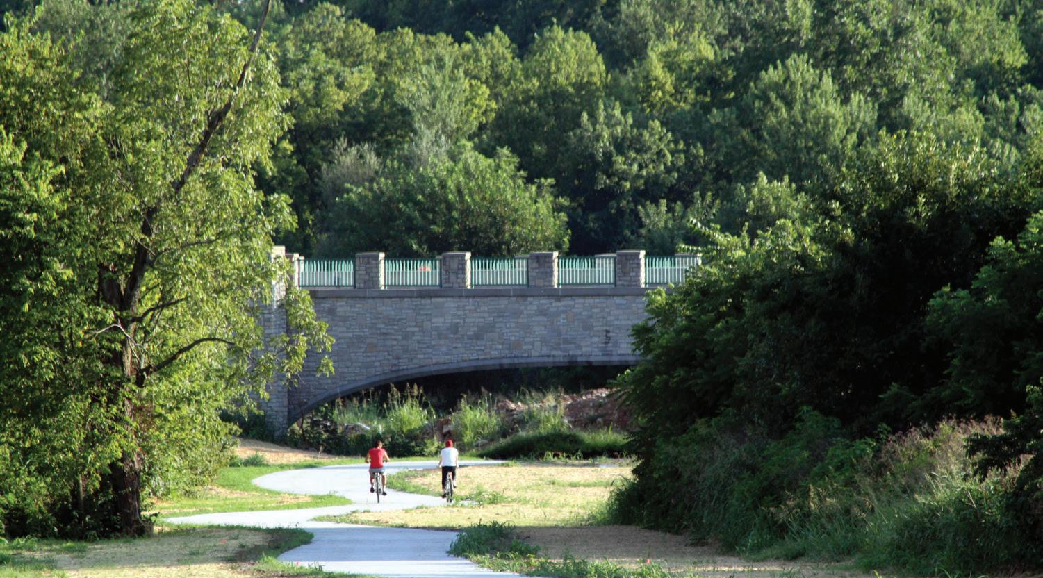
Many who fly into the Bluegrass Airport comment on the spectacular beauty they see from the air. This birds-eye view is significant for tourism and residents returning home. As motorists leave the airport, they drive past the enhanced entrance that includes an entry wall, landscaping and wayfinding. They then drive north along Man O’ War Boulevard which is beautified with flowering annuals, perennials, grasses and trees, and then on to Versailles Road, where they see the airport’s mural, Keeneland Racetrack, and the archetypal Calumet Farm. However, the nine-lane width of Versailles Road at the intersection, and the six to nine lanes leading away from the intersection, detract from the beautiful scenery adjacent to it.
At the edge of the Urban Service Boundary, there is a gateway at the intersection of Old Frankfort Pike and Alexandria Drive. The rural section of Old Frankfort Pike is a state designated scenic byway and an unmanned visitor viewing area overlooking the RSA, and a public art installation in the roundabout, are funded through an FHWA grant.
Rural Land Management Plan, Chapter 4 | 87
•
Gateway planning and design should reflect the values of the community to protect the beauty of the rural landscape while welcoming visitors.
The Legacy Trail is a great amenity that was constructed in 2010.
At the county line on Tates Creek Road, there is the historic entry into Fayette County by way of the crossing of the scenic Kentucky River via the Valley View Ferry. A small public park with a bench overlooking the River is located there.
Not every entrance into the Rural Service Area needs a formal gateway treatment. Entering from a road outside the county, a simple sign indicating the motorist or bicyclist has entered Fayette County, or the “Horse Capital of the World” is usually sufficient, without detracting from the landscape. Coming from the Urban Service Area, the hard edge created by the urban boundary is itself a clear indicator of the transition into the RSA. The gateway at Old Frankfort Pike became possible through an intersection improvement project, coupled with a nonprofit organization’s desire to enhance the aesthetics. Besides the airport, the most obvious potential for gateways are at the four interstate interchanges in the Rural Service Area. Each has unique characteristics and possibilities for gateway treatments. Several cities in Ohio incorporate signage, their community’s name or decorative artwork onto highway overpasses, bridge piers and retaining walls.
I-64 and Haley Road
This interchange is six miles from the Urban Service Boundary and is the first entrance into Fayette County for westbound travelers. It provides interstate access to the Avon Rural Activity Center two miles away and for residents living in the eastern portion of Fayette and Bourbon Counties. The interchange is surrounded by farmland. The exit onto a narrow road is not intended to be the primary route into the urban area, although occasional visitors and commuters leave the interstate here so that they can experience the rural countryside from the scenic Winchester Road 1.5 miles away, before entering the city. The interchange should retain its low-impact character with only a small welcoming or directional sign added.
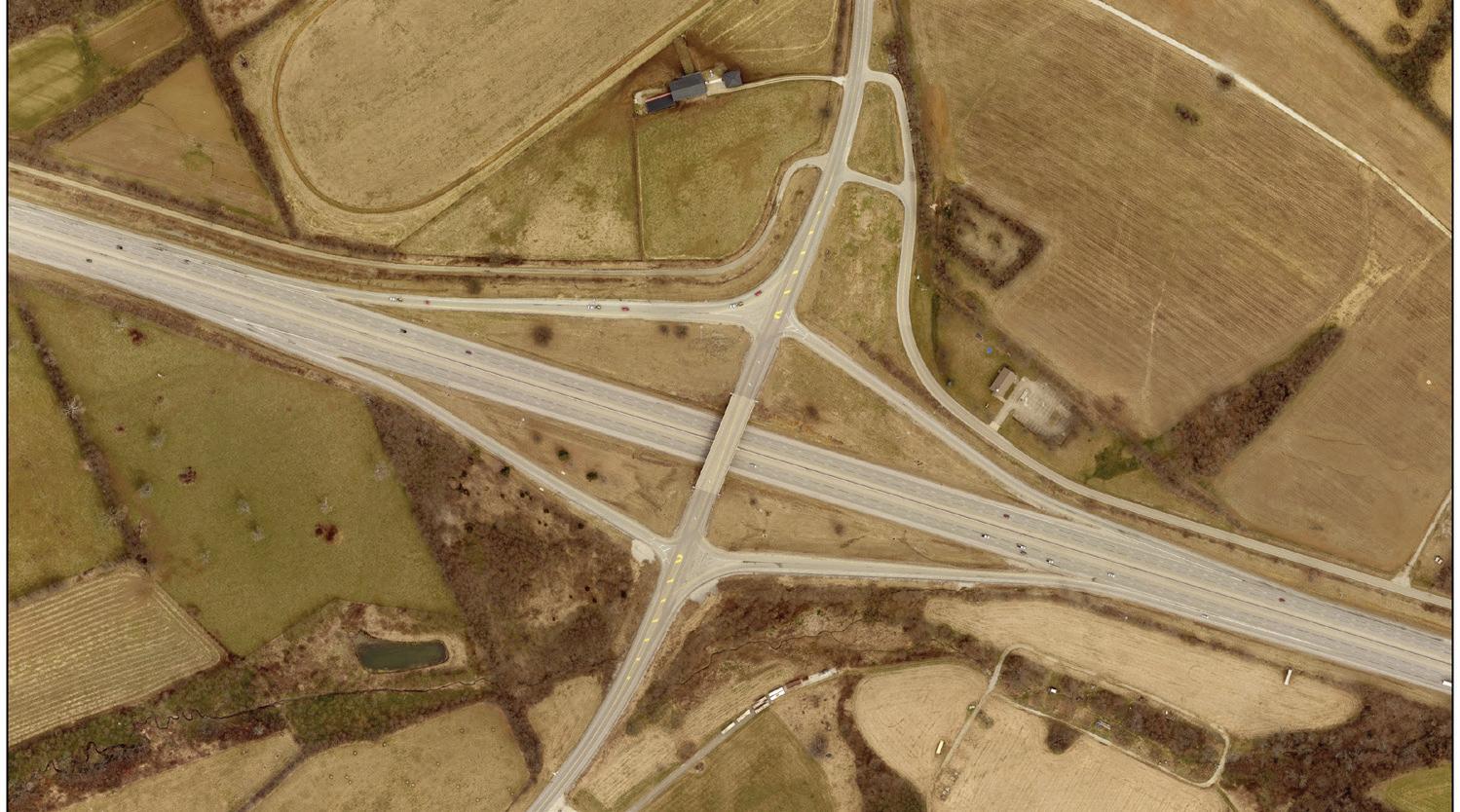
I-75 and Newtown Pike
This interchange shows the stark contrast between the Urban Service Area to the south of the interstate and the Rural Service Area to the north. The interstate acts as a visual barrier, separating urban and rural uses. The University of Kentucky Maine Chance Farm is on the west side of Newtown Pike, and on the east side is an extension of the Urban Service Area. Half of that extension has typical B-5P businesses associated with an interstate, such as gas stations, restaurants and motels. The remaining half is zoned for Economic Development and has a Scenic Resource Area (SRA) that prevents development within 500-1,000 feet
88 | Division of Planning
The interchange at I-64 and Haley Road is the first entrance into Fayette County from the east.
The State of Ohio has enhanced some of the major interchanges by adding landscaping and art.
from Newtown Pike. While this will help with the views from the road, the terrain is relatively flat, so care should still be taken for the development that will occur behind the SRA. Visitors might be using this interchange to visit two major rural destinations: Fasig Tipton and The Kentucky Horse Park. Newtown Pike is a historic turnpike and gateway treatments should include welcoming or directional signage, plus aesthetic improvements to the exit and along the frontage of the B-5P businesses.
I-75 and Iron Works Pike
This interchange sees many tourists disembarking to visit the Kentucky Horse Park, adjacent to the interstate east of the interchange. Other destinations in the vicinity include multiple equine hospitals, Spindletop Farm, Spindletop Research Park and the Legacy Trail. The largest destination, in terms of traffic volume, will be the Bluegrass Stockyards, which opened in September 2017. In addition to livestock sales, restaurants, meeting rooms, an education center and a market place are planned within the Stockyards’ main building. Across from the Stockyards is a trucking service center, which includes a convenience store, liquor store, gas pumps and restaurant. The Stockyards, the service center and a one-acre utility parcel are the only parcels between the interstate and a railroad overpass to the west. Potential business opportunities are located in the existing B-3 zoned parcels, within one mile from the interstate along Georgetown Road. This segment of Iron Works Pike is not part of the
state designated scenic byway, but is part of the historic turnpike. The Iron Works interchange and immediate area is a prominent entry into the Rural Service Area that should be preserved, without additional non-agricultural businesses that would deter from its authenticity. An enhanced gateway would be appropriate at the interchange exit.
I-75 and Athens-Boonesboro Road
This interchange is located 1.6 miles from the Urban Service Area to the west, and 1.5 miles from the historic Athens Rural Settlement to the east. It is the first entrance into Fayette County for northbound travelers. There are numerous non-agricultural uses located on both sides of the interchange, including gas stations, fast food restaurants, motels and adult entertainment. A Rural Activity Center is located 0.3 miles east of the interchange. Driving east along Athens-Boonesboro Road, the view of the RAC’s 2,775-foot frontage is of massive car lots, and across from the RAC are parcels with mounds of dirt. Heading west from the interchange, Athens-Boonesboro Road is a very appealing approach into the city. The road is listed as a scenic corridor and is one of the few major four-lane arterials remaining with a grassed median. At the interchange, there are eleven vacant parcels zoned B-5P. Because of the importance of the exit in welcoming visitors, the numerous B-5P and industrial uses, and the general sub-par aesthetics, the interchange needs major mprovements. Design guidelines for Interchange Service Businesses (B-5P) could
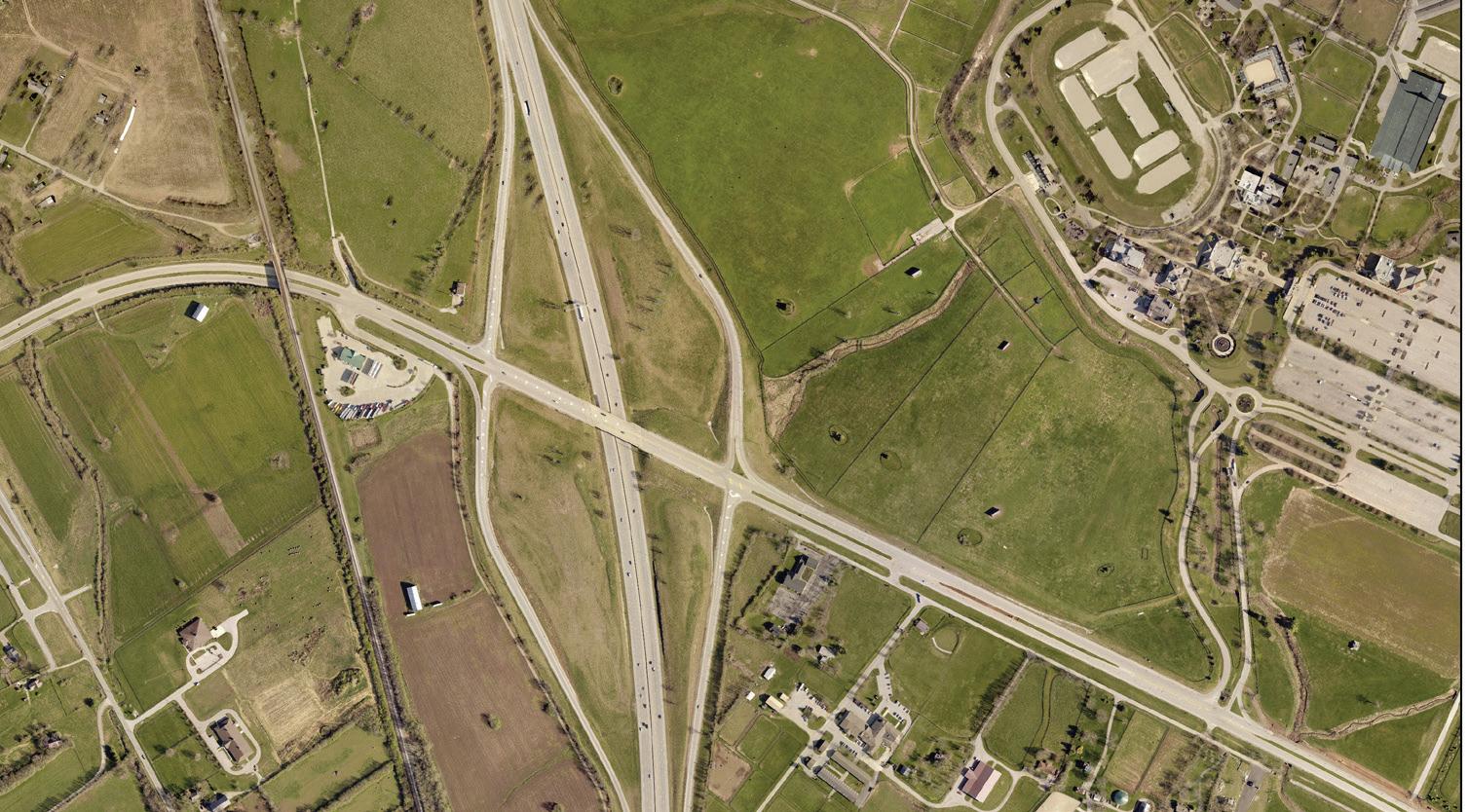
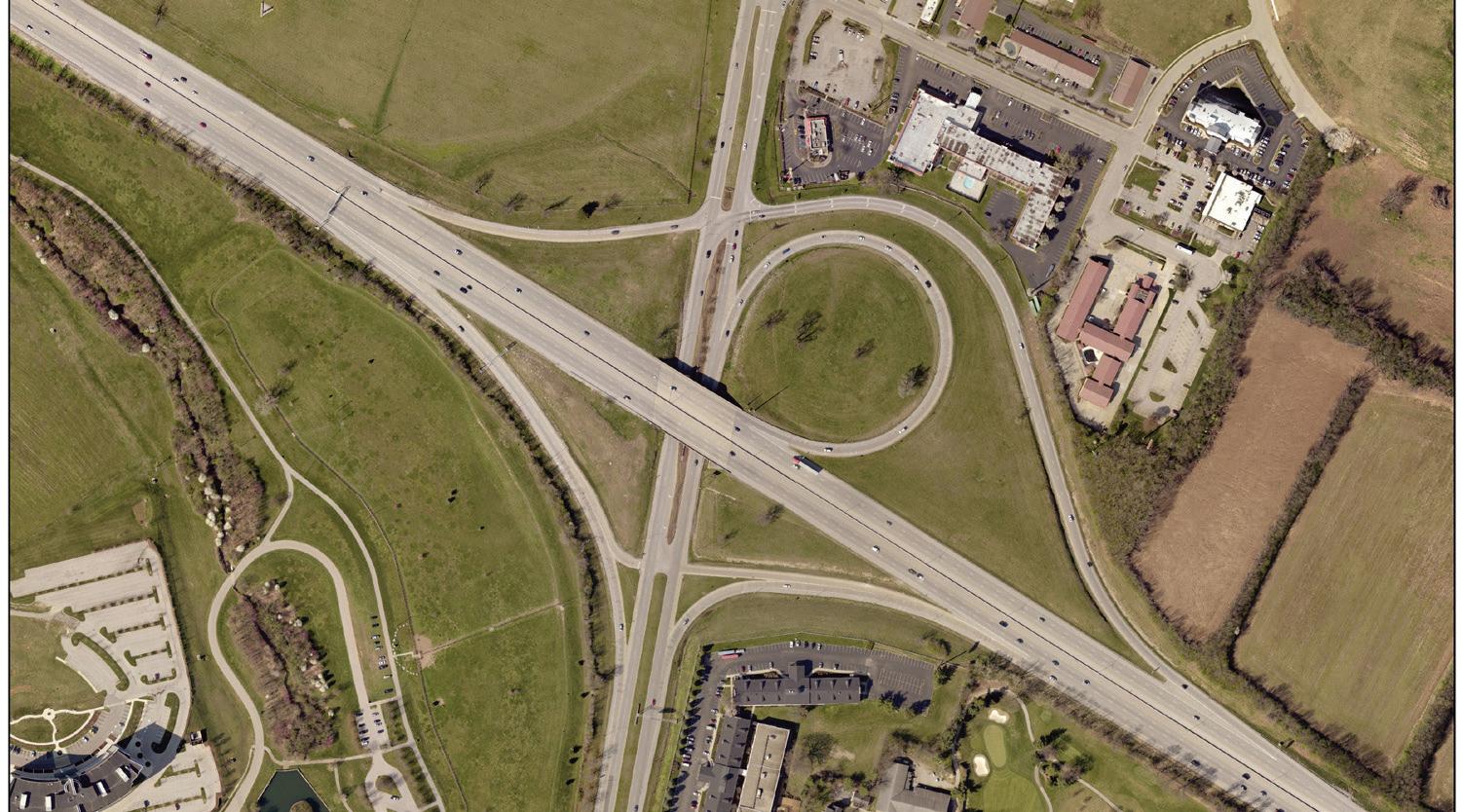
Rural Land Management Plan, Chapter 4 | 89
The interchange at I-75 and Newtown Pike is along the Urban Service Area boundary to the north. The interchange at I-75 and Iron Works Pike is utilized by tourists to visit the Kentucky Horse Park.
facilitate the installation of gateway treatments. Design considerations should create a positive gateway character with enhanced landscaping and ways to minimize problem areas; such as buffering car lots and storage yards.
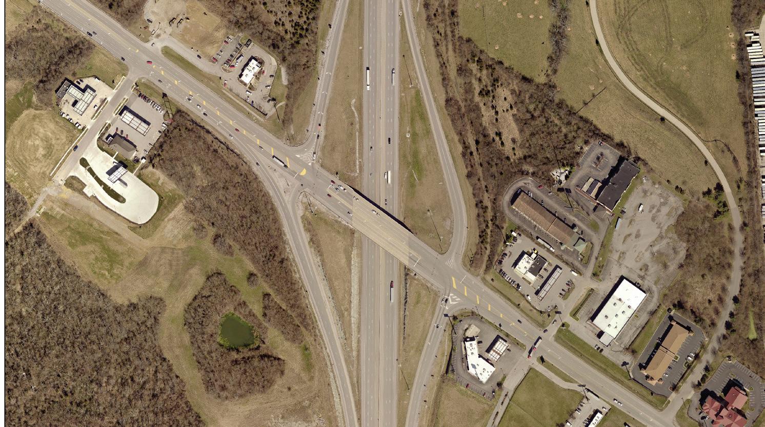
Protection of Historic and Cultural Landscapes
The World Monuments Fund placed Fayette and portions of eleven surrounding counties on their 2006 list of the world’s 100 most endangered places. The Bluegrass Cultural Landscape of Kentucky was considered under critical threat due to suburbanization and development. The attention brought by the nonprofit organization highlights the need for a regional effort to ensure the preservation of farmland and the rural heritage of the area.
The Bluegrass cultural landscape extends beyond the Fayette County border. Its preservation is dependent upon the coordination and cooperation between preservation organizations and government agencies to create cohesive strategies that extend regionally. A strategic plan would inventory assets, increase public awareness at the regional level, and recommend mechanisms to affect change in regulation,
planning, zoning, and other policy initiatives. The plan should base the significance of preserving the cultural landscape and rural heritage on the ecological, economic and community services they provide. Mechanisms could include tax incentives, adaptive reuse and infill alternatives, tools for private landowners, and pursuit of a national designation through the National Trust for Historic Preservation and the National Park Service.
The Worlds Monuments Fund placed Fayette and portions of eleven surrounding counties on their 2006 list of the world’s 100 most endangered places.
Protection of historic and cultural landscapes means finding mechanisms that safeguard their form and integrity. Regulatory controls help protect vistas, scenic roads, natural areas, farmsteads and historic sites and districts, as well as the character-defining features, such as stone fences, barns and other structures. Mechanisms may include a variety of techniques, including an Urban Service Boundary, PDR, zoning and zoning overlays. The Urban Service Boundary and zoning work in favor of preservation by restricting certain types of uses. The PDR Program and scenic easements can protect specific features, such as fences and stone walls, limit the location of new buildings, or prevent inappropriate grading. The exact nature of the easement, and the specific items that are to be regulated through the easement, would be based on the nature of the resource and the level of protection that is warranted. In general, it would be designed to prevent actions that would be incompatible with the overall scenic quality of the rural area.
Comprehensive Planning
The policy creating the Urban Service Area (USA) brought about a compact pattern of development and significantly advanced preservation of the rural land and its history. When the USA’s boundary was created in 1958, its area was 22% of the county and contained 85% of the
90 | Division of Planning
The interchange at I-75 and Athens-Boonesboro Road is utilized for access to Blue Sky RAC.
population (1960 Census). The USA grew over the years; it is now 30% of the county land mass, with 95% of the population residing there (2013 American Community Survey). The difference in population density rose from 2.78 to 5.3 persons per acre. The population for the Rural Service Area in 1960 was 19,966, and in 2013, it was 14,200.
With the adoption of the 1999 Rural Service Area Land Management Plan as an element of the 1996 Comprehensive Plan, rural land use categories specified intended usages that guide zoning decisions. For instance, the Core Agricultural and Rural Land categories resulted in preserved rural character, by promoting agriculture and related uses. Rural Settlements have their own land use category (See Chapter 3, Land Use Categories, Rural Settlements; however, there is little regulatory protection for them.
A few Rural Settlements are afforded protection. Athens is within the boundaries of the Athens National Register of Historic District. Little Texas, Loradale, Jimtown and Maddoxtown are surrounded by farms in PDR on at least two sides. The 2007 Study of Fayette County’s Small Rural Communities made recommendations for the protection and/or enhancement of each Rural Settlement, including:

• PDR
• ND-1 or H-1 Overlay
• Creation of Rural Community Zone
• Redevelopment strategies conducted in a context sensitive manner to the historical lotting pattern and architecture, with the consideration of the economic feasibility for current residents
• Designation on the National Register of Historic Places for properties that are eligible
• A committee to oversee the implementation of the recommendations
The 2011 Rural Corridors Protection Project Report recommended that an update to the 1999 Rural Service Area Land Management Plan develop regulatory protection measures for each scenic corridor. Suggested protection practices included:
• scenic overlays
• larger setbacks
• state or national scenic byway designation
• addition to scoring PDR applications to include farms fronting scenic roads
Due to the extensive time and effort that will be required to evaluate each corridor and develop specific strategies, the work should commence after the adoption of this update. Many of the common recommendations between the various documents listed in the 2011 Rural Corridor Protection Project Report are incorporated into the recommendations for Rural Landscapes.
LFUCG Code of Ordinances
Key to the preservation of the Rural Service Area’s landscape is a strong agricultural economy. The adoption of the Rural Land Management Ordinance (Chapter 26) created the PDR Program to safeguard agriculture by protecting fertile soils in permanent conservation easements. Additional protection of landscapes and their characterdefining features through PDR easements include:
• size of parcels - up to 12 points
• road frontage - up to 5 points
• greenway - 5 points
• focus area - 10 points
• linkages to nearby parks, nature preserves, sanctuaries, historic sites or other lands specifically designated for long term natural resource use, conservation or preservation purposes - up to 4 points
• 1999 scenic rural road, designated scenic or historic byway, within
Rural Land Management Plan, Chapter 4 | 91
The Bluegrass cultural landscape is unique to Fayette County and other surrounding counties.
viewshed from interstate, in scenic viewshed visible from publicly owned lands, other scenic features, such as tree-lined canopy or viewsheds - up to 11 points
• Historic and cultural resources; including National Register, identified stone fences, national historic landmark or registered or significant archeological sites - up to 11 points
The Stone Wall Preservation Ordinance (Chapter 14-83) became law in 1994. It requires a permit from the Office of Historic Preservation for the removal of any stone fence that is located in the right-of-way. It also established standards for the issuance of such a permit.
The Greenspace Commission was created by Ordinance (Chapter 2-236). Its charge is to preserve, protect and enhance open spaces, including those that possess the characteristics that give the Bluegrass Region its unique identity. Visual elements that contribute to the unique scenic beauty of the Bluegrass Region, historic and cultural heritage as they relate to open space, natural areas, and farmlands are also in the charge of the Greenspace Commission to preserve, protect and enhance. The Commission is responsible for the Greenspace Plan, and advises LFUCG during the Comprehensive Planning process and other matters concerning greenspace.
The Code of Ordinances 17-B established the Tree Board, which advises LFUCG on matters of care, preservation, planting, removal, replacement or disposition of trees in parks, along streets and in public areas as needed.
LFUCG Zoning Ordinance
There are three agricultural-based zones included in the current listing in Article 8: A-R, A-B and A-N. Their overall intent is to preserve rural character. The A-R zone, by promoting agriculture and related uses, and by discouraging all forms of urban development except for a limited amount of conditional uses. The A-B zone, by establishing agricultural land that can serve as a buffer area between urban uses and agricultural land, and between land outside Fayette County and agricultural uses. The A-N zone, by preserving areas that are physically unique, primarily those associated with the Kentucky River and its tributaries.
Historic Preservation (Article 13) recognizes that the individual nature and character of the county cannot be properly maintained or enhanced unless its distinctive historic resources, including geological and archaeological sites, are preserved. Historic resources are a visible reminder of the history and heritage of our county. The H-1 Overlay regulates a local historic district or landmark, which may include places, sites, buildings, structures or improvements (the owner must obtain approval of the Board of Architectural Review for most exterior work). Helm Place is the only H-1 Overlay in the RSA. The Article also established the Historic Preservation Commission.
The Agricultural and Rural Corridor Overlay Zone (Article 24) recognizes the special characteristics of lands along rural corridors. This article facilitates proper regulation and management along the corridors to promote the efficient use of existing and proposed agricultural lands, minimize land use conflicts and respect existing and planned agricultural facilities while ensuring a safe and efficient roadway system.
Paris Pike is the only rural road with an overlay. A result of the 1995 Paris Pike Corridor Plan, the overlay category was created to preserve cultural and natural features of the landscape. The overlay covers a 1,000-foot setback on each side of road. The Paris Pike Corridor Commission, an organization created by an inter-local agreement consisting of representatives of the Lexington Fayette Urban County Government, City of Paris, and Bourbon County, have joint management of the overlay zone.
State Regulations
State-designated scenic byways are roads that have viewsheds of aesthetic, cultural, historical or archaeological value worthy of preservation, restoration, protection or enhancement. They are regulated by KRS 177.571. The purpose of these regulations is to preserve scenic byways for vehicular, bicycle and pedestrian travel in a leisurely environment. The state supplies identification signs and attempts to maintain the character of the byway, but the designation does not preclude alterations deemed necessary by the Cabinet. KRS 171.381 regulates work which would impact historic drylaid or mortared rock fences.
92 | Division of Planning
National Regulations
Federal Regulation 36 CFR 60 authorizes The National Register of Historic Places. A nomination for an Historic Place or District is approved for its historic and archeological resources, based on the property’s age, integrity and significance. Unlike the local H-1 zoning district, The National Register designation allows an owner of a National Register property to make changes to the property without review by any governmental body provided no federal funds are used. Advantages to the listing include a detailed documentation of the property’s historic significance, grants and tax credits, and a wealth of research information and networking opportunities.
Protection offered through a designated place or district comes from the requirement that any project using federal funding must consider the historic assets in its planning and design. While the properties on the National Register are not afforded a high degree of regulatory protection, they are mapped and their significance is recognized - such as with the scoring of PDR applications, scenic byway designations, and the local scenic corridor analysis.
Public Ownership
Public ownership of historic and cultural landscapes does not imply that a site is protected in perpetuity; however, it does provide a higher degree of protection than land held privately. Publicly-owned properties include:
• The Mt. Horeb Earthworks - owned by the University of Kentucky
• Maine Chance and Spindletop Farms - owned by the University of Kentucky
• The Kentucky Horse Park - owned by the Commonwealth of Kentucky
• Hisle Farm Park - owned by LFUCG
• Raven Run Nature Sanctuary - owned by LFUCG
• Boone Station State Historic Site – owned by the Commonwealth of Kentucky
Policy Emphasis
The policy emphasis for historic and cultural landscapes is to provide a context for better protection, management, and enhancement of these areas, and to increase awareness of their benefits and the importance of the community’s rural heritage.
Recommendations
1. Communicate with governments in adjoining counties and nonprofit organizations to begin earnest discussions leading to the protection of historic and cultural landscapes for the Inner Bluegrass Region. Topics may include conservation easements, destinations and public access, core agriculture, critical mass, growth strategies, scenic resources, natural resources and public education and outreach.
2. Continue to apply and enforce existing ordinances and regulations that protect historic and cultural landscapes.
3. Develop additional strategies where needed to protect or enhance historic, cultural and natural landscapes; including their land form and character defining features.
4. Ensure permitted, accessory and conditional uses are appropriate and compatible with the surrounding historic and cultural landscape.
5. Review local and state ordinances, policies and management strategies to strengthen the preservation and maintenance of historic stone fences and walls along corridors.
6. Fund the matching grant program to help private property owners repair, maintain, restore or build stone fences.
7. Update the 1990 stone fence inventory.
8. Implement the recommendations from the Rural Corridors Protection Project to protect scenic qualities within the right-of way and beside state and local roadways listed in this Plan.
9. Minimize changes to the overall rural character of scenic roadways or historic turnpikes when road work is done.
10. Continue to protect historic and cultural landscapes through the PDR Program.
11. Continue to protect historic and cultural landscapes by maintaining the urban service boundary.
12. Consider scenic and conservation easements and overlays as strategies for protecting or enhancing viewsheds from roadways
Rural Land Management Plan, Chapter 4 | 93
13. Review the location and types of signage along rural roads to avoid unnecessary clutter.
14. Use best management practices in the maintenance and planting of trees and other vegetation in right-of-ways and gateways to ensure the canopy is protected.
15. Implement the recommendations from the 2007 Study of Small Rural Settlements, including an active committee charged with its implementation.
16. Consider H-1 overlay zones for additional protection of rural historic resources.
17. Continue prioritizing the five Focus Areas through the PDR program.
18. Support opportunities for public access in order to increase their understanding, enjoyment and appreciation of the unique and historic Bluegrass landscape while garnering their support for preservation.
19. Create gateways where appropriate to welcome visitors and showcase the rural landscape.
20. Preserve and enhance viewsheds from the interstates
21. Develop design guidelines for B-5P zoning at interstate interchanges.
94 | Division of Planning
D. Rural Transportation
The transportation system in the Rural Service Area consists of roads, an airport, a ferry, rail lines and a shared use trail. The rural road network includes interstate highways, state-maintained arterials, local roads, lanes, and subdivision streets. Farm roads and some subdivision streets are private. A summary of RSA transportation facts is below:
• 337 miles of roads, including two interstates, five U.S. highways and seven state highways.
• Roadway mileage in the RSA comprises 25% of all mileage in Fayette County.
• The National Freight Highway System runs through the RSA, primarily on the interstates and US-60.
• Traffic volume on state and local roads is within acceptable levels of service. Only five arterial roads carry more than an average of 10,000 vehicles per day: Man O’ War Boulevard; Versailles Road; Paris Pike; Winchester from the Urban Service Boundary to Haley Pike, and Athens-Boonesboro Road from the Urban Service Boundary to I-75.
• A 2014 online survey was conducted during the 2040 Metropolitan Transportation Plan process. When asked how respondents rate the quality and/or quantity of 12 various elements of the transportation system, rural roads ranked second best, only behind motorist safety.
• Valley View Ferry carries an average of 250 vehicles per day (2012) across the Kentucky River between Fayette County, Jessamine County, and Madison County. The ferry service is free and the twominute ride can save some commuters up to 45 minutes rather than navigating to major roads.
• The Blue Grass Airport serves over one million passengers each year, and also services the transport of horses.
• RJ Corman and Norfork-Southern Railroads operate 24.4 miles of track in the RSA for the transport of freight.
• The Legacy Trail through the RSA is 7.7 miles. Once completed to Georgetown, it could carry commuters into downtown Lexington.
• Commercial boat traffic on the Kentucky River ended after World War II.
Since the 1999 Rural Service Area Land Management Plan, the most significant roadway project was the completion of the Paris Pike road widening. This award-winning, regional undertaking retained the scenic and historic qualities through the corridor. Other road projects included pavement improvements to Versailles Road, upgrades to bridges, remediation to interstate interchanges, and Share the Road signage. After 2000, the Bluegrass Airport added a runway, improved the concourse and terminal and built a retaining wall with a mural facing Versailles Road. The Airport’s 2013 Master Plan calls for continued taxiway safety improvements and upgrades to the terminal and support facilities in the next few years. In 2014, the state and Fayette County, Jessamine County, and Madison County purchased a new 48,000-pound towboat to guide the Valley View ferry barge more efficiently across the Kentucky River.
Proposed short-term road projects within the Rural Service Area sponsored by the Metropolitan Planning Organization (MPO) are as follows:
• Georgetown Road – multimodal - widening from Spurr Road to 1400 feet south of Iron Works Pike
• Ware Road – pavement and typical section improvements from Briar Hill Road to Bluegrass Station entrance
The MPO would like to see these other projects advance in the future:
• Parkers Mill Road – multimodal - urban cross section from New Circle Road to Man O’ War Boulevard
• Man O’ War Boulevard – multimodal - 6 lanes from Harrodsburg to Versailles Road
Policy Emphasis
The policy emphasis for the transportation system is to safeguard the safe and efficient movement of people and goods by air, rail and roadways.
Rural Land Management Plan, Chapter 4 | 95
Recommendations
1. Continue to improve road rights-of-way and signage where needed to enhance safety.
2. The MPO should continue to be committed to the livability principals adopted by the Partnership for Sustainable Communities (EPA, DOT, HUD), including the protection of rural landscapes and providing more transportation choices.
3. Continue to improve the bicycle rural road network and build off-road bicycle and pedestrian trails as per the 2017 Bicycle and Pedestrian Master Plan.
4. Continue support for the operation of the Valley View Ferry.
96 | Division of Planning
E. Tourism
Year after year, vistors surveyed by VisitLEX say that they come to the Bluegrass for the horses, landscape and bourbon.
Tourism in Fayette County is vital to the economy. Statistics from the 2015 and 2016 Economic Impact of Kentucky’s Travel and Tourism Industry include the following:
• In 2016, the initial infusion of money into the economy by the tourism and travel industry was $1.3B in direct expenditures for Fayette County. This represents a 6% increase from 2014 and 14.2% of the direct expenditures for the entire state. Total expenditures for Fayette County totaled $2.0B.
• Direct employment in 2016 was 15,339 persons in the county. This represented a 2.8% increase over 2014 and 11.4% of the state employment for tourism and travel.
Year after year, visitors surveyed by VisitLEX say that they come to the Bluegrass for the horses, landscape and bourbon. A quote from an April 19, 2017 article in Forbes Magazine says, “As the center of the thoroughbred industry, Lexington honors some of the world’s finest racers to put on a horseshoe, and allows you to catch a glimpse of a future winner, and see firsthand how these horses are readied to make their run for glory.” “Lexington Kentucky, known as the ‘Horse Capital of the World,’ is where Kentucky Derby dreams originate throughout the year – and where legacies continue long after the horses have crossed the finish line.”
The two major attractions, which draw more than a million visitors a year to the Rural Service Area, are the Kentucky Horse Park and Keeneland. Other horse-related destinations include the Thoroughbred Center,
Fasig Tipton and equine hospitals. There are numerous for-profit tour companies and Horse Country, a non-profit coalition of farms, that provide visitors from all over the world with access to these destinations. As of July 2017, Horse Country had 35 member farms, clinics and a feed mill participating, with 24 of them offering tours. Additional opportunities for visiting the Rural Service Area include the following:
Cultural/heritage tourism:
• drives through the landscape on scenic rural roads
• bicycling tree-lined back roads and the Legacy Trail
• Valley View Ferry
• Museums (aviation, horse, decorative arts and a historic house)
• Boone Station State Historic Site
• bistro and local foods restaurant
Agritourism:
• wineries
• horse farm tours
• tours of Keeneland, The Thoroughbred Center, Fasig-Tipton and the Blue Grass Stockyards
• farms with seasonal activities, such as pumpkin patches, hay rides, petting zoo, maze, Christmas trees, plant nurseries, u-pick fruit or vegetables and gift shops
• horseback riding and polo at the Kentucky Horse Park, Masterson Station Park, Hisle Park, and private stables
• equine and agricultural events, shows, competitions, and racing
Rural Land Management Plan, Chapter 4 | 97
Ecotourism:
• Boone Creek Sports Club: fishing, hiking and tree canopy tours
• the Kentucky River: palisades, boating, fishing, birdwatching and photography
• Raven Run and Floracliff Nature Sanctuaries: hiking, birdwatching and photography
• Kearney Hill Golf Links: a Pete & P.B. Dye design, ranked one of Kentucky’s top 10 courses
• Hisle Park: archery, future agritourism, and ecotourism opportunities

• Blue Grass Stockyards: restaurants, stores, agricultural museum and educational center
• Lodging (can be agritourism or ecotourism)
• Bed and breakfast establishments
• Airbnb rentals
• Kentucky Horse Park campgrounds
Agritourism and Ecotourism
As strong as tourism is now, the opportunities for it to be even more of an economic engine are ripe. For many years, a tourist’s experience of the Rural Service Area was visiting Keeneland and the Horse Park, driving along roads and visiting a few farms that allowed access. Today, the possibilities are opening up, especially through cultural and heritage
tourism, agritourism and ecotourism activities. VisitLEX has noticed a slight shift from large hotels and traditional restaurants to places like AirBnBs and farm-to-table restaurants, as a result of visitors wanting a unique, local experience. The widening list of opportunities should bring more tourists while supplementing incomes of RSA property owners.
In 2016, a text amendment was approved to allow agritourism and ecotourism as a conditional use in the Rural Service Area. Agritourism activities allowed in the A-R and A-N zones include corn mazes, farm gift shops, educational classes related to agricultural products or skills, horse shows involving more than 70 participants and seasonal activities. For A-B zones, children’s rides are also listed.
Other agritourism and other equine-related activities, such as wineries, hayrides, petting zoos, youth camps, and bed and breakfast establishments were already principal, accessory or conditional uses in the agricultural zones (KRS 100). Racetracks and historic house museums are only conditional uses in the A-R zone.
Ecotourism allowed in the A-R zone includes equine trails, botanical gardens and nature preserves. In the A-B and A-N zones, ecotourism includes commercial hiking and bicycling trails, equine trails, tree canopy tours, canoeing and kayaking launch sites, botanical gardens, nature preserves and recreational outfitters limited to equipment rental only. The A-B zone adds zipline trails and removes recreational outfitters from the list.
Rural Roads
Rural roads are a major component of the “Bluegrass experience.” People who choose to drive or bicycle the scenic rural roads discover the essence of the region. The scenic roadways form the “window” through which the RSA is viewed and appreciated as a landscape.
98 | Division of Planning
Hisle Park offers archery and will offer agritourism and ecotourism opportunities in the future.
Rural roads are a major component of the “Bluegrass experience.”
Bicycling on rural roads is popular and the slower pace enhances the experience. Share the Road signage is posted along frequently cycled roads to help warn drivers of the presence of bicyclists. The annual Horsey Hundred draws over a thousand riders every May.

Trails
The first shared-use facility in the RSA is the Legacy Trail. Built to coincide with the 2010 World Equestrian Games, the Legacy Project was envisioned as a destination that attracts both residents and tourists. The trail showcases the University of Kentucky’s Maine Chance Farm and the Kentucky Horse Park. Funding is in place to continue the trail through rural Scott County, and there are discussions to continue the trail regionally. Phases one and two of the Public Art Master Plan along the trail have been installed; however, phase three is yet to be funded. The public art component is important in making this signature trail a destination itself for tourists. The trail is used by visitors staying at nearby hotels at the edge of the Urban Service Boundary and by visitors at the Kentucky Horse Park campground.
The 1994 Greenspace Plan, 1999 Rural Service Area Land Management Plan, 2002 Greenway Master Plan, 2008 Bicycle and Pedestrian Master Plan and 2009 Parks and Recreation Master Plan Update all recognized the importance of making the Rural Service Area accessible to people living in the Urban Service Area. Not only does public access build local support for the PDR program, it is paramount to the tourism industry. The 1999 Plan called for biking and hiking trails linking natural protection areas, parks, Rural Settlements, other locations and the Urban Service Area. Particular emphasis could be on corridors near horse farms, locations near the Kentucky River and protected areas. Staging areas and trailheads should be planned. Trails would “provide opportunities for managed use of (natural) areas for passive recreational, environmental education and eco-tourism uses,” and they should be “properly integrated into the CARL area in ways that avoid conflict with agricultural uses.” Building on the recommendations from the 1999 Plan, the subsequent adopted plans outlined a system of greenway trails, rural road bike routes and water trails that offered a variety of options for longer routes that the public desired.
Yet, many of the proposed shared use trails along streams and abandoned rail lines are not feasible since they cross numerous farms. However, if looking at the proposed system conceptually rather than literally, trails do not have to cut properties in half. The proposed Cane Run Trail (which became the Legacy Trail) conceptually followed the stream; the actual trail alignment runs along the edge of the University of Kentucky’s Coldstream and Maine Chance Farms. Appropriate design negated issues and, after initial skepticism, the University of Kentucky College of Agriculture and Kentucky Horse Park have found advantages to the trail’s proximity.
It is evident from the success of the Legacy Trail that there is great potential for off-road facilities as a tourism draw, especially on a regional level. A 2017 update to the Bicycle and Pedestrian Master Plan will evaluate the rural system. Support facilities located within staging areas and trailheads will be a necessity. For proposed trails along rural roads, easements will still be necessary in most places, since most roads have narrow rights-of-way with ditches, trees and fencing. Alternative routes should be recommended, while keeping the Plan’s mission to link people to rural destinations.
Rural Land Management Plan, Chapter 4 | 99
The pictured blazes are examples of public art installed along the Legacy Trail to attract tourists.
Hiking trails are located in Raven Run Nature Sanctuary and are planned for Hisle Park. Biking and hiking trails are allowed as a conditional use for private properties in the A-N zone. Equine trails are allowed in all agricultural zones. As Horse Capital of the World, a cross-country equine trail is needed. There are three public equine facilities in the RSA: Masterson Station Park, Hisle Park, and the Kentucky Horse Park. These facilities could be potential staging areas if linked together. Long-distance trails across the nation provide facilities to support tourists’ needs, such as B&Bs for both riders and their horses.
The 2002 Greenway Master Plan identified three water trails: the Kentucky River, and the North Elkhorn and Boone Creeks when runnable. Like the river, Boone Creek is known for its steep cliffs and scenery. The lower section of Boone Creek is accessible to paddlers from the River year-round; its rapids are popular with kayakers in the spring, and there is access for a private sportsman’s club. North Elkhorn Creek is problematic due to the limited number of days it is navigable and lack of access.
In adjacent counties, there is a resurgence of interest in the Kentucky River as a draw for more paddlers and fishing. The river has a rich history, spectacular scenery, and recreational and ecotourism potential. Fourteen miles of the river are in Fayette County. A Blue Water Trail Guide has been produced by the Kentucky River Water Trail Alliance to locate historic sites and notable landmarks along this section of the river. There is a canoe-kayak rental and a boat ramp at Fort Boonesborough, located approximately six miles up river from Fayette County. Similarly, there is a Blueway Trail Guide produced by the Kentucky River Task Force for sites along the river in Jessamine County.
In Fayette County, access is an issue. There is a ramp at Valley View at the end of Tates Creek Pike, that is managed by the ferry. Canoeists and kayakers currently are given permission for access, but the Ferry has priority. Light watercraft is allowed from a private ramp at Clays Ferry. Neither Valley View nor Clays Ferry has access for trailered boats. To create an outstanding, year-round water recreational resource, improved and reliable access to the river is imperative. For a canoeing or kayaking day trip, the average boater on slow-moving water wants to paddle a maximum of 7 miles. The ramps at Valley View and Clays Ferry are 12 miles apart. Half way between are Raven Run and Floracliff Nature
Sanctuaries. The Division of Parks wants river access from Raven Run; however, their current property has steep slopes to the river. Floracliff has a pebble beach, but the Sanctuary does not allow access to their property from the river. Once the access issue is solved incorporating the river into a tourism package for nature-lovers, and providing amenities such as staging areas, restaurants, rentals, fuel, rock climbing, etc. would increase the number of visitors.
Policy Emphasis
The policy emphasis for tourism is to focus on promoting and supporting rural destinations and activities for visitors while maintaining the natural, cultural, historic and agricultural resources that draw visitors to the area.
Recommendations
1. Continue to support agriculture and equine farms, and protect natural areas and cultural landscapes in order to keep the Bluegrass brand strong for tourism.
2. Evaluate rural scenic roads for protection.
3. Coordinate with VisitLex and the Kentucky Horse Park to maximize tourists’ visits and experiences.
4. Support cultural and heritage tourism, agritourism and ecotourism.
5. Re-evaluate the rural greenway trail system and propose rural road bike routes and off-road trail connections to rural destinations.
6. Increase tourism appeal by expanding the trail and rural road bike routes throughout the region and into the Urban Service Area.
7. Continue to sign roads and include bike awareness campaigns.
8. Fund the Legacy Trail’s planned public art installations.
9. Provide staging areas and trailheads with amenities and necessary facilities.
10. Explore the feasibility of cross-county equine trails.
11. Eliminate barriers to the Kentucky River Blue Trail through Fayette County.
100 | Division of Planning
F. Purchase of Development Rights Program (PDR)
The recommended cornerstone for the implementation of the 1999 Rural Service Area Land Management Plan was the creation of a PDR Program. Conservation easements offer the best protection of fertile soils, farmland and natural areas. The purpose of the Program is permanent conservation through the removal of future development rights from rural land in exchange for financial incentives. The 1999 Plan set a realistic 20–30 year target, detailed what should be in a governing ordinance that would establish the Program, and proposed criteria for evaluating farm eligibility. To maximize benefits, it was recommended that the Program should attempt to concentrate land preservation in a critical mass. In addition, a point system would create an objective and fair evaluation of applications to be considered for inclusion in the Program.
Closely following the 1999 Plan’s recommendations and guidance, The Purchase of Development Rights Program (PDR) was created by ordinance in January 2000, with a goal of conserving 50,000 acres of prime farmland soils and natural areas. Property owners can enter into the Program voluntarily by a purchase of development rights or a land donation.
In the 17 years since its inception, the Program has conserved 30,210 acres (1,257 acres are under contract as of September 2017). The land permanently conserved includes horse farms that have produced world famous thoroughbreds, cattle farms that have contributed to the Blue Grass Stockyards being the largest such facility east of the Mississippi, crop and livestock farms that contribute to the local food movement and farmers’ markets, and natural areas that protect the environment and provide beauty to our diverse county.
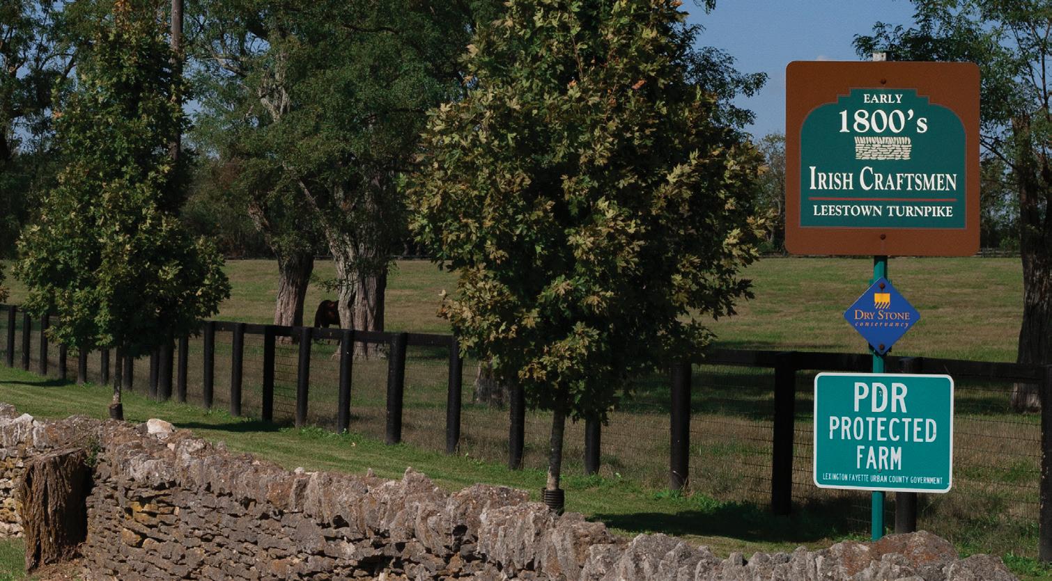
For a farm to be eligible for the PDR Program, it must be at least 20 acres in size. There are 643 remaining eligible parcels totaling 65,455 acres, which are not in public ownership, a utility, a quarry, or located in a Buffer Area or Rural Activity Center. Additionally, there are 276 parcels totaling
3,108 acres that are under 20 acres in size, but in contiguous ownership with an adjacent property that is either already under easement or is eligible to be considered for an easement.
Summary facts about PDR conservation easements are as follows:
• 2,033 acres of protected PDR easement (including those under contract) are located in the Natural Areas land use category. Approximately half of that acreage is predominately wooded. All of the properties appear to have both wooded areas and an agricultural operation. The remaining properties in the program are within Core Agriculture.
• 12,635 acres are in a Focus Area
• 10 properties are listed in the National Register of Historic Sites and 3,522 acres are in an Historic District
• 22,438 acres have frontage on a historic turnpike and/or scenic road
Rural Land Management Plan, Chapter 4 | 101
This PDR protected farm along Leestown Road features an early 1800’s Irish Craftsmen rock fence.
The ordinance established the Rural Land Management Board to oversee the program. The Board is comprised of a diverse group of stakeholders, who are nominated by organizations specified in the ordinance, appointed by the Mayor, and confirmed by Council. The program is executed by staff employed by LFUCG.
LFUCG provides an annual monetary allocation to the program for easement acquisition and operations. With the added financial commitment of the state and federal governments, the program was established with a strong footing that has continued through the years, enabling the conservation of rural land at an excellent pace. Together, these entities have contributed approximately $79 million towards easement acquisition. The LFUCG has contributed the greatest share with nearly $38 million, followed by the USDA Natural Resources Conservation Service with approximately $26 million, and the Commonwealth of Kentucky contributing $15 million.
LFUCG’s allocation is appropriated through bond funding, as there are no dedicated sources of funding for the program. The 1999 Plan explored potential funding mechanisms for the PDR program, believing that a dedicated source would provide more surety and availability of funds at any given time. The following list includes mechanisms allowed by state statute:
• LFUCG funds
• Dedicated property tax (referendum required under HB 644)
• Dedicated payroll tax (referendum required under HB 644)
• Dedicated room tax (referendum required under HB 644)
• Surplus state fund revenues
• Gifts such as cash, land donations, donations of services (legal, appraisals, etc.)
• Tax abatement programs targeted to agriculture
• Grass-roots fundraising efforts
• Other funds that may become available
The success of this program would not be possible without the commitment of Fayette County farm owners and farm families, who have committed to permanently conserving their prime farmland soils and natural areas. Their belief in the importance of being good stewards ensures that future generations will continue to farm, and in turn, the land
and natural resources will continue to deliver many community, financial and ecological services. The reasons why the 1999 Plan called for a PDR program are just as relevant today. With the continued participation of farm owners, community support, and the financial backing of our government entities, the program’s goals for rural conservation will be met.
For more information about PDR, see Chapter 4, Protection of Natural Resources, and Historic and Cultural Landscapes and Rural Heritage.
In the 17 years since its inception, the PDR Program has conserved 30,210 acres.
Policy Emphasis
The policy emphasis for the Purchase of Development Rights program is to continue protecting agricultural and natural lands to meet the goal of conserving 50,000 acres.
Recommendations
1. Continue to support the PDR Program financially and implement its goal of protecting 50,000 acres of agricultural and natural rural lands.
2. Continue utilizing the federal match for all eligible parcels, thereby doubling the LFUCG’s financial investment and acreage acquired.
3. Consider alternative methods and funding for acquiring parcels that do not qualify for the federal match due to landowner income, citizenship or soil quality. Alternatives include obtaining a dedicated source of funding via referendum, peer-to-peer Board solicitation of land donations, and grassroots fundraising efforts by the Board
4. Continue the ongoing education of the public and new public officials on the benefits for rural preservation through PDR.
5. Strengthen incentives through the LESA Ranking System for the consolidation of tracts under 40 acres in size.
102 | Division of Planning
Map 16 Conservation Easements
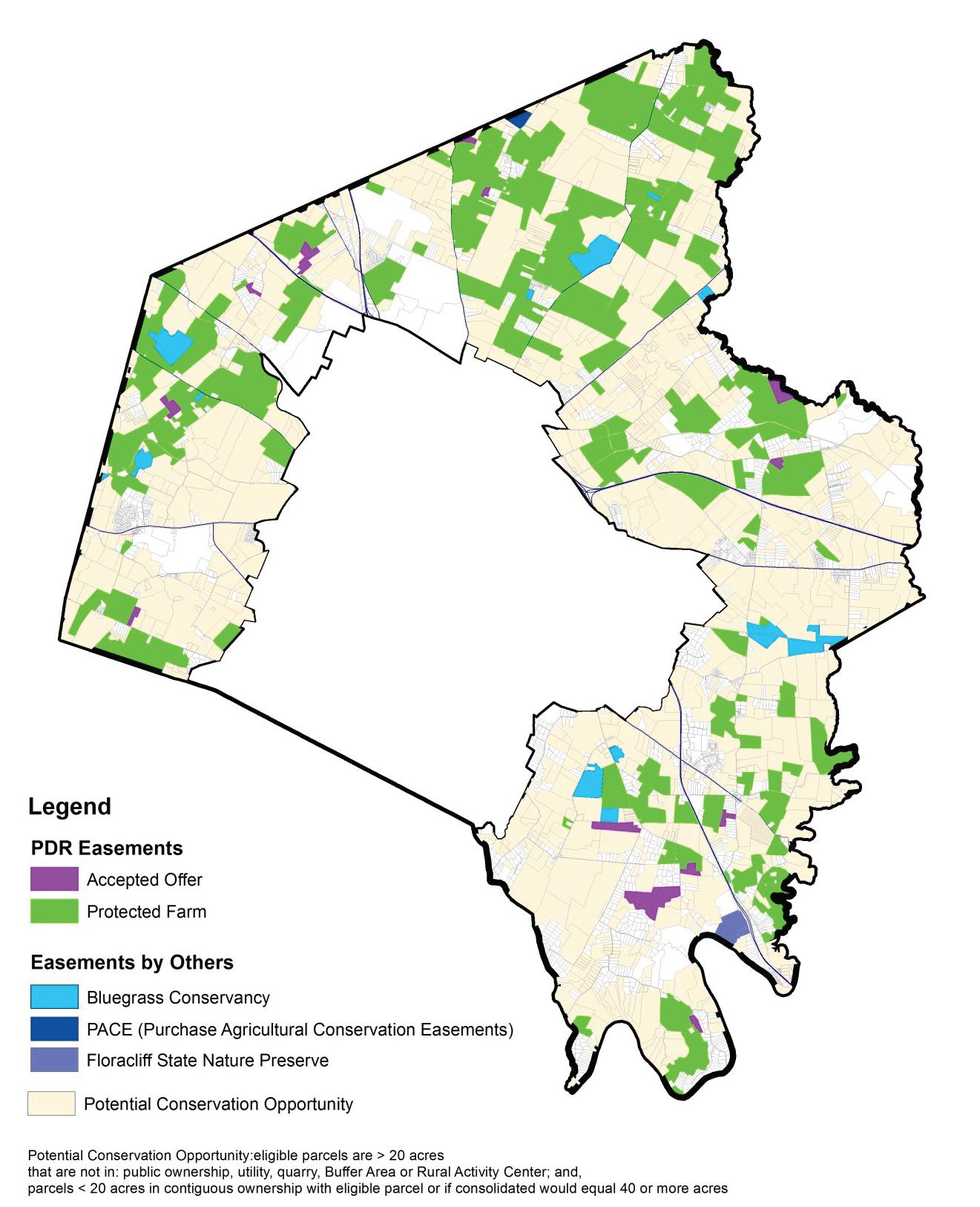
Rural Land Management Plan, Chapter 4 | 103
April 2017
G. Development Considerations
Fayette County’s topography, natural resources and community values have influenced and shaped the use of our rural land for an agriculturalbased economy surrounding an urban core. While farming operations and practices have adapted to a changing economy and the city has continued to grow, the agricultural land base and rural heritage have remained strong. Over time, Fayette County has become world-famous for its scenic landscape and horse farms that draw over a million tourists each year. Agricultural lands, natural environments, historic areas and character-defining features combine to make Fayette County a special place.
Still, development does occur and is allowed - such as the new Blue Grass Stockyards, the redevelopment of existing businesses, development of a B-6P or industrial vacant lot, or the occasional conditional use. And, every five years, the community addresses the issues related to the allocation of land for urban growth through the Comprehensive Plan updating process. Although urban growth and agricultural activities both need land as a basic prerequisite, the overwhelming public sentiment has been for properly contained and designed urban growth and rural preservation. The Rural Land Management Plan does not advocate for the removal of agricultural land and any allowable changes must avoid the destruction to the landscape’s natural, scenic and historic qualities.
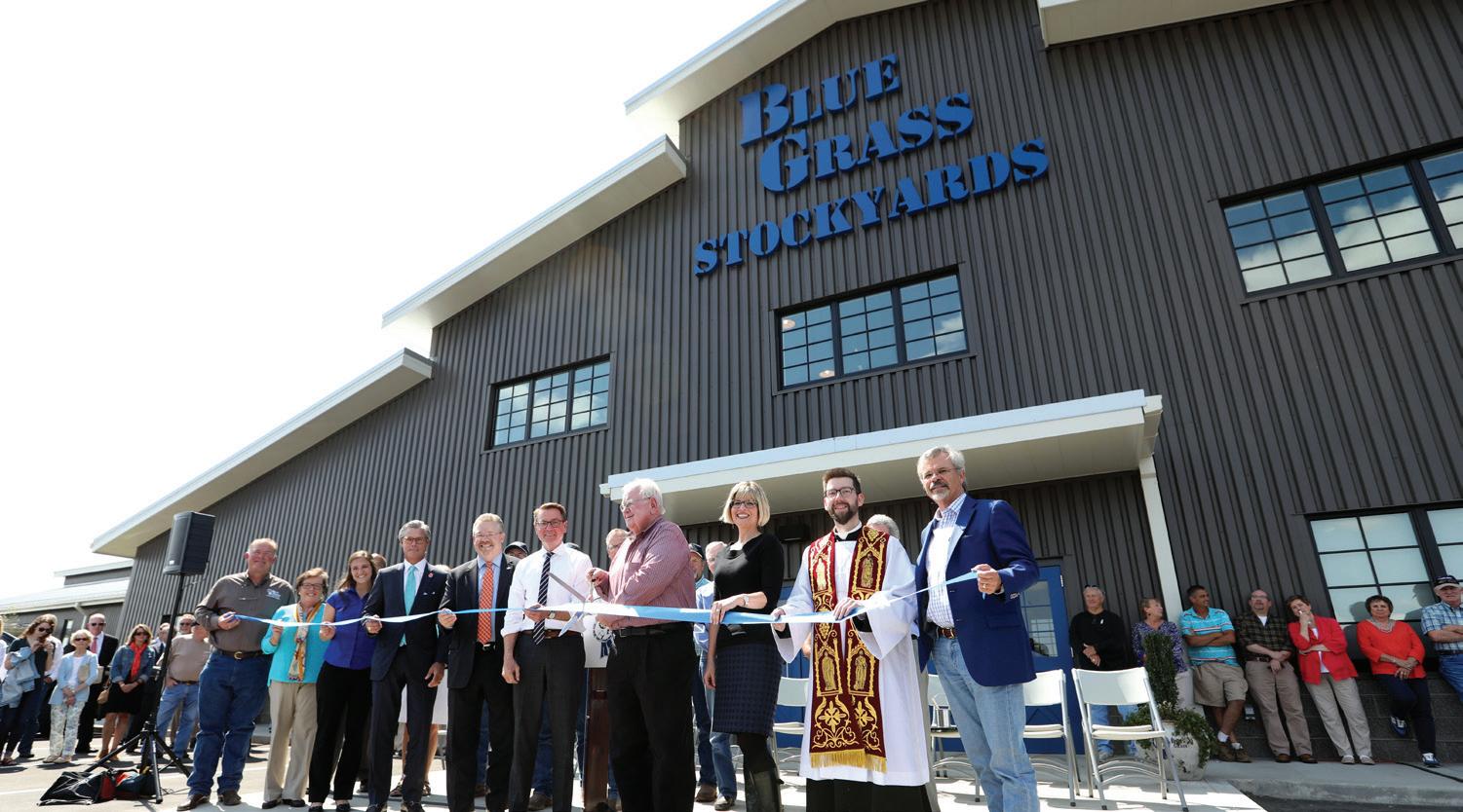
The last major expansion of the Urban Service Boundary was in 1996, and it precipitated the first rural plan in 1999. While the 1999 Plan recognized that additional expansion might be necessary in the future, it made the case for keeping land in agriculture and protecting its natural, scenic and historic integrity. The plan called for urban infill and redevelopment to be aggressively promoted as a solution to address this potential conflict. Additionally, a sewerability study was conducted in the Rural Service Area, but that factor alone was not intended to be the only criteria for future expansion. The study stated that areas identified
as potentially sewerable should be considered for PDR if other factors determine them not good candidates to be included in the USA. The plan also rejected possible expansion that would not be contiguous to the existing Urban Service Area, and it recommended planning for growth at a regional scale.
Since the adoption of the 1999 Plan, efforts to achieve balance between urban growth and rural preservation have included an emphasis on infill and redevelopment and ensuring the preservation of a critical mass of rural land. The Infill and Redevelopment Steering Committee (IRSC) created the 2001 Residential Infill and Redevelopment Design Standards, which influenced subsequent Comprehensive Plans and effected changes to regulations and policies. Topics addressed included incentives, education, coordinated planning and neighborhood character overlays. Through the years, the Committee also focused on quality of
104 | Division of Planning
The new Blue Grass Stockyards, opened in 2017, is an example of allowed development in the RSA.
life, quality of place, the development process and equitability. Work by the Committee identified 22 barriers to infill and redevelopment, and they made recommendations to mitigate the obstacles.
Developers found the length of the application process for infill and redevelopment projects as a barrier, due to the number of variances, waivers, or text amendments to the Zoning Ordinance that were often required. Therefore, the land use map was discarded in the 2013 Comprehensive Plan to encourage development by providing more flexibility, which could reduce the need for variances, waivers and text amendments. The 2013 Plan also emphasized that infill is applicable everywhere within the Urban Service Boundary, not just the area around downtown.
Since the adoption of the 1999 Plan, efforts to achieve the balance between urban growth and rural preservation have included an emphasis on infill and redevelopment, and ensuring the preservation of a critical mass of rural land.
Examples of issues from the 1996 expansion associated with the new urban edge are as follows:
• The 1996 Expansion Area Master Plan called for a 100-foot buffer and fencing along the Urban Service Boundary; however, the buffer was often located in residential backyards. Adjacent farmers were unsatisfied with this configuration, complaining of interference with livestock from household pets, yard waste thrown over fences, and lack of consistent fence maintenance among the numerous property owners. Neighborhood residents were unhappy with the noise and smells from adjacent agricultural operations.
• The east side of the Expansion Area Boundary was seven miles long, with few stub streets from the Urban Service Area. That lack of connectivity, combined with the influx of residents from thousands of new homes and new bicycle and pedestrian activity in the area, created significantly increased traffic in that portion of the county. In
addition, Richmond Road, Todds Road, Winchester Road, and Man O’ War Boulevard, are the only four route options from that portion of the county into downtown Lexington.
• A disconnected street system affects services such as transit, increases operational costs to taxpayers and delays emergency response time. Road widening is a typical solution to alleviate the congestion, but it is expensive and discourages cyclists and pedestrians.
• Housing density in the Expansion Area is lower than planned. This also affects transit and walkability. Without a permanent urban edge and with the possibility of expansion, this very low density and disconnected style of development might not always be at the Urban Service Boundary. Less than 100 years ago, Ashland Estates was at the eastern edge of the city. Fortunately, the subdivision had ample connections to Ashland Avenue, Richmond Road, Tates Creek Pike and Fontaine Road.
• LFUCG has installed trash catchers on farms due to the amount of trash traveling down streams.
• The Expansion Areas no longer conform to how we want to accommodate growth. The 2013 Comprehensive Plan emphasizes sustainable development practices, such as complete streets, compact development and maximized infill opportunities throughout the entire Urban Service Area.
Recognizing the issues arising from how the 1996 expansion addressed the urban edge, the 2013 Comprehensive Plan recommended that singleloaded streets with a wide buffer should be placed at the Urban Service Boundary. This solution has several advantages:
• The green buffer would be more compatible with farming operations
• The wide buffer (100 feet) would be in public or common open space
• The buffer would have the same benefits as a greenbelt that could include a trail for public viewing and appreciation of the rural countryside
• the buffer would still have fencing, but in one ownership
• housing would front the street and the buffer area and adjacent farms; these could be estate-type houses or multi-unit complexes that could utilize the buffer area to meet their open space needs
Rural Land Management Plan, Chapter 4 | 105
curb cut could be possible if the adjacent farm was ever brought in to the Urban Service Area. This would negate the multitude of issues caused by a disconnected street system.
• The buffer area would become a linear park or other greenspace to be shared with the newly expanded area
Development decisions in the Rural Service Area consist of whether to expand the Urban Service Boundary, and the approval of development allowed in a rural zone. Through the years, the Division of Planning has monitored growth, potential growth needs, and trends such as changing demographics, housing and job growth. With each Comprehensive Plan, the statistics, projected needs, sewerability, trends and public input are weighed together to formulate policy and assesses whether expansion is necessary. This Rural Land Management Plan is an advocate for rural preservation.
Prior to development decisions made about expansion or allowed development, impacts to the property itself, adjacent properties, the agricultural economy, rural heritage, and services provided by green infrastructure must be considered, including the following:
1. Development usages’ compatibility with existing land uses; including the scale of development, impact to future farming potential, security to adjacent farms, density, and effects of lighting, noise, smell, traffic and parking.
2. Natural Resource and Topography disturbance or destruction of prime soils and/or statewide significant soils, streams, floodplains and riparian corridors, the Kentucky River, wetlands, sinkholes, springs, aquifer, mature tree stands and forest, venerable trees, steep slopes, the palisades, habitat, flora and fauna, increase in impervious surface, water quality and air quality.
3. Views from or within scenic roads or historic turnpikes, stone fences, parks and nature sanctuaries, National Register of Historic Sites, Landmarks or Districts, historic house museums, ornamental gardens, Rural Settlements, Focus Areas, trails, driving tours, rural road bike routes, and tourist destinations.
4. Proximity to farming operations, properties with conservation easements, parks and nature sanctuaries, Rural Settlements, recreational/tourism corridors and destinations, local landmarks, historic and archaeological sites, and cemeteries.
5. Infrastructure and services including the number of connections to multimodal networks, the ability to extend multimodal networks, and the ability to provide sanitary sewer and stormwater management.
Also, this Rural Land Management Plan is not in favor of changing any zoning on existing parcels, except those that are allowed, such as A-N in the Natural Areas land use category, A-B in the Buffer Areas land use category, or voluntary downzoning of inactive businesses. Due to the number of properties zoned business but not used as a business, the 1999 Plan recommended downzoning them. Once the Plan was approved, the recommendation was forwarded, but failed to advance due to property owner opposition.
This Plan does recommend that when any development requiring Board of Adjustment or Planning Commission action is proposed, where it is believed adverse agricultural impacts are possible, an operational plan (Appendix E) may be required so that the impacts to the property and adjacent properties may be evaluated. Through the review process, the site’s characteristics, the proposed type and level of activity, and a site layout should be reviewed prior to approval. The review should consider the positive impacts as well, such as an enhancement of the farming enterprise, or an enhancement of a natural area or cultural resource through restoration, conservation and/or education.
See Chapter 3, Land Use Categories for additional development considerations.
Communication Facilities
The Federal Telecommunications Act of 1996 prevents local governments from imposing outright bans on wireless telecommunication services or restricting the placement or number of towers so as to interfere with reception and make it impossible to provide service. The State Public Service Commission has viewed wireless communication as a utility, giving it special status to locate towers. In 1998, the State Legislature
106 | Division of Planning • A
This Rural Land Management Plan is an advocate for rural preservation.
established a limited framework for local governments to regulate the siting of towers. Locally, Article 25 of the Zoning Ordinance regulates Telecommunication Towers.
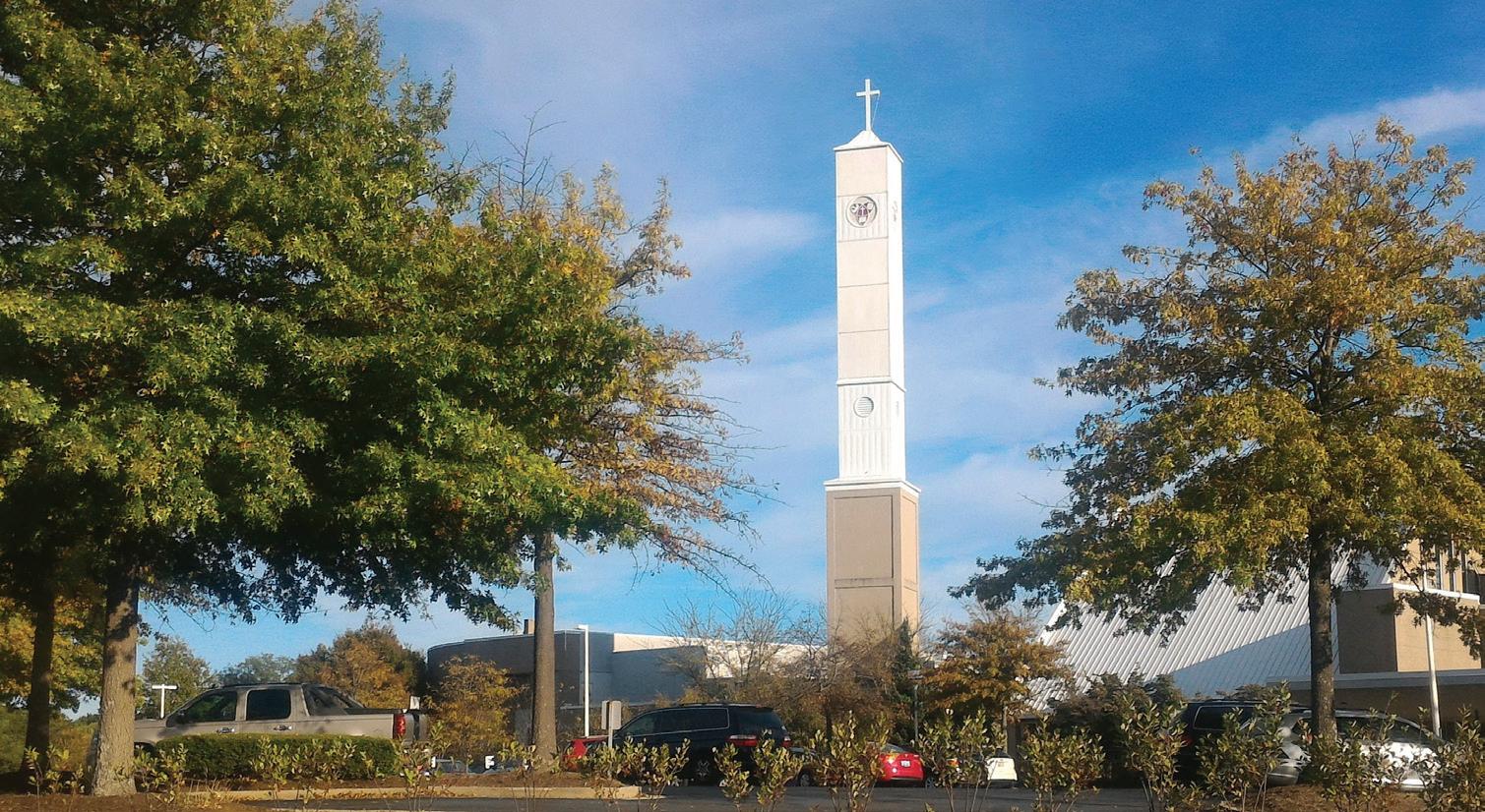
Planning for the siting of towers and antennas needs to take into consideration the aesthetics of the surrounding area. This is particularly true in the rural area where the open views along the rural roads do little to mitigate the intrusion of the antenna towers that may be as much as three hundred feet in height. Where possible, cellular towers should be shielded from long vistas through setbacks, using the topography or adjoining rural road tree canopy to minimize this intrusion.
A very effective way to hide a tower is with camouflaging. Stealth concealments may be located within existing silos, church steeples, or weathervanes on barns high on a hill. Some concealment devices may even look like trees. This is especially critical in locations that have been identified as scenic or historic, such as the Paris Pike corridor, scenic roads and historic turnpikes listed in this Plan, as well as properties on the National Register of Historic Places.
The policy emphasis for development considerations is to protect the agricultural economy, farming operations, natural resources and areas, historic resources, viewsheds, and cultural resources and landscapes, by managing growth within the Urban Service Area and by lessening detrimental impacts from development that is allowed in the RSA.
Policy Emphasis
The policy emphasis for Development Considerations is to recognize the importance of keeping the integrity of Rural Service Area intact, and to ensure any proposed changes that could result in negative impacts are carefully considered.
Recommendations
1. LFUCG should aggressively promote properly located and designed infill and redevelopment projects throughout the entire Urban Service Area to reduce the need for utilizing agricultural land to accommodate growth. LFUCG should continue to remove barriers to such development.
2. Coordinate with adjoining counties to ensure the preservation of the character of the Bluegrass and the management of growth as a region.
3. Continue to monitor the status of growth and development and land available in the Urban Service Area. Monitor growth trends and needs and dialogue with the public on growth issues.
4. Include in growth strategy considerations the impacts caused by changes in usage to the property itself and adjacent properties, the agricultural economy and rural heritage, and services provided by green infrastructure; including farming operations, natural resources/ areas/systems, historic sites and districts, Rural Settlements, viewsheds, cultural resources and landscapes, infrastructure, and services.
5. Include in development considerations the erosion of our long-term ability to feed the nation and the loss of the community brand and its impact on the economy and community pride.
6. Create a greenbelt buffer and single-loaded streets at the Urban Service Boundary.
Rural Land Management Plan, Chapter 4 | 107
Although in the urban area, this church steeple is a camouflaged cell tower and should serve as an example for how cell towers can be built in the RSA.
7. Consider proposed developments’ impacts caused by changes in usage and activities to the property itself and adjacent properties, including: agricultural economy, farming operations, natural resources/ areas/systems, historic sites and districts, Rural Settlements, viewsheds, cultural resources and landscapes, infrastructure, services, and rural heritage. Changes and impacts from proposed development may require submittal of an operational plan (Appendix E).
8. Manage development in the rural area so that traffic from it does not require anything more than minimal road improvement in order to protect and enhance the basic character of the rural road and adjacent viewshed.
9. All policies relating to the rural area should focus on reducing or mitigating the need for road widening and straightening that would inevitably change the very features that make the rural roads unique. Development may precipitate a traffic modeling study to give further insight into the potential need for road improvements, impacts in traffic safety and movement, and impacts on rural character.
108 | Division of Planning
APPENDICES

A. Glossary
Definitions noted with a * were excerpted from the Kentucky Revised Statutes, Lexington-Fayette Urban County Government’s Comprehensive Plans, Zoning Ordinance and Subdivision Regulations, as well as the Board of Architectural Review’s Local Historic District and Local Historic Landmark Design Guidelines.
Access
The ability of the general public to gain entry to a parcel of land for a specific use. These are in general three different techniques to provide the public with access: hold title to a parcel of land, purchase the right of public access or negotiate the right of public access, using easements or other techniques.
Adjacent and Surrounding*
Those properties next to and near the property under review.
Adverse Impact/Negative Impact
Used interchangeably to describe the result of changes in historic and architecturally significant areas which do not reinforce the character and characteristics of individual elements, sites, structures, streets or whole districts.
Agricultural Cluster
Business services, retail and wholesale trade solely dedicated to agriculture, in addition to traditional agricultural inputs, food processing, and manufacturing.
Agricultural Use*
The use of a tract of land of at least five (5) contiguous acres for the production of agricultural or horticultural crops, including but not limited to livestock, livestock products, poultry, poultry products, grain, hay, pastures, soybeans, tobacco, timber, orchard fruits, vegetables, flowers or ornamental plants, including provision for dwellings for persons and
their families who are engaged in the above agricultural use on the tract but not including residential building development for sale or lease to the public .
Agritourism*
Activities conducted on an active farm; or at an agricultural, horticultural or agribusiness operation that are offered to the public for the purpose of enjoyment, education or active involvement in the activities of the active farm or facility. These activities shall be integrated into, directly associated with, and incidental and subordinate to the principal agricultural production on the property.
Aquifer
A water-bearing layer of permeable rock, sand or gravel.
Aquifer Recharge Area
An area that has soils and geological features that are conducive to allowing significant amounts of surface water to percolate into groundwater, and where additions are made to an aquifer by infiltration of water through the land surface.
Bicycle/Bike Route
A segment of a system for bicycles designated by the jurisdiction having authority with appropriate directional and informational markers, with or without a specific bicycle route number.
Buffer
Utilization of land area, a landscape treatment, a particular use or a structure to separate and/or screen one use from another, to provide a transition from one use to another, or to inhibit the view, noise, lights or other public nuisances. (See Screening.)
110 | Division of Planning
Buffer Area*
Utilization of land area, a landscape treatment, a particular use or structure to separate and/or screen one use from another, to provide a transition from one use to another, or to inhibit the view, noise, lights or other public nuisances.
Central Bluegrass Region
The Lexington metropolitan area, comprised of Fayette, Bourbon, Clark, Jessamine, Scott, and Woodford Counties.
Comprehensive Plan*
The Comprehensive Plan serves as a guide for public and private actions and decisions to assure the development of public and private property in the most appropriate relationships. Such plan shall include all elements whether expressed in words, graphics, or other forms (KRS 100). The Comprehensive Plan in many instances must be refined to be sensitive to the particular needs of smaller neighborhood areas. The resulting subarea/small area (corridor) plans serve to amend and refine the Comprehensive Plan.
Conditional Use*
A use which is essential to or would promote the public health, safety, or welfare in one (1) or more zones, but which would impair the integrity and character of the zone in which it is located, or in adjoining zones, unless restrictions on location, size, extent, and character of performance are imposed in addition to those imposed in the zoning regulation.
Conservation
The protection and care that prevents destruction or deterioration of historical or otherwise significant structures, buildings or natural resources.
Conservation Easement*
A non-possessory interest of a holder in real property imposing limitations or affirmative obligations, the purpose of which include retaining or protecting natural, scenic, or open-space values of real property, assuring its availability for agricultural, forest, recreational, open-space use, protecting natural resources, maintaining or enhancing air or water quality, or preserving the historical, architectural , archaeological or
cultural aspects of real property. Conservation easements may be held by a governmental body or a charitable organization whose purposes include retaining or protecting the natural, scenic or open-space values of real property. (KRS 382.800)
Conserve
To manage in a manner that avoids wasteful or destructive uses and provides for future availability.
Core Agriculture and Natural Areas*
This designation is used to classify rural land associated with agriculture (Core Agriculture), and areas that are physically unique from other portions of Fayette County (Natural Areas).
Correction
Taking an action to remove errors, faults, deviations and defect and to bring to a standard or required condition.
Density
The average number of families, persons or housing units per acre of land.
Design Standards
Development objectives relating to considerations such as site organization, landscaping, architecture and site details of projects under review.
Develop
To bring about growth or availability to construct or alter a structure, to make a physical change in the use or appearance of land, or to divide land into parcels.
District
A geographically defined area, urban or rural, possessing a significant concentration, linkage, or continuity of sites, buildings, structures, or objects united by past events or aesthetically by plan or physical development. A district may also comprise individual elements separated geographically but linked by association or history.
Rural Land Management Plan, Appendices | 111
Downzoning
Rezoning to a more restrictive zoning classification.
Easement
The right to use another person’s property, but only for a limited and specifically named purpose. The owner generally may continue to make restricted use of such land since he has given up only certain, and not all, ownership rights.
Ecotourism
Activities conducted in natural, greenspace, or environmentally sensitive areas that are offered to the public for the purpose of enjoyment, education, and active involvement in the activities of the site. These activities shall safeguard the integrity of a natural feature, habitat or ecosystem.
Edge
An abrupt change from commercial, industrial or office land use to any density of residential land use. The property line edge where these land uses abut is the source of traffic, aesthetic and functional conflicts due to the lack of inadequacy of screening and/or considerations of potential problems.
Enhancement
To add or contribute to an area, site or view.
Environmentally Sensitive Area
This term applies to any area which due to its natural or physical setting may have environmental problems with regard to development or use. Areas included are (but are not limited to) areas of steep slope (over 15%), floodplains, sinkholes, areas of poor soil, improper fills, wetlands, significant tree stands, aquifer recharge areas, and similar areas. (See Lexington-Fayette Urban County Subdivision Regulations, Section 1-11.)
Flood*
A temporary rise in stream flow or stage that results in water overtopping its bank and inundating areas adjacent to the channel.
Floodplain
That land adjacent to a stream, channel or a body of water that has been or may be hereafter covered by floodwater including, but not limited to, the regulatory flood.
Focus Areas
Generalized areas, identified in the Greenspace Plan, that are the best examples of the rural Bluegrass identity, with the greatest concentrations of valuable resources representing the various Bluegrass landscape types.
Geologic Hazard Area*
An area in which environmental problems are so numerous that even severely limited development/use could pose a serious problem to the immediate or surrounding areas. Examples include excessive floodplain areas, clustering of sinkholes, cliff areas, areas that have potential collapse problems due to underground caves near the surface, and similar areas. (See Lexington-Fayette Urban County Subdivision Regulations, Section 1-11.)
Grade*
The inclination, with the horizontal, of a road, unimproved land, etc., which is generally expressed by stating the vertical rise or fall as a percentage of the horizontal distance.
Green Infrastructure*
An interconnected network of landscapes and natural resources that contributes to environmental health and the health and quality of life for citizens.
Greenspace
Also known as open space, greenspace is any land that is provided or preserved for park or recreational purposes, conservation of land or other natural resource purposes, historical or scenic purposes, or community development purposes. Greenspace is more than recognized Bluegrass features such as farms, parks, and rock fences. It also encompasses natural environments such as streams, sinkholes, and the Kentucky River; valuable resources such as prime soils; buildings that recall
112 | Division of Planning
the community’s founding and history; the experience of the city or countryside from an automobile; and the ability to travel safely by bicycle or on foot.
Greenways
Linear open space designed to conserve the natural environment and to integrate people into that environment in a way that does not permanently destroy the functional, aesthetic or ecological values of that environment. Greenways may include environmentally, culturally or architecturally significant areas and are often systems linking existing natural and cultural features.
Historic Area
Land with sites, structures and objects that have local, regional, statewide or national historic, cultural or archaeological significance.
Infill
Development of vacant or bypassed land within the Urban Service Area. Infill does not include the revision or replacement of an existing building(s). Most frequently, infill involves small-scale development of scattered vacant or bypassed land, but it can encompass the assemblage and development of larger tracts of land.
Intensity
The degree to which land is used, generally measured by a combination of the type of land use and the amount of land or floor area devoted to that use.
Land Capability Analysis
A physical inventory process to help guide the community to identify and understand the economic, agricultural, geographic, social, environmental, and cultural elements that help shape development. The analysis is a complex study that looks at the total picture of land use and how it relates to preservation. Land Capability Analysis simultaneously looks at valued features that merit preservation and thus are less appropriate locations for growth.
Land Evaluation and Site Assessment (LESA)
An evaluation system used for agricultural, range and forestry resources, incorporating the values and objectives of the community to determine the land that has the highest potential for agricultural yields and that is located in the most viable agricultural area. Each factor that is to be evaluated is assigned a number of points to indicate its importance to the community. The community can then compare the relative value of sites when establishing priorities for selecting properties for its protection program. In some situations, LESA systems consider the alternative potential for urban growth, which may make the land less appropriate for long term agriculture.
Maintain
Support, keep and continue in an existing state or condition without decline.
Native Plant Species
The plant species that were growing in the Bluegrass Region before settlement. The Native Plant Society of Central Kentucky has a list of preferred trees, shrubs, and flowers that was prepared by Julian Campbell. Mary Wharton’s book, Bluegrass Land and Life, also lists native plant species for central Kentucky.
Natural Area*
Any area of land or water, or both land and water, in public or private ownership, which either retains or has reestablished to some degree in the judgment of the commission its natural character, though it need not be completely natural and undisturbed, or which has natural flora, fauna, biological, ecological, scenic or archaeological features of scientific, aesthetic, cultural or educational interest. (KRS 146.415)
Nature Preserve*
A natural area and land necessary for its protection; any estate, in interest of right which has been formally dedicated under the provision of KRS 146.410 to 146.530 to be maintained as nearly as· possible in its natural condition and to be used in a manner and under limitations consistent with its continued preservation, without impairment, disturbance or
Rural Land Management Plan, Appendices | 113
artificial development, and future scientific research, education, aesthetic enjoyment and habitat for plant and animal species and other natural objects. (KRS 146.415)
Natural Resource
For the purposes of this Plan, the natural resources and landforms that are significant to the rural Bluegrass identity and way of life; environmentally sensitive resources that are indigenous or distinctive to the rural Bluegrass; and the remaining natural areas and environmentally sensitive resources within the Urban Service Area and the Rural Service Area that show the natural identity of predevelopment Lexington and provide open spaces and experiences of nature.
Open Space
See Greenspace.
Parking (Lot, Area, or Structure)
A structure or an off-street area for parking, loading or unloading, whether required or permitted by the Zoning Ordinance, including driveways, access ways, aisles and maneuvering areas, but not including any public or private street right-of-way.
Parkways
Essentially elongated parks with a road extending throughout their length. Parkways generally serve to connect large units in the park system, connect greenways or provide a pleasant means of travel within the city and between the city and an outlying region. The parkway usually follows stream or river alignments, shorelines of large lakes or natural wooded areas.
Preservation*
Retaining the integrity of a building, site or structure through reconstruction, restoration, rehabilitation, adaptive reuse or compatible design.
Preserve
To save from change in loss and reserve for a special purpose.
Prevent
To take advance measures against something possible or probable.
Promote
To contribute to the growth or prosperity.
Protection
To maintain the status or integrity of an area, site or view.
Public Facility*
Any use of land whether publicly or privately owned for transportation, utilities, or communications, or for the benefit of the general public, including but not limited to libraries, streets, schools, fire or police stations, county buildings, municipal buildings, recreational centers including parks, and cemeteries.
Purchase of Development Rights (PDR)
Purchase of the right to develop from owners of specific parcels, leaving the owner all other rights of ownership. The price of the rights is the diminution in the market value of the land as a result of the removal of the development rights. The remaining value of the land is the farm use value.
Redevelopment
The revision or replacement of an existing building(s) through acquisition, clearance or rebuilding of a previously developed area according to the Comprehensive Plan where positive long-range land use and social goals are to be achieved. Redevelopment of a structure refers to the physical upgrading of materials and support systems while retaining a building’s original use.
Rehabilitation*
Construction work to put together historic elements, structures and sites. This activity involves retaining and restructuring historic elements, structures and sites.
Renovation
The physical upgrading of materials and support systems while retaining a building’s original use.
114 | Division of Planning
Restoration*
Construction work which puts an element, site or structure back to an historic configuration and condition.
Restore
Revitalizing, returning or replacing original attributes and amenities such as natural biological productivity or aesthetic and cultural resources which have been diminished or lost by past alterations, activities or catastrophic events.
Retained/Maintained*
Used in conjunction with one another to describe both the keeping of an element, site, structure, street or district and the assurance of physical repair and upkeep to elements, sites, structures, streets and districts.
Right-of-Way
Land used generally for streets, sidewalks, alleys or other public uses. Right-of way is also a land measurement term meaning the distance between lot property lines that generally contains not only the street pavement but also the sidewalks, grass area, underground utilities and aboveground utilities.
Riparian
Relating to, or living or located on, the bank of a natural watercourse.
Riparian Buffer
The vegetative strip of land influenced by and surrounding a water body or wetland composed of overstory and understory vegetation which serves to maintain the integrity of the water system through shading, sediment filtration, aquatic habitat enhancement, woody debris recruitment, erosion control, and groundwater flow regulation.
Roadway
The portion of the street right-of-way that contains the street pavement and gutter, and is used primarily as a channel for vehicular movement and secondarily as a drainage channel for storm water.
Rock Fence/Wall
The more popular and common term for a stone fence sometimes used to distinguish a field stone fence from a quarried-stone fence. (See Stone Fence.)
Rural Activity Center
The only locations where intensive nonresidential uses are allowed in the rural area. These areas were in existence prior to merger and are limited to four existing rural employment centers where public facilities serve the development. Note: These areas were defined in the 1980 Comprehensive Plan to recognize what existed or had been zoned. The boundaries of these centers are clearly defined and maintained to restrict encroachment on surrounding rural areas. Considerable measures are taken to reduce the impact of the Centers’ intensive uses upon the surrounding rural area.
Rural Settlement
One of the small, residential communities located in the Rural Service Area.
Scale
Proportional relationship of the size of parts to one another and to the human figure.
Scenic Areas
Lands that are valued for their aesthetic appearance and are generally open areas with natural features that are visually significant or geologically or botanically unique.
Scenic Byway
A highway maintained by a local government that has roadsides or viewsheds of aesthetic, cultural, historical, or archaeological value worthy of preservation, restoration, protection, or enhancement.
Scenic Corridor
The scenic corridor and scenic road go together; the corridor frames and enhances the road. For this reason, the corridor is a much wider area
Rural Land Management Plan, Appendices | 115
than just the highway right of-way. It includes outstanding scenic vistas and facilities that may be within the immediate roadside area or part of a sweeping distant panorama.
Scenic Easement
An interest in land transferred by the owner thereof to the public either in perpetuity or for a term of years. A scenic easement may be created by sale, gift, lease, bequest or otherwise. An instrument which creates a scenic easement shall contain a covenant whereby the owner of the land promises to neither undertake nor permit the construction of any improvements upon the land except as provided by the instrument and except for public service facilities installed for the benefit of the land pursuant to the authorization by the governing body of the urban county or the energy regulatory commission or utility regulatory commission. Pursuant to KRS 65.460, the Urban County shall not permit any action which will materially impair the open-space character or the land . Scenic easements may be held only by a local governmental body or a state agency. (From KRS 65.410)
Screening
A method of visually shielding or obscuring one abutting or nearby structure or use from another by fencing, walls, berms or mounting, or densely planted vegetation. (See Buffer.)
Setback
The distance between the edge of a building (the front, rear and sidewalk construction) and the property line.
Significant
Having important meaning to an element, site, structure, street or district. Important in the historic or architectural context of the county.
Slope*
Any inclined, exposed surface of a fill, excavation or natural terrain.
Stone Fence/Wall
The more formal term for a rock-fence sometimes used to distinguish a quarried-stone fence from a fieldstone fence. See Rock Fence/Wall.
Stream
A watercourse, having a source, terminus, banks and channels, through which water flows at least periodically.
Street*
Any vehicular way. A general term used to describe right-of-way which provides a channel for vehicular and pedestrian movement between certain points in the community, which may provide for vehicular and pedestrian access to properties adjacent to it, and which may also provide space for the location of under or above-ground utilities.
Street, Arterial
The second rank in the classification and should be used only for the movement of vehicles, and preferably should not provide for vehicular access to adjacent properties. Interruption of traffic flow should be permitted only at street intersections that should contain medians, deceleration lanes, and left turn storage lanes. Arterials are the link between expressways and collectors and rank next to expressways in traffic volume, speed limit and right-of-way width.
Street, Collector
The third rank in the classification of streets and are used both for movement of vehicles and for providing access to adjacent properties. Access to adjoining properties should be planned and controlled so that minimum disturbance is made to the traffic moving efficiency of the collector street. Intersections should contain medians, deceleration lanes and left turn storage lanes. Collectors are the link between arterials and local streets and generally rank next to arterials in traffic volume, speed limit and right-of way width.
Street, Expressway
The first rank in the classification of streets, and are used only for movement of vehicles and do not provide for vehicular or pedestrian access to adjoining properties; interchange of traffic between an expressway and other streets is accomplished by grade separated interchanges with merging deceleration and acceleration lanes, and no at grade intersections are permitted. Expressways generally carry higher volumes, require greater right-of-way ‘ width, and permit higher speed
116 | Division of Planning
limits than any other class of street, and should be depressed in urban or urbanizing areas. Arterials are the only class of street that generally should be connected with expressways at interchange points.
Street, Local
The fourth rank in the classification of streets and are used primarily for providing access to adjacent properties. Vehicles moving on these streets should have an origin or destination in the immediate vicinity, and all types of through traffic should be eliminated through initial design of its connections with other streets. Local streets are the primary link between trip generation points (homes, offices, stores, work) and collector streets. Locals have the least right-of-way, the lowest speed limit and the least amount of vehicular traffic.
Structure
A combination of materials to form a construction for use, occupancy or ornamentation whether installed on, above or below the surface of land or water.
Sustainability*
The level at which a development or community meets the needs of the present without compromising the ability of future generations to meet their own needs.
Tourism
The guidance or management as a business or government function of persons who visit the community for pleasure, education, or cultural enrichment. Tourism enhancement means the management of the natural and built environment in such a manner as to maximize the economic and other benefits of tourism to the community, while remaining within the context of other identified community goals and values.
Transfer of Development Rights (TDR)
Development rights on land in a designated preservation area may be purchased by a developer and transferred to a designated development area where the equivalent amount of additional development can be constructed.
Utility, Private or Public
(1) Any agency which, under public franchise or ownership, or under certificate of convenience and necessity, provides the public with electricity, gas, heat, steam , communications, rail transportation, water, sewage collection or other similar services. (2) A closely regulated private enterprise with an exclusive franchise for providing a public service.
Viewshed
A visual field; the area of land and structures that is visible from a particular location or linear corridor, such as a road.
Vista
A distant view through or along an avenue or opening.
Watershed
The region or area which drains into a river, lake or stream. The total area included within a watershed will vary depending on the drainage system being considered, but usually the total area above a given point on a stream, channel or lake that contributes runoff water to the stream, channel or lake at that point is called a watershed.
Wetlands
Wetlands are transitional areas between terrestrial and aquatic environments where the water table (the level of groundwater) is at or near the ground surface or the land is covered by shallow water. Wetlands are a diverse lot ranging from tidal flats, salty marshes, and mangrove swamps on the coast, to prairie potholes, peat bogs, and cypress swamps inland, to name just a few. Wetlands provide habitat for numerous fish, waterfowl and other wildlife, many of which have economic value. In short, given the great variety of species that depend on wetlands directly or indirectly, there are few ecosystems that are more important. In some communities wetlands are the primary water-supply or recharge areas for aquifers. Wetlands also help to purify the water passing through them by filtering out silt and nutrients.
Wellhead
The source of a spring or stream.
Rural Land Management Plan, Appendices | 117
B. Sources and Partial Reference Bibliography
This Rural Land Management Plan arose from information and data from many sources. A sample of other sources included persons contacted and/or internet searches, such as the following:
• The 1999 Rural Service Area Land Management Plan (baseline maps and text)
• KYTC Scenic Byways Program
• Ky. State Nature Preserves “Report of Endangered, Threatened, and Special Concern Plants, Animals and Natural Communities for Fayette County, Ky.”; Nature Preserves.
• Ky. Division of Water 4A Impaired Streams and 303(d) list; Ky. Special Waters
• Ky. Tourism, Arts and Heritage Cabinet, “Economic Impact of Kentucky’s Travel and Tourism Industry 2015 and 2016”
• Ky. Secretary of State’s FastTrack Business Organization Search webpage
• Kentucky Agritourism and Farms are Fun websites
• Kentucky Division of Ag-Ed, Farm Safety and Farmland Preservation
• Kentucky Department of Fish and Wildlife (Ky. River)
• Kentucky Office of Technology, Division of GIS: Land Cover and Tree Canopy
• USDA/NRCS conservation programs
• 2002, 2007, 2012 Census of Agriculture
• US Forest Service, “A Different Twist on City Green Spaces and Health”, 2016
• 2017 NASS Kentucky County Estimates
• Fayette County Property Valuation Administrator’s Office
• VisitLex
• University of Kentucky, CEDIK
• Ken Cooke, Friends of Wolf Run, Ky. Division of Water (retired): Ky. River, conservation programs
• Richard Walker, Tetra Tech: Stormwater Manual applications
• Dry Stone Conservancy
• Floracliff State Nature Preserve
• The Bluegrass Conservancy
• The Fayette Alliance
• The Nature Conservancy
• Dovetail Partners, “The Human Health and Social Benefits of Urban Forests”, 2016
• The Kentucky Equine Education Project, 2016
• 2016 Annual Report Ky. Dept. of Charitable Gaming
• 2014 Ky. Horse Racing Commission Annual Report
• Kentucky Thoroughbred Association/Kentucky Thoroughbred Owners and Breeders, Inc.
• 2012 Kentucky Equine Survey
• 2012 CEDIK, “Influence of the Agricultural Cluster on the Fayette County Economy”
• University of Kentucky CEDIK, “2017 Influence of the Agricultural Cluster on the Fayette County Economy”
• University of Kentucky Cooperative Extension Service - Conservation
• Websites with information regarding the history of Fayette County, history of Valley View ferry; the Kentucky River water trails, tourism destinations, Blue Grass Stockyards, Helm Place, Floracliff, Raven Run, Bluegrass cultural landscape, sport horse farms, climate change, farm websites, etc.
• Bluegrass Farm to Table website, Fayette County Local Food Demand Assessment, Dec 2015, First Processed Produce in Central Kentucky, May 2016
• 1877 Atlas of Bourbon, Clark, Fayette, Jessamine and Woodford Counties, Ky.
• Cow Country News, June 2017. Publication of the Kentucky Cattlemen’s Association
• Native America: A State-by-State Historical Encyclopedia. 2012
• Birth of the Bluegrass: Ecological Transformations in Central Kentucky to 1810. Andrew P. Patrick dissertation. Register of the Kentucky Historical Society, Spring 2017.
118 | Division of Planning
1971 Historical Survey of Rural Settlements in Fayette County Kentucky
• 2007 Rural Settlement Study
• Herald-Leader, January 27, 2017; “Mansion was donated to be a museum; now the group wants to sell it. Greg Kocher
• Karl Raitz: Ky Bluegrass in Focus, 1987; and Creating Landscape Symbol Vocabulary… 1990
• The Bluegrass Cultural Landscape: a Regional Historic Overview NPS 1988
• The State of Historic Preservation Planning the Bluegrass Region
• The Bluegrass Region: a Finite Resource: U.K. 1999
• Lane Report, August 4, 2016. Equestrian Facilities, Economic Impact by Esther Zunker
• World Monuments Fund 2006 Watch List of 100 Most Endangered Sites
• Venerable Trees, History, Biology, and conservation in the Bluegrass. Tom Kimmerer, University Press of Kentucky 2015
• LFUCG GIS data (such as parks, historic, streams, PDR and zoning)
• Hisle Park Master Plan
• Photos used from LFUCG’s Photo Shelter and the Division of Planning
• LFUCG Environmental Services: Susan Plueger, John Saylor, Demetria
• LFUCG Bluegrass Farm to Table Program: Ashton Potter Wright
• LFUCG GIS: Chris Doerge, Frank Boateng
• LFUCG Historic Preservation: Randy Shipp, Amelia Armstrong
• LFUCG Long Range Planning: Cindy Deitz, Stephanie Cunningham, Meghan Jennings, Chris Woodall, Janice Westlund
• LFUCG Parks and Recreation: Michelle Kosieniak, Michael Lorton
• LFUCG PDR Program: Elizabeth Overman
• LFUCG Transportation Planning and MPO: Kenzie Gleason, Jimmy Emmons, Max Conyers
• LFUCG Planning Services: Traci Wade
• LFUCG Zoning Compliance: Jim Marx
• LFUCG Water Quality staff
Rural Land Management Plan, Appendices | 119 •
C. Changes to the 1999 Rural Service Area Land Management Plan
General:
1. Shortened plan name to Rural Land Management Plan, removing “Service Area”
2. Deleted Chapter 5, Rural Plan Implementation Programs because PDR and text amendments to the Zoning Ordinance and Subdivision Regulations were accomplished. The TDR and zoning map amendments failed to progress and are no longer recommended. In response to Chapter 5 being deleted, the Development Considerations were moved to Chapter 4
3. The 10-acre lot recommendation was removed as the minimum lot size has been increased to 40 acres
4. A more comprehensive anlysis of the Rural Service Area was performed, enabled by GIS advancements.
Chapter 1 - Managing Our Rural Heritage for Future Generations
1. Added additional reasons to the importance of the Rural Service Area such as sustainability and cultural heritage
2. Removed 10 acre lots as a challenge; add new challenges such as regional planning, public perceptions, tourism and the changing face of agriculture and economy
3. Added section for current trends
4. Added Goals and Objectives based on the 1999 list of reasons why the Rural Service Area is important; and, added goals for the environment and community support
Chapter 2 - Land Use Summaries
1. Renamed from Background Studies and Technical Data Summaries
2. Moved planning process from Chapter I
3. Reduce emphasis on sewerability
4. Increase data on parcels, ownership and lotting patterns
5. Added section on crossroad clusters and rural subdivisions
6. Added Zoning from Special Elements
7. Incorporated Land Use data into the chapter (1999 Plan’s maps were not included in the Plan for publication) and organized it by agricultural cluster (agribusiness, ag-related recreation and agritourism, agrelated parks, ag-related education) and non-agriculture
8. Removed Transfer of Development Rights from Land Use Categories
Chapter 3 - Land Use Categories
1. Updated data for Land Use Categories, including minor adjustments to acreages/boundaries based on new studies (Rural Settlements), corrections and the removal of circulation
Corrections:
○ Avon RAC was adjusted by 12 acres with the addition of the Avon Rural Settlement;
○ Core adjusted with the removal of three lots which were supposed to be in the adjacent Existing Rural Residential (from Development Plan);
○ Blue Sky RAC was adjusted by 14 acres with the removal of medians in ROW;
○ Core adjusted with the addition of 54 acres in Masterson Station Park (GIS erroneously had labeled as Recreation, which was not a land use category in the 1999 Plan);
○ Core adjusted with the addition of 47 acres in the reservoir (GIS erroneously had labeled as Water, which was not a land use category in the 1999 Plan)
2. Modified names of categories: from Rural Lands to Core Agriculture; and from Existing Rural Residential to Small Lot Residential
120 | Division of Planning
3. Modified recommendation to continue regulatory measures and add accessory uses to those permitted and associated with the agricultural zone
4. Moved recommendation to offer incentives to consolidate tracts to Chapter 4, PDR
5. Added recommendation to consider natural areas as principal permitted use in the A-N zone in order to conform with intent of the zone
6. Reduced text for Rural Settlements and referenced the 2007 Study for text and recommendations
7. Discussed parcels in the Buffer Area which can still be subdivided
8. Recommended Small Area Plan for Blue Sky RAC
Chapter 4 - Special Plan Elements
General:
1. Moved Existing Non-Agricultural Zoning to Chapter 2
2. Added section on Green Infrastructure to bolster importance of Rural Service Area
Natural Resources:
1. Modified name from Environmentally Sensitive Areas to Natural Resources
2. Expanded on natural areas from 1999 Plan, which included small discussion about conservation Greenways, Focus Areas and Special Natural Protection Areas. Updated Plan includes sections on soils, hydrology (capture 1999 Plan’s sections on aquifer and greenways), and flora/fauna
3. Removed references to a rural greenways program
4. Moved list of Special Natural Protection Areas to Appendix
5. Added section for Protection of Natural Resources, including conservation easement, publicly-owned lands and regulations
6. Recommended a critical mass of natural areas / landscapes
7. Recommended funding of natural resource / landscapes as a primary public investment
8. Moved recommendations for a greenway/greenspace network linking urban and rural areas and publicly accessible greenway system to a
recommendation in Tourism for public recreation in the Rural Service Area. Replaced with a recommendation to link people with nature (not specifically greenways)
9. Removed reference for greenways protected in PDR to provide public enjoyment and tourism
10. Updated list of Special Natural Protection Areas by identifying those protected through an easement since the 1999 Plan
11. Moved recommendations for Special Natural Protection Areas providing ecotourism, hiking and biking to recommendations in Tourism. Replaced with a recommendation to link people with nature (not specifically Special Natural Protection Areas)
12. Replaced public acquisition of Special Natural Protection Areas to public acquisition of nature sanctuaries and corridors
13. Removed vague recommendation to monitor Environmentally Sensitive Areas, as it is covered under recommendations to protect
14. Changed recommendation about tax incentives to establish riparian zones to ‘develop a strategy to encourage’. Deleted recommendation for buffer zones and setbacks to protect riparian zones (accomplished)
15. Updated development of regulations for the Royal Springs Aquifer to ‘continue monitoring’
16. Moved hiking and biking text and most of text about greenways to Tourism or Chapter 4, Trails; but, added statement about connecting people to nature
17. Moved setbacks and buffers to Development Considerations
18. Moved Five Focus Areas to Historic and Cultural Landscapes
Historic / Cultural Landscapes and Rural Heritage:
1. Added text about landscapes and heritage
2. Expanded on historic and cultural landscapes from 1999 Plan, which mentioned sites and districts, Rural Settlements and road aesthetics. Updated Plan includes brief history of the rural area and its relationship to rural heritage; more information about historic resources; description of cultural landscapes - specifically corridors (roads, trails)
3. Referenced the 2007 Rural Settlement Study, their history, and removed lengthy description
4. Corrected list of historic turnpikes and scenic byways
Rural Land Management Plan, Appendices | 121
5. Added section and recommendation about gateways
6. Added sections on Protection of Historic and Cultural resources, including discussion about the World Monuments Fund designation and strategic plan, comprehensive planning, ordinances, state and federal regulations, and public ownership
7. Recommended design guidelines for B-5P parcels at gateways
8. Recommended funding the stone fence matching grant program
Transportation:
1. Moved Roadway Aesthetics to Chapter 4, Corridors
2. Removed extensive text for traffic management (capacity is within acceptable parameters)
3. Added data to Transportation for all modes, including air, ferry, rail, trails and emphasis on systems
4. Moved trail staging areas text to Chapter 2, Recreation
5. Included sustainable transportation as a recommendation
6. Removed recommendation for signage to direct tourist traffic away from narrow rural lanes
7. Travel shed analysis as it relates to rural development was not included as a component of this plan
8. Removed recommendation for stating areas for walking and biking on rural roads
9. Reduced emphasis on closing rural roads for special events
10. Reduced emphasis on studying underground utility feasibility along rural roads
Tourism:
1. Added a section and recommendations for Tourism. Greenways and Focus Areas were the primary avenues of discussion about tourism in the 1999 Plan
2. Added agritourism, ecotourism and cultural tourism
PDR:
1. Moved from Chapter V, Plan Implementation
2. Updated PDR text from proposed to existing program
3. Removed potential funding mechanisms from the 1999 Plan list that are non-viable
4. Recommended finding ways to fund properties that do not qualify for federal dollars
Development Considerations:
1. Moved from Chapter V
2. Reduced text about sewerability and expanded text on expansion
3. Deleted recommendation calling for a comprehensive economic analysis of growth, establishing a threshold as a determinate for expansion, and about access points as no new subdivisions are allowed
4. Added text about infill and redevelopment, the expansion area and the urban edge
5. Listed development considerations
6. Added section for Communication Facilities
122 | Division of Planning
D. Special Natural Protection Areas
The “A” sites are those with the highest priority for preservation and are as follows:
Area 1 - A portion of the Horse Park contains a concentration of a blue ash and oak savanna-woodland trees on this 1,000-acre site. In fact, this is the most outstanding concentration of this type in Fayette County. LFUCG should work with this state park to ensure the preservation of this resource.
Area 2 - Masterson Station Park contains a 10 to 20-acre area that is used by rare birds.
Area 3 - Mare Haven Farm contains approximately 2 to 3 acres of canebrake and 20 to 30 acres of other native plants. This is the largest known canebrake in the county.
Area 4 - Todds Road near the Fayette/Clark County line contains a 200acre swamp forest. This area contains green ash and swamp white oaks.
Area 5 - Canebrake Farm contains several patches of cane totaling 5 to 10 acres.
Area 6 - Raven Run Nature Sanctuary contains several rare species of plants.
Area 7 - Boone Creek contains the only known post oak in the county, as well as other rare plants.
Area 8 - Sulphur Well Road at the Fayette/Clark County line is the location of an area of approximately 40 acres containing an undisturbed natural pond.
Area 9* - Elk Lick Creek is the location of an area that is already preserved through a conservation easement donated to LFUCG. Much of the area is undisturbed by farming and contains numerous native wildflowers.
Area 10 - Spears Palisades includes about 2 miles of frontage along the Kentucky River Palisades. Several rare species of plants are found at this site.
Area 11 - Dry Branch Road has a beech-tulip forest of 10 to 20 acres as well as several rare species of plants.
The “B” sites are those with a slightly lower priority for preservation and are as follows:
Area B-1* - Leestown Road at the Fayette/Scott County line (30 acres)
Area B-2 - Ironworks Road south of the Horse Park (two areas totaling 50 acres)
Area B-3 - Mt Horeb Road near Ironworks Road (150 acres)
Area B-4* - Goose Creek near Russell Cave Road (200 acres)
Area B-5 - North Elkhorn Creek near Russell Cave Road (150 acres)
Area B-6 - Hughes Lane (70 acres)
Area B-7 - Greenwich Road opposite Jimtown Lane (600 acres)
Area B-8 - South Elkhorn Creek near Frogtown (120 acres)
Area B-9 - Shannon Run (100 acres)
Area B-10* - Little Texas (50 acres)
Area B-11* - Elkchester Road (40 acres)
Area B-12 - Calument Farm (400 acres)
Area B-13 - Cave Creek (300 acres)
Area B-14 - Spurr Road on the Blackburn Correctional Facility (20 acres)
Area B-15 - Cane Run on Coldstream Farm (200 acres) (Most of this area is located inside the Urban Service Area on the Coldstream Farm. A small area is located north of I-75.)
Area B-16* - Viley Road at Old Frankfort Pike (30 - 40 acres)
Area B-17 - North of Swigert Avenue (120 acres)
Area B-18 - North Elkhorn Creek/Elmendorf Farm (450 acres)
Area B-19 - North Elkhorn Creek/Gainesway Farm (350 acres)
Area B-20* - Bryan Station Road north of Briar Hill Road (300 acres)
Area B-21 - Winchester Road east of I-75 (60 acres)
Area B-22 - East Hickman Creek west of DeLong Road (250 acres)
Area B-23* - Athens-Walnut Hill Road near I-75 (350 acres)
Area B-24* - Old Richmond Road near I-75, a.k.a. Boggs Fork Woods (150 acres)
Area B-25 - Shelby Lane (100 acres)
Area B-26 - Jacks Creek area including river slopes (600 acres)
*Site is preserved by a PDR or other easement.
Rural Land Management Plan, Appendices | 123
Map 17
Special Natural Protection Areas
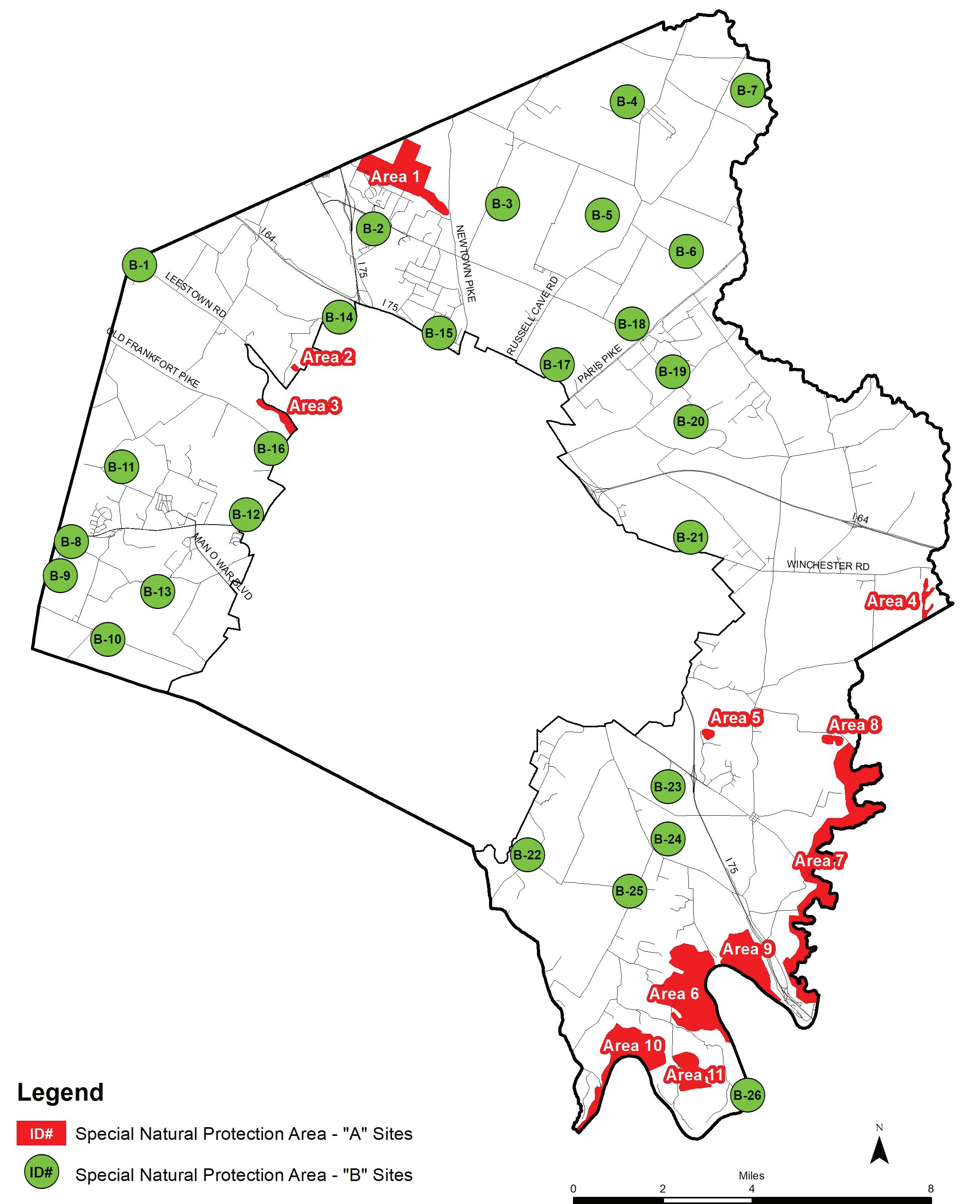
October 2017
124 | Division of Planning
E. Operational Plan
Date
Applicant Name Address Case Number
Existing Site Characteristics
Total Acres
Acreage for New Activity/Use
Existing Zone
Proposed Zone
Any Existing Conditional Use
Proposed Conditional Use
Rural Land Management Plan Land Use Category
Please check all applicable categories.
Core Agricultural Land
Natural Area
Rural Settlement
Buffer Area
Small Lot Residential
Rural Activity Center
Rural Land Management Plan, Appendices | 125
Community Patterns/Use
Please check all applicable categories.
Historic District/Property
Local - district:
National - district:
Road Type
Arterial Collector Local Private
Other Characteristics
Along an existing driving tour or popular biking route
Site contains active railroad or utility corridor
Within a Rural Land Management Plan Focus Area
Adjacent to properties in PDR, other Conservation
Easement, or a Nature Sanctuary
Existing publicly accessible recreational/tourism destination within one mile
Site contains a local feature:
Church School Country store
Other:
Cultural Resources
Please check all applicable categories.
Scenic Byway/Corridor
Local State National
Historical Significance
National Register of Historic Places
Museum
Archaeological site
Agricultural Features
Barn
Agricultural building complex
Other structures
Pasture
Paddocks
Unfenced fields
Fenced fields
Fencing
White plank
Black plank
Stone
Double row
Other:
126 | Division of Planning
Cultural Resources Continued
Please check all applicable categories.
Farm Road Features
Paved
Tree-lined
Gated entrance/gate house
Significant Viewsheds
Within site
Surrounding landscape
Rare or unique features -
Cemetery
Human
Horse Gardens
Formal
Sculptural
Therapeutic
Other:
Farming Acreages
Please calculate acreage for all applicable categories.
Crops
Livestock
Thoroughbreds
Pleasure Horse Sod Other
Rural Land Management Plan, Appendices | 127
Conservation/Natural Area, Natural Resources & Typography Coverage (%)
Please calculate the percentage of site coverage for all applicable categories.
PDR or other conservation easement
Nature sanctuary
Prime soils
Soils of statewide significance
Forest, woodland, or canopy coverage
Steep slopes
Palisades/gorge
Rare or unique feature
Significant trees*
Fence-row trees
Riparian vegetation
River or stream
Pond
Wetland or spring
Sikhole
Habitat of rare or endangered species**
Other
*As defined in Article 26 of the Zoning Ordinance.
**As defined by Kentucky State Nature Preserves Commission’s list of Endangered & Rare Species
128 | Division of Planning
Proposed Facility Type
Activity Facility
Please check all applicable categories.
Self-Guided Tour
Driving Walking Biking
Equestrian
Guided Tour
Driving
Walking Biking
Equestrian
Activity Facility Continued
Please check all applicable categories.
Recreation
Archery
Baseball Soccer Swimming
Tennis
Polo Shooting
Hunting Trapping
Firing Range
Ecotourism
Educational Facility
Please check all applicable categories.
Museum
Historic house
Other museum:
Tours
Archaelogical
Farm
Nature
Tree canopy
Other Educational Facility
Botanical garden
Demonstrations/lessons/classes
Trail
Walking
Hiking
Biking
Mountain biking
Equestrian
Bird watching
Boating
Fishing Photography
Rock climbing
Zip line
Agritourism
Hayride
Pony ride
Corn maze
Self-pick produce
Event Festival
Nature sanctuary, preserve or conservation area
Petting zoo
Trails
Other:
Rural Land Management Plan, Appendices | 129
Hospitality Facility
Please check all applicable categories.
Bed and breakfast
Boat dock
Gift shop/market
Recreational outfitter
Restaurant
Roadside stand
Sports club
Boarding stables
Staging area
Youth camp
Winery
Other:
Camping
Primitive
RV
Other:
Entertainment Facility
Please check all applicable categories.
Event
Music Drama Festival Horse show Rodeo Race track
Other:
130 | Division of Planning
Proposed Development
• Site plan - show existing site characteristics and areas of proposed changes, including structures, parking, infrastructure improvements, activities, boundaries for public access, and vegetation.
• Agricultural land - Burden of proof that the activity or use is supplemental to agricultural enterprise; does not substantially impact future farming production; proof of liability insurance if necessary.
• Natural land - Burden of proof for investments in: conservation, preservation of open land, and educational components; proof of liability insurance if necessary.
• Rural Settlement - complies with the Rural Settlement Study.
Approvals and Assurances (internal use only)
Health Department
Division of Fire & Emergency Services
Division of Traffic Engineering
Kentucky Transportation Cabinet
Kentucky Division of Water
Army Corps of Engineers
Ecotourism Certifications
Development Information
New buildings (sqft)
New roads (ft)
Parking spaces provided
Cut and fill (sqft)
Land Disturbance
Permanent (sqft)
Temporary (sqft)
Usage
Months of year
Hours of operation
If event facility, frequency
Rural Land Management Plan, Appendices | 131
Enhancements to Site
Please check all applicable categories.
Site Characteristics
Green building or sustainable building practices
Buffers or other mitigation of impacts
Future Farming
Use of farm’s commodities
Value-added products
Education facility
Natural Area
Restoration Conservation
Educational facility
Cultural Resources
Restoration Conservation
Educational facility
Impacts to Site and/or Adjacent Properties*
Please check all applicable categories.
Site Characteristics
Lighting Noise Traffic
Wastewater
Solid waste
Future Farming
Permanent removal of prime or of statewide signficant soils
Water quality, usage (dams, crossings, riparian removal, erosion)
Increase in impervious surface area
Natural Area
Disturbance to fragile areas or integrity of site
Removal of native trees, vegetation, or habitat
Construction/increase of impervious surface area
Use of ponds, water resources for water quality
Cultural Resources
Removal of cultural features
Threat to integrity of site landscape
Threat to integrity of internal viewshed
Threat to integrity of external viewshed
*For each identified impact, a remedy or mitigation measure shall be detailed in an attachment submitted with completed operational plan
132 | Division of Planning
Rural Land Management Plan, Appendices | 133
