

a rm S trong mill we S t

Small a rea Plan


April30,2015
CreditS
A special thank you to all the community members who dedicated their time, energy, and enthusiasm to the Armstrong Mill West Small Area plan process and to Mattie Morton, LFUCG Youth and Family Services and all the staff at the Gainesway Community Center where many neighborhood meetings were held. Also, thanks to Commander David Lyons and Eugenia Johnson-Smith from the Division of Police for providing calls for service data. Thanks to the Fayette County Public Schools for providing space at the Tates Creek Middle School library for the neighborhood visioning meeting. A special thanks to the University of Kentucky and Commerce Lexington for contributing to the Armstrong Mill West Kick-Off cookout, and the Culinary Arts Program at College for Technical Education (CTE) for catering the event.
LFUCG Planning Commission
L. Michael Owens, Chair
K. Mike Cravens, Vice-Chair
Patrick Brewer
William H. Wilson, Parliamentarian
Frank Penn
Will Berkley
Advisory Committee Members
Malcolm Ratchford, Community Action Council
Ashton Wright, LFUCG Local Food Coordinator
Austin Simms, Lexington Housing Authority
Brad Biliter, LFUCG Parks and Recreation
Division of Planning Staff
Pam Brown, Zoning Enforcement Officer
Denice Bullock, Administrative Specialist
Max Conyers, Planning Manager
Stephanie Cunningham, Administrative Specialist
Joey David, Senior Planner
Cynthia Deitz, Senior Planner, RLA
James Duncan, Planning Manager
Jimmy Emmons, Senior Planner, AICP
Cheryl Gallt, Planner
Kenzie Gleason, Senior Planner
Rob Hammons, Senior Planner, AICP
Sam Hu, Senior Planner
Jim Hume, Zoning Enforcement Officer Senior
Kelly Hunter, Planner
Laurie Jackson, Administrative Specialist
Karen Mundy
Carolyn Plumlee
david drake
Joseph Smith
Carolyn richardson
David Jarman, Planner
Meghan Jennings, Planning Tech
Chris King, Director, AICP
Donna Lewis, Staff Assistant Senior
Tom Martin, Senior Planner, AICP
Jim Marx, Planning Manager
Tammye McMullen, Administrative Specialist
Robert Phelps, Zoning Enforcement Officer
Barbara Rackers, Administrative Officer
Bill Sallee, Planning Manager
Charles Schaub, Senior Planner
Harika Suklun, Senior Planner
Chris Taylor, Senior Planner
Scott Thompson, Senior Planner
Commander Wallace Hays, Lexington Police Department
Commander Roger Holland, Lexington Police Department
Larry Isenhour, Greenspace Commission
Larry Johnson, Partners for Youth
Karen Mundy, LFUCG Planning Commission
Rick Christman, Employment Solutions
Fred Brown, Council District 8
George Myers, Council District 8 (former)
Candace de Courten, FCPS Tates Creek High School
Megan Majors, FCPS Tates Creek High School
Cheryl Moss Johnston, CMI Properties
Scott Thompson, MPO Bike and Pedestrian Coordinator
Greg Ross, The Academy for Leadership at Millcreek
Bill Wallace, FCPS Facilities
Traci Wade, Senior Planner, AICP
Greg Walker, Zoning Enforcement Officer
Janice Westlund, Senior Planner, AICP
Pam C. Whitaker, Administrative Specialist Principal
Brenda Whittington, Administrative Specialist
Christine Wu, Staff Assistant
Credits 3


Introduction ............................................................................... 7 introduCtion ............................................................ 7 1 Community engagement ............................... 45 3 2.1 Demographics ................................................................ 12 2.2 Land Use ........................................................................ 17 2.3 Natural environment ..................................................... 23 2.4 Housing .......................................................................... 26 2.5 Health & Safety .............................................................. 36 2.6 Mobility .......................................................................... 43 exiSting ConditionS .......................................... 10 2 4.1 Public Safety .................................................................. 56 4.2 Connectivity & Mobility ................................................. 57 4.3 Housing .......................................................................... 58 4.4 Land Use & Sustainability .............................................. 59 4.5 Neighborhood Livability ................................................. 60 4.6 Placemaking ................................................................... 61 4.7 Crime Prevention Through Environmental Design ......... 62 ViSion Statement, Planning PrinCiPleS & objeCtiVeS .............................................................. 54 4 T ABLE OF CONTENTS 4


T ABLE OF CONTENTS 6.1 Public Safety Strategies ................................................ 114 6.2 Connectivity & Mobility Strategies .............................. 117 6.3 Housing Strategies ....................................................... 121 6.4 Land Use & Sustainability Strategies ............................ 124 6.5 Neighborhood Livability Strategies .............................. 126 6.6 Placemaking Strategies ................................................ 130 imPlementation ................................................... 108 6 5.1 Circulation Mobility Improvements ............................... 71 5.2 Armstrong Mill Road Corridor ........................................ 80 5.3 Connectivity Improvements ........................................... 82 5.4 Green Infrastructure / Environmental Sustainability ..... 84 5.5 Commercial enhancement ............................................. 90 5.6 College for Technical Education (CTE) Site ..................... 96 5.7 Housing Strategies ......................................................... 98 5.8 Healthy Foods .............................................................. 103 ConCePt Plan ........................................................... 68 5 5
The Armstrong Mill West Small Area Plan serves as a guide for public improvements and private investment. Through an extensive community engagement process, local residents, stakeholders and community members shared ideas, identified community assets, and defined issues. The process helped shape policies and strategies introduced in the plan to achieve the neighborhood vision for improvements.
The small area’s defining characteristics, such as demographics, land use, development patterns, natural environment, housing, health and safety, and mobility, also inform the concepts and recommendations outlined in the plan, as it utilizes many of the existing community assets and amenities as building blocks for improvements. The goal is to revitalize the neighborhood to a more sustainable and livable place, following the guidance of the 2013 Comprehensive Plan and this small area plan, with the public sector taking the lead in providing infrastructure improvements to create a safe and walkable, bicycle-friendly environment.
Based on community input and the existing conditions analysis, the following themes will serve as basis for neighborhood revitalization:
• Focus on placemaking. Improve uses within parks and provide physical improvements to existing commercial areas to make the area an attractive, vibrant and identifiable destination.
• Enhance connectivity. Provide facilities and improvements to enhance safe and convenient connections to the area from surrounding areas by all modes of travel—walking, cycling, transit and driving. Focus on linking the area’s neighborhood destinations and institutional assets within and to areas outside.
• Enhance pedestrian environment. Create a safe, comfortable and attractive environment for pedestrians by including streetscape improvements such as sidewalk, tree plantings, improved crosswalk lighting and markings, and pedestrian-scale street lights.
• Improve public safety by design. Incorporate Crime Prevention Through Environmental Design (CPTED) principles into both public realm improvements and private development, and focus resources to improve public safety throughout the small area.
• Re-green impervious areas. Incorporate green infrastructure such as rain gardens, permeable paving, and other techniques into school improvements, parking lots, and streetscape design to capture and treat stormwater while adding greenery.
• Improve access to housing. Protect and improve neighborhood housing stock, and address housing affordability and cost-burdened rental housing.
• Create a healthy food oasis. Bridge the access gap of traditional food sources by providing the area with many different options and innovative sources for obtaining healthy and affordable food.
By adopting the plan, the Planning Commission and the Lexington-Fayette County Urban Government (LFUCG) Council will demonstrate the city’s commitment to the plan’s implementation. However, every action item listed in this plan will require separate and specific implementation. Adoption of the plan does not, on its own, begin the implementation of any item. Approval of the plan does not legally obligate the city to implement any particular action item. The implementation will require specific actions by the neighborhood, the city and by other agencies.
Ex ECUTIVE SUMMARY 6
introduCtion 1
The recently adopted 2013 Lexington-Fayette Urban County Government (LFUCG) Comprehensive Plan identified several areas within the Urban Service Boundary to be further studied through a small area planning process. One of these areas includes the Armstrong Mill West area located in the southern portion of Lexington. The area of study is bounded by New Circle Road to the north, Tates Creek Road to the west, Man O’ War Boulevard along the southern and eastern boundary, and Alumni Drive to the northeast.

7 I NTRODUCTION
Figure 1. Map of the Armstrong Mill West Small Area Plan
This area is a priority for further study in the comprehensive planning process due to socio-economic factors and its location within the Urban Service Boundary. The LFUCG Planning Commission recognized the need to address transportation issues, access to healthy foods and concentrations of poverty.
The purpose of the small area plan is to identify community needs, opportunities, and other planning issues that, along with neighborhood input, will inform strategies that include policy changes and / or project implementation for land use, community design, walkability, increased mobility and accessibility to alternative transportation, and healthy foods. Other goals include opportunities to enhance existing areas through both public and private reinvestment to advance the area’s sense of place and safety.
neighborhood oVerView
The Armstrong Mill Road West area is comprised of several neighborhoods of diverse character with varying densities. Like many suburban neighborhoods of its era, the built environment has evolved around the exclusive use of automobiles with single-use development patterns. The study area is unique based on its socioeconomic, demographic and locational attributes, and it can be described as a “third-tier” or “middle-ring” suburb. Similar to other communities, efforts are being made to revitalize Lexington’s downtown core while private investment continues in the outer portions of the Urban Service Boundary. The suburbs in between (i.e. “the middle”) often suffer from the lack of public intervention and tend to be overlooked by private investors.
Distinctive to the Armstrong Mill West area are large concentrations of public and rental housing and public uses. Although originally constructed for the automobile, today many residents within the neighborhood do not own, or have use of, a personal vehicle. Despite being densely populated in areas and surrounded by public spaces, it lacks availability of certain goods and services, including healthy foods and neighborhood retail. As Figure 2 on the following page shows, many residents look directly outside of the neighborhood for these services, which creates issues of social equity and accessibility.
8 I NTRODUCTION


9 I NTRODUCTION
Figure 2. Accessibility to Goods and Services
exiSting ConditionS
Successful community planning produces context-sensitive solutions. In order to make appropriate recommendations for future development and growth, the existing conditions must be understood. This section will provide detail on the neighborhood’s defining characteristics, such as demographics, land use, development patterns, natural environment, housing, health and safety, and mobility. Figure 3 below shows the three census tracts that comprise the small area plan’s study area. Much of the demographic and housing data in this section refers to these census tracts.

2 10 Ex ISTING CONDITIONS
Figure 3. Census Tracts within Armstrong Mill West Small Area Plan

11 Ex ISTING CONDITIONS
Figure 4. Key Demographics from Armstrong Mill West Small Area Plan
Understanding the current dynamics of the Armstrong Mill West area is essential to identifying community needs and guiding future development. This small area plan will effect 16,366 residents within the plan boundary; 5.4 percent of Fayette County. Residents are 45 percent male, 55 percent female, with a median age of 33.7 years old.
Figure 5 at right at right shows age by gender within the Armstrong Mill West area and makes clear three significant populations: young children, young families, and adults who wish to age in place. Understanding these trends helps to project potential future needs for the Armstrong Mill West area.
Young children under the age of 10 make up a large portion of the population. This is an indicator that services such as child care, education and health care are crucial.
Another large percentage of the population can be generalized as young families, ages 20 to 34. In order for the neighborhood to accommodate these young families, affordable housing must be available.
Lastly, the baby boomer generation (ages 50 to 69) also remains a large population and would prefer to age in place. The Center for Disease Control (CDC) explains aging in place as “the ability to live in one’s own home and community safely, independently, and comfortably, regardless of age, income, or ability level.”
The small area plan is intended to provide recommendations for social, economic and environmental improvements with thoughtful consideration of the neighborhoods dynamic demographics.
Age by Gender
12 Ex ISTING CONDITIONS
demograPhiCS
-10 -8 -6 -4 -2 0 2 4 6 8 10 Female Male 85 years and over 80 to 84 years 75 to 79 years 70 to 74 years 65 to 69 years 60 to 64 years 55 to 59 years 50 to 54 years 45 to 49 years 40 to 44 years 35 to 39 years 30 to 34 years 25 to 29 years 20 to 24 years 15 to 19 years 10 to 14 years 5 to 9 years Under 5 years
Figure 5. Age by Gender
2.1
0 2000 4000 6000 8000 10000 12000 White alone Black or African American alone American Indiana and Alaska Native alone Asian alone Native Hawaiian and other Pacific Islander alone Some other race alone Two or more races Racial Composition 653 102 0 242 3855 11514 0
Figure 6. Racial Composition
Household Income Range
Median income is the midpoint in a range of numbers, meaning there are an equal number of incomes above it and below it.
According to the 2013 American Community survey, the median household income for workers in the Armstrong Mill West area is $37,809, compared to Lexington’s median $48,398.
Household income is measured by income generated by person(s) living in the same household. This is significant because residents in this neighborhood are living on a lower than average income when compared to Lexington as a whole.
13 Ex ISTING CONDITIONS
0 5 10 15 20 25 30 35 40 >150K 100-150K 75-100K 50-75K 25-50K <25K
Figure 7. Household Income Range
37.7% Lexington AMWSAP 27.2% 23.6% 24% 19.2% 16.7% 9.5% 11.2% 7.5% 12% 8.9% 2.5%
There are very few resources and services, such as grocery stores and medical offices, within close proximity to the neighborhood. Available transportation is key to obtaining services and resources such as these. The majority (42 percent) of Armstrong Mill West neighborhood residents have access to one (1) vehicle, while 15 percent do not have access to a vehicle at all.
Figure 8 below shows that Armstrong Mill West residents utilize public transportation more than the average for Fayette County. It also shows that less Armstrong Mill West residents walk to work. This is an indication of the few resources and services within walking distance.
Having access to a vehicle translates to job opportunities. This is especially true in the Armstrong Mill West neighborhood because of the small amount of economic activity. Increasing and improving pedestrian access will allow this neighborhood to close the gap between its residents and its resources.
Vehicle Access
14 Ex ISTING CONDITIONS
Figure
0 20 40 60 80 100 Lexington AMWSAP Car, truck, or van -- drove alone Car, truck, or van -- carpooled Public transportation (excluding taxicab) Walked Other means Worked at home Commute to Work Figure 9. Vehicle Access 0 10 20 30 40 50 AMWSAP Lexington No vehicles available 1 vehicle available 2 vehicles available 3 or more vehicles available
8. Commute to Work
“There are very few resources and services, such as grocery stores and medical offices, within close proximity to the neighborhood.”
Educational attainment is important because, in general, a higher education is a future indicator of lower unemployment rates, higher income and better health. The chart below compares the Armstrong Mill West area census tracts to Lexington-Fayette County. This comparison shows that the Armstrong Mill West neighborhood has a higher rate of high school graduation than Fayette County overall. However, the statistic reverses for secondary education. While 46.9 percent of Fayette County has completed some form of secondary education, only 38.3 percent of the Armstrong Mill West area has reached this educational attainment.
Educational Attainment
Less than 9th Grade 9th to 12th Grade, No Diploma
15 Ex ISTING CONDITIONS
Figure 10. Educational Attainment
School Graduate (Includes Equivalency) Some College, No Degree Associate's Degree Bachelor's Degree Graduate or Professional Degree 17.0% 22.9% 6.9% 21.2% 20.7% 6.7% 4.6%
High
11.0% 20.2% 7.1% 25.6% 26.6% 6.5% 3.0%
AMWSAP Lexington-Fayette County
AMWSAP Residence 1 Year Ago
Fayette County Residence 1 Year Ago
Figures 11 and 12 refer to the Census Bureau definition as persons living in the same dwelling one year ago, meaning house or apartment. Although the Armstrong Mill West area has a low home-ownership rate, there is a high percentage of retention in the neighborhood: 78.5 percent compared to Fayette County’s 75.2 percent. This data may not have considered the recent vacating of the Housing Authority development located at Centre Parkway.
16 Ex ISTING CONDITIONS
Figure 12. Fayette County Residency Retention
Other (County, State Country) Different Dwelling in Fayette Co. Same Dwelling
Figure 11. AMWSAP Residency Retention
Other (County, State Country) Different Dwelling in Fayette Co. Same Dwelling
neighborhoodS
the small area plan includes eight (8) designated neighborhood associations as registered with the LexingtonFayette Urban County Government (LFUCG) Division of Planning.
Many of the neighborhood associations’ boundaries align with development patterns. As new neighborhoods were built, neighborhood associations were formed. All neighborhoods within the small area plan were built approximately between the years 1950 to 1980.

17 Ex ISTING CONDITIONS
Figure 13. Neighborhood Associations within Armstrong Mill West Small Area Plan
l and uSe 2.2
deVeloPment Pattern
Most of the neighborhoods in the study area were developed from the late 1950s through the late 1970s. Spatial patterns are auto centric and typical of this era, such as curvilinear streets, cul-de-sacs and few street grids. The majority of houses in this neighborhood are ranch style homes situated on large (.25 acre) lots.

18 Ex ISTING CONDITIONS
Figure 14. Development Pattern
Zoning
The small area plan has a distinct residential character with approximately 92 percent of the land zoned for residential purposes. Nearly 50 percent of the residential zoned land is for single-family residential while the remaining residential property consists of duplexes, townhouses and apartments. Commercial zoned consists of 2.8 percent of the property in the study area. This includes the Park Hills Shopping Center (B-6P) and the two gas stations, one at Trent Boulevard and the other at Centre Parkway. There are professional offices located at the corner of Alumni Drive and Man O’ War and along Custer Drive. The schools and parks are zoned AU.


Land Use by Zoning


19 Ex ISTING CONDITIONS
0 5 10 15 20 25 30 35 40 R-5 R-4 R-3 R-2 R-1T R-1E R-1D R-1C P-1 B-6P B-1 A-U
Figure 15. Land Use By Zoning
12% 0.6% 0.5% 1.9% 37.2% 17.5% 0.4% 5.4% 6.6% 8.4% 8.6% 0.1% Single-Family Unit Multi-Family Units Multi-Family Units Park
Hills Shopping Center
Professional Office Building
ARMSTRONGMILLROADCORRIDOR
20 Ex ISTING CONDITIONS
TRENTBLVD APPIAN WAY GAINESWAYDR ARMSTRONGMILLRD CROSBY DR PIMLICOPKWY GREENTREERD ALUMNIDR CARRIAGE LN SUNDARTDR CENTRE PKWY RIVERPARKDR DALEDR BOLDBIDDERDR SUTHERLAND DR BEULAH PARK TATESBROOKDR OLYMPIARD REDRIVERDRNIAGARADR BOWIE DR DIXDR DIXIANADR THAMESDR NILES DR MILANORD SEQUOIADR CUSTER DR JOCASTADR CLAIBORNEWAY MT RAINIER DR HIGH HOPE RD TANFORANDR CAULDERRD AQUEDUCTDR WILLOWOODRD ELMENDORFDR DANADADR ACCORDDR YELLOWSTONE PKWY E NEW CIRCLE RAMP PARKLAWN DR COLDSTREAM DR NARROWLN CANONERODR KITTIWAKE DR BEAUFORTDR MAN O WAR BLVD MERMANDR WINDING DR ARDENPL REMORA DR GRACEDR LADYDILN TROUT CT E NEW CIRCLE RD WHITEHALLPL SULIERCT OLYMPIACIR CHAUVINDR GREENTREECT VINTAGE CIR TATES CREEK RD AKSARBENPARK ATOKAD PARK FOXRUNRD TRENT CIR LINILOCT JONESTRL CRIMSON KING CT CARETOCT CROWNCIR BIG BEND CT JANDYMARCT VERSIECT T ATES CREEK RD ALUMNIDR t m strong Mill Road West Neighborhood SAP ing 0 0 5 0 25 M es Legend General Study Area Boundary Parcel C ip A-U Agricultural Urban B-1 Neighborhood Business B-6P Planned Shopping Center P-1 Professional Office R-1C Single Family Residential R-1D Single Family Residential R-1E Single Fam ly Residential R-1T Townhouse Residential R-2 Two Family Residential R-3 Planned Neighborhood Residential R-4 High Density Apartments R-5 High Rise Apartments
Figure 16. Zoning within the Armstrong Mill West Small Area Plan
PubliC SPaCeS
Gainesway Park
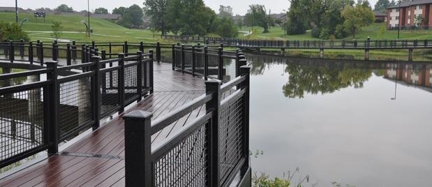
This community park is approximately 19 acres with active and passive activities. The park offers amenities such as a baseball / softball field, a basketball court, playground, tennis courts and a community center with a community garden. The park has a paved shared-use trail and two (2) shelters near a duck pond. Half of the acreage is a linear park where a pedestrian/bicycle trail was scheduled for construction to occur in 2014 from the park to Centre Parkway.


Gainesway Community Center


The Gainesway Community Center is adjacent to the Tates Creek school campus and open to anyone. Programs regularly offered at the community center include karate classes, homework assistance and computer classes. Special programs include summer field trips, college tours and a back-to-school rally. Currently, the community center is underutilized due to the housing authority apartments being rehabilitated. Once the rehabilitation is completed and the apartments are occupied, it is expected that more residents will utilize the community center.
River Hill Park
This park is a 16-acre, multi-functional neighborhood park with a ½-mile paved trail and sidewalk. The park is accessed off Claredon Drive and Crosby Drive with a parking lot and has pedestrian access via Claredon Drive and Niagara Drive. The park is outfitted with a 9-hole / basket disc golf course. It is has three (3) tennis courts, a playground, a community garden, a basketball court and a baseball / softball field.
Tates Creek Golf Course & Aquatic Center
This 18-hole golf course is located on 123 acres in the heart of the Gainesway Subdivision. The course is described as tight with sloping greens and few water hazards. This facility includes a golf shop, practice area, large banquet room and aquatic center. The banquet hall may be rented for meetings, dinners, receptions. The aquatic center includes lap pool, children’s play area, slides and diving boards.
21 Ex ISTING CONDITIONS
Gainesway Community Center
Pond at Gainesway Park
Playground at River Hill Park
Banquet Hall, Tates Creek Golf Course
Tates Creek Aquatic Center
PubliC SChoolS
Tates Creek Elementary School
Tates Creek Elementary School was built in 1963 as the initial phase of the county’s only three-school complex, which includes Tates Creek Middle School and Tates Creek High School. The elementary building was renovated in 1988, and the latest makeover was completed in mid-2014.
As of September 2014, Tates Creek Elementary has been identified as an International Baccalaureate (IB) Candidate School. This is the final link in making a complete International Baccalaureate campus, which includes Tates Creek Middle School and Tates Creek High School. Obtaining IB authorization would make Tates Creek the only K-12 IB campus in the United States.
Tates Creek Elementary has developed a strong partnership with Southland Christian Church that focuses on tutoring, mentoring, basic needs, one-time events and teacher encouragement. More than 100 volunteers provide direct or indirect support to students, families and staff. The school also houses a Healthy Kids Clinic, which provides many services for students during the school day.
Tates Creek Middle School
Tates Creek Middle School is part of the Tates Creek complex, which serves southeast Fayette County. Tates Creek Middle School was the first middle school in the Commonwealth of Kentucky to have an IB Diploma Programme. The school opened in 1963 as a junior high and became a middle school before the 1990-1991 school year. The latest renovations were completed in November 2012.
Tates Creek is becoming a green school and is working with the city to implement an environmental program. A rain garden is located on campus, and students can participate in a summer environmental awareness program.
Public Schools
Tates Creek High School
Tates Creek High School was built in 1965 as the final stage of the Tates Creek complex, two years after the elementary and middle schools. A major renovation project was completed in 1993.
As the only high school in Lexington-Fayette County with IB Diploma Programme status, the school attracts students from across the county. The school is designated for renovations but has yet to be placed on the schedule for facility improvements.
Millcreek Elementary School
Millcreek Elementary school was built in 1979 and recently underwent renovations in 2012. The school’s curriculum places a strong emphasis in literacy as well as math and science. Located along the school’s property is a hands-on outdoor classroom. School officials and the PTA partnered with Lexington-Fayette Urban County Government (LFUCG), city council, and U.S. Fish & Wildlife Service to restore the natural creek behind the school building for an outdoor classroom. Both of these initiatives have resulted in a more hands-on and engaging curriculum.
22 Ex ISTING CONDITIONS
Figure 17. Public Schools
Capacity Enrollment % Free & Reduced Lunch 0 500 1000 1500 2000 ME TCE TCMS TCHS 0 10 20 30 40 50 60 70 80 90 100 1,850 1,789 900 976 725 674 550 513 72% 79% 46% 52%
natural enVironment 2.3
The topographic profile of the study area is varied, with the steepest slopes being found to the rear of Tates Creek Middle and Tates Creek High schools. The land along West Hickman Creek is more gently sloped and is where the lowest points of elevation can be found, with the lowest point being 897 feet. The highest points of elevation are located along Man O’ War Boulevard, between Armstrong Mill Road and Alumni Drive, with the highest point of elevation being 1,054 feet. The study area itself is comprised of 1,911 acres and contains four (4) waterways: Lansdowne Drive Tributary, West Hickman Creek, Mill Creek, and Squire Road Tributary. West Hickman Creek is the largest waterway.

23 Ex ISTING CONDITIONS
Figure 18. Topographic Profile of Armstrong Mill West Small Area Plan
green infraStruCture
Green infrastructure is the interconnected network of natural resources and cultural landscapes (urban and rural) that contribute to the environmental health and the health and quality of life for the citizens of Fayette County. The primary natural resource that is found within this small area plan is the Hickman Creek greenway and its tributaries. The Lexington-Fayette Urban County (LFUCG) Greenway Master Plan

Green infrastructure has been incorporated in urban developments through the use of bioengineering techniques for stormwater management and water quality through wetland and stream restoration.


recent stormwater improvements include the renovated pond at the Gainesway Park, which is now a restored wetland. The Tates Creek school campus located near the wetland uses this as an educational site. The Millcreek Elementary stream restoration project features a rain garden and stone amphitheater, Mill Creek restoration and stream buffer.

24 Ex ISTING CONDITIONS
Tates Creek Golf Course
Gainesway Pond
Gainesway Park & Trails
West Hickman Creek
Figure 19. LFUCG Greenway and Trails
Greenspaces in the small area plan include public spaces such as parks and school grounds. Lexington-Fayette Urban County Government (LFUCG) owns several lots for floodplain management that provide open space. One seven-acre basin has been planted in trees. There are street medians for Tates Creek Road, Man O’ War Boulevard and Appian Way. The greenspace located between Armstrong Mill Road and Centre Parkway and River Park Drive and Caulder Road is scheduled for trail construction. This trail is a portion of the West Hickman shared-use trail, recommended by the Greenway Master Plan, that will connect the Tates Creek school campus to Veterans Park.
25 Ex ISTING CONDITIONS
TRENTBLVD APP AN WAY GAINESWAYDR ARMSTRONGMILLRD CROSBY DR PIMLICOPKWY GREENTREERD ALUMNIDR CARRIAGE LN SUNDARTDR CENTRE PKWY RIVERPARKDR DALEDR BOLDBIDDERDR SUTHERLAND DR BEULAH PARK TATESBROOKDR OLYMPIARD REDRIVERDRNIAGARADR BOWIE DR DIXDR DIXIANADR THAMESDR NILES DR MILANORD SEQUOIADR CUSTER DR JOCASTADR CLAIBORNEWAY MT RAINIER DR HIGH HOPE RD TANFORANDR CAULDERRD AQUEDUCTDR WILLOWOODRD ELMENDORFDR DANADADR ACCORDDR YELLOWSTONE PKWY E NEW CIRCLE RAMP PARKLAWN DR COLDSTREAM DR NARROWLN CANONERODR KITTIWAKE DR BEAUFORTDR MAN O WAR BLVD MERMANDR WINDING DR ARDENPL REMORA DR GRACEDR LADYDILN TROUT CT E NEW CIRCLE RD WHITEHALLPL SULIERCT OLYMPIACIR CHAUVINDR GREENTREECT VINTAGE CIR TATES CREEK RD AKSARBENPARK ATOKAD PARK FOXRUNRD TRENT CIR LINILOCT JONESTRL CRIMSON KING CT CARETOCT CROWNCIR BIG BEND CT JANDYMARCT VERSIECT T ATES CREEK RD ALUMNIDR Armstrong Mill Road West Neighborhood SAP Greenspace and Trails 0 0 5 0 25 M Legend Planned Trai s Complete Park Trails Schools Greenway Park Greenspace Tree Canopy Parcel General Study Area Boundary TATES CREEK GOLF COURSE GAINESWAY PARK RIVER HILL PARK ALUMNIDR CUSTER DR R MT RAINIER DR YELLOWSTONE PKWY NDR IG BEND CT t 0 0 5 0 25 M les Legend Planned Trails Comp ete Park Trails Schools Greenway Park Greenspace Tree Canopy Parcel General Study Area Boundary
Figure 20. Trailways and Greenways
The housing analysis provides a profile to the local housing conditions and trends in the Armstrong Mill West Small Area Plan neighborhood. Census tract data from the 2009 - 2013 American Community Survey (ACS) five-year estimates is used in the analysis to understand housing characteristics and the residents that live in the neighborhood. This information will be used to guide housing recommendations.
The majority of units (47.6 percent) in the study area are comprised of single-family, detached housing, townhouses consists of 7.4 percent, duplexes at 5.5 percent, three- and four-plexes at 8.8 percent and apartment style buildings at 30.4 percent. This excludes other categories of mobile home, boat, RV, etc.
The majority of residents are renters at 58.6 percent while only 41.4 percent are homeowners. Homeownership is lower in the Armstrong Mill West neighborhood than in Lexington.
Census Tract 40.01 represents the largest 2-units, 3 or 4 units, and 5 or more unit types of housing at 51.3 percent, which also translates to the largest renter-occupied units (67.2) as shown in Figure 22. This indicates that approximately 16 percent of the single-family units, which typically represents owner-occupied, are actually renter-occupied. For Census Tract 34.05, thirteen (13) percent of the single-family housing stock is rental. For Census Tract 35.05, that number is twelve (12) percent.
houSing tyPe & tenurehouSing 2.4 26 Ex ISTING CONDITIONS
Housing Type
Housing Tenure
27 Ex ISTING CONDITIONS
0 10 20 30 40 50 60 Census Tract 40.01 Census Tract 34.05 Census Tract 34.04 Lexington 5 or more 3 or 4 units 2 units 1-unit, attached 1-unit, detached
Figure 21. Housing Type
0 10 20 30 40 50 60 70 80
Figure
22. Housing Tenure
55.2% Lexington CT 34.04 CT 34.05 CT 40.01 AMWSAP Owner-Occupied Renter-Occupied 44.8% 41.4% 58.6% 45.0% 55.0% 46.3% 53.7% 32.8% 67.2% Linear (Owner-Occupied)
houSing age
Approximately 68 percent of the small area plan’s total housing stock is 35 years old or older (i.e., was constructed prior to 1980), compared to 66 percent in the Lexington-Fayette County. Although construction in the neighborhood spans from 1950s to present, most the housing is from the 1970s era.
VaCanCy rate
The residential vacancy rate is a good indicator of the balance between housing supply and demand in a community. When the demand for housing exceeds the available supply, the vacancy rate will be low. When there is an excess supply, the rate will be high. A vacancy rate of 3 to 5 percent is generally indicative of a healthy market.
When vacancy rates fall below 3 percent, there is upward pressure on home prices and rents.
While some census tracts are higher than others, the overall vacancy rate is at 6.4 percent. By comparison, the vacancy rate in Lexington-Fayette County is 9.4 percent.
Housing Age
28 Ex ISTING CONDITIONS
0 20 40 60 80 100 Vacancy
9.4% 90.6% 4.4% 95.6% 9.8% 90.2% 5.0% 95.0% 6.4% 93.6% Lexington CT 34.04 CT 34.05 CT 40.01 AMWSAP Occupied Housing Units Vacant
Units Figure
0 10 20 30 40 50 60 70 80 90 100 CT 40.01 CT 34.05 CT 34.04 Lexington 1939orearlier1940to1949 1950to1959 1960to1969 1970to1979 1980to1989 1990to1999 2000to2009 2010orlater
Figure 24. Vacancy Rate
Rate
Housing
23. Housing Age
“Approximately 68 percent of the small area plan’s total housing stock is 35 years or older ...”
Percent of Income: Mortgage
houSing CoSt burden
Housing affordability is a growing concern in all of Lexington. Households with extremely low incomes have a variety of housing situations and needs. This population includes persons with disabilities, college students, seniors living on fixed incomes, and low-waged earners.
Families who pay more than 30 percent of their income for housing are considered cost burdened and may have difficulty affording necessities such as food, clothing, transportation and medical care. An estimated 12 million renter and homeowner households now pay more than 50 percent of their annual incomes for housing. Nationally, HUD estimates that a family with one full-time worker earning the minimum wage cannot afford the local fair-market rent for a two-bedroom apartment anywhere in the United States.
Percent of Income: Rent
As Figures 25 and 26 show, many households in the Armstrong Mill West area have to spend significantly more than the recommended 30 percent of their income on housing. The 30 percent threshold is determined by Department of Housing and Urban Development (HUD) for federal housing aid programs.
In the Armstrong Mill West study area, 45 percent of residents who are renters pay 30 percent or more for housing while only 12 percent of homeowners experience the same cost burden.
29 Ex ISTING CONDITIONS Figure 25. Percent of Income: Mortgage 0 10 20 30 40 50 60 CT 40.01 CT 34.05 CT 34.04 Lexington Less than 20.0 percent 20.0 to 24.9 percent 25.0 to 29.9 percent 30.0 to 34.9 percent 35.0 percent or more
0 10 20 30 40 50 CT 40.01 CT 34.05 CT 34.04 Lexington Less than 15.0 percent 15.0 to 19.9 percent 20.0 to 24.9 percent 25.0 to 29.9 percent 30.0 to 34.9 percent 35.0 percent or more
Figure 26. Percent of Income: Rent
affordable houSing unitS
A very low-income household is defined as a household with an income less than 30 percent of the area median. According to calculations from the Census Bureau, HUD’s Fair Market Rent and Income Limit (the MFI Estimate) for Fayette County is $63,800. Based on the above definition, a very low-income, four-person household earns less than $19,140. In Lexington, workers earning the minimum wage of $7.25 and working 40 hours a week would be considered very low income, as their total annual earnings would be $13,920. Table 1 below shows the amount of hours a minimum wage earner would need to have in order afford rent.
It is uncertain to know the status of all residents, if they are minimumwage earners or working poor by working multiple jobs to make ends or students working part-time, but according ACS median income data, 27.2 percent of the households earn less than $14,999. A quarter of the population is on fixed incomes receiving benefits while 6.7 are unemployed. Residents within these low-income brackets can not afford to rent a unit without a public subsidy.
30 Ex ISTING CONDITIONS
Table 1. Fair Market Rent with Annual Housing Costs, Hourly Wages and Requirements
0 200 400 600 800 1000 # of Units CT 40.01 # of Units CT 34.05 # of Units CT 34.04 Lexington
Figure 27. Households Earning Less Than $14,999
15 34.2% 20.2% 27.4% 663 487 824 fair
to
bedrooms housing wage income Per week for Costs needed minimum wage earners $508 Efficiency $6,096 $9.77 $20,320 54 $593 One $7,116 $11.40 $23,720 63 $776 Two $9,312 $14.92 $31,040 82 $1,105 Three $13,260 $21.25 $44,200 117 $1,237 Four $14,844 $23.79 $49,480 131
Households Earning Less Than $14,999
market rent number of annual hourly annual hours needed
work
median inCome % of reSidentS affordable houSe range % of ProPertieS at PriCe inCome Can buy in amwSaP range in amwSaP*
* Data
The rule of thumb for price-to-income ratio is to estimate an affordable price range by multiplying a person’s gross income by 2.5. For example, if someone earns a $50,000 annual salary, then an affordable house may be worth $125,000 (this varies depending on current interest rates, your debt and credit history).
The median household income for workers in the Armstrong Mill West neighborhood is $37,809 (per capita is $23,880) with a median housing value of $125,000. This equates to a price-to-income ratio of 3.3, higher than the standard ratio.
The median income is based on the average of all residents including homeowners and renters. Renters are more likely to be low-waged earners, which lowers the median income average. Fifty-seven percent of the residents with an income $35,000 or more can afford a typical single-family detached house in the Armstrong Mill West area, with the majority of properties in this price range. About a quarter of properties are present in the $25,000 to $34,999 income range while only about three percent of properties are present for the 34 percent of the population earning below the $25,000 threshold.
31 Ex ISTING CONDITIONS
Less than $14,999 27.0 percent $34,800 0.43 percent $15,000 to $24,999 6.6 percent $37,500 to $62,497 2.62 percent $25,000 to $34,999 8.9 percent $62,500 to $87,497 24.54 percent $35,000 to $49,999 13.0 percent $87,500 to 124,997 38.68 percent $50,000 to $74,999 16.0 percent $125,000 to $187,497 31.32 percent $75,000 to $99,999 13.9 percent $187,500 to $249,997 1.73 percent $100,000 to $149,999 11.5 percent $250,000 to $374,997 0.32 percent $150,000 to $199,999 1.4 percent $375,000 to $499,997 0.55 percent $200,000 or more 2.1 percent $500,000+ N/A
is from the Lexington-Fayette County PVA assessed value database. The data available provides assessed amount and does not indicate location or type. ** Based on the available data, it is uncertain if the properties assessed $500,000+
residential
commercial,
Table excluded from the total amount.
2. Median Income and Housing Units Available
are
or
therefore these were
The price of housing has become significantly more expensive than the historic norms relative to annual incomes. The price-to-income ratio looks at the total cost / price of a home relative to median annual incomes.
Vulnerable PoPulationS
Based on ACS economic data, a quarter of the population lives on social security and public assistance. This population includes either persons with disabilities or elderly, or both.
Nearly 28 percent of the current population is 65 or older (almost 10 percent live alone), and in the next decade another 10 percent of the population will turn 65. Over half (54 percent) of the population has a disability, with seniors accounting for a large portion. Both an aging and disabled population present issues of accessibility, as many units may not have the facilities to accommodate their mobility needs. Affordability is also a factor as wages and benefits received by disabled residents and seniors are often not sufficient to meet the cost of living.
Twenty-seven percent of the population have homes without mortgages, which indicates these may be senior housing units. Owning a home is an asset, but it still requires maintenance and property taxes.
Fifteen percent of the residents are single mothers which will likely have a greater demand for childcare, social services and affordable housing.
32 Ex ISTING CONDITIONS
0.0 4.5 9.0 13.5 18.0 22.5 27.0 31.5 36.0 40.5 45.0 CT 40.01 CT 34.05 CT 34.04 Under 18 18-64 65 and older
42.3% 22.8% 41.1% 17.7% 6.6% 11.8% 8.2% 11.1% 1.7%
Figure 28. Persons with Disabilities
Persons with Disabilities


33 Ex ISTING CONDITIONS
ADA
Accessibility Access to Childcare
Senior Accessibility
PubliC houSing
The study area has large concentrations of public housing, altogether about 320 units. This accounts for nearly 25 percent of the Lexington Housing Authority public housing units and 4.2 percent of the housing units in the small area plan. The housing authority is renovating 206 units with provisions to create safe and energy-efficient housing. Plans also include facade work to provide some articulation in the building design.
In addition to the general requirements for all Public Housing programs, the Self-Sufficiency program requires that the headof-household or spouse / co-head-of-household must demonstrate he / she has been working for at least 37.5 hours per week (Self-Sufficiency I) or 20 hours per week (Self Sufficiency II) for at least six (6) months prior to the eligibility certification or signing a lease at a Self-Sufficiency site.
Most housing policy has shifted away from public housing development, rather it focuses on dispersal programs such as Housing Choice Vouchers (also known as Section 8) or project-based, mixed-income developments. Vouchers are given to families in which they are responsible for finding units provided by the private market and not in subsidized housing projects. There are no locational requirements as family can live in any neighborhood and transfer the voucher anywhere in the United States. However, applicants must meet eligibility requirements and landlords must meet specific criteria.
34 Ex ISTING CONDITIONS
Table
name unitS houSing tyPe location Falcon Crest 72 Self-Sufficiency II 1101 Centre Parkway Centre Meadows 206 Self-Sufficiency, 1301, 1317, 1333 (formerly Pimlico Apartments) General Centre Parkway Appian Hills 44 Self-Sufficiency I 3645 Appian Way TOTAL 322
3. Public Housing Units in Armstrong Mill West Small Area Plan
The Lexington Housing Authority anticipates the 206 new units will be complete in May 2016. This new population will impact the school system, as it will add to the existing population. Using residential demographic multipliers and housing authority information, the table at right represents an estimate of the number of schoolage children of the housing redevelopment.
oVerall imPliCationS
• Overall residents are paying more for housing than the 30 percent recommended based on their income.
• The majority of housing stock is 30 years or older which may present issues for residents wanting to age in place as units may not be efficient for mobility or energy use.
• There are more renters than homeowners.
• Renters are more cost burdened than homeowners.
» Considerable amount of low-income residents, therefore affordable owner-occupied units unavailable for this population.
35 Ex ISTING CONDITIONS
SChool-age Children 1 bedroom 2 bedroom 3 bedroom total# SChool age Children K-2 1.32 17.92 13.26 32.5 3-6 0.44 12.8 21.76 35 7-9 0 3.84 7.82 11.66 10-12 0.44 2.56 1.36 4.36 Total 2.2 37.12 44.2 83.52
Table 4. School-Age Children in Public Housing Redevelopment
PubliC health
Good public health and a safe environment has a positive effect on a community’s overall quality of life, contributing to life expectancy outcomes and how we carry out our daily lives. This depends on many factors, including the design-built environment (homes, buildings, streets, open spaces and infrastructure) and our interactions within it.
Neighborhoods within the small area plan present many opportunities and barriers to improving public health outcomes. Research continues to show correlations between concentrations of poverty and higher crime, under-funded schools, insufficient services, poor transportation and limited housing options.
As the economic divide widens, families that are cost burdened may have limited health care, transportation or healthy food options. Many of the defining characteristics of the neighborhood, such as greenspaces on the Tates Creek school campus and at area parks, seem to promote healthy lifestyle choices. However, other trends such as economic disparities, poor access to healthy foods, pedestrian access to parks, and concerns of neighborhood safety conditions have the potential to compromise public and individual health.
Food Insecurity
The U.S. Department of Agriculture (USDA) defines a food desert as urban neighborhoods and rural towns without ready access to fresh, healthy and affordable food. Access to healthful, affordable food is documented by the extent to which low-income households and neighborhoods lack access to affordable and nutritious food. Many of these areas have no food access or very limited options, which are often fast food chains or convenience stores. The lack of access contributes to a poor diet and can lead to higher levels of obesity and other diet-related diseases, such as diabetes and heart disease.
Census tracts qualify as food deserts by the USDA if they meet low-income and low-access thresholds:
Criteria 1 - Original Food Desert
• Low-income communities are defined as an area with (a) a poverty rate of 20 percent or greater, OR (b) a median family income at or below 80 percent of the area median family income; ANd
• Low-access communities are based on the determination that at least 500 persons and / or at least 33 percent of the census tract’s population live more than one mile from a supermarket or large grocery store (10 miles, in the case of non-metropolitan census tracts).
Criteria 2 - Limited Access
• Low-income census tracts where a significant number of households have low vehicle access OR a significant number or share of residents are more than 10 miles from the nearest supermarket.
health & Safety 2.5
36 Ex ISTING CONDITIONS
Census Tracts 34.04 and 34.05 are considered food deserts based on the original food desert criteria as meeting the low-income threshold and living more than one mile from a grocery store. Although Census Tract 34.04 is identified by the USDA as low-income tract, many of the residents meeting this criteria are concentrated internally within the study area, which creates a greater concern for accessibility. Census Tract 40.01 meets the criteria of meeting the low-income threshold with a limited vehicle access.
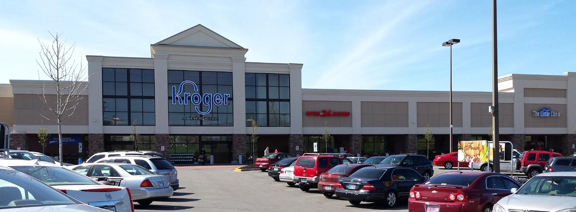
There are a few grocery stores located on the periphery of the study area. Despite Kroger at Tates Creek being located nearby, internal areas such as residential areas along Centre Parkway are underserved. Furthermore, many residents do not own a personal vehicle, relying on bus transit for their transportation needs. If shoppers walk or use transit, they face challenges of maneuvering busy streets, steep terrain and parking lots before entering the front door. For shoppers wishing to shop elsewhere, it requires longer transit time or, in some cases, the availability of bus transit is nonexistent (i.e. Wal-mart Neighborhood Market at Saron Drive).


Accessibility is further compounded by the constraints of access to affordable, healthy food. Nearly a quarter of residents rely on the Supplemental Nutrition Assistance Program (SNAP), a subsidy program that helps families with limited resources obtain affordable and healthy food. With these limited resources available, families must stretch their dollars, therefore the access to affordable food is important.

Ex ISTING CONDITIONS 37
Walking with Groceries
Bus Stop
Tates Creek Kroger
Saron Drive Wal-mart Neighborhood Market
Chinoe Kroger

38 Ex ISTING CONDITIONS
Figure 29. Areas Designated by USDA as Food Deserts
Traditional Food Suppliers
The retail grocery industry is highly competitive and requires specific locational criteria and consumer demographics to be present. Location is typically determined by a market analysis and business strategy conducted by the grocery company. Industry standards evaluate sites based on average volume of traffic on roadways in front of proposed sites, placement at intersections of two major thoroughfares, and visibility of the site from the road. Socioeconomic data such as household income becomes a factor as the store’s business model is to achieve $350 and $500 of business annually for every square foot of building space, therefore a 40,000 square foot building would, then, need to generate an estimated $17 million in sales annually. A grocery store generally has a consumer catchment area of three (3) miles or a five (5)-minute drive-time. Specialty stores have a smaller catchment area of one (1) mile or three (3)-minute drive-time. Large discount stores operate at a regional level and require a ten (10)-minute drive. There is gap between market dynamics and accessibility, as the market anticipates that everyone has use of a personal vehicle.

39 Ex ISTING CONDITIONS
Figure 30. Retail Grocery Catchment Areas Located Near Armstrong Mill West Small Area Plan
PubliC Safety
Public safety services are important for the success and sustainability of any healthy community. These services include fire protection, emergency medical services and police protection.
Fire and Emergency Services
Fire station number 16 (a.k.a The Cave) is located on the south side of Man O War across from Bold Bidder Street. This station serves Squire Oak, River Park,
Century Hills, Centre Parkway, Buckhorn, Park Hills, Gainesway, Tanbark and Hartland. The Lexington Division of Fire and Emergency Services respond to all types of fires and medical emergencies.
Police
Police patrol is covered by the Division of Police East Sector which spans a large portion of the east side of the urban county. The East Sector roll-call facility is located at 1165 Centre Parkway, which is in the center of the Armstrong Mill West Small Area Plan study area.
LFUCG Division of Police Calls
Areas within the small area plan have issues with perceived and / or real crime. According to the Division of Police, much of Lexington experiences similar levels of criminal activity as other neighborhoods. However, there are pockets of high activity that need to be addressed. In this summary, calls for service data from LFUCG Police Department in the study boundary are analyzed for a four year period (2009 to 2012). The information depicts the number of calls received for service for a given year and does not represent arrests or actual crimes. A call may lead to an arrest, or upon further investigation may be unfounded and dismissed, or the type of offense may change. A request for service is generated in several ways: a caller may dial 911 for an emergency call, place a non-emergency call to the police department and / or the police dispatch may call officers. Overall, calls for service peaked in 2011 and then declined to lower service calls than the previous years, 2009 to 2010.
Because population varies from census block group, calls for service were converted to a standardized ratio (calls per 1,000 inhabitants) to give equal weight for comparison. Figure 32 on the page at right shows census block groups by the calls per 1,000 inhabitants. The darker shade of red indicates the higher amounts of calls.
Tatesbrooke,40 Ex ISTING CONDITIONS
7800 8000 8200 8400 8600 8800 9000 9200
Figure 31. LFUCG Division of Police Service Calls to Armstrong Mill West
2009 2010 2011 2012 8489 8870 9102 8331

41 Ex ISTING CONDITIONS
Figure 32. LFUCG Police Service Calls Per 1,000 Inhabitants
Table 5 below summarizes the data from Figure 32 on the previous page. The census block group with the highest amount of calls for service and number of calls per 1,000 inhabitants occurred in census block group 210670034041. Census block groups 210670034043 and 210670040013 followed, but these were not as high as the other group. Percent change shows if a census block group experienced more or less calls from the year 2009 to 2012. Calls for service fluctuate from year to year, however, the volume of calls for a given geography remains somewhat consistent. The area with both a high amount of calls and the greatest percentage of change was census block group 210670040013.
42 Ex ISTING CONDITIONS
CenSuS bloCk grouP 2012 2011 2010 2009 aVerage PoPulation CallS Per % Change # CallS 1,000 2009-2012 210670034041 1,961 2,236 2,076 1,876 2,037.25 2214 920.2 +4.5% 210670034042 207 239 233 228 226.75 1,160 195.5 -9.2% 210670034043 248 327 302 299 294.00 668 440.1 -17.1% 210670034053 451 439 444 402 434 1,482 292.8 +12.2% 210670034051 772 734 813 813 783 2,260 346.5 -5.0% 210670034013 1,101 1,022 860 858 963 2,244 429.1 +28.3% 210670034011 621 657 629 658 641.25 2,168 295.8 -5.6% 210670034052 580 680 720 725 676.25 2,198 307.7 -20.0% 210670034012 413 423 404 418 414.5 1,896 218.6 -1.2%
Table 5. Calls Per 1,000 Inhabitants
All modes of travel were considered in assessing the existing infrastructure and connectivity in the Armstrong Mill West Small Area Plan study area. Field reviews were completed along the street network and reviews were done focusing on existing sidewalks (noting conditions), crosswalks, stop control, signage, lighting and pavement conditions.
While sidewalks exist throughout the majority of the neighborhood streets, a major identified deficiency is the lack of any sidewalks along Armstrong Mill Road. This includes the full portion between Man O’ War Boulevard and Tates Creek Road. There are some smaller locations that lack sidewalk between existing infrastructure, including a missing section of sidewalk along Pimlico Parkway between Bold Bidder Drive and Centre Parkway. In addition, the majority of the curb ramps at the intersections do not meet current Americans with Disability Act (ADA) requirements.
Deficiencies in the pedestrian network include about 14,900 linear feet of missing sidewalk and 14, 300 linear feet of damaged sidewalk.
While bicycles are permitted on the public roadways, there are no specific bicycle facilities such as bike-lanes. A shared-use trail is scheduled to be built for a portion of Armstrong Mill. In addition, one is planned for the West Hickman Greenway Trail. The Greenway Master Plan identifies several on-road trail connections that should receive enhanced streetscape and facilities.
Lextran has two routes that provide bus service within the study area. This includes Route 3 (Tates Creek Road), providing service in the southern portion of the study area along Appian Way, Trent Boulevard, River Park Drive, Centre Parkway and Armstrong Mill Road. It also includes Route 18 (Centre Parkway Connector), providing service primarily along Pimlico Parkway.

43 Ex ISTING CONDITIONS
mobility 2.6
Figure 33. Mobility, Access and Circulation
Local residents were also able to provide input on mobility issues within their neighborhood through a community survey. When asked to identify what improvements would increase their desire to walk / cycle in their neighborhood, the following was the response:
1. Improved Sidewalks (72% response)


2. Improved Lighting (62% response)
3. Pedestrian and Bicycle (44% response)
4. Bike Lanes (36% response)
5. ADA Accessibility (13% response)
In that survey, locations with multiple responses on where pedestrian improvements / safety are needed included:
• Armstrong Mill
• Bold Bidder Drive

• Appian Way
• Greentree Road
Related to traffic operations and control, several themes were noted in the community responses. Enforcement of existing traffic control is an issue. This includes enforcing the posted speed limits as well as stop signs at intersections. Several areas of traffic congestion were noted, including Tates Creek Road at Armstrong Mill Drive and Alumni Drive / New Circle Road / Yellowstone Parkway / Man O’ War Boulevard.

Other concerns include the lack of bicycle lanes which was noted as a need for both access and transportation.

44 Ex ISTING CONDITIONS
Lack of Sidewalk
Resident Walking Along Armstrong Mill Carrying Groceries
“Goat” Path Along Road
No Pedestrian Access to Site
Pedestrian Access
Community engagement
A critical component to the success of a planning process is not only to provide a high level of participation but to actively engage neighborhood residents and stakeholders. The primary goal for input was to provide opportunities for stakeholders, citizens and interested parties to learn about and help shape policies and strategies through an active engagement process that is open, inclusive, accessible, and recognizes citizen and stakeholder perspectives.
To start off the engagement process, a kick-off cook out was hosted at the Gainesway Community Center and park on September 23, 2014. This provided a fun and inviting atmosphere to introduce the small area plan and for neighbors to begin community conversations.
Throughout the planning process, the project team used social media such as Facebook, Twitter and a project web page (www.amwsap. com) to inform residents and stakeholders about upcoming meetings and to engage the community in conversations and mapping. Each meeting was designed to encourage participation and interaction among participants.
Three neighborhood workshops were hosted at the Gainesway Community Center, located within the small area plan boundary. These workshops allowed residents and stakeholders to identify assets and issues, and map capacities to uncover resources available in addressing issues of concern and to build connections.


C OMMUNITY ENGAGEMENT 3 45
Planning Workshop at Gainesway Community Center
Visioning Meeting at Tates Creek Public Library
As part of the engagement process, the project team conducted numerous stakeholder and one-on-one conversations with various institutional and government agencies, existing groups and organizations located within the study area. These conversations included neighborhood association leadership, business owners, Fayette County Public Schools and Lexington-Fayette Urban County Government (LFUCG) Parks and Recreation, among other community partners.

The Armstrong Mill West Small Area Plan advisory committee was formed to give strategic direction to the planning elements and to plan alternatives. The committee met three times to discuss opportunities for leveraging additional partnership efforts and to discuss implementation strategies. Committee members were comprised of a diverse group representative of the study area.

46 C OMMUNITY ENGAGEMENT
Neighborhood Workshop
Kick-Off Event
Celebrate aSSetS & addreSS iSSueS
An asset-based approach to planning is a positive way to identify issues within the small area plan and an opportunity to celebrate the assets and qualities that make Armstrong Mill West special and unique. One of the most important aspects of this type of planning is to protect and reinforce what is good about the area, while addressing the concerns that cause distress for neighborhood residents and perpetuate negative perceptions.

in order to understand both issues and assets, neighborhood residents were asked in a variety of ways, “What do you like about your neighborhood?” and “What are its issues?” Based on those responses, local assets, resources, qualities and features were inventoried. Likewise, community issues were compiled along with recommended strategies identified by residents. This information and these resources are directly relevant and provide the framework to the preparation of a plan.
The following pages contain a summary of assets and issues identified throughout the community engagement process.


C OMMUNITY ENGAGEMENT 47
... neighborhood residents were asked in a variety of ways, “What do you like best about your neighborhood?”Neighborhood Workshop Visioning Session

48 C OMMUNITY ENGAGEMENT
Figure 34. Community Identified Assets

C OMMUNITY ENGAGEMENT 49
Figure 35. Community Identified Issues
issues
• Crime / Drugs
• Pedestrian Safety
• Speeding
• School Traffic
• Safety in Public Spaces (Parks, Street, Commercial Areas)


issues
• Public Transportation
• Bike Lanes / Multi-Use Paths
• Sidewalks
• Crosswalks
• Traffic Signals / Vehicular
• Aging Infrastructure / Roads
Strategies
• Better Street Lighting
• Neighborhood Watch
• More Police Patrol
• Traffic Calming / Reduce Speed Limit (Several areas have been identified.)
• Reduce Crime Around Parks
Strategies
• Sidewalk Repairs
• Armstrong Mill Sidewalks / Bike Lanes
• Replace Flashing Lights on Armstrong Mill with Stops Signs / Signal
• Bike Lanes
• Fix Potholes in Streets
• Improve Street Signage
• Residential Parking Permits
• Improved Bus Stops / Routes (Move Stops, Amenities at Stops, Art in Motion) issues

• Healthy Food - Grocery Shopping
• Other Shopping / Restaurants / Coffee Shops
• Small / Local Businesses
• Some Existing Neighborhood Commercial Areas are Undesirable and Need for Revitalization
• Need Health Care / Medical Facilities
• Programming and Activities for Children:
» Ages 11-14
» More Programming at Gainesway Community Center
• More Recreational Opportunities
Strategies
• Food Store within ½ Mile Walking
• Better Bus and Pedestrian Access to Existing Grocery Stores (Kroger at Tates Creek and Chinoe)
• Community Garden
• After School Programs and Activities for Teens
• More Activities at Community Center
• Basketball Court at Community Center
• Youth Organizations to Adopt Streets for Clean Up
50 C OMMUNITY ENGAGEMENT
Figure 36. Armstrong Mill West Small Area Plan Issues and Strategies
issues
• Public Housing / Rental Concentration
• Property Values
• Property Maintenance
• Rental Properties
• Litter, Public Nuisance, Parking, Code Enforcement
• Site Improvements, Landscaping, Beautification

• Need of Neighborhood Pride, Care
• General Neglect / Apathy
• Overcome Negative Perceptions
Strategies
• More Home Ownership
• More Neighborhood Associations

• More Neighborhood Events / Block Parties, Parades


• Code Enforcement, Rental Inspections
• Provide Landscaping
• Little Libraries - Neighbors Exchange Books
• Neighborhood Facebook Page
• Gainesway Community empowerment Center
issues
Better connectivity to the following:

• Schools (Physical and Social)
• Parks
• Golf Course
• Greenspace / Trails
• downtown
• UK Campus
• Shopping Areas
Strategies
• Need More Trails / Connect to Other trails
• Improved Pedestrian Access to Public Spaces (Schools, Parks and Golf Course)
C OMMUNITY ENGAGEMENT 51
Additionally, as part of the public engagement process, a survey was administered in-person and online via the project website and survey Monkey.

Lexington-Fayette Urban County Government (LFUCG) Division of Planning administered the survey once at the tates Creek Library branch, and the survey was available at the kick-off meeting and each neighborhood workshop.
the survey included 32 questions that consisted of openand closed-ended questions.
In total, 86 surveys were completed.

52 C OMMUNITY ENGAGEMENT
“In total, 86 surveys were completed.”Figure 37. Sample Pages from the Armstrong Mill West Small Area Plan Survey
Top Neighborhood Likes:
• Location in Lexington
• Friendly Neighbors
• Natural Environment (Greenspace / Open Space, Mature Trees)
• Close to Amenities (Parks and Schools)
respondents Answering No to Buying House in Neighborhood:
• 23% said could not afford to buy home
• 18% said not a good value and not safe in the neighborhood, respectively
73%
Said they feel safe in the neighborhood
68%
Of survey respondents are homeowners
75% Indicated no flooding issues
Top Neighborhood Dislikes:
• Infrastructure Issues (Need of New and / or Improved Sidewalks, Bike Lanes, Road Improvements)
• Crime
• Drugs
• Property Maintenance and Nuisance (Rental Housing)
63% Said there are enough shopping choices in the neighborhood
70% Feel comfortable walking and/or cycling in their neighborhood
82% Think the neighborhood is affordable
72% Plan to live in the neighborhood in the next 3 to 5 years
84%
Of respondents travel 1 to 10 miles for healthcare
64% Had not used Gainesway Community Center in past year because didn’t know about it or unaware of programs
57% Have not used Gainesway Park in the past year due to safety and access issues
71% indicated that improved sidewalks and lighting, respectively would increase their desire to walk / cycle in the neighborhood.
MOST
People travel 1 to 10 miles for work
57% said yes there are traffic problems in the neighborhood
MOST
47% indicated pedestrian and bicycle pathways (greenways)
39% indicated bike lanes
Respondents that go to school or have children that go to school travel to school in the neighborhood
48% said there is a need to slow traffic for pedestrian safety
MOST
respondents travel 1 to 5 miles for groceries, with top stores being Kroger at Tates Creek and Chinoe
MOST
respondents use gas stations in neighborhood or nearby
C OMMUNITY ENGAGEMENT 53
Figure 38. Selected Survey Responses
Visioning is a powerful guide and is critical for a neighborhood or area to define the future it wants. Visioning emphasizes community assets and focuses on shared values. Subsequent to the workshops, a visioning meeting was held at the Tates Creek Middle School library, with the purpose of visualizing what the area could be like in the future. During this exercise, participants were asked to write a couple of sentences to describe their vision for the neighborhood and to develop strategies on how to achieve their visions. The Armstrong Mill West Small Area Plan vision statement is a compilation of visions generated by neighborhood residents when asked the question ...
What do we want our neighborhood to be?
the ViSion from armStrong mill weSt neighborS
A safe, modernized, progressive neighborhood that presents attractive opportunities for businesses and families to grow and flourish and instill community pride.
A more walkable neighborhood that is safe by design with interconnected parks and green areas.
Our neighborhood will be easy and safe to travel by car, bike and foot. It will be wellconnected, well lit and safe at night, well-kept with quiet and friendly neighbors. The neighborhood will have safe activities for kids and teens. It will be green and visually appealing, convenient for shopping, medical services and healthy food. It will have a cohesive identity and encourage homeownership.
ViSion Statement, Planning PrinCiPleS & objeCtiVeS 4
54 V ISION STATEMENT, PLANNING PRINCIPLES & OBJECTIVES
Planning framework
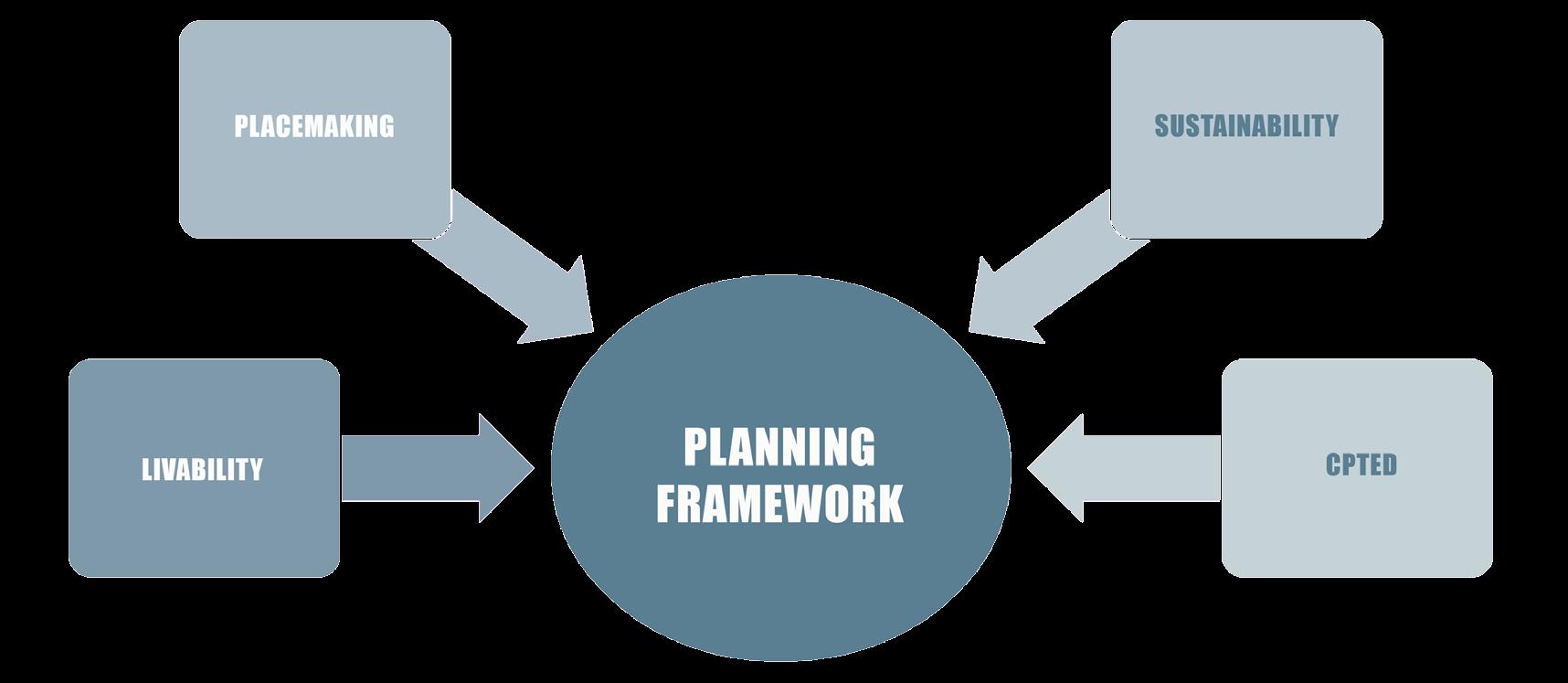
The framework of the small area plan is to improve neighborhood livability, enhance its sense of place, and plan for a safe and sustainable future.
1. Neighborhood livability is the sum of factors that relate to its quality of life — including the built and natural environments, economic prosperity, social stability and equity, educational opportunity, cultural diversity, entertainment, and recreation possibilities.
2. Central to developing a strong sense of place within the small area plan approach is to focus on the elements that improve neighborhood placemaking, connectivity and accessibility. Placemaking capitalizes on a local community’s assets, inspiration, and potential, with the intention of creating public spaces that support identity, health, safety and well-being, and provide physical and social connections.
3. Sustainable approaches include design solutions that promote more self-sufficiency. Project examples include alternative transportation to reduce vehicle miles traveled, utilization of green infrastructure for stormwater management and reduction of urban heat island effect.
4. Crime Prevention Through Environmental Design (CPTED) is a set of principles that are intended to reduce the opportunity for crime to occur in residential neighborhoods. Applying these principles to alter the physical environment and social environment can help create sustainable and well-designed residential areas that promote public health, crime prevention and community safety.
goalS, objeCtiVeS & reCommended aCtionS
Guiding principles will involve concepts of accessibility and connectivity by linking areas through infrastructure improvements and social networking.
Provisions of the plan will include facilitation of public and private sector collaboration and urban design elements to create safe, walkable places.
V ISION STATEMENT, PLANNING PRINCIPLES & OBJECTIVES 55
Figure 39. Planning Framework
Goal #1 -
imProVe neighborhood Safety and SeCurity to reduCe the oPPortunity for Crime.
objeCtiVeS
1. Increase police presence and build community partnerships with LFUCG Division of Police, residents, businesses and organizations.
2. Safety through environmental design and neighborhood beautification.
3. Maximize visibility and lighting in public places and on streets.
reCommended StrategieS
• Create Community Law Enforcement Action Response (CLEAR) officer to be assigned to neighborhood.
• Utilize the “We Care: Our Community, Our Future”
• Community partnerships to conduct peace walks and rallies.
• Work with neighborhood watch programs.
• Sponsor a National Night Out Kick-Off event on the first Tuesday of August.
• Increase recreational activities and explore new uses within Gainesway Park.
• Develop Crime Prevention Through Environmental Design (CPTED) guidelines to be used as sites redevelop.
• Provide incentives for businesses to retrofit properties with improvements.
• Conduct light audit along streets, parks and at existing bus stops.
• Define public access through improved streetscape, clear delineation of walkways, and signage.
PubliC Safety 4.1
56 V ISION STATEMENT, PLANNING PRINCIPLES & OBJECTIVES
Goal #2 -
imProVe CirCulation by foCuSing on imProVed ConneCtiVity, alternatiVe tranSPortation infraStruCture and inCreaSed Safety of StreetS.
objeCtiVeS
1. Plan significant improvements along Armstrong Mill Road Corridor from Tates Creek Road to Man O’ War Boulevard.
2. Ensure connectivity among all modes of transportation by completing a network of neighborhood infrastructure.
3. Connect and unify the community with trails, bikeways and greenway corridors.
4. Use a variety of methods to improve safety and traffic calming methods to deter speeding and increase safety.
5. Work to alleviate traffic congestion, particularly during rush hour at the intersection of Armstrong Mill Road and Tates Creek Road and Armstrong Mill Road and Man O’ War Boulevard.
reCommended StrategieS
• Redesign Armstrong Mill Road to improve street, install new bicycle and pedestrian infrastructure, and integrate lighting and streetscape and transit within the corridor.
• Repair existing sidewalks and ADA accessible ramps.
• Educate property owners regarding upkeep of sidewalks.
• Utilize overall circulation to plan for improvements rather than piece-meal approach.
• Connect neighborhood amenities with trails, greenways, bikeways and pathways.
• Work with LFUCG Planning, Traffic Engineering, Parks and Recreation, Fayette County Public Schools, Lexington Metro Planning Organization.
• Work with Lextran to enhance public transit facilities.
• Improve streetscape and pedestrian lighting.
• Work with LFUCG Traffic Engineering to determine if certain streets are eligible for speed reduction or traffic calming measures.
• Ensure pedestrian safety by improving crosswalks, especially in pedestrian routes to schools, parks and stores.
• Consider residential parking permit program.
• Synchronize traffic signals at Man O’ War and Tates Creek intersections.
• Seek easements to access West Hickman Trail.
• Conduct study along Man O’ War Boulevard and Alumni Drive to determine the feasibly of bike lanes.
V ISION STATEMENT, PLANNING PRINCIPLES & OBJECTIVES 57
ConneCtiVity & mobility 4.2
Goal #3 -
Promote PeaCeful, Safe and liVable neighborhoodS with equitable and affordable houSing ChoiCeS.
objeCtiVeS
1. Maintain a desirable balance of diverse housing types and tenure.
2. Support both affordable housing and market-rate housing.
3. Provide more housing options for aging population.
4. Encourage regular and active property maintenance.
reCommended StrategieS
• Strive to increase the rate of owner-occupancy of housing over time.
• Work in partnership with various levels of government and with other public agencies to address housing needs.
• Support projects to improve the environment, neighborhood amenities and attributes to make the area more attractive to all income groups, ages and household types.
• Support programs that provide financial assistance to low-income homeowners and owners of lowincome rental properties to maintain their properties in adequate condition.
• Explore Affordable Housing Fund or other housing assistance programs to be used for rental assistance and resources to provide home ownership opportunities to low-income households.
• Promote methods of more efficiency by adapting or rehabilitating existing housing stock to enable changing households to remain in the same home or neighborhood for many years.
• Encourage and support accessible design and housing strategies that provide seniors the opportunity to remain in their own neighborhood as their housing needs change.
• Work with LFUCG Code Enforcement to schedule inspections for neighborhoods within the area.
• Adopt a county-wide ordinance with Crime Prevention Through Environmental Design (CPTED) design standards and establish a rental inspection program to ensure compliance.
houSing
4.3
58 V ISION STATEMENT, PLANNING PRINCIPLES & OBJECTIVES
Goal #4maintain CharaCter of neighborhood form and enhanCe areaS in need of imProVement.
objeCtiVeS
1. Retain and enhance the character and quality of established residential neighborhood.
2. Revitalize existing commercial areas to enhance existing businesses and to attract neighborhood-serving uses.
3. Protect land-use compatibility with neighborhood institutions including churches, schools and community center.
4. Retain parks and natural areas for the enjoyment of the residents.
5. Promote sustainable places and protect environment.
reCommended StrategieS
• Maintain existing residential land-use patterns and designations.
• Preserve residential infill and redevelopment projects at comparable density rates and scale of existing patterns.
• Encourage investment and reinvestment at existing commercial areas.
• Create a housing matching loan or grant program to provide safety upgrades such as improved building appearance, painting, lighting, landscaping or other physical changes to increase aesthetics and safety of the business.
• Retrofit sites with significant impervious areas with green infrastructure and other landscaping.
• Preserve, enhance, and where appropriate, restore environmentally sensitive features through the identification of green infrastructure elements.
V ISION STATEMENT, PLANNING PRINCIPLES & OBJECTIVES 59 l and uSe & SuStainability 4.4
neighborhood liVability 4.5
Goal #5 -
imProVe quality of life and health for all reSidentS.
objeCtiVeS
1. Promote the development of youth by providing quality programming and increased recreational opportunities.
2. Provide quality activities and services for all ages.
3. Provide better access to affordable and healthy food within the neighborhood.
4. Improve access to medical services and health care facilities.
reCommended StrategieS
• Continue after school programming at the Gainesway Community Center .
• Seek after school and summer activities that engage and interest preteens and teens.
• Utilize the Gainesway Community Center during the day for senior activities.
• Create volunteer program for seniors to mentor neighborhood youth.
• Create opportunities for utilizing public open space at Gainesway Park for large-scale food production or smaller community gardens.
• Partner with the Culinary Arts School at the Center for Technical Education (CTE) to provide food-related education activities with neighborhood residents.
• Encourage a mobile farmers’ market to serve at various locations within the small area plan.
• Encourage a farmers’ market and / or satellite cooperative in commercial centers, within regulations and ordinances.
• Partner with the Good Neighbor Store program to help the small-scale retailers increase the amount of healthy food stocked and improve the concept of health foods.
• Improve pedestrian, bicycle, and transit connections for adequate and safe access to existing health care and healthy food facilities within the plan area.
• Coordinate with LFUCG Health Department or similar organization to sponsor a health screening event or mobile unit.
• Utilize the Gainesway Community Center for adult education opportunities (GED classes, computer basics).
60 V ISION STATEMENT, PLANNING PRINCIPLES & OBJECTIVES
PlaCemaking 4.6
Goal #6 -
enhanCe the Small area Plan SenSe of PlaCe by Creating Community SPaCeS that foSter SoCial interaCtion and SenSe of identity.
objeCtiVeS
1. Provide identifiable and distinct gateway entrances the community.
2. Improvements within the streetscape and public realm.
3. Foster neighborhood leadership and continued engagement.
4. Encourage community pride and neighborhood celebrations.
reCommended StrategieS
• Include way-finding signage to direct residents and visitors to neighborhood amenities such as parks, schools and the community center.
• Include neighborhood signage and banners within the streetscape.
• Landscaping, lighting, street furniture, and bike and pedestrian infrastructure.
• Sponsor an Art in Motion bus stop or other public art project.
• Continue interaction and communication with neighborhood associations, Council District office and LFUCG agencies.
• Promote the use of Neighborhood Sustainability grants offered by LFUCG.
• Work with Lexington Area Community Foundation to develop and sustain neighborhood leaders.
• Neighborhood Associations to use communication, including social media, to engage neighbors.
• Sponsor neighborhood block parties or other activities such as picnic in the park, talent shows and parades.
• Work with civic organizations to Adopt-a-Street or other community clean-up events.
V ISION STATEMENT, PLANNING PRINCIPLES & OBJECTIVES 61
Crime PreVention through enVironmental deSign (CPted) 4.7
Crime Prevention through Environmental Design (CPTED) is based on principles utilizing design and effective uses of the built environment to reduce real and perceived crime. CPTED strategies requires a multi-disciplinary approach to implementing and deterring criminal behavior. It incorporates principles in planning, landscaping, architecture, and law enforcement measures to reduce crime, the fear of crime, and the opportunities for crime to occur.
There are four overlapping strategies to CPTED:
• Natural surveillance

• Natural Access Control
• Territorial Reinforcement
• Maintenance and Management
These guidelines are intended to be used by developers, property owners, and businesses as a site develops or is redeveloped, although property owners also are encouraged to be proactive in retrofitting sites to meet CPTED principles and guidelines. To fully implement CPTED, it is recommended that the guidelines be codified to be assessed through development plan reviews, rezoning requests, and issuance of building permits. The guidelines should be used as public expenditures are used for projects and construction (i.e. parks, streetscapes and road projects).
It is also recommended that a rental inspection and maintenance program be adopted to require property to be registered and to submit a site security plan.
CPTED principles should be assessed based on the three-D process — Designation, Definition and Design:
• Designation: What is the intended use of the area? How well does the space support its intended use or current use? Is there conflict?


• Definition: Are there physical limitations to the area or the site? Is the space clearly defined and who owns it?
• Design: Does the physical environment safely and efficiently support the intended use?

62 V ISION STATEMENT, PLANNING PRINCIPLES & OBJECTIVES
V ISION STATEMENT, PLANNING PRINCIPLES & OBJECTIVES 63 Natural surveillance See and be Seen Natural Access Control territorial Reinforcement Maintenance and Management Defined Path Sense of Proprietorship maintain Property CPted PrinCiPleS
Figure 40. Overview of Crime Prevention Through Environmental Design (CPTED) Principles
PrinciPle #1 - natural SurVeillanCe
This principle utilizes the old adage “see and be seen,” because a person is less likely to commit a crime if they think someone will see them do it. Lighting and landscape play an important role in removing the opportunity to commit a crime.
StandardS
Whether a single house, or commercial complex, appropriate lighting techniques should be used. Good lighting will help people feel more comfortable with their surroundings. It should provide clear paths for movement and highlight entryways without creating harsh effects or shadowy hiding places. Lighting is one of the most economical and effective forms of crime prevention available.
Single-Family Uses
• Keep porch lights on at night.
• install dusk to dawn sensors on porch lights.

• Install motion-sensor lights along the sides of a home to illuminate areas with poor surveillance.
guidelineS
1. Adequately illuminate parking areas and pedestrian walkways.
2. Avoid dead-end spaces, blind spots and hiding areas in parking lots, around dumpsters, outbuildings, and / or in loading areas.
3. Avoid blank walls, which limit surveillance opportunities and can serve as targets for graffiti. Use walls with windows, architectural details or foliage instead.
4. Design buildings so that exterior doors are visible from the street or neighbors / users.
5. Planting and selection of landscape materials should be such that sight lines remain open and clear and places of concealment are not fostered.
6. Keep shrubs trimmed to a maximum of 3 feet, or at least below windowsills, when safety is an issue and in vulnerable places.
7. In public spaces, locate open green spaces and recreational areas so that they are visible from nearby homes and streets.
8. Use pedestrian-scale street lighting in high-pedestrian traffic areas to help people recognize potential threats at night.
Commercial / High-Density Residential / Public Uses
• Use uniform and consistent lighting — the emphasis is to have the same color of light throughout the site to provide good color rendition, help with visibility and reduce contrasts.
• Parking lot lighting should be at a minimum-maintained level of 1.0 footcandles.
• Time the building lights to come on at dusk and turn off at dawn automatically.
• Using compact fluorescent lamps in small fixtures will help generate more light at lower electricity and maintenance costs.
• Install light poles versus attached light fixtures (i.e., wallpacks) to increase the light level.
• Lighting along pedestrian ways should be directed along the pathway to avoid light spillage to adjacent properties.
• The light fixture should be one that directs the light down on the ground, versus horizontally and up in the air. If decorative fixtures are used, install the type of fixture where the bulb is in the top of ‘globe’.
64 V ISION STATEMENT, PLANNING PRINCIPLES & OBJECTIVES
PrinciPle
#2 - natural aCCeSS Control
Natural access control is another design concept directed primarily at decreasing crime opportunity by denying access to crime targets and creating a perception of risk for offenders. Design elements are used to physically guide users through a space. Design of streets, sidewalks, building entrances, landscaping, and neighborhood gateways can be used to indicate public routes and direct the flow of people while decreasing the opportunity for crime.
guidelineS
1. Define entrances to the site and each parking lot with landscaping, architectural design or symbolic gateways.
2. Clearly mark public paths. Make private areas harder for non-employees to access.
3. Clearly mark public entrances with landscape, architecture, and graphics / signage.
4. Designate sidewalks and public areas with special paving and / or landscaping.

StandardS
It is recommended to utilize the standards already adopted in the zoning ordinance. However, an in-depth review of zoning ordinance and other codes will need to occur to ensure the intent of CPTED and provisions are included in policies and procedures for reviewing development plans and zone changes.
Modifications to zoning ordinance may include a new article setting CPTED review policies, giving guidance to design choices and placement of landscape material, signage, lighting and pedestrian paths.
V ISION STATEMENT, PLANNING PRINCIPLES & OBJECTIVES 65
PrinciPle #3 - territorial reinforCement
Physical design can also create or extend a sphere of influence. Users are encouraged to develop a sense of territorial control while potential offenders, perceiving this control, are discouraged. This concept includes features that define property lines and distinguish private spaces from public spaces using landscape plantings, pavement designs, gateway treatments, signage, and open (“CPTED”) fences.
guidelineS
1. Define property perimeters with landscaping, decorative fencing, gates and signs.

2. Provide signage that clearly identifies site businesses and site signage marking public entry points.
3. Support way-finding with sufficient signage and maps identifying such elements as streets, places, directions to services or help and building names and numbers.
4. Use integrated signage as an aid to legibility but in a creative and balanced way that is not so excessive and overly obtrusive that it undermines the very qualities that would desirably attract people to this place in the first instance.
5. Support way-finding with sufficient signage and maps identifying such elements as streets, places, directions to services or help, and building names and numbers.
StandardS
As previously noted in Principle #2, implementing CPTED should be through the development or permitting review process, utilizing existing development and landscaping standards. Provisions for lighting should be considered. An in-depth review of zoning ordinances and other codes will need to occur to ensure the intent of CPTED is met, along with procedures for reviewing development plans and zone changes.
Modifications to zoning ordinance may include a new article setting CPTED review policies, giving guidance to design choices and placement of landscape material, signage, lighting, fencing and pedestrian paths.
66 V ISION STATEMENT, PLANNING PRINCIPLES & OBJECTIVES
PrinciPle
#4 - maintenanCe and management
Proper maintenance prevents reduced visibility due to plant overgrowth and obstructed or inoperative lighting, while serving as an additional expression of territoriality and ownership. Lack of maintenance and neglect such as litter and graffiti, decreases perception of security which leads to opportunity for crime and increases the fear of crime.
guidelineS
1. Remove graffiti within 24 hours of its appearance. Consider landscaping in areas that may be prone to graffiti.

2. Maintain high-visual quality of site by keeping exterior areas neat and clean and plantings looking well managed.
3. In areas with parking lots, keep to a high standard with no potholes or litter.
4. In commercial areas, avoid storefronts that appear abandoned or vacant.
5. In high-density residential developments, keep common areas maintained.
6. Enforce rules regarding junk / abandoned vehicles and inappropriate outdoor storage.
StandardS
Maintenance is an ongoing process of upkeep and occurs well after development review or permitting and construction. Maintenance issues are typically resolved through enforcement mechanisms but are reactive and often rely on citizen input. A more proactive approach includes the submittal of a maintenance plan and schedule during the development review process and / or permitting with periodic inspections to ensure proper maintenance is occurring.
V ISION STATEMENT, PLANNING PRINCIPLES & OBJECTIVES 67
ConCePt Plan
The concept plan utilizes the many Armstrong Mill West community assets and amenities as building blocks for improvements. The goal is to revitalize the neighborhood to a more sustainable and livable place with the public sector taking the lead in providing infrastructure improvements to create a safe and walkable, bicyclefriendly environment.
the key to an accessible and equitable neighborhood is to connect its residents with their places of employment, schools, services, community assets, parks and open spaces.
Availability of sites for infill and redevelopment in the study area is limited, as the area is already highly developed, therefore the focus is on rehabilitation and enhancements of existing houses, buildings, and sites.
the desired outcome is that public sector improvements will spur private reinvestment back into the neighborhood to create additional places to enrich the social infrastructure and cohesion of Armstrong Mill West.
ConCePt Plan StrategieS
Focus on Placemaking. Improve uses within parks and provide physical improvements to existing commercial areas to make the area an attractive, vibrant and identifiable destination.
Enhance Connectivity. Provide facilities and improvements to enhance safe and convenient connections to the area from surrounding areas by all modes of travel—walking, cycling, transit and driving. Focus on linking community assets to each other.
Enhance Pedestrian Environment. Create a safe, comfortable and attractive environment for pedestrians by including streetscape improvements such as sidewalks, tree plantings, improved crosswalk lighting and markings, and pedestrian-scale street lights.
Improve Public Safety by Design. Incorporate CPTED principles into both public realm improvements and private development.
Re-green Impervious Areas. Incorporate green infrastructure such as rain gardens, permeable paving, and other techniques into school improvements, parking lots and streetscape design to capture and treat stormwater while adding greenery.
Improve Access to Housing. Protect and improve neighborhood housing stock and address housing affordability and cost burdened rental housing.
Create a Healthy Food Oasis. Turn the food desert into an area with many different options and innovative sources for obtaining healthy and affordable food.
5 68 C ONCEPT PLAN
PlaCemaking PrinCiPleS
While placemaking is a framework for creating a sense of place, strategies are focused throughout the concept plan to create better connectivity and to enhance existing activities. The following themes are considered as core principles for urban design and livable places:
• Connected routes to increase accessibility and modal choice.
• As sites redevelop, design and layout should be easily accessible.
• Improve existing conditions.
• respond to and be sensitive to surrounding environment.
• Activities that make a place special or unique.
• Increased activities at parks and playgrounds to ensure safety.
• Provoke interaction among commercial / retail patrons and residents.
• Creates a strong sense of place, identity and community pride.
• A range of uses that include commercial, public, residential, dining, and entertainment.
• Perceptions about safety and maintenance.
• Crime Prevention Through environmental Design (CPTED) — lighting, proper sightlines, active streets, parks and places.
• Tangible issues, such as having a comfortable place to sit, shelter from elements.
69 C ONCEPT PLAN
A CCESS & L I nk A g ES
C O nt E xt
U SES & A C t I v I t IES
C O m FOR t & Im A g E
Figure 41. Placemaking Principles
Improved Neighborhood Access & Linkages Improved Existing Conditions Increased Activities Increased Comfort

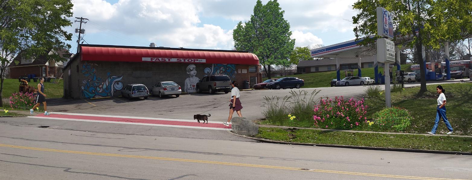


70 C ONCEPT PLAN
& Image
CirCulation mobility imProVementS
The assessment of mobility issues within the Armstrong Mill neighborhood identified locations where improvements could be made to further enhance the relationships between all transportation modes, offering a diversity of options to promote cohesion and accessibility to other destination nodes. Primary themes that were noted include missing or deteriorated pedestrian connections and facilities, transit enhancement needs, and a balancing of traffic operations to improve neighborhood mobility versus safety.
The following figures (Figures 42 through 47) summarize identified improvements by mode for the overall neighborhood area and outlines priorities, responsible agencies and estimated costs. Figures 42 through 47 provide a graphical view of the proposed improvements. Improvements to the Armstrong Mill Road corridor are discussed individually in the next section.
Priority 1
Improvement:
• Armstrong Mill Road Corridor - See next section.
Responsible:
• See next section.
As shown, the highest priority with respect to pedestrian improvements was the addition of multi-modal improvements along Armstrong Mill Road. This is discussed in more detail in the next section. The second highest priority was the improvement of the proposed sidewalk network within the neighborhood. While sidewalks and curb ramps exist in most places, the curb ramps do not meet current Americans with Disabilities Act (ADA) requirements. The final priority is the maintenance of the sidewalks in the pedestrian network. Per local law, the maintenance of sidewalks is the responsibility of the homeowner.
See next section.
71 C ONCEPT PLAN
5.1
$
Figure 42. Neighborhood Pedestrian Improvements
PedeStrian imProVementS
PedeStrian imProVementS (Continued)
Priority 2
Priority 2
Priority 2
Priority 3
Improvement:
• Install sidewalk along Pimlico DR between Centre PKWY and Bold Bidder DR for improved access to Lextran stop and park.
Responsible:
• LFUCG to install and homeowner / neighborhood association to maintain.
Improvement:
• Upgrade curb ramps to current AdA standards.
Responsible:
• LFUCG to install and homeowner / neighborhood association to maintain.
Improvement:
• Upgrade crosswalks to be consistent throughout neighborhood.
Responsible:
• LFUCG to install.
Improvement:
• Maintain pedestrian network.
Responsible:
• Homeowner / neighborhood association to maintain.
$80K
1,565 feet of sidewalk
$500K 264 ramps
$30K 6 locations
$ Varies
*Costsineachtableexcludedesign,right-of-way,andutilitiesandarein2015constantdollars.
72 C ONCEPT PLAN
Figure 42. (Continued). Neighborhood Pedestrian Improvements

73 C ONCEPT PLAN
Figure 43. Top Priority Neighborhood Pedestrian Improvements
The two priorities listed at right were based on feedback provided during the community engagement section of this study. The Priority I improvements were confirmed as an appropriate location based on boarding / alighting data provided by Lextran. This data indicated that the stops closer to tates Creek are more heavily utilized than the ones closer to Appian Way.
At this point, the improvements are rather conceptual in nature and therefore hard to quantify in terms of capital costs since more definition and details of the types of improvements (benches, shelter, lighting, real-time passenger information, etc.) has yet to be determined. It is also important to note that Lextran has guidance based on the volume of passengers at each stop which helps determine which receive what types of amenities. That guidance would need to be consulted and the most recent passenger activity counts determined for each candidate stop in need of improvement.
Another key discussion item not prioritized in this plan is the re-routing of the existing Lextran service to further provide access to the Tates Creek Centre. It was noted that Lextran Route 3 which has stops on Wilson Downing were too far away (walking distance) from the Kroger as well as the other restaurants much closer to Saron Drive. Transit providers typically stay away from routing buses internally into a shopping center, especially mid-route. Those areas are difficult for a regular size transit bus to maneuver in as they have tight turns and parking lots can be crash prone. In addition, the speeds are slow through shopping centers and if a vehicle blocks the bus, the schedule potentially gets off and rarely recovers.
tranSit imProVementS
Priority 1
Priority 2
Improvement:
• Add amenities at high volume bus stops – tates Creek RD at Armstrong Mill RD.
Responsible:
• Lextran
Improvement:
• Consolidate underutilized bus stops to improve reliability – Bold Bidder DR and Centre PKWY.
Responsible:
• Lextran
$Varies depending on nature of amenities.
$Varies depending on how stops are consolidated and what amenities are added.
Figure 44. Neighborhood Transit Improvements74 C ONCEPT PLAN
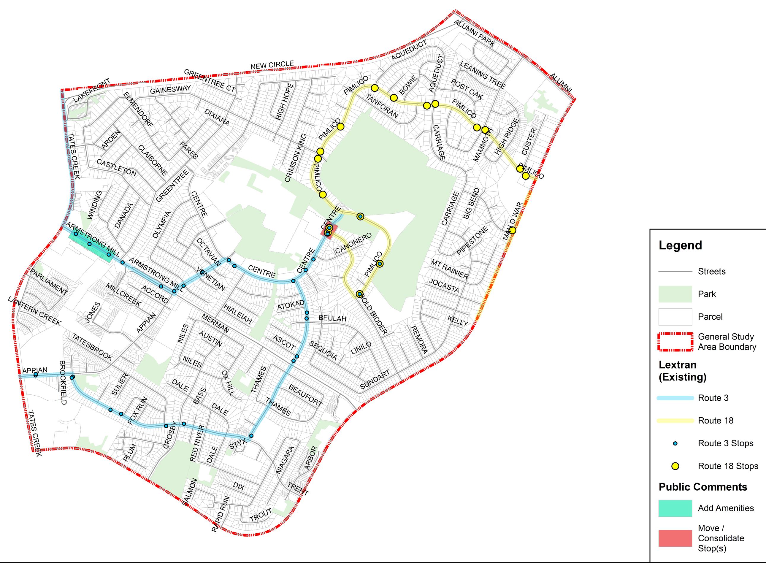
75 C ONCEPT PLAN
Figure 45. Top Priority Neighborhood Transit Improvements
traffiC imProVementS
Priority 1
Priority 1
Priority 1
Priority 1
Improvement:
• Review signal timing during off peak periods – tates Creek RD at Armstrong Mill RD & Man O’ War BLVD at Armstrong Mill RD.
Responsible:
• LFUCG Division of Traffic Engineering
Improvement:
• Investigate geometric improvements to address speeding and turning issues
– Greentree RD at Armstrong Mill RD.
Responsible:
• LFUCG Division of Traffic Engineering
Improvement:
• Intersection improvement to allow right turn on red – Appian Way at Armstrong Mill RD.
Responsible:
• LFUCG Division of Traffic Engineering
Improvement:
• Perform right-of-way (ROW) maintenance to address sight distance issues along Armstrong Mill RD. If sight distance issue is due to vegetation outside the ROW, then property owner is responsible to remove or trim vegetation.
Responsible:
$10K 2 locations
$ Not calculated
$10K 1 location
• LFUCG Division of Traffic Engineering
$5K 1 location
76 C ONCEPT PLAN
Figure 46. Neighborhood Traffic Improvements
traffiC imProVementS
Priority 1
Priority 2
Priority 2
Priority 2
Improvement:
• Conduct study for drivers ignoring stop sign – River Park DR at Armstrong Mill RD, unless a traffic signal is already planned for this intersection.
Responsible:
• LFUCG Division of Traffic Engineering
Improvement:
• Improve intersections by adding left turn lane
– Trent BLVD and MT McKinley Way.
Responsible:
• LFUCG Division of Traffic Engineering (pending determination if they are warranted)
Improvement:
• Improve turn radius
Improvement:
$5K 2 locations
$200K 2 locations, construction cost only
Responsible:
• LFUCG to complete during an intersection reconstruction project
– Pimlico PKWY at Man O’ War BLVD. $ Not calculated
Responsible:
• LFUCG Division of Planning (to implement as part of trail project)
• Traffic calming to balance the movement of all modes in the neighborhood. $ Not calculated
*Costsineachtableexcludedesign,right-of-way,andutilitiesandarein2015constantdollars.
77 C ONCEPT PLAN
traffiC imProVementS
Priority 3
Priority 3
Many of the improvements listed in this table included follow-up action items by various divisions of LFUCG.
Improvement:
Improvement:
Responsible:
• LFUCG Division of Water Quality
• Investigate adequacy of sewer system to address street flooding. $
Not calculated
Responsible:
• LFUCG Division of Traffic Engineering
• Address street parking issues to clearly define where it is acceptable and where it inhibits circulation. $
Not calculated
78 C ONCEPT PLAN
Figure 46 (Continued). Neighborhood Traffic Improvements
*Costsineachtableexcludedesign,right-of-way,andutilitiesandarein 2015 constant dollars.

79 C ONCEPT PLAN
Figure 47. Top Priority Neighborhood Traffic Improvements
armStrong mill road Corridor 5.2
The assessment of mobility issues within the Armstrong Mill Road Corridor provides a main vehicular route through the study area, as well as provides connectivity to the main routes surrounding the neighborhood (Man O’ War Boulevard and Tates Creek Road). in its current state, it provides mobility for motor vehicles only. Based on public involvement feedback, improvements to Armstrong Mill Road that would include safe, non-motorized travel (bicycling and walking) is the highest transportation priority in the study area. Through the identified goals and objectives of this study, focus should be made on this route and accommodations proposed to include both pedestrian and bicycle modes.

The proposed typical section was determined based on public input from public workshops. Specific recommendations by highest priority are as follows:
• 12’ Multi-Use path
• 8’ Utility / Planter Strip
• 11’ Driving lane
• 11’ Driving lane
• 8’ Utility / Planter Strip
• 6’ sidewalk
80 C ONCEPT PLAN
Notes related to the improvements:
1. The maximum right-of-way assumed was 60’. However, with a proposed typical of 50’, there is the ability to switch the 6’ sidewalk with a second 12’ multi-use path. To preserve some width in the more narrow locations, the assumption is that one multi-use path on one side and one sidewalk on the other would accommodate pedestrians / bikes throughout the corridor while minimizing right-of-way needs. Areas with 50’ of right-of-way will allow for a 5’ planter strip, while areas with 60’ of right-of-way will allow for a 8’ planter strip.

2. Considerations for transit stops were not included in the table exercise, but could be considered as multiple stops exist along the Northwest end of Armstrong Mill Road. In order to not inhibit the flow of traffic, some type of bus pull-off should be incorporated where appropriate along the route.
3. Storm sewer cost assumes the entire network will be run to stream at Greentree Road.
4. storm sewer would be 30’ deep in places. (Note that this is very difficult to estimate at a planning level and would warrant further analysis during the design phase.)
5. Bridge to remain in place.
6. Triple-box culvert to remain in place.
7. Pedestrian and multi-use path structures will be pre-fab synthetic or aluminum bridges. The existing structures could possibly accommodate one sidewalk to reduce costs.
8. No full-depth pavement except to lengthen turn lane at Caulder Road.
9. Surface overlay for pavement for entire length from Keystone Court to Tates Creek Road.
10. Frontage road north of Armstrong Mill beginning at Appian Way will be shared with multi-use path.
eStimated Corridor imProVementS
$750K Design*
$6.5M Construction
$300K Right-of-Way*
$300K Utilities*
$7.85M total
*ProvidedbyLFUCG.ItshouldbenotedthatLFUCG conducted its own estimate of construction costs for thisprojectandcalculatedanestimateofapproximately $8.9millionin2014dollars.Avalueof$16millionwas publishedintheLexingtonAreaMetropolitanPlanning Organization’s2040MetropolitanTransportationPlan basedonayearofexpenditureof2026.
81 C ONCEPT PLAN
Figure 48. Neighborhood Transit Improvements
ConneCtiVity imProVementS 5.3
the tates Creek school campus is located at the center of the Armstrong Mill West study area and is comprised of Tates Creek elementary, tates Creek Middle and Tates Creek High. This area also includes the Gainesway Community Center and Park, and the former shopping center owned by the College for Technical Education (CTE), all of which is encircled by Centre Parkway.
Though this area serves as a major community asset, it also acts as an island which feels disconnected from the rest of the neighborhood fabric.
With an area of approximately 96 acres, mostly under the ownership of public entities, it provides an opportunity to illustrate best practices and become a model for the rest of the study area during this process.

82 C ONCEPT PLAN
Figure 49. Sustainability and Connectivity
Based on the input from the advisory committee and community at the neighborhood meetings, connectivity was identified as one of the major challenges for this area. The main objective of the planning team was to create a framework for better accessibility while increasing the sustainability of the area.


The major improvement elements have been highlighted in the illustrative plan and include:
• Creating a better pedestrian environment by incorporating streetscape improvements, including trees, sidewalks and crosswalks along the major roads. The priority corridors are Milano Road and Centre Parkway. The photo montage at right highlights the potential improvements for Milano Road.
• Developing a network of trails for increasing accessibility options. The city has constructed trails by the stormwater feature in the Gainesway Park. There are additional plans to construct a 10’ multi-use trail connecting the park with Armstrong Mill Road. The planning team assessed the existing and proposed trails and developed a potential network, to better connect the amenities in the park, residential areas, and better and direct routes from the schools to the residential neighborhoods. The city would have to collaborate with the Fayette County Public Schools (FCPS) to develop an efficient network. The north and east areas are physically more disconnected due to the steep slopes, and the main objective is to have minimum impact on the environment by utilizing different types of materials and trail character. The trails through the wooded areas in the north could be designed differently with more natural vegetation than the trails through the Gainesway Community Center which could be more formal. As Figure 49 on the previous page illustrates, a network of trails connects the schools, the park and CTE property to the surrounding neighborhood. For an alternative scenario to address FCPS security concerns, a property perimeter trail and fence could also be considered.
• Developing a wayfinding system through branding and gateway signage located at strategic points within this area. There should be consideration for additional signage and defined entrance at Gainesway Park, including a signage kiosk that provides information regarding the park’s amenities and trail information.
83 C ONCEPT PLAN
green infraStruCture / enVironmental SuStainability 5.4
There are a lot of opportunities to implement green infrastructure and sustainability measures throughout the Armstrong Mill West study area, especially within the Tates Creek school campus. The recommendations have been categorized in three major components:


• Impervious Surfaces
• stormwater
• Tree Cover / Vegetation
84 C ONCEPT PLAN
Impervious Surfaces
Stormwater
Tree Cover / Vegetation
imPerViouS SurfaCeS
As illustrated in the graphic, there is a significant amount of impervious surface present within the Tates Creek school campus and along Centre Parkway today, which includes, buildings, driveways, parking lots, and roadways. The pervious areas are mostly green lawns and can be better utilized to improve the environmental conditions of the area. Potential measures which could be implemented include:

• Promoting and encouraging the reduction of impervious surfaces in any new construction or renovations.

• Working with the schools to explore additional opportunities for incorporating rain gardens. For existing rain gardens, FCPS may want to direct downspouts to the rain garden.
• Implementing additional landscaping / streetscaping.
• Incorporating heat island reduction best management practices such as green walls, green roofs, parking lot planting strips, etc.
• Exploring opportunities for utilizing pervious paving materials for the internal roads or parking areas.
• Utilizing the existing parking lots when not in use for multiple purposes, such as event spaces, farmers market, food trucks, etc., and encouraging shared parking possibilities.
85 C ONCEPT PLAN
Figure 50. Impervious Surfaces
Figure 50 at right illustrates potential locations where these measures could be incorporated.
Stormwater
The Tates Creek school campus has a lot of topographical challenges, which serves as a primary reason for the area feeling disconnected. But this also provides the opportunity to incorporate various stormwater management improvements and best practices to make the area more sustainable. The city recently finished implementing a major stormwater feature at Gainesway Park which is now a major asset for the community. Fayette County Public Schools encourages outdoor classes and sustainability programs as part of their learning curriculum. Including a variety of stormwater best management practices (bmps) and green infrastructure to the Tates Creek campus could enhance their existing program and be a model for incorporating educational programs with hands-on experience on sustainability and environmental improvement approaches.
Potential measures which could be implemented include:
• Incorporating best management practices (bmps) for stormwater management.
• Improving existing stormwater run-off areas.

• Incorporating bioswales and detention ponds.
• Utilizing rain barrels within the study area.
• Exploring opportunities for encouraging use of and education about grey water irrigation.
• Collaborating with the school system to create educational programs.
• Encouraging more opportunities for community gathering and creatively programming the park and the stormwater management areas for activities for all ages, such as event spaces, farmers’ market, movies in the park, etc.

86 C ONCEPT PLAN
Figure 51. Stormwater
Figure 51 at right illustrates potential locations where these measures could be incorporated.
tree CoVer / Vegetation
As illustrated, the study area lacks in tree cover and vegetation. The only areas with some cover are along the West Hickman Creek and the northern steep slope areas. Planting more trees and vegetation will not only improve air quality, mitigate heat islands, reduce energy needed for heating and cooling buildings, and improve stormwater retention, but also will increase property values, promote psychological, social and physical health, improve community image, and create a sense of place.

Potential measures which could be implemented include:
• Increasing tree cover through additional street trees and landscaping.

• Opportunity for including additional canopy trees throughout the neighborhood.
• Incorporating additional pocket parks and small green spaces.
• Encouraging native vegetation and plantings.
• Encouraging the use and expansion of the community gardens and forming partnerships with the schools and Cte culinary department and exploring additional options for food production.
87 C ONCEPT PLAN
Figure 52 at right illustrates potential locations where these measures could be incorporated.
Figure 52. Tree Cover / Vegetation

88 C ONCEPT PLAN
Figure 53. Sustainability Plan Opportunities

89 C ONCEPT PLAN
CommerCial enhanCement 5.5
the small area plan is served by two small commercial nodes and one shopping center.
Located on Pimlico Parkway, Park Hills Shopping Center is the largest commercial development in the area, which serves several neighborhoods within the localized region.
The Fast Stop / Marathon Station is a convenience store located on Trent Boulevard which serves a neighborhood commercial area and another convenience store is located on Centre Parkway, which is part of the College for Technical Education (CTE).
Modifications to the CTE property will be discussed in the following section.
The urban design enhancements incorporate Crime Prevention through Environmental Design (CPTED) and placemaking techniques, which intend to facilitate positive community interaction, increase safety concerns and to foster a distinct sense of place. The overarching goal is to implement improvements to deter criminal activity, create natural surveillance by improving lighting and making the site more active, reinforcing the sense of ownership and legibility of users. Recommendations presented here have strong overlaps of CPTED principles and traditional urban design concepts.
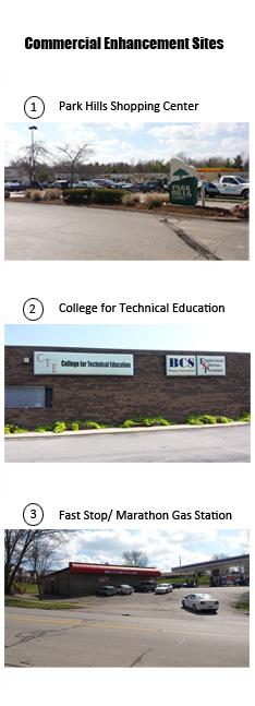
90 C ONCEPT PLAN

91 C ONCEPT PLAN
Figure 54. Commercial Enhancement Opportunities
Many neighborhood residents have indicated they use the Park Hills Shopping Center but feel that it could be better utilized and be improved to feel more secure. The recommendation is to facilitate private investment and to utilize design features to establish a distinct sense of place by creating a commercial district identity rather than a strip center.
Land Use: Maintain the types of uses currently present at the shopping center. These uses include small-scale neighborhood shops and services such as hair salon, dance studio, bakery, restaurants, and pharmacy.
Entrance Improvements: The existing entrance into Parks Hills has sight distance issues and is difficult to maneuver due to its location on Pimlico Parkway and its distance from the Man O’ War Boulevard intersection. It does not align with the Custer Drive, directly across Pimlico Parkway and is too close to the Man O’ War intersection to recommend a traffic light. Other difficulties in improving the entrance is the location of the existing utilities. To determine the most appropriate treatment, the property owner should conduct a feasibility study, as the most effective improvement, may be the most costly.
Lighting: Replace existing parking lot light poles with more effective lighting which take into account the existing site conditions, and follow the lighting standards outlined in the CPTED guidelines. The building located at the northern corner of the site (formerly Little Caesars’), adjacent to Circle K, is isolated and low-lit, creating the perception of entrapment. Lighting should be uniformly spread to reduce contrast between shadows and illuminated areas. More fixtures with lower wattage rather than fewer fixtures with higher wattage help reduce deep shadows and avoid excessive glare.
Healthy Food: The shopping center has the potential to be a healthy food hub, as it could accommodate a small specialty store or food cooperative within a storefront. Another option is to create a healthy food plaza by reorganizing the parking lot, within regulations and ordinances, to accommodate a farmers’ market or a mobile market.
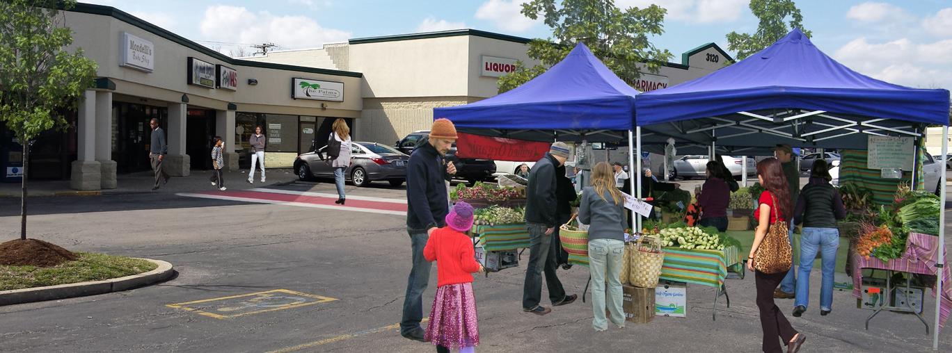
Pedestrian Improvements: Provide sidewalks along the drive aisle entering the shopping center. This will improve pedestrian access for shoppers utilizing the bus stop and shoppers who walk. Use permeable pavement treatment and other physical indicators to delineate publicly accessible space within the parking lot. This would require removing a portion of the existing asphalt material. Utilizing different materials gives the pedestrian a direct path to follow which also benefits the drivers maneuvering the parking lot. This type of treatment also has stormwater benefits.

Beautification Treatment: Provide seasonal landscaping and decor to be located near entrances of businesses. Hang decorative banners from light poles to give visual cues to identify the area.
Art in Motion Bus Stop: Consider working with Lextran and Art in Motion non-profit to enhance the bus stop located near the shopping center. The bus stop can serve as public art as well as much-needed shelter.
Facade Enhancements: Freshen up the exterior by painting the facade or possibly recladding with a variation of materials.
92 C ONCEPT PLAN Park hillS
Legend
Increased Lighting
Park Hills Shopping Center

Owner: Park Hills Partnership & CMI Properties
Site Address: 3120 & 3130 Pimlico Parkway
Lot Size: 11.16 acres
Building Size: 87,409 Square Feet
Parking: Approximately 320 spaces

Zoning: B-6P, R-1C

Existing Site Use: Currently this site serves as a community shopping center, with tenants such as Dollar Tree, Rite Aid, Subway, Great Clips and Dominos.
Permitted Site Use: B-6P zones allow for neighborhood business (B-1), professional offices (P-1), indoor theatres, parking lots and structures.
Issues

• Lack of lighting
• Poor vehicular circulation
• Poor pedestrian circulation
• Site entrance
Farmers’ Market
Pedestrian Access
Improve Entrance
Enhance Bus Stop
Recommendations
• Increase lighting
• Utilize parking lot for farmers’ market
• Improve pedestrian access
• Enhance bus stop (Art In Motion)
93 C ONCEPT PLAN
Figure 55. Park Hills Shopping Center
Fast Stop/ Marathon Gas Station
Owner: O & A Corporation
Site Address: 1392 Trent Boulevard
Lot Size: 2.001 acres
Building Size: 7,378 Square Feet
Parking: Approximately 28 spaces
Zoning: B-1

Existing Site Use: Currently this site serves as a convience store, gas station and 3 underutilized store fronts.


Permitted Site Use: B-1 Neighborhood Business
Issues
• Lack of lighting
• Anonymity
• Lack of landscaping
• Tinted window storefronts
• Chained doors
Recommendations
• Increase lighting
• Attractive landscaping/ incorporation of green infrastructure
• Transparent storefronts
• Continue neighborhood uses
94 C ONCEPT PLAN
Figure 56. Fast Stop / Marathon
Legend Greater Visibility Food Node
faSt StoP / marathon Station
This small commercial node has the potential to be more utilized by the neighborhood. The building’s placement and orientation creates visibility issues as it does not front the street level. This poses a safety concern because the site feels isolated and obscured, creating a perception of and fear of crime.
Land Use: Maintain neighborhood serving uses. Attract new neighborhood uses in the three storefronts.
Entrance Improvements: Currently, the existing entrance is wide with no clear ingress and egress markings. The entrance should be redesigned using landscaping to clearly delineate vehicular and pedestrian access.
Lighting: Replace existing parking lot light poles with more effective lighting which takes into account the existing site conditions and follows the lighting standards outlined in the CPTED guidelines.
Healthy Food: this site could accommodate healthy food by participating in the Good Neighbor Store program or allow a mobile produce truck to park at a designated time / day of the week.
Pedestrian Improvements: Improve sidewalks along the perimeter of the property and use landscaping or different pavement material to define pedestrian access into and throughout the site.


Beautification Treatment: Provide seasonal landscaping and decor to be located near entrances of businesses. Hang decorative banners from light poles to give visual cues to identify the area.
Facade Enhancements: Freshen up the exterior by painting the facade or possibly recladding with a variation of materials. The storefront windows should be transparent. Install attractive displays in windows of vacant stores to avoid creating an abandoned image.
95 C ONCEPT PLAN
College for teChniCal eduCation (Cte) Site 5.6
The former shopping center along Centre Parkway is owned by the College for Technical Education (CTE). It enjoys a prime location along Centre Parkway and Milano Road, which are major roads leading to the Tates Creek school campus, and it is adjacent to the Gainesway Park and Community Center.
Although the park, schools and community center influence CTE, they are not part of the site. Since the majority of site has been converted to an educational / institutional use, the only remaining retail is a gas station / convenience store located at the corner of Milano Road and Centre Parkway. The current use of the site, along with the surrounding amenities of schools, community center and services, park, limited retail and higher-density residential, has great potential to be a vital ,walkable, transit-oriented neighborhood center for this area.
CTE offers technical programs in building trades technology, business office administration, cosmetology and nail technology, early childhood education, food and hospitality and medical assistance. The remaining portion of the shopping center was adapted for reuse for institutional purposes. It is currently occupied by CTE, the Kentucky Cabinet for Health and Family Services (CHFS) and the LFUCG Department of Police, with the CHFS occupying the majority of existing space. The Commonwealth is planning to consolidate their social service programs and a bigger space may be required to accommodate all of their programs.
CTE has incorporated various improvements throughout its property, such as enhancing the pedestrian courtyard through the buildings. Other potential improvements which could be incorporated into the existing spaces are illustrated in Figure 57 on the following page and include:
• Better space utilization and new construction to meet the needs for expanding the Kentucky CHFS. Figure 57 illustrates potential areas for new construction.
• Closing the rear road to expand the day care center playground for direct access to the park. The main entrance for the day care could be located along Milano Road, taking advantage of the streetscape proposed for Milano Road.
• Establishing the main pedestrian spines as formalized landscapes.
• The Appian Way connection to the site leads directly into the parking lot and creates confusing junctions for the users. Exploring possibilities to reconsider the existing access points to create better and more prominent access to the center and the park.
• Programming the out-parcel building along Centre Parkway to locate publicly-oriented college programs like cosmetology or culinary programs. This space could also be explored for future small neighborhood retail possibilities such as a coffee shop or small food retail shop.
• Incorporating trees and pervious materials to enhance the parking lot.
• Streetscaping, including pedestrian improvements such as trees, sidewalks, crosswalks, transit amenities, etc., on Centre Parkway, Milano Road and Appian Way connections to the park will add to the character of the shopping center.
• Utilize the CTE parking lot as a farmers’ market, when not in use by CTE and CHFS.
96 C ONCEPT PLAN

97 C ONCEPT PLAN
Figure 57. Centre Parkway Neighborhood Center Opportunities
Housing in the Armstrong Mill West study area is unique, and represents a diverse population of residents and housing densities. In general, housing is more affordable for residents who own their home versus the residents who rent. Though many in the neighborhood consider the Armstrong Mill West area as an affordable neighborhood, it is not without its affordability issues, particularly among renters in the form of housing cost burden and the lack of purchasing power.
Cost burden for residents who rent is much higher, with 45 percent of renters paying 30 percent or more of their income for housing while only 12 percent of homeowners experience the same cost burden. The challenge of housing affordability is that it means different things to different people with different tenure status and income brackets.
For the purpose of this plan, affordability means affordable to a person, household or family of a given size or income at a cost that is not unduly burdensome to them in relation to their income. This may include a variety of residents, including people with disabilities or special needs and very low incomes, seniors on relatively low fixed incomes, younger residents and families beginning their careers and having lower-paying positions, and residents who work hard but have jobs that generate only moderate incomes.

The newly created LFUCG Office of Affordable Housing will consider affordable housing strategies and strive to work with various agencies, non-profit organizations and community leaders in developing county-wide plan to tackle issues both owner occupied and rental housing affordability.


98 C ONCEPT PLAN
houSing StrategieS 5.7


99 C ONCEPT PLAN
Single-Family House
Two-Family Duplex
Multi-Family Apartment
Multi-Family Apartment
As the housing analysis indicates, affordable housing gaps exist among residents at the lowest income level. Based on the area’s median household incomes, purchasing a dream house in Armstrong Mill is out of reach for 43 percent of the population because they do not have the income to buy an average-valued house in the neighborhood. Although homeownership is desired from a neighborhood stability perspective, not all residents will be able to afford or should purchase a house in the Armstrong Mill West area.
Support the Housing Choice Voucher Homeownership program for eligible Section 8 participants to use their housing choice voucher to assist them in purchasing a home. The voucher can be counted as income, as a PITI (principal, interest, taxes and insurance) offset or used toward a repayable second mortgage loan. This assistance could allow residents already living in the study area to remain in their neighborhood.
However, it should be recognized that residents who wish to purchase a home may be currently be out of financial reach and efforts should be made to help foster homeownership. There are various programs administered by non-profits, local, state and federal programs.
One of the most cost-effective ways to help continue to meet affordable housing needs is to ensure that existing units remain in good condition and available at prices that residents, particularly those with low and moderate incomes, can afford. These efforts also will help older residents have the opportunity to “age in place,” as many of them are living in older housing units which are ultimately in need of repair or renovation. Improve the existing housing stock by emphasizing housing repair and rehabilitation.
• Support rehabilitation loans to low- to moderate-income residents.
• Support LFUCG’s Affordable Housing Fund for rehabilitation and renovation of rental units.
• Support existing energy-efficiency improvement programs and consider new programs to assist property owners to be proactive in retrofitting units for energy efficiency and to help educate owners about state, federal and private / non-profit programs.
» Weatherization Assistance Program — Eligibility for lowincome, senior and disabled residents.
» Community Action Council administers Low Income Home Energy Assistance Program (LIHEAP) — Provide assistance for home heating and cooling needs.
» Kentucky Utilities Home Energy Assistance — Eligible customers may receive a reduced rate.
» Residential Energy Efficient Property Tax Credits — For eligible energy improvements through IRS Tax filing.
100 C ONCEPT PLAN
With 4,384 rental units, or 58 percent, comprising the housing stock in the Armstrong Mill West area, an adequate supply of affordable and attractive rental units is needed.
Based on the analysis in the housing section, there is a severe housing cost burden, and affordable rental housing does not exist without some form of public support. This creates an additional barrier for housing accessibility, because cost-burdened renters may not have enough discretionary funding to put towards a down payment for purchasing a house.
• Utilize short-term financial assistance through LFUCG Adult and Tenant Services for emergency rental assistance.
• Kentucky Housing Corporation offers federal rental assistance programs though project-based and tenant-based assistance programs. If redevelopment of existing developments occur, support new affordable units.
• Support new affordable units for low-income, disabled persons and the elderly.
• Support and / or educate developers about Lexington’s Affordable Housing Fund, where they can apply for funds to construct, renovate, rehabilitate, or do adaptive re-use projects to create rental units at affordable rents.
Lexington-Fayette County does not require private rental properties to be regularly inspected unless they’re receiving public subsidies in the form of housing vouchers. Therefore, conditions and code compliance of rental units are uncertain. Currently, the process requires the tenant to file a complaint against the landlord, which many tenants may not do because of fear of eviction or retaliation.
Based on the age of the housing stock, many units may lack energy efficiency or even accessibility for people with disabilities.
It is recommended that a rental inspection program be implemented to a help ensure a safer rental housing stock, protect property values and improve accountability of rental units.
As developments are inspected and assessed, CPTED elements should be incorporated into site changes and building security.
101 C ONCEPT PLAN
Senior Housing On Trent Boulevard
Owner: Episcopal Retirement Homes Inc.
Site Address: 1393 Trent Boulevard
Lot Size: 6.59 acres
Building(s) Size: 56,470 Square Feet
Parking: 88 proposed parking spaces
Zoning: R-3
Existing Site Use: Currently this site is being redeveloped by Episcopal Retirement Homes Inc. with the intent of providing housing to independent, low-income seniors.
Permitted Site Use: R-3 Planned Neighborhood Residential

Because the senior housing project is still in the early stages of redevelopment, now is a crucial time to form an integrated approach with the developers to insure that this project supports CPTED principles. (Crime Prevention Through Environmental Design).

102 C ONCEPT PLAN
Figure 58. Trent Boulevard Senior Housing Development
Many residents in the Armstrong Mill West neighborhood have limited access to fresh produce and healthy foods. It is imperative that the small area plan create opportunities for residents to obtain healthy and affordable food.
Figure 59 at right presents both existing and proposed healthy food vendors and identifies locations within the neighborhood that the vendors could best serve residents.
These options are meant to supplement existing grocery stores in the nearby vicinity, as locating a supermarket chain store may not be feasible given industry standards and market dynamics.

103 C ONCEPT PLAN
healthy foodS 5.8
Figure 59. Healthy Food Vendors and Opportunities
farmerS’ market
While farmers’ markets are commonly found in the city of Lexington, the Armstrong Mill West neighborhood does not have one within close proximity. This creates a problem, especially for residents without access to a vehicle. Farmers’ markets make healthy foods available, providing a direct link between farmers and consumers. Many of the residents located within the center of the neighborhood have very limited healthy food choices with issues of accessibility. A farmers’market should be considered for the College for Technical Education’s parking lot on weekends, as well as other commercial centers, within regulations and ordinances.
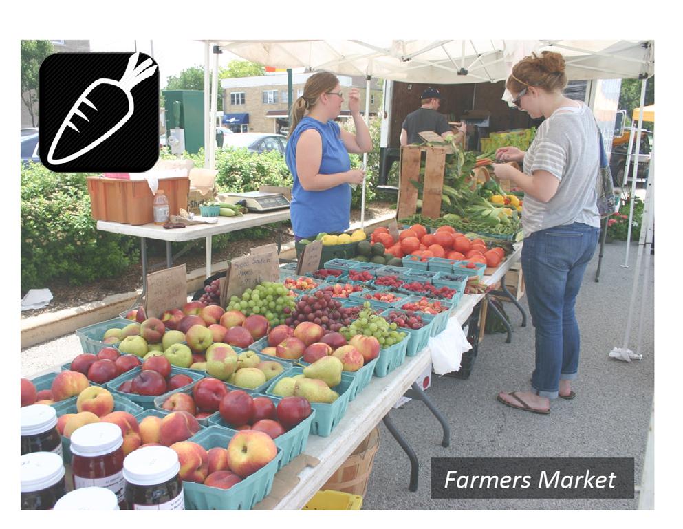
SPeCialty Store or food CooPeratiVe

Specialty stores can range from small local grocers offering ordinary goods to ethnic grocers offering specialty products. Specialty stores provide residents more options for healthy food access. The Centre Parkway and Park Hills areas have been identified as a recommended location for a specialty store due to existing infrastructure and their central locations. A cooperative by the culinary arts program at the College for Technical Education (CTE) would be an asset to the neighborhood while providing educational and work experience.
good neighbor Store Program
The Good Neighbor Store program (http://tweenslex.org/ good-neighbor-stores/) is intended to encourage neighborhood store owners to provide affordable, healthy foods for purchase. Existing gas station /convenience stores at 1161 Centre Parkway and 1392 Trent Boulevard provide a venue to enact the Good Neighbor Store program. This program has been successful in other areas of Lexington with limited food access.

104 C ONCEPT PLAN
SuPermarket groCery Store (exiSting)
Although the Tates Creek Kroger is not within the small area plan boundary, it plays an integral role in Armstrong Mill West residents obtaining healthy foods. Access to this supermarket can be ensured by providing a walkable neighborhood to and from the site. Lextran Route 3 runs through the Armstrong Mill West neighborhood and provides public transit to the Tates Creek Kroger and the Nicholasville Road Wal-mart. Although it may be difficult to route transit through the Tates Creek Shopping center, additional access to the site from neighborhood should include improved bicycle and pedestrian infrastructure.

Community gardening

Community gardens provide a great source of healthy and free foods when they are maintained. The Gainesway Park’s proximity to public housing would serve as an ideal location to provide healthy foods to low-income residents. The key to a successful community garden is the groups and organizations dedicated to maintaining them. Partnerships with the community center and schools could provide a successful model for community gardening in this neighborhood.
mobile market
A mobile market is a traveling healthy foods resource in which consumers can purchase healthy foods. Currently mobile trucks such as these are only permitted to sell goods in commercial zones defined by LFUCG. As a part of the small area plan recommendations, it is important for mobile markets be permitted to operate in zones that also serve a community purpose so that healthy foods can reach as many people as possible. Specific recommended sites include highdensity residential sites with specialized housing such as low-income areas, public housing, senior housing, and housing for the disabled. Other areas may include parks, community centers, religious assembly sites and churches.

105 C ONCEPT PLAN
106 C ONCEPT PLAN
60.
Bicycle & Pedestrian Improvements APPIAN WAY TRENTBLVD TATESBROOKDR TATES CREEK RD TIMBROOKCT MAN O WAR BLVD B R O O K F I E L D D R R E I L U S C T T ATES CREEK RD strong Mill Road West Neighborhood SAP Legend Ful Service Grocery Store Planned Trails and Bikeways ¾ ¾ B ke Lane Greenway Access Park Tra l Proposed Tra 2005 Land Use Inventory Greenway Park Schools Greenspace Street Net ¯ Improved Access 0 0 075 0 15 0 225 0 3 0 0375 Miles APPIAN WAY TRENTBLVD TATESBROOKDR TATES CREEK RD TIMBROOKCT MAN O WAR BLVD B R O O K F I E L D D R R E I L U S C T T ATES CREEK RD Armstrong Mill Road West Neighborhood SAP Legend Full Serv ce Grocery Store Planned Trails and Bikeways ¾ B ke Lane Greenway Access Park Trail Proposed Tra l 2005 Land Use Inventory Greenway Park Schoo s Greenspace Street Net ¯ Improved Access 0 0 075 0 15 0 225 0 3 0 0375 Miles
Figure
Proposed


107 C ONCEPT PLAN Bike Lane Example
Greenway Example
Park Trail Example Greenspace Example
imPlementation
The Armstrong Mill West Small Area Plan is a road map for future activities which can develop over a long period of time with the assistance of public funding, government agencies, neighborhood leadership, business and property owners, and the development community. Some activities will occur immediately while others may take place in the next few years depending on budget cycles, public willingness and prioritization.
By adopting the plan, the planning commission will demonstrate the city’s commitment to the plan’s implementation. However, every action item listed in this plan will require separate and specific implementation. Adoption of the plan does not, on its own, begin the implementation of any item. Approval of the plan does not legally obligate the city to implement any particular action item. The implementation will require specific actions by the neighborhood, the city and by other agencies.
As the recommendations in the plan are considered, the following concepts and initiatives should also be contemplated as they play a role in accomplishing the vision of the small area plan.
Leadership Development. Community residents and stakeholders will play an important role in the implementation of the plan. The plan process brought together a variety of residents, community leaders, and business owners to identify issues, resources and to develop strategies for improvements. It is recommended that a leadership committee be formed to continue positive dialogue and resource sharing as initiated by the small area plan process.

Community Partnerships. Many of the recommended strategies require a variety of partners that will include government agencies, Fayette County Public Schools, non-profits, residents, business owners, financial organizations, private investors and other community members. It is important to nurture existing community partnerships and to seek new partnerships to implement the goals, objectives and concepts as outlined in the plan.

Economic and Business Development. Many of the neighborhood improvements will require ongoing economic development strategies to improve quality of life of residents and economic health of the community. Implementation strategies may include designating parts of the small area plan as enterprise zones or other business improvements zones to encourage public and private investment.

6 108 I MPLEMENTATION
The implementation schedule on the following pages provides guidance as to the type of implementation required, the lead agency involved, and potential implementation partners.
Capital Project: Some of the plan elements require major capital expenditures from LFUCG or non-profit organizations. Capital projects refer to construction or rehabilitation of infrastructure or facilities. In these instances, the guidance provided by the plan will be critical to guarantee the project will proceed in accordance with the goals, objectives and concepts as outlined. Capital projects may be funded by a variety of sources.
Policy: Requires a city ordinance to be adopted by the LFUCG City Council then implemented by an existing agency or a newly created one. Some recommendations may require the planning commission to initiate a policy change in the zoning ordinance or development plan procedures.
Programmatic: This refers to incorporating implementation into existing programs or new ones. It does not require major capital investment but does require funding for its administration.
Neighborhood Driven: Some of the elements of the Armstrong Mill West Small Area Plan will be implemented by direct neighborhood action, possibly with some city support. Neighborhood clean-ups, block parties, events and a citizens’ crime watch are a few examples of projects that might best be accomplished by the neighborhood.
109 I MPLEMENTATION
“The Armstrong Mill West Small Area Plan is a road map for future activities ...”
Potential funding SourCeS
Various forms of funding may also be used in order to implement items within this plan. Implementation of some of the recommendations will require public funding (such as CDBG, transportation, general budget and others) while some revitalization efforts will require private investment. Although this is not a complete list of potential funding sources, it does provide a comprehensive overview of potential funding existing programs and grant opportunities. Deadlines and application requirements are subject to change, therefore agencies should be consulted prior to submission.
Public Safety
Community Policing Development (CPD) is a competitive grant program designed to contribute to developing the capacity of law enforcement to implement community policing strategies, build knowledge about effective practices and outcomes, and support creative approaches to preventing crime and promoting safe communities.
target and Blue sponsors National Night Out events by donating money and supplies. Events can range from neighborhood block parties to picnics and street dances. The organization works with local law enforcement agencies to implement programs such “Heroes & Helpers” events, which pair public safety officials with community youth for holiday shopping.
Community and Economic Development
Community Development Block grants (CDBg) is administered by the Kentucky Department for Local Government. CDBG funds from the state may be used for many kinds of community development activities including, but not limited to:
• Acquisition of property for public purposes;
• Construction or reconstruction of streets, water and sewer facilities, neighborhood centers, recreation facilities, and other public works;
• Demolition;
• Rehabilitation of public and private buildings;
• Public services;
• Planning activities;
• Assistance to non-profit entities for community development activities; and
• Assistance to private, for-profit entities to carry out economic development activities (including assistance to micro-enterprises).
Community Services Block grant (CSBg) provides funds to alleviate the causes and conditions of poverty in communities. This organization works in conjunction with Community Action Agencies.

Community Economic Development Program (CED) supports community-based efforts to improve the economic and physical health of people in distressed areas.
Community Development Financial Institutions (CDFI) Fund works to expand the capacity of CDFIs to provide credit, capital, and financial services to underserved populations and communities in the United States. Applicants must be designated as a CDFI institution.
Enterprise Zones include state sales tax exemption for building materials, equipment, and motor vehicles purchased to build or remodel any structure within the designated Enterprise Zone. Low-Interest Loans of up to $20,000 and state income tax credit of up to $1,500 per “target” worker employed.
110 I MPLEMENTATION
the new markets tax Credit (nmtC) Program permits taxpayers to receive a credit against federal income taxes for making qualified equity investments in designated Community Development Entities (CDEs).
tax Increment Financing (tIF) is used to encourage economic growth and development, financing of facility improvements for eligible public purpose projects and to enhance economic value in communities.
Kentucky has established a comprehensive statewide tax increment financing program available in every city and county in Kentucky. Of the two types, one type is available for vacant land and cannot ask for state participation. The second type of local TIF is primarily for the redevelopment of blighted areas and qualifies for state participation if certain requirements are met. It is important to note that no new taxes would be raised.
Housing
HUD/HOmE Investment Partnership Program provides formula grants to states and localities that communities use - often in partnership with local nonprofit groups - to fund a wide range of activities including building, buying, and / or rehabilitating affordable housing for rent or homeownership or providing direct rental assistance to low-income people. HOME is the largest federal block grant to state and local governments designed exclusively to create affordable housing for low-income households.
Lexington Affordable Housing Fund assists with rehabilitation or construction of affordable housing units for low-wage working families, families with children, and individuals. The housing fund also serves seniors, single parents, special needs populations and people with disabilities. The Lexington Affordable Housing Fund program is administered by the Lexington-Fayette Urban County Government (LFUCG) Office of Affordable Housing.
kentucky Housing Corporation (kHC) administers numerous federal and state programs that can be utilized by non-profit and for-profit housing providers, including builders, developers, and individuals for the development, construction, and rehabilitation of affordable housing. While each resource may have specific qualifying and eligibility criteria, resources can be combined to increase affordability.

the Low Income Home Energy Assistance Program (LIHEAP) assists families with energy costs, providing federally-funded assistance in managing costs associated with:
• Home energy bills;
• Energy crises;
• Weatherization and energy-related minor home repairs.
the Low Income Housing tax Credits Program (Housing Credits) was introduced as part of the Tax Reform Act of 1986 to promote the development of low-income rental housing through tax incentives. The program offers eligible property owners a ten-year tax credit for each unit created for lowincome families. Each state receives allocations based on its population. Eligible activities include new construction or substantial rehabilitation of at least $20,000 per low-income unit or 20 percent of adjusted basis, whichever is greater. Projects that include acquisition and substantial rehabilitation of existing building(s) that were last placed in service or underwent a substantial rehabilitation no less than ten years prior to acquisition are also eligible. Projects may consist of buildings on scattered sites. Non-profit and for-profit developers of affordable housing are eligible for Housing Credits.

111 I MPLEMENTATION
Transportation Funding
metropolitan Planning Organization (mPO) Coordination was established by Federal transportation legislation (Transportation for America - MAP 21). It requires all urbanized areas of 50,000 or greater population to maintain a continuing, comprehensive and cooperative transportation planning process through the Metropolitan Planning Organization (MPO). Federal funding for transportation projects and programs are channeled through this planning process. Examples of funding include Transportation Alternatives (TA) which may include recreational trails projects, transportation enhancement activities, Safe Routes to Schools program.


Congestion mitigation and Air Quality Improvement Program (CmAQ) provides a flexible funding source to state and local governments for transportation projects and programs to help meet the requirements of the Clean Air Act.
Neighborhood Grants
LFUCg neighborhood Community and Sustainability grants offer funding to community gardens, streamside restoration, recycling programs, cleanups and other projects that promote sustainability in our community. Eligible applicants may apply for a maximum amount of $2,500. These are 100 percent matching grants. A match can be materials or in-kind services or a combination of both.
the Center for a new American Dream is a non-profit organization that works with individuals, institutions, businesses, and communities to conserve natural resources, counter the commercialization of our culture, support community engagement, and promote positive changes in the way goods are produced and consumed. The organization sponsors the “Get2gether Neighborhood Challenge” and matches dollar-fordollar up to $2,000 for neighborhood project.

112 I MPLEMENTATION
Healthy Foods
Jamba Juice and kidsgardening.org offer grants to schools and youth garden programs. Programs receive gardening equipment, curriculum, soil amendments, seeds, and plants to help create engaging nutrition and gardening experiences. Recipients are selected based on plans to promote nutrition education, ideas for incorporating fruit and vegetable activities into the curriculum, and the ability to sustain the program over multiple years.
RO1000 grassroots grants are part of the larger GRO1000 Gardens and Green Spaces Program, which is ScottsMiracle-Gro’s commitment to create more than 1,000 community gardens and green spaces by 2018. Grants of up to $1,500 are awarded to civic organizations nationwide.
the Community Food Projects grant Program (CFP) supports community-based food and agriculture projects nationwide.

the Healthy Urban Food Enterprise Development Center (HUFED) grant program establishes and supports a Healthy Urban Food Enterprise Development Center to increase access to healthy, affordable foods, including locally produced agricultural products, to underserved communities.
the Emergency Food Assistance Program (tEFAP) assists low-income people, including elderly people, by providing them with emergency food and nutrition assistance.
Farmers market Promotion Program (FmPP) supports the development, promotion, and expansion of direct, producer-to-consumer marketing and consumption of domestic agricultural commodities.

113 I MPLEMENTATION
Goal #1 - PubliC Safety StrategieS
reCommendation tyPe of imPlementation lead agenCy Potential Partner(S) Potential funding
Assign a Community Law Enforcement Action Response (CLEAR) officer to be to the neighborhood.
Programming
LFUCG City Council Division of Police
$ Budget
Utilize the “We Care: Our Community, Our Future” - Community Policing Development.
Programming / Neighborhood Driven
LFUCG Division of Police
Neighborhood Association / Businesses / Partners for Youth / Youth Council / Fayette Co. Public Schools / Faith-Based Leadership
$ Budget / COPS / CPD Grant
Implement a neighborhood Watch Program.
Programming
$ Membership Neighborhood Associations Division of Police
114 I MPLEMENTATION
6.1
PubliC Safety StrategieS
Figure 61.Public Safety Strategies
Goal #1 - PubliC Safety StrategieS
reCommendation tyPe of imPlementation lead agenCy
Potential Partner(S)
Potential funding
Organize a national night Out (1st tuesday night in August).
Neighborhood Driven
Neighborhood Associations
LFUCG Division of Police / Businesses / Partners for Youth / Youth Council / Fayette Co. Public Schools / Faith-Based Leadership / LFUCG Housing Authority / Community Action Council
$ Membership / Donations
Increase recreational activities and explore new uses within gainesway Park.
Programming and / or Capital Project
Develop Crime Prevention through Environmental Design (CPtED) guidelines to be used as sites redevelop.
LFUCG Parks and Recreation
LFUCG Division of Planning
LFUCG City Council /
LFUCG City Council / Neighborhood / Gainesway Community Center Policy Change
LFUCG Building Inspection / LFUCG Code Enforcement /
LFUCG Division of Police / development Community
$ Membership / Donations
$ Budget (Administrative Only)
115 I MPLEMENTATION
Goal #1 - PubliC Safety StrategieS
reCommendation tyPe of imPlementation lead agenCy Potential Partner(S) Potential funding
non-statutory approach by providing incentives to businesses and property owners to retrofit properties with CPtED improvements.
Programming
LFUCG City Council
LFUCG City Council / LFUCG Building Inspection / LFUCG Code Enforcement / LFUCG Division of Police / development Community
$ Budget
Conduct light audit along streets, parks and at existing bus stops.

Programming
LFUCG Parks and Recreation / Lextran / Code Enforcement
LFUCG City Council Neighborhood Associations

$ Budget

116 I MPLEMENTATION
Figure 61 (Continued).Public Safety Strategies
ConneCtiVity & mobility StrategieS 6.2
Goal #2 - ConneCtiVity & mobility StrategieS
reCommendation tyPe of imPlementation lead agenCy Potential Partner(S) Potential funding
Re-design Armstrong mill Road to improve street, install new bicycle and pedestrian infrastructure, and integrate lighting, streetscape and transit within the corridor.
Capital Project
LFUCG Engineering
LFUCG Division of Planning / MPO / Lextran
$ Budget / Possible Federal Transportation Funding
Repair existing sidewalks and curb access ramps:
• Educateproperty owners regardingupkeep of sidewalks.
• Utilize overall circulation to plan forimprovements rather thanpiece-meal approach.
Capital Project
LFUCG Engineering / LFUCG Code Enforcement
LFUCG City Council
$ Budget
Connect neighborhood amenities with trails, greenways, bikeways and pathways.
Capital Project
MPO / LFUCG
Fayette Co. Public Schools / LFUCG Parks and Recreation / Greenspace Commission
$ Budget / MAP 21 / CMAQ
117 I MPLEMENTATION
Figure 62.Connectivity & Mobility Strategies
Work with Lextran to enhance public transit facilities.
Project / Programming
LFUCG
Traffic
Project
/ Safe routes to school LFUCG Traffic Engineering Fayette Co. Public Schools
Budget / MAP 21 /
118 I MPLEMENTATION Capital
$ Lextran Budget
Project
$ Budget
reCommendation tyPe of imPlementation lead agenCy Potential Partner(S) Potential funding $
Lextran LFUCG City Council Capital CMAQ
Determine if certain streets are eligible for speed reduction or traffic calming measures.
Engineering Neighborhood Associations Capital
Ensure pedestrian safety by improving crosswalks, especially in school walk zones.
Goal #2 - ConneCtiVity & mobility StrategieS
Figure 62 (Continued).Connectivity & Mobility Strategies
Goal #2 - ConneCtiVity & mobility StrategieS


reCommendation tyPe of imPlementation lead agenCy Potential Partner(S) Potential funding
Capital Projects Continue West Hickman trail by seeking access easements. $ Budget Greenspace LFUCG Division of Water Quality Programming Conduct study along man O’ War Boulevard and Alumni Drive to determine the feasibly of bike lanes. $ Budget / MPO LFUCG Traffic Engineering MPO / KYTC / Greenspace 119 I MPLEMENTATION
reCommendation tyPe of imPlementation lead agenCy Potential Partner(S) Potential funding
Goal #2 - ConneCtiVity & mobility StrategieS Neighborhood Driven
Consider residential parking permit program for streets that are congested with parked cars.


Synchronize traffic signals at man O’ War and tates Creek intersections.


LFUCG Traffic Engineering Kentucky Transportation Cabinet
$ Budget
$ Permitting LFUCG Traffic Engineering Neighborhood Associations Programming
120 I MPLEMENTATION
Figure 62 (Continued).Connectivity & Mobility Strategies
houSing StrategieS 6.3
Goal #3 - houSing StrategieS
reCommendation tyPe of imPlementation lead agenCy Potential Partner(S) Potential funding
Strive to increase the rate of owner-occupancy of housing over time.
Programming
REACH / LFUCG Office of Affordable Housing
Financial Institutions / LFUCG Division of Grants & Special Programs
$ KHC / Home Funds / HUD
Work in partnership among various levels of government and with other public agencies to address housing needs.
Capital Project / Programming
LFUCG Office of Affordable Housing
LFUCG Housing Authority / Community Action Council / LFUCG Division of Grants & Special Programs
$ KHC / Home Funds / HUD
Support projects to improve the environment, infrastructure, amenities and attributes more attractive to all income groups, ages and households types.
Capital Project
LFUCG
Fayette Co. Public Schools / LFUCG Parks and Recreation / Greenspace Commission
$ Community Development Block Grant (CDBG)
121 I MPLEMENTATION
Figure 63.Housing Strategies
Goal #3 - houSing StrategieS
reCommendation tyPe of imPlementation lead agenCy Potential Partner(S) Potential funding
Support programs that assist developers in creating affordable rental and owner-occupied units.
Programming
LFUCG Office of Affordable Housing
LFUCG Housing Authority / Community Action Council / LFUCG Division of Grants & Special Programs
$ KHC / Home Funds / HUD
Explore Affordable Housing Fund or other similar programs to be used for rental assistance and resources to provide home ownership opportunities for low-income households.
Programming
LFUCG Office of Affordable Housing
Neighborhood Associations / Community Action Council / LFUCG Division of Grants & Special Programs
$ KHC / Home Funds / HUD
Promote methods of more efficiency by adapting or rehabilitating existing housing stock to enable changing households to remain in the same home or neighborhood for many years.
Programming / Policy Change
LFUCG Office of Affordable Housing
LFUCG Building Inspection / Property Owners
$ KHC / Energy Efficiency Programs / Home Funds / HUD
122 I MPLEMENTATION
Figure 63 (Continued).Housing Strategies
Goal #3 - houSing StrategieS

reCommendation tyPe of imPlementation lead agenCy Potential Partner(S) Potential funding
Encourage and support accessible design and housing strategies that provide seniors the opportunity to remain in their own neighborhood as their housing needs change.

Programming / Policy Change
LFUCG Office of Affordable Housing
Associations / LFUCG Building Inspection / Community Action Council
$ Home Funds / HUD

123 I MPLEMENTATION
Neighborhood
to
inspections for neighborhood. $ N/A Neighborhood Associations LFUCG Code Enforcement
Neighborhood
Driven Work with LFUCg Code Enforcement
schedule
Goal #4 - l and uSe & SuStainability StrategieS
124 I MPLEMENTATION
6.4 Programming / Policy maintain existing residential land use patterns and designations. $ N/A LFUCG Division of Planning Neighborhood / development Community Private / Programming Preserve residential infill and redevelopment projects at comparable density rates and scale of existing patterns. $ Private Investment LFUCG Division of Planning / LFUCG Code Enforcement Housing Authority / Community Action Council / LFUCG Division of Grants & Special Programs Capital Project Encourage investment and reinvestment at existing commercial areas. $ Private Investment / Budget / Public Incentives - Business improvement district / TIF District Commercial Property Owners LFUCG Division of Planning / LFUCG City Council / Commerce Lexington
l and uSe & SuStainability StrategieS
reCommendation tyPe of imPlementation lead agenCy Potential Partner(S) Potential funding
Figure 64.Land Use & Sustainability Strategies
Goal #4
-
l and uSe & SuStainability StrategieS
reCommendation tyPe of imPlementation lead agenCy Potential Partner(S) Potential funding
Create a loan or grant program to provide safety upgrades (i.e. improved appearance, painting, lighting, landscaping or other physical changes) to increase aesthetics and safety of the business.
Programming
LFUCG City Council
LFUCG Division of Grants & Special Programs / Financial Institutions / Commerce Lexington
$ Private Investment / Public Incentive Program (Budget)
Retrofit sites with significant impervious areas with green infrastructure and other landscaping.
Capital Project / Programming
LFUCG Division of Engineering
LFUCG Division of Planning / LFUCG Division of Environmental Policy / LFUCG Division of Engineering / Fayette Co. Public Schools
$
EPA Grant and Funding Sources / Private Investment / Fayette Co. Public Schools
Preserve, enhance, and where appropriate, restore environmentally sensitive features through the identification of green infrastructure elements.
Capital Project
LFUCG Division of Planning
Greenspace / LFUCG Division of Environmental Policy / LFUCG Division of Engineering
$
EPA Grant and Funding sources
125 I MPLEMENTATION
neighborhood liVability StrategieS 6.5
Goal #5 - neighborhood liVability StrategieS
reCommendation tyPe of imPlementation lead agenCy Potential Partner(S) Potential funding
126 I MPLEMENTATION
Programming Re-institute
Empowerment Center: • SeniorCenter, Adult Education, After-School Programming, Health Screening $ Budget Gainesway Community Center LFUCG Parks and Recreation / LFUCG City Council Capital Project / Programming Seek
preteens and teens. $ Budget Partners for Youth LFUCG Parks and Recreation / Neighborhood Associations Programming Create
$ Budget LFUCG Adult services Lexington PAL
Program
the gainesway
after-school and summer activities that engage and interest
volunteer program for seniors to mentor neighborhood youth.
Mentoring
Figure 65.Neighborhood Livability Strategies
reCommendation tyPe of imPlementation lead agenCy Potential Partner(S) Potential funding Goal #5 - neighborhood liVability StrategieS
Create opportunities for utilizing public open space at gainesway Park for large-scale food production or smaller community gardens.
Programming
LFUCG Parks and Recreation Seedleaf Organization
$ Healthy Urban Food enterprise development (HUFED) / Economic Research & Analysis of Food Access / The Community Food Projects Grant Program (CFP)
Partner with the Culinary Arts School at the Center for technical Education (CtE) to provide foodrelated education activities with neighborhood residents.
Programming
LFUCG Local Food Coordinator / College for technical Education
Neighborhood Associations
$ Home Funds
Encourage mobile farmers’ markets to serve at various locations within the small plan area by permitting in other zoning districts.
Programming
LFUCG Local Food Coordinator / LFUCG Division of Planning
Lexington Farmers’ Market
$ USDA Farmers Market Promotion Program (FMPP) / Farmers Market Nutrition Program (FMNP)
127 I MPLEMENTATION
Goal #5 - neighborhood liVability StrategieS
reCommendation tyPe of imPlementation lead agenCy Potential Partner(S) Potential funding
Encourage a farmers’ market plaza at Park Hills Shopping Center or satellite cooperative to locate within the center.
Programming
LFUCG Local Food Coordinator / CMI Properties

$
Farmers’ Market / Good Foods Co-Op / Bluegrass Farmers’ Market
USDA Farmers Market Promotion Program (FMPP) / Farmers Market Nutrition Program (FMNP)
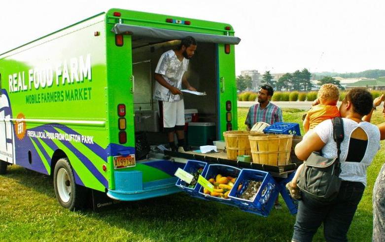

Create a partnering strategy for those limited retail providers to enhance and improve the concept of healthy foods.
Programming
LFUCG Local Food Coordinator / Better Bites Program

$
Commercial Property Owners
USDA The Healthy Urban Food Enterprise development Center (HUFED)
128 I MPLEMENTATION
Figure 65 (Continued).Neighborhood Livability Strategies
Goal #5 - neighborhood liVability StrategieS


reCommendation tyPe of imPlementation lead agenCy Potential Partner(S) Potential funding
Improve pedestrian, bicycle and transit connections for adequate and safe access to existing healthcare and healthy food facilities within the plan area.
Capital Project
LFUCG Division of Planning
MPO / LFUCG Division of Engineering / LFUCG Parks and Recreation
$ Various
Coordinate with Health Department or similar organization to sponsor a health screening event or mobile unit.
Capital Project / Programming
Gainesway Community Center Fayette Co. Health Department / Health Care Providers
$ Healthcare Partnerships / Grants from Health Resources and services Administration

129 I MPLEMENTATION
PlaCemaking StrategieS 6.6
Goal #6 - PlaCemaking StrategieS
reCommendation tyPe of imPlementation lead agenCy Potential Partner(S) Potential funding
Include way-finding signage to direct residents and visitors to neighborhood amenities such as parks, schools and the community center.
Capital Project
LFUCG Traffic Engineering Neighborhood Associations City Council
$ Neighborhood Sustainability Grant
Include neighborhood signage and banners within the streetscape.
Capital Project / Programming / Neighborhood Drive
Neighborhood Associations / Property Owners / Businesses
LFUCG Parks and Recreation / LFUCG City Council / LFUCG Housing Authority
$ Neighborhood Sustainability Grant / Donations / Private Funding
Landscaping, lighting, street furniture, and bike and pedestrian infrastructure.
Capital Project
LFUCG Division of Engineering MPO / Fayette Co. Public Schools
$ Community Development Block Grant (CDBG) / CMAQ / MAP 21
130 I MPLEMENTATION
Figure 66.Placemaking Strategies
Goal #6 - PlaCemaking StrategieS
reCommendation tyPe of imPlementation lead agenCy Potential Partner(S) Potential funding
Sponsor an Art in motion bus stop or other public art project.
Capital Project
Art in Motion Lextran / Neighborhood Associations / MPO
$ Art in Motion / MAP 21 Public Transit
Continue interaction and communication with neighborhood associations, Council District office and LFUCg agencies (neighborhood newsletter / email / social media).
Promote the use of neighborhood Sustainability grants offered by LFUCg.
Programming
LFUCG City Council / LFUCG Division of Planning
Neighborhood Associations Programming
LFUCG Division of Grants & Specialty Programming
LFUCG Council District Office
$ Budget
$ Neighborhood Sustainability Grant
131 I MPLEMENTATION
Goal #6 - PlaCemaking StrategieS

reCommendation tyPe of imPlementation lead agenCy Potential Partner(S)
Potential funding
Work with Lexington Area Community Foundation to develop and sustain neighborhood leaders.
Programming
Neighborhood Associations Community Foundation / LFUCG Council District Office
$ N/A
neighborhood Associations to use a variety of communication methods including social media to engage neighbors.
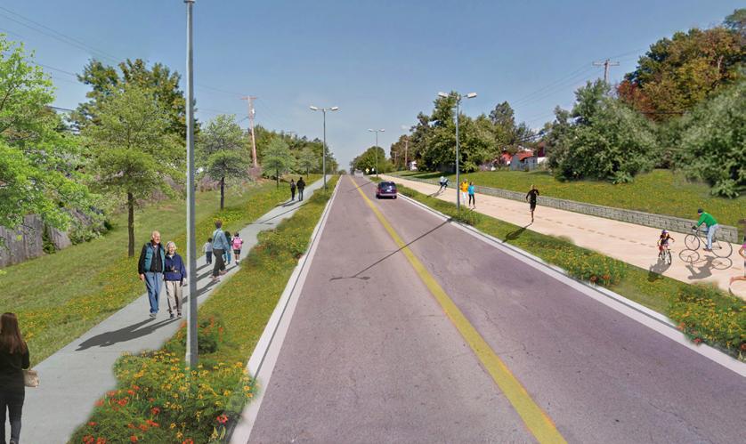

Neighborhood Driven
Neighborhood Associations LFUCG Council District Office
$ Membership / Donation
132 I MPLEMENTATION
Figure 66 (Continued).Placemaking Strategies
Goal #6 - PlaCemaking StrategieS

reCommendation tyPe of imPlementation lead agenCy Potential Partner(S) Potential funding
Sponsor neighborhood block parties or other activities such as picnic in the park, talent shows and parades.

Neighborhood Driven
Neighborhood Associations
LFUCG Parks and Recreation / LFUCG Council District Office
$ Membership / Donation
Work with civic organizations to Adopta-Street or other community cleanup events.

Neighborhood Driven
Neighborhood Associations
Boy Scouts of America / Neighborhood Churches / school Children
$ Adopt-a-Highway / Organizations
133 I MPLEMENTATION