Lexington Central Sector

SMALL AREA PLAN
Adopted: April 30, 2009


Central Sector: Vision. Voice. Vitality. ADOPTED APRIL 30, 2009 The Central Sector Small Area Plan An Amendment to the 2007 Comprehensive Plan for Lexington-Fayette County, Kentucky
Vision Statement
Vision, Voice, Vitality
The Central Sector represents a collection of diverse and unique neighborhoods. The future of these neighborhoods will be shaped by a unified vision, voice and vitality that bridges and embraces the montage of age, race, ethnicity, and livelihood in the community. The core values of diversity, cultural richness and history are central to our community’s identity. We envision a future with safe, walkable streets, successful and qualitative reinvestment, a celebration of our core values, and economic strength that creates a high quality of life for all who call the Central Sector home.
Acknowledgements
The Central Sector Small Area Plan is the result of the collective insight and effort of numerous residents, government agencies, and consultants. A plan that does not involve those it hopes to serve cannot fully realize its potential or vision. For this reason, those with a vested interest in the future of Central Sector put forth their time, effort, and ideas in the creation of this plan. It is important to recognize and thank the Steering Committee members who were an integral part of this process including:
Steering Committee
•
•
Andrea James, 1st District Council member
Tom Blues, 2nd District Council member
• Member
•
•
•
•
•
•
•
•
•
•
•
•
•
•
•
•
•
Joan Whitman, Planning Commission
Verna Spiegel, Meadows Park NA
Marty Clifford, North Limestone NA
Gwen Godfrey, Northend Alliance
Michael Haskins, Georgetown Street NAPO
Billie Mallory, William Wells Brown NA
Win Meeker, Northside NA
Germaine O’Connell, Castlewood NA
Bill Johnston, Western Suburb NA
Sarah Emmons, Transylvania University
Dr. Augusta Julian, BCTC
Tri Roberts, BCTC
Austin Simms, Lexington Housing Authority
David Cozart, Urban League
Dr. Derek Paulsen, EKU
Bill Pickering, North Limestone NA
Sherry Maddock, Martin Luther King NA
Elizabeth Fugazzi, Transylvania University
Bob Joice, FCPS
LFUCG Planning Staff
Christopher King
• , Director
• , Project Manager
•
Jim Duncan
Sharon Buford
Janice Westlund •
Pam Whitaker •
Rob Johnson • Consultants
RATIO, Inc.
DCI
• , AICP, LEED AP
Jackie Turner
Kevin Senninger •
Jennifer Higginbotham •
Glenn Gareis
• , AIA
• , AICP
ECSI
Ian Colgan
J. Steven Gardner
• , PE
Shannon Reynolds • , PE
2 The Central Sector Small Area Plan
3 ©2009 RATIO | DCI | ECSI Voice, Vision, Vitality 2 Acknowledgements 2 Table of Contents ...........................................................................................................................3 Chapter 1 – IntroduCtIon Purpose of the Small Area Plan .......................................................................................................6 Study Area Boundary......................................................................................................................7 Chapter 2 – CommunIty CharaCter History ........................................................................................................................................10 Culture and Identity .....................................................................................................................10 Cultural Resources Map 12 Land Use and Development 14 Central Sector Subareas ...............................................................................................................15 Subarea A...................................................................................................................................... 16 Subarea B ...................................................................................................................................... 17 Subarea C ..................................................................................................................................... 18 Subarea D ..................................................................................................................................... 19 Subarea E ...................................................................................................................................... 20 Chapter 3 – analysIs Market Analysis ...........................................................................................................................22 Circulation and Connectivity .........................................................................................................27 Transportation Analysis Map 28 Public Services and Infrastructure 32 Natural Environment ....................................................................................................................34 Chapter 4 – publIC Input & Issue IdentIfICatIon Public Input Overview 38 Public Input Summary ..................................................................................................................39 Chapter 5 – Goals & objeCtIves Introduction .................................................................................................................................46 Central Sector Principles, Goals, and Objectives ............................................................................47 Enhance The Urban Fabric 47 Redevelopment And Investment 49 Adequate And Equitable Housing .................................................................................................51 Central Sector Development Framework Map ................................................................................52 Preserve Cultural and Historic Heritage 54 Table of Contents
4 The Central Sector Small Area Plan Chapter 6 – reCommendatIons Introduction .................................................................................................................................58 Subarea “A” .................................................................................................................................59 Subarea “B” 61 Subarea “C” 63 Subarea “D” ................................................................................................................................66 Subarea “E” 70 Chapter 7 – ImplementatIon strateGIes Introduction .................................................................................................................................74 Quick Wins (Short term Implementation Tools) 74 Long Term Implementation Tools 76 Community/Economic Development Corporation (CDC/EDC) 76 Real Estate Transfer Tax 77 Profile: Solving the Urban Grocery Store Gap 77 Tax Increment Financing 78 Retail / Business Improvements 78 Residential Improvements 81 Transportation and Infrastructure Improvements 82 Safe Routes to School (SR2S) .......................................................................................................... 83 Sustainable “Green” Improvements ................................................................................................. 83 Safety and Security Improvements ................................................................................................... 83 Image Improvements ..................................................................................................................... 84 Profile: Safe by Design .................................................................................................................... 86 Implementing Agencies ................................................................................................................88 Implementation Time Frame 88 Implementation Tables .................................................................................................................89 appendICes Public Input 98 Residential Infill and Redevelopment Program .............................................................................102 Neighborhood Demographics ....................................................................................................103 Safe by Design 106 Homelessness and Housing Issues 111
Table of Contents
Central Sector: Vision. Voice. Vitality. ADOPTED APRIL 30, 2009 Chapter 1 Introduction
Purpose of the Small Area Plan
The Central Sector Small Area Plan is the result of a recommendation in the 2007 Comprehensive Plan to address community-wide concerns including density, land use, zoning, public safety, traffic, transit, schools, community facilities, infill, infrastructure and commercial/residential compatibility. Given the scope and complexity of these issues, the Planning Commission selected the Central Sector as an area to be studied in detail.
A Small Area Plan (SAP) provides for a more intense study of the Central Sector that is tailored to the needs of the diverse demographics of the large neighborhood. It is intended to guide public improvements and steer private investment in order to promote neighborhood stabilization and revitalization. The preparation of the Central Sector Small Area Plan (CSSAP) relied on the community’s most valuable resource -- its residents. The collaboration of residents, business owners and the Urban County Government lend credibility to the recommendations which address the citizen’s everyday issues and concerns.
The theme of the CSSAP is “Vision, Voice and Vitality” which represents the grass roots effort and collective ideas of area residents. It is hoped that the Plan will be used to exert pressure on the LFUCG to assist residents and business owners to further enhance existing resources, preserve the culture, and improve the quality of life. This underlying theme is referred to throughout the plan and underscores how the implementation of small steps initiated by the LFUCG and community residents and business owners can shape the long term future of Central Sector. The Plan is a living document that will evolve over time as more information is gathered and resources are secured.
This Small Area Plan conforms to Kentucky Revised Statues (KRS) Chapter 100, which requires public involvement in the process. Residents, business owners, community leaders, and representatives of cultural and public institutions participated in the development of the Plan from start to finish, with professional planning staff assisting the neighborhoods to identify needs and priorities for community development and public improvements. Chapter 6 of this Plan, Implementation Strategies, is an action-oriented implementation plan composed of short-term priorities and long-term visions. Each recommendation suggests timing, funding and responsible parties. Adopting the CSSAP as a section of the 2007ComprehensivePlan is the first step to ensuring its success.
Introduction 6 The Central Sector Small Area Plan
Study Area Boundary
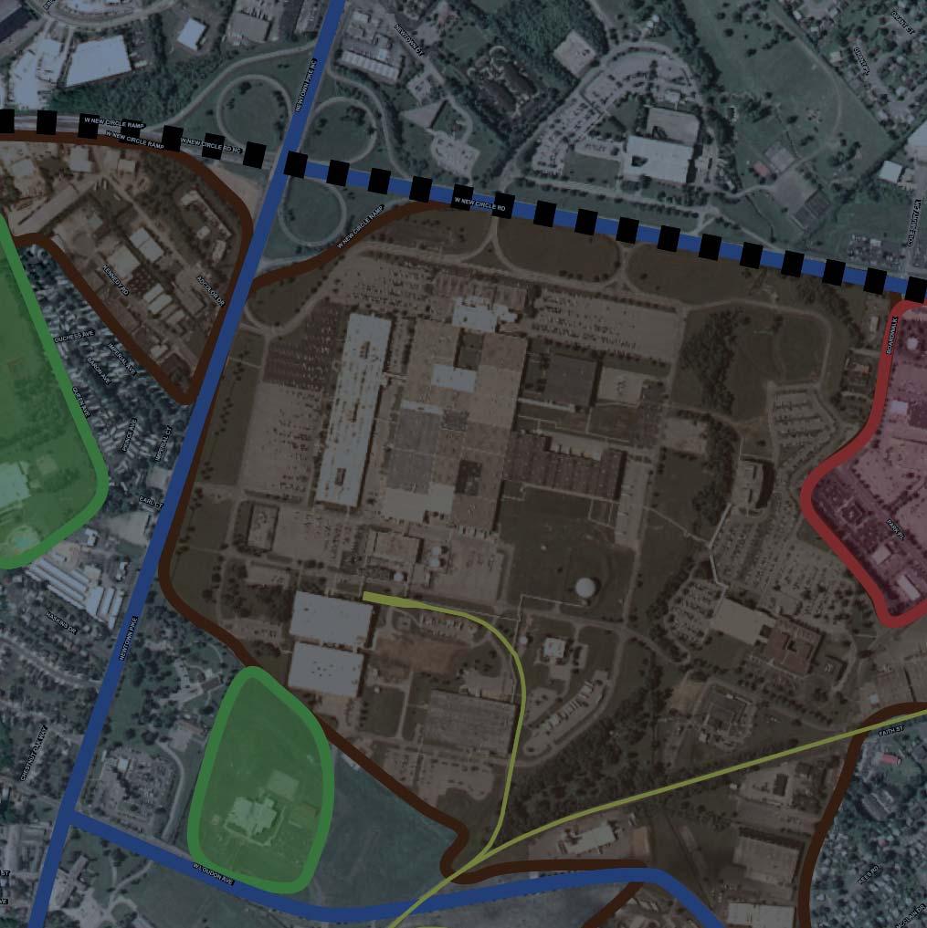
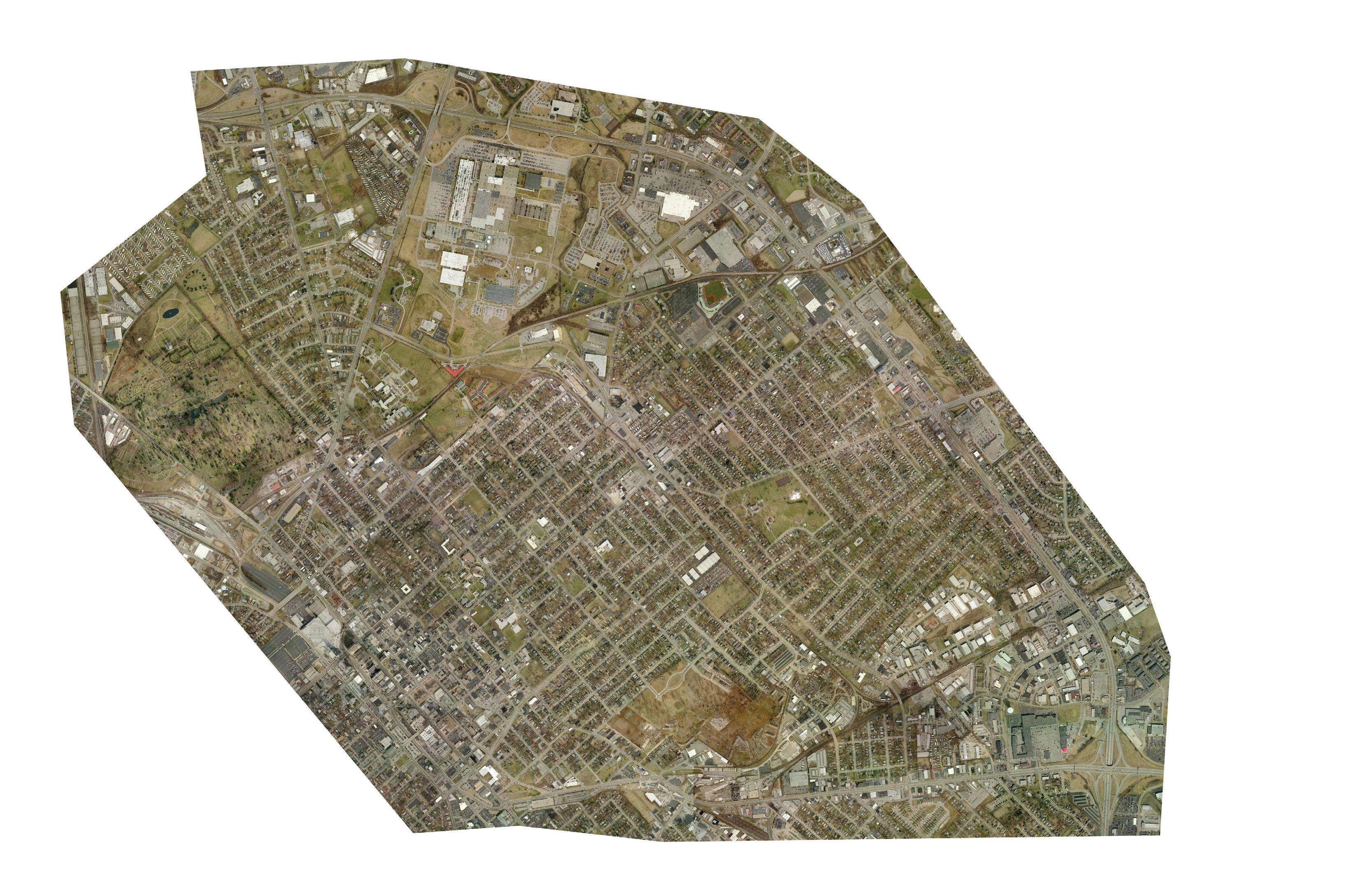
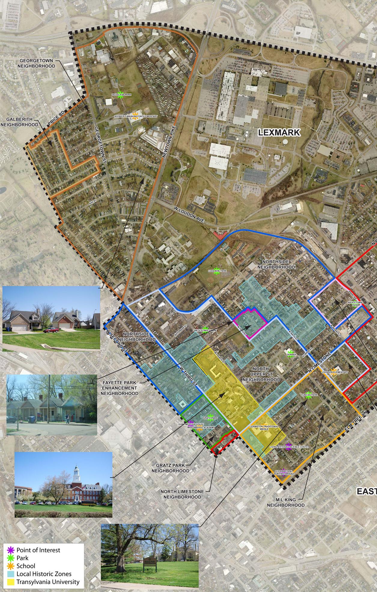
The term “Central Sector” is not the historic or cultural name of the collection of neighborhoods that are the subject of this Small Area Plan. The name is derived from the police district moniker for the northeast Lexington Police District. Central Sector contains approximately 2,400 acres bounded by the cemetery west of Georgetown Road, New Circle Road on the north to Winchester Road, and Second Street on the southern edge. The community is often referred to as “First District” or “Second District” by local residents.
The study area boundaries recommended in the 2007ComprehensivePlan were slightly modified as seen in the map below. Refer to the Comprehensive Plan to obtain more detailed information on the land use categories. The area carved from the southern portion of the Central Sector represents the East End neighborhood. It was also the subject of a Small Area Plan prepared concurrently with the Central Sector Small Area Plan. Although these plans were produced separately, there was a concerted effort to not only share information, but also a coordinated effort to ensure recommendations and implementation measures complemented each plan’s overarching principles.
Introduction 7 ©2009 RATIO | DCI | ECSI
Winchest er Road NewCircleRoad PriceRoad µ 0 3 00 0 1 50 0 Fe et Central Sector Land Use Classification HD Hi h D it R id ti l MD - M edium Density Residential LD - Low Density Residential ElmTree SecondSt OW - Office/War ehouse HI - Hi gh Industr ial Winchest er Road NewCircleRoad PriceRoad µ 0 3,00 0 1,50 0 Fe et Central Sector Land Use Classification RT R t il T d & P l S i VHD - Very High Densi ty Residenti al HD - High Density Residential MD - M edium Density Residential LD - Low Density Residential ElmTree SecondSt OPU Oth P bli U SP - Semi- Public F acilities WW - Warehouse & Wholesale OW - Office/War ehouse HI - Hi gh Industr ial PriceRoad µ 0 3 00 0 1 50 0 Fe e Central Sector Land Use Classification LI - Light Industrial ORP - Offi ce, Industry and Research Park HC - Highway Commercial/Interstate Commerci al Down Town Master Plan PS - Professional Service/Office RT - Retail Trade & Personal Services VHD - Very High Densi ty Residenti al HD - High Density Residential MD - Medium Density Residential LD - Low Density Residential MU - Mixed Use - Retail/Office Mi xture Including a Residential Component ElmTree SecondSt OP SP WW OW HI S t Ce UPR PE GS W nchester Road NewCircleRoad PriceRoad µ 0 3 00 0 1 50 0 Fe e Central Sector Land Use Classification LI - Light Industrial ORP - Offi ce Industry and Research Park HC - Highway Commercial/Interstate Commerci al Down Town Master Plan PS - Professional Service/Office RT - Retail Trade & Personal Services VHD - Very High Densi ty Residenti al HD - High Density Residential MD - Medium Density Residential LD - Low Density Residential MU - Mixed Use - Retail/Office Mi xture Including a Residential Component ElmTree SecondSt OPU - Other Public Uses SP - Semi-Public Facilities WW - Warehouse & Wholesale OW - Office/Warehouse HI - Hi gh Industrial S treet Central Sector S tudy B oundary U - Uti liti es (overlay) PR - Public Recreation PE - Public E ducation GS - Green Space/Open Space
Introduction 8 The Central Sector Small Area Plan

Central Sector: Vision. Voice. Vitality. ADOPTED APRIL 30, 2009 Chapter 2 Community Character
Community Character
The system of streets, which binds the built form into the urban structure of the road network, creates a continuous urban fabric and in a sense confirms the coherence of urbanity.
--Stephen Marshall
History
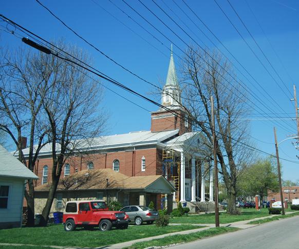
Lexington was settled in the late 1700’s. Many business and political leaders lived in the neighborhoods just north of downtown, served by slaves who were eventually freed in late 1865. According to Gerald L. Smith Ph.D., in Black America Series Lexington Kentucky, 2002, the African-American population that did not live and work in the rural areas, settled in neighborhoods closer to the city such as Brucetown and Kinkeadtown, which are located within the study area. Forced segregation, which lasted almost another one hundred years, caused the schools, churches, shops, social and service organizations for African Americans to be clustered in this area north of downtown.
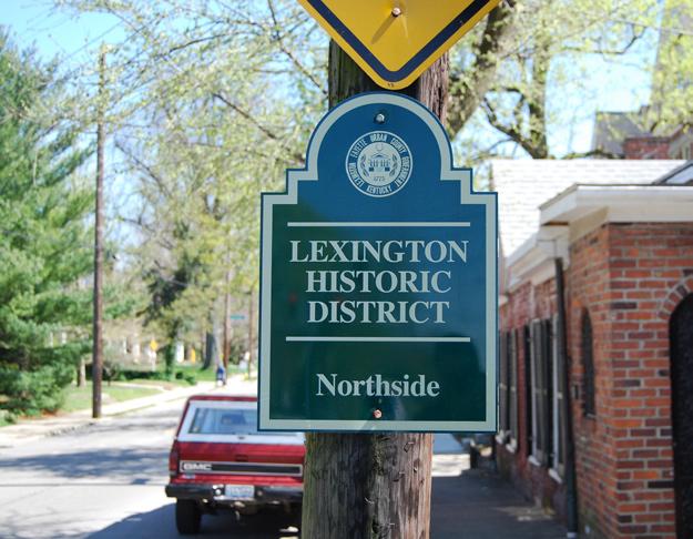
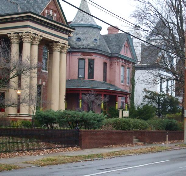
Much of the urban fabric, an extension of the downtown street grid remains intact in the Central Sector. Original homes and businesses which border the network of streets are a characterdefining for some portions of the community. There are seven Local Historic Districts, multiple National Register Districts and many individual National Register properties dating from the 19th century.
Number of Properties per Historic District
The Georgetown and Meadows Loudon neighborhoods and other residential areas north of Loudon Avenue contain some homes from the 1920’s and 30’s, but a majority are post-World War II.
Culture and Identity
The Northside Neighborhood Association (NA) has been instrumental for more than four decades in preserving structures and community, producing a stable, inclusive neighborhood. There are eleven other active neighborhood associations, particularly the Martin Luther King NA and the North Limestone NA that represent the multicultural, multi-generational, and ethnically diverse community. These citizens are united in their desire to ward off threats to their neighborhoods and their quality of life, and have a shared goal to create opportunities for positive future growth and development.
There exists a variety of non-residential development that borders this area including suburban-type shopping centers, light and heavy industry, and college and corporate campuses. Even with these commercial entities, unemployment remains high and incomes low for some parts of the Sector. Many employed in Central Sector commute from other parts of Lexington
10 The Central Sector Small Area Plan
Local Historic Districts in CS Number of properties Constitution 59 Elsmere Park 29 Fayette Park 16 Gratz Park 18 Mulberry Hill 37 Northside 234 Western Suburb 118
Historic District Marker
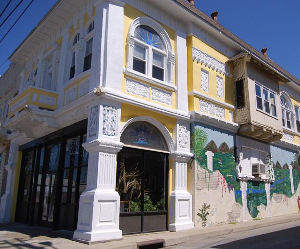
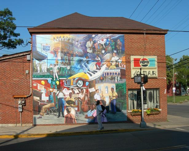
or from outside the City to professional and skilled labor jobs such as at Lexmark. Many residents work outside Central Sector. Automobile ownership is the lowest in this community causing residents to rely heavily on transit and the local pedestrian network. Still there is much to celebrate about this collection of neighborhoods north of downtown, such as the burgeoning arts scene and new residents and small business investors who see the potential in an area that may have fallen off the radar. A nod to the music culture can be found on the music-themed mural on Al’s Bar, a neighborhood landmark at Sixth and Limestone. The mural celebrates musicians from the area, including Les McCann and George Gentry, a Jazz musician who lived on north Limestone.
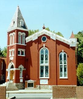
Several significant cultural and historic properties including national and local historic districts located in Central Sector are listed below and many are identified on the map on pages 12 and 13:
St. Paul African Methodist Episcopal Church at 251-253 N. Upper • Street
Dunbar Community Center at 545 N. Upper Street, formerly Paul
• Laurence Dunbar High School constructed in 1922 as the school for African-American students
Douglass Park on Georgetown Street dedicated in 1916 historically
• provided recreation opportunities for African Americans for family reunions, picnics, golfing, baseball, track, etc.
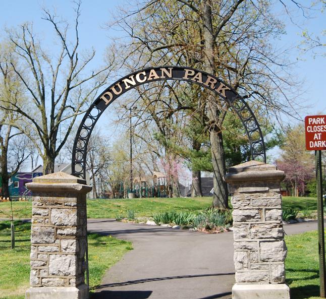
Duncan Park with Morton House built in the early nineteenth century
• at Fifth and Limestone was once a dwelling for Cassius Marcellus
Clay
• Newtown Pike in Lexington
Haskins Drive, the first African American subdivision, 7.25 acres off
• opened in1889 for African Americans
•
•
•
•
Original Russell Elementary School at Third and Kenton Streets which
Loudon House and Castlewood Park on Loudon and Bryan Avenue
Living Arts and Science Center
Transylvania University founded in 1780
Eastern State Hospital on Newtown Pike
• Lexington
•
•
Vogt Reel House which is the oldest still active fire station in
Sayre School
Carnegie Center for Literacy
• Hill, Fayette Park, Constitution, and Historic Western Suburb
Local Historic Districts - Northside, Gratz Park, Elsmere Park, Mulberry
In the late nineteenth century, Lexington was a major player in the State’s horse-racing industry. More than 125 years later, Lexington is still known as the Horse Capital of the World, and in 2010 will host the World Equestrian Games.
11 ©2009 RATIO | DCI | ECSI
Community Character
St. Paul A.M.E. Church founded 1820
Al’s Bar Mural
Community Character

12 The Central Sector Small Area Plan
Broadway New ThirdStreet LoudonAvenue BryanAvenue Limestone Newtown Pike New Circle Road SecondStreet D ow NT ow N EAST END Georgetown Road Jefferson Street D ouglass P ark C oolavin P ark D un C an P ark g ratz P ark D unbar P ark 8 1 3 4 6 5 7 9 20 18 17 19 20 21 17 10 11 12 14 2 23 15 16
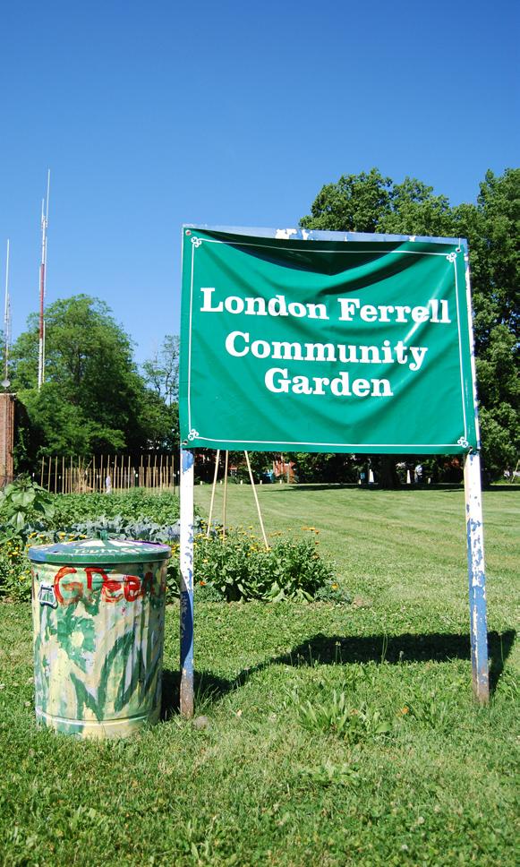
Community Character 13 ©2009 RATIO | DCI | ECSI CULTURAL RESOURCES NewCircleRoad nue winchester Road C astlewoo D P ark Parks Schools The Robert H. williams Cultural Center St. Paul African Methodist Episcopal Church Dunbar Community Center YMCA Haskins Drive Russell Community Services Center School Loudon House Transylvania University Eastern State Hospital Lexmark Hope Center Applebees Legends Ballpark Eastland Shopping Center The Arbors London Ferrell Community Garden Living Arts and Science Center Historic / Cultural Features Local Historic Districts Northside Gratz Park Elsmere Park Mulberry Hill Fayette Park Constitution western Suburb 8 1 3 2 4 6 5 7 9 20 18 17 19 21 22 1,000’ 2,000’ 0 500’ 13 11 10 12 14 23 LEGEND 15 13 16
Community Character
Land Use and Development
The consultant team inventoried and analyzed existing land uses to provide a better understanding of community character and the issues facing residents and business owners of the Central Sector. The team used the LFUCG Geographic Information System (GIS) data, “windshield” visual surveying, proposed and adopted Plans and documents, and photographs to assess land use, traffic and circulation, cultural and historic factors, natural features, and general development trends.
The 2,400-acre study area is reflective of the urban core; primarily composed of residential neighborhoods interspersed with non-residential uses. The texture of the urban fabric is composed of commercial, industrial and public/institutional lands which contribute to the image, identity and economic health of the community. The street grid of the downtown extends into Central Sector, except for scattered large developments such as Lexmark and Eastern State Hospital (soon to be the location of the Bluegrass Community and Technical College campus). Newtown Pike, Broadway and North Limestone serve as conduits for commuters and visitors between downtown and north Lexington.
The southern boundary of the study area is Second Street, which reflects the character and energy of the downtown which is slowly edging north from Main Street. New Circle Road forms the northern and eastern boundary. The development along New Circle Road is distinctly suburban strip commercial and lacks visual, physical, and perceived integration into the study area.
There are 91 acres of parks distributed throughout the community (See map pages 12 and 13), most within 1/2 mile of, and none more than a mile from, any residence. Castlewood, Douglass, Duncan, and Dunbar and the new William Wells Center in the East End provide both indoor and outdoor recreational opportunities to area residents, but are not heavily used by others from outside of the area. More detail is available in the 2009 LFUCG Comprehensive Parks and Recreation Master Plan Update.
This Plan reinforces recommendations from the 2001 and 2007 Comprehensive Plan (Pages 74-80) which support the use of residential infill and redevelopment to fill gaps in the urban fabric. Appropriate infill not only preserves the character, but encourages redevelopment, generates tax revenues for the local area, provides more students to keep schools viable, and brings positive activity to the streets which leads to increased safety and security. In a community with the lowest rate of automobile ownership in Fayette County, it is imperative to maintain the density and walkability of the urban fabric.
14 The Central Sector Small Area Plan
Central Sector Subareas
For the purposes of this Plan, Central Sector was divided into five subareas in an effort to parcel recommendations into manageable pieces. Each subarea delineated possessed similar physical characteristics, land development patterns, or specific geographical or man-made physical boundaries such as major thoroughfares or railroads. The CSSAP subarea boundaries were created specifically for this planning effort, and do not affect any other boundaries established by LFUCG or neighborhood associations. The following sections provide an overview of each area and include a graphic illustrating the subarea described.

Community
15 ©2009 RATIO | DCI | ECSI
Character
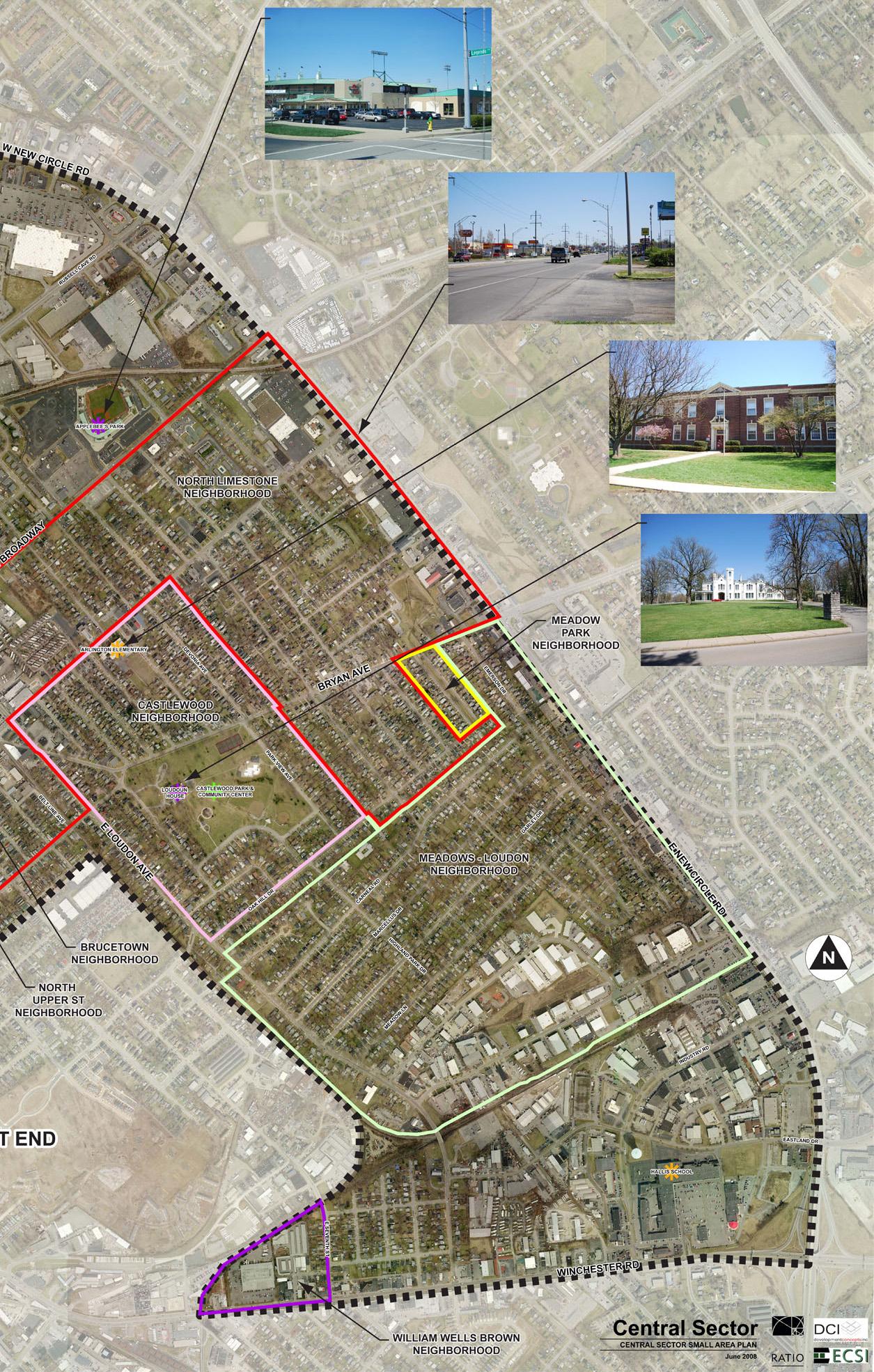
Broadway NewCircleRoad ThirdStreet Loudon Avenue BryanAvenue Limestone Newtown Pike New Circle Road winchester Road SecondStreet D ow NT ow N EAST END S UBAREA “A” S UBAREA “ B ” S UBAREA “ E ” S UBAREA “ E ” S UBAREA “ D ” S UBAREA “ C ”
Community Character
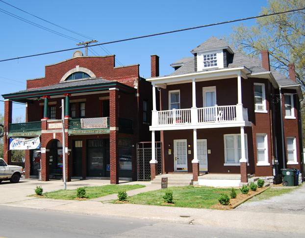
Subarea A
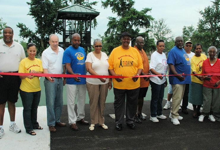
Subarea A lies just north of downtown and west of Newtown Pike. It is bordered on the north by New Circle Road, the south by Cove Haven Cemetery, and is bisected by Georgetown Road. It is primarily single family residential with recent infill redevelopment adjacent to Douglass Park which is considered a local landmark by many in the African American community. Plans are currently underway to develop sixteen single-family lots on 3.1 acres west of the park. A mobile home park and elementary school also are adjacent to the park. New commercial development is occurring on New Circle Road to the north.
Newtown Pike
New Circle Road S UBAREA “A”
Subarea “A” Forming western Edge of Central Sector
Douglass Park Ribbon Cutting Ceremony
Community Character
Subarea B
This subarea which is dominated by the Lexmark corporate campus and other industrial or light industrial operations, is bordered on the west by Newtown Pike and on the east by the CSX-Corman Railroad. The railroad is active and is seeking to grow its business with additional freight and coal customers.
Newtown Pike which is the subject of its own study The Newtown Pike Extension Corridor Plan, 2002, is a major gateway corridor to downtown Lexington. Loudon Avenue is the major east-west connection other than New Circle Road, through the Central Sector to the east side of the City.
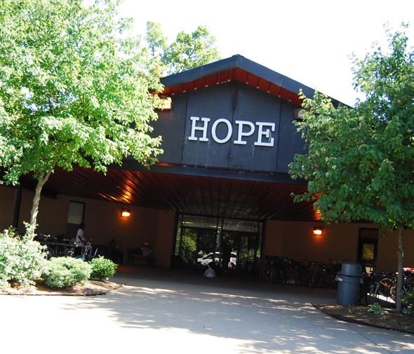
There are also a number of semi-public or institutional land uses including Eastern State Hospital, the North Lexington YMCA, Bluegrass Youth Development Center, and the Hope Center social service agency. Recently conducted surveys on the homeless and housing needs are included in the Appendix. Future plans call for the Bluegrass Community and Technical
Subarea “B” Centered Around Lexmark Campus
Loudon Avenue
Pike New Circle Road S UBAREA “ B ”
Newtown
Eastern State Hospital Administration Building
Community Character
Subarea C
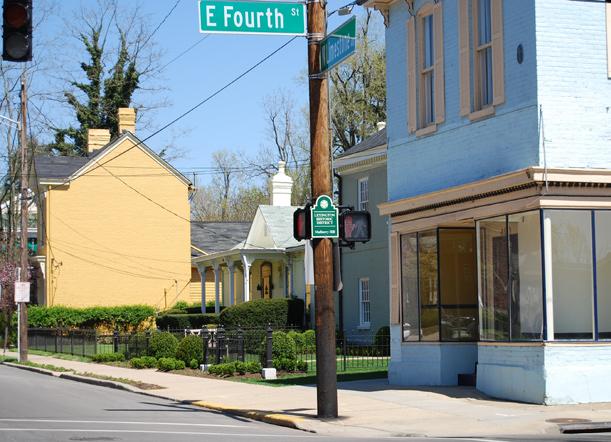
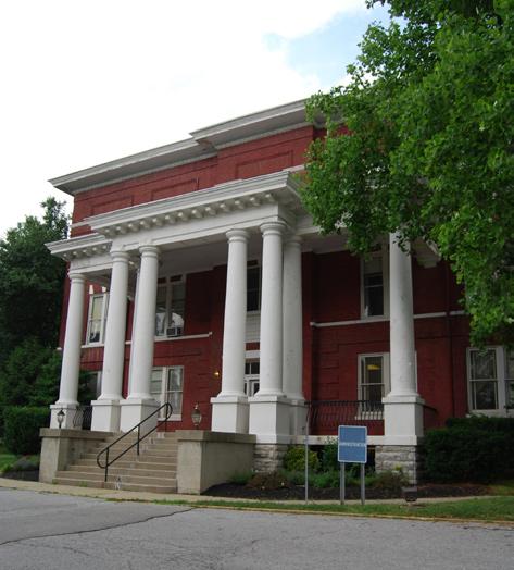
Subarea C is a truly mixed-use urban neighborhood and based on input from area residents at the public workshops, it is considered by some to be the heart of historic Central Sector. Situated immediately north of downtown, it extends north from Second Street to Loudon Avenue. The eastern boundary is shared with the East End, the subject of a concurrent Small Area Plan. The western boundary is the railroad that divides Subarea C from Subarea B Subarea C is the home of Transylvania University and seven of the fourteen local historic districts in Lexington. Broadway and North Limestone are major north-south thoroughfares, not just for Central Sector, but for many in north Lexington. Although this area is composed of predominantly single-family land uses, there are several neighborhood retail businesses scattered throughout. Recent investment at Sixth Street and North Limestone has extended the retail/entertainment venues north.
Neighborhood Concerns:
•
•
•
•
•
Threats to architectural and historic resources
Lack of quality affordable housing
Crime in Coolavin Park area
Growth and sustainability of retail nodes
Future role of Johnson Elementary
• Fifth Street and Loudon Avenue
Concentration of absentee landlords between
•
One-way street issues (Fourth Street)
Broadway ThirdStreet Loudon Avenue Limestone Newtown Pike SecondStreet S UBAREA “ C ”
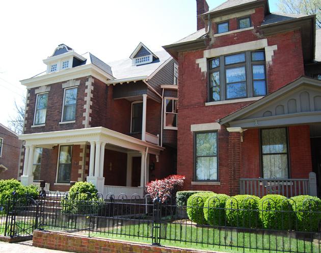
Historic Homes on Broadway
Community Character
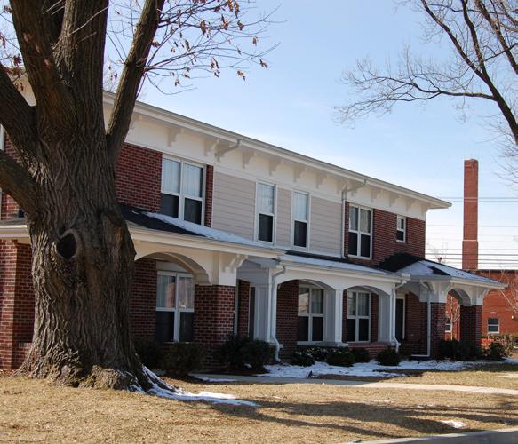
This subarea lies between Loudon Avenue and the commercial development of New Circle Road. It extends from the industrial area on the east to the railroad corridor bordering the Lexmark campus. Three active Neighborhood Associations located here: North Limestone NA, Meadows-Loudon NA, and Castlewood NA containing mix of 1920’-30’s Craftsman bungalows
Three major north-south streets, Broadway, North Limestone, and Bryan Avenue transport commuters as well as neighborhood residents. Broadway has a distinct commercial feel, while N. Limestone and Bryan Avenue are more reflective of neighborhood , this area also contains Subarea D locallyowned retail shops are spurring a renaissance along North Limestone from downtown to New Circle Road catering to the needs of Central Sector residents. There is less a sense of connection to New Circle commercial
border the East End Neighborhood which is the subject of a concurrent Small Area Plan that will address similar issues. The William Wells Brown neighborhood in the southern part of Subarea D is isolated from other residential or mixed uses by industrial land uses.
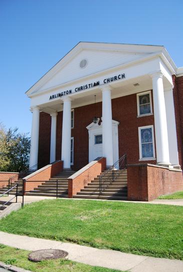
Significant assets in this area include Castlewood Park and the Lexington Art League at the Loudon House, Applebee’s Legends Ballpark, and Arlington School on north Limestone Avenue.
Neighborhood Concerns:
•
Image of Mobile Home Park
• Castlewood Park
Programming, security, and maintenance at
• New Circle Road retail
Lack of perceived and physical connection to
• Castlewood Drive
•
•
Five-point intersection at Bryan Avenue and
Crumbling curbs and sidewalks
Poor stormwater drainage facilities
• redevelopment
Possible brownfields as barriers to
19 ©2009 RATIO | DCI | ECSI
Broadway NewCircleRoad
Loudon Avenue
BryanAvenue
EAST END S UBAREA “ D ”
winchester Road
Limestone
Community Character
Subarea E
This analysis and subsequent recommendations for Subarea E are for the commercial development on both sides of New Circle Road, though only the south side is within the study boundary. The somewhat dated land uses range from retail and entertainment to a mix of light industrial as one travels from the west to Winchester Road. Unlike New Circle Road in other parts of Lexington, which functions as a limited-access expressway, here each lot has its own driveway or curbcut which can increase traffic congestion. The commercial uses are oriented only to the major street with unattractive rear yards adjacent to the neighborhood. Pedestrian connections are poor to nonexistent from the neighborhoods to the shops,
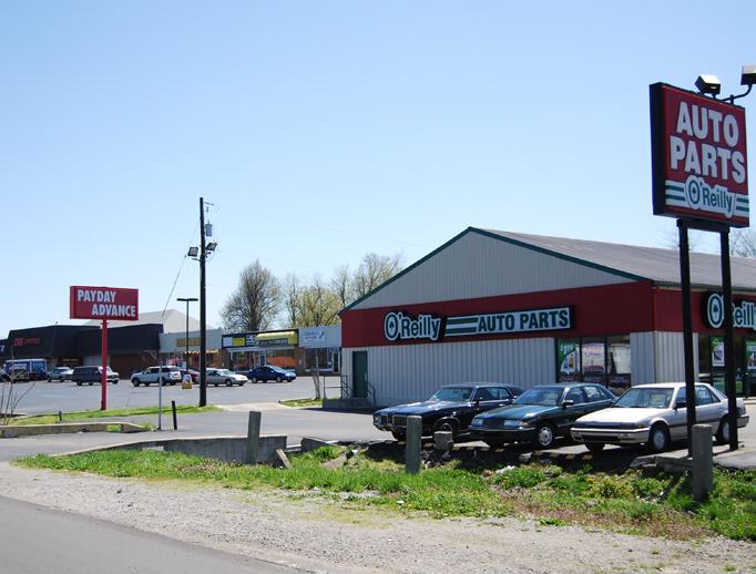
Notable land uses within this area include the Eastland Shopping Center at Winchester Road, the cluster of business/light industrial activities along Eastland and Floyd Drives, the Wal-Mart and Kroger shopping plazas, and Lexmark.
Neighborhood Concerns:
Lack of visual and physical
• connection between neighborhoods and New Circle Road
Lack of inviting gateways /
• entries into the Central Sector
• facilities
Poor pedestrian and bike
•
Lack of defined bus shelters
20 The Central Sector Small Area Plan
Broadway NewCircleRoad Loudon Avenue BryanAvenue Limestone New Circle Road winchester Road EAST END S UBAREA “ E ” S UBAREA “ E ” New Circle and winchester Road Corridors of Subarea “E” Commercial Development Along New Circle Road
Central Sector: Vision. Voice. Vitality. ADOPTED APRIL 30, 2009 Chapter 3 Analysis
This section uses data from the U.S. Census, Demographic Estimates from ESRI Business Analyst, and the Federal Bureau of Labor Statistics. As of this writing, 2000 Census Data is dated.
Market Analysis
Demographics overview
Central Sector has three distinct residential areas that differ from each other. This is an important consideration in understanding local market conditions. Subarea A, located around Georgetown Road, is the most ethnically diverse sub-area within the Central Sector. Sixty-four percent (64%) of its residents are African-American and another 16% of Hispanic descent. It is also the most economically-challenged subarea in terms of per-capita income ($16,500), and has the lowest valued housing stock. Subarea C, located between Second Street and Loudon Avenue, has a concentration of low-income households that disguises the fact that it has a growing population of higher-income households. There is also a high concentration of college students living here (17% of all residents), due to Transylvania University’s location within the area’s boundaries. Subarea D, between Russell Cave Road, New Circle Road, and Loudon Avenue, is the least ethnically diverse, with only 25% of its residents African-American or Hispanic. It also has higher household and per capita incomes, and the lowest estimated unemployment rate.
Housing
Generally, ninety percent (90%) of the owner-occupied housing (OOH) units in the Central Sector were estimated to be below the median home value of Lexington, with the exception of many residences located in the Historic Zoning Overlay (H-1). One fourth of OOH units had an estimated value of $60,000 or below – extremely low levels. Ten percent (10%) of Central Sector’s housing is classified as vacant which disproportionately equates to 7.8% of all vacant housing in Lexington. This housing stock presents an asset as well as a liability. Its advantage is the low values result in housing that is more affordable to the preponderance of lower income households located within the Central Sector. A comparison of the ratio of housing value to income finds that the Central Sector is either equal to or more affordable than elsewhere in Lexington - depending on which sources for income one uses - despite the county’s much higher median incomes.
On the other hand, low housing values suggest that many units are of low quality, or may be in disrepair. The primary issue regarding housing in the Central Sector, therefore, is whether low income households have access to housing that is not only affordable, but also of a quality that matches the rest of the community.
22 The Central Sector Small Area Plan Analysis
Income & Housing Values Lexington - Fayette Sub-Area A Sub-Area C Sub-Area D Median Household Income $54,624 $26,680 $24,519 $37,372 Per Capita Income $32,164 $16,509 $17,595 $20,925 Median Home Value $149,857 $45,403 $83,068 $83,300
Source: ESRI Business Analyst
The older you are, the more likely you are to own a home. For example, 48.2% of occupied housing units in Central Sector are owner-occupied, but of all occupied housing units with a householder age 25-34, only 31.1% are owned by the householder. Of occupied housing units with a householder age 75-84, 79.6% are owned by the householder. However, the largest home-owning age group are householders age 45-54, owing 21.8% of all owner-occupied housing units in Central Sector.
Based on race in Central Sector, if you are classified as White, you are most likely to own your home (52.7%), followed by Asian descent (42.9%), African-American (38.3%), and Native American/Native Alaskan (16.7%). Only 9.7% of Hispanic head of households own their home.
The age and character of the Central Sector’s housing stock has a major influence on the demographics of its residents, especially in regard to the distribution of household incomes across its geography. The primary
23 Analysis ©2009 RATIO | DCI | ECSI
Estimated Residential Values | Sub Area 3 - Old Northside Central Sector Small Area Plan | Lexington, Ken-
LEGEND Above $300,000 $50,000 - $100,000 $100,000 - $200,000 $200,000 - $300,000 > $50,000
prepared by: Development Concepts, Inc.
SUBAREA#3: OLDNORTHSIDE
Estimated Residential Values | Subarea C Central Sector Small Area Plan | Lexington, Kentucky
source: zillow.com and analysis by DCI
SUBAREAC
influence is the time period in which different areas of the Central Sector were developed. Roughly one-quarter of the housing units within the study area (the areas closest to Downtown) were built prior to the World War II, while the rest were built following it. The architecture and market conditions from these two periods differ enough so as to establish areas with different market dynamics.
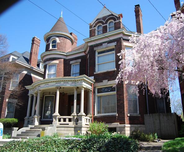
Subarea C is the oldest part of the Central Sector with a Median Year Structure Built of 1944 (compared to 1974 for Lexington). The neighborhoods between Downtown and 7th / Decamp Street were built-out during the end of the 19th century and the first quarter of the 20th century. The housing styles built during this period varied significantly. Large single family homes meant to serve higher income households were built in proximity to clusters of small to modest sized homes intended to house working class households. Today, one can witness how the diversity in housing stock is now reflected in the area’s demographics. Subarea C has the largest diversity in income, with some of the lowest income households adjacent to those with significantly more income that have bought, maintained, and restored the larger historic homes.
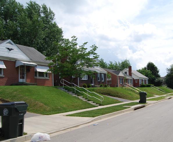
In contrast, Subarea D was almost entirely built after 1945 (mostly before 1960) consisting of post-war housing meant for middle class families. There also are clusters of early 20th century Craftsman-style bungalows in the North Limestone neighborhood. The housing stock is not extremely varied in terms of size or quality and this subarea shows the least amount of variance in income. The solidly middle-class enclave has incomes much higher than that of the other areas of the Central Sector.
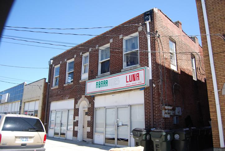
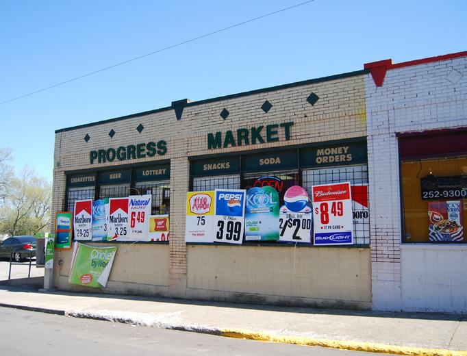
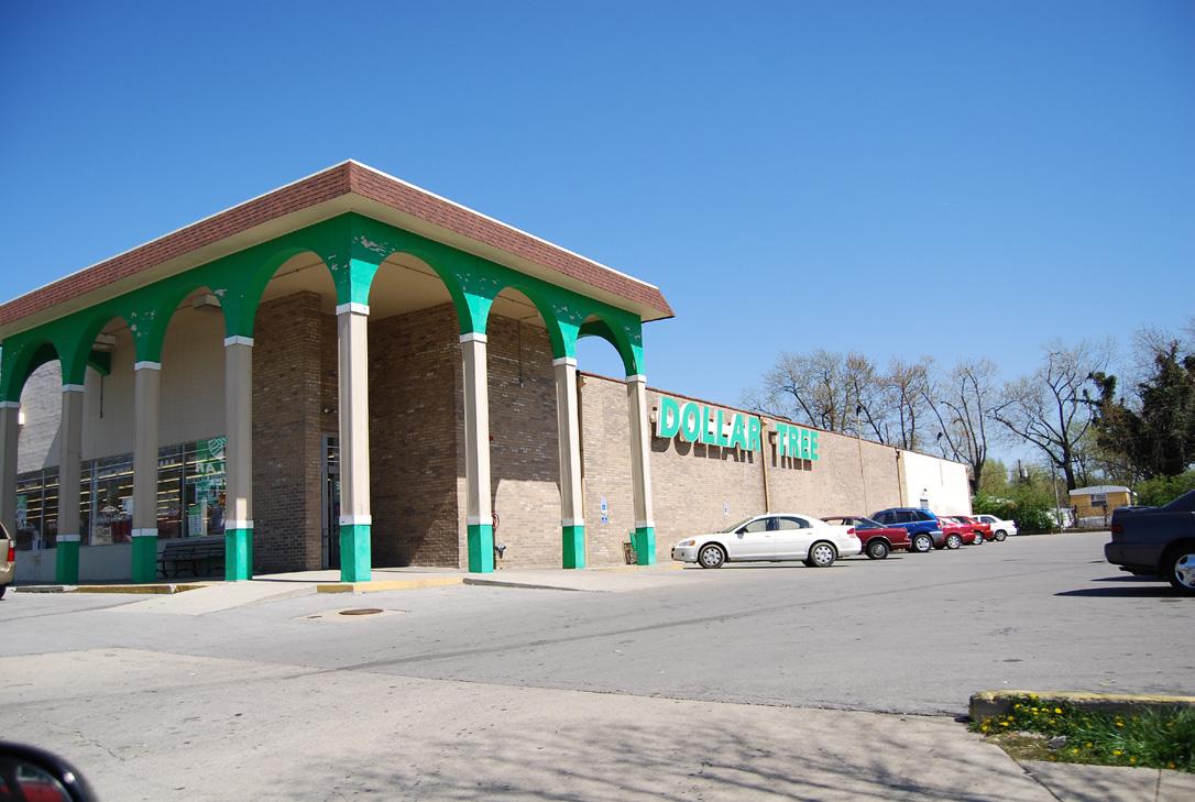
Retail
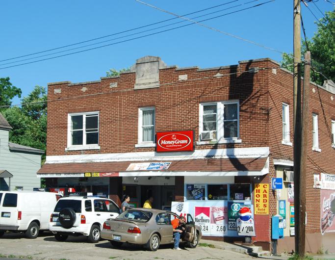
The retail found within the Central Sector study area is representative of its demographics. Most retailers are small, independent businesses operating in low-rent spaces. The national chain retailers that exist within the study area are targeted primarily toward low and moderate income households (Dollar Tree, Save-a-Lot, Wal-Mart, etc.). There has been limited recent retail investment – the exception being such businesses as the Rite-Aid on Broadway, a wine and cheese shop, and a metal finishing business.
The potential for retail growth within the Central Sector – both in quantity and quality – is constrained by its low household and per capita income levels. This is especially true in terms of new retail development, which typically seeks proximity to a customer base with much higher levels of disposable income. Most households in the Central Sector have only half the disposable income of the typical Lexington household. While Central Sector neighborhoods have a higher density compared to the rest of the LFUCG, it is not of a sufficient density to create enough aggregate buying power to match the neighborhoods with higher incomes that retailers prefer.
24 The Central Sector Small Area Plan Analysis
On the other hand, the Central Sector does have a series of assets. The Broadway, Limestone and Loudon Avenue corridors have enough traffic count to appeal to retailers. The growth of Downtown Lexington has the potential to positively impact some Central Sector neighborhoods, and the growth of upper middle and middle class households in nearDowntown neighborhoods may establish a preferred customer base.
The planning process for the Central Sector Small Area Plan identified a desire from residents for a new grocery store, or at least access to better quality groceries. Currently, the Central Sector is served by three levels of grocers: (1) small “corner shop” businesses that serve the convenience market and typically carry only basic grocery items; (2) mid-sized discount grocers that cater to low-income households (Save-a-Lot) and (3) large national grocers located on New Circle Road (Wal-Mart, Kroger). Though this configuration serves Central Sector residents in terms of typical market conditions for grocers, issues rise in terms of the accessibility of groceries and everyday goods to households with limited access to transportation due to income limitations or accessibility problems. These households are most likely to exist in the lower income areas of Subareas A and C. The large grocers are located in the northern end of the study area beyond easy walking distance for many residents. Therefore residents are forced to shop at smaller convenience retailers, where prices are higher and selectivity lower due to the market and economic limitations of small grocers.
Economic Development
The employment characteristics of the Central Sector belie those of Fayette County that saw a net growth of over 8,000 jobs between 2001 and 2007, and consistently has unemployment rates 2-3% below that of the State of Kentucky. In 2000, the last year available for Census data, it was estimated that 9% of residents in the Central Sector study area were unemployed (compared to 3.7% for Lexington) and only 61% of residents 16+ were in the labor force (compared to 70% for Lexington). With unemployment rising nationally, there is a good chance that presently, the Central Sector may have unemployment rates above 10%.
Part of this disconnect is likely due to disparate levels of educational attainment. Lexington has a large number of jobs in industries that typically require higher levels of education or a high level of skills attained through apprenticeships and at vocational or technical schools. Computer and Electronic Product Manufacturing, Professional and Technical Services, Administrative and Support Services, Hospitals and Ambulatory Health Care Services, and Credit Intermediation represent 31% of all employment in Fayette County. The Lexington area has a very high percentage of educated residents. In the year 2000, the last year where data was available, 35.6% of residents had a bachelor’s or graduate degree.
25 Analysis ©2009 RATIO | DCI | ECSI
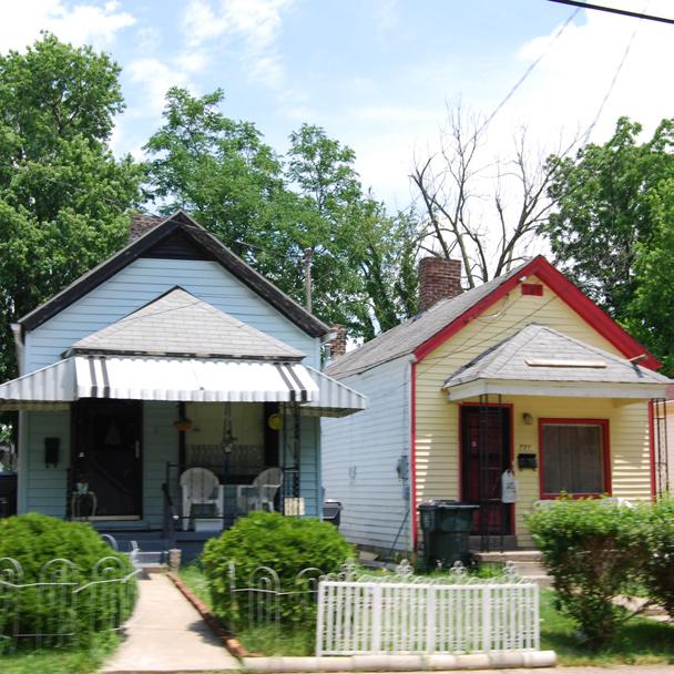
Neighborhood Retail Examples
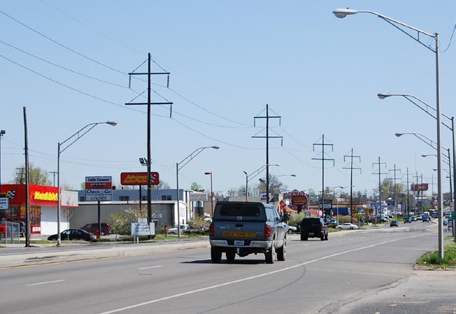
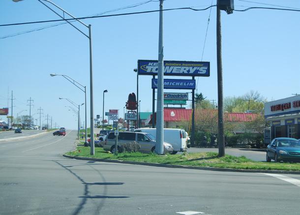
Regional retail on New Circle Road
The Central Sector, in contrast, has very low level of higher education attainment. In 2000, the percentage of study area residents aged 25+ with a bachelor’s degree or higher was only 10.3%. This was 7% lower than the State of Kentucky and 25.3 percent lower than Lexington. Sixty-three percent (63%) of residents had a high school degree or GED – 10.5% lower than the State, and 22.4% lower than Lexington.
A second issue may be access to jobs. The most accessible employment centers to the Central Sector, including Downtown Lexington, the University of Kentucky, and Lexmark, have a preponderance of jobs that require higher levels of education. Many of the major manufacturing entities in the area– which present a higher likelihood of offering employment to residents without college degrees, are located on sites out of town as to be economically impossible to reach for many residents.
These statistics may have improved over the past eight years, with an influx of higher educated, higher income households into the area – especially in near-Downtown neighborhoods. The low education numbers within the Central Sector are also influenced by the high percentage of residents near or at retirement age (one-fifth of all residents are aged 55+). Nevertheless, the disparity between the Central Sector and the rest of Lexington in employment levels and education attainment is alarming, and remains one of the primary reasons why the Central Sector as a whole lags behind the rest of the community in terms of income and prosperity.
** This section uses data from the U.S. Census, Demographic Estimates from ESRI Business Analyst, and the Federal Bureau of Labor Statistics.
26 The Central Sector Small Area Plan
Analysis
Large retailer at Broadway and Loudon Avenue
Circulation and Connectivity
Vehicular
Central Sector is ideally situated to be a model for community redevelopment. It borders a vibrant downtown and is bisected by Newtown Pike and Broadway which provide vehicular access to the Interstate system and New Circle Road. Another strong north-south axis is North Limestone. Loudon Avenue and Third Street provide the strongest east-west connections. Roadway access and connectivity in the Central Sector Study area should enhance the area’s urban character, while also utilizing emerging “green” practices to improve the quality of life for residents and businesses within the area. There are a number of critical factors to consider in order to balance functionality and historic integrity.
On the issue of roadway orientation (i.e. one-way streets vs. two-way streets), any plan of action should enhance the traditional character of the area, preserving the pedestrian-friendly culture of the Central Sector. There are several one-way streets that may facilitate traffic flow, but have been shown to have less benefit to residents and business owners. Fourth Street is one of those streets. Two-way streets are safer for pedestrians, provide more eyes on the street, and are traffic calming which is desirable in traditional urban communities. Parking may be easier on one-way streets, but having the option of both sides typically benefits businesses.
Newtown Pike, long viewed as a barrier between Subarea A and the rest of the Central Sector, is expected to see additional traffic when the Bluegrass Community and Technical College (BCTC) consolidates its three campuses at the corner of Fourth Street and Newtown Pike, a site currently home to Eastern State Hospital. The Kentucky Transportation Cabinet (KYTC) is responsible for New Circle Road and Newtown Pike. LFUCG will need to coordinate with KYTC for improvements for these roads or roads that intersect them.
Overall, congestion in the Central Sector is not a major problem during the peak morning or evening commuting hours. The most significant congestion in the Central Sector occurs on Newtown Pike, North Broadway, and New Circle Road. During peak hours travel times increase for Newtown Pike and New Circle Road to twice the free flow time, but when compared to other locations in Lexington these travel times are significantly less. Congestion problems for the Central Sector are primarily tied to events that take place downtown. Such events increase vehicular and pedestrian traffic and reduce available parking.
There is a perceived barrier by the community between commercial services on New Circle Road and the residential areas in the Central Sector. In many instances, there are no sidewalks, the signal timing is not pedestrian friendly, and the intersections provide an unappealing image as the northern gateway to the Central Sector.
27 Analysis ©2009 RATIO | DCI | ECSI
Unattractive gateway lacks pedestrian improvements
one way Street
28 The Central Sector Small Area Plan Analysis D ow NT ow N EAST END Elk Horn Creek Broadway ThirdStreet Loudon Avenue BryanAvenue Limestone Newtown Pike New Circle Road SecondStreet FourthStreet SixthStreet
29 Analysis ©2009 RATIO | DCI | ECSI NewCircleRoad Avenue winchester Road
Connectors
Connectors one-way Street Transit Route Existing Bike Facility RJ Corman / CSX Railroad 1,000’ 2,000’ 0 500’ LEGEND
TRANSPORTATION ANALYSIS City-wide
Neighborhood
Bicycle and Pedestrian
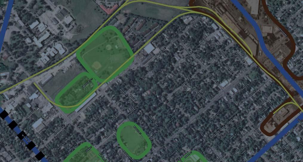
Bike paths in the Central Sector are on the rise. The LFUCG has recently implemented programs to increase the use of bicycles in an effort to reduce the amount of vehicular traffic and associated pollutants. A portion of the Legacy Bike Trail, which begins at the Kentucky Horse Park and ends near Main Street, will be constructed in the Central Sector. The final layout of the Legacy Trail has yet to be determined but Lexmark, has agreed to allow the trail to go through its property. This will result in the Legacy Trail becoming a significant addition to the Central Sector. The map on pages 28 and 29 shows the route proposed as this document is being prepared. There also are possible spurs of the trail that may link to significant cultural spaces related to racing history in the nearby East End neighborhood.
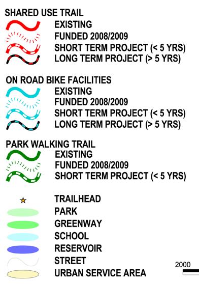
The recently adopted Lexington Area MPO Bicycle and Pedestrian Master Plan includes several recommendations for a non-motorized network. Maps included in the plan address gaps in sidewalk facilities; bicycle levels of service; existing and funded bicycle routes map; trail project feasibility; project prioritization; analysis of pedestrian-vehicle collision sites; and planned facilities including both on-road and shared facilities. There is also a Complete Streets Improvement Plan.
There are several active rails in the Central Sector, as well as some abandoned railroad beds where the tracks have been removed just east of Coolavin Park. The abandoned railroad is a good candidate for conversion through the National Rails-to-Trails program to a greenway accommodating bike paths and pedestrian walkways. Trails considered in this central

30 The Central Sector Small Area Plan
Analysis
LEGEND
part of the neighborhood should make a point of accessing the site of the future BCTC campus and Transylvania University. Further study is needed to determine which routes would be most favorable. Securing easements and land donations, improving the right-of-way, and providing adequate lighting and security patrols are needed to provide new corridors of connectivity for the residents of the area.
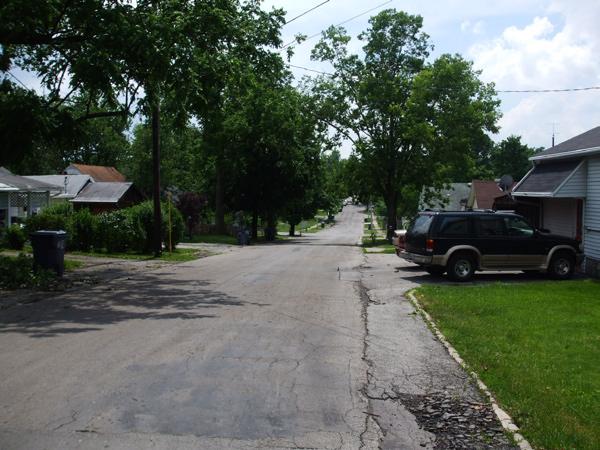
While bike paths and greenways signal quality of life improvements, there are basic improvements that every neighborhood, especially urban ones should have. Central Sector has many blocks that do not have curb and gutter, and in some areas there are crumbling old limestone curbs that have not been replaced. There are areas without sidewalks, and many sidewalks are cracked or crumbling in a community where many people walk to their destinations or to catch a bus because they have no other transportation. The LFUCG policy of requiring property owners to repair their own sidewalks is not effective in this community and is typically the responsibility or a municipality so there is consistency.
The Safe Routes to Schools (SRTS) Program is a Federal-Aid program of the U.S. Department of Transportation’s Federal Highway Administration (FHWA) that is proposed for two sites in Central Sector Eighty-five percent (85%) of students at Arlington Elementary school walk. The purpose of the SRTS Program is to empower communities to make walking and bicycling to school a safe and routine activity. The Program makes funding available for a wide variety of programs and projects categorized as either infrastructure or non-infrastructure. Infrastructure projects include the planning, design, and construction that will substantially improve the ability of students to walk and bicycle to school including sidewalk improvements; traffic calming measures, and speed reduction improvements; pedestrian and bicycle crossing improvements; on-street bicycle facilities; off-street bicycle and pedestrian facilities; secure bicycle parking facilities; and traffic diversion improvements in the vicinity of schools. Non-infrastructure projects include public awareness campaigns and outreach to press and community leaders; traffic education and enforcement in the vicinity of schools; student sessions on bicycle and pedestrian safety, health, and environment; and funding for training, volunteers, and managers of Safe Routes to School programs.
Transit
According to the 2004/2005 LexTran Comprehensive Operational Analysis (COA) Report, several demographic factors point to a high level of ridership among the residents of Central Sector. These results were gathered using various methods including a ridecheck/passenger count, an on-board passenger survey, a telephone household survey, demographic research, and a compilation of LexTran operational and historical ridership data.
Findings that point to a high level of ridership within the community when compared to the rest of the urbanized areas include:
A high number of zero-vehicle households (17%+), both within • Central Sector and the East End
31 Analysis ©2009 RATIO | DCI | ECSI
Some local streets lack functional curbs, gutters and sidewalks
•
A high density of elderly population
A low employment density (with the exception of Lexmark and the • southern industrial area)
An estimated high number of Potential Transit Trips (as determined • within the COA Report)
Current LexTran routes are illustrated on the map on pages 28 and 29. Lextran’s other presence in the neighborhood is the facility located on Loudon Avenue just west of North Limestone. This is the proposed site for a new administration building. It has recently been determined that the building is not of historic value, though it does contribute character to the corner.
Public Services and Infrastructure Utilities
The electric, water, sewer, natural gas, telephone, and cable utilities in the Central Sector provide reasonable service throughout. The Central Sector is the oldest section of Lexington and, therefore, the majority of its public facilities are noticeably aging. The infrastructure still serves its intended purpose but lacks the aesthetics of some of the newer sections of Lexington leading to a decline in public perception of the area.
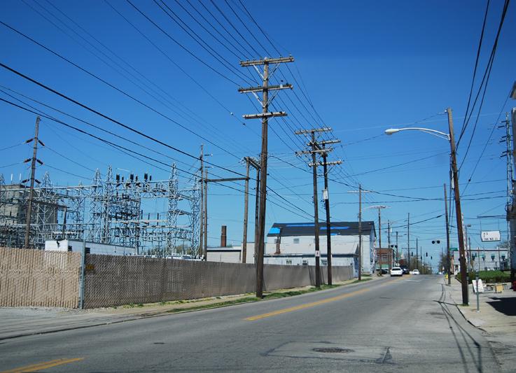
Overhead utilities in the Central Sector area, including telephone, electric, and cables, should be placed underground or separate pole lines combined, whenever possible with new development and investment to improve the appearance of the streetscape. Communication with and coordination among the utility companies may result in improved aesthetics of the “wire” utilities. Though there are no major projects, continued upgrades and maintenance or all utilities is key.
Infrastructure improvements currently underway include the relocation of gas lines on New Circle Road on the north side of the Subarea A, south-west of the intersection of Jefferson and Third Streets, and at Meadow Park off Bryan Avenue. Additional projects expected in the near future will occur on Loudon Avenue between Broadway and Bryan Avenue, as well as pipe relocation at the Army Reserve Center in the south-east corner of Subarea B.
Stormwater
Flooding problems were identified in the Broadway/Bryan Avenue area in the Meadows – Northland – Arlington Neighborhood Improvement Project Storm Sewer Assessment Study prepared by PEH, Engineers in 1997. North Limestone from Bluegrass north to New Circle Road does not have sidewalks, curbs or gutter which results in frequent flooding events. Several of the projects recommended in the study have been completed; notably storm sewer construction in the Highland Park – Marcellus Drive area. These projects included street, curb, and sidewalk rehabilitation as
32 The Central Sector Small Area Plan
Analysis
well. Other projects recommended in the report are being scheduled for construction, but there has been much frustration within the community by residents and business owners alike at the length of time to complete infrastructure upgrades and the lack of communication regarding schedule delays. Though it can be more difficult to replace aged infrastructure in mature urban areas, a neighborhood such as Central Sector should receive high priority in terms of capital improvements in order to encourage other types (private) of investment.
The U.S. Environmental Protection Agency, as part of a court settlement, is requiring Lexington to improve its stormwater and sanitary systems. This is known as the Federal EPA Consent Decree. The LFUCG will be instituting fees that vary based on the use of the property to bring the city into compliance with the Federal Clean Water Act. The fee is based on the amount “impervious” or non-absorbent surfaces on a property, for example a roof or parking lot. This fee, as proposed, will raise a total of approximately $16 million/year that will clean up the environment by:
•
Providing for ongoing monitoring of water quality.
• sewer system.
Providing for ongoing monitoring and maintenance of the storm
• greenways.
Providing for ongoing monitoring and maintenance of streams and
•
Cleaning up spills.
• the storm sewers.
Sweeping streets and cleaning up litter to keep debris out of
•
Construction projects targeting flooding problems.
• projects, for example rain gardens, rain barrels, etc.
Providing neighborhood matches to encourage grassroots
Hydrology
Over 50% of the Central Sector is located within the Royal Spring Wellhead Protection Area (RSWPA). The Royal Spring aquifer is currently the primary water source for Georgetown Municipal Utilities. The aquifer is highly susceptible to pollution due to the karst geology of the recharge area.
LFUCG has adopted the RoyalSpringsWellheadProtectionPlaninto its 2007ComprehensivePlan and imposes restrictions consistent with Best Management Practices (BMP) on development within the RSWPA. Commercial and industrial development with a low risk of groundwater contamination is preferable for this area.
33 Analysis ©2009 RATIO | DCI | ECSI
Location of the Royal Springs Aquifer
Natural Environment
Natural Environment/ Underdeveloped Area
The LFUCG does not maintain a list of brownfield sites as designated under State and Federal guidelines. A cursory review of the Underutilized Property Survey shows widespread vacant properties of varying sizes throughout the study area. (See attached map.) Some of the vacant sites may be brownfield sites and eligible for grants to remove contaminants or hazardous waste. LFUCG plans to apply for a brownfield grant in the coming year. Cleaning up the sites would make them more appealing and marketable for redevelopment. Future development should employ green design policies such as the use of stormwater Best Management Practices such as vegetated swales, rain gardens, and pervious pavement materials.
34 The Central Sector Small Area Plan Analysis
Air Quality
In summer 2008, the Brookings Institution released a report identifying Lexington as the city with the largest per capita carbon footprint in the United States. The Brookings Institute report was based on per capita carbon emissions, not the status of the air quality. Lexingtonians rely heavily on coal generated electricity. However, Lexington has a history of promoting compact development with the continued implementation of its urban service boundary which reduces the effects of travelling long distances to work, shop and recreate. As a neighborhood, the Central Sector is not likely to be a significant contributor as there are several transit alternatives, sidewalks connecting neighborhoods with downtown and a very low rate of automobile ownership.
Geology
The Central Sector community is located on the Lexington East and West Geologic Quadrangles. Lexington is in the heart of the Inner Blue Grass region of Kentucky characterized by gently rolling topography underlain by a unit of limestone and shale called the Lexington Limestone. Local relief is generally less than 100 feet. At the surface the subject area lies at the stratigraphic interval of the Millersburg Member and Tanglewood Limestone Member of the Lexington Limestone.
Lexington is underlain by a unit of limestone and shale called the Lexington Limestone. The Inner Bluegrass is one of the major karst regions of Kentucky. Karst terrain is a type of topography that forms through dissolution of limestone and is characterized by sinkholes, sinking streams, caves, springs, and underground drainage.
Review of the Mapped Karst Ground-Water Basins in the Lexington Quadrangle (Currens, 1996) shows that about 50% of the property is located in a mapped groundwater basin (determined primarily by ground-water tracer studies). The map shows ground water flow to be in a northwesterly direction. Although ground water flow routes have been established by tracer studies, the precise flow paths are unknown and are inferred or interpreted.
35 Analysis ©2009 RATIO | DCI | ECSI
36 The Central Sector Small Area Plan Analysis
Chapter 4 Public Input & Issue Identification Central Sector: Vision. Voice. Vitality. ADOPTED APRIL 30, 2009
Public Input & Issue Identification
Public Input overview
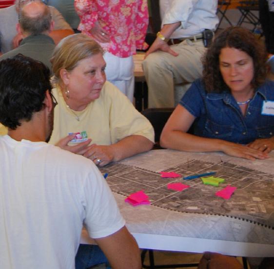
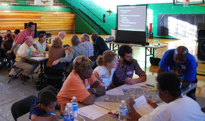
The success of any plan depends on how well it reflects the ideas and addresses the concerns of the residents, business owners and community leaders it affects. This planning process employed a variety of public outreach efforts to gather information from pertinent stakeholders and provided residents with an avenue to share their concerns and hopes for the future of Central Sector. The following is a brief summary of the public input process.
Project Steering Committee
A Steering Committee was established in April 2008 to oversee and guide this planning process. The committee, composed of twenty-two members, represented diverse sectors of the community including business leaders, residents, and public officials. They participated in workshops, helped develop the plan’s goals and recommendations, and reviewed and provided input for the various iterations of the draft. Along with LFUCG staff, the group met on six occasions to ensure the planning process was responding to the needs of the community and the Small Area Plan itself fulfilled the unique needs of Central Sector.

Key Stakeholder Interviews
Three Key Stakeholder groups were identified and invited to hour-long interviews early in the planning process. The groups provided focused input about their concerns and desires relative to the future of Central Sector. The groups included:
•
•
•
Institutional - Service organizations, schools, not-for-profit agencies
Commercial / Business owners, government officials
Residents living 3 to 32 years in the community
Public workshops
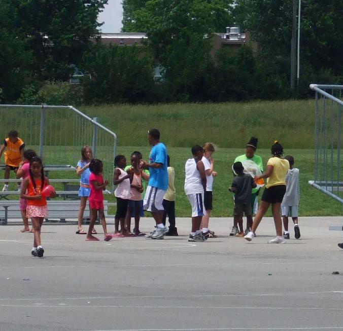
Two public workshops were held to introduce residents to the planning process and facilitate discussion about the needs, as well as positive features, of Central Sector. The primary purpose of the first meeting held in June 2008 was to conduct an exercise to determine the Strengths, Weaknesses, Opportunities and Threats (SWOT) in Central Sector. The results of this workshop confirmed preliminary findings and established a list of potential issues to be addressed in the Small Area Plan. A second workshop was conducted in August 2008 that included a goal-setting exercise and provided an opportunity for residents to see how the recommendations would be organized in the Plan.
38
The Central Sector Small Area Plan
Public Input & Issue Identification
Community Survey
A short survey was distributed during the June 2008 workshop and at several community events and neighborhood association meetings throughout the summer. A series of questions relating to future growth priorities, land uses, and quality of life issues were posed in an effort to gain a broad-based “snapshot” of community concerns and ideas. In addition the survey allowed respondents to provide written comments on current issues and the future of the community. The results of the survey are located in the Appendix.
open House
The final draft of the Small Area Plan was presented at an open house in February 2009. This meeting invited public comment which was incorporated into the Plan before it was prepared for adoption. This process gave the public assurance that concerns they had expressed early in the planning process were sufficiently addressed in the document.
Public Input Summary
The following comments were received multiple times throughout the preparation of the Plan from the public, stakeholders, and Steering Committee members. Refer to the Appendix Section 7 for a more detailed listing of the issues raised throughout the public input phase of the planning process.
Strengths
•
•
•
•
•
•
•
•
•
•
•
•
•
•
•
•
•
•
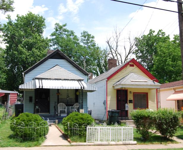
High quality older and historic homes
Mixed housing types / neighborhoods with mature trees
Old Episcopal Burial Ground - historic cemetery
London Ferrell community garden at Third Street
New affordable housing
Active Neighborhood Associations
Multicultural and multi-generational population
Loudon House and Lexington Art League
Al’s Bar, Sixth and North Limestone
Castlewood, Gratz and Duncan Parks
Schools: Lexington Traditional Magnet School, Sayre,
Arlington
Diversity and culture
Transylvania University
Applebee’s Legends Park
Living Arts and Science Center
Churches
Proximity to downtown
High density creates low carbon footprint
39
©2009 RATIO | DCI | ECSI
Public Input & Issue Identification
• North Lexington YMCA
Responsible police sector
•
• weaknesses
•
•
The money, youth and creative class is here
Trailer Park
Absentee landlords
• Need more quality affordable housing – both rental and owned
Low percentage of home ownership
• Duncan Park needs activity, lights, and use
•
• Need to strengthen Transylvania relationship
Not enough street trees or streetscape
• Not bike friendly or pedestrian friendly in many places
• LFUCG needs to finish projects
•
• Poor public elementary schools
•
•
•
Under-used and under-funded parks
Unkempt alley ways– hidden areas that can hide problems – crime
No storm system, sidewalks, curbs & bike lanes
• not used year round
Recreation Dunbar, Castlewood & Charles Young Gymnasiums are
Castlewood Gym has air conditioning but is closed in the summer
•
• Slow LFUCG services
•
•
Need circulating bus routes to and from work sites
No sidewalk on New Circle Road
• Circle Rd.
N. Broadway, Bryan Ave, N. Limestone need sidewalks to New
• hardware
•
•
•
No downtown grocery, missing neighborhood scale retail, e.g.
Old Industrial sites; Bakers, KU
No business involvement in community/business beautification
Predatory businesses
• perpendicular to structures allowed);
•
•
•
•
•
•
•
Signage ordinance from 80’s needs to be revisited (now no signs
Liquor stores
Concentration of social services in Central Sector is a burden
Poor code and zoning enforcement
Lots of industrial zoning where people live
Environmental concerns: dump, brownfields
Flooding
Crime (we need more police involvement)
• UK allows a $15,000 grant to those who work at UK & live in
Brownfields - large one owned by UK leased by Lextran now
• designated areas in town – but excludes the Castlewood area
40
The Central Sector Small Area Plan
•
Winchester Rd aesthetically ugly, needs landscaping
• and Newtown Pike
Outdoor storage at the gateway – New Circle Road at Georgetown
• “announce” themselves
•
•
•
Improve signage regulations to enable business sectors to
Need human scale lighting; alleys-streets
Railroad crossings need improvement
Clean up illegal uses - car repair in neighborhoods
The issues and concerns generated by the public helped to inform the development of Goals and Objectives proposed in the following chapter. The Steering Committee was instrumental in providing guidance and interpretation of the many comments that eventually led to the recommendations to revitalize the Central Sector.
41
©2009 RATIO | DCI | ECSI
Public Input & Issue Identification
Public Input & Issue Identification
42
The Central Sector Small Area Plan
Public Input & Issue Identification
Central Sector aerial illustrating study area, Neighborhood Association, and historic district boundaries and select identified features
43
©2009 RATIO | DCI | ECSI
44
Identification The Central Sector Small Area Plan
Public Input & Issue

Chapter
Objectives Central Sector: Vision. Voice. Vitality. ADOPTED APRIL 30, 2009
5 Goals &
Goals & Objectives Introduction
The 2007 Comprehensive Plan for the Lexington-Fayette Urban County Government (LFUCG) outlined a series of goals to enhance the quality of life and spur economic development. Listed below are 15 of the 21 goals contained in that plan that are most applicable to the Central Sector community and this planning process. Every effort has been made to make recommendations that will fulfill these goals.
Relevant city / county-wide Comprehensive Plan Goals:
Goal 1. Provide planning processes which enable widespread citizen participation and benefit Lexington-Fayette County.
Goal 3. Promote land uses that are sensitive to the natural and built environment.
Goal 4. Develop and implement a green space system that preserves the urban and rural identity of Fayette County and provides a framework for regional and local planning.
Goal 5. Protect and preserve Fayette County’s significant historic and cultural heritage.
Goal 8. Create strategies that enable and encourage appropriate infill and redevelopment of established developments and neighborhoods.
Goal 10. Preserve, promote, and enhance those aspects of the natural, built, and cultural environment that encourage tourism.
Goal 11. Provide diverse business and employment opportunities for Lexington-Fayette County.
Goal 13. Provide housing opportunities to meet the needs of all citizens.
Goal 14. Establish and promote well-designed communities that provide appropriate services to multi-neighborhood areas and encourage community interaction.
Goal 15. Preserve, protect, and enhance the character and quality of existing neighborhoods.
Goal 16. Promote well-designed, new development that creates and enhances neighborhoods and communities.
Goal 18. Provide and maintain essential public services and facilities.
Goal 19. Provide and maintain a comprehensive transportation system.
Goal 20. Provide and maintain a range of community facilities and services.
Goal 21. Develop strategies to effectively implement the recommendations of the 2007ComprehensivePlanand other adopted community plans.
46 The Central Sector Small Area Plan
Goals & Objectives
Central Sector Principles, Goals, and Objectives
The following recommendations are based on an understanding of the existing conditions in Central Sector and of the input of more than 300 citizens who participated in this planning process. Each guiding principle contains specific goals and objectives that will realize the stated principle and provide benchmarks for implementation. The goals and objectives, coupled with issue identification summarized in the previous chapter, produced a framework analysis used to implement recommendations for Central Sector.
Guiding Principles
The guiding principles listed below are intended to be mantras for the effort to revitalize and re-envision the neighborhoods that make up Central Sector. These four principles address a variety of physical, social and economic improvements that will collectively enhance the Central Sector community. The four “Guiding Principles” include:
•
•
•
•
Enhance The Urban Fabric
Promote And Prepare For Redevelopment And Investment
Provide Adequate And Equitable Housing
Preserve The Cultural and Historic Heritage
Enhance The Urban Fabric
The urban fabric refers to the multidimensional environment in which towns and cities are created and develop over time. It is composed of the network of streets, building facades and the spaces or voids that occur within it. Successful spaces have texture and engage the people that move within them. The numbers (in parentheses) following each goal below refer to the specific Comprehensive Plan goals on page 46.
1. Connect the Community Physically and Functionally through Multiple Means of Mobility (4,19)
a. Create “Complete Streets” on designated routes
b. Beautify gateways and main thoroughfares
c. Develop a design with a theme that reflects the uniqueness and enhances the image of Central Sector
d. Work with KYTC and property owners to implement beautification projects
e. Consider conversion of one-way streets such as Fourth Street to two-way traffic in some areas
f. Consider extending street grid to connect cut-off areas; which if properly implemented can deter crime
g. Provide additional east-west connections
47
©2009 RATIO | DCI | ECSI
Goals & Objectives
h. Provide traffic calming measures where needed
i. Provide new crosswalks where they do not exist and make existing crosswalks safer (audible crosswalks)
j. Create partnerships for the provision of multi-use trails or lanes for enhanced bicycle and pedestrian use
2. Increase Public Transportation Options and Improve the Experience (14, 19, 20)
a. Explore the potential of circulator shuttles to downtown and retail destinations
b. Enhance the visibility, functionality and economics of bus stops through the addition of bus shelters
c. Provide additional east-west transit routes with stops with shelters
d. Support implementation of Regional Bicycle and Pedestrian Plan for Fayette and Jessamine County including the Legacy Trail
3. Improve Street Infrastructure to Assist in Leveraging Private Investment (8, 19)
a. Develop a block-by-block assessment of missing or damaged curb and sidewalks
b. Repair and maintain sidewalks, curbs, and gutters to serve pedestrians and cyclists
c. Update the capital improvements plan to include streetscape improvements
d. Create an efficient process coordinated by LFUCG, but with realistic property owner participation, for the construction and repair of infrastructure
e. Create high quality, safe design standards for the construction of facilities and infrastructure planned for public ownership, and incorporate into Zoning Ordinances
f. Include design standards in the Zoning Ordinance that require private development to beautify street frontages
g. Campaign to have the resources of the urban forestry program focused on Central Sector for an extended period of time
4. Nurture Environmental Quality and Reduce the Carbon Footprint (3, 8, 10)
a. Turn environmentally limited sites into opportunity sites
b. Obtain EPA grant for a community-wide inventory of sites with possible contamination
c. Investigate funding sources to assist with gray or brown site preparation.
d. Incorporate Best Management Practices into drainage and stormwater solutions
48 The Central Sector Small Area Plan
Goals & Objectives
e. Unveil and enhance the creeks, streams and wetlands present in the area
f. Revitalize the existing Urban Forest program and make Central Sector a priority for implementation
g. Promote and celebrate successful recycling and municipal composting programs
h. Encourage farmers’ market in a local park
i. Provide incentives to encourage sustainable sites, buildings and neighborhoods through participation in the Leadership in Energy and Environmental Design (LEED) program of the U.S. Green Building Council
j. Improve air quality by facilitating alternative transportation methods in the form of safe sidewalks, signed on-street bike routes or bike lanes
5. Enhance Public Safety and Security (18, 20)
a. Incorporate “Safe by Design” standards into Zoning Ordinance for new development and redevelopment of infrastructure, streets, parking lots and buildings to bring about a socially sustainable community
b. Provide community-scale policing substations in strategic locations to bring about a 24 - hour presence
c. Increase bike and mounted patrols
d. Promote permeability and access as a way of keeping an eye on the neighborhood
e. Provide citizens with techniques to be able to police from within the community
f. Perform a block-by-block assessment of opportunities for crime as first step to reduce crime
g. Promote safe design to foster socially sustainable buildings and neighborhoods
Redevelopment And Investment
The community of neighborhoods known as Central Sector should undertake a campaign to recreate its image in order to spur revitalization.
1. Encourage Commercial / Service Nodes that offer a Variety of Products and Services and are Accessible by Multiple Means of Transportation (8, 11, 14, 16)
a. Identify a location for a major commercial / service node that can serve the majority of the Central Sector, while also improving smaller neighborhood nodes
49
©2009 RATIO | DCI | ECSI
Goals & Objectives
b. Provide incentives or other assistance for businesses that locate in appropriate districts and meet community standards
2. Improve Connectivity to Existing Retail and Employment Centers (14, 19, 20)
a. Explore potential of circulator system that connects Central Sector Neighborhoods to New Circle Road and Downtown
b. Improve the viability of small retail stores that are most accessible via walking
c. Explore the expansion and improvement of alternative transportation modes (i.e. biking, walking, etc.)
3. Implement a Neighborhood Economic Development Program that Utilizes Existing Assets (5, 8, 11, 14, 16)
a. Inventory existing capacity within the Central Sector for employment and workforce training opportunities
b. Connect the Eastern State site (future Bluegrass Community Technical College campus) to residential neighborhoods
c. If needed revise zoning and development ordinances in order to facilitate redevelopment for sites such as Johnson Elementary
d. Target development sites for new development or redevelopment that provide Central Sector residents with employment opportunities
e. Encourage a close working relationship between Central Sector residents, schools, businesses, and Transylvania University and the BCTC in order to provide work-ready graduates from secondary, post-secondary and adult education programs
4. Organize, Identify and Overcome Hurdles to Market Growth (8, 11, 14, 16)
a. Identify Brownfield Sites within the Central Sector, organize funding for those with the highest short-term potential for redevelopment
b. Encourage Public / Private Partnerships such as with Lexington Leadership and Urban Impact
c. Organize a group with the capacity to obtain, assemble and transfer residential, commercial and industrial land for redevelopment purposes
d. Work with local business development organizations to channel resources, training and information to businesses or prospective businesses within the Central Sector
e. Create the capacity to deliver cost effective and accessible groceries to area residents
f. Improve the viability of existing retail “corner” shops through business assistance, infrastructure improvements and programs that increase buying power
50 The Central Sector Small Area Plan
Goals & Objectives
Adequate And Equitable Housing
The Central Sector is ideally suited to and should provide a variety of safe and convenient housing for residents with different incomes, at different stages of life, and reflecting the multicultural make-up of the community.
1. Ensure the Provision of Adequate and Quality Low-Income Housing (8, 13)
a. Improve the quality of existing housing units through renovation and rehabilitation of the existing structure. Employ “Safe by Design” standards
b. Provide incentives to landlords to improve the quality of low-income housing
c. Identify in-fill sites for new low and moderate income housing
d. Encourage new housing types through incentives and guidelines that are compatible with existing and desired densities
2. Promote, Leverage, and Sustain New Residential Investment (8, 13, 15)
a. Create a real estate marketing program to attract new residents to the community
b. Identify funding mechanisms that can create a pool of capital to leverage future investment
c. Make housing rehabilitation funds available to homeowners
3. Implement Strategies to Balance Affordable Housing for Local Residents With Rising Real Estate Costs and Value (8, 13, 15)
a. Utilize a community land trust to make it possible to retain low and moderate income residents
b. Seek to provide a variety of lifestyle and lifecycle housing so that residents can remain in the community
4. Utilize Housing as an Economic Development Tool (8, 13, 15)
a. Encourage the conversion of single family homes from renters to homeownership via community development tools such as education, down payment assistance, and lease-to-purchase options
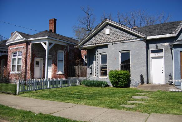
b. Target multi-family housing units adjacent to existing or planned neighborhood commercial nodes
c. Seek to locate new low-income units in proximity to retail goods and community services
d. Strengthen the City’s redevelopment capacity to obtain, assemble and transfer residential land
51
©2009 RATIO | DCI | ECSI
Goals & Objectives
52 The Central Sector Small Area Plan
d O wn TO wn EAST E nd Elkhorn Cr. * * * Broadway ThirdStreet Loudon Avenue BryanAvenue Limestone newtown Pike new Circle Road SecondStreet
Goals & Objectives
CENTRAL SECTOR DEVELOPMENT FRAMEWORK
Proposed Legacy Trail
City-wide Connectors
neighborhood Connectors
RJ Corman Railroad
Proposed Gateways
Existing Bike Facility
Proposed Bike Facility
Proposed Circulator Routes
Proposed Reinvestment Areas
Proposed Reinvestment Areas per Lexington non-Residential Infill Study
Connectivity Opportunities
53
©2009 RATIO | DCI | ECSI
1,000’ 2,000’
500’
0
* LEGEND newCircleRoad Avenue winchester Road
Goals & Objectives
Preserve Cultural and Historic Heritage Community consensus influenced the Plan principle to preserve and nurture the best of the social and physical features of Central Sector. The community wished the Plan to reflect the lives and opinions of the multicultural, multigenerational, ethnically diverse citizens, some of whom have spent their entire lives there. Any future development should acknowledge and reinforce the protections that are in place to preserve neighborhoods and individual structures of historic proportion.
1. Celebrate The Diversity of the Community (5, 10, 15, 16)
a. Encourage community involvement and celebration (Roots & Heritage, Dirt Bowl Reunions)
b. Create a unified image for the Central Sector community of neighborhoods
c. Designate gateways on major thoroughfares with an identity unique to the community
2. Identify, Preserve and Celebrate the Area’s Cultural History (5, 10, 15, 16)
a. Use wayfinding and/or interpretive signage to identify and help direct people to cultural and historic areas in Central Sector
b. Designate vibrant and active sites to be centers and focal points of cultural activity (Choose sites of cultural activity that are vibrant and active)
c. Identify historic and cultural communities through research and oral histories
d. Promote public art and culture
e. Provide links to the Legacy Trail which interprets a part of racing history in the adjacent East End neighborhood
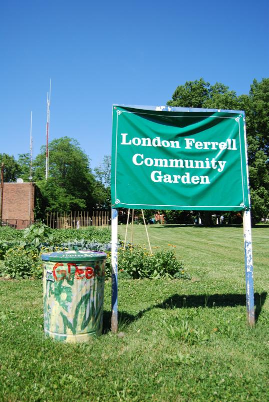
3. Celebrate and sustain the Central Sector’s historic built environment continuing to identify and preserve structures with historical value or cultural significance in the seven local historic and multiple national register districts (5, 10, 15, 16)
4. Provide Park, Recreation, and Community Facilities that Reflect and Serve the Diversity of the Central Sector (5, 10, 15, 16, 20)
a. Partner with national initiatives to introduce non-traditional or atypical inner city sports
b. Update and maintain public parks and community centers. Ensure parks meet “Safe by Design” standards and remove existing design problems that provide opportunities for crime
c. Create additional gathering spaces such as the proposed Duncan Park stage, as well as sitting spaces that would encourage use by citizens that could informally monitor park activities
54 The Central Sector Small Area Plan
Goals & Objectives
d. Provide physical connections by removing barriers that exist between some neighborhoods and parks, taking care not to increase crime opportunities
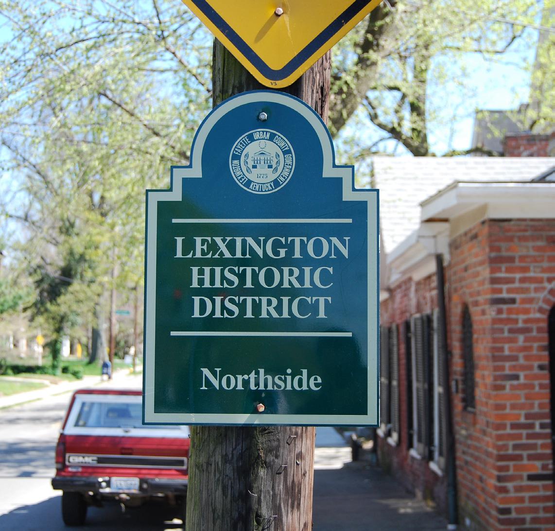
e. Include local residents in park maintenance and security problems through volunteer programs and events
f. Explore methods of redirecting resources for better park services, security and maintenance by consolidation of lesser used parkland
g. Develop a comprehensive list of social services available to Central Sector residents
h. Work with the coalition of social service providers to coordinate activities for clients
55
©2009 RATIO | DCI | ECSI
Goals & Objectives
56 The Central Sector Small Area Plan
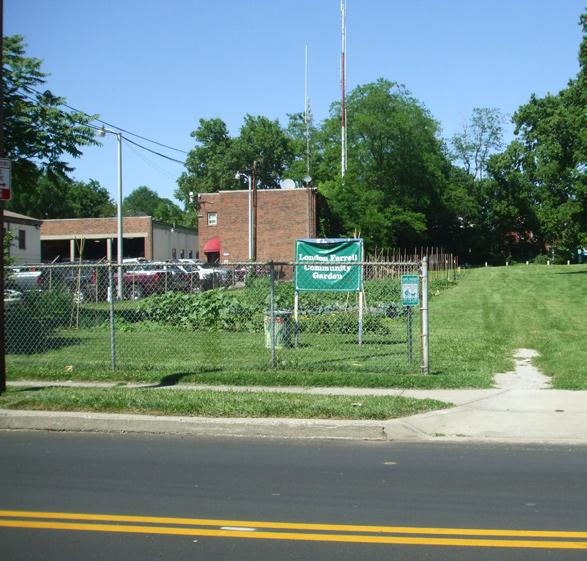
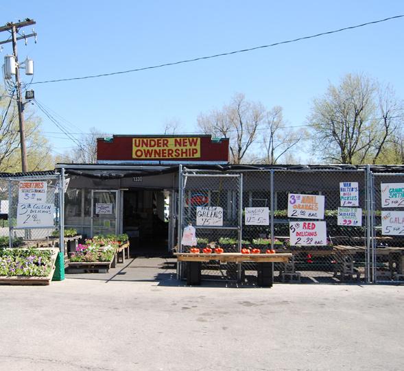
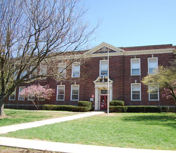
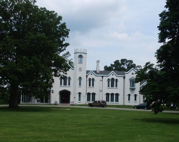
Chapter 6 Recommendations Central Sector: Vision. Voice. Vitality. ADOPTED APRIL 30, 2009
Recommendations
Introduction
These recommendations are the result of a cooperative and collective effort by the Steering Committee, LFUCG officials, planning division staff, and the CSSAP consultant team. LFUCG staff intend that the recommendations included in this Plan will be adopted as an amendment to the 2007 Comprehensive Plan to guide future decisions relevant to Central Sector and to encourage necessary amendments to the Zoning Ordinance.
Implementation of the Central Sector Small Area Plan recommendations will require an ongoing commitment from the Neighborhood Associations, the LFUCG Planning Commission and LFUCG Council, Public Safety, Parks and Recreation and other agencies.
The recommendations are organized by subarea. Areas that should be focused on in terms of improvements or redevelopment are highlighted in orange on each subarea map. Several recommendations are more general and may appear in a particular subarea, but will be applicable widely. Other Central Sector-wide recommendations and strategies are contained in the Implementation chapter.
58 The Central Sector Small Area Plan
Subarea “A” Overview
The successful integration of this western edge of the Central Sector community is key to its viability. Newtown Pike is a physical barrier to this integration but measures can be taken minimize the effect. The neighborhoods off of Georgetown Road are the least served in terms of access to retail or services. The best opportunity to develop a commercial / service center akin to the way other areas of the Central Sector serve local needs is at the intersection of Georgetown Road and Newtown Pike.
Retail revitalization at the Georgetown Road, Fourth Street and Newtown intersection is difficult due to the low income of the residents in the surrounding neighborhoods. Locating development along Newtown Pike and Fourth Street will provide the best visibility and access. The programs and facilities at Douglass Park draw people from around the city and county into the neighborhood. The development of the BCTC campus will likely spur interest in new retail, services and housing to support students, faculty and staff. The new retail also will benefit the existing residents. Specific recommendations for the Newtown Pike / Downtown gateway focus area are included in the Non-Residential Infill Study by Kinzelman, Kline Gossman.
Subarea Priorities
• properties.
Rehabilitate/redevelop low quality and/or substandard residential
• integrated into the surrounding neighborhood context. Ensure that new development occurring along New Circle Road
Ensure the proposed housing development west of Douglass Park is
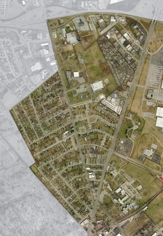
• is integrated into the Georgetown neighborhood. Vehicular, pedestrian, and visual connections should be provided and protected.
Promote Douglass Park as a “cultural landmark” for visitors and
• residents. Enhance programming in Douglass Park to reflect its active history. Besides basketball, bring youth soccer, youth golf lessons and tennis programs such as the National Junior Tennis League (NJTL) founded by Arthur Ashe and First Tee Youth Golf to this park. Provide additional parking for the new users.


59 Recommendations ©2009 RATIO | DCI | ECSI
First
newtown
n
S UBAREA “A” Major
Focus
Cemetery Proposed Housing d evelopment d ouglass Park
national Junior Tennis League program participants
Tee Program
Pike
ew Circle Road
Gateway
Area
Recommendations
Infrastructure Recommendations
•
Improve connectivity from the Georgetown Neighborhood, Subarea
A, to the rest of the Central Sector and downtown via vehicular and pedestrian paths, including an improved street network, transit shelters, and pedestrian crossings. Consider the addition of pedestrian controls at specified locations on Newtown Pike. Create clearly defined connections between Douglass Park and the
• adjacent mobile home park and the new housing development. Work with KYTC to enhance the streetscape with street trees,
• lighting, sidewalk widening, and median improvements that reflect the importance of this downtown gateway. Apply the recommendations from the Newtown Pike Corridor Extension Plan to Newtown Pike from Main Street to New Circle Road.
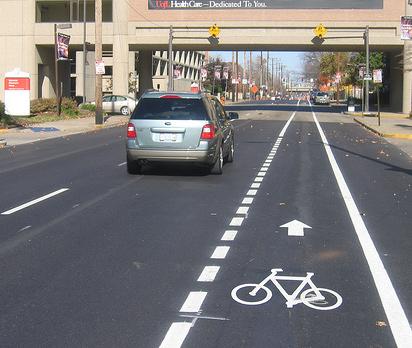
Urban design Recommendations
Create gateway design standards for decorative lighting, wayfinding
• signage, landscaping, and other elements to apply to any future improvements or development at the Newtown Pike and New Circle Road intersection.
Ensure that the
• architectural design and site layout for new development on New Circle Road is of high quality with architectural elements on all sides visible to the public and with screened and buffered service and delivery areas adjacent to the neighborhoods. Develop a pattern book of appropriate neighborhood densities,
• layouts and architectural styles for proposed housing at Douglass Park and elsewhere that reflects the existing scale and development patterns of the traditional urban fabric and street grid.
60 The Central Sector Small Area Plan
Example of on-road bike lane
Subarea “B” Overview
This area represents a large part of future redevelopment opportunities within the Central Sector. Planning has begun for redevelopment of the Eastern State Hospital site for the Bluegrass Community and Technical College (BCTC). Future plans for the campus should explore opportunities to create vehicular links from the campus to the community including north to Loudon Avenue and the North Lexington YMCA, east to Newtown Pike, and south to Fourth Street. Pedestrian and bicycle connections are equally important east to Coolavin Park and Fifth Street, as well as the Legacy Trail.
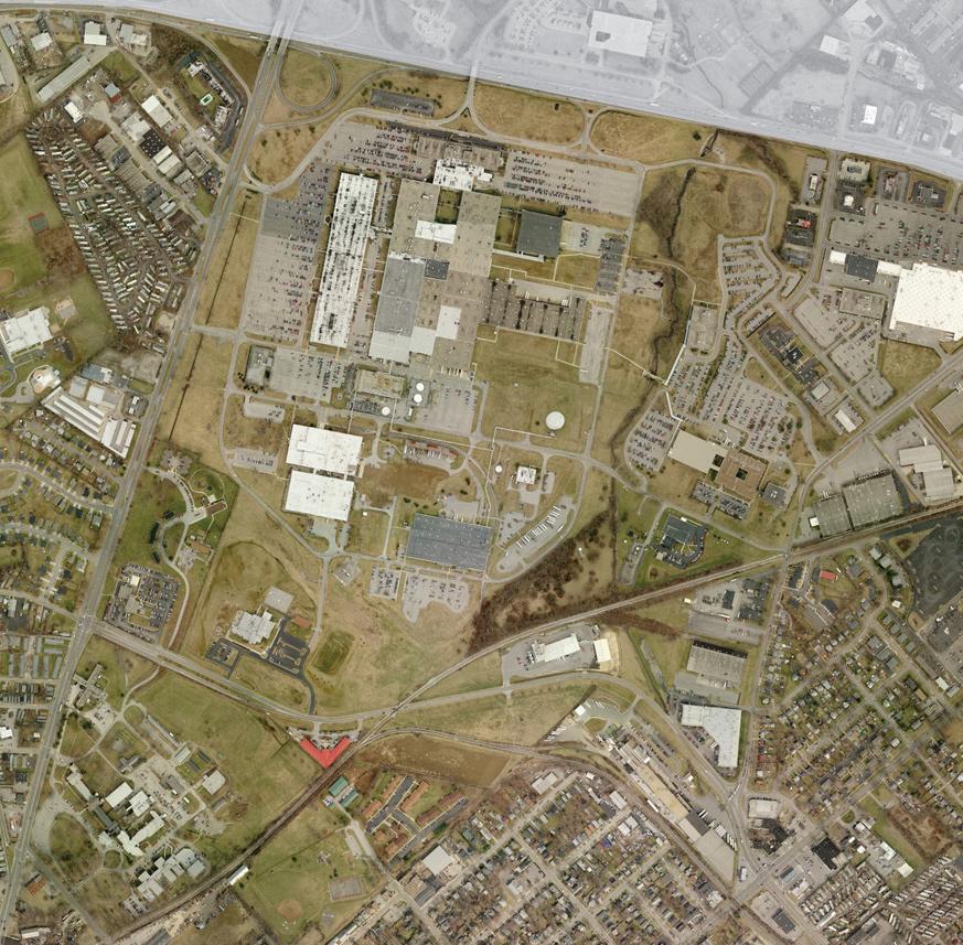
Focus Area
The adjacent plan focuses on development possibilities on the borders of Subareas B and C. Besides the YMCA, future BCTC campus and Coolavin Park, the plan emphasizes the area at the corner of Fourth and Jefferson Streets that are ripe for redevelopment. This area has excellent access to Downtown and regional transportation routes and is well positioned between Transylvania University and the future BCTC. Opportunities abound to enliven the vacant and underutilized parcels for housing and retail that could serve the student population, and provide affordable housing for those wishing to move into a revitalized area close to downtown. The proposed Legacy Trail is an asset that could be a successful link to the campus and the existing neighborhoods and potentially open up the natural corridor of Elkhorn Creek.
Subarea Priorities
• integration into the community.
Coordinate with the BCTC planning effort to ensure maximum
• and nearby institutional uses into Central Sector. Explore opportunities to enhance and access Elkhorn Creek
Provide additional modes of access to better integrate the YMCA
• corridor as a natural amenity.
•
Enhance pedestrian and visual access to Coolavin Park (Subarea C).
Integrate with the needs of the BCTC, Mounted Police, Hope Center, nearby apartments and park users.
61
©2009 RATIO | DCI | ECSI
Recommendations
LoudonAvenue newtown Pike new Circle Road ProposedLegacyTrail S UBAREA “ B ”
Major Gateway Focus Area
Future BCTC Campus
YMCA Active RR
Recommendations
Infrastructure Recommendations
Work with KYTC to convert Fourth Street from one-way to two-way • traffic.
Capitalize on the routing of the Legacy Trail through the Central • Sector to downtown as an alternative means of commuter transportation. Route the trail or a spur through BCTC. Develop an educational triangle with Transylvania University, UK • and BCTC by providing a dedicated transit circulator that would travel on Fourth Street and south on Newtown. Ensure that Legacy Trail safety and security goals are met by • determining safe hours of operation, effective lighting, additional police patrols and visual connections to adjacent development. Provide bus shelters along Fourth Street (see page 61). •
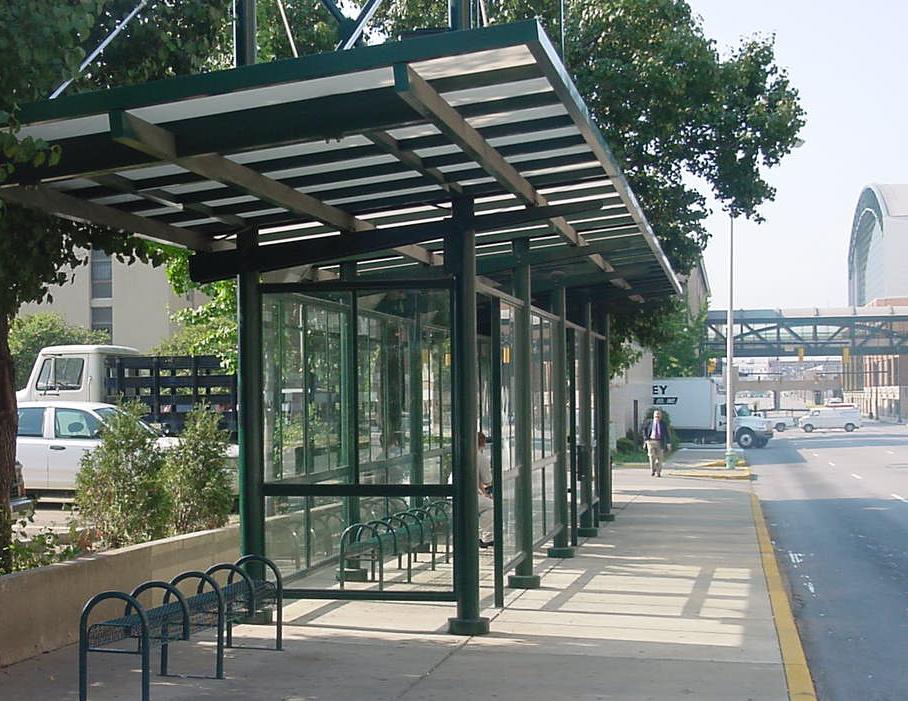
design Recommendations
• Pike and New Circle Road intersection. Continue the streetscape treatments
Provide a gateway treatment at Newtown
• mentioned in the Newtown Pike Corridor Extension Plan north from Main Street to unify the design.
62 The Central Sector Small Area Plan
Existing Eastern State Hospital Campus Transit Stop Transit Stop Proposed Mixed-Use d evelopment LoudonAvenue newtown Pike AbandonedRR ActiveRR Fourth Street
Transit Stop Example
Opportunities to Incorporate the BCTC Campus with Central Sector
Subarea “C” Overview
The following recommendations reflect the diversity and historic character of this subarea and are intended to strengthen the urban fabric and continue the positive changes that have occurred from the grassroots efforts here. Two areas of focus are identified.
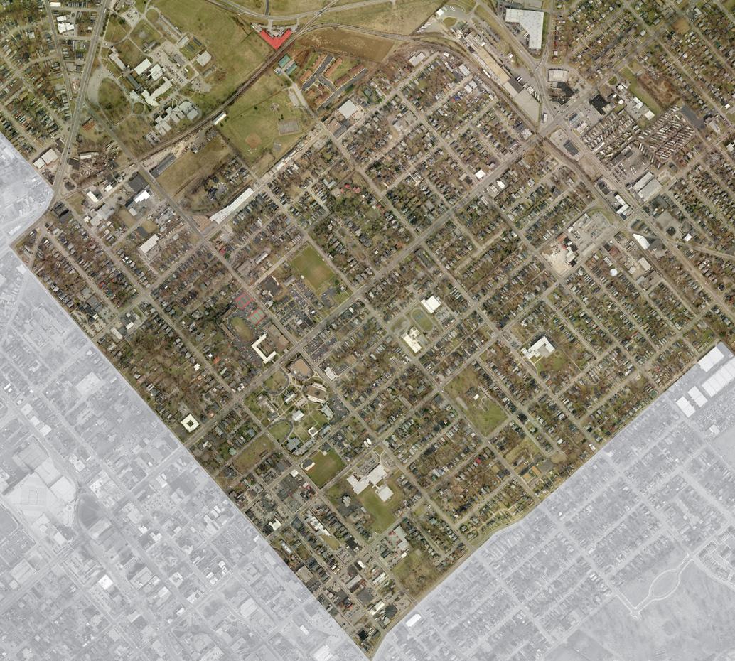
Focus Areas
Fourth Street Corridor West of Jefferson Streets / BCTC
As mentioned in Subarea B, the redevelopment of the Eastern State Hospital site to the BCTC campus presents a tremendous opportunity to enliven the Fourth Street corridor and to connect BCTC to Transylvania University. An organization with redevelopment capabilities such as a Community Development Corporation, should capitalize on the underutilitzed and vacant parcels on the north side of Fourth Street. It is critical to convert the flow of Fourth Street to two-way traffic to ensure success of any development. Creating an active node will positively benefit isolated Coolavin Park.
Sixth Street and N.Limestone
As a small “node” at the intersection of Sixth and North Limestone (home to Al’s Bar and Johnson Elementary School), the corner is positioned well for expansion of neighborhood serving retail uses. Within two years, the Johnson Elementary site is expected to become available property. The successful redevelopment of this site could act as a catalyst for further investment in the area, which serves not only parts of the Central Sector, but the East End as well. North Limestone both north and south of Sixth Street was identified the community as wanting a well-planned streetscape (landscaping, lights, special pavement, crosswalks, bus shelters).
63 Recommendations ©2009 RATIO | DCI | ECSI
Broadway Third Street SixthStreet Loudon Avenue newtown Pike Second Street S UBAREA “ C ”
Limestone d owntown Lexington Fourth Street
Major Gateway Focus Area
Recommendations
Subarea Priorities
• with development and design standards that are appropriately scaled.
Provide a new zone district that facilitates mixed-use development
Consider redevelopment on the northwest corner of Fourth and
• Jefferson that would provide student and neighborhood-serving retail and housing at an urban residential density.
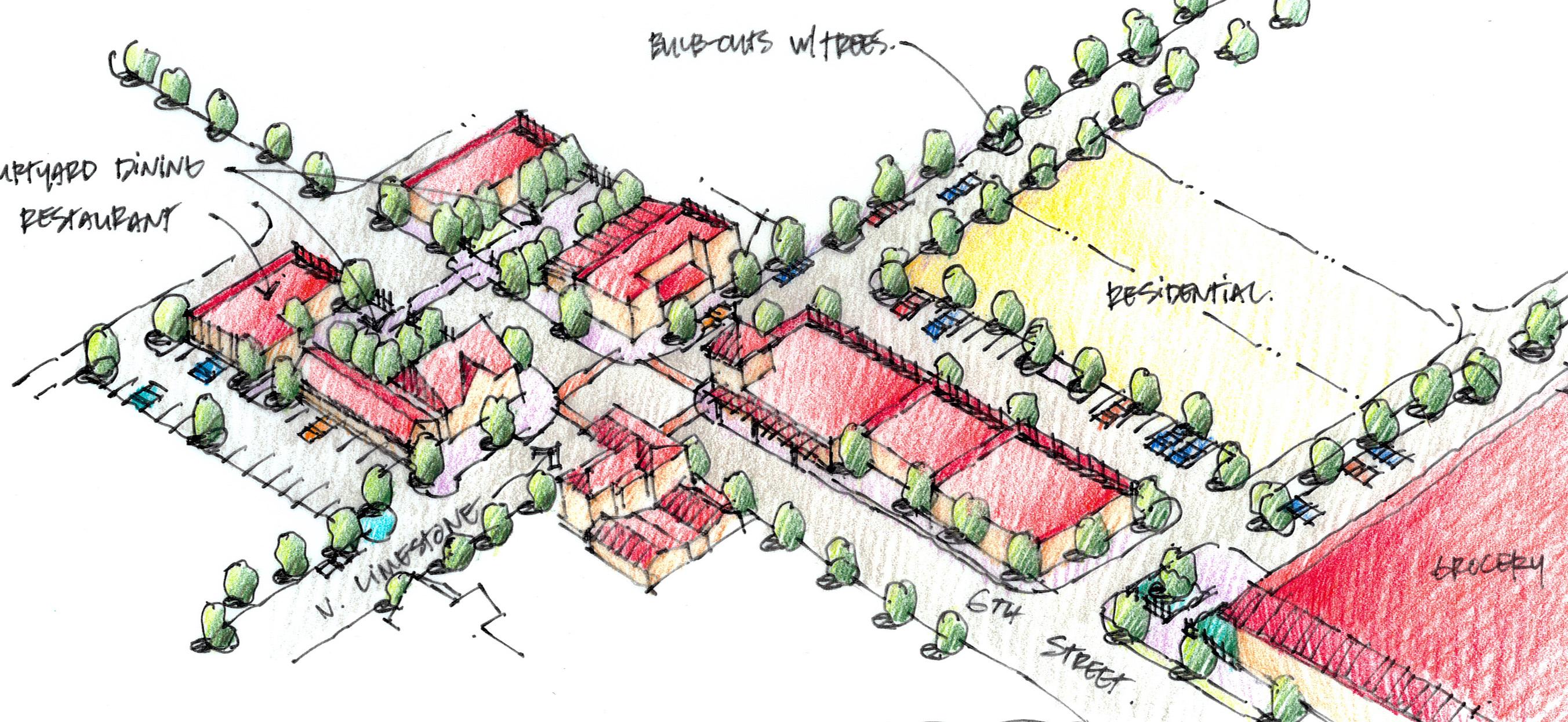
•
Enforce the sign ordinance limiting temporary banners.
• borhood /pedestrian-friendly environment.
Permit projecting signs and building awnings to promote a neigh-
Develop a strategy to deliver cost-effective
• , fresh, and organic foods to low-income neighborhoods, e.g. Good Foods Cooperative. Increase building inspections and pursue violations and penalties
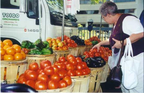
• for non-compliance by absentee landlords. Engage the community in the future role/reuse of Johnson
• Elementary.
• development partner.
Work with Transylvania University as a retail / community
Establish and maintain contact with absentee landlords concen-
• trated Fifth Street to Loudon Avenue around North Limestone. Create a matching grant program for property improvement in
• owner occupied housing to enhance the exterior of structures such as facade, landscaping, lighting. Incentivize infill development.
•
• by area residents most of the day.
Programming must be increased at Coolavin Park so that it is used
64 The Central Sector Small Area Plan
Programming of activities is key to success of a space
Proposed Reinvestment Alternative at 6th and Limestone Avenue
Former Johnson Elementary School Site
d ining Restaurant
Residential
Curb “Bump-out’s w ith Trees
Al’s Bar
Recommendations
Infrastructure Recommendations
•
Convert Fourth Street to 2-way traffic.
• as a tool to enhance neighborhoods
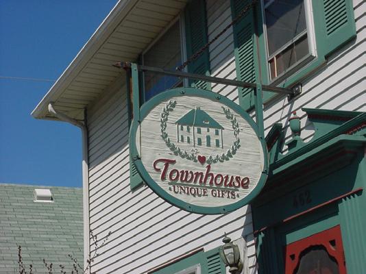
Continue to evaluate the possibility of street extensions in the future
• future BCTC campus.
Provide pedestrian connections for Fifth and Sixth Streets to the
Make streetscape improvements that include sidewalk repair and
• widening, decorative lighting, transit shelters, and landscaping. Provide links to the Legacy Trail and construct trail on abandoned
• rail bed west of Jefferson Street.
Institute an alley improvement program which addresses safety

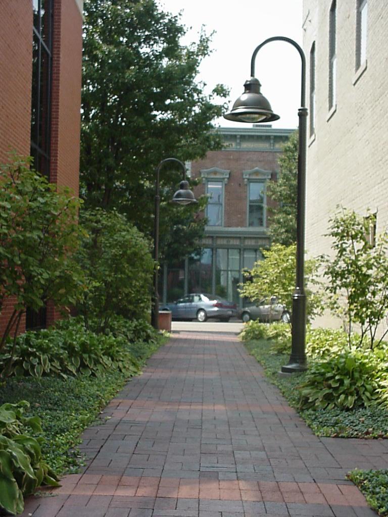
• issues through right-of-way clean up, the addition of lighting and beautification landscaping.
Prioritize improvements to Coolavin Park which include sidewalks,
• expanded paved and striped parking lot, pedestrian-scale lighting with adequate footcandles to provide security, resurfaced tennis courts, and maintained ball diamonds. Time completion to match the construction of the Legacy Trail.
design Recommendations
Provide wayfinding signs at the N. Limestone and Broadway inter-
• sections with Third Street to identify places of community interest in Central Sector.
Ensure that infill development is of adequate density and
• perpetuates historic character and development pattern. Target a planting program to interplant young street trees to replace
• mature ones that die.
• alleys.
Encourage property owners to add plants and repair fencing along
• the side.
Off-street parking for new development should be in the rear or on
• enliven the streetscape.
Promote public art and murals to
Consider recommendations from
• the Downtown Streetscape Plan to incorporate into this subarea.
65
©2009 RATIO | DCI | ECSI
Treatments for alleys can create a place instead of a wasteland and enhance security
Projecting signs add character to the streetscape
Recommendations
Subarea “d”
Overview
This Subarea is a mix of community commercial and residential uses. The commercial development on New Circle is not included in Subarea D because there is not a strong physical relationship between the two. Three thoroughfares provide direct access between north Lexington and the downtown and are recommended for gateway treatments detailed in Subarea E. The traffic counts on Broadway, Limestone and Loudon Avenues bode well for redevelopment opportunities, but it is important that new development directly benefit Central Sector residents.
Major Gateway Focus Area
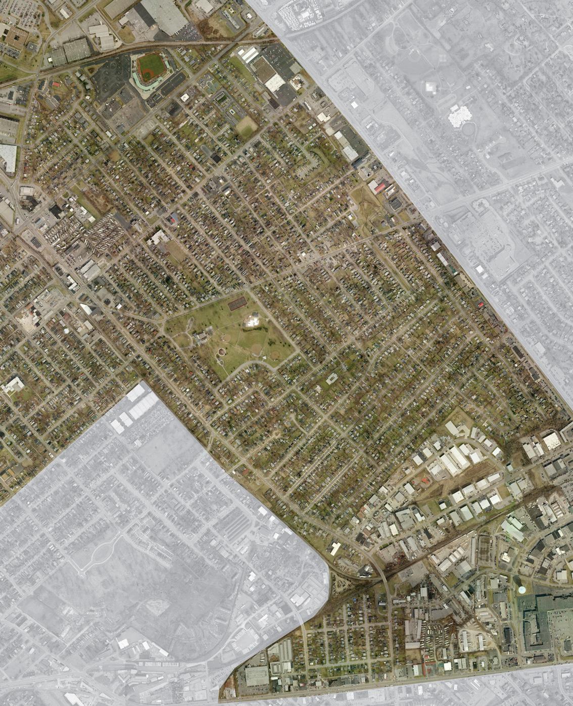
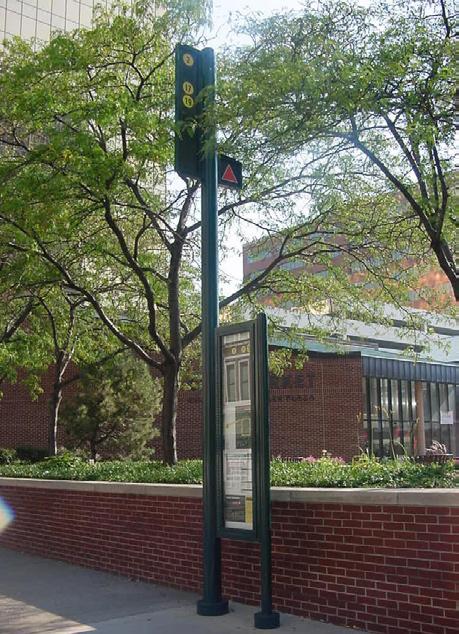
66 The Central Sector Small Area Plan
new Circle
Loudon Avenue
Road EAST E nd S UBAREA “d”
Transit stop with schedule and information board and wall on which to sit or lean
Broadway
Road
BryanAvenue winchester
Limestone
Focus Areas
Loudon Avenue between Broadway and North Limestone
This area is ideal to redevelop as a new commercial retail/ service district to serve Central Sector neighborhoods. It is centrally located, has large parcels of underutilized land, and represents a nexus of the four highest trafficked arterials in the study area. Typical older area urban issues abound such as the potential for brownfields or grayfields and the desire for a higher and better use of land that is already occupied. Lextran currently is using a vital parcel for storage of bus parts and benches and is planning for the site to become the new administration building. This type of project can become the needed catalyst for redevelopment and investment.
67 Recommendations ©2009 RATIO | DCI | ECSI
new SingleFamily Homes Redevelop Existing Buildings for Lextran Administration, Housing and Retail Uses new Commercial development Extend Existing Street to Loudon N.BROADWAY N.LIMESTONE BRYAN AVE
End LOUDONAVE new Streetscape and Screening Along Loudon
Pedestrian Trails to Castlewood Park and East
The alternative below maintains the existing mobile home park, residential area and bus facility
N.BROADWAY N.LIMESTONE BRYAN AVE Redevelop Existing Buildings for Housing and Retail Uses new Commercial development Extend Existing Street to Loudon Pedestrian Trails to Castlewood Park and East End new Streetscape and Screening Along Loudon LOUDONAVE
Example of redevelopment that could occur along the Loudon Avenue corridor
Recommendations
North Limestone Streetscape
The North Limestone corridor is lined with homes and small businesses that have made some investment in the community. The area was chosen by residents as being the one they would most like to see upgraded in terms of streetscape and building facades. Improving the streetscape also provides an opportunity for a sustainable solution to drainage and flooding issues in the form of rain gardens that line the street and contain landscaping.
Subarea Priorities
Support the
• Comprehensive Parks and Recreation Master Plan Update recommendations for Castlewood Park to focus resources on year-round programming, swim and camp programs, and location as new home of the girls fastpitch softball league.
Spark reinvestment on Loudon Avenue between Bryan Avenue and
• Russell Cave using the assistance of a Community Development Corporation and the proposed Lextran Administration Building that can provide the necessary tools and leadership.
•
Consider formation of a Tax Increment Finance (TIF) district.
Retain unique character of North Limestone as a traditional neigh-
• borhood retail corridor. Ensure that recommendations for the East End are compatible with
• Central Sector.
• Wells Brown neighborhood as a site for high density residential that would be more compatible with the light industrial currently surrounding it.
Consider the long term possibility of redevelopment for the William
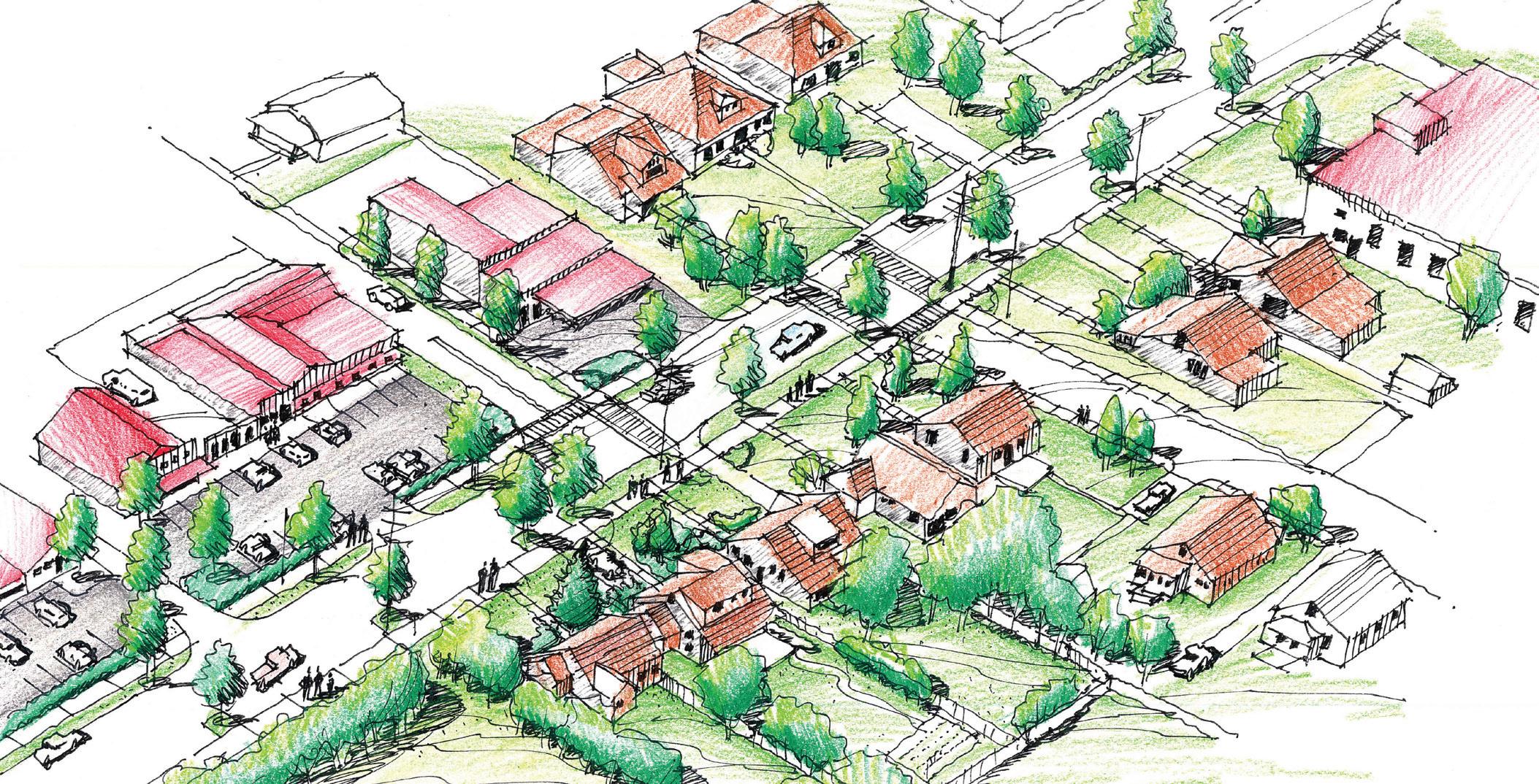
68 The Central Sector Small Area Plan
Existing Mixed-Use neighborhood with Proposed Enhancements along n. Limestone Avenue
Screened OffStreet Parking
N.LIMESTONE
Street trees in curb bumpouts and onstreet parking.
Uninviting off-street parking areas can be transformed with landscaped edges to better fit into the community as illustrated in the sketch below
Infrastructure Recommendations
Upgrade Loudon Avenue between Broadway and North Limestone
• (new curb, gutter, sidewalks, lighting, landscaping) to the level of the sections east and west of this area, as a catalyst for redevelopment along this primary east-west corridor.
• intersection at Bryan Avenue and Castlewood Drive. Provide sidewalks or repair sidewalks to enhance physical and
Assess the need for additional safety enhancements at the 5-point
• perceived connectivity.
• small busses through the areas of Central Sector with the lowest percentage of car ownership. These would connect to the main bus routes. See graphic on page 52 and 53.
Investigate the possibility of providing a transit circulator route using
Provide safe bike and pedestrian passages linking Castlewood Park,
• the Legacy Trail and the William Wells Brown park and school in the East End.
Within existing right-of-way, provide the elements of a “complete
• street” for North Limestone to maintain the character of a neighborhood thoroughfare. “Complete Street” design elements (parking, landscaping, bike lanes, lighting, sidewalks are illustrated below. Resolve drainage issues on North Limestone north of Loudon using
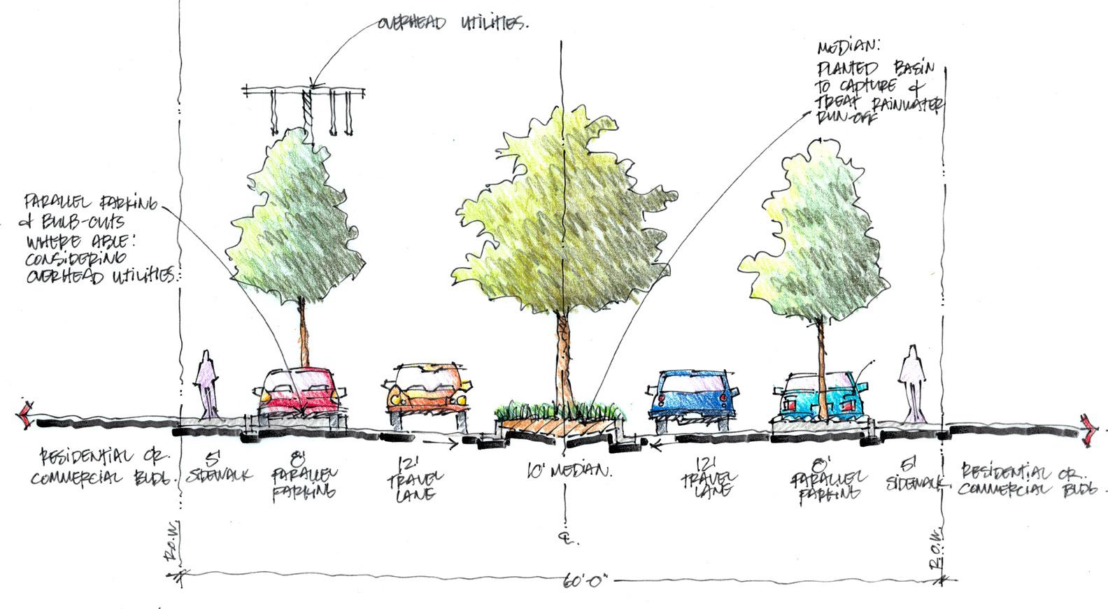
• Best Management Practices such as rain gardens adjacent to the street to detain, filter, and eventually release street runoff.

design Recommendations
Implement streetscape elements which include straight curb,
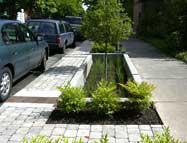
• sidewalk, decorative pedestrian scale lighting, prominent crosswalks and shared-road bike signage to increase awareness. Consider traffic calming measures to preserve neighborhood
• character such as on-street parking in between landscaped bumpouts.
Work with
• mobile home park owners and Lextran to make frontage improvements including decorative fencing such as masonry walls, landscaping and lighting that complements the improvements for new investment areas.
69 Recommendations ©2009 RATIO | DCI | ECSI
Rain Garden Examples Along Public Streets
Proposed
Overhead Utilities Parallel Parking and Bulb-outs where Able Considering Overhead Utilities 10’ Median 60’-0” 12’ Travel Lane 8’ Parallel Parking 5’ Sidewalk R.O. w Residential or Commercial Building Median: Planted Basin to Capture and Treat Rainwater Run-Off 8’ Parallel Parking 12’ Travel Lane 5’ Sidewalk Residential or Commercial Building R.O. w
Rain Garden Medians along Limestone Avenue
Recommendations
Subarea “E”
Overview
Subarea E addresses the commercial northern edge of the Central Sector study area. The major and minor gateways are vehicle oriented. The recommendations focus on enhancing pedestrian connections to the community and establishing a welcoming image at each gateway for the Central Sector. Additional design standard should be imposed for properties along New Circle Road as they change hands in the future in order to enhance the area and not let it become dated and degraded.
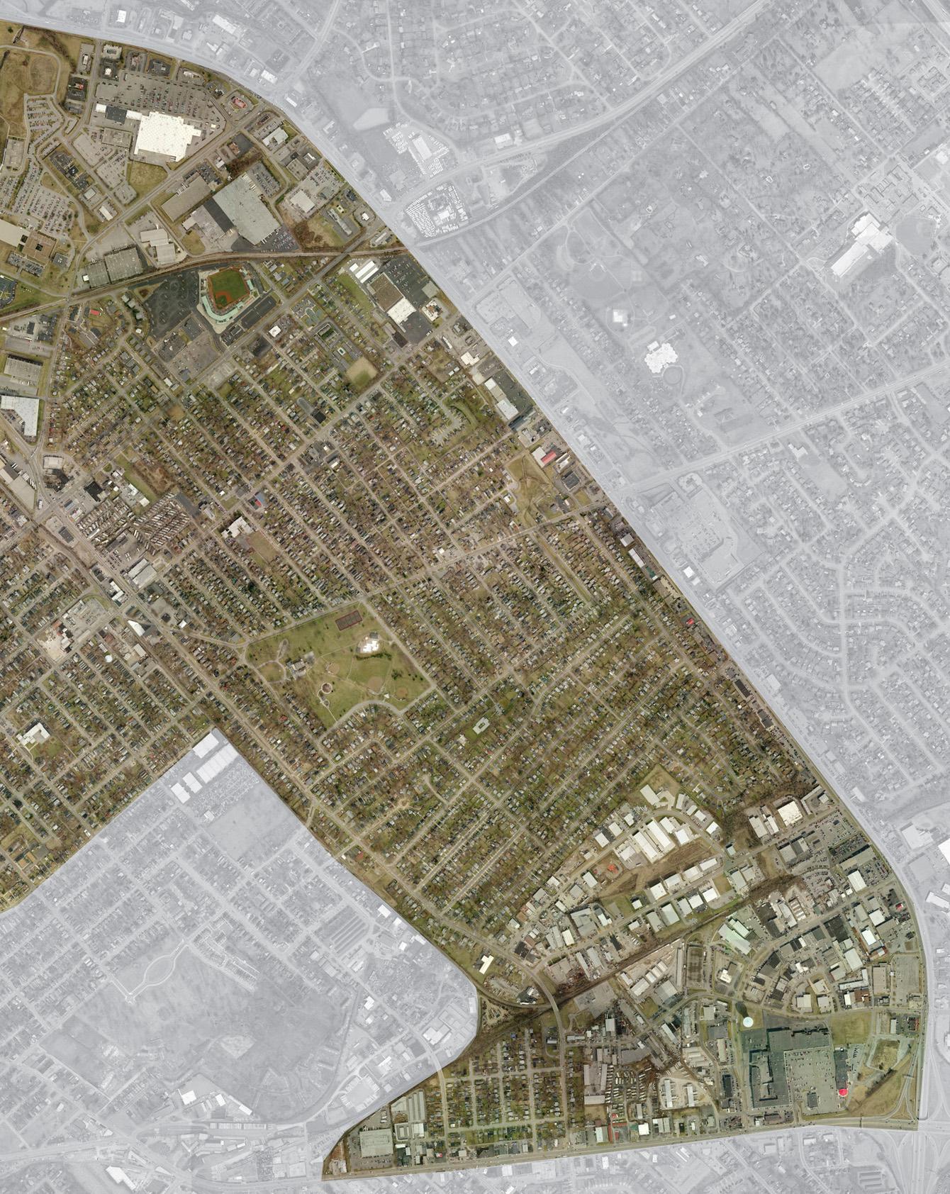
70 The Central Sector Small Area Plan
Broadway new Circle Road LoudonAvenue BryanAvenue Limestone
Road EAST E nd S UBAREA “ E ” S UBAREA “ E ” Major Gateway Focus Area
winchester
Recommendations
Subarea Priorities
Investigate redevelopment opportunities along New Circle Road
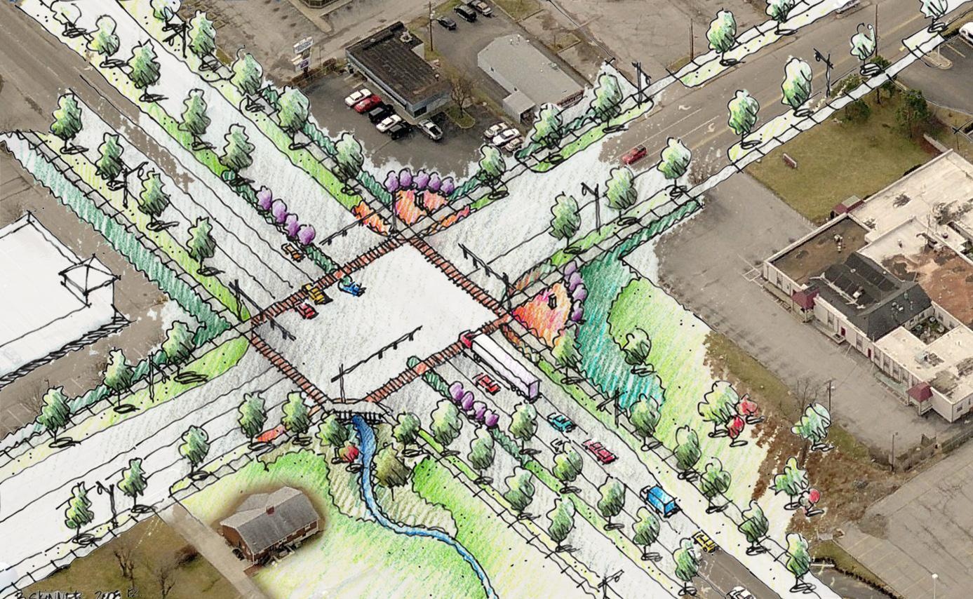
• especially at the Eastland Shopping Center site which is situated at a major gateway at Winchester. Encourage merchants to better orient their commercial businesses
• towards the neighborhoods and to increase the pedestrian-focus (walkability).
Infrastructure Recommendations
• corridor and residential areas.
Increase physical, visual, and perceived connections between retail
• Central Sector so residents without automobiles can access the retail services (Kroger, Walmart).
•
•
Provide LexTran routes along New Circle Road that connect within
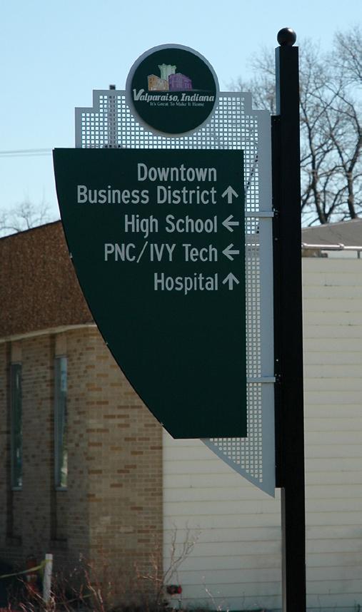
Increase visibility and function of bus shelters/stops.
Provide for on- or off-road cyclists
Provide safe crosswalks that are signalized, timed, and that have
• median resting points. In some locations, pedestrian bridges may be warranted.
71
©2009 RATIO | DCI | ECSI
Prototypical gateway Features Along new Circle Road
wayfinding Signage
Recommendations
design Recommendations
• New Circle and Winchester
Enhance pedestrian setting to improve safety and aesthetics along
• awareness of pedestrians
Use special paving, bright colors and signage to increase
Provide wayfinding signage at all designated gateway locations that
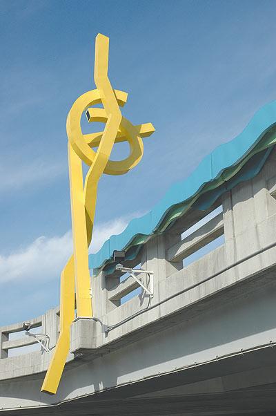
• leads to Castlewood and Douglass Parks, the Lexington Art League, BCTC, Downtown, Transylvania University and other notable areas. Create gateways along New Circle at Russell Cave, Broadway,
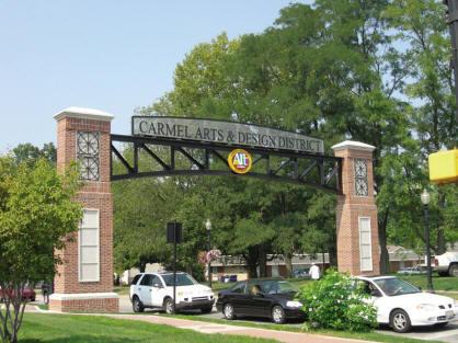
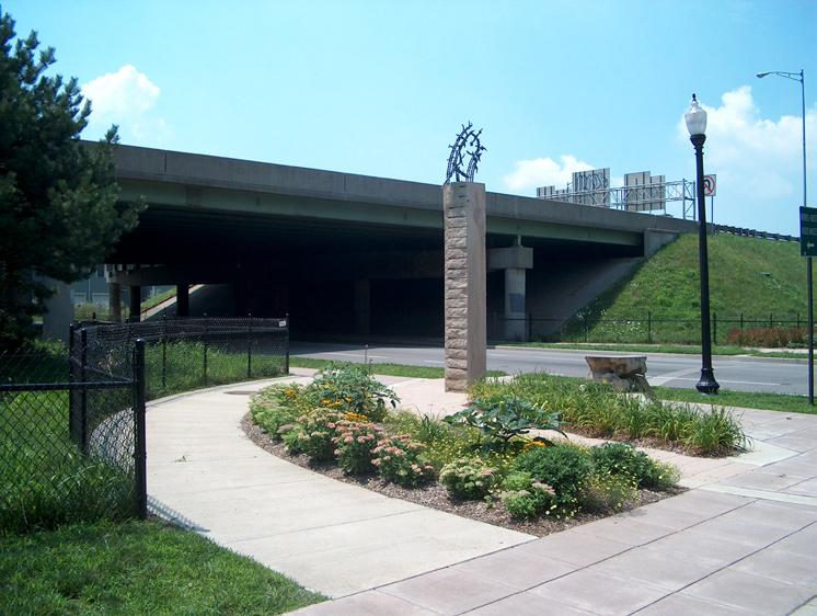
• Limestone, Bryan Avenue and Winchester roads that all contain some common elements which reflect the pride and diversity and new image of Central Sector.
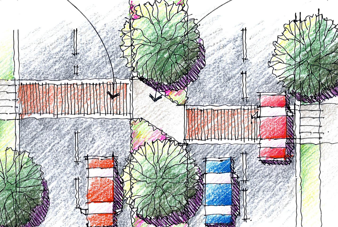
72 The Central Sector Small Area Plan
“Z” Type Pedestrian Crossing
Marked Crosswalk “Z” Crossing Point
Gateway treatments

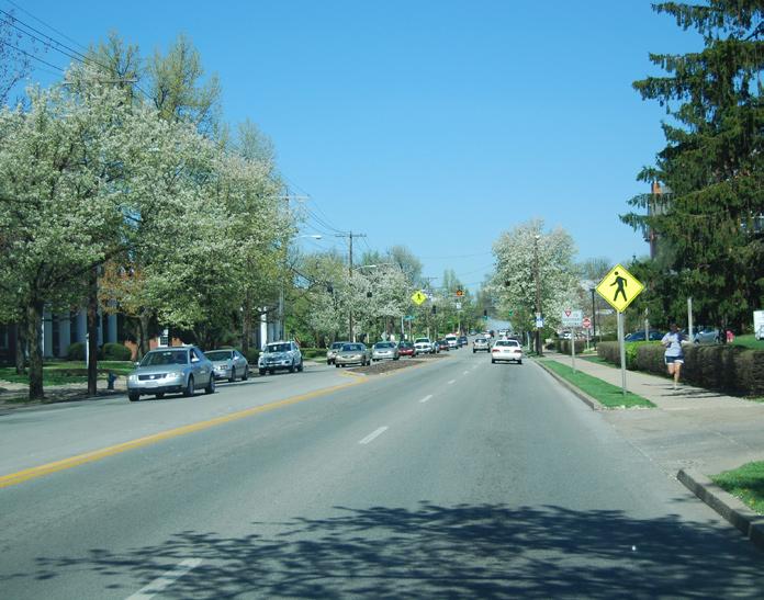
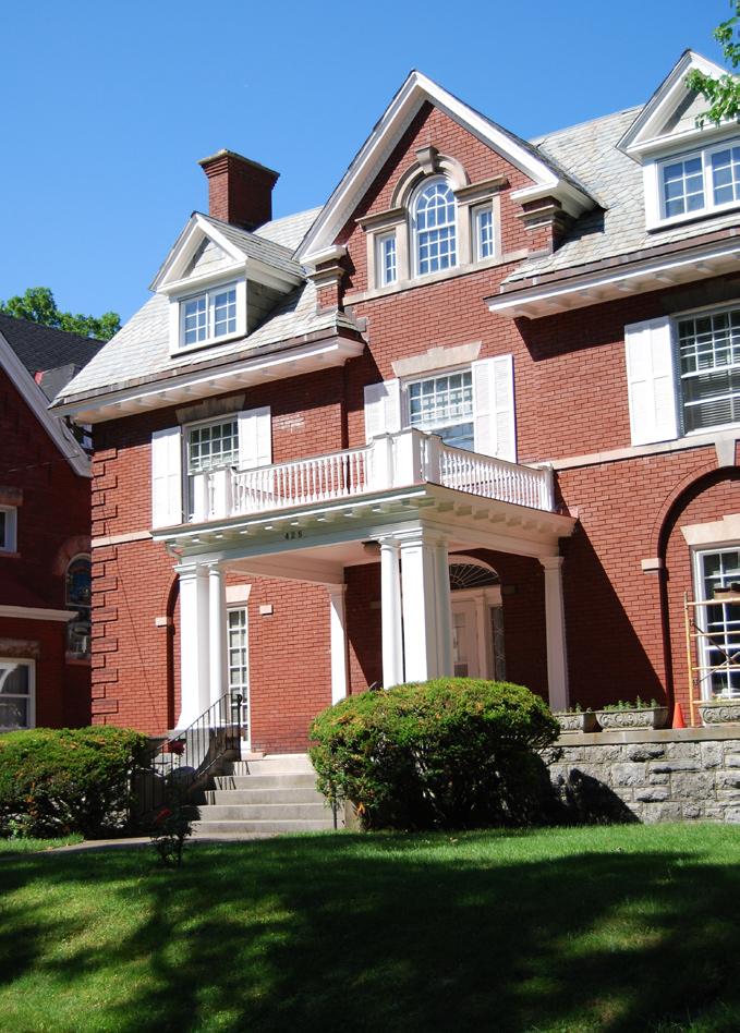
Chapter 7 Implementation Strategies Central Sector: Vision. Voice. Vitality. ADOPTED APRIL 30, 2009
Implementation Strategies
Introduction
The multifaceted Central Sector Small Area Plan recommendations presented in this document, represent a major challenge for Lexington that will require a long term commitment by multiple participants including the Lexington Fayette Urban County Government, the private sector, local residents and local organizations. The Planning Commission and LFUCG staff must convert this adopted Plan’s recommended programs and projects into agenda and capital improvement items to be addressed in a timely and orderly fashion.
The implementation strategy identifies the work to be done, who is responsible to lead the effort, and the time frame in which it is to occur. In some cases initial steps and possible funding mechanisms are suggested. The LFUCG is best situated to lead and organize this effort.
To gain and maintain support, it is crucial to have visible successes early on and throughout the process. For this reason, there are recommendations that can be implemented with few resources and in a short time frame that are designated as “quick wins.” The implementation of other strategies may vary from several months to several years.
Quick wins (Short term Implementation Tools)
The changes needed for the Central Sector are complex. LFUCG 1. should assign a full time staff planner or “Central Sector Coordinator” to oversee implementation of these recommendations. This leader will have to make staff available that are dedicated to overseeing specific Central Sector projects for a period of years. The private sector and volunteers will supplement these efforts.
Consider forming a Task Force composed of representatives from 2. LFUCG departments that meet regularly, are action-oriented and can seek out and secure funds to achieve the goals. The Neighborhood Associations have instigated and participated in the process but do not possess the capacity and tools for implementation of many of the programs.
Needy, older areas require greater resources. Dedicate specific 3. individuals (personnel) from Code Enforcement and Building Inspection that are accountable to the community and LFUCG to bring Central Sector maintenance up to the level of other sections of the city.
C 4. lean up the area and show the community that the city cares by performing activities, including but not limited to, removing dead vegetation, limbing up existing trees, re-striping streets and crosswalks. In addition, this will help to set the stage for future economic development by showing both the community and potential investors that the city is serious about improving the area.
74 The Central Sector Small Area Plan
Implementation Strategies
Provide planning and zoning incentives such as accelerated plan
5. review, development of a smart growth district, and possible waiver of some standards for development proposals that meet the spirit of this Small Area Plan and provide amenities to the community. Possible rezoning to a land use district that will enable, and not hinder desired development may be required.
6. regarding violations and penalties.
Revise the LFUCG ordinances to strengthen the enforcement section
Aggressively and quickly pursue funds from the Neighborhood
7. Stabilization Program for foreclosed, vacant, and abandoned properties. This CDBG program is an excellent opportunity to control the rehabilitation of properties and to provide affordable housing. Work with organizations such as REACH Kentucky and Habitat for Humanity that are positioned and already organized to lend assistance.
8. something that reflects the vitality of the area (more on page 84). Central Sector has negative connotations and is not a name known even by some of its residents.
Change the name of the Plan and of the study area it reflects to
75
©2009 RATIO | DCI | ECSI
Implementation Strategies
Long Term Implementation Tools
Community/Economic development Corporation (CdC/EdC)
CDC/EDCs are nonprofit organizations that serve as catalysts for community-led neighborhood revitalization. Though the details between organizations differ, they typically lead a variety of initiatives including residential rehabilitation and development, economic development, business improvements, and development oriented partnerships. They maximize public funds through alliances with financial institutions, equity investors and individual donors. A CDC/EDC has a defined program or service area (usually one to three defined neighborhood areas) and is controlled by a neighborhood based Board of Directors – with a majority of these Directors being persons who either live, work, or worship within the program or service area.
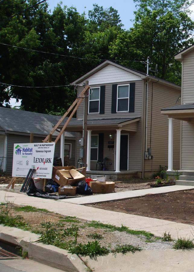
Lexington’s Downtown Development Corporation is one example of a local EDC. Although Lexington is not a community that has broadly utilized the CDC/EDC approach for community reinvestment, it nevertheless serves as an appropriate model to bring the capacity needed to achieve outcomes within the Central Sector. While the LFUCG brings a significant amount of capacity to the table in terms of planning and community development, ultimately it is very difficult to address the varying needs of each neighborhood from a central government level – especially a group of neighborhoods with as much need as those found within the Central Sector.
This Plan recommends that a CDC/EDC – or similar organization be formed to focus on the specific issues and needs of the Central Sector. A CDC/ EDC should have the ability to act as a bridge between the public and private sectors, bring additional staff capacity and expertise to revitalization initiatives, and adequately address the concerns of local residents by providing an outlet to address local issues on a regular basis.
CDC/EDC’s typically utilize the redevelopment powers that will be needed to achieve results within the Central Sector. These include the capacity to acquire and transfer land to private developers, act as partners in development deals, or act as development entities themselves. In dealing with neighborhoods where private investment is lacking, these activities are crucial to the re-introduction of real estate into the marketplace.
Furthermore, other capacity to implement the retail and residential oriented strategies discussed in this chapter could be associated within a CDC/EDC type organization. Community Land Trusts are often administered through a CDC, and the necessary work to organize and administer programs like community buying programs or a cooperative grocery store are also housed within not-for-profit organizations.
76 The Central Sector Small Area Plan
Implementation Strategies
Real Estate Transfer Tax
Real estate transfer taxes are charged to the buyer and/or seller of real property at the time of sale, based on a percentage of sale value of the property. These taxes are widely used by both State and local governments, as they generate a large amount of revenue at relatively low rates. Popular methods of utilizing the transfer tax are to create a trust fund for the purposes of land acquisition, infrastructure improvements, wetlands / open space protection, and conservation easements. Funds can also be used to repay municipal bonds.
Kentucky’s transfer tax is $.50 per $500, or 0.1%. At this rate, a property that sold for $200,000 would generate $200. This type of tax could feasibly be collected within the confines of the Central Sector (or another local geography) for the purposes of reinvesting that money back into the neighborhood. It could be a method to leverage the new investment coming
Profile: Solving the Urban grocery Store gaP
“The Reinvestment Fund (TRF) is a non-profit financing institution that created the Fresh Food Financing Initiative, an innovative new capitalization program to increase the number of supermarkets, or other grocery stores in underserved communities across Pennsylvania. This statewide program meets the financing needs of supermarket operators that plan to operate in underserved communities where infrastructure costs and credit needs cannot be filled solely by conventional financial institutions. Under this program, TRF provides pre-development grants and loans, land acquisition financing, equipment financing, capital grants for project funding gaps and construction and permanent finance. TRF also provides technical assistance and workforce services to its borrowers and grantees through this initiative. By providing underserved people access to fresh food retailers with greater variety, the initiative will give these communities the choice of a more nutritionally balanced diet. The lower food costs will also enable underserved persons living on fixed budgets to purchase higher quality foods. Supermarkets and other grocery stores will also make valuable contributions to the community by creating jobs and revitalizing neighborhoods.” **
Grocery stores that are eligible for this program (convenience stores do not qualify) must be serving low or moderate income census tracts, areas with below average supermarket densities, or areas with
significant limitations to transportation access. Several grant types exist including Pre-development Grants, Capital Grants, Soft Costs or Other Preopening Grants, and Construction Grants, many of which are up to $250,000 pre project.
Case studies of the program include various project sizes from small produce markets to large supermarkets. Some of the uses for awarded finances include construction, job training, renderings of proposed redevelopment in order to attract a grocery tenant; renovations, purchase of more efficient equipment such as energy-efficient lighting and refrigerators that save money over time, more space for sales, or the transition from selling only non-perishables to also providing fresh fruits, vegetables, dairy, and meat.
Sources:
** Fresh Food Financing Initiative Program Guidelines
http://www.thefoodtrust.org
“Pennsylvania Seeds a New Crop of Local Grocery Stores,” The Hometown Advantage News. Mitchell, Stacy. Sep. 12, 2008. http://www.newrules.org/retail/ news_slug.php?slugid=374
77
©2009 RATIO | DCI | ECSI
Implementation Strategies
into the area through higher priced homes and commercial real estate near Downtown Lexington. There are multiple possible applications, with infrastructure improvements and affordable housing as the two most likely allocation purposes.
The transfer tax comes with a few caveats. It is highly opposed by realtors. Its application in a predominantly low-income area such as the Central Sector could be seen as unfair taxation despite its good intentions. It also is dependent upon the local real estate market velocity – which is currently very low in many areas of the Central Sector.
Tax Increment Financing
Tax Increment Financing (TIF) is a tool that is used to generate money for economic development. TIF allows for re-investment of all newly created property tax dollars in a defined geography to go back into that geography into which they came. This new tax revenue – also referred to as “increment” arises from new development that takes place within the TIF district that causes a rise in property values. While all “base” tax – the tax collected in that area prior to the establishment of the TIF district – continues to go to the city, the “increment” can be re-invested.
TIF is used for a number of initiatives. A common use finds a municipality generating bonds to pay for infrastructure or land acquisition to make a development project economically feasible. These bonds are then paid back by the increment generated within the TIF District. TIF funds can also be used for on-going maintenance and physical improvements within the district.
Retail / Business Improvements
The retail business issues found within the Central Sector, outlined in Chapter 5, are typically addressed through four methods: (1) Public Sector Incentives, which would be used to recruit retailers or assemble land, if necessary; (2) Market Based Strategies that aim to improve local neighborhood retailers to better serve nearby residents; (3) Mixing Income Levels within the neighborhood to increase purchasing power; and (4) Improving Transportation Options to access retailers beyond walking distance. A combination of all four methods is needed to reach the desired level of retail and grocery service within the Central Sector.
This plan recommends two general strategies for improving residents’ access to retail goods and groceries. The first is redevelop certain areas of the Central Sector to become commercial “nodes” with a cluster of retail, dining and other uses. These locations are outlined in the discussion of Focus Areas. The second is a package of incentives and programs to either lure larger retailers, like national grocery stores, to the area, or enhance
78 The Central Sector Small Area Plan
Implementation Strategies
local businesses. At the time, there is no obvious answer to this problem, but there are many options to explore.
1. Cooperative Buying Program
The disparity in prices for goods in corner/convenience stores vs. larger grocery chains can largely be attributed to economies of scale. Smaller stores do not receive volume-based price breaks that wholesalers offer supermarkets. One way to solve this problem is to assemble a network of smaller businesses into a cooperative purchasing program. With enough participants, each business would be able to realize a large portion of the savings that supermarkets receive, and then pass these savings onto their customers.
2. Non-Profit Cooperative Grocery Store
Grocery stores that are owned and operated by a not-for-profit organization can be used to solve access to groceries in lower income areas. This is not a wide-spread method, as it is a tool of last resort. This model would consist of a non-profit, such as a CDC or EDC,that would use funds to start and operate a grocer. The business would be run by a manager hired by the non-profit, and profits from the venture would return to the CDC to be used to support the business, or for other programs. The high costs of staffing the business are alleviated by setting up a cooperative system whereby residents are allowed to shop at the grocery by becoming members of the cooperative. One of the responsibilities of membership is volunteering in the store. The Remington Food Co-op in Baltimore was a successful example of this strategy. It has since been discontinued as private grocers began to move into the neighborhood it served. Explore having a branch of the Good Foods Cooperative in Lexington.
3. Business Owner Training
The success of specialty / convenience stores is usually dependent on customer service, quality of the store layout, and product selection. A successful neighborhood store requires an understanding of the nature of the neighborhood and what types of products are most appropriate for the clientele. Consumer acceptance is heavily dependent on the perception of quality of the store as evidence by cleanliness, friendliness of the staff, and availability of product choices. Corner stores can more effectively integrate with their neighborhoods through simple business training for owners / operators. Few small business / corner store operators have the technical skills to properly display and market their products as well as run their stores. Potential or existing owners and employees can be trained in approximately 80 hours to operate a simple business venture such as a produce or dairy store. There are many organizations that offer training to entrepreneurs to enhance their business practice.
79
©2009 RATIO | DCI | ECSI
Implementation Strategies
4. Regulatory Measures
To protect the diversity of businesses in a community additional zoning restrictions can limit less desirable businesses such as liquor stores, chain stores, fast food restaurants, etc. The restrictions could include putting a numerical limit on business type • using a spacing requirement, e.g. 1,000 feet or 1 mile between • similar businesses (car lots, fast food, check cashing stores) enacting size restrictions
•
5. Smart Growth District
A Smart Growth District is an established geography, usually located at or near the center of an urban area, where a municipality wishes to focus and generate development of a certain scale, density, use and/or appearance. Its principles follow the national Smart Growth program of the Environmental Protection Agency (EPA), which generally encourages the focus on development and redevelopment of land in existing urban areas as opposed to suburban and greenfield locations, encouraging compact, mixed-use development, mixed-income neighborhoods, and conservation of green space and natural features. The Central Sector can benefit from the 50 year old Urban Service Area boundary which encourages infill and redevelopment.
There are two types of Smart Growth Districts. The first is regulatory-based. It involves the creation of a zoning overlay district (Zone District in Lexington) or revision of zoning codes to encourage specific types of development patterns, which usually consist of higher density residential and business patterns and has a higher standard of building aesthetic attached. The second type is incentive-based. This method involves providing incentives to developers or businesses to build and/ or locate within a Smart Growth District. This method has similarities to Enterprise Zones, which incentivize certain types of employers to locate in areas where local governments wish to cluster jobs. The regulatory/ zoning based approach works best in stronger real estate markets where the city does not have to worry about additional ordinances mitigating development opportunities. The second approach is better for lower-income and distressed urban areas where businesses need to be encouraged to make investments.
A broad, incentivized approach to bringing in retailers and employers could bring effective and holistic improvements to the Central Sector. Potential incentives that could be associated with a Smart Growth district include reduced development and utility fees, TIF or other funding allocated towards redevelopment projects. Though there is a level of scale, density and aesthetics for new development that would want to be encouraged, the urban-county government must be extremely careful
80 The Central Sector Small Area Plan
not to create a disconnect between expected outcomes, the market, and the economics of private development. It should be noted that, at least initially, developers and businesses will likely need significant levels of incentives to re-locate within the Central Sector as opposed to other areas of the county.
Residential Improvements
Community Land Trust
As discussed earlier in the Plan, Affordable Housing is an important issue for Central Sector residents. However, as noted in the market analysis section, it is not quite an issue of affordability as one of access to quality housing for low and moderate income households. There is a large inventory of housing units in various states of disrepair – particularly found within Subareas A and C. Though this keeps many units affordable for low-income residents, it also serves to depress land values throughout these neighborhoods. This problem is usually addressed in one of two ways: (1) There is enough perceived market opportunity where private investors – whether homeowners, speculators or developers – rehabilitate existing homes to re-sell; or (2) Public entities, such as housing authorities or community development departments allocated funds that become subsidies for rehabilitation. The problem with the first method is that the cost associated with rehabilitation often drives up the price of that housing unit beyond the affordability of low-income tenants. This can be mitigated by the use of public funds in the second method, but rarely are there enough resources to holistically solve the problem if a neighborhood or larger area has seen widespread and long term disinvestment.
One solution to this dilemma could be the creation of a Community Land Trust (CLT). A CLT is an independent, not-for-profit corporation that is tasked with producing and preserving affordable housing without displacing lowerincome people. Though there are several variations of the CLT model, the “classic” approach is to acquire multiple parcels of land throughout a targeted geographic area with the intention of retaining ownership of these parcels forever. Any building that is already located on the land or that is later constructed on the land is sold to another party. The building’s buyer may be an individual homeowner, a cooperative housing corporation, a nonprofit organization or limited partnership developer of rental housing, or any other nonprofit, governmental or for-profit entity. Lexington has already put one community land trust in place, which is related to the redevelopment of Southend Park. This is an area associated with the Newtown Pike extension. This trust will match most of the components of the “classic” CLT model described above. It is the recommendation of this Small Area Plan that either this trust be expanded eventually to include part of the Central Sector, or a separate entity be established to manage a CLT for the Central Sector. An expansion of the pilot program in Southend
Examples of Improvements:
•
On-street Parking
•
Sidewalks
•
Lighting
•
Landscaping
•
Street signs
•
Bus shelters
•
Gateways
•
Medians
•
Pedestrian signalization
•
Traffic Calming measures
•
Public Art
Utilities
•
81
©2009 RATIO | DCI | ECSI
Implementation Strategies
Implementation Strategies
Park would have many advantages – one of them being the fact that the program will already be capitalized through federal funding associated with the extension of Newtown Pike. A CLT would provide instruments for retaining affordable housing for low and moderate income residents while simultaneously improving those housing units to the point where they are of a standard equal to most housing within the city. Furthermore, the CLT’s role in holding land in perpetuity means that there will always be an inventory of affordable housing stock, even if land and housing prices increase.
Transportation and Infrastructure Improvements
Central Sector is ideally situated to be a model for community redevelopment. Much of Central Sector has a strong street framework that is an extension of the downtown urban grid. The recommendations in this chapter improve on the existing vehicular, transit, bicycle and pedestrian systems to serve the diverse needs of residents and visitors in a safe, efficient and pleasant manner. Connectivity between subareas is crucial to integrating all the resources (parks, YMCA, shopping and entertainment areas) offered. General recommendations are below, while specific recommendations can be found in the subarea sections beginning on Page 56.
The basic street cross-section may vary by neighborhood, but to claim a “Complete Street” in a “walkable” city, the street should contain sidewalks a minimum of 5 feet wide so that two people can pass comfortably supported by a straight curb and sidewalk. Where there is adequate right-of-way, planting strips landscaped with street trees should occur between the sidewalk and street. The DowntownStreetscapePlan and designs done in 2008/9 for LFUCG contain guidelines that are applicable for Central Sector.
Handicap accessible ramps are required at intersections, but other amenities that are also safety items benefit the pedestrian such as clearly identifiable crosswalks using special pavement, bright colors or lights, bus shelters with seats at stops on routes where there are concentrations of ridership.
It is important to maintain or provide on-street parking as an important component of the urban fabric. As streets are widened or improved in response to beautification or redevelopment efforts, the new streetscape should be enhanced with elements such as pedestrian crosswalks, street trees, decorative lighting, corner bumpouts or mid-block crossings.
Street lights play a significant role in determining the character of the streetscape both at night and in the daytime. The light standard and fixture are highly visible as a vertical elements in the same way as trees. The light standard and fixture chosen should complement the community and be used throughout for unity. The amount of illumination should be adequate for security for pedestrians, while not contributing to “light” pollution into the night sky and adjacent residences.
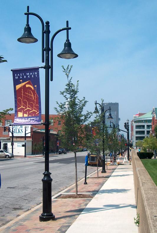
82 The Central Sector Small Area Plan
Prototypical Streetscape Features
Safe Routes to School (SR2S)
SR2S programs work to reduce barriers to bicycling and walking to school and encourage more kids to bike and walk on a daily basis. LFUCG plans to launch two SR2S projects this year for the William Wells Brown and the Lexington Traditional Magnet Schools.
Sustainable “Green” Improvements
At public workshops, the community expressed the desire for new development and infrastructure improvements to be sustainable, reducing the environmental impacts to the community. Green design could take the form of new structures obtaining LEED (Leadership in Energy and Environmental Design) credits per the US Green Building Council’s rating system to encourage the use of residential rain barrels to collect roof runoff. Subarea D recommendations address rain gardens as a stormwater Best Management Practice for North Limestone. Stormwater improvements will also need to comply with the U.S. Environmental Protection Agency Consent Decree to reduce the amount of pollutants draining into the area’s water supply.
Green improvements may not be as costly when incorporated into design and may benefit future generations. Other programs and practices to expand or continue include:
•
•
Municipal Composting
Community Gardens
Safety and Security Improvements
One thing made clear from public input is that the Central Sector neighborhood suffers from old perceptions regarding safety and security. Residents and business owners want citizens in greater Lexington to know that there is new vitality in the neighborhood and that visitors are welcome.
A safer area is the right of current residents and business owners in the area. If residents and visitors don’t feel safe living, shopping, going to school in their environment, then redevelopment will not be successful. There are police including mounted patrols, but there is a fine balance between police presence that provides security and one that some may feel is overbearing. Other mechanisms must be employed to help deter crime. One measure is to have a neighborhood and park citizen patrols.
The community has to be clean to be inviting. A clean and well maintained area will be less likely to experience crime as compared to an area with similar factors which is not maintained. The Neighborhood Associations and other LFUCG and Central Sector organizations should organize and encourage resident responsibility, and conduct regular community clean-ups providing adequate gloves, tools, and waste receptacles.
83
©2009 RATIO | DCI | ECSI
Implementation Strategies
Implementation Strategies
Still another to increase public safety is to design it into any new infrastructure, public spaces and structures by employing “Safe by Design” (SBD) standards to ensure that the opportunity for crime is not designed into new development. Read more about the Safe by Design (SBD) program in Appendix Section 7. Recommendations include:
1. Adopt SBD Planning Guidelines: Include in the final report the incorporation of design and planning standards for the Central Sector that are consistent with the principles laid out in Safe by Design.
a. This will ensure that all future development, both commercial and residential, will not have a negative impact on the community.
b. The East End Plan is already doing this. Work with them to ensure consistency of plan.
2. Central Sector Assessment: Conduct an assessment of the entire Central Sector to determine currently existing problems with Safe Design. Specifically, determine places within the area that may be facilitating crime through providing opportunities for crime. In particular, the assessment should focus on analyzing:
a. Access and Movement
b. Site design
c. Surveillance
d. Lighting
e. Ownership
f. Physical Protection
g. Activity
h. Management and Maintenance Issues
This is necessary to improve not only the actual safety and security of the area, but also the perceived security of the area. If economic development is to be a feature of this small area plan, then you must ensure the area is ripe for development first.
Image Improvements
The aesthetic character of the Central Sector is crucial to changing community attitudes. The image and character begin at the “front door” or the gateways into the community. These gateways occur at several locations on major and minor thoroughfare. These locations offer an opportunity to welcome people to the community and to highlight the special places, cultural and historic resources, festivals and celebrations.
One of the first steps that should be undertaken to change the negative perception of the Central Sector is to change the name. The current reference to the police district does not instill pride in the residents. Engage
84 The Central Sector Small Area Plan
Implementation Strategies
the public to rename the community to reflect the rebirth and celebrate the multiculturalism.
Some names suggested throughout this process include:
•
•
North Lexington
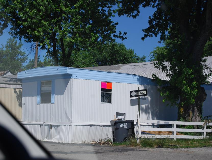
Lexington Central
Old Town •
Create a brand or theme that can be utilized throughout the community and that builds pride and identity. This logo can be emblazoned on banners and part of a wayfinding signage system. Introduce these themes at entries and gateways into the community. Coordinate with signage programs being developed for the downtown / university areas and which will direct visitors and residents to landmarks, parks and other local attractions.
Immediately strengthen and update the mission of code enforcement and building inspection divisions in order to focus and redirect resources at least temporarily to Central Sector. Create a campaign to advertise joint effort between LFUCG, the residents, small business owners, corporations, churches, and institutions to beautify and improve the community.
Create a culture that supports excellence in public and private educational institutions which included attractive signage, adequate pedestrian facilities and landscaping on school grounds.
85
©2009 RATIO | DCI | ECSI
Frontage improvements are needed to better integrate the existing mobile home parks into the revitalized Central Sector
Implementation Strategies
Profile: Safe by DeSign
Safe by design Program Goal
Work with developers, builders, property owners, and planners to create the safest developments and communities possible, with a goal of creating socially sustainable communities. Socially sustainable communities are communities that succeed now, economically, socially and environmentally, and respect the needs of future generations. They are well-designed places where people feel safe and secure; where crime and disorder, or the fear of crime doesn’t undermine quality of life or community cohesion.
why use Safe by design?
Incorporating sensible security measures during the construction of a new development or the revitalization of buildings and neighborhoods has been shown to reduce levels of crime, fear of crime and disorder.
By providing quality environments and ensuring that they are properly managed and maintained, communities can be more readily encouraged to exercise a sense of ownership and responsibility.
Increased Liability
Increasingly there is negligence associated with allowing or encouraging crime through poor design.
All premises must be reasonably safe in light of • the risks of crime in that area.
Amount of security necessary at any particular • property must be reasonable and proportionate to the risk of crime at that site.
As risk of crime increases so should security • measures.
Design can be an extremely important part of the security provided for a particular property.
Safe by Design and Crime
Safe by Design does not guarantee that a particular area will be crime proof, but indicates that the site has been subject to a design process and improved level of security which, in the experience of the police
and other agencies, have been shown to significantly reduce the risks of crime and fear of crime.
Key Issues to Focus on
Attractive and safe Landscaping; Effective Lighting; Controlling Access and Movement; Effective Natural Surveillance; Promoting Ownership and reducing Anonymity; Maintenance and management of areas; Proper site design
Core Principles of Safe design
Integrated Approach 1. : It is important to take an integrated approach, ensuring that design, planning, and layout, are considered together at an early stage so that potential conflicts between security and other major objectives can be resolved.
Access and Movement 2. : Places should have well-defined routes, spaces, and entrances that provide for convenient movement without compromising security. The goal is to create places that are both well connected and secure. Routes for cars and pedestrians should run alongside each other and not be segregated. Footpaths should be straight and wide as possible to avoid possible hiding places and should be overlooked by surrounding buildings or activities and not hidden by vegetation or landscape features. Public access to the rear of buildings and homes should be restricted.
Site 3. Design: Places should be laid out so that crime is discouraged and different uses do not cause conflict. Ensure that active urban frontages and movement are focused on a small number of principal routes that are overlooked by businesses and homes. Cul-de-sacs are often more secure because of their implied limited public access.
Surveillance 4. : All publicly accessible spaces should be overlooked by “natural” or electronic surveillance, but surveillance should not be relied on as the sole strategy for preventing crime. Useful strategies include continuous surveillance for places that could be vulnerable to crime; windows and
86 The Central Sector Small Area Plan
Profile: Safe by DeSign (cont.)
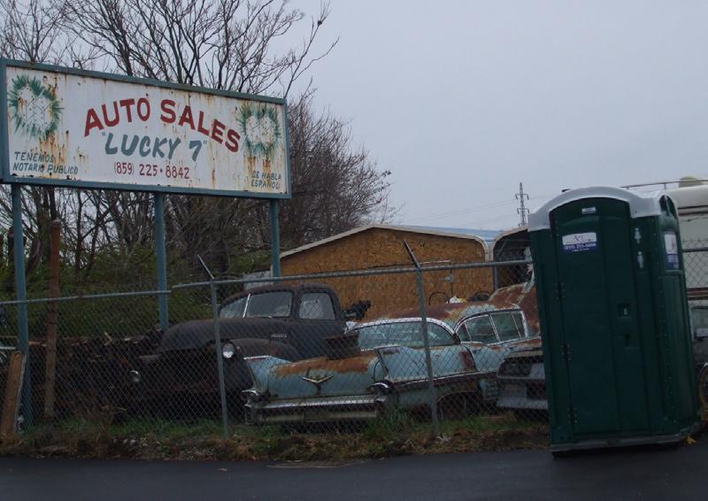
doors should face onto the street; open, bright spaces reduce the number of potential hiding places and allow people to be aware of what is happening around them; parks and other public spaces should be arranged to provide maximum surveillance and visibility by residents of the neighborhood; garage or driveway parking for residential uses.
Lighting 5. : Well-lit spaces and consistency of illumination reduces fear of crime and makes people feel more secure, but lighting should be sensitive to the needs of residents and should provide security without resulting in glare and compromising privacy. Spaces without public access can be unlit to discourage the presence of potential victims.
Ownership 6. : Encourage residents and users of places to feel a sense of ownership and responsibility for their surroundings Uncertainty of ownership can reduce responsibility and increase the likelihood of crime and anti-social behavior going unchallenged. Involving residents and users in the management and design of their area provides a real sense of ownership. Design gates, fences, walls, and hedges to create safe and attractive places High fences and landscape that actively impede access are most appropriate in places that are vulnerable to crime, such as the back of houses. Fences must be visually permeable so as not to hinder natural or other forms of surveillance or provide places for offenders to hide. Lower barriers, hedges, and bushes are also highly useful to signify the public/private divide. Gating of developments should be considered ONLY as a last resort. Landscaping that does not restrict natural surveillance can be used to make places safer as well as more attractive
Implementation Strategies
the aim of safe and sustainable communities, therefore crime prevention measures should be made to look as attractive as possible, while not diminishing their security.
Activity 8. : A level of human activity that is appropriate to the location creates a reduced risk of crime and a sense of safety at all times. Crime can be deterred through the “eyes on the street” of people going about their everyday business. Avoid too much activity (increased anonymity) that can lead to increases in the opportunity to commit particular types of crime. Ensure that the mixed uses in a locality are compatible. Providing activities or hang outs for young people helps to provide a focus for and can prevent criminal behavior, but do not attract excessive numbers to any ones location.
Management and Maintenance
9. : Design places with management and maintenance in mind. Proper attention to the design quality and attractiveness of the street increases its safety and use and promotes greater respect towards the environment. Improvements to the public realm should be approached in a strategic, coordinated manner, as opposed to being ad-hoc. Proper maintenance after construction, including landscaping, lighting, public areas, parking, fencing, roads, sidewalks, ensuring proper public services (garbage collection) and tenant management in rental areas, prevents decline and disorder from taking root in the area
** Full text is in the appendix.
Physical Protection
7. : Places should include necessary, well-designed security features to make it more difficult to commit an offense, while instilling a sense of safety in users. Some crime prevention measures, such as certain types of fencing, can adversely affect the way a place looks and feels and can undermine
87
©2009 RATIO | DCI | ECSI
Implementation Strategies
Implementing Agencies
Several different LFUCG departments, divisions, agencies and community organizations have been assigned the primary responsibility for implementation of the goals and recommendations contained in this Plan. Successful implementation will be a collaborative effort by many, but the effort must be lead by a group that is vested. These agencies include:
LFUCG Lexington-Fayette Urban County Government
CSNA Central Sector Neighborhood Associations
CDC Proposed Community Development Corporation
DCD Division of Community Development
DCE Division of Code Enforcement
DENG Division of Engineering
DEP Division of Environmental Policy
DHP Division of Historic Preservation
DSRF Division of Streets, Roads & Forestry
CVC Community Ventures Corporation
EDC Mayor’s Office of Economic Development
LDDA Lexington Downtown Development Authority
LHA Lexington Housing Authority
LXTR LEXTRAN
LL LexLinc
LPOL Lexington Division of Police
PARC Parks and Recreation
DPS Planning Services
DLRP Long Range Planning
DTP Transportation Planning
DPW Public Works
HFH Habitat for Humanity
Implementation Time Frame
The following goals and recommendations have been assigned approximate time frames for implementation. The time frames may vary based on economic and political influences, and so need continuing strong commitment by many. The four basic time frames are:
Short-Term Opportunities
• - Projects that could be undertaken immediately and/or implemented within the next year.
Mid-Term Opportunities
• - Projects that could be initiated in the next 1 - 3 years.
Long-Term Opportunities
• - Projects that could be undertaken in the next 3 - 7+ years. Some of these recommendations may go beyond the time frame of this Plan
Ongoing Opportunities
• - Projects that may require initial studies to determine their feasibility or may depend on other work prior to implementation. Such projects may also be implemented in a series of incremental steps involving numerous agencies or departments.
88 The Central Sector Small Area Plan
Implementation Strategies
Implementation Table
General Implementation Tools
Short Term Implementation Tools
1 Assign a full time staff planner - Central Sector “Coordinator”
2 Form a LFUCG multi-department Central Sector Advisory committee
3 Increase code enforcement services - Assign specific personnel for Central Sector
4 Increase building inspection services - Assign specific person responsible for Central Sector
5 Conduct a series of Public Works Department cleanups to remove trash, dead vegetation, re-stripe streets and crosswalks
6 Provide planning / zoning incentives in order to spur redevelopment such as accelerated plan review, flexible zoning standards, and development of a smart growth district
7 Aggressively pursue Neighborhood Stabilization funds for foreclosed, abandoned and neglected properties
8 Change the Plan and area name from Central Sector
Long Term Implementation Tools (Descriptions pages 74-87) 1 Form a Community or Economic Development Corporation
2 Consider instituting a short-term real estate transfer tax to leverage funds for infrastructure improvements
3 Ensure the capacity to use Tax Increment Financing (TIF) for projects
Institute the series of retail business improvements including a Cooperative Buying Program, Non-Profit Cooperative Grocery Store, training for business owners, and others
5 Institute regulatory measures to promote business diversity
6 Expand the local Community Land Trust to include areas of the Central Sector
7 Provide basic transportation and infrastructure improvements such as adequate drainage, curbs and sidewalks
8 Expand the “Safe Routes to School” program
9 Attempt to incorporate sustainable and green practices into improvements and redevelopment. Subsidies may be required.
10 Actively prepare grant applications for state and federal agencies to obtain needed funding to implement projects
Rebrand the Central Sector with a new name and public relations campaign
12 Create a culture of success and pride
89
©2009 RATIO | DCI | ECSI
Implementation Agencies Time Frame
Recommendations
DLRP Short-term
LFUCG Short-term
DCE,
Short-term
DLRP
DPS, DLRP Short-term
DPW, DSRF Short-term
DLRP, DPS Ongoing
DCD Immediate
DLRP,
Short-Term
DCD,
Short to Mid-term
LFUCG Ongoing
LFUCG, DDA, CVC Ongoing
CDC,
Mid to
term
EDC,
Mid-term
DCD Mid-term
DPW Mid-term
DTP Mid-term
DEP, DLRP, DPW Mid-term
DCD,
Mid-term
CSNA,
Mid-term
CSNA,
Ongoing
CSNA
DLRP
4
EDC, CVC
long
DLRP
DLRP
11
CDC
LL
Implementation Strategies
Implementation Table
Goals and Objectives
Redevelopment And Reinvestment
1 Encourage commercial / service nodes that offer a variety of products and services and are accessible by multiple means of transportation (8, 11, 14, 16)
Adequate And Equitable Housing
90 The Central Sector Small Area Plan
Recommendations Implementation Agencies Time Frame 13 Reinstitute the Neighborhood Action Match (NAMP) and Neighborhood Revitalization Sustainability Grants Programs LFUCG Mid-term 14 Expand the Live Where You Work Employer-Assisted Housing Program to encompass Central Sector LFUCG Mid-term 15 Dedicate funds to subsidize commercial rents in newly developed buildings to support independent retail businesses DCD, CDC Long-term 16 Create an inventory of vacant buildings/ homes to assist developers DCD, DPW Short to Mid-Term
Enhance The Urban
DTP, DLRP, LXTR Short-term
LXTR Short-term
Fabric 1 Connect the community physically and functionally through multiple means of mobility (4,19)
2 Increase public transportation options and improve the experience (14, 19, 20)
DPW Short-term
DEP, DTP Short-term
3 Improve street infrastructure to assist in leveraging private investment (8, 19)
4 Nurture environmental quality and reduce the carbon footprint (3, 8, 10)
LPOL, DLRP Short-term
5 Enhance public safety and security (18, 20)
CDC, DLRP,
Long-term
CDC, DLRP, DTP Long-term
DLRP, CDC Mid-term
Organize,
to market growth (8, 11, 14, 16) CDC, DCD, CVC Ongoing
DTP
2 Improve connectivity to existing retail and employment centers (14, 19, 20)
3 Implement a neighborhood economic development program that utilizes existing assets (5, 8, 11, 14, 16)
4
identify and overcome hurdles
housing
13) LHA,CDC,DCD,HFH Ongoing 2 Promote,
13, 15) CDC Ongoing
CDC, DCD, HFH Mid-term 4 Utilize housing
an economic development
(8, 13, 15) CDC, DCD Long-term
1 Ensure the provision of adequate and quality low-income
(8,
leverage, and sustain new residential investment (8,
3 Implement strategies to balance affordable housing for local residents with rising real estate costs and value (8, 13, 15)
as
tool
Implementation Strategies
Implementation Table
Recommendations
Preserve Cultural And Historic Heritage
1 Celebrate the diversity of the community (5, 10, 15, 16)
2 Identify, preserve and celebrate the area’s cultural history (5, 10, 15, 16)
Celebrate and sustain the Central Sector’s historic built environment continuing to identify and preserve structures with historical value or cultural significance in the seven local historic and multiple national register districts (5, 10, 15, 16)
Subarea A Recommendations
Subarea Priorities
3
4
Infrastructure Recommendations
1
PARC Mid-term
CDC, DCD Mid-term
DLRP, LHA Short-term
DLRP Mid-term
DLRP, PARC Mid-term
DLRP,
PARC, DPW
DPW, LHA
DPW,
DSRF
91
©2009 RATIO | DCI | ECSI
Implementation Agencies Time Frame
CSNA, LFUCG Ongoing
CSNA, DHP Ongoing
3 DHP Ongoing
4 Provide park, recreation, and community facilities that reflect and serve the diversity of the Central Sector (5, 10, 15, 16, 20)
1 Rehabilitate/Redevelop low quality and/or substandard residential properties
2 Ensure the proposed housing development west of Douglass Park is integrated into the surrounding neighborhood context.
Ensure that new development occurring along New Circle Road is integrated into the Georgetown neighborhood. Vehicular, pedestrian, and visual connections should be provided and protected.
Promote Douglass Park as a “cultural landmark” for visitors and residents. Enhance programming in Douglass Park to reflect its active history. Besides basketball, bring youth golf and tennis programs such as NJTL and First Tee Youth Golf to this park.
Short-term
Improve connectivity from the Georgetown Neighborhood via vehicular and pedestrian paths, including an improved street network, transit shelters, and pedestrian crossings. Consider the addition of pedestrian controls at specified locations on Newtown Pike
DLRP,
Short-term
2 Create clearly defined connections between Douglass Park, Booker T. Washington academy and the adjacent mobile home park and the new housing development.
3
Mid-term
Work with KYTC to enhance the streetscape with street trees, lighting, sidewalk widening, and median improvements that reflect the importance of this downtown gateway. Extend and apply recommendations from the Newtown Pike Corridor Extension Plan to the north.
Implementation Strategies
Implementation Table Recommendations
Urban Design Recommendations
1 Create gateway design standards for decorative lighting, wayfinding signage, landscaping, and other elements to apply to any future improvements at the Newtown Pike and New Circle Road intersection.
2 Ensure that the architectural design and site layout for new development on New Circle Road is of high quality and screened from the neighborhoods.
3 Develop a pattern book which addresses neighborhood density, layout and architectural styles for all infill housing that reflects the existing scale of the traditional urban fabric
Subarea B Recommendations
Subarea Priorities
1 Coordinate with the BCTC planning effort to ensure maximum integration into the community
2 Integrate the YMCA and nearby institutional uses into Central Sector with additional modes of access
3 Explore opportunities to utilize the Elkhorn Creek corridor as a natural amenity for Central Sector
4 Enhance pedestrian and visual access to Coolavin Park (Subarea C). Integrate with the needs of the BCTC, Mounted Police, Hope Center, nearby apartments and park users.
Infrastructure Recommendations
1 Convert Fourth Street from one-way to two-way traffic
2 Capitalize on the routing of the Legacy Trail through the Central Sector to downtown as an alternative means of transportation
3 Develop an educational triangle with Transylvania University, UK and BCTC by providing a dedicated transit circulator route
4 Ensure that Legacy Trail safety and security goals are met by routing through visible, high traffic areas, determining safe hours of operation, effective lighting and visual connections to adjacent development
5 Provide bus shelters along Fourth Street for residents and students LXTR
Urban Design Recommendations
1 Provide a gateway treatment that complements the Newtown Pike and New Circle Road intersection
2 Continue the streetscape treatments mentioned in the Newtown Pike Corridor Extension Plan north from Main Street to unify the design
92 The Central Sector Small Area Plan
Implementation Agencies Time Frame
DLRP Short-term
DLRP, DPS Mid-term
LHA Short-term
DLRP Short-term
DLRP Long-term
DLRP, PARC, DEP Long-term
DLRP Short-term
DLRP, DTP, DPW Mid-term
DTP, PARC Long-term
EDC, LFUCG,LXTR Long-term
PARC, LPOL Mid-term
Mid-term
DLRP, DPW, CDC Mid-term
DPW, DSRF Short-term
Implementation Strategies
Implementation Table
Subarea C Recommendations
1 Provide a new zone district that facilitates mixed-use development with development and design standards that are appropriately scaled.
2 Consider redevelopment on the northwest corner of Fourth and Jefferson that would provide student and neighborhood-serving retail.
3 Enforce the sign ordinance for standards such as temporary banners
area residents for most of the day.
1 Convert Fourth Street to 2-way traffic
2 Provide pedestrian connections for Fifth and Sixth Streets to BCTC
3 Provide links to the Legacy Trail and construct trail on abandoned rail bed west of Jefferson Street
4 Make streetscape improvements that include sidewalk repair and widening, decorative lighting, transit shelters, and landscaping.
5 Institute an alley improvement program which addresses safety issues through right-of-way clean up, the addition of lighting and beautification landscaping
6 Prioritize improvements to Coolavin Park which include sidewalks, expanded paved and striped parking lot, pedestrian-scale lighting with adequate footcandles to provide security, resurfaced tennis courts, and maintained ball diamonds.
93
©2009 RATIO | DCI | ECSI
Recommendations Implementation Agencies Time Frame
Subarea Priorities
DLRP Mid-term
CDC Mid to Long term
DLRP Short-term
DLRP Short-term
neighborhoods DLRP, CDC Mid-term 6
absentee landlords DCE Short-term 7 Engage the community in the future
of Johnson Elementary DLRP Mid-term 8 Work with Transylvania University as a retail / community development partner CDC, DLRP Mid-term 9 Establish and maintain contact
absentee landlords
concentrated from Fifth Street to Loudon Avenue in the vicinity of North Limestone DLRP, LFUCG Mid-term 10 Create a matching grant
owner occupied housing to
the exterior of structures such as facade, landscaping, lighting DCD, CDC Long-term 11 Incentivize infill development DLRP, LFUCG Mid-term 12 Programming must be increased at Coolavin Park so that it is regularly used by law-abiding
PARC Mid-term Infrastructure
4 Permit projecting signs and building awnings which promote a neighborhood /pedestrian-friendly scale environment
5 Develop a strategy to deliver cost-effective and nutritious groceries to low-income
Increase building inspections and pursue violations and penalties for non-compliance by
role/reuse
with
especially
program for property improvement in
enhance
Recommendations
DTP,
Long-term
DPW
DPW Long-term
PARC,
Long-term
DPW
DPW Long-term
DLRP,
Mid-term
CDC, DPW
PARC,
Mid-term
DPW, LPOL
Implementation Strategies
Implementation Table Recommendations
Urban Design Recommendations
1 Provide wayfinding signs at the N. Limestone and Broadway intersections with Third Street to identify places of community interest in Central Sector
2 Ensure that infill development is adequately dense and perpetuates historic character and development patterns
3 Target a planting program to interplant young street trees to replace mature ones that die
4 Encourage property owners to add plants and repair fencing along alleys
5 Off-street parking for new development should be in the rear or on the side
6 Promote public art and murals to enliven the streetscape.
7 Consider recommendations from the Downtown Streetscape Plan to incorporate into this subarea (Additional urban design issues)
Subarea D Recommendations
Subarea Priorities
1 Support the Comprehensive Parks and Recreation Master Plan Update recommendations for Castlewood Park to focus resources on year-round programming, swim and camp programs, and location as new home of the girls fastpitch softball league.
2 Spark reinvestment on Loudon Avenue between Bryan Avenue and Russell Cave
3 Retain unique character of North Limestone as a traditional neighborhood retail corridor
4 Ensure that recommendations for the East End are compatible with Central Sector
5 Consider the long term possibility of redevelopment for the William Wells Brown neighborhood for high density residential adjacent to and in place of the light industrial currently surrounding it
Infrastructure Recommendations
1 Upgrade Loudon Avenue between Broadway and North Limestone (new curb, gutter, sidewalks, lighting, landscaping) to the level of the sections east and west of this area, as a catalyst for redevelopment along this primary east-west corridor.
2 Assess the 5-point intersection at Bryan Avenue and Castlewood Drive for the need for additional safety enhancements
3 Provide sidewalks or repair sidewalks to enhance physical and perceived connectivity
94 The Central Sector Small Area Plan
Implementation Agencies Time Frame
DLRP, LDDA Mid-term
DLRP Mid-term
DSRF Mid-term
CDC, DLRP Mid-term
DLRP Mid-term
CSNA, DHP Ongoing
DLRP, DPW Mid-term
DLRP, PARC Short-term
CDC Mid-term
DLRP Mid-term
DLRP Short-term
CDC, DLRP Long-Term
DPW,
Mid-term
DSRF
DTP, DPW Mid-term
DPW Mid-term
Implementation Strategies
Implementation Table
4 Investigate the possibility of providing a transit circulator route using small busses through the areas of Central Sector with the lowest percentage of car ownership. These would also connect with the main bus routes.
5 Provide safe bike and pedestrian passages linking to Castlewood Park, Legacy Trail and the William Well Brown park and school in the East End
6 Within existing right-of-way, provide the elements of a “complete street” for North Limestone to maintain the character of a neighborhood thoroughfare. “Complete Street” elements parking, landscaping, bike lanes, lighting, sidewalks, etc.
7 Resolve drainage issues on North Limestone north of Loudon using BMPs such as rain gardens adjacent to the street to detain, filter and recharge street runoff
Urban Design Recommendations
1 Implement streetscape elements which include straight curb, sidewalk, decorative pedestrian scale lighting, prominent crosswalks and shared-road bike signage to increase awareness
2 Consider traffic calming measures to preserve neighborhood character such as on-street parking in between landscaped bumpouts
3 Work with mobile home park owners to make frontage improvements including decorative fencing such as masonry walls, landscaping and lighting that complements the improvements for new investment areas
DLRP, PARC Long-term
DPW Long-term
4 Landscaping and lighting should be coordinated between this and other subareas to present a unified design for Central Sector DPW, CDC, DLRP Long-term
Subarea E Recommendations
Subarea Priorities
1 Investigate redevelopment opportunities along New Circle Road especially at the Eastland Shopping Center site which is situated at a major gateway at Winchester
2 Encourage merchants to better orient their commercial businesses towards the neighborhoods and to increase the pedestrian-focus (walkability). CDC, CVC, DLRP Long-term
95
©2009 RATIO | DCI | ECSI
Recommendations Implementation Agencies Time Frame
LXTR Long-term
DTP,
DTP,
DPW Long-term
DPW, DEP Long-term
DPW
Long-term
DTP,
DPW Long-term
DLRP,
CDC, DLRP Long-term
Implementation Strategies
Implementation Table
Infrastructure Recommendations
1 Increase physical, visual, and perceived connections between retail corridor and residential areas
2 Provide LexTran routes along New Circle Road that connect within Central Sector so residents without automobiles can access the retail services (Kroger, Walmart).
3 Increase visibility and function of bus shelters/stops
4 Provide for on- or off-road cyclists
5 Provide safe crosswalks that are signalized, timed, and that have median resting points. In some locations, pedestrian bridges may be warranted.
Urban Design Recommendations
1 Enhance pedestrian setting to improve safety and aesthetics along New Circle and Winchester
2 Use special paving, bright colors and signage to increase awareness of pedestrians
3 Create gateways along New Circle at Russell Cave, Broadway, Limestone, Bryan Avenue and Winchester Roads that all contain some common elements which reflect the pride and diversity and new image of Central Sector
4 Provide wayfinding signage at all designated gateway locations that leads to Castlewood and Douglass Parks, the Lexington Art League, BCTC, Downtown, Transylvania University and other notable areas.
Enforcement Strategies
1 Institute a proactive approach to code enforcement.
2 Provide an adequate number of employees to ensure timely and adequate enforcement of the relevant ordinances. DCE,
3 Require stricter enforcement by replacing “may” with “shall” in various ordinance sections regarding citations and fines.
4
For property owners with repeated citations on one or more properties: focus greater enforcement efforts on them: be more aggressive with liens and foreclosures on their properties; institute more severe and escalating penalties for them.
5 Put all records online, and make them searchable by address and by owner.
6
Add regulations that escalate the permissible levels of fines for repeat citations, so that an owner with a pattern of citations at one or more properties is held more accountable.
7
Provide regular reporting online that shows number of citations, number of cases successfully closed, number and level of fines levied, and number and level of fines paid for each month, quarter, and year.
96 The Central Sector Small Area Plan
Recommendations Implementation Agencies Time Frame
DLRP Mid-term
LXTR Long-term
LXTR, DTP Long-term
DPW, DTP Long-term
DPW Long-term
DPW Long-term
DPW Long-term
DLRP, DTP, CSNA Mid-term
DLRP, DPW, CSNA, LDDA Mid-term
DCE, DPS, DPW Short term
DPS, DPW Short term
DCE, DPS, DPW Mid-term
DCE, DPS, DPW Short term
DCE, DPS, DPW Mid- term
DCE, DPS, DPW
Mid-term
DCE, DPS, DPW Mid-term

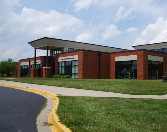
Appendices Central Sector: Vision. Voice. Vitality. ADOPTED APRIL 30, 2009
Appendices
Public Input
At workshops in June and August 2008, the consultant team gathered public input for the Small Area Plan from many sources in the community. Besides LFUCG staff, the steering committee and the public at workshops, LFUCG staff chose individuals with common interests to be interviewed as part of a focus group. The three groups represented institutional organizations such as social service agencies and schools, large and small businesses, and recent and long term residents of the community. Their comments follow.
Institutional Group
• neighborhood or area, but it’s not.
The perception is that Central Sector is a “Bad”
Art League is an asset. The perception is that CS
• is scary, but the gallery brings in people from all over once a month. Neighbors moving into the neighborhood with children.
•
Loudon has so much potential.
• not have transportation.
Transportation is a vital link as most people do
Public bus system is perceived as functionally
• well – could have more frequency in some areas such as New Circle Road, but it is available. People need it to get to work. The 2004 Tax Referendum helped improve service.
•
Interconnected streets is a help.
• Center, Lexington Art League, County Health Department and Opportunity for Work and Living.
Attended by representatives from the Hope
Weaknesses and Areas for improvement
Strengths / Cultural and community resources / landmarks
Central Sector works well because it is racially
• and economically diverse. Diversity gives it a lot of energy.
• are strong and should be contacted : Shiloh, Holiness, Church of Christ, and Grace Baptist churches.
•
•
•
Churches and other faith-based organizations
Third Street Corridor Revitalization
Habitat for Humanity
Old Episcopal Burial Grounds on Third Street
There is an elderly housing complex at Second
• and Jefferson run by the Housing Authority. Connie Griffin Manor.
Libraries: New North End Library is outside New
• Circle Road and the Main Library downtown is most accessible by South Upper Street.
• after-school care.
This group did not know about need for child or
Participants liked the new redevelopment area,
• Glen Arvin, that was formerly Charlotte Court. The area is run by the housing authority, appears safe and you see people walking in the area.
There needs to be more collaboration with
• health care and social services. Need to work together to keep people out of the emergency room by better access to regular care. There is a free health clinic.
Bryan Station High School has the lowest
• graduation rate of the 5 high schools in Lexington. The inclusion of Central Sector residents is somewhat fragmented in order to achieve diversity.
40505 zip code has the highest rate of abuse
• and neglect. Lexlink is an umbrella organization for providing services. Lexlink is a member of the CEO Roundtable (CEOs of non-profits). Need to contact Lexlink.
Critical need for affordable housing and
• for housing for disabled and special needs individuals.
• need to be replaced.
•
Lots of homes around 6th and Limestone that
Loudon/Limestone commercial area.
• replaced by a young, local developer. Charlotte Court was bad.
•
Lots of shotgun homes but some have been
Westend Market.
• (prostitutes).
North Limestone was called “the Stroll”
98
The Central Sector Small Area Plan
• structure construction.
Loudon Avenue because of the ongoing infra-
Strengths
• between Lextran and the Thorntons.
The trailer parks off Newtown and on Loudon
Lots of cyclists due to economics or substance
• abuse. Need better bike routes and share the right-of-way awareness. Need better access for pedestrians or bikes across New Circle Road.
• could be more kid friendly.
•
•
•
Castlewood Community Center (underutilized) –
Williams Wells Brown
North Limestone from Fifth Street north
The Loudon corridor
• addictions and mental health problems.
Hard to find housing with felony convictions,
When you cross New Circle Road you enter a
• different world. New Circle Road is a barrier. There are new buildings, luxury hotels, new subdivisions with shopping plazas, out Newtown. Out Bryan Avenue, there are 60’s and 70’s housing on the medium to low end of the economic scale. Older people. In the 1950’s, New Circle Road was built as the bypass. NC Road in the other parts of the city is an expressway. Would be great to have covered bus shelters.
• Broadway, Limestone, Newtown are primary routes. Lextran also runs circulators to get people from homes on side streets to main routes. Get GIS Lextran layer.
Central Sector people work in different
• professions and work all over the City. Lexmark employees tend to come from the suburbs and outside of Lexington.
•
Commercial real estate information
• clothes.
•
Not a lot of coffee places, delis, places to get
Al’s Bar is on 6th and Limestone
• counselors.
Important to talk to the schools’ family resource
Commercial / Business Group
• Smuckers, Al’s Bar, and Lexmark.
Representatives from Ad Color Company,
The revitalization and improvements around
• Newtown Pike made the area less scary so customers were less afraid to come.
Widening along New Circle Road from
• Georgetown to Lexmark or the entrance to Wal-Mart will provide 6-8 lane limited access. Not sure what the impact to pedestrian movement will be.
The Smuckers plant is a national hub sending
• out 20 trucks per day with 44 thousand pounds per truck. It employs 210. Winchester Road is better but the RR crossing is bad. Truck access from Smuckers/ Jif to Winchester Road is difficult. Trucks go down Magnolia to 7th to hit Winchester Rd. No loading docks access Winchester directly.
• equipment.
Smuckers is partnering with the school. Play
Lexmark has 3,000 employees and about 800
• contractors. Most employees do not reside in the sector. They come from the suburbs. The young engineering base might find the neighborhood interesting but they are not there yet.
• proximity to downtown.
This area could attract new business because of
• CS.
Ad Color has about 60 employees, 15 from
Al’s bar has 15 employees – 100% live in CS.
• Smuckers says employees need 2 years associate
• degree or 2 years manufacturing experience.
• degree – high tech.
Lexmark employees need 4-year engineering
• and a desire to work. They will train.
•
AdColor wants employees who have motivation
Al’s needs integrity, reliability.
Weaknesses
Parking is a big obstacle to Al’s Bar expansion.
• Wanted to get a dance expansion license but could not under current code. Would like to get a credit for the patrons that bike in.
• Keeps people from coming to Central Sector.
The big obstacle is fear. Racially motivated fear.
99 DRAFT - February 2009 Appendices Lexington - Fayette County
Appendices
Business barriers
•
There are no Enterprise Zones.
Fee for impervious area urban county wide.
• Major groundwater issues – need offsets with new EPA mandate – impervious surface fees are earmarked for the stormwater and sewage system. If you create on-site detention, credits are not given. Funds will be used urban area wide. It is a disincentive.
• more suburban space.
Smuckers people (manufacturing types) desire
• they are competing with Austin, etc.
Lexmark is trying to lure young engineers, but
Nowhere to shop or buy clothes. Have to go to
• Hamburg or Wal-Mart. Not much commercial choice. People without cars are going to the Readymart to buy food but there is no fresh produce, etc.
Housing
• ceiling
Rental housing has high threshold, but low
Barrier is quality or condition of housing – not
• eligible for some programs because houses are not up to code.
• study.
LFUCG is undertaking an affordable housing
• Habitat for Humanity.
•
Lexmark builds at least 1 house a year for
What would attract people to live in CS?
•
•
•
•
Warehouse District
Venues to walk to.
Green spaces and a dog park
Affordable housing
There are 2 areas of CS. Fifth street is a dividing
• line. Home prices move fast south of the line and sell for more than north of there.
The line is moving up slowly but surely. Some
• homes on Limestone are being redone and are not being sold at super high prices.
• homes in area.
Millimeter, is in real estate and is rehabbing
•
Code enforcement and Building Inspection Enforcement is complaint driven. e.g.Spauldings
Donuts abandoned their building in the North Limestone area. The roof is falling in and nothing is being done.
Ad Color felt the permitting process was difficult
• when they expanded and their Certificate of Ocuancy was held up because of ordinance requirements, while existing neighbors did not maintain their properties.
• is that it is dangerous.
Third Street from Jif to Newtown Pike perception
Bike trail from Horse Park crosses Newtown
• (crosswalk and tunnel in future) and traverses
Lexmark property, goes to YMCA on West Loudon Avenue and then south.
Residents Group
The group was composed of residents who have
• lived in Central Sector from 3 to 32 years. When asked what they would like to see come
• out of the Small Area Plan process:
Neighborhood Character
•
•
Keep the diversity of residents
Preserve historic buildings which are an asset
Encourage a creative class as described in the
• book “The Rise of the Creative Class” – diversity is the key. This 6-year resident on Price Avenue feels the area is up and coming. One group member cited Austin, Texas as an example and as a city that competes with Lexington for talent. Another does not want to hear how Lexington could be like Austin. Austin has different weather.
Need reinvestment in the central core –
• encourage builders and businesses to come back to downtown – would like a program where builders elsewhere in the city also improve or build a home in the downtown .
Pedestrian accessibility – no sidewalk on Loudon
• Avenue to Hope Center, the YMCA and the Health Dept. Need more bike paths and lanes. People walk on the street or Railroad tracks.
100
The Central Sector Small Area Plan
Residential Infill and Redevelopment Program
For the past ten years, Lexington’s growth management strategy has focused on infill/redevelopment as the sister element to rural land preservation. While long recognized as a way to increase utilization of the Urban Service Area, thus reducing pressure for expansion, it has only been in the last few years that a multi-faceted series of plans and implementing actions have elevated these efforts into a cohesive program.
The seminal document in this intensified effort began with the Planning Commission’s adoption of the Residential Infill and Redevelopment Strategy in 2001. The purpose of the strategy is to promote balance between greenfield or urban edge development and reuse and redevelopment of existing built areas by maximizing the amount of urban growth feasible within the existing Urban Service Area. Unlike most cities its size, Lexington is a growth management community where both suburban and urban development are contained within the same jurisdiction. For 50 years, urban growth has been compact and contiguous. As a result, there is a limited amount of undeveloped land that remains within the urban area, particularly inside New Circle Road. This is perhaps the biggest challenge to extensive infill and redevelopment. Other challenges include decades-old sanitary and storm sewer systems, property with multiple and disparate owners, and environmental issues. The Residential Infill and Redevelopment Strategy seeks to ameliorate some of the issues related to these challenges.
Infill/Redevelopment is important to Lexington-Fayette County’s growth because:
I/R encourages balanced urban growth with the redevelopment of • existing developed areas using existing infrastructure and services and reducing demand for new development in outlying areas.
I/R encourages traditional development patterns for more compact, • walkable, and mixed-use development, which is especially important in an increasingly more expensive energy environment and with the increasing aging population.
For the complete text of the Residential Infill and Redevelopment Plan, see the 2007 Comprehensive Plan
102
The Central Sector Small Area Plan
Appendices
Neighborhood Demographics
This demographic information was derived from 2000 US Census Bureau data. Little of this data is used in the CSSAP because it is out of date. Instead the consultants relied on more current data, which are estimates, from ESRI Business Analyst and the Federal Bureau of Labor Statistics.
Population, Age, & Race:
Central Sector (CS)
• has 5.4% of the city ’s population.
C
• ompared to Lexington-Fayette (LF), CS shows slightly more teenagers (15-29), fewer young adults (20-24), and slightly more adults 65+.
CS • has a higher concentration of Black and Hispanic people than Lexington-Fayette overall Also, CS has 11.3% of the city ’ s total Black population and 10.5% of the city ’ s total Hispanic population.
White Black Hispanic
CS 67.1% 27.9% 6.3%
LF 81.0% 13.5% 3.3%
Of CS families with children under 18 y • ears, (2,475 families), 55% are single parent families.
Housing:
• , a lower rate of married couple households, a higher rate of single-parent or non-parent households, and a higher rate of 65+ householders living alone
Proportionally, CS has a higher rate of non-family households
has a higher percentage of vacant housing units and a higher • percentage of renter occupied housing. 7.8% of all vacant housing in Lexington is located in Central Sector.
Vacant
In CS, the older you are, the more likely you are to own a home. • For example, 48.2% of occupied housing units in Central Sector are owner-occupied, but of all occupied housing units with a householder age 25-34, only 31.1% are owned by the householder. Of occupied housing units with a householder age 75-84, 79.6% are owned by the householder. However, the largest home-owning age group are householders age 45-54, owing 21.8% of all owner-occupied housing units in Central Sector.
103 Appendices ©2009 RATIO | DCI | ECSI
Non-Farmily HH Married Couple HH 1 Parent / Non-Parent HH 65+ Living Alone CS 45.0% 32.0% 23.4% 10.0% LF 41.9% 43.5% 14.7% 7.5% CS
HU Renter-Occupied HU CS 10% 47.0% LF 6.8% 44.7%
Appendices
Based on race i • n Central Sector, if you are classified as White, you are most likely to own your home (52.7%), followed by Asian descent (42.9%), African-American (38.3%), and Native American/Native Alaskan (16.7%). Only 9.7% of Hispanic head of households own their home.
CS has low housing value compared to the city of Lexington. The
• majority of CS housing units (89.8%) are valued at under $90K. 47.3% are valued under $60K. In LF, only 32.6% are valued at under $90K, and almost 30% are valued at more than $150K.
•
80% of occupied housing units have at least one vehicle available.
Education:
In CS, more residents age 25+ years have no high school diploma,
• and fewer residents have some form of college degree than all residents of LF.
Income:
• 12.9% of LF residents.
26.7% of CS residents are living below the poverty level compared to
The income distribution of CS is very different from that of the city
• overall. CS has a significantly higher percentage of households with an income below $20K (CS 42%; LF 24%) and relatively few with an income above $50K (CS 18%; LF 39.6%).
104
The Central Sector Small Area Plan
No HS Diploma or Equivalent Any College Degree CS 37.0% 14.0% LF 14.2% 42.0%
Employment:
In 2000, 15% of CS’s residents were unemployed compared to 5.4% • in LF.
Within CS, the five most prominent jobs for employed individuals are • accommodation and food services (13%), manufacturing (12%), retail trade (11%), health care and social assistance (11%), and construction (10%).
When compared to LF, workers in CS commuted by means of • automobile or motorcycle less, by means of public transportation, bicycle, walking, etc. more, and fewer worked from home. In CS twice as many workers claimed to carpool to work as in LF.
105 Appendices ©2009 RATIO | DCI | ECSI
Industry CS LF Agriculture, forestry, fishing and hunting 3% 4.1% Mining 0% 0.1% Construction 10% 5.4% Manufacturing 12% 12.0% Wholesale trade 5% 3.5% Retail trade 11% 11.9% Transportation and warehousing 3% 6.4% Utilities 1% 0.6% Information 1% 2.8% Finance, insurance, real estate and rental and leasing 4% 11.4% Professional, scientific, and technical services 4% 15.4% Management of companies and enterprises 0% 0.1% Administrative and support and waste management services 4% 2.7% Educational services 9% 39.1% Health care and social assistance 11% 14.1% Arts, entertainment, and recreation 2% 11.3% Accommodation and food services 13% 8.3% Other services 6% 4.2% Public administration 2% 3.6%
Automobile, Motorcycle, etc. Public Transportation, Bicycle, Walk, etc. Work from Home Carpool CS 87.0% 12.0% 1.0% 23.0% LF 91.2% 6.3% 2.5% 11.2%
Appendices
Safe by Design Program Goal
Work with developers, builders, property owners, and planners to create the safest developments and communities possible, with a goal of creating socially sustainable communities. Socially sustainable communities are communities that succeed now, economically, socially and environmentally, and respect the needs of future generations. They are well-designed places where people feel safe and secure; where crime and disorder, or the fear of crime doesn’t undermine quality of life or community cohesion.
Why use Safe by Design?
Incorporating sensible security measures during the construction of a new development or the revitalization of buildings and neighborhoods has been shown to reduce levels of crime, fear of crime and disorder.
The costs involved in correcting or managing badly designed development are much greater than getting it right in the first place. This works best if balanced with the need to achieve desirable places to live.
By providing quality environments and ensuring that they are properly managed and maintained, communities can be more readily encouraged to exercise a sense of ownership and responsibility.
We need to create environments that people want to occupy and use, creating a strong and positive sense of communal identity.
Increased Liability: Increasingly there is negligence associated with allowing or encouraging crime through poor design.
• that area.
All premises must be reasonably safe in light of the risks of crime in
• reasonable and proportionate to the risk of crime at that site.
Amount of security necessary at any particular property must be
As risk of crime increases so should security measures.
• Importantly, design can be an extremely important part of the security provided for a particular property.
Safe by Design and Crime: Safe by Design does not guarantee that a particular area will be crime proof, but indicates that the site has been subject to a design process and improved level of security which, in the experience of the police and other agencies, have been shown to significantly reduce the risks of crime and fear of crime.
106
The Central Sector Small Area Plan
Key Issues to Focus On
Attractive and safe Landscaping; Effective Lighting; Controlling Access and Movement; Effective Natural Surveillance; Promoting Ownership and reducing Anonymity; Maintenance and management of areas; Proper site design;
Core Principles of Safe by Design
1. Integrated Approach: Probably the most important aspect of new development is ensuring that all significant components of its design, planning, and layout, are considered together at an early stage so that potential conflicts between security and other major objectives can be resolved. In addition, an integrated approach ensures that all affected parties are involved from the early stages of the process.
2. Access and Movement: Places with well-defined routes, spaces, and entrances that provide for convenient movement without compromising security. Too few connections can undermine the vitality of an area, while too many, especially too many under used or poorly thought out connections, can increase the opportunity to commit crime. The goal is to create places that are both well connected and secure.
a. Good movement frameworks have direct routes that lead people where they want to go by whatever means (foot, bike, car, etc..).
b. Routes for cars and pedestrians should run alongside each other and not be segregated. Primary routes help to create shared spaces and prevent underused and potentially vulnerable locations.
c. Where footpaths are required, they should be straight as possible and wide, avoiding possible hiding places. Footpaths should also be overlooked by surrounding buildings or activities where possible and not hidden by vegetation or landscape features.
d. Public access to the rear of buildings and homes should be restricted. Secluded footpaths or alleys should not run along the rear of and provide access to, backyards.
e. Clear and direct routes should not undermine the defensible space of neighborhoods.
3. Site design: Places are laid out so that crime is discouraged and different uses do not cause conflict. The layout and structure of a place (how buildings, spaces, uses, and activities relate to one another) affects its safety and sustainability.
a. Safe urban buildings have few sides (entrances and exits) exposed to the public realm (accessible to the public). The frontages interact with the streets by having highlighted entrances and windows that emit light and engage the pedestrian.
107 Appendices ©2009 RATIO | DCI | ECSI
Appendices
b. Good movement in a community focuses people and vehicles on to a small number of principal routes that are overlooked by homes.
c. Homes in cul-de-sacs can be highly secure, but the cul-de-sac should be short and straight (to provide visibility) and should NOT be joined by networks of footpaths that are rarely used and are likely to foster criminal activity. Research has shown that houses situated on cul-de-sacs are less likely to be burglarized than houses on other streets.
d. In new developments, unnecessary and ambiguous space should not be provided. The aim is well-defined and purposeful open space.
4. Surveillance: Places where all publicly accessible spaces are overlooked. Whether it be “natural” or electronic, surveillance should be a core part of planning out crime. However, surveillance should not be relied on as the sole strategy for preventing crime.
a. Places that could be vulnerable to crime should be overlooked by buildings or uses at all times.
b. Windows and doors should face onto the street. Active frontages, rather than blank walls, should be encouraged. The more windows overlooking the street and other public spaces the better.
c. Open, bright spaces reduce the number of potential hiding places and allow people to be aware of what is happening around them.
d. Entrances to homes and other buildings should be directly from the street, creating active frontages.
e. Parks and other public spaces used by the neighborhood should be arranged to provide maximum surveillance and visibility by residents of the neighborhood.
f. The most secure place to park a car is in a garage, followed by a driveway. However, garages should not be designed in a manner that leads to “inactive” frontages. If parking is on the street, it should be in front on houses in order to provide for maximum surveillance.
5. Lighting: Research confirms that where public lighting is weak or patchy, increasing the levels and consistency of illumination reduces fear of crime and makes people feel more secure.
a. Well lit spaces are crucial to reducing fear of crime, making places more livable, and generally increasing legitimate activity after dark. However, lighting should be sensitive to the needs of residents and should provide security without resulting in glare and compromising privacy.
b. Lighting in places that are vulnerable to crime should be designed to prevent it from being vandalized.
c. Places to which there is no legitimate access after dark could be unlit to discourage the presence of potential victims.
108
The Central Sector Small Area Plan
6. Ownership: Places that promote a sense of ownership, respect, territorial responsibility and community. Encouraging residents and users of places to feel a sense of ownership and responsibility for their surroundings can make an important contribution to crime prevention. Uncertainty of ownership can reduce responsibility and increase the likelihood of crime and anti-social behavior going unchallenged.
a. Gates, fences, walls, and hedges can create safe and attractive places, but must be designed and placed appropriately.
b. High fences and landscape that actively impede access are most appropriate in places that are vulnerable to crime, such as the back of houses.
c. Fences must be visually permeable so as not to hinder natural or other forms of surveillance or provide places for offenders to hide.
d. Lower barriers, hedges, and bushes are also highly useful to signify the public/private divide.
e. New developments should be integrated into the wider community and gating of developments should be considered ONLY as a last resort.
f. Landscaping can be used to make places safer as well as more attractive, as long as it doesn’t restrict natural surveillance.
g. Involving residents and users in the management and design of their area provides a real sense of ownership.
7. Physical Protection: Places that include necessary, well-designed security features. This aspect deals with target hardening and making it more difficult to commit an offense, while instilling a sense of safety in users.
a. Planning in quality security from the outset is usually much cheaper and easier that retro-fitting it later.
b. Crime prevention measures that adversely affect the way a place looks and feels undermine the aim of safe and sustainable communities. Some fencing and other target hardening can cause more fear than they prevent.
c. Crime prevention measures should be made to look as attractive as possible, while not diminishing their security.
8. Activity: Places where the level of human activity is appropriate to the location and creates a reduced risk of crime and a sense of safety at all times. Crime can be deterred through the “eyes on the street” of people going about their everyday business. However, too much activity risks anonymity and can lead to increases in the opportunity to commit particular types of crime.
a. Care should be taken to ensure that the mixed uses in a locality are compatible. For example, clusters of bars and clubs are best situated away from residential areas.
109 Appendices ©2009 RATIO | DCI | ECSI
Appendices
b. Providing activities for young people to hang out helps to provide a focus for and can prevent criminal behavior. Care should be taken to not attract excessive numbers to any one location.
9. Management and Maintenance: Places that are designed with management and maintenance in mind, to discourage crime in the present AND the future. Management and maintenance embrace both how a place looks and how it functions over time.
a. Proper attention to the design quality and attractiveness of the street increases its safety and use and promotes greater respect towards the environment.
b. Improvements to the public realm should be approached in a strategic, coordinated manner, as opposed to being ad-hoc.
c. Locations must be properly maintained after construction in order to prevent decline from beginning and disorder from taking root in the area.
d. Proper maintenance includes: landscaping, lighting, public areas, parking, fencing, roads, sidewalks, ensuring proper public services (garbage collection) and tenant management in rental areas.
110
The Central Sector Small Area Plan
Homelessness and Housing Issues
The following information was provided by Central Kentucky Homeless and Housing Initiative. For a summary and interpretation of the data, please refer the latest draft of the “10 Year Plan to End Homelessness in LexingtonFayette County” or contact:
David Christiansen, MSW
dchristiansen@ckhhi.org
Executive Director
Central Kentucky Housing and Homeless Initiative, Inc.
130 W. New Circle Road, Suite # 110
Lexington, KY 40505
Phone: 859-281-9402
Website: www.ckhhi.org
Persons in Supported Permanent Housing
111 Appendices ©2009 RATIO | DCI | ECSI
Number Contact Resource Individuals Families A or M F Family A or M F C 288-4149 Father Michael Powers Keeneland Backstretch 30 25 254-3469 Ann Vandervort Volunteers of America 10 8 8 16 245-2400 Ginny Vicini New Beginnings 10 18 281-5048 Bren Jones Housing Authority Bluegrass MH/MR SPS 51 3 5 2 252-7881 Amber Cromen Hope Center – Hill Rise 38 252-6642 Missie Smith St. James I 88 16 253-1686 Jessica Wells Bluegrass MH-MR –SHP 4 6 255-0500 Jennifer Stamper Chrysalis House 7 17 17 18 225-3000 Ext. 22 Terrell Kowal Solomon House 5 1 233-4511 Ext. 3607 Randy Moler VA HUD Vouchers 4 2 1 1 1 255-2611 Greg Jackson Canaan House 15 1 514-7210 Carrie Brend Catholic Action Center 19 8 281-5048 Bren Jones Housing Authority BDV 1 14 14 30 Totals 271 88 43 6 40 66 Persons in Supported Permanent Housing total = 471
112
The Central Sector Small Area Plan Emergency and Transitional Housing Sub-categories (if indicated) ChronicHomeless SMI ChronicSA Vet HIV/ AIDS DV <18 Hope Center – Privett Center 37 94 9 1 Hope Center 35 20 78 41 5 Hope Center for Women 22 7 69 51 Catholic Action Center 14 Bluegrass Safe Haven 1 MASH 1 3 7 Salvation Army 66 31 35 1 26 Lighthouse Ministries 9 1 Florence Crittenton 9 2 3 Methodist Home 1 2 Rainbow House 4 1 Volunteers of America –Transition 1 1 Shepherds House 23 1 1 Bluegrass ESH 3 Bluegrass TBRA 1 Chrysalis House 53 2 42 2 VOA – Treatment 39 39 4 St. James II 16 3 22 36 5 3 Lexington Rescue Mission 2 2 12 1 Bluegrass Domestic Violence 61 AVOL – TBRA 1 2 Totals 188 84 447 130 18 196 12
Appendices
113 Appendices ©2009 RATIO | DCI | ECSI
ChronicHomeless SMI ChronicSA Vet HIV/ AIDS DV <18 Solomon House 1 2 6 New Beginnings 28 4 Canaan House 16 3 Bluegrass MH-MR 1 10 2 Hill Rise 6 3 38 4 Chrysalis House 24 16 Bluegrass Domestic Violence 29 St. James I 11 12 15 1 3 Volunteers of America 1 5 14 2 5 Totals 9 73 99 20 7 53 Emergency Shelter, Transitional Housing Count
Persons in Emergency Shelter A = adults, C = children Number Contact Resource Individuals Families M F Family A C 252-7881 Amber Cronen Hope Center 220 514-7210 Carrie Brend Catholic Action Center 57 24 224-7227 Freeland Davis Room In The Inn 27 252-3126 Rebecca Graff Mash 4 3 252-7706 Cindi Kupar Salvation Army 44 15 20 32 233-0657 Darlene Thomas Bluegrass Domestic Violence 10 12 12 23 253-1686 Jessica Wells Bluegrass MH-MR Safe Haven 1 425-2616 Maj. Todd Eades Detention Center 252-2002 Janice James H C Recovery Program for Women 8 Totals 308 90 27 32 55
Permanent Housing
2009
Appendices
Persons in Transitional Housing
114
The Central Sector Small Area Plan
Number Contact Resource Individuals Families M F Family A C 381-9600 Lindsey Burk Lexington Rescue Mission 12 252-2002 Amber Cronen Hope Center – Privett Center 94 252-7881 Amber Cronen Hope Center 19 514-7210 Carrie Brend Catholic Action Center 6 14 3 4 7 252-3126 Rebecca Graff Mash 2 1 1 2 259-3434 Billie Mallory Lighthouse Ministries 9 252-2002 Janice James H C Recovery Program for Women 61 509-4307 Earl Washington Methodist Home Transitional 1 7 255-3000 Terrell Kowal Rainbow House 4 254-3469 Ann Vandervort Volunteers of America 15 15 34 254-0149 Nicole Brown VOA – Vets Treatment 39 252-8636 Mary Venezie Florence Crittenton 1 6 6 3 233-4600 Patricia Shobe Community Action 10 10 23 255-0500 Mendy Daniels Chrysalis House 46 7 7 7 253-1686 Jessica Wells Bluegrass MH-MR TBRA 1 253-1686 Jessica Wells Bluegrass MH-MR ESH 2 1 252-4828 Beverly Henderson Virginia Place 77 77 88 388-9260 Douglas Jones VOA – St. James II 31 5 252-1939 Jason Thomas Shepherds House 23 252-7706 Cindi Kupar Salvation Army 18 1 1 3 559-3539 Andrea Richardson Bluegrass Domestic Violence 5 11 11 40 294-7080 Robert Hamar Bellwood Independent Living 9 12 225-3000 Terrell Kowal AVOL-TBRA 3 1 Totals 252 174 131 132 207 2008 Persons in Transitional Housing total 770 2009 Persons in Transitional Housing total 766 2008 Persons in Emergency Shelter 472 2009 Persons in Emergency Shelter 485 2008 Total 1242 2009 Total 1251
232 Homelessness Field Surveys Were Completed
65 (28.0%) of those interviewed indicated they were homeless.
91% of those interviewed were males •
21.5% of those interviewed were living with others (families) •
• 9 (9.7%) were children • Homeless Interviewees
Total homeless people in the count = 89
62 (26.7%) of those interviewed indicated they were “precariously housed”.
54.8% were families •
•
Total precariously housed persons in the count = 154
20 ( 13%) were children •
Precariously Housed Interviewees
115 Appendices ©2009 RATIO | DCI | ECSI
16.9% 41.5% 26.2% 46.2% 26.2% Job Income DV ER Attack
14.5% 54.8% 30.6% 54.8% 14.5% Job Income DV ER Attack
ph: 317.633.4040
fx: 317.633.4153
www.RATIOarchitects.com


RATIO Architects, Inc. 107 South Pennsylvania St. Suite 100 Indianapolis, IN 46204