


The East End Small Area Plan is a document that is a collective effort of neighborhood residents, various agencies within the Lexington‐Fayette Urban County Government, and a team of consultants. The invested time and effort of all members contributed to many aspects of this plan and its completion.
Andrea James, 1st District Council member
Joan Whitman, Planning Commission member
Steve Austin
Diane Bonfert
Janet Coleman
David Cozart
Marty Clifford
Jim Embry
Isaac Hart
Lori Heard
Bob Joice
Paula King
Derek Paulsen
Austin Simms
Cheryl Talbert
Harold Tate
Philip Webb
Rev. Michael Wilson
Anthony Wright
Planning Commission
Randall Vaughn, Chair
Neill Day, Vice‐chair
Frank Penn, Secretary
K. Mike Cravens, Parliamentarian
Lynn Roche‐Phillips
Joan Whitman
Ed Holmes
Carolyn Richardson
Marie Copeland
Patrick Brewer
L. Michael Owens
Consultants
EHI Consultants, Inc.
333 West Vine Street
Suite 300
Lexington, KY 40507
Urban Collage
167 West Main Street
Suite 1200
Lexington, KY 40507
WilburSmith Associates
465 East High Street
Suite 100
Lexington, KY 40507
LFUCG Planning Staff
Christopher King, Director
James Duncan, Project Manager
Sharon Buford
Janice Westlund
Pam Whitaker
Rob Johnson
Legacy Center at Blue Grass Community Foundation
The East End Neighborhood is home to a diverse population and possesses many opportunities given its rich historical background, cultural value, and location within Lexington. Just north and east of Downtown, the East End originally grew at the end of the American Civil War. The East End was a thriving, prominent Black community within Lexington until the mid‐1960s when the outward growth of the city caused a decline in population and loss of many businesses to other neighborhoods throughout Lexington. Today, the East End totals approximately 387 acres and is home to 3,940 residents and many businesses and industries. All of these factors contribute to the historical and cultural value of the East End while simultaneously providing ideal circumstances for neighborhood revitalization and redevelopment.
The process to achieve a vision for the East End Small Area Plan was not completed by conventional means, such as a meeting or a community forum. Various methods and materials such as print, broadcast, and digital media were used to create community awareness and ensure a large turnout to a kick‐off rally and a community visioning workshop. The planning team created an active listening process at the kick‐off rally by utilizing East End Small Area Plan Steering Committee members to seek out citizens and engage them as well as a professional facilitator to solicit comments from individuals in front of the group. This process was recorded by digital media as well as written responses to demonstrate the desire of the planning team to truly listen to the participants and to additionally create a system of accountability for the city and the consultants. A Saturday morning after the kick‐off rally, a community‐visioning workshop was conducted utilizing a neutral professional facilitator as to allow a community‐based plan to develop. This process demanded teamwork from the citizens and was structured as to include a “dream book”, a collection of questions, challenges, and pictures to help each team express their work. Through this process the planning team was able to establish who the community is and what it wants.

After the community established a vision, the planning team established a set of Goals that are designed to serve as the social and economic drivers for the planning and redevelopment of the East End while also improving the quality of life. These goals are in regard to character of the East End, housing and its affordability, commercial areas, promoting opportunities with positive impacts, transportation, public spaces, land uses, safety, health, the local environment, technology, and community organizations.
Through the establishment of these goals, a set of planning priorities was also developed that would assist in accomplishing certain issues that are considered to be of critical and immediate importance. The East End utilized the community input to identify the issues of highest priority to the neighborhood. The following elements of the plan are Top Ten Neighborhood Priorities:
Create an East End Community Development Corporation to guide the continued redevelopment of the area according to this plan.
A suitable, community‐led plan for the future of the Charles Young Center.
Completion of the restoration of the Lyric Theatre.
Implement a neighborhood beautification program.
Request that a historic survey be completed for identified areas, and that appropriate markers and signage be erected.
Design and constructed signage identifying the East End, as well as a banner program for various locations throughout the East End.
Create and implement an infrastructure plan for repairing sidewalks, streets, and storm water.
Provide more street lighting.
Maintain Affordable Housing within the East End.
Completion of the Isaac Murphy Memorial Art Garden and its connection to the Legacy Trail along 3rd Street.
By adopting the plan, the Planning Commission and LFUCG Council will demonstrate the City’s commitment to the plan’s implementation. However, every action item within the plan will require separate and specific implementation. Adoption of the plan does not, on its own, begin the implementation of any item. Approval of the plan does not legally obligate the City to implement any particular action item. The implementation will require specific actions by the neighborhood, the City and by other agencies. The Neighborhood Plan will be supported and implemented by City Boards, Commissions and Staff, City Departmental Budgets, Capital Improvement Projects, Other Agencies and Organizations, and Direct Neighborhood Action. Implementation must also be accomplished by establishing a schedule of implementation for items, both long term and short term, proposed within the plan, tracking items through an Action Item Tracking Chart and lastly by updating the Small Area Plan to reflect changes in the neighborhood.
The East End Neighborhood of Lexington is rich with historical and cultural value. Home to many residents, businesses, and industries that are important to Lexington, the East End neighborhood is located just North and East of Downtown. The neighborhood consists of a total land area of 387 acres.


The East End originally grew as a result of the end of the American Civil War and became the prominent black community within Lexington for many years to follow. Many offices, businesses, and entertainment venues that served the black community were located in the heart of the East End along DeWeese and Third Streets. In the mid‐1960s with Lexington’s outward growth, many residents who lived within the East End sought residence and services elsewhere.
The East End is now home to a diverse population and possesses many opportunities given its location within Lexington. It contains a developed street network and neighborhood qualities that make it an ideal neighborhood for revitalization and redevelopment. View of Downtown Lexington from the East End

East End History
The Neighborhood Vision
Neighborhood Overview

Goals, Objectives, Actions

Preferred Alternatives
Implementation


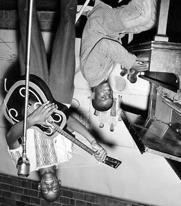
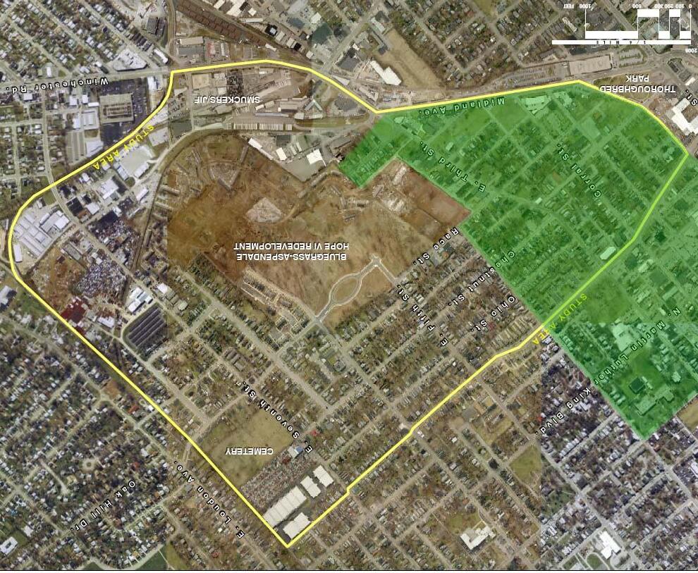
In 1817, a Revolutionary War Veteran, Captain John Fowler, opened a park east of Lexington that spanned from the present day Jiff/Smuckers site to the Bluegrass‐Aspendale HOPE VI Redevelopment site. The park, known as Fowler’s Garden, hosted numerous entertainment events and included the Kentucky Association Race Track which was a predecessor to today’s Keeneland Race Track until its closure in 1861. In 1865, the end of the American Civil War brought rapid increase of the black population to cities throughout the Commonwealth of Kentucky. In Lexington specifically, this population surge was most notable in the East End. Lack of unused land within the central area of Lexington forced many black communities to sprout along what then were the outskirts of the city. Many of these homes were small shack tenements built by landowners attempting to capitalize on the sudden market for homes.
In 1870, George K. Kinkead divided the area around east Fourth Street that was then referred to as Kinkeadtown. This area continued its population growth with mainly black residents from the Deep South and became widely referred to as Chicago Bottoms. In Lexington, this area was a predominate center for the black community by providing many social and business services as well as homes to the black residents of Lexington.
By the early twentieth century, The East End contained a diverse range of economic classes. The center of the East End became DeWeese Street, which contained many popular establishments that served the black community. Of these establishments was the Lyric Theatre, which during its glory days was a popular entertainment venue that attracted many black entertainers such as Duke Ellington, Cab Calloway and Bessie Smith. For Lexington’s black community, DeWeese Street was more than an economic center, it was also considered a place to “see and be seen”. During this time period, Third Street also became a popular commercial area within the East End that contained many businesses that served the neighborhood. As Lexington began to experience major growth in the 1960s, the downtown core expanded closer to the East End. This growth created the flight of many East End residents and businesses to more popular areas further from the downtown core.
Since the 1960s, the population within the East End has been declining. Between the 1980 and 1990 Census the population experienced a 30 percent decrease. Furthermore, between the 1990 and 2000 Census this population decline continues with a 17 percent decrease. This decrease is attributable to the outward growth and urban flight of Lexington that has attracted many businesses and residents away from the downtown core.
Within the past seventy years, the East End has been a focus of planning for the City of Lexington. The area was first studied within the Comprehensive Plan of Lexington, Kentucky and Environs in 1931. This plan recommended major street improvements to Short Street, Ann Street, and a new connector street between Fourth and Race Streets and Third and Ann Streets. The 1931 plan also recommended school improvements including the relocation of Harrison School and a new school to replace the Constitution School.
In 1947, The Comprehensive Area Plan for the City of Lexington once again included improvements for the East End. These improvements were minimal and included sidewalk repairs and the proposal of one‐way streets to alleviate traffic congestion.
By 1960 the East End had become a significant focus of the Short Street Urban Renewal Plan. This plan proposed the extensive redevelopment of the East End, however its focus was to practically clear the entire neighborhood rather than redevelop it. This plan was not successful and later defeated in a referendum in 1964.

Later Comprehensive Plans that included plans for the East End were in 1967 as well as later in 1973. These plans included proposals for major transportation improvements that would have changed the East End significantly. These plans included:
‐ A freeway along the now existent Midland Avenue
‐ Corral and Pleasant Stone Streets were to be extended to meet West Second Street and serve as arterials
‐ Third Street was to serve as an arterial
‐ The Extension of Rose Street to DeWeese Street
By the late 1970s, the freeway proposed within the 1967 comprehensive plan was abandoned and the existent Midland Avenue was constructed. The Comprehensive Plan was then updated in 1980, including the extension of Rose Street and abandoning the Corral‐Second Street extension. The 1980 plan also included plans for Third and Fourth Streets to become one‐way.
In 1983, the Department of Community Development passed the East End Neighborhood Development Plan as a part of the 1980 Comprehensive Plan. This plan identified many problems within the East End neighborhood and included the following set of goals:
1. Preserve and strengthen the residential areas of the East End in order to provide decent housing opportunities for all who reside there.
‐ Objectives sought to minimize displacement of existing residents, expand affordable housing, increase rehabilitation opportunities, maintain density level, and increase code enforcement.
2. Improve public facilities/ amenities in the East End Neighborhood.
‐ Objectives sought to improve and construct sidewalks, streets, curbs, gutters, storm and sanitary sewers, and lighting, improve city service levels, improve parks and recreation facilities, and start a clean‐up program.
3. Transportation improvements should benefit East End Residents.
‐ Objectives sought to reduce traffic through residential areas, improve the circulation system, and maintain convenient access to the East End.
4. Improve the character of commercial areas within the East End.
‐ Objectives sought to create strong businesses in the neighborhood, rehabilitate commercial buildings, attract neighborhood businesses, reuse the Lyric Theatre, create land use buffers, and clean up the edges of the neighborhood.
Goals, Objectives, Actions


Preferred Alternatives


Too often “pubic input” results in simply a series of monologues by individuals with some vested interest. Even when citizens without a special interest appear at such forums, their words often have little impact. There is little way for their words to actually coalesce into a meaningful pattern that can be used to craft a plan for the future. Instead, they simply become bullet points about “issues.”
The East End Small Area Planning process turned this on its head. With assistance from the Legacy Center at Blue Grass Community Foundation, the planning team was able to reach far more neighborhood residents and stakeholders than would have otherwise been possible.
The following represents the planned, organized and created materials for community awareness and turn‐out approaches:
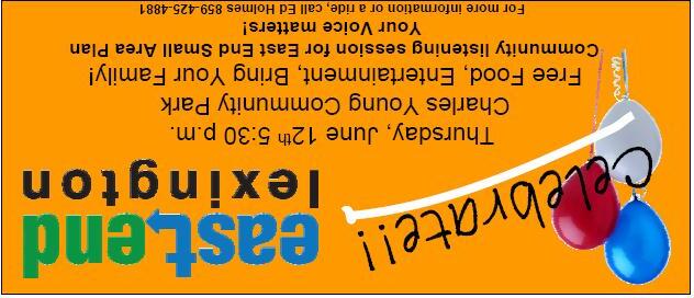
‐ Flyers (Door to door canvassing, Churches, Businesses, Neighborhood School children)
‐ Meetings with community leaders
‐ Banners
‐ Rewards (Gift cards and Branded gifts at events)
Press advisories sent to all Media outlets in Central Kentucky resulting in:
‐ Business Lexington article (local business newspaper)
‐ The Key News Journal article (newspaper primarily geared toward African American market)
‐ 20 minute segment on “Key Conversations,” AM 1580 (news show primarily geared toward African American market)
‐ Created community website portal – “a virtual parallel neighborhood”
– work done by minority‐owned business
‐ Updated all material on LFUCG, EHI, and Legacy Center websites
‐ Created video invitation and event details on websites
‐ Posted all videos on You Tube, all websites
Instead of a conventional meeting, a kick‐off party was held for the community. Community‐building should be fun and as broadly representative as possible. By offering good food, entertainment, useful information, and prizes, we ensured a large turnout. Nearly 150 people, or approximately three‐percent of the neighborhood’s population attended. In his welcome speech, Mayor Jim Newberry stated “This is the way planning should be done in the future.”
At this kick‐off rally, the planning team employed a process of active listening. The conventional model usually consists of passive listening as speaker after speaker simply approaches the microphone to describe conditions, make complaints, or offer visions of the future. Here, the Small Area Plan steering committee members were utilized to seek out citizens at the rally with a list of starter questions in order to most fully engage them. The stakeholder teams also had a one‐time‐use video camera to record their interviews as well as a member to actually write down responses. These videos were uploaded to the various websites.
These activities demonstrated to the participant the desire to truly listen to what they had to say. This also demonstrated accountability on the part of the city and the consultants: there is a very detailed record of what people said that is posted on‐line and available to anyone who wishes to see it. Nothing can be “swept under the rug” or “forgotten.”
During this community party, the planning team also utilized a professional facilitator to solicit comments from individuals to be made in front of the large group. Comments were written down in real time and displayed on a large screen so that everyone could keep track of what was being said. A Spanish translator was on hand so that language would not be a barrier.
Between the active listening techniques and the public comment session, every single person who wanted to be heard was, in the format they were most comfortable with. And by listening themselves, they learned some things too.
Most community input events stop here. But these activities only opened one end of a procedural loop. In order to close the loop, and thus ensure that a true citizen‐based plan is created, a second session is needed. The goal of this community‐visioning workshop is to demonstrate the value of team work in creating a better community. As individuals, we all have certain biases and limitations. Conventional “input sessions,” which rely solely on individual comments, only reveal those.


This community‐visioning workshop was held on the Saturday immediately following the community party. A neutral professional facilitator is vital: no consultant with a role in the project can truly listen to what is being said if they are also running the show. Here, with nothing to do but listen, the consultant gained the benefit of close inspection of the comments. Again, the overall goal was of a community‐based plan, not a rehash of the consultant’s prior work.
By demanding teamwork, this session provided strong lessons. Randomly assigned teams worked in a structured, time‐limited environment to create their shared‐vision for the future. The structure included a “dream book,” a collection of questions, challenges, and pictures to help team‐members “make values visible.”
As each team presented their work, common patterns and values revealed themselves. Here too, comments were written down in real time and displayed on a large screen so that everyone could make sure that everything was on the right track.
At the conclusion of the session, each individual left not only with a sense of satisfaction, but with an understanding of who the community is, what it wants, and the necessary teamwork required to achieve that desired future. Now, the procedural loop was closed and the planning team was able to advance with confidence.
A public “reality check” was held on October 14th to roll out some of the initial concepts created based on this process. The draft plan was very well received by the community, and many additional comments were received.


The creation of this plan is governed by the concept of triple bottom line accounting. Triple Bottom Line (TBL) is a decision‐making, planning and reporting framework that provides a more comprehensive decision‐making approach to help the neighborhood identify the social, economic, and environmental impacts of decisions. In government, TBL thinking is being used to:
• Achieve the objectives of sustainable community development
• Identify the full range of costs and benefits of decisions
• Minimize harm to its citizens, economy and environment
TBL will ensure that the desires of the community to do justice to heritage, respect diversity, and increase economic equity are respected.
The Goals of the East End Small Area Plan are designed to serve as the social and economic drivers for the planning and redevelopment of the neighborhood. The East End Plan is about improving the quality of life through a set of goals that can be used to guide planning and development decisions that will have an impact on the area.
The goals are about housing and its affordability, a safe community, creating a viable and sustainable retail area, creating local employment opportunities, community and social service facilities that reflect the needs of the neighborhood and its residents, safe and attractive public spaces, efficient and safe multiple modes of transportation, and a green and environmentally friendly neighborhood.
1. Recognize, restore, preserve, and conserve the historic, ethnic, and cultural character and resources of East End.
2. Create housing that is affordable, accessible, and attractive to a diverse range of people.
3. Promote new commercial development to create a mix of uses that respects and enhances the residential neighborhoods of the East End.
4. Promote opportunities to leverage positive impacts and encourage compatibility from civic investments.
5. Create a neighborhood where daily needs can be met by walking, cycling or transit.
6. Enhance and enliven the streetscape with landscaping, art, and signage.

7. Ensure compatibility and encourage a complimentary relationship between adjacent land uses through strong urban design.
8. Ensure that safety is a top priority.
9. Protect and enhance personal health and the local environment
10. Utilize technology to connect the neighborhood to itself and to the world.
11. Utilize community organizations to increase social capital in the neighborhood.
12. Grow a locally based economy that offers opportunities to all residents.
13. Create a green and environmentally acceptable neighborhood through the recognition of the interdependence of environmental, economic, and social equity concerns.
Although the neighborhood would like to see all parts of the plan implemented, certain issues are considered to be of critical and immediate importance. The East End planning team, through community input from several intensive meetings identified the issues of highest priority to the neighborhood. The following pages explain elements of the plan which are the Top Ten Neighborhood Planning Priorities.
Please note that these priorities are not ranked with any order of importance. Each priority will also provide great improvement to the East End neighborhood.
The East End Small Area Plan recommends the creation of a Community Development Corporation (CDC) to ensure the revitalization of the neighborhood occurs according to this Plan. There must be one organization whose focus every day is to make the East End even better.
The East End Development Corporation’s mission will be to work collaboratively with the community to enhance the social and physical environment, increase the economic vitality and improve the quality of life for everyone.
Through the creation of focused goals, strategic purposes and priorities, the East End Community Development Corporation will strive for the revitalization and improvement of the East End.
The challenges facing the East End are many, making the creation of an organization whose only goal is to help the neighborhood improve a necessity. Only by utilizing a holistic, broad approach can true revitalization become a reality.
See Appendix I for more detailed information regarding the East End Community Development Corporation.
A suitable, community‐led plan for the future of the Charles Young Center
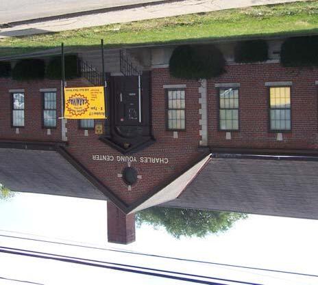
The Charles Young Community Center played a very important role in the community by providing an outlet for various social activities. The building has been used for recreational activities, award ceremonies, meetings, tutoring and mentoring programs, Black History Month events, a safe place to play for children, a place to barbecue for families and friends, and a home for the Charles Young Dancers.
Through numerous community meetings the neighborhood and community expressed a great desire to see Charles Young continuously utilized. Through continuing use of the Charles Young Community Center, it will foster partnerships between community based organizations and the community, improves the quality of life, and enhances the overall strategy of neighborhood redevelopment and sustainability.
Through the restoration of the Lyric Theatre, the East End neighborhood would have a dynamic civic asset. The Lyric Theatre provides a rich cultural and historical value that is unique to the East End neighborhood of Lexington.
As indicated through many community visioning meetings, the restoration of the Lyric Theatre is desired by the neighborhood and is seen as an important staple in the East End.
The complete restoration of the Lyric Theatre would create many cultural opportunities for the neighborhood residents as well as provide a venue for many entertainment events in the East End community.
Implement a neighborhood beautification program


The implementation of a neighborhood beautification program would assist in the beautification of community‐identified areas within the East End Neighborhood.
Working together with the city’s Public Works Department, neighborhood associations, and other agencies within the East End neighborhood, the creation of a beautification program would provide more attractive and pedestrian friendly connections is a vital improvement to the beautification of the East End. Ensuring completion of the Legacy Trail, improvement of infrastructure, planting trees along streets, and developing tree‐planting programs are just a few ways to beautify the East End. Also, through a local public arts program many distinct cultural features could be provided to the neighborhood through murals, sculptures, and written word.

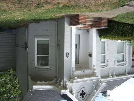

Request that a historic survey be completed for identified areas, and that appropriate markers and signage be erected. Preserving the history and character of the East End neighborhood is important because it provides insight into the culture and heritage of many of the residents as well as a Lexington’s history. Preserving this history will assist in maintaining the rich and diverse culture that exists within the East End today.
Through a historic survey, areas of historical significance will be identified and provide an awareness of the neighborhood‘s history.
It is important that property owners be notified and educated regarding historic landmarks and zoning, while historical markers are also placed within the neighborhood as to identify the historic areas.

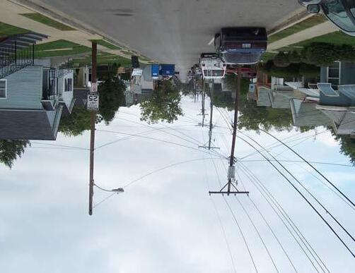
Design and construct signage identifying the East End, as well as a banner program for various locations throughout the East End.
Through the creation and implementation of signage throughout the neighborhood, the East End will establish an identity of its own within the greater city of Lexington. Widespread usage of this signage and logos for the East End would provide a tool for residents and the community to identify themselves with their own neighborhood and to the larger city.
The signage would be placed at prominent boundaries as well as throughout the neighborhood. Banners would also provide identification of the neighborhood within the greater city.

Create and implement an infrastructure plan for repairing sidewalks, streets, and storm water.
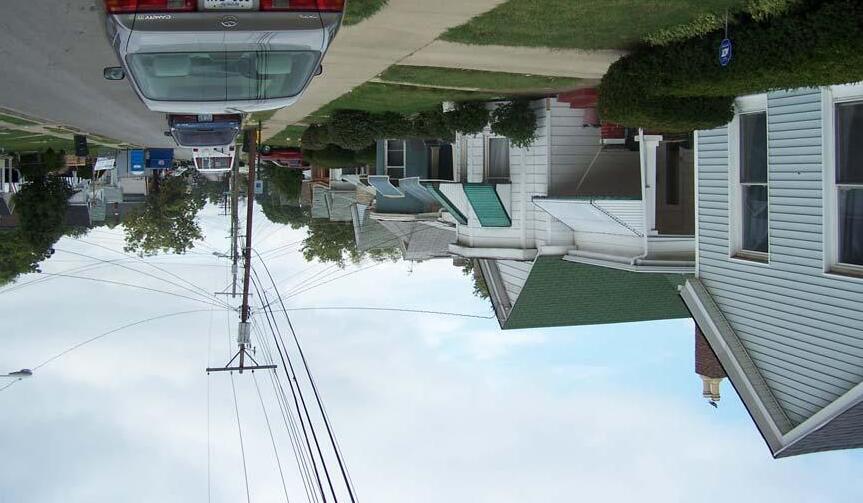
With the creation and implementation of an infrastructure plan, safety throughout the East End neighborhood would be improved greatly. A thorough safety audit of the neighborhood would provide information regarding existing sidewalks and streets that would provide the city with designated areas that require improvements.
Building and repairing sidewalks, improvements to streets and intersections such as, crosswalk striping, increased crossing times, and the identification of bike lanes along major corridors are just a few improvements that could boost the infrastructure within the East End.
These improvements would enhance the neighborhood and improve the quality of life for residents by allowing improved access to services throughout the neighborhood.
With future projects such as the Legacy Trail and Isaac Murphy Memorial Art Garden, this improved infrastructure would provide the public access to these projects through improved interconnectivity within the neighborhood as well as to the city of Lexington.

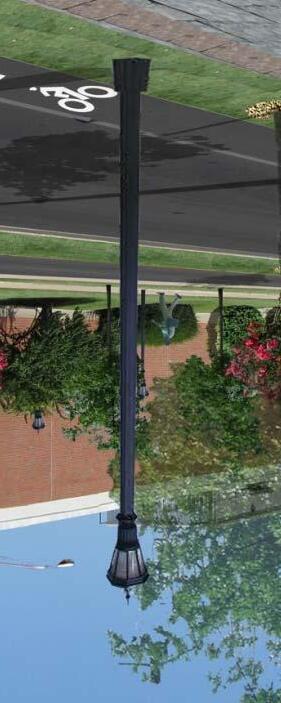
Improving the street lighting throughout the East End is a vital part of improving the safety within the neighborhood as well as improving the quality of life for the residents within the area.
Installation of lighting would improve safety and assist residents and the police with the overall improvement of the neighborhood. Lighting throughout the residential streets would also assist neighborhood watch programs. Installing additional lighting along the major roads through the area would improve the safety for pedestrians as well as drivers in the neighborhood.
Additional lighting would also enhance the neighborhood’s environment as well as provide a civic investment within the East End.
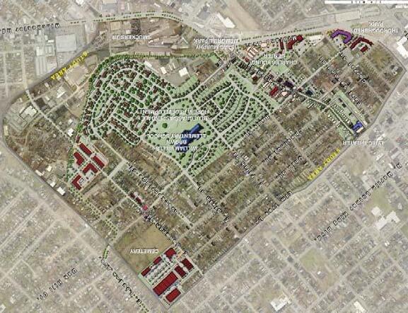


Improving the East End is the major focus of this plan. However, with improvements throughout and new projects many new residences could be higher value construction.
Creating a “Remain in place” program, encouraging positive relationships between tenants and landlords, and providing an ongoing system for resources regarding housing would ensure that housing within the East End would remain affordable and residents would remain in the East End Neighborhood.
Maintaining affordable housing within the East End is a vital factor in continuing the rich historical and cultural character of the neighborhood.
Ensure completion of the Isaac Murphy Memorial Art Garden and its connection to the Legacy Trail along 3rd Street

The completion of the Isaac Murphy Memorial Art Garden is of utmost importance to the connectivity of the East End neighborhood to the rest of Lexington and Fayette County. The completion of this project would provide a connection to the proposed Legacy Trail from the Garden to the Kentucky Horse Park via Third Street.
Both the Legacy Trail and the Isaac Murphy Memorial Art Garden provide extremely important interconnectivity of the neighborhood to many other sites within the city Lexington while simultaneously providing civic investment through beautification.
A. Winner’s Circle Plaza
B. History Video Mall
C. Isaac Murphy Statue
D. Poetry Ribbon ‐ Engraved Granite
E. Community Garden Spaces


F. Interactive Art Spaces
G. Benches
H. Planters
I. Turf Waves Performance Area
J. Derby Flag Plaza
Goals, Objectives, Actions


Preferred Alternatives


A neighborhood’s character is defined by social and economic factors. Many of these factors include the population demographics of the neighborhood, such as racial composition and income, to housing, land use and zoning within a neighborhood. The following are current socio‐economic factors within the East End.
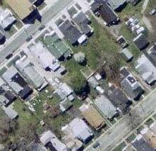
The East End Neighborhood contains a population totaling 3,940 based on the 2000 U.S. Census. Within this population there are 1,561 households and 948 families.
The racial composition of the Neighborhood is:
72 percent Black or African American
26 percent White
5 percent Hispanic or Latino Origin
1 percent other races
2 percent two or more races
There are 1,561 households, out of which:
19 percent are married couples
33 percent have children under the age of 18

36 percent have a female householder

39 percent are non‐families
35 percent are householders living alone

According to the 2000 U.S. Census, the median household income of the East End Neighborhood is $14,570, while the median household income for Lexington‐Fayette County is $39,813. 61 percent of the households within the neighborhood indicated that their income fell below $20,000 a year; while 22 percent indicated a yearly income in the range of $20,000 to $34,999. Furthermore, 47 percent of the population within the East End Neighborhood is below the poverty level.

According to the 2000 U.S. Census, The East End Neighborhood consists of 1,917 units of housing that consist of a variety of dwelling types and resident tenures. One should also note that the Bluegrass‐Aspendale HOPE VI Redevelopment Project is located within the East End and occupies nearly 20 percent of the total site area. This project is currently under construction and was not included in these statistics.

1,917 units three types of dwelling units exist, of which:
44 percent are single‐family detached
5 percent are single‐family attached
51 percent are multi‐family units
The distribution of housing was also evaluated in terms of tenure based on 2009 data from the Fayette County PVA. This data indicated that:
26 percent of properties were occupied by Owner
57 percent were occupied by Tenants
21 percent were considered as ‘Other’
Properties considered as ‘Other’ are either public facilities owned by Lexington‐Fayette Urban County Government, the Housing Authority, Community Organizations, or the State of Kentucky.
With the addition of the Bluegrass‐Aspendale Hope VI Project, the neighborhood demographics and housing conditions are expected to significantly change. The project is adding 363 total housing units to the neighborhood, 260 of these are subsidized rental units and 103 are affordable and market rate owner housing units. The addition of 103 owner housing units will increase housing ownership within the neighborhood by 5 percent or 31 percent overall.
An assessment of the physical condition of the exterior of structures was conducted to provide an overview of physical condition of the existing buildings. The assessment was conducted through a field survey based on the overall observation of the exterior without taking into account interior renovations or unseen probabilities. The exterior of the buildings were evaluated on the four following categories:
Standard: Building in sound condition or requires only minor repairs such as painting and landscaping.
Minor: Building requires some level of general repair (renovation cost $5,000 ‐ $15,000 for a single family unit)
Major: Building requires major repairs such as a new roof, foundation, siding or windows (more than three identified problems; renovation cost $15,000 ‐ $45,000)
Extensive: Building needs extensive rehabilitation and may require demolition (renovation cost is greater than $45,000)
The survey of structure condition throughout the East End Neighborhood evaluated a total of 1,354 properties and the findings were as follows:
Overall building condition varies throughout the neighborhood and no condition is concentrated into one area. The only exception is the NA category, which occurs mainly around the southeastern portion of the site. The parcels considered as deteriorated or dilapidated should be considered as development opportunities due to the low costs associated with saving the existing structures. Parcels with the NA notation were either vacant lots or parking lots which should also be considered for development opportunities. Also note that buildings currently under construction made up approximately 1% of the total parcels.


The study also looked more in depth at each parcel and structure to determine the occupancy. Each parcel containing a structure within the Study Area was checked for signs of occupancy based on visual evidence of habitation. The following designations were used to evaluate building occupancy:
Occupied: This designation is based on clear evidence of habitation with indicators that include a well‐maintained yard, cars parked in the driveway, curtains in the windows, the presence of children’s play equipment, the presence of mail, newspapers, etc. Commercial/ Industrial structures were assessed based on signs of business, employees and cars in the parking lots.
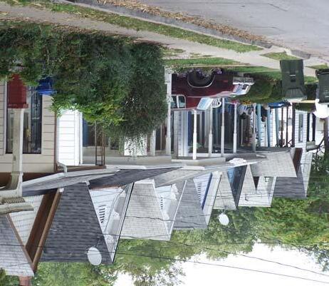
Unoccupied: This designation is based on clear evidence of the lack of legitimate occupants including a for‐sale or for‐rent dwelling or structure, missing or broken doors or windows, clear abandonment, being boarded up, etc.
Partially Occupied: This designation was applicable only to buildings designed to house two or more tenants such as duplexes and commercial structures. As above, it is based on evidence of habilitation by legitimate occupants and uses the same criteria.

*The results from the windshield survey of the East End Neighborhood indicate that nearly 82% of the structures surveyed were occupied. However, it should be noted that this figure is skewed because of the Bluegrass‐Aspendale HOPE VI Redevelopment which takes up nearly 20% of the total site area is currently under construction and not included in these statistics. Of the other parcels approximately 18% were deemed either partially/un‐occupied or vacant at the time of the survey. The majority of these parcels are located south of Fourth Street or north of Sixth Street. It is characteristics such as this that make the neighborhood feel derelict t and give it a sense of abandonment. The properties in these areas are also on or near the two most traveled vehicular corridors, Third Street and Seventh Street, further adding to outsider perceptions of the neighborhood.

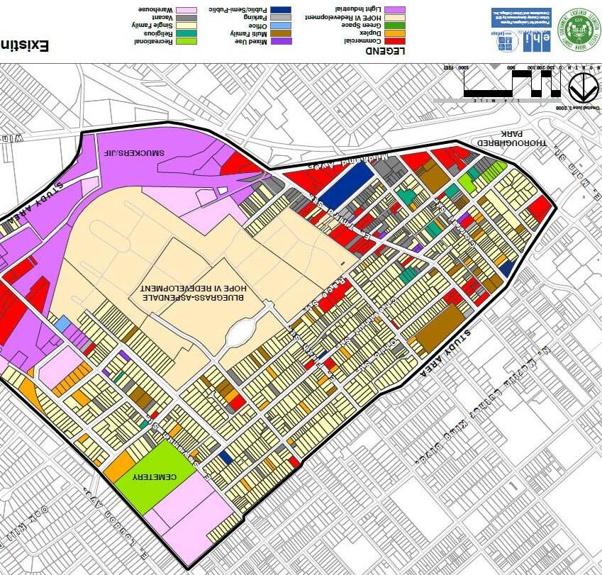
The East End Neighborhood contains approximately 387 acres of land. These total acres are divided into 1,355 parcels and 15 different land uses:

The most prevalent land use is single family residential which is located within the center of the neighborhood. Commercial uses are mainly low‐density retail around the periphery with a small concentration towards the center along Third Street. Light Industrial use is mainly the Smuckers/JIF factory, which takes up the western and north western parcels and creates a physical barrier between the center of the residential area and a main roadway, Winchester Road. Other land uses such as multi family, religious, and public/semi public spaces are found throughout and are not concentrated in any one area.
The East End Neighborhood is currently zoned into six categories. These include Business Zones (B‐1, B‐2A, & B‐4), Light Industrial (I‐1), Professional Office (P‐1), and Residential (R‐3). The Zones within the East End break down into:
The B‐1 zones are located centrally on Third Street and Race Street and are positioned to potentially play a major role in the rehabilitation of the Third Street Corridor. The majority of zones other than R‐3 occur at the fringes of the East End. In some areas, like the northern corner of the site, Industrial and Business uses are appropriate due to their proximity to active rail. In most occurrences the zones along the edges of the neighborhood (excluding residential) create barriers and interrupt neighborhood connectivity, rather than enhance and strengthen it.

Social Capital is the stock of social ties or associations that an individual acquires. This includes levels of trust and reciprocity within ones relationships and social networks. Social Capital has many broad dimensions that relate to bridging and bonding of individuals within a community. These dimensions of Social Capital include:
‐ Social trust (generalized trust; the core of Social Capital)
‐ Inter‐racial trust (a measure of how various racial and ethnic groups trust each other)
‐ Diversity of friendships (individuals that have friends whom are white, black, a community leader, a business owner, a different faith or religion, and many other factors attributed to social diversity)
The East End has many institutional agencies of Social Capital. These include the churches and social service providers such as the Catholic Action Center, Community Action Council, the Chestnut YWCA, and many more. Through the development of the East End Small Area Plan, many events also invested into the Social Capital of the neighborhood, such as the Kick‐off Event and the Community Visioning Workshop, for they expanded the relationships and social networks of the individuals that attended these events.
Social capital is an important asset within the East End Neighborhood; it is the overall way citizens within the community interact with each other. With a small area plan and further developments, the East End could experience development that could strengthen the relationships and networks that exist by fostering more community interaction. The intent of the East End Small Area Plan is to improve the lives of current residents and assure that they remain in the area, even after any growth the neighborhood may experience. Strengthening Social Capital networks should be a vital component of the plan through greater participation of social, economic, and other entities in the East End.
The East End Neighborhood Small Area Plan provides a unique opportunity for the area by potentially improving the overall goods and services within the area while simultaneously improving the quality of life. However, with improvements many challenges exist facing the Small Area Plan and the goals that it is trying to accomplish.
‐ Affordable Housing for the residents, low homeownership rates, senior care
‐ Development of recreation and community programs
‐ Development of sustainable and local businesses
‐ Deficiencies in internal street grid and street improvements, connections
‐ Over concentration of social services related providers
‐ Maintain the historical character and diversity of the neighborhood
‐ Enhance the green space and open space
‐ Crime, drugs and criminal activity
‐ Creation of affordable housing programs and infill strategies, land use designations Lexington Housing Authority HOPE VI
‐ Utilization of WWB Community School, Lyric, Charles Young, Isaac Murphy Art Garden
‐ Utilize agencies such as Urban League, Community Ventures and others to create meaningful, local entrepreneurship, East Third Street Commercial Redevelopment
‐ Accessibility to downtown, East Third Street enhancements, land use and traffic
‐ Regulatory review, code enforcement programs
‐ Development of Isaac Murphy Art Garden, Charles Young School and park
‐ Impressive quality and historic character of community, strong sense of neighborhood identity

‐ Sharpen the public safety focus, develop secure community/ neighborhood design standards, enhance the appearance and attractiveness of retail nodes and neighborhood gateways
‐ Utilize “Safe by Design” standards to create safe redevelopment (See Appendix III)
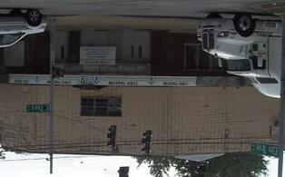
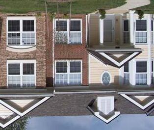

A portion of the East End Neighborhood is located over the Royal Spring Aquifer, which spans from the City of Georgetown south to Lexington. The Royal Spring Aquifer is used as a primary water source for Scott County residents and is also used as a resource by many Fayette County residents. LFUCG has adopted the Royal Spring Wellhead Protection Plan as part of its 2007 Comprehensive Plan as an initiative to preserve surface water and provide a source of potable water for Scott and Fayette County residents.


The Royal Spring Wellhead Protection Plan calls upon Education and Best Management Practices (BMPs) to protect the Water Quality within the aquifer.
Within the East End, a majority of the land over the aquifer has been developed; however any future development should take into consideration the aquifer and should possess a low‐risk for groundwater contamination.
East End History

The Neighborhood Vision
Neighborhood Overview

Goals, Objectives, Actions


Preferred Alternatives
Implementation


The Goals of the East End Small Area Plan are designed to serve as the social and economic drivers for the planning and redevelopment of the neighborhood. The East End Plan is about improving the quality of life through a set of goals that can be used to guide planning and development decisions that will have an impact on the area.
‐ Recognize, restore, preserve, and conserve the historic, ethnic, and cultural character and resources of East End.
‐ Create housing that is affordable, accessible, and attractive to a diverse range of people.
‐ Promote new commercial development to create a mix of uses that respects and enhances the residential neighborhoods of the East End.
‐ Promote opportunities to leverage positive impacts and encourage compatibility from civic investments.
‐ Create a neighborhood where daily needs can be met by walking, cycling or transit.
‐ Enhance and enliven the streetscape with landscaping, art, and signage.
‐ Ensure compatibility and encourage a complimentary relationship between adjacent land uses through strong urban design.
‐ Ensure that safety is a top priority through the utilization of Safe by Design Planning Guidelines.

‐ Protect and enhance personal health and the local environment


‐ Utilize technology to connect the neighborhood to itself and to the world.
‐ Utilize community organizations to increase social capital in the neighborhood.


‐ Grow a locally based economy that offers opportunities to all residents.
‐ Create a green and environmentally acceptable neighborhood through the recognition of the interdependence of environmental, economic, and social equity concerns.
Objective 1.1: Maintain and preserve the integrity of current residential districts.
Objective 1.2: Identify and explore the creation of local, state, or federal historic districts or landmarks.
Objective 1.3: Improve access to funds and resources for rehabilitating properties.
Objective 1.4: Educate interested property owners about the process for establishing historic landmarks/zoning.
Objective 1.5: Create an awareness of neighborhood history.
Objective 1.6: Celebrate the East End
1. Preserve and conserve the residential character in the areas designed residential on the Future Land Use Map.
2. Consider working to create Overlay Zoning in appropriate areas.
1. Request that a historic survey be completed for the area in relation to Objective 1.4.
2. Provide information to neighborhood associations or individuals interested in pursuing a national or state register historic district for eligible properties.
1. Provide information to property owners about available resources for rehabilitating historic homes and buildings.
1. Notify owners of eligible properties and provide information about the process of establishing a historic landmark/zoning.
2. Provide seminars and assistance regarding the Overlay Zoning district.
1. Identify Historical Properties within the neighborhood.
2. Conduct a survey in order to plan for and place historical markers in the neighborhood.
3. Utilize the Art in Motion Art Bus Shelter concept to provide a place for expressing historical connections.
4. Support the photographic history project to be located at the restored Lyric Theater.
1. Create a banner program for neighborhood streets, focusing on 3rd Street and Elm Tree Lane.
2. Work with local arts and cultural organizations to develop a public art program to include murals, sculptures, as well as spoken and written word.
3. Utilize the Lyric Theatre for performances by East End artists.
4. Continue to nurture and grow the Roots and Heritage Festival.
Goal
– Recognize, restore, preserve, and conserve the historic, ethnic, and cultural character and resources of East End.
Goal 2 ‐ Create and conserve housing that is affordable, accessible, and attractive to a diverse range of people.
Objective 2.1: Increase opportunities for home ownership.
Objective 2.2: Increase the amount of housing units available.
1. Establish an ongoing system for providing information on housing resources for new home‐buyers. Develop a referral center using existing facilities such as the William Wells Brown School, churches, and similar institutions within the East End in order to create a “one‐stop” for housing information.
2. Encourage the creation of an affordable housing trust fund within the city to support residents who cannot afford to pay market rates but who otherwise are not interested or eligible for public housing.
1. Encourage vertically mixed‐use developments, with housing units above ground floor retail and offices.
Objective 2.3: Maintain and create affordable, safe, well‐managed rental housing
1. Retain existing multi‐family housing development and allow new multi‐family development on properties identified on the Future Land use Map
2. Continue education and positive conversations between landlords and tenants.
Objective 2.4: Make it possible for existing residents (both homeowners and renters) to stay.
1. Develop policies to encourage a balanced code compliance program, one that does not unreasonably burden homeowners and that offers assistance in compliance.
2. Establish an ongoing system for providing information on housing rehabilitation resources to residents and property owners via Urban League, Community Ventures, and other organizations.
3. Encourage the development of a “remain in place” program for redeveloping areas to ensure that lower income renters are not displaced by higher value construction.
Objective 2.5: Increase opportunities for senior housing and assisted living.
1. Identify land that would be suitable for a moderately sized facility.
2. Ensure the creation of a neighborhood based housing development corporation to assist in the planning of these facilities
Objective 3.1: Provide incentives for creating or maintaining neighborhood serving businesses.
Objective 3.2: Increase mixed‐use opportunities where appropriate on commercial corridors.
Objective 3.3: Where appropriate, address nonconformity between desired land use and zoning.
Objective 3.4: Develop a strategy for utilizing vacant land.
Objective 3.5: Utilize the city’s economic development office, Commerce Lexington, and other organizations to attract business.
1. Establish an ongoing system to provide information on resources to assist small businesses.
2. Rezone properties to mixed‐use along Third Street and Midland Avenue.
3. The neighborhood should develop a list of conditional zoning restrictions that it would like considered with any commercial zone change.
4. Utilize Public/ Private funding sources to incentivize development. Including, Tax Increment Financing (TIF), Tax Credits, CDBG, and others.
1. Options for mixed‐use development are recommended for the neighborhood. This type of development allows residential or commercial development, or both types on the same site.
2. Preferred Alternatives section indicates where this may be appropriate and what zoning may be needed
1. Rezone properties to assist implementation of the Preferred Alternatives of this plan.
1. Identify owners and tax status for vacant properties as a first step towards a potential “community land trust” that could work with an East End CDC and other organizations to target properties for housing or other development.
1. Ensure the creation of a neighborhood Community Development Corporation to oversee these opportunities in the neighborhood.
2. Develop a business “wish list” that includes a grocery/public market, pharmacy, general merchandise, hardware store, Laundromat, restaurants, ice cream shop, and perhaps even a movie theatre.
‐ Promote new commercial development to create a mix of uses that respects and enhances the residential neighborhoods of the East End.

There are numerous civic investments being made in East End by the Housing Authority, the School Board, the Isaac Murphy Memorial Art Garden, Art in Motion, churches, and others. The neighborhood would like to encourage greater coordination and support among the various organizations working to preserve and improve the area.


Objective 4.1: Promote civic uses that are accessible and useable for the neighborhood residents and enhance the livability of the neighborhood.
1. Ensure the completion of the Lyric Theatre.

2. Ensure the rehabilitation and community use of the Charles Young Center.
3. Ensure completion of the first East End Art in Motion bus shelter and use it as a model for others in the area.
4. Support the completion of the Legacy Trail.
5. Support the construction of the Isaac Murphy Memorial Art Garden.

Goal 5 ‐ Create a neighborhood where daily needs can be met by walking, cycling or transit.
The neighborhood wants to promote a well‐designed, mixed‐use, and multi‐modal corridor on 3rd Street and Winchester Road. Third Street has been a major focus throughout this process and there is a strong desire to create a more attractive and pedestrian friendly corridor. Re‐creating and improving pedestrian and bicycle connections with downtown and the rest of the City are also important. The desire for neighborhood streets is to promote pedestrian safety and minimize cut thorough traffic.
Objective 5.1: Increase pedestrian safety with appropriate measures.
Objective 5.3: Discourage cut‐through traffic in residential areas.
Objective 5.4: Encourage slower speeds for cars
Objective 5.5: Increase pedestrian and bike access across and along major corridors
Objective 5.6: Ensure completion of the Legacy Trail with a strong connection along 3rd Street and to a Trail Head at the Isaac Murphy Memorial Art Garden.
Objective 5.7: Increase frequency of LexTran service; add routes and new stops where appropriate
1. Install stop signs, cross walk signs, and stop lights
2. Increase appropriate street lighting.
1. Slow traffic by constructing complete streets, bulb‐outs, improved intersections and improved pedestrian access.
1. Implement “Complete Street” Improvements as detailed in the Transportation section of Preferred Alternatives.
2. Improve signage as detailed in Preferred Alternatives.
1. Build or repair sidewalks
2. Facilitate better pedestrian connections across Winchester Road and Midland Avenue. Seek improvements such as crosswalk striping, increased crossing times, and beautification.
3. Identify and mark appropriate bike lanes, including on Winchester Road and Midland Avenue.
1. Community representatives must participate in the Legacy Trail planning process.
1. Work with LexTran to obtain commitments
2. Create a loop from the East End into downtown with the new trolley service
3. Install more bus shelters
Goal 6 ‐ Enhance and enliven the streetscape with landscaping, art, and signage.
Objective 6.1: Improve beautification of the area.
Objective 6.2: Improve existing neighborhood parks.
Objective 6.3: Improve the African American #2 Cemetery.
1. Ensure the creation of a Community Development Corporation to oversee these opportunities in the neighborhood.
2. Plant trees as part of street or right‐of‐way (ROW) improvements through a joint effort with the city’s Public Works Department.
3. Neighborhood associations should develop neighborhood beautification programs.
4. Work with City Corridors Committee and State Transportation Cabinet to implement corridor beautification along Winchester Road and Midland Avenue.
5. Actively promote clean‐up/beautification of streets, lots, and parks through community projects. Neighborhood associations and other groups can initiate projects and seek support from the City’s Public Works and other agencies.
6. Support the creation of the Legacy Trail from Isaac Murphy Memorial Art Garden to the Kentucky Horse Park via Third Street.
7. Ensure that East End signage, memorial makers, and other beautification is included in the planning.
1. Charles Young Park, Northeastern Park, and Castlewood Park
2. Ensure compatibility with LFUCG Parks Master Plan
Objective 6.4: Express the identity of the neighborhood to the larger city.
1. Designate the African American #2 Cemetery as a local historic landmark.
2. Seek funds for a master improvement plan for the Cemetery.
3. Work with the City’s Historic Preservation Officer and community organizations to re‐establish a “Friends of …” group that can raise or seek funds for restoration.
4. Initiate a plan to seek funding for additional landscaping care and maintenance.
1. Design and locate signage at all prominent boundaries of the neighborhood.
Goal 7 ‐ Ensure compatibility and encourage a complimentary relationship between adjacent land uses through strong urban design.
Objective 7.1: Ensure that new infill residential buildings that are compatible by design in terms of architectural style, details, and materials.
1. Require that roofs of new infill housing units be of simple form and consistent with existing historic housing. Roofs should have a pitch of 8 inches for every 12 inches and an overhang of at least 12” wide.
2. Require that Front Doors be visible from the street.
3. Require Windows of vertical proportions (double‐hung windows). Shutters should be sized to match the proportions of the windows.
4. Encourage that front porches be used as a design feature as frequently as possible.
5. Encourage the use of architectural details.
6. Require that multi‐family housing be of an appropriate scale and historic character with the rest of the neighborhood.
7. Encourage the use of decorative features such as bay windows and brackets.
Objective 7.2: Ensure compatibility between adjacent land uses through non‐residential layout guidelines.
1. Require that front setbacks of new commercial buildings be aligned with existing buildings to create a clearly defined edge. In the absence of an existing setback line, front setbacks along non‐arterial roads should be no more than 25 ft. away from the curb.
2. Encourage Distinctive architectural treatments / massing on corner lot buildings (on major retail or gateway nodes)
3. Allow minimal setback variations to accommodate outdoor cafes / dining.
4. Encourage location of parking lots, decks and building service areas within block interiors to minimize their visual impact and allow access via alleys or side streets, whenever possible.
5. Encourage Shared parking for different tenants and uses to minimize the overall supply of parking.
6. Require all surface parking lots and decks should be clearly marked and accessible from primary streets.
7. Encourage On‐street parallel parking is encouraged whenever possible and appropriate.
8. Screen Single‐family areas from non‐residential areas with an 8’ wide (min.) landscaped buffer.
9. Combine driveways to adjoining businesses to minimize curb cuts on public streets
10. Allow a zero setback in retail nodes such as Third Street where high pedestrian activity is expected or encouraged.
Goal 7 (continued) ‐ Ensure compatibility and encourage a complimentary relationship between adjacent land uses through strong urban design.
Objective 7.3: Ensure that new non‐residential buildings are compatible with existing adjacent structures in architectural design, details and materials.
1. Encourage articulation of building facades with canopies, porches, cornices, roof lines, and window details to avoid monotonous facades.
2. Require that all new non‐residential buildings address the street; requiring that all main entries be oriented toward major streets.
3. Require that new non‐residential building be constructed of brick, stone, or other high‐quality finish.
4. Discourage the exposure of concrete blocks or metal sided buildings.
5. Encourage commercial buildings that offer a mix of compatible uses (i.e. office or residential above ground floor retail).
6. Require that business signs be incorporated to building facades (rather than monument signs).
7. Encourage the use of wall signs perpendicular to building face that are more visible for pedestrians.
8. Promote inclusion of large storefront windows and awning or canopies in commercial buildings to encourage pedestrian use.
9. Encourage active public uses such as retail shops and outdoor cafes on the ground floor of buildings.
Objective 7.4: Improve streetscape frame and offer a variety of experiences.
1. Require wider sidewalks and more pedestrian amenities (such as benches, landscaping, etc) in areas of denser development.
2. Develop a consistently designed set of improvements to be utilized throughout the neighborhood (such as street lights, benches, bike racks, trash receptacles, etc).
Objective 7.5: Improve overall condition of Public Spaces.
1. Allow access to public spaces from the street and/or pedestrian greenway and link public spaces via a network of pedestrian trails and walkways.
2. Provide safe, well‐lit public spaces with proper directional signage.
3. Landscaping should include native plantings.
4. Provide appropriate pedestrian amenities in public parks and open spaces (such as gazebos, benches, grills, drinking fountains, play equipment, etc).
Goal 8 ‐ Ensure that safety is a top priority.
Objective 8.1: Continue to develop a positive, beneficial relationship between the neighborhood and the police department.
1. Develop a “common ground” program to encourage and facilitate conversations outside of daily safety needs
2. Help the police to identify drug and gang activity.


Objective 8.2: Make it a planning priority to ensure socially sustainable neighborhoods.
1. Use the main elements of Safe by Design. See Appendix III for Safe by Design Principles.
Objective 8.3: Increase safety in all areas.

1. Conduct a safety audit.
2. Work with the Fire Department to increase awareness of fire danger.
3. Continually monitor pedestrian and bike activity to find and eliminate danger zones.
4. Support the Safe Routes to School program at William Wells Brown School.
5. Work with the Police Department to implement Safe by Design Standards (See Appendix III)
Goal 9 ‐ Protect and enhance personal health and the local environment.
Objective 9.1: Increase awareness and education about the relationship between healthy food and personal health.
1. Utilize the William Wells Brown school to work not only with children but adults to raise awareness of the importance of healthy eating. The Fayette County Extension office and other organizations will be good partners.
2. Work with the city office of economic development, Commerce Lexington and other organizations to bring a quality food source into the neighborhood.
3. Work with community organizations to expand the community garden concept.
Objective 9.2: Increase health care opportunities.
1. Work with the Polk‐Dalton Clinic to expand their reach into the neighborhood.
2. Utilize the William Wells Brown School to host health fairs, clinics, and screenings with a number of health providers.
1. Support the Safe Routes to School program at William Wells Brown School.
Objective 9.3: Increase physical activity.
2. Create a walking track around the William Wells Brown school to encourage physical activity in a safe environment.
3. Work with the city to fix broken sidewalks.
4. Strive to achieve a better mix of commercial activity within walking distance of the neighborhood.
5. Work with Parks and Recreation to place a new swimming pool in the neighborhood and add new activities at city owned properties.
6. Work with Parks and Recreation and Police Athlete League to form East End sports leagues.
7. Support the development of the Legacy Trail from the Isaac Murphy Memorial Art Garden to the Kentucky Horse Park via Third Street.
8. Support the Town Branch Trail, from its headwaters near the Intersection of Midland and Third Street to the western portion of Fayette County.
Objective 9.4: Reduce resident’s footprint on the environment.
1. Identify appropriate areas for rain gardens and bio‐swales; work with city and community groups to begin a process of implementation.
2. Work with local nurseries and plant suppliers to obtain a neighborhood discount for trees and shrubs.
3. Identify all possibilities increasing park land and open space in the community.
4. Work with the neighborhood council and city government to take advantage of on‐property measures to reduce storm water impact such as rain barrels, gardens, and retention areas.
5. Neighborhood Clean‐up days should occur each spring and fall.
6. Ensure that the pedestrian and transportation actions elsewhere in this document are achieved.
7. Work to include Green Infrastructure Incentives into East End Development Incentives.
Goal 10 ‐ Utilize technology to connect the neighborhood to itself and to the world.
Objective 10.1: Increase education about the importance of digital connections
1. Employ the William Wells Brown school as a prime center for digital learning
Objective 10.2: Utilize digital communications to keep the neighborhood informed.
1. Establish an “i‐point” on the Art in Motion Bus shelters to announce information of importance.

2. Encourage neighborhood associations compile an extensive email list and employ it for regular updates.
Objective 10.3 Increase digital capacity through access
1. Utilize organizations, such as Connect Kentucky, to increase digital capacity in the neighborhood both through service as well as an increase in computers.

Goal 11 ‐ Utilize community organizations to increase social capital in the neighborhood.
Objective 11.1: Take full advantage of the resources that exist in the neighborhood.
1. Undertake a “gap” analysis of the existing organizations – including faith based
in the area to determine over served and underserved areas.
2. Upon identification of over served areas, work with organizations to better align missions and to reduce any duplication of effort.
3. Upon identification of underserved areas, work to possibly realign existing efforts to address the gaps or work with the large community to fill the opportunity.
Objective 11.2: Strengthen youth programs, especially for teenagers.
1. Take full advantage of the William Wells Brown School for after‐school programs and events.
2. Initiate parenting classes taught by local residents.
3. Initiate skill training programs aimed at young adults.
4. Initiate a life mentoring program utilizing individuals from the neighborhood as mentors – identify appropriate “neighborhood grandparents.”
5. Host community visioning days for local youth to comment and plan the future of the neighborhood.
Objective 11.3: Empower neighborhood associations to have a stronger voice in the future direction of the neighborhood.
1. Identify a “City Hall” representative from each association to work with the First District Council member as well as to monitor government actions and events.
Goal 12 ‐ Grow a locally based economy that offers opportunities to all residents.
Objective 12.1: Create a prepared workforce in the neighborhood.
Objective 12.2: Set the table for business development.
1. Ensure the creation of a Community Development Corporation to oversee economic opportunities in the neighborhood.
2. Establish a vocational training program in the neighborhood, potentially focused on building rehabilitation for energy conservation and environmental protection – “green collar” work.
3. Support the objectives and actions in Goal 10.
4. Work with the city office of economic development, Commerce Lexington, and other organizations to create a bi‐annual “business fair” to highlight employment and small business opportunities and resources.
1. Grow the community outdoor market concept at the Community Ventures Facility.
2. Work with city, state, and federal agencies to ensure the full range of education, grants, loans, and assistance is available in the East End.
3. Increase education efforts to demonstrate the importance of digital access to small business.
4. Identify suitable land for large scale employment opportunities.
5. Utilize the Redevelopment of East Third as a mixed use retail center with the development of public market.
Objective 12.3: Celebrate and advertise local business success stories
1. Create an East End business directory.
2. Create an East End merchants/business association whose purpose it will be to grow local business as well as to provide mutual support.
3. Work with Commerce Lexington and Business Lexington to publicize the efforts and successes of businesses in the neighborhood.
Goal 13 ‐ Create a green and environmentally acceptable neighborhood through the recognition of the interdependence of environmental, economic, and social equity concerns.
Objective 13.1: Coordination with the Division of Environmental Policy
1. Work closely with the Division of Environmental Policy actions and policies that will have a positive effect on the neighborhood.
2. Increase education about the importance of reuse and recycling.
3. Establish a recycling center in the neighborhood.
Objective 13.2: Encourage Greener Buildings
1. Use green building materials in new and redevelopment/rehabilitation projects.
2. Ensure that the City adopts a “green approach” with any new or rehabilitated public building.
Objective 13.3: Restore the environment.

1. Identify Brownfield sites within the neighborhood and develop remediation plans.
2. Ensure that the City adopts a “green approach” with any new or rehabilitated infrastructure project. For example, consider the creation of bio‐swales as street medians.
3. Provide Green Infrastructure Incentives
East End History

The Neighborhood Vision
Neighborhood Overview

Goals, Objectives, Actions

Preferred Alternatives
Implementation


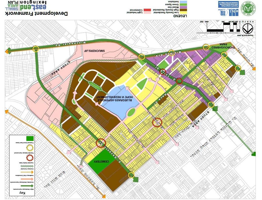
The Development Framework Map is intended to identify issues and possibilities throughout East End. This map illustrates relationships between general land uses as well as more detailed information such as intersections of interest, potential commercial nodes, and areas in need of infrastructure improvements as well as streetscape improvements. The framework map also illustrates the potential for a greenway trail along the railway that follows the eastern boundary of the East End Neighborhood. This Greenway could connect the East End to the Legacy Trail as well as to bike trails/lanes to Downtown Lexington.
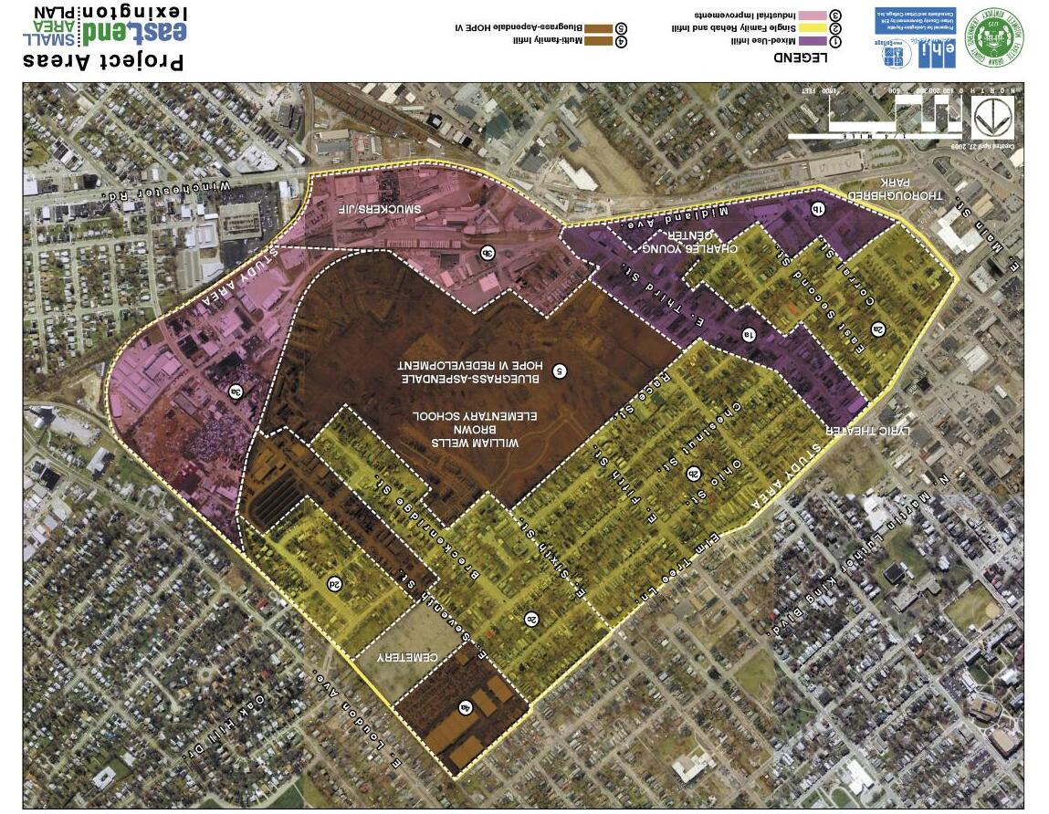
The Preferred Land Use Map was used to identify regions within the entire neighborhood that shared similar issues/concerns. By breaking the entire area into regions, it is possible to highlight more detailed information and potentially hone in on specific areas of need throughout the neighborhood.
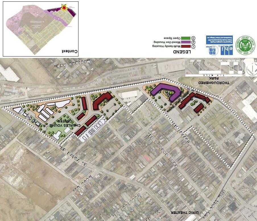
There are numerous vacant or under‐utilized properties along Midland Avenue that are appropriate for mixed use development and multi‐family housing. The land uses shown on the following maps are intended to provide an example of how the Midland Avenue corridor could be revitalized with the addition of multi‐family and mixed use development. The location of mixed use and multi‐family development will be determined by a variety of factors, including the Goals, Objectives, and Actions statements, and other aspects of this Plan.

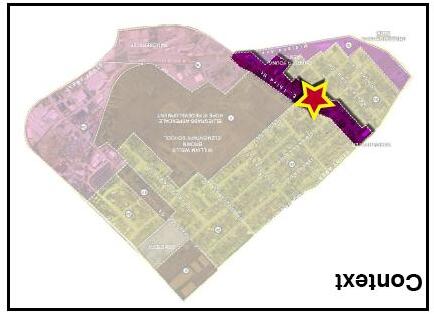
The Third Street Corridor provides the main vehicular route through the East End Neighborhood. This space will serve as the main commercial and mixed‐use hub for the East End. The main commercial node occurs at the intersection of Third Street and Race Street. Third Street will be anchored to the west by the newly renovated Historic Lyric Theater and to the East by the Isaac Murphy Memorial Art Park. Most of the buildings in the area are in standard condition and are suggested to be re‐used with façade and structural improvements to keep the area’s physical character similar. These re‐used buildings may take on a new use such as commercial or office space or retain their current use. Other improvement suggestions to the corridor include increasing connectivity by connecting Gunn Street to Chestnut Street and having improved more accessible parking throughout.
The newly renovated housing, commercial space, and streetscape features will allow for the reemergence of the vibrant and active Third Street that once existed.
Midland Avenue is a major roadway into and out of Downtown Lexington. This space has very high visibility making it an ideal location for a commercial node that serves the East End neighborhood and surrounding areas. The commercial units that are already in place are to be adaptively re‐used keeping the same physical character while also creating more pedestrian and viewer friendly streetscape spaces along Midland Avenue. The Western portion of this area is near Thoroughbred Park which would serve as an amenity to the nearby proposed multi‐family housing units. The Charles Young Center is proposed to remain open for community utilization. The land fragments left behind after Shropshire Avenue connects to Midland Avenue are proposed to be used as greenspace serving the area’s residents and visitors
All of these improvements serve to mend the separation that currently exists between the East End Neighborhood and Downtown Lexington and soften the harsh edge that Midland Avenue currently has.


A major issue in the East End neighborhood is infill housing and the rehabilitation of existing housing. This is already beginning to take place in many areas throughout the East End. There are four major “sub‐areas” considered infill and rehabilitation areas.
These sub areas are ‘2a, b, c and d’. Each of these zones contains some residential component, while simultaneously possessing great potential for infill and redevelopment while providing an overall improvement of the East End.
Please note that the Bluegrass‐Aspendale Hope VI project is not considered within the Infill and Rehabilitation Areas.
Sub‐area 2a

The first, ‘2a’, occurs at the Southwestern most portion of East End nearest to Downtown Lexington, Thoroughbred Park, and the previously mentioned housing, commercial infill, and re‐use opportunities along Midland Avenue. This area contains the majority of Corral Street and Second Street between Elm Tree Lane and Midland Avenue. Project Area 2a is an example of the East End neighborhood where new infill housing is already beginning to take place. This area is also almost entirely residential with the exception of various public and religious facilities.


Sub‐area ‘2a’ has 21 potential infill opportunities that need major rehabilitation. The estimated cost of the major rehabilitation in this area is approximately $630,000 ($30,000 each). Minor rehabilitation opportunities in the area total to 52 with an estimated cost rehabilitation cost of $780,000 ($15,000 each).


The second sub‐area ‘2b’ is the largest residential project area. This area is residentially zoned with scattered religious and commercial zones throughout. This area is bordered by Race Street and the new Bluegrass‐Aspendale Hope VI development to the east, the Third Street Corridor to the south, the Seventh Street Corridor to the north and Elm Tree Lane to the west. This area currently serves as the residential core of the East End Neighborhood and includes homes that have been adorned by the Bluegrass Trust label of historical importance.


Sub‐area ‘2b’ has 14 potential infill opportunities that need major rehabilitation. The estimated cost of the major rehabilitation in this area is approximately $420,000 ($30,000 each). Minor rehabilitation opportunities in the area total to 126 with an estimated cost rehabilitation cost of $1,890,000 ($15,000 each).


The third area ‘2c’, is one of the northernmost areas and is currently bordered by two light industrial zones as well as the new Bluegrass‐Aspendale Hope VI development. Area ‘2d’ is bordered on three sides by non residential uses; a cemetery, light industrial, and a railway. The railway has potential for a “rails to trails” project and may have future inclusion with the currently proposed “Legacy Trail.” The trail may have a direct connection on Loudon Avenue and could serve as an alternative form of transportation and recreation for residents and visitors between East End and surrounding areas. Seventh Street serves as a major corridor through these two areas. Residential zoning needs to have some form of transition between industrial use and residential use which does not currently exist.


Sub‐areas ‘2c’ and ‘2d’ have 12 potential infill opportunities that need major rehabilitation. The estimated cost of the major rehabilitation in this area is approximately $360,000 ($30,000 each). Minor rehabilitation opportunities in the area total to 113 with an estimated cost rehabilitation cost of $1,695,000 ($15,000 each).

The two light industrial zones within the East End Neighborhood house various industrial businesses and use approximately 75 acres. These industrial zones serve as an employment anchor for the surrounding area. Though industrial uses are not generally conducive to creating optimum residential conditions they are not proposed to be removed rather, it is being recommended that in area ‘3a’ there be environmental and architectural standards put in place to ensure a clean and appealing environment that improves the overall aesthetics of the community. The relationship between residential uses and industrial uses is one that takes extra care to not offset one or the other because of the opposing uses, but instead find a way to seamlessly blend them together so that they may co‐exist. Infrastructural and other more aesthetic improvements will aide in this process. The second industrial sub area within the East End ‘3b’ is occupied by the JIF Peanut Butter Factory which reaches the railway on the northern side of the sub area and borders Winchester Road on the southern side. This is another instance of a grouping of local business that provides jobs for surrounding residents but, could use some cleanup in order to become a true asset to the community on multiple levels.
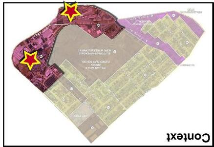

The Multi‐family infill areas (sub area 4) exist along the Seventh street corridor which runs east and west through the northern portion of the East End Neighborhood. This area of the East End is where the majority of existing multifamily housing stands. Many of the possibilities in this area lie within light industrial re‐use, in this case, re‐used as multifamily housing. Some of the existing structures are interesting structures and could be rehabilitated into interesting and unique living spaces. Since Seventh Street is one of the few areas multi‐family housing is prevalent further strengthens the idea of this area for multi‐family housing in the East End Neighborhood.


Bluegrass‐Aspendale is a Hope VI affordable housing project at the center of the East End Neighborhood. This multi phase project is already underway with the completion of some multi‐family housing phases as well as the new William Wells Brown Elementary School. There are still other phases to get underway including a single family home ownership phase. Overall, the Bluegrass‐Aspendale project will have approximately 491 new units including 260 subsidized rental and 103 affordable and market rate single‐family homeownership units on the existing site’s footprint.


Many areas within the East End are in need of various transportation improvements. These improvements range from the construction of sidewalks, the improvement of various roadways, intersections improvements, to overall connectivity of the existing street and sidewalk network. An overall Transportation Map on the following page highlights the location of each possible improvement as well as the type of each improvement.
Each recommendation has been given a certain priority level as well as a construction cost estimate. The priority levels of the following recommendations are:
‐ High Priority, Short Term
‐ High Priority, Long Term
‐ Medium Priority
‐ Low Priority
Each recommendation is shown by priority level on page 84.
The construction cost estimate is included in Appendix II located on page 100.

Transportation Improvements

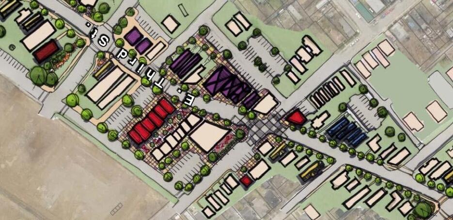
Third Street is a main vehicular route through the heart of the East End. Third Street currently contains many businesses and provides great potential for further commercial and mixed‐use development. Therefore “Complete Street” improvements are recommended for the Third Street business area as part of a public/private partnership with the local businesses. “Complete Streets” is a concept that includes all modes of transportation for patrons. This includes automobiles, bicycles, and pedestrians and implements a sidewalk, curb, parking, sharrow lanes (markings used to indicate bicycle areas), as well as the opportunity for green streetscape improvements.

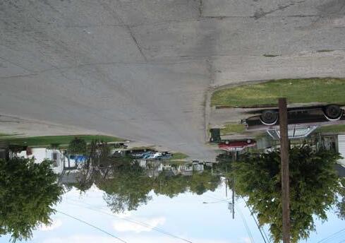

Shropshire Avenue is a wide residential street that connects Loudon Avenue and Seventh Street. As with Third Street, Shropshire Street could use “Complete Street” improvements that would include a sidewalk, curb, sharrow lanes (markings used to indicate bicycle areas), parking bays, as well as the opportunity for green streetscape improvements.
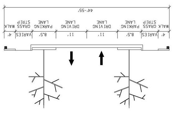

Category A :
1. Ohio Street & Ohio Terrace: Add 2 ADA compliant sidewalk ramps.
2. Chestnut Street & Breckenridge Street: Add 25 feet of sidewalk and 6 ADA compliant sidewalk ramps.
3. Pemberton Lane & Breckenridge Street: Add 2 ADA compliant sidewalk ramps.


4. Elm Tree Lane & Third Street: Ensure pedestrian and bicycle access to proposed Art in Motion Bus Shelter.

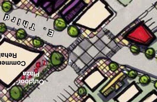

Category B:
5. Third Street & Race Street: Improve pedestrian, bicycle and transit access/crossing in conjunction with Third Street Improvement.
6. Seventh Street & Shropshire Avenue: Improve pedestrian, bicycle and transit access/crossing in conjunction with Shropshire improvements.
7. Shropshire Avenue & Breckenridge Street: Improve pedestrian access by providing bulb‐out design due to width of Breckenridge Street.
8. Seventh Street & Chestnut Street: Improve pedestrian crossing in conjunction with sidewalk improvements along Seventh Street.
Category C:

9. Seventh Street & Ohio Street: Gateway intersection improvement opportunity.
10. Seventh Street & Jackson Street: Gateway intersection improvement opportunity.
11. Shropshire Avenue & Midland Avenue: Gateway intersection improvement opportunity in conjunction with the Shropshire Avenue project currently in design.
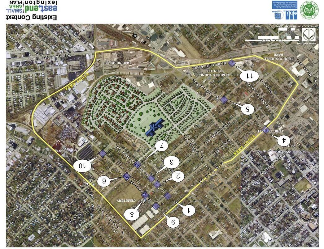
1. Gunn Street: Gunn Street is a dead end road with 20 feet of roadway. There are sidewalks and parking on both sides of the road. To improve connectivity a connection would likely be made with Ford Place. Making this connection would require the home at 121 Ford Place to be removed. Ford Place would also have to be reconstructed. Ford Place is a 21‐foot roadway but there is 34 feet between the existing fences (see the picture below). Additional right‐of‐way may have to be acquired but there is enough room between the existing fences on Ford Place to construct a roadway section similar to that on Gunn Street (20‐foot roadway width, curb & gutter and two 4‐foot sidewalks).
2. Coleman Avenue: Coleman Avenue is a 12‐foot dead end road. There are no curbs or sidewalks and the road is tightly confined by trees and fences (see the picture below). The road is used by residents to access driveways and parking garages. To improve connectivity, a connection could be made with Ohio Street. This connection could occur at 317 Ohio Street, which is currently an empty lot. If a connection is made, right‐of‐way will have to be acquired and Coleman Avenue would need to be reconstructed. Coleman Avenue is a 12‐foot roadway but there is 16 feet between the existing fences. Additional right‐of‐way may have to be acquired but there is enough room between the existing fences to construct a one‐way road with a 10‐foot roadway width, curb and one 4‐foot sidewalk on the western side of the road. An alternative option would be to clear the trees along the street and add street lights to increase safety.
3. Race Street: Race Street dead ends before is connects to Short Street. There is a 10’ to 15’ elevation difference between Race Street and Short Street (see the picture below). To increase connectivity a sidewalk could be added so pedestrians could get from one street to the other. An existing path is visible showing pedestrian movement. An ADA compliant and bike friendly sidewalk should be considered.
4. Shropshire Avenue: This segment of Shropshire Avenue has been designed and will extend Shropshire Avenue between Fourth Street and Midland Avenue. The right‐of‐way stage is ongoing. Once complete, the project must be approved by City Council and construction can begin. No timetable has been established.
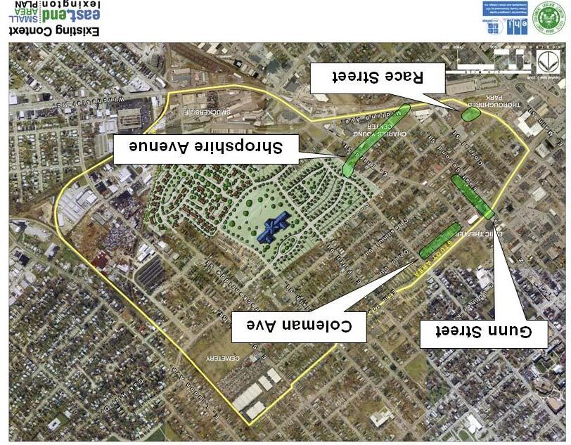
1. Pemberton Lane north of Breckenridge Street: This segment of Pemberton is a 15‐foot road. There are no curbs or sidewalks (see the picture below). The road serves as the only access to Stoll Poole Court. To improve pedestrian access, sidewalks could be added. Pemberton is a 15‐foot roadway but there is 20 feet between the existing fences. Additional right‐of‐way may have to be acquired but there is enough room between the existing fences to construct a 10‐foot to 15‐foot road with curb and one 4‐foot sidewalk on the western side of the road. Construct ADA ramps at all intersections.
2. Pemberton Lane south of Breckenridge Street: This segment of Pemberton is 11 feet wide. There are no curbs or sidewalks (see picture below). The road is used by residents to access driveways and parking garages. To improve pedestrian access, sidewalks could be added. Pemberton is an 11‐foot roadway but there is 15 feet between the existing fences. Additional right‐of‐way may have to be acquired but there is enough room between the existing fences to construct a 10‐foot road with curb and one 4‐foot sidewalk on the western side of the road. Construct ADA ramps at all intersections.
3. Seventh Street: There are no sidewalks on the northeastern portion of Seventh Street between Ohio Street and Shropshire Avenue. To improve pedestrian accessibility, sidewalks could be added to the northeastern portion of Seventh Street between Ohio Street and Chestnut Street. In front of the cemetery on Seventh Street there is only 4 feet between the cemetery fence and the back of curb. Pedestrian access could be increased by adding a 4‐foot sidewalk but this would require relocating major utility poles and/or the cemetery fence. It is also likely that adding sidewalks would require right‐of‐way acquisition at 437, 439, 441 and 445 Seventh Street. In lieu of adding sidewalks; crossing accessibility for pedestrians could be improved at the Chestnut Street and Shropshire Avenue intersections (see also intersection improvements 5 and 10). Add ADA compliant sidewalk ramps, signage and striping at these two intersections to encourage pedestrians to use the other side of Seventh Street where sidewalks already exist. This type of improvement would have fewer impacts.
4. Seventh Street: Construct 4‐foot sidewalks on both sides of the existing road between Magnolia Ave and Rockcastle Street (see the picture below). Construct ADA ramps at all intersections. Where space permits include a 5.5‐foot grass strip between the existing curb and the proposed sidewalk. The fence at Auto Sales Lucky 7 will have to be relocated and right‐of‐way possibly purchased from 701, 733 and 745 Seventh Street to make room for the sidewalk. Preliminary analysis show the fence at Auto Sales Lucky 7 on the City’s right‐of‐way.
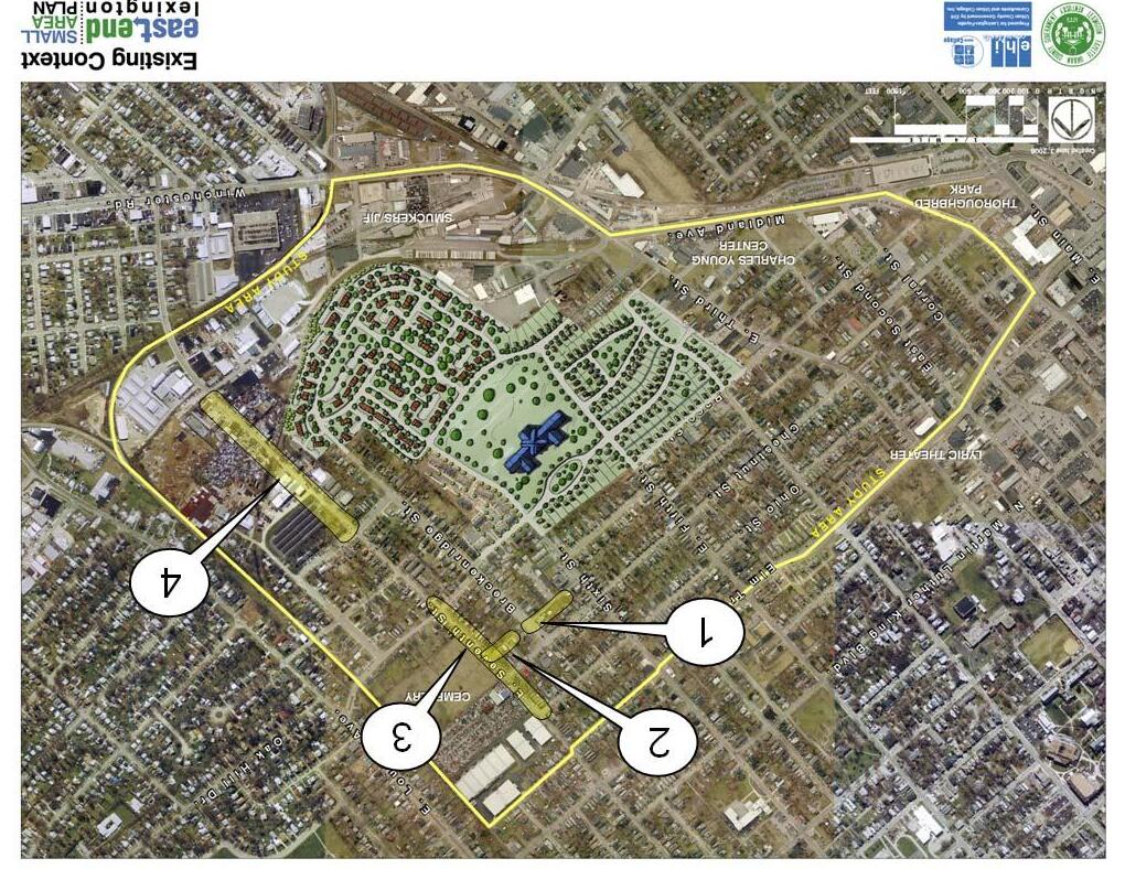
Every year the city of Lexington visually inspects a quarter of its roads. Within a four year period all roads city‐wide are inspected. Visual observations are then used to calculate a rating from 1 to 100. This rating is then used to determine overall condition. Roads with ratings of 65 or below are then considered for pavement rehabilitation.
Within the East End, the following Roadway Segments have Pavement Ratings below 70:
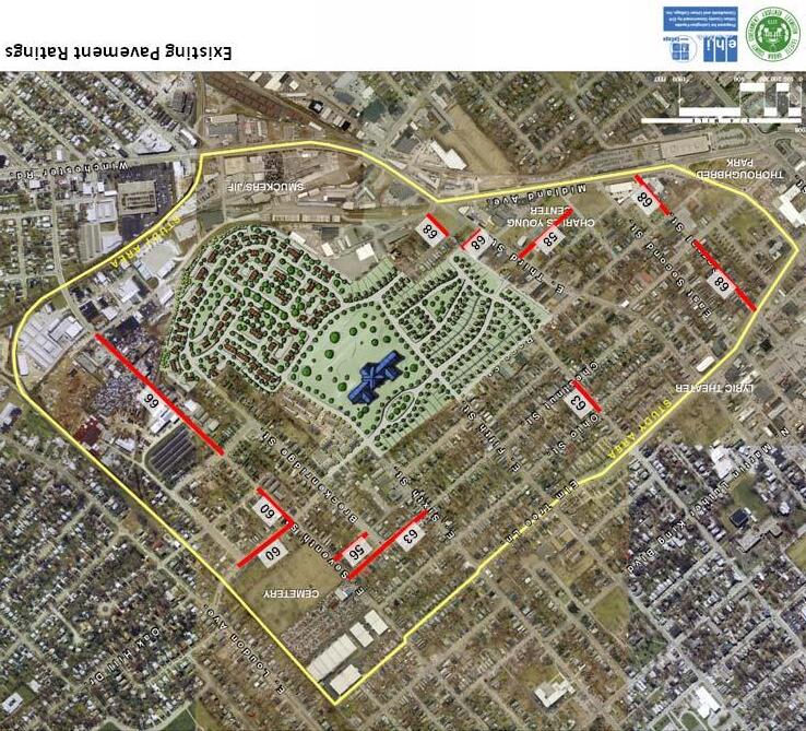
‐ Corral Street between Elm Tree Lane and Eastern Avenue
‐ Corral Street between Race Street and Midland Avenue
‐ Ann Street between Goodloe Street and Third Street
‐ Withrow Way between Third Street and Grinstead Street
‐ Midland Place between Nelson Avenue and Midland Place
‐ Fourth Street between Ohio Street and Chestnut Street
‐ Chestnut Street between Sixth Street and Seventh Street
‐ Pemberton Lane between Breckenridge Street and Seventh Street
‐ Shropshire Avenue between Seventh Street and Shelby Street
‐ Seventh Street between Shropshire Avenue and Magoffin Street
‐ Seventh Street between Jackson Street and Montgomery Avenue
Note: Pavement ratings shown on this map provided by LFUCG. Ratings vary from 1 to 100; the lower the rating, the poorer pavement condition.

1. Designate Magoffin Street a Two‐Way Road:

‐ The entire length of Magoffin Street is 24 feet wide. Parking is allowed on both sides of the street. Magoffin Street is a two‐way street between Loudon Avenue and Shelby Street and a one‐way street between Shelby Street and Seventh Street. It is recommended that parking be limited to one side of the street and that the entire length of Magoffin Street become a two‐way street. Magoffin Street is along a school bus route.
2. Add median on Breckenridge between Chestnut Street and Shropshire Avenue:


‐ Breckenridge Street is 55 feet wide. Parking is allowed on both sides of the street. There are plans to stripe a median in the middle of the road until there is enough funding to construct a permanent grass median similar to the one on Shelby Street (see the picture on the right).
3. Improve Signage:
‐ Much of the signage throughout the East End is difficult to see because it has been weathered and faded. Updating signs would improve the transportation safety within the neighborhood. No Parking Signs, Speed Limit Signs, Stop Signs, One‐Way Signs, Do Not Enter Signs, and Speed Limit Signs all need replacement.

High Priority, Short Term:
• Implement Category A intersection improvements (As shown on Page 73 as Intersection Improvements 1 through 4).
• Ohio Street & Ohio Terrace: Add 2 ADA compliant sidewalk ramps.
• Chestnut Street & Breckenridge Street: Add 25 feet of sidewalk and 6 ADA compliant sidewalk ramps.
• Pemberton Lane & Breckenridge Street: Add 2 ADA compliant sidewalk ramps.
• Elm Tree Lane & Third Street: Ensure pedestrian and bicycle access to proposed Art in Motion Bus Shelter.
• Repair or replace deteriorating signage throughout East End neighborhood.
• Provide pedestrian and bicycle access between Race Street and Short Street (As shown on Page 75 as Connectivity Improvement Option 3).
• Complete Shropshire Avenue roadway between Third Street and Midland Avenue (As shown on Page 75 as Connectivity Improvement Option 4).
High Priority, Long Term:
• Implement Third Street “Complete Street” concept as part of a public/private partnership with local businesses along Third Street. This should also include Category B, Intersection Improvement 5 at Third Street and Race Street.
• Convert Shropshire Avenue to a “Complete Street” between Seventh Street and Loudon Avenue. This project should also include Category B, Intersection Improvement 6 at Seventh Street.
Medium Priority:
• Construct sidewalks (shown on Page 77 as Sidewalk 1 and 2) along Pemberton Lane between Sixth Street and Seventh Street. This provides access to Stoll Poole Court and improves connectivity between the existing sidewalk system.
• Construct sidewalk (shown on Page 77 as Sidewalk 3) along Seventh Street between Chestnut Street and Ohio Street. Due to the proximity of the roadway to the cemetery and high utility relocation cost, a sidewalk is not recommended along the cemetery property line between Shropshire Avenue and Chestnut Street. Category B, Intersection Improvements 6 and 8 are recommended to improve pedestrian movement along the Seventh Street corridor. Intersection Improvement 6 may be completed ahead of this project depending on the timing of the recommended Shropshire Avenue improvements.
• Construct sidewalk (shown on Page 77 as Sidewalk 4) along Seventh Street between Magnolia Avenue and Rockcastle Street.
• Convert Magoffin Street to a two‐lane roadway between Seventh Street and Shelby Street.
• Provide a median along Breckenridge Street and improve pedestrian crossing at Shropshire Avenue and Breckenridge Street (As shown on Page 73 as Category B, Intersection Improvement 7).
Medium Priority (continued):
• Enhance gateway intersections (shown on page 73 as Category C, Intersection Improvements 9 through 11).
• Seventh Street & Ohio Street: Gateway intersection improvement opportunity.
• Seventh Street & Jackson Street: Gateway intersection improvement opportunity.
• Shropshire Avenue & Midland Avenue: Gateway intersection improvement opportunity in conjunction with the Shropshire Avenue project currently in design.
• Repave roadway segments with poor pavement ratings.

Low Priority:
• Connect Gunn Street to Ford Place and reconstruct Ford Place to match the typical section of Gunn Street (shown on page 75 as Connectivity Improvement Option 1).
• Connect Coleman Avenue to Ohio Street. An alternative short‐term improvement would be to cut back overhanging trees and improve lighting along the roadway (shown on page 75 as Connectivity Improvement Option 2).
East


The Neighborhood Vision
Neighborhood Overview

Goals, Objectives, Actions

Preferred Alternatives Implementation
By adopting the plan, Planning Commission and LFUCG Council will demonstrate the City’s commitment to the plan’s implementation. However, every action item listed in this plan will require separate and specific implementation. Adoption of the plan does not, on its own, begin the implementation of any item. Approval of the plan does not legally obligate the City to implement any particular action item. The implementation will require specific actions by the neighborhood, the City and by other agencies. Various forms of funding may also be used in order to implement items within this plan. Public funds (such as CDBG, TIF, General Budget and others) and private funds may be utilized as assistance in the revitalization of the East End. The Neighborhood Plan will be supported and implemented by:
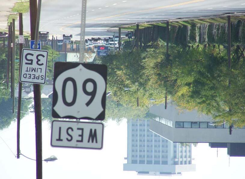
‐ City Boards, Commissions and Staff

‐ City Departmental Budgets

‐ Capital Improvement Projects
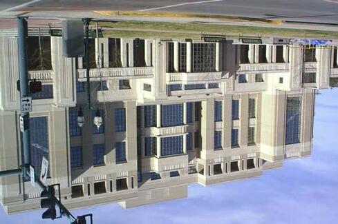
‐ Other Agencies and Organizations
‐ Direct Neighborhood Action


The numerous boards and commissions of the City will look to the East End Small Area Plan when they need guidance about the neighborhood. The Parks and Recreation Board will have a guide available stating the neighborhood's priorities for parks and open space. The Planning Commission will already know if a proposed zoning change in the East End would be appropriate and supported by the plan’s Preferred Alternatives, residents and businesses of the neighborhood. Additionally City staff will use the plan as a guidance document for review of projects and programs.
Each year every City department puts together a budget that states the department’s priorities for the coming year. By bringing the strengths and desires of the neighborhood to the attention of City departments, the East End Small Area Plan will help them prioritize those projects that help safeguard the neighborhood’s assets while addressing its needs.



There may be issues in the neighborhood that require a major capital expenditure. In these instances the guidance provided by the plan will be critical to guarantee the project will proceed in a fashion that keeps in mind the overall long term interests of the neighborhood. Capital Improvement Projects may be funded by a variety of sources, including (but not limited to) CDBG funds, TIF Funding, LFUCG, or private investors.
Other agencies and organizations outside City government will play a key role in the implementation of the East End Small Area Plan. As these agencies look for public input, this Plan will be available as a clearly articulated vision of the direction the neighborhood desires to go. These agencies may also provide funding assistance to projects within the East End.
Some of the elements of the East End Small Area Neighborhood Plan will be implemented by direct neighborhood action, possibly with some City support.
Neighborhood clean‐ups, graffiti abatement, and a citizens’ crime watch are a few examples of projects that might best be accomplished by the neighborhood.
The implementation of the East End Small Area Plan will be monitored.
Some items are expected to be completed quickly. For others, especially those items that need additional funding, it may be harder to schedule a firm completion date.
Nevertheless, the status of every item proposed in this Plan will be tracked. A check date, if not a completion date, will be set for each item. A tracking chart will be developed and updated regularly, as more information becomes available and as the status of projects change.

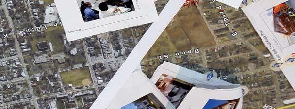
Neighborhoods are dynamic. To be effective, a neighborhood plan must be periodically updated to reflect changes in the neighborhood. The East End Small Area Plan will undergo regular review every 6 months. A representative group of neighborhood members, led by the First District Council Member will conduct this review, updating the status of the action items and considering additions or amendments.
Over time, a neighborhood plan may need more changes to stay current then would be appropriate for a small subcommittee to make. How often this will be necessary depends on how much conditions have changed in the neighborhood. Overall, it seems that a neighborhood plan, with any needed changes, should be re‐approved and readopted every 3‐5 years.

The East End Small Area Plan will have an Action Item Tracking Chart that will provide a means to easily check the status of the implementation of the plan. For each action proposed in the plan, the chart lists the contact, the estimated cost, the priority, the schedule, the current status and the next needed action. This chart will be updated, as the status of projects change and as new information is available.
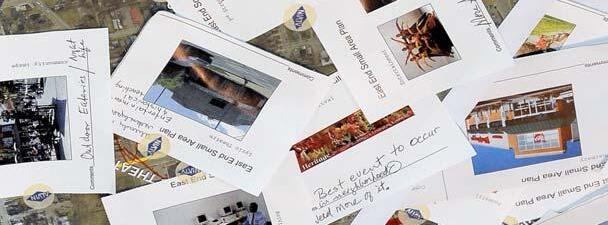
Community Development Corporations are non‐profit organizations incorporated to provide programs, offer services and engage in other activities that promote and support a community.
The East End Small Area Plan recommends the creation of a Community Development Corporation (CDC) to ensure the revitalization of the neighborhood occurs according to this Plan. There must be one organization whose focus every day is to make the East End even better.
The East End Development Corporation’s mission will be to work collaboratively with the community to enhance the physical environment, increase the economic vitality and improve the quality of life for everyone.
The overall goals of the East End CDC should be to:
1. increase the median income
2. improve home ownership
3. reduce crime
4. grow jobs
5. reduce drug use
6. reduce crime
7. improve the overall quality of life
These goals reflect a commitment to transparency and accountability. They will provide a measurement of the success of the East End CDC efforts.
The challenges facing the East End are many, making the creation of an organization whose only goal is to help the neighborhood improve a necessity. Only by utilizing a holistic, broad approach can true revitalization become a reality.
The following programs could constitute the core of the CDC’s focus:
An Economic Development program will seek to further local business development in order to create jobs and community wealth. Special emphasis will be placed on training for and developing “green collar” jobs.
A Real Estate Development program will bring life to abandoned buildings and vacant properties as well as helping to create more affordable housing opportunities, all with an emphasis on green building techniques.
A Community Organizing program will work with neighborhood associations, government agencies, and community organizations to help residents voice concerns as well as facilitate community meetings to provide information and address problems.
An Infrastructure program will work with city, state, and Federal agencies to ensure the rehabilitation of existing and installation of new infrastructure.
A Quality of Life program will work to protect and enhance the physical environment, improve safety, will work to stabilize vacant land through the creation of clean and green open spaces, volunteer greening projects and tree plantings, increase beautification including enhanced streetscapes, build historical and cultural awareness and the maintenance of some of the neighborhood’s vacant lots.
A Housing program will help expand home ownership opportunities and facilitate assistance for low‐ and moderate‐income families. Special emphasis will be placed on senior housing.
A Community Arts program will work to create links between the talented craftsman and artists in the neighborhood and revitalization efforts.
A Community Development Corporation is a 501(c)3 non‐profit corporation. The first tasks to undertake to start a community economic development organization are to:
1. Establish a board of directors, with at least two‐thirds local residents as voting members
2. Incorporate under State law
3. Obtain insurance
4. Obtain tax‐exempt status
5. Set up payroll and tax filings
6. Set up bank accounts
7. Set up annual audits and bookkeeping
8. Hire a qualified, energetic CEO
Establishing a strong, fully functioning Board of Directors is perhaps the most important step. When selecting board members it is important to identify individuals who have strong credibility with a diverse group of community stakeholders. It is also important that these individuals have a unity of purpose for the advancement of the East End.
It is also important at this phase to identify those who are linked to the service sectors that are important to the future of your work. These individuals can include small business owners, locally elected officials, community‐based leadership, and faith‐based institutions, and workforce development.
Once the Board of Directors is established, it is vital to obtain community direction as to tactical direction and priorities. Only through a bottom up approach will the efforts of the CDC be successful.
Community Development Corporations are funded primarily by a core of civic minded government and business organizations. An established network of funders of Community Development Corporations exists today. Some primary examples from which funding may be sought are:
1. Corporation for Enterprise Development (CFED)
2. The Local Initiatives Support Corporation (LISC)
3. The Neighborhood Reinvestment Corporation/NeighborWorks America
4. Enterprise Community Partners
5. National Federation of Community Development Credit Unions
Other funding possibilities include national foundations and business. Local business and government support is also vital, to ensure buy‐in into the CDC’s work.
Another significant funding opportunity exists through public and private partnerships in the development of real estate opportunities. The CDC can identify opportunities and strategies and then leverage connections and support to make development possible. This is highly valuable and should be compensated. The fees from such work must be reinvested into the CDC.
Includes existing pavement removal, 39 ft of new pavement (two 11 ft sharrow lanes and two 8.5 ft parking bays), curb & gutter and 4' sidewalks. Assumes all 39 ft of new pavement needs asphalt surface, asphalt base and sub‐grade. Does not include street lighting, trees, gateway improvements or other greenspace improvements.
Includes existing pavement removal, 39 ft of new pavement (two 11 ft sharrow lanes and two 8.5 ft parking bays), curb & gutter and 4' sidewalks. Assumes all 39 ft of new pavement needs asphalt surface, asphalt base and sub‐grade. Does not include street lighting, trees, gateway improvements or other greenspace improvements.
Add
on both sides of Seventh Street and 3 ADA sidewalk ramps ($5,400). This does not include the cost of a fence relocation and possible right‐of‐way acquisition at "Auto Sales Lucky 7."
Ann
will become Shropshire
This project has been designed and is waiting for funding.
Chestnut Street is 36' wide between Sixth and Breckenridge and 26' wide between Breckenridge and Seventh..
These are Construction Cost Estimates. Right‐of‐Way, Utility and Design Costs are not included in these estimates. Costs are shown in 2009 dollars.
Unit Costs:
4' Sidewalk = $45 per LF
Curb & Gutter = $35 per LF
Sidewalk Ramp = $1,800 EA
Surface = $80 per Ton Roadway Excavation = $5 per CY
Base = $70 per Ton
= $20 per Ton
Safe by Design is a program that incorporates design standards in order to minimize crime within new or existent development. The Safe by Design Program works with developers, builders, property owners, and planners to create the safest developments and communities possible, with a goal of creating socially sustainable communities. Socially sustainable communities are communities that succeed now, economically, socially and environmentally, and respect the needs of future generations. They are well‐designed places where people feel safe and secure; where crime and disorder, or the fear of crime doesn’t undermine quality of life or community cohesion.
Safe design and planning makes sense financially, as once a development has been completed the main opportunity to incorporate crime prevention measures has been lost. The costs involved in correcting or managing badly designed development are much greater than getting it right in the first place. This does not mean that planning and safe design alone can prevent crime. However, informed positive planning, particularly when coordinated with other measures, can make a significant contribution to tackling crime. We need to create environments that people want to occupy and use, creating a strong and positive sense of communal identity.
Safe by Design covers new and existing developments ranging from residential and commercial properties and surrounding areas. Safe by Design may be incorporated into Housing Authority Developments including properties owned and operated by the Lexington Housing Authority as well as voucher properties.
Additionally, Safe by Design may be used in many other facets such as Zoning Changes, any major changes to existent Road Developments or new roads, Parking structures and layout, Sidewalk layouts and streetscape designs, Redevelopment Plans, and Park Design through landscape design and materials, lighting, and fencing.
Today, many Design Factors contribute to and can be associated with crime. These include:
Poorly lit, indirect, and isolated pedestrian routes
Streets, footpaths and alleyways that provide access to the rear of homes.
Neighborhoods where there are several ways into and out of the area.
Streets and spaces that are derelict, underused, or unused.
Places within a neighborhood that are Criminals are able to operate, including traveling to and from locations, without the fear of being seen.
If it is unclear whether space is public or private.
Private space is easily accessible to people who have no right to be there.
It is easy to enter and exit properties illegitimately.
Places become devoid of activity at certain times of the day or night, while still remaining accessible to potential offenders.
Places that are untidy or unattractive and give the impression of not being cared for or that crime is tolerated.
Signs of disorder and neglect, such as broken windows, abandoned vehicles or graffiti, are not removed at the earliest opportunity.
1. Access and Movement: Places with well defined routes, spaces, and entrances that provide for convenient movement without compromising security. Too few connections can undermine the vitality of an area, while too many, especially too many under used or poorly thought out connections, can increase the opportunity to commit crime. The goal is to create places that are both well connected and secure.
2. Structure: Places are laid out so that crime is discouraged and different uses do not cause conflict. The layout and structure of a place (how buildings, spaces, uses, and activities relate to one another) affects its safety and sustainability.
3. Surveillance: Places where all publicly accessible spaces are overlooked. Whether it be “natural” or electronic, surveillance should be a core part of planning out crime. However, surveillance should not be relied on as the sole strategy for preventing crime.
4. Ownership: Places that promote a sense of ownership, respect, territorial responsibility and community. Encouraging residents and users of places to feel a sense of ownership and responsibility for their surroundings can make an important contribution to crime prevention. Uncertainty of ownership can reduce responsibility and increase the likelihood of crime and anti‐social behavior going unchallenged.
5. Physical Protection: Places that include necessary, well‐designed security features. This aspect deals with target hardening and making it more difficult to commit and offense, while instilling a sense of safety in users.
6. Activity: Places where the level of human activity is appropriate to the location and creates a reduced risk of crime and a sense of safety at all times. Crime can be deterred through the “eyes on the street” of people going about their everyday business. However, Too much activity risks anonymity and can lead to increases in the opportunity to commit particular types of crime.
7. Management and Maintenance: Places that are designed with management and maintenance in mind, to discourage crime in the present AND the future. Management and maintenance embrace both how a place looks and how it functions over time.