


• Support the UGMP vision
» Across all areas
• Acknowledge the long-term build-out
• Provide flexibility, when appropriate
• Provide clarity for staff
Identify potential regulatory elements that are:
• Quantifiable (e.g., setbacks, density; open space); or
• Not quantifiable, but which would support the UGMP’s vision and align with best practices
• Proposed Policies, which offer rezoning guidance
• Proposed Implementing Regulations, which suggest updates to the City’s Zoning Ordinance and related regulations
• Primary Recommendations, which are essential to the UGMP and directly linked to its implementation
• Supporting Recommendations, which could support the UGMP but may have broader, citywide impacts that must be evaluated
Primary Recommendations
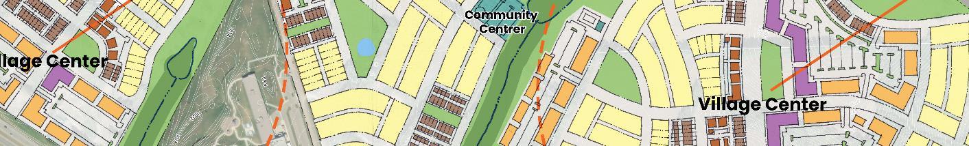
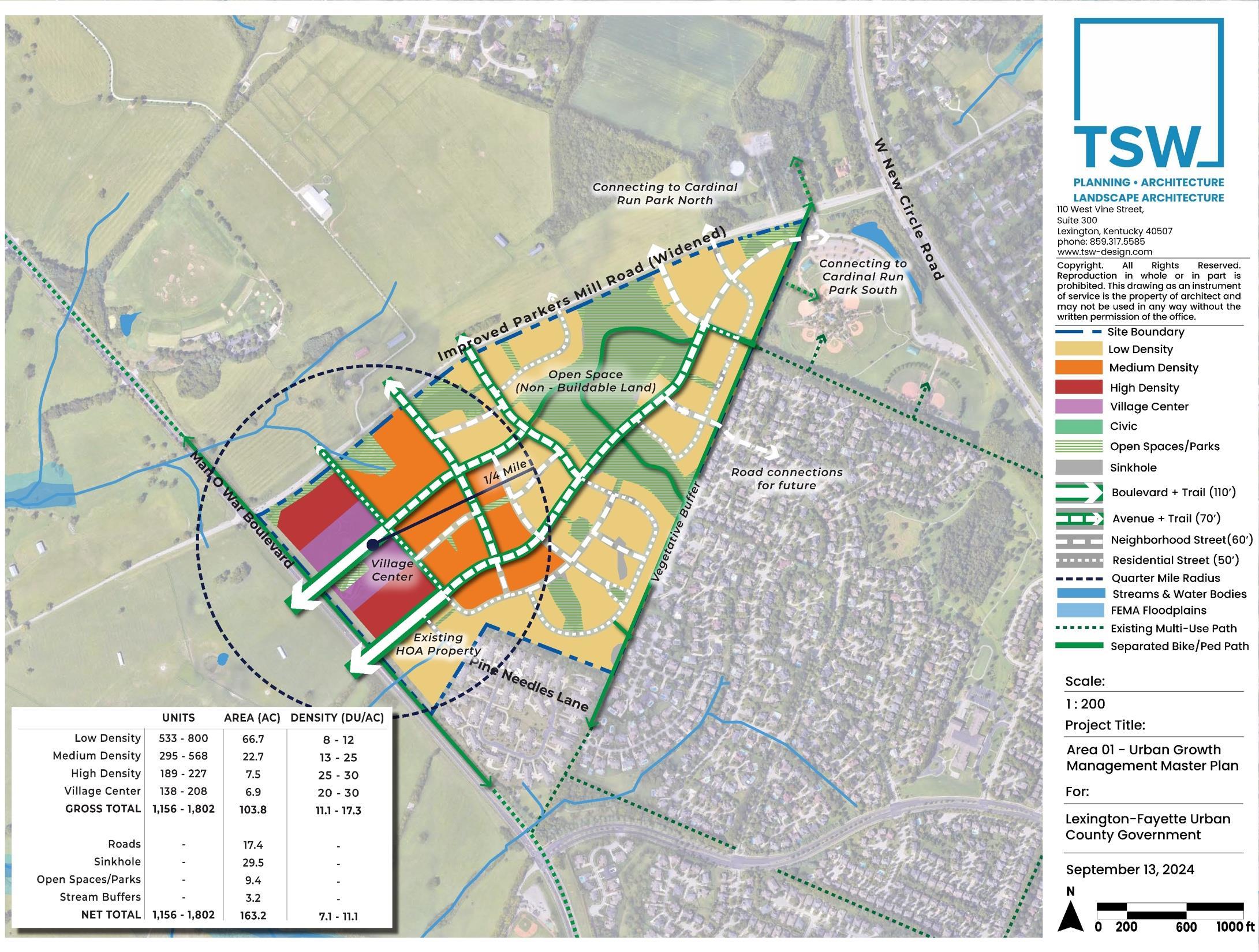
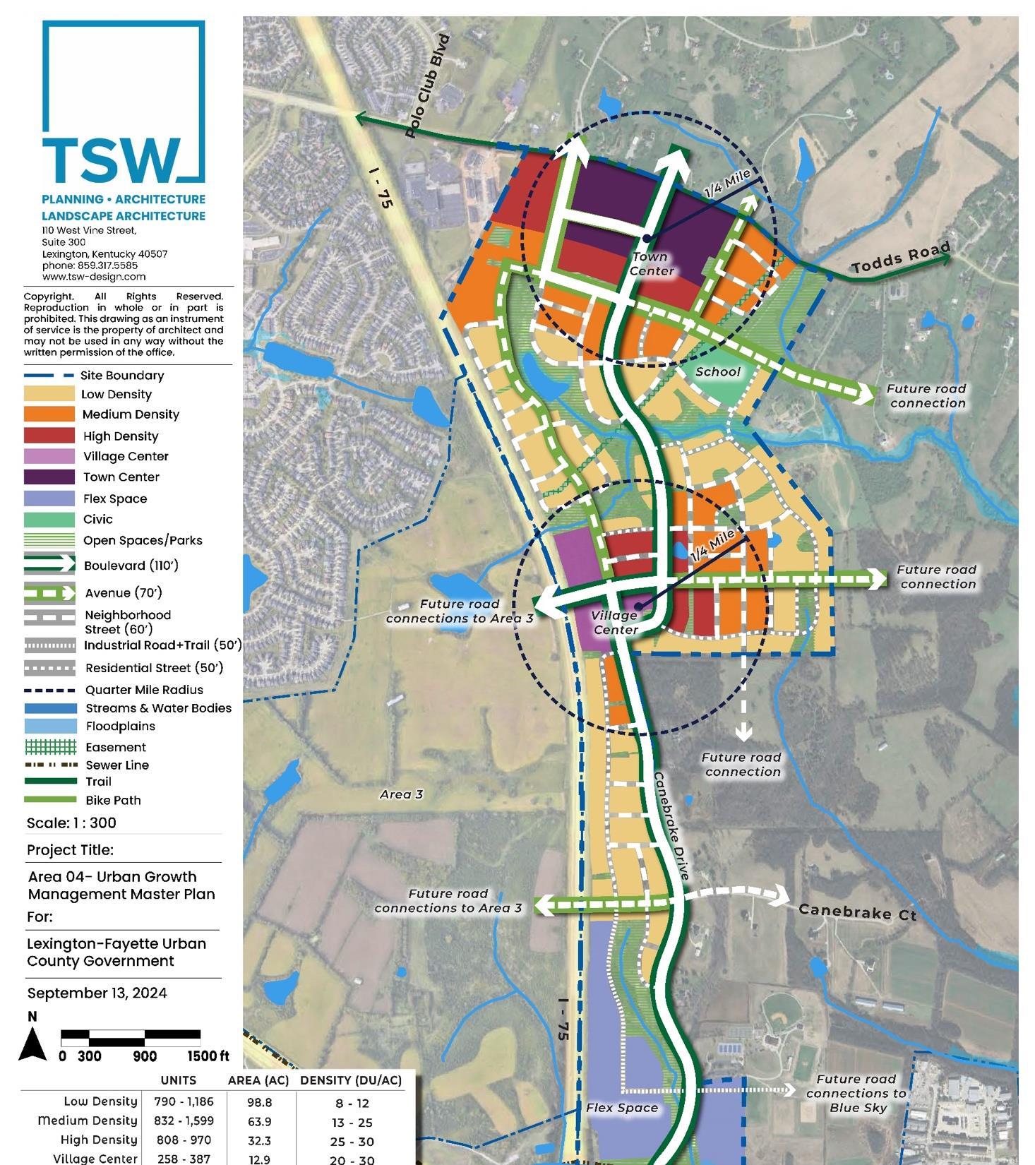
• Regulating plans
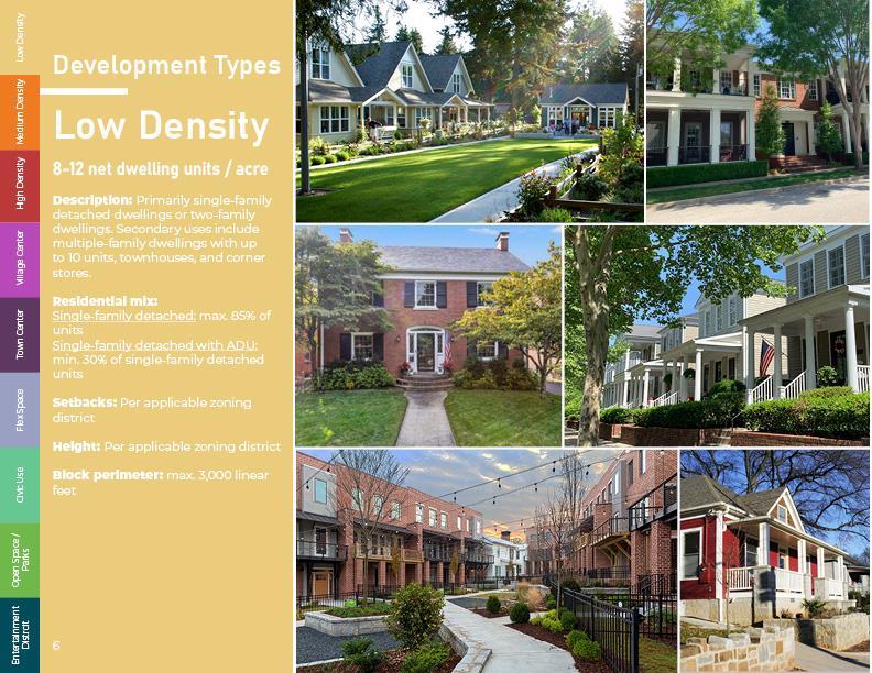
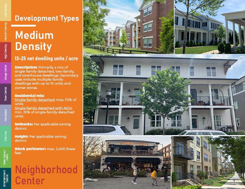
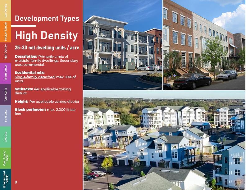
• Density and Use
• Circulation
• Open space
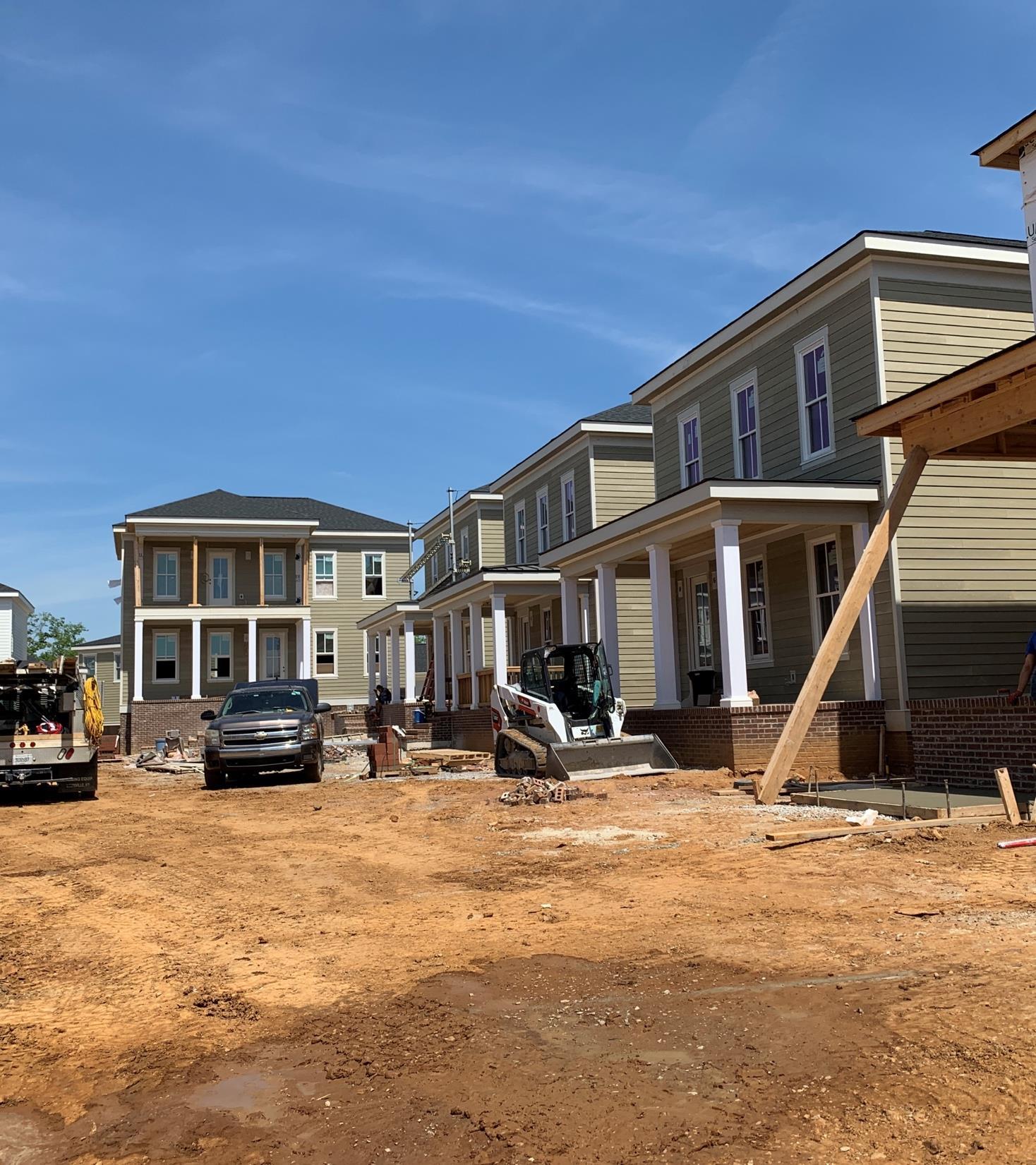
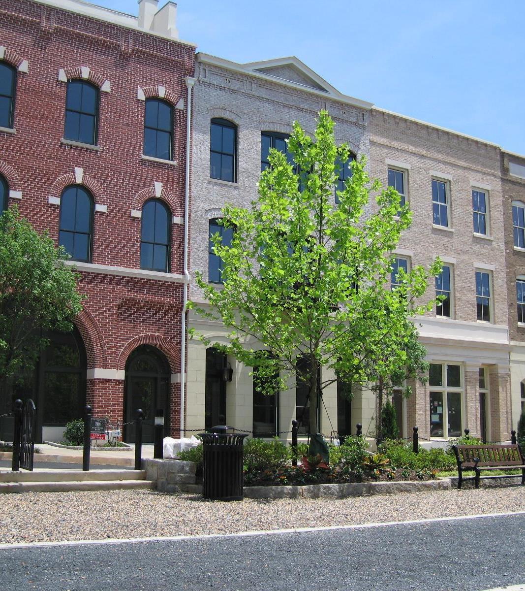
• Building design
• UGMP use standards
Supporting Recommendations
• Use standards
• Subdivision
• Zoning Districts
• Detailed but conceptual • Policy guide
• Detailed but conceptual
• Policy guide Regulating Plans
• Simplified but specific
• Regulatory guide
• Land uses
• Densities
• Street types, locations
• Paths
• Open space
1A. Specific Compliance
• Village, town center land uses
• Boulevards, avenues, paths
• Future connections
1A. Flexible Compliance
• Other land uses
» May not decrease density
• Locations can vary
• Size and street access should not vary
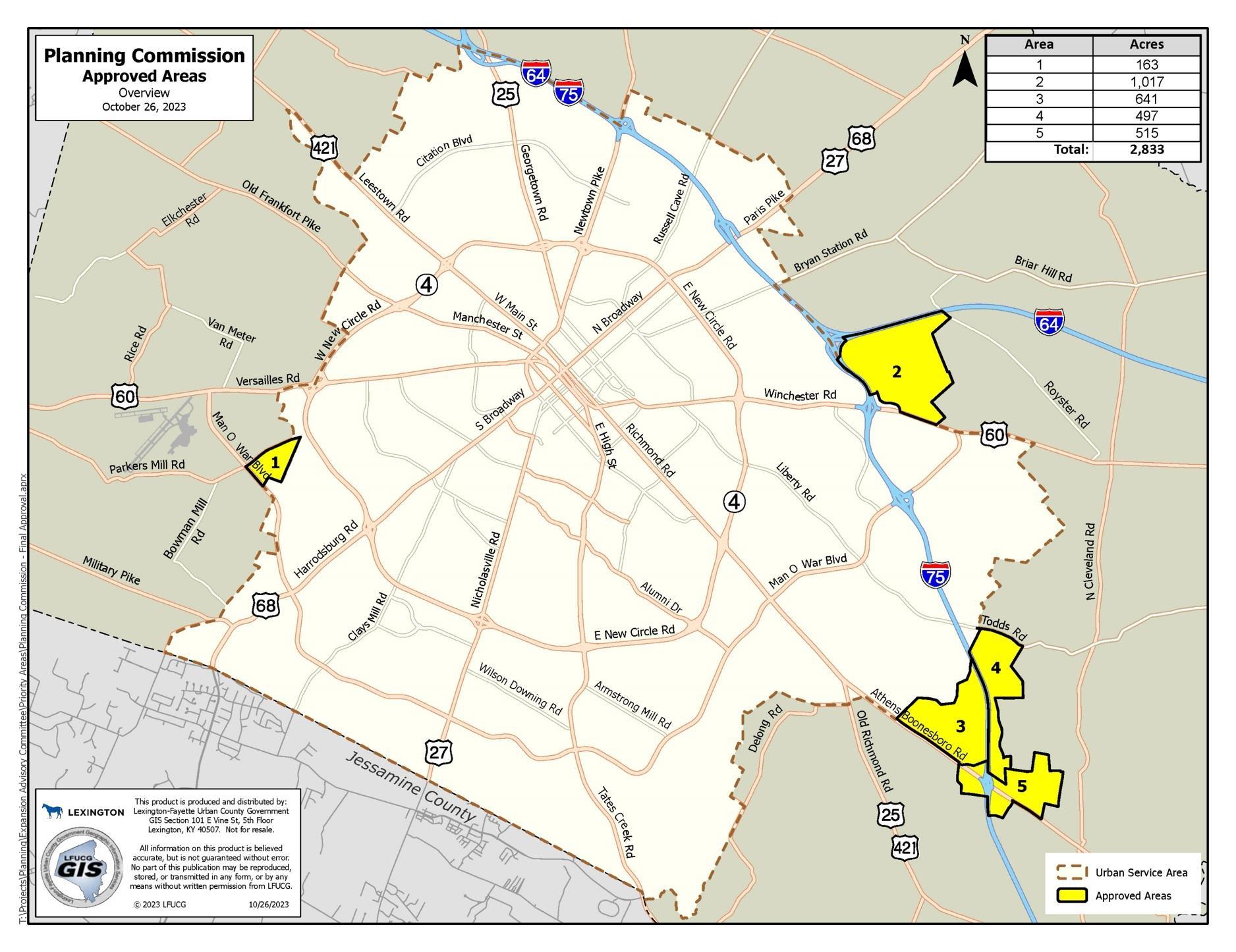
Rural Service Setbacks
• Min. 100 FT temporary buffer
• Single-family units
» Max. 20% with no concurrency.
» Over 20% require 4,000 SF commercial to be built
• Commercial
» Max. 80,000 SF with no concurrency
» Over 80,000 SF requires 50% of units to be built
• Considered commercial for concurrency purposes
• Dwelling distribution
» Max. 5 contiguous single-family
detached lots
• Large-lot single-family limits
» Max. 20% of single-family detached lots >5,000 SF
» Density standards apply
• Dwelling concurrency
» Max. 25% initial single-family detached
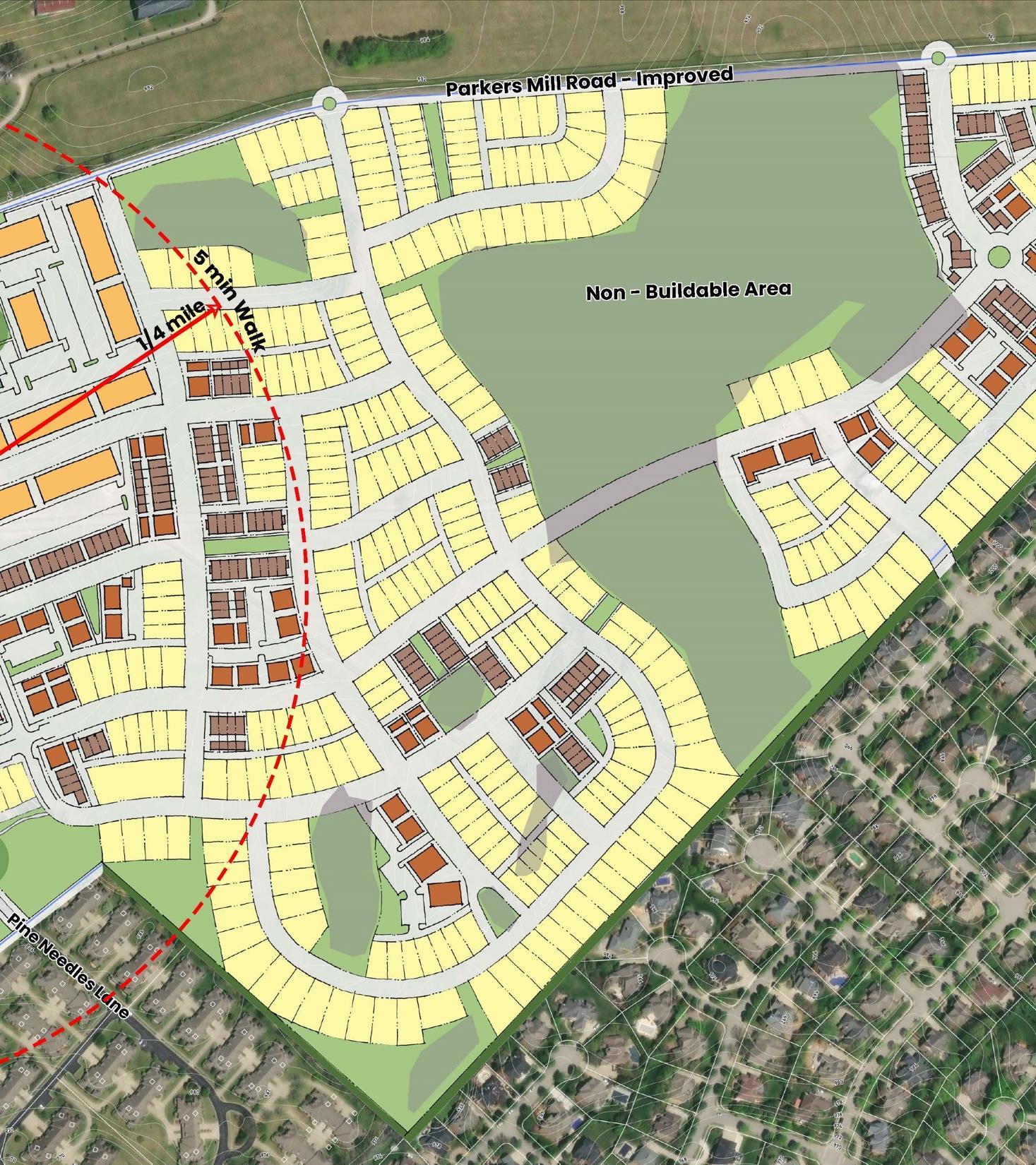
• Regulating Plan
» Streets may shift up to 200 FT
• Street design
» Per Complete Streets Manual
• Path design
» Per Lexington Bike/Ped Plan
• Path crossings
» Min. 300 FT separation
• Curb cuts
» Max. 1 per block face
• Block network
• Block sizes
» Max. perimeter per land use type
• Ownership
» Public or private streets
• Gated streets.
» Should not be gated.
• Cul-de-sacs
» Max. 25 FT
• Exceptions
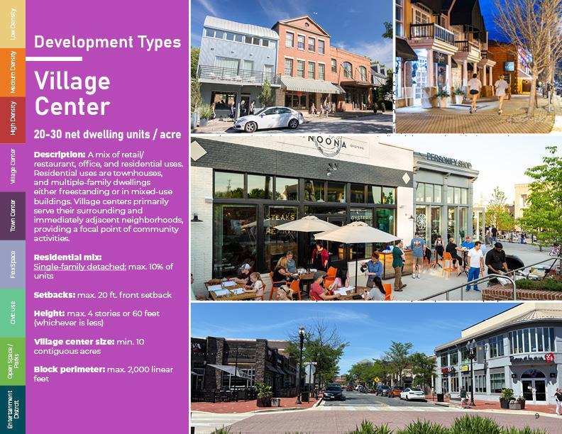
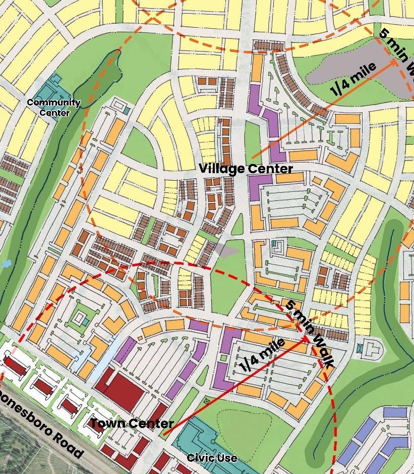
Village Center
2,000 FT max.
1,000 FT drawn
2,400 FT max. 2,000 FT drawn
• Block network
• Block sizes
» Max. perimeter per land use type
• Ownership
» Public or private streets
• Gated streets.
» Not counted in block sizes
• Cul-de-sacs
» Max. 250 FT
• Exceptions
• Along Rural Service Area
» Stub streets max. 2,000 FT apart (3,000 FT for industrial)
• Other locations
» Stub streets max. 750 FT apart
• Exceptions
• Along paths
» Min. 1 connection per 2,000 FT
» Min. 12 FT wide path
• Exceptions
• Shared driveways
• Inter-parcel access
» Lots with 10 or more parking spaces
• Exceptions
• Residential alleys
» Single-family detached, twofamily, and townhouse dwellings along arterials, collectors, boulevards, or shared-use paths
• Village and town centers
• Alley timing
• Garage location
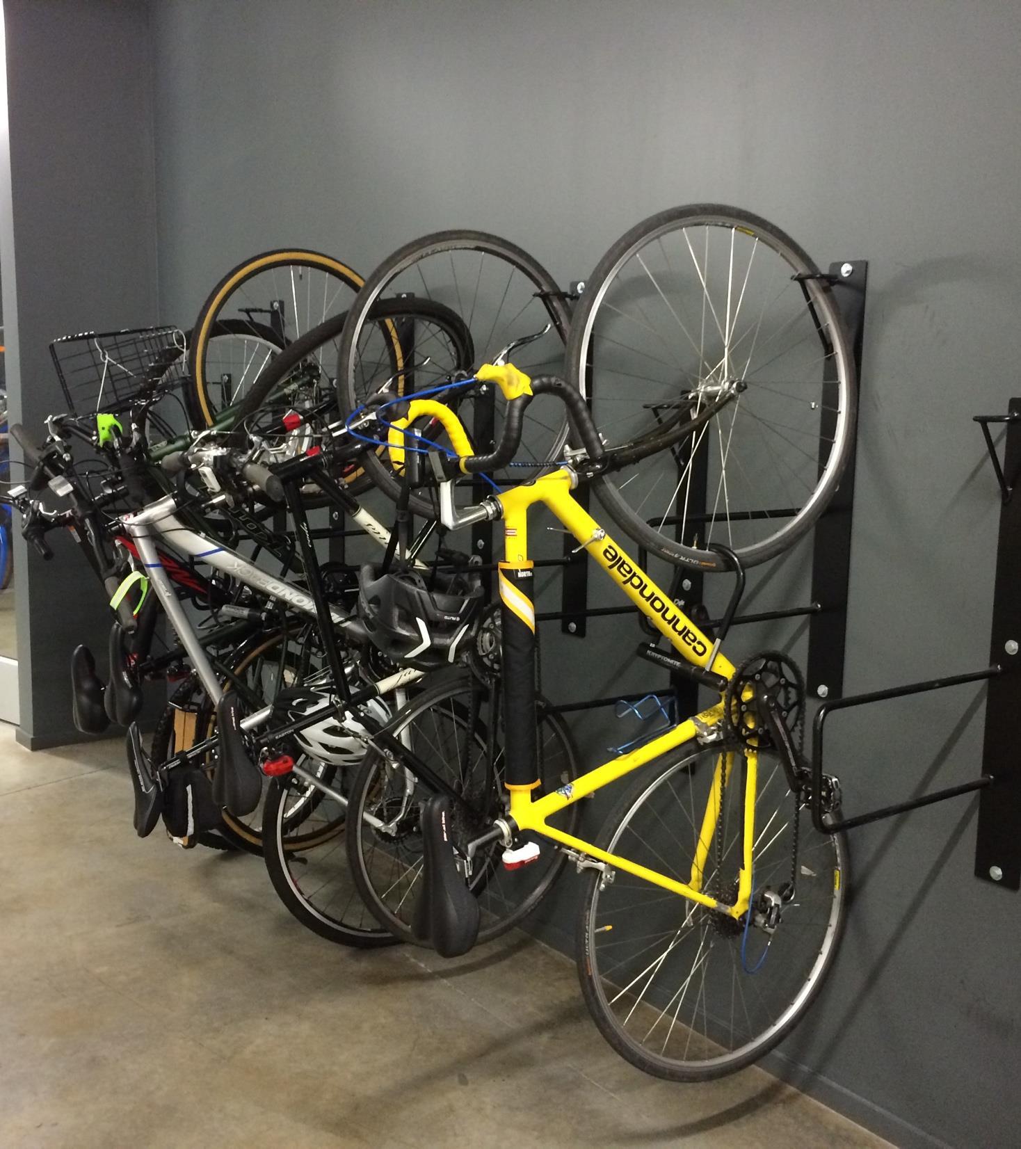
3G. Bicycle Parking & Storage
• Along shared-use paths
• Minimum bicycle parking
3H. Loading and Unloading
• On-street loading
• Location
• Screening
• Code requirements
• General
• Placement
• Per Complete Streets Manual
• Max. 1,500 FT from a park or open space
• Applicability
» Ground stories on most streets
» All stories on boulevards
» Single-family, two-family, townhouses, and industrial exempt
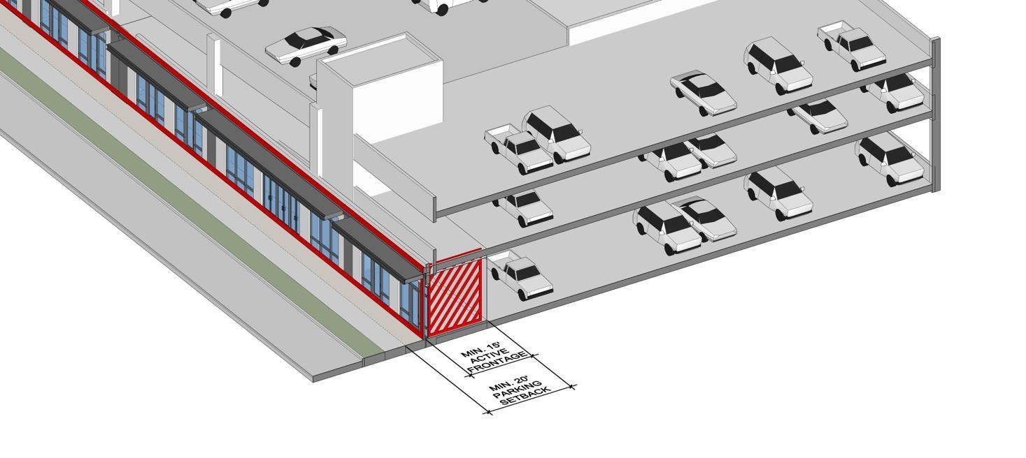
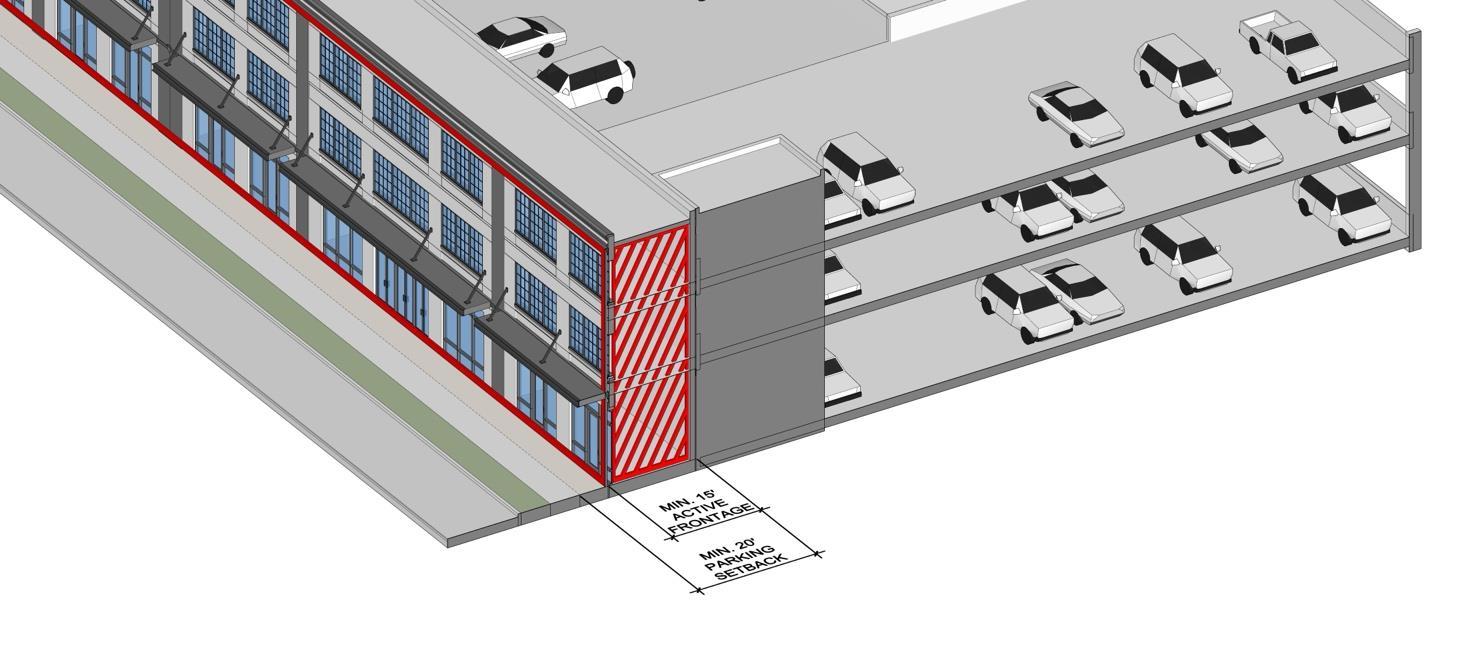
• Completely inside a multi-level parking structure; or
• Completely screened from the view of any street by active depth areas
• Data centers and (commercial)
self-storage
» Max. 50% of development
» Screened with active depth areas
New Definitions
• Data center
• commercial self-storage
• Micro-distribution hub
• Low impact manufacturing
• Hand tools
Use Permissions

8A. Street Frontage • Cottage housing
8B. Waivers
• Relief standards
• M-1, B-1, B-2 and similar uses in R-2, R-3, R-4
» Max. 2,000 SF
» On or adjacent to a corner lot
9B. Corridor Zone (CN)
• Accessory outdoor sales and storage
» Max. 1,000 SF
• Garden center and commercial greenhouse
» Max. 3,000 SF
• Minimum floor area ratio.
» From 2.0 to 0.75 non-residential
• Minimum density
» From 30 to 20 dwelling units per acre
• FAR bonus for sustainable design
» Revised FAR