


We’ll develop guiding principles for the expansion areas based on community input, market data, and an understanding of existing conditions.

The guiding principles will help us develop concepts for how urban development, transportation, parks, and infrastructure should be built in the areas.

We’ll gather public feedback on the concepts, make any needed revisions, and then create a detailed plan for how these concepts will be implemented.
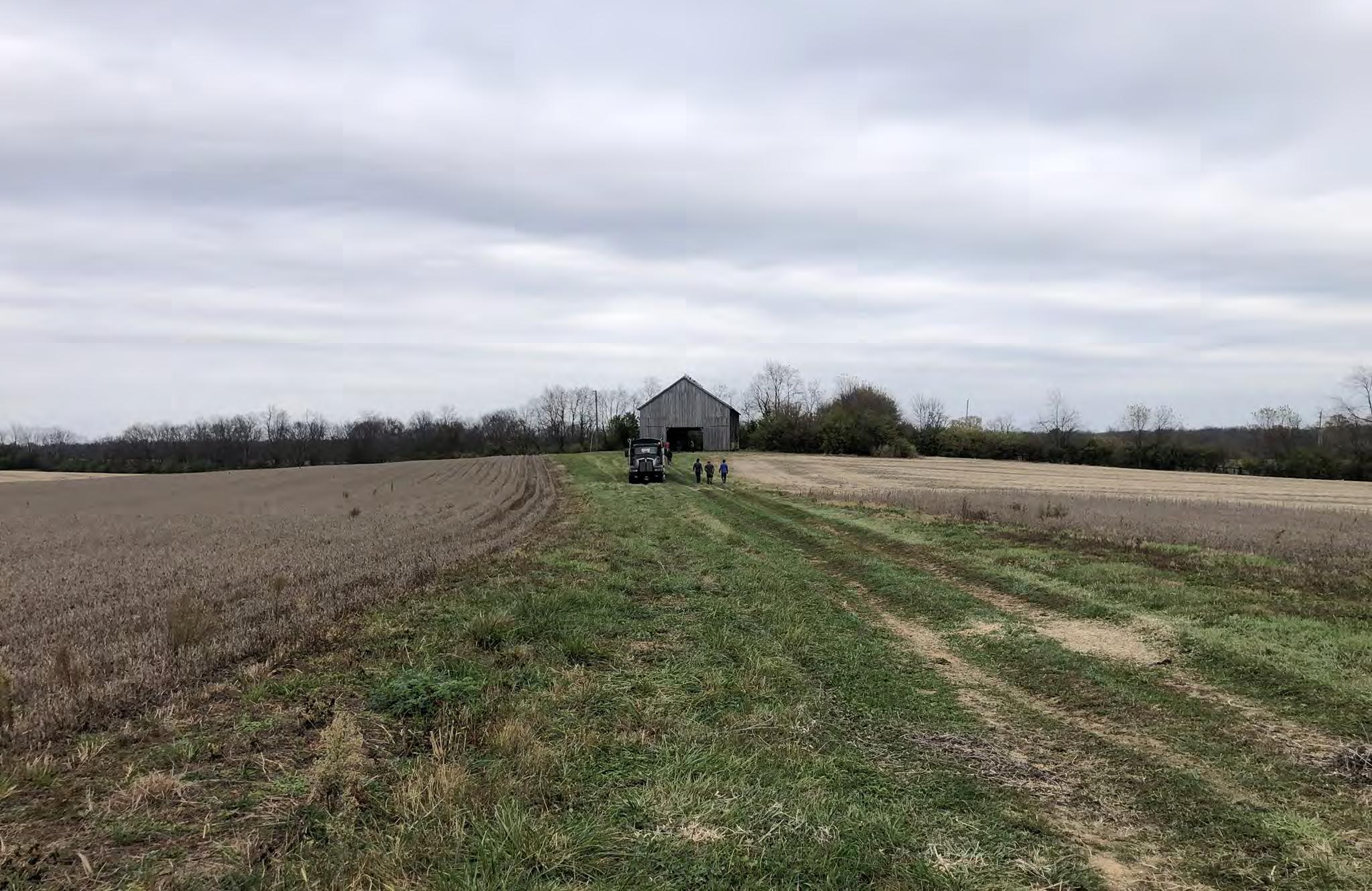
Kick-Off Meeting & Site Tour
November 6, 2023
TASK 1: GUIDING PRINCIPLES & BENCHMARKS REPORT
TASK 2: EXISTING CONDITIONS INVENTORY AND ANALYSIS
TASK 5: CONCEPTUAL PLANS FOR KEY SITES
Concepts Plan Presentation July 2024
Public Meeting
December 6, 2023
TASK 3: PUBLIC AND STAKEHOLDER ENGAGEMENT
TASK 4: LAND USE AND TRANSPORTATION SPATIAL FRAMEWORK(S)
2.5-Day Design WorkshopFrameworks April 29 - May 1, 2024
TASK 6: DEVELOP A REGULATORY FRAMEWORK FOR IMPLEMENTATION
Final Master Plan Presentation September 2024
TASK 7: IDENTIFY COSTS & INNOVATIVE STRATEGIES FOR FUNDING PUBLIC INFRASTRUCTURE, FACILITIES, & SERVICES
Planning Commission
Public Hearing October 2024 Presentation to Council
Final Town Hall September / October 2024

Executive Summary
Public and stakeholder engagement
Regulatory framework for implementation
Guiding principles and benchmarks
Land use and transportation frameworks
Innovative funding strategies
Existing conditions inventory and analysis
Conceptual plans for key sites

Between differences in size, existing land use and current management, zoning, topography, drainage patterns, and more, each area presents unique opportunities and constraints for development.
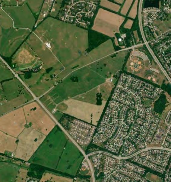
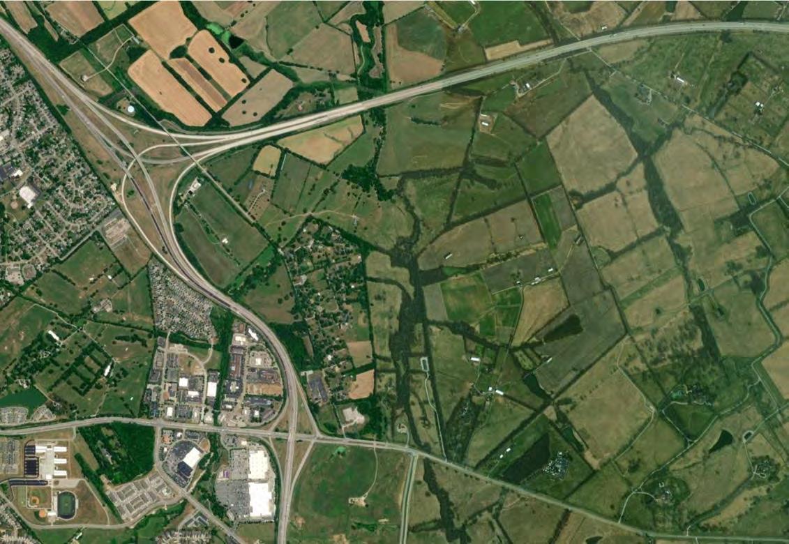
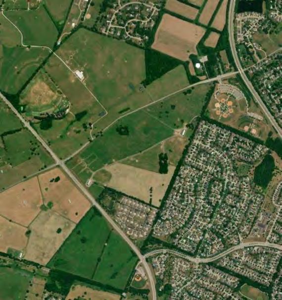
Area 1 is located along the western edge of the Urban Service Area. The smallest of the five sites included in this study, it is bounded by Parkers Mill Road to the north and Man O War Boulevard to the southwest. Its southeastern edges border Heritage Place, a subdivision of two-family dwellings, and The Reserve, a large single family detached subdivision that spans approximately 132 acres, not including the 78.5-acre Beaumont Preserve.
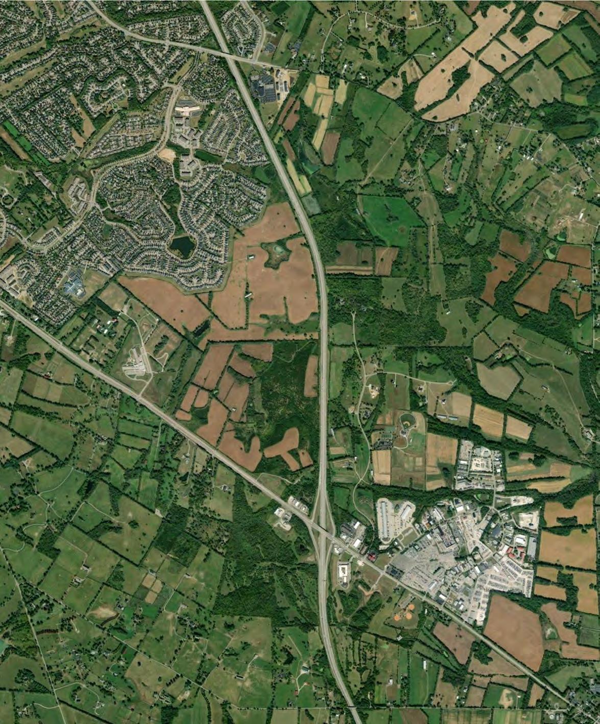
Area 3 is located adjacent to the Urban Service Area’s southeastern corner. It is bounded by AthensBoonesboro Road to the south and I-75 to the east. Area 4 is immediately adjacent to the east, but I-75 acts as a major barrier, while Area 5 is also nearby to the southeast. Several subdivisions form this site’s northern and western boundaries, including Walnut Creek and Chilesburg, two dense single-family subdivisions. Area 3 also includes Brenda Cowan Elementary School and the undeveloped portion of land attached to Edythe Jones Hayes Middle School.
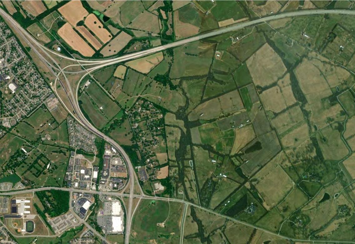
Area 2 is located to the northeast of Lexington’s Urban Service Area and forms the largest of this study’s five sites. The site is situated between two Interstate Highways—I-64 to the north and I-75 to the west—and Winchester Road to the south. The site’s eastern boundary is agricultural land.
Located immediately to the east of Area 3, Area 4 is bounded by Todds Road to the north, I-75 to the west, and portions of Canebrake Drive to the east. The cluster of hotels and highway-service businesses located where Athens-Boonesboro Road crosses I-75 forms the site’s southern boundary.
Athens-Boonesboro Road forms the spine of Area 5. The boundary extends between 1/8-mile and 1/3-mile on either side of Athens-Boonesboro Road site and mostly includes this area’s non-residential uses: the hotel and highwayservice businesses adjacent to I-75 and the industrial uses along Blue Sky Parkway.
The zoning that regulates development on each site does not immediately offer insight into what types of development and uses are appropriate for future development outside of the existing Urban Service Area. This section describes the zoning for each area—but perhaps more importantly, the zoning around each site—to reveal what built form and character might fit within each one.
Areas 1, 3, and 4 are exclusively comprised of land zoned Agricultural - Rural (A-R). This category is reserved for
agricultural operations, including crop production, pastureland, and equine-related facilities. Single-family detached residential is also permitted within the zone. Agricultural tracts within Areas 1 and 3 are quite large. Area 4 also features these large tracts, along with a series of smaller agricultural lots (a minimum of 10 acres each) along Canebrake Drive that have been subdivided into lots for single-family homes.
Area 2 mostly consists of land zoned A-R, similarly organized into large agricultural holdings. A small, singlefamily neighborhood (zoned R-1A) extends along Hume Road and Ami Lane.
Area 5’s zoning is the most distinct of the five sites. While some small pockets of A-R remain, the majority of Area 5 is zoned Light Industrial (I-1). Land immediately adjacent to I-75 is zoned commercial (B-3 and B-5P), which permits auto-centric businesses including hotels, quick service restaurants, gas stations, and other such uses.
When considering adjacent zoning, much of the five areas are surrounded by land outside of the urban service area, zoned A-R. Areas 1, 2, and 3 also share signifant edges bordering areas of Lexington within the urban service area, which fall under a variety of the city’s standard urbanized zones..
To the southeast of Area 1 are multiple single-family subdivisions, mostly zoned R-1C. Conforming lots in R-1C are a minimum of 8,000 square feet; with 1 dwelling unit per acre, R-1C zones reach a maximum density between 5-6 units per acre. Also, immediately adjacent to Area 1’s boundary is a small multifamily development zoned R-3. Immediately north of Area 1 is an A-R tract and a park that is zoned R-1A (Cardinal Run North). There are two Agricultural - Urban (A-U) districts adjacent to Area 1, which are available for an urbanized use. A small sliver is situated between Area 1 and R-3, while the larger A-U district is currently used as a park (Cardinal Run South).
I-75 forms the western boundary of Area 2, as well as the eastern boundary of the urban service area. Across I-75 from the site are several districts zoned B-3, B-5P, and B-6P, all permissive of auto-oriented businesses. These non-residential districts back up to single-family (R-1C, R-1D, R-1E) and multifamily districts (R-3). Between I-75 and Area 2’s boundary are two “expansion area zones” - EAR-1 and ED. EAR-1 is reserved for low-density residential, while the ED zone is reserved for job production
To the north of Area 3 are several new subdivisions that fall under Expansion Area Zones (EAR-2 and CC). These zones are intended to provide a well-managed transition in density between the urban area of the City to its agricultural surroundings.
Zone Name Description
Standard Zones
A-R Agricultural - Rural Agricultural land (crops, pasture) and limited single family dwellings
A-U Agricultural - Urban Undeveloped land within urban growth boundary, with restrictions on development until infrastructure and services are provided
R-1A Single-Family Residential (SFR) Detached homes on 25,000 sf lots
R-1B SFR Detached homes on 15,000 sf lots
R-1C SFR Detached homes on 8,000 sf lots
R-1D SFR Detached homes on 6,000 sf lots
R-1E SFR
Detached homes on 4,000 sf lots
R-1T Townhome Residential Attached homes, minimum lot size 1500 (maximum 12 attached)
R-3 Planned Neighborhood Residential Mixed residential district (multifamily, townhomes, and single-family detached)
B-1 Neighborhood Business Commercial district catering to businesses that serve residential neighborhoods
B-3 Highway Service Business Commercial district catering to auto-oriented businesses appropriate for highways
B-5P Interchange Service Business Commercial district catering to businesses appropriate for interstate interchanges
B-6P Commercial Center District intended to create walkable retail and business developments
I-1 Light Industrial Manufacturing, logistics, and other industrial without nuisances
P-1 Professional Office Offices and professional uses
Expansion Area Zones
EAR-1 Expansion Area Residential Low density residential, mixed type (3 units/acre maximum)
EAR-2 Expansion Area Residential Low density residential, mixed types (9 units/acre maximum with density transfer rights)
CC Community Center Mixed use district that permits residential, retail, and office
ED Economic Development Non-residential district that permits office and industrial uses
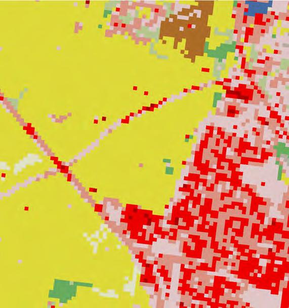
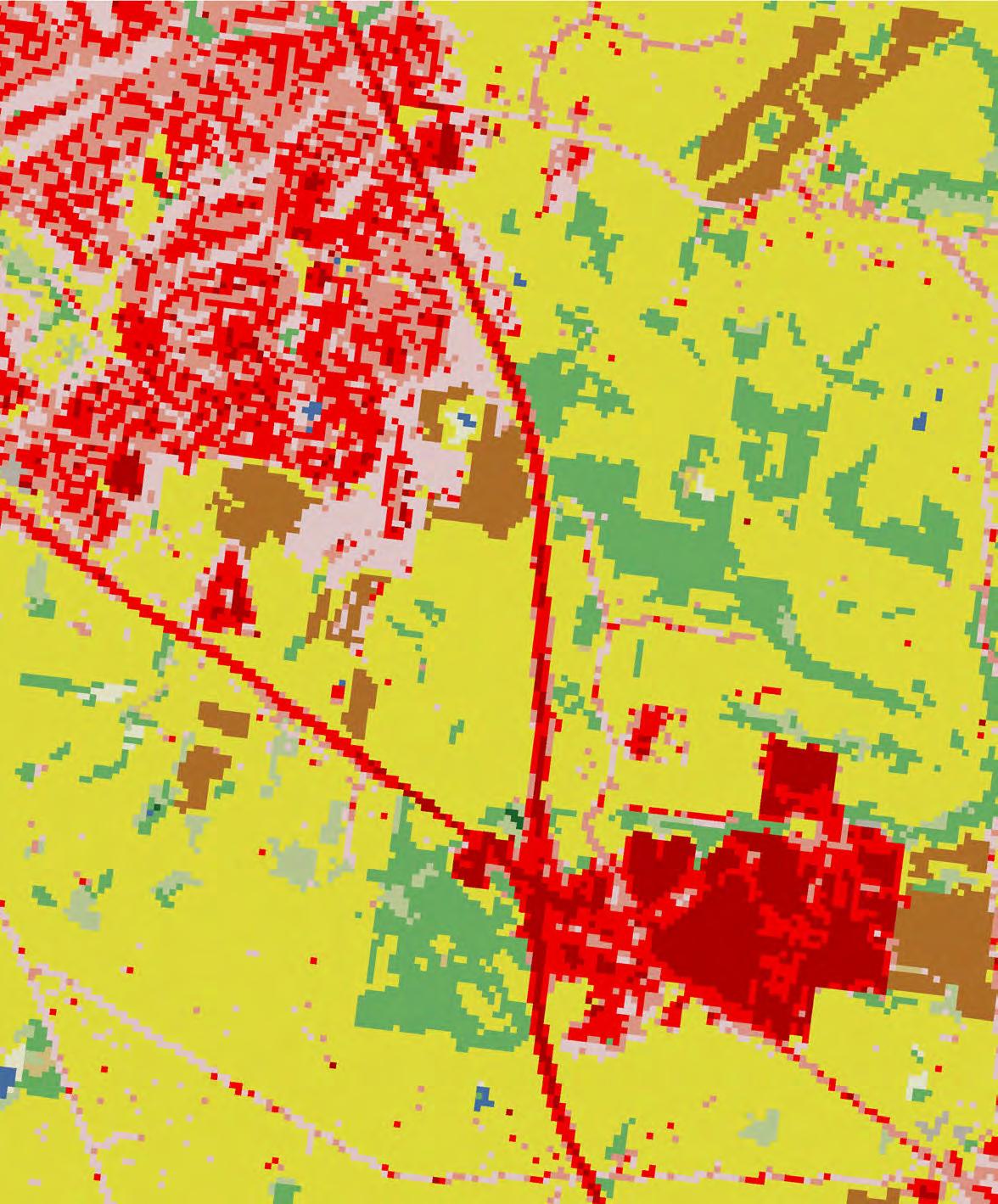
Each area of study, with the exception of Area 5, contains significant portions of agricultural land. The use of this agricultural land differs from area to area and can be challenging to discern from aerial imagery alone. Data from the National Land Cover Database (NLCD), shown on the right, provides an additional layer of detail but still contains a margin of error. For instance, there is a portion of land in Area 3 which is existing agriculture being shown as ‘Developed Open Space’, most likely as a result of being heavily disturbed. The NLCD data is provided at a 30-meter resolution, meaning that each pixel has a width of 30 meters.
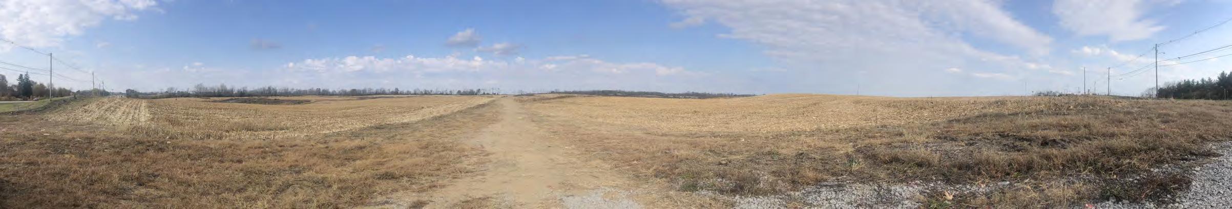
Almost all of Area 1 is occupied by grazing land, labeled “hay/pasture” by the NLCD. From aerial and street-view imagery, there appear to be seven pastures or paddocks total within this area, used primarily for cattle grazing and equine turnout. The NLCD data shows how suburban development has altered land cover up to the boundary of Area 1.
There is also a small parcel of land included within Area 1, which acts as the landscaped entry of Pine Needle Lane into the neighborhood.
Similar to Area 1, the majority of Area 2 contains grazing land, with some agricultural land devoted to cultivated crops in the eastern portion of the study area. These grazing tracts are divided by riparian zones lining North Elkhorn
Creek and its smaller tributaries. The limited amount of developed land in Area 2 can be found in the single-family neighborhood extending along Hume Road and Ami Lane.
Area 3 features large agricultural holdings of hay/pasture, especially toward I-75 to the east and Athens-Boonesboro Road to the south. Some plots of cultivated crops are also captured in the land cover data. This area features significantly more developed land cover than Areas 1 and 2. The “medium intensity” and “high intensity” land cover represents Brenda Cowan Elementary School. The large swath of land identified as “developed, open space” adjacent to the recent subdivision development to the north could indicate a few things. Aerial imagery shows this area as grazing land, although the area is dotted with clear, circular patches of green which could indicate a different land use. Still, most of the land identified as “developed, open space” appears to be for agricultural use.
Area 4 includes several large agricultural holdings, as well as a handful of smaller agricultural tracts along Canebrake Drive. Most of these holdings are being used for grazing land or crop rotations. However, a sizeable portion of them are forested, especially those farther north along Canebrake Drive, and many do not have an active agricultural use.
Area 5 is the most distinct from the other four study areas. While the far western portion of the study area was characterized by forested land cover, the current development of the soccer complex has since removed the majority of the treed portions of the site. The remaining bulk of Area 5 has been developed to a relatively high intensity. Land cover data shows how this development had been limited to Blue Sky Parkway and the four corners of the I-75 onramps.

Land preserved under Lexington-Fayette County’s Purchase of Development Rights (PDR) program can be found near the five areas of study. Because these lands cannot be developed, any development projects occurring within these five areas must consider how to buffer or transition between developed neighborhoods or districts and conservation areas.
The tracts closest to Area 1 that benefit from protection under PDR are located about one mile to the south, along Bowman Mill Road where it meets South Elkhorn Creek (not shown in map extents).
Two PDR tracts are located close to Area 2’s boundary, one immediately adjacent to the area’s northeastern corner across Royster Road (approximately 40 feet) and another to the north across I-64 (approximately 250 feet). Both of these tracts appear to be utilized for agricultural operations, mostly pasture.
PDR land is clustered to the south and east of Areas 3, 4, and 5. The southern tracts consist of smaller agricultural holdings, mostly used for pasture, while the eastern tracts are larger and appear to be used for a variety of agricultural production, including both pasture and cultivated crops.

While Fayette County is known for it’s karst* landscape, it is important to note that specific karst features have been identified as either existing sinkholes, or areas of potential future karst features, such as additional sinkholes, caves, springs, etc. It may be advisable to avoid high density development in areas known to have problems.
Area 1 is characterized by rolling terrain of 10% or less slope. The site falls from east to west with two drainage features leaving the site, one under Parkers Mill Rd and the other under Man O War Boulevard.
While not impeded by existing drainage channels, floodplain, or steep slopes, the identified existing and potential karst features will present challenges to the overall development due to issues with building foundations and other structural concerns.
Area 2 has two distinct regions, the neighborhood development along Hume Road with slopes in the 10% - 20% range and the undeveloped portions which area predominately 10% or less with pockets of steeper slopes.
Areas 3, 4, and 5 have more topographic relief than the other Areas with substantial portions of land that is undesirable or unsuitable for development (slopes over 20% and some in the 10% - 20% range). The northern region of Area 4 has significant portions of gentle slopes of 10%.
Area 3 has pockets of mapped karst / sinkholes, but additional areas may be present beyond those mapped given the expected site geology and topography.
In general, much of the undeveloped portions of Area 3, 4, and 5 would require minimal earth movement and would lend themselves to development given that design respects the topography. Care should be taken to avoid the areas with steep slopes and known karst areas, as well as be cognizant that additional unmapped areas may be present.
Karst – a type of landscape where the dissolving of the bedrock has created sinkholes, sinking streams, caves, springs, and other characteristic features. Karst is associated with soluble rock types such as limestone, marble, and gypsum. In general, a typical karst landscape forms when much of the water falling on the surface interacts with and enters the subsurface through cracks, fractures, and holes that have been dissolved into the bedrock. After traveling underground, sometimes for long distances, this water is then discharged from springs, many of which are cave entrances.
-National Park Service


Source:


When imagining how these areas could accommodate thoughtful development, it is important to note environmental and geological features that should be protected from negative impacts.
Areas 2 and 4 both feature prominent waterways that would affect the shape and orientation of development plans.
While two small streams begin within Area 1, ultimately draining to Cave Creek southwest of Man O War Boulevard, Area 1 otherwise does not experience many challenges with existing waterways. The features drain into Manchester Branch, Wolfs Run, and Cave Creek, and none have mapped FEMA floodplains within Area 1. A jurisdictional determination has not been made on these features. Based on the Kentucky Water LiDAR Analysis, numerous sinkholes / karst features are present on the site.
Area 2 has multiple drainage features (streams and ponds), some of which are jurisdictional, and some have not been classified. All water flows south to north and discharges under I-64. North Elkhorn Creek bisects Area 2 from I-64 to the north, to Winchester Road to the south. There are approximately 18 acres of floodplains within Area 2, comprising just under 2 percent of the study area. The mainstream sections through the center of the site have both FEMA mapped floodplain and floodways which will create challenges with roadway connections within the site.
While no karst features are presently mapped, they could be
present given the geology of central Kentucky.
Given the existing FEMA floodplains and floodway dividing the site, multiple road crossing will be challenging. Larger than typical drainage structures or lengthy permitting associated with the LOMR process to allow flood impacts may be required. Additionally, if structures are selected that impact the stream channels, an Individual permit through the U.S. Army Corps of Engineers (USACE) may be triggered depending on the number of crossings that would exceed the Nationwide Permitting thresholds.
Areas 3 and 5 are less affected by streams and floodplains, though several waterways still appear within their boundaries. Area 3 features no floodplains, though several streams drain to the south.
Area 3 drains into three separate drainage basins with a high point in the center of the site. Additionally, there are existing ponds onsite. To the northeast, the site drains under I-75 and to the southwest, it drains under Athens Boonesboro Road. To the southeast, flows drain into Area 5 and then under I-75.
Area 4 is broken into two distinct drainage basins, one to the north and one to the south. In Area 4, the Baughman Fork of Boone Creek begins in the northern portion of the study area, draining away from I-75 toward Boone Creek to the East. Neither of the drainage features have mapped floodplain. Ponds are also present on site in the northern region.
In Area 5, a sizable floodplain is situated on the northern edge of the industrial area along Blue Sky Parkway,
ultimately draining to Boone Creek as well. Area 5 drainage connects with both Area 3 and Area 4 features but does not have mapped floodplain, however just off-site to the east of the Area 5 limit, floodplain is present.
While a formal jurisdictional determination has not been performed to date on the features in these areas, it would be expected that many of these features will be classified as intermittent or perennial streams along with the surface waters being waters of the state.
As roadway networks are developed, staying below the Nationwide Permit thresholds with the USACE for stream and open water impacts should be considered to avoid the Individual Permitting process. While steep slopes are present in Area 4, avoiding impacts to the channels should limit development in those areas. Alternatively, if the channels are either unregulated or permitted to be filled, large scale earth moving will alleviate the limitations with the slopes.
Source:
There is signifcant delay at the signalized intersection of Lane Allen Road and Parkers Mill Road, often waiting for more than one signal cycle in the morning to clear the intersection. Observed queues in the morning can reach up to 25 vehicles long on Lane Allen Road. When this happens, only a third of the vehicles can clear the intersection during the green phase of the cycle. In the evening, the intersection does not experience this level of delay and all vehicles are able to clear the intersection during the green phase.
At the Parkers Mill Road at Man O War Boulevard intersection, the traffic signal appears to be sufficiently managing traffic flow. Despite the maximum queue length of 15 vehicles in the evening, queues are flushed each cycle. Operations are consistent and under capacity, given the current demand.
Finally, the Man O War Boulevard at Beaumont Centre Lane intersection is busy during peak hours, with Beaumont Centre Lane having a typical queue of 15-20 vehicles. However, queues are successfully cleared each cycle and the bustling intersection appears to efficiently manage the demand. Nearby Dunbar High School does generate additional traffic during the school year. The additional traffic results in an increase in delay experienced at the intersection; however, the overall impact is restricted to school arrival and release.
Average Daily Traffic (ADT) – the average number of vehicles passing a specific point on a roadway on an average day.
K factor – the proportion of annual average daily traffic occurring in an hour.
D factor – the proportion of traffic traveling in the peak direction during a selected hour,
The site is strategically located with potential vehicular and multimodal connections to the adjacent neighborhoods and parks. Between stubbed roadways ending at the site and connections to the Beaumont Walking Trail, this site is surrounded by transportation facilities for efficient mobility, as well as recreation. The site benefits from the presence of sidewalks along the entire extent of Man O War Boulevard, which is located on the southwest edge of the site. Conversely, Parkers Mill Road, another road adjacent to the site, does not have any pedestrian facilities.
The Lexington Bike and Ped Master Plan (page E-8) indicates that walking and biking in Fayette county is “difficult and dangerous due to driver behavior” yet “important for transportation and recreation.” The plan indicates high to moderate support for bike and pedestrian improvements adjacent to the corridor, such as along Parkers Mill Road inside Man O War Boulevard. The plan proposes a minor bikeway along Parkers Mill Road from Lane Allen Road to Man O War Boulevard, another minor bikeway along the eastern edge of the site, and a major bikeway along the extent to Man O War Boulevard. The plan identifies these facilities as mid-term priorities.
The public transportation access points are less than desirable. The nearest bus stop is at the Bluegrass Airport, situated approximately 1.5 miles to the northwest of the site. Unfortunately, this bus stop lacks sidewalks, meaning that safe and convenient pedestrian access to the site from this bus stop is currently not available. There is another bus stop at the Palomar Center, around 1.75 miles to the southeast. Unlike the Bluegrass Airport bus stop, the Palomar Center bus stop connects to the existing sidewalk network, providing a more accessible route for pedestrians.
Primary safety concerns adjacent to the site are most notable along Parkers Mill Road and at the intersection of Man O War Boulevard and Parkers Mill Road. In recent years, there have not been any crashes involving vulnerable road users such as pedestrians or bicyclists. However, crash patterns are evident at both the mentioned intersection and in clusters along Parkers Mill Road.
Hume Road at Winchester Road is an unsignalized intersection experiencing typical morning queues of 4-5 vehicles and evening queues of 6-8 vehicles. However, congestion on westbound Winchester Road near I-75 often impedes Hume Road’s traffic flow, making it difficult and potentially unsafe to turn onto Winchester Road from Hume Road. The intersection’s operational efficiency is highly dependent on the I-75 interchange, given the proximity.
Winchester Road at Polo Club Boulevard is another unsignalized intersection which functions efficiently in the morning with typical queues for both eastbound and westbound Winchester Road of 5-8 vehicles. Despite some queuing, the intersection operates smoothly, and vehicles can make relatively easy turns from Polo Club Boulevard onto Winchester Road. However, in the evening, vehicles back up on Winchester Road from the signal at Man O War Boulevard and back up through the Polo Club Boulevard intersection, significantly increasing delay for everyone at both locations.
The intersection of Man O War Boulevard at Winchester Road also displays significant differences in demand and operations during peak morning and evening hours. In the morning, both directions of Winchester Road experience efficient operations and manageable traffic volumes, with typical queues of 5-7 vehicles. However, the evening period sees increased traffic, leading to longer queues and cycle lengths. Eastbound Winchester Road is particularly congested, with roughly one mile-long backup due to
the Man O War Boulevard signal capacity not meeting the current demand. This intersection could experience even greater deficiencies with additional demand if not modified.
While adjacent to a handful of vehicular connections, there are currently no pedestrian facilities adjacent to this site along Winchester Road, Hume Road, or Royster Road. A potential access point to the site could line up with Polo Club Boulevard. This would allow for a connection to the existing pedestrian facility along Polo Club Boulevard with a bus stop approximately 1.25 miles to the south.
The Lexington Bike and Pedestrian Master Plan proposes a minor bikeway through the property that would connect to an already funded facility along Polo Club Boulevard to the south and to a proposed bikeway on the other side of the interstate to the west. The plan identifies all of these facilities as long-term priorities with no proposed additional pedestrian facilities in the area.
There are currently two routes that come near the site area. Route 7 North Limestone and Route 10 Hamburg Pavilion both have stops that are accessible via Winchester Road.
There is an existing pedestrian facility along Polo Club Boulevard with a bus stop approximately 1.25 miles to the south. Another bus stop is located on Buena Vista Road, about 0.5 mile to the west. However, this stop is on the other side of an interchange and lacks any existing pedestrian facility connections.
Primary safety concerns are centered around the on and off ramp at Winchester Road and I-75. While no pedestrian incidents were noted, there is concern for pedestrianand cyclist-related safety due to the lack of infrastructure present surrounding the site.
A narrow street section and lack of pedestrian infrastructure along Hume Road forces residents to rely on personal vehicles for all trips.
Source:
Athens Boonesboro Road, adjacent to the three project areas, experiences elevated levels of congestion in both the morning and evening peak hour periods. At the Hays Boulevard signalized intersection, inbound and outbound traffic on Athens Boonesboro Road backs up as far as the eye can see. Hays Boulevard has a higher volume in the morning peak period, with a typical queue length of 10-12 vehicles. However, vehicles in the right turn lane of Hays Boulevard often must wait through multiple cycles to make their turn.
The Kentucky Transportation Cabinet’s plans for ‘R-cut improvements’ currently stretch from Richmond Road out to Hays Boulevard, with future phases to extend those improvements all the way out to the area around the I-75 interchange. These improvements are meant to alleviate some of these queue times at major intersections and make turning movements safer.
Area 3 is boarded by I-75 to the east and a neighborhood to the west, creating the only vehicular access along Athens Boonesboro Road.
A temporary intersection is planned as part of the new development around the soccer complex in Area 5. The creation of a new signalized intersection will help move visitors to the new venue in a safer way, particularly at peak times around set practice or games times. Eventually, this intersection will be improved further during the expansion of the R-cut project.
Intersections along Athens Boonesboro Road near and south of the interstate, on the other hand, experience much lower volumes. In both peak hours, vehicles are rarely required to queue along the unsignalized Canebrake Drive or the unsignalized Blue Sky Parkway intersections. While the Blue Sky Parkway intersections experience a steady flow of vehicles from the side road, the low volumes along the main road prevent a queue from forming.
The demand-to-capacity ratio along Todds Road is lower than that described for Athens Boonesboro Road. Operations at the intersection of Polo Club Boulevard
and Todds Road are similar in both morning and evening peak periods. This unsignalized intersection experiences low volume and low queues on Polo Club Boulevard. Vehicles are able to make turns onto Todds Road easily and frequently. Another nearby intersection along Todds Road at Hays Boulevard experiences much higher volumes, especially in the morning peak period. Due to drop off at the adjacent Athens-Chilesburg Elementary School, the queue is about 15-20 vehicles on average. However, with it being a signalized intersection, this queue clears each cycle.
While surrounded by a network of varied roadway classifications to aid in vehicular mobility, there are no bicycle or pedestrian facilities available within the vicinity of these sites except for sidewalks spread throughout the Walnut Creek and Chilesburg neighborhoods to the northwest of Area 3.
The Lexington Bike and Ped Master Plan proposes a minor bikeway through the existing previously mentioned neighborhood adjacent to Area 3 and a major bikeway along Athens Boonesboro, from Man O War Boulevard to the I-75 Interchange. However, it does not propose any additional pedestrian facilities in the area and identifies all these facilities as mid-term or long-term priority.
Public transportation access is limited, as the closest bus stop is situated nearly 3 miles away. This stop is located up Athens Boonesboro Road at the St. Joseph East Hospital, which is just east of Man O War Boulevard.
There are existing safety concerns surrounding these sites. The lack of multimodal facilities, the location of Brenda Cowan Elementary School, and the recent crash involving a pedestrian are a worrying combination for the safety
of all users. Additionally, there are high crash rates at intersections near the site and at the interchange of Athens Boonesboro Road and I-75.
An increased desire for more multi-modal access to the area around the soccer complex from locations in the heart of Lexington and in any future development in other portions of Areas 3, 4, and 5, will need to be considered.
Electric service is provided by Kentucky Utilities (KU).
AREA 1:
Based on provided mapping by KU there is a substation just north of the Area 1. Three phase distribution lines that would be able to serve Area 1 run along the eastern portion of Parkers Mill Road and along Man O War Boulevard. While without exact development patterns defined, capacity cannot be confirmed, there were not specific concerns for this area especially with a nearby substation.
AREA 2:
There is a substation located north of Winchester Road at Hume Rd. As with Area 1, capacity was not a specific concern given the location of the substation. The existing infrastructure running through the Area would not be sufficient to provide distribution to new development.
AREA 3/4/5:
There is existing three phase distribution lines along Athens Boonesboro Road and at the intersection of Todds Road and I-64/I-75.
Overall areawide capacity could be a concern as well as the existing distribution lines at the perimeter. Larger scale upgrades may be necessary depending on the anticipated development pattern.
Water service is provided by Kentucky American Water (KAW).
AREA 1
Based on mapping provided by KAW, a 24” main runs along Parkers Mill Road and a 12” main along Man O War Boulevard.
AREA 2
An 8” main runs along Royster Road and a 12” main along Winchester Road. Dead end mains extend into the development area along Hume Road and Ami Lane.
AREA 3
A 12” main runs along Athens Boonesboro Road with another main extending into the area serving Brenda Cowan Elementary which is fed from the existing subdivision to the northwest.
AREA 4
A 12” main runs along Todds Road for a portion of the area and then reduces to a 6” main. Additionally, an existing 8” main along Canebrake Drive feeds from an existing 12” along Athens Boonesboro Road that feeds interior to the area.
AREA 5
A 12” main runs along Athens Boonesboro Road and Blue Sky Parkway.
Gas service is provided by Columbia Gas.
AREA 1
Based on mapping provided by Columbia Gas, there are no mains along the Man O War Boulevard or Parkers Mill frontages, but 2” – 4” medium pressure mains exist to connect to within the adjacent subdivision as well as at the northeast edge along Parkers Mill Road.
AREA 2
A 6” – 8” medium pressure mains exist along Winchester Road and Hume Road. Ami Lane has existing service but through a smaller main than needed to support the full development.
AREA 3
No existing mains exist along the Athen Boonesboro Road frontage. There is a transmission main running through the study area in the area of Brenda Cowan Elementary School but is not available to be used for service as it is owned and operated by TC Energy rather than Columbia Gas. There are 2” – 4” medium pressure mains existing in the subdivision to the northwest to connect to.
AREA 4
Existing 2” – 4” medium pressure mains are present in Canebrake Drive and Canebrake Court.
AREA 5
Existing medium pressure mains are located within Blue Sky Parkway as well as Athens Boonesboro Road to the east of I-75. No mains are present west of I-75. For areas east of I-75.
Telecommunications is provided by Windstream, and others (e.g. ATT, Spectrum ,etc.) who did not provide information on their service lines.
From information provided by Windstream, they have existing fiber and electronics near the intersection of Parkers Mill Road & Man O War Boulevard that will support future growth in the area.
AREA 2
Windstream has existing fiber along Winchester Road. The existing fiber is not adequate to meet the needs of a development of the magnitude described and would need to add additional electronics and fiber to support the expected development at an estimated cost of $50,000.
From information provided by Windstream, they have existing fiber along Athens Boonesboro Road but it is not adequate to meet the needs of a development of the magnitude described. It would require additional electronics and fiber to support the expected development at an estimated cost of $50,000.
Sanitary sewer service is provided by LFUCG, when available.
The majority of the areas are not currently served by LFUCG for sewer service.
AREA 1
To provide service, in addition to gravity collection systems within the development area, based on the Sewer Capability Report prepared by Stantec in August, 2023, this area would require a new pump station to be built near Man O War and a force main to run along Man O War to the existing Mint Lane Pump Station. Depending on the level of density programed for the area, upgrades to the existing Mint Lane Pump Station or on-site attenuation of flows would be expected to be required.
This area would require a pump lift station and wet weather storage tank at I-64. Depending on timing, currently planned funds to construct and upgrade facilities at North Elkhorn Pump Station could be leveraged to offset costs for these proposed needed facilities.
To provide service, in addition to gravity collection systems within the development area, based on the Sewer Capability Report prepared by Stantec in August, 2023, this area would require a new pump station at Athens Boonsboro Road. Based on development densities and development timing from Area 5, the existing Boonesboro Manor Pump Station and force main along Athens
Boonesboro Road may require upgrades.
This area would require trunk sewer to extend outside of the development area to the existing Blue Sky Pump Station. The northern section of the development area is under further study by LFUCG for servicing options.
Portions of this area, predominately east of I-75, are currently served by LFUCG. To service the areas west of I-75 in addition to gravity collection systems within the development area, based on the Sewer Capability Report prepared by Stantec in August, 2023, this area would connect to the existing Boonesboro Manor pump station located adjacent to Area 3. Depending on development densities and timing, the pump station and force main along Athens Boonesboro Road may require upgrades.
Once a development pattern is determined, new infrastructure would be needed. Capacity or pressure concerns were unable to be evaluated by utilities at this time due to the significant variability in demands of different development patterns.

The top codes are:
• Safety (neighborhoods)
• Trees (environment)
• Housing affordability (jobs / equity)
• Traffic congestion (transportation)
Ahora disponible en español!
• Tates Creek Library
• Beaumont Library
• Whitney Young Park
• UK (at budget price is right)
• Whitaker YMCA (next Wednesday)
• North Lex YMCA (next Friday)
Recruiting Community Ambassadors to help make the demographics more representative of Fayette County.


Build Successful Neighborhoods through housing, neighborhood design, and community facilities
Protect the Environment, including Lexington’s waterways, carbon footprint, and natural resources
Improve Transportation Networks with complete streets, public transit, and better traffc management
Create Jobs & Prosperity by attracting jobs to Lexington, building up local businesses, and improving economic mobility
Promote Social & Racial Equity through housing, transportation jobs, and policy


 Master Planning, Community Engagement, and Project Management
Thomas Walsh Principal-in-Charge
Caleb Racicot Principal
Allison Stewart-Harris Project Manager
Samantha Castro Community Planner
Transportation & Infrastructure
Sustainability
Development Feasibility & Financing Mechanisms
Community Engagement
Master Planning, Community Engagement, and Project Management
Thomas Walsh Principal-in-Charge
Caleb Racicot Principal
Allison Stewart-Harris Project Manager
Samantha Castro Community Planner
Transportation & Infrastructure
Sustainability
Development Feasibility & Financing Mechanisms
Community Engagement
This urban growth plan for Lexington and Fayette County’s future is grounded in an inventory and analysis of the conditions that shape the county today, including:
■ Existing land uses and densities
■ Zoning and permitted land uses
■ Agricultural land
■ Purchase of Development Rights (PDR) land
■ Environmental features (i.e., soils, topography and steep slopes, waterways)
■ Vehicular infrastructure
■ Multimodal infrastructure (i.e., pedestrian, bicycle, transit)
■ Utilities (i.e., electric, water, gas, telecommunications, sanitary sewer)
The current planning study uses the areas recommended for potential growth as identified by the Planning Commission on October 26, 2023.
The following pages introduce each planning area, its context, and the issues and opportunities identified that it currently faces or may face in coming decades.
Between differences in size, existing land use and current management, zoning, topography, drainage patterns, and more, each area presents unique opportunities and constraints for development.
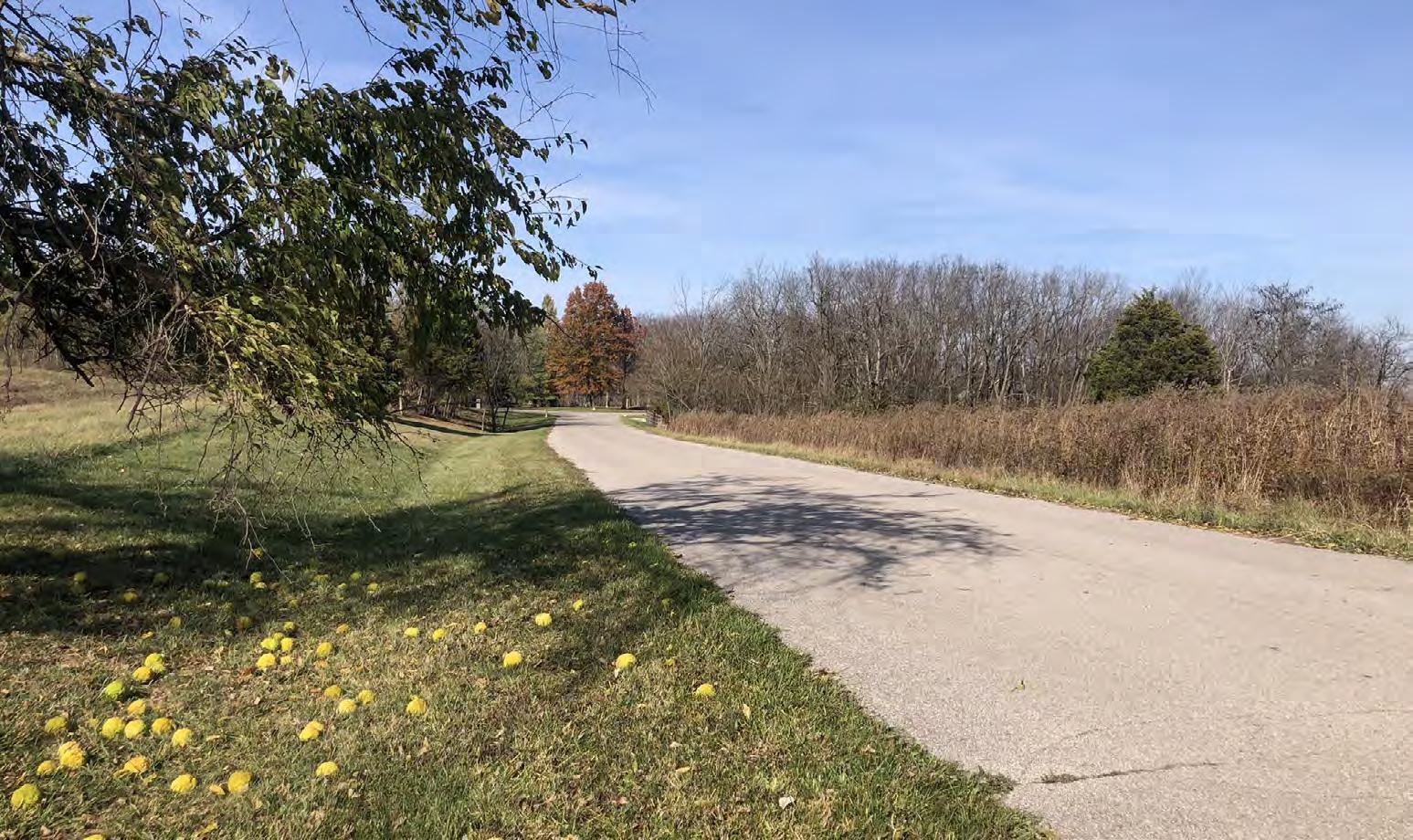
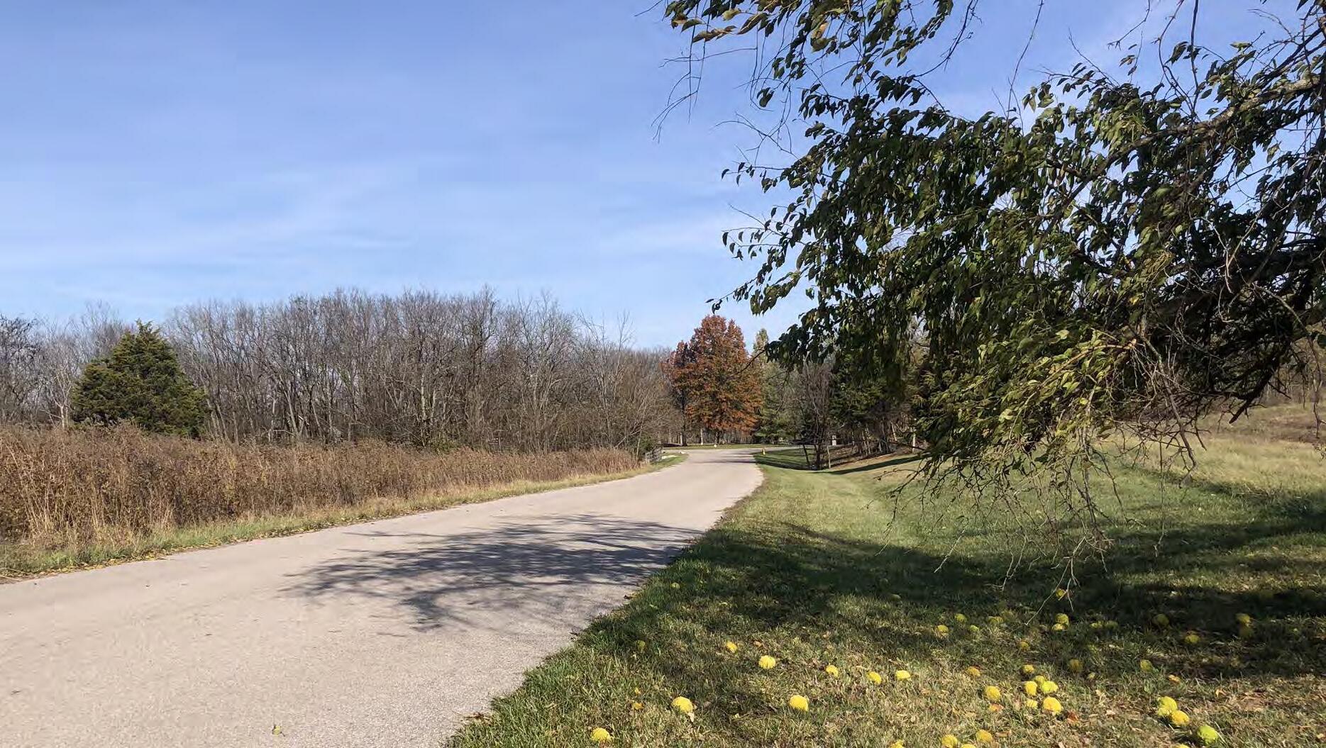
Area 1 is located along the western edge of the Urban Service Area. The smallest of the five sites included in this study, it is bounded by Parkers Mill Road to the north and Man O War Boulevard to the southwest. Its southeastern edges border Heritage Place, a subdivision of two-family dwellings, and The Reserve, a large single family detached subdivision that spans approximately 132 acres, not including the 78.5-acre Beaumont Preserve.
Area 3 is located adjacent to the Urban Service Area’s southeastern corner. It is bounded by AthensBoonesboro Road to the south and I-75 to the east. Area 4 is immediately adjacent to the east, but I-75 acts as a major barrier, while Area 5 is also nearby to the southeast. Several subdivisions form this site’s northern and western boundaries, including Walnut Creek and Chilesburg, two dense single-family subdivisions. Area 3 also includes Brenda Cowan Elementary School and the undeveloped portion of land attached to Edythe Jones Hayes Middle School.
Area 2 is located to the northeast of Lexington’s Urban Service Area and forms the largest of this study’s five sites. The site is situated between two Interstate Highways—I-64 to the north and I-75 to the west—and Winchester Road to the south. The site’s eastern boundary is agricultural land.
Located immediately to the east of Area 3, Area 4 is bounded by Todds Road to the north, I-75 to the west, and portions of Canebrake Drive to the east. The cluster of hotels and highway-service businesses located where Athens-Boonesboro Road crosses I-75 forms the site’s southern boundary.
Athens-Boonesboro Road forms the spine of Area 5. The boundary extends between 1/8-mile and 1/3-mile on either side of Athens-Boonesboro Road site and mostly includes this area’s non-residential uses: the hotel and highwayservice businesses adjacent to I-75 and the industrial uses along Blue Sky Parkway.
Given that all of the propsed areas of future growth are outside of the existing urban service area inherently means the majority of the sites are low density and used mostly for agricultural purposes.
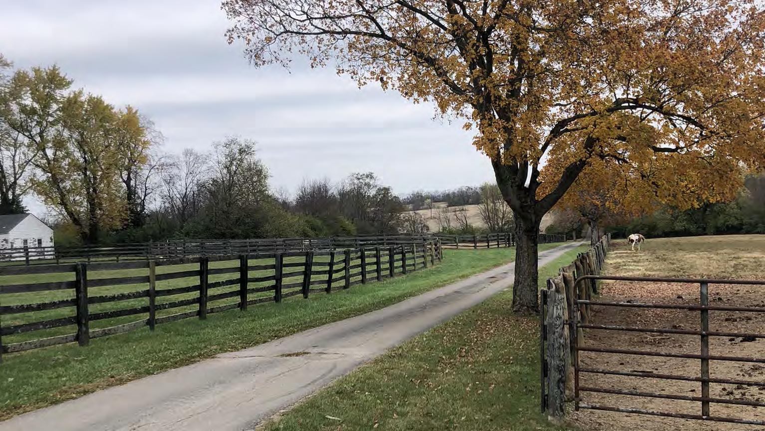
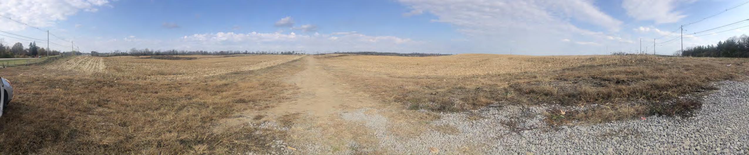
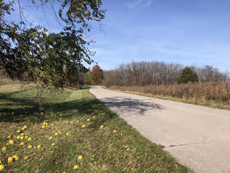
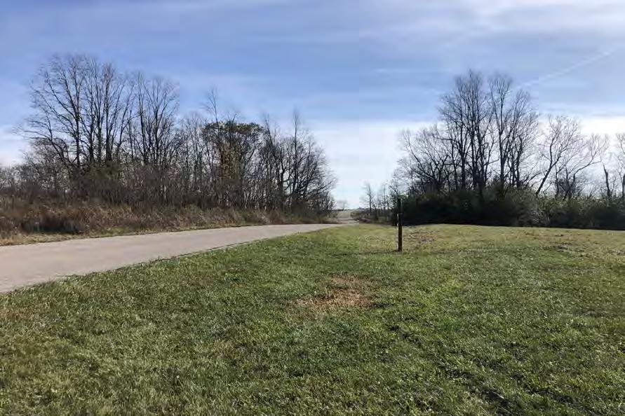
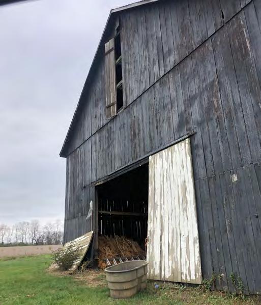
Area 1 is the smallest of the five areas. The land is currently being used for cattle and horse pastures with seven paddocks for horses and areas for grazing animals. There are several associated barns, outbuildings, and the original farmhouse on site.
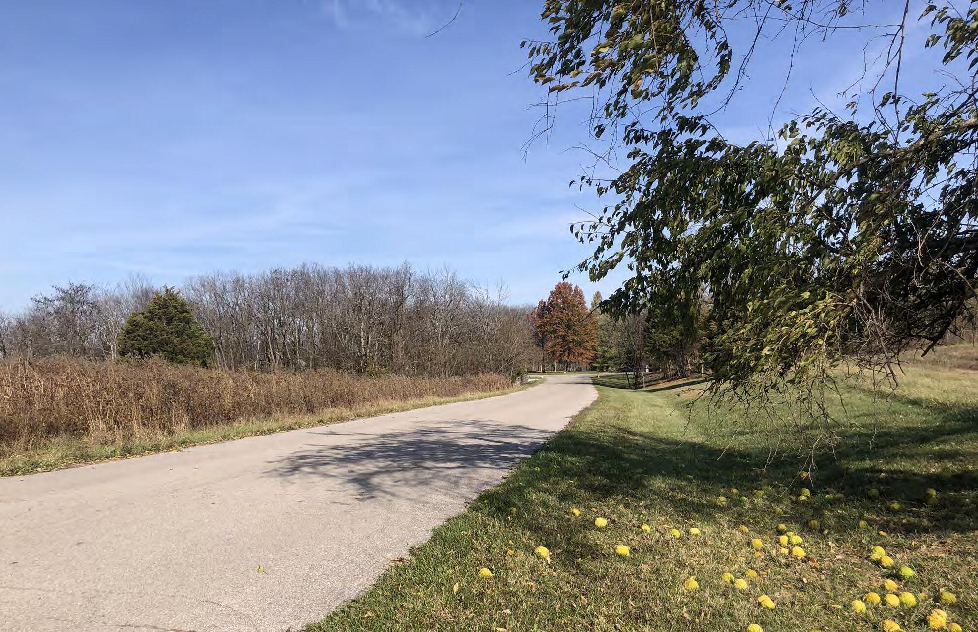
The vegetated entry to Pine Needle Lane is included in Area 1. This parcel is owned and maintained by the Hertiage Place HOA, which is the adjoining active adult community.
Area 2 is the largest of the five areas. It includes a cluster of single-family homes exists along Hume Road and Ami Lane. Several large lot rural residential homes are scattered throughout the site.
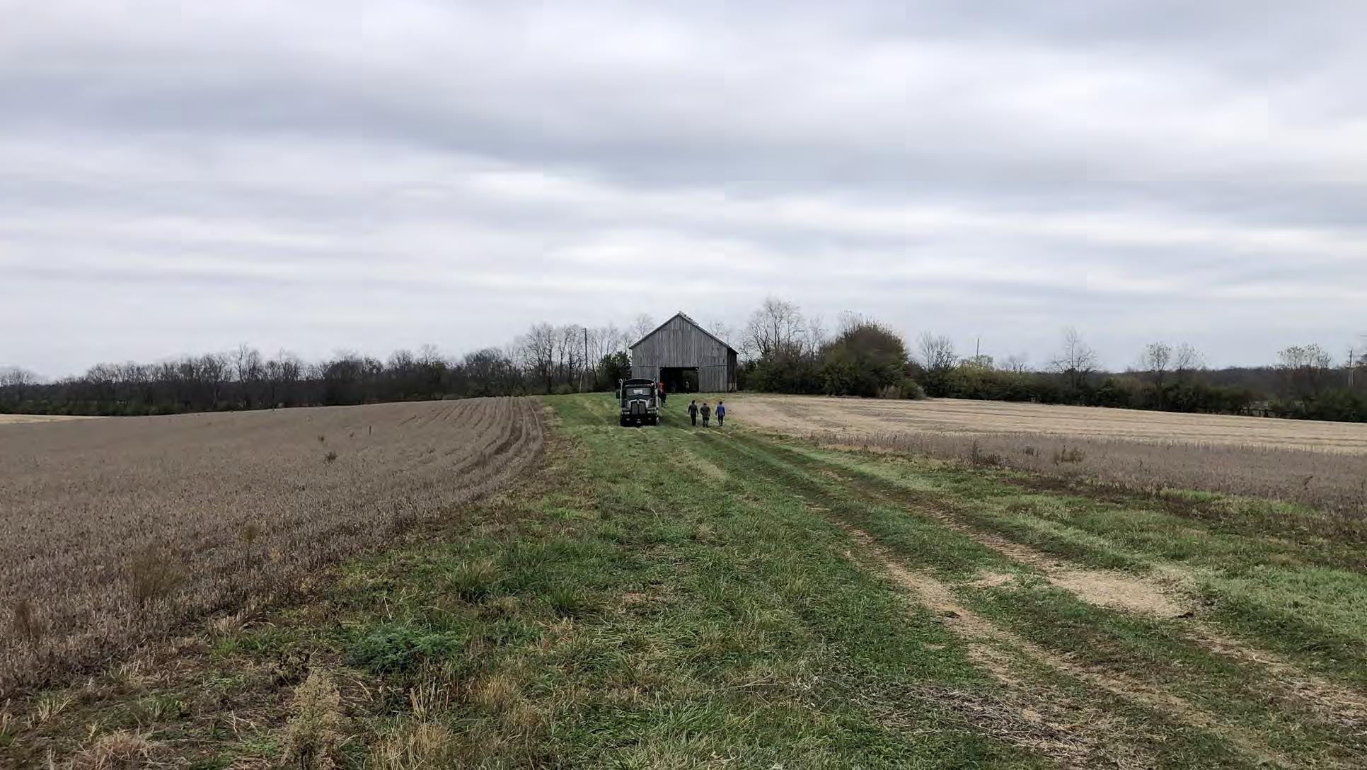
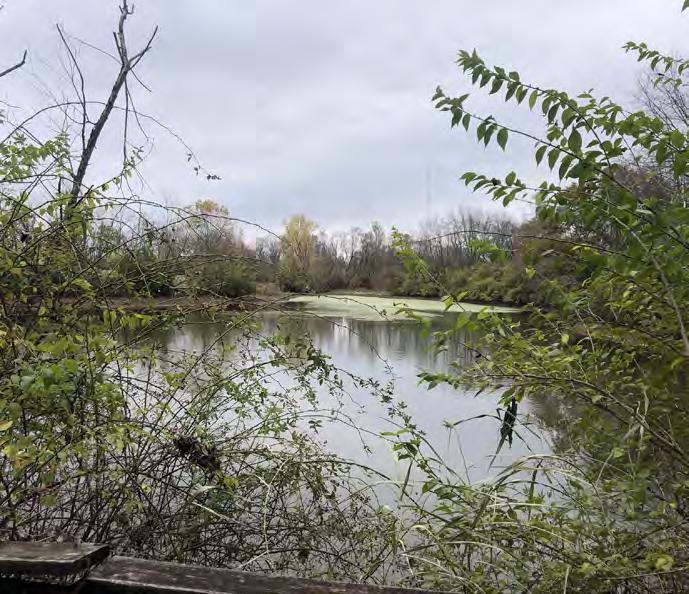
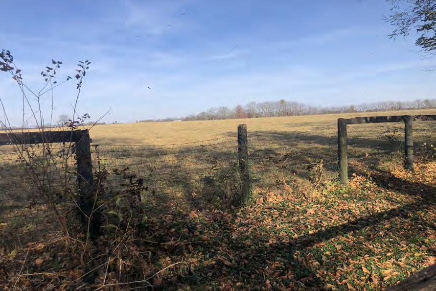
There are several actively managed farms, which include a residence and multiple barns or outbuildings.
Non-residential uses include: WKYT News station, and part of a power sub-station
Area 3 is sparsely developed, other than a single operational farm west of Brenda Cowan Elementary. The remainder of the land is unoccupied and used for crop rotations. The northernmost portion of the site is landlocked and has access through a temporary easement into the adjacent neighborhood to the west. The access to these parcels would need to be revalauted depending on any future development.
Non-residential uses include: two public schools, Brenda Cowan Elementary School and the back portion of Edith J. Hayes Middle School.
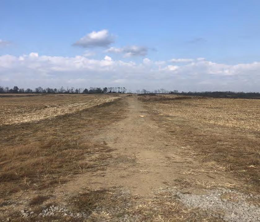
Area 4 consists of a few large agricultural tracts along Todds Road. The farmland has a mix of row crops and pasture.
There are a series of 10 acre lots along Canebrake, which were subdivided in 1987, a few of which have dwellings on them.
Area 5 is the most developed of the 5 sites. The Blue Sky Rural Activity Center, centered around the Blue Sky Parkway, hosts a wide variety of industrial sites, including freight, light manufacturing, and construction services.
The Blue Sky Rural Activity Center also contains several hotels clustered at the I-75 interchange with AthensBoonesboro Road. The remainder of the areas at the corners of Athens-Boonesboro Road and I-75 are highwayserving businesses such as fast food restaurants, gas stations, convenience stores, and an adult entertainment venue.
The land surrounding the recently constructed Lexington Sporting Club soccer fields and future stadium has seen huge changes in the past year transitioning from being a hilly forested piece of unused land to major earth movement to make way for new fields, parking, and infrastructure. The stated goal is to create an entertainment district based on the new sports complex, but all of the components have not been decided yet.


The zoning that regulates development on each site does not immediately offer insight into what types of development and uses are appropriate for future development outside of the existing Urban Service Area. This section describes the zoning for each area—but perhaps more importantly, the zoning around each site—to reveal what built form and character might fit within each one.
Areas 1, 3, and 4 are exclusively comprised of land zoned Agricultural - Rural (A-R). This category is reserved for
agricultural operations, including crop production, pastureland, and equine-related facilities. Single-family detached residential is also permitted within the zone. Agricultural tracts within Areas 1 and 3 are quite large. Area 4 also features these large tracts, along with a series of smaller agricultural lots (a minimum of 10 acres each) along Canebrake Drive that have been subdivided into lots for single-family homes.
Area 2 mostly consists of land zoned A-R, similarly organized into large agricultural holdings. A small, singlefamily neighborhood (zoned R-1A) extends along Hume Road and Ami Lane.
Area 5’s zoning is the most distinct of the five sites. While some small pockets of A-R remain, the majority of Area 5 is zoned Light Industrial (I-1). Land immediately adjacent to I-75 is zoned commercial (B-3 and B-5P), which permits auto-centric businesses including hotels, quick service restaurants, gas stations, and other such uses.
When considering adjacent zoning, much of the five areas are surrounded by land outside of the urban service area, zoned A-R. Areas 1, 2, and 3 also share signifant edges bordering areas of Lexington within the urban service area, which fall under a variety of the city’s standard urbanized zones..
To the southeast of Area 1 are multiple single-family subdivisions, mostly zoned R-1C. Conforming lots in R-1C are a minimum of 8,000 square feet; with 1 dwelling unit per acre, R-1C zones reach a maximum density between 5-6 units per acre. Also, immediately adjacent to Area 1’s boundary is a small multifamily development zoned R-3. Immediately north of Area 1 is an A-R tract and a park that is zoned R-1A (Cardinal Run North). There are two Agricultural - Urban (A-U) districts adjacent to Area 1, which are available for an urbanized use. A small sliver is situated between Area 1 and R-3, while the larger A-U district is currently used as a park (Cardinal Run South).
I-75 forms the western boundary of Area 2, as well as the eastern boundary of the urban service area. Across I-75 from the site are several districts zoned B-3, B-5P, and B-6P, all permissive of auto-oriented businesses. These non-residential districts back up to single-family (R-1C, R-1D, R-1E) and multifamily districts (R-3). Between I-75 and Area 2’s boundary are two “expansion area zones” - EAR-1 and ED. EAR-1 is reserved for low-density residential, while the ED zone is reserved for job production
To the north of Area 3 are several new subdivisions that fall under Expansion Area Zones (EAR-2 and CC). These zones are intended to provide a well-managed transition in density between the urban area of the City to its agricultural surroundings.
Zone Name Description
Standard Zones
A-R Agricultural - Rural Agricultural land (crops, pasture) and limited single family dwellings
A-U Agricultural - Urban Undeveloped land within urban growth boundary, with restrictions on development until infrastructure and services are provided
R-1A Single-Family Residential (SFR) Detached homes on 25,000 sf lots
R-1B SFR Detached homes on 15,000 sf lots
R-1C SFR Detached homes on 8,000 sf lots
R-1D SFR Detached homes on 6,000 sf lots
R-1E SFR
Detached homes on 4,000 sf lots
R-1T Townhome Residential Attached homes, minimum lot size 1500 (maximum 12 attached)
R-3 Planned Neighborhood Residential Mixed residential district (multifamily, townhomes, and single-family detached)
B-1 Neighborhood Business Commercial district catering to businesses that serve residential neighborhoods
B-3 Highway Service Business Commercial district catering to auto-oriented businesses appropriate for highways
B-5P Interchange Service Business Commercial district catering to businesses appropriate for interstate interchanges
B-6P Commercial Center District intended to create walkable retail and business developments
I-1 Light Industrial Manufacturing, logistics, and other industrial without nuisances
P-1 Professional Office Offices and professional uses
Expansion Area Zones
EAR-1 Expansion Area Residential Low density residential, mixed type (3 units/acre maximum)
EAR-2 Expansion Area Residential Low density residential, mixed types (9 units/acre maximum with density transfer rights)
CC Community Center Mixed use district that permits residential, retail, and office
ED Economic Development Non-residential district that permits office and industrial uses
Each area of study, with the exception of Area 5, contains significant portions of agricultural land. The use of this agricultural land differs from area to area and can be challenging to discern from aerial imagery alone. Data from the National Land Cover Database (NLCD), shown on the right, provides an additional layer of detail but still contains a margin of error. For instance, there is a portion of land in Area 3 which is existing agriculture being shown as ‘Developed Open Space’, most likely as a result of being heavily disturbed. The NLCD data is provided at a 30-meter resolution, meaning that each pixel has a width of 30 meters.
Almost all of Area 1 is occupied by grazing land, labeled “hay/pasture” by the NLCD. From aerial and street-view imagery, there appear to be seven pastures or paddocks total within this area, used primarily for cattle grazing and equine turnout. The NLCD data shows how suburban development has altered land cover up to the boundary of Area 1.
There is also a small parcel of land included within Area 1, which acts as the landscaped entry of Pine Needle Lane into the neighborhood.
Similar to Area 1, the majority of Area 2 contains grazing land, with some agricultural land devoted to cultivated crops in the eastern portion of the study area. These grazing tracts are divided by riparian zones lining North Elkhorn
Creek and its smaller tributaries. The limited amount of developed land in Area 2 can be found in the single-family neighborhood extending along Hume Road and Ami Lane.
Area 3 features large agricultural holdings of hay/pasture, especially toward I-75 to the east and Athens-Boonesboro Road to the south. Some plots of cultivated crops are also captured in the land cover data. This area features significantly more developed land cover than Areas 1 and 2. The “medium intensity” and “high intensity” land cover represents Brenda Cowan Elementary School. The large swath of land identified as “developed, open space” adjacent to the recent subdivision development to the north could indicate a few things. Aerial imagery shows this area as grazing land, although the area is dotted with clear, circular patches of green which could indicate a different land use. Still, most of the land identified as “developed, open space” appears to be for agricultural use.
Area 4 includes several large agricultural holdings, as well as a handful of smaller agricultural tracts along Canebrake Drive. Most of these holdings are being used for grazing land or crop rotations. However, a sizeable portion of them are forested, especially those farther north along Canebrake Drive, and many do not have an active agricultural use.
Area 5 is the most distinct from the other four study areas. While the far western portion of the study area was characterized by forested land cover, the current development of the soccer complex has since removed the majority of the treed portions of the site. The remaining bulk of Area 5 has been developed to a relatively high intensity. Land cover data shows how this development had been limited to Blue Sky Parkway and the four corners of the I-75 onramps.
Land preserved under Lexington-Fayette County’s Purchase of Development Rights (PDR) program can be found near the five areas of study. Because these lands cannot be developed, any development projects occurring within these five areas must consider how to buffer or transition between developed neighborhoods or districts and conservation areas.
The tracts closest to Area 1 that benefit from protection under PDR are located about one mile to the south, along Bowman Mill Road where it meets South Elkhorn Creek (not shown in map extents).
Two PDR tracts are located close to Area 2’s boundary, one immediately adjacent to the area’s northeastern corner across Royster Road (approximately 40 feet) and another to the north across I-64 (approximately 250 feet). Both of these tracts appear to be utilized for agricultural operations, mostly pasture.
PDR land is clustered to the south and east of Areas 3, 4, and 5. The southern tracts consist of smaller agricultural holdings, mostly used for pasture, while the eastern tracts are larger and appear to be used for a variety of agricultural production, including both pasture and cultivated crops.
While Fayette County is known for it’s karst* landscape, it is important to note that specific karst features have been identified as either existing sinkholes, or areas of potential future karst features, such as additional sinkholes, caves, springs, etc. It may be advisable to avoid high density development in areas known to have problems.
Area 1 is characterized by rolling terrain of 10% or less slope. The site falls from east to west with two drainage features leaving the site, one under Parkers Mill Rd and the other under Man O War Boulevard.
While not impeded by existing drainage channels, floodplain, or steep slopes, the identified existing and potential karst features will present challenges to the overall development due to issues with building foundations and other structural concerns.
Area 2 has two distinct regions, the neighborhood development along Hume Road with slopes in the 10% - 20% range and the undeveloped portions which area predominately 10% or less with pockets of steeper slopes.
Areas 3, 4, and 5 have more topographic relief than the other Areas with substantial portions of land that is undesirable or unsuitable for development (slopes over 20% and some in the 10% - 20% range). The northern region of Area 4 has significant portions of gentle slopes of 10%.
Area 3 has pockets of mapped karst / sinkholes, but additional areas may be present beyond those mapped given the expected site geology and topography.
In general, much of the undeveloped portions of Area 3, 4, and 5 would require minimal earth movement and would lend themselves to development given that design respects the topography. Care should be taken to avoid the areas with steep slopes and known karst areas, as well as be cognizant that additional unmapped areas may be present.
Karst – a type of landscape where the dissolving of the bedrock has created sinkholes, sinking streams, caves, springs, and other characteristic features. Karst is associated with soluble rock types such as limestone, marble, and gypsum. In general, a typical karst landscape forms when much of the water falling on the surface interacts with and enters the subsurface through cracks, fractures, and holes that have been dissolved into the bedrock. After traveling underground, sometimes for long distances, this water is then discharged from springs, many of which are cave entrances.
-National Park Service
Source:
When imagining how these areas could accommodate thoughtful development, it is important to note environmental and geological features that should be protected from negative impacts.
Areas 2 and 4 both feature prominent waterways that would affect the shape and orientation of development plans.
While two small streams begin within Area 1, ultimately draining to Cave Creek southwest of Man O War Boulevard, Area 1 otherwise does not experience many challenges with existing waterways. The features drain into Manchester Branch, Wolfs Run, and Cave Creek, and none have mapped FEMA floodplains within Area 1. A jurisdictional determination has not been made on these features. Based on the Kentucky Water LiDAR Analysis, numerous sinkholes / karst features are present on the site.
Area 2 has multiple drainage features (streams and ponds), some of which are jurisdictional, and some have not been classified. All water flows south to north and discharges under I-64. North Elkhorn Creek bisects Area 2 from I-64 to the north, to Winchester Road to the south. There are approximately 18 acres of floodplains within Area 2, comprising just under 2 percent of the study area. The mainstream sections through the center of the site have both FEMA mapped floodplain and floodways which will create challenges with roadway connections within the site.
While no karst features are presently mapped, they could be
present given the geology of central Kentucky.
Given the existing FEMA floodplains and floodway dividing the site, multiple road crossing will be challenging. Larger than typical drainage structures or lengthy permitting associated with the LOMR process to allow flood impacts may be required. Additionally, if structures are selected that impact the stream channels, an Individual permit through the U.S. Army Corps of Engineers (USACE) may be triggered depending on the number of crossings that would exceed the Nationwide Permitting thresholds.
Areas 3 and 5 are less affected by streams and floodplains, though several waterways still appear within their boundaries. Area 3 features no floodplains, though several streams drain to the south.
Area 3 drains into three separate drainage basins with a high point in the center of the site. Additionally, there are existing ponds onsite. To the northeast, the site drains under I-75 and to the southwest, it drains under Athens Boonesboro Road. To the southeast, flows drain into Area 5 and then under I-75.
Area 4 is broken into two distinct drainage basins, one to the north and one to the south. In Area 4, the Baughman Fork of Boone Creek begins in the northern portion of the study area, draining away from I-75 toward Boone Creek to the East. Neither of the drainage features have mapped floodplain. Ponds are also present on site in the northern region.
In Area 5, a sizable floodplain is situated on the northern edge of the industrial area along Blue Sky Parkway,
ultimately draining to Boone Creek as well. Area 5 drainage connects with both Area 3 and Area 4 features but does not have mapped floodplain, however just off-site to the east of the Area 5 limit, floodplain is present.
While a formal jurisdictional determination has not been performed to date on the features in these areas, it would be expected that many of these features will be classified as intermittent or perennial streams along with the surface waters being waters of the state.
As roadway networks are developed, staying below the Nationwide Permit thresholds with the USACE for stream and open water impacts should be considered to avoid the Individual Permitting process. While steep slopes are present in Area 4, avoiding impacts to the channels should limit development in those areas. Alternatively, if the channels are either unregulated or permitted to be filled, large scale earth moving will alleviate the limitations with the slopes.
Source:
There is signifcant delay at the signalized intersection of Lane Allen Road and Parkers Mill Road, often waiting for more than one signal cycle in the morning to clear the intersection. Observed queues in the morning can reach up to 25 vehicles long on Lane Allen Road. When this happens, only a third of the vehicles can clear the intersection during the green phase of the cycle. In the evening, the intersection does not experience this level of delay and all vehicles are able to clear the intersection during the green phase.
At the Parkers Mill Road at Man O War Boulevard intersection, the traffic signal appears to be sufficiently managing traffic flow. Despite the maximum queue length of 15 vehicles in the evening, queues are flushed each cycle. Operations are consistent and under capacity, given the current demand.
Finally, the Man O War Boulevard at Beaumont Centre Lane intersection is busy during peak hours, with Beaumont Centre Lane having a typical queue of 15-20 vehicles. However, queues are successfully cleared each cycle and the bustling intersection appears to efficiently manage the demand. Nearby Dunbar High School does generate additional traffic during the school year. The additional traffic results in an increase in delay experienced at the intersection; however, the overall impact is restricted to school arrival and release.
Average Daily Traffic (ADT) – the average number of vehicles passing a specific point on a roadway on an average day.
K factor – the proportion of annual average daily traffic occurring in an hour.
D factor – the proportion of traffic traveling in the peak direction during a selected hour,
The site is strategically located with potential vehicular and multimodal connections to the adjacent neighborhoods and parks. Between stubbed roadways ending at the site and connections to the Beaumont Walking Trail, this site is surrounded by transportation facilities for efficient mobility, as well as recreation. The site benefits from the presence of sidewalks along the entire extent of Man O War Boulevard, which is located on the southwest edge of the site. Conversely, Parkers Mill Road, another road adjacent to the site, does not have any pedestrian facilities.
The Lexington Bike and Ped Master Plan (page E-8) indicates that walking and biking in Fayette county is “difficult and dangerous due to driver behavior” yet “important for transportation and recreation.” The plan indicates high to moderate support for bike and pedestrian improvements adjacent to the corridor, such as along Parkers Mill Road inside Man O War Boulevard. The plan proposes a minor bikeway along Parkers Mill Road from Lane Allen Road to Man O War Boulevard, another minor bikeway along the eastern edge of the site, and a major bikeway along the extent to Man O War Boulevard. The plan identifies these facilities as mid-term priorities.
The public transportation access points are less than desirable. The nearest bus stop is at the Bluegrass Airport, situated approximately 1.5 miles to the northwest of the site. Unfortunately, this bus stop lacks sidewalks, meaning that safe and convenient pedestrian access to the site from this bus stop is currently not available. There is another bus stop at the Palomar Center, around 1.75 miles to the southeast. Unlike the Bluegrass Airport bus stop, the Palomar Center bus stop connects to the existing sidewalk network, providing a more accessible route for pedestrians.
Primary safety concerns adjacent to the site are most notable along Parkers Mill Road and at the intersection of Man O War Boulevard and Parkers Mill Road. In recent years, there have not been any crashes involving vulnerable road users such as pedestrians or bicyclists. However, crash patterns are evident at both the mentioned intersection and in clusters along Parkers Mill Road.
Hume Road at Winchester Road is an unsignalized intersection experiencing typical morning queues of 4-5 vehicles and evening queues of 6-8 vehicles. However, congestion on westbound Winchester Road near I-75 often impedes Hume Road’s traffic flow, making it difficult and potentially unsafe to turn onto Winchester Road from Hume Road. The intersection’s operational efficiency is highly dependent on the I-75 interchange, given the proximity.
Winchester Road at Polo Club Boulevard is another unsignalized intersection which functions efficiently in the morning with typical queues for both eastbound and westbound Winchester Road of 5-8 vehicles. Despite some queuing, the intersection operates smoothly, and vehicles can make relatively easy turns from Polo Club Boulevard onto Winchester Road. However, in the evening, vehicles back up on Winchester Road from the signal at Man O War Boulevard and back up through the Polo Club Boulevard intersection, significantly increasing delay for everyone at both locations.
The intersection of Man O War Boulevard at Winchester Road also displays significant differences in demand and operations during peak morning and evening hours. In the morning, both directions of Winchester Road experience efficient operations and manageable traffic volumes, with typical queues of 5-7 vehicles. However, the evening period sees increased traffic, leading to longer queues and cycle lengths. Eastbound Winchester Road is particularly congested, with roughly one mile-long backup due to
the Man O War Boulevard signal capacity not meeting the current demand. This intersection could experience even greater deficiencies with additional demand if not modified.
While adjacent to a handful of vehicular connections, there are currently no pedestrian facilities adjacent to this site along Winchester Road, Hume Road, or Royster Road. A potential access point to the site could line up with Polo Club Boulevard. This would allow for a connection to the existing pedestrian facility along Polo Club Boulevard with a bus stop approximately 1.25 miles to the south.
The Lexington Bike and Pedestrian Master Plan proposes a minor bikeway through the property that would connect to an already funded facility along Polo Club Boulevard to the south and to a proposed bikeway on the other side of the interstate to the west. The plan identifies all of these facilities as long-term priorities with no proposed additional pedestrian facilities in the area.
There are currently two routes that come near the site area. Route 7 North Limestone and Route 10 Hamburg Pavilion both have stops that are accessible via Winchester Road.
There is an existing pedestrian facility along Polo Club Boulevard with a bus stop approximately 1.25 miles to the south. Another bus stop is located on Buena Vista Road, about 0.5 mile to the west. However, this stop is on the other side of an interchange and lacks any existing pedestrian facility connections.
Primary safety concerns are centered around the on and off ramp at Winchester Road and I-75. While no pedestrian incidents were noted, there is concern for pedestrianand cyclist-related safety due to the lack of infrastructure present surrounding the site.
A narrow street section and lack of pedestrian infrastructure along Hume Road forces residents to rely on personal vehicles for all trips.
Source:
Athens Boonesboro Road, adjacent to the three project areas, experiences elevated levels of congestion in both the morning and evening peak hour periods. At the Hays Boulevard signalized intersection, inbound and outbound traffic on Athens Boonesboro Road backs up as far as the eye can see. Hays Boulevard has a higher volume in the morning peak period, with a typical queue length of 10-12 vehicles. However, vehicles in the right turn lane of Hays Boulevard often must wait through multiple cycles to make their turn.
The Kentucky Transportation Cabinet’s plans for ‘R-cut improvements’ currently stretch from Richmond Road out to Hays Boulevard, with future phases to extend those improvements all the way out to the area around the I-75 interchange. These improvements are meant to alleviate some of these queue times at major intersections and make turning movements safer.
Area 3 is boarded by I-75 to the east and a neighborhood to the west, creating the only vehicular access along Athens Boonesboro Road.
A temporary intersection is planned as part of the new development around the soccer complex in Area 5. The creation of a new signalized intersection will help move visitors to the new venue in a safer way, particularly at peak times around set practice or games times. Eventually, this intersection will be improved further during the expansion of the R-cut project.
Intersections along Athens Boonesboro Road near and south of the interstate, on the other hand, experience much lower volumes. In both peak hours, vehicles are rarely required to queue along the unsignalized Canebrake Drive or the unsignalized Blue Sky Parkway intersections. While the Blue Sky Parkway intersections experience a steady flow of vehicles from the side road, the low volumes along the main road prevent a queue from forming.
The demand-to-capacity ratio along Todds Road is lower than that described for Athens Boonesboro Road. Operations at the intersection of Polo Club Boulevard
and Todds Road are similar in both morning and evening peak periods. This unsignalized intersection experiences low volume and low queues on Polo Club Boulevard. Vehicles are able to make turns onto Todds Road easily and frequently. Another nearby intersection along Todds Road at Hays Boulevard experiences much higher volumes, especially in the morning peak period. Due to drop off at the adjacent Athens-Chilesburg Elementary School, the queue is about 15-20 vehicles on average. However, with it being a signalized intersection, this queue clears each cycle.
While surrounded by a network of varied roadway classifications to aid in vehicular mobility, there are no bicycle or pedestrian facilities available within the vicinity of these sites except for sidewalks spread throughout the Walnut Creek and Chilesburg neighborhoods to the northwest of Area 3.
The Lexington Bike and Ped Master Plan proposes a minor bikeway through the existing previously mentioned neighborhood adjacent to Area 3 and a major bikeway along Athens Boonesboro, from Man O War Boulevard to the I-75 Interchange. However, it does not propose any additional pedestrian facilities in the area and identifies all these facilities as mid-term or long-term priority.
Public transportation access is limited, as the closest bus stop is situated nearly 3 miles away. This stop is located up Athens Boonesboro Road at the St. Joseph East Hospital, which is just east of Man O War Boulevard.
There are existing safety concerns surrounding these sites. The lack of multimodal facilities, the location of Brenda Cowan Elementary School, and the recent crash involving a pedestrian are a worrying combination for the safety
of all users. Additionally, there are high crash rates at intersections near the site and at the interchange of Athens Boonesboro Road and I-75.
An increased desire for more multi-modal access to the area around the soccer complex from locations in the heart of Lexington and in any future development in other portions of Areas 3, 4, and 5, will need to be considered.
Electric service is provided by Kentucky Utilities (KU).
AREA 1:
Based on provided mapping by KU there is a substation just north of the Area 1. Three phase distribution lines that would be able to serve Area 1 run along the eastern portion of Parkers Mill Road and along Man O War Boulevard. While without exact development patterns defined, capacity cannot be confirmed, there were not specific concerns for this area especially with a nearby substation.
AREA 2:
There is a substation located north of Winchester Road at Hume Rd. As with Area 1, capacity was not a specific concern given the location of the substation. The existing infrastructure running through the Area would not be sufficient to provide distribution to new development.
AREA 3/4/5:
There is existing three phase distribution lines along Athens Boonesboro Road and at the intersection of Todds Road and I-64/I-75.
Overall areawide capacity could be a concern as well as the existing distribution lines at the perimeter. Larger scale upgrades may be necessary depending on the anticipated development pattern.
Water service is provided by Kentucky American Water (KAW).
AREA 1
Based on mapping provided by KAW, a 24” main runs along Parkers Mill Road and a 12” main along Man O War Boulevard.
AREA 2
An 8” main runs along Royster Road and a 12” main along Winchester Road. Dead end mains extend into the development area along Hume Road and Ami Lane.
AREA 3
A 12” main runs along Athens Boonesboro Road with another main extending into the area serving Brenda Cowan Elementary which is fed from the existing subdivision to the northwest.
AREA 4
A 12” main runs along Todds Road for a portion of the area and then reduces to a 6” main. Additionally, an existing 8” main along Canebrake Drive feeds from an existing 12” along Athens Boonesboro Road that feeds interior to the area.
AREA 5
A 12” main runs along Athens Boonesboro Road and Blue Sky Parkway.
Gas service is provided by Columbia Gas.
AREA 1
Based on mapping provided by Columbia Gas, there are no mains along the Man O War Boulevard or Parkers Mill frontages, but 2” – 4” medium pressure mains exist to connect to within the adjacent subdivision as well as at the northeast edge along Parkers Mill Road.
AREA 2
A 6” – 8” medium pressure mains exist along Winchester Road and Hume Road. Ami Lane has existing service but through a smaller main than needed to support the full development.
AREA 3
No existing mains exist along the Athen Boonesboro Road frontage. There is a transmission main running through the study area in the area of Brenda Cowan Elementary School but is not available to be used for service as it is owned and operated by TC Energy rather than Columbia Gas. There are 2” – 4” medium pressure mains existing in the subdivision to the northwest to connect to.
AREA 4
Existing 2” – 4” medium pressure mains are present in Canebrake Drive and Canebrake Court.
AREA 5
Existing medium pressure mains are located within Blue Sky Parkway as well as Athens Boonesboro Road to the east of I-75. No mains are present west of I-75. For areas east of I-75.
Telecommunications is provided by Windstream, and others (e.g. ATT, Spectrum ,etc.) who did not provide information on their service lines.
From information provided by Windstream, they have existing fiber and electronics near the intersection of Parkers Mill Road & Man O War Boulevard that will support future growth in the area.
AREA 2
Windstream has existing fiber along Winchester Road. The existing fiber is not adequate to meet the needs of a development of the magnitude described and would need to add additional electronics and fiber to support the expected development at an estimated cost of $50,000.
From information provided by Windstream, they have existing fiber along Athens Boonesboro Road but it is not adequate to meet the needs of a development of the magnitude described. It would require additional electronics and fiber to support the expected development at an estimated cost of $50,000.
Sanitary sewer service is provided by LFUCG, when available.
The majority of the areas are not currently served by LFUCG for sewer service.
AREA 1
To provide service, in addition to gravity collection systems within the development area, based on the Sewer Capability Report prepared by Stantec in August, 2023, this area would require a new pump station to be built near Man O War and a force main to run along Man O War to the existing Mint Lane Pump Station. Depending on the level of density programed for the area, upgrades to the existing Mint Lane Pump Station or on-site attenuation of flows would be expected to be required.
This area would require a pump lift station and wet weather storage tank at I-64. Depending on timing, currently planned funds to construct and upgrade facilities at North Elkhorn Pump Station could be leveraged to offset costs for these proposed needed facilities.
To provide service, in addition to gravity collection systems within the development area, based on the Sewer Capability Report prepared by Stantec in August, 2023, this area would require a new pump station at Athens Boonsboro Road. Based on development densities and development timing from Area 5, the existing Boonesboro Manor Pump Station and force main along Athens
Boonesboro Road may require upgrades.
This area would require trunk sewer to extend outside of the development area to the existing Blue Sky Pump Station. The northern section of the development area is under further study by LFUCG for servicing options.
Portions of this area, predominately east of I-75, are currently served by LFUCG. To service the areas west of I-75 in addition to gravity collection systems within the development area, based on the Sewer Capability Report prepared by Stantec in August, 2023, this area would connect to the existing Boonesboro Manor pump station located adjacent to Area 3. Depending on development densities and timing, the pump station and force main along Athens Boonesboro Road may require upgrades.
Once a development pattern is determined, new infrastructure would be needed. Capacity or pressure concerns were unable to be evaluated by utilities at this time due to the significant variability in demands of different development patterns.