MORE THAN FARMING FOOD


Using multifunctional agriculture to enhance landscape, ecology, and recreation in the agricultural surrounding landscape of Boekel
Maarten Schenk-Verbruggen
Using multifunctional agriculture to enhance landscape, ecology, and recreation in the landscape of Boekel
c Wageningen University August 2022 Landscape Architecture Group

Contact information: P.O. Box 47 6700 AA Wageningen The Netherlands Phone: +31 317 484 056 E-mail: office.lar@wur.nl
Author: c Maarten Schenk-Verbruggen Phone: + 31 6 342 231 70 E-mail: schenk-maarten@hotmail.com Student nr.: 1016881
Supervisor: dr. ir. Marlies Brinkhuijsen
2nd reviewer/examiner: ir. Gabriëlle Bartelse
Examiner: prof. dr. Sanda Lenzholzer dipl.ing. MA
All rights reserved. Nothing from this publication is allowed to be used without permission of the author or the Landscape Architecture Group at Wageningen University. This publication is written as a final master thesis report for the Landscape Architecture Group at Wageningen University.
In fulfilment of the requirements for Master of science degree in Landscape Architecture at the Wageningen University, Landscape Architecture Group.
Author: Maarten Schenk-VerbruggenSupervisor: dr. ir. Marlies Brinkhuijsen Assistant professor in Landscape Architecture Wageningen University & Research
2nd reviewer/examiner: ir. Gabriëlle Bartelse Lecturer in Landscape Architecture Wageningen University & Research
This thesis is the final part of my master’s in landscape architecture at Wageningen University and took over two years to complete. This report is a significant milestone for me and my personal development and the projects I hope to work on during my future career. The topic and project location of this thesis is very deer to me as it involves my personal living surroundings.
Writing this thesis has been a big struggle. Without all the loving support I received I wouldn’t been able to finish this final piece of my study. Because of this, I would like to express my special thanks to my parents Koos and Nicoline Schenk and my husband Nick for the significant support and encouragement.
Furthermore, I would like to thank Marlies Brinkhuijsen and Gabriëlle Bartelse for them finding time in their busy schedules, their energy, and their valuable input that they gave me over the course of this process.
Finally, I would like to thank all my other family and friends for supporting me throughout this difficult and emotional thesis process. Commuting to Wageningen to work at Gaia with some of you made a serious impact in the progression of my thesis. Thank you for that.
The characteristics and values of the Brabant cultural landscapes have significantly deteriorated due to land reclamation, land consolidation, altered agricultural land use and methods. Additional trends show a decrease in ecological values and growing demand for rural recreation. Multifunctional agriculture (MA) can contribute to landscape, ecology, and rural recreation by incorporating these topics in farming businesses.
There is a lack of research on the design of landscapes incorporating MA that improve landscape, ecology, and rural recreation. In this thesis the characteristics and problems of the landscape units of Boekel are formulated and an MA toolbox and MA farming styles generated. These outcomes are used to design the landscape and generate specific and general design principles.
The established MA toolbox, MA farming styles, landscape design, and design principles provide usable input for landscape designers to incorporate multifunctional agriculture in Brabant landscapes like the landscape of Boekel.
Multifunctional agriculture; Landscape; Ecology; Rural recreation; Landscape design; Design principles.
1.1 Introduction
1.2 Multifunctional agriculture
1.3 Research on MA
1.4 Project location
2.1 Research questions 2.2 Methodology
3.1 General informatics 3.2 Peelrand fault and creeks 3.3 Ground water 3.4 Current agricultural activities
3.5 Landscape composition
3.5.1 Creek valley 3.5.2 Marsh reclamation 3.5.3 Kampen landscape 3.5.4 Old Peel reclamation 3.6 Landscape characteristics and quality 3.7 Ecological characteristics and quality 3.8 Recreational characteristics and quality 3.9 Outcomes 3.9.1 Summary 3.9.2 Objectives
4.1 MA farming 4.2 MA and landscape, ecology, and rural recreation 4.2.1 MA and landscape 4.2.2 MA and ecological 4.2.3 MA and rural recreational 4.2.4 Types simplified 4.3 MA Toolbox
5.1 Farming styles 5.2 A - the creek valley 5.3 B - the marsh reclamation 5.4 C - the kampen landscape 5.5 D - the old Peel reclamation 5.6 Farming cooperations 5.7 MA farming in boekel
6.1 Importance of design and landscape architecture
6.2 Landscape configuration
6.3 Masterplan
6.4 Network of activities
6.5 Details
6.5.1 Creek valley and marsh reclamation
6.5.2 Marsh reclamation and kampen landscape 6.5.3 Kampen landscape and old peel reclamation
6.6 General design principles
7.1 Discussion and recommendations
7.1.1 Agricultural transition and environmental crises in the Netherlands
7.1.2 Excluded farming styles
7.1.3 Qualitative vs quantitative
7.1.4 MA for landscape, ecology, rural recreation, and agricultural land-use
7.1.5 Landscape design and generated design principles 7.1.6 Scientific shortcoming
7.2 Conclusions
7.2.1 Specific research question 1
7.2.2 Specific research question 2 7.2.3 Design question 7.2.4 Main research question
8.1 Sources and literature 8.2 Figures 8.2.1 Figure references 8.2.2 Figures by author APPENDIX
69 69 70 72 74 74 80 86 92 93 94 94 95 95 96 96 96 97 97 97 97 98 99 100 104 104 105 107
In the last century, the agricultural landscape of the Netherlands has significantly changed due to land reclamation, land consolidation, altered agricultural land use and methods, and agricultural upscaling. In the province of North-Brabant, the cultural landscape characteristics and values have started to significantly deteriorate, or have completely vanished (Trommelen, 2020; Van Tuyll Van Serooskerken et al., 2019). As a result, the landscape of Brabant has become seriously threatened (Koreman & Cooijmans, 2019). Soil quality is degrading at an alarming rate and biodiversity in agricultural lands and nature areas is dropping fast (De Bel, 2021). Reports show that for soils and biodiversity to improve, a change in agricultural land use (Baanis, 2017) and wetter conditions (Havermans, 2020) are needed. What is more, since the start of the pandemic more and more people have become interested in recreating in their local landscape in the Netherlands. This further increased the pressure on the landscape of Brabant. The recreational pressure increased to the point where nature organizations have issues a code red for recreational pressure on nature (De Jong, 2020).
From the 1950s onward, specialization in agricultural businesses show a very dominant trend. The availability


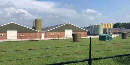
of cheap artificial fertilizer and the possibility of importing protein-rich fodder enabled farmers to specialize in either arable farming or farming livestock. This availability combined with stable guaranteed prices and income resulted in a minimalization of risks and disadvantages related to specialized farming styles. Despite most, if not all, the policies related to lowering the risks and disadvantages of specialized farming styles have vanished. Specialized farming is still promoted through economical competition on a global scale (De Wolf, 2018). The trends of agricultural specialization resulted in monocultural industrialized agricultural systems designed for an optimized production, transforming the rural landscapes into monofunctional units of production (Hauser, Van Der Sluis, & Giezen, 2016). The monofunctional system results in a loss in semi-natural landscape elements that have significant importance for biodiversity conservation, habitat connectivity, and ecosystem services (Hauser et al., 2016). Due to economies of scale, intensive specialized agricultural land use results in environmental pollution, homogenization of the landscape, and loss in animal wellbeing (Jellema, 2008; Meerburg, Korevaar, Haubenhofer, Blom-Zandstra, & Van Keulen, 2009). Furthermore, monofunctional agricultural businesses don’t meet the growing rural recreational demands (Jellema, 2008). Formerly multifunctional landscapes have grown into a monofunctional production space (Wiskerke, 2017).
‘Het is berekend: Brabantse grond moet natter voor de natuur’
Onno Havermans, 30-10-2020
[ ‘It has been calculated: soil in Brabant needs to be wetter for nature’]

Noëlle van den Berg 07-11-20
[ ‘Code red for nature area’s in Brabant: ‘it’s too busy!” ]
NOS Radio 1 Journaal, 06-07-2021.
[ Quality of nature in Brabant is deteriorating rapidly ]


‘Ontsluit boerenlandpaden om recreatiedruk op natuurgebieden te verlagen’
BNN VARA, 08-01-2021
[ ‘Connect farmland paths to reduce recreational pressure on nature areas’ ]
‘KwaliteitFigure 1.4: large plot with monoculture grassland Figure 1.3: large plot with monoculture corn as food for cattle

Since the Rio Earth Summit in 1992 (UNCED, 1992) addressed the concept of multifunctional agriculture (MA), ‘’it has obtained an increasingly important role in scientific and policy debates on the future of agriculture and rural development’’ (Renting et al., 2009, p. 1). The concept of MA refers to agricultural businesses including activities and functions beyond their main activity of food production. These activities and functions include the management of renewable (natural) resources, landscape, conservation of biodiversity, and contribute to the social and economic viability of the rural landscape (Renting et al., 2009). Examples of MA are farming businesses that provide in health care, childcare, education, management of landscape elements, recreational activities such as a camping, and storage and rentals.
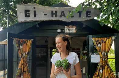
To keep the Brabant countryside viable, farmers are considered indispensable (Meerburg et al., 2009). With farmers being the main rural land users, the challenge for farmers is to incorporate the growing interest in rural recreation, biodiversity losses, and the strengthening of landscape characteristics and quality in their farming style. These problems require farmers to collaborate with neighboring farmers as these problems go beyond the borders of a single farm or plot, and depend on larger scale patterns at the landscape scale (Jellema, 2008).
The concept of MA combines agricultural activities with other activities and functions within agricultural businesses. Within MA the focus lies on integrating these activities and functions in the business, not on changing the agricultural methods. Alternative agriculture concepts such as agroforestry, strip agriculture, circular agriculture, regenerative agriculture, nature-inclusive agriculture, and precision farming do focus on changing the agricultural methods. These alternative agriculture concepts are mainly managed on a farm or field scale. As these alternative agriculture concepts provides in a
solution for agricultural sustainability problems, topics such as conservation of ecology, rural recreation and landscape character are gaining importance (O'Connor, Renting, Gorman, & Kinsella, 2006; Vos & Meekes, 1999). These topics cannot be managed at a farm or field scale, but need to be managed at a bigger landscape scale (Cumming, Cumming, & Redman, 2006; Gottfried, Wear, & Lee, 1996).
There are multiple reasons why farmers include MA components in their business model. These reasons range from securing income through diversifying production (NZILA, 2018; Rosa-Schleich, Loos, Mußhoff, & Tscharntke, 2019), products (Yoshida, Yagi, Kiminami, & Garrod, 2019), and services (Van Huylenbroeck, Vanslembrouck, Calus, & Van de Velde, 2006), incorporating additional sources of income in the business model (Venema et al., 2009), and increasing the yield and quality of products (Abson, Fraser, & Benton, 2013; Baudry et al., 2016; Redhead, Oliver, Woodcock, & Pywell, 2020; Reichgelt et al., 2020). Additional sources of income can be generated from subsidies, diversified activities like a shop or camping, collaborations with other farmers and businesses (Kierkels et al., 2012), or providing forms of subscriptions to visitors and users of land such as the concept of Herenboeren (Donkers & Vijfeijken, 2016).
Figure 1.7: multifunctional agriculture in the Netherlands showing turnover per business activity

Researches on MA is mainly approached from natural, social, and political sciences with a number of different approaches (Renting et al., 2009). These researches includes research on market regulations and the economic aspect of non-commodity outputs of MA (Fahlbeck, 2004; Van Huylenbroeck, Vandermeulen, Mettepenningen, & Verspecht, 2007; Van Ittersum et al., 2008; Vatn, 2001), research with an actor-oriented approach that is interested in the decision-making processes and social constructs of individual farms (Chaplin, Davidova, & Gorton, 2004; Janssen & Van Ittersum, 2007; Van der Ploeg, Laurent, Blondeau, & Bonnafous, 2009), research with a public regulation approach that focusses on the operationalization of public institutes in facilitating and monitoring the social, economic, and environmental impact of MA (Franks & Mc Gloin, 2007; Van Huylenbroeck et al., 2007; Wilson, 2008), and finally research on land-use and spatial issues related to MA in rural areas (Jellema, 2008; Maruani & Amit-Cohen, 2007; Rossing et al., 2007). This last category of research is mainly interested in ecology, geography, and (the history of) land-use
planning. Within research on land-use and spatial issues related to MA in rural areas, subcategories are distinguished: descriptive/analytical (with a focus on describing current and historic land-use patterns), predictive or projective (uses results of descriptive/ analytical approach to provide assumptions in likely future developments), explorative (with a focus on developments which are feasible, based on possible land management strategies and natural resources limitations), and design-oriented approaches (with a focus on elaborating a small number of options and selects the most desirable to be implemented) (Renting et al., 2009). The subcategories are researched from the scientific perspectives of preservation ecology, production ecology, geography, land-use planning, and regional economics (Renting et al., 2009). The gap explored in this thesis is focused on the integration of knowledge from these different scientific domains in a landscape design. The domain of landscape architects uses the acquired knowledge from other scientific perspectives and use this knowledge to preserve and even enhance landscape quality. The outcomes result in visualizations that make the consequences of different options explicit (Wiskerke & Verhoeven, 2018). Current research on MA is not focused on landscape design.
Therefore, there are no design principles available on the design of landscapes using MA. For this thesis, to find a solution for these topics is through a landscape design using MA. Therefore, this thesis will explore how a landscape design using MA systems can preserve and increase landscape quality, preserve, and increase ecological qualities, and provide in opportunities for rural recreation. The outcomes of this exploration will be summarized in a landscape scale map. This landscape scale map will be further explored in zoom-ins, that provide additional details for the design through maps, sections, and planting information. The mentioned alternative agricultural production concepts are important to keep in mind as they provide inspiration and examples for production methods in this thesis. However, due to time limitations and the scope of this thesis being a landscape architecture design thesis, the exploration of alternative agricultural production methods combined with MA requires additional research.

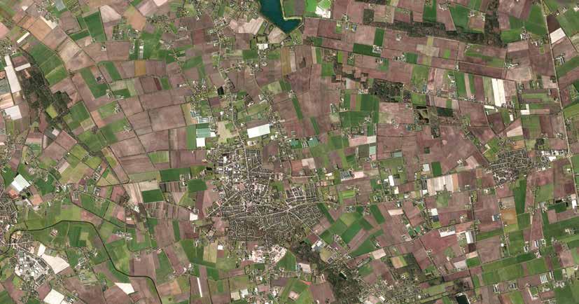
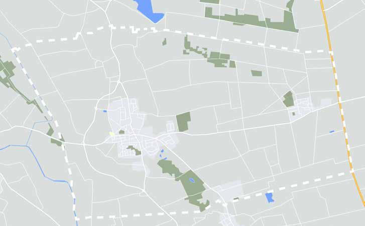
For the project location the rural landscape surrounding the town of Boekel is selected. Boekel lies is in North Brabant, in the Netherlands. The area is selected because of the large percentage of agricultural land use in the area, and the agricultural land use is of high intensity. Furthermore, almost all farmers using a specialized farming style. Furthermore, the landscape of Boekel is strongly homogenized with losses in seminatural landscape elements, loss in ecological quality, and high recreational demand.
1.9:

For this thesis, research questions have been formulated. The main research question is: Which design principles based on MA improve landscape, ecology, and rural recreation in Brabant landscapes such as Boekel?
To answer this question, two specific research questions and a design question have been formulated. Specific research question 1 is: What problems related to landscape, ecology, and rural recreation are present in the landscape of Boekel?
Specific research question 2 is: How can MA contribute to landscape, ecology, and rural recreation in Boekel?
The design question of this thesis is: How can a landscape design based on MA improve landscape, ecology, and rural recreation for the landscape of Boekel?
The methodology for specific research question (SRQ) 1 and 2 are research for design. These two questions provide in the foundation to support the design question (Lenzholzer, Duchhart, & Van Den Brink, 2016). The method of research for design provides the information, implications, and data that the design question needs to achieve an end-result (Frankel & Racine, 2010). The approach provides input for the design phase of this thesis.
For SRQ 1, the following methods are used: a literature study, historic map analysis, biotic and abiotic map analysis, field observations, and secondary report analysis. The outcomes of SRQ 1 are: an in-depth landscape analysis on landscape unit’s characteristics of Boekel and objectives for each landscape unit. This outcome knowledge from SRQ 1 is place specific for Boekel. This knowledge is used to narrow down the outcomes of SRQ 2. Furthermore, SRQ 1 provides objectives for landscape, ecology, and rural recreation in Boekel.
For SRQ 2, the following methods are used: the outcomes of SRQ 1, a literature study, secondary report analysis, and a reference study. Specifically, the outcomes of SRQ 1 provide specifics for outcomes of SRQ 2, as the outcomes need to be suitable for the landscape of Boekel. The outcomes of SQR 2 are: a toolbox for MA that includes land use, line forming landscape elements,
forms of routing, and activities and facilities, and MA farming styles tailored to each of Boekel’s landscape units.
The research methodology for the design question (DQ) is research-based design. This question provides in a design for the landscape of Boekel. The output of the two SRQs are the input for the design phase of this thesis. The design phase is set up as ‘researchbased design’, as this part of the thesis is based on the preceding SRQs. In this phase, the knowledge that was generated before this part is tested and adjusted, as well as formulating additional principles. This results in both location-specific and generalizable principles. The outcome of DQ is a design synthesis: tested toolbox for MA, tested MA farming styles, adjusted design principles, and a final landscape design for Boekel. This landscape design is represented in a maps, sections, and visuals.
In this thesis, design guidelines are interpreted as clear statements that are prescriptive and provide foundations for actions by providing guidance and constrains (Hevner & Chatterjee, 2010; Prominski, 2016). Design principles represent knowledge derived from design (Chandra, Seidel, & Gregor, 2015) and help in design processes by informing what to design and how to do so (Cronholm & Göbel, 2018). Furthermore, the design guidelines can be on different levels of
Figure 2.1: supporting diagram on the methodology of this thesis

The municipality of Boekel lies in the northeast side of the Dutch province of North Brabant, next to the vast ombrotrophic bog area of the Peel that was shaped by the Peelrand fault. The fault runs along the modern edge at the eastern side of the town of Boekel. The fault creates height differences between the mosaic landscape (west) and the open Peel (east). Boekel is one of the Peel municipalities and shares the characteristic of these municipalities regarding large-scale intensive pig breeding activities, which are most prominent in the east side of the municipality. Boekel can be considered a true farmers town, as almost 85% of the total land is in agricultural use. The municipality is home to two towns: Boekel and Venhorst. However, Huize-Padua is often also considered a small town. Neighboring municipalities include the municipality of Uden, Meierijstad, Gemert-Bakel, and Sint-Anthonis.
Figure 3.1: land use in percentages of Boekel and the Netherlands in general


> Figure 3.2: livestock in Boekel compared to number of residents. Visual units x2000.
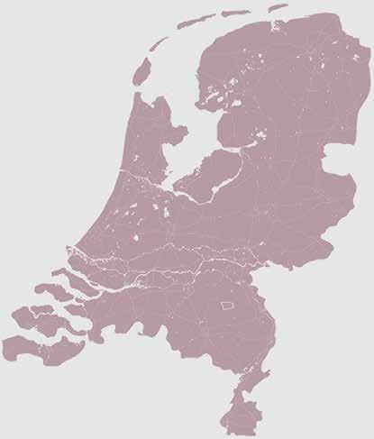
Figure 3.3: abstract representation of the municipality of Boekel with location in the Netherlands
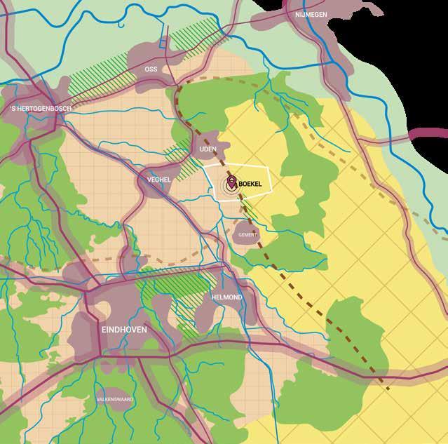

Boekel is located on the edge of the Peelrand fault with on the west side a lower graben called the Roerdalslenk and on the east side the horst called the Peelhorst (Timmers, 2017). The fault used to stagnate water and prevented ground water to flow quickly from the eastern higher part to the western lower parts (Geologie van Nederland, 2009). Because of this, the higher parts were very wet and the lower parts relatively dry. As a result, the seepage that came through on the lower western side was very rich in iron, creating unique ecological conditions. These conditions are called wijst (Geologie van Nederland, 2009; Timmers, 2017). The water had a vibrant red brown color. One of the characteristics of the wijst water is that the high quantities of iron would have a buffering function against agricultural pollution and leeching of nutrients (Geologie van Nederland, 2009). The water that would

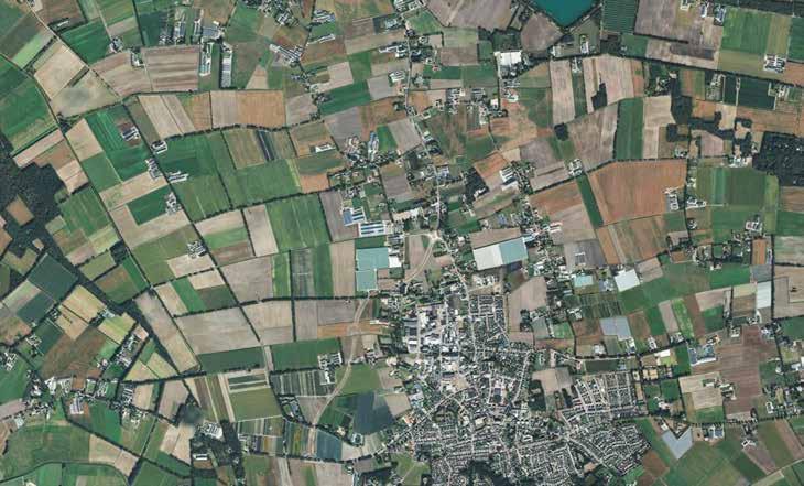
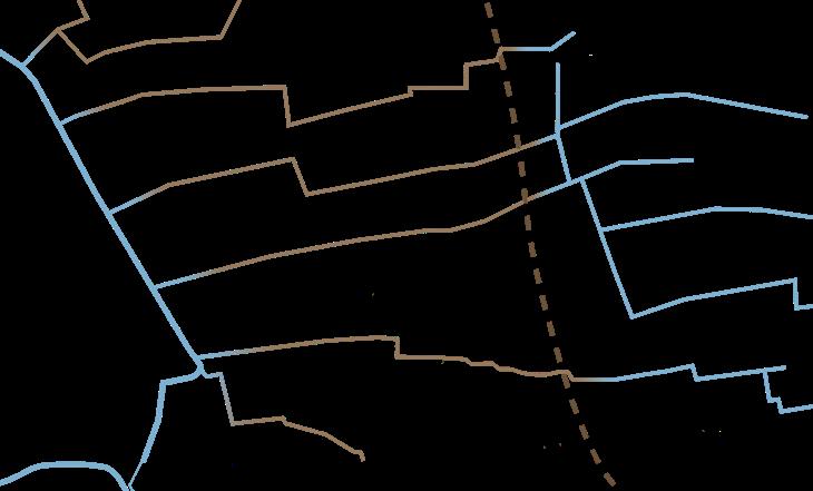
seep through the fault collected in streams that went through the landscape of Boekel. These streams are the creeks shown in image x. Through the intensification of agriculture, in which farmers strived for higher agricultural produce, parcel size grew, landscape elements were removed, and lands were flattened. As a result, the fault was punctured severely and was no longer visible in the landscape (Mensink & Van Bakel, 2019). The puncturing and flattening of the fault resulted in the disappearance of the stagnating function of the fault. As a secondary result, the differences in wetness between the higher and lower part of the fault became negligible. This difference was homogenized alongside the height differences. The iron-rich wijst however is still present in some parts due to several projects aimed to restore and preserve these conditions. These projects can be found along the southeast edge of the town of Boekel. Recently, the fault has been visually reintroduced on the edge of several housing projects in Boekel (see image x and x) as well. However, the damage and the research on repairing the fault and corresponding water system is beyond this thesis.
Figure


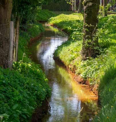
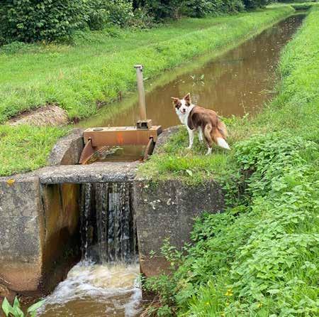

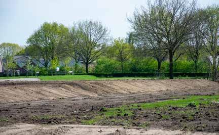 Figure 3.6: Burgtseloop in the east side of the town
Figure 3.7: small weir in the Burgtseloop in the west side of the town
Figure 3.8: visually restored Peelrand fault in Boekel's neighborhood Burgt
Figure 3.9: visually restored Peelrand fault in Boekel's neighborhood Burgt
Figure 3.11: Leijgraaf in the north of Boekel. The river is embedded in agricultural land
3.10: mostly dry ditch in the south of the town's edge. Red stains of the wijst and iron rich water visible
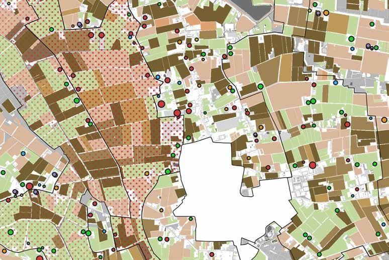
The map below is based on ground water tables using maps on 1. seepage and infiltration, 2. highest ground water tables, and 3. lowest ground water tables. In the map, the light parts represent little to no problems related to natural ground water tables and current ground water tables. The darkest parts represent most severe problems between the natural ground water tables and current ground water tables. In the dark parts, it becomes obvious that the lands of the creek valley and marsh reclamation naturally have very wet conditions. Despite strong seepage, heavy drainage of the land using underground draining tubes, water draining ditches, and pumps creates artificially low ground water tables. This draining is an ongoing battle for agriculturally favorable conditions resulting in a broken water system with very poor water quality conditions.
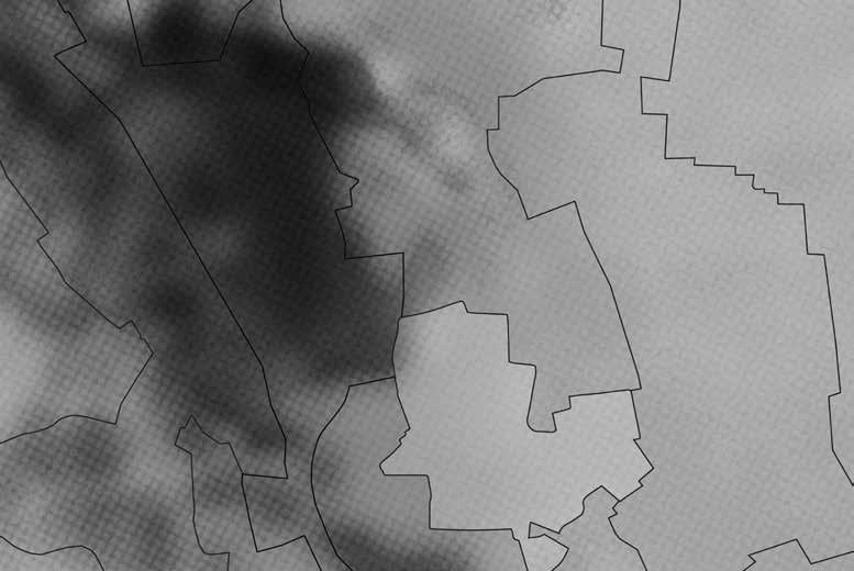
Most severe problems related to natural and current ground water tables.
little to no problems related to natural and current ground water tables.
When comparing water conditions to the land use, the source of the mismatch is evident. The current agricultural land use demands low ground water tables to achieve its required high productivity. In the creek valley and the marsh reclamation intensive large-scale arable land is the dominant land use. Here, the landscape is drained the most. The naturally wet conditions also relate to the locations of farming businesses. Most farming businesses are found in the dryer landscapes, that of the kampen landscape and the old Peel reclamation
landscape. Some of the farms are located on the border of the creek valley and the marsh reclamation. These farms are new, and their business is either related to the land use in the creek valley like the dairy farmers that also maintain intensive grasslands or are unrelated to agricultural land use like the industrialized pig breeding industry.
Permanent grasslands
Arable land with unknown crop
Arable land with barley
Arable land with potatoes
Arable land with sugar beets
Arable land with wheat Farm specialized in dairy cows
Arable land with corn silage
Mismatch land use and natural water characteristics
Farm specialized in pigs, piglets, and sows
Farm specialized in other meat animals
Farm specialized in horses Farm specialized in chicks and chicken
Size of circle indicates animals per farm 31 - 70 animals 71 - 300 animals 301 - 500 animals 501 - 10.000 animals Farm specialized in sheep
0 - 30 animals
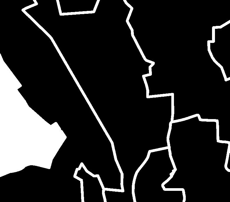

The landscape of Boekel is composed of four landscape units. These units consist of the creek valley (1), the marsh reclamation (2), the kampen landscape (3), and the Peel reclamation (4), see image X (Kegler, 2016). Boekel is located on the edge of the Peelrand fault. The location of the town of Boekel and the composition of the landscape units originates how the landscape was constructed, influenced by the Peelrand fault and the river the Leijgraaf. Boekel was found in between the fault and the river, because of favourable conditions for arable land on the dryer parts along the Peelrand fault in the east of Boekel, and meadows for livestock in the wetter lands along the valley of the Leijgraaf in the west of Boekel. Through the reclamation of the valley close to the arable lands, the marsh reclamation landscape was distinguished from the creek valley landscape. The reclamation of the wetlands on the high parts of the fault resulted in the old peel reclamation landscape. In the following parts, each landscape unit will be discussed.




The creek valley is the most west landscape unit found in Boekel and functions as the western border of the municipality. Through the creek valley runs the Leijgraaf. Although the parcels were very narrow due to wet conditions and high ground water tables, the creek valley landscape was historically a relatively open landscape, especially around the river. The parcels were sometimes planted with lanes of pollarded willow trees, but also on the eastern parts planted with alnus lanes, and low hedgerows. The extensively meadow parcels were used as grazing grounds for sheep. Some places around the Leijgraaf were too wet, creating marshlands. These lands were unsuitable for most agricultural practice. The agricultural land-use that did take place in the creek valley were extensive meadows with sheep.
2021
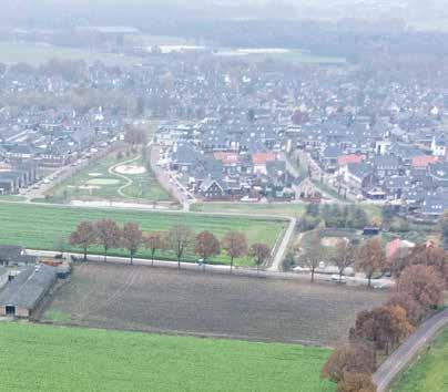
Currently, the creek valley looks very similar to the marsh reclamation and the old Peel reclamation. Although the creek valley historically was very wet, the landscape now is heavily drained. All but a handful of linear landscape elements such as the pollard willow lanes, and the alnus lanes, have vanished from the landscape scenery. The land use has shifted to intensive monoculture Lolium perenne (English ryegrass) grasslands and large scale monocultural bulk production on arable land. The marshes around the Leijgraaf have completely been reclaimed. On the west side of the Leijgraaf some small, forested plots are the only way to locate the river from ‘Het Goor’ [street name]. The farms that are found in the creek valley are located on the eastern border. The modern industrialized farms lack farmyard plantings, increasing the visibility of the farm buildings in the landscape, see image x. The farming styles currently located in the Creek valley are some dairy farmers and pig breeders. The land use of the dairy farmers in the mentioned intensive grasslands and arable land. The pig breeders are intensive off-land livestock breeders.
Figure 3.26:

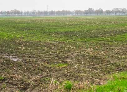
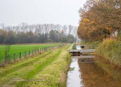
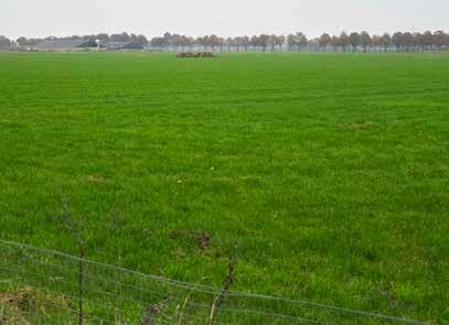


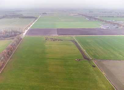
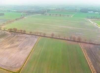 Figure 3.20: modern industrialized farms lack farm edge planting, increasing visibility of the farms in the landscape
Figure 3.21: the Molenloop represented as a straight ditch, perpendicular to the Leijgraaf
Figure 3.22: the Leijgraaf river on the left, the tree lane of the road Het Goor that functions as the border of the landscape unit on the right
Figure 3.24: large-scale open plots of monoculture english rey-grasses with occasonally sheep grazing
large-scale open plots of arable land
Figure 3.23: one of the very few tree lanes in the creek valley, perpendicular to the Leijgraaf
Figure 3.25: weir in the Leijgraaf, preventing fast draining of the river
Figure 3.27: small alder bush, indicating a small shift in the direction of the Leijgraaf


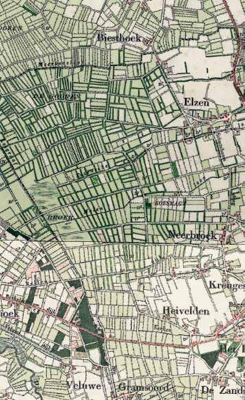
The marsh reclamation is an old cultural landscape in which the wetlands around the Leijgraaf were transformed into wet meadows. The parcels were very small with ditches to drain the lands and make them a little more productive. These parcels were narrow and long; the edges planted with hedges. Some roads were planted with tree lanes. Most housing and farms were located on the east border of the marsh reclamation, where conditions were a little less wet. These farms were clustered in small hamlets. The meadows were used for grazing sheep and cattle. The structure of the landscape was very irregular with plots in all directions but still with sharp corners and without organic shapes. The structure is formed according to the rough shape of the creeks that flow through the landscape from east to west. The agricultural land-use of the marsh reclamation included extensive meadows with cows and sheep. On the far east side, some small plots with arable land were found.
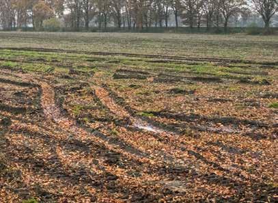
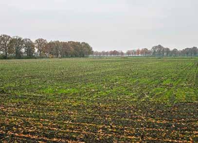
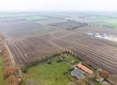
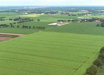
Currently, the marsh reclamation is very open, and plots are of a super large scale. During the 20th century, the upscaling of agriculture and land consolidation transformed the landscape dramatically. Now, the marsh reclamation looks very much the same as the current landscape of the creek valley and the old Peel reclamation. The land use shifted from extensive meadows and pastures to intensive arable land. All but a few hedgerows vanished from the scenery. Ditches were canalized and straightened and ground water tables dropped. The landscape is extremely drained, creating droughts during summer. The once fine network of roads is not no longer present, consisting now of some eastwest oriented roads and only a north-south oriented road on the edges of the marsh reclamation bordering the creek valley and kampen landscape.
Figure
Figure
Figure 3.36: the land is heavily drained but still some water puddles arise after some rain



Figure
Figure
Figure 3.37: tree lanes indicate roads, but sometimes also plot edges
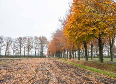 Figure 3.30: some tree lanes are remnants of the historically small-scale closed landscape structure
3.31: old farms now out of business are sheltered by farm planting
3.32: the main agricultural land use is intensive arable land
3.34: high voltage pilons in a north to south-orientation
Figure 3.33: modern industrialized farms no longer have farm edge planting, increasing visibility of the farms in the landscape
3.35: the currently open large-scale character of the marsh-reclamation
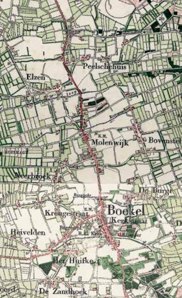
The kampen landscape is where historically most settlements are found. The name of the landscape unit refers to the many hamlets found. One of these hamlets grew to be the town of Boekel. In the kampen landscape characterized by a mix of organic and rectangular shapes. Historically, the landscape was composed of larger plots than that of the creek valley and the marsh reclamation landscape. The parcels were framed by a network of tree lanes, hedgerows, and forested plots. Since the kampen landscape was the driest landscape in Boekel, the land use was a mix of arable land and dry pastures. The creeks that flow through the kampen landscape had a natural flow and shape. The main routing that connected Boekel to other towns such as Volkel, Uden, and Gemert go through the kampen landscape. These connections are north-south oriented road. The agricultural landuse of the kampen landscape included plots with arable land-use and pastures with cows and sheep.


Currently, the kampen landscape is of a smaller scale than the surrounding landscape units. The kampen landscape sets itself apart from the marsh reclamation and old Peel reclamation by its relatively smaller scale of parcels and somewhat closed structure. The land use of the kampen landscape consists of arable land and some plots with intensive monoculture Lolium perenne grasslands. The intensity of the land use on both the arable lands and the grasslands increased dramatically and now is at an all-time high. Many farmlands along the main connecting roads were sold for private housing, creating linear networks of small plots with residential houses and private backyards. Many components of the framework that used to consists of tree lanes, hedgerows, and forests plots have vanished. However, the remains are still characteristic to the kampen landscape. The remaining framework components breaks long sight lines and create smaller spaces within the vast openness of some of the plots found in the kampen landscape. The old north-south oriented road that connects Boekel to Volkel, Uden, and Gemert is still the main routing through the landscape. The town of Boekel has expanded a lot, mostly at the cost of the kampen landscape.
Figure
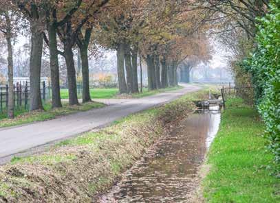


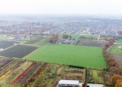
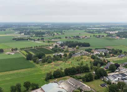
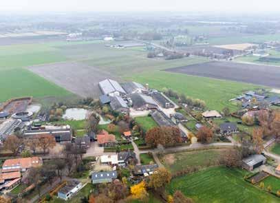
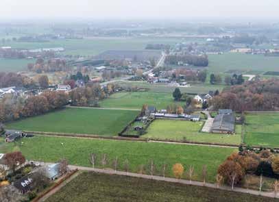 Figure 3.40: some parcels are in extensive use as meadow
Figure 3.41: small nursery close to the towns edge
Figure 3.42: the hamlets have a small-scale character, with small meadows, orchards, and forests
Figure 3.44: most plots have tree lanes asplot edge planting, plots usually have a side of an organic shape
3.46: some plots are divided by scrub- and flower strips
Figure 3.43: most farms provide farm planting, lowering the visibility of the farms themselves in the landscape
Figure 3.45: creeks are represented as straight ditches without riperian zones
Figure 3.47: most streets are planted with a single or double lane


The most east landscape found in Boekel was a wet landscape due to the Peelrand fault. Before the reclamation started, this area part of the vast area of the Peel. Here, sheep herders would guide herds of sheep over the vast wet marshes and wet heathlands. The landscape was very open without buildings or barely any trees except for a few pine trees (Wols, 2009b). From 1750 on, the municipality started selling lands to be reclamated. These lands are now known the old Peel reclamation landscape (Wols, 2009a). The plots in the old Peel reclamation were of a very small scale, like the scale of the old marsh reclamation. Plot edges were planted with hedgerows and sometimes tree lanes, and land use varied between uncultivated plots with heathland, forested plots, some plots with arable land, and most plots with pastures for sheep. Streets were oriented from west to east, into the Peel landscape. The amount of housing was very minimal, except for the main reclamation road of the ‘Statenweg’, the road that connects Venhorst to Boekel. Agricultural land-use included plots with arable land and pastures for sheep.
Currently, the old Peel reclamation is very similar to the marsh reclamation. In the upscaling of agriculture and land consolidation of the 20th century, plot sizes increased dramatically, plot structure changed to large rationalized straight plots and the ground water table dropped significantly due to the puncturing of the Peelrand fault and the drainage of the land. The main land use shifted to arable land, and the pig breeding industry has a large presence. Large farms are mostly found around the ‘Statenweg’ and the east parts of the old Peel reclamation. With little to no tree lanes or hedgerows that compartmentalise the landscape, the landscape is very open and large scale. Some roads that were part of the reclamation projects can be recognized by linear building structures and small hamlets. These roads are typically planted with tree lanes.

Figure 3.50:
Figure
Figure
Figure
Figure 3.56: old roads are planted with a single or double lane
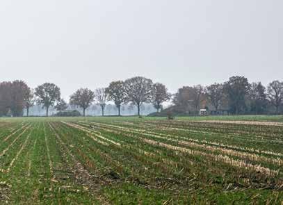
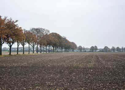
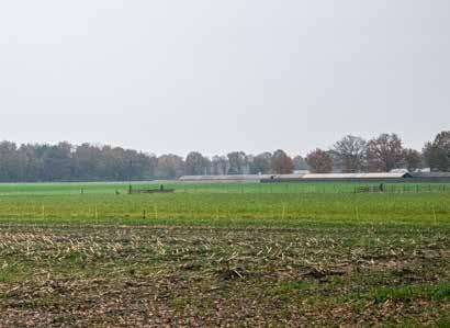


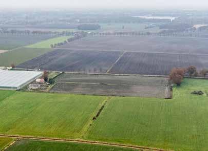
Figure 3.57:
 the plots are very orthogonal referencing the large-scale reclamation in the 50's
3.51: pig farming and arable land farming are the main agricultural activities
3.52: old reclamation roads are the only roads with an occasional curve, other roads are very straight
3.54: plots are of a very large scale with an open character
Figure 3.53: with the intesification and land reconsolidation, the landscape lost almost all line forming elements except for some tree lanes
Figure 3.55: modern industrialized pig breeder farms without farm edge planting, increasing the visibility of the farms in the landscape
older farm edges are planted, lowering the visibility of the farms in the landscape
In the following paragraph, the landscape qualities, problems, and potentials of each landscape unit will be discussed briefly. A ‘+’ indicates qualities, a ‘-‘ indicates problems, and a ‘>’ indicates potentials. In this evaluation, the old and new character of each landscape unit is considered, as well as land use, and the water system. The grading of qualities and problems is based on factors contributing landscape recognizability and landscape legibility. For grading the landscape legibility this thesis uses three components described by Hendriks & Stobbelaar (2003): vertical coherence, horizontal coherence, and historical coherence. Vertical coherence is the degree of visibility and recognizability of the biotic and abiotic characteristics of a landscape, typically represented in a section. This includes the expression of soil, hydrology, vegetation, and landuse. Horizontal coherence is the degree of visibility and recognizability of the functional and ecological relationships of a landscape, typically represented in a map. This includes relationships between ecology and hydrology, landscape elements and patterns, and roads, planting, and buildings. The historical coherence is the degree of visibility and recognizability of moments in history represented in the landscape. This includes buildings, landscape patterns, and landscape elements (Hendriks & Stobbelaar, 2003).

Creek valley
+ Open and large plots add to the character of the landscape, the alternation of grasslands and arable land adds some diversity. Increasing to the vertical and historical coherence.
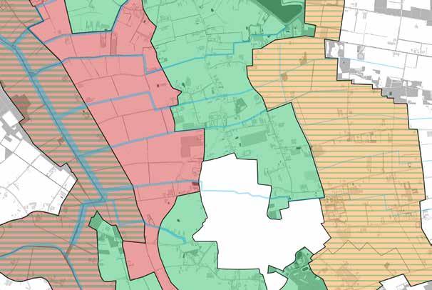
- Broken water system with very poor water quality, land use of intensive monoculture bulk production on arable land and intensive monoculture Lolium perenne grasslands, almost all line forming landscape elements have vanished, creeks are represented as ditches with little to no recognizability. Decreasing the vertical and horizontal coherence.
> Restoring natural water conditions increases landscape wetness creates possibilities water storage, adjusting agricultural land use according to restored natural water conditions, increasing creeks and Leijgraaf river recognizability.
+ The few tree lanes and single hedgerow. Increasing the horizontal coherence.
- Broken water system with very poor water quality, very dominant land use of intensive monoculture bulk production on arable land, almost all line forming landscape elements have vanished, creeks are represented as ditches with little to no recognizability, large industrialized off-land pig breeding farms in sight because of lack of plot plantings. Decreasing vertical, horizontal, and historical coherence
> Restoring natural water conditions increases landscape wetness and water quality, adjusting agricultural land use according to restored natural water conditions, restore line forming landscape elements that characterized the landscape to increase recognizability, increase creek recognizability
+ Diverse and relatively open landscape character, organic shape of plots, combination of small and large plots, farm edge planting, small, forested plots, diverse land use, low ground water table in line with landscape characteristics. Increasing historical, horizontal, and vertical coherence.

- Creeks are presented as ditches, most land use of intensive monoculture bulk production on arable land and intensive monoculture Lolium perenne grasslands, low water quality. Decreasing horizontal coherence.
> Restoring components of landscape framework, providing more space for buffer around creeks to separate from ditches, creeks as corridors and sightlines
+ Some remaining remnants of hedgerows and tree lanes, high productive arable land, far sight lines. Increasing historical and horizontal coherence.
- Creeks represented as ditches with little to no recognizability, most line forming landscape elements have vanished, large and industrialized farms in sight. Decreasing historical and vertical coherence.
> Dry character as part of new landscape characteristic, open landscape as part of new landscape characteristic, reintroduction of sheep in dry meadows, small orchards around farms, farm edge planting

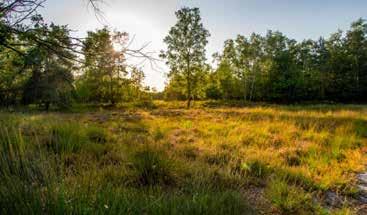
Areas with the highest ecological values are indicated in green. First, on the most west side, outside the municipality of Boekel, is the Goorse forest. This forest consists of a variety of forest types that include pine and deciduous trees. Originally, these forests were planted on drifting sands as coppice forests around 1900. Later, the maintenance and management of the forest changed as the use of the forests as coppice disappeared. Through a change in management, the ecological values of the Goorse forests have increased (IVN, 2012; Maes, 2009). The Goorse forest is located on the higher sand ridges and lower previously wet heathlands. This creates a high variety in vegetation types and fauna with parts that are high and dry, and parts that are low and strongly influenced by seepage. The close proximity to the Leijgraaf river strengthens the ecological values of the forest (IVN, 2012). The Goorse forest is part of the NNN (National Nature Network). Ecological qualities found in the Goorse forests include many native trees and shrubs, heathland species, old forest indicators, special herb species, poor grasslands,
old oak coppice, and forests of about 100 years old (Maes, 2009).
Second, on the north-east side of Boekel is the Voskuilenheuvel. This landscape park is rich in ecological values, native to the original landscape of the Peel. Although the structure of the park is not consistent to that of the large and vast Peel lands, the habitat and species found in the park are. Ecological qualities found in the park include pine forests, heathland species, fen species, native trees and shrubs, and poor grasslands (Rutten-Maas & Rutten, 2019). The Voskuilenheuvel connects with steppingstones of ecologically maintained plots with the larger forests of Odiliapeel and the sand excavation pond of Hemelrijk. South of Boekel is where most wijst is found, close to the Perekker.
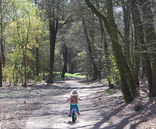
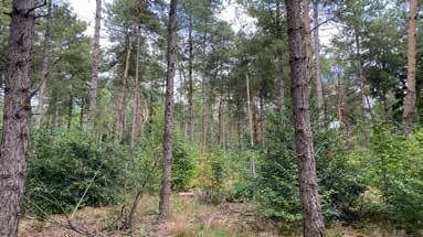
Third, south of Boekel is where most wijst is found, close to the Perekker. South of that is the Trimbossen forest connected with the Boschberg that pierces into the heart of the town. Ecological qualities found in the Perekker and the Trimbossen include diverse forest types with nature tree and shrub species, nature friendly banks, sweet water ponds, wijst species, and flower rich grasslands.
The creek valley has poor ecological values due to the high intensity of agricultural activities. The creeks have no real quality as the creek sides are of a technical degree that leaves little to no room for habitats. The arable land and intensive grasslands are fertilized constantly, resulting in leeching of high amounts of nutrients. However, the creek valley the potentials are very high. The characteristics of the creek valley would allow it to be transformed into wetlands, marshes, and extensive meadows with high ecological values. High seepage pressure and the lowest points in the landscape further confirm this. Furthermore, in this scenario the creeks that run through the creek valley could be elevated with nature friendly riparian zones and with possibilities for controlled floods and more.
The marsh reclamation currently has maybe the poorest ecological values in Boekel. None but a single hedgerow and tree lane have survived the upscaling of agriculture and land consolidation that happened in the 20th century. The ecological values found to this habitat and species, linked to these structures have
completely vanished. The most potentials are found in the reintroduction of these structures, combined with higher ground water tables. Furthermore, the creeks can retake their role as wet ecological corridors through this landscape.
The kampen landscape is currently the most diverse landscape unit in Boekel. The land use is composed of arable land, grasslands, nurseries, and plots with extensive meadows for nature development. Some plot edges are planted with tree lanes. Furthermore, throughout the years, a lot of agricultural parcels were taken out of production and sold to the private market for housing. These plots are now planted with small orchards, and private gardens. Also, some forested plots reminiscent of the old landscape structure are still present. These characteristics combined create relatively high ecological values in the landscape. However, for this landscape unit, there still are several opportunities. The first opportunity comes from the creeks. Like the Creek valley and the marsh-reclamation landscape, the kampen landscape can gain a lot more ecological values if the creeks are provided in naturefriendly riparian zones and a buffer strip to prevent leeching of nutrients. Furthermore, plot edge planting with flower rich strips. These strips could not only increase insect diversity but also be used as pest control for example
Areas with highest ecological values
Opportuntities for ecological corridors
against the oak processionary caterpillar.
The old Peel reclamation currently has very low ecological values. Like the fate of the marsh reclamation, the old Peel reclamation was once a smallscale agricultural landscape with wet conditions and extensive meadows. Now, the conditions have changed dramatically with the destruction of the impermeable layers of the Peelrand fault. For this landscape unit, most opportunities for improvement are found in the structure of the landscape. When parcels are divided into smaller plots, with low hedgerows, scrub edges, and flower strips, ecological conditions would improve. Furthermore, the creeks that run through the old Peel reclamation need a similar treatment as in the previous landscape units.
The rural landscape of Boekel in general has very poor ecological qualities with only a few exceptions. Most potentials for ecological improvement are found in agriculture. Including small forests, hedgerows, tree lanes, nature friendly banks and other landscape elements helps promote ecological conditions. Furthermore, including flower strips, green manure, and other agricultural features and methods help not only increase ecological qualities on agricultural land, but also helps increase water quality.
Areas highest potententials for improvement of ecological values
Areas with lowest ecological values
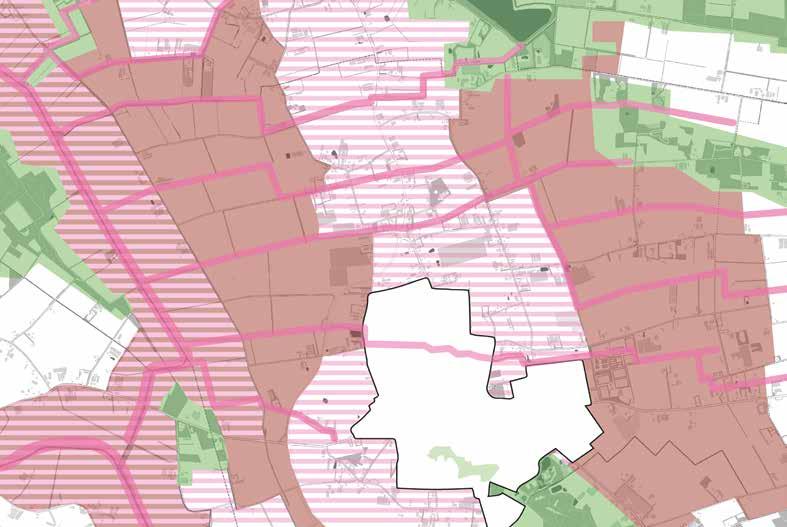
In the grading of this analysis on recreational quality, several components that influence the recreational potentials of landscape are considered: 1 natural beauty, 2 accessibility of the area, 3 recreation related opportunities (not related to routing), 4 diversity of land-use, 5 tranquillity, 6 (fast) traffic density, and 7 disturbances (Goossen & Langers, 2000; Raumer, Borsdorff, Roser, Roth, & Hildebrandt, 2019).
The high-quality recreational areas are indicated in green. The low-quality recreational areas are indicated in red. The areas with high potentials for recreational quality improvement are indicated in dashed pink.
The landscape around the Aa is of high-quality as it is very calm with very low fast traffic density and the roads are wide enough for traffic to pass slow traffic. The combination results in safe conditions for slow recreational traffic. A relatively high density of roads creates excellent accessibility of the area. The landscape has a good diversity of land-use and does provide in natural beauty through tree lanes, pollard trees and far sights. The area has high tranquillity and little disturbances. The number of recreational opportunities is somewhat high as there are opportunities for picnicking and some local farmer stands to buy local products.
In the north-east, just outside the municipality borders of Boekel, is a high-quality slow recreational routing, separated from fast traffic, that goes from Uden-Zuid to the Leijgraaf. Along this route are also some finished projects related to small-scale landscape restoration with high recreational and ecological qualities. This area provides in high natural beauty with high land-use diversity, greatly accessible from Uden-Zuid, and provides in numerous recreation related opportunities such as picnicking, berry picking, and more. High tranquillity and no fast traffic or little to no disturbances results in a high-quality recreational area.

South of Boekel’s town borders is a high-quality area the ‘Groene Ladder’ [Green Stairs] that stretches all the way to Gemert, providing in high-quality slow recreational routing with no fast traffic, great accessibility of the area, high recreation related opportunities such as a camping, fishing, and berry picking, relatively high diversity of land-use, high tranquillity, and low disturbances.
West of the Leijgraaf is a high-quality area the Goorse forests. These forests provide in high natural beauty with the high diversity of forest types and land-use. Furthermore, the area is greatly accessible with high recreation related opportunities. The tranquillity is somewhat high with only minor disturbances from some illegal cross motorcycles. Traffic density however is very low.
Lastly, in the east-northeast of Boekel is the high-quality landscape park the Voskuilenheuvel. The park is linked through steppingstones to the forests of the town Odiliapeel. This high accessible park provides in slow recreational routing

Figure 3.66: the Goor road, very unsafe
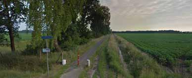

Figure 3.67:
separated from fast traffic, high amount of recreation related opportunities such as picnicking and fishing. Furthermore, the high tranquillity and low disturbances combined with high natural beauty and high diversity in land-use resulting in high recreational quality. The steppingstones score lower in quality as the traffic density increases, tranquillity is lower and disturbances higher.
The first place of low-quality is around very large, industrialized pig breeders that emit heavy stank resulting in very high disturbance. The radius of the smell is very big, possibly bigger than indicated on this map. This highly influences the recreational quality even though there is high accessibility. Furthermore, there is a medium traffic density combined with a medium tranquillity. Medium tranquillity, natural beauty, and low land-use diversity lower the recreational quality.
The second area indicated as low-quality is the road Het
Goor, currently indicated on recreational maps as the main recreational routing to and from Uden. However, this road is very dangerous with high traffic density as cut-through traffic is speeding, agricultural traffic drive with big machines already caused many accidents. No separation of traffic is made. This high traffic density results in poor tranquillity and high disturbance. Furthermore, the land-use diversity is low and natural beauty is relatively low. The area is highly accessible but with low amount of recreation related opportunities.
Lastly, the whole landscape of Boekel that is uncoloured is of relatively uninteresting for recreation. The roads are almost always shared with car traffic. These roads are narrow, and cars drive very often way over the speed limit resulting in medium traffic density. The safety of the rest of the roads is on the poor side. Only some specific roads and routes that are either separated from car traffic or unpaved seem to be on a higher level of safety. However, these roads and routes are not indicated with green as their accessibility is low. Natural beauty and land-use diversity scores for each area differently and no separation is made in this category. The same goes for recreation related opportunities. Disturbances are relatively except for places
Main traffic route
Point of interest
Safe and high quality road
Very bad smell/severe air pollution Street with (recreational) dead end
Unsafe and/or low quality road
around pig breeding farms.
The area around the town of Boekel is highlighted as high opportunity recreational area, especially for walking as accessibility because this is within the walkable zone. However, accessibility is limited especially due to the N605. Accessibility can be increased by creating places to cross the N605, especially for walking. Furthermore, the natural beauty and diversity of land-use are both high. Although tranquillity is low, the disturbances are at a medium level.
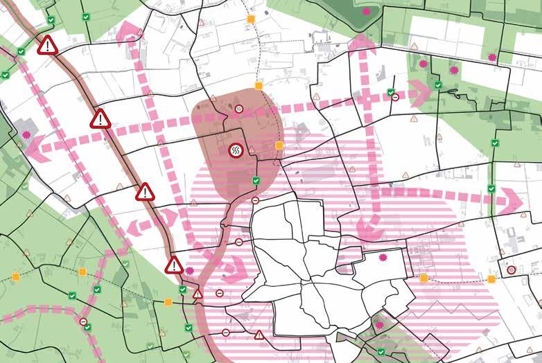
Another important opportunity is described in the goals of the municipality. In the town of Boekel and throughout the municipality are already many events and activities organized throughout the year. On top of that, the municipality of Boekel wants to further cooperate, collaborate, and invest with and in the recreation and tourism sector and sees this sector as high potential. In the description provided, the municipality plans to improve and expand upon the accommodation facilities, recreational network, routing signage, and touristic attractions (Gemeente Boekel, 2009, 2016, p. 16) and wants to stimulate people coming to the municipality (Gemeente Boekel, 2009) to strengthen Boekel’s recreation and tourism position
Recreational network
Direct cycling route between towns
High potentials for addition to recreational network
Highest quality area
Lowest quality area
Area with highest potentials
(Gemeente Boekel, 2016). The municipality writes it tris to accomplish this by diversifying the recreational opportunities and facilities and increase accessibility, all of high quality and strong landscape integration (Gemeente Boekel, 2009). The municipality is convinced the tourism sector can provide additional economic support to other sectors already present in Boekel. The agricultural sector is highlighted in specific, with many farmers already considering transforming their businesses and incorporation tourism and recreation. The municipality wants to stimulate and provide in an active and facilitating role for these transformations (Gemeente Boekel, 2016). The municipality further writes active branding of the region can play an important role for attracting visitors and tourists. This branding is already partially done by the VVV (Gemeente Boekel, 2009, 2016).
3.9 SUMMARY
From the previous analysis, a summary is made. This summary provides conclusions and is used to set objectives for the design. After the objectives are formulated, this thesis will dive into how multifunctional agriculture can contribute to achieving these objectives.
components of MA will be explored that contribute to the improvement of landscape, ecology, and rural recreation.
According to the conclusion of the landscape analysis, several objectives are formulated. These objectives are separated into landscape quality, ecological quality, and recreational quality.
For increasing the landscape quality, the following objectives are formulated:
----
Expand on existing landscape unit characteristics (related to landscape legibility and landscape recognizability)
Relate land use to the landscape unit characteristics (related to the vertical coherence)
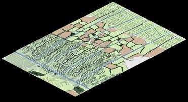
Increase difference between dry and wet landscape units (related to horizontal coherence)
Increase difference between open and small-scale landscapes (historical coherence)
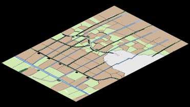
For increasing the ecological quality, the following objectives are formulated:
Expand current ecological values and habitat (Re)connect main ecological areas
Increase ecological conditions in agricultural lands Use ecological landscape management. The landscape units in Boekel have homogenized and cannot be distinguished from one another, resulting in poor landscape recognizability and legibility, and a monofunctional landscape.
Agriculture in Boekel is no longer based on landscape characteristics. The landscape is transformed to fit the desired agricultural practice increasing loss in landscape recognizability and legibility.
The water system has been broken beyond the scope of this thesis, creating very poor water quality, and enhancing droughts during summer and very wet conditions during winter.
For ecology, the agricultural lands are a wasteland with very low ecological qualities. The remaining landscape elements and habitats are in low diversity and have become isolated resulting in low contribution for ecological conditions.
The recreational network is of very poor quality. There is little to no separation between fast and slow traffic, creating dangerous situations. Furthermore, starting from the town, walking a short route through the landscape is made very hard.
From the analysis, numerous opportunities for improvement in landscape quality, ecological values, and rural recreational values are found. These opportunities are related to water, landscape structure, land use, forms of agriculture, ecology, and recreational activities. These opportunities form the base that is expanded upon. In the following chapter,
The increasing the recreational quality, the following objectives are formulated:
---
Increase ability for recreational routing within walking range of Boekel town
Increase accessibility of rural areas for slow traffic Improve safety of recreational routing Connect local recreational routing to regional network
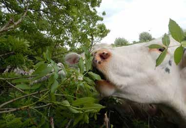
As mentioned in the introduction of this thesis, the concept of MA refers to agricultural businesses including activities and functions beyond their main activity of food production. These activities and functions include the management of renewable (natural) resources, landscape, conservation of biodiversity, and contribute to the social and economic viability of the rural landscape (Renting et al., 2009). Examples of MA are farming businesses that combine their conventional farming business with health care, childcare, education, retail or a shop, management of landscape elements, recreational activities such as a camping, and storage and rentals.
MA can contribute to landscape quality, ecological quality, and recreational quality in many ways. In this chapter, an exploration of examples is presented on how MA can contribute to landscape, ecology, and recreation. For this exploration, examples found in literature and examples found in practice are used. MA farmers include all kind of components such as landscape elements, non-agricultural land-uses, and recreational facilities in their business model. For farmers, these components are part of their business model as they generate direct income or provide positive effects on other aspects of their business, resulting in indirect income.
In the following section, an example is given on how a farmer that incorporates hedgerows on their land, and thereby increases landscape, ecological, and rural recreational quality, incorporates landscape management in their business, while also contributes to their farming activities. This hedgerow can provide in

direct and indirect sources of income, while provide in cost reduction.
Farmers that plant hedgerows on their land see a combination of all kinds of benefits, forms of direct and indirect income, and reduction of costs. Hedgerows planted with species that provide harvest through berries, fruits, and nuts provide in a direct source of income (Shepard, 2013). This same hedgerow provides in habitat for birds that provide in natural pest control (Albrecht et al., 2020; Erisman, van Eekeren, van Doorn, Geertsema, & Polman, 2017; Montgomery, Caruso, & Reid, 2020) and pollinator abundance (Alison et al., 2022), keeping harvests stable and reducing costs for farmers by reducing investment in other forms of pest control. Furthermore, hedgerow, when planted with the right species, function as places of shade to prevent or reduce heat stress (Erisman et al., 2017; Goulter, 2010), promote natural animal behaviour (Vandermeulen, 2017) and provide foraging possibilities for cows and sheep (Erisman et al., 2017) resulting in a more varied diet with possibly all kinds of health benefits (Eekeren, Luske, Vonk, & Anssems, 2014; VANLA (Vereniging voor Agrarisch Natuur en Landschapsbeheer Achtkarspelen), 2020) and possibly lowering vet costs. Finally, farmers can get subsidies for implementing and managing hedgerows on their land reducing the investment costs (Noord-Brabant, 2020).

When considering the example of implementing hedgerows in farmland, they influence landscape quality. Implementing landscape elements such as hedgerows can positively influence horizontal, vertical, and historical coherence. Furthermore, this hedgerow provides in habitat for birds, mammals, insects, and all kind of plant species. This increased habitat positively influences the ecological qualities of the area. Finally, hedgerows increase recreational quality: the hedgerow provides in a higher land-use diversity, they filter negative sounds and smells thereby increasing tranquillity and reducing disturbances, and they increase natural beauty. The hedgerow, when planted with specific species, can even provide in recreational opportunities like picking berries, nuts, and fruit.
This example illustrates how landscape elements such as hedgerows are part of MA systems and farming styles. In the following paragraphs, the contribution of MA for
landscape, ecology, and rural recreation is discussed. In these paragraphs, landscape elements for landscape, nature types and management types for ecology, and agricultural recreational types for rural recreation are formulated that can be incorporated in MA businesses and are suitable for the landscape of Boekel.
qualities high, MA farmers can incorporate agricultural nature types and management types on their land. These agricultural nature types and management types improve ecological qualities, resulting in numerous benefits for farmers that help reduce costs, improve harvest, and more (Bretagnolle et al., 2018; Manning et al., 2018).
In this thesis, the focus lies on how MA can contribute to landscape, ecology, and recreation. In the example of incorporating landscape elements in the form of hedgerows on farmland, the advantages of those landscape elements are clearly illustrated. Landscape elements such as hedgerows provide in landscape through an increase in horizontal, vertical, and historical coherence. Furthermore, landscape elements help increase the recognizability of the landscape when implemented according to the landscape characteristics (Laroche, Domon, & Olivier, 2020).
For agricultural practices, ecology influences productivity and productivity stability (Bretagnolle et al., 2018; Gaba et al., 2018; Manning et al., 2018). High ecological qualities help improve farming practices through pollinator abundance, pest control, mechanisms that maintain and or improve soil fertility and water quality, and may improve production efficiency, and sustainability of agroecosystems (Gaba et al., 2018). To keep ecological
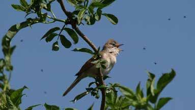
Rural recreation can be part MA businesses. This form of recreation is directly linked to the surroundings and is influenced through several components: natural beauty, accessibility of the area, recreation related opportunities (not related to routing), diversity of land-use, tranquillity, (fast) traffic density, and disturbances (Goossen & Langers, 2000; Raumer et al., 2019). These components influence rural recreational quality, but they don’t provide in income for MA farmers on their own. For MA farmers to incorporate rural recreation in their business, farmers can use agricultural recreational types. Many of these types resolve around attracting visitors to the farm, creating additional sources of income through selling products, renting materials or spaces, and providing in activities and facilities. These additional sources of income provide in income stability and improve financial resilience of farming businesses. The conventional agricultural activity can be unrelated to the agricultural recreational types incorporated in the farmers business. Furthermore, landscape and ecology highly influence rural recreational quality is it effects in natural beauty, tranquility, diversity of land-use, and disturbances. Incorporating agricultural recreational types is most effective when also incorporating landscape elements and or agricultural nature types and management types.
In the following sections, paragraph 4.2.1 will discuss landscape elements, 4.2.2 agricultural nature types and management types, and 4.2.3 agricultural recreational types, suitable for the landscape and farming businesses of Boekel.

In this paragraph, the incorporation of landscape elements in MA businesses will be discussed.
Landscape elements that contribute to landscape and provide all kind of positives for farmers can be incorporated in MA farmer’s business model in several ways. In the example of hedgerows for landscape elements illustrated in the introduction of this chapter, the effect of landscape elements on conventional farming, landscape, ecology, and rural recreation is illustrated. Furthermore, the example illustrates the diversity of income (through harvesting fruits, berries, and nuts) and indirect forms of income (higher quality harvest) and the cost reduction (less use of pesticides, less fuel consumption, less money spent on a vet, and so on) for businesses provided through landscape elements such as hedgerows.
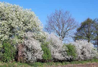
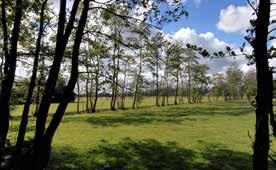
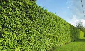
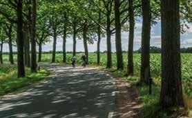
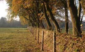
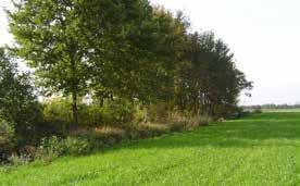
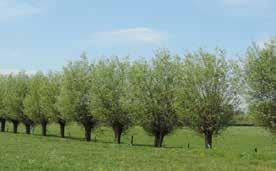
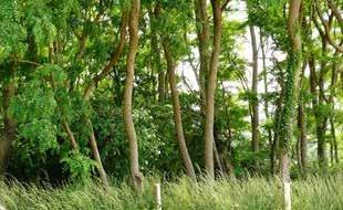
Farmers that invest in landscape can do so in all kinds of degrees and forms. The way a farmer does this, is depending on the business and the landscape the farmer is situated in, and the desired result. Depending on the conventional farming methods, farmer can incorporate a variety of green-blue landscape elements. These landscape elements include line forming elements, nontraditional agricultural land-uses, and the management of those: ponds and small water bodies, hedgerows (houtwallen, houtsingels), alder lanes, bossingel and small forests, hedges and braid hedges, shrub hedges, lanes, pollarded trees, high-stem orchards, shrub edges, coppice, osier plantations, tree lines and solitary trees, reed edges, nature friendly banks, and flower strips (Bij12, 2012; Brabants landschap natuur dichterbij huis, 2016).
However, incorporating landscape elements on farmland requires an investment. For farmers, this investment provides in a big obstacle as financial buffers can be minimal and farmers need to be careful with their expenses. Fortunately, subsidies are available to reduce or even eliminate investment requirements, as they cover most if not all the costs of investment in landscape elements
on land for farmers (Landschapsbeheer van Brabants Landschap, 2020). The EU and local governments provide subsidies to dramatically reduce or even eliminate investment costs for including one or multiple landscape elements on their land. This subsidy greatly improves financial models for farmers as investment is low while a variety of positive results and sources of income, as mentioned in the previous chapters, are created. Examples of increased income through landscape elements include produce, fodder, products, and differentiation and increase of profit per product through marketing (Eekeren & Vonk, 2013; Kierkels et al., 2012).
Figure 4.7: collection of landscape elements
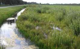
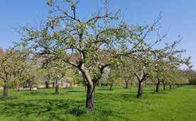
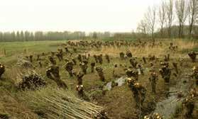
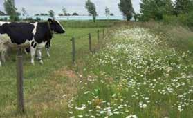
Images to the right 1 Pond in grassland, www.collectiefnoordwestoverijssel.nl/pop3-subsidie-zorgt-voor-aanleg-van-amfibieenpoelen/, (accessed 21-05-2022). ---- 2 Houtwal, www.leestekensvanhetlandschap.nl/houtwal, (accessed 21-05-2022) ---- 3 Houtsingel, www.brabantslandschap.nl/zelf-aande-slag/kleine-landschapselementen-op-een-boerenbedrijf/alle-elementen/houtsingel/, (accessed 21-05-2022) ---- 4 Alder lane, www.splij.nl/ landschapsbeheer/elzensingel.html, (accessed 21-05-2022) ---- 5 Bossingel, Index Natuur en Landschap onderdeel landschapsbeheertypen (2009), (accessed 21-05-2022) ---- 6 Small forest, Plattelandoij, 2011. www.plattelandoij.wordpress.com/2011/06/22/257/, (accessed 21-05-2022) ---- 7 Hedge, Reijrink Heijmans, 2014. Kniphaag: Fagus sylvatica. https://docplayer.nl/109337069-Reijrink-heijmans-landschappelijk-inpassingsplanlakei-7-afferden-werkdocument-bestemmingswijziging.html, (accessed 21-05-2022) ---- 8 Braid hedge, www.ed.nl/de-peel/laarbeek-ziet-lievervlechtheggen-dan-prikkeldraad-in-de-velden~a21de28f/?referrer=https%3A%2F%2Fwww.google.com%2F, (accessed 21-05-2022) ---- 9 Shrub hedge, www.landschapsbeheergelderland.nl/plant-een-haag/, (accessed 21-05-2022) ---- 10 Lane, www.nederweert.nl/wat-vinden-we-belangrijk, (accessed 21-05-2022) ---- 11 Pollarded tree, Wim van den Neut, 2017. www.natuurfotosdrenthe.wordpress.com/2017/05/08/landgoed-huizealmelo-en-omstreken/knot-wilgen-3/, (accessed 21-05-2022) ---- 12 High-stem orchard, www.benlgroenenlandschap.nl/landschapsbeheer-2/, (accessed 21-05-2022) ---- 13 Shrub edge, Peter Harry Mulder, 2022. www.nitter.net/search?q=%23struweel, (accessed 21-05-2022) ---- 14 Coppice, Van der Linden, Geert & Vanmaele, Nele, 2015. www.routeyou.com/nl-be/location/view/49414180/hakhoutbosje-met-robinia, (accessed 21-05-2022) ---- 15 Griendje, www.denederlandsebijen.nl/BIJENBEHEER/BosBeplanting/WilgVloed/Mainframe.htm, (accessed 21-05-2022) ---16 Tree line, Provincie Brabant, 2014. Wijzigingsregeling stimuleringskader groen blauwe diensten Noord-Brabant ISSN: 0920-1408 nummer 63/14. https://www.google.com/url?sa=t&rct=j&q=&esrc=s&source=web&cd=&ved=2ahUKEwjNjb-a9PD3AhVPnaQKHc6sAG0QFnoECAYQAQ&url=http s%3A%2F%2Fwww.brabant.nl%2Floket%2Fprovinciale-bladen.aspx%3Fqvi%3D49297&usg=AOvVaw2rNghT22KKtUMZaEOWcSz8, (accessed 2105-2022) ---- 17 Solitary tree, Lars Sundström, 2010. www.rgbstock.nl/photo/mif9pV0/Solitary+Tree, (accessed 21-05-2022) ---- 18 Reed edge, Alja 2017. https://www.omdathetzoleukis.nl/algemeen/dag-135-vaderdag/, (accessed 21-05-2022) ---- 19 (Small) reed plot, Natuurmonumenten, 2019. https://www.destentor.nl/kop-van-overijssel/vogels-en-andere-dieren-profiteren-van-overjarig-riet-in-de-wieden~a1b6eeed/?referrer =https%3A%2F%2Fwww.google.com%2F, (accessed 21-05-2022) ---- 20 Nature friendly bank, Edwin Dijkhuis, 2017. www.naturetoday.com/intl/ nl/nature-reports/message/?msg=24007, (accessed 21-05-2022) ---- 21 Flower strip, Brabants Landschap, 2016. Infoblad Bloemenweiden en -randen. https://www.brabantslandschap.nl/assets/Uploads/Documenten/78-Infoblad-bloemenweiden-en-randen.pdf, (accessed 21-05-2022)









There are many ways and degrees on how farmers can enhance ecology on their land. The way a farmer includes ecological values in its business model is dependent on the location of the farm, the size of the farm, and the type of conventional agriculture. A farmer can choose to incorporate only a few measures on its terrain that contribute to ecology or go all-the-way transforming their business. In this part, this thesis will include only spatial and landscape related measurements for ecology a farmer can include its business.
As mentioned in chapter 4.2, agricultural practices are dependent on ecology (Bretagnolle et al., 2018; Gaba et al., 2018; Manning et al., 2018). High ecological quality improve farming practices through pollinator abundance, pest control, mechanisms that maintain and or improve soil fertility and water quality, and may improve production efficiency, and sustainability of agroecosystems (Gaba et al., 2018).
Farmers that want to improve ecological quality can do so by incorporating various landscape elements on their land. Most of the landscape elements mentioned in chapter 4.2.1 serve as connecting corridors, steppingstones, or habitat for all kind of fauna and flora that help spread and navigate through the landscape (Opdam, van Rossum, & Coenen, 1986). However, agriculture can contribute in more ways to improve ecology than just landscape elements. These include forms of agricultural landuse and specific management. In this thesis, these are categorized as agricultural nature types and management types: creeks, insect-rich grasslands, botanically valuable grasslands, botanically valuable fields, poor wet grasslands, poor dry grasslands, shrubby grasslands, open cropland for breeding farmland birds, open cropland for wintering farmland birds, grasslands rich of herbs and fauna, fields rich of herbs and fauna, (small) reed plots, and agricultural water management areas (Bij12, 2016).
These agricultural nature types and management types can be part of farming in several ways, depending on their main type and methods of conventional farming. Most of the landscape elements mentioned in chapter 4.2.1 MA and landscape, also apply for ecological improvement. With the agricultural nature types and management types, this is a bit different. Open cropland for breeding farmland birds, open cropland for wintering farmland birds, and
Images on the right:
herb- and fauna rich fields for example can be in a line forming structure, like flower strips. These types can also be used as a whole plot. It is important to mention that the ecological quality significantly increases with more stakeholders in the area involved, providing ecological improvement of the landscape as a whole (Reichgelt et al., 2020). These stakeholders include farmers, waterboards, nature development organizations, and the forestry state agency (Degenaar, 2019). On an individual scale, a single plot of poor dry grassland or a single botanically valuable field doesn’t increase ecologically values significantly. When looking at a total landscape, a high number of agricultural nature types and management types together provide significantly ecological improvement.
Financially, ecological improvement provides in all kinds of benefits for farmers and visitors. Ecological improvement contribute to higher quality produce as the natural system becomes more resilient (Reichgelt et al., 2020). Implementing herb- and fauna rich grasslands in a dairy farm provides direct health benefits to cows (Laldi, Wagenaar, & Lantinga, 2012) and it is even suggested that the milk is of higher quality and better flavour. However, the intensity of grazing and number of cows per hectare needs to go down compared to conventional agricultural intensities in order to also significantly increase the ecological values of these lands (Reichgelt et al., 2020). Furthermore, ecological improvement by implementing the categorized types improves soil quality, water quality, enhance populations of beneficial organisms, and natural pest control (Hopkins & Holz, 2006; Landis, 2017). Furthermore, the agricultural nature types and management types offer farm system flexibility, greater future resilience, increased per hectare profitability, and reduced environmental footprint (Dominati, Maseyk, Mackay, & Rendel, 2019). Although most of these improvements can’t be directly quantified in terms of profit, they do have significant importance and implications to farmers and their farming methods (Dominati et al., 2019).
The categorized agricultural nature types and management types for ecological improvement also positively influence landscape and rural recreation. When considering the landscape coherences described by Hendriks & Stobbelaar (2003), the types greatly improve vertical coherence and horizontal coherence. The agricultural nature types and management types enhance the visibility and recognizability of landscape patterns and land-use, increasing the horizontal coherence. The vertical coherence is increased through the enhancement
1 Creek, Trailexplorer 2022, www.trailexplorer.eu/nl/nederland/limburg/limburg-wandelroutes/1845-rode-beek.html, (accessed 22-05-2022) ---- 2 Fauna field, Wouter Huygens, 2018. www.twitter.com/boswachterw/status/1032623033335394304?lang=id, (accessed 22-05-2022) ---3 Insect-rich grassland, Jens Bokelaar, 2021. www.bestuivers.nl/beheer/artikelen/id/1641/hommels-in-de-wei-de-betekenis-van-graslandenvoor-hommels, (accessed 22-05-2022) ---- 4 Botanically valueable grassland, https://www.regionalelandschappen.be/aan-de-slag/creer-enbeheer-botanisch-grasland, (accessed 22-05-2022) ---- 5 Botanically valuable field, Biodivers, 2021. www.biodivers.nl/oude-granen/, (accessed 22-05-2022) ---- 6 Poor wet grassland, Marc Poulussen, 2017. www.twitter.com/hashtag/vernatting, (accessed 22-05-2022) ---- 7 Shrubby field, Industrees, 2020. commons.wikimedia.org/wiki/User:Industrees#/media/File:Ruigten_in_de_uiterwaarden.jpg, (accessed 22-05-2022) ---- 8 Open cropland for breeding farmland birds, www.assets.vlinderstichting.nl/docs/67f90b61-671c-4869-b174-4c906b00749f.pdf, (accessed 22-05-2022) ---- 9 Open cropland for wintering farmland birds, Kenniscentrum Akkervogels, 2022. https://collectiefmiddengroningen.nl/wp-content/uploads/ Evaluatie-akkervogelbeleid-Prov-Groningen-2015-2020-Eindrapportage_print.pdf, (accessed 22-05-2022) ---- 10 Herb- and fauna rich grassland, Collectief Noord-west Overijssel, 2019. www.collectiefnoordwestoverijssel.nl/nieuw-beheerpakket-ontwikkeling-kruidenrijk-grasland-a41/, (accessed 22-05-2022) ---- 11 Herb- and fauna rich field, www.nederweert24.nl/2015/03/06/bloemrijke-akkerranden-2015/, (accessed 22-052022) ---- 12 Nature friendly riparian zone part of agricultural water management, Buijtenland van Rhoon, 2022. www.buijtenland-van-rhoon. nl/nieuws/natuurvriendelijke-oevers-in-zegenpolder/, (accessed 22-05-2022) ---- 13 Marsh zone part of agricultural water management, De Kortenhof 2022, www.opdekortenhof.nl/mvo-agrarisch-natuurbeheer-duurzaamheid/, (accessed 22-05-2022) ---- 14 Water storage part of agricultural water management, www.dommel.nl/omgang-met-waterberging-in-beekdalen, (accessed 22-05-2022).
of visibility and recognizability of water tables and soil quality and type. Furthermore, rural recreational quality is improved through an increased in natural beauty, increased diversity of landuse, increased tranquillity, and reduced disturbances. Linking agricultural nature types and management types with recreational routing, activities, and a store indirectly generates income as landscapes attractiveness is enhanced, attract more visitors.
It is important that landscape characteristics are considered when selecting agricultural nature types and management types. The characteristics of the landscape are leading when making this selection. The types related to agricultural water management such as wet grasslands, reed fields, and creeks, require wet conditions. These conditions are found in traditionally wet landscapes like the creek valley and marsh-reclamation landscape in Boekel. Therefore, drainage of the landscape needs to stop or at least be minimized. By doing so, the type of conventional farming also changes. Arable land farmers in wet landscapes are no longer viable and livestock farmers will have to downscale the number of animals per hectare. The last case results in lower profit per hectare. However, the numerous benefits of implementing agricultural nature types and management types also provides in numerous advantages, such as reduction of costs, and reduction of labour (Beranger, 2017). Furthermore, the EU and local governments provide subsidies for implementing agricultural nature types and management types (Bij12, 2016). These subsidies provide in additional income for farmers. When considering all advantages and disadvantages, the total profit of the farm doesn’t necessarily change while the amount of labour drops, creating opportunities for differentiation of the farming business, for example by adding agricultural recreational facilities and activities. These differentiations generate additional sources of income, resulting in a surplus.
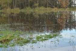
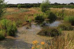


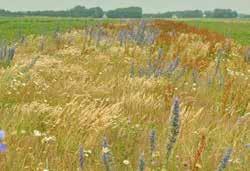
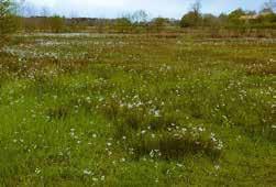
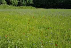

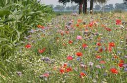
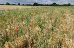


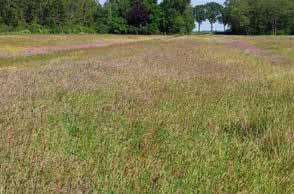
Figure 4.8: collection of agricultural nature types and management types

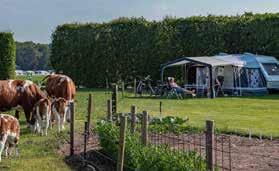
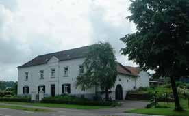
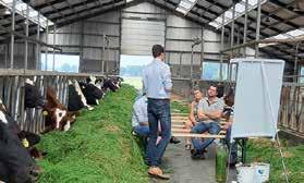


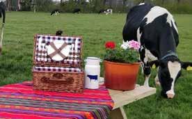


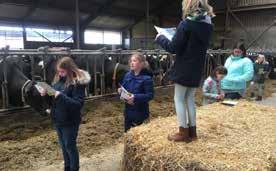

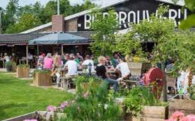

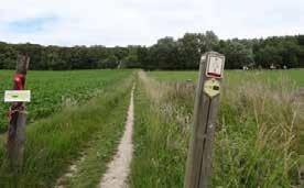
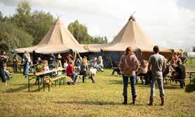
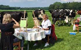
Recreational activities incorporated in agriculture is known as agritourism. In this thesis, agritourism is defined as ‘farmers with a secondary tourist and recreational activity, entrepreneurs in rural areas with a tourist and recreational (side) activity, and the use of this offer by recreationalists and tourists. The term rural tourism focuses on the terms authenticity, originality, and regional character’ (van den Top & van Werkhoven, 2006, p. 26). The possibility for agritourism increases the recreational quality of the landscape. Agriculture can contribute to rural recreational quality in many ways and degrees through routing, activities, and facilities. The way a farmer includes agritourism in its business model is dependent on the location of the farm, the size of the farm, and the type of conventional agriculture. A farmer can choose to incorporate only a few elements on its terrain and business model or go all the way though with every step of the business.
The landscape elements and agricultural nature types and management types play a significant role in the landscape diversity and quality. With a high landscape diversity and quality, landscapes become more interesting for recreation. If these aspects are combined with high quality routing, activities and facilities, farmers that incorporate recreation in recreation in their business can have additional and secure sources of income. For example, connecting routes with shops creates a direct link with consumers, generating higher profit margins. These routes become more popular when landscape quality is high. Here, the landscape plays a significant role in the number of visitors of the route, and thus the number of customers in the shop. For agritourism, a list of agricultural recreational types can be formulated on what farmers can include in their business (MFL, 2019; Walker, 2014): farmer camping, B&B’s, small houses and apartments, group accommodations, sport and game facilities, courses, fishing spots, restaurant and bars, meeting and reception space, shops, bird watching towers, fruit and berry picking, paved routing, on-land routing, biking trails, horse riding trails, festival spaces, picnic space, and classes and workshop space.
For farmers to incorporate these agricultural recreational types, there are several important elements to consider. These
4.9:
include seasonality, fragmentation, and local-, national-, and international markets (Veer & Tuunter, 2005). For a successful agritourism, it is important that farmers collaborate in terms of marketing, education, cohesion and distribution of products, activities, and facilities, accessibility of the rural lands, pricing of products and services, and overall character of the landscape (Veer & Tuunter, 2005). Competition between farmers drives sale prices, quality, and profit margins down. Collaborations between farmers are very important to provide a complete variety of products, services, and facilities. For routing on land, this collaboration is essential. This routing on land provides accessibility of the rural landscape and adds to the overall experience value. A high experience value results in a greater number of visitors, and therefore more clients and customers of shops, campings, restaurants, bars, and so on. The character of the landscape is also very important for the marketing of local products and services. Here, the landscape elements and agricultural nature types and management types play a significant role.
The number of landscape elements, agricultural nature types and management types, and agricultural recreational types are still very large. For this, elements and types that are very similar are abstracted. This abstraction reduces the large number of elements and types by combining similar elements and types that have very similar (visual) characteristics. This abstraction goes for 1: ‘houtwal’, ‘houtsingel’, and ‘bossingel’ are combined into hedgerow, 2: braid hedge is combined in hedge, 3: nature friendly bank is combined in nature friendly riparian zones, 4: the insect-rich grasslands, botanically valuable grasslands, and grasslands rich in herbs and fauna are combined into wet flower rich grassland and dry flower rich grassland, 5: the flower strips, open cropland for wintering farmland birds, and open cropland for breeding farmland birds are combined into flower strip, 6: the B&B, small houses and apartments, and group accommodations are combined into bed and breakfast, 7: reception space, classes, courses, and workshops are combined in meeting space, 8: the bird watching is combined in fishing spot, and 9: the unpaved routing for walking, mountain biking, and horse riding are combined in unpaved route.
Images on the page to the left 1 farmer camping, Het Varsenerveld Boerderijcamping www.varsenerveld.nl/boerencamping/, (accessed 23-05-2022) ---- 2 B&B at a farm, www. bedandbreakfast.nl/blog/landelijk-logeren-op-bb-boerderij/, (accessed 23-05-2022) ---- 3 Small house on farm land, www.parkvakanties.nl/blog/ algemeen/logeren-bij-de-boer-met-roompot-en-boerenbed/, (accessed 23-05-2022) ---- 4 Renting a small apartment at a farm, Saskia, 2016. www. kidseropuit.nl/zuid-limburg-appartement-bij-de-boer/, (accessed 23-05-2022) ---- 5 Group accommodation at a farmer, www.jezoektietsleuks.nl/ groepsaccommodaties/overijssel/groepsaccommodatie-deventer/maathoeve, (accessed 23-05-2022) ---- 6 Farmer’s bootcamp part of sport and game, Ruth van Schriek, 2019. www.vee-en-gewas.nl/artikel/206455-fotoserie-boerenparcours-lopen-en-hamburgers-eten-tijdens-foodcamp/, (accessed 23-05-2022) ---- 7 Course on cattle feeding, De Heus, 2021. www.de-heus.nl/actueel/nieuws/cursus-rundveevoeding, (accessed 23-052022) ---- 8 Fishing spot, Sportrecreade Ten Boer, 2021. www.sportrecreadetenboer.nl/clinics/vissen-jeugd/, (accessed 23-05-2022) ---- 9 Beer brewery and restaurant at farm, Bierbrouwerij Ooijen, 2015. www.speciaalbierbrouwerij.nl/restaurant/terras-1-2-bierbrouwerij-oijen/, (accessed 2305-2022) ---- 10 Meeting space at farm, Verldzicht Hoeve, 2021. www.veldzichthoeve.nl/vergaderen-bij-de-boer/, (accessed 23-05-2022) ---- 11 Reception space in farm, www.deboerinn.nl/arrangement/receptie/, (accessed 23-05-2022) ---- 12 Siebe’s Kaas shop in Erp, Ikomo interieurs met karakter, 2019. www.ikomo.nl/portfolio-item/siebes-kaas-erp/, (accessed 23-05-2022) ---- 13 Bird spotting places, VVV Texel, 2022. www.texel. net/nl/zien-en-doen/sportief/vogels-kijken/, (accessed 23-05-2022) ---- 14 Fruit picking, Indebuurt.nl, 2019. www.indebuurt.nl/hoekschewaard/ doen/plukken-maar-op-deze-plekken-kun-je-zelf-groenten-fruit-en-bloemen-plukken~49316/, (accessed 23-05-2022) ---- 15 Walking route on farmland, www.reisroutes.be/blog/nieuws/grote-routepaden-wandelen/, (accessed 23-05-2022) ---- 16 Mountain bike route, Maik Vriens, 2020. www.nl.wikiloc.com/routes-mountainbike/houffalize-56713896/photo-37899477, (accessed 23-05-2022) ---- 17 Horse riding trail, Stichting Ruiteren en Mennen, www.ruiterenenmennen.nl/C269-Veluwe-Paardenhotel-de-Cantharel-route------10-km.html, (accessed 23-05-2022) ---- 18 Festival at farm, Event Planner Academy, 2021. www.eventplanneracademy.nl/management/coronaproof-event-buiten-organiseren/, (accessed 23-05-2022) ---- 19 Picnic space in meadow, Boeren Picnick, 2021. https://www.boeren-picknick.nl, (accessed 23-05-2022) ---- 20 Classes at a farm, CBS de Rank, 2019. www.gelderveste.nl/scholen/cbs-de-rank/in-beeld-1/met-de-klas-de-boer-op, (accessed 23-05-2022) ---- 21 Painting workshop at a farm, Salland boert en eet bewust, 2021. www.sallandboerteneetbewust.nl/zomeractiviteiten-2021/, (accessed 23-05-2022)
MA and landscape quality, ecological quality, and recreational quality resulted in a set of landscape elements, agricultural nature types and management types, and agricultural recreational types. To organize the different types, a toolbox has been developed. This toolbox combines the different kind of types and separates them into four parts. The first part of the toolbox includes forms of wet and dry land use. The second part includes line forming elements in landscapes. The third part includes forms of routing. The fourth and final part includes activities and facilities. These parts together form the toolbox.
For each of the landscape units, a selection of tools from the toolbox is made that fit the landscape unit’s characteristics according to the set objectives in chapter 3.9.2. The selection of tools available per landscape unit provides insight in possible implementations of landscape elements, agricultural nature types and management types, and agricultural recreational types that farmers can incorporate in their MA business model and on their land. This selection is used to develop MA farming styles based on landscape characteristics, objectives, current conventional farming styles, previously farmers occupying the landscape unit, and the tools for MA from the developed toolbox per landscape unit.

Figure 4.10: multifunctional agriculture toolbox for landscape, ecology, and rural recreation
Figure 4.11: multifunctional agriculture tools selected from the toolbox for each landscape unit
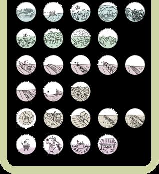

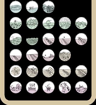
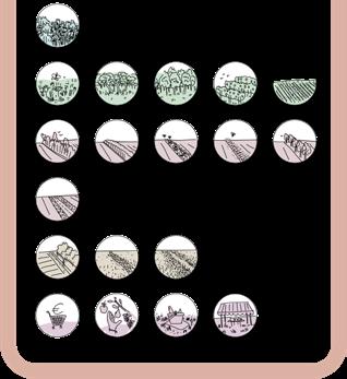
The developed toolbox is used to generate MA farming styles for each landscape unit. The generated MA farming styles per landscape unit are based on current conventional farming styles of that landscape unit, possible styles that are not (yet) found in that landscape unit, and farming styles previously found in each landscape unit.
For the creek valley, the current conventional farming styles include sheep farmers, dairy farmers, and pig breeding farmers. The formulated MA farming styles for the creek valley include sheep farmer, reed farmer, and recreation and nature developer. Current conventional farming styles found in the marsh reclamation include arable land farmers, pig breeding farmers, and poultry farmers. The formulated MA farming styles for the marsh reclamation include dairy farmer, beekeeper, and landscape manager. Current conventional farming styles found the kampen landscape include dairy farmers, pig breeding farmers, poultry farmers, sheep farmers, arable land farmers, and nurseries. The formulated MA farming styles for the kampen landscape include arable land farmer, dairy farmer, and nursery. Current conventional farming styles found in the old Peel reclamation include pig breeding farmers, dairy farmers, and arable land farmers. The formulated MA farming styles for the Peel reclamation include arable land farmer and sheep farmer.
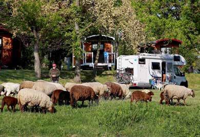
The formulated MA farming styles only represent a selection of possible farming styles available per landscape unit. For example, the Peel reclamation landscape now includes arable land farmer and sheep farmer as proposed MA farming styles. A dairy farmer could easily be implemented as well as the land-use of dairy farmers is very similar to that of sheep farmers. In the example of the selection of sheep or dairy farmer in the Peel reclamation, the selection of sheep farmer is based on farmers previously occupying this landscape unit’s meadows.
For the developed MA farming styles, relationships and collaborations with other farmers will be highlighted, as well as the different sources of income.
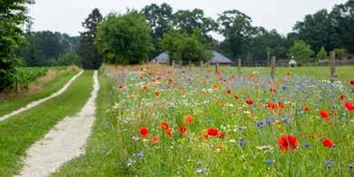

The MA farming styles currently found in the creek valley are a sheep farmer, a dairy farmer, and an arable land farmer. Very little number of landscape characteristics are present and farmer income comes only from the specialized form of agriculture. The landscape that results is monofunctional. Only a few links are made with other businesses, such as manure from the cattle farmer or maintenance of land owned by for example water boards.
The landscape and MA farming styles of the future are vastly different as ground water tables rise.
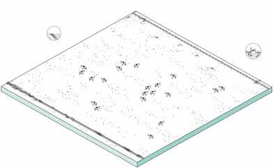
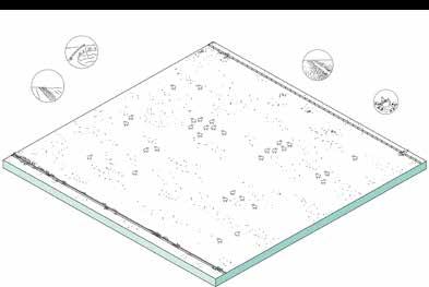
Sheep farmer A.1 deploys sheep on their own land and that of other farmers in the creek valley and marsh reclamation landscape. The flower-rich meadows are maintained extensive, providing high quality habitat and increased landscape quality. The sheep are rotated across plots. When a meadow is not being grazed, it provides all kind of recreational opportunities like picnicking, roaming, fishing, and so on. Plots of the reed farmer A.2 need the topsoil to be excavated before the new activity can take place. This takes away most nutrients and creates wetter conditions. The reed lands are mostly found along the Leijgraaf, reinforcing the wet conditions and character of the creek valley. Elevated recreational routing that follows the Leijgraaf and the perpendicular creeks provide all-year access. These routes are supported by ponds and buffer zones.
Sheep: milk wool maintenance of land
5.8 4.7 5.7 3.7 2.9
X.2 Arable land farmer 4.7 3.7

Arable land: bulk produce
X.3 Dairy farmer
5.7
Cows: Milk Manure
Possiblesubsidyfor ecologyandlandscape: maybe for herb rich grassland
‘Farmer’ A.3 is primarily focuses on income through recreation facilities and through nature and landscape management. The mini camping close to the farm is elevated with the excavated sand from farmer A.2, creating better conditions and eliminating flooding risks. The extensive flower rich meadows are maintained by A.1 and used by B.2. Cuttings from pollarded willows are sold to dairy farmers, cattle farmers, and sheep farmers. Furthermore, the meadows are perfect for roaming freely, fishing, picking berries, and other activities.
Sheep: milk wool maintenance of neighbors land
used by B.2
Hedgerows, lanes, and forest maintained by B.3
Possiblesubsidyfor ecologyandlandscape: extensive meadow nature friendly riperian zone ponds pollard willow trees routing on land
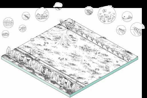
nature developer
3.7
5.7
1.11
Willow tree cuttings sold as cattle food for B.1 & D.2 5.5
Hedgerows, lanes, and forest maintained by B.3
Willow tree cuttings sold as cattle food to B.1 & D.2 1.7
Reed: isolation roof material
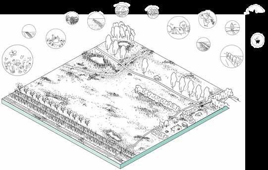

Possiblesubsidyfor ecologyandlandscape: marsh zone around creek nature friendly riperian zone ponds pollard willow trees tree lanes solitary trees
Meadow maintained by A.1 and B.2
Hedgerows, lanes, and forest maintained by B.3
Meadow used by B.2
Recreation: camping shop events and facilities
Possiblesubsidyfor ecologyandlandscape: extensive meadow nature friendly riperian zone ponds pollard willow trees tree lanes solitary trees routing on land hedgerows
Figure 5.5: proposed MA farming styles for the creek valley
The marsh-reclamation currently only hosts the MA farming styles of arable land farmers that produce bulk agricultural products such as corn, leek, potatoes, and beets. The land use is only in detail different from the creek valley; some of the large-scale plots in this open landscape are divided by a row of trees instead of completely open.
2.9
X.2 Arable land farmer
4.7 3.7
Arable land: bulk produce Possiblesubsidyfor ecologyandlandscape: maybe a single lane on land

In the marsh-reclamation, ground water tables rise as well, but not as significant as that of the creek valley. The marsh-reclamation and old peel-reclamation have a rich hedgerow system in that provides in species with berries and nuts. These species include black berry, hazelnuts, raspberry, elderberry, currant, beechnut, and more. Visitors can get a subscription license for roaming and picking these nuts and berries. This profit goes to the farmers that provide hedgerows for wild picking on their land.
The first style found in this landscape unit is B.1, the dairy farmer. Since the plot size went down, the dairy farmer hosts several plots divided by hedgerows and occasional tree lanes that are connected by corridors that allow cows to roam between them. The meadows are mostly in extensive use and are flower rich. The manure is sold to farmers C.1, C.3 and D.1. People that pass by can buy the milk in a shop, but the farmer also provides tours on his property for tourists and primary schools.
Alongside the dairy farmer is a B.2 beekeeper. The beekeeper has extensive flower fields of his own but also hosts his hives on lands of almost all other styles. For C.1 and D.1, the bees also pollinate the crops. Furthermore, the beekeeper has a small shop located along a recreational routing in which he sells honey, wax, and is the starting point for tours and lectures to educate about the bees and how they have a key role in agriculture. The last style in the marsh-reclamation is B.3 the landscape manager. Although not really a farmer, the landscape manager has a key role in maintaining the landscape structures of Boekel. B.3 maintains the trees and hedgerows of all other farmer agritypes. Coppice is processed and provides in building materials while pollard willows provide in food for sheep and cattle. Prunings are used recycled for fencing, composting, hotbeds, and heaps of branches. The meadows of B.3 are extensively maintained by sheep of A.1 and D.2.
3.9 B.1 Dairy farmer
B.2 Beekeeper B.3 Landscape manager
1.11 2.4 2.4
1.3
1.7 1.7 1.7
3.6 3.6 3.6
4.7 4.7 4.7
Figure 5.7: proposed MA farming styles for the marsh reclamation
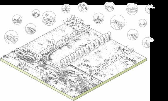
3.1 2.1 2.1
Hedgerows, lanes, and forest maintained by B.3
Meadows used by B.2 Manure for C.1, C.3, and D.1
SOURCES OF INCOME
Cows: milk shop tour
Possiblesubsidyfor ecologyandlandscape: extensive meadow ecological buffer zone hedgerows tree lanes routing on land
3.7 1.1
1.9
3.10
1.10 1.10 1.1
3.4
5.7 5.7 5.7
5.5 1.11
4.6 4.6 4.6
Hedgerows, lanes, and forest maintained by B.3
Meadow maintained by A.1 and B.2
5.6 5.6 5.6
Meadow maintained by A.1 and B.2
Hedgerows, lanes, and forest maintained by B.3
Meadow used by B.2
SOURCES OF INCOME
Bees: honey wax shop tour
Possiblesubsidyfor ecologyandlandscape: ecological buffer zone nature friendly riperian zone ponds tree lanes solitary trees
SOURCES OF INCOME
Treesandhedgerows: lumber berries maintenance of neigbords wood
Possiblesubsidyfor ecologyandlandscape: extensive meadow nature friendly riperian zone ponds forested plots hedgerows routing on land

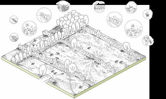
The kampen landscape currently knows the most styles. Arable land farmers, dairy farmers and tree nurseries fill the landscape. The scale feels smaller than that of the current state of the creek valley and marshreclamation. The intensity of land use however is also very high. Farmers rely on their conventional methods of production. The landscape is filled with monocultures that require high amount of manure and artificial fertilizers.
The future styles build upon the current styles. Farmer C.1 is a biological arable land farmer. Alongside his plots are flower borders that host the recreational routing. The creeks need an additional buffer zone to support the relatively intensive production. Some plots are also divided by rows of trees that frame the landscape and guide views that provide in sightlines. The routing on land also intersects some farms in which small shops are located, where tourists and visitors can buy crop like leek directly from the farmers. The corridors of buffer zones and flower strips provide in a rich habitat for pheasants and other small game animals. Hunters can get a subscription to hunt in the lands of farmers such as C.1 and D.1.
C.2 has a higher intensive meadow use than B.1. The grasslands of C.2 are clover rich, with flower rich borders. In the plots are tree rows that cast shade for cows to rest in. The mini camping and orchards are located alongside the farm and provide access to roam in the grassland when cows are on other plots. The creeks here also require a buffer zone with ponds to prevent some leeching of nutrients. The milk of C.2 is different from B.1 as the grassland is more intensely grazed and different species are found in between the grasses.
The tree and hedge nursery of C.3 has a more diverse assortment with native species. The trees are planted in a flower rich grassland that helps with pest control, prevent drought, and adds in ecological values. Occasionally, strips of flowers break the tree rows and provide in sightlines. C.3 also has a shop in which visitors can buy hedges and trees, but also pay for flowers they picked from the flower strips.
X.2 Arable land farmer
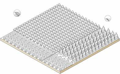
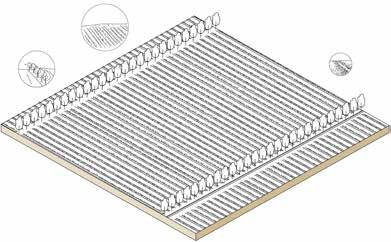
Arable land: bulk produce Possiblesubsidyfor ecologyandlandscape: maybe a single lane on land
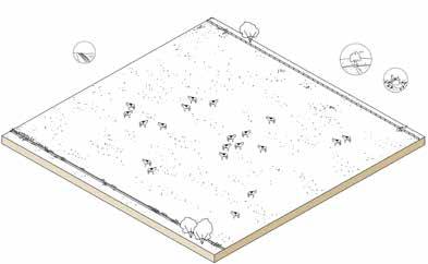
Cows: Milk Mannure Possiblesubsidyfor ecologyandlandscape: maybe for herb rich grassland
2.9 4.7
3.7 3.7 2.5 3.7
3.6 5.7
X.3 Dairy farmer
Nursery: Sell of plants
Figure 5.8: current farming styles in the kampen landscape
X.4 Tree and hedge nursery
Hedgerows, lanes, and forest maintained by B.3
Flower borders also used by B.2
Manure by B.1 and C.2
Meadow used by B.2
Hedgerows, lanes, and forest maintained by B.3
C.3 Tree and hedge nursery
Hedgerows, lanes, and forest maintained by B.3
Flower borders also used by B.2
Figure 5.9: proposed MA farming styles for the kampen landscape
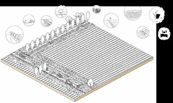
Arable land: bulk produce shop hunter subscription
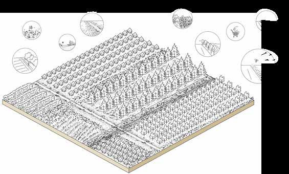
Possiblesubsidyfor ecologyandlandscape: flower borders nature friendly riperian zone ecological buffer zone ponds tree lane routing on land

Cows: milk camping shop tour
Possiblesubsidyfor ecologyandlandscape: extensive meadow ecological buffer zone nature friendly riperian zone tree lanes orchard routing on land pond
Treesandhedgerows: cultivates selling shop hunter subscriptions
Possiblesubsidyfor ecologyandlandscape: flower strips buffer zone flower rich undergrowth routing on land nature friendly riperian zone
D.1
The landscape is currently dominated by large-scale open X.2 arable land farmers. Only some parcels are separated by hedgerows, a remnant of the previously small-scale closed reclamation of the Peel. X.2 farmers focus on the produce of bulk products, like the current X.2 farmers in the marsh-reclamation and kampen landscape.
The X.2 farmers are transformed into D.1 arable land farmers. The scale of the plots in broken by introducing low hedgerows and some tree lanes. Recreational routing is along the newly formed plot edges and is combined with flower rich planting and scrub vegetation. The routing passes farms that have small shops that sell similar items as C.1. D.1 furthermore is also affiliated with the hunter subscription and the wild picking subscription. In the farmer’s yard is also a high stem orchard located that is part of the wild picking subscription and that will provide in low effort extra income for the farmer.
4.7
D.2
3.7
X.2 Arable land farmer
Arable land: bulk produce Possiblesubsidyfor ecologyandlandscape: maybe a single lane on land
2.9 3.7
X.3 Dairy farmer
5.7

Cows: Milk Possiblesubsidyfor ecologyandlandscape: maybe for herb rich grassland

D.2 is a sheep farmer. The meadows of the sheep farmer are similarly linked as the dairy farmer of B.1. The meadows are accessible when the animals are grazing in other plots. The grasslands consist of dry flower rich grasslands. The hedgerows are part of the wild picking subscription, and some farms also have a small high stem orchard. These fruits can be picked with the subscription but can also be fed to the sheep depending on the harvest. During spring, farmers can organize lamb cuddling events for visitors to welcome younglings.
Figure 5.10: current farming styles in the old Peel reclamation
5.5 5.6 5.6
3.1 3.1
3.4 4.4 2.9 4.4 4.2 4.1
Figure 5.11: proposed MA farming styles for the old Peel reclamation
5.7
3.6
Flower borders also used by B.2
4.7 4.7 5.9
1.11 1.11
Hedgerows, lanes, and forest maintained by B.3
Manure by B.1 and C.2
Arable land: bulk produce shop hunter subscription fruit Possiblesubsidyfor ecologyandlandscape: flower borders extensive orchard hedgerows tree lane routing on land
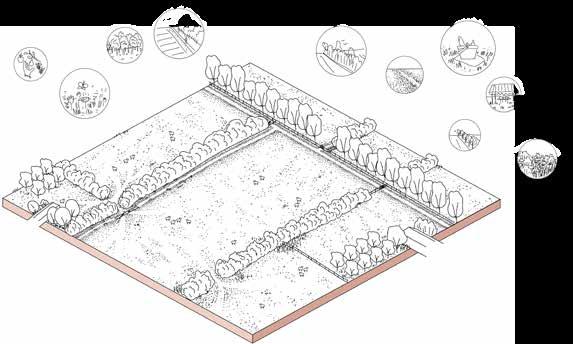
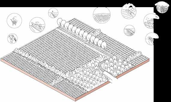
Hedgerows, lanes, and forest maintained by B.3
Sheep: milk wool maintenance of neighbors land
Possiblesubsidyfor ecologyandlandscape: extensive meadow extensive orchard hedgerows tree lane routing on land
2.8 3.6 63
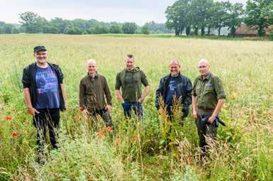

Currently, less and less farmers cannot sustain themselves from their main agricultural business alone and must farm part-time to allow them to gain additional non-agricultural income (Lutz, Smetschka, & Grima, 2017). Diversification, multifunctionality, and local food supplies are part of ways in which the proposed smaller scale farmers can financially survive. These ways benefit from forming farmer cooperatives. The farmer cooperatives range from informal collaborations with relatives and neighbours to formal production, distribution, and marketing cooperatives. Farmers also cooperate with consumers and institutions. Example of this is selling directly to consumers, restaurants, and schools (Lutz et al., 2017).
Lutz et al. (2017) write farming cooperatives are important farming businesses, especially for small-scale farmers, as it involves sharing expensive machinery, agricultural knowledge, and helping one another in times of heavy workload. Furthermore, the collaborations derived from cooperations can include shared transport, logistics, and selling other’s produce. In the case of selling other’s produce, the advantage is that each farmer’s products become more attractive through being marketed next to a wider range of other high quality local products (Lutz et al., 2017), increasing profit for all involved farmers (Jellema, 2008). The MA farming styles developed in this thesis gain significantly from this. The agricultural cooperatives may be defined as ‘userowned and user-controlled businesses that distribute benefits equitably on the basis of use or patronage’ (Lutz et al., 2017, p. 2). Farmer cooperatives provides a foundation in which farmers can market themselves and distinguish their produce from other’s and their landuse and nature inclusivity, adding value to their product (Erisman & Slobbe, 2019).
The first form of cooperation included in this thesis is cooperation with other farmers. This form of cooperation reduces costs and labour and is beneficial for exchanging knowledge and experience. The smaller a farming business, the higher the importance for this type of cooperation (Lutz et al., 2017). An example of such cooperation is through a shared transport infrastructure, by using compatible transport boxes for a standardized system of packaging. Another example is through shared investment in production and processing infrastructure. Sharing machinery and costs of maintenance of the machines helps reduce overall production costs of each farming business. This last cooperation also provides incentives to invest in missing machinery and infrastructure as it spreads responsibility, costs, and risks (Lutz et al., 2017; Shepard, 2013).
The second form of cooperation included in this thesis is cooperation with consumers. The type of cooperation can range from informal collaborations to more formal arrangements. These forms increase profit, willingness to pay among consumers for farmers, and
local production, freshness, and organic produce for consumers. This direct connection with consumers results in a direct market, increasing income stability and profits for farmers (Lutz et al., 2017; Shepard, 2013). This form of cooperation is crucial for establishing local food supply systems. Selling produce directly to local markets and restaurants ensures a major source of income for farmers and helps rebuild local food systems (Lutz et al., 2017, p. 12). Within the municipality of Boekel, the cooperation of ‘Herenboeren’ has started its pilot (Visser - van der Vaart & Geerts, 2021) and form collaborate with farmers and locals to organize local production and local food logistics (Heerenboeren Landmeerse Loop, 2020). The goal of the cooperation is to produce food in an honest and sustainable way that prioritizes local, pure, and animal and nature friendly methods, with focus on small-scale and extensive production methods. The products are available through subscriptions that include vegetables, potatoes, fruit, eggs, and meat from cattle, pigs, and chicken (Heerenboeren Landmeerse Loop, 2020). This example shows interest in local food and willingness to pay for it. The composed MA farming styles perfectly fit the characteristics of the participating farmers in the Herenboeren pilot in Boekel.
The third form of cooperation included in this thesis is cooperation with institutes. These institutes range from schools to public bodies. Here, education and re-employ existing farm-infrastructures are centralized. This increases awareness and the availability and quality of local products (Lutz et al., 2017).
Front of the sign: Welcoming sign to indicate border of municipality along recreational routing
For the farmers in Boekel that transform their business to incorporate MA components, the cooperation ‘Boekelse Boeren’ [Boekel Farmers] will be introduced. In the concept of Boekselse Boeren, the cooperation includes all three forms of cooperations mentioned earlier in this chapter. The logo design borrows the colours of the municipal coat of arms, including bright and vivid yellow and a neutral blue. Furthermore, Boekelse Boeren will also function as branding for the municipality.
< Figure 5.15: volunteers harvesting vegetables at a Herenboeren location

[Boekel Farmers. Throughout Boekel you will find farmers who join forces to enhance the richness of the Boekel cultural landscape, to give nature a boost and to create opportunities for all kinds of recreational activities and facilities. The products that our farmers sell are produced and processed within Boekel. This results in high quality food with a personal story. Enjoy!]
Branding on plot edge
>
Figure 5.14: branding design for MA Boekel farmer cooperation


Back of the sign: Farewell sign to indicate border of municipality along recreational routing
Flag
[Have a safe journey and we hope to see you soon!
Boekel Farmers]
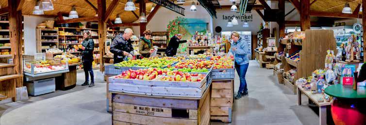


The proposed farming styles and associated businesses and land use are examples on what the stereotype of the farming style in said landscape unit looks like. These styles cannot be implemented directly as landscape in general needs a location specific approach with tailored design. However, these farming styles do set preliminary design guidelines on what the land of each farming style can look like. The toolbox adds to the design guidelines as it sets a base on what elements in the land of specific MA farming styles can be implemented. These MA farming styles set a base for the land-use of each landscape unit. This base is used to designing landscape patterns and configurations, connecting the lands of the farmers on the scale of several plot and on a landscape scale. Therefore, the MA farming styles provide in essential input for designing with individual businesses for a landscape as a whole.
Furthermore, the cooperations found in the proposed MA farming styles are explored on the business level involving collaborations on each other’s farmland, management, and product flows, and on a level of marketing and selling products on a local market. In Boekel, there are local initiatives (Heerenboeren Landmeerse Loop, 2020) and shops (Verdaasdonk & Verdaasdonk, 2019) that are interested in locally produced products. Already existing shops in Boekel could benefit from a farmer cooperation that covers Boekel farmers. Furthermore, there are several initiatives and organizations that could be included in the Boekelse Boeren farming cooperation or that the cooperation could take inspiration from such as ‘Markelokaal’ and ‘Aanstreekelijk’. By introducing the Boekelse Boeren farming cooperation collaborations between farmers throughout Boekel can easily be organized, income of farmers secured, and production and investment costs reduced. By branding the municipality as one, Boekel can distinguish their products from other regions.
Figure 5.17: Boekel farmers cooperation logo
Figure 5.18: summary of all proposed MA farming styles

A.1 Sheep farmer
A.2 Reed farmer
A.3 Recreation and nature developer

B.1 Dairy farmer
B.2 Beekeeper
B.3 Landscape manager



C.1 Arable land farmer
C.2 Dairy farmer
C.3 Tree and hedge nursery
D.1 Arable land farmer
D.2 Sheep farmer
This chapter presents the design for the landscape of Boekel, which is based on the preceding outcomes. This chapter answers the design question:
How can a landscape design based on MA improve landscape, ecology, and rural recreation for the landscape of Boekel?
The overall design objective for the rural landscape of Boekel is to incorporate the MA farming styles according to the landscape unit characteristics and improve landscape, ecology, and opportunities for rural recreation. By doing so, it aims to transform the landscape from a monofunctional homogenized landscape into a diverse multifunctional and rich landscape that invites people to recreate in.
scale, beyond the scale of agricultural plots and businesses (Tran, Pearson, Palmer, & Gray, 2020). Furthermore, landscape architecture design creates patterning and configuration of landscape features and elements that actively maintains or restores ecology and landscape. This further helps improve landscape and promote farmer resilience (Tran et al., 2020). The results from the in-depth landscape analysis, the MA farming toolbox, and the proposed MA farming styles are used to establish these patterning and configuration of landscape features and elements.
The concept of the design is founded on the characteristics of the landscape units, the MA toolbox, and the formulated farming styles.
Designing with the formulated farming styles requires knowledge beyond the farmer’s agricultural knowledge and experience. This is where landscape design by landscape architecture is important. Landscape architecture provides knowledge on how to translate science or innovative ideas into form (NZILA, 2018), knowledge of landscape at a large scale, experience on landscape design on a large scale, and knowledge necessary for improving the landscape at a large
The landscape of Boekel is divided into the four found landscape units. For each landscape unit, the landscape characteristics, MA toolbox, and the MA farming styles provide in input for establishing configurations of each landscape unit. These configurations are very abstract and provide in design input for the masterplan and details. In the diagram, these configurations are shown. The first row shows the parcellation structure, the second row shows the tree and hedge structure, the third row shows the agricultural intensity, and the fourth row shows the slow traffic routing structure.
Figure 6.1: landscape configurations for each landscape unit on parcellation structure, tree and hedge structure, agricultural intensity, and slow traffic routing orientation
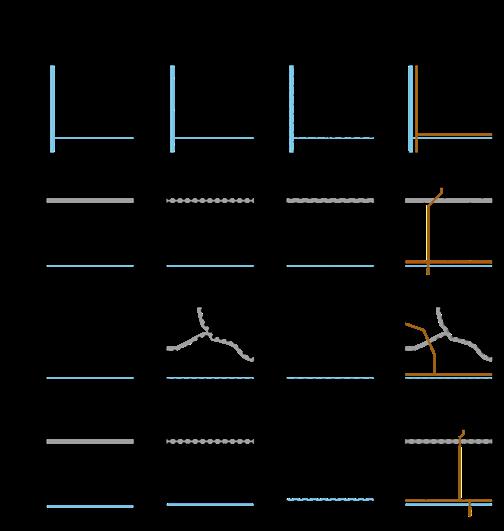
In the masterplan, the characteristics of the landscape units are recognizable again, and provide in a lot of variety. The agricultural landuse, plot scale, and landscape structure is altered
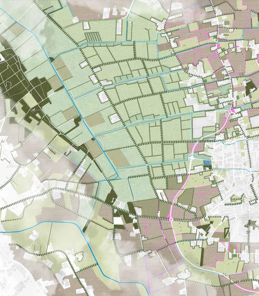
to fit the landscape characteristics. Each landscape provides in different rural recreational opportunities with beautiful scenes. The creeks are buffered and form ecological highways and possibilities for slow routing.
Figure 6.2: masterplan map
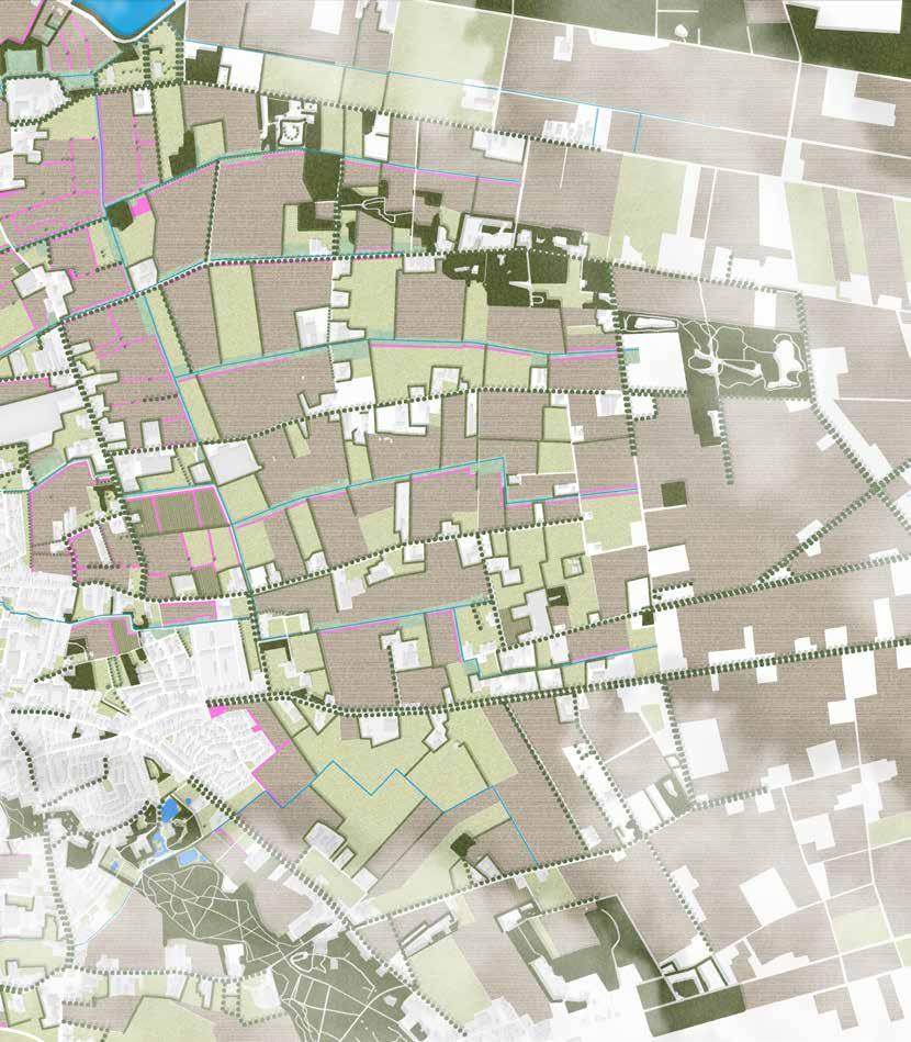
The landscape units are connected by the Boekel farmer association network, stitching the landscapes together forming one. With the town of Boekel at the heart, the individual landscape can be explored independently or together as a whole. The creeks that run from east to west through the four landscape units into the Leijgraaf form the ‘backbones’ for the recreational network and ecological network. These backbones connect all the individual landscape units together, supporting multiple experiences. The new recreational network lets visitors explore all the landscapes, show the wide variety of agricultural land-use, and provide opportunities to eat, shop, and stay overnight. The new recreational network is directly linked with surrounding areas including popular farms in Erp, the southern neighbourhoods of Uden, the town of Volkel, the town of Odiliapeel, and the town of Gemert. The municipality of Boekel is strongly
branded through the Boekel farmer association. Increased amount and diversity of landscape elements and land-uses, making the farmlands of these lands make them stand out. Explicit mention of the entrance of the municipality, the routing, and the associated farmlands helps in the advertisement of the farmers and make them stand out among the strong competitive market. Furthermore, produce is processed within the municipality, creating native Boekel products such as Boekel’s apple pie, Boekel’s goat and cow cheese, Boekel’s nuts, and more. The origin of these ingredients is explicitly found in the landscape through indicator signs located on the edges of farmland. The rural area that was only a host for intensive agricultural production has been transformed into a vivid, colourful, and rich place filled with activities, opportunities, diverse landuse, and increased ecological values.
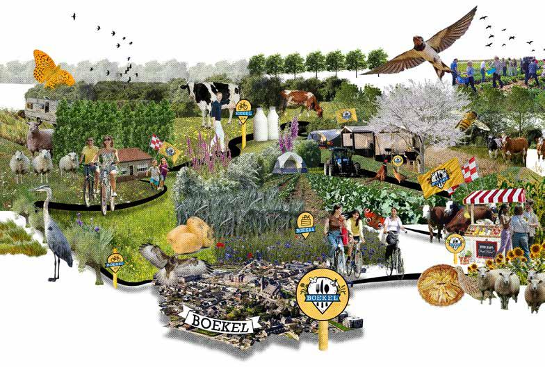
Figure 6.4: recreational routing and indication of MA components related to recreation
The density and connectiveness recreational network in the walkable zone around the town of Boekel has been increased significantly. Now, the landscape can be explored easily by foot for a short round, while providing additional routing on bike to explore the landscape further. In the map above, the numerous possible activities and facilities that are connected to the newly established network shown. The network makes sure farms are accessible and found while following the recreational network.
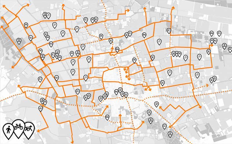
Scenetic landscape Seperated slow traffic route Not seperated slow traffic route
Shop
Fruit and berry picking spot
Point of interest Overnight stay Camping
Fishing spot
Coffee and lunch spot
Picnic area
Through the creek valley streams the Leijgraaf. All Boekel’s creeks eventually flow into this river. The creeks are embedded in lower buffer zones, providing in ecological corridors through all the landscape units of Boekel. In the creek valley along the Leijgraaf, this buffer zone is blended with the extensive agricultural landuse surroundings. The border between the Leijgraaf and marsh reclamation is highlighted by the Goor road. This road is clearly visible from both landscape units. In the Leijgraaf, this road froms the backdrop of the
landscape scenery. From the marsh reclamation, this road forms the end of the sight line along the creeks. With the landscape structure being vastly different from one and another, the tree lanes enhance this difference even further with a harsh border.
Figure 6.5: detailed map showing parts of the creek valley and marsh reclamation landscapes

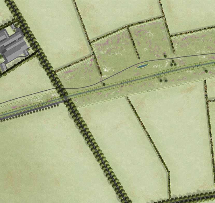
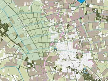
The farms located along the east edge of the creek valley incorporate all kind of activities and facilities. In the farm shown below, these activities include helping the farmer take care of the sheep, drinks and bites, and a camping at the back of the farm. The farmer is associated with the Boekel’s farmer cooperation, serving all kind of products produced in Boekel. The farmyard edges are planted with Populus nigra var. italica (Lombardy poplar, Italiaanse populier) trees provide in a landmark in the rather open creek valley landscape, highlighting the farm locations and adding depth to the green scenery in front of the Quercus palustris (pin oak, moeraseik) tree lanes of the Goor road.
> Tool 1.3 wet meadow
> Tool 1.7 wet flower rich grassland
> Tool 3.5 pollard willow tree lane
> Tool 3.6 tree lane
> Tool 4.1 separated traffic
> Tool 4.3 route following water
> Tool 5.1 camping
> Tool 5.3 bar or restaurant
Figure 6.6: visual of a possible farmer located along the edge of the creek valley and marsh reclamation, looking over the creek valley


1A'

1C'' 1B'' 1B' 1A'' N 0 50 100 200 300 meter


1C' 1E'
Above: Figure 6.7: technical map showing the location of the sections of 1A - 1E. Below and on the left: Figure 6.8: multiple sections on the creek valley and the marsh reclamation landscape
1A' 1A''
All height lines and location of the sections are illustrated in the map on the left page. The sections provide in additional information to understand the design. Route is following the creeks and the Leijgraaf river. The excavated land from the buffer zones is re-used for diking the reed plots. This dike helps regulate the wetness on a small scale, keeping water tables stable. The dike is used as unpaved routing, creating beautiful sight lines. The excavated soil is further used to elevate campings, to create dry conditions. The elevation increases the sight over the landscape, creating beautiful scenery to camp and spent a holiday. Excavated soil is also used to elevate hedgerows in the


marsh reclamation. The hedgerows provide fodder trees for the cows and keep the livestock out of the buffer zone. The hedgerows also form an ecological corridor for all kind of animals such as birds and small mammals. Species found in these hedgerows include Euonymus europaeus (common spindle, wilde kardinaalsmuts), Salix alba (white willow, schietwilg), Alnus glutinosa (black alder, zwarte els), and Sambucus nigra (black elderberry, gewone vlier).


The border between the marsh reclamation and kampen landscape becomes clear because of the many farms and the change in land-use. With the marsh reclamation only hosting meadows with flower-rich grasslands and buffer zones separated by hedgerows, the kampen landscape is known for the organic shaped plots with nurseries, arable land, and meadows with solitary trees. In the kampen landscape, farms incorporate small orchards on their land that help feed their livestock and provide in fruits that are sold in the farmer cooperation and at local stands at their homes. The slow traffic network still follows the creeks, but also follows the colorful field edges that are planted with a rich variety of flowers and herbs. Where the marsh reclamation provides in limited sights into the smaller plots and long sights along the creeks, the kampen landscape also provides in long sights into the meadows and over the fields. Here, the backdrop are the tree lanes that follow the roads and creeks.
6.9:

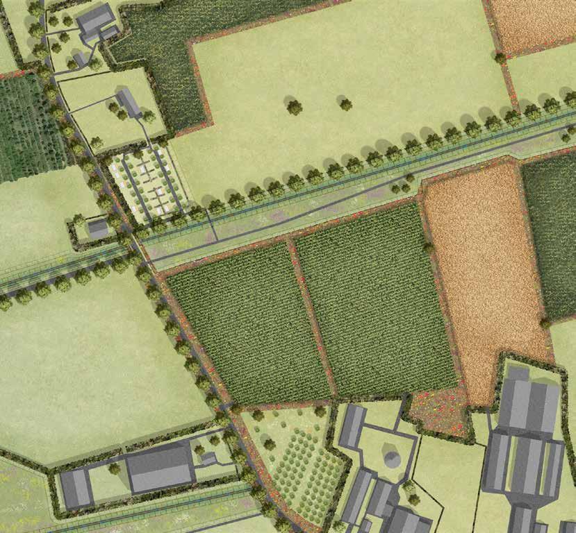
The framework of trees located in the kampen landscape provides in backdrop of the sights. The creeks are buffered and support slow recreational routing and function as ecological corridors. The arable land plots are buffered by colorful flower strips, adding to the rich visual input of the landscape unit. The routes are indicated by signs, part of the Boekel farmer cooperation. Participating farmers include signs on the edges of their plots to indicate the origin of products. The landscape is filled with solitary trees that add depth to the landscape and provide shade for livestock. The sound of the many birds and the erratic flow of the creek that runs through the side vegetation overrules the negative background sounds of cars and agricultural machinery.
> Tool 1.5 high water buffer
> Tool 2.1 dry flower rich grassland
> Tool 2.5 solitary tree 2
> Tool 2.9 arable land
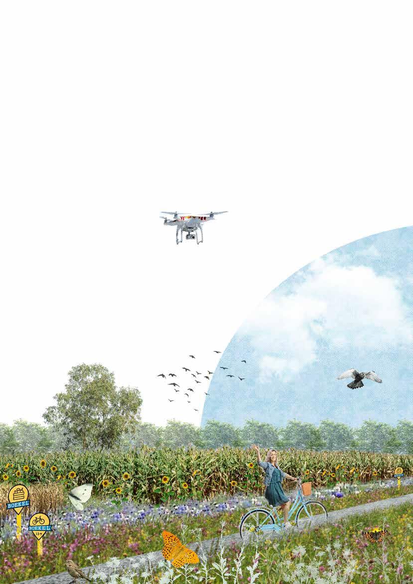
> Tool 3.3 scrub strip
> Tool 3.4 flower strip
> Tool 3.6 tree lane
> Tool 3.9 roadside vegetation
> Tool 3.10 nature friendly riparian zone
> Tool 4.1 separated traffic
> Tool 4.3 route following water
Figure 6.10: visual on possible routing through the landscape along one of the creeks.
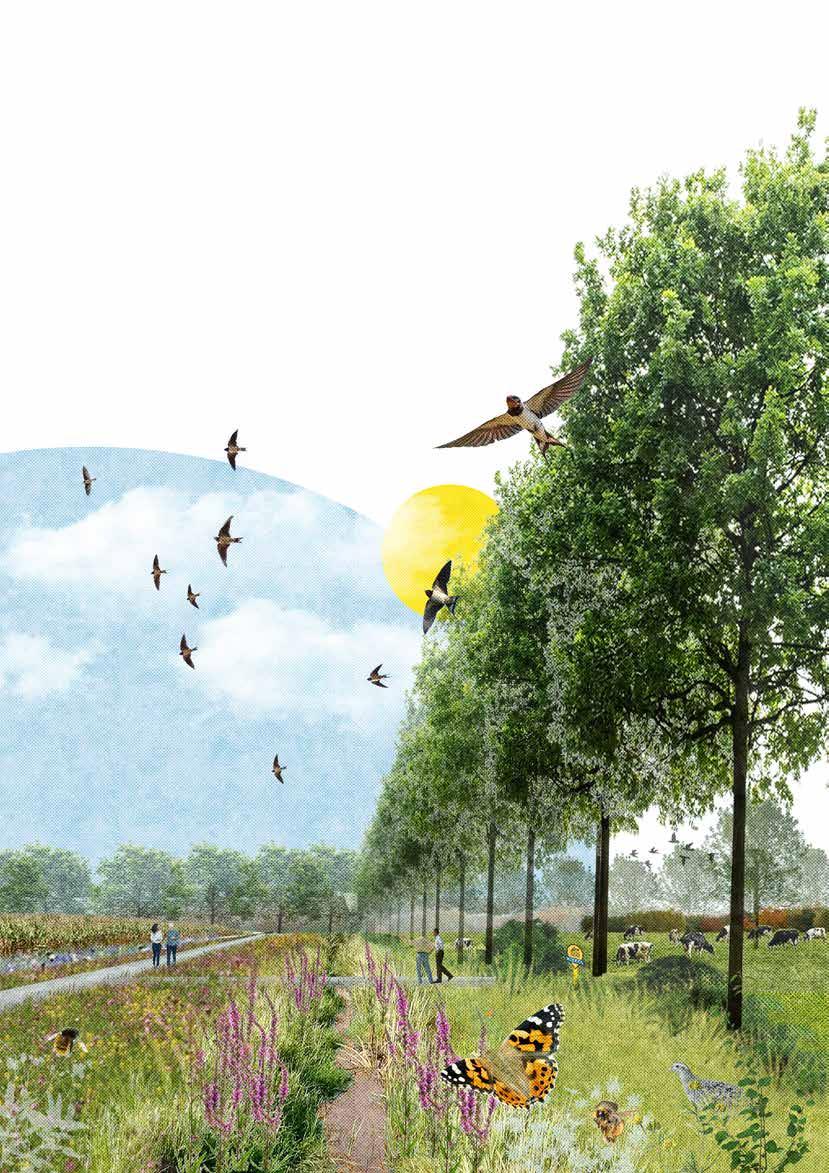
2B''
2A'
2D'' 2D'
2E' 2E'' N 0 50 100 200 300 meter
2A''
1:10 1:5 0,5m omlaag
0,5m omlaag
Above: Figure 6.11: technical map showing the location of the sections of 2A - 2E. Below and on the left: Figure 6.12: multiple sections on the marsh reclamation and kampen landscape


2A' 2A''
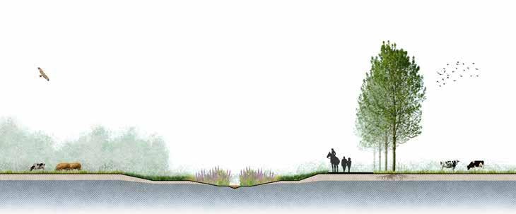
All height lines and location of the sections are illustrated in the map on the left page. The sections provide in additional information to understand the design. Route is following the creeks or are perpendicular to the creeks. The north-south connection is separated from the fast traffic network and is planted with lanes of Populus tremula (common aspen, ratelpopulier). The shivering sound of the leaves of the Populus tremula provides in great reduction of negative sounds, calming visitors. The trees stand out from the lower hedgerows, functioning as a landmark in the marsh-reclamation. The excavated land from the buffer zones is re-used to elevate the campings, to enhance sight over the landscape, creating beautiful scenery to camp and spent a holiday. Excavated soil is also used to elevate hedgerows in the marsh reclamation


and kampen landscape. The hedgerows provide fodder trees for the cows and keep the livestock out of the buffer zone. The hedgerows also form an ecological corridor for all kind of animals such as birds and small mammals. The hedgerows further provide in opportunities for picking and collecting berries and nuts. Species that provide this produce include Corylus avellana (common hazel, hazelaar), Sambucus nigra (black elderberry, gewone vlier), Castanea sativa (sweet chestnut, tamme kastanje), and Prunus cerasus (sour cherry, zure kers). For birds, the offer in food is even more diverse, adding Crataegus monogyna (hawthorn, eenstijlige meidoorn), Sorbus aucuparia (rowan, lijsterbes), and Amelanchier lamarckii (juneberry, krentenboompje).
Peel reclamation hedgerows separate the individual agricultural plots. These hedgerows narrow the long sights along the creeks. Tree lanes guide the fast traffic network, providing in a green framework visible from afar. In both the kampen and the old Peel reclamation, the arable land is separated from the buffer zones with flower strips. In the kampen landscape, these flower strips also are used to separate individual plots.
Initially, the border between the kampen landscape and the old Peel reclamation is not obvious for visitors. The recreational routing of both landscape units primarily follows the creeks. In the kampen landscape, the routing further follows the organic shapes of the agricultural plots, while in the old Peel reclamation, the north-south connections are guided by hedgerows. These hedgerows indicate the biggest visual difference between the landscape units for the visitors. Where the meadows of the kampen landscape are hosting cows, the meadows of the old Peel reclamation host sheep. In the old Figure 6.13: detailed map showing parts of the kampen landscape and old Peel reclamation
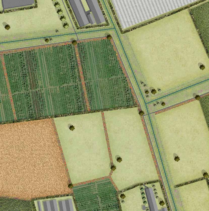

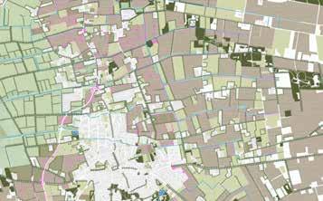
The recreational route in the visual is shared with a very calm road. Along the road, farm shops are located that are associated with the Boekel farmer association and sell local produce and products. The route is embedded in flower strips that provide habitat for beneficial insects and pollinators. The street is further supported by single tree lane of Quercus robur (common oak, zomereik). Farms have small orchards that are accessible by visitors and can be used as spots for free picnicking in the grass and events. These orchards are also used to stop and rest, and drink some tea or coffee bought at the nearby shop. The arable lands of farmers part of the farmer association all have indicating signs to indicate the origin of products. The many birds that live here provide in a wide variety of sounds, ranging from pigeons to sparrows to hawks.
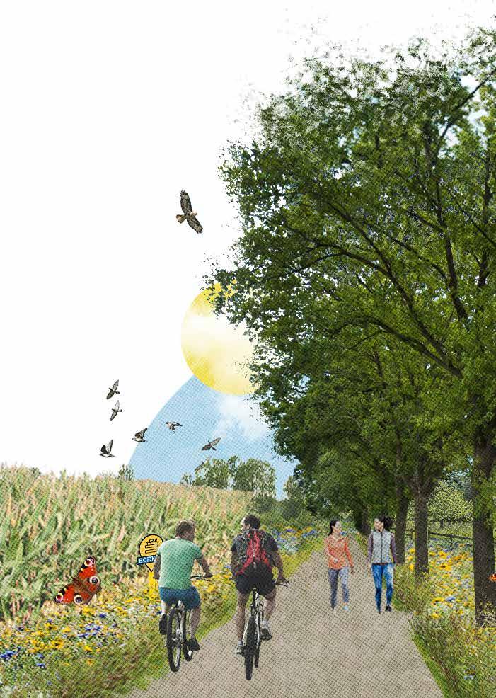
> Tool 2.1 dry rich grassland
> Tool 2.7 high stem orchard
> Tool 2.9 arable land
> Tool 3.1 hedgerow
> Tool 3.4 flower strip
> Tool 3.9 roadside flower vegetation
> Tool 4.4 route following plot edge
> Tool 5.5 shop
> Tool 5.6 berry, fruit, and nut picking
> Tool 5.7 picnic space
Figure 6.14: visual on possible routing through the landscape along one of the plot edges and a shop associated with the Boekel farming cooperation
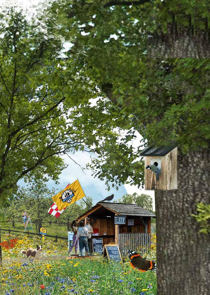
3D'' 3B' 3E'
3C'' 3C'

N 0 50 100 200 300 meter

Above: Figure 6.15: technical map showing the location of the sections of 3A - 3E. Below and on the left: Figure 6.16: multiple sections on the kampen landscape and old Peel reclamation

3A' 3A''

3B''
3D'
All height lines and location of the sections are illustrated in the map on the left page. The sections provide in additional information to understand the design. Route is following the creeks, low-traffic roads or is follows plot edges while guided by flower strips in the kampen landscape and guided by hedgerows in the old Peel reclamation. While following the plot edges, many birds can be spotted including grey partridges, western yellow wagtails, corn buntings, common pheasants, yellowhammers, and common linnets. The flower and herb-rich meadows of the kampen landscape host a large variety breed of cows. Flower and herb-rich meadows in the old Peel reclamation mostly host sheep. The excavated soil from the buffer zones
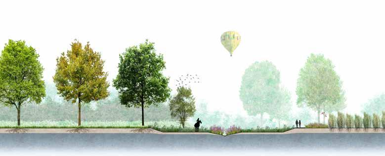
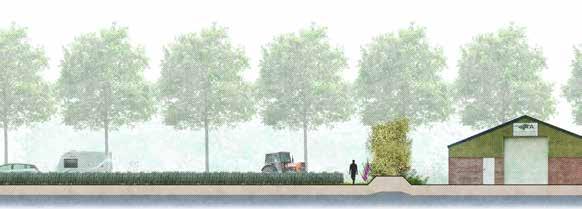

is re-used to elevate the hedgerows. In the old Peel reclamation, they are natural fencing for livestock and are used as corridors to navigate through the landscape for birds and small mammals. These hedgerows are planted with all kinds of species, ranging from Malus sylvestris (European crab apple, wilde appel), Pinus sylvestris (Baltic pine, grove den), Amelanchier lamarckii (juneberry, krentenboompje), Prunus padus (bird cherry, gewone vogelkers), Betula pendula (silver birch, ruwe berk), Corylus avellana (common hazel, hazelaar), and Castanea sativa (sweet chestnut, tamme kastanje).
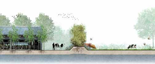

The masterplan, detailed maps, visualizations, technical drawings, and sections are used to derive general design principles. These principles are generalized for the landscape design and relate to water (quantity and quality), agricultural land use, landscape characteristics, ecology, and (rural) recreation. These general design principles support the principles derived from the MA toolbox and MA farming styles that are used in the design process, but are not necessarily related to MA landscape design.
Figure 6.17: set of design principles derived from design phase.


Adjust water characteristics to landscape unit
> Take out out dewatering pipes from landscape
> Provide more space for surface water > Slow down water flows
Mitigate influence of agriculture on water > Corridors > Increased habitat types and surface > Steppingstones
> Buffer zones around creeks > Vegetation strips (tree lane, flower strip, hedgerow, hedge)
Strengthen ecosystems and fauna routing
Highlight landscape diversity
> Increase structural differences between landscape units > Increase differences in water condition between landscape units > Increase differences in land-use between landscape units > Select specific tree and shrub species to differentiate landscape units

Diversify recreational network


> Separate slow routing from fast traffic network > Connect routing to MA farms > Utilize landscape diversity and characteristics
Increase interactions between farmers and consumers
> Provide high diversity in products and activities at farms > Utilize branding of region > Icrease duration of visits of farms

Stylize farms according to landscape
> Yard planting (solitary tree, shrub, hedge)

> Boundary planting (tree lane, hedgerow, hedge)
Reuse excavated soil
> Excavate to secure wet conditions > Raise to secure drier conditions > Deposition to create elevated hedgerows > Deposition to create dikes
In this part of the thesis, some components will be discussed as they require future research or could have been approached differently, resulting in different outcomes.
Currently, there is a great need and demand for an agricultural transition in the Netherlands (Rijksoverheid, 2022). This topic is greatly discussed in science and politics, and this thesis contributes to this discussion. Currently, circular agriculture (Dagevos & Lauwere, 2021; Hoes, 2021; Wageningen University & Research, 2018), reduction of nitrogen emissions (Oudman, 2022; Planbureau voor de Leefomgeving, 2021; Reijneker & Bol, 2021), climate-neutral agriculture (Klimaat-akkoord, 2019; Wageningen University & Research, 2020), and multifunctional agriculture (Rijksoverheid, 2020; Visser, 2022) are hot topics in these agricultural discussions. This thesis contributes to in these topics and the problems these topics discuss but does not solve those problems.
First, this thesis touches aspects of circular agriculture as one of the outcomes are the farming styles. In these farming styles, proposed collaborations include flows of materials and nutrients, for example with dairy and sheep farmers selling their manure to arable land farmers and nurseries. However, this is only a very minor aspect of the concept of circular agriculture. In this thesis, other collaborations like selling clippings from lands of the nature and recreation developer or beekeeper to dairy and sheep farmers can be identified. These kinds of collaborations could be incorporated in the design of other agricultural systems. However, in this thesis, the focus lies on the landscape design using MA, and contribute to landscape, ecology, and recreation. If the concept of circular agriculture was explored more in depth as the focus of the thesis, the design of the agricultural systems and the proposed farming styles would change. This would also influence the design of the landscape in total as this design uses the proposed farming styles as input.
Secondly, the current Dutch nitrogen crisis is not considered in this thesis. The reason for this is like that of the topic of circular agriculture. In this thesis, the focus of this thesis lies in the landscape design using MA that contributes to landscape, ecology, and recreation. With agriculture being one of the largest polluter of nitrogen in the Netherlands (CBS, 2021), the main pollution coming from farming livestock (CBS, 2020a; Greenpeace, 2019). This thesis doesn’t focus on this problem. Moreover, this thesis doesn’t include the pig breeding farmers or poultry farmers in general because the type of farming off land farming styles. If nitrogen reduction would the focus or be included as a subject of this thesis, the design of the farming types and the design of the landscape would
change. In the current form of this thesis, it is hard to say to what extend the design of the MA farming styles and the landscape design contributes to the reduction of nitrogen emissions. However, extensive forms of dairy- and sheep farming have a reduced nitrogen emission compared to the conventional intensive form of dairy- and sheep farming (Bayer, 2020). The extend of this reduction is not researched in this thesis.
Thirdly, the climate crisis and the agricultural contribution to this crisis. Climate neutral agriculture is a goal that can be incorporated in all kinds of farming styles and has overlap with circular agriculture and reducing nitrogen emissions. In this thesis, the focus was not on the climate crisis. The outcomes of this thesis don’t or contribute limited to combatting climate related issues as the focus of this thesis was not on these problems. In the landscape design, (water) buffer zones, wetlands, and extensive landuse, such as permanent grasslands and flower- and herb rich grasslands, are incorporated in MA farming styles. All these components might contribute in the reduction of climate-related issues such as increased drought resilience, increased water storage, and soil quality (The Nature Conservancy, 2021). These components help create a more resilient agricultural system and increase ecological conditions in the landscape. The landscape design proposes a change in land use, that might require less water and provides more resilience against drought. This includes higher ground water tables, permanent extensive grasslands, and buffer zones with larger surface water bodies. In that sense, this thesis does limitedly contribute to the discussion of climate neutral agriculture as it incorporates elements that might mitigate climate change. If the focus of this thesis was on climate neutral agriculture or climate resilient agriculture, the design of the MA farming styles and the landscape design would change, and therefore the outcome of this thesis would change.
Finally, the contribution of this thesis to MA. This thesis explored the contribution of MA to landscape, ecology, and rural recreation. Therefore, this thesis contributes to the discussion on the future of agriculture and the position MA has on this future, related to the landscape, ecology, and rural recreation. However, it is important to note that many components of MA were not included in this thesis. Examples of these components include heath care, childcare, energy, and education. If the thesis was written on MA and energy for example, the thesis topic could be how PV panels and solar fields would be implemented in the landscape. For this thesis, the focus was only on the contribution of MA to landscape, ecology, and rural recreation to limit the scope of the research. If all MA topics were included, the thesis would grow far too big. Furthermore, including MA components that are now left out of this thesis would dramatically change the thesis topic, research, and outcomes. For the thesis that is written now, it provides an interesting point of view on the contribution of MA to landscape, ecology, and rural recreation. Because of the specific research direction this thesis, it does not provide in a clear understanding of how MA functions in general. Furthermore, changing or adding just one component of MA in this thesis would have
great implications on the landscape design and research outcomes. This thesis does contribute to the discussion of the future of agriculture and the position of MA in relation to landscape, ecology, and rural recreation in specifically in the Dutch agricultural transition. The proposed design and research outcomes could be used as a reference or inspiration for other projects and research topics in similar landscapes.
In this thesis, pig breeding farmers and poultry farmers are not included as these types of farmers are off-land farming styles. The animals kept on these farms are always indoors and although the farms can have a large impact on landscape and the experience of landscape, the farms currently take up relatively low amount of land. This low amount of land used by pig breeding farmers and poultry farmers is mainly because the animals are kept indoors in very small living spaces. This thesis could have explored how these farms are transformed into biological and animal-friendly farms in which all animals were kept partially or mainly outdoors. Pig breeding farmers are used as an example to dive into the implications of such. Keeping outdoor pigs require a different landscape and pig breed. This would have highly influenced the design of the landscape, especially in the old Peel reclamation, where most pig breeding farmers are located. It might also require a significant drop in the number of pigs currently hosted in the municipality of Boekel. Now, the number of pigs is over 170.000 (CBS, 2020b). The total surface of Boekel is only 34,52 km2 in size. Animal-friendly statistics tell a pig needs a diverse living space with minimum sizes of about 10m2 (Huisdierinfo, 2019) and enough shade and shelter spaces to meet their needs. To facilitate this for all pigs currently living in Boekel, that would require a minimum of 1,7km2. This would significantly change the design for the landscape of Boekel. It would be very interesting to see how this thesis would have been if the focus was on nitrogen pollution. In that scenario, livestock farmers would have been the focus of research.
the assumption is made that a subsidy system can be used to compensate investment costs of implementing landscape elements on agricultural lands and compensate for maintaining agricultural nature types. In the future, this subsidy system could change. For farmers that would rely on subsidies, this is a weak spot. However, the importance of subsidies for financial survivability of farmers is not researched in this thesis. Therefore, additional research on the quantitative aspects of MA for landscape, ecology, and rural recreation is necessary as the scope of this thesis is too small to also include that. The outcomes of that research would influence the research outcomes of this thesis. The extend of this influence could be very big. One of the outcomes of quantitative research on MA and the components discussed in this thesis could be that farmers that maintain several landscape elements should be financially compensated accordingly to stay financially viable. In a quantitative approach, other aspects that have not been included in this thesis such as the economic aspect of non-commodity outputs of MA should also be included. Furthermore, the financial income through recreational aspects of MA such as a camping, farmer shop, and activities like picking fruits or milking trees as part of recreational activities is unpredictable as (rural) recreational demands might change in the next fifty years.
Firstly, in this thesis, the proposed farming styles, farming methods, financial income of farmers, and landscape design is all based on qualitative research and references. This thesis doesn’t address the quantitative side of the project. No farming style has been financially calculated. All outcomes are based on qualitative assumptions and qualitative sources. Because of this, additional research is necessary to create quantitative outcomes that provide further insight in the financial survivability of farmers. This would also include agricultural advantages of landscape elements, agricultural nature types, and management types that are hard to be expressed in finances but do provide in cost reductions and additional side effects. Furthermore, the qualitative research requires a more detailed design of the farming cooperations. This also includes calculating compensation of income through subsidies. In this thesis,
Secondly, it is important to address that in this calculation, the added value of landscape elements and nature development for agricultural practices. A diverse herbrich grassland provides all kind of healthy plants for cattle, diversifying their diet and creating better conditions for livestock and ecology. This could translate to a reduction in vet costs, providing in a higher financial balance. The same can be said for hedgerows and flower strips that provide shelter places for predatory animals, lowering the number of pests. This could translate to less use of pesticides, and less trips with a tractor, lowering production costs and providing in a higher financial balance. In this calculation, it is then important to research to what extend the landscape can be scaled down and intensified to still be profitable. Can all but a few labour and production costs be reduced or eliminated by adding elements such as hedgerows and land use such as extensive grasslands? This thesis did not search for that tipping point. If such research is performed, it is also very important that the project of small-scale agriculture and the search for ‘how small is too small’ or ‘how extensive is too extensive’ financially speaking meets the characteristics of the site location and has a quantitative character.
Thirdly, it is important to note that in this thesis, the farming styles are considered stand-alone businesses. This note is important because it influences the MA farming business styles, financial feasibility of businesses, and the management of landscape. Many small farming businesses each would approach their land management in a (slightly or majorly) different way, and this is different compared to one big farming business that covers the total landscape or a very large amount of the total landscape. Therefore, a change in size of farming businesses highly influence the design of the MA farming styles and the design of the landscape in general. For this thesis, the decision was made to approach the project from more
small farming businesses instead of one big company. Further research is needed to see how the landscape would change from the perspective of one or a few big companies.
For the landscape design, several components need to be discussed.
Chapter 4 discusses how MA can contribute to landscape, ecology, rural recreation, and provides possible advantages for agricultural land-use. This chapter adds to the discussion of the agricultural transition and the role some components of MA can play in this. It is important to note that, as mentioned earlier in the discussion, this thesis focused on the MA components of landscape, ecology, and rural recreation specifically. Other components of MA that might have additional significant roles in the discussion of the agricultural transition are left outside of the scope of this thesis. Furthermore, this thesis provides in examples on MA farming styles. The financial models of these styles have not been elaborated on quantitatively. To convince farmers to transform their business partially or fully into one of the developed MA farming styles, additional quantitative research that includes finances is necessary. Because this quantitative research is not included, this thesis is only limitedly useful for convincing individual farmers to adopt MA farming styles. Furthermore, the established MA farming styles can be (perceived as) unrealistic and be an unattainable nostalgic ideal and are therefore up for discussion. The MA farming styles are established according to the available tools from the MA toolbox and current and historic agricultural land-use. The styles include (as) many MA tools from the toolbox that fit the landscape unit and the farming style. However, farming styles that include less tools from the MA toolbox might perform better and provide more realistic financial income. In order to establish the ideal farming styles, quantitative research is necessary to research the effect of each MA tool on landscape, ecology, rural recreation, (conventional) farming style, and income.
Furthermore, the proposed concept of ‘Boekelse Boeren’ farming cooperation is very abstract. In the MA farming styles, several collaborations between individual farmers are made. These collaborations can be part of the cooperation. However, significant details related to machine sharing, investment cost reduction, and security of income are left out. Furthermore, details on collaborations between existing shops, educational programs, and volunteer groups are missing. How the farming cooperation is set up and how it functions is unknown. In this, the branding of the region can play a very important role. The municipality is showing high interest to be involved in this branding and cooperation, but further details are unknown. All these details require further exploration and additional research.
After the proposed landscape design, a set of general design principles are introduced (chapter 6.6). Although these principles are derived from the landscape design uses the outcomes of SRQ1 and SRQ2 as input, the design principles describe more general measures, not specific for MA. Because they are generated from design, they require a critical review. For this thesis, time pressure was high, resulting in only little time availability for reviewing the design and generating design principles. The principles have not subjected to an iterative process, lowering the internal validity. However, since the principles are rather broad, the external validity is less affected by this.
In chapter 3, the problems related to the ground water table have been discussed. From this, it was established that the water system is broken beyond the scope of this thesis. However, in the design phase, design principles have been established (chapter 6.6). These principles include ‘Adjust water characteristics to landscape unit’ and ‘Mitigate influence of agriculture on water’. These principles are strongly related to water tables and wetness of landscape. In the design, the creek flow has been altered by taking dewatering pipes out of the agricultural plots, slowing down the draining system and raising ground water tables. Furthermore, more space has been created for surface water. Lastly, the flow might have been limited by providing gentler and nature friendly slopes along the creeks. This might influence the speed of the flow of the water. Not included in the design are weirs and other forms of slowing down water flow. The proposed design principles related to water quantity and water quality only effect water quantity and water quality limitedly. Additional research on the effect and restoration of the Peelrand fault on water quality and water quantity is required and preserving water in agricultural landscapes with sandy soils like the landscape of Boekel is required.
The design principle of ‘Reuse excavated soil’ suggests a closed system of excavation and deposition of soil (chapter 6.6). In the design however, the calculation in volumes of excavation and deposition of soil is missing, resulting in a qualitative assumption, and lacking a quantitative calculation of volumes. However, the expectancy of the design for the landscape of Boekel is that the proposed adaptions excavate more soil than there is deposited. This highly influences the investment costs for farmers, as disposal of soil can be very expensive. The limited iterative design process for the landscape was insufficient to cover a quantitative calculation for the reuse of excavated soil. Additional design iterations and research is necessary to fully accommodate the excavated soil within the design.
Furthermore, the author of this thesis lives in the project area of Boekel. Because of this, the author is biased. The author has predetermined notions of the landscape of Boekel and the farmers that occupy the spaces. Furthermore, the author perceives the landscape in a certain way because of his background in landscape
MA FOR LANDSCAPE, ECOLOGY, RURAL RECREATION, AND AGRICULTURAL LAND-USE
architecture and landscape desires that are currently not met. This bias influencing the research and design of the landscape. This lowers the validity of this thesis.
For recreation, the slow traffic network is of very poor quality and the network provides low accessibility for short walks into the rural areas from the town due to a lack of connections and the N605.
Furthermore, the sources used for formulating the toolbox, the benefits of the ingredients of the toolbox, and MA farming styles are more focused on popular field literature than scientific peer-reviewed sources. Although the used books and secondary reports are written by professionals and specialists working in all kinds of fields related to agriculture, spatial planning, and landscape architecture, most of the used sources are not peer-reviewed articles as scientific papers are. This lowers the validity of this thesis. Furthermore, the outcomes might be incomplete as time for the literature study was limited. The part in which this thesis touches upon how the gathered MA farming styles are formulated and the contribution of these styles in the transformation of conventional farming styles is limited and requires additional research. This part is exceptionally important to highlight in the conversation with farmers on why they should change their business as usual toward the proposed MA styles. This includes the benefits of landscape and ecological improvement.
To enhance landscape, landscape recognizability and legibility need to increase through strengthening and add to the landscape unit characteristics. The (agricultural) land-use needs to transform into landuse that relates to the landscape unit characteristics. By doing so, vertical coherence increases. Additionally, by increasing differences in wetness between the landscape units, horizontal coherence increases. Moreover, by increasing the differences in the plot scale and landscape openness between landscape units, historical coherence increases.
To increase ecological conditions, expanding current ecological conditions and habitats is necessary. The ecological conditions in agricultural lands need to increase as well as main ecological areas need to be (re)connected. Additionally, ecological landscape management is needed.
To enhance recreational quality, the ability for routing within the walkable range of Boekel’s town and the accessibility of the rural areas for slow traffic needs to increase. These recreational routing network needs to improve safety and requires connections to the regional network. Recreation connected to ground-based agriculture needs to be strengthened and landscape attractiveness needs to increase by considering improving natural beauty, improving accessibility of the area, increasing diversity of land-use, increasing tranquillity, and reducing disturbances.
The primary purpose of this design thesis is to create design principles for multifunctional agriculture to improve landscape, ecology, and rural recreation for Brabant landscapes such as Boekel. This thesis started from a thorough landscape analysis and gradually transitioned into a landscape design for Boekel. In this process, related design principles are established which fill the knowledge gap. To answer the main research question of this thesis, the two SRQs and the design question are answered first.
What problems related to landscape, ecology, and rural recreation are present in the landscape of Boekel?
In the project area in Boekel, the landscape units of the creek valley, marsh reclamation, kampen landscape, and old peel reclamation are included. The creek valley, marsh reclamation and old Peel reclamation have lost most landscape characteristics. These landscapes have been homogenized in their appearance, intensive agriculture is no longer based on the characteristics of the landscape, and the landscapes lost recognizability and legibility, resulting in a very monotone and monofunctional landscape. The agricultural lands have become a wasteland with very low ecological values.
MA contributes to landscape, ecology, and rural recreation using elements and types combined into a MA toolbox. This toolbox is combined with the established landscape characteristics of each landscape unit, resulting in a MA toolbox specific for each landscape unit. For MA, the implementation of landscape elements on farm plots that are compatible with the cultural landscape characteristics of the place contributes to landscape. For MA, the implementation of agricultural nature types and providing in management types on farm plots and farming businesses that are compatible with the abiotic and biotic cultural landscape characteristics and existing ecological characteristics contributes to ecology. For MA, the incorporation of agricultural recreational types on farm plots and farming businesses contributes to rural recreation. The generated MA toolbox provides tools formulated using landscape elements, agricultural nature types, management types, and rural recreational types. These tools need to be tailored to the characteristics of the landscape in general and for each landscape unit presented in the landscape. The MA toolbox for each landscape unit combined with
How can MA contribute to landscape, ecology, and rural recreation in Boekel?
current and historic farming styles located in each landscape unit results in MA farming styles. For the landscape of Boekel, these include A. the creek valley hosts sheep farmers, reed farmers, and recreation and nature developers, B. the marsh reclamation hosts dairy farmers, beekeepers, and landscape managers, C. the kampen landscape hosts arable land farmers, dairy farmers, and nurseries, and D. the old Peel reclamation hosts arable land farmers and sheep farmers. All these MA farming styles are specialized to the characteristics and MA tools of the landscape unit they are found in. The contribution to landscape, ecology, and rural recreation is by incorporating MA tools in MA farming styles businesses and land-use.
How can a landscape design based on MA improve landscape, ecology, and rural recreation for the landscape of Boekel?
To test the MA toolbox and the MA farming styles, the rural landscape of Boekel was selected as the project area. The area has a very high percentage of agricultural land-use compared to the Netherlands in general, characterizing the municipality as a farmer municipality. The proposed landscape design aims to transform the landscape of Boekel through MA to improve landscape, ecology, and rural recreation. In the design, the individual landscape units are differentiated through the outcomes of chapter 3, 4, and 5, providing input through the identified landscape characteristics, agricultural nature types, management types, and types of agricultural recreation, MA toolbox, and MA farming styles. Using these outcomes, abstract landscape configurations provide input in the structure design of the landscape. In this design, landscape characteristics are strengthened and landscape recognizability and coherence improved. Existing ecological characteristics of the green infrastructure are strengthened and expanded upon through corridors such as hedgerows and flower strips and buffer zones around the creeks and river. The experience of landscape improved significantly through local branding, increased landscape diversity, improved accessibility and recreational routing safety, and activities and facilities at local farmers. The design principles derived from the design concern general landscape design. The principles include 1 adjust water characteristics to landscape unit, 2 mitigate influence of agriculture on water, 3 strengthen ecosystems and fauna routing, 4 highlight landscape diversity, 5 diversify recreational network, 6 increasing interactions between farmers and consumers, 7 stylize farm according to landscape, and 8 re-use excavated soil.
7.2.4
Which design principles based on MA improve landscape, ecology, and rural recreation in Brabant landscapes such as Boekel?
The first outcome of this thesis is based on the established MA toolbox and MA farming styles. The MA toolbox is fed by the combination of outcomes of the in-dept landscape analysis and inventory of elements and types. The MA farming styles are based on the previously and current farming styles occupying the rural landscape of Boekel, and the outcomes of the MA toolbox. Both the MA toolbox and the MA farming styles can be generalized to landscapes like the landscape of Boekel but require adaptations to the present landscape unit characteristics and farming styles of the location. For landscapes that are not like the landscape of Boekel, the MA toolbox and MA farming styles can be a source of inspiration but require additional research to be useful as they might be incomplete and require adaptations according to the landscape characteristics and historic and current farming styles of the location.
The second outcome is in the design of the landscape of Boekel. These outcomes are location specific but can be used as a future reference for similar in sandy soil landscapes of Brabant. The degree of similarities between the landscape of Boekel and the landscape of future projects determines the value of the input this thesis provides for possible future projects. The higher the similarity between the landscape of Boekel and the landscape of the project this thesis is used as a reference for, the more valuable the input this thesis provides.
Abson, D. J., Fraser, E. D., & Benton, T. G. (2013). Landscape diversity and the resilience of agricultural returns: a portfolio analysis of land-use patterns and economic returns from lowland agriculture. Agriculture & food security, 2(1), 1-15.
Albrecht, M., Kleijn, D., Williams, N. M., Tschumi, M., Blaauw, B. R., Bommarco, R., . . . Entling, M. H. (2020). The effectiveness of flower strips and hedgerows on pest control, pollination services and crop yield: a quantitative synthesis. Ecology letters, 23(10), 1488-1498.
Alison, J., Botham, M., Maskell, L. C., Garbutt, A., Seaton, F. M., Skates, J., . . . Williams, B. L. (2022). Woodland, cropland and hedgerows promote pollinator abundance in intensive grassland landscapes, with saturating benefits of flower cover. Journal of Applied Ecology, 59(1), 342-354.
Baanis, J. (2017). Red de bodem van Brabant. Brabants Dagblad. Retrieved from https://www.bd.nl/opinie/ red-bodem-van-brabant~a6b68756/
Baudry, J., Alomar, O., Begg, G., Büren, C., Chenaux, B., Elmquist, H., . . . Jeanneret, P. (2016). EIP-AGRI Focus Group Benefits of landscape features for arable crop production.
Bayer, M. (2020). Stikstofcrisis vergt extensivering Nederlandse landbouw. Stadszakelijk. Retrieved from https://stadszaken.nl/artikel/2577/ stikstofcrisis-vergt-extensivering-nederlandselandbouw
Beranger, C. (2017). Sustainable Agriculture: Extensive Systems and Extensification. Nationals Institute of Agronomic Research (INRA), Paris, France
Bij12. (2012). L01 Groenblauwe landschapselementen. Retrieved from https://www.bij12.nl/ onderwerpen/natuur-en-landschap/index-natuuren-landschap/landschapselementtypen/l01groenblauwe-landschapselementen/
Bij12. (2016). Index natuur en landschap. Retrieved from https://www.bij12.nl/onderwerpen/natuur-enlandschap/index-natuur-en-landschap/ Brabant Cultureel. (2019). Manifest vraagt aandacht voor bedreiging Brabants landelijk erfgoed. Retrieved from https://www.brabantcultureel. nl/2019/07/04/manifest-vraagt-aandacht-voorbedreiging-brabants-landelijk-erfgoed/ Brabants landschap natuur dichterbij huis. (2016). Zelf aan de slag: Landschapselementen. Retrieved from https://www.brabantslandschap.nl/zelf-aan-deslag/infobladen/4-kleine-landschapselementen/ Bretagnolle, V., Berthet, E., Gross, N., Gauffre, B., Plumejeaud, C., Houte, S., . . . Monestiez, P. (2018). Towards sustainable and multifunctional agriculture in farmland landscapes: lessons
from the integrative approach of a French LTSER platform. Science of the Total Environment, 627, 822-834.
CBS. (2020a). Hoeveel stikstof produceert de veehouderij? Retrieved from https://longreads.cbs.nl/ nederland-in-cijfers-2020/hoeveel-stikstofproduceert-de-veehouderij/
CBS. (2020b). Landbouw; gewassen, dieren en grondgebruik naar gemeente. Retrieved from https://www.cbs.nl/nl-nl/cijfers/detail/80781ned CBS. (2021). Stikstofemissies naar lucht. Retrieved from https://www.cbs.nl/nl-nl/dossier/dossierstikstof/stikstofemissies-naar-lucht
Chandra, L., Seidel, S., & Gregor, S. (2015). Prescriptive knowledge in IS research: Conceptualizing design principles in terms of materiality, action, and boundary conditions. Paper presented at the 2015 48th hawaii international conference on system sciences.
Chaplin, H., Davidova, S., & Gorton, M. (2004). Agricultural adjustment and the diversification of farm households and corporate farms in Central Europe. Journal of rural studies, 20(1), 61-77.
Cronholm, S., & Göbel, H. (2018). Guidelines supporting the formulation of design principles. Paper presented at the 29th Australasian Conference on Information Systems (ACIS), Sydney, December 3-5, 2018.
Cumming, G. S., Cumming, D. H., & Redman, C. L. (2006). Scale mismatches in social-ecological systems: causes, consequences, and solutions. Ecology and society, 11(1).
Dagevos, H., & Lauwere, C. d. (2021). Circular business models and circular agriculture: perceptions and practices of Dutch farmers. Sustainability, 13(3), 1282.
De Bel, M. (2021-07-06, 06-07-2021) Kwaliteit van de natuur in Brabant gaat hard achteruit/Interviewer: V. V. Rijn. NOS Radio 1 Journaal, The Netherlands.
De Jong, F. (2020). Opnieuw veel te druk in de bossen, code rood in Brabantse natuurgebieden. Omroep Brabant. Retrieved from https://www. omroepbrabant.nl/nieuws/3287272/opnieuwveel-te-druk-in-de-bossen-code-rood-inbrabantse-natuurgebieden
De Wolf, P. (2018). The perspective of specialised farmers across Europe. Retrieved from Wageningen: https:// weblog.wur.nl/kringlooplandbouw/gemengdebedrijfssystemen-vanuit-het-perspectief-vaneen-gespecialiseerd-bedrijf/
Degenaar, J. (2019). Barriers in the transition towards nature inclusive agriculture.
Dominati, E. J., Maseyk, F. J., Mackay, A. D., & Rendel, J. M. (2019). Farming in a changing environment: Increasing biodiversity on farm for the supply of multiple ecosystem services. Science of the total environment, 662, 703-713.
Donkers, H., & Vijfeijken, B. v. (2016). Voedsel met het gezicht van de boer.
Eekeren, N., Luske, B., Vonk, M., & Anssems, E. (2014). Voederbomen in de landbouw: Meer waarde per hectare door multifunctioneel landgebruik Retrieved from Driebergen: https://www. voederbomen.nl/wordpress/wp-content/ uploads/2014/11/Voederbomen-in-de-landbouwbrochure.pdf
Eekeren, N., & Vonk, M. (2013). Praktijknetwerk Voederbomen. Retrieved from https://www. voederbomen.nl
Erisman, J. W., & Slobbe, R. (2019). Biodivers Boeren: de meerwaarde van natuur voor het boerenbedrijf: Uitgeverij Jan van Arkel.
Erisman, J. W., van Eekeren, N., van Doorn, A., Geertsema, W., & Polman, N. (2017). Maatregelen natuurinclusieve landbouw (1566-7197). Retrieved from Fahlbeck, E. (2004). Borderlines for a Common Agricultural Policy of Multifunctional Agriculture,[in:] Role of Institutions in Rural Policies and Agricultural Markets, G. van Huylenbroeck, W. Verbeke, L. Lauwers, Amsterdam, 323-334.
Frankel, L., & Racine, M. (2010). The complex field of research: For design, through design, and about design.
Franks, J. R., & Mc Gloin, A. (2007). Environmental cooperatives as instruments for delivering acrossfarm environmental and rural policy objectives: lessons for the UK. Journal of rural studies, 23(4), 472-489.
Gaba, S., Alignier, A., Aviron, S., Barot, S., Blouin, M., Hedde, M., . . . Bonthoux, S. (2018). Ecology for sustainable and multifunctional agriculture. In Sustainable Agriculture Reviews 28 (pp. 1-46): Springer.
Gemeente Boekel. (2009). Gemeente Boekel van 2009 naar 2025: gastvrij en actief in de toekomst. Boekel: Gemeente Boekel
Gemeente Boekel. (2016). Gastvrij & Actief naar 2030: strategische visie gemeente Boekel. Boekel: Gemeente Boekel Retrieved from https://www. boekel.nl/projecten/strategische-visie/ Geologie van Nederland. (2009). Wijstgronden. Retrieved from https://www.geologievannederland.nl/ landschap/landschapsvormen/wijstgronden
Goossen, M., & Langers, F. (2000). Assessing quality of rural areas in the Netherlands: finding the most important indicators for recreation. Landscape and urban planning, 46(4), 241-251.
Gottfried, R., Wear, D., & Lee, R. (1996). Institutional solutions to market failure on the landscape scale. Ecological Economics, 18(2), 133-140.
Goulter, C. (2010). Dairy shelter on the Canterbury plains. Proceedings of the South Island Dairy Event, 1-19.
Greenpeace. (2019). Factsheet stikstof en veehouderij in Nederland. Wetenschap: Krimp van de
veestapel is de beste oplossing is voor natuur en klimaat. Retrieved from https://www. greenpeace.org/static/planet4-netherlandsstateless/2019/10/8b08dfcd-factsheet-stikstofboerenprotesten.pdf
Hauser, L., Van Der Sluis, T., & Giezen, M. (2016). The role of farm management characteristics in understanding the spatial distribution of landscape elements: A case study in the Netherlands. Rural Landscapes: Society, Environment, History, 3(1).
Havermans, O. (2020). Het is berekend: Brabantse grond moet natter voor de natuur. Trouw. Retrieved from https://www.trouw.nl/duurzaamheid-natuur/hetis-berekend-brabantse-grond-moet-natter-voorde-natuur~b5418b63/
Havermans, O. (2020-10-30). Het is berekend: Brabantse grond moet natter voor de natuur. Trouw. Retrieved from https://www.trouw.nl/duurzaamheid-natuur/ het-is-berekend-brabantse-grond-moet-nattervoor-de-natuur~b5418b63/
Heerenboeren Landmeerse Loop. (2020). Heerenboeren Landmeerse Loop. Retrieved from https:// landmeerseloop.herenboeren.nl
Hendriks, C. J. M., & Stobbelaar, D. J. (2003). Landbouw in een leesbaar landschap: hoe gangbare en biologische landbouwbedrijven bijdragen aan landschapskwaliteit
Hevner, A., & Chatterjee, S. (2010). Design research in information systems theory and practice. New York: Springer.
Hoes, A. C. (2021). Transitie naar kringlooplandbouw. Retrieved from https://www.wur.nl/nl/ onderzoek-resultaten/onderzoeksprojecten-lnv/ expertisegebieden/kennisonline/transitie-naarkringlooplandbouw.htm
Hopkins, A., & Holz, B. (2006). Grassland for agriculture and nature conservation: production, quality and multi-functionality. Agronomy research, 4(1), 3-20. Huisdierinfo. (2019). Huisdierwijzer varken. Retrieved from https://www.huisdierinfo.be/varken
IVN. (2012). Inventarisatie Goorse Bossen. Retrieved from Veghel: https://www.ivn.nl/sites/ivnn/files/ goorse_bossen_inventarisatieverslag_2012_0.pdf
Janssen, S., & Van Ittersum, M. K. (2007). Assessing farm innovations and responses to policies: a review of bio-economic farm models. Agricultural systems, 94(3), 622-636.
Jellema, A. (2008). Analysis and design of multifunctional agricultural landscapes: a graph theoretic approach: Wageningen University and Research.
Kegler, M. P. (2016). Omgevingsplan Buitengebied Boekel: Gemeente Boekel Retrieved from https:// www.ruimtelijkeplannen.nl/web-roo/transform/ NL.IMRO.0755.Omgevingsplan2016-VA02/ pt_NL.IMRO.0755.Omgevingsplan2016-VA02. xml#NL.IMRO.PT.s0
Kierkels, T., Ypma, T., Kars, J., Veen, E., Vijn, M., Elings, M., .
. . Engelsma, K. (2012). Multifunctionele landbouw in Nederland: meer dan boeren alleen: Roodbont.
Klimaat-akkoord. (2019). Afspraken voor Landbouw en landgebruik.
Koreman, L., & Cooijmans, T. (2019-03-19). Kiezer: ‘het landschap van Brabant staat op het spel!’. Brabants Dagblad. Retrieved from https://www. bd.nl/opinie/kiezer-het-landschap-van-brabantstaat-op-het-spel~a13a7c85/
Laldi, S., Wagenaar, J., & Lantinga, E. (2012). Kruiden in grasland en de gezondheid van melkvee: Deel 1: De potentiële medicinale waarde van kruiden in grasland. Retrieved from
Landis, D. A. (2017). Designing agricultural landscapes for biodiversity-based ecosystem services. Basic and Applied Ecology, 18, 1-12.
Landschapsbeheer van Brabants Landschap. (2020). Stimuleringsregeling Landschap: Regeling voor boeren en buitenlui. ’s Hertogenbosch Retrieved from https://www.brabantslandschap. nl/assets/Uploads/Documenten/FolderStimuleringsregeling-Landschap.pdf
Laroche, G., Domon, G., & Olivier, A. (2020). Exploring the social coherence of rural landscapes featuring agroforestry intercropping systems using locals’ visual assessments and perceptions. Sustainability Science, 15(5), 1337-1355.
Lenzholzer, S., Duchhart, I., & Van Den Brink, A. (2016). The relationship between research and design. In Research in Landscape Architecture: Methods and Methodology (pp. 54-64). London: Routledge.
Lutz, J., Smetschka, B., & Grima, N. (2017). Farmer cooperation as a means for creating local food systems—potentials and challenges. Sustainability, 9(6), 925.
Maes, B. (2009). Bossen van Veghel Cultuur- en natuurwaarden van vier boscomplexen in de gemeente Veghel. Retrieved from Utrecht: http:// www.ecologischadviesbureaumaes.nl/371%20I. pdf
Manning, P., Van Der Plas, F., Soliveres, S., Allan, E., Maestre, F. T., Mace, G., . . . Fischer, M. (2018). Redefining ecosystem multifunctionality. Nature ecology & evolution, 2(3), 427-436.
Maruani, T., & Amit-Cohen, I. (2007). Open space planning models: A review of approaches and methods. Landscape and urban planning, 81(1-2), 1-13.
Meerburg, B. G., Korevaar, H., Haubenhofer, D. K., BlomZandstra, M., & Van Keulen, H. (2009). The changing role of agriculture in Dutch society. The Journal of Agricultural Science, 147(5), 511-521. doi:10.1017/ S0021859609990049
Mensink, J., & Van Bakel, M. (2019). De Peelrandbreuk. Retrieved from https://www.peelrandbreuk.eu/depeelrandbreuk/
MFL. (2019). Over plattelandstoerisme. Retrieved from https://multifunctionelelandbouw.net/content/
over-plattelandstoerisme-0
Montgomery, I., Caruso, T., & Reid, N. (2020). Hedgerows as ecosystems: service delivery, management, and restoration. Annual Review of Ecology, Evolution, and Systematics, 51, 81-102.
Noord-Brabant, P. (2020). Subsidieregeling natuur NoordBrabant. Retrieved from https://www.brabant.nl/ actueel/regelingen/cvdr601479_16
NZILA, N. Z. I. o. L. A. (2018). How landscape architects are helping farmers with sustainability. Retrieved from https://www.landscapearchitecture.nz/ landscape-architecture-aotearoa/2018/4/23/ how-landscape-architects-are-helping-farmerswith-sustainability
O'Connor, D., Renting, H., Gorman, M., & Kinsella, J. (2006). Driving rural development: policy and practice in seven EU countries. Retrieved from Opdam, P., van Rossum, T., & Coenen, T. (1986). Ecologie van kleine landschapselementen.
Oudman, T. (2022). Het kán: de stikstofcrisis oplossen en de landbouw perspectief geven. Retrieved from https://decorrespondent.nl/13608/het-kande-stikstofcrisis-oplossen-en-de-landbouwperspectief-geven/1090264523040-bf85ddb1 Planbureau voor de Leefomgeving. (2021). Stikstofcrisis vraagt afgewogen keuze stikstof-, natuur- en klimaatdoelen voor landbouw. Retrieved from https://www.pbl.nl/nieuws/2021/stikstofcrisisvraagt-afgewogen-keuze-stikstof-natuur-enklimaatdoelen-voor-landbouw
Prominski, M. (2016). Design guidelines. In Research in Landscape Architecture (pp. 194-208). London: Routledge.
Raumer, H., Borsdorff, M., Roser, F., Roth, M., & Hildebrandt, S. (2019). Recreational Quality and Importance of Landscape: An Approach Beyond Scenic Aspects. J. Digit. Landsc. Archit, 4, 57-65.
Redhead, J. W., Oliver, T. H., Woodcock, B. A., & Pywell, R. F. (2020). The influence of landscape composition and configuration on crop yield resilience. Journal of Applied Ecology, 57(11), 2180-2190.
Reichgelt, A., Duinhoven, G. v., Al, E., Borkent, I., Bosch, J., Dam, C. v., . . . Wijk, M. v. (2020). Special Natuur-inclusieve landbouw. Vakblad natuur bos landschap(164), 55. Retrieved from https:// vakbladnbl.nl/wp-content/uploads/VNBL_ apr2020-def2.pdf
Reijneker, M., & Bol, J. W. (2021). Een integrale gebiedsgerichte aanpak van stikstof. Retrieved from https://www.wur.nl/nl/nieuws/een-integralegebiedsgerichte-aanpak-van-stikstof.htm
Renting, H., Rossing, W., Groot, J., Van der Ploeg, J., Laurent, C., Perraud, D., . . . Van Ittersum, M. (2009). Exploring multifunctional agriculture. A review of conceptual approaches and prospects for an integrative transitional framework. Journal of environmental management, 90, S112-S123.
Rijksoverheid. (2020). Agrarische Ondernemerschapsagenda: geef boeren ruimte te ondernemen. Retrieved from https://www. rijksoverheid.nl/actueel/nieuws/2020/10/15/ agrarische-ondernemerschapsagenda-geefboeren-ruimte-te-ondernemen
Rijksoverheid. (2022). Onontkoombare transitie naar een vitaal landelijk gebied. Retrieved from https://www. rijksoverheid.nl/actueel/nieuws/2022/06/10/ onontkoombare-transitie-naar-een-vitaallandelijk-gebied
Rosa-Schleich, J., Loos, J., Mußhoff, O., & Tscharntke, T. (2019). Ecological-economic trade-offs of diversified farming systems–a review. Ecological Economics, 160, 251-263.
Rossing, W., Zander, P., Josien, E., Groot, J., Meyer, B., & Knierim, A. (2007). Integrative modelling approaches for analysis of impact of multifunctional agriculture: A review for France, Germany and The Netherlands. Agriculture, ecosystems & environment, 120(1), 41-57.
Rutten-Maas, E., & Rutten, G. (2019). Beheerplan Peellandschapspark Voskuilenheuvel te Venhorst; beheerperiode 2020-2030. Retrieved from Uden: https://voskuilenheuvel.nl/bestanden/ Beheerplan-2020-2030-559.pdf
Shepard, M. (2013). Restoration agriculture: Texas, US: Acres, 2013.
The Nature Conservancy. (2021). Three Things to Know About Nature-Based Solutions for Agriculture. Retrieved from https://www.nature.org/en-us/ what-we-do/our-insights/perspectives/threethings-nature-based-solutions-agriculture/ Timmers, J. (2017). De Peelrandbreuk, het barst van de breuken. Retrieved from https://www. jantimmerscultuurhistorie.nl/aardkunde/depeelrandbreuk-het-barst-van-de-breuken/ Tran, D. X., Pearson, D., Palmer, A., & Gray, D. (2020). Developing a landscape design approach for the sustainable land management of hill country farms in New Zealand. Land, 9(6), 185.
Trommelen, J. (2020). ‘Het landschap in Brabant is grotendeels naar de galemiezen geholpen’. Brabants Dagblad. Retrieved from https://www. bd.nl/waalwijk-heusden-e-o/het-landschap-inbrabant-is-grotendeels-naar-de-galemiezengeholpen~adc8a766/
UNCED, U. N. C. o. E. a. D. (1992). Agenda 21dAn Action Plan for the Next Century. Paper presented at the United Nations Conference on Environment and Development, New York.
Unknown reporter for BNN VARA. (2021-01-08). ‘Ontsluit boerenlandpaden om recreatiedruk op natuurgebieden te verlagen’. BNN VARA
Van den Berg, N. (2020-07-11). ‘Code rood in Brabantse natuurgebieden: ‘Het is te druk’’. AD. Retrieved from https://www.ad.nl/binnenland/code-
rood-in-brabantse-natuurgebieden-het-is-tedruk~aa5edcd7/
van den Top, W., & van Werkhoven, C. (2006). Handboek agrarische arrangementen. Retrieved from
Van der Ploeg, J. D., Laurent, C., Blondeau, F., & Bonnafous, P. (2009). Farm diversity, classification schemes and multifunctionality. Journal of environmental management, 90, S124-S131.
Van Huylenbroeck, G., Vandermeulen, V., Mettepenningen, E., & Verspecht, A. (2007). Multifunctionality of agriculture: a review of definitions, evidence and instruments. Living reviews in landscape research, 1(3), 1-43.
Van Huylenbroeck, G., Vanslembrouck, I., Calus, M., & Van de Velde, L. (2006). Synergies between farming and rural tourism: evidence from Flanders. In (Vol. 5, pp. 14-21): Wiley Online Library.
Van Ittersum, M. K., Ewert, F., Heckelei, T., Wery, J., Olsson, J. A., Andersen, E., . . . Flichman, G. (2008). Integrated assessment of agricultural systems–A component-based framework for the European Union (SEAMLESS). Agricultural systems, 96(1-3), 150-165.
Van Tuyll Van Serooskerken, S., Strouken, O., Van Den Dries, M., Toebast, J., Van Der AA, C., & Strouken, I. (2019). Manifest Brabants Landelijk Erfgoed Retrieved from https://www.brabantcultureel. nl/wp/wp-content/uploads/2019/07/BC2019Manifest-Brabants-landelijk-erfgoed.pdf
Vandermeulen, S. (2017). Trees and shrubs influence the behaviour of grazing cattle and rumen fermentation.
VANLA (Vereniging voor Agrarisch Natuur en Landschapsbeheer Achtkarspelen). (2020). Snoeivee: voordelen boer en vee. Retrieved from https://www.vanla.nl/projecten/boomwal-alsapotheek-voor-het-vee/voordelen-voor-boer-envee/
Vatn, A. (2001). Integrated policy approach to multifunctionality. Paper presented at the Role of multifunctionality in agricultural policy reforms. An APO Seminar on the Role of Multifunctionality in Agricultural Policy Reforms held in Tokyo, Japan, 26 January to 3 February 2000.
Veer, M., & Tuunter, E. (2005). Plattelandstoerisme in Europa: een verkenning van succes-en faalfactoren: Stichting Recreatie, Kennis-en Informatiecentrum.
Venema, G., Doorneweert, R., Oltmer, K., Dolman, M., Breukers, A., van Staalduinen, L., . . . Dekking, A. (2009). Wat noemen we verbrede landbouw? Verkenning van definities en informatiebehoeften: LEI Wageningen UR.
Verdaasdonk, P., & Verdaasdonk, M. C. (2019). Welkom bij Boerderijwinkel Verdaasdonk. Retrieved from https://ikgavoorvers.nl
Visser - van der Vaart, A., & Geerts, P. (2021). Herenboeren komen in regio Boekel. Retrieved from https://
www.ecodorpboekel.nl/herenboeren-komen-inregio-boekel/
Visser, A. (2022). Multifunctionele landbouw. Retrieved from https://www.wur.nl/nl/Dossiers/dossier/ Multifunctionele-landbouw-1.htm
Vos, W., & Meekes, H. (1999). Trends in European cultural landscape development: perspectives for a sustainable future. Landscape and urban planning, 46(1-3), 3-14.
Wageningen University & Research. (2018). Kringlooplandbouw: een nieuw perspectief voor de Nederlandse landbouw. Retrieved from https://www.wur.nl/nl/show-longread/ Kringlooplandbouw-een-nieuw-perspectief-voorde-Nederlandse-landbouw.htm
Wageningen University & Research. (2020). Missie B: Klimaatneutrale landbouw en voedselproductie. Retrieved from https://www.wur.nl/nl/ Onderzoek-Resultaten/Topsectoren/Kennisen-Innovatieagenda-2020-2023/Missie-BKlimaatneutrale-landbouw-en-voedselproductie. htm
Walker, M. (2014). Agritourism: Ideas and Resources. Virginia Cooperative Extension(9). Retrieved from https://sustainable-farming.rutgers.edu/ wp-content/uploads/2014/09/Virginia-CEAgritourism.pdf
Wilson, G. A. (2008). From ‘weak’ to ‘strong’ multifunctionality: Conceptualising farm-level multifunctional transitional pathways. Journal of rural studies, 24(3), 367-383.
Wiskerke, J. S. C. (2017). [Lezingenreeks Rurale Voedsellandschappen Lezing 1 (Lectoraat ‘Foodscapes’)].
Wiskerke, J. S. C., & Verhoeven, S. (2018). Flourishing Foodscapes: Designing City-Region Food Systems
Yoshida, S., Yagi, H., Kiminami, A., & Garrod, G. (2019). Farm diversification and sustainability of multifunctional peri-urban agriculture: Entrepreneurial attributes of advanced diversification in Japan. Sustainability, 11(10), 2887.
Figure 1.1: Omroep Brabant. (2021). Brabant is a nitrogen sensitive province [Photograph]. Retrieved from https://www.omroepbrabant.nl/nieuws/3415454/ planbureau-handhaven-stikstofnorm-maaktlandbouw-in-brabant-onmogelijk
Figure 1.2: Kurt Bouda. (2019). What intensive agriculture us really costs [Photograph]. Retrieved from https://universonline.nl/nieuws/2019/10/21/ wat-intensieve-landbouw-ons-echt-kost/
Figure 1.3: BO Akkerbouw. (2019). New recommended varieties of silage maize, grain maize and corn cob mix [Photograph]. Retrieved from https://www. melkveebedrijf.nl/veevoer-melkvee/mais/nieuweaanbevolen-rassen-van-snijmais-korrelmais-encorn-cob-mix/
Figure 1.4: LAOS Landschapsarchitectuur. (2018). An endless horizon [Photograph]. Retrieved from https://www.laoslandschap.nl/projecten/eeneindeloze-horizon-herstel-van-oldambsterweidsheid/
Figure 1.5: Annegriet Renfurm-Wijchers. (2021). Stefanie van der Veen very happy with two basil plants at the infamous ‘Ei-stop’ at the Achterdiep Noordzijde 7 in Sappemeer [Photograph]. Retrieved from https://dvhn.nl/groningen/Zomerreportagelangs-kraampjes-in-Midden-Groningen-Plantjespepers-en-nieuwe-plekken-26959813.html
Figure 1.6: Simone Princen. (2018). The Brabant landscape must be cherished [Photograph]. Retrieved from https://www.natuurmonumenten. nl/nieuws/-het-brabantse-landschap-moetmeer-gekoesterd-worden
Figure 1.7: Steffie Padmos. (2016). Multifunctional agriculture [Diagram]. Retrieved from https:// www.wur.nl/en/Dossiers/file/Multifunctionalagriculture.htm
Figure 1.10: Google Maps. (2022). Sattalite image [Sattalite image]. Retrieved from https://www. google.nl/maps/
Figure 3.18: Topotijdreis. (Approximately 1910). Military map and Bonnekaart [Historic map]. Retrieved from https://topotijdreis.nl/ kaart/1910/@174732,402113,8.92
Figure 3.19: Topotijdreis. (2021). TOP25 [Topographic map]. Retrieved from https://topotijdreis.nl/ kaart/2021/@174732,402113,8.92
Figure 3.28: Topotijdreis. (Approximately 1910). Military map and Bonnekaart [Historic map]. Retrieved from https://topotijdreis.nl/
kaart/1910/@174732,402113,8.92
Figure 3.29: Topotijdreis. (2021). TOP25 [Topographic map]. Retrieved from https://topotijdreis.nl/ kaart/2021/@174732,402113,8.92
Figure 3.38: Topotijdreis. (Approximately 1910). Military map and Bonnekaart [Historic map]. Retrieved from https://topotijdreis.nl/ kaart/1910/@174732,402113,8.92
Figure 3.39: Topotijdreis. (2021). TOP25 [Topographic map]. Retrieved from https://topotijdreis.nl/ kaart/2021/@174732,402113,8.92
Figure 3.48: Topotijdreis. (Approximately 1910). Military map and Bonnekaart [Historic map]. Retrieved from https://topotijdreis.nl/ kaart/1910/@174732,402113,8.92
Figure 3.49: Topotijdreis. (2021). TOP25 [Topographic map]. Retrieved from https://topotijdreis.nl/ kaart/2021/@174732,402113,8.92
Figure 3.59: Topotijdreis. (Approximately 1910). Military map and Bonnekaart [Historic map]. Retrieved from https://topotijdreis.nl/ kaart/1910/@174732,402113,8.92
Figure 3.59: Topotijdreis. (2021). TOP25 [Topographic map]. Retrieved from https://topotijdreis.nl/ kaart/2021/@174732,402113,8.92
Figure 3.61: Stichting Peellandschapspark Voskuilenheuvel. (2020). Voskuilenheuvel landscape park [Photograph]. Retrieved from https://voskuilenheuvel.nl/index. php?m=12&toonalinea=95
Figure 3.62: Bezoek-Boekel. (2018). Trimbossen in Boekel [Photograph]. Retrieved from https:// www.bezoek-boekel.nl/wat-te-doen/fietsen-enwandelen
Figure 3.64: Google Street View. (March 2021). 51.631091, 5.629065, safe routing to Uden [Photograph]. Retrieved from https://tinyurl.com/5e27tvfr
Figure 3.65: Google Street View. (June 2015). Berkensteeg Boekel, safe routing [Photograph]. Retrieved from https://tinyurl.com/2en5nuh3
Figure 3.66: Google Street View. (June 2015). The Goor road, Boekel, unsafe routing [Photograph]. Retrieved from https://tinyurl.com/4v254bwa
Figure 3.67: Google Street View. (June 2015). Intensive pig breeding farm [Photograph]. Retrieved from https://tinyurl.com/2p98phxs
Figure 4.1: Farm Wildlife. (2017). Hedgerow planted with species that provide harvest [Photograph]. Retrieved from https://farmwildlife.info/how-todo-it-5/field-boundaries/hedges/
Figure 4.2: Altena Biesbosch. (2017). Padridges with chicks [Photograph]. Retrieved from https://anvaltenabiesbosch.nl/werkgroepen/partridge/
Figure 4.3: Vereniging voor Vlechtheggen. (Unknown).
Cow eating from a willow tree [Photograph]. Retrieved from https://www.hegenlandschap.nl/ projecten/boomplantprogramma---plant-forthe-planet-67A5.html
Figure 4.4: Jan (last name unknown). (2022). Blackthorn in hedgerow [Photograph]. Retrieved from https:// hetreestdal.nl
Figure 4.5: Brabants Landschap. (2019). Hedgerow [Photograph]. Retrieved from https://www. brabantslandschap.nl/zelf-aan-de-slag/ particulier-erf/voorbeelderf/struweelhaag/
Figure 4.6: Frank Uijlenbroek. (2022). Cows seeking shade [Photograph]. Retrieved from https://www. boerderij.nl/puzzelen-met-het-nieuwe-glb
Figure 4.7: multiple authors, references in report. Collection of landscape elements [Photographs].
Figure 4.8: multiple authors, references in report. Collection of agricultural nature types and management types [Photographs].
Figure 4.9: multiple authors, references in report. Collection of agricultural recreational types [Photographs].
Figure 5.1: Camping Gien. (2018). Camping with sheep [Photograph]. Retrieved from https://www. camping-gien.com
Figure 5.2: LTO Noord. (2021). Flower strip in agricultural land [Photograph]. Retrieved from https:// www.ltonoord.nl/regios-en-provincies/regiooost/gelderland/actueel/website-platformnatuurinclusieve-landbouw-gelderlandgelanceerd
Figure 5.3: Annelijn Steenbruggen. (2018). Cows have horns [Photograph]. Retrieved from https://www. stichtingdemeter.nl/blog/2/koeien-hebbenhorens
Figure 5.12: Jan Lamberigts. (2020). Farmers share machinery through MCA [Photograph]. Retrieved from https://www.facebook.com/KerkenLevenKinrooi/photos /a.986492551529317/1390645764447325/
Figure 5.13: Eefje Nuijten. (2022). Three farmers share knowledge on how to improve nature on farmland [Photograph]. Retrieved from https:// www.natuurmonumenten.nl/natuurgebieden/ dal-van-de-ruiten-aa/nieuws/samenwerkingnatuurmonumenten-en-boeren-loont-dal-van-de
Figure 5.15: Herenboeren. (2018). People volunteering to harvest vegetables [Photograph]. Retrieved from https://www.herenboeren.nl/2018/06/21/wil-jeook-een-herenboerderij-bezoek-eerst-die-inboxtel/
Figure 5.16: Gelderland Herdenkt. (2018). Fruit company and farmer shop De Woerdt [Photograph]. Retrieved from https://www.gelderlandherdenkt. nl/locaties/fruitbedrijf-en-landwinkel-de-woerdt/
Figure 1.8: focus on components of MA in this thesis [Diagram].
Figure 1.9: location of the municipality of Boekel in the Netherlands [Line figure]
Figure 2.1: supporting arrow diagram on the methodology of this thesis [Diagram]
Figure 3.1: land use percentage of Boekel and the Netherlands in general [Diagram]
Figure 3.2: livestock and residents in Boekel [Diagram]
Figure 3.3: abstract map of Boekel [Map]
Figure 3.4: visualization of the Peelrand fault [Illustration]
Figure 3.5: creeks and rivers in Boekel [Map]
Figure 3.6 – 3.11: creeks and Peelrand fault in Boekel [Photographs]
Figure 3.12: water related problems in Boekel [Map]
Figure 3.13: agricultural businesses in Boekel [Map]
Figure 3.14: location of landscape units in Boekel and location of section in figure 3.15 [Map]
Figure 3.15: section of the landscape of Boekel showing Peelrand fault [Section]
Figure 3.16: drone image of Boekel’s town edge [Drone photograph]
Figure 3.17: drone image of Boekel’s town edge [Drone photograph]
Figure 3.20 – 3.23: drone image of the creek valley in Boekel [Drone photograph]
Figure 3.24 – 3.27: pictures of the creek valley in Boekel [Photograph]
Figure 3.30 – 3.33: drone image of the creek valley in Boekel [Drone photograph]
Figure 3.34 – 3.37: pictures of the creek valley in Boekel [Photograph]
Figure 3.40 – 3.43: drone image of the creek valley in Boekel
[Drone photograph]
Figure 3.44 – 3.47: pictures of the creek valley in Boekel [Photograph]
Figure 3.50 – 3.53: drone image of the creek valley in Boekel [Drone photograph]
Figure 3.54 – 3.57: pictures of the creek valley in Boekel [Photograph]
Figure 3.60: the Goorse forests [Photograph]
Figure 3.63: analysis on ecological values in Boekel [Map]
Figure 3.68: analysis on recreational routing quality in Boekel [Map]
Figure 3.69: abstracted previous and current landscape of Boekel [Illustration]
Figure 4.10: MA toolbox for landscape, ecology, and rural recreation [Illustration]
Figure 4.11: selection of MA tools for each landscape unit [Illustration]
Figure 5.4: current farming styles in the creek valley [Hand drawing]
Figure 5.5: proposed MA farming styles for the creek valley [Hand drawing]
Figure 5.6: current farming style in the marsh reclamation [Hand drawing]
Figure 5.7: proposed MA farming styles for the marsh reclamation [Hand drawing]
Figure 5.8: current farming style in the kampen landscape [Hand drawing]
Figure 5.9: proposed MA farming styles for the kampen landscape [Hand drawing]
Figure 5.10: current farming style in the old Peel reclamation [Hand drawing]
Figure 5.11: proposed MA farming styles for the old Peel reclamation [Hand drawing]
Figure 5.14: branding design for MA
farming cooperation in Boekel [Multiple illustrations]
Figure 5.17: Boekel farmer cooperation logo [Illustration]
Figure 5.18: summary of all proposed MA farming styles [Multiple hand drawings]
Figure 6.1: landscape configurations [Diagram]
Figure 6.2: masterplan [Map]
Figure 6.3: recreational activities linked with farmers [Collage]
Figure 6.4: recreational routing and indication of MA components related to recreation [Map]
Figure 6.5: detailed map showing parts of creek valley and marsh reclamation [Map]
Figure 6.6: visual on possible farmer [Collage]
Figure 6.7: map indicating location of sections [Technical map]
Figure 6.8: collection of sections showing design details [Multiple illustrations]
Figure 6.9: detailed map showing parts of the marsh reclamation and kampen landscape [Map]
Figure 6.10: visual on routing through landscape following creek [Collage]
Figure 6.11: map indicating location of sections [Technical map]
Figure 6.12: collection of sections showing design details [Multiple illustrations]
Figure 6.13: detailed map showing parts of the kampen landscape and old Peel reclamation [Map]
Figure 6.14: visual on routing through landscape and farmer shop [Collage]
Figure 6.15: map indicating location of sections [Technical map]
Figure 6.16: collection of sections showing design details [Multiple illustrations]
Figure 6.17: design principles [Illustration]
The sections show details on slope, height differences, and width of paths, roads and more. It is important to note that the sections have been scaled to optimally fit the report pages. Because of this, individual sections have different scales. Original files of individual sections are in the same scale.
The sections show details on slope, height differences, and width of paths, roads and more. It is important to note that the sections have been scaled to optimally fit the report pages. Because of this, individual sections have different scales. Original files of individual sections are in the same scale.
The sections show details on slope, height differences, and width of paths, roads and more. It is important to note that the sections have been scaled to optimally fit the report pages. Because of this, individual sections have different scales. Original files of individual sections are in the same scale. TECHNICAL DETAILS OF
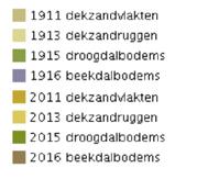
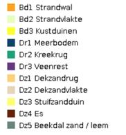
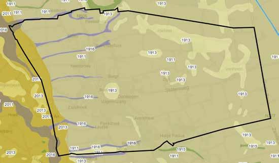
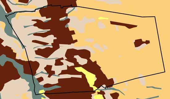

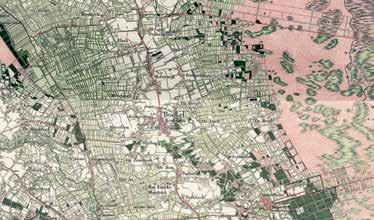

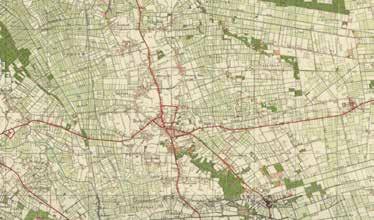
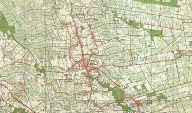

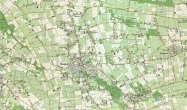
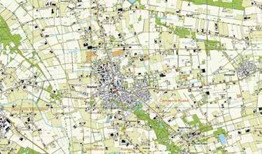
“Aan de voet van den Bosberg en an’t strand van de Aa ligt ’n schoon dörpke” [A beautiful little town lies at the foot of the Bosberg and at the beach of the Aa], the introduction of the anthem of Boekel (Schafrat, Nikkelen, De Leeuw, & Van Sleeuwen, 1963).
The origin of the name of Boekel is somewhat unknown. It is supposed to originate from “Beukeloo”, referring to a beech forest. However, foresters found the soil of Boekel to be unsuitable for such forest. Furthermore, there is little to no information about the prehistoric ages. The first appearance of Boekel in written text is when it was mentioned in the muniment of 1313. In this document, Rutger, lord of Herpen, sold land to the residents of Boekel. By selling the land, the lord was able to tax the residents through payment of money. During the Middle Ages, this was very unusual as tax was originally done by handing in produce and providing unpaid labor. Because of this first reference, it is thought to be the year Boekel was founded. However, in this document, it is also written that Boekel was already a ‘close and vibrant’ community. Therefore, Boekel must be older than 1313 (Schafrat et al., 1963).
The true origin of the town of Boekel is from ‘a time nobody remembers, and nobody knows how long ago’. What is known is that it was founded by farmers that started to cultivate the lands and started living in these lands, eventually forming the first community of Boekel (Van der Pot, 1940).
Boekel has always been – and still is – a farmer’s village. The landscape was romantic, with far stretching heathlands, shepherds and herds of sheep, fens, and cranes that stopped by on their flight south. These lands were characterized by calls of the curlew, in Boekel known as the Kowlder. The excavation of turf was highly lucrative as it was even sold far outside Boekel (Schafrat et al., 1963).
Schafrat et al. (1963) write before the lands of Boekel was part of the now called Netherlands, it was part of German territory. Later, in 1794, Boekel was temporarily occupied by the French Republic. A year later, the decentralized lands, of which the Land of Ravenstein and thus Boekel were part of, were relinquished to the Bataafse Republic that is part of the exclamation of the Kingdom of the Netherlands. Because Boekel was never part of the Generaliteitslanden of the United Netherlands, the Catholic Religion was allowed (Schafrat et al., 1963). Roman-Catholic residents of Erp and Gemert built wooden churches on the lands of Boekel to practice their religion. As their residential lands were part of the Dutch Republic, Catholic Religion was forbidden. In 1814, Boekel became a municipality on its own. The emblem of the municipality of Boekel is possibly one of these old wooden churches (Wols, 2009). Boekel was a safe haven for Catholic religious
people from neighboring villages, fleeing prosecution (Schafrat et al., 1963).
For centuries, the holy Saint Agatha has been associated with Boekel. In the year 1358 a chapel was founded bearing her name. After 1627, Boekel became an independent parish, set free from Uden’s parish St.Petrus (Parochie Sint Petrus, 2011).
The municipality of Boekel knows two villages called Boekel and Venhorst and many hamlets. All the hamlets now fall under the name Boekel. The best-known hamlet is Huize Padua. The hamlet houses the like named GGD institution for mental healthcare. The reclamation village of Venhorst was named after the landscape it was founded in. ‘Ven’, after the many fens (vennen in Dutch) in that landscape and ‘horst’ after the higher geological area it is located on. The village was founded in 1934 and is an agricultural town where nowadays the large-scale pig farming is centralized (Heemkundekring Sint Achten op Boeckel, 2019).
References:
Heemkundekring Sint Achten op Boeckel. (2019). Venhorst in vogelvlucht. Retrieved from https:// www.heemkundekringboekel.nl/venhorst/ Parochie Sint Petrus. (2011). De kerk in Boekel. Retrieved from https://www.parochiesintpetrus. nl/parochiekernen/boekel/ Schafrat, A., Nikkelen, W., De Leeuw, D., & Van Sleeuwen, M. (1963). 650 jaar Boekel. Boekel: Boekel. Van der Pot, W. (1940). Handboek van het Nederlandse staatsrecht. Zwolle: Tjeenk Willink.
Wols, R. (2009). Boekel in vogelvlucht. Retrieved from https://www.bhic.nl/ontdekken/verhalen/ boekel-in-vogelvlucht
1. Wols, R. (2009b). Daandeledennen [Painting]. Retrieved from https://www.bhic.nl/ontdekken/ verhalen/daandeledennen
2. Bing, V., & Von Ueberfeldt, B. (1976). People with an ox cart in the costume of the Meierij of Den Bosch [Illustration]. Retrieved from Nederlandsche kleederdragten en zeden en gebruiken. de University of Michigan: Westers.
3. Author unknown. (±1920). Flock of sheep in front of the farm of the family Van Lit - van Zon [Photograph]. Retrieved from https://www. heemkundekringboekel.nl/fotos/nggallery/hetboerenleven-in-boekel/het-boerenleven-inboekel-4
4. Heemkundekring St. Achten op Boeckel. (1992). A Catholic funeral in Boekel [Photograph]. Retrieved from Boekel: zô âs ’t vruger waor. Boekel: R-Graphics.
1.
1. Painting of the uncultivated lands of the Peel
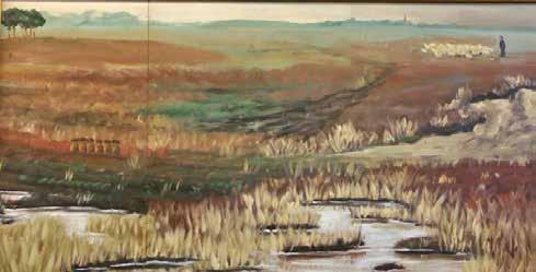
2. Menschen met een ossenkar in de dracht van de Meierij van Den Bosch [People with an ox cart in the costume of the Meierij of Den Bosch], the first appearance of the name of Boekel on an image
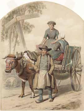
3. +/- 1920. In the foreground a flock of sheep. Sxheep grazed the Peel and were a source of income for shepherds. In addition to the production of wool and meat, they were important fertilizers in the Peel landscape.
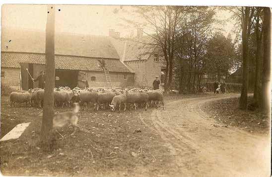
4. A Catholic funeral in Boekel

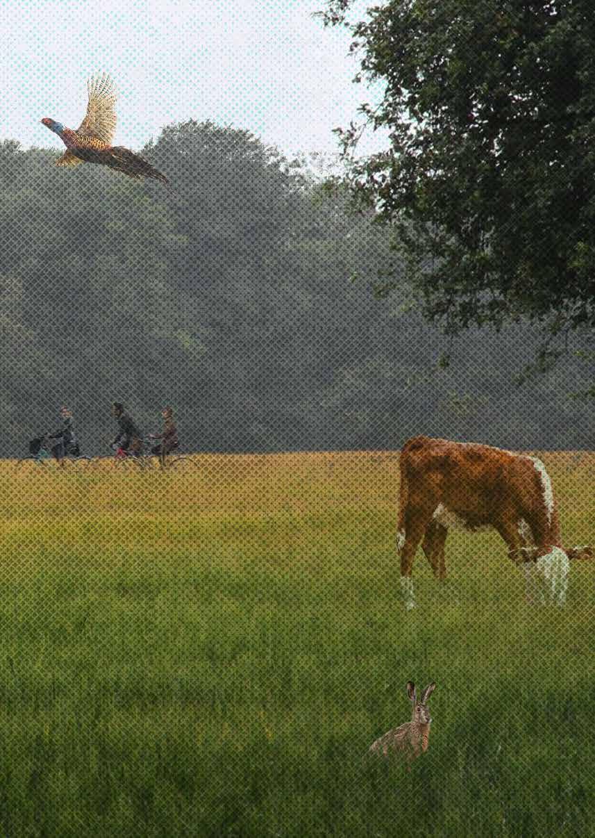
The characteristics and values of the Brabant cultural landscapes have significantly deteriorated due to land reclamation, land consolidation, altered agricultural land use and methods. Additional trends show a decrease in ecological values and growing demand for rural recreation. Multifunctional agriculture (MA) can contribute to landscape, ecology, and rural recreation by incorporating these topics in farming businesses.
Using
multifunctional agriculture to enhance landscape, ecology, and recreation in the agricultural surrounding landscape of Boekel Maarten
There is a lack of research on the design of landscapes incorporating MA that improve landscape, ecology, and rural recreation. In this thesis the characteristics and problems of the landscape units of Boekel are formulated and an MA toolbox and MA farming styles generated. These outcomes are used to design the landscape and generate specific and general design principles.
The established MA toolbox, MA farming styles, landscape design, and design principles provide usable input for landscape designers to incorporate multifunctional agriculture in Brabant landscapes like the landscape of Boekel.
Schenk-Verbruggen