

EDUCATION
2020-2022 University College London - Master of Landscape Architecture
2016-2020 Hunan City University(HNCU) - Engineering Bachelor of Landscape Architecture
ACTIVITIES & HONOR
2021- Student Member of American Society of Landscape Architects
2022.10 The Bartlett Autumn Show 2022
Mai Xiong
University College London
Bartlett School of Architecture
+44 74278 1753
xiongmai5619@outlook.com @imagesofmai
https://www.behance.net/ imagesofmai
2022 Participant in Drawing of the Year 2022
2021.10 The Bartlett Autumn Show 2021
2020- Student Membership of Landscape Research Group(LRG)
2018-2019 The First-Class Scholarship, University-Level
2018.7 Volunteer of China Panda Preservation Organization, Wolong, Chengdu, CHINA
2017 The first prize of photography competition in Yiyang, HN( Hunan Daily)
2018&2019 The Second Awards in National English Competition for College Students
2016-2017 Director, Department of Student Meida Center, HNCU
EXPERIENCE
2021.7-2021.9 AURA Studio, Shanghai, Internship
Participated Concept Project: Lingang Project with Gensler, Shanghai, CN; Disneyland, Shanghai, CN; Fortune Center, Shanghai, CN.
2020.7-2020.9 GWP Architects, Guangzhou, Internship
Participated Completed Project: Riding the Wind, Guangzhou, CN
Participated Concept Project: Industrial Park of the China Beauty City, Guangzhou, CN
2018.8-2019.1 Smart City Technology Innovation Center, Urban Planning & Architecture Design Institute of HNCU, Internship Engaged with Document Collation and Data Record of Regional Planning, Hunan Province, CN
INTEREST&SKILL
Design
Presentation Research
Rhinoceros/
Photoshop/ Illustrator /InDesign / AfterEffects / Lightroom / Premiere Pro
War Heritage; Political Heritage; Decolonizing Landscape.
illustration CONTENTS

Scope through Provocation
Memorial and Oblivion - Landscape as a Bearer of Narrative and Memories.

Satellite Mapping/ Dadaism Collages/ Information Master Plan Story Board/ Illustration/ Script/ Models
Scope through Enlightment
Roaming in Ages - an Urban Archeology Wonderland.
Archive Drawing/ Dadaism Collages/ Information Master Plan/ Anaylsis Diagram/ Story Board/ Illustration
Rhinoceros V-ray Lumion Blender SketchUp AutoCAD Grasshopper
Photoshop Illustrator InDesign Lightroom AfterEffects Premiere
Sketch ModelMaking Photography Maya Houdni
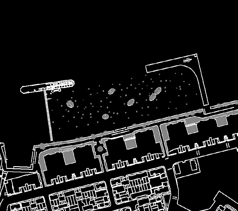
There is World War Two Pillbox and Observation Post south-west of Tripcock Ness. These were strategically placed to observe and defend the river and bank to the west.


In the river are the remains of the piers that serviced the heavy industry of the Royal Arsenal. This photograph shows what they looked like. Now they are resting places for the gulls and cormorants. The path changes from paved to hard core. At this point there is more vegetation, softer landscape and even the tell tale signs of rabbits on the path. Remember this was rural Kent. Continue along the path until you come across a small lighthouse on the river’s edge. This is clearly marked and there is an information board.

NORTH GREENWICH THAMESMEAD


These sites are near the site of the Cannon Cartridge Factory. This was very dangerous and many special arrangements were made against explosions. Gunpowder was stored further down river in magazines and tumps.

Tumps

01

MEMORIAL AND OBLIVION


- Landscape as a Bearer of Narrative and Memories.

#Scope through Provocation There are numerous post-war relics along the River Thames, touched and untouched. The project propos es a walking tour experiment with imaginations about those parts of the ruins at Thamesmead. These sites formerly belong to the Royal Arsenal, the centre of the wartime Royal Army. The proposal suggests a new level of meaningfulness be added to the remains and visible traces of the past and their continuation. To do this, the project referenced the Three-Act Structure in designing the narrative, aiming to test our precarious relationship with war and observe the whole environ ment and how its representation has been altered by generations.


Location: Thamesmead, London Time: 2021.9-2022.8

Type: MLA Studio, Individual Work Instructor: Cannon Ivers & Alexandru Malaescu
Royal Arsenal Site
The beginning of the journey; The Royal Arsenal, Woolwich is an establishment on the south bank of the River Thames in Woolwich in south-east London, England, that was used for the manufacture of armaments and ammunition, proofing, and explosives research for the British armed forces.

Coal Pier and Iron Piere were built in 19th century and extended in 1875 with an 80 ton crane. It was to tranship ship heavy guns. It was later reconstructed to take a 200 ton crane which was eventually sold to Antwerp. The pier remains with some mixed gauge railway track.
Gallions Reach Park is a recently built landscaped park with a range of wildlife habitats including flowering grassland, scrub, planted woodland and water-filled ditches built around hill. There is also very high hill which is actually a man-made structure. The hill was constructed from mound of earth, built from rubble and soil excavated during the construction of a nearby residential area.
These sites are near the site of the Cannon Cartridge Factory. This was very dangerous and many special arrangements were made against explosions. Gunpowder was stored further down river in magazines and tumps.
Coming now to what Thamesmead residents refer to magazines as TUMPS as a modern day term. These were customers storage facilities for ammunition, propellants or explosives. Within the Royal Arsenal these were all called Magazines and each was allocated traffic number so that the Royal Arsenal Railways could service them. Most people know Tump 53. In its active days this was Magazine No 14, Traffic Number F53 and was used by the Army Ordnance Service for the storage of Cordite (propellant). Magazine No 5, Traffic Number F39 (Tump 39), was used by the Royal Navy Armaments Department for the storage of Cartridges and Bulk Cordite.
It had dual purpose - one was to deliver materials into the heart of the Royal Arsenal military complex and the other was to create a defence boundary to the east. It does not seem that it was intended for the repairs of military vessels. It was used to bring timbers to the Royal Carriage Department and a branch went to the saw mill. Colonel Pilkington appears to have used the Isle of Dogs canal as design. There is lock to the river and it was eventually lined with warehouses. On the west bank were the New Army Ordnance Stores and on the east filling factory Danger buildings. The canal was also used for Torpedo testing.
WOOLWICH
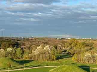
Every day people start their walks along the Thames Path, the south bank of the River Thames in east London, war heritage inaccessible to humans and inhabited by gulls and crows in a long-abandoned state; a trail full of vague terrain from Woolwich to Thamesmead West, passing through rusty piers, mysterious concrete box, stark lighthouse and a massive land with no information. Keep walking with a curious mind, and end with a new town.
What the walkers may not realise is that the path beneath their feet was once the top secret of London in the last century - the heart of the Royal Army, witness to the largest air combat in human history and the Royal arsenal that made a great effort for the Allies victory during the Great War.
VIEWS FROM THE ROAD
The views from the road show different textures of the site, from the pavement to multiple relics, which creates a sense of place. Even though the traces of war have been completely erased, there is still much room for reverie. The series of views creates landscape scenarios, which enable the whole journey to unfold as a montage sequence, a narrative. Moments are pushed to move the discovery and contemplation of the panorama.


THE 'SECRET CITY'


HISTORY BACKGROUND
The Royal Arsenal, Woolwich is an establishment on the south bank of the River Thames in Woolwich in south-east London, England, that was used for the manufacture of armaments and ammunition, proofing, and explosives research for the British armed forces. It was originally known as the Woolwich Warren, having begun on land previously used as domestic warren on the grounds of a Tudor house, Tower Place. Much of the initial history of the site is linked with that of the Office of Ordnance, which purchased the Warren in the late 17th century in order to expand an earlier base at Gun Wharf in Woolwich Dockyard.

Over the next two centuries, as operations grew and innovations were pursued, the site expanded massively. At the time of the First World War, the Arsenal covered 1,285 acres (520 ha) and employed close to 80,000 people. Thereafter its operations were scaled down. It finally closed as factory in 1967 and the Ministry of Defence moved out in 1994. Today the area, so long a secret enclave, is open to the public and is being redeveloped for housing and


perspective by gulls


perspective by the audience
These floating is lands are territories contested by gulls. However, sometimes the crows come to dis turb as if they are attempting to evoke a war.

As you walk up on the pier, which is almost swallowed by mosses and sed dges, the clouds rolls intensively. You begin to perceive this uneasi ness and take the map out of your pocket, not expecting that the wind throws your map into the dirty riv er...
Then you view the enchanting grove in a nearby place and you decide to follow your heart - into an unknown adventure.
ACT II

BOMB HARVEST

Welcome to the war. Never trust what you see, as this charming grove is a place where the scars revealed in wartime. These scars, long covered up, are uncovered anew and fresh seeds are planted. Years from now, if you won't know how delicious it will be in fall, you wouldn't aware how scary it will turn in wintertime.
 THAMESMEAD BOMB HARVEST
Thames Path
THAMESMEAD BOMB HARVEST
Thames Path
The trees are drinking, bend ing and ready to fall- nothing is going to be straight as the ground is shirting. You never know who falls first, a tree, an apple or a pear, or whether it's the bomb that falls. It's up to the nature.... Run.


You've finally found a place where avoid the attack by bombs. Also, you see someone, and it seems to be a cellist who has been waiting for you for a long time. While he sits gentlely and thhe trees begin to spinin around you two. 'Keep the Home Fires Burning' and he tells you the song will stay with you un til you see the next ruin.
Then you continue walking, with the red voids guarding you along the way.
Trench Cello, https://www.classicfm.com/artists/steven-isserlis/trench-cello-first-world-war/

Bomb
THAMESMEAD THE LOST RIVER
100
ACT II

THE LOST RIVER
This canal is hidden deep in the grove, with row of dwellings adjacent. Its linear shape and texture give you the impression that is a testing ground designed with precision, its landscape weaponised, possibly underlining the dual nature of people revisiting weapons. But not sure about the story of it.


It seems to be frequently visit ed and they have left some graf fiti as a marker. You don't know what's up ahead, but the nice weather relieves you.
 Grove Canal
Storms always come out of no where and leave no warning. A fire comes in with the intention of burning down the whole vil lage. You vaguely see a girl in your smoky stupor who appears to be coming to your rescue in a boat, and then you lose con sciousness.

The whole of the Thames is filled with the war heritage and Thamesmead s wonder walk will act as microcosm of the journey to feel the war and enable walkers to spontaneously renew the story of war.


 ACT III THE SECRET CITY


The crumbling building plays a beautiful fade over your head.


Yes, you see the exits, they are like a paint ing, framing the weather outside, outlining the look of hope.


[who are you?] [How can I find you?]
Then you wonder who saved you from that fire.
ACT III
THE CANARY GIRLS


EXTRAS - Warship Constellation


Terrain Vague - Into an imaginary war
Machine, Territory, Chaos 100


years later, an invitation from the south bank of the Thames, there will be a war performed by waterplants for their terriroties. 1:500 [500x350x50]

[Touch this Pain Softly]
Pain, for the past was in endless darkness, but the scar will finally be cured, for the unknown future will be in soft imagination.


A War Cake


How would you think of scars? - A bittersweet.

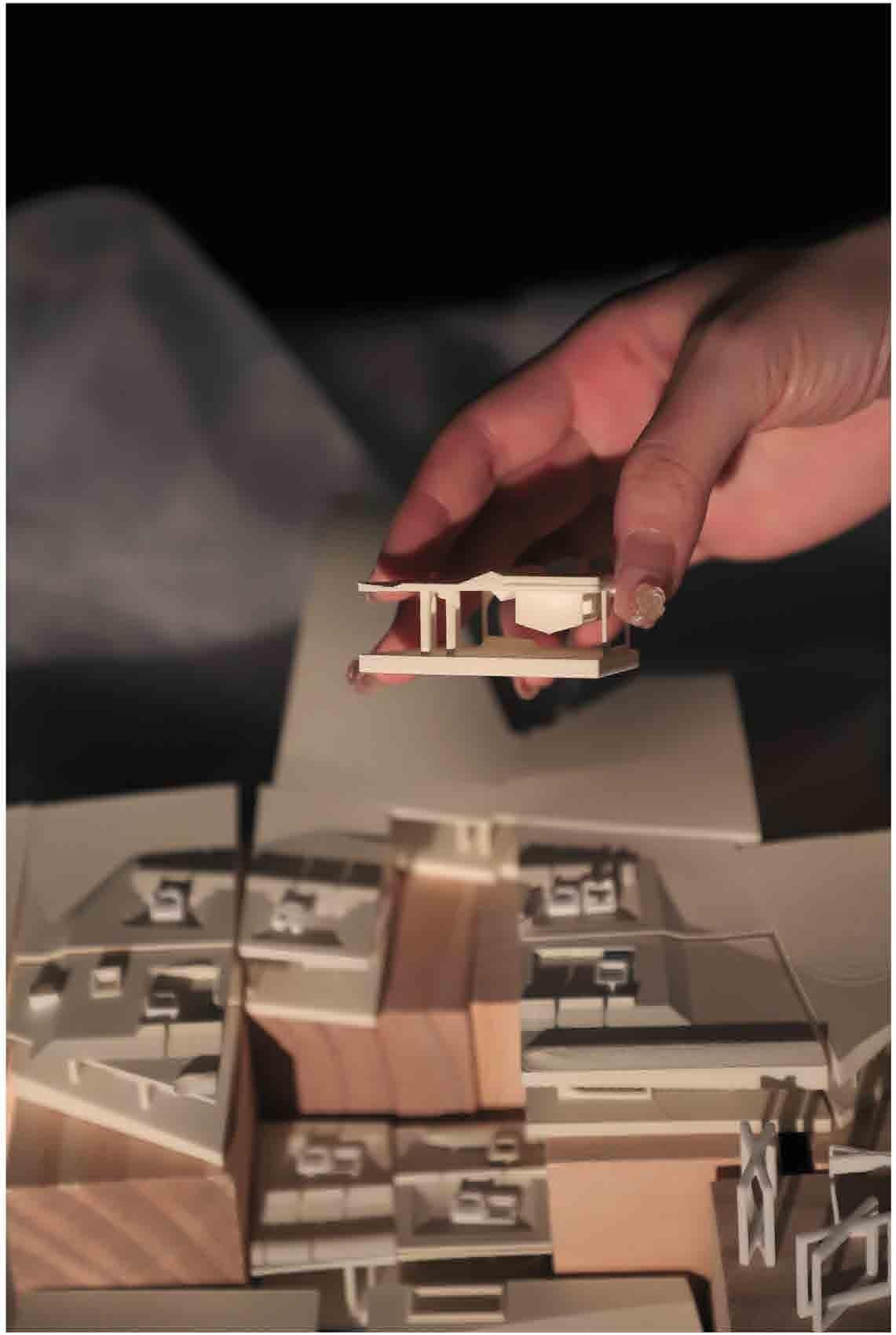
1:750 [400x400x100]
15mm CNC Plywood Base; Turn Table (12mm Rolling Ballsx6; Plywood top R=300mm; Plywood buttom R=100mm); 40mm Steel Panel Pins; 40mm Round Lost Head; 40mm Bright Round WIre Nails; 50mm Galv Round Wire Nails; 40mm Galv Round Wire Nails; M3 ZP Steel; M5 ZP Steel; Cuttom Balls.
Rabbit Hill, an archaeological site excavated in 2003, located in Yiyang, China, comprises a large number of historical artefacts that reflect the beginning chapter in the city’s history. Like all developing cities in China, Yi yang is urbanising rapidly, homogenising both urban facades and culture. The discovery of Rabbit Hill seems to provide a chance to save the city’s history and cultural identity. The unknown heritage is remote from not only the surroundings and the whole city fabric, but also the local history.


Designed Notation

Interventions in landscape inhabitation would bring memories that buried in history back to people, to the modern times. Breaking the boundary means beyond the 3-dimentionals, it is more about the times that people could experience in history through juxtaposed ages.

As for the flat plan, rearranging the routes of the tour, connecting all the wells and pits.
In terms of 3-dimentional, below walkways stretch through the pits, of which up and down experience vertically according to the depth of each pit. The wells are exposed their layers and kept the original tex ture.
Regrading to the times, the 4-dimensional, the relics and antiques lie in their initial rooms, where protected by glass frames. Visitors watch through those artifacts and travel the pages of history…
“Notational Systems in landscape architecture enable one to consider the simultaneity of different layers of experience, including movement and time.”(James Corner, 1991)
Testing plan a b c d

e
Notation of the intenventions


Notation of each pit Symbolic artefact


Design process


The process diagrams shows the design development based on notation systems, and series of interventions enegaed. From the start ‘current status’, then recovering the original archeology features, removing the barrier(the wall), expanding it to the inside to be the deck and balcony for the whole community; reorganizing the routes according to ar cheology features, down to the ground, which creates vertical experience to find the heritage; dissembling the wells where exisiting antiques and relics, exposing their layers to visitors; as for protection, building up shelter(cano pies) to avoid relics from bad weathers, the shape of them depend on the wind and sunlight; at last, in order to correspond the historic atmosphere, the plants could be part of creates historic environment, bending the trees, making them like ancient ones.


There are the marked relics and wells in pits, providing messages to the visitors about the chronological products. Opening aisles and arranging visiting routes create better exhibition routes for people who are likely to find the ancient stories.
The walking systems is divided into two: ‘the above’ and ‘the below’, which allows tourists to choose their own routes. The above plank path is from the west entrance, crossing the underpass and finally reaching the east exit. The underground path is paved by sustainable and traditional material, pebbles with rammed soil, as well the retaining wall. The planting reserves the empty with grass, ornamenting some shrubs and small arbors, attracting birds to build their own habitat.

The Chinese Archeology Day is opening for tourists from all over the world. Local archeology institution holds a series of activities for popularizing archeology, which offers several imitative archeological pits and workbench for tourist to experience the whole process in archeology.


Proper time for pruning plants, the site is a winter garden for visitors to taste the various unique posture of those vagetation. At the same time, Seasonal use in Spring: Neighbors celebrate the Spring Festival in the site, they pray under the trees and relax or walk through.
Vision of seasonal use in the Rabbit Hill.
PUBLIC PARK WINTER GARDENThe view from sunken way reflects the dynamic changing scene in people's motion and sight. The graph provides clues about visitor's position and the direction of view, as well as the events happened through a series of eyelevel views, including the antiques they may found.


The mirror shelters(canopy) protects the relics in sunken space, refelcts sunken scene for people who walks on the surface and avoids them from bad weather.
