

HELLO!
I am an architect and urban designer with a passion for artistic visualization and computational programming and its multiple forms of exploration and inquiry about the perceptions in the world that surrounds us.
I enjoy working in international teams and collaborate with different disciplines: being open and receptive amplifies my interpersonal skills and my sensitivity towards human centered design and its harmony with its context. I specialize in thorough research and I am delighted with the challenges of complex projects and finding solutions from concept to realization in all sorts of scales. My main focus is on social inequality, benefits of public cultural spaces, sustainability and resiliency.
Being on a constant state of curiosity, I am currently developing myself further in generative design and fabrication. I am fascinated by the vast possibilities of applications: form finding through real world data collection; structural and environmental analysis; artistic expression; bio-mimicry; robotics and the know-how of materializing these results.
“If you believe in the cindirella moment, in the 12 o’clock, in that place, in the midnight hour, it’s where Picasso meets Einstein. Art meets science Changes in our perception affect the way we capture data and can only happen if you believe in magic. It can only happen if you can suspend your disbelief.”
Neri OxmanCULTURAL WATERSCAPES
Building social infrastructure on New Delhi’s heritage
Summary
Project: Cultural Waterscape 2014
Location: New Delhi, India
Description: Master of Science in Architecture and Urban Design Columbia University GSAPP Tasks: Research, theory, concept design, 3d modeling, rendering, video editing, presentation

Team: Zahra Alwash, Belen Ayarra, Marco Sosa, Silvia Vercher
Publication and Exhibition: Densification in Delhi, India. Delhi, India 2015 Award: Lucille Smyser Lowenfish Prize
Project Brief
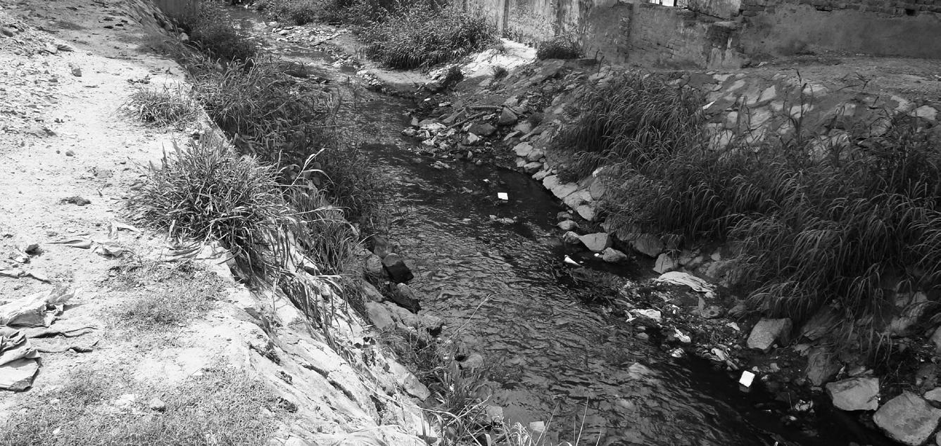
The project proposes to reorient Delhi’s future growth by addressing infrastructure issues concentrating on lack of water, seasonal flood and pollution. Furthermore, the project aims to reestablish the relationship between the city and the Yamuna River using water as a productive landscape that will generate social spaces. Through the lenses of culture and water the
project imagines Lutyens Plan transformed from an imperial symbol of power and inequality, to a democratic space allowing social interaction. Finally, water is the catalyst for future growth of services and densification that will support the city at a regional scale.

PROPOSED ECOLOGICAL ZONES


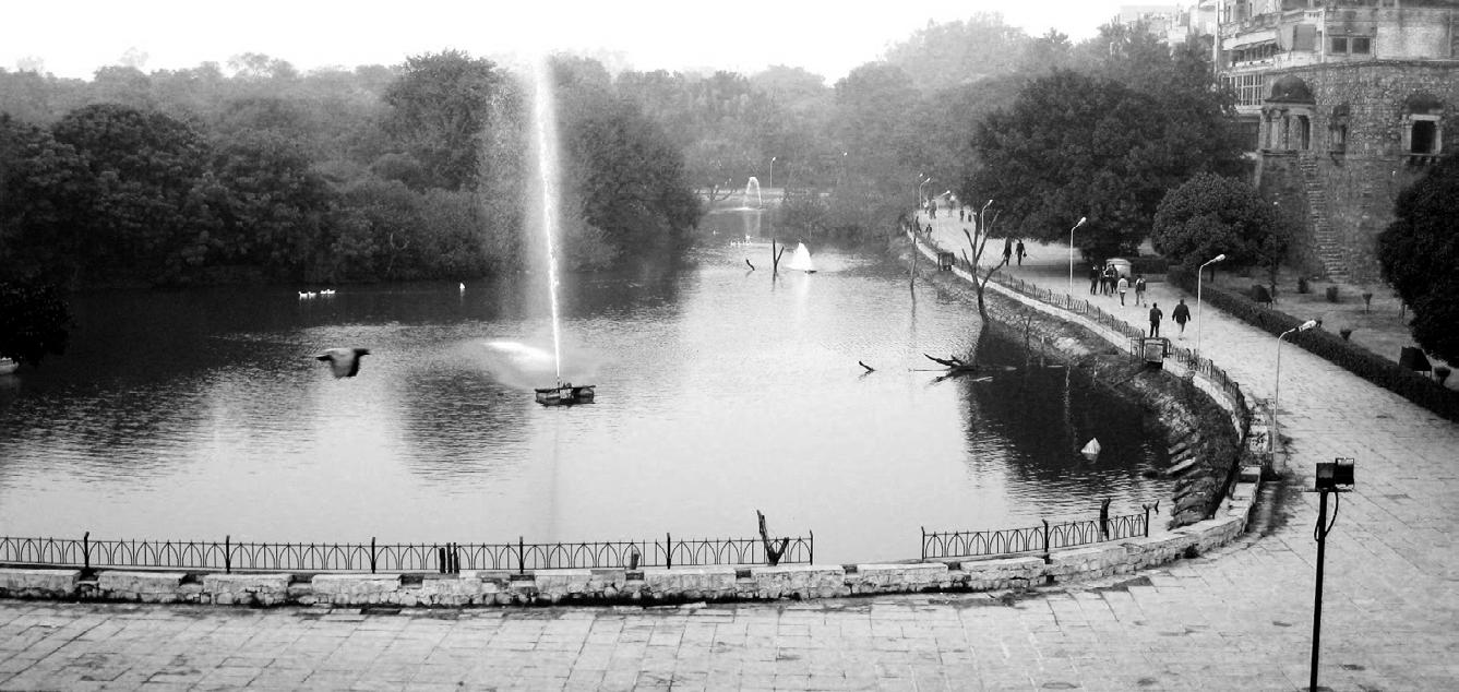
ABANDON WATER SYSTEM: BAOLIS & RESRVOIRS


NATURAL STREAMS: NULLAHS
METRO LINE
ANCIENT SETTLEMENTS
LOST WATER COLLECTOR SYSTEM: BUNDH

RECHARGING + STORING NODES
Collection, retention, filtration
It starts with a bottom-up approach by reactivating existing water nodes (Baolis and Hauz) to stimulate a network system for collection, retention, filtration and recharge of water. Through
creating ecological zones, it aims to generate more culturally public spaces that would support future growth. The first ecological zone, the Baolis will work as a recharging unit and social catalyst.

Potential densification


Existing densification Baoli reactivation and ground water recharge
Connaught Place permeable soil
Activation of existing dohbi community new social spaces and services
Reactivation of existing service area
TRANSPORT + COLLECTOR SYSTEM 02
The block’s core as engine

1
programs, providing a socioecological node that allows a sustainable densification in the surrounding area of influence. The new typologies that we imagine recuperate their traditional construction to engage and enlarge the internal community.
CONDITION
The second ecological zone aims to provide a new rain and gray water collection system while activating the core of the block. The block’s core is the engine that uses the water as a tool to create public spaces related to its tradition and culture, taking into account the climate change. The reservoir will strengthen the existing cultural and educational

Private Filtration
Bungalow PHASE 01: eco-node/reservoir + new program Educational And Cultural Programs
PHASE 02: socio-ecological densification PHASE 03: housing + services densification


THE NEW CITY LA NUEVA CIUDAD
Guayaquil’s Airport future rehabilitation
Summary
Project: The New City - La Ciudad Nueva 2017-2019
Location: Guayaquil, Ecuador
Description: Masterplan Study + Concept Design
Tasks: Research, Data mining, theory, concept design, 3d modeling, rendering and visualization, presentation Team: Perkins Eastman, CVA, Metros Cuadrados, ARUP, RWDI
Publication and Exhibition: The New City Vol. I, II, III. Autoridad Aeroportuaria de Guayaquil, Municipio de Guayaquil
Award: Design Award of Merit. Society of American Registered Architects - New York Council in recognition of Professional Design Excellence. Nicholas Leahy Project Architect/Designer.
Project Brief
The project to move the Aeropuerto Jose Joaquin de Olmedo from its present location, in the geographic center of Guayaquil, to a location outside the current city limits is the unique opportunity for the city to study, rethink and realize a new version for the metropolis and its context. The site is very large at 240.5 HA and situated at the geographic center of the city, close to the river’s edge. The main strategies along a central spine stream are: to reconnect the city to the new airport outside the city; revive the convention center; and rediscover something special
(invest in natural resources). This translates into 3 main districts: Marina District, Central Business District, and Garden District. This is the catalyst that can start the evolution of a new “smart city” that can invigorate development, bolster and realign the city’s infrastructure from transit to traffic, from cultural amenities to ecological and resiliency measures thereby improving the quality of life for all its citizens across all strata. Done right it can become the heart of the rejuvenated economic engine for the city: The Guayaquil of the 21th century.




MISSION AND VISION 01
Turning the city into a destination hotspot
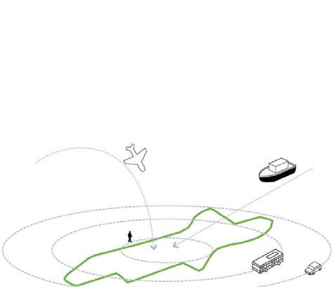
The site now sits at the geographic center of the Great Guayaquil Metropolitan Area and has the potential to become the heart and engine of the 21st century city by connecting in it to the city’s unique history, culture and environment. The following objectives ensure the strategic design and civic responsability of the project:
1) Create a global and local world class destination
2) Contemporary planning and in novative technology in a human scale.
3) Improve traffic and circulation.
4) Improve the connectivity to the site, upgrade the existing transit centers and link the site to the new airport in Daular.
5) Engage with the surroundings to encourage renewal and development.

6) Reconnect with Rio Guayas wa terfront and its natural environment.
7) Link the site to the existing natural features: mangroves, forests, river, and recreational, cultural and historic sites.
8) Continue to support tourism and business


CONCEPT DEVELOPMENT 02
Density, Ecology and Main Axis
The design proposes an open and flexible framework of 3 distinct walkable mixed use live /work districts. Each district is centered around one or more unique attractions that are aimed at the citizen, the tourist ,the busi nessman , children and parents alike. Districts where different in dividuals can have diverse expe riences.
To set the stage for such a catalytic transformation the con cept design is built upon on four principal drivers •Fast, reliable and secure connec-
tion between the site and the new airport location

•A new and larger state of the art Convention Centre as an eco nomic generator and destination at the heart of the development. •Creating a unique eco-tourism, educational/research destina
tion, that celebrates the unique ness and abundance of the local flora and fauna that will attract visitors from all around the world
•Re-establishing and reconnecting the site into the city and its environs as well as connecting it to the waterfront
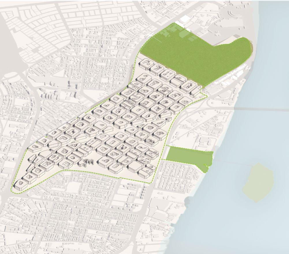
Density Studies: New York City’s Midtown built and population density on Guayaquil’s Airport site.
Density Studies: Barcelona’s built and population density on Guayaquil’s Airport site. Best scheme that adapts to city’s needs and growth projection.

Redefine the existing airport terminal as a transportation hub. Travelers will board and alight to and from the airport.
Districts connected through 2 green axis: Long axis Estuary, and Botanical Gardens.


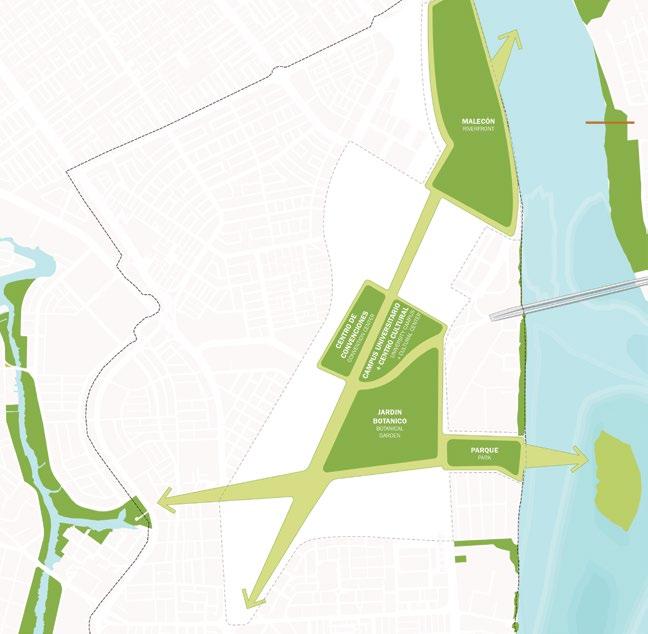


Main green spaces connecting within the site and its main surrounding natural ecosystems.

Waklable, safe, linear park surrounding the site that seamlessly unites neighbor hoods.
Main connection of Marina, Convention Center, Business, and Botanical Garden as triggers for development and tourism.
Districts, neighborhoods, and main activi ties
Site’s limit
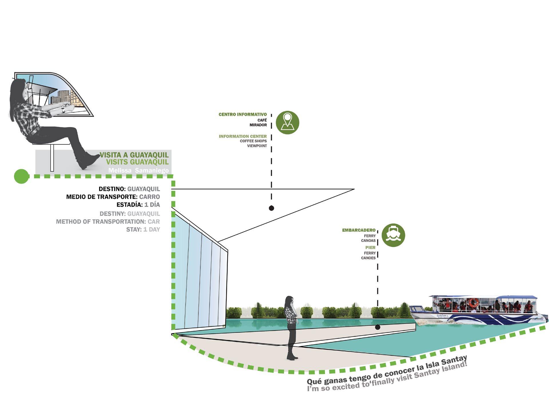
VISITOR NARRATIVE


PROPOSED MASTERPLAN 03
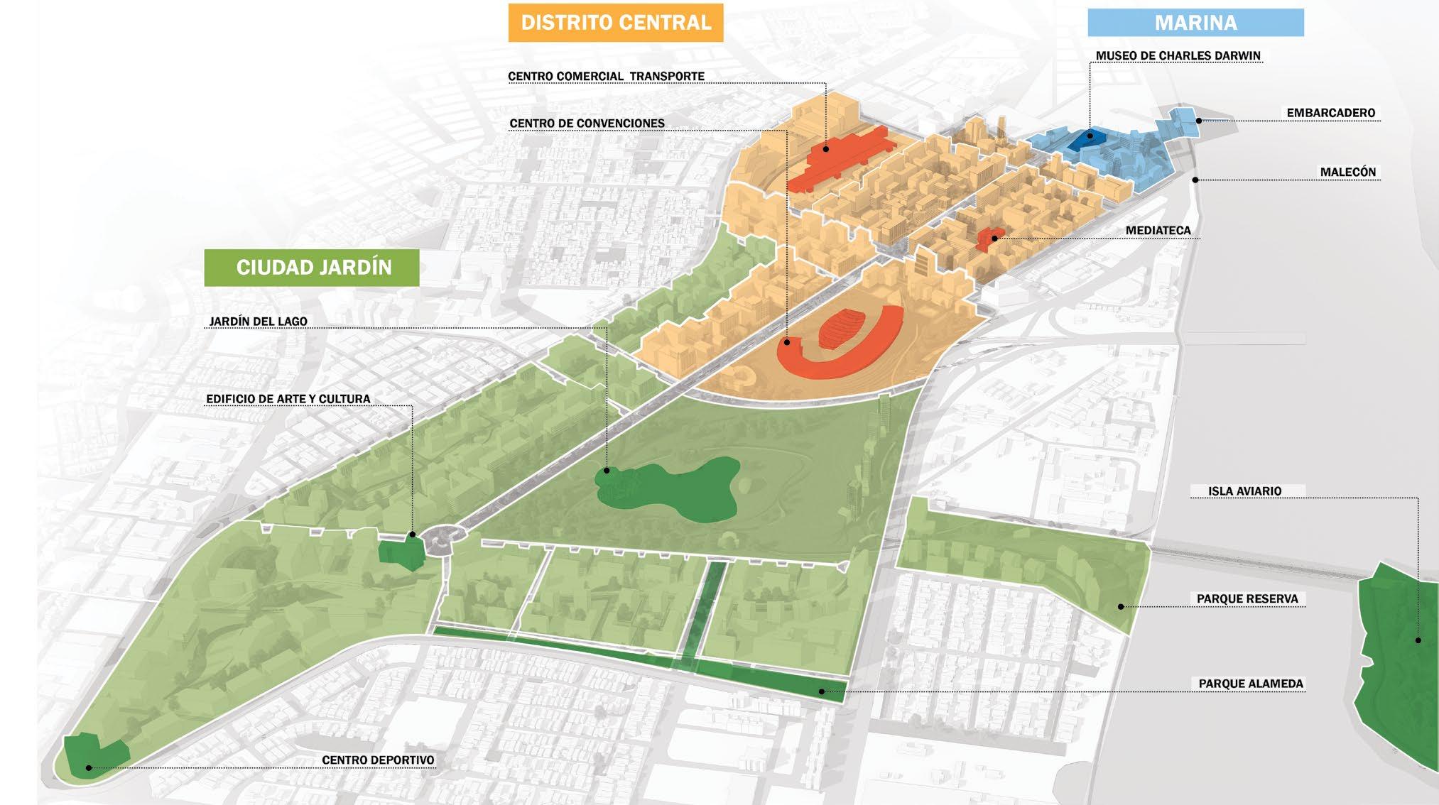
Reimagining the city’s ecocultural heritage
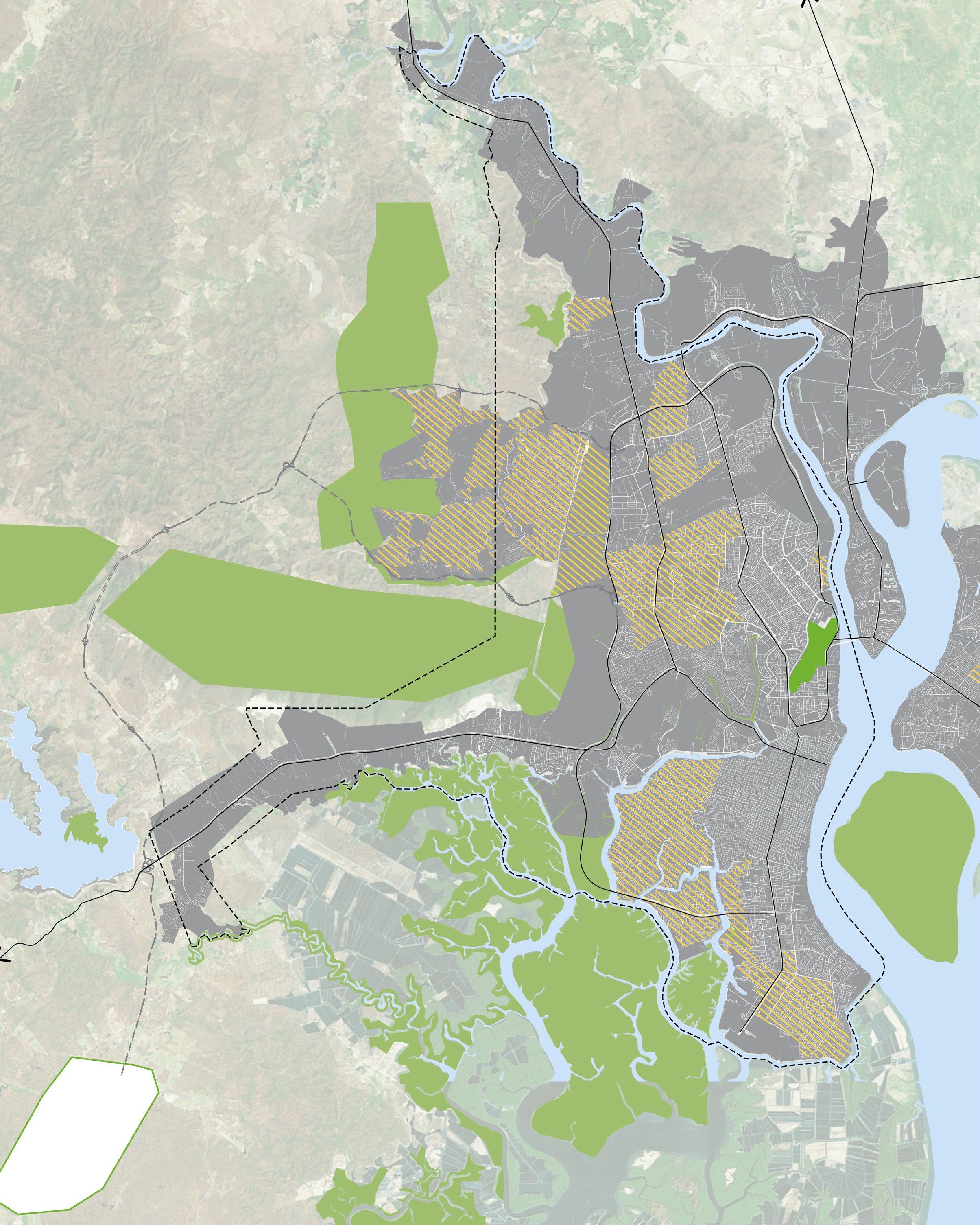
The design concept is part of a large Park composed of the Botanical Garden, the Convention Center and the Cultural District located in the Center of the Site. These districts are connected to El Palmar Islet through the Integrating Park. To the north of the Avenue is the Marina, which serves as a connection to important tourist points of the City such as the Historical Park and the Malecón,
among others. These districts are supported by the development of other residential, business, and hotel brands, as well as a Commercial and Entertainment Strip that is directly related to the existing Commercial Zone. Finally, the Transportation Center is of vital importance for its relationship with the New Airport and the rest of the City.

Pedestrian Access Concept Sections


TOWARDS A SUSTAINABLE FUTURE 04
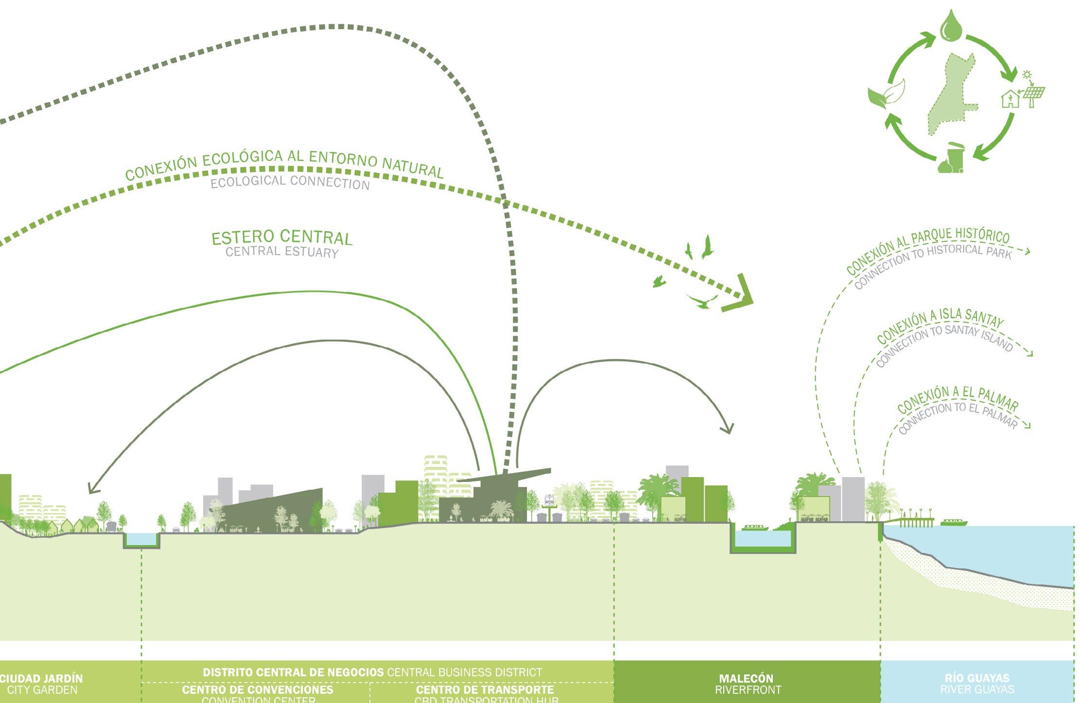
Estuary as Collection System
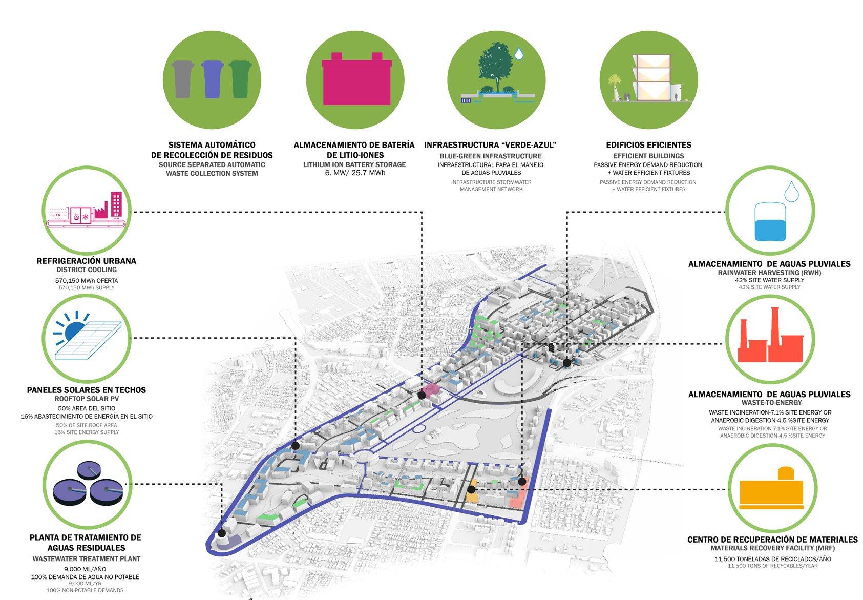
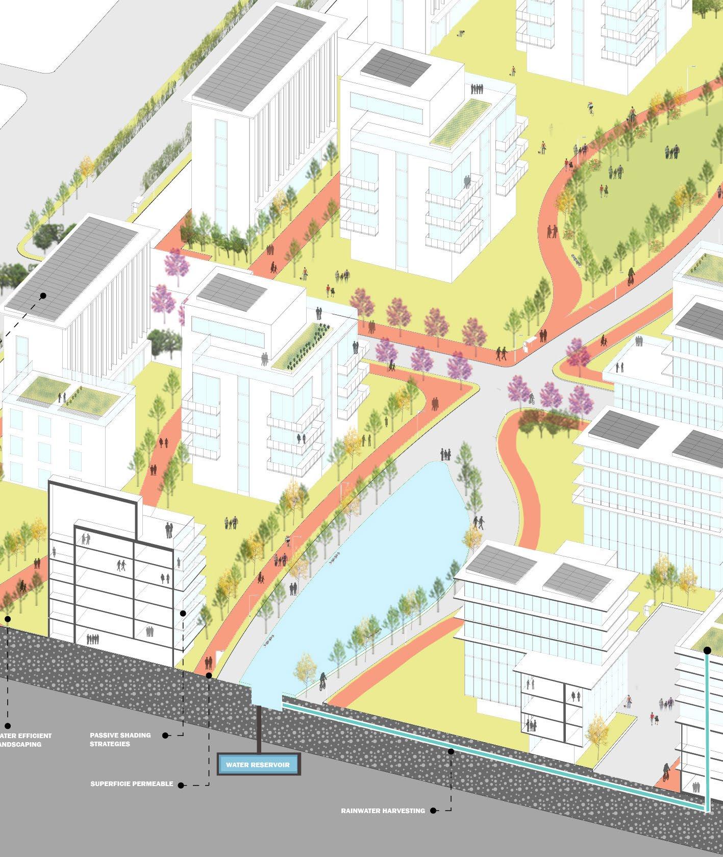
Given the site’s vulnerability to period of flooding, drought, seismic activity, and unreliable grid infrastructure, designing for resiliency is a key consideration for the project. Sustainable design guidelines include: a comprehensive water and energy strategy, productive landscapes, street-level vitality and efficient transportation systems. This includes minimizing potable water use, providing dependable access to clean

water, managing storm water run-off and flooding potential, maximizing permeable surface areas, and improving overall water quality both off- and onsite. Energy considerations can be addressed by maximizing passive strategies and renewable energy sources, combined with battery storage and generators that are located above any flood zones. Design guidelines can include resilient design best practices at both the building and community scales.


THE 3 PILLARS
Chinese heritage intersection in Manhattan
Summary
Project: The 3 Pillars
Location: Manhattan, NY
Description: Gateways to Chinatown Competition 2017
Tasks: Research, theory, concept design, 3d modeling and rendering, presentation

Team: Marco Sosa
Award: Perkins Eastman Firmwide Honorable Mention
Project Brief
The site for the Chinatown Gateway exposes a very high volume of pedestrian flow. People coming from different neighborhoods cross this triangle to get to their destinations or stop by to request information. As a center of convergence, the city street grid coincidentally forms a triangle that symbolically represents the foundations of their society. Not far from philosophy, this triangle in the middle of Chinatown serves as a magnetic place where people from different backgrounds
develop social interactions, such as the simple action of aiding someone to find its way as an act of solidarity which brings gratefulness and joy between the 2 parties. Hence, to take advantage of this flow, the site is divided following the general natural flow of the pedestrians that cross this triangle and guiding borders are placed in order to enhance the social interaction even further, making it not just a trail that people momentarily pass by but also an inviting place where they can stay.

CHINESE CULTURE 01
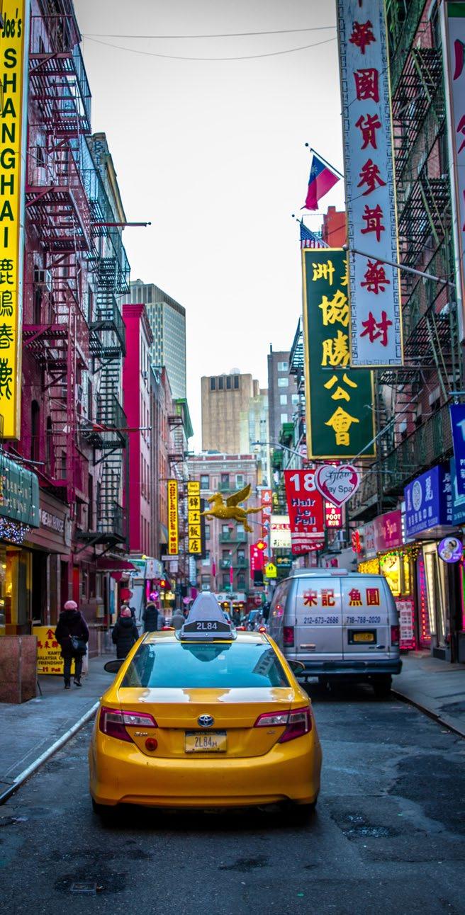
The Chinese identity is characteristic of a rich spiritual and mystical history. It is said that the basis of Chinese Civilization are 3 pillars: Taoism, Confucianism, and Buddhism. Cultural heritage, social interactions, history, politics, common sense embraces all aspects about these philosophies. It states a peaceful life by letting the natural flow of things or events happen in order to have an internal and external balance, a humble desire-free life. It involves the well being of society and the individual of a society, a sense of hierarchy for
order and the respect of that order and how education is very important for this formation. The philosophies juxtapose in the amiableness that has to exist among the elements: Heaven, Earth, and the Human Being

This triad can be seen in many aspects of a human life, such as birth , marriage and death. Not surprisingly, for many Chinese the number 3 represents a lucky number due to its metaphorical and allegorical relations with human existence.


CONCEPT DEVELOPMENT
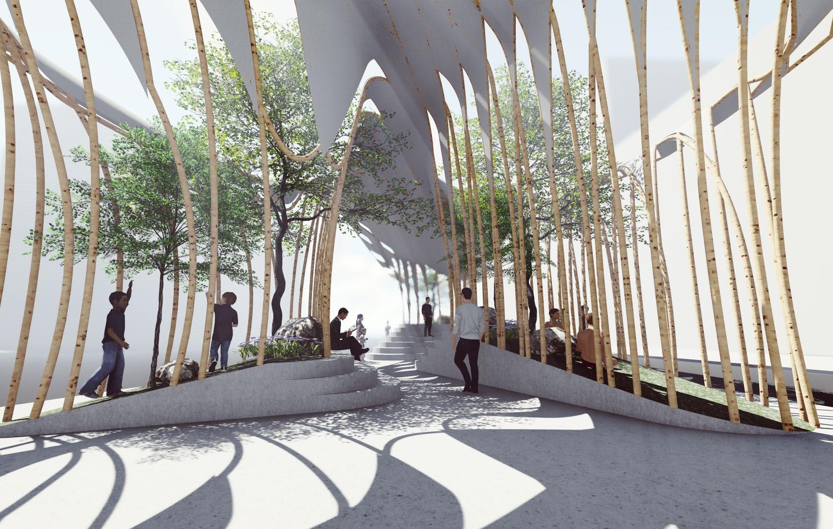
The guiding borders which will function to stream the flow of people rise like hills that provide seating and green spaces in the triangle as a platform for social integration, such as seating and relaxing, enjoying a conversation, or even small events like artwork exhibitions. The 3 green slopes form a natural nest that separates the middle of the triangle from the busy city street. These are surrounded by a bamboo structure mimicking the iconic bamboo forests in China which gives an immersive experience.
The bamboo enclosures extend onto each other to create a seamless canopy that materializes the complementation of the intangible triads in Chinese Philosophy: Heaven/Spiritual, Earth/Nature, and Human Being. Surrounded by several landmarks, the canopy’s bamboo mesh opens up to reflect the sense of inviting gateway. These openings also resemble the characteristic roof silhouette from Chinese architecture.
3. Pillars of Chinese Civilization (Heaven, Earth, and Human Being) provide a green refuge
4. Canopy symbolizes seamless spiritual/meta phorical connection between pillars
Canopy area for projection
3D Projectors attached to pillars
Videos/Animation of Chinese Culture 7. 3D Projection below fabric 8. Cultural/info. videos projected
Comfortable shaded public space

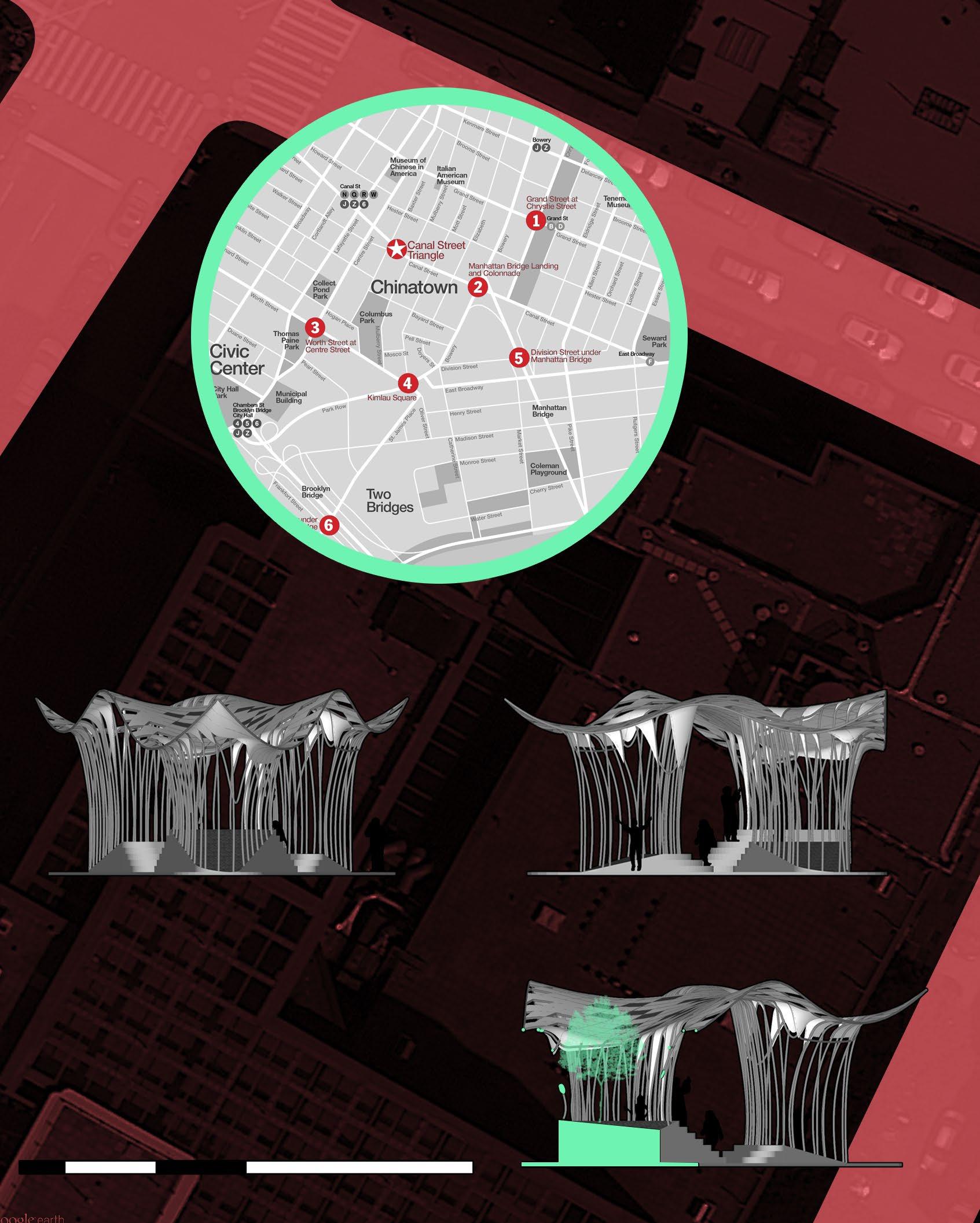
South Elevation
A Baxter Street

WalkerStreet
1. View from Walker St. 3D Projection on Fabric

2. View from Baxter St. Green islands interconnected by bamboo mesh.
3. Side view from Canal St.


FRIARS DEVELOPMENT CENTER
A place for knowledge and team spirit
Summary
Project: Friars Development Center 2014-2107
Location: Providence, Rhode Island, USA
Description: Educational/Sports Building
Tasks: Revit modeling/coordination, schematic design, design development, construction documents.
Team: Perkins Eastman
Status: Phase I built. Construction documents/bidding for Phase II
Project Brief
The Friar Development Center at Providence College (Providence, Rhode Island) is a combined renovation and new construction project that will feature significant work to three existing campus buildings
– Alumni Hall and 64 Hall/ Slavin Center – as well as the construction of a new adjacent men’s basketball practice facility. Located at the northwest corner of campus, the project will include the following:
• Renovation of 20,000 square feet of interior space in 64 Hall/ Slavin Center for the Center for Career Education and Professional Development, event space, and common space.

• Renovation of 9,900 square feet of existing exterior space
between Alumni Hall and 64 Hall/ Slavin Center. This space will be converted into an enclosed concourse with a new roof structure and glazing
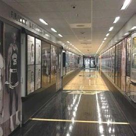
• Construction of a new 44,500 square feet men’s basketball practice and recruiting facility building, to be constructed west of the existing buildings on the current site of the Wardlaw, Alumni, and Cumberland Street parking lots. The new building will include two full‐size basketball practice courts, locker room, video and team activities rooms, athletic development offices, a weight room, and approximately 50 spaces of underground parking, among other areas. It will also include a new athletic Hall of Fame.

CHALLENGES & OPPORTUNITIES
The purpose of this project is to build a basketball practice and support facility integrated with an expanded career development center that also serves student services.


Create a place that represents and identifies the legacy and future of all Friars on campus: student, player, professors, coaches supporter, alumni family and community – the Friar family Furthermore, Use the expansion of the basketball program, and the career center as catalysts


to energize and enrich the Friar Development center, strengthening connections and relationships between the various components and thereby creating a destination on campus that captures the spirit of Friar Town and what it means to be a part of it. The Friar Development center anchors the North West corner of the campus. Develop and build on the relationship to the immediate context to maximize the impact of the addition to the center and the campus as a whole.


Challenges


CHALLENGES


Basketball Training & Recruiting Facilities


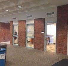

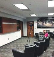
Career Education Center
Create new basketball practice facilities. that create an anchor for student development center Expanded
Enclosing the draughty and leaky breezeway between Alumni hall and the Salvin center to create a spine that not only unites and integrates all the neighboring buildings into a single complex, but serves as the “heart “of the student development center
DESIGN NARRATIVE 02
Phase I: Men’s Basketball Court & Hall of Fame
The design reflects the most efficient functional arrangement of the major elements within the program. The men’s basketball training facility sits to the west of alumni hall and is arranged into two major components, the “training hall” that comprises the two practice courts and the weight training facility, spaces that require large tall, open, column free spaces, and the “support house” which houses all the team facilities for men’s basketball, on the first floor, with the athletic directors offices and funding on the second floor. The design is inspired and reflects

the unique coaching philosophy of the friars capitalizing on the opportunity for personal interaction between coaches and players. The player’s facilities are at the heart of the facility and are wrapped by the coach’s offices, building.
The design promotes and maximizes the flexible use of large team spaces for other Providence teams, or alumni events as needed, spaces such as team dining, weight training and closing room have been arranged to allow direct access without disrupting the core of the men’s basketball team facility.

reflects the most efficient functional arrangement of the within the program. The men’s basketball training the west of alumni hall and is arranged into two ma the “training hall” that comprises the two practice weight training facility, spaces that require large column free spaces, and the “support house” which team facilities for men’s basketball, on the first floor, directors offices and funding on the second floor.
1st Floor
2nd Floor
DESIGN PROPOSAL


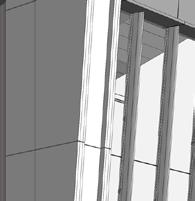






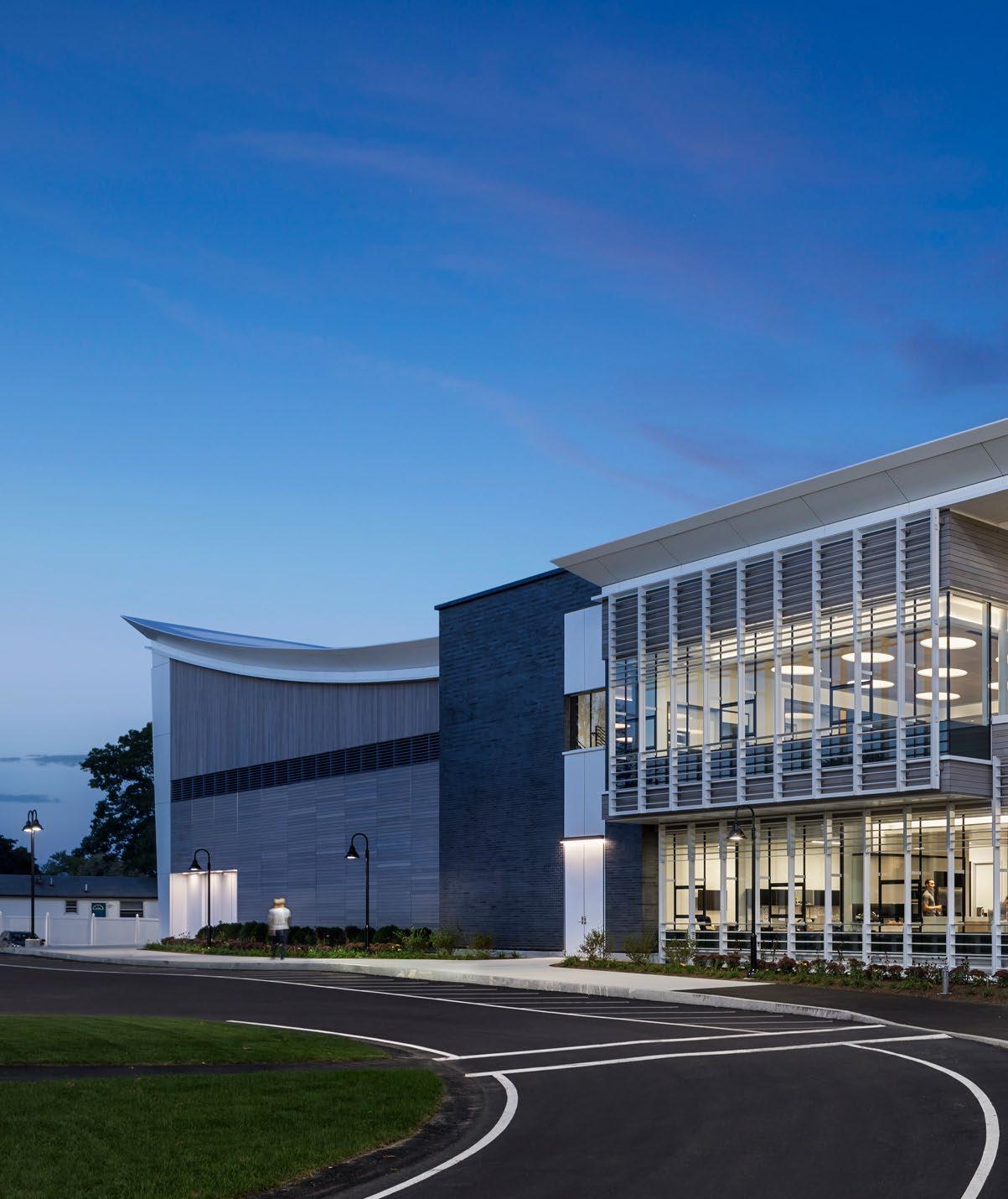
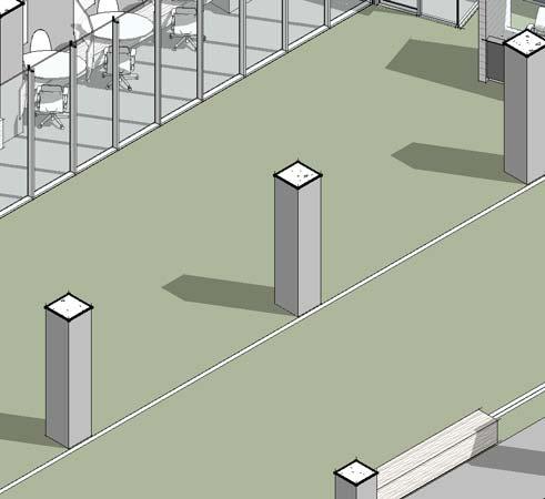
1. Back View of built FDC building with wood siding rainscreen sys tem and metal plate exterior wall panels on inclined columns.

2. Inside View Basketball Courts


1. FDC Athletic Department; detail of metal louvers facade

2. Hall of Fame Lobby glass cur tain wall detail.


SMART AID SYSTEM+STATIONS
Blockchain technology for the future of healthcare
Summary
Project: Urban Health Chain 2017
Location: Case studies: New York City, USA; Juba, South Sudan; Kibber, India
Description: Breaking Through, Healthcare Design Firmwide Competition
Tasks: Research, theory, concept design, 3d modeling and rendering, presentation
Team: Melissa Ponce, Marco Sosa, Silvia Vercher, Hailey Landis, Ariela Lenetsky, Leanne Zick
Award: Perkins Eastman Firmwide Competition 1st Place
Project Brief
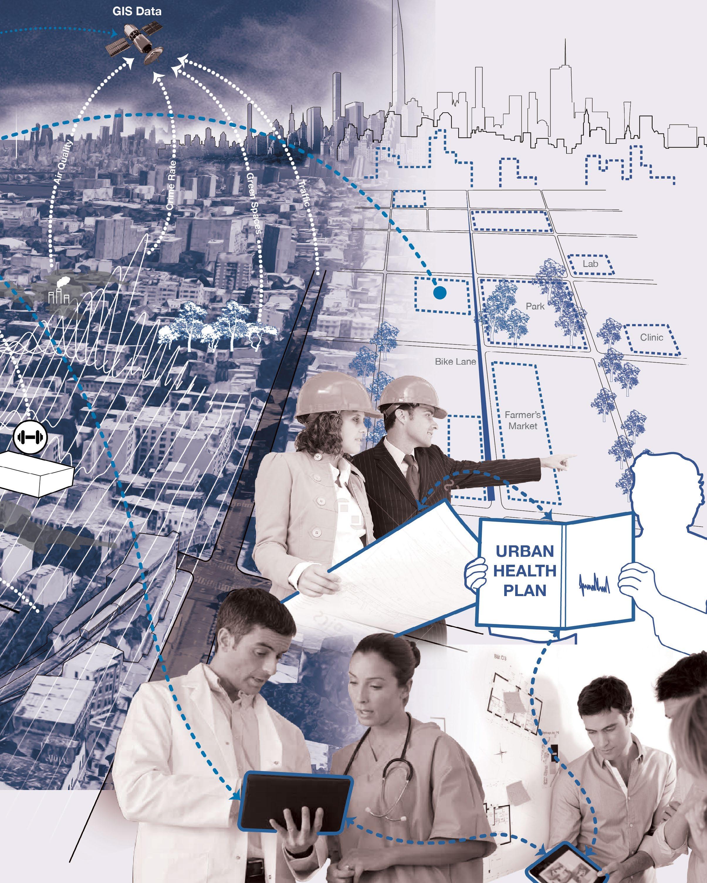
Recognizing the relationship between health, transpor tation, environment, sanitation, education, recreation, technolo gies, and the built environment; we can improve access to health services, decrease lifestyle and environmental risk factors and increase the availability of data for urban health decision-making.
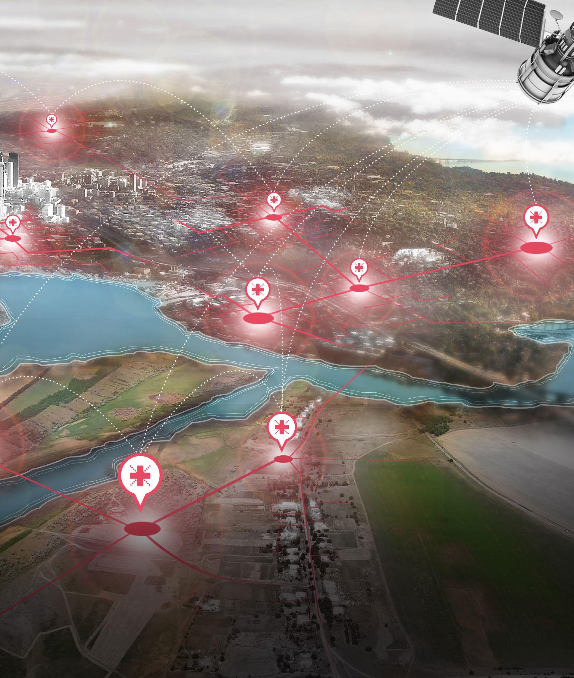
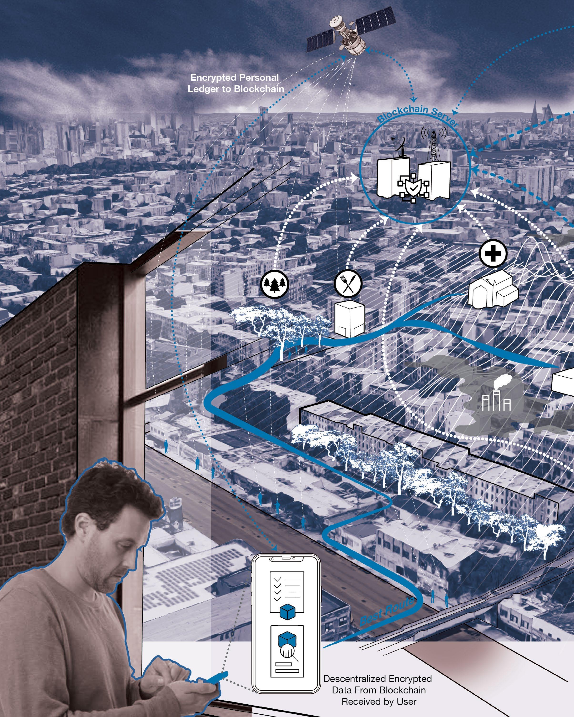
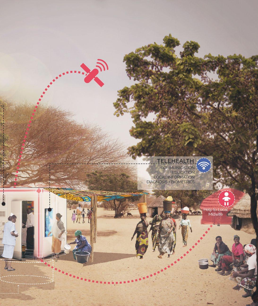
Smart Aid System + Sta tions revolutionize public health by pairing a global health infor mation network with a flexible healthcare station to provide everyday access to preventa tive medicine and unify existing healthcare systems. The Smart Aid Stations create a communitybased, open-source kit-of-parts that can grow and change over
time to address health needs from local to regional to global. In conjunction with an app that connects to the Smart Aid System, Smart Aid Stations fill in the missing links of the lo cal healthcare network. Smart Aid Stations act as data collectors feeding information into the glob al Smart Aid System blockchain network. This decentralized and secure network creates a publicly accessible data platform, facilitat ing analysis and communication across all healthcare stakehold ers. By using the Smart Aid Sys tem + Stations, stakeholders can understand local public health issues using real-time data. The infinite and reconfigurable Smart Aid Stations can be customized to local needs.

DISCONNECTION




The missing links among Stakeholders
Cities face a huge amount of challenges related to health. If we look closely the main problem is the disconnection between the community who suffers the consequences, the practitioners who design the cities, the system which organizes the information,
and the politicians who sign reg ulations and laws.
Currently there are great ooportunities in advanced tech nologies such as blockchain, already used in other fields, that can link the missing pieces for a better work.
DISENROLLMENT DISCONNECTION


American College of Sports Medicine’s Fitness Index Report for 2015 World Bank; Institute for Health Metrics and Evaluation


National Center for Chronic Diseas Prevention and Health Promotion


New block chain technologies, have started being used in healthcar well as the new widely use mobile healthcare technologies, give the ability to record and share personal data and daily health information.


Taking advantage of block chain technology, each personal ledger and urban information, gets combined into a single, accesible, secured descentralized platform.


DIGITAL HEALTH TECHNOLOGIES BLOCK CHAIN TECHNOLOGY


EMPOWERMENT = KNOWLEDGE URBAN MAPPING/ MINING ++ =


HEAL THIE R CITIE S
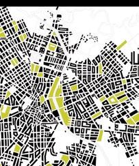
The new platform will map relationships between health records and urban conditions.
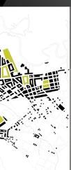


The platform will facilitate healthy commu nities design. It could inform performance based design and promote a more accurate

stakeholders and the fields of urban planning, urban design and public health

SMART AID SYSTEM 03

Finding solutions through a Global Blockchain
STATIONS will pairing a network station to provide preventative medicine systems. create a open-source kit-ofchange over time from local to that connects the SMART AID links of the SMART AID collectors – feeding SMART AID This new network accessible data analysis healthcare SMART AID stakeholders can health issues infinite and STATIONS can be local needs.
TELEHEALTH
The SMART AID STATION is a community-based, opensource kit-of-parts that can grow and adapt according to the local community’s needs. It is a mod
WEBCAM, TOUCHSCREEN, SPEAKERS, MICROPHONE
ular system that offers a wide variety of services that can be customized to provide health solutions developed via the SMART AID SYSTEM. EXERCISE
CONNECTIVITY

Case Study: New York Food Deserts
Food deserts in the U.S. effect 23.5 million in urban neigh borhoods and rural towns. In New York City alone, 750,000 residents
live in food deserts.This contrib utes to a poor diet,higher levels of obesity, diabetes, and heart disease.
Connections are created by the SMART AID SYSTEM local businesses and the farmers fill in the gaps.
SMART AID connects grocery stores in food deserts to fresh food distributers.
SMART AID STATIONS provide information and access to fresh food and nutritional education.

PREVENTATIVE 05
Case Study: South Sudan
Conflict, climate & health
“South Sudan is a country that is affected by complex emer gencies resulting from prolonged conflict, climate change, a bro-
ken health system and outbreaks of communicable diseases.” Dr. Abdulmumini Usman, WHQ
SMART AID SYSTEM network connects hospital & physician to user
Telehealth consultation
SMART AID STATION is community specific kit-of-parts assembled, adapted, and added to by users.

ACCESIBILITY 06

Case Study: Kibber, India Healthcare gender inequality
Gender is one of the main social determinants of health in India. It plays a major role in wom en’s health outcomes and access to healthcare. In most cases, healthcare is prioritized towards men due to their role in society.
This is even more prominent in in accessible places such as Kibber, India, which sits at 14,009 ft. As a result, making it only possible for 2% of medical professionals to reach these remote areas.

connected to a global portfolio of health professionals
community

PUBLIC SPACE DESIGN DEVELOPMENT ON THE GROUND PT RECEPTION
HYDRO THERAPY
Enhancing the patient’s experience

Summary
Project: Hospital For Special Surgery - Sports Medicine 2018

Location: New York, USA
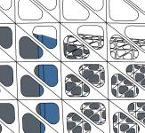
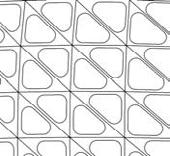
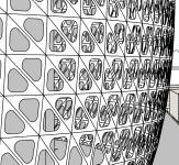
Description: Interior Design, Parametric screen concept development




Tasks: Research, concept design, 3d modeling, rendering, presentation, construction documents, consultant coordination
Team: Perkins Eastman, Principal in Charge Tomas Quijano
Project Brief
The project is an interior proposal for a healthcare sports facility on the ground floor, 1st, 2nd, 3rd and 4th floors in the building 600 West 58th Street. This new mixed-use development possesses unrivaled healthcare use and retail opportunities in the heart of Manhattan’s fastest growing residential neighborhood. It is a premier location serving the Upper West Side/ Lincoln Square, Clinton/ Hell’s Kitchen and Hudson Yards neighborhoods. The facility will transform the way patients experience healthcare. The key components of this design aim
to create a clear circulation path for patients within the facility; how can we tell an active story and build excitement and energy? How do you turn idle time into a hospitality moment? How can we guide patients through high-touch information and hospitality? How can we provide for the providers; how can the exit become a celebratory moment
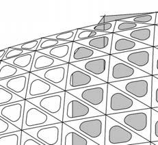
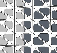
The goal of the therapy screen is to provide these moments of relaxation and hospitality in a semi-transparent shelter that meshes into the circulation and design of the facility.








Mission: To provide the highest quality patient care, improve mobility, and enhance the quality of life for all and to advance the science of orthopedic surgery, rheumatology, and their related disciplines through research and education. We do this regardless of race, color, creed, sexual orientation, or ethnic origin.


Vision: Lead the world as the most innovative source of medical care, the premier research institution, and the most trusted educator in the field of orthopedics, rheumatology, and their related disciplines.

PATIENT EXPERIENCE

CLEAR




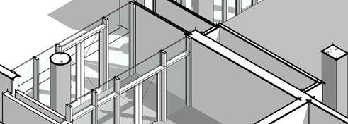




Structural concept


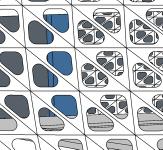
Bubble pattern on a hexagonal grid on curved surface


Interior Elevation Modalities
Grasshopper Definition













THANK YOU!
Marco SosaIf you have further inquiries you can contact me at: msosa.1986@gmail.com https://www.linkedin.com/in/ marco-sosa-1023a74b/ EU +34 677 068 345 USA +1 (302) 265-0388 ECU +593 999987574

