PORTFOLIO
Mayra Alves Zanin
Urban Design & Urban Planning
2022
MAYRA ALVES ZANIN
Architect & Urban Designer

Svarte, Sweden 0734662220 mayrazanin@gmail.com

echnical approach with special interest for detail plans and constructive drawings


Graduate in M S c. Sustainable Urban D esign a t LTH, L und U niversity and a designer t hat believes that a design approach that relies on the local context is key for a meaningful result when it comes to s ustainability and f acing c limate change. My p rofessional experience has l ed m e to d evelop responsibility, leading, individual skills and technical knowledge in different stages of the design. My academic experience has l ed m e to enhance m y team skills and i nterest in sustainable solutions that pursue exploring local potentials and bring equity and complexity to our urban environments.

Content table
Academic projects
Urban & Urban Design scale
THE CIRCULAR FUTURE: The role of Urban Design within the Circular Economy
Master’s thesis Location: Lund Individual
LET IT FLOOD: Creating alternative public spaces in Joinville, BR.
Bachelor’s thesis Location: Brazil Individual LINK IT: Turning roads into streets
Urban Dynamics Studio Location: Prague Individual LEVELS
Competition entry
Urban Dynamics Studio Location: Prague Individual RESEARCH Data Analysis & Urban Morphology
Scientific Research Program for undergraduates Location: Curitiba, Brazil Individual DRAWINGS, PHYSICAL MODELS
Individual
06 42 22 34 48 54
The Circular Future:
The Role of Urban Design Within the Circular Economy
SUDes - Master Program Sustainable Urban Design
Degree Project
LTH - Lund University
Supervisor: Daniel Wasden - Lunds Kommun architect
The complete thesis can be read here

6
2021 is Id
7
Contributor to the climate change, cities are the major responsibles for for a great amount of natural resource consumption and global waste production as a consequence of the ”take, make, dispose” aspects of our linear economic model. In face of this issue, Circular Economy (CE) is a new concept that seeks to decouple economic growth from the consumption of finite resources by shifting the linear economic system into a circular one.
Currently, the discussions within CE literature are focused on govern ment and company policies once they are considered the most influ ential actors when it comes to the economy. However, even though the literature frequently mentions how the changes would highly depend on many aspects, there is a lack of discussion on several subjects that are equally important for a full understanding of the economical, social and environmental consequences of its implementation. These groups are consumers, urban contexts and what would the future look like on a daily bases aspect.
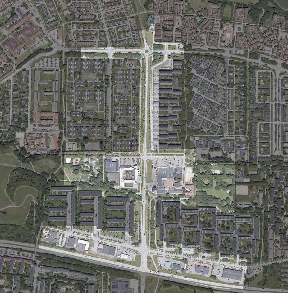
Sweden has a reputation for being one of the most innovative and sustainable countries in the world, and even though the ecological footprint of Sweden is significantly high, the Swedish government has admitted that a transition to a circular society is necessary. The proj ect site is located in Lund, where the rapid growth, research, and inno vative atmosphere creates a positive environment for an experiment within the Circular Economy Concept.
With this in mind, utilizing the prospect on future scenarios as a tool to discuss the impacts of the CE on the lifestyle of consumers the project aimed to understand what is the role of urban design within the future economic scenario and how urban interventions can support the new lifestyle at the same time it supports the specific needs of the site
SWEDEN´S FUTURE SCENARIOS - 50 YEARS FROM NOW
TOP DOWN CIRCULAR MODERNISM SCENARIO
Goverments define areas to focus the change Consumption patterns remains the same Technology ensures circularity
Passive consumer
SWEDEN’S SCENARIO
BOTTOM UP PEER TO PEER CIRCULARITY
Shared Economy is mainstream Individual is very active Users ensure circularity
Active consumer
USERS FUTURE LIFESTYLE
PASSIVE CONSUMER
Belongs to Modern Circularism
High consumption Commute everyday Private Transportation Rely on the system to be circular
Values “want” before “need”
ACTIVE CONSUMER
Belongs to Peer to Peer Circularity
Low consumption Minimize long distance commute Public Transportation or shared Collaborative with society
Values “need” before “want”
8
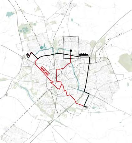
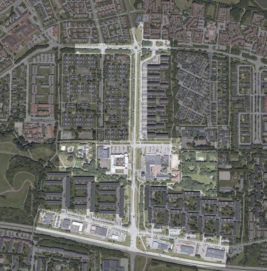
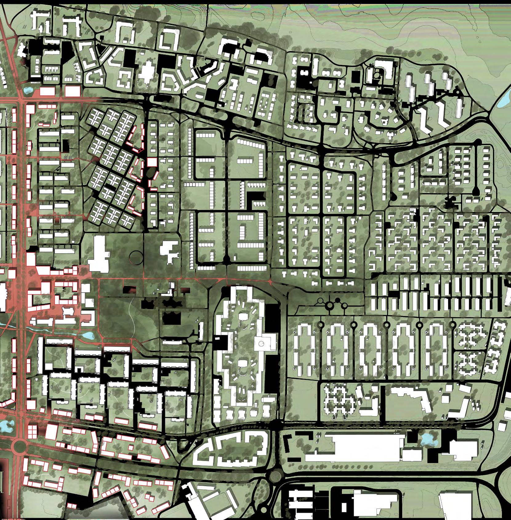
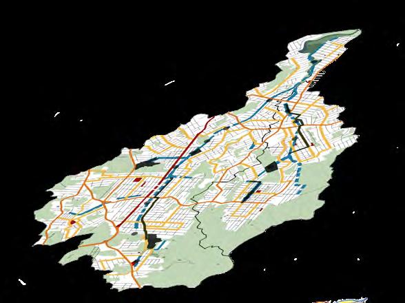
ANALYSIS
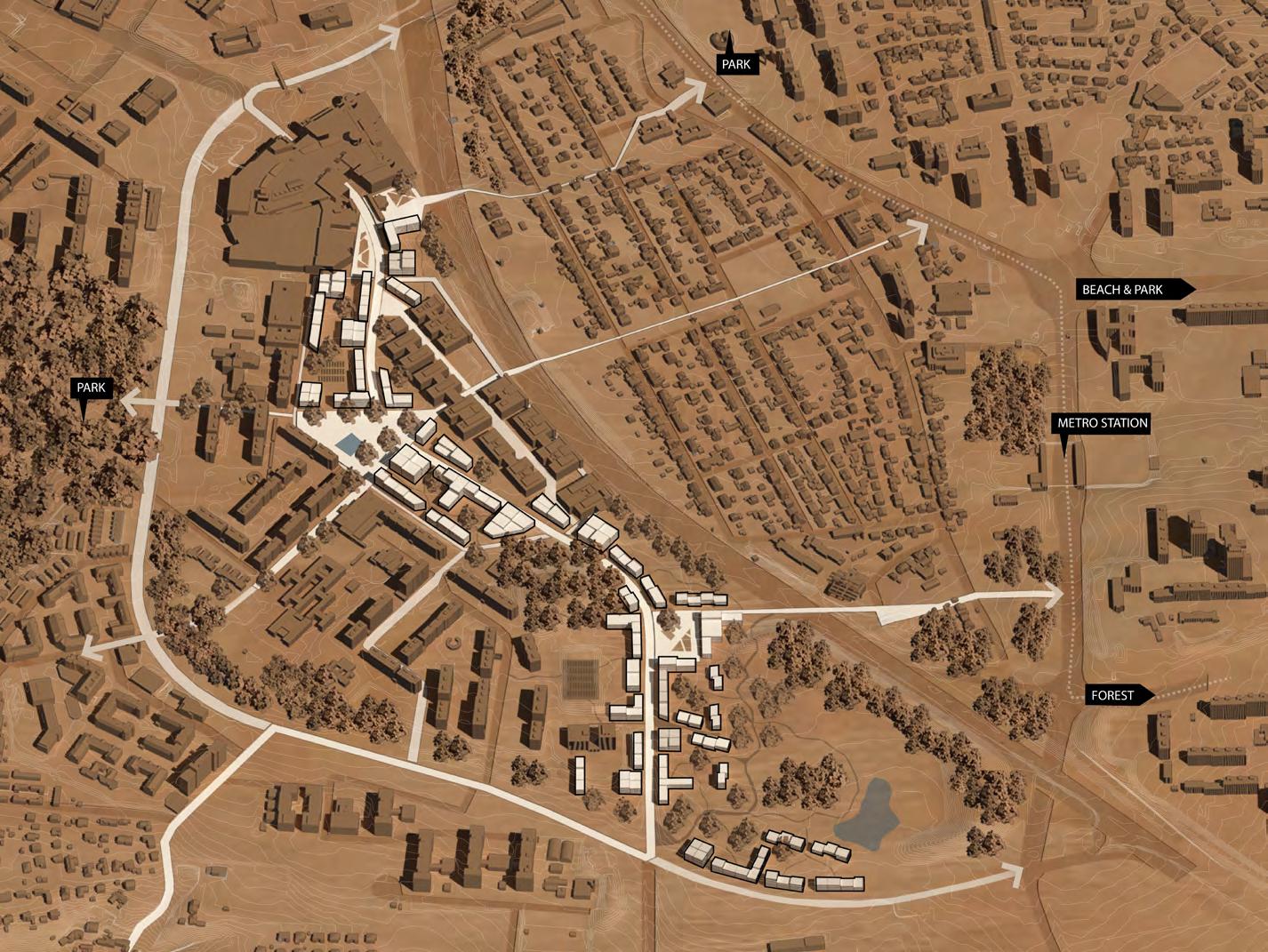
Regional context Site
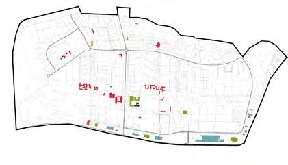
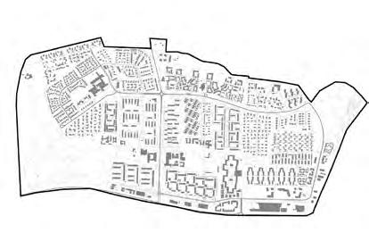

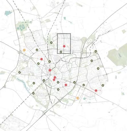
Neighborhood
CE Initiatives
Recycling Acessibility
Connectivity
Built scaleRoad network
N Site
E22
Bus stops
Sank Hans park
Pedestrian & Bicycle Services Stores
Vehicle Education
Site Visit & Analysis
High bushes constitute a barrier between housing and the street.
Active functions
Train tracks Fäladstorget
Blue & Green Infrastructure Parking lots
Fence separating the school from Sveng högsvägen and Fälad storget
Multifamily build ing separated from the street by parking lots
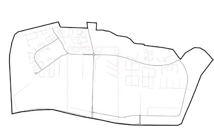
Green infrastructure lacks biodiversity. It’s mainly grass, trees ,and the high bushes.
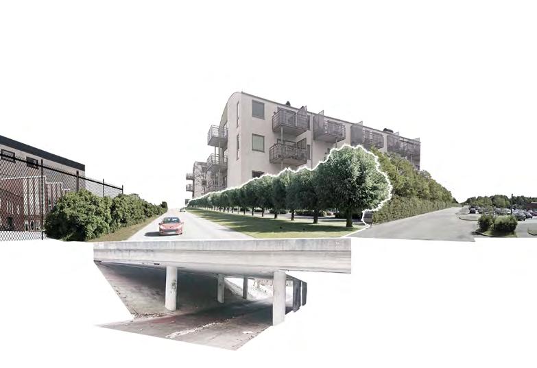
Underpass for pedestri ans and cyclist connec tin the east side to the park on the west.
ICA and Health Center
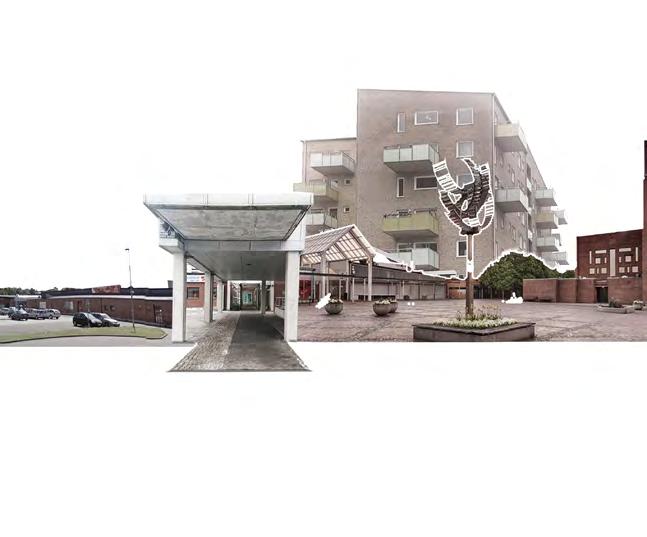
Fäladstorget & Church (secluded square with good quality materials, lacking sitting areas and green infrastructure)
N
Entrance to Fäladstorget
9 Newest multifamily building with ac tive ground floor
CHALLENGES

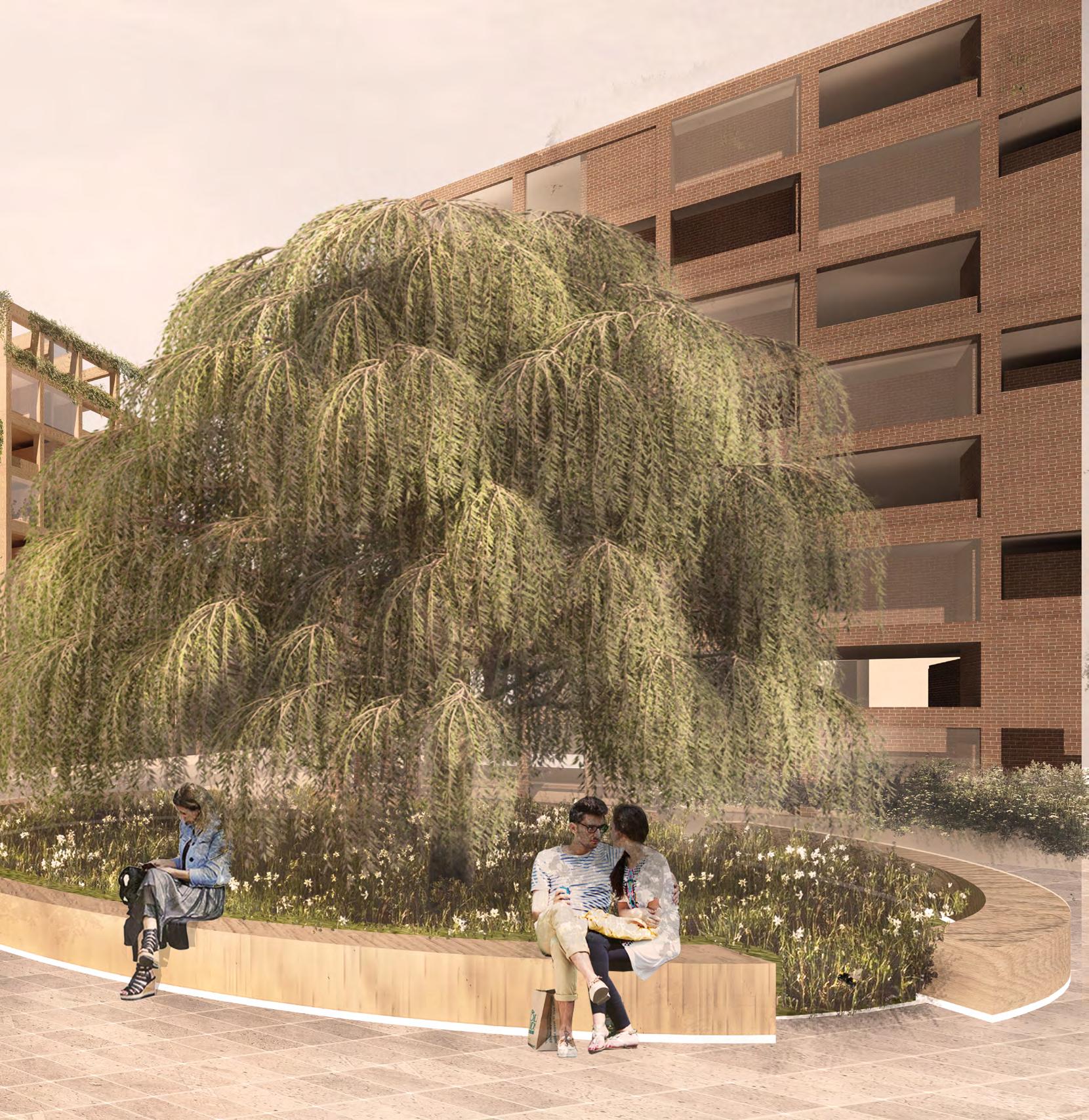
One of the main challenges faced during the project was the many rows of willow trees present on the site since in Sweden, a row of trees cannot be removed without permission.
At the same time, willow trees are also difficult to have around buildings since there cannot be any facade within a radi us of 8 meters from their trunk. They have a shallow root system that can damage structures and can grow aggressively if not trimmed every year.
Another challenge was Fäladstorget that is located in front of the church but some en trances are unattractive. Some of them are narrow and hidden and others are to back side streets which doesn’t offer an inviting atmosphere.
The buildings surrounding the square have their entrance to the square but their back side to the street, with parking lots and docks making the interface between these buildings and the pedestrians, which caus es the area to be no appealing for pedestri ans and be mos used for circulation rather than a place to stay.
Square entrances
tree rows Fäladstorget
10
NO BUILDINGS WITHIN 8m
N
Willow
Site limit N High bushes Fence Site limit Pedestrian crossings 400m without crossing Ø 16m

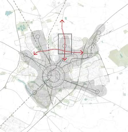
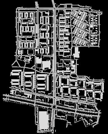
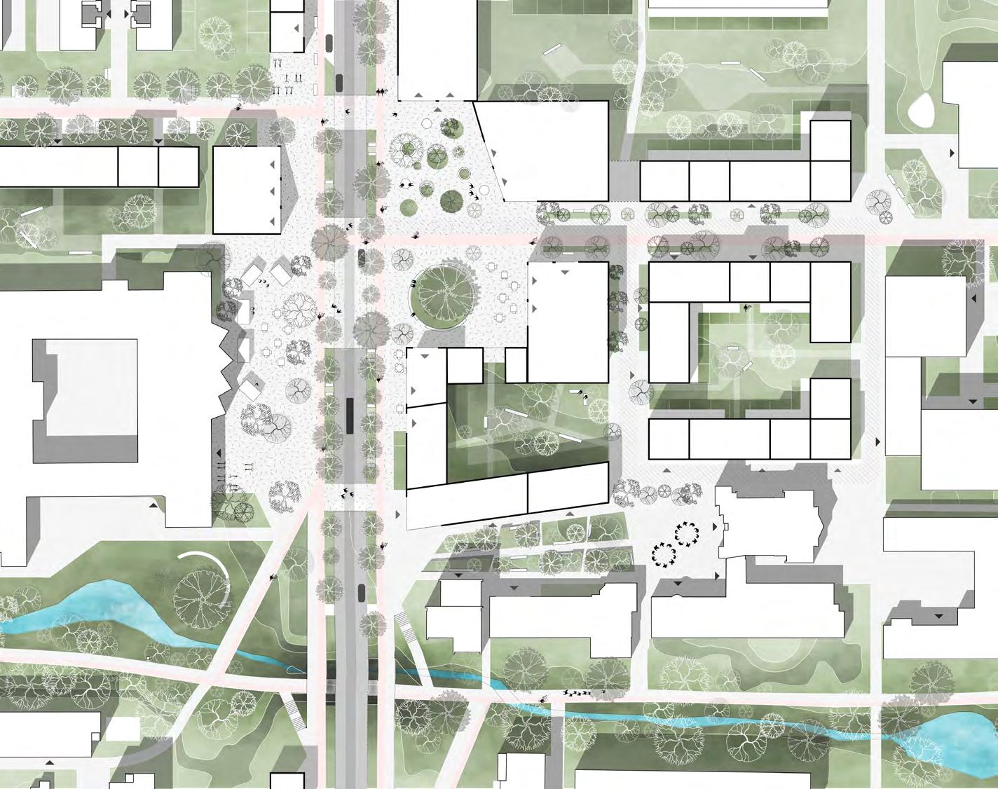
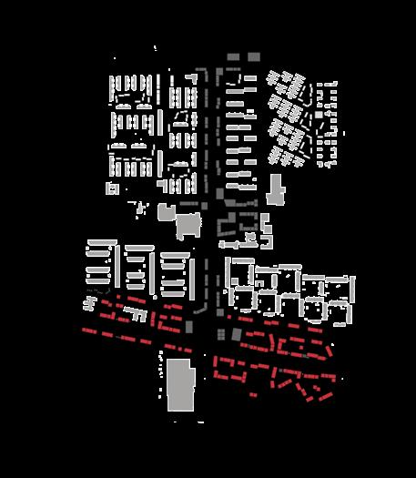
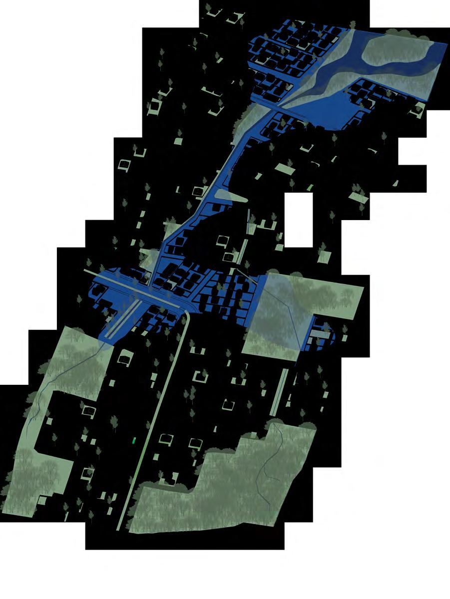
11 TRANPORT Fablabs Solar panels Public Transportation Bycicle Pop-ups Charging stations Gardens Aquaponics Flexible buildings Waste Gray water treatment Rain water collection Infiltration gardens Trade center Circular Hubs POWER FOOD WATER SHOP HOUSING SITE Green houses STRATEGIES 5 MINUTES CITY DESIGN FOR LONG TERM THINKING AND RESILIENCE RESPOND TO THE SITE DESIGN CIRCULAR FOR A GENERATIVE NEIGHBORHOOD Strenghthen the connections Incorporate blue & green Willow tree identityCreate meeting places Add street life Flexible uildings Flexible functions
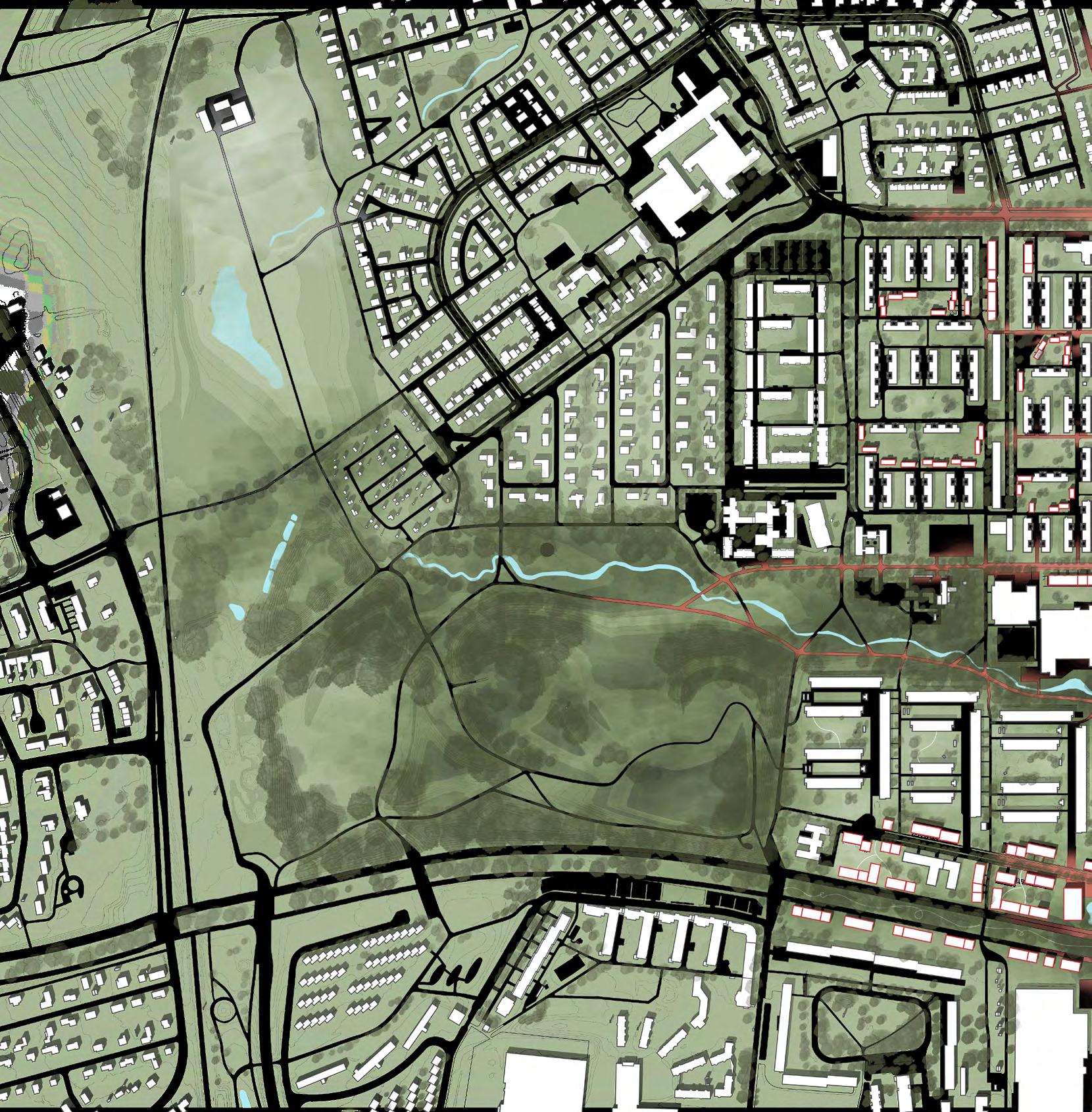
 SANKT HANS
GUNNESBO A
PARK 12 BUS STOP + + + ++ + 6 - 8 floors 4 - 5 floors 3 - 4 floors 2 - 3 floors CONNECTIONS DENSITY 3D CIRCULAR HUB FOOD SQUARES FOOD SQUARES New Functions 3D Restaurant Fresh vegetables Coworking Charging stations Parking Recycling 3D printing Workshops ICA LiDL Existing Functions Recreation for kids Sports Health center School Food store Food store Church Elderly home Health Center
 BRUNSHÖG
STÅNGBY
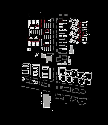
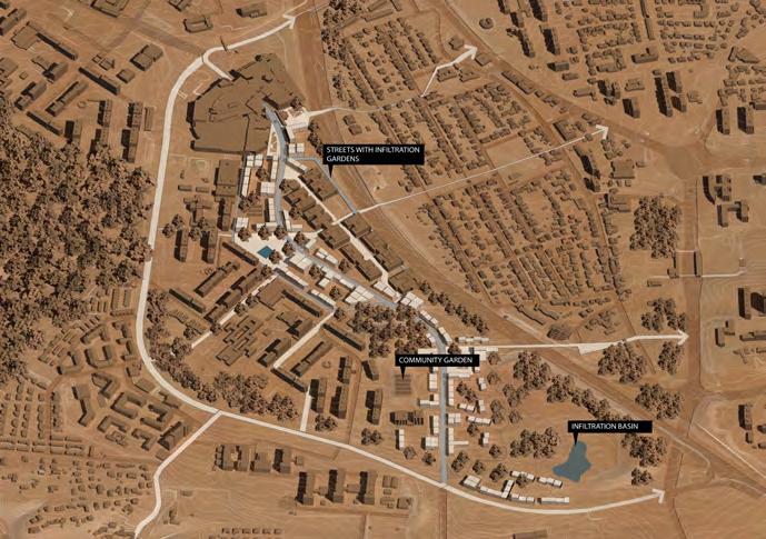
A B B CITY CENTER Svenshögsvägen 13 N 100m 0200m New position of moved trees Creek Moved willow trees GREEN & BLUE WILLOW TREES Infiltration gardens within street scape Enhanced Blue & green Boulevard LiDL ICA GREEN & BLUE CORRIDOR N 100m 0200m
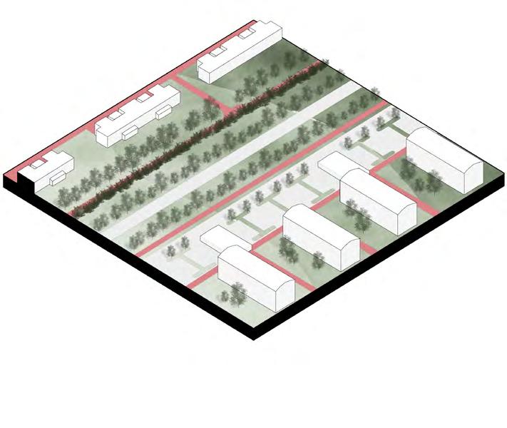
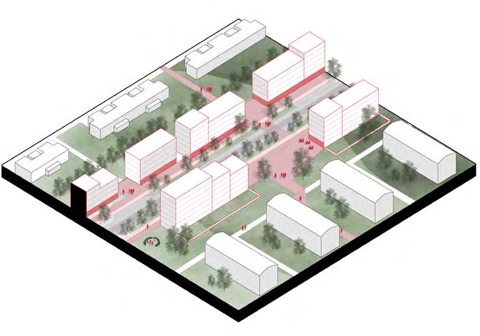
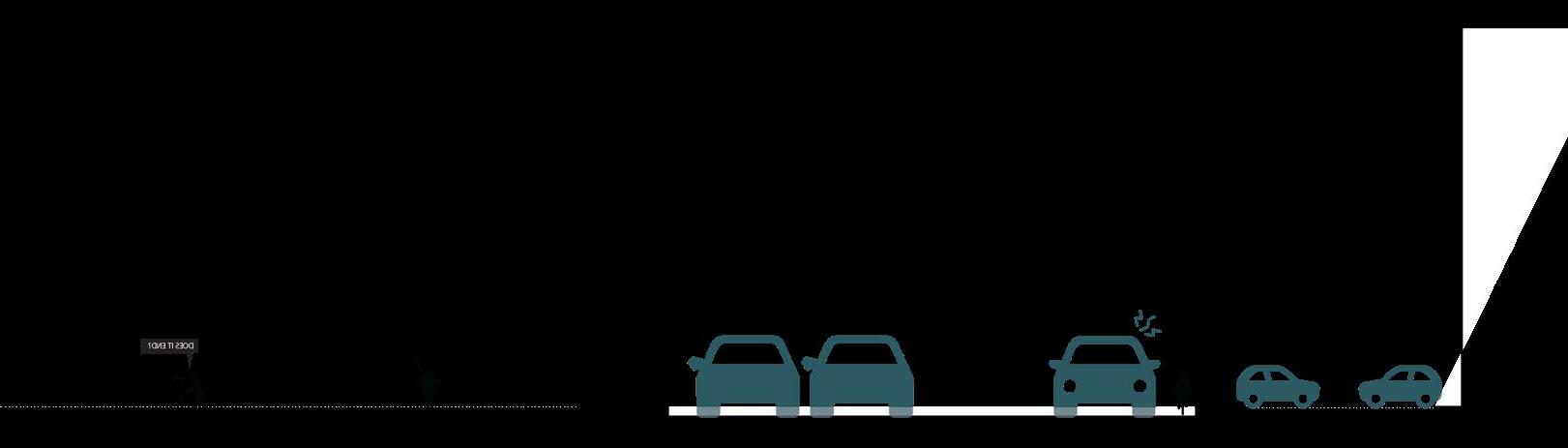
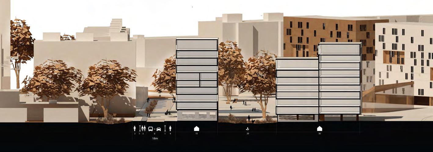
14 Dedicated bus Parking Dedicated Bicycle Infiltration PROPOSED SVENSHÖGSVÄGEN’S PROFILEEXISTING SVENSHÖGSVÄGEN’S PROFILE 1243123 7 7 3 S ECTION Private parking Bicycle lane Sidewalk Car lane High bushes Grass + 35
15 Bicycle ParkingPrivate gardens Sitting Existing Leasure areaSunbathingPrivate gardens Active use 1212 + 37 77 3.5 3 22 3 32 22 22.5 meters SVENSHÖGSVÄGEN BLOCK TYPOLOGYSTREET TYPOLOGY
 Private Gardens
Outdoor gardens
Compost
Outdoor gardens
Private Gardens
Private Gardens
Outdoor gardens
Compost
Outdoor gardens
Private Gardens
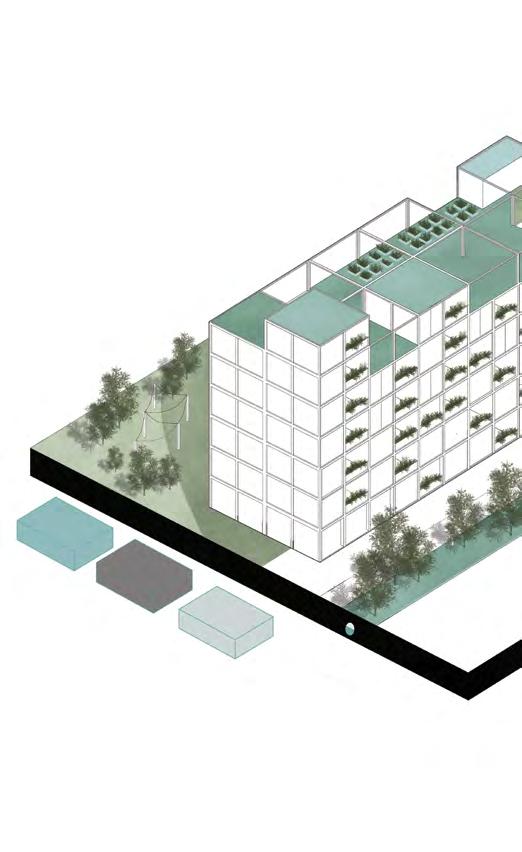
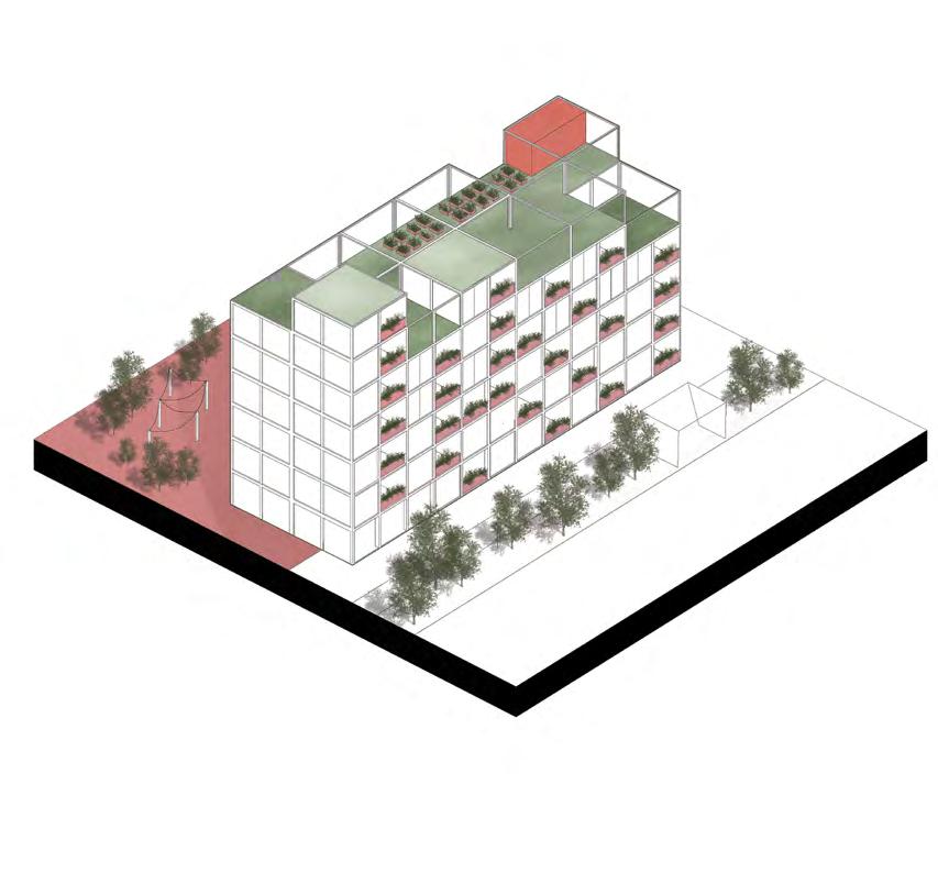
16 GENERATIVE & RESOURCE EFFICIENT HOUSING
biomaterial Local
Apartments foodwaste FOODCYCLE Gray water Local treatment
WATER SITE

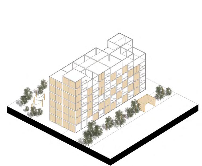
17 Solar windows electricity Public lightning Charging stations Domestic demand Heating green house Outdoor lightning SITE ENERGYCYCLE Infiltration gardens SITE WATERCYCLE
FOOD SQUARES
Demand for food is a critical issue that we will face in the future. Food Squares are a system that aims to supply the future demand for food, promote resilience, and also social, economical, and environmental sustainability by creating a meeting place with biodiversity and sharing possibilities.
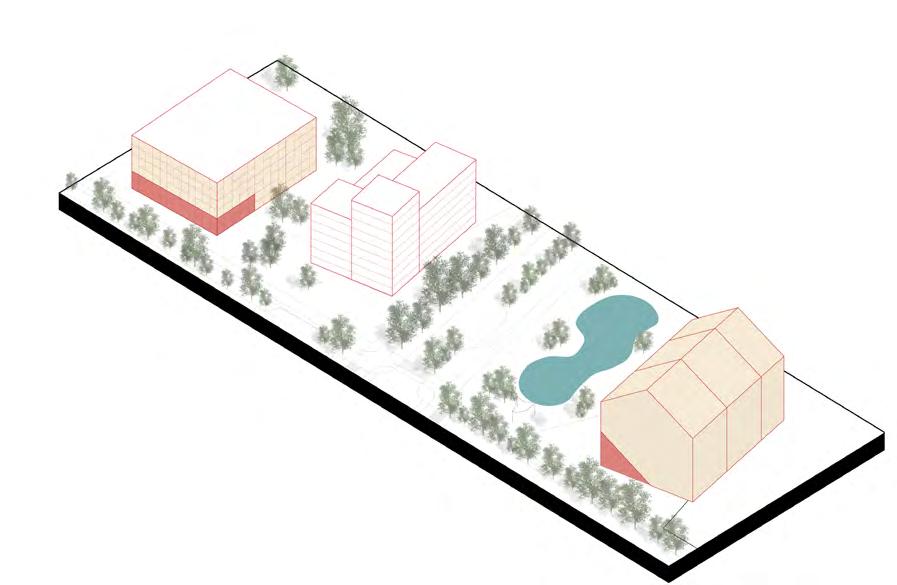
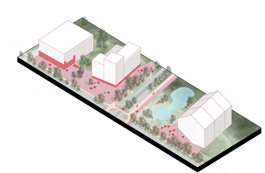
The system is composed of three struc tures that will feed one another re source-wise:
Aquaponic Greenhouse
External pond
E-Parking Garage
18 The systems are located strategically with in 5min walk from multifamily housing, 5minutes of cycling from the single-family and row houses, and also at the entrances of Svenshögsvägen so visitors can park their car on the E-Parking Garage and walk towards the main square.
electricity
material
PARKING STATION
Angled solar panels
EXTERNAL POND
PARKING STATION
EXTERNAL POND AQUAPONIC BUILDING POP UPS (Shared equipments) Fish GrowEat Work Rent ParkCharge
Solar windows
AQUAPONIC organic
electricit y
CIRCULAR
Considering that in the future scenario people will have a new relationship with companies and a new way of shopping the Circular Hub consists of two new functions in which the consumer can:
Trade center is a place to: return non-circular products that still are on the market return rented products to the companies repair products
Fab lab is a place to: print parts or products with bio-materials craft furniture or products in workshops that are opened to the public a place for research and experimentation of new technologies
education center for repair and craft workshops, and also for students of local schools.
REUSE OF LOCAL MATERIALS
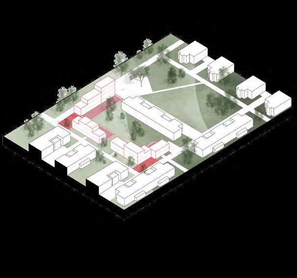
FÄLADSTORGET
19
HUB
3D Print Craft Re Work TradeCare
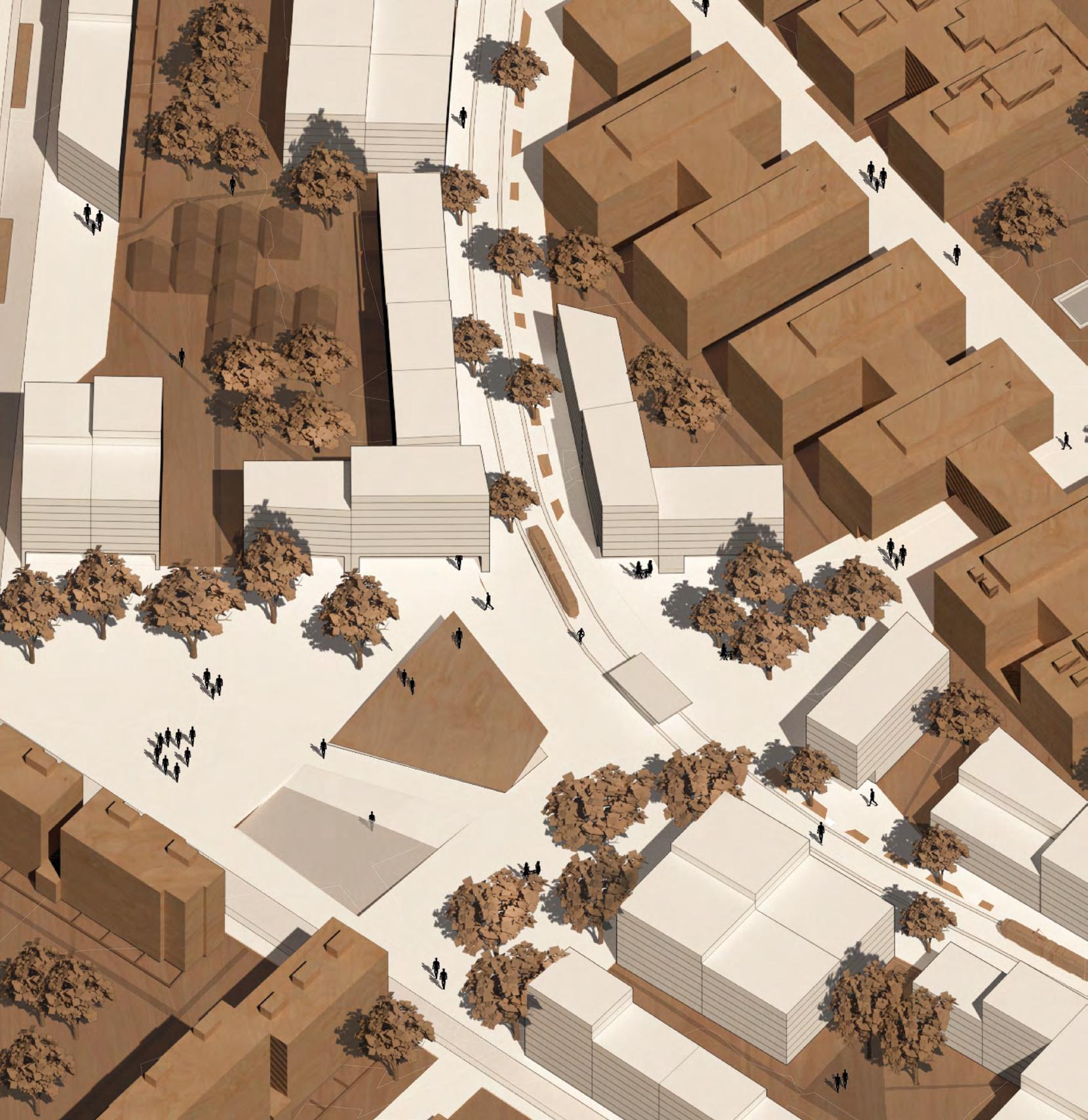
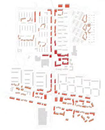
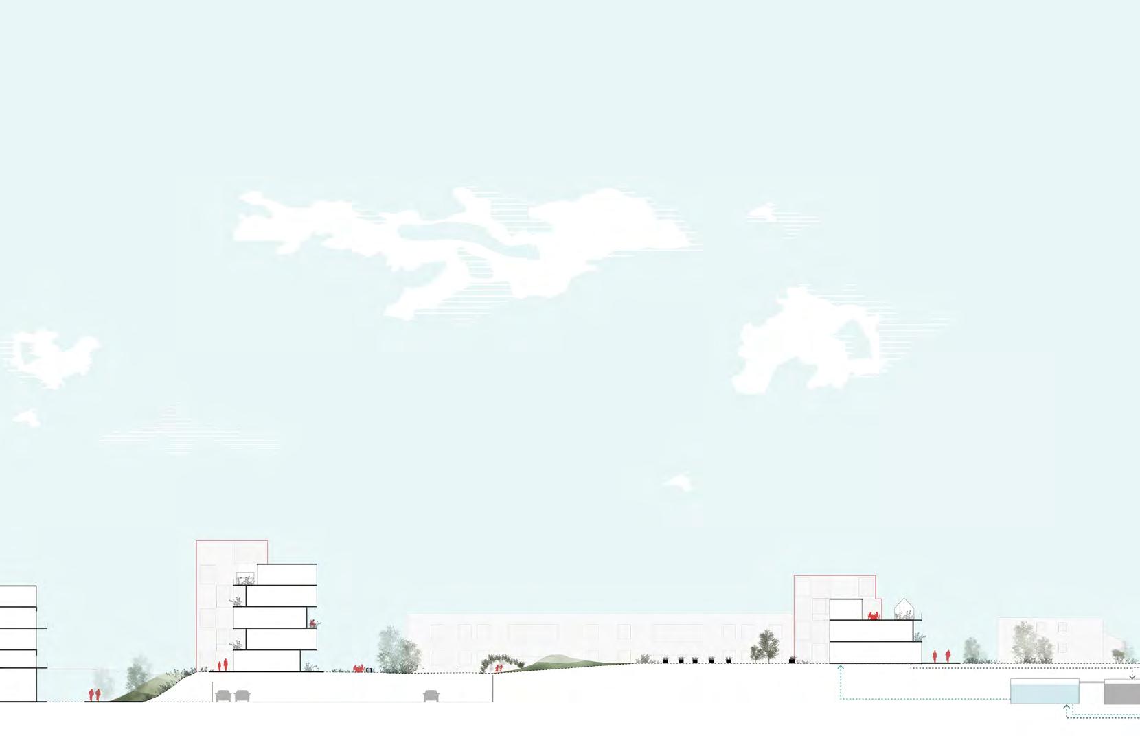
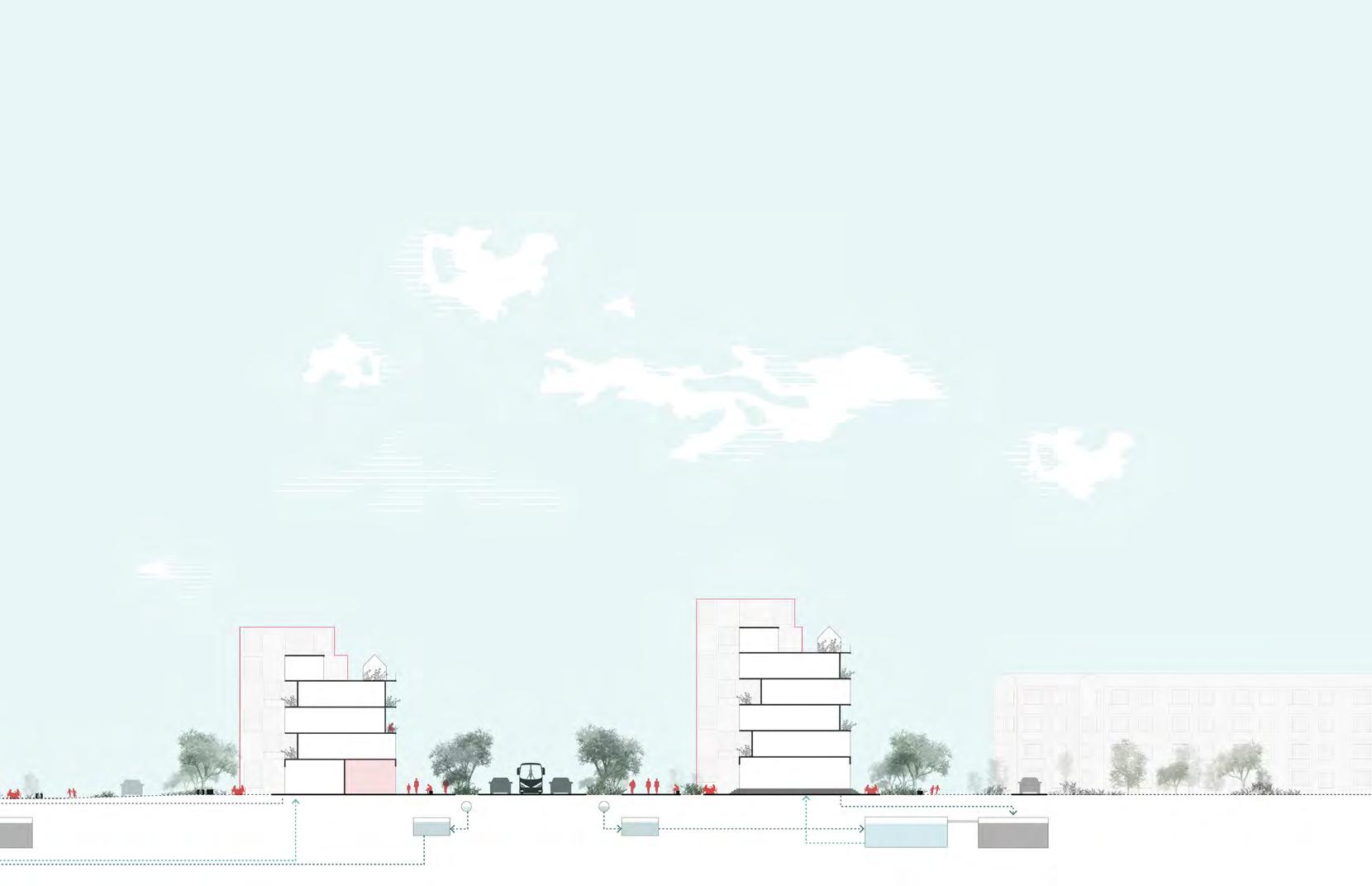
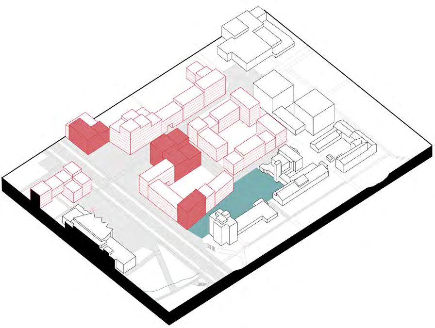
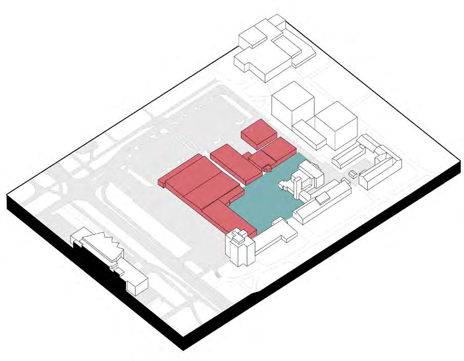
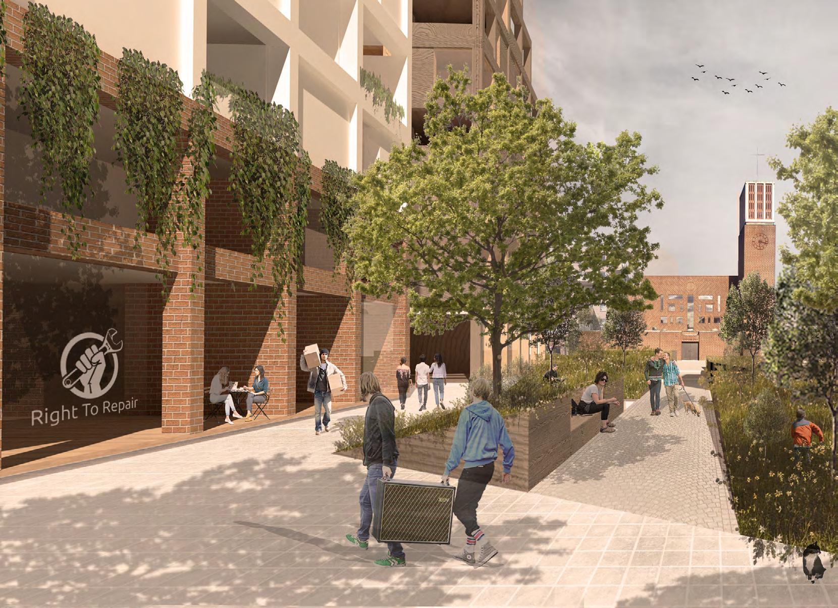
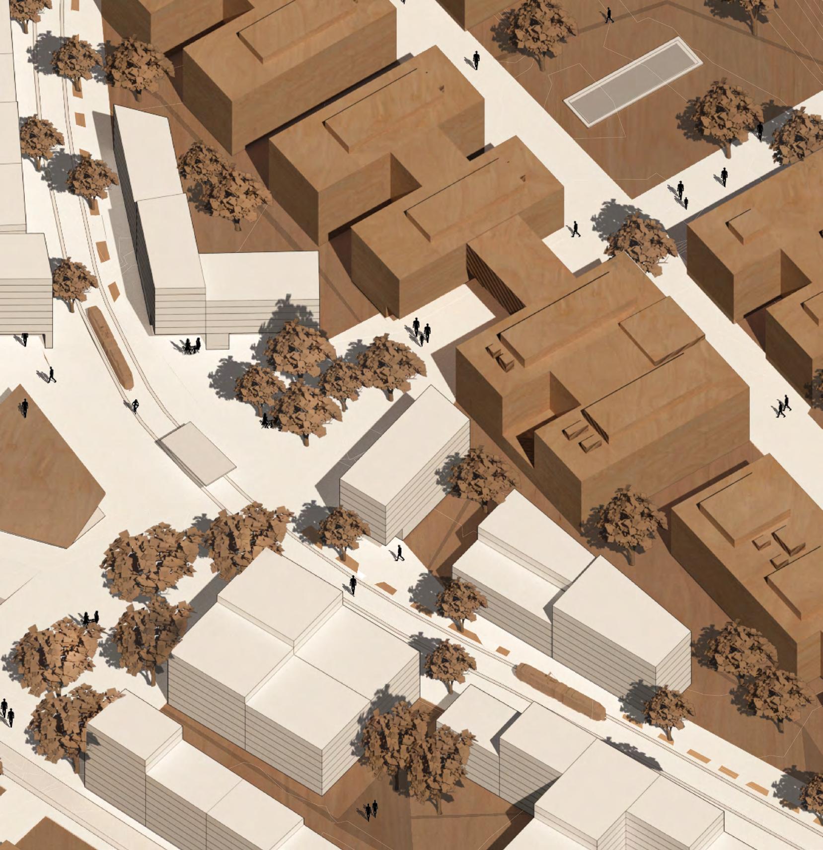
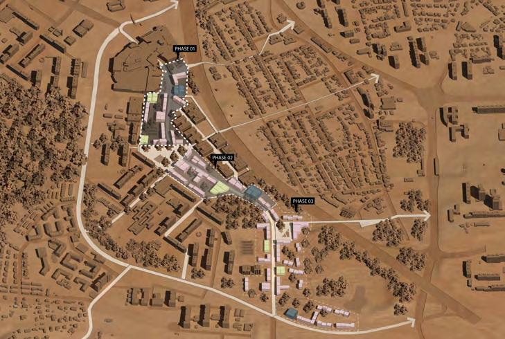
20 ICA TRADE CENTER Return Pick up FAB LAB Busy squareSvenshögsvä Green corridor PrintUpgrade Craft Repair 3D 10m 0 B B Green corridor Intimate square 30m N Phase 1 2035 Svenhögsvägen Phase 2 2050 Norra Ringen Boulevard Phase 3 2050 onward Today in Lund 60m2 2,5 people 24m2 / person 8 770 people Future 60m2 3 people 20m2 / person 10 350 people 60m2 4 people 15m2 /person 13 500 people Detail Plan Circular Hub 01 02
01 02
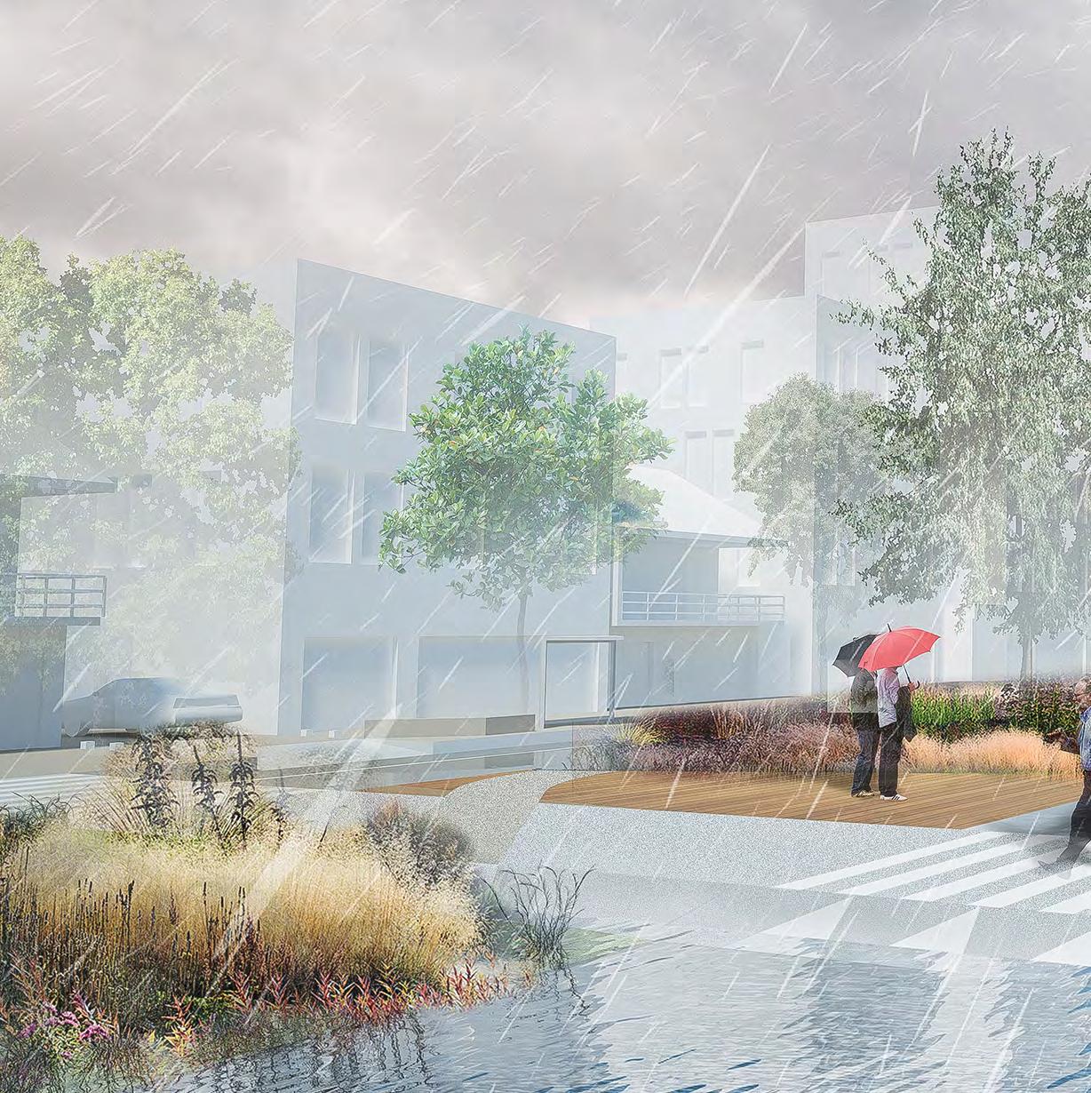
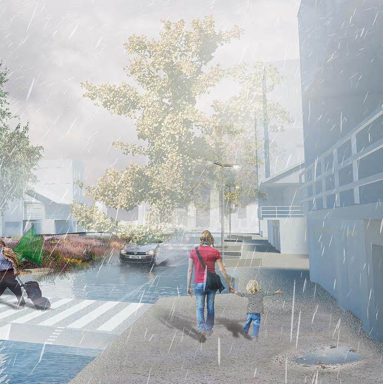
Let it Flood:
Creating alternative public spaces in Joinville, Brazil.
Bachelor in Architecture & Urban Planning
Degree Project
Federal University of Paraná
Supervisor: Letícia Nerone Gadens
The complete thesis can be read here
*All maps are using the geographic reference system SIRGAS 2000/22S
2019
22
is Id
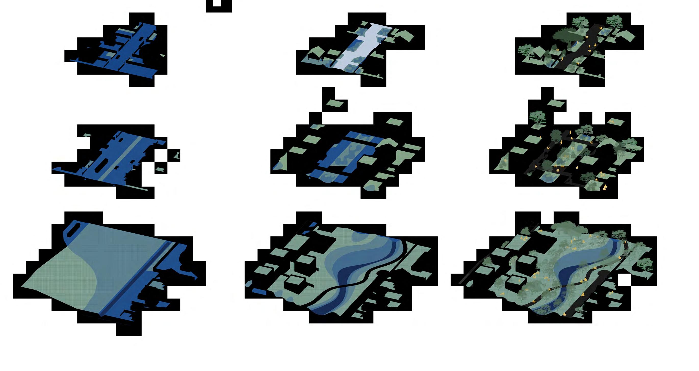
23
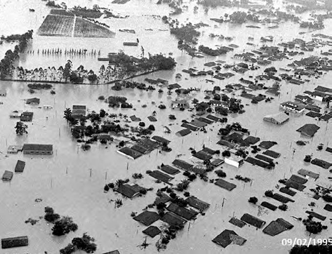
The dissertation was developed from a holistic analysis of the city on multiple scales, considering the water structure as an interconnect ed system that interferes with the flows and intensity of the flooding events.
public
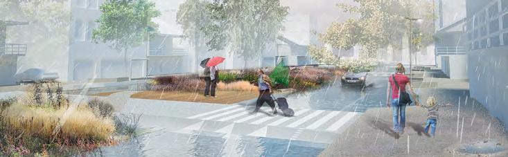
HOW CAN URBAN SPACE CONTRIBUTE TO URBAN DRAINAGE?
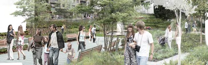
24 The design was experimentation that aimed to prepare the public space to receive the flooding events, combining rain periods with daily urban activities. By reversing the logic, the concept design interpreted such events as the potential to transform the landscape, therefore, cre ating an interchangeable scenery and turning the public space into the central key to the resilience and adaptability of the city.
public space
drenagem urbana alternativa + convencional
resiliência
urban drainage alternative
alternativa
biodiversidade
+ conventional
space resilience uses identity biodiversity
drenagem urbana
+ convencional usos urban drainage alternative + conventional mixed uses biodiversity identity resilience espaço públicodrenagem urbana alternativa + conventional uso misto biodiversidade identidade resiliência
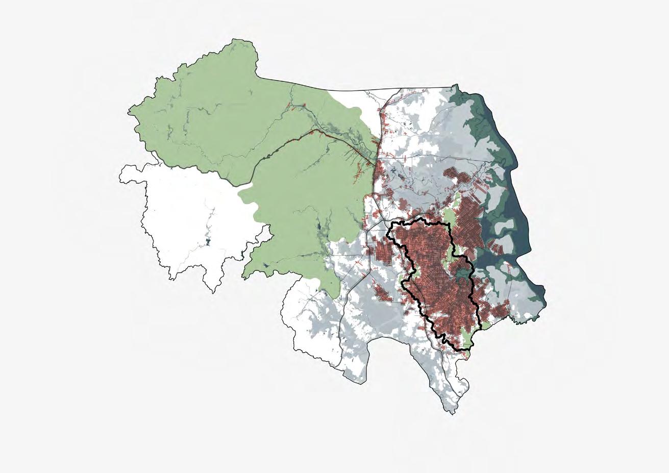
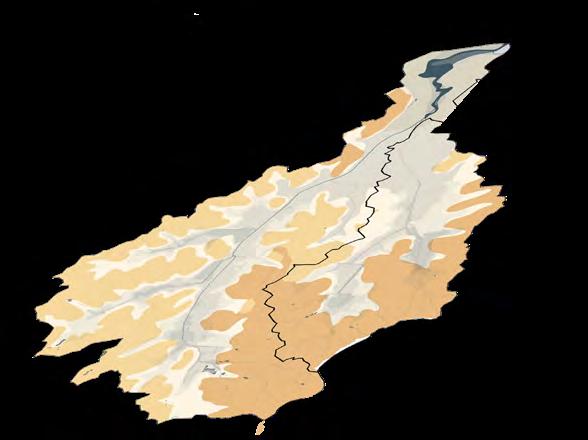
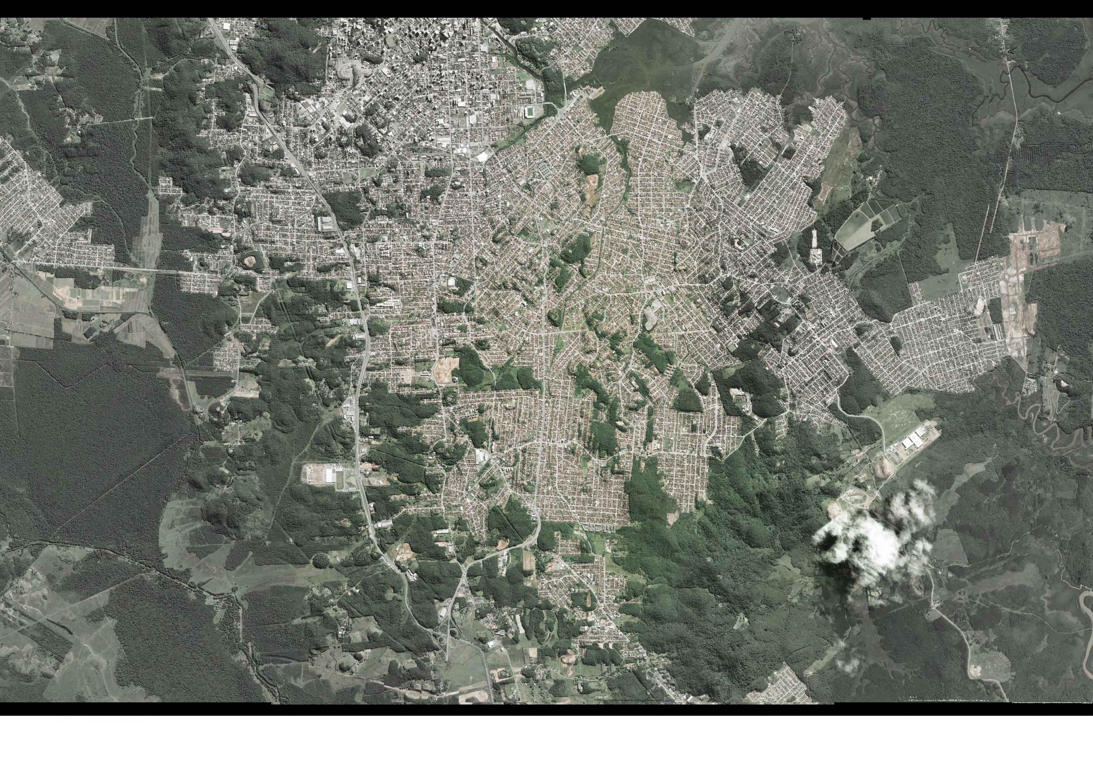
Urban area of Joinville, SC (Analysis of the urban development on the territory considering natural aspects)
*
THESIS WORKING PROCESS
Cachoeira River Watershed (Analysis of the aspects and urban processes considering the watershed as reference)
MULTISCALE
URBAN PLANNING + URBAN DESIGN (macro scale) (meso/ micro scale)
Itaum-Açu Mirim River Sub-Watershed (Analysis and propose in urban scale) (Analysis and propose in urban design scale)
URBANIZATION HISTORY
1972 19891860 1945 1966 2011
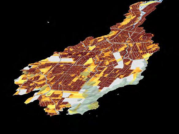
TODAY, 80% OF URBANIZED AREA IS LOCATED IN FLOODING AREAS
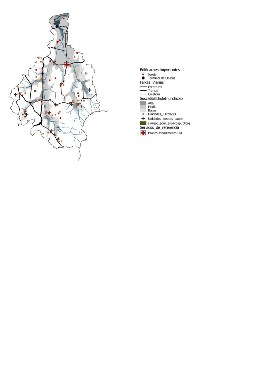
CONTEXT N
Flooding events
High Medium
Urban area
Area of environmental
25
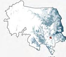
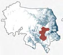
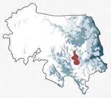
Rio Cachoeira Watershed is the most important watershed in the city due to most of the urban developments being located in its area.
Today:
72% of its surface is urbanized 49% of the population are living inside it 55% of its surface is impervious


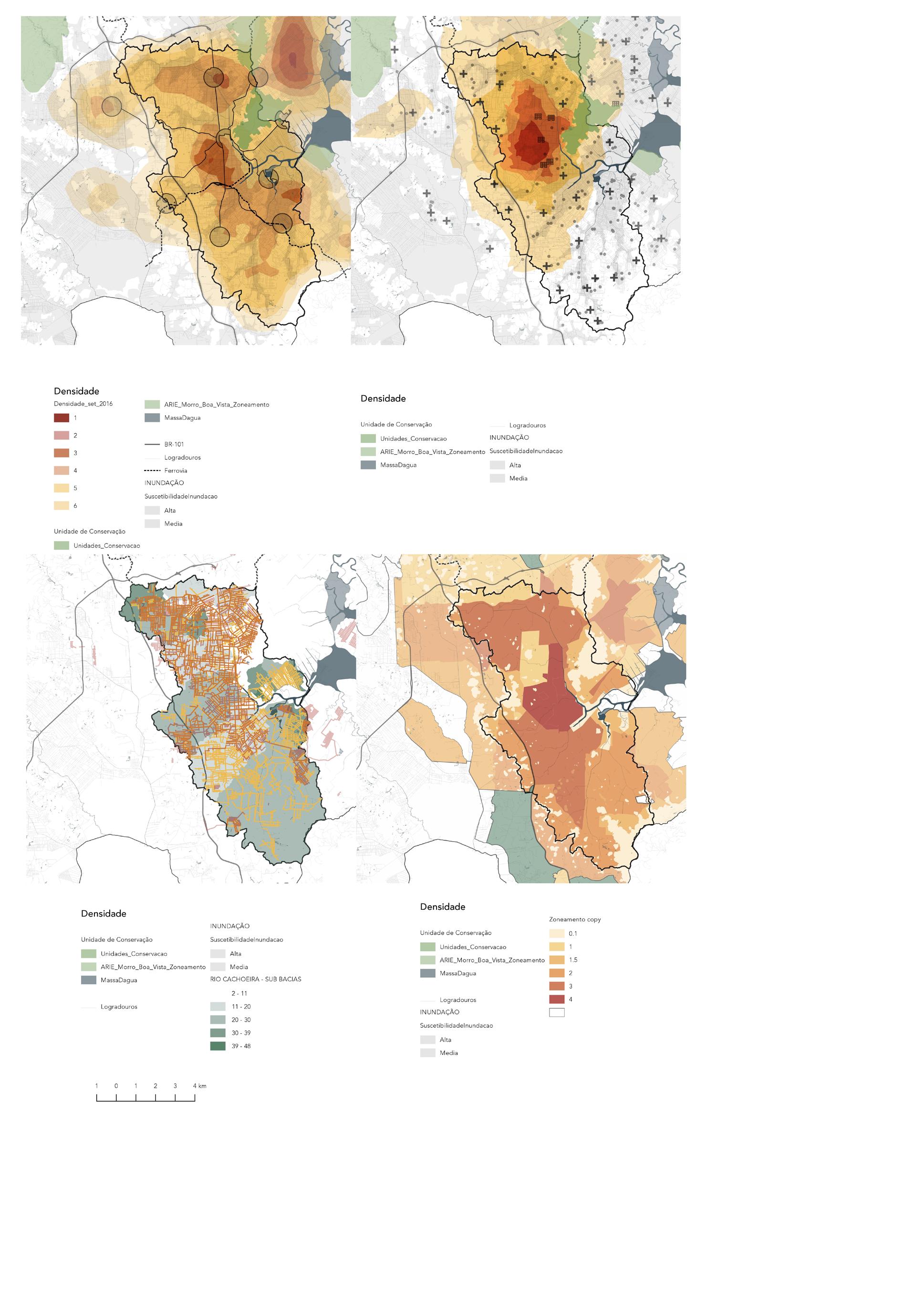
As a consequence, it is the watershed with the highest number of flood ing events in the city, affecting people from high to low income classes.
The north portion of the watershed have been suffering pressure from spontanous new developments due to the low price of the land. Howev er this part of the city has a high risk of flooding and in order to prevent a sprawl on this area the Land Use and Occupation Act aimed to den sify the city center, which is an area with better infrastructure and with room for new housings.
On the southern part of the watershed, along with large urban voids, the municipality will build an university campus, which will be used as a vector for urban growth and for new developments. In addition, The Master Plan for Urban Drainage have pointed to this area as priority on future drainage improvements for the Rio Cachoeira watershed.
Based on IPPUJ (2017) SIRGAS 2000/22S
Based on IPPUJ (2017) SIRGAS 2000/22S
Based on IPPUJ (2017) SIRGAS 2000/22S
Based on IPPUJ (2017) SIRGAS 2000/22S
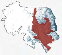
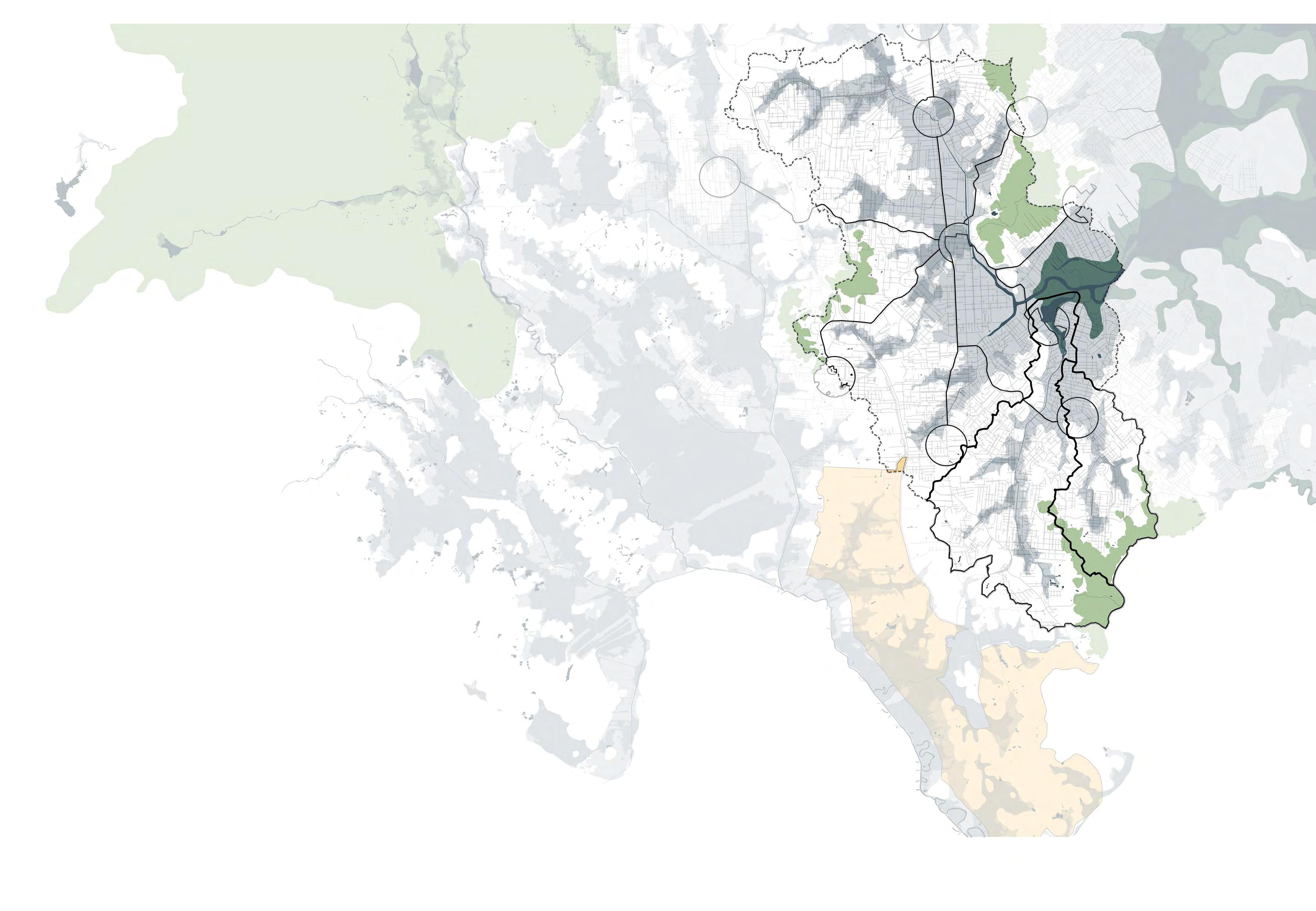
ITAUM AÇU-MIRIM RIVER SUB-WATERSHED
Area with potential to experiment a new urban development and public spaces designed with focus on urban drainage
Urban processes
Pressure of spontaneous urban developments
Guided urban developments
Urban consolidation Irregular developments
Hidrography
Swamps Preservation area
Expansion of urban perimeter
Flooding areas
Highway Network streets Water’s direction
Based on IPPUJ (2017) SIRGAS 2000/22S
Babitonga bay
Delta of Rio Cachoe ira
City center
27
1 0 1 2 3 4 km
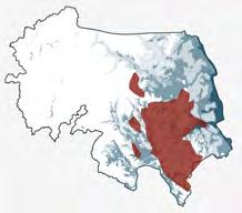
ANALYSIS
Flooding events
High Medium Low
Declivity
0º
Typologies of public spaces
Arterial street with green bed
Arterial street with creek
Arterial street without green bed Colector street
Local street
Local street with creek River and creeks in the back of lots
Plazas and squares
Urban voids with area above 2.000 m2

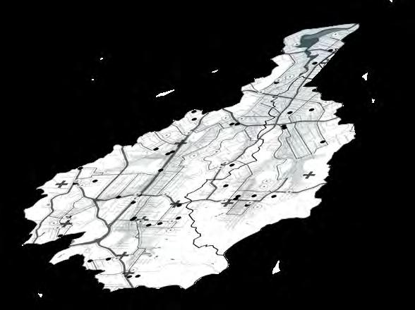


Proposals of Master Plan for Urban Drainage
Enlargement of the river channel with remov al of local houses
Bypass Creation of water tanks
28
0-3º 2-5º 3-10º 5-20º
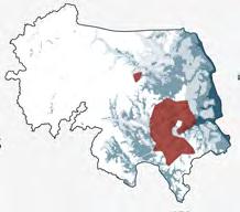
Delta Spring Spring N SUB-WATERSHED
5 4 5 Source Delta


29 1 1 2 2 5 4 3 3 4 6 6 Source of the river Delta of the river PROTECT PROTECT PROTECT REUSE REUSE SLOW INFILTRATE INFILTRATE INFILTRATE RECOVER INFILTRATE FLOOD FLOOD
LOCAL STREET
DELTAREGION
ARTERIAL STREET
REGION
DENSED
URBAN VOID
SOURCEREGION


Transect Watershed CITY CENTER DELTA OUTSKIRTS SOURCE ? ? ? ? ? ? ? ? ? ? A 1 B 6 Source Source Land profile EXISTING CHARACTERISTCS HIdrpgraphy and flooding areas Green public areas DIAGRAM 1 2 34 5 6 Delta Source Location 30 BEFORE TRANSECT METHODOLOGY / EXISTING & PROPOSAL
-
1
-
AREA
4
-
6
New green public areas New flooding areas
PROPOSAL


New flooding area during cloudbursts
INCREASE OF A 100% OF PERVIOUS SUR FACES ON PUBLIC SPACES &
MANAGEMENT AND BETTER CONTROL OF FLOODING AREAS
AFTER
31
PROPOSAL
1. Vehicle
SHIFTING
2. Pedestrian
3. Drainage

What What

DESIGN WITH
FOR TYPOLOGIES
NEW
PRIORITIES
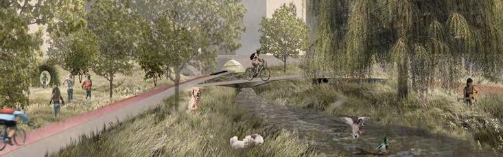
What for BIOSWALES
Water collection / natural infiltration
INFILTRATION SWALES
Natural infiltration
1. Drainage
2. Pedestrian
3. Vehicles
SAFETY ZONE Pedestrians and cyclist Safety / multifunctional use
MIXED USE BUILDING
Residents, investors, municipality Multifuncional use, avoids urban sprawl, economic and social value
BIOSWALES
Residents, tourists and nature
Leisure, biodiversity, multifuncional use, economic and social value
WATER STREET
Pedestrian, cyclist and drivers Prevent economical and social damages
INFILTRATION SWALES
Residents and nature Multifunctional use / biodiversity
Plant coverage
Pervious paving Impervious paving
WITH SUD´S
ADDED VALUES
SHIFTING
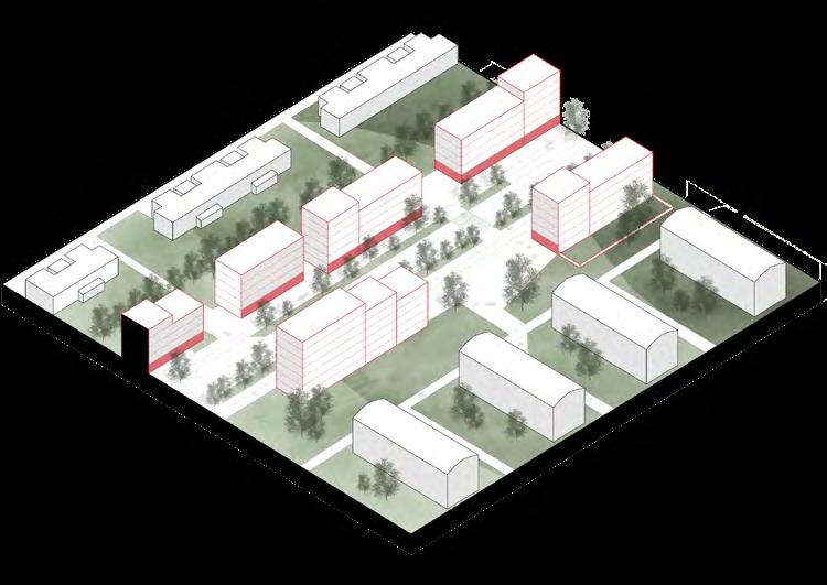
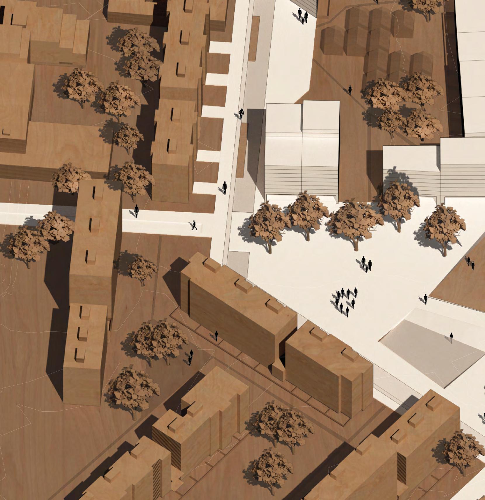
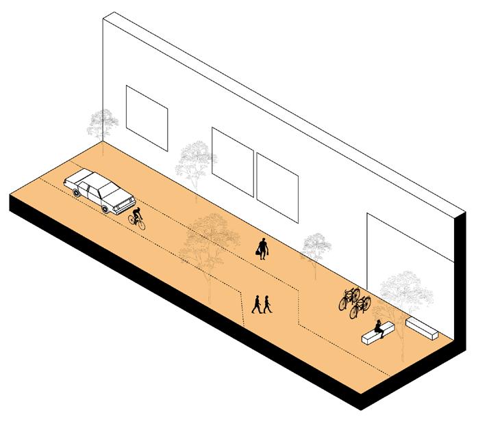
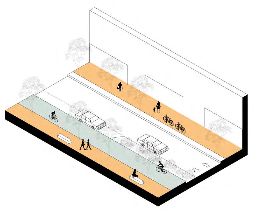
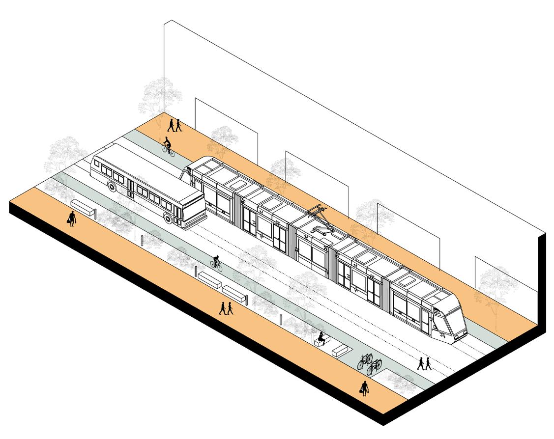
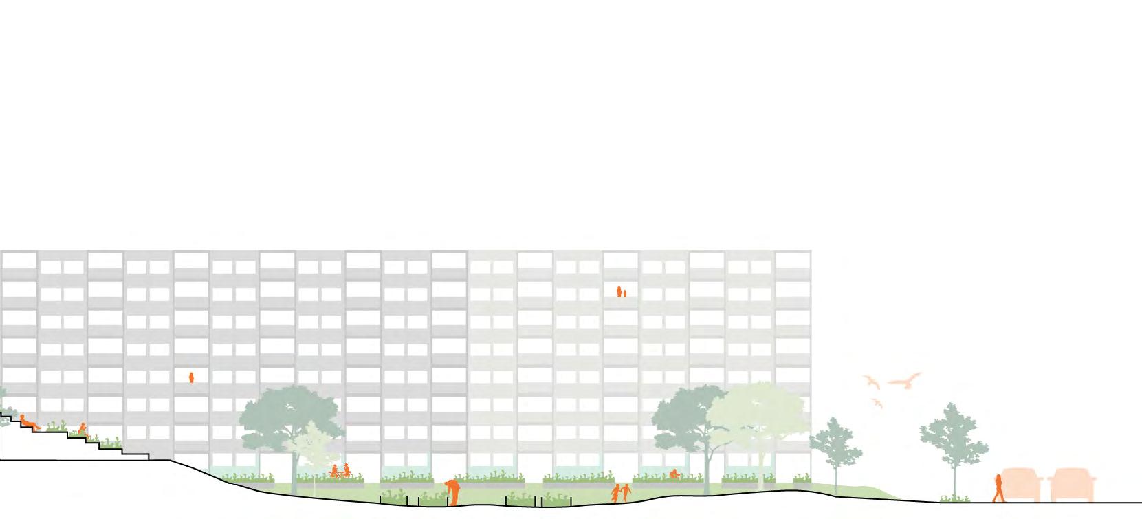
Link it: Turning roads into streets
Master in Sustainable Urban Design
Urban Dynamics Studio
LTH - Lund University
Location: Prague 2020
34
is Id
35
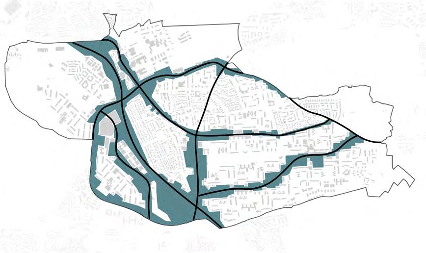
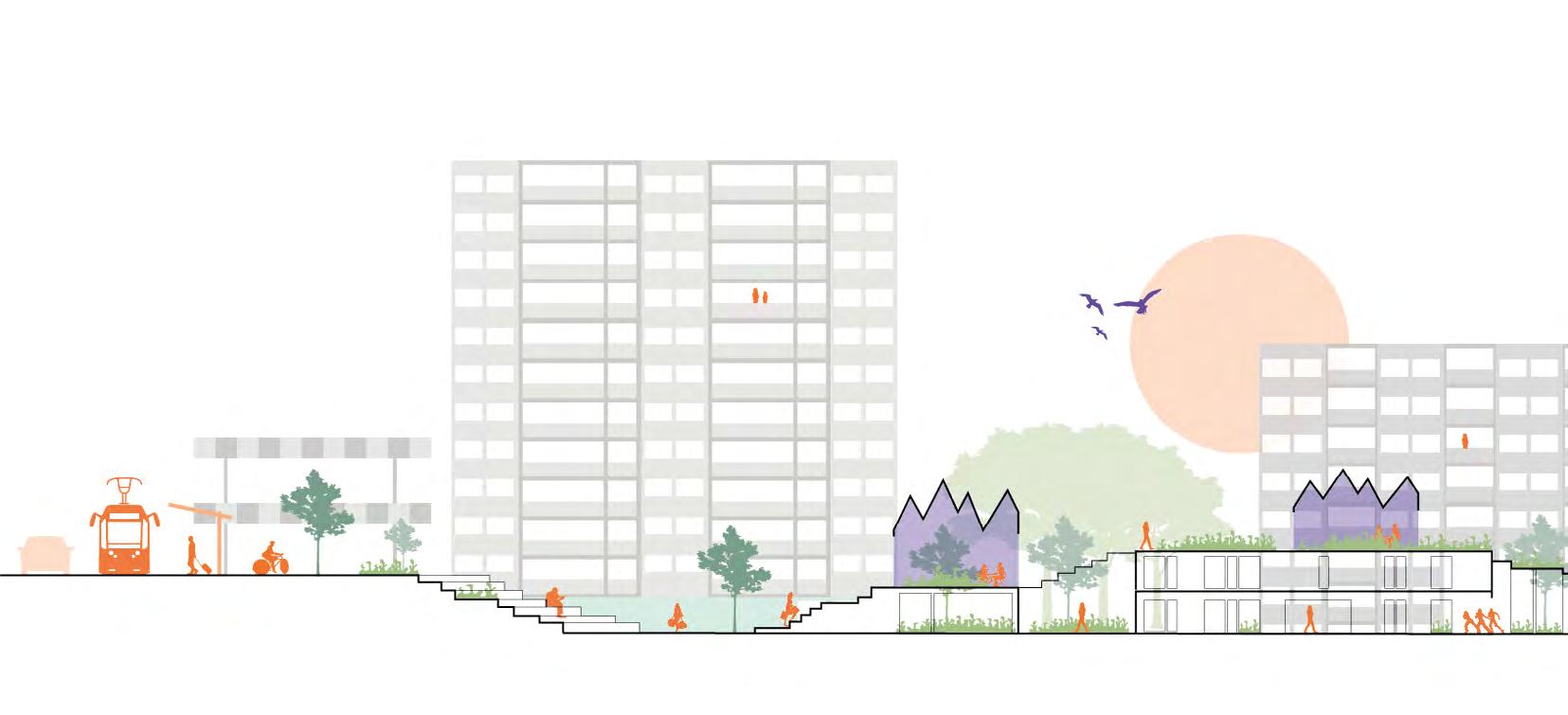
MIND THE SURROUNDINGS by taking into consideration local weaknesses and potenrials
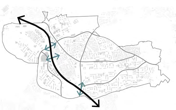
With this in mind, the project seeks to connect the neighborhoods and the residents by turning the roads into streets and repurposing the dis used areas alongside these roads by developing them into a sustain able and lively community.
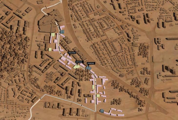
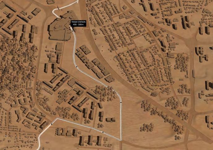
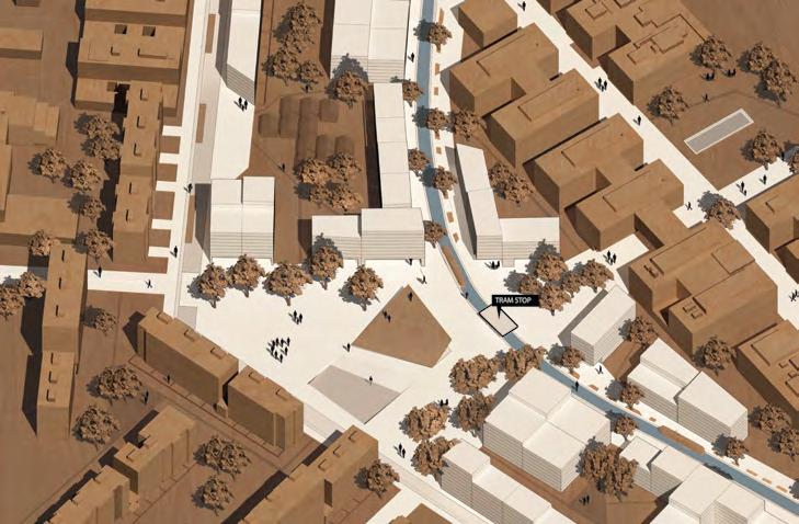
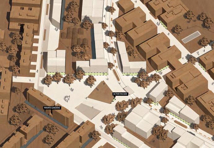
To reach this goal, on a city-wide level, the project will strength en public transportation by extending the tram line into the neigh borhood. The goal is to create a foundation for future develop ments and also promote a decrease in car usage in the city. Located on the west side of District 11, Roztylská road will be the place for an experiment for a development with a new block typolo gy that takes into consideration the existing structure. Within the new block structure, new building typologies will promote higher densi ty around transportation nodes such as the tram stops, and also, ensure the diversity of people in the area throughout different uses.
Positioned on the top of the local basin, a new infrastructure focused on pedestrians and cyclists, beyond enhancing the local connections, will also incorporate green and blue structures, creating new public spaces and increasing the biodiversity of local fauna and flora, ensur ing that a strong, local, and vibrant community can thrive.
PRIORITIZE PEOPLE
By designing so the inhabitans feel instigat ed and confortable
PROMOTE DIVERSITY of people by mixing together different functions


INCORPORATE GREEN & BLUE within the street scape to create microcli mates

36
1,5km
Motorway constitues a physical barrier
Large grass areas alongside the street with no function.
Pedestrians feeling lost and intimidated
37
? ? ? ?
Secondary
 road
Local
road
Local
38 Main
STREET TYPOLOGY
BLOCK TYPOLOGY


How to add a new block typology that belongs to a modernist context?


BUILDING TYPOLOGIES
Parking building 50x50m 7 floors 76 units/floor Active groundfloor
Housing 15x40 to 70m 5-10 sloors Active groundfloor
Housing and offices 40x30m 7-10 floors Active groundfloor
Housing 15x20m 3-5 floors
39 ?
21 3 4 5 6
40 PARKING LOTS 75% LESS FOOTPRINT FROM~1500 SPOTS 30.000m2 TO ~1500 SPOTS 7500m2
 New meeting place Active groundfloor
41
Levels
Master in Sustainable Urban Design
Urban Dynamics Studio
LTH - Lund University
Competition entry for ideas within the studio assignment
Team: Adriana Heglewicz, Pimruetai Maneekorn, Siri Jeppson and Tommy Janram
Location: Prague 2020
42
is Id
 (Source: Heglewicz, 2020)
43
l
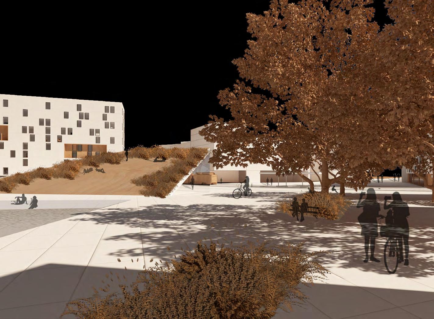
During the studio Urban Dynamics it was conducted a competition to gather ideias for public spaces in Opatov, Prague. The competition last ed a week with lectures on relevant topics and instructions from local residents and autorithies.
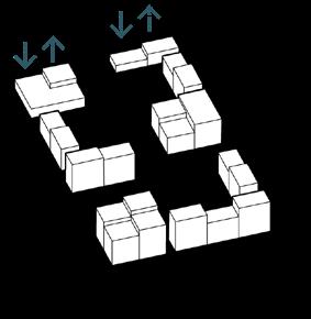
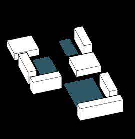
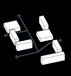
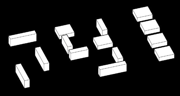
The site was mostly made of transition places and consisted of only two levels: verticality of the buildings and the horizontality of the ground. How would it look if we added more levels? We are about to find out!
Role: Brainstorming sessions for the concept and solutions, produced graphic material for detail plan and sections.
E V E l S l E V E l S l E V E l S
44
STRATEGIES
LEVEL UP:
the spaces diversifystimulate define
the connections the functions HOW? comfort
define private and publicactivate bottom floors
multi-functionaloutdoor activitydefined seating
45 THE TOOLBOX urban farming
Green Spine connects city with the forest
Public spaces on different levels
Places to linger on and connect
46 MASTER PLAN

47 DETAIL PLAN
Scientific Research Analysis of Territorial Transformation
Scientific Research Program for Undergraduates
Federal University of Paraná
Supervisor: Professor PhD. Letícia Nerone Gadens
Location: Curitiba, Brazil
The full research report can be read here (in Portuguese)
48
2018 i Id
49
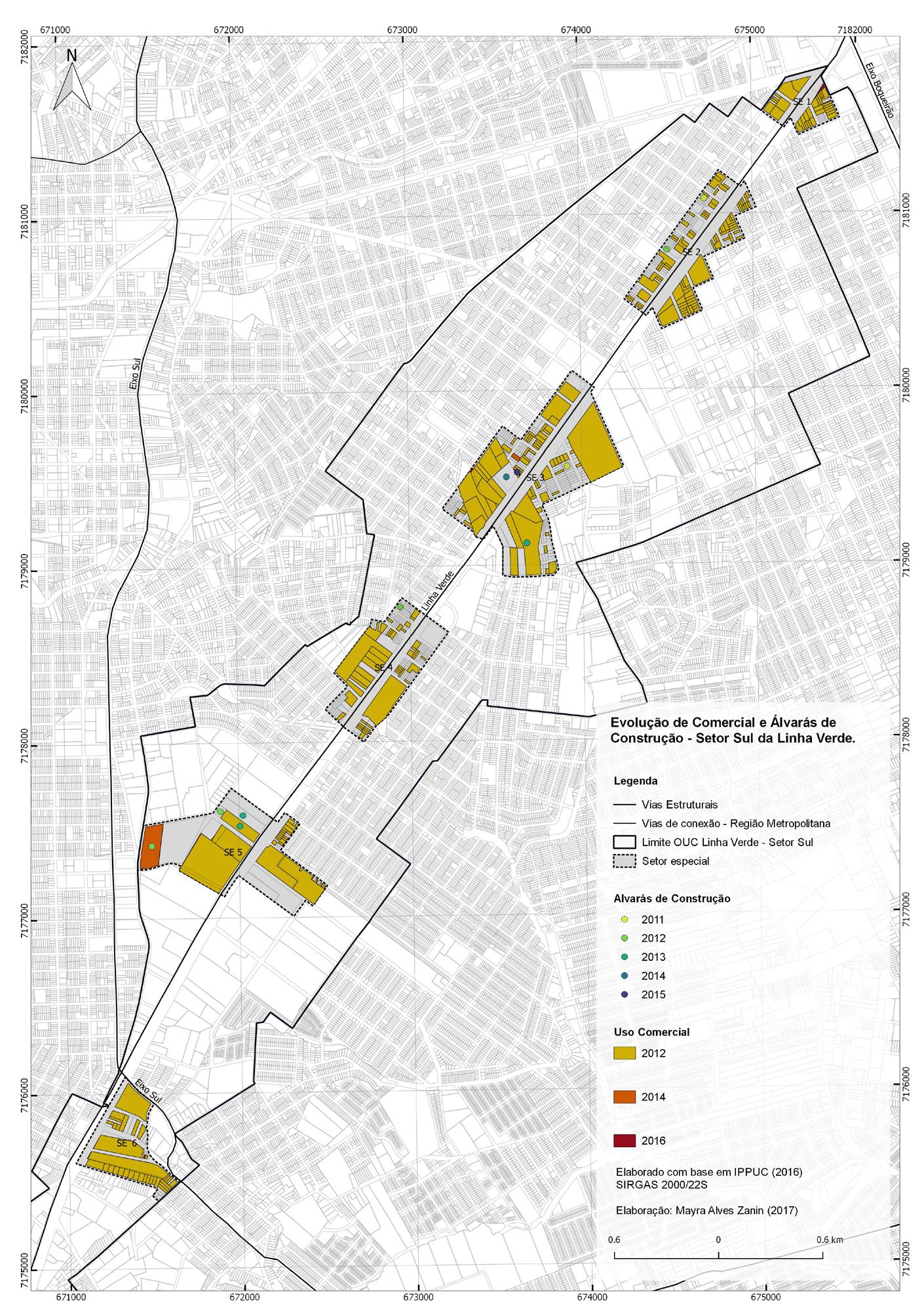
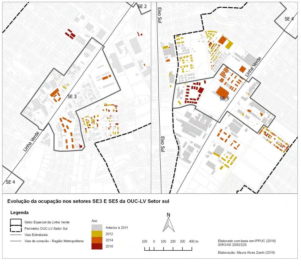
ANALYSIS OF TERRITORIAL TRANSFORMATION ON LINHA VERDE, SOUTH SECTOR, CURITIBA
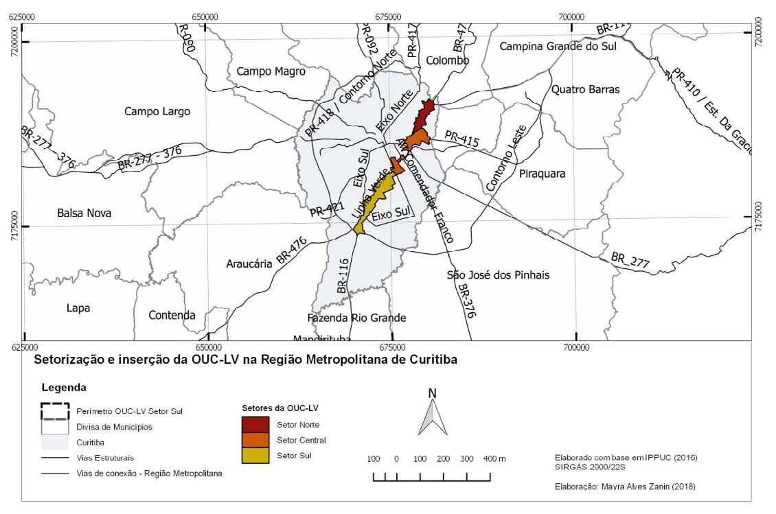
During this one-year research program, the present project aimed to identify, interpret and analyze the territorial transformations that resulted from a part nership, between the municipality and private corporations, to develop an im portat axis in the Metropolis of Curitiba.
The research focused specifically from 2011, when the operations and part nership were created, until 2016, the year in which the newest information was available for analysis. The reason for this temporal section is due to the axe’s important role on the development of Curitiba and its Metropolitan Region of two million inhabitants. With this in mind the research focused on two ques tions:
What were the morphological changes that resulted from the transformational process on Linha Verde?
Do these results reflect the urban patterns aligned with the construction of sustainable and socially inclusive spaces?
METHODOLOGY
This research consisted of 4 phases:
1. Theoretical research
2. Characterization of the study area
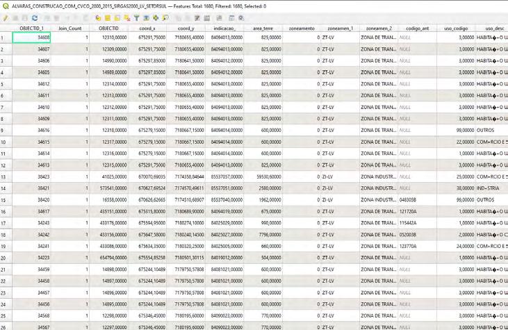
3. Analysis of data provided by the municipality in GIS and collection of data throughout analysis of satellite images.
CHARACTERIZATION OF LINHA VERDE, OBJECT STUDY
50
51
PROCESS OF ANALYSIS
Extraction of data from shapefiles in QGis
Manipulation of data into Excel file.
GRAPHICS FROM ANALYSIS
NO SIGNIFICANT TERRITORIAL CHANGES WITHIN STUDY AREA WERE FOUND.
Evolution of lot sizes
Evolution of plot situation (with construction or empty)
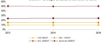

Evolution of commercial & residential according to zoning.

52
SPATIAL ANALYSIS OVER THE YEARS
For a detailed analysis sattelite images, extracted from Google Earth, of different years were georreferenced in QGis.
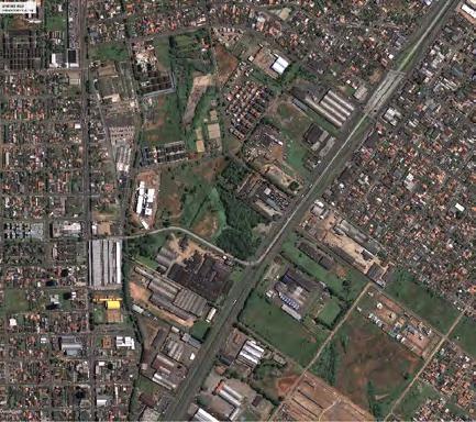
Not only the area was not being developed, the detailed analysis on satellite images have shown that the majority of developments were actu ally located outside the boundaries.
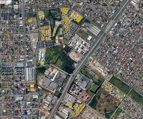
New developments from 2011 to 2016
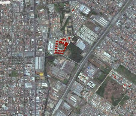 2011 2012 2014
53
Drawings, physical models
54
55
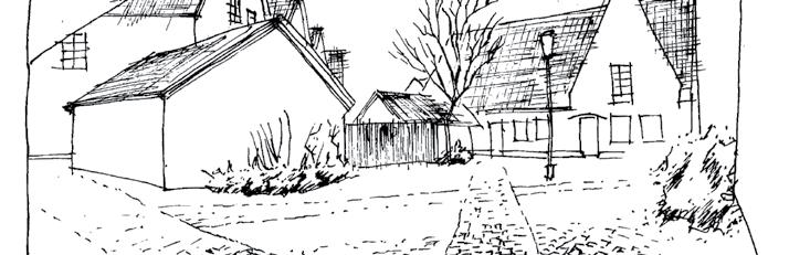
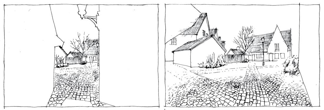
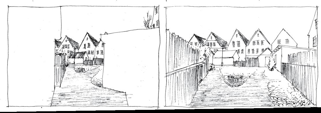
Jakriborg and its surprises.

56

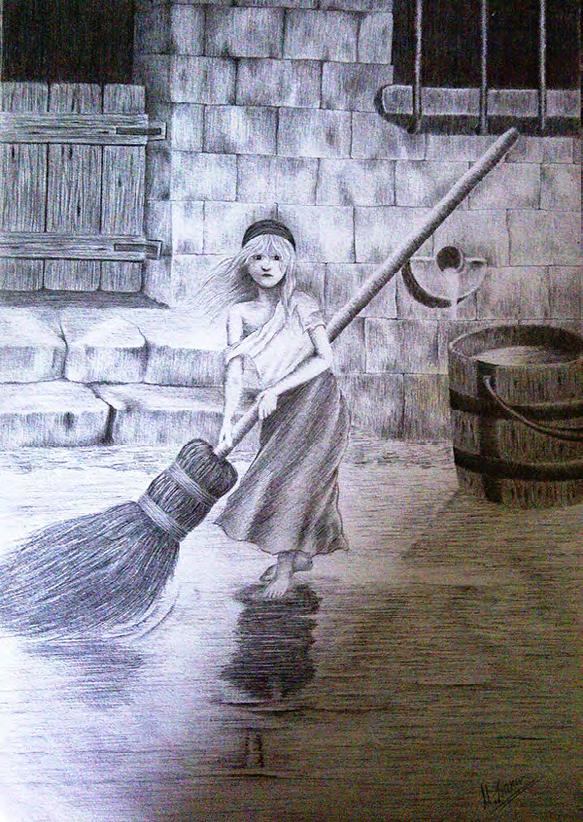 Original realistic drawings
57
58
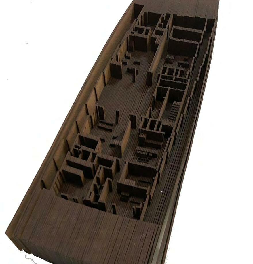
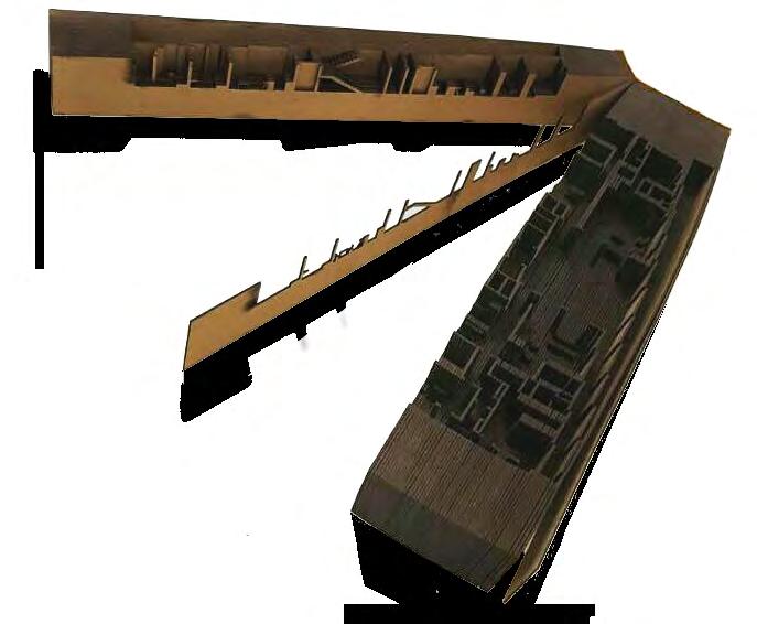
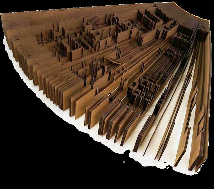 Model with 73 sections form a book to create a miniature of one of the building floors.
59
Thank you!
You will find professional projects here: ARCHITECTURE PORTFOLIO
Svarte, Sweden
LinkedIn | 0734662220 | mayrazanin@gmail.com |
