MERRIAM 2040 COMPREHENSIVE PLAN MAIN REPORT

Merriam Comprehensive Plan 2040


• Ken Sissom, Mayor
• Scott Diebold, Ward 1
• Christine Evans Hands, Ward 3
• Jason Silvers, Ward 1
• Bruce Kaldahl, Ward 3
• Whitney Yadrich, Ward 2
• David Neal, Ward 4
• Brian Knaff, Ward 2
• Bob Pape, Ward 4
• Brian Dailey, Chair
• Leah Ann McCormick, Vice Chairman
• William Bailey, Secretary
• Bill Carter
• Reuben Cozmyer
• Judy Deverey
• Mitchell Fowler
• Russ Harmon
• Cole Stephens
• Christine Evans Hands
• Nancy Hupp
• Mitchell Fowler
• Brian Dailey
• Stoney Bogan
• Kevin Killilea
• Robin Harrold
• Christopher Leitch
• Daniel Anderson
• Kendra Miller
• Chris Caldwell
• Jacob Laha
• Marcia Shami
• David Friederichs
• Valerie Koetting
• Billy Croan
• Chris Engel, City Administrator
• Meredith Hauck, Assistant City Administrator
• Donna Oliver, Finance Director
• Bryan Dehner, Fire Chief
• Anna Slocum, Parks & Recreation Director
• Darren McLaughlin, Police Chief
• Jim MacDonald, Public Works Director
• Bryan P. Dyer, Community Development Director
• Andrea Fair, Planner
• Nancy Yoakum, Administrative Coordinator
• John Hollis, Planner
• David Easley, Neighborhood Services Manager
A special thank you to all Merriam residents who participated in the Merriam Comprehensive Plan 2040 planning process. Your input was invaluable in helping to guide decision-making and prioritization in the comprehensive plan.

The purpose of this comprehensive plan is to help guide growth and development for Merriam through the year 2040. This plan will assist the city in decision-making as it relates to issues including land use and zoning, housing, commercial and industrial development, sustainability and the environment, transportation and mobility, parks and recreation, and community facilities and services.
Comprehensive plans are an inventory of the existing conditions of a community that can act as an information management tool for a city. The process for creating a new comprehensive plan is an opportunity for residents and stakeholders to directly engage in goal setting for a community. It provides an opportunity for a city to gain feedback from residents and local businessowners on a wide set of topics. The engagement exercises can help to identify what aspects of the community help best define the community’s character, strengths and weaknesses.
The engagement exercises and existing conditions analysis help identify goals, strategies and action items that create a pathway to implementing the vision of the community. While comprehensive plans are thorough and detailed documents, they should not sit on shelf or remain stagnant. Comprehensive plans should be regularly referenced by the city when making decisions about development proposals, rezonings, code updates, capital improvement planning and budgeting, and policy formation.
Every year, the city should review the entire plan to identify conditions that have changed since the initial drafting. These efforts will help ensure the community vision is being implemented.
The Comprehensive Plan was prepared and adopted pursuant to the authority granted by the State of Kansas under Kansas Statutes, Chapter 12. – Cities and Municipalities, Article 7. - Planning and Zoning (K.S.A. 12-741 through 12-775). As authorized by Kansas Statutes, preparation of the plan includes comprehensive surveys and studies of past and present conditions and trends relating to land use, population and building intensity, public facilities, transportation and transportation facilities, economic conditions, natural resources and other elements deemed necessary within the Merriam’s city limits.
Requests to rezone or otherwise modify the zoning of a property should be reviewed for conformity with the adopted comprehensive plan. Per K.S.A. 12-757, rezonings, if in accordance with the land use plan or the land use element of the comprehensive plan, shall be presumed to be reasonable.
Pursuant to Kansas Statutes, at least once each year, the Planning Commission shall review or reconsider the plan.
The Merriam Comprehensive Plan 2040 planning process was completed over four main phases:
• Phase 1 - Project Kick-Off, Research & Analysis
• Phase 2 - Vision, Input + Direction
• Phase 3 - Draft Plan + Evaluation
• Phase 4 - Final Draft Plan + Adoption
Phase 1 - Project Kick-Of, Research & Analysis
Phase 1 included a kick-off meeting with the Comprehensive Plan Advisory Committee (CPAC), where discussions over project goals and visioning were completed. A majority of the technical analysis of Merriam’s existing conditions were performed during this phase.
2
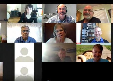
Phase 2 was about public engagement and visioning. A robust set of engagement exercises were completed to identify common themes and desires from members of the Merriam community. This included one-on-one stakeholder interviews, pop-up event booths, a public workshop, a project website, and interactive engagement website that included visual preference exercises, mapping activities and surveys.
The bulk of the planning document was written and put together in Phase 3. Multiple meetings with the Comprehensive Plan Advisory Committee took place during this phase as draft chapters were completed. The CPAC helped review and provide edits on the plan draft. This phase also included an additional joint workshop with the Planning Commission and City Council. The last step of this process was a public open house where the plan was revealed to the public fully for review and comment.
The last phase included a final review of the draft plan with the Comprehensive Plan Advisory Committee and edits were made based on the feedback received during that review. Phase 4 also included the public hearing process conducted by the Planning Commission. Following the public hearing, the Planning Commission reviewed and voted to approve the plan, and sent it to the City Council for their consideration. The City Council received the Planning Commission’s and public comments and, after due consideration, adopted the Merriam Comprehensive Plan 2040.
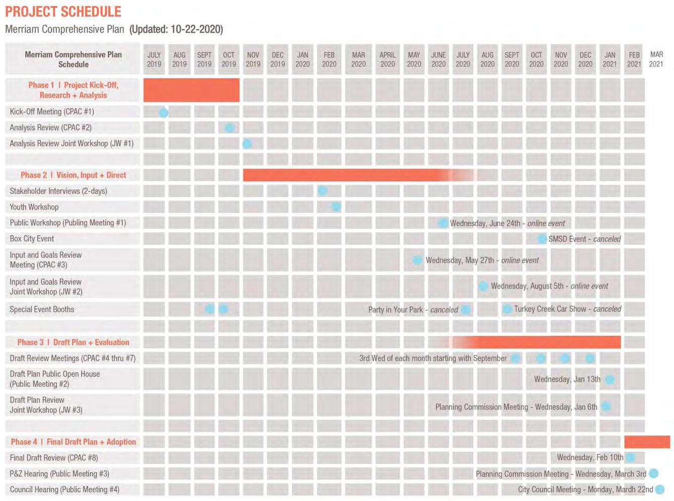
The Merriam Comprehensive Plan 2040 was completed over the course of nearly one year and a half starting in July 2019. Phase 1 was scheduled to take place between July and October 2019. Phase 2 was originally scheduled to take place over the winter and spring of 2020, however, there were a series of setbacks and delays as the project dealt with the COVID-19 pandemic. Many of the engagement meetings and exercises were intended to take place in-person. There was an approximately three-to-four-month delay in Phase 2, which extended into the late summer of 2020, in order to adjust project meeting dates and exercise types. The interactive project website was added as a feature of the engagement strategy to help replace engagement lost due to a lack of in-person public workshop. Phase 3 started near the end of summer 2020 and extended into the early winter of 2020/2021. The final phase started in February 2021 and ended once the City Council adopted the plan in March 2021.
The Merriam Comprehensive Plan 2040 is composed of three sections: (1) Introduction, (2) Plan Recommendation Areas and (3) Implementation. Section 2 - Plan Recommendation Areas is composed of seven chapters. There are also two supplemental report: (1) Existing Conditions Analysis and (2) Public Engagement Report.
Introduction
Section 1 of the Merriam Comprehensive Plan 2040 is the introduction. This section describes why the plan was created and introduced the key goals and vision statements created to guide the planning process. The vision statement and goals identified in this chapter will be referenced throughout section two and three of the plan.
Section 2 is the plan recommendation subject areas. Section two has seven separate but interrelated chapters that create the bulk of the plan. Below are the chapters included in the Merriam Comprehensive Plan 2040:
• Community Character & Identity
• Sub Area Plans
• Sustainable Development
• Mobility & Transportation
• Promoting Prosperity
• Amenities & Service Enhancements
• Creating Place
Each chapter follows a similar format starting with a discussion of the chapter’s relationship to the vision statement and project goals. Then, a series of best practices and Merriam-specific recommendations are discussed. The end of each chapter is a list of goals and action items for the city to consider and reference when planning programs, creating policies and updating the capital improvements program (CIP).
Implementation
The final section of the Merriam Comprehensive Plan 2040 is implementation. This chapter takes all of the goals and action items identified in section two and organizes them into a chart the city can and should reference annually.
A significant amount of existing conditions analysis and public input was completed as part of the Merriam comprehensive plan. This analysis and public input are referenced and summarized in many part of the main planning document. However, the full existing conditions analysis and detailed public input summary have been organized into two supplemental reports. The analysis and public input are a major component of the backbone of this plan.
The existing conditions report is divided into three sections, each covering a number of different topics including: Community Profile - population (change & growth), age analysis, households & families, education, diversity
Economic Profile - economy, employment, income and housing costs
Physical & Place Profile - existing land use, character, housing, natural resources, transportation, and parks & open space
The Public Engagement Report provides an in-depth and detailed review of the public input process and schedule. An event-by-event overview of feedback received and themes identified is included for reference throughout the main Merriam Comprehensive Plan 2040.
To help guide the planning process, a set of goals were updated for the Merriam Comprehensive Plan 2040. The goals used in the city’s previous planning effort were reviewed at a joint workshop between the Merriam City Council and the Planning Commission. The 2001 Merriam Comprehensive Plan goals included: housing choice & diversity, reinvestment, public services, identity, mixed development, walkability, visual appearance, durability, parking and multi-modal. These goals and the accompanying descriptions were discussed and additional items to include were identified. The additional items the committee wanted included in the 2040 goals were sustainability, tree canopy, the possibility of moving utilities underground and a desire to attract more families to Merriam.
Out of these discussions emerged seven new goals that are described in more detail on the following page.
• Quality Public Services
• Identity & Character
• Housing Choice & Diversity
• Transportation & Mobility
• Neighborhood Reinvestment
• Sustainable growth
• Mixed-use / Commercial Activity Centers

Merriam offers residents a variety of housing types and sizes that meet the needs of residents from different economic groups, ability levels, stages of life and age groups.
Merriam strategically targets neighborhoods for improvement by incentivizing investment and maintenance of the community’s housing stock.
People are attracted to Merriam because of the continued investment in the quality of medical and social services, educational, recreation, public safety and infrastructure, all of which help improve the health and wellness of residents.
Merriam, and its many neighborhoods, have distinct identities that create a sense of place to foster pride and belonging among residents and attract young families to settle and make their long-term home in Merriam.
5
1 2 3 4 6 7
Merriam contains a thoughtful mix of commercial and mixed-use activity centers that are visually appealing, connected and of appropriate scale for the community with necessary transitional buffers to protect existing residential areas.
Merriam uses future-oriented decision-making to support sustainable growth and development through a diversified tax and employment base to promote prosperity, sensible environmental regulation to protect natural resources and durable development made with quality materials and thoughtful design that allow for flexibility and resiliency.
Merriam’s transportation system is a safe space that supports various modes of transportation balancing access, parking, mobility and congestion minimization while expanding access to sidewalks, bike lanes, charging stations and public transit.
Part of the Merriam Comprehensive Plan 2040 was updating the vision statement used in the 2001 Merriam Comprehensive Plan. The original vision statement was:
Merriam is a quality place that attracts people because of its strong neighborhoods, accessible shopping, job opportunities, inviting public spaces and its convenient location to regional attractions.
The original vision statement was discussed at the first joint workshop with the Merriam Planning Commission and the Merriam City Council. The group determined that the following items were listed as needing to be included in the updated vision statement:
• Cultural
• Welcoming
• Multi-generational (encouraging all ages)
• Affordability
• Diverse
• Branding-effort (welcoming, inclusive)
• Dynamic
• Adaptable
• Safe
• Attractive (tree-lined streets)
Based on this feedback, an updated vision statement was created, shown below. This new vision statement keeps the sentiment and themes of the last planning effort with updates based on issues facing Merriam in 2020 and beyond.
“ The City of Merriam embodies a dynamic, friendly, and family-oriented culture that celebrates our history as a hub of mobility. We are a linkage point for shared amenities , not just for our diverse residents , but also for our neighboring communities.
We recognize and embrace our unique history as an inclusive and well-maintained firsttier suburban community. The City of Merriam enjoys great visibility and convenient access along the I-35 Corridor through its strategic location between other metro communities and Downtown Kansas City.
Merriam offers convenient access to shopping and services , an eclectic downtown area , quality civic facilities , diverse and a f ordable neighborhoods , and an enhanced parks and trails network that attracts a wide range of ages and demographics. ”
Public input is a key component of the Merriam Comprehensive Plan 2040. A full summary of the public input process can be viewed in the second supplemental report Public Engagement Report. Below is a simplified model of the public input schedule. The top half shows meetings with the Comprehensive Plan Advisory Committee and Joint Workshops with the Planning Commission and City Council. The lower half shows public meetings / engagements and the public approval hearings.
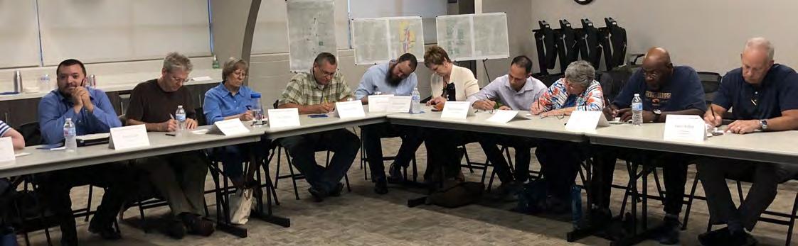
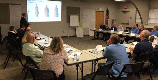
A Comprehensive Plan Advisory Committee (CPAC) was created to help guide the development and review of the Merriam Comprehensive Plan 2040. Members of the community were encouraged to apply to be on the committee and the group was approved by the City Council. The CPAC met multiple times throughout the entire planning process to provide input and guidance.
ETC Institute was hired to conduct a statistically-valid community survey as part of the Merriam Comprehensive Plan 2040 effort. ETC Institute, a specialist in community survey work, had tremendous success in reaching Merriam residents and created a survey with statistically valid responses.
Key Stakeholder Interviews
One-on-one interviews with multiple key stakeholders from Merriam were held in Spring 2020 These individuals were identified by the CPAC committee and represent a variety of interests and viewpoints. The input received during these candid discussions greatly enhanced the public input process by capturing material that may not come up during traditional public workshops or surveys.
Project Website & Interactive Project Website
A project website was created for the Merriam Comprehensive Plan 2040 to help provide information to the public about the planning process and to post information related to plan events and draft plan. After COVID-19 made an inperson workshop unsafe, an interactive project website was created to provide engagement activities for the public to complete including visual preference exercises, surveys, budget tools and a fun mapping activity.
Main Project Website: www.merriam2040.org
Interactive Engagement Website: https://confluence.mysocialpinpoint.com/merriam-comprehensive-plan-2040
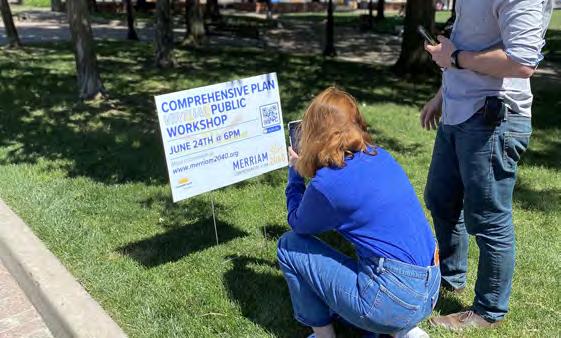
Public Workshop / Open Houses
A public workshop was held virtually in the spring of 2020. The purpose of the workshop was to explain the planning process to the public and obtain feedback on a wide variety of topics and issue areas. The interactive project website was launched for public use at the end of this meeting to encourage additional engagement on the plan.
Youth Workshop
The consultant team hired by the city to work on the plan met with a class of Merriam high school students to
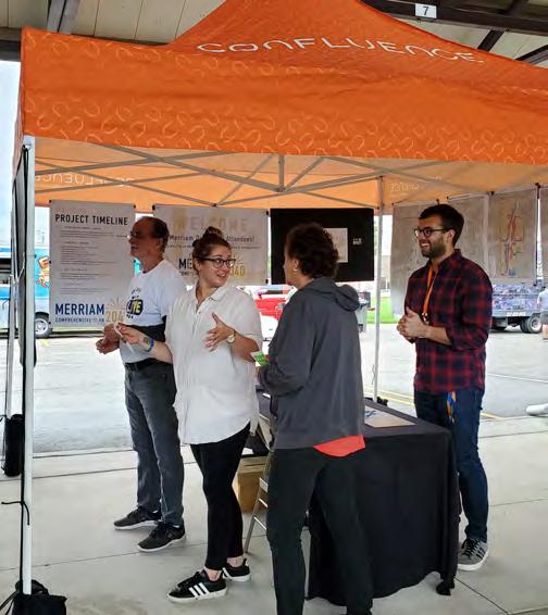
Two special event booths were completed prior to social distancing guidelines (Merriam Drive Live & a farmer’s market event). Here, the public was encouraged to visit the booth to learn more about the plan.
The final step in the planning process involved the Planning Commission conducting a public hearing on the proposed Merriam Comprehensive Plan 2040. Following the Planning Commission’s adoption of the plan, the City Council considered and adopted the plan in March 2021.
The COVID-19 pandemic started during the planning process of the Merriam Comprehensive Plan 2040. Meetings and engagement activities were moved to online events. All CPAC meetings, joint workshops and public meetings / hearings were held virtually starting in Spring 2020. To supplement the engagement lost without an in-person public workshop, an interactive project website was created to gain feedback.
Public input is a key component of the Merriam Comprehensive Plan 2040. A full summary of the public input process can be viewed in the second supplemental report Public Engagement Report. Below is a simplified model of the public input schedule. The top half shows meetings with the Comprehensive Plan Advisory Committee and Joint Workshops with the Planning Commission and City Council. The lower half shows public meetings / engagements and the public approval hearings.
CPAC #1 Kick-Off Meeting
Joint Workshop #1
CPAC #2 Analysis Review
CPAC #3 Review Meeting
CPAC #4-7 Draft Review Meetings
CPAC #8
Final Draft Review
Joint Workshop #2
Joint Workshop #3
PHASE 1 Project Kick-Off Research & Analysis
Community Survey
Key Stakeholder Interviews Youth Workshop Public Workshop
Special Event Booths (2)
Draft Plan Public Open House
Planning Commission Hearing
City Council Hearing
The Public Engagement Report provides a comprehensive summary of the public input received throughout the Merriam Comprehensive Plan 2040 planning process. Results from these engagement exercises have been incorporated into the chapters and recommended goals and action items in section two of the plan. Readers of this plan are highly encouraged to review the entire set of findings from the public input exercise. Below are some images depicting the different themes and ideas discovered through the engagement process.
Several surveys were administered to the residents of Merriam which allowed residents to give their feedback on the positive and negative aspects of the city. The most significant survey was the ETC Statistically-valid survey, but there were three total surveys were issued:
- ETC Statistically valid survey
- Comprehensive Online Community Survey via Survey Monkey
- Online Community Survey via the project’s social engagement website
The ETC survey was statistically valid meaning it can be used to justify decision-making and funding because it is truly representative of the Merriam community based on the number and geographic distribution of surveys received. The Comprehensive Online Community Survey was more detailed and thorough while the survey administered via the social engagement website was abbreviated and highlighted the core issues. Below are key takeaways from the ETC survey.
58% say its important to allocate fund to walking, biking or transit
48% think city should focus on adding new bicycle infrastructure
91% would use new bicycle infrastructure for exercise and 83% for recreation
68% walk as form of transport less than once per month
87% rate Merriam’s parks and recreation as excellent or good
54% most frequently use trails and 46% park space for active & passive recreation
Trails and park space for active & passive recreation were biggest priorities
82% don’t ride transit because prefer or need to use their car 31% say the bus would take too long
87% would support focusing on property maintenance & neighborhood preservation
61% support Merriam providing a mix of housing to attract people at various life stages
34% do not support encouraging new apartments or condominiums
71% feel housing options match their price range
79% believe the city should increase energy efficiency of city buildings and facilities
Over 60% support the use of a green building code, decreased use of fossil fuels and increased use of green stormwater infrastructure
70% say maintaining livable neighborhoods should be used to guide growth and development
96% rate quality of life in Merriam as excellent or good
92% believe quality of life will improve or stay the same
70% say improving downtown will increase quality of life and 60% say improving sidewalk & trails will improve quality of life.
94% agree or strongly agree that the city needs to maintain its streets, sidewalks & storm sewer
Stakeholder interviewed were held with the following groups:
- Real estate professionals
- Local business owners
- Long-time residents
- Apartment complex managers
- Downtown Merriam building owners
- Merriam Park Elementary School
- Steering Committee members
- Former Planning Commission members
- Automotive dealer representatives
Merriam Marketplace
• Well liked but some question attendance levels and think support retail needed in the area to attract users
Turkey Creek Streamway Trail
• Very popular
• Would like to see more trail connections
Great Location
• Merriam is convenient and offers good access to the metro
• Offers small-town feel with big city access
Grocery Store
• Losing Hen House was a big loss for the community
Downtown Merriam
• Good visibility from I-35
• Should attract entertainment / mixed-uses
• Some worry that buildings are run-down
• Too many junk car lots
• Some don’t want to see much change or improvement
Flooding
• Stormwater is an issue
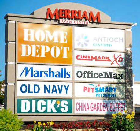
• Need stormwater master plan for the city Merriam Town Center
• Important asset for the community
• Needs help
• Could use denser development
Home Rehabilitation
• Important to help blighted properties
• Some homeowners may need financial assistance
K-Mart Site
• High priority for redevelopment
• Mixed views on density / use
• Site could include combination of residential, entertainment, retail, greenspace

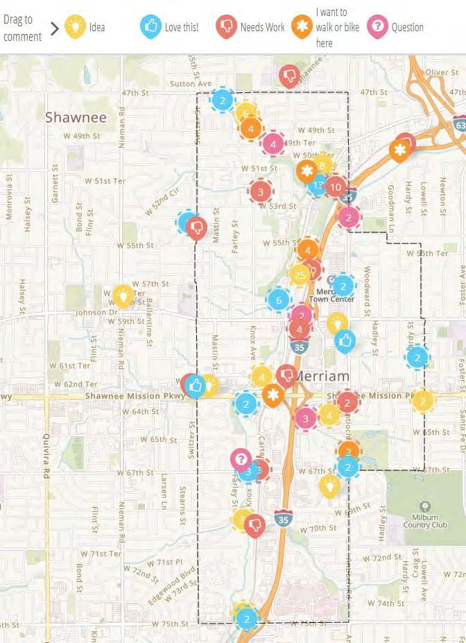
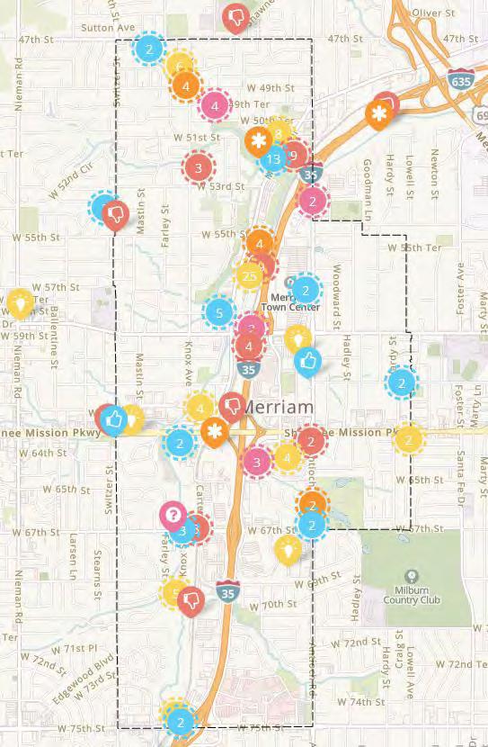
There were several engagement activities set up in the interactive engagement website including a short survey, visual preference exercises and a goals ranking exercise. Another important activity included on the website was an interactive mapping activity. Participants were encouraged to place comments directly onto a map of Merriam regarding things they loved, things that need work, ideas they have, places they want to walk or bike as well as questions they may want to propose to the city. Some of the feedback is summarized below and on the following pages.
Overall, participants like the current scale and character of commercial buildings, especially in the downtown district, and think rehabilitation of these buildings should be incorporated into any redevelopment policies set forth by the city.
Residents see redevelopment opportunities throughout the community that support mixed-use, higher-density buildings.
K-Mart site has the opportunity to be transformed into a mixed-use center similar and book end the Slater Road commercial corridor with an exciting and vibrant development that includes green space. Redevelop industrial / warehouse properties along Merriam Drive to promote more active uses.
Consolidate / reclaim bus lot north of downtown to allow land to be freed up for development and park amenity space.
K-Mart site needs to be redeveloped and not allowed to sit vacant any longer. Suggestion of implementing a vacant building policy to prevent long-standing vacant properties from negatively impacting the perception of the community.
Many unsightly properties along prominent corridors, particularly in downtown, that give a bad impression of Merriam.
Abundance of vehicle-oriented businesses within the community not the best land use.
Larger industrial / warehouse buildings should be better screened.
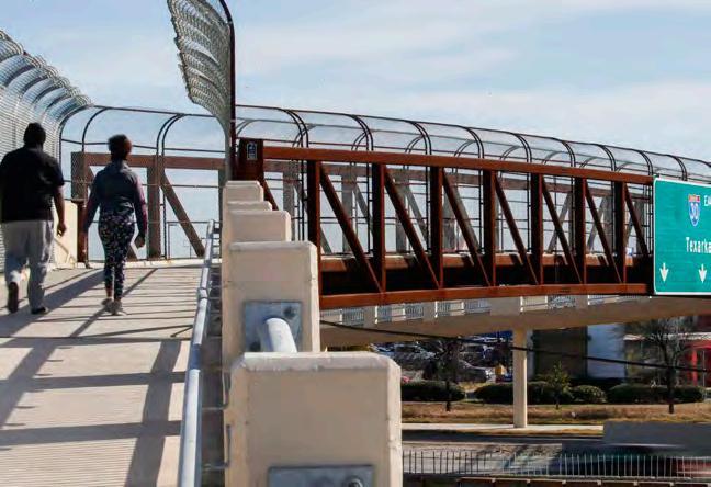
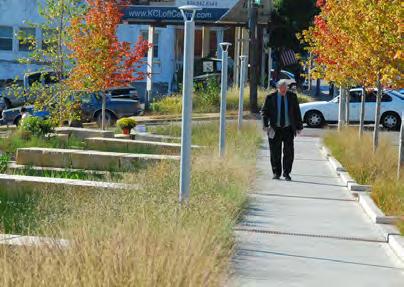
Love what the city did with the Johnson Drive Bridge over Turkey Creek. The results added character, safety, better pedestrian access and architectural elements. Acts as a nice gateway into downtown.
Participants like the added sidewalks recently installed throughout Merriam.
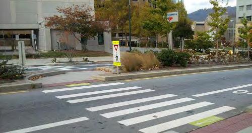
Like the added crosswalk at W 67th St and Knox St - provides access to the indoor soccer facility.
Several intersections throughout the community are thought to be confusing and unsafe. These include the West 67th Street / I-35 interchange, Antioch Road / Merriam Drive intersection, West 47th Street / Shawnee Drive intersection, and the West 50th TerraceMerriam Drive intersection.
Pedestrian crossings on Shawnee Mission Pkwy are inadequate and dangerous.
No sidewalks on Shawnee Mission Pkwy over I-35.
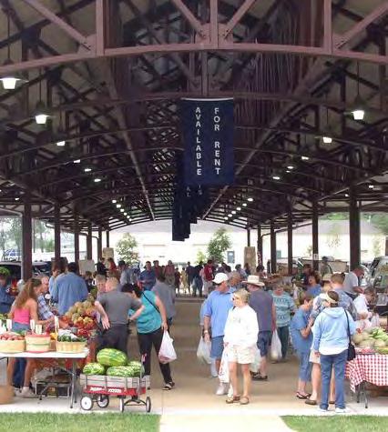
Love the Market area... hope it can get used more for a variety of engaging events in the future. It is an asset to the community.
Downtown has high visibility from I-35 for events and attractions.
Wish that stores in downtown were valued more in the community.
Kessler Lane is often used to illegally park cars. Many unsightly buildings and parking lots. Downtown needs work and does not reflect the community (except Merriam Marketplace)
Implement plan for additional pedestrian crossings over/under I-35 to help alleviate the physical divide between the east and west sides of Merriam.
Enhance / create major and secondary gateways coming into Merriam along arterials
Work with railroad to implement above grade rail crossings - similar to what was done in Olathe. Consider rerouting existing KCATA bus routes to give better access to residents throughout Merriam.
Add enhanced crosswalks along Shawnee Mission Parkway to make for safer pedestrian crossings.
Walking / biking along Merriam Drive is difficult with so many curb cuts. Consider consolidating driveways to make more pleasant.
Wish that stores in downtown were valued more in the community.
Kessler Lane is often used to illegally park cars. Many unsightly buildings and parking lots. Downtown needs a lot of work and does not reflect the community. Except for the Merriam Marketplace.
Agreement that Merriam Town Center needs to be redesigned for different future uses.
Likes the emphasis on the Johnson Drive entrance versus the Antioch Road entrances.
At least one comment in support of the landscaped berm along Antioch Road. Loss of the Hen House Market was a major blow to Merriam.
A full service grocery needs to return to Merriam. The Town Center would be an ideal location
In general, participants are extremely satisfied with the existing parks of Merriam.
Parks have great amenities and participants appreciate recently added amenities.
Great that they connected the Sherwood Forest neighborhood to Chatlain Park.
Recruit Aldi and Trader Joes to take over the former Hen House Market.
Add lighting to the W 51st Street connection of Brown Memorial Park.
Green space at W 47th Street and Knox Street is ideal to serve as an extension and destination point on the expanded Turkey Creek Trail and park system.
Area around 1501 Merriam Drive a great location for a community garden, playground equipment and walking paths. These types of amenities could help support additional retail / shops and restaurants on adjacent streets. Opportunity for a greenway connection to Antioch Park from Chatlain Park
Pedestrian crossing with landscaped refuge island on Merriam Drive would help to link Waterfall Park with Brown Memorial Park.
Would be nice to travel to Antioch Park via foot or bicycle.
Explore opportunity for additional green space near Turner Walking Park. Could act as a trail head to the Turkey Creek Trail.
Extending the walking trail along Brown Park Creek would help ink the more dense residential areas to the west.
Could a path run from the west edge of Antioch Park along the creek westward to E. Frontage Road? This would tie the hotel area to the park and potentially connect to Chatlain Park.
Where is the best location for a pedestrian / bike bridge over I-35?
Would love to see the Turkey Creek Trail extend further south into Overland Park.
Appreciate the trail crossing at W 67th Street. Waterfall Park is a great section of the trail. It is separated from traffic, homes and industrial uses.
Area behind car dealerships has experienced deforestation, use as a dumping site and additional pavement. Anything that can be done to prevent this pattern would be good.
Pedestrian crossing over Turkey Creek on W 67th Street could be enhanced.
Maintenance issues north of Merriam (Overland Park) have caused the trail to be closed for some time.
Historic home on W 47th Street, oldest in Johnson County, should be acknowledged. Historic marker, longer-term preservation and integration into larger green space should be explored.
The small tributary streams are an asset to the community. Wild and natural feel.
A lot of trash in the creek. Wish there was more of an effort to clean it up.
It would be great if there were more water fountains located along the trail.
Area around Knox Street, behind the car dealerships, would be ideal for trailhead parking. Add wayfinding signage along the trail and at strategic locations such as the Merriam Marketplace.
Use a natural approach to help control flooding issues.
Redirecting the trail to run along the creek and not Merriam Drive would help with safety north of downtown at 55th Street.
Would be great if the trail continued north and followed the creek to W 47th Street.
There are very few postal drop spots in Merriam. Having a common postal location will help to build a Merriam identity.
A thorough review of Merriam’s existing plans, policies and programs was completed as part of the planning process. Below are brief summaries of relevant items.
This study focused on the redevelopment of the vacant retail site located on the southwest corner of the Shawnee Mission Parkway & Antioch Road intersection. The study reviewed the potential impact of the redevelopment on the existing transportation network and noted that some additional left-turn lanes at Shawnee Mission Parkway & Eby Avenue, as well as modifications to the traffic signals would likely be necessary to accommodate the traffic generated by the new development. The study also recommended exploring interchange gateway enhancement opportunities at the Shawnee Mission Parkway & I-35 interchange.
Feasibility of regional commuter rail within the Kansas City metropolitan region has been studied in a variety of different feasibility studies over the last couple decades. The City of Merriam has not been involved in many of those conversations; however, the City should stay informed as the BNSF rail line running through the heart of the City has been one of the lines that has been preliminarily studied. This could open the door for commuter rail through the City.
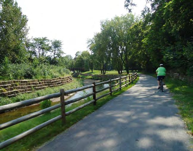
The regional MetroGreen initiative is a “greenprint” for the Kansas City metropolitan area focused on joining urban and rural green corridors throughout the seven-county region. The City of Merriam is an important segment of the 10-mile Turkey Creek Streamway Trail linking the City to others within the region. Merriam should continue to look for opportunities to connect to other greenways throughout the region and continue to provide safe pedestrian and bike facilities from to the existing trail system.
This is the Kansas City region’s 20-year plan for transit and mobility, which envisions efficient, highridership transit service linked by well-located hubs. The SmartMoves 3.0 plan recommended W. 75th Street to be utilized as a rapid transit corridor. More details of how this could impact the City of Merriam is provided in the Public Transit subsection of the modal recommendations further in this section.
Operation Green Light is a regional program operated by MARC, to review, optimize, and coordinate signal phasing along key commuter corridors. Currently, all the signals at I-35 interchanges in Merriam are managed by OGL, as well as along Shawnee Mission Parkway, Johnson Drive from Antioch to Merriam Drive, and Antioch Road from Shawnee Mission Parkway to I-35.
Merriam’s current 5-year Capital Improvement Plan looks at the period of 2020-2024. Specific transportation-related projects on Merriam’s plan are as follows:
• Residential streetlight program – retrofitting new decorative lighting to neighborhoods while streets and neighborhoods are improved.
• Sidewalk city wide in-fill program – connecting just over 27,000 linear feet of areas with no or partial sidewalks, this involves bringing the facilities up to ADA standards.
• Sidewalk maintenance and repair program – City Council directions to assess the exiting conditions of sidewalks throughout the City.
• Reconstruction of W. 67th Street – from the west city limits to Antioch Road, W. 67th is being reconstructed with a 2-inch mill/overlay, new traffic signals and pavement marking, and improved curb/gutter with ADA accessibility.
• W. 67th Street/E. Frontage Road intersection improvements – This is still under study, so the exact impact to the transportation network will be determined after the finishing of the traffic study.
The Northeast Johnson County (NEJC) Chamber of Commerce is dedicated to connecting communities, building relationships and growing business in northeast Johnson County. In addition to Merriam, the organization serves many neighboring communities including Fairway, Mission, and Overland Park, among others. The chamber provides networking opportunities between clients and potential customers, clients and other industry professionals. The NEJC Chamber also serves as a source of knowledge on local laws governing business.
The Downtown Merriam Partnership is an organization created to ensure the continuation and revitalization of Historical Downtown Merriam. They host, organize, or promote community events such as Coffee with a Cop, the Mayor’s Tree Lighting, Merriam Drive Live, Turkey Creek Cruise Night.
In September 2020, Merriam City Council approved a $20,000 grant program that offers a 20% reimbursement for residents installing energy saving systems. Systems covered include solar, wind, geothermal, insulation and high efficiency doors or windows. Residents can combine this grant with the existing Exterior Home Improvement Grant.
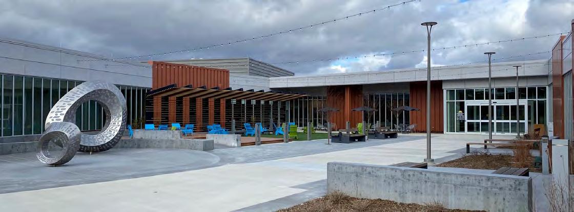
While not an explicit policy, one of the City of Merriam’s chief contributions to prosperity and vitality has been its track record of proactive, generous investments in its public infrastructure. Merriam residents have approved a number of sale tax incentives funding significant improvements to city streets, sidewalks, and stormsewer systems. Residents also supported sale tax funding for the construction of the new Merriam Community Center.
In September 2020, Merriam City Council approved a $50,000 grant program that offers Historic Downtown businesses located between Turkey Creek and the BNSF rail line a 20% reimbursement (between $1,000 and $5,000) for exterior improvements and floodproofing.
Merriam has partnered with the Johnson County Stormwater Management Program to provide $5,000 for an innovative, community-based approach to stormwater quality. The program helps support and educate residents to implement best management practices to reduce stormwater runoff. The goal of program is to encourage residents to incorporate Stormwater Treatment Facilities (STFs) on their property, which include rain barrels, rain gardens and native trees/plantings. Programs such as these help incentivize green infrastructure stormwater solutions. The City website also provides additional links to resources about rain gardens, rain barrels, as well as native trees and plants.
The latest City of Merriam Comprehensive Plan was completed in 2001 and has the following vision statement, “Merriam is a quality place that attracts people because of its strong neighborhoods, accessible shopping, job opportunities, inviting public spaces and its convenient location to regional attractions.” This vision statement was used to guide the plan creation and implementation strategy.
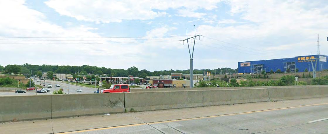
The plan touches many areas of community character and identity. Of note, the plan identified six infill areas suitable for redevelopment, four of which have been completed including the IKEA site and the Car Max development. Quality infill projects help Merriam express a commitment to future success and an ability to evolve to changing conditions.
Merriam has an Exterior Improvement Grant for residents looking to beautify their homes. In 2020, the City invested $50,000 in the program, which provides a 20% reimbursement for exterior improvements upon completion.
Homeowners need to have at least $2,500 in combined repairs/renovations. They may be reimbursed anywhere from $500 up to a maximum of $2,500. All Merriam residents, who do not live in an apartment, may apply.
Covered Improvements include:
• Painting
• Siding
• Fence
• Deck
• Shed
• Roof & Gutters
• Awnings
• Solar panels
• Door/window replacement
• House additions
• Landscaping
• Irrigation system
• Tree removal
• In-ground fire pit or grill
• Removal/repair pool
• New/repair driveway
Beautification grants like this can incentivize reinvestment in neighborhoods, which can improve character and increase the quality of life for residents.
The City of Merriam has a franchise fee rebate program available for residents who meet certain income requirements as established by the U.S. Department of Housing and Urban Development. The program provides an opportunity for refunds of city franchise fees paid on electricity, gas and landline telephone bills.
In October 2020, Merriam City Council approved amendments to the city’s solar installation code to streamline the permitting process for solar panel installation. It removed the conditional use and planning commission review requirements, eliminated the abandonment and disrepair provisions, and now allows solar panels to face the right-of-way.
The City of Merriam received a Planning Sustainable Places (PSP) grant for the purpose of planning the transportation, land uses, and design for the downtown portion of Merriam Drive. The grant money will be used to further refine the best and most sustainable options for the future of the Merriam Drive corridor in the vicinity of Downtown Merriam. The outcome of the project will be to identify specific investments in the street for a “complete street” approach to serve multiple modes, adjacent trails, and adjoining private property to enhance the character of Downtown Merriam in a market-sustainable way.
The second PSP grant is a partnership between Merriam, Overland Park, and the Unified Government of Wyandotte County to review and plan for the Merriam Drive corridor from Merriam to Southwest Boulevard. The purpose of this corridor plan is to analyze the relationship between land use and transportation along Merriam Drive and make recommendations regarding appropriate land uses, internal mobility enhancements, and multimodal opportunities along the corridor, including an opportunity for complete streets and “green” stormwater infrastructure solutions. The study is an opportunity to develop a cohesive development strategy for this historical corridor and connect the gateways of two communities.
All trash haulers operating in Merriam must offer recycling services. Items accepted is dependent upon the trash hauler. In the past, Merriam has held community recycling events with neighbor Shawnee to provide residents an opportunity to drop off a variety of items in one location. The City’s website provides the location of five Recycling Centers in the KC metro area. Additionally, specific rules and regulations for hard to recycle products such as paint or electronics is provided for residents.
In 2016, Merriam hired a consultant team to create a master plan for the parks and recreation facilities in Merriam including the Irene B. French Community Center and the Merriam Aquatic Center. The plan was designed to create a road map for facilities in Merriam now and in the future. It had a significant amount of public input, utilized best practices and level of service analyses and shaped a financial and operation strategy for the department.
A report was completed to determine the best feasible option for the future of 5701 Merriam Drive, the site of the former Irene B. French Community Center. The planning process included a robust engagement effort and economic analysis of likely costs to maintain and update the center. The analysis determined that while the land itself was valuable for the community to keep, maintaining the structure was cost prohibitive. Multiple scenarios were evaluated, and the city decided to demolish the building in the summer of 2020.
South Park Sub-Area Plan was completed in 2007 to develop design options for the South Park Elementary School site and surrounding neighborhood. A four-day charrette was conducted that resulted in five options for the redevelopment of the site ranging from civic-oriented renovations to developer-focused redevelopment. Options were also provided for the Antioch / Merriam Drive intersection and the entire South Park neighborhood. The plan provided recommendations for infill development, transportation considerations, and the school property and building.

Community Character & Identity are all those things that make Merriam unique and separates itself from other metro communities. A community’s character includes the outward message and marketing officially delivered by a community as well as builtin perceptions of the community from residents, visitors and outsiders. Regionally, Merriam is known as being an affordable suburb with excellent access to major roads and amenities. Merriam’s character is undoubtedly shaped by the strong commercial presence in the community, which provides many positive aspects to enhance and negative externalities to address. This chapter identifies the major opportunities and challenges facing Merriam’s character and identity and outlines a strategy to enhance and shape the long-term desired character and identity of Merriam.
Merriam’s community character and identity were assessed using a combination of existing conditions and public input analysis. Some aspects of Merriam’s character, such as it s convenient location and accessibility, is inherent in the physical location of Merriam within the transportation system present in the Kansas City metro area. Other aspects were identified through one-on-one conversations, group discussions and survey findings. A summary of the key findings on opportunities and challenges related to Merr iam’s character and identity are described below.
1. Merriam o f ers eclectic, a f ordable homeownership with a diverse multi-family housing stock that appeals to di f erent ages, income and lifestyles
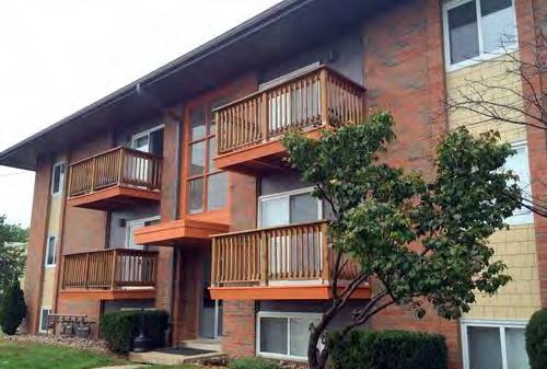
For a suburban community, Merriam has a diverse housing stock that provides several options and density levels. There are duplexes, townhomes, quadraplexes, smaller scale apartment buildings and a few larger apartment complexes. A majority of Merriam’s single-family hous ing stock was constructed in the three decades following World War II, which has a lasting impact on the character, density and style of homes. Merriam has a strong appeal for those looking for a suburban community with non cookie-cutter suburban housing.
2. Merriam has the opportunity to not only attract new families but keep them within the community long-term
The age analysis and anecdotal evidence suggests that while young people and families are attracted to Merriam, likely for its lower cost of housing, proximity to job centers and small-town feel, over time many families outgrow their Merriam homes and move elsewhere as they age or their families grow. Families and longer-term homeownership can help preserve neighborhoods and create a strong sense of community.
3. Merriam’s location and access to jobs, retail and amenities are unparalleled in the region
The most consistent message heard about Merriam was the prime location of the community within the metro area - Merriam offers convenient access to both downtown Kansas City and suburban job centers such as Overland Park and Olathe.
4. Merriam carries a misperception of having higher crime
Merriam struggles with a negative perception regarding crime rates relative to other Johnson County communities. An analysis of the geographic distribution and type of crime indicates this perception is overblown but remains an outside perception the community needs to address.
5. Merriam’s historic past provides a platform for community ch aracter enhancement
Merriam has an interesting history as a transportation and logistics hub for Kansas City- a legacy that persists still to this day. Merriam has and will continue to be defined b y the presence of transportation infrastructure whether it be roads or rail lines. Merriam should continue to celebrate their history through investments in events that showcase this history and overall improvements to historic areas.
6. Merriam has distinct neighborhoods, centers and downtown tha t help create a sense of place
Merriam is composed of over twenty different neighborhoods, thre e major centers and one historic downtown district that helps to create a real sense of place. Preserving these neighborhoods, centers and districts, while also allowing them to mature and adapt to changing conditions, will help promote a positive identity and character in Merriam.
7. Merriam’s quality of life and identity is impacted both posi tively and negatively by Interstate 35
The presence of Interstate 35 through the spine of Merriam prov ides the community’s biggest opportunities and challenges. Logistically, the interstate provides plentiful access and connection between the community and the rest of the metro area but is also can be a cause of physical and cultural divide in the community.
8. Merriam is a welcoming and diverse community
Merriam is a welcoming community that celebrates its diversity and promotes a culture of inclusivity. Identifying ways in which Merriam can continue to strengthen the cultural bond of residents will be a key part of the longterm success of the community.
The Merriam Comprehensive Plan 2040 planning process was guided with a set of goals and a vision statement. Below is an image depicting the seven main goals identified for the plan. Each chapter of the plan will address different elements of the vision statement and reference differen t plan goals. The Community Character & Identity Chapter most closely addresses the Identity & Character Goal.
“ Merriam, and its many neighborhoods, have distinct identities that create a sense of place to foster pride and belonging among residents and attract young families to settle and make their long-term home in Merriam ”
“ The City of Merriam embodies a dynamic, friendly, and family-oriented culture that celebrates our history as a hub of mobility. We are a linkage point for shared amenities , not just for our diverse residents , but also for our neighboring communities.
We recognize and embrace our unique history as an inclusive and well-maintained firsttier suburban community. The City of Merriam enjoys great visibility and convenient access along the I-35 Corridor through its strategic location between other metro communities and Downtown Kansas City.
Merriam offers c onvenient access to shopping and services , an eclectic downtown area , quality civic facilities , diverse and a f ordable neighborhoods , and an enhanced parks and trails network that attracts a wide range of ages and demographics. ”
Merriam is one of several suburban communities in the Kansas City metropolitan area that has a high number of post-World War II homes. The MidAmerican Regional Council and the First Suburbs Coalition hired Piper-Wind Architects to complete this 40-page book, which offers color illustrations of each design and the elements which can be renovated or added in homes from the post-war decades.
Currently, the Idea Book is in the process of being updated to include standards and ideas for Universal Design integration. Universal Design is the design of buildings, products or environments to make them accessible to all people, regardless of age, disability or other factors.

Idea Books such as this and the forthcoming update are excellent sources of information for homeowners looking to grow in place. Older, postwar homes do not always have the amenities seen in modern homes but are still quality, affordable housing options for families and households.
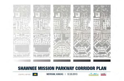
The Shawnee Mission Parkway Corridor Plan was completed by FIRM in YEAR for the City of Merriam. The primary purpose of the plan was to proactively position the City to respond to development proposals on the closed K-Mart site based on community input for redevelopment. After a robust engagement process, it was determined that the community preferred a bold redevelopment plan to grow density of area, improve retail opportunities and provide new civic spaces. There were also transportation Infrastructure enhancements recommended for the area including roadway improvements, traffic signal improvements, and public transit integration.
Corridor-specific studies like this help to improve the sense of place in a community, which helps to improve the community’s identity and character. This plan assessed a struggling commercial center and identified a publicly led strategy to see the area improve over time.
Merriam has an Exterior Improvement Grant for residents looking to beautify their homes. In 2020, the City invested $50,000 in the program, which provides a 20% reimbursement for exterior improvements upon completion.
Homeowners need to have at least $2,500 in combined repairs/renovations. They may be reimbursed anywhere from $500 up to a maximum of $2,500. All Merriam residents, who do not live in an apartment, may apply.
Covered Improvements include:
• Painting
• Siding
• Fence
• Deck
• Shed
• Roof
• Gutters
• Awnings
• Solar panels
• Door/window replacement
• House additions
• Landscaping
• Irrigation system
• Tree removal
• In-ground fire pit or grill
• Removal/repair pool
• New/repair driveway
Beautification grants like this can incentivize reinvestment in neighborhoods, which can improve character and increase the quality of life for residents.
The Neighborhood Island Grant program is a 100 percent reimbursement grant, up to $500, to purchase pre-approved plants and upkeep for one of 20 islands identified by City staff.
All plants must be installed before June 15. Reimbursement will occur after City staff performs a post-installation inspection and verifies ongoing maintenance through August 31. The City gives out one annual grant per island.
This beautification grant helps encourage residents to take a hands-on approach to neighborhood improvement efforts. Beautification programs like these help increase the quality of life by improving the aesthetics of a neighborhood.
The latest City of Merriam Comprehensive Plan was completed in 2001 and had the following vision statement, “Merriam is a quality place that attracts people because of its strong neighborhoods, accessible shopping, job opportunities, inviting public spaces and its convenient location to regional attractions.” This vision statement was used to guide the plan creation and implementation strategy.
The plan touched on many areas of community character and identity. Of note, the plan identified six infill areas suitable for redevelopment, four of which have been completed including the Ikea site and the Car Max development. Quality infill projects help Merriam express a commitment to future success and an ability to evolve to changing conditions.
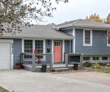
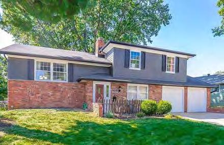
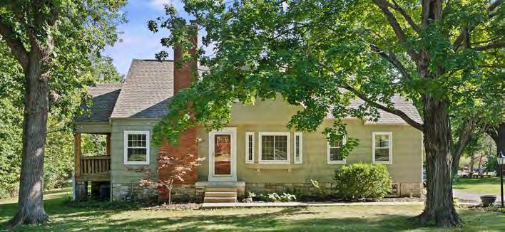
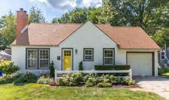
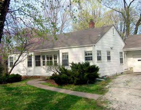
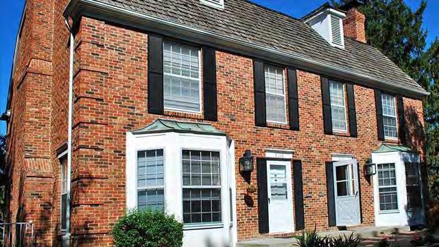
A majority of Merriam’s single-family detached housing was built in the three decades following World War II as the U.S. experienced a boom in population. Over 60% of Merriam’s homes were built between 1950-1979. By comparison, just over 7% of homes in Merriam have been built since 1990. Development patterns and styles have changed over time, creating a lasting impact on the character, density and style of homes. Post-war homes are typically smaller than new construction and were built on smaller lots. While homes from this era may have more character and charm, their age also presents issues related to housing size and amenities. It is common to see one bathroom, one car garage and smaller kitchens in these homes. However, the character of this housing is appealing to residents seeking a more affordable and unique home that offers a hint of urban living with suburban amenities and features.
Rather than shy away from the features and styles of housing in Merriam, the City should continue to view this housing as a major opportunity. While those wanting large, new homes on big lots will likely not be the target audience for Merriam, there are many metro area homebuyers that are looking for the type of features offered by this age of housing stock. These potential residents want homes with character, near the urban core, in established neighborhoods with mature trees and sidewalks. Merriam should continue to embrace their housing stock while also providing incentives and informational tools about how people can grow in place with their homes. Guides such as the Idea Book for Renovating Post War homes created by the First Suburbs Coalition is an excellent example.
Support for existing neighborhoods was a theme that emerged from the community survey completed for the plan. Around 87% would support focusing on property maintenance and neighborhood preservation. Another 70% say maintaining livable neighborhoods should be used to guide growth and development in Merriam.
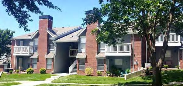
Merriam also has a diverse housing stock – this is especially true for a suburban community. There is a true mix of housing types available for residents to select from, which helps Merriam be a community for people from all backgrounds, ages and income levels. There are duplexes, townhomes, quadraplexes, smaller scale apartment buildings and a few larger apartment complexes. While the majority of dwelling units in Merriam are single-family detached homes (58.9%), there are a large number of units in garden style apartments (1 to 3 story buildings) as well as many duplexes and townhomes.
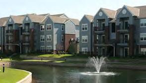
Housing diversity helps promote a well-rounded community that is attractive to people from all ages, income levels and lifestyles. Young people may first move to Merriam to live in an apartment building that offers easy access to downtown Kansas City. As they build wealth, they may want to invest in a home also within Merriam – creating an opportunity for long-term residents with a vested interest in seeing the community continue to grow and improve. Older residents that may no longer want the responsibility of maintaining their own single-family home may also choose to stay in Merriam because of the housing diversity available. Overall, housing diversity in Merriam helps contribute to the robust community they have today.
According to the community survey, 61% support Merriam providing a mix of housing to attract people at various life stages. However, around 34% did not support adding new apartments or condominiums.
Housing affordability is evaluated by comparing housing costs and household income data to determine the percentage of a household’s income is going towards housing costs. Merriam data indicates homeowners generally spend an appropriate amount of their household income on housing. Once housing costs are 30% or more of household income, the household is considered cost burdened. Over half of Merriam households with a mortgage spend less than 20% of their income on housing. Only an estimated 14.9% of homeowners with a mortgage in Merriam are cost burdened. Merriam renters, like most renters in the United States, are significantly more cost burdened than their homeowning counterparts. Over 43% of renters in Merriam pay 30% or more of their household income on rent and other housing costs.
While rent inflation and affordability is a widespread issue across the United States, the affordability of owning a home in Merriam is promising. There appears to be a good match between the income of Merriam homeowners and the cost of homeownership in the community. The median home value in 2018 for Merriam was $160,100. By comparison, Johnson County had a median home value of $244,100 and neighbor Overland Park $261,200. The lower cost of homeownership in Merriam is a major selling point of the community to those metro residents desiring to live in the suburbs of Johnson County without the price tag typically seen in the area.

According to the ETC community survey, 71% of residents feel the housing options in Merriam match their price range.
The age analysis for Merriam between 2000 and 2010 suggests that while there is an influx of people in their twenties and young children (ages 0-9), there is an exodus of late thirty and forty year old’s and elementary and teenage children. Anecdotally, people say the lower cost of living and convenient access to downtown Kansas City attracts younger people and families but over time they leave. This could be for a variety of reasons including perception that the community is not family friendly, home sizes, jobs, or schools. Merriam should continue to work to address these perceptions and fill-in any existing voids in the amenities offered. It is also important to note that families come in many forms and sizes and Merriam should continue to support families of all types.
Merriam has already put a substantial amount of effort and funding into creating the type of amenities and atmosphere desired by families; the new community center being a prime example. This effort to market Merriam’s desirability for families should be continued. Families typically look for a safe community with affordable homes, quality schools, access to parks and trails and amenities such as community or recreation centers. Merriam already offers these to those familiar with the community – the City needs to continue to market these features and continue to improve and expand the quality and availability of those other amenities such as parks, community events and perception of safety.
Positive net cohort changesespecially in ages 25 to 29 years and ages 30 to 34 years
Negative net cohort changesespecially in ages 40 to 44 years and ages 35 to 39 years
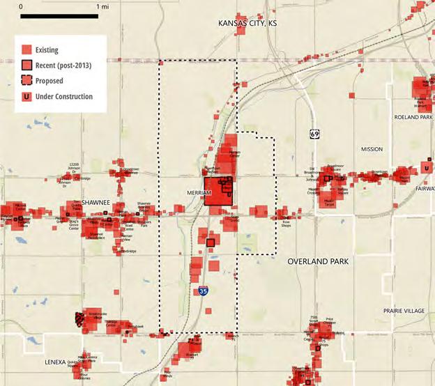
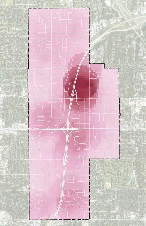
Merriam brings in over 13,000 workers from other communities for jobs based in Merriam. Between 2007 and 2017 there were sizable net increases in the number of jobs based in Merriam in wholesale trade (+769), retail trade (+681), health care & social assistance (+379) and transportation and warehousing (+338). Merriam is also conveniently located between other major job centers including downtown Kansas City, Missouri, and suburban job centers such as Overland Park and Lenexa, Kansas. A 5, 10 and 15-minute drive analysis of Merriam, shown in Figure 1.2, indicates almost the entire metro area can be easily accessed by Merriam residents.
Merriam offers tremendous access to retail both locally and regionally. There are industries and stores present in Merriam people come specifically to Merriam to shop for including the region’s only Ikea store and the large auto sales industry present along the interstate. Merriam has over 1.9 million square feet of enclosed retail space (including auto dealerships) with a vacancy rate (pre-COVID) of 6.1% - almost all of which was accounted for by the 108,000 square feet of the former K-Mart building. All of this retail brings people into Merriam which, on typical years, is an excellent source of tax revenue for the City. These amenities help define the image of Merriam to the region and make for an excellent amenity for residents. Access to the Interstate and numerous major arterial roadways also allows easy access to regional retail such as the Oak Park Shopping Center or the Plaza in Kansas City.
Merriam has within its city limits a regional trail along a water feature, a brand-new community center, a wellconnected linear park system, a large regional Antioch Park, a historic downtown, and a library. It is a community that has proven its ability and determination to invest in itself and its future. As with jobs and retail, almost any amenity not within the city itself will be an easy journey from Merriam because of its transportation system.
There appears to be a mismatch between the quality of life in Merriam and the misperceptions of safety and crime in Merriam. Concern over crime was brought up as an existing condition the City and other members of the planning committee wanted discussed. The geographic distribution of the crimes in Merriam between 2000 and 2019 indicate a strong clustering of crimes in the area around Merriam Town Center with most residential areas having low crime density. Largely, crimes in Merriam occur in the commercial centers with some hot spots of activity also occurring near certain intersections with Interstate 35. Property crime, such as petty theft or motor vehicle theft, are common crimes committed in Merriam, which may be related to the amount of commercial land located in the City.
Crime rates are calculated using the residential population of Merriam - a number which is significantly lower than some of its neighbors such as Overland Park and Shawnee. The daytime and nighttime population of Merriam, the latter of which is used to determine crime rates, are very different likely inflating the crime index rates for Merriam. There are a large number of people who come into Merriam each day to work, or to shop or even just drive through on the interstate. All of this commercial activity and easy access into and out of the area is likely a contributing factor to the
number and type of crimes committed in the community.
Crimes do occur in Merriam, but the lower residential population seems to unfairly inflate the crime rate for the community. Changing this perception and working to continue to attract families to stay in the community long-term will likely be a matter of messaging for the community. Focusing on all of the amenities, community events, and other family-friendly activities in marketing and social media will likely help dampen any misperceptions about crimes in the area. Staying positive and highlighting the safe and family-friendly community features will be key.
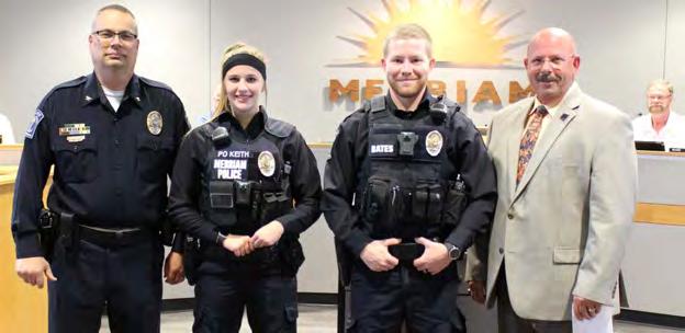
Merriam’s Police Department does an excellent job with outreach into and with community members hosting events such as Coffee with Cops and holding Citizens Academy training sessions. Staffing levels for the Merriam Police Department are above national standards for communities of Merriam’s size and for the region. This positive police and community relationship is highly valuable and should continue to be enhanced and promoted.

Merriam has a storied history as a logistic and transportation hub for the Kansas City region starting with trolley and rail lines in the late 1800s and transitioning to automobiles and interstates over time. It is a legacy still in existence today - with both important interstate and rail lines traversing the length of Merriam. There are a large number of auto dealerships and auto-related services located along Interstate 35, a specialty retail for which Merriam is known regionally. Further, Downtown Merriam is currently home to a number of car repair shops. An antique car show, the Turkey Creek Car Show, is held annually in Downtown Merriam. This transportation and carrelated history should continue to be highlighted and embraced. Authentic history is appealing to residents and can help support the identity, character and charm of Merriam. Specific ideas for integrating car themed amenities into Downtown Merriam are further explored in Chapter 3 - Sub Area Plans.
More and more the need to celebrate and embrace diversity, in all of its forms, is being recognized as an important priority for communities. Merriam is not a homogeneous community - there is a wide range of racial / ethnic representation, people from all income levels and many other factors that make residents unique. There are a multitude of ways in which a community can celebrate or promote diversity ranging from more simple tasks such as supporting community or cultural events to more s ignificant changes such as identifying staffing or structural changes the city can accomplish.
The hosting, support and/or promoting of different cultural even ts in Merriam is one way to highlight and celebrate Merriam’s diverse residents. Merriam can also encoura ge members from a diverse set of backgrounds or cultures to become more involved in community and civic engagement through acts such as running for local office, serving on boards or commissions, participating in the Po lice Citizen Academy, or simply attending public meetings. For non-native English speakers, the City could consider creating a website or city guide or documents with a Spanish language option. Some communities have gone so far as to hire a diversity coordinator who is responsible for monitoring and promoting diversity in city functions and activities.
As a built-out community, Merriam has a near fully developed set of neighborhoods, centers and districts. While there has been several recent redevelopment areas within the community, much of Merriam has a more mature building stock. Mature buildings can come with character and a sense of place, but there are also improvements and revitalization efforts that must accompany these areas over time to ensure the neighborhoods, centers and districts are healthy and meet the demands of the future.
Merriam has over twenty identified neighborhoods spanning the lengths of the city. Given the general age of most homes in Merriam neighborhoods, neighborhood preservation efforts can be a good way to ensure neighborhoods are being kept up and cared for. There are several avenues cities can take to achieve neighborhood preservation. Neighborhood organizations are one way neighborhoods can come together and collectively target areas of improvement and enhance relationships with neighbors. Similarly, neighborhood branding or identity efforts can help create a sense of place and add character to neighborhoods. This could include special signage, street furniture or other streetscape enhancements. A neighborhood guide could be created that highlights the over twenty distinct neighborhoods in Merriam. Assessing and improving the sidewalk connectivity for pedestrians between neighborhoods can also improve the quality of life in Merriam neighborhoods.
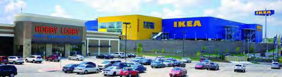
Merriam’s main centers include the Merriam Town Center, Merriam Village and the Advent Health Medical Campus. Merriam should keep these centers healthy and resilient, so they are able to adapt to changes in retail or commerce. The adding of the Ikea to Merriam Village was an example of a successful reimagining of a struggling commercial center. Quality centers will have a balance of automobile and pedestrian access, updated signage and streetscapes nearby as well as retail and services that fulfill the needs of residents and visitors.

Downtown Merriam is an important asset that should be preserved and enhanced in a way that embraces the historic past of the area while also providing amenities to keep the area relevant for residents today. There was feedback from residents about the need for improved retail and aesthetics in Downtown Merriam today. While the automobile industry is an important sector for Merriam, several people complained about the number of junk lots present in the area. Others said that different retail is needed to attract people into the district. Issues with the look and type of industries present are compounded by the floodp lain that covers much of the downtown core. Chapter 3 - Sub Area Plans explores different options for downto wn redevelopment and improvements.
Connected is a word often used to describe Merriam due to its numerous arterial roadways and interstate access. Interstate 35 is a defining characteristic of Merriam impacting the way in which Merriam is perceived within the metro. As important as logistics and access are to Merriam’s success, more and more bicycle and pedestrian connectivity is another key feature for which people want to see improvements. Below are elements impacting the community character and identity of Merriam as it relates to the interstate and other major arterial roadways.
While the interstate and other major arterials in Merriam help provide connectivity and logistical benefits, the roadways should aim to have minimal negative impact on the residents that live in Merriam. Numerous residents brought up a lack of safe crossings over Interstate 35 as an issue in the community. Safe pedestrian and bicycle crossings over Interstate 35 and across other major arterial roadways can improve the quality of life for bicyclists and pedestrians as well as motorists.
Interstate 35 moves thousands of members of the motoring public through Merriam each day as they head north or south through the Kansas City region. Merriam is the only KC metro community whose downtown is visible from Interstate 35. The look and feel of Merriam from the Interstate are a key part of how the community is perceived by visitors and residents of other metro communities. Analyzing weak spots or areas of concern in the look and feel of Merriam from Interstate 35 could be one way to improve the perceived community character of Merriam. Chapter 3 Sub Area Plans outlines a possible strategy to revitalize the look of downtown Merriam from the interstate.
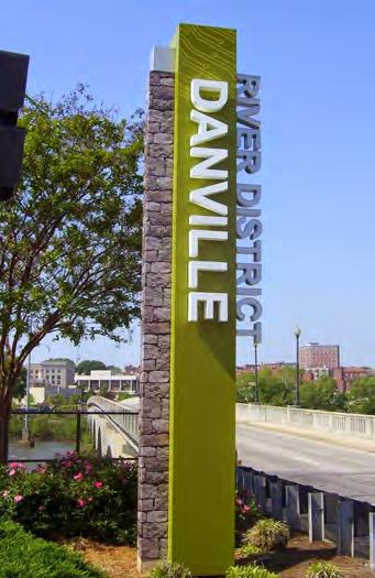
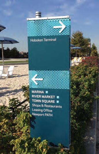
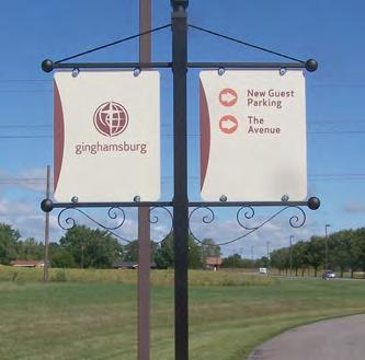
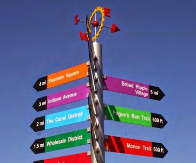
Attractive entry and informative directional signage can go a long way in creating a sense of place and defining the character of a com munity. Merriam has several interchanges and multiple arterial roadways that would make ideal locations for signage enhancements including gateway signage, banner signage or directional signage that encourages the motoring public to explore other areas of the community. Figure 1.2 the Community Character Strategic Opportunities map identify some possible area for new signage.
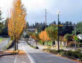
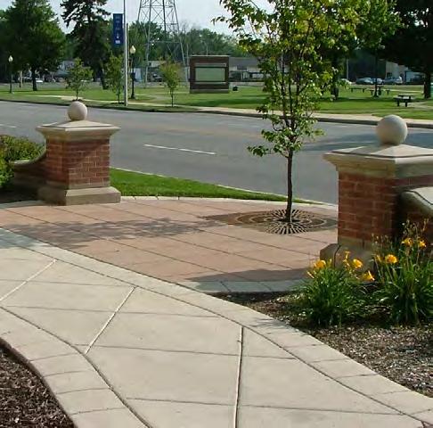
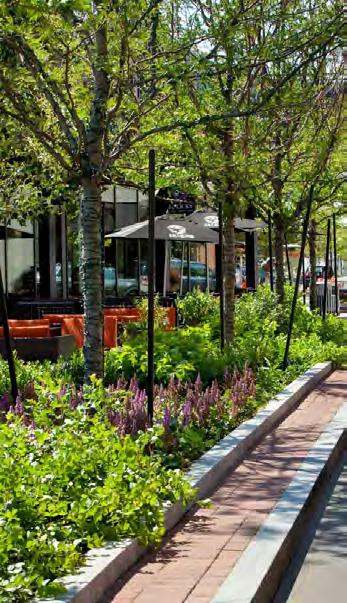
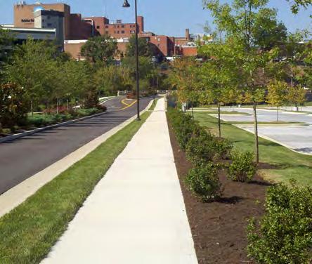
Merriam does not have control over the streetscape of Interstate 35 but does have some control over the streetscapes on other major arterial roadways in the community. Streetscapes are all the visual elements of a street, including the road, adjoining buildings, sidewalks, street furniture, trees and open spaces, that combine to form the street’s charac ter. Streetscape enhancements can define the sense of place and chara cter of an area - this is especially true in higher volume arterial roadways.
When asked in the community survey, 60% said improving sidewalk s and trails will improve quality of life and 94% strongly agree the city needs to maintain its street, sidewalks and storm sewer infrastructure.


GOAL 1 -
ENHANCE AND PROMOTE THE ECLECTIC HOMES & HOUSING DIVERSITY FOUND IN MERRIAM
No. Action Item
A1 Promote and expand guides such as the Ideas Book for Renovating Postwar Homes to encourage Merriam homeowners to renovate their homes in order to grow their families in Merriam
A2 Consider expanding the Exterior Renovation Grant to include certain modernization renovations such as a second bathroom or larger kitchen to encourage residents to renovate homes rather than move to a bigger one elsewhere
A3 Explore incentives to renovate older homes in Merriam through the use of a revolving loan fund or residential tax abatement on the added improvement’s value
A4 Continue to support Merriam’s landlord licensing and rental inspection program to ensure Merriam’s multifamily housing stock remains well-maintained and safe
GOAL 2 -
No. Action Item
A1 Continue to market the many amenities offered in the community through publications and social media postings
A2 Promote Merriam as an affordable place to buy a home based on the more modest median home value compared to other places in Johnson County
GOAL 3 -
No. Action Item
A1 Identify a marketing campaign that highlights Merriam’s accessibility to jobs, retail and amenities
GOAL 4 -
WORK TO IMPROVE MERRIAM’S IDENTITY AS A SAFE AND FAMILY-FRIENDLY COMMUNITY
No. Action Item
A1 Continue to promote the positive quality of life and safety of Merriam neighborhoods in city marketing and social media posts
A2 Continue to support Merriam Police as they identify ways to lower the number of crimes occurring in and around the Merriam Town Center
GOAL 5 -
CELEBRATE MERRIAM’S HISTORY & DIVERSITY AS A MEANS OF CHARACTER DEVELOPMENT
No. Action Item
A1 Select a path forward to enhance the streetscape and character of Downtown Merriam while also highlighting the auto-centric nature and history of the community and area
A2 Identify a set of strategies to address ways to celebrate diversity in Merriam including community events and cultural celebrations
A3
Review city policies as it relates towards diversity to identify areas where minorities or other underrepresented groups can become more involved in Merriam’s civic life (employment, elected officials, commissions/boards, or committees)
GOAL 6 -
PRESERVE AND SUPPORT MERRIAM NEIGHBORHOODS, CENTERS AND DOWNTOWN
No. Action Item
A1
Encourage the formation of neighborhood organizations to support neighborhood development and to design a branding for the neighborhood including banner or gateway signage or another unique streetscape amenity
A2 Create a guide to neighborhoods in Merriam highlighting the unique traits offered by each neighborhood
A3 Periodically review the health and resiliency of Merriam’s commercial centers through one-on-one meetings with owners and tenants to identify areas in which the city can provide appropriate improvements
A4 Regularly review and support the long-term vision for the future of Downtown Merriam
A5 Determine how the City should address the downtown floodplain
GOAL 7 -
ADDRESS ISSUES AND OPPORTUNITIES CREATED BY INTERSTATE 35 & OTHER MAJOR ARTERIALS
No. Action Item
A1 Continue to improve pedestrian crossings over/under Interstate 35 and along other major arterials to improve the safety and experience for all modes of transport
A2 Identify and create an entry and/or gateway signage strategy for key entrances into the community as identified on the Community Character Strategic Opportunities Map
A3 Identify streetscape improvements for key arterials and areas of the community that can best create a sense of place and improve the experience of residents and visitors traveling through Merriam
A4 Identify those areas along Merriam’s stretch of Interstate 35 w here aesthetic improvements, such as façade enhancements or public art, can be made or added to improve how Merriam is perceived by the traveling motoring public
The amenities and services available to residents and businessowners within Merriam have a significant impact on the quality of life in a community. Merriam has made substantial investment in itself as a community proving its commitment to improving the quality of the amenities and services available to residents. This chapter discusses the various strategies Merriam has and should continue to implement in regards to health and well-being, infrastructure, parks and recreation, trails, public safety and several other quality of life issues.
The Merriam Comprehensive Plan 2040 planning process was guided by a set of goals and a vision statement. Below is an image depicting the seven main goals identified for the plan. Each chapter of the plan addresses different elements of the vision statement and references differe nt plan goals. The Amenities & Service Enhancements Chapter most closely addresses the Quality Public Services Goal. Merriam has already exhibited a strong commitment to quality public services and this chapter will address each of the facets of services described within the goal including medical and social services, educational facilities, recreation & parks, community buildings, public safety and infrastructure.
“People are attracted to Merriam because of the continued investment in the quality of medical and social services, educational, recreation, public safety, and infrastructure, all of which help improve the health and wellness of residents.”
“ The City of Merriam embodies a dynamic, friendly, and family-oriented culture that celebrates our history as a hub of mobility. We are a linkage point for shared amenities , not just for our diverse residents , but also for our neighboring communities.
We recognize and embrace our unique history as an inclusive and well-maintained firsttier suburban community. The City of Merriam enjoys great visibility and convenient access along the I-35 Corridor through its strategic location between other metro communities and Downtown Kansas City.
Merriam offers convenient access to shopping and services , an eclectic downtown area , quality civic facilities , diverse and a f ordable neighborhoods , and an enhanced parks and trails network that attracts a wide range of ages and demographics. ”
In 2016, Merriam hired a consultant team to create a master plan for the parks and recreation facilities in Merriam including the Irene B. French Community Center and the Merriam Aquatic Center. The plan was designed to create a road map for facilities in Merriam now and in the future. It had a significant amount of public input, utilized best practices and level of service analyses and shaped a financial and operation strategy for the department.
A report was completed to determine the best feasible option for the future of 5701 Merriam Drive, the site of the former Irene B. French Community Center. The planning process included a robust engagement effort and economic analysis of likely costs to maintain and update the center. The analysis determined that while the land itself was valuable for the community to keep, maintaining the structure was cost prohibitive. Multiple scenarios were evaluated, and the city decided to demolish the building in the summer of 2020.
The regional MetroGreen initiative is a “greenprint” for the Kansas City metropolitan area focused on joining urban and rural green corridors throughout the seven-county region. The City of Merriam is an important segment of the 10-mile Turkey Creek Streamway Trail linking the City to others within the region. Merriam should continue to look for opportunities to connect to other greenways throughout the region and continue to provide safe pedestrian and bike facilities from to the existing trail system.
Merriam’s current 5-year Capital Improvement Plan looks at the period of 2020-2024. Specific transportation-related projects on Merriam’s plan are as follows:
• Residential streetlight program – retrofitting new decorative lighting to neighborhoods while streets and neighborhoods are improved.
• Sidewalk city wide in-fill program – connecting just over 27,000 linear feet of areas with no or partial sidewalks, this involves bringing the facilities up to ADA standards.
• Sidewalk maintenance and repair program –City Council directions to assess the exiting conditions of sidewalks throughout the City.
• Reconstruction of W. 67th Street – from the west city limits to Antioch Road, W. 67th is being reconstructed with a 2-inch mill/overlay, new traffic signals and pavement marking, and improved curb/gutter with ADA accessibility.
• W. 67th Street/E. Frontage Road intersection improvements – This is still under study, so the exact impact to the transportation network will be determined after the finishing of the traffic study.
South Park Sub-Area Plan was completed in 2007 to develop design options for the South Park Elementary School site and surrounding neighborhood. A four-day charrette was conducted that resulted in five options for the redevelopment of the site ranging from civic-oriented renovations to developer-focused redevelopment. Options were also provided for the Antioch / Merriam Drive intersection and the entire South Park neighborhood. The plan provided recommendations for infill development, transportation considerations, and the school property and building.
Merriam has partnered with the Johnson County Stormwater Management Program to provide $5,000 for an innovative, community-based approach to stormwater quality. The program helps support and educate residents to implement best management practices to reduce stormwater runoff. The goal of program is to encourage residents to incorporate Stormwater Treatment Facilities (STFs) on their property, which include rain barrels, rain gardens and native trees/plantings. Programs such as these help incentivize green infrastructure stormwater solutions. The City website also provides additional links to resources about rain gardens, rain barrels, as well as native trees and plants.
In September 2020, Merriam City Council approved a $20,000 grant program that offers a 20% reimbursement for residents installing energy saving systems. Systems covered include solar, wind, geothermal, insulation and high efficiency doors or windows. Residents can combine this grant with the existing Exterior Home Improvement Grant.
While not an explicit policy, one of the City of Merriam’s chief contributions to prosperity and vitality has been its track record of proactive, generous investments in its public infrastructure. Merriam residents have approved a number of sale tax incentives funding significant improvements to city streets, sidewalks, and stormsewer systems. Residents also supported sale tax funding for the construction of the new Merriam Community Center.
The City of Merriam received a Planning Sustainable Places (PSP) grant for the purpose of planning the transportation, land uses, and design for the downtown portion of Merriam Drive. The grant money will be used to further refine the best and most sustainable options for the future of the Merriam Drive corridor in the vicinity of Downtown Merriam. The outcome of the project will be to identify specific investments in the street for a “complete street” approach to serve multiple modes, adjacent trails, and adjoining private property to enhance the character of Downtown Merriam in a market-sustainable way.
The second PSP grant is a partnership between Merriam, Overland Park, and the Unified Government of Wyandotte County to review and plan for the Merriam Drive corridor from Merriam to Southwest Boulevard. The purpose of this corridor plan is to analyze the relationship between land use and transportation along Merriam Drive and make recommendations regarding appropriate land uses, internal mobility enhancements, and multimodal opportunities along the corridor, including an opportunity for complete streets and “green” stormwater infrastructure solutions. The study is an opportunity to develop a cohesive development strategy for this historical corridor and connect the gateways of two communities.
Merriam is fortunate to have a large hospital within its borders, Advent Health Shawnee Mission. The Advent Health Shawnee Mission hospital is located as 9100 West 74th Street along Merriam’s southern boundary. Advent Health is one of the largest health care providers in the United States and offers many services within its Merriam location including radiation oncology, a heart clinic, pulmonology and endocrinology. There are also several support medical offices nearby expanding the availability of services such as pediatrics and dentistry. There are many levels of benefit associated with the hospital and clinics. Health Care & Social Services are one of the major industry sectors in Merriam - bringing jobs and people to Merriam every day. Additionally, easy access to healthcare can be especially attractive to residents or potential residents wanting to age in place. Not having to travel to another part of the metro for on-going care can be a strong benefit to all but this is may be especially true for households with young children or older residents with chronic medical issues. Merriam should continue to support the hospital and clinics and make sure to market this attractive amenity when promoting the many benefits of living and working in Merriam.

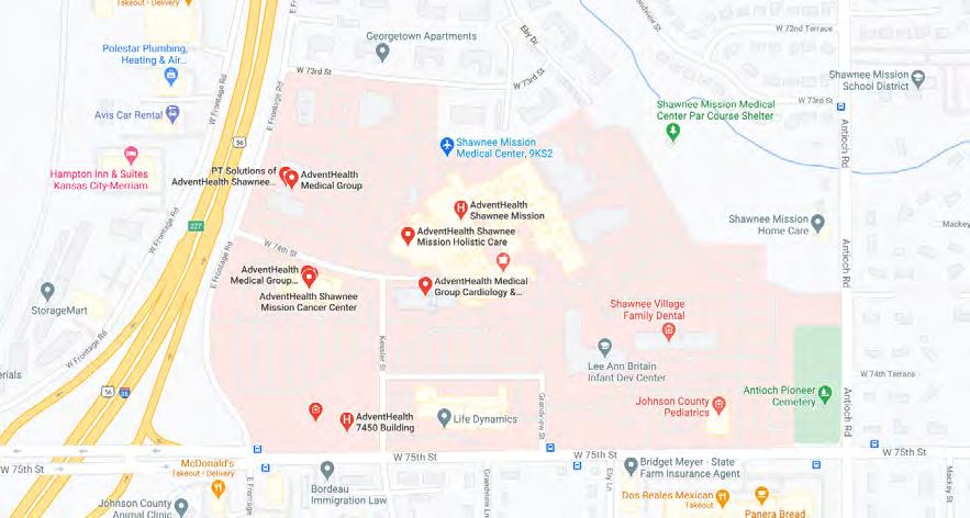
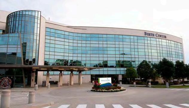


Merriam is located within the Shawnee Mission School District, which has been recognized by the U.S. Department of Education and the Kansas Department of Education for its quality academic programs. The Shawnee Mission District is the third largest school district in the State of Kansas serving more than 27,000 students. Merriam has two of the districts thirty-four (34) elementary schools within its city limits. The school district has demonstrated its commitment to Merriam and the surrounding neighborhoods by reconstructing the Crestview Elementary School and performing significant upgrades to the Merriam Park Elementary School. Merriam students attend two of the district’s five middle schools and one of the district’s five high schools, all three of which are located just outside of Merriam city limits.
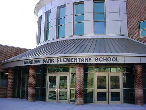
Figure 2.2 below shows the location of each school. Merriam should continue to promote its excellent school district in any marketing campaign. The City should also support the school district with any possible updates, expansions of improvements of school property located with Merriam.


Merriam does not have any higher educational institutes within its boundaries. However, there are two smaller colleges just outside the city limits: the Kansas Christian College and the Kansas College of Nursing. The Johnson County Community College (JCCC) is around 8 miles south of Merriam in Overland Park. Figure 2.3 shows the locations. The Kansas Christian College, located in Overland Park just outside Merriam, offers several religious-based programs including religion and worship ministry as well as programs in elementary education and business leadership, among others. The Kansas College of Nursing is located in Lenexa, KS, and offers a variety of nursing-based programs. Finally, the Johnson County Community College (JCCC) is located south of Merriam in Overland Park. There are a wide variety of credit and continuing education programs offered at JCCC. Johnson County residents receive a reduced tuition cost per hour ($94 / credit hour as of 2020). Merriam can market its location to nearby higher educational institutes as well as promote the lower cost tuition residents can receive at JCCC.


There are many other higher education opportunities available for residents within the greater Kansas City metro area including more traditional and larger state schools such as the University of Missouri - Kansas City and the University of Kansas is located in Lawrence, KS, approximately 35 miles southwest of Merriam.

Additional educational opportunities available for Merriam residents include community and/or civic education. One current example of this in Merriam is through the police department. The Merriam Police Department offers a Citizens Police Academy program in which residents are offered an opportunity to see what officers do on a daily basis. It is a 10-week program that meets weekly to help strengthen relationships within the community. Participants learn about home security, traffic enforcement and accident investigation among many other topics.
Other opportunities to provide expanded civic educational options include creating an in-person or, more simply, a downloadable city services 101 course or a “how to become more engaged” webinar or video. While there would be some investment of time and resources to create this program or video, this type of outreach effort may encourage increased levels of civic or community engagement and strengthen the sense of community within Merriam and among residents. It may also help to attract more residents to serve on boards or commissions or to run for public office. Community outreach like this could be targeted to people within Merriam that may not attend many meetings including young people or some of the minority communities present within Merriam. There are many services and programs available for Merriam residents that some may not be aware of and this sort of program could help change this.
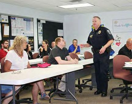

Libraries are an additional source of education and greatly contribute to the overall quality of life for Merriam residents. Merriam is served by the Antioch Library located near the civic complex at 8700 Shawnee Mission Parkway. The Antioch branch is part of the Johnson County Library District which serves Johnson County and the metropolitan area. Services available include book lending, photocopy service, a browsing room, study and meeting rooms, a reference room, rental books, a children’s section, exhibits, library tours and classes, and free film and music programs.
The City of Merriam is actively working with the Johnson County Library Board and moving forward with relocating the Antioch Library to the new Community Center campus. This idea was studied and approved by the Library Board. The replacement library building is expected to be a 16,000 SF facility with a drive-thru for holds pickup and material return. The anticipated completion date of the library is 2023. This joint investment of the Johnson County Library Board and the City of Merriam is a great step towards maintaining and improving upon the quality of life and amenities provided to Merriam residents.
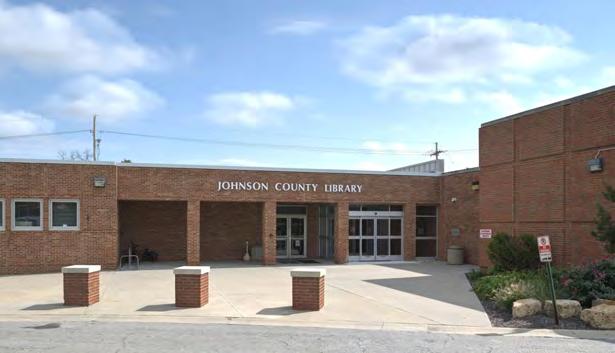
The Existing Conditions report of the Merriam Comprehensive Plan 2040 evaluated the level of service for Merriam residents. The level of service is based on total park acres per 1,000 residents. This level of park service analysis is used nationwide as an indicator of whether a community is providing enough physical acres of park space based on its population. Table 2.2 shows the overall results for Merriam. The table shows Merriam exceeds the recommended 10.5 acres / 1,000 residents in total parkland and has approximately 141.3 acres of park within its boundary providing residents with 12.6 acres per 1,000 residents. Figure 2.4 shows the location and names of parks within Merriam.
A walk-time analysis for Merriam’s parks was also completed to estimate how much of the community is within a 5-, 10- or 15-minute walk-time of Merriam’s parks. Figure 5.5 shows the results, which indicate most of the community lives within a reasonable (5 to 15 minute) walk-time of a park. Based on parcel data, an estimated 93.2% of all residential parcels in Merriam fall within the 15-minute walk-time category.
Overall, the amount of parkland and the geographic distribution of parkland in Merriam is strong. As a mainly built out community, acquiring additional parkland will be less important than making sure the existing parks continue to serve the community based on the amenities, features, accessibility and programming of the parks.
* Johnson County Park **Overland Park City Park
Source: Confluence, with inputs from Johnson County & City of Merriam
Source: Confluence with inputs from Johnson County & City of Merriam

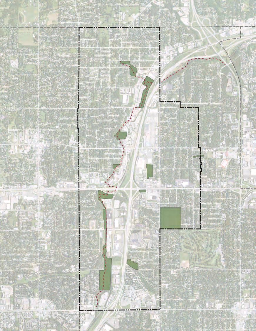
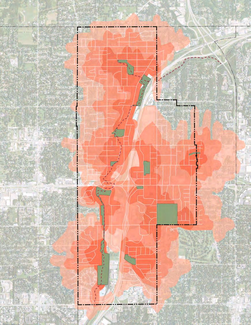
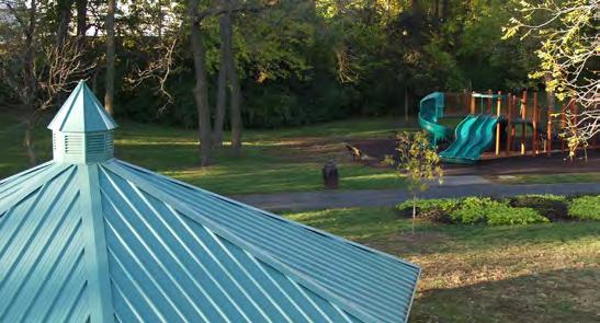
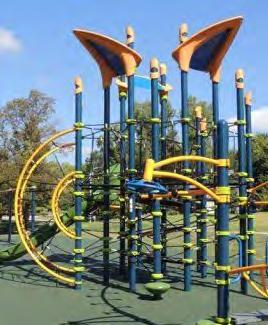
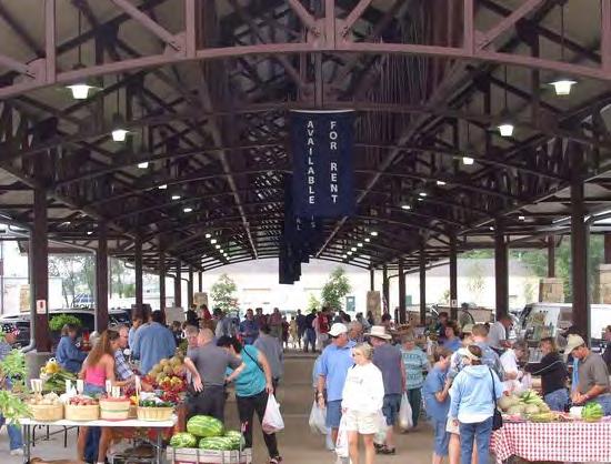
Public input on Merriam’s parks and recreation system were included throughout the engagement exercises completed for the Merriam Comprehensive Plan 2040.
In the ETC survey, 87% of the respondents rated Merriam’s parks and recreation as excellent or good. When asked what amenities or features they most frequently utilized 54% said trails and 46% said park space for active or passive recreation. Similarly, these two amenities were listed as the top priorities for the community to consider. When asked about how to improve quality of life in Merriam, 60% said improving sidewalks and trails. Over 55% of respondents said they would support improving parks & recreation amenities such as playground equipment, shelters & restrooms.
On the interactive mapping exercise, respondents indicated they were generally very satisfied with the existing parks in Merriam. Respondents mentioned the great amenities, commenting especially on the newly added amenities, such as the dog waste stations in Brown Memorial Park. The only ideas or criticisms of the park system regarded accessibility. Some brought up ideas for pedestrian crossings with landscape refuge islands on busier streets and better sidewalk connections to parks. Another brought up the idea of adding a community garden to the 5701 Merriam Drive site where the Irene B. French Center once stood.
While Merriam does not need to acquire additional parkland, the city should make sure to continue to respond to the recreation needs and preferences of its residents. The role of parks have changed over time and the COVID-19 pandemic has highlighted the need for flexible and adaptive park space. Parks should be multi-generational, serving the needs and varied preferences of young and old residents. Fun playground equipment is as important as space for young adult recreation leagues. Active and passive recreation for senior’s is also important. Merriam should continue to be proactive in providing exceptional parks and recreation service.
Merriam should perform regular life cycle analyses of its park facilities, equipment and programming to evaluate if a particular facility or equipment is desired, needs maintenance or should be phased out. This could be done in tandem with any community survey work being performed by the city. Questions about specific park facilities and industry trends should be included in these outreach efforts. This will help ensure the park system is being efficient in meeting the recreation needs of its residents. Programs or facilities that are no longer serving the community should, longterm, be replaced with ones that better meet new preferences.
Playground trends have continued to evolve over time based on safety standards and user preferences. The more recent trends for playground equipment include the integration of technology to help keep children engaged, many of which have grown up with telephone and computer screens. Another trend is the design of more natural playscapes that include interactive water features and more natural stones and materials. Many playgrounds now have prominent themes used in the design of the equipment and landscaping. Others have started to add durable musical features into the equipment.
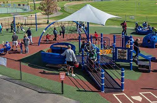
Inclusive Playgrounds are special parks designed for users of all ability levels including those with limited mobility, sensory, visual or hearing impairments. There has been a growing trend to add inclusive playgrounds into park systems. While specially designed, these playgrounds are still fun and engaging for all children. These parks tend to be regional draws. An example of an inclusive playground is a Miracle League park that provides opportunities for all abilities to play baseball through the use of specialized rubber turf. Grants are available to fund Miracle League playgrounds.
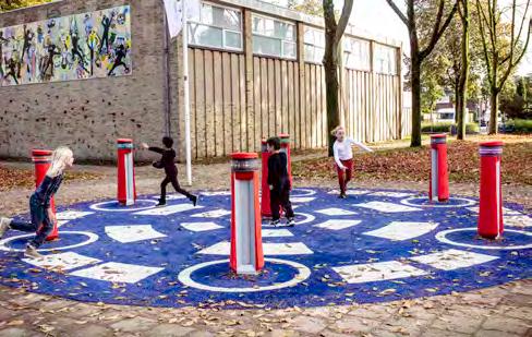
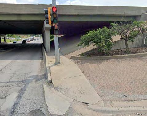
Trails are valuable community assets that provide a place for safe recreation and accessibility to residents. Residents may use trails for a variety of recreational activities or exercise. Some may also rely on trail systems as part of their commute to work or entertainment if they walk or bike as a form of transportation. Ideally, trails connect neighborhoods to amenities such as parks or community centers or commercial corridors such as Downtown Merriam or Merriam Town Center. Merriam is fortunate to have within its boundaries one large regional trail, the Turkey Creek Streamway. This trail is located alongside Turkey Creek, which runs north-south through Merriam along Interstate 35. The Turkey Creek Streamway trail connects many of Merriam’s parks to one another.
Merriam has made great strides in expanding the sidewalk offerings within the community through their sidewalk program. This work should continue to be pursued. However, some sidewalks along key streets throughout the community should be potentially widened and designated as multi-purpose trails for both bicycles and pedestrians. These multi-purpose trails could encourage non-motorized transit as some bicyclists may not feel comfortable riding their bike onstreet even with marked “sharrows”. These multi-purpose trails could be enhanced through strategically placed wayfinding signage or amenities such as trash receptacles or benches. Ideally, these multipurpose trails would be located alongside existing transit routes and stops within the community. Figure 2.6 shows the proposed locations of these trails based off the street system, location of amenities and transit routes in Merriam.
Merriam’s westside greatly benefits from the Turkey Creek Streamway trail and the access it provides to the entire string of greenbelt parks Merriam has along Turkey Creek. While eastside Merriam residents have close physical proximity to these trails, they have few safe pedestrian or bike crossings of Interstate 35 to get to the trailheads. Residents on the east of Interstate 35 may realistically have to drive to a trailhead to access this regional amenity. It should be a priority for the community to address in the planning horizon. This topic is also addressed in Chapter 4 - Transportation & Mobility. While the cost of this type of improvement is substantial it is a major missing piece in Merriam’s trail connectivity and accessibility.
In the ETC community survey, trails were listed as the most frequently used park amenity in Merriam (54%) - it was also one of the two most important park priorities. Approximately 58% said it is important to allocate funding to walking, biking and transit infrastructure and 60% said improving sidewalks and trails would improve quality of life in Merriam. Over 62% agreed the city should incorporate additional pedestrian amenities along existing city corridors to improve walkability.
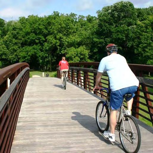
Most of Merriam’s city buildings are now located within the civic campus area near the intersection of Ikea Way and W 62nd Street, south of the IKEA store. The anchor of this area is the Merriam City Hall, which is located at 9001 W. 62nd Street. In addition to most of the eight city-led departments, city hall also houses the Merriam City Municipal Court, and the Overland Park Fire Station 46, which under a joint agreement between Merriam and the City of Overland Park, provides fire protection for the area. Merriam Public Works is located in a dedicated building at 6901 Knox Street near the Turkey Creek Streamway Trail west of Interstate 35.
The City of Merriam began discussing the possibility of a new community center in 2014. The City started the process of creating a community vision and planning for the future of recreation in the community. In September 2017, Merriam voters approved a sales tax initiative to build a new $30 million community center. The Merriam Community Center was completed in summer of 2020. The 66,000 SF facility meets many community needs and is an excellent amenity providing an indoor track, gym, fitness center, classroom space, child watch area, art gallery, indoor and outdoor pools and the parks and recreation department staff offices. This is a remarkable facility that helps Merriam standout from other nearby communities.
The 5701 Merriam Drive site was home to the Irene B. French Center. The Irene B. French Center was the original Merriam School building that was constructed in 1911 and since then underwent a series of additions while serving an evolving purpose in its long history. In 2015, Merriam started a conversation about the history of the building and site. In 2019, Merriam completed a report titled 5701 Merriam Drive Committee Report and Recommendations, which created a plan for the future of the former Irene B. French Community Center. Through extensive analysis and discussions, it was determined that the cost of upgrading or maintaining the facility were cost prohibitive both for the city or any possible buyer to undertake. The site / land itself was deemed valuable for the city to keep for future use and so the decision was made to demolish the Irene B. French Center in 2020.
Merriam has been proactive in providing exceptional city buildings and services to its residents as made evident by investment in the community such as the new Merriam Community Center. It has also dedicated time and funding to thoughtful planning on how best to re-purpose community land and buildings as exhibited with the planning analysis completed for former Irene B. French Community Center site. Merriam should continue to prioritize the maintenance and planning for city-owned sites and buildings.
One possible enhancement to consider is an evaluation of sustainability within Merriam city buildings and sites. Through amendments to local ordinances and the creation of programs such as the Residential Sustainability Program, Merriam has shown a commitment to community sustainability. The next step might be to complete a comprehensive sustainability assessment of the either the entire community or just city managed buildings, programs and sites. Another option would be consider retrofitting sustainable energy options into the existing city buildings and sites through the use of solar panels or other options. The results of a full study would be able to identify specific action steps the community could take towards environmental, economic and social sustainability.
There was strong support for community-led sustainability in the ETC community survey results. Approximately 79% believe the City should increase the energy efficiency of city buildings and facilities. Over 60% support the adoption of a green building code, decreased use of fossil fuels and increased use of green stormwater infrastructure.
Health and wellness have recently become more prevalent issues covered in comprehensive plans. Communities are being called upon to provide an environment that supports the health and well-being of its residents. There are many facets of the Merriam Comprehensive Plan 2040 that speak to resident’s Health and Wellness.
Community Garden
Merriam may consider identifying a location for residents, especially those living in apartments or other rental housing, to grow their own fresh fruits and vegetables
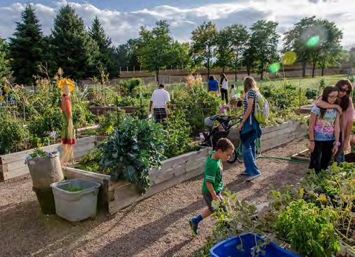
Aging in Place
Merriam should strive to be a community for all ages through its housing and transportation options, and access to amenities.

Emergency Preparedness
Merriam may consider creating a hazard mitigation plan for the community to identify strategies to address hazardous or emergency events.
Access to Health and Human Services
Merriam is fortunate to have easy access to healthcare and should continue to support this type of facility.
Housing Quality
Quality and safe housing are major contributors to quality of life and well-being.
Green & Open Space
Access to parks and open areas are an important part of a healthy lifestyle.
Noise
Noise is one of the nuisances that can impact the well-being of residents. Merriam may consider identifying noise reduction strategies throughout key corridor of the city.
Access to Food
Merriam should continue to support bringing a grocery store into the community to expand access to fresh grocery.
Water Quality
Merriam should continue to integrate green infrastructure in Merriam to prevent water quality degradation.
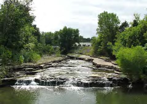
Merriam is served by the Merriam Police Department and receives fire protective services through a joint agreement with the City of Overland Park. Both the police department and the Overland Park fire department work out of the Merriam City Hall civic complex area. A high and low estimate of recommended police personnel were calculated based on Merriam’s population, the size of the community and re gion. The same analysis was completed for facility space and land area.
Table 2.6 shows the recommended number of police personnel for Merriam based on its population for all cities, cities 10,000 to 24,999 and west north central cities. With 37 current police personnel, Merriam exceeds all LOS for staffing. This makes sense given the higher daytime population of Merriam because of the retail and employment options. Merriam also exceeds the facility recommendations for police. Merriam’s population creates demand for an approximately 7,300 SF facility and their existing facility is above that at around 13,500 SF facility.
Source: Confluence w/ inputs from Planner’s Estimating Guide and City of Merriam
Source: Confluence w/ inputs from Planner’s Estimating Guide and City of Merriam
While Merriam does not operate its own fire department, the leve l of service analysis was still completed based on its population, size and region. Table 2.10 shows the LOS stand ards for fire / ems personnel based on all cities, cities with 10,000 to 24,999 residents and cities in the west north central United States. Table 2.8 shows the facility space and land area demand estimates for Merriam based on its size.
Based on population, size and location, Merriam creates a deman d for between 12-18 fire / ems personnel, depending on the LOS standard. Cities in this region of the United States generate less demand than cities overall, which accounts for the range of demand estimates. Merriam’s siz e indicates a need for 4,497 SF of facility space on 0.65 acres. Currently, Merriam’s fire facility is 14,968 SF on 0 .54 acres. This places the fire facilities above the facility space requirement but low on the total acres of land. Tables 2.8-2.11 summarize the analysis.
TABLE 2.8 Fire / EMS Facility Space and Land Use Needs, Existing
TABLE 2.9
Fire Existing Personnel & Facility Space
Source: Confluence w/ inputs from Planner’s Estimating Guide and City of Merriam
Proper maintenance of Merriam’s infrastructure is a key component of a city’s obligation to its residents. Maintenance and modernization of Merriam’s infrastructure should be a key component of any capital improvements planning work completed by the city.
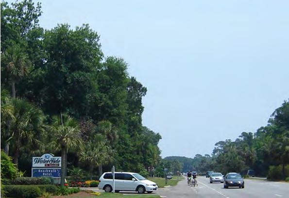
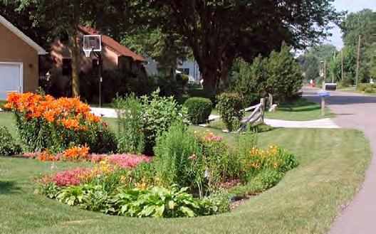
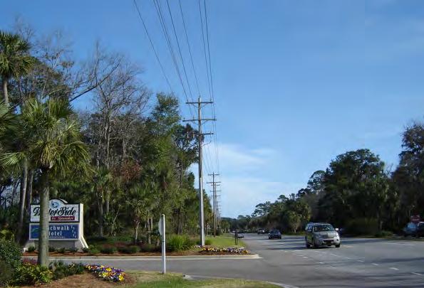
Infrastructure, particularly stormwater management, should continue to use a mixture of gray and green infrastructure solutions. Gray infrastructure refers to more traditional methods of dealing with issues such as stormwater and typically include man-made structural components such as curb and gutters. Green infrastructure, which is described more indepth in Chapter 6 - Sustainable Development, uses vegetation, soils and other natural elements to capture, slow and treat stormwater using natural processes. It can be cost-effective, environmentally friendly and sustainable. Merriam should continue to maintain existing gray infrastructure while integrating additional green infrastructure solutions wherever possible. In the ETC community survey, over 65% of respondents agreed Merriam should initiate green stormwater infrastructure. Overall, there was broad support for community-led sustainability measures such as this.
One act to consider is planning to long-term move overhead utility underground. Undergrounding existing utilities is very expensive and can be cost prohibitive for communities, particularly since utility providers typically do not contribute toward the costs. There are a variety of economic, sustainable and aesthetic benefits to moving utility lines underground. The visual appearance of a community can be greatly enhanced when busy overhead utility lines are relocated and out of sight. Utility poles tend to clutter the streetscape, negatively interact with trees and make sidewalk widenings more difficult. This reduced clutter could also help positive impact maintenance costs because of the reduced impact of falling limbs or heavy storms, winds or snow. Removing these possible interactions would decrease the risk of power outages in Merriam. Cumulatively, the benefits of utility pole removal could have net economic development benefits also.
GOAL 1 -
No.
CONTINUE TO SUPPORT MEDICAL & SOCIAL SERVICES FOR MERRIAM RESIDENTS
Action Item
A1 Maintain a positive working relationship with the Advent Health Shawnee Mission medical campus and promote its location when marketing the community
GOAL 2 -
SUPPORT AND PROMOTE MERRIAM’S EDUCATIONAL OPPORTUNITIES FOR ALL AGES AND BACKGROUNDS
No. Action Item
A1 Support the Shawnee Mission School District with any possible future updates, expansions or improvements of school property within Merriam
A2 Consider adding a city services 101 course or pamphlet to help educate the public, improve community relations and encourage public / civic engagement
GOAL 3 -
MAINTAIN A QUALITY PARKS SYSTEM THAT IS RESPONSIVE TO MERRIAM RESIDENTS
No. Action Item
A1 Perform life cycle analyses, including a public engagement component, on all park facilities and programs to ensure the facilities and programs continue to meet the needs of Merriam residents
A2 Consider new trends and technologies in playground design as part of park planning
GOAL 4 -
EXPAND MERRIAM’S TRAIL OFFERINGS TO ENHANCE CONNECTIVITY & SAFETY
No. Action Item
A1 Expand Merriam’s shared use path system on key corridors to enh ance connectivity and safety for nonmotorized transportation in Merriam
A2 Work to design and fund pedestrian / bicycle crossings over / under Interstate 35 to help fully connect Merriam’s west and east sides while improving the overall safety of the trail system
GOAL 5 -
MAINTAIN A QUALITY PORTFOLIO OF CITY BUILDINGS & LAND
No. Action Item
A1 Consider completing a sustainability analysis of the Merriam community as a whole
A2 Consider completing a sustainability analysis of Merriam’s func tions as a city to identify specific areas of improvement
A3 Consider integrating renewable energy installations into city-owned buildings
GOAL 6 -
SUPPORT COMMUNITY HEALTH & WELLNESS
GOAL 7 -
PROVIDE COMMUNITY-SUPPORTED AND EFFICIENT PUBLIC SAFETY FOR MERRIAM
GOAL 8 -
MAINTAIN MERRIAM’S INFRASTRUCTURE AND PROMOTE SUSTAINABLE INFRASTRUCTURE SOLUTIONS
No. Action Item
A1 Continue to promote the use of green infrastructure on property in Merriam, including city-owned property
A2 Conduct a feasibility study to evaluate costs and benefits of moving utilities underground
Sub Areas call attention to specific locations that represent important and potentially catalytic sites to the overall quality of life and vibrancy of the community. The sub areas in Merriam were selected through a collaborative process with the planning team, city officials and the steering committee.
The three sub areas that are discussed in this plan are Merriam Town Center, Downtown Merriam and the former Lee Jean’s headquarters on W 67th Street. These areas represent vitally important centers and districts in Merriam from an economic, social and identity perspective. Additionally, all three sub areas are currently underutilized or face potential challenges in the near future. Therefore, it is the role of this plan to analyze these sites, address the current and potential challenges, and propose concepts that seek to build on their strengths while also addressing their vulnerabilities. The future redevelopment of any area ide ntified within this plan will require the full support and collaboration of the property owners.
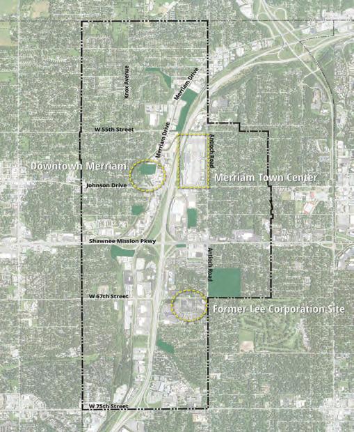
1. Merriam Town Center - A major commercial property in the heart of the city, Merriam Town Center was selected as a sub-area because of its prominence in the community and the unknown future of brick and mortar retail. Following the departure of Hen House, Merriam’s only full-service grocery store, many in the community wondered what the future of the Town Center would be. It is the intent of this plan to provide a series of potential redevelopment options that will diversify and sustain Merriam Town Center well into the future.
2. Downtown Merriam - Downtown Merriam was selected because of long established challenges this district has experienced in terms of attracting investment. There is the general feeling that downtown buildings are underutilized, with many businesses geared towards automotive repair, and that downtown is not the vibrant, walkable and charming environment that is has the potential to be.
Another major challenge in the downtown sub-area is the impact of potential flooding from Turkey Creek. Flooding events in the past have damaged properties repeatedly and with continued delays in flood mitigation efforts, investment in downtown has been hindered.
3. Former Lee Jean’s Headquarters - Located on West 67th Street, the former headquarters for Lee Jean’s has been vacant since 2019. This site was selected as the third sub-area because it has the potential to be re-imagined to serve some of the many needs in Merriam including housing, offices or other services.
Because the three sub areas developed for this plan represent vitally important centers and districts within the city of Merriam, development and reuse opportunities in Downtown Merriam, Merriam Town Center and at the former Lee Jeans headquarters should incorporate a framework that seeks to address and sustain all of the 2040 goals. For example, each site presents the opportunity to incorporate housing diversity to satisfy the demand for certain age groups or income levels. Each site should incorporate multi-modal transit opportunities and incorporate a diverse mix of uses from residential and commercial to open space and recreation. And each site, through further investment and redevelopment, can greatly benefi t the surrounding neighborhoods, create a true sense of identity and character, and incorporate sustainable practices.
“ The City of Merriam embodies a dynamic, friendly, and family-oriented culture that celebrates our history as a hub of mobility. We are a linkage point for shared amenities , not just for our diverse residents , but also for our neighboring communities.
We recognize and embrace our unique history as an inclusive and well-maintained firsttier suburban community. The City of Merriam enjoys great visibility and convenient access along the I-35 Corridor through its strategic location between other metro communities and Downtown Kansas City.
Merriam offers c onvenient access to shopping and services , an eclectic downtown area , quality civic facilities , diverse and a f ordable neighborhoods , and an enhanced parks and trails network that attracts a wide range of ages and demographics. ”
At the Committee meeting on June 12, 2019, these conceptual plans were presented and discussed. Pros and cons of each were debated. The Committee came to the conclusion that Concept B (both versions) made the most sense for the City to pursue. This concept identified the desire to save as much as possible of the 1911 building. Cost estimates were based on industry standards for improvements and demolition and may change as the site is programmed and designed. The 1911 building cost estimate reflects the range of costs to save the shell at a minimum and if possible, to fully enclose the structure. Structural analysis and design must be done to determine the feasibility of saving the building.
Concept A was considered too expensive and unlikely to be funded. Concept C did not fully capture the expectations of the Committee or the community at large. Even though it was the least expensive, the cost estimates were not that much less than Concept B, which met more of the goals set by the community and the City. The detail of Option B is included here and in the Appendix of this report.
The second public meeting was held on June 26, 2019. The Committee and consultants presented a recap of the data, costs, issues to consider, goals, and the results of the public input from Online responses and participants at the first meeting. The three concepts were presented in detail, with the recommendation by the Committee to select Concept B.
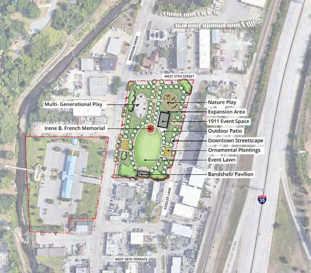
Completed in 2019, the 5701 Merriam Drive Committee Report and Recommendations analyzed the previous community center to generate a number of ideas for its reuse. In that process, the committee reviewed example projects from other communities, outlined goals and agreed on key strategies to make the best use of the facility in a fiscally responsible way.
The report presented three alternative design concepts for 5701 Merriam Drive and following further analysis and public input, a final concept plan was recommended as the best path forward. In the end, concept B was decided to make the most sense for the city to pursue. This concept looked at saving as much of the 1911 building as possible and made several site improvements that activated the property and better integrated it with downtown Merriam.
The Shawnee Mission Parkway Corridor Plan was completed in 2013 for the City of Merriam. The primary purpose of the plan is to proactively position the City to respond to development proposals on the closed K-Mart site based on community input for redevelopment. After a robust engagement process, it was determined that the community preferred a bold redevelopment plan to grow density of area, improve retail opportunities and provide new civic spaces. There were also transportation infrastructure enhancements recommended for the area including roadway improvements, traffic signal improvements, and public transit integration.
Corridor-specific studies like this help to improve the sense of place in a community, which helps to improve the community’s identity and character. This plan assessed a st ruggling commercial center and identified a publicly led strategy to see the area improve over time.
As the lowest intensity redevelopment scenario included in this study, relatively minor changes to existing land uses are incorporated. It is intended as a “business as usual” scenario, and provides an auto-oriented suburban development pattern that relies on finding a new big-box anchor retail tenant for the old K-Mart building – complete with building facade enhancements and an improved vehicular circulation and parking area.
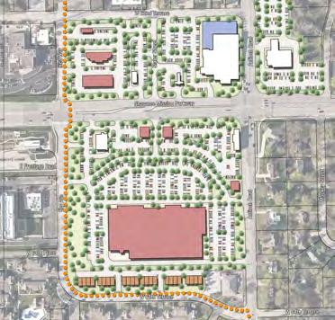
This scenario, shown in Figure 4.8, anticipates dividing a renovated K-Mart building into two or more junior anchor retail tenants, with small shop additions to both the east and west sides. Parking is expanded by reconfiguring the internal circulation drive and removing pad sites from the central part of the site – which also improves visibility. New restaurants are shown on the existing Winstead’s and Caribou Coffee sites. A new multi-story hotel is located on the existing IHOP site. The existing US Bank facility is relocated into a new multi-story building on the northeast corner of IKEA Way and Shawnee Mission Parkway, allowing a new multi-story senior housing project to be located on the northeast corner of Antioch Road and Shawnee Mission Parkway.
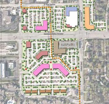
This scenario anticipates full redevelopment of a majority of the study area. It also preserves the library with opportunities for future expansion to include an integrated retail/restaurant use along the Shawnee Mission Parkway frontage. New senior housing is again proposed on the existing US Bank site, and the bank is relocated to a new multi-story, mixed-use building on the northwest corner of Slater and Shawnee Mission Parkway. New restaurant/ retail buildings are proposed along IKEA Way.
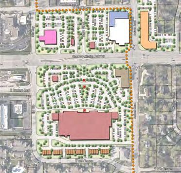
Rather than being anchored primarily by office space on the south portion of the site, this scenario focuses on integrating new multi-story residential housing into the area. It features an enlarged central “town square” connected via a new street and trail alignment utilizing an underpass at Shawnee Mission Parkway to connect north along the Slater Street corridor. This square is anticipated to be programmed for several new community festivals and events.
There is one important distinction separating this scenario from the previous one – integrating a new library into the heart of the mixeduse commercial district on the south side of Shawnee Mission Parkway, as shown in Figure 4.13. This scenario envisions creating a public-private partnership responsible for designing/constructing a new library facility in conjunction with the multi-story mixed-use development adjacent to the proposed town square space. This new facility could utilize one or multiple floors of this buildi ng to meet the needs of the library system and the surrounding community.
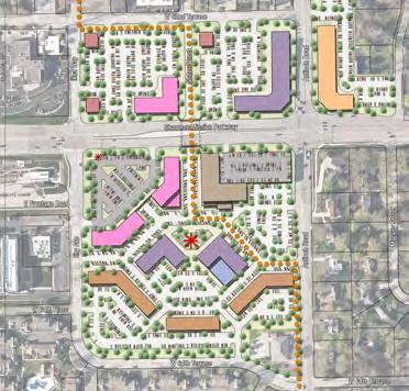
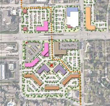
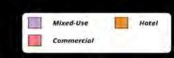
Concept 1 takes an incremental approach to redevelopment by retaining much of the existing commercial properties while reconfiguring a central portion of the shopping center to provide more mixed building uses. The southern most entrance off of Antioch Road brings visitor into a denser and more walkable mixed-use district with a large plaza designed for public gatherings, outdoor seating and community events. Two new commercial buildings frame the entrance drive which extends the walkable environment out to enhanced pedestrian amenities along Antioch Road. The former Hen House Market as well as a few other retailers, are replaced with a new destination hotel. This hotel development is the terminus to the walkable mixed-use corridor and provides a cohesive backdrop for this district. The Home Depot, Dick’s Sporting Goods, Cinemark Theater and several other commercial tenants remain in this concept.
A likely scenario is that Merriam Town Center will be redeveloped incrementally over an extended period of time. To that end, Concept 1 can be viewed as a standalone vision but also could be viewed as an initial phase in a larger
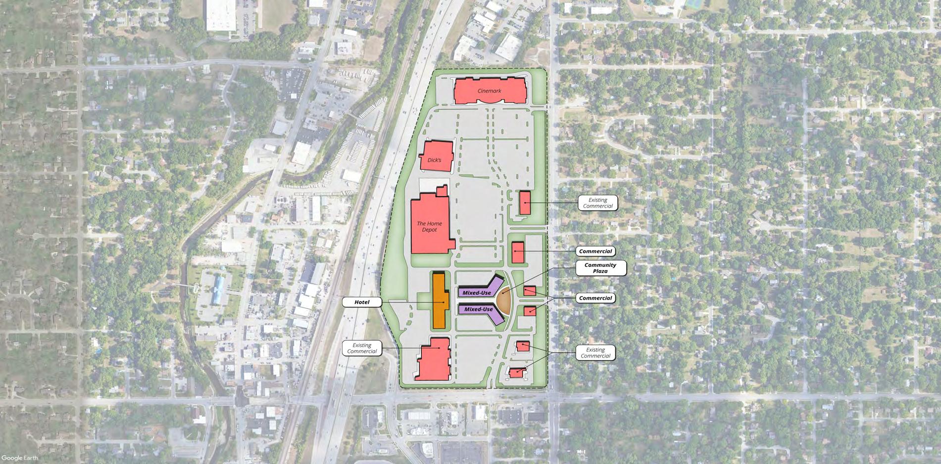
Town Center Concept 1 - Birdseye View
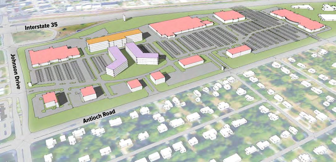
Retail developments need to be more experiential in today’s online world to be competitive. Offering public amenities is one way to achieve this. (A) Green space with outdoor seating and vendors brings further activity and life to a walkable commercial district.
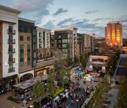
(B) With a mix of building uses, including residential, commercial and hotel, the outdoor spaces will be continually vibrant with residents and visitors.
(C) Offering amenities for visitors of all ages also ensures that the space will be continually activated. As an example, The Lawn at the Legends Outlet Mall in Kansas City, Kansas is a popular space for families to spend time while visiting the center for shopping or dining.
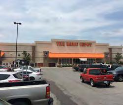
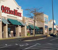
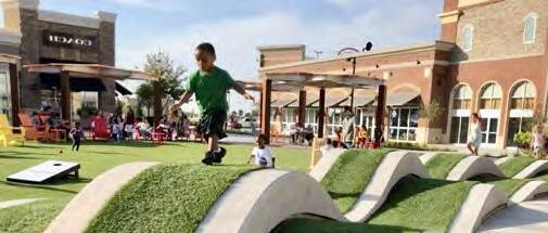
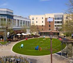
A B C D E
This concept shares many similarities with Concept 1 but expands the mixed-use district directly to Antioch Road. A large community plaza fronts Antioch Road and brings pedestrians into the site towards the hotel, located where the former Hen House Market was located. This hotel is slightly smaller than in Concept 1 which allows more of the existing retailers, south of the former Hen House, to remain in place. Parking for the mixed-use district is located to the north and south of the proposed buildings and therefore, creates two separate big-box retail areas, with the Cinemark, Dick’s Sporting Goods and The Home Depot located to the north, and various other existing retailers, located to the south.

(A) A pedestrian scaled and oriented retail center encourages walking, outdoor dining and abundant vegetation. (B) On-street parking performs as a traffic calming feature with other streetscape amenities designed to cater to the pedestrian. Additional parking should be screened by the retail developments or vegetation as much as possible.
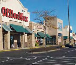
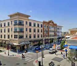
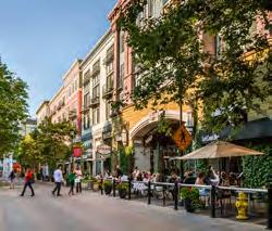
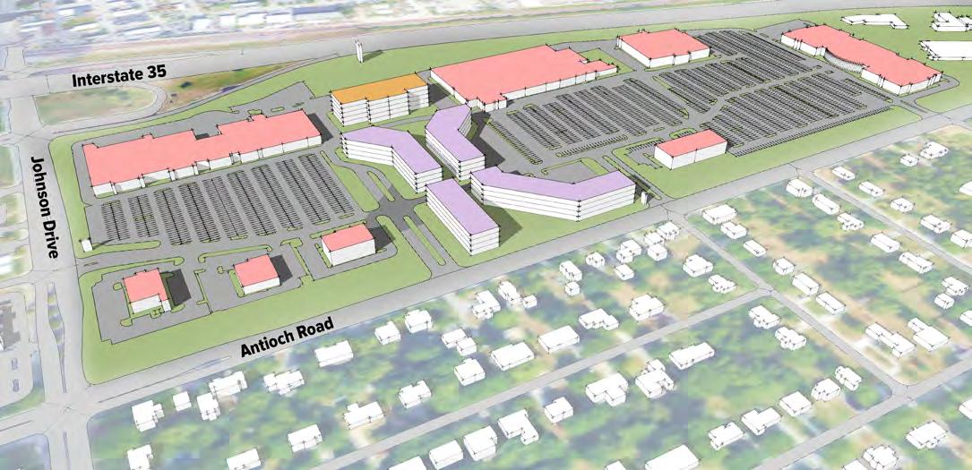
(C) Public plazas within the retail district can have a variety of amenities, such as interactive water features. Elements like this make the place a unique destination.
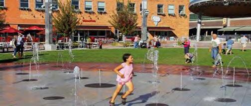
(D) and (E) Similar to Concept 1, much of the existing large format retail stores would remain in this concept. While brick-and-mortar retail activity has been steadily declining over the past years, some models are still successful such as hardware and discount retailers. Merriam Town Center has these types of properties. However, if in the future the retail activity at Merriam Town Center continues to decline, further redevelopment, beyond what is show in Concept 1 and 2, is recommended.

Concept 3 dramatically reimagines Merriam Town Center and envisions a dense, walkable urban mixed-use neighborhood. Along Antioch Road, the prominent berm, which currently limits visibility into the site, is removed and replaced by medium-density residential units, likely townhomes or rowhouses. These units will buffer the single-family homes on the east side of Antioch Road, from this development. A series of mixed-use buildings are located directly adjacent the medium-density residential and front onto a realigned internal street. Roundabouts help circulate traffic at key intersections and provide opportunities for enhanced landscaping and placemaking features. Adjacent to this street, a greenway provides recreational opportunities as well as easy pedestrian circulation when navigating the site north to south. A large mixed-use building, designed to accommodate a new grocery or market, is in the location of the former Hen House Market. A prominent plaza directly in front of the market provides a dramatic visual backdrop for this pedestrian and vehicular corridor. Several other mixed-use buildings and parking structures in this immediate area complete the overall neighborhood feel and ensure pedestrians are the priority in this enhanced mixed-use center.
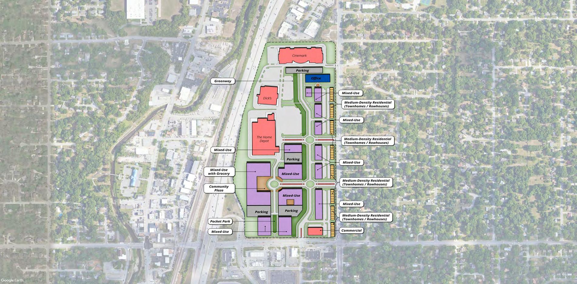
and
Depot remain as they are today with an additional parking structure
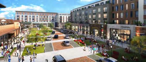
(A) Most visitors to Merriam Town Center will likely access it by car. Once they have arrived, the entire site should be as accessible by pedestrians as possible. Streets should be designed in such a way to encourage slow traffic and easy pedestrian crossing. Streetscape elements such as street trees, seating, pavers, and pedestrian lighting, give visual cues that Merriam Town Center is a highly walkable district.
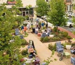
Concept 3 offers many opportunities for public spaces of varying sizes. (B) Small pocket parks can fit into small spaces and provide opportunities for outdoor dining and moments of respite. (C) A linear greenway or park is a great way to increase pedestrian circulation throughout the site while also providing a great recreational amenity. Green spaces should also incorporate green infrastructure wherever possible to reduce stormwater runoff from the site.
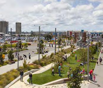
Concept 3 recommends medium-density housing along Antioch Road. These type of development will buffer the existing single-family housing to the east from the larger Merriam Town Center. The images to the right (D) and (E) are examples of rowhouses or townhomes that would fit in this context. Image D is located in North Kansas City, Missouri.
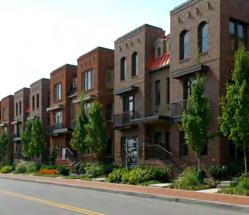
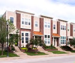
A B C D E
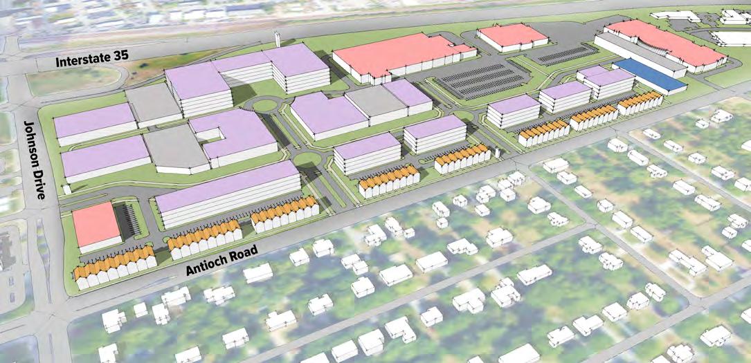

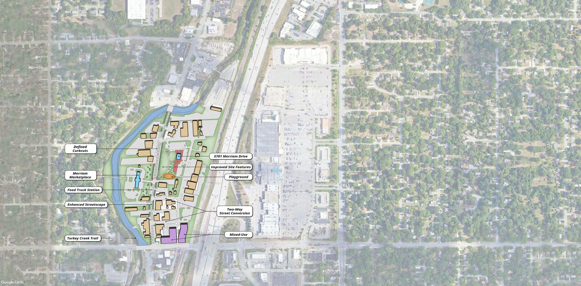
Concept 1 retains the vast majority of the existing downtown buildings, including some of the original downtown buildings, and focuses on enhancing the streetscapes to provide a more cohesive pedestrian network of sidewalks and encourage foot traffic to support downtown retail and businesses.
The streetscape treatments should be unique to downtown Merriam and celebrate the history of the city. Streetscape elements could include street trees, seating, unique pedestrian lighting, and technology amenities such as charging stations, WiFi and micro-mobility hubs. With these elements, downtown Merriam can once again become a destination element within the community.
Placemaking elements should also be considered to add to the unique environment of this district. With Merriam’s history around transportation and the automobile, murals, sculptures, and planters that speak to that history will foster a sense of place that will make downtown Merriam distinct from other nearby communities.
(A) Murals add intrigue and beauty to urban districts. Engaging with local artists to celebrate Merriam and it’s history is an effective way of to activate the downtown core.
(B) As the spine of downtown, Merriam Drive has the opportunity to support multiple incremental approaches to activate the street. This could include a food truck promenade complete with seating, signage and logistical hookups.
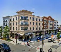

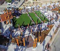
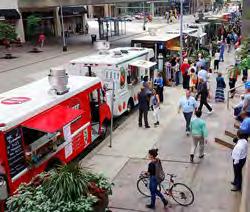
The 5701 Merriam Drive property should be the heart of the downtown district as it centrally located within the urban core, adjacent to the Merriam Marketplace and easily accessible by pedestrians and bicyclists via the Turkey Creek trail. Adding additional amenities such as a (C) flexible performing space that can be used for large gatherings, community events or (D) ice skating in the winter, will ensure this is a destination with the downtown core as well as the larger Merriam community.
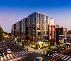
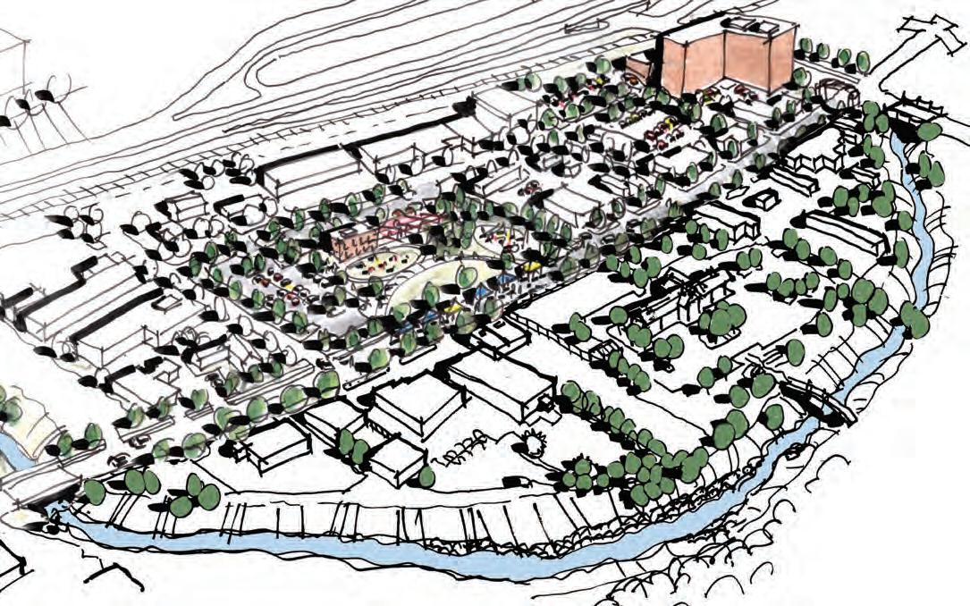
A B C D
E F

Concept 2 builds off of the strengths of downtown Merriam while reconfiguring large portions of the district to create a unique and iconic urban center for residents and visitors alike. Much of historic core of the downtown, immediately north of Johnson Drive is retained in this concept with enhanced streetscapes features, improved pedestrian walkways and revitalized building facades.
Moving north along Merriam Drive, the segment located between the Merriam Marketplace and 5701 Merriam Drive is realigned to Kessler Lane. By doing this, a large public open space is created between those two civic assets with opportunities for an amphitheater, multiple pathways and seating areas within a park-like setting. Walkable streets with ample streetscape amenities ensure that this district is oriented towards pedestrians and cyclists. Additionally, following the COVID-19 pandemic, a large open-air space allows for safe large gatherings, ample outdoor seating and activities for all ages.
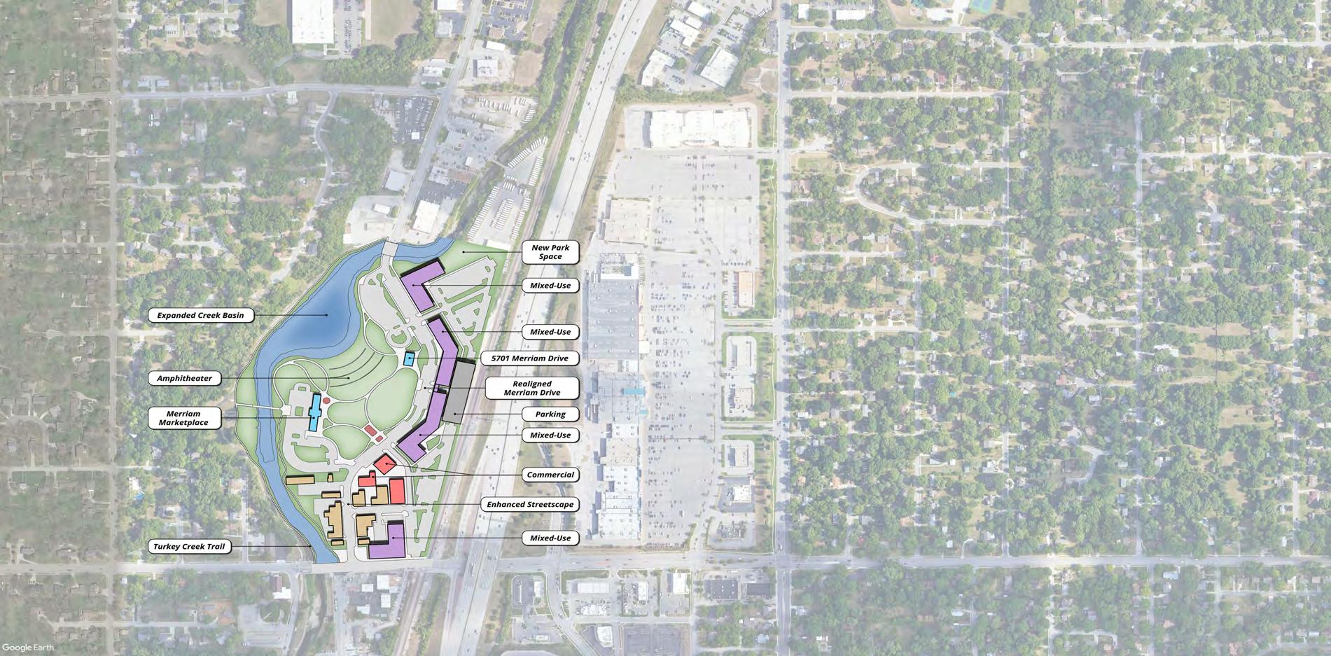
(A) The historic downtown core of Merriam is preserved in this concept and enhanced. Streetscape amenities, facade improvements and placemaking elements will build off of and complement the established building stock.
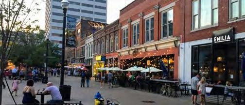
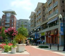
(B) A sweeping amphitheater and park space serves several purposes in downtown Merriam. With two established civic amenities, Merriam Marketplace and 5701 Merriam Drive, a cohesive open space between these two facilities allows for larger community events such as concerts and festivals.
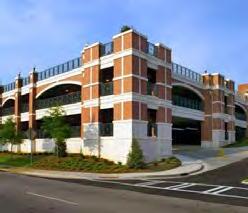
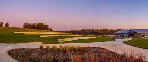
(C) Multi-story mixed-use buildings along the eastern edge of downtown overlook the large open space and Turkey Creek. Uses can include residential, office and commercial and these buildings will help buffer downtown from the adjacent railroad tracks while also being a visual icon along I-35.
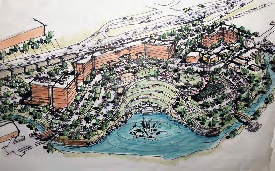
(D) A multi-story parking structure located between the mixed-use developments and the railroad tracks is an additional buffer and provides ample parking for the greater downtown district. Looking ahead, this facility could also serve commuter parking if that infrastructure is extended from downtown Kansas City.
A B C D
One of the biggest challenges to fostering new development in Downtown Merriam is the Turkey Creek floodplain and the threat of flooding. Turkey Creek runs north / south and is the western edge of the downtown district (Figure 3.11 - 3.12). Damaging floods have happened over the history of occurring in 1998, resulting in $12 million in damages to businesses and over topped I-35 in multiple locations. In addition to flooding, the cost of flood insurance and development new and redevelopment of downtown.
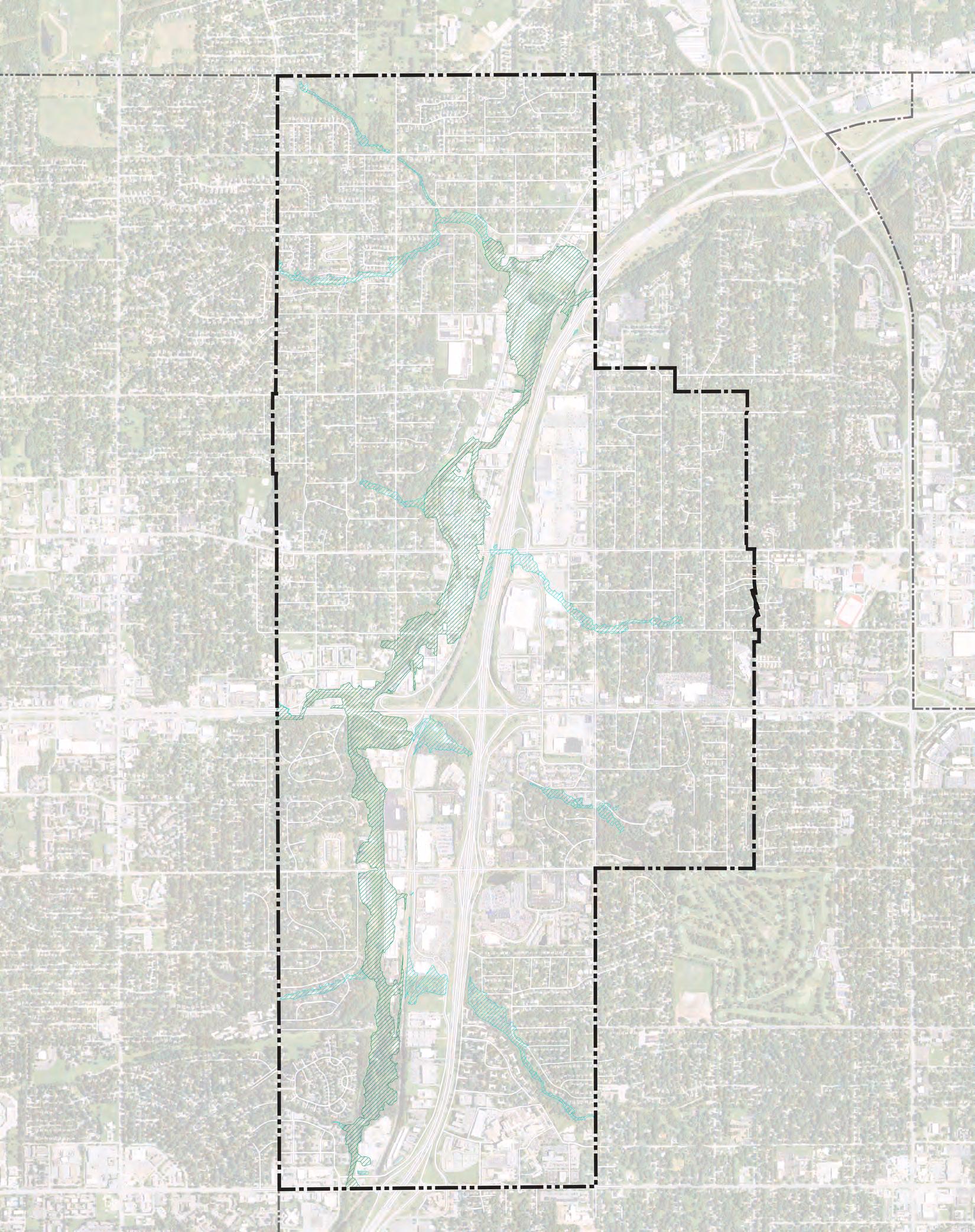
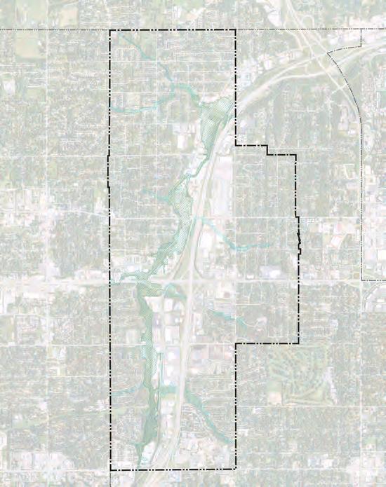
Reducing the impacts of flooding is an expensive endeavor. Over from FEMA’s Hazard Mitigation Grant Program (HMGP) and the Hous Development Block Grant (CDBG) program to acquire residential structures and vacant property. These structures were razed and the property has remained open space to reduce f waters. This approach however, is not feasible for the majority of downtown Merriam.
In 2015, the Upper Turkey Creek basin flood risk management feas Engineers. This plan was the culmination of the Corps of Engineers 10 years of studying Turkey Creek in Merriam. The plan identifies several approaches to flood mitigation including system of levees and flood walls, implementing a combination of out high risk properties and structures within the floodplain. T overall cost and benefit of implementation. Following this evalu wall and levee at a cost of over $37 million. This plan conclud damages would be reduced by 73%, there would be an 83% chance o year flood) event, net annual benefits equal $1.71 million and th plan as listed in the study, indicates total project completion by 2024, though that timeline has likely changed.
Despite large investments in flood mitigation, there is still the likelihood that some large-scale flood events will take place in the Upper Turkey Creek basin which could have the potential to cause economic and financial damages to businesses and residents.
The plan recommendations presented on the previous pages, take different approaches when considering the ongoing challenges associated with Turkey Creek and the threat of flooding. Downtown Sub Area Concept 1 leaves much of downtown Merriam as is with improvements to the urban streetscape, building facades and the public spaces in front of the Merriam Marketplace and 5701 Merriam Drive. With the implementation of flood walls and levees, the majority of existing structures in downtown Merriam will have more protection from flooding. The only new development shown in this concept is along Johnson Drive which is toward the outer edge of the regulated floodplain.
Downtown Sub Area Concept 2 approaches flood mitigation differently from Concept 1. The Turkey Creek basin is expanded by realigning Merriam Drive east to the current Kessler Drive and removing several existing structures along the banks of Turkey Creek. Expanding the basin “naturalizes” the creek which calms and slows flood waters while also creating a public amenity in the heart of downtown Merriam. With the realignment of Merriam Drive, a large open space and amphitheater is created between the Merriam Marketplace and 5701 Merriam Drive.
The realigned Merriam Drive could be elevated to act as an integral ‘levee’ so that the new buildings will have a lower risk of flooding. New park land could also be elevated in gentler rise to avoid the look of a ‘levee’. Flood walls / levees could be built on the south and north ends with Merriam Drive and park land raised to meet the elevation of those structures in the middle. This would create a more resilient downtown while also providing public open space for community events.
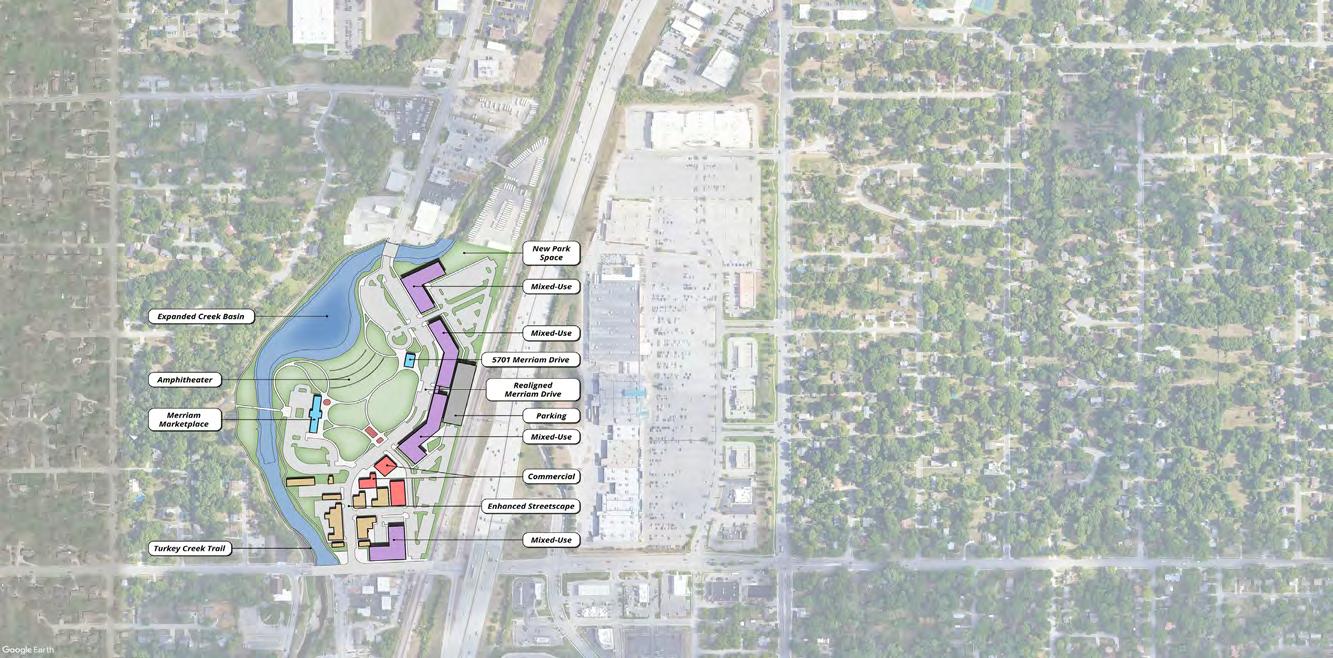
With increased flooding events due to global climate change likely, this approach will not completely reduce the impacts on flooding to the downtown district, but with further mitigation elements along the entire Turkey Creek corridor, the chance of a flooding event will be reduced.
Any future plans would require detailed hydraulic analysis in consultation with the US Army Corps of Engineers and the Federal Emergency Management Agency (FEMA) that would define the impacts and effectiveness of the proposed flood mitigations proposed as well as estimate the potential costs, benefits and possible source of funds to implement flood mitigations.
Any new development constructed in downtown Merriam should be constructed to reduce negative effects from flooding. According to FEMA, strategies for this include the following:
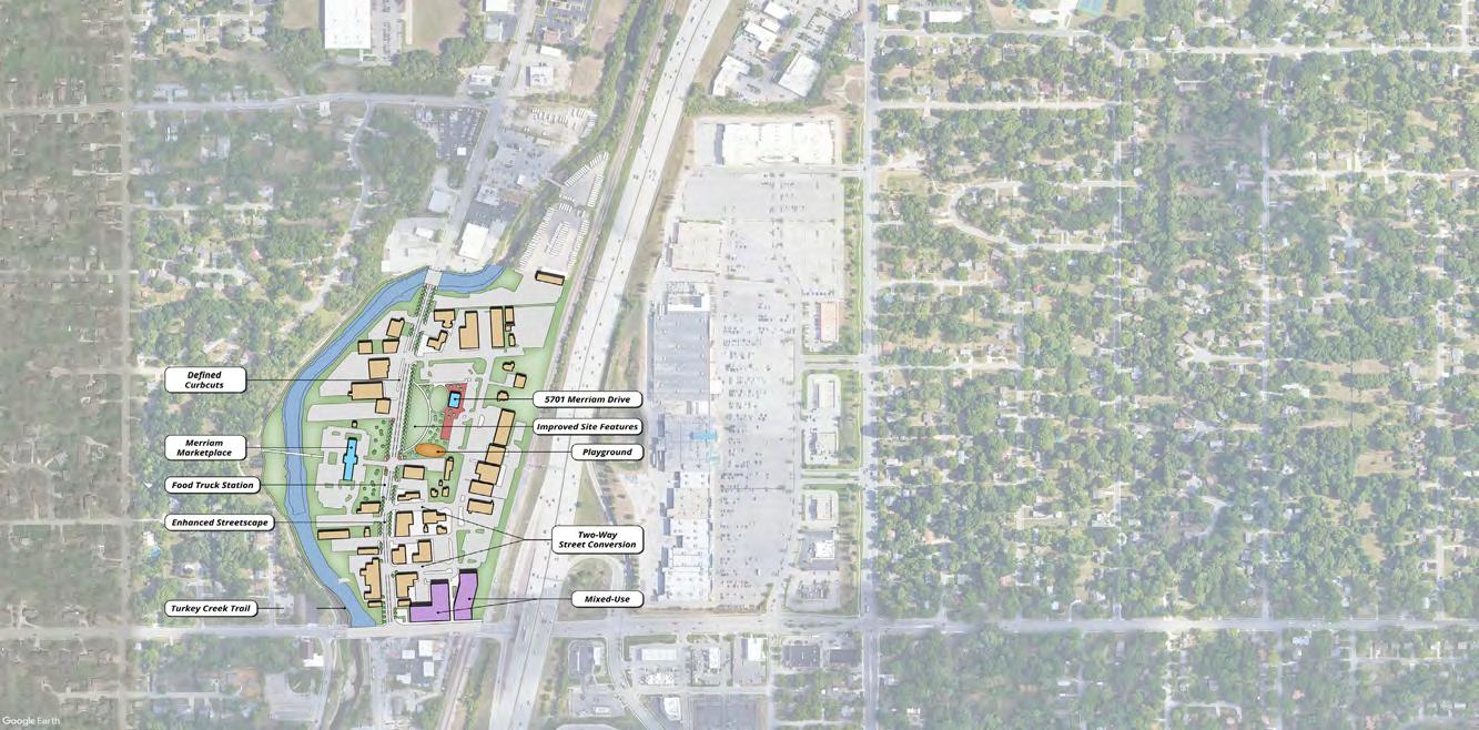
Dry Floodproofing: Construct watertight buildings up to the level of the Base Flood Elevation (BFE) through the use of sealants, flood shields, aquarium glass and strengthening structural components to resist flood water forces and protecting utilities. These methods usually results in higher construction costs.
Wet Floodproofing: Design the uninhabited portions of buildings so flood waters can enter and leave without any structural or mechanical damages. These structures can not have below grade spaces and the lowest floor level should be above the BFE. Flood vents are required on these types of structures to ensure equalization of forces from the flood waters on structural walls.

The former Lee Jeans Headquarters is located along West 67th Street in an area of Merriam primarily comprised of office and residential land uses. As such, this concept envisions this office-oriented site to remain primarily used for that purpose. This concept proposes a more cohesive internal street layout that will address the existing parking lot configuration and circulation which is confusing. By doing this, parking is retained for the existing office buildings.
Two new commercial buildings are proposed flanking the entrance off of West 67th Street. These would be an ideal location for any restaurant or microbrewery type development that could serve the large daytime office population as well as the nearby residential neighborhoods. A proposed larger office unit located in the center of the site is adjacent to a prominent open space that includes an iconic water feature with landscaping and walking paths. This space will suit the needs of office workers to have recreational opportunities throughout the work week.
The former Lee Jean’s building is reconfigured to accommodate senior housing, office or mixed-use occupants. Senior housing was identified as currently in demand in Merriam. This conversion will help address that need. A large parking structure provides parking for this facility and a large amenity deck on the east side of the Lee Jean’s building, adds
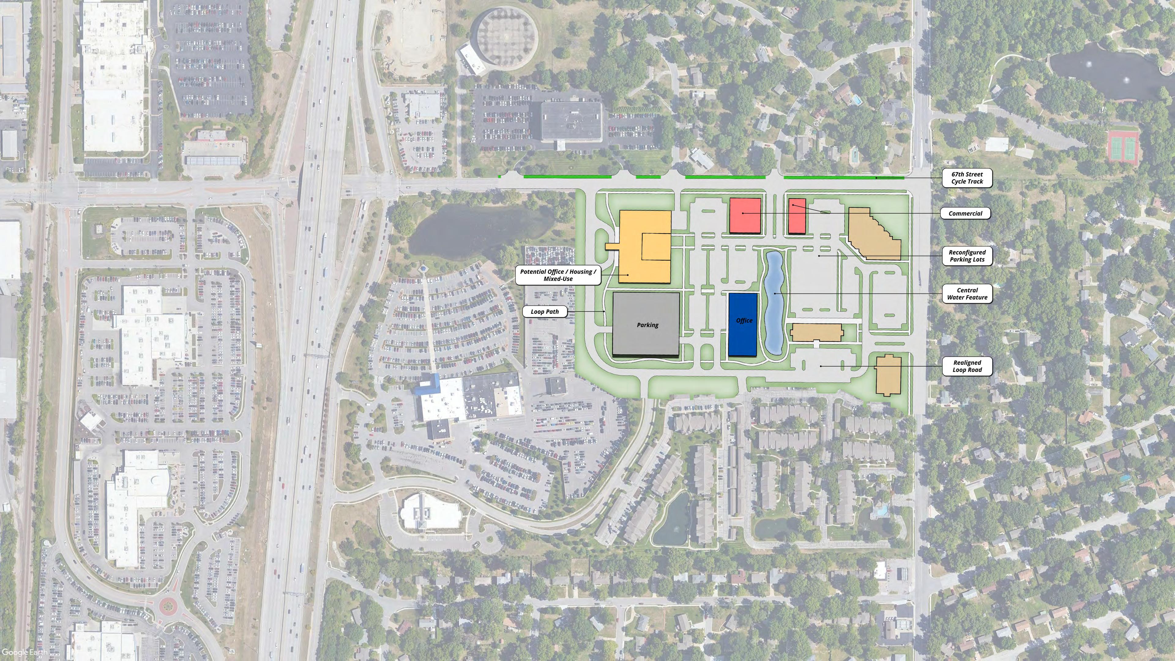
(A) and (B) A central water feature can be an iconic amenity for the office users and residents of this site. Vendors, seating, shade structures and walking paths could provide different kinds of activation throughout the day and week. The water feature can double as a green infrastructural element to help increase the sustainability of this site.
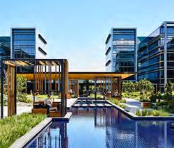
(C) The former Lee Jeans building has the opportunity to provide senior housing, a needed type housing in Merriam. Pictured to the right, is an example of a former retail building retrofitted to accommodate senior housing. This practice is becoming more common across the country as commercial and office spaces become increasingly available and the population continues to age.
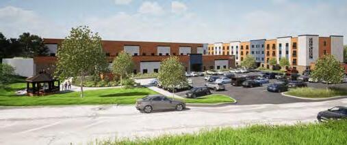
(D) Walking paths throughout the site unify the different building uses and provide passive recreation opportunities for those who work and live here, including the surrounding apartment complexes.
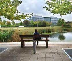
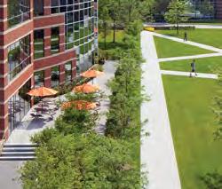
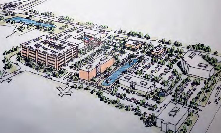
(E) A multi-story parking structure located between the mixed-use developments and the railroad tracks is an additional buffer and provides ample parking for the greater downtown district. Looking ahead, this facility could also serve commuter parking if that infrastructure is extended from downtown Kansas City.
The transportation network of Merriam today is multimodal in nature with excellent access to amenities in the city as well as the greater Kansas City metro area. Interstate 35 provides many benefits to Merriam’s residents, businesses and daily visitors, but also presents several challenges to safe and connected mobility, essentially dividing the community in half from north to south. This section will briefly identify current conditions of the complete, multimodal transportation system in Merriam that includes roadways, trails, sidewalks, and public transit, and will identify challenges and opportunities that will shape recommendations and targeted goals for the improvement of mobility in Merriam in the decades to come.
Transportation impacts nearly all aspects of society. The avail ability of efficient transportation impacts the economic development potential of a region. The modes of transportation utilized have a substantial impact on the environment in terms of emissions. Access to active transportation (bicycle and pedestrian) networks contributes to public health and happiness and drives properties to increase value. Deaths and injuries from transportation crashes inflict immense human suffering and exact an enormous financial toll on society. As such, the transportation systems of Merriam impact all of the 2040 Go als outlined in this plan in addition to the specific goal of Transportation Safety and Mobility.
“Merriam’s transportation system is a safe space that supports various modes of transportation balancing access, parking, mobility and congestion minimization while expanding access to sidewalks, bike lanes, charging stations and public transit.”
“ The City of Merriam embodies a dynamic, friendly, and family-oriented culture that celebrates our history as a hub of mobility. We are a linkage point for shared amenities , not just for our diverse residents , but also for our neighboring communities.
We recognize and embrace our unique history as an inclusive and well-maintained firsttier suburban community. The City of Merriam enjoys great visibility and convenient access along the I-35 Corridor through its strategic location between other metro communities and Downtown Kansas City.
Merriam offers convenient access to shopping and services , an eclectic downtown area , quality civic facilities , diverse and a f ordable neighborhoods , and an enhanced parks and trails network that attracts a wide range of ages and demographics. ”
This study focused on the redevelopment of the vacant retail site located on the southwest corner of the Shawnee Mission Parkway & Antioch Road intersection. The study reviewed the potential impact of the redevelopment on the existing transportation network and noted that some additional left-turn lanes at Shawnee Mission Parkway & Eby Avenue, as well as modifications to the traffic signals would likely be necessary to accommodate the traffic generated by the new development. The study also recommended exploring interchange gateway enhancement opportunities at the Shawnee Mission Parkway & I-35 interchange.
Feasibility of regional commuter rail within the Kansas City metropolitan region has been studied in a variety of different feasibility studies over the last couple decades. The City of Merriam has not been involved in many of those conversations; however, the City should stay informed as the BNSF rail line running through the heart of the City has been one of the lines that has been preliminarily studied. This could open the door for commuter rail through the City.
Operation Green Light is a regional program operated by MARC, to review, optimize, and coordinate signal phasing along key commuter corridors. Currently, all the signals at I-35 interchanges in Merriam are managed by OGL, as well as along Shawnee Mission Parkway, Johnson Drive from Antioch to Merriam Drive, and Antioch Road from Shawnee Mission Parkway to I-35.
This is the Kansas City region’s 20-year plan for transit and mobility, which envisions efficient, highridership transit service linked by well-located hubs. The SmartMoves 3.0 plan recommended W. 75th Street to be utilized as a rapid transit corridor. More details of how this could impact the City of Merriam is provided in the Public Transit subsection of the modal recommendations further in this section.
The regional MetroGreen initiative is a “greenprint” for the Kansas City metropolitan area focused on joining urban and rural green corridors throughout the seven-county region. The City of Merriam is an important segment of the 10-mile Turkey Creek Streamway Trail linking the City to others within the region. Merriam should continue to look for opportunities to connect to other greenways throughout the region and continue to provide safe pedestrian and bike facilities from to the existing trail system.
Merriam’s current 5-year Capital Improvement Plan looks at the period of 2020-2024. Specific transportation-related projects on Merriam’s plan are as follows:
• Residential streetlight program – retrofitting new decorative lighting to neighborhoods while streets and neighborhoods are improved.
• Sidewalk city wide in-fill program – connecting just over 27,000 linear feet of areas with no or partial sidewalks, this involves bringing the facilities up to ADA standards.
• Sidewalk maintenance and repair program –City Council directions to assess the exiting conditions of sidewalks throughout the City.
• Reconstruction of W. 67th Street – from the west city limits to Antioch Road, W. 67th is being reconstructed with a 2-inch mill/overlay, new traffic signals and pavement marking, and improved curb/gutter with ADA accessibility.
• W. 67th Street/E. Frontage Road intersection improvements – This is still under study, so the exact impact to the transportation network will be determined after the finishing of the traffic study.
The existing transportation network in Merriam is an asset that greatly benefits the City and the surrounding communities. Merriam benefits from excellent access to Interstate 35 as a regional connection into downtown Kansas City as well as connectivity to major regional arterial roads like Shawnee Mission Parkway, Johnson Drive, Antioch Road, and the W. 75th Street corridors. Each of these roadways provide residents and visitors of Merriam quick and reliable access to destinations and opportunities in the community and across the greater Kansas City metro. Along with vehicle access, Merriam provides other opportunities for enhanced mobility with connections for pedestrians, cyclists and connectivity to the regional bus network, RideKC.
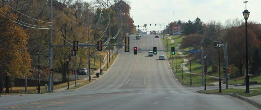
Merriam has a robust network of collectors and local streets that feed into the larger system. City streets then access I-35 at five interchanges in the city. Some congestion ex ists on Merriam streets, notably on Shawnee Mission Parkway through the entire city and Johnson Drive between I-35 and Antioch Road. The remainder of the streets experience very little congestion throughout the day.
While this extensive and well-connected roadway network provide s great access for automobile traffic it also presents challenges for other modes of travel. I-35 and major arterials like Shawnee Mission Parkway are very wide, high-speed roadways that create barriers for bicyclists and pedestrians making it challenging, uncomfortable or unsafe for non-motorized travelers along these corridors. Over the most recent 10-year period that data was available, there was an annual 2.8% increase in fatal & injury crashes, which contributed to a total 36% increase since 2010. In that time frame, six people were killed and near ly 1,200 were injured in traffic crashes in Merriam.
Another significant barrier is caused by a major freight rail li ne that parallels I-35 on the west side creating another barrier to the overall transportation system. This BNSF railway track is highly utilized, where more than 40 trains travel through the city per day. There are four intersections where the railway meets the roadway network at-grade. These grade crossings represent a major obstruction to vehicle and bicycle/pedestrian traffic. With the high volume of trains per day, the crossings are often blocked by trains.

Merriam has a variety of amenities for pedestrian and bicycle mobility throughout the city. Sidewalks are available on most residential streets providing the most elemental form of safe pedestrian infrastructure. Gaps in the sidewalk network do occur in limited locations and safe crossing opportunities of major arterial streets are limited. The most notable gaps in the sidewalk network are at the crossings of I-35. Shawnee Mission Parkway has no sidewalks on the bridge over I-35, and the sidewalks at W. 75th Street, W. 67th Street, Johnson Drive, and Antioch Road are narrow and uncomfortable through the interchanges due to their proximity to high speed traffic, need to cross uncontrolled rightturn slip lanes, and limited protection.
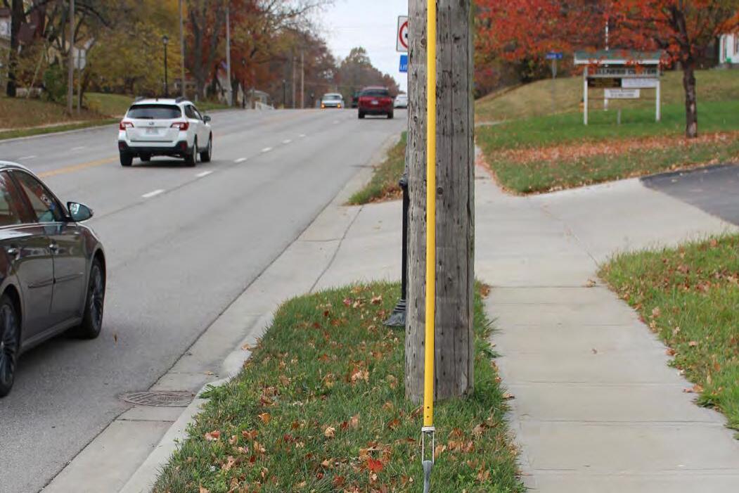
There are also multiple shared use paths that provide recreational opportunities for walking, running and bicycling as depicted in pictures below. Some of these shared uses facilities, such as the Turkey Creek Trail, are also regional connections for non-motorized travel into downtown Kansas City. However, due to the barrier created by I-35 and limited sidewalk accessibility, access for all Merriam residents to the Turkey Creek Trail is highly constrained. Currently there are no on-street dedicated bike lanes in Merriam. Antioch Road is marked as a sharethe-road facility for bicyclists and auto traffic.
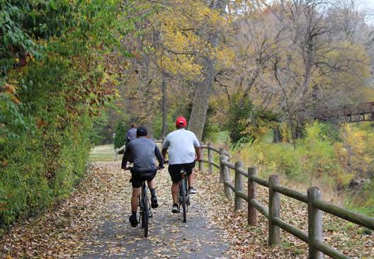
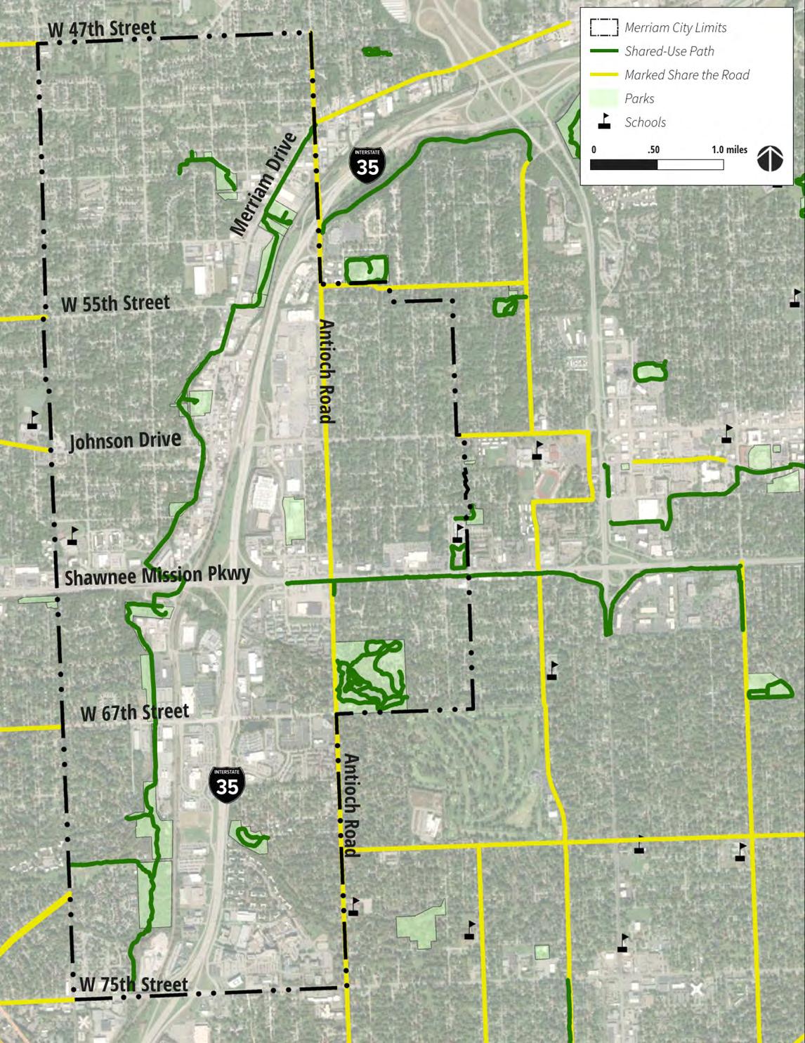
Public transportation is available to all Merriam residents provided by Johnson County and RideKC. Currently there are six bus routes operating in the city (see Figure 4.2) and as of early 2020, the entirety of Merriam was included in the Johnson County micro transit zone. The micro transit service is a shared-ride, ride hailing service (similar to Uber or Lyft) where riders request pick-up and drop-off locations within the micro transit zone that is depicted in the bottom right Figure 4.3. This zone now covers large portions of Johnson County, including Overland Park, Olathe, Merriam, Shawnee, and Mission.
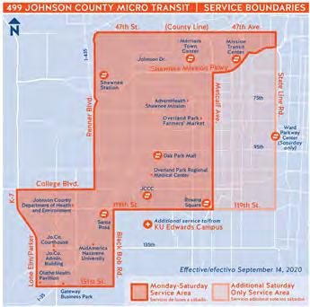
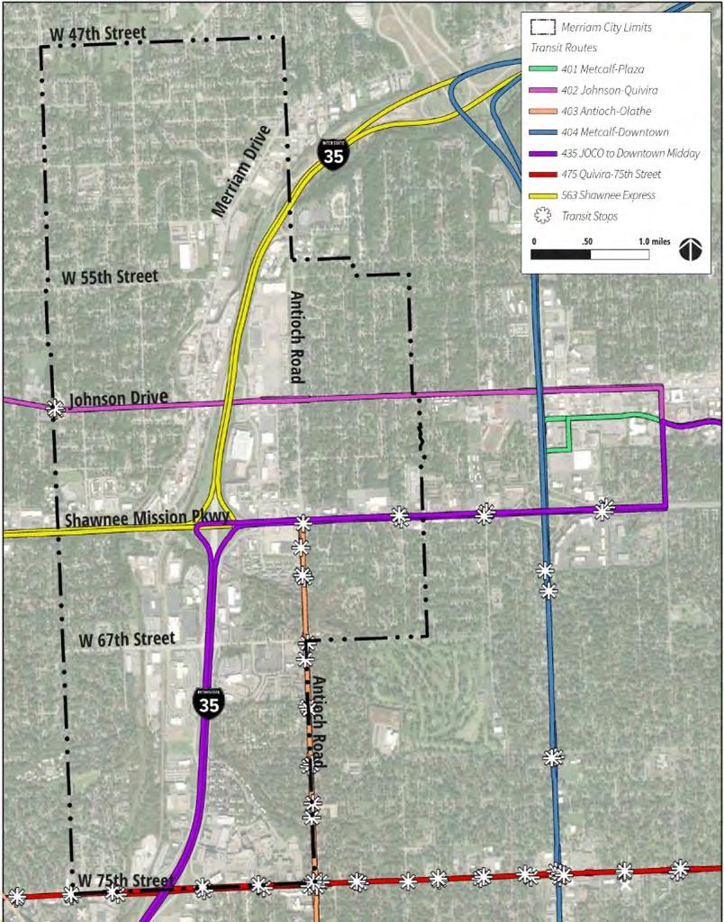
While transit service is available to Merriam residents, it has not been historically well utilized. Ridership has been low for many years, with limited number of boardings at bus stops located across the city. The low levels of ridership may relate to the lower levels of transit service available in the city. Many of the bus routes operate on long headways (or time between buses arriving at a given stop), some being an hour between trips. This makes travel by transit inconvenient and challenging to fit into a person’s daily schedule. Other barrier to public transit usage are gaps in the pedestrian network as well as sidewalk connectivity at existing bus stops that can make boarding and alighting buses especially challenging for those with a mobility impairment. An example of this can be seen where the sidewalk at the bus stop for Route 402 along Johnson Drive is not connected to the back of the curb to provide easy access to board a transit vehicle. Minor additions of concrete in areas such as this could provide a great benefit for transit rides waiting for buses and make travel for those with mobility challenges much more convenient.
The addition of micro transit services may be an opportunity to reverse the lower ridership trend in Merriam and invite more residents to utilize this mode of travel.
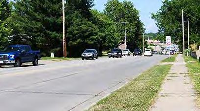
Merriam is well-serviced by a multimodal transportation network that helps to sustain access to business, educational, healthcare, recreation and many other opportunities that enhance and promote a high-quality of life enjoyed in the community. Following review of the existing transportation network, input from the community, and incorporating the goals of the comprehensive plan, there are multiple opportunities to improve and enhance the robust transportation system in Merriam. A primary key concern was with traffic safety and maintaining efficient access to I-35. Another key concern with the transportation networks were access to multimodal transportation facilities. Residents were especially interested in seeing improved pedestrian facilities and in a secondary sense to bicycle facilities. Interest was also expressed to improve access to transit in Merriam.
Most Merriam residents and businesses rely on driving to access their destinations and customers. Convenient access to I-35 is a high priority in Merriam. However, traffic sa fety is also a concern, and traffic crashes resulting in a death or injury have increased more than 36% over the past 10-years. Based on the average cost of traffic crashes to society, the crashes during this 10-year period cost nearly $186 million. This cost is the money lost by residents, businesses, and visitors due to property damage, medical bills, lost productivity, and insurance.
The majority of the traffic crashes in Merriam happen on a few ro adways—primarily the 4-lane undivided roadways. 4-lane undivided roadways only account for 7% of Merriam street s but they account for over 25% of all injury and fatal crashes in the city. This is especially prevalent on these four streets:
• Antioch Road
• Johnson Drive
• W. 67th Street
• Merriam Drive
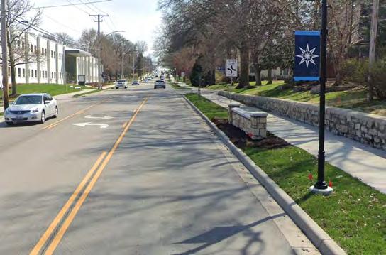
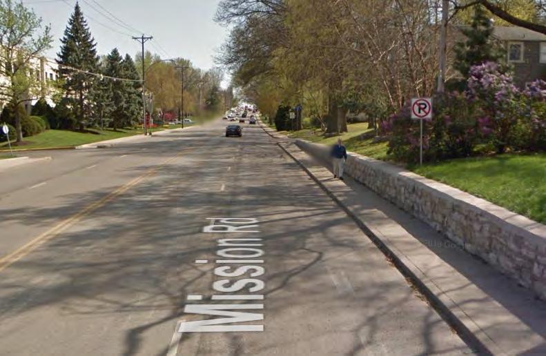
4-lane undivided streets have been shown historically to be the most dangerous type of roadway for all users, whether they’re in their car, walking, or biking. The most effective way to address safety issues on a 4-lane undivided roadway is to reduce the roadway to a “3-lane” road with one through lane in each direction and a continuous center left-turn lane. This lane reduction has been successfully completed in many parts of Johnson County, most recently on Mission Road in Prairie Village and Nieman Road in Shawnee. Lane reductions from 4-lanes to 3-lanes have been shown to reduce crashes by up to nearly 50%.
This lane reduction could impact the efficient vehicle access to I-35 if done on streets with too much traffic. Traffic volumes were compared on these four identified roadways to typical thresholds of traffic volumes compared with lanes necessary. Figure 4.4 shows the ranges of traffic volumes on these streets along with the typical accepted thresholds for both 3-lane roads (one through lane in each direction and a continuous center left-turn lane) and 2-lane roads (one through lane in each direction and no left-turn lanes). Based on this, it appears that all of the street segments would operate well with either 2-lanes or 3-lanes with little additional delay to drivers. The exception is Johnson Drive between Merriam Drive and Antioch Road. However, this roadway section would likely operate well with a 5-lane section (two through lanes in each direction and a single left-turn lane) where today in some locations it has a 7-lanes or 8-lanes. Traffic volumes and thresholds for number of lanes necessary for optimal traffic flow.
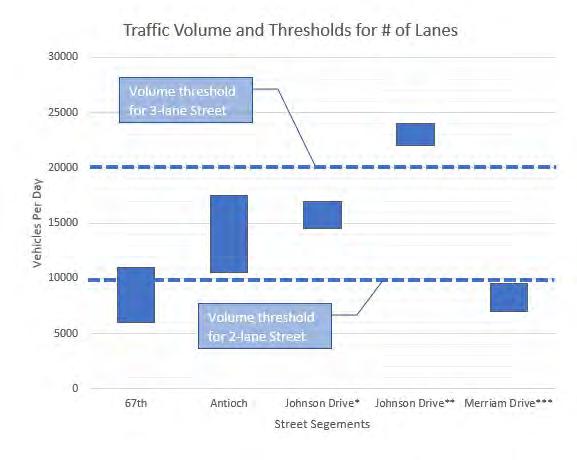
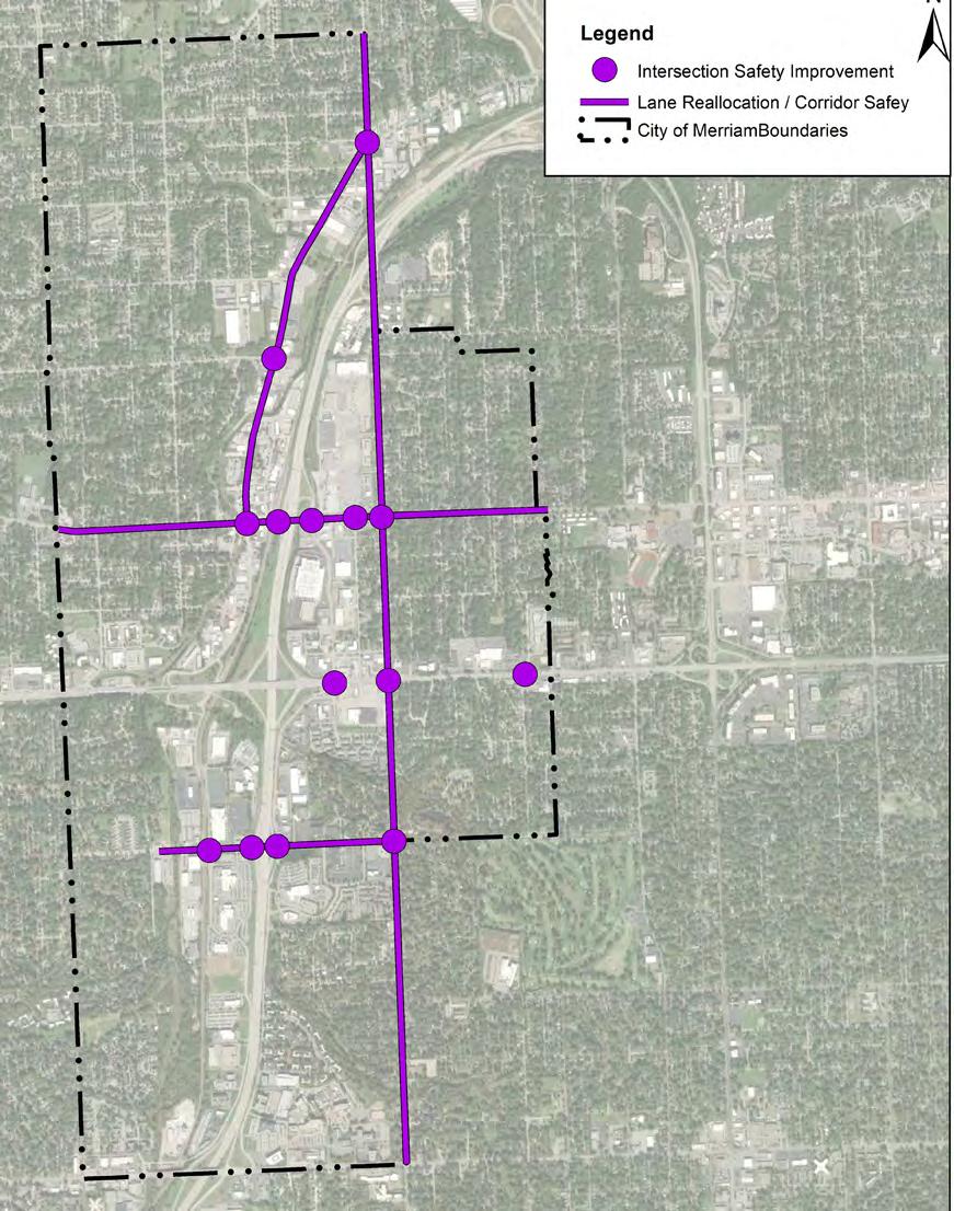
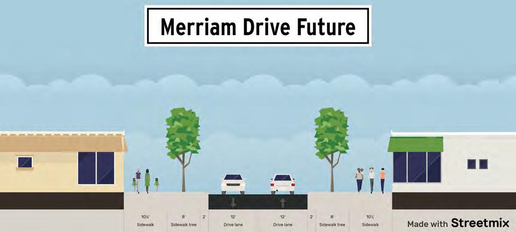
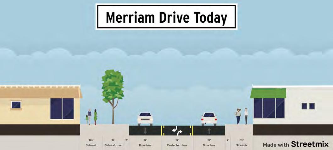
Based on this analysis, it is recommended that engineering studies be conducted on these corridors to assess the feasibility of reducing the number of lanes. The corridors recommended for further study are shown on the map below. Possible cross-sections for these roads are included below.
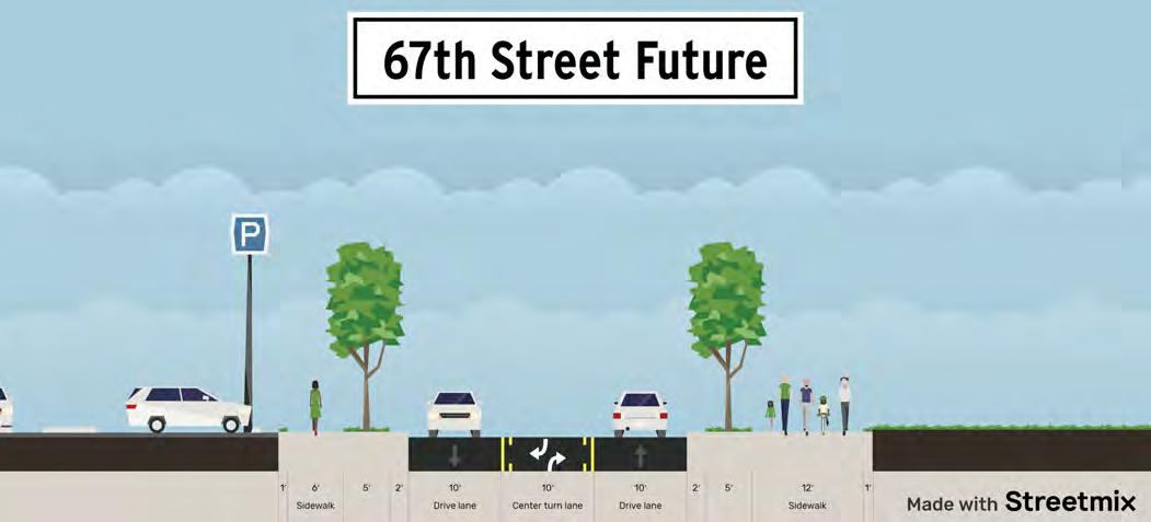
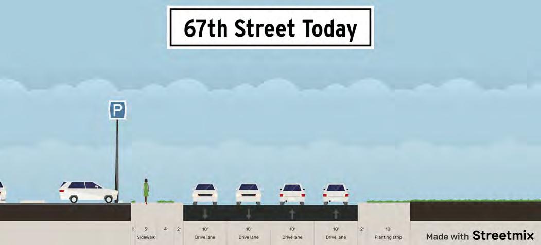
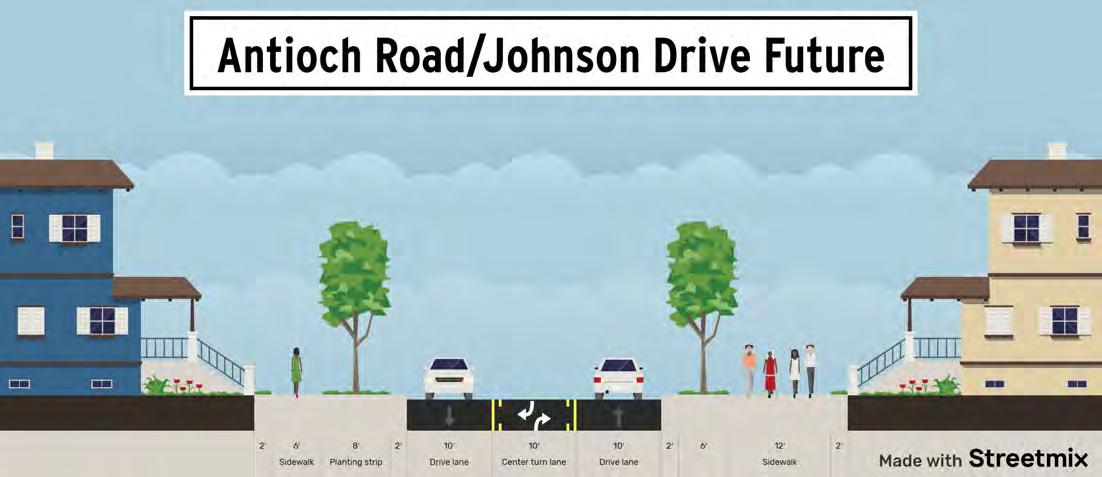
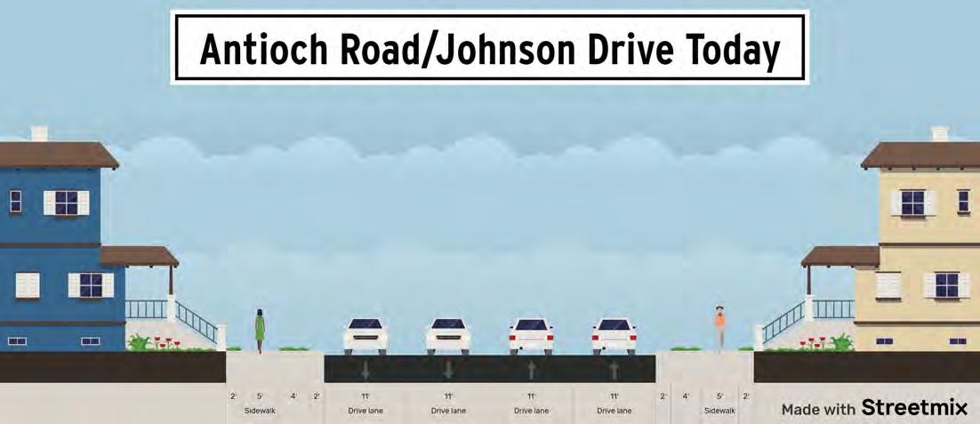
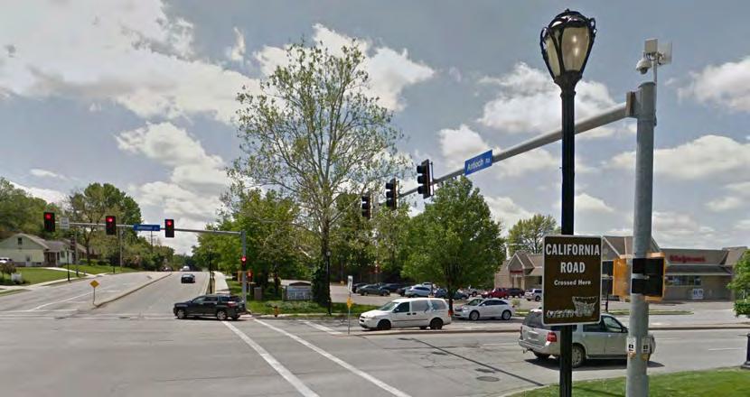
80% of traffic crashes in Merriam happen at intersections. The majority of these intersection crashes occur at traffic signals. Traffic signals serve an essential function on the street network but also are the source of the majority of driver delay and traffic crashes. To improve safety in Merriam, a focus should be placed on traffic signals. An engineering study should be conducted covering the traffic signals indicated in the Figure 4.8 to identify safety improvements specific to those traffic signals.
A number of systemic safety improvements should be considered at all traffic signals including those identified on the map for study and the other traffic signals in the city. These systemic safety improvements include:
• Increase signal cycle time and optimize traffic signal timing
• Convert permissive left-turn phasing to protected or protected/permissive left-turn phasing
• Improve sight distance at street corners
• Improve street lighting
• Install retroreflective backplates
In addition to these traffic signal improvements, several improvements should be considered specifically for pedestrian and bicycle safety:
• Improve accessible pedestrian signals (push button signals)
• Improve ADA ramps and pedestrian crosswalks
• Add pedestrian crossings to all legs of intersection,
• Increase signal cycle length to better accommodate pedestrian phases
• Implement lead pedestrian intervals
In addition to the specific recommendations above, several secondary recommendations exist for future improvements in Merriam. The interchange of I-35 and W. 67th Street has been identified as a problematic intersection due to the close spacing of the frontage road intersection with the ramp intersection. This intersection is a high-crash location in the city and causes driver confusion and additional delay. Merriam should continue coordination with the Kansas Department of Transportation (KDOT) to study this interchange and identify implementable solutions.
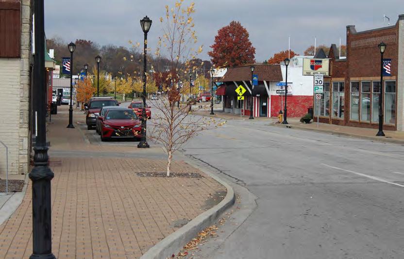
Pedestrian and bicycle mobility in Merriam is a top concern of residents. The majority of residents see pedestrian and bicycle mobility primarily for recreational purposes, but some also walk and bike to access transit or to access destinations. Regardless of the purpose, most Merriam residents find high quality and safe pedestrian and bicycle mobility important.
Most Merriam streets have sidewalks adjacent to them and Merriam recently began the Sidewalk Infill Program. This program is designed to systematically improve pedestrian mobility in Merriam and should be continued. Most Merriam streets have sidewalk only on one side of the street. This is appropriate for low-volume residential streets where street crossings do not pose a safety or mobility challenge.
On higher volume roads, having a sidewalk only on one side poses a safety and mobility issue because pedestrians are forced to either make multiple street crossings or walk on the side of the street with no sidewalk or through landscaping. It is recommended that sidewalks be constructed on every Merriam street and that every Merriam street with greater than 3,000 vehicles per day have sidewalks constructed on both sides of the street. These sidewalks should be constructed a minimum of 5 feet wide with a preferred width of 6 feet wide.
Nearly 80% of the fatal and serious injury pedestrian and bicycle crashes in Kansas happen where no crosswalk or bikeway is present and the bicyclist or pedestrian is in the roadway. Safe and convenient street crossings for pedestrians and cyclists is a key element to improving active transportation safety and mobility.
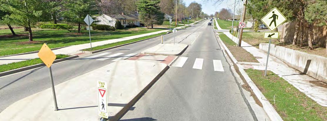
The maps below identify locations with high priority and low priority pedestrian and bicycle crossing installation or improvement locations. Locations were prioritized by locations with high pedestrian and bicycle crash rates and proximity to high-usage destinations such as parks and schools.
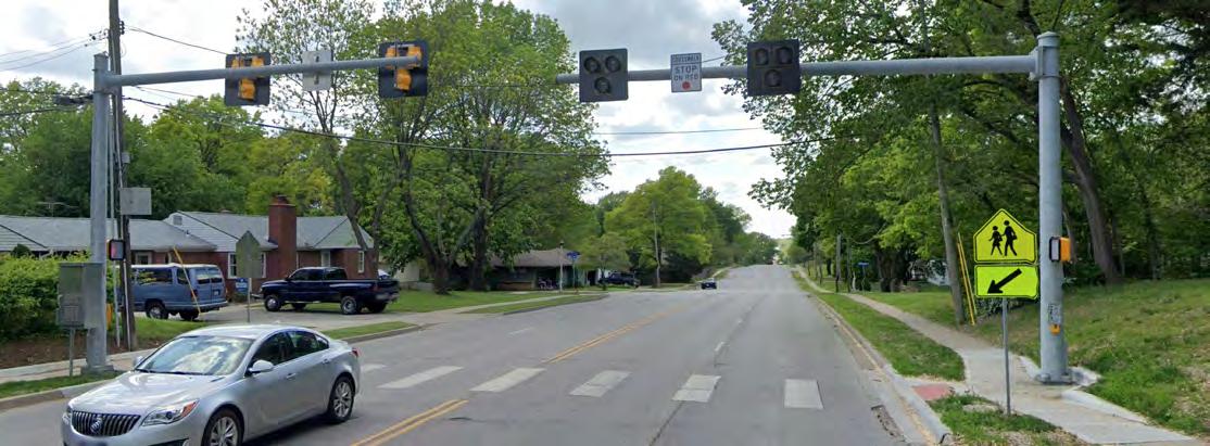
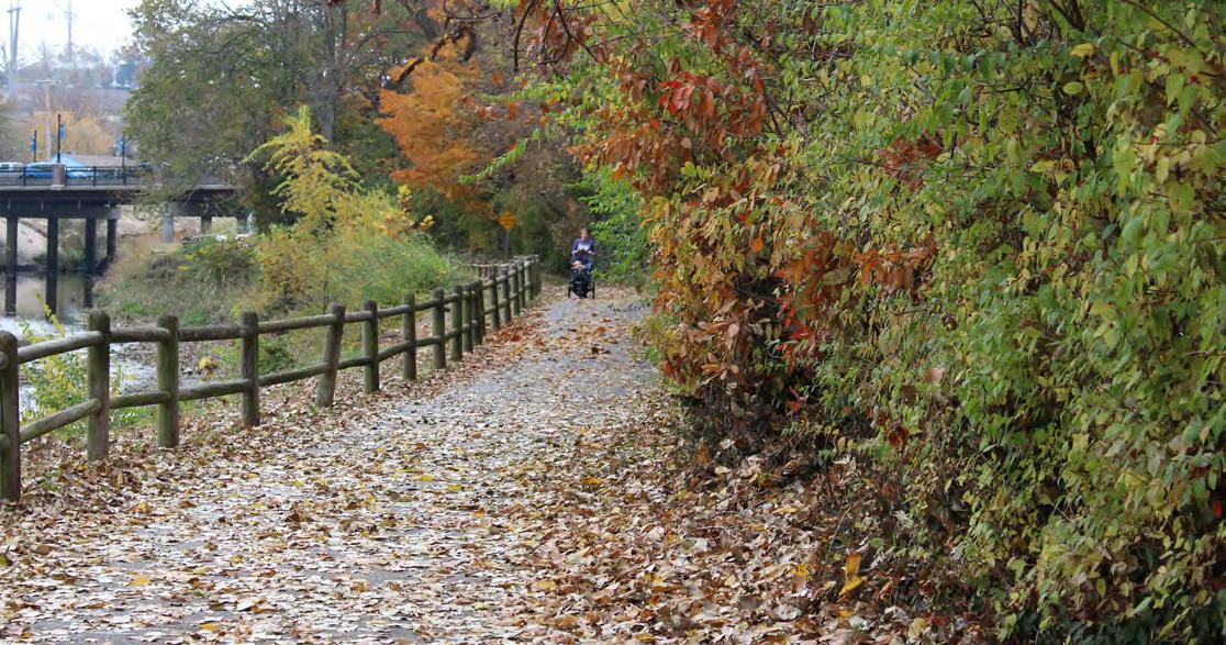
The Turkey Creek Trail is an outstanding example of a high-quality trail that is highly appreciated by Merriam residents. However, many residents feel that access to the trail for pedestrians and cyclists is limited especially due to issues crossing I-35. Other recreational assets in the city that have existing trails including the many parks, in particularly Antioch Park, lack safe and direct pedestrian and bicycle access.
To improve access to these existing amenities, and to generally improve pedestrian and bicycle access throughout the city, it is recommended that a city-wide trail network be constructed. These trails will improve the ability of Merriam residents to access key destinations, provide recreation opportunities, and improve the desirability of Merriam for future residents and businesses. Many of these trai ls identified could be constructed in conjunction with a lane reduction on the arterial streets throughout Merriam. This combination of lane reduction and trail construction, combined with the safe pedestrian and bicycle street crossings, would dramatically improve safety for non-motorized users in Merriam.
The maps below identify locations with high priority and low priority pedestrian and bicycle trails should be considered. Locations were prioritized by locations with high pedestrian and bicycle crash rates and proximity to high-usage destinations such as parks and schools.
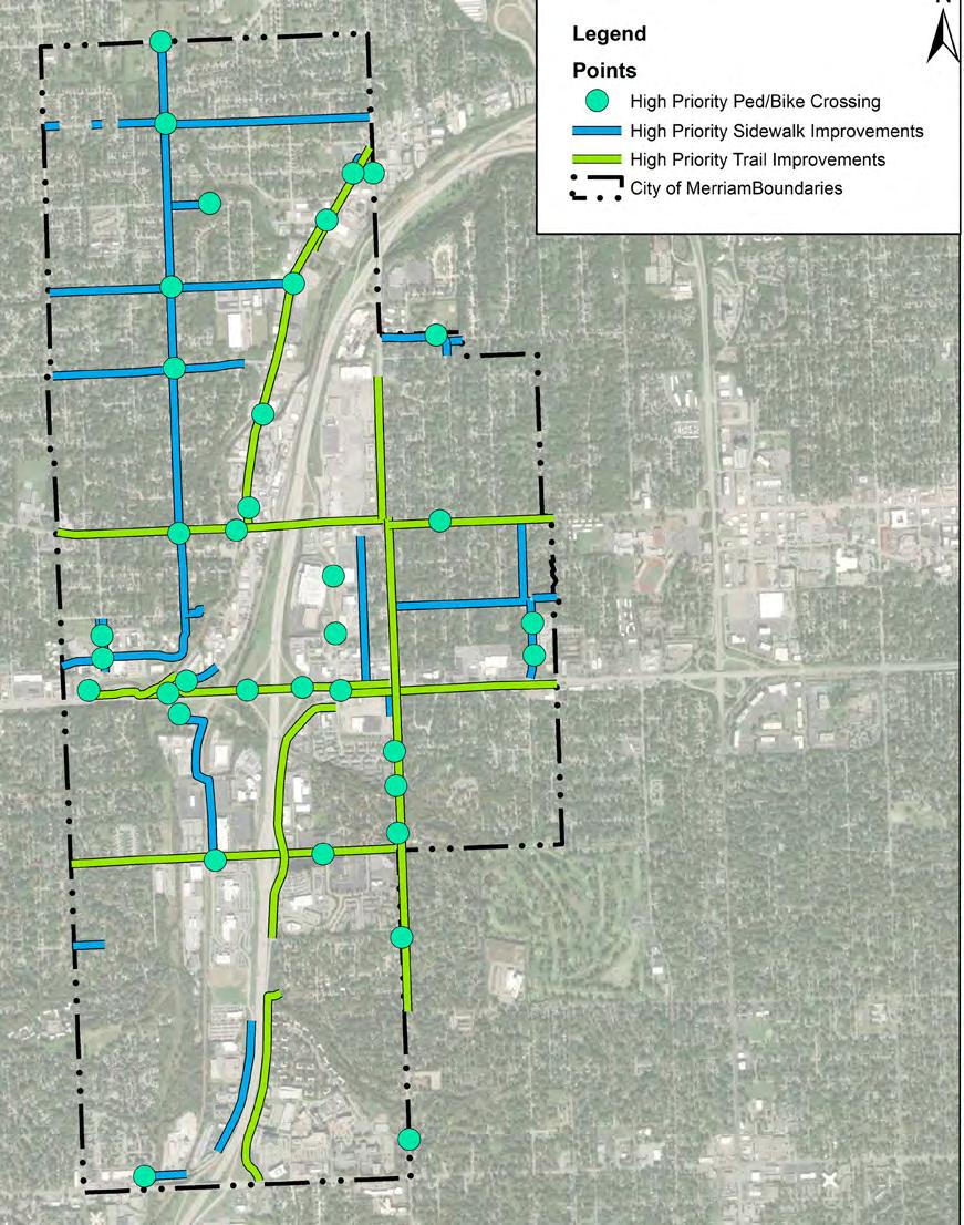
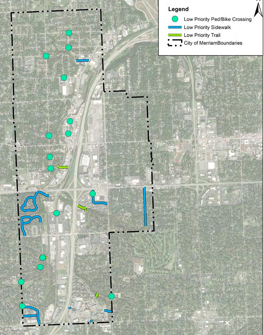
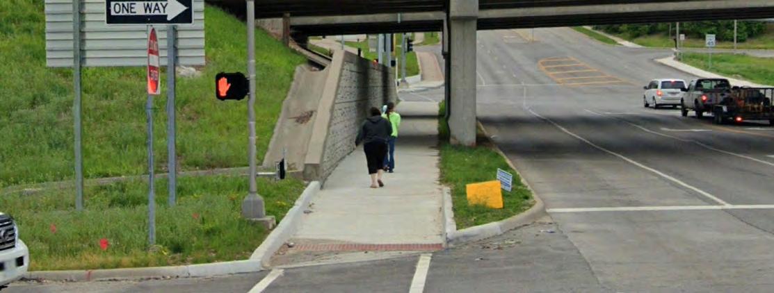
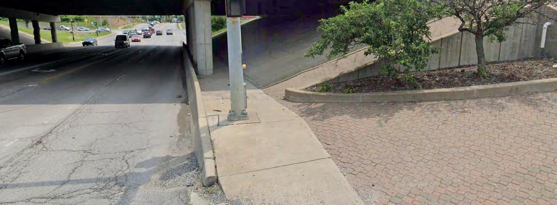
I-35 is a major barrier for walking and biking in Merriam. It divides the city in half and makes it very difficult for residents on the east side of I-35 to walk or bike to the Turkey Creek Trail and for residents on the west side to walk or bike to Antioch Park and other key destinations throughout the city. The interchanges at Johnson Drive and W. 67th Street have very poor crossings, and the interchange at Shawnee Mission Parkway has no crossing. The crossings at W. 75th Street and Antioch Road are measurably better but would represent a major detour for most Merriam pedestrians or cyclists to use these crossings.
The City of Merriam should work with KDOT to explore opportunities to improve pedestrian and bicycle crossings of I-35. This can be done with major interchange reconstruction projects or it can be done individually without any other interchange reconstruction.
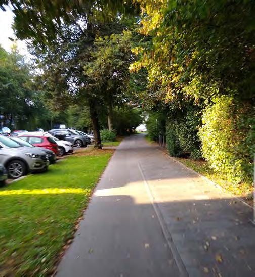
The design of a pedestrian and bicycle facility is just as important as the location. This is most evident at I-35 crossings in Merriam where sidewalks exist but they are designed in a way that does not provide safe or comfortable access. They also do not comply with the Americans with Disabilities Act (ADA) requirements outlined in the Public Rights of Way Accessibility Guidelines (PROWAG), making them impossible to traverse by disabled people.
When designing these facilities, the traditional engineering guidance documents should be referenced including:
• Manual on Uniform Traffic Control Devices (MUTCD)
• Public Rights of Way Accessibility Guidelines (PROWAG)
• American Association of State Highway Transportation Officials (AASHTO) Policy on Geometric Design of Highways and Streets (the “Greenbook”)
Additionally, the National Association of City Transportation Officials (NACTO) has created “Complete Street” design guidelines that should be referenced to provide high quality facilities. It is recommended that Merriam officially adopt these documents and design guidelines for infrastructure projects. These guidance documents include:
• NACTO Urban Street Design Guide
• NACTO Urban Bikeway Design Guide
• NACTO Transit Street Design Guide
Regarding bicycle mobility, most residents preferred off-street bicycle facilities (such as trails and shared use paths) to onstreet facilities (such as bicycle lanes). Off-street facilities can be constructed as either shared use where bicycle and pedestrians interact in a shared area or separated use facilities. The Turkey Creek Trail is a shared-use facility. Shared use facilities in Merriam should be constructed at a minimum width of 10 feet wide with a preferred width of 12 – 14 feet wide to safely and comfortably accommodate both pedestrians and cyclists.
Off-street facilities can also be constructed for separated bicycle and pedestrian use where more cyclists are anticipated. These facilities typically include different paving materials for the bicycle lane and the sidewalk to differentiate the usage. Facility widths can range from 9 feet wide (4’ bike lane and 5’ sidewalk) for basic facilities with one-way bicycle usage up to 20 feet wide (10’ two-way bike lane and 10’ sidewalk) for two-way bicycle and high usage.
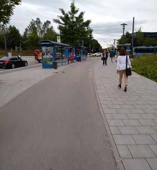
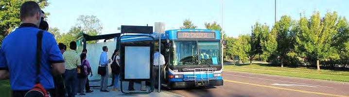
Availability of frequent and reliable public transportation can serve as a critical lifeline to many in a community as the primary means to access employment opportunity, healthcare services, education and much more. There are several ways Merriam can build upon the existing fixed route and on-demand public transit provided in the city currently.
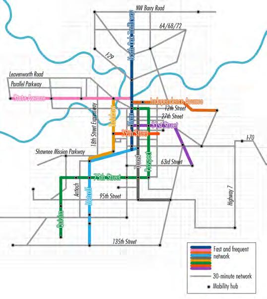
SmartMoves is the regional vision for the development of more integrated and frequent public transit system. The plan is on its third iteration, known as SmartMoves 3.0. The plan largely focuses on developing a transit system around several key regional corridors that would provide frequent, 7 day a week transit service. In each of these rapid corridors transit vehicles would arrive every 15 minutes or less. Transit stops on these corridors would have enhanced passenger amenities with shelters and other information for passengers, making transit more seamless and easier to use.
As displayed in the map below, the W. 75th Street Corridor is included in the SmartMoves plan as it serves as a regional connection from Johnson County into Kansas City. This rapid corridor would utilize Quivira Road from approximately 135th Street to W. 75th Street, then east into Kansas City where the alignment would make connections with existing Bus Rapid Transit (BRT) on Main Street, Troost Avenue and Prospect Avenue. As the SmartMoves vision continues to develop and evolve, Merriam should collaborate closely with Johnson County Transit, the Kansas City Area Transportation Authority (KCATA), and the Mid America Regional Council (MARC) on the development of W. 75th Street as a highfrequency, high-amenity transit corridor that would provide greatly improved regional rapid transit for the southern portion of Merriam. Construction of the identified sidewalk and trail connections can further support this by providing safe and comfortable access to this transit corridor.
Bus stops act as the ‘front door’ to a transit system. To help attract and retain riders, bus stops should be designed to provide a safe and comfortable space to wait for transit vehicles. Transit stops should be placed in high visibility locations and be ADA accessible. As boarding volumes dictate, further passenger amenities should be added to busy stops including benches, shelters, trash receptacles and more as passenger volumes increase.
Today there are only a handful of RideKC bus stops in Merriam. Nearly all provide the most basic bus stop infrastructure—a bus stop sign on a pole. In many cases the boarding zone along the curb is separated from adjacent sidewalk by a 2 to 3-foot grass area that can create a barrier to safely accessing buses for those with mobility impairments and make it uncomfortable for users without physical disabilities.
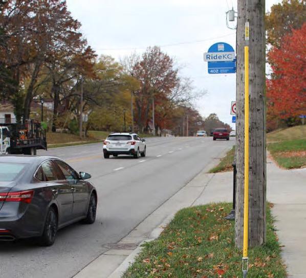
At a minimum, Merriam should collaborate with RideKC to identify all transit stops across the city to construct concrete waiting/boarding pads that directly and safely connect sidewalks to the back of curb for passengers to wait on as well and board and deboard buses. This modest improvement would provide a strong return on investment for transit riders with mobility challenges. Merriam may also investigate adding benches at transit stops at key locations. Benches are relatively low cost and require little maintenance but can make using the transit system much more comfortable and convenient for riders. RideKC has standard benches that can be deployed at stops or, if the City desires, could coordinate with RideKC and select a more stylized bench type to match the community’s aesthetic.
Transit usage in Merriam is relatively low. Working directly with KCATA/RideKC and Johnson County, Merriam should seek opportunities to make Merriam residents more aware of the transit services available in the community and the benefits of using transit. The newly expanded micro transit service now covering all of Merriam is a new form of transit service that can provide on-demand, app-based trip booking and pointto-point travel across a significant portion of Johnson County. Micro transit, along with local and commuter fixed route transit services could be advertised on city communications with residents, on social media platforms or even low-cost targeted advertisements utilizing various social media platforms to reach residents.
GOAL 1 -
No.
Action Item
A1 Conduct engineering studies into lane reduction on roadways identified with excess capacity and high crash rates and implement recommendations
A2 Conduct engineering safety studies for signalized intersections identified for intersection safety improvements and implement recommendations
A3 Apply systemic safety countermeasures at traffic signals througho ut the city
A4 Continue study of interchange reconfiguration at W. 67th Street & I-35 with focus on safety and pedestrian/bicycle access and implement recommendations
GOAL 2 -
No. Action Item
A1 Adopt NACTO “Complete Streets” guideline documents as design criteria for infrastructure projects
A2 Construct high priority trails identified that are independent of lane reductions
A3 Construct high priority sidewalks and crossing improvements ide ntified
A4 Study the feasibility of installing priority trails identified i n conjunction with lane reduction
A5 Work with KDOT to improve pedestrian and bicycle crossings of I-35
A6 Apply systemic safety countermeasures at traffic signals for bicy clists throughout the city
A7 Seek funding for Safe Routes to Schools projects for Merriam schools
A8 Construct low priority sidewalks, bicycle/pedestrian paths, and crossing improvements
GOAL 3 -
No. Action Item
A1 Inventory all transit stops in Merriam in need of ADA improvement, connecting sidewalks to back of curb for ease of boarding and develop cost estimate for stop enhancement
A2 Identify bus stops for installation of benches at key locations
A3 Seek grant funding from MARC or other sources for installation of bus stop improvements
A4 Develop transit awareness program in coordination with Johnson County and KCATA/RideKC to increase ridership on transit in Merriam
What does it mean for a smaller, land-locked city in a major metropolitan area to be economically healthy? Increasingly prosperous residents, thriving local businesses, growing opportunity for quality jobs, and fiscal soundness are common economic goals for most municipalities –and all worth pursuing for Merriam. Promoting prosperity means creating the conditions and meeting standards for quality of life that allow residents and businesses to thrive. An economic development strategy in a community like Merriam should not just be “get more jobs” – Merriam’s prosperity strategy must be more holistic and address retail, office uses, housing, sustainability and other quality of life factors. This chapter details Merriam specific opportunities and challenges to achieving prosperity and outlines a set of strategies to address these areas.
There are several key opportunities and challenges related to promoting prosperity in Merriam. Merriam’s specific location, size and land use composition have created a unique set of circumstances within the Kansas City metro area. Any strategy to promote additional prosperity in Merriam will need to consider the following key opportunities and challenges.
1. Smaller, land-locked suburban communities face di f erent economic development challenges and advantages
Given Merriam’s location, size and land-locked status, economic development strategies for the community will be different than those of a larger city with room to grow. Job growth through a major employer will always be a benefit, but most new employees will likely live elsewhere in the metro. Rather than creating a work-live-play environment, Merriam should focus on increasing prosperity for residents, thriving local businesses, growing opportunity for quality jobs, and fiscal soundness.
2. While they are desirable, Merriam is not desperate for new sources of sales and property tax and can instead focus on quality of life improvements
Merriam is fortunate to have a high-quality mix of land uses within the community. While housing remains the major land use, it is supported by a strong commercial and industrial base that helps provide ample sales tax revenue. This land use mix, combined with a low number of large areas available for development or redevelopment, allows Merriam to focus more on improving quality of life for Merriam residents and businesses.
3. Merriam has an opportunity to improve the ability for resid ents to stay in Merriam across di f erent life stages
Merriam’s suburban character with close proximity to urban amen ities and job centers, makes it distinctly attractive for people of all ages. Young professionals may be drawn to its access and multi-family housing options. Young families may find the location, schools and relat ive affordability in Johnson County attractive. Older retirees may enjoy the proximity it provides to amenities or grandkids living in the area. Capitalizing on this wide range of ages will help make Merriam more resilient.
4. Redevelopment opportunities in Merriam should focus on mixe d-use development, however, regional competition for mixed-use is strong
There are only a handful of areas really suitable for redevelopment or mixed-use within Merriam including the old Lee Jean’s site, the old K-Mart site, Merriam Town Center a nd Downtown Merriam. Each of these locations has specific advantages and issues to consider. However, regiona l competition for mixed-use is high with several projects underway very close to Merriam. The City will need to carefully consider timing and location of future mixed-use development proposals.
5. Merriam should actively seek to encourage a grocery store b ack into the community
The loss of the grocery store from Merriam Town Center is a sig nificant concern of residents in regards to their quality of life and convenience. To improve quality of life, the city may wish to consider ways to encourage a new grocery to locate in Merriam.
6. Merriam’s housing strengths come from its diverse housing s upply and strategic location
Merriam has a diverse housing supply complete with very low to high density options. This provides opportunities for residents to have transitional housing available within the community. Additionally, the community’s strategic location along Interstate 35 and between two major job centers in the region makes the community an attractive place to live.
7. Neighborhood reinvestment across the community will improve home values and quality of life
Neighborhood reinvestment will help to improve the long-term quality of life for all Merriam residents. There is a growing trend in Northeast Johnson County to modernize, improve or add accessory dwelling units to older homes and lots. Merriam should be prepared for this trend to fully reach Merriam and encourage this reinvestment while also providing measures to protect quality of life and aesthetics in the community.
The Merriam Comprehensive Plan 2040 planning process was guided by a set of goals and a vision statement. Below is an image depicting the seven main goals identified for the plan. Each chapter of the plan addresses different elements of the vision statement and reference differen t plan goals. The Promoting Prosperity Chapter does not address just one specific goal - rather, promoting pros perity reinforces ideas discussed in all seven of the plan goals because each relates at least indirectly to both economic health and quality of life. However, the four goals most important to promoting prosperity include: Mixed-Use Commercial Activity Centers, Housing Choice & Diversity, Neighborhood Reinvestment, and Sustainable Development.
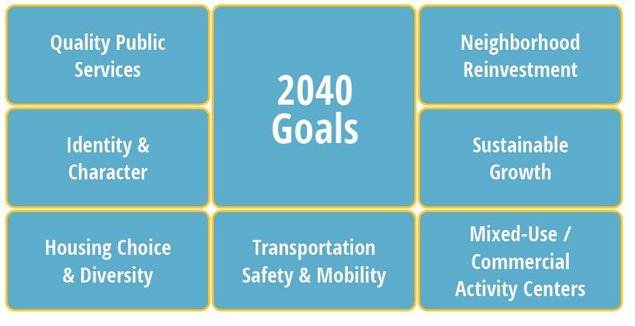
“ The City of Merriam embodies a dynamic, friendly, and family-oriented culture that celebrates our history as a hub of mobility. We are a linkage point for shared amenities , not just for our diverse residents , but also for our neighboring communities.
We recognize and embrace our unique history as an inclusive and well-maintained firsttier suburban community. The City of Merriam enjoys great visibility and convenient access along the I-35 Corridor through its strategic location between other metro communities and Downtown Kansas City.
Merriam offers convenient access to shopping and services , an eclectic downtown area , quality civic facilities , diverse and a f ordable neighborhoods , and an enhanced parks and trails network that attracts a wide range of ages and demographics. ”
The Northeast Johnson County (NEJC) Chamber of Commerce is dedicated to connecting communities, building relationships and growing business in northeast Johnson County. In addition to Merriam, the organization serves many neighboring communities including Fairway, Mission, and Overland Park, among others. The chamber provides networking opportunities between clients and potential customers, clients and other industry professionals. The NEJC Chamber also serves as a source of knowledge on local laws governing business.
The Downtown Merriam Partnership is an organization created to ensure the continuation and revitalization of Historical Downtown Merriam. They host, organize, or promote community events such as Coffee with a Cop, the Mayor’s Tree Lighting, Merriam Drive Live, Turkey Creek Cruise Night.
In September 2020, Merriam City Council approved a $20,000 grant program that offers a 20% reimbursement for residents installing energy saving systems. Systems covered include solar, wind, geothermal, insulation and high efficiency doors or windows. Residents can combine this grant with the existing Exterior Home Improvement Grant.
The Shawnee Mission Parkway Corridor Plan was adopted by Merriam City Council in 2014. The corridor plan’s purpose is to guide revitalization and/ or redevelopment of the portion of Shawnee Mission Parkway between Antioch Drive and Eby Street / IKEA Way. The plan addresses future land use, environmental and transportation / infrastructure needs of the area.
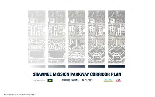
The latest City of Merriam Comprehensive Plan was completed in 2001 and has the following vision statement, “Merriam is a quality place that attracts people because of its strong neighborhoods, accessible shopping, job opportunities, inviting public spaces and its convenient location to regional attractions.” This vision statement was used to guide the plan creation and implementation strategy.
The plan touches many areas of community character and identity. Of note, the plan identified six infill areas suitable for redevelopment, four of which have been completed including the IKEA site and the Car Max development. Quality infill projects help Merriam express a commitment to future success and an ability to evolve with changing conditions.
Merriam has an Exterior Improvement Grant for residents looking to beautify their homes. In 2020, the City invested $50,000 in the program, which provides a 20% reimbursement for exterior improvements upon completion.
Homeowners need to have at least $2,500 in combined repairs/renovations. They may be reimbursed anywhere from $500 up to a maximum of $2,500. All Merriam residents, who do not live in an apartment, may apply.
Covered Improvements include:
• Painting
• Siding
• Fence
• Deck
• Shed
• Roof & Gutters
• Awnings
• Solar panels
• Door/window replacement
• House additions
• Landscaping
• Irrigation system
• Tree removal
• In-ground fire pit or grill
• Removal/repair pool
• New/repair driveway
Beautification grants like this can incentivize reinvestment in neighborhoods, which can improve character and increase the quality of life for residents.
In September 2020, Merriam City Council approved a $50,000 grant program that offers Historic Downtown businesses located between Turkey Creek and the BNSF rail line a 20% reimbursement (between $1,000 and $5,000) for exterior improvements such as floodproofing.
While not an explicit policy, one of the City of Merriam’s chief contributions to prosperity and vitality has been its track record of proactive, generous investments in its public infrastructure. Merriam residents have approved a number of sale tax incentives funding significant improvements to city streets, sidewalks, and stormsewer systems. Residents also supported sale tax funding for the construction of the new Merriam Community Center.
The City of Merriam received a Planning Sustainable Places (PSP) grant for the purpose of planning the transportation, land uses, and design for the downtown portion of Merriam Drive. The grant money will be used to further refine the best and most sustainable options for the future of the Merriam Drive corridor in the vicinity of Downtown Merriam. The outcome of the project will be to identify specific investments in the street for a “complete street” approach to serve multiple modes, adjacent trails, and adjoining private property by the City and developers that are enhancing the character of Downtown Merriam in a market-sustainable way.
Additionally, the second PSP grant is a partnership between Merriam, Overland Park, and the Unified Government of Wyandotte County to review and plan for the Merriam Drive corridor from Merriam to Southwest Boulevard. The purpose of this corridor plan is to analyze the relationship between land use and transportation along Merriam Drive and make recommendations regarding appropriate land uses, internal mobility enhancements, and multimodal opportunities along the corridor, including an opportunity for complete streets and “green” stormwater infrastructure solutions. The study is an opportunity to develop a cohesive development strategy for this historical corridor and connect the gateways of two communities.
The City of Merriam has a franchise fee rebate program available for residents who meet certain income requirements as established by the U.S. Department of Housing and Urban Development. The program provides an opportunity for refunds of city franchise fees paid on electricity, gas and landline telephone bills.
To estimate the pool of potential demand for future development in Merriam, Leland Consulting Group conducted a market analysis across each of the major land use types. The analysis builds on demographic and economic information found in the Existing Conditions report, supplemented with new data and research specifically geared towards identifying relevant competitive market areas and assessing real estate supply and demand dynamics within those areas over the next 20 years.
The estimates shown here are for how much market demand Merriam might be able to satisfy are top-down, in that they are not specific to any individual properties in Merriam and are not based on an exact assumption of available infill land in Merriam. Rather, they represent reasonable estimates of the share of future market area development that could potentially occur in Merriam based on its size and its market strengths and weaknesses, relative to likely competing locations.
The ranges are intended to capture, for planning purposes, the “expected” level of development that could occur given the probable supply of infill land in Merriam. That said, an exceptionally aggressive program of land assembly and incentives could conceivably exceed even the “high” range of estimates shown. Again, a developer contemplating plans for a particular development type on a particular property within the city should conduct a separate site-specific analysis of market feasibility.
Residential
population and household growth
Northeast Johnson County (+ a small portion of southeast Wyandotte County)
Demand by product type influenced by income levels and associated propensity to own vs. rent (and other market trends). We assume Merriam’s share of area growth (currently very low) will grow as infill sites are considered
Retail (community & regional scale)
Retail (grocery & neighborhoodserving)
Projected growth in household spending potential + estimated spending leakage
Projected growth in household spending potential + estimated spending leakage
NE Johnson + SE Wyandotte Counties
1.5-mile radius (centered on K-mart site)
Current supply and demand growth are tracked across multiple store/spending categories. Growth in e-commerce is factored in.
Focus on grocery, dining and related supporting uses.
Office
Projected growth in employment across key office-user industry sectors Johnson County
Long-term impacts of COVID on general demand for office vs. work-at-home options is unknown
Industrial / Flex
Projected growth in employment across key industrial sectors
Johnson County
Square footage requirements vary greatly by industry and by specific site use.
The largest municipalities in a region often also strive to maximize opportunities for people to both live and work within the city limits. In Kansas City, Missouri, almost half of employed residents are spared the need to commute to another city. That is a commendable goal with obvious benefits for regional traffic and commuter quality of life, but it gets harder to pull off for smaller towns. For a city the size of Merriam (with fewer than 10,000 employed residents) it’s typical for 90 to 95 percent of working residents to commute outside daily.
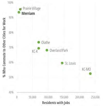
For related reasons, job creation, another common economic development goal, is not really a pressing need for smaller suburbs surrounded by larger cities, especially when local infrastructure and mobility habits are overwhelmingly autooriented. Yes, landing a corporate employer will raise ad valorem property taxes in town and shore up vacant office space, but the vast majority of residents (and their salaries) will drive home to other cities at the end of the day, only a small fraction of new corporate employees would realistically be able to find housing Merriam anyway. If the town in question is effectively built-out, only a few dozen could be absorbed by the local re-sale home market anyway.
Blessed with a new Ikea and a large concentration of major auto dealerships, Merriam (at least in pre- and hopefully postCOVID times) takes in some of the highest sales tax revenues per capita in the metro area. So, despite having generally lower home values and proportionally lower property tax revenue, Merriam’s civic financial health is above average. Maintaining fiscal strength is of course important, but not as critical a growth priority as it is in other communities.
Instead, for a small city in Merriam’s position, a healthy economy is often most important for the enhanced quality of life of its residents and businesses – keeping retail amenities nearby and fresh, improving the aesthetics and safety of the built environment, and generally promoting the vibrancy of the community.
The City of Merriam has a long and exemplary history of re-investing in its infrastructure. Merriam residents have approved a number of sale tax incentives funding significant improvements to city streets, sidewalks, and stormsewer systems. Residents also supported sale tax funding for the construction of the new Merriam Community Center.
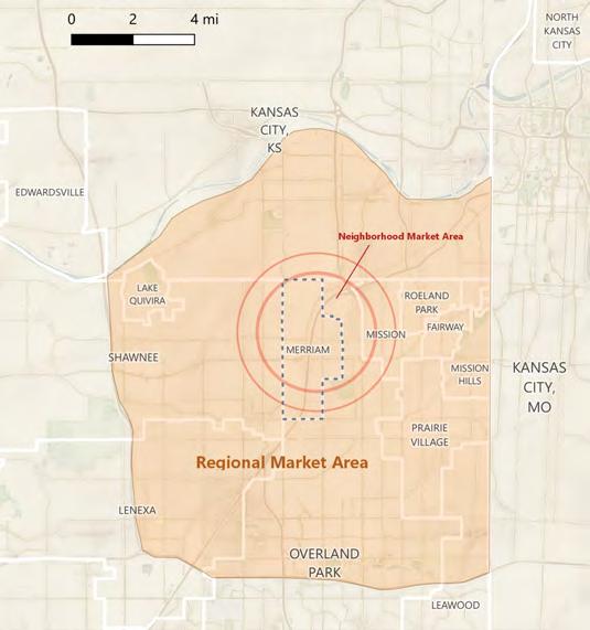
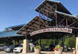
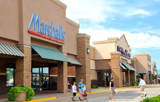
For a smaller city with large neighbors, adding jobs for the sake of jobs is not particularly advantageous for Merriam, since the vast majority of new jobs will be filled by people who reside outside the city. Likewise, Merriam is not desperate for new sources of sales and property taxes. Of course, new redevelopment should not lower property tax revenue or replace healthy sales-tax generators. Fiscal gains are desirable, but probably secondary to tangible quality of life improvements.
Private-sector development candidates likely to improve the quality of life for local residents and businesses should score well on the following criteria:
Complementary to the surrounding neighborhood and existing businesses and institutions. At the very least, a replacement land use should not introduce major nuisances to neighbors or plan on walling itself off from adjacent uses. Positive examples include blending in architecturally, improving rather than disrupting connectivity, and providing goods and services of interest to neighbors, not just visitors (see below).
Provides missing goods and services (or improve the quality and selection of goods and services) for local residents and workers. Bringing a desirable grocery store back to town may be tops in this category. Adding quality walkable lunch options for area health care, office and auto dealer employees may be another.
Improves the ability for residents to stay in Merriam across different life stages. While this criteria might be met by certain amenities of services (such as seniorfriendly businesses), it refers mainly to enhancing the breadth of housing options available in town.
Adds vibrancy and eyes-on-the-street across more times of day. Having people able to live near places of work, and vice versa, helps places seem more friendly, alive, and safe – even if the same people aren’t technically both living and working in the same place. Just mixing the uses is not enough, though candidates for infill uses should be able to show how their project design is geared towards adding to that vibrancy.
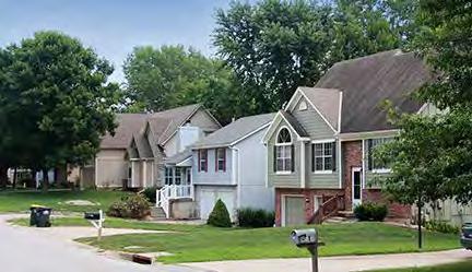
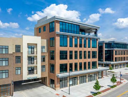
Short of just building more public amenities like the new Community Center, Merriam’s best route to improving local quality of life lies largely in the hands of private developers. And, given the increasingly limited number and size of development sites, Merriam may not have the luxury of encouraging one isolated land use per site if it wants to grow in a balanced, sustainable way. Mixed-use development appears to be the most logical solution to delivering on the community benefits identified in this chapter.
Like many other established suburbs across the Midwest, Merriam has no remaining green fields for easy development, with its opportunities for growth increasingly limited to infill sites – land with vacant or underperforming land uses that might be repurposed towards more productive use if redeveloped. Only a handful of such sites (of significant size) can be found in Merriam in 2020. These include the former K-mart property, the former Lee Jeans headquarters, the downtown area, and some or (eventually) all of the Merriam Town Center site.
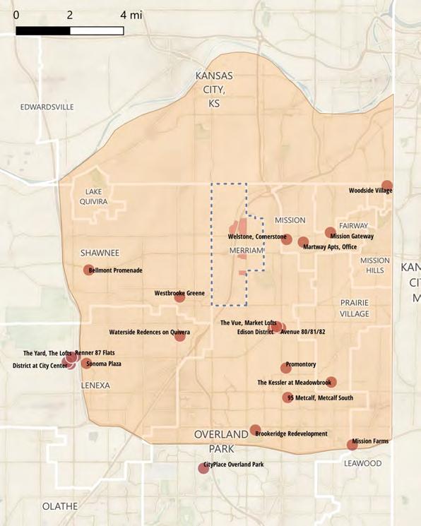
While it is possible to build mixed-use projects on relatively small footprints of land in urban settings, most suburban infill projects require a larger assembly of land to fit the desired mix of uses (especially when the project is to be surface parked). Areas like downtown Merriam are challenging for developers because the large number of small properties, under a wide variety of different ownership levels of business savvy and/or willingness to sell or redevelop.
The benefits of mixed-use development for community sustainability – long accepted in more urban environments – are becoming increasingly accepted in suburban contexts. In fact, finding the right combination of live, work, play, dine and shop opportunities is becoming an expected part of most new suburban infill today.
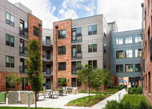
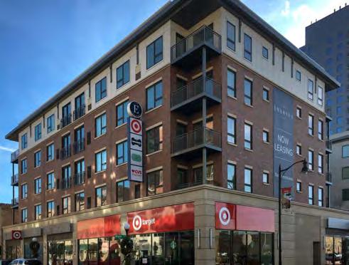
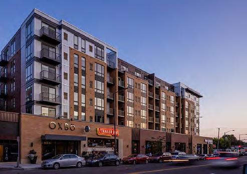
The advantages and general appeal of mixed-use redevelopment have introduced a new challenge: intense competition. Larger neighboring suburbs like Overland Park and Lenexa– along with smaller communities like Mission, Shawnee, and Westwood have recently made major commitments to encouraging mixed use infill. The sheer volume of new infill development in the vicinity of Merriam has become somewhat daunting, with many recently built projects already making room for more than a dozen underway or in the planning process. While this activity is encouraging as a show of developer interest, the fact is that many of these exciting new concepts have not been markettested and the well of consumer demand may be stretched somewhat thin already.
Developers often specialize in one main land use category: retail, office, apartments, single-family homes, etc. While they may be able to deliver a mixed-use project, they may not be as familiar or adept at certain components. Over the past decade, multifamily projects were often quite profitable – so much so that many developers would build “mixed-use” residentialover-retail, but put little effort into the ground level retail, which could remain vacant or poorly tenanted. Ground level retail is great for driving active, enjoyable streets, but suburban tenants are still on the learning curve for how to make shops and restaurants succeed in that setting. The supply of savvy proprietors and developers is likely limited.
The four Merriam sub areas with most obvious mixed-use infill potential are profiled on the following pages, with commentary on their market prospects and strategic considerations for redevelopment. The sub areas are discussed more in-depth in Chapter 1 - Sub Area Plans.
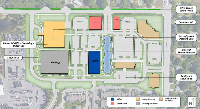
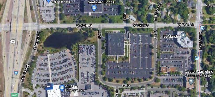
146,000 sf main building on 8 acres, 1975 construction, PUG zoning
Adjacent office buildings are occupied and operating, so top prio rity is finding a replacement tenant willing to rehab the aging (and very 1975) Lee building alone. A teardown option would open up other mixed-use possibilities, but the adjacent CarMax lot is not a particularly complementary land use, limiting placemaking potential. A pedestrian path connecting this sub area to the AdventHealth medical campus to the south would provide a connection for those workers wishing to patronize the area’s new restaurants. Although the office market in Johnson County is still relatively sound, there are concerns about future demand.
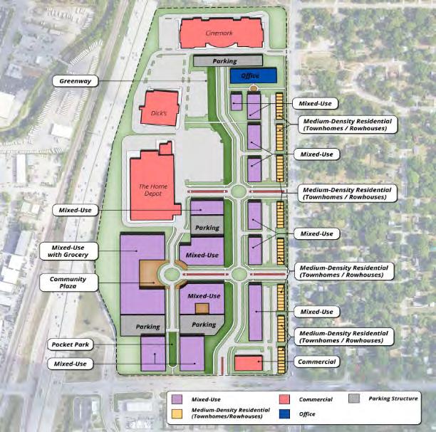
58 total acres across all parcels, currently occupied with a variety of big box retailers and restaurant pad sites (and a vacant supermarket) mostly built in 1998
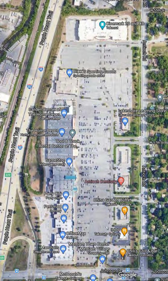
Redeveloping this site would be ambitious and potentially risky. A mixed-use development of sufficient size for this parcel would put it in direct competition with many of the recent or planned infill projects in the competitive vicinity. The risk of a new development would need to weighed against the loss in sales tax revenue from replacing the existing stores. Although big box retail is on the decline nationally, the center is still relatively productive.
Given the importance to the community of replacing the departed grocery, it would be hard to pass up a supermarket chain willing to simply re-tenant the Hen House property. Landing a new grocery (in the existing space) would likely preclude any major site redevelopment for at least several years. A downside is that it would be taking away potential demand for a small grocer to help complement a mixed project at the K-mart site.
Unless an eager developer comes forward with a compelling site re-use proposal, the prudent route may be to encourage a replacement tenant for the vacant supermarket property (refreshing other tenants as able) and monitor the performance of the many nearby infill projects, with a plan to revisit the idea of a Town Center redevelopment in five to ten years.
Downtown Merriam is a potentially attractive location for future redevelopment. It already features street-to-building relationships that are more human-scaled and conducive to walkability than other Merriam commercial areas, along with excellent existing public amenities in the Merriam Marketplace and the Werner Park bike/pedestrian path along Turkey Creek.
The area is at or near full occupancy with scattered shops and dining establishments mixed with auto-oriented and light industrial uses. The diversity of small ownerships may make this site very difficult to assemble for any larger-scale infill projects, and the floodplain is a constraint to development. While a dramatic overhaul of Downtown land uses such as shown in this rendering is possible, it would require ambitious cooperation. However, even a more piecemeal, opportunistic appr especially with policy changes to encourage moderate density increases (such as two-story buildings and reduced setback requirements) and added flexibility for residential uses. Some l “maker space” providing opportunities for small-scale craft, innovation and artistic use.
The non-profit Downtown Merriam Partnership already plays a role outreach and events. For future larger-scale investments such as major streetscaping, shared maintenance, or more regional events, the City could consider cooperating with that organization to form a Business Improvement District (BID), that could levy a service fee from district businesses t
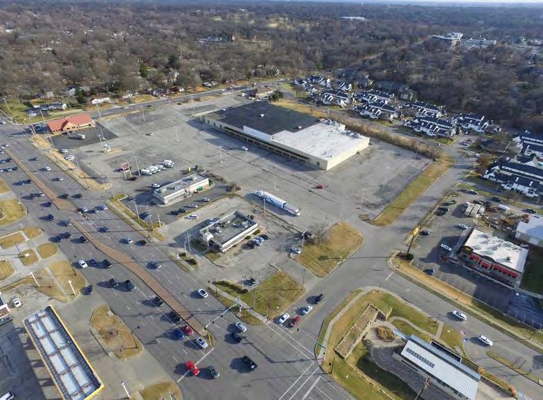
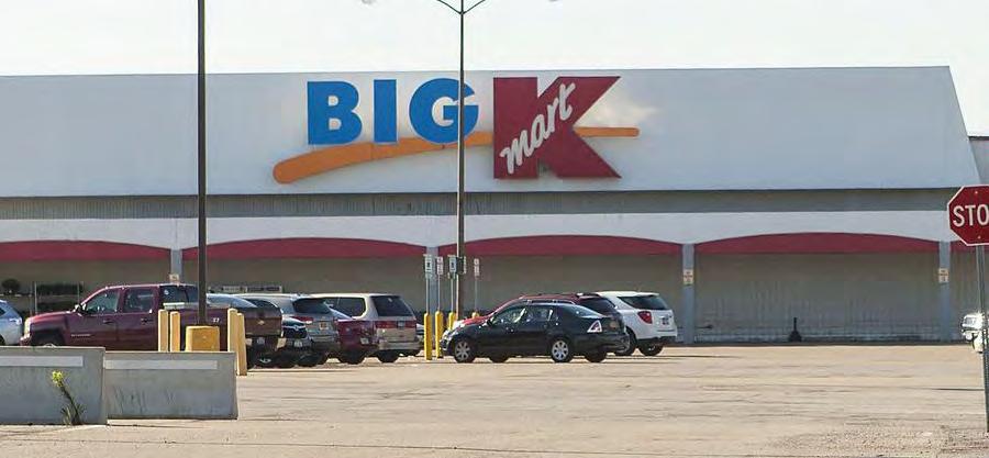
108,210 sf on 11 acres (19.5 including outparcels), C-1 zoning, 1968 construction
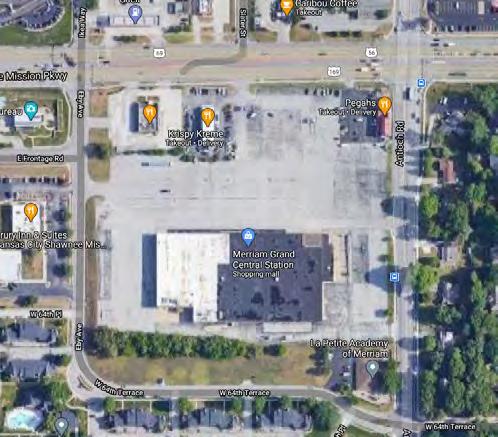
Potentially an excellent location for residential/retail mixed-use. Close to the new Merriam Community Center and IKEA. Fully vacant except for donut store pad site. Some K-mart buildings have been successfully rehabbed for adaptive reuse, but given its age this may be difficult. Demolishing the building would create a blank slate for redevelopment design.
While there is potential to assemble land on the north side of Shawnee Mission Parkway for related development, but it will be difficult to forge a strong pedestrian link. Depending on whether structured parking is financially feasible, the site could accommodate between 275 and 350 multifamily units, along with 50,000 square feet of commercial space (including a 12,000-15,000 s.f. smaller format grocer such as Aldi or Trader Joes). A modestly scaled retail/housing mix could deliver on many quality-of-life goals while avoiding direct competition with larger sized area competition.
Given the importance of bringing grocery back to Merriam, this should be a high-priority opportunity site for the 1-5 year near term.
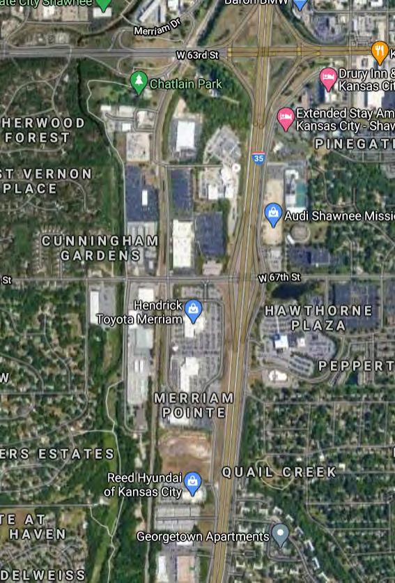
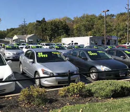
Merriam’s automobile dealerships are generally thriving and seem poised for continued success. It is possible that, one day, shifts in mobility habits or other structural changes to that industry may free up one or more lots for future redevelopment. To that extent, the city’s plentiful dealer lots may serve as an additional land bank for infill growth in the more distant future. Until then, the fiscal importance of those establishments outweighs any temptation to substitute other uses on that land.
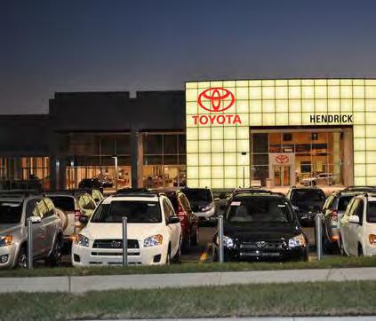
The retail landscape is changing rapidly. Even before the COVID-19 pandemic, there were significant shifts in user preferences and expectations driven largely by the emergence of competition from e-commerce. Figure 5.12 shows the percentage of total sales that are e-commerce from January 2016 through January 2020.
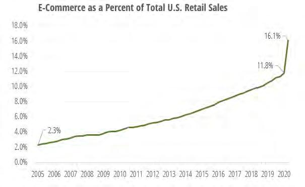
COVID-19 has only served to expedite certain key changes. With stores closing, either voluntarily or as part of temporary lockdown measures, and consumers concerned about the virus, online sales surged rapidly in 2020. Many consumers who had never tried delivery services for restaurants or groceries did so for the first time in 2020. While online sales have surged during quarantine periods, other retail trends that had previously been growing have stalled, at least for a time. For instance, the move to “experiential retail,” seen as the brick-and-mortar answer to encroaching on-line sales, has slowed due to social distancing requirements. While the post-pandemic future of traditional retail is still murky, most assume that retailers will continue to have a gradually shrinking physical footprint. What also remains unclear is what will be done with the excess real estate currently in existence.
The nearby Country Club Plaza, long considered the nation’s original lifestyle center, has recently made aggressive changes to its tenant mix, many of which exemplify some of the major structural trends sweeping the industry, including:
Online retailers opening traditional locations
Warber Parker, Casper Mattress, UNTUCKit
Smaller format anchor stores
122K s.f. Nordstrom
Entertainment & Experiential Retail
Punchbowl Social (bowling, craft beer, karaoke, etc.)
Restaurant anchors
Shake Shack, True Foods, Capital Grille relocation
Alternative Retailers
Green Grove (CBD retailer)
The loss of the Hen House grocery store in Merriam Town Center was brought up numerous times in the public engagement process as a major quality of life setback for city residents. A possible replacement store could take the form of a similarly sized (50,000 to 60,000 s.f.) traditional grocer or one of an increasing variety of smaller-format alternatives.
To assess market demand, we looked at current and projected household spending potential in the food-at-home, health & personal care, and dining/food service categories. Generally, neighborhood serving retail like a grocery store draws from a much narrower trade area than regional lifestyle centers or even big box centers. Figure 5.13 shows the location of groceries in the Merriam vicinity, showing rings of 1.5-mile and 2-mile radius. Table 3.2 shows how new grocery spending due to household growth, along with recapturing some existing spending leakage in a 1.5-mile trade area, indicates that area could support 38,000 s.f. of new grocery store space in Merriam over the next 5-10 years –likely too small for a major traditional grocer, but enough demand to support small-format grocers. As a key quality of life component for Merriam residents, this would be a priority redevelopment target the for the community.
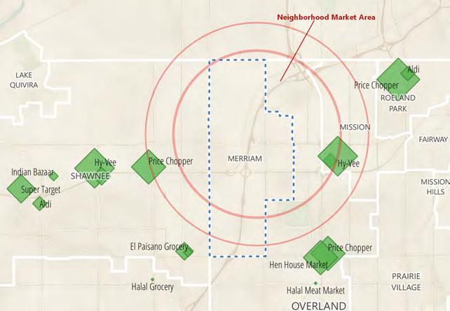
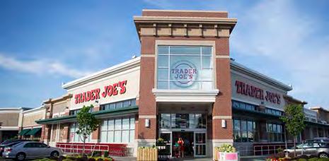
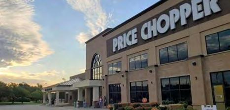
In addition to our neighborhood grocery demand analysis, we also projected future demand for land uses with the potential to be components in a mixed-use infill context. The estimates below represent Merriam’s attainable share of demand across a wider market area.
Residential and non-residential demand for Merriam over the next 10 and 20 years is shown in Table 3.3. Within 10 years, there will be a demand for between 240 and 410 new residential units depending on the growth rate and economic conditions. Over a twenty-year period, this increases to between 400 and 700 units, also depending on demand and conditions. Retail demand for the next 10-year period will be between 92,000 SF and 139,000 SF. For office, the 10-year demand is starts slightly lower, between 89,000 and 148,000 SF. Overall demand for industrial + flex space will be lower at 50,000 SF and 60,000 SF.
Single family has seen a surge due to the low mortgage rates and the long-awaited move towards home ownership among the large Millennial age cohort (who had previously been slow to shift away from renting due to a variety of factors including the previous recession, increasing student debt, and delayed marriage/household formation).
Some analysts think that the COVID-19 pandemic may help accelerate acceptance of, and demand for, single family suburban housing as people have become accustomed to being able to work from home, reducing their dependence on (and resistance to) long commutes. Resistance to higher density living could be another postCOVID lasting consumer preference for some, favoring suburbs.
The general increase in housing prices nationwide, particularly in larger metropolitan areas, has led to a growing housing affordability crisis. One consequence has been a slow but steady increase in demand for single family rental housing. While these recent changes will likely help to bolster single-family home values in Merriam, the city is largely unable to capitalize from a development standpoint, since there is no remaining supply of larger-lot residential land.
The market for multifamily apartment construction has slowed somewhat from its recent heyday as the nation’s leading development type but remains relatively viable, primarily serving the younger end of the Millennial cohort and that portion of senior Boomers looking to downsize and/or cash out of larger detached homes. Attached ownership housing such as condominiums, townhouses, and rowhomes remain a mainstay of urban mixed-use development and are gaining ground as components in suburban infill. From an investment and development standpoint, workforce and low-income projects are generally considered to offer the most solid development opportunities in 2021.
The COVID-related downturn is likely to slow the supply pipeline of new multi-family as lenders tighten loan requirements, giving some recently-completed projects an opportunity to stabilize, but potentially stalling others.
Merriam’s housing market has many strengths, but its location and relative affordability are the main appeals of the area. Merriam is strategically located along Interstate 35 and offers easy access to thousands of metro area jobs. Figure 5.14 shows job clusters in the metro relative to Merriam – together there are a total of over 400,000 jobs within a reasonable commute time from Merriam. This makes Merriam highly appealing to residents, especially for dual income Millennial families needing commute flexibility/compromise. Given Merriam’s size and location, it may be unrealistic for Merriam to create a true live-work environment within its boundaries. However, it is very favorably located for prospective new residents looking for a reasonable commute to one of the metro area’s three largest employment clusters
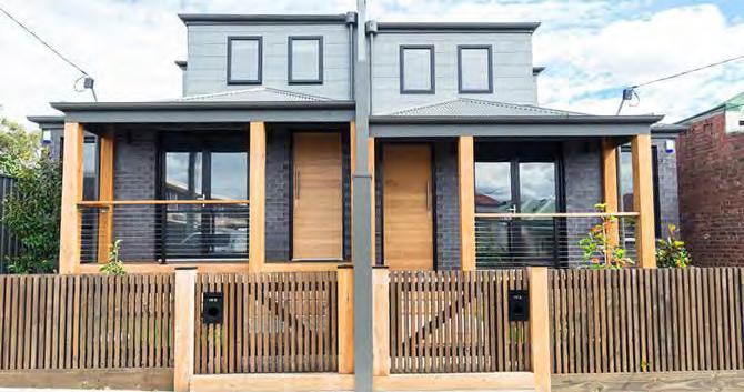
Merriam will be almost completely reliant on infill redevelopment for any future additions to the city’s inventory of housing units. Fortunately, infill environments are well suited to the more compact residential forms commonly referred to as “missing middle housing” -- e.g. rowhomes, stacked flats, townhouses, bungalow courts, etc. that help bridge a product gap between suburban detached housing and higher density apartment complexes. These housing types, together with three to four-story apartments-over-retail forms, constitute the mainstay of modern mixed-use infill development.
Missing Middle Housing forms are also particularly well suited to active seniors, whether in age-restricted or mixed developments. Lastly, these formats are generally amenable to ownership workforce housing, typically partially subsidized. Both senior and workforce affordable housing are categories with strong potential in Merriam.
Unfortunately, adding Missing Middle housing does not address one of the more commonly-mentioned problems affecting Merriam: the propensity for some young adults to leave the community in search of larger, higher-end detached homes once they begin to form families and accumulate enough of a nest egg to afford 2,500 to 3,000 square foot homes with three-car garages and other features not readily available in Merriam. While this consumer segment is likely not a realistic target for Merriam to satisfy, steady quality of life improvements (such as the new Merriam Community Center, and well-tenanted infill retail development) may help convince a portion of these families to accept slightly smaller housing in trade for a more better neighborhood amenities.
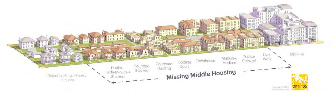
Quality of life is enhanced when the housing stock evolves to meet shifting demographics and desires of residents. For nearly built-out cities like Merriam, that adaptation comes through neighborhood reinvestment - as owners add on to homes to match their space needs or investors replace standing units with new construction. Figure 5.16 is a map of recent building permit activity for additions (including garages, basement conversions etc.) but not home improvements such as HVAC or roof replacement in the Merriam area. The green symbols are sized by permit value and new construction are shown with purple dots. The pattern of investment in new or modified living space appears to show much higher activity in the more affluent suburbs to the east, between Merriam and Kansas City, Missouri. This is likely driven by differences in disposable income and higher potential for increasing resale margins in Mission Hills and related cities, but it may also suggest the need for Merriam to consider increasing the attractiveness and spending limits of its existing façade improvement incentive program.
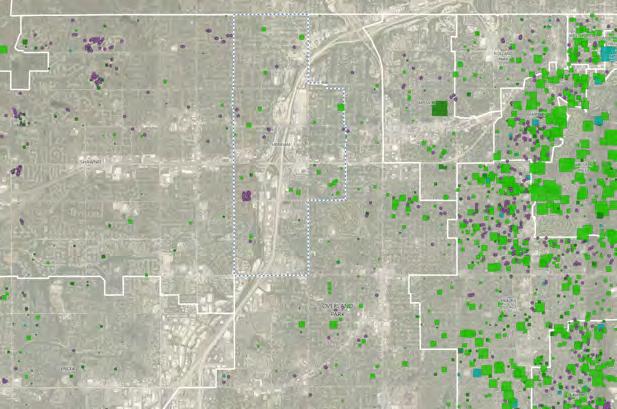
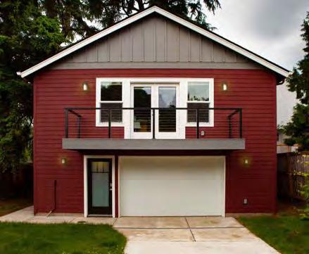
Accessory Dwelling Units (ADUs), sometimes called in-law apartments, are self-contained apartments, cottages, or small residential units, that are located on a property that has a separate main, single-family home, duplex, or other residential unit. ADUs are an attractive way to increase density without altering the character of an existing neighborhood. They also provide financial flexibility to owners because of the supplemental rental income. ADUs are sometimes referred to as “granny flats” because homeowners will often have their aging parent live with them in their own separate unit so they can stay close and still maintain some autonomy. ADUs do have a number of concerns about long-term maintenance and economic viability. Maintenance concerns arise when the original owner sells the primary home and ADU to a new owner who does not live on the property and leases out both units. Economic viability concerns arise when the costs of installing the infrastructure to connect the ADU to utilities make it more feasible to purchase an existing single-family residential unit.
A more viable method to encourage redevelopment would be for the city to consider adopting single family zoning district that allows smaller lots. Currently, Merriam’s primary single family zoning district is R-1 Single Family Residential which requires a minimum lot size of 10,000 square feet, a lot depth of 100 feet, and a lot width of 75 feet. These are very large lot dimensions. By creating a smaller lot single family zoning district, the city would give more opportunity for splitting lots and otherwise allowing platting changes to facilitate creation of more buildable infill lots.
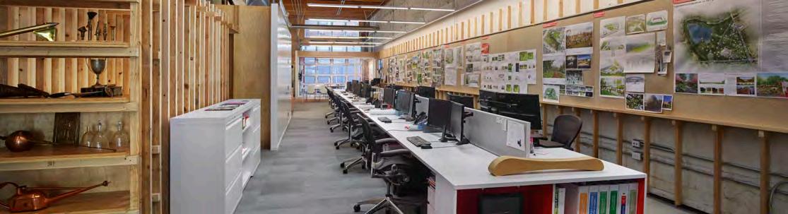
Traditionally, residential development in the U.S. has followed the jobs, but there has been a recent trend towards the reverse, with major corporations and professional firms increasing basing their location decisions on perceived quality of life of cities – from the perspective of the current and prospective employees. As such, authenticity of place has become a sought-after commodity. Companies and workers now look for the genuine, the idiosyncratic, the unique and, most importantly, a personality of place that matches their own. In fact, a recent Newmark study identified a significant rent premium for office properties with transit access, dining operations, and open floor plans of around 50 percent higher than those with obsolescent characteristics.
Medium or large employers considering office space (whether in existing or new buildings) in Merriam are unlikely to care much whether Merriam, itself, has adequate housing for their employees, given the host of housing options in nearby cities. However, placemaking considerations are likely to figure into future corporate decisions. With widespread activity across Johnson County (and similar metropolitan suburbs across the country) promising to deliver creatively-designed mixed-use environments, Merriam must actively consider not only the quality of office product it encourages, but also the look, feel, and general vitality of the surrounding environments it creates through public infrastructure investment and policies for neighboring land uses.
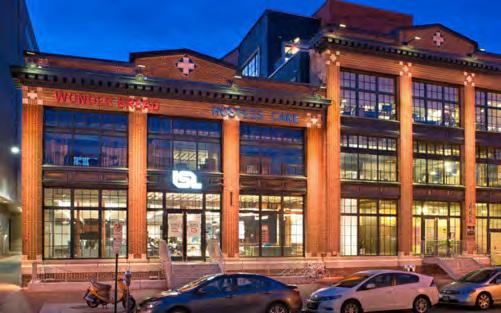
For smaller-scale office development, downtown Merriam presents intriguing, and relatively affordable, possibilities that could be enhanced with targeted policies. The K-mart, Lee Jeans headquarters, and Merriam Town Center sites provides possibilities that are more blank-slate in nature, relying on creative co-tenanting and amenity connections outside the infill sites to help built a more attractive sense of place.
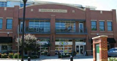
GOAL 1 -
No.
INCREASE THE AMOUNT AND DIVERSITY OF AVAILABLE HOUSING UNITS
Action Item
A1 Support infill housing development and consider providing incentives for development
A2 Consider revising the zoning code regulations to allow for increased density in single family areas. Revisions could include creating a smaller lot single family zoning district, allowing for accessory dwelling units, etc.
GOAL 2 -
No.
MAINTAIN THE CITY’S QUALITY OF LIFE AND ATTRACT AND RETAIN RESIDENTS AND FAMILIES OF ALL TYPES
Action Item
A1 Consider a program of voluntary “exit interviews” for people, families or businesses choosing to move out of the City, to gain insights on potential policy improvements
A2 Encourage explicit consideration of quality-of-life criteria for development proposals in Merriam, including neighborhood compatibility, addition of needed amenities, and increased diversity/vibrancy of land use
A3 Continue with the City’s new Exterior Home Improvement Grant pr ogram to encourage residential home improvement and small business facade upkeep
GOAL 3 -
No.
SUPPORT THE REVITALIZATION AND REDEVELOPMENT OF KEY EXISTING RETAIL AND COMMERCIAL PROPERTIES
Action Item
A1 Explore preferred mixed-use redevelopment options for K-Mart site in preparation for request-forproposals, including identification of likely gaps in economic feasibility
A2 Explore adaptive re-use potential of Lee Jeans headquarters office building, including potential residential options
A3 Actively monitor performance of new and proposed infill mixed-us e projects in Johnson County to help assess viability of eventual Merriam Town Center redevelopment
A4 Consider updating the zoning code regulations to support redevelopment of commercial areas to include residential
A5 Stay abreast of major trends in the automotive industry that might affect land use requirements for dealerships
A1 Continue to support the Downtown Merriam Partnership to fund a variety of activities designed to improve, maintain, and promote downtown businesses
A2 Explore potential for and interest in “maker space” redevelopment of vacant or under-performing light industrial space downtown
A3 Consider zoning code update or overlay zoning district to encourage more compact development downtown through decreased setbacks, decreases parking requirements (or shared parking options) and two-story construction
A4 Consider arts-oriented special or recurring evening events to encourage community activity and enhance perceptions of safety
A5 Consider the addition of wayfinding through signage or special w alkway treatments to encourage exploration of the Downtown, including the Merriam Marketplace
There are many definitions of sustainable development, but one of the most common ones comes from the United Nations World Commission on Environment and Development (WCED) which states, “Sustainable development is development that meets the needs of the present generation without compromising the ability of future generations to meet their own needs.” Typically, sustainable development is framed within three lenses: the environment, the economy and equity. Sustainable growth and development should strike an overall balance between all three when decisionmaking. For instance, it may be best for the environment if all gas combustible engines were banned immediately. However, there is a high economic cost to such a sudden and unphased approach to change. Further, many low-income residents without adequate access to public transit may be left stranded and could lose their jobs. A more nuanced, holistic approach to decision-making is the most sustainable approach. This chapter identifies sustainable areas Merriam should consider.
Sustainability is typically viewed through three lenses: the environment, the economy and equity. Sustainable development practices must weigh these factors when evaluating decision-making for growth. Many issues related to sustainable development are typically approached from a larger geographic perspective, however, there are certainly key challenges and opportunities facing Merriam that the City should seek to address.
1. Merriam has floodplain issues, especially in the downtown, w hich presents a unique opportunity to sustainably transform the area
There is a documented history of flooding issues in the area aro und Downtown Merriam because of the Turkey Creek. Merriam has been working for many years to petition the U.S. Congress to provide funding for the approved U.S. Corps of Engineers flood mitigation plan that is designed to reduce the floodplain area in downtown. Floodplain mitigation around the downtown presents an opportunity for Merriam to sustainably transform the area.
2. Water quality and water conservation are important environm ental issues that can be addressed by Merriam and its residents through incremental changes and educa tion campaigns
Water quality and water conservation are both environmental issues that can, in part, be combated through a combination of local community and individual household decision-making. Most pollution comes from nonpoint source pollution such as contaminants picked up throug h urban or agricultural runoff/snowmelt. Water conservation seeks to reduce the total amount of water by increasing efficiency of water.
3. Merriam should continue to expand and protect its urban tre e cover and reduce the amount of impermeable surface present in the community
Natural features such as urban tree cover, shrubs and other permeable surfaces help to reduce the occurrence and severity of flooding. They also provide natural shade, habit ats for flora and fauna, and work to capture carbon. Merriam should continue to promote tree cover protection and permeable surface expansion.
4. Merriam has an opportunity to decrease its automobile relia nce by investing in alternative transportation options and infrastructure
Given Merriam’s proximity to multiple jobs centers and the larg e number of workers coming in to Merriam each day, there are excellent opportunities to expand public transit in the community. Efforts are already underway to improve transit access in the community. Those efforts should continue to be supported. Additionally, there are future and alternative transportation types the City needs to consider.
5. Merriam’s a f ordable homes and neighborhoods should be protected and enhance d to prevent increased urban sprawl
Merriam offers a wide variety of single family homes that are in a convenient location with excellent access to the entire metro areas. The existing housing stock in Merriam should be preserved and the neighborhoods enhanced in order to continue to provide a great place for individuals, couples, and families of all types to live and thrive without needing to build new housing farther and farther outside the metro area.
6. Merriam should continue to prioritize regional cooperation to promote the overall health of Johnson County and the greater metro area
Merriam is composed of over twenty different neighborhoods, thre e major centers and one historic downtown district that helps to create a real sense of place. Preserving these neighborhoods, centers and districts, while also allowing them to mature and adapt to changing conditions, will help promote a positive identity and character in Merriam.
The Merriam 2040 Plan planning process was guided by a set of goals and a vision statement. Below is an image depicting the seven main goals identified for the plan. Each cha pter of the plan addresses different elements of the vision statement and reference different plan goals. The Sustainable Development Chapter most closely addresses the Sustainable Growth Goal.
“Merriam uses future-oriented decision-making to support sustainable growth and development through a diversified tax and employment base to promote prosperity, sensible environmental regulations to protect natural resources, and durable development made with quality materials and thoughtful design that allow for flexibility and resiliency.”
“ The City of Merriam embodies a dynamic, friendly, and family-oriented culture that celebrates our history as a hub of mobility. We are a linkage point for shared amenities , not just for our diverse residents , but also for our neighboring communities.
We recognize and embrace our unique history as an inclusive and well-maintained firsttier suburban community. The City of Merriam enjoys great visibility and convenient access along the I-35 Corridor through its strategic location between other metro communities and Downtown Kansas City.
Merriam offers convenient access to shopping and services , an eclectic downtown area , quality civic facilities , diverse and a f ordable neighborhoods , and an enhanced parks and trails network that attracts a wide range of ages and demographics. ”
Merriam has partnered with the Johnson County Stormwater Management Program to provide $5,000 for an innovative, community-based approach to stormwater quality. The program helps support and educate residents to implement best management practices to reduce stormwater runoff. The goal of program is to encourage residents to incorporate Stormwater Treatment Facilities (STFs) on their property, which include rain barrels, rain gardens and native trees/plantings. Programs such as these help incentivize green infrastructure stormwater solutions. The City website also provides additional links to resources about rain gardens, rain barrels, as well as native trees and plants.
All trash haulers operating in Merriam must offer recycling services. Items accepted is dependent upon the trash hauler. In the past, Merriam has held community recycling events with neighbor Shawnee to provide residents an opportunity to drop off a variety of items in one location. The City’s website provides the location of five Recycling Centers in the KC metro area. Additionally, specific rules and regulations for hard to recycle products such as paint or electronics is provided for residents.
In October 2020, Merriam City Council approved amendments to the city’s solar installation code to streamline the permitting process for solar panel installation. It removed the conditional use and planning commission review requirements, eliminated the abandonment and disrepair provisions, and now allows solar panels to face the right-of-way.
In September 2020, Merriam City Council approved a $50,000 grant program that offers businesses located between Turkey Creek and the BNSF rail line a 20% reimbursement (between $1,000 and $5,000) for exterior improvements such as flood-proofing.
In September 2020, Merriam City Council approved a $20,000 grant program that offers a 20% reimbursement for residents installing energy saving systems. Systems covered include solar, wind, geothermal, insulation and high efficiency doors or windows. Residents can combine this grant with the existing Exterior Home Improvement Grant.
The latest City of Merriam Comprehensive Plan was completed in 2001 and had the following vision statement, “Merriam is a quality place that attracts people because of its strong neighborhoods, accessible shopping, job opportunities, inviting public spaces and its convenient location to regional attractions.” This vision statement was used to guide the plan creation and implementation strategy.
The plan touched on many areas of community character and identity. Of note, the plan identified six infill areas suitable for redevelopment, four of which have been completed including the IKEA site and the Car Max development. Quality infill projects help Merriam express a commitment to future success and an ability to evolve to changing conditions.
Merriam has an Exterior Improvement Grant for residents looking to beautify their homes. In 2020, the City invested $50,000 in the program, which provides a 20% reimbursement for exterior improvements upon completion.
Homeowners need to have at least $2,500 in combined repairs/renovations. They may be reimbursed anywhere from $500 up to a maximum of $2,500. All Merriam residents, who do not live in an apartment, may apply.
Covered Improvements include:
• Painting
• Siding
• Fence
• Deck
• Shed
• Roof
• Gutters
• Awnings
• Solar panels
• Door/window replacement
• House additions
• Landscaping
• Irrigation system
• Tree removal
• In-ground fire pit or grill
• Removal/repair pool
• New/repair driveway
Beautification grants like this can incentivize reinvestment in neighborhoods, which can improve character and increase the quality of life for residents.
The City of Merriam received a Planning Sustainable Places (PSP) grant for the purpose of planning the transportation, land uses, and design for the downtown portion of Merriam Drive. The grant money will be used to further refine the best and most sustainable options for the future of the Merriam Drive corridor in the vicinity of Downtown Merriam. The outcome of the project will be to identify specific investments in the street for a “complete street” approach to serve multiple modes, adjacent trails, and adjoining private property by the City and developers that are enhancing the character of Downtown Merriam in a market-sustainable way.
The second PSP grant is a partnership between Merriam, Overland Park, and the Unified Government to review and plan for the Merriam Drive corridor from Merriam to Southwest Boulevard. The purpose of this corridor plan is to analyze the relationship between land use and transportation along Merriam Drive and make recommendations regarding appropriate land uses, internal mobility enhancements, and multimodal opportunities along the corridor, including an opportunity for complete streets and “green” stormwater infrastructure solutions. The study is an opportunity to develop a cohesive development strategy for this historical corridor and connect the gateways of two communities.
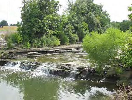
Floodplain and flooding issues remain one of Merriam’s most significant natural resource issues. The City is currently waiting for federal funding to be approved through the U.S. Congress to implement the Upper Turkey Creek Flood Risk Management Project. The City is seeking funding for preliminary engineering and design of a strategy that brings as many downtown businesses as possible out of the floodplain. Alternative plans had proposed removing all floodplain properties to allow the area to flood without property damage. However, those alternative plans did not preserve the historic downtown Merriam.
There are environmental, economic and equity concerns regarding floodplain management. From an environmental perspective, the City should continue to seek federal funding to assist with the high cost of floodplain mitigation strategies. However, there are other best practices that can help naturally reduce the severity of flooding such as keeping as much unnecessary impermeable surfaces out of the floodplain, maintaining a green boundary around streams and using green infrastructure solutions throughout the community.
Economic concerns related to the floodplain include the negative economic impact on the property owners and overall community. Flood damage and insurance is expensive. Further, the floodplain’s presence keeps the motivation for investment by existing owners or redevelopment by new owners low. In September 2020, Merriam created the Historic Downtown Grant which is available to businesses located between Turkey Creek and the BNSF rail line. The grant offers up to 20% reimbursement (between $1,000 and $5,000) for exterior improvements such as flood-proofing. Efforts such as this help local businesses, but a longer-term solution is needed.
Equity concerns related to floodplain management include the fact that historically lower income residents have received much of the negative burdens related to environmental issues. Poor people living in flood prone areas may have health issues related to the mold that may grow as a result. Merriam should continue to consider equity issues related to floodplain management in the community.
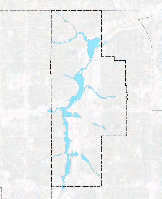
Green infrastructure refers to a collection of systems and practices that seek to mimic natural processes for dealing with stormwater. Green infrastructure allows for stormwater to be infiltrated, evaporated or be stored and used at a later time. The goal of green infrastructure is to manage stormwater as close to the site as possible. Green infrastructure uses many features including bioretention facilities, rain gardens, vegetated rooftops, rain barrels and permeable pavements. The community survey indicated over 60% of residents support the increased use of green stormwater infrastructure. Merriam currently incentivizes green infrastructure through the Residential Sustainability Grant for Merriam homeowners.
Bioretention Facilities are depressions or shallow basins used to slow, capture and filter stormwater through permeable surfaces such as soil, grass, mulch or plantings. They can be aesthetic as well as useful infrastructure solutions.
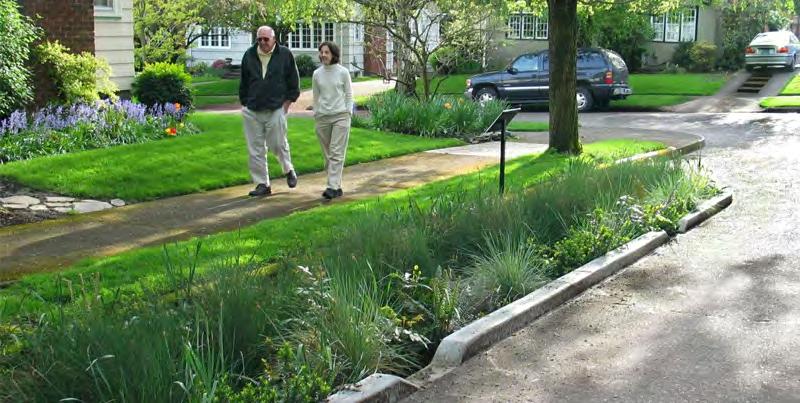
Rain Gardens are made of native shrubs, mulch and flowers in a small depression within a landscape designed to pool and slowly reabsorb stormwater back underground while also filtering out many sediment / chemicals.
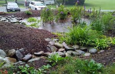
Vegetated Rooftops, sometimes called green roofs, are roofs with vegetation on the top of the building that helps to capture and use stormwater on site to support the plantings. These features also help with urban heat island effect.
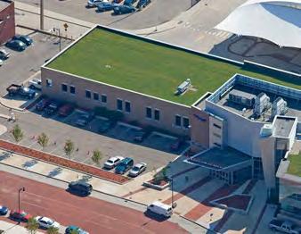
Rain Barrels are barrels used to collect rainwater that can be used for landscape and lawn watering.
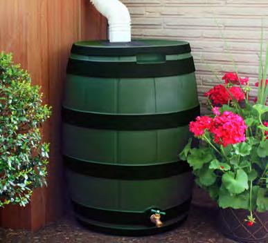
Permeable Pavement / Pavers are a pavement type with high porosity that enables rainwater to pass through and filter into the ground instead of over to reduce the amount of stormwater runoff on site.
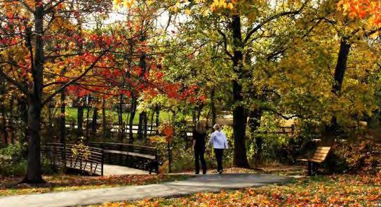
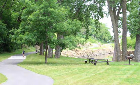
Urban tree cover provides many benefits including cleaning air, soil and water, decrease urban heat island effect, provide shade cover, reduce stormwater runoff, capture carbon and increase nearby property values. Figure 6.2 shows the estimated tree cover in Merriam. One significant threat to urban tree cover are tree diseases and pests. Tree diseases such as the Oak Wilt and pests such as the Emerald Ash Borer have decimated tree cover on residential streets across the United States. This devastation has been especially bad in neighborhoods with one tree species that dominates the neighborhood. Requiring and incentivizing the planting of tree species diversity will be a key step in protecting existing and future tree cover. Policies requiring two trees planted for each tree lost or removed also help. Merriam should prioritize tree protection and expansion for future generations.
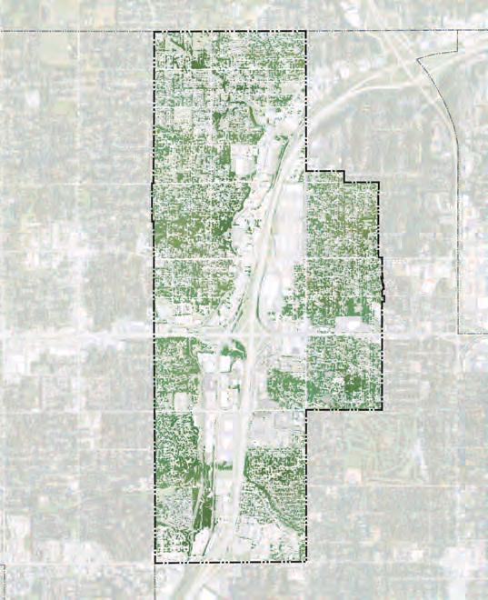
Permeable surfaces are those areas where water can filter into the ground and back into the water system such as grass, shrubbery, plantings and permeable pavers/pavement. Impermeable surfaces create flow rather than filtration and include concrete and asphalt. When water flows over impermeable surfaces it can lead to flooding or more severe/ longer lasting flooding. As water flows across impermeable surfaces such as a typical street it can pick up pollutants including toxic heavy metals, which are then brought into the watershed, negatively impacting water quality locally and regionally. By reducing the amount of unnecessary impermeable surfaces and promoting the use of permeable surfaces, Merriam can better manage stormwater and flooding events.
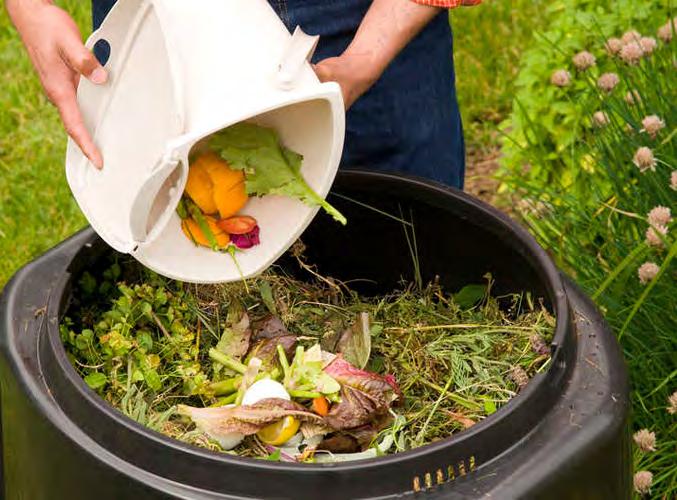
Waste and material consumption are major contributors to greenhouse gases. Material extraction, processing and distribution all use energy and release emissions. Waste in landfills, especially for organic products like unused food, releases methane gas - a potent greenhouse gas. More and more communities are aiming to meet aggressive waste generation reduction goals through reducing use, recycling and repurposing. To reduce waste generated, cities are critically reviewing their own use of resources and waste in public facilities. They are also promoting the use of methods such as composting organic materials, which reduces the amount of methane released. They are encouraging and expanding recycling systems and helping residents identify waste repurposing such as donating materials or unused food. Merriam requires all trash haulers to offer recycling services and has held recycling events in the past to encourage its use. The City website provides information to residents about the location of recycling centers in the metro.
Recently, Merriam has made great strides in improving the conditions for alternative energy expansion in the community for residents and businessowners. The City has streamlined the process for residential solar panel installation and has created a Residential Sustainability Grant to provide financial incentive to install energy saving systems such as solar, wind, geothermal, insulation and high-efficiency windows or doors. These sort of structural changes help to create an environment for alternative energy expansion and can help make sustainability part of the community’s overall character. This can also include Merriam’s commercial sectors.
Merriam is already home to one of the premier alternative energy users in the region - the Ikea store. Geothermal energy is used to heat and cool the Merriam IKEA store, which is the largest in the states of Kansas or Missouri. Merriam’s IKEA store also has a 92,000 square foot rooftop solar array that generates enough power to offset 680 tons of carbon dioxide annually1 If more alternative energy investments are made to Merriam businesses, the community will be able to further stake a claim to being one of the most sustainably minded communities in the Kansas City region.
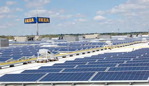
The community survey completed for this plan found 79% believe the city should increase the energy efficiency of city buildings. Overall, there was widespread support for community sustainability.
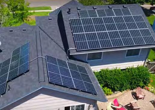
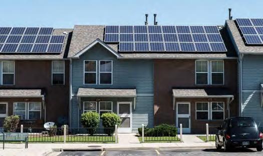
As a mostly built-out community, understanding the capabilities for retrofitting sustainability into existing buildings and areas is critical. There are many resources available for strategies to retrofit both residential and commercial properties. According to the Institute of Building Sciences, retrofitting an existing building is actually much more cost-effective than new sustainably built construction. Energy-based changes can be the most successful example of retrofitting sustainably since energy consumption for buildings account for around 40% of the entire U.S.’s energy consumption, including 32% for heating / cooling2. Possible retrofitting options include:
- Installing high efficiency appliances including low-flow toilets and shower heads and energy efficient dishwashers
- Adding energy efficient lighting and bulbs
- Replacing old windows with high-performance windows to gain heating / cooling efficiency
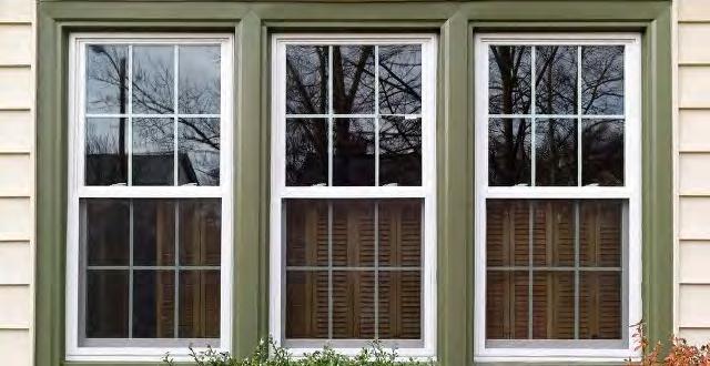
- Smart thermostats to monitor heating / cooling usage
- Green roof and other onsite green infrastructure solutions
There are many ways to encourage, educate and incentivize sustainability improvements. Cities can provide informational guides to homeowners and businessowners about the long-term benefits of retrofitting. A marketing campaign could also be created to highlight these benefits. Rece ntly, the Merriam City Council adopted a Residential Sustainability Grant, a $20,000 program designed to cover part of the expenses of adding sustainability improvements to Merriam homes - an excellent step towards retro fitting sustainability.

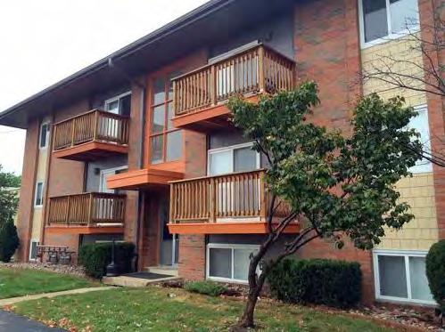
Merriam is part of an affordable housing enclave within the generally affluent Johnson County, Kansas region. Additionally, there is a healthy mix of housing types available ranging from single-family detached housing to high-density apartments. This housing mix allows Merriam to be livable for a wide range of ages, income levels and lifestyles. Merriam should continue to strive to be a community that has room for residents from all backgrounds. Over time, universal and inclusive design principles should also be expanded in the community. Part of universal / inclusive design refers to housing that is accessible for residents from all levels of abilities and disabilities. The First Suburbs Coalition is currently updating their Idea Book for Renovating Post War Homes to include universal design retrofitting guidelines. The community survey found 61% support Merriam providing a mix of housing to attract people at various life stages.
Part of having an equitably sustainable community is providing and maintaining an equitable distribution of community services and amenities. If areas of the community feel under-served it can impact the quality of life and community character. As Merriam continues to make community improvements, it should evaluate the geographic distribution of investments and programming. In particular, making sure areas of higher income or racial/ ethnic diversity are adequately served by existing and future amenities and services such as parks or streets improvements is important.
Environmental justice refers to the fair distribution of environmental benefits and negatives across a community. Specifically, this typical involves making sure negative environmental externalities are not unfairly placed on lower-income areas of a community. Negative externalities related to the environment including floodplain / flooding, light / air / noise pollution, and runoff/smells from industrial areas. Floodplain is a particularly important issue for Merriam given its history of Turkey Creek flood events. Merriam should continue its efforts to address and prevent flooding along Turkey Creek or near Downtown Merriam. This will help increase quality of life for all Merriam residents while making sure those most vulnerable are not overly burdened.
A core principle of sustainable development is a respect for regional cooperation and planning. Many of the issues impacting the long-term sustainability of a community or metro area must be approached through regional efforts. Issues such as water quality / pollution prevention, stormwater management, equity concerns related to affordable housing and job access, public transit, major transportation infrastructure and responsible land use management rely on a shared unified regional vision and approach. Merriam already participates in regional planning through the city’s relationship and support of the Mid-American Regional Council (MARC), the Metro KC Climate Action Group, and other regional planning entities. Merriam should actively participate in regional planning efforts and continue to support the long-term health of the entire Kansas City region. By being a good neighbor, Merriam can help support the greater regional area.
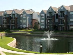
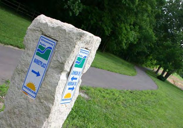
Mobility and transportation are key elements of sustainable development, which will be explored in greater detail in Chapter 4 - Mobility and Transportation. Having an adequate sidewalk and trail network in Merriam, with connections to the surrounding metro communities, will help provide safe, sustainable routes throughout the community. Trails and sidewalks should adequately connect existing parks and other community resources to create a connected system. By providing trails and sidewalks between where people live and where they want to spend time will hopefully reduce the number of single-occupant automobile trips, which has a positive impact on greenhouse gas emissions. Trails often help promote land conservation and open space as is the case with the Turkey Creek Streamway Trail. Parks contain permeable surfaces (grass, trees and shrubbery), all of which capture carbon, clean the air and provide shade and recreation. Additionally, permeable surfaces are able to filter and absorb stormwater and snowmelt, which helps to reduce the occurrences and severity of flooding events.
According to the statistically valid survey completed for this plan, trails and park space are the most utilized park facilities in Merriam and identified as the biggest priorities f or the city’s park system. Approximately 87% rated the park system as excellent or good.
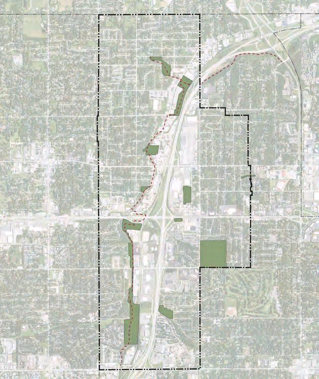
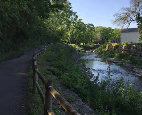
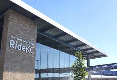
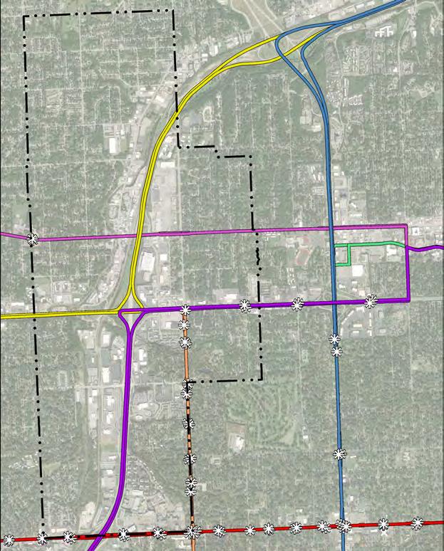
Public transit has many sustainable benefits. There are environmental benefits associated with public transit because it reduces the number of individual automobile trips, which leads to fewer emissions / vehicle miles traveled. Quality public transit increases access to jobs for residents without access to a vehicle while also directly providing jobs. The American Public Transportation Association estimates that for every $1 invested in public transportation, approximately $5 is generated in economic returns3. Finally, public transit provides important equity benefits since not all residents have access or consistent access to a vehicle - limiting their access to services, resources and jobs. Chapter 4 - Mobility & Transportation will cover this material in much closer detail, but support for public transit investments must be included in any discussion of sustainable development. Merriam should continue to seek and integrate additional public transportation investments in the community to provide key linkages to residents, jobs, services and resources. Merriam’s location and street system already provide excellent connectivity and access to the region - an asset that should be strengthened through additional transit infrastructure.
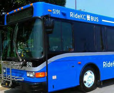

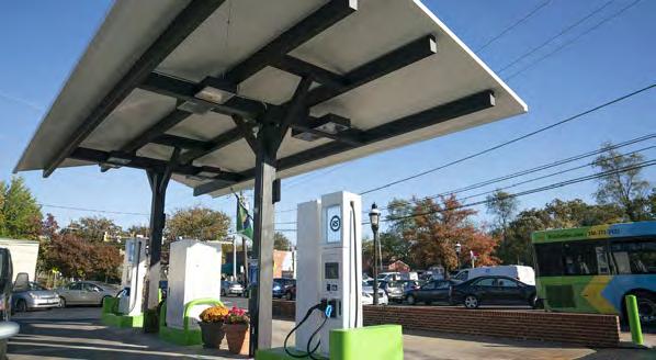
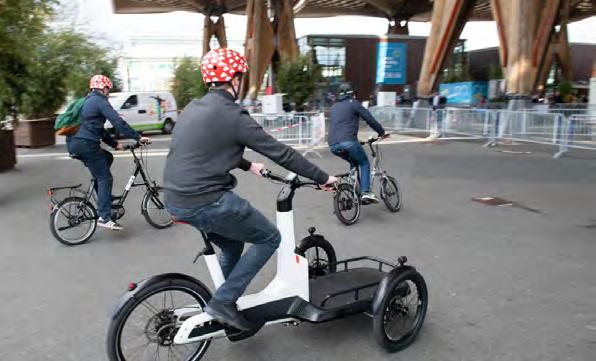
Micromobility may also play a key role in shorter-distance non-automobile connections that provide what is commonly referred to as last-mile connections between larger scale public transit and key locations off main transit routes. Micromobility includes E-bikes, electric scooters, electric skateboards, shared bicycles, and electric pedal assisted bicycles. Micromobility can be managed through both public and private sector organizations or companies. Any implementation of micromobility in Merriam will need to be carefully executed to add benefit without taking away from quality of life or safety. Additional considerations of micromobility will be discussed further in Chapter 4 - Mobility & Transportation.
The future of transportation continues to evolve as technological and personal habits and preferences also change. For a sustainable transportation network, Merriam will need to be forward thinking and be ready for structural changes as they occur. While there are no guarantees and the timeline continuously shifts; innovative transportation technologies such as automated vehicles and widespread electronic vehicles will have some place in providing transportation for the upcoming decades. Electronic charging stations can already be found in select areas around Merriam, and the community should be ready to further provide this sustainable infrastructure and facility space. Per the community survey, 58% said it is important to allocate funds to walking, biking or transit infrastructure.
The sustainability of the built environment in a community relies on a healthy mix of land use types. Suburban communities have historically been dominated with residential land uses - however, this stereotype is evolving as job centers have dispersed to areas beyond the central business district. Merriam currently has quite a diversified land use composition as shown in Figure 6.7 and summarized in Figure 6.6. Communities with an over reliance on any one land use type are at risk of being vulnerable in the face of economic ebbs and flows. Lower density, single-family residential land is typically more of a cost burd en to the community in terms of the overall tax benefit versus resources consumed ratio. Commercial and industrial land pay more in taxes and provide jobs, however, there are negative externalities associated with commercial / i ndustrial land as it relates to traffic, noise, crime, and environmental issues from pollution and stormwater runoff. M erriam should continue to support and seek a diversified land use composition that blends employment land with quality public spaces, land for lower and higher density residential options all with appropriate buffers and clu stering of complementary land uses.
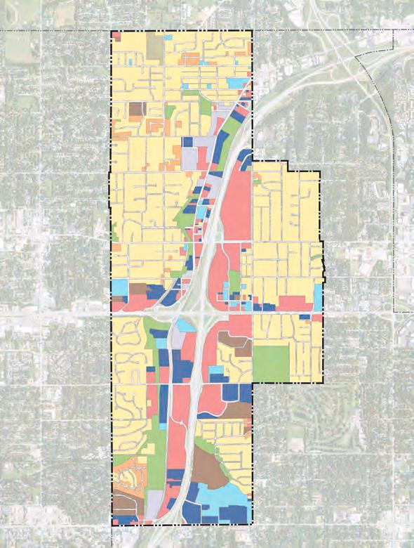
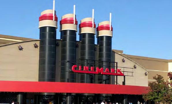
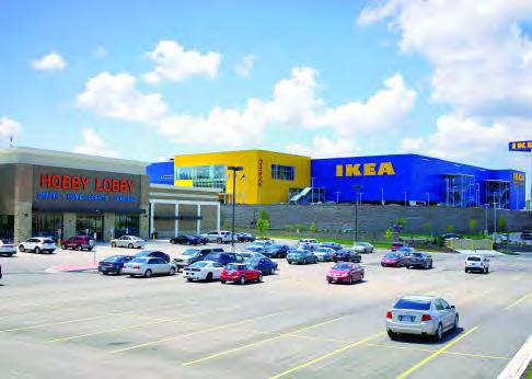
Retail has been steadily evolving over the past several decades and the COVID-19 pandemic only accelerated structural changes to the retail marketplace. Social distancing has seen communities experience increase in demand for drive-thru retail and restaurant facilities, outdoor seating and the ability to get fresh air and increased circulation in retail and commercial centers. It is too soon to fully understand the long-term impact of COVID-19 on the retail world, but cities can assist businessowners by re maining flexible and reactive to changes in society and the economy. Some communities have seen neighborhood commercial bloom during the pandemic because people are out walking more and want to support local businesses as much as possible. Another way to increase flexibility into retail and other commercial enterprises is thro ugh the expansion of mixed-use developments. Mixed-use developments are those developments that have a varie ty of uses including retail commercial, office and residential. The merging of these two land uses provides a built-in market for the retailers and added amenities and increased quality of life to residents. Having retail / commercial options near residential options also can decrease the amount of vehicle miles traveled for everyday goods, which has a net positive impact on the environment. Overall, Merriam should continue to seek creative solutions to retail issues and support necessary adaptations as they arise.
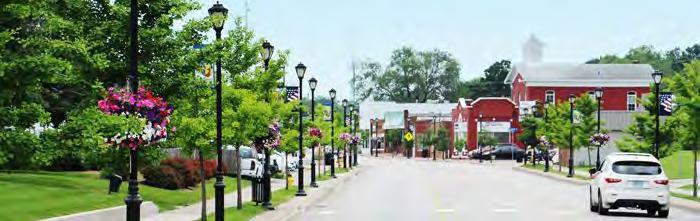
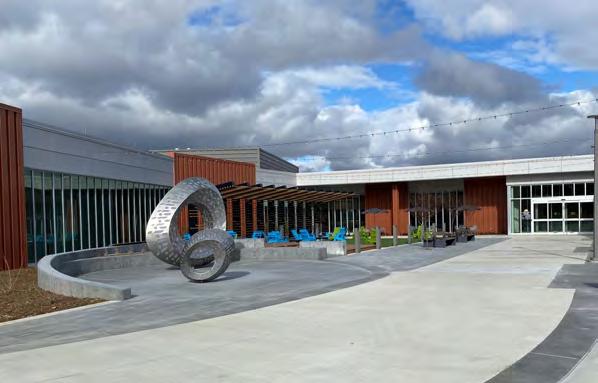
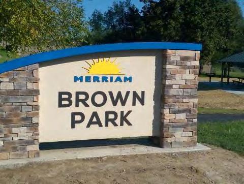
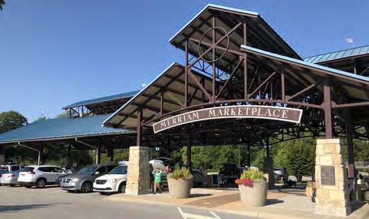
An important component of any healthy land use mix in a community is high quality public land. Public land can include everything from city facilities (city hall, public works, police) to parks and trails or libraries. Many of Merriam’s amenities can be found in public land and there has b een significant investment in this land in recent years - most notably with the new community center. Long-term investments in quality of life such as that of the community center and eventual new public library space are providing a sustainable future for Merriam by thinking about the long-term needs of Merriam residents. Public land and the amenities typically provided on them should not only be accessible to residents in all areas of the community but should also be physically connected through multi-purpose trails, sidewalks, trails or public transit lines. This connectivity can help to increase the equity of amenities. For instance, not every neighborhood can have its own community center, but if a new community center is adequately served by the existing trail, sidewalk or transit routes then the physical location of the amenity is less inequitable. Merriam should continue to be intentional in the maintenance, planning and implementation of public land and amenity improvements in the years to come.
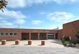
Block Groups with >35% HH’s < $40,000 income / year


Block Groups with highest % non-white residents
TO PROMOTE HARMONY WITH NATURE IN MERRIAM GOAL 1 -
No.
Action Item
A1 Continue to modify and work towards a comprehensive floodplain management plan for the community that balances the environment, economy and equity of Merriam
A2 Continue to work with property owners in the downtown to address flooding issues and offer grants like the Historic Downtown Grant
A3 Continue to promote and incentivize alternative energy and green infrastructure solutions on new commercial or residential development or redevelopment of existing sites
A4 Continue to periodically review city code for obstacles to alternative energy and green infrastructure site integration
A5 Install green infrastructure stormwater management solutions on publicly owned land
A6 Adopt an updated tree cover protection policy that requires tree species diversity and a tree replanting requirement
A7 Encourage existing, new and redevelopment to reduce the amount of unnecessary impermeable surfaces
A8 Encourage residents and businessowners to sustainably retrofit their buildings through the use of educational guides and possible financial incentives
A9 Create a strategy to decrease waste generation in Merriam through the use of reducing waste, composting, and recycling or repurposing items
A10 Identify a waste reduction percentage target to help define wast e management and sustainability goals in Merriam
GOAL 2 -
No.
Action Item
A1 Continue to provide and expand upon Merriam’s housing stock to ensure there are housing options available to match all resident needs
A2 Promote and educate homeowners, businessowners and the development community on universal design
A3 Continue to provide community services equitably across all neighborhoods in Merriam
A4 Periodically review city services and programming to assess whether diverse needs and voices are being met and heard
A5 Actively consider environmental justice issues when approving or adopting developments or zoning changes
A6 Identify possible environmental negative externalities facing low-income Merriam residents
GOAL 3 -
No.
PARTAKE IN AND PROMOTE REGIONAL COOPERATION AND PLANNING IN JOHNSON COUNTY
Action Item
A1 Continue to be an active participant in regional planning effort s to support the overall long-term health of the Kansas City metro area
GOAL 4 -
PLAN FOR A FUTURE-ORIENTED MOBILITY AND TRANSPORTATION SYSTEM
No. Action Item
A1 Continue to expand the trail and sidewalk facilities in Merriam, especially where it improves connections between existing city parks and amenities
A2 Support the expansion of public transit in Merriam
A3 Identify long-term strategies to deal with the potential expansion of micromobility and future modes of transportation including electric and self-driving vehicles
GOAL 5 -
No.
STRIVE TO HAVE A RESILIENT, LIVABLE BUILT ENVIRONMENT WITH A HEALTHY MIX OF LAND USES
Action Item
A1 Continue to support and expand Merriam’s diverse set of land uses to maintain a resilient community
A2 Monitor and provide support for Merriam retailers and businesses so they can remain viable throughout the course of changing market conditions and consumer preferences
A3 Continue to maintain an equitable and intentional system of public land that is connected through trails and sidewalk to the greater Merriam community
Creating Place deals with the livability and quality of life within Merriam through strategic and thoughtful land use decisions. Planning for the physical aspects of a community through policy results in a valuable return on investment in the form of long-term social, equitable and environmental benefits. The policies of this chapter focus on the lives of those who live, work and visit Merriam, by creating a framework for high quality design, equal access to city services and amenities, and sustaining healthy and diverse neighborhoods. Creating Place touches on all of the 2040 goals and this chapter outlines the strategies that Merriam can implement to create unique, livable and vibrant places throughout the community. As the practical application of these ideas, this chapter will present strategic opportunities for creating places and defining future land use opportunities.
Creating Place touches on all of the 2040 goals as indicated below and this chapter will outline the strategic opportunities that Merriam can implement to create unique, livable and vibrant places throughout the community.
In addition to the 2040 goals, Creating Place directly relates to the Merriam Comprehensive Plan 2040 Vision Statement. Many of the adjectives used in the statement including dynamic, diverse, inclusive, well-maintained, convenient, eclectic, and so on, are only attainable by crafting a future land use framework that supports those values.
As the practical application of these ideas, this chapter will present strategic opportunities for creating places and define the future land use opportunities.
“ The City of Merriam embodies a dynamic, friendly, and family-oriented culture that celebrates our history as a hub of mobility. We are a linkage point for shared amenities , not just for our diverse residents , but also for our neighboring communities.
We recognize and embrace our unique history as an inclusive and well-maintained firsttier suburban community. The City of Merriam enjoys great visibility and convenient access along the I-35 Corridor through its strategic location between other metro communities and Downtown Kansas City.
Merriam offers convenient access to shopping and services , an eclectic downtown area , quality civic facilities , diverse and a f ordable neighborhoods , and an enhanced parks and trails network that attracts a wide range of ages and demographics.
This study focused on the redevelopment of the vacant retail site located on the southwest corner of the Shawnee Mission Parkway & Antioch Road intersection. The study reviewed the potential impact of the redevelopment on the existing transportation network and noted that some additional left-turn lanes at Shawnee Mission Parkway & Eby Avenue, as well as modifications to the traffic signals would likely be necessary to accommodate the traffic generated by the new development. The study also recommended exploring interchange gateway enhancement opportunities at the Shawnee Mission Parkway & I-35 interchange.
A report was completed to determine the best feasible option for the future of 5701 Merriam Drive, the site of the former Irene B. French Community Center. The planning process included a robust engagement effort and economic analysis of likely costs to maintain and update the center. The analysis determined that while the land itself was valuable for the community to keep, maintaining the structure was cost prohibitive. Multiple scenarios were evaluated, and the city decided to demolish the building in the summer of 2020.
The regional MetroGreen initiative is a “greenprint” for the Kansas City metropolitan area focused on joining urban and rural green corridors throughout the seven-county region. The City of Merriam is an important segment of the 10-mile Turkey Creek Streamway Trail linking the City to others within the region. Merriam should continue to look for opportunities to connect to other greenways throughout the region and continue to provide safe pedestrian and bike facilities from to the existing trail system.
Merriam’s current 5-year Capital Improvement Plan looks at the period of 2020-2024. Specific transportation-related projects on Merriam’s plan are as follows:
• Residential streetlight program – retrofitting new decorative lighting to neighborhoods while streets and neighborhoods are improved.
• Sidewalk city wide in-fill program – connecting just over 27,000 linear feet of areas with no or partial sidewalks, this involves bringing the facilities up to ADA standards.
• Sidewalk maintenance and repair program –City Council directions to assess the exiting conditions of sidewalks throughout the City.
South Park Sub-Area Plan was completed in 2007 to develop design options for the South Park Elementary School site and surrounding neighborhood. A four-day charrette was conducted that resulted in five options for the redevelopment of the site ranging from civic-oriented renovations to developer-focused redevelopment. Options were also provided for the Antioch / Merriam Drive intersection and the entire South Park neighborhood. The plan provided recommendations for infill development, transportation considerations, and the school property and building.
• Reconstruction of W. 67th Street – from the west city limits to Antioch Road, W. 67th Street is being reconstructed with a 2-inch mill/overlay, new traffic signals and pavement marking, and improved curb/gutter with ADA accessibility.
• W. 67th Street/E. Frontage Road intersection improvements – This is still under study, so the exact impact to the transportation network will be determined after the finishing of the traffic study.
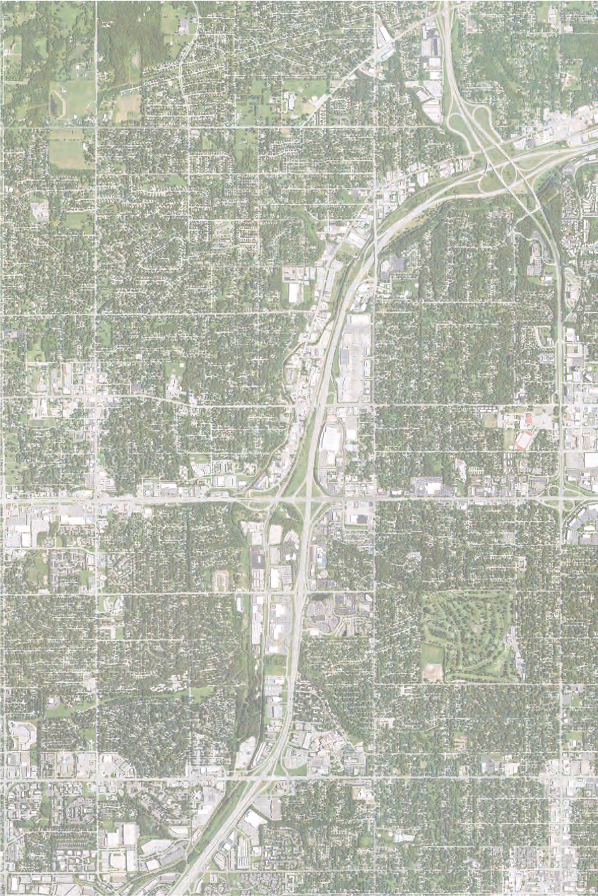


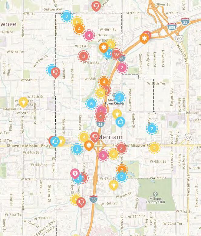
As Merriam refers to this comprehensive plan to guide development and create places over the next 10-20 years, it is crucial that the people of Merriam, those who live, work or visit the community, are the primary focus for all decisions made. The public should be engaged and involved in the planning processes as much as possible and be working alongside city officials to determine the best land uses and character for neighborhoods and commercial areas.
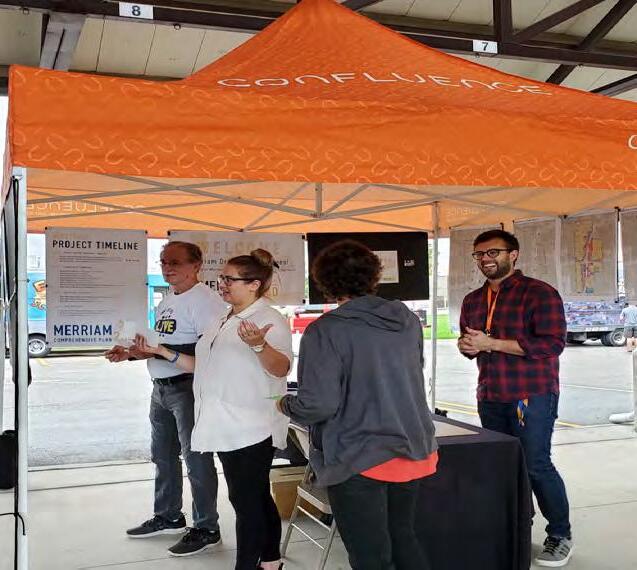
The process to design community amenities and implement policies that affect people’s lives in Merriam should always utilize the knowledge, opinions and concerns of the residents to which those elements are intended to benefit. Merriam has a history of successfully engaging residents in various planning and development processes through the use of public meetings, social media, community events and citizen-oriented project specific steering committees. This is vitally important because meaningful and sustained engagement increases the likelihood that new development and redevelopment of existing neighborhoods and commercial areas are community supported which translates into memorable and active public spaces.
This plan presents alternative concepts for three sub areas in Merriam: Downtown Merriam, Merriam Town Center and the former Lee Jean’s headquarters site. The alternatives present a set of options that range from minimal and strategic improvements to a complete reimagining of land use, circulation and density. As these sub areas transform over the next 20 years, it is imperative to engage the community throughout the entire process.
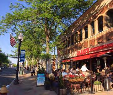

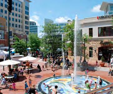
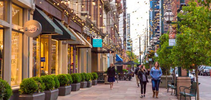
Many of Merriam’s corridors, commercial centers and districts were originally designed to be accessible and navigable primarily by the automobile. Decades of this vehicular focus, has left many parts of the community difficult and inhospitable to navigate for pedestrians and cyclists. In particular, the major commercial centers of Merriam have been designed in a way that discourages gatherings or prolonged visits. Merriam should encourage building and site design quality that are pedestrian-oriented. Design standards for buildings and spaces should be at the center of the decision making process.
Merriam has several important community assets that are vital to the quality of life and vibrancy of the city. Cultural amenities offer outlets for citizen gathering and recreation. These amenities are spread throughout the community and as mentioned on the previous page, are primarily accessible by automobile. It is not only important to consider the maintenance and celebration of the specific cultural places in Merriam, but also the connections between them.
Cultural amenities in Merriam include:
• Merriam Community Center
• Merriam Marketplace
• All park spaces
• Turkey Creek Trail
• 5701 Merriam Drive (former community center)
• Important commercial destinations such as the movie theater at Merriam Town Center
The map on the following page shows these amenities and identifies the strategic corridors that link these places together. Antioch Road for example, directly connects the Turkey Creek Trail, movie theater and Antioch Park as well as indirectly connects downtown Merriam and all of its amenities via Johnson Drive. According to the transportation and mobility recommendations of this plan, the opportunity exists for lane reallocation along the entirety of Antioch Road due to traffic volume levels that afford the ability to add additional pedestrian crossings with refuge islands, bicycle infrastructure and streetscape amenities like benches, pedestrian lighting, wayfinding signage and landscaping. With these types of treatments added to all of the identified corridors, Merriam has a the opportunity to create a community-wide network of safe and pleasant routes for pedestrians, bikes and vehicles to access the many cultural amenities. Safely encouraging other modes of personal transportation, will add to the quality of life and health of Merriam’s residents.
Additionally, Merriam should work with the neighboring communities to make additional connections to their public parks and facilities and improve the quality life for all residents of northeast Johnson County.
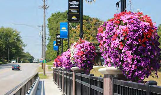
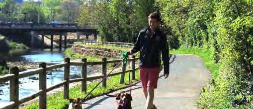
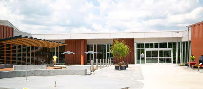
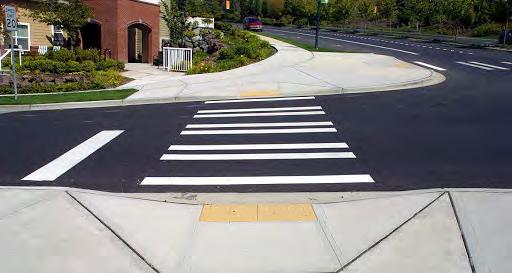
Having a private automobile is a privilege that many across the country cannot afford. Transit services help alleviate that disparity by providing access for residents regardless of age, ability or income. Additionally, data shows that several hundred people live and work in Merriam which suggests that given the short distance in commuting, there is a population that could utilize other modes of transportation such as walking, biking or bus services.
The majority of Merriam residents view pedestrian mobility as important within the community. Although used primarily for recreational purposes, a consistent and maintained sidewalk network should be also viewed as a means of travel and transportation throughout the community. Merriam has already made this a priority by implementing the Sidewalk Infill Program. This effort should continue to increase the well maintained and connected sidewalk network. In conjunction with sidewalk maintenance and installation, pedestrian crossings should be well marked and prioritized for safe road crossings.
Multi-purpose paths should be implemented where ROW conditions allow to encourage nonmotorized transit. This is especially true along key connecting corridors in Merriam where pedestrians and bicyclists may need to share the path. Not every bicyclist feels comfortable riding on the street particularly on higher traffic roads. Figure 2.6 in Chapter 2 - Amenities and Service Enhancements shows the potential multi-purpose path / trail expansion opportunities.
Biking should be viewed as a means of transit as well as a recreational opportunity. Only 5% of ETC survey respondents indicated they view biking as a form of commuting. Roadways, intersections, highway underpasses and trails should be designed and maintained to provide safe and pleasant biking conditions. With significant changes in safety and aesthetics, residents would be encouraged to use bikes as a regular form of transportation. The importance and challenges with interstate crossings for pedestrians / bicyclists are discussed in further detail in Chapter 4 - Transportation & Mobility.
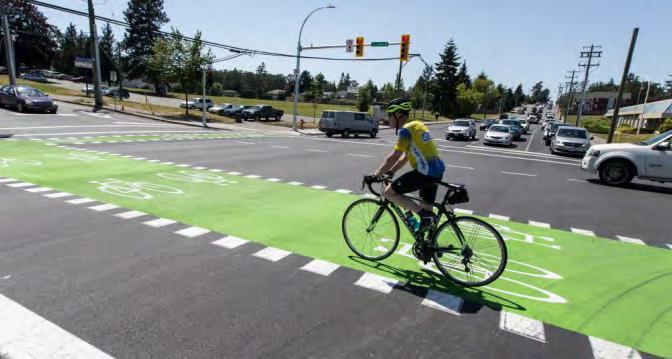
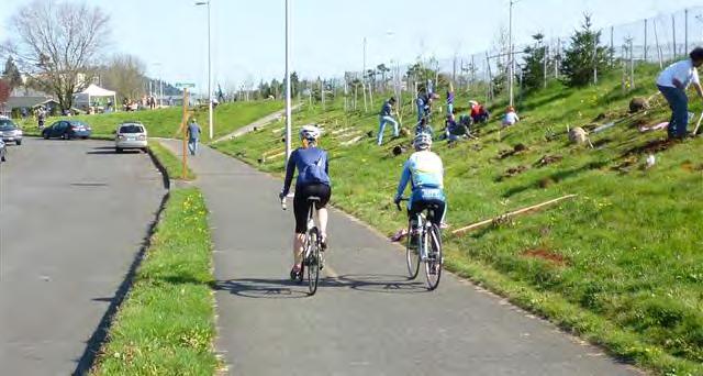
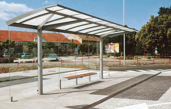
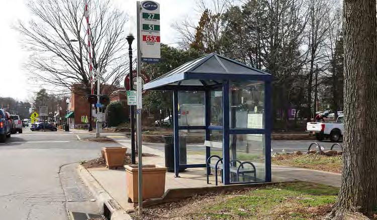
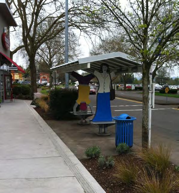
The Kansas City Area Transit Authority (KCATA) has several routes through Merriam (see Figure 4.2 in Chapter 4). In relation to the Sidewalk Infill Program, Merriam should work wit h KCATA to identify strategic locations for enhanced bus stops. Often, a reason public transit is not utilized as well as it could be, is the location and condition of bus stops. As an auto-oriented community, transit services need to provide as many incentives to riders as possible to encourage greater use. Amenities like covered waiting areas and accessible platforms will encourage higher use of the service. Bus stops should also include other amenities such as bike racks and informational signage that can display route service announcements, community events and weather information. Merriam should encourage the implementation of enhanced bus stops throughout the community including major shopping centers, where parking is more readily available, targeted neighborhoods where ridership may already be higher and job centers such as Advent Medical Center and the former Lee Jeans site.
22% of ETC survey respondents indicated that the nearest bus st op is too far from their home. This reality discourages ridership significantly. One possible solution to ch ange this conditions is establishing a micro-transit network. As discussed in the Transportation and Mobility Chapte r, micro-transit is configured through smart phone technology and has the opportunity to reverse lower ridership i n Merriam and provide localized and affordable transit services within Merriam. This will only further assist with connecting residents better with their community.
Parks and public facilities serve as the social backbone of a community by their ability to host community events, offer outlets for active and passive recreation and bring people of all ages and backgrounds together. Merriam has an abundance of high-quality park spaces and city facilities that serve the entire community well, the new community center being just the latest example. Almost 90% of t hose that participated in the ETC survey either said the parks and recreational opportunities provided in Merriam were either excellent or good. However, the city should not become complacent in the maintenance and updating of these spaces. Merriam should continually gauge the needs and desires of residents and implement improvements to city parks and facilities accordingly.
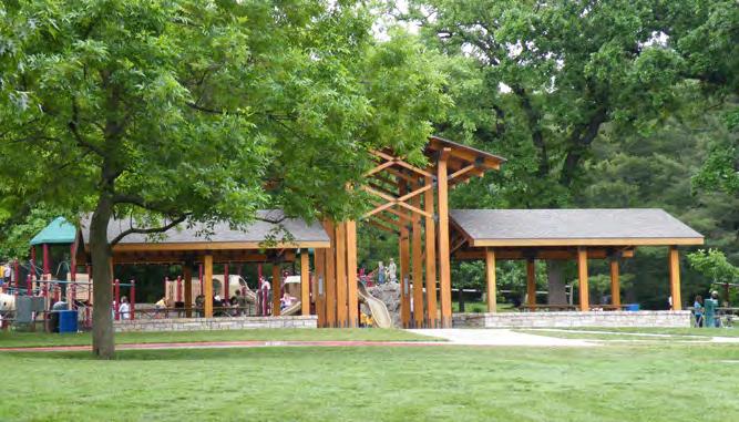
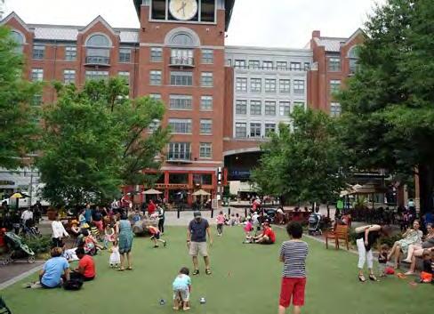
While open green space is typically funded and maintained by municipalities, there is a national trend for new developments that include privately maintained and activated gathering spaces within the scope of the project. With the fast-paces changes occurring in the brick and mortar retail landscape, more and more retailers and developers are providing an experiential component to entice shoppers to shop in person and keep coming back. Offering highly activated and well maintained public gathering spaces is one way that developers can achieve this goal while at the same time, adding to the network of open spaces throughout Merriam. Local examples of this type of development include the Legends Outlet Mall in Kansas City, Kansas and Park Place in Leawood, Kansas.
All of the sub area options for Merriam Town Center, located in Chapter 3, include public spaces of varying sizes and character ranging from smaller plazas to long linear greenways. Merriam should adopt policies that incentivize developers to include these types of spaces that overall, will promote unique, health and wellness oriented and active public spaces in major new developments throughout the city.
Placemaking elements are an important consideration when thinking about the overall identity and branding of Merriam. The city has an existing system of gateway signage, light pole banners and wayfinding signage that helps with the identity of the community. However, many of these elements could be updated and reflect a more contemporary and celebratory aesthetic. The image to the right depicts a sign that has since been replaced but resembles gateway signage that remains in other locations of Merriam.
The city has an existing system of gateway signage, light pole banners and wayfinding signage that helps with community identity. However, many of these elements could be updated and reflect a more contemporary and celebratory aesthetic.
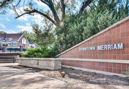
In addition to announcing the arrival into the city of Merriam, gateways can also be utilized within residential neighborhoods and commercial centers. In that way, a framework for gateways and signage should be developed based on the different land uses in Merriam. The overall character of gateway signage should be unique to each individual district or neighborhood and the scale and material choices are also be an important consideration as those go a long way to defining the overall impression and perception of an area.
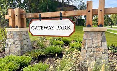
Refer to the Strategic Opportunities Map (Figure 7.1) on page 5 for the recommended locations of gateway markers.
Landscaping can be a cost-efficient and practical method to improve the appearance, screen undesirable features, and otherwise enhance the use of a property. Landscaping also absorbs and slows storm water runoff and reduces the urban heat-island effect by shading buildings, paved areas and other hard surfaces. Site landscaping can include deciduous and evergreen trees and shrubs, prairie and ornamental grasses, perennial plants and flowers, and appropriately maintained turf grass. The City of Merriam should evaluate increasing the landscaping required within parking lots and on commercial and multi-family residential sites. Landscaping can be beneficial in parking lot islands, along building foundations, as part of streetscapes, as a buffer between incompatible uses, and as a screen for loading docks, trash enclosures, building mechanical equipment, and other unattractive site elements.
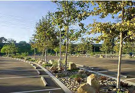
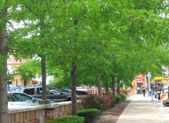
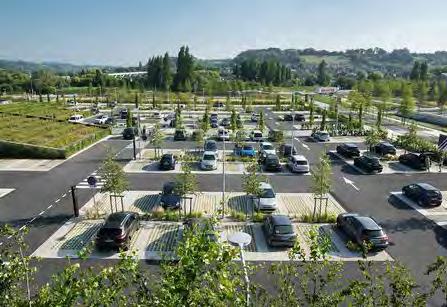
To maximize the potential of various redevelopment areas within Merriam, the City may wish to consider establishing a standard that reduces the off-street parking requirement by giving credit for parking areas shared by uses that are off-peak from one another. For example, the parking for an office building tends to be most in use during the weekday, whereas the parking for a restaurant tends to be most in use on the evenings and weekends. This parking reduction or credit can be general and determined as part of the development review and approval process or can be created by a specific calculation or shared parking factor.

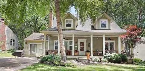
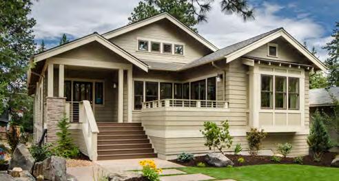
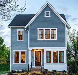
One of the strengths of Merriam are the many single-family residential neighborhoods that provide quality housing options for home-owners. The Merriam Comprehensive Plan 2040 su rvey shows that 53% of Merriam residents support the health and success of these neighborhoods and maintaining the livability of these neighborhoods should guide future growth within the community. As a built-out city with various housing needs, Merriam will have to balance the demands of future growth with the preservation of the existing single-family housing stock. This can be done by encouraging and incentivizing home rehabilitation and renovation while also designating future land uses for higher-density housing options where there currently e xists the opportunity for infill development.
According to the Comprehensive Plan survey, residents believe that implementing policies that encourage or incentivize existing housing rehabilitation should be a priority for the city. The city should explore policies that would allow for smaller single family lot sizes. Such an approach would retain the neighborhood’s character while increasing housing opportunities within the city. Chapter 1 - Community Character and Identity define action items that will help Merriam achieve this goal.
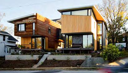
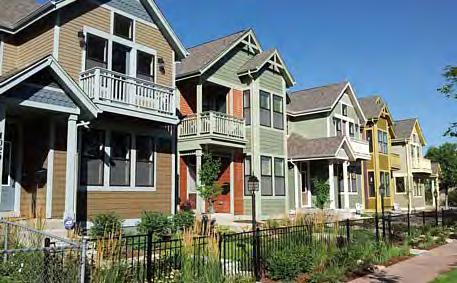
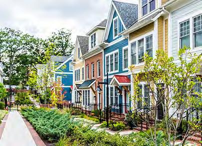
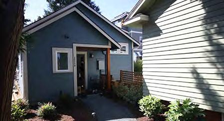
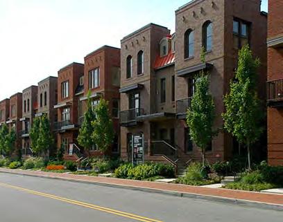
Attracting people at various life stages by providing a mix of housing options ranked as a high priority in the Merriam 2040 Comprehensive Plan survey. As previously mentioned, Merriam has an abundance of single-family homes with fewer medium-density options available. This plan indicates several opportunities for infill residential development that will serve the demand for greater housing diversity. As Merriam Town Center, Downtown Merriam and the former Lee Jean’s headquarters site are redeveloped, the city should require housing components that meet the demands, such as senior or workforce housing, as indicated by the feedback provided in this comprehensive plan.
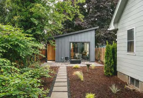
Universal Design (UD) is the design of products and environments to be usable by all people, to the greatest extent possible, without the need for adaptation or specialized design, according to The United States Access Board. In terms of residential development, Universal Design relates to the design of entrances, doorways, corridors, and other smaller details of home construction to ensure the home is accessible to everybody, today and in the future. The City of Merriam should refer to the First Suburbs Coalition Idea Book which is currently being updated to include standards and ideas for Universal Design Integration. Generally speaking, Universal Design can be supported by the city of Merriam by:
• Awareness Strategy: Develop an awareness strategy (website / mailers / social media posts).
• Educational Materials: Develop handout materials and website reference / resource links oriented towards homeowners, remodelers, builders and developers.
• Informational Sessions: Coordinate separate informational / instructional sessions for homeowners and builders.
• Forgivable Loans or Grants: Offer forgivable loans or grants for homeowners making universal design improvements.
• Grant Funding: When applying for development grants, incorporate requirements for the use of universal design principals. Tie city incentives or local matches to inclusion of universal design principals.
• Update of Zoning Code: Consider creating density bonuses for multi-family residential developments, via a Special Use Permit process, and/or a reduction in permit fees to builders utilizing universal design principals. Update the zoning code to allow the above density bonuses and other minor deviations from the zoning code regulations to support universal design improvements.
• Waive or Reduce City Fees: Waive or reduce building permit fees and other development fees for construction projects that incorporate universal design elements.
Principle 1: Equitable Use
The design is useful and marketable to people with diverse abilities.
Principle 2: Flexibility in Use
The design accommodates a wide range of individual preferences and abilities.
Principle 2: Flexibility in Use Simple and Intuitive Use
Use of the design is easy to understand, regardless of the user’s experience.
Principle 2: Flexibility in Use Perceptible Information
The design communicates necessary information effectively to the user.
Principle 2: Flexibility in Use Tolerance of Error
The design minimizes hazards and the adverse consequences of unintended actions.
Principle 2: Flexibility in Use Low Physical Effort
The design can be used efficiently and comfortably and with a minimum of fatigue.
Principle 2: Flexibility in Use Sized for Approach / Use
Appropriate size and space is provided to approach, reach, manipulate and use.
Incentivizing or encouraging Universal Design Standards is a policy that could assist Merriam pursue the Community for All Ages recognition program sponsored by the Mid-America Regional Council (MARC). According to MARC’s website, this program recognizes communities that have taken steps to become more welcoming to residents of all ages and, in the process, more vibrant, healthy and prosperous. Communities can receive Bronze (Awareness), Silver (Assessment) or Gold (Implementation) status. This plan recommends that Merriam pursue this effort to improve the quality of life for residents and become known throughout the Kansas City metro region as a community that supports a diverse population.
For more information on this program, visit the Community For All Ages webpage on the MARC website. The following images are examples of a universally designed entrance to a singlefamily home and kitchen improvements that can be made with universal design principles in mind.
The design and character of the built environment has a great impact on the overall impression and memorability of a specific area, district or neighborhood. Zoning ordinances and planning commissions have the jurisdiction to enforce design elements however, loop-holes or ambiguity in the se policies can cause the developer’s or property owner’s own intentions and budgets to arrive at a less-than-des irable outcome. Merriam may wish to evaluate their current zoning code and building design standards to establish whether there is the opportunity to bolster these regulations without discouraging further development. A set of design guidelines can be general in nature, and provide flexibility to achieve aesthetic results consistent with the community’s quality expectations.
Another option is to establish overlay districts within areas such as downtown Merriam, to implement design guidelines for any new development or redevelopment. Nearby communities like Mission, Kansas have implemented these types of districts and could be an important consideration for the City of Merriam to look at in the future.
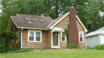
Merriam is fortunate to have a relatively high percentage of co mmercial, office, and industrial land uses and yet retain healthy residential neighborhoods. Table 7.2 and Figure 7.3 shows the breakdown by land use type.
Roughly half of the existing land use in Merriam is low-density residential. A mixture of high and medium-density residential account for another 7% of land. For a suburban community, Merriam’s mixture of commercial, office and industrial land is a positive and unique feature. The taxes from the retail, office and industrial land can all help fund citywide services, amenities, and infrastructure improvements. Different uses, however, can impact adjoining properties so thoughtful transitions between differing land uses and buffering of single family homes must be considered.
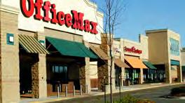
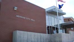
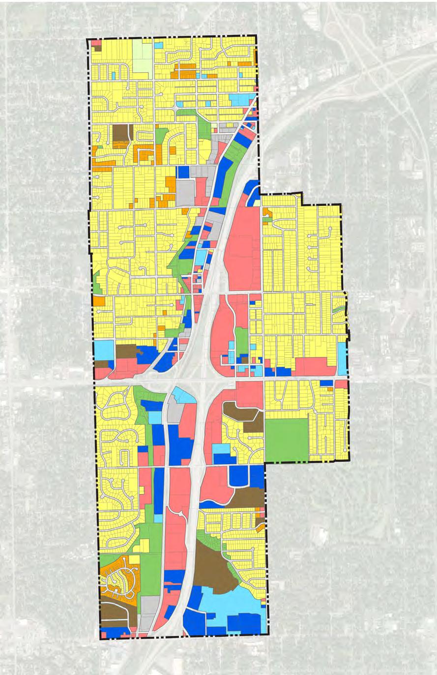
City Limits
Low-Density Residential
Medium-Density Residential
High-Density Residential
Parks & Recreation
Office
Public / Semi-Public Commercial
Industrial / Business Park Undeveloped
All of the items discussed on the previous pages of this chapter, cannot be realized with a strong and supported future land use plan. Future land use plans show the preferred future land uses of a community as determined by the comprehensive planning process and input from residents, steering committee members and city officials. This plan lays out a vision for the community and can assist th e city making decisions regarding re-zoning efforts or proposed redevelopments. For a built out city like Merriam, the future land use plan will indicate what currently exists within an area but will also highlight areas where new developments or redevelopments should occur. A future land use plan does not replace zoning or make properties out of compliance. Rather, it indicates what could be if an area were to redevelop or develop for the first time Th e different land uses are defined as follows:
Commercial: The Commercial land use category includes community and regional-serving retail, entertainment, and commercial areas. These retail and entertainment uses are intended to serve the Merriam community as well as the motoring public traveling through Interstate 35. These locations should contain multiple access points and consist of larger box stores and multi-tenant shopping centers.
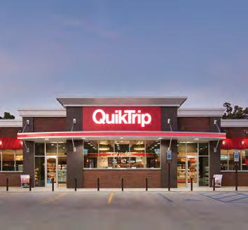
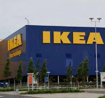
Office: The Office land use category is designed for small or large-scale office developments and is designed to help support employment opportunities in Merriam. The land use category contains a combination of professional office and medical uses and could accommodate corpor ate campuses consisting of single or multitenant buildings that are one or more stories tall. A limited s et of support retail such as coffee shops or dry cleaners may also be included within the category.
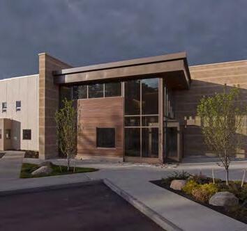
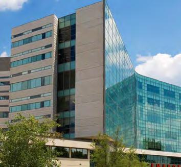
Low-Density Residential: Low-Density Residential includes areas with traditional lower-density single-family homes with lot sizes ranging from 1 to 5 dwelling units per acre. The land use category will be composed predominantly with single-family detached units but will also include some duplexes or accessory dwelling units. The category also allows for small lot housing to try and incre ase flexibility, density and affordability within the housing stock. Other uses commonly found in the category include religious, educational, institutional, and public and private recreational areas.
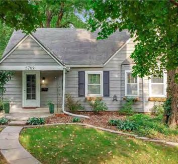
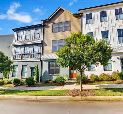
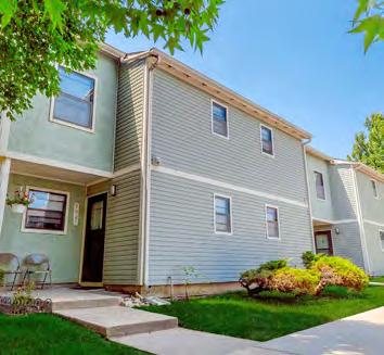
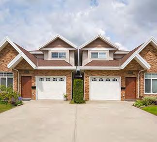
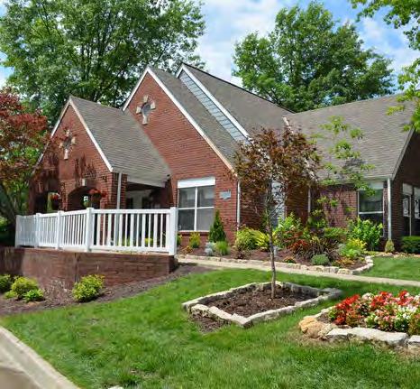
Medium-Density Residential: Medium-Density Residential includes areas with a mixture of townhomes, rowhouses or cottage home developments as well as single-family detached homes with accessory dwelling units. There will likely be a mixture of housing types including single-family detached dwellings, townhomes, rowhouses, bi-attached units and duplexes, with an overall density of 5 to 12 dwelling units per acre. Other uses commonly found in the category include religious, educational, institutional, and public and private recreational areas.
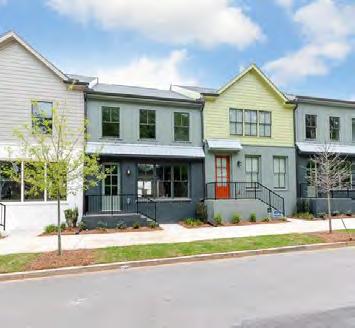
High-Density Residential: High-Density Residential includes areas with densities of 12 or more dwelling units per acre. The category should mainly include vertically attached multi-family units such as apartments or condominiums with some townhomes / rowhouses when appropriate. This housing is meant to provide alternatives to residents young and old as well as serve as transitional housing for new residents. Other uses commonly found in the category include religious, educational, institutional, child day care centers and public and private recreational areas.
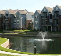
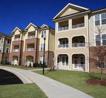
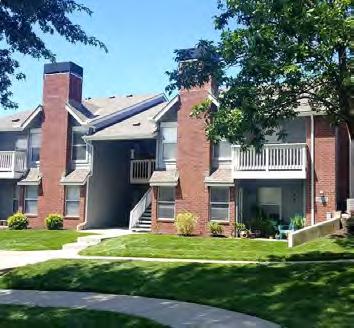
Parks and Recreation and Open Space: The Parks and Recreation and Open Space land use category includes all public, private and semi-private recreational land such as parks, trails, golf courses, greenways, recreational fields, and vacant land within the floodplain.
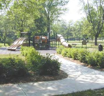
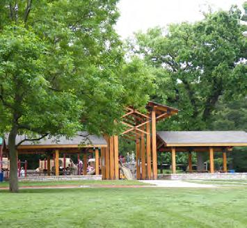
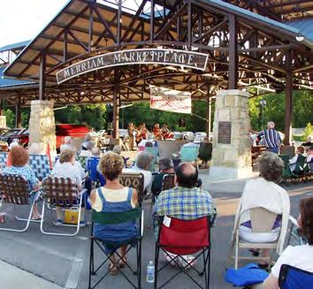
Industrial / Business Park: The Industrial / Business Park category is designed for busines s parks, office complexes and light industrial uses. Business park uses include larger office complexes or corporate campuses. Light industrial uses include warehouse and distribution facilities and activities such as testing, research and development, fabrication, manufacturing assembly or processing of materials that are in refined form and do not require transformation that creates smoke, odor, dust vibrations, soot or other noxious elements. Outdoor storage is also limited and well screened. Limited support retail or commercial activities are also allowed including gas stations, convenience stores or coffee shops.
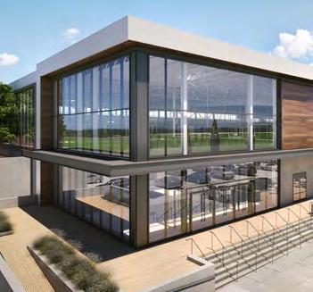
Mixed-Use: The Mixed-Use land use category is designed for areas to be developed or redeveloped at a higher more urban density with multi-story buildings with a combinatio n of residential, retail and office uses. Generally, retail and office uses will occupy the first-floor but can also inc lude amenity features associated with the residential component. The remaining stories would typically be multi-family residential. This land use category has been placed on possible key sub area redevelopment sites including Merriam Center, the former Lee Jeans site and the former K-Mart site.
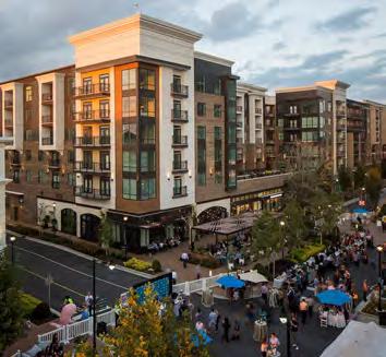
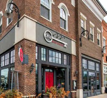
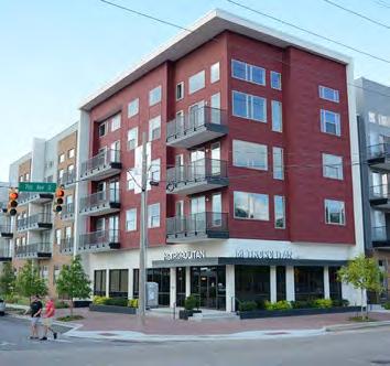
Downtown Mixed-Use: The Downtown Mixed-Use category is a special district created for the historic Downtown Merriam north of Johnson Drive between Turkey Creek and Interstate 35 north until West 55th Street. This special mixed-use district was created to help support long-term redevelopment in Downtown Merriam. The category should promote human-scale multi-story buildings w ith a strong preference for first-floor retail, office or other commercial uses. Other uses will include parks an d recreation or other public facilities. Façade and streetscape improvements should be focused on this historic commercial area to enhance the pedestrian experience.
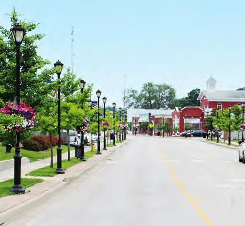
Public: The Public land use category includes publicly owned land such as city hall, the library, and fire / police facilities. It also includes semi-public land such as cemeteries. Institutional facilities such as schools and college land fall into this category.
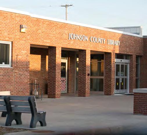
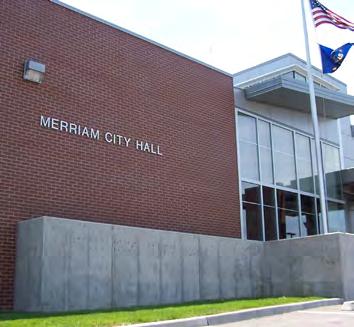
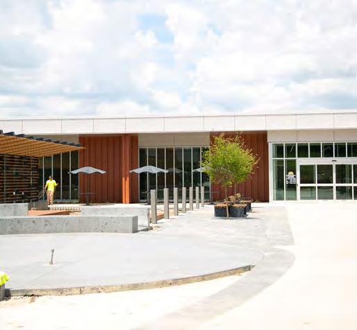
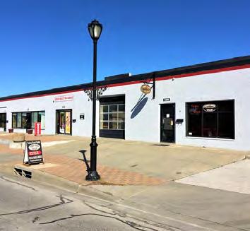
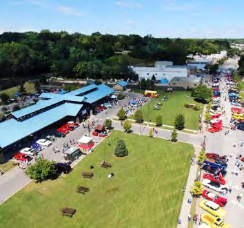
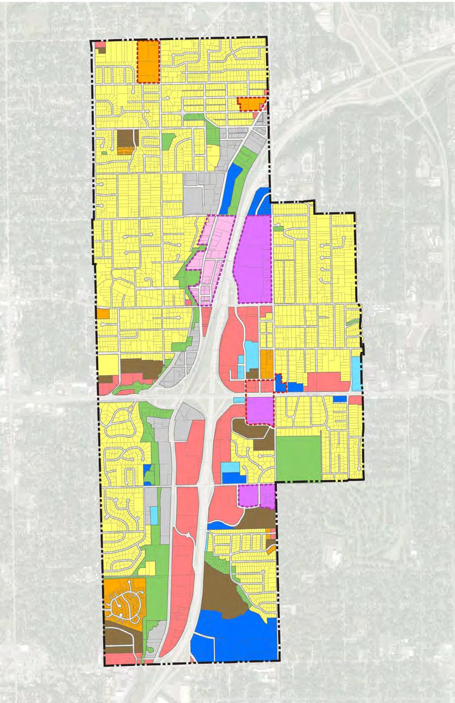
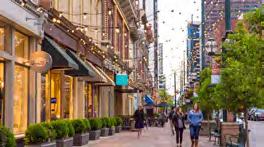
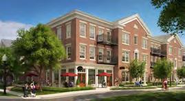
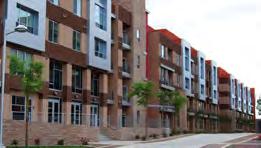
Figure 7.6 and 7.3 summarize the future land use classifications as shown on the Future Land Use Map (Figure 7.5). The breakdown for Merriam largely mimics the existing lan d use breakdown. Over 54% remains single-family residential with the next largest land use being commercial. Th e biggest difference between the existing land use and the future land use is the addition of the Downtown Mixed-Use category. The intent of adding this special classification is to support further redevelopment and enhanceme nt of the downtown district.

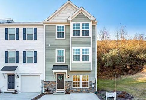
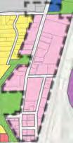


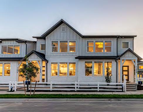
The property west of Knox Avenue, between W. 47th Street and W. 49th Street, is one of the last, largely undeveloped properties within Merriam. This site is under multiple ownerships and contains several homes. Due to its location, it is ideal for residential land uses, but so far has not attracted attention for development. Currently zoned R-1 Single Family Residential, a single-family subdivision may be the most palatable development option for the surrounding property owners and, if financially feasible, would be welcomed by the City. However, a well designed and attractive townhome or rowhouse development may also be appropriate for all or a portion of this property. Any request for rezoning to allow for a townhome or rowhouse type development should be processed as a Planned Unit Development so that very specific site and building design standards can be established to ensure the design and style of the development is attractive and compatible with the surrounding single-family neighborhood.
Given that Merriam is mainly a built-out community, the future land use map is very similar to the community’s existing land use map with a few key differences.
• The low-density residential land use category is expanded to include duplexes as well as single family detached homes.
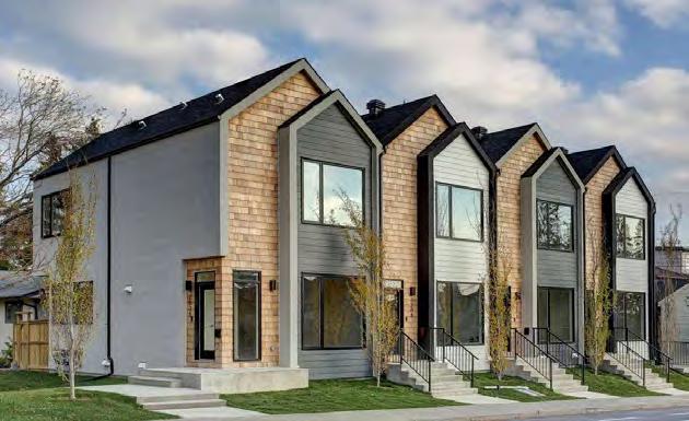
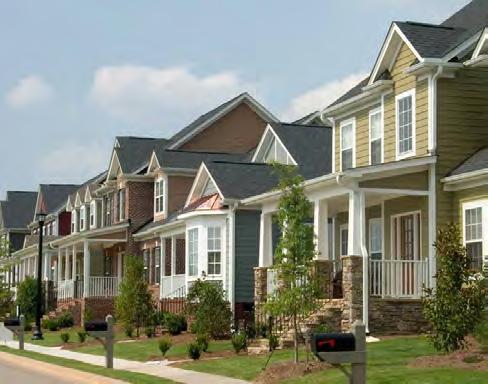
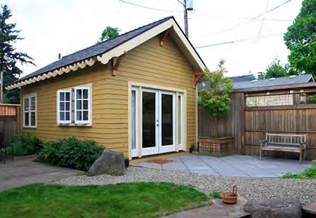
• New medium-density residential land use is proposed in two main places: (1) along Knox Avenue between W. 47th Street and W. 49th Street and (2) between W. 61st Street and W. 62nd Terrace along Slater Street and Antioch Road. The Knox Avenue site has a larger parcel with some undeveloped land presenting a unique opportunity to add additional multi-family housing options in the community while keeping in character with the existing neighborhood. The Antioch Road / Slater Street location is an opportunity to add multifamily housing options in an area of Merriam that offers easy access to the civic complex, community center and Merriam Village. None of these land use designations compel owners to change their existing property uses, but rather show potentially new redevelopment opportunities. If these sites redevelop with areas that include medium-density residential, they should have a “planned” zoning designation to ensure that residents and the city have input into the area’s design and layout amenities and the structures are of high quality materials.
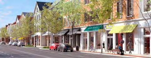
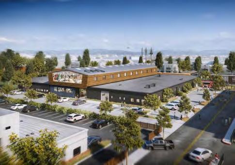
• Areas along the western half of Interstate 35 are currently a mixture of industrial, light industrial, commercial and office users. The future land use map identifies larger blocks of land uses that reflect the overall character of the current uses. Typically, a land use plan is drawn less parcel by parcel and more district by district. A mixture of land uses are promoted within each category, see definitions for examples, and this map seeks to identify the future industrial, commercial and office areas of Merriam more distinctly.
• Three main mixed-use sites are identified on the future land use map: (1) Merriam Town Center, (2) the former Lee Jean’s site, and (3) the former K-Mart site. Downtown Merriam is identified as its own special downtown mixed-use category. Collectively, these areas represent unique redevelopment opportunities for the community. Chapter 3 – Sub Area Plans identifies possible redevelopment concepts for the downtown, Lee Jean’s site and Merriam Town Center. If these areas are to redevelop in the future they should do so as part of a mixed-use development.
• Two areas of the plan are identified as special land use plan areas: (1) South Park Sub-area Plan near Merriam Drive and Antioch Road and (2) the Shawnee Mission Parkway Corridor Plan. These two areas of the community have existing plans created for the future of the area. Please see the Existing Plans and Policies portion of Section 1 – Introduction for more information.
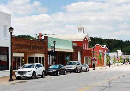
GOAL 1 -
No.
IMPROVE CONNECTIONS AND ACCESSIBILITY TO CULTURAL AMENITIES
Action Item
A1 Implement streetscape enhancements and targeted accessibility improvements along cultural amenity connectors throughout the city
GOAL 2 -
ENCOURAGE QUALITY AND ACTIVE PUBLIC SPACES
No. Action Item
A1 Adopt policies that incentivize the inclusion of programmed public open spaces in major new developments
A2 Update the zoning code regulations to allow shared parking between off-peak uses to reduce excess parking and maximize the redevelopment of sites.
A3 Evaluate modifying the zoning code regulations to required additional landscaping on multi-family and commercial sites.
GOAL 3 -
ENCOURAGE HIGH-QUALITY ARCHITECTURE, DESIGN AND MATERIALS
No. Action Item
A1 Consider adopting additional building design standards for commercial areas in Merriam
A2 Reference the Future Land Use map when considering any future development proposal
Section 3 - Implementation provides a summary of all the goals and action items identified within Section 2 of the Merriam Comprehensive Plan 2040. The implementation goals are divided by the seven chapter headings under which they are listed.
The Chapters and implementation areas include:
• Community Pride / Character
• Amenities & Service Enhancements
• Sub Area Plans*
• Mobility & Transportation
• Promoting Prosperity
• Sustainable Development
• Creating Place
Goals can be defined as objectives or aims which may be broad or specific.
Action items can be defined as specific steps and activities the City should take.
Each year, Merriam should review the implementation section to evaluate what, if any, action items have been accomplished. Likewise, this annual review may also reveal action items that need to be amended or added due to previously unknown conditions or new opportunities. These action items should help inform decisions made in regards to Capital Improvement Plans and other initiatives taken by the City through the year 2040 and beyond.
* Chapter 3 - Sub Area Plans did not have any goals or action items.
The following table shows the goals and action items identified within Chapter 1 - Community Character & Identity.
GOAL 1 -
No.
ENHANCE AND PROMOTE THE ECLECTIC HOMES & HOUSING DIVERSITY FOUND IN MERRIAM
Action Item
A1 Promote and expand guides such as the Ideas Book for Renovating Postwar Homes to encourage Merriam homeowners to renovate their homes in order to grow their families in Merriam
A2 Consider expanding the Exterior Renovation Grant to include certain modernization renovations such as a second bathroom or larger kitchen to encourage residents to renovate homes rather than move to a bigger one elsewhere
A3 Explore incentives to renovate older homes in Merriam through the use of a revolving loan fund or residential tax abatement on the added improvement’s value
A4 Continue to support Merriam’s landlord licensing and rental inspection program to ensure Merriam’s multifamily housing stock remains well-maintained and safe
GOAL 2 -
No. Action Item
A1 Continue to market the many amenities offered in the community through publications and social media postings
A2 Promote Merriam as an affordable place to buy a home based on the more modest median home value compared to other places in Johnson County
GOAL 3 -
No. Action Item
A1 Identify a marketing campaign that highlights Merriam’s accessibility to jobs, retail and amenities
GOAL 4 -
No.
& AMENITIES
WORK TO IMPROVE MERRIAM’S IDENTITY AS A SAFE AND FAMILY-FRIENDLY COMMUNITY
Action Item
A1 Continue to promote the positive quality of life and safety of Merriam neighborhoods in city marketing and social media posts
A2 Continue to support Merriam Police as they identify ways to lower the number of crimes occurring in and around the Merriam Town Center
GOAL 5 -
No. Action Item
A1 Select a path forward to enhance the streetscape and character of Downtown Merriam while also highlighting the auto-centric nature and history of the community and area
A2 Identify a set of strategies to address ways to celebrate diversity in Merriam including community events and cultural celebrations
A3 Review city policies as it relates towards diversity to identify areas where minorities or other underrepresented groups can become more involved in Merriam’s civic life (employment, elected officials, commissions/boards, or committees)
GOAL 6 -
PRESERVE AND SUPPORT MERRIAM NEIGHBORHOODS, CENTERS AND DOWNTOWN
No. Action Item
A1 Encourage the formation of neighborhood organizations to support neighborhood development and to design a branding for the neighborhood including banner or gateway signage or another unique streetscape amenity
A2 Create a guide to neighborhoods in Merriam highlighting the unique traits offered by each neighborhood
A3 Periodically review the health and resiliency of Merriam’s commercial centers through one-on-one meetings with owners and tenants to identify areas in which the city can provide appropriate improvements
A4 Regularly review and support the long-term vision for the future of Downtown Merriam
A5 Determine how the City should address the downtown floodplain
ADDRESS ISSUES AND OPPORTUNITIES CREATED BY INTERSTATE 35 & OTHER MAJOR ARTERIALS GOAL 7 -
No. Action Item
A1 Continue to improve pedestrian crossings over/under Interstate 35 and along other major arterials to improve the safety and experience for all modes of transport
A2 Identify and create an entry and/or gateway signage strategy for key entrances into the community as identified on the Community Character Strategic Opportunities Map
A3 Identify streetscape improvements for key arterials and areas of the community that can best create a sense of place and improve the experience of residents and visitors traveling through Merriam
A4 Identify those areas along Merriam’s stretch of Interstate 35 w here aesthetic improvements, such as façade enhancements or public art, can be made or added to improve how Merriam is perceived by the traveling motoring public
The following table shows the goals and action items identified within Chapter 2 - Amenities & Service Enhancements.
GOAL 1 -
CONTINUE TO SUPPORT MEDICAL & SOCIAL SERVICES FOR MERRIAM RESIDENTS
No. Action Item
A1 Maintain a positive working relationship with the Advent Health Shawnee Mission medical campus and promote its location when marketing the community
GOAL 2 -
SUPPORT AND PROMOTE MERRIAM’S EDUCATIONAL OPPORTUNITIES FOR ALL AGES AND BACKGROUNDS
No. Action Item
A1 Support the Shawnee Mission School District with any possible future updates, expansions or improvements of school property within Merriam
A2 Consider adding a city services 101 course or pamphlet to help educate the public, improve community relations and encourage public / civic engagement
GOAL 3 -
No. Action Item
A1 Perform life cycle analyses, including a public engagement component, on all park facilities and programs to ensure the facilities and programs continue to meet the needs of Merriam residents
A2 Consider new trends and technologies in playground design as part of park planning
GOAL 4 -
EXPAND MERRIAM’S TRAIL OFFERINGS TO ENHANCE CONNECTIVITY & SAFETY
No. Action Item
A1 Expand Merriam’s shared use path system on key corridors to enh ance connectivity and safety for nonmotorized transportation in Merriam
A2 Work to design and fund pedestrian / bicycle crossings over / under Interstate 35 to help fully connect Merriam’s west and east sides while improving the overall safety of the trail system
GOAL 5 -
No. Action Item
A1 Consider completing a sustainability analysis of the Merriam community as a whole
A2 Consider completing a sustainability analysis of Merriam’s func tions as a city to identify specific areas of improvement
A3 Consider integrating renewable energy installations into city-owned buildings
GOAL 6 -
SUPPORT COMMUNITY HEALTH & WELLNESS
GOAL 7 -
PROVIDE COMMUNITY-SUPPORTED AND EFFICIENT PUBLIC SAFETY FOR MERRIAM
GOAL 8 -
No.
A1
MAINTAIN MERRIAM’S INFRASTRUCTURE AND PROMOTE SUSTAINABLE INFRASTRUCTURE SOLUTIONS
Action Item
Continue to promote the use of green infrastructure on property in Merriam, including city-owned property
A2 Conduct a feasibility study to evaluate costs and benefits of moving utilities underground
The following table shows the goals and action items identified within Chapter 4 - Transportation & Mobility
GOAL 1 -
No.
Action Item
A1 Conduct engineering studies into lane reduction on roadways identified with excess capacity and high crash rates and implement recommendations
A2 Conduct engineering safety studies for signalized intersections identified for intersection safety improvements and implement recommendations
A3 Apply systemic safety countermeasures at traffic signals througho ut the city
A4 Continue study of interchange reconfiguration at W. 67th Street & I-35 with focus on safety and pedestrian/bicycle access and implement recommendations
GOAL 2 -
No. Action Item
A1 Adopt NACTO “Complete Streets” guideline documents as design criteria for infrastructure projects
A2 Construct high priority trails identified that are independent of lane reductions
A3 Construct high priority sidewalks and crossing improvements ide ntified
A4 Study the feasibility of installing priority trails identified i n conjunction with lane reduction
A5 Work with KDOT to improve pedestrian and bicycle crossings of I-35
A6 Apply systemic safety countermeasures at traffic signals for bicy clists throughout the city
A7 Seek funding for Safe Routes to Schools projects for Merriam schools
A8 Construct low priority sidewalks, bicycle/pedestrian paths, and crossing improvements
GOAL 3 -
No. Action Item
A1 Inventory all transit stops in Merriam in need of ADA improvement, connecting sidewalks to back of curb for ease of boarding and develop cost estimate for stop enhancement
A2 Identify bus stops for installation of benches at key locations
A3 Seek grant funding from MARC or other sources for installation of bus stop improvements
A4 Develop transit awareness program in coordination with Johnson County and KCATA/RideKC to increase ridership on transit in Merriam
The following table shows the goals and action items identified within Chapter 5 - Promoting Prosperity.
GOAL 1 -
INCREASE THE AMOUNT AND DIVERSITY OF AVAILABLE HOUSING UNITS
No. Action Item
A1 Support infill housing development and consider providing incentives for development
A2 Consider revising the zoning code regulations to allow for increased density in single family areas. Revisions could include creating a smaller lot single family zoning district, allowing for accessory dwelling units, etc.
GOAL 2 -
No.
Action Item
A1 Consider a program of voluntary “exit interviews” for people, families or businesses choosing to move out of the City, to gain insights on potential policy improvements
A2 Encourage explicit consideration of quality-of-life criteria for development proposals in Merriam, including neighborhood compatibility, addition of needed amenities, and increased diversity/vibrancy of land use
A3 Continue with the City’s new Exterior Home Improvement Grant pr ogram to encourage residential home improvement and small business facade upkeep
GOAL 3 -
No.
SUPPORT THE REVITALIZATION AND REDEVELOPMENT OF KEY EXISTING RETAIL AND COMMERCIAL PROPERTIES
Action Item
A1 Explore preferred mixed-use redevelopment options for K-Mart site in preparation for request-forproposals, including identification of likely gaps in economic feasibility
A2 Explore adaptive re-use potential of Lee Jeans headquarters office building, including potential residential options
A3 Actively monitor performance of new and proposed infill mixed-us e projects in Johnson County to help assess viability of eventual Merriam Town Center redevelopment
A4 Consider updating the zoning code regulations to support redevelopment of commercial areas to include residential
A5 Stay abreast of major trends in the automotive industry that might affect land use requirements for dealerships
A1 Continue to support the Downtown Merriam Partnership to fund a variety of activities designed to improve, maintain, and promote downtown businesses
A2 Explore potential for and interest in “maker space” redevelopment of vacant or under-performing light industrial space downtown
A3 Consider zoning code update or overlay zoning district to encourage more compact development downtown through decreased setbacks, decreases parking requirements (or shared parking options) and two-story construction
A4 Consider arts-oriented special or recurring evening events to encourage community activity and enhance perceptions of safety
A5 Consider the addition of wayfinding through signage or special w alkway treatments to encourage exploration of the Downtown, including the Merriam Marketplace
The following table shows the goals and action items identified within Chapter 6 - Sustainable Development.
TO PROMOTE HARMONY WITH NATURE IN MERRIAM GOAL
No. Action Item
A1 Continue to modify and work towards a comprehensive floodplain management plan for the community that balances the environment, economy and equity of Merriam
A2 Continue to work with property owners in the downtown to address flooding issues and offer grants like the Historic Downtown Grant
A3 Continue to promote and incentivize alternative energy and green infrastructure solutions on new commercial or residential development or redevelopment of existing sites
A4 Continue to periodically review city code for obstacles to alternative energy and green infrastructure site integration
A5 Install green infrastructure stormwater management solutions on publicly owned land
A6 Adopt an updated tree cover protection policy that requires tree species diversity and a tree replanting requirement
A7 Encourage existing, new and redevelopment to reduce the amount of unnecessary impermeable surfaces
A8 Encourage residents and businessowners to sustainably retrofit their buildings through the use of educational guides and possible financial incentives
A9 Create a strategy to decrease waste generation in Merriam through the use of reducing waste, composting, and recycling or repurposing items
A10 Identify a waste reduction percentage target to help define wast e management and sustainability goals in Merriam
No. Action Item
A1 Continue to provide and expand upon Merriam’s housing stock to ensure there are housing options available to match all resident needs
A2 Promote and educate homeowners, businessowners and the development community on universal design
A3 Continue to provide community services equitably across all neighborhoods in Merriam
A4 Periodically review city services and programming to assess whether diverse needs and voices are being met and heard
A5 Actively consider environmental justice issues when approving or adopting developments or zoning changes
A6 Identify possible environmental negative externalities facing low-income Merriam residents
GOAL 3 -
No.
PARTAKE IN AND PROMOTE REGIONAL COOPERATION AND PLANNING IN JOHNSON COUNTY
Action Item
A1 Continue to be an active participant in regional planning effort s to support the overall long-term health of the Kansas City metro area
GOAL 4 -
No. Action Item
A1 Continue to expand the trail and sidewalk facilities in Merriam, especially where it improves connections between existing city parks and amenities
A2 Support the expansion of public transit in Merriam
A3 Identify long-term strategies to deal with the potential expansion of micromobility and future modes of transportation including electric and self-driving vehicles
GOAL 5 -
No.
Action Item
A1 Continue to support and expand Merriam’s diverse set of land uses to maintain a resilient community
A2 Monitor and provide support for Merriam retailers and businesses so they can remain viable throughout the course of changing market conditions and consumer preferences
A3 Continue to maintain an equitable and intentional system of public land that is connected through trails and sidewalk to the greater Merriam community
The following table shows the goals and action items identified within Chapter 7 - Creating Place
GOAL 1 -
IMPROVE CONNECTIONS AND ACCESSIBILITY TO CULTURAL AMENITIES
No. Action Item
A1 Implement streetscape enhancements and targeted accessibility improvements along cultural amenity connectors throughout the city
GOAL 2 -
ENCOURAGE QUALITY AND ACTIVE PUBLIC SPACES
No. Action Item
A1 Adopt policies that incentivize the inclusion of programmed public open spaces in major new developments
A2 Update the zoning code regulations to allow shared parking between off-peak uses to reduce excess parking and maximize the redevelopment of sites.
A3 Evaluate modifying the zoning code regulations to required additional landscaping on multi-family and commercial sites.
GOAL 3 -
ENCOURAGE HIGH-QUALITY ARCHITECTURE, DESIGN AND MATERIALS
No. Action Item
A1 Consider adopting additional building design standards for commercial areas in Merriam
A2 Reference the Future Land Use map when considering any future development proposal