Draft Manning River Catchment and Estuary and Catchment Management Program 2021-2031 - Main document

Page 70

Figure 22: Risk ratings for sediment and nutrient loading in drainage units

Annexures on exhibition: The spatial risk assessment and rapid assessment are available on MidCoast Council’s public exhibition web page at www.midcoast.nsw.gov.au/haveyoursay •

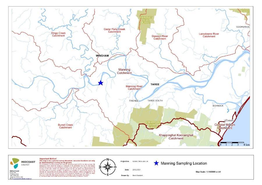
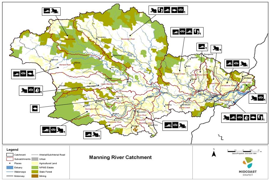
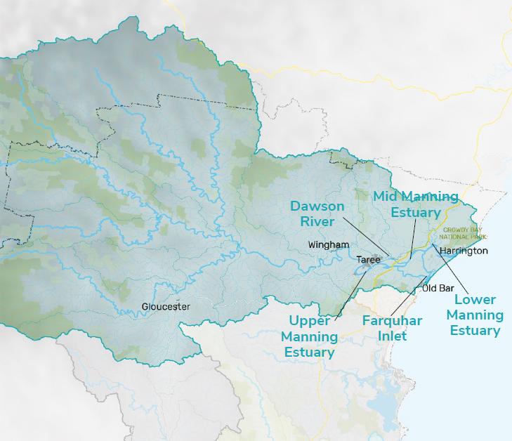
Annexure G: The Manning River ECMP Spatial Risk Assessment Report (Swanson 2020)

Annexure H: The Manning River ECMP Rapid Site Assessment Report (Swanson 2020)

“It’s cool to see there is a lot of research and data being collected. There’s opportunity to use scientific research and data to improve management.” Sam Nicholson – dairy farmer

Manning River ECMP Exhibition Draft V2 June 2021

Page 58


Turn static files into dynamic content formats.

Create a flipbook

Articles inside

Figure 39 MidCoast Council Organisational Structure

4min
pages 194-196

Appendix 6: MCC land-use strategies aligned to the CM SEPP objectives

8min
pages 186-192

Implementation Streams

10min
pages 197-203

Appendix 2: The Public Participation Spectrum

0
page 167

13. Bibliography

4min
pages 162-164

12. Proposed amendments to the CM SEPP

3min
pages 160-161

11.3 The Manning River ECMP Research Program

3min
pages 158-159

11.1 MERI for the Manning River, Estuary and Catchment

4min
pages 148-151

7. Management Actions

4min
pages 106-108

6.15 Systems thinking: the interaction between issues

1min
page 105

10. Coastal Zone Emergency Sub-Plan

1min
page 146

6.13 Sewerage and Septic System Pathogens

2min
page 102

Figure 33: The Manning River floodplain, 20 March 2021

5min
pages 98-101

Figure 32: Cattle on the riverbank is a common sight

10min
pages 91-97

Table 4: Key impacts associated with water pollution from diffuse-source runoff

1min
page 90

Figure 25: Estuary with negative impacts vs well-managed estuary

1min
pages 78-79

Figure 27: Cattai Wetlands

1min
pages 84-85

Figure 26: Conceptual diagram of the Greenhouse Effect

6min
pages 80-83

Figure 24: The relationship between activities, stressors and ecological impacts

0
page 76

Figure 22: Risk ratings for sediment and nutrient loading in drainage units

2min
pages 70-71

Table 2: Subcatchments posing the highest risk to ecological and community values

1min
page 69

Figure 21: Stock intensity in the catchment

1min
page 65

Figure 18: Manning River TN and TP readings from 2015-18

0
page 62

Figure 17: The sampling location for water quality data

1min
page 61

Figure 9: The Integrated Planning and Reporting Framework

2min
pages 31-32

Figure 15: National Parks make up18.5% of the Manning catchment

2min
pages 58-59

Figure 14: Program Logic Model

9min
pages 51-57

Figure 12: Values our community ascribed to each subcatchment

10min
pages 41-49

Figure 11: The consultation program

2min
pages 38-40

Figure 16: Water quality monitoring sites in the estuary

1min
page 60

Figure 10: Option for the Manning River ECMP Governance Structure

7min
pages 33-37

Figure 7: The five stages of a Coastal Management Program

2min
pages 26-29
Issuu converts static files into: digital portfolios, online yearbooks, online catalogs, digital photo albums and more. Sign up and create your flipbook.