2 minute read
Previous and Ongoing Studies


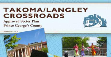
TAKOMA/LANGLEY CROSSROADS SECTOR PLAN (2009)
The purpose of this sector plan was to enhance the character and quality of life of the community and provide for transit-oriented development around the proposed Purple Line light rail transit stations. Some of the relevant recommendations are: • Improve connectivity in the sector plan area by creating a compact network of pedestrianfriendly streets • Expand the bicycle route network with safe, convenient, and attractive bicycle facilities such as shared-use roadways, on-road bicycle lanes, cycle tracks, sidepaths, storage and parking facilities, and safe road crossings on all streets. • Create safe routes by identifying high-priority sidewalk and bikeway corridors that lead to schools, transit centers, parks, and other activity centers where sidewalk and bikeway construction is required to improve safety, accessibility, and mobility.
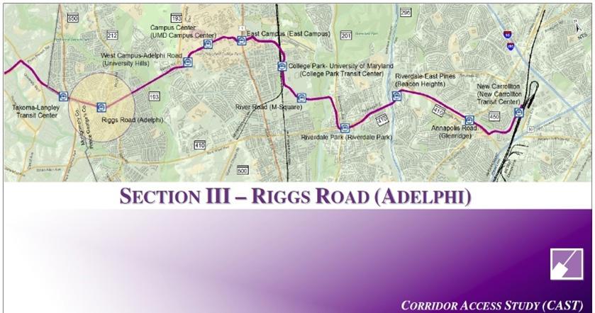
PURPLE LINE CORRIDOR ACCESS STUDY (CAST) (2011)
Building upon the Takoma/Langley Crossroads Sector Plan, Prince George’s County finalized the Purple Line Corridor Access Study in June 2011. The goal of the Study was to evaluate multimodal access to the 11 proposed Purple Line stations within Prince George’s County. Section III (Riggs Road) of the Plan established the priority pedestrian/bicycle access routes and the type of improvements needed for each route. The Study also recommended traffic calming and intersection improvements along study corridors.
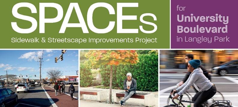
SPACES SIDEWALK & STREETSCAPE IMPROVEMENTS PROJECT (SPACES) FOR UNIVERSITY BOULEVARD IN LANGLEY PARK (2020 – ONGOING)
M-NCPPC Prince George’s County Planning Department is currently conducting a study along University Boulevard from MD 650 (New Hampshire Avenue) to Adelphi Road. This segment of University Boulevard forms the southern boundary for this study area. The SPACEs project seeks to improve biking and pedestrian safety, better connect neighborhoods to the corridor, and enhance the public realm. Recommendations from the SPACEs project will tie into this project.
CASA LANGLEY PARK AREA NEIGHBORHOOD REHABILITATION STREET DESIGN PROJECT (2020- ONGOING)
Prince George’s County DPW&T, in collaboration with CASA de Maryland, is currently developing streetscape plans for multiple neighborhood street segments around the study area. The designs include the installation of traffic calming devices, such as curb extensions and speed humps, along with new street trees, crosswalks, and sidewalks. Street segments being redesigned include: • Langley Way: Edwards Place to 14th Avenue • 14th Avenue: Langley Way to Kanawha Street • 14th Avenue: MD 193 (University Boulevard) to
Kanawha Street • Kanawha Street: 14th Avenue to 15th Avenue • 15th Avenue: Kanawha Street to Villas at Langley
Apartments Recommendations from the CASA project will be considered in this project to encourage consistent street design throughout the study area.


