2 minute read
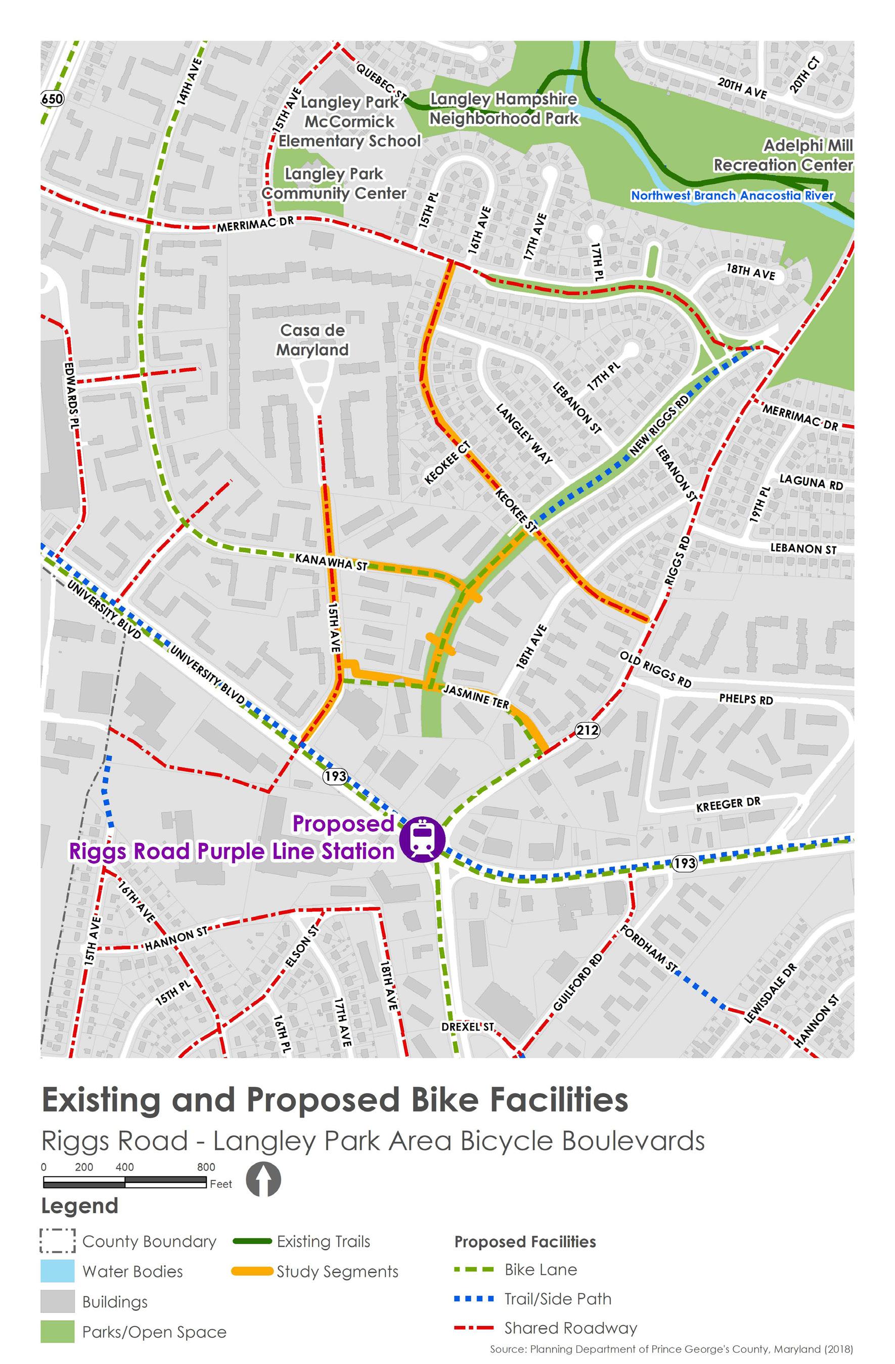
Existing and Proposed Bicycle Facilities


15th Avenue has an 8-foot-wide sidewalk on the east side that can function as a shared-use path .
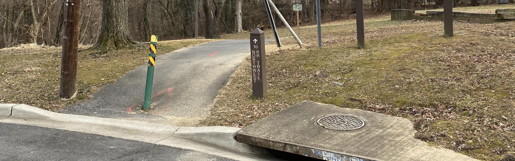
Trail connection to Northwest Branch Trail from Quebec Street, just north of the study area .
There are no dedicated on-street bicycle facilities within the study area. MD 193 (University Boulevard) is a six-lane divided roadway, which is extremely uncomfortable for bicyclists because of the lack of separated bicycle lanes and fragmented sidewalks interrupted by frequent wide commercial driveways. However, with the construction of the Purple Line currently underway along University Boulevard, there have also been plans for additional bicycle facilities along the roadway. New separated bicycle lanes and shared-use paths are planned as part of the light rail corridor and station construction. MD 212 (Riggs Road) is a two-lane undivided road with on-street parking on both sides and no bicycle facilities. Even though Riggs Road is a two-lane road, and traffic moves slower than on University Boulevard, bicyclists feel uncomfortable riding along the roadway. These two roadways, taken together, form a barrier for the study area that severely limits bicycle connectivity beyond the immediate study area. Most of the study segments including Keokee Street, Kanawha Street, and Jasmine Terrace, are narrow, low-speed, and low-traffic volume residential streets with on-street parking on both sides. These streets can function well as shared roads. Even without dedicated on-street bicycle facilities and with additional traffic calming, bicyclists would feel safer riding with vehicular traffic on these streets. The only study segment that has a striped, double-yellow centerline is 15th Avenue. Although 15th Avenue is wider and busier than other study segments, it only has one lane in each direction with on-street parking on both sides. 15th Avenue also has an 8-foot-wide sidewalk on the east side that could function as a shared-use path. 15th Avenue could become more comfortable for bicyclists to share the roadway with additional traffic calming. There are two regional trails near the study area. The Northwest Branch Trail is located just north of the study area and can be accessed from the Quebec Street cul-de-sac, just north of Langley Park-McCormick Elementary School. The Sligo Creek Trail is located south of the study area and can be accessed from MD 650 (New Hampshire Avenue). Both trails join the Anacostia River Trail system and connect to Washington, D.C., and several other destinations within the region. There are no comfortable bicycle connections to these trails from the study area. Improving bicycle connections to these trails will greatly enhance regional bicycle connectivity.
Map 3. Existing and Proposed Bicycle Facilities