EIGHTH SEMESTER B ARCH DISSERTATION OCTOBER
2021
Submitted by Miss Neha Raj Asha
Marian College of Architecture and Planning Kazhakoottam, Thiruvananthapuram
Email:marianarch.in@gmail.com Mob: 8281388111 www.mcap.edu.in
NOCTURNALTERRAIN
IN METRO CITIES
EIGHTH SEMESTER
B. ARCH DISSERTATION
OCTOBER 2021
A Dissertation submitted in partial fulfillment of the requirements for the award of Bachelor’s Degree in Architecture of Cochin University of Science and Technology
Submitted by Miss Neha Raj Asha Guided by Assistant Prof. J Anupriya
Marian College of Architecture and Planning Kazhakoottam, Thiruvananthapuram
Email:marianarch.in@gmail.com Mob: 8281388111 www.mcap.edu.in
NOCTURNALTERRAIN
IN METRO CITIES
DECLARATION
I hereby declare that the Dissertation entitled
“NOCTURNAL TERRAIN IN METRO CITIES. ” is an independent work of mine and it has not been submitted to anywhere else for any Degree / Diploma or Title. No material from other sources has been used without proper acknowledgment.
Signature of the student
Neha Raj Asha
Place: Kazhakootam
Date: 12th Oct 2021
i
CERTIFICATE
This is to certify that this Dissertation entitled “NOCTURNAL TERRAIN IN METRO CITIES” is a bonafide record of the dissertation submitted by ASAD under our guidance towards partial fulfillment if the requirements for the award of Bachelors Degree in Architecture of the Cochin University of Science and Technology (CUSAT) during the year 2020-2021 Guide: ………………………… ASAD Associate/Assistant Professor Dissertation Coordinator ….…………… ASAD Associate/Assistant Professor
ii
HOD Principal Director Ar. Ganga Krishnan Ar. Dileep kumar C.V Prof. Baby Paul K 1. External Examiner Signature …..………………………………….……...…… Name …………………………………………………………….. Designation………………………………………………… 2. Internal Examiner Signature ….. Name …………………………………………………………….. Designation 3. Internal Examiner Signature ….. Name …………………………………………………………….. Designation
ACKNOWLEDGEMENT
This paper and the research behind it would not have been possible without the exceptional support of my mentor, J Anupriya, whose knowledge, guidance and attention to detail have been consistent from the initial stages to the final draft of the paper. I would also like to thank our principal (Prof. Dileep kumar CV) and the dissertation committee (Ar. Adarsh Viswam and Ar. Deepika P) for this opportunity bestowed to work on this dissertation (Nocturnal terrain in Metro cities). I also offer my sincere gratitude to Ar.Prof.Suja Kumari and Ar.Devika Hemalatha Devi, without whose guidance and insights, this dissertation wouldn’t have found its form.
Through the research paper, I have gained insights on the various functioning and dynamics of the night terrain in cities; which has been a topic of fascination. I hope this research paper serves as a useful source of reference for those keen on the topic.
ABSTRACT
The nocturnal terrain of urban metro cities both in India and Internationally is an overlooked realm in the field of design. The city at night in most places around the globe is often portrayed as a space of danger, and one which increasingly needs heavy surveillance. The nocturnal terrain if administered ethically and safely will give rise to strong sense of belonging among the inhabitants of the city as well as true freedom in one’s self; through the perception of night and darkness on par with day time. The utilization of the night territory through architectural and morphological components intensifies the transformation of metro cities into mega cities thus resulting in higher economygeneration andfurthertheirdevelopment thatwillinturnresultin betterliving conditions for all. The dissertation explores the morphological aspects of urban space using the existing notions of politics, policy, society and space in the current context of nocturnal terrain of metro cities.
Keywords: Nocturnal terrain, active public realm, urban night, night time economy
v CONTENTS 1 Table of Contents DECLARATION i CERTIFICATE ii ACKNOWLEDGEMENT........................................................................................iii ABSTRACT iv CONTENTS v LIST OF TABLES viii 1 INTRODUCTION.......................................................................................... 11 1.1 Background...............................................................................................11 1.2 Aim 12 1.3 Objectives..................................................................................................12 1.4 Research questions...................................................................................12 The research asked questions pertaining to; ...................................................12 1.5 Methodology .............................................................................................13 1.6 Scope and limitations...............................................................................13 2 LITERATURE REVIEW.............................................................................. 14 2.1 Analysis of keywords................................................................................14 2.1.1 Nocturnal terrain.................................................................................14 2.1.2 Nocturnal terrain in cities....................................................................15 2.1.3 Challenges in addressing nocturnal terrain.........................................16 2.1.4 Human behavior during the day and night 17 2.1.5 Nocturnal terrain evolution 18 2.1.6 Jan Gehls theory on human activities .................................................19 2.1.7 Nocturnal terrain in creating the image of a city 20
vi
.........................................................................................29
3 LITERATURE STUDY................................................................................. 43 3.1 Literature research ..................................................................................43 3.1.1 Climate................................................................................................44 3.1.2 Geography 44 3.2 Southbank, Melbourne............................................................................45 3.3
Bay,
3.4 Marine drive,
4 DATA ANALYSIS ......................................................................................... 65 4.1 Southbank, Melbourne............................................................................66 4.1.1 Location and land use .........................................................................66 4.1.2 Access and permeability 68 4.1.3 Scale and proportion 69 4.1.4 Activities.............................................................................................70 4.1.5 Safety and surveillance.......................................................................70
2.1.8 Public realm 22 2.1.9 Public spaces 23 2.1.10 Types of urban public spaces..............................................................27 2.1.11 Waterfronts
2.1.12 Importance of waterfronts in Urban growth 30 2.1.13 Urban public spaces at night 32 2.1.14 Urban safety........................................................................................33 2.1.15 Night time economy............................................................................36 2.1.16 Pros of NTE 39 2.1.17 Concept of 24-hour city 40 2.1.18 24-hour city in India............................................................................42
Marina
Singapore............................................................................51
Mumbai.............................................................................60
vii 4.1.6 Sutures 71 4.1.7 Landscape and furniture 72 4.1.8 Activity generators..............................................................................73 4.1.9 Day/Night morphing spaces................................................................74 4.2 Marina Bay, Singapore............................................................................75 4.2.1 Location and land use ........................................................................75 4.2.2 Access and permeability.....................................................................76 4.2.3 Scale and proportion 77 4.2.4 Safety and surveillance 78 4.2.5 Sutures and landscape.........................................................................79 4.2.6 Activity generators..............................................................................80 4.2.7 Night/Day morphing spaces 82 4.3 COMPARITIVE ANALYSIS.................................................................84 4.4 ANALYSIS WITH THE INDIAN CONTEXT .....................................88 5 FINDINGS ...................................................................................................... 95 5.1 Access.........................................................................................................95 5.2 Scale and proporition...............................................................................95 5.3 Safety and surveillance............................................................................95 5.4 Sutures and landscape .............................................................................96 5.5 Activity generators...................................................................................96 5.6 Night/Day morphing spaces ....................................................................97 6 GUIDELINES AND CONCLUSIONS......................................................... 98 BIBLIOGRAPHY 100
LIST OF TABLES
Table 2-1: Type of Urban Open Spaces
Table 3-1: Brief on selected cases
Table 4-1: Parameters identified for analysis
Table 4-2: Comparative Analysis of case studies
Table 4-3: Comparative Analysis with Marine Drive
viii
Cities like cats, will reveal themselves at night.’
-Rupert Brooke
ix
‘
CHAPTER 1
1 INTRODUCTION
1.1 Background
The hours after darkness is an abstract and ethereal dimension that is most often overlooked by researchers and designers alike. There is an eminent shortage of locations in cities around the world where its inhabitants can retreat to after long hours of work in the day hours. This has considerable effects on the mental health of the people which in turn effects their productivity and thus the overall economy of the city A significantly large number of cities are aware that the night time activities and functions contribute to their global identity, local economy and attractiveness in the tourism sector. Over the past two decades, night time in cities around the world tend to focus on developing the night time economies. Thenight-time economy (NTE) has generally been described in academia, politics and the media as the proliferation of the opening of bars, clubs, dining and shopping beyond daylight hours (Roberts and Eldridge, 2009). But recent developments have expanded the realm into a time for festivals, grand events and artistic displays of arts and culture that stimulate the urban night. Yet disorder and deviance in the streets at night have shaped a large extent to how the public, government and law enforcement perceive the urban night. The youthfulness of nightlife, the disorder, the littered streets and the police forces keeping order are often the narratives we hear on urban life at night (Roberts and Eldridge, 2009).
The city at night in most places around the globe is often portrayed as a space of danger, and one which increasingly needs to be under surveillance. The after dark environment in Indian cities screams terror and anxiety. This makes it all the more difficult to usher people to venture outside between dusk to dawn. Majority of metro cities dwellers in India works 9-7 shifts and are left with little to no places to retract to after dark. Urban public spaces where families/communities can gather after the setting of the sun is next to non-existent in the country.
Nocturnal terrain in metro cities
11
Marian College of Architecture and Planning, Thiruvananthapuram
Nocturnal terrain in metro cities
The focus should also extend to people’s everyday lives at night rather than just the issues of the safety or the commercialization of space at night, where the practices of an under-examined, yet large segment of users of the urban nocturnal terrain are largely ignored.
The utilization of the night territory intensifies the transformation of metro cities into mega cities and thus result in multiplying the economy of the city and further their development that will in turn result in better living conditions for all. The study aims to put forth measures that shall transform metro cities into a safe haven for city dwellers through the promotion of night life and functions that cater the same resulting in a revenue generating space with varied activities through time
1.2 Aim
To critically analysethe morphological components ofurbanplaces thatcaterto night lifein metro cities.
1.3 Objectives
• Analysing what nocturnal terrain is and why it is important in urban life
• To identify the current threats and ill functioning dynamics of night in cities.
• To identify the morphological parameters that cater the night life of cities
1.4 Research questions
The research asked questions pertaining to;
• What are the various activities people partake in at a night urbanscape?
• What are the morphological obstacles faced by the city in utilizing the public domain at night?
• What factors contributes in encouraging the city dwellers to explore the night?
• What could be the possible measures that can be adopted to utilize the city at day and night alike without disturbing the current organization of spaces?
12
Marian College of Architecture and Planning, Thiruvananthapuram
Nocturnal terrain in metro cities
1.5 Methodology
1.6 Scope and limitations
The scope of the study pertains to its implementation of the various morphological strategies inferred for the initiation of a nocturnally active public realm in cities on a broader scale. This dissertation will help for the future reference in understanding the nocturnal terrain of metro cities and to adopt morphological guidelines on designing the nocturnal terrain of metro cities.
The study is limited to understanding via literature and background studies due to the inability to collect data through site visits in the current pandemic scenario.

13
Marian College of Architecture and Planning, Thiruvananthapuram
Nocturnal terrain in metro cities
CHAPTER 2
2 LITERATURE REVIEW
2.1 Analysis of keywords
2.1.1
Nocturnal terrain
The term nocturnal is employed when a physical or psychological entity belongs to or pertains to the night or is predominantly active at night. Terrain of a geographic area is its physical land with regard to its physical features. The Latin word terra (the root of terrain) means "earth."
Satellite image of globally active nocturnal terrains
Source: NASA
14
Marian College of Architecture and Planning, Thiruvananthapuram
Nocturnal terrain in metro cities
2.1.2 Nocturnal terrain in cities
Cities are alive during both day and night. Yet our ideas of urban realm usually limit itself to the hours of natural light. Contrary to the belief that buildings and urban areas sleep at night, the nocturnal terrain is no longer a passive phase. No matter their size or location, the cities are constantly struggling to accommodate different uses and to ease existing tensions between them. For example, while some hope that the growth of residential sectors in city centres will help address housing shortages, others believe it will pose a threat to nightlife venues and public spaces located in these areas, due to the new rules and regulations posed to control noise and other activities. The underlying problem is that most cities weren’t designed for darkness. From shifting temperatures from warm days to cool nights to alterations in the way we perceive colours and proportions, there are many sensory differences between day and night.
Modern cities of developed countries stay active after dark, and operate in 24-hour cycles of alternating activities of production, leisure and recondition/regeneration with indistinct temporal boundaries. Multiple factors have contributed to this change; these include patterns of work, household structures, and new forms of community. Altogether they have opened up the night to alternate possibilities, activities and forms of leisure (Roberts & Eldridge, 2009).
This fascination of night comes from references to tensions and liberties, pleasures and fears, regulation and chaos, disorder and control traditionally associated with it (Amin & Thrift, 2002). These notions are still part of our cultural imaginaries even though the night has much evolved during the 20th and first decade of the 21st century. Traditionally, a day was strictly divided into time of production during day and time of regeneration at night, when the cities and its inhabitants prepared themselves for the next day. Activities during the night were associated with danger and threat, criminality and immorality. However, current patterns of utilization of the night hours in cities have dramatically changed. Long-gone is the night solely experienced by people who have alternative, ortransgressivelifestyles. Inthecurrent scenariointhemodernworld, citiesaretaking up endeavours that thrives to accommodate and shape the life of the ordinary city dweller and to give space to new modes of social relations.
15
Marian College of Architecture and Planning, Thiruvananthapuram
Nocturnal terrain in metro cities
Fixed lifestyle of people from 9am to 6pm are slowly fading in various cities, with the economy moving towards patterns where production and regeneration overlap. Additionally, leisure has become an essential part of everyday life. This lifestyle has blurred spatial boundaries between workspace, domestic space and leisure space, and between the public and the private.
During a conference organized by the Graduate School of Design and the Center for Middle Eastern Studies at Harvard University, titled “After Dark: Nocturnal Landscapes and Public Spaces in the Arabian Peninsula”, the following challenges were identified in designing nocturnal terrain for the urban realm
2.1.3 Challenges in addressing nocturnal terrain The night as segments
The absence of safe public spaces has led to the concentration of most social night-time activities in private spaces such as shopping malls(Steven Velegrinis). As a result, the night becomes a highly restricted space for use, where the character of most exchanges is economic and dominated by consumption. In this context, elaborated on the the importance of “third places” (professor Farah-Al Nakib) or neutral spaces such as cafes, libraries, parks, and cultural centers where inhabitants of the city can meet and create strong social bonds outside the home and the office. But, possessing these venues alone doesn’t necessarily solve the problem. These spaces can act as “third places” as long as the events are free and accessible to a diverse crowd of all users in the city. Otherwise, they can become subject to elite domination which in turn leads to greater social sequestration.
The night as a heavily supervised space
Whether guided by cultural appropriations or by social control, many aspects of night-time activity are severely restricted. The nocturnal terrain is often perceived as a space where
16
Marian College of Architecture and Planning, Thiruvananthapuram
Nocturnal terrain in metro cities
transgressive behavior is aggravated, and therefore must be meticulously supervised. Strict regulations and controls often give way to the manifestations of homogeneous nightlife districts that combine shops, restaurants, and bars where locals and tourists can interact amid a safe and sanitized nocturnal terrain.
A contrasting concept of “terrain vague” (architect Ignasi de Solà-Morales), term refers to the spontaneous and artistic appropriation of unproductive urban spaces. It is contemporary space of project and design that includes the marginal wastelands and vacant lots that are located outside the city’s productive spaces – which Morales describes as oversights in the landscape that are mentally exterior in the physical interior of the city. ("Review of 'Terrain Grichting, Anna).
For example, Professor Yasser Elsheshtawy explained how labourers and migrant workers in Arabian cities take over patches of grass, alleys, and abandoned buildings as meeting, gathering and resting spots after the day hours as these groups have very limited access to parks and other public spaces, most of which are closed after dark. For other groups, the desert provides an ideal place for barbecues, games and smoking shisha activities that are banned at public parks all the while taking advantage of the night-time cooler temperatures. These unintended use of urban spaces helps in strategizing on how to design inclusive night-time interventions.
2.1.4 Human behavior during the day and night
The requirements in attracting people to the nocturnal terrain is similar to the day time. The view of the city at night and day are the two sides of the same coin. Natural light and heat from the sun is the major difference between the factors that make up the terrain at night and the day. The differences can be pointed out mainly by the change in the city’s climate and environment, the change in the life of people between day and night where it transforms from work during day to leisure at night and the difference in activities in urban public spaces during day and night. During day, the cyclical changes in the position of sun through the day has multiple effects on the human mind and the city. These changes can make the city seem different in different periods of through
Marian College of Architecture and Planning, Thiruvananthapuram
17
Nocturnal terrain in metro cities
theday. But thenocturnal terrain ofthecityis neitherinfluencebythetimenortheclimate. “When night falls upon the city, lights inside the windows of the apartment building have been turned on. Later, the façade of the building just disappears into the darkness. During the day time, the façade was the subject of the building, but at night we can only see the windows and the view inside the windows.” (Yoshinobu Ashihara, 1984). The human visual perception is also altered during the hours after dark. The change in light and temperature affects the humans mind and in turn their activitiesto amoretheatrical anddangerous path. Ononehand,thedarkness will weakenhuman’s sense control and visual judgment. On the other hand, they do not need the rational and logical thinking as much as during the intense day time work (Rudolf, 2001). Human behaviour at night revolves around their mental peace and leisure where the mid runs free. They are subjected to more emotions and sensitivities in the after dark hours. Therefore, the nocturnal terrain of the cities should offer an environment where peace and tranquillity is embedded.
2.1.5 Nocturnal terrain evolution
The human requirements for the nocturnal terrain can be analysed from the relationship between the human and the night. Urban nocturnal terrain designs commenced around the globe following the development in the economy of the city as well as its social culture. The initial designs of the night involved providingspaces after dark to satisfy their psychological and physical needs. These included a night time stroll or a quiet place to let in the day’s feelings. As time progressed, the requirements of the humans after dark environment progressed to more activities and thus more spaces. Rather than providing a place and lighting (basic functions of nightscape), human starts to ask for a qualified nightscape with artistic effects and more potential functions (Yuan Hongxiang, 2014) Electricity entered urban life in the 1880s and spread throughout the modern cityscape in several waves. Initially confined to the mansions of the wealthy and to department stores aimed at attracting customers, it then expandedintopublicstreetlighting schemesandalong majortransport routes (Geographies of urban night, 2014). The rise of public street-lighting has been fundamental to new attitudes towards the urban night (Koslofsky, 2002).
The illumination of night was the first step to the growing design of the urban nocturnal terrain. Street lighting was incorporated to induce law and order. Bringing light to places of darkness
Marian College of Architecture and Planning, Thiruvananthapuram
18
Nocturnal terrain in metro cities
where fear and crime are presumed to be common is still considered a widely shared solution to crime (Painter, 1996) as lighting tends to reduce the fear which crime engenders (Pain et al., 2006). Street lighting also beautifies the cityscape by providing convenience and a new venue to use the city at night.
2.1.6 Jan Gehls theory on human activities
People’s activities, according to Jan Gehl (Life between buildings), on public spaces can be divided into three types;
Necessary behaviors
These activities arise from the use of space by people by walking. These behaviors include going to school, going to work, shopping, etc. they occur in all types of weather throughout the year as long as the participants have no choice but to engage in them.
Optional behaviors
These activities include when the users form a desire to participate at a favorable place in a specified time. They include activities like playing an outdoor game or sitting outside. These behaviors are unlikely to occur in poor weather conditions. The frequency of such activites are also dependent on the environment set in.
Social behaviors
These include activities where people conjure and congregate together to socialise among themselves. They include behaviours such as children playing, picnics, etc. these are often spontaneous and can occur in a wide variety of settings. These activities are also condensed by the physical setting of the space. In His description, social behaviour is “the fruit of the quality and lengthofthe othertypesofactivities,because itoccursspontaneouslywhenpeople meetina particular place” (2008).
19
Marian College of Architecture and Planning, Thiruvananthapuram
Nocturnal terrain in metro cities
Communal spaces in cities become functional and meaningful when all types of activities occur in combinations and form a symbiotic relationship with each other. The quality of public spaces is interdependent on the various activities by the people. Similarly, the quality of the nocturnal terrain in a public space can affect the frequency of activities taking place as well as the duration of the various activities. The nocturnal terrain provides a realm for people to pursue social and optional behaviours by enjoying their leisure time with various such activities in urban public spaces including sight-seeing, resting or strolling through the night. Therefore, the nocturnal terrain should contain a plethora of optional and social activity palettes for the people wanting to enjoy the night.
2.1.7 Nocturnal terrain in creating the image of a city
The theories in Kevin Lynch’s Image of the city (1990) occurred around the time when American cities were in the process of designing their nocturnal terrain. The fusion of nocturnal terrain and creating the image of the city helped in the establishment of an active night life in modern cities with a well-planned nightscape. In accordance with the image of the city, an urban space is no longer just a spatial concept but a social realm where the physical and psychological needs of the people are met. Lynch’s theory explained how people created a mental image of the city through feeling the physical environment. Based on this theory, he pointed out that legibility should be one of the key concepts in designing the image of the city and that urban space can be legible as a ‘mental map’ to a citizen which consists of paths, nodes, edges, districts and landmarks. The legibility of an urban space connects the people to their environment. The edge of a public space
20
Marian College of Architecture and Planning, Thiruvananthapuram
Nocturnal terrain in metro cities
can give people a sense of scale (Allan B. Jacobs, 1993). It is the degree of how easily people make a mental image of a place in their mind and then structure it into a mental map.
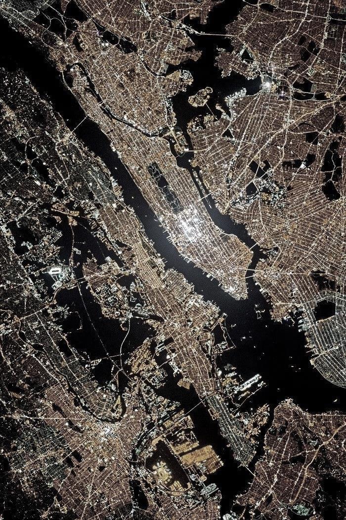
The nocturnal terrain of a city requires an even stronger legibility to guide people in forming the mental map of the image of the city. This is due to the lack of natural light in which humans are most accustomed to in their navigation. Therefore, these elements must be designed to cater both the day hours and night for a successful nightscape of the city. There are many cities around the globe that have very distinctive identities particularly pertaining to their nocturnal terrains. These include the city of Paris, New York, UK, etc. Unlike cities around the globe, the nocturnal terrain in India is still viewed as a realm that fruitions taboo and immorality. This cultural setback has been one of the fueling elements in the underdevelopment of the night terrain in majority of the cities in India. This has led to designers in India completely neglecting the design for night terrain and thus restricting the image of cities in India to their existing cultural identities. The image of cities in India unlike American cities also applies its geographies, history, human activities and landscape features. Similar to day light hours, the spatial structure at night may be made legible with illumination and morphological factors. The edges of cities at night may be well defined for people to come in terms with the scale. Similar to the sun lit day, districts and nodes designed for night can activate social gatheringsandactivitiesandauniquelandmarkamongstthenocturnalterraincanestablishacity’s unforgettable identity.
Source: The Guardian New York city at night

College of Architecture
Planning, Thiruvananthapuram
Marian
and
21
2.1.8 Public realm
The public realm plays a major role in defining the urban night life of cities by forming the backbone of our urban life during the night hours. Of particular importance is that the role of urban public realm in enhancing the safety, security, and community well-being of the urban environments at night. The term ‘public realm’ is often used interchangeably with ‘public domain’, to refer to external urban spaces that are accessible by the public of the city. According to English Heritage, the general public realm ‘…relates to all or any parts of the built environment where the public has free access. It encompasses: all streets, squares, and other rights of way, whether predominantly in residential, commercial or civic uses...’ (English Heritage).
The term may also be used as a means of describing the physical manifestation of community and human interaction outside the private home that are used by people to socialize, play, work, shop, traverse and use for activities and functions that enable social processes among residents and citizens. Public realm creates the perfect setting for individuals and communities to live their lives efficiently, safely, purposefully, meaningfully and memorably. The realm may consist of typical urban elements of streets, lanes, plazas, parks and environmental areas of different scales and purposes. These elements of public space are combined to make each space distinctive and unique places that invite function and activity for a varied set of users. The primary users of public space involves pedestrian movement and the primary mode of transport includes walking, cycling, and public transport. Vehicles remain important but less so than the other physical modes.
The mix and location of various different land-uses in close proximity activate the general public realm, so people can readily access the uses functions required for daily life, and should be invited to do so by providing them with a quality urban setting.
The public realm is the opposite of the private world of the family or societies or clubs; in these groups there is an amplification of one point of view; its members speak with singularity. But within the public realm, “Being seen and heard by others derive their significance from the fact that everybody sees and hears from a different position. This is the meaning of public life,
Nocturnal terrain in metro cities
22
Marian College of Architecture and Planning, Thiruvananthapuram
compared to which even the richest and most satisfying family life can offer only the prolongation or multiplication of one’s own position.” Hannah Arendt, The Human Condition, Chicago, University of Chicago Press, 1958
2.1.9 Public spaces
Night life in central Hong Kong

Source: National geographic
Public areas shape community ties in neighbourhoods. They are places of encounter and may facilitate political mobilization, stimulate actions and help prevent crime. They are environments for interaction and exchange of ideas that impact the quality and standards of the urban environment. While not considered “public spaces,” cafes, bookstores and bars have comparable impacts. Public spaces also present health benefits, both physical and mental: people feel better and heighten their tendency to be more active in attractive, public spaces.It is possible to travel even deeper and relate the presence and planning of public spaces with democratic values. The culture of an area, its structure and social hierarchy reflect the way common spaces
Architecture
Planning, Thiruvananthapuram
Nocturnal terrain in metro cities
Marian College of
and
23
Nocturnal terrain in metro cities
are planned, controlled and used. “The more diverse and lively urban spaces are, the more equal, prosperous anddemocraticsociety becomes” (Ben Rogers). This assertion is predicted onthevery definition of public space: an open, freely accessible and democratic environment.
A good public space is one that reflects diversity of the people and encourages them to live together effortlessly, creating the necessary conditions for consistency, which invites people to be on the street. It is the vitality of spaces that draws people to the place. What guarantees this vitality is the possibility of using the urban spaces in multiple ways. “The existence of quality and usable public spaces, with greater urban vitality, will increase the perception of security and democratization of these spaces,” says Lara. It is a two-way street: people will use the streetscape if they feel safe and the streets will be a safer environment the more people use them. According to Project for Public Spaces (PPS), there are ten principles/elements that should be considered for a high-quality public space. It is the combination between these elements that will ensure accessible, equitable and safe spaces for people.
1. Blending multiple functions; residential, office and commercial areas, like bars, restaurants, cafes and local commerce, attracts people and thus makes the environment safer and friendlier. The diversity of uses generates activities that contribute to the safety and usability of the spaces: more people on the streets helps keep crime in check. This diversity, however, needs to extend to all times of day. This diversity, however, needs to cover both day and night. If the spaces are inviting and busy only during the day, they're going to still be unsafe places at night. Thus the spaces should be both inviting and exciting at night.
2. Connection among the ground level of the buildings, the sidewalk and the streetscape contribute to safety of the users. Visually interesting streets are used more often by the people. “This relationship influences people’s perception of the city and how they are to use it. Streets and sidewalks that indicate how public space is perceived and used” (Jane Jacobs).
3. As an aggregator of users, public space has influence over the social and cultural dimensions. Wide, accessible streets, squares, parks, sidewalks, bike paths and urban furniture stimulate interplay between the people and their environment, generate a positive use
Marian College of Architecture and Planning, Thiruvananthapuram
24
Nocturnal terrain in metro cities
of space and increase urban vitality. In addition to high-density urban areas, it is crucial to consider the peripheries, guaranteeing quality public spaces to the population that does not live in the city center.
4. High-scale, high-density design may negatively affect people’s health. ‘People tend to walk faster when passing empty or inactive areas, in contrast to the slower, quieter pace of walking in livelier, more active environments.’ (Jan Gehl) Human-scale planning and considerations have a positive effect on people’s perceptions of public spaces: they will feel inclusive in the planning process of that space.
5. Efficient and people-oriented lighting facilitates the occupancy of public spaces in the dark, enhancing safety. Installing these on the pedestrian and cyclist scale, adequate lighting creates the necessary conditions to move more safely when there is no natural light.
6. Quality public spaces not only benefit people by offering leisure and entertainment, but they also have the potential to boost the local economy. The safe conditions foster pedestrian activities like walking and cycling, leading to easy access of local commerce.
7. Public spaces should also be planned for the small businesses that characterize and give an identity to the neighbourhood Large enterprises may contribute to the economy in general, but they have little contribution in the scale of the neighbourhood. The public space should take into account the social dynamics and cultural specificities of the area, to generate a strong relationship between the people and place.
8. Public spaces should follow the principles of Complete Streets. The Complete Streets concept defines streets that are designed to ensure the safe circulation of all users pedestrians, cyclists, drivers and users of public transport. Sidewalks, infrastructure for bicycles, street furniture and signage for all users are among the elements that compose a complete street.
9. In addition to contributing to air quality and helping ease temperatures in the summer, green spaces has the power to humanize cities by attracting people to outdoor activities. As cities
Marian College of Architecture and Planning, Thiruvananthapuram
25
Nocturnal terrain in metro cities
grow, access to green public spaces will turn significant as urban forestation can lower people’s stress levels and enhance well-being in cities.
10. Involving the users in the design, planning and administration of urban public spaces or the neighborhoods in which they live in maintains the quality of these spaces. Public spaces have different uses and meanings in each neighborhood and community and thus involvement of the local crowd ensures public space will meet the community’s distinct needs.
Design of the public realm must be rooted in community-engagement methodologies while collaborating with municipal agencies and policy makers;
• Economy: Activities such as dining and entertainment, as well as transportation/transit, medical and sanitation, employ thousands of people and draw tourists and residents to enrich the commercial enterprise of the city. Connective and “smart” technologies may be employed by saving funds.
• Public Health: Walkability at night for all users of the city should be safety standardized for city streetscape design. Wayfinding increases intuitive navigation among the people along with pocket parks, plazas and seating optimized for after-dark usage encourage a mix of exercise and social interaction among the people
• Welcome and safety: City-wide strategies such as Vision Zero- an approach to traffic management that starts with the idea that everyone has the right to be safe in traffic and is rooted in the belief that every traffic death and injury reflect a failure in the system; and increased mobility options establish safer streets at nights.
26
Marian College of Architecture and Planning, Thiruvananthapuram
Nocturnal terrain in metro cities
2.1.10 Types of urban public spaces
According to Mark Francis, there are two types of urban public spaces; traditional urban spaces and innovative urban spaces. He argued that the growth of typologies of urban public spaces were caused by the expanding definition of an urban open space. As Kevin Lynch has described in his book that an urban space is public when it is accessible, Francis agreed by stating that urban open spaces are defined as publicly open accessible places designed to cater human activities and enjoyment. Table (Urban Open Space, 2003) shows his illustration of urban public spaces.
Osaka, Japan
Source: shutterstock
 Marian College of Architecture and Planning, Thiruvananthapuram
27
Nocturnal terrain in metro cities
Table 2-1: Type of Urban Open Spaces (Source: Urban Open Space, 2003)
TYPE
Public parks
CHARACTERISTICS
Traditional
A public open space; developed andmanaged by Parks Department as part of zoned open-space system of city; often located near center of city; often larger than neighborhood parks.
Neighborhood parks Open space developed in residential areas; managed by Parks Department as part of zoned open space of cities; may include playgrounds, sports facilities, and so forth.
Playgrounds
Play area located in neighborhood; frequently includes traditional play equipment such as slides and swings; sometimes include amenities for adults, such as benches, and so forth.
Pedestrian malls Street closed toautotraffic; pedestrian amenities provided such as benches, planting; often located on the main street in downtown area.
Plazas
Community open spaces
Neighborhood open spaces
Schoolyards
Open space developed as part of new building in downtown area; built and managed by building owners; typically, privately developed and managed.
Innovative
Neighborhood spaces designed, developed, owned and/or managed by local residents on vacant land; may include viewing gardens, play areas, and community gardens; often developed on private land; not officially viewed as part of open-space system ofcities; highlyvulnerable to displacement by other uses such as housing.
Spacelocatedinneighborhoodoftennearprivate open space; often heavily used by children and teenagers; important setting for environmental learning and socializing.
Not normally considered part of open-space system of cities; increased awareness as place
28
Marian College of Architecture and Planning, Thiruvananthapuram
for environmental learning; some schoolyards redeveloped as environmental centers.
Streets Much of the publicly accessible open space of cities; increased awareness of importance of street use and traffic impacts on children; changes to streets include pedestrian improvements and sidewalk widening, street tree planting, and so forth.
Transit malls Development of improved transit access to downtown areas; may replace a traditional pedestrian mall with a bus and “light rail” mall.
Farmers’ markets Open space used for farmers’ markets or flea markets; often temporary or held only during certain times in existing space such as Parks, downtown streets, or parking lots.
Town trails Connects parts of cities through integrated urban trails; use of streets and open spaces as settings for environmental learning.
Vacant/ Undeveloped open spaces
Still much of the open space in cities; found in redevelopment areas, where abandonment has occurred, or in undeveloped areas; increased awareness as potential open space; interest in vacant land being used to develop urban forests or natural areas in cities.
Waterfronts
Found spaces
Increased awareness of waterfronts as urban open space; many cities working to increase public access to waterfront areas by developing waterfront parks.
Informal open spaces of cities where social life takes place; include street corners, sidewalks, paths connecting buildings, bus stops, steps to public buildings, and so forth
2.1.11 Waterfronts
According to Oxford dictionary, waterfronts are defined as “a part of a town or an area that is next to water”(Oxford dictionary). Waterfront is also defined as the area of interaction between the urban morphology of an area and the adjoining water body. “Waterfront can be defined as piece of land or a part of a town next to an area of water and borders a body of water. The urban waterfront could include any urban area that overlooks or adjacent to a river, sea, lake, canal or an artificial water body. Vibrant public waterfronts represent the signature of a great city. Cities
Nocturnal terrain in metro cities
29
Marian College of Architecture and Planning, Thiruvananthapuram
Nocturnal terrain in metro cities
all over the world, which are blessed with ocean or bay views, have learned one principle: the greater the publics access, the more valuable their harbor areas become” (Shaziman, S., Usman, I. M., & Tahir, M., 2010)
2.1.11.1
Waterfronts as an urban public space
According to Kevin Lynch, urban public spaces are defined as a region where people have the freedom to utilize for their physical and psychological activities. Simultaneously, open space is a place where people are gathered in a group or individual to perform their physical and social activity, share their views and knowledge, shape social structure and exchange information (Plummer, B., & Shewan, D., 1992). In urban public spaces, people can utilize the space for their daily activities to bind communities without economic or political concerns.
Major functions of waterfront as an urban public space according to Maxmilian Wittmann (2008) are;
1. Transport (road transport, rail transport, walking and cycling)
2. Social (linked with public facilities)
3. Function additional to housing and housing itself
4. Recreation
5. Industrial use and as complementary functions there are:
a) Junction
b) Specific social function (Hradilová, I. (2013).)
2.1.12
Importance of waterfronts in Urban growth
Recreation in any city is one of the key important elements in the growth of the citizens psychological and physical needs. It should exist as a counter method to the city’s pollution, traffic, lack of social cohesion, lack of quality spaces etc. thus it is important to design open public spaces in the city to cater the activities of various user groups of the city for short term activities such as eating, lounging, strolling etc and long term activities like exercising.
A well designed waterfront provides a distinctive ground for relaxation as it forms the region where water meets land. These areas may have green area that further contribute to the
Marian College of Architecture and Planning, Thiruvananthapuram
30
Nocturnal terrain in metro cities
tranquility offered to its users. These areas also support for water based recreational activities like strolling along the water front, fishing, swimming, relaxing by the water, etc. However, waterfronts also possess economical and transport benefits to bestow the city as it has throughout history. The 19th century saw large scale developments of waterfronts of cities that destroyed the relationship between land and water. Following, post industrialization, these areas were converted to brown field and laid barren. It was from the 1980s that waterfronts were recognized for their potential and urban developments in the regions sprang into action. Today, cities across the world are striving to achieve similar objectives by utilizing their waterfronts to create better quality of life through their economic, social and spatial aspects (Handan Türkoğlu, 2018). Since waterfronts often forms the edge of cities, there exists a disadvantage in the accessibility from inner urban city centers to the waterfront region. In such situations, to ensure the successful activation of the area, accessibility from the inner cities and other city parts must be taken into account in the designing and execution of the area.

31
Marian College of Architecture and Planning, Thiruvananthapuram
Source : Alamy
Dubai Marina at night
Nocturnal terrain in metro cities
2.1.13 Urban public spaces at night
Just like the human body, cities too are bound by the rhythm of the transition between day and night. In the Northern regions, where daylight fleets in the wintertime, cities have long administered “daytime” activities in the dark. However, the colonization of the night is occurring in other regions of the globe as well. The urban night, a forgotten dimension of the city, is now a central field of interest for researchers, communities and town councillors. It has also become a spacetime of innovation in relation to which urban planning and development can be rethought
What is the difference between day time and the night other than the presence or absence of the sun with variations in the seasons or the latitude. Robert Williams in his research of night spaces has pointed out that night is much more than the absence of daylight. He argued that when night falls, a variety of practices and emotions gain traction within a particular space–time which generate a special atmosphere associated with particular activities, experiences and possibilities, ‘whether they entail criminal acts, a rendezvous for lovers, nonconventional behaviors, or organizing rebellion’ (Williams, 2008). Murray Melbin in his book ‘night as a frontier’ emphasized that people relate to each other at night differently since night has a more relaxed and social atmosphere when compared to the day as a result of ease of flows of pressures from the city. According to him, people reported a feeling of relief from the crush and anonymity of daytime city life and a special type of solidarity simply because they ‘share the night’ (Murray Melbin, 1987). Urban nightlife has much potential as a time of social transactions, as a realm of play, as ‘the time of nobody’ which is free for one’s own personal development, as a time of friendship, of love, of conversation (Bianchini, 1995; Lovatt and O’Connor, 1995). These factors contribute to the social strengths of the night. They allow different forms of sociality and festivity that are not commonly encountered during the day.
In contrast to their views, Hubbard argued that night was a place for people to feel heighted emotional experiences; from pleasure, excitement and adventure to fear and distress (Hubbard, 2005). Compared to the daytime, the night offers a time for trying to be someone the daytime may not let you be, a time for meeting people you should not, for doing things your parents told
Marian College of Architecture and Planning, Thiruvananthapuram
32
Nocturnal terrain in metro cities
you not to do (Lovatt and O’Connor, 1995). Urban spaces at night outlined with bars and clubs are often charged with multitude of emotions offering chances that are devoid in the day. It is therefore not surprising that certain forms of violent crime, criminal damage and antisocial behavior are concentrated in and around nightlife areas (Bromley and Nelson, 2002; Nelson et al., 2001).
“In today’s almost-won conquest of the world-system, night has long remained a space-time in which human activity has ultimately made little investment, a closed-off territory difficult to access, a final frontier an inner world to be explored” . (Gwiazdzinski, 2005).
Night time has always been alluded to creativity. ‘This is when solutions are found that evoke DIY, "craftiness"’ (De Certeau, 1988), and transgression, as well as cooperation. ‘This is when a "day-to-day expertise" is deployed, the knowledge and skills exclusive to the elite, even the "specific night skills" where night workers combine resourcefulness with versatility, as in the hospital sector’ (Perrault Soliveres, 2002). Confronted with these rapid changes, metropolises are adapting themselves to better their urban night. Users and inhabitants are experimenting with the night and transforming it to become an open platform for innovation.
Solutions emerging in the night, through public policies and everyday innovations, could be of interesttotheday.Everywhere,newresearchseekstocomprehendthe complexityofurbannights: their activities, temporalities, territories, culture, economy, environment, tourism, creativity, quality of life, lighting, conflict management or social justice. (Boffi, Colleoni, Del Greco, 2016),
2.1.14 Urban safety
Crime is defined as acts contrary to the governing law of that area. The Home Office in the UK recognises that anti-socialbehaviouris influencedbycontext,location,communitytolerance, as well as the quality of life expectations. Therefore, antisocial behaviour can range from the somewhat non dangerous acts of ‘loitering’ or ‘hanging around’ through littering and vandalism, right up to violence, involving sexual harassment and violent crime.
Marian College of Architecture and Planning,
Thiruvananthapuram
33
Nocturnal terrain in metro cities
Women and children are particularly vulnerable to anti-social behavior and crime. For example, the Guardian reported that 43% of women aged between 18 and 34 had experienced sexual harassment in public spaces in their lifetimes Designing spaces for women and children will automatically attract more people in general to occupy the space. The UN has published guidelines for creating public spaces that are safe for women and girls
Key points include:
Easy access to and from the location
Easy movement within the location
Good lighting
Easy-to-read signs
General visibility of the entire space, free from hiding places
Includes mixes
Provisions for different seasons
Provisions for young children and the elderly
Access to clean, secure, easily accessible toilet facilities (source : United Nations Women)
Creating safe spaces for people who identify as female results in spaces that are safe for all users in a community. Increasing visibility of a region considerably decreases the crime and antisocial behavior of the area. This may be incorporated through natural or informal surveillance. Natural surveillance is the concept of increasing visibility between places and user groups. For example, a damming 2007 report into the Green Man Lane area in London pointed to problems either intensified or caused by the architecture of the area. Architects Conran and Partners used the principles of ‘‘Secured by Design’ to design multiple escape routes, aerial walkways, and open access undercrofts that disconnected users from each other and replaced them with more traditional streets that have greater natural surveillance from passing traffic, other pedestrians, and homes that front the street. Research shows that places designed to the Secured by Design principles have a 50% lower risk of burglary, while car crime can drop by 25%.
Marian College of Architecture and Planning, Thiruvananthapuram 34
▪
▪
▪
▪
▪
▪
▪
▪
▪
Nocturnal terrain in metro cities
Public spaces that are designed for people for leisure should be defensible (i.e. seating areas or other functions should have good visibility so that the users can see potential threats coming). They should also be sheltered enough to reduce the feeling of danger sneaking up in them. Nodal spaces that are designed with prospect refuge in mind are generally attract more users.
Good access to and from a space and proper circulation at all levels increase safety. A study shows how projects like The 606 in Chicago, which includes an elevated greenway, can reduce crime in adjacent neighborhoods. The New York Times reports that The Highline also experiences lower than average crime. Access should be legible at all points and should be easy to follow without the need for signage. It should also include multiple routes for entry and exits to give users multiple choices and make it harder for criminals to predict potential victims’ movements.
Another strategic method to prevent crime and improve livability is through environmental design. It advocates an effective use of the built environment. Research suggests that green open spaces can help in reducing incidences of violent behavior while, at the same time, creating open spaces for public engagement. Similarly, well connected and legible streetscapes with proper lighting and illumination ease mobility and encourage walking and social interaction thereby entrusting a sense of safety. This provides an increased level of ‘eyes on the street’ (Jane Jacobs) which nurtures involuntary policing and surveillance of public spaces by the users themselves.
Principles such as ‘Secure by Design’ and ‘Crime Prevention Through Environmental Design’ include strategies that give rise to safe and healthy urban spaces. Some issues to consider include:
Well-connected spaces
Clear and legible circulation patterns that are instinctive
Diverse route options for multiple users
Defensible nodal spaces
Mixture and variety of functions for both day and night time activities
Proper lighting and illumination
Clear and legible signages
Marian College of Architecture and Planning, Thiruvananthapuram
35
▪
▪
▪
▪
▪
▪
▪
Nocturnal terrain in metro cities
2.1.15 Night time economy
Night time economy is often viewed as an invisible economy since it presents itself only at night. However, with the right government policies, and proper planning of the urban night of cities, the night-time economy brings valuable economic, social and cultural sparkle to urban areas. “A thriving night-time and evening economy does not mean a bar or music venue on every street corner. It’s about a regulated, planned and strategic offer that respects those who want quiet as well as those who like to go out,” (Shain Shapiro, founder & CEO of global advisory Sound Diplomacy). In short, “the night-time economy is about creating towns and cities for all ages, cultures, creeds and genders.” (Shain Shapiro)
Cooperation among all interested parties: residents, community groups, public authorities, private operators, tourism organizations, as well as those who plan, design, build, manage and invest in cities is the cornerstone of a night-time economy.
Berlin’s festival of lights
Source: Alamy

36
Marian College of Architecture and Planning, Thiruvananthapuram
Nocturnal terrain in metro cities
If implemented in the appropriate manner, the night-time economy can:
• Add vibrancy and a uniqueness to a location thus creating an identity to a city or place
• Create social cohesion and inclusion among the various users
• Nurture the artistic and creative industries
• Increase overall revenue to local economies
• Develop the tourism sector
• Improve cultural territory
• Provide essential services and transport for night-time workers incorporating safety
Cities may value the money and jobs generated by their night-time economies, but their cultural values associated with night time is often lost. Too often, music for example, is seen
as a form of entertainment rather than relating it with its cultural roots, apart from in more progressive cities such as Berlin.
2.1.15.1 Evolution of night time economy
City centers have always had late-night amenities in some form but, since de-industrialization, concrete policies have been designed to regenerate post-industrial cities and to draw the attention of potential newcomers, tourists and entrepreneurs (Chatterton and Hollands, 2003). In response to the decentralization of governmental power from the national to the local level, cities have become more proactive in enhancing inter-locality competitiveness and stimulating economic growth (Hall and Hubbard, 1996; Harvey, 1989) This strategy was adopted during the late 1970s and early 1980s to counter balance the loss of profit due to the decline of massproducing traditional industries. In the UK in particular, the discourse and strategy of the ‘24hour city’ was a direct response to the rapid growth in out-of-town activities driven by suburbanization (Heath, 1997). The withdrawal of people into their homes after dark meant that the city center was dominated and occupied by the residual users like youth, drug addicts with
Marian College of Architecture and Planning, Thiruvananthapuram
37
Nocturnal terrain in metro cities
activities bordering immorality. The ‘24-hour city’ concept was applied to city centres that were suffering from a lack of safety and were declining because they had become spaces where people work and shop between the hours of nine and five and that were subsequently abandoned (Heath and Stickland, 1997). The main concept pertains to attract people back into the city from their homes after dark and thus revitalize their night economy as well.
The term ‘Night time economy’ first gained popularity in the urban planning of the UK in the post-industrial cities of northern England. It was introduced as a part of the regulation of immoral activities and crimes related to the night. Up until these rising changes, the night was considered to be a dead space with very little economic and market value. The NTE discourse that emerged in the UK in the 1990s represented the urban night as allowing the city’s economy to be ‘doubled’ (Bianchini, 1995). Along with the socio-economic changes and cities reinventing themselves as sites for consumption, the NTE has been widely accepted by policy makers around the globe. The term NTE now tends to refer to the assemblage of bars, clubs, cinemas, theatres and cultural festivals and events at night time which are, in a context of urban entrepreneurialism, supposed to contribute to urban regeneration and local economic growth (Geographies of the urban night, 2014).
2.1.4.2
Night time economy in India
Future Retail signed up as its master franchise, the iconic 7-Eleven convenience store chain will open its shops in many Indian cities this year. But unlike in almost all the other countries where it is “always close, but never closed", the stores will not be able to operate round the clock in India.
That is because India ignores and often looks down on its night-time economy due to varied factors. The term night time in the country sends mixed signals to its inhabitants. Other than the clear night sky sprinkled with stars, the minds of dwellers in majority of Indian states dredge up the seedy side of it, involving dance bars, prostitution, drunken driving, gang fights and other crime. Police commissioners refuse permission for retail establishments to stay open late due to “law and order", community leaders will complain of the evils that go with nocturnal activities
Marian College of Architecture and Planning, Thiruvananthapuram
38
Nocturnal terrain in metro cities
and civic groups will protest noise, traffic and rowdyism. In most cities in India, after-dark economic activity starts slowing down at 10pm, though restaurants and bars in a few big cities remain open until 1.30am.
Gurcharan Das argued that “India grows at night" in his book by the same name. He implies that economicgrowth happens despitethegovernment. In actuality,it is commonknowledgethat India sleeps at night. The economy of the country does not grow much after dark. If cities are engines of growth, we operate them, at best, only three-quarters of the time. While nightlife entertainment are certainly drivers of the night-time economy, they need not be the only ones. A report released by the London mayor’s office stated that, 1.6 million people in London constituting more than a third of the workforce worked at night in 2017.
India’s top 10 cities contribute about $400 billion of the country’s $3 trillion gross domestic product (GDP). If we assume that the night-time economy will add 6% to the urban output, this amounts to $24 billion or an additional 0.8% of GDP. According to my rule of thumb, each percentagepoint ofGDP growth pulls 2 millionpeopleout ofpoverty. (Nitin Pai, MINT, 2019)
2.1.16 Pros of NTE
From the case of cities like London, where the night economy contributes as much or even more than the economy at day, night economy has the following advantages if promoted:
1. Better job opportunities: The NTE is a source of new jobs and income for the city.
2. Revitalization of public realm: Allows for the revitalization of ignored spaces and buildings in the city, especially those that are not used after a certain hour of the day.
3. Safety: 24-hour cities promote citizen security as a street that is filled with people feels much safer than an empty street. As a result of which, policies that invite people to stay outside, such as expanding the hours of operation of shops, restaurants and movie theatres, help maintain lively streets.
39
Marian College of Architecture and Planning, Thiruvananthapuram
Nocturnal terrain in metro cities
4. Promote tourism: A city that offers 24-hour transportation with a vibrant night life, as well as restaurants and shops that open late, is attractive to those who come to visit.
5. Sense of belonging: Nocturnal cities can generate a greater sense of belonging through the proper integration of safety and planning.
2.1.17 Concept of 24-hour city
Shades of Night – Public Space during the Darkened Hours is a framework that identifies activityshades, or zones, within districts of a city.

Source: Cities Alive: Rethinking the Shades of Night
The 24h city is a phenomenon that is increasingly shaping the way urban life is experienced. In many parts of the globe, a growing percentage of social and economic life now takes place in the hours after dark. Current developments towards 24h cities tend to blur the perception of day and night as two different entities. From the careful understanding and analysis of distinctiveness of the different shades of night- from dusk till dawn- we transition from seeing light as a purely functional element. A truly 24h city is defined as a city that takes a holistic approach to the 24h cycle; a city in tune with the natural rhythms of the public and users and people’s ever changing personal and public needs and desires. Traditionally, cities that have been planned and built for the daytime experience; night-time design has almost always been
Marian College of Architecture and Planning, Thiruvananthapuram
40
Nocturnal terrain in metro cities
ignored. Much of this “daytime bias” can be linked to the development of life with light overtime. Historically, most economic and social activities took place during the day. It was the invention of the oil lamp, then gas powered lighting, along with electricity and the invention of the incandescent light bulb that opened the doors to expand human activities into the hours after dark.
For many years, cities like London and Melbourne studied human behaviour during the night in order to design policies that help regulate the nocturnal terrain and improve quality of life in thesespaces, not only forentertainment,but also forthosewhowork duringthenight. These policies include public lighting, hours of operation of shops and services, and improving the labour conditions of those who work at night.
In a presentation on 24-hour cities in 2014, Hugh F. Kelly, PhD, CRE, stated a city must fulfil at least four of the following measurable criteria:
• More than 13% of road traffic occurs between 9 p.m. and 5 a.m.
• More than 25 round-the-clock drug stores within a 10-mile radius of the city center
• A population density of 9,000 or more per square mile
• More than 38% of commuters don't use a car to travel to work
• A crime rate less than 6,000 per 100,000
• A Regional Distinctiveness Rank (an established research measure) higher than 20
41
Marian College of Architecture and Planning, Thiruvananthapuram
Nocturnal terrain in metro cities

2.1.18 24-hour city in India
The concept of 24-hour city was foreign to the Indian context until recently the Delhi master plan draft was published. Fostering night-time economy as part of a '24-hour city' at Delhi, was one of the key focus areas of the draft Master Plan of Delhi 2041. The report stated that ‘the concept of a '24-hour city' is being promoted through the Model Shops and Establishments (Regulation of Employment and Conditions of Service) Act, 2015 as well as the night-time economy (NTE) policy.’ The draft Master Plan of Delhi 2041 also includes fostering night-time economy to attract tourists and locals, and calls for identifying nodes and circuits in Delhi for continuing work, cultural activity as well as entertainment after the day light hours. The draft proposes that the transition of the function of the city will improve the economic yield by extending the utilization of work spaces, as well as safety in the city by promoting a vibrant night life. This will improve economic yield by extending the utilisation of work spaces, and safety in the city by encouraging a lively nightlife
42
Marian College of Architecture and Planning, Thiruvananthapuram
Satellite image of Delhi, India Source: NASA
Nocturnal terrain in metro cities
CHAPTER 3
3 LITERATURE STUDY
3.1 Literature research
Table 3.1- Brief on selected cases
MELBOURNE SINGAPORE MUMBAI
Location Southbank Marina Bay Marine Drive
Climate Temperate with cool nights during summer Tropical with cool nights during summer Tropical wet and dry
Population 50.8 lakhs 56.9 lakhs 1.25 crores
Typology Waterfront Waterfront Waterfront
Source: Author
The literature study aims to analyse the parameters that cater the nocturnal terrain of the various cases throughthe practices ofpeople and their everyday lives at urban night context and to analyse the parameters in the Indian context.
The cases identified include; Southbank, Melbourne and Marina Bay, Singapore.
The studies collect data on a range of relationships between people and place and phenomena at night, and then apply it to urban nocturnal terrains more broadly. The study describes nightlife in the modern metropolises, emphasising on their urban waterfronts at night. The selected cases feature promenade and are water body dependent.
Both sites at Melbourne and Singapore have similar urban forms and meanings with both being located in the Asia- Pacific region of the world with both cities being interconnected globally
Marian College of Architecture and Planning, Thiruvananthapuram
43
Nocturnal terrain in metro cities
interconnected and keenly market their urban nightlife as part of branding, place-marketing and place-making strategies. Melbourne is a renowned city in Australia for its diverse nightlife, whilst Singapore is newly developing its own nocturnal terrain. Both cities have vibrant nightlife entertainment precincts and diversity of functions dispersed throughout their urban areas.
3.1.1 Climate
Nightly temperatures and weather in Melbourne aligned with those of Singapore, which remains in a nearly constant climate of humidity and heat. How seasonal variations impact on the rhythms of nightlife during the colder and wetter seasons were not studied.

Climate of Mumbai falls in the tropical zone with cooler nights during night which favours the night development of the city.
3.1.2 Geography
The study areas of Marina Bay and Southbank are geographically large and thus each study area was divided into smaller study areas or sub-precincts that could be studied. Marina Bay was divided into the sub-precincts of Esplanade, Merlion and Fullerton Bay, the Promontory and Marina Bay Sands Promenade.
Southbank in Melbourne was divided into Southbank Promenade and Yarra Promenade. These sub precincts were used to analyse th e nightlife at each location.
 Marian College of Architecture and Planning, Thiruvananthapuram
44
South bank, Melbourne
Marina Bay, Singapore Source: Shutterstock Source: Shutterstock
Nocturnal terrain in metro cities
3.2 Southbank, Melbourne
Southbank is a riverfront redevelopment site adjacent to the major CBD at Melbourne. It is one of the primary business centers in greater Melbourne having large casinos and office complexes with residential apartments.
The region is one of Melbourne’s most popular destination for tourists as well as locals alike being lined with galleries, cafes, restaurants, bars, shopping arcades and a large casino, and conference center. Much like many other urban areas regenerating their waterfronts,
Existing transit map, Southbank

Source: Author
Southbank’s redevelopment narrative is intertwined with fluid notions of investment, capital, political power, public interest and community values (Harvey, 2000, Dovey, 2005).
Southbank is located opposite the Melbourne CBD on the southern bank of Yarra river. It is easily accessible from the central city’s main train stations, pedestrian bridges, tram stops and water taxis. The area is morphologically intertwined with promenades, plazas, quasi-public spaces, shopping arcades and casinos next to arts and cultural quarters. The riverfront is typically featured in tourism campaigns and used for multiple cultural and celebratory events, such as the illumination and arts festival known as ‘White Night’ and the New Year’s Eve fireworks display.
Southbank is located in the Capital city zone; to provide for a range of financial, legal, administrative, recreational, tourist, entertainment and other uses that complement the capital
45
Marian College of Architecture and Planning, Thiruvananthapuram
city function of the locality (Southbank structure plan, 2009). This requires the provision of land uses such as accommodation, office, and retail to not avail planning permits. Although, activities

such as department stores, hotels, leisure and recreation premises, nightclubs, supermarkets and taverns require a planning permit (Southbank structure plan, 2009).

Section of the promenade
Sourse:Author Source : Author
The riverfront is divided into two promenades; lower and upper promenade. The lower promenades have a different flow of activities at night than the upper. As a large majority of pedestrian flows occur along the restaurant frontages on the upper promenades, there is significantly less activity on the lower promenades.
Nocturnal terrain in metro cities
46
Marian College of Architecture and Planning, Thiruvananthapuram
Image showing upper and lower promenade and frontages, Southbank Southbank Source : Alamy
The promenade is of pedestrian scale with a width of 20 m. The accommodating width of the promenade allows for multiple shows and performances to be held simultaneously every night of the week and more on weekends. The performances include portrait painting, magic shows, street juggling etc. Programmed and sanctioned by city council permits, these nightly performances attract a large and diverse crowd (City of Melbourne, 2016). Since the frontages of the different uses faces the promenade, the onlookers from the café and shops also get a view of the performances and shows. Grassy slopes extend from the Yarra promenade down to the water, whilst trees and other landscaping along the Southbank Promenade add a break from the hard-surfaced design there (James McLean, 2016). The promenade is a mix of multiple land uses including shopping, leisure and residences. The food courts and restaurants all open out onto the promenade, creating a noisy and vibrant atmosphere at night. Above the promenades and plazas lining the riverfront, the land use consists of high-rise apartment buildings including Melbourne’s tallest tower; Eureka Tower Apartments.
Source : Google maps street view
 Nocturnal terrain in metro cities
Marian College of Architecture and Planning, Thiruvananthapuram
Nocturnal terrain in metro cities
Marian College of Architecture and Planning, Thiruvananthapuram
47
Residential towers including the Eureka tower overlooking Southbank, Melbourne
Building frontages and open space structure

 Source : Author
The promenade is lined with simple furnishings and is well lit at night with lamp posts dotting the sidewalks. The sidewalks open into larger plazas that function as platforms for night time shows and entertainment. These openings are found to be placed strategically next to entrances to shopping arcades and food courts thereby inducing heightened pedestrian traffic coming from the malls into the promenade The nightscape has flows of crowds predominantly from early dinner to late night. The peak dinner time coincides with the peak after work commute thereby increasing the influx of hundreds of people. Multiple cycle trails connecting the riverfront to the city allows for cyclists to commute through the promenade as their after-work commute or as part of their daily fitness routine.
The riverfront also provides a platform for photography due to the proximity with the city skyline and the CBD. Few seats are placed along the walls of the promenade on the lower promenade to set the view for the visitors. Booths for water taxis and leisure cruise boats are also lined up in the lower promenade. The lower promenade seems to be used relatively less by the general crowd. Those that do occupy these spaces use it for the quiet, calm and serene aura. This drastic change in the use of space can be related to the positioning of the active frontage in the upper promenades. The two different types of nightscapes thus offer an opportunity for all users; those who want to enjoy the quite of the night and those more expressive, to mold the
Nocturnal terrain in metro cities
48
Marian College of Architecture and Planning, Thiruvananthapuram
Image showing Queensbridge square, Southbank

night for their free use. This may have been one of the major success in designing the nocturnal terrain of Southbank.
The Queensbridge square is designed as a transitional space between the lower and upper promenades. The square has minimal seating and a large public art installation.
 Nocturnal terrain in metro cities
49
Marian College of Architecture and Planning, Thiruvananthapuram
Source : Alamy
Nocturnal terrain in metro cities
The installation has the largest crowd as it allows visitors to use the seating’s and take photos. Only a small food court dominates the square and thus the flow of pedestrian is reduced within the square. The area of the square promotes small performances to take place at intervals and thus drawing more crowd in the late hours.
On crossing the Queensbridge, the Yarra promenade has a whole different setting that is dominated by the Crown Casino and Entertainment complex. The complex lines the entirety of the promenade, whilst the Crown Towers hotel looms above the pedestrians below (James McLean, 2016). The casino, being a gated entity, discourages street performances and shows and thus the rich are the main users in the area.
Yarra Promenade is dominated by physical domination of space, images of middle and upper class taste, global banding and homogenous activity. Indeed, whilst the city council grants many permits for buskers and performers along the entirety of Southbank Promenade, the casino, as the place manager, chooses to grant no permits for public performance along Yarra Promenade (Dovey, 2005). This discourages large inflow of pubic into the promenade and therefore increasing the crowding beyond Queensbridge. The few passersby use the seating oriented towards the CBD skyline. Gas brigades lines the promenade as fire shows start by late evening and continue till midnight. Along the promenade at different locations the flows of pedestrians stop and look upwards as fire erupts and illuminates the nightscape (James McLean, 2016). This spectacle draws in large crowds that disperses hourly.
Marian College of Architecture and Planning, Thiruvananthapuram
50
Nocturnal terrain in metro cities
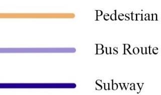
3.3 Marina Bay, Singapore
Marina Bay is a 360ha development located in central Singapore, adjacent to the downtown Downtown Core (Yap, 2013, Marina Bay Authority, 2014). Marina bay boasts uninterrupted views of Singapore’s striking city skyline coupled with easy accessibility, the bay is framed entirely by entertainment and leisure development, all of which is interconnected by the waterfront’s public open spaces, bridges, gardens and pedestrian/cycling routes. The envisaged role of Marina Bay in the urban narrative of Singapore positions it as the heart of business, culture and lifestyle of the city-state (Marina Bay Authority, 2014).
The promenades and boardwalks are clean and ordered. The design of the malls, arcades, hotels and theatres articulate a certain exclusivity geared more towards middle-class, western expatriate and tourist desires rather than to the tastes of ordinary local or foreign service workers.

51
Marian College of Architecture and Planning, Thiruvananthapuram
Transit Map of Marina Bay
Source: Author
Nocturnal terrain in metro cities
The marina bay waterfront completes a loop of approximately 3.5 kilometers beginning at the Esplanade theatres, moving past the Merlion Park, One Fullerton and Clifford Square, around the Promontory and concluding at Marina Bay Sands The waterfront at night is designed with a mixture of hard and soft surfaces, green spaces and concrete environments with many areas to sit, rest and play whilst the buildings that surround are all made easily accessible. There are areas where the promenades are quite narrow (less than 10 m wide), but then open into large, expansive spaces such as parks and squares. (James McLean, 2016). The waterfront consists of multiple levels and layers; upper promenades for shopping and lower ones for quieter moments, whilst the boardwalks, piers and steps lead towards the water’s edge. The management of space transitions within the loop from public to quasi-public as the 42 restaurants and bars spread out towards the sidewalks, and their foyers cross over the promenade.
The Esplanade
Forming the waterfront edge of Marina City along the north shore of the Bay, the Esplanade cultural precinct is designed host to a nightly variety of local and international cultural events that will further Singapore’s image as a cultural hub. The Esplanade consists of restaurants, shops, a concert hall, outdoor theatres and public open spaces. Along the esplanade, people linger to watch many night performances while eating and drinking at the variety of restaurants and bars before a show starts at one of the indoor theatres. The esplanade is also used for leisurely and relaxing visits due to its proximity to the water and the advantage of cooler evening airs from the waters. Night markets, lantern and puppet parades, as well as games and other forms of play all line up the esplanade for night festivities and attract huge crowds.
The precinct allows for uninterrupted views towards the lights and towers of the city’s CBD, as well to the glittering Marina Bay Sands. The esplanade perfectly captures a complete panoramic view of the bay and the image of the city as well. The Outdoor Theatre is set between Marina Bay Sands and the business district, to visually frame the two precincts between whatever
52
Marian College of Architecture and Planning, Thiruvananthapuram
Nocturnal terrain in metro cities
multicultural event is occurring that evening. Performances in the theatre are programmed in such a way as to leave a 15 minutes’ interval for the crowd at the esplanade to observe the spectacle of the infamous light and sound show emanating from the casino across from them. The esplanade of marina bay is developed and designed for the night with the visual axes forming the main foundation of design.
View from esplanade
Source: Author
The Outdoor Theatre acts as the central node for the site extending into the upper and lower public promenades on either side and includes steps, alcoves and benches. Similar to the Outdoor Theatre, the promenades and seating areas of the Esplanade again frame the Singaporean skyline and the surrounding leisure precincts, enabling an impressive view (James McLean, 2016). Along the edges of the lower promenade, there is a marginality of activities away from the orchestra playing at the theatre. The larger flows of pedestrians take place on the upper

53
Marian College of Architecture and Planning, Thiruvananthapuram
Nocturnal terrain in metro cities
promenade due to the varied activities in the section. Therefore, the lower promenades are used as transition areas for those not partaking in the festivity and spectacle. The Gluttons Bay Hawker center is placed away from the Promenade, and to access it one must cross over an open space of dirt and patches of grass, or first pass through the Esplanade food court. Hawker- food centers in Asia represent a time-less social gathering space where the food is affordable and accessible to people belonging to all classes. There is a lack of formal dining yet large crowds of people utilize the precinct to form groups and spend the nightly hours. The Gluttons bay serves as a middle ground between global hierarchy’s and traditional lifestyle.
Merilon park to Clifford square
The merlion park and One Fullerton center is immediately bordered by the Downtown core and financial hub of the city. It is accessed by crossing the esplanade bridge and is the home to the 8.6 m tall Merlion statue of Singapore The Merlion statue has been made famous as a national symbol of Singapore over the past several decades through tourism and city-branding channels (Goh and Yeoh, 2003). Even though it is a relatively small space, hundreds of people in the area to marvel at the mythological statue as well as the glittering Marina Bay sands directly opposite with the city skyline in the background. The statue on display with its light and cascading water from its mouth serves as an identity in which the whole of Singapore is known for. The iconic statue also alters for symbolic nationhood and pride. The precinct is also used as a vantage point to the light and sound show at the Marina Bay Sands.
Adjoining the park is the One Fullerton, Clifford Square and Fullerton Bay Hotel complexes. Alfresco dining encroaches the middle of the promenade leading off from the Merlion attracting crowds of tourists and diners. They have an uninterrupted view across the bay to the Marina Bay Sands.
54
Marian College of Architecture and Planning, Thiruvananthapuram
Merlion

park Source: Wikipedia
Adjoining the diners and set back from the promenade is a landscaped portion about 2 meters wide where seating’s, grass and plants provide people an escape from the crowds at the diners and the sightseers. The spaces at Clifford square transitions into a mix of broadwalks and plazas. Spaces are segregated through order and design with both passive and active security that includes CCTV and security guards. Movement and activity is forcedly restricted by fencing or signage, and large pot-plants have been arranged in a way so that evening joggers and runners must slow down when moving past the hotel entrance (James McLean, 2016). These areas are meant foe the higher class of people and not welcoming to the others that prefer the freedom the night offers at the bay.
Nocturnal terrain in metro cities
Marian College of Architecture and Planning, Thiruvananthapuram
55
Nocturnal terrain in metro cities
The maze of boardwalks, lobbies and plazas eventually leads back onto the promenade at the OUE Bayfront building, yet there are few opportunities for sitting and relaxing as the people are moved on from the steps at the OUE building. The precinct serves as a transition between the Clifford Square, the Fullerton complexes and the Promontory.
The Promontory
The Promontory is a large space to hold events at the southern end of the Marina Bay development.

The promontory
Source: Singapore events
The precinct is predominantly an open, grassy green jutting out into the bay in a triangular shape, with the Marina Promenade continuing its loop along the waterfront whilst the Marina Boulevard extends along the southern edge (James McLean, 2016). Seating spaces are provided along the entire length of the Promontory, while shade from the intense Singapore heat is provided by trees as well as the Breeze Shelters. These structures include large fans that blow down cool air to those underneath it. This precinct is designed for recreation, play and privacy.
Marian College of Architecture and Planning, Thiruvananthapuram
56
There is a lack of commercial infrastructure which results in overall lack of crowd coming in the area. The area is mainly utilized by joggers, runners, cyclists and skaters mainly due to the high landscape quality of the area. The precinct also holds outdoor bootcamps and yoga sessions that take place along the length of the boulevard and through the green landscaped areas. The waterfront seating areas serves as a stop for people to stretch and take in the cool breeze from the bay. The people congregate on lawns, ledges, closer to an edge or a corner of the promontory.
Marina Bay Sands promenade
The distinctive design of a boat-like structure atop three twin towers, as well as its setting on the waterfront and separation from taller buildings, enables the precinct to physically and visually dominate Marina Bay (James McLean, 2016). The precinct is mostly popular as it serves as an iconic backdrop for amateur and professional photography. The layout and design of the area provides various views to the broad walks, plazas and the city’s center. The promenade includes
 Nocturnal terrain in metro cities
57
Marian College of Architecture and Planning, Thiruvananthapuram
series of broad walks, plazas, event spaces of varying sizes, diverse seating arrangements, trees, ponds, and street level
Marina Bay Sands Source: Intermagconf
restaurants. These again attract huge crowds due to the commercialization and varying activities. The promenade is also designed with lower and upper level promenades where the upper level serves as boulevard past the shops at MBS, the mall and casino complex. Palm trees, high-quality street furniture, spotlights and dimmed lighting, as well as classical music playing from speakers in the trees foster a certain ambience that pertains to a dream-like or heavenly urban night intended by the developers (James McLean, 2016). The people are seen slowly strolling past the area captured in the moment moving between shops and rinks with music in the background.
The Lower Boardwalks
The lower broad walks are the closest areas to the water and with many quite spaces with alcoves, corners and covered areas. These spaces are relatively unlit with not much crowd coming in during the night. The lower broad walks are used by people to express themselves in the night and even though the life here is overlooked, these areas add to urban night life as a whole. A series of steps at the broad walks leads down from the promenade into the bay. These steps are a popular gathering space due to its size and the privacy offered. The activities here are more diverse. Families can be seen spending the night along with homeless people using the areas for night time rest. Shift workers also utilize the area for resting between shifts. These activities were not planned by the designer yet is an outcome of public spaces at night.
 Nocturnal terrain in metro cities
58
Marian College of Architecture and Planning, Thiruvananthapuram
Lower broadwalks Source: 123RF
Nocturnal terrain in metro cities
People also gather in groups sharing evening meals and to talk with views to the bay and the cool breeze from the bay. The lower promenade, due to its proximity to the water is also used as a fishing spot. More illuminated areas in the precinct is used for yoga or fitness classes where people gather in groups. Movement along the lower broad walk is slower than the upper levels sue to the higher commercialization in the upper levels.
“WonderFull”
The glamour of the MBS is amplified every evening by the light and sound show that takes place on the large events plaza at the main entrance on the shopping mall.
Large crowds of people gather at the plaza to watch the display of light, sound, visuals and drama projected through displays of fire and water. The show of light and fire is the main show stopper of the MBS experience which is viewed by the people from all sides of the bay.

59
Marian College of Architecture and Planning, Thiruvananthapuram
Source: Trusted traveller Light and water show
Nocturnal terrain in metro cities
3.4 Marine drive, Mumbai

Marine drive is 3 kilo meter stretch along the waterfront of Mumbai extending from Nariman point to Chowpatty and finally disappearing into Walkeshwar road and beyond to the foot of Malabar hills. The length of the promenade had views to the vast expanse of the Arabian sea along with the city’s skylines. The views along with the bay and the art deco buildings that line up the promenade make up marine drive as one of the used spots in Mumbai at night. The famous Art Deco, buildings, however, run only along about one third of the drive; after them come the gymkhanas with their open cricket fields, followed by a run-down aquarium, a modern tower block that is a hostel for female students, and at the far end, Wilson College, built in 1889 in the Victorian Gothic style (Sidharth Bhatia, The Indian Quarterly)
Marine drive, Mumbai
Source : Wikipedia
The C- shaped precinct is an eight-lane Marine drive is also called the queens necklace due to its
60
Marian College of Architecture and Planning, Thiruvananthapuram
Nocturnal terrain in metro cities
infamous views from any elevated point at night that resembles a string of pearls in a necklace. The precinct is bordered by the Western line of Mumbai local train on one side. The marine drive has its own jogging track lining the entire promenade that joggers and cyclists use in the evening hours for walks. The proximity of Marine Drive to Churchgate Street (now known as Veer Nariman Road) ensured its popularity as a residential area (Sharell Cook, 2019). By the swinging sixties, the street was the epicentre of the city's nightlife and locals enjoyed being able to walk to its many jazz clubs, bars and restaurants.
Nariman point
The beginning point of the long stretch of the promenade is made of the infamous concrete tetrapods. These concrete rocks line the entire promenade till the end at Malabar hills.
61
Marian College of Architecture and Planning, Thiruvananthapuram
Nocturnal terrain in metro cities
Although these serve to absorb the energy of the tides, people venture to these giant rocks for photography or alter as seating against the crashing waves. The promenade is lined with palm trees but at far intervals that does not provide ample shade from the heat venturing into the night with intermediate furniture’s provided for rest. The 21 storey NCPA residential complex is the onset of the large multi storied buildings lining the waterfront. These provide a sense of security
Marine drive map

 Source : Author
for people venturing the promenade at night. This line of buildings that directly face the waterfront ends at State bank of India building. This area witnesses a lower intake of crowds at night owing to the lack of dominance the tall buildings offered.
Marian College of Architecture and Planning, Thiruvananthapuram 62
Marine drive promenade

Source : Times of India
In the corner of Nariman road is the most prominent and best preserved Art deco building, Soona Mahal. The Pizza by the Bay restaurant is housed in this building and attracts large crowds of people due to the uninterrupted views it has to the Arabian sea. The entire length of the promenade is lined with ledge along the water where people spend their evening and night with views to the rest of the city on the left and the vast sea up ahead.
The promenade almost disappears into the marine lines flyover where large crowds can be seen gathered due to the close proximity of seating furniture’s in the area. The Girgaum Chowpatty beach breaks off the promenade and houses the local food stalls and where large crowds of people gather to watch the evening sunset. They spent their time well into the night accompanied by local food and cold breeze from the sea. Many restaurants also line this stretch that provides people to enjoy nightly scrolls while enjoying a meal.
Nocturnal terrain in metro cities
63
Marian College of Architecture and Planning, Thiruvananthapuram
Nocturnal terrain in metro cities
The marine drive is also considered the largest viewing gallery in the world and hence has been the host of multiple shows and events along the promenade. The promenade is well lit through the night with multiple police patrols through the area thus tackling safety issues that may arise well into the night
Chowpatty beach
Source: AFAR
 Marian College of Architecture and Planning, Thiruvananthapuram
64
CHAPTER 4
Nocturnal terrain in metro cities
4 DATA ANALYSIS
The above case studies were analyzed and common constraints were identified and the studies filtered through for further comparative analysis with the case of Marine drive, Mumbai. The constraints identified are illustrated in Table 4.1
Table 4.1- Parameters identified for analysis
Parameters Function
Location and land use
Access and permeability
Scale and Proportion
Location land use of the precinct in relation with the rest of the city will determine the generation of activity nodes
Safe visual and physical accessibility through both pedestrian and vehicular transport will ensure the activation of the region at night
Varying activities and morphological functions throughout the waterfront will cater various user groups and their needs
The activities and user groups utilizing the terrain at night Safety and surveillance Physical safety and visibility along the waterfront and along the access routes is an important factor for night time users
Activity and user groups
Sutures
Landscape and furniture
Activity generators
Day/Night morphing spaces
Gated entities/private owned properties within the waterfront may direct the pedestrian traffic to various routes
High quality landscaping will aid and cater for after day activities like exercise or yoga as well as provide tranquility when coupled with the water body
A spectacle/landmark element that may be meant as a cultural symbol or identity or to attract people at night
Spaces that are used during the day for day time activities and morphs at night to cater the nocturnal terrain
65
Marian College of Architecture and Planning, Thiruvananthapuram
Nocturnal terrain in metro cities
4.1 Southbank, Melbourne
4.1.1 Location and land use
Southbank is located adjacent to the Melbourne’s central business district on the southern bank of Yarra river and is one of the primary business centres in greater Melbourne having large casinos and office complexes coupled with residential apartments.


The occupancies in the region includes cafes, restaurants, galleries, a casino complex. The area is morphologically intertwined with promenades, plazas, quasi-public spaces, shopping arcades and casinos next to arts and cultural quarters marking the area predominantly for recreation.
Source:Author Map of Southbank, Melbourne
Marian College of Architecture and Planning, Thiruvananthapuram 66
Source: Wikimapea Southbank, Melbourne aerial view
Tranit map, Southbank

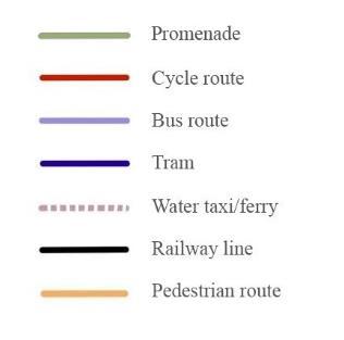


Southbank is locationally set by the Yarra river between two parcels of the central city. The precinct is accessible by all forms of transport in Melbourne; thus, the waterfront can be accessed from both inner city and outer city through any means of transport.
The waterfront is blanketed by a variety of multi uses including commercial malls, restaurants, offices and residences. This caters to a wide range of user groups both during the day and during the night to use the waterfront for both recreation and leisure.
Nocturnal terrain in metro cities
Marian College of Architecture and Planning, Thiruvananthapuram 67
Extend of Multi-use at Southbank
Source : Author
Source : Author
Nocturnal terrain in metro cities
4.1.2 Access and permeability

Direct physical connections with almost all major transport routes from the inner and outer city is established to the waterfront. The transit routes intertwine at the waterfront creating an ease of accessibility to and from the area to other parts of the city.
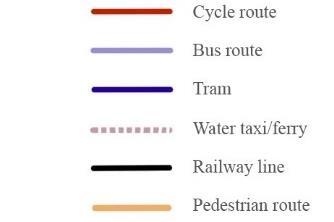
Section of promenade
Source : Author
Map with crowd movement by Casino
Source : Author
The two way to and from vehicular roads and the wide promenades might induce heavy traffic late at night.

The food courts and restaurants open into promenades thus inducing pedestrian traffic directly from these elements through the entire length of the waterfront. The narrow sidewalks of the promenade open into large plazas that induce heightened pedestrian flow due to the performances held on these plazas. These openings are strategically placed next to entrances of shopping arcades and food courts; heightening the flow of pedestrians from mall into the
Locational setting, Southbank
Source: Author
promenade.
68
Marian College of Architecture and Planning, Thiruvananthapuram
Nocturnal terrain in metro cities
Strong visual access through multiple corridors that frame the city skyline and the business district. The visual axes accounts for safety during night as well as sense of scale due to the morphology of large buildings along the waterfront precinct. The casino complex is a gated entity that is meant for the upper class of people; eventually leading to a higher concentration of people on either side of the complex rather than across the complex.


Source: Author
4.1.3 Scale and proportion
Southbank has a varied forms and typologies of activities and functions. These cater to a diverse crowd and the users experience variety through the entire length of the waterfront.
Relation between built and promenade

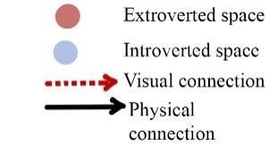
Source: Author
The waterfront houses two levels of promenade; the upper promenade and the lower promenade. The upper levels are subject to active frontages while the lower levels are closer to the river. The proximity of the upper levels to highly active frontages like the restaurants, cafes and galleries subjects the upper promenade to a vibrant and dynamic experience while the lower promenade seems to be used relatively less by the general crowd. Those that do occupy these spaces use it
Marian College of Architecture and Planning, Thiruvananthapuram
69
Existing transit map, Southbank
Nocturnal terrain in metro cities

for the quiet, calm and serene aura emanating from the river. The two different types of nightscapes thus offer an opportunity for all users; those who want to enjoy the quite of the night and those more expressive, to mould the night for their free use.
Southbank also serves as a platform for the scenic view toward the skyline and the CBD that offers different views from each vantage point resulting in a variety of visual experiences.
4.1.4 Activities
The waterfronts subject to many streets shows and performances through the entire night by street buskers. This is owed to the accommodating width of the upper promenade; 20m wide, that allows for such activities after dark.

The major user groups identified include tourists, families, youth and street performers.
4.1.5 Safety and surveillance
The access routes to the waterfront are lined with both active and positive frontages at night. These provide a safe trail for pedestrian visitors in the hours after dark. The street is illuminated through the entire night with certain found areas illuminated more than the rest. The high-rise apartments surrounding the waterfront provides a direct visual access to the activities at the waterfront and thus discouraging crimes from taking place later at night. The majority of buildings lining the waterfront at close intervals function well into the night and take part in the ‘eyes on the street’ concept.
Night promenade with view of the waterbody (right)
Source : Melbourne BlogSpot and Author
70
Marian College of Architecture and Planning, Thiruvananthapuram
Nocturnal terrain in metro cities

Southbank is a constantly busy precinct with multiple street buskers and variety of activities resulted by the active frontages and with performances through the promenade through the night thus attracting large crowds. These provide people with comfort and safety through natural surveillance.

The lower levels of the promenade are physically separated from the active frontages by a level difference and the lower levels, isolates the area from the rest of the crowds. This often transforms the area into a terrain that maybe utilized for immoral activities or a place of expression for the young. This transformation may discourage the active use of the promenade by families or children.
4.1.6 Sutures
The private owned gated casino complex forces pedestrians to concentrate around the casino where various activities take place. The complex directs pedestrian flow to either side of the complex. The restaurants and cafes are the main attractors from where people enjoy their meal in the upper or lower promenades near the river. The rest of Southbank is lined with buildings and shops that has an enclosure quality on one side with open waters on the other.
71
Marian College of Architecture and Planning, Thiruvananthapuram
Enclosure quality on one side of promenade
Scale of buildings on the promenade
Source : Author
Source : Author
Enclosures through the waterfront

4.1.7 Landscape and furniture

The promenade has promenade parks through the length of the waterfront that people utilize for their daily physical and psychological needs like exercising, picnics or congregation. The promenade is also lined with street trees that provide shade from the remaining heat from the day. The vegetation along the river enhances the visual environment and provides relief from the day at the city.
The waterfront is lined with simple furnishings at regular intervals and is well lit at night with lamp posts dotting the sidewalks. These provide a place of rest with self-assured safety. However, the seats provided in the already isolated lower promenade may attract young couples at night that may again hinder its use by families or children.
 Nocturnal terrain in metro cities
72
Marian College of Architecture and Planning, Thiruvananthapuram
Source : Author
Waterfront at Southbank, Melbourne
Source: Alamy
4.1.8 Activity generators
Queensbridge square houses a large public art installation that draws in large crowds at night due to its strategic location at an intersection of lower and upper promenade. This acts as physical entity drawing people into the square by seaming various activities together by increasing the permeability, surveillance and the flow of traffics from the bridge and promenades increases overall flow of crowd. This results in higher pedestrian activity in the area at night. The installation at night is a marker acting as a landmark that aids in making the precinct more imageable at night eventually making the area vibrant and active at night. The infamous fire shows through gas brigades draws in hundreds of people every night for the fire shows every night.

 Nocturnal terrain in metro cities
73
Marian College of Architecture and Planning, Thiruvananthapuram
Queensbridge square
Source : City of Melbourne
Source : Author
Nocturnal terrain in metro cities

The brigades are lined along the length of the promenade at regular intervals and serve as a shading device during the day from the scorching sun. The shows are accompanied by music in the background with the waterfront designed such that there is a vantage point from every region in the waterfront.
4.1.9 Day/Night morphing spaces
Lower promenades
Source : Mapio
The lower promenades late at night are most commonly occupied by the homeless, shift workers to spend the night along the benches which is an unexpected outcome of the design of the promenade levels. This affects the activation of the area at night. The removal of the physical barrier between the upper active promenades and the lower promenades through frequent physical connections or by bringing in other activities such as street shops or other commercialization as well as a strong visual access from the rest of the waterfront will further activate the area at night.
The square is generally used as a pedestrian crossway during the day for people commuting for work while at night it transforms into an active public realm due to the lit up installation at night. This along with the surrounding buildings, provides feelings of natural surveillance to people during night and thus is an activated terrain at night.

The casino complex precinct is relatively quiet with few people coming in during the day but is transformed into a vibrant area at night due to its strategic position after the square enabling the already heavy traffic since 15 restaurants that open into the waterfront can be accessed only from within the casino.
Source : Ronstan
74
Marian College of Architecture and Planning, Thiruvananthapuram
Queensbridge square
Nocturnal terrain in metro cities
4.2 Marina Bay, Singapore


4.2.1 Location and land use
Promenade at night
Source : istock
Marina Bay is a development located in central Singapore, near its Downtown Core. The bay is framed by entertainment and leisure development, which are interconnected by the waterfront’s public open spaces, bridges, gardens and pedestrian/cycling routes. Marina bay is designed to be the heart of business, culture and entertainment of Singapore. The waterfront is designed with a mixture of hard and soft surfaces, green spaces and concrete environments with many areas to sit, rest and play whilst the buildings that surround are all made easily accessible from the vicinity
Land use map
Source : Author
Marian College of Architecture and Planning, Thiruvananthapuram
75
Nocturnal terrain in metro cities
4.2.2 Access and permeability

The location for the marina bay waterfront was selected in such a way that the vicinity is passed by to reach anywhere else on the city. The waterfront loop is interconnected from within and to the rest of the city with pedestrian routes, cycling tracks and public transportation. The main highways around the bay are 4 laned vehicular roads that aids in preventing traffic late into the night.

The circular shape of the waterfront does not allow for direct visual axes throughout the bay due to the distance (approx. 600m) between the parcels of land with water in the middle.
Source : Author
Narrow promenades open into large expansive plazas and parks. This strategy aims at controlling the pedestrian flow into the spaces with larger crowds. The outdoor theatre acts as a central transitional node between the different levels of the promenade thus controlling the pedestrian traffic and activating the area with function that facilitates the inflow of crowd.
Source : Author
76
Marian College of Architecture and Planning, Thiruvananthapuram
Transit map
Promenades
Nocturnal terrain in metro cities
4.2.3 Scale and proportion

The entire loop of Marina bay is morphologically planned with varying scales of spaces and the accompanying activities. The loop begins at the Esplanade theatres, moving past the Merlion Park, One Fullerton and Clifford Square, around the Promontory and concluding at Marina Bay Sands all of which vary from built structures to installments. Night markets, outdoor theatres and public spaces line the esplanade shifting variety of activities from shopping to leisure. The Marina Bay sands physically and visually dominates the bay owing to the strong visual axis from the bay to the building. This visual domination of the building by the waterfront creates a sense of scale to the visitors.

Scale of landuse
Source : Author
Source : Upsplash
77
Marian College of Architecture and Planning, Thiruvananthapuram
Marina Bay Sands
Nocturnal terrain in metro cities
4.2.4 Safety and surveillance
The presence of large crowds of people through the bay provides for a sense of passive security along with active security with live guards stationed at intervals around the bay. The close proximity of the varied functions at night/ built forms through the bay will have multiple crowds of people through the entire loop late into the night. This provides for natural surveillance for the visitors. The design of promenades in different levels also cater to the variety of experiences offered by the bay. The presence of various levels and layers in the public space might isolate some levels late into the night if proper activation elements are not present. This will transform the space into an obsolete area in the night where immoral activities may take place.

Lower promenades
Source : James Mclean
78
Marian College of Architecture and Planning, Thiruvananthapuram
Nocturnal terrain in metro cities
4.2.5 Sutures and landscape
The Marina Bay sands features far more gated communities than Southbank at Melbourne. The One Fullerton, Marina Bay Sands are among the prime gated compounds. Marina bay is incorporated with many outdoor theatres. The bay features many plazas and parks at intervals integrated landscape. The Promontory dominates the south western precinct of the bay and is an open, grassy green land jutting out into the bay which is designed to be purely landscape. This draws in people after work to engage in yoga/fitness sessions or joggers and cyclists to take a break by the waters.
The Merlion park is intertwined with piers, large steps that alters as seating spaces, and a clear line of site to the MBS. The open space trapezoidal structure here caters for the clear line of sight to the rest of the bay as well as diminishing the chances of overcrowding in the vicinity allowing people to maintain privacy even in large groups. The float at Marina Bay is an open ground that usually hold matches, festivals, fairs throughout the year. The adjacent auditorium acts as seaters for both people watching the activities on going at the float or to witness the spectacle of the light and water shows at the MBS.

The float (right) and Merlion park (left)
Source : Stadium db

79
Marian College of Architecture and Planning, Thiruvananthapuram
Source: Youtube The promontory
Nocturnal terrain in metro cities
4.2.6 Activity generators
The presence of Hawker food centre at the bay draws in large crowds due to the affordability and the location of the food courts near the waters. Hawker- food centres in Asia represent a social gathering space where the food is affordable and accessible to people belonging to all classes. The centre stands as a representation of cultural symbol among the locals as well as Asian tourists. The centre features alfresco street dining among the various food stalls. This added with the close proximity of the centre with the waters, further increases the pedestrian traffic.


Food centers/restaurants
Source : Author
The illuminated Merlion statue spouting water from its mouth at night is a physical manifestation of the culture of Singapore and is one of the most prominent physical entity drawing people at the Bay. the statue is a famous Singaporean landmark as well as a major tourist attraction due to the mythology behind its story. The Park surrounding the statue is wide enough to accommodate the large intake of people due to its trapezoidal shape. The Merlion is
80
Marian College of Architecture and Planning, Thiruvananthapuram
Hawker food center
Source : Getty images
also in close proximity with the Esplanade highway which enables all those passing by the bay for a glimpse of the statue which stands at 8.6m high.
The daily light and water show at the MBS draws in large crowds of people every night to the


Merlion park overlooking MBS (top), Light and water shows(bottom)
Source : Holidify
Nocturnal terrain in metro cities
Marian College of Architecture and Planning, Thiruvananthapuram
81
Nocturnal terrain in metro cities
bay. The shows are visible from all vantage points of the bay owing to the loop shaped morphology of the bay. The shows work as a spectacle drawing people in.
4.2.7 Night/Day morphing spaces

The outdoor theatre set by the water is usually dormant during the day except as a place for rest/shade but transforms into a full-fledged activity hotspot during night either due to the various programs held there or as a major vantage point to the MBS shows at night.

Outdoor theatre Source: Alamy
The Merlion park is activated at night and encounters heavier traffic than the day due to the spectacle of the illuminated statue and the direct framed view to the glittering skyline of the Singapore CBD and the MBS.
 Marian College of Architecture and Planning, Thiruvananthapuram
82
Source: Author Map showing outdoor theatre
Nocturnal terrain in metro cities
The activation of Marina Bay at night may be related to the work culture of Singapore that separates both day and night through means of not hindering work during day and to engage recreation at night.
83
Marian College of Architecture and Planning, Thiruvananthapuram
Nocturnal terrain in metro cities
4.3 COMPARITIVE ANALYSIS
Table
4.2-
Comparative Analysis of case studies
Parameters Case study 1 Case study 2
Inference Land use Adjacent to Melbourne CBD Adjacent to CBD and recreational use
Wide range of multi-use catering areas will attract more people at night catering diverse user groups
Access from city Physical access through all major transport from outer city
Accessed by major subway routes and bus routes from inner and outer city
Pedestrian flow The narrow sidewalks of the promenade open into large plazas
Constant promenade width throughout the waterfront
Waterfront activation at night requires direct physical access from the inner city as well as outer city that should generate activity nodes/hotspots along the way at night
Narrow spaces leading to larger expanses will allow for more controlled pedestrian flow and the variation in enclosure quality will divert more crowd into the open spaces.
Promenade Activation Shops and restaurants lining the promenade along with wide width of promenade attracting activities
Visual access Direct visual access across the river owing to its linear configuration
Transitional spaces Square with function acts as transitional node between promenades allowing permeability and surveillance and the flow of traffics
Shops and restaurants lining the promenade along with outdoor theatres at intervals
Diminished visual access across the bay owing to its circular shape
Central transitional node controlling pedestrian traffic and activating the area with function
Entry/Exits of shops placed along promenades to activate the frontages
Strong visual access throughout the waterfront provides visual surveillance as well sense of scale
Transitional nodes between various levels/layers controls pedestrian flow as well as facilitates inflow of people through the use of a function in the node
84
Marian College of Architecture and Planning, Thiruvananthapuram
Nocturnal terrain in metro cities
Enclosure quality
Homogenous scaled building with height increasing hierarchically outwards
Visual domination Tall residential buildings and buildings on the CBD creates visual domination at multiple points (draw)
Introverted/ Extroverted spaces
Two levels of promenade separated by physical and visual barrier owes to unutilized lower spaces
Natural surveillance Active frontages through the upper promenades attracts large crowds
Levels of isolation of spaces
Lower levels of promenade separated by physical or visual access isolates the area and attracts the young for expression/place of rest for homeless hindering families or children from using late into the night
Very tall structures of varying scales through the bay creates scale not sensitive to human eye
MBS physically and visually dominates the bay creating sense of scale across the Bay from a single point (draw)
Presence of various levels and layers in the public space physically and visually isolates some levels late into the night
Active frontages and functions within the promenades cater to large crowds
Outdoor theatre unused during day due to direct heat from sun; turns active at night
Constant variations in the scale of building will cause constant variations and decreases the enclosure quality of the waterfront
Visual domination by physical elements will aid in imageability and legibility at night
Unused introverted spaces created as a result of inactive frontages/ lack of active function in the precinct.
Variety of functions and activities attracting large crowds provides for natural surveillance
Activating water edge will facilitate in the activation of the lower promenades or removing the physical barrier will activate the lower promenades late into the night
Illumination and frontages
Well-lit throughout the promenades by street light at regular intervals as well as light from shops and restaurants
Bay is illuminated by street lights at regular intervals and from various programs through the bay
Ample illumination in all major nodes and along with active frontages and visual access along all access routes and pedestrianized walkways provides sense of safety and surveillance
Furnishings Park chairs in pairs line the promenade at regular intervals except for at the square; daily
Simple park seats dotted through the promenade; majority of
Isolated furnishing along the lower promenades may attract the young and again hinder the
Marian College of Architecture and Planning, Thiruvananthapuram
85
Gated functions
commute precinct during the day
Crown casino functions at night and is meant for high status crowds that diverts majority of crowd through its length to either side
Landscape Trees with average canopy and of scale sensitive to human eye line the promenaded along with the furnishings
Activity generators Gas brigades line the promenade providing vantage points from all points of the waterfront at night
Markers
Art installation at square activates the square at night which is used only for commute during the day
steps/ledges are used as makeshift seats
Nocturnal terrain in metro cities
promenades use by families or children
Multiple gated entities that restricts access diverts crowds creating multiple nodes
Gated entities divert majority of crowd to either side of the entity creating high concentration of people that accompanied with a function will further activate the area.
Large expanse of landscaped plot protruding to the waters utilized for jogging, cycling and yoga
Water and light show on the center of the bay provides line of vision from around the bay
Merlion statue located at the park stimulates crowds late into the night owing to the trapezoidal shape of the park with visual access to the MBS
Landscape and vegetation coupled with water at night is linked to aesthetics, ecology, ambience and also as a relief from the intense life at the city
Spectacles/ shows at night with vantage point from all the entire length of the waterfront activates the night further into the night
-Marker as a landmark makes the precinct more imageable and legible at night and generators designed on active nodes or intersection of spaces seaming various activities together along with adequate surveillance will activate the area at night -Physical manifestation of culture in proximity to the waters and accommodating large crowds well into the night attracts more larger crowds
-Illuminated physical attractors at night in visual axis with major road network
86
Marian College of Architecture and Planning, Thiruvananthapuram
Nocturnal terrain in metro cities
Socio culture Street performances and fire shows represents the sociocultural nature of the city
Hawker- food centres in Asia represent a social gathering space for middle class people; features alfresco dining by the water
Physical connection between generators
Either side of the waterfront accessed by bridge as well as water taxis
Merlion statue disconnected with MBS (gated entity) on the opposite side of the bank
Cultural representation in morphological terms caters to wider user groups and food stalls and markets morphologically intertwined in close proximity to the water provides cool winds and scenic view with food
Segregation of plazas/parks on either side of waterbody may be connected with pedestrian access/nodes
Functions solely for night
Square used for commute only to and from CBD during the day
Activation of vantage points may take place by adding a timely activity that functions at night Work culture -
Work culture of Singapore separates both day and night through means of not hindering work during day and to engage recreation at night
Cultural differentiation of work and leisure to day time and night time may activate the recreational waterfront
87
Marian College of Architecture and Planning, Thiruvananthapuram
Nocturnal terrain in metro cities
4.4 ANALYSIS WITH THE INDIAN CONTEXT

Table 4.3- Comparative Analysis with Marine drive, Mumbai
Functions Inference from case studies Analysis of Marine Drive Final Inference
Access to study area
Wide range of multiuse catering areas will attract more people at night catering diverse user groups
Promenade is morphologicall y not in direct physical connection with the built uses due to the physical barrier by the 8 laned road
Morphologically intertwined precincts at night will provide for variety of functions as well as a sense of safety and surveillance
Waterfront activation at night requires direct physical access from the inner city as well as outer city that should generate activity nodes/hotspots along the way at night
No such activation of nodes as the waterfront is accessed by vehicles only on one side
Access by public transport; both bus and train and designing provision for access from both inner and outer city will bring in variety of crowds
Marian College of Architecture and Planning, Thiruvananthapuram
88
Permeability Narrow spaces leading to larger expanses will allow for more controlled pedestrian flow and the variation in enclosure quality will divert more crowd into the open spaces.

Long single stretch of promenade with no physical or visual breaks
Nocturnal terrain in metro cities
Transitional spaces, levels and layers and change in enclosure all aid in controlling pedestrian flow at night
Entry/Exits of commercial activities placed along promenades to activate the frontages
Art deco buildings line the waterfront on the other side of the roads but is inactive at night due to the physical separation of the road and the promenade
Introducing multiple temporary or permanent functions along the promenade will further its use at night
Strong visual access throughout the waterfront provides visual surveillance as well sense of scale
Diminishing visual access along the length due to the circular shape of the waterfront
Activity nodes along the waterfronts on varying scales/layers will provide for visual access from a height
Transitional nodes between various levels/layers controls
Beginning of the promenade; Nariman point
Introducing activity nodes/ transitional spaces along the waterfront by providing varying

89
Marian College of Architecture and Planning, Thiruvananthapuram
Scale and proportion
pedestrian flow as well as facilitates inflow of people through the use of a function in the node

is activated through function using the tetrapod’s lining the water Physical break in promenade at beach that functions as an active plaza due to the night induces activities
activities in relation to the built environment will activate the precinct
Constant variations in the scale of building will cause constant variations in the enclosure quality of the waterfront
Waterfront is lined with buildings of the same scale that adds to positive enclosure
Functions may be introduced along the waterfront that increases enclosure quality in nodal areas
Visual domination by physical elements will aid in imageability and legibility at night
Built elements are lined on the other side of the road with the promenade as one large stretchNode at which the positive enclosure ends witnesses larger intake of crowds due to sudden vastness offered by morphological elements
Nocturnal terrain in metro cities
90
Marian College of Architecture and Planning, Thiruvananthapuram
Unused extroverted spaces created as a result of inactive frontages/ lack of active function in the precinct.
Entire promenade is one wide extroverted space due to its proximity with the busy roads
Nocturnal terrain in metro cities
Single stretched promenade with varying levels but with visual and physical connection will aid in its constant activation through the night

Safety and surveillance Variety of functions and activities attracting large crowds provides for natural surveillance
Temporary night markets line the promenade in certain times of night that provides for natural surveillance
Introducing timely functions at various segments of the night will keep the precinct active with crowds
Ample illumination in all major nodes and access points
Promenade is illuminated with streetlights at regular intervals on one side; lacks overall illumination
Further illumination through street lights in human scale on both sides of promenade will aid in overall illumination
Active frontages and visual access along all access routes and pedestrianized walkways
Isolated furnishing along the lower promenades may attract the young and again hinder the
Visual access is achieved from the built forms on the other side of the road
Sparse seating through the promenade
Seats provided along the length of the promenade in pairs or clusters will not provide a chance for isolation but ample for rest
Marian College of Architecture and Planning, Thiruvananthapuram
91
promenades use by families or children Sutures and landscape Gated entities may divert majority of crowd to either side of the entity creating high concentration of people that accompanied with a function will further activate the area.
No gated entities along the promenade at Marine Drive
Gated elements will restrict the access and movement of crowds freely through public spaces

Landscape and vegetation coupled with water at night is linked to aesthetics, ecology, ambience and also as a relief from the intense life at the city
Lining promenade with canopied trees will increase positive aesthetics and ambience along the waterfront - -
Activity generators Generators designed on active nodes or intersection of spaces seaming various activities together along with adequate surveillance will activate the area at night
Marker as a landmark makes the precinct more imageable and legible at night
Palm trees line the promenade but at far intervals and does not provide ample shade or positive aesthetics due to it being sparingly arranged
Chowpatty beach activates the precinct that acts as a node where multiple activities take place; night markets, games, or just enjoying the beach
The SBI building is the last building of the built
Landscaped plots at intervals will generate activities such as yoga for those who desires it after work
Introducing established functions at the beach will further activate it and helps in generating an identity of its own
Introducing elements that will provide landmark quality for better imageability at night
Nocturnal terrain in metro cities
92
Marian College of Architecture and Planning, Thiruvananthapuram
Spectacles/ shows at night with vantage point from all the entire length of the waterfront activates the night further into the night
morphology and acts as a marker that helps in legibility at night to the otherwise homogenous stretch of the waterfront
The waterfront is not utilized morphologicall y for any shows/spectacle s
The circular shape of the waterfront can use the waters for timely spectacles which provides vantage points from the waterfront
Cultural representation in morphological terms caters to wider user groups
-Segregation of plazas/parks on either side of waterbody may be connected with pedestrian access/nodes

Food stalls and markets morphologically intertwined in close proximity to the water provides cool winds and scenic view with food
No existing parks/plazas at the waterfront
Seasonal night markets and temporary mobile food stalls located at the beach attracts crowds
Segregated landscaped features introduced at activity nodes connected through the promenade will activate the precincts at night
Provision for permanent night markets/ food stalls along the waterfront intertwined with areas wide enough to accommodate large crowds
Nocturnal terrain in metro cities
93
Marian College of Architecture and Planning, Thiruvananthapuram
Night/Day morphing spaces
Physical manifestation of culture in proximity to the waters and accommodating large crowds well into the night attracts more larger crowds
into the wide area
-Illuminated physical attractors in visual access with major road network
Cultural differentiation of work and leisure to day time and night time may activate the recreational waterfront
Activation of vantage points may take place by adding a timely activity that functions at night

No physical activity generators
The direct visual axes of the road with the promenade offers the opportunity of introducing a physical attractor that is visible through the road stretch inviting crowds
Indian scenario has very little public places for recreation after work hours
Crowds prefer the waterfront after sundown due to the intense heat during the day
-
Introducing more night time activities and functions at designed nodes/ enclosures
Nocturnal terrain in metro cities
94
Marian College of Architecture and Planning, Thiruvananthapuram
CHAPTER 5
Nocturnal terrain in metro cities
5 FINDINGS
This chapter aims to define how night time spaces can be activated through morphological functions as analyzed with the parameters identified in this paper;
5.1 Access
Easy access through all major public transports both from the inner and outer city to waterfront that caters multiple functioning land uses with active and positive frontages that generates activity nodes in the location of the waterfront as well.
Control of pedestrian movement through variations in enclosure quality, levels and layers using transitional nodes along with strong visual access and facilitate the inflow of people into the area.
5.2 Scale and proporition
Functions introduced along waterfront will generate activity in activity nodes through positive enclosure quality.
Variation in levels of promenades with unbroken visual and physical connection aids in night activation due to increased surveillance offered and this can also abate the formation of extroverted spaces. in the
5.3 Safety and surveillance
Constant activities and functions in the promenade, temporary night markets, visual access from other sides of the road, and adeptly illuminated nodes and access points provides for natural surveillance. Furthermore, illumination through street lights on both sides of promenade will aid
Marian College of Architecture and Planning, Thiruvananthapuram
95
Nocturnal terrain in metro cities
in overall feeling of safety and security for crowds. Isolated furnishing and sparse seating may attract the young and hinder the use of the precinct in the promenade by families.
5.4 Sutures and landscape
Gated entities may divert majority of crowd, while also restricting the access and movement of crowds freely through public spaces. This may generate nodes to where the crowds are diverted to.
landscape and vegetation results in aesthetics and ambience which coupled with water also results in relief from the intense life at the city. Landscaped plots at intervals will generate activities such as yoga or fitness routine for those who desires it after work.
5.5 Activity generators
Introducing established functions (functions that are proved to be effective to the city/ area) at nodes will further activate it by helping in generating an identity of its own
Markers provide better legibility at night along with acting as a landmark. Circular shaped waterfronts can use the waters for timely spectacles which provides vantage points from the waterfront where spectacles/ shoes may be sighted from.
Cultural representation in morphological terms satisfies to wider user groups. Segregation of plazas/ parks and features introduced at activity nodes linked through the promenade will activate the precincts at night. Food stalls and markets morphologically interwoven in close proximity to the water provides cool winds and scenic view with food while also attracting crowds into the wide area.
Direct visual access from the road with the promenade offers the opportunity of introducing a physical attractor that is visible through the road stretch inviting crowds.
Marian College of Architecture and Planning, Thiruvananthapuram
96
Nocturnal terrain in metro cities
5.6 Night/Day morphing spaces
Activation of vantage points may take place by adding a timely activity that functions at night
After sundown, crowds prefer the self-cooling waterfront.
Marian College of Architecture and Planning, Thiruvananthapuram
97
Nocturnal terrain in metro cities
CHAPTER 6
6 GUIDELINES AND CONCLUSIONS
Proposed guidelines for recreational water edges at Indian urban metro cities at night derived from the above research;
1. The urban waterfront at night shall be physically connected with both inner and outer city with the waterfront creating nodal functions at the intersections.
2. The natural edge of the waterbody shall be retained with the morphological interventions being incorporated only after a limit of the naturally forming water edge.
3. All ground floors of buildings by the water edge must contribute to positive active frontages at night.
4. Permeability of built structures shall be incorporated with active frontages at the ground level resulting in direct visual and physical connection to the waterfront at night.
5. Pedestrian movement shall be diverted and controlled using multiple elevations in walkways such that these elevations provide direct visual and physical connections with the rest of the water edge.
6. Development of new built morphology by the water edge shall be sensitive to the human scale
7. Hierarchy of built structures shall follow as; a. Temporary built
Semi-permanent built
Permanent built
8. Functions of the immediate edge of the waterfront shall constitute of activity generators including shopping, dining and other recreational uses.
9. All floors of buildings or other land uses by the waterfront shall provide passive surveillance.
98
Marian College of Architecture and Planning, Thiruvananthapuram
b.
c.
Nocturnal terrain in metro cities
10. The waterfront shall be provided with functional nodes at intervals.
11. Furnishings shall be provided minimum in pairs and in direct physical axis of pedestrian movement by the water edge.
12. The water edge shall constitute of landscaped plots; accommodating large crowds.
13. The water edge shall incorporate at least one night activated physical activity generator in direct visual access with the vehicle transit line.
99
Marian College of Architecture and Planning, Thiruvananthapuram
Nocturnal terrain in metro cities
BIBLIOGRAPHY
[1] AGUIRRE-PÉREZ, 2012, Nightscapes, territories of dreams and lights- reimagining residual waterfront areas through nocturnal temporary uses
[2] BEAUMONT, M. 2015. Night Walking: A Nocturnal History of London, London, Verso.
[3] BIANCHINI, F. 1995. Night Cultures, Night Economies. Planning Practise and Research
[4] BOHLING, F. 2015. Alcoholic assemblages: Exploring fluid subjects in the night-time economy. Geoforum
[5] BOYD, J. 2010. Producing Vancouver's (hetero)normative nightscape. Gender, Place & Culture
[6] CAMPO, D. & RYAN, B. D. 2008. The Entertainment Zone: Unplanned Nightlife and the Revitalization of the American Downtown. Journal of Urban Design
[7] CHANG, T. C. & HUANG, S. 2011. Reclaiming the City: Waterfront Development in Singapore. Urban Studies
[8] CHATTERTON, P. & HOLLANDS, R. 2002. Theorising Urban Playscapes: Producing, Regualting and Consuming
[9] Youthful Nightlife City Spaces. Urban Studies
[10]CITY OF MELBOURNE 2008. City of Melbourne's Policy for the 24 Hour CIty. Melbourne, Australia.
[11]CITY OF MELBOURNE 2014. Beyond the Safe City Strategy 2014-2017. Melbourne, Australia.
[12]GEHL, J. 1971. Life Between Buildings, Washington, D.C., Island Press.
[13]HANNIGAN, J. (1998). Fantasy City: pleasure and profit in the postmodern metropolis. London: Routledge.
[14] HOLLANDS, R.; CHATTERTON, P. (2003). Urban Nightscapes: youth cultures, pleasure spaces and corporate power. London: Routledge.
[15]JACOBS, 1992, “The Death and Life of Great American Cities”
[16]LEFEBVRE, H. 1992. Rhythm analysis: Space, Time and Everyday Life, London, Continuum.
[17]LINDSAY, J. 2006. A big night out in Melbourne: drinking as an enactment of class and gender. Contemporary Drug
[18]LOFLAND. 1998. “The Public Realm: Exploring the City’s Quintessential Social Territory”
[19]MCLEAN, 2016, Assembling the Urban Night: Everynight Life in Melbourne and Singapore
[20]SHAW, R. 2010. Neoliberal Subjectivities and the Development of the Night-Time Economy in British Cities.
[21]WILLIAMS RW, 2008, Night spaces: Darkness, deterritorialization, and social control. Space and Culture
[22]https://blogs.iadb.org/ciudades-sostenibles/en/24-hour-cities/
Marian College of Architecture and Planning, Thiruvananthapuram
100
Nocturnal terrain in metro cities
[23]https://economictimes.indiatimes.com/news/economy/infrastructure/creating-a-24-hour-city-upgradingcommercial-core-in-delhi-main-focus-of-draft-master-plan/articleshow/83371754.cms?from=mdr
[24]Geographies of the urban night - Ilse van liempt, Irina van Aalst, Tim Schwanen
[25]The influence of street lighting improvements on crime, fear and pedestrian street use, after dark. Landscape and Urban Planning Painter K (1996)
[26] https://blogs.iadb.org/ciudades-sostenibles/en/darkness-nocturnal-landscapes-latinamerican-cities/
Marian College of Architecture and Planning, Thiruvananthapuram
101

