CATALOGUE TO ACCOMPANY EXHIBITION JANUARY 2023
BAMPTON COMMUNITY ARCHIVE


 By Will Fenton


...a traveller is somehow still unexpectedly confronted with the sudden appearance against the horizon of the darting spire of the Church of St. Mary

From whichever direction you approach Bampton, it never fails to present itself in the most startling manner. Defying the low-lying and broadly featureless modern agricultural landscape, a traveller is somehow still unexpectedly confronted with the sudden appearance against the horizon of the darting spire of the Church of St. Mary, topped by a golden cockerel that when observed at the right time of the day reflects the sun with the intensity of a fiery beacon. It is an enormously evocative sight; a warming comfort to those who know this to be a return home, and simultaneously the shining lure to those who have the privilege of visiting Bampton for the first time. To witness the steeple of the Church of St. Mary, at dusk or dawn, inevitably draws any visitor straight to what many would consider the heart of the village. No stranger would ever need the help of a Downton Abbey tour guide to arrive at this spot.
In my view what is most striking about this experience is how Bampton, even though connected today by all modern convenience to nearby towns and cities, feels somehow still isolated. It is a place waiting to be chanced upon. ‘Bampton-In-The-Bush’ is of course the not-sotraditional full name for the settlement but is one that feels ancient enough in 2023 to feel entirely appropriate.
Writing in 1853, the wildly eccentric vicar and historian of Bampton, Rev. Giles reflected on the difficulties of travelling out from Bampton to other towns “due to the nature of the country”. He recorded in his determinedly colourful fashion that within living memory there were no metalled roads leading from Bampton and that travellers were in the habit of “striking out across the common, by which the town was surrounded, and finding their way to Witney, Burford, Oxford or any other place in the best way they could, as is done to this very day in the deserts of Arabia and Africa”. While the modern traveller does not have to endure such hardships, I often reflect on his words when I strike out on public footpaths that radiate from Bampton, looking back over my shoulder at the slowly diminishing spire of St Mary’s silhouetted against huge skies. These paths are undoubtedly the fossilised remnants of the ancient paths taken by previous generations of Bamptonians to escape the ‘bush’, to work the fields, or to cross the barrier of the River Thames.
This is a good point at which to introduce the purpose of this book. Mapping of all data can be used to examine the historic and archaeological processes which have shaped the modern landscape in and around Bampton. The study of maps allows us to identify the specific
characteristics of an area or district, so that we can understand what makes our town distinct. On a basic level this should challenge us all to value what makes Bampton special. But it also serves a very important purpose of allowing us all to have a stake in ensuring our historic town and landscape is managed appropriately.
To do this, we must recognise that all parts of the landscape – from the Iron Age barrow to the 2023 housing development – have historic value and they must make an equally important contribution to the landscape in which we live and share. Only in this way we can be strengthened the welcoming little community that we have built for ourselves here.
As such, this book will be limited in scope. It is not intended to re-tell a conventional history of Bampton with the simple addition of some attractive maps. Bampton has attracted antiquarian interest since the 17th Century, and much better historians than I, have written good histories of various aspects of the settlement’s history. Instead we will use map evidence (with some supplementary sources such as aerial imagery, archaeological data sets, and other topographical data) to characterise modern Bampton by placing the town in its historical context. We will largely be confined to considering
the settlement of Bampton and its immediate environs, but reference will be made to the settlements of Aston, Lew, Cote and others where it is important to recognise their historic or ecclesiastical connection to Bampton.
I also hope this book can serve in some small way as a record of the very simple techniques accessible to 21st Century researchers for assessing historic landscapes and an opportunity to highlight some of the resources that are freely available to those interested in conducting their own research. In the 21st Century older data sources are increasingly being digitised and all new sources are created digitally from the outset. Increasingly, the data we collect about the historic environment is being made accessible using Geographical Information Systems (GIS) that create, manage, analyse, and map all types of data from the simple crop mark to recently described conservation area. Do you know where otters have been spotted near Bampton? There’s a data set for that! The great irony, of course, is that it is arguably becoming less useful to reproduce heritage data such as historic maps or aerial surveys in the ‘static’ format such as this book and exhibition. So if you find your home or the site of your interest is cropped slightly out of the frame, I can only apologise!

Bampton is situated in a predominantly rural area of West Oxfordshire; an area characterised by agricultural enclosures, small rural settlement and minimal woodland. In a 1998 Landscape Characterisation study ‘Bampton Vale’ was identified and classified as “an area of distinctly low-lying but gently rolling clay vale between an edge of Limestone to the North and the expansive floodplain landscape which borders the River Thames to the south. The underlying clay geology is reflected in the soils and character of vegetation (oak being the dominant tree species).
Taking our first image, a modern aerial photograph of Bampton, we can immediately identify a landscape of large fields, bounded by a reasonably strong structure of trees and hedgerows. It is interesting to note that these enclosures are not, unlike those only a few kilometres to the north, bounded in stone walling. Large agricultural enclosures are the most common land use in West Oxfordshire, accounting for 77.5% of the district, and that pattern is evident here. Modern air photography shows a degree of weakening of landscape structure through intensive farming practices, particularly to the North of Bampton.

2018 Aerial Survey (Courtesy Historic England)

This is mainly attributed to the removal of postenclosure hedgerows and the resultant creation of bare, arable ‘prairies’. While this landscape can still be an impressive experience that possesses the ‘big skies’ character much loved by the hobbyist photographers who camp at the perimeters of RAF Brize Norton in the hope of bagging a good shot, it certainly lacks the ecological or visual diversity which characterises some of the more richly-patterned landscapes around the settlement of Bampton itself. When we look closer to the core of the settlement the pattern of boundaries appears to be much tighter- the physical structure of boundaries is more secure (i.e. a prevalence of mature trees and wider hedgerows) suggesting the presence of much older planned enclosures.
The area to the South of Bampton is characterised by the River Thames, on approach to which, the land opens into very loosely enclosed water meadows. There is a distinct riparian character to this area, and anyone who walks between Bampton and the River Thames will experience a semi-open, pastoral landscape dominated by willows and alders, the former of which are often pollarded in the traditional manner.
MAPPING BAMPTON: A JOURNEY IN SPACE AND TIME

Polling willow on the Upper Thames 1875

Many sections of this area have in recent decades been identified by the Forestry Commission as priority meadowland or improved grassland habitats. Chimney Meadow, at the very southeastern of our interest is maintained as a statutorily protected nature reserve and is also designated a Site of Special Scientific Interest (SSSI). Managed since 2003 by Berkshire, Buckinghamshire and Oxfordshire Wildlife Trust, its landscape of wildflower meadows, wetlands and wading birds is a space that would have been recognisable to the most ancient inhabitants of this region as good summer grazing, a source of raw materials such as rushes and willow, and a bountiful larder of wildfowl. Certainly, the landscape here feels very different to ‘upland’ Bampton; perhaps to the modern eye it is somehow more ancient although this effect may be somewhat deceptive. In 2023 however the sense of isolation here is tangible. At a time when the UK’s population density (or rather its housing capacity) has become both a locally and nationally politicised issue it is interesting to reflect on how sparsely populated this landscape truly is. A 2017 study broke down the UK into a spatial resolution of 1km x 1km grids: of the 114,421 grids that make up the UK only 1784 have zero recorded inhabitants. While many of these grids are where one would expect to find them- the
great wildernesses of Snowdonia or the Scottish Highlands- the reader may be surprised that a number of these grids are situated along the upper Thames valley, including one very near to Bampton itself.
There is now little in the way of ancient forest in this district, but some evidence of modern forest plantations. Aside from some small-scale commercial forestry the most notable modern/ local example is Shillbrook Wood to the south east of the village. It was planted in 2000 by the Woodland Trust alongside community volunteers as part of the Woods on Your Doorstep campaign. Of approximately 4 hectares, it is maintained for recreational use. The wood was planted with traditional species appropriate for the underlying geology including ash, oak, cherry, lime, alder, field maple and guelder rose as well as two pure blocks of osier and hazel, the latter of which were important commodities in this region’s economy from ancient times well into the early 20th century. As it matures over the coming decades Shillbrook Wood will be an excellent representation of what the ‘bush’ in ‘Bampton-in-the-Bush’ once looked like.
Bampton itself is a large rural settlement located in the south of its district, on a flattish and low-lying gravel terrace. It is important to understand the geology as it is intimately related to settlement activity in this part of Oxfordshire. A ridge of Cornbrash Limestone runs to the North of Bampton, and over time a number of villages have developed along it which include Filkins, Broughton Poggs, Kencot, Broadwell, Black Bourton and Alvescot. These are effectively ‘spring’ villages. Bampton however is very different. It is situated on an area further to the south where gravels overlie Oxford clay and alluvium to create terraces of raised land on what amounts as equally well-drained soil. There has been settlement on these gravel terraces since prehistoric times. This is indicated by the great number of Scheduled Monuments associated with these terrace gravels (as we shall see in a later chapter). Many of Bampton’s surrounding modern townships and indeed a few individual farms occupy these ‘islands’. Perhaps the most obviously identifiable by the layperson is the marked rise upon which sits the township of Lew.
Where settlements have evolved on these islands, bounded by flood plains, their form is nucleated and usually focused on a central space. This is immediately obvious in Bampton, where the
convergence of the main routes into the town draws the eye toward the clear triangular open space of the present market place. As we will see later, Bampton had no surfaced road access until c.1770 and it may well be useful to begin thinking about the ancient settlement here as an essentially inward-facing settlement; an island in “the bush”.
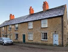
Today, Bampton comprises a sizable loose-knit settlement with a distinctive historical character. There is a significant block of later estate development mainly confined to the north-east. The (now) contingent settlement of Weald extends as a linear settlement to the south-west and is subsumed into the modern settlement of Bampton at its north-east extremity. Growth to the south of the village is almost entirely constrained by the Shillbrook which enters the settlement from the north before turning east- an underscore to the main settlement.
Bampton’s nearest neighbours include Aston, situated to the east on flattish water meadows north of the river Thames. Aston has a relatively compact form with some later growth to the east. The detached hamlets of Cote, Shifford and Chimney lie off to the east, the latter two of which read as little more than concentrations of
settlement around a single farm, although Cote is a little more substantial and has a distinctly linear character. These settlements were once part of the parish of Bampton.
To the north is the settlement of Lew. It is a curious settlement situated in the transitional zone between the limestone wolds to the north and Bampton’s Thames vale to the south. Lew has a very fragmented form which may now most easily be interpreted as linear and associated with the modern A4095, but was probably much less so in antiquity. Today it comprises a handful of farms and houses together with a 19th Century century church. It is a difficult settlement to characterise.
To the west of Bampton is the village of Clanfield. It has a very distinctive form, with a compact core to the north, a ‘tail’ of linear growth tapering away to the south along the A4095 towards the ancient Thames crossing at Radcot. Unlike the other settlements mentioned above, Clanfield has no historic administrative or ecclesiastical connection to Bampton, so will not be discussed further in this study.
Our first stop in our journey into Bampton’s past is not a map, but another aerial photograph. But this time there is some justification for using this resource. This is an example of a series of photographs taken by the RAF in 1946. The RAF initially conducted aerial reconnaissance flights across the UK for military purposes during the Second World War, but they were continued in peacetime once their value for topographic surveying was recognised. By the end of the war the art had been perfected and the RAF had cameras with a focal length of up to 40 inches- a technology capable of capturing decent images of traffic on the street from 35,000 feet. With the correct optical viewer the images could be viewed in primitive stereoscope- buildings appeared in 3D. Soon after the conflict ended, the requirement for updated ordnance survey mapping became obvious, given the scale of damage to towns and cities and the huge effort required to plan for postwar reconstruction. So the government tasked the RAF to set up Operation Revue; a national photography programme that ran from 1944 to 1950 and aimed at creating a substitute for the pre-war Ordnance Survey maps that nobody could contemplate being re-drawn by conventional means in anywhere near the time-scale in which they were needed.

The exercise was so successful that it was repeated throughout the 20th Century for much the same reasons (topographical survey, calculating land use, town planning, road building, even traffic management). For a long time these images were carefully restricted for domestic use- in the atmosphere of the Cold War they were naively considered be a ‘gift’ for the enemy without any recognition that the USSR had been carefully mapping the UK since 1950. By the later 1980s the vast collection of images was turned over to the government body that now, as Historic England, hold the collection. The collections are now publicly available and an increasing number of images are now freely available online.
Luckily, this means we have a comprehensive set of aerial surveys that in some ways are more valuable than the revised post-war Ordnance Survey maps that replaced them. They hold great value for those interested in a contemporary snapshot of the landscape, and they continue to have a great value for those researching landscape history. They show features that maps do not, including land use, field boundaries, and of course, archaeological features. As a resource for understanding rapidly changing post-war rural economies these images deserve to be taken seriously as an additional source of information to
be examined in association with the maps made for the National Farm Survey 1941-43.
Studying the photograph included here of Bampton in 1946 one is tempted to immediately attempt to spot the differences to the modern air photo presented above. But before we do, we must confront the fact that at first inspection it is the continuity of which settlement patterns are striking.
Within a month of the RAF photo reconnaissance (PR) overflight of Bampton a very terrestrial piece appeared in Country Life’s “Old Towns Revisited” series. It is worth quoting the correspondence’s description of Bampton as it presented itself to themselves at some length:
“Bampton’s streets are lined with modest stone-built houses, some of them still stone slated. At the junction of the three ways stands the early Victorian town hall or market hall, built on arches, too late, one would think to serve any very useful purpose for a market that had already decayed. The wide market place would look better if some grass and trees were introduced, as along Broad Street leading north, where the cottages lie back behind grass verges planted with limes. In the north-west
segment of the town stands the church and an interesting group of houses disposed around it in a manner of a cathedral close. Bampton is remarkable for its number of substantial stone houses, each standing in their own grounds.”
Had the author been able to return in 2023 he may not have needed to amend his description of the central core of Bampton all that much! Looking more closely at the 1946 aerial photograph there is indeed little in the way of change over the last 80 years. There are some infill developments discernible in a number of places (particularly at Bushey Row, Castle View and to the north of Rosemary Lane), but on the whole the spatial relationships in this part of Bampton have remained static throughout the later 20th Century and into the 21st Century. The settlement in 2023 retains a loosely knit character, and there is still a discernible sense of houses clustering around their own centres of gravity. Good examples include the southernmost part of Queen Street, the part of Church View that opens on to the churchyard, the corner of Weald Street/ Primrose Lane, the cottages clustered around the south of Sandford Field, and the houses clustering around Mill Green. The latter two examples, even in 2023 do not (and arguably cannot) have direct vehicular access.
The central core may remain largely unchanged, but outside this area the story is altogether quite different. In 1946 new residential development in Bampton has barely escaped from the historic core. The most notable additions to the town in the first half of the 20th century were mainly limited to individual developments or direct replacements. The most significant of these perhaps being the rapid expansion of the house known as The Grange.
This house, based around the core of a rather modest 17th Century or 18th Century farmhouse was extensively remodelled and extended in a very accomplished manner throughout the first quarter of the 20th century. Complementary to the development of the house, the land between the Grange and the Shillbrook to the south was also modelled as miniature parkland- a character that this area retains to this day. A few other notable buildings were reconstructed in the early
20th Century on their existing sites, perhaps the most obvious example in Bampton is the Horseshoe Public House, where a new building replaced a 17th Century structure in c.1925 after a devastating fire. The loss of a 17th Century inn may be lamented, but the replacement structure that exists to this day is a neat and considered design that remains an asset to Bampton’s architectural milieu.
Other early 20th Century century expansions of Bampton were pre-war council housing, the continuation of which may have been curtailed by the war, or may indeed have been slowed by the population decline in Bampton during the early 20th Century that obviated the demand to rehouse urban populations in rural service centres. Either way, by 1946 new developments are largely confined to small estates north of New Road and between Bushey Row and Beam Cottage. The result of these modest changes is that in 1946 Bampton was largely confined to its historic core, and as a consequence was still surrounded by historic enclosures used for the purposes of either agriculture or small-scale horticulture. The latter is very evident on the 1946 aerial photograph (see page 11) in the area to south of New Road. The same area is identified specifically as “allotment gardens” on the first post-war revision of the

OS 1:10000 ‘National Grid’ map. In the wider landscape, there is very little change to note, other than first visual record of the Royal Corp of Signals (Army) base which was constructed on a low rise of land to the south of Weald in 1939. (It did not become RAF Bampton Castle until it was transferred to that service in 1969). This is now the site of Bampton Business Centre.
By the first major revision to post war mapping, conducted here in 1956, little has changed. The new building along New Road has expanded to the North, but very little other building can be noted. Perhaps the most noteworthy individual development is the construction sometime before 1959 of a neatly modern but otherwise typically modest vicarage within the curtilage of its
17th Century ancestor. It is worth noting that national constraints on government resources meant only ‘major’ revisions were made to this series of Ordnance Survey map.
The reader should exercise some caution using this generation of mapping to identify more subtle changes to individual buildings and sites.
Royal Corp of Signals, Weald, later to become RAF Bampton Castle
It was not until the 1960s that the issue of managing the future development of Bampton was considered seriously and systematically. In 1966 the Oxfordshire County Surveyor was commissioned to report on the character of Bampton with a view to recommending the nature and scale of development that may be appropriate. The author described very much the same as the correspondent for Country Life had almost two decades earlier: “an attractive limestone-built town with a market square and town hall. The three facades to the main roads are predominantly Georgian…”. The planner then went on to dilute his praise by noting what he considered the encumbrances of the present age viz: “…spoilt in a few places by untidy advertisements and disproportionate shop fronts.”. Such a statement indicates a strengthening of antiquarian attitudes about how an “old” town should present itself.

In this reading of Bampton’s history the implication is that ‘ancient’ and ‘modern’ have strictly defined meanings, and therefore there is an equally distinct hierarchy of historic value. This interpretation can be exploded immediately. Who among those that remember Bampton in 1966 recall a town without remembering the shop signs, “disproportionate shop fronts” or a proliferation of pasted advertising posters?
Nevertheless the County Planning exercise went on to codify the principle that the historic core of Bampton should be carefully preserved and future development limited; perhaps the first time this principle entered official local government policy even if it had been tacitly accepted since at least Rev Giles’ time a century earlier.
More interestingly, the 1966 exercise was concerned with the future of development in Bampton. This was adjudged to be driven in a small part by a recent increase in population attributed to the deployment of long-term residences of the service personal and their families to the Royal Signals Base in Weald. It is of note that the report also, even at this late date refers to the “tortuous” road routes out of Bampton echoing some of the constraints on development that had existed by this point
for centuries. The report concluded that large scale expansion was impractical, undesirable, and in the context of rapid development in the nearby military settlement of Carterton, totally unnecessary. The final recommendation was that future building should remain confined to the area bounded by New Road, Aston Road and Mount Owen Road. It was assumed infill development would eventually fill the area between Bushey Row and Broad Street should a developer come forward with a “comprehensive” scheme that allowed access by modern motor vehicles. Consideration was given to further development along Weald Street, but rejected on grounds of practicality rather than concerns that any intensive development in this ancient township may have broken the very different rhythm of historic settlement along this strung-out and presumably very ancient linear settlement.
I have described this report in such detail since, broadly speaking, it set the trajectory for over a half-century of development in Bampton. In 2023 the County Surveyor’s approach would be considered ruthlessly pragmatic. A historian of 2023 could legitimately conclude that Bampton escaped further constraining development simply because the local economy could not sustain it, but such a conclusion would be unfair. The 1966
report is more nuanced than those produced by contemporary town planning practitioners throughout England. A direct line can be drawn from this report to the eventual designation of the historic core of Bampton and Weald as a conservation area and, of course, to the recent discourses to determine the location and shape of modern residential development in the NE Bampton.
Before we address these very contentious issues, it remains to acknowledge that the attempt at historic area characterisation in 1966 was perfunctory by modern standards. The report still relied on the broadly antiquarian approach of valuing aesthetic or architectural value to identify the ‘historic’ core of Bampton. The part of the settlement deemed ‘worthy’ of preserving was still defined by people who understood heritage value in this constraining manner. This was an application that inevitably valued Bampton’s built heritage considerably above that of the wider landscape, and certainly was not sufficiently sophisticated to properly consider the significance of historic land use patterns, settlement densities, and the spatial relationships between settlements and their hinterlands. In less lucky settlements of Oxfordshire this thinking led to many settlements having their historic cores conserved only to find
them subsequently chocked by a ring of insensitive mid-20th Century development. Perhaps Bampton owes a lucky escape from this fate to its relative isolation and commensurate low demand for housing in the 1960s?
It is also of note that Bampton’s first comprehensive neighbourhood planning exercise was conducted at a time that the concept of Conservation Areas had first been seriously mooted. Hargreaves (1968) argued that area designations were the response to protecting and managing historic landscapes. The first Conservation areas were designated in 1967 and Bampton was itself designated a conservation area in 1976. [see map opposite].

Successive West Oxfordshire District Council Local Plans were periodically conducted throughout the later 20th century, although not without each having to negotiate their own controversies when applied to the situation in Bampton.
The next major planning exercise was conducted in the later 1970s. It was both more sophisticated and more holistic in its approach, demonstrating the increasing significance of Local Planning for managing change in rural communities. A much greater attempt was made to focus on historic
area characterisation and much more effort was made to engage the community to help the local planners understand attitudes to change. Planning in the 1980s was looking forward to the middle 1990s, and anticipated increased residential development. Alongside this,
Bampton Parish Council conducted an exercise in community consultation. Their terms of reference tells us how the nature of change was perceived in Bampton, which appears to indicate a sense of trepidation:
“During 1982 it became apparent that Bampton was on the verge of fundamental changes: a great deal of new speculative housing development was in the offing and at the same time many shops were closing. An increasing proportion of the community was “new” and the Parish Council felt it could not speak for the community and represent its interests without greater knowledge of what the community actually thought about imminent changes and wanted from them. More or less development? More or less employment? To emphasise tourism and crafts or to go for growth and more industry?”
The document also gave insight into attitudes towards the recently designated conservation area, with only 70% supporting the areadesignation. A sizeable minority thought only “all stone buildings” should be protected, and other smaller minorities felt protection should be limited to various specific asset types such as “the large old houses”, “the Grammar School”, “all the pubs” or specific areas such as “The open space of Mill Green”. These responses demonstrated local attitudes to what was considered the essence of the historic significance of Bampton, and as could be expected, is largely traditional reading of what constitutes heritage significance.

Successive developments to the North East of Bampton remained largely bounded by the area first identified in 1966. As the 1980s progressed, the area between New Road, Aston Road and Mount Owen Road became fully developed. Each development exhibits its own subtle settlement patterns that reflect contemporary spatial planning practices: The grid-like patterns of Bowling Green Close contrast strongly with the more sinuous patterns of Calais Dene.
As local planning policies developed, so did national planning policies. The government of the day has long been obsessed with the concept of ‘place making’ as they try to balance the competing priorities of providing the necessary numbers of new houses with the needs of local communities. This struggle has been played out as a delicate political dance in West Oxfordshire for many decades. By the 2000s the overall emphasis on speed and quantity of housing supply appeared to threaten the idea of making communities people actually wanted to live in, along with raising real questions about sustainable development for the long-term and the delivery of high quality and design standards. The proliferation of national and local planning policy had also created a bewilderingly complicated system. In 2012 the government, to much fanfare,
produced the National Planning Policy Framework (NPPF), which, it claimed would reduce 1000s of pages of planning policy down to 55. It did. But importantly for the story of Bampton, it also embedded the idea of ‘place making’ in spatial planning. Place making is more than building houses. It is about building places and resilient communities that are connected to their services and infrastructure. In real terms this was supposed to mean the planning system was to become more integrative and make the connections between places to live, learn, work and play.
How did this play out in Bampton? Two major developments have occurred since the NPPF was introduced. That to the North of New Road (2015), and that to East of Mount Owen Road (2022-). I will take no view on how these schemes ultimately embraced the principles outlined above, but in terms of mapping, they certainly exhibit different settlement patterns to earlier residential developments. It is to be commended that the Bampton Community Archive have taken such a keen interest in collecting media and planning documents relating to these schemes. They will be important resources for future historians.
West Oxfordshire District Council currently has a Local Plan that anticipates development needs
to 2031. It is currently working on an update to 2041. Bampton remains defined as a rural service centre, and “Whilst not within the Area Of Natural Beauty (AONB), Bampton [has] a more restricted range of services and facilities. As such, more modest levels of development are anticipated in [this] rural service centre to help reinforce [its] existing roles.”.
Also visible on mapping, and in aerial photographs is some of the more informal 20th Century settlement in Weald. There are a number of Travellers, and Travelling Show people families living in West Oxfordshire on a range of specifically approved sites throughout the District and also in bricks and mortar. Modern strategic planning has a role to play in facilitating the way of life for travellers, not least in ensuring there are appropriate sites, in suitable locations, available to meet their needs and, from which they can access education, health, welfare and employment infrastructure. No appreciation of Bampton’s development through time could be complete without adequate reference to the longstanding private authorised Travellers site at The Paddocks, Weald.
Other informal settlement patterns that have become established landscape features can be
found to the south of Primrose Lane, Weald, where the development of St Mary’s Court as a caravan site established in 1961 and visible on the 1970 aerial photographs of the area.
Judging solely on stylistic grounds perhaps I was witness to one of the last remaining homes dating to the site’s inception being finally and lamentably removed in 2022 without any concerted effort to record its passing. The brutal process of the destruction of a structure, no matter how insignificant invites the reader to reflect on the nature of change as it is experienced in the moment. Today it is acknowledged that “Thatched Cottage”, “Bell Cottage”, or “Knapp’s Farmhouse” may justifiably claim to be some of the earliest examples of vernacular architecture in Bampton, each containing evidence of early open-hall cruck frame construction, but at one time were surely viewed as common (and yes, I do mean that pejoratively) as any other unreformed ‘country-built’ house in the settlement. Did the people of Bampton in the 19th Century realise how close they were to losing the final handful of buildings that would allow future generations to understand their ancient settlement? While the modern conservation movement was driven forward in the late nineteenth century by William Morris and the Society for The Protection of


Ancient Buildings (SPAB), many vernacular historic buildings continued to be lost well in to the 20th century. The three remarkably early survivals in Bampton escaped that fate only by chance. Indeed, while they would have enjoyed a measure of protection by virtue of being situated within the Bampton Conservation Area, those three examples mentioned above were only given their own unique statutory protections (through listing) in 1982, 1989 and 2001 respectively.
The modern settlement of St Mary’s Court has a distinct nucleated character, mirroring contemporary ‘out and back’ design practices commonly seen in “bricks and mortar” residential
St Mary’s Court, Weald. Thatched Cottage. Bell Cottage.developments of the post war period (by way of comparison this perhaps best manifested in Bampton by early post war developments such as Fox Close). This style of residential design was one of the first to assume residents’ car ownership when determining layout. The settlement is made up of structures that throughout the 20th and 21st centuries became increasingly permanent in nature, many with brick or concrete plinths and pitched tiled roofs. Such a site, like the Travellers site at the Paddocks represents an important, but under-represented history of the settlement in Bampton and allows the historian to understand the changing nature of rural labour in later 20th century West Oxfordshire. Agriculture, industry and indeed, tourism/hospitality in West Oxfordshire have all utilised seasonal or transitional labour. The residential provision for the agile economic models of the later 20th and early 21st century is a little understood and is often marginalised in the story of the places in which we live. There is a tendency to consider rural populations as largely static. This has never been the case, and it is certainly not how modern rural economies function. In the context of the present study we are invited to reflect on the value to historians of formal mapping when studying informal settlement patterns.

We turn now to the 19th century development of Bampton. The first large-scale national mapping (at 25’’ to 1 mile, or the equivalent of 1:2500) was created by the Ordnance Survey from the middle of the nineteenth century and the first edition map for Bampton was surveyed in 1876. Revisions were made in 1899, 1913 and 1921.


Once again, much on these maps is recognisable today, but some features are worthy of note.
To those familiar with the North East portion of the settlement being dominated by modern residential development, to find “Beam Cottage” standing alone and separated from the historic core of the settlement is interesting (and will be discussed below). The cottage appears to be connected to what was formerly known as New Inn Lane (now Bushey Row) by a path. This path is still traceable today as a public right of way through various modern residential estates.
Overall, the late 19th Century experience is overwhelmingly one of slow pace of change. Buckland Road and the area around Fisher’s Bridge remained sparsely developed throughout the later 19th Century, and is depicted in mapping as a fairly loose trail of modest artisans dwellings. Aston Road exhibits a similar pattern of peteringout settlement.
BAMPTON and BLACK BOURTON PARISHES 1899 BAMPTON and BLACK BOURTON PARISHES 1921MAPPING BAMPTON: A JOURNEY IN SPACE AND TIME


Larger examples of these maps can be seen at the exhibition or on the website - https://www.bamptonarchive.org
 BAMPTON and YELFORD PARISHES 1878
BAMPTON and BLACK YELFORD PARISHES 1921 BAMPTON and YELFORD PARISHES 1899
BAMPTON and BLACK BOURTON PARISHES 1878
BAMPTON and YELFORD PARISHES 1878
BAMPTON and BLACK YELFORD PARISHES 1921 BAMPTON and YELFORD PARISHES 1899
BAMPTON and BLACK BOURTON PARISHES 1878
MAPPING BAMPTON: A JOURNEY IN SPACE AND TIME


Larger examples of these maps can be seen at the exhibition or on the website - https://www.bamptonarchive.org
 BAMPTON PARISH 1878
BAMPTON PARISH 1913 BAMPTON PARISH 1899
BAMPTON, CLANFIELD & BLACK BOURTON PARISHES 1876
BAMPTON PARISH 1878
BAMPTON PARISH 1913 BAMPTON PARISH 1899
BAMPTON, CLANFIELD & BLACK BOURTON PARISHES 1876
The Swan public house, built south of the bridge sometime before 1842, marked the limit of expansion of the settlement southwards. This remains essentially the case today. Such scattered and late growth suggests that development along these routes was not particularly related to the development of Bampton’s historic core . The relative unimportance of Buckland Road is perhaps accounted for by the late construction of a Turnpike road and bridge over the Thames to the south at Tadpole Bridge, and even then one could not escape Bampton itself without having to ford the Shillbrook at what is now Fisher’s bridge until the present bridge was constructed here in the 19th Century. Also, before modern field drainage, the land here had a propensity to flood. All of which probably served to send most heavy traffic for the south to cross the Thames at the much more established ancient (stone) river crossing at Radcot.

On Buckland Road
cases. Stone remained the primary construction material long after the arrival of the railway allowed brick to be imported at modest cost. The cottages at Mill Green and possibly those on the east of Queen Street were built by the local mason Samuel Spencer in the 1830s, and from the 1850s the Earl of Shrewsbury took the opportunity to
develop some of his holdings in Bampton. Some of the resulting dwellings were quite substantial with Westbrook house on Bridge Street being a good example of polite architecture that would have compared well with anything in the urban centres of Witney or Faringdon.
Mapping of the late 19th Century is perhaps slightly deceptive about the scale of change in Bampton. There was considerable re-building throughout the later 19th Century within the historic core, leading to a sense of general ‘improvement’ being expressed in local sources. Much of this involved the reconstruction of dwellings on their existing footprints, and it takes a keen eye to identify such
Other new houses included Windsor Cottages (1887) and Victoria Cottages (1893) on Broad Street, both brick-fronted terraces replacing stone and thatched cottages; Oban (c. 1835) and Albion Place (1875) on Bridge Street; Belgrave Cottages (1903) and Bourton Cottages (1906) on Church Street; Eton Villas (1907) on the corner of Church and Broad Streets, and Folly View (1906) and Fleur de Lis Villas (c. 1910) south of the market place. These are some of the most notable constructions and re-constructions that began in part to challenge earlier readings of the settlement’s historic core with some demonstrating greater massing or slightly altered alignment to their predecessors.


Taking a more holistic approach we can see very different spatial relationships between Weald and Bampton than are experienced today. The settlement of Weald is more clearly defined, and from these maps it may be more naturally centred on an area of broadening observable in the western portion of Mill Street (Now Bridge Street) around the area of Mill Green. The area now covered by 20th Century development of ‘Castle View’ was also considerably more open in the 19th Century. Indeed, it may be surprising to learn that traditionally the Weald township boundary is much further to the north and east than many may assume.

 Westbrook House
Folly View
Bourton Cottages
Westbrook House
Folly View
Bourton Cottages
The boundary between Bampton and Weald township roughly bisects the settlement. Beginning from the modern public footpath that connects the fields to the South of Bampton with Primrose Lane, the boundary continues up Cheyne Lane, across the west side of the market place to Cheapside, west along Church Street, and then around to west side of the churchyard. This boundary includes the Deanery, Churchgate House (one of the three former vicarages), and much of the south-west part of the settlement in Weald, but leaves the church itself, Bampton Manor House, and all of Broad Street in Bampton. The authors of the Victoria County History note that this boundary is broadly consistent with what is known about the medieval division of the settlement into three manors.
This series of maps can also be used to illustrate changes to the 19th Century population of Bampton. From the 1820s the impact of parliamentary enclosure was felt keenly. Many former commoners relinquished their land and either continued as rural labourers or abandoned the agricultural economy altogether. This resulted in concentrations of rural labourers in Bampton at dense concentrations in Rosemary Lane and Kerwood’s Yard. The former was a longstanding area associated with the poor, being mentioned
as a site chosen site by the parish for a “workhouse capable of employing and housing 60 persons or more” in 1768 before the construction of the later poorhouses on Weald Street. Both became known as notorious slums during the 19th Century. Pressures on these areas may have fallen in the late 19th Century following a long recession and a national crisis in agricultural productivity that saw the population of Bampton fall from its 1860s peak of 1,713 (accommodated in 393 houses, with another 15 unoccupied).
When the 3rd edition map was published in 1921 Bampton’s population was only 1,104. This latter fall can be identified on the mapping in the abandonment and clearance of areas where very high density labourers’ cottages were provided.
Kerwood’s Yard is no longer annotated in 1921 and its site had been cleared. Similarly, the high density labourers’ accommodation in the area around the former workhouse in Rosemary Lane and latterly in Weald Street was consolidated and substantially cleared by the 1920s.

The physical relationships between different parts of 19th Century Bampton are generally very recognisable today, but it is important to not lose sight of the fact that the inhabitants of 19th Century Bampton would have perceived these relationships very differently. Modern perceptions of Bampton are likely to focus on the transition through the settlement in modern motor vehiclesbroadly speaking reducing our understanding of the settlement to that of the three major routes through it, and of course the confluence of those routes at the Market Square. However, as we have seen, Bampton ceased to be a meaningful market very early in its existence (perhaps as early as the 16th Century) and the various attempts to revive this status- most easily evidenced today by early the 19th Century addition of a market house- appeared to do little to address this. In 1853 Rev Giles complained that the market hall itself was little used and expensive to maintain- noting that it’s meagre income from exhibitions and lectures were “hardly sufficient to heat the room and to pay for the windows, which are broken by the boys congregated in the market place below”. By the late nineteenth century it had become storage for the town’s fire engine and by 1885 it must have presented a rather lamentable sight.

The character of the market place in the 19th Century was therefore rather different to today. It was more likely defined by the presence of trades premises, inns and light industry. There has been long-standing infilling of the northern section of the market place; much of it light industrial, but also including an inn (The Bell). The map (and photographic evidence) suggest a rather informal and unattractive appearance. The construction of a war memorial in the 1920s replaced a wheelwright’s shop and in so doing most likely changed the character of this area substantially.
The closure of the Bell Inn and its eventual replacement with the Village Hall, probably underscored this area’s change. However, the light-industrial character of this infilling persisted throughout the 20th Century where the area was latterly occupied by a motor repair garage. After the closure of this business there were proposals to “green” the space, but they amounted to nothing and further residential development was permitted. See page 29.


High Street looking east
High Street looking west

MAPPING BAMPTON: A JOURNEY IN SPACE AND TIME
SCHEME TO SHOW THE PROPOSED GREENING OF THE MARKET SQUARE GARAGE SITE FOLLOWING DEMOLITION, AND THE OPENING UP OF THE NEW CROSS VIEWS OF THE MARKET SQUARE, BAMPTON

Having considered the changing character of the market place it is necessary to consider the uses to which other open spaces and routes through Bampton have been put. The modern road network, with regularised lane widths and clearly defined kerbs certainly makes the modern relationship with the principal roads through Bampton very different to how they were perceived in the past. The northern part of Bridge Street is of particular interest, being very broad and demonstrating a large ‘indentation’ where it meets Cheyne Lane, defined by the curious orientation of buildings that now house the
butchers’ shop and the terrace of housing known as Albion Place. The same phenomenon can be observed at the western most part of High Street. These areas should obviously be read as extensions to the market place rather than streets in their modern sense.
The junction of Bridge Street and Church View exhibits a similar pattern with the orientation of Knapps Farm (one of the oldest extant buildings in Bampton) being very different to the neighbouring properties. It is therefore possible to describe a triangular open space at the southern termination


of Church View. It is also possible (but less certain) that the phenomenon is repeated a further time across from the site of the former mill at what today is known as Castle View. Other widenings at the junction of streets would have been observable until relatively recently. The junction between Church View and Church Street would, until the construction of Belgrave Cottages in 1903 have also read as a broadly triangular open space south of the church.
This latter point will be described in further detail below.
Horse Fair, Church GreenThese open spaces, largely preserved until the advent of modern roadbuilding performed an important role throughout Bampton’s history as the location for the annual horse fair. This fair was hosted along the upper part of Broad Street and along Church Lane (modern Church View).

Broad Street being used to ‘run’ horses to prove their soundness before sale.
The fair itself can be traced to the 13th Century so its continued presence in this specific part of Bampton may represent a relic of considerably older practices.
There are other places shown on these early Ordnance Survey maps that have almost completely disappeared from modern memory. A good example is the area continuously named as Wright’s Hill; known on early Ordnance Survey mapping as situated immediately to the south of the Shillbrook where it is forded (now bridged) by Cheyne Lane and on the very fringe of what could be considered the settlement core. It once consisted of a handful of cottages and agricultural buildings, named for the pre-enclosure field adjacent to which it sat. At enclosure the field disappeared into the modern field system, and within a generation or two so did the need to describe this peripheral area as a distinct settlement. The cottages standing here were cleared as early as the 1920s. As a name for this part of modern Bampton, it has now therefore effectively disappeared, perhaps in the space of as little as 100 years.
Beyond Bampton other important administrative changes were felt in the landscape. In the mid 19th Century the ancient arrangement of the Parish containing multiple benefices was brought to an end. The hamlets of Aston/Cote and Lew were recognised in 1845 as parishes in their own right. In anticipation of this both Aston/Cote and Lew had gained churches of their own in 1839 and 1841 respectively.
They now became the parish churches of those growing settlements. The positioning of the new church in Lew changed the character of this settlement considerably. Situated to the north of the modern A4095 the focus of the settlement began to move away from its historic core through

a process of new-build and elimination of older buildings that were the home to rural labouring poor. The result of this gradual process is that Lew is today experienced as a linear settlement strung loosely along the A4095 rather than a dispersed pattern settlement. A final point on printed maps of Bampton. While maps are a source of information, they are of course historic artefacts themselves. They record the decisions to identify what was considered significant in the landscape. The marking of buildings, boundaries, tracks and roads, perhaps even the ‘principal’ trees (a practice not perpetuated after the 1st Edition) may appear obvious, but maps are less useful at defining landscape features and are of course utterly incapable of recording features that appear and also disappear between editions. Cumulatively, the effect may result in the subtleties of past people’s experience of the landscapes surrounding them being lost. Maps alone cannot show you the land use of a specific plot (beyond very general terms). A map cannot tell a historian what his historic brother considered the ‘short cut’ from one point to another. A line that delineates a legal boundary cannot tell us who welcomed visitors at their front door or who erected a tall fence to keep everyone out.
It can be interesting to note which features and buildings cartographers considered worthy of naming. The inclusion of Ham Court, the Lady Well, and (later) the location of the discovery of archaeological remains near Beam Cottage indicate places of emerging antiquarian interest. It is of note that some of the very few attempts to show landscape features (these are not topographical maps) include the earthworks and moat associated with Ham Court. The naming of national (and private) schools, the market hall, church, chapels, non-conformist sites and vicarages all demonstrate the 19th Century certainties of what constituted a respectable community, as does the naming of principal farms. The prominence of inns and public houses also demonstrates their important historic roles. The naming of some more minor cottages (e.g. Beam Cottage) are more curious. Were these singled out because of their contemporary topographical prominence, or due to a memory of their former importance within the historic settlement pattern? These early Ordnance Survey maps are also some of the first to include environmental information: the area surrounding the Shillbrook being marked “land liable to flood”.
The many early enclosures around the historic core of Bampton were post-medieval or earlier. Much of this enclosure was associated with the arrangement of the three principle manors of Bampton. The manorial history of Bampton is complex and largely outside the scope of this work, but a brief outline will contextualise the way in which Bampton was divided when it stood on the precipice of enclosure. Before the late Saxon period Bampton was a single large Royal manor. It became divided in the course of the 10th and 11th centuries to become three manors. The first was Bampton Earls (also known as King’s Bampton, or Bampton Talbot after the family who held it from the 14th Century onwards and who became the Earls of Shrewsbury.). The next was Bampton Deanery, a division made by King Eadwig in his grant to Bampton minster between 955 and 957, and so named because it was after the Norman conquest transferred to the Dean and Chapter of Exeter Cathedral. And finally there was Bampton D’Oilly, held by the family of the same name. Over time these manors were each divided into either moieties (from the Latin mediatus, meaning half) or let out in various parcels of land that resulted in
each manor forming a number of distinct estates. The process was complex and is probably only of interest to serious students of manorial histories. I am not one. For the purposes of this work it is significant as it accounts for a great many of the early enclosures that are visible surrounding the immediate environs of Bampton. It also explains why many early maps of Bampton appear incomplete- before a programme of systematic mapping, visual plans only record the property in which the owner of the manor or estate has an interest. The best surviving example is a survey made for the Earl of Shrewsbury in 1789. This was created to ‘sort out’ once and for all the problem of Shrewsbury and his neighbour at Ham Court, a Mr. Coventry, delineating their holdings. On the ground their respective holdings which had been separated around a 100 years previously in a “most injudicious manner that the estates are most intermixed and interfere with each other in a most inconvenient manner which might have been prevented if it had been carried out by men of judgment”. See next page.
Throughout the early modern period Bampton’s status as a centre of trade (traditionally of tanning and leather glove making) was declining. In 1789 the Earl of Shrewsbury’s surveyor
described Bampton quite decisively as a “former market town”. The importance of its agricultural hinterland would become a proportionately more important part of its economy. By the end of the eighteenth century the enclosures of Bampton were situated in the areas considered to be the richest for agricultural purposes. This broadly defined by the area along the Buckland turnpike road to the south of the settlement in an area named Brookfast Closes-the name being descriptive as the closes are equally spaced perpendicular either side of the route of the Shillbrook. This area of closes appears to have been bounded to the south by Meadow Brook, beyond which to the south was open meadow. Other early closes are to the South West of Weald, accessed by droveways and known by the 18th Century as either the “moor” or “marsh” closes in various sources. The two names appear contradictory, but considering there is also record also of the “Maw ditch” in this area, it seems much more likely to be the former, derived as it is from the Saxon word Mōr, used to denote grassland. Both these sets of closes are immediately identifiable as being typical of their type -narrow, rectilinear and ‘ladder like’ in character. Many of these closes are preserved in the modern landscape, or at least their former

presence is still discernible despite modern weakening of landscape structure through intensive farming practices in the 20th Century. To the north of Bampton there were larger enclosures forming the demesnes of the Bampton Manors of the Deanery and Ham Court. Other important early enclosures include land set aside to fund relief of the poor (“the poor closes”). In 1768, when a poor house was first constructed in Rosemary Lane, this close was used as a source of construction timber.


Beyond the early-enclosed closes of Bampton were large areas of agricultural land. Early county maps illustrate the vastness of the common land around Bampton and Aston. That closest to the settlements of Bampton and Aston were settled into fields that would allow four-field cultivation. The others, principally towards the south were set aside as meadows. There were also a small number of areas enclosed for coppicing.
While many older closes would be abundantly hedged, the strips of each open field would be defined mainly by the tracks and pathways through them. Boundaries between individual strips would be felt in the landscape not in the way we experience modern field boundaries, but more as customary divisions- recognised by neighbours’ mutually accepted understanding of their limits- defined by subtle landscape features such as eroded verges, worn paths or shallow ditches.

When, in 1789 the Earl of Shrewsbury commissioned a survey of his estates, comprising land which we must remember was for a long time divided in closes and farmed individually by tenants, his agent noted:
“No plan or measurement of this estate has been made before, it is presumed by the great trouble and expense of making one, the land being dispersed very wide and in such small parcels and for many years several of the tenants have occupied lands belonging to other persons which lie intermixed in their own farms, which are not distinguished by any landmarks and which the present tenants themselves cannot now distinguish which has rendered the present survey very difficult to obtain.”
One can only imagine what the situation was in the unenclosed open-fields!
The history of the English open-field system (in its dramatic and revolutionary demise through parliamentary enclosure) has generated a great deal of rural mythology throughout the modern age, but whatever one’s view the reality was this was a system of common regulation and centralised organisation and enforcement. It was not a flawed proto-capitalism, nor was it a
LiDAR extract- Ridge and Furrowprototype of egalitarianism, or as some would have it, a proto-communism. It relied on its operation by maintaining symbiotic relationships between neighbours; relationships usually managed and regulated by a manorial court. Like any relationships between neighbours ancient or modern, disputes inevitably erupted. Medieval court records of quarrels between neighbours inconvenienced by sharing the same patch of earth are common. Open Field farming was therefore something much more alive, much more in contention than the maps here suggest. A better sense of what this landscape looked like in practice can once again be found in the modern aerial photography that recorded (and in some areas records still) the rhythm and alignment of ridge and furrow ploughing, much of it demonstrating the characteristic long s-shaped tracks of individual strips.
Early mapping of Bampton leaves common meadows essentially blank, or at best shaded as scrub. This belies their very important role in the functioning of the rural economies of Bampton, Aston and Lew. Again, recourse to aerial photography shows that meadows of Bampton were anything but ‘blank’ spaces on the map. Modern aerial photography, and other data can be used to show that the areas of Bampton
maintained under common meadow during the medieval and early modern period were littered with landscape features of ditches, enclosures, pits, and possibly even structures. Many of these features are impossible to date by form alone, but undoubtedly many are medieval and postmedieval and represent of a huge range of activity related to work and movement in this landscape. In some sense the modern experience of peaceful solitude in the modern fields to the south of Bampton is deceptive of how these areas were utilised in the past. These were peopled landscapes. Indeed, commons required effective regulatory systems to manage the potentially conflicting interests of different users. Pressures on commons changed over time in the face of population growth (or decline) and economic or technical change. In the medieval and early modern period this regulation was essentially a matter for the institutions of the manor estate to which each common belonged. In other lowland English parishes there is also evidence that the local populations took matters in to their own hands and formed committees (at the will of the Manor) to manage their commons in conjunction to or ‘in lieu of’ the Manor Court. The villagers of Aston adopted this rather rarer form of organization where four “grass stewards” and a committee of the “sixteens”, a group of
commoners elected annually to regulate and manage the crop rotations in the open fields and manage the grazing on the commons. This arrangement continued until the final abandonment of open-field farming system in Aston in 1854.
The main concern was the same- to prevent ‘overcharging’ the commons by excluding the livestock of those without a common right and ensuring legitimate graziers observed the correct limits and best practices as they were understood at the time. To do this, commons were driven at regular intervals to gather in all the animals and weed out any that should not be there. If any were found, the animals were kept at the village pound- the memory of which today is preserved in Bampton as “Pound Cottage” in Bushey Row. To manage this process there was an extensive network of droveways- wide green lanes used to control movement of stock. These were bounded by impenetrably thick hedges and, for insurance, steep marginal ditches. A number of these are visible in early mapping of Bampton, and a few have survived parliamentary enclosure to remain in use as modern private field access. The most easily spotted survival in the modern landscape is the drove way which forms the continuation of Weald Street across
the fields to the SW. Communal grazing relied on commoners to act responsibly and to submit to authority but it was not rare for commons to be subjected to all manner of unsuitable, unsavoury and downright unlawful practices. The practical risks of common grazing were omnipresent: The principal problem was one of over-grazing created by an over-population of substandard animals: a scrawny sheep grazed more than its economic worth. Such animals were difficult to separate from larger, legally sanctioned flocks despite owners’ attempts to cut ears in specific patterns to denote ownership. Other problems included commoners ‘bending’ the rules such as the grazing of ‘jades’ (a term variously used to describe ‘vicious’, ‘dumb’, ‘cracked’ or ‘crazy’ horses- all ultimately therefore worthless on the market) were worse because they took up grazing resource without creating any economic value whatsoever. Geese were a particularly unwelcome presence on the commons because they managed to achieve the spectacularly destructive act of simultaneously eating all the grass while also poisoning what was left with their trails of prolific droppings. ‘Untethered’ (which at this date means without nose rings) pigs would churn up the ‘soil’ as reliably as a modern day mechanical digger. One can readily understand the potential for ill-feeling among commoners as rumours spread
and recriminations made. In Bampton the manor courts seem relatively free of significant cases of dispute (not withstanding that these courts were much denuded institutions in the post-Latin era and soon to be absorbed by the functions of modern local government), but by the mid 19th Century Rev Giles alluded to what was supposedly formal (and largely honorific) roles of bedels and bailiffs of Bampton fulfilling their ancient roles as a “terror to all evil doers, old and young in the town and neighbourhood”.
Commons were places of the poor. Inevitably they were often considered by those in authority as synonymous with people on the margins of mainstream society- known by various names in antiquity. Many of the transient, seasonal or semipermanent inhabitants of English commons were firmly described in pejorative terms by modern parlance- they are squatters , pedlars, hawkers, tinkers, runaways, Scots, Irish, Egyptians (Gypsies), itinerants, and ultimately, the catch-all term, vagrants.
Bampton Horse Fair was a longstanding and wellknown festival that is known to have attracted visitors and horse traders from across the country. It must surely have attracted itinerant groups also. I have found nothing specific relating to travellers
and other itinerant groups’ relationship with Bampton and its commons, but that probably says more about the general scarcity of historic evidence of itinerant groups and their transient role in rural economies than anything else. Either way, there was most probably a lot ‘going on’ in those blank areas of Bampton’s historic maps!
Commons were increasingly viewed not only economically inefficient, but hotbeds of lawlessness and immorality, ‘edgy’ places on the edges of parishes, where clandestine or illegal activities took place. In debates about wide scale enclosure in the late 18th Century and early 19th Century the relationship between commons and the poor was central. While most tended to recognise that access to common resources for the poor was a key feature of them sustaining themselves there was a significant point of difference. For those who advocated enclosure this relationship bred a sad dependence and idleness by encouraging the very poor to adopt no more ambitious strategy in life than passively collecting whatever they could from the land around them to sustain life, even unlawful measures. To detractors of enclosure the process threatened to break the link between working the land and having a share in owning it- a system in which even the poorest were inevitably investors in their regional economy.
To these people, common farming was an imperfect form of capitalism, but one that could be made to work in the interests of the poor’s basic subsistence- with some tweaks.
In a survey of his holdings dated 1789 the Earl of Shrewsbury’s agent made very clear his view on enclosure writing:
“There is but very little enclosed ground here. The land lies in very small parcels and farms are very dispersed the inconvenience which nothing, but a general exchange or enclosure can remedy but an enclosure is not likely to take place as the Tithe owners oppose on the supposition it will lessen the values of their Tithes”.
Bampton vicar Rev Giles later in the century also made his views on the matter of enclosure very clear. When describing the farming system in what he called the “primaeval” villages of Aston and Cote (which retained an open-field system into the 1860s) he lamented that the inhabitants there “are hardly a hundred acres of enclosures, the system of farming in common prevails and forms a fatal obstacle to the improvement which the land is capable of receiving”. Although not objecting to common farming on strictly moral grounds (as many religious men of the time did),
his tone is certainly judgemental, implying the existence of a certain crude ignorance within the commoners of Aston compared to the modernity and enlightenment of those who had the foresight to abandon this ancient system of farming in Bampton itself.
In Bampton the commons were used for a myriad of other purposes, including residential and recreational. Shrewsbury’s survey of 1789 makes a small note of “several cottages on the waste which pay acknowledgements amounting in the whole to 20 shiilings“ equivalent to £1. This is the only direct evidence I can find of the practice of squatters setting up cottages on roadside wastes, on the sides of greens, and on larger tracts of commonly held land, which was a common practice in south east England from the 16th Century onwards. If a cottage built on wastes or common was allowed for 20 years, the cottager gained rights in law. Many land owners, Shrewsbury apparently included, therefore circumvented this by creating what we would understand in modern times as a licensing agreement, probably backed by a fine in the Manor Court that could be collected if the cottager defaulted. Once these de facto leases were granted, rent would be paid in perpetuity. It is possible a number of these cottages are
depicted on the 1789 map, sitting interspatially without their own marked enclosures on the edge of the triangular open space that reads rather like Weald’s village green (the junction of modern Weald Street and Primrose Lane). It is likely that some of these cottages still exist today, having subsequently gained boundaries (and more importantly, title deeds).

In the middle 19th Century Rev Giles noted an only recently extinguished practice of ‘circuiting’. Ostensibly an annual exercise in village elders confirming the boundaries of the parish, it had by the 18th Century taken on the character of a three day round of feasting and drinking. Giles describes how the circuiters
“went to Haddon where they were regaled [with] good eating and drinking. On their return they went to place called Heart’s Yat on the common, (which was then unenclosed,) near Lew. Here they took their seats on the banks of a dry ditch in which were placed a bag of bread and a barrel of beer. When these dainties were consumed, they returned home.”
Taken together, centuries of settled practice had been written into the earth: parliamentary enclosure delivered a scale of shock to the landscape. It is not necessary to tell the full story of enclosure in Bampton: an excellent work on the subject has already been written by Miriam James on behalf of Bampton Archive. Nevertheless enclosure redistributed into designated units, consolidating small landholdings into larger farms.
“went to Haddon where they were regaled [with] good eating and drinking. On their return they went to place called Heart’s Yat on the common, near Lew. Here they took their seats on the banks of a dry ditch in which were placed a bag of bread and a barrel of beer. When these dainties were consumed, they returned home.”

This included the conversion of commons, wasteland and open fields to formally enclosed units of land, the conversion of some arable land to pasture and the partition of large areas of communally farmed land into small fields farmed by individuals. Bampton was a relatively late parliamentary enclosure, only achieving its act in 1812. The benefits of enclosure (that is, as they were understood by the major land owners of Bampton) are first mentioned in the late 17th Century. It is postulated that competing interests of the three principal manors left the matter of enclosure unresolved in the later 18th Century. Regardless, experiments by individuals saw new crops including turnips, clover, rye grass, and sainfoin being introduced on the Talbots’ manor before 1761. The issue was finally pushed by Coventry (a principal landowner) and an Act of Parliament was obtained in 1812. By 1821 an agreement on how to divide and award the former common land was reached, and by 1827 the final scheme was enrolled. The change to the spatial relationships within Bampton and those with its neighbours was profound. It is necessary to describe the impact on the character of the landscape around Bampton. The most striking effect is the regularisation of boundaries within the former open fields, broadly speaking now rectilinear in nature.
The division of the land of the former riparian meadows appears to be a little looser, reflecting the lower value of this land that regardless of enclosure boundaries remained of limited use due to its liability to flood throughout most of the winter. (Major drainage works only occurred later in the 19th Century.
Boundaries of new fields sometimes respected pattern of the major subdivisions in pre-enclosure open fields, but where new landscape features were created (e.g. the new Aston Road and the improved Buckland Road), the new field boundaries are generally at right angles to these. Most farms created by enclosure remained centred on existing homesteads, some of them in the centre of Bampton, though Coalpit Farm was built on the new Lew road very soon after enclosure, beginning a trend for farms to sit within their agricultural contexts. Most farms were consolidated to provide contiguous enclosures, but not all: in the 1860s and 1870s scattered allotments on College and Ham Court farms reportedly made them difficult (and expensive) to farm.
A perhaps more significant impact of enclosure in landscape terms is the creation, re-alignment, and abandonment of various pre-enclosure routes
into and out of Bampton. Principal new routes were created to connect Bampton to Aston (Aston Road) and Bampton to Lew (Beam Road, now Mount Owen Road). Other more minor roads were placed across former open fields, e.g. Lew to Yelford.
Other roads represented upgrades of existing tracks and paths either as public rights of way or as private roads. Good examples of the former include Bowling Green Road (now known as New Road), shown as a simple path on earlier mapping, but now upgraded to a road; Black Bourton Road is given status as a new road that “follows the ancient path”; and Welcome Way Road, formerly probably little more than a short cut for inhabitants of Weald to reach Cowleaze corner now upgraded to full road status, albeit of secondary status. The majority of new roads were private in nature, and designed to give access to fields. This network of principal, secondary and private roads is substantially what exists in and around Bampton to this day.
Existing turnpikes (to Burford, Clanfield, and Buckland) were “not diverted or altered in any way”, although their width and boundary treatments were codified. Interestingly, the turnpike from Witney, which was only established
in 1771 and from Curbridge, struck out east-west, skirting to the north of Lew before meeting the Brize Norton road further to the north of where the modern A4095 does so was abandoned. Instead the ancient route through Lew (A4095) was upgraded and extended across the former open fields to meet the Brize Norton Road further south at the present location of its junction.

Another important codification was the alignment and width of public water courses associated with the new allotments and roads. They would be too tedious to detail here, but many, if not all are still visible in the modern settlement.
As alluded to above, the townships of Aston/Cote, Shifford and Chimney were not included in the 1821 enclosures, and retained their open fields and commons until the middle 19th Century.


Bampton is depicted on various county maps of Oxfordshire dating to the 17th Century and 18th Century centuries, but detailed early mapping of the settlement eludes the historian. Where Bampton does appear on an early map, as a rule of thumb, the older the map the less detail with which the settlement is depicted.
The earliest depiction of Bampton is that of Thomas Saxton’s 1574 Map of Oxfordshire.
18th Century maps of Bampton all characterise Bampton in very similar ways (likely an artefact of some degree of plagiarising by early map makers seeking to produce a viable commercial product for the least amount of effort). What features they chose to include when constrained by small scales are very interesting. All maps show the convergence of the three routes into Bampton on
the market place. All make a point of describing the road today known as Landells as it makes a distinctive curved track around the perimeter of the churchyard. There are also usually concerted efforts to show the tracks of Broad Street and Church View as distinct and running parallel to each other, with the latter terminating at the church. Interestingly, most early small scale maps make an attempt to depict the track or path heading east from the settlement core to Beam Cottage, The 1767 ‘New Map’ actually depicts Beam Cottage, standing in isolation at the end of this track. Weald is depicted variously as a semiseparate settlement, perhaps centred on its own green. All of these features, taken together can be used to infer much earlier landscape features.
Modern landscape history, a practice that has developed greatly since Hoskins published his seminal work The Making of the English Landscape in the 1950s has long utilised map evidence to make inferences about the historic landscape, using these sources alongside other heritage data. Everything from historic place and field names recorded in manuscript, to modern topographical survey data can be used to build a picture of Bampton before maps. So far, this study has found the settlement pattern of the historic core of Bampton to be largely fixed through the
medieval and early modern period. However, this largely high-medieval settlement pattern is masking significant evidence of early medieval Bampton, a settlement that we will find possessed a radically different topography to its successors.
Through a combination of studies it has been suggested that the chief east-west route through Bampton once formed part of an inferred minor Roman road which crossed the river Windrush at Gill Mill and continued through Weald towards Lechlade, entering Bampton from the northeast perhaps along the later Kingsway Lane, and


passing just south of the present market place. The name Kingsway implies that the lane, a minor track in the 19th Century, was once an important route associated with the Royal Manor, and its projected course south of the later market place passes close to where an early Anglo-Saxon house has been discovered by excavation in the grounds of modern Folly House (the site of the later medieval D’Oilly manor). Another early route probably ran from Cowleaze Corner north eastwards past the site of the “Lady Well”, skirting to the north of the Deanery. The modern roads north to Brize Norton and north east to Lew were
also likely to be ancient in their origins even if the specific alignments have shifted through later history.
This early north-east to south-west and northwest to south-east network has been partly preserved in the later road and field pattern (e.g. in the NE/SE alignment of Weald which could be following a continuation of the postulated early route through Bampton), and therefore clearly influenced Bampton’s early medieval topography. Earlier Saxon settlement at Bampton probably focused on the area around modern
LiDAR extract showing Track from CowleazeBeam Cottage, where a sizeable Saxon burial ground has been identified in excavations laying over the site of even earlier Romano-British settlement.
The Thames Valley Mapping Project recorded extensive landscape features as cropmarks in this area. Indeed, the name Beam is what gives the later settlement of Bampton its name.
In the later Saxon period the Christian church was rapidly expanding. John Blair, noted historian of Saxon Oxfordshire wrote that decades after 660 were the “golden age of the rich, cosmopolitan life of early Christian England. Never again, probably, would so much land and money be devoted in such a short time to the expansion of the English Church”. At Bampton this transformation was felt with the establishment of a minster community by the 950s, venerating an entirely local St. Beornwald who is not known at any other place. The church was built in the south eastern corner of a large oval enclosure forming part of a chain of similar minsters that began at Oxford in the east and stretching along the ‘islands’ of gravel terraces all along the upper Thames.
The developing religious community plugged into an earlier topography of routes and devotional sites, creating a complex settlement pattern that is arranged axially east-west. (as shown on next page). Beginning in the west is the site known in medieval times as the Lady Well, still marked on modern ordnance maps. Tracing East (along a postulated track), after crossing the Shillbrook, there is the modern Deanery (containing in its basement an early chapel). The Deanery is on east-west alignment with the church (containing the shrine of St. Beornwald). There may have been two separate churches here as reference is made in medieval times to a separate chapel (dedicated to the Blessed Virgin) in the churchyard- it was not unusual for Saxon minsters to have twin dedications. Further to the east there is documentary evidence of a lost chapel on Catte Street (modern Queen Street), and then finally, the chapel of St Andrew at the early religious site of Beam Cottage. Taken together, this is evidence of a significant, planned, religious settlement. The Deanery and probably the church of St Mary were constructed on the site of the ring ditches of Bronze-Age barrows, which presumably were then still visible in the landscape.
Remarkably much of this is still largely legible in the modern settlement pattern of Bampton.
The modern road of Landells, that so distinctly curves around the church and Bampton Manor, in part follows the line of the minster enclosure. It is known from archaeology that the road overlies a large ditched enclosure. Indeed, the area around the present minster church, along with its three vicarages, still reads very much like a miniature cathedral close today.
Another feature associated with Saxon Bampton that forms a significant element of the modern settlement pattern is the modern street of Church View. It is postulated that the northern end of Church View formed a broad open space, rather funnel-shaped in nature. This could be an early market place. A Saxon house of a distinctly urban form has been discovered in the plot now occupied by Thatched Cottage, demonstrating some of the earliest secular settlement around the minster. Other early features that may be observable in the modern landscape as topographical features include early attempts to make the Shillbrook and Highmoor Brook navigable to the Thames (via Great Brook). A wide stone-revetted canal has been identified by excavation running north-south to the west of the Deanery. It is just visible today as a shallow depression.
Taken together we can postulate that Bampton must experienced a great re-ordering away from its Saxon form sometime in the early high-medieval period. This process must have begun when the manor of Bampton began to be divided in to the eventual three major manors that persisted through the medieval period. Blair postulates that a major re-organisation likely occurred when Bampton’s market was reconfirmed by charter in the 13th Century, and at the same time relocated to its present location. This would have the effect of drawing the major routes through Bampton to a new confluence, shifting the focus of the settlement and as a result, created the need for a new route aligned on what is now the modern Broad Street. As mentioned above, the widening of Church View may now be all but lost except in the area immediately adjacent to the Old Grammar School and Churchgate House, but later map makers successively recorded the ghosts of this development in their depictions of Bampton.


The term ‘historic Landscape’ has been used throughout this book. It addresses evidence of historic buildings, settlement patterns, field systems, communication networks and land uses. But the historic landscape is made up of more than physical features. Patterns of land ownership, occupancy, management and regulation all form a part of how we understand the spaces of the past. Milson and Brookes, writing in Peasant Perceptions of Landscape, describe it well:
managing the open field system actually shape the landscape? What was their relationship with manorial authority? Conversely, how did the physical developments of Bampton affect the interactions between those who lived, worked, and farmed the land here?
In 2023 how does a new landscape invite us to change the way we interact with our neighbours? I posit that everything is our historic environment, or none of it is.
They ascribe this to a tendency of landscape characterisation studies to focus on landscape on “structure rather than as meaning”. The historic landscape is expressed in boundaries, sizes of enclosures, value, etc, perhaps we should perhaps consider the landscape instead as an expression of the relationships between the people who inhabited it. The “Sixteens” of Aston are a case in point: To what extent did their involvement in
“decades of study of landscape development does not automatically reveal the culture and mentality of past inhabitants”.

There are a core number of evidence bases that can be quickly consulted to gain an overview of the nature, level and extent of a heritage asset’s significance. This initial process is usually termed as a ‘Desk-based Assessment’, using a number of sources to build up an understanding of a heritage asset’s significance.
The shortlist below introduces some of key sources that I have used in this book:
• National Heritage List for England (NHLE)
• Historic Environment Records (HERs)
• Historic Maps
• Heritage Gateway
• Historic England Archives
• Historic England Selection Guides
• Local Archives and Record Offices
These resources are mostly available online. Increasingly local archives and record offices have digitised parts of their map collections. Other publicly available tools that can be used to find images, aerial photographs and maps include:
• Historic England Aerial Photography Explorer (APEX)
• Historic England ‘England’s Places’ (Formerly known as the ‘Red Box’ collection)
• Britain from Above
• Google Earth (Which includes a catalogue of historic aerial survey data dating back to its inception in 2001)
MAPPING BAMPTON: A JOURNEY IN SPACE AND TIME


