LOW-LYING SINGAPORE
Reimaging coastal landscape for sea-level rise adaptation


LA4702 Master of Landscape Architecture Studio : City 11 Jan to 20 Apr 2021
Tutors: Evi Syariffudin | Hwang Yun Hye
Students:
Fang Ting | Feng Kangtai | Ge Wenxi | Hao Jun | He Xiaowei
Hong Mengyi | Huang Xi | Lam Ching Hang, Adam | Li Jiaying | Li Wanying
Li Xi | Liu Kaiyan | Long Di | Ou Yeyao | Rui Xue |
Tan Shuyue | Wang Xiaomeng | Xiang Wenqin | Xie Wanying | Yin Yi
Zhang Kairui | Zhang Liao | Zhang Liping | Zheng Qiaoyu | Zhu Wen
NUS School of Design and Environment Department of Architecture
As a studio product which is not censored, it may contain mistakes or defciencies, and proposed ideas may not represent the position of NUS.
Published by CASA Centre of Advanced Studies in Architecture
Department of Architecture
School of Design and Environment
National University of Singapore
4 Architecture Drive
Singapore 117566
TEL: +65-6516-3452
FAX: +65-6779-3078
Copyright © 2021 Syariffudin, Evi and Hwang, Yun Hye (ed.)
ISBN: 978-981-18-1130-2
PREFACE
SEA-LEVEL RISE: THE CHALLENGE AT HAND
On 18 August 2019, Prime Minister Lee Hsien Loong, in his National Day Rally speech, announced that “around $100 billion or more may be needed over the long term to protect Singapore against rising sea levels, one of the many threats posed by climate change and one which the country is especially vulnerable to.”
While signaling the magnitude of the challenge at hand, this simultaneously sanctioned the environmental design and development community at large to zealously charge ahead in its combined effort of acquiring expertise, test- bedding innovations and applying acutely appropriate strategies to secure the future of our coasts.
This studio is a hearty response to that call to arms.
THE STUDIO PROCESS
25 graduate students from the Landscape Architecture Department at the National University of Singapore were tasked to, frstly, understand the complexities of the issues related to sea-level rise in the specifc context of Singapore. Analyses were made, exploring the interrelations of seemingly disparate and independent factors. The outcome of these studies are shown in Chapter 2.
Thereafter, students were divided into 7 groups. The entire coastal perimeter was also divided into 7 stretches, with each group examining each stretch of similar or related land-use conditions. At this middle scale, they were able to delve into the fner considerations of developmental opportunities and constraints on a more strategic level.
Each student were then asked to identify the desired site of roughly 10 hectares to test out new ideas or showcase how coastal adaptation strategies can be applied robustly to their site.
Refer to Chapter 3 for these individual projects.
ACKNOWLEDGEMENT
Special thanks to the following for collaborating with us in various capacities, including guest lecturing, guest-critiquing, as well as giving practical and valuable advice to our analysis and design approaches:
Audrey Huang (PUB Coastal Protection Team)
Ervine Lin (NUS)
Jahson Berhane Alemu (NUS Geography)
Jessica Diehl (NUS)
Jonathan Tan (NParks, National Biodiversity Center)
Juliana Tang (URA)
Kenya Endo (NUS, DOA)
Lyn Liu (PUB Coastal Protection Team)
Mina Zhan (URA, Coastal Planning Policies)
Naomi C. Hanakata (NUS architecture)
Pavel Tkalich (NUS Tropical Marine Science)
Puay Yok Tan (NUS)
Ria Tan (WildSingapore)
Ryan Subin (LA)
Shawn Lum (NTU ASE)
Stéphanie Groen (Aurecon Asia, Coastal & Climate Change)
Yit Chuan Tan (NParks)
(In alphabetical order)
CONTENT 1 STUDIO INTRODUCTION 4 CHRONOLOGY 16 SITE ANALYSIS 96 DESIGN DEVELOPMENT From Tuas Second Link to West Coast Park From West Coast Park to Marina South Pier From Marina Barrage to Tanah Merah Ferry Terminal From Tanah Merah Ferry Terminal to Pasir Ris Park From Pasir Ris Park to Sembawang Park From Sembawang Park to Sungei Buloh Nature Reserve 394 REFLECTIONS
STUDIO INTRODUCTION
CONTEXT
Singapore, as a coastal city-state, is especially susceptible to the effects of climate change and, in particular, rising sea levels. The National Climate Change Secretariat has projected the mean sea level to rise by up to 1 meter by 2100. Any additional increase in sea level caused by heavier and more frequent rains would be an immediate threat for a third of the city sitting less than 5m above sea level.
Almost 25 percent of the mainland sits on reclaimed land and an additional 7 to 8% of land will be reclaimed by 2030. Singapore’s 2030 Master Plan has gazetted coastal areas to become more intensively utilized as dense mixed-use developments in the future. It is also expected to have more hard-engineered infrastructures that might increase coastal erosion and environmental hazard.
In parallel with its rapid urbanization, Singapore’s coastal ecosystem has been drastically altered over the past few decades with a signifcant loss of natural coastal habitats. 83% of the total shoreline has been transformed from mangrove forests, natural sandy shores, and mudfats into seawalls or artifcial beaches. Man-made infrastructures are expected to be increasingly utilized for coastal protection, estimated to cover up to 86% of the shoreline by 2030. This trend towards a mono-functional, static and disconnected sea-land interface has to be reversed.
1
ONGOING EFFORT
Adaptation to the rising sea level becomes a vital agenda for Singapore’s existence. The government’s plans include:
Port Relocation Projects
Most existing port operations are incrementally moved to a new location in Tuas. Aimed to be completed by 2040, this effort will facilitate the gradual removal of existing coastal structures and infrastructures, while freeing up land for future coastal development. For example, Tanjong Pagar Terminal is expected to free up 80 hectares of land by 2027.
Flood Mitigation Efforts
PUB guidelines encourage the implementation of food-mitigation structures and strategies, including food-proof buildings, elevated buildings, elevated roads, food gates, and water-sensitive urban design (WSUD). Modifcations to existing developments are also suggested to decrease hazard risk.
Coastal Development Projects
Many ongoing and future district scaled projects along Singapore’s coastal lines (such as the Greater Southern Waterfront, Northern agri-tech and food corridor, and Greater Rustic Coast) also contain design potentials to accommodate sealevel rise adaptation strategies. The following is one such project that addresses sea-level rise more directly.
Coastal Protection along the Eastern Coastline
The use of polders and dykes, in conjunction with land reclamation, is planned as a way of protecting low-lying areas against inundation. The series of reclaimed islands from Marina East to Changi will also be connected with barrages to create a reservoir.
STUDIO QUESTIONS
What existing coastal landscape typologies and developments are vulnerable to sea-level rise? How can they be retroftted to not only ensure sufcient coastal protection but also uncover creative and unexpected land development methods that would otherwise be eclipsed by conventional planning processes? How can these new design approaches facilitate multi-functional land-use and cohabitation of man and ecology? How does this all ft back into the context of climate change? The studio aims to answer these questions.
2
3
CHAPTER 1 CHRONOLOGY
The studio timeline from 11 Jan to 20 Apr 2021
Chronology 4
The studio started with a studio orientation by Ms.Yun Hye Hwang and Ms. Evi Syariffudin
Three guest lecturers were invited to give lectures about the coast. Ms. Ria Tan from WildSingapore provided intellectual input on the coastal habitat and biodiversity. Jahson Berhane Alemu from NUS geography department gave lectures about nature-based coastal management. Ms. Lyn Liu from PUB explained coastal protection and urban hydrology.
In the afternoon, most of the students went to visit Urban Redevelopment Authority (URA) Singapore City Gallery.

Students were divided into 7 groups, which were assigned to 7 different stretches throughout the entire coast of Singapore. Each individual were told to then pick a site of roughly 200m x 500m within their group boundaries.

Group consultation about assignments was conducted later.

Studio Overview Mapping Exercise 5 11 Jan 14 Jan
Each group was asked to do a relevant project case study analysis. After presentations, there was a mapping practice for each group to discuss their site visits and potential areas within their sites.
The studio ended with Evi’s brief lecture about PUB’s ABC Waters program and a design competition in Pindingshan, Henan Province, China.
18 Jan
A2 Case Study Presentation
21 Jan
Guest Lecture and Basic Site Analysis

The studio began with a lecture about climate change and sea-level rise conducted by Dr. Pavel Tkallch from NUS’s Tropical Marine Science Institute, who also covered topics of climate and ocean change, ocean parameters, ocean dynamics, ENSO, and Asian monsoon system.
After the lecture, each group presented 10 different coastal sections from their site.

Chronology6
The studio began with land-use study presentations by seven groups. Land use includes fsheries/agriculture/food safety, oil refnery, drinking water/reservoir creation, residential and commercial property, recreation/health/pollution management, nature conservation, and shipping and naval/military defense that are highly associated with Singapore’s geographical history, future development plans, and government policies, especially in coastal areas.

A3 Land-Use Study Presentation Interim Check of Basic Site Analysis
Group consultations on fne-tuning site analysis.


7
25 Jan 28 Jan
The studio began with presentations of site analysis, land use, open space and infrastructure, historical land transformation, water fows map, sea-level rise vulnerability analysis, deep and detail sectional drawings, etc.

Basic Site Analysis Group Presentation
Consultation with tutors on individual site selection, based on fndings from group site analysis.

Individual Site Selection Discussion Chronology8
1 Feb 4 Feb
The studio began with group discussions of individual project sites with tutors. This followed with group presentations of sea level rise strategies which include seven considerations (coastal development and hazards, public access and recreation, coastal habitats and wetlands, agricultural resources, water quality, archeological and historical resources, and scenic and visual resources) in relation to individual sites.

Pin-up of revised sea-level rise strategy. Discussion about sharing of data amongst everyone. Workshop on making physical models.

9 8 Feb 11 Feb A1 SLR
A1 Revised Works
Strategies Presentation
Pin-Ups
Presentation of physical models and individual consultation of potential design strategies for each site.

Individual Site Visit

Each student met with the tutors on-site. Tutors drove around the island to give 15-20 minutes consultation to each individual. Students did on-site analysis, including collecting water and soil samples.

Chronology10
15 Feb 18 Feb Physical Model Presentation
Interim Review. Guest critics include Dr. Pavel Tkallch from NUS Engineering, Ms. Lyn Liu from PUB Coastal Protection Team, Dr. Naomi C. Hanakata from NUS Architecture, Dr.Jahson Berhane Alemu from NUS Marine Ecology, and Dr. Shawn Lum from NTU Asian School of the Environment. Each group had twenty minutes to talk about their site analysis and individual projects.


11
1 Mar
4 Mar
Interim Presentation Trial Session Interim Presentation of Planning Strategies
Preparation for interim review.
Students were redistributed into new groups in order to stimulate fresh approaches and perspectives. Instead of grouping by site proximity, they are now grouped according to site characteristics, land-use and similar typologies.

Today is the second interim presentation. Students were presented in their new groups based on their site typologies. Invited critics include Mr. Ryan Shubin and Mr. Kenya Endo from NUS MLA, Ms. Stéphanie Groen from Aurecon Asia, Coastal & Climate Change, Ms. Mina Zhan from URA (Coastal Planning Policies), and Mr. Jonathan Tan from NParks.

Chronology12 8 Mar - 22 Mar 25 Mar Continuation
Interim 2 Presentation
of Individual Projects
This month’s studio was about fnalizing individual projects. Tutors held individual consultations with students to help them improve and fnalize their designs and SLR strategies.


Seven groups were divided into morning and afternoon sessions. For the morning session, invited critics were Dr. Pavel Tkallch from NUS Engineering, Ms. Juliana Tang from URA, Dr. Ervine Lin from NUS MLA, and Mr. Jonathan Tan from NParks. For the afternoon session, invited critics were Ms. Audrey Huang and Ms. Lyn Liu from PUB Coastal Protection Team, Dr. Puay Yok Tan and Dr. Jessica Diehl from NUS MLA, and Dr. Yit Chuan Tan from NParks.

13
20
Final
29 Mar - 15 Apr
Apr Finalizing Individual Projects
Presentation
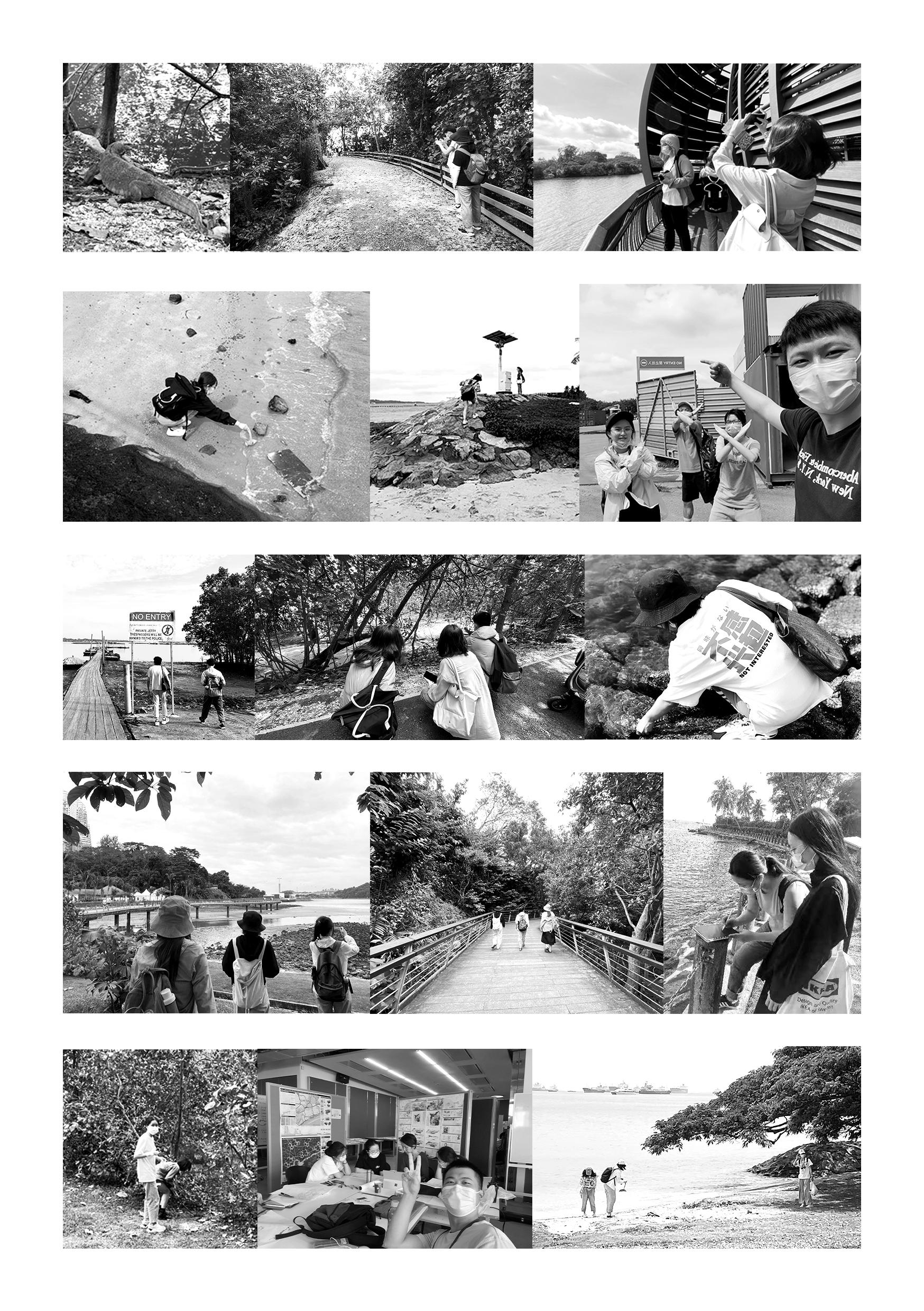
Chronology 14
15
CHAPTER 2 SITE ANALYSIS
Seven groups of students were asked to do different sets of analyses , including competing land-use, land-reclamation, ecology, sea-to-land-transportation and water quality.
LANDUSE
•Ecological preservation
•Fisheries & Agriculture
• Industries and Oil Refneries
• Recreation and open space
• Residential, Commercial and institutional properties
• Shipping and Naval / Military Defence
•Water management and reservoirs
OTHER RELEVANT FACTORS
• Accessibility and Scenic / Visual Resources
• Cultural and Ecological Heritage
•Drainage, Water Quality and Pollution
• Land Reclamation
•Sea and Land Transportation
New typologies of coastal protection methods as well as conservation of coastal habitats were given particular attention
The best outcome of these analyses are included in this chapter.
Group analysis 16
SEA LEVEL TREND & VARIABILITY OF SINGAPORE
Asymmetric Tidal Flows
Overview
The Singapore Strait connects the South China Sea (diurnal tides dominantly) to the Indian Ocean (semidiurnal tides dominantly). At this transition, the tidal water level oscillations are observed to be semidiurnal while the tidal current oscillations are mixed, diurnal to fully diurnal. Due to the interaction of the diurnal constituents with the principal lunar semi-diurnal (M2 tide), the tides are strongly asymmetric.
Hydrodynamics of Singapore Strait

· Tides:
Singapore is located in an exceptionally sharp transition zone where the dominantly diurnal tides (in-between Sumatra and Borneo) change into semidiurnal tides (in-between Sumatra and Malaysia) within a distance of only 400 km. The sharp transition in tidal regimes is expected to generate strong tidal currents in the Singapore Strait. Near Singapore, the tides are mixed, mainly semidiurnal, and water level oscillations are semidiurnal while flow velocity oscillations are diurnal.
Adopted by: Long Di
References: https://agupubs.onlinelibrary.wiley.com/doi/full/10.1029/2011JC007615
17
Tidal regimes in the South China Sea.
· Monsoon Driven Currents:
Nov. to Apr. is dominated by the NE Monsoon (north of the equator) and the NW Monsoon (0° to 10° S). May. to Oct. is dominated by the SE Monsoon (south of the equator) or the SW Monsoon (0° to 10° N). The sea level near Singapore fluctuates over 40 cm annually, with the lowest levels in Jun.–Jul. and a peak in Nov. The water flow in the Singapore Strait is generally westward throughout most of the year, with velocities of 10–15 cm/s, but flows eastward during the peak of the SW Monsoon, from Jun. to Aug.
Monsoonal and seasonal influence on sea level variations (monthly sea level anomalies).
· Human Influence:
Various causeways constructed to connect Singapore with Malaysia and its islands have in some areas led to a transition from dominantly diurnal flow (as part of large-scale flow patterns) to dominantly semidiurnal flow (driven by local water level variations).

Redrew by: Long Di
References: https://www.researchgate.net/publication/236010829_Sea_level_trend_and_variability_in_the_Singapore_Strait
Sea Level Trend & Variability Of Singapore
18
Existing Coastal Infrastructure


Mapping of Singapore
References: Ng, Zhao Ying, 2019, Creating Technological University
Potential Coastal Infrastructure


Bio-engineering Infrastructure
The tidal difference is 3.2 m.
unit Coastal vulnerability degree to erosion:


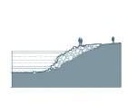

Created by: Tan Shuyue(coastline types and vulnerability degree)& Liu Kaiyan(infrastructures)

References: 1. Lim, Elsa Rui Jia. “Hybrid Solutions for a multi-functional coastal landscape in Singapore.”


2. Lai, Samantha, et al. “The Effects of Urbanisation on Coastal Habitats and the Potential for Ecological Engineering: A Singapore Case Study.” Ocean & Coastal Management, Elsevier, 22 Nov. 2014,


3. https://seagrant.sunysb.edu/glcoastal/pdfs/CoastalLandforms.pdf

seawall high tide low tide
concrete
gabion geobag coastal vegetation mudflat rocky shore
grouted breakwater
block
Natural
high tide low tide high tide low tide high tide low tide high tide low tide high tide low tide mangrove high tide low tide high tide low tide high tide low tide high tide low tide
Hard Engineered
Infrastructure
high tide low tide
marsh eco-enhancement
High Medium Low high tide low tide beach 19 SINGAPORE COASTLINE
TYPOLOGY AND INFRASTRUCTURE
Singapore Coastline Types (2018)
Creating a national shoreline typology map and identifying ecosystem services found in Singapore’s shoreline habitats, Nanyang
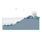

Infrastructure
Infrastructure
artificial tidal pool
low-sloping stepped seawall


planting of coastal vegetation
artificial reef

oyster reef bag

Singapore Coastline Typology And Infrastructure
high tide low tide high tide low tide high tide low tide high tide low tide high tide low tide
20
Singapore Coastal Hazards Analysis
Vulnerable Land Types and Development Demand
Estuary - Industry
High requirement for defence against hazards
Require low other services
ReclaimationIndustry+Infrastructure
High requirement for defence against hazards
Require low other services
Created by: Li Wanying
References: 1 URA Masterplan 2019
2 Effectiveness of Runoff Control Legislation and Active, Beautiful, Clean (ABC) Waters Design Features in Singapore
3 Shoreline erosion degree, Oil Refnery land use study group, Tan Shuyue
4 Reservior in Singapore, Drinking Water / Reservoir Creation / Water Flow land use study group, Huang Xi & Yin Yi
5 Ng, Zhao Ying, 2019, Creating a national shoreline typology map and identifying ecosystem services found in Singapore’s shoreline habitats, Nanyang Technological University

Estuary - Commercial Medium/high requirement hazards
Require higher social ecological services
Estuary - Commercial + Medium/high requirement
Require higher social services
21
COASTAL DEVELOPMENT AND HAZARDS
Natural Shoreline - Residential + Open Space Medium/high requirement for defence against hazards

Require higher social and ecological services
Commercial requirement for defence against social services and medium
Natural Shoreline - Commercial + Residential Medium/high requirement for defence against hazards Require higher social and ecological services
Estuary - Residential + Open Space Medium/high requirement for defence against hazards Require higher social services and medium ecological services
Open Space requirement for defence against hazards services and medium ecological services
Flooding Vulnerability
- Peak Runoff Coefcient
High (0.86-1)
Ports / Airports
Business / Industry
Medium (0.66-0.85)
Low (0-0.65)
Commercial Residential Open Spaces
Erision Vulnerability
- Shoreline Erosion Degree


High
Mudflats Sand
Medium
Vegetation Rocky Shore Mangrove Vertical Seawall Bridge/Dock/Piling/ Pier/Jetty
Dam
Low
Breakwater
Salinization Vulnerability

- Coastal Reservoir
High
Reservoir directly connected to the coast
Medium
Reservoir connected to the coast by waterbody
Low
Reservoir close to coast but disconnected to the coast
- Farmland
Farmland at risk of soil salinization
0 5km
Coastal Development And Hazards
N
22
SETBACK BUILDINGS
ROAD ELEVATION


TIDE BREAKWATER
Created by: Li Jiaying, Karry and Dreamy
References: 1 Hill, Kristina. “Coastal infrastructure: a typology for the next century of adaptation to sea level rise”


2 Lim, Elsa Rui Jia. “Hybrid Solutions for a multi-functional coastal landscape in Singapore.”

GEOBAG
Shore Line Strategy Typologies
23 COASTAL DEVELOPMENT AND HAZARD
DIKE
Soil
Flooding

Salinization


Ecological service
Social service
Commercial benefit
VERTICAL POOL


MOVABLE BARRIER


ECO-ENHANCEMENT UNIT

ELEVATION FLOOR

ADAPTIVE FACILITIES
PLANTING OF COSTAL VEGETATION

COALSTAL BANK
DYNAMIC
MANGROVE
SHRUB VEGETATION
BARRIER ISLAND
Coastal Development And Hazards
WALL LANDFORM
OYSTER REEF BAG
24
Vulnerable Land Types And Strategy


Open space Industrial Industrial Estuary Open space Commercial TIDE BREAKWATER MOUND PLANTING OF COASTAL VEGETATION COASTAL BANK ELEVATION FLOOR SETBACK BUILDINGS ELEVATION ROAD SHRUB VEGETATION SANDY BEACH ECO-ENHANCEMENT UNIT BARRIER ISLAND TIDE BREAKWATER MOUND PLANTING OF COASTAL VEGETATION COASTAL BANK SANDY BEACH ECO-ENHANCEMENT UNIT BARRIER ISLAND TIDE BREAKWATER MOUND PLANTING OF COASTAL VEGETATION SANDY BEACH ECO-ENHANCEMENT UNIT BARRIER ISLAND
25 COASTAL DEVELOPMENT AND HAZARD Created by: Li Jiaying, Dreamy


Coastal Development And Hazards Commercial Estuary Commercial Residential Industrial PLANTING OF COASTAL VEGETATION COASTAL BANK SANDY BEACH MOVABLE BARRIER ECO-ENHANCEMENT UNIT BARRIER ISLAND ELEVATION FLOOR ADAPTIVE FACILITIES SOFT INTERVENTION ELEVATION FLOOR SOFT INTERVENTION SOFT INTERVENTION MANGROVE SANDY BEACH MOUND TIDE BREAKWATER MARSH LAND DUNE TETRAPODS ECO-ENHANCEMENT UNIT TIDE BREAKWATER MOUND GEOBAG GABION WALL SETBACK BUILDINGS VERTICAL POOL SEAWALL 26
Current and Future Development
Singapore now has 350ha of nature parks and Nparks is aiming to add another 200ha of nature parks by 2030. Four new parks along the coast will open in the next 5 years.
PCN will be extended from the current 340km to 500km and nature ways will be extended from the current 115km to 300km by 2030.
The Rail Corridor is a former railway line that stretches 24km north to south of Singapore. It will spur the development of surrounding lands and rejuvenation of older districts by 2021.
The Coast-to-Coast Trail is a 36 km trail that spans across Singapore, linking up nature areas, parks, and park connectors from Jurong Lake Gardens in the west, the new Lornie Nature Corridor near the center, and to Coney Island Park in the northeast.
Greater Rustic Coast is a 50km continuous belt of rustic green and recreational spaces for all with rich significance to Singapore’s heritage and biodiversity.
The Greater Southern Waterfront, which extends from Pasir Panjang to Marina East, will be transformed into a new major gateway and location for urban living along Singapore’s southern coast.
The Round Island Route (RIR) is a continuous 150 km park connector that goes around Singapore. It will provide opportunities for recreational activities.
 Created by: Li Xi Emily
References: https://www.nparks.gov.sg/ https://www.ura.gov.sg/Corporate
27
Recreational Spaces In Coastal Area RECREATIONAL SPACE IN COASTAL AREA
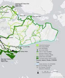
Recreational Space In Coastal Area 28
References: https://www.ura.gov.sg/Corporate

29 Distribution Of Recreational Spaces In Coastal Area RECREATIONAL SPACES IN COASTAL AREA
Created by: Zhang Liao, He Xiaowei

Recreational Space In Coastal Area 30
Matrix of Typology
Eighteen recreational space typologies have been identified in the study and classified into four groups. Accessibility


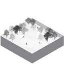


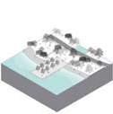


Hard Types of Landscape

31 Typology RECREATIONAL SPACES IN COASTAL AREA
Created by: HE Xiaowei Ceama, LAM Ching Hang Adam, Li Xi Emily, Zhang Liao Judy
Promenade Steps Seating Water Dem Promenade Platform White Space Fishing Village Breakwater Structures Water Activities Centre Playground Public Pier Historical Heritage Promenade Walkway Park Connector High Low


Recreational Space In Coastal Area 32 Accessibility to Water
Reservoir Park
Nature Reserve
Beach
Naturalized Promenade
Soft High Low
Camp Site Golf
Course
More coastal areas in the East and northeast of Singapore are open to the public, mainly in the form of coastal parks. And in the same area, residential areas has greater proximity and immediate accessibility to the coast.

33
Coastal Access Area SINGAPORE COASTAL ACCESSIBILITY
Created by Xiang Wenqin Information from Google Map, local websites and feld trips
Complete access
Public access in daytime

Access by consumers/members only
Access by staff only
Military No access
Water area
Residential area
Singapore Coastal Accessibility 34
Factors influencing public preference
The map shows the accessibility of public transport along the coast of Singapore, as well as the nearest MRT station of each coastal park and the time required to arrive (min). In addition to the convenience of transportation, the following factors also affect the public's choice of open green space.

Cleanliness and Maintenance
Richness in plant species
Existence water bodies
Sufficient benches
Tranquility
Existence of playground
Richness in animal species
Opportunities for sport activities
Good facilities
Existence of car parking
Large size of the park
Existence of quiet and privacy areas
High frequency of visitors
Reference:Helena Madureira,Preferences for Urban Green Space Characteristics: A Comparative Study in Three Portuguese Cities, 1 February 2018

35
Created by Zhu Wen, Xiang Wenqin
Public
SINGAPORE COASTAL ACCESSIBILITY
Transportation &
Preference


Singapore Coastal Accessibility 36 SEA LEVEL RISE 5M
Impact on access


Road networks, particularly in low-lying areas, are susceptible to flooding. Left uncheched, this will cause mahor disruptions to urban logistics.


37
Created by Zhu Wen, Xiang Wenqin
Reference: Npark
1.Erosion and subsidence of road bases
2.Flooding of underground tunnels and low-lying infrastructures
3.Inundation of roads and rail lines
4.Traffic congestion
Transportation & Impact SINGAPORE COASTAL ACCESSIBILITY
5.Infrastructure damage due to increased storm intensity


Singapore Coastal Accessibility 38
LEVEL RISE 5M
SEA
Habitat Map
Reference: https://fgshare.com/articles/dataset/A_high-resolution_map_of_Singapore_s_terrestrial_ecosystems/8267510

39 Distribution SINGAPORE
HABITATS
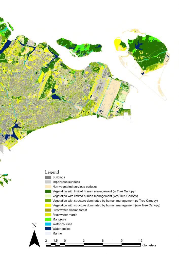
Singapore Habitats 40
There are more biodiversity and abundance in the northeast, South, and Sungei Buloh of Singapore coastal animals. When overlapping with the habitat map, we can see that it is closely related to the distribution of mangroves, seagrass and coral reef.

Created by Xiang Wenqin, Ge Wenxi
References: 1.iNatruralist 2.eBird 3.Nparks
41 FAUNA MAP
East asian migratory bird flyways


Fauna Map
SINGAPORE
42
Coral reefs in Singapore can generally be divided into two types: fringing and patch reefs. The fringing reefs present in the offshore islands south of Singapore island are generally narrow but can be divided spatially into two main areas, the reef flat and the reef slope.

Natural Coastal Habitats
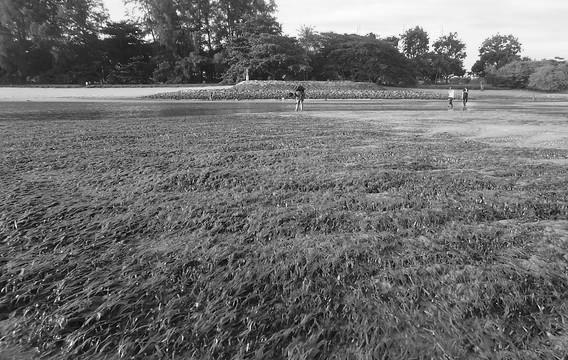
There are no extensive seagrass beds in Singapore. Most are patches less than 15 ha in the vicinity of coral reefs, sandy shores, and rocky shores. Seagrass occurring on the floor of mangrove forests of Singapore may have been overlooked, but a loss of seagrass habitats in Singapore has been attributed mainly to land reclamation.
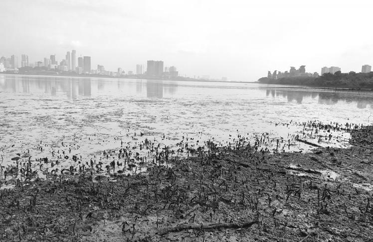
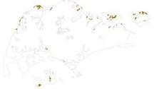
Mangroves comprised about 13% (about 75 km2) of the total land area of Singapore Island when it was first established as a British trading post in the early 19th century. By 1978 this was reduced to some 24 km2 (Khoo, 1980) and today, less than 1.5 km2 of the original mangrove remains recent study has estimated the total mangrove area is now about 6 km2.

The soft bottom subtidal benthos comprises the largest contiguous marine ecosystem in Singapore. The seafloor off the Singapore coastline is generally flat or gently sloping, with depths ranging between 5 and 50 m, although in the Singapore Strait towards the southern port limits there are several areas where depths exceed 100 m.

Intertidal mudflats in Singapore are generally located adjacent and beyond the seaward edges of mangrove forests. These are best developed in the sheltered waters of the Johor Straits, although significant expanses of mud are also found on a number of larger islands in the Singapore Strait. Floral and faunal studies of mudflats have been fairly limited in scope due to their inaccessibility.
Reference: https://www.nparks.gov.sg/biodiversity/our-ecosystems/coastal-and-marine
In Singapore, many of the natural sandy shores that were present along the southeastern coast from Tanjung Rhu to Changi, and also along the southwestern coast from Teluk Ayer to Pasir Panjang, have been reclaimed extensively. A small stretch of beach is preserved in the Labrador Nature Reserve and other short lengths of sandy areas remain along the estuarine northern shores of Singapore

43
Coral Reef Sea Grass
Subtidal Benthic
Sandy Shore
Mangrove
Typology REPRESENTATIVE COASTAL HABITATS
Mudfat
Habitats
Rocky Shore
Only a small proportion of original rocky shores are left in Singapore, and most have largely been either reclaimed or replaced by seawalls and breakwaters. The only natural rocky shore left on Singapore island is at Labrador Beach but short stretches remain on St John’s Island, Pulau Tekukor, Pulau Semakau, and Pulau Pawai.
Artificial Coastal Habitats
Sea Wall

Seawalls are a dominant feature of the much-reclaimed Singapore coastline, and have a surprisingly diverse flora and fauna associated with this artificial habitat, with some 30 autotrophic and 66 invertebrate taxa observed in a study carried out on two islets in the Singapore Strait.


Estuarine reefs at Beting Bronok and Tanjung Chek Jawa at the mouth of Sungei Johor in the East Johor Strait are characterized by a high diversity of echinoderms, including starfish (Protoreaster), sea urchins (Salmacis) and sea cucumbers.

While much of the original landscape of Singapore have given way to buildings, bridges, roads and flyovers, many of the original waterways still remain, although in nearly all cases, they have been canalized and rerouted in one way or another.

Water Column Artifcial Lagoon
The seas surrounding Singapore that is within its port limits occupy an area of about 600 km2 that is mostly shallow (<50 m) with waters that are generally turbid and eutrophic. The water column is the largest living habitat in Singapore, and is shared by a range of organisms ranging from viruses and prokaryotic microorganisms.
Numerous artificial swimming lagoons for recreation were constructed in the early and late 1970s on many of the islands south of Singapore island. These included Sentosa (formerly Pulau Blakang Mati), Kusu, St John’s, Sisters’ Islands, Pulau Hantu, Sultan Shoal, Pulau Sudong, and Pulau Satumu.

Representative Coastal Habitats 44
Tidal Canal
Estuarine Reefs
REPRESENTATIVE COASTAL HABITATS
Relationship Between Coastal Habitats

45
Created by: Xiang Wenqin

Representative Coastal Habitats 46
REPRESENTATIVE COASTAL HABITATS
Distribution & Key Species


Seagrass
Coral reef
References:
1.Wild shores of Singapore 2.Nparks 3.Reef ecology lab
Animal:
Diodora singaporensis
Diogenes sp
Chelonia mydas
Eretmochelys Imbricata
Acreichthys tomentosus
Sirenia(Dugong)
Vegetation:
Halophila ovalis
H.spinulosa
Syringodum isoetifolium
Cymodocea rotundata
Thalassia hemprichii
Animal:
Pavona frondifera
Heliofungia
Lobophytum
Sarcophyton

Neopomacentrus bankieri
Chelmon rostratus
Vegetation:
Neomeris annulata
Cymodocea
Avrainvillea erecta
Corallina officinalis
47
Created by: Xiang Wenqin
Created by: Xiang Wenqin
Sandy shore

Animal:
Stichodactyla haddoni Clibanarius infraspinatus Astropecten sp.
Archaster typicus Scopimera Diogenes sp


Vegetation:
Neomeris annulata
Cymodocea
Avrainvillea erecta
Corallina officinalis
Rocky shore
Animal:
Onchidiidae
Periwinkles
Porcellanidae
Anthopleura
Ligia
Vegetation:
Pemphis acidula
Portulaca pilosa
Pelir musang
Xylocarpus rumphii
Pouteria linggensts
Representative Coastal Habitats 48
References: 1.Wild shores of Singapore 2.Nparks 3. Reef ecology lab
Created by: Xiang Wenqin
Created by: Ge Wenxi
REPRESENTATIVE COASTAL HABITATS


Distribution & Key Species

Seawall
Freshwater
Created by: Ge Wenxi
References: http://www.wildsingapore.com/
Animal:
Patelloida saccharina
Siphonaria guamensis
Trochus maculatus
Littoraria strigata
Schizophrys
Vegetation:
Penaeid prawns
Alpheidae
Juvenile mullet
Shadow goby
Aquilonastra coronata
Animal:

Dendrocygna javanica
Egretta eulophotes
Cichla ocellaris
Duttaphrynus melanostictus
Lutrinae
Vegetation:
Alpinia aquatic Nymphaeaceae
Nelumbo
Peltandra
49
Mudfat
Animal: Mudskipper Tree climbing Crab
Pacific Golden Plovers

Common Whimbrel Curlew Sandpipers
Vegetation: Rhizophora. Xylocarpus. Avicennia rumphiana Bruguiera gymnorrhiza
Mangrove

Animal:
Mudskipper Otter
Malysia Monitor
Tree climbing Crab
Telescope snails
Vegetation: Rhizophora. Xylocarpus. Avicennia rumphiana Bruguiera gymnorrhiza
Created by: Feng Kangtai
References: http://www.wildsingapore.com/

Representative Coastal Habitats 50
Nature history timeline
1985: Significant baseline of marine biology database was established in Singapore.


1990: The Nature Society published Masterplan for the conservation of nature in Singapore, marking the first systemic effort to catalogue significant nature areas in Singapore.

Created by: Ge Wenxi`
References: https://www.nparks.gov.sg/biodiversity/national-biodiversity-centre/history-of-biod-conservation
51
1990: Bukit Timah and Central Catchment were declared as Nature Reserves.
1994: The Singapore red data book was first published.
2002: The Singapore green plan 2012 was published.
2002: Sungei Buloh Wetland Reserve and Labrador Nature Reserve were gazetted.
History NATURE
2009: The Singapore Blue Plan was published.
CONSERVATION HISTORY
Habitat historical change
1. The National Biodiversity Strategy and Action Plan (NBSAP)
To outline five strategies and respective action plans that work towards achieving the three CBD objectives
2. The National Parks Board Act (Chapter 198A)
To establish the National Parks Board and to provide for its functions and powers, and for matters connected therewith.
3. The Parks and Trees Act (Chapter 216)
To provide for planting, maintenance and conservation of trees and plants within nature conservation areas.
4. Animals and Birds Act (Chapter 7)

To measure pertaining to the general welfare and improvement of animals, birds, or fish in Singapore.
5. Wildlife Act (Chapter 351)
About wildlife Management, and regulates the import, sale, and export of wildlife.
6. Control of Plants Act (Chapter 57A)
About the development and improvement of the plant industry in Singapore, and for purposes connected therewith.
7. Planning Act (Chapter 232)
To provide for the planning and improvement of Singapore and for the imposition of development charges.
Created by: Ge Wenxi
References: 1. Tse Lynn Loh, Preliminary study of community development and scleractinian recruitment on fbreglass artifcial reef units in the sedimented waters of Singapore, 2005
2. Samantha Lai, The effects of urbanisation on coastal habitats and the potential for ecological engineering: A Singapore case study, 2015
3. Hilton, M.J., Manning, S.S., 1995. Conversion of coastal habitats in Singapore: indications of unsustainable development. Environ. Conserv

4. Npark, Singapore 4th national report to the conservation on biological diversity, 2010


Natural Conservation History 52
Nature conservation related regulation Mangrove forest Coral reef 1953 1975 1953 1997 1993 2015 2010
Reclaimed Land
Reclaimed land distribution map

Tuas: reclamation began in 1988

Marina bay: reclamation began during the late 1960s and early 1970s

Reclaimed land method history
Dry method: It is the simplest and oldest method that involves filling the required area with large and heavy rocks and/or cement, then building up to the required height level using clay or other soil in a process called ‘infilling’.
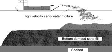
Hydraulic reclamation method: It is used when fill material is obtained from an offshore borrow source, but is only suitable for granular soil which has good drainage characteristics.
Hydraulic filling method: This method is suitable for granular fill and is generally used when filling is carried out from an offshore source. It is not suitable when the seabed is too shallow or the seabed soil is too soft.
Sand spreading method: This method is used when there is a shallow seabed or the seabed soil is too soft for hydraulic filling.
Created by: Ge Wenxi
Reference: https://www.sciencedirect.com/topics/engineering/reclamation
https://www.designingbuildings.co.uk/wiki/Land_reclamation
53
ARCHEOLOGICAL & HISTORICAL RESOURCE
Coney island: reclamation period is from 1975 to the 1990s.
Old reclaimed land method---Dry method



Changi: reclamation began in 1975
Contemporary reclaimed land section
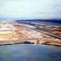
Archeological & Historical Resource 54 Created by: Ge Wenxi Reference: 1. Reclamation outside Victoria Harbour, https://www.cedd.gov.hk/flemanager/eng/content_954/Info_Sheet5.pdf 2. https://nussammy.wordpress.com/2018/01/28/land-reclamation-in-singapore/
1973 1989 2009 2013
Existing Condition In Drinking Water System
Strengths
• Abundant rainfall
Under the premise of insufcient groundwater resources, rainfall provides a sufcient water source for the water network.
Average
• Water reticulation network
Annual annual rainfall in Singapore
Weaknesses
• Limited national territorial area 728 km2
• Lack of groundwater resources
Threats
• Rising population 5,850,342 people
Major waterways and catchment in Singapore
Opportunities
• Diversifying water supply
With an area of about 710 km2 and growing urban areas, Singapore lacks the space to collect and store all the rain that falls on it. Through a network of rivers, canals and drains, rain that falls on 2/3 of Singapore’s land area is channeled to our 17 reservoirs.
Singapore population (1950-2020)
By 2060, Singapore’s water use is expected to double from about 430 million gallons a day (mgd) now.

NOW
150L per person Demand now domestic sector 45%
Non-domestic sector 55%
Water from local catchment
Imported water
Created by: Huang Xi
References: https://www.pub.gov.sg
55
DRINKING WATER SUPPLY IN SINGAPORE
Desalinated water New water
——
“Four National Taps”
• Increasing water demand Annual Rainfall 2165.9 mm / yr
• Impact from sea level rise

Flood risk area
SealevelScenarioCScenarioDLowrisk + 2.8mm/ yr
2060
140L per person Demand in 2060 domestic sector 30% Non-domestic sector 70%
Water logging
Vulnerable hydraulic system
Storm surge
Drinking Water Supply In Singapore 56
Kranji(1975)
Storage Capacity: 15,850,000km3
Kranji Reservoir was created by damming up the river mouth and is rich in birdlife biodiversity. Rainwater that falls in Choa Chu Kang and Bukit Panjang towns flows to the Kranji Reservoir through drains and canals.
Upper Seletar(1920)
Surface Area: 450ha
Upper Seletar Reservoirs is Singapore's third impounding reservoir, after MacRitchie and Peirce Reservoirs. Rainwater falling in Woodlands towns flows to the Upper Seletar Reservoir through drains and canals.
Sarimbun, Murai, Poyan and Tengeh(1981)
Surface Area
Sarimbun: 82ha
Murai: 215ha
Poyan: 370ha
Tengeh: 145ha
These four reservoirs are located in generally uninhabited areas in the west.
Jurong Lake(2006)
Surface Area: 70ha
Jurong Lake is a man-made freshwater lake. Rainwater that falls in the Jurong West and Jurong East towns is channelled to the lake through drains and canals.
Pandan(1975)
Surface Area: 180ha
Constructed over swamp land and the original Pandan river, Pandan Reservoir receives its water through drains and canals from areas such as Clementi and Bukit Batok towns.
MacRitchie(1868), Upper and Lower Peirce(1975)

Storage Capacity
MacRitchie: 4,200,000 km3
Upper and Lower Peirce: 3060000 km3
The first of Singapore's reservoirs, these are located within the nature reserves. The reservoir waters are pristine as they are left in their natural states.
57
Time line of Singapore Water History SINGAPORE WATER STORY
Created by: Yin Yi Anna Reference: PUB
Lower Seletar(1986)
Storage Capacity: 9,400,000 km3
Lower Seletar Reservoir was constructed by building a dam accross Sungei Seletar. Rainwater that falls in parts of Yishun and Ang Mo Kio towns is conveyed to the Lower Seletar Reservoirs through drains and canals.
Marina(2010)
Surface Area: 240ha
Marina Reservoir, Singapore's 15th reservoirs and the first reservoir in the city, has the largest and most urbanised catchment at 10,000 hectares. Rainwater is collected from as far as Queenstown, Geylang East, Ang Mo Kio and Toa Payoh areas.
Surface Area

Punggol: 135ha
Serangoon: 132ha
Punggol and Serangoon Reservoir are Singapore's 16th and 17th reservoirs. They were formed damming major river. Rainwater from Sengkang, Punggol, and Hougang towns will be channelled to them.

Tekong(1979)
Surface Area: 67ha
The reservoir currently provides potable water supply for all military installations within the island. Access to the island and hence the reservoir is restricted.
Bedok(1986)
Storage Capacity: 12,800,000km3
The first to tap water from an urban catchment, Bedok Reservoir was converted from a former sand quarry. Nine stormwater collection stationstap the rainwater from surrounding urbanised catchment like Bedok and Tampines town.
Legend:
Reservoir Disconnected with Ocean
Reservoir Connected to Ocean through Waterbody
Reservoir Connected to Ocean Directly
Inland Reservoir
Water Network
Unprotected Catchment
Protected Catchment
Watershed Partition
Singapore Water Story 58
Punggol and Serangoon(2011)
Function of Coastal Reservoir Collection

Water catchment means that the water in a reservoir comes from natural rivers in the city, artificial channels and surface water flow around the reservoir. Unlike what we normally call "local catchment", this category does not include direct precipitation.

In the reservoir not directly connected to the coast, a large part of the freshwater collected is rainwater, so rainwater is one of the important components of fresh water in the reservoir.

Some older reservoirs, or where topographic conditions permit, are built of earthen dams. For example, in pandan reservoirs, the base of the dam is a man-made structure.


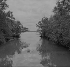
Prevention
Floodgate can not only effectively separate salt water from freshwater, but also is extremely important for the control of reservoir water level. There are many types of floodgate globally, but there are roughly two types of floodgate in Singapore.


59
a. Natural Waterway
a. Rigid Foundation Dam
Secondary Barrier
a. Crest Gate
a. Rigid Foundation Dyke
Rainfall
b. Canal and Ditch
b. Earthen Dam
b. Vertical Lift Gate
c. Surface Water fow
Separation
1. Catchment
1. Dam
2. Rainfall
Strom
STROM
2. Floodgate
Diversifying Methods Of
Management
MANAGEMENT
1. Secondary Barrier
2. Dyke
Created by: Huang Xi & Yin Yi Anna
Reference: PUB
Legend:
Floodgate
Secondary Boundary
Dam
The secondary barrier is a floating barrier that has a skirt suspended from it. The skirt can extend to the floor of the reservoir and can be weighted with ballast to fix it. It can also be moved with an anchor and chain system.

Watershed
Waterflow
Water Network

Reservoir Disconnected with Ocean
Reservoir Connected to Ocean through Waterbody
Reservoir Connected to Ocean Directly
Inland Reservoir


Strom Management 60
Distribution of Coastal Reservoir
a. Lifting Hydraulic Gate
b. Earthen Dyke
b. Crest Hydraulic Gate
3. Hydraulic Gate
WATER TREATMENT

2 separate systems are used to collect rainwater and used water. Rainwater is collected through the drainage network and reservoirs before being treated. Used water is channeled through sewers and pumping stations to the water reclamation plants.


Desalination is another weather-resilient water source, PUB turns seawater into drinking water using advanced membrane technology and continues to find more efficient ways to desalinate seawater.
Rainwater Treatment
Used Water Treatment
Created by: Long Di
References: https://www.pub.gov.sg
Desalination Plant: Singapore currently uses reverse osmosis for its desalination and now it has three desalination plants with two more desalination plants in the near future. Tuas
When DTSS is completed, Singapore will only have 3 WRPs. The existing intermediate used water pumping stations and conventional WRPs will be dismantled and used for other higher value development.
61 Water Treatment Overview
Facilities Distribution Map
Distribution
WRP Water Treatment Facilities
Jurong Water To Be Decommissioned
Deep Tunnel Sewerage System(DTSS): DTSS uses deep tunnel sewers to convey used water by gravity to centralised WRPs located at the coastal areas. The treated used water is further purified into NEWater or discharged to the sea.
Waterworks: Raw water is conveyed by pipelines to the waterworks where it is chemically treated, filtered, and disinfected. Treatment frees the water of harmful bacteria and suspended particulate matters, makes it safe for consumption.

Service Reservoir: There are currently 9 service reservoirs operating in Singapore which are used to store potable water.

Water Treatment 62
Reservior Water Reclamation Plant
Changi WRP Ulu Pandan Water Reclamation Plant
Kranji WRP Decommissioned To Be Decommissioned Legend:
N PUB Waterworks
Desalination Plant
0 5 10km NEWater Plant Water Catchment Service Reservior
WRP & NEWater Plant DTSS Water Reclamation Plant(WRP)
WATER POLLUTION
Singapore Water Pollution Distribution Map

Credit to: Long Di, Redrawn by Hao Jun
References: Hu, G. P., Balasubramanian, R. and Wu, C. D. (2003) ‘Chemical characterization of rainwater at Singapore’, Chemosphere, 51(8), pp. 747–755. doi: 10.1016/S0045-6535(03)00028-6. Song, H. et al. (2019) ‘Characteristics of Stormwater Quality in Singapore Catchments in 9 Different Types of Land Use’, Water, 11(5), p. 1089. doi: 10.3390/w11051089. Yuen, J. Q. et al. (2012) ‘Accumulation of potentially toxic elements in road deposited sediments in residential and light industrial neighborhoods of Singapore’, Journal of Environmental Manage ment, 101, pp. 151–163. doi: 10.1016/j.jenvman.2011.11.017.
63

Water Pollution 64
Water Quality Indicators
Higher concentrations of oxygen, lower concentrations of salinity and nitrogen(within the range shown in the figures below) contribute to better water quality
Salinity Concentrations


Salinity (g/kg) in layer 1
12-Dec-2013
Oxygen Concentrations in Top Layer
Dissolved Oxygen (g/m³) in layer 1 20-Dec-2013
Top Layer
65
SINGAPORE WATER QUALITY IN COASTAL ZONE
References: X. Wanga,c, J. Zhangb,c,d, V. Babovicc, K.Y.H. Ginc, A comprehensive integrated catchment-scale monitoring and modelling approach for facilitating management of water quality,2019
Redrwn by: Tan Shuyue
Nitrogen Concentrations in Top Layer
total nitrogen (including algae) (gN/m³) in layer 1
12-Aug-2013
Oxygen Concentrations in Bottom Layer


Dissolved Oxygen (g/m³) in layer 10
20-Dec-2013
Bottom Layer
Singapore Water Quality Coastal Zone 66
Shipping Routes And Ports In Singapore
SHIPPING ROUTES AND PORTS IN SINGAPORE
Worldwide Shipping Routes
Senoko Fishery
Modern style fishing port Acreage: 0.3 ha
Keppal Shipyard

Manufactural industrial port Berths: 6


Docks: 3
Terminal
Passengers port for workers Acreage: 0.3 ha

Keppel Bay
Recreation port for cruise Acreage: 1.2 ha
Singapore

67
Pasir Panjang Ferry
02 ,000 4,000 1,000 Miles
Created by:Karry Zhang, Li Wanying References:https://www.maersk.com/local-information/asia-pacifc/singapore/routes
SHIPPING AND PORTS
LEGEND:
SG SHORELINE PORT
OUTSIDE PORT
LEGEND:
ANCHOR PROHIBITED
LEGEND:
SG SHORELINE PORT
SHIPPING PROHIBITED
SG SHORELINE PORT
OUTSIDE PORT
SHIPPING ROUTE
ANCHOR PROHIBITED
OUTSIDE PORT
SHIPPING PROHIBITED
ANCHOR PROHIBITED
SHIPPING PROHIBITED
SHIPPING ROUTE
SHIPPING ROUTE
LEGEND:
SG SHORELINE PORT
OUTSIDE PORT
SG PORT LIMITED
ANCHOR PROHIBITED
RECREATIONAL ROUTE
SHIPPING PROHIBITED
SPECIAL PURPOSE ROUTE
SHIPPING ROUTE
SG PORT LIMITED
FREIGHT ROUTE
RECREATIONAL ROUTE
SG PORT LIMITED
SG ROAD
TYPES OF PORTS
COASTAL GUARD
COMMERCIAL
TYPES OF PORTS
SG PORT LIMITED
COMMERCIAL - INDUSTRIAL
TYPES OF PORTS
RECREATIONAL ROUTE
COASTAL GUARD
FISHERY
COMMERCIAL
SPECIAL PURPOSE ROUTE
COASTAL GUARD
INDUSTRIAL
COMMERCIAL - INDUSTRIAL
COMMERCIAL
FREIGHT ROUTE
PASSENGERS
SG ROAD
TYPES OF PORTS
COASTAL GUARD
COMMERCIAL
COMMERCIAL - INDUSTRIAL
FISHERY
INDUSTRIAL
PASSENGERS
PASSENGERS - RECREATIONAL
SPECIAL PURPOSE ROUTE
RECREATIONAL ROUTE
SPECIAL PURPOSE ROUTE
FREIGHT ROUTE
SG ROAD
FREIGHT ROUTE
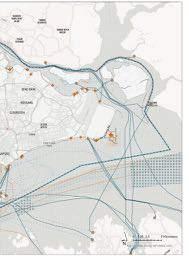
SG ROAD
FISHERY
COMMERCIAL - INDUSTRIAL
PASSENGERS - RECREATIONAL
FISHERY
INDUSTRIAL
RECREATIONAL
INDUSTRIAL
PASSENGERS
PASSENGERS - RECREATIONAL
PASSENGERS
RECREATIONAL
PASSENGERS - RECREATIONAL
RECREATIONAL
RECREATIONAL
Singapore Last Fishing Village


Traditional style fshing port
Acreage: 0.4ha
Changi Point Ferry Terminal

Small passengers and recreational port
Acreage: 0.7 ha
Marina Bay Cruise
Large scale passengers and recreational port
Acreage: 3 ha
Keppel Terminal

Transportation industrial and commercial port
Acreage: 102.5 ha
Container berths: 14
Shipping And Ports 68
Ports Typology
Classifcation
Classified by Purpose
Typologies of Different Purposes
Industrial Ports
Industrial
Commercial
Passengers Transport
Recreational
Industrial Fishery
Passengers Transport Ports
Classified by... bussiness types users groups uses styles
Manufacture
Jetty
Crane
Import & export
For tourists
For special use
Cruise
Sports
Traditional
Transportation Mordern
Passengers Station
Parking Lots
Recreational Ports


Temporary Parking
Floating Jetty
Reinforced Concrete
Long-term Parking
Reinforced Concrete
Temporary Parking
Created by: Li Wanying, Dreamy Hong
Reference: http://www.singaporeshipping.com.sg/
Relate Concrete+Floating
69
PORTS
SHIPPING AND


Shipping And Ports 70 Temporary Parking Reinforced Concrete Reinforced Concrete Relate Facility Other Recreational Space Seafood Market Concrete+Floating Material Concrete/Wood+Floating Material Fishery Ports Parking Container Industrial Facility Related Industry Warehouse Piling Reinforced Concrete Temporary Parking Reinforced Concrete Commercial Ports
Ports Related Land-use


Created by: Li Wanying
References: URA marster plan 2019


1 2 3 4 6 7 8 5 SHIPPING
PORTS 71 Ports Typology
AND
Section of ports typologies


Shipping And Ports 72
1 Industrial & Commercial Keppal Terminal 2 Industrial & Commercial Keppal Tamasek Dock 3 Passengers & Recreational Marina Bay Cruise 4 Passengers & Recreational Changi Point Ferry Terminal 5 Recreational Keppal Bay Yatch Club 6 Recreational Changi Sailing Club 7 Fishery Senoko Fishery Ports 7 Fishery Singapore Last Fishing Village
Created by: Dreamy Hong, Li Wanying
NAVAL/MILITARY DEFENSE
1979: Malaysia publishes a map depicting the territorial waters it claims.
1980: Singapore lodges a diplomatic protest with Malaysia over the 1979 map.
1987: Malaysia publishes its Johor Bahru port limits, which tracks the territorial sea limits claimed in its 1979 map.
1997: Singapore’s port limits to the west of Raffles Lighthouse are extended slightly for better regulation of shipping traffic in the vicinity.


Oct 25, 2018:The altered port limits extend significantly eastward beyond the territorial sea claim in the area made in Malaysia’s 1979 map. Nov 5: Singapore lodges a “strong protest “ with the Malaysian government.
Created by: Li Jiaying
References: Fender Application Design Manual

 Police Coast Guard
Lim Chu Kang Base
Laluan Kedua
73
Johor Causeway Bridge
Legend
Present Naval Base
Costal Guard
Past Naval Base


Customs

Boundry
Bridge between Malaysia and Sinagpore
Disputed Maritime Border Area

74
Global Oil Shipping Routes Map

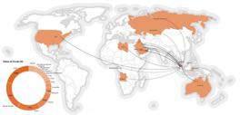
Map of Singapore’s Crude Oil Imports,2018
Singapore does not have any natural oil resources, so the oil refinery industry relies on importing crude oil mainly shipping from the Middle East. References:
Singapore is locted in the Malacca Strait, which is the second busy chokepoint to Hormu. It is vital to the shipping routes to get oil from the Persian Gulf
1.Resource Trade Earth 2.EIA3 .AIS,Marine Traffc Created by:
Ting 75 Singapore Oil Refnery Industry PULLUTION OIL SPILL
Fang
Map of Singapore’s Refned Oil Exports,2018

The associated oil industries together form a key pillar of Singapore’s economy, accounting for 34% of the country’s total manufacturing output in 2014 worth over S$100 billion.

Pollution Oil Spill Gulf to the South China Sea
76
Distribution of residential and commercial property

Created by: Zhang Liping, Zhu Wen
References: https://libmaps.nus.edu.sg
77 Status RESIDENTIAL AND COMMERCIAL PROPERTY
This mapping illustrates the urban structure of seashore, from mixed commercial center, to residential area, to industrial cluster.

Residential And Commercial Property 78 2.5 5 10KM
Commercial Building Type


Shop house by road
Shop house by the river

Shop houses usually have mixed elements from a different country. It often appears in the form of 2-3 stories high with a shop on the ground floor. At the same time, the vestibule is also a common element. Generally, the main drainage type is road drainage.
Distribution of Commercial Area


The business buildings, like office and shopping malls, are centered in Marina CBD area, and some are in town center area.
Created by: Zhang Liping, Zhu Wen, Zheng Qiaoyu
References: https://libmaps.nus.edu.sg

79 Commercial Building Typology RESIDENTIAL AND COMMERICAL PROPOERTY
Shopping mall-by the river
Shopping mall-by the sea
Shopping mall usually has less than seven stories. Some of them have their own green space. As shopping mall always has a large area of hard scape and underground floors, the main drainage way is evacuating rainwater to nearby road catchment and waterbody.

High-rise building-by the sea
High-rise building-by road


Office buildings are likely to in the form of the high rise, some of which have office garden, sports facilities, and underground parking lot. Surrounding the structure there will be some liner greenery. So rainwater in the office and business area is usually evacuated into road catchments and surrounding soft space, like parks and water bodies.


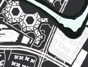

Residential & commercial building-by the river
Mixed-use building usually contains not only residential use but also commercial areas. The lower stories are mainly used as commercials. Rainwater mainly flows into surrounding roads


Residential And Commercial Property
80
Residential Building Type
Landed house-by road
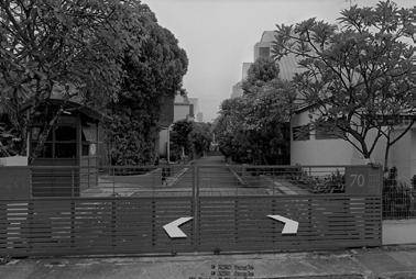
Landed house-by river

Landed house is commonly coordinated with a swimming pool and private garden. The drainage way is collecting the rainwater to nearby road catchment and water body through the surface drainage and private garden.

Distribution of Residential Area


Industrial clusters are mainly located in Tuas and partially in the north region. The seashore park is integrated with the existing network.

Created by: Zhang Liping, Zhu Wen,Zheng Qiaoyu
References: https://libmaps.nus.edu.sg
81 Residential Building Typology RESIDENTIAL AND COMMERCIAL PROPERTY
HDB-by the river


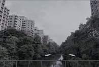

HDB-by road


Condo-by
the sea

Condo-by
the river
Condo-by


road

Residential And Commercial Property
The condo is a private house,it is commonly coordinated with the community garden and swimming pool. The water drainage way is also divided into three phases, same as hdb. The community rain garden collects the rain water to the canal
The hdb constructed by different years has different water drainage types. At present, the drainage way is divided into three phases: source-pathway-receptor.
82
History & Method of Fishery and Agriculture

Fishery/Agriculture/Port Area in 1965


Kelong sea based fish farm:
- Need licence
- at least 0.2 k㎡


- Fish Net
Floating fish farm:

- Need licence
- Fish Net/ Fish Tank
References: https://www.researchgate.net/fgure/Land-Use-Agriculture-Imports-1965-ISD-Panel-Food-Group-2017_fg2_331639279


High-tech fish farm: - Ferrry - 1.4 k㎡

83 History and Technology THE DEVELOPMENT OF FISHERY AND AGRICULTURE
Created by: Rui Xue, Wang Xiaomeng, Xie Wanying
Recent Method of Fishery and Agriculture


Fishery/Agriculture/Port Area in 2015

Greenhouse:
- Temperature control, Light, Watering


- Plants that easy to start:

Tomatoes
Mushroom
Onions
Potatoes Carrots
Vertical farm:

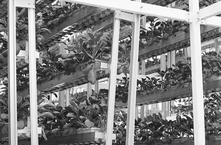
- Scale can be very small (Using in the home)
- Environment is important (like green house)

Aquaponics:

- Scale can be very small (using in the home)

- suitable size fish tank and media bed


The Development Of Fishery And Agriculture
Human cultivation
Using Animals
Farm Truck
Greenhouse
Automated agriculture
Vertical Farm
84
Aquaponics
Main method of modern fsh farm and agriculture
SINGAPORE AGRICULTURE AND FISHERY RESOURCES
Geographic Information And Distribution Of Agriculture And Fishery Resources

Created by: Rui Xue, Wang Xiaomeng, Xie Wanying
References: https://coldstorage.com.sg/storelocations https://khaisengfshfarm.com/2016/01/07/sustainable-fsh-farming/ https://www.arowanafshtalk.com/forums/showthread.php?2318-Visit-to-Singapore-Arowana-Breeding-Farm-(Arowana-Farm-in-Singapore) https://fnbyboat.com.sg/our-technology
85

Singapore Agriculture And Fishery Resources 86
SINGAPORE AGRICULTURE AND FISHERY RESOURCES

Seafood
Created by: Rui Xue, Xie Wanying
Reference: https://www.nhb.gov.sg/ https://www.roots.gov.sg/places/building-and-sites
87
Species In Singapore

Singapore Agriculture And Fishery Resources 88
Reference: https://www.nhb.gov.sg/ https://www.roots.gov.sg/places/building-and-sites
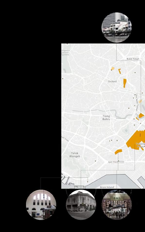

89 SINGAPORE HERITAGE DISTRIBUTION

Singapore Heritage Distribution 90
Marina Bay
The land in Marina Bay is mainly from land reclamation. The early 1800s: Waterfront area.


1971: Singapore embarked land reclamation project. The late 1990s: The Marina Bay area covers a total of 360 hectares of prime land for development. The 2000s: Mixed-use developments.


Residential/ Commercial/ Park/ Industry
Heritage Trail (27 points)
5 Districts in Chinatown: Kreta Ayer, Ann Siang/ Club Street, Telok Ayer, Tanjong Pagar/ Duxton, Bukit Pasoh

1843: Chinatown’s physical landscape development began.

1918: Much overcrowding and congestion in Chinatown.
Residential/ Commercial/ Park

Mid-1960s: Urban renewal schemes started, and residents were re-housed in resettlement estates.
1983: Major upgrading of shophouses and new developments took place.

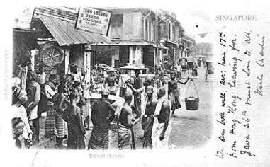


2002: The Chinatown Heritage Centre is opened which introduces Chinatown’s history.
Created by: Zhang Liao
References: https://www.nas.gov.sg/archivesonline/photographs/ https://libmaps.nus.edu.sg
https://www.ura.gov.sg/ https://www.roots.gov.sg/
91
1898 1942 1958 1971 1992 2003 2014
of Coastal Line Historical Photos
Changes
Before 1950s 1960s 1970s 1977 1980s 2020 Indevelopment Land Reclamation Mixed-use Developments Commercial/ Residential/ Park Chinatown Historical Photos 1824 1870s 1900s 1942
1996 2010
1970s
Park/ Industry
Residential/
2020
Key Districts HISTORY OF SINGAPORE
The coastal area is made from land reclamation. Seaside and water activities were part of the area’s recreational highlights.
1604: The map referring to Sungei Bedok (Bedok River) as Sunebodo.

1960s: The extensive land reclamation project began.


1963: Early plans to develop Bedok into a HDB town.
1966: Modern development of Bedok began.
1970s: Began to make way for modern flats and industrial parks.
1980: Pan-Island Expressway (PIE) was completed.


Historical
1964

1845: Telok Blangah Hill was renamed to Mount Faber. And a road to the top of the hill was built cut through the thick undergrowth in order to build a signal station.
1857: After the Indian Mutiny, the government decided to convert Mount Faber into a fort.


1965: Mount Faber Park was opened as one of the oldest parks in Singapore.


References: https://libmaps.nus.edu.sg https://www.ura.gov.sg/ https://www.roots.gov.sg/

History Of Singapore 92
Residential/ Park/ Commercial Residential/ Park/ Industry/ White Space Residential/ Park/ Indevelopment Bedok
Photos
Created by: Zhang Liao, He Xiaowei
Indevelopment
Historical
1640 1930s 1940s 1963 1966 2020 1970 1958 1980 2003 2008 2014 1900 1946 1958 1890 1965 1974 2010
Coastline&South Ridge Changes Mount Faber Park
1974: the Singapore Cable Car stations is built, connecting the park with Sentosa, which was part of efforts to convert the island from its history as a naval base to an island getaway for both tourists and locals. Photos
References: https://libmaps.nus.edu.sg/ https://www.ura.gov.sg/ https://www.roots.gov.sg/

93 Zoom in Pasir Ris
HERITAGE OF SINGAPORE
HISTORY
Created by:He Xiaowei
Coastline Changes 1945 1966 1978 1993 2005

History Heritage Of Singapore 2005 Sandy Area Beach Beach Park 94 Created by: Fang Ting Pasir Ris Heritage Trail 1945 1966 1978 1993 Landscape Changes
95
CHAPTER 3 DESIGN DEVELOPMENT
Reserach Based Design proposal for specifc site
Design Development 96
CATALOG OF PROJECTS
From Tuas Second Link to West Coast Park
Amphibious Sports Park
Hao Jun
Alternative Industrial Landscape Driven by Ocean Resource
Tan Shuyue
Super Coastal Hub
Yin Yi
Revitalizing Food District via Sea Level Rise Adaptation
Zhang Kairui
From West Coast Park to Marina South Pier
In-between Landscape
Li Wanying
Revival: Coastal Nature
Hong MengYi
Living with Mangroves
Zhu Wen
Triple Life Line
Zheng Qiaoyu
From Marina Barrage to Tanah Merah Ferry Terminal
Rebuild seawalls: Waiting for Sea Level Rise
Liu Kaiyan
Learning in Nature - Waterfront
He Xiaowei
Turning Risk into Opportunity
Xiang Wenqin
Guardian of the City
Zhang Liao
From Tanah Merah Ferry Terminal to Pasir Ris Park
Bike on the Dyke
Li Jiaying
Dockscape: Keep the Coastal Memory
Fang Ting
Landform Adaptation Resort
Rui Xue
Life in Green and Blue
Wang Xiaomeng
97
From Pasir Ris Park to Sembawang Park
Redefning Coastal Barrier
Lam Ching Hang (Adam)
Riparian Urbanism: Nature Oriented Development on Business Park
Ge Wenxi
From Sembawang Park to Sungei Buloh Nature Reserve
Retreat forward: Reclaim for the Next Mangroves
Long Di
Collecting, Catching, Cultivating-Productive Coastal Park
Li Xi
Self-Sufcient Water Recycling System
Ou Yeyao
Futuristic is Past
Huang Xi
From Tuas Second Link to Kranji Dam
Regeneration Hub in Kranji
Feng Kangtai
AGRI Park
Xie Wanying
Wild Adventure
Zhang Liping
Design Development 98
FROM TUAS SECOND LINK UNTIL WEST COAST PARK
INDIVIDUAL PROJECT
Amphibious Sports Park
Hao Jun
This project aims to create an “amphibious” sports park among the vast industrial zone. Terraced spaces are remodelled responding to ocean fows over time to provide full-service sports felds from supratidal, intertidal to subtidal zone that promote physical health for workers including heavy vehicle drivers in the industrial estates. The park leverages sea level rise as an opportunity to grow water adaptability for human and diverse marine habitats by remodelling the terrain of submerged land into triple-level terraced buffer.
Adaptative Coastal Hub: Conversion from Industrial Area
Yin Yi
With the development of the technology, the future of the industrial coast has many possibilities, and the purpose of this design is to build this site into a multi-functional coastal center after phased construction. There three main zones in the site: building area, landscape, and water retention lake. The building area can undertake different urban functions over time, including working as a worker center. Meanwhile, the landscape works as a resilient flter to treat the leftover pollution and adapt to the changing water level. The lake can take the function of water supply and generating hydroelectric power. Together with introducing several kinds of renewable energy, the designer wants to shape the future of coast industrial area.
Revitalizing Food District via Sea Level Rise Adaptation
Zhang Kairui
Sea level rise threatens to food portion of an existing food packing district. In refurbishing the site to adapt and protect, opportunities can be found in an innovative redeveloping costal edges that allow new commerical, F&B, social, recreational space to occur along connections, as well as revitalize space between existing structure.
Alternative Industrial Landscape Driven by Ocean Resource
Tan Shuyue
With decreasing demand for oil, the existing oil plants along the coastal line of Sungei Pandan has a great potential to be transformed into an alternative industrial landscape that could be more innovative and energy efcient with the sea level rise adaption. Taking advantage from the existing landform (bathtub-like bay) and adjacent reservoir as a water storage, I propose solar powered desalination system and water dependent industry/workshop spaces. The project includes pretreated seawater storage with bio-engineering fltration; foating solar panels that connected with the existing oil pipelines; renovated oil tanks; retroftted road networks; and extended green corridors for recreation and mangrove habitat enhancement.
99


From Tuas Second Link until West Coast Park 100
Site 1: Amphibious Sports Park
Site 2: Adaptative Coastal Hub: Conversion from Industrial Area
Site 3: Revitalizing Food District via Sea Level Rise Adaptation
Site 4: Alternative Industrial Landscape Driven by Ocean Resource
Hao Jun
Site 1 Hao Jun
Site 2 Yin Yi
Site 3 Zhang Kairui
Site 4 Shu Yue
Yin Yi Zhang Kairui Shu Yue

101
AMPHIBIOUS SPORTS PARK Remodel the Future for Industry
Hao
This project aims to create an “amphibious” sports park among the vast industrial zone. Terraced spaces are remodeled responding to ocean fows over time to provide full-service sports felds from supratidal, intertidal to the subtidal zone that promotes physical health for workers including heavy vehicle drivers in the industrial estates. The park leverages sea level rise as an opportunity to grow water adaptability for human and diverse marine habitats by remodeling the terrain of submerged land into the triple-level terraced buffer.
Amphibious Sports Park 102
Jun
LOSS OF HABITAT
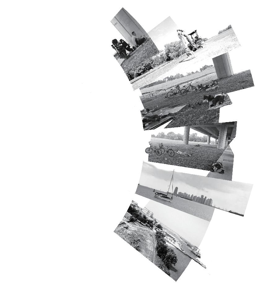
Only 3 species with scarce quantities are found here, which is nursed toward extinction due to reclamation works. The relatively whole forest with about 20 species occupies 1ha area in the middle of the site. But this forest is lack connection to urban ecology.

No recreational space for industrial workers within 8km. No point of interest to attracting citizens and near workers. No recreational landmark as Malaysia has. As measured & estimated by myself, the average daily ridership is only 35% of the designed capacity.
SIMPLE LAND-USE


Morning Noon Afternoon Dusk Cyclistintherest Siteworking Napping labours Napping rider Yacht Birdparadise Sports&Recreation 103 SITE ANALYSIS Esri Community Maps Contributors, SLA, Esri, HERE, Garmin, METI/NASA, USGS Transportation Hub Public Services Industry Site Boundary Major Routes Key Nodes Topological Relations Hardened Surface Lawn / Weed Vegetation with canopy Seagrass habitat
PANORAMA OF LAND & LIFE
Strategy: Social Level
AMPHIBIOUS SPORTS AREA
Activity-adaptation multi-use modular sports field


Tempo-adaptation multi-use flowing path
Enclosed multi-use canal for water sports & bath
Sand beach & waterside platform for coastwise sports
Intertidal sports zone
Neritic sports zone
To meet the needs of industrial workers who are suffering from mental & physical problems, the spaces can provide comprehensive sports felds throughout terrestrial, intertidal & littoral areas.
FLEXIBLE ACCOMMODATION FOR FUTURE-ORIENTED TRANSPORTATION

HUB
PARK-CENTERED TRANSPORTATION HUB
Skidproof, waterproof surface


Screen to display lineation 200-500mm 200-500mm
Footsteps power generator Automatic jacking system


105
EXTERNAL CONNECTION FREETRAVEL INTERNAL
SPORTS
DIVERS FIELD
EXPERIENCE
FUTURE MODULAR SPORTS FIELDS
SELF-ADAPTATION SOFT SCAPE
Multi-use sports lawn
Lying on undulant lawn
Shuttling in marsh
Camping on higher knolls
Usually
Playing at subspace separated by undulant lawn
Temporary water sports lawn
Parking one-man aircraft & future vehicle Drain stormwater as detention swale


Shifting people to higher hardscape
In storm, or water-level rises further
MULTI-USE FLOWING EXPERIENCE
The modules can form different sports felds as required, the lineations can be displayed by the screen.
Fast-tempo path Vehicle accessible


Medium-tempo path Vehicle unaccessible skating
Utilizing spare spaces to form jogging paths automatically, and bleachers for spectators
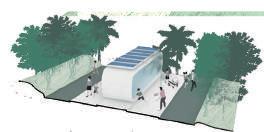

Slow-tempo path Pedestrian only
Raised bridge Crossing forest
Downpour will no longer annoy users as the site can automatically drain water by lifting modules to form a slope. Further sea level rising can also be resisted.
Promenade Comprehensive

Amphibious Sports Park 106
AMPHIBIOUS HABITATS CONSERVATION

Strategy: Ecological Level

HABITAT INTERVENTION ACTIONS
Removing coastal plants and stone revetment, remodeling the soil into breakwater with installing oyster reefs and planting seagrass
Excavating the soil and planting coral reef and seagrass, for water sports recreation and sedimentation basin
Softening the sandy soil and turning it into recreational sand beach, planting palms
Softening the sandy soil and turning it into arable soil to cultivate lawn and secondary forest
HABITAT MAP & HUMAN-NATURE RELATIONS
107
Seagrass
Coral reef Sand beach plants Secondary forest Seagrass Lawn Salt
Mangrove perching birds Seabed landscape Fishing Jungle experience Jogging Camping Gateway Transportation hub Pollutant source Urban greenland Slow down ocean flow Soil and water conservation Firm coastline Self-adaptation sediment 2m 6m
2 3
Green slope
marsh
1
4 Stone Revetment Canopy
Bivalve Reef Breakwaters Natural Shore Coral Reef Basin Hardened Sandy Soil Crusty Soil Arable Soil Sand Beach
Removing coastal plants and stone revetment, remodeling the soil into breakwater with installing oyster reefs and planting seagrass
On the basis of rising sendiment, turning shore into salt marsh by planting essential pioneer plants

Bringing in mangrove forest prior to submerging, with cutting down a part of forest
Maintaining the majority of forest, by fine treatment and installing essential facilities

Amphibious Sports Park 108
To protect the last seagrass habitat along Tuas and secondary forest from sea level rise, secondary mangrove forest will be planted and multiple strategies are building coherent intertidal habitat.
Canopy
1 Seagrass Habitat
2 Salt Marsh
3 Mangrove
4 Secondary Forest
5 Lawn Softening crusty soil and plant grasses.
Such multi-pronged approaches to be applied in face of sea-level rise could set an example for those sites which try to turn danger to bargain and revitalize the environment for both human and nature and enlighten people to imagine future lifestyle.

109 MASTERPLAN

Amphibious Sports Park 110
CREATE A SHRINE TO THE WATER SPORTS ENTHUSIAST

By remodeling the landform and restoring the littoral environment, a series of water sports spaces and facilities are welcoming sports lovers with open arms.

111 MASTER PLAN
CANAL CHANNEL OF HEALTH.
The canal will be expanded to create a recreational water sports channel with integrating futureoriented terrestrial and beach sports, to heal the mental and physical health of people.


Amphibious Sports Park 112

113
ALTERNATIVE INDUSTRIAL LANDSCAPE DRIVEN BY OCEAN RESOURCES
Birth of a Water Industry
With decreasing demand for oil, the existing oil plants along the coastal line of Sungei Pandan have a great potential to be transformed into an alternative industrial landscape that could be more innovative and energy-efcient with the sea level rise adaption.
Taking advantage of the existing landform (bathtub-like bay) and adjacent reservoir as water storage, I propose solar-powered desalination system and water-dependent industry/workshop spaces. The project includes bay landform changes to terraces for pretreated seawater storage with bio-engineering fltration gravitationally; foating solar panels that connected with the existing oil pipelines for energy support; renovated oil tanks; retroftted road networks for human fow connection; secondary forest restoration and extended green corridors for recreation and mangrove habitat enhancement.
Alternative Industrial Landscape Driven by Ocean Resources 114
Tan Shuyue
GREAT POTENTIAL TO BE TRANSFORMED INTO AN ALTERNATIVE INDUSTRIAL LANDSCAPE AND RELATED TO CITIZENS’ DAILY LIFE

INDUSTRY VISION IN 30 YEARS: LESS RELY ON PETROLEUM BUT MORE ON CLEAN ENERGY

115 SITE ANALYSIS AND OVERALL VISION
Water Issues (bay catches calm water, surface water fow, junction between sea water and fresh water)


HABITAT LOSS, FRAGMENTATION AND DISCONNECTION
LACK OF HABITAT CONNECTION
Alternative Industrial Landscape Driven by Ocean Resources
Manufacturing
Oil Refnery Bay
Industry Pandan Reservoir
116 ISSUES AND POTENTIAL
C
DESIGN CONCEPT AND WORKING FLOW
Sea Water Pretreatment (driven by ocean resources), Habitat and Human Connection
Human Connection
Habitat Reconnection
Water Treatment
Water Activity
Energy Support
Coastal Habitat
Sight-viewing
Bio- engineering Dam (Filtration) Chemical Treatment Sand
Off-land
DESIGN STRATEGY
1 Reorganize Site Resources
Shape the Land form
Enlarge water catchment capacity Change the contour to terraces topography

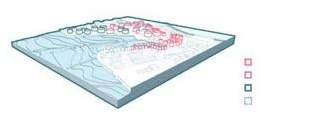


New Revetment Edge
Land Shape Change Direction
Utilizing Ocean Resources
Tidal Force
Solar Energy
Reorganize Site Infrastructure Function
Water Production
Water Consumption
Recreation Renovation
Demolition
117
Sand Filters
Canopy Walk
Water-demanding Industry
Desalination (Reverse osmosis)

Water Storage

Water-demanding Industry
Recreation Reservoir
Habitat
2 Connect Water, Habitat and Human
Water Connection
Recreation Renovation
Desalination (fresh water production)
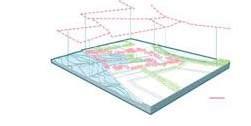

Water Distribution
Habitat Connection
Habitat Connection
Human Connection
Habitat Connection
Alternative Industrial Landscape Driven by Ocean Resources
118


Intertidal Zone (air fotation) Intertidal Zone Bio-fltration Sea Water Catchment Pretreatment 1 Pre-treatment 2 Solar Energy Tidal Force Gravity Force (35ha) (Elevation Difference) 215 MWh/day 2 Times/day 1 Meter (fltration) 119 DESIGN PROCESS 1_ ENERGY EFFICIENT DESALINATION PROCESS AFTER Energy Efcient BEFORE


Alternative Industrial Landscape Driven by Ocean Resources Desalination Plant Pandan Reservoir Desalination Energy Consumption Freshwater Production ≈Tuas Desalination Plant 204MWh/day 136,000/m³/day (reverse osmosis) Sand Crushed Gravel Pebble Oil Refnery Plant Car way Pandan Reservoir 120 Energy Consumption

121
Desalination process and water distribution
Sea Water Pre-tretment Reservoir
Desalination Plant

Water-demanding Industry

HABITAT RESTORATION PHASING
Mangrove
Secondary Forest Regeneration
Mangrove Corridor
Common Trees
Lawn
Mudfat Extension and Mangrove Restoration


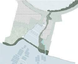
Secondary Forest Regeneration

Species for regeneration:
Walking Pathway

Carway
Recreation Oil Tank
Floating Solar Panel
Alternative Industrial Landscape Driven by Ocean Resources
1Year 3 Year
10 Year
30 Year
3 Year
5 Year
Human Connection Water Connection Habitat Connection 122 DESIGN PROCESS 2 _ CONNECTION
Amomum villosum Lour. /Streblus asper Lour /Hopea odorata Roxb. /Syzygium cumini (L.) Skeels /Dipterocarpus alatus z


Mangrove Restoration Floating Solar Panel Bio-engineering Dam Sea Water Storage and Water-demanding Industry Secondary Forest Regeneration Oil Tank Recreation Beverage 123
TANKS RENOVATION
Have fun at the top of the remaining tanks and take a view of the secondary forest canopy layer. Don’t forget to taste the freshest juice, beer, or any beverage just produced and delivered from the factory on-site directly!
BIO-ENGINEERING DAM


Mangrove continues to the foot of the dam from the reservoir, the secondary forest combining with the renovation tanks and industries make the dam become an ecological, productive, and leisure connection point.


Alternative Industrial Landscape Driven by Ocean Resources and Pretreatment
Beverage Manufacturing Forest Canopy walk 124
Habitat Corridor

125
ADAPTIVE COASTAL HUB
Conversion from Industrial Area
Yin Yi Anna
With the relocation of the maritime industry and the development of technology, the future of the industrial coastline has many possibilities, and the purpose of this design is to build the site into a multi-functional coastal hub after phased construction, which includes a worker community center phase.
There three main zones on the site: building area, landscape, and water retention lake. The building area can undertake different urban functions over time, including working as a worker center. Meanwhile, the landscape works as a resilient flter to treat the leftover pollution and adapt to the changing water level. The lake can take the function of water supply and generating hydroelectric power.
Together with remolding the landform, carrying out brownfeld treatment, transferring the infrastructure space, introducing renewable energy, and enhancing the ecosystem service, the designer wants to enhance the participation of citizens in the industrial area and develop the energy potential of coastal areas for self-sufciency, hoping it could be the paradigm of Singapore future redevelopment.
Adaptive Coastal Hub 126
Water Treatment Plant


Oil Refinery
Shipyard


Seawater Ship Dock
Heavy Metals Detected in Singapore Southern Maritime Industrial Zone


Zn> Cu> Pb> Cr> As> Cd> Hg


Runoff goes into the ocean with pollutant Vulnerable to sea level rise
Topo & Waterflow Map
Accumulated pollutant & Harmful to organism

Existing barriers stop the accessibility Coastal edges are not adaptive to SLR

Map of Site Edges Types
Inflitration is not enough
Permeability Map
The infiltration amount in the site compared to total runoff: 12.9%


127 SITE ANALYSIS
Asphalt Concrete
Ditch Steel Plate Board Grass
Drainage
of Site Edge
9m 0m -9m 3m SLR Vulnerable Zone
Oil Refinery Shipping Zone Shipyard Underutilized Area Police Station Logistics Water Treatment Plant Container Storage Zone
Landuse Map
2021 Existing Condition : Shipyard, Maritime Industry


1.
2. Remould


2040 Phase 1: Worker Community Center


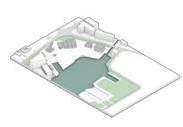
3.
1.
2070 Phase 2: Super Coastal Hub
2. Introduce


3.

Adaptive Coastal Hub 128
& GENERAL STRATEGY
Meters Sea-Level
PHASING
3
Rise
Shipyard Factory Shipyard Factory Existing Massing / m2 Total development / m2 Total Development / m2 Direct Jobs Accommodation Direct Jobs Capitalized Value Recreation Generated Energy Capitalized Value Landuse Breakdown / m2 Landuse Breakdown / m2 Landuse Breakdown / m2 Maritime Industrial 66,463 Residential : 6,030 Office : 26,952 Institutional : 2,080 Institutional : 10,950 Institutional 18,999 Green Space : 51,140 Water 64,456 Commercial 3,360 Commercial : 194,592 Recreational 4,693 Recreational : 20,251 Green Space : 117,480 Retention Lake : 63,856 Green Space : 70,214 Retention Lake : 62,447 Infrastructural : 76,144 184,139 206,369 496,629 340 1440 1780 $ 115,058,000 590~780 10,025,920 kw·h $ 6,185,543,000 MRT Station Oil Refinery Oil Refinery (being converted) Education Center Police Station Lake Dam Restorative Green Space Sunken Plaza Lake Oasis Renewable Energy Station Hawker Center Worker Dormitory Police Station Leftover Maritime Industrial Area Hotel Commercial Sports Center Outdoor Sports Area Hydroelectric Dam Office Renewable Energy Museum
Strategy - PHASE 1 ① Building Area ① In-situ Remediation ① Adaptive Landscape ① Sediment Purification ① Water Retention Lake ① Tolerance Species Existing Condition After Remoulding
General
brown field treatment
Carry out
3 zones
Plan the site into
landform
Strategy
① Car Parking Solar Energy Increase iInfiltration Electricity Facility Wind Energy Lower Temperature Water Storage Tank Hydro-electricity Improve Soil Quality
the
to adapt to the waterlevel change General
- PHASE 2
renewable energy
resource
Enhance the ecosystem service
infrastructure to underground
Transfer
Phytometabolism


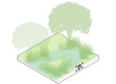

129 PHASE 1 SCENARIO - WORKER COMMUNITY CENTER
Restorative Landscape Worker Community Center Phytovolatilization Phytodegradation Rhizodegradation Phytohydraulics Phytostabilization Phytoextraction
①In-situ
②Tolerance
③Sediment Purification
Remediation
Species
Chrysopogon zizanioides Cymbopogon citratus Ficus microcarpa Ipomoea pes-caprae Nerium oleander Ophiopogon jaburan Osmoxylon lineare
Water Retention Lake (Under Construction)


A. Demolish Existing Barrier
B. Elevate The Topography of Building Area


C. Build Retention Dam

Adaptive Coastal Hub 130 Osmoxylon lineare
Pennisetum alopecuroides
Pennisetum x advena Arundo donax Complaya trilobata Bulbine frutescens
Leucophyllum frutescens
Wind Energy
Hydro-electricity
Underwater Gallery
Water Retention Lake

③Improve Soil Electricity Facility
①Increase iInfiltration
a. Plant trees over shrubs
b. Use bio-char / compost to increase the earth content

c. Pay attention to high-clay soil

a. Forest and with shrubs
b. Increase the and structural

c. Remain the
d. Add bio-char to increase the
131 PHASE 2 SENARIO - SUPER COASTAL HUB
Underwater Gallery
a.


b.
c.
Adaptive Coastal Hub 132 Quality
Landscape Urban Complex Solar Energy Organic Soil Pumping Station ②Lower Temperature Car Parking Water Storage Tank
vegetation
Adaptive
managed
mulch
the understorey density structural complexity the leaf litter bio-char /
/ compost the soil organic content
Develop highrise
greenery
Form larger
canopy
the
Not obstruct
airflow
 Lake Oasis
Sunken Lawn
MRT Station Exit A
MRT Station Exit B
Open Sport Area
Boating Club
Boating Deck
133
Hydro-Dam/Tidal

Adaptive Coastal Hub 0 10 50 100m N
Retention Lake
Hydro-Dam/Tidal Energy Station
134
Underwater Gallery


135 Lake Oasis Marsh Public Lawn Urban Complex Square Road Logistic Area Road Cofee House Marsh Lake Oasis Deep End Hydro-dam Sea MRT Station Hotel Renewable Energy Center 0 0 5 5 10 10 20 20 50m 50m Commericial Complex Lake


Adaptive Coastal Hub 136
Oasis Energy Museum Hydro-dam Tidal Energy Station Ofce Educational Institution
Lake

137
REVITALIZING FOOD DISTRICT VIA SEA LEVEL RISE ADAPTATION
Interactive Food-and-water Experience
Kairui ZHANG (Karry)
The food packing district involves a variety of food packaging and trading businesses, including seafood, pork, dairy, and soy sauce. It takes the responsibility of food supply to whole Singapore, currently contributing 20% of Singapore’s pork supply. Potential sea-level rise threatens the food portion of the food packing district, exaggerates heavy lack of accessibility, and leads to rarely recreational and relaxing urban space for workers in such a highly rigid district. In refurbishing the site to adapt and protect, opportunities can be found in innovative redeveloping coastal edges that allow new commercial, F&B, social, recreational space to occur along with connections, as well as revitalize space between existing structure.
By replanning, the food business into a more interactive form and introducing a food recycling system, food showcasing space occurs on-site. By-products are reused and recycled, contributing to the development of other related commercial and social spaces for visitors experiencing from farm to fork. Under such redevelopment of food district, water is welcomed to the site by revising landform for better water storage and utilization of natural water, as well as enhancing the interaction between visitors and water. Freshwater detention pond and tidal swamp are found shifting in turns via the effect of tide and sea-level rise. Building code is also changed correspondently based on their different value and function. Accessibility throughout the whole food district is improved by creating various spatial relationships between humans, water, building structure, and vegetation, as well as a more fuent logistic fow.
To sum up, the vision of this project is to fulfll interactive food process and production on site, and enrich the food-related experience for humans under sea level rise scenario, making food production and process visible to visitors and let them fully participate and enjoy the site during different water level periods.
Revitalizing Food District via Sea Level Rise Adaptation 138
SITE SELECTION & SITE CONDITION UNDER SLR EFFECT

In a such highly industrial zone, the site becomes a place that workers must pass through based on their daily needs. Future PCN provides the opportunity of development in an energetic way by bringing the public to the industrial zone.
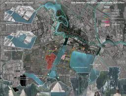
SITE INDUSTRY STRUCTURE & ACCESSIBILITY ANALYSIS
139
SITE ANALYSIS
Analysis of building structure and parking lots provides clues of future industry development need for logistic routes and food storage, as well as trading.
Existing Condition Project Vision
The current site is a rigid food packing district, involving various food productions. The site is limited within the packing and production function, which does not provide any social, relax, human-related function.
MACRO PLANNING
Project vision aims to make the food district more energetic under SLR scenario with multi-function meanwhile improve the efciency of the food industry development. It would possess both economic and social functions.


Macro planning is based on the new introduction of the versatile food recycling system. According to different food businesses, multi-function would generate correspondently.

Revitalizing Food District via Sea Level Rise Adaptation
140
VISION AND MACRO PLANNING COMPARISON BETWEEN CURRETN AND FUTURE VISION
STRATEGY INTERVENTION
FLOODING STRATEGY INTERVENTION

ECOLOGICAL STRATEGY INTERVENTION

141
ACCESSIBILITY TYPOLOGIES ILLUSTRATION


Revitalizing Food District via Sea Level Rise Adaptation 142 WATER FLOW AND SEA-LEVEL RISE SCENARIOS CONNECTIVE STRATEGY INTERVENTION

143
Visitors who come to the food district now could participate in a variety of food production activities in a water featured landscape. People could seed themselves, harvest themselves, even process food by themselves. Besides, there are also other social activities generated along the process of food production under such a versatile food recycling system. The human builds their own connection with food and water in food district.

Revitalizing Food District via Sea Level Rise Adaptation 144 INTERACTIVE CONNECTION BETWEEN FOOD AND HUMAN
PHASE 1: UNDER 1M SEA LEVEL RISE SCENARIO
A freshwater detention pond could be found in the inner part, meanwhile the beach is in front of the coastal boardwalk. Human activities are intensively in the outdoor space.

PHASE 2: UNDER 3M SEA LEVEL RISE SCENARIO
Freshwater detention turns into tidal retention, meanwhile, a big distance of lagoon could be found behind the coastal boardwalk. Human activities are partly shifting into semi-open space.

145 PHASING PROCESS


Revitalizing Food District via Sea Level Rise Adaptation 146
PERSPECTIVES
WATER FRONT
Ofce Waterfront & Seafood Market Waterfront
The veggie garden could be found in the entrance of wetland, as well as multifunction layered deck provides opportunities for fshing, and other social activities.
People are dining outside the seafood market in front of the coast. And multi-layered deck offers visitors various views to the coast, as well as interactions with water and plants.

147 OVERALL FOOD OPERATION & QUANTIFICATION IN FOOD DISTRICT

Revitalizing Food District via Sea Level Rise Adaptation 148
FROM WEST COAST PARK TO MARINA SOUTH PIER
INDIVIDUAL PROJECT
In-between landscape Li Wanying
Located in the urban estuary, the project site has a dynamic hydrological condition and complexity in land use. The project hence aims to redevelop water infrastructure as in-between new open spaces in industry zone and urban park to better adapt to SLR and optimize the land use. The canal and drainage system will be re-designed as a distributed watershed and open spaces will be interwoven among the waterways, recreational and commercial areas, industrial test felds, and coastal habitats patches. Such hybrid forms of water infrastructure will help land-water Interface to be multifunctional and habitable for both nature and human.
Revival: Coastal Nature, Coastal Culture Dreamy Hong
As the core of the southern coastal line that is vulnerable to sea level rise, the project attempts to retroft outdated post-industrial facilities into coastal adaptive cultural landscapes including the art performance center. Semi-enclosed sea becomes two tiered stages – underwater and on the water. The factory buildings are renovated as workshop space for theatre design, a museum and educational facilities for performing arts. Open spaces include terrace types structure gardens that are multifunctional - for sitting towards the ocean stages, for defending sea level rise, and for coastal biodiversity.
Living with mangroves Zhu Wen
The site, 9.5hc falt grass patch that is waiting for future residential development, lies between two high mountains, Labrador Nature Reserve and Kepple club golf course, making it a vulnerable place if sea level rise. By retroftting existing mangrove creek and unsealed sea walls, the project attemps to propose a blue green infrastructure that is resilient against sea level rise and increase closeness to nature for future residents.The new waterway will work for stormwater management and the raised coastal terrian by sediment from marine current contribute to defend sea level rise by there meters. PCN, jogging tack, cycle way, water playground, restaurants and community center will be interwoven with mangrove creek and coastline as a part of everyday life.
Triple lifeline Zheng Qiaoyu
With the Keppel terminal relocation, the site opposite the Sentosa island would be in commercial and residential use to accelerate tourism development. However, currently used as the shipping terminal, the concrete site also faces serval hard barrier for future development such as weak accessibility, sea level rise issue, low rain water harvesting and green habitat fragmentation etc. In this project, high-end condominium and reservoir park would be built on the fooded area to explore a kind of new metropolitan hydrophilic lifestyle. By integrating current transport system, shaping water system and connecting surrounding habitat, the human water and wildlife triple lifeline would be enhanced in the site.
149


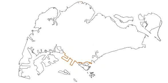
From West Coast Park to Marina South Pier 150
Site 1: In-between landscape Site 2: Revival: Coastal Nature, Coastal Culture
Site 3: Living with mangroves Site 4: Triple lifeline
Li Wanying
Site 1
Li Wanying
Site 2
Dreamy Hong
Site 3 Zhu Wen
Site 4 Zheng Qiaoyu
Dreamy Hong Zhu Wen Zheng Qiaoyu

151
IN-BETWEEN LANDSCAPE
Redefne urban water infrastructure
LI Wanying
Located in the junction of industry zone, urban park, and residential area at the urban estuary, the project site has complexity in land use and dynamic hydrological condition. However, these characteristics also cause 3 key issues, including loss of land, loss, and disconnection of habitats, and industrial pollution issues.
Hence, the project aims to redevelop water infrastructure as in-between new open spaces in industry zone and urban park to better adapt to SLR and optimize the land use. The canal and drainage system will be re-designed as a distributed watershed and open spaces will be interwoven among the waterways, which includes recreational and commercial areas, industrial test felds, and coastal habitats patches.
Three strategies will be implemented. Firstly, to create a new land-use typology between industry and park. By reshaping the landform, re-arranging the building layout, and re-naturalizing the water network, the new industry & park land use form will be generated. Secondly, to form the purifcation system between polluted surface runoff and purifed water. Industry runoff will be fltrated through the treatment feld or buffer before draining to the sea, the purifcation system is a part of the new land use. Thirdly, diverse habitats will be created in the new land-use type.
Such hybrid forms of water infrastructure will help land-water Interfaces to be multi-functional and habitable for both nature and humans.
In-between Landscape 152
DYNAMIC HYDROLOGY AND LAND-USE COMPLEXITY


The site is located at the urban estuary, at the junction of the industry zone, west coast park, and residential area. The Sungei Pandan Kechill is the main drainage in the area, through which the surface runoff around drain away to the sea.

KEY ISSUE 1 _ VULNERABILITY AND LOSS OF LAND
The site is one of the most vulnerable areas in SLR 3m scenario, especially for the industry zone. Almost half of industrial land will be submerged.


Industry Residential Urban Park Pandan Reservoir Sungei Pandan Kechill Pasir Panjang Terminal Canal Drainage Surface water fow Sea water Mangrove swamp 0 50m N
1.9Ha Industry land submerged
153
Existing Scenario 3M SLR Scenario
SITE ANALYSIS
912m³/hrs
in extreme flooding event
7114m³/d
in daily situation
pollutant: Fe, Cu, Zn, Pb, N, P, S

336m³/hrs
in extreme flooding event

2620m³/d
in daily situation
pollutant: N, P, S
KEY ISSUE 2 _ POLLUTED SURFACE RUNOFF


Due to the grey infrastructure and impermeable surface, the large amount of polluted industrial surface runoff will be drained to the Sungei Pandan Kechill.
1.8Ha
Mangrove habitats lost

Managed Turf
Managed Tree
Coastal Forest
Brackish Mangrove

Tidal Canal


Granite Seawall
Rocky Seawall
KEY ISSUE 3 _ DISCONNECTION AND LOSS OF HABITATS
The industry zone lack of habitat connection between the sea and urban green. In SLR 3m scenario, mangroves along the canal have no inland to move inwards.

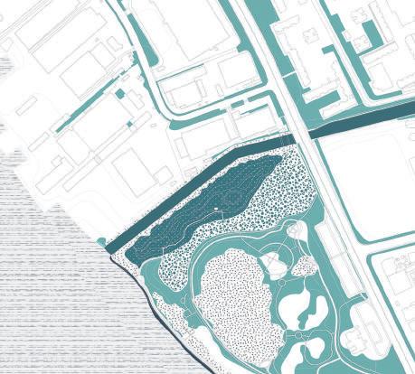
In-between Landscape
Pollution Degree High Low 154
SITE ANALYSIS
Adaptive void deck
Industrial buffer
Rain garden
Accessible void deck
Multi-mechanism buffer
Activity void deck
Semi-open commercial
Coastal mangrove
Broadwalk
Coastal mangrove
Relocated exercise garden
Waste
High-tide pathway
Low-tide pathway

0 N 10 50
water
water Brackish water
Fresh
155
Light industry
Sports field
Treatment field - Sedimentation
Water treatment industry
Linear greenspace + rain garden

Treatment field - Heavy metal removal
Treatment field - Pathogen removal
Treatment field - Nutirents removal
Treatment field - Stablization pond
Sports field
Cleansing biotope
Biodetention field
Light industry
In-between Landscape
Tidal marsh - brackish pond
Vegetated swale
Activity lawn
Carpark
garden
Broadwalk
Tidal marsh
Activity plaza
156
commercial area
STRATEGY 1
Between industry and park - New land-use typology

LAND-USE TYPOLOGY TRANSITION
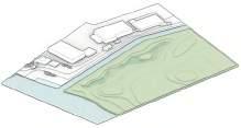


New lad-use types will be created between park and industry, which can not only serve residents but also workers, not only have recreational value but also economic value.
1 Mangrove next to the canal has no spaces to move inwards.
2 Low-lying industry zone will be submerged.
Tactic 1 Re-shaping Landform
Industry field and building in low-lying area will be submerged.
Tactic 2 Re-arranging Buildings
1 Polluted surface runoff directly run sinto the sea.
2 The site has dynamic hydrology conditions but single-function grey infrastructure.


3 Park is resilient while the industry zone is vulnerable in flooding event.
Tactic 3 Re-softening Water network
OPTIMIZATION TACTIC
Mangrove can grow Buffering
Arranged building at highland
Elevated
Treatment pond Tidal Marsh Rain garden
Cleansing biotope
Tidal Mangrove Bioswale
Multifunction blue-green infrastructure
After optimization, the water network will be more dynamic, working spaces will be safer, new landuse types offer multi-functional spaces for both industry and park.
Industry Industry Industry Industry & Park Park Park Park 157
IMPROVEMENT TACTICS

By analyzing slope and hydrology, different coastal habitats can be added to the site. By connecting the water network, plant multi-layer vegetation, and integrating with structure, connectivity can be improved.


PROPOSED HABITATS MAP


The design aims to create more diverse patches and connective habitats.


In-between Landscape Tactic1 Provide diverse habitats waterbody Managed turf 2.85% 11.1% 20.54% 2.59% 2.63% 4.54% 14.49% connected water network multi-layer vegetation integrated with urban structure 8m birds intertidal aquatic birds intertidal aquatic 158
STRATEGY 2 Between urban and nature environment - Habitats improvement
Between polluted and purifed - Purifcation system


PURIFICATION SYSTEM


The purifcation system has enough capacity for treating the polluted surface runoff from the surrounding urban environment, and of managing the storm water in the site.

Thalia dealbata Fraser Cynodon dactylon (L.) Pers. Cynodon dactylon (L.) Pers. Hibiscus tiliaceus Pandanus tectorius Sol. Canna indica L. Canna indica L. Scyphiphora hydrophyllacea Rain garden (original drainage) Cleansing biotope 1500 m2 * 1 m Multi-mechanism Buffer Average width > 7 meters Vegetated swale Average width > 3 meters Juncus efusus Juncus efusus Cyperus rotundus L. Cyperus rotundus L. Sedimentation pond Culvet Heavy metal removal Subsurface wetland Artificial aeration Pathegon removal subsurface&surface wetland Nature&artificial aeration Nutrient removal Surface wetland Artificial aeration Stabilization pond Surface Wetland Artificial aeration Overflow Water storage tank (underground) Irrigation use Tidal marsh Biotope1 Sedimentation Biotope2 Nutrients removal Nature&Artificial aeration Landscape Detention pond Vegetated swale Tidal marsh Culvet Surrounding surface runoff Overflow PARK AREA RUNOFF TREATMENT PROCESS INDUSTRY ZONE RUNOFF TREATMENT PROCESS 159 STRATEGY 3
Industry zone surface runoff drainage Residential area surface runoff drainage Site area surface runoff Tidal marsh Treatment water flow contaminated clean
Sedimentation Pond 1500 m2 * 1 m Lemna minor Eichhornia crassipes Thalia dealbata Fraser Phragmites australis Juncus efusus Juncus efusus Myriophyllum verticillatum L. Typha orientalis Presl Typha orientalis Presl Typha orientalis Presl Canna indica L. Heavy Metal Removal Wetland 1100 m2 * 1 m Pathegon Removal Wetland 700m2 * 1 m Nutrients Removal Wetland 290m2 * 0.5 m Stabilization Pond 280m2 * 0.5 m Juncus efusus INDUSTRY ZONE SURFACE RUNOFF TREATMENT LIGHT INDUSTRY&PARK SURFACE RUNOFF MANAGEMENT Treatment amount: Extreme event: 912m³/hrs Daily situation: 7114m³/day Treatment amount: Extreme event: 592m3/hrs Daily situation: 4620m3/day 1 5 2 3 4 4' 1' 5' 2' 3'
KEY SECTION
The key section showcases that the purifcation system not only management storm water but also provide different function space.


In-between Landscape Section 5-5' Urban road (residential) Road greening Residential area surface runoff Subsurface wetland Subsurface wetland Vegetated detention pond Sedimentation pond Nutrients removal wetland Section 2-2' Activity plaza Buffer zone Surface wetland Stabilization pond Tidal marsh Pathway Section 1-1' Urban road (industry) Industry zone surface runoff Surface wetland Subsurface wetland Industry buffer zone Sedimentation pond Heavy metal removal wetland Pathogen removal wetland Learning platform Section 4-4' Light industry Surface runoff Surface runoff Subsurface wetland Activity zone Biodetention swale Rain garden Light industry Vegetated swale Section 3-3' Light industry Surface runoff Activity zone Multi-mechanism buffer Sea 160 STRATEGY 3 Between polluted and purifed - Purifcation system
In the future, the water capacity and biodiversity in the original industry zone will be largely increased. More activity spaces will be designed for both workers and residents around.
The water capacity and biodiversity in the original urban park will be increased. What’s more, the park can provide a safe working area for the light industry.


+13+ species +0.4ha coastal mangrove +640m natural shoreline +1.25ha tidal marsh
+92800m2 light industry offce +0.8ha coastal mangrove +580m natural shoreline +600m +600m +1600m2 multi-mechanism buffer +48+species 161
THE NEW URBAN PARK
THE NEW INDUSTRY ZONE
+0.8ha activity spaces +600m2 rain garden +600m3 water capacity


+150m2 industry treatment feld / wetland
7114m3 /d industry surface runoff treated
+0.7ha tidal marsh
+13000m2 light industry (offce)
+1400m2 cleansing biotope/wetland 2620m3/d surface runoff treated
+550m vegetated swale
+7+ species
+1400m3 water capacity
In-between Landscape
162

163
REVIVAL
Coastal Nature, Coastal Culture
Pasir Panjang power station is the core of the southern coastal line that is vulnerable to SLR. What`s more, the post-industrial infrastructure and related equipment are fully underutilized. Therefore, the project attempts to retroft outdated post-industrial facilities into coastal adaptive cultural landscapes.
This project will employ three strategies. Firstly, reorganize and redefne the function of existing infrastructure by renovating the post-industrial infrastructure and adding new structures both inland and in the ocean. The existing infrastructures such as power stations, post-industrial components are renovated as workshop space for theatre design, a museum, and educational facilities for performing arts. Secondly, to better adapt to SLR by hard and soft measures. Soft measures include vegetation purifcation to deal with the high city run-off and the natural coastal barriers: coral/seagrass to protect the inland from the SLR. Hard defense measures include underwater structures change the direction of the tide fow and terrace types structure gardens that are multi-functional - for sitting towards the ocean stages, defending sea level rise and coastal biodiversity. Lastly, create diverse habitats in the post-industrial area to build a bio-relationship from the coast to inland.
The outdated power station will become a new natural and cultural heritage for recreation and learning in the future. Simultaneously, the revitalized coastal natural resources will also become an essential part of the historical and cultural center for research and exhibition.
Revival: Coastal Nature, Coastal Culture 164
Dreamy Hong
VULNERABLE ANALYSIS


Pasir Panjang power station area is an important node of Pasir pangeng nowadays, this power station area has not to glory as before.


Pasir Panjang Ferry Terminal Pasir Panjang Terminal Flooding area of sea level rise to 3m Site Boundary PARCLE AT RISK Power Statio LG Service Center Caribbean Residences Condo MOE Labrador Outdoor Adventure Centre Mapletree Business CIty Viva Vista Shopping Mall Laborador Nature Reserve Mangrove 0 300 N 165 SITE ANALYSIS Pasir Panjang Ferry Terminal Car Park SECTION 1-1 SECTION 2-2 SECTION 3-3 SECTION 4-4 Disused pumphouse with lawn Seawall Disused warehouse with hard open space Seawall with mudflat Laborador jetty along the beatch Intertidal zone Seagrass Laborador rocky shore SCC Pasir Panjang 3.00 0.00 5.00 3.00 0.00 5.00 3.00 0.00 5.00 3.00 0.00 5.00 0 10m 0 10m 0 10m 0 10m
WATER FLOW ANALYSIS


POLUTION ANALYSIS


Coastal Nature, Coastal Culture 1 2 2 3 4 1 3 4 0 50m N 8.00 11.00 11.00 12.00 10.00 13.00 2.50 2.50 36.00 26.00 25.00 3.00 3.00 2.80 2.00 2.00 2.00 2.50 2.50 2.50 2.50 2.50 2.00 2.00 3.00 2.00 2.00 3.00 3.00 3.00 3.00 2.50 4.00 8.00 10.00 Seawall Cement Pavement Pavement Cilff Permeable asphalt Pavement 0 50m N CD CR CR CR CU CU CU CU NI NI ZN ZN CD PB PB PB FE FE FE Road Related Power station Warehouse Port PB CO CU NI AI CR ZN FE SI + + + + + + + + + + + + + + + + + + + + + + + + + + + + + + + + + 166 SITE ANALYSIS
Revival:


BUSINESS INSITITUTION WAREHOUSE OILTANK PORT CARPARK SURPOTING OPENGREEN SPACE Typology1:Port area Port + Business + Warehouse + Supporting facility Typology2:Disused power station area Business + Warehouse + Oil tank +Supporting facility Typology3:Natural reserve Open Greenspace + Jetty POWER STATION AREA PORT AREA N 167 SITE ANALYSIS Original Land use Typology

Revival: Coastal Nature, Coastal Culture 168
Reorganize and redefne the function by shaping the coastal line and renovating post-industrial component
SITE TRANSITION Before After

169
1
Operation in Site STRATEGY
STRUCTURE RENOVATING
Core Buildings - Historical Power station
Reuse the basement Open the part of the wall Connect buildings
STRUCTURE RENOVATING
Industrial Component - Oil tank Above Water Structure
STRUCTURE RENOVATING
ADDING
Underwater Structure
Revival: Coastal Nature, Coastal Culture

170
Underwater Museum Underwater Theater Underwater Gallery
Defense the sea-level rise by soft/ hard infrastructue
1.City run-off / pollutants purifcation by Vegetation


SOFT INFRASTRUCTURE

2.Natural barrier for coastal defense: coral/ seagrass


HARD INFRASTRUCTURE
1. Underwater Structure


2. Terrence Structure

Runoff purify vloum: 1,310.71 m3/h Multi- Mechanism Buffer Multi- Mechanism Mat Stormwater Filter Stabilization Mat Surface- Flow Wetland Upper Canopy Adinandra dumosa Adinandra dumosa Ficus microcarpa L.f. Cinnamomum iners Cinnamomum iners Pandanaceae Ficus fstulosa Ficus fstulosa Ficus fstulosa Leea guineensis ‘Burgundy’ Leea guineensis ‘Burgundy’ Leea guineensis ‘Burgundy’ Leea guineensis ‘Burgundy’ Typha latifolia Typha latifolia Typha latifolia Lemna minor Typha latifolia Syzygium cumini(L.) Syzygium cumini(L.) Chrysopogon zizanioides Chrysopogon zizanioides Chrysopogon zizanioides Chrysopogon zizanioides Crinum asiaticum L. Cenchrus × cupreus ‘Rubrum’ Cenchrus × cupreus ‘Rubrum’ Crinum asiaticum L. Falcataria moluccana (Miq.) Barnaby & J.W.Grimes Wood Buffer Aquatic Aquatic Lower Canopy Lower Canopy Understory Understory Understory Section A-A Water Simulation With the underwater structure
20m 20m
FLOW
SOFT INFRASTRUCTURE WATER
MAP
A A 171
STRATEGY 2-
Connect diverse habitats with landscape component
HABITAT AND LANDSCAPE COMPONENT
Buildings
Landscape Structure

Revival: Coastal Nature, Coastal Culture
172
STRATEGY3


173
Section B-B
Section C-C
POWER STATION VISION
UNERWATER VISION


Revival: Coastal Nature, Coastal Culture 174
Section D-D
D D C C B B
CENTER STAGE VISION

175
References : Mangrove Refection, photoed by Dirk Seifert
LIVING WITH MANGROVES
From land to water : Mangroves as infrastructure
Zhu Wen
The site, a 9.5hc fat grass patch that is waiting for future residential development, lies between two high mountains, Labrador Nature Reserve and Keppel club golf course, making it a vulnerable place if sea level rises by 3 meters. Poor accessibility and habitat degradation are the other two issues of the site.
Hence, this project attempts to create blue-green infrastructures to integrate the residential area with the natural ecology, making it more resilient against sea-level rise.
For sea-level rise, the main strategy is to retroft the Berlayer Creek and coastal seawalls. Mangrove creek will be naturalized and expanded against seawater. Delta from the estuary and silt clay from mangrove creek will be utilized to create a coastal green dike. Meanwhile, the winding creek will create more habitats for fora and fauna and provide varied public spaces for residents.
For poor accessibility, the corresponding strategy is to increase different layers of connectivity. Cycleway would be introduced to connect surrounding areas to the coast. Based on the residential design, secondary roads are designed to increase the connection between the residential areas and mangroves’ habitat.
The third strategy is to create a multi-functional community. Various open spaces will be connected and interwoven with mangrove creek to increase closeness to nature for residents.
Living With Mangroves 176

177 Legend Main Road Vulnerable Point 3M Flooding Area Residential Area Site
HISTORY MAP
The site was surrounded by a coral reef, sandy beach and seagrass habitats. With the development of industry and urban greenery, shorelines became seawalls and habitats disappeared in this site.

Coral
Water body
Secondary Forest


Sea grass


Grass land


Mangroves
Surrounding park
High densely vegetated area
Shoreline Type


Mangroves


Unsealed sea wall


Rocky shore
Sealed sea wall
Board walk

HABITAT MAP
Recently, the site only has grassland and mangrove habitat. The main shoreline type is mangrove and unsealed sea wall.


Living With Mangroves
0 250 500 1000M N Shoreline Type Shoreline Type History History Habitat Habitat 178
Mangroves Plants Marine species Animials
BACKGROUND INTRODUCTION Habitat Degradation
Habitat Map
LEGEND
LAND USE MAP
Terminal Park
Reserve land
Bussiness
HUMAN FLOW MAP
Main road
MRT line
Foot path
Cycle way

MRT station Bus stops
Site Analysis In Bigger Scale


WATER FLOW MAP
Main canal
Drainage
Surface water
Ocean currents
The surrounding land use is mainly business, public park, and industry. The site itself is locked, making the surrounding areas have poor accessibility. Meanwhile, the berlayer creek catches surrounding surface fow and drainage.

0 250 500 1000M N Bukit Chermin Boardwalk BerlayerCreek Alexandra Road PasirPanjangHighway Golf course Mountain Faber Terminal NatureLarbradorReserve Telok Blangah Hill Park BerlayerCreek Delta 179
SITE ANALYSIS Existing Condition
Detailed Human Flow Map
The site is mainly covered with hardscape make the site less vulnerable if the sea level rise by 3 meters high. The drainage system carries the rain water and drains into the belayer creek, making the creek has higher sediment concentration.


Detailed Human Flow Map & Landscape Typology


The site has a small part of the labrador nature reserve. The liner park area is blocked by the reserve land which is surrounded by the fence. The activity of the site is simple. The visitor has no access to the sea.

Living With Mangroves 180 SITE ANALYSIS
Shore Line Type: sealed revetment Landscape form:Cliff + Sandpit + Heritage Structure + Footway Activity: Sight viewing + Culture tour + Children’s activity+ Cycling Shore Line Type: Unsealed revetment Landscape form:Under-utilized Structure + Footway Activity: Sight viewing + Cycling Shore Line Type: Unsealed revetment Landscape form: Ununsed space + Footway Activity: Sight viewing + Cycling Shore Line Type: Unsealed revetment + Footbridge Landscape form: Ununsed space + Footway Activity: Sight viewing + Cycling + Rest Shore Line Type: Mangroves Landscape form: Ununsed space + Footway + Creek Activity: Sight viewing + Rest + Birdwatching Shore Line Type: sealed revetment + pier Landscape form:Cliff + Pavillion + Footway Activity: Sight viewing + Transportation + Rest + Cycling
0 Water Body 0.1 Greeny_High densely vegetated area 0.25 Greeny_Medium densely vegetated area 0.45 Greeny_Low densely vegetated area 0.46-0.65 Open feld, managed turfs 0.86-0.95 Impervious surface 0.96-1 Buildings 0.66-0.85 Non-vegetated previous surface Flooding Vulnerability-Peak Runoff Coefcient Legend High (0.86-1) Medium (0.66-0.85) Low (0-0.65) Accessibility Analysis Human Flow Building Private Parking Lot Public Parking Lot Fence Vehicular circulation routes Pedestrian routes Secondary pedestrian routes
Strategy1 : Site Cleaning & Terran Shaping


Through cleaning and expanding the waterway, the natural creek will reemerge with more habitat coming with it. The sediment from the waterway can be utilized to rise the shoreline against sea-level rise.


Strategy2 : Walkway Installation & Urban Occupation

Different layers of connection can help increase the accessibility of the site to surrounding areas. Various building typologies can increase closeness to nature for residents.


181 STRATEGY Reshaping Naturalize current waterway Operation Current Situation Waterway design Before After Topo line Water fow Reuse sediment from creek and marine current dike as cycle way Return to sandy beach Connect surrounding water resource Surrounding Ponds Make room for the river Expand Deepen
1 2 4 5 3 Open Space Open space (lawn, basketball court, swimming pool) Community Front Yard Activity space for community Sport space (underground playground, plaza, sandy beach) Building types MRT Station Residential Blocks Under-layering Facilities Other Facilities (cafe, retail, gallery, gym, community center) (supermarket, restaurant, hotel) 1 2 5 4 3 Main Road Secondary Road Cycle way Road System Current Situation Tidalchannel LabradorNatureReserve Golfcourse Mudfats Distributed Channels Delta Site Strong ebb-tide fows out with the river current gives asymmetric ripples at right angles to the current.


Living With Mangroves 1 1 2 3 4 4 4 5 7 8 9 10 11 13 12 14 1 6 Labrador Wetland habitat Mainroad Cycle way Floating platform Creek plaza Mangrove habitat Mangrove habitat Keppel club golf course Community center Lawn Supermarket Plaza Visitor center Cycle way Sandy Beach 182
1. Entrance
2. Larbrador MRT Station
3. Cycle Way
4. Plaza
5. Foot path in mangrove forest
6. Wetland Habitat
7. Floating platform
8. Community center 9. Water playground
10. Supermarket
11. Visitor center
12. Gym
13. Basketball court 14. Hotel
15. Education center
0 50 100 200M N
16. Sandy Beach


Shaded Floating Plantform Greenery Connections Cooridor Cool Relax and watch Community front yard paths give pedestrains different costal scennery Cooler activity space Visitor Center Sandy Beach Cycle Way Shaded Grove Sit, relax, watch, shower Cool and calm for hot days 183 Vision1 :Residential block & Plaza & Floating platform Vision2 :Visitor center & Cycle way & Sandy beach
Multi-functional community is created with various open space which is connected and interwoven with mangrove creek to increase closeness to nature for residents.

Sandy Beach will be rebuilt so that visitors can have more access to the water body and enjoy Singapore’s unique tropical scenery.

Living With Mangroves
Shaded Grove
Mangove Habitat
Cool and calm for hot days
Broad Walk
184
Enjoy the open ocean view

185
TRIPLE LIFELINE
Landscape design in Keppel area under the sea level rise
Zheng Qiaoyu
With the Keppel terminal relocation, the side opposite the Sentosa island would be in commercial and residential use to accelerate tourism development. However, currently used as the shipping terminal, the concrete site also faces several hard barriers for future development such as weak accessibility, sea-level rise issue, low rainwater harvesting and green habitat fragmentation, etc. In this project, a high-end condominium and reservoir park would be built on the fooded area to explore a kind of new metropolitan hydrophilic lifestyle. By integrating the current transport system, shaping the water system, and connecting the surrounding habitat, the human water and wildlife triple lifeline would be enhanced in the site.
TRIPLE LIFELINE 186


187 SITE ANALYSIS Water fow map Flow Map Permeability Map CORAL HABITAT DEGRADATION PROBLEM & DEVELOPING ISSUE Weak accessibility with surrounding environment Inadequate drainage infrastructure for sea-level rise Future condominium issue Coral conservation issue Sea level rise 3m 1978 1998 1983 Coral habitat Reclaim land
CONCEPT-TRIPLE LIFE LINE


The water line (connecting the Marina Reservoir and the Keppel Bay ), human line ( connecting the central area, Vivo City, and Sentosa Island), green line (connecting the Faber park, new urban park, and Sentosa Island) would be integrated together in the kepple site.
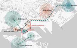

STRATEGY

TRIPLE LIFELINE 188
Increase the sea wall water infrastructure construction Overhead the road Underwater corridor
1.Flooding introduction & containment
Artifcial land to nature land Add artifcial structure
2.Expand the interactive space around the water
SCHEMATIC PLAN
3.Reuse current infrastructure to enrich biodiversity
OPEN THEATER
CORAL RECREATION
Coral sightseeing & Sightseeing
SKY WALK
connect Viovo city and the site

SKY PASS
Green corrior & tourist
189 BRANI
EXPLODED AXON MATRIX
Elevating the ground for the fooding barrier, and then construct the canal from the Marina reservoir to the Keppel Bay on the elevated ground. The elevated road from elevated ground is build in the water. And the foating platform locates at the end of the road.


TRIPLE LIFELINE 190 EXPLODED AXON MATRIX
BRANI ISLAND
tourist path
Sightseeing cycling
WATER SYSTEM CONSTRUCTION
Canal , reservoir and high end condominium


HIGH END CONDOMINIUM
ADAPTIVE MULTIFUNCTIONAL RESERVOIR

CONDOMINIUM
sea level rise

191
A-A'
B-B'


CONDOMINIUM WATER COLLETION TRIPLE LIFELINE
HABITAT RESTORATION AND ACCESSIBILITY ENHANCEMENT

Coral habitat ,green corridor construction and underground space reuse


RECLAMATION LAND REUSE FOR CORAL RESTORATION
HUMAN LINE
193
Before C-C'


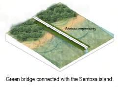


TRIPLE LIFELINE 194
After
GREEN CORRIDOR
FROM MARINA BARRAGE UNTIL TANAH MERAH FERRY TERMINAL
INDIVIDUAL PROJECT
Rebuild Seawalls: Waiting for Sea Level Rise
Liu Kaiyan
To expand land and adapt to the sea-level rise issue, Singapore has done many land reclamation projects in the past decades, and over 70% of shorelines are hardscape. The vertical sea walls, rocky shores, concrete blocks are non-eco-benefcial, and obstructing people from getting close to the sea.
This project aims at redesigning the hard shorelines, thus connecting the inland area and the sea, rebuilding natural habitat and protecting marine life, as well as providing more opportunities for people to enjoy the water
Learning in nature——Waterfront classroom
He Xiaowei Ceama
The most unique feature of this site is the schools located along the canal. However, due to space limitation, schools lack outdoor activities and teaching space. The main purpose is to connect fragmented and underutilized waterfront open spaces as a part of school felds and adapt sea level rise by shaping the topography along the coastal area. The newly created school felds are linked by a running route connecting the campus and the park, along which distributed outdoor educational facilities and sports felds, hoping to stimulate students’ curiosity, improve their physical ftness and cultivate the spirit of scientifc exploration.
Turning risk into opportunity
Xiang Wenqin
The east coast is directly exposed to the Singapore Strait and is at risk from both sea level rising and extreme weather fooding. The aim of the project is to turn the risks into opportunities to protect coastal infrastructure and residential areas with physical multi-layered protection, while creating new reservoirs to meet the demand for drinking water from the increasing number of residents, and create more possibilities for activities..
Guardian of the City
Zhang Liao Judy
Situated at the edge of the east coast district, the project site is one of the most vulnerable to sea level rise in Singapore. Adapted from the government plan to have an additional reclaimed land to protect the district, the project proposes to extend the edge area that has undulated terrains for golf courses as a coastal defence. Together with the extended coastal edge, open canal vertically crossing the existing and new golf courses is reshaped to reuse drained water for irrigation, recreational purposes, and diverse coastal habitats promoting human and wildlife interaction.
195


From Marina Barrage to Tanah Merah Ferry Terminal 196
Site 1: Marina South Pier Site 2: Gocycling East Coast Park Site 3: Singapore Wake Park Site 4: Tanah Merah Country Club Garden
Kaiyan
Site 1 Kaiyan
Site 2 Ceama
Site 3
Wenqin
Site 4 Judy
Ceama Wenqin Judy

197
REBUILD THE SEAWALLS
Waiting for the sea-level rise
Kaiyan Liu
To expand land and adapt to the sea level rise issue, Singapore has done many land reclamation projects in the past decades, and over 50% of shorelines are hardscape. The vertical sea walls, rocky shores, concrete blocks are non-eco-benefcial, and obstructing people from getting close to the sea.
This project aims at redesigning the hard shorelines, thus connecting the inland area and the sea, protecting marine life, rebuilding natural habitat, and also providing more opportunities for people to enjoy the sea.
This aim will be achieved by three steps:
Step 1: mitigate pollution and wave energy. The giant cruise ships and fshing boats cause the hard water wave and produce an oil spill, which hardly disturbing marine life. Also, the cargo terminal is polluting the soil along the shoreline. To mitigate pollution and wave energy, the tactics include plant purifcation, foating flters, building breakwaters, and prolonging the docks.
Step 2: design multipurpose seawalls. The previous vertical and rocky seawalls negatively separate the land and the sea, but there are more potentials than these. The seawalls can act as green space, tidal pool, fshing farm, and waterfront buildings, which provide more chances to both protect the marine life and provide places to get close to the water.
Step 3: facilitate land-sea interaction.
The height difference between the land and the sea varies from 5 to 8meters. By designing stepping slopes and beaches, people can easily enjoy the water. The functions of both sides will remain the same or at least related. The green roof and paths under the docks will make sure circulation.
Rebuild The Seawalls 198


199 SINGAPORE COASTLINE DEVELOPMENT History of Singapore Coastline Development Mapping of Coastline Types (2018) 1924 1953 2011 Seawalls Natural Infrastructure Original Coastlines Hard Engineered vertical seawall grouted breakwater concrete block gabion geobag References: Ng, Zhao Ying, 2019, Creating a national shoreline typology map and identifying ecosystem services found in Singapore’s shoreline habitats, Nanyang Technological University


Rebuild The Seawalls 200 Seawalls 2030 Plan 2030 coastal vegetation mangrove marsh mudfat rocky shore beach Natural Infrastructure


201 SITE ANALYSIS Basic Information Trafc|Human Flow|Activity Trafc Transportation Map Activity Base Map
The frst three samples are at normal level pH(8.0-8.3). Water close to the cargo terminal has higher pH. Higher acid may be due to the higher water temperature and some chemical leaks.
Detailed Flow Map|Permeability Calculation


Rebuild The Seawalls 202 SITE ANALYSIS Soil&Water Quality
Trafc Drainage Facility Water Sample Distribution Soil Sample
WHERE?
Step1: mitigate
Step2: multipurpose
HOW?
Step1: mitigate pollution and wave energy.
The giant cruise ships and fshing boats cause the hard water wave and produce an oil spill, which hardly disturbing marine life. Also, the cargo terminal is polluting the soil along the shoreline. To mitigate pollution and wave energy, the tactics include plant purifcation, foating flters, building breakwaters, and prolonging the docks.
Step3: facilitate land-sea interaction.
The height difference between the land and the sea varies from 5 to 8meters. By designing stepping slopes and beaches, people can easily enjoy the water. The functions of both sides will remain the same or at least related. The green roof and paths under the docks will make sure circulation. Height

203 STRATEGY&TACTIC
Plant Purifcation
Green Space
Marine Habitat
Selected coastal plants can eliminate soil pollution caused by the cargo terminal.
The stepping green space allows people to get close to the sea.
The gentle slopes the stepping green the height difference
Make full use of the space under the docks to build artifcial tidal pools.
Height Difference
Step3: interaction
Landuse&Function
Step2: design multipurpose seawalls.
The previous vertical and rocky seawalls negatively separate the land and the sea, but there are more potentials than these. The seawalls can act as green space, tidal pool, fshing farm and waterfront buildings, which provide more chances to both protect the marine life and provide places to get close to the water.
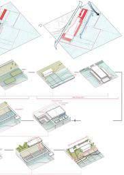
Rebuild The Seawalls 204
slopes interspersed in green space can solve difference of 5-8 meters. Circulation
Fishing Experience Building
Floating Surface
Breakwater
Prolong Dock
The landuse and functions of both sides will remain the same or at least related.
The green roof and paths under the docks will make sure the circulation.
The space under the fshing platforms can act as fsh farms.
Buidlings can also become part of the seawalls
Create foating foundations for emergence of oyster and corals.
The rocky breakwaters will be built under the sea level, reducing wave energy and accumulate sediment.
By prolonging the docks, the ships can be moored in the far sea area, so as not to affect the marine life along coastlines.

205 MASTERPLAN
Circulation

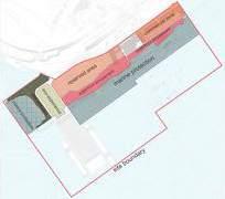
Human Activity


Rebuild The Seawalls Landuse
206
SCENARIOS: SEA LEVEL RISES BY 3 M

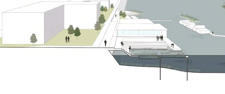

207
1.Urban beach
3.Commercial zone
foating surface foating building swimming pool—> tidal pool changing room foating surface shopping street reserved area green roof green space tidal breakwater sediment tidal pool plant purifcation changing room
2.Waterfront amusement
When sea level rises by 1 meter, part of the green space will be submerged into artifcial tidal pools; when sea level rises by 3 meters, more green space and some buildings will be underwater or half-submerged. People can experience the marine ecosystem along with these tidal pools, enjoy the sea on the beach, and observing the fsh groups in the underwater architecture.
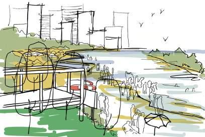


Perspective A
Perspective B
Rebuild The Seawalls 208 PHASING PLAN 3 m 1 m 1.urban beach 3.commercial zone 2.waterfront amusement foating surface fsh farming fshing platform breakwater pool breakwater fshing pool tidal pool
A B

209
Learning in Nature
Waterfront Classroom
The project is located along East Coast Park, around the siglap canal. The most unique feature of the project is different schools that locate on the site, Ngee Ann Primary School, CHIJ Katong Convent Secondary School, and Victoria Junior College. The schools have a wide age range of students from 6 to 18 years old, with a variety of outdoor activities and learning needs, but due to the limitation of space inside the schools, the children lack opportunities for outdoor learning and practice around the campus and need to travel far away for outdoor activities. Therefore, this project aims to provide children with an outdoor activity site close to the school to meet their needs for physical development, scientific knowledge exploration, and getting close to nature. What’s more, the site is very vulnerable to sea-level rise due to its flat topography. Therefore, the project responded to sea-level rise by changing the topography of the coastal areas and modifying the riverbeds, using resilient areas to adapt to sea-level rise, and using artificial structures in some vulnerable areas to resist the waves. After solving the problem of sea-level rise, comes different functions for different areas according to the new topography. In the current site, the presence of the ECP separated the connectivity between the school area and the parking area, so a bridge is built to connect the two parts and the entrances are extended inside the campus and the surrounding community to facilitate the nearby residents and school students to pass through. The new transportation system connects the various functional nodes of the site. In the river area near the school, outdoor classrooms are dedicated to scientific research and sports activities for the school students, while the coastal area becomes a large nature theme park for all citizens. Children can do sports, learn outdoor skills, organize volunteer activities in this playful educational park. In addition, because of the introduction of seawater into the site by changing the topography and the ecological design of the shoreline to create new habitats, children can also experience the rich flora and fauna brought by the tidal flows, which can help them get closer to nature and learn about nature in a subtle way.
Learning in Nature 210
He Xiaowei
1. Site Information


The site is along the central part of east coast park, around siglap canal. The most unique feature of this site is that there are three schools, from primary school to junior high, which means there is a group of children of a wide range of ages. And they have different demands of outdoor activities.
2. Problem Statement
A. LACK OF OUTDOOR LEARNING AREAS
DEMANDS OF STUDENTS
After checking the social media and the ofcial websites of these schools, it shows that they indeed have a lot of demands of outdoor learning.
211
ANALYSIS
SITE
The existing situation is that this area has very few types of outdoor activity——jogging, exercising with ftness facilities, barbequing and resting, which doesn’t meet the exact needs of the students nearby. Kids have to travel far away to take outdoor classes.

B. LOW ACCESSIBILITY
School and coastal areas are separated by the ECP. The footpath has been highlighted in the picture that people pass through most frequently and the only overhead bridge. It’s quite a long walk if students and nearby residents want to go to east coast park.

C. VULNERABILITY AGAINST SEA LEVEL RISE

Almost all the area will be submerged when the sea level rises to 3m. 3 main reasons that cause this problem:
1. Flat terrain
2. A hard scape plaza at the place where the canal meets the sea, which kind of block the water fow
3. Lack of resilient areas in the site which cause the low adaptation of seawater

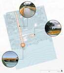
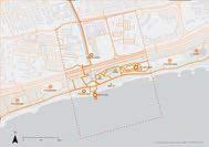

Learning in Nature EXISTING OUTDOOR ACTIVITY AREA 212
SITE ANALYSIS
2. Strategy
A. REZONING


B. CREATING LINKAGE
Using an overhead bridge——EDU-LINK to link up school & residential areas and coastal areas.


D. BUILDING HABITAT
Using fragmented spaces along the canal to build outdoor classrooms for school students. East Coast Park will be divided into two parts, using for science popularization and nature play&education.

A more ecological environment will be created, providing more diverse habitats to attract different animals.
C. IMPROVED ADAPTABILITY
1.Open the entrance of the sea and change the topography.
2.Widen the canal and use different methods to build a stronger riverbed.


3.Adding resilient areas.
4.Using hardscape along the shoreline to make a strong defense.

213 SITE ANALYSIS
SIMPLE HABITAT ① ② ③ ④
D.

Learning in Nature 214 MASTER PLAN
DESIGN DETAILS
1. Zoning
1.Horticulture&Agriculture
2.Planting Experiment
3.Eco-swimming Pool
4.Sensory Garden(emphasis on planting)
5.Waterfront Fitness Facilities
6.Fitness Facilities
7.Ocean Science Lab
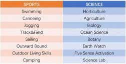
8.Nature Playground&Inclusive Playing Area
9.Exercise Lawn
10.Outdoor Living Skill&Educational Tree Houses
11.Outward Bound&Camping Site
12.Hardscape Plaza
14.Tree House Water Splash
15.Waterfront Planting
16.Forest Theatre
13.Multiple Water Play
17.Mini Farm
18.Outdoor Classroom&Hands-on Activity
19.Event Lawn 20.Sports Tidal Pool
21.Sensory Garden(emphasis on experiencing

215
2. Linkage
EDU-LINK is built with its entrances go directly into the campus site, community, and coastal park areas to create a closer connection between the inland and the coastal area. EDU-LINK together with the main footpath can also form a circular coastal educational route, linking the outdoor learning areas around the schools and the various educational nodes in the coastal park, and taking on the function of a jogging route for students at the same time.


3. Sea Level Rise Adaptation


Learning in Nature 216 DESIGN DETAILS
Coastline Typology Riverbed Typology A B C D E ① ③ ④ ⑤ ⑥ ② ① ① ② ③ ④③ ⑤ ⑥ ⑥ ② A B D E C
4. Rebuilding Habitat
5. Perspectives


A. Using artificial structure to adapt sea-level rise


B. Using topography to defense sea-level rise
SECTION 1-1'

217 DESIGN DETAILS A
B D C

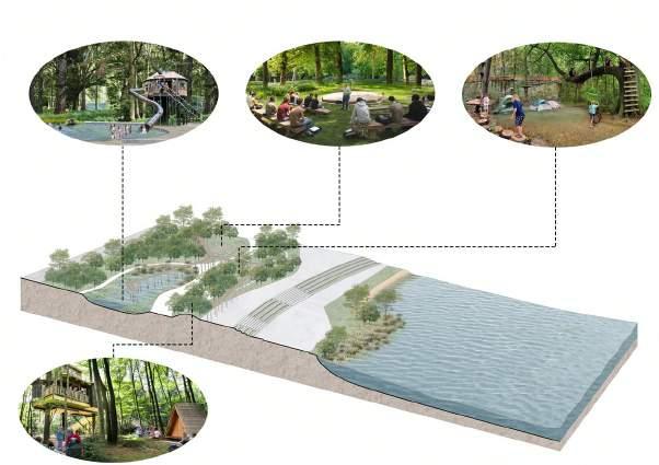


Learning in Nature 218
D. Using artificial structure to defense sea-level rise
DESIGN DETAILS
C. Using topography to adapt sea-level rise

219
TURNING RISK INTO OPPORTUNITY
Responding to SLR in East Coast
XIANG Wenqin
The east coast, because of its low altitude, is the most vulnerable area in Singapore to sea level rising and extreme weather fooding. It is also the area where large residential areas and urban infrastructure are most directly exposed to this problem. As the number of residents increases year by year, Singapore, which is already short of land and freshwater resources, will face greater pressure.
Based on the Government’s future land reclamation plan, the project aims to transform the risks into opportunities by proposing a plan to shift the coastline with physical multi-layer protection, protect and promote the development of coastal infrastructure and residential areas. Combined with newly reclaimed land, the new planned offshore bike path will be the plan’s frst line of defense against rising sea levels, creating a new reservoir along the east coast that will meet the growing demand for drinking water while keeping seawater out. The calm and stable waters of the reservoir allow for more activity and restoration of the natural habitat.
The protected former east coast park will no longer need to fulfll the function of green space responsibility of coastal protection and can have more development possibilities. One possibility proposed by the project is to invite residential areas into the Park, transform the land use and integrate water management measures to achieve a pioneering living design with water.
01 TURNING RISK INTO OPPORTUNITY 220




1 CYCLE WAY+RECLAIMED LAND 3 RAIN GARDEN SYSTEM 4 BERM 2 RESERVOIR 221 LAYERED PROTECTION & PHASING
EXISTING SITUATION
Apart from SLR, the east coast also facing the pressure of rising population.
AFTER 30 YEARS
Based on the government’s future land reclamation plan, this project hopes to reasonably plan part of the area, guide the water system.

AFTER 100 YEARS
Use the four-layer protection to shift the coastline, protect and promote the development of coastal infrastructure and residential areas, so as to turn the risks into opportunities.


TURNING RISK INTO OPPORTUNITY 222
Government future land reclamation plan
BASIC ANALYSIS

LAND USE PERMEABILITY MAP

WATER FLOW
HABITAT MAP & HIGH RISK AREA
This area has a high degree of development. The park mainly serves the surrounding residential areas and bears the needs of simple daily activities. The water in the site flows directly into the sea through the drainage system or unutilized surface runoff. Based on the topography, most areas will be threatened by a flooding event, except that area where the BERM already exists.
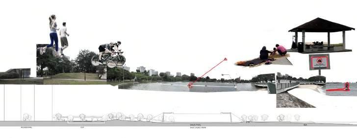
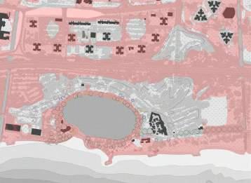


223 SECTION A-A' jogging cycling
BBQ
sailing beach area business civic institution commercial education health care park place of worship reserve site residential residential (1st floor commercial) road sports&recreation transportation facility water body 0 0.01-0.55 0.56-0.65 0.66-0.75 0.76-0.85 0.86-0.95 0.96-1 surface water drainage canal current tidal zone storm surge Samaneasaman Terminaliacatappa Barringtoniaasiatica Casuarinaequisetifoia Coconut Alstoniascholaris Planchonellaobovata Alstoniaangustiloba Taliparititiliaceum Calophylluminophyllum Eugeniagrandis Tree species Sandy shore Managed turf Scrubland Managed Trees Impervious surface Buildings Underconstruction area Marine Stormwater drain Pond Chlorinated Water Bodies Habitat types
sailing training
leisuring
PATH ANALYSIS & HUMAN FLOW

LARGER SCALE PLANNING


There is a planned PCN on the site, allowing cycle riders to pass through, and the pedestrian flow is concentrated near the food center.
However, there is only one bicycle/ pedestrian shared underpass with a width of 2.5m and a flyover with a width of 1m between the park and the residential area.

Bedok town is planning to create a liveable and pleasant housing environment, with a plan of a 13 km bicycle network.


Outdoor play corridor is a completed project connecting Bedok Reservoir Park and East Coast Park. It has four nodes on the way for residents to enjoy a connected network to access recreational facilities.

TURNING RISK INTO OPPORTUNITY 224 2 3 4 5 6 1
1.bedok reservoir
2.the hill
3.the wind valley
node play
new
existing
future
future
new
Attraction human fow footway cycle way 1 2
4.the fishing village
5.the beach 6.east coast
corridor
cycling path
PCN
PCN
MRT station
bicycle crossing new bicycle wheeling ramp
1. UNDERPASS
2. FLYOVER


BEFORE 1 2 3 4 4 4 5 5 6 7 8 9 10 11 12 12 14 13 15 16 10 19 21 225
The first layer as physical protection, the Seawater will not have access to the reservoir, to create peaceful and stable waters, then the protected original east coast park will no longer need to carry out the functions of the coastal protection green Land responsibility, It can have more development potential.

What I propose is to invite residential areas into the park, changing the pure park land use, combine water management measures, and achieve the pioneering residential design of co-living with water.


TURNING RISK INTO OPPORTUNITY
parking lot viewing platform residential building commercial building natural swimming pool Stepped waterfront plaza waterfront stone play area sunbath deck forest playground kids swimming pool purification wetland activity lawn sand beach wetland trail tidal pool service station Sea-viewing corridor rest pavillion mangrove freshwater forest 1 2 3 4 5 6 7 8 9 10 11 12 13 14 15 16 17 18 19 20 21 17 18 20 226
pedesrian overhead bridge
LAYER 1 + 4
Strategy : USING LANDFORM FOR PROTECTION
LAYER 1: CYCLE WAY + RECLAIMED LAND


- SLR BARRIER
- STORM SURGE DENFENSE
- COSATAL HABITAT RESTORATION
LAYER 4: BERM PROTECTION
- FACILITATING WATER RECYCLING SYSTEM
- ENRICHING HABITAT TYPES
227
Rain Tree Tree
Layer1 and 4 are to achieve the purpose of protection by transforming the landform. .The land reclamation plan is not limited to form the high-density construction area.

In this site, I hope to achieve a more natural ecological environment, rationally allocate soil filling, form a tidal pool adapting to tide changes, rationally select and introduce mangroves, to support many creatures living in the tidal zone. It also forms a buffer area against the storm Surge.

There is an elevation difference in the existing site, so I try to transform the sailing pool into a natural swimming pool with ecological benefits, as well as an area for water storage in the site.
The soil dig from the pool can be added to the Berm to Facilitate Water Recycling System. Through the re-selection and mixing of tree species, more fruit tree species will be added to the freshwater wetland area to attract more animals into the habitats on the site.

TURNING RISK INTO OPPORTUNITY
Swiftlet
Sandpiper
Tern Angsana Yellow Flame Senegal Mahogany Tembusu Coconut tree Trumpet Tree Pong Pong Bougainvillea Acacia confusa Acalypha wilkeiana Germain's Swiftlet Garcinia hombroniana Fagraea auriculata species 228
Atrracted animals Little egret Pacific reef heron Grey heron Asian openbill Brahimy kite Cattle Egret Red-wattled lapwing Rock Pigeon Spotted Dove Long-tailed Parakeet Asian Koel Germain's
Common
Little
SEPARATED CYCLING PATH
- ENRICHING CYCLING EXPERIENCE
- ENSURING THE SAFETY OF DIFFERENT USERS
WATER RECYCLE
- Adjust the flow direction to fully collect the surface runoff and


- Use natural and artificial filtration systems to purify water
- Recycling water to achieve different activities to improve residents' living experience


LAYER 2 + 3
<10km/h 10-25km/h +berm ① +coastalhabitat ② +viewingplatform ③ +dam ④ + ① ② +stream ③ +lawnandbeach
Strategy : MULTI-PURPOSE RESERVOIR
229
attraction point
human flow
cycling path
bus stop
bicycle service station

F&B
view pavillion
RECREATIONAL ACTIVITIES

- ESTABLISHING A CLOSE RELATIONSHIP BETWEEN RESIDENTS AND NATURE


With the introduction of residential buildings, there will be two different sources of water, Greywater, and Rainwater. Rainwater is collected primarily by altering topography to redirect surface runoff and is collected through a solid separator then pass to bio-fltration, which can be used for irrigation or for water recreation. Greywater mainly enters the storage tank through the drainage system, is treated, and then discharged into the purifcation wetland for reuse.
Another initiative is to replan the cycle lanes according to the cycling speed, keeping the original PCN in the site to be a slower path because it interacts more with the activity area, to prevent hazards between pedestrians and cyclists. In combination with land reclamation, a new Lane is planned to create a more exciting cycling experience with more interaction with water, It will allow users many different scenes.
Under the premise of reasonable arrangement of water management, residents’ life will be closely related to water and their activities will be more closely related to nature and water.
TURNING RISK INTO OPPORTUNITY
+belowwaterlevel
230

231
GUARDIAN OF THE CITY
Future Flooding Landscape
Zhang Liao Judy
Situated on the edge of the east coast, the project site is not only one of the most vulnerable to sea-level rise, but also lacks connections to surrounding sites and has potential for further development. Future government plans to reclaim land on the east coast district offer an opportunity to face rising sea levels. Adapted government’s land plan, the project proposes to extend the edge area that has undulated terrains for golf courses as a coastal defense.
Topographical modifcations to extend the coastal edge outwards and to open the linear canal and waterfront area to increase the tolerance of the site to sea-level rise. Replan the functional zones and add open public space to the site while retaining the original functions. The new golf course utilizes a circular water system for irrigation, creating diverse habitats and creating continuous open public space to enhance the connection between the site and its surroundings. A more open ecological golf course that promotes human and wildlife interaction while meeting people’s recreational sporting purposes.
This approach which is a strong defense towards sea-level rise could be applied more widely across the country, to upgrade existing coastal golf courses, or to future reclaimed land areas.
Guardian of the City
232
UNITARY FUNCTION & POOR CONNECTION
The main function of the east coast district is Sports & Recreation. In this site, the 8 categories of open space are relatively independent and lack spatial and functional connections between them. At the same time, only one narrow access on the site. Accessibility is poor both for pedestrians and public transportation.

VULNERABLE AREA

The East coast district has a fat terrain. In this site, except for the golf course, the elevation of the most area is below 3m, which would be seriously threatened when sea level rise happened. Government plans to do further land reclamation with a new method along the east coastline to protect the inside residential and commercial areas.

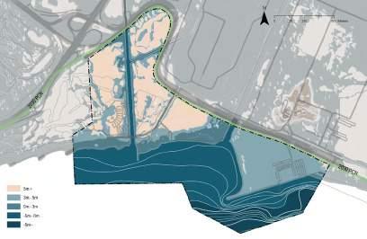

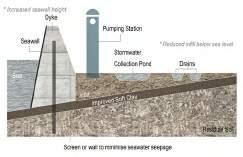 Land Reclamation Method
Government Reclamation Plan
Sea-level Rise Analysis
233
Site Section
SITE ANALYSIS
TERRAIN MODIFICATION

Reorganization of space to make more efcient use of it. Reducing the impact of fooding or sea-level rise on the surrounding area. And use it to form the site’s water system.

ZONE RELOCATION & MULTI-LAND USE
Re-location of the zones. Addition of new functional areas. Enhance connectivity within the site and around the site.
SUSTAINABLE LANDSCAPE MANAGEMENT & HABITAT ENHANCEMENT

Increase wildlife habitats and form nutrient circulation. Less manual intervention and less negative impact on the environment.

Guardian of the City 234 STRATEGY
RESHAPE THE TOPOGRAPHY
The current site can be divided into a reserved area, golf course, and MOE outdoor center. The area is not fully utilized and the terrain is relatively fat. The river is straight and the speed of the fow is quite fast. What’s more, the coastal area is at a lower elevation, will be fooded when the sea level rises.

235
TACTICS Terrain Modifcation
Reshape the canal to slow down the river or tidal fow. Add ‘polder’ & ‘bio-islands’ to increase the inland water capacity and sea-level rise tolerance. Like the bio-islands, not only can store the water, but also play functions as purifying the water quality and providing wildlife habitats. Lastly, further land reclamation to create more space. At the same time, it can keep the seawater out and become a powerful way to protect the inland area and combat sea-level rise.


Guardian of the City 236
WATER FLOW SYSTEM

Water fow inside the site can form a system to maximize the recycling of water.
MULTI-LAND USE
Land Use Analysis


Relocate the MOE area and create a series of open spaces to enhance the connectivity.

237 TACTICS Terrain Modifcation & Multi-Land Use
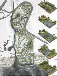
Guardian of the City Master Plan 238 TACTICS Master Plan
(1)
Adventure Centre
Adventure Zone + Infrastructure Zone + Building Zone
Re-locate MOE Outdoor Adventure Learning Centre to the northern part of the site. Retain the original functions and add more outdoor areas, integrate humans with nature.

(2) Therapeutic
Garden
Active Zone + Passive Zone

Therapeutic garden with simple and clear layout aims to create a self-contained space which has a series of activities to promote both physical and mental health.
* Aim
1) provide an enriching experience with nature
2) promote social interaction and physical activity
3) stimulate the senses through interaction with nature

4) enhance physical and mental well-being

ADVENTURE PARK Perspective 239
TACTICS Zone
Use
Relocation & Multi-Land
ECOLOGICAL GOLF COURSE
Provided that golfng conditions are met, minimize the use of artifcial irrigation systems and chemical fertilizers to manage the turf. At the same time, increase the number of wildlife habitats and enhance biodiversity.
(1) Water
The water circulation in the golf course is based on the water system of the whole site.


(2) Fertilizer
Golf courses require a high degree of manual maintenance and a large amount of fertilizer to ensure that the turf grows properly. In the ecological one, minimizing chemical fertilizer use, linking to the surrounding site, and efcient circulation of energy within the site.
(3) Wildlife Habitat
CIRCULATION SYSTEMS
Guardian of the City
240
TACTICS
Sustainable Landscape Management & Habitat Enhancement
Inland golf courses and coastal golf courses have different habitats. Inland habitat refers to layered and complex woods space including diverse creatures. While coastal one contains mangroves and marine creatures.


HABITAT MAP
Perspective_ Inland Golf Course
241 TACTICS Sustainable
Perspective_ Coastal Golf Course
Landscape Management & Habitat Enhancement
The Government’s plans for the East Coast are to continue to reclaim land, and in addition to the outward extension along with the land, a long island is planned to be reclaimed to protect the corresponding residential area. However, the site is homogeneous and has not been given sufcient value. In this project, re-plan the land reclamation along the east coast and propose to extend the edge area that has undulated terrains for golf courses as a coastal defense.

From the perspective of the country, the use of existing golf courses and government reclamation schemes to modify their topography is an effective strategy against sea-level rise. Adopting a new typology of a golf course as a coastal defense will not only prevent a range of threats from the sea but will also enrich the site and increase the natural habitat.


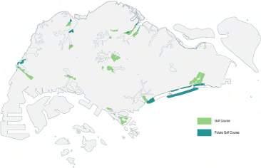
Guardian of the City
Government Land Reclamation Plan
Project Land Reclamation Plan (East Coast District)
Golf Course_ Distribution in Singapore
242 VISION
Golf Course_ Future Development
FUTURE COASTAL DEFENCE
FROM TANAH MERAH FERRY TERMINAL TO PASIR RIS PARK
INDIVIDUAL PROJECT
Bike on the Dyke
Li Jiaying
Situated in the Changi shoreline where a massive land extension is planned, the project utilizes a dyke of the reclaimed land as a landscape infrastructure for cyclists and new developments. At the frst phase, the infrastructure on the dyke connects to the existing cycling trails along the Changi coast and East Coast Park for recreational purpose, where users will appreciate scenic views formed by six dynamic coastal habitats. In the next phase, inner blue and green infrastructure crossing the reclaimed land (formed by dredging the bay for crustaceans, sand, and gravel) guide the future development as a key spine of landscape networks.
Dockscape: keep the coastal memory
Fang Ting
The Changi point is an open beach area land which has a unique landform naturally shaped like a “gate”. As a landing area of the eastern coastal line that is vulnerable to sea level rise. The main objective of the project is to create a new landing platform that emerge a new order of docking system for different functions. Uplifted areas are remodelled to resilient against sea level rise and encourage human direct contact to water. By utilizing the potentials of accessibility from the Changi inland area to the Straits of Johor, the newly design remain the traditional activities and it can be a mark as history keeping.
Landform Adaptation Resort
Rui Xui
Changi village has been seen as a place to escape from city life for decades with recreation and sports usage. This project provides a new possibility for the seaside resorts by creating sea-level rise adaptation land forming. With alternative energy resources like hydro-powered and solar-powered systems, the self-sufcient eco-hotel could consume less energy with a rainwater harvesting system. The agricultural design within the site brings food-to-table opportunities for the eco-hotel. The historical buildings will be protected by a new dike and drainage system.
Life in green and blue
Wang Xiaomeng
Pasir Ris Park is a recognized park with high-quality residential areas around it. Meanwhile, the government plans to convert few parts of the park into residential areas in 20 years. The project aims to comply with policy and solve future social issues and environmental challenges, including decreased living quality and sea-level rise. The site will be planned in different stages, and a new residential area will be created by improving the land structure, HDB form, and transportation methods.
243
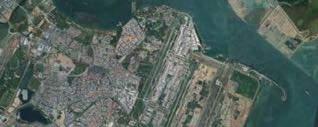


From Tanah Merah Ferry Terminal to Pasir Ris Park
Site 1 Li Jiaying
Site 2 Fang Ting
Site 3 Rui Xue
Site 4
244
Wang Xiaomeng
Site 1: Bike on the Dyke Site 2: Dockscape: keep the coastal memory
Site 3: Landform Adaptation Resort
Site 4: Life in green and blue
Li Jiaying Fang Ting Rui Xue Wang Xiaomeng

245
BIKE ON THE DYKE AN COASTAL CYCLING PARK
Li Jiaying
My site is a reclamation land on the east coast of Singapore. It is a massive and low-lying land which is disconnected with other scenic spot and faced with habitat destruction. However, it has a great potential to propose a new type of infrastructure by utilizing the structure of coastal protection such as dyke. This project aims to utilize a dyke of the reclaimed land as a landscape infrastructure for cyclists and new developments.
This project will apply three strategies. Firstly, using a polar system to build the reclamation land. With a polder system for 442 hectares of reclaimed land, the dyke is not only to protect the reclaimed land from sea-level rise issue, but also to insert key infrastructure such as drainage, water supplies, distribution, and electric power lines to prepare for future development on the newly reclaimed land. By utilizing spaces on the dyke, the dyke can connect the existing cycling trails along the Changi coast and east coast park. Secondly, conserving habitat to make users appreciate scenic views formed by dynamic coastal habitat-seagrass, mudfat, coral reef, mangrove, sandy beach, rocky shore, and forest. Last, insert multi-functional activity areas to make the site has a recreation function so that people can do leisure activities here, and also make the site has an educational function.
The site will be designed as a cyclist park and will become open space and residential area that serves Changi airport in the future.
Bike on the Dyke 246
ANALYSIS
My site is a reclamation area on the east coast of Singapore, which land use is a reserved area, with Changi Airport nearby. There are long PNC Way and Greater Rustic Way cross my site, which connects to Changi Beach Club and East Coast Park. There are a few bus stations and MRT stations near my site, the only way to get to my site is by taking a car or riding a bike, so the site is with low pedestrian volume.


The site is full of disordered plants, which look very messy, and has a few bus stations and MRT stations nearby, which traffic is not convenient, making the site is disconnected from another scenic spot.
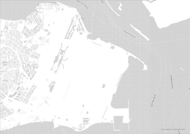
P Reserve Area Residence Legend Entrance Pavilion MRT Station Bus Station Bicycle Renting Airport Greater Rustic Coast PNC Way Water Body Parking Lot High Point of Bicycle Way School Special Use Business Cycle Way Changi Sailing Club Turnhouse Club Changi Beach Park Pasir Ris Park Marine Bay Golf Course 247
SITE
SITE SCENARIOS SITE CONTEXT
Entrance Forest
Mudflat Pond
Port Rocky Shore and Sandy Shore
The shoreline typologies mainly consist of sandy shore and rocky shore, which vulnerability is high. And the habitat is faced with extinction.

Government planning
Current Area
Government Plan Area: 720hec


Need Sand: 5040000T


The site is low-lying, when facing three meters of sea-level rise issue, most of the site will be submerged.

Bike on the Dyke
Current
2050
248
HABITAT MAP AND WATER FLOW HABITAT MAP
WATER FLOW
Storm Water Pond

Drainage Pumping Station
Central Pumping Station Stream
Polder Dike
POLDER SYSTEM

The Polder system is to do land reclaimed from a body of water, such as from a lake or the sea bed, through the construction of a dyke and a network of drains, water pumping systems, and canals.


MASTER PLAN
Event Lawn
Lawn Steps
Dyke
Waterfront Stair

Cycle Way
Rocky Shrore
Walkway
Elevated Waterfront
Walkway
Interactive Area
Waterfront Platform Playground
Wetland
Floating Wetland
Ascending lawn Elevated Central Plaza Central Plaza
Forest
249
DYKE
Waterfront Stairs Micro
Forest Cycle Way Sandy Beach Super Tidal Mudfat Inter Tidal Mudfat Barrier Island
STRATEGY 1—— USING
AS KEY INFRUSTRUCTURE
BEFORE AND AFTER SECTION


Bike on the Dyke Stairs 250
Ocean 110m Dyke Drainage Floodable Lawn and Forest Elevated Stairs Pond Woody Land Woody Land Woody Land Woody Land Woody Land Mudflat Sand Pond Woody Land Rocky Shore Sea 100m 15m 23m 2m 31m 2m 80m 20m 30m 23m 120m Path Way Path Way Cycle Way Cycle Way Sandy Beach Cycle Way Woody Land Road Woody Land Woody Land Road Road Sandy Beach Sea Sea Forest 30m 5m 120m 10m 150m 32m 15m 23m 42m 8m 12m 120m 2m 110m Sand and Mudflat 70m Dyke Playground Forest Drainage Platform 30m 60m 50m 5m 15m Rocky Shore 60m 25m Dyke Platform Forest Commercial Port Drainage 30m 71m 60m 117m 5m Mangrove, Sea Grass and Coral Reef 110m 30m Dyke Drainage Pond Forest 30m 16m 5m 46m 200m 100m 32m 110m 120m

251
STRATEGY 2—— CONSERVE HABITAT
Lawn and Micro Forest
Rocky Shore
Sandy Shore and Mudfat
Wetland
Cycle
Dam
Waterfront Platform
Lawn Steps
Rocky Shore
Elevated Walkway
Walk Way
The mangrove, seagrass, and coral reef can co-exist, sandy beach and rocky shore can coexist to be put in the sedimentation area. The rocky shore is hard which can be put in the erosion area.
Ascending lawn Central Plaza
Elevated Central Plaza
Waterfront Stairs
HABITAT DETAIL SECTION

Pond
Beach Sand
Supratidal Mudfat
Micro-Forest
Forest Cycle Way
Intertidal Mudfat
Mangrove
Seagrass
Coral Reef
Skateboard Area
Interactive Plantform
Wetland
Sports Area
Playground Cycle Rest Area
Tidal Zone
252 Elevated Stairs Floodable Lawn and Forest 120m 110m 5m 30m 30m 30m 30m 30m 30m 44m 40m 85m 35m 35m 85m 15m 9m Drainage Forest Forest Stream Sand and Mudflat Playground Dyke Dyke Dyke Dyke Board Walk Ocean Elevated Walkway and
Rocky
Stairs Mangrove, Seagrass and Coral Reef
Shore
Forest
Lawn
and
Mudfls
Rocky Shore Mangrove Sand and
Cycle Way
Drain Floodable Lawn
People can appreciate scenic views formed by dynamic coastal habitats——Seagrass, mudflat, coral reef, sandy beach, rocky shore, forest, and do a variety of activities along the shoreline as well as on the water surface, such as children can play in the interactive platform, skateboard area, and playground.


A
VIEWING DYNAMIC HABITAT AND PLAYING ON THE BEACH
Viewing Rocky Shore and Rest at Waterfront Stairs
253 STRATEGY 3——INSERT RECREATIONAL AND EDUCATIONAL ACTIVITY
Leisure in Central Plaza
Viewing on Floodable Lawn

Rest and Learning in Wetland

Residents can do exercise on the sports area, and tourists can do water sports on the water exploration area. They can also rest on the floodable lawn, waterfront platform, and waterfront plaza.

Bike on the Dyke B CHILDREN HAVING LEISURE ACTIVITIES ON THE INTERACTIVE AREA
254
In the second phase, the infrastructure on the dyke connects to the existing cycling trails along the Changi Coast and East Coast Park for recreational purposes, where users will appreciate scenic views formed by six dynamic coastal habitats.


VISION
SECTION
Mangrove Dyke Drainage
Stream Forest Residentila Area
SECTION PHASE
Sand
Skateboard Area
Dyke Forest
Phase 1
Phase 2
Phase 3
255
Platrofm
In the next phase, inner blue and green infrastructure crossing the reclaimed land (formed by dredging the bay for crustaceans, sand, and gravel) guides the future development as a key spine of landscape networks. In the future, the land use of the site will be open space and residential area.


Bike on the Dyke SECTION A-A' Mangrove Seagrass Coral Reef Ocean SECTION B-B' Supertidal Mudflat Intertidal Mudflat Barrier Island Ocean Residential Area Central Plaza Stream Elevated Walkway Rocky Shore Floodable Lawn Forest Cycle Path Mangrove, Sea Grass and Coral Reef Sandy Beach and Mudflat Pond Cycle Way Cycle Way Cycle Way Residential Area Residential Area Pond Forest Shoreline Open Space Sea Stream Cycle Area 256 A A' B B'

257
DOCKSCAPE
Keep the Coastal Memory
Fang Ting
The edge of the Changi Point was once infuenced by natural processes, resulting in a unique landscape shaped like a “gate”. As a landing area, it allows direct access to the broad ocean and was created historically as a hub for the vibrant shipping industry. However, over the past century, it is no longer economically, ecologically, or socially relevant, although open beaches still existed, the water edge has become a more static, constructed edge. These problems will be aggravated by SLR issue because in the long term, sea-level rise will take away a large part of the waterfront and weaken the shoreline. There will be three major challenges: sinking dock, water pollution and vanishing beach.
This project proposes a new framework to arm the edge of the site and weaves the climate-resilient programs and public spaces together. Three main strategies will be implemented. Firstly, create a new dock system. To address the degraded site edge, conserve the dock function — change the location of dock and make the platform function as a new landing platform with a new order of docking system for different functions. Secondly, soften the creek revetment to adapt to rising water level. to activate the static edge, create a soft edge — which facilitates the accretion of ecologically rich wetland habitat for mangroves, seagrass and coral to purify the water in the creek. Meanwhile, it will be a water park to keep the unique shape. Thirdly, conserve the beach. The structure will be introduced to construct the perched beach to keep and strengthen this existing original beach.
The design integrates Changi Point to a vibrant and active place both in short and long time span, which adapt to the anticipated effects of global climate change and people’s need for safe and stable waterfront space.
Dockscape 258
3 METER SEA-LEVEL RISE

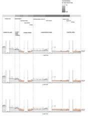
Considered the sea level rise issue, there will be three major challenges: sinking dock, vanishing beach and water pollution. As the sections show, most areas will be submerged, the most vulnerable part is the ferry terminal.


It was created historically as a hub for vibrant shipping industry coz the edge of this area allowed direct access to the broad ocean. However, over the past century, it is no longer economically, and socially relevant. And these problems will be aggravated by SLR issue coz It will sink.

259
SITE ANALYSIS
SINKING DOCK
According to the 3-meter sea-level rise, the most area here will be submerged. The Changi Point Ferry Terminal and docks will sink which are the carrier of the history and regional culture. So, the sinking problem means the activities what take place here will disappear together.

POLLUTION
As a busy hub, there are many shipping routes, the pollution can not be ignored. In 2017 the oil spill in johor straits had an impact on seagrass meadows and mangrove habitat in Changi creek. However, recreational beach needs high water quality.

Dockscape 260
PROBLEM STATEMENT Sinking and forsaken land & pollution
DOCKING INFRASTRUCTURE
The Changi point is an open beach area land that has a unique landform naturally shaped like a “gate”. As a landing area of the eastern coastal line that is vulnerable to sea-level rise. The main objective of the project is to create a new landing platform that emerges a new order of docking system for different functions. Uplifted areas are remodeled to resilient against sea-level rise and encourage human direct contact to water. By utilizing the potentials of accessibility from the Changi inland area to the Straits of Johor, the newly design remain the traditional activities and it can be a mark as history keeping.

261
MASTERPLAN
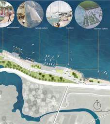


Dockscape 262 Phase 01 Phase 02 Phase 03
LANDING PLATFORM AND VISITOR CENTER
To address the degraded site edge and maintain the dock function, change the location of the dock, which before is at the narrow creek. By facilitating the good accessibility from the land to the ocean, to make the platform function as a new landing platform. The form of the dock changes from the dots to the line, different dock areas are connected by various small spaces.


For those long journey boats, the plaza for distribution is designed for people to go on board, and the foating docks are adaptive to SLR. And for short ones, waterfront space is suitable and resilient to water, it’s convenient to drag the boats. And it can be submerged, when the sea level rise, people still can go sailing and boating.


263
NEW DOCK SYSTEM A new
in good accessibility
landing platform
ECOLOGICAL WATER PURIFICATION SYSTEM
Soften the hard creek revetment to be a water park
Soften the hard creek revetment to be a water park. It’s a way to activate the static edge and adapt to the sea level rise issue.


ECOLOGICAL WATER PURIFICATION SYSTEM
Meanwhile, it provides rich wetland habitat for mangroves, seagrass and coral to purify the water in the creek. People can go For those long journey boats, the plaza for distribution is designed for people to go on diving and boating.
Dockscape 264
SINKING DOCK AND WATER PARK
Current situation After SLR Adaptive to SLR

265 ② ① ③ ① Ocean Trafc ② Restored Beach ③ Tourist Trail ④ Water Venture ⑤ Wetland Habitat ⑥ Boating Trail ⑦ Diving Area
The design shows the comparison of hard edge and soft edge. It forms a buffer that responds to the land and water adjacencies. And it also integrates Changi Point into a vibrant and active place both in the short and long term.

Dockscape 266
④ ⑥ ⑤ ⑦

267
LANDFORM ADAPTATION RESORT
Sea Level Rise Adaptable Hotel
Rui Xue
Changi village has been seen as a place to escape from city life for decades with recreation and sports usage. This project provides a new possibility for the seaside resorts by creating sea-level rise adaptation land forming. By changing the original topography in the site, new islands are formed while allowing sea water to enter the lawn. Through the design of different forms of water edges to ensure the normal operation of the resort activities. The site can continue to maintain its original function even when facing sea-level rise. With alternative energy resources like hydro-powered and solar-powered systems, the self-sufcient eco-hotel could consume less energy with a rainwater harvesting system. It provides new ideas for coastal resorts when facing sea-level rise issues.
Landform Adaptation Resort 268
HISTORIC BUILDINGS AND CURRENT LANDUSE


In history, the land use of the changi area has been changed from residential to military use to the sports and recreation use in nowadays. The building which we can see right now is mostly built in the last century by the army. Those bungalows with history and political meaning in the history of Singapore are now mostly used as hotels and restaurants. Others are for meetings, weddings, and nursing house. With the thriving of the tourism industry in Singapore in the recent decade, both international and local tourists are more willing to come to the resort to get closer to nature.
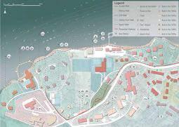
of 3 Meter Sea Level Rise
Sections
269
History of Changi
SITE ANALYSIS
For the habitat of the site, there are fve types: lawn, street trees, secondary forest, rocky shore, and sandy shore. There are also many heritage trees which are native species with long history inside the site. Although most of the sites are covering with green, the habits are highly vulnerable when comes to the 3-meter sea-level rise, especially the shoreline area and the big lawn at the center of the site.

The green vegetation coverage rate of the landscape site is relatively high. But it is vulnerable in most areas when facing 3m sea level rise. Especially for some Heritage tree species on the site.


Landform Adaptation Resort Existing Condition
270
The Changes of Site Coastline
SITE ANALYSIS
3 METER SEA-LEVEL RISE

04 271 MASTERPLAN
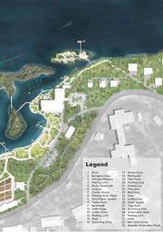
Landform Adaptation Resort 272
DIFFERENT COASTAL HABITATS WITH RECREATIONAL SPACES

With the opportunities of the tourist industry and the threat from habitat loss, creating different types of water edges without sacrifce the activities of the resort area is crucial. Let the water in instead of block it outside. The change of the topology and the water could be an opportunity to have more activities.
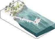


KAYAK DOCK
SWIMMING ZONE
HOTEL ZONE POND
273
SEASIDE OBSERVATION DECK
20-50 YEAR VISION
Recreational Activities
ENERGY SAVING RESORT

To create an environmentally friendly resort, a sustainable energy circulation system will be added.

The frst is electrical energy. The temperature of the seawater helps to cool down the foating solar panel’s system that build on the sea. By utilizing strong wind energy, a wind power generation system is suitable to put on the islands facing the sea. In addition, the solar panels installed on the roof of the buildings can also meet the daily use of the bungalows.
The second is the water cycle. The terrain in the site has a large elevation difference. A unique lake view is formed in the bungalow area. It can be used to irrigate crops in the planting area and the lawn in the mini-golf area.
Landform Adaptation Resort 274
20-50 YEAR VISION Sustainable Energy System
The Section of Sustainable Energy System

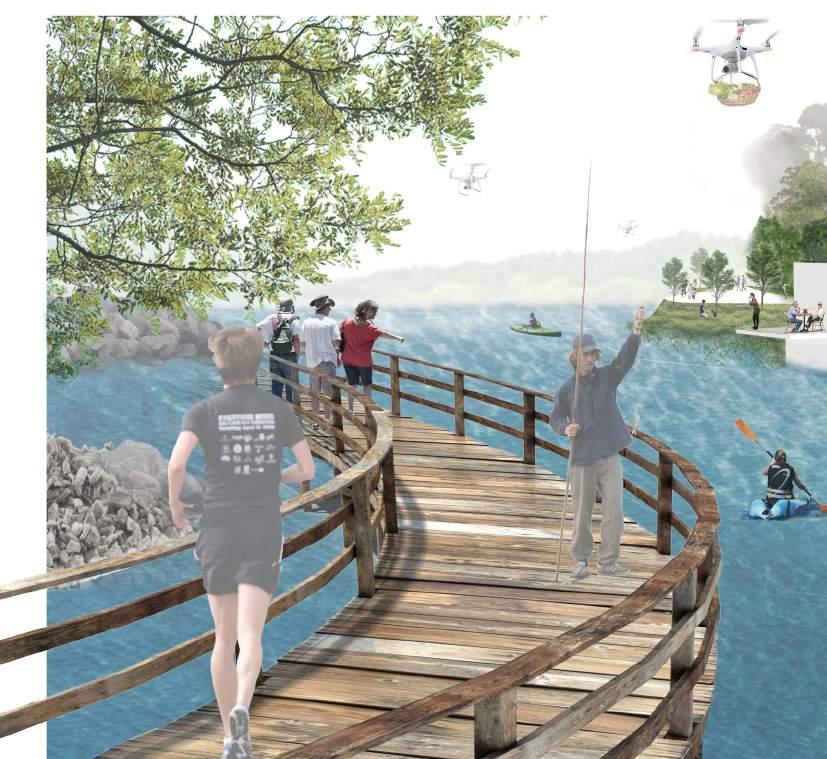
275


Landform Adaptation Resort 276

277
LIFE IN GREEN AND BLUE
HDB+ Park Pasir Ris Park is a beloved coastal park, where nearby residents and many locals like to relax on weekends.
Wang Xiaomeng
LIFE IN GREEN
With the housing pressure of population growth, the government plans to convert part of the green space into residential areas. To meet the needs of a growing population, more green space will be occupied by houses in the future. However, do residential areas and parks have to confict? Perhaps a better result would be achieved by merging the two. By dividing the whole function area and optimizing the transportation system, the park function is integrated into the residential area under the condition of satisfying the residents’ basic needs. Simultaneously, the use of spatial planning methods should be diversifed in the space to meet the different needs of residents and tourists.
LIFE IN BLUE
The site is located in low-lying coastal areas; the large area will face fooding problem in the future. However, the water will make the land more interesting if it been taken advantage of. The project uses phasing to solve the problem of rising sea levels gradually. The frst step is to transform the land, protect the land we need, and plan the future land. The second step is to build a residential area on the reclaimed land and use the structure to build a second layer of green space, increasing the available land area while making a rough distinction between open and private areas. When the sea level rises 3m, the third step submerges the ample land, uses the water surface to increase a series of water activities, enriches the resident and the visitor’s life.
Life in Green and Blue 278
CURRENT LAND USE AND FUTURE PLAN


The site is Part 2 of Pasir Ris Park, in the middle of the Park. It has connected to its surroundings. Residential areas dominate the surrounding land, and most park visitors are families.
Public transport is less convenient, but the government plans to add more subway and bus routes to solve the problem. Furthermore, the government will also add more residential areas here.
The site is in the low land, and most of the area is below 3M. After the sea level rises 2 meters, the high tide will submerge to 3 meters above sea level. At this time, part of the coastline would generally be fooded, while large areas would be fooded at high tide.

279
SITE ANALYSIS
SEA LEVEL RISE MAP
As the population will continue to expand in the future, the occupation of green space to establish residential areas is a trend. Nevertheless, the lack of green space and parks not only do harm to ecology but also reduce the quality of human life. So in order to comply with the government plan and meet the needs of the community, the design will explore HDB park and the integration of the subject. The most crucial issue to note at this point is connection.
BASIC DATA ANALYSIS


Life in Green and Blue 280
DESIGN CONCEPT

281
FIRST STEP EXCAVATE AND FILL - PROTECT THE LAND
DESIGN ANALYSIS

FUNCTION
According to the planned HDB area, the spare space is assigned to different empty energy zones. On the whole, the south is densely populated, and the public spaces are repurposed to serve the residents, while the north and the coastal areas are more geared to serve the tourists.


TRANSPORTATION

The fooded area was so large that it was difcult to get around, so it changed the original road and added many other modes of transportation (water taxi, boardwalks, bicycle lanes, etc.). Different modes of transportation will solve the transportation problem and guide people’s behaviour to create different private spaces.

As a result of the above two plans, the private density of space is higher in the south, while the connection between the north and the middle is open. Nevertheless, people are free to move around the entire area, although functional zoning can induce different people to prefer places.

Life in Green and Blue 282
During the frst stage of flling, the soil was used to raise part of the ground and build GREEN DIKE to protect large areas of low-lying land. Moreover, the DIKE and the afforestation union create the scenery simultaneously forms a hydrophilic belt park.
In other areas, the shore is dominated by nature, but SEA WALL dominates the shore to preserve the soil in hard surface areas.

283
SHORE LINE PROTECTION
GREEN DIKE-1 STEEP SLOPE
Coastal Defense and Recreational Space
GREEN DIKE-2 GENTLE SLOPE
SEA WALL
NATURAL SHORELINE
SNADY SHORELINE

Life in Green and Blue 284 USING DETAIL DESIGN TO UNDERSTAND THE CONNECTION DETAIL DESIGN Children Playground
In this project, the connection of the community, the connection of the park and the connection of the park and the residential area is a major issue. This problem can be solved by creating different spaces within this diverse site using functional zoning and transportation systems. At the same time, let us also get a more exciting and more efcient land.

285 VISION

Life in Green and Blue 286
FROM PASIR RIS PARK TO SEMBAWANG PARK
INDIVIDUAL PROJECT
Redefning Coastal Barrier
Lam Chinghang Adam
This project envisions Yishun Dam as a living infrastructure to protect the Lower Seletar Reservoir from the hazard of sea-level rise by the full utilization of onsite natural resources. A new terrain will be built to reinforce the dam through the accumulation of coastal sediments formed by tide and currents and green waste from the reservoir and nearby golf courses. The extended terrain has a multilayer – the ground surface is used for generating energy, diverse community recreational functions, and coastal habitat enhancement, while the engineering function such as a heavy trafc road and a tidal barrier is maintained under the ground.
Riparian Urbanism: Nature Oriented Development on Business Park
Ge Wenxi
The newly reclaimed island, Punggol Timor island, faces several long-term environmental challenges, including sea-level rise, storm surge risk, low biodiversity, and pollution. The project aims to propose a repeatable mixed development mode and triple-tiered defenses that can keep pace with sea-level rise for the business park. By reshaping the water system and ecosystem, reconnecting habitats, injecting regional vitality, the project integrates nature into the business area and creates a new sustainable coastal lifestyle.
287


From Pasir Ris Park to Sembawang Park 288
Site 1: Yishun Dam
Site 2: Punggol Timor island
Lam Chinghang Adam
Site 2 Ge Wenxi
Site 1 Lam Chinghang Ge Wenxi

289
REDEFINING COASTAL BARRIER
Building and Inhabiting With Nature
Singapore is one of the most water-stressed countries in the world. The country is heavily dependent on reservoirs to collect and store storm runoffs from the local catchment. Besides, 9 of the 17 reservoirs in Singapore are estuarine reservoirs situated in the coastal area, consequently setting them vulnerable to rising sea levels.
This project envisions Yishun Dam as a living infrastructure – A coastal barrier built by nature and humans, moreover, inhabited by the community. A new terrain will be built to reinforce the dam through the accretion of coastal sediments formed by tide and currents and green waste from the reservoir and nearby golf courses. The extended terrain has a multilayer – the ground surface is used for generating energy, diverse community recreational functions, and coastal habitat enhancement, while the engineering function such as a heavy trafc road and a tidal barrier is maintained under the ground.
In short, this project attempts to redefne the civic function of a tidal barrier, from a conventional dike to a coastal barrier that serves the community in multiple aspects.
Redefning Coastal Barrier 290
Lam Ching Hang, Adam
The Lower Seletar Reservoir and Yishun Dam

The Lower Seletar Reservoir collects storm run-off from the surrounding urbanized area and serves as a major recreational space for the nearby residential area
FOR WATER SUPPLY AND AS A MAJOR RECREATIONAL DESTINATION


The reservoir was created in 1985 by the construction of Yishun Dam at the river mouth of Seletar River. It is a major reservoir in the North-East region of Singapore with a capacity of 9.5 million m³. A PCN loop around the reservoir is planned for the future which including the Yishun Dam.

1984 Before Damming 1985 After Damming Current to Future 291
SITE ANALYSIS
Current from the Johor Strait brought sediment and mud. Tidal wave affects the nearby mangrove and drafts along the Yishun Dam. The dam blocks the current from Johor Strait, while the tidal gate controls the overfow from the reservoir.
3 METER SEA-LEVEL RISE


In this scenario, the existing design of Yishun Dam is not adequate to protect the reservoir from seawater instruction. The water in the reservoir will be polluted and salinized. Also, the recreational space around the reservoir will be affected.


Redefning Coastal Barrier
3M SLR Scenario
292
2M SLR Scenario Existing Condition
WATER FLOW AND SEA-LEVEL RISE SCENARIOS
The Threat of 3 Meters Sea-Level Rise
CURRENT CONDITION
Three wastes of resource in the site. The green is collected from the reservoir, and the sediment is brought by tide and currents. Lastly is the marine clay located in the river mouth area.


293 Utilizing Local Resource for Coastal Reinforcement
It is an invasive species in the local reservoir which causes algae bloom and affects water quality.
HYDRILLA VERTICILLATA
PROPOSED CHANGE
The concept is to redesign the energy and resources fow in the local context, hence, to utilize the resource for the purpose of coastal reinforcement and creation of new open space.


294 Redefning Coastal Barrier
INHABITING INFRASTRUCTURE

A series of new terrain will be formed from phasing construction. A series of permeable structures will be placed to collect sediment and facilitate mangrove recovery. Afterward, the excessive sediment and green waste will be placed on top of the highway tunnel to form the new terrain. The newly formed terrain can be used for different functions, such as hiking trails, observation decks, etc. Furthermore, different kinds of visitor centers are proposed to facilitate outdoor recreation activities, such as kayaking and bird watching. It is not only a coastal defensive structure but a multi-functional open space at the same time.

295
MASTER PLAN
Proposed Energy and Resources Flow in a Local System
PHASING CONSTRUCTION


Redefning Coastal Barrier 296
Diagram 2
Diagram 3
Diagram 4
Diagram 1
NEW FORMED TERRAIN ON EXISTING DAM STRUCTURE
Collected green waste and sediment will be used on the construction of the proposed terrain. The newly formed landscape will reinforce the dam to against the threat of rising sea level. At the same time, it will be a new public space to smoothen the transition from the reservoir to the sea.


INITIAL VISION

297
VISION Coastal Defense and Recreational Space
VISITOR CENTER AND TERRACED PROMENADE
The architectural structure is proposed to act as a new sea wall and visitor center at the same time. The visitor center provides service at different scenarios of rising sea levels. It could be a recreational hub initially, but be an observation hut or museum after sea-level rise.


VISION IN
SEA-LEVEL
Redefning Coastal Barrier 298
3M


299
RIPARIAN URBANISM
Nature Oriented Development on Business Park
Ge Wenxi
Punggol Timor, a newly relatively recently reclaimed island, is now used as a temporary site for storing construction material. While land reclamation facilitates new land development, it poses an environmental threat in the long-term. The three major challenges are: sea-level rise and storm surge, low biodiversity and habitat loss, as well as disconnection with the surrounding environment.
The project proposes a repeatable, mixed, nature-oriented mode of development for business parks. In response to the three challenges, three strategies are raised: triple-layered defense against sea-level rise and its secondary disasters; habitat stepping stones and migratory bird destination; a park for people. Unlike conventional construction process, this project proposes the reuse of the material resources found on-site, namely the remaining soil left behind from previous earthworks, to recover the ecosystem frst. Buildings are proposed to only be introduced after habitats have reached an appropriate level of maturity. By reshaping the water system, reconnecting habitats and injecting regional vitality, the project integrates nature into the business park. It also rejuvenates coastal biodiversity in a reclaimed area, while creating a new coastal lifestyle for citizens. It challenges the traditional expectations of the business park and sets a precedent for equitable and sustainable coastal development in the rapidly growing region.
RIPARIAN URBANISM 300


301 SITE ANALYSIS SITE CONTEXT
SITE PHOTO
PROBLEM STATEMENT
PROBLEM 01 Sea-level Rise & Flood Vulnerability

Hydrological response regime (Peak C values)

Sea-level rise map
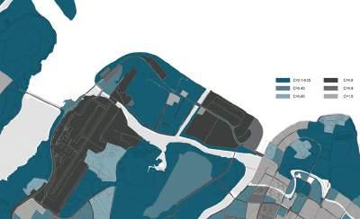
PROBLEM 02 Low Biodiversity
Animal observation map

Macrobenthos amount change
PROBLEM 03

Surrounding Environment Disconnection
Shoreline comparation

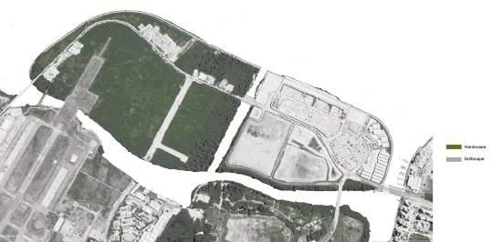
RIPARIAN URBANISM 302
A B
Punggol Timor Island
Punggol Barat Island
SITE ANALYSIS

303 H B D E F C
A. Beach
B. Barrier island
C. Marine eco-link
D. Tidal flat
E. Ephemeral river
F. Green roof
G. Roof garden
H. Parking lot
I. Fishing pot
J. Wharf
K. Skywalk
L. Floating structure

RIPARIAN URBANISM 304 0 N 50 150 300 M A K I J L G H
HYDROLOGY MAP
Modified waterflow

PROTECTION LAYER
1st protection layer——Wave energy reduction & conversion
Artificial marine shelter+ Breakwater + Floating structures + Wave energy converters


2nd protection layer ——Sea-level rise & Storm surge defense
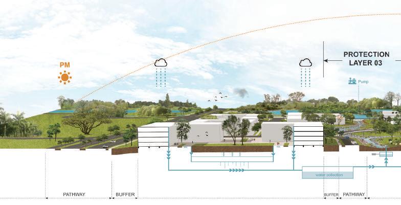

Barrier island + Sand beach + Mudflat + Mangrove + Seawall
3rd protection layer——Waterlogging prevention

Ephemeral river + Topography

305
01 TRIPLE-LAYERED
STRATEGY
DEFENSES
DETAIL DESIGN
Protection layer 01 Floating structure


RIPARIAN URBANISM 306 STRATEGY 01 TRIPLE-LAYERED DEFENSES
STRATEGY 02
Habitat stepping stone + Migratory bird destination


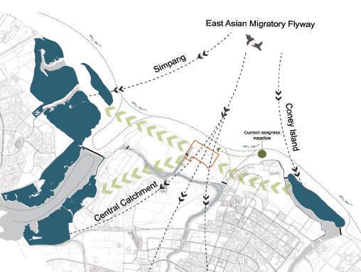
Greenbelt
Marine eco-link
Habitat Typology & Biodiversity

Habitat map

307 STRATEGY 02 RECONNECT URBAN
HABITAT
STRATEGY 03
Program
Encourage park utilization
Walking trail
Extend Singapore Round Island Route
PROJECT CONSTRUCTION PHASING
1. Current condition
Used to store constructure material
Building footprint
Connect office with nature
Vehicle lane
Increase accessibility
3. Recovering 3-5 years
Add road, introduce vegetaion and develop habitat first
Reuse site left material to create overall topography, seawall, and breakwater


4. Mature biomatrix 6-30 years
Introduce building and new facility after habitat is built


RIPARIAN URBANISM 308 STRATEGY 03 CREATE PARK FOR PEOPLE
2. Earthwork balance 0-2 years


309 VISION 01 02


RIPARIAN URBANISM 310 Beach + Fishing point + Elevated walkway + Seawall + Commercial building Beach + Seawall + Seating stairs + Green buffer + Office building Slope + Green belt + Pedestrian path + Office building PERSPECTIVE 01 03 PERSPECTIVE 02 PERSPECTIVE 03
FROM SEMBAWANG PARK TO SUNGEI BULOH NATURE RESERVE
INDIVIDUAL PROJECT
Retreat forward: Reclaim for the Next Mangroves
Long Di
As one of the few remaining mangrove habitats in Singapore, the site has high biodiversity and carries historical signifcance but now faces the double threat of sea-level rise and degradation of ecology if traditional land reclamation methods were to be employed. Urban development limits the existing mangrove habitats from retreating inland when sea level rises. Exploring new ecologically-sensitive methods of land reclamation, this project aims to frst expand the mangrove habitats seaward in anticipation of rising sea-level.This entails phased land-use and sedimentation processes that also includes the development of a freshwater swamp that improves the uality of water being discharged from the estuary into the sea.
Collecting, Catching, Cultivating-Productive Coastal Park
Li Xi
Facing with recreational spaces loss of the Woodland Waterfront Park due to SLR, the proposal introduces a new park typology that is more interactive, collective, and coastal adaptive. Waterways and landforms are manipulated for creating diverse a uatic habitats and stormwater management purpose. The newly designed waterways and open spaces promote productive recreational activities including catching, growing and harvesting marine animals such as fshes and oysters as well as edible plants. Park users would also enjoy seafood restaurants and the marketplace with the excellent sea view of Malaysia.
Self-Sufcient Water Recycling System
Ou Yeyao
This scheme analyzes the current situation of the site and users’ needs, designs SLR solutions, and uses strategies to design a self-sufcient system to meet workers’ needs for living space and activity space. Meanwhile, the setting of the farm can enrich workers’ eating habits.In the event of a 3m rise in sea level, salt marshes would become mangroves, cricket pitches and farmland would be fooded, and fsh, shrimp and seaweed would naturally move in, enriching the ecology.
Futuristic is Past
Huang Xi
This scheme analyzes the current situation of the site and users’ needs, designs SLR solutions, and uses strategies to design a self-sufcient system to meet workers’ needs for living space and activity space. Meanwhile, the setting of the farm can enrich workers’ eating habits.In the event of a 3m rise in sea level, salt marshes would become mangroves, cricket pitches and farmland would be fooded, and fsh, shrimp and seaweed would naturally move in, enriching the ecology.
311


From Sembawang Park to Sungei Buloh ature Reserve 312
Site 1: Mandai Mangrove & Mudfat Site 2: Woodland Waterfront Park Site 3: Sembawang Shipyard Site 4: Sembawang Park
Long Di
Site 1 Long Di
Site 2 Li Xi
Site 3 u eyao Site 4 Huang Xi
Li Xi u eyao Huang Xi

313
RETREAT FORWARD
Reclaim for the next mangroves
Retreat means to relocate or remove existing development out of hazard areas and limit the construction of new development in vulnerable areas. As one of the few remaining mangrove habitats in Singapore, the site has high biodiversity and carries historical signifcance but now faces the double threat of sea-level rise and degradation of ecology if traditional land reclamation methods were to be employed. Even worse, urban development also limits the existing mangrove habitats from retreating inland when the sea level rises.
Exploring new ecologically sensitive methods of land reclamation, this project aims to frst expand the mangrove habitats seaward in anticipation of the rising sea level. This entails phased land-use and sedimentation processes that also include the development of a freshwater swamp that improves the quality of water being discharged from the estuary into the sea.
This project has a long period with the vision that mangroves will retreat to the newly formed land through natural succession, and the original position can be changed to provide more space for urban development. The strategies adopted in this project are also applicable to other sites with high ecological value but in confict with urban development.
Retreat Forward 314
Di
Long
Existing


315
mangrove
habitat
High biodiversity
PCN
Rail Corridor planning Ecological reclamation Reclamation Nature Buffer City 3m sea level rise Surface runoff from industry Lack of ecological connection
& current erosion Narrow ecological corridor Confict with urban expansion
SEDIMENT DEPOSITION SITE CONTEXT STAKEHOLDER STRENGTH WEAKNESS THREAT OPPORTUNITY Organic Matter [%] Silt / Clay Fraction < 63 μm [%] Mudfat 10.58% 62.94% Positive Negative Internal / Local Scale External / Macro Scale Habitat Construction URA PUB Visitor Worker Landmark No access Legend: Rail Corridor Surface runoff discharge point Marsiling Kranji Marsiling Park Kranji Water Reclamation Plant Park Connect Network MRT Mangrove Future Reclamation 250m N 800m 5m1100m 4m 0m 7m ZoneⅠ: The Basin (None ZoneⅡ: Back Mangrove ZoneⅢ: Central Mangrove ZoneⅣ: The Fringe 50m N 4m 5m 6m 7m
Historical heritage New
planning
Wave
SITE ANALYSIS

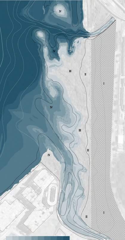

Retreat Forward
Legend: Basin
Gain
Loss Industrial Building 316 DEPOSITION
[%] Fringe Central Mangrove Back Mangrove 0.01 Deposition Difference (kg / m2 ) 64.94% 70.42% 10.97% 15.21% 15.74% 2.94% 0.05 0.1 kg / m2 2003 2008 2013 2018 2020 (None Mangrove) Mangrove Mangrove 1m 2m 3m
Mangrove
Mangrove
Mangrove
MANGROVE CHANGES
CURRENT SITUATION
MANGROVE HABITAT
Threat from sea level rise
Ecological disconnection
Sediment reduction
Long Term Conservation
Abandoned heritage
Not accessible
Near Term Construction
Single waterfront
Surface runoff collection in Near Term
STRATEGY
50-100 Years
Prototype for ecological coastal reclamation by fshpond

Pioneer seedling
Fishpond Rail Corridor
0-5 Years
Physical & functional connection through PCN & Rail Corridor
Attraction
Migratory birds route
Mandai River
Soil fltration
Bio-purifcation Water
317
PROBLEM STATEMENT & STRATEGY
Sediment
Site Habitat PCN
RAIL CORRIDOR & NEW PCN MANDAI
CONSTRUCTION PROCESS
Before 2025
Cleansing & Connection
PCN & Rail Corridor construction
Mandai River purification
After 2030
Reclamation & Recreation
Artificial islands construction
Fish pond construction
After 3m SLR
Sedimentation & Construction
Sediment forms new land
Mangroves move forward New business park construction

Retreat Forward 318 Hard revetment waterfront landscape in industrial area Term Construction Habitat destruction Abrupt change of terrain Medium/Long Term Reclamation New PCN Tidal creek 3m SLR 0m SLR 3m SLR barrier Reclamation Bio-purifcation Water fow Sand flter River bio-purifcation Artifcial tidal creek created by reclamation
Years 5-15 Years
RIVER URBAN EXPANSION
0-5
MANDAI
BIO-PURIFICATION
Cycling Path Netwalk(<25km/h)
Walking Path
Along the Mandai River
Subsurface Filtration
Heavy Metal Removal
Pathogen Removal
Nutrient Removal
Aeration
RAIL CORRIDOR
Cycling Path(<10km/h)
Cycling Path Netwalk(<25km/h)
Around the Rail Corridor
Walking Path
Boardwalk
NEW PCN
Cycling Path Netwalk(<25km/h)
PCN
Terrestrial Plant
Back Mangrove
Rail Corridor
Central Mangrove
Mangrove Fringe
Timmac @ Kranji
Along the shoreline
Walking Path
Business 2 Area
Bioswale


PCN - SLR Barrier
Existing Mangroves

319 2025 VISION Cleansing & connection
N
50m

Retreat Forward 320 50m ① Surface wetland system ② Cleansing biotope ③ Bus stop & entrance ④ Rail park ⑤ Sports park ⑥ Parking lot ⑦ Park connect network ⑧ Mangrove reserve ⑨ Mudflat ① ① ① ⑤ ② ② ③ ③ ④ ⑥ ⑦ ⑧ ⑨

321 N 50m ① ① ① ① Surface wetland system ② Cleansing biotope ③ Bus stop & entrance ④ Rail park ⑤ Sports park ⑥ Parking lot ⑦ Tidal Creek ⑧ Mangrove boardwalk ⑨ Fishpond ⑩ Artificial Island ③ ③ ⑤ ④ ② ② ⑥ ⑧ ⑧ ⑨ ⑩ ⑦
ARTIFICIAL ISLAND & TIDAL CREEK FISHPOND


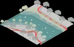

Watergate
ArtifcalIsland
Bioswale
PCN - SLR Barrier
Existing Mangroves
Artifcial Mangrove Planting
SAFER OPEN SPACE
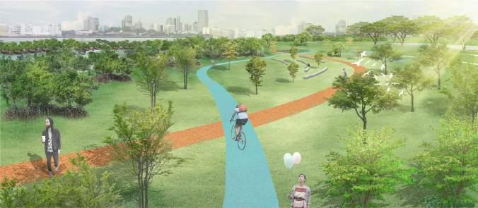
According to different types of transportation, speed, and scale of activities, pedestrians and cyclists will be separated to create a safer experience.
Sedimentation
Pioneer Seedlings
NEW MANGROVE HABITAT
Building fshponds to catch sediment. Sediment cleared from the port areas can be transferred to promote sedimentation. The newly reclaimed land provides a retreat for mangroves, and succession will take place at back.
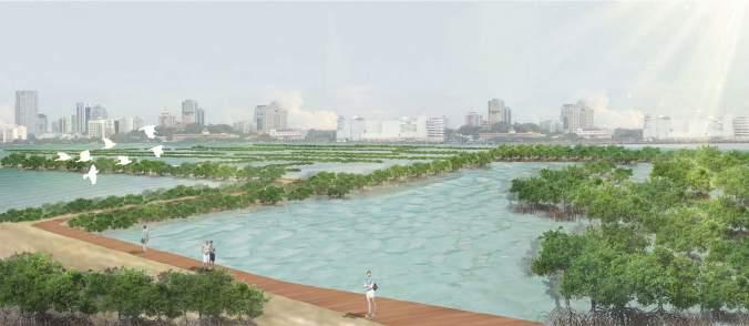
Retreat Forward 322 2030 VISION Reclamation & recreation
PCN
Boardwalk
③ ③
The original intertidal zone gradually turns into a freshwater swamp as the seawater is blocked, and the surface runoff of the business park is collected here after bio-purifcation.


323 3M SLR VISION
The new building divides the site into different areas, and the cycling and walking paths connect them through the ground foor of the building. So The ground level of the business park is still open to the public.
BUSINESS PARK
Sedimentation & construction N 50m
FRESHWATER SWAMP
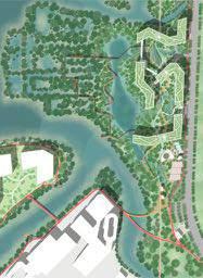
Retreat Forward 324 50m ① Surface wetland system ② Cleansing biotope ③ Bus stop & entrance ④ Rail park ⑤ Sports park ⑥ Parking lot ⑦ New mangrove reserve ⑧ Freshwater swamp ⑨ Seedling nursery ⑩ New business 2 area ① ① ① ⑤ ④ ④ ④ ④ ② ② ③ ③ ⑥ ⑥ ⑩ ⑧ ⑦ ⑨

325
COLLECTING. CATCHING. CULTIVATING
Productive Coastal Park
Li Xi Emily
Located in the Northern Singapore, Woodland Waterfront Park is facing the issues of isolated habitat patches, loss of recreational spaces due to sea-level rise, and the lack of interactive activities. It has a potential for food production.
The proposal focuses on three aspects: sea-level rise adaption, habitat improvement, and productive recreation. The aim of the proposal is to envision an innovative park typology that is more ecologically connective, interactive, and coastal adaptive.
The proposal highlights three movements. Sea level rise and storm-water strategy: Mangroves will be extended from adjacent Admiralty Park to connect with existing isolated mudfats and contribute to sedimentation. Oysters will be introduced in the form of reef balls, foating farming structures and breakwater to attenuate wave energy. The shell of the oyster will be reused in gabion walls and mesh bags for revetment stabilization. A new canal with bio-retention ponds will be created for water fltration and collection from the hill. Habitat Improvement: Mangrove forest provides a habitat with a soft muddy foor for fshes, shrimps, and crabs. Oyster reef balls and breakwater can function as shelter for tiny marine animals. Seagrass can be restored in shallow and undisturbed water areas behind mangroves or oyster breakwaters. The pond creates stone-based habitat with logs for freshwater aquatic animals.
Productive Recreation: Productive recreational activities such as catching, collecting, and consuming aquatic animals and edible plants are promoted based on different natural habitats. Visitors can participate in recycling oyster shells and placing the shell bags along the shoreline. New open spaces and paths are designed for events and community engagement.
Responding to the future agri-tech food corridor and recreational routes development in Northern Singapore, the new productive coastal park encourages a healthy lifestyle with environmental and economic benefts.
COLLECTING. CATCHING. CULTIVATING
326
Woodland Waterfront Park is located in Northern Singapore facing the loss of recreational spaces due to 3m sea-level rise. Besides, there are four areas with specifc problems and opportunities. A new residential project of Woodland North Coast will be developed near the edge of the park. Currently, this area lack programs for the new community but it is suitable to develop storm-water management. The waterfront area is mostly blocked by existing waterfront vegetation which is not accessible and interactive. The jetty with a restaurant on it is a tourist attraction and has the potential for food production. However, it has little connection with another part of the park. The mudfat habitat is benefcial to local fauna but it is isolated.
PROBLEM STATEMENT CONCEPT
Based on the analysis, the proposal will focus on four themes: recreation, food production, habitat, and sea-level rise. The aim of the proposal is to create a new coastal park that is more connective, adaptive, and interactive.
Problem Statement Concept

327
SITE ANALYSIS
MAIN STRATEGY
The main strategy of the proposal is to introduce specifc triggers to each of the areas. For the residential area, the existing sloping landform will be utilized for stormwater management and fruit tree planting. For the waterfront area, more accessible and recreational boardwalks will be provided so that people can get closer to the water with a broader view. For the jetty with restaurant, the oyster will be introduced for food production, habitat improvement, and attenuation of a wave. For the mudfat, another mangrove creek will be extended from Admiralty Park to connect with the mudfat and create more diversifed habitats.
Triggers

COLLECTING. CATCHING. CULTIVATING 328 VISION
In the off-shore area, oyster farming foating structure and oyster breakwaters will be applied to reduce wave energy. Oyster reef balls will be attached to the piers of the jetty so that the jetty itself can be seen as a large breakwater. At the shoreline, an oyster shell gabion wall and oyster shell mesh bag will be placed for shoreline stabilization. Mangrove will be planted both in off-shore are and shoreline areas for the same purpose. A new canal will be created from the residential area. Water from the canal will get fltered through bio-retention swales along the terrace and collected in the freshwater pond.


329 MASTER PLAN
SEA LEVEL RISE/STORMWATER MANAGEMENT STRATEGY
After applying these strategies, the water fow and direction of this area will be changed. Wave energy will also be attenuated near the shoreline. In the 3m sea-level rise scenario, most recreational spaces will not be infuenced. The freshwater pond will be turned into a brackish pond with a more diversifed habitat. Recreational areas will retreat to the higher ground. Oyster bags will be accumulated along the shoreline while Mangrove will keep contributing to sedimentation.

COLLECTING. CATCHING. CULTIVATING
PHASE & CHANGE 330
Phase Change
HABITAT IMPROVEMENT
Distribution & Typologies

After introducing the triggers to each area, the habitats of the park have been improved. There are three types of habitats: saline aquatic habitat, freshwater/brackish aquatic habitat and upland habitat
Saline Aquatic Habitat
Saline aquatic habitats include: mangrove & mudfat (muddy foor), oyster habitat and seagrass habitat.
Freshwater/Brackish Aquatic Habitat
Freshwater/brackish aquatic habitats include: mangrove creek, bio-retention swale and freshwater/brackish pond (rocky foor)
Upland Habitat
Upland habitats include secondary forest, managed forest, fruit trees, shrubs for butterfies, edible groundcovers, and lawn.
331
Flora, Fauna & Food Production


Different habitats serve as food resources and shelters for different animals. For example, aquatic habitats with muddy foors and rocky foors might attract different kinds of fshes and other aquatic animals. Fruit trees with low maintenance needs such as lime and pomegranate are planted on the terrace. For edible ground covers, common herbs like lemon grass, mint, and basil are cultivated so that they can be used by the restaurant.

COLLECTING. CATCHING. CULTIVATING
332 HABITAT IMPROVEMENT
Productivity
The oyster farming area is 1800 sqm which can cultivate 28000 oysters in the mesh box suspended on the foating structure. There are 66 fruit trees in the park and the productivity is estimated to be 2600kg per year.
Distribution & Typologies

Based on the improved habitats, there will be fve types of productive recreation including catching, collecting, cultivating, consuming and recycling.
Cycle of Oyster
The diagram shows how the restaurant relates to another part of the park. Oysters are cultivated in the foating structure managed by the restaurant and then consumed in the restaurant as food by consumers. The waste shells can be recycled and collected in gabions or mesh bags and later be placed along the shoreline for stabilization. Community and other visitors can participate in this activity.
333
PRODUCTIVE RECREATION
Recreation Scenario
People can go fshing in different natural habitats or open spaces as they want. They can also pick or collect fruits, herbs and oyster that are naturally grown or manually cultivated in specifed areas. Besides, visitors would also enjoy seafood with an excellent sea view of Malaysia on the jetty, waterfront plaza, or the lawn. After eating and drinking, they can engage in the activity of recycling oyster shells.

COLLECTING. CATCHING. CULTIVATING 334 PRODUCTIVE RECREATION

335 Habitats Sea Level Rise Strategy PERSPECTIVE
The new coastal adaptive park promotes productive recreation based on enhanced habitats and encourages a healthy lifestyle with environmental and economic benefts. From this perspective, we can see that the productive recreational routes, habitats, and sea-level rise strategies are connected and interwoven with each other. This innovative park is also a response to the future development of Northern Agri-Tech and Food Corridor and multiple upgraded recreational spaces like Round Island Routes and The Greater Rustic Coast.

COLLECTING. CATCHING. CULTIVATING 336 Recreational Routes Habitats


337
SELF-SUFFICIENT WATER RECYCLING SYSTEM
Sembawang shipyard redevelopment
Under the broad topic of Sea Level Rise, the water. shortage cannot be ignored. The project analyzes the current situation of the site and the needs of users, designs three strategies to reduce the erosion of coastal area caused by sea-level rise, ABC strategies are used to collect and recycle rainwater for the daily water use in the dormitory which allows the design to become self-sufcient water recycle system to meet workers’ needs for living space and activity space.
Meanwhile, the setting of the farm can enrich workers’ eating habits. In the event of a 3m rise in sea level, would become the mangroves, half of the cricket pitch and farmland would be fooded, fsh, shrimp, and seaweed would naturally move in, thus enriching the ecology. The remaining half of the cricket pitch would allow the plant to have a natural succession and becomes a secondary forest.
Self-sufcient water recycling system 338
Ou Yeyao
SITE ANALYSIS AND METHODOLOGY SHIPYARD INFLUENCE TO HABITAT

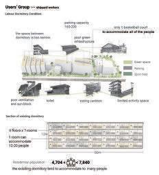

339
WATER SAVING METHOD AND POLLUTION PURIFICATION


Self-sufcient water recycling system 340
ANALYSIS AND WATER SAVING METHOD INDUSTRIAL POLLUTION
POLLUTION
WATER USAGE
cricket feld
jogging trail
ecological island

agricultural feld
front square
outdoor kitchen
basketball feld
rain garden
theater
open grassland
dormitory
parking lot
water purifcation building
water purifcation pond
edible garden
341 ENHANCE HEALTH AND PROVIDE ECOLOGICAL VALUE
MASTER PLAN
The cricket feld and agricultural feld would enhance the activity experience and increase the health of workers. Each dormitory area accommodates a square, rain garden, sports feld, parking lot.
DRAINAGE FLOW
HABITAT MAP
cricket feld
ACTIVITY MAP

ecological island
ROAD ANALYSIS
BASE MAP
agriculture feld
WATER PURIFICATION SYSTEM
outdoor kitchen and square
outdoor theater
Self-sufcient water recycling system 342
SECTION

Plant Palette and Scenario
SECTION1-1’
SECTION2-2’
SECTION3-3’
SECTION4-4’
SCENARIO 1 CRICKET FIELD
SCENARIO 2 ECOLOGICAL ISLAND

SCENARIO 4

DORMITORY
SCENARIO 3
PURIFICATION POND
DORMITORY FRONT SQUARE
Provide various types of activity space for workers to relax. Different elements like a corridor, plantation box, lamb with plants can be introduced to the site to make it a more eco-friendly space.
VISITOR CENTER AND TERRACED PROMENADE
The eco-friendly phenomenon is created for the health of workers. People can make the best use of riverside walk, jogging trail, agricultural feld to increase their life.


Self-sufcient water recycling system 344
PERSPECTIVE Ecological, Healthy
PHASE 1: CURRENT SITUATION
SECTION 1-1’
Succession happens and create a secondary forest
Mangrove habitat will increase, the island would be covered by mangrove species. The ability to address the sea level rise effect will increase.

345 PHASE DEVELOPMENT
SALT MARSH
PHASE 2: 30 YEARS AFTER
The Cricket feld would be fooded create a habitat for marine life
Reduce ocean wave and increase sediment
MANGROVE HABITAT EXPANDS
Agricultural feld would be fooded create a habitat for marine life
SECTION 2-2’

Self-sufcient water recycling system 346

347
FUTURISTIC IS PAST
What does 22nd-century Kampung look like?
As one of the rare natural sandy beach resources in Singapore, Sembawang Beach serves as a crucial coastal buffer and carries the forgotten Kampung culture. However, it is currently facing three main problems: rising sea level, habitat loss, and poor accessibility. Fortunately, the future land reclamation plan provides an opportunity to deal with those issues.
Therefore, the goal is to revitalize the Kampung lifestyle by reshaping Sembawang Beach so that the development of coastal residential areas can be reintegrated into the natural process of the coast, enhancing the resilience of the coastal zone in the face of climate change while providing a new pattern for the construction of coastal settlements.
This project will propose a new approach to land reclamation that preserves beach resources while integrating old and new land into a sustainable whole and enhances its ecological and human value. Four strategies will be applied. Firstly, construct the disaster prevention infrastructure to promote the beach’s expansion and the formation of offshore tidal fats. Secondly, develop a water management and pollution control system to reduce the impact of extreme weather on inland areas while providing suitable conditions for habitat succession. Thirdly, create more abundant habitat types to stabilize the ecosystem of the transitional zone. Finally, improve the accessibility to encourage various coastal public activities that bring people closer to each other and nature.
With all these methods, the future coastal residential area can become a human inhabitation community that coexists harmoniously with the sea like the past’s Kampung.
Futuristic Is Past 348
Huang Xi
2 THREATENED HABITATS


In addition to the beach ecosystem, the diverse plant community on land also provides habitat for various animals and plants. However, due to the high proportion of buildings and impervious surfaces, the biodiversity of residential areas is extremely low.
1 SANDY BEACH & RISING SEA LEVEL
Beach resources of Mainland Singapore are disappearing under threat from rising sea levels and urban land expansion plans. As a rare natural beach resource, Sembawang beach serves as a buffer zone to protect the residential area, parkland, and shipyard onshore.
349 SITE ANALYSIS
3 IRRATIONAL WATER MANAGEMENT
All the water directly fows into the sea and lacks purifcation and reuse processes, leading to seawater pollution and a low utilization rate of rainwater resources. At the same time, because of the fatness of the landform, the residential area is vulnerable to fooding during extreme weather processes.
4 LOW ACCESSIBILITY
Barriers and unreasonable road systems prevent people from conveniently accessing coastal recreational resources and reducing the communication between residents and the public. At the same time, the coastal activities are relatively single than the inland.
5 CONCEPT GENERATION
FUTURISTIC IS PAST
The goal is to revitalize the Kampung lifestyle by reshaping Sembawang Beach so that the development of coastal residential areas can be reintegrated into the natural process of the coast, enhancing the resilience of the coastal zone in the face of climate change while providing a new pattern for the construction of coastal settlements.


Futuristic Is Past 350
:

351 SLR +1M

Futuristic Is Past 352

353 SLR +3M

Futuristic Is Past 354

355 RESTORE SUSTAINABLE LIVING AND RECREATIONAL ENVIRONMENT

Futuristic Is Past 356

357 ENCOURAGE COASTAL ACTIVITIES AND REVITALIZE THE KAMPUNG SPIRIT

Futuristic Is Past 358
FROM SUNGEI BULOH NATURE RESERVE TO TUAS SHIPYARD
INDIVIDUAL PROJECT
Regenerative Facility
Feng Kangtai
The site locates in a transport node of Kranji area, which is next to Sungei Buloh wetland reserve, farming area and the gate of Kranji Dam. Facing the ongoing transformation of whole area, including upgrading of agriculture, sea level rise and succession of secondary forest, my site can play a role as regeneration hub to reuse and allocate the natural resources in Kuanji area. By helping the natural resources to be reallocated efciently, Kranji area can be more resilient to the potential changes. Methods consist of recycling waste concrete and wood, compost of forest and agricultural litter, helping mangrove to retreat and seed storage.
Agri Park
Xie Wanying
The Lim Chu Kang Jetty area has a long history of farming and fshery, which needs agrifood development to meet the future food vision. This site also features mangrove and mudfat habitats, and secondary forest patches which are vulnerable to sea-level rise. This project is aiming to design an integrated and interactive agriculture park featuring a productive and diversifed agri-food approach, while also capturing the socio-economic benefts of agriculture, including food tourism. Therefore, various agricultural practices, a foodto-table restaurant, and a farmer market can be seen in this agri-park.
Wild Adventure
Zhang Liping
The project aims to create a more diverse habitat through the transformation of the coastal and nearshore land topography, while also cleverly taking advantage of the changes in the habitat brought about by sea-level rise. Meanwhile, three relatively fragmented individuals, the camping site(Camp Christine), the adventure centre(MOE Jalan Bahtera), and the two kelongs near the shoreline, were combined and changed into a complete and unifed wild adventure center, providing a variety of land, water, and underwater activities.
359


From Sembawang Park to Sungei Buloh Nature Reserve 360
Site 1: Kranji Dam
Site 2: Lim Chu Kang Jetty
Site 3: MOE Jalan Bahtera Adventure Center
Feng Kangtai
Site 1 Feng Kangtai
Site 2
Xie Wanying
Site 3 Zhang Liping
Xie Wanying Zhang Liping


361
REGENERATION HUB IN KRANJI
Material Regeneration For Resilient Shoreline
Feng Kangtai
In addition to our common theme——sea level rise, Kranji area is also facing other two transformations, secondary forest succession and transition of farm. I see the opportunities behind those changes even though they bring threats at the same time. A transformation could be turned into a chance to overcome the crisis of other transformations. Through the development of farm, abandoned materials will be generated. Natural resources like litter and mud are produced by nature in all time. Therefore, those resources can be regenerated and recycled to new tools for the sea level rise and succession of forest. Besides, my site can play a role of educational and recreational gateway of Sungei Buloh and Kranji because of its location and convenient transportation condition. It is the case we transform crisis to chance.
Regeneration Hub in Kranji
362
In Singapore, sea-level rise is becoming a potential serious problem as the large area will be fooded. The Centre for Climate Research Singapore has projected that Singapore could experience an increase in daily mean temperature of 1.4C to 4.6C towards the end of this century, more intense and frequent heavy rainfall events, and mean sea level rise of up to 1 meter by 2100. Under that issue, there is 2 other main transformation in Kranji area—— Transition of types of farm and succession of secondary forest. Singapore Food Agency (SFA) will be embarking on a holistic exercise to master plan the Lim Chu Kang (LCK) area to create a high-tech, highly productive and resource-efcient agri food cluster. The master plan is spanning about 390ha of land. And secondary will stop developing as it’s far away from primary forest, which offers long-life trees’ seeds.

More than 75 percent of Singapore’s mangrove fora in Sungei Buloh wetland reserve locating in Kranji, with a 130-hectare wetland of mangroves, mudfats, ponds, and supporting secondary forest.


more than 60 percent of Singapore’s bird species ( over100 species) and more than 2,000 Arctic migratory birds from more than 30 species make "winter holiday visits" to Sungei Buloh Wetland Reserve Sungei Buloh Wetland reserve offers shelter for lots of reptiles and mammals. SBWR is the home of otters, crocodiles, monitor lizards, crab and fsh. It's one of the most important habitats in Singapore with high biodiversity.


363
TRANSFORMATION OF KRANJI
Sea Level Rise Secondary
Transition of Traditional Farms Tide-gauge Observations Satellite Observations The Centre for Climate Research Singapore has projected that Singapore could experience an increase in daily mean temperature of 1.4C to 4.6C towards end of this century, more intense and frequent heavy rainfall events, and mean sea level rise of up to 1 metre by 2100. Kranji Area Singapore
RICH NATURAL RESOURCE IN KRANJI
Forest Succession Stagnation
Industrial area
Marsh
Mangrove
Wood
Farmland
Wasteland
Bush
Grassland
Building area
Golf
Fresh water
Seawater


Marsh
Utility Industry
Open space
Current building
Park
Sport & recreation
Farm
Military protective area

Reserved area
There ’re various natural habitats in Kranji area——Mangrove, forest, grassland, etc. On one hand, they’re vulnerable to the changing climate. On the other hand, lots of natural resource generated from those areas. And in the process of the farm’s transition, much wasted material will be generated.

Regeneration Hub in Kranji 364
Map
Habitat
HABITATS MAP AND LAND USE MAP OF KRANJI
Landuse Map
EXISTING AGRICULTURE MAP, HABITAT MAP, AND SEA LEVEL RISE VULNERABILITY MAP


Transformation Direction in 2024
The Singapore Food Agency (SFA) will be embarking on a holistic exercise to master plan the Lim Chu Kang (LCK) area to create a high-tech, highly productive and resource-efcient agri-food cluster. The master plan is spanning about 390ha of land.
Waste Generated by the Transformation to High-tech Farm


Short life of trees in secondary forest


Relationship between mangrove and Forest
Withstanding
Solutions to develop secondary forest


Genes from primary forest

365
Concrete Vegetation Litter Wood
agricultural map Secondary forest& Acacia auriculiformis Falcataria moluccana Cecropia pachystachya
Existing
Farms open to the public Bus Route Empty land Building Abandoned farms Ponds Outdoor Aquaculture Indoor Aquaculture Equine quarantine station Horticulture nursery
Existing Farm Typology
Area (ha) Fish farm Indoor Aquaculture Abandoned Farm Horticulture Nursery Equine Quarantine Station
0 2 Retreatment
4 6 8 10 12 14 16 18 20 Life (year) 0 5 10 15 20 25 30 35 40 45 50 Leucaena leucocephala
Mangrove location Forest

Ecological fow

Vulnerability for Sea Level Rise


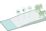


Retreatment space


Threats from sea level rise

Regeneration Hub in Kranji 366
Leucaena
Syzygium
Syzygium
Grassland Farm field Building Wasteland Marsh Stone embankment Constructed area Sparse forest Mangrove Wood Mangrove Grassland Stone embankment Wood 5m sea level 3m sea level Sparse forest
leucocephala
grande Ardisia elliptica
polyanthum Nutrient supply
Stone embankment Mangrove Stone embankment
CURRENT TYPOGRAPHY
By analysis, the current topology is not suitable for mangrove retreatment and material processing. Reshaping the landform would be the frst step.

367
BASE MAP OF SITE Gradient and Elevation Analysis
Mangrove, Farm, Mudfat and Secondary Forest


POTENTIAL USE OF AVAILABLE RESOURCE
Propagules from mangroves can provide the genetic source of new mangrove habitats. Waste concrete and wood would be generated from abandoned farms. The secondary forest can generate litter.

MATERIAL PROCESSING


Through the regeneration processing, the waster materials become the new materials that can be used as tools to strengthen the shoreline. The regeneration hub will locate at my site.

Regeneration Hub in Kranji 368
AVAILABLE RESOURCE IN KRANJI
Abandon Farm Mudflat Secondary Vegetation Mangrove 130 ha 143 ha 12000 ㎡ 96 ha Source Material Processing Methods Use Abandoned Farm Permeable Dam Litter Twig & Rod Concrete Mud Seed Seed Cultivation Regeneration Weaving Combination Mangrove Secondary Vgetation Mudfalt Eco-shoreline Secondary forest supply Primary Forest in CCNR Mudflat Supplement Education Playground Transferring
MATERIAL REGENERATION MAP
This map shows the detail of the regeneration process. Those materials are muti-functional for various uses.


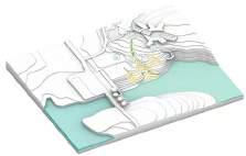

PROCESSING PHASES
Firstly, remold the landform to make space for industrial use, leaving a place for material settlement. Conduct the original pond water to provide new space for the mangrove to retreat.
369
COMBINATION OF EDUCATION AND REGENERATION
Finally, this site will be a combination of resource regeneration and learning coastal forests for the public. The traveling part and industrial part will be separated. This site is designed to be a museum for people to learn the coastal ecology and material regeneration.

Regeneration Hub in Kranji 370
20m 50m N
1. SBWR visitor center 2. Nursery 3. Viewing deck 4. Seed bank 5. Visitor center 6. Regeneration playground 7. Coastal learning forest 8. Existing pond 9. Car park 10. Mud storage 12. Litter dumping 11. Litter dumping 13. Grinding 14. Composting 15. Delivery 16. Concrete tipping 17. Concrete processing 17. Concrete storage

371
AGRI PARK
Future Food in Lim Chu Kang Agri Hub
XIE Wanying
The Lim Chu Kang Jetty area has a long history of farming and fshery, which needs agri-food development to meet the future food vision. This site also features mangrove and mudfat habitats, and secondary forest patches which are vulnerable to sea-level rise.
This project is aiming to design an integrated and interactive agriculture park featuring a productive and diversifed agri-food approach, while also capturing the socio-economic benefts of agriculture, including food tourism. Therefore, various agricultural practices, a food-to-table restaurant, and a farmer market can be seen in this agri-park.
Three main strategies will be implemented to meet the design goal. The frst approach is to enhance the water fow on-site, introducing two streams running from inland to the ocean to create a brackish-water habitat, while also bringing sediments downstream for the gradual mangrove regeneration. The mangrove habitat here not only serves as a nursery for juvenile fshes, but also as a natural barrier when facing sea-level rise.
The second strategy is to increase food production to meet future food development. With the second strategy being introduced, the third strategy will come as well which is about diversify the habitat. Different agricultural production methods not only increase the output but also enhance the overall food resilience since more fora and fauna have been invited to come as well. This agri-park will feature several types of habitat/ land use, including sea, mudfat, mangrove, coastal vegetation, brackish-water, terraced felds, aquaponics, and agroforestry.
In conclusion, with these design strategies, food production and tourism, and natural habitat protection can be well balanced in this agri-park.
AGRI PARK 372
Historical Changes
The Lim Chu Kang Jetty area has a long history of farming and fshery, which needs agri-food development to meet the future food vision. This site also features mangrove and mudfat habitats, and secondary forest patches which are vulnerable to sea-level rise.


(by Kangtai, modifed by myself)
Sources: https://libmaps.nus.edu.sg/ https://www.straitstimes.com/singapore/new-lim-chu-kang-nature-park-to-be-part-of-400ha-nature-park-network-along-the-northern https://www.straitstimes.com/singapore/environment/lim-chu-kang-set-to-be-redeveloped-into-high-tech-agri-food-cluster-sfa
 Satellite Image of Lim Chu Kang Jetty Area
Source: Google Earth
373
SITE ANALYSIS LIM CHU KANG JETTY
Model of Existing Site Condition


Existing Habitats
Sections (Before Changes):


Before
The coastal area is vulnerable to SLR, therefore mangrove regeneration is necessary to protect the site. Besides mangrove regeneration, other soft protections like introducing streams for coastal sediment accumulation can be helpful as well.
Existing Condition
Problem Statement:
• Highly natural but relatively mono habitat --> diversify habitats

• Sea level rise leads to mangrove retreat --> increase sedimentation for mangrove regeneration

• Agriculture productivity and resilience needs enhancement --> future food development

AGRI PARK
3M SLR Scenario
1-1 1-3 1-2
3m SLR --> mangrove retreat
section 1-3
1. Sea level will lead to mangrove retreat
374
2. Inland water fow and sea area are separated
WATER FLOW AND SEA-LEVEL RISE SCENARIOS
3 Meters Sea-Level Rise
3 METER SEA-LEVEL RISE
Design vision is about creating an integrated and interactive agriculture park featuring a productive and diversifed agri-food approach, while also capturing the socio-economic benefts of agriculture, including food tourism. Therefore, various agricultural practices, a food-to-table restaurant, and a farmer market can be seen in this agri-park.

Design Strategies:
1. enhance water fow
2. strengthen agriculture production

3. diversify habitats

STRATEGIES:
• Enhance the water fow
• Introduce two streams
• Create a brackish-water habitat
• Sedimentation for gradual mangrove regeneration

375
Human Flow & Activity Diagram
AGRI PARK
VISION Visionary Perspective
1. ENHANCE WATER FLOW
• Increase food production
• Introduce different agricultural production methods

• Enhance food resilience

Aquaponics Perspective AGRI PARK 376
STRATEGIES 2. STRENGTHEN AGRICULTURE PRODUCTION

377 STRATEGIES
3. DIVERSIFY HABITATS
• Introduce different agriculture activities

• Diversify the habitats
• Invite more fora and fauna
AGRI PARK 378

379 AGRI PARK
In conclusion, with these design strategies, food production and tourism, and natural habitat protection can be well balanced in this agri-park.


 Terraced Fields Perspective
Fishing Weir Perspective
Farmers’ Market Visionary Perspective
Perspective
Key Map
AGRI PARK 380

381
WILD ADVENTURE
Habitat change and activities adaption
The project aims to create a more diverse habitat through the transformation of the coastal and nearshore land topography, while also cleverly taking advantage of the changes in the habitat brought about by sea-level rise. Meanwhile, three relatively fragmented individuals, the camping site(Camp Christine), the adventure center (MOE Jalan Bahtera), and the two kelongs near the shoreline, were combined and changed into a complete and unified wild adventure center, providing a variety of land, water, and underwater activities.
One of the most obvious problems for the site is the loss of mangrove habitat due to rising sea levels. Thus, Strategy One was to reshape the shoreline to protect the mangrove habitat and create a habitat for benthos and seagrass (As the sea-level rise, the previous mangrove habitat becomes a habitat for corals, sea urchins, and other benthos). It also provides an excellent water depth condition for diverse surface and underwater activities.
The second obvious problem of the base is that the boundary between land and sea is so closed that the accessibility is almost zero. Strategy Two is to open the coastline to the public as much as possible. Meanwhile, three relatively fragmented individuals, the camping site, the adventure center, and the two kelongs near the shoreline, were integrated into a whole and replanned. It is planned to be a wild adventure center that integrates the functions of land field adventure, land field training, water activities, water living, and underwater activities. This will increase the accessibility, fun, and experience of the coastline, weaken the impact of sea-level rise, and even use it to show the ecological environment of the shallows and invert more interesting activities. +
In order to increase the abundance of wild adventures, different types of terrain environments such as hillsides, valleys, dry streams, and wetlands have been created in the coastal land. Coupled with the planting density, types of plants, the choice of soil types, and the difference between fresh water and saltwater, ten different natural environments can be created. And then different natural habitats can be connected through a mainstream line. In addition, a climbing and suspended crossing route was added as part of the field training.
The plan places most of the living space on the water. Using the technology that kelong can stably float on the water, and the introduction of the floating bridges, the existing kelongs and created new floating camps are connected with the water activity spaces on the shoreline.
Wild Adventure 382
Zhang Liping
BASE MAP
Problem Statement One_Forbidden to shoreline &Underutilization
First_Limited observation of shoreline

Second_Limited management of mangroves
Third_Forbidden to entry shoreline
Fourth_Underutilization of camp site
The first obvious problem of the base is that the boundary between land and sea is so closed that the accessibility is almost zero.

383 SITE ANALYSIS Geographical context
Problem Statement Two_Threat to mangrove
Solid model
Current flooded area
STRATEGIES
Three Integrated system
First_Reshaping water flows


Future flooded area
Current mangroves habitat
Future mangroves habitat


One of the most obvious problems for the site is the loss of mangrove habitat due to rising sea levels.
Second_Enhancing coastal and marine habitat

Third_Retrofitting recreational activities

03 Wild Adventure
Habitat map
3m rise Building Fence Shoreline
Limited Intervention Intervention Lawn
Mangroves
Tidal flow Surface flow Open space Mangroves habitat Bridges Road Deck promenade
Fence
centre
senior
area Water
centre 384 SITE ANALYSIS
Camp christine
Mangroves Experience Area Benthic observation area MOE Adventure
Shoreline
accommodation
activities
Strategie one_Reshaping water flows


Previous shoreline Secondary phase shoreline Kelong
Floating
Bridge
Mangroves SKY Outward Bound Water Activities Rental Centre 100M 100M Mangroves Mangroves Fence Fence Government Property Government Property Fishing Sunbathing 385
Kelong Canoe Port Floating Hotel and Fishery
Bridge
Observation Deck
STRATEGIES


Wild Adventure shoreline A B A' B' A\A' B\B' Fishing Deck Sunbathing Area
Visitor Centre
Square Camp House Camp House Pedestrian Road
Road
Freshwater Fishing Lawn House Camp House
Fence
Section A-A
Section A'-A'
Section B'-B'
386 STRATEGIES
Section B-B
Strategy One was to reshape the shoreline to protect the mangrove habitat and create a habitat for benthos and seagrass (As the sea level rise, the previous mangrove habitat becomes a habitat for corals, sea urchins, and other benthos).


point C
Viewing
E
Second_Enhancing coastal and marine habitat 387 STRATEGIES
Viewing point
Viewing
5-YEAR-VISION 50-YEAR-VISION
Third_Retrofitting recreational activities
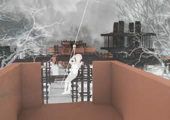


It is planned to be a wild adventure center that integrates the functions of land field adventure, land field training, water activities, water living, and underwater activities. This will increase the accessibility, fun, and experience of the coastline, weaken the impact of sea-level rise, and even use it to show the ecological environment of the shallows and invert more interesting activities.

Wild Adventure
point B C D E F Entertainment Building Observation Canoe Swimming Diving Sunbathing reception Picnic Fishing Sunbathing Physical training Outward bound Flying fox Residential building Service building Commercial building B Viewing point D Viewing point F 388 STRATEGIES

389 5-YEAR-VISION PLAN_PHASE ONE Marine camp Water activity Wetlandhotel coconuthotel V i is tro tnecre V i is t o r tnec e r Camphousing Marine canteen Port N Port Housing housingcenter service center 0 25 50 100


Wild Adventure 390 50-YEAR-VISION PLAN_PHASE TWO 0 25 50 100

391 VISION
Water activity center
Water activity service center
Coconut hotel
The plan places most of the living space on the water. Using the technology that kelong can stably float on the water, and the introduction of the floating bridges, the existing kelongs and created new floating camps are connected with the water activity spaces on the shoreline.

Wild Adventure 392
marine canteen
Marine camp housing center
393
CHAPTER 4 REFLECTIONS
Students’ Refection and Feedback After the Studio
Refections 394
Low Lying Singapore is an exciting project. and our studio aims to reimagine coastal landscape to sea level rise adaption. It is interesting to learning the relationship between ocean and human, as nowadays the contradiction between the urban sprawl and rising sea level is getting serious. And I have learned about how to design my project more logically and reasonably step by step, by understanding the site and exploring various design strategies approaches. Water is a complicated topic, so I have encountered many challenges in this design process, but they prompted me to think more deeply. I hope that I can do more related projects in the future, coz I was overwhelmed by the charm of the ocean during this semester.


The process of this studio was tortuous before I come through and realize how tremendous the harvest that I gain it is. In this semester, the most fantastic but exhausting thing is that we are repeatedly wandering between actuality and imaginative future, and I am certain this nuance has dramatically extended my comprehension of the capability and role that a landscape architect should own in face of the future challenges. Several group works with different teammates are also laudable as we can freely share ideas to germinate diverse and wonderful solutions. After all, it is exciting that the frst half of the graduate career is conquered.
Although the topic of sea-level rise is often heard, this semester is the frst time that I try to solve this problem in my design. The tense and stressful course arrangement makes me try to understand the site and landscape design from multiple perspectives and interdisciplinary felds. I have learned a lot both in and out of class, integrating the knowledge of ecology and engineering into the design. I strengthened the ability to analyze the site, and also the ability of time management.

Hao Jun Long Di 395
Fang Ting
The second semester’s studio is a fruitful experience for me since this is my frst face-to-face studio in Singapore during this pandemic period. During several assignments and site analysis, I learned more about the Singapore context. It is also my frst time dealing with a project related to the sea. Therefore, I understand more about water and sustainable design, which will be very helpful for my future landscape projects. Although I encountered many difculties throughout the design process, my logic became more explicit, and my time management ability improved.

Nowadays, climate change and sea-level rise are highly relevant concerns in Singapore and many other coastal cities. I learned how to systematically analyze and get inspiration from the current site conditions to come up with suitable and applicable designs for my site. The general land-use analyses which we did for the frst half of the semester are useful which helps me to know my site’s surrounding context better. The process of designing not only for human needs’ accommodation but also for natural habitat protection and regeneration is necessary when thinking about climate change in coastal areas. Such a biophilic approach is important to landscape architects who trying to achieve the goal of designing for the wellness of all species.
 Ge Wenxi
Refections 396
Xie Wanying
This semester is challenging for me because the theme of sea level rise is unfamiliar to me who was born inland. The studio is quite productive and effective which improves my ability in site analysis, concept development and presentation. There are two main points that I have learned from the studio. Firstly, the design should be based on credible information and complete site analysis. Then you will understand the most interesting and unique characteristic of the site and develop the design from it. Secondly, communication with others is of great importance in graduate study. In this semester we have met many guest reviewers from various backgrounds and give us advices of different perspectives, which is helpful and impressive. The frst semester in Singapore makes me enrich myself and I am looking forward to the next stage of learning.


The second semester has been inspiring for me. Nowadays, SLR is a global problem that we must face. As landscape architect, we should think from ecological and structural perspectives and put forward practical and feasible solutions. And this studio is undoubtedly focused on the SLR and push me to think scientifcally. From the SLR related assignments to the group site survey, I have learned more about the context of Singapore. When I came to the stage of personal design, I had a new understanding of design thinking. All in all, this is a great studio.
The most important things I learned from this studio are how to design based on the landform and hydrology condition, and how to generate bold ideas but act practically. Besides, I practiced my storytelling skill a lot, which helps me improve my logical thinking ability. It’s been a hard but very productive semester. I am so grateful that the professors helped me to form and challenge my idea, and I enjoyed consulting with them very much.
Hong Mengyi
397
Li Xi
Li Wanying
In this studio, I have learned that it is crucial to design with the natural fow and utilize on-site context in our design. Hence, we can build with nature and see nature as a partner but not a threat, especially on the topic of sea-level rise. Lastly, I sincerely appreciate the guidance from YunHye and Evi. I had challenged myself in this project, and thank you so much for your patience and support.

This is our frst semester of face-to-face classes and there are more gains and feelings. It brings me a more realistic and in-depth learning experience. The research visits on the ground gave me a better sense of the characteristics of the site, which laid the foundation for the further design. Also, it is my frst time got in touch with golf course. A new sport and landscape gave me enough freshness and excitement to explore the components. This studio has taught me that there are many aspects to consider in a design. When we start a project, we need to analyse it thoroughly before we can come up with meaningful and practical solutions and ideas. It is really a worthwhile semester for me and I really appreciate the help from tutors and my classmates

Refections 398
Zhang Liao
Lam Ching Hang
The overall attitude towards life has changed a lot this semester. When I frst arrived, I was really stressed and tired every day. But after I got used to it, I learned to live a more optimistic life, and I really liked my projects later, which made me feel very happy. It is difcult to explore what will happen in the future, especially 100 years from now. But I think this is important to us, because we need to plan ahead, and we need a general direction for district planning. This semester, we experienced this future design project and it was very fun. The tutors also allowed us to think about designing boldly and creative. I feel this experience be a more unique period in my life. I also found a lot of problems, the biggest of which is confusion and thinking too much, leading to frequent deviations. This bad way of thinking really needs to be changed.


Through this semester, I pay more attention to the topic of sea level rise and how will landscape help to reduce the impact of damage. One thing that I fnd the most important is how people can interact with this kind of landscape and try to learn about the climate change. Thus, it may help to provide the frst-hand information to remind the importance of protecting our planet.
I recognize the importance for landscape architects to create a new urban typology via this studio. When we are facing natural disturbance or human-induced disaster, it is worth to think about the function of the landscape typology we generated with human activities. It is not in a simple way to introduce human into the site, but a combination that could be widely used in the country scale. Also, I realize the importance of focusing point of a project. Don’t include too much in a project, which may disperse the highlight.

399
Wang Xiaomeng
Zhang Kairui
Ou Yeyao
In this studio, the topic of sea-level rise is a brand-new topic for me. At the frst of the semester, sea-level-rise-related semesters were given by professional individuals from PUB and perspectives of view in engineering and ecology. Compared with traditional hard solutions in engineer construction, as landscape architects①our solutions to this question are greener and softer. I learned how to quickly learn knowledge in a certain feld and apply the elements in the later design. In the fnal presentation, everyone was very creative about the landscape design of different land uses, and I learned how to keep it open-minded.

This studio was an unforgettable time in my MLA program. First of all, it is because the topic of sea level rise, which is a planning and forward-looking topic, is also more challenging.This design pays great attention to logic and reasonable feasibility.It requires us not only to consider the current environmental problems, but also to break away from the imprisonment of the present time. It requires us to consider the longterm problems brought about by the changes of landscape in the time dimension.Through a detailed analysis of the site and problems, I hope to put forward a persuasive response strategy, and fnally decide to include the government’s future land reclamation plan on the east coast into the logical evolution of the design. Finally, I am very grateful to Tutors and my classmates for their inspiration and help.

Refections 400
Xiang Wenqin
Rui Xue
Sea Level Rise is a complicated topic, and it is hard to come out with good ideas, but I am sincerely happy to be with Yunhye and Evi. I have received useful feedback from my professors and my classmates. Although my project can not be perfect, I learned a lot about marine animals, mangroves, and urban problems. More importantly, I started to think about the development of Singapore. Singapore has done a much better job in urban development compared to most of the cities in this world, but when we are standing on the shoulder of this country, we are thinking ahead of most people. This studio is forward-looking and inspiring to a great extent.


I benefted a lot from this studio as I learned a lot about the design discipline of shaping landform to achieve the design vision which I never thought of in my previous study life. This profound theory unveiled one of the charming aspects of landscape architecture to me and I think when I face new projects in the future, I could come up with another way to look at and solve problems. I feel very grateful to my tutors as they kindly, patiently helped me a lot through the whole semester especially in my struggle moment. However, I have to think more independently and participate in my design process more actively. I will try to fnd the thing I am fascinated with in my future academic and career life and frmly delve deeper into it.
This topic of our studio this semester is sea level rise. When we begin our design, we do a lot of preliminary research which I think is very helpful for our design. And my professor always encouraged us to be creative, which inspired me a lot to push myself to open my mind. And this is the frst time I do the concept about infrastructure, which is also a new feld for me. Overall, I really learned a lot this semester and also very grateful for my efforts this semester.
401
Liu Kaiyan
Li Jiaying
Tan Shuyue
The studio is about the sea level rise issue, asking the student to think about how to intervene in the extreme climate and create a better living environment in landscape methods. During the design process, the most important part is about the future plan in large scale and this is also the most difcult step, because my site is the shipping land which is totally covered by concrete, and there is no trace of previous human development or activity. I have to establish a considerate schematic plan in large scale for residential and commercial development and under the plan to start to design my site. In this way, most of the design decision seems to make scene, and this also indicates the close relationship between planning and design: the planning instructs the design process and the design details make plan practical.
This time, the studio involved areas I had never known before, because my hometown was inland, and sea level rise was a problem I had never thought about carefully. Through the process of the course learning and design, I gained a lot of skills and ideas with a way of thinking. During the course, I am very happy to hear guests from different felds bring views and opinions which are new and exciting. I have benefted a lot.


Refections 402
Zheng Qiaoyu
Yin YI
We met lots of difculties in the beginning of this semester, lack of data, limitation of activity area, and vague direction of research. However, with the help of Yun Hye and Evi, I found an interesting direction to make use of the resource of site. And it’s a new thing for me to think about how to regenerate the waste to respond sea level rise. In conclusion, tough process and nice ending!


The studio project of this semester is very unforgettable to me. I learned a lot during the semester that I had not focused on before. What impressed me the most was the understanding and analysis of the basic information about the site. The collection and in-depth analysis of this information is the foundation of a project, not a judgment through one’s own common sense. In addition, since the topic of this project is sea level rise, which is a very long-term issue, it also made me look more into the long term and make some predictions about the future. I am very grateful for the help I received from my teachers and classmates and I hope to get better and further in the next steps.
This semester passed much faster than I thought, and it challenged many felds that I had never touched before. For example, outdoor expansion venues and wild adventures. I used to think that this was only satisfed by various devices and fat grassland. But it was later discovered that interaction with the wild environment can make such activities more interesting and diverse. Not only that, but the once-unfamiliar vocabulary of mangroves has made my design more professional and authentic because of the opportunity of on-site visits.
403
Feng Kangtai
He Xiaowei
Zhang Liping
This semester in Singapore is very fruitful and rewarding. Sea level rise is a topic I’ve touched on before. Exploring similar issues in a new country and with a different mentor has given me a deeper understanding of it. The feld trips every week allowed me to interact with my site and helped me understand Singapore’s local conditions and customs to explore its unique potential for future improvement. Moreover, through the tight study schedule, I am able to promote the project more efciently than before and found my shortcomings during the weekly consultation. Hopes I can make up my shortboard in the next semester, fnd more fexible design approaches and develop a more convincing and exciting project.

I have learned a lot in the studio this semester. First of all, I have a deeper understanding of the topic of sea level rise and a systematic study of strategies to deal with it. At the same time, with the help of two profs, my design logic has been improved. Although It is difcult to make a creative project that is in line with the current situation, profs continue to encourage me to diverge my thinking and give me new opinions, so that I can gradually understand and develop my design. At the same time, I also gained a lot in the process of group cooperation in the research of Singapore. How to analyze and how to use analysis to make our design strong and convincing are important parts i learnt from group work. Finally, I appreciate the help from two profs. It was the encouragement and guidance of the two profs that made me progress.

06 Refections 404
Huang Xi
Zhu Wen
Student Editorial Team:
Leader: Long Di
Text-proofng: Ou Yeyao
Layout & Format: Lam Ching Hang
Chapter 1: Huang Xi, Li Xi, Xie Wanying
Chapter 2: Zhu Wen
Chapter 3: Zhang Liping, Zheng Qiaoyu
Chapter 4: Hong Mengyi
405

406


 Created by: Li Xi Emily


 Police Coast Guard
Lim Chu Kang Base
Laluan Kedua


 Lake Oasis
Sunken Lawn
MRT Station Exit A
MRT Station Exit B
Open Sport Area
Boating Club
Boating Deck


 Land Reclamation Method
Government Reclamation Plan
Sea-level Rise Analysis


 Satellite Image of Lim Chu Kang Jetty Area
Source: Google Earth


 Terraced Fields Perspective
Fishing Weir Perspective
Farmers’ Market Visionary Perspective


 Ge Wenxi


