LANDSCAPES OF NECESSITY
ENVISIONING A WATER RESILIENT HEBBAL KEMPAPURA
NUS SCHOOL OF DESIGN AND ENVIRONMENT | DEPARTMENT OF ARCHITECTURE
LA4702 MLA STUDIO: CITY, 14 JAN - 29 APR 2019
| Mitali Kumar | Elsa Sim Rui Jia | Dai Yuke | Yang Xiaowen | Tang Mengjiao Zhang Qinqin | Muhammad Rahmat Bin Khairudin | Isabel Villegas Molina | Chen Nan Manasi Venkatesh Prabhudesai | Chan Wing Fai | Liu Ye | Hou Yanru
Tutor: Hwang Yun Hye
As a studio product, which is not censored, this publication may contain mistakes or deficiencies. Editor and contributors do not warrant or assume any legal responsibility for the publication’s contents. All opinions expressed in the book are of the contributors and do not necessarily reflect those of the National University of Singapore.
Published by
CASA Centre of Advanced Studies in Architecture
Department of Architecture
School of Design and Environment
National University of Singapore
4 Architecture Drive
Singapore 117566
Tel: +65 65163452
Fax: +65 67793078
Copyright © 2019 Hwang Yun Hye (ed.)
ISBN:
LANDSCAPES OF NECESSITY
ENVISIONING A WATER RESILIENT HEBBAL KEMPAPURA
NUS SCHOOL OF DESIGN AND ENVIRONMENT | DEPARTMENT OF ARCHITECTURE
LA4702 MLA STUDIO: CITY, 14 JAN - 29 APR 2019
| Mitali Kumar | Elsa Sim Rui Jia | Dai Yuke | Yang Xiaowen | Tang Mengjiao Zhang Qinqin | Muhammad Rahmat Bin Khairudin | Isabel Villegas Molina | Chen Nan Manasi Venkatesh Prabhudesai | Chan Wing Fai | Liu Ye | Hou Yanru
Tutor: Hwang Yun Hye
Fax: +65 67793078
Copyright © 2019 Hwang Yun Hye (ed.)
ISBN: 978-981-11-6460-6
Student editors: Mitali Kumar I Elsa Sim Rui Jia I Chen Nan Manasi Prabhudesai I Zhang Qinqin
Published by CASA Centre of Advanced Studies in Architecture Department of Architecture School of Design and Environment National University of Singapore 4 Architecture Drive Singapore 117566 Tel: +65 65163452


FOREWORD I
Harini Nagendra Ecologiest and Professor of Sustainability at Azim Premji University
We live in challenging times. With global warming on the rise, and widespread biodiversity loss, the world is truly in the era of the Anthropocene. Cities are ground zero for the global change crisis. Environmental disasters such as floods, cyclones and heat waves, as well as everyday challenges of drought, pollution and disease, are becoming increasingly widespread. While it is well known that coastal cities will face severe challenges of sea level rise and flooding, we less recognize that interior cities such like Bangalore, embedded in semi-arid environments, will face equally severe challenges of heat, drought and pollution.
Solutions to these crises must be systemic, understanding that sustainable cities demand reconfigurations that keep society, culture, economics and equity in mind while they work on incorporating new technologies, landscape designs, and retrofits of existing spaces. A common challenge with many design interventions in cities of the global South is the fact that they draw on “universal” approaches that have largely been developed in the urban North, and attempt to fit such blueprints into contexts which are ill suited. Thus, for instance, many green landscaping and eco-restoration projects lead to gentrification and exclusion of the poor as a consequence.
In this background, it is encouraging and refreshing to see the work from the studio project, Landscapes of Neccessity, focused on water in Hebbal Kempapura, a peri-urban region at the periphery of the rapidly expanding global mega-city of Bangalore, which exemplifies many of the possibilities and challenges of cities of the global South. Through a series of four proposed designs – Thrive Hebbal, which seeks to integrate wastewater treatment with livelihood opportunities for residents through floriculture; Drop by Drop, which integrates household, community and neighbourhood water flows for resilience; Save the Stream, which aims to revitalize a lost local rainwater-fed stream to increase physical and cultural connections, and Better Lake than Never, which re-visions a lake captured by private interests for recreation, back into a thriving commons – the 13 students of the Landscape Architecture Program at the National University of Singapore have attempted to integrate cultural and physical contexts into alternative visions for a thriving city. In doing so they provide approaches that can be used to stimulate much-needed local conversations around urban revitalization.
FOREWORD II
Sriganesh Rajendran Principal Landscape Architect, FICUS, Bengaluru
Contemporary Bangalore can be regarded as an instant city. Triggered by economics, the once slowpaced city has been rapidly shaped by a consumptive development streak within a very short period of time, at the cost of significant erasure and irretrievable loss of its landscape layers. Bengaluru city sits on one of the oldest landforms on earth-a rolling terrain of granitic gneiss of semi-arid disposition that benefitted immensely from factors like altitude, soil fertility, rainfall patterns and resultant microclimate. Since prehistoric time, settlements here have met their primary necessities like food in the naturally fertile shallow valleys while the low ridges afforded territorial organization, defensibility and prospect.Rivers, as a determinant of settlement patterns, are conspicuously absent even in the immediate fringe of present day Bengaluru city. This created the second ‘landscape of necessity’: a skillfully articulated system of holding ponds and tanks in shallow, inconspicuous valleys, whose interconnections and management ensured year-round flows in a semiarid, drought-prone landscape. These water systems sustained domestic water needs and irrigation requirements well upto the end of the nineteenth century. A favorable altitude and climate made Bangalore a landscape of necessity for the third time, as an acclimatizing station for introduced crops and plants, especially during British occupancy. Since then, the city has reveled in its fame as a ‘garden city’- a sobriquet which is highly contestable now given the rapid depletion of its green cover. Today, as the city rides on elevated roads into the twenty-first century, it faces existential dilemmas regarding holistic approaches towards revival of its green cover and groundwater. Its remnant tank systems have either become backyard cesspools or stand the danger of becoming exclusive places where they have been revived, often as scenic spots. The edges along these erstwhile landscape commons have conceded important riparian edges to transport infrastructure in the recent past. Now, they often absorb incoming waves of migrant populace that the city is otherwise unwilling to take in, but needs them to meet its daily functioning.
The theme ‘Landscape of necessity” is therefore an important optic for re-reading Bengaluru. The study area of Hebbal Kempapura is a good representative of the interaction and interface between nature, economics, people and the city. The studio illustrates that landscape architecture can very capably address the interstitial ground between urbanism, economics and ecology. Given the short window of direct engagement, the preparation and follow-through is very commendable. The strategies outlined by the students emerge from a deep reading of these places and may be regarded as possibilities in other locales in the city, and by extension, other cities. The solutions proposed are tightly woven around the people for whom they are proposed, with an eye on achieving some greater common good. It is hoped that such studies help the city authorities, professionals and citizens in seeing the tight link between the landscape we occupy and the factors that shape it.
On behalf of the landscape architects’ group (Rahul Paul, Maithily Velangi and myself) I thank the students for their effort to understand a different cultural milieu and commend them for the professional and articulate work and fine ideas. Thank you Professor Yun Hye Hwang for bringing your studio to Bengaluru, and for the engaging conversations. Hope to see more NUS Landscape Architecture studios in Bengaluru and India soon.
THE FIFTH SERIES OF LANDSCAPE OF NECESSITY
Hwang Yun Hye
LANDSCAPE OF NECESSITY studios pay attention to the radical role of landscape architects in issues of everyday landscapes in rapidly growing cities, where everyday landscapes are defined as ecological and socio-cultural spaces in which urban dwellers live and which they experience on daily basis. The series of studios began with an understanding of the need to make everyday landscapes more resilient to environmental change and healthier and more inclusive places to live. In the context of the compact tropical city where land is overpopulated because of massive urban developments, disrupted and disconnected urban ecosystems are major issues. Through a community-engaged process, the studios develop new design strategies integrating blue-green infrastructure into the built, ecological and social urban systems with the aim of envisioning better work, live, and play environments.
IN THE STUDIO described in this book, 13 students in the Landscape Architecture program, part of the National University of Singapore, worked to develop a water resilient blue-green infrastructure for the Hebbal kempapura district in Bangalore over a 14-week period (January – May 2019). Work included preliminary research to understand the site context, in-depth field trips to identify problems and challenges within the assigned community, and design activities producing relevant solutions and techniques.
MANY THANKS to the following collaborators: Jessica A. Diehl who framed the structure of the studio together; Harini Nagendra (Azim Premji University) who provided fundamental understanding of the nature of Bangalore; Dr. Annapurna (Jala phoshan) who guided us in the community movement saving lakes of the city; local landscape architects Sriganesh Rajendran (FICUS), Rahul Paul, and Maithily Velangi who gave insightful talks on the blue-green infrastructure of the city; local volunteers Niranjan, Satish, Sandhya Adi, and Sangeetha, who made it possible for us to engage the residents of Hebbal community; and Tan Puay Yok, Herbert Dreiseitl (NUS), Amit Prothi (100 Resilient Cities), Ryan Shubin (RSD), Helen Smith-Yao (STX) who gave guest criticism and offered valuable advice.
THIS BOOK is a compilation of work from the studio. The first half of the book documents the sequential studio process with the studio chronology and the group’s site analysis to explain the context and motivate subsequent design topics. It goes on to describe field trips and ends with design suggestions. Four distinct design outcomes appear in the second half of the book under the following headings: thrive Hebbal; drop by drop; save the stream; better lake than never. The book concludes with reflections on the process. We hope the book will launch new discussions of alternative blue-green infrastructures for resilient cities.
STUDIO INTRODUCTION P12 - 15 CHRONOLOGY P16 - 29 PRELIMINARY RESEARCH P30 - 83 PROPOSALS P84 - 251 REFLECTIONS P252 - 267

LANDSCAPES OF NECESSITY ENVISIONING A WATER RESILIENT HEBBAL KEMPAPURA
Hwang Yun Hye
PREAMBLE/ISSUE
Bangalore is water stressed. The water source in Bangalore, apart from the Kavari River, is a hole in the ground. Increase water demand is emptying the city’s lakes and drying up aquifers. At the same time, the central part of the city is struggling with frequent flooding because of the loss of natural flood storage areas and leaks in hydrologic engineering systems. Students design blue-green infrastructure for the district of Hebbal Kempapura where the area contains various urban landscape typologies within a dense urban village context. These typologies have potentials to be successfully transformed from mono functional spaces into water- resilient landscape infrastructure for integrated water management that could address water-related environmental issues in the city scale. The key issues will be: draught and flooding on a nested scale; associated environmental issues (e.g. wetland degeneration, waste disposal, environmental pollution); water consumption and everyday landscapes; participatory community development against the projected water crisis.
SITE
This studio project used the context of Bangalore, one of the most rapidly urbanizing cities in India [1]. Greater Bangalore is the administrative, cultural, commercial, industrial, and knowledge capital of the state of Karnataka with an area of 741sq. km. The city administrative jurisdiction was redefined in 2006 by merging the existing area of Bangalore city with 8 neighbouring Urban Local Bodies (ULBs) and 111 Villages of Bangalore Urban District. It is currently the fifth largest metropolis in India with a population of about 7 million. Population density has increased from 10,732 (2001) to 13,392 (2011) persons per sq. km. The per capita GDP of Bangalore is approximately $2,066 USD. Hebbal Kempapura, in north Bangalore is selected for this studio, representing an unplanned formal settlement with a culturally diverse and vibrant population experiencing environmental degradation and loss of vital ecosystem services.
PROJECT
Disrupted and disconnected urban ecosystems (water, agriculture, flora and fauna) resulting from rapid urbanization have detrimental impacts on the health and wellbeing of urban citizens; particularly disadvantaged social groups. Through a community-engaged process, new design strategies were developed to integrate bluegreen infrastructure and/or productive landscapes into the built, ecological and social urban systems with the aim of envisioning better work, live, and play environments.
This studio-based module develops an appreciation for design skills in landscape architecture within a city-scale context. Interdisciplinary requirements from planning guidelines, architecture design, engineering limitations; as well as understanding existing natural land and urban systems is introduced into the design process. This studio aimed to address design and planning practices towards the establishment of a liveable city and propose ways to integrate them into Bangalore's urban environment. We capitalized on the academic nature of the studio to develop ideas and schemes free of restrictions commonly faced in practice, and beyond any constraints of political correctness. Multiple issues, such as environmental sustainability, water scarcity, water pollution, biodiversity health and community economic sustainability was examined.
15
Students were expected to develop their ability to read existing landscapes, to assess the environmental impact of design and planning decisions, and to convert their vision into a feasible landscape architectural form.
LEARNING OBJECTIVES AND APPROACHES
This course aimed to enable students to:
- Develop and apply advanced skills in design research and strategic design thinking with a focus on investigating, documenting, and interpreting the landscape across multiple scales.
- Demonstrate effective teamwork strategies throughout the design process.
- Differentiate and apply different methods for community engagement and integrate findings in the design development.
- Learn and apply skills to design landscapes that provide critical resources for urban citizens, meet community needs, and improve/repair/restore urban ecological systems.
- Communicate new knowledge that bridges the social and ecological landscape through creation of technically competent, aesthetically pleasing, economically sustainable, culturally and environmentally sensitive, and innovative design solutions at multiple scales.
To facilitate the studio objectives, several learning outcomes will be emphasized throughout the semester. A high degree of invention, pragmatism, and practicality is expected in the planning and design proposals. Students will:
- Be able to define different types and functions of green-blue infrastructure
- Gain an appreciation for integrating complex social and ecological systems into landscape design
- Be able to work effectively as part of a team and individually.
- Develop skills to engage communities in the design process.
- Apply interdisciplinary thinking to real world problems.
ACTIVITIES OVERVIEW
This was the second studio in Master Programme of Landscape Architecture, with participants from NUS architecture and graduates from other universities with a Bachelor of Landscape Architecture or a degree in an associated field. The 14-week period included three weeks of preliminary research to understand site context, with in-depth input sessions from professionals and field trips to identify problems and challenges. The next three weeks was devoted to applied research activities (including site observation & measurements, surveys and detailed mappings) to acquire knowledge relevant to creating design strategies. The last eight weeks focused on design application, culminating in a convincing design solution for the issues identified as a team member on each of the four subgroups. A group of experts, including landscape architects from Bangalore, founding members of lake revitalization programmes, and researchers in Bangalore's water issues helped students avoid the pitfalls of shallow and superficial interventions in this academic exercise. They offered immediate and accurate perspectives on the challenges of and the opportunities inherent in increasing mobility in high dense cities, propose scientific methods to measure water supply and demand, and explain how collected data can be applied to address these issues. Students were tasked to work in subgroups according to the requirements of each stage of the studio. They ended up with four sub group projects after discussing it with the tutor.
16
17 CHRONOLOGY
January - 24 April 2019
14
The studio started off with an introduction to the semester’s project brief by studio tutor, Hwang Yun Hye. The students organized themselves into 6 teams to collect related research materials and resources, concerning mainly land use & planning, structure & infrastructure, green space & biodiversity, water & geology, economics & social demography, and culture & community of Bangalore.
14 Jan | Studio Orientation

17 Jan |
Site Research and Group Discussion
To prepare for the field trip to Bangalore, the students started research for background information and discussed things to do when in Bangalore. Students also discussed key questions to ask the communities, firming up the survey questionnaire.

18
After a week of research, the students presented their preliminary findings of Bangalore according to their assigned topics. They also started to compile their findings into a field trip booklet for reference during the trip.

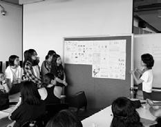
24
Jan |
Field Trip Management and Tool Management
Apart from the field trip booklet, various types of equipment are assigned to students to conduct site investigations during the field trip. Students also discussed about field trip management before their departure.

19
21 Jan | Group Presentation and Discussion
The field trip started off with a guided tour to the Jakkur Lake given by Dr. Annapurna, founding member, Satya Foundation. The students have learned about how she built the local community through Jalan Poshan Trust to protect the lake from various urban disturbance.

27 Jan | Jakkur Lake Guided Tour
27 Jan | Seminars about Blue-Green Infrastructure in Bangalore
A group of local landscape architects, including Aparna, Sriganesh, Rahul, and Maithily conducted seminars on different landscape architecture related topics. The students learned a lot and gained inspiration from their works.


20 26
Jan | Arrival to Bangalore
To better understand Bangalore, the studio joined a walking tour to Malleshwaram, a neighborhood in Bangalore Urban orgainzed by the Unhurried, a local NGO.


27 Jan | Walking Tour of Malleshwaram
The studio visited Hebbal, the designated project site, with the local translators to have a general overview of the neighbourhood.
21
28 Jan | Group Site Visit
Four groups of three to four students conducted their site survey in various locations, namely an informal settlement, a middle-income village, along the stream, and the Nagawara Lake. Observations, measurements, and interviews were conducted to fully understand the area and to gather feedback from people living in the area.


28-31 Jan | Site Survey

30 Jan | Seminar about Urban Farming
Dr. Rajendra Hegde, a member of the Garden City Farmers gave us an inspiring lecture about urban farming in Bangalore. This lecture also prepared the students to anticipate the different possibilities and approaches for their upcoming studio projects.

22
After a few days of detailed site surveys and investigations, the studio presented a short presentation of their findings to our guests. Various landscape architects and practitioners were invited to attend the sharing session, where the studio received feedback to spur their projects.

1 Feb | Sharing Session


2 Feb | Terrace Garden Visits
The studio visited two terrace gardens guided by Dr. Rajendra Hegde from the Garden City Farmers and Vani Murthy, a composting crusader. Vani Murthy introduced different composting methods that are suitable for terrace gardens, which equipped the studio with more knowledge on composting, demonstrating sustainable strategies for making urban farming possible in an urban context.
23
The studio joined a biking tour to explore Bangalore. Various places were visited including KR Flower Market and Cubbon Park, to understand the city’s rich cultural heritage and history.


After returning from Bangalore, the four subgroups constructed physical models to better understand their individual site conditions, while presenting their findings during the trip.


24
Feb | City
Tour
Feb | Subgroup
& Discussion
Feb | Departure
3
Biking
11
Pin-ups
4
The studio continues to work on site analysis and collating information collected in Bangalore. Students from different subgroups exchanged ideas with one another to exchange findings and ideas.


4 Mar | Subgroup Presentation
Every group went through and discussed key issues and project statements with Prof Hwang. Project narratives were refined and made clearer with each consultation.

25 18
Feb | Site Analysis & Subgroup Disscussion
We were very honored to have invited 3 reviewers from different backgrounds who listened critically to our mid-review presentation and gave students opinions and suggestions to counter our respective site issues.


Reviewers:
Amit Prothi, Associate Director, 100 Resilient Cities
Ryan Subin, Associate Director, Ramboll Studio Dreiseitl
Mayura Patil, Research Assistant, National University of Singapore
After the mid-review, Prof Hwang gave further constructive comments on the presentations and advice for further design development.
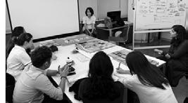
26 11 Mar | Mid Review
Mar
Mid Review
11
|
The studio attended a seminar on research and presentation skills given by Mayura Patil, Research Assistant, National University of Singapore. She shared the importance of presentation skills and gave some tips on how to work on the studio projects given the feedback gained from mid-review.

14 Mar | Seminars on Research and Presentation Skills

21 Mar | Design Development Disscussion
Each subgroup begun brainstorming for design ideas and strategies. Some subgroups decided to generate a collective masterplan for their site and work on individual interventions afterwards. Others decided to work on collectively on a single masterplan.
27
Each group has generated detailed design strategies, according to their respective site issue and problem statements. Prof Hwang provided guidance and proposed alternative suggestions, challenging the studio to further develop the ideas.

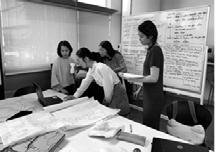
1-22 Apr | Design Development
1-22 Apr | Design Development


28
After more than three months of hard work, it was time for the final review. We invited mostly tutors and professionals to join our presentation. Students presented their projects and proposed designs in a professional manner. After each group presentation, reviewers commented on the projects. All reviewers affirmed our design achievements and expressed their own visions towards the respective topics.


Reviewers:

29 23 Apr | Final Review
Apr | Final Review
23
Helen Smith-Yeo, Principal, STX Landscape Architecture
Bronwyn Tan Yung Siang, Landscape Architect, Camphora
Herbert Dreiseitl, Partner and Founder of Atelier Dreiseitl Gmbh


18
PRELIMINARY RESEARCH
LAND USE & PLANNING HISTORY
STRUCTURE & INFRASTRUCTURE
Transportation Network
Urban Grain Distribution
Housing Typology
Water Supply and Demand
Water Sewage Treatment
Drainage System
History of Water Infrastructure
Existing Water Infrastructure
Open Space
Solid Waste Management
GREEN SPACE & BIODIVERSITY
Impact of Urbanization on Green Space
Flora Distribution
Vegetation Density
Flora and Fauna Matrix
Habitat and Green Space
WATER & GEOLOGY
Soil, Topography, Landform Water Source
Climate, Rainfall Trends and Flood Risk Case Studies and Techniques
Watershed Regional
Water Pollution Source
Ground Water Qaulity
ECONOMICS & SOCIAL DEMOGRAPHY
Poverty
Economic Development Timeline
Population Density
Population Growth and Distribution
Working Population and Labour Force
CULTURE & COMMUNITY
Religious History
Historical Place Distribution
Religious Festivals
This chapter includes the work of the students in Prof. Jessica’s studio, whom we teamed up with during the first two weeks of site analysis: Vinamra Agarwal, Bao Lixia, Chen Beifei, Dong Yitong, Jiang Jiahang, Eingeel Jafar Khan, Li Ziheng, Toh Zi Gui, Shanika Tuinder, Yu Xi, Radha Waykool
19
10,000m

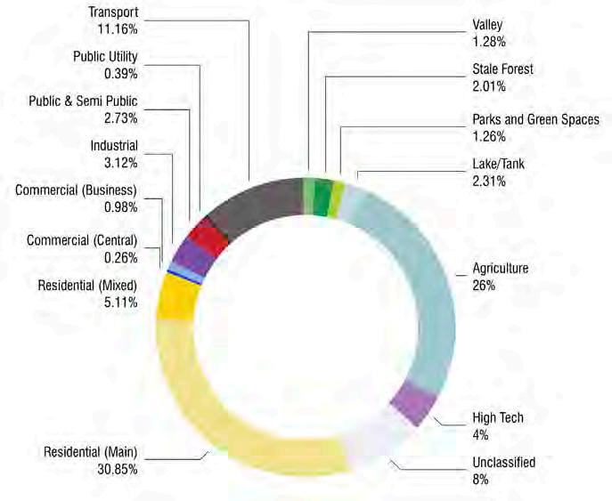
Revised Master Plan 2015
LANDUSE
32
Source: Bangalore Development Authority
33


LANDUSE
Hebbal (Existing)
34
Source: Bangalore Development Authority
N
5,000m


35
Source: Bangalore Development Authority
Hebbal (2031)
N
5,000m
PLANNING HISTORY
Founding, Colonisation, Urban Encroachment, Future Trends

36

37

38

39

40

41
TRANSPORTATION NETWORK

Bangalore Scale
LEGEND
15,000m
BMR is intercepted by 2 National Expressways and 3 National Highways and 12 state highways connecting major towns and cities within BMR and beyond. The radial road network in the BMR converges into the core and contains centre-periphery traffic, as well as the transit traffic which asphyxiates the city center. The city is plagued by decreasing travel speeds and increasing travel distances.
Source: http://bmrda.karnataka.gov.in/Documents/Revised%20Structure%20Plan%20Report-ilovepdf-compressed.pdf
Source: Lorem ipsum dolor sit amet, consectetur adipiscing elit, sed do eiusmod tempor
N 42


43 Hebbal Scale
Of Road Section LEGEND 5,000m N
Typology
URBAN GRAIN DISTRIBUTION
Bangalore Scale
LEGEND
Fine Grain Urbanism
Implies:
Diverse Ownership
Low Cost
More destinations within walking distance
5,000m
Coarse Grain Urbanism
Implies:
Single ownership
High Cost
Less destinations within walking distance
Fine Grain Urbanism

Coarse Grain Urbanism


Source: http://opencity.in/documents/bda-revised-master-plan-2031-existing-proposed-land-use-maps-planning-district-20-yelahanka/ district-7-rt-nagar-hebbal-gkvk


N 44
Categories of housing and settlement development and provision
HOUSING TYPOLOGY


Urban House Typology In Bangalore

Initiators and actors of housing development and provision
Government and Private developers (develop housing for a large group of people sharing resources and amenities together)
Formal
Informal
Source: https://fineartamerica.com/featured/slum-sumit-jain.html

Bungalows, Private Dwellings (Private houses built by a single land owner)
Individual, Community groups (Houses built on legal land but having insufficient infrastructure)
Houses or settlements on an illegal Piece of land.

Formal Individual Legal Group Illegal
Informal Group housing Individual Legal Illegal
45
Background of Sewage Treatment in Bangalore
WATER SEWAGE TREATMENT
Background of Sewage Treatment in Bangalore


Sewage treatment plant (STP)
Sewage pumping station
Hulimavu tank
Hulimavu
Muttanalli Kere
drains and smelly, frothy lakes are a reality in Bengaluru.Two and badly-functioning STP. Bengaluru produces to treat only of them treat the wastewater according to the norms preboard. Two reasons: Not all of Bengaluru’s homes have sewage the STP.
Source: https://www.thenewsminute.com/article/why-bengalurus-sewage-treatment-plants-may-never-be-enough-city-93663
project (phase 3) Final Report && https://www.thenews minute.com/article/why-bengalurus-sewage-treatment-plants-may-never-be-enough-city-93663
Summary: Sewage-riddled storm-water drains and smelly, frothy lakes are a reality in Bengaluru.Two reasons causes it: illegal sewage dumping and badly-functioning STP. Bengaluru produces 1,440 MLD of sewage but the BWSSB has the capacity to treat only 1,057 MLD of sewage. While the BWSSB has 24 sewage treatment plants in the city, none of them treat the wastewater according to the norms prescribed by the Central Pollution Control board. Two reasons: Not all of Bengaluru’s homes have sewage connection; Lack experts to tell how to use the STP.
Source: Bengaluru water supply and sewerage project (phase 3) Final Report && https://www.thenews minute.com/article/why-bengalurus-sewage-treatment-plants-may-never-be-enough-city-93663
Jakkur Raja canal K R puram
Sewerage N Ganayakanahalli Yelahanka tank
tank Doddagubbl tank Rampur tank Byrasandra tank Ulsoor tank Projection Percentage 745 Summary: Summary: economically 323 190 Sewerage Service Area in the Core Area
Jakkur
Jakkur Raja canal K R puram
K&C valley Kadabeesananhalli
V-valley Madivala
Sewerage Service Area N Ganayakanahalli
Arkavathi river
Yelahanka tank
Doddagubbl tank
tank Byrasandra tank
Jakkur tank
Rampur
Bellandur tank Blomananalli tank
tank Ulsoor tank Begur tank
Projection of sewage generation
of households connectivity in Bengaluru 2016 Bengaluru North Bengaluru South Bengaluru East 2019202420342049 745
Only 60% of Bengaluru’s
STPs.
The report
JICA
poor communities sewage connections. 323 190 217 263 366 447 762 792
Percentage
Summary:
existing
Summary:
by
economically
20,000m N
47 LEGEND
Waste Water Production
1000m

LEGEND

Source: https://homemantra.co/bangalore-bbmp-rajakaluve-maps/ & OpenSteet Map of Bangalore N 48
Stormwater Flow
DRAINAGE SYSTEM
Source: https://gubbilabs.in/bengaluruscape/water & Bengaluru water supply and sewerage project (phase3) Final Report
Water Infrastructure

49
HISTORY OF WATER INFRASTRUCTURE Timeline of
EXISTING WATER INFRASTRUCTURE
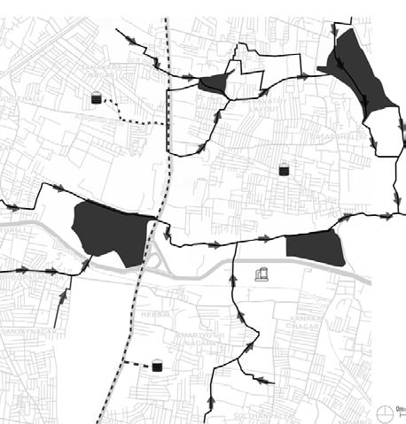
Outlet: Yalahanka
Inlet: Sahakara Nagar Sump

Outlet: Yalahanka GLR
Inlet: RT NAGAR OHT
Sahakar Nagar Water Tank
-Type: OHT
-Volume: 10,000 ml
Water Infrastructure in Hebbal LEGEND
-Type: OHT -Not in working condition
Inlet: Sahakara nahgar
Coffee Board Layout Water Tank
-Type: GLR
Nagavara
Lake
Hebbal Sewage Treatment Plant

-Capacity: 60 MLD
-Level of Treatment: Secondary
-Process for treating sewage: Activated Sludge Process

1000m
 Sahakar Nagar Water Tank
Hebbal STP
Anand Nagar Water Tank
Hebbal Lake
Amrutahalli Lake
Anand Nagar Water Tank
Rachenahalli Lake
N 50
Source: BWSSB website & Bengaluru water supply and sewage project (phase3) Final Report


LEGEND Playground Hebble Lake Park Public Plaza School Yard Source: https://www.google.com/maps/place 1000m N 51 OPEN SPACE Open Space Map and Typology
SOLID WASTE MANAGEMENT
Bangalore Decentralized Processing & Disposal
LEGEND
Generation Waste Composition (Approximate)

Source: City Statistics New Microsoft Office Word Document, BBMPDepartmentsSolid Waste Management


Waste
City Statistics 20,000m N 52
Domestic Waste Mangement
Biomedical Waste Mangement

10 % is Bio-medical Waste
50% is brought back into circulation after treatment
60 % of sharp waste are melted and reused as part of stainless steel products all glass waste are recycled after treatment
Source: Biomedical waste management manual


1500m N 53
Waste Management in Hebbal
VEGETATION MAP AND REDUCTION OF BANGALORE
IMPACT OF URBANIZATION ON GREEN SPACE
Land Classification of Bangalore in 2000 and 2018
FLORA DISTRIBUTION
Bangalore Scale
FOREST RATIO: URBAN BANGALORE
FOREST RATIO: BANGALORE RURAL AND RAMANAGAR DISTRICT
NOTIFIED URBAN FOREST AREAS
Anekal (1%)
(16%) Yelahanka (12%)
Kaggalipura (59%)
The geographical area of Bangalore Urban district is 217,410 ha, out of which the forest area is 4,198 ha
The Geographical area of Bangalore Rural and Ramanagar districts is 5,85,431 ha, out of which the forest constitutes 1,01,117 ha
Forest area comprises mainly scrub and grasslands with miscellaneous species. Eucalyptus and Acacia auriculiformes are found over most of the area
0 150,000 Meters Legend 2000 0 150,000 Meters Legend 1 31 117 181 209 300,000m 0 150,000 Meters Legend NDVI_Clip <VALUE> -1- -0.1 -0.1-0.1 0.1-0.5 0.5-0.9 0.9-1 0 150,000 Meters Legend NDVI_Clip <VALUE> -1- -0.1 -0.1-0.1 0.1-0.5 0.5-0.9 0.9-1 0 150,000 Meters Legend NDVI_Clip <VALUE> -1- -0.1 -0.1-0.1 0.1-0.5 0.5-0.9 0.9-1 0 150,000 Meters Legend NDVI_Clip <VALUE> -1- -0.1 -0.1-0.1 0.1-0.5 0.5-0.9 0.9-1 2018 N Other 83% Forest 17% Kaggalipura 59% Bangalore 16% Yelahanka 12% K.R. Puram 12% Anekal 1% Urban Area 98% Forest 2% Forest (2%) Forest (17%) Other (83%) Other (98%)
Bangalore
K.R Puram
(12%)
54
Water Greenery Agriculture Urban LEGEND
VEGETATION DENSITY
Bangalore's Normalized Difference Vegetation Index
Hebbal's Normalized Difference Vegetation Index
0 150,000 Meters Legend NDVI_Clip <VALUE> -1- -0.1 -0.1-0.1 0.1-0.5 0.5-0.9 0.9-1 What do NDVI values suggest? -1 - -0.1 Waterbody -0.1 - 0.1 Barren Rock, Sand 0.2 - 0.5 Sparse Vegetation, Shrubs 0.6 - 0.9 Dense Vegetation, Forest 0.9 - 1 Maximum Value 0 150,000 Meters Legend NDVI_Clip <VALUE> -1- -0.1 -0.1-0.1 0.1-0.5 0.5-0.9 0.9-1 300,000m N Source: Earth Explorer, USGS LANDSAT NOV 2018 2,000m N 55 -1--0.1 -0.1-0.1 0.2-0.5 0.6-0.9 0.9-1.0 LEGEND Source: Earth Explorer, USGS LANDSAT NOV 2018 0 1 Kilometers 0 150,000 Meters Legend NDVI_Clip <VALUE> -1- -0.1 -0.1-0.1 0.1-0.5 0.5-0.9 0.9-1 LEGEND -1 - -0.1 -0.1 - 0.1 0.2 - 0.5 0.6 - 0.9 0.9 - 1
FLORA AND FAUNA MATRIX
Bangalore Scale
Fauna Habitat Area
High Flying Birds
Eagle
Kite
Falcon
Low lying Birds
Sparrow
Owl
Duck
Pigeon
Pollinator
Bat Bee
Butterfly
Ground Animals
Turtle
Ants
Frog
Snake
Rat
Lizard
Squirrel
Pangoin
Monkey
Boar
Flora
Canal
Reservior
Macrophytes
Water hyacinth
Common duckweed
Common water meal
Water Primrose
Coontail
Shrub
Mudflat
Parks/Gardens
Golden Dewgrop
Peacock Flower
Lantana
Ixora
Hibiscus
Trees
Urban
Coconut palm
Australian wattle
Indian elm
Village
Cuban royal palm
Mango
Indian laburnum
River
Forest
Source:https://www.rarebooksocietyofindia.org/book_archive/196174216674_10153799215096675.pdf
Guava
Lythraceae
Nile Tulip tree
Caribbean trumpet tree
56
LEGEND
Public parks
Residential Industrial
Recreational
Institutional
Brownfield
Agriculture
Barrenland
Scrubland

Grassland
Wooded Grassland
Forest
Lake River and riverine
Source: Satelittle data from Open Street Map, Google Earth


N 57 HABITAT AND GREEN SPACE Hebbal scale
1,500m


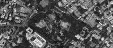
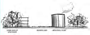


Public Park Roadside Greenery Institutional Industrial Residential 3m 5m 10m 20m 12m 58 HABITAT
Managed Typologies
AND GREEN SPACE
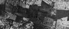


Orchard Agriculture Canal and Drainage Playground Open Plaza 25m 12m 10m 15m 10m 59
Source: Satellite Images from Google Earth
HABITAT AND GREEN SPACE


 Barren Land
Scrub Land
Wooded Grassland
Lake 60
Unmanaged Typologies 50m 50m 50m 40m 200m River 10m
Fragmented Forest Patch
Source: Satellite Images from Google Earth
SOIL, TOPOGRAPHY, LANDFORM Bangalore Scale


N 61
20,000m
Bangalore is located at heart of the Mysore Plateau at an average elevation of 920 m (3,020 ft). It is positioned at 12.97°N 77.56°E and covers an area of 1741 km² (673 mi²).
Bangalore contours at
interval 1 1 2 3 4 5 6 7 8 9 10 10 9 11 12 13 14 15 12 13 14 15 11 2 3 4 5 6 7 8 980 m 940m 860m 800m 760m 700m 861 947 947 851 843 823 782 940 738 923 961 728 944 696 660 926 690 933 938 782 878 949 943 867 854 941 933 833 939 936
Highest point in Hebbal Kempapura is 925m and lowest at 890m.
20m
LEGEND
Source: Elevation data from Google Earth
SOIL, TOPOGRAPHY, LANDFORM


N 62
2,000m
940m 800m 760m 700m 9 10 11 12 13 14 15 16 9 10 11 12 13 14 15 16 17 18 19 20 21 17 18 19 20 21 943 921 919 920 926 905 909 892 891 890 887 887 885 886 887 886 885 883 883 883 920 935 928 922 912 919 LEGEND
Hebbal Kempapura contours at 5m interval
Source: Elevation data from Google Earth
Hebbal Scale
The following soil types are found in Bangalore:
1. Medium deep, Red clayey soil - Very Poor Groundwater Potential
2. Deep alluvial clayey soil - Very Poor to Poor Groundwater Potential
3. Deep lateritic clayey soil - Poor Groundwater Potential


4. Deep, Red clayey soil - Poor to Moderate Groundwater Potential
5. Medium deep, Red gravelly clay soil - Moderate Groundwater Potential
6. Deep lateritic gravelly clayey soil - Moderate to Good Groundwater Potential


9. Rocky land associated with shallow red gravelly clay soil - Good Groundwater Potential
Hebbal Kempapura- has Deep Lateritic clay soil which has poor groundwater potential.
Yelahanka - has Deep Lateritic clay soil and which has groundwater potential.


LEGEND
Deep red clay soil
Deep Lateretic clay soil
Deep Gravelly clay
Medium deep red clay
Medium deep gravelly red clay
Deep alluvial clay

Rocky land associated with shallow red gravely clay
Hebbal coming under Zone 1 of the study has silty sand with clay as top soil till a depth of 3m
Source: Muilti-criteria seismic hazard evaluation for Bangalore city, India by P.Anbazhagan, K.K.S.
Soil Types
20,000m
63
Zone 1 Zone 2 Zone 4 Zone 3 Zonal Division Silty sand with clay 0-3m Medium/dense silty sand 3-6m Weathered rock 6-17m Hard Rock below 17m Silty sand with gravel 0-1.7m Clayey sand, 0-1.5m Filled-up soil 0-1.5m Silty clay 1.5-4.5m Sandy clay 4.5-17.5m Weathered Rock 17.5-38.5m Clayey sand with gravel 1.5-4m Silty sand with gravel 4-15.5m Weathered Rock 15.5-27.5m Hard Rock below 27.5m Clayey sand 1.7m-3.5m Weathered Rock 3.5m-8.5m Hard Rock below 8.5m Hard Rock 38.5m Zone 4
Zone 1 Zone 2 Zone 3 Soil Profile
Thingbaijam, S.K. Nath, J.N. Narendra Kumar, T.G. Sitharam
Soil Characteristics
WATER SOURCE
Cauvery River Basin
BANGALORE
Actual water system in bangalore is inefficient. 100km to an overhead of 540 meters to the water distribution system located at Bangalore after treatment consumes more energy and involves high operational and maintenance costs. BWSSB incurs electricity costs to about 65% of its revenue for pumping the water to the city.
Todays ystem depends mainly on the cauvery river.
lakes are so polluted they are only ornametal or to worship.
N 64
50,000m
the system of water worked in the past How it works now Before the British After the British Aquifers
Lake series Canals
Water Harvesting
How
Borewells Borewells
Stepwell
Sewage Dugwells
Source: Making water flow in Bengaluru: planning for the resilience of water supply in a semi-arid city. Hita Unnikrishnan
LEGEND
Water Flow
Water treatment plants
Transmissions Pipelines
Roads
Water bodies
Gramadakere Allalasandra
Kodigehali Lake
LEGEND
Batkondanahalli Lake
Which joins South Pinakini River Amanikere, Singanayakanahili
Yelahanka Doddakere
Kattigenahall Lake
Kogilu Lake
Jakkur Lake
Rachenahali Lake
Kalkere Lake
Watershed Regional
Chikkamaranahali Lake
Water Flow
No longer existent
water body
Water bodies
Kacharakanahali Lake
Previous and existing Hebbal Lake series
Yellamallappa SettraKere
Ramapura Lake
Seegehall Lake
Basavanapura Lake
Source: Muilti-criteria seismic hazard evaluation for Bangalore city, India by P.Anbazhagan, K.K.S. Thingbaijam, S.K. Nath, J.N. Narendra Kumar, T.G. Sitharam
N
N 65
400m
30,000m
BANGALORE
Arkavathi Source
Tataguni Puming Station
TK. Halli WTP
Kabini Resevoir
KRS Resevoir on Cauvery
WATER SOURCE
Hebbal Valley
LEGEND
Drainage directed to lakes
Aquifers
Dugwells
Lakes Series/Canals
Borewells: 7,000 BWSSB 80,000 Private Borewells
20,000m
Dugwells
N 66
Aquifers
Borewells Valleys Lake series Canals Sewage
Source: Groundwater informaion Booklet, Bangalore Urban District, Karnataka by GOI, Ministry of Water Resources, Central Ground Water Board.
Vrishabavathi Valley Koramangala challaghatta Valley
Water Pollution Source
LEGEND
Pollution source
Lanfill
Landfill
Industrial areas
Industrial areas
Future industry
Future Industry
Water resource
Water resource
Main Pollution Sources
•Sewage Entry from Human Settlement in Catchment Area
•Effluents entry from industries in up stream of the lakes
•Erosion of soil carrying nutrients from upstram
•Ingress of Sewage and Industrial effluents which contain nutrients
•Run-off from surrounding which carries silt and nutrients
•Disposal garbage on banks of Lake
•Dumping of Debris
•Draw off of water from Lake
•Immersion of Idols during Festivals
LEGEND
Polluted Lakes
Highly polluted-34 lakes
Highly Polluted-34 Lakes
Moderately polluted-22 lakes
Moderately Polluted-22 Lakes
Less polluted-24 lakes
Less Polluted-24 Lakes
Polluted lakes
Source: K.V. Shivakumar, "Water quality monitoring of lakes in Bangalore-central laboratory KSPCB", Proceedings of Taal, 2007: The 12th world lake conference, pp 1908-1915.2008.
Ramachandra, T V & K. S., Asulabha & Varghese, Sincy & Bhat, Sudarshan & Aithal, Dr. Bharath. (2015). Wetlands: Treasure of Bangalore.
N
N 67
20,000m
20,000m
WATER SOURCE
Hebbal Valley
LEGEND
Tanks
Water body
STP Zone
Streams/Canals Borewells Lakes
Pollution source of Hebbal


Allalasandra Lake
Jakkur Lake
Doddabommasandra Lake
Amrutahalli Lake
Rachenahalli Lake
Pollution Source : Hebbal
Industrial area
Stp zone Lakes Possible source areas
Hebbal Lake
Lumbini Garden
LEGEND Industrial area Stp zone Lakes Possible source areas 1000m
68 STP ZONE LAKES POLLUTION RESOURCE : HEBBAL KEMPAPURA Main Pollution Sources for Water Resources are as follows: Sewage Entry from Human Settlement in Catchment Area Effluents entry from industries in up stream of the lakes Erosion of soil carrying nutrients from upstram Ingress of Sewage and Industrial effluents which contain nutrients Run-off from surrounding which carries silt and nutrients Disposal garbage on banks of Lake Dumping of Debris Draw off of water from Lake Immersion of Idols during Festivals Source : K.V. Shivakumar, "Water quality monitoring of lakes in Bangalorelaborattory central laboratory KSPCB", Proceedings of Taal, 2007: The 12th world lake conference, pp 1908-1915. 2008.
STP ZONE LAKES POSSIBLE SOURCE AREAS POLLUTION RESOURCE : HEBBAL KEMPAPURA INDUSTRIAL AREA Main Pollution Sources for Water Resources are as follows Sewage Entry from Human Settlement in Catchment Area Effluents entry from industries in up stream of the lakes Erosion of soil carrying nutrients from upstram Ingress of Sewage and Industrial effluents which contain nutrients Run-off from surrounding which carries silt and nutrients Disposal garbage on banks of Lake Dumping of Debris Draw off of water from Lake Immersion of Idols during Festivals Source K.V. Shivakumar, "Water quality monitoring of lakes in Bangalorelaborattory central laboratory KSPCB", Proceedings of Taal, 2007: The 12th world lake conference, pp 1908-1915. 2008.
N
Ground water quality

LEGEND
Ground Water Quality Map
Alternate
Ground Water Quality Map
Alternate
Water Resource Roads Non-potable Water Potable Water
Non-potable Water Potable Water Map
Alternate
Potable Water
Non-potable water
Water Resource Roads Non-potable Water Potable Water
Potable water
Water Resource Roads
Water Resource Roads
Water resource
Road
Water Resource Roads
LEGEND
Metal Concentration in Ground water

Nitrate >45Mg/L
Nitrate >45Mg/L
Chloride 250-1000Mg/L
Chloride 250-1000Mg/L
Fluoride > 1.5Mg/L
Fluoride >1.5Mg/L
Source: Ground Water Information Booklet, Bangalore Urban District, Karnataka - March 2013
Source:https://www.indiawaterportal.org/articles/hydrology-and-quality-groundwater-and-around-bangalore-city-review-and-excerptsreport
20,000m N 20,000m N 69
CLIMATE, RAINFALL TRENDS AND FLOOD RISK


70 January July <5 5-10 10-25 >25 <50 50-100 100-150 150-200 >200 February August March September April October May Avg Temp per Month Annual Rainfall November June December 15 20 25 30 35 Jan Feb Mar Apr May Jun Jul Aug Sep Oct Nov Dec Temp in Degree Celcius Max Normal Min Source: Frequent floods in Bangalore: Causes and Remedial Measures; T V Ramachandra, Vinay S, Bharath H. Aithal 0 3 6 9 12 May June July Aug Sep Oct Nov Dec Jan Feb Mar Apr 0 500 1991 2001 2007 2011 2025 1000 1500 2000 2500 Supply Gap Demand
Climate Trend & Spatial Rainfall Distribution Pattern Water flow of Hebbal Kempapura Water Supply Gap Trend
CASE STUDIES AND TECHNIQUES
Case Study 1: Jakkur Lake, Bangalore, India

Jakkur lake ecosystem constitutes of a lake filled with water, a sewage treatment plant (STP) near the lake site which disposes the treated water into the lake helping in maintaining the water balance, a constructed wetland, numerous open wells, fishermen and farming community using the lake for fishing, irrigation, and other domestic uses.
LEGEND
Water flows through wetland to be cleaned
Stormwater


The Process
Plants used
Sources: http://biometrust.blogspot.com/2018/05/wetland-maintenance-jakkur-lake.html

71
Sewage Treatment Plant
Constructed Wetland
Stormwater
Jakkur Lake
Jakkur Lake
Fish Breeding
Recharge openwells
Separate ceremonial pond
A 10 MLD STP uses an upflow anaerobic sludge blanket (UASB), a secondary level of treatment. An average of 7-8.5 MLD of treated water is discharged
1. Drain 1 Overflow inlet
2. STP Treated water
3. Drain 2 Inflow inlet
4. Drain 3 Inflow inlet
5. Wetland
6. Outlet
The wetland in the urban lake uses up nutrients in the treated water for plant growth enhancing water quality
Constructed Wetland schematic section
Water Hyacinth Alligator Weed Typha Duck Weed
Inlet Outlet
1 6 3 5 6 4 6 2 2 3
Inlet
Clean water Output Wetland
CASE STUDIES AND TECHNIQUES
Case Study 2: Osho Teerth Park, Pune, India
Turning a narrow strip of wasteland 850m long and 75m wide into a zen inspired japanese garden was undertaken in phases. It has been designed to handle a normal flow of 21000- 24000 gallons per hour. At the source of entry the water is an unclean stream with oil- waste. With help of natural filter process the water is 80% purified and is thus now naturally inhabited by biodiversity.
The drain is first systematically guided through a metal gate provided with a screen/ mesh to separate the floating garbage

Water cascades
Water cascades of level drops of just 200300mm at various points induce oxygen into the current, and eliminate odour.
Filtration, biodegradation and Biosorption:


The cellulosic /fibrous materials like coconut coir or dried water hyacinth or aquatic grasses are compacted and woven to form a bridge/ porous wall like structure strengthened by stones and sand with various consortia of microorganisms
All the floatable and suspended solids are trapped in this biological bridge and the turbidity of flowing water is reduced substantially. The green plants growing there help in absorption of soluble substances including heavy metals.
It is a natural root zone filtration system, which activates by means of plants such as water hyacinths, bulrushes and alocacias
It uses filtration power of biologically originated cellulosic /fibrous material in combination with sand and gravels and root systems of green plants.
Fish known as 'gambusia' have been specially bred in the ponds to clean water of mosquito larvae

It is then guided through a series of 4 ponds, created on natural bedrock which serve as settling tanks and filteration tanks for sludge

Plants
Top layer of soil about 1530 cm
Sand layer
Rubble & gravel layer

Stones in the stream course
Source: http://www.ecoideaz.com/innovative-green-ideas/nullah-parks-of-pune; http://www.thealternative.in/society/garden-developedacross-a-nullah/

72
Metal screens
Green Bridge
Series of ponds
Fish Breeding
The Process
Green Bridge Technology
Coconut coir mat
NOW THEN

73 ECONOMIC Poverty
GROWTH OF SLUMS IN BANGALORE CITY Karnataka economic survey 20,000m N 1-620 621-1400 1401-2700 2701-6600 6601-20000 LEGEND
Sources:
ECONOMIC
Bangalore’s ecomomc development timeline
Sources: http://en.wikipedia.org/wiki/Economy_of_Bangalore

74
Sources: http://www.census2011.co.in/census/district/242-bangalore-.html


75 Population Density
NICE <50 PRR centreline NICE-EXPRESS-ROAD 50-100 BMA-boundary Major road 100-150 BBMP Railawy >150 LEGEND 25,000m N SOCIAL DEMOGRAPHICS
SOCIAL DEMOGRAPHICS
Source: Revised
76
Population Growth and Distribution 0 2000000 4000000 6000000 8000000 10000000 12000000 14000000 16000000 18000000 20000000 194019601980200020202040 Bangalore Population Age and gender distribution in Bangalore (%) 01020304050 40302010 50 0-6 7-15 16-24 25-44 45-59 60-79 80+ 2011 2021 2031 0 1 2 3 4 5 6 7 194019601980200020202040 Bangalore Population Growth Rate (%)
Revised Master Plan for Bangelore - 2031 (Draft)
Master Plan for Bangelore -
(Draft) Age Distribution Age Distribution 0-6 45-59 7-15 60-79 16-24Higher Education Aspirat Children 80+ 25-44 Young Job Seekers/Employed Education Aspirant Children Aged And Dependents Aged Dependents Description Description Infants Middle Aged Skills 0 2000000 4000000 6000000 8000000 10000000 12000000 14000000 16000000 18000000 20000000 194019601980200020202040 Bangalore Population Age and gender distribution in Bangalore (%) 01020304050 40302010 50 0-6 7-15 16-24 25-44 45-59 60-79 80+ 2011 2021 2031 0 1 2 3 4 5 6 7 194019601980200020202040 Bangalore Population Growth Rate (%)
Source:
Source: Revised
2031
Master
Bangelore
Plan for
- 2031 (Draft)
Bangelore -
Age Distribution Age Distribution 0-6 45-59 7-15 60-79 16-24Higher Education Aspirat Children 80+ 25-44 Young Job Seekers/Employed Education Aspirant Children Aged And Dependents Aged Dependents Description Description Infants Middle Aged Skills
Bangalore
Source: Revised Master Plan for
2031 (Draft)
Sources: Revised Master Plan for
-2031 (Draft)
Distribution of Workers by Age and Gender in Bangalore (2011)
Working Population and Labour Force
Distribution of Workers by Age and Gender in Bangalore (2011)
Distribution of Workers by Age and Gender in Bangalore (2011)
Gender Employment Ratio of Bangalore
Gender Employment Ratio of Bangalore
Gender Employment Ratio of Bangalore
Labor force participation rate (LFPR) among females in India states in 2015 (%)
Labor force participation rate (LFPR) among females in India states in 2015 (%) Females LFPR
Labor force participation rate (LFPR) among females in India states in 2015 (%)
Source: https://www.statista.com/statistics/654242/female-labor-force-participation-rate-india-by-state/ Unemployment rate in India states in 2015-16 (%)
Source: https://www.statista.com/statistics/654242/female-labor-force-participation-rate-india-by-state/ Unemployment rate in India states in 2015-16 (%)
Source: https://www.statista.com/statistics/654242/female-labor-force-participation-rate-india-by-state/ Unemployment rate in India states in 2015-16 (%)
Source: https://en.wikipedia.org/wiki/List_of_states_and_union_territories_of_India_by_unemployment_rate
Source: https://en.wikipedia.org/wiki/List_of_states_and_union_territories_of_India_by_unemployment_rate
Sources: http://en.wikipedia.org/wiki/List_of_states_and_union_territories_of_India_by_unemployment_rate
Source: https://en.wikipedia.org/wiki/List_of_states_and_union_territories_of_India_by_unemployment_rate
77 Female 26.6% Male 73.4% 54.3 54 53.6 46.7 46.6 44 39.2 37 33 32.8 32.7 31.4 30.8 30.4 24.6 21.5 20.420.4 19.5 19.2 18.8 18.6 17.4 17 14.5 14.2 12.2 11.2 11.1 10.5 0 10 20 30 40 50 60% 19.7 18.1 12.5 10.6 9.6 8.9 8.5 7.7 7.4 7.2 7.1 7 6.1 66 5.7 5 4.9 4.8 4.7 4.3 4.2 3.9 3 2.8 2.1 1.9 1.5 0.9 0 5 10 15 20 25%
Male MFLegend 1.5 1.5 5-9 10-19 20-29 30-39 40-49 50-59 60-69 70-79 >80 Population in Millions Source: Census of India (2011), IIHS Analysis 1.0 1.0 0.5 0.5 0.0 Main workers Marginal workers Seeking/Available for work Non-workers Female Unemployment
rate
LFPR
Females
Bangalore LFPR rate=26.6% Female 26.6% Male 73.4% 54.3 54 53.6 46.7 46.6 44 39.2 37 33 32.8 32.7 31.4 30.8 30.4 24.6 21.5 20.420.4 19.5 19.2 18.8 18.6 17.4 17 14.5 14.2 12.2 11.2 11.1 10.5 0 10 20 30 40 50 60% 19.7 18.1 12.5 10.6 9.6 8.9 8.5 7.7 7.4 7.2 7.1 7 6.1 66 5.7 5 4.9 4.8 4.7 4.3 4.2 3.9 3 2.8 2.1 1.9 1.5 0.9 0 5 10 15 20 25%
Male MFLegend 1.5 1.5 5-9 10-19 20-29 30-39 40-49 50-59 60-69 70-79 >80 Population in Millions
(2011),
1.0 1.0 0.5 0.5 0.0 Main workers Marginal workers Seeking/Available for work Non-workers Female Unemployment
Source: Census of India
IIHS Analysis
rate
Bangalore LFPR rate=26.6% Female 26.6% Male 73.4% 54.3 54 53.6 46.7 46.6 44 39.2 37 33 32.8 32.7 31.4 30.8 30.4 24.6 21.5 20.420.4 19.5 19.2 18.8 18.6 17.4 17 14.5 14.2 12.2 11.2 11.1 10.5 0 10 20 30 40 50 60% 19.7 18.1 12.5 10.6 9.6 8.9 8.5 7.7 7.4 7.2 7.1 7 6.1 66 5.7 5 4.9 4.8 4.7 4.3 4.2 3.9 3 2.8 2.1 1.9 1.5 0.9 0 5 10 15 20 25%
Male MFLegend 1.5 1.5 5-9 10-19 20-29 30-39 40-49 50-59 60-69 70-79 >80 Population in Millions Source: Census of India (2011), IIHS Analysis 1.0 1.0 0.5 0.5 0.0 Main workers Marginal workers Seeking/Available for work Non-workers Female Unemployment rate
LFPR
Females
Bangalore LFPR rate=26.6%
LEGEND
RELIGION AND CULTURE
Religious History
1.Indian pre-history including Indus Valley Civilisation (until c. 1750 BCE);
2.Iron Age including Vedic period (c. 1750 BCE–600);
i.Indian religions begins with the historic Vedic religion.
According to Sundararajan, Hinduism is also known as the Vedic religion.

ii.700-500BCE, the rose of Jainism and Buddhism.
(a)Jainism peak time in 9th century BCE -6th century BCE
(b)Buddhism establish 558 BCE-491 BCE

3.“Second Urbanisation” (c. 600–200 BCE);
i.Silk road transmission of Buddhism (start from 1th or 2th century BCE)

Indigenous Religion
Foreign Religion
Left: Symbol in the Bon and Buddhist traditions


Right: Appears commonly in Hinduism and Jainism
4.Classical period (c. 200 BCE-1200 CE); (Conflict and destruction period)
i.The disintegration of central power also lead to regionalisation of religiosity, and religious rivalry.
ii.Buddhism lost its position, and began to disappear in India.
iii. Innitially introduced by Thomas the Apostle,Christianity was rooted in India by the 3rd century AD.
5.Pre-Classical period (c. 200 BCE-320 CE);
6.“Golden Age” (Gupta Empire) (c. 320–650 CE);
i.Between 400 and 1000 CE Hinduism expanded as the decline of Buddhism in India continued.
7.Late-Classical period (c. 650–1200 CE);
i.Early Islamic rule (c. 1100–1500 CE)

Turks and Afghans invaded parts of northern India and established the Delhi Sultanate. Lead to “Indo-Muslim” fusion of cultures
8.Medieval period (c. 1200–1500 CE);
i.Sikhism originated in 15th-century Punjab, Delhi Sultanate.

9.Early Modern (c. 1500–1850);
i.Christianity in India was expanded in the 16th century by Catholic Portuguese expeditions and by Protestant British and US missionaries in the 18th century.

10.Modern period (British Raj and independence) (from c. 1850).
i.Ghettoisation among Indian Muslims began in the mid-1970s when first communal riots occurred.
ii.19th century-20th century renaissance of Buddhism. Calling for Dalits converse from caste-based society to Buddhism.
Sources: https://en.wikipedia.org/wiki/Indian_religions

78
Fig. 1 https://en.wikipedia.org/wiki/Silk_Road_transmission_of_Buddhism
Hindu Swastika
Symbol of divinity and spirituality in Indian religions.
1750 BCE
BCE Begans 558-491BCE
PEAK TIME ---Silk road transmission


400-1000 CE Expanded
Begain to disappear Renaissance of Buddhism


Conflicts among Indian Muslims
Rooted in India by the 3rd century
1100-1500 CE Early Islamic rule
Expand in 16th century and 18th century

79
600
200 BCE 200 CE 400 CE 100 BCE 800 BCE 1000 CE 1200 CE 1500 CE 1850 CE 2000 CE NOW Percentage Time Line Hinduism JainismBuddhismSikhismIslam Christianity 78.87% 13.9% 5.61% Historical Timeline
A.Government
1. Vidhana Soudha----1956---The largest legislative building in India
2. Attara Kacheri---1868---the Karnataka High Court. Attara Kacheri reflects the Greco-Roman style of architecture, because it was built at the zenith of British colonialism in India.
3. Bangalore Palace---1878
4. Seshadri Iyer Memorial Hall---1901
B.Civic
1.Lalbagh Botanical Garden---1889
C.Historical 1.Tipu Sultan’s Summer Palace---1791
D.Religious (popular one)
1. Kote Venkataramana Temple--1689---Hinduism
2. St. Marks Cathedral---1812
3. Infant Jesus Church---1971
4. St. Patrick’s Church---1899
5. C.S.I East Parade Church---1863
6. Bethel AG Church---1995
7. St. Mary’s Basilica---1882
8. St. Francis Xavier’s Cathedral---1932
9. Saint Anthony’s Friary Church---1952
10.Rice Memorial Church---1917
80 ¯ Historical_Place Type_of_Place A B C D Hebbal_outline Buildings waterways Karnataka_Natural_Features Heritage_Zone 3 Kilometers ¯ Historical_Place Type_of_Place A B C D Hebbal_outline Buildings waterways Karnataka_Natural_Features Heritage_Zone 3 Kilometers ¯ Historical_Place Type_of_Place A B C D Hebbal_outline Buildings waterways Karnataka_Natural_Features Heritage_Zone 3 Kilometers ¯ Historical_Place Type_of_Place A B C D Hebbal_outline Buildings waterways Karnataka_Natural_Features Heritage_Zone 3 Kilometers
¯ Historical_Place Type_of_Place A B C D Hebbal_outline Buildings waterways Karnataka_Natural_Features Heritage_Zone 3 Kilometers D6 A3 A1 A2 A4 D10 C1 D1 B1 D9 D4 D3 D5 D2 D8 D7 RELIGION AND
Bangalore historical places distribution ¯ Historical_Place Type_of_Place A B C D Hebbal_outline Buildings waterways Karnataka_Natural_Features Heritage_Zone 3 Kilometers Hebbal_outline Buildings Waterways Heritage_zone Karnataka_natural_feture A B C D Historical place Type of place LEGEND 3,000m N
CULTURE
Sources:
A.1.https://evac.com/cn/reference/suvarna-vidhana-soudha-assembly-india/


2.Reference:https://en.wikipedia.org/wiki/Karnataka_High_Court
3.Reference:https://en.wikipedia.org/wiki/Bangalore_Palace
4.https://www.nativeplanet.com/bangalore/seshadri-iyer-memorial-hall/photos/ B.1.https://en.wikipedia.org/wiki/Lal_Bagh


C.1.https://www.beerandcroissants.com/tipu-sultans-summer-palace/


Reference:
D.1.https://en.wikipedia.org/wiki/Kote_Venkataramana_Temple,_Bangalore
2.https://bangaloretourism.in/st-marks-cathedral-bangalore


3.https://en.wikipedia.org/wiki/Infant_Jesus_Church,_Bangalore#/media/File:InfantJesus_Church_Blr1.jpg


4.https://www.mangalorean.com/launch-st-patricks-coffee-table-book-mark-175-years-milestone-church/
5.https://www.facebook.com/EPMCBLR/
6.https://www.justdial.com/photos/bethel-ag-church-international-worship-centre-hebbal-bangalore-churches-2m9acdw-pc-62392223sco-15idbr2u
7.https://en.wikipedia.org/wiki/St._Mary's_Basilica,_Bangalore

8.https://zh.wikipedia.org/wiki/File:St_Francis_Xavier_Cathedral,_Bangalore_oblique.jpg
9.http://www.trip2blr.com/st-anthonys-friary-church-bangalore/st-anthonys-friary-church/
10.https://en.wikipedia.org/wiki/Bengaluru_Pete
81 A1 A2
A3
A4
B1
D1
D2
D3
D4
D6
D7
D10
D8
D9
D5
C1
Bangalore historical places distribution
RELIGION AND CULTURE
Religious Festivals
Hinduism festivals


Makar Sankranti (Jan)
Customs: Bath, fly kites, feast, burnfire, dance
Landscape space: rivers and lakes, open space
Customs: Water, Dance, Music Landscape space: waterfronts
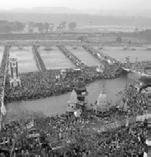
Customs: worship clay status in water, feast Landscape space: rivers and lakes
Customs: ceremony Landscape space: indoor space
Islam festivals

Customs: carry clay statues into water, burn Landscape space: river or ocean front
Groundnut Festival (Nov-Dec)


Customs: celebrates the first groundnut crop Landscape space: open space
Customs: ceremony Landscape space: open space
Eid al-Fitr (Sep-Oct)
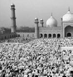
Customs: fasting Landscape space: open space
Eid al-Adha (Dec)
Customs: ceremony Landscape space: open space

82
Vara Mahalakshmi (Agu)
Mawlid an-Nab (Mar)
Karaga festival (Mar-Apr)
Vijayadashami (Sep-Oct)
Ganesh Chaturthi (Agu-Sep)
Good
Customs: fasting, carry the cross Landscape space: open space
Easter
Customs: light candles, pray beside the graves Landscape space: restricted space

Religious Festivals
Christianity festivals
All Souls Day (Nov)


Customs: prayer for the dead Landscape space: restricted space
Christmas (Dec)
Customs: light candles, pray, distribute sweets Landscape space: open space
Harvest
Customs: feature feasting Landscape space: open space
Religious distribution map of Hebbal
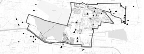
Site boundry
Hinduism
Islam
Christianity
Green space
3,000m
In Hebbal, there are about 22 religious buildings, 10 Hindu buildings, 3 Islamic buildings, and 9 Christian buildings. Religious buildings are basically distributed in densely populated communities or in waterfront areas.
Source: http://www.indyatour.com/india/festivals/major-christian-festivals-in-india

83
Friday (Mar-Apr)
(Mar-Apr)
festivals (Apr/ Jun/Oct-Nov)
N
Where do you buy produce/food? What percentage of vegetables are bought (in comparison to grown)? How much is spent on buying vegetables?
Do you grow vegetables by yourself? Where do you grow vegetables?(Noted on Map)
What are your major community festivals and activities and where it happens?(Noted on Map)
How has the landscape changed over time? What do you feel about these changes? Can you describe the landscape in the old days?
What is your daily routine? How do you travel around? How long time spend specific place for what?(Noted on Map) How often do you visit this place (depending on your sitea waterbody/park/greenspace) and why? Why do you like it? How do you think this space can be improved?
What do you think is the biggest and most pressing issue in this neighbourhood?
Where is your favourite place to hang out in this neighbourhood?(Note on Map)
Where do you get water from?
Do you buy drinking water and how much does it cost?
Do you mind showing me your household water bill?
How much water do you use daily by function of use? (shower, drinking, cooking, laundry...)
Can you tell us more about key water related activities? (For example, washing dishes, laundary, swimming, fishing, festivals?) How often and where?(Noted on Map)
Do you reuse water?How do you reuse water?
Do you think the water is polluted in your neighbourhood? Have you experienced any water related pollution in your everyday life? If yes, how has it affected your overall wellbeing?
Religion: Hinduism / Buddhism / Jainism / Islam / Sikhism / Christianity
year(s)
block.
Occupation: Years Stayed in Bangalore:
street,
Income: Your Information (This questionnaire is for student research only. Your information will not be used for other purposes.)

Address:
(wastes on the street...cleaning lake...)? How did you clean up the water pollution?
Are you involved in cleaning up any pollution
Where are the commonly flooded areas? How often does flooding occur?(Noted on Map)
Can you tell us about a memorable experience where it flooded in the neighbourhood? How did you deal with the flooding? What did you do during the floods? How did you feel? When was the biggest flood that you remember? Has flooding occured more frequently nowadays compared to the past?
Hebbal ---We are improving the community! Hum Samudaay mein sudhar kar rahe hai! Thank you for your participation! Bhaag lene ke liye aapka dhayanwaad! Productive Landscape Festivals&Activities Landscape Change Daily Routine Environmental Preference Issues & Preferences Water security Water usage & Consumption Water Pollution Flooding Issues
INTERVIEWS Questionnaire
The village group collected over 30 questionnaire in the surveyed area. From these the group concluded that water insecurity is the biggest problem within the community.
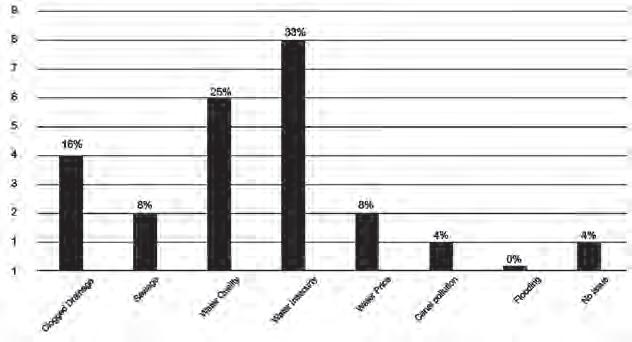
The group also found types of main water cources and indentified challanges on usage of multiple water sources.
The Lake group found that the major issue in the lake area is the water scarcity. The people who live in the area are deeply influenced by the issue.
MAJOR ISSUES ON THE LAKE AREA
Private borewell, CMC Private borewell, Do people have to rely on multiple water sources? 1 Source 2 Sources 3 Sources 4 Sources 7% 14% 22% 57%
Water quality Lake Infrastructure Open Drains Mosquitoes Lack of Grazing Areas Security Hygine and Maintenance Water Scarcity Road Infrastructure Dislocation of Residents Bad Smell Wasted Water 1 0 2 3 45 6 7 Main sources of water Private Borewell 7% 7% 7% CMC Rainwater, Cauvery, Private borewell, CMC Cauvery, Private borewell, CMC 43% Cauvery,CMC 36% Do people have to rely on multiple water sources? 1 Source 2 Sources 3 Sources 4 Sources 7% 14% 22% 57% Conclusion from the interview

PROPOSALS
PROJECT 1. THRIVE HEBBAL
Chan Wing Fai
Hou Yanru
Liu Ye
PROJECT 2. DROP BY DROP. EVERY DROP COUNTS
Chen Nan
Isabel Villegas Molina
Manasi Venkatesh Prabhudesai
PROJECT 3. WATER RESILIENT HEBBAL
3.1. Connected Water-Resilient Park I Tang Mengjiao and Zhang Qinqin
3.2. Ecological Revival of Stream I Yang Xiaowen
3.3. Matrix Sanctuaries I Muhammad Rahmat Bin Khairudin
PROJECT 4. BETTER LAKE THAN NEVER
4.1 Existing Industrial and Residential | Mitali Kumar
4.2 Lake Nagwara | Dai Yuke
4.3 Prospective Residential District | Elsa Sim Rui Jia
200m N
92
PROJECT 1: THRIVE HEBBAL
TRANSFORMING AN INFORMAL SETTLEMENT FROM A NEGLECTED LAND INTO AN ECONOMICALLY RESILIENT COMMUNITY
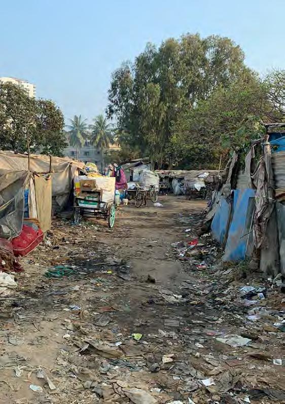
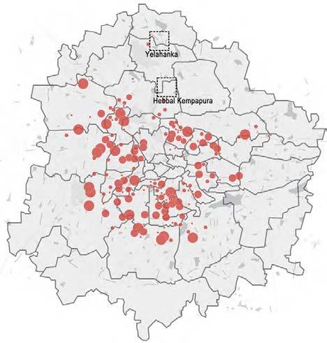
Nearly 25 percent of the total population in Bangalore is living in more than 2000 informal settlements. The Hebbal informal settlement is one of the most vibrant communities which contribute to the development of the city for manpower and garbage collection. However, there are livelihood problems due to a lack of economic activity and insufficient basic infrastructure. This project aims to create an alternative model of informal settlement that improves the living environment of the low-income community. As the Hebbal informal settlement is situated in the buffer zone near the stream according to the future planning, the informal settlement is transformed with various blue-green infrastructures and value-added economic activities to enhance people’s quality of life, empowering the community.
To begin with, several integrated water systems are designed to collect, purify and reuse the water (including rainwater, grey water, and black water) in an around the informal settlement. Rainwater and grey water are collected from the catchment of upper streams, and the black water generated in the informal settlement will be treated locally before discharge. After purification through different bioswales and biotopes, treated water can be used for toilet flushing, irrigation, and washing clothes and dishes, which improves the quality of nonportable water to reduce the risk of illness and other diseases.
Besides, the open space in the informal settlement will be utilised with various functions. A house yard is made for every 3-5 households, each house yard consists of a community farm, bathroom and other basic infrastructures, to encourage residents to exchange resources and knowledge. The rainwater harvesting system at every household helps to provide more clean water for showering and irrigation. Besides, the open space also provides opportunities for more economic activities but also act as an open space for people living in the informal settlement and surrounding neighbourhood to enjoy as to facilitate social interaction.
Furthermore, various value-added economic activities will be introduced to equip low-income communities with additional skills to generate more income. A tree nursery, marigold farm, coconut plantation, and compost techniques will be proposed and plant species that suitable for the local climate are suggested to the residents to achieve sustainable growth of the informal settlement. The proposed value-added economic activities also benefit the city as the tree nursery and marigold farm generates supply for the city, while protecting the buffer zone from urbanization threats.
This project is meant as a model for other informal settlements to demonstrate that informal settlements can contribute more to the society in environmental, social, and economic aspects.
93
Chan Wing Fai, Hou Yanru, Liu Ye
INTRODUCTION
Distribution of Informal Settlements in Bangalore

LEGEND
Population

1-620
621-1400
1401-2700
2701-6600
6601-20000
Population Growth
Number of Informal Settlement
• More than 25% of Bangalore’s population living in informal settlement
• Rapid increase of informal settlement and its population
• New migrants settlement is in poor living condition and usally lack of resources and basic facilities

94
N
1km


95 100m N
Low-Income Settlement Kodigehalli Very Low-Income Settlement Khata Nagar New Migrants Settlement Manjunatha (>250 household) (>150 household) (<100 household) Hebbal (96 household) 100m N 100m N 100m N LEGEND Multi-Storey House (Concrete) Single Storey House (Concrete) Original Green Land Single Storey House (Wood/Plastic Sheet) Tent (Plastic Sheet) Green Space Vacant Land Unpaved Road Paved Road
TYPES OF INFORMAL SETTLEMENT
LANDSCAPE CHANGE
Landscape Change of Hebbal Informal Settlement
• More agricultural land transformed into residential area
• Informal settlements scattered across the city and a lot of them near the stream and other water bodies

Buffer Zone
• New zoning introduced in the 2031 zoning plan


• Creates a 30m-75m from water bodies
• National Green Tribunal’s (NGT) orders to protect the waterbodies from urban development

2000 2008 2018 2031 96
Green Space Water Bodies Informal Settlement Residential Area Buffer Zone Road Railway 1km N
LEGEND




97
Esteem Mall Water Treatment Plant New Residential Development Private School Bus Stop Church Stream 200m N SITE CONDITION Location Living Condition Overall Environment Economic Activities Water
Hebbal
Lake Nagavara Lake
Total Area: 5.21ha (include roads, stream and grove)
Density: 96 families (157 households)
Population: >380 (96 families * 4 members)
Interview:

98
interviews were
39
conducted
COMMUNITY PROFILE

99 Person Interviewed 20m N
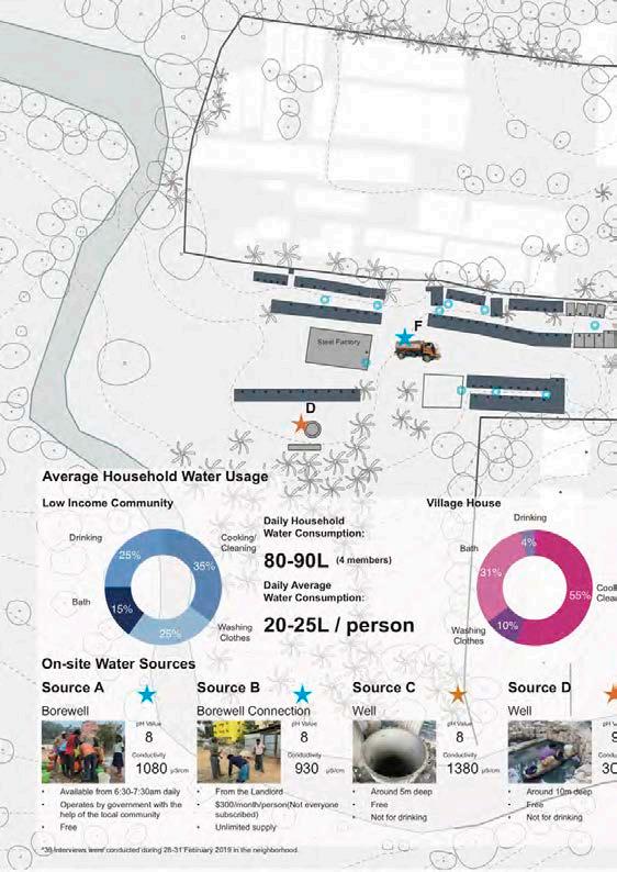
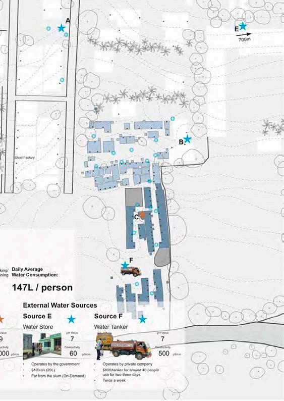
100 Limited Water Resources ISSUE 1
20m
LEGEND
Person Interviewed
Water from Borewell A & B
Water from Well C & F
Water from Well D & F
Non-Residental
Potable Water Source
Non-potable Water Source
101
N
ISSUE 1
Greywater Catchment
Forest and wooden area: 10116m2
Meadow area: 1784m2
Compacted soil: 27649m2
Water-tight roof area: 13192m2

Asphalt pavements area: 3609m2 68.5m3 / day or
Rainwater can be harvested: 25000m3 / year
102 Limited Water Resources
N
Forest and wooden area 0.05 Meadow area 0.18 Compacted soil 0.30 Uncompacted soil 0.50 Water-tight roof area 0.85 Asphalt pavements
0.95 Rainwater
Rainwater
Drainage Underground
Surface
50m
LEGEND
area
harvest area
collect point
pipe
flow
Rainwater Catchment
LEGEND
Industrial area
Residential area (collect)
Residential area (uncollect)

Rainwater collect point
Drainage
Underground pipe
Total population: 2240
Per capita water consumption: 147L / day
Excess grey water: 28% (=62%-26%-2%-6%)
Per capita excess grey water: 41.16L / day
Total excess grey water: 92,198L / day 92m3 / day or
103
Drinking and Cooking Toilet Flushing Gardening/ Others House Cleaning Bath and Shower Hand Basin Kitchen/ Dishwashing Laundry Domestic Water Consumption for 4% 26% 2% 6% 31% 4% 17% 10% Grey water = 62% 50m N
ISSUE 2
Pollution Activities in Open Space
Landscape Experience
LEGEND
Comfortable
Dense Forest
Public Park
Less Comfortable
Agriculture
Truf with Vegetation
Uncomfortable
Mass Forest
Car Park
Maintain Landscape
Institution Landscape

Street Landscape
Sports
Public Plaza
Sparse Landscape
Mass Bare Land
Bare Land
Construction Land
Private Park 100m
Inaccessible Land
104
N
Vegetation Density
LEGEND
Vegetation Density

Very Dense Forest
Dense Vegetation
Turf with Little Vegetation
Bare Land
Hardscape without Vegetation
105
N
100m
ISSUE 2
Pollution Activities in Open Space
Connection with Other External Services
LEGEND
• The community is isloated from the community because a lot of public services are far from the neighborhood
• Low mobility of affect the residents cannot access to public infrastructure easily

106
N
200m
Open Space Analysis

• Various activities happening in open spaces generate a lot of pollution that brings negative impact to the living condition of the residents
50m
LEGEND
Playing Space
Trashing Collection
Water Storage
Bath
Wood Storage
Wood Cutting
Gathering Space
Cooking
Laundry
Construction Waste
Trash
107
Empty Space N
ISSUE 2
Pollution Activities in Open Space

Activities Create Pollution and Activities in Polluted Area
LEGEND
Bath Tent
Toilet
Washing Dishes/Clothes
Copper Burning
• Many open spaces are occupied by activities that creates a lot of pollution


• Leads to the negative effect of the environment and residents living in the informal settlement

108
50m N 50m N
Copper Burning Bath/Washing Dishes/Washing Clothes Human Waste Pollution & Activities
Potential to Utilize the Empty Dwellings and Open Spaces


109
Potential threats near the stream Demand of recycle activities decreased Empty dwellings Empty dwellings Dwellings in poor condition Dwellings in poor condition 50m N LEGEND Empty Space
want to have more enclosed space for various kind of household activities to benefit my family.
• Empty dwellings / Dwellings in poor condition
I
- Bhagya (16)
ISSUE 3
Low-skill Economic Activity with Insufficient Income
Recycling Work - Work Flow
Collection & Distribution
Location:
Open Spaces in front of the house
Stakeholders:
• Low Income Community
Mini storage space waiting for sell
Distribute different types of recyclables

Storage
Location:
Recycle Store
Stakeholders:
• Store Owner
• Workers
Sell to Recycle Store
Size: 10m * 7m
Plastic Bottles

Glass Bottles

Other Recyclables
Coconut Shells

Size (Recycle Partition): 6m * 5m


(Open Space): 7m * 5m
Resell to Vendors or Recycle Factory

Package and Resell
Location:
Recycle Store
Stakeholders:
• Store Owner
• Workers
• Vendors
110
Export to other parts of India or China
Plastic Paper Copper Coconut Rubber Glass
Existing/Potential Economic Activities


111 ₹ 500 Earnings: (Recycle) ₹ 4500-5000 Household Income: /time Low Income Community (Informal Settlement) Middle Income Community (Village House) ₹ 30000-50000 Household Income: (4 family members) (4 family members) /month /month
Concerns and Wishes
Income
Purification of Different Types of Water


112 Rain Water Black Water Stream Water Water Source Collection/Purification Method Usage Rainwater collected from drainage Drainage Biotope Collect rainwater through roof pipes Pipe Irrigation Irrigation Irrigation Daily use Rainwater from house roof Toilet sewage Separation Floating Wetland Tap new channel Existing channel New channel Carted away Biotope SOLID LIQUID Stream Volume: 68.5m3/day Volume: 7.7m3/day 0.056m3/day From Drainage: From House Roof: Utilize Water Resources to Facilitate the Livelihood of Residences
Water Pipeline Grey water collected by pipeline Grey water from household Filtration bed Biotope Biotope Irrigation Daily use Biotope Bioswale Bioswale Discharge into bioswale Volume: 92m3/day
STRATEGY 1 Grey


113 Floating Wetland Bioswale Biotope Polishing Bed Treating Bed Filtration Bed Water System 50m N Water Purification Tools LEGEND Bath Tent Floating Wetland Filtration Bed Bioswale Gray Water Rainwater Black Water Stream Water Sedimentation Pond
STRATEGY 2
Maximize the Potential of Public Space within the Neighborhood
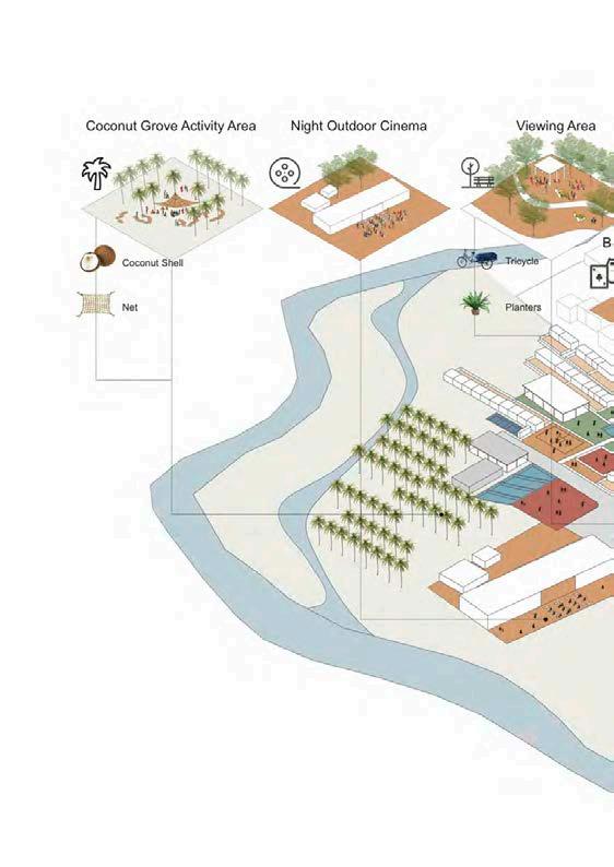
LEGEND
Public Activity Space
House Yard
Working Space
Dispersed Planting Area
Centralized Planting Area
Grey Water System
Rainwater Purification
Stream Water
Black Water Purification
New Built Houses
114
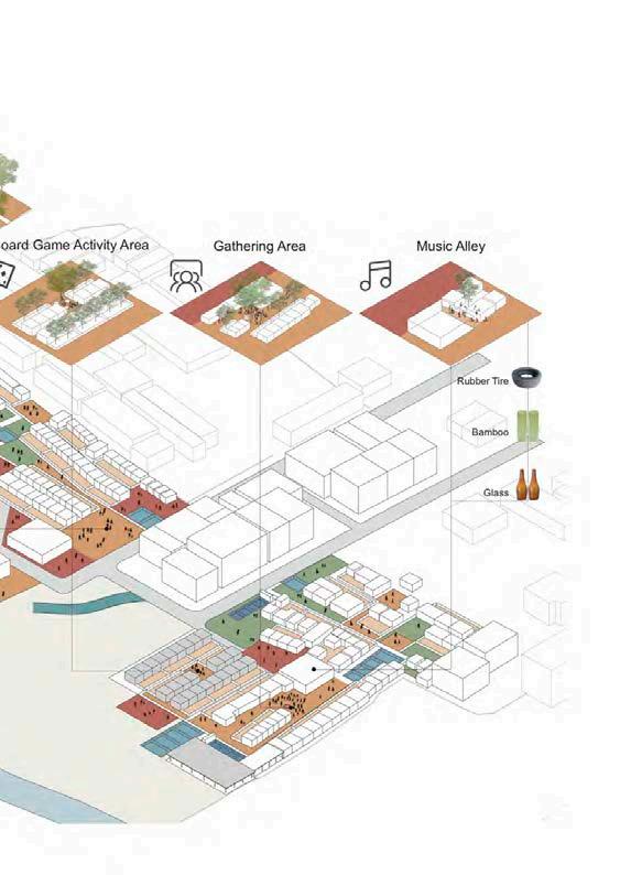
115
STRATEGY 2
Maximize the Potential of Public Space within the Neighborhood


Type A Backyard Style
Rainwater Volume: 1975m3 Catchment Area: 2304m2 = Rainfall Height: 857mm * * 0.001
Number of Household: 96 Daily Household Water Collection from Roof: 56L
116
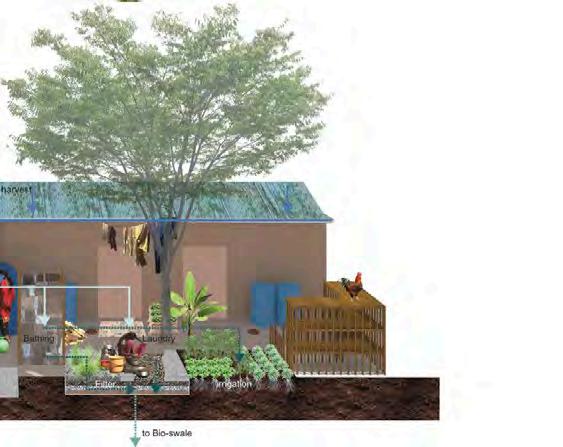


117 1 Rainwater Harvesting Pipe 2 Water Collection Tank 3 Bath Area 4 Filter Pool 5 Vegetable Growing Area 6 Rabbit Hutch 7 Chicken Cage 8 Working Area 9 Stove 10 Woodpile 11 Seedling Cultivation 12 Bioswale Jackfruit Mango Lemon Papaya 12m*12m 10m*10m 5m*5m 5m*5m Type B Enclosing Style 2m N
STRATEGY 3

Introduction of the Value-added Economic Activities
A. Marigold Farm
Marigold Habitats
Growth Period 90 Days (from seed)
Sun Exposure Full Sun
Soil pH Neutral
Soil Condition Moderately fertile, well-drained soil

Plant Spacing 40cm with 20cm row gap
Cultural Value
Marigold in Hinduism


• The flower symbolizes auspiciousness
• The orange colour signifies renunciation and hence is offered to God as a symbol of surrender
Pests/Diseases Few (Mites and Aphids)
Toran
• Means gateway in Sanskrit
• Made of Marigold or other flowers
40cm*40cm (20cm gap) 5 plants/m2
Types of Marigold
African Marigold


Mexican Marigold
Size: 0.64ha Water for irrigation: 128,000L (every 10 days)
(20L/1m2)
Workflow
• Commonly found at the main door of Hindu homes

• Need to be changed on every festive occasion
Market Price: ₹ 70-80/kg (6000-10000kg/ha)
Earnings:
Yield Rate: 3800-6300kg ₹ 266,000-504,000
• A very hardy flower that symbolizes a trust in the divine and a will to overcome obstacles. (per 3-4 months)
Flowering Seasons
• Three times a year (Rainy, winter and summer seasons)
• Maximum flower yield can be obtained from September


118
Jan Feb Mar Apr May Jun Jul Aug Sep Oct Nov Dec Sowing Period Acclimating Period Harvesting Period
SEED PROCUREMENT Seed Collection Seed Selection & Handling Temporary Seed Storage MIX MEDIA PREPARATION Procurement of Soil Soil Filtering Preparation of Manure Drying and Filtering of Manure Mixing Media PREPARE NURSERY BEDS Preparing Nursery Beds PACKING SEED SOWING TRANSPLANTING PINCHING HARVESTING 30 days 40 days 20 days
Sowing Transplanting Harvesting Pinching
FLOWER MARKET LOCAL COMMUNITIES Market Price: ₹70-80/kg
B. Tree Nursery
• Tree nursery is a growing industry in India and the demand of seedling is increasing, therefore it is a good opportunity to introduce this industry to the residents
Workflow
SEED PROCUREMENT
Seed Collection
Seed Selection & Handling
Temporary Seed Storage
Seed Sowing
MIX MEDIA PREPARATION
Procurement of Soil
Preparation of Manure
PREPARE NURSERY BEDS
Preparing Nursery Beds Shading
Soil Filtering
Drying and Filtering of Manure
Mixing Media

Fill in Media into Polybag / Air-Pot
Sapling & Polybag / Air-Pot Placement
MAINTENANCE
Transplanting, Shading Control, Irrigation, Fertilization, Pest & Disease Control
SELL TO BUYERS
119
20L 75L 200L 460*460mm 300*250mm 700*625mm 60cm 2m 3m 6m Soil ₹300-400 ₹5000-10000 ₹10000-20000 2-3 months 1-2 year 2-3 years 6-10 years
Source: Fransiskus Harum & Søren Moestrup (2010)
STRATEGY 3
Introduction of the Value-added Economic Activities
B. Tree Nursery
Size: 0.52ha
0.23ha (75L) 0.28ha (200L)
15,600L Market Price:
Water for irrigation:

₹ 10000-20000 (30kL/ha/day)
Tree Species


Bauhinia x blackeana
Rainfall: 500-2550mm
Light: Full Sun/Half Shade
Growth Form: 6-8m
Growth Rate: Fast
Lagerstroemia speciosa
Rainfall: Moderate
Light: Full Sun
Growth Form: 6-15m
Growth Rate: Moderate
Grevillea robusta Cunn. Ex R. Br.
Rainfall: 700-1700mm
Light: Full Sun
Growth Form: 15m
Growth Rate: Fast
Callistemon viminalis (Soland. Ex Gaertn.) G. Don


Rainfall: >700mm
Light: Full Sun
Growth Form: 8m
Growth Rate: Moderate
Michelia champaca L.
Rainfall: Moderate
Light: Full Sun
Growth Form: 16-30m
Growth Rate: Fast
Spathodea campanulata P. Beauv.
Rainfall: 800-2000mm
Light: Full Sun
Growth Form: 10-15m
Growth Rate: Fast
Open Area for Plants (with Tree Pot)
Cassia fistula

Rainfall: 500-2700mm
Light: Full Sun
Growth Form: 10-18m
Growth Rate: Moderate
Pongamia pinnata
Rainfall: 500-2500mm
Light: Full Sun
Growth Form: 16-30m
Growth Rate: Moderate
Compost Area (with cow dung and dead leaves)

120
• 200L Tree Pot
C. Coconut Plantation
• Not yet utilized the existing coconut tree

• Easy to manage
• A lot of benefit and possible to produce other by-product (97 trees)
Coconut 7.5m*7.5m
177 plants/ha
Size: 0.55ha

Yield Rate: 4850-7275 nuts
Coconut:

Water for irrigation: 4365L (45L/tree/day) (50-75 nuts/tree/year)
Coconut Oil Production: 439-659L
Market Price:
Coconut Flour Production: 336-504kg
Coconut: ₹260/L
₹30/nut
Life Span: 60-80 year
Coconut Oil: ₹200/kg
Coconut Flour:
First Fruiting: 6-10 year
PROPAGATION
GERMINATION
GROWTH & DEVELOPMENT
6-10 years
COCONUT FRUITING
1 years
COCONUT HARVESTING
COCONUT COCONUT OIL
COCONUT FLOUR
121
STRATEGY 3
Introduction of the Value-added Economic Activities
D. Aerobic Composting
• Decomposition of organic matter via microorganisms that require oxygen
• Simplest way of contributing positively to waste management
• Provide compost for other economic activities (Tree Nursery, Marigold Farm, and Coconut Plantation)


• Easy to do in informal settlement
• Requires sunlight and natural moisture to perform well
• Requires little management
Cow Dung: 29.5L/day/cow

Market Price: ₹25-30/kg
Workflow
Leaves
Water, Heat, CO2

Composting Container


Organic Compost
Oxygen
1-3 Month(s)
122
Dead
Water Cow Dung
Input Output
+ +
(Output) 3 1 : 1 10 :
(Input)
Economic Flow - Regional Scale
• Hebbal is well connected by two major highways

• Landscape tree can be exported to the surrounding neighbourhoods
• Marigold can be sold in the biggest flower market in Bangalore - KR Flower Market
MALLESHWARAM
SUNKADAKATTE
YELAHANKA
123
SITE KR FLOWER MARKET
HEBBAL
1km N
STRATEGY 3

Introduction
Economic
of the Value-added
Activities
LEGEND Marigold Farm Tree Nursery Coconut Compost Recycle Economic Flow - Site Scale 124
• Different kinds of economic activities are interrelated
• Marigold farm and tree nursery provides marigold and landscape trees to the surrounding neighbourhood
• Possible to extend the existing coconut plantation to add value to the coconut industry
• Composting could provide resources for the plantation activities
• Existing recycle activity is kept because it could also benefit the community

20m N
125

126 1 Toilet 2 Trash Recycling Centre 3 Board Games 4 Compost 5 Tool Room 6 Greenhouse Seedling 7 Marigold Farm 8 Transit Centre 9 Church 10 Night Cinema 11 Coconut Product Factory 12 Community Activity Plaza 13 Sports Field 14 Planting Nursery 15 Coconurt Forest 16 Slope Protection 17 Environment Education Centre 18 Music Alley MASTERPLAN

127 20m N
INFORMAL SETTLEMENT AS A SYSTEM

128

129
CONNECTION WITH EXTERNAL COMMUNITIES
INFORMAL SETTLEMENTS

130
HEBBAL LAKE
NAGAVARA LAKE
MARKET
HEBBAL
MARKET
SITE
WATER CATCHMENT AREA
PHASED DEVELOPMENT
Phase 1
Water:
• Introduction of stream water
• Create household rainwater collection system
Open Space:
• Houseyard for greywater treatment
Economy:
• Produce coconut oil using the existing coconut tree in site
• Fruit tree, chicken and rabbit in houseyard
• Keep two existing recycling point
Phase 2
Water:
• Introduction of grey water collection and treatment system
Open Space:
• Use the empty space to develop new value-added economic activities
Economy:
• Develop Planting Nursery
Water: Phase 3
• Increase the scale of rainwater collection system
Open Space:
• New community activities and new settlements


Economy:
• Develop Marigold Farm
131 50m N
THRIVE HEBBAL
Together we thrive for a better Informal Settlement.

132

133
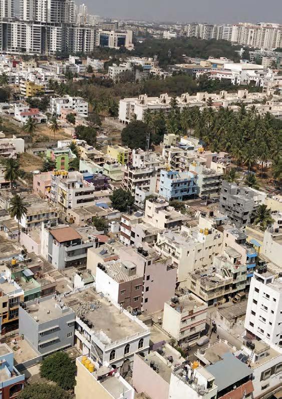
134
PROJECT 2: DROP BY DROP. EVERY DROP COUNTS
DIVERSIFYING THE WATER SOURCE TO GENERATE A WHOLE SELF-RELIANT NEIGHBOURHOOD.
Situated in Hebbal Kempapapura, a typical middle-income neighborhood faces a severe problem of water insecurity due to the dispute for Cauvery water and the fact that borewells are drying up. Water distribution from the different authorities did not evolve with the development, resulting in a complex substandard water network. The lack of infrastructure related to water supply, drainage, and sewage systems lead the community to exploit the resources inappropriately. In addition, the housing centered development left the unconstructed spaces as a residue. Through reconnecting the age-old relationship with water resources and eco-friendly practices, this project intends to minimize the dependency on the urban water supply and foresees a whole self-reliant neighbourhood.
The overall goal is to understand the whole cycle of water, addressing the problem in 3 scales. Private home yards and rooftops, vacant lots and streets, and the canal are the main components of the cycle in the neighbourhood. By diversifying usage and mitigating pollution of the black, gray, rain, and canal water, we will design an integrated recycling process for re-use, addressing each as a different independent system. Rainwater will be collected in rooftops to reduce external water consumption. In open areas, rainwater will be drained in a Jhalara (a traditional rainwater harvesting structure) and will be used to recharge underground water in order to provide sufficient water in the dry season through open wells. Grey water will be purified and reused for agricultural irrigation and toilet use, reducing 30% of the overall demand. Blackwater will be used for creating biogas to cook at households. Consequently, the interventions will restore the river's natural selfpurification capacity. At a larger scale, we aim to rejoin the canal with the lake system, forming a connected river corridor and restoring the lake ecosystem network.
This project aims to reunify the ecological flows with social activities. The different cycles of water will be linked together by a series of landscape spaces, like productive rooftops, green streets, community gardens, holy plazas, stepwells, and wetland parks. Jhalaras redesigned will evoke functions of cleaning, storing and act as a place for worship. Productive landscapes will reunite people with the land through sustainable activities. The Jhalaras, together with the agriculture lands, will be tied up with an organized open space system for the exchange of goods and gathering space. Therefore, reconnecting people with water will encourage the community to respect and be aware of the importance of water.
In the aim to conserve the proposed system and the natural growth of the city, we extract out of the project a coefficient that is directly related to the amount of m2 that represent the consumption of a person water footprint in our system. This is part of the plan to create a policy for the new development of a neighborhood. By creating this formula, we plan to replicate and secure the approach of the project with the inevitable growth of the city.
135
Chen Nan , Manasi Prabhudesai, Isabel Villegas
DEVELOPMENT PROCESS


2018 HEBBAL 2031



2002 SettelmentsUn paved roadPaved road Water Canaliced canal Drainage Openwell Income demogprahics 10% 0 Low 28% Slums 17% 28% 2002 paved roadPaved road Canaliced canal Drainage Income demogprahics Slums 17% 2002 SettelmentsUn paved roadPaved road Water Canaliced canal Drainage Openwell Income demogprahics 0 Low 28% Slums 17% 28% road Paved road 40% 50% 30% 20% Settelments Un 2002 Settlements Unpaved road Paved road Canaliced canal Openwell Drainage Water 2007 2018 Vacant 16.94% NGT Buffer 7.35% Residential 32.55% Residential 43.68% Commercial 3.85% Commercial 1.66% Industrial 5.12% Industrial 4.53% Public & Semi Public 24.77% Public & Semi Public 21.65% Water Bodies & Streams 3.99% Water Bodies & Streams 3.84% Transport 9.62% Transport 14.28% Open Space 2.58% Open Space 2.47% Public Utility 0.58% Public Utility 0.54% 136 LANDUSE FOR HEBBAL DEVELOPMENT LEGEND 1000m N Settlements
HEBBAL
The current developent process has ignored the traditional water systems and as the rapid urbanization happens, demand-supply gap between households and BBMP water resources increased the dependency on other sources of water.
CHANGE IN THE USE OF RESOURCE
Over explotation of ground water resources.
Bangalore’s WATER TABLE is SHRINKING from 76-91m to 10-12m in the past two decades.
http://worldpopulationreview.com/world-cities/bangalore-population/

Water Income demogprahics 40% 50% 30% 20% 10% 0 Low 28% Slums 17% Middle 45% High 10%
Bangalore water
sewerage
137 HEBBAL CHANGE OVER TIME INCOME
Acient Stepwell Canals Aquifers Hesaraghatta Reservoir 1960 1970 Now Cauvery Top soil Top soil Recharge structures, recharge wells, percolation pits Stormwater drain Soak Pit Sources Estimated number 7,000 282 80,000 120 MLD = Million Liters per day Out take in MLD BWSSB Borewells Private Borewells Drainage Borewells Shallow aquifer Shallow aquifer Lake Slowly recharging ground water Lake Slowly recharging ground water Openwell 20-25m Openwell 20-25m Deep aquifers Deep aquifers Bed Rock Bed Rock Fractured zone Fractured zone Weathered zone spongy layer Weathered zone spongy layer Tanker CMC Goverment Borewell Water Unit Private Borewell Cauvery River BBMP TK Hali WTP Karnataka Tamil nandu Water flow Water treatment plants Transimission Pipelines Water bodies 1 2 Chamaraja agar Reservoir Arkavathi River From WTP to homes Water Harvesting Lake Series Dugwells
supply
project.
DEMOGRAPHICS
Cauvery
CMC
Private Borewell
Sewage
Drainage
138
ACTUAL SYSTEM
Do people have to rely on multiple water sources?
sources of water. Private Borewell 7% 7% 7% CMC Rainwater, Cauvery, Private borewell, CMC Cauvery, CMC 43% Cauvery, CMC 7%
Main
1 Source 2 Sources 3 Sources 4 Sources 7% 14% 22% 57% 139
WATER SYSTEMS
We collect 30+ questionnaire in the area. From these we conclude that water insecurity is the biggest problem in our area.
As BBMP water recources is not enough, each neihborhood has a side system in relation to potable water and undergournd water that makes the neihborhood a system of systems.
890.5m 890m 889m 890m 888m 891m 892m 893m 889m 890m 891m 892m 893m 894m 895m 896m 897m 898m 899m 900m 901m 902m 903m Commercial area Borewells Water unit Flow of drainage Systems of systems Our system Park 140 50m N
CloggedDrainage 1 16% 8% 25% 33% 8% 4% 4% 0% 1 Sewage WaterQuality WaterInsecurty WaterPrice Canalpollution Flooding Noissue 2 3 4 5 6 7 8 9 Our system Systems of systems Park Commercial area Borewells Water unit Flow of drainage
RAPID URBANISIM WITHIN THE NEIGHBOURHOOD


Insufficient water sources
Decontextualized to immediate surroundings
Underutilized Open space
Insufficient water sources


Decontextualized to immediate surroundings
Underutilized Open Space
141
INSUFFICIENCY WATER SOURCE


MondayTuesdayWednesdayThursday Friday Cauveri Mon Water Tanker Privte Individual Borewell CMC Water Unit SaturdaySunday Tues Wed Tues Fri Sat Sun Water Unit Water Tanker Cauveri CMC From WTP to homes Monday and Thursday 55Ru = 1Sd 500 liters Drilling: 1 foot = 1sgd 1F280F Pipe: 280 foot = 5sgd DrillingPipe CAUVERY RIVER Bangalore UNDERGROUND WATER. BOREWELLS Storage Hebbal STP Capacity Goverment WTP PipeHousehold Private individual borewell Private for Selling Borewell Goverment Borewell CMC Goverment Borewell FILTER WATER 25liters 25L 500L 500L500L 15 - 60 Rs 0.50Sd - 1Sd Rs 500 liters 300-400Rd 5-7Sd “Free” “Unlimited” “Free” “Unlimited” After the cost of opening 142 Water availability
TYPES OF HOUSES AND THEIR WATER SOURCE
Water source within the neihbourghood
Roof Tank Connection
Cauvery
Ilegal CMC
Underground water tank
Openwell
Sewage system
Borewell
143
Type A
Type C
Type B
Type D
INSUFFICIENCY
WATER ANALYSIS IN RELATION TO THE PEOPLE IN THE AREA
80L/person/day 50L/person/day
967 people (204 units)
Water demand in neighbourhood: 89397 L/day
People will fulfill their underground tank & rooftop tank for a whole week
890m 890.5m 890m 889m 890m 891m 892m 893m 894m 38 37 10 6 15 10 15 12 5 30 12 6 10 8 5 22 5 12 1015px 890m 890m 1850 1100 1200 1200 588 588 588 735 1176 1176 1029 882 882 882 882 882 882 882 882 882 882 882 441 441 441 1029 1029 960 960 960 960 960 1015px 890m 890m 890m 890m 144
Live in the area
supply:
L/day Extra underground water supply: 89397-84000=5397L/day 1 storey 2 storey 3 storey 4 storey 400-800L/day 800-1200L/day 1200-1600L/day 1600+L/day Cauveri water Private borewell Water unit Water tanker CMC water 4000 3000 2000 1000 MLD 2016 2034 2049 Demand Supply Cauveri water
Amount of Cauvery water
84000
Cauveri water Supply time: Twice a week: Tue&Thurs 7:00am-10:00pm
use 84 neighborhood* 3500L* 2times a week/ 7days=84000L/day 147L/person/day
500L*2 Rooftop tank 2500L (average) Underground tank
Location: Main street
Ownership: Landlord+Tenent
Job: Landlord & office worker
Settlements: 2017
Number of people:
Per Capita water usage: 147L/day
Drinking: 2L/day
Cooking:2.5L/day
Washing&Bathing:132.5L/day
Others(washing cars&plants):10L/day
Cost on water: 641rs/month (drinking + Cauveri)
WATER CONSUMPTION OF EACH TYPE OF HOUSEHOLD
Location: near the cannel
Ownership: Landlord
Job: IT analyist (30,000-40,000*2rs/month)
Settlements: 1999
Number of people: Per Capita water usage: 138.4L/day
Drinking: 1.4L/day
Cooking: 2L/day
Washing&Bathing:125L/day
Others(washing cars&plants):10L/day
Cost on water: 1241rs/month (drinking + Cauveri+tanker)
Location: near the cannel
Ownership: Landlord
Job: Bank Manager
Settlements: 1993
Number of people: Per Capita water usage: 147L/day
Drinking: 2L/day
Cooking:2.5L/day
Washing&Bathing:132.5L/day
Others(washing cars&plants):10L/day
Cost on water: 641rs/month (drinking + Cauveri)
Location: next to main street
Ownership: Tenent
Job: Security guard (10,000-15,000*2rs/month)
Settlements: 2005
Number of people: Per Capita water usage: 50L/day
Drinking: 1.4L/day
Cooking: 2L/day
Washing&Bathing:46.6L/day
Cost on water: 200rs/month (drinking)
Percentage of cost on water:1.7% Percentage of cost on water:1.6% Water cost:Income Water cost:Income 70,000 10,000 70,000 Percentage of cost on water:1.7% Percentage of cost on water:1.6% Water cost:Income Water cost:Income 70,000 10,000 70,000 Percentage of cost on water:1.7% Percentage of cost on water:1.6% Water cost:Income Water cost:Income 70,000 10,000 70,000 145
TYPE A:
TYPE C:
Percentage of cost on water:1.7% Percentage of cost on water:1.6% Water cost: Income 70,000 70,000 10,000 Water cost: Income
TYPE B: TYPE D:
DECONTEXTUALIZATION
ANCIENT METHODS RELATED TO WATER
Upstream reservoir or a lake
Jhalaras Direct collection + Indirect collection Direct collection


Kund
Bawadi
Surface runoff
Rain water
Built aroun open welll

Rain water
Surface runoff
Water from hills
Rooftop Water & Courtyards
Taanka
Panam Keni
Surface runoff
Ground water springs
From feilds & forest
Direct collection + Indirect collection
Indirect collection
Direct Collection
Used For
Religious ritesCommunity use
Harveest water for drinking
Recharge deep aquifer
WashingBathing
Harveest water for drinking Agriculture
Shallow Aquifer StormWater Drain Deep Aquifers minimise water loss
Used For Used For Used For Used For
146
DEVELOPMENT OF KEMPAPURA
Mud Ground with construction
Paved Area
Slums
Mud ground with wild grass
Mud ground
Construction Land
Polluted water
Ground covered with grass
Cultivation land
Wetland
Open well
Trees
Coconut
Plantation
Lake/Canal
Water
Building
Ground G+1
G+2
National Highway
Primary Roads
Secondary Roads
Tertiary Road
G+2 Mud Road 200m
147
2000 2000 2007 2019
Before
N
DECONTEXTUALIZATION DEVELOPMENT OF KEMPAPURA
SECTION AA’


Farm land Farm land Wetland Wetland Coconut Plantation
Coconut Plantation Nagavara Lake Site Connected wetland
Year: Before 2000
Farm land Settlements Wetland Coconut Plantation Lake In summer
Year: 2000
Disappearing Wetland Polluted Lake Wetland covered with soil to increase settlement area
No coconut plantations and farm land
Increase in dwellings, sewage discharged in canal
Year: 2007


Construction land High rise Construction Disconnected restored lake used for tourism Constructed canal
Dense settlement


Year: 2019

148
A’ A
SECTION BB’
Year: Before 2000
Garbage Dumping
Settlement
Year: Before 2000

URBANIZATION PROCESS


Year: 2000
Canal As Source
Change in relationship
Year: 2007
Canal As Sewage

Wetland
Year: 2019
Year: 2019
Covering the wetland with construction soil

Dumping soil
Flood line
149
Sand Sand Clay Clay Silt Silt
B B’
Soil Type Soil Type
Current space hasn’t been fully used by people since land has been divided by plots and started different levels of construction.
889m 890m 890.5m 890m 888m 891m 892m 893m 889m 890m 891m 892m 893m 894m 895m 896m 897m 898m 899m 900m 901m 902m 903m Managed Condo School Commercial Regional Industrial Residential with homeyard Residential Managed Condo School Commercial Regional Industrial Residential with homeyard Residential Wooded grassland Barren land Unmanaged Idle private(adjacent to road) Uncovered drainage with plants Uncovered drainage No drainage Covered drainage Public space Idle private land(adjacent to building) Private homeyard Sewage Private borewell Kaveri&CMC supply tap Dried openwell 0.4 0.5 0.53.35 3.65 0.3 0.6 0.4 5.5 0.6 20 3.35 20 20 20 20 20 20 20 30 30 30 30 30 30 100 100 0.4 0.5 150
N 50m Ingrastructure typology Water infrastructure Open space Road & Drainage UNDERUTILIZATION LAND USE
Much of the land in possession was left idle because the landlord did not have enough money for construction which make it become negative now. Open space has been regarded as a negative place hence no activities happen there.


889m 890m 890.5m 890m 888m 891m 892m 893m 889m 890m 891m 892m 893m 894m 895m 896m 897m 898m 899m 900m 901m 902m 903m Managed Public open space Private home yard Road Waterbody Waste type Car type Trash Discard soil Private car Water tanker Construction Managed Public open space Private home yard Road Waterbody Waste type Car type Trash Discard soil Private car Water tanker Construction material 151
N 50m 890m N Construction work Maintainance work Children play Burn rubbish Tutu drop off Wash utensil Chatting Take in water Drink coffee Worship OPEN SPACE TYPOLOGY
UNDERUTILIZATION INSUFFICIENT DRAINAGE SYSTEM IN THE AREA
Insufficient drainage system make houses have more potential to get flooded.
Coefficient:
STREETS: Street(concrete): 0.8
Informal road(compacted soil): 0.75
LAWNS:
Open space & home yard(compacted sandy loam): 0.3
Green space(unimpacted sandy loam,2%): 0.2
Green space with tree: 0.1
AGRICULTURAL LAND:
Farmland(Sandy soil with vegetation):0.2
RESIDENTIAL:
Roofs: 0.9
Drainage(Filled with soil): 0.3
Parks: 0.25
Paved surfaces in the city have increased up to 78% due to years of unplanned urbanisation.
https://timesofindia.indiatimes.com/city/bengaluru/bengaluru-floods-because-it-is-78concrete-iisc-study/articleshow/60300957.cms
Uncovered drainage with plants AsphaltMud Concrete Uncovered drainage No drainage Covered drainage 0.4 0.5 0.53.35 3.65 0.3 0.6 0.4 5.5 0.63.350.4 0.5 Uncovered drainage with plants AsphaltMud Concrete Uncovered drainage 0.4 0.5 0.53.35 3.65 0.3 0.6 0.4 890m 890.5m 890m 891m 892m 893m 889m 890m 891m 892m 893m 894m 895m 896m 897m 898m 899m 900m 901m 902m 903m 890.5m 890m 889m 890m 888m 891m 892m 893m 889m 890m 891m 892m 893m 894m 895m 896m 897m 898m 899m 900m 901m 902m 903m 152
Concrete Asphalt Mud Uncovered drainage with plants Uncovered drainage No drainage Covered drainage N 50m N 100m
WRONG VEGETATION CHOICE AND UNDERUTILIZED ROOFTOP
15\ 19: Edible or Medicinal plants


Herb Garden*
Herb Garden*


I never use my rooftop to harvest rainwater because the cost of maintaining infiltration facilities is high.
TERRACE CONDITION
Fenced rooftop Sloping roof


TERRACE USE


Rainwater harvest
Dry the clothes
Solar panel
Disposal
Construction material


Target area
6157sq meter potential rooftop area 990mm(average) amount of annual precipitation 6095.43 cubic meter(6095430L) water can be catch for the area every year= 16699L/day


This will take up 18.67% water demand in the neighbourhood.

889m 890m 891m 892m 893m 894m 895m 896m 897m 898m 899m 900m 901m 902m 903m Papita (Papaya) Carica papya Banana Musa acuminata Neem Azadirachta indica Peru (Guava) Psidium guajava Arandi (Castor bean) Ricinus communis Moringa Tree Moringa oleifera Indian Almond Terminalia catappa Bougainvillea Bougainvillea sp. Coconut tree Cocos nucifera Lemon Scented Gum Corymbia citriodora Brown Pine Podocarpus neriifolius Corn field Caricia papya Sapote Quararibea cordata Indian mango Mangifera indica Lemon Tree Citrus limon Avocado Persea americana Nispero Eriobotrya japonica Singapore cherry Muntingia calabura
Graminaceae Fake Corn Edible Fruit Edible Fruit Medicinal/ pest controlEdible fruit and leavesSpontaneous/Medicinal plant Medicinal plant Ornamental Ornamental Edible Friut Oranamental Ornamental Caricia papya Edible Fruit Edible Fruit Edible Leaves & FriutEdible Friut Edible Friut Edible Friut Fake Corn Medium water High water Low water Low water Low water Medium Water Medium Water Low water Low water High Water Medium high water Caricia papya Medium water Meidum\High waterMedium water Extreme high waterMedium water High Water Fake Corn Golden shower tree Cassia fistula Medicinal Low\Medium Water Neem Papita (Papaya) Carica papya Banana Musa acuminata Neem Azadirachta indica Peru (Guava) Psidium guajava Arandi (Castor bean) Ricinus communis Moringa Tree Moringa oleifera Indian Almond Terminalia catappa Bougainvillea Bougainvillea sp. Coconut tree Cocos nucifera Lemon Scented Gum Corymbia citriodora Brown Pine Podocarpus neriifolius Corn field Caricia papya Sapote Quararibea cordata Indian mango Mangifera indica Lemon Tree Citrus limon Avocado Persea americana Nispero Eriobotrya japonica Singapore cherry Muntingia calabura Herb Garden* Graminaceae Fake Corn Edible Fruit Edible Fruit Medicinal/ pest controlEdible fruit and leavesSpontaneous/Medicinal plant Medicinal plant Ornamental Ornamental Edible Friut Oranamental Ornamental Caricia papya Edible Fruit Edible Fruit Edible Leaves & Friut Edible Friut Edible Friut Edible Friut Fake Corn Medium water High water Low water Low water Low water Medium Water Medium Water Low water Low water High Water Medium high water Caricia papya Medium water Meidum\High waterMedium water high waterMedium water High Water Fake Corn Golden shower tree Cassia fistula Medicinal Low\Medium Water Neem Papita (Papaya) Carica papya Banana Musa acuminata Neem Azadirachta indica Peru (Guava) Psidium guajava Arandi (Castor bean) Ricinus communis Moringa Tree Moringa oleifera Indian Almond Terminalia Lemon Scented Gum Corymbia citriodora Brown Pine Podocarpus neriifolius Corn field Caricia papya Sapote Quararibea cordata Indian mango Mangifera indica Lemon Tree Citrus limon Avocado Persea americana Nispero Eriobotrya Herb Garden* Edible Fruit Edible Fruit Medicinal/ pest controlEdible fruit and leavesSpontaneous/Medicinal plant Medicinal plant Ornamental Oranamental Ornamental Caricia papya Edible Fruit Edible Fruit Edible Leaves & Friut Edible Friut Edible Friut Medium water High water Low water Low water Low water Medium Water Medium Water High Water Medium high water Caricia papya Medium water Meidum\High waterMedium water Extreme high waterMedium water Neem Papita (Papaya) Carica papya Banana Musa acuminata Neem Azadirachta indica Peru (Guava) Psidium guajava Arandi (Castor bean) Ricinus communis Moringa Tree Moringa oleifera Indian Almond Terminalia catappa Bougainvillea Bougainvillea sp. Coconut tree Cocos nucifera Lemon Scented Gum Corymbia citriodora Brown Pine Podocarpus neriifolius Corn field Caricia papya Sapote Quararibea cordata Indian mango Mangifera indica Lemon Tree Citrus limon Avocado Persea americana Nispero Eriobotrya japonica Singapore cherry Muntingia calabura
Graminaceae Fake Corn Edible Fruit Edible Fruit Medicinal/ pest controlEdible fruit and leavesSpontaneous/Medicinal plant Medicinal plant Ornamental Ornamental Edible Friut Oranamental Ornamental Caricia papya Edible Fruit Edible Fruit Edible Leaves & FriutEdible Friut Edible Friut Edible Friut Fake Corn Medium water High water Low water Low water Low water Medium Water Medium Water Low water Low water High Water Medium high water Caricia papya Medium water Meidum\High waterMedium water Extreme high waterMedium water High Water Fake Corn Golden shower tree Cassia fistula Medicinal Low\Medium Water Neem 153 Terrace condition Terrace use Fenced rooftop Rainwater harvest Sloping roof Dry the clothes Solar pannel Disposal Construction material Rooftop watertank Terrace condition Terrace use Fenced rooftop Rainwater harvest Sloping roof Dry the clothes Solar pannel Disposal Construction material Rooftop watertank Terrace condition Terrace use Fenced rooftop Rainwater harvest Sloping roof Dry the clothes Solar pannel Disposal Construction material Rooftop watertank
N 20m
STRATEGIES
ISSUE OBJECTIVE DIVERSIFY
ACTION
COLLECT
INSUFFICIENT
The lack of water infrastructure related to water supply, drainage, and sewage systems.
DECONTEXTUALIZED
The lack of water infrastructure relate to water supply, drainage, and sewage systems.
Collect water in the household and unutilized open spaces for community use.
REUSE
Reusing the grey and rain water for household and vegetation land.
PURIFY REVITALIZE UNDERUTILIZED REUNIFY
The lack of water infrastructure relate to water supply, drainage, and sewage systems.
Create the decentralized water purification system in the neighbourhood by using vegetation and natural resources.
Recreating the Genius Loci through ancient and local wisdom.
WATER CALCULATION FOR THE OVERALL SYSTEM
TOTAL WATER USED IN ONE DAY =
59,002 L/DAY
3,575 L/DAY
GREY WATER: BLACK WATER:
55,426 L/DAY
55% 39%
GREY RAIN
DRINKING WATER: 6% 94% 94% 100%
30,394 L/DAY
25,031L/DAY
60,543 L/DAY
154
Cauvery
HOUSEHOLD
Watering Drink Bath
TYPES OF WATER WITH THEIR TYPE OF USE
STREET VACANT LAND BUFFTER CANEL
gardens
HOUSEHOLD & HOMEYARD STREET VACANT LAND & BUFFER STREAM
Coarse filter
Anoxic limestone drain
Agriculture land Reuse system
Water tank
Productive landscape
Bioretention swale Vegetated swale Vegetated swale Jhalara open well
Strategies
Bamboo drip
Productive landscape: Community, market, rituals

Watering the agriculture land Sediment battel
Floating island
Stung wall
Built island
Naturalized river
Varying river bank
155
Black Grey water Grey water Grey water Rain water Rain water Rain water Cook Underground water recharge Underground water recharge Open market Holy plazas Agriculture land Wetland Worship area Worship area Rain water Drinking water Grey water Black water Canel Wash Car washing
Grey
water purification system
Bio
Grey circle Grey circle Grey circle Cistern plants Biogas STP
Toilet Produce
Comes from rain water
After use it becomes grey water.
From household (coarse filtration) to street (ALD), sedimentation pond, shallow mash, polishing pond, agriculture land.
Reuse:
55% for toilet
39% for grey water cleaning system.
North street:
10% in household garden and homeyard
10% in street irrigation and absorbtion
20% cleaning process and to irrigate agriculutre land
43% banana circle
13% outermost circle cleaning water system ends
Buffer: (with relocation)
10% in household garden and homeyard
10% in street irrigation and absorbtion
20% cleaning process and to irrigate
60% banana circle
South
10% in household garden and
20% in street irrigation and absorbtion
70% cleaning process and to
Use: Productive
land
24 24 24 24 24 280 250 300 130 30 40 70 730 10 10 10 10 10 10 10 10 10 60 60 620 700 157 Street Vacant Areas Household
homeyard
agriculutre
irrigate agriculutre
land
in canal
street:
landscape: Community, market, rituals. Street Household & Homeyard Coarse filter Anoxic limestone drain Grey water purification system Bioretention swales Water tank Reuse system Grey circle Grey circle Cistern Agriculture land Grey circle Vegetated swale Jhalara open well Vegetated swale Productive landscape Bamboo drip Watering the plants
Land Buffer Sediment battelStung Naturalized Floating islands Biogas Productive landscape: Community, market, rituals. Street Household & Homeyard Coarse filter Anoxic limestone drain Grey water purification system Bioretention swales Water tank Reuse system Grey circle Grey circle Cistern Agriculture land Grey circle Vegetated swale Jhalara open well Vegetated swale Productive landscape Bamboo drip Watering the plants Stream Vacant Land Buffer Sediment battelStung wall Productive landscape: Community, market, rituals. Street Household & Homeyard Coarse filter Anoxic limestone drain Grey water purification system Bioretention swales tank system Grey circle Grey circle Cistern Agriculture land Grey circle Vegetated swale Jhalara open well Vegetated swale Productive landscape Bamboo drip Watering the plants Stream Vacant Land Buffer Sediment battelStung wall Built Varying Naturalized river Floating islands Productive landscape: Community, market, rituals. Street Household & Homeyard filter Anoxic limestone drain Grey water purification system Bioretention swales tank system Grey circle Grey circle Cistern Agriculture land Grey circle Vegetated swale Jhalara open well Vegetated swale Productive landscape Bamboo drip Watering the plants Stream Vacant Land Buffer Sediment battelStung wall Built Productive landscape: Community, market, rituals. Street Anoxic limestone drain Grey water purification system Bioretention swales Grey circle circle Cistern Agriculture land Grey circle Vegetated swale Jhalara open well Vegetated swale Productive landscape Watering the plants Stream Vacant Land Buffer Sediment battelStung wall Built island Productive landscape: Community, market, rituals. Street Household & Homeyard Anoxic limestone drain Grey water purification system Bioretention swales Grey circle Grey circle Cistern Agriculture land Grey circle Vegetated swale Jhalara open well Vegetated swale Productive landscape Watering the plants Stream Vacant Land Buffer Sediment battelStung wall Built island Varying river Naturalized river Floating islands 25,031 L/day N 30m GREY WATER SYSTEM
Vacant
DIVERSIFICATION BLACK WATER SYSTEM
Calculations
Use: 30,394L/day
Reduce 30,394/day of the water demand by reusing grey.
Reuse 55% of gray water for toilet.
Reuse:
- Biogas for cooking and boil cauvery water.
-Residue solid: ferlitizer for productive landscape.
20.8% 79.2%
Household & Homeyard
-Residue gas: cooking.
-Residue water: grey system.
Can be fertilizer for the productive landscape. (After proper treatment)
- Last option and backup plan STP
24 24 24 24 24 158 Productive landscape: Community, market, Street
Coarse filter Anoxic limestone drain Grey water purification Bioretention swales Water tank Reuse system Grey circle Grey circle Cistern Agriculture land Jhalara open Vegetated swale Productive landscape Bamboo drip Watering the Biogas
N 30m
Stream Vacant Land Buffer
Grey water purification system
Calculations
Agriculture land
Grey circle
Jhalara open well
Productive landscape: Community, market, rituals.
Vegetated swale
Watering the plants
Sediment battelStung wall
Naturalized river Floating islands
Recharge undergorung water
Reconnect with the lake systems
Use: 0% Black water inlet
0% Grey water inlet
100% Rain water inlet
Built island
Varying river bank
24 24 24 24 24 159
N 30m CANAL WATER SYSTEM


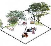
Residential New Agriculture Set River 24 24 24 24 24 160 Stream Open spaces Jhalaras Residential New development Agriculture land Set back River Residential New development Agriculture land Set back River Residential New development Agriculture land Set back River 24 24 24 24 24 Residential New development Agriculture land Set back River 24 24 24 24 24 Residential New development Agriculture land Set back River Productive landscape Residential New development Agriculture land Set back River 24 24 24 24 24 Rooftops and homeyards Residential New development Agriculture land Set back River N 30m
SOCIAL ACTIVITIES WITH WATER
REUNIFICATION LINKING
PLANTING PLAN
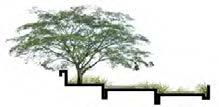


Rooftop and Homeyard
Rooftop and Homeyard
Rooftop and Homeyard
Grey circuit
Grey Circuit
Grey circuit
STREET SYSTEM
Street System
Street System
ALD
ALD
ALD
Swales
Swales
Swales
Grey water system
Grey water system
GREY WATER SYSTEM
Sedimentation Pond
Sedimentation Pond
Sedimentation Pond
Shallow Marsh
Shallow Marsh
Shallow Marsh
Jhalara
Jhalara
Jhalara
Agriculture Land
Agriculture Land
Agriculture Land
Floating Islands
Floating Islands
Floating Islands


Built Island
Built Island
Built Island
River Bank
River Band STREAM
River Bank
AGRICULTURE LAND
GREY CIRCUIT

GREY WATER SYSTEM
JHALARA
STREET SYSTEM
24 24 24 24 24 Agriculture Land Jhalara Grey circuit Grey water system Sedimentation Pond Street System Rooftop and Homeyard Swales Built Island Floating Islands Shallow Marsh ALD River Bank 161 24 24
24 24 24
N 30m

162 N 20m MASTER PLAN
Grey water Rain water Productive landscape Pedestrian circulationSocial gathering Stream system Grey water Rain water Productive landscape Pedestrian circulationSocial gathering Stream system Grey water Pedestrian circulation Rain water Social gathering Productive landscape Stream system 163 LAYERS OF INFRASTRUCTURE AND ACTIVITIES
Grey water Rain water Agriculture
REUNIFICATION WATER SHED
Rain Harvesting
Rain Harvesting
Purification system
Productive landscape
Grey water
Grey water Rain water Agriculture land
Pedestrian circulationSocial gathering Stream system
Water Purification
Purification system
Productive Landscape
Productive landscape
Connected system
Grey water Rain water Agriculture
Grey water Rain water Agriculture land
Rain water
Pedestrian circulationSocial gathering Stream system
Grey water Rain water Agriculture land
Productive landscape
Pedestrian circulationSocial gathering Stream system
Pedestrian circulationSocial gathering Stream system
Productive landscape Connected system
Grey water Rain water Agriculture land
Pedestrian circulation
Pedestrian circulationSocial gathering Stream system
Connected system
Connected system
Pedestrian circulationSocial gathering Stream system
Social gathering
Stream system
164
Buffer
COEFFICIENT FOR NEW DEVELOPMENTS
Interconnected Renew relationship of water with future developments.
Development Buffer Agriculture/Wetland Buffer Canal Buffer
Jhalara =20% Agriculture Land = 61% Grey Circuit = 11% Grey system = 8% Units of 60m² \6px 24 person per building of 4 floors. = 648 new persons.
Contextualized Evoking ancient structures to clean, store and worship water.
1person = 3.8m² for our system
Fully-utilized Creating connected porous network of system in city scale.

24 24 24 24 38 8 10 22 10 10 50 4 8 12 5 4 6 12 60 12 12 7 4 20 17 12 8 15 6 6 6 4 7 86 12 12 7 12 1015px 9177m2 165 105
due to their poor living
People relocated do
conditions Development
Agriculture/Wetland Buffer Canal Buffer
HOUSEHOLD Underground water recharge Worship area STREET VACANT LAND BUFFERCANAL RAIN WATER GREY WATER CAUVERY RAIN WATER GREY WATER RAIN WATER GREY WATER Drinking Grey Rain Black Underground water recharge Productive Gardens Agriculture land Open marketHoly plazas Worship area
RECHARGE UNDERGROUND WATER
Conversion from groundwater to rainwater.
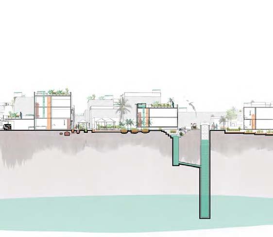
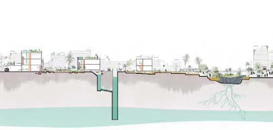
WATER SEPARATION AND REUSE SYSTEM


Reducing the water demand by 30%.
Separate grey black and rain water.
Harvest Benefits
Prohibit borewells, protect undergorund water
1 166
1.
1.
2.
BEFORE SECTION 1-1 AFTER
2.
PHYTOREMEDIATION
Rebuild social relationship through farming activites.
Street policy for the new types of drains and circulation
Canal Protection


REUNIFY
Social gathering space during water related festivals.
Policy coefficent for new developments

1 167
3.
3.
4.
4.
PHASES AND PROJECTION
Purification and collection system.
Reconnecting people with water and productive landscapes.


PHASE 2
168
PHASE 1
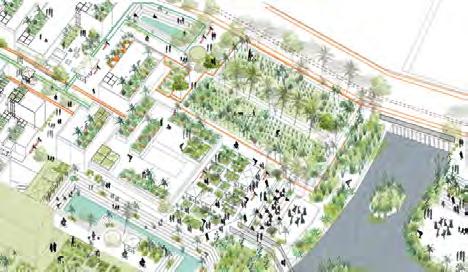

3
PHASE
169
Restore and recharge water system to convert the community into self reliant neighbourhood.
2019 89,400 L/Day Approx. 2030 Bioretention swales Water tank Productive landscape Bamboo drip Biogas Bioretention swales Water tank Vegetated swale Productive landscape Bamboo drip Biogas Bioretention swales Water tank Reuse system Grey circle Grey circle Cistern Vegetated Productive landscape Bamboo drip Biogas Street Household & Homeyard Coarse filter Anoxic limestone drain Bioretention Water tank Reuse system Grey circle Grey circle Productive landscape Bamboo drip Street Household & Homeyard Coarse filter Anoxic limestone drain Bioretention swales Water tank Reuse system Grey circle Grey circle Productive landscape Bamboo drip Bioretention swales Water tank Productive landscape Bamboo drip Biogas CAUVERY RAIN WATER GREY WATER BLACK WATER CANAL WATER 95% from rooftop and private daily use 43% banana circle Productive landscape: Community, market, rituals. Grey water purification system Agriculture land Grey circle Vegetated swale Jhalara open well Watering the plants Stream Vacant Land Buffer Sediment battelStung wall Built island Varying river bank Naturalized river Floating islands Productive landscape: Community, market, rituals. Street limestone Grey water purification system Bioretention swales circle Cistern Agriculture land Grey circle Vegetated swale Jhalara open well Vegetated swale Watering the plants Stream Vacant Land Buffer Sediment battelStung wall Built island Varying river bank Naturalized river Floating islands Productive landscape: Community, market, rituals. Street Anoxic limestone drain Grey water purification system Bioretention swales Grey circle Cistern Agriculture land Grey circle Vegetated swale Jhalara open well Vegetated swale landscape Watering the plants Stream Vacant Land Buffer Sediment battelStung wall Built island Varying river bank Naturalized river Floating islands POLICY 1 NO DIGGING BORE WELL POLICY 4 ZONE SPECIFIC BUFFER FROM THE CANAL POLICY 3 HARVEST BENIFITS DIVERSIFY WATER DEMAND POLICY 2 UPDATE STREET INFRASTRUCTURE INFRASTRUCTURE
HOUSE HOLD PRODUCTIVE GARDENS COMMUNITY GATHERING SPACES AROUND WATER RE-UNIFY 170 Home-yard Rooftop and home-yards ALD Grey circuit Floating island 10% in household garden and homeyard
PHASES
Productive landscape: Community, market, rituals. Grey water purification system swales Cistern Agriculture land Grey circle Vegetated swale Jhalara open well Vegetated swale Vacant Land Buffer 55,426 L/Day Approx. 2040 2050 Productive landscape: Community, market, rituals. swales Cistern Agriculture land Grey circle Vegetated swale Jhalara open well Vegetated swale Watering the plants Sediment battelStung wall Naturalized river Floating islands Productive Community, Street Household & Homeyard Coarse filter Anoxic limestone drain Grey water Bioretention swales Water tank Reuse system Grey circle Grey circle Cistern Agriculture Jhalara Vegetated swale Productive landscape Bamboo drip Watering Productive landscape: Community, market, rituals. Street & Anoxic limestone drain Grey water purification system Bioretention swales Grey circle Grey circle Cistern Agriculture land Grey circle Vegetated Jhalara open well Vegetated swale Productive landscape Watering the plants Vacant Land Buffer Productive landscape: Community, market, rituals. Street Anoxic limestone drain Grey water purification system Bioretention swales Grey circle Cistern Agriculture land Grey circle Vegetated swale Jhalara open well Vegetated swale Watering the plants Vacant Land Buffer Sediment battelStung Water tank Reuse system Grey circle Productive Bamboo drip Biogas 85% Drained into Jhalara. 85% Gathered in Jhalara and holy plazas 60% banana circle Built island Varying river bank Stream Sediment battelStung wall Built island Varying river bank Naturalized river Floating islands Productive landscape: Community, market, rituals. Grey water purification system Agriculture land Grey circle Vegetated swale Jhalara open well Watering the plants Stream Vacant Land Buffer Sediment battelStung wall Built island Varying river bank Naturalized river Floating islands Productive landscape: Community, market, rituals. Street Anoxic limestone drain Grey water purification system Bioretention swales Grey circle Grey circle Cistern Agriculture land Grey circle Vegetated swale Jhalara open well Vegetated swale Productive landscape Watering the plants Stream Vacant Land Buffer Sediment battelStung wall Built island Varying river bank Naturalized river Floating islands Stream Sediment battelStung wall Built island Varying river bank Naturalized river Floating islands WATER DEMAND LAKE ECO-CORRIDOR CLEAN CANAL WATER COMMUNITY FARMING COMMUNITY MARKETS CLEAN CANAL WATER AS SOURCE 171 Built island ALD Swale Canal bank Jhalara Agriculture land Agriculture land 20% cleaning process and to irrigate agriculture land 70% cleaning process and to irrigate agriculture land
PERSPECTIVE HOMEYARD AND STREET
Proposed self-sufficient water system enable the area to grow productive landscape. Specifically, the phytoremediation plants purify the water for irrigating economic plants, and the economic benefits can be used to maintain the entire system.

172

173
PERSPECTIVE PUBLIC SPACE
The redistribution of space enable all segments of the community to access. Rewiring people with land and tradition daily activities such as worship in the Jhalara, collect water and sale of agriculture produce.

174

175

176
PROJECT 3: WATER RESILIENT HEBBAL A REVITALIZED BGI* TOWARDS WATER RESILIENT HEBBAL
Reshaping Urban Infrastructure Towards Water Resilient Hebbal District
Situated in the northern core of Bangalore, Hebbal is currently facing rapid urban expansion. At the same time, Hebbal faces many issues such as improper land use, disconnected urban infrastructure and natural matrix, causing a series of social and environmental problems. Located at the most significant transportation node and water system connector of Hebbal district, our site's interventions focus on three vitall blue-green infrastructure issues from a different point of views.
Project 3.1 —— Connected Water-Resilient Hebbal Urban Forest Park
To resolve issues of disconnected infrastructure and underutilized resources, a connected water-resilient Hebbal urban forest park with the utilization of on-site unmanaged resources is proposed. Located in the transport hub surrounded by the major road infrastructure, the site suffers urban issues like water pollution, air pollution, urban flooding, etc. Learning from forest typologies of Bangalore Science Institution, the proposed forest park with local vegetation selection carefully can provide different types of habitats to alleviate urban issues mentioned above, while establishing itself as a key landscape landmark.
Project 3.2 —— Economic Revitalization of Highway Roadside by the Ecological Revival of the Stream
The current land use and unmanaged wastewater discharges have negative impacts on the local water system and economic development. With rapid population growth and high-polluted industries, poorly performing infrastructure and unmanaged waste discharge end up along the stream.This project is focused on mitigating the water pollution, while promoting eco-friendly economic revitalization of the Bellary Highway area. By redefining land use and applying phytotechnology, the design purifies the highly polluted water through vegetation remediation.
Project 3.3 —— Matrix sanctuaries through the stream
"Matrix sanctuaries" is an adaptive habitat and civic space in response to the rapid urbanization in Hebbal, Bangalore. It focuses on revitalizing the degrading and imbalanced habitat along the stream through rehabilitation of habitats, improving accessibility and visual connectivity for both fauna and people. Rehabilitation involves conserving specific current habitat, regenerating the landscape within the stream and improving wildlife flow for seamless transition along the stream, through interventions such as the introduction of mudflat banks to replace existing walls. This aims to reconfigure the existing matrix along the stream, promoting the landscape as a connector to the segregated communities through creation of accessible pedestrian networks as corridors linking parts of community amenities and social nodes.
177
Tang Mengjiao, Zhang Qinqin, Yang Xiaowen, Muhammad Rahmat Bin Khairudin
*BGI -Blue Green Infrastructure
SITE INTRODUCTION
Natural of bangalore: shrinking and fragmented during urbanization


Problems &challenges
Hebbal site: rapidly developed hebbal district
178
ISSUE STATEMENTS AND PROJECTS
FOUR ISSUE STATEMENTS AND THREE PROJECTS
ISSUE 1- Disconnected Infrastructure
ISSUE 2- Underutilized Natural &Human Resources
Reorganize and make use of unutilized resources in Hebbal site with connection of blue-green infrastructure, making it an water-resilient urban forest park with tight community connection.
ISSUE 3- Increased Water Demands and Contamination
Improving polluted water system and landscape productivity by reshaping land use form and inserting phytotechnology towards an eco-friendly economic hub.
PROJECT 1
Connected Water-Resilient Hebbal Urban Forest Park
ISSUE 4- Decontextualized Open Space Usage
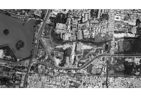
Utilizing the stream as an agent for connectivity links the segmentation between communities, nature and fauna.
PROJECT 2
Remediated Stream Landscape From Pollution To Value
PROJECT 3 Matrix Sanctuaries Through Stream
Boundary of three projects
LEGEND
Project 1 boundary
Project 2 boundary
Project 3 boundary
PROJECT 3: Matrix Sanctuaries Through Stream
PROJECT 1: Connected Water-Resilient Hebbal Urban Forest Park
N
PROJECT 2: Remediated Stream Landscape From Pollution To Value
300m
179
WATER RESILIENT HEBBAL URBAN FOREST PARK
Issue 1-1: improper drinage and road infrustructure
Road infrustructure: rapid development but placed inconsiderately


Improper drainage system causes flooding and mixed sewage

180
N
300m
Issue 1-2: stream canalization causes invisibility and disconnection
Development of Stream Canalization

Stream Typologies and Problems

PROJECT 3.1
181 50m N
Connected Water-Resilient Hebbal Urban Forest Park
Total Population:6465
Total canopy cover:610535.796m³
Total vegetation:2659 Grey water/d:732083.7L(82.16%)
Total discharge wastewater:891006.3L
Total area:905904.32 ㎡
High runoff area:426603.14 ㎡ (47.1%)

Total volume :610535.796m³=
Canopy cover Very dense Vegetation desity Dense Less dense Water area: 0.00 Forest & wooden area: 0.05 Meadow area: 0.18 Uncompacted soil: 0.30 Compacted soil: 0.50 Brick pavements area:0.80 Water-tight roof area: 0.85 Asphalt pavements area: 0.90 Concrete pavements area:0.95 External uncompacted soil External compacted soil *42540
5.soil
4.stormwater
3.discharged water
2.vegetation Main grey water resource Main black water resource 182
1. manpower
Church School Residential Commercial building Factory
Issue 2: Underutilized Natural &Human Resources
Total area:111916.42 ㎡
Three strategies in response to the two highlighted issues
VISION
Reorganize and make use of unutilized resources in Hebbal site with connection of blue-green infrastructure, making it an water-resilient urban forest park with tight community connection.
ISSUE
ISSUE 1- Disconnected Infrastructure
STRATEGY 1
Reshape the landform and water flow with unutilized resource
STRATEGY 2
Employ blue-green infrastructure for connenction
ISSUE 2- Underutilized Natural & Human Resources
STRATEGY 3
Retrofit functions into blue-green infrastructure
N PROJECT 3.1
500m
183
Connected Water-Resilient Hebbal Urban Forest Park
POTENTIAL AND CHALLENGE Government land use change
Existing land use
Proposed 2031 land use
Design Sustainable Water Flow


Before After
RUNOFF COLLECTION INTO LARGER WATER SYSTEM
WATER CATCHMEN UNDER FLYOVER
WATER CATCHMEN UNDER FLYOVER
1A 1B 1C
Basin runoff Concrete drainage/ pipe The stream
Unmanaged Area Near The Transportation Stream
2A 2B 2C
Captured runoff Discharged water Concrete stream The lake
STREAM ROAD DRAINAGE
RUNOFF COLLECTION/ BIO-PURIFICATION REUSE INTO LARGER WATER SYSTEM
Unmanaged Area Near The Transportation Stream
Carbon forest Bio-swale Dry creek/ Bus station The stream
2A 2B 2C
1A 1B 1C 1D 2D
Captured Runoff Discharged water Hydroponic filtration wetland Orchard/ Aquaculture/ Residential area
STREAM ROAD DRAINAGE
The lake
184
Detail design: water treatment of natural catchment near the transportation


 A. RUNOFF
C. REUSE
1.Orchard
1.Mound runoff
2.Settling basin
2.Residential area 3.Refiltration
3.Acquaculture 4.Botanical wetland 2B 2A 2C
INTO LARGER WATER SYSTEM 2C 2C
2B 2B 2B
2D
B. COLLECTION/ BIO-PURIFICATION
300m N 300m N
1.Hydroponic filtrration wetland
PROJECT 3.1
185
Connected Water-Resilient Hebbal Urban Forest Park
Detail design: Water Treatment Of Stream
STRATEGY 1: RESHAPE THE LANDFORM


Landform change 500m N Before After LEGEND Hebbal lake Stream Hebbal flyover Main road 186
the landform
3D model of changing
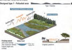


PROJECT 3.1
Water-Resilient Hebbal Urban Forest Park 187
LANDFORM Stream restoration
Connected
STRATEGY 1: RESHAPE THE


Before Before Unmanaged area Unmanaged area Road drainage Stream Residential area After Bio-swale Bio-swale Carbon forest Forest screen Stream Residential area Insert connection accessibility 188


Before After STRATEGY 2: EMPLOY BGI FOR CONNECTION PROJECT 3.1 Connected Water-Resilient Hebbal Urban Forest Park 189 Stream restoration
A Water-Resilient Urban Forest Park

Users- Land Use- Demand- Functions


190
Benefits of urban forest

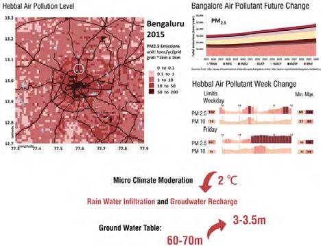

PROJECT 3.1
Water-Resilient Hebbal Urban Forest Park 191
STRATEGY 3: RETROFIT FUNCTIONS INTO BGI
Connected
Hebbal urban forest
Refiltration
Water point
Botanical wetland
Simple bridge
Planning residential area
192

8 2 15 16 21 25 26 24 10 13 11 23 14 12 5 6 7 9 3 27 27 4 1 17 20 22 18 19
LEGEND
N
4
10
8
9
6
11 12 13 14 15 16 17 18 19 20
A Revitalized Blue Green Infrustructure toward water resilient Hebbal 200m 22 23 24 25 26 27
1 Roadside bio-swale Children playground Campground Edibal forest Farm market Neighborhood forest Sport field Open forest Research forest Hydroponic filtrration wetland Industrial forest buffer
7 Vegetation screen
Rest area
Educational forest 2 Forest
path
Main entrance
5
Dry creek
3 Carbon forest
Culture exhibition
Bio-swale
21
Stone connection
Waterfall
PROJECT 3.1
Connected Water-Resilient Hebbal Urban Forest Park
STRATEGY 3: RETROFIT FUNCTIONS INTO BGI
Different vegetation strategies for different habitats
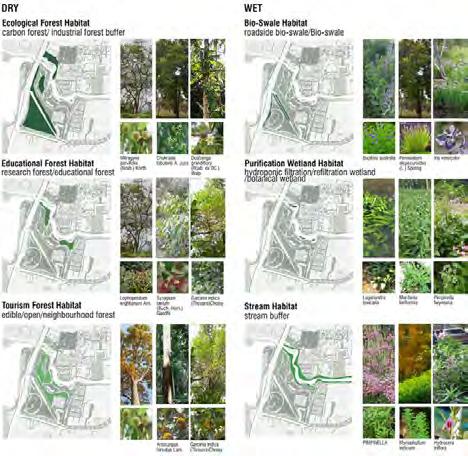
LEGEND
Ecological forest habitat
Educational forest habitat
Tourism forest habitat
Bio-swale habitat
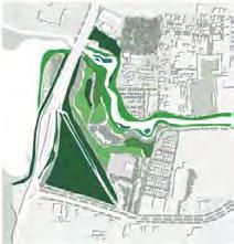
Purification wetland habitat
Stream habitat
500m
N
193
REMEDIATION OF POLLUTED STREAM


of the project 2
Boundary
migration and economy insertion of Bellary Highway roadside area of Hebbal
194
Contamination
District
Remediated Stream Landscape From Pollution To Value

SEVERLY POLLUTED STREAM
Water pollution macro and micro site analysis
Located in high-dense urban area, the water system of Hebbal has been highly polluted. In site, current improper land use layout and unmanaged waste discharge severely pollute the local system. Polluted industries, poorly infrastructure and direct wastewater discharge are found along the stream.
Pollution Source
Site Context: issues
Polluted stream water/ Unmanaged waste disposal/ Unbalanced vegetation/ Poor performed infrastructure


Waterflow velocity Solid waste distribution Tree with big canopy Drainage discharge flow Water edge hardening

3.2
PROJECT
195
WATER CONTAMINATION ISSUE RESEARCH
Pollutant components and migration of site programs

Road and car debris
Nutrients; Metals; Petroleum
Lawn and landscape care


Pesticides; POPs; Metals; Nutrients
Grey water discharge and air conditioning units
Nutrients; Metals; Petroleum; Suspended solids; Bacteria; CFCs
Electrical cemetery
Nutrients; Metals; Salt; Embalming fluids
Graveyard
Nutrients; Metals, Petroleum; POPs
Public toilet
Nutrients; Metals; Petroleum; Suspended solids; Bacteria
Laundry
Nutrients; Metals; Suspended solids; Salts; Chlorinated solvents
Illegal dumping
All contaminants possible
Outfall
Nutrients; Metals; Suspended solids; Petroleum
Flower market
Pesticides; Nutrients; Metals; POPs


Vacant lots
Petroleum; Metals; Chlorinated solvents; POPs
Debris and wastes
Nutrients; Petroleum; Metals; Chlorinated solvents
Open spaces and lawns

Pesticides; POPs; Metals; Nutrients
Gas station
Petroleum; Metals; Nutrients; Salts
Bus washing
Petroleum; Metals; Salts; Chlorinated solvents
Bus repairing
Petroleum; Metals; Salts; Lead
Bus sevice house
Nutrients; Petroleum; Metals; Chlorinated solvents
STRATEGY 1 IMPROVE CURRENT WATER POLLUTION


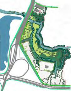
High-polluted source replacement and phytotechnology installation Replace electric burning with bio-urn cemetery Multi-mechanism buffer Air-flow buffer Stabilization mat
wetland Degradation hedge Floating wetland 196
Surface-flow
PROJECT 3.2
Remediated Stream Landscape From Pollution To Value

STRATEGY 1 IMPROVE CURRENT WATER POLLUTION
Vision: Migrate current water pollution by introducing phytotechnology to the site Before intervention
After intervention

197
POTENTIAL OF THE STREAM 1: WATER CONSUMPTION AND WATER SHORTAGE


Site water consumption and water use efficiency


POTENTIAL OF THE STREAM 2: HIGHWAY AS THE ECONOMIC BACKBONE


Case study of land use in developed commercial hub of Koramangala


National Highways form the economic backbone of the country and have often facilitated development along their routes. Many new towns have sprung up along major highways.
Koramangala highway roadside area land use
Development of Koramangala
Koramangala is the second posh locality in Bangalore, India. Roads near Airport Road and the residential areas in Koramangala were dug up for renovation for over two years. Situated in the south-eastern of the city, it is one of the largest neighborhoods and is a highly sought residential locality with wide, tree-lined boulevards and a mix of luxury apartments, commercial structures, and posh bungalows as a commercial hub.
6 water-consuming programs
land use
water consumption statistics
threat
Top
Existing
Site
Water supply
Proposed land use programs of site Truck Stop Small Restaurant Organic Food Shop Hotel Plant Nursery Flower Market Cafe Laundry 198
Remediated Stream Landscape From Pollution To Value

STRATEGY 2: INSERT AND DEVELOP ECO-FRIENDLY LOCAL ECONOMIES
Masterplan of environmentally friendly economy re-establishment

Water-related productive economic programs
As water gets purified along the secondary stream, it will be reused during flowing area. A series of eco-friendly economic industries and water-related productive landscape will generate in the potential area with different water quality requirements.
150m N PROJECT 3.2
199
Water redistribution and reuse


Water sources equally quantitative distribution
Laundry
Proposed programs water reuse scenario
Car wash/ repair/ trade shop
STRATEGY 3: UTILIZE AND RECONNECT EXISTING PHYSICAL AND CULTURAL CONNECTIONS
Vision for site design: Use blue-green infrastructure to remediate site landscape from pollution to value


 Dhobi Ghat Laundry Area
Plant Nursery Bus depot
200
Remediated Stream Landscape From Pollution To Value
STRATEGY 3: UTILIZE AND RECONNECT EXISTING PHYSICAL AND CULTURAL CONNECTIONS
Vision for site design: Use blue-green infrastructure to remediate site landscape from pollution to value


Before reconnection
After reconnection
Vision for big scale: Integrated ecosystem service and economic transformation for Hebbal district

201
PROJECT 3.2


Boundary of the project 3
202
Accessibility between community and stream

203
Study PROJECT 3.3
Sanctuaries
Stream
Biodiversity Rehabitation +Habitat
Matrix
Through


204


PROJECT 3.3 Matrix Sanctuaries Through Stream 205 Biodiversity rehabitation +habitat study


206


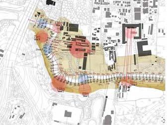


207
PROJECT 3.3
EXISTING BIODIVERSITY MAPPING
Matrix Sanctuaries Through Stream
EXISTING VIEW ANALYSIS


208
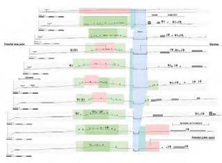




209
PROJECT 3.3
Section analysis
Matrix Sanctuaries Through Stream
Section analysis


Matrix Sanctuaries through stream


: Accessibility between communities and stream


210
ACCESSIBIITY RECONFIGURATION


LEGEND
Matrix Sanctuaries Through Stream
New Connector
Existing Urban Matrix
The landscape will also be a connector to the segregated communities by introducing accessible pedestrian networks as nodes linking another part of community amenities.

Matrix sanctuaries is an adaptive habitat and civic spaces in response to the rapid urbanization in Hebbal, Bangalore. It focuses on revitalizing the degrading and imbalance habitat along the stream through rehabilitation of habitats, accessibility and visual connectivity (views) for both fauna and people. Through this approach, the project will buffer the changing urban landscape by empowering the existing blue and green corridor. Utilizing the stream as an agent for connectivity links the segmentation between communities, nature, and fauna.

211 MASTERPLAN
Old connector PROJECT 3.3
Rehabilitation involves conserving specific current habitat, regenerating the landscape within the stream and improving wildlife flow between habitat for seamless transition along the stream such as the introduction of mudflat banks to replace the existing walls. This will reconfigure the existing matrix along the stream that will layer over the different habitat zones.


212
BIODIVERSITY
Views and visibility study will improve and allow the exploration of potential views for both people and wildlife. Designed walkways and open spaces will replace the existing walls from school, residential and commercial areas which will encourage people and nature to be close with a clear sense of place.
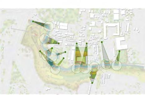


213
OF VIEW
PEOPLE POINT
PROJECT 3.3
WILDLIFE POINT OF VIEW
Matrix Sanctuaries Through Stream
INTERVENTION 01: VIEW PEAK
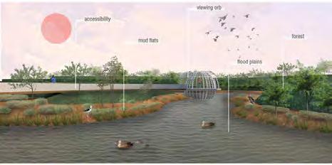
INTERVENTION 02: VIEWING ORB

214
INTERVENTION 03: GRASSLAND VALLEY
Matrix Sanctuaries Through Stream
INTERVENTIONS (SETIONS + PERSPECTIVES)
INTERVENTION 04: SCHOOL WATERSTAGE


215
PROJECT 3.3

216
PROJECT 4: BETTER LAKE THAN NEVER
RE-WEAVING BANGALORE’S NATURAL-BUILT ENVIRONMENT NEXUS
Bangalore used to be the “City of Lakes”. However, due to rapid urbanization, development and growth now take precedence while man lose their symbiotic relationship with these water bodies. Our project looks at Lake Nagawara, which lost ecological significance in 2005, when it was transformed to a gated recreational facility, where urbanization and privatization resulted in disconnection of Lake Nagawara from its lake series and its people. As a water stressed city, the precinct continues to face water supply issues, struggling with inefficient water management. Mono-functional and underutilized spaces serve little function while the ecological health of the area deteriorates with increased pollution and destruction of natural habitats for wildlife.
This project then envisions an alternative possibility for the lake and its surroundings - a precinct where citizens are exposed to and interconnected with nature in everyday landscapes, capable of being self-sustainable in terms of water supply and having access to a wide range of public open spaces for recreation and social activities. With these aims as an overarching goal, three areas of interest for intervention were identified:
Project 4.1 —— Existing Industrial and Residential
The existing developments adjacent to the wetland are retrofitted and improved with an approach towards cleansing and maximising resource potential of water through water sensitive urban design. The project aims to use water as a catalyst to reintegrate the community to the lake- reinstating lost values while re-creating Bangalore’s traditional habitats.
Project 4.2 —— Lake Nagawara
Lake Nagawara is transformed from a private recreational facility into a shared urban common with enhanced habitats for biodiversity. Through reintroduction of water flow, the lake has been injected with new vitality and the urban lake ecosystem has been set up. Also, with redistribution of habitat and human flow, the accessibility of the lake banks are increased as biodiversity and connectivity are improved. The boundary of the lake will be softened to integrate it as an ecological zone in the city.
Project 4.3 —— Prospective Residential District
A prospective residential development situated right beside the lake is designed to interweave nature into residents’ daily landscapes, with utmost importance on open space planning, integrated water management to capture stormwater for on-site re-use and alternative streetscape and construction phased hierarchy for sustainability. Strategies explore how land, a highly sought after resource in Bangalore, can be effectively utilized as multi-functional landscapes.
In conclusion, this project aims demonstrate alternative city infrastructure that is focused on reintegrating people back to the lakes and showing how water and land can be efficiently managed through blue-green infrastructural design.
217
Dai Yuke, Elsa Sim Rui Jia, Mitali Kumar
SITE CONTEXT


250m N
1 Lake Nagawara and Lumbini Park 2 Adjacent Wetlands and Grazing Fields 3 High Rise Residential 4 Low Rise Residential
Lake Nagawara and Its Surrounding Neighbourhood 5 Unclaimed Open Space 6 Concrete Drainage and Major Roads 7 Industrial Site Conditions 1 2 3 4 6 7 5 6 218
LEGEND
ISSUE 1 LOSS OF SYMBIOSIS BETWEEN MAN AND NATURE

Loss of Traditional Dependence and Daily Interactions with Nature
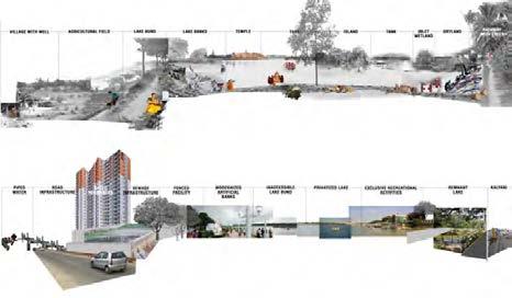
The lake ecosystems before had significant impact on the livelihoods of people and communities living in its vicinity - be it cultural, ecological, economical, etc. This significance saw a drastic change in the 20th century - when the lakes were viewed just as sources of recreation - with no connection with its precinits.
Unplanned rapid urbanisation during late nineties - led to encroachment of lakes and storm water drains. During the last four decades there has been 79% reduction in water bodies and the number of lakes in Bangalore.


Our study site- Lake Nagawara is a part of Yellamallapa Shetty Kere lake series in the Hebbal Valley of Bangalore. Comprising of a total of 51 major lakes , the series has lost over 35 major water bodies over the last 20yrs.
Source: 1)Vanishing
Yellamallapa
219
Disconnection of Lake nagawara from the Lake series
Lakes Lost Connections Connections Watershed Boundary
1800s Existing
Vegetation Built-Up Others Waterbodies Before
Bangalore Lake Series
Shetty Kere Watershed
Lakes: A study of Bangalore City; P Thippaiah
2) Status of Water bodies, Drainage Network and Water Management in and around Bangalore by Dr.T.J. Renuka Prasad
ISSUE 1 LOSS OF SYMBIOSIS BETWEEN MAN AND NATURE
Loss of an Urban Common - Privatization of Lake Nagawara

Original Lake Catchment Area: 300 Ha


Current Catchment Area: 23 Ha
Originally connected as a single lake with Lake Hebbal, a change was brought upon due to urban outgrowth and requirement of connectivity to the outskirts of the city.
A transport corridor was built across, dividing the lake into 2 separate entities, with Lake Nagawara becoming an isolated water body.
Dwindling Lake Area and Green Cover
Lake Area % of Green Space Landuse Change Over Time 50m N LEGEND Grassland Agriculture Forest Wetland Water UNMANAGED Residential Industrial Institutional Construction Barrenland MANAGED 2000 Landuse 2006 Landuse 2012 Landuse 220
Vegetation Density: 1 Tree for Every 7 People


Ecology and Lack of Diversified Habitat

The area has a relatively high vegetation density in comparision to Bangalore city due to the presence of a 22Ha associated wetland and several private lands. These vegetation patches are under a risk of harm due unplanned future developments by real estate authorities.

Though the area has a relatively high tree density, vegetation here is struggling to grow due to lack of availability of water, and lack of care, degrading soil quality - which leads to several diseases, termite infested vegetation, etc.
Decline in health and prevalance of flora and fauna is a clear indication of the deteriorating environmental conditions and health of the urban ecosystem.

200m N 200m N 221 LEGEND High Medium Low Very
LEGEND High Medium Sparse None Risk Zone
Low
1. Existing Industrial and Residential
2. Lake Nagawara
tree
Density vegetation QuaLity
3. Prospective Residential District
cover
1
fLora anD fauna
ISSUE 2 WATER STRESSED CITY
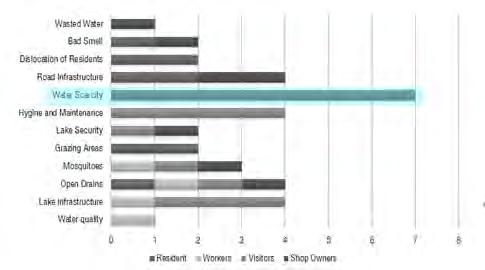
Unbalanced Water Supply and Demand
Survey Results - Major Concerns in Hebbal

Water Supply and Demand Gap
Water Demand Per Day: 4.08MLD 1600
LEGEND
Extreme Demand
High Demand
Moderate Demand
200m
It is estimated that there's a loss of 45% of supplied water to the canal due to leakages and mismanagement I.e for 4.08MLD demand a supply of 5.9MLD is required.

The natural resources are depletingwith depth to ground water being around 30m on avg. in the region.
Due to irregular supply of water from the Municipality, resident communities have to buy water from water sharks providing water tankers of 7000 litres capacity at Rs 650 almost every alternate day.

N 222
Pollution and Underutilized Resources
Water Contamination

Best value of TDS for drinking is 150-250. The lake has TDS value ranging from 516528.8ppm which is poor quality for drinking. The sewage canal has TDS value ranging from 912.8 -1015.2ppm which is least acceptable for drinking.
Surface Water Quality

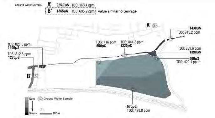
Distribution of Waste and Soil Contamination

223
ISSUE 3 UNPLANNED OPEN SPACE SYSTEM
Lack of Open Spaces for Recreation


Underutilized open spaces are often used by people as dumping grounds for garbage- leading to issues such as upleasant sight, smell, lack of sense of belonging and reduced quality of life
DESIGN VISION
Improved Accessibility to Nature
Entrance Pedestrain Elevated Walkways Activity Nodes 224 BEFORE AFTER
LIQUID WASTE SOLID WASTE ORGANIC WASTE HAZARDOUS WASTE
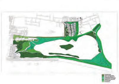


Overflow Water Flow Water Catchment Overflow Lake Watershed Canal Flow Surface Runoff 225 DESIGN VISION Better Flow of Water Resources DESIGN VISION Re-inventing the Open Space System BEFORE AFTER BEFORE AFTER

226

100m N 227

228
Existing Industrial and Residential Development

Site Conditions and Issues
Nagawara region has a complex urban fabric. The settlement comprises of several landuses and associated activities; with the prime being: Industrial Zone: Car Service Spaces, Paint Production Factory, Woodwork ;Commercial: Small shops, food restaurants and stalls; Residential: High Rise residential and Low rise residential and Unallocated Landuse: Currently an unutilized wetland, used by cows as grazing field.
With the 2030 landuse plan suggesting a complete removal of the insustries to change the landuse to residential, efficient management of this new residential development alongside maximising potential of the existing conditions for efficient water management is the need of the hour.
High water demand - aprox.
0.35MLD
Intensively managed landscape Area comes in 50m buffer from storm water drain
Uderutilized as blocked green space - under risk of exploitation by developers
Major connections via a high traffic motor road and lack in pedestrian linkages
SEWAGE CANAL
Polluted sewage water - with EC levels as high as 1400 μS
Independant water managementlack of efficient water management
20,250 litre/day water requirement
Genereation of aprox. 40,000lts polluted water daily Posses threat to adjacent wetlands
suggesteD strategies:
RECTIFY 1
Proposing policies for sustainable neighbourhood development
STRATEGIES
2 3 4
ENHANCE ACTIVATE NURTURE
Creating a resiliant community by developing storm water and grey water treatment landscapes

Integrating community with landscapes by creating active edges and introducing urban nodes

Conserving natural woodlands and introducing habitats to foster health flora and fauna

229
ROAD LINKAGE HIGH RISE RESIDENTIAL LOW RISE RESIDENTIAL
INDUSTRIAL WETLANDS
PROJECT 4.1
PROPOSED MASTERPLAN

230
60m
LEGEND
A - RETAINED PLAY FIELD
B- RAIN GARDEN
C- BIO RETENTION POND

D- BIO-POOL
E- RESIDENTIAL SQUARE
F- OLD RESIDENTIAL DEV.
G- FRUIT ORCHARD
H- URBAN AGRICULTURE
I - URBAN PLAZA
J- RELIGIOUS TANK
K- FLOWER FIELD
L- LINK BRIDGE
M- NATURE TRAIL
N- GRAZING PASTURE
O- COW ACCESS ROUTE
P- WASTE WATER TREATMENT
Q- NEW RESIDENTIAL
R- COMMUNITY GREEN
S- COMMUNITY WELL
T- NEW COMMERCIAL
U - WASTE MANAGEMENT
V - DETENTION POND
N 231
PROJECT 4.1
Industrial
Development
Existing
and Residential
1. RECTIFY
Rectifying Landuse and Setting Targets to enhance capacacity
Sensitive space allocation for efficient resource management:
The intervention aims to reallocate the space based on the Propesed 2030 masterplan. Removal of the industrial zone to shift it to the new industrial zone will reduce the water demand and pollution. Another major issue noticed on site is the waste generated. To handle this a waste handling centre for the region is proposed to collect and transport the waste from households and sewage canal to the Integreated waste management facility proposec adjacent to the Sewage Treatment Plant.
New Development - On site

Rainwater harvesting
UN Habitat Guidelines: More than or equals 15,000 people per km2 for Sustainable Urban
Living
++ Capture 100% Rainwater
+++ 100% Greywater reuse
++++ 40% site area green
Retained Existing Residential interlinked with proposed water management system

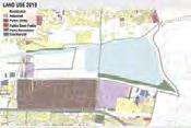
++ Capture 75% Rainwater
+++ 100% Greywater reuse
New water System through naturalizing the canal
Upgrading Existing Landscapes to encourage spontaneous vegetation
++ Capture 75% Rainwater
+++ 100% Greywater reuse
Nature Park
To attract fauna associated with lake to the utban setting and create urban habitats
Waste Management System

Collected waste to Proposed Integrated waste management facility
Surplus Energy
Regenerated material
Waste Collection Unit
Waste from Households and bridge filter
Waste Management Facility Source: https://www.nea.gov.sg/our-services/waste-management/waste-management-infrastructure/integrated-wastemanagement-facility
232
2. ENHANCE
Designing an efficient natural water infratructure for efficient resouce management


Greywater and Canal Water

Treatment:
As the existing site consisted of a 22.3 Ha wetland currently utilised solely as a grazing field for catte the idea of the design is to utilize the wetland as an integrated system for treatment of water from the storm water canal as well as the grey water from adjacent communities.

The Wetland was designed using design standards of a treatment wetland proposed for Bellandur Lake in Bangalore.


On Site Stormwater and Roof colledted Rainwater Treatment:

At present the storm water on site is lost as run-off through the drains, ending up as a lost resource - combined with sewage water in the canal and terminating in the STP, increasing its load. The idea is to fully utilize the storm water through multi-functional blue green infrastrucuture, to instigate the community and make them aware of its value.
Several water management strategies are incorporated to reduce the 65% stormwater lost as surface run-off on site for 75% catchment in existing and 100% in new developments.
20,000lts of greywater/day 210,000lts of grey water/day Treated water recirculated for use in irrigation/ flushing 1 2 3 4 5 6 7 8 9 10 1. Sewage Canal 2. Bridge Filter 3. Phytoremidiation Folds 4. Sedimentation Basin 5. Overflow swale 6. Deep and shallow wetlands 7. Subsurface treatment 8. Deep and shallow wetlands 9. Oulet Pond 10. Nagawara lake BRIDGE FILTER FOR SLUDGE COLLECTION PHYTOREMIDIATION FOLDS - 0.33 Ha WETLAND 1- 0.25Ha TREATMENT CAPACITY - 1MLD SIZE: 1.5 Ha SUB-SURFACE- 0.09Ha OUTLET POND- 0.33Ha WETLAND 2- 0.25Ha SEDIMENTATION BASIN 0.25 Ha A A B C C D E E E F D E 1 2 3 4 5 6 7 8 9 10 60m N 60m N A B E G Residential Greywater Lake Storage Reuse in toilets Treatment Wetland
233
PROJECT 4.1 Existing Industrial and Residential Development
a) Rain- gardens b) Bio-Pools c) Bio- Retention Ponds d) Detention Fields e) Stepped Terrace Treatment Belts d) Tank g) Bioswales
3. ACTIVATE


Selective opening of the residences towards the wetlands and lake:


Currently the locality is completely segregated from the lake ecosystem by means of fences - which kills the character of the space. While fences are important for measures of security and privacy, the design aims to naturalize the fences to create natural diversions - to safegaurd along with instigate the community to be a be aware of their surroundings.

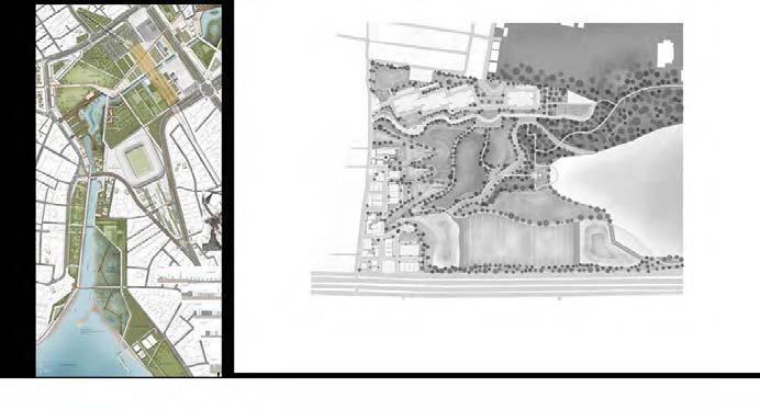
Several Activity nodes are created alongside to pique the participants interests and serve as access points for the people to explore the Nature Park and Lake.
Activity Nodes:
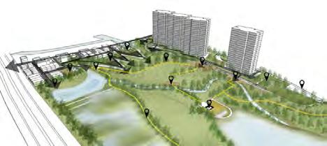
Bioengineered Slope 1 2 3 Green Boundary Interactive Boundary Park Access Nodes 60m N 234
Residential Entry Community Plaza Community Plaza Nature Trail Community Plaza Meditation Plaza Kalyani Urban Agriculture Urban Agriculture Educational Walk Fruit Orchard
Recreating Traditional Kalyanis -stepped wells for cultural festivities
1 2 3
Recreating Traditional gundathopes - associated woodlands with the lake ecosystem
Instigating Genius Loci
PROJECT 4.1
Existing Industrial and Residential Development
4. NURTURE


Creating enhanced ecosystems for encouraging fauna


After studying the major 47 bird species visiting Nagawara lake and the 150 bird species visiting lake Hebbal; the site coming in between both is an important link in between the two patches of flora.

For the 15 selected fauna -appropriate habitats are created site wide to enhance urban fauna.


Grassland
Decidous Forest


Fruit Orchard
Shallow Water Habitat
Deep Water Habitat
Phreatophyte Trees


Urban Green

235 60m N
Grassland
Decidous Forest
Fruit Orchard
Phreatophyte Trees
Urban Green
Deep Water Habitat
Shallow Water Habitat

236
LAKE NAGAWARA
Vision
Strategies
Open
1. Removing fences and increasing accessibilities to the lake
2. Reshape six common landscape types of waterfront space to create a variety of biological habitats and spatial feelings.
3. Build a well-organized transportation system- A 15-kilometer multi-purpose pedestrian road will stretch along the lake's shore and circle the lake, while the vehicle lanes on the street level will provide more rapid and convenient traffic space.
Naturalize
1. Rearrange lakeside habitats.
2. Wetlands and meadows along the lake's shore will create a biofiltration system that also provides natural habitats for wildlife.
3. Remodeling and expanding bird sanctuaries and setting up a central island.
Connect
1. Redefine lake banks of human and nature.
2. Crosswalks and specific paths are used to connect the lake district with all the residential communities along the lake.
3. Increase the water affinity space, including the north side of the public houseboat, wooden walkway, overlook and fishing area.
237
NortherN bANk- eAsterN bANk- southerN bANk- WetlANds- lAke
PROJECT 4.2 Lake Nagawara
STRATEGY 1 OPEN LAKE TO THE PUBLIC
Issue 1: Underutilized lake banks

issue 2: insufficient Lake banks area
Issue 3: Obstructions of the lake banks
238
STRATEGY 1 OPEN LAKE TO THE PUBLIC
Step 1: Rearranging human activities
Step 2: Extanding lake banks
Step 3: Removing fences Adding more accessibilities

239
4.2
PROJECT
Lake Nagawara
STRATEGY 2 NATURALIZING THE LAKE
Existing lake habitats

Connection between targeted birds and habitats
Great Cormorant
Eurasian Coot
Indian Cormorant
Deep
Shallow
Oriental Darter
Little Cormorant
Pale-billed Flowerpecker
Spot-billed Pelican
Indian Spot-billed Duck
Gray Heron
Little Egret
Cattle Egret
Indian Pond-Heron
Eurasian Coot
Jungle Myna
Indian Silverbill
White-browed Wagtail
Gray-headed Swamphen
Common Sandpiper
Eurasian Marsh-Harrier
Paddyfield Pipit
Rose-ringed Parakeet
White-cheeked Barbet
Shikra
Large-billed Crow
Eurasian Kestrel
Black Kite
Brahminy Kite
Spotted Dove
240
Trees 29 species Herbs 26 species Weeds 6 species Shrubs 22 species Hydrophyte 7 species Fish 26 species Reptiles 9 species Birds 47 species Mammals 12 species Amphibians 14 species Insects 34 species tArgeted species Food hAbitAts
Water Habitat Fish
Water Habitat Plants
Fruit Forest
Food
Green Insects
Meat
Wetlands
Leftover
Urban
Woodlands
PROJECT
Habitat Typologies


241 Eastern lake bank -Before -After
Lake Lake Exposured Soil Shrub Planting Water Eutrophication Algae Control Area Poor-condition Flora Big Trees Planting Ornamental Flora Rain Garden Traffic Roads Traffic Roads
deep WAter hAbitAt
deep WAter hAbitAt
bArreN lANd hAbitAt shrublANd hAbitAt
shrublANd hAbitAt
WoodlANd hAbitAt
Wetland
ponds
Hydrophilic Platform Lakeside Trail Upland Garden Floating Islands
Aquiculture
4.2
Nagawara
Lake
STRATEGY 2 NATURALIZING THE LAKE


Deep
Deep
242
Water Habitat
Deep Water Habitat
Water Habitat
Green Habitat
Water Habitat
Water Habitat
Green Habitat
Habitat
Water Habitat Shallow
Wetlands Urban
Shallow
Shallow
Urban
Forest
Habitat
Deep Water Habitat Shallow Water
Urban Green Habitat
-After Lake Lake
Traffic
Traffic
Southern lake bank -Before
Hard Surface pathway Handrail Stone Slope Parkside Green Fence
Roads Stone Slope Meadow With trees Shallow Water Restoration Shrub Planting Area
Roads
Lake Lake
Northern lake bank -Before -After Floating Island
Water Plants Growing Secondary Forest Unutilized Jungle Stone Slope
STRATEGY 3 CONNECTING HUMAN AND NATURE
Relationship between human activities and habitats

Relationship between human and flora
DeepWaterHabitat
FloatingWetland
Forest Area:
Low-DenseForest
ShallowWaterHabitat
Marshland/Wetland
DeepWaterHabitat
DeepWaterHabitat
Habitats: High-dense woodlands/ Aquiculture ponds/ Deep water habitats/ Wetlands


Human activities: Jogging/ Bird watching/ Photography
Constructed Wetland Area:
Habitats: Low-dense woodlands/ Shrublands/ Deep water habitats/ Shallow water habitats/ Wetlands
Human activities: Walking dogs/ Jogging/ Walking
Fishing Area:
Habitats: Urban green belts/ Shrublands/ Lawn/ Deep water habitats
Human activities: Walking dogs/ Jogging/ Walking/ Fishing
243
Fishing Area
Forest
Constructed Wetland Area
Area
High-DenseForest
RainGarden
/Multi-useTrail LakesideMeadow
06.00 am 18.00 pm 09.00 am 12.00 pm 15.00 pm Ecotone
Lake Lake
Hydrophilic
Multi-use
Upland
Major
Streptopelia chinensis Acridotheres fuscus
Egretta
Phalacrocorax carbo Schistura
Mystus
Pethia
Ecotone Ecotone
Wetlands
Platform Living Shoreline
Lakeside Trail
Slope
Activity Space Columba livia
Plegadis falcinellus
garzetta
periyarensis
ngasep Darshan
manipurensis Milvus migrans
4.2
PROJECT
Lake Nagawara
Overview: Over 90% of revetments are open. The area of greenery and habitat has tripled. More access to the lake. Including fast pathway and slow-visiting walking ways.

ANALYSIS OF MASTER PLAN

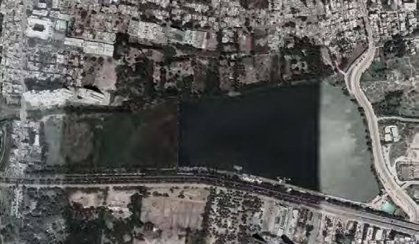

0 100m
Revetment 244 1 2 3 4 5 6 7 8 9 10 11 12 13 14 15 16
1. Natural Connection
2. Fishing Market
3. Fishing Platform
4. Rain Garden
5. Wooden Bridge
6. Swimming Pool
7. Leisure Square
8. Fittness Square
9. Multi-use Loop Trail
10. Lakeside Lawn
11. Community Garden
12. Outdoor education
13. Wetland
14. Secondary Forest
15. Birds Sanctaury
16. Waterway
MASTER PLAN
Shallow
water habitat
Deep water habitat
Wetlands /Marshlands
Rain Water
Garden
Urban Green
Community Garden
High-dense Forest
Surface Runoff
Water Flow
Lake Watershed

Biofiltration

Human Activities

Stepping
Predestrain Roads
Elevated Walkways
Natural Trails
Hardsurface Roads


Vehicular Roads

Lake Nagawara
ANALYSIS OF MASTER PLAN

Habitat
Water flow
Water flow
245
PROJECT 4.2

PROSPECTIVE RESIDENTIAL DISTRICT
Strategies
Thoughtful Open Space Planning
1. Restoring and enhancing green infrastructure
2. Open space planning as part of stormwater management plan
3. Encouraging productive landscapes in the neighbourhood
Stormwater Management
1. On-site capture and reuse of rain and stormwater for non-potable use
2. Restoring natural hydrology of the site
3. Creating public spaces around water bodies
Activating the Public Realm
1. Variating streetscapes by incorporating different activities
2. Designing for suitable scale of street network
3. Encouraging activites to spill out onto the public realm
Phased Construction
1. Shifting the focus from built environment to completing blue green infrastructural elements first
2. Efficient use of land and space for construction materials and administration
3. Staggered construction process with natural growth of site greenery
247
PROJECT 4.3 Prospective Residential District
PROJECT 3 PROSPECTIVE RESIDENTIAL DEVELOPMENT


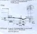

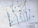


Dividing Site into 4 Sub-water Catchments A C D B Historical Topography and Waterflow Slope 248
Site Condition Opportunities and Challenges Existing Streetscape 10m Arterial Street 4m Secondary Street 2m Residential Street 4.5m Residential Street 4m Secondary Street 4m Secondary Street

100m N 249 PROPOSED MASTERPLAN Prospective Lakeside Residential Development LEGEND PROGRAMME POCKET PARK 1 Cricket Court 2 Basketball Detention Court 3 Event Lawn 4 Community Stepped Seating 5 Outdoor Seats LINEAR PARK 6 Streetside Cafe 7 Commercial Productive Landscape 8 Interactive Water Feature 9 Community Garden 10 Shaded Lawn 11 Stepped Plaza 12 Informal Recreation Lawn 13 Allotment DISTRICT PARK CONNECTOR 14 Carpark 15 Fodder Patch 16 Food Forerst 17 Tree Nursery 18 Constructed Wetland 19 Retention Pond 20 Nature Water Play DISTRICT PARK 21 Viewing Lawn 22 Forest Trial 23 Lakeside Boardwalk 24 Coconut Plantation 25 Retention Pond PROJECT 4.3 Prospective Residential District
ENVISIONING OPEN SPACE AND WATER FLOW


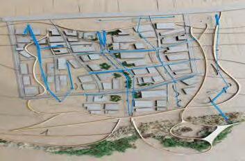

250
STRATEGY 1 THOUGHTFUL OPEN SPACE PLANNING
GREEN SPACE HIERARCHY
Conservation
Park and Greenways
Stormwater Strategies


Productive Landscape
Recreational
INJECTING NATURE AS EVERYDAY LANDSCAPES
ACCOMODATING OPEN SPACE WITH HOUSING TYPOLOGIES
Placement of Houses In Relation for Opportunities for Semi-Private Spaces
BACKYARD
Opened up to stream, with intercropping between existing coconut plantation. Restored traditional sense of space for cattle raising and water management techniques.
COURTYARD AND ALLEYWAYS
Green strip with small fruit trees and green setbacks from apartments. Shade tolerant plants might be more suitable. Natural hedge used for edible fence.
SIDE YARD, FRONT YARD, ALLOTMENTS
Household private productive landscapes become semi-private spaces. Provides streetscape character and forms boundary.


50m N 251
People Closer to Nature
Bringing
PROJECT 4.3 Prospective Residential District
Long Section of Nestled Houses Through the Coconut Plantation, Linear Park and Park Connector
STRATEGY 2 STORMWATER MANAGEMENT

Integrated On-site Harvesting and Re-use Approach Based on Sub-Water Catchment Analysis
MANAGEMENT COMPONENTS
Collect & Infiltrate
Detain & Reduce
Treat Storage
Convey Use
Subwatershed Basin
Stormwater Management Flow

50m N 252


253
LAKESIDE AND FOREST TRAIL Perspective of Integrating Lake Side as a Community Space
INTERLINKED AND NESTED-SCALE STRATEGIES Integrating Household Water Management with the Streets
PROJECT 4.3 Prospective Residential District
STRATEGY 3 ACTIVATING THE PUBLIC REALM
Creating Multi-functional Streetscapes and Social Nodes


CONNECTIVITY NETWORK

Jogging Loop
Nature Trail
Secondary Greenways
Shared Living Street
Residential Woonerf
Main Vehicular Street
variating street tyPoLogies
Innovative Street Hierarchy Focusing on Walkability and Spill Out of Activities
ARTERIAL STREET
One-way through road with one sided on-street parking.
12 meters
LINEAR PARK
Pedestrian only street with spill out of activities.
11 meters
VEHICULAR ROAD
One-way through road with one sided on-street parking.
7 meters
SHARED LIVING STREET
Reduced demarcations between vehicular and pedestrian for greater activation of streetscape.
6.5 meters
RESIDENTIAL WOONERF
To encourage playing and gathering on the streets as semi-private realm.
5 meters
50m N 254
Prospective Residential District

MULTI-FUNCTIONAL STREETSCAPE

Perspective of Shared Living Street, Residential Woonerf and Main
Road
STRATEGY 4 PHASED CONSTRUCTION
Site Sensitive Development Proess
Forest regeneration
- Legumes treat contaminated soil
- Function as
Supplementary plantings.
STAGE 0
Existing site.
STAGE 1
District nature parks enhanced with park connector.
STAGE 2
Pocket park and civic amenities built first, providing open spaces.
STAGE 3
Linear park is built together with housing development in sub-watershed B and C.
STAGE 4
Remaining parcels developed with low impact design around existing blue-green infrastructure.
Road infrastructure constructed accordingly.
Construction buffered from established BGI.
Topsoil removed for compost. Treated on-site for future plants. Canal naturalized. Tree nursery located on lake bund.
by burning activities.
4.3
forage.
PROJECT
Arterial
NAGAWARA NOW
The Lake as an isolated lake ecosystem; disconnected from the adjoining communities
by Fence and Barriers
Illplaced Industrial Zone and Underutilized Wetland


Mismanaged vegetation and stormwater canal
Roads acting as a barrier for pedestrian connectivity
Isolated
256
OUR VISION
Nagawara Lake as a part of the community
Integrated water management (Storm water and Grey water) interlinked with opportunities for community spaces

Instigating a community green corridor to enhance the ecological value of the urban fabric


The Broader Perspective: creating a system to be reciprocated across the city, to make Bangalore water resilient
To enhance resource utilization and reestablish lost connections

257
Joint public-private usage of the lake banks and promoting habitat restoration
Strategies for 1 lake ecosystem Reciprocated through the lake series
262
263
REFLECTIONS
' This studio taught me a lot, especially in learning about what constitutes a well-thought design. A sensitive design requires detailed and rigorous analysis. Now I began to understand how to make my design more practical and real, rather than just exploring beautiful forms.'
- Hou Yanru
'... Bangalore is the most complex city that I have never worked on before! I used to pay close attention to generating “pretty shapes” in design, but this studio made me realize the importance of understanding and analyzing the site, with the form serving the function'
 -Liu Ye
' By traveling to a completely different setting to study and quantify site conditions, I experienced the severity of the problem and how challenging and relevant it is. ... It made me understand the importance of the landscape in the daily needs of human beings by widening its range of action and complexity.'

' This studio broadened my horizon to explore the complexity of the urban environment and how it can connect by landscape interventions and how we, as landscape architects, can contribute to the low-income communities.'
 -Chan Wing Fai
-Isabel Villegas
'This semester was challenging and offered an approach to design that required detailed analysis and awareness of many aspects of the site, with quantification of data to be mindful of what we were trying to achieve with our design interventions. We as a group tackled both, city scale and a smaller scale sites, which gave exposure to how good landscape projects are nested in multi-scales.'
'The most exciting learning point was, how to build a strong design statement from critical analysis and indepth research about the region of Bangalore. This studio allowed me to improve graphical representations of my ideas, especially to concisely represent detailed analysis into simple, understandable graphics. '

 -Elsa Sim Rui Jia
-Manasi Prabhudesai
'This studio gave us an insight as to how our profession as landscape architects can have a significant impact in making a city resilient. Though challenging and intimidating, this semester allowed me to learn a lot from the engaging faculty and insightful peers.'
This ‘blue-green infrastructure’ focused studio offered me a great opportunity to understand how to manage extremely complex site elements with landscape architecture interventions. The studio enabled me not only to have full preparation for future blue-green infrastructure related projects, but also taught me to make full use of our site.
This studio provided me with a completely unknown overseas experience and an even more complex ecological and human context. It has also trained my design logical thinking, from large scale to small scale and efficient data analysis representation.

'In this studio, I uncovered a matrix of undesirable habitat for both wildlife and people. This allowed me to analyze and design in a way I have not done so before. Through the continuous process, as the design got clearer and deadline got nearer, I got more motivated to see the create a project worthy of the site in Hebbal.'


 -Tang Mengjiao
-Yang Xiaowen
-Rahmat Khairudin
-Mitali Kumar
We analyzed different aspects of our site to understand it further, which made me understand the complexity of landscapes. The most important thing I learnt is the significance of calculation and quantification to design for the shape and size of our design, so that we are able to give a strong justification.

'I learnt a lot of the need to collect and analyze information collaboratively; not only for site conditions or during the design process, but also to support design strategies with research. Landscape architecture is interdisciplinary.'
 -Zhang Qinqin
-Chen Nan
I am very proud that I could complete this research, and it was necessary to do this before proceeding with the design. By working in groups, I was exposed to a completely different way of thought process and design thinking, which helped me understand a more comprehensive approach of landscape design. I gained insights on the many considerations required when working on a diverse and complicated scale.
 -Dai Yuke
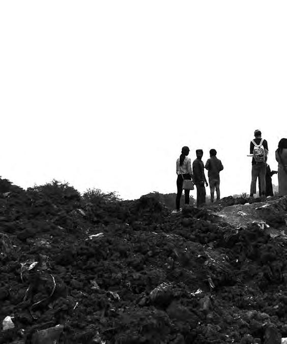

Published by
Department of Architecture
School of Design and Environment
National University of Singapore
4 Architecture Drive
Singapore 117566
Tel: +65 65163452
Fax: +65 67793078
Copyright © 2019 Hwang Yun Hye (ed.)
ISBN:


 Sahakar Nagar Water Tank
Hebbal STP
Anand Nagar Water Tank
Hebbal Lake
Amrutahalli Lake
Anand Nagar Water Tank
Rachenahalli Lake


 Barren Land


 A. RUNOFF
C. REUSE
1.Orchard
1.Mound runoff
2.Settling basin
2.Residential area 3.Refiltration


 Dhobi Ghat Laundry Area
Plant Nursery Bus depot


 -Liu Ye

 -Chan Wing Fai

 -Elsa Sim Rui Jia
-Manasi Prabhudesai


 -Tang Mengjiao
-Yang Xiaowen
-Rahmat Khairudin
-Mitali Kumar

 -Zhang Qinqin
-Chen Nan
 -Dai Yuke

