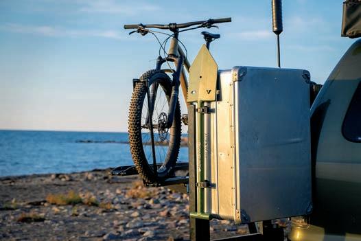
VERLAND O

JORDAN | NAVIGATION APPS | BAJA CALIFORNIA | KYRGYZSTAN


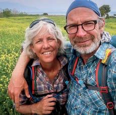
WE ARE ADVENTURERS Constantly traveling. Testing and using gear in real-world situations. Gaining experience, which we readily share.
OUR RESUME
7 continents | 161 countries | 496 years combined experience
WE ONLY KNOW THINGS WHEN WE LIVE THEM
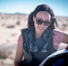
PUBLISHER AND CHAIRMAN Scott Brady
PRESIDENT AND DIRECTOR OF DESIGN Stephanie Brady
CHIEF TECHNOLOGY OFFICER Christian Pelletier
CHIEF BUSINESS DEVELOPMENT OFFICER Brian McVickers
CHIEF FINANCIAL OFFICER Andre Racine
DIRECTOR OF EUROPEAN OPERATIONS Michael Brailey
EDITOR, OVERLAND JOURNAL Tena Overacker
CONSERVATION EDITOR Åsa Björklund
MEDICAL EDITOR Dr. Jon Solberg, MD, FAWM
ARCHAEOLOGY SENIOR EDITOR Bryon Bass, PhD
CONTRIBUTING EDITORS Graeme Bell, Chris Cordes, S.K. Davis, Rocky Donati, Susan Dragoo, Ferenc Elekes, Nicolas Genoud, Richard Giordano, Thomas Henson, Lisa Thomas, Jaclyn Trop, Karin Marijke-Vis, Austin Vince
SENIOR PHOTOGRAPHER Bruce Dorn
CONTRIBUTING PHOTOGRAPHERS Eric Adams, Shirli Jade
Carswell, Nicolas Genoud, Richard Giordano, Simon Thomas, Coen Wubbels
COPY EDITOR Jacques Laliberté
TECHNICAL EDITOR Chris Ramm
CARTOGRAPHER David Medeiros
CONTACT
Overland Journal, 3035 N Tarra Ave, #1, Prescott, AZ 86301 service@overlandjournal.com, editor@overlandjournal.com, advertising@overlandjournal.com, 928-777-8567
MOVING?
Send address changes to service@overlandjournal.com. Include complete old address as well as new address. Allow two to four weeks for the change to become effective.
Overland Journal is not forwarded by the US Postal Service. It is the subscriber’s responsibility to inform Overland Journal of an address change.
Overland Journal is a trademark of Overland International, Inc. All rights reserved. Reproduction in whole or in part without written permission is prohibited. Overland Journal is a wholly owned subsidiary of Overland International.
We carefully screen all contributors to ensure they are independent and impartial. We never have and never will accept advertorial, and we do not allow advertising to influence our product or destination reviews.
ROW 1
@wheretowillie
Don’t worry, everything is fine.
@danielm4wd
Classified Ad: Like new camper awning for sale, adaptable to any vehicle model. Other camping accessories are also available. #CampingRoom
@wolfpac_outdoors
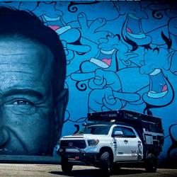
Found this gem. It’s crazy to see in real life; the detail in @robinwilliams face is astounding.
ROW 2
@bikeexif
Dirty deeds done cheap: @purpose_built_moto just proved you don’t need to spend a fortune to build a fun scrambler. Keep an eye out for this cheeky little @sol_invictus_moto, [it’s the] nemesis in the upcoming @wideofthemarkmovie.
@benyamin_senkal
Our next trip will hopefully start in 12 days.
@utahjeeptrails
Took a quick trip to the moon the other day.
ROW 3
@cruiserrehab
Fun meetup with 40 friends and more at Catalina Coffee; went to my favorite photo spot.
@goldgravelandtravel
Every morning you wake to a beautiful sunrise. The warmth of the sun, birds singing, and aroma of pine trees tingle your senses. You are filled with joy, knowing that no mosquitos, ants, or spiders [are lying in wait]. It only rains lightly at bedtime and stops as soon as you enter dreamland. The mattress feels like a cloud, and it only gets cold and snows on Christmas. This, my friends, is rooftop tent living.
@busters_dad_ Helping daddy organize.
I found [the Summer 2020 issue in] my mailbox today. Why did it take 14 pages of ads to get to something interesting? I know advertising pays the bills, but I don’t have super deep pockets to afford nearly all of what you promote. The 500K vehicles can’t go where my humble 1982 Land Cruiser can go. Your publication has been interesting through the years, but I can’t see reading any more ads.
James Bingham
1982 Land Cruiser
RESPONSE FROM THE EDITOR:
In recent issues, we allowed for an increase in advertising due to demand. But we are also working at increasing content to offset it. The transition has not been as seamless as intended, but the difference should already be evident. Thank you for voicing your concerns.
I’m a charter member of your magazine and have enjoyed it since Spring 2007. You featured a camp pillow in the magazine, which I can’t seem to find. Said it was a staff favorite, partially inflatable. Can you point me to the specific magazine issue and page? [Sea to Summit Aeros Premium Pillow, page 109, Spring 2020] Thank you for producing such an awesome magazine. I have lived vicariously through you for years.
Ted Jones
1990 D90 by Arkonik 1997 Land Cruiser 1977 FJ40
LOOKING FORWARD
Overland Journal is, by far, my favorite magazine in the history of the world. [I’m a] longtime subscriber—love the summer isNOT
sue, read cover to cover in one day already. Keep doing what you’re doing because when the world opens back up, it’s going to need it.
Greg Clement from OutRise 2018 KTM 450
SHARE
Use #overlandjournal on Instagram or Facebook.
WHERE HAS YOUR OVERLAND JOURNAL BEEN?
Send us a photo, along with your name, the location, make/year of your vehicle, and a brief description. editor@overlandjournal.com
Jaclyn Trop is an award-winning journalist and automotive reporter, deciphering the world of sheet metal for the masses. She divides her time among Los Angeles, Detroit, and New York. She was awarded a KnightBagehot fellowship in business and economics reporting from Columbia University, where she also earned a master’s degree in journalism. Her byline has appeared in the New York Times, the New Yorker, Fortune, Vogue, Glamour, Newsweek, Fast Company, Forbes, Marie Claire, Men’s Health, Entrepreneur, Rolling Stone, Robb Report, Town & Country, U.S. News & World Report, and Refinery 29 among others. Jaclyn has reported from five continents and eaten ice cream in more than 50 countries. She serves as a US juror to the World Car Awards.

Shedding light on the obscure, especially at the juxtaposition of man and nature, drives Susan Dragoo to explore the historical treasures of the American Southwest. On wheels or afoot, an old trail and a camera are her key ingredients for a fulfilling adventure. A writer, photographer, and student of history since youth, Dragoo’s work is found in motorcycling, 4WD, hiking, and other travel publications, and her scenic photography in state park lodges and cabins in her home state of Oklahoma. Gallivanting in their Toyota “Tacoma GS” is a favorite pastime for Susan and husband, Bill, when they are not at home in Norman, Oklahoma, enjoying their family and running Dragoo Adventure Rider Training (DART).
Nicolas Genoud has always nourished a deep love for adventure, exploration, and wilderness, from descending the Yukon River in a kayak to multiple crossings of the Sahara. Born and raised in Switzerland, as a photographer, he first traveled the planet and shared his love for unspoiled nature through numerous publications and projects. Nicolas is the founder and managing director of Geko Expeditions, a company offering guided and self-drive 4x4 exploration trips to destinations such as Russia, Iceland, Africa, Mongolia, and Madagascar. Nicolas has set up and guided numerous expeditions since 2003, always with a mix of poetry and a touch of Swiss precision.

Originally a lawyer, Ferenc has lived in 7 different countries and traveled through 10 times more than that. Recently having left the corporate world in the City of London, during the last few years, he has been focusing on overlanding, where he can combine the two things he is most passionate about: vehicles and travel. Ferenc’s experience in overlanding comes from extensive trips on three different continents, with the latest being from Budapest to Singapore with a Land Cruiser 120 and a rooftop tent. He is blogging about his trips extensively. When not on the road, Ferenc lives with his travel companion, Evelin, in Budapest, Hungary.
Richard Giordano completed a 48,800kilometer overland journey from Vancouver, Canada, to Ushuaia, Argentina, with his wife, Ashley, in their well-loved but antiquated 1990 Toyota Pickup. On the zig-zag route south, they hiked craggy peaks in the Andes, discovered diverse cultures in 15 different countries, and filled their tummies with spicy ceviche, Baja fish tacos, and Argentinian Malbec. That trip catapulted Richard into a career as a freelance video producer, photographer, and writer. He has created commercials for Toyota Canada, is the lead photographer for Expedition Overland, and is always itching to hit the road and share his adventures. If you see Richard out in the wild, he’ll most likely have a coffee in one hand and a camera in the other.
Born in South Africa, Shirli’s career and passion revolve around the African continent and its wildlife and cultures. She cut her teeth on advertising after art school and eventually moved into photography. She periodically packs her 2004 Defender, known affectionately as Tintin, and heads out to some remote locale to capture a library of images for her fine art portfolio. Recognized for her wildlife and landscape photography, Shirli is a driven conservationist and steward of Africa. She co-authored the book Africa’s Ultimate Safaris, an extraordinary photo journey through the continent, showcasing some of its most beautiful and wild destinations. She is currently working on a series of books that will take her into Africa once again, as well as Europe and the United States.
Rocky has a quirky sense of humor, the mouth of a sarcastic sailor, and talks supersonic fast. Her insatiable drive and knack for creative problem-solving meant a decade of spearheading high-level business strategies for the outdoor industry. Now she manages her own consulting firm, Donati Agency, but more often than not, elects to play hooky with her partner in crime and two Aussie pups. From wheeling to jet-setting out of a remote Park City chalet at 8,000 feet, she and her husband are constantly in search of the perfect pocket water for fly fishing. This decade, she’s embracing the hermit lifestyle, writing gibberish for hire, and renting out the adventurous getaway of your childhood dreams, The Treehouse Utah, on Airbnb.
Steven is a Utah native who, aside from riding motorbikes, runs a small business and raises a family just north of Salt Lake City. After living in the Middle East, Europe, Canada, and Colorado, he returned to Utah to put down roots. Both his fiction and non-fiction have been published in magazines and online, and he just released his adventure/crime novel, Big Hat, No Cattle, available in print or e-formats. When asked about his odd and magnetic sense of humor, he only replied, “I want to be the eccentric billionaire without the money.” Currently, Steven rides his R 1200 GS anywhere he can—and a lot of places where he shouldn’t.
I was born in London in 1965, saw Evel Knievel jump (and crash) at Wembley Stadium in 1975, and first heard “Strychnine,” by the Sonics, in 1985. I have been promoting DIY adventure and lo-fi fun ever since. As the digital age has dawned, fabulous tech has enabled us to record amazing audio, generate graphics, edit films, and expect all information to be at our fingertips. We are the last generation that will remember analogue, its failings, limitations, and its epic strengths. Our soul is lifted by knowing how to actually do something, rather than having a device that does it for us. Go far, go light, use maps.
Freelance writer Karin-Marijke Vis, along with her partner, photographer Coen Wubbels, combine their love for adventure with work they enjoy. Sometimes described as being the “slowest overlanders in the world,” they believe in making connections and staying in a place long enough to do so. In 2003, the couple purchased an antique BJ45 Land Cruiser and began a three-year trip from their home in the Netherlands to Asia. Terminally infected by the overland bug, they traveled in South America for nine years, and in Japan and South Korea for two years. They are currently making their way through Russia and Central Asia. They’ve been published in magazines around the world, and in 2013, Expedition Portal awarded the pair the coveted Overlander of the Year award.
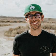
Chris was born and raised outside of Dallas, Texas, and didn’t receive a real taste of the outdoors until moving to Arizona in 2009. It was there that he fell in love with four-wheeldrive vehicles and the great outdoors, quite literally altering the path of his life. Instead of pursuing his planned career in aviation, Chris accepted a position with Overland Journal and Expedition Portal, where he would hone his skills in writing, photography, and off-pavement driving. Over the years, he has lived full time on the road, mapped trails from the Arctic Circle to Mexico, driven across Australia, and backpacked the Himalayas. He is currently an Airstream Ambassador and works for onX Off-road, managing their Trail Guide community.
Graeme Bell is a full-time overlander and author. He was born in Johannesburg, South Africa, but considers Europe home when not traveling the planet with his wife, Luisa, and two children, Keelan and Jessica, in a Land Rover Defender 130 (affectionately known as Mafuta). To date, the Bell family and Mafuta have over a period of seven years toured Southern and East Africa, circumnavigated South America, and driven from Argentina to Alaska before traversing the US from coast to coast. In December 2016, Graeme personally transformed their Defender from a standard double cab into a camper with through access, a pop-top, and sleeping for four in anticipation of their current adventure: driving from Europe to Southern Africa.
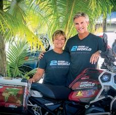
Lisa and Simon Thomas of 2RidetheWorld are considered by many to be the world’s foremost adventure motorcyclists. With more real-world experience than anyone on the road today, they have ridden their way into a life that most of us can only imagine. Since setting out on their journey in 2003, the duo has amassed an insane half-a-million miles on their ride, through 80 countries, across six continents. Along the way, they’ve traversed 36 deserts, survived a broken neck in the Amazon Jungle, cheated death, and have become explorers, authors, photographers, and celebrated public speakers. Remarkably, they’re still going strong today. It’s easy to say that Lisa and Simon inspired and ultimately helped define what we all now call adventure riding.

Thomas Henson is an educator and writer based in the UK. A former military police officer and ex-bodyguard, he has lived and worked in a variety of countries, including Sudan, Tunisia, Poland, and Israel. When he’s not teaching, Thomas is on a mission to track down the most interesting places, people, and stories. A fan of ancient mythology, his next big idea is to explore Scandinavia, to track down the locations that inspired Nordic folklore. Thomas is married to the creative and talented Emily, and a proud dog-dad to two Nova Scotia duck tolling retrievers. He also has two cats, who do not earn their keep.
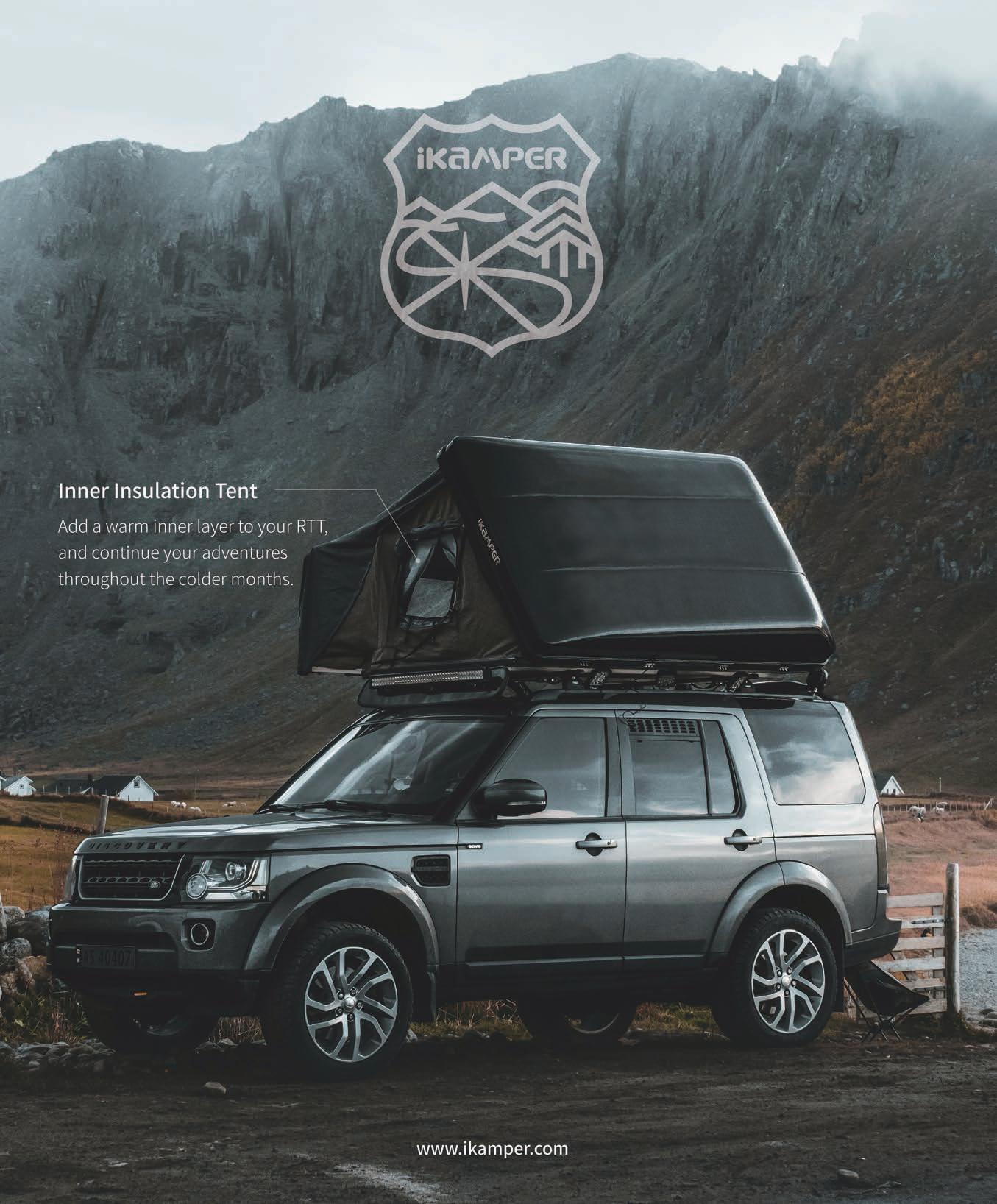
Elemental protection in a smart package.
The current iteration of Klim’s Latitude suit for men and Altitude suit for women tackles most road and dirt conditions. They accommodate varying abilities, riding styles, and trip profiles. The original Latitude/Altitude targeted the ADV and dual-sport/enduro crowd, but Klim saw touring riders favoring it, too. It handled dust, rain, and abrasions, and with its stylish looks, the jacket could also withstand beer gardens and dinner reservations. Klim eventually hit the drawing board to refine the Latitude/Altitude for touring, after filling the ADV/enduro niches with dedicated designs. However, the latest iterations are just as multifaceted as the original versions. They are a true go-to for dust-laden Baja rides, variable weather explorations on unimproved Balkan roads, or that 100-percent tarmac road trip up California’s Highway 1.
The latest iterations are a true go-to for dust-laden Baja rides, variable weather explorations on unimproved Balkan roads, or that 100-percent tarmac road trip up California’s Highway 1.
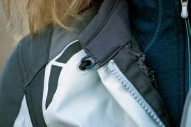
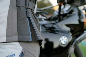
An Alpha-Bet soup of specialized Gore-Tex, abrasive resistant fabrics, zippers, reflective materials, and armor indicates these suits mean business. While men’s and women’s variants have different colors, vent locations, and physique-specific cuts, they do have similar construction and materials. Key refinements include an offset neck tension cord (helps prevent ponytail snags), and goat hide on the elbow and upper arm for sudden mishaps, as well as at the lower inner thigh area to mitigate wear. External pockets and zippers on the jacket and pants are placed in intuitive and useful locations. Jackets have various pockets on the left and right interior, along with a few hidden ones. Along with abrasionresistant materials, D3O inserts provide Level 1 crash protection. Useful Klim intel here: North American users who want increased impact protection can up-armor to Level 2 Conformité Européene (CE) European standards, as all slots accept inserts from either specification.
Motorcycle garment breathability and crash protection are frequently at odds. To this point, jacket ventilation on both models is adequate, with lower arm, chest, and back vent options helping to control the flow. Unzipping the hip gussets increases circulation, and in hot weather, I slightly open the Velcro cuffs for maximum airflow. My three-season gloves can manipulate the zipper pulls. Both pants vent even better when riders stand up on the pegs. A phone/device jack port is provided on the left-inside chest pocket, and the medical ID card/key stash is on the lower left sleeve. Having these options on both sides would be welcomed.
Gina De Pasquale, an ADV motorcycling instructor at Rawhyde who works in various sectors of the industry, reports that the updated women’s Altitude has good complementary airflow through the
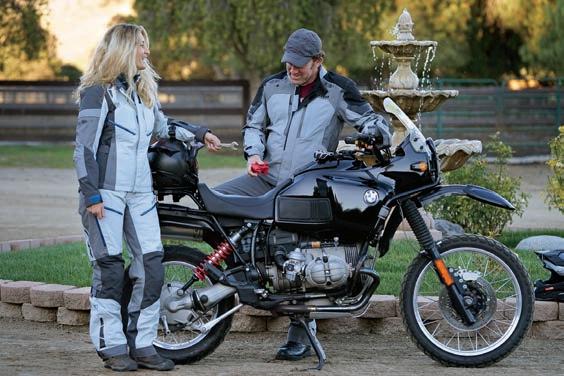
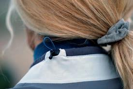
Klim’s Latitude/Altitude suits for men and women provide great all-around comfort and protection for multi-season touring, dual-sport, and ADV riders. Design nuances include an offset neck tension cord to keep hair out of the mix, hooked tabs to hold open the lapels, waterproof zippers, and refined ventilation/gussets in key locations.
chest vents and out the back. The feminine cut, two-tone colors, and subtle yet attractive graphics provide style. She often utilizes the neck tabs, which can hook open for maximum ventilation. Emanating from an adventure bike and dual-sport background, yet with updated travel-oriented refinements, the Latitude/Altitude suits are at home anywhere. They could easily be the only jacket/pant combo you need.
$650/JACKET, $500/PANT (LATITUDE); $600/JACKET, $500/PANT (ALTITUDE) | KLIM.COM
Built to impress, and made to last.


Shovels have become a hot commodity in the overland marketplace. You can buy them pointed, square or round, ultralight or tactical, and even carbon-fiber models with titanium blades. At times, the designs and price tags can seem a little absurd.
Let’s be honest, though, the reason people are willing to buy expensive shovels isn’t that they’ve become fascinated with digging—it’s because they look cool. But RoamBuilt’s V-nose combines good looks with practicality. The laser-etched logo stands proud along the handle, a serrated edge runs the length of the blade, and a sharp nose looks poised to destroy any dirt that has the gall to stand in your way. At first glance, experts might say the blade would be inefficient for moving large quantities of soil, and they’re right. However, the pointed shape is excellent at breaking through the first layer of ground, and that’s where we spend the majority of our time digging. After all, catholes are 6-8 inches deep, and we aren’t usually digging deep trenches for recoveries. If you do find yourself needing to dig one, fear not, this shovel is up to the task. It’s fully welded to eliminate any movement or wobble and features a flat footpad and solid T-grip for leverage and stability. The blade is made from a strong-formed 5052 aluminum alloy, and the whole shovel is sealed with a heavy-duty powder coating for corrosion resistance. Despite this hardy construction, total weight comes in at just 3 pounds, making it a breeze to handle.
It’s fully welded to eliminate any movement or wobble and features a flat footpad and solid T-grip for leverage and stability.
The size is ideal for most overland tasks: small enough to maneuver beneath the chassis for clearing mud, sand, or snow from a high-centered vehicle; large enough to put your back into big jobs when needed. I do wish the blade angle was greater for easier scooping, as the current one makes it difficult to pull large quantities of sediment out from the side of the vehicle.
Other redeeming design elements include the T-grip made from solid 6061 aluminum, which allows it to be used as a hammer, and the bottle opener cut into the blade for cracking open a cold drink when the work is done. The only feature I could live without is the shovel’s serrated edge, since it is too dull to be usable.
The V-nose isn’t the cheapest shovel on the market; it’s also far from the most expensive. It’s well-built, lightweight, looks great, and has performed flawlessly in every challenge I’ve put to it.
$75 | ROAMBUILT.COM

Expanding on the foundation of getting unstuck.
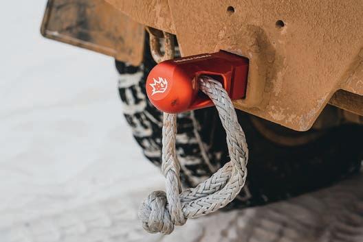
There is a sinking feeling with getting stuck, both literally and intellectually. Once stuck, our options dwindle, and the potential consequences mount. Additional damage is likely, as is being stranded, or worse, losing the vehicle to the rising tide. As a result, there are fundamental tools that belong in every overlanders’ recovery kit. It certainly includes the basics like gloves, a good shovel, and a set of traction boards, but it should also include a means of conducting powered self-recovery or a vehicle-to-vehicle pull.
MaxTrax has redefined self-recovery with the invention of its reinforced nylon recovery tracks. Owner Brad McCarthy also recognized the opportunity to improve powered recovery or vehicle-to-vehicle extraction, and started a new line of accessories that have been optimized for light weight, performance, and safety. Last year, I had the opportunity to use prototype versions of these new tools along the Great Australian Bight, during an
adventure I was undertaking with friends from Hema Maps. Brad was along, and he quite nearly risked life and limb, demonstrating the capabilities of these tools. It all started with a high-speed roll of a Polaris RZR in the dunes lining the Indian Ocean.
With a vehicle rolled, out came the tools to right the machine safely. The first new product is a precision-machined Hitch 50, specifically designed to work with a soft shackle. It’s relevant, as many vehicles only have a receiver hitch for a rear recovery point, and it is difficult to use a soft shackle without causing damage from the receiver’s sharp metal surface. The 6061 billet aluminum Hitch 50 is CNC machined with a large radius and locating profile to best support a soft shackle in either a vertical or horizontal axis. The working load limit (WLL) is 19,400 pounds, and it has a minimum breaking strength (MBS) of 97,000 pounds. To ensure quality, each hitch is x-rayed for inclusions. It’s a highly specialized tool, which is its greatest strength, but also its limitation since a traditional screw-pin metal shackle cannot be used.
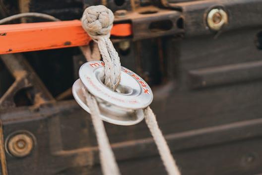
These winch rings have become extremely popular due to their lower storage weight and reduction of the overall mass of the winch rigging.
Additionally, MaxTrax also released a Winch Ring 120, which was designed to reduce the overall weight of a double-line winch pull and to minimize point-loading and heat by machining in a large internal diameter radius. The ring has a WLL of 27,000 pounds, and an MBS of 137,000 pounds. These winch rings have become extremely popular due to their lower storage weight and reduction of the overall mass of the winch rigging. It is important to note that these rings are only ideal for static winching operations, not dynamic driving/winching conditions. To complement the ring and the hitch, they offer a Core soft shackle with an MBS of 30,000 pounds, and a Fuse soft shackle with an MBS of 15,000 pounds. These are unique offerings, with an intentional fusible link incorporated into the rigging. The Core and the Fuse both utilize wear/heat sleeves to improve durability with the winch ring and other connection points. MaxTrax continues to expand its recovery offerings with quality components, which bodes well for the future of overlanders beating the rising tides.
$250/HITCH 50, $200/WINCH RING, $49/CORE, $39/FUSE | MAXTRAX.COM.AU
The Hitch 50 is one of the first soft-shackle-specific connection points on the market. The primary advantage of a recovery ring is reduced weight for storage and as mass within the rigging system.
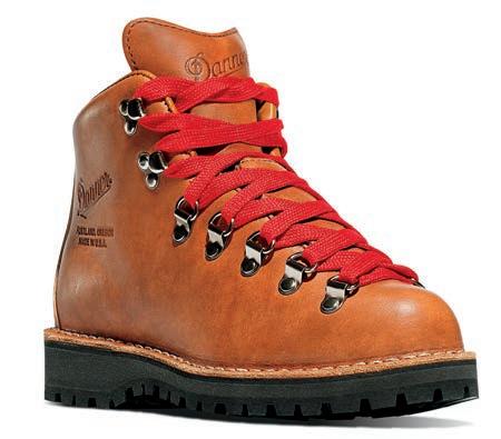
Recognized from their starring role on Reese Witherspoon’s feet in Wild, but remembered for their all-around perfection.
Leather boots require serious commitment, and there’s no secret sauce to bypassing the inevitable pain while they mold to your feet. But when it comes to my essential choice for work boots during spring, fall, and winter seasons, the pain is so worth it. Unlike most traditional leather hiking boots, the Mountain Light Cascade feels extremely light. It’s an excellent choice for quick errands when there’s slippery snowfall, in addition to its original functionality, most at home during long outdoor treks. This element is especially key for me, a SoCal girl who despises wearing anything more than a sandal; I don’t mind sporting these because nothing feels clunky.
Designed and manufactured in Portland, Oregon, Danner spares no expense. These full-grain, single-piece, all-leather upper boots with Vibram Kletterlift outsoles are specifically created for comfort and durability. They feature a 100-percent-waterproof and breathable Gore-Tex liner, engineered to keep your feet dry and comfortable. In warmer temps, you’re likely to be a little more sweaty in the foot department due to this combo, though. Their handcrafted stitch-down construction makes them re-craftable and easy to resole, i.e., these boots will literally last forever, so ignore the price tag. The wider platform increases stability underfoot, and the support is further unrivaled thanks to the unique heel shape that provides superb shock absorption. In the end, I never seem to mind the ogling onlookers when I step out in these bad girls.
$360 | DANNER.COM
Probably the most boring thing to read about in this magazine, but a 100-percent game changer.
Remember when I said there’s no secret sauce to bypassing the inevitable pain while leather boots mold to your feet? I sort of (unintentionally) fibbed. There is, in fact, a fairly magical solution that is not only incredibly cheap and easy to use but also extremely effective. Whenever I pick up a new pair of leather boots, I grimace, not at the price tag, but at the thought of my poor feet, grossly bubbling and bleeding while I walk on eggshells for weeks, praying that the devil boots will eventually stop mutilating me. Socks never seem to do the trick. Deodorant is a disgusting old wives’ tale. And whoever said we should grin and bear it should shove it.
Fortunately, Band-Aid developed these sweet little bandage cushions that provide preventative protection and future relief from
blisters, the red-headed stepsister of the dreaded paper cut. After application, a white bubble forms to cradle the wound. The hydrocolloid bandage (fancy word for moisture-retentive dressing) keeps dirt, water, and germs away for multiple days, even through soapy showers, which allows your body to heal faster in an optimally sterile environment. I tried my best to make this review exciting, but the reality is, just go buy some at your local everything store and know that your life will be forever changed.
$6 | BAND-AID.COM

This four-season tent will keep you high and dry.
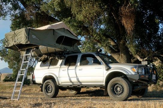
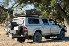
Based in Central California, Hinterland Industries Tents (HiTents) designs classically styled rooftop tents (RTTs). I obtained their Rincon from company owner, Graham Holloway, for a multi-month field test, and mounted it to a Front Runner Slimline II roof rack on a Toyota Tacoma.
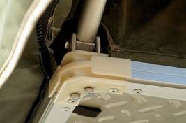
The Rincon sleeps three (more with the included annex) and is designed as a four-season RTT. With a time-honored appearance, it’s reminiscent of Howling Moon or Eezi-Awn tents from South Africa. The tent weighs 150 pounds and has a heavyweight 400g ripstop breathable poly-cotton canvas tent body with impregnated waterproof coating. The body material is UV and mold resistant, as are the rainfly and travel cover. Quality dual-stitched and heat-taped seams keep water out. The rainfly is elevated (when the spring steel rods are inserted) and made from 420D polyester oxford fabric. The tent base has an aluminum frame, honeycomb core,
and custom-thickness diamond plate exterior. The travel cover is rugged 1200D PVC. I found it difficult to zip closed on occasion; other times, it zipped easily. This seemed somewhat dependent on how well the folds were tucked in upon closure, but the fact is, all PVC covers are problematic to close.
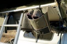
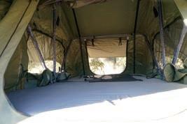
The comfortable, high-density, 3-inch-thick foam mattress comes with a washable cover. The tent interior seals like a tomb and makes for dark sleeping quarters. In high winds, I didn’t detect air ingress. Interior gear pockets are located at both ends, where your head would rest, facilitating numerous sleeping arrangements. When opened, small ridge vents allow air circulation. Two shoe bags hang outside the tent entrance. The ladder length can be slightly adjusted for varying ground conditions, and the rungs aren’t overly angular, so they’re easy on bare feet.
The comfortable, highdensity, 3-inch-thick foam mattress comes with a washable cover. The tent interior seals like a tomb and makes for dark sleeping quarters.
Clamshell tent setups are inherently faster with two people, and the ease with which tie-down straps, zippers, and guide rods are accessed varies. Likewise, the amount of kit that requires loosening can add minutes to solo person tent deployment. With the travel cover installed, it usually took one person about five minutes to get the tent sleep-ready, and consistently around the 10-minute mark to have all the spring steel rods and rainfly secured. Takedown to road-ready (including travel cover) typically required approximately 12 minutes.
The overall build quality is excellent, although we did not test the included annex. The 1-inch interior poles are fabric wrapped, the hinges and hardware are stainless steel, and the ladder mounting brackets are TIG welded stainless. Zipper sizes on the fly screens and canvas flaps seem adequate and don’t require undue finesse. I favor this RTT style when the truck is in place for a few days at a time, mainly because of the setup/takedown time. When deployed, it protects and shades better than hardshell pop-ups.
$2,475 | HITENTS.COM
Clockwise from top: The Rincon, deployed for a good night’s sleep. Exterior shoe bags at the entrance keep footwear at the ready. Cabin Fever can creep in when sheltering for extended periods from Mother Nature. During inclement weather, the Rincon’s interior was accommodating enough for lengthy daytime hanging out (reading and working on reports), with ample provisions for ventilation and views. Stainless steel hardware and hinges, and a diamond plate exterior should allow many years of use. At 150 pounds, the Rincon isn’t lightweight. Assess the rooftop load rating, and include the mounting rack and any attached gear in those calculations. On some smaller trucks, mounting over the bed might a better solution.
A powered high-volume purification system.
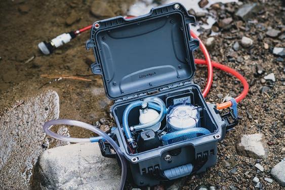
Sustained remote travel typically requires a means of resupplying water stores, with vehicle-based camping, bathing, cooking, and drinking. Why leave that idyllic mountain stream campsite when all you need is a proper volume filter to supply 2-3 gallons per day, per person?
Enter Guzzle H2O, a company founded by two professional sailors.
A few things stand out—the first being the durability of the box, a Pelican-style case complete with a lid seal and robust ribbing. All components are visible, including the Flojet pump, UV module, and high-quality, screw-top filter assembly. Quick-connects allow the inlet and outlet hoses to be easily attached, and the push of a button starts the process at 1.1 gallons per minute, powered by the built-in battery. The serviceability of the system also makes owner repair a real possibility.
The filtering process includes a 99.99 percent LED UV pass that kills bacteria, protozoa, and viruses. Then, the carbon block filter removes solids, microplastics, VOCs, and heavy metals. The pump is noticeably quick and pulled a draft from several feet. There are two lengths of outlet hose provided, and hoses are clearly identified to limit cross-contamination. The battery did come unstuck from the side of the case, easily fixed with a mounting bracket or strap (adhesive has since been improved based on our feedback). Some may find the price a bit steep, but it reflects the quality of the filter and components.
$950 | GUZZLEH2O.COM


Archaeologists use satellite and drone remote sensing technology to reveal further wonders at Petra.
By Jaclyn Trop
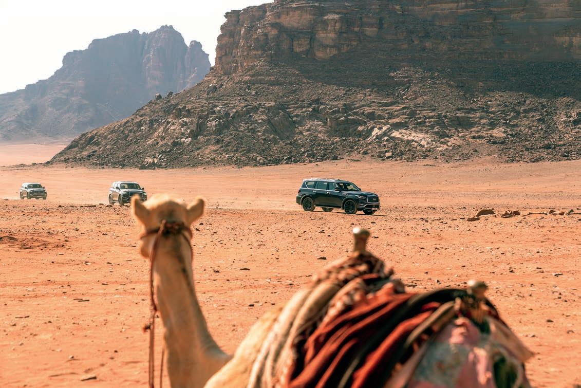
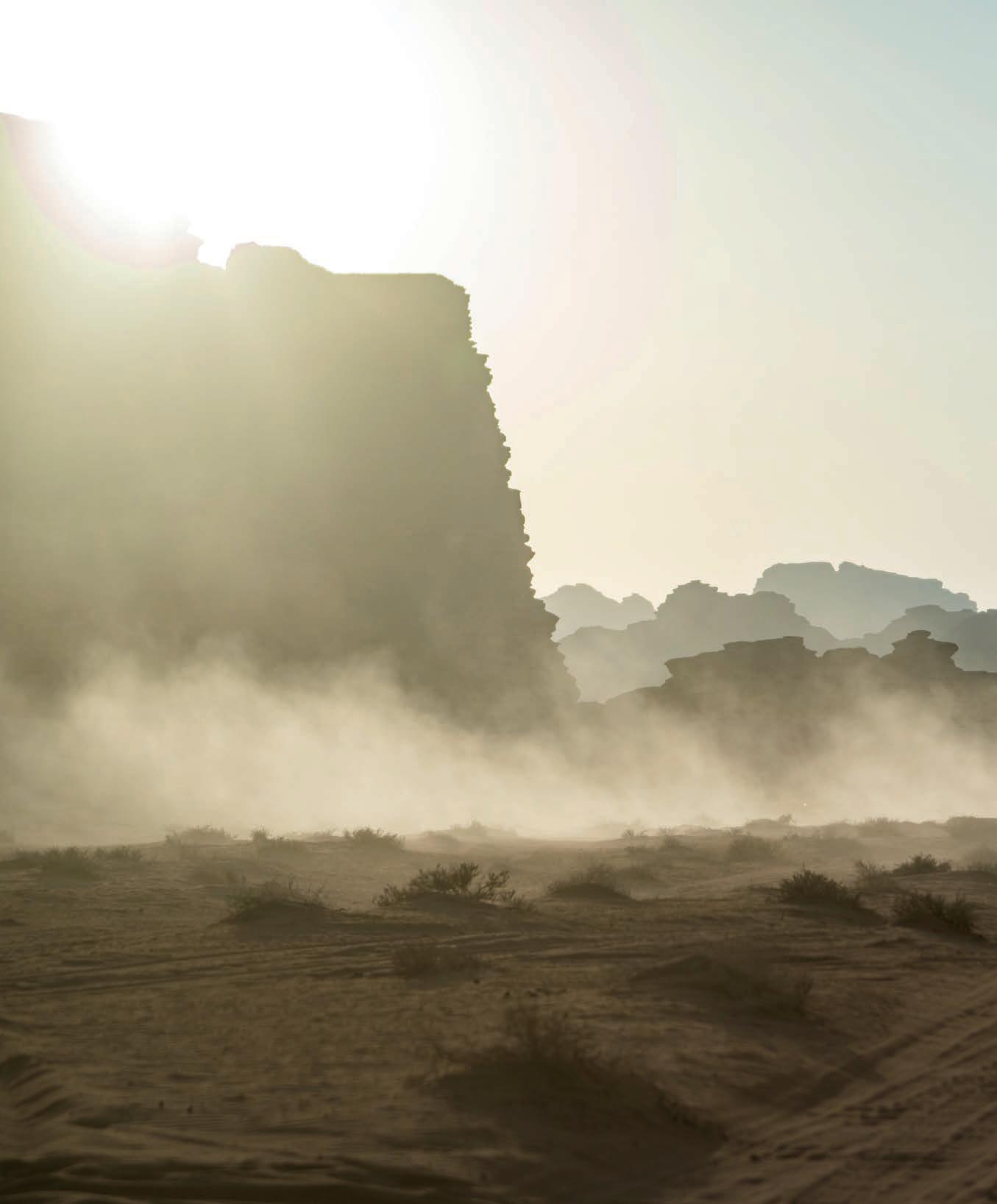
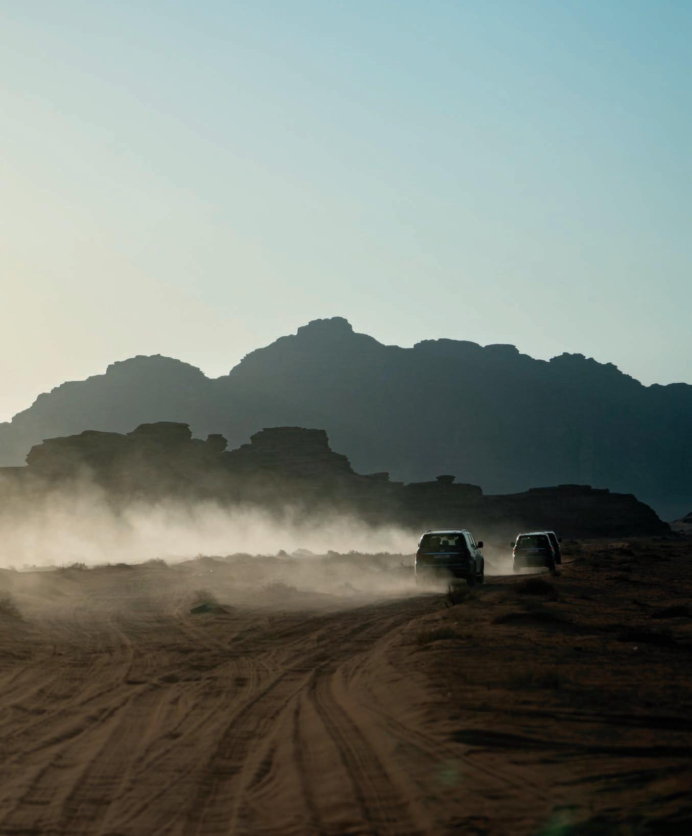
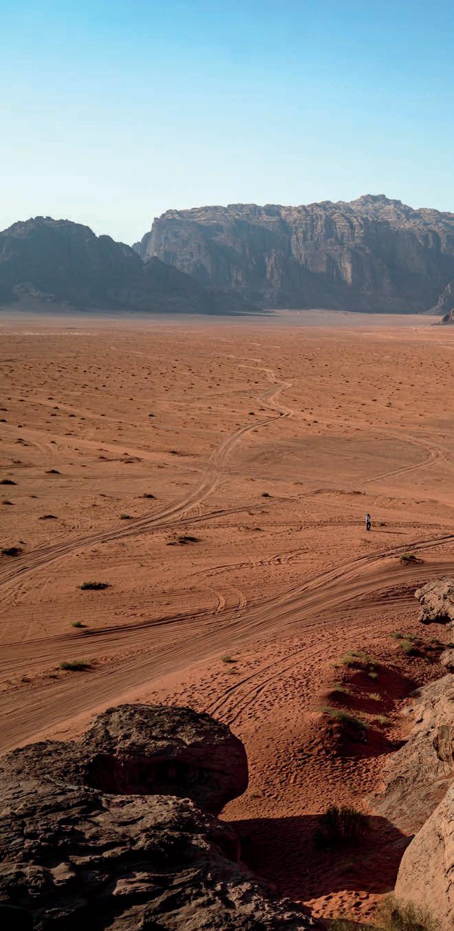
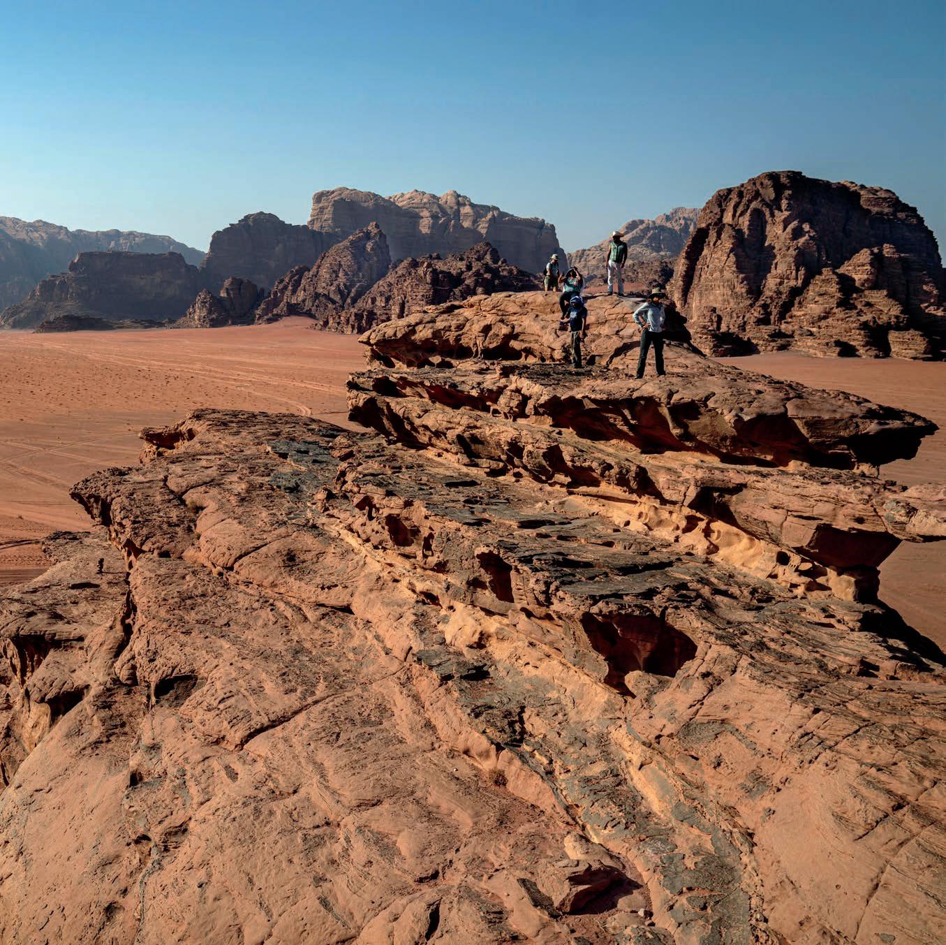
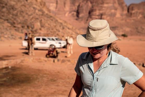
Racingthe sun to reach the Seven Pillars of Wisdom before dark, our cavalcade of SUVs bumps along the red sands of Jordan’s Wadi Rum desert as we gun it toward the horizon. We reach the base and tumble out of our trucks with minutes to spare. Named for T.E. Lawrence’s memoir, the heptahedron rock looms large with historical significance.
The man known as “Lawrence of Arabia” for his role in the First World War’s Arab Revolt trod this land just more than a century ago. As liaison to the British military, Lawrence traveled the desert’s rolling red sand dunes and sweeping sandstone valleys to relay intelligence that helped defend the area from the Turks.
But that’s all recent history. The striated rocks around us hint at natural forces at work eons before Lawrence arrived. To the untrained eye, the reddish, otherworldly landscape may as well look like Mars (and did serve as Mars during the filming of The Martian with Matt Damon). In fact, Wadi Rum has been described as anything but Earthlike; its name translates as Valley of the Moon for its dwarfing rock formations. The topography testifies to the geological evolution of our planet, but until not long ago, what lies beneath has remained mostly a mystery.
Fortunately, we are traveling with a gaggle of archaeologists who can decode the landscape’s layers of sandstone, granite, and shale for us on our overland drive from the Dead Sea to Petra.
“We know more about Mars than we know about Earth,” says Scott Nowicki, an Albuquerque-based scientist and one of the world’s leaders in remote sensing, a technique that uses drones and satellites to learn more about the earth’s natural features.
Wadi Rum may resemble the Red Planet, but this land is steeped in its own saga, recounting the origins of humankind.
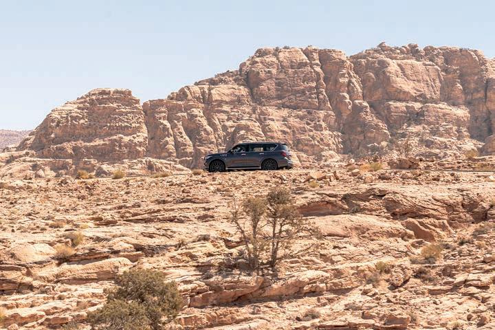
We arrived in the Middle East days earlier as part of a 30th birthday celebration for Infiniti, Nissan’s upscale sister brand. For its pearl anniversary, the Japanese carmaker put a team of scientists and journalists into its latest SUVs to travel part of Jordan’s King’s Highway, an early trade route, and trawl ancient settlements.
Three decades after launching in the US, Infiniti is highlighting an ethos of exploration, using new technology to push boundaries. Through a partnership with the Explorers Club, the carmaker supports expeditions that pioneer new tools to learn more about the planet.
The scientists seated alongside us for the journey are early adopters of satellite technology, breaking new ground to understand the past while revolutionizing the future of archaeology. The images captured by satellites and drones can construct an aerial view that helps them detect the outlines of ancient structures. Then they can home in on specific locations and compare other discoveries in the area to gain a broader understanding of the landscape’s past.
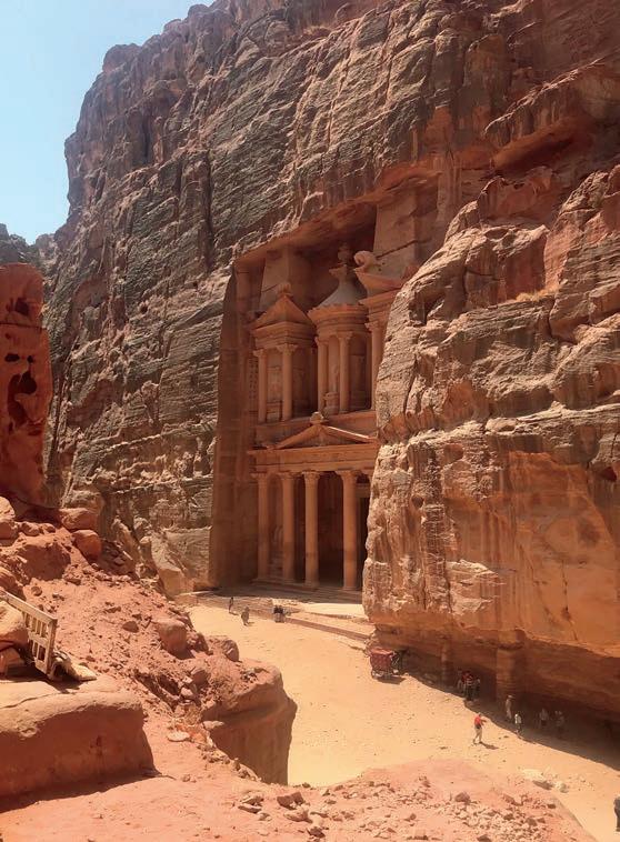
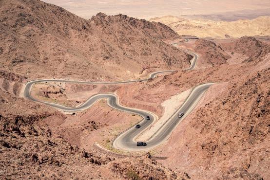
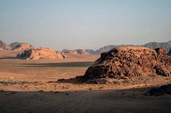
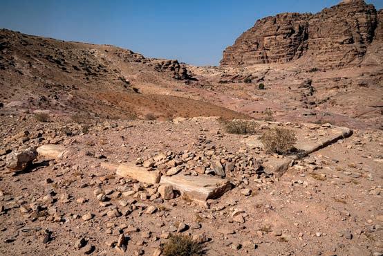
Clockwise from top right: In its heyday two millennia ago, Petra was a thriving city of 30,000 with a sophisticated network of hydraulic systems. Wadi Rum’s geology is rich in sandstone, granite, and shale. Archaeologists discovered this ancient site near Petra’s city center using satellite technology. It is believed to be a Nabataean ceremonial platform. Known for its sweeping curves and switchbacks, the Namla road runs from Aqaba in southern Jordan to Petra. The Treasury, a 130-foot-tall temple carved out of sandstone, is Petra’s most photographed feature. Opposite: Infiniti brought a team of archaeologists to Jordan to explore ruins using satellite technology. Opening spread: Jordan’s Wadi Rum desert is called Valley of the Moon for its jutting rock formations and rich geology.
Our expedition’s guest of honor is Sarah Parcak, an archaeologist who won the esteemed TED Prize in 2016. An expert Egyptologist, Parcak serves as a professor at the University of Alabama at Birmingham and authored a 2019 book about her adventures in the field, Archaeology from Space: How the Future Shapes Our Past.
As a leader in remote sensing technology, Parcak uses infrared satellite imagery to scour sites from her desk in Alabama. This innovation cuts the time and money required to make discoveries, allowing archaeologists to survey regions in months instead of decades.
Remote sensing has already helped Parcak locate 17 possible pyramids, 1,000 tombs, and 3,100 forgotten settlements in Egypt.
Parcak is already making an impact. Our drive through Wadi Rum will eventually lead us to Petra, where she and her team unveiled an ancient site in 2016. Satellite and drone remote sensing technology helped the archaeologists achieve what few have done since Swiss explorer Johann Burckhardt rediscovered the lost city of Petra in 1812: make a major discovery near the historic city center.
Some of this was accomplished at her desk in Alabama, using satellite and drone imagery to pinpoint the structure buried half a mile south of the city’s center. The site, which measures about 160 feet by 330 feet, could date back two millennia.
The tools will help scientists uncover ruins in Petra and other locations. These technological advancements have given rise to Parcak’s goal: to map the entire world in the next 10 years.
Remote sensing has already helped Parcak locate 17 possible pyramids, 1,000 tombs, and 3,100 forgotten settlements in Egypt. But that barely begins to fulfill the potential satellite technology brings to the field. “I mean, we have discovered less than 1 percent of ancient Egypt,” she says.
She used her $1 million TED Prize money to launch GlobalXplorer, a crowd-sourcing platform that pioneers a new way to uncover archaeological sites. The website enlists volunteers to analyze satellite images previously available only to scientists.
Volunteers complete a tutorial and receive a selection of satellite images to pore over. If they spot a potential site and scientists confirm it, the app’s users can follow the excavation via live streaming.
Harnessing armchair hobbyists helps increase the impact exponentially. So far, Parcak has amassed 90,000 volunteers who trawl the images for signs of ancient settlements. “There’s this idea of, ‘How much is there to find?’” Parcak says. “But you can’t possibly predict what you don’t know. It’s like asking how long is a piece of string.”
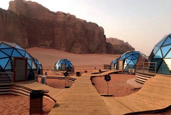
We decamped for the night to Memories Aicha, a warren of air-conditioned yurts in Wadi Rum. The constellation of metallic blue geodesic domes springs up from the red sands like a Martian
mining settlement. The labyrinthine network of winding wooden sidewalks connecting the bubble tents creates the feel of living in a neighborhood in a cartoon universe.
Over beers, Parcak tells us about her personal journey, starting with Indiana Jones, a looming figure in the world of archaeology and Parcak’s life. “I watched him with reverence,” she says of the faux-1930’s pop culture icon played by Harrison Ford. The 1980’s movie franchise about an archaeologist battling looters inspired a generation of archaeologists currently in their 30s, 40s, and 50s.
But Jones’ hunt for the Lost Ark has taken on new relevance, especially in the aftermath of the Arab Spring. The looting of valuable artifacts from archaeological sites is on the rise. It’s not unusual for an antiquity taken from a site to end up on the Sotheby’s auction block for $3 million, Parcak says.
Political instability, coupled with high resale values, incentivizes theft and destruction. Professional looters from Iraq are coming into Syria now, Parcak says. It’s not uncommon for farmers with intimate knowledge of local excavations to tip off the professionals or become professional looters themselves.
Satellite technology can help identify looting areas and shed light on the black market, according to Parcak. The data could provide insight into the networks that move artifacts from historical sites to Western markets. “We have to be a lot more honest about what we don’t know,” she says.
So far, Global Xplorer has mapped more than 200,000 looting sites in six months using tens of thousands of satellite images. (To avoid tipping off looters, Global Xplorer provides users with a general location but not GPS coordinates.) This information can also help governments protect their valuable antiquities and create databases of their cultural treasures.
Parcak says she hopes that looting antiquities may one day fall out of fashion, like raising public awareness did for wearing animal fur. “I wish I could stop the looting,” Parcak says. “I wish I had the Harry Potter magic wand.”
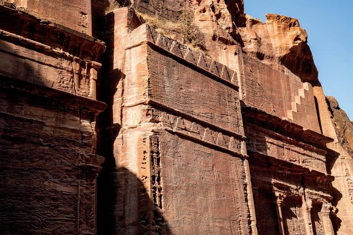
On the final morning of our expedition, we arrive in Petra, home to Jordan’s most striking monuments and oldest history. The city was declared a UNESCO World Heritage Site in 1985 and voted one of the “New Seven Wonders of the World” in 2007. More than a million visitors arrive annually to gawk at the striking spectrum of reds, oranges, and pinks embedded in the striated sandstone that gives Petra its nickname: the Rose City.
It’s also known as the Lost City, abandoned by the Romans after the 8th century AD. Its pink-hued temples and tombs remained largely out of public consciousness until Burckhardt happened upon Petra a millennium later.
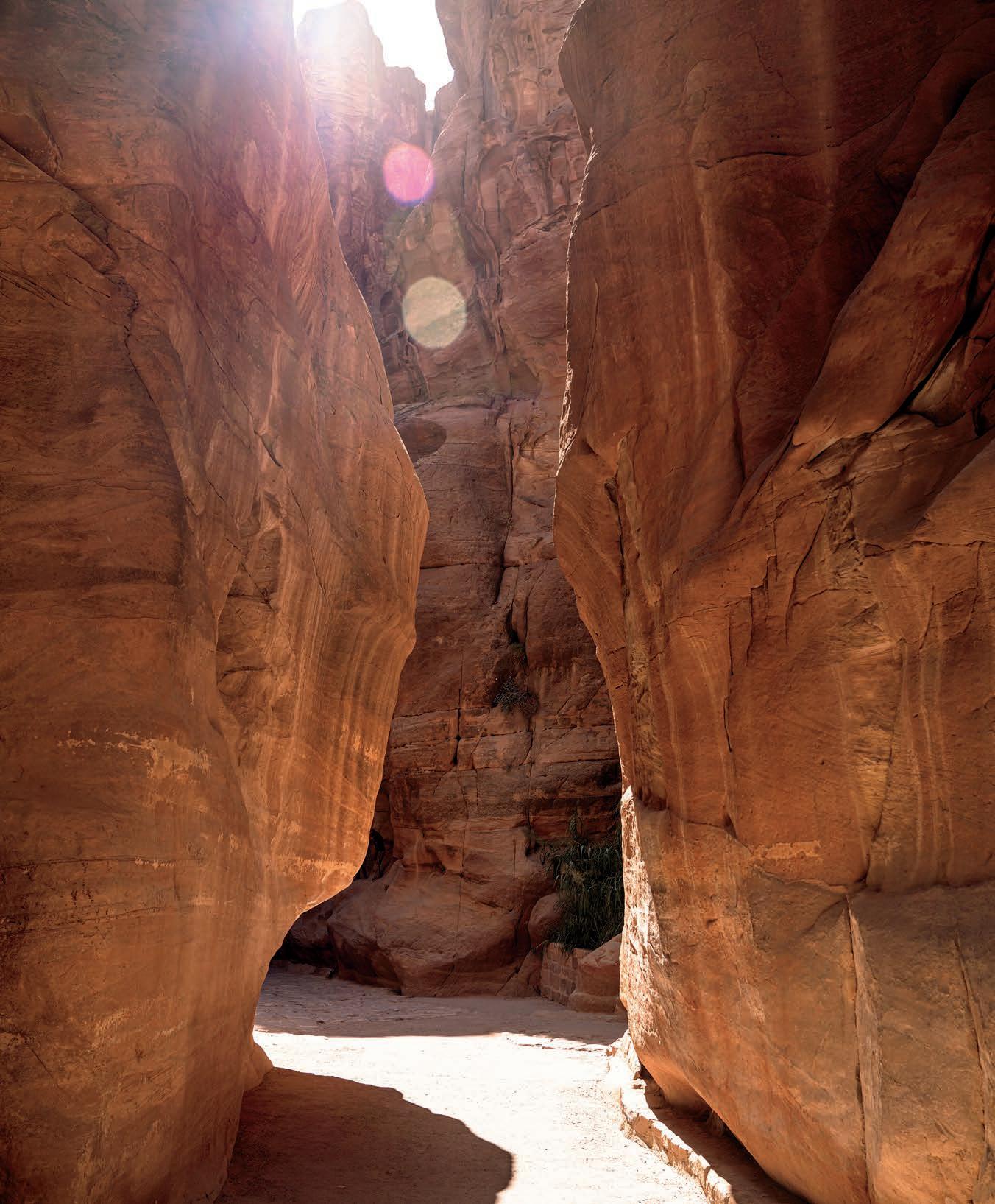
On the morning we arrive, flocks of tourists descend upon Petra in barely controlled chaos under the sweltering September sun. They snap photos in an effort to capture the sunlight on the striated sandstone while narrowly avoiding the horse carts that hurry down the path at an alarming speed. The journey into the city’s center begins on the Siq, a 3/4-mile track that winds downhill to open into the Treasury, Petra’s most iconic monument. The 130-
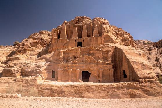
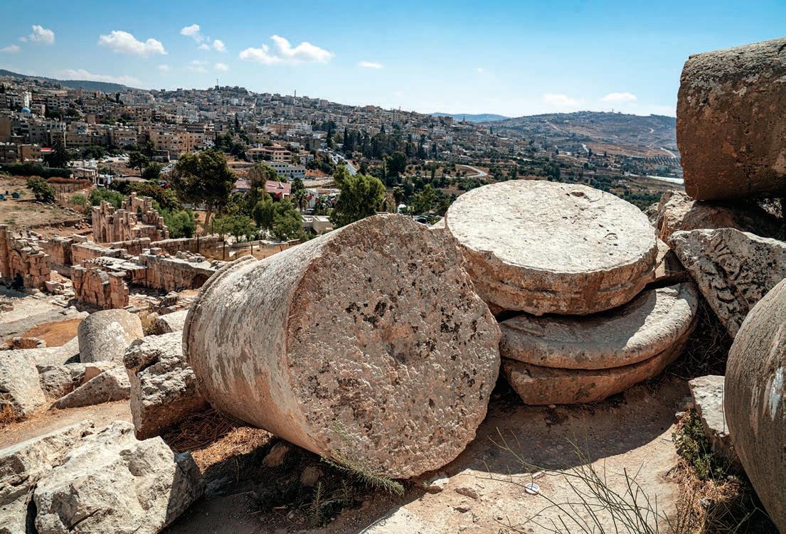
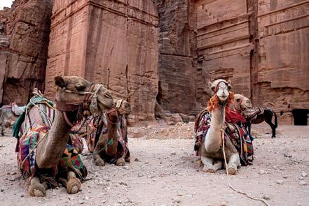
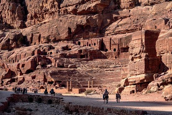
Clockwise from top left: Jerash, 30 miles north of Jordan’s capital city Amman, is one of the best-preserved ancient Roman cities. Built between 150 and 170 AD, the Corinthian columns of the Temple of Artemis in Jerash still stand. The road to Petra, which sees more than a million visitors annually. The earliest evidence of settlement in Jerash is in a Neolithic site dating to around 7500 BC. Most of Petra’s famous monuments were built between the 1st century BC and the 2nd century AD. Our drive through Wadi Rum will eventually lead us to Petra, where Parcak and her team unveiled an ancient site in 2016. Off-duty camels on reprieve in Petra.


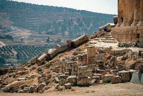
foot, pillared temple carved into a sandstone rock face is Petra’s most photographed feature.
Most of Petra’s iconic monuments were built between the 1st century BC and the 2nd century AD. In its heyday, it was a thriving city of 30,000 with a sophisticated network of hydraulic systems.
But there’s evidence of Neolithic villages in the hinterlands dating 7,000 years prior. The nomadic Nabataean tribe, skilled merchants who established trade routes to Africa and the Middle East, arrived in the 6th century BC. The city survived Roman rule and two devastating earthquakes. Today it’s still home to many Bedouin, who sell trinkets and serve tea to tourists along the Siq.
Over the years, archaeologists have come to Petra to unearth tombs and temples, slowly threading the past to the present. Parcak and her team have made the most recent major discovery here: a Nabataean ceremonial platform “with no known parallels to any other structure in Petra.”
After marveling at the Treasury, we head south and embark upon a half-hour hike, not for the faint of heart. We pass a freestanding amphitheater made of

rock as well as several elaborate caves, which we’re told may have served as someone’s living room thousands of years ago.
The path to Parcak’s site gets steeper and twistier as we climb. Finally, we reach the top, where Parcak says her discovery “had been hiding in plain sight.” To the nonarchaeologists among us, it’s just a wide plateau on the mountain, dusty with sand and pebbles. To Parcak, it’s a potential ritual location dating to the mid-2nd century BC.
sit on the ground,
Satellite and drone remote sensing technology revealed the possible monumental structure, but the equipment has become so sophisticated that it can now be seen on Google Earth. The platform most likely served as a public ceremonial site, especially since it’s located up high, similar to Petra’s other historical places of worship. Overall, the area measures about half a football field or double an Olympic swimming pool.
There is also evidence of a possible altar on a smaller platform originally paved with flagstones and a row of columns that may have topped a staircase. Measuring about 184 feet by 161 feet, the discovery could prove the second-largest elevated religious site uncovered in Petra after the Monastery, an iconic Nabataean tomb
built in the 3rd century BC in the hills high above the Treasury.
Parcak hopes it can be excavated within the next few years. Shards of pottery found on the surface suggest construction began more than 2,000 years ago during the Nabataeans’ initial building boom.
We sit on the ground, enjoying the view below while running our hands over the sand to unearth small tiles and pottery pieces. The scientists among us eyeball the finds to determine whether they’re historical relics or modern detritus. It is difficult to tell.
We take a swig from our water bottles and begin to trudge back down the mountain, clambering over rocks and slippery patches. Parcak appears flush with excitement from visiting the site; she knows she has only scratched the surface.
Once we reach a footpath, we see an elderly woman behind a makeshift table selling what Parcak thinks are looted artifacts. She hands the woman money but refuses to take a trinket. “Maybe in 20 years, it won’t be cool to loot sites,” she says. “We can ‘cancel’ Indiana Jones.”
We test the best navigation and planning apps for overland travel.
By Scott Brady
Astravelers, we embrace the serendipity and randomness of travel, the paper map unfurled on a dusty hood, each direction yielding a wonder. There are also times when we get two flats in one day and just really, really want to find a campsite. Planning and technology can complement adventure, even if our romantic ideals of exploration spurns visions of the Luddite’s journey. There are tools available today that make overlanding safer and more connected than ever before, allowing us to plug in while we unplug. In the end, these apps are tools, and we can always eschew those conveniences if we choose.
The most useful of the programs are navigation applications, which allow physical progress (via GPS) to be rendered over a map layer, shown alongside XML data like waypoints, tracks, and POIs. What started as simple topographical applications that displayed 7.5-minute scanned and rastered paper maps on an iPhone 10 years ago (Topo Maps app) has now grown to feature-rich navigation and planning tools with base layers from both open and curated sources. Most importantly, they have started to become reliable for track recording, which, in our experience, has been buggy at best, or an utter failure at worst. As a result, we still bring a traditional Garmin GPS to ensure our route is securely saved.
THE JUGGERNAUTS It is easy to dismiss the most popular (and even native) applications like Google Maps, Google Earth, Apple Maps, and Waze, but they are widely used for compelling reasons. Most notably, their access to user data that helps indicate traffic patterns, closed roads, or the newest routes.
The most useful of all of these is Google Maps, as favorites can be shared across devices and, critically, it allows for the downloading of off-line map data from anywhere in the world. Search for a place, click on the place name, then select the three dots on the top right. “Download Off-line Map” will be an option, and store the data locally on the phone for one year. Waze’s usefulness depends on what city has largely adopted it, but the tool can be a big help when bypassing traffic jams or local demonstrations.
The next most valuable navigation tools are backcountry-specification applications such as Gaia, onX, Hema, Tracks4Africa, Rever, and others. Their greatest strength is access to topographical map layers, off-line satellite images, and user-contributed routes and data points. The best maps have organizational-validated tracks, which are either done with 100 percent ground truthing by mapping professionals (Hema Maps in Australia), or by aggregating user-contributed data to improve accuracy (Tracks4Africa).

Additional features can include land designation, and route types (e.g., 50-inch or motorcycle-only trails on onX). These apps should also include reliable tracking of routes for future sharing and reference of GPX or KML files.
SUPPORT APPLICATIONS Support applications like iOverlander are relevant for the traveler and will help solve that 2:00 a.m. campsite problem. But with great power comes great responsibility. Try to avoid using these popular and overused campsites, if possible, to distribute impact. And if you do stay at one, ensure that the campsite is a legal place to crash for the night, and do everything possible to clean up all trash (even trash left by those before you). These user-curated sharing apps are among the most significant developments in vehicle-based travel in the last decade, as they provide key insights into finding water, laundry, or that specialized Syncro Westfalia mechanic.
EDITOR’S NOTE: Support applications like iOverlander require a degree of user responsibility, including minimizing the overuse of wild campsites. As these apps have become more popular, it has resulted in significant problems, including campsite closures, agitated locals, and piles of trash and human waste. These apps should be considered travel aids, not guidebooks. As responsible travelers, we should make every effort to distribute impact to other locations, and ultimately, leave the place we stay better than we found it.
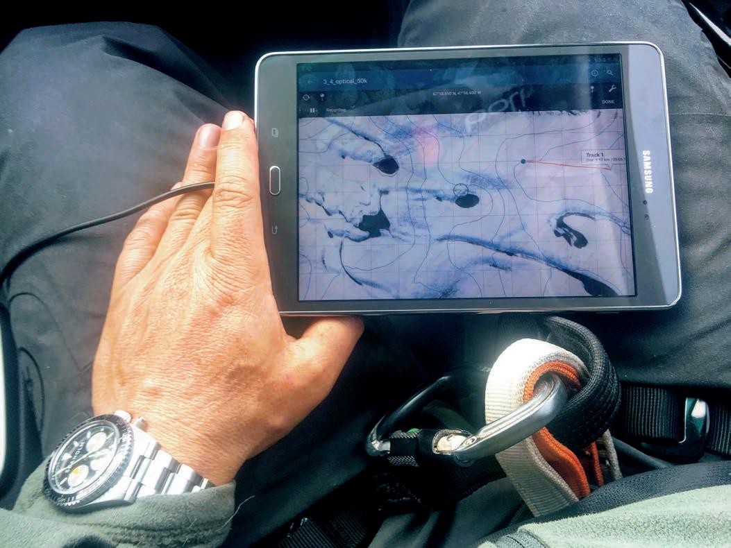
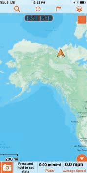
Apps like Gaia and Hema Explorer allow for planning and navigation in areas with little base map data, like the frozen MacKenzie River delta feeding out into the Arctic Ocean. We also used the apps to record tracks and share position data with other groups of logistics partners, as with this screen capture along the shoreline of Antarctica. Opening page: Applications have significantly improved confidence while exploring remote and unfamiliar corners of the globe. During my time navigating an exit glacier of the Greenland ice sheet, I watched our position as we moved between crevasse and water traps covered with a thin veil of ice and snow.
Itseems as if every solution has its stalwart, and Gaia GPS is the overlanders’ map for the 21st century. Gaia GPS (not to be confused with the Gaia alternative media site for people traveling to, well, conspiracy land) has been around since 2008 and has weathered the software application minefield to become a popular and reliable tool for backcountry travel. The company was founded by Anna and Andrew Johnson and remains independent and employee-owned to this day.
The crucial deliverable of the Gaia app is reliability—dead-nuts dependability of both tracking and off-line maps. While it might seem surprising, recording a reliable track without crashing or producing erroneous data appears to be a challenge in the space. Yet Gaia seems to have figured it out. I have countless tracks, waypoints, and routes saved to the app, and they all sync flawlessly across devices and the desktop browser. For the remote and international traveler, it is necessary to be able to upload track data as a breadcrumb or save a completed track as a GPX for future reference and sharing. I still remember getting hopelessly lost in a labyrinth of small streets in a Moroccan city, only to reverse my way out thanks to a reliable breadcrumb track.
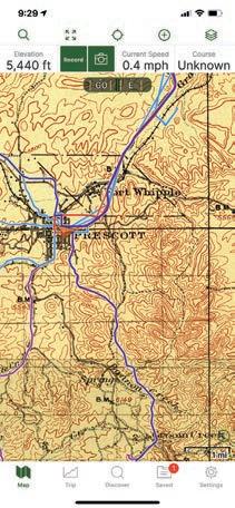
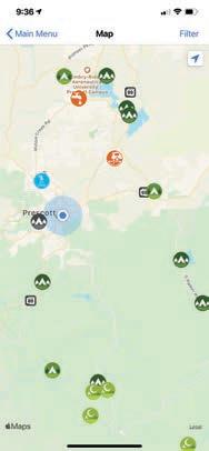
The reliable recording of a track is one of the hallmarks of a properly designed app. These tracks are essential for sharing route information, or even backtracking when lost. Gaia has one of the most reliable tracking functions of any app we tested. Gaia is a robust app with multiple base map options, including historic topo maps of areas like Prescott, Arizona. Historic maps provide interesting context to the trip, and hidden gems like old mines and townsites. Through the saved track function, it is possible to reload previous tracks into the active maps, which is helpful for finding the route back to that perfect campsite or fishing spot.
Bells and whistles are good, but a reliable map and track is the DNA of good navigation.
The Gaia app is feature-rich, but it (thankfully) does not look like it. The main screen is taken up almost entirely by the map, and there are a few small and recognizable buttons and pages that are easily accessible. Along the top, there is a search function (which has improved markedly in recent versions), and full-screen, current location, add, and map layer buttons. The map layer button is where the magic happens, allowing adjustments to the map overlay and which base map renders on the screen. The layers are extensive, but critically includes USGS Topo, satellite, and several land-use overlays. International sources are primarily OpenStreetMap and satellite, which is more than sufficient and generally reliable. All of these maps can be saved for off-line use, and there is even a 1900 historic topo layer which sent my explorer vibes into the stratosphere. My complaints with the application are minimal, as recent updates have greatly improved stability. Apple CarPlay is available but rudimentary, and getting the full benefits of the app does require a $40 per year investment. My wish list includes a paid option to access the National Geographic Adventure Maps (like Baja) as a map layer.
$40/PREMIUM, ANNUALLY | GAIAGPS.COM
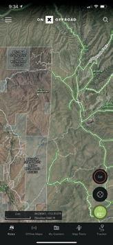
Everygrowing industry breeds a disruptor, a company that uses a rapidly expanding market to slingshot innovation and user adoption by a factor of 10 times. And onX has become that influencer within the overland mapping segment, launching a rapid-fire release of new features. The company was started by Eric Siegfried, a hunter and overlander that noted the need for clear land designation while driving in the backcountry. The company also recently hired one of our longtime team members to manage their growing ground-truthed track dataset.
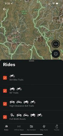
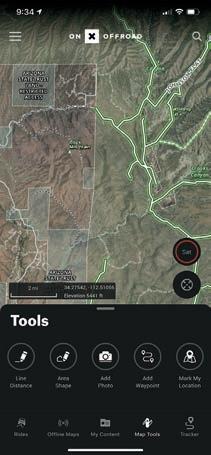
For overland travel, knowing the land designation is critical, since trespassing is just as problematic as crossing State Trust Land without a permit. The company uses a topo or satellite hybrid base map and then overlays with land designation and track data to present an up-to-date accessibility profile. State Trust, BLM, NFS, and private lands are clearly defined by both name and colored map tiles. It is important to note that these features are only usable in North America.
The app is thoroughly modern, with clean icons and minimalist menus. The top of the screen is oc-
The onX app is packed with useful data sets and information layers, including selecting the type of terrain or vehicle. This turns on or off trails that afford the level of difficulty or restrictions beneficial for good route planning. The killer app for onX is all of the land use and ownership data that can be presented on the map. This helps the US traveler to avoid crossing private land, or getting a hefty fine for entering State Trust Lands without a permit. There are multiple map layers, including the all-important topographical and satellite base maps. Then all of the land use and trail data points are overlaid on the screen, greatly improving navigation efficiency and route finding.
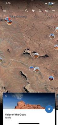
cupied by a drop-down menu on the left, which accesses account information, sharing, and version data. On the right is a search icon that has proven to be adequate in use, but needs better filtering to improve efficiency (for example, a long list of churches generates when searching for Valley of the Gods in Utah).
On the map, there is a toggle button for switching between a topo layer, satellite layer, and hybrid option. This is a quick and convenient feature that improves user efficiency. Below that is a locate button that quickly anchors the center of the map to your current location. At the base of the map are a few thoughtful touches, including a weather icon (which will expand to show a detailed weather forecast). Most notable is the brilliant and compact display of distance scale, current latitude/longitude, and elevation. The bottom menu accesses trail type, saving off-line maps, my content (tracks, waypoints, etc.), map tools, and the tracker. My problems with the app are entirely directed to the tracking feature, which has proven both unreliable and buggy. The tracking will stop randomly, and it will log erroneous track points, such as in the Atlantic Ocean, near the border of Senegal. However, I suspect this will be resolved quickly, and the rest of the app and rapidly expanding trail inventory makes it all worthwhile.
$30, ANNUALLY | ONXMAPS.COM
EDITOR’S NOTE: While onX recently hired one of our former editors, Chris Cordes, Overland Journal has no commercial association with the company.
Africais a glorious continent, and it requires a good map. That is what prompted T4A founders to start their mapping empire in 2003, providing paper maps, GPS data cards, and now mobile applications for the backcountry explorer. The amount of ground-truthed data is expansive and represents nearly two decades of user-contributed tracks. Their app has improved considerably in recent years and now provides a reliable tool for exploring trails and remote regions of the bushveld.
In use, the application is extremely rudimentary but is at least reliable and accurate. There is no tracking
Reverwas cofounded by Justin Bradshaw of Backcountry Discovery Routes (BDR) fame. Justin has traveled large swaths of the world by overland vehicle, and that is reflected in the user experience. The base app has several useful features, but the value proposition dramatically improves with the Pro version (paid). Pro activates the LiveRide function, providing active ride updates via a link you can share, and also active SMS updates to your desired contacts that receive notifications of your location (uses cellular data).
The overall look and feel of the app are perhaps the most attractive in the segment, but the free version
function, and each country or regional map must be purchased for a reasonable fee ranging from $3 to $13. Nearly the entire screen is dedicated to the map, with a top bar including an add map icon, a search bar, and filtering function. The best feature is the results icon, which will display selected POIs on the map overlay, including attractions, parks, and campsites. Despite no tracking function, the app has everything else you need.
$3-$13, DEPENDING ON THE MAP | TRACKS4AFRICA.CO.ZA
does hit you with ads and a fairly heavy push toward the Pro version. Essentially, the free version is a liability for most travelers, as you cannot export GPX data or download off-line maps, so either pay for the Pro version or stay away. The app also has an emphasis on the community aspect, with a social media undertone of challenges, shared rides, friends’ rides, and upcoming meetups. Tracking has been reliable, and the LiveRide feature and Butler Map BDR tracks are worth the price of admission.
$48/PRO, ANNUALLY | REVER.CO
(AUSTRALIA ONLY)
Whentraveling in Australia, the only serious mapping tool is Hema, and their best offering is their 4WD Maps app, which provides complete off-line maps of the country. I have used it to cross Australia from coast to coast a few times, and though somewhat primitive as an application, you are buying the data, which is the most accurate and validated for this region of the world. The app includes 1.5 gigabytes of off-line data, including dozens of detailed base maps.
All of these maps render precise overland track routes, campsites, watering holes, and significant POIs. The main screen has only a few icons along the bottom,
including a maps menu, search function (effective), locate button, add waypoint, and toggle to the tracking/ settings screen. Tracking has proven to be reliable. The detailed maps include trail names, distances between junctions, and anticipated difficulty as represented by line thickness and dashes. Campgrounds and other services are also shown. There are a few limitations, as the maps do not allow for turn-by-turn, and additional layers come at a fee. However, there is also nothing else like it for exploring the Land Down Under.
$70/ANDROID, $100/APPLE ITUNES | HEMAMAPS.COM
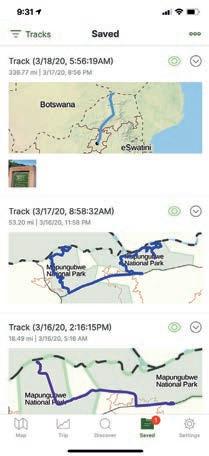
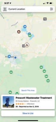
Few apps have resulted in such rapid and broad adoption as iOverlander. The app provides a collection of user-contributed campsites, campgrounds, wild sites, and traveler services. It was started as a not-for-profit by Sam Christiansen and Jessica Mans, and there are no costs associated with its use (although you can donate).
The application is intentionally simple, but admittedly buggy, including frequent crashes. However, it is difficult to complain about free, and it just takes some patience to glean the most useful data. The main map screen is where all the magic happens, and its most
Ifyou are living on the road in North America, Campendium is another useful tool for finding a place to boondock, stealth camp, or resupply. The app is well-curated and free, but it does feature both ads and paid content. The data favors RVers and trailer campers but does filter for dispersed camping.
There are several features I like about Campendium, mostly related to the user reviews of various sites and the cell coverage reports (for those of us that work remotely). Each entry has the provision for photographs and additional information like vehicle size restrictions and amenities. All of the functionality feeds
powerful feature is the filtering menu, which allows for the display of only the service or campsite type you are looking for. I have used this to find wild camping areas throughout North America, although I rarely camp at the exact spot shown (with a few notable exceptions). Other useful features are the amenity icons, which indicate if cellular data is available, etc. It also shows details on the contributor, including the date the site was last visited. This app remains one of the most useful tools for domestic and international travelers.
FREE | IOVERLANDER.COM
off the main map, with only a search bar along the top and filter icon. The filters are effective, but I would like for it to include a “cell coverage” selection in amenities. The map is easy to navigate, and the campsite or service icons are easy to distinguish for planning, including water and dumpsites. Once an icon is selected, a detail window opens at the bottom of the map with more information, including user ranking, cost, and when it was added to the database. While not specifically for the overlander, it is free and serves as another data source for planning.
FREE | CAMPENDIUM.COM
While there may no longer be blank stops on the map, there are certainly places humans rarely, if ever, visit. For those places, this is where Google Earth shines, as it allows for detailed and efficient route planning using satellite data. This is particularly useful when crossing large dune fields, or traveling in countries with poor base map data. Even on the phone (the desktop version is better for route planning), the app allows for quick pin drops, distance measurements, and, most importantly, highly detailed satellite overlays. It’s as close to ground truthing you can get without boots on terra firma.
As an app, it is both interactive and dynamic and even allows for a wonderful surprise or two. There is a
randomized POI icon called “Feeling Lucky” that flies you to an obscure and fascinating location on the planet (the last one I checked being Lake Rusanda in Serbia). To get the best from the app for route planning your next crossing of the Sahara, start in the Chrome version and build a travel project. It is far more powerful than can be described here, but it allows everything from route creation to importing images to displaying POIs. Then it all syncs across your devices. In addition, it is worth checking out Google My Maps for creating detailed route files, importing and aggregating GPX tracks, and sharing these with other travelers.
FREE | EARTH.GOOGLE.COM


Exploring Baja California, one Spanish mission at a time.
By Susan Dragoo
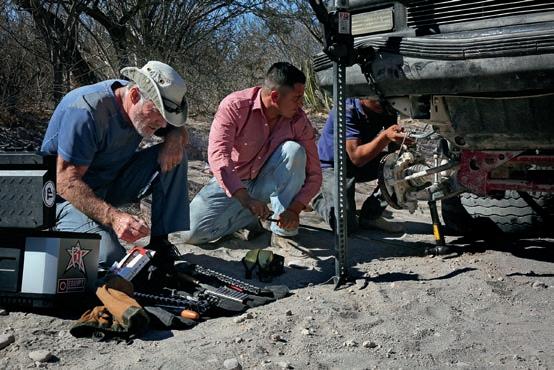

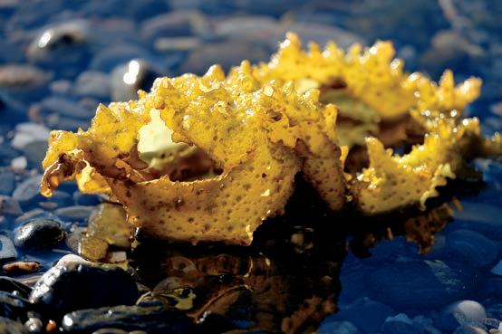

Clockwise from top right: The church at San José de Comondú was once the largest of all the Baja California missions, but only this side chapel remains today. Seaweed radiates an unearthly light against the black gravel beach on the Bahía de los Ángeles. Our camp at Playa La Gringa provided a satisfying sense of isolation. Spare hardware and a Hi-Lift jack always come in handy when overlanding, especially when helping another traveler. Late afternoon sun casts long shadows over tinajas, or water pockets, emphasizing Arroyo La Presa’s lunar look. Opening page: Cirios plants, also known as boojum trees, provide fascinating roadside entertainment in Baja’s Valle de los Cirios protected area. Legend has it they inspired some of Dr. Seuss’ comical characters.
Do you feel safe down there?” It’s the question we hear most often from fellow Americans regarding our travels in Baja California, and the answer is, “As safe as anywhere else.” But, really, there’s more to the story.
A tunnel of cactus constricts the dusty one-lane road leading from San Luis Gonzaga into the desert of Baja California Sur. We slow our Toyota Tacoma to a stop when the stationary rear end of a red pickup truck appears around the bend, blocking the narrow path. Three men are standing outside the vehicle. Driving around them, through thickets of thorns and needles, is unthinkable if not impossible. With no other option, we stop.
A travel alert issued by the US State Department the day before pops into my head. “Exercise increased caution in Mexico due to crime...Violent crime, such as homicide, kidnapping, carjacking, and robbery is widespread.”
The men huddle around the front of the late ’90s Chevrolet, its axle drooping on the right. My husband, Bill, walks ahead to investigate. I watch from the truck, my hand on our SPOT device, prepared to hit the SOS button. Soon Bill walks back for his toolbox, and I relax. Smelling a photo op, I grab my camera and join him at the breakdown.
“Cerveza?” One of the men offers a Tecate as I walk up.
“No, gracias,” I say. It’s early afternoon, hours before I usually imbibe. Besides, the beer is probably warm. So Rodrigo, as it turns out he is called, hands the can to a stout fellow in a red checkered shirt and brown felt cowboy hat. Jovial and gregarious, the Tecate recipient is Ricardo, and he is clearly the leader of the pack. He is also the only one who speaks any English. Rodrigo and his buddy Luis seem mostly responsible for distributing beers and otherwise following Ricardo’s instructions.
Their dirty truck has a lifted suspension and has been, as we say back in Oklahoma, “rode hard.” It now has a broken ball joint. Getting it out of the way means getting it rolling— somehow. Bill has magical mechanical skills and carries a nearly bottomless set of tools. He puts both a Hi-Lift jack and the Tacoma’s factory jack to work raising the truck. All three Mexicans drink beer as they work under the truck, seemingly oblivious to the danger. I find myself thinking of OSHA and blurting out “Cuidado” a time or two as I watch. Bill keeps an eye, and a hand, on the Hi-Lift as he offers Ricardo tools and mechanical advice, which makes me feel better.
Ricardo’s English is good but limited, and my Spanish is bad and very limited, but we manage to carry on a conversation. He says he’s been out buying horses for a rancho, but I later speculate the trio might have just gone to town for cerveza.
I tell Ricardo we are out exploring Spanish missions, revealing my interest in history, and soon he pulls out a large point knapped from local stone, which he says he found while running in the mountains. It is 5 or 6 inches long and in pristine condition. I admire it, curious about its age and origins and a little dubious. I show him our intended route on the map, east through the desert to San Evaristo, a fishing village on the Sea of Cortez, from which we will launch our southbound leg toward La Paz. “Go see my friend Lupe Sierra. He has a restau-
rant in San Evaristo,” Ricardo says. We promise to do so.
After about an hour working in the sun and several Tecates, the hombres get the vehicle rolling. Ricardo and the boys head off down the trail into the desert. Bill and I aren’t far behind, followed by a family in a small, white pickup who has been stranded behind us. About a mile farther, our friends’ red truck reappears. The repair failed, and they need a ride. At least they got the truck out of the road.
“Can you take us to Las Tinajitas?” asks Ricardo.
“Of course,” says Bill. There’s no room in our back seat because it has been removed and replaced with toolboxes and an air compressor, and is otherwise filled with luggage. So Ricardo, Luis, and Rodrigo climb atop our truck-top tent, mounted over the bed of our Tacoma. They leave everything behind in their pickup, except for a #3 washtub full of Tecate and ice, covered with an old canvas, which they squeeze beneath their feet atop the water tank in the truck bed. The beer is cold, after all.
Like a homecoming queen and her court on the back of a red convertible they ride, three abreast. Ricardo (who acknowledges his speedy driving contributed to the truck’s demise) actually shouts, “Andale.” Bill finds a radio station playing mariachi music and turns up the volume, adding to the cacophony of yelling Mexicans and road noise.
Before we reach Las Tinajitas, we stop at a rancho where Ricardo thinks he might get help. Luis and Rodrigo haul out the beer tub and stand next to it in the shade, having another Tecate while Ricardo checks on things. It’s a no-go here, so the amigos load up the washtub and themselves again, and we continue on to Las Tinajitas. Bill is in the spirit of things as he drifts around tight turns in the dust and bumps over the rocky roads. I hope the boys won’t fall off. They keep up a constant string of loud chatting and shouting, so it’s hard to tell whether they are happy or distressed.
For the last month, weʼd been camping along the Sea of Cortez—waves lapping, sometimes crashing, a few feet from our camp. Sunrises were so intense I would lie awake and wait for them.
At Las Tinajitas, Luis and Rodrigo wait to unload the washtub, but Ricardo confirms he can get a ride from there; they pull their precious cargo out of its slot. Our new friend reminds us to look up Lupe Sierra when we get to San Evaristo. Bill and I hug all three and wave as we drive off, hoping Ricardo receives the help he needs, already feeling parental toward the young men.
Bill and I had been exploring back roads for nearly a month in Baja, a place almost entirely new to us, camping along the Sea of Cortez—waves lapping, sometimes crashing, a few feet from our camp. Sunrises were so intense I would lie awake and wait for them.
We had escaped Oklahoma right after Christmas, bringing maps, GPS, guidebooks, and sound advice from knowledgeable friends, but consciously avoided making an itinerary. There was no scrimping on the truck, however. It was already fit for rough off-pavement use, and Bill had spent weeks modifying it further

for this trip. He’d added a 30-gallon water tank and onboard hot shower, obviating my usual need to find a hotel after a couple of days of camping. My mother said the truck was turning into a motorhome, with its shower, rooftop tent, and refrigerator. I suggested we not say that to Bill.
Bill and I had crossed the border in Mexicali, driving south on Highway 5 with the general intention of traveling along the Sea of Cortez. The peninsula of Baja California protrudes nearly 800 miles into the Pacific Ocean south of the US state of California and west of mainland Mexico. Between Baja and the mainland, the Sea of Cortez, commonly known as the Gulf of California, is 150 miles across at its widest point. Its beaches are rumored to be warmer than those on the Pacific side, an attractive proposition for us.
With any journey, a direction of travel and goal of some sort must emerge. On our third day in Mexico, we met with a Bajasavvy fellow overlander, also a history buff, who recommended a couple of backcountry tours to Spanish missions.
Twenty-seven Catholic missions were founded by the Spanish along the length of the peninsula of Baja California, between 1697 and 1834. The state of these buildings today varies greatly. Some are well preserved and still in use as churches;
others have altogether disappeared into the rugged landscape. Many are somewhere in the middle.
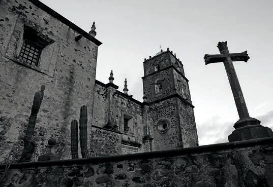
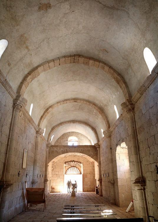
By the time we reached San Luis Gonzaga, we had done the “easy” mission tour, first visiting San Borja, the northernmost stone mission church on the peninsula. There, we toured the beautiful structure, completed around 1801, with Angel, a member of the family who takes care of the historical site, and saw the ruins of the original adobe brick church, circa 1768. We slept in a palapa in San Javier, a mountain village anchored by Misión San Francisco Javier de Viggé-Biaundó, completed in 1758. This one is Baja’s best-preserved original mission and continues to function as a church. And, we’d made a brief stop at the remains of San José de Comondú, founded in 1708 and eventually built into a massive cut-stone church complex at its
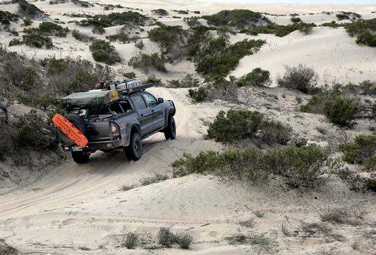
Clockwise from right: Angel, our guide at Misión San Borja, greets visitors at the entry portal to the church’s sanctuary. A maze of sand on the Pacific Coast in Baja Sur turns our Tacoma into an amusement park ride. Misión San Francisco Javier de Viggé-Biaundó, built from 1744 to 1758 of cut volcanic rock, is still a thriving part of the community it anchors. Opposite: A cut-stone spiral staircase at Misión San Borja, completed in 1801, leads from the vestibule to the choir loft.
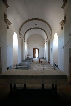

Clockwise from top right: Just when we think we’re completely alone in the middle of the desert, a group of singing vaqueros rides by on their evening commute. A broken chalice and dusty crucifix suggest Misión San Luis Gonzaga has seen better days. A butte near Arroyo La Presa dominates the landscape. Roofless walls of the priests’ quarters and a mission annex stand adjacent to Misión San Luis Gonzaga. Humble wooden pews still serve villagers who worship beneath the barrel-vaulted ceiling of Misión San Luis Gonzaga, completed in 1758. Opposite: Our little Tacoma is the perfect pack mule, allowing backcountry access on the most challenging trails.
final location. It was the largest mission church in all of California but fell into ruin and was demolished in 1936. A side chapel to the main building was preserved and is all that remains. None of these were difficult to reach.
Today, we began a more challenging route, starting in San Luis Gonzaga, which is not much more than a dusty street running alongside a handful of impressive buildings—out of place and now abandoned—and a neglected church still in use. Misión San Luis Gonzaga was the last mission founded in the southern half of the Baja peninsula. The stone church, completed in 1758, remains intact.
I photographed the church after lunching on papaya we’d picked up in Ciudad Insurgentes a few miles back on Highway 1, and Bill chatted with two motorcyclists from the States. They were also passing through, before continuing into the desert toward the Sea of Cortez.
Up and over the coastal mountains, we ascend to a spectacular view of the Sea of Cortez before creeping down a track so steep, rough, and rocky we bet no other motorized vehicle had used it in months.
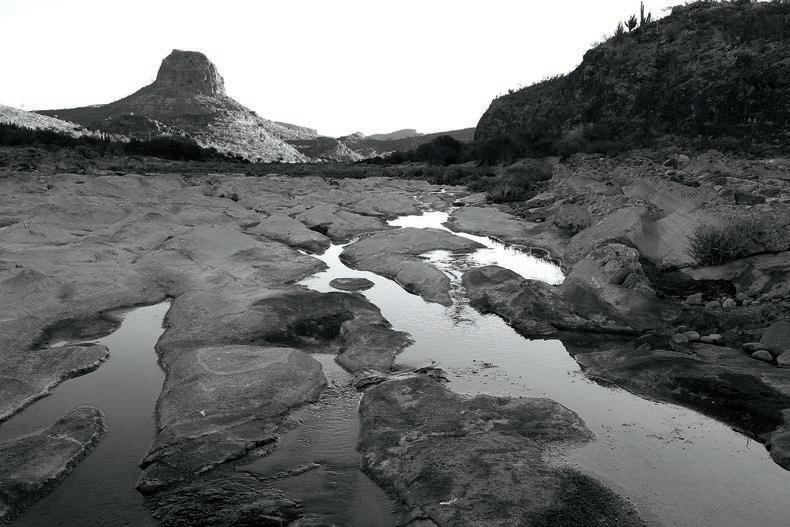
After the encounter with Ricardo’s bunch, we begin a campsite search as the sun winds down. A promising side road leads us to the bank of Arroyo La Presa, a mostly dry streambed of gray stone punctured by tinajas, or cavities holding water, making the terrain look oddly lunar.
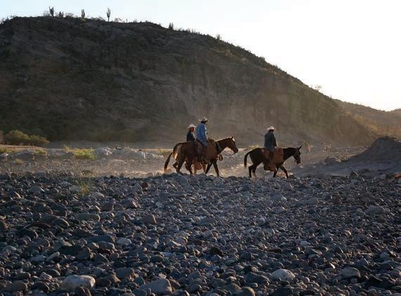
The singing vaqueros are a complete surprise, but pleasant as surprises go. As Bill and I are cooking dinner at dusk, melodic voices arise in the distance. The music floats closer, backed by a clip-clop percussion, and soon three cowboys on horseback appear on a trail we hadn’t noticed. We wave nervously, concerned we might be trespassing. The vaqueros wave back and continue on their path. Headed home, we surmise, from the day’s work at a nearby rancho.
Cowbells clunk gently all night, confirming the proximity of bovines. At sunrise, the vaqueros pass by again, going in the opposite direction. Soon, a young man on foot stops on his way. He speaks no English. We offer him coffee, which he accepts, but when we can offer no leche or azucar (milk or sugar, we drink it black), he smiles and hands it back. A third fellow rides by on a small horse, also stopping to say hola. The trail, invisible to us, has turned out to be a major thoroughfare.
Our goal this day is to reach the second mission in the more challenging phase of our tour—difficult roads, remote locations. Misión Dolores was established in 1721 at Apaté, on the coast of the Sea of Cortez between Loreto and La Paz. A stone church, dam, aqueduct, reservoir, and other structures were built there, and ruins are said to remain.
Our National Geographic map shows a way to Misión Dolores, and we head east from La Presa in that direction. In spite of what the map says, however, we can’t locate an actual road to Misión Dolores. Another road leads in a similar direction, and we decide to try it. It is certainly rugged enough to be on the “challenging” mission tour. Up and over the coastal mountains, we ascend to a spectacular view of the Sea of Cortez before
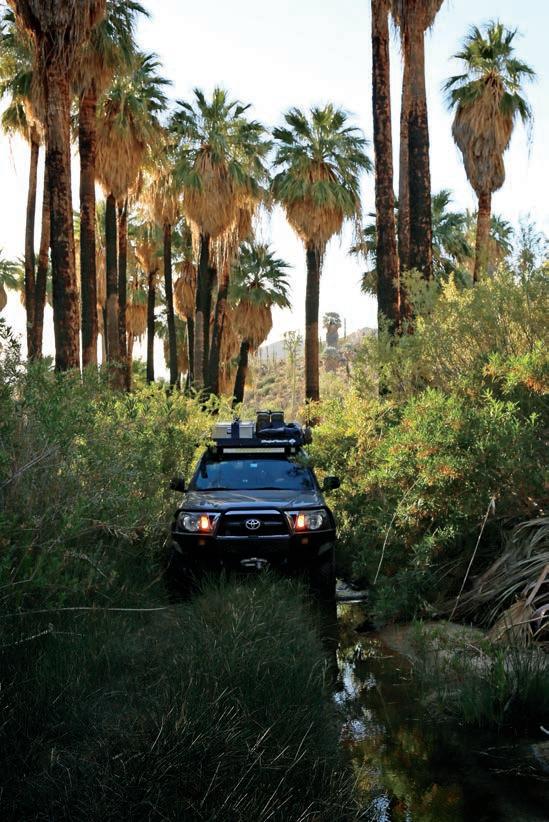
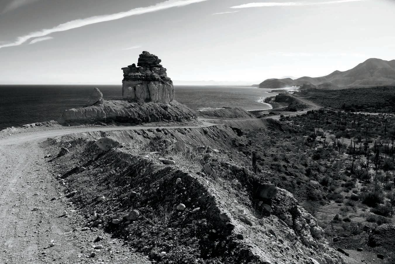
The magical moonscape of Baja is well represented on this lonely road out of San Evaristo as we head toward La Paz. Opposite: Racing sunset as we return to camp after an unsuccessful attempt to find Misión Dolores along the coast of the Sea of Cortez.
Glowing thickets of cactus capture both the silent energy and harsh conditions of the Baja desert.
creeping down a track so steep, rough, and rocky we bet no other motorized vehicle had used it in months. Eventually, we reach sea level and find ourselves in the village of Los Burros, which looks to be a short distance south of Misión Dolores. At a fishing hut on the beach, a local man tells us you can’t drive to Dolores, but must take a boat and then hike. We might have hired him to take us, but at this point in the day and without a better understanding of what we might be getting into, we choose to turn around. Back over the mountains, we briefly explore a couple of side trails that look as if they might lead to Misión Dolores but end quickly in a forest of cactus. The shadows are getting long, so we return to the previous night’s campsite and find a spot more hidden (we hope) from the vaquero highway.
The next day, we abandon the quest for Dolores and go in search of our third objective, Misión La Pasión, which the map shows just east of our camp in the village of Chillá. We had driven through there the day before and saw no sign of a mission, but this morning we asked the locals. Their directions lead us to a trail that crosses a stream, beyond which we see nothing but a house. We drive past it, and the road quickly ends. From there, I see a stone tower atop a nearby hill and insist we should walk to it cross-country, perhaps a hundred yards. Bill suggests it is someone’s property, and it would be neither wise nor respectful to trespass. So we drive back toward the stream, and, just before the crossing, spy two men waving at us from the front gate of the house. I get out and explain what we are looking for. “Aqui,” says the older man.
“Misión La Pasión is here?” I ask.
“Si, aqui,” says Maximo Amador, smiling and inviting us to see what remains. He shows us around his property and explains. With my poor Spanish, I comprehend only a little, but it’s enough. All that’s left of Misión La Pasión are foundations, cornerstones, rubble, and irrigation ditches. Still, it feels like a huge discovery, and Maximo offers a wealth of information as we walk around with him and his son, Modes. The large stone structure I had seen on the hill is a modern cistern Maximo built. He brings us back to his house and displays a collection of artifacts and a certificate of appreciation he received from the University of Utah for his support of their anthropological research in the region. I later contacted the individual who had signed the certificate, and he confirmed we’d made a great find when we ran into Maximo, who has guided their teams and provided camping and meals.
Feeling we’ve accomplished enough, despite not reaching Misión Dolores (Maximo said we had reached Misión Dolores since it actually was moved to the site of La Pasión in 1741), we drive toward San Evaristo. The journey to Los Burros the day before had consumed much of our fuel, and by the time we rolled into San Evaristo, we were looking for gas. We expect no Pemex gas stations in the fishing village, but boats need gas, so there’s hope. We have 15 gallons of gas on board in jerry cans but prefer not to tap into that reserve. Remembering Ricardo’s advice and being hungry, we decide to look for Lupe Sierra’s restaurant right away. Entering the settlement, there’s a web of dirt tracks and a sign indicating a restaurant ahead. We follow
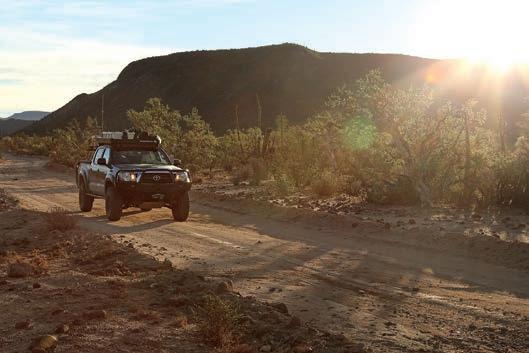

the path toward the restaurant and stop. A man in white socks, sandals, and shorts stands on the porch. I tell him we’re looking for Lupe Sierra’s restaurant. He says with a smile, “I am Lupe Sierra.”
Lupe treats us with hospitality, and his shrimp tacos are delicious. We mention the association with Ricardo, but it is clear Lupe’s generosity is not linked to that acquaintance. Bill asks about purchasing gas, and Lupe says, “Yes, I have gas. You eat, and then we will take care of that.”
After we enjoy our tacos, we ask the waitress, who speaks no English, if they have helado (ice cream), wanting a bit of dessert. “No helado,” she says, but shortly brings us a chocolate cupcake à la Hostess. It is cut cleanly in half, a few bites of sweetness to top off our meal, and a perfect symbol of their kindness.
When it is time to get the gas, we take the truck down to Lupe’s storage building. He offers the fuel at barely more than the price at the pump, and we buy 40 liters but pay him a fairer price, given he would have transported it all the way from La Paz. Full tank, full bellies, we leave San Evaristo and head south along the coast for another night of camping on the lovely Sea of Cortez, indeed feeling quite safe.
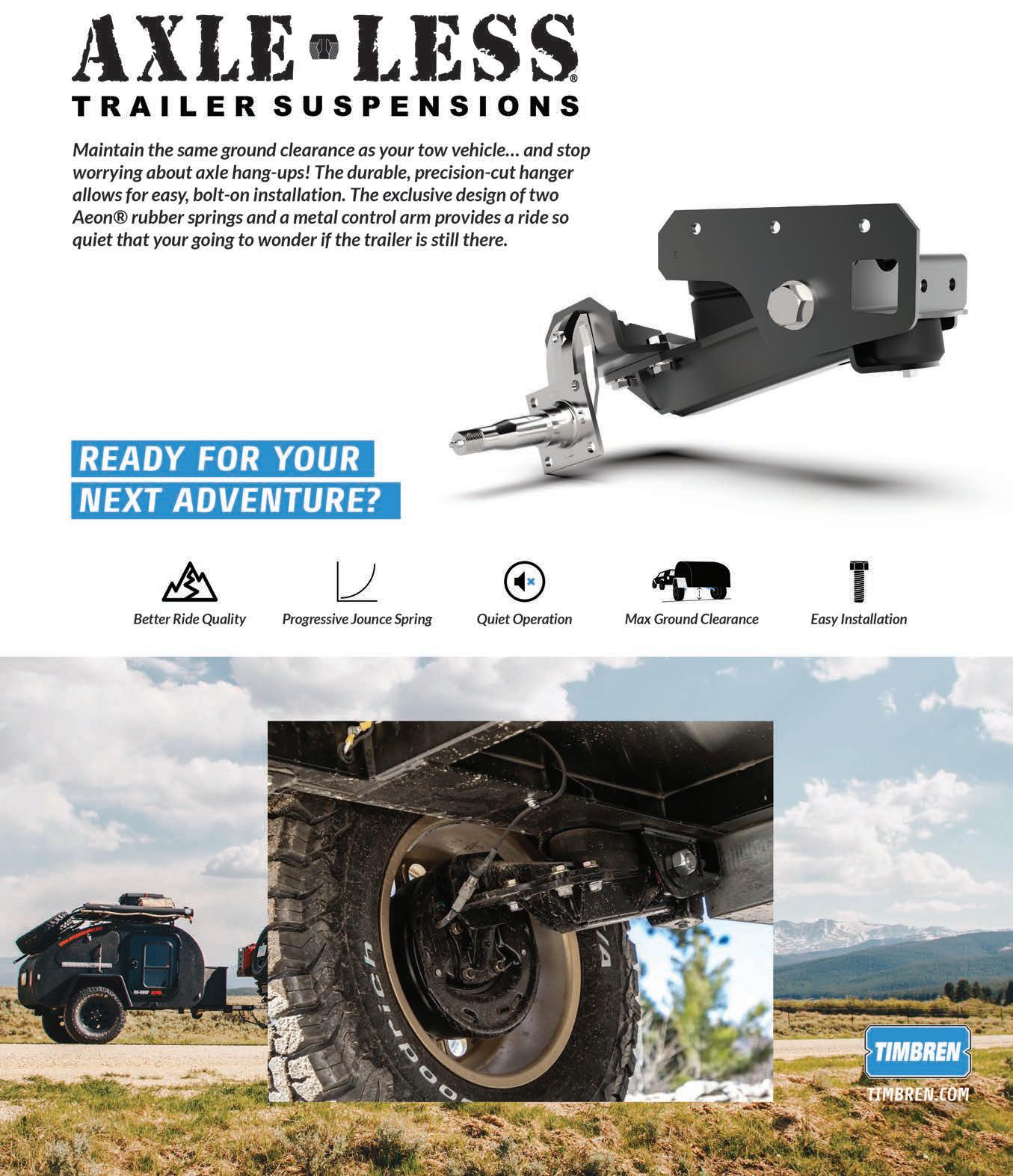

Driving Kyrgystanʼs Tosor Pass, one of the toughest, most exhilarating mountain roads in Central Asia at 13,000 feet.
By Karin-Marijke
Ithinkwe should cross today. Rain is predicted tomorrow for this side of the pass,” Coen suggested, while pointing out the weather forecast on his iPhone.
Magnificent white peaks call as the old diesel chugs up the mountain. Opposite top to bottom: With smartphones having taken over the world, local people want to take pictures of travelers, too. Sheep, cows, and horses are hot commodities at the Karakol animal market. We encountered these youths at the lookout point of the Seven Bulls Valley, along with an opportunity to hold a huge bird of prey. Opening page: Our Land Cruiser, engaged in tractor mode.
We were having lunch on a beach along Lake Issyk-Kul. Even though it was mid-August, we were dressed in long pants, socks and sneakers, and a sweater. The weather had been unfavorable with heavy rain, and we had been cooped up in a guesthouse in the nearby town of Karakol for a couple of days. While we are generally not bothered by such setbacks, we were in the company of my niece Jaimy who joined us for 12 days on the road. This meant we had to be back in Bishkek, the capital of Kyrgyzstan, in time for her return flight. During our limited time together, we wanted to show her as much as possible of the country’s mindblowing mountainous landscapes. So, unusually for us, we were on a schedule.
Delighted with the warm sunshine this morning, we had picked up our explorations of the famous landscapes around Karakol, such as the Jeti-Oguz (Seven Bulls) Valley, one of Kyr-
gyzstan’s picture-postcard-perfect rock formations. Its seven red sandstone bluffs stand out like sentinels from the otherwise green surroundings. From there, we were following the southern edge of the second-largest alpine lake in the world on our way to the Fairy Tale Canyon.
Kyrgyzstan (officially, the Kyrgyz Republic) is the smallest of the five “Stan countries” that make up Central Asia, the others being Kazakhstan, Uzbekistan, Tajikistan, and Turkmenistan. The first three of them share borders with Kyrgyzstan. Traditionally living as herding nomads, the Kyrgyz were forcibly transitioned to urban settlements during the Soviet era. Few nomads remain, and many of their yurts—the round felt tents used by nomads in this part of the world—have been turned into tourist camps in the most magnificent settings.
Ninety percent of Kyrgyzstan consists of mountains. Few asphalted roads run through the country, and with endless alternatives of driving unpaved, spectacular roads, it’s an overlanders’ paradise.
Ninety percent of Kyrgyzstan consists of mountains. Few asphalted roads run through the country, and with endless alternatives of driving unpaved, spectacular roads, it’s an overlanders’ paradise. Wild camping opportunities abound. With three of the five Stans having no visa requirements (at least for Europeans), the region is becoming increasingly popular with overlanders, either by car, motorcycle, and even bicycle. The Tosor Pass lies on the ridges of the 220-milelong Terskey Ala-Too, part of Central Asia’s largest system of mountain ranges, the Tian Shan. It is one of the many unpaved roads in Kyrgyzstan that beckon to be driven and includes a fair share of rocky tracks, and at least one tricky river crossing. The trail would be steep if starting from the IssykKul side, and it is not advisable to drive it in rain when the soil becomes slippery. While the Land Cruiser drives on sturdy all-terrain tires, they are not particularly suited for heavy mud on slanted stretches.
And so we changed plans. Instead of following the popular tourist route along Lake Issyk-Kul and into the Fairy Tale Canyon, we headed into the mountains, following a trail few foreigners had driven. We packed away our food, teacups, and camping chairs, and drove to the village of Tosor to fill up on diesel. (On a side note, at Tosor was found the earliest evidence of a settlement in what is now Kyrgyzstan dating from the Paleolithic period.) Here, like elsewhere, were old petrol pumps from Germany, and at first glance, it seemed we had to pay 1,000 DM (the former German Deutsche mark, some $1,000) rather than 1,000 som ($14). After filling up, we headed out for Tosor Pass.
Right after leaving the main road, we were off the grid with no more cell phone signal to be had until far on the other side of the pass. The narrow track followed a river that cut through the mountains, fed by a tributary that boiled and swirled through a spectacular gorge. Rain from the past couple of days

came thundering down over boulders, racing downhill into Lake Issyk-Kul. Higher up, we followed a widening road that hugged the mountain slope, taking us to the white peaks that called out from a distance. We passed a herder and a white yurt on a jailoo—an alpine grazing meadow where nomads take their animals in summer.
Easy to spot in the green surroundings were the gray marmots, whose body length can range from 23 to 31 inches long. The big rodents love lazing in the sun but spurt toward their holes in the ground as soon as they hear a noise or feel the ground trembling. With our old diesel rumbling as loud as it does, we mostly saw them scurrying off in the distance. Catching them on camera was nigh impossible.
We had the road to ourselves except for two Lada Nivas that kept overtaking us. It was Sunday, both were packed with families, and we assumed they were returning from a weekend or vacation on Lake Issyk-Kul, or maybe a day outing. Each time we caught up with them, farther down the road, they had stopped, gotten out, and the men were having a drink. We were nearing the top, and vegetation had become scarce or nonexistent. Views disappeared behind thickening clouds. Once more, we passed the Nivas. “Come, come. Stop, picture!” they motioned. The days when Western travelers only take photos of other people in countries they are visiting are long over. With smartphones having taken over the world, local people are now just as passionate photographers and want to take pictures of us, too.
These 12 days, however, Coen and I were hardly spared a glance. Seeing a black person is highly unusual in Kyrgyzstan, and as such, my dark-skinned niece drew massive attention throughout the trip (only on her last day, she concluded, had nobody asked to be in a picture with her). Some asked if she was a sportmenska—an athlete, which we assumed was an association they got from watching television. In Kyrgyzstan, people have no problem staring at others, which can be a bit unsettling, but it is done in a curious, kind way. “Krasyva,” they’d say, pointing at her face—beautiful.
From plastic bags of food on the bonnet of a Niva came a bag with cookies to be shared. One of the men poured vodka in small cups and handed one to Coen. Being at a higher elevation and needing all his attention for the increasingly difficult road, he declined. They didn’t push too much after I took Coen’s place to join them in a round. Our few words of Russian and their not speaking English limited our encounter to smiles and being content to share a moment on the road.
We said our goodbyes and continued on our way. The track became rock-strewn and included some short, beastly stretches that required tight maneuvering. Coen engaged low gear— or tractor mode, as he likes to call it—to crawl up in a controlled manner without the Land Cruiser, and we ourselves, being shaken to pieces. Since the Land Cruiser doesn’t have a turbo, the engine was losing 1 percent of power every 300 feet
or so. And by now, the engine had lost about 30 percent of its power. The beauty of this old diesel is that it always chugs up the hill without a hitch nonetheless.
In retrospect, driving this 45-mile trail in one afternoon wasn’t the best idea. Needing to reach the other side of the pass to find a flat piece of land to camp, we stopped less often to admire the view or take pictures than we would have done if we’d had all day. It was a bit like driving through a magnificent painting rather than feeling a connection with it; there was no time to spend outside to absorb the coolness of the air, tranquility of the surroundings, and atmosphere of the wilderness. Constant attention was required on the rough sections, and for me, sitting on a wooden box (as we have no seats in the back) on such a rocky ride wasn’t particularly comfortable. Having said that, it was a spectacular drive, and we’d happily do it again.
The narrow track followed a river that cut through the mountains, fed by a tributary that boiled and swirled through a spectacular gorge.
By the time we had zigzagged up the 24 miles to the 12,791-foot, snow-covered Tosor Pass, the world was shrouded in mist, and we had no view of what lay ahead. Only farther downhill did the world show itself again, at times under a blue sky dotted with cotton clouds. The riverbeds consisted of rocks, and we crawled through them in first gear. One river confronted us with a particularly big boulder, obstructing the regular passage, leaving very little space alongside to cross. We were glad to have a narrow vehicle as well as four-wheel drive. Both helped get us to the other side unscathed, but I can imagine it’s a tricky if not nasty passage when you have a wide truck.
We meandered down a wide, green valley with grazing yaks and white mountains lining the horizon. It was easy going until it wasn’t clear what the right track was: straight ahead or down into the field. We chose the latter, which turned out to be the right one. The main path on the upper side once led to a bridge that was no longer there. In low gear, we jolted down the rough road to the Jilu-Suu River, which was easy to cross, but the track uphill was deeply rutted and full of big rocks. I climbed out to see what lay ahead as the Land Cruiser stalled in one of the deep ruts. It was nearing 6:00 p.m.; it was cold, we were all tired, and in no mood to work hard to free the Land Cruiser. Coen maneuvered back and forth, searching for a spot where the tires got a grip on another rock to help push the vehicle forward once more. He then accelerated the Land Cruiser out of the rut and tackled the slope back to the main road in one go, leaving Jaimy and me to follow it while cheering on our home on wheels. The high elevation made us short of breath, and we were glad to be back sitting in the vehicle.
Some 21 miles after the pass, we arrived at a camping spot mentioned on iOverlander, where a family lived who took care of the Jilu-Suu hot spring. We asked for permission to camp,
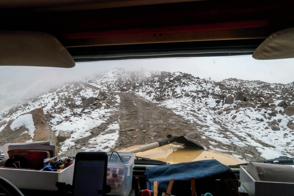
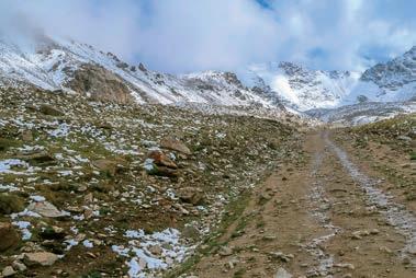
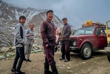
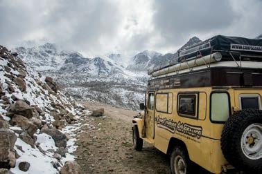
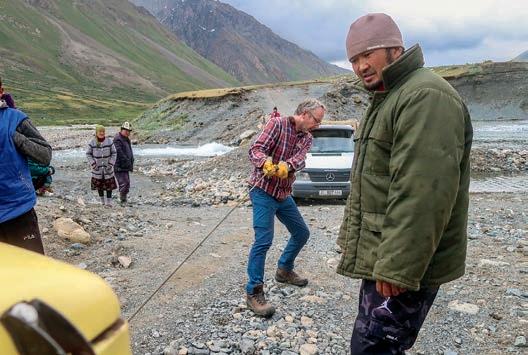
which was granted. We were at an elevation of 9,865 feet, and although it was cold and windy, Coen set up the rooftop tent. As it goes when having company, we gave up our bed in the warm Land Cruiser to our guest, and we slept “upstairs.” With a down blanket and an extra sleeping bag, we were just fine. While Coen did his chores, I did mine and set up the Coleman stove to cook a quick dinner of rice and lentils in the pressure cooker. Darkness had fallen, and we decided that no matter how enticing a hot bath would be, it could wait till morning. The three of us were beyond exhausted.
The Tosor Pass is demanding for locals too; that much became clear the next morning. When Coen got out of the Land Cruiser after breakfast to pack the rooftop tent, a driver anxiously asked him for help. His truck was stuck in the river just above our camp. Glad to be of assistance, we figured the hot bath could wait a little longer. We packed up, drove uphill, and I got out the recovery gear. Coen unrolled the winch cable and attached it to the truck. One easy pull got them out, or so they thought. Just when we had packed away the gear, they got stuck again, this time in the soft soil right next to the river. Another pull and the vehicle came clear. The truck crew filled the holes in the riverbed with stones and paved the river crossing as best they could. Coen’s eye, meanwhile, was drawn to the Land Cruiser. On the inside of the left front wheel, he spotted traces of oil (not grease). Something was wrong, but what? Hopefully, it was only the seal. He disengaged the front traction to minimize the loss of oil on the front axle. Fortunately, the hard part of the journey was behind us; from here, the road would gently meander to lower elevations.
Finally, we were ready for that hot bath. It was a small, stone building with a corner to undress and a small pool with a window that looked out over the river. It was an idyllic setting, but could we actually get in? “The water is 109°F,” the caretaker warned. That was bloody hot, indeed. Our bodies needed a long time to submerge in the scalding water, but once in, our muscles relaxed, our bodies regenerated, and afterward, we felt reborn. We were now ready to explore the easy side of Tosor Pass.
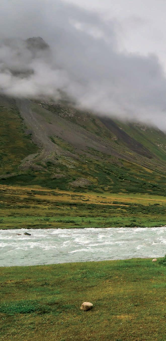
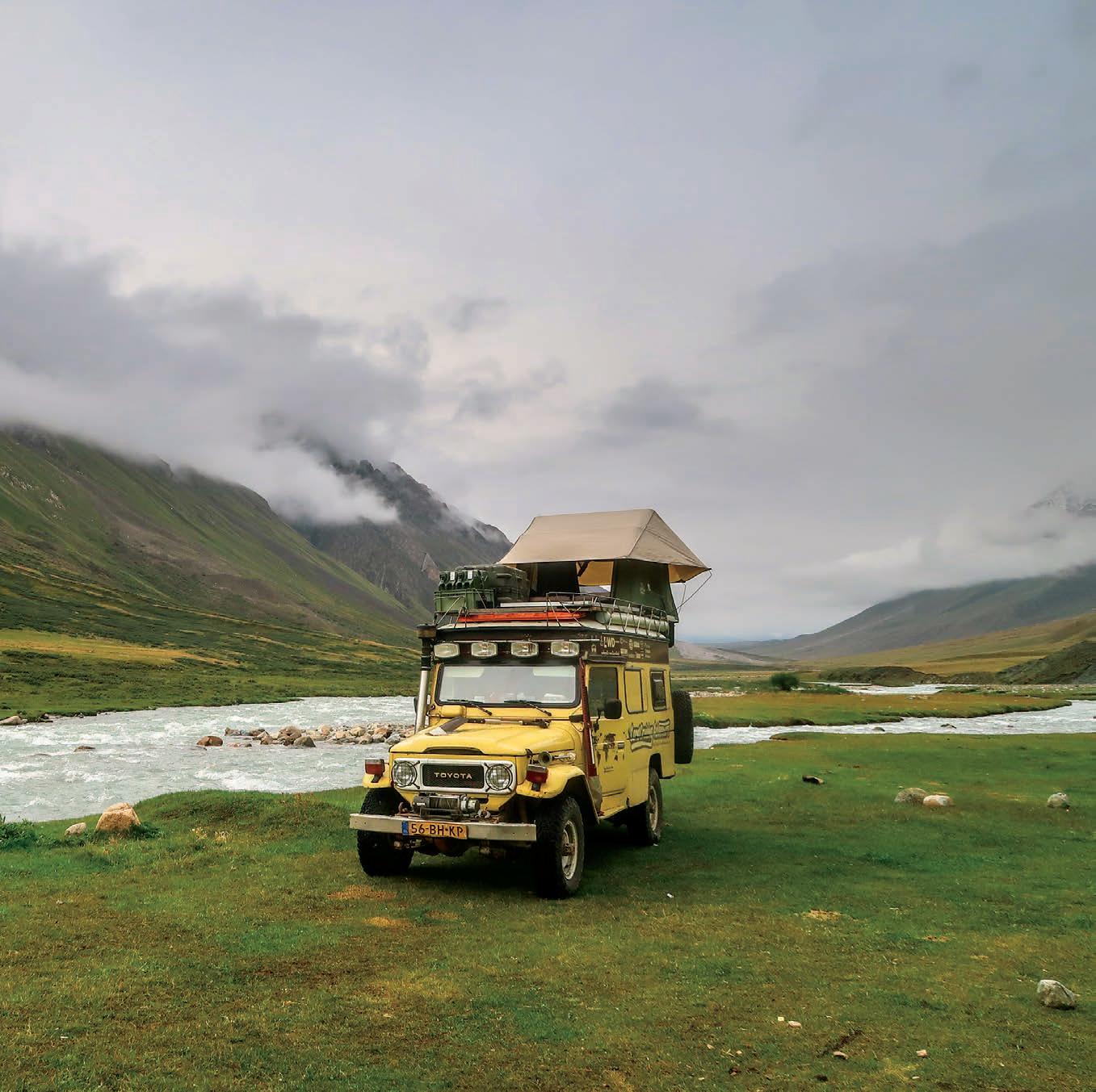
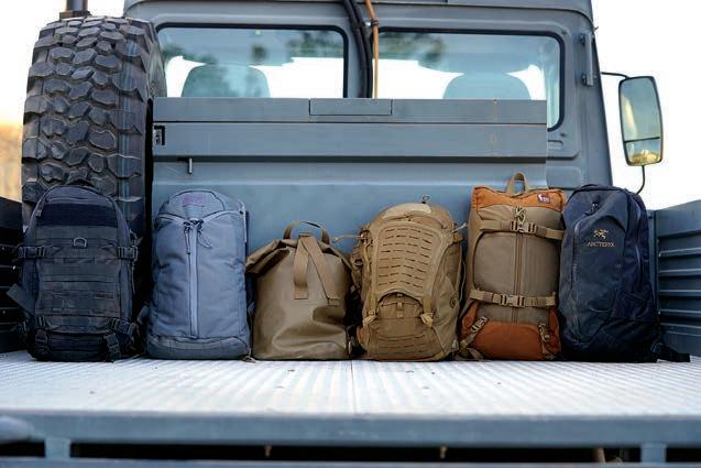
An evaluation of six medium-sized travel and extended day backpacks in the 21- to 26-liter volume range.
By Bryon Bass
Aprehistoric mountain man stumbles from the woods and saunters straight through your remote mountain campsite. Exceptionally preserved for over five millennia in glacial ice, Ötzi (pronounced Oet-zee) is that Neolithic mountaineer. Found high in the Ötztal Alps in 1991, his trappings reflect a well-developed, albeit 5,300-year-old alpine culture: goat hide leggings, loincloth and cape, grassand hay-lined deer-hide shoes with bearskin soles (nice touch, that), wood-handled flint dagger, hafted copper ax, and bearskin cap with chin straps, just to name a few objects.
One of his particularly intriguing preserved items is a hazelnut, wood-framed backpack with staves made of larch. It’s a truly vintage external frame, more old school than a Kelty. At a conceptual level, this pack is a means to transport heavy loads and could suggest primitive trade and commerce. It surely indicates an awareness of daily carry and sustainability required to transit higher elevations (he was found at around 10,500 feet). Ötzi’s kit might seem irrelevant to our modern culture (excluding those who intentionally carry stone blades or tether their truck keys with animal sinew). His pack frame, however, transcends time. The next time you’re queued up to board a train, plane, bus, or ferry, look around. Nearly everyone, no matter their age, sex, or culture, will probably have a shoulder bag, backpack, or small duffel. It’s surely a primordial thing.
The packs we review here stand on their individual merits. Three derive from mountaineering tradition, one from hunting lineage, one from whitewater rafting, and another from tactical concepts. We chose models that fall within the 21- to 26-liter capacity, which can be loosely referred to as medium-size daypacks. These are made to perform in adverse and variable conditions and to carry more than just the requisite snack bar, spare sweater, and water bottle. Depending on the season and specific pack features, it’s entirely possible to use these for long hikes or adventure sports, including backcountry overnights. Their volumes are ideal for adventure travel and active work carry-ons, where at the destination, you might require a combination field pack, client meeting ruck, vehicle bailout bag, and something for that hike to the remote waterfall. Ultimately though, the Iceman needed his pack, and so do we.
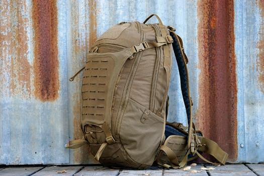
S.H.A.D.O. PACK 24L
WhenPrometheus Design Werx (PDW) Founder Patrick Ma designed the S.uspension, H.aul, A.ccess, D.urability, O.rganized (S.H.A.D.O.) pack, it wasn’t his first time around the alpine loop. Tactical bloodlines are present, but the pedigree unequivocally leans to light and fast mountaineering, infused with daily commute, hunting, and adventure travel features.
I appreciate the reversible Gear Trap for securing external equipment, with the MOLLE compatible array (MCA) on one side and slick surface with a zipper compartment on the other. PDW’s modular belt supports a heavily laden pack via its backpacking-grade padded MCA. For lighter applications, strip down to the 2-inch webbed belt, or remove everything, including the lumbar pad. Two ice ax loops are also great for trekking poles or tripods. Four minimalist haul straps are key when handing your pack to someone else, and the removable HDPE frame sheet doubles as a snow and sand shovel or splint.
The S.H.A.D.O. has a refined build, with requisite 500D Cordura in crucial spots. Its two large U-shaped pockets and small zippered stashes excel on a subway commute or in the cargo plane. Color-matched hardware and trims present a subdued aesthetic. Certain users may prefer a less tactical color option without the external Velcro.
Four prototypes preceded the full-featured production model. The attention to detail is outstanding. The fruit of this labor is a purpose-driven, well-executed rucksack that spans various end-user applications. The uncompromising S.H.A.D.O. demonstrates that PDW, to paraphrase Bruce Lee, has absorbed what is useful, rejected what is useless, and added what is essentially their own.
$198 | PROMETHEUSDESIGNWERX.COM
ʼ
ARRO BACKPACK 22L
This pack is a classic Canadian understatement. Arc’teryx designates the Arro 22 as a commuter pack. Having owned one for nearly 20 years, I did commute almost daily on my motorcycle with one through the fog, drizzle, and salty air of San Francisco. That original Arro, the smaller 16-liter size, was also used as a camera bag, an archaeology field ruck, and a carry-on pack. It eventually became my go-to ADV motorcycling backpack.
The real test came when it was pulled from semi-retirement, 17 years after purchase, and reassigned to my son for carrying his daily gear for forest school (think all-weather, no classroom, wilderness preschool and kindergarten). For two years, it’s been dragged through mud and dirt, filled with wet clay projects, random rocks, decomposing plant samples (still no positive ID there), and, of course, soiled by leaky water bottles, food, and wet clothes. We thoroughly cleaned it a few times in preparation for overseas flights. At those moments, it appeared used but fresh.
This overbuilt yet highly unassuming pack epitomizes lessis-more philosophy. The WaterTight zippers, kangaroo pocket’s water- and wear-resistant hybrid material, and minimalist but comfortable shoulder and sternum straps come together in a robust, versatile extended daypack. Recently updated with small tweaks to the buckles, straps, and the addition of a 15-inch padded laptop sleeve, this decades-old Arc’teryx design still hits the mark.
$239 | ARCTERYX.COM
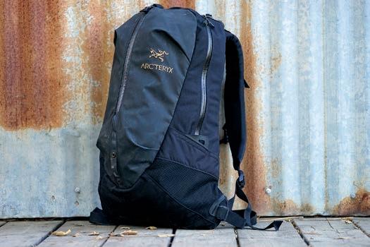
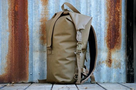
Nodoubt, the Big Creek is specialized. Essentially a hybridized dry bag with removable, padded shoulder straps, a waist strap, and a top cinch strap, it’s a serious piece of waterproof kit. I originally bought this for motorcycle trips, to keep clothing dry and if unanticipated hiking presented itself. But it proves useful for protecting sensitive equipment on vehicular trips where there is a high likelihood of water contact. It can be loaded to the gills and filled with ice and drinks. Punctures are rare but easily repaired with Watershed’s Tear-Aid repair kit (or most inner tube patch kits, heavier tapes, and even inflatable sleeping pad/tent patches).
Their universal polyurethane-coated material is extremely robust. The seams are beefed up with multiple layers of this material, then sealed using high-pressure radio waves. The pack seals air- and watertight along a rubberized closure that’s akin to a Ziploc on steroids, which is then secured on each end by Fastex buckles. These features culminate in a dry bag that’s dustproof, and fully waterproof down to almost 300 feet. The Big Creek does lack an internal frame or supportive HDPE sheet, so it certainly won’t be as comfortable as traditional backpacks. I often need to hunt around in the main compartment (it’s the only one) to locate contents, but that’s the tradeoff for being waterproof. This dedicated pack will look right at home propped against your leg in the seaplane departure lounge.
$135 | DRYBAGS.COM
URBAN ASSAULT 21L
Straight from the legendary Kletterwerks and Dana Design mountaineering playbook, but with ergonomic and modern improvements, Mystery Ranch’s Urban Assault series defines this versatile, low-profile pack design. I’ve worked out of the Urban Assault 21 for over a year, overseas and within North America, and find it really excels.
A single daisy chain spans the base, plus one carrying strap up top—no external pouch attachment ladder system (PALS) webbing, ice ax loops, compression straps, or waist belt. Mystery Ranch’s well-engineered shoulder and sternum straps keep everything cinched during dynamic pursuits. Tried-and-true urethane-coated YKK zippers and 500D Cordura have excellent abrasion resistance and repel elements. Two small interior mesh zipper compartments keep essentials visible; they contour along the sides, so I stash flexible gear like beanies and keys there. The linear, partial-mesh pocket accessed through the rigid zippered lid is perfect for quick-grab items like glasses, sheathed knives, and a trauma kit. Keys, some pens, and certain pointed objects tend to snag in the lid’s mesh material.
The three-zipper design quickly exposes the ruck’s contents. Dual interior tablet/laptop slots terminate above the pack’s base and also secure literature and paperwork. The tapered main compartment seems to hold more than expected. This rucksack is minimalist at its best for commute, field, and travel. Roll with flashy colors or blend in; Mystery Ranch provides ample color options.
$125 | MYSTERYRANCH.COM
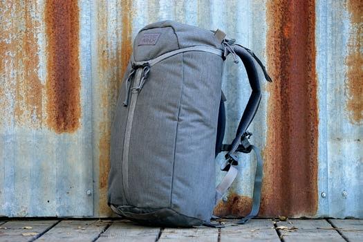
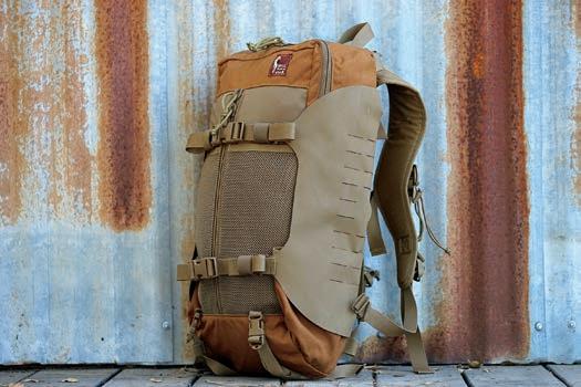
Althoughthe Hill People Gear (HPG) Connor Pack V2 exudes pure backcountry hunting heritage, it’s equally at home for adventure travel and daily carry. The squared main compartment completely unzips along the perimeter to reveal all contents. The entire interior back panel features PALS in Velcro (loop). You can bypass this lightweight material, or attach a myriad of hook-secured pouches and fasten any apparatus that threads the slots. This creates a multitude of configuration possibilities. I secure trauma gear up top and leave the rest open. The front panel interior is full-length mesh for flat items like laptops, maps, and literature.
The Connor V2’s shoulder straps are designed to carry heavy weight for longer periods. Once you wear the pack loaded, and the shoulder/sternum system is dialed in, it is apparent HPG did their homework. I’ve been comfortable running it heavy. The Connor V2 doesn’t come with a waist belt, but for those who require this load-bearing component on medium-sized packs, HPG offers some serious options.
Compression wings fabricated with a synthetic rubberized material secure and protect Nalgene-type round bottles and move hydration from the main compartment. Bottom compression straps affix external kit. I use the zippered outer pocket for guidebooks. Smaller notebooks and 16-ounce water bottles slot into the rear mesh pockets. The Connor V2 combines modern functions and a classic aesthetic that puts you alongside a 79-Series Land Cruiser at a remote airstrip.
$265 | HILLPEOPLEGEAR.COM
FAST PACK LITESPEED 22L
Tenyears later and now in version two, the Triple Aught Design (TAD) Fast Pack Litespeed is still the company’s most popular ruck. Litespeed is TAD’s mid-volume offering—a jack-of-all-trades favored by daily commuters, law enforcement, military, field professionals, and adventurers. Recent tweaks on this venerable pack include a redesign to the shoulder strap thickness and contours and how they attach. Paracord is now used to affix gear near the top carrying handle, the transporter tail (external gear attachment system) can be ordered without PALS webbing, and the hydration bladder pocket is absent.
TAD’s team informs me that while the original design hit the high bar, some minor adjustments were due. Top brass also noted that the recent Special Edition Litespeed, made with lighter Dimension-Polyant VX42 sailcloth material, ushered a transition in some models away from 1000D Cordura construction (Mystery Ranch also has a VX42 Assault variant). Sailcloth tends to mitigate tactical appearances, especially in conjunction with TAD’s sterile transporter tail. Purists shouldn’t fret, as 1000D versions will still be manufactured.
TAD’s larger Fast Pack EDC accompanied me while instructing high-angle rope rescue at the Machu Picchu UNESCO World Heritage Site in Peru. I relied on the first Litespeed variant during travels throughout Africa, Europe, the Middle East, and the Americas. The pack performs in diverse applications and is appreciated by a wide audience.
$255 | TRIPLEAUGHTDESIGN.COM
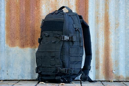
With the exception of Watershed’s more specialized Big Creek, these packs are all hybrids to varying degrees, borrowing details from one genre and melding with nuanced concepts from another. The Prometheus, Arc’teryx, and Mystery Ranch featured models are all made in Vietnam, whereas the Watershed, Hill People Gear, and Triple Aught Design options are made in the USA. The PDW S.H.A.D.O. blends optimal features from diverse DNA into a versatile, class-leading rucksack. The attention to detail is second to none. Commutes in Canada must be pretty arduous for Arc’teryx to design a “commuter pack” that withstands so much non-urban abuse. I look forward to getting my Arro back once my son transitions to his next pack. Mystery Ranch’s Urban Assault doesn’t appear urban or tactical, but that’s exactly the refreshingly unassuming point. HPG’s Connor V2 is at home hunting elk or on an overseas flight bound for Kenya. TAD’s timeless Litespeed performs no matter what circumstances come its way. Ötzi never had this many designs from which he could choose.
Some people live vicariously through their backpacks, and there’s nothing inherently wrong with this notion. It’s comforting to know your pack is highly water resistant and could withstand monsoon rains, even if you never reach wet climes. It is important to choose a travel pack wisely, though. If possible, try before purchase, and load with the maximum weight and bulk you anticipate. This will help identify subjective design peculiarities or incompatible ergonomics that just won’t work with your physique.
Check the pack’s empty weight, and be sure you’re fine with that as a starting point before loading in all trip essentials. Some materials
and designs are very robust but heavy. There are different ways to don a rucksack, and often this is directly related to its loaded weight and your capability to lift. Some designs also require specific adjustments to the shoulder and sternum straps, load lifters, and waist belt to optimize fit. All-day comfort is critical in any travel pack. Chances are, you’ll probably wear it for longer durations than expected.
Think about a pack’s color, how the exterior design appears to observers, and what consequences might ensue from unwanted attention. This might be entirely irrelevant to your planned usage or travel/work environment. Contemplate your full intentions with the pack. If you may use it in technical capacities (rock climbing, canyoneering, rappelling, exploration geology), then certain features might be more desirable. Light- and medium-duty rucks don’t always require waist/hip belts if their shoulder and sternum straps are well designed and integrate properly with the pack. Some belts simply help stabilize the pack; others carry load. Especially with the latter, it’s important to make sure a given pack can be adjusted to your specific body measurements.
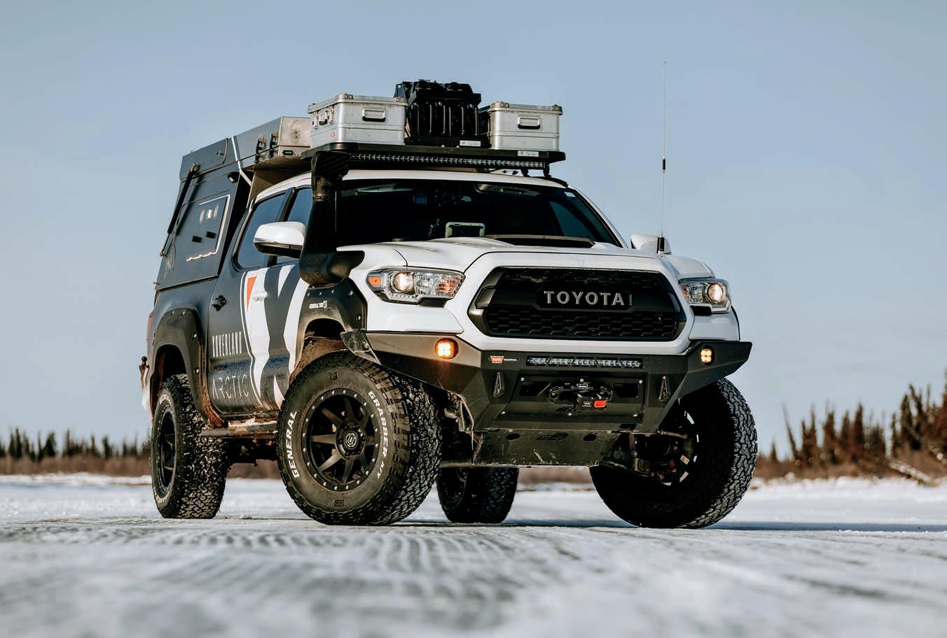
By Richard Giordano
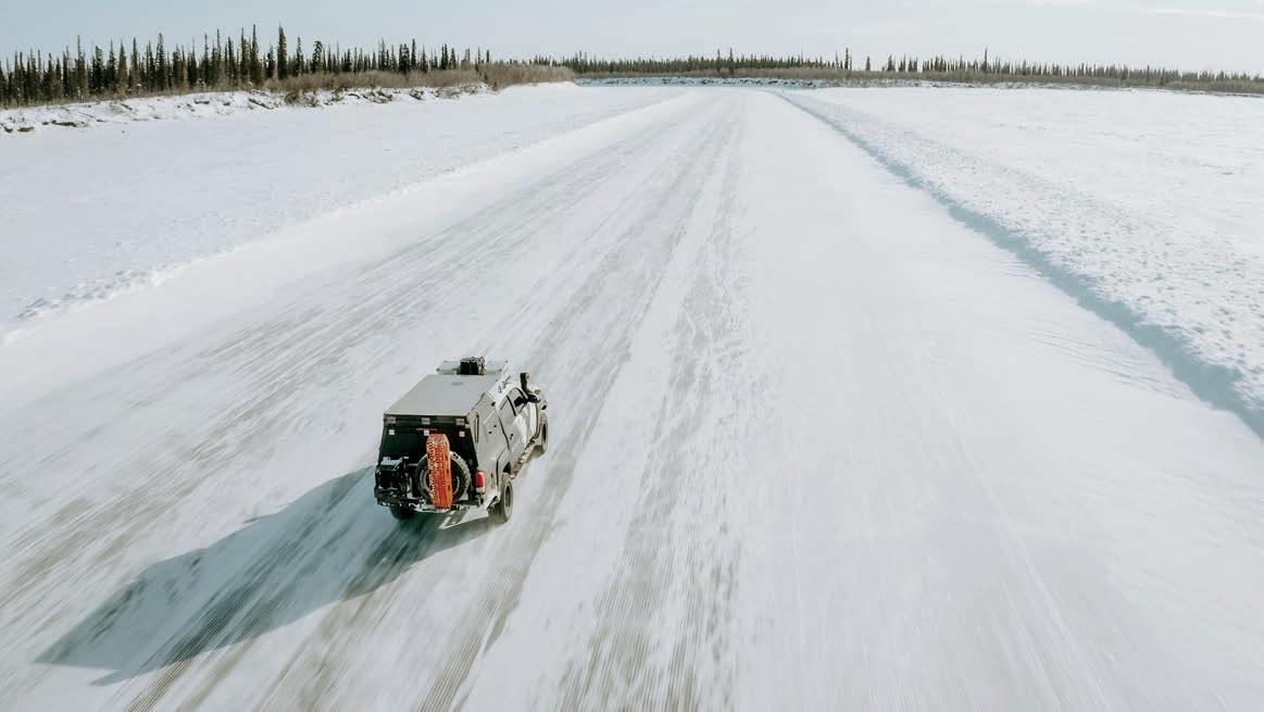
TheDempster Highway sees hundreds of enthusiastic travelers each summer. They flock to Dawson City, Inuvik, and Tuktoyaktuk, eventually dipping a toe in the Arctic Ocean. I yearned to be one of those travelers. I wanted to spend time in the Yukon and Northwest Territories and learn more about my home country. Arriving in Tuktoyaktuk would conclude a trip that started in 2013, where my wife, Ashley, and I explored much of the Pan-American Highway from Vancouver, British Columbia, to Ushuaia, Argentina. The Dempster was the last piece of our Antarctic to Arctic puzzle. But this time, we chose to do things differently. We would drive someone else’s vehicle, film the entire trip, and tackle the Dempster in the winter.
Clay and Rachelle Croft founded Expedition Overland (XO) a decade ago, a wellknown video series following a team of adventurers through some of the world’s most remote locations. The XO crew traveled from Alaska to Argentina, filming every step of the way, with a mission of educating, inspiring, and entertaining their YouTube
and Amazon Prime Video fans. Earlier this year, Clay and Rachelle decided to send one of their trucks on a solo mission. For the first time, the Crofts would remain at home while another duo explored a region of the world in an XO vehicle.
One crisp December evening, Ashley and I were sitting around a warm fire with Clay and Rachelle, brainstorming ideas for the next series of episodes, when I suggested the bright idea to drive to Tuktoyaktuk, Northwest Territories. Ash and I spent years driving south, but we had never traveled north to the Arctic Ocean. Since the plan was to film for Expedition Overland, it made sense to do so in the winter. I could only assume that viewers would prefer to watch us suffer in the cold, wind, and snow. Plus, I couldn’t dispel the iconic scenes of translucent ice roads, buffalo roaming across the Alaska Highway, or sprawling snowcovered Arctic tundra from my head.
There was clearly no filter between my brain and my mouth—no time for second thoughts. Before I knew it, Ashley and I hopped in Expedition Overland’s 2016
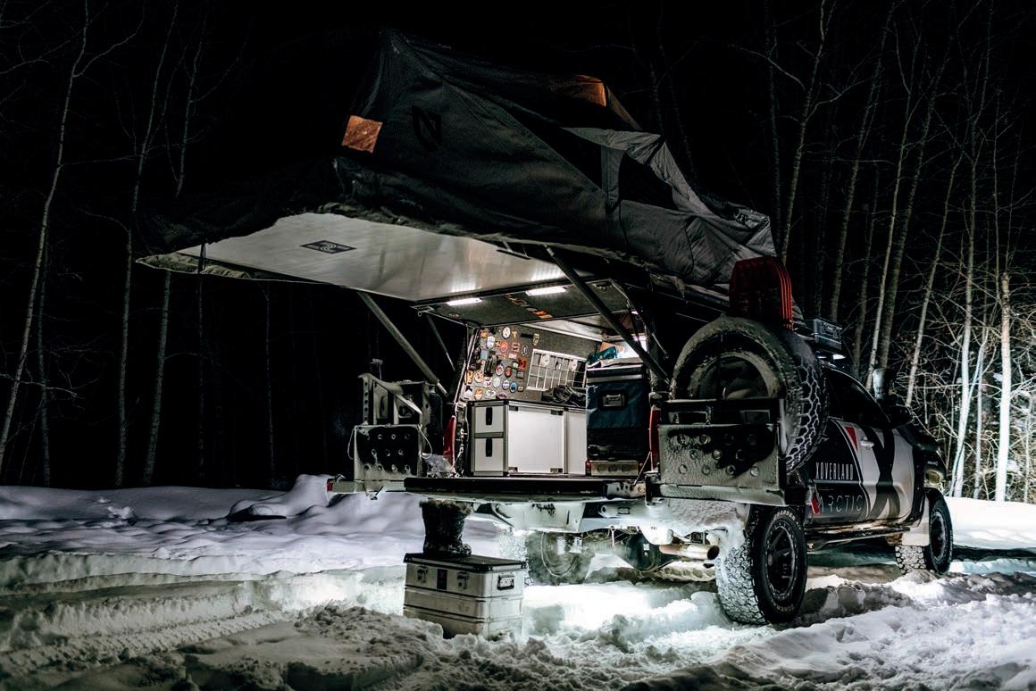
Toyota Tacoma and set a course to the Canadian Arctic in February 2020.
The 2016 Toyota Tacoma is Expedition Overland’s third Tacoma build. Clay explains, “When it comes to a vehicle that’s going to reliably get you into the backcountry and back out again, it’s hard to beat the Toyota Tacoma. That’s why we’re on our third Tacoma—we’ve put every generation through their paces in our adventures from Prudhoe Bay to the Darién Gap and a whole bunch of America in-between.”
When Toyota released the third-generation Tacoma in 2016, Clay knew it was the perfect platform for a new build. Expedition Overland initially designed and built this double-cab, short-bed truck to tackle the arduous 260-mile Alexander MacKenzie Trail in northern British Columbia. The following year, the XO team drove the
Tacoma the length of South America, from Colombia to Argentina, crossing six countries and 12,000 miles.
Quality suspension is the foundation of any overland vehicle build. Clay selected the Icon Stage 6 suspension system. South America is full of ever-changing road conditions, including soft sand, topes (the largest square-edged speed bumps you can imagine), mud, washboard, and if you’re lucky, perfectly smooth Ecuadorian asphalt. The manually adjustable compression damping control (CDC) valves change the dampening curve of the Icon 2.5 coilover shocks for each of these surfaces. This keeps the vehicle performing optimally both on the road and off. To accommodate the payload, Old Man Emu Dakar HD leaf packs with two add-aleafs were installed in the rear.
Clay believes that 33-inch tires are the sweet spot. “They clear 95 percent of obstacles and provide enough clearance for any road
A full set of MaxTrax, a spare General A/ TX all-terrain tire, and two 5-gallon jerry cans are affixed on the CBI Offroad Fab double-swing-arm rear bumper.
Opposite left column:
The expansive interior of the AT Habitat meant that two could live comfortably inside while escaping from the frigid outside temperatures. The Goose Gear rear seat delete and drawer module provides secure and easy access to camera gear. The Webasto SmarTemp allows for easy control of the heater from the comfort of the -40˚F Nemo sleeping bags.
Right column:
The sPod SE system controls the Rigid Industries Scene 1x2 60° DC scene lights, mounted on either side of the Habitat topper. Recovery gear, spare fuel, and a spare tire are easily accessible on the rear bumper. A peek into the fender well reveals the Icon Vehicle Dynamics Stage 6 suspension system.
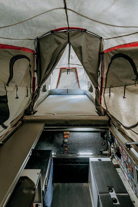
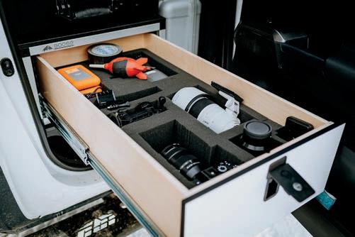
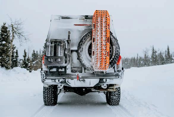
hazards popping up on lone dirt tracks in developing countries.” The XO team chose burly 285/70R17 General Grabber X3 mudterrain tires for the South American leg of their Pan-American Highway trip.
An aluminum CBI Offroad Fabrication front bumper, rock sliders, and skid plates provide protection when the added height isn’t enough to clear obstacles. As for choosing aluminum versus steel, Clay explains, “We looked at the primary use of our sliders, which is essentially as a step to transport camera guys and to access rooftop items. The weight savings is worth the compromise in overall durability.” A dual swingout rear bumper holds the spare tire on one side (along with a full set of MaxTrax) and a pair of 5-gallon jerry cans on the other.
This truck has, and will, spend much of its time far off the beaten path. Keeping the drivetrain stock means the renowned
Toyota reliability won’t be compromised. A TRD intake and cat-back exhaust are the only engine modifications.
This 2016 Tacoma is the first vehicle in the XO fleet equipped with every overlander’s dream: inside living space. The 320-pound AT Overland Habitat truck topper (production number 001, to be exact) bridges the gap between a traditional rooftop tent and a heavy truck camper. Although quite compact when closed, the lid cantilevers to the rear to reveal a cavernous Nemo-built tent.
A complete Goose Gear drawer module, utility cabinet, and storage cabinet were also installed. The drawers and cabinets are fitted with removable lids so that gear can be accessed from both inside and outside the vehicle. A standing desk, doubling as a bed extension for a third occupant, makes working inside practical and ergonomic. National Luna dual-color LED touch lights throughout the interior shed a little illumination on the subject, whether it’s a quick camp meal inside, reading before bed,
or working into the wee hours of the night. This inside living space makes digital workflow, including storage and backup of valuable footage, much more comfortable. Crew members are no longer bothered by pesky mosquitoes, downpours of rain, or fierce winds.
The dual battery electrical system centers around the RedArc Manager30. This system maintains a 214-amp-hour Odyssey AGM battery, which is charged DC to DC from the Tacoma’s alternator, the internal MPPT solar regulator and fold-out solar panel, or plugged into shore power with a standard 115-volt AC plug. A 700-watt pure sine wave inverter powers laptops, whereas a plethora of Blue Sea USB outlets allow the cameras and drones to remain fully charged.
We left Bozeman, Montana, at the end of February with 2,900 miles between the frozen Arctic Ocean and us. Icy roads, frostbite-inducing windchill, and zerovisibility whiteouts are common in the far north. Modifying the Tacoma to provide
protection for us in these extreme winter conditions was key to the trip’s success.
Our biggest concern was staying warm, for comfort, but also safety. Things can go sideways very quickly when temperatures regularly drop below -30°C. As a heat source in the camper was essential, the team installed a Webasto Air Top Evo 40 diesel heater, with a max output of 18,800 BTU/h. This heater maintained an indoor air temperature of 8°C when it was a frigid -30°C outside—pure luxury.
We found out quickly that the diesel heater had another important use. The Nemo tent regularly froze to the point
OUR BIGGEST CONCERN WAS STAYING WARM, FOR COMFORT, BUT ALSO SAFETY. THINGS CAN GO SIDEWAYS VERY QUICKLY WHEN TEMPERATURES REGULARLY DROP BELOW -30°C.
where we couldn’t pack it up. When morning temperatures reached -20°C, we would go through the rigmarole of closing the tent as far as humanly possible, turning the heater up, waiting 20 minutes for the ice to melt, and then finally closing the top. Problem solved.
Another concern was keeping the camera gear warm. Lithium-ion batteries do not perform well in cold weather, and LCD screens respond much slower in a sub-zero environment. The purpose of this Arctic trip was to share the journey, so it was paramount that the cameras work at all times. A Goose Gear rear seat delete and drawer module secured camera gear in the temperature-controlled truck cab. Easy access meant that we could grab GoPros, the Sony α7R4, or a 70-200mm telephoto lens in an instant. This was especially important for those impromptu wildlife encounters, whether it be wild buffalo, caribou, or a curious cross fox.
Knowing that ice roads were on the agenda, studded A/TX General Grabber all-terrain tires were installed in Bozeman, Montana, before departing for the Arctic. They performed equally well on both the snow-packed Dempster Highway and the frozen MacKenzie River. The Dempster and the new all-season road to Tuktoyaktuk
are fast, undulating, and permafrost-underpinned gravel roads. We carried a substantial amount of weight (Editor’s Note: Take caution with vehicle load, and always stay below GVWR), including a total of 46 gallons of gasoline, and found ourselves putting the rear suspension bump stops to use. Generally, the rear shocks and springs can only be so stiff before ride quality under normal conditions is adversely affected. To maintain good suspension compliance and ride quality on this Tacoma, Clay used lower-rate leaf springs but installed bump stops to manage that extra energy. The Icon hydraulic bump stops have 2.5 inches of travel to absorb energy when hitting road turbulence.
Overall, the Tacoma is a joy to drive. Compared with our beloved 1990 Toyota Pickup, it feels like cheating. Despite its weight, the truck has plenty of power to pass slow-moving traffic. The mechanical advantage provided by the 4.88 Nitro Gear & Axle gears makes all the difference here as long as you aren’t afraid of letting the 3.5L V6 sing its little heart out.
The Dempster Highway was absolutely stunning in the winter. Poet Robert W. Service wrote about the “Spell of the Yukon” during the Gold Rush, describing the scenery perfectly.
No! There’s the land. (Have you seen it?)
It’s the cussedest land that I know, From the big, dizzy mountains that screen it To the deep, deathlike valleys below. Some say God was tired when He made it; Some say it’s a fine land to shun; Maybe; but there’s some as would trade it For no land on earth—and I’m one.
Overlanding isn’t something we do just to say we drove to some far-off location. We do it to travel, see new landscapes, and experience cultures different from our own. This Tacoma allowed us to drive an ice road to Aklavik, spend time in an igloo, meet local Inuvialuit people, and see those same people hunt a 130,000-strong caribou herd. We experienced the northern lights, the hospitality of the Arctic communities, and a sour toe cocktail in Dawson City to celebrate. What a ride.
2016 Toyota Tacoma “X3 Meridian”
POWER 3.5L V6 4WD
WHEELS AND TIRES
General Tire Grabber AT/X tires 285/70R17
Icon Alloys 17-inch Rebound wheels
SUSPENSION AND DRIVE
Icon Vehicle Dynamics Stage 6 suspension system with hydraulic rear bump stop kit
Old Man Emu Dakar heavy-duty leaf springs
Nitro Gear & Axle 4.88s
Rear factory E-locker
Front ARB air locker
RECOVERY AND ARMOR
CBI Offroad Fab aluminum front bumper
CBI Offroad Fab aluminum rock sliders and skid plates
CBI Offroad Fab dual swing-out rear bumper with drop-down tables
Warn Zeon 9.5XP-S winch with synthetic rope, Epic fairlead, and Epic sidewinder
MaxTrax recovery boards
ARB onboard air compressor
LIGHTS AND ELECTRONICS
Rigid Industries 30-inch SR-series LED spot/flood combo light bar (mounted under roof rack)
Rigid Industries 20-inch SR-series LED spot/flood combo light bar (mounted in front bumper)
Rigid Industries rock light kit, six lights
Rigid Industries 1x2 60° DC scene lights
sPod 4X4 8-circuit SE system
RedArc Manager30
Odyssey AGM PC1800-FT house battery
iCOM ID-5100a deluxe VHF/UHF dual-band D-Star transceiver
Garmin Overlander GPS and inReach Mini ScanGauge II
LIVING SYSTEMS AND ACCESSORIES AT Overland Habitat
National Luna 52L Weekender fridge/freezer
Partner Steel stove
Webasto Air Top Evo 40 diesel heater
Eezi-Awn K9 roof rack
Goose Gear rear seat delete and drawer system
Safari snorkel
WeatherTech floor mats
Custom vinyl decals by SCS Wraps in Bozeman, Montana
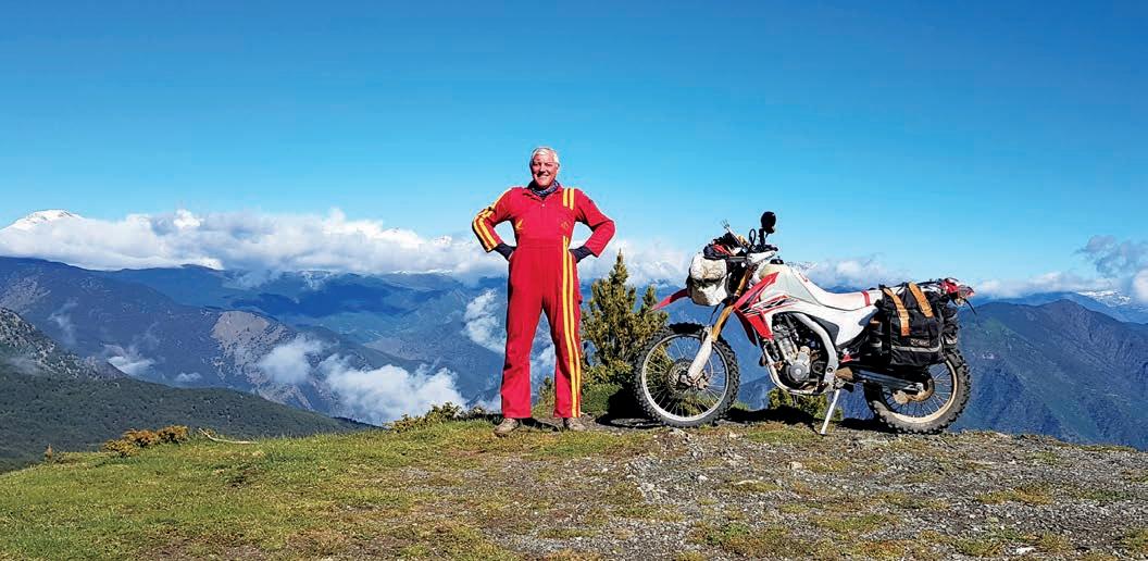
Austin Vince has devoted the last 20 years to exploring the Spanish Pyrenees; this is the oddball story that spawned it all.
By Austen Vance
Thesequence of dots, once joined together, that finished with a Middlesex math teacher presiding over one of Europe’s most beloved navigation challenges, begins with a very sad 13-year-old trainspotter crying himself to sleep. It was 1979, and Austin Vince was at boarding school at Mill Hill in northwest London. A lanky bully named Elwyn James, in the year above him, was making his life hell. Like the best bullies, Elwyn seemed to have no motive save sheer sadism, and being a foot taller than little Austin, had nothing to fear from the elfin fourth former. However, this was cold comfort to young Vince, who, in the claustrophobic world of the boarding house, could find no escape from Elwyn’s relentless attention.
“Initially, I knew nothing about the bullying, but I will never forget that homework,” remembers David Woodrow, Austin’s geography teacher at the time. I had a chat with him in the Three Hammers, a local pub that has been Woodrow’s regular after a 36-year career at Mill Hill School.
“This was the ‘middle’ set that I taught, and Austin was a pretty forgettable, mediocre student. We were doing the Ordnance Survey (OS), part of the curriculum, and their homework had been to draw a square grid, 12 centimetres by 12 centimetres. Onto this grid, they had to create a 1:50,000 map of a fictional place. The challenge was to use as many of the official OS symbols as possible but with an emphasis on contour line inclusion.”
When the homework assignment was collected, Mr Woodrow found that young Vince’s contribution was not only the best in the year, it was in a completely different league to the work of his peers. The detail was astonishing, and rather than being the result of the allotted 30 minutes, this pupil’s map had obviously taken several hours. Mr Woodrow continued: “I called Austin over at the end of the lesson after I had returned the homework, and he alluded to the bullying and how sad he was at school. He revealed that he had found solace in the quiet world of mapmaking and had got up at 5:00 a.m. for two days in a row to work on the map and take his mind off Elwyn James’ endless sniping.”
Little is known of what became of Elwyn James, but by forcing the child Austin Vince into a dark place that was only cured by maps, British trail riders would 40 years later give thanks.
It transpired that this map homework was a turning point in Austin’s life. Up until then, indolent and uninterested in academic life, he had applied himself to other disciplines as well as geography. First came English, and before long, he turned on his worst subject by miles: math. Mill Hill was streamed in most subjects, and in the early 1980s, Austin started working hard, for the first time in his life, and began getting promoted through the sets.
With three A-levels and an army scholarship under his belt, in 1984, at age 18, Austin set off for India overland, passing through Turkey, Iran, and Pakistan on a variety of buses and trains. Upon his return, it was four years of civil engineering and then Sandhurst (the British equivalent of West Point) in September 1988 for a spell in the army.
To bring the story up to date, I tracked down Gerald Vince, Austin’s elder brother and, I discovered, the mentor who had inducted Austin into the world of motorcycling. I found him in Camden Town. Formerly a booking office clerk on British Rail, he was now a lighting and camera hire technician for a busy company renting gear for TV shows. I caught him at elevenses, and whilst he ploughed through two coffees and three cigarettes, he filled in the gaps.
“Austin wasn’t a natural motorcyclist, but he wanted to travel and explore. That part of him was insatiable. We both realised that a motorbike was probably the best way to do that, and so, back in 1992, we planned an around-the-world trip that we called Mondo Enduro.” Gerald Vince is 63, but a youthful vigour entered his voice as he thought back 30 years and recalled those heady days.
WHEN THE HOMEWORK ASSIGNMENT WAS COLLECTED, MR WOODROW FOUND THAT YOUNG VINCE’S CONTRIBUTION WAS NOT ONLY THE BEST IN THE YEAR, IT WAS IN A COMPLETELY DIFFERENT LEAGUE TO THE WORK OF HIS PEERS.
“We wanted to cross Russia and Siberia, and back then, nobody had done that. We all had a history of street bikes but had the idea of transitioning to what back then, were machines that were being described in the UK as trail bikes or in the USA as dual-sports. The idea of the street-legal dirt bike was in its infancy, but we leapt at them and could see that these single-cylinder, air-cooled 350s, etc. were the obvious choice for a 40,000-mile trip on rough roads with crap petrol.” Gerald then changed his tone and became a bit more serious.
“We did two big trips, Mondo Enduro and Terra Circa. We were the first crew to ride the Road of Bones to Magadan and get across Siberia’s roadless Zilov Gap. However, when we got back from Terra Circa in 2001, Austin didn’t want to go on a third big trip. Instead, he had become obsessed with creating a map-reading event in the Pyrenees. We’d done a recce out there in 2000, which, of course, was navigated by map and compass (there being no such thing as GPS), and Austin had it in his head that the map reading was as much fun as the trail riding. I had never thought of it like that before but had to admit he was onto something.”
The story reaches its natural climax on New Year’s Eve 2001 when Austin flew back from Baltimore, Maryland, at the end of his Terra Circa expedition. He was pretty much resigned to slotting back into the workaday life of the high school math teacher who has bank loans to repay after 12 months of adventure riding and video post-production. But first, he had a party to visit that night. It was hosted by Josh Collins, a massive influence on Austin since 1992, and the single person who can be thanked for kickstarting Austin’s low-budget, adventure motorcycle filmmaking. However, Collins is also a relentless event organising machine. If he isn’t making a DIY movie, he is creating weird, 1960’s-inspired, frat-house-style parties in an abandoned factory in the backcountry of Shoreditch or Whitechapel. New Year’s Eve
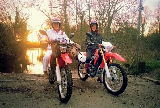
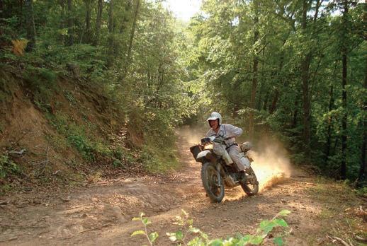
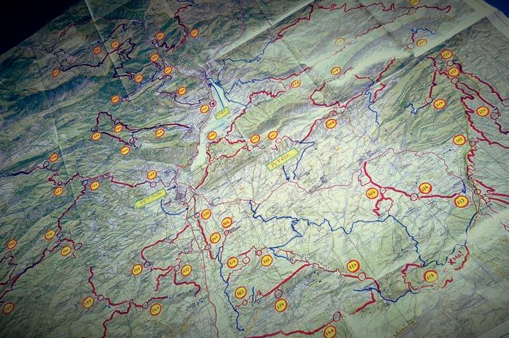
2001 is Collins’ masterpiece: a community centre inside of which he built a triple-decked galleon and hosted the coolest under-the-radar party in London—with a pirate theme. Not normal pirates, but pirates who dress like Bluebeard but dance as if it is 1965. Hi-rise cages burst with male and female go-go dancers frugging and doing the Watusi, all the while dressed as cabin boys. Fresh off the plane and arriving straight from Heathrow by mass transit, Austin’s around-theworld Siberian adventures were quickly replaced with this temple of shindig madness.
Austin was wearing one of his earliest sets of white jumpsuits, embroidered and pimped out in Hawaii, festooned with original 1960’s cloth Triumph motorcycle badges. He was, most definitely, the only person in the building dressed as a Le Mans pit crew member rather than a pirate. A buxom wench complete with an eye patch, plastic cutlass, and tricorn hat soon approached him. Over the booming sound of Tacoma’s finest sons, The Sonics, she shouted in his ear: “Hey, you must be Austin, the motorcycling-around-the-worldguy. My name is Lois Pryce. I want to do that, too.” Intimate
conversation was difficult because of the noise of Vox organ solos and the presence of Lois’ boyfriend. However, they exchanged numbers, and over the spring of 2002, Austin found himself mentoring a young lady on the art of long-distance motorcycling. She shed the pirate costume and the boyfriend, and with the start of summer, they became a couple.
For Austin, this was his first-ever motorcycle-riding girlfriend, and it was good. Lois toted a 1963 BSA A65, blasting Marianne Faithfull out of the park, turning heads all over London. As she geared up for her first huge trip (Alaska to Tierra del Fuego), she traded it in for a 1995 Yamaha Serow, and she and Austin contrived sundry trail rides to field test her luggage and choice of tyres. It was with a heavy heart that Austin saw her off on that first odyssey. She was to ride 20,000
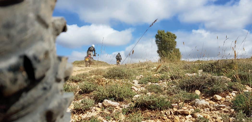
miles north to south whilst he graded math homework and coached rugby.
However, in July 2003, as Lois whizzed through the Americas, Austin gathered his old Mondo and Terra Circa crews together for a new project. He called it Andorra 3000.
The premise was simple: The Spanish side of the Pyrenees mountain range was essentially unknown to British dual-sport riders. Andorra 3000 aimed to break open the offhighway secrets of this 8,000-square-mile wilderness, scouting long-distance routes while rough camping in the hills. In the pre-internet era, this meant one thing: maps. And maps make Austin very happy indeed. The nine-day mini-exped was disproportionately six months in the planning.
Little did they know, but Andorra 3000 would be the template that would morph into the international navigation events that today are known as the Twinshock Trailfinder and Very Interesting Navigation Challenge Event (V.I.N.C.E.).
The first stage of the prep work was a visit to the UK’s premier map store, Stanford’s. In the heart of London’s Covent Garden, Stanford’s had been outfitting explorers and expeditioners for over a century. It’s where the Vince brothers had bought all their maps of Russia (American ONC sheets) for the Mondo Enduro trip, and a visit was always inspirational, even if just browsing. No surprise then, that Stanford’s had on the shelf all the 1:50,000 sheets covering every square centimeter of Spain. Austin bought 12 sheets that encompassed the area around Andorra, and back at school, laid them out on the well-lit tables of the art room. Now the study began—hours spent tracing routes and laying out trails of post-it notes to find the tracks that connected one valley with another. Dead ends and loops were forbidden. Only juicy long throughroutes were logged, highlighted with a pink Stabilo Boss and a small cheer. After about 20 hours, the 12 sheets each displayed one obvious cross-map course. Placing the maps adja-
cent revealed a fairly epic trans-Pyrenean route that appeared as if nobody else had ever thought of creating it before. This was the essence of Austin’s brainwave: local Spanish riders naturally knew about the routes in their area, but it required outsiders to take a step back and consider the availability of a 500mile route spread over thousands of square miles.
OVER THE NEXT DECADE, THE V.I.N.C.E. BLOSSOMED INTO ONE OF THE MOST RESPECTED SELF-NAVIGATION EVENTS IN THE EUROPEAN TRAILRIDING CALENDAR.
Austin and company took their dual-sports out, and, hey presto, it worked. Pretty much every route was viable, the maps were basically accurate, and best of all, a wilderness backcountry track was proved which, as far as Brits were concerned, had simply never before existed. Back in England, awaiting Lois’ return from Chile, Austin cooked up two plans: a) to propose to Lois upon her arrival, and b) to share this map-reading/ trail-riding concept with others.
Austin decided to combine the two plans, and Lois joined Austin to spend their 2005 honeymoon scouting trails in the Pallars Sobirà area west of Andorra. After a week of research, they laid out the checkpoints for their first map and compass orienteering event. They spent the next year inviting fellow bikers to join them for a wedding anniversary party with a map-reading event in the middle of it. Thus, the V.I.N.C.E. was finally born. Over the next decade, it blossomed into one of the most respected self-navigation events in the European trail-riding calendar.
If only Elwyn James had known what he would precipitate, maybe he would have left little Austin alone.
Massive public access, good weather, and Michelin tyres—all in harmony.
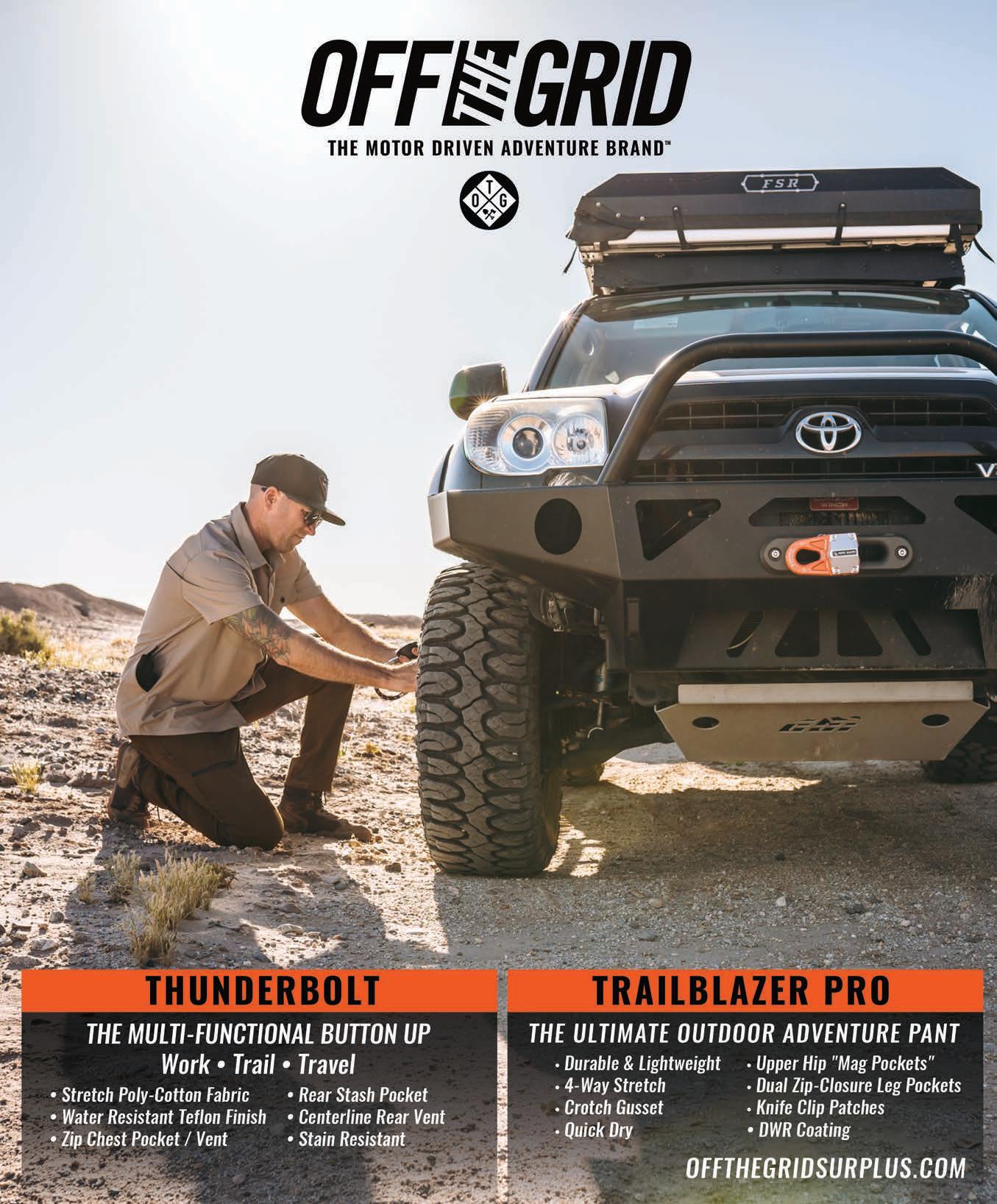
By Nicolas Genoud
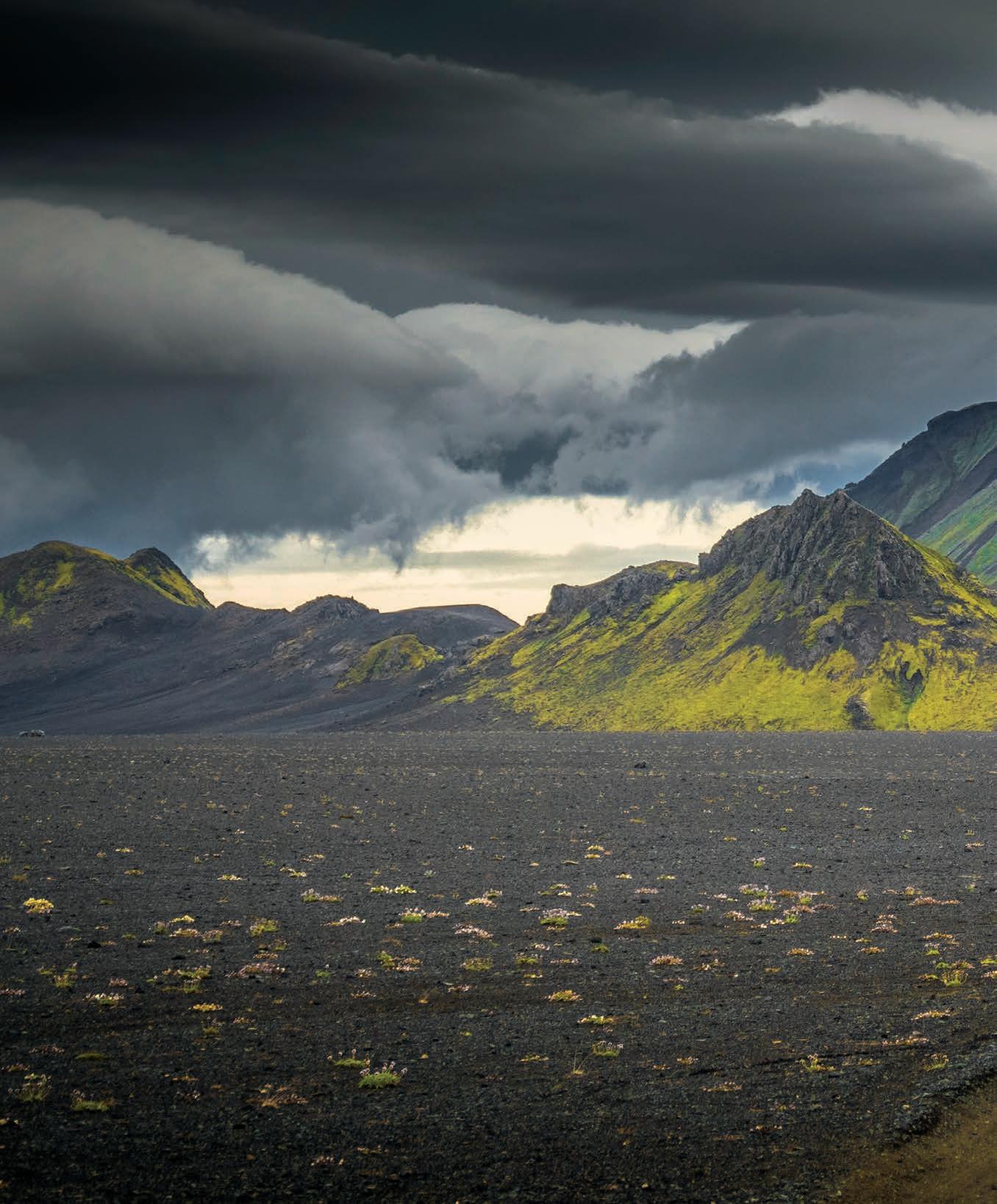
Iceland presents a dichotomy for the senses, the tangible divisions of the island’s landscape inspiring awe.
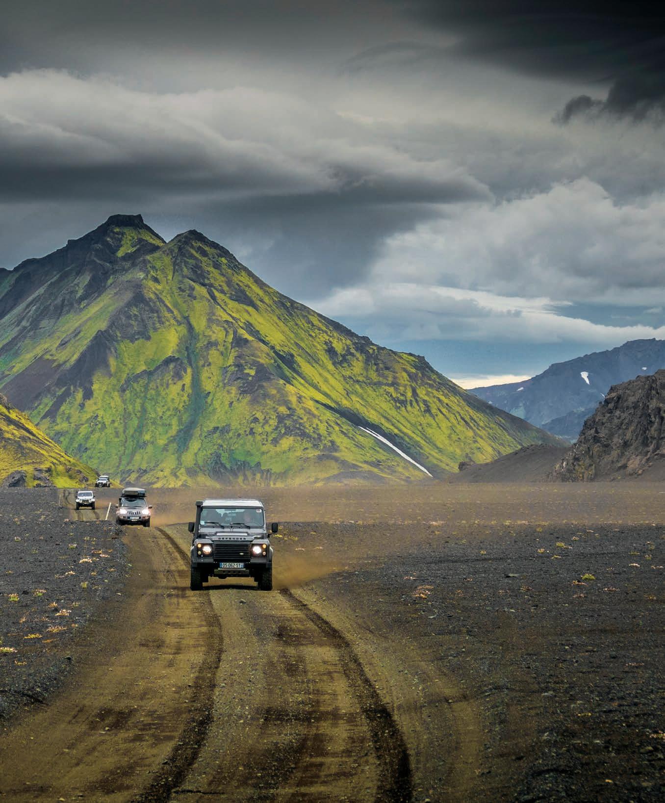
NO OTHER COUNTRY OFFERS SUCH DIVERSITY: deserts, active volcanoes, exuberant calderas, countless lakes, gigantic glaciers, lava fields covered with 30 centimeters of moss, torn fjords, and black beaches. The island’s astonishing natural wonders never fail to amaze me, no matter how many times I alight upon its shores.
After two weeks on the island, we received a cheerful call from the Vatnajökull National Park rangers during our last night at camp, inviting us to have a try at the famous Gaesavatnleid track. We would be the first to attempt the crossing this year. This legendary trail along the northern slope of the immense Vatnajökull Glacier is considered one of the most difficult on the island. With an elevation peaking at more than 1,200 meters, it is often one of the last passable tracks in summer. There are even years when it remains closed, still caught in the snow. The “SuperJeeps only” sign marking the start of the track leaves no room for doubt.
After a briefing that detailed the difficulties of the day and the particular driving techniques to adopt, we tackled the first obstacle on this east–west crossing: a vast alluvial plain about 15 kilometers long located at the foot of the glacier. It is particularly important not to venture into the flood plain at the wrong time, as different weather factors influence the melting of the ice and transform it into a huge lake.
With 30 centimeters of water already covering the plain, the instructions were clear: follow the trajectory of the lead truck perfectly, drive at more than 2,500 rpm, and maintain momentum. With the velocity and torrent of water splashes, the wipers were operating at full steam. We felt expanses of soft sand succeeding harder areas on which the vehicles regained grip and speed. A few emerging sandbanks allowed the convoy to reconstitute. The resulting adrenaline rush only made the day more memorable.
In this extremely fragile Arctic environment, staying on track/course (no off-roading) is more essential than ever, and the original line of the path must be respected despite the obstacles. We were not long to face the first patches of snow that can easily engulf any vehicle. After deflating the tires to 10 psi, the trucks managed to progress at idle on snow shoulders, sometimes tilted at more than 20 degrees. Vehicles with large tires have an advantage, whereas one fitted with 18-inch wheels will have to be towed due to lack of flotation.
As you gain altitude, the weather improves, and the scenery becomes breathtaking, with the highlands emerging at your feet. The view extends for more than 50 kilometers, and we were struck by how rough and desolate this country is; there was no sign of life as far as the eye could see. Moving along the front of the glacier, covered with sand and stones, the occasional burst of gorgeous emerald ice revealed itself. More snowfalls and subsequent vehicle recoveries ensued, along with numerous photo stops. We began our descent and emerged into a valley covered with tender green grass. Wild geese, curled up by the riverbank, watched us intently, curious of the big steel beasts passing by. We camped by a luxuriant hot spring, a group of happy and exhausted overlanders soaking in a hot bath, content in our relaxation, but eager to continue our exploration at the end of the world.
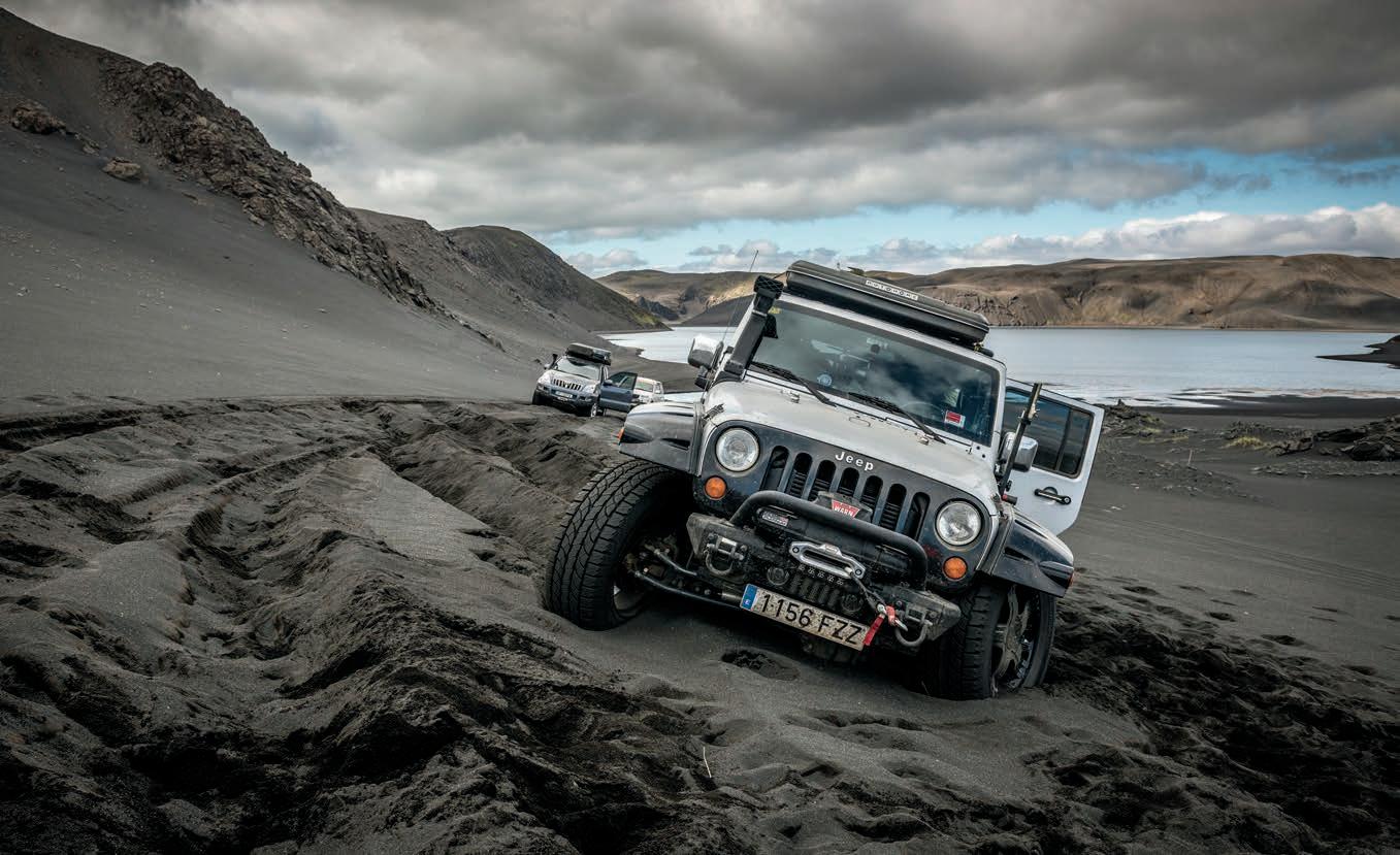
THE HEAVY BLACK SAND, OFTEN WET, DOES NOT SPARE THE VEHICLE—THE JEEP’S FRONT AXLE WILL SUCCUMB.
(OPENING SPREAD) WE WEAVE THROUGH MOUNTAINS AS OLD AS TIME, THAT LOOM OVER ICELAND’S LANDSCAPE LIKE ROYALTY SURVEYING THEIR KINGDOM—EARTH’S GRANDEUR AT ITS FINEST.
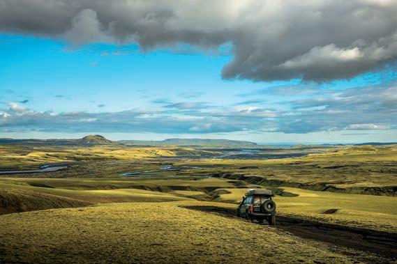
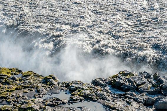
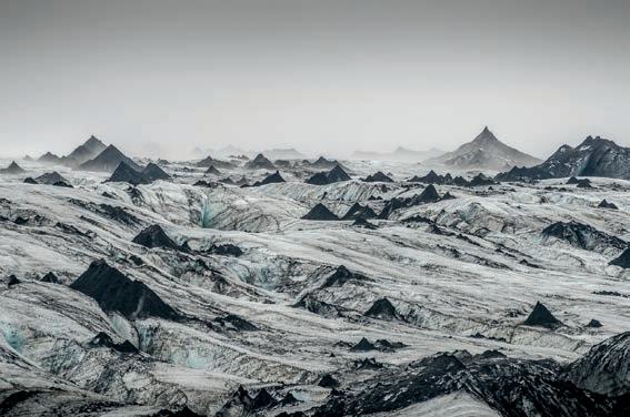
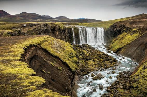
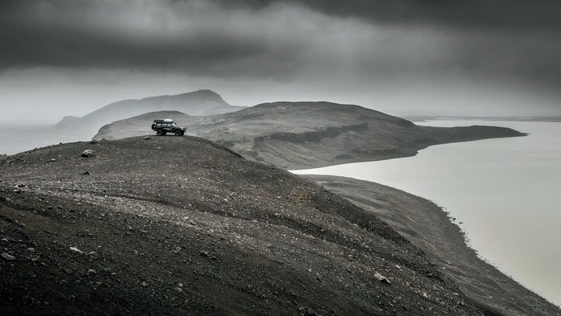
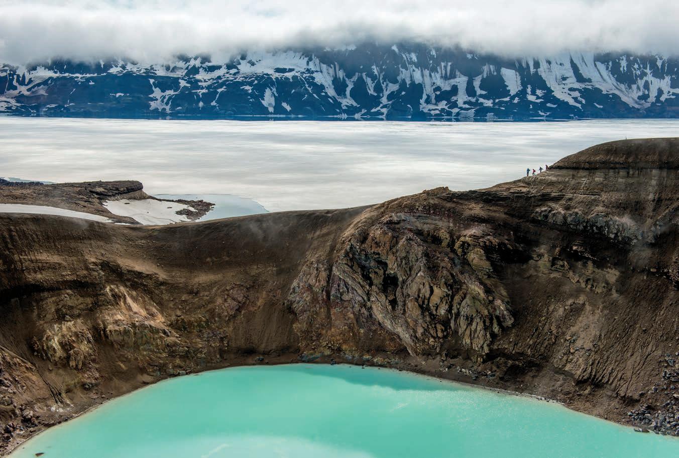
SLOWLY, WE LEAVE THE HIGHLANDS IN YELLOW BRICK ROAD FASHION, TO FIND THE SOUTHERN SLOPE AND THE ATLANTIC OCEAN, SURROUNDED BY VERDANT SCRUB AND THE PROMISE OF WATER.
DIRT CONES ON THE SOUTHERN MARGIN OF THE VATNAJÖKULL GLACIER STAND AS SENTRIES, CHANNELING A SMALLERSCALE VERSION OF TOLKIEN’S MORDOR.
PROGRESS ON THE HIGHLANDS IS CONSTANTLY CONSTRAINED BY WATER, WHICH MUST BE FOLLOWED, BYPASSED, OR OFTEN CROSSED.
ICELAND’S VOLCANIC ROCKS COMBINED WITH ICE AND LOW CLOUDS CAN CREATE AN UNREAL MONOCHROMATIC AMBIENCE, FURTHER LENDING TO ITS OTHERWORLDLY VIBE.
WITH ITS CONVERT FLOW RATE OF 7,000 CUBIC FEET PER SECOND, THE DETTIFOSS WATERFALL IS ONE OF THE MOST POWERFUL IN EUROPE, A SOMETIMES SECOND ONLY TO SWITZERLAND’S RHINE FALLS. IT IS A FORCE OF NATURE TO BE RECKONED WITH.
ASKJA CALDERA, WHOSE MAIN LAKE IS STILL COVERED IN ICE, IS ALSO HOME TO THE SMALL, GEOTHERMAL LAKE CALLED VÍTI, OR HELL. AN EXTREME SWIM IN ITS STUNNING TURQUOISE WATERS IS A PURGATORIAL REWARD AFTER AN INDUSTRIOUS HIKE.
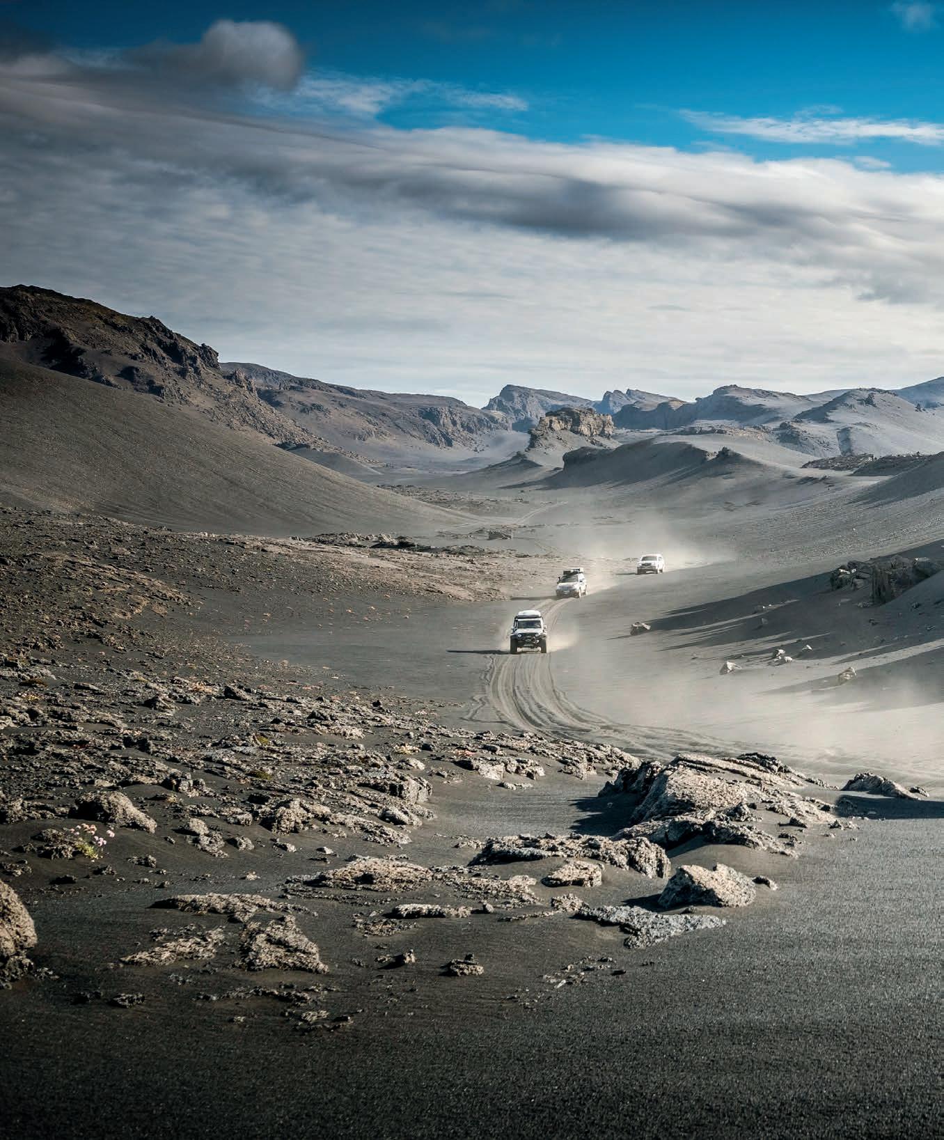
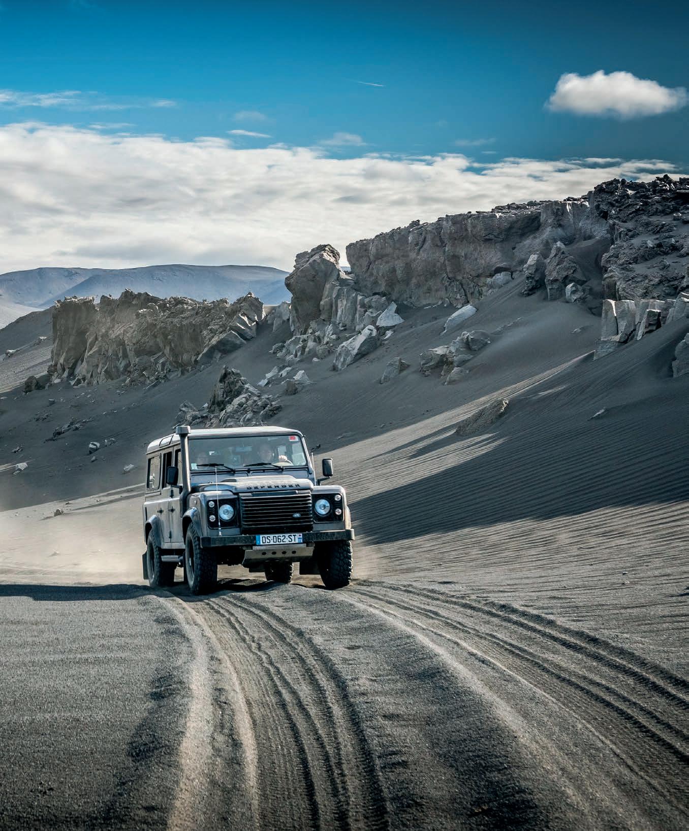
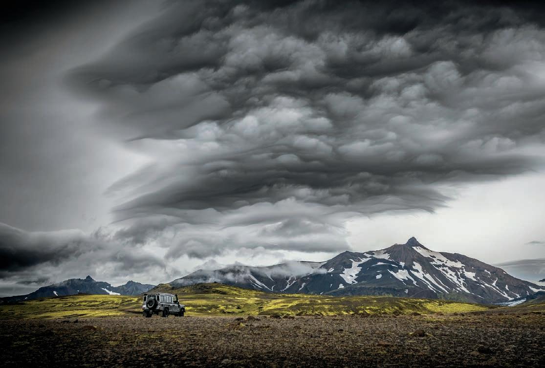
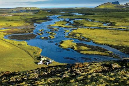
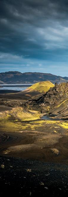
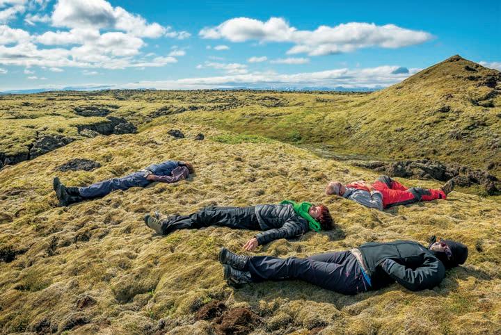
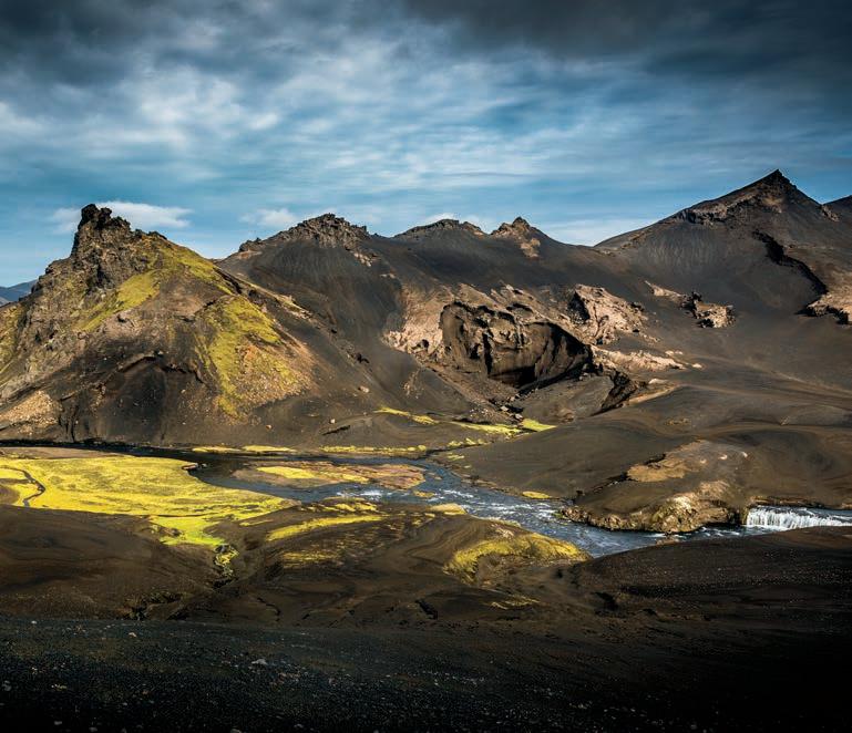
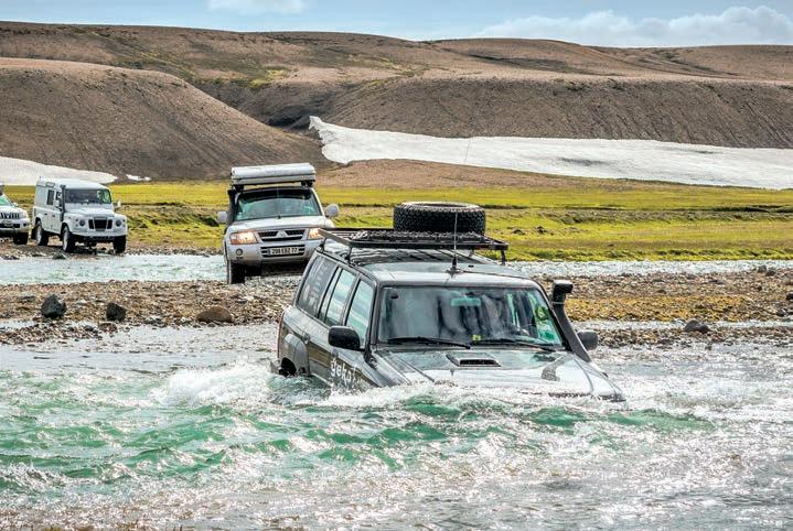
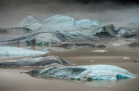
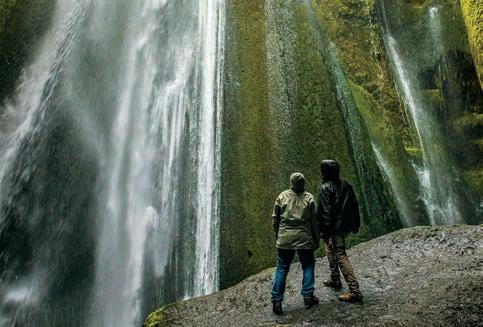
(PREVIOUS SPREAD)
GRAY DESERTS MADE UP OF WEATHERED BASALT ARE NOT OLD ENOUGH TO SUPPORT LIFE. IT WAS IN THIS LUNAR-ESQUE ENVIRONMENT THAT 32 ASTRONAUTS FROM THE APOLLO PROGRAM CAME TO TRAIN FROM 1965 TO 1967.
CLOUDS GROUP MENACINGLY IN THE COLD, GRAY SKY IN THE FJALLABACK NATURE RESERVE. WHAT ARE WE IN FOR?
ONLY CAPABLE 4WDS ARE GRANTED ACCESS TO THE ISLAND’S WILD HEART.
GLOBAL WARMING ACCELERATES THE CALVING PHENOMENON OF GLACIERS, UNDOING MOTHER NATURE’S HANDIWORK IN THE BLINK OF AN EYE.
SOME EXPERIENCES ARE SO POWERFUL THEY CANNOT BE DUPLICATED, ALIGNING THEMSELVES IN OUR MEMORY BANK.
A SNORKEL AND A HEIGHTENED SENSE OF ADVENTURE ARE MANDATORY PREREQUISITES FOR EXPLORING ICELAND’S HINTERLAND.
LAVA FIELDS CAN BE COVERED WITH A LAYER OF MOSS UP TO 1 FOOT THICK— A SOOTHING CRADLE FOR OUR WEARY BONES.
WILD CAMPS ARE NO LONGER AUTHORIZED IN ICELAND, BUT THE MEMORIES FROM WHEN THEY WERE WILL NOT BE FORGOTTEN.
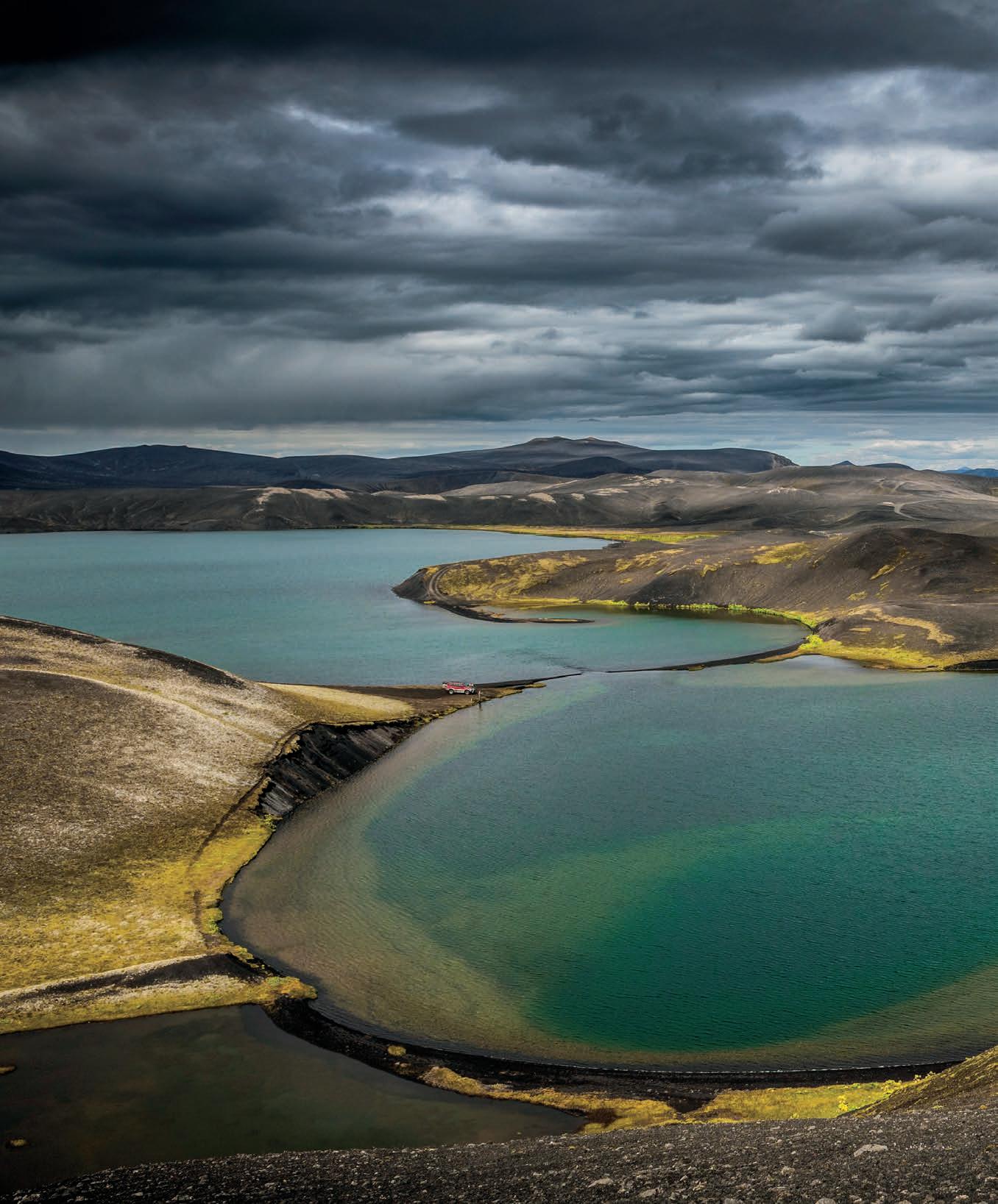
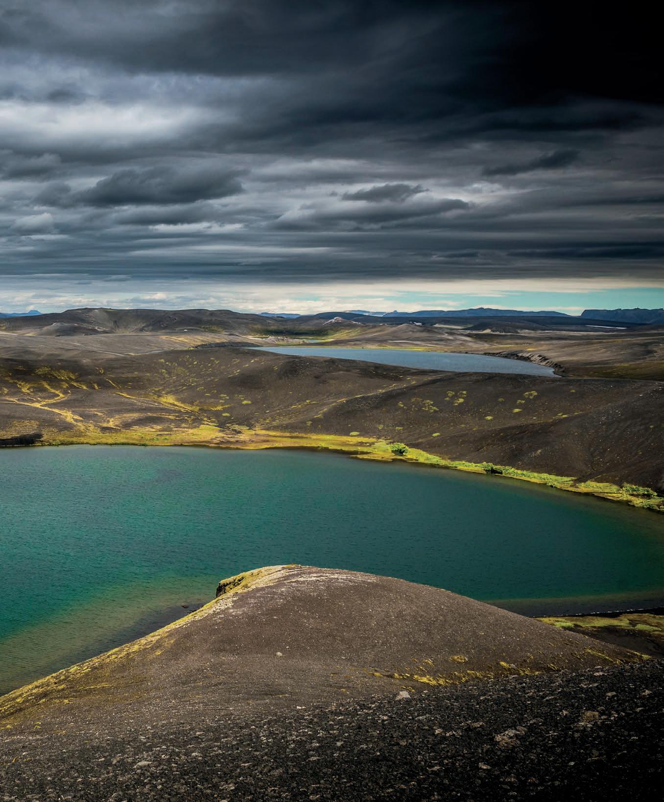

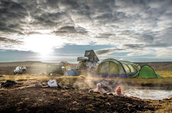
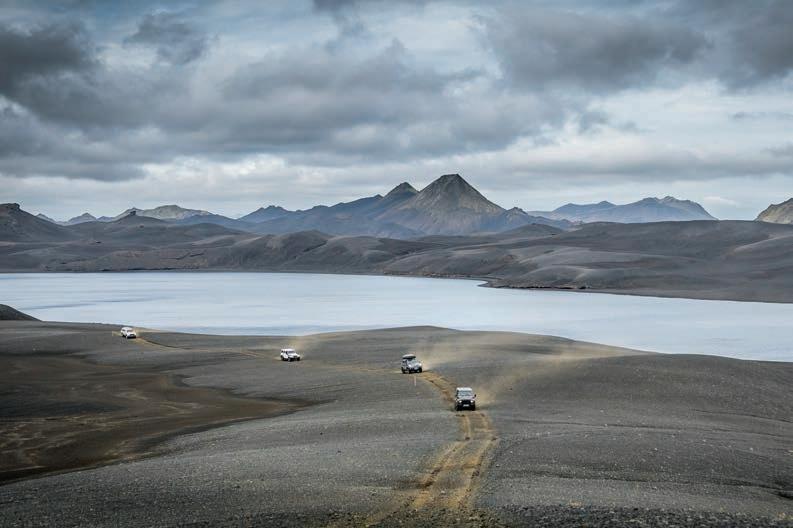
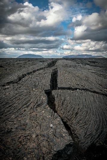
(PREVIOUS SPREAD)
IT'S HARDER TO CHOOSE A LAKE THAN CATCH A FISH, AND OUR TRUCK FINDS ITSELF CAUGHT IN THE MIDDLE OF THE APPRAISAL.
IT TOOK A DAY AND A HALF FOR THE JEEP TO BE REPAIRED AND REJOIN THE GROUP; IT APPEARS HERE AS A WELCOME DOT ON THE HORIZON.
NOTHING SOOTHES THE SOUL LIKE A GOOD SOAK IN A HOT BATH WITH A VIEW.
THIS LAND RELAYS THE WORLD’S ORIGINS IN A VERY TANGIBLE WAY.
THE MOOD WAS JOVIAL THIS DAY ON THE CONVOY’S VHF RADIOS, HAPPY CHATTER PROVIDING AN AMICABLE BACKDROP TO OUR TRAVELS.
WE ARE BUT OBSERVERS TO THE MARVELS OF OUR MAGNIFICENT PLANET, IN AWE OF ITS BEAUTY, AND APPRECIATIVE OF THE ENDLESS REWARDS WE ARE GIVEN.
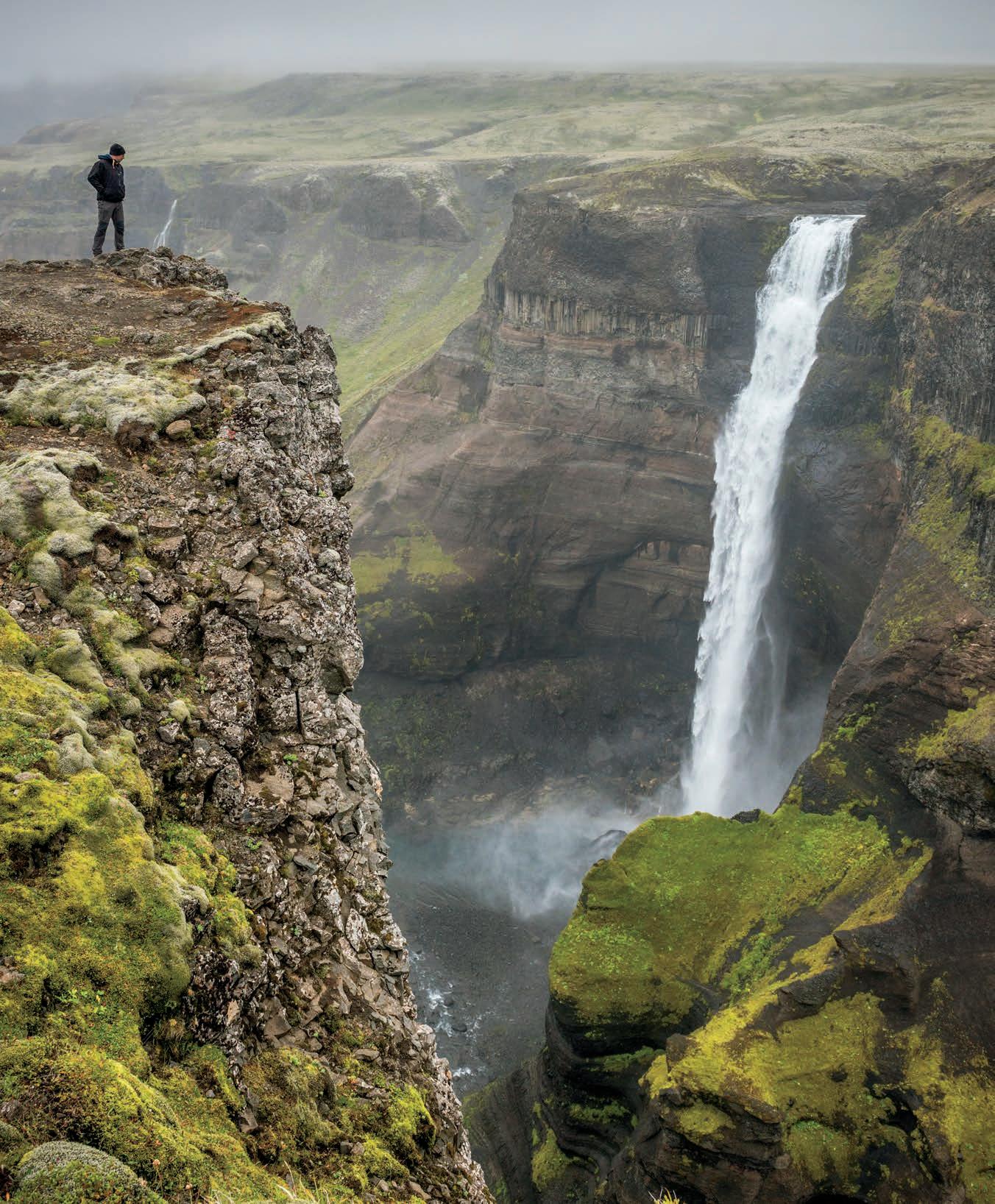

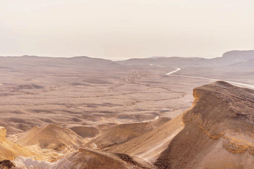
Making a Case for the Wild Places
Finding solace in the natural world.
By Thomas Henson
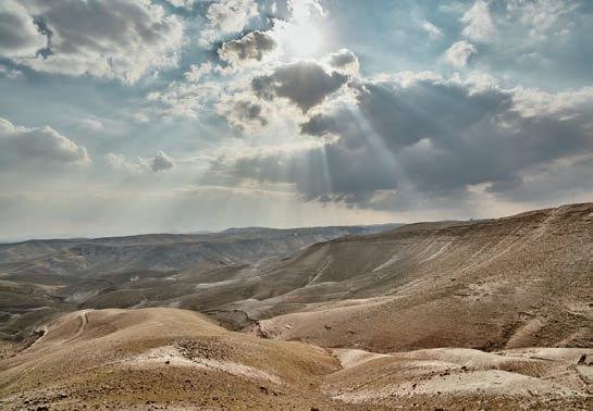

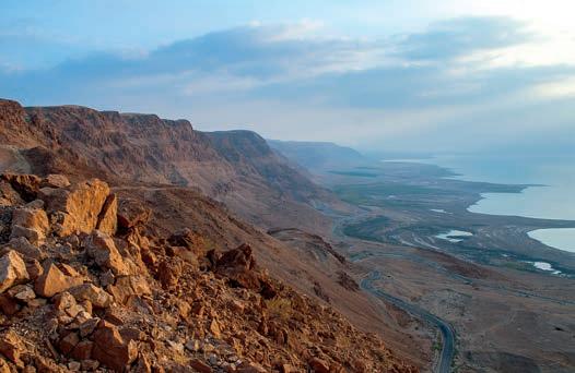
Afew years ago, I found myself on a long-disused track in the wastelands of Sudan. Over 200 kilometres from real civilisation, my team and I had left Khartoum at dawn and driven throughout the day. It was getting dark. Our small convoy had stopped. The lead vehicle had a damaged rear-right tyre and could go no further without risking mangling the wheel itself. I imagined the culprit to have been one of the sharp rocks on the bed of a wadi we had crossed earlier.
As I stood on the hard, cracked earth, I realised that never before in my life had I felt so insignificant. The night sky was vast and open, no trees or buildings or flashing lights could be seen—just a starlight-punctured void. The only sound was the low murmur of alert and professional voices.
Our vehicles were armoured Toyota Land Cruisers, an inconvenient necessity given the region we were working in. Weighing far more than my preferred option of a light 4WD for such terrain, they required a heavy-duty jack to lift. The jack in question, sensing our tiredness and suddenly confronted with the demands of its existence, decided to break. Exhausted and missing home, we strained to lift our vehicle those precious few millimetres off the track to affect a tyre change. Then, it started raining. An unseasonal downpour that stung our sunburnt skin and soaked our clothing and equipment. Out of range of any communication with the outside world, we were alone—strangers in a strange land. With every reason to be pissed off, it was remarkable to me that all I could do was smile.
It took me a while to figure out why I smiled. I had been away from home and loved ones for around six months at that point, and was terribly homesick. So it wasn’t through the novelty of experiencing the unknown. Eventually, I realised that it was simply by existing at that moment, in a wild place.
The concept of the wild is a powerful one. It brings with it connotations of isolation, the unfamiliar, and often of danger. We all have our definition of the term, and as individuals, we might imagine anything from a barren desert to icy tundra. Though it usually involves a natural place, removed from the artificial and man-made. The wild places have been the driving theme behind stories, myths, documentaries, and many more expressions that comment on their grandeur and often desolate beauty. With temperature, weather, flora, and fauna, they have the capacity to kill or bring life. We humans are slaves to an ancient and impenetrable bond with them. The wild is part of our psyche, whether we know it or not, and it has long been recognised that exposure to nature is beneficial to our body and mind. It makes us smile.
As a species, we have evolved to intuitively understand how our lives are linked to the natural world. Our evolution supports an affinity with agrestal things, or, more spe-
cifically, things that enhance our chances of survival. For example, most of us have an aversion to snakes and spiders, perceived in our lizard brains as ancient hazards, but less so to the arguably greater threat of firearms. We are drawn to green spaces and water sources because they bring life. But it’s more than that. Environmental psychologists would argue that exposure to natural surroundings has an unconscious restorative effect on the mind, whilst dispelling negative thoughts.
Nature is therapeutic—we have been aware of this for eons. Whether a view of trees from the office, a lunchtime break in the local park, or an evening walk with the dogs, that exposure is often an integral part of our lives. But the term nature is not always interchangeable with wild. The wild places are alien to our normal lives. They are outlandish territories, unseen from the window, or during the daily commute. And yet, perhaps because of that distance, there is a deep fulfilment to be found there. As we wander in strange lands, we understand what it means to be human, know our fragility, and appreciate the little things. Never has this been truer for me than during my experience in the West Bank.
I was working in Ramallah, a city a few miles north of Jerusalem, but worlds apart. A bustling, hilly place, its people are modern, friendly, and of remarkable culture. I was fortunate to travel during my time there and visited the holy sites in Bethlehem, Jerusalem, and Jericho. The glorious mosques and magnificent churches attracted an eclectic range of pilgrims and tourists, appearing as though a microcosm of humanity. These places were undoubtedly beautiful, and the sense of euphoria from their visitors was palpable. Except there was something missing for me.
The West Bank is an area of the globe known for conflict and complexity. The politics of which are irrelevant to the natural world. The infamous wall, an extensive barrier of concrete and steel which separates Israel from the Occupied Palestinian Territories, seemed to represent the antithesis of the wild. Whether perceived as righteous protection or a symbol of oppression, the wall is an ugly sight. The checkpoints between zones were not much better—grey artificiality fermenting in a tense atmosphere. The areas immediately around them crammed with rotting mounds of junk and broken vehicles.
Nature was clearly not there. Surrounded by suffocating urban decay and concrete fortifications, I was acutely aware of my distance from the wild—not only in physical distance but also from a human perspective. That precious link to the untamed did not exist, and I could feel myself becoming anxious and tetchy. After a few days, I had to get out, and luckily for me, my colleagues felt the same. We planned to hike to the riverine valley known as Wadi Qelt.
East of Ramallah lies rugged mountains and the Judaean Desert, or Yeshimon, meaning wildland. It’s a diverse
range of escarpments, hills, and ridges dropping sharply to the Dead Sea and Jordan Valley. As I drove our comically inadequate multi-purpose vehicle along the precarious mountain roads, I could feel my mood lifting as we left behind the traffic, grime, and human complications. Parking up on a reasonably flat tract of coarse sand, we strapped on our packs and headed into the wild. It felt good.
With every step into these unknown lands, my anxiety dissipated. The air was clean, almost primal, and although I knew that humans had traversed the mountains before, I knew too that this savage domain considered them a passing triviality. It was just as I had this thought that we came across a long crisscross of trenches, hacked directly into the rock. Despite the labour and equipment committed to building them, I was sure that from a bird’s-eye view, it was nothing but a faded scar—a barely visible slight from a conflict decades before. This wild place did not care when or why they were built. Why should it?
AS I STOOD ON THE HARD, CRACKED EARTH, I REALISED THAT NEVER BEFORE IN MY LIFE HAD I FELT SO INSIGNIFICANT. THE NIGHT SKY WAS VAST AND OPEN, NO TREES OR BUILDINGS OR FLASHING LIGHTS COULD BE SEEN—JUST A STARLIGHTPUNCTURED VOID.
With miles of emptiness around us, and after hours of hiking, the contours eased, and we headed towards the wadi. Pausing for a photo opportunity in a series of natural caves, we were disappointed to find them carpeted in goat dung. Not letting that stop us, we were successful in capturing an extraordinarily malodourous memory.
Heading towards the stream, we clambered down the gulch, miniature clouds of dust kicked up whenever we slid or lost our footing. With aching knees and burning hamstrings, we reached our destination. At that moment, nothing needed to be said. The only sounds were the wind and the tumbling babble of water. It was healing; I closed my eyes, and the anxiety melted from me. The wild restored me, as is its way.
It is a habit of the soul to seek out the wild places, although one that most people have forgotten. Wildness restores faith in something greater than ourselves; it brings clarity into our often clouded minds, forming a perspective that is hard to come by in our demanding lives.
We are living through strange and uncertain times, but the world has faced far worse challenges, and the wild places have endured. There is time now to dream, plan, and prepare. Vehicles may be selected, and routes decided. But wherever you go, whatever means of transport you choose, you owe it to yourself to escape to the wild places.
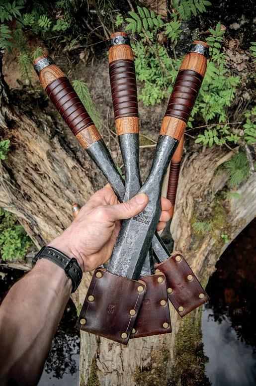
Gear optimized for weather fair or foul.
By Graeme Bell
TheNordic countries have been ranked among the most successful on the planet and for good reason. Norway, Sweden, Finland, Iceland, Switzerland, and Denmark have arguably the happiest, most-satisfied, longestliving people, and a sublime natural world to escape to. And they escape to nature often—not just when the sun is warm. The Norwegians have a saying, “There is no such thing as bad weather, only bad clothing.” And if the Norwegians never went out in bad weather, well some might never leave the house at all. When historically, your life and comfort depends on your home and gear, you are not going to waste time and money on second-grade products. No, you cry once and purchase the best you can afford. If the best is not good enough, then you create better. The following Nordic companies were born out of necessity, and the products they create are tried and tested to deal with the harshest conditions. As a result, the gear produced is second to none. The concept of planned obsolescence does not exist in the design and manufacturing culture of these outdoor gear specialists—the opposite in fact, hence the typically premium pricing.
If I were to head out into the remote wilderness to explore and survive, I would not leave without my Nordic gear. The difference between success and failure is investing in the best tools for the job, and having the knowledge to wield them.
My top picks from each company reflect my desire to travel the planet overland, and eventually, escape into the wilderness to survive and thrive like the legendary Iowan Richard Proenneke. I am sure he would approve.
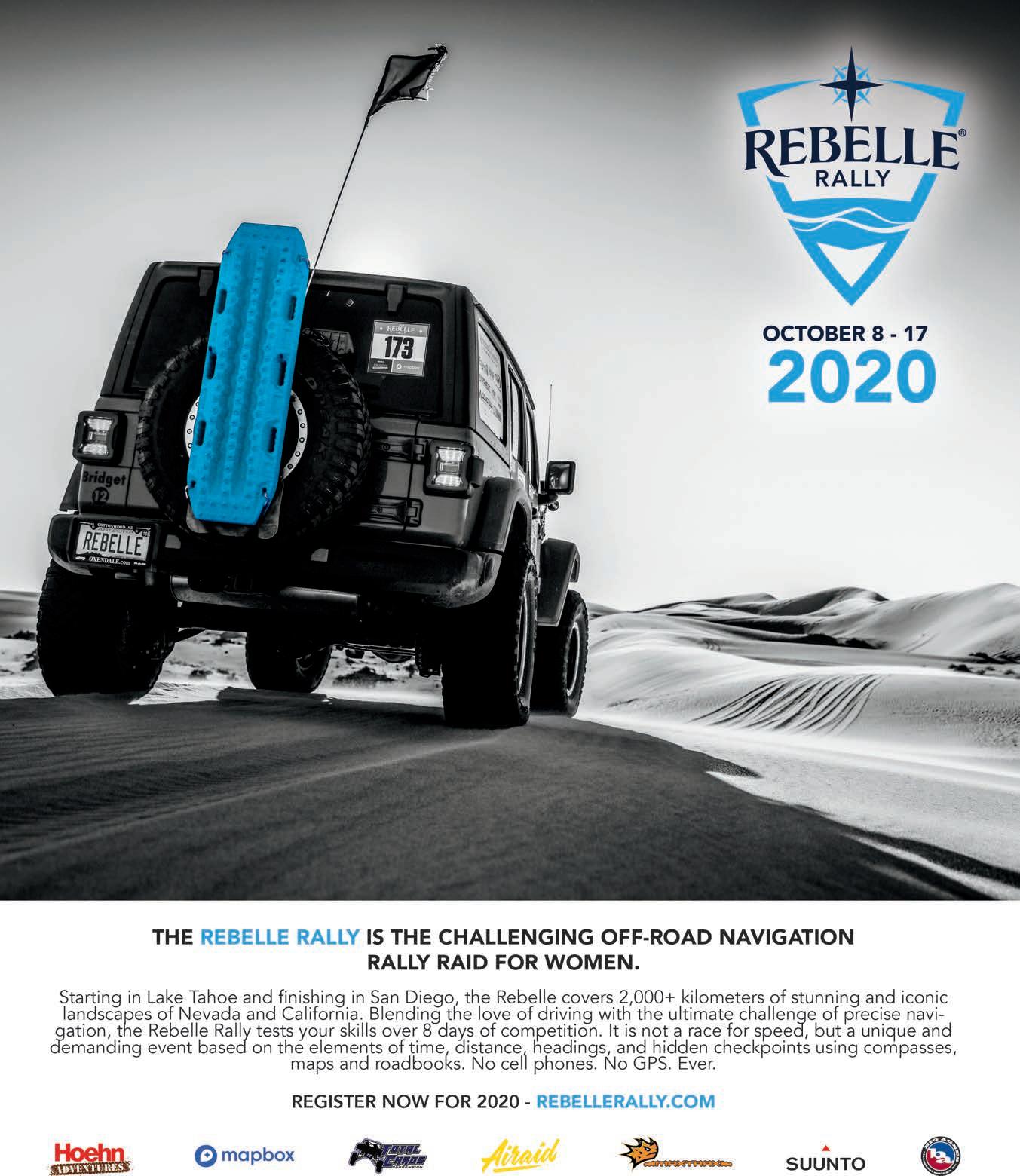


Primus is a Swedish company that began life in 1892, manufacturing the first portable and soot-free kerosene stove. Initially, the stove was popular with Stockholm market vendors, but soon adventurers adopted it for outdoor excursions. The Primus stove braved the 1897 North Pole expedition with Salomon August Andrée, accompanied Roald Amundsen to the South Pole in 1911, and was essential to Sir Edmund Hillary and Tenzing Norgay’s summit of Everest in 1953 as well as many other expeditions. Arguably, it is the Primus stove that allowed modern man to venture to the most barren and hostile corners of the world. It provided the life-giving heat and soul-reviving warmth which nourished and sustained those intrepid early explorers heading into the true unknown. Would they have been able to achieve what they had without the Primus stove? I am not sure.
Our personal experience with the brand has been less dramatic but significant—a learning opportunity. En route from Argentina to Alaska in 2015, we stopped at the Overland Expo in Flagstaff, Arizona, where the wind howled snow and ice against the hardy overlanders camped in the open field. Our primary gas can was half full of useless South American butane, and a kind US Army colonel took pity on us and lent us his Primus cooker. We were relieved to have some heat in the annex of the roof tent and a hot meal to feed the kids. Simple, robust, efficient, and good looking, Primus is top shelf.
If I had to single out one product from current offerings, it would be the PrimeTech Stove System, which utilizes Eta (Eta is the Greek symbol for efficiency in thermodynamics) technology to provide double the fuel-burning efficiency of a conventional stove.
$150 | PRIMUS.US

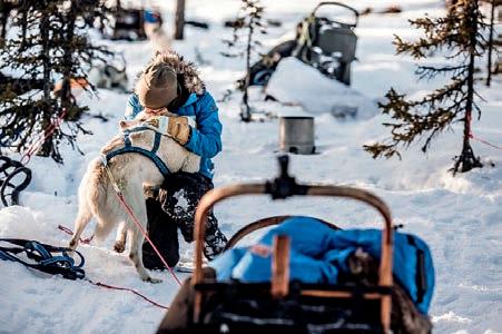
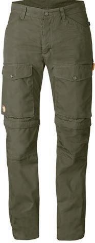
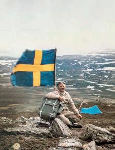
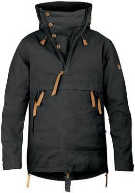
In2016, we met up with Carl, a Swedish industrial designer, in the Alvord Desert. He introduced us to the Arctic fox (Fjällräven is Swedish for Arctic fox, and the animal is the company’s mascot, logo, and conservation focus). Carl’s Fjällräven trousers were waxed, required infrequent washing, and were the perfect length, shape, size, and colour—both practical and stylish. They were made to last almost as long as Carl himself.
Fjällräven began humbly in 1960 when explorer and Founder Åke Nordin created a light and sturdy aluminum box frame backpack in his basement in Örnsköldsvik. Driven by necessity, he designed a condensation-free tent using a two-layer construction to avoid waking up frozen in a wet sleeping bag. The now-world-famous Greenland jacket and the G-1000 wax material favoured by Swedish industrial designers and Arctic explorers followed soon after. Åke Nordin was on a winning streak driven by passion, creativity, and a love for the great, often extreme, outdoors. In 1974, Mr. Nordin spent a night freezing through a storm. He vowed never to be cold again, leading to the creation of a down jacket constructed of two jackets sewn together (applying the principles learned when creating the condensation-free tent). It was such a revolutionary concept that the Greenland jacket earned an award from Svensk Form (the Swedish Society of Crafts and Design), and the rest is history. Fjällräven is more than mere outdoor gear, it is a form of art. And good art is not cheap. Yes, Fjällräven gear can cost double that of their competitors’ products, but their goods are not examples of a false economy—a young man’s winter jacket bought today will keep his grandchildren warm.
For year-round performance in the most challenging environments, we would choose the Anorak No. 8M Jacket and the Gaiter Trousers No. 1M. These are articles of clothing that will keep you warm in the winter, and cool and protected in summer. Both are constructed from the legendary G-1000 waxable cotton/poly blend and are designed to be easily repaired and maintained. I have a vision of sitting beside a blue lake fishing for trout, washing and waxing my faithful clothing after years in the wild.
Both Fjällräven and Primus are now owned by Swedish company Fenix Outdoor International AG.
$450/JACKET, $400/TROUSERS | FJÄLLRÄVEN.COM
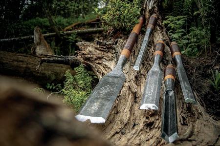
DickProenneke (mentioned at the beginning of this article) spent many years living alone in the Alaskan wilderness, building a log home with his bare hands. I suspect he and the craftsmen of the Northmen Guild would have long, deep, and meaningful discussions, as they are of like mind (the Birth of a Wooden House video on the Northmen YouTube channel is in part dedicated to Mr. Proenneke).
The Northmen Guild story begins with Jacob, the Estonian carpenter and equally gifted filmmaker who had a dream to build a log home by hand using only traditional tools, methods, and skills. Sourcing the tool patterns from an ancient book, he had a blacksmith friend forge various blades while he crafted the handles. The resulting log home was sublime. A business was born out of the cooperation of tool production. A few years later, the original partners split to form their own companies. Lessons had been learned, and Jacob, the carpenter, established a guild of craftsmen united by a common philosophy—essentially, hands, not machines.
The guild produces some of the most exceptional and unique handmade tools available today, but they also offer courses such as the 10-day Traditional Norwegian Carpentry Course in Norway. “Course participants will learn the historical way of building a house in a timber framing and full scribe log building techniques using only hand tools.” Imagine learning to build your own home with the planet’s most beautiful tools. The cost is $2,400, and includes everything in-country (Norway): tuition, accommodation, all meals (prepared by a professional chef from local ingredients including wild elk, deer, and fish), and organized field trips to museums, Viking longships, and Norway’s oldest log building—count me sold. There is a catch, though. Courses are booked years in advance (but you can learn a lot from the Northmen YouTube channel), and the tools can take up to a year to be handmade and delivered to your door. Perfection is worth waiting for.
If setting off into the wild to build a log home and survive with only the tools I could carry, the Set of Five chisel kit, Finnish Carpenters Axe, and Livonia Shooting Longbow (price/availability in flux) would all be in tow.
$1,195/CHISEL KIT, $450/AXE | NORTHMEN.COM
Thelast manufacturer is a relative newcomer. Pronounced haa-lee-ta, Halite is a Norwegian luggage manufacturer founded by ex-military, special forces operatives, and designers with expedition and outdoor expertise. The bags are made for both civilian and military personnel and are intended specifically for use by special forces and explorers, particularly in maritime environments. What does that mean for you? If you need to keep your precious gear dry and clean, you may need luggage designed to withstand the harshest environments. My favorite is the navy blue, 140-liter Kraken waterproof bag, made of 840-denier HT nylon (bombproof) material. Happily, it has found a home on our Defender’s roof rack as we explore across Africa to Russia.
What I love about this company, other than the excellent gear, is that it is young, and I get to watch it grow and evolve, produce new products, and choose a course. Already their range has expanded to include weapons cases and sleeping bags, and I can’t wait to see what they will release next.
$469 | HALITESTORE.COM

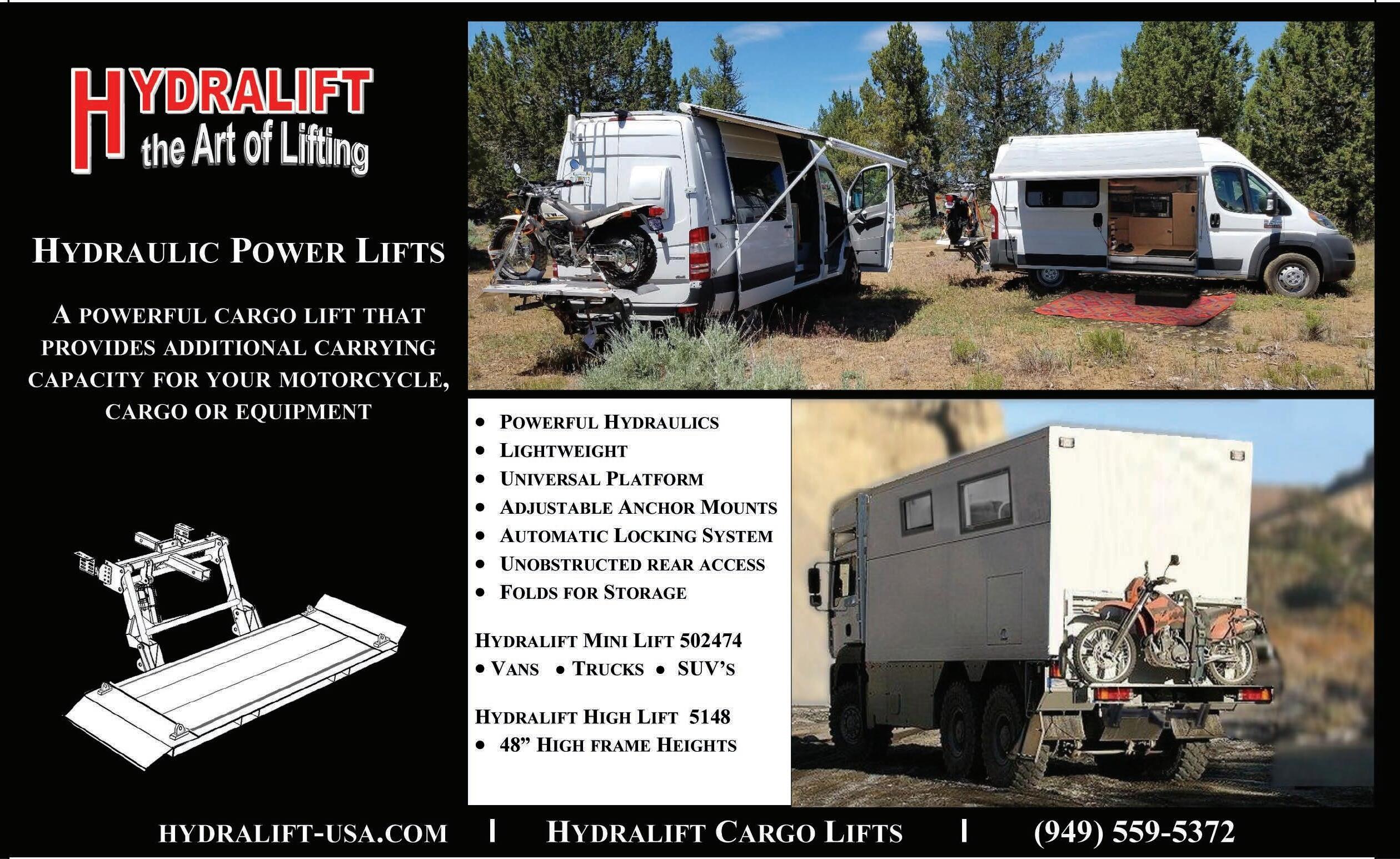
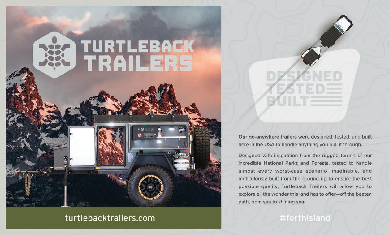
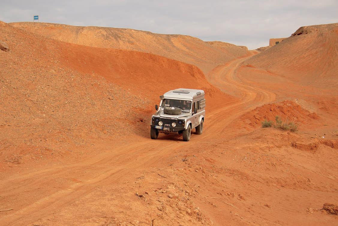
Border crossing bureaucracy reaches a whole new level.
It was early September. After months of organizing, preparation, group calls, and visa applications, it was still an arresting moment to exit Mongolia and drive through the barriers at the Chinese border. To drive from Europe to China still seemed inconceivable, even though we were right in the middle of doing so.
When my girlfriend, Evelin, and I were preparing for our Budapest to Singapore (exclusive land-based) adventure, significant time was spent organizing our crossing through China, focusing on the less-traveled regions in the west. We were expecting complicated and lengthy bureaucratic hassles. Still, no matter how much we tried to educate ourselves, nothing could have prepared us for the level of bureau-craziness that awaited.
The first tasks for anyone planning to overland through China are finding travel companions and a tour guide; preparations should start about six months in advance. A tour guide for overlanders—meaning anyone traveling with their own foreign-registered vehicle—is mandatory. Hiring a tour guide is expensive, so take time with your selection. It will likely be advantageous to share or break up the cost; hence, you should seek out overland-

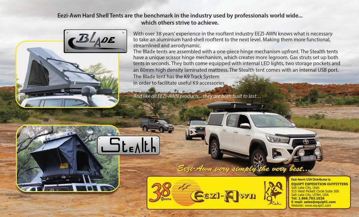
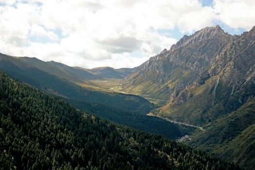
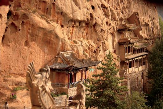
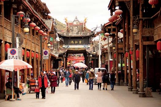
ers with roughly similar plans. Getting both things right is imperative since eventually, you’ll be spending several weeks with people you’ve never met before.
Trying to find a group of people with like objectives to travel with may initially sound hard, but joining overlanding groups on social media platforms and different online forums reduce the difficulty of this job. You can either post in these groups or look for others trying to find travel companions to join their trip. Once you find people to go through China with, a discussion around the details, itinerary, duration, camping/ accommodation, etc. is a necessary exercise.
For us, finding a tour company proved to be a more daunting task. Remember, you and your guide will be sharing three meals a day and making decisions together along the way. Look for a company willing to listen to your specifications and a guide that is easy to talk to.
THE BEST WAY TO FIND TOUR COMPANIES IS THROUGH ONLINE FORUMS. ALWAYS TRY TO GO WITH A RECOMMENDED COMPANY, AND WHEN POSSIBLE, TALK TO PEOPLE WHO HAVE COMPLETED A TOUR WITH THEM BEFORE.
Professional handling of all necessary paperwork and police dealings at checkpoints are critical components. They will also be responsible for purchasing insurance for your vehicle to cover your entire journey through the country; you should only need to acquire your personal/medical travel insurance.
The best way to find tour companies that provide such services is likewise through online forums. Always try to go with a recommended company, and when possible, talk to people who have completed a tour with them before. Determine your priorities before beginning your research to save time.
• Your rough itinerary
• Which border crossing you prefer
• Whether or not you prefer camping to hotels when possible (Note: Official campgrounds are limited. Wild camping is far easier in the western regions and mountains, but some tour companies prefer to use hotels. Hotels are often happy to let you camp in their car park for a fee. And some parts of China prohibit camping altogether, such as Qinghai Province.)
• If you want to take motorways or prefer rural roads (Note: Roads are generally well developed, but motorways are expensive due to tollways. Rural thoroughfares are usually in good condition, though maintenance is sometimes neglected— we came across landslides and collapsed road surfaces many times.)
• How long you want to spend in China (Note: Visa limitations vary between 30 to 60 days. Using an invitation letter from a tour agency usually helps with obtaining a longer duration. Potential complications include, for example, if a Turkey stamp is in your passport, a visa is often denied due to political reasons.)
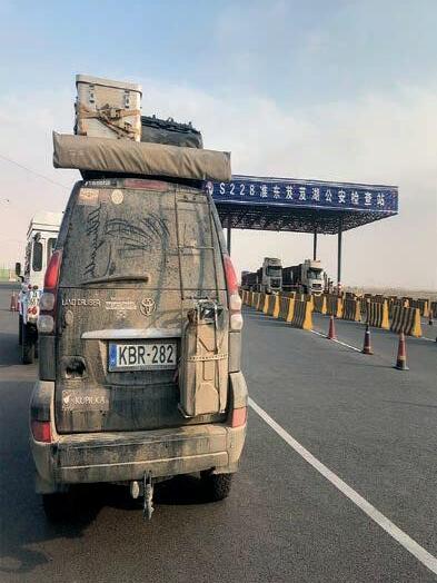

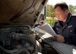
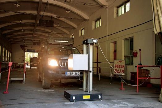
In terms of border crossings, you have a limited number of options. Traveling from west or north, you can enter from Kyrgyzstan or Mongolia and then exit China to Nepal or Laos. Entering Myanmar from China is not possible due to a decadeslong conflict in the Kachin Region, and Vietnam doesn’t have clear border crossing rules in place for foreigners driving their own vehicle (with a lot of luck, you may potentially be able to cross with a motorbike), so these countries aren’t viable options.
We entered from Mongolia, at a very remote corner of the country, Takeshiken Zhen. This was the autonomous region of Xinjiang, with its bad reputation and history of political unrest between the native Uighurs and the ruling Communist Party. It could be heaven for gadget geeks, although not for the best reasons. Xinjiang is among the poorest regions in China, but in one aspect, it’s the most advanced: from a global standpoint, surveillance and security systems are cutting edge. We had the chance to see some of the latest developments in the tracking and spy industry, such as the machine attached to my phone that probably scanned through all of my photos, messages, emails, and notes, under the pretense of looking for anti-China sentiment. Since we didn’t come to topple the regime, we passed through this point successfully, although my pocket knife with its 3.6inch blade became a victim of red tape.
It turns out that the authorities have an extremely stringent code when it comes to knives, due to violence in the area. Locals have to get their personal QR code engraved on their knives so that they can be easily identified and traced. We witnessed a restaurant cook slicing vegetables for our dinner with his knives chained to the wall. As tourists, we never felt our safety was threatened during our travels in China—in Xinjiang, or elsewhere.
We already had a strong impression of the intensity of Chinese border protocol, but in order for us to experience what we interpreted as the manifest world of Orwell, the actual entry process lasted for another five days. The vehicles went through a full manual check and search at the border post, followed by multiple scans through a large machine designed for trucks, which ironically failed to find our 11-inch cooking knives or any of the hatchets in our three-vehicle convoy.
Modern China’s new technology continued to perplex us. The scanning machine highlighted a number of suspicious points in each vehicle that had to be manually followed and checked by an officer on the ground. Meanwhile, authorities were watching and approving the operation through a portable camera. After a day and a half and several pages worth of stamps later, we were allowed to continue, only to encounter our next challenge with the bureaucracy phenomenon.
We were on our way to Altay to arrange for the remaining number of permits needed. The semi-desert terrain between Takeshiken Zhen and Altay was breathtaking. This part of the country is still relatively untouched and undiscovered by tourism, and the landscape was peppered with extraordinary rock formations, formed from harsh winds and an arid climate. Sur-
veillance cameras were installed above the perfect tarmac road every 20 meters for hundreds of miles, a portent of things to come.
Altay seemed like a peaceful town, with sunny mornings, smiling kids walking to school, and the hustle and bustle of people rushing to work. However, being in Xinjiang, there were some differences when compared to other Asian towns of similar size. At every major intersection was a small company of police officers in full anti-riot gear—complete with helmets, shields, and equipped with armored vehicles. There was also a police booth or station on the street approximately every 450 yards.
Our tour guide’s help was invaluable on more than one occasion. Shang helped us get through an enthusiastic anti-riot man at the entrance to the hospital parking lot; we were there for an eye test as part of obtaining our Chinese driving licenses, necessary for any foreigner wanting to drive their own vehicle. One step was to get through the standard tumbling E-chart. Evelin and I aced the test. I was helped by my contact lenses, whereas our companion Giampiero sought my assistance in showing him the answers behind the doctor’s back.
Both humans and machines are required to take tests if they want to overland through China, so after the eye tests, we were on our way to the traffic police station. Niels and Lotte led the convoy with their Hilux, simultaneously getting directions from Shang in Giampiero’s vehicle through a CB radio. Evelin and I were trying to keep pace with the others, but the Prado struggled with only three gears working out of the five and a failed turbo. The mechanical issues had presented themselves the week before, and by then, our truck’s condition instigated significant worry. We had about 6,000 miles ahead of us through China, and since we would be driving by caravan most of the time, we didn’t want to be a liability.
At the traffic police station, the basics were inspected for the fourth time since entering the country. They checked the chassis and engine numbers against the vehicle’s registration and the ownership documents. Although we’d been booked for the technical and safety vehicle inspection that afternoon, the polite but confident headshaking by the main officer suggested that we wouldn’t be camping next to rice fields anytime soon.
The roadworthiness tests were conducted with ambiguity, but seemingly in compliance with all the rules and regulations. They ran tests to make sure our brakes and lights were working properly, but the fact that our vehicle could only crawl out from between the rollers of the moving road by using low-range gears due to lack of power was deemed inconsequential. In spite of its numerous problems, our vehicle still passed all the tests, possibly since the officers welcomed the diversion of taking pictures with us over the actual inspection. We had the feeling that the officers were just covering their backs; as long as they could check the boxes on their forms, they were happy to let us carry on. This was true in almost all instances.
Early the next day, despite having the eye and vehicle tests in hand, the officials at the traffic police station met us with more
shrugging shoulders and shaking heads. Apparently, we still didn’t have all the documents required to get our route permits, licenses, and license plates.
We later learned that we were the first overlanders to pass through the Takeshiken Zhen border in over a year and a half. Officials had to work out what the actual procedures to follow were, developing the process as they went along. It’s important to note that a carnet de passage is not valid in China, as they have their own temporary import guidelines. Since these processes were new even to the officials in Xinjiang, and nobody wanted to make a decision or take responsibility, every official had to ask their superior for permission, who in turn, asked their superior. Wiser overlanders choose the border crossing at Erenhot, where these hurdles can be done and dusted in 24 hours.
By this time, we were all commuting in Giampiero’s Defender between the traffic police station, our new favorite restaurant, and the mechanic. The leaf springs of the Hilux needed adjusting, and we found out that an important cable on our Prado that had a role in controlling the automatic transmission didn’t like Mongolian river crossings, so a cable connection was corroded. We had an agonizing wait ahead of us, as the necessary part had to be sent from Beijing. Naturally, we were in the farthest corner of the country away.
It was already Friday afternoon when we got the news that our little team was finally welcome to discover the People’s Republic of China. There was even a small ceremony where our Chinese licenses and plates were handed over. Since it appeared our administration issues were more or less sorted, I was now starting to worry that Evelin and I would hold everyone up. We even discussed separating from the group so that the others could begin the journey. However, remember that in Xinjiang, absolutely everyone has to have a tour guide, so that idea was not feasible. We also had a fantastic team, which meant that nobody wanted the group to split. Lotte, Niels, and Giampiero were all very understanding with respect to our vehicle problems.
IT’S IMPORTANT TO NOTE THAT A CARNET DE PASSAGE IS NOT VALID IN CHINA, AS THEY HAVE THEIR OWN TEMPORARY IMPORT GUIDELINES.
Luckily, we didn’t have to test everyone’s patience much longer since the part arrived on the same day as the ceremony. Thanks to the adept, accommodating mechanics, the cable was replaced by 10:00 p.m. The next morning, we were heading south to begin our great adventure together through China to Laos. In a strange twist of fate, the redundant bureaucracy encountered created the same circumstances that helped us not be the cause for our group’s five-day holdup. It ended up being a blessing in disguise.
When you’re in Xinjiang, your hindrances don’t end with going through the immigration and customs process. There are
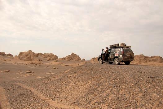
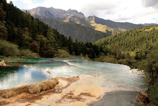
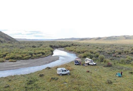
still possible to find wild camping spots.
• Start preparing and organizing at least six months in advance of your planned entry.
• Find travel companions to share in organizing efforts and cost.
• Get to know your fellow overlanders through regular online video calls.
• Do thorough research and due diligence of the Chinese tour companies; it’s best to choose by personal recommendations when possible.
• Set your preferences and make sure to find a tour company that can accommodate them: camping, rough itinerary, preferred point of entry and exit, duration, avoiding motorways (or not).
• Arrange your Chinese visa well in advance.
• Arriving from the west or north: If you don’t want to drive through Xinjiang and/or Tibet, choose to enter Erenhot from Mongolia. Otherwise, you can cross at Bulgan (Mongolia) or Torugart Pass (Kyrgyzstan).
• Arriving from south/southwest: Laos, Myanmar, Nepal, and Pakistan are your entry options, depending on your overall route.
• Plan on one vehicle having a spare seat for the guide.
police checkpoints every 20-30 miles or so. Filling up your fuel tanks can also be an undertaking—not because gas or diesel isn’t available, but because every gas station is heavily guarded due to security concerns and surrounded by wire fencing. You’re not allowed to have any liquids in the passenger area of your truck, so any drinks must be removed (that goes for any passengers as well) before a guard inspects your vehicle’s interior. In addition, one of us always had to wait outside the station’s perimeter. Other than those minor inconveniences, the fuel was of good quality and readily available.
Once we left Xinjiang, cell phones suddenly worked without interruption, gas stations were completely open (unguarded and without inspections), and the police presence was drastically reduced all the way until Laos, our exit point. Instead, we were met only by incredible scenery, futuristic cities, and well-preserved historic towns. If only our initial welcome had matched the reception we received from the people we met throughout the country.
All told, we spent 43 days in China. Shang, along with his colleague Brenda, can be credited with making our dream to drive through this magnificent country with our vehicle come true. In retrospect, China was the highlight of our Budapest–Singapore adventure. Overlanders often say that due to the difficulties and high expense, driving through China is a once in a lifetime experience. I do hope this won’t be the case in the future, and that regulations will be relaxed, allowing more people to discover it’s beauty.
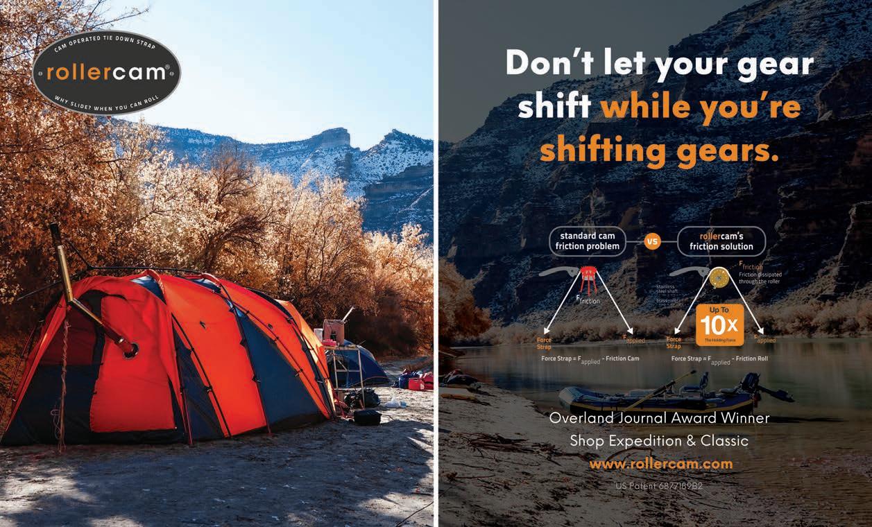
OVERLAND CHEF LISA THOMAS

The Spanish tortilla became a favourite dish of ours during our time camping on the outskirts of a small Nepalese village cradled in a valley below the mighty Annapurna Mountain Range. All of the ingredients were easy to obtain from the ramshackle wooden huts precariously balanced on their wooden stilts, seemingly hovering above the paddy fields. In the evenings, we would enjoy the tortilla with a cheap Nepali beer called Everest whilst watching the fields being prepared in readiness for the monsoon season. The rice paddies extended as a beautiful green patchwork carved up into the hillsides above for as far as the eye could see. The simplicity of this recipe lends itself to more time for peaceful relaxation and enjoying your surroundings.
An easy, tasty dish using simple ingredients.
SERVES 2
COOK TIME 25 minutes
ASSEMBLY TIME 5 minutes
EQUIPMENT 2-litre saucepan, frying pan, knife, spatula, chopping board
1 large potato, thinly sliced
1 large onion, thinly sliced
2 cloves of garlic, finely chopped Olive oil
3 medium-sized eggs, beaten till frothy Salt and pepper
I cheat when I cook my Spanish tortilla. For speed, I use the following method: Boil the potato slices until almost cooked. Do not overcook, or they will fall apart when in your frying pan. Drain and set aside. Fry the onions and garlic, taking care not to burn them. Once cooked, remove from the pan and transfer to one side of a separate plate. While off the heat, put a little oil in the frying pan, covering the entire surface with a film of oil. Place the potato and onion/garlic in alternate layers in your frying pan, starting and finishing with a layer of the onion.
Return the frying pan to the heat and cook for two minutes but do not stir. Pour the beaten egg mixture evenly over the now-cooking layers. When the underside is finished, remove the pan from the heat, covering it with a plate over the top like a lid. Using a cloth to hold the plate in place, flip the pan over, leaving the partially cooked ingredients now on the plate. Slide the tortilla back into the frying pan to cook the other side. Once both sides are browned, eat it straight from the pan or serve it separately. Eat the tortilla at room temperature with a good cold beer. Enjoy the tortilla on its own or with a tin of tuna and sliced tomato. If it’s a cold/cool climate, wrap and carry some pieces with you on the road for a quick roadside snack. For variation, add in some finely chopped chili and sliced zucchini.


to me, but no one complained. Some throttle-hand dexterity, a mud course, and what? A bow-and-arrow station? Yep, too strange. What I did not understand before I came to the Cup was you can ride any BMW (or prove that you own one), from the 650 GS to the 1200 GS Adventure. Only one rider was dumb enough to bring the biggest of the big bikes: me. The mud course was not kind to me, and neither was the sand challenge. All in all, I had a bad morning.
After lunch, we started a new set of trials that suited my style of riding much better. Tight incline turns, quick uphill obstacle jumps, then a four-trail hill climb. All of these, I am happy to say, I rode quite well. After my hill climb, I sauntered over to Mr. Handsome TV Doctor, and he, mistaking me for a smooth-operating professional, asked me what gear I was using during the hill climbs. I looked at him, gazing off into the distance for dramatic effect, and said, “Fourth.”
The obstacle course contained a daunting 44-foot teeter-totter which required riders to climb, do a trail stop in the middle (a complete stop, but no feet touching the ground), then a descent into a 25-footlong water obstacle.
“Fourth,” he shot back. “You kidding me?”
Of course, I was, but maybe he would be that one guy who I would crush. Then I felt rather shameful and told him the truth. He smiled, winked at me, and did his thing.
By the end of the day, we finished the challenges which would qualify some of us to progress to the finals the following day. Back at the dinner tent, the man running the show gave us a speech about how they computed the scores with algorithms and derivatives (actually, it was just basic addition). They posted a list of the top 10 riders moving on to the finals. Many of the fellas clambered over while I tried to look cool and apathetic. When the coast was clear, I used a slow gangsta-like limp-walk over to the list, saw that I had indeed made the top 10, and without emotion limped back to the table. My friend Stu looked over at me, and we both had a laugh.
Since the competition was not over, I could not say I beat anyone, really. But making the top 10? Yeah, I would take it. That night was nearly magical for me. I sat back in my tent, thinking about how I beat Mr. Handsome TV Doctor (he did not make the cut), but how I still loved him anyway.
The next day we reconvened on a different part of the vast property—this section was intelligently planned and well constructed. It was a one-loop obstacle course containing log riding, tight switchback turns around flagged barrels, and then the real daunting section: a 44-foot teeter-totter which required riders to climb, do a trail stop in the middle (a complete stop, but no feet touching the ground), then a descent into a 25-foot-long water obstacle. We drew numbers and then waited for our turn. As this was the GS Trophy Cup, BMW required all finalists to use the same factory R 1200 GS. I walked down to get familiar with the bike setup (there
were two bikes in rotation), and I realized two things: the clutch and front brake levers had been turned 90 degrees— straight up, and my riding jacket was missing from my personal bike. I maintain to this day that the forward controls were adjusted as sabotage (and it worked), but the missing jacket was a real mystery.
There were only two people in that staging area: me, and someone on a shiny new KTM. It looked as though he was about to leave, putting gear on, but no helmet yet. I stood there, fuming, as he zipped up his jacket—my jacket. At least, it looked identical to mine, and what are the chances? Trying to sound cool, I asked him if he had seen a black jacket which I had left on my bike. He said no, and started with his helmet, then paused. “What’d it look like, anyway?” he asked. “Well,” I said, “a lot like that one,” pointing to his. “I see. Well, (helmet going on), this one is mine,” and he rode away.
In my frustration, I nearly yelled at him, wanting to say something dramatic such as J’accuse, but I did not. A minute later, another guy walked down the hill and asked if I was ready. “Yeah, but I think that guy done stole my jacket.”
“That guy?” My new friend smiled. “That guy is Rikki Rockett—you know, the drummer for Poison? I don’t think he needs to steal anyone’s jacket.” Ah hell, I guess every rose does have its thorn.
So, my number called, I was on my way with crooked forward controls and, as Phil Collins once said, no jacket required. It wasn’t my best riding, but I nailed the hill climbs and did the teeter-totter perfectly—even the water section directly after. However, it wasn’t enough for me to move on to the big show. I shrugged it off knowing that I accomplished what I set out to do—even besting a guy who scored very highly the previous day but dumped the factory BMW into the water hazard at the bottom of the teeter-totter during finals.
Later that day, I found my jacket lying on the dirty trail between camp and the finals’ area. I should’ve been happy to find it—even after riding the big challenges without it— but mostly, I felt bad about leveling accusations against Rikki Rockett. A few weeks later, I reached out to him on social media and explained how terrible I felt about the situation. He replied fairly quickly, writing, “No problem. Thanks for being a stand-up guy, Stevie.”
In the end, the trip was well worth the time and left my friend Stu and me with great memories. The plan had been to beat at least one guy so badly he’d cry. I am not sure I accomplished that, but after the dust had settled, I did more than okay, placing 5th overall. And yet, I was left wondering which TV doctor I’d meet on my next adventure.


•
•
•
Our antihero beats a TV doctor and insults Rikki Rockett.
Notlong ago, I decided to try my luck by competing at the BMW GS Trophy Cup. For the uninitiated or obtuse, the Cup is strictly a BMW affair which fields threeperson teams from countries around the world facing off in a daunting set of trials. It is a big event which only happens every other year, but worth it if you ever get a chance to participate in your country. Or better yet, move on to the big show, the international contest.
Stu (a close friend of mine) and I put my R 1200 GS Adventure on a trailer and headed southwest to California. Prior to this trip, if I ever saw an adventure bike on a trailer, I figured it was stolen. We traveled down the lonely highway, Joshua trees appearing as praying giants in the low light of dusk.
In the hills outside of Los Angeles, on the eastern side of Los Padres National Forest, a BMW-certified training camp hosts many of the GS Trophy tryouts. It is easy to be intimidated as you slow-ride your rig into a camp you’ve never been to, the other riders checking you out, wondering if you are any good. I had never entered such a competition, and I hoped it would turn out okay. Truly, if I could simply ride “okay,” I would be happy. And yet, I envisioned my inevitable demise happening in one of three ways: grabbing a fist full of frontbrake, sending me off the bike like a trebuchet load that stayed in the basket; hitting the gas while in neutral, causing the motorcycle to roar as it ripped out my heart—in public; or my worst fear, a full-blown whiskey-throttle sending me right off the mountainside to my inevitable and unmourned death.
I had a goal, just one goal, and that was to kick at least one guy’s ass. I did not care whose it would be. If some old man

were celebrating his 80th birthday by competing in the GS Trophy, I would ruin that guy. His progeny would feel that humiliation for generations. Again, I envisioned this happening, but in my heart, I knew I could lose and still be happy for anyone who advanced. I did not want to have to go home and tell my family and friends I took dead last, though.
The first night was a group dinner, and I had a chance to size up the competition. I could quickly see that of the 50 competitors, perhaps half were serious, while the others were only there to tell people they had competed. One of the contestants, a small, stocky man who looked more troll than man, came rolling into camp on a KTM 990. The guy could barely dismount without help, and yet he was serious about competing.
Looking further around the tent, I saw someone who looked familiar but could not place him. Tall, dark, handsome—I tried to buy him a beer, but he said he did not drink. I do not drink either, so I stood there in front of him until yes, that is him. He plays a doctor on TV. Or he played one, back when the series was on. Good grief, he is handsome, I thought to myself, one hand covering my heart as if I had seen the Hand of God and could not speak. I snapped out of it, realizing I looked like a moron, standing there while Mr. Handsome TV Doctor talked on the phone. I regret that. (This was not unlike the time I met Patrick Dempsey, another TV doctor, during the Mint 400. We laughed, took a picture together, then he walked off. I was certain he was cursing me as he left.)
The next day, our trials began. Well-sorted bike? Check. Nervous? Check. The first few challenges seemed a bit odd