doi.org/10.22498/pages.horiz.1.20
A message from the buried past: Deciphering the location of ancient settlements Hadar Elyashiv Follow this sign to see the observations, evidence, and interpretation of the data from Haifa Bay.
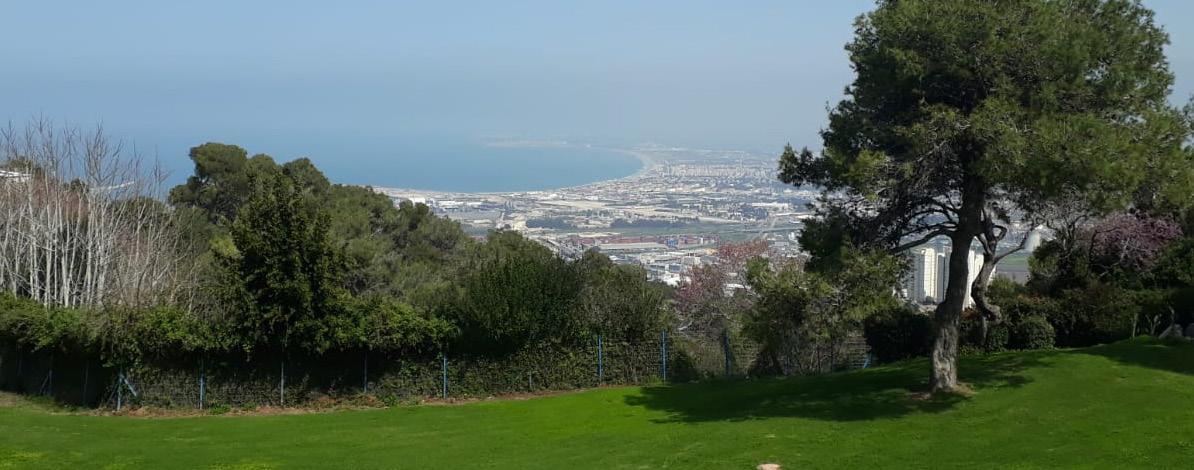
South-East Mediterranean
How can we know what a coastal environment looked like 4000 years ago?
To reconstruct the past environment, a geologist's work resembles the work of a detective reconstructing a crime scene. It begins with observing and collecting evidence such as field observations, sediments, and fossils samples. Once samples are analyzed, the geologist must interpret these natural clues – how did they get there, where did they come from, and how old are they?
How can we find the past in the present? A first step towards environmental reconstruction is to follow the principle "the present is the key to the past". This principle suggests that processes we see today also happened in past times. In order to understand how a coastal environment looked like thousands of years ago, we first need to observe how the coastal environment looks and functions today.
20 PAGES HORIZONS • VOLUME 1 • 2021
W
River Mountain area
E
Curre nt c a s o
2k 1.2 m mi
km i 4 4m 1.
Did people 4000 years ago have special technology, or was the coastline in a different position than it is today? How can we know what a coastal environment looked like 4000 years ago? Knowing the answer could help us understand how people lived in the past and perhaps tell us about possible future changes to the coastline.
Tell
N
tli ne
In a world with no cars or public transportation, going to the sea to fish or to collect food along the coast, even 1 kilometer or 1 mile can be too far. So why are settlements from 4000 years ago now located between 2–5 km (1–3 miles) away from the coastline? This question has troubled archaeologists who studied the coastal area now called Haifa Bay in Israel. It is especially puzzling as we know that fishermen would choose to live close to the water, where they can leave their boats rather than carry them.
Figure 1: Marine and coastal area of Haifa Bay (Satellite images by Google Maps).
Observing the current coastal environment of Haifa Bay reveals a narrow, sandy coastline stretching almost linearly in the north-south direction. To the south, the coastal area is bordered by a mountainous area. The Mediterranean Sea stretches to the west and the land to the east and north. Two main rivers drain into the bay, thus delivering sediments to the bay. An array of Tells ("Tell" is the local term for an ancient settlement) stretches from south to north in a crescent-like shape. Tells are situated between 2–4 km (1–2.5 miles) away from the current coastline.