BARC0118
ADVANCED LANDSCAPE DESIGN 2 DESIGN PORTFOLIO
DESIGN STUDIO 9: FORESTS THAT WALK

DESIGN TUTORS: TIM WATERMAN & EMMA COLTHRUST

BARC0118
ADVANCED LANDSCAPE DESIGN 2 DESIGN PORTFOLIO
DESIGN STUDIO 9: FORESTS THAT WALK
DESIGN TUTORS: TIM WATERMAN & EMMA COLTHRUST
BARTLETT SCHOOL OF ARCHITECTURE, UCL MASTERS IN LANDSCAPE ARCHITECTURE YEAR 2 2021-2022
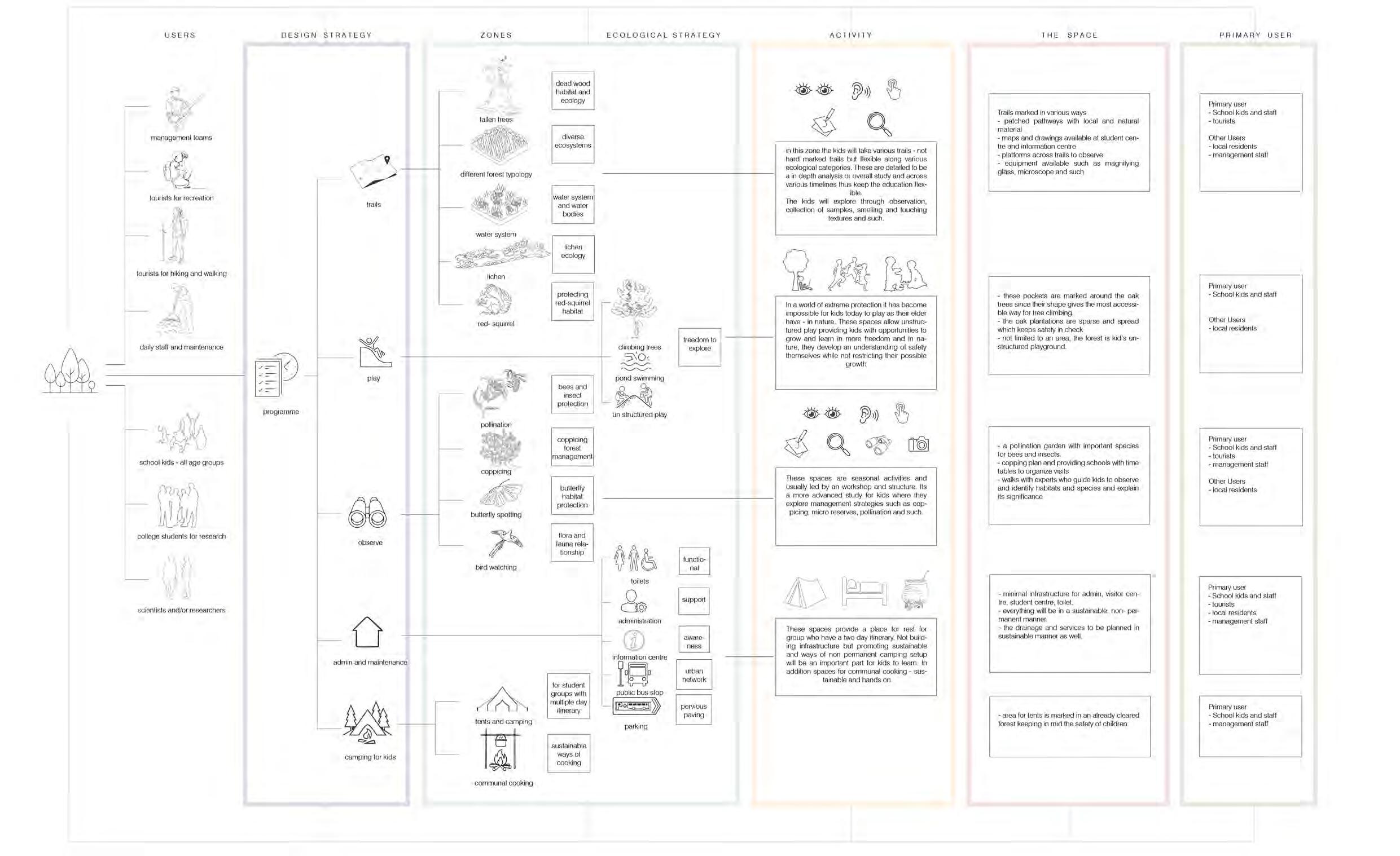
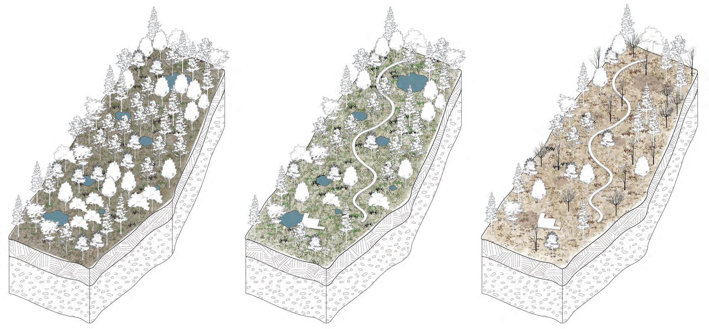
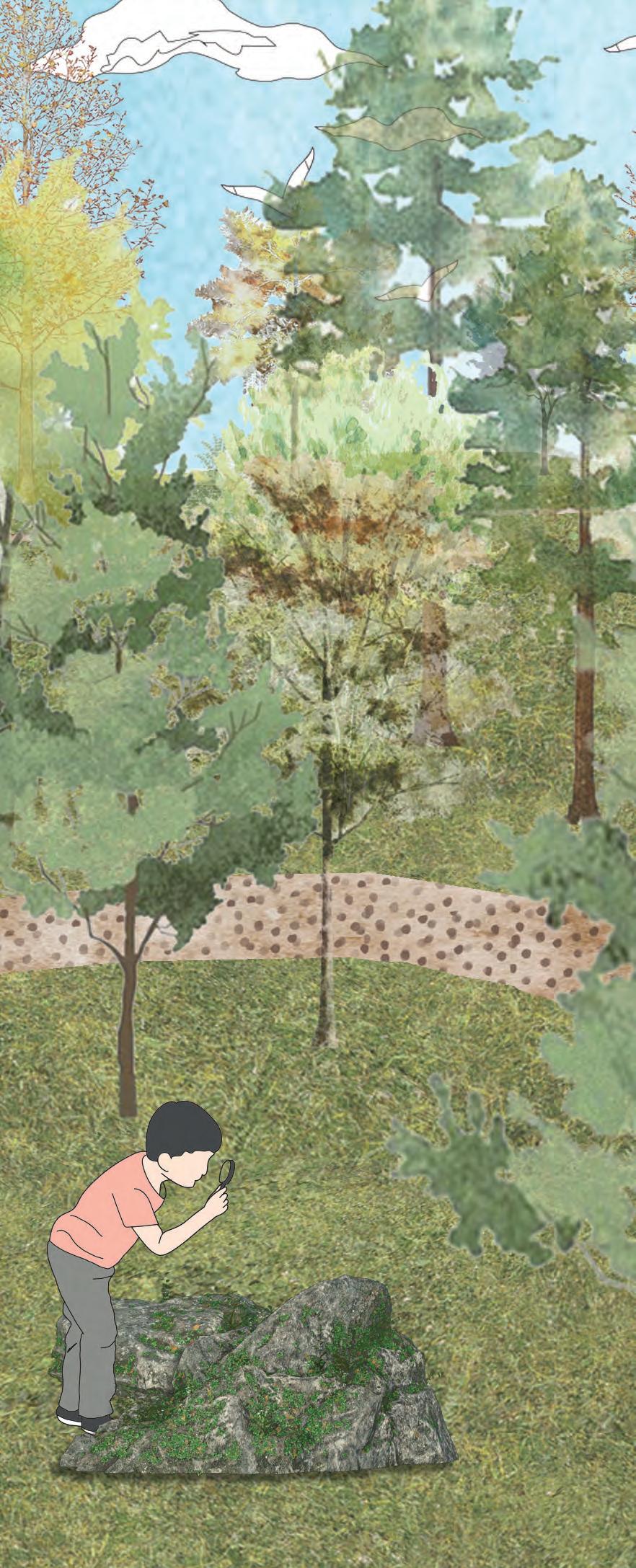
This project proposes rejuvenation of the Parkhurst Forest on the Isle of Wight by establishing a Forest school. This encourages community access to the Forest while also urging the Forestry Commission to employ improved management techniques to reverse the declining health of the Forest. The project emphasises the various forms of ecology in a forest and includes creative techniques for teaching children about forest ecology.
SECTION
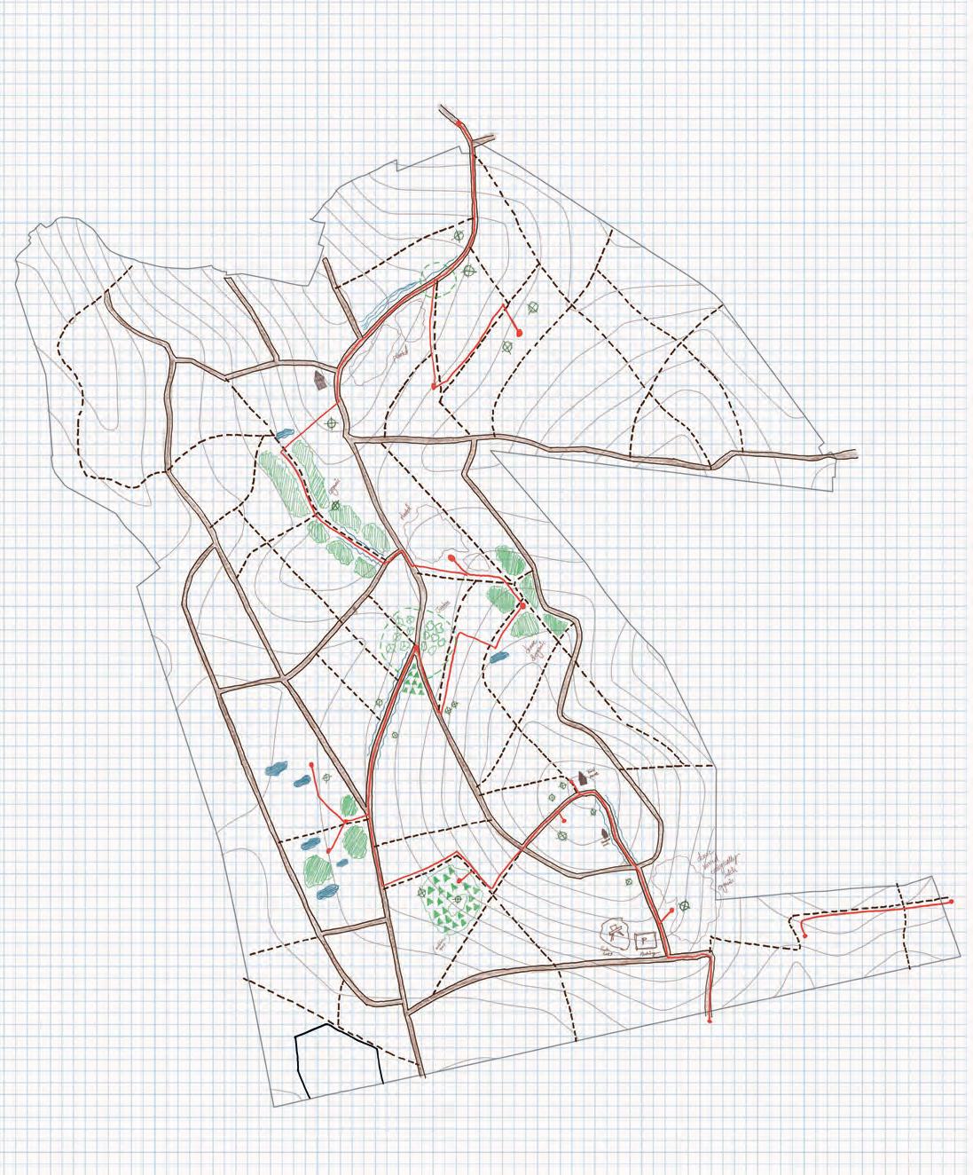
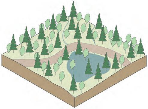
LOCATION AND GEOGRAPHY
SITE CONTEXT
WOODLAND TYPES
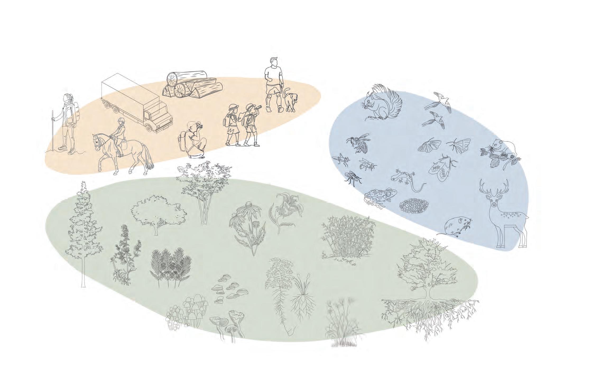
HUMAN AND MORE- THAN-HUMAN INHABITANTS
SITE VISIT
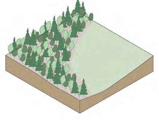
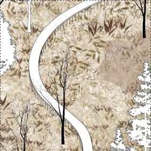
FOREST EDGE ANALYSIS
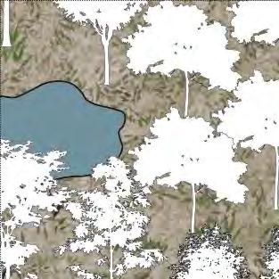
SITE STUDY OF WATER BODIES
SLOPE AND WATERFLOW ANALYSIS
CURRENT USES OF THE FOREST CURRENT OPERATIONS
FOREST CONVERSATIONS ISSUES OF THE FOREST
PROGRAMME DESIGN
PROGRAMME ZONES
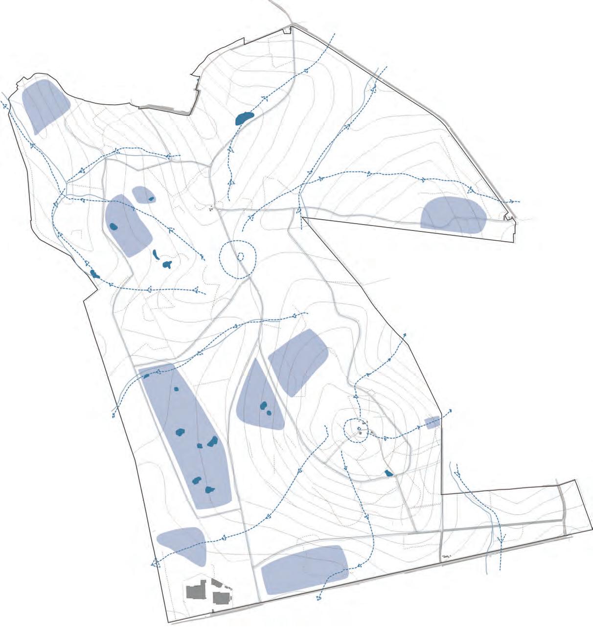
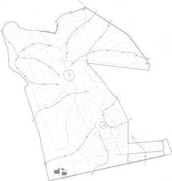
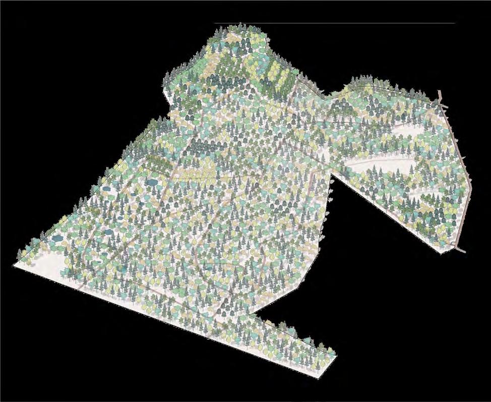
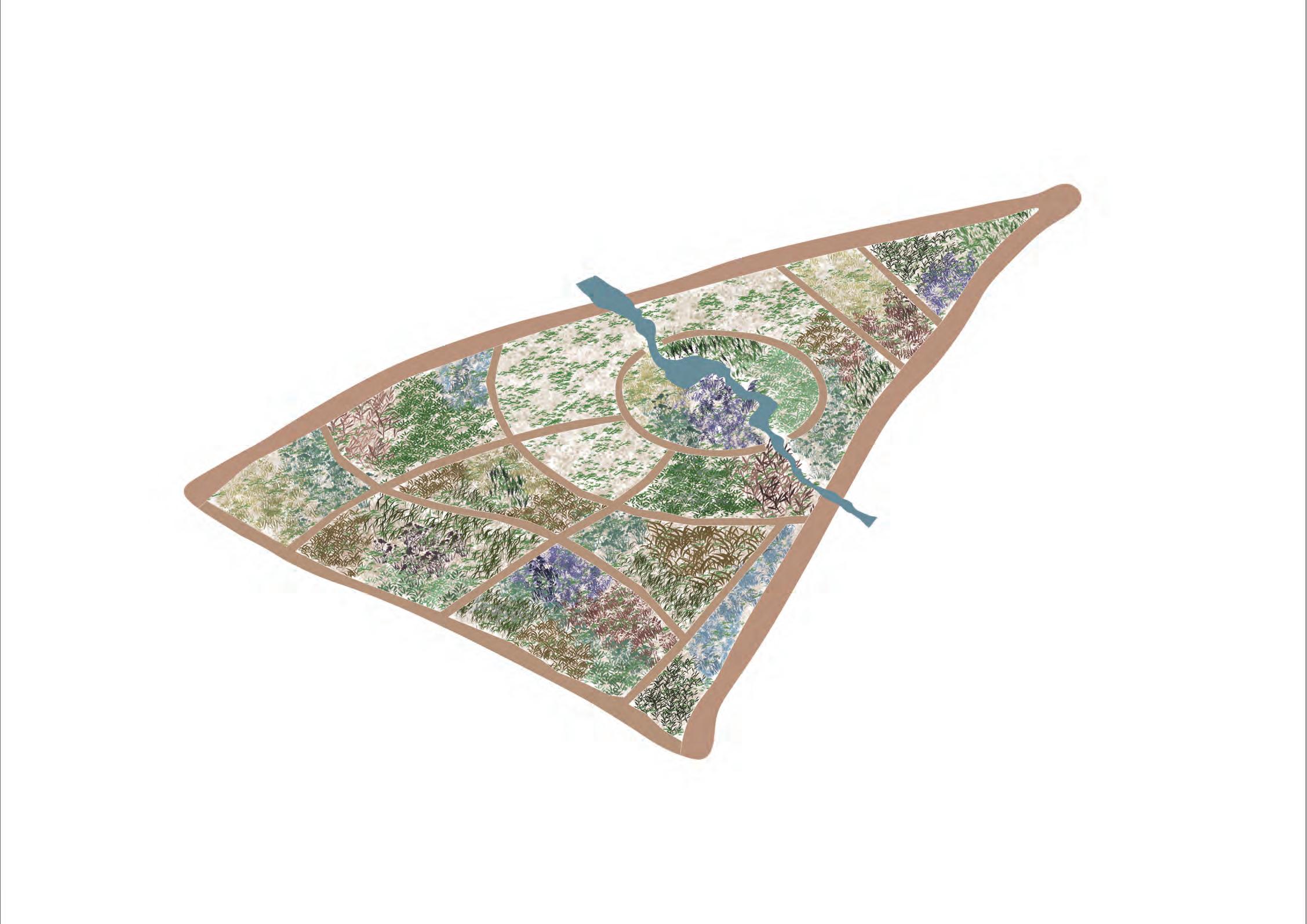
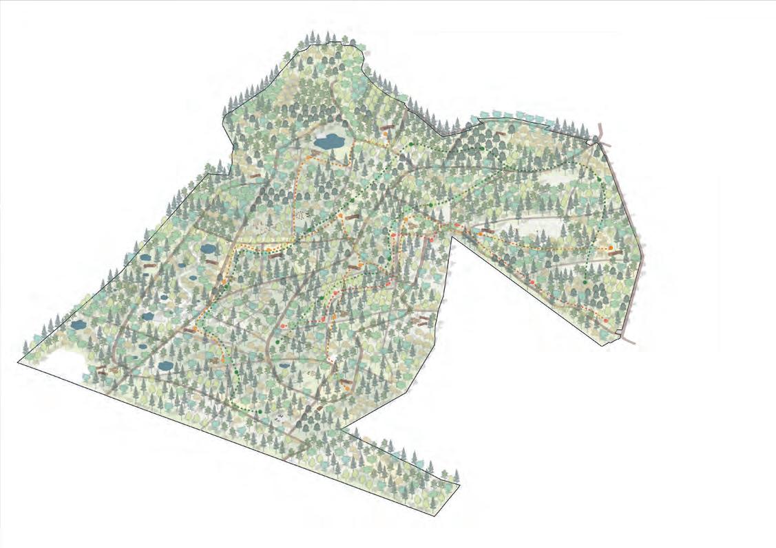
DESIGN MASTERPLAN
DESIGN DETAILS ZONE 1 - VERNAL POOLS
- PLAN AND SEASONS
- PLAN AND ACTIVITIES
- SECTION AND MANAGEMENT
- DESIGN VIEW - BOOKLET DESIGN
DESIGN DETAILS ZONE 2 - POLLINATOR GARDEN
- PLAN AND ACTIVITIES
- PLANTING PLAN
- PLANTING PALETTE
- DESIGN VIEW
DESIGN DETAILS ZONE 3 - FUNGI GARDEN
- PLAN AND ACTIVITIES
- METHOD 1
- METHOD 2 & 3
- METHOD 4 & 5
- DESIGN VIEW
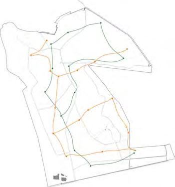
DESIGN DETAILS ZONE 4 - TRAILS
- PLAN
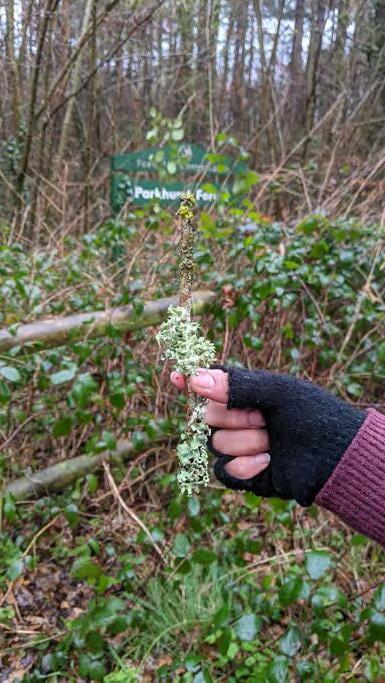
- LICHEN TRAIL
- DEADWOOD TRAIL
- RED SQUIRREL TRAIL
- DESIGN VIEW
APPENDIX
LIST OF FIGURES
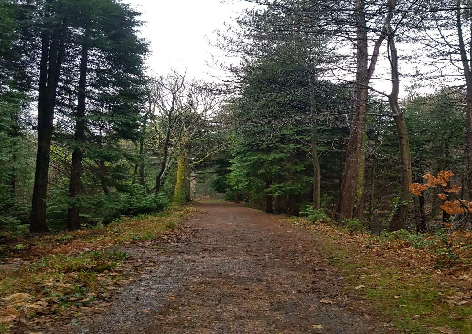
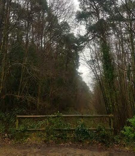
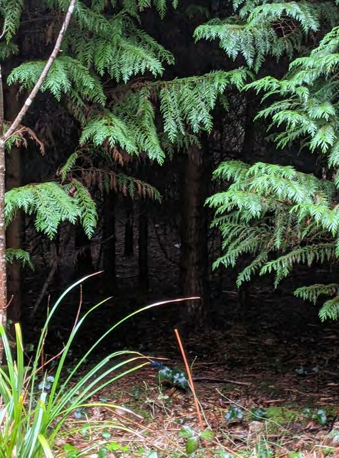
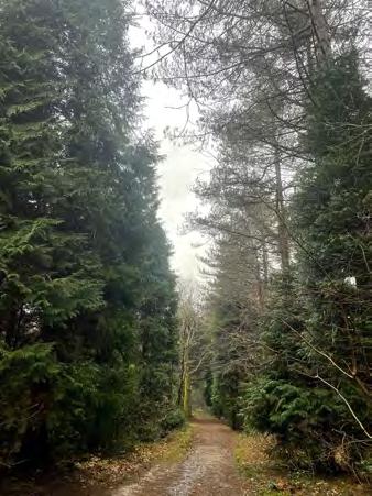
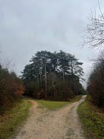
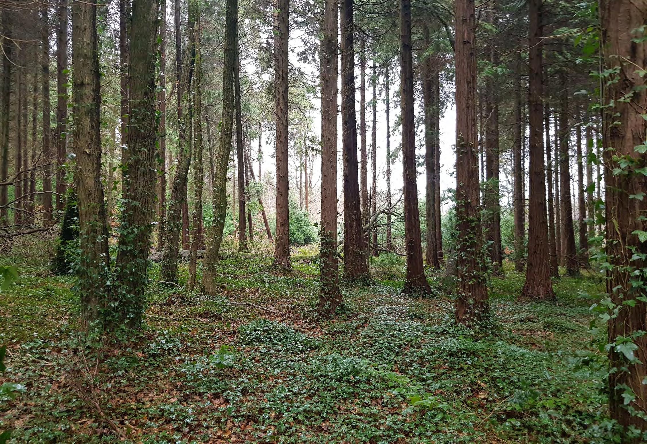
Fig 1. A secondary pathway in the forest. (Photo by the author)
Forests play a critical role in mitigating the effects of climate change. They absorb greenhouse gases, capture carbon, regulate the water table, and provide a resilient habitat for a diverse range of migrating flora and fauna. The world’s forests have already seen significant change as a result of rising global temperatures, and nature must now respond to the new temperatures and climate changes.
We have numerous examples of unpredictably successful migration of a variety of species to a place where they found a safe habitat when changing conditions were hazardous in their native habitat. At the same time, many more species are in danger of extinction.
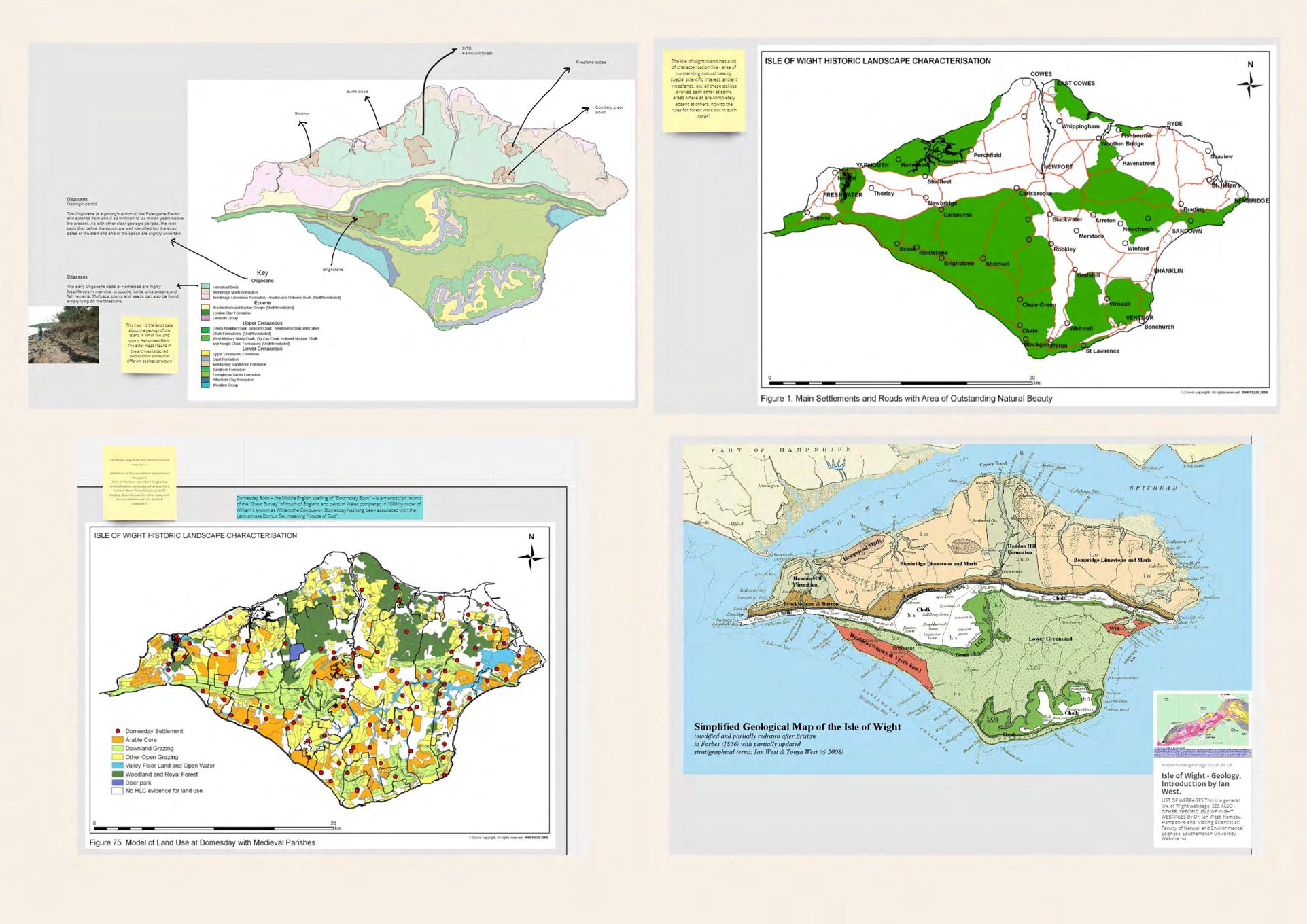
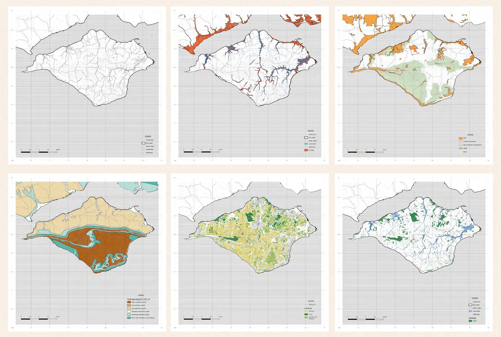
Because the Isle of Wight is separated from the mainland by the Solvent, it has a geographical benefit in terms of not getting many tree or animal illnesses. The island has been successful in protecting the habitats of numerous flora and wildlife, the most well-known of which is the Red Squirrel. If properly cared for, these forests on the Isle can serve as an important site for woodland conservation. A synergistic approach of better managed forests and enhanced land use reduces climate change vulnerabilities while achieving both mitigation and adaptation goals.
A
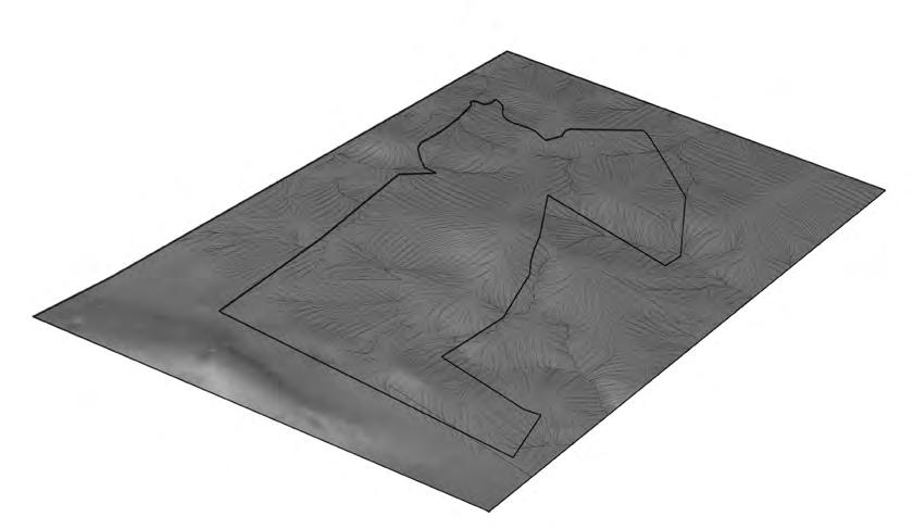
LOCATION
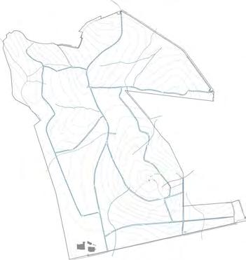
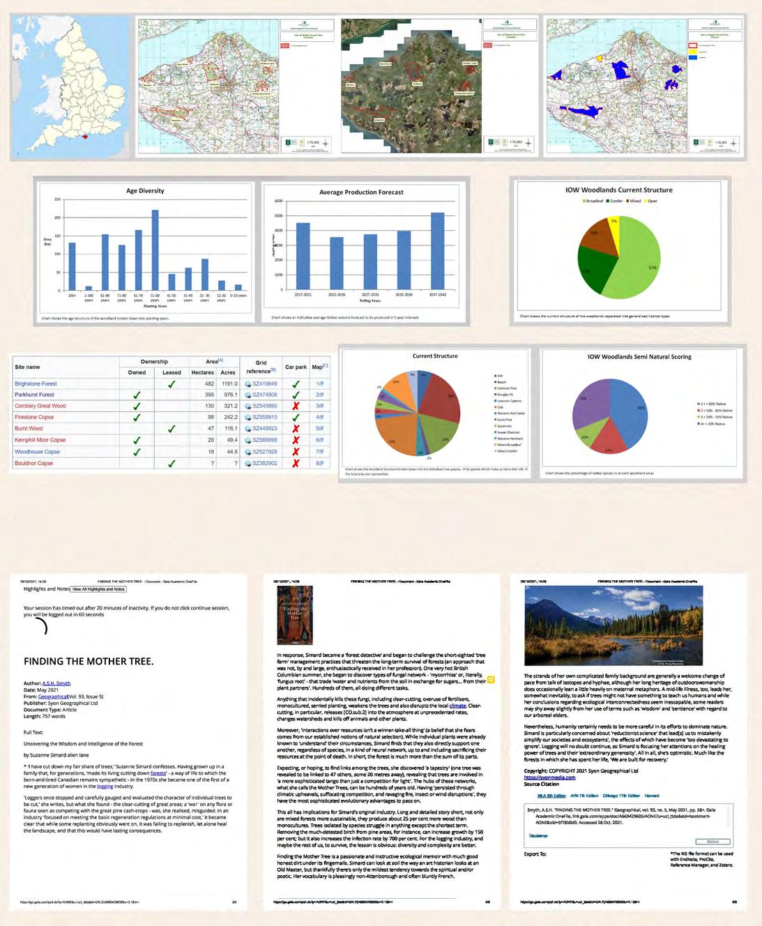
PARKHURST FOREST, ISLE OF WIGHT, UK SIZE 395 HECTARES
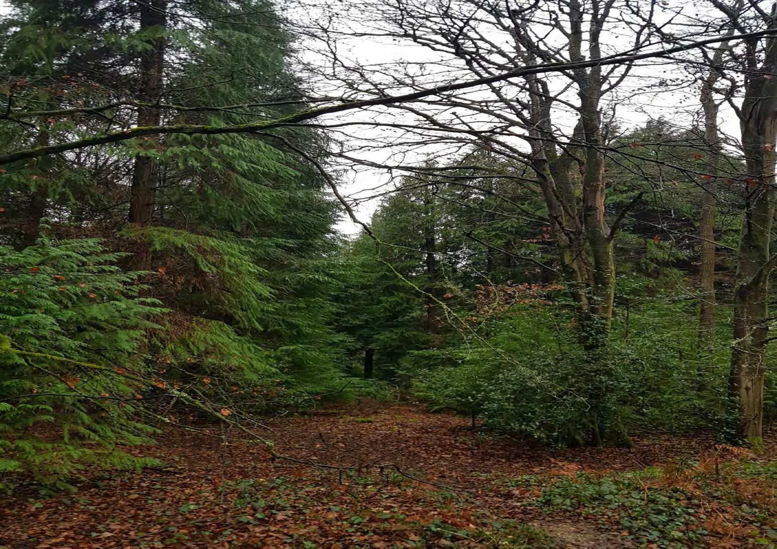
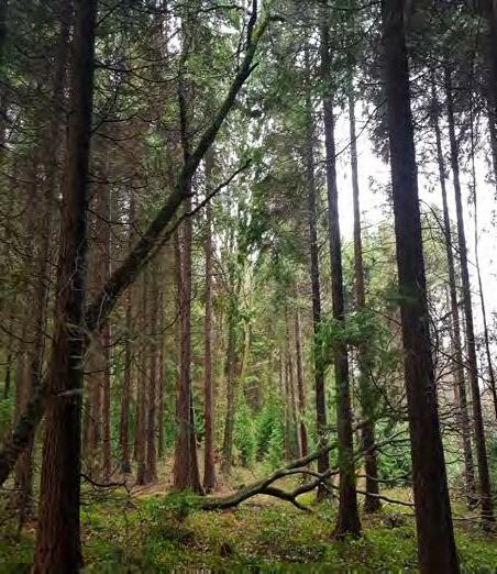
Fig 2. A dense area in the forest. (Photo by the author)
This project proposes rejuvenation of the Parkhurst Forest on the Isle of Wight by establishing a Forest school. This encourages community access to the Forest while also urging the Forestry Commission to employ improved management techniques to reverse the declining health of the Forest. The project emphasises the various forms of ecology in a forest and includes creative techniques for teaching children about forest ecology.
The project also facilitates children’s learning about climate change, forest ecology, and other water-based habitats. A Forest School offers a one-of-a-kind educational experience that focuses on sensory stimulation, with pupils challenged to learn through visual stimuli, noises, fragrances, and tastes.
Moving forward, we must make better decisions for the future of the world’s forests. Instil knowledge and sensitivity in future generations while also actively working to protect the environment. The initiative aims to combine these concepts and offer an example of the importance of conserving the health of our forests.
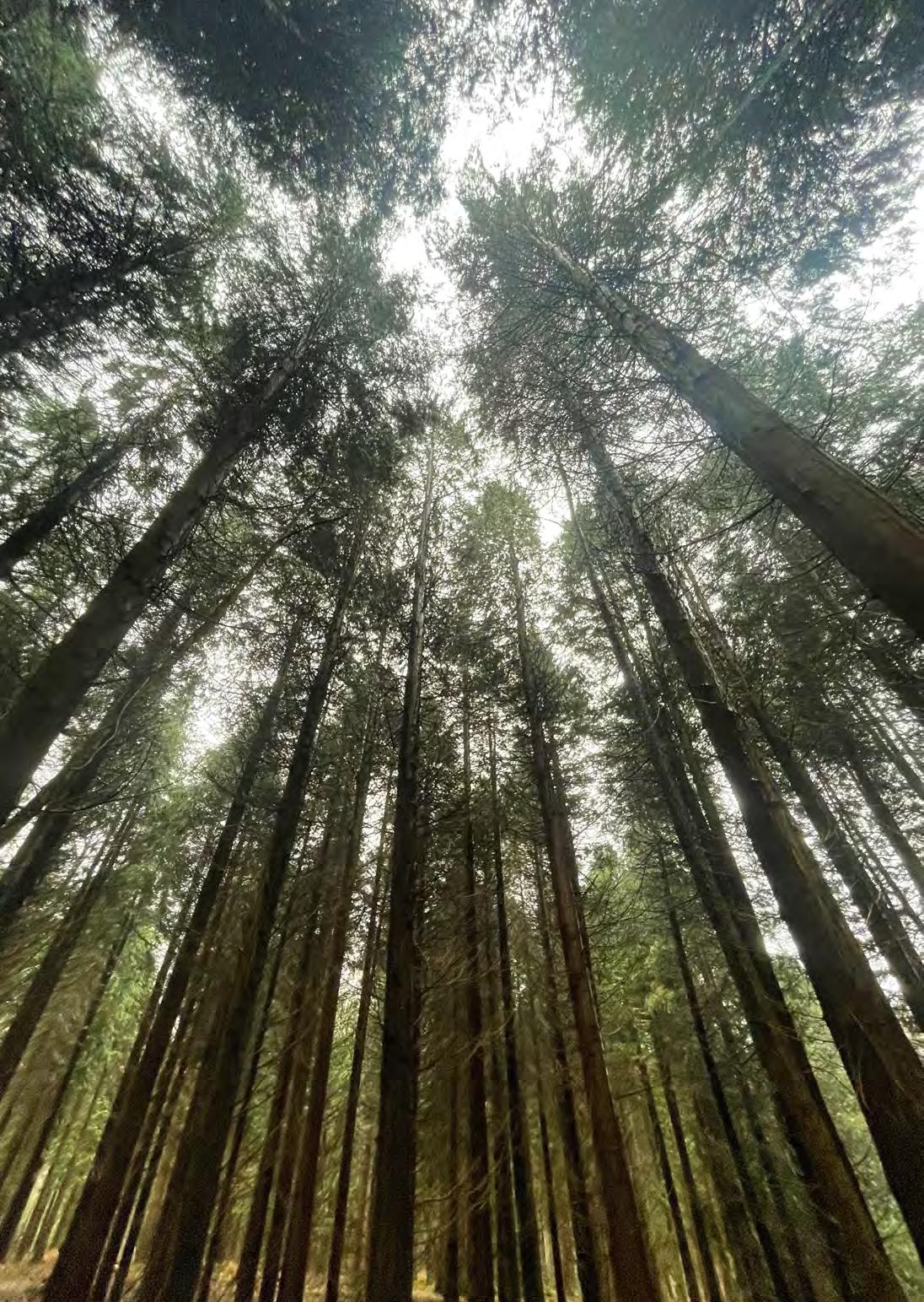
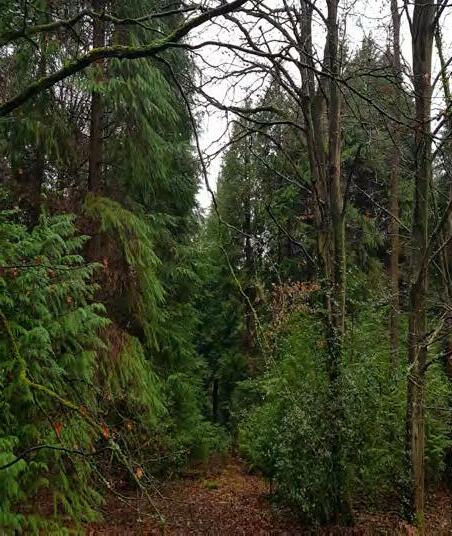
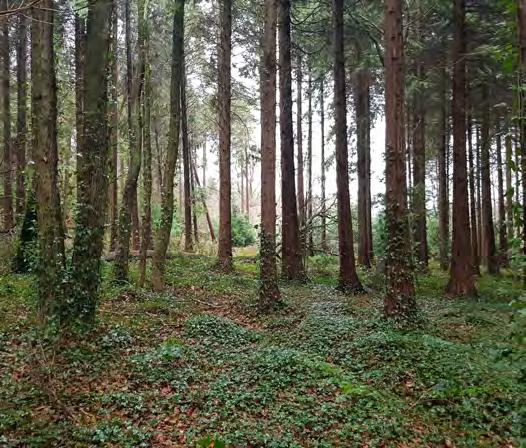
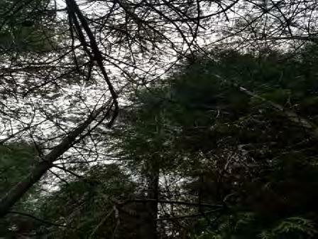
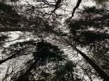
Fig 3. An incredible canopy formed by tall pines. (Photo by the author)
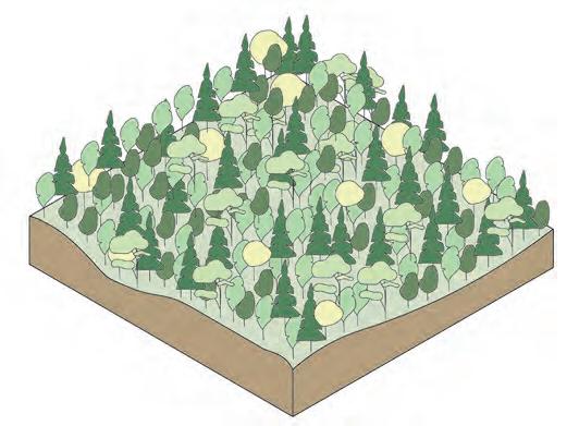
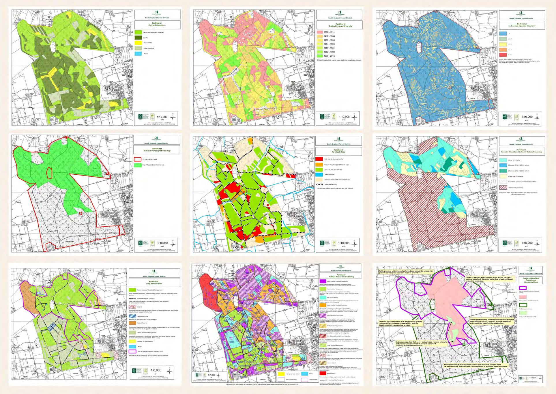
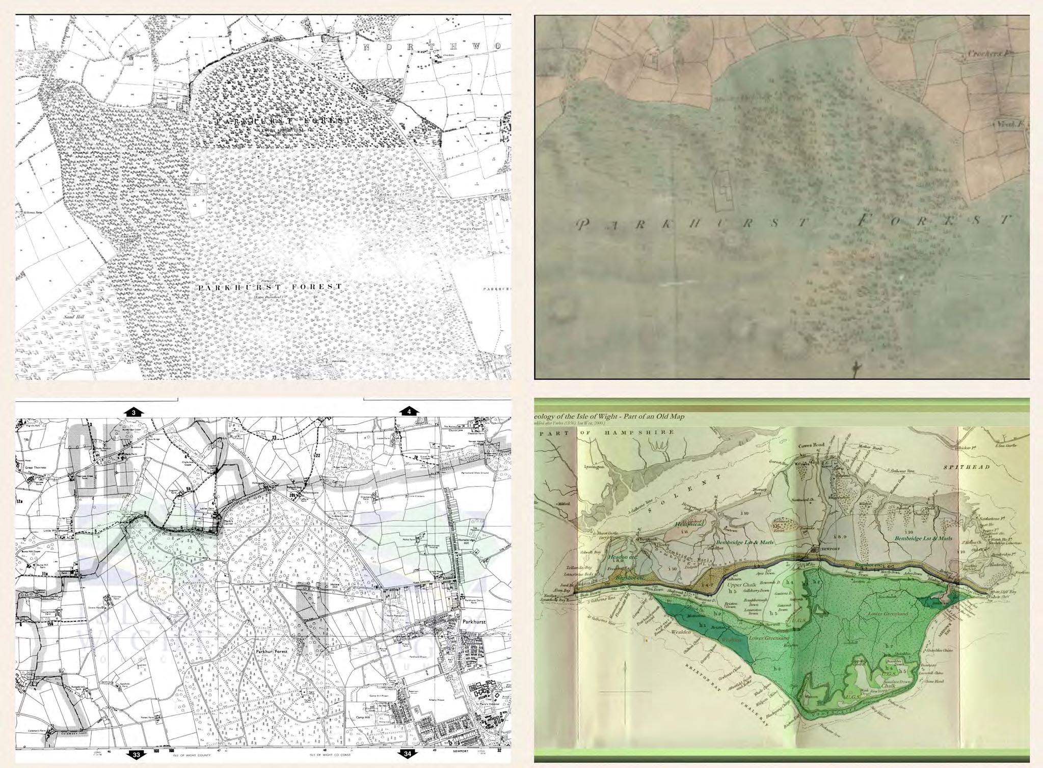
Parkhurst Forest is one of the principal forested sites on the Island and is home to number of important habitats and their associated species. It is the best preserved example of former wood pasture on the Island. This section looks at the Location, Background and Inhabitants of the Forest.
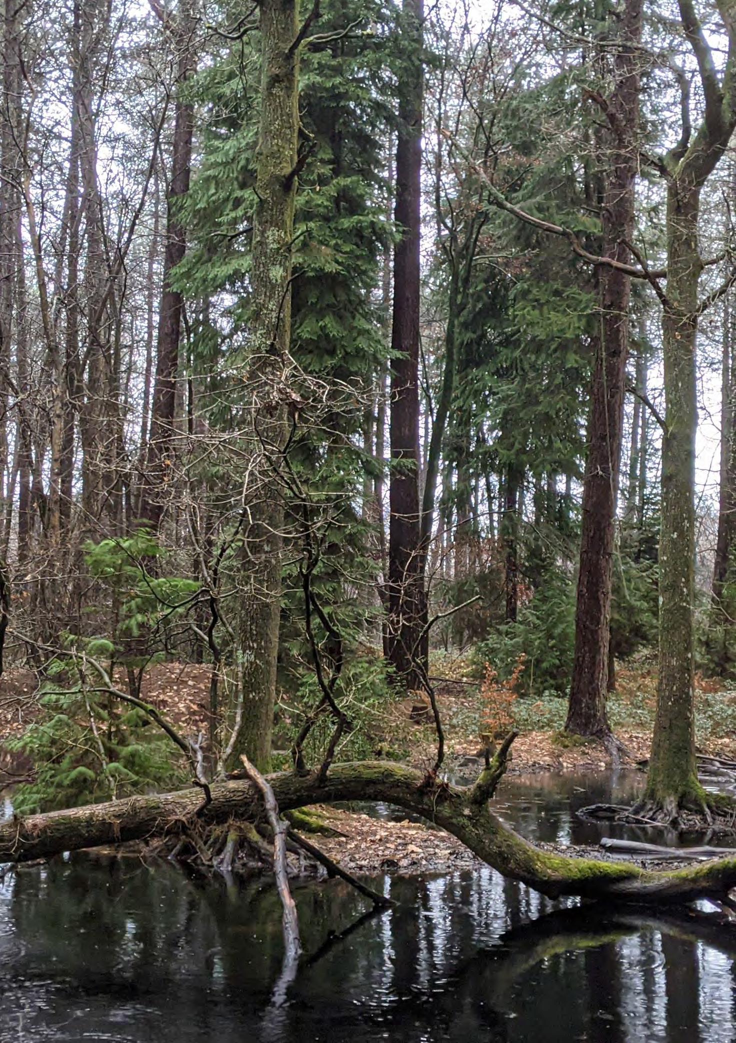
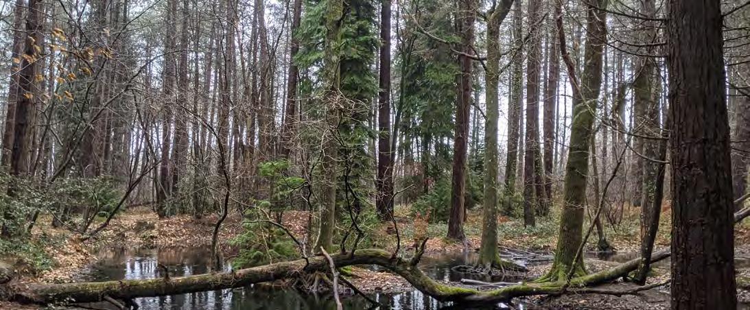
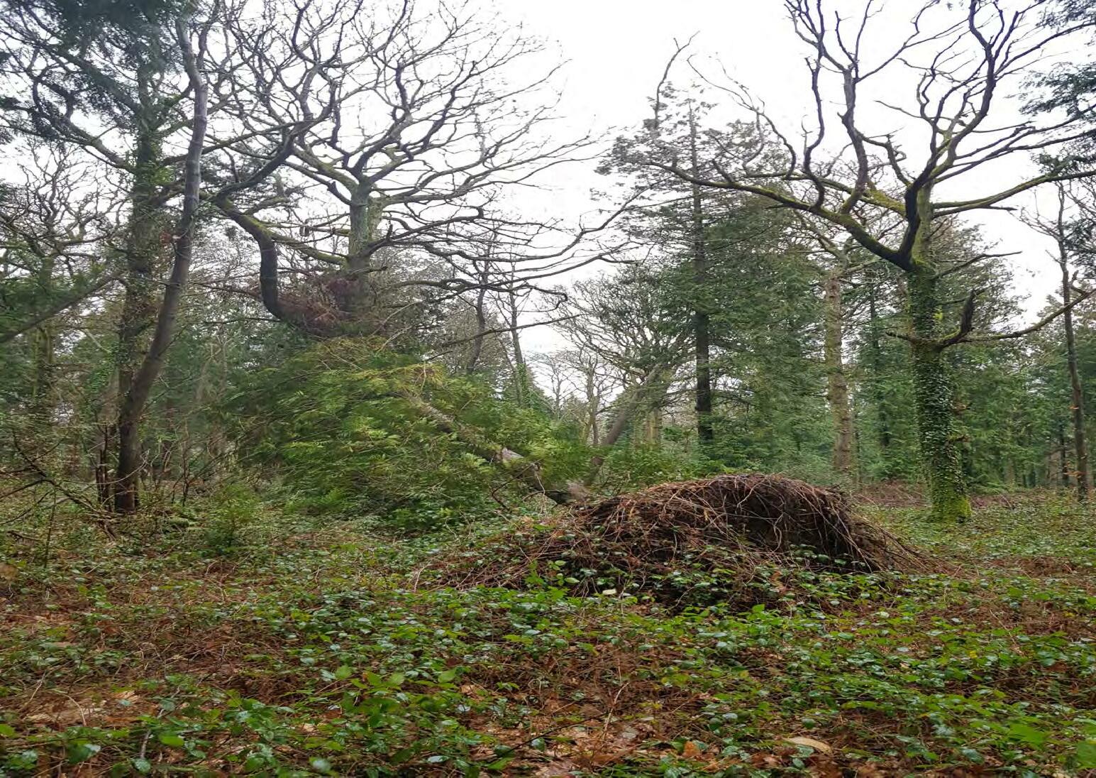
Fig 5. A tree midway in its falling process showing off its complex root structure. (Photo by the author)
Parkhurst Forest, Isle of Wight. Parkhurst Forest is one of the principal forested sites on the Island and is home to number of important habitats and their associated species. It is the best preserved example of former wood pasture on the Island. The Forestry Commission is a non-ministerial government department responsible for the management of publicly owned forests and the regulation of both public and private forestry in England . The Isle of Wight contains 6 woodlands managed by the Forestry Commission- Brighstone Forest, Bouldnor Forest, Burnt Wood, Firestone Copse, Combley Great Wood and Parkhurst Forest. The forest contains a large Napoleonic oak plantation and several significant areas of pine trees, home to a large proportion of the Island’s 3,500 red squirrel population.
SSSI (Site of Special Scientific Interest)
Isle of Wight, UK
IOW Woodlands structure Water cover AONB area SSSI
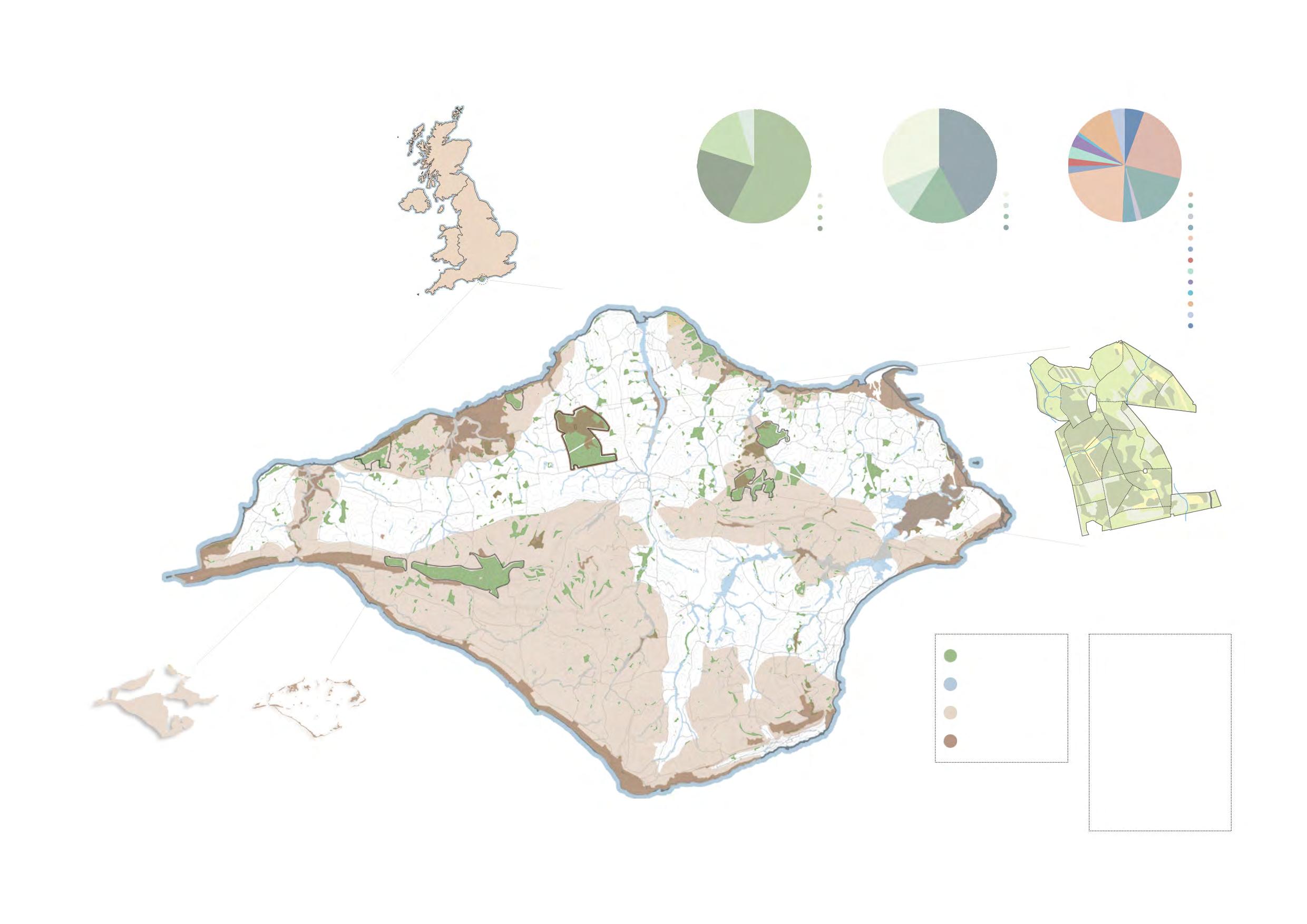
area
Parkhurst Forest
Parkhurst Forest Brightstone Forest
Bouldnor Forest Combley Greatwood Forest
Burnt
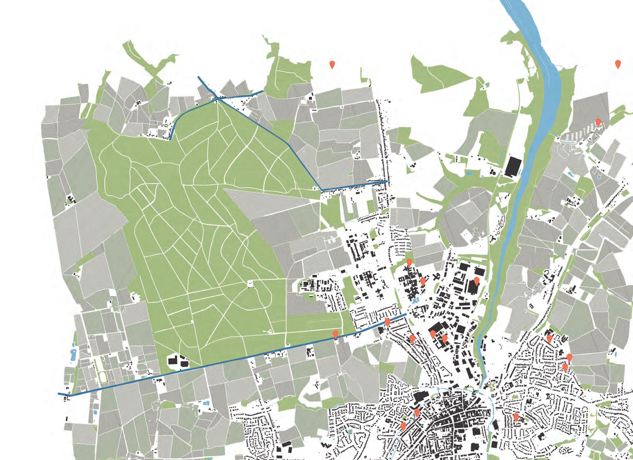
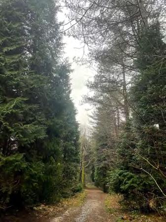
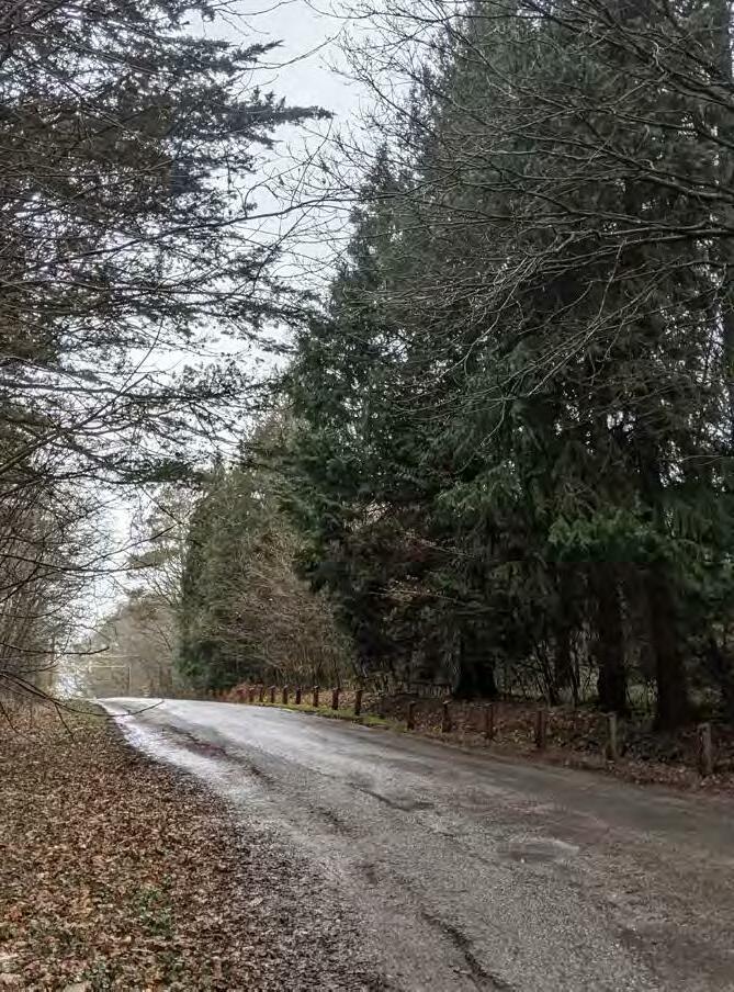
The forest is the closet woodland located to the central town of Newport. Easily accessible by the local residents, this is a poular recreational spot away from the busy locations elsewhere on the Isle. The Forest has three main access points on the north, west and south of the site.

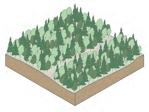
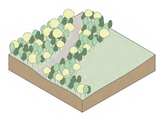
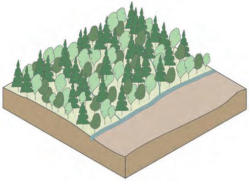
Parkhurst Forest is broadly categorised into four woodland types by the Forestry commission. 40% of the forest is classified as ancient woodland out of which 77% is identified as Plantation Forest. The four categories are Native and honorary Broadleaf, Conifer plantation, open lands and Mixed woodland.
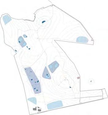
Mapping different types of woodlands in Parkhurst Forest
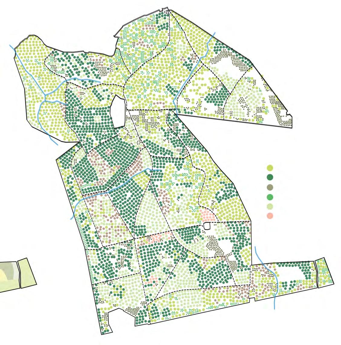
Native and Honaray broadleaf
Conifer Open habitat
Mixed Woodland
The dominant species of the forest are Oak at 38% and Corsican Pine at 25%. The Forest is a mixed woodland with species of Pines, Oak, Spruces, Larches.
Mapping different types of tree specie in Parkhurst Forest
Pines Oak Spruces Beech Larches Ash
Rich in biodiversity, and separated by the land of mainland Uk by the Solvent, the Isle has a very unique ecosystem of its own. Large part of the land is open areas and forests spread all over. The forest is an important part of the tourism portfolio of the Island, and is well used by islanders and visitors.
Parkhurst Forest is one of the principal forested sites on the Island and is home to number of important habitats and their associated species. It is the best preserved example of former wood pasture on the Island. This section looks at the Location, Background and Development of the Forest.
Fig 6. A vernal pool formed at the root pits and depression of a fallen tree. (Photo by the author)
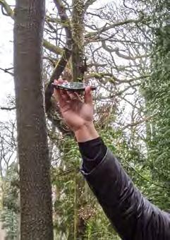
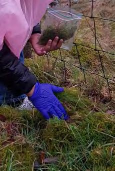
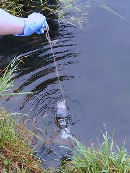
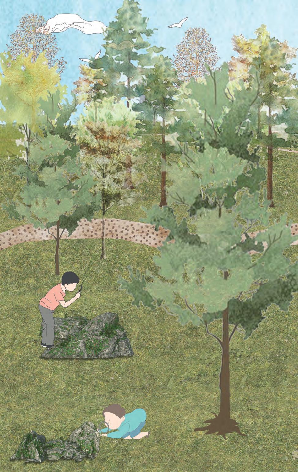
Site visit is documented with on-site mapping and photographs.

The forest has starkingly different habitats spread accross. These seried of photographs tries to capture these varied woodland types
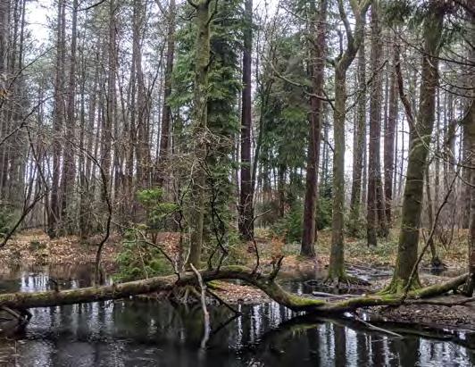
These images capture the various habitats that can be found in the Parkhurst forest. Dense and crowded, dominated by pines, forest floor taken over by ivy and vernal pools at tree roots are some of the common sights in this forest. (Photos by Author)
Rich in biodiversity, and separated by the land of mainland Uk by the Solvent, the Isle has a very unique ecosystem of its own.
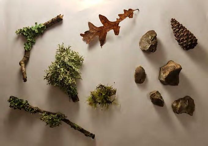
In addition to photographic documentation, the study also include collection of various samples to identify the ecology, recording of the sounds of forest.
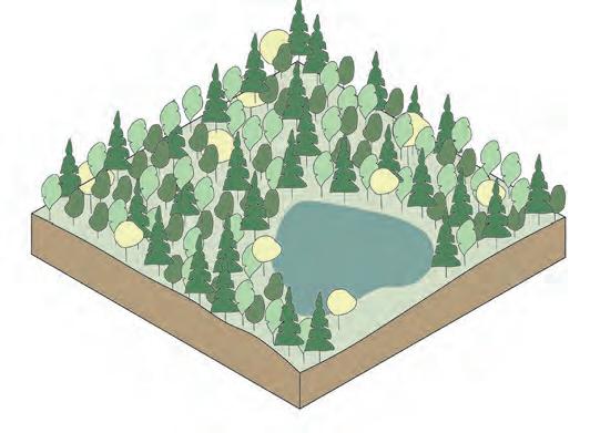
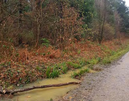
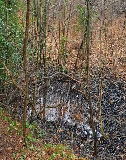
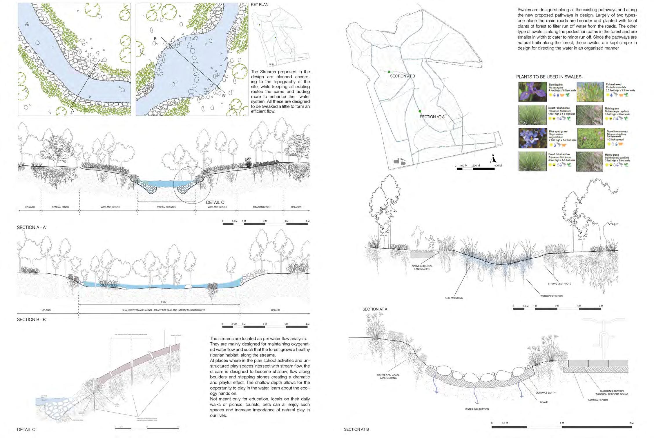
The water system in the forest is dominant. Swales can be found along all pathway. Seasonal poond, streams are also commonly seen.
10.1. A forest vernal pool. (Photo by the author)
10.2. A forest vernal pool. (Photo by the author)
10.3. Water collected in a ditch eventually forming a vernal pool. (Photo by the author)
 Natural Ponds
Swales
Vernal Pools
Natural Ponds
Swales
Vernal Pools
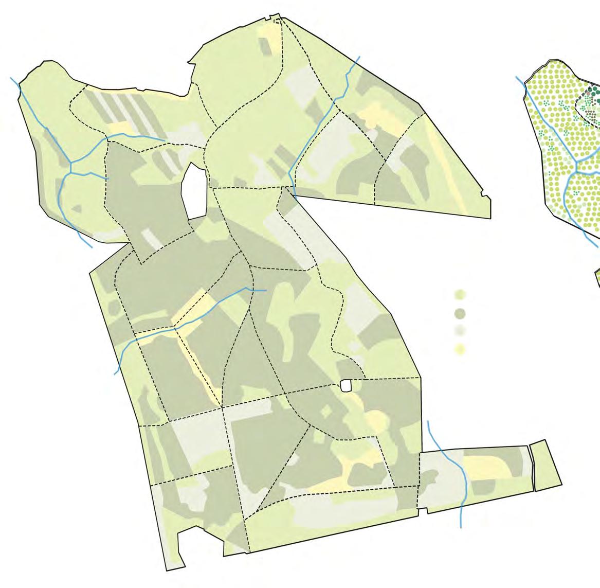
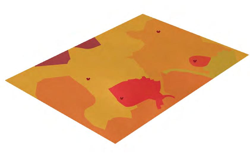
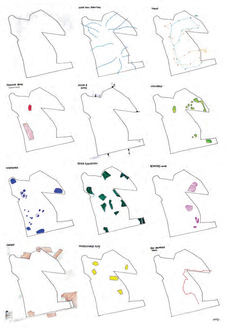
The forest site slopes inward to outward with its highest point in the central zone at 80m above sea level and sloping towards the edges to 30m above sea level. The water flow simulation and contour condition clearly show that the rain water runoff direction originates from the uphill areas flowing towards the lowlands. These analyses have been confirmed by observation on the site.
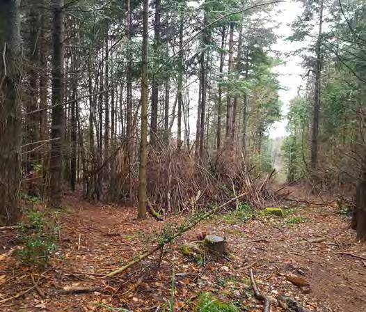
The forest has a developed road network that has drainage swales on one side of the running along the road length. These are currently not in their greatest condition as forest maintenance has not been carried out for a long time.
Existing ponds water accumulated in ditches
Wetland prone areas Water flow direction
Water flow simulation results
Slope analysis simulation results
Waterflow analsyis of the forest site.
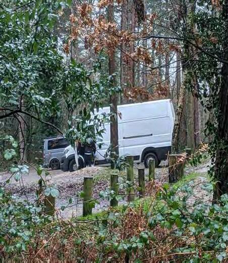
The cuurent users of the forest are mainly the local residents of the town. Families coming here for picnics, walks and weekend trips is a common sight. As this is an easily accessible woodland, some schools use the forest for outdoor school days, althought their activities are minimal. Forestry Commission has authority over the development and management of the forest. Currently the management activities are less or stopped completely.

Analysing the current structure, uses and operations of Parkhurst Forest.
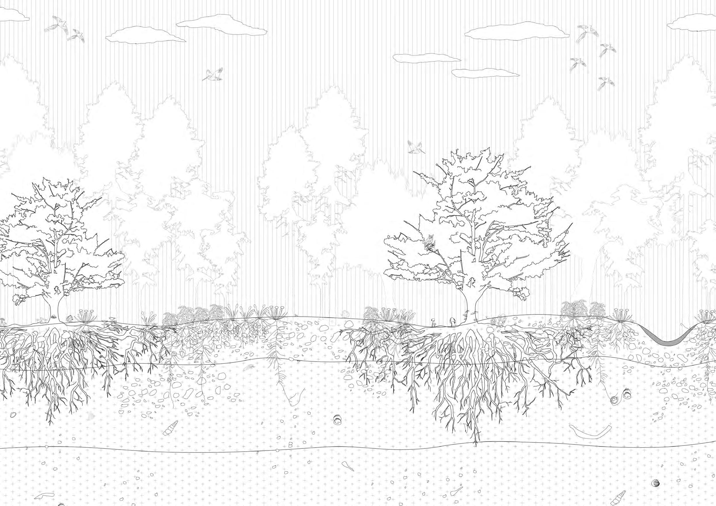
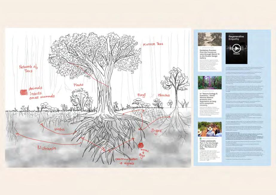
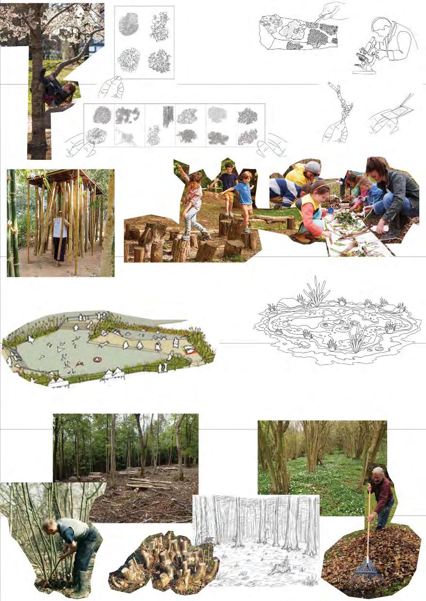
Interpretation of Woodland ecosystem based on Suzzane Simard’s book - FINDING THE MOTHER TREE. Fungi are a cornerstone of woodland ecosystems. Yet they are often overlooked, as so much fungal activity carries on unseen beneath the surface of the forest floor. Fungi transfer essential minerals such as nitrogen and phosphorus from decaying organic matter to the plant. They are able to use chemicals (enzymes) to break down substances which plants cannot use unaided, such as cellulose, thus making more nutrients available to the plant.
- A diverse ecosystem - Rich in flora and fauna species
- Hub for specie protection
- Accessibility from the cities of Isle
- Water table is well maintained
- Diversity in species can lead to a higher chance of risk from invasive species and diseases if any
- Climate change impacts specially of changing temperatures and changing rainfall patterns can have a huge effect on the forest’s ecosystem
After coppice - fore floor cleared
- To inhabit the forest in a better way by carefully planning strategies


- Protecting the water table and its structure through a developed system that also helps in enhance the ecosystem
- Negligence and lack of appropriate forest management
- Overstood coppice has led to dense forest patches and lack of enough sunlight in spaces
- Water collected in ditches is not in its best state due to lack of a proper system
5 years after coppice - regrowth of forest cover
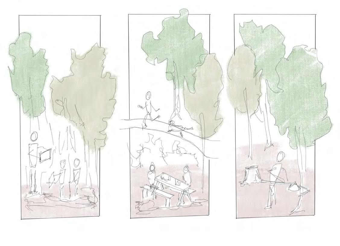
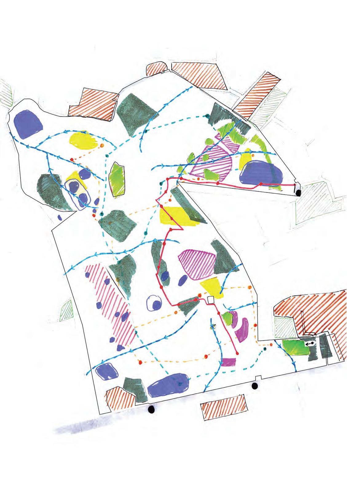
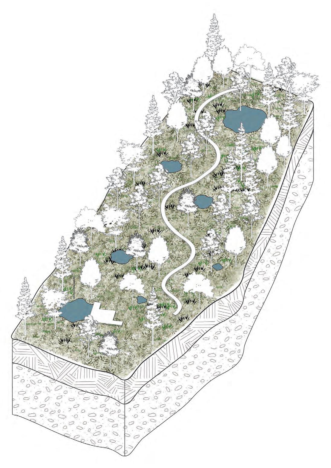
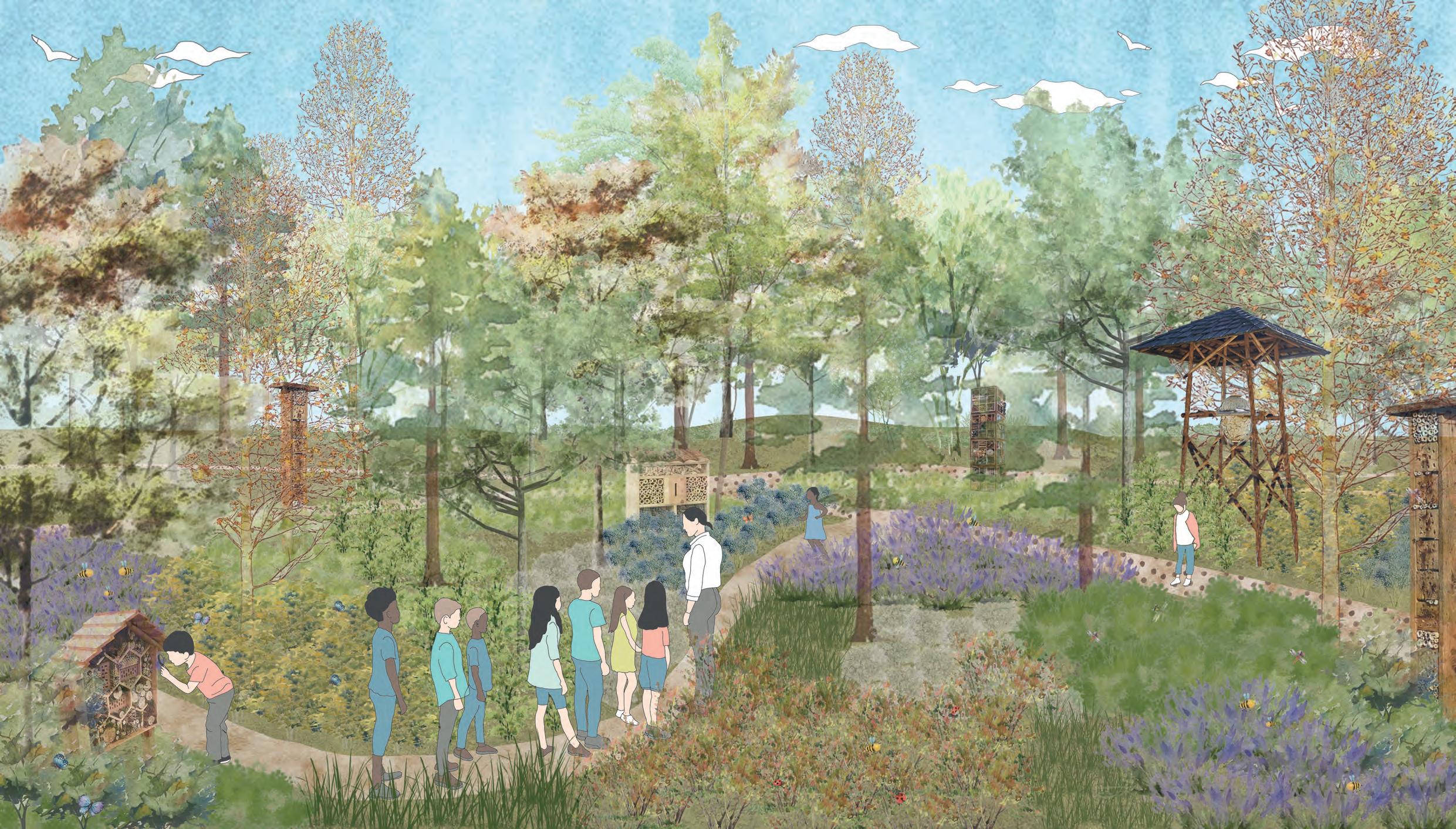
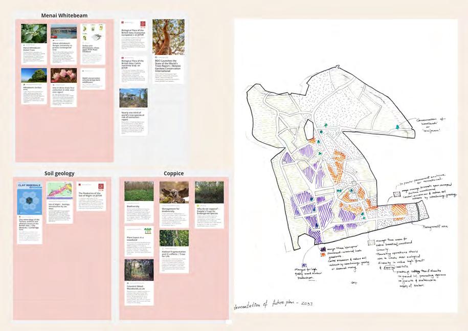
O P P O R T U N I T Y W E A K N E S S T H R E A T SThis project proposes rejuvenation of the Parkhurst Forest on the Isle of Wight by establishing a Forest school. Learning is supported by design of various zones that focus on water ecosystems, woodland habitats, biodiversity, and unstructured play. This Forest School provides a dynamic long-term outdoor learning landscape for nearby schools which engage curious young minds at every turn.
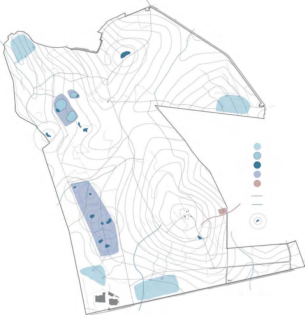
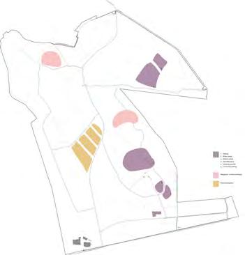
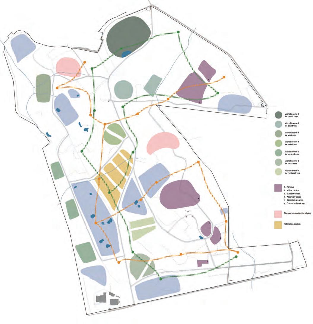
Micro-reserves for beech trees for pine trees for ash trees for oak trees for spruce trees for larch trees for conifer trees
Student centre Visitor centre Unstructured play Pollination garden
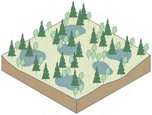
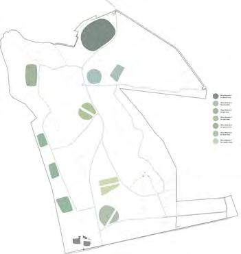
Proposed wetlands Proposed ponds Existing ponds Water system zones Reed beds Swales Streams
Vernal Pools

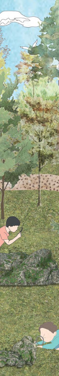
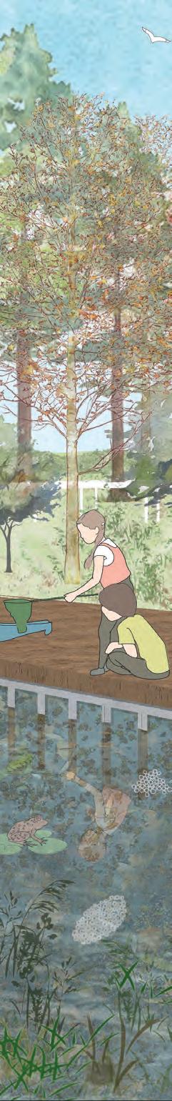
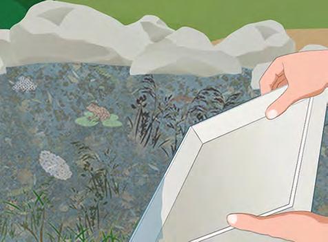
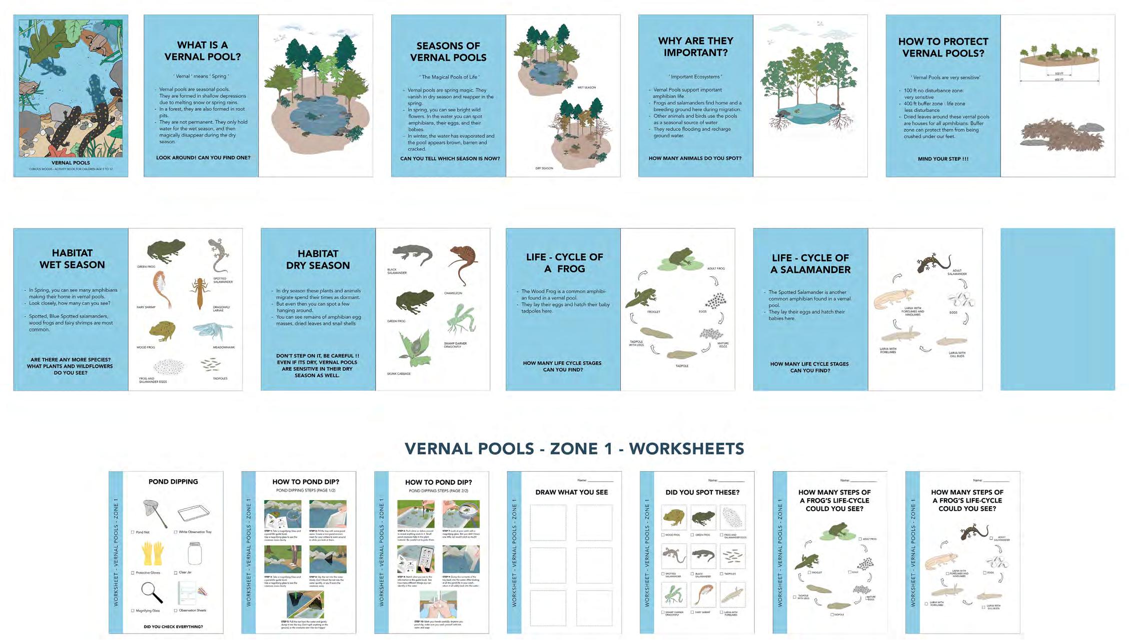
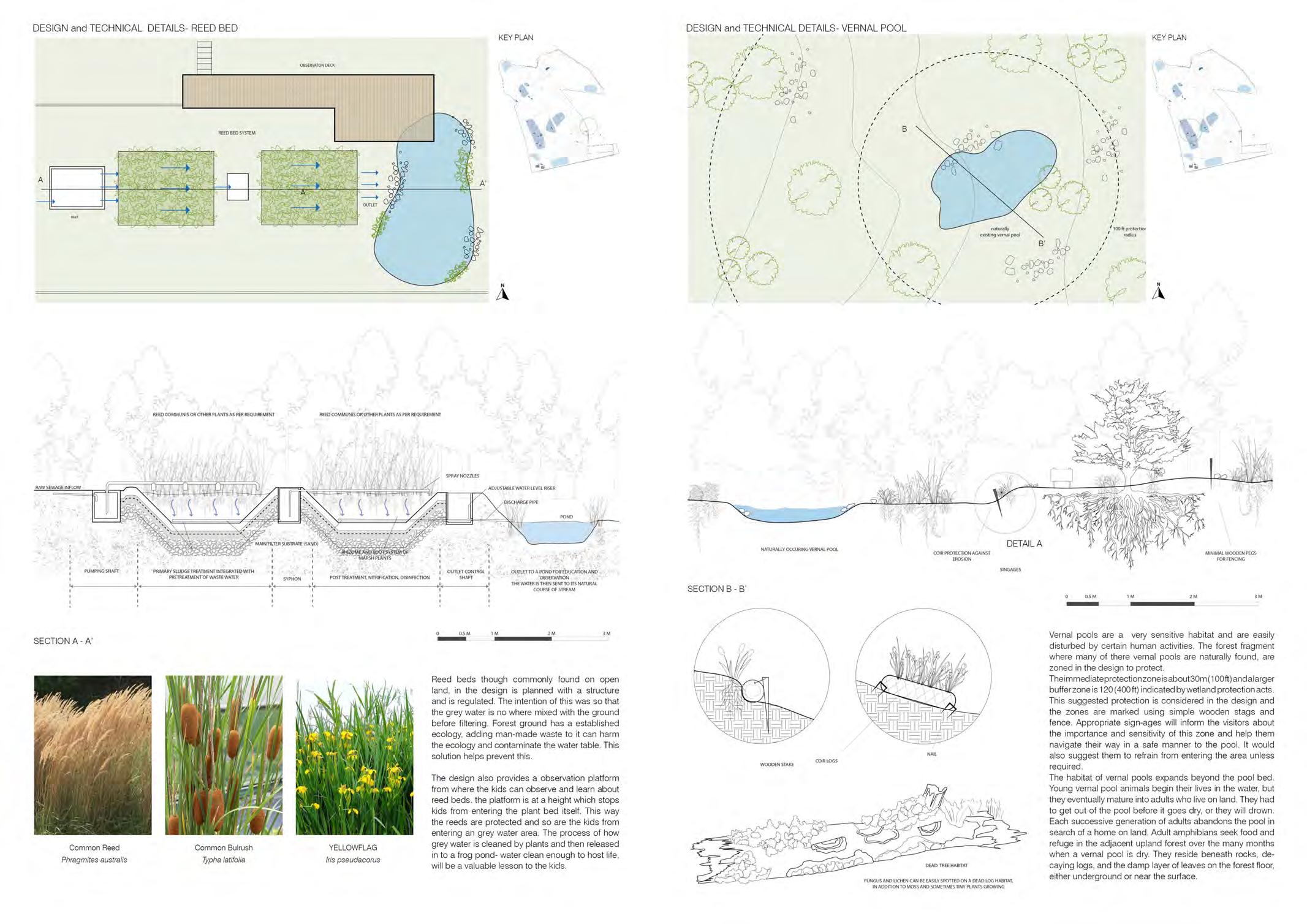
Vernal pools, sometimes known as “spring pools,” are shallow depressions that typically hold water for just a portion of the year. Certain amphibian species, such as salamanders and frogs, rely on vernal pools for reproduction. The loss of vernal pools and the important terrestrial habitat that surrounds them result in the local extinction of amphibian species, a decrease in biodiversity, and a reduction in food available to many other creatures that dwell in these places.
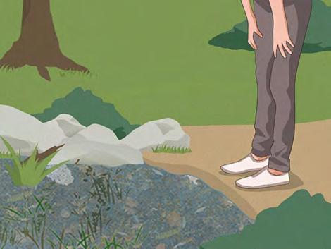
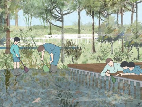
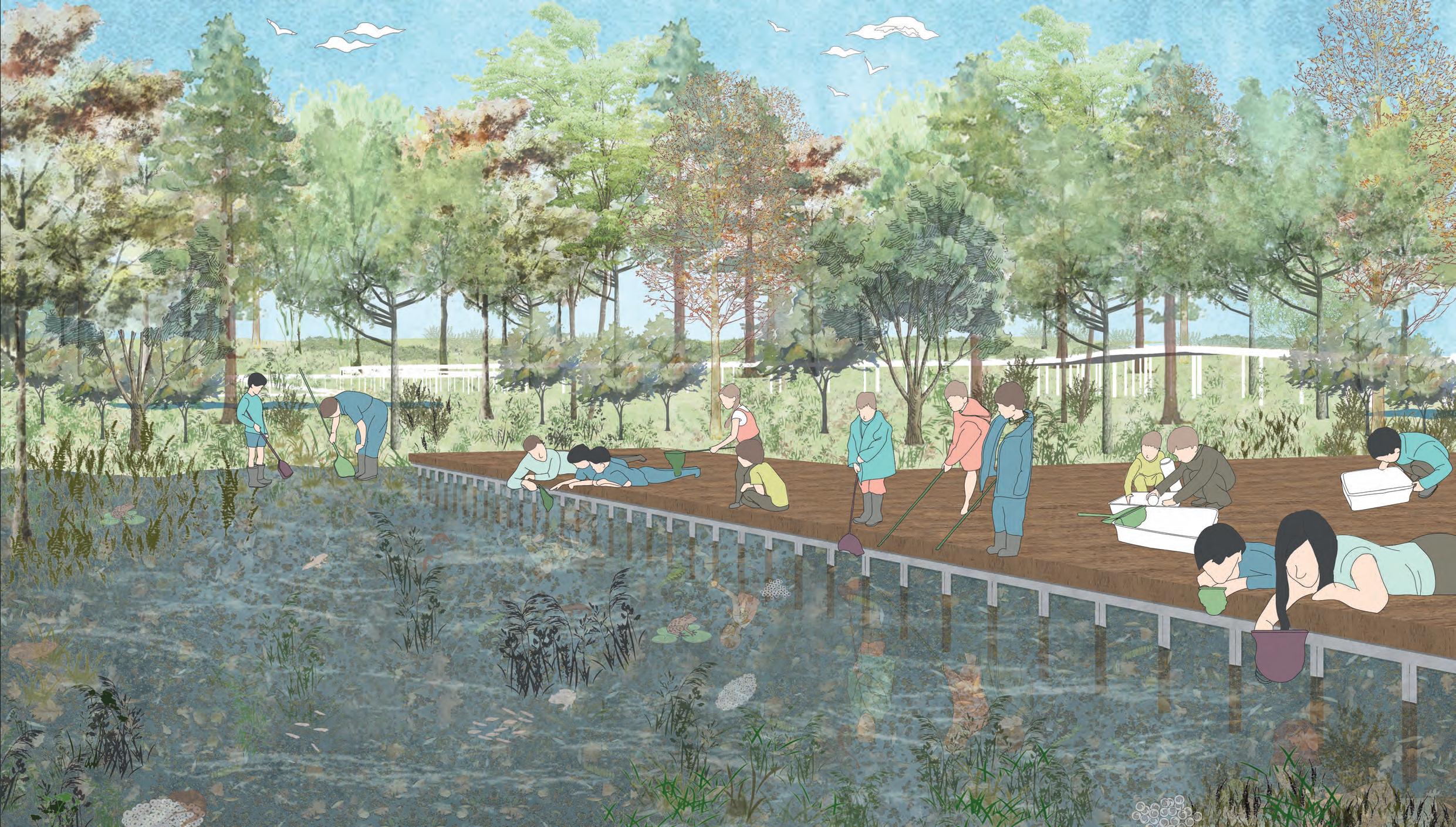
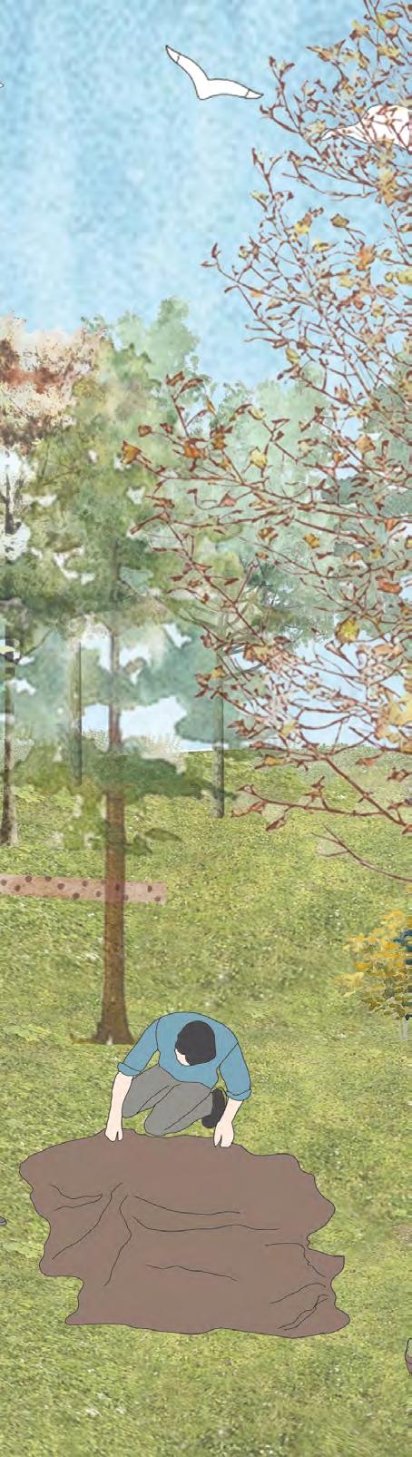
The space is designed for children to experience pond dipping, identify species and learn about the vernal pool habitat in an engaging manner. Necessary management activities are undertaken to protect this critical habitat of the forest.
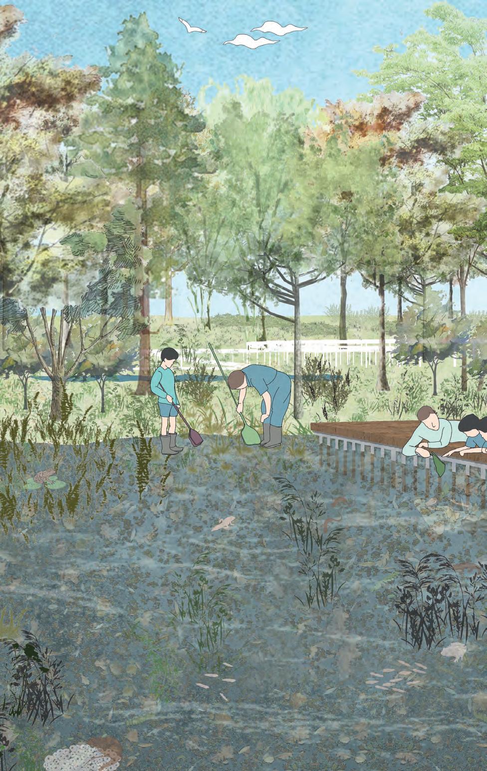
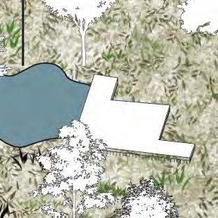
The design proposes a deck to access one of the vernal pools. This enables the children to get close to the water while also protecting the delicate ecology of the vernal pool floor from being stamped upon.
Due to a dense canopy cover, the light that enters the forest floor is low, thus reducing a suitable habitat for the vernal pool life affecting the biodiversity.
Spring and Summer season
A deck designed at the edge of one of the vernal pools giving a suitable access for the kids to study the habitat while also protecting the pools.
Autumn and Winter season
A walkway designed to take the kids through the vernal pools zone. This also protects the sensitive forest floor from footfall impact.
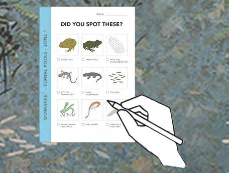
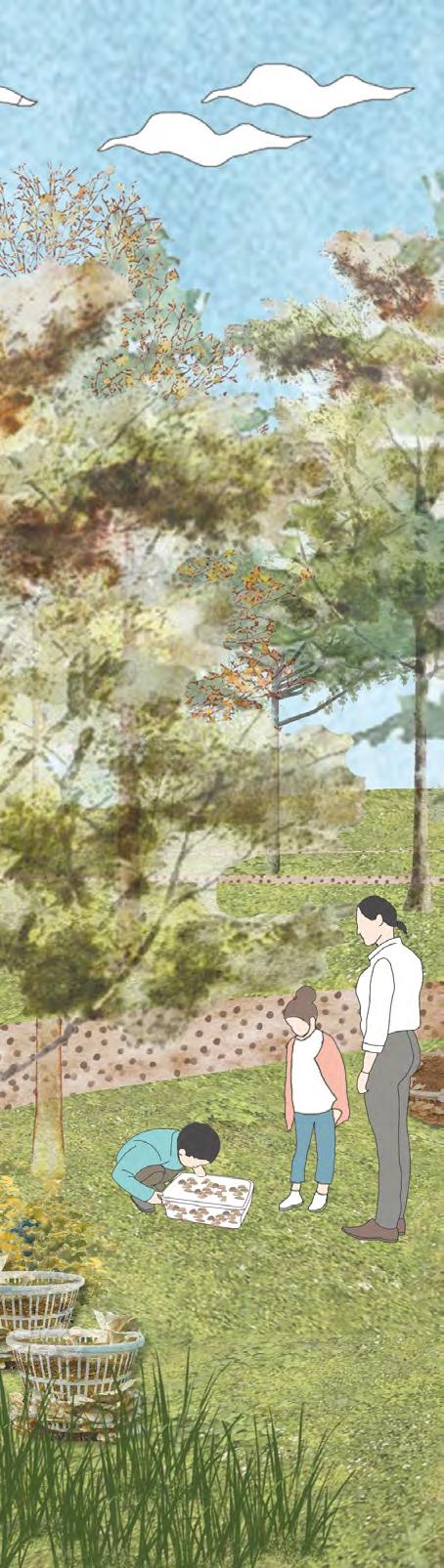
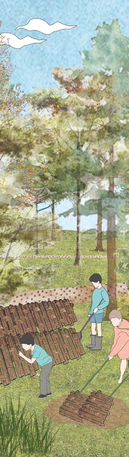
Teachers and students may learn about the ecology of each zone by using activity booklets prepared for each zone. The necessary processes are all illustrated in a child-friendly manner.
Observing the waters
Looking at the species
Collecting the water in a tray for study
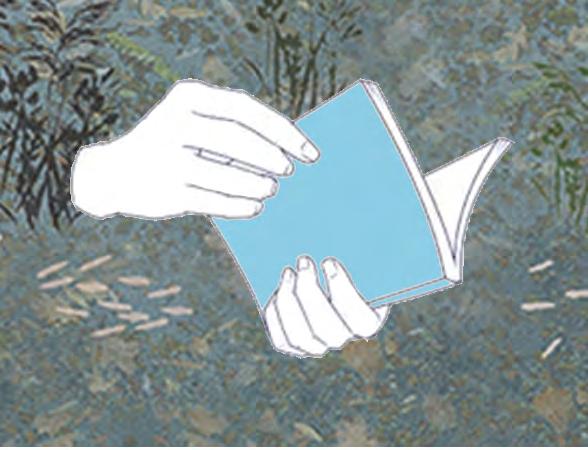
The activity and information booklet
Collecting species using a net
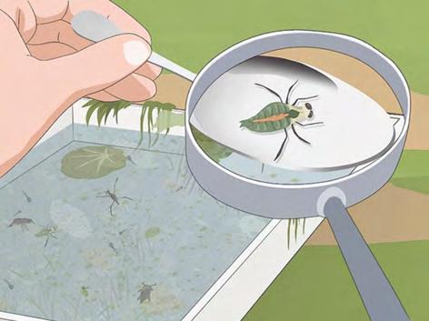
Identifying using the booklet
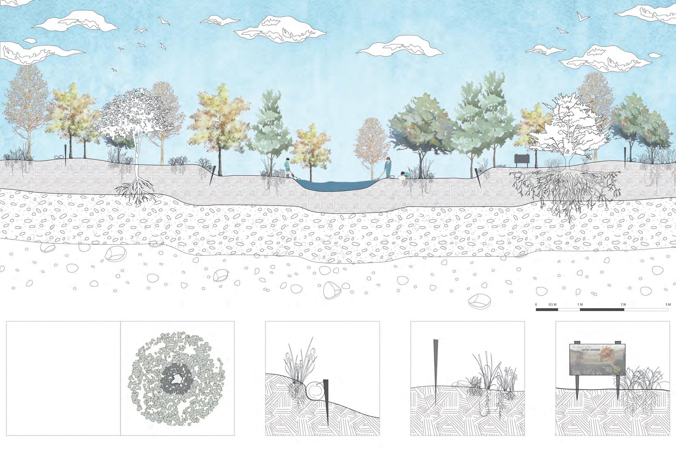
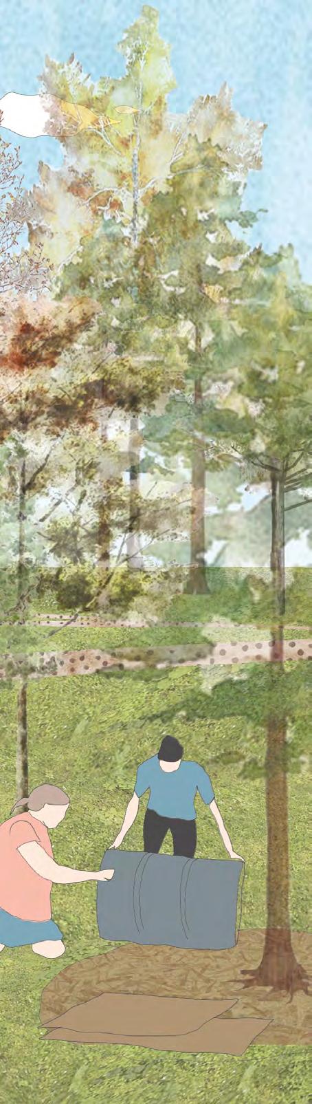
Thinning the canopy of these zones is crucial for allowing light to enter the forest floor that helps to maintain a healthy ecology.
Felling - to maintain canopy cover < 70%
Detail at 1. Erosion control logs
Detail at 2. Fencing demarcation of sensitive zone radius - 200’
Detail at 3. Information boards about protection zones of vernal pools.
Management Activities ProposedView showing inhabitation of the space and forest school activities taking place.
The proposed design of the forest school kit includes an activity booklet and worksheets to assist students and educators in exploring each zone.
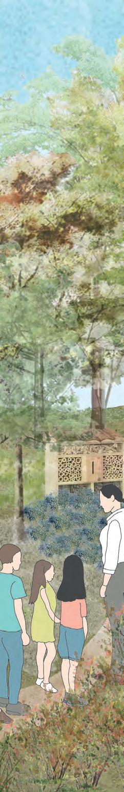
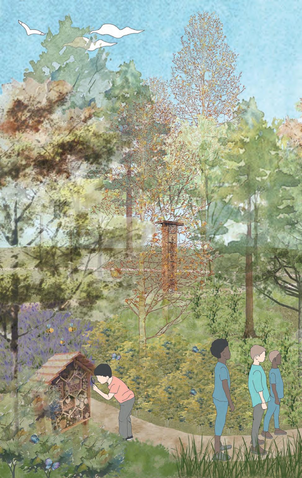
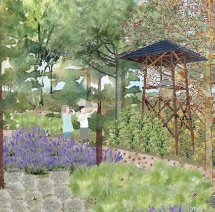
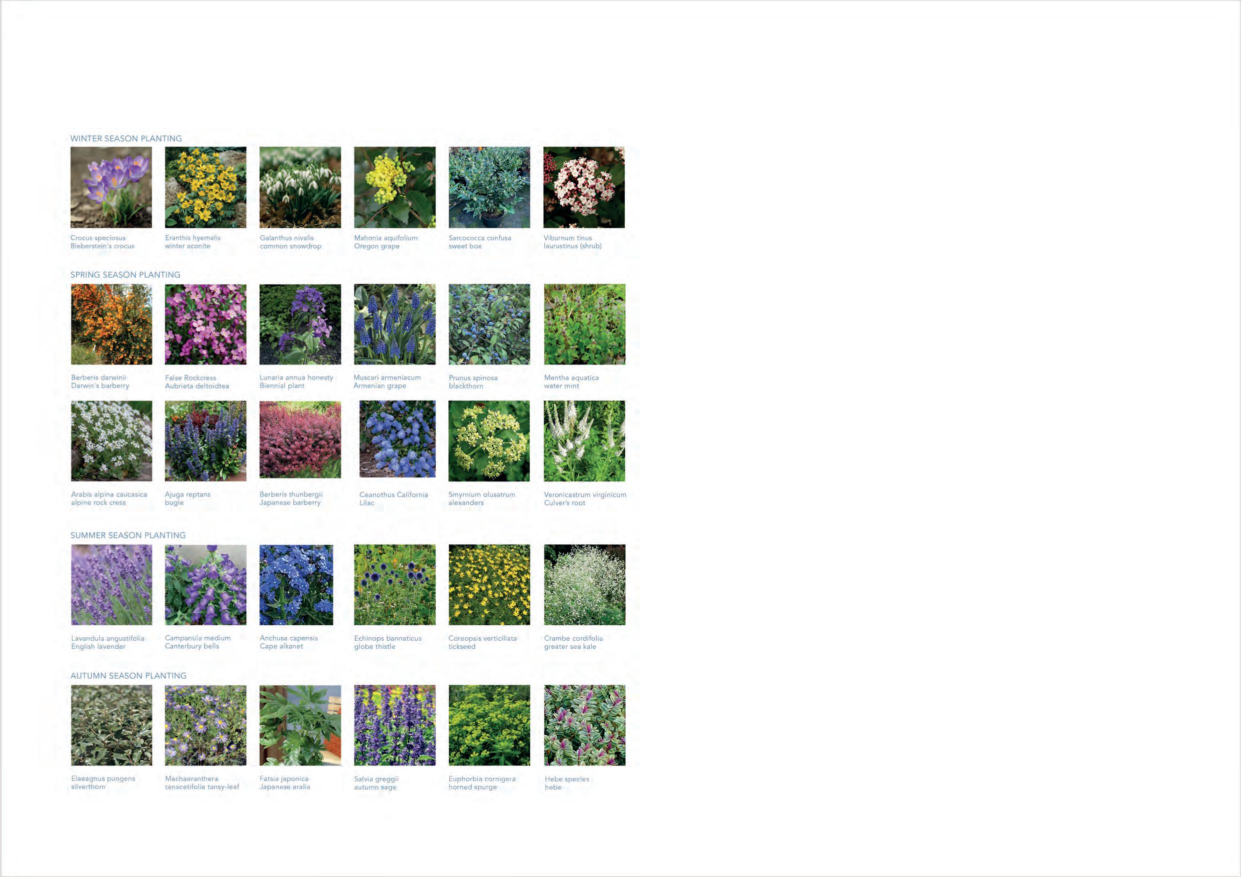
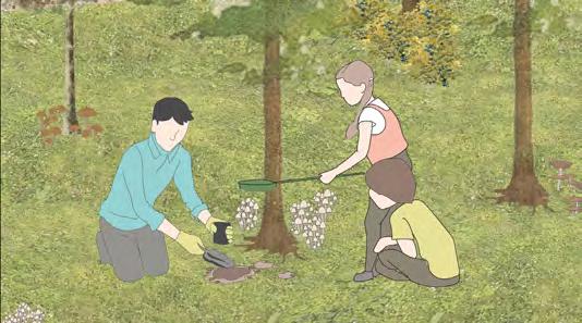
Pollinators are essential for the reproduction of three-fourths of the world’s flowering plants as well as about 35% of the world’s food crops. More than 3,500 native bee species help to boost agricultural production. Pollination gardens can help children recognize the importance of these insects. Additionally, this contributes to the forest’s general health and biodiversity.
The basic concept calls for a variety of seasonal blooming shrubs and wildflowers to be planted in this pollination garden. Natural processes will eventually take control, resulting in a natural wildflower garden that nourishes pollinators.
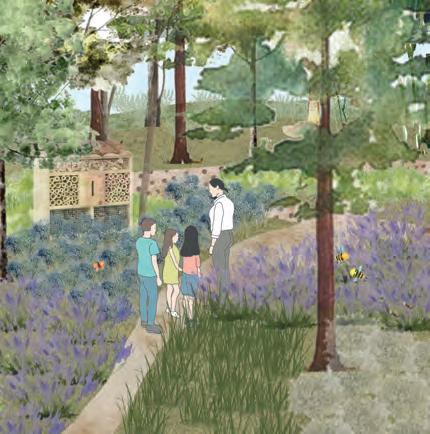
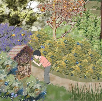
The children participate in workshops where they create insect hotels out of wood scraps. This improves their connection to nature.
Bug hotels and beehives are installed throughout the garden to help pollinators
Secondary paths enagbling access through the garden
Stream helping pollinators who need water based habitat
a layer of safety
A kid closely examining a bug-hotel Bee-hives located away from direct access paths to include Guided learning about pollination from experts and educators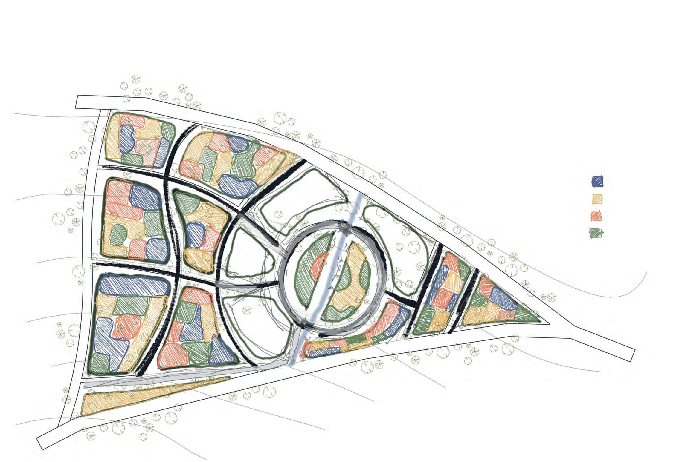
The planting incorporates variety of seasonal flowering species making sure the garden provides suitable habitat in all seasons.
Winter Planting Spring Planting Summer Planting Autumn Planting
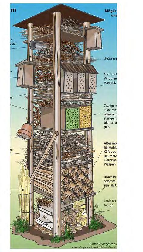 Proposed design of a Bug hotel
Proposed planting for garden
Barks overlaid on pallets for spiders
Old bricks and blocks
Pine cones
Bamboo for lacewings. Log with holes for ladybirds
Proposed design of a Bug hotel
Proposed planting for garden
Barks overlaid on pallets for spiders
Old bricks and blocks
Pine cones
Bamboo for lacewings. Log with holes for ladybirds
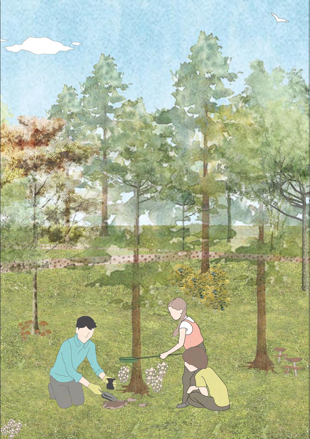
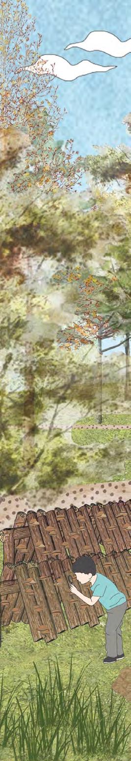
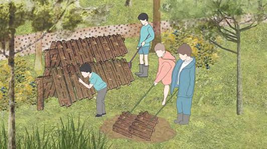
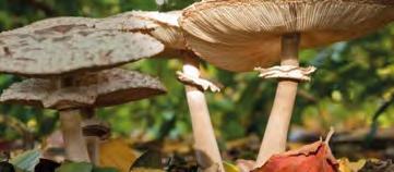
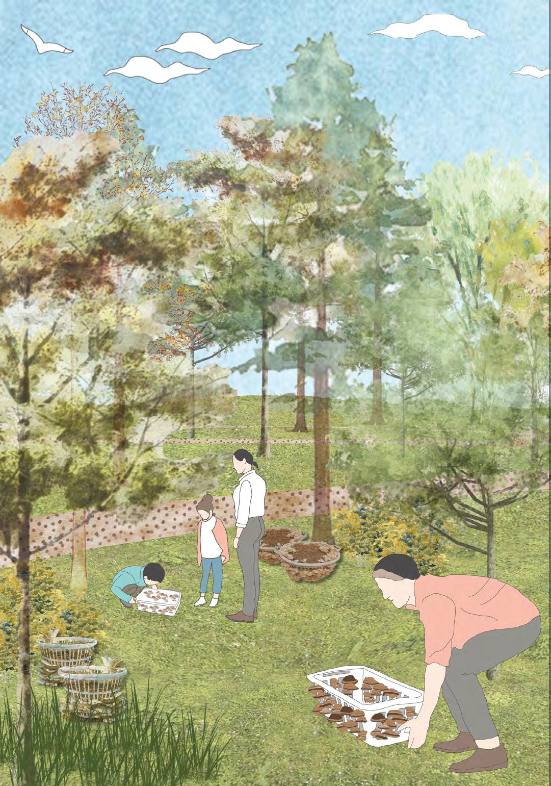
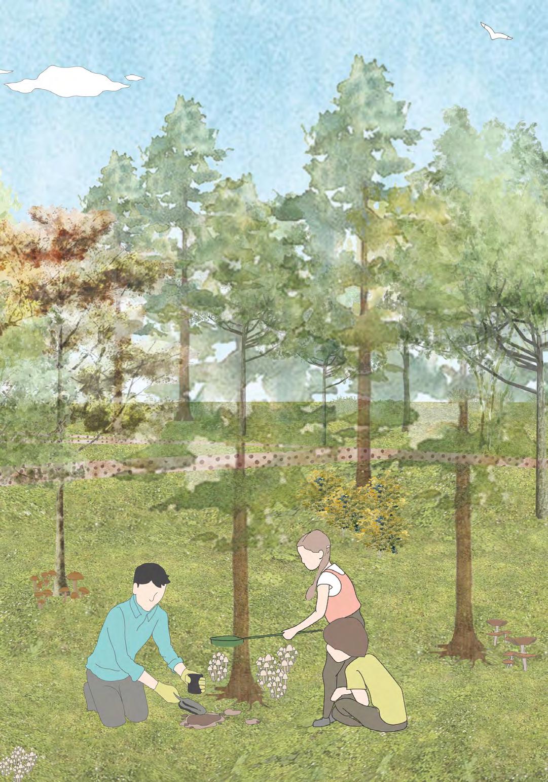
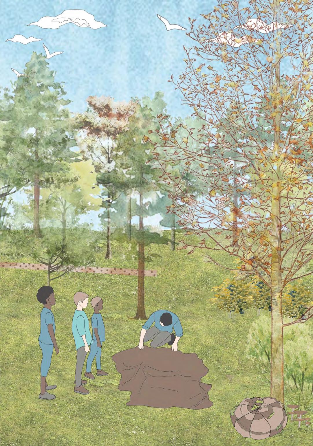
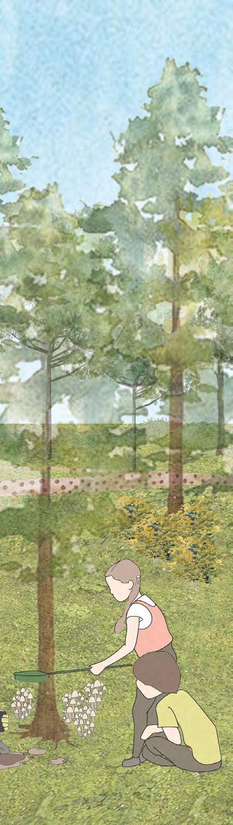
A fungal garden is constructed to offer a safe environment for children to learn about the various varieties of fungi and how they thrive. This highlights the significance of fungus in the general health and growth of the forest. Fungi are particularly vital to many of the wild plants and trees because they efficiently spread the root area of plants.
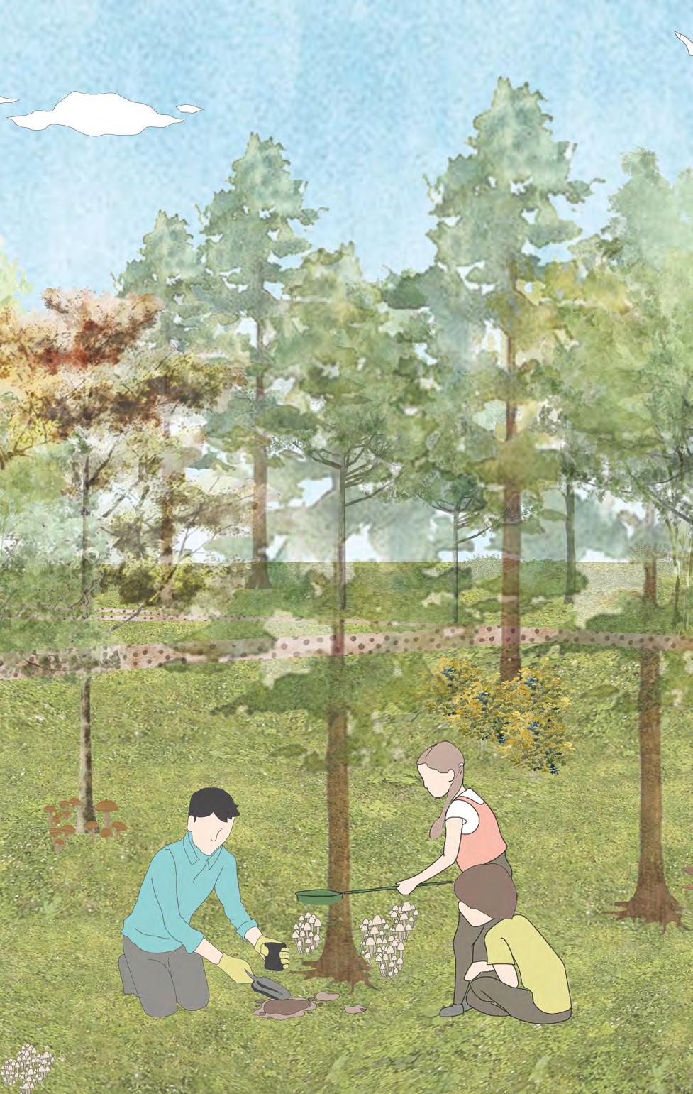
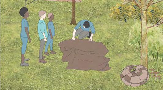
Under supervision, children investigate five simple methods for growing mushrooms in this fungi garden.
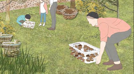
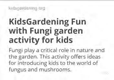
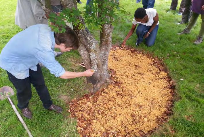
Often overlooked in the garden ecosystem, fungi play a critical role in the decomposition and nutrient cycles that help your plants grow. This activity offers ideas for introducing young gardeners to fungi.
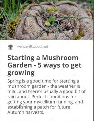
12.1 Example of creating a woodchip mushroom garden. (https://www.milkwood.net/2016/09/05/starting-a-mushroom-garden-5-ways-to-do-it/)
Method 1: Shitake Logs
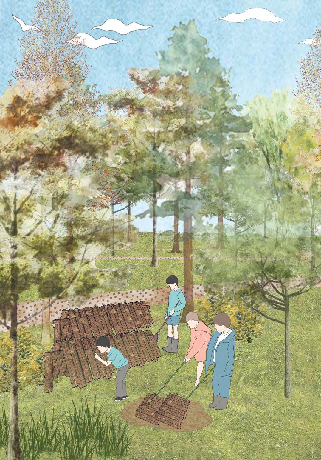
Method 4:
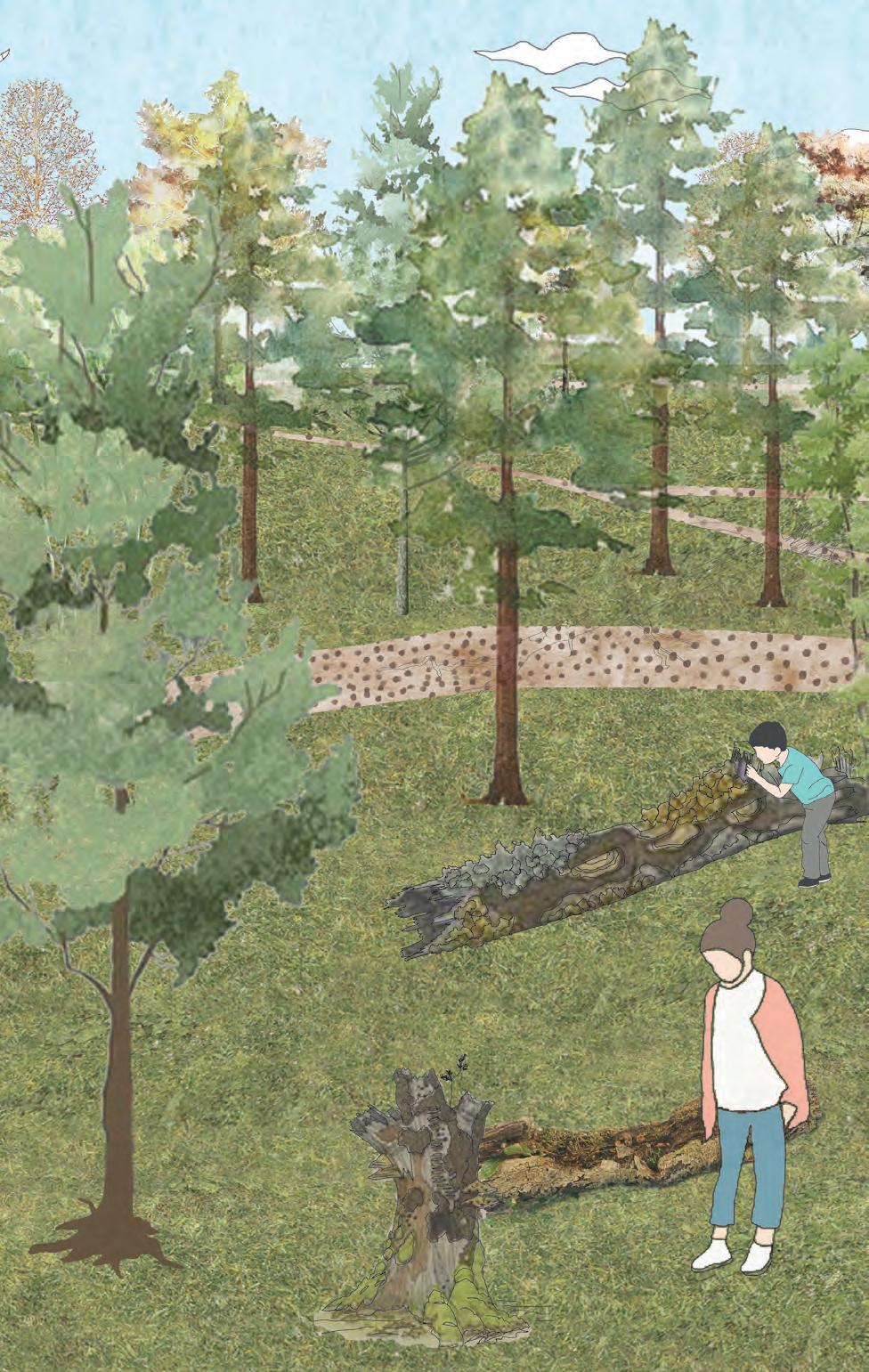
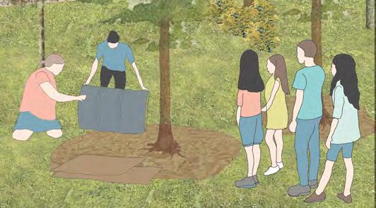
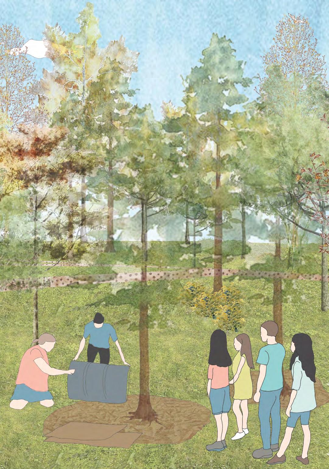
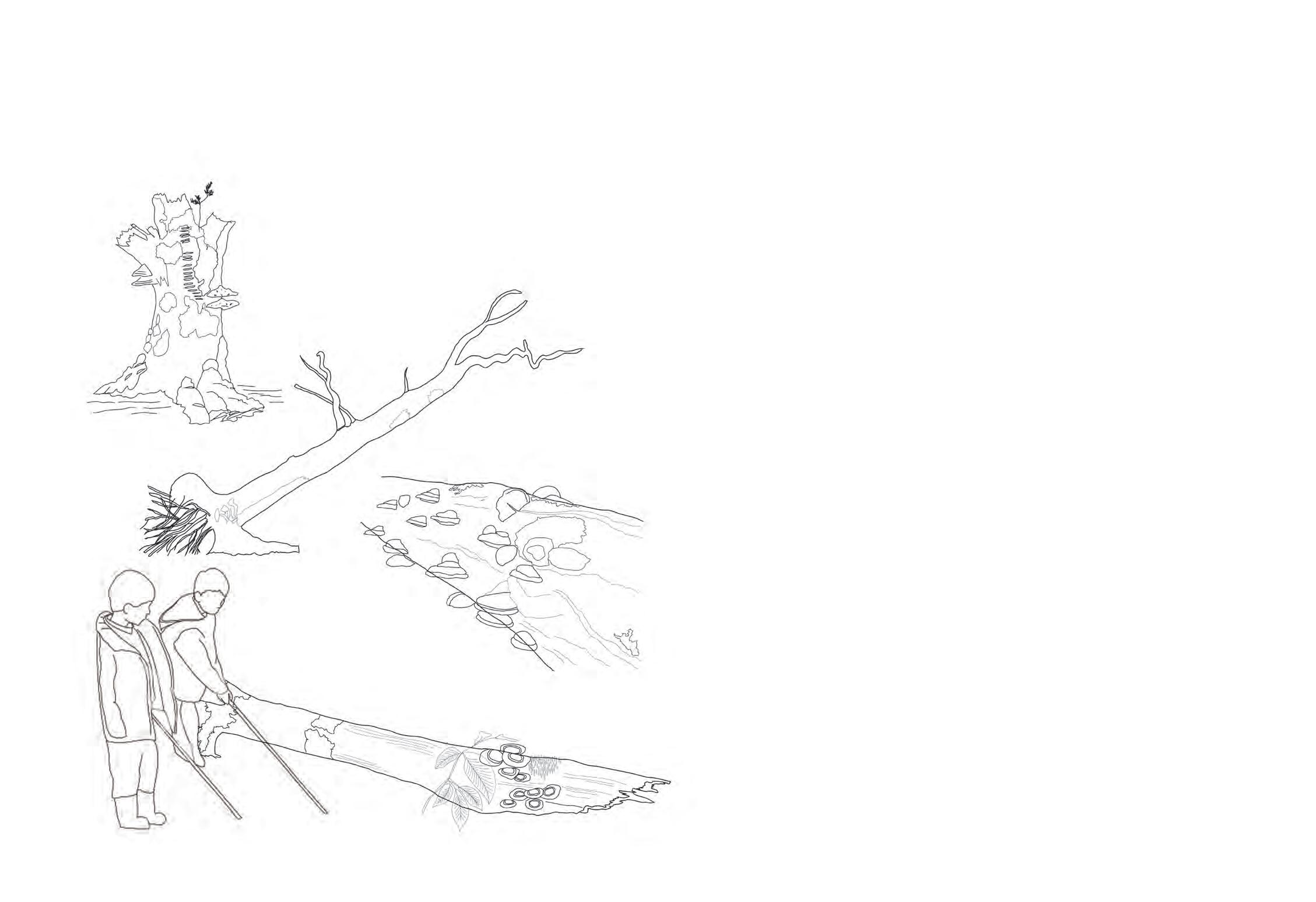
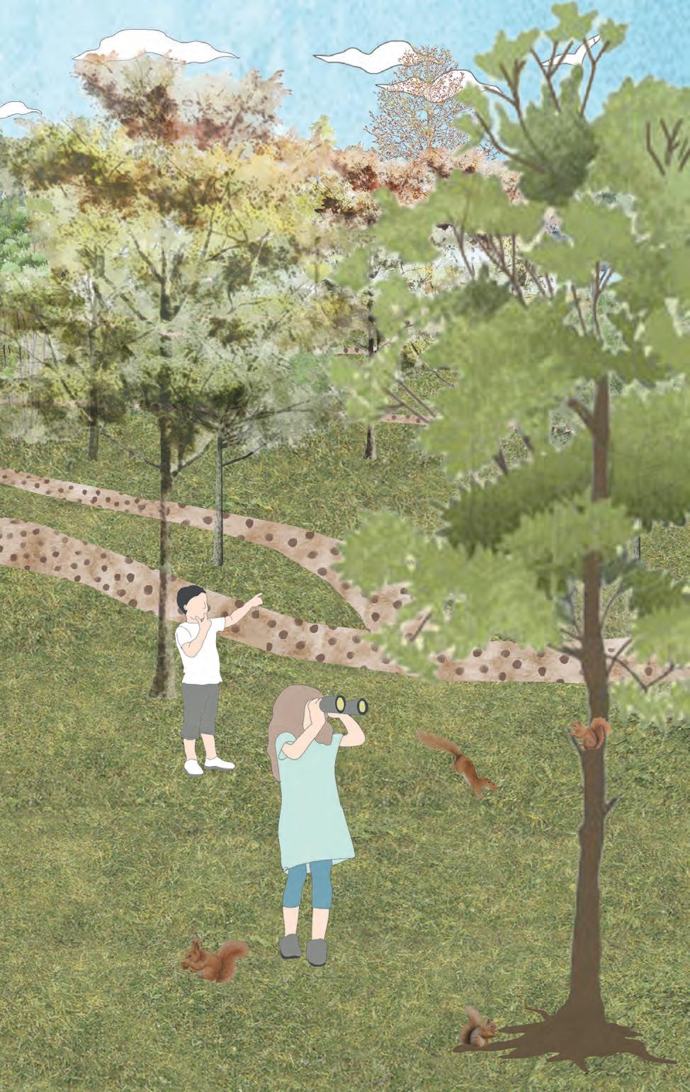
The forest school recommends three pathways in the woods for students to learn about diverse ecologies: lichen, deadwood, and red squirrels, which are endangered and protected squirrel species found on the Isle of Wight today. These trails are adaptable locations in the forest, and the educator guide can create a day itinerary based on the entire or partial zones of these trails. The activity and worksheet booklets supplement this knowledge.
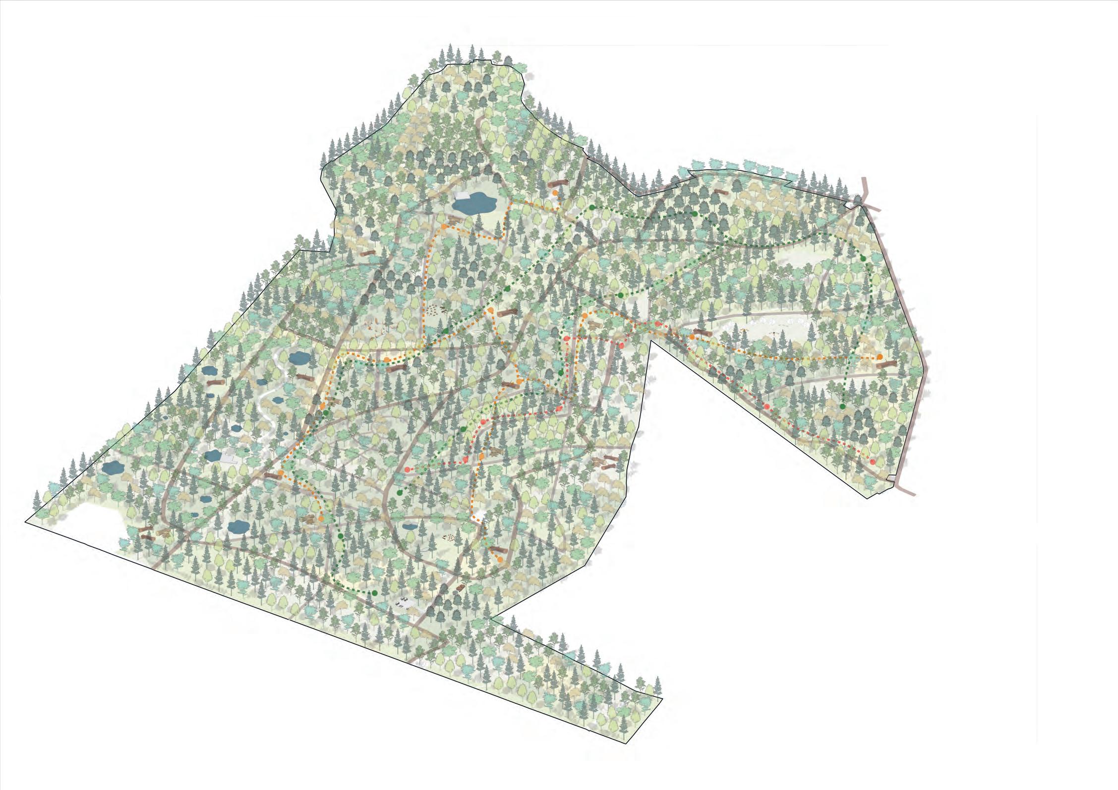
The trails are designed around the exiting ecology of the three types. The forest being a mixed woodland has an intersting mix of various species of trees and lichens that provide engrossing environment for the kids to study these.
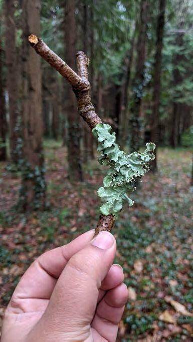
LEGEND LICHEN TRAIL DEADWOOD TRAIL RED SQUIRREL TRAILDue wide variety of tree species in this woodland, the types of species found are also abundant. The children use tools to look at various tree and stone based lichens and use the handbook to identify them. Knowledge about lichens from a young age will help the children learn more about nature.
Microscopic observation for further detailed study
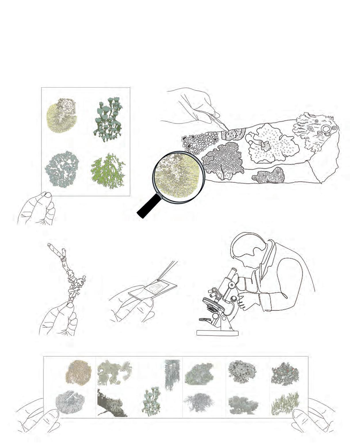 Illustrated Worksheet for identification of lichen
Illustrated Worksheet for identification of lichen
Illustrated Worksheet for identification of lichen
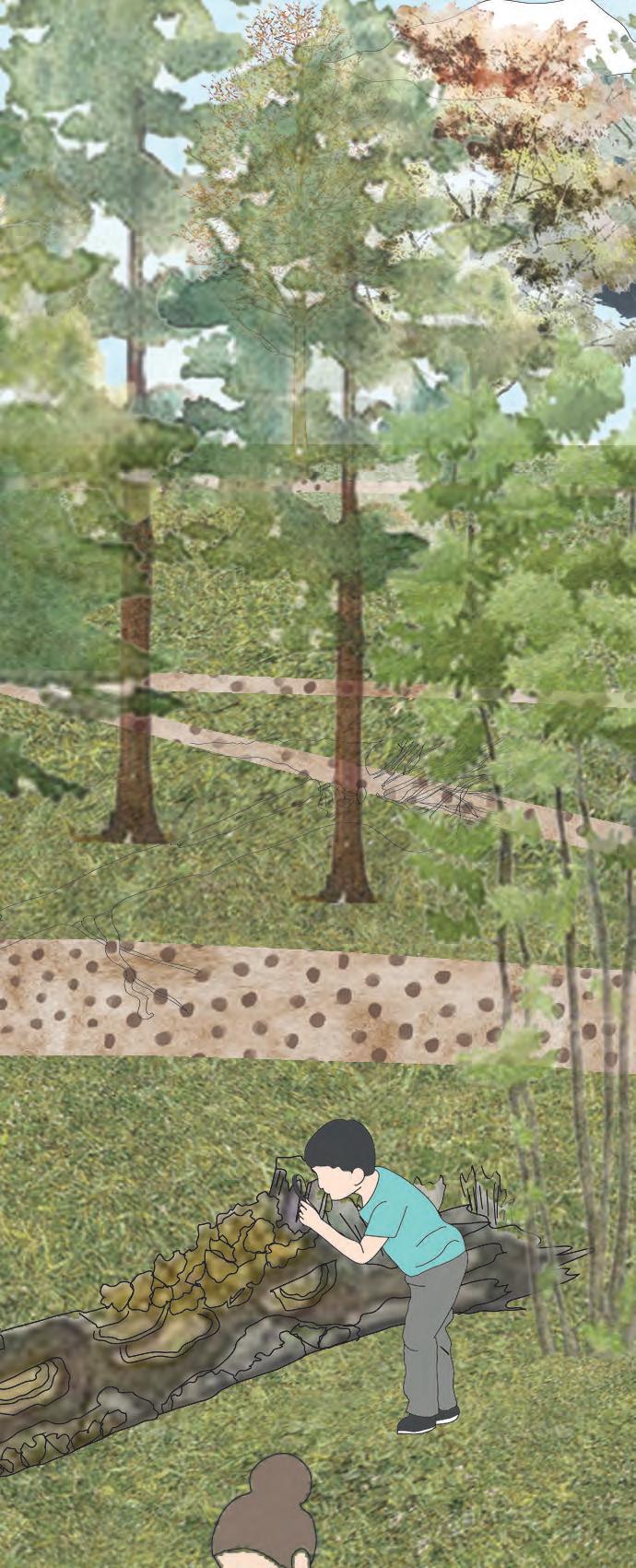
Often misunderstood as waste, this trail will help emphasise the importance of dead wood in a forest. After a tree falls and dies, it still supports a wide range of habitat on its dead rotting wood. The children can look for mushrooms, moss, new shoots growing and insects hidden in there.
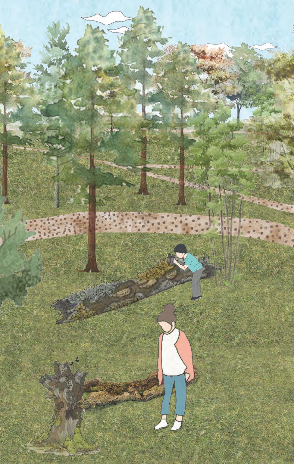
Various species of trees and their dead ecology
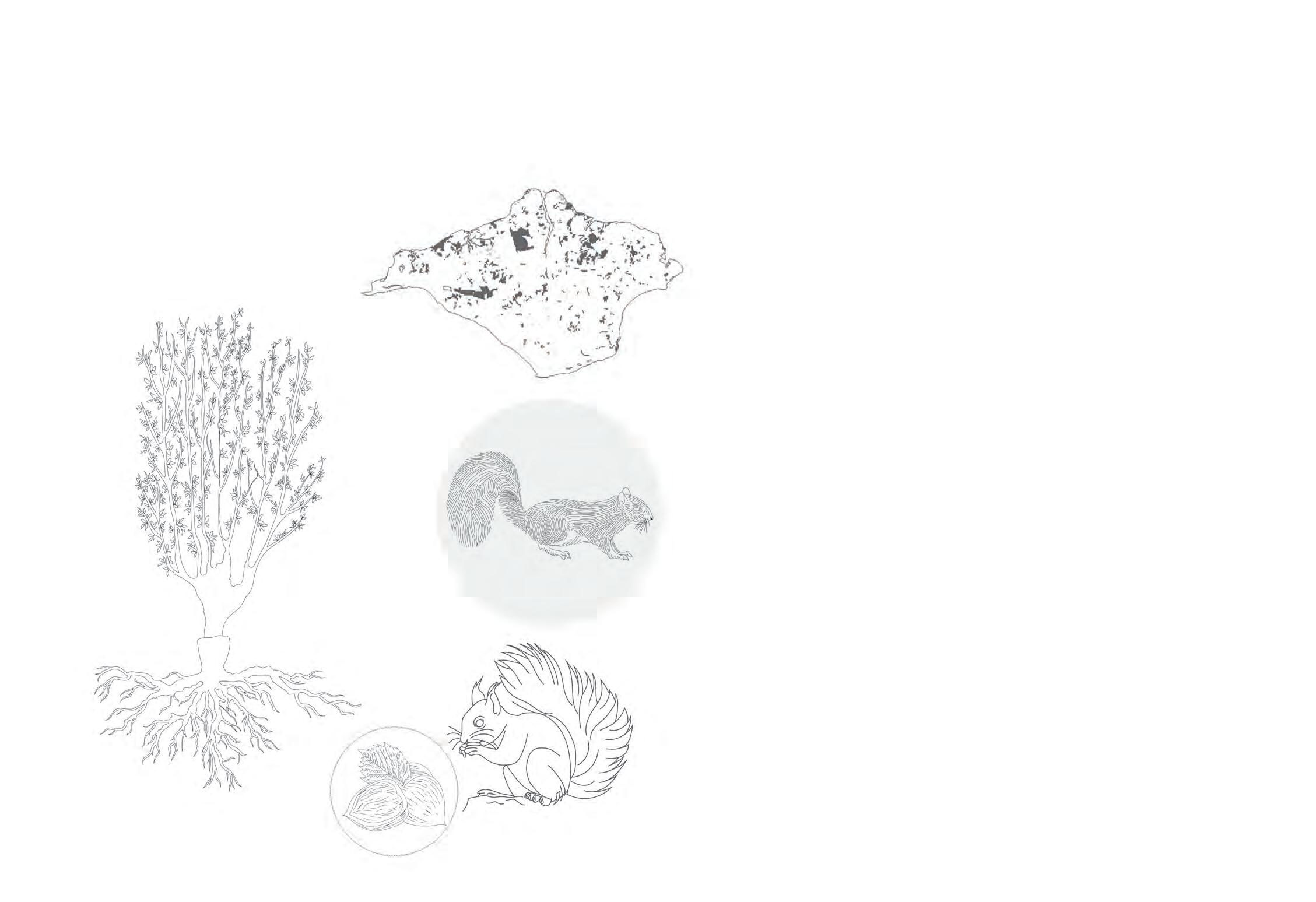
Red squirrels are widely endangered species. Taken over by grey squirrels, today the habitat for red squirrels are lessening day by day. The Isle of Wight is one of the important places in the UK where red squirrels are surviving. The solvent separates the Isle from mainland thus protecting the migration of grey squirrels.
It has become very important to now protect this habitat, and the Parkhurst forest can play an important role in this. With this trail not only the children, but everyone visiting the woodland can learn more about the red specie and its importance.
Due to reduced management activities, the hazel trees are grown into overshoots and thus lesser production of nuts. Appropriate management activities is essential to maintain a healthy food source.
Spread of red squirrel on the Isle Grey Squirrel Red Squirrel and Hazel nuts (main source of food)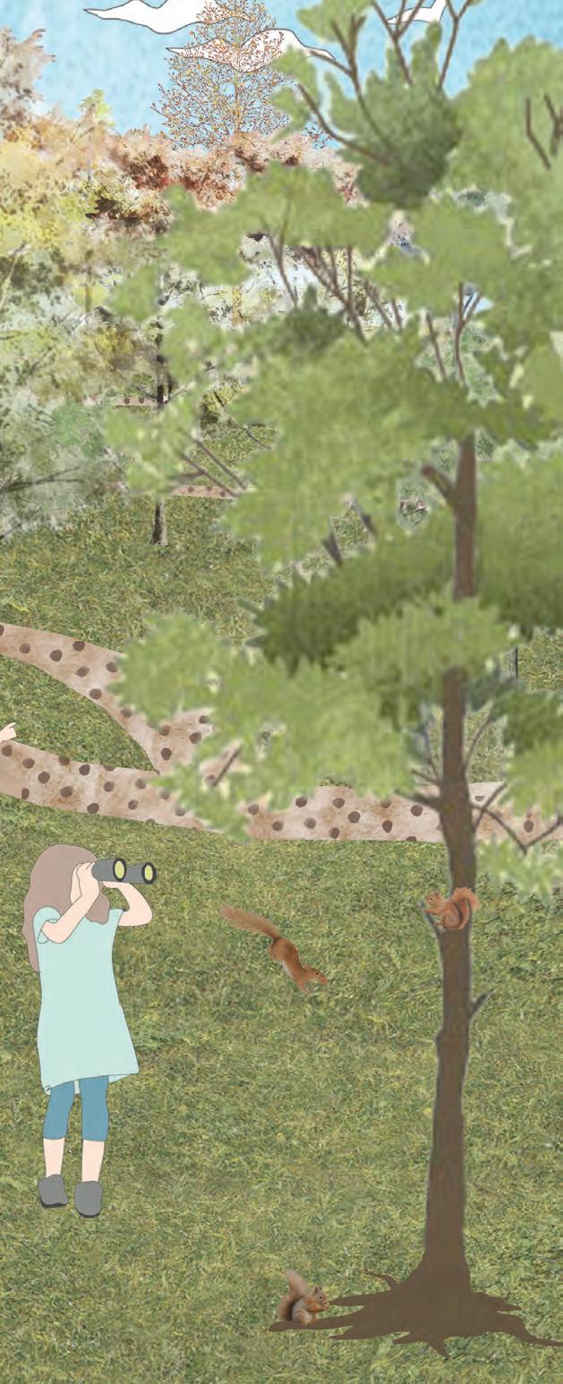
(official maps from forestry commission)
(official maps from forestry commission)
 design image inspiration from OMA
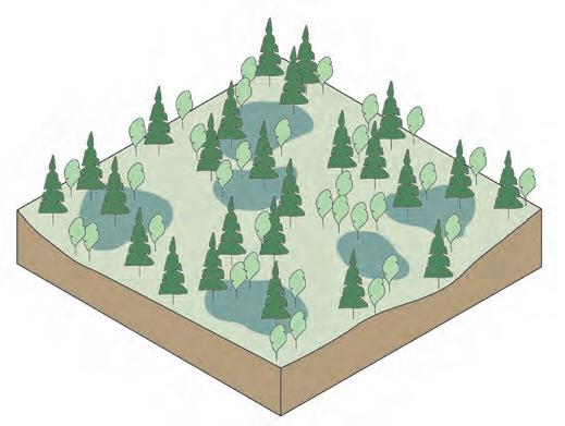
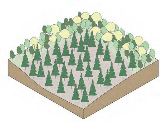
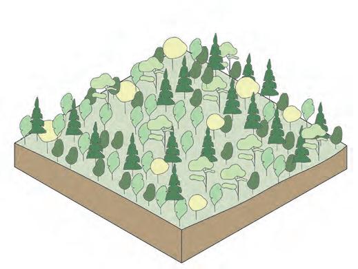
 OTHER ZONES: REED BED AND PONDS
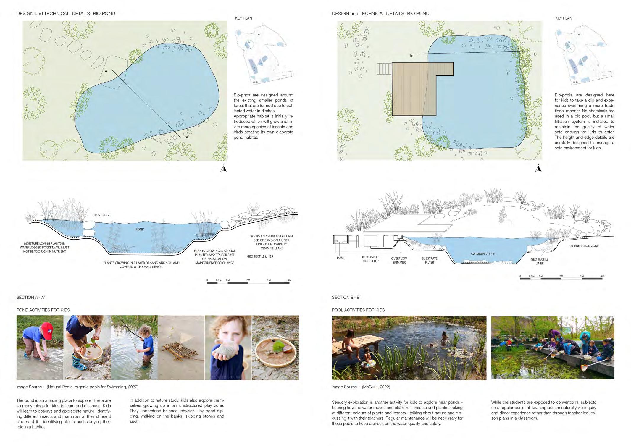 OTHER ZONES: BIO POOL AND PONDS
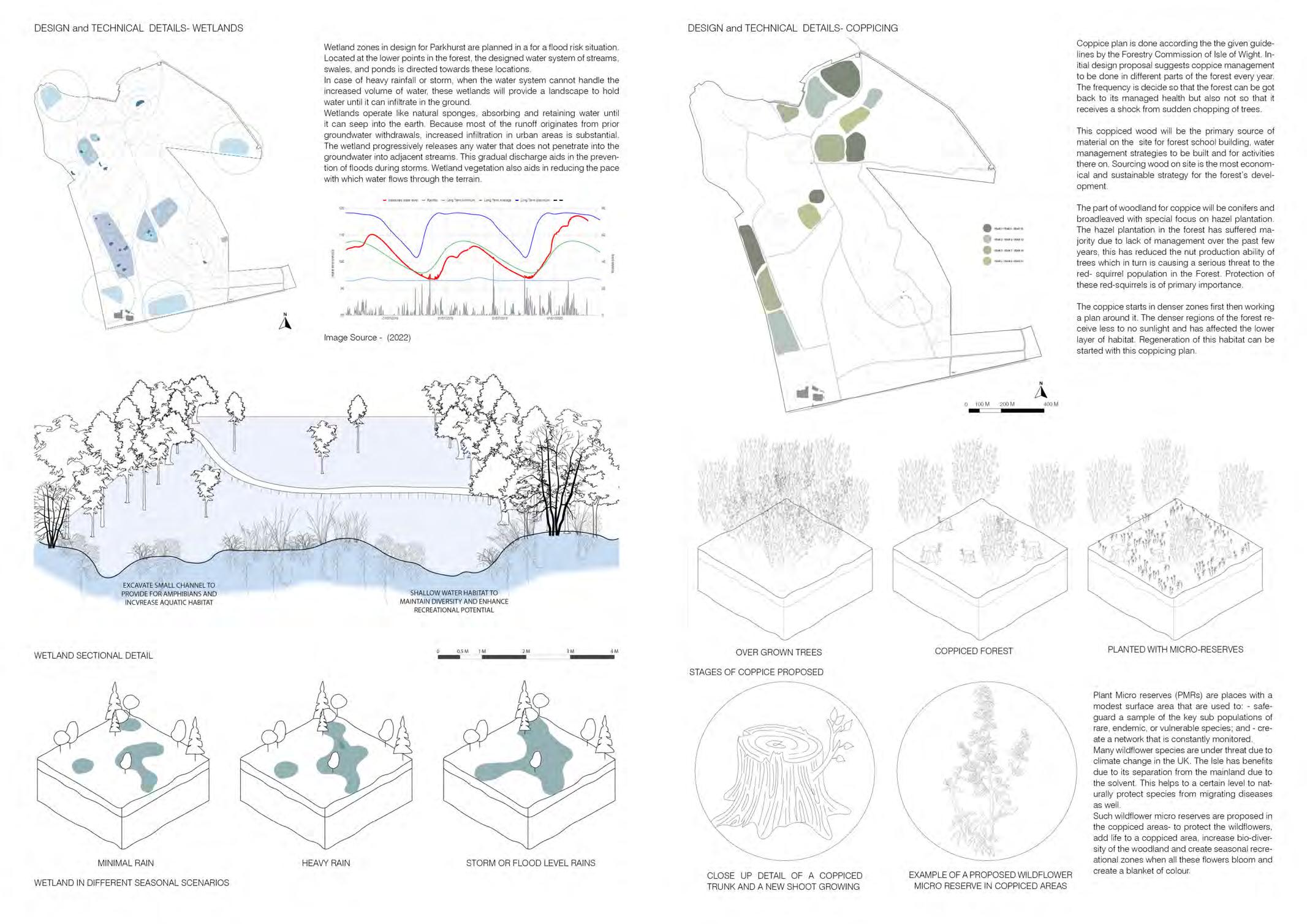
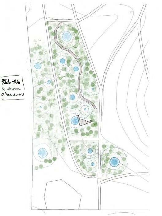
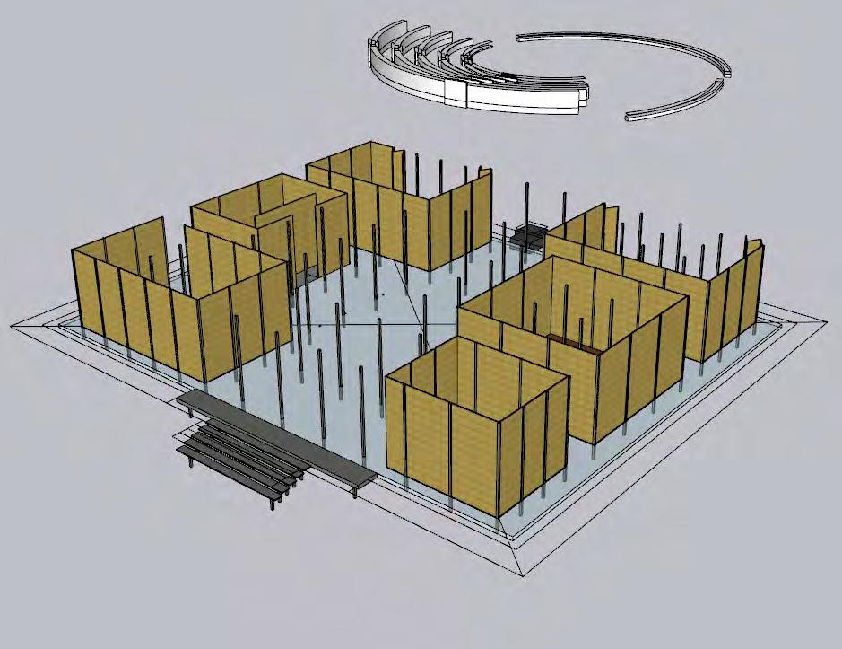
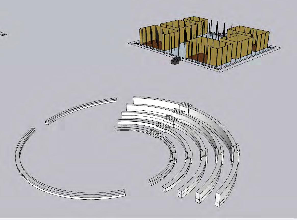
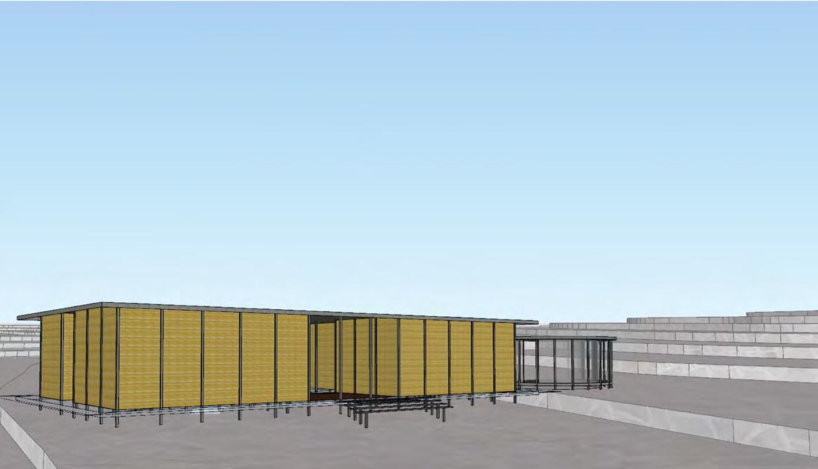
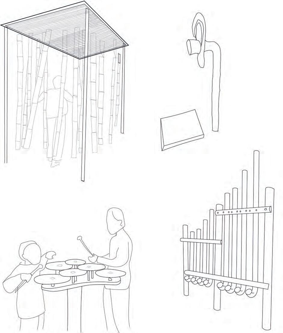
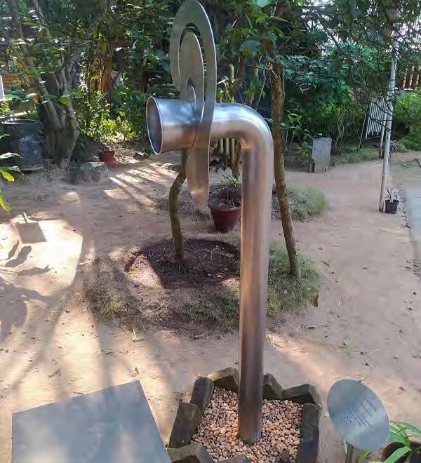
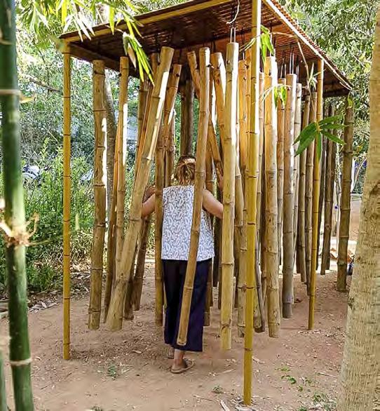
Fig 1. A secondary pathway in the forest. (Photo by the author)
Fig 2. A dense area in the forest. (Photo by the author)
Fig 3. An incredible canopy formed by tall pines. (Photo by the author)
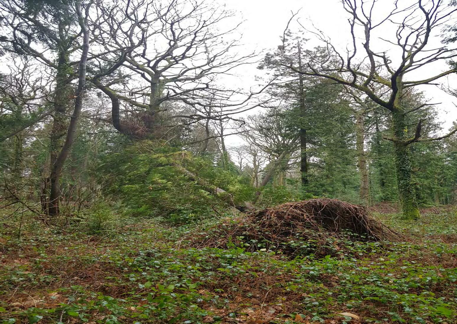
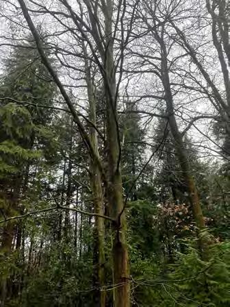
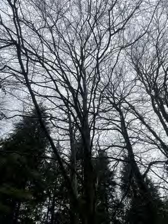
Fig 4. A recently fallen tree in the woods. (Photo by the author)
Fig 5. A tree midway in its falling process showing off its complex root structure. (Photo by the author)
Fig 6. A vernal pool formed at the root pits and depression of a fallen tree. (Photo by the author)
7.1, 7.2, 7.3, 7.4, 7.5. These images capture the various habitats that can be found in the Parkhurst forest. Dense and crowded, dominated by pines, forest floor taken over by ivy and vernal pools at tree roots are some of the common sights in this forest. (Photos by Author)
8.1, 8.2, 8.3. These images taken at various junctions and pathways show the change of habitat at edges.
8.4, 8.5, 8.6. These images highlight the dense canopy cover that can be seen throughout the forest.
8.7, 8.8, 8.9. Impenetrable and Dense zones due to overgrown coppice. (Photos by Author)
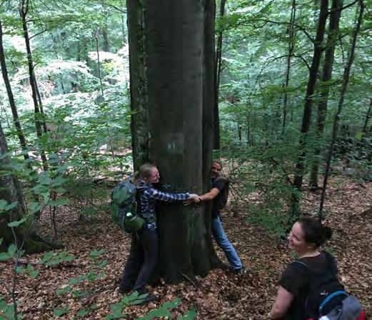
9.1. Site study and sample collection (Photos by Author)
10.1. A forest vernal pool. (Photo by the author)
10.3. Water collected in a ditch eventually forming a vernal pool. (Photo by the author)
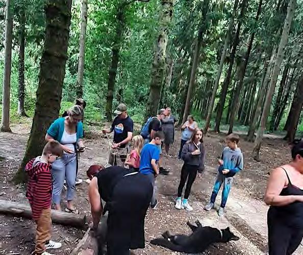
11.1, 11.2, 11.3, 11.4, 11.5. 11.6. Photographic documentation of site uses and processes happening in the forest on the day of visit. (Photos by the Author)
12.1 Example of creating a woodchip mushroom garden.
(https://www.milkwood.net/2016/09/05/starting-a-mushroom-garden-5-ways-to-do-it/)
BARTLETT SCHOOL OF ARCHITECTURE
UNIVERSITY COLLEGE LONDON
MLA: MASTERS IN LANDSCAPE ARCHITECTURE
YEAR 2 2021-2022
ADVANCED LANDSCAPE DESIGN 2 BARC0118
LAURA ALLEN & MARK SMOUT
DESIGN STUDIO 9
FORESTS THAT WALK DESIGN TUTORS
TIM WATERMAN & EMMA COLTHRUST
MAYA ABDUL LATIF
SUBMITTED BY POOJA WAGH