POOJA WAGH
ARCHITECTURE AND LANDSCAPE ARCHITECTURE PORTFOLIO
POOJA WAGH
Goodenough College, London. WC1N2AB
+44 7796781405
CONTENTS
Bartlett School of Architecture, UCL
Masters in Landscape Architecture
Brick School of Architecture, SPPU
Bachelor of Architecture
Curious Woods
MLA Bartlett school of architecture Year 2 Design Project
Rejuvenation of Parkhurst Forest by Introduction of a Forest School
Constructing of Mumbai’s Urban Forests
MLA Bartlett school of architecture Year 2 Thesis writing The risks of Green Gentrification
Experimental Landscapes in the Arctic
MLA Bartlett school of architecture Year 1 Design Project
A Sami Seasonal Research Park in Kiruna, Sweden
Honouring the past, Creating a future
Under-graduation Pune University Year 5 Thesis Design Project Adaptive reuse of Belapur fort as an Interpretation Centre
Pune, Metro and the city
Under-graduation Pune University Year 4 Urban Design Studio Transit oriented development
Discovering the heritage of Nashik
Under-graduation Pune University Year 3 Design Studio Settlement Study and documentation
Protecting biodiversity in London’s post-war housing landscape
MLA Bartlett school of architecture Year 2 History essay
Osmosis
MIT (Massachusetts Institute of Technology) India Initiative, Workshop Breaking the barriers of Institutions
Professional Practice
TOAD- The Office of Architecture and Design, Mumbai, India
Architect, December 2018- May 2020
HM Architects, Ahmedabad, India
Intern, June 2017- October 20217
1 2 3 4 5 6 7 8 9
MLA, Bartlett School of Architecture

Year 2 Design Project
-
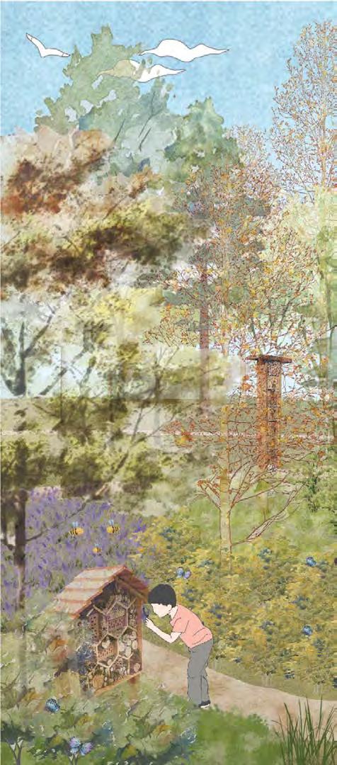
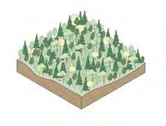
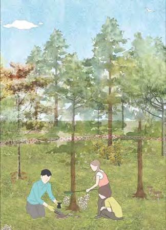
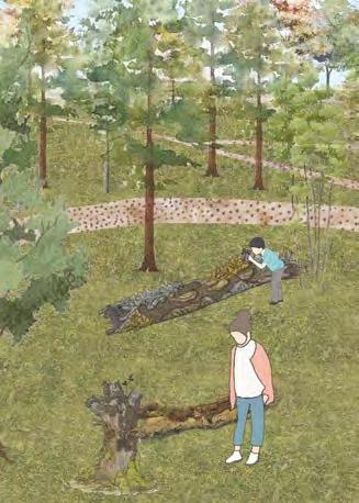
This project proposes rejuvenation of the Parkhurst Forest on the Isle of Wight by establishing a Forest school. This encourages community access to the Forest while also urging the Forestry Commission to employ improved management techniques to reverse the declining health of the Forest. The project emphasises the various forms of ecology in a forest and includes creative techniques for teaching children about forest ecology. Learning is supported by design of various zones that focus on water ecosystems, woodland habitats, biodiversity, and unstructured play.
link to the full project portfolio- https://issuu.com/poojaswagh/ docs/barc0113_22_waghpooja_studio9_portfolio_compressed
link to the technical report- https://issuu.com/poojaswagh/docs/
01
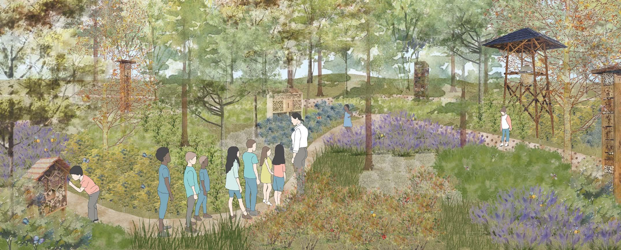
Curious Woods
Rejuvenation of Parkhurst Forest by Introduction of a Forest School
Studio Tutors
PhD. Tim Waterman, Ar. Emma Colthrust, Ar. Nico Alexandroff, Researcher. Elise Hunchuck
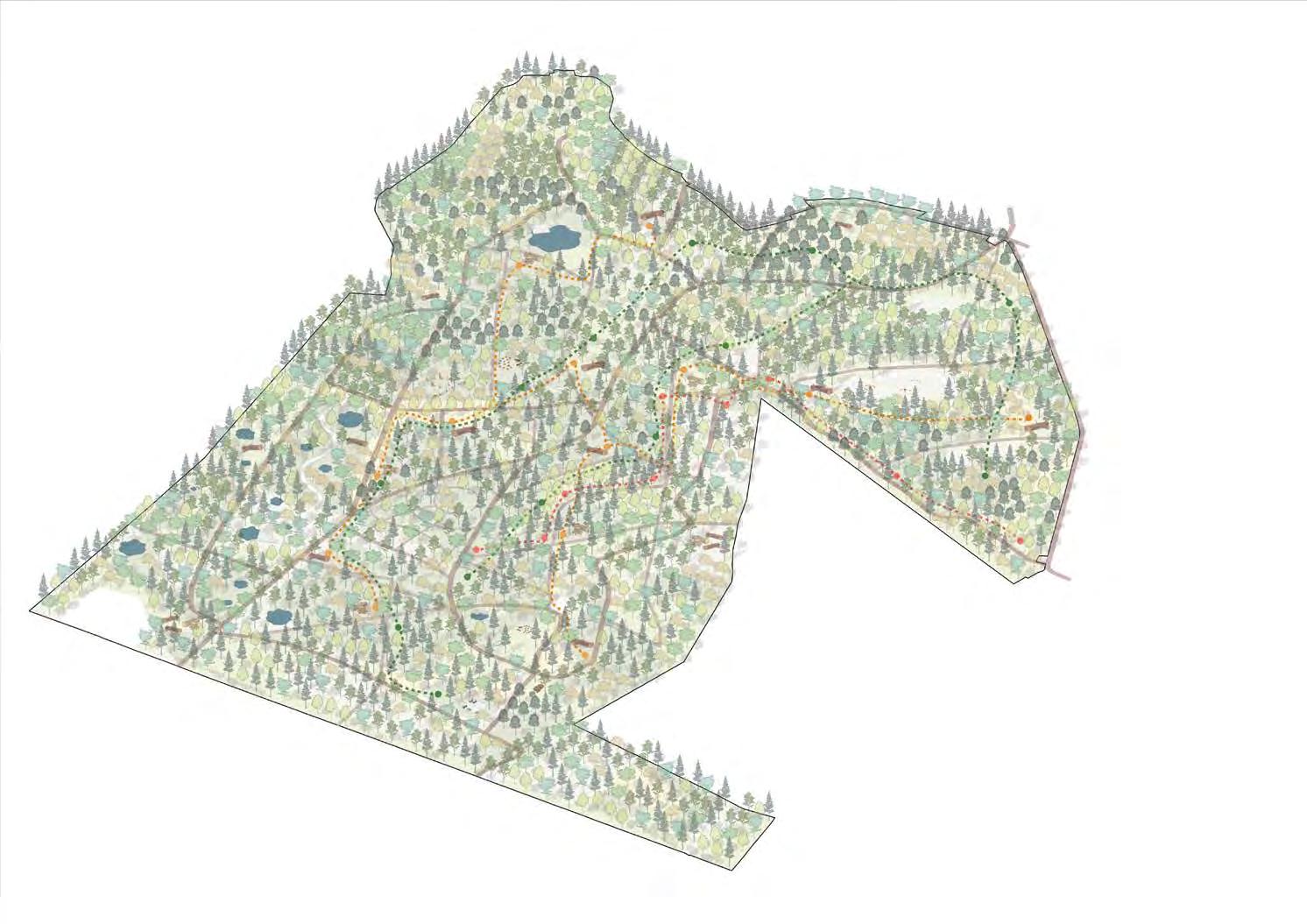
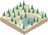
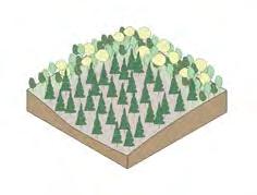
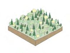
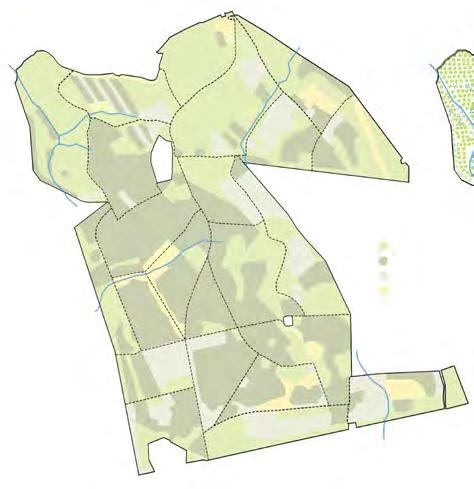
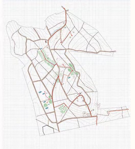
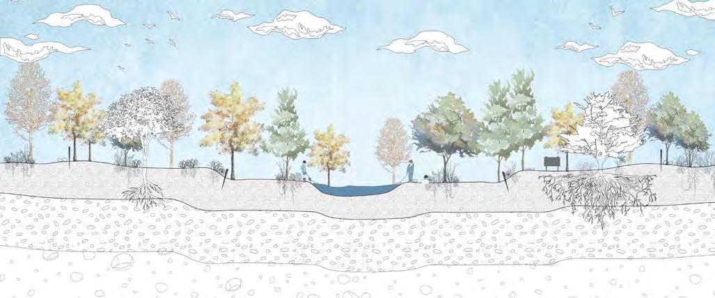
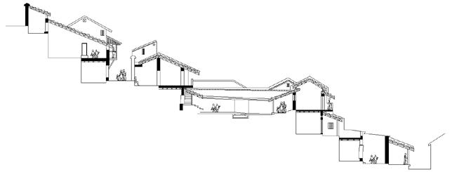
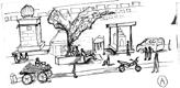
1 2 3 4 9 7 8 5 6 LICHEN TRAIL DEADWOOD TRAIL RED SQUIRREL TRAIL WATER BODIES 1. ZONE 1- VERNAL POOLS 2. ZONE 2- POLLINATION GARDEN 3. ZONE 3- FUNGI GARDEN 4. ZONE 4- TRAILS 5. ZONE 5- STUDENT CENTRE 6. ZONE 6- VISITOR CENTRE 7. ZONE 7- UNSTRUCTURED PLAY 8. ZONE 8- MUSIC PLAY 9. ZONE 9- BIO POOLS Proposed master plan of Forest school
A Forest School Parkhurst Forest, Isle of Wight, UK
Forests play a critical role in mitigating the effects of climate change. They absorb greenhouse gases, capture carbon, regulate the water table, and provide a resilient habitat for a diverse range of migrating flora and fauna. The world’s forests have already seen significant change as a result of rising global temperatures, and nature must now respond to the new temperatures and climate changes.
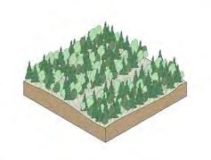
Because the Isle of Wight is separated from the mainland by the Solvent, it has a geographical benefit in terms of not getting many tree or animal illnesses. The island has been successful in protecting the habitats of numerous flora and wildlife, the most well-known of which is the Red Squirrel. If properly cared for, these forests on the Isle can serve as an important site for woodland conservation. A synergistic approach of better managed forests and enhanced land use reduces climate change vulnerabilities while achieving both mitigation and adaptation goals.

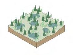
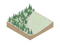
 Parkhurst forest, Isle of Wight
Conifer Open habitat Mixed Woodland Native and Honaray
Pines Oak Spruces Beech Larches Ash
broadleaf
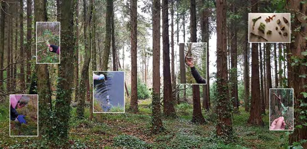
Site visit observation map
Mapping woodland types
Site study and sample collections
Mapping woodland- species
Analysing forest edges
Dense and Impenetrable
Dense and Ordered
Edge dense clear centre Closed Canopy
Edge cleared
Swamps and marshes
Natural Pools
An established ecosystem
Single tree patch woodland Swales
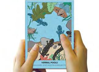
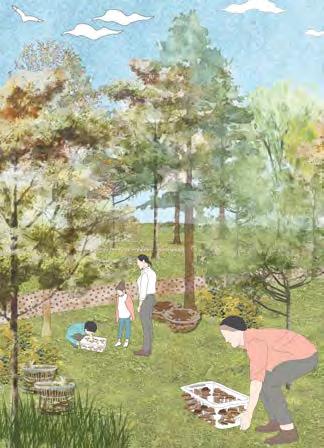
The loss of vernal pools and the important terrestrial habitat that surrounds them result in the local extinction of amphibian species, a decrease in biodiversity, and a reduction in food available to many other creatures that dwell in these places. The space is designed for children to experience pond dipping, identify species and learn about the vernal pool habitat in an engaging manner. Necessary management activities are undertaken to protect this critical habitat of the forest.
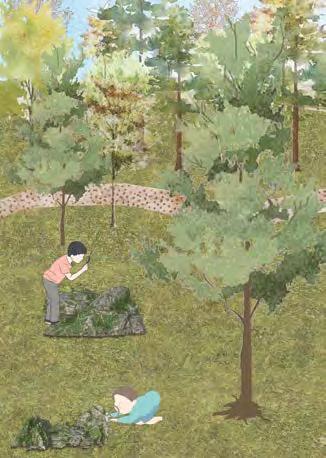
The fungi garden is constructed to offer a safe environment for children to learn about the various varieties of fungi and how they thrive. This highlights the significance of fungus in the general health and growth of the forest. Fungi are particularly vital to many of the wild plants and trees because they efficiently spread the root area of plants.
A fungal garden is constructed to offer a safe environment for children to learn about the various varieties of fungi and how they thrive. This highlights the significance of fungus in
the general health and growth of the forest.
Fungi are particularly vital to many of the wild plants and trees because they efficiently spread the root area of plants. Often overlooked in the
garden ecosystem, fungi play a critical role in the decomposition and nutrient cycles that help your plants grow. This activity offers ideas for introducing young gardeners to fungi.
Fungi garden zone - Shitake logs method
Proposed management activities around sensitive zones
Fungi garden zone - basket mushrooms method
Fungi garden zone integrated mushroom garden
Design proposal for vernal pools - spring and summer season
Design proposal for vernal pools autumn and winter season
Booklet designed as am example for the vernal pools zone.
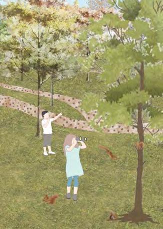
Pollinators are essential for the reproduction of three-fourths of the world’s flowering plants as well as about 35% of the world’s food crops. More than 3,500 native bee species help to boost agricultural production. Pollination gardens can help children recognize the importance of these insects. Additionally, this contributes to the forest’s health and biodiversity.
The design concept calls for a variety of seasonal blooming shrubs and wild flowers to be planted in this pollination garden. The planting incorporates variety of seasonal flowering species making sure the garden provides suitable habitat in all seasons. Natural processes will eventually take control, resulting in a natural wild flower garden that nourishes pollinators. The children participate in workshops where they create insect hotels out of wood scraps. This improves their connection to nature.
Bug hotel
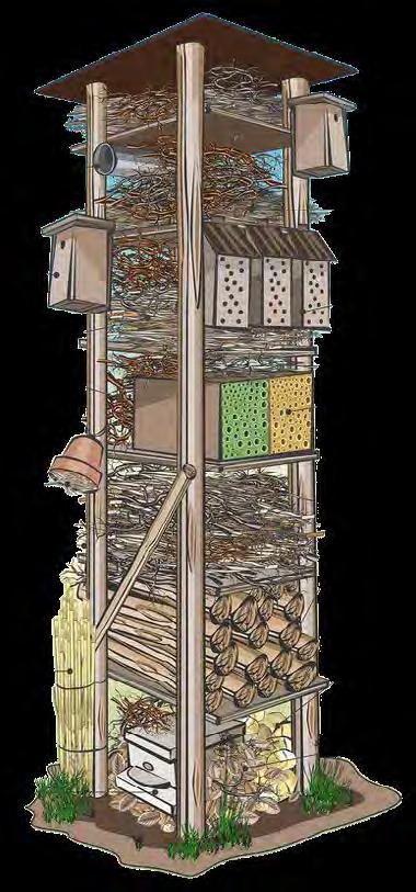
Installation of a bug hotel in various parts of the pollination garden, to make sure the space provides comfortable habitat for all species.
Planting Plan
species found on the Isle of Wight today. These trails are adaptable locations in the forest, and the educator guide can create a day itinerary based on the entire or partial zones of these Winter planting Summer planting
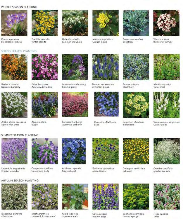
trails. The trails are designed around the exiting ecology of the three types. The activity and worksheet booklets supplement this knowledge. Spring planting Autumn planting

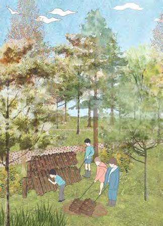
The forest school recommends three pathways in the woods for students to learn about diverse ecologies: lichen, deadwood, and red squirrels, which are endangered and protected squirrel
Winter planting palette
Spring planting palette
Summer planting palette
N
Autumn planting palette
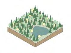
 Illustrated view showing inhabitation of the vernal pool space and forest school activities taking place.
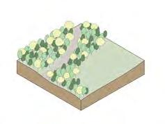
 Illustrated view showing inhabitation of the pollinating garden and children engaging in various educational activities
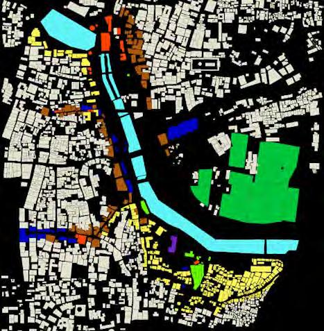
Constructing of Mumbai’s urban forests
The risks of green gentrification
MLA, Bartlett School of Architecture
Year 2 Writing Thesis
Thesis Supervisor: Kirti Durelle
Module Coordinator: Tom Keeley
There is a lack of detail in planning policies, making it easier for the developers to find loopholes and push out the poor. Whether this is done intentionally or intentionally is as good as a guess. This issue persists not only in Mumbai but also in the Central authority planning in India. The pattern observed throughout governance history is the exclusion of equitable rights to land and public amenities, inadequate data on planning policies, and not following through on launched policies. In times like today, where we are already feeling the effects of climate change, and as cities worldwide are getting ready to plan actions against this change, how do these gaps in planning policies affect the already inherent gentrification in the city?
Abstract-
The government of Mumbai recently launched the city’s Climate Action Plan (MCAP). It analyses the vulnerabilities of Mumbai and proposes strategies to achieve the action plan’s goals of reaching nee-zero by 2050. The four crucial of success outlined by the MCAP include ‘equity’- equitable access to all. It is the first time for any city from Mumbai to officially include and give importance to inclusivity in their development proposals. Mumbai – a city known for its slums and informal settlements, has always faced gentrification issues. The economic and social gap between the varied income groups of the city is widening. The stakeholders involved in Mumbai’s development are a complex relationship between the authorities, high-income business owners and developers, and middle-class or high-er class residents. The new developments have always aimed to displace slums and price out the poorer population from a neighbourhood.
Gentrification brought out due to the ‘greening’ policies against climate change is termed green gentrification and is an eminent problem city worldwide is solving. This thesis aims to critique the risks of green gentrification brought about by the lack of appropriate planning in the MCAP while looking at some examples in the recent past of how authorities and developers can push out the poor. These new green policies can become a tool to gentrify the poorer settlements and widen the gap between socioeconomic groups. Greening increases inequality without policies that pay attention to social justice components of sustainability, which supports the notion that environmentalists are elitist and that environmentalism is inherently unjust. This thesis aims to highlight the risks of gentrification that come with green development plans and asks to consider equitable access and inclusion as essential factors in city infrastructure and landscape development.
02
link to the full thesis
- https://issuu.com/poojaswagh/docs/_barco119_waghpooja_thesis_publish
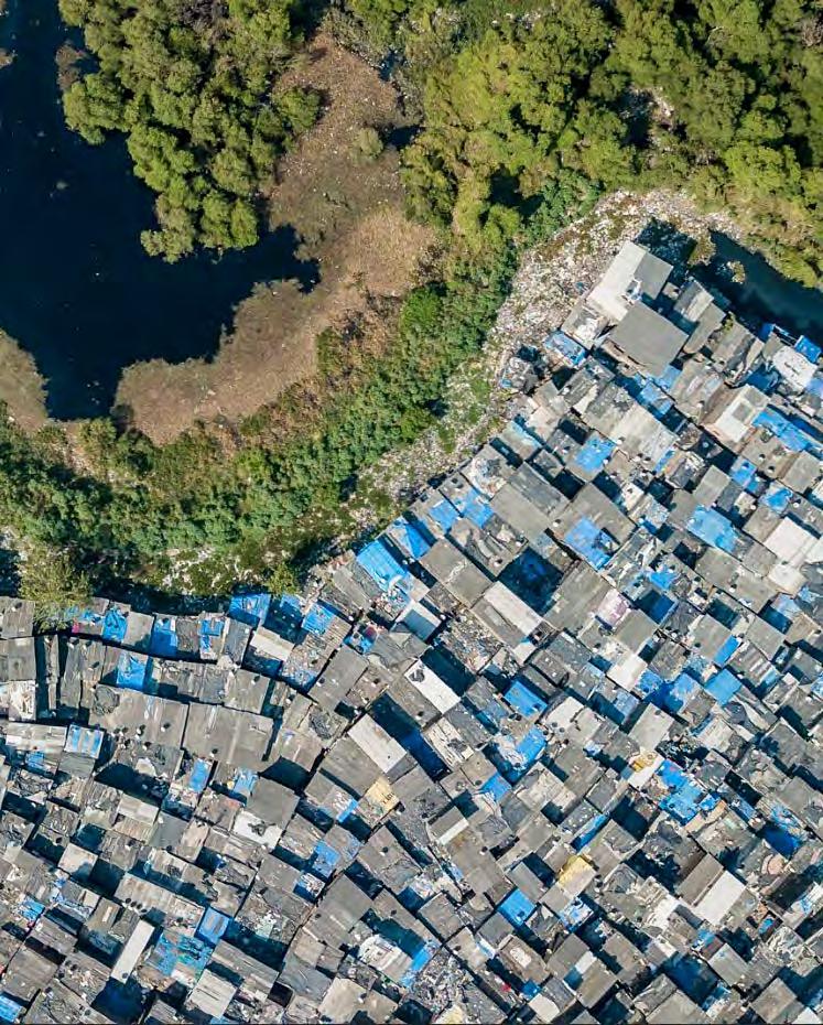
The unequal scenes of Mumbai’s demographic. (Unequal Scenes - Mumbai, 2022)
Experimental landscapes in the Arctic MLA, Bartlett School of Architecture
Year 1 Design Project
Tutors- Ar. Matthew Butcher, Phd. Tiffany Dang
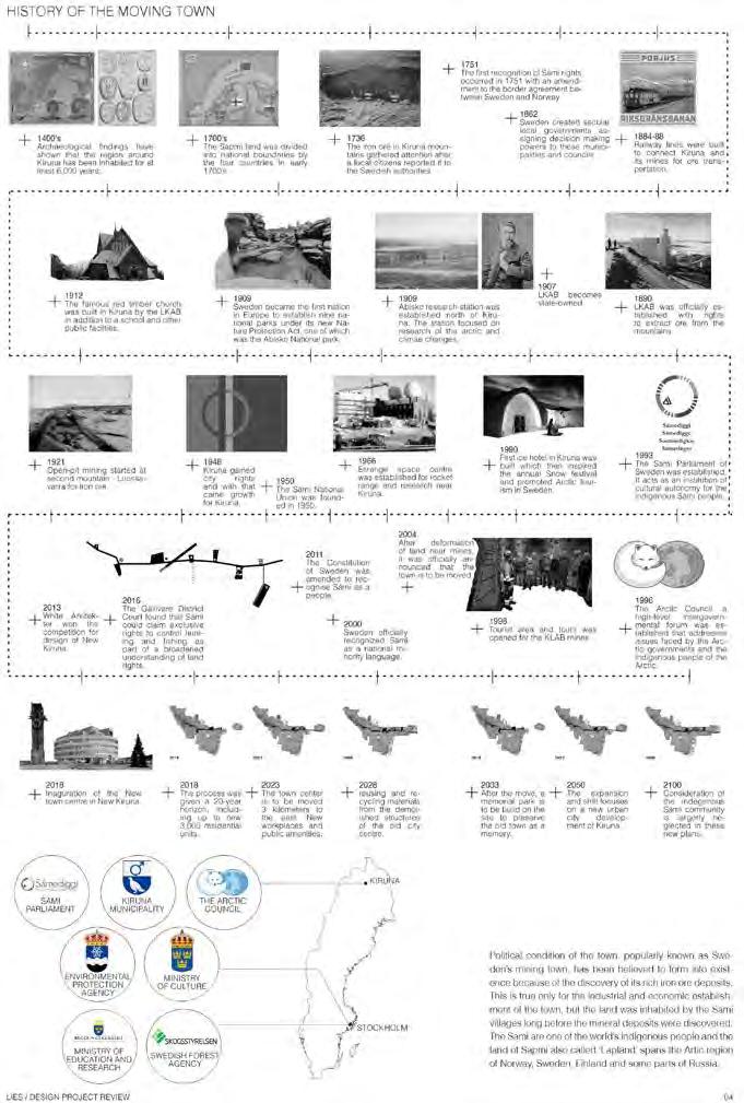
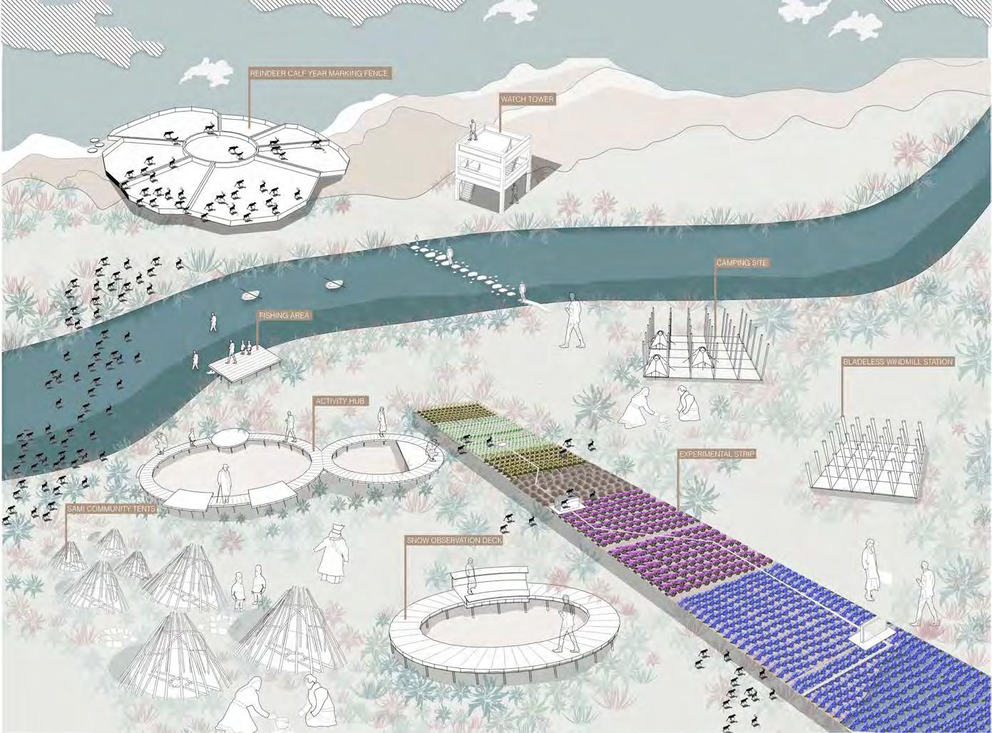
A Sami Seasonal Research Park Kiruna, Sweden
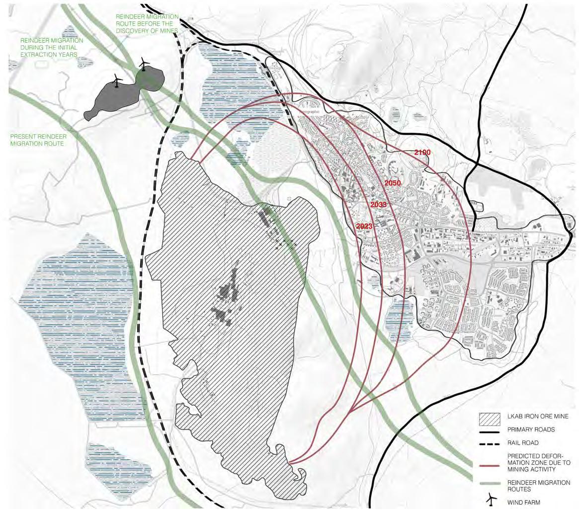
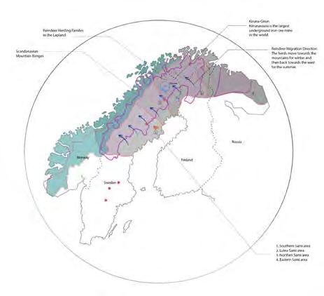
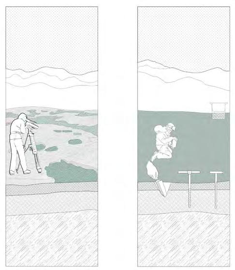
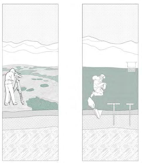
Kiruna- popularly known as Sweden’s mining town, has been believed to form into existence because of the discovery of its rich iron ore deposits. This is true only for the industrial and economic establishment of the town, but the land was inhabited by the Sami villages long before the mineral deposits were discovered. This occupation and the Sapmi location makes snow and knowledge of snow conditions crucial for the reindeer herders. Warming temperatures at the Arctic have led to severe changes in snow-fall patterns and quality also affecting the vegetation patterns of the area which the reindeer feed on. The government bodies making decisions about these local communities are influenced by the mining companies.
This project questions the role of landscapes in policy-making and tries to reduce the relationship gap between the researchers - Sami community - and the policy makers. This proposal provides spaces for the policy-making bodies to observe the landscapes they are making the policies for, to take in consideration the local community and the crucial research being carried out by scientists so as to make informed decisions for the future.
03
This project questions the role of landscapes in policy-making and tries to reduce the relationship gap between the researchers, Sami community, and the policy makers. This proposal provides spaces for the policymaking bodies to observe the landscapes they are making the policies for, to take in consideration the local community and the crucial research being carried out by scientists so as to make informed decisions for the future.
The project provides pastures experimental studies of ‘shrubification’ of the Arctic tundra by regulating and observing reindeer grazing pastures. It explores how design can frame and enhance the experience of seasonality changes and provide a deliberation space for the observers.

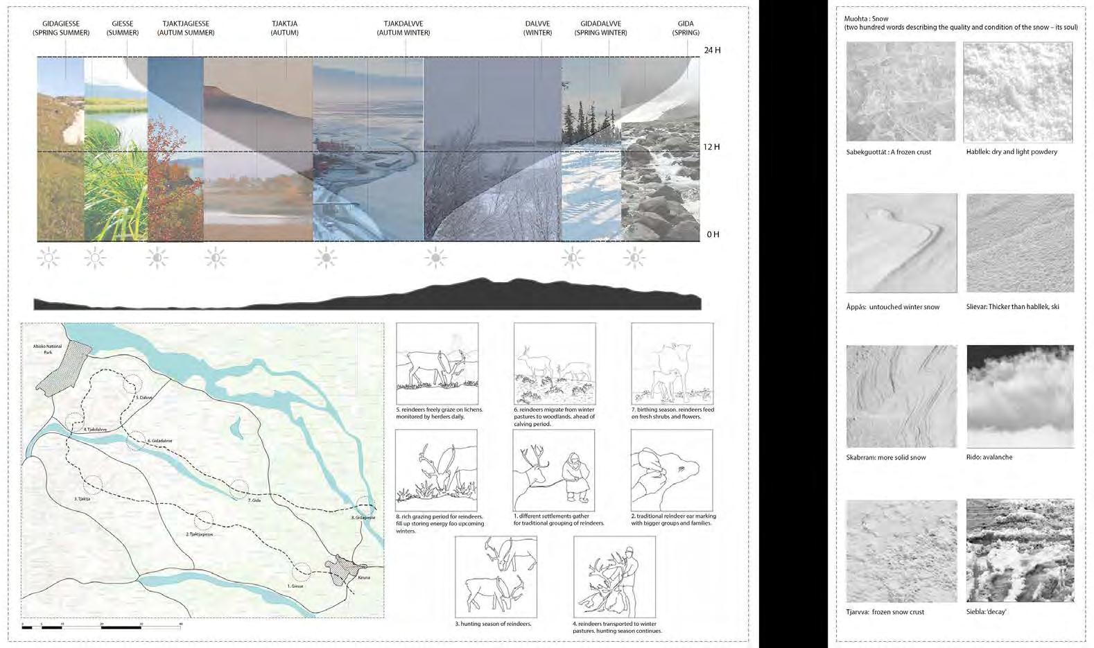
Kiruna is one of the important Spring and Summer reindeer pastures of the Sami land. The mine expansion has led to displacement of the indigenous Sami. Political condition of the town, popularly known as Sweden’s mining town has been believed to form into existence because of the discovery of its rich iron ore deposits. This is true only for the industrial and economic establishment of the town, but the land was inhabited by the Sami villages long before the mineral deposits were discovered.
SAMI PARLIAMENT ENVIRONMENTAL PROTECTION EDUCATION AND
Representation of reindeer migration patterns Reindeer population statistics in the Arctic region
Representation of yearly cycle of reindeers and activities carried out by their herders
History of the moving town
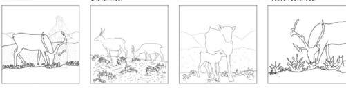
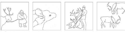
1. diferent settlements gather fo traditional grouping of reindeers.
5. reindeers freely graze on lichens monitored by herders daily.
3. hunting season with reindeers.
7. birthing seasn, reindeers feed on fresh shrubs and flowers.
2. traditional reindeer ear marking with bigger groups and families.
6. reindeers migrate from winter pastures to woodlands ahead of calving period.
4. reindeers transported to winter pastures. hunting season continues.
8. rich grazing period for reindeers. they fill up storinf energy for upcoming winters.
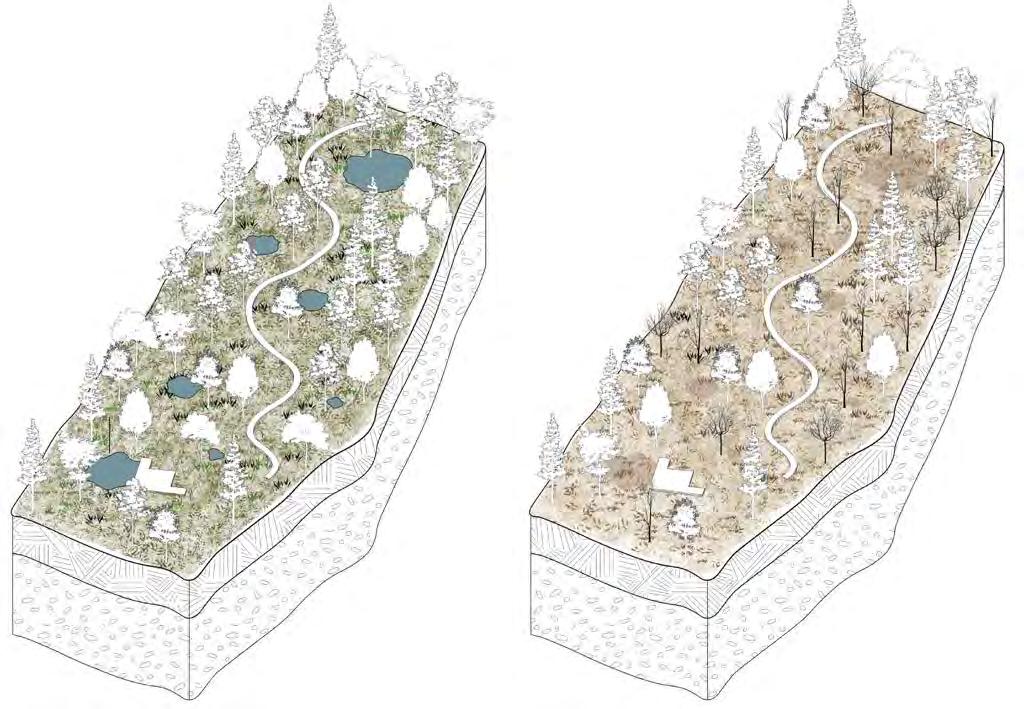
Sectional drawing of Kiruna landscape during Dalvve (Winter)
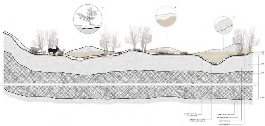
- All mountains get covered in thick layers of snow creating a complete white landscape.
- Shrubs have shed all their leaves and go into hibernation during the season of snow.
- Weight of reindeer walking over the snow compresses the layer making it dense and preventing the ground from absorbing heat.
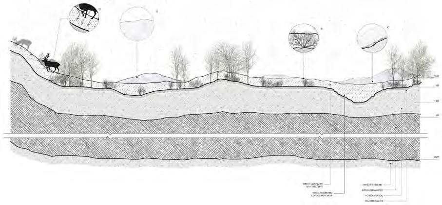
Sectional drawing of Kiruna landscape during Giesse (Summer)
- Some high altitudes of mountains are still covered in snow.
- Important shrubs for reindeer are in their prime health during giesse.
- Open ground and especially mountain areas are covered with healthy growing lichen, their spread is the fastest during this time period.
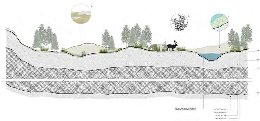
Sectional drawing of Kiruna landscape during Gida (Spring)
- Snow starts to melt forming small streams all over the landscape.
- As snow starts melting lichen on ground is exposed and they come out of hibernation.
- Shrubs come out of hibernation and start to sprout new leaves and flowers, these form the main diet of reindeer during gida.
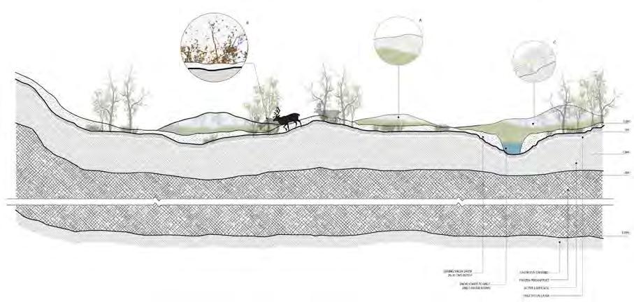
Sectional drawing of Kiruna landscape during Tjaktja (Autumn)
- Vegetation turns murky and snowfall arrives. Hilltops start to look white already.
- Lichen is covered with snow once again and start preparing for hibernation.
- Shrubs start preparing for autumn by shedding their leaves. Reindeer feed on the plants till the leaves are intact.
Proposed experiments to be carried out in these stripes
Experiment 1
Effect of temperature rise on the growth of shrubs
An instrument is kept on a decided portion of land. The change in the growth of plants inside and outside this zone is observed over a period of time.
Experiment 2
Changes in density and variety of shrub growth
A 1m x 1m or 2m x 2m metal wire grid is randomly placed on the ground. This is repeated for a couple of times in the area and then an average is calculated.
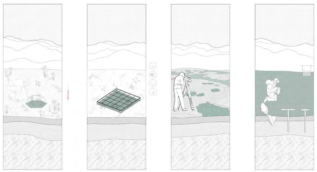
The results then conclude the density and variety of vegetation in the area.
Experiment 3
Changes in number of snow-free days
The warming of Arctic circle has led to an increase in the number of snow free days every year. This increases the amount of time the ground is exposed to sunlight and thus increasing the ground temperature promoting further thawing of the frozen ground.
Experiment 4
Studying the soil structure
The changing contents of soil over different seasons and years can indicate various climatic factors. The most important of these factors is the carbon content of the soil.
Experiment 5
Change in depth of active soil layer
Using a simple auger, a 6-10 cm diameter of column of surface soil- active layer soil - frozen ice is carefully removed. This is then used to the study the depth, structure, carbon and other studies.
Experiment 6
Effect of reindeer grazing on shrub growth
Reindeer grazing has been understood to have a major effect of controlling shrub growth. Changes in the growth, density, variety, soil structure etc. is then studied on these pastures.
Experiment 7
Measuring changes in root depth of shrubs
The thawing of frozen ground has allowed the roots of plants to grow deeper into the soil. This is an indication of the depth of thaw.
Experiment 8
Measuring changes in height of shrubs
Increase in temperature increases the ability of any plant to grow. This growth reduces the surface albedo of the ground and thus contributing in increase of the surface temperature.
The project provides pastures experimental studies of ‘de-shrubification’ of the Arctic tundra by regulating and observing reindeer grazing pastures. It explores how design can frame and enhance the experience of seasonality changes and provide a deliberation space for the observers. Warming temperatures at the Arctic have led to severe changes in snow-fall patterns and quality also affecting the vegetation patterns of the area which the reindeer feed on. The government bodies making decisions about these local communities are influenced by the mining companies. The project provides pastures experimental studies of ‘shrubification’ of the Arctic tundra by regulating and observing reindeer grazing pastures. It explores how design can frame and enhance the experience of seasonality changes and provide a deliberation space for the observers.
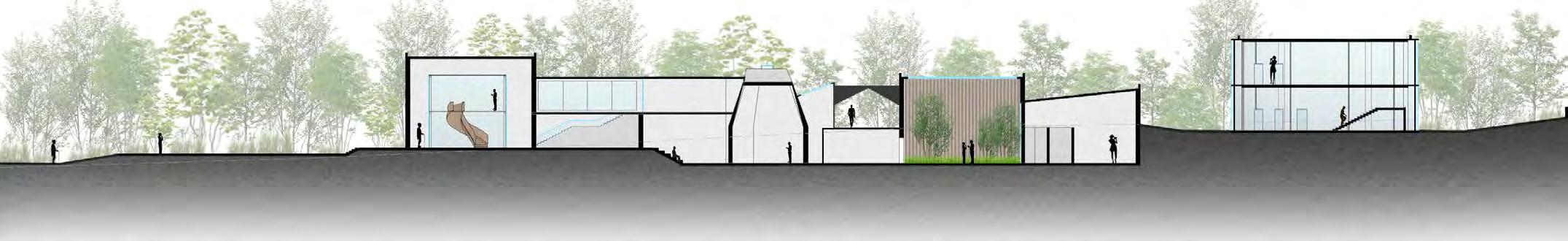
Honouring the past, creating the future
Brick School of Architecture, Pune University
Undergraduate Year 5, Thesis Design Studio
Thesis supervisor- Ar. Shraddha Manjrekar
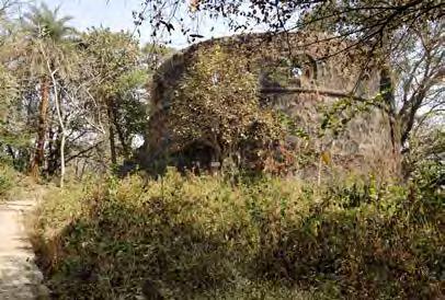
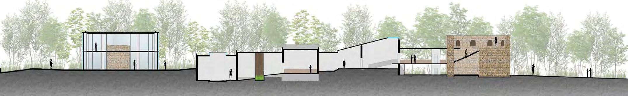
Adaptive reuse of Belapur fort as an Interpretation centre
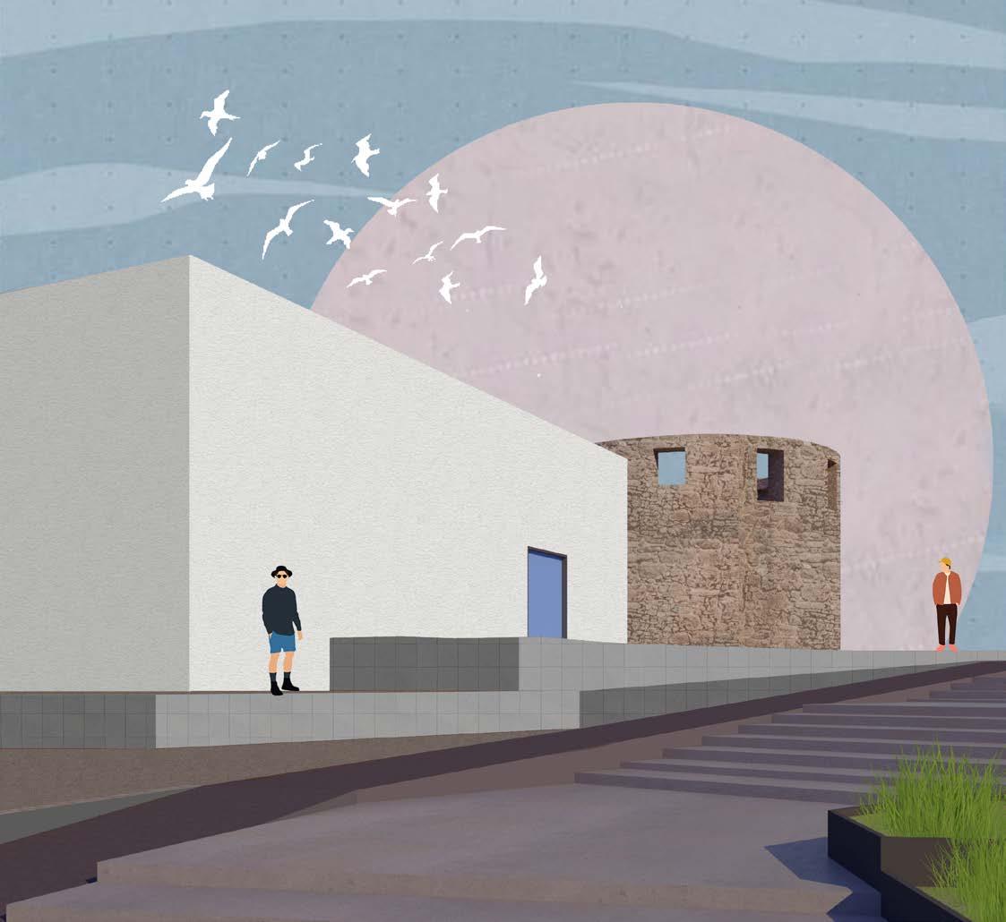
Navi Mumbai, India
The world has an extraordinary vast and rich history which has left back a huge amount of built heritage; that has contributed in evolving the culture and beliefs if the place they belong to. It is this connection which gives people a sense of community, they are central to how we see ourselves as an individual, as a community, as a nation. this sense of connection makes it necessary for us to preserve and protect our heritage for our future generations.
Adaptive reuse, the process of re purposing buildings- old buildings that have outlived their original purposes- for different uses or functions while at the same time retaining their historic features, is seen as one of the most popular and effective ways of conserving the heritage while still being in use functionally. environmental benefits combined with energy savings and the social advantage of re purposing a place with valued heritage make adaptive reuse an essential component of sustainable development.
04
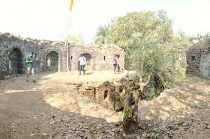
A conceptual illustration of the adaptive reuse design proposal of the Belapur fort
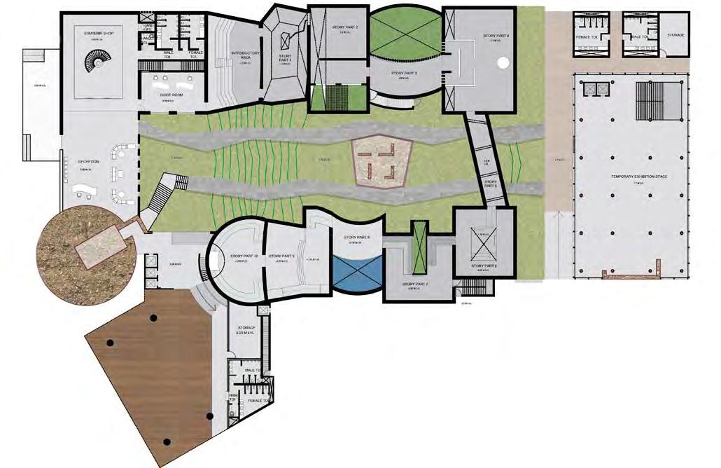
 Ground floor plan
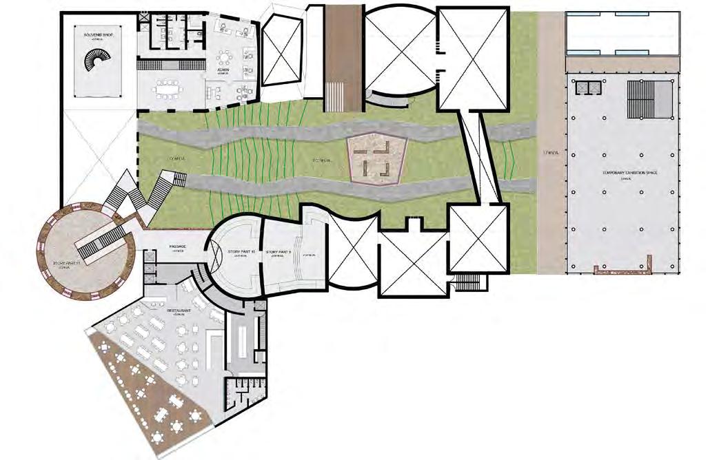
First floor plan
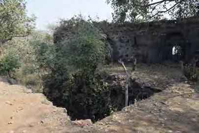
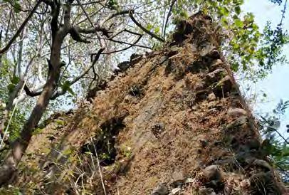
Ruined entrance to the top of the tower
Top of the tower with window views towards the sea Watchtower at the main road entry
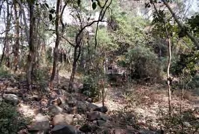
Landscape around the area tower- the only surviving complete structure
Ground floor plan
First floor plan
Ruined entrance to the top of the tower
Top of the tower with window views towards the sea Watchtower at the main road entry
Landscape around the area tower- the only surviving complete structure
concepts for story building and space development
section aa section bb +1.7 M +6.2 M +3.6 M +3.0 M +0.0 M -1.5 M +2.0 M +1.7 M -1.5 M -1.5 M 0.0M GROUND LEVEL +6.1 M LEVEL +7.8 M LEVEL +0.0 M +0.0 M -1.5 M +3.6 M LEVEL -1.5 M +7.0 M LEVEL +9.0 M LEVEL +10.7 M LEVEL section aa
section bb +1.7 M +6.2 M +3.6 M +3.0 M +0.0 M -1.5 M +2.0 M +1.7 M -1.5 M -1.5 M 0.0M GROUND LEVEL +6.1 M LEVEL +7.8 M LEVEL +0.0 M +0.0 M -1.5 M +3.6 M LEVEL -1.5 M +7.0 M LEVEL +9.0 M LEVEL +1.7 M +6.2 M +1.7 M -1.5 M -0.85 M -0.07 M +0.85 M +1.14 M +2.0 M +2.3 M +0.2 M +7.0 M 0.0M GROUND LEVEL +10.7 M LEVEL +6.2 M LEVEL +1.7 M LEVEL Section through the south wing Section through the north wing entrance area introductory area before birth area the beginning a series of events the bridge exhibition space exhibition space the night space the mysterious space exhibit on levels the battle amphitheater the coronation the end reflection old tower
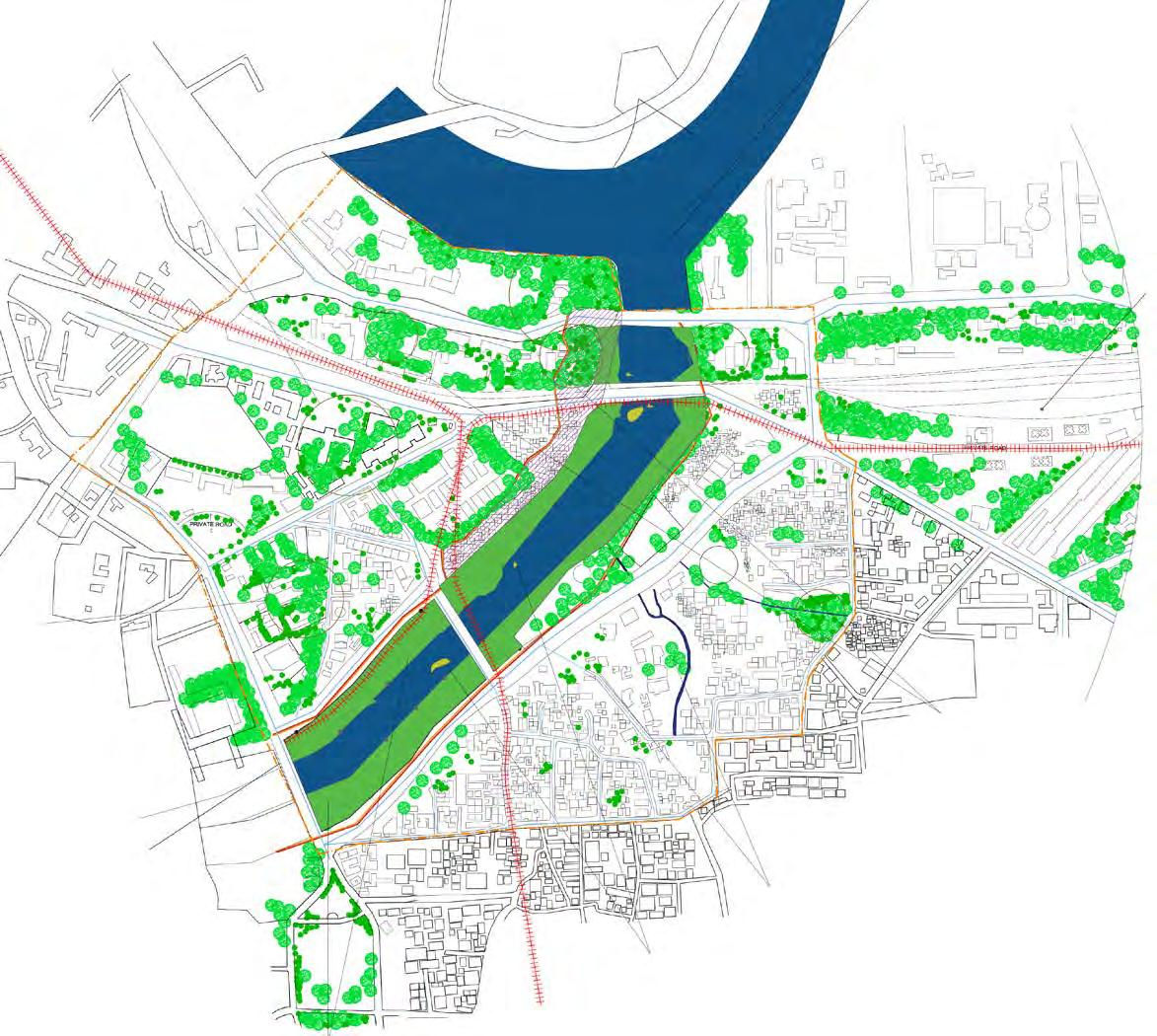
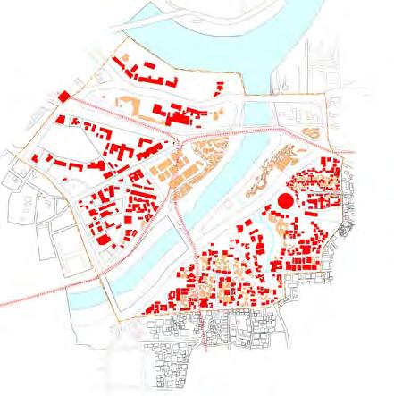
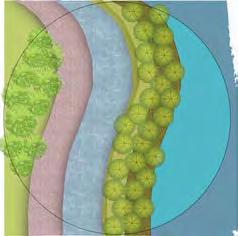
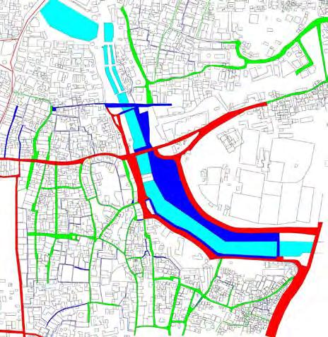
Connecting the city back to it’s river
Brick School of Architecture, Pune university
Undergraduate Year 4, Urban Design Studio
Tutors
Pune, Metro and the City
Transit-oriented development
The aim of the fourth year urban design studio was to understand and analyze the impact of the proposed metro network and come up with cohesive design strategies that will not only address the issues plaguing the city of Pune but also improve the quality of life that it has to offer so that it can complete globally.
Objectives: Understanding Pune city in terms of his historic background, economic growth pattern, geography and political influences governing the city. To execute a pilot study of the entire Metro proposal to include all the 3 lines in terms of connectivity, marking the important nodes along the routes and junctions. A detail survey of 500 M radius of the precinct of the Metro stations at 4 sites was conducted. Based on the TOD principles recommending management and designing policies considering the impact on the surrounding urban fabric and integrate land use patterns to improve the economic and social environment of the city.
05
- Ar. Manali Deshmukh, Ar. Rohit Potdar
Environment mapping of site area
Environment mapping:
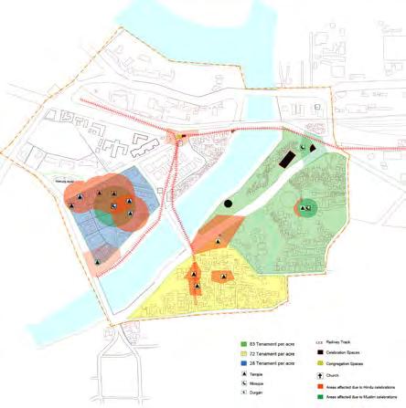

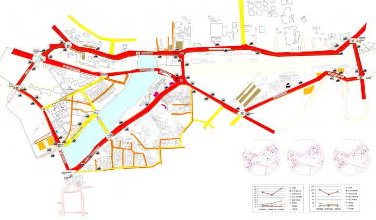

Weeds and aquatic plants are present on the banks of the river. Aquatic habitats like partly submerged, marshy places, plants along the drains and effluents, plants from dry places, plants growing in rock, and bank vegetation were surveyed. the count of plants at present is 156 species which is a significant reduction number compared to 400 species.
Pollution:

The air pollution in this area is mostly due to vehicles. it was observed that water pollution happens due to different pollutants like solid waste, chemical waste, organic & inorganic waste. As per the City Sanitation Report, water pollution is the main source of rise in diseases in this area.
Strengths: Important civic buildings which create more job opportunities. A rich culture and relationship is built between heritage structures.
Weaknesses: The drainage pattern, services are difficult to identify and change. No proper space for celebrations so the crowd spreads on roads. opportunities: Small plots can be combined so as to make use of a greater FSI, it also decreases the carbon footprint. Junabazar is a strong commercial hub. Development of subways, pedestrian walkways, cycle tracks.
Threats: Illegal construction. If supporting transport systems like bus, cycles are not well developed, people might turn to private transport options like taxis and cars which will increase the traffic count.
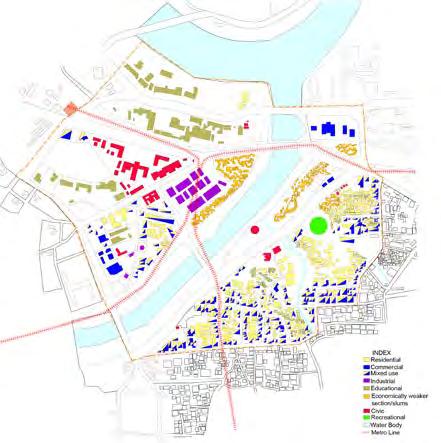
Building use mapping Building height mapping Cognitive mapping Traffic mapping Activity generators mapping Ownership mapping
Vision: Connecting the city back to its river
The metro station being in the center of the residential area, civic area and the river, is a very important and potential opportunity to connect these otherwise separated zones.
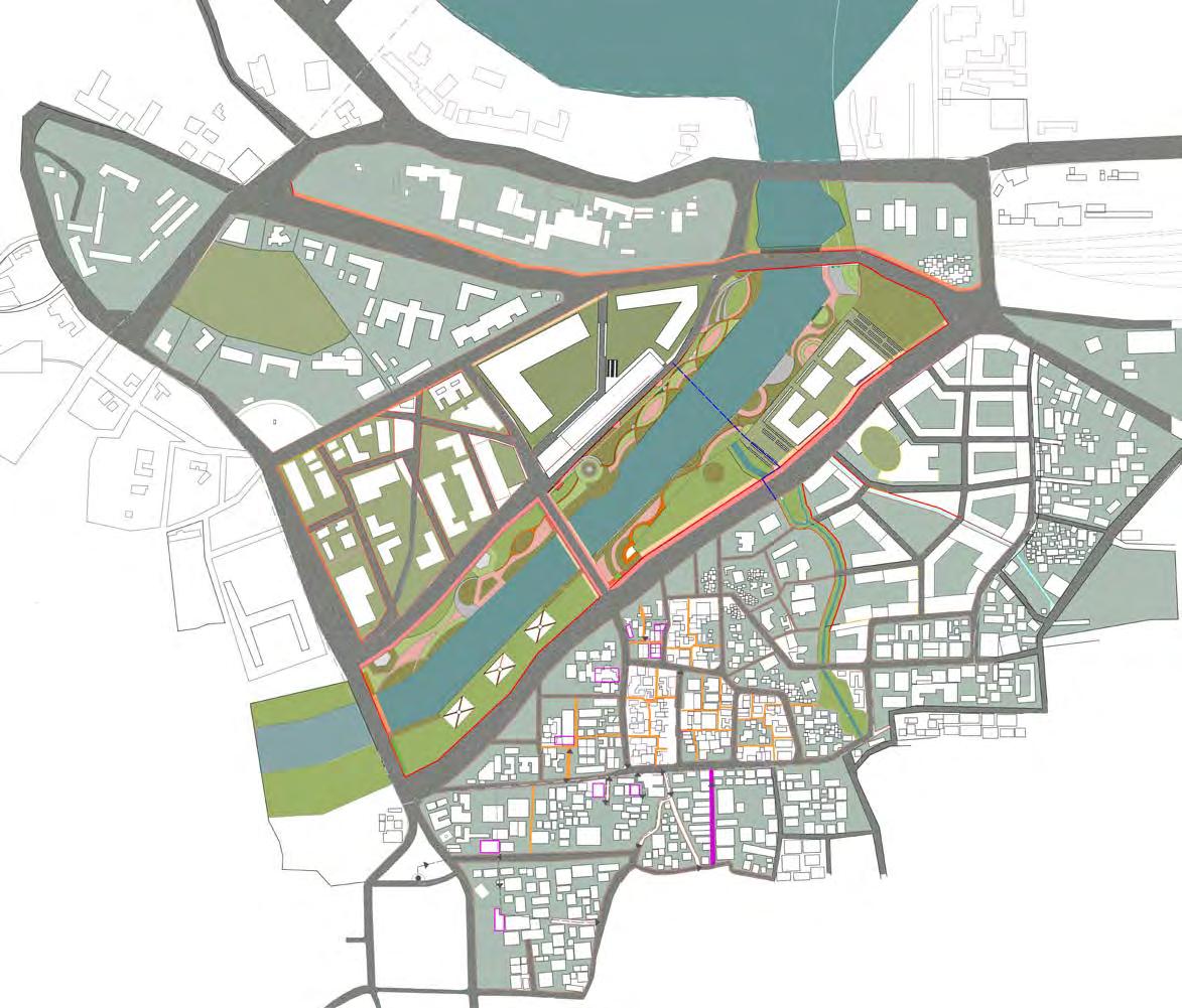
The sites will blend all these spaces marrying environmental and ecological sustainability, lifestyle and economic development.
TOD principles applied:
1.connecting neighborhoodsusable areas such as parks, streets.
2.high density - number of people closer to the hub.
3.walkable and cycling areas
4.mixed use- encourages short trips
5.creating vibrant spaces.
 Street montages along the streets of old residential zones
Evolution
Street montages along the streets of shopping areas
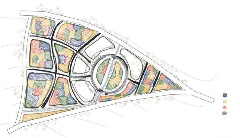
mapping Proposed Masterplan for the area
Heritage building and sites: promote the recognition, description, and where appropriate the retention, refurbishment, adaptive re-use, and conservation of the historically important buildings.
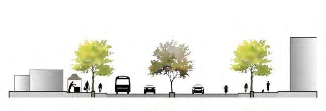
Pedestrian movement: retain and enhance a safe, convenient, interesting and stimulating pedestrian environment through careful traffic, adding tertiary roads and on site parking management techniques.
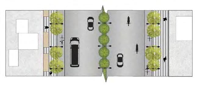
Proposals:
1. Metro station with a commercial and recreational hub.
2. Riverfront development.
3. Open market for Junabazar.
4. High density housing development in places of slums.
6. Development of road sections. Proposal of pedestrian pathways and internal roads and reducing traffic congestion.
7. Cultural center.
8. Home Stay for Tourists.
9. Educational Institute for Traditional construction.
9. Adobe workshop.
Controlled development zone: being in the center of a city, a revenue generating zone comprising of cafes,restaurants, gardens, parks could be given. These could form a maximum width of 10m. A space for functions which can celebrate the river and its ecosystem such as an ecological museum, botanical garden, fisheries, organic farmland, museum.
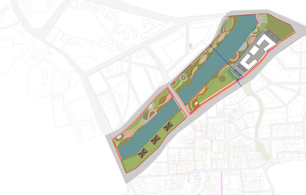
Low footfall zone: it is suggested that a minimum of 5 meter wide linear stretch will help create a transition space between the controlled development and no development zones. Green zone: we urge, minimum 30m to 50m of space along the floodplains of the river to be under a complete green cover and inaccessible to human to ensure the best health of the river in the prevailing situation.
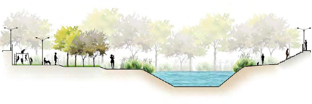 Proposed river-front development
Proposed controlled development along the river-front Proposed road development
Proposed river-front development
Proposed controlled development along the river-front Proposed road development
dense plantation shrub plantation pedestrian pathway pedestrian pathway submerged plants in river submerged plants in river communal interactive space dense low-height plantation cycle track cycle track market area foothpath foothpath buildings driveway driveway hawkers divider cycle track cycle track kids play area dense plantation dense low height plantation dense low height plantation public interaction and celebratory space walkway walkway
Sketches analysing the density of houses in the high-density residential zone
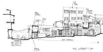
Documentation study of the old city of Nashik, India
Brick School of Architecture, Pune University
Undergraduate Year 3, Settlement Study
Tutors - Ar. Minu Vaidya, Ar. Snehal Gada
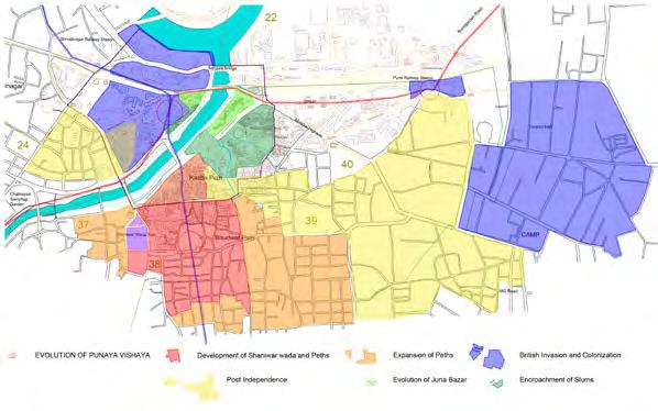
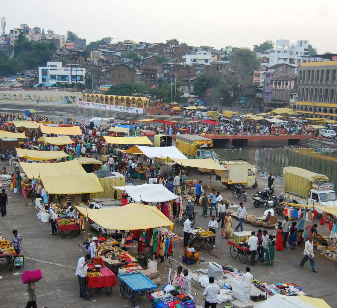
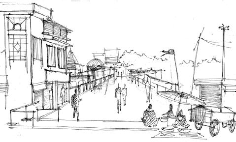
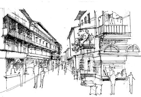
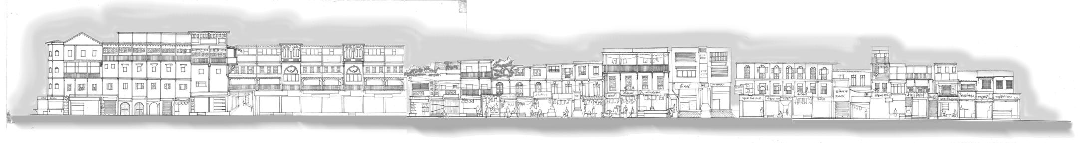
Nashik is a major city in the Indian state of Maharashtra. With a population of 1.5 million, it is Maharashtra’s third biggest city. Nashik is named after the nine hills that surround it (nau shikhara). Geographic proximity to Mumbai (India’s economic hub) has affected its growth in the post-independence years. The last two decades have entirely changed this historic pilgrimage hub into a lively modern metropolis, and Nashik is on track to become a worldwide metropolis. The city is located on the banks of the Godavari River and is considered one of the holiest destinations for Hindus. This project was conducted as a class, and we identified four major spots near the river’s sacred sites for this documentation. These include documenting significant streets and buildings, as well as the roles they play in the daily lives of its residents and visitors. To understand the evolution of these areas over time, an analytical study was conducted using old documents. In this group activity, my job was photographic documenting, drawing accurate sections and montages that indicate characteristics, and ultimately reviewing the full compilation and presentation of the research.
06
Pilgrims bathing at the sacred ghats of the river.
(photo collection by Omkar W. Nashik photo essay)
Court of Community: It is built at 10.4 meter in the year 1930. It houses the rooms for the owners of the guest house.
Court of Community: This level is built at 7.4 meter in 1929. It has the main public courtyard with the statue of Saint Gadge maharaj.
Court of Donation: It is built at 6 meter in year 1927. It has boulevard and guests rooms.
Court of water: It is the first level of dharamshala built in the year 1926. It houses a well in the central courtyard, hence called the court of water. It houses the kitchen and community hall.
The dharamshala was built in the outskirts of town since for the less fortunate pilgrims. Food is served her for the underprivileged daily. A tradition being followed for more than fifty years, and as a result almost 200 people visit this place daily, and the settlement around the structure started to be inhabited.
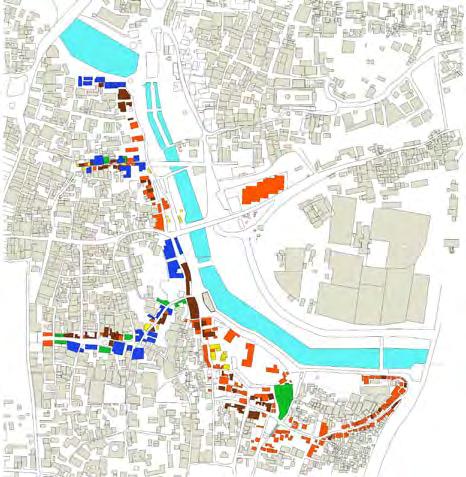
Landuse mapping
Morphology mapping
Building height mapping
activity sketches along the river sectional drawing along the various levels of dharamshala campus
activity sketches along the streets
Infrastructure mapping
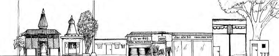
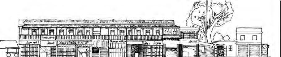
Vendors sitting outside the shops add another layer of mixed-use
Windows in the attic of the older structures (timber) at a lower height used as storage spaces (traps heat)
Shops encroach up to the road after opening, pulling out displays of their merchandise.
Inner courts are often formed as you enter the gallies(lanes).
Sketch analysis of various moments across the study area highlight a certain use or important character.
Food stalls open up in the evening, changing not only the look of the street but also the fragrances.
The settlement grew around the temples with different typologies being developed due to the needs of the people. The ghats of the river became public recreational areas and a place of trading for vegetables and basic needs. The ghats have changed their form according to the convenience of the people, wider ghats to accommodate more people during festivals,
merchants to sell goods. Bridges were built on the river as a connection from one ghat to the other increasing deve lopment of the settlement. The Ghats and the Ramkund are developed to meet the requirements of people who come to worship – like hospitals, luggage storage, buildings,
E A B C D
Streetscapes along various sections of the river showing the changing character of this old-city.
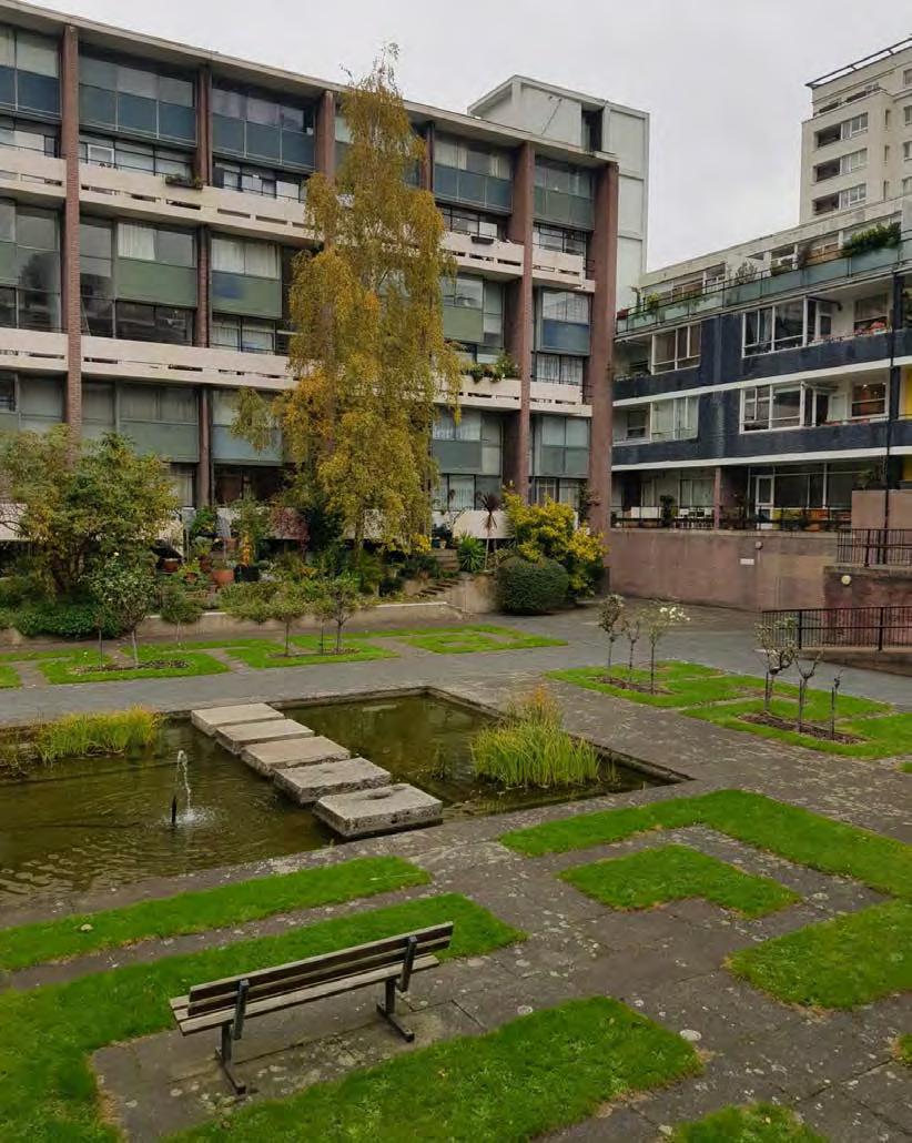
Protecting biodiversity in London’s post-war housing landscape
MLA, Bartlett School of Architecture
Year 2 History & Theory seminar essay
Post-war housing landscapes
Seminar Leader - Ar. Karen Fitzsimon
to cater to, but today, after so many years of planning and nurturing these buildings and gardens are thriving with plant and animal life. They have created their own tiny ecosystem and all these eco-systems in London together form a very important network of Urban biodiversity. Biodiversity is not only that’s seen like the trees, plants, and mammals. It’s also the insects that survive on these plants and trees, the bees that help pollination, the moss and lichen that grow on these trees and much more. Climate change threats will be addressed more efficiently by a diverse variety of species rather than a few numbers of them in big populations. The stresses of everyday life can place a strain on our capacity to cope with stress,
As a result of World War II, Britain’s infrastructure was severely damaged. With significant parts of the country’s housing stock destroyed and large sections of South London destroyed, the country and its capital required a bold new mentality to rebuild the country and its city; one that would not only heal the war’s wounds but also redefine Britain. The relatively nascent fields of town planning and landscape architecture were given an exciting opportunity to shape these new living areas. Geoffrey Jellicoe, Sylvia Crowe, Brenda Colvin, and Peter Shepheard, among others, redefined new landscapes. Historic England took a major step in 2020 and included 24 of these post-war landscapes were added in heritage protection list. When these landscapes were built on bombed sites of war, they would have had no existing life
link to the full essay -
focus our attention, and solve issues, putting us at risk of being stressed and mentally unwell. Bio-diverse habitats, on the other hand, have been found to assist us recharge. So, after this historic protection can we take a step ahead in the direction of conservation and try to also protect the biodiversity in these sites?
This essay considers whether historic protection for postway dwelling landscapes should be extended and if they should be included in a Biodiversity Conservation Plan. Brunel Estate, Alexandra Road Park, Churchill Gardens, Golden Lane Estate, and Barbican Estate were utilised as case studies to investigate this. In the City of London’s Bio-diversity Action Plan, the Barbican estate’s Wildlife Garden is designated therefore as Site of Importance for Nature Conservation.
07
Sunken garden at the Golden Estate of London, designed by Chamberlin Powell and Bon
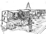
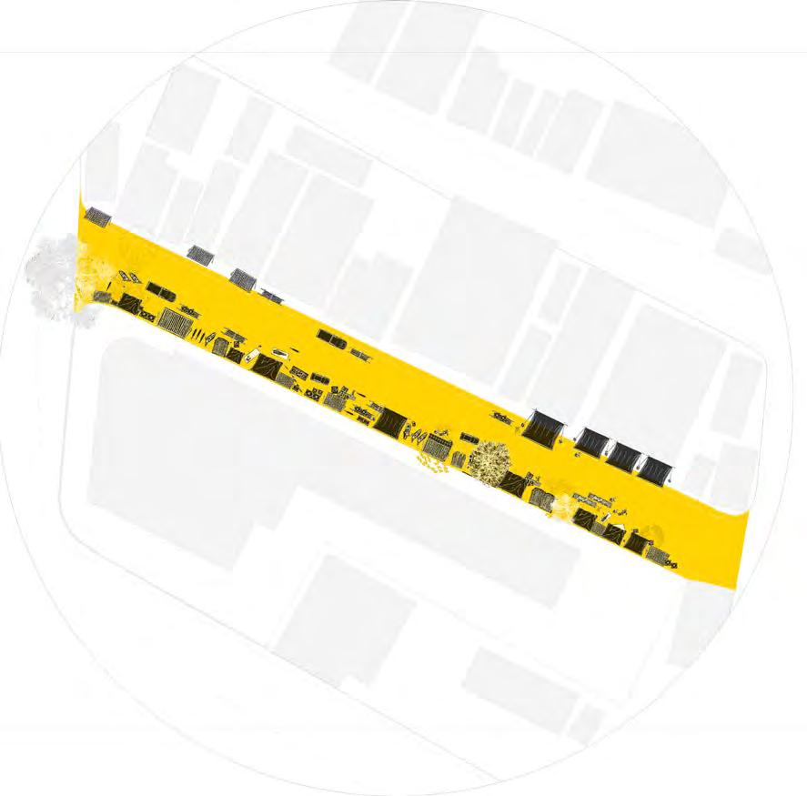
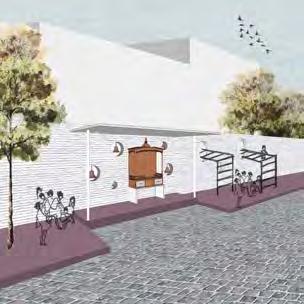
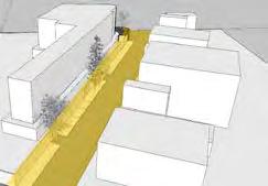
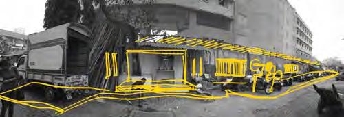
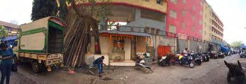
context - In the historically significant area of Kamathipura, this 110m long-dead boundary wall of BMC school stands dividing the two territories. wall is currently encroached upon by squatters living in make-shift tents, temporary shops, a small shrine while the remaining area remains unused covered with garbage.
the road, facing the wall, are multiple low-rise residential buildings and slightly better organized compared to the school wall which remains chaotic untidy.
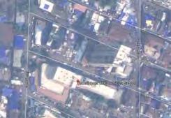
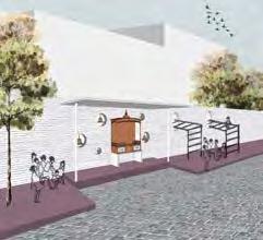
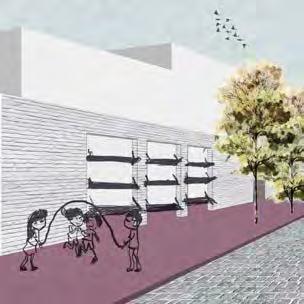
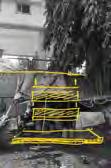
Proposal – The proposal aims to address this issue by introducing semipermeable and multi-functional punctures in the wall that attempt to increase transparency and interaction between the two sides.
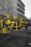
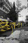
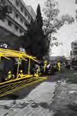

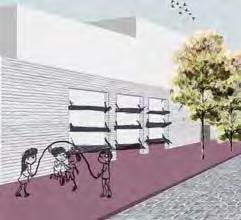
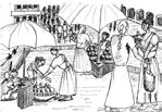
Breaking the barriers of Institutions
In the historically significant area of Kamathipura, this 110m long-dead boundary wall of BMC school stands dividing the two territories. This wall is currently encroached upon by squatters living in make-shift tents, some temporary shops, a small shrine while the remaining area remains unused and covered with garbage. Across the road, facing the wall, are multiple low-rise residential buildings and is slightly better organized compared to the school wall which remains chaotic and untidy.
ar
08
Osmosis
MIT India Initiative, Mumbai Massachusetts Institute of Technology
1 2 3 4
MIT Media Lab INSTITUTIONS
1
Analysing the street character in plan understanding density
Design inserts along the dead wall
Analysing the exisiting character of the identified site
Punctures and play equipments
Professional Experience


TOAD- The Office of Architecture and Design, Mumbai, Ar. Kunal Dhavale and Ar. Ritika Dhavale Architect, December 2018- May 2020


After B.Arch graduation I worked in Mumbai with the firm- TOAD and worked on and handled various responsibilities for designing and execution. The first project I worked on was a restaurant in Pune. I overlooked the entire design and execution of this project on site to a successful completion in 3 months. After this, as a part of the team I was involved in various projects at different stages. Few of these are-
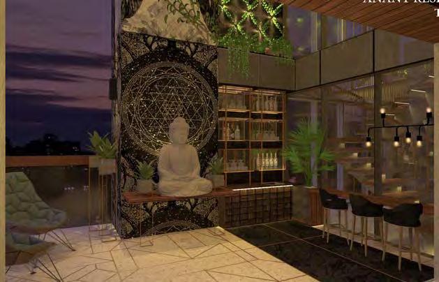
1. Anant Residence- a luxury apartment design. Overlooking site execution, interior design and construction, 3d visualisations, client meetings, vendor meetings.
2. La Mer Casa - high-density apartment building. Lobby design and site development landscape design, drawings, 3d visualisation, working drawings and vendor meetings, site execution.
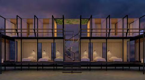
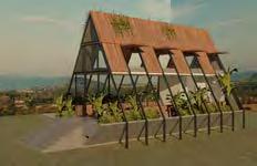
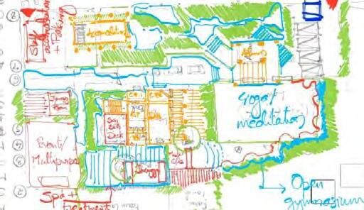
The project shown on the left is a private residential apartment building in one of the prime areas of the city. My role in this was to design, detail and overlook the complete execution of interiors and landscape.
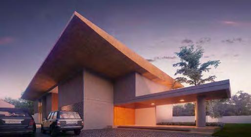
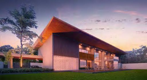
The project shown on the right is a upcoming naturopathy centre in the outskirts of Mumbai. The design proposed is for a small part of the plot and will act like a module of design for its future extension. Working in its design stage, the vision for this centre is to be completely immersed in the landscape around with minimal structures at required places. In addition to keeping the built up to a minimum it is also envisioned to be cost effective, sustainable and having a non conventional architectural character.
ar
UP DN 567 14151617 BEAM BOTTOM LOBBY LIFT PASSENGER +50 MM LVL +20 MM LVL +20 MM LVL +20 MM FF LVL LVL 567 10 14151617 DN UP 567 17181920 BEAM BOTTOM ENTRY Building elevations Building floor plans
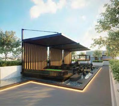
Protoype 2
Bar design in the double height balcony
Protoype 1
09
Conceptual drawings
a
The project 1 is a spacious residential bungalow design for a garment business owner and is family. I assisted in the design work and finalisation of the same. This included concept development, detail design development and collaborating with 3d visualisation team and client meetings to arrive at the final design. Project 2 is a luxury-segment residential building which was in its final stage of design approval. I worked on its working drawings and detail development working with the construction team.
I was privileged to be exposed to various types of projects in my term here:
- Residential bungalow
- Luxury apartments
- Low income housing
- Commercial complexes
- IVF clinic
- Cultural theme park
Professional Experience
HM Architects, Ahmedabad, India
Ar. Harshad Mistry and Ar. Mansi Shah Intern, June 2017- October 20217
For my academic internship I worked with HM Architects in Ahmedabad. I had an opportunity to work on various architectural projects and typologies - residential bungalow, luxury apartments, low income housing, commercial complexes, IVF clinic and I also had an opportunity to be a part of the initial design process of the cultural theme park for the state government.
The project shown here is a private residential bungalow that I was in charge for conceptualizing, design detailing and preparing design drawings and working drawings.
My role:
- Design drawings and working drawings (autocad)
- Manage co-ordination between the architectural, construction and 3d visualisation teams
ar 09
b
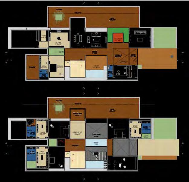
Project 1- Bungalow design plans
Project 1- Bungalow design view
Project 2- Building terrace design Project 2- Center-line plan Project 2- Working drawing section WIND FIELDS APARTMENTSZION 5994 6509 17146 23473 31841 6765 10125 85000 88360 6608 9981 3360 6518 6009 9386 11765 6353 715 6916 8366 15869 10727 6325 7665 8366 16636 25061 27144 1935 12160 2025 4630 1235 51705 1235 4630 1935 12160 7665 6325 715 17265 8366 8366 14691 18500 17265 8224 7509 17957 28324 25957 16499 11731 24667 25690 10635 3360 515 74875 85211 26415 7461 10745 6657 6000 6715 14380 16315 20945 72650 77280 79215 86880 87604 95104 8366 24483 11794 7500 7500 91° 89° FOYER BASEMENT ELECTRIC SERVICE ROOM 3000 44730 3000 3460 6460 38500 7126 67070 95104 7504 8081 3000 28194 20530 84600 88479 88356 95869 LVL. +44400 LVL. +44850 LVL. +40750 LVL. +41200 LVL. +37550 LVL. +45000 LVL. +41350 LVL. +37700 11th FLOOR 10th FLOOR TERRACE SECTION EE BUILDING LINE OUT PLAN HOLLOW PLINTH 1st FLOOR LVL. +4850 LVL. +4700 LVL. +4250 2nd FLOOR 3rd FLOOR LVL. +8500 LVL. +12150 LVL. +8350 LVL. +7900 LVL. +12000 LVL. +11550 4th FLOOR 5th FLOOR 6th FLOOR LVL. +15800 LVL. +19450 LVL. +23100 LVL. +15650 LVL. +15200 LVL. +19300 LVL. +18850 LVL. +22950 LVL. +22500 7th FLOOR TERRACE 8th FLOOR 9th FLOOR 10th FLOOR 11th FLOOR LVL. +26750 LVL. +30400 LVL. +34050 LVL. +37700 LVL. +41350 LVL. +45000 LVL. +26600 LVL. +26150 LVL. +30250 LVL. +29800 LVL. +33900 LVL. +33450 LVL. +37550 LVL. +37100 LVL. +41200 LVL. +40750 LVL. +44850 LVL. +44400 LVL. 0.00 LVL. -150.00 HOLLOW PLINTH LVL. -450.00 LVL. -1050 LANDSCAPE AREA EXTERNAL ROAD INTERNAL ROAD LVL. -5500.00 BASEMENT SECTION DD
SETTING OUT PLAN
Project 1- Bungalow design view
BASEMENT

ar THANK YOU. +44-7796781405 poojaswagh05@gmail.com king’scross-london
