PROJECT STATEMENT
“If a tree falls in the forest and nobody hears it, does it make a sound?So now if a tree falls in the forest, everyone hears it.”- Jennifer gabrys
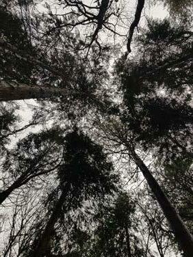
Climate change is the most important subject of our time. The continuous rise in global temperatures, as well as shifts in climate regimes, creates a great deal of concern and a need for action. Forest microclimates are very different from the climate outside the woods. Microclimates must be included in ecological study in order to fully comprehend and better forecast how forests’ biodiversity and functions link to climate and climate change.
Water ecology and forest ecology are interlinked. Forests serve a vital part in controlling the world water system as a natural solution. Forests, for example, absorb rain, which aids in the replenishment of subterranean aquifers while also cooling and purifying the water. Forests are responsible for 75% of the freshwater humans use.
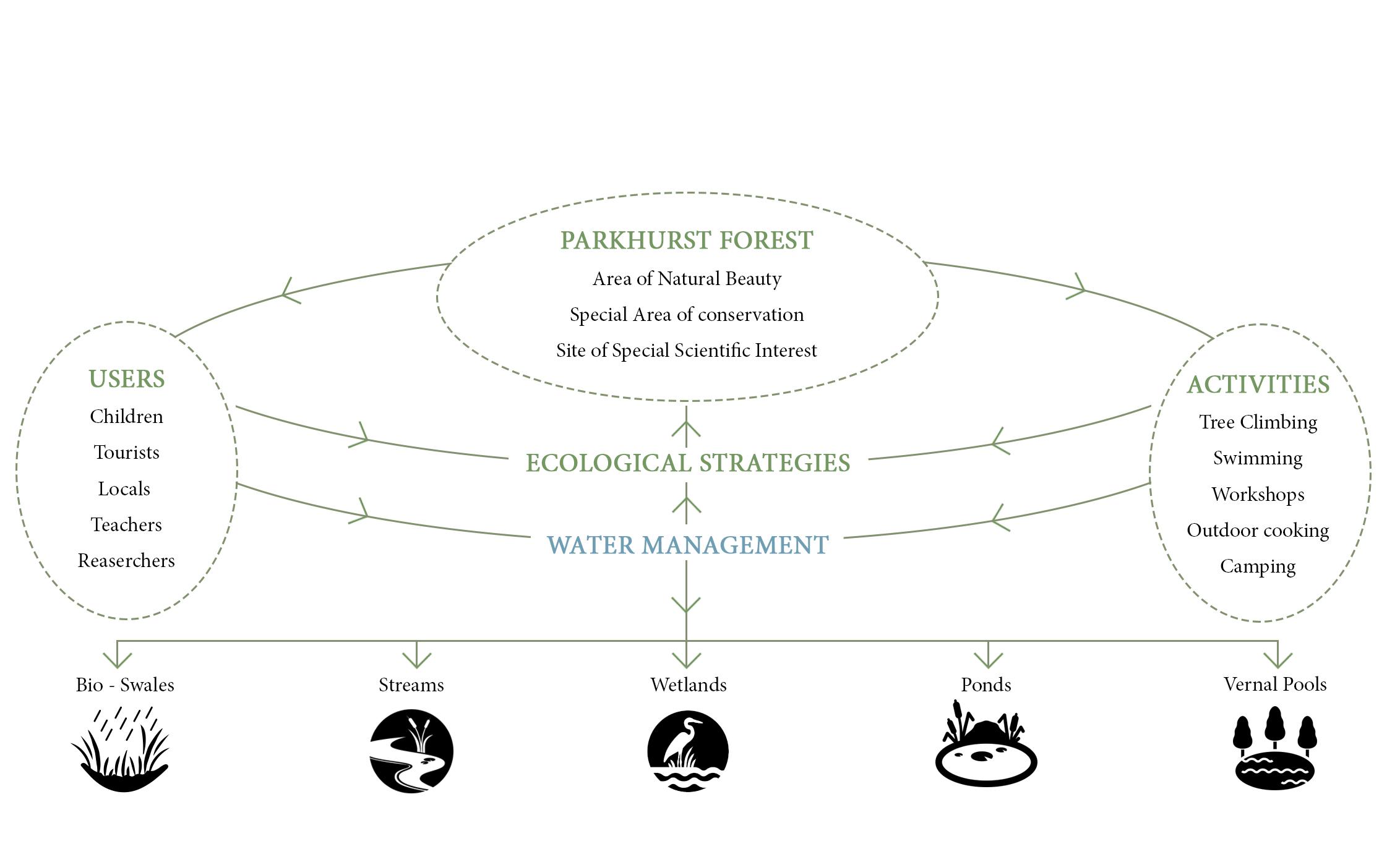
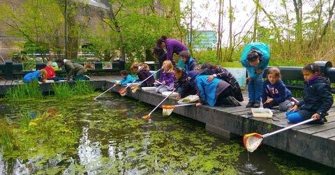
This project proposes a water system regeneration as a method to manage the Parkhurst forest of Isle of Wight which has been suffering due to negligence in managing for over the last few decades. The project also proposed inhabitation of the forest as a forest school which will local generate interest in the forest and drive the management plans to be in action as planned. This gives another important function to the forest - EDUCATION.
A Forest School provides a one-of-a-kind educational experience. The success of this sort of learning depends on the presence of a woodland or forest setting. Forest Schools emphasise sensory stimulation, with students challenged to learn using visual stimulation, sounds, scents, and tastes. The project also makes it easy for the kids to learn about climate change, forest ecology, and various water based habitats.
Table of Contents
SECTION 1 - PROJECT BACKGROUND AND DESIGN PROPOSAL
- Landscape of Isle of Wight and Parkhurst Forest
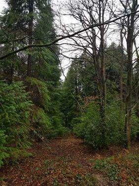
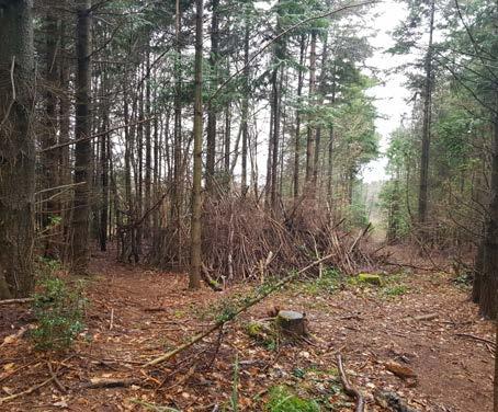
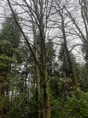
- Site Visit
- Context Map and inhabitants of the forest
- Existing Water ecology
- Proposed Design Concept
SECTION 2 - TOPIC RESEARCH
- Water systems in a Forest
- Water flow analysis
- Study of Steams and Swales
- Study of Vernal Pools
- Study of Wetlands in a forest
- Study of Pervious paving
SECTION 2 - DESIGN DETAILS AND LANDSCAPE REALISATION
- Masterplan of Forest School - Zoning and Water System
- Streams
- Swales
- Reed beds
- Vernal Pools
- Bio Pond and Bio Pool
- Wetland as Flood management strategy
- Coppicing at Woodland management Strategy
- Inference
BIBLIOGRAPHY
APPENDIX
SECTION 1: PROJECT BACKGROUND AND DESIGN PROPOSAL
Forests are a very important type of ecology to exist on our plant. Adapted to various climates to form their own environment, our forests are now under major climate threat. Human activities directly or indirectly on any forest land are affecting the overall health of them.
Larger problems such as wildfires, thinning, deforestation are most prevalent reason for forest ecosystems to decline, but in addition to these, other reasons that might seem smaller but have a drastic change on the ecology of a forest. These changes affect the ecology to an extent where the forest fails to survive and with the countless habitats gradually cease to exist.
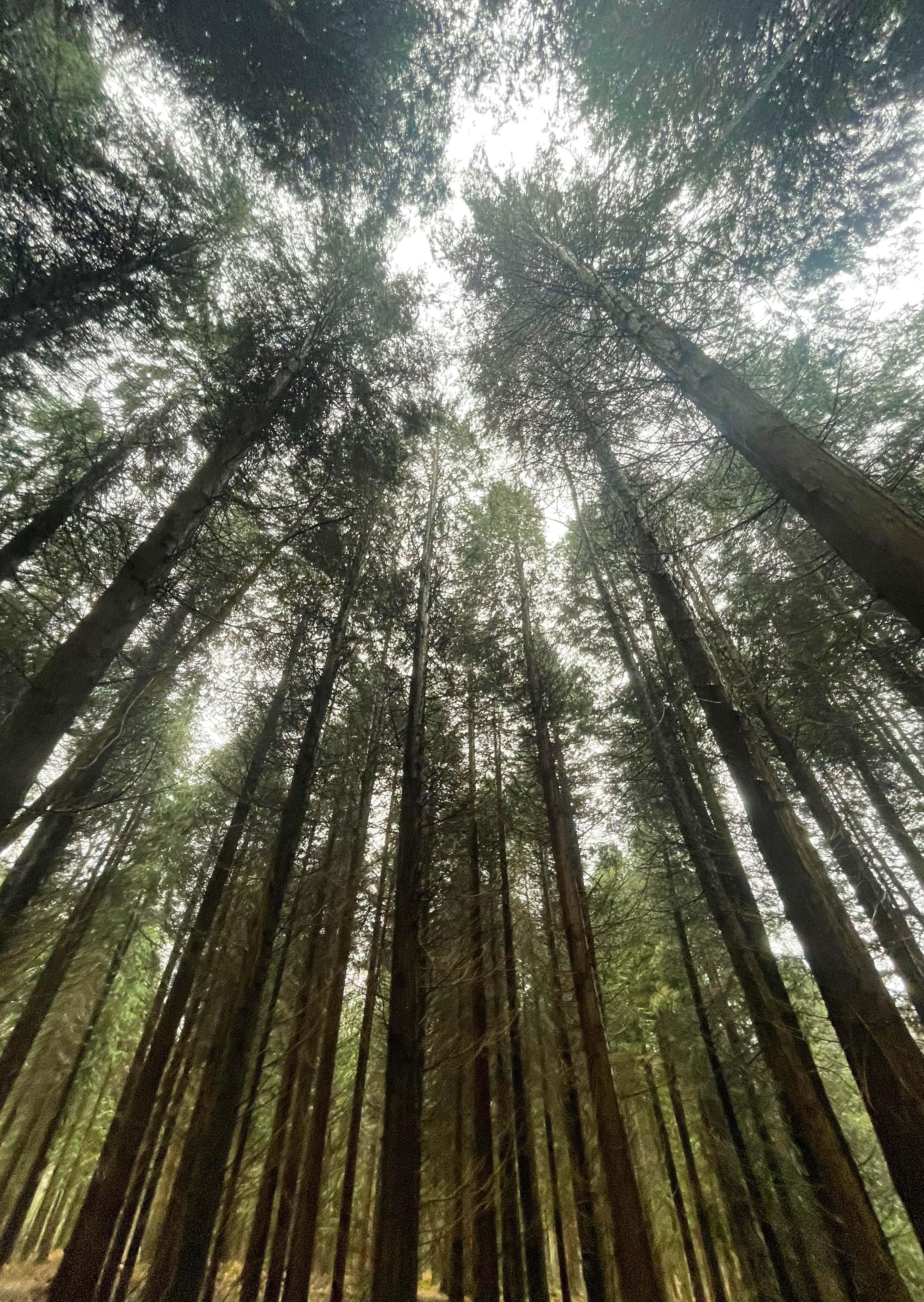
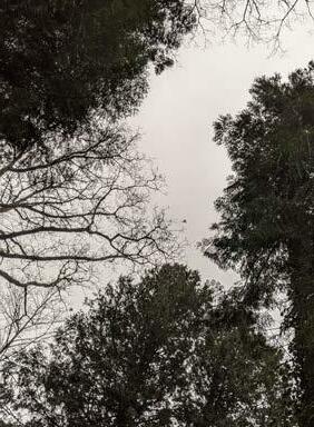
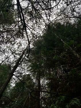
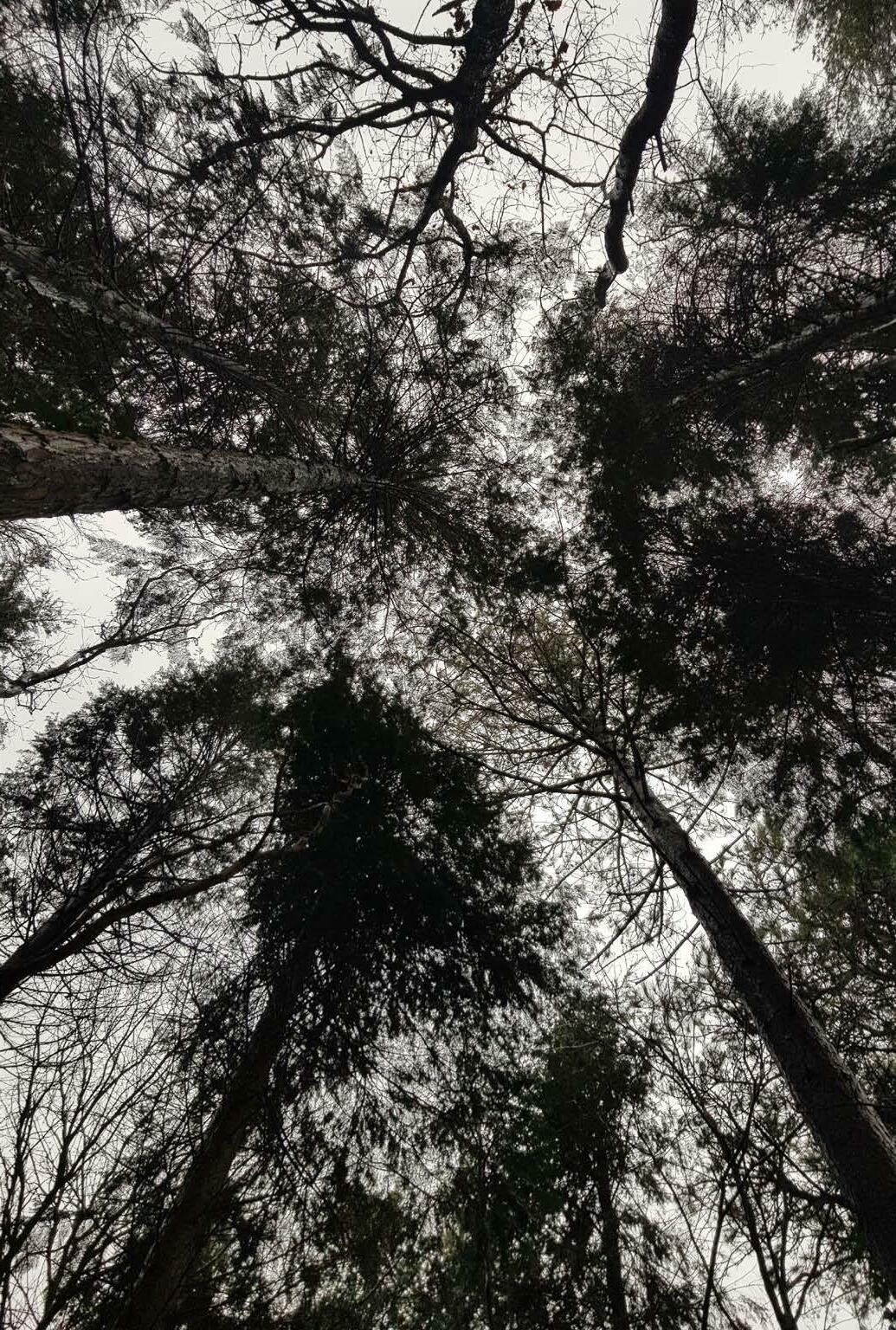
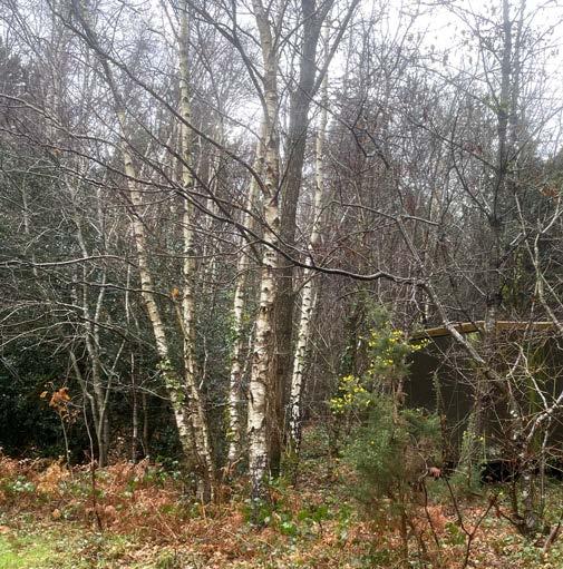
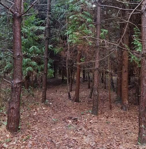
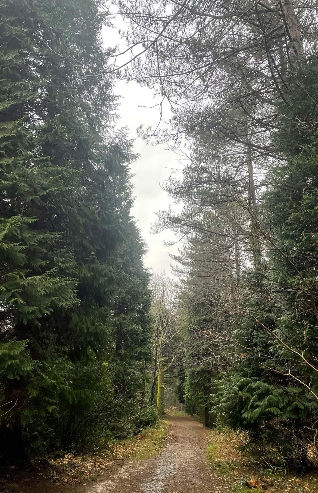
This project looks at the Parkhurst forest of UK in a similar manner. While on the outside it might seem like a healthy fully functional forest, it is dealing with its own set of issues that seem to attract no importance. This forest, diverse in a true sense is a place for protected habitat of the red-squirrel. In addition protecting many other habitats, its unique geography of separation from the mainland of UK and micro-climate enables the forest to play host to protection of species that might be endangered elsewhere.
In this section, the project researches and analyses the site and its capacity. After the detailed study, the proposal plans of a forest school as an appropriate solution to the existing issues.
the


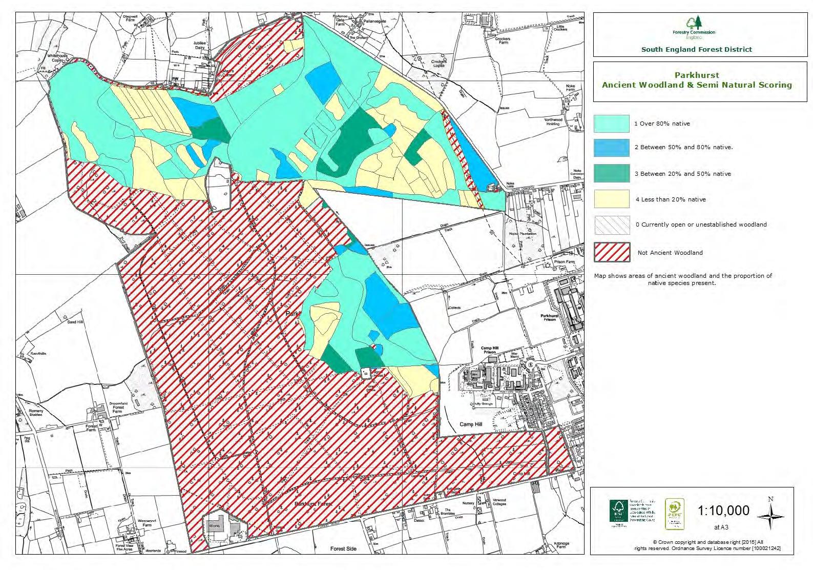
sites on the Island and is home to number of important habitats and their associated species. It is the best preserved example of former wood pasture on the Island.
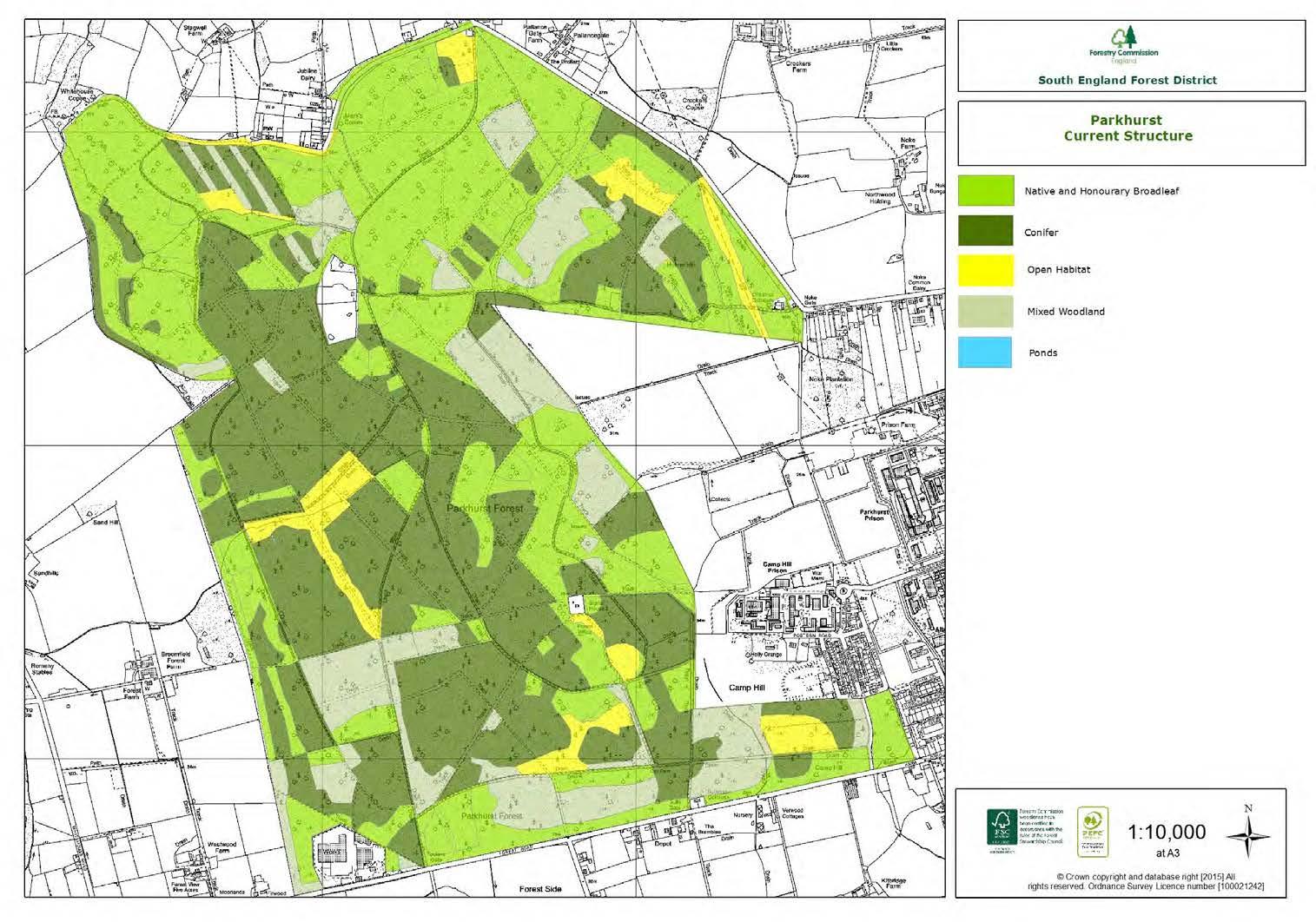
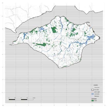
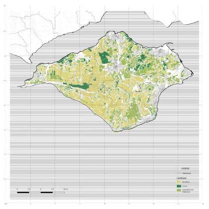
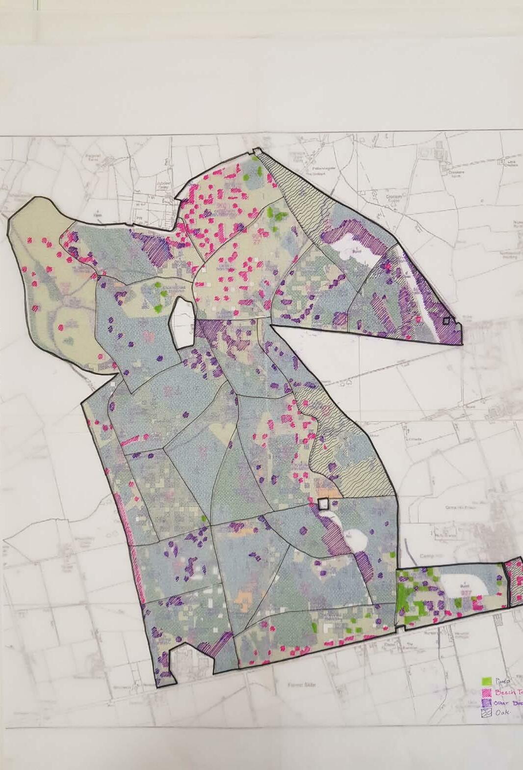
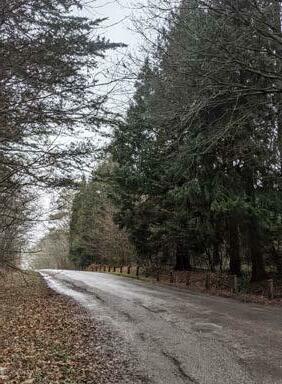
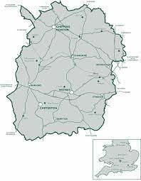
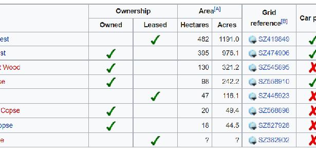
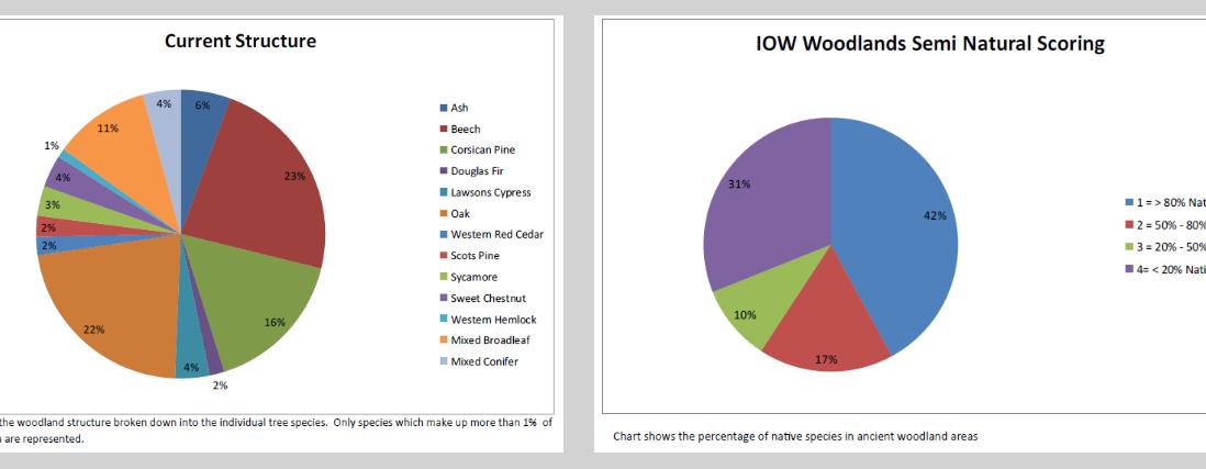
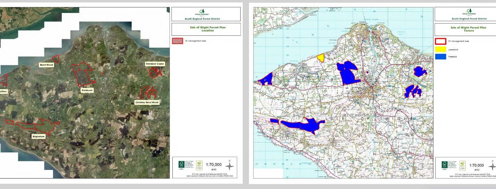
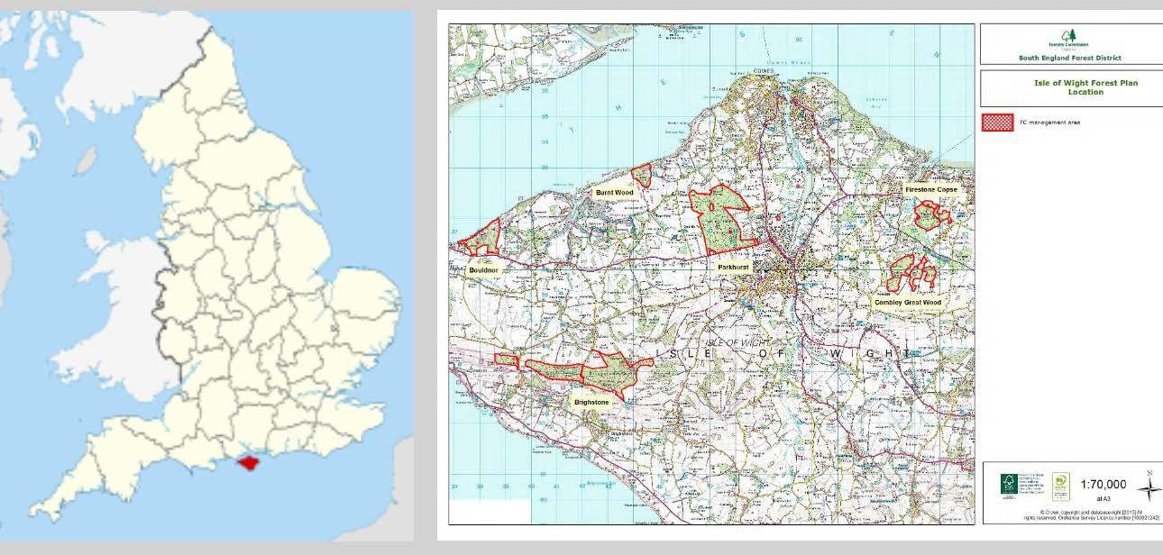
The Isle of Wight contains 6 woodlands managed by the Forestry Commission- Brighstone Forest, Bouldnor Forest, Burnt Wood, Firestone Copse, Combley Great Wood and Parkhurst Forest. The forest contains a large Napoleonic oak plantation and several significant areas of pine trees, home to a large proportion of the Island’s 3,500 red squirrel population.
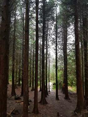
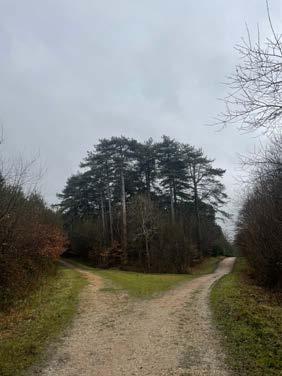
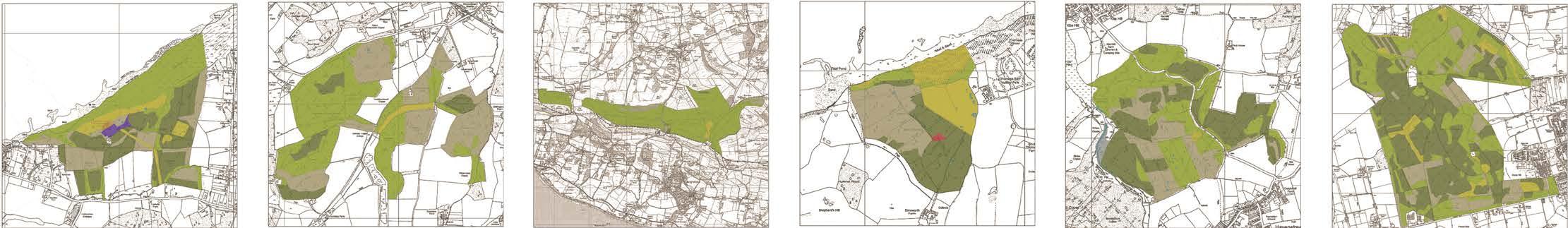
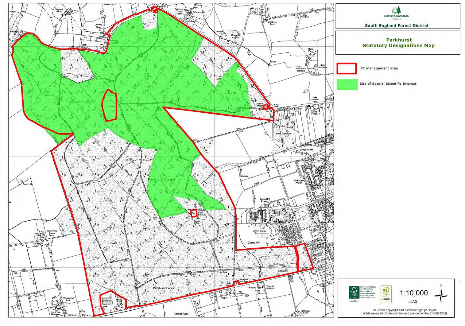
Key features include large areas of SSSI designated for sessile oak, beech and ash-hazel oak woodland interspersed with conifer plantations and crossed by a network of wide grassy rides rich in heathland plants and insects.

 Parkhurst Forest is one of
principal forested
UK and Isle of Wight
Parkhurst Forest is one of
principal forested
UK and Isle of Wight
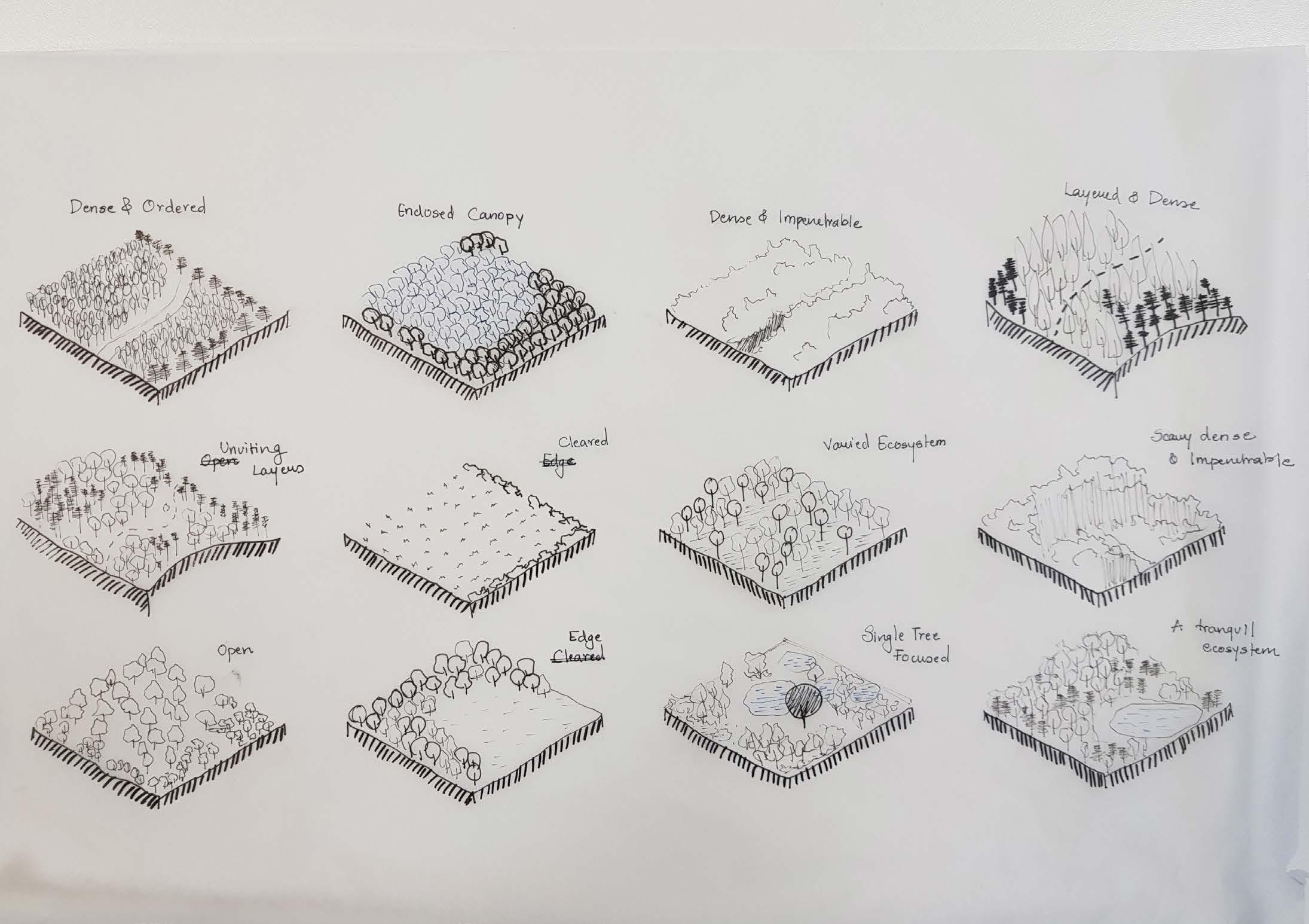
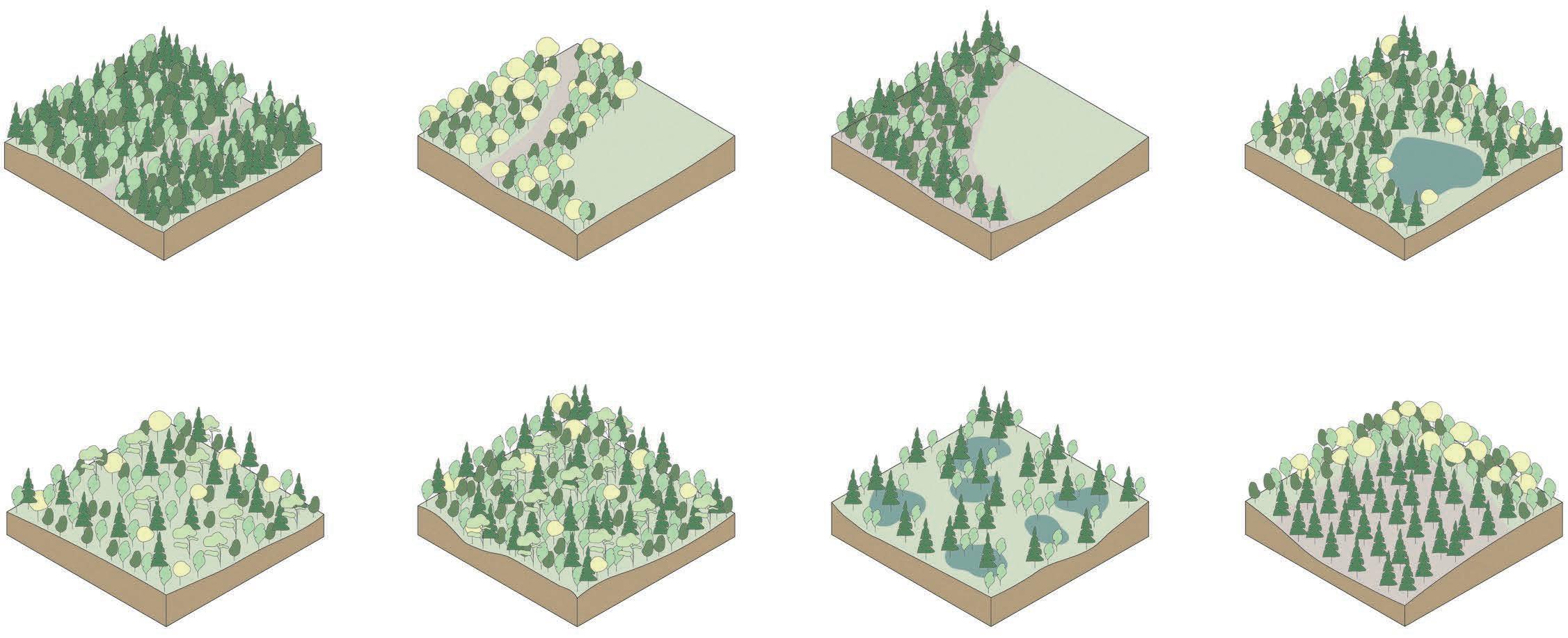
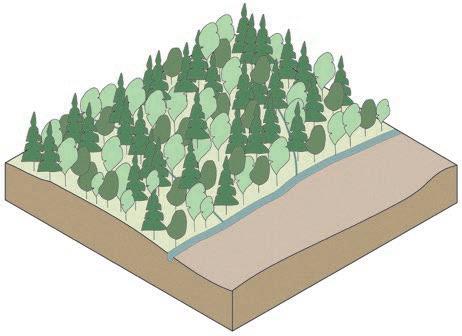
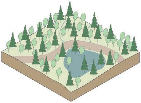
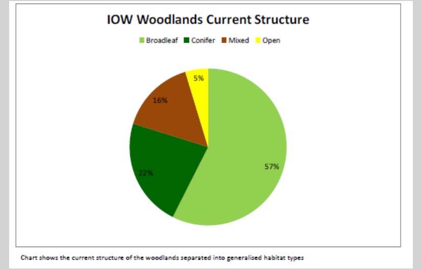
Dense and Impenetrable Observations and Strategies Dense and Ordered Edge cleared Swamps and marshes Edge dense - clear centre Closed Canopy An established ecosystem Single tree patch woodland Combined the woodlands cover a total area of 1152.ha and help to
-
-
-
- Scheduled
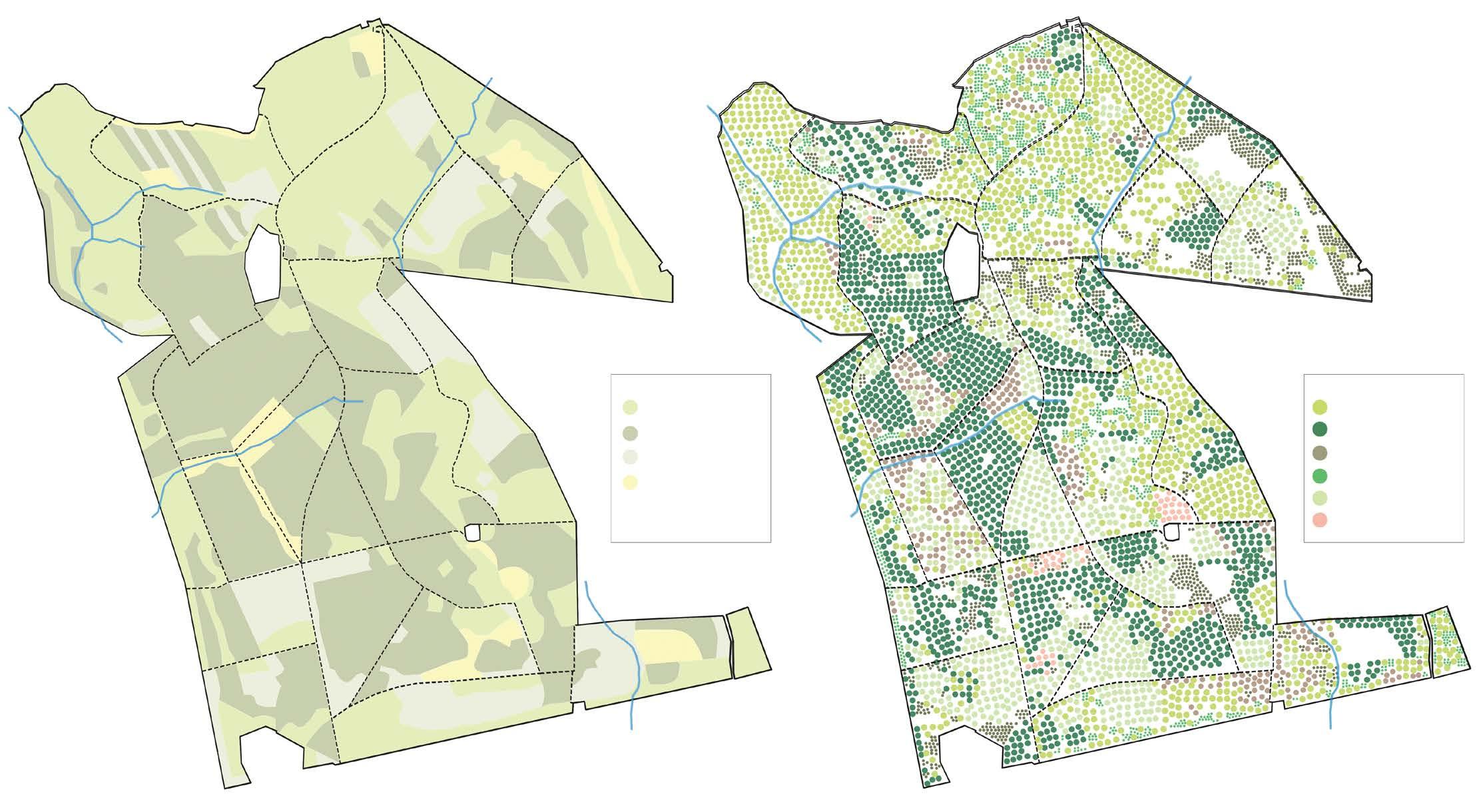
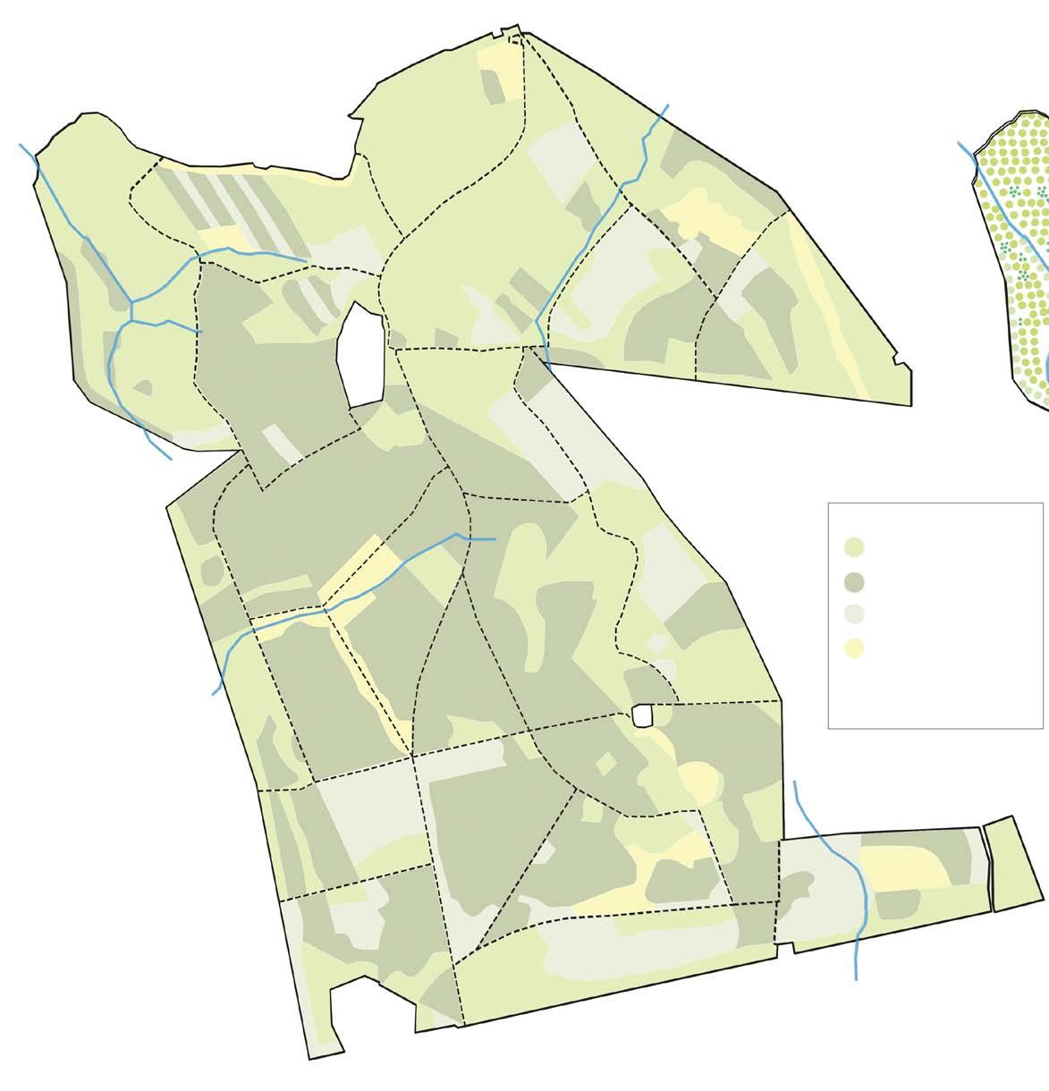
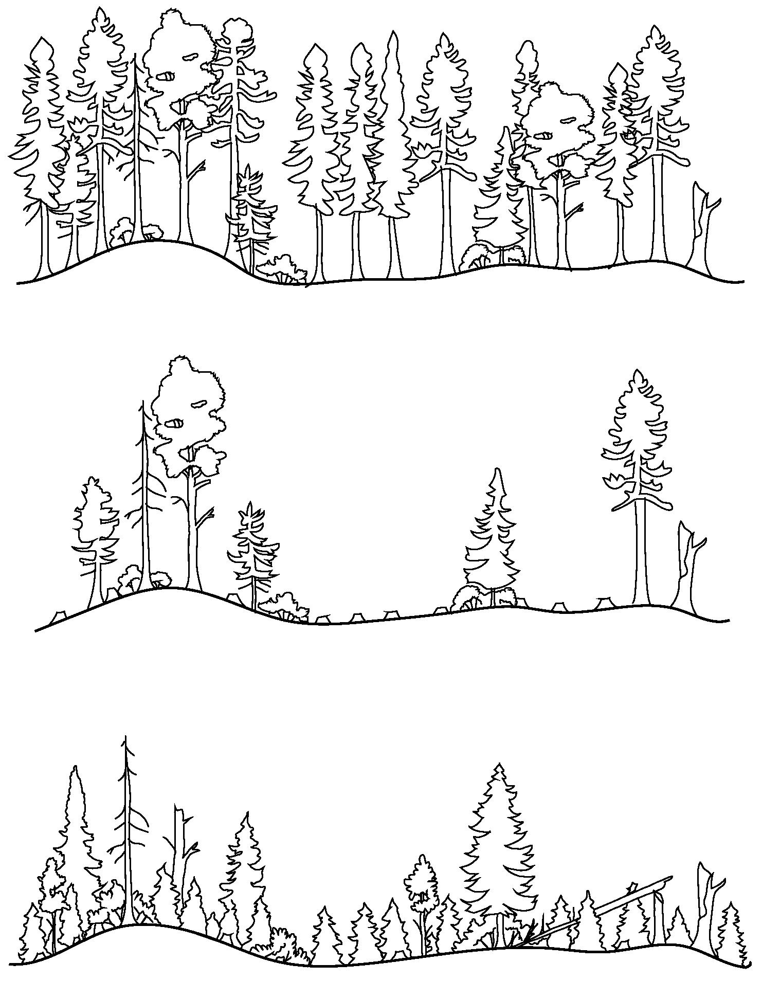
Types of woodlands across the forest Forest structure 1. Brightstone Forest 3. Burnt wood Forest 5. Combley Forest 2. Bouldnor Forest 4. Firestone Copse Forest 6. Parkhurst Forest Scale- 1:300000 A variety of forest pockets can be seen throughout different parts of the forest. An analysis of this observation has been made below with the help of isometric drawings. Junctions
act as buffers
different
zones. This
also reflected in the canopy of
a beautiful play of light can be ex-
as one walks
Native and Honaray broadleaf Conifer Open habitat Mixed Woodland Pines Oak Spruces Beech Larches Ash Site Visit 0 100 M 200 M 400 M 30 40 45 40 35 30 30 25 40 40 45 45 45 50 50 50 50 30 55 60 60 55 55 60 0 100 M 200 M 400 M 30 30 45 50 55 55 60 40 40 40 40 35 35 30 30 25 20 15 40 45 45 45 45 50 50 50 70 70 60
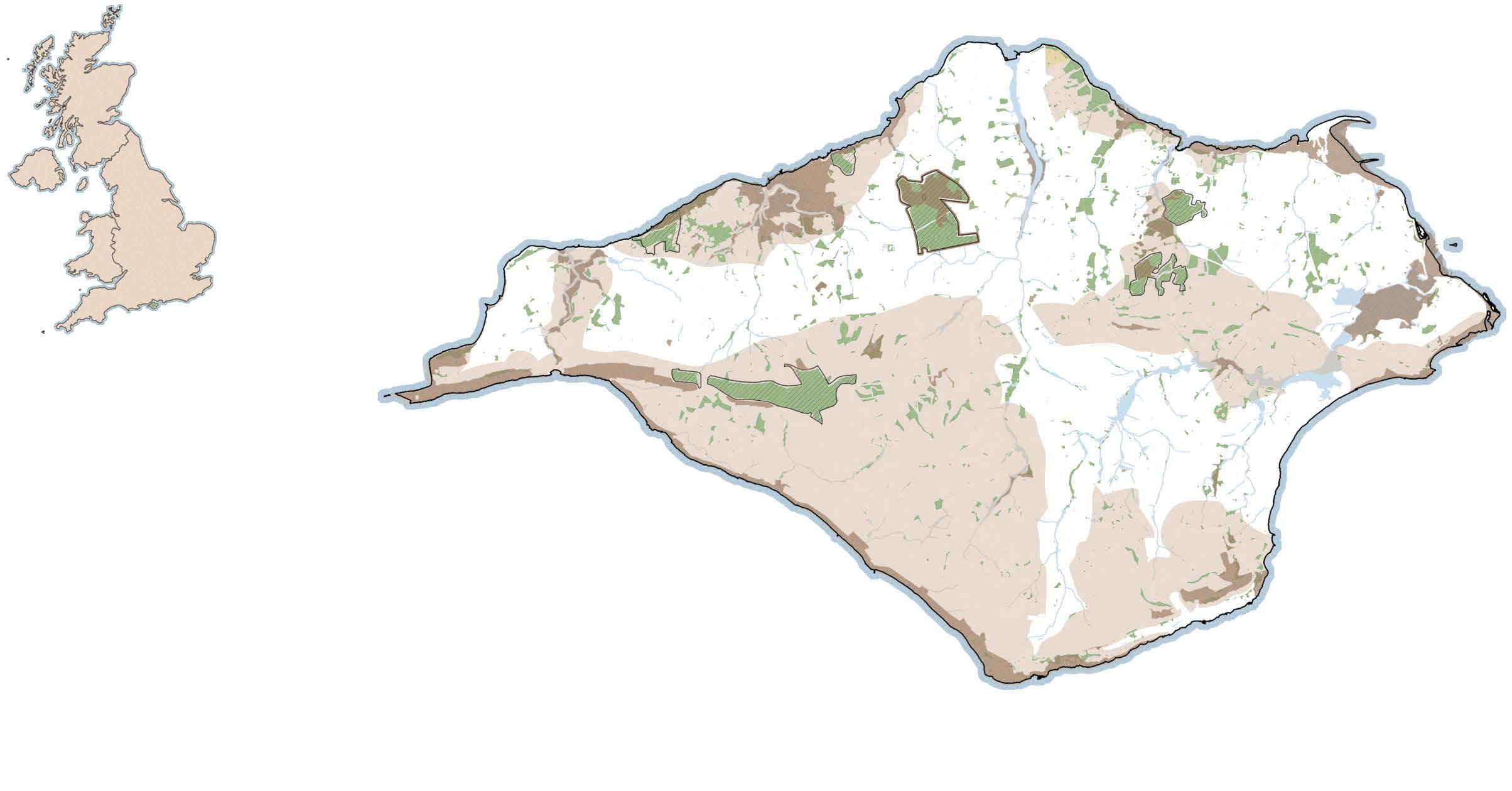
Landscape of Isle of Wight
connect other areas of woodland and open space, protecting vulnerable habitats and increasing their resilience.
Special Areas of Conservation
Special Protection Area’s
Area of Outstanding Natural Beauty
Ancient Monuments
of pathways, these
between
forest
is
forest,
perienced
through.
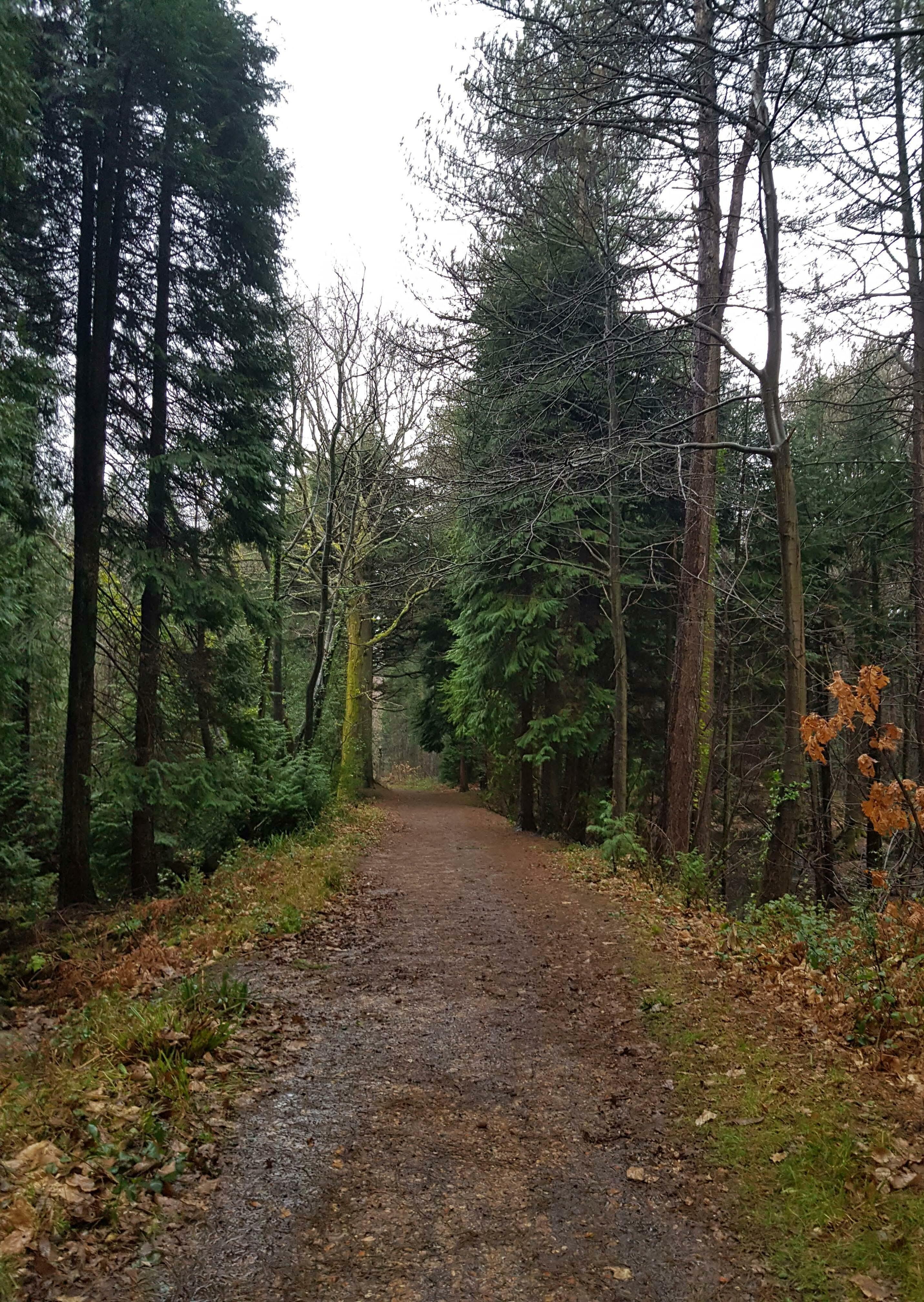
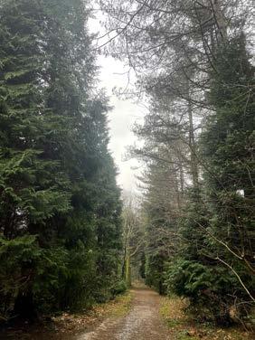
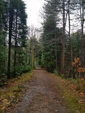
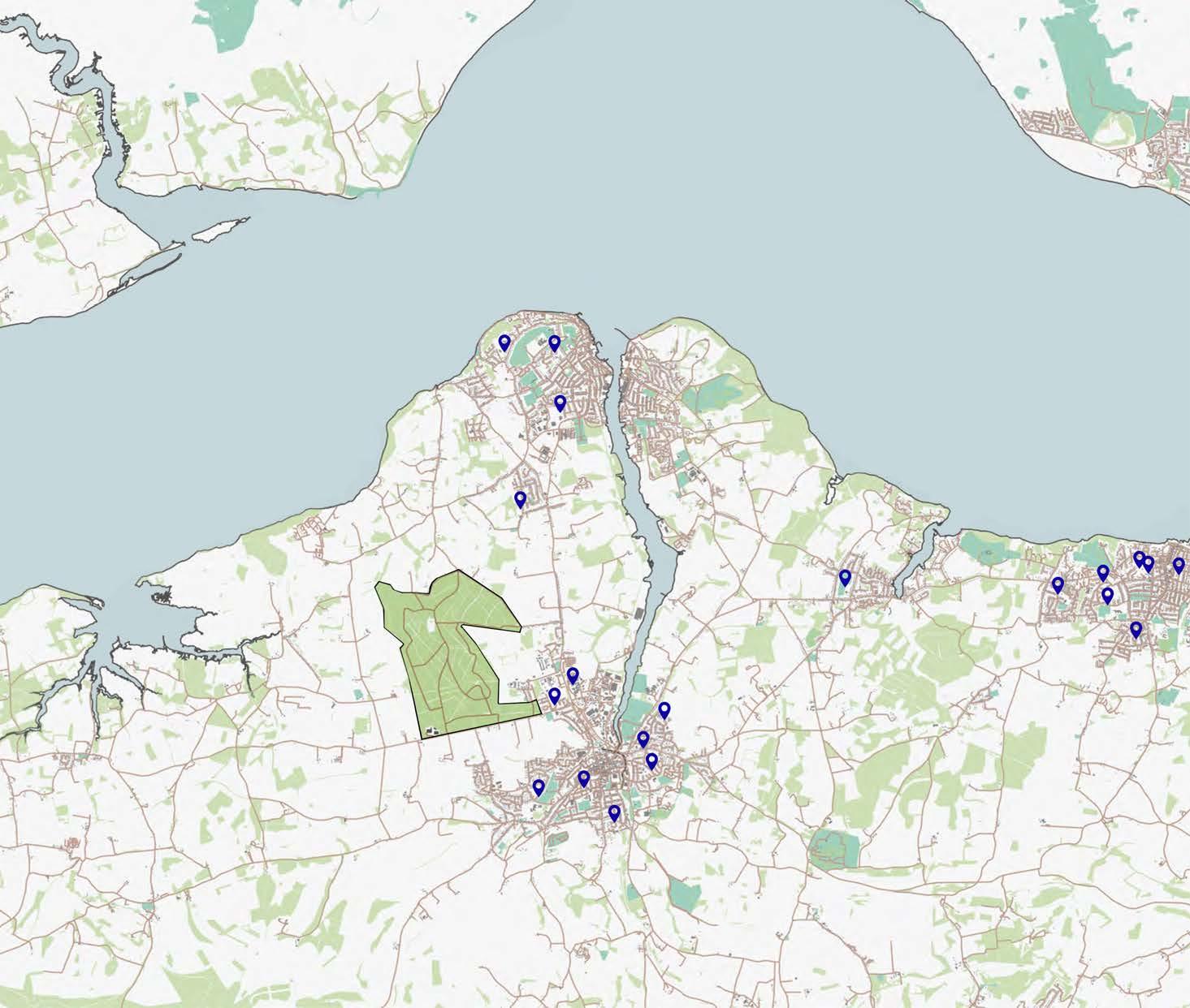
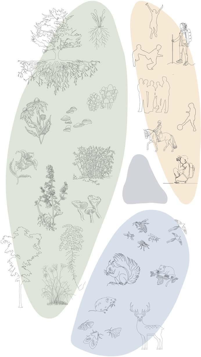
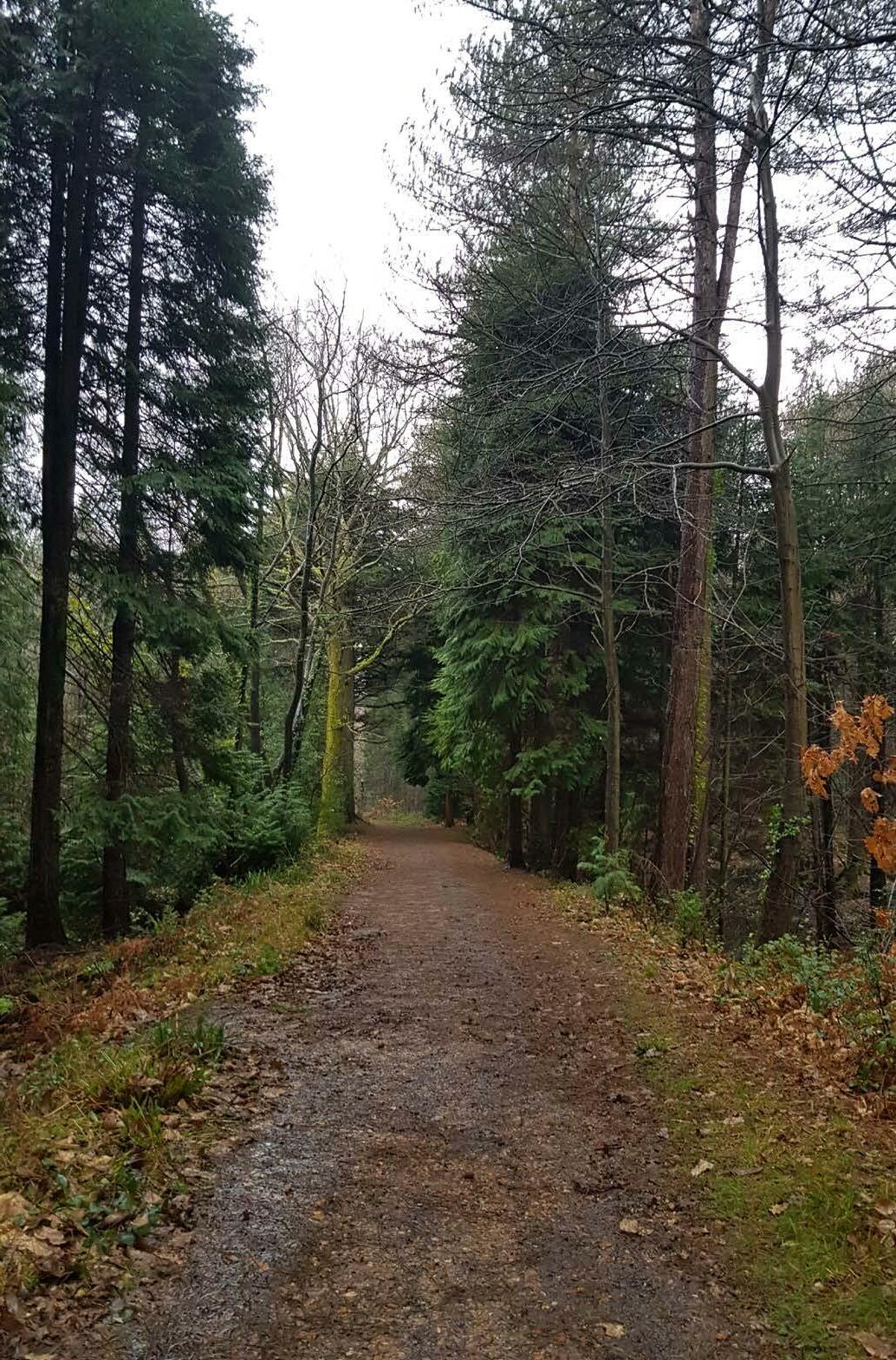
Rich in biodiversity, and separated by the land of mainland UK by the Solvent, the Isle has a very unique ecosystem of its own. Large part of the land is open areas and forests spread all over. The forest is an important part of the tourism portfolio of the Island, and is well used by islanders and visitors. Tourism in forests is one main economy on this land. Thus many people can be seen here hiking, exploring and indulging in various activities offered by the forestry management here.
In addition to this, school kids and forest study trips is currently the most important use of this forest. The context map helps locate schools close to the area. The scale and location in the Isle, makes it a popular study location for the schools. A separation from the Mainland has offered immense protection to the forests from urban development and bio-diversity reduction. Thus all factors combined, the forest becomes an ideal space not only for kids but for any and all students to study woodlands.
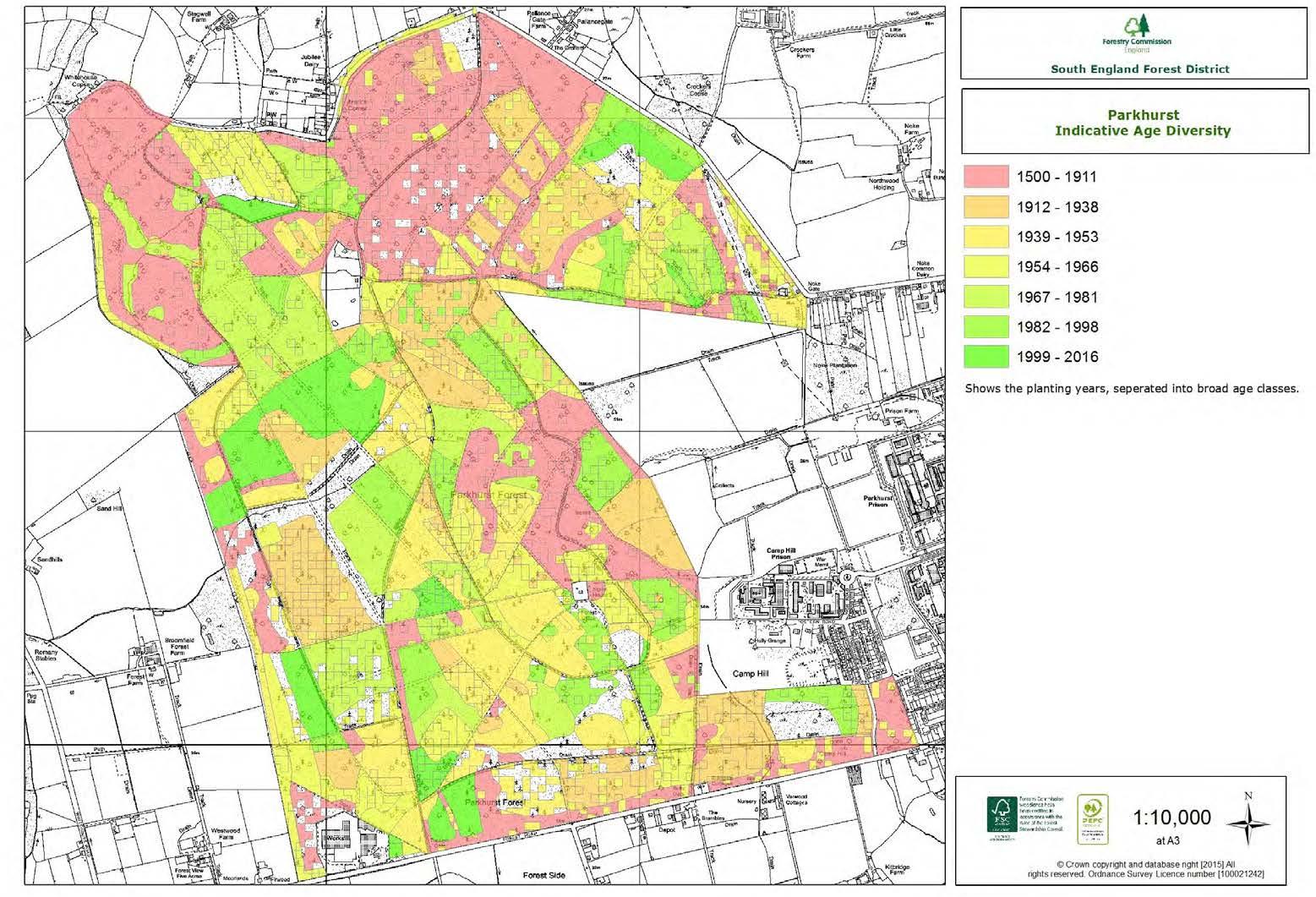
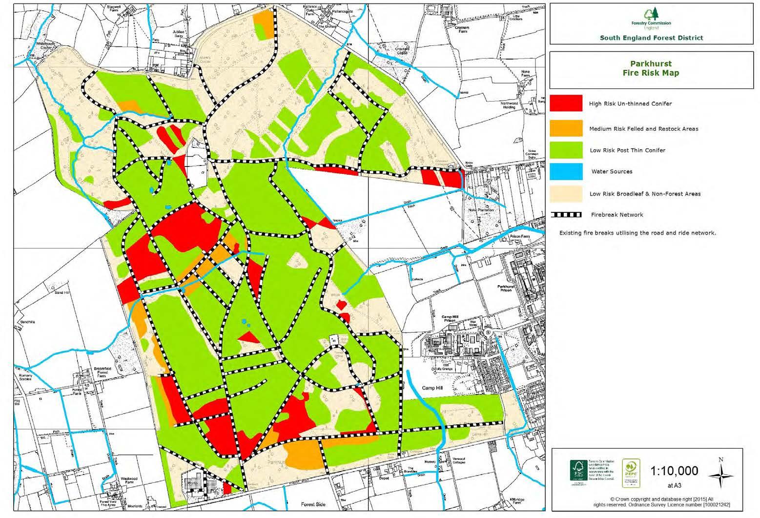
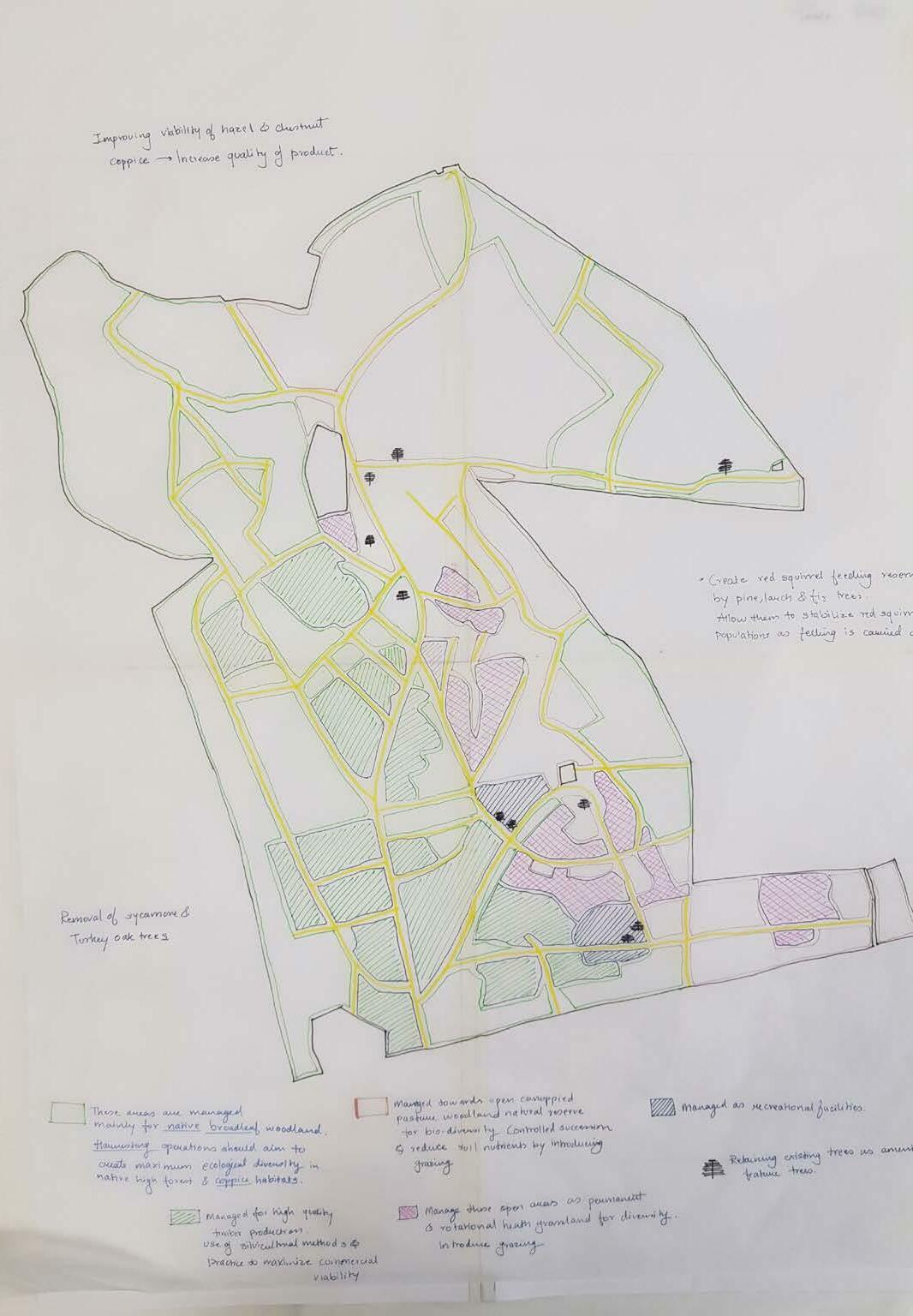
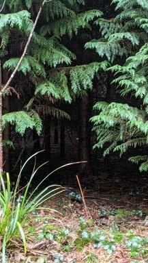
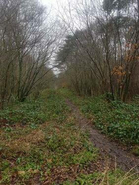
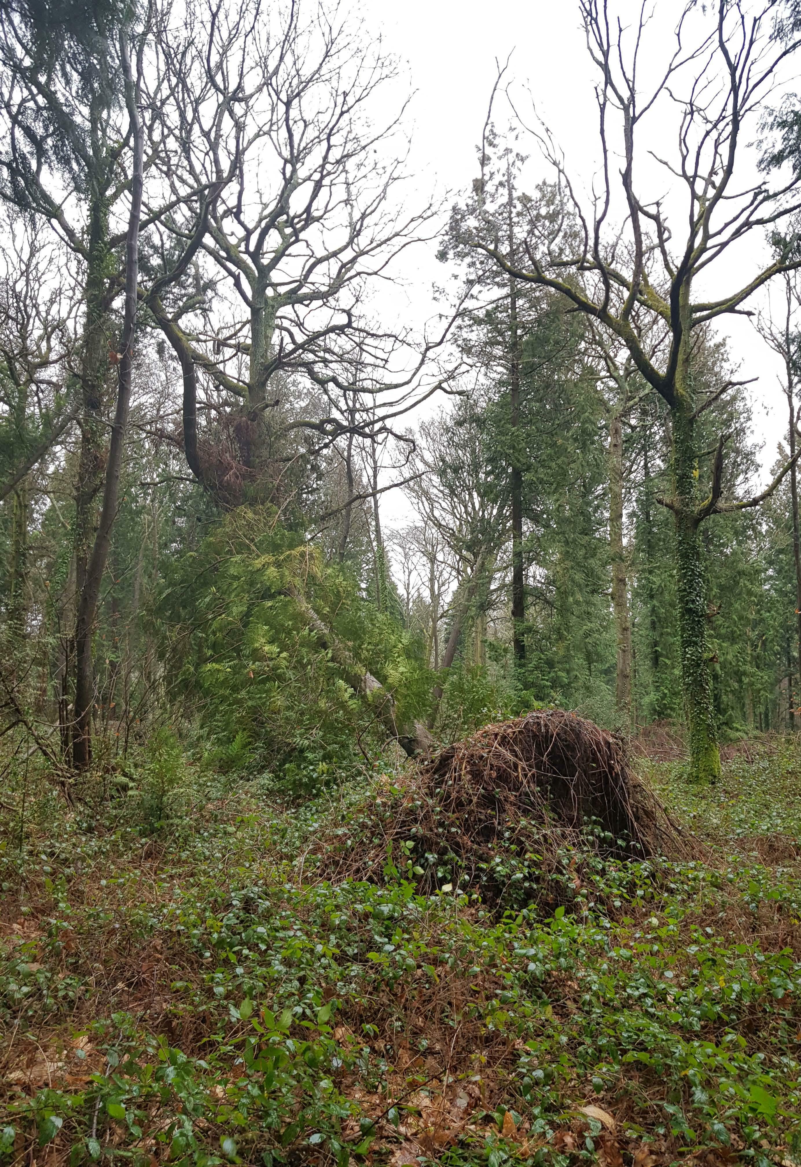
Negligence is one of the biggest problems the forest faces today. The richness and diversity of Parkhurst was supported largely due to coppicing methods that were in use since years ago. Coppicing was one of the important reasons for the forest to develop to as it is today. Lack of demand in wood products due to the expense in transport to the mainland, has lead to decrease in coppicing.
According to the Forestry Commission, harvesting timber is an essential part of the cycle as it makes space for regrowth and develops robust, healthy and diverse forest areas. The Isle used to be a major source of timber.
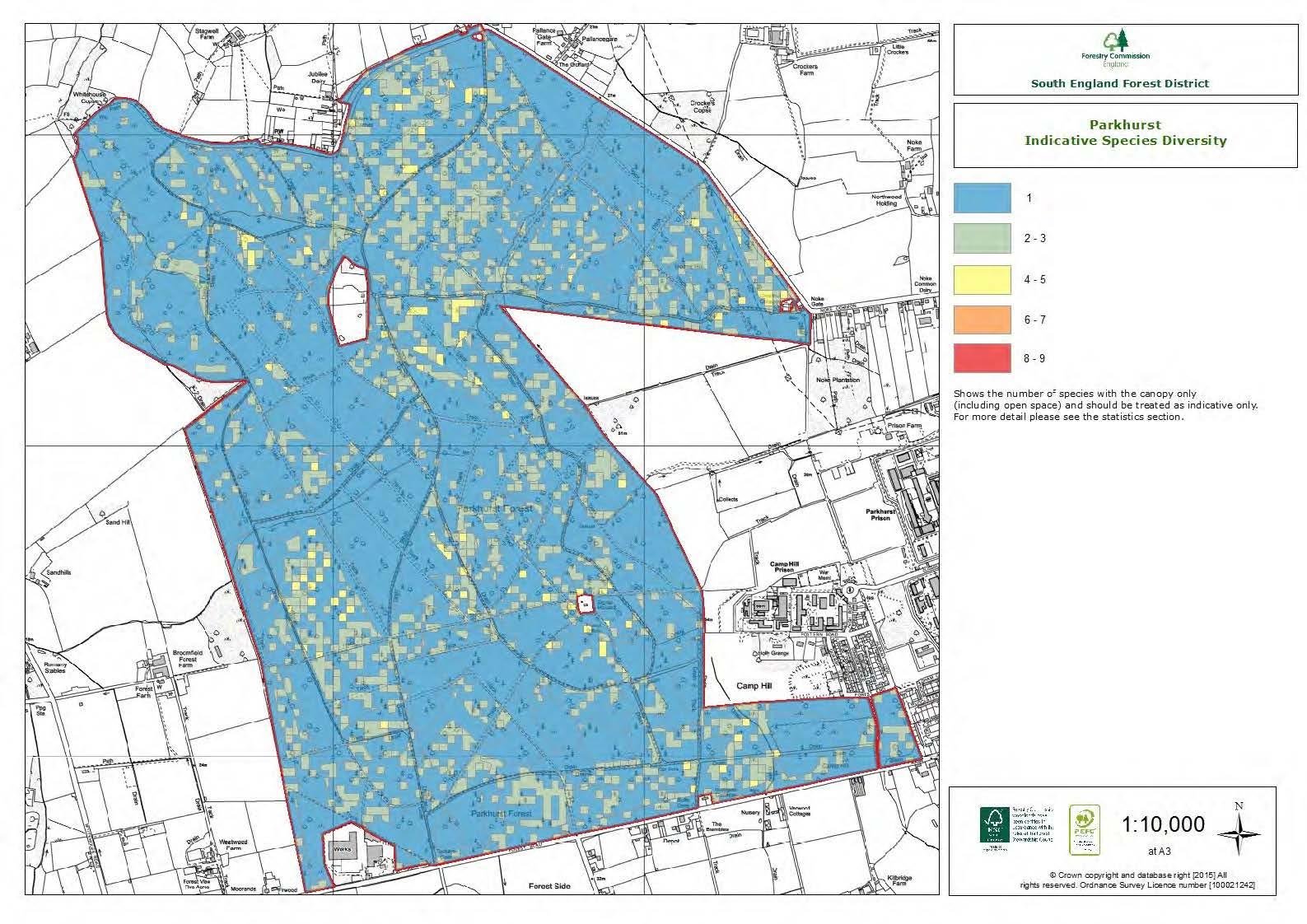
The national priority species listed in the Island’s woodland are important for a group of three mammal species, red squirrel, dormouse and Bechstein’s Bat. Nowhere else in Britain do all three of these species inhabit the same woodland, making this a unique ecosystem.
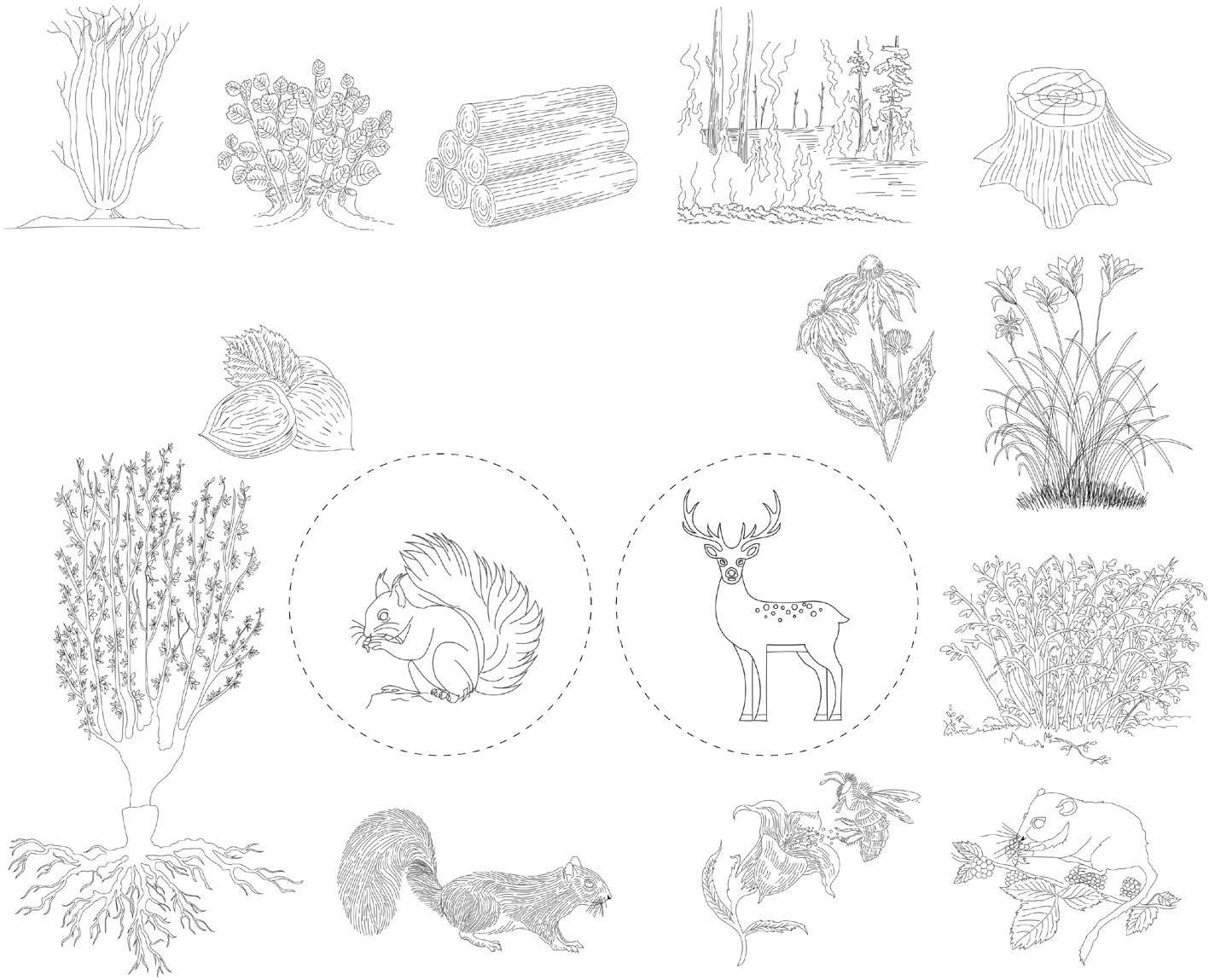
The red squirrel (Sciurus vulgaris) is a native woodland species that is declining in the United Kingdom, with populations now virtually absent from south and central England.
The decline in the distribution has been associated with a widespread increase in the distribution of the introduced grey squirrel. Research has suggested that the grey squirrel can utilize some food resources in deciduous woodlands more effectively than red squirrels, which gives them a competitive advantage and red squirrels also suffer from a disease, parapox, that grey squirrels may spread.

The island has already lost plants such as the Wild Gladiolus, and butterflies. So it would appear that wild deer can be an essential component of rewilding projects.
Context Map
Inhabitants
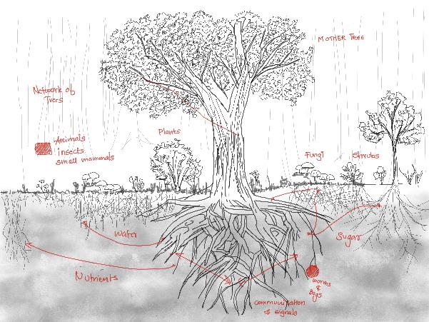
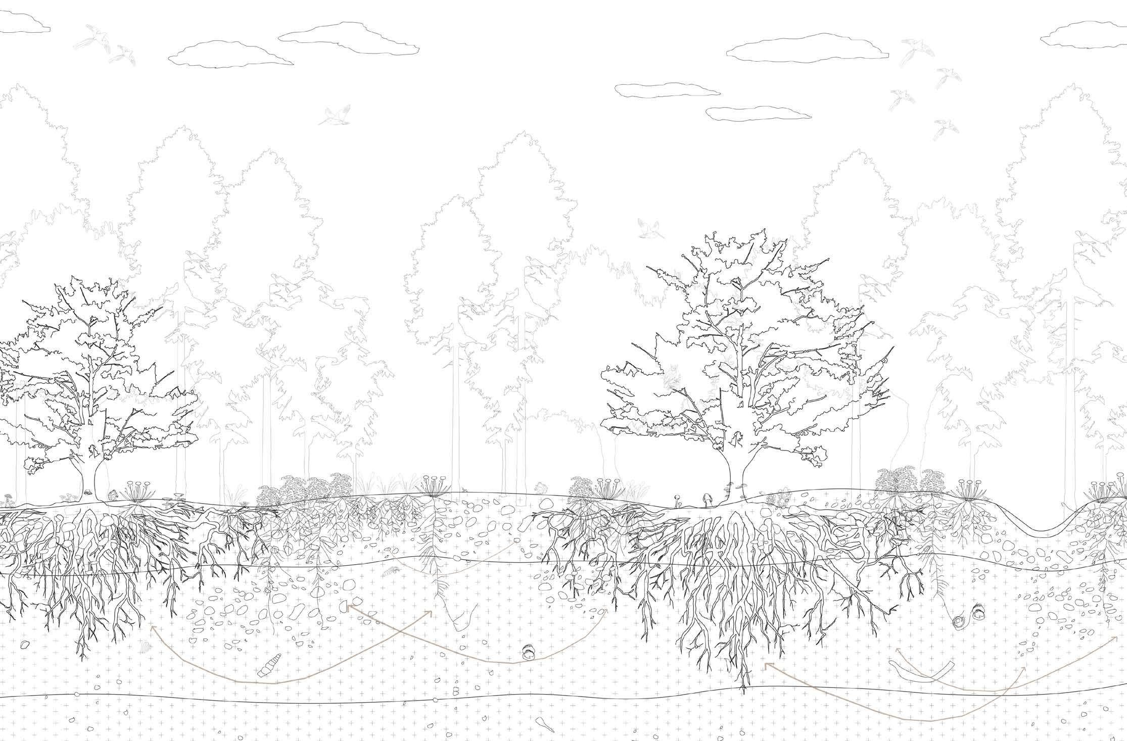
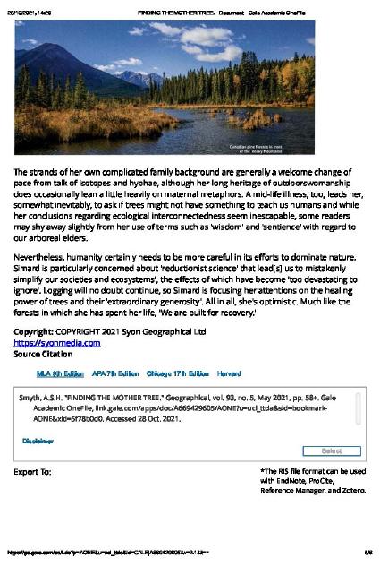
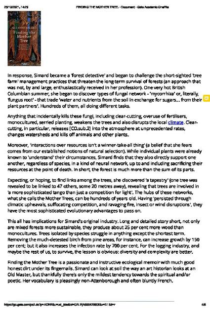
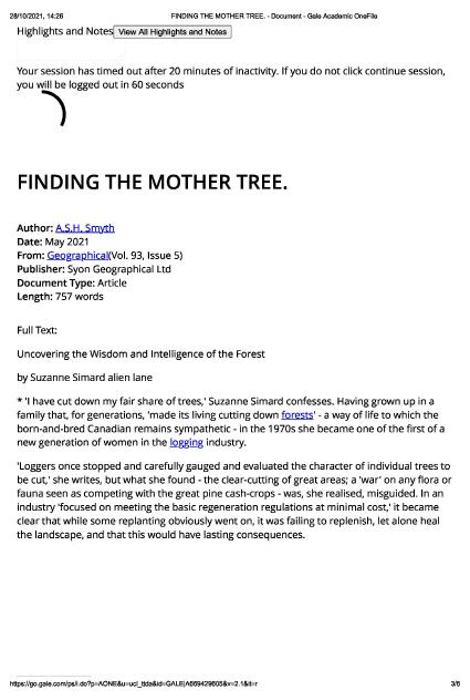
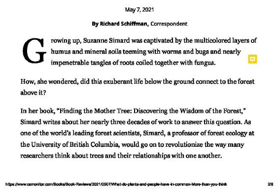
Woodland ecosystem - based on Suzzane Simard’s book - FINDING THE MOTHER TREE
of the forest
Key
Issues the forest is dealing with- A diverse ecosystem - Rich in flora and fauna species - Hub for specie protection - Accessibility from the cities of Isle - Water table is well maintained S T R E N G T H S O P P O R T U N T Y W E A K N E S S T H R E A T S - to
-
- Diversity
Parkhurst Forest Native and Honorary broad leaf
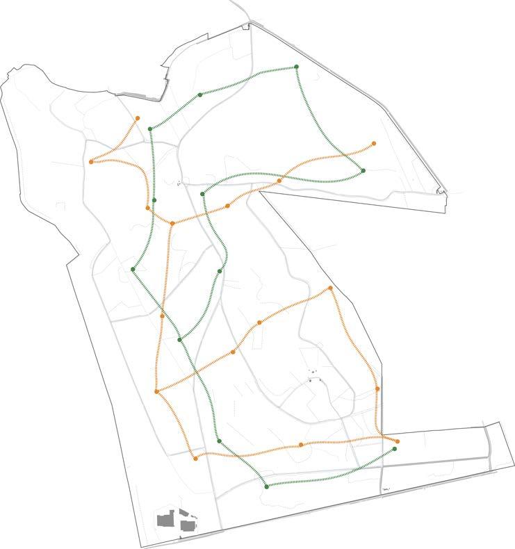
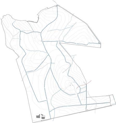
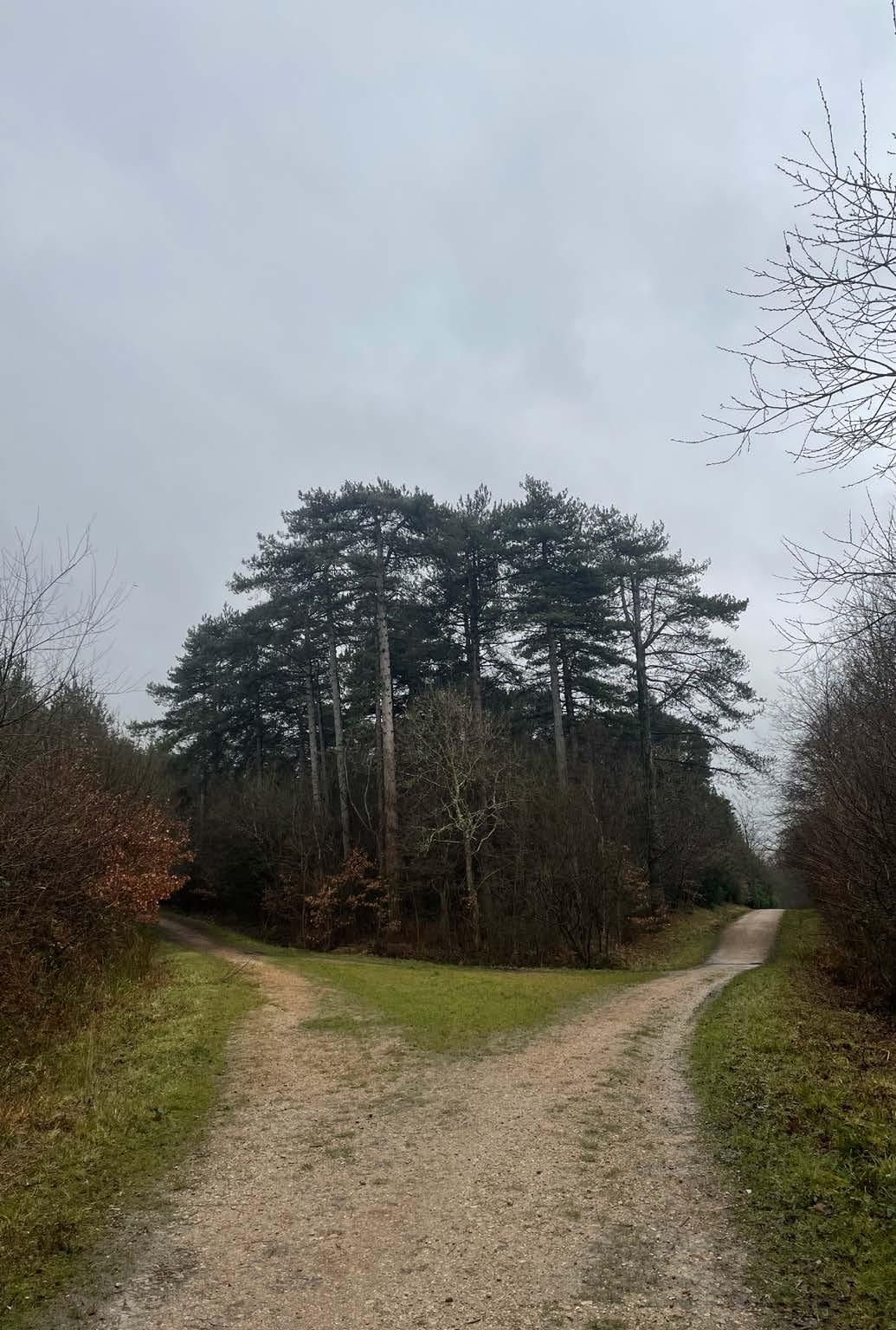
plan for site visit walking route 2 1 3
inhabit the forest in a better way by carefully planning strategies Conifer Open habitat Mixed Woodland
protecting the water table and its structure through a developed system that also helps in enhance the ecosystem 1. Water collected in a ditch 2. A Natural storm water runoff 3. Vernal Pond
in Walking route Spots for images overstood coppice woodland management threat to red squirrel habitat of UK threat to deer habitat of UK
species can lead to a higher chance of risk from invasive species and diseases if any - Cimate change impacts specially of changing temperatures and changing rainfall patterns can have a huge effect on the forest’s ecosystem forest fire
- negligence and lack of appropriate forest management - overstood coppice has led to dense forest patches and lack of enough sunlight in spaces - water collected in ditches is not in its best state due to lack of a proper system ash diebeck
0 100 M 200 M 400 M
30
30 35 40
81.2
67.3 45 50 50
55
55 60
40
35 35
30 30 30
25
15 40
45 45 45
50 50 50
55 60
60
60
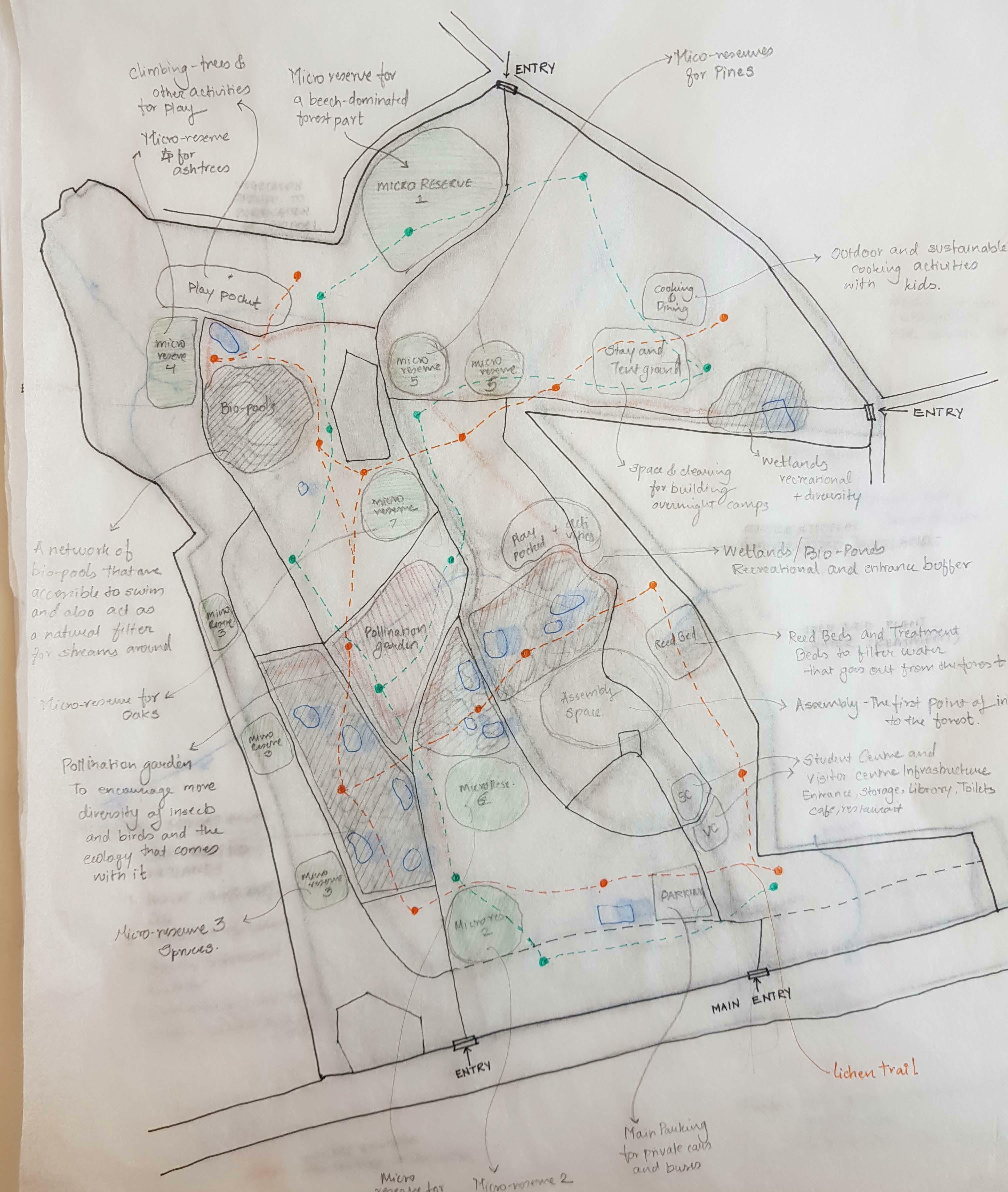
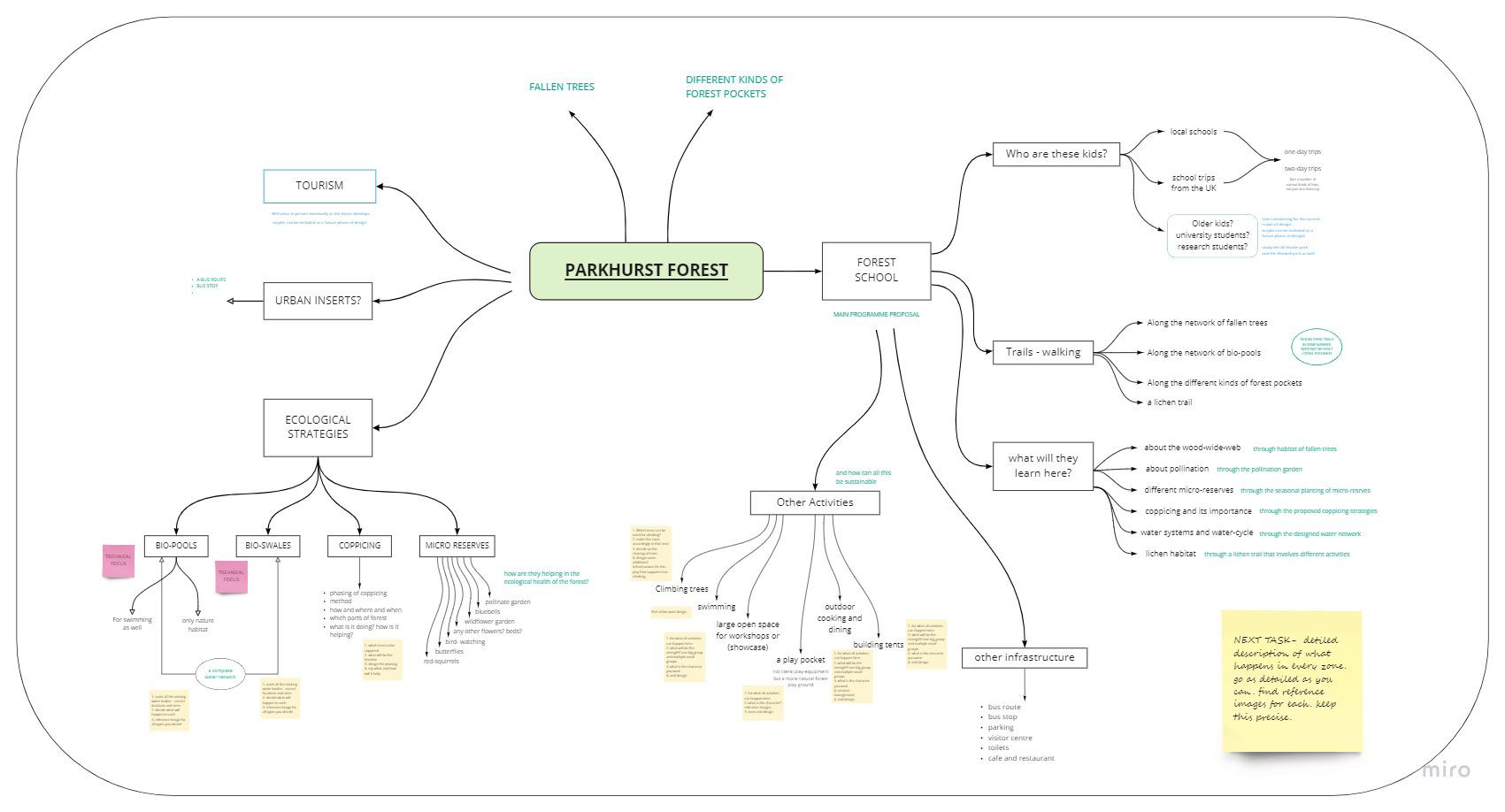
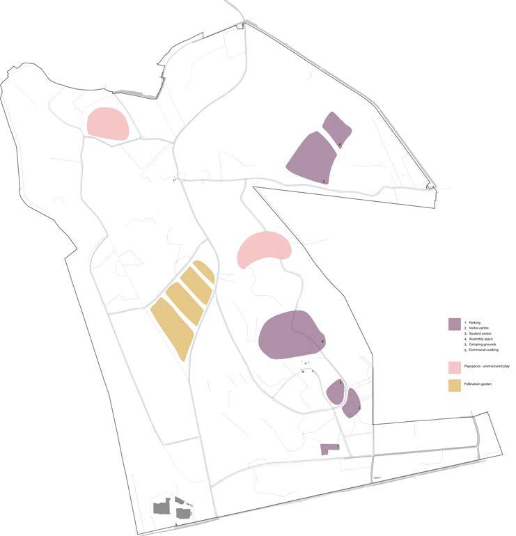
Enhancing the forest’s life by developing its current use of forest in a better way. A forest school that provides space for studying the environment in a a semi-structured manner. Activities and opportunities arranged around the existing ecology - the brilliant dead logs that support an entire ecosystem, trails of different habitats of species, water management and much more. While this project mainly deals with kids for education it also equally welcomes tourists and locals to experience the forest and learn about environment at every corner.
The programme is arranged around different acitivities that can be taken up by various school groups. It takes into account possibilities of varied timeliness, multiple continued trips, seasonal changes and experiences, age groups, their movement as well as leaves room for any adaptations that any project needs. The vision of this project is to minimize any large changes to the forest but only plan the itinerary around the existing forest while also em phasing on the forest management strategies required.
fallen trees
management teams tourists for recreation tourists for hiking and walking daily staff and maintenance
trails play observe admin and maintenance camping for kids
different forest typology
water system
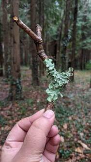
lichen
dead wood habitat and ecology diverse ecosystems water system and water bodies lichen ecology protecting red-squirrel habitat bees and insect protection
in this zone the kids will take various trails not hard marked trails but flexible along various ecological categories. These are detailed to be a in depth analysis or overall study and across various timelines thus keep the education flexible.
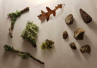
The kids will explore through observation, collection of samples, smelling and touching textures and such.
Trails marked in various ways - patched pathways with local and natural material - maps and drawings available at student centre and information centre - platforms across trails to observe - equipment available such as magnifying glass, microscope and such
Primary user - School kids and staff - tourists
Other Users - local residents - management staff
Primary user - School kids and staff
- these pockets are marked around the oak trees since their shape gives the most accessible way for tree climbing.
freedom to explore
pollination
coppicing
butterfly spotting
In a world of extreme protection it has become impossible for kids today to play as their elder have - in nature. These spaces allow unstructured play providing kids with opportunities to grow and learn in more freedom and in nature, they develop an understanding of safety themselves while not restricting their possible growth
coppicing forest management
bird watching
butterfly habitat protection flora and fauna relationship for student groups with multiple day itinerary
tents and camping
red- squirrel climbing trees pond swimming un structured play toilets administration information centre public bus stop parking
sustainable ways of cooking
communal cooking
These spaces are seasonal activities and usually led by an workshop and structure. Its a more advanced study for kids where they explore management strategies such as coppicing, micro reserves, pollination and such.
- the oak plantations are sparse and spread which keeps safety in check - not limited to an area, the forest is kid’s unstructured playground.
Other Users - local residents
- a pollination garden with important species for bees and insects.
- copping plan and providing schools with time tables to organize visits - walks with experts who guide kids to observe and identify habitats and species and explain its significance
Primary user - School kids and staff - tourists - management staff Other Users - local residents
functional
support
awareness
urban network
pervious paving
These spaces provide a place for rest for group who have a two day itinerary. Not building infrastructure but promoting sustainable and ways of non permanent camping setup will be an important part for kids to learn. In addition spaces for communal cooking - sustainable and hands on
- minimal infrastructure for admin, visitor centre, student centre, toilet.
- everything will be in a sustainable, non- permanent manner.
- the drainage and services to be planned in sustainable manner as well.
- area for tents is marked in an already cleared forest keeping in mid the safety of children.
Primary user - School kids and staff - tourists - local residents - management staff
Primary user - School kids and staff - management staff
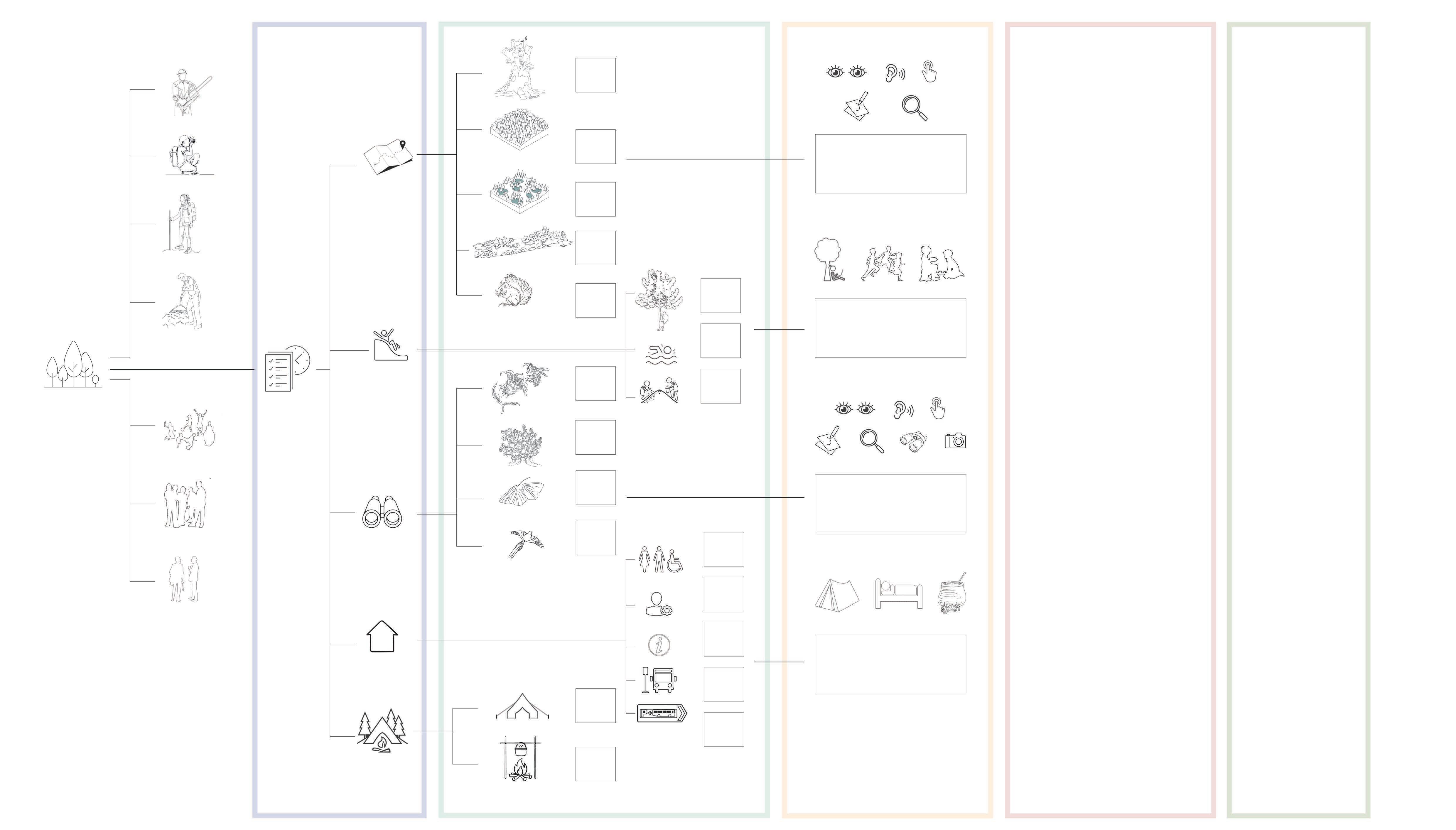
DESIGN PROPOSAL - A FOREST SCHOOL
U S E R S
E S G N S T R A T E G Y Z O N E S E C O L O G C A L S T R A T E G Y A C T V I T Y T
S
A R Y U S E R
programme D
H E
P A C E P R M
school kids - all age groups college students for research scientists and/or researchers
SECTION 2: TOPIC RESEARCH
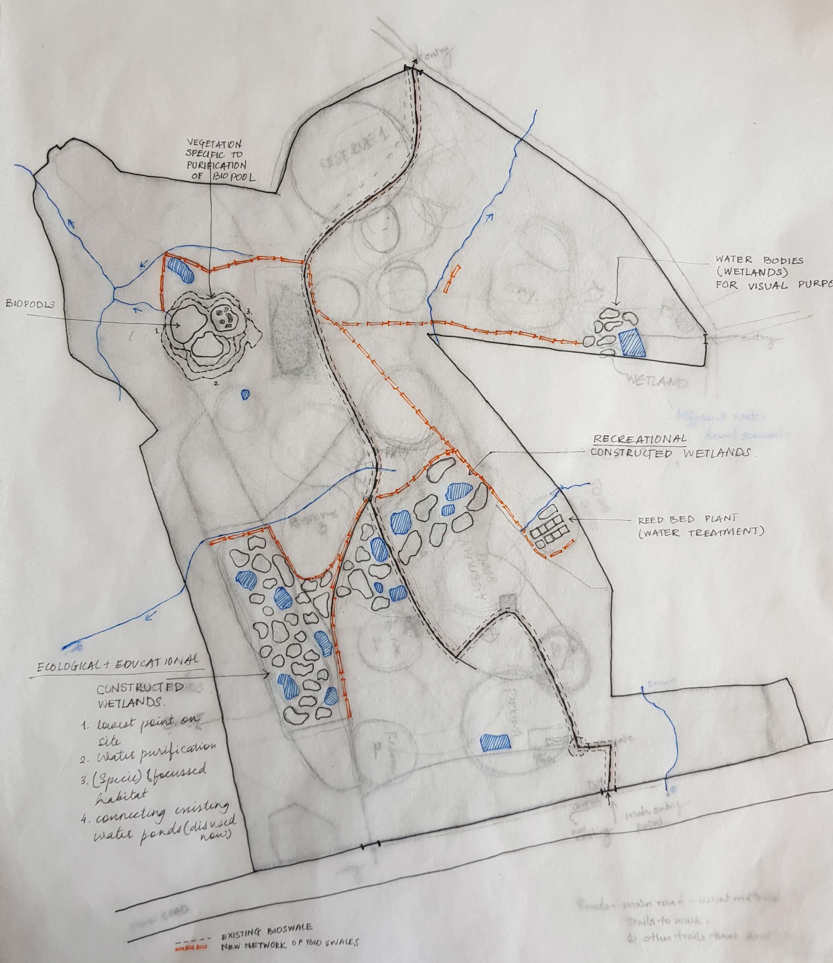
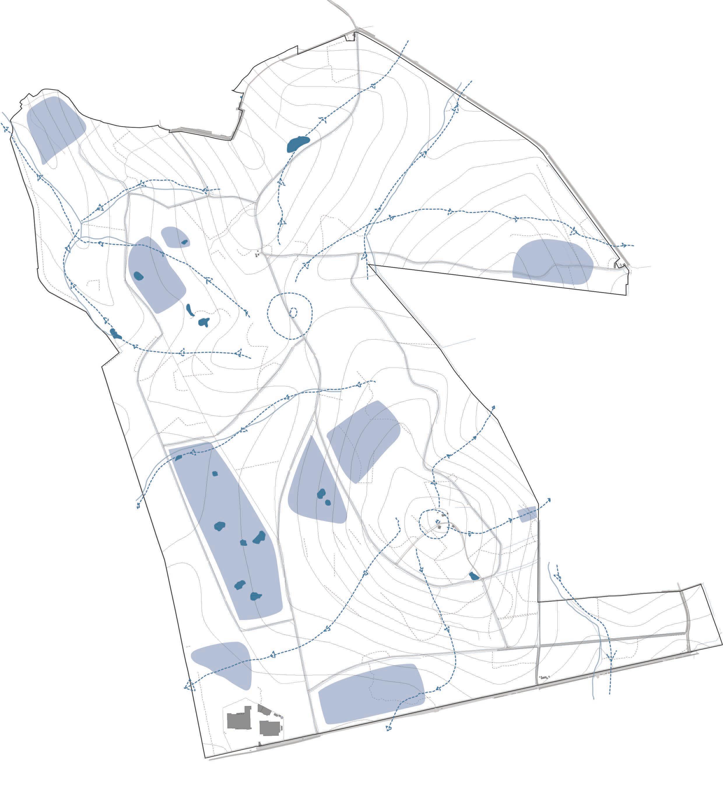
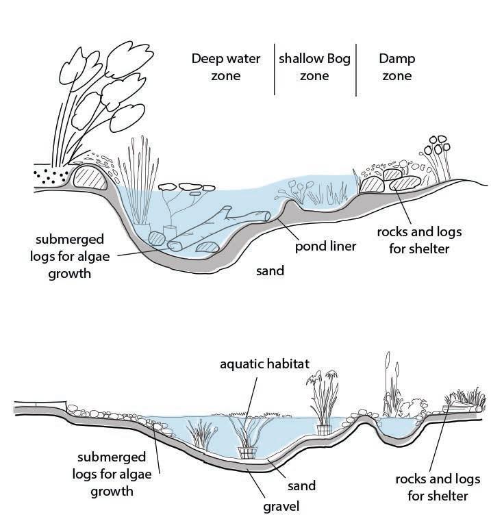
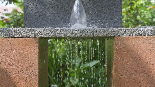
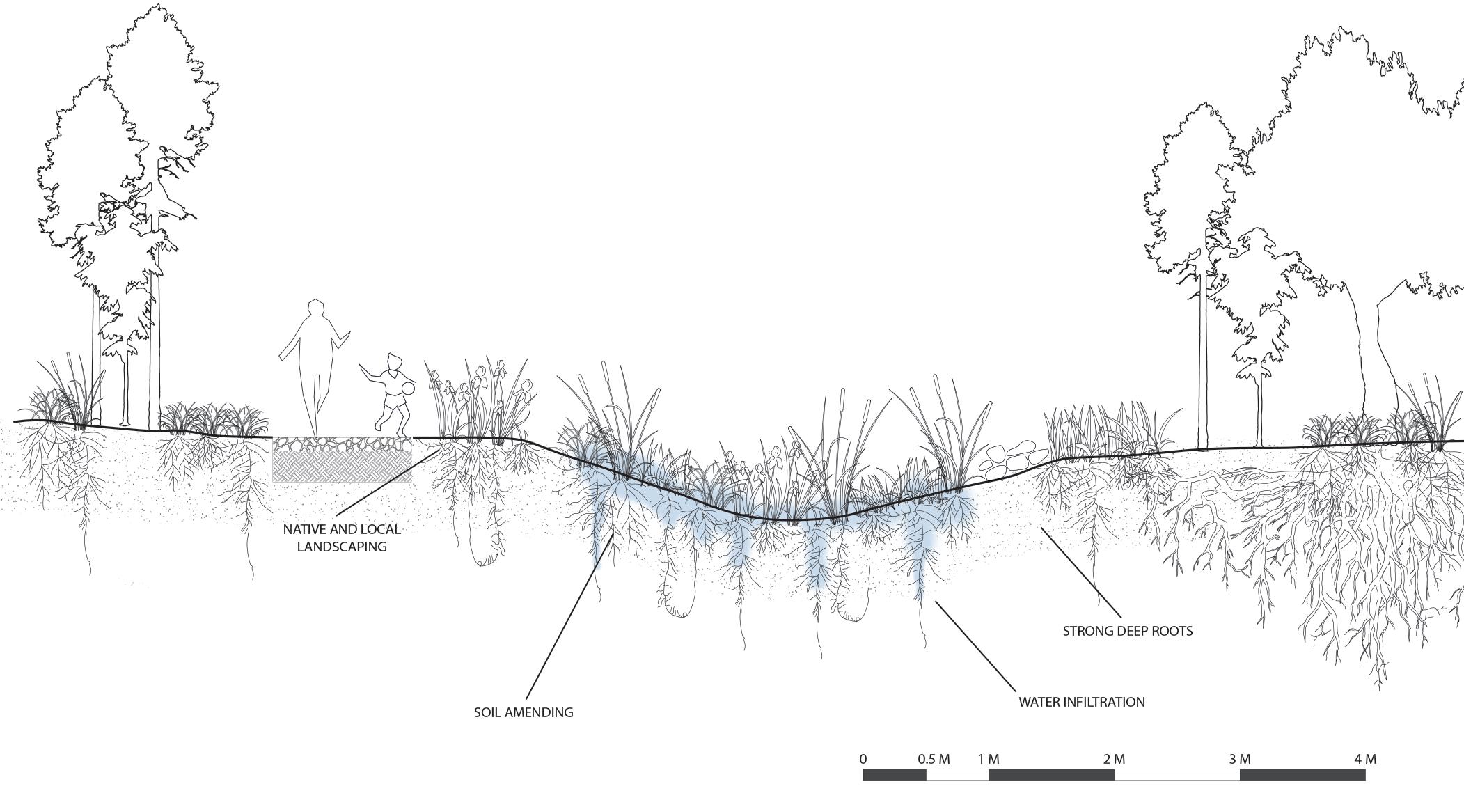
For technical focus, the project looks at the forest’s water system. Currently not very well developed, with multiple habitats existing but non functioning at its best capacity, the water system proposal aims at creating a network of swales, ponds and wetlands to manage water.
The vision for this is to not propose any major landform changes but only slightly tweak the existing water flow and water bodies so that they support a better and healthy ecology. And while this happens, these spaces also act as learning & recreation grounds for kids and adults alike.
This section researches on the possible water strategies that can help the forest’s ecosystems through various papers and case studies.
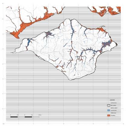
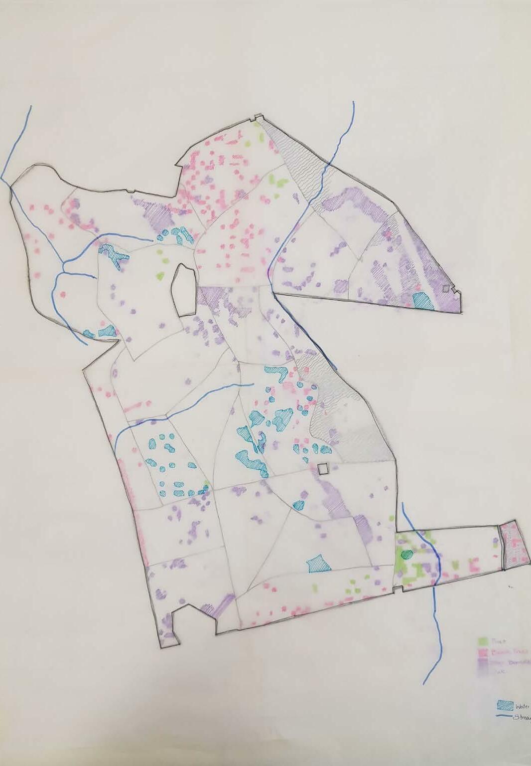
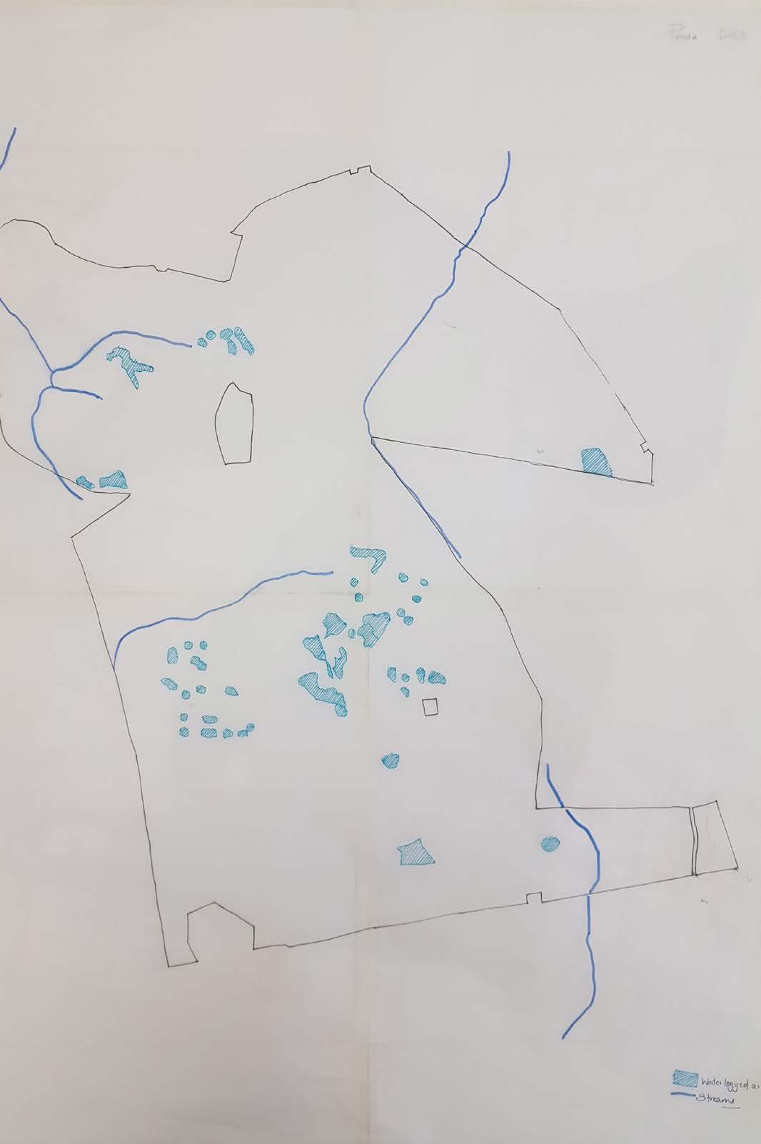
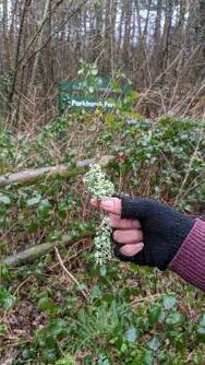
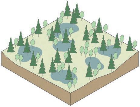
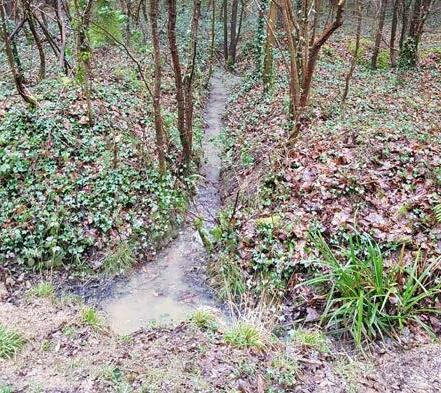
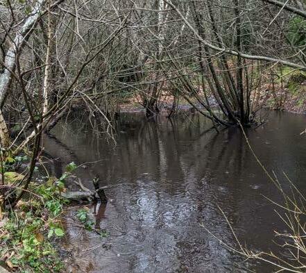
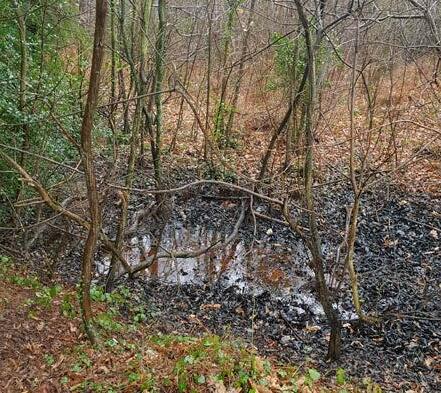
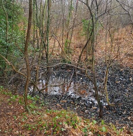
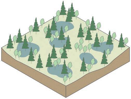
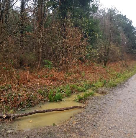
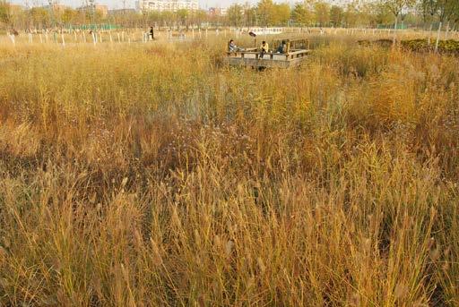
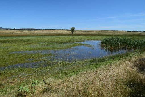
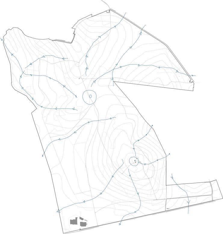
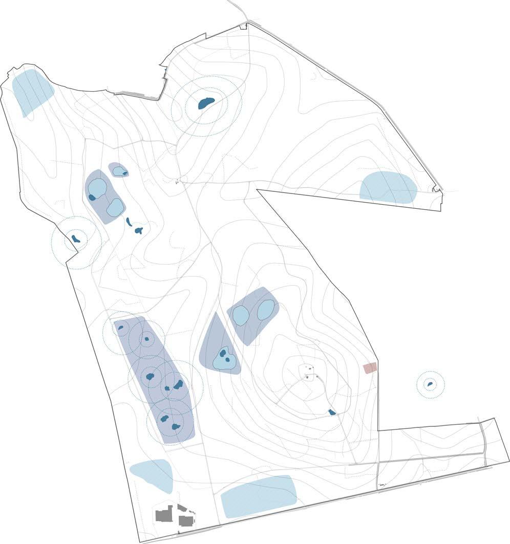
During the site visit observations, a lot of irregular water logged areas were seen. All of them mostly formed due to rain water runoff but a few due to pits of roots and soils. A topological analysis of this observation is shown here where majorly three types of water bodies were identified. various sizes of vernal ponds, ponds of collected water, gutters or swales of washed rain water and swamps and marshes.
Below drawings are an attempt to understand how these various water logged bodies are formed on a forest floor and what is their significance. Though these water ponds did not seem extremely harmful to be in contact with, many of them were definitely uninviting. Water collected in ditches was stagnant and the mulch around rotted giving it unpleasant colour and odour. While swampy areas at many places due to lack of proper direction for the water to flow, makes accessibility difficult.
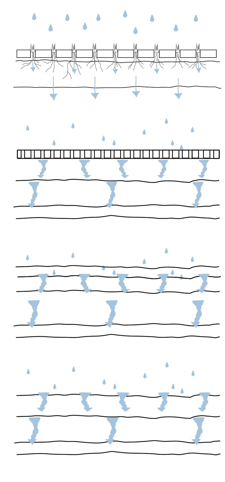
The elaborate canopy and complex deep root system make an ideal structure for supplying significant evapotranspiration fluxes to the atmosphere, resulting in precipitation. A difference in root depth due to inadequate light or water is important because forests have access to deep soil moisture and exhibit no indications of water stress throughout the dry season, but crops are extremely seasonal, with a growth season that is determined by rainfall.
SUDS (sustainably managed urban drainage systems) is a more significant aspect of managing water table in forests. SUDS replicate natural water systems including ponds, wetlands, swales, and basins to reduce surface water run-off and flood concerns in an environmentally acceptable manner. By using these strategies, the project proposes to put the water table to a better use - ecologically, educationally and recreationally.
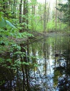
“Vernal Pools- also referred to as seasonal or ephermal ponds as well. Frogs, salamanders, and toads find these to be perfect breeding grounds.”
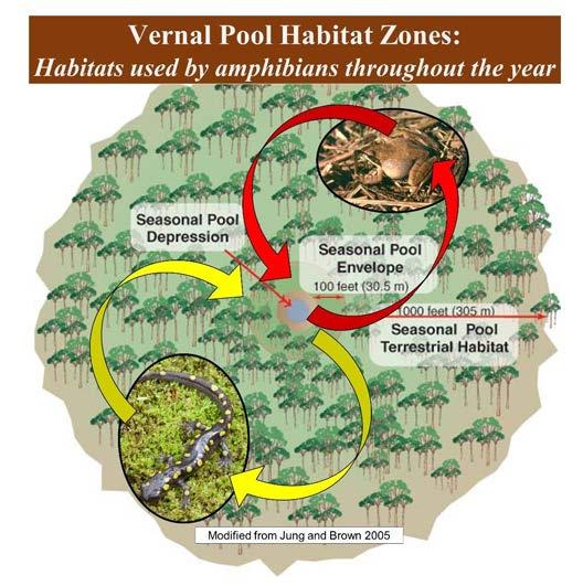
“The water collects here because beneath this vernal pond lies a hardpan layer. Many of these pools will dry out during the summer autumn and or freeze solid in the winter in this part of the country. This is actually a key feature for a vernal pool versus a pond or lake. “
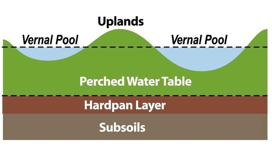
Image and text source - (Vernal Pond - Temporary Living Quarters, 2022)
“ Forested uplands as far as 1,000 feet away provide the summer, fall, and winter habitats for amphibians that breed in a vernal pool. These amphibians need shady, forested habitats to maintain their moist skin surface that they use for cutaneous respiration. Conservation must occur at several spatial scales to maintain the educational, recreational, and ecological values of a vernal pool. “
Image and text source - (Vernal Pond - Temporary Living Quarters, 2022)

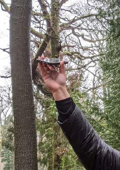
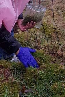
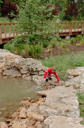
As a method of study, a water sample was collected from the forest pond (location marked on the map). This spot was selected for collection since it was visually the most stagnant and darker possibly contaminated water identified on site. Further studies of observing the water sample under microscope with the help of a biology student, measuring its PH value and trying to filter it by boiling were carried out.
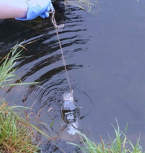
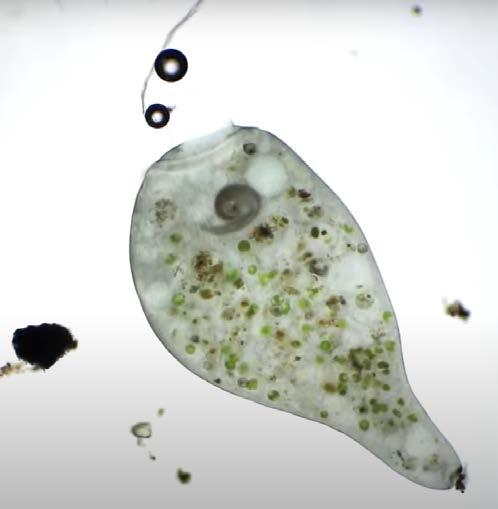
The results were fairly neutral and did not show any signs of major contaminants. Altough the water body did lack any sort of visible habitat of amphibians and insects and birds.
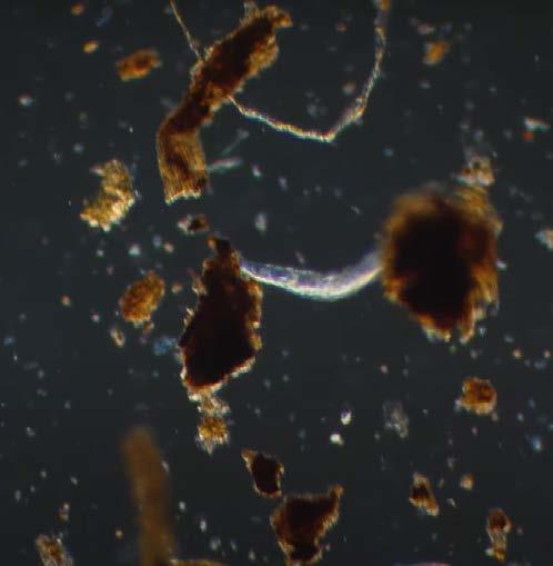
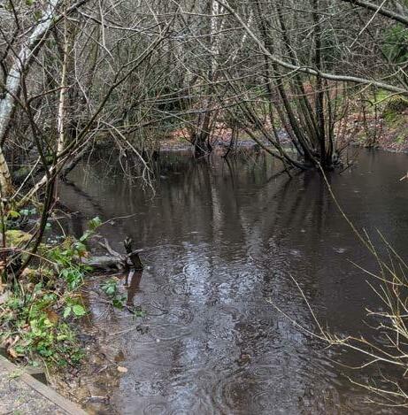
The inference of this could be that the forest ecology filters and keeps its water healthy, but the lack of oxygenation and movement of water in such pits, cause the decline in habitat.
Stakeholders
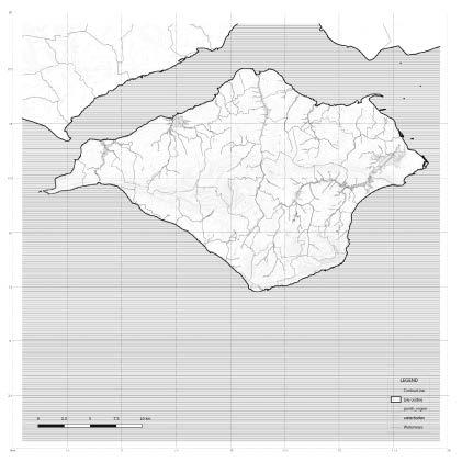
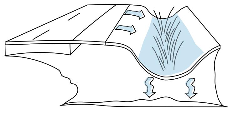
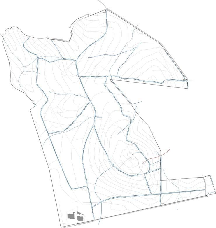
The forest site slopes inward to outward with its highest point in the central zone at 80m above sea level and sloping towards the edges to 30m above sea level. The water flow simulation and contour condition clearly show that the rain water runoff direction originates from the uphill areas flowing towards the lowlands.

These analyses have been confirmed by observation on the site. The forest has a developed road network that has drainage swales on one side of the running along the road length. These are currently not in their greatest condition as forest maintenance has not been carried out for a long time.
These water management proposals will help the forest get a new life. It will promote more activities for the forest to be used, creating value and encouraging stakeholders to invest in the forest’s management needs.
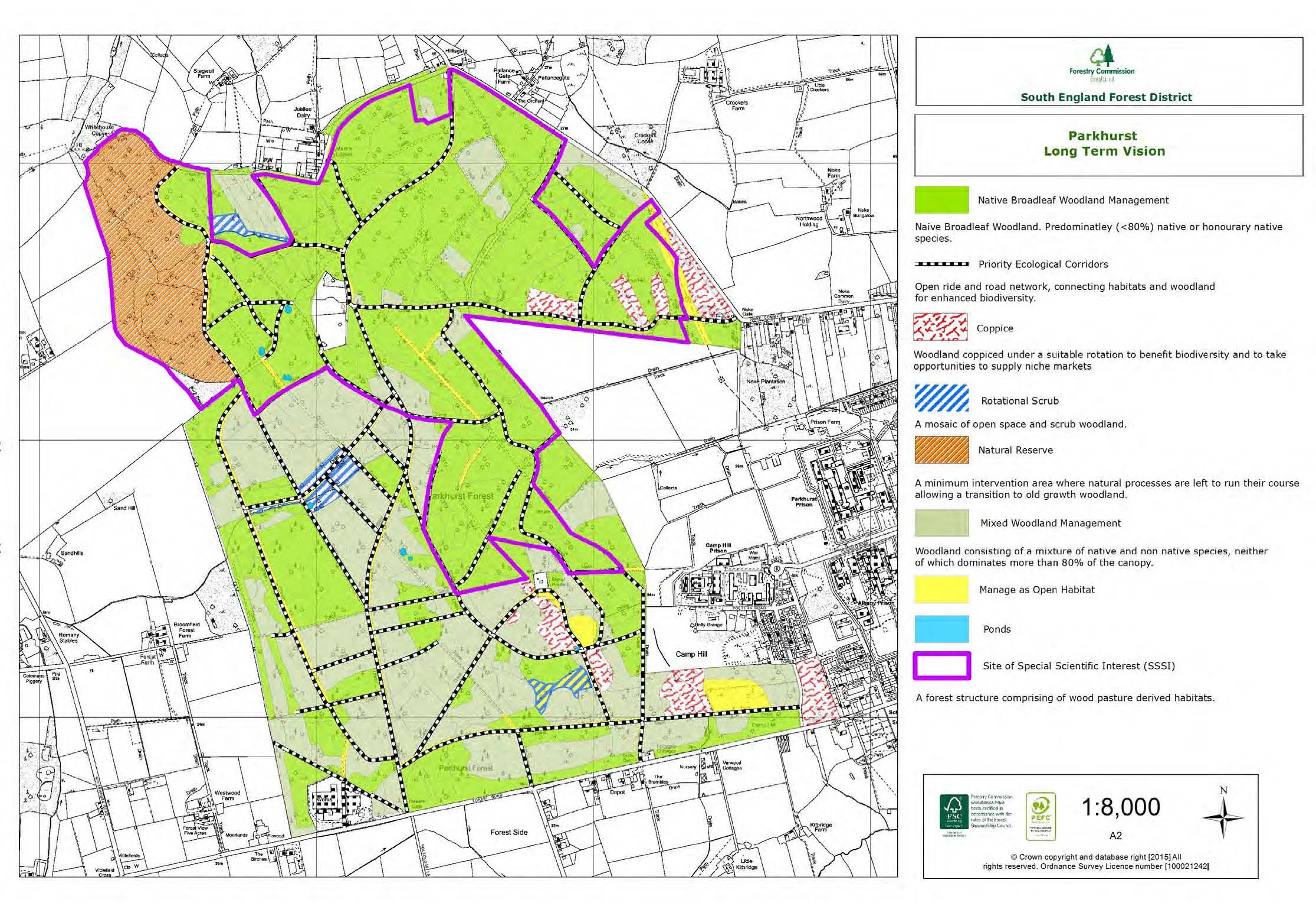
The Parkhurst forest being a mix of traditionally coppiced forest and ancient woodland, regular management is essential for the forest to sustain ecology at its best. focusing on the proposed primary function, these strategies provide a unique way for learning about the natural water cycles and the habitats it supports.

1 2
1 4 3 Spots for images water sample collected location
vernal ponds runoff along roads marshy areas across the forest
Natural water logged areas observed
key plan 2 3 4
Current Water flow analysis
0 100 M 200 M 400 M 50 25 25 30 30 30 35 35 40 45 81.2 67.3 45 45 45 45 45 45 50 50 50 50 55 55 55 55 60 60 60 65 40 40 40 40 40 40 40 40 40 40 40 40 35 35 35 35 35 35 35 30 30 30 30 30 30 30 25 25 25 20 20 15 40 40 40 40 45 45 45 45 45 45 45 45 45 45 45 45 35 50 50 50 50 50 50 50 50 30 55 55 55 55 55 55 60 60 60 60 65 65 65 70 70 70 75 80 55 55 60
Stream channels occur as water, silt, and wood are transported downwards from wooded headwaters. Channels form, and fauna has adapted to this changing habitat.
In practical terms, a swale is a contoured ditch and mound, or berm and basin. Swales, unlike diversion drains, are designed to absorb water rather than transport it around like a canal or water channel.
Protecting and enhancing the riparian vegetation that grows along stream channels is essential for keeping them healthy. It serves a variety of biological purposes, including supplying terrestrial and aquatic habitat, stream bank stabilisation, shade, that improves habitat by adding complexity to stream beds.
The removal of this vegetation might cause stream deterioration and instability, resulting in erosion and the loss of streamside property. One of the greatest strategies to safeguard riparian vegetation is to maintain buffer strips close to stream channels where no development happens.
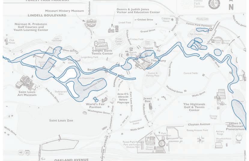
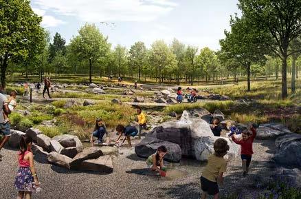
Case Study - the Anne O’C. Albrecht Nature Playscape
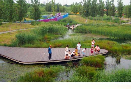
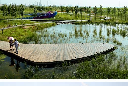
Natural settings with native and diversified species make up a 17-acre sensory play zone. The free attraction offers sand play areas, willow tunnels, stump steppers, boulders and pebbles, and hand water pumps among its nine separate activity zones.
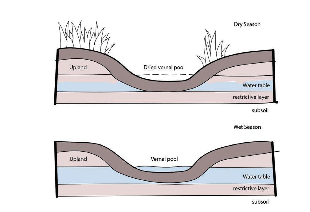
Seasonal pools, often known as vernal pools, are a special form of wetland habitat. They are often tiny, shallow, ephemeral water features with no fixed entrance or outflow, unlike a pond or a lake. They are filled with rain and snow melt in the spring, then dry out for a length of time in the summer. These characteristics separate vernal pools from other wetlands, and they sustain a variety of creatures that rely on these transient wetland environments to survive.
Case Study
In a strong downpour, poor soil water penetration as a result of soil compaction works like asphalt parking lot. Soil erosion from impermeable areas towards or in vernal pool life zones rises when soil compaction protections are not used.
In the life zone, winter activity also presents issues. Snowmobiles should be forbidden in the living zone during the winter because they crush tiny animal populations that tunnel beneath the snow in search of food, and snow compaction ruins their tunnels.
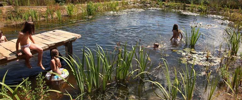
Ponds are among the world’s most biodiverse and ecologically critical freshwater environments, and they may offer a great chance to alleviate anthropogenic stresses and reverse aquatic biodiversity decrease. Ponds also provide a significant contribution to civilization by providing ecological services.
In the middle of the ever-changing and evolving world, a wide range of wildlife will learn to know your pond as a safe, healthy haven. Frogs, birds, deer, and a number of other species will benefit from fresh, clear water, native plant life.
Playscape Size: 17 acres
Trees planted: 300
Shrubs planted: 700
Perennials Planted: 40,000
Boulders & Rocks: 1,500 tons, including Missouri limestone
To make it simpler for animals to access your pond, make sure at least one side has a gentle, shallow slope. Dragonflies and other insects will rest, drink, and feed on microscopic microbes, algae, and other insects on this shallow area
The project’s overarching design purpose is to build a park that would provide a variety of natural services to the city and its surrounding population, such as collecting and filtering urban storm water.
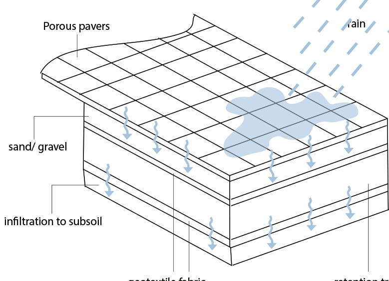
Porous or void-allowing pavements, open structures, or partially pervious materials are all examples of water-permeable pavements. Water can travel through or around them and into the soil. Rainwater may soak into the earth, groundwater is recharged, and sewage systems are alleviated as a result.
Trees, bushes, and grassy meadow areas that are not in direct competition with infrastructure safety concerns, buildings, roadways, or parking lot activities should not be chopped down. Trees and bushes offer the appropriate shade as well as a cool and damp microhabitat.
Leaves and coarse woody debris should not be removed from the life zone floor. This type of non-living ground cover contributes to the decomposer food chain while also protecting obligatory pool amphibians while they graze, wander, and hide. Do not remove any stones or rocks.
The fact that open and porous pavement materials ultimately become clogged with dirt is a drawback. Even with careful maintenance, it is difficult to return to the previous performance level at that time, and the water infiltration capacity is gone.
POROUS BRICKS
The porous grain structure of porous bricks allows air and water to pass through.
Footpaths, cycling routes, and highways can all benefit from porous bricks. However, the bricks ultimately become blocked with debris, which is a disadvantage.
GRAVEL, STONE AGGREGATE AND SHELLS
You may also eliminate puddles and ice on car parks by utilising permeable pavement to prevent water accumulating on impermeable surfaces. Large volumes of water can be temporarily kept beneath the surface. Flooding is less likely as a result of this.
Cannot be utilised in areas where substantial amounts of sediment may be washed or brought to the surface.
Where substantial sediment loads may be washed/carried onto the surface, this product is not suitable.
Porous foundations can be filled with gravel or stone aggregate with a uniform average grain diameter.
Subsidence will need the filling of holes on less strong foundations on a regular basis. For less-used walkways, cycling routes, and parking lots, gravel and stone aggregate can be utilised.
WOODCHIPS AND PINE BARK
These are natural compounds that allow water and air to pass through. They are appropriate for use in playgrounds and along garden walkways.
Woodchips and pine bark are an alternative to weed herbicides since they inhibit vegetation from developing.

Research - Streams and Swales
Streams Swales
Research - Bio pools and Bio Ponds
Research -
Pools
Bio pools Bio Ponds
Vernal
Vernal Pools
Permeable Paving
mounds sensory
meadow spring wetland forest
Research - Permeable Paving
garden
gravel bank
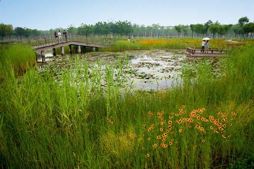
Case Study - Tianjin Qiaoyuan, China
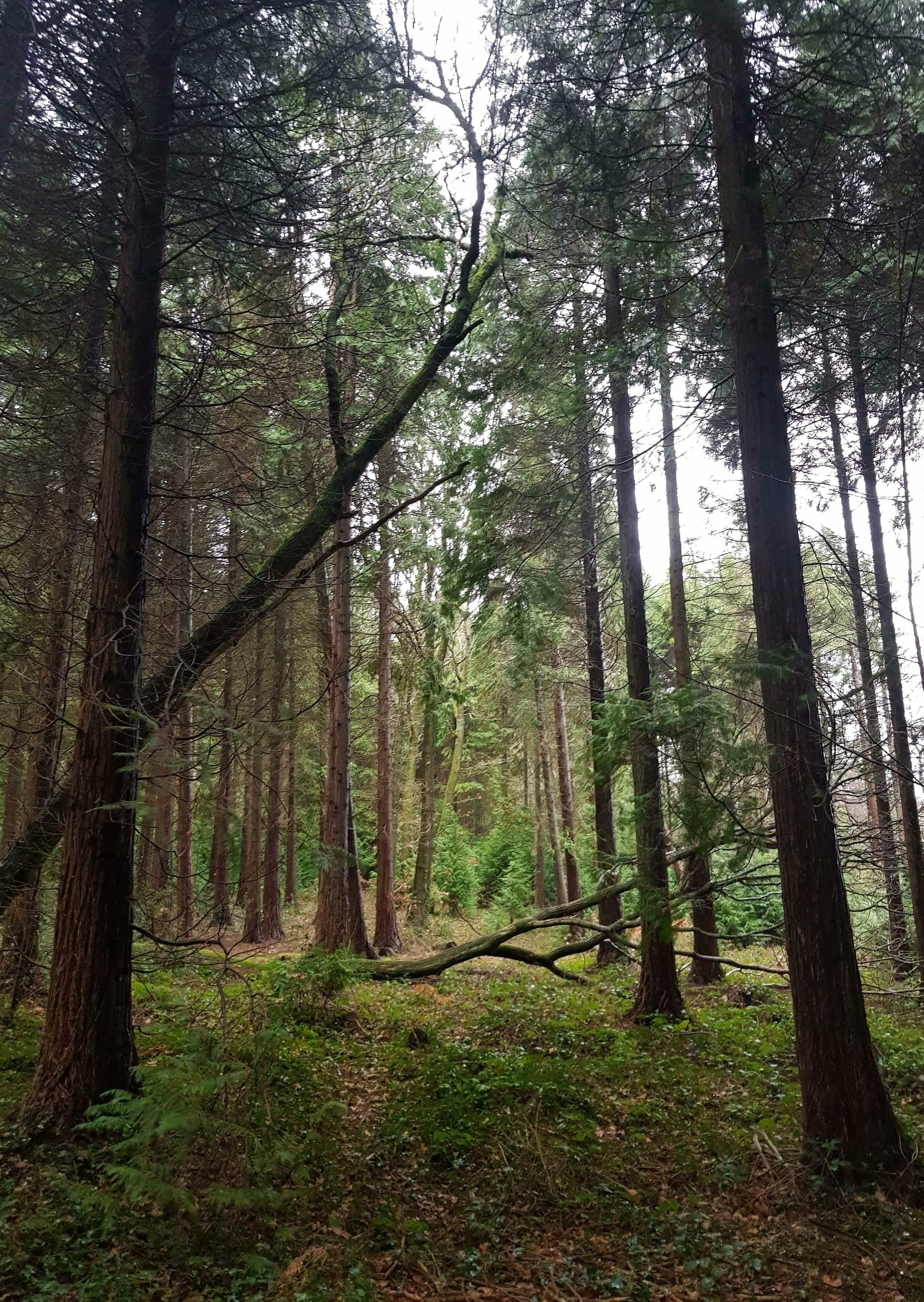
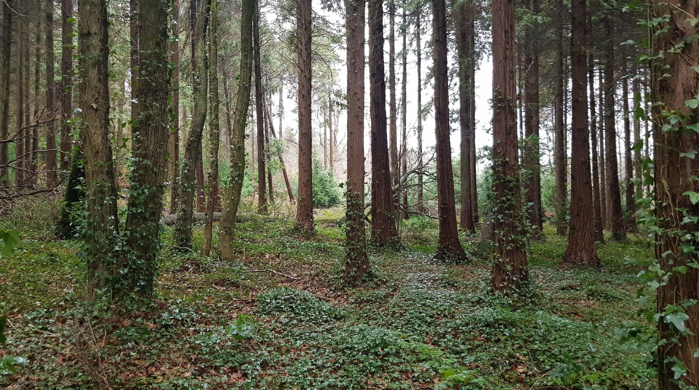
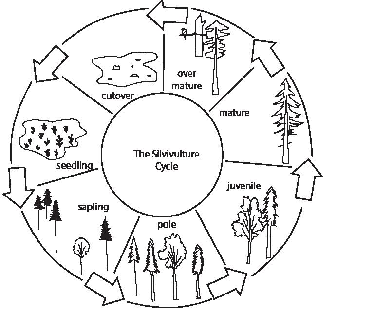
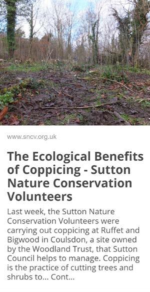
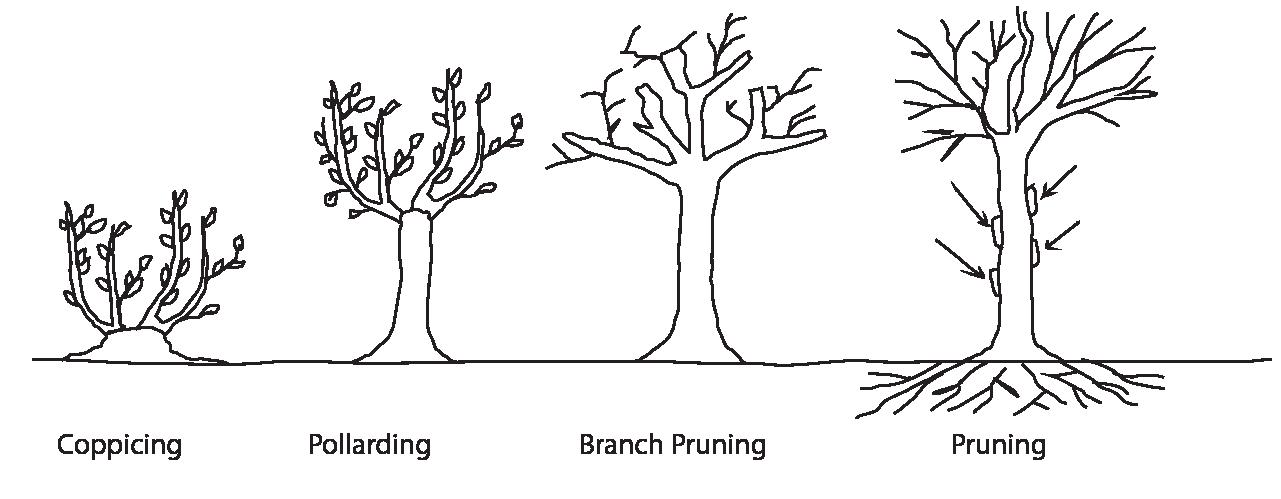
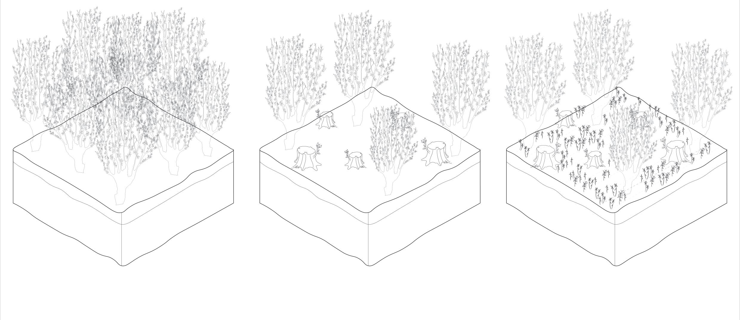
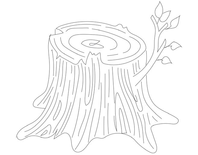
Coppicing is a forest management practise that involves frequently cutting trees at the base (or stool) and allowing them to regenerate to provide a steady supply of wood. This method offers a lot of advantages over replanting since the felled trees have already formed root systems, allowing for faster regeneration and reduced exposure to browsing and shadowing.

It also boosts forest biodiversity by letting more light to reach the ground, allowing for the growth of additional plants. Many of these species provide as food for butterflies and other insects, who in turn feed birds, bats, and mammals.
The variable age structure of the plants in well-managed coppice forest also provides suitable habitat and cover for a variety of bird species.
Understanding copping and its effect through sectional study
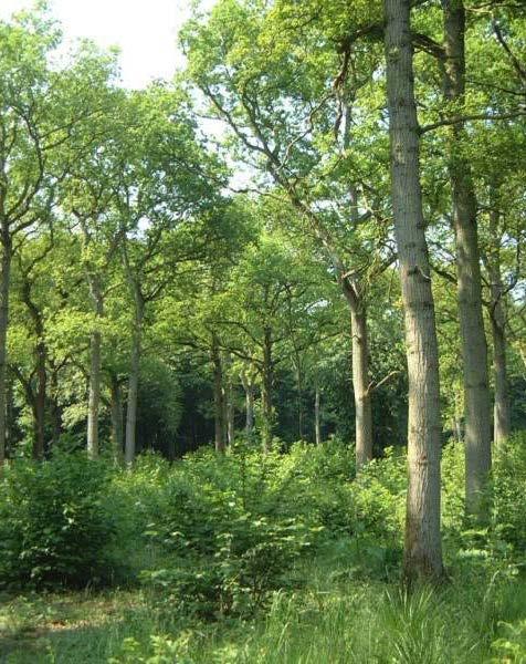
Overshoot of coppice occurs when a regular coppiced forest area, is suddenly stopped in maintenance.

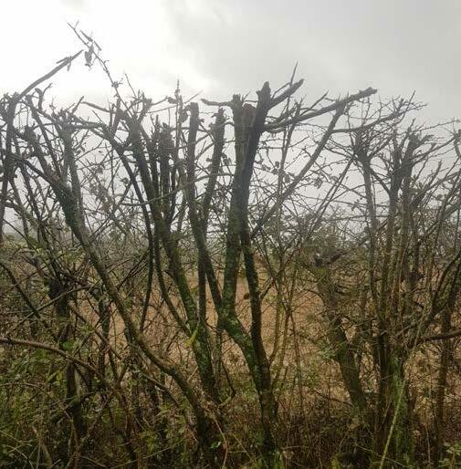
This results in the trees growing in all directions and the canopies of the forest growing denser and denser. This becomes particularly problematic when the coppice over shoots to a level where the canopy is very thick and doesn’t allow light to enter and reach the forest floor.
Without light the lower layer of forest cannot survive which involves the shrubs, insects, and everything that depends on the habitat resulting in gradual degradation of the forest.
Pine dominated forest before coppicing
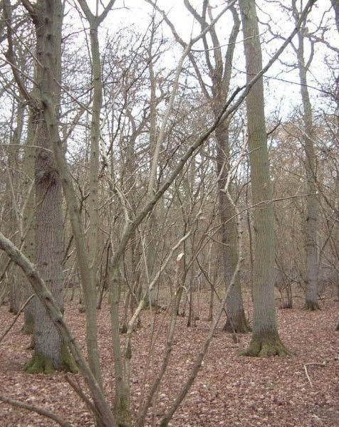
After coppice - fore floor cleared
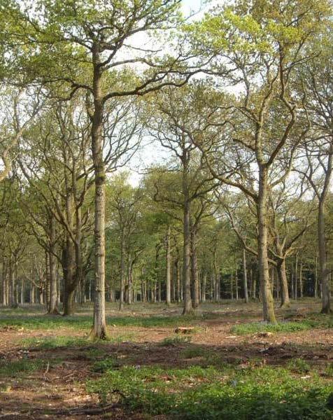
5 years after coppice - regrowth of forest cover
Case Study - v
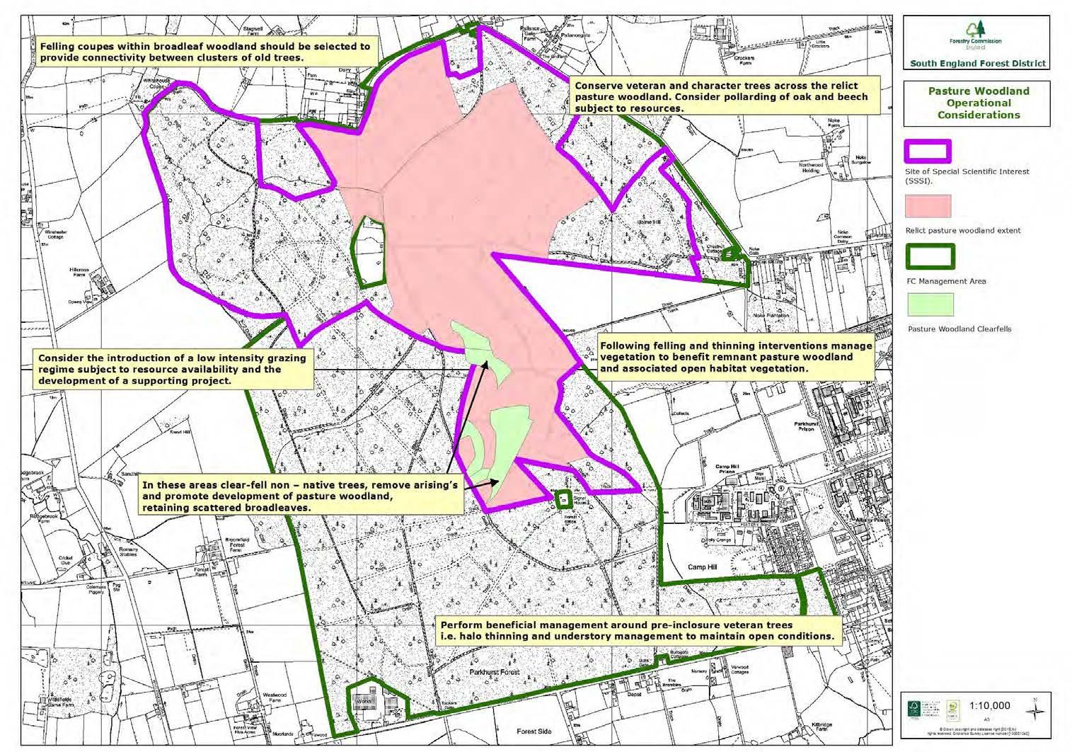
This old forest in West Oxfordshire is also a Site of Special Scientific Interest (SSSI). It has Oak standards with a Hazel under story, which contributes to its structure. The woods was primarily utilised for game raising, but without regular maintenance, the Hazel had been overgrown and choked by the Oak canopy, making it colder. Nicholsons was able to acquire grant funding to deer fence the perimeter of a seven-hectare coppice, as well as initiate a programme of oak thinning, hazel coppicing, and replanting hazel into major under story gaps. This was gradually in over a three-year period, and the woods was effectively revitalised.
Trees with several stems sprouting out of the stool, which emerge from latent buds on the stool, can be found in a coppiced woods. These buds might potentially sprout from the severed stem’s cambium layer or from root buds near the stumps. Although most branches grow from above ground, hazel sprouts can emerge from just below the surface.

Underwood is the ‘wood’ that it cuts and is used for a variety of uses depending on the tree type.
Oak, hazel, ash, willow, field maple, and sweet chestnut are the most often coppiced trees.
COPPICING - FOREST MANAGEMENT STRATEGY
Spots for coppiced images Image 1 News articles as part of research to understand coppice and overgrowth Image 2 Image 3 1 3 key plan Spots for coppiced images
key plan
Design details + Landscape realisation
This section shows the details of design and ecological strategies taken into account while developing the project.
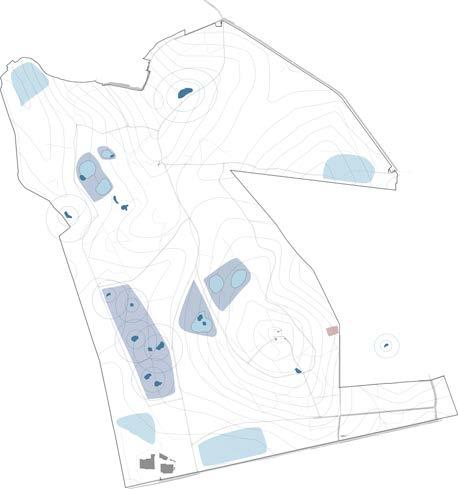
Masterplan of Forest School - Zoning and Water System
Streams
Swales
Reed beds
Vernal Pools
Bio Pond and Bio Pool
Wetland as Flood management strategy
Coppicing at Woodland management Strategy
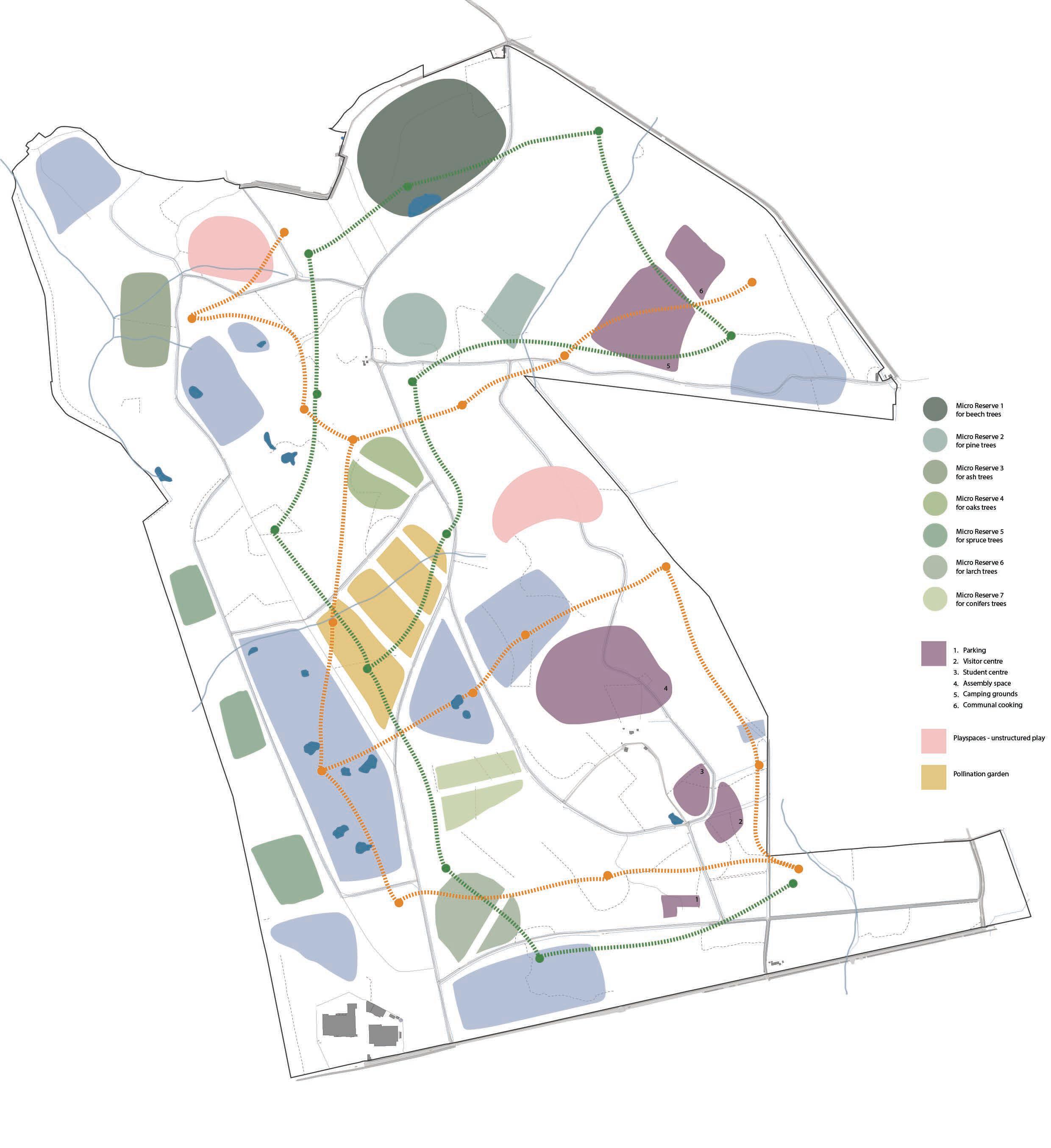

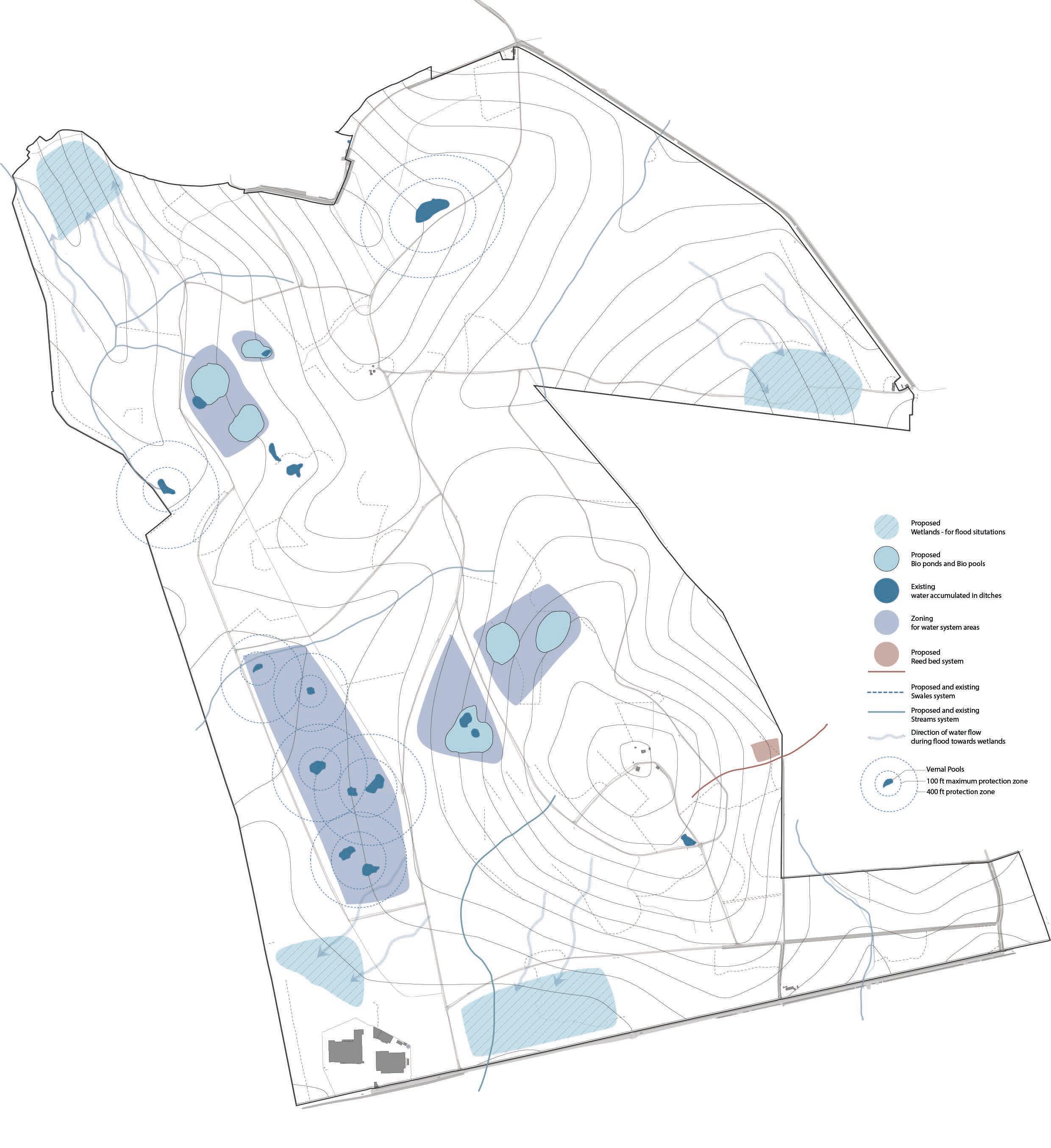

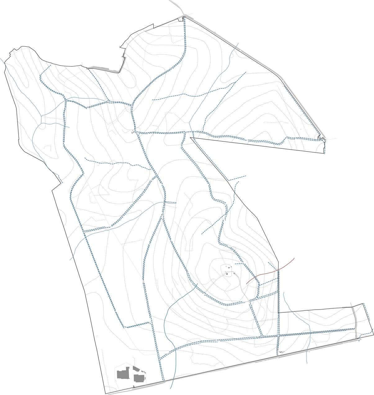
MASTERPLAN - ALL ZONES MICRO RESERVES ACTIVITIES TRAILS STREAMS AND SWALES POOLS AND PONDS WATER FLOW DIRECTION MASTERPLAN - WATER SYSTEM PLANNING 0 100 M 200 M 400 M 50 25 25 30 30 30 35 35 40 45 81.2 67.3 35 45 45 45 45 45 45 50 50 50 50 55 55 55 55 60 60 60 65 40 40 40 40 40 40 40 40 40 40 40 40 35 35 35 35 35 35 35 35 30 30 30 30 30 30 30 25 25 25 20 20 15 40 40 40 40 45 45 45 45 45 45 45 45 45 45 45 45 35 50 50 50 50 50 50 50 50 50 30 55 55 55 55 55 55 60 60 60 60 65 65 65 65 70 70 70 75 80 55 55 60 0 100 M 200 M 400 M 50 25 25 30 30 30 35 35 40 45 81.2 67.3 45 45 45 45 45 45 50 50 50 50 55 55 55 55 60 60 60 65 40 40 40 40 40 40 40 40 40 40 40 40 35 35 35 35 35 35 35 35 30 30 30 30 30 30 30 25 25 25 20 20 15 40 40 40 40 45 45 45 45 45 45 45 45 45 45 45 45 35 50 50 50 50 50 50 50 50 50 30 55 55 55 55 55 55 60 60 60 60 65 65 65 65 70 70 70 75 80 55 55 60 0 100 M 100 M 100 M 100 M 100 M 100 M 400 M 400 M 400 M 400 M 400 M 400 M
The Streams proposed in the design are planned according to the topography of the site, while keeping all existing routes the same and adding more to enhance the water system. All these are designed to be tweaked a little to form an efficient flow.
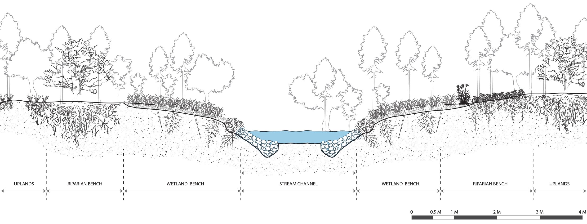
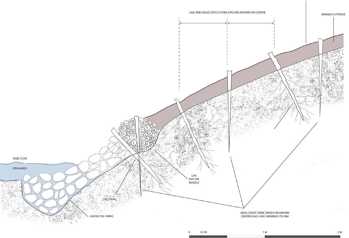
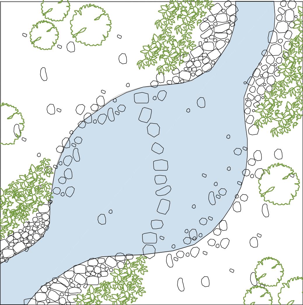
The streams are located as per water flow analysis. They are mainly designed for maintaining oxygenated water flow and such that the forest grows a healthy riparian habitat along the streams.
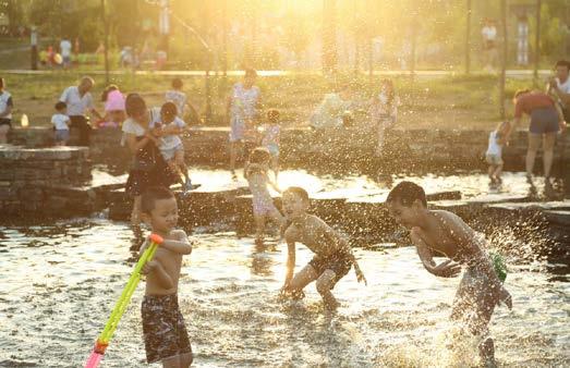
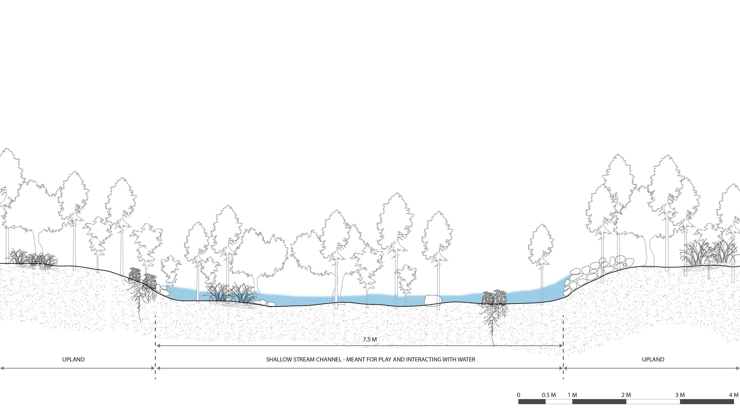
At places where in the plan school activities and unstructured play spaces intersect with stream flow, the stream is designed to become shallow, flow along boulders and stepping stones creating a dramatic and playful effect. The shallow depth allows for the opportunity to play in the water, learn about the ecology hands on.
Not meant only for education, locals on their daily walks or picnics, tourists, pets can all enjoy such spaces and increase importance of natural play in our lives.
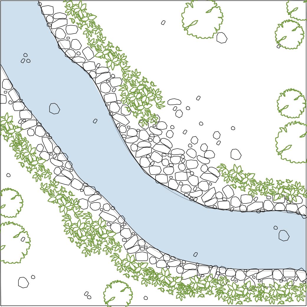
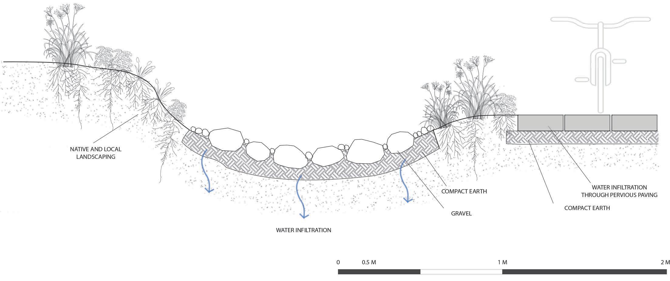
Swales are designed along all the existing pathways and along the new proposed pathways in design. Largely of two typesone alone the main roads are broader and planted with local plants of forest to filter run off water from the roads. The other type of swale is along the pedestrian paths in the forest and are smaller in width to cater to minor run off. Since the pathways are natural trails along the forest, these swales are kept simple in design for directing the water in an organised manner.
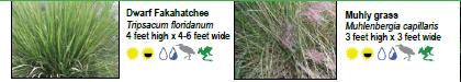
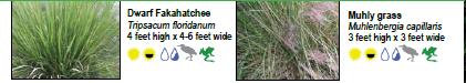
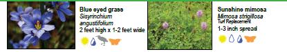
PLANTS TO BE USED IN SWALES-
DESIGN and TECHNICAL DETAILS- STREAM DESIGN and TECHNICAL DETAILS- SWALES A A’ B B’ SECTION A - A’ DETAIL C SECTION AT A SECTION AT A SECTION AT B SECTION AT B DETAIL C SECTION B - B’ KEY PLAN 0 100 M 200 M 400 M 50 25 25 45 45 45 50 55 60 60 65 40 40 40 40 40 35 30 30 30 30 40 45 45 45 50 50 50 55 65 80 55
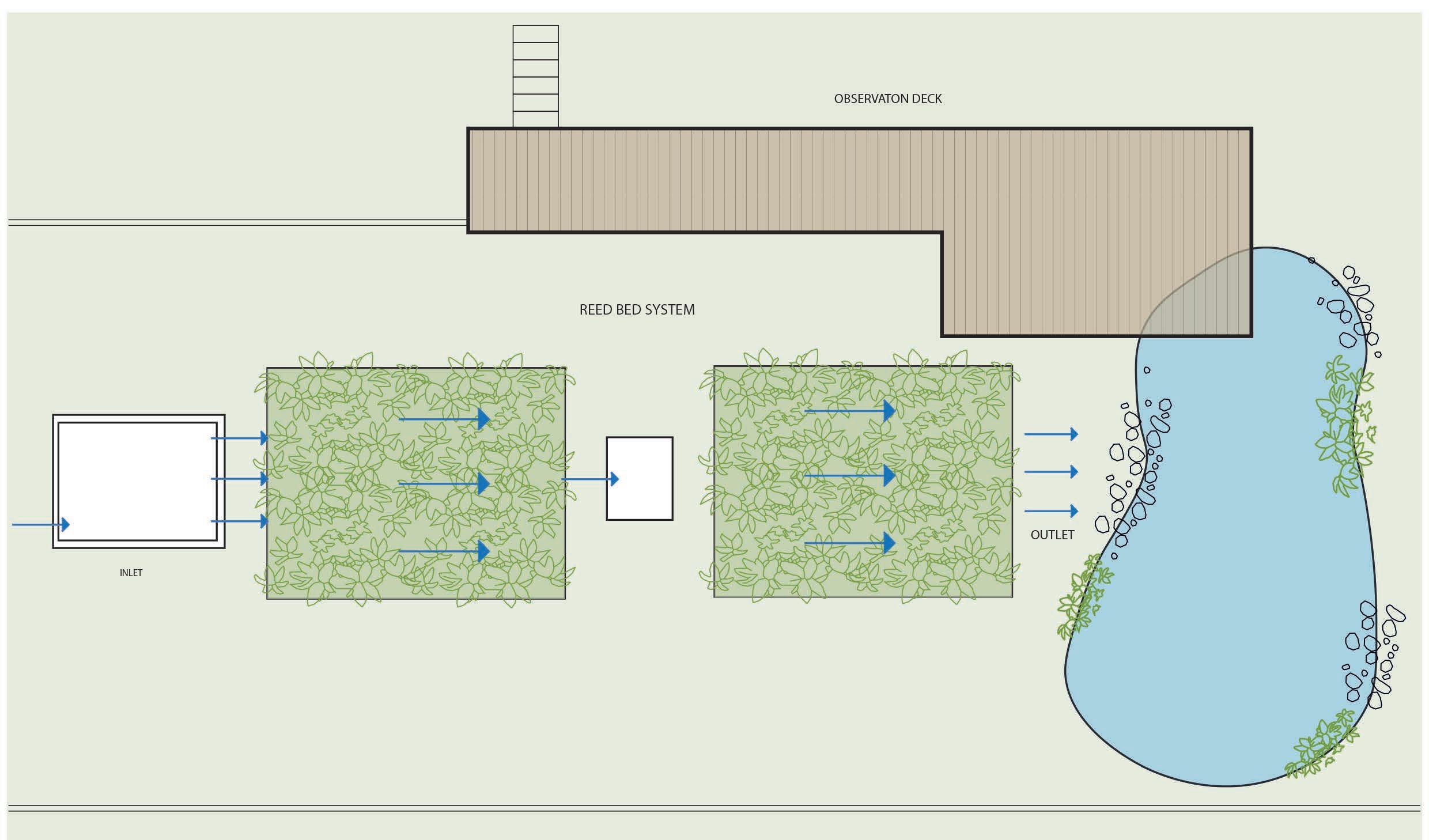
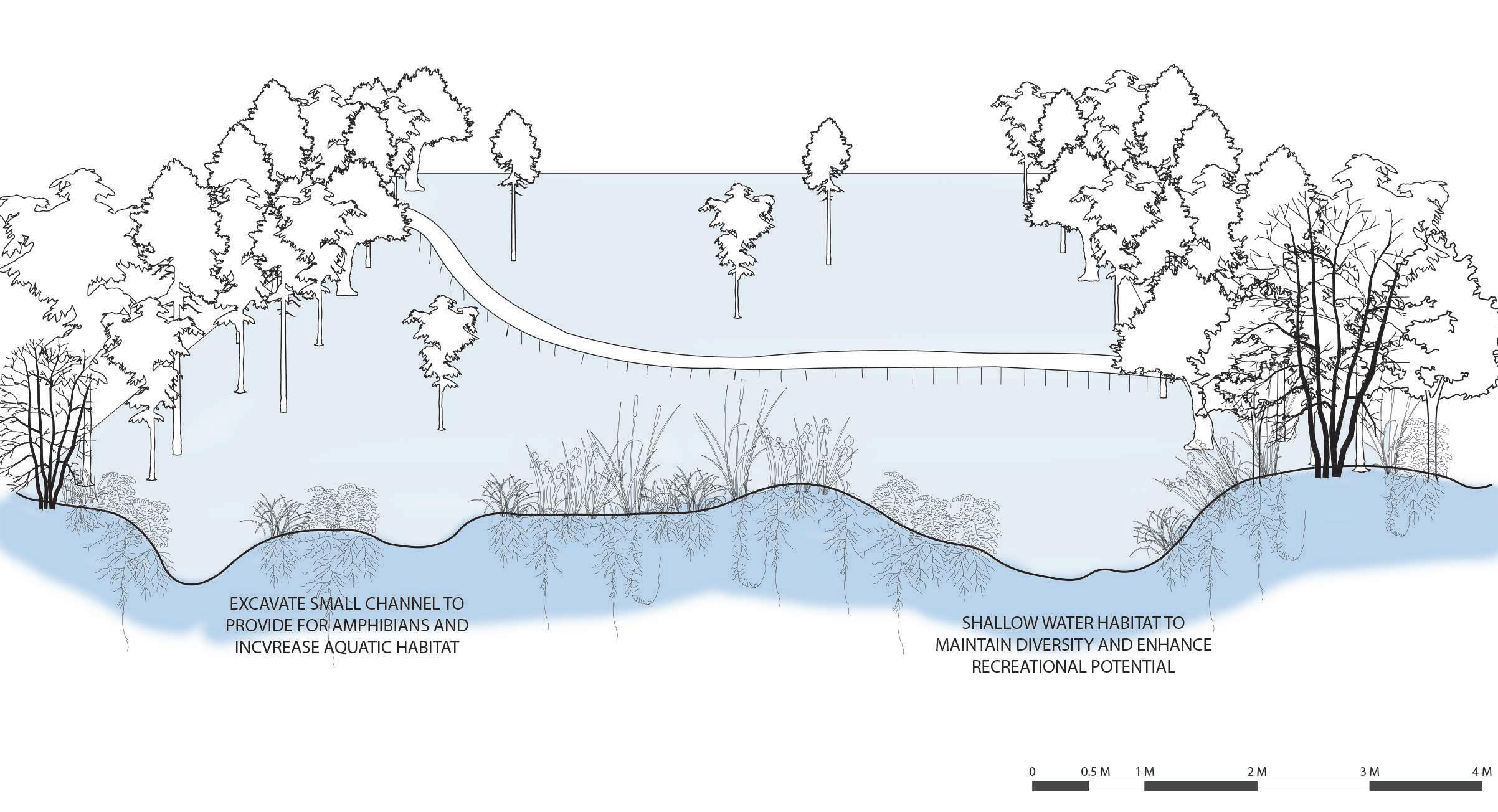
Reed beds though commonly found on open land, in the design is planned with a structure and is regulated. The intention of this was so that the grey water is no where mixed with the ground before filtering. Forest ground has a established ecology, adding man-made waste to it can harm the ecology and contaminate the water table. This solution helps prevent this.
The design also provides a observation platform from where the kids can observe and learn about reed beds. the platform is at a height which stops kids from entering the plant bed itself. This way the reeds are protected and so are the kids from entering an grey water area. The process of how grey water is cleaned by plants and then released in to a frog pond- water clean enough to host life, will be a valuable lesson to the kids.
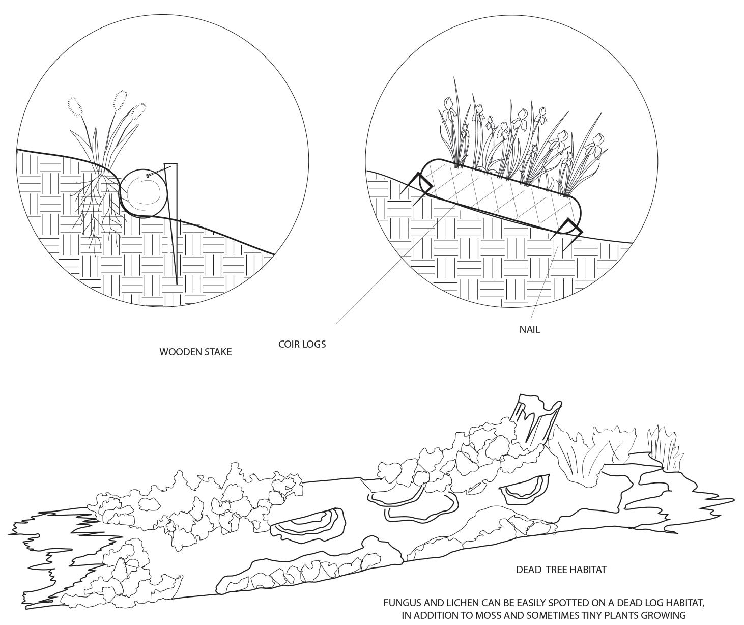
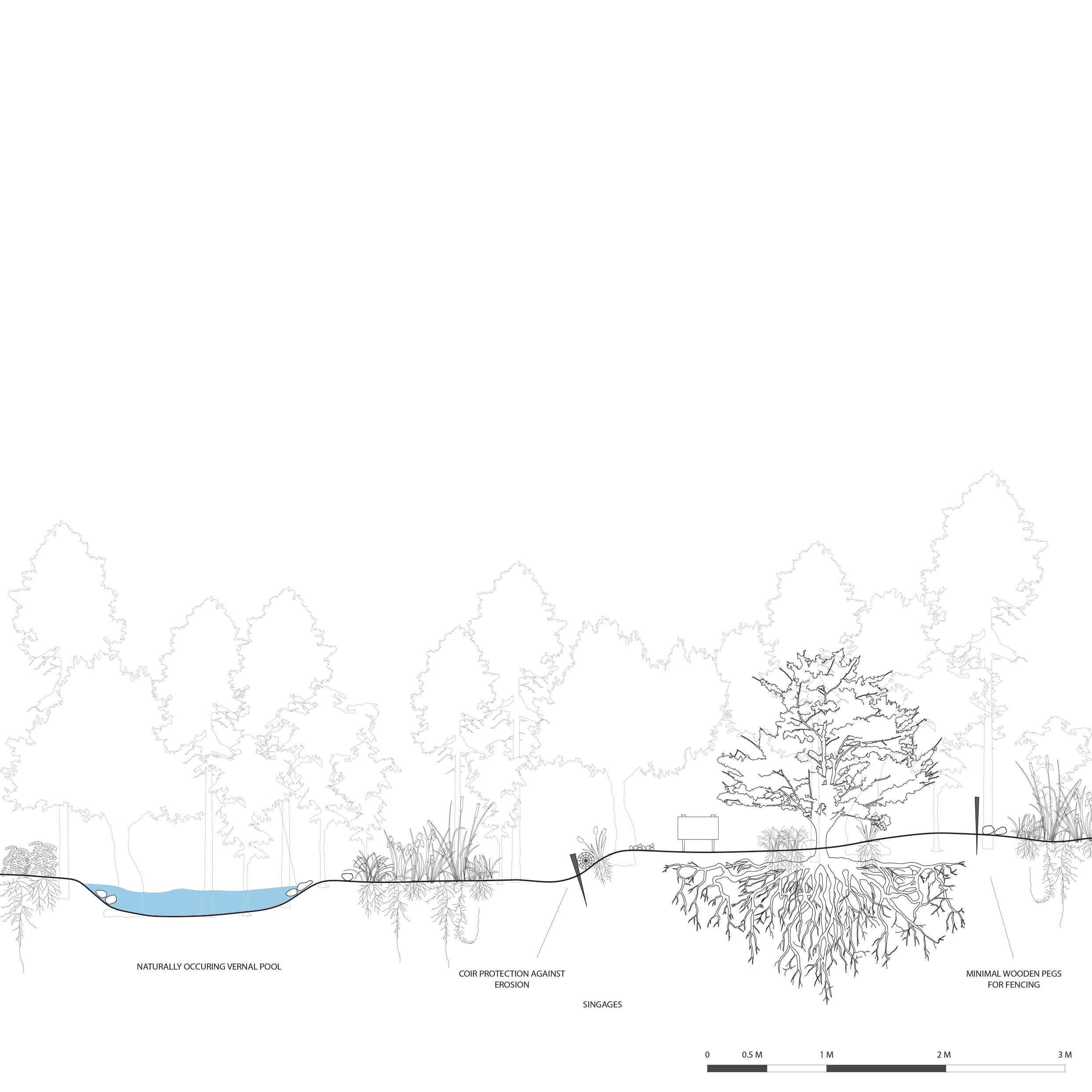
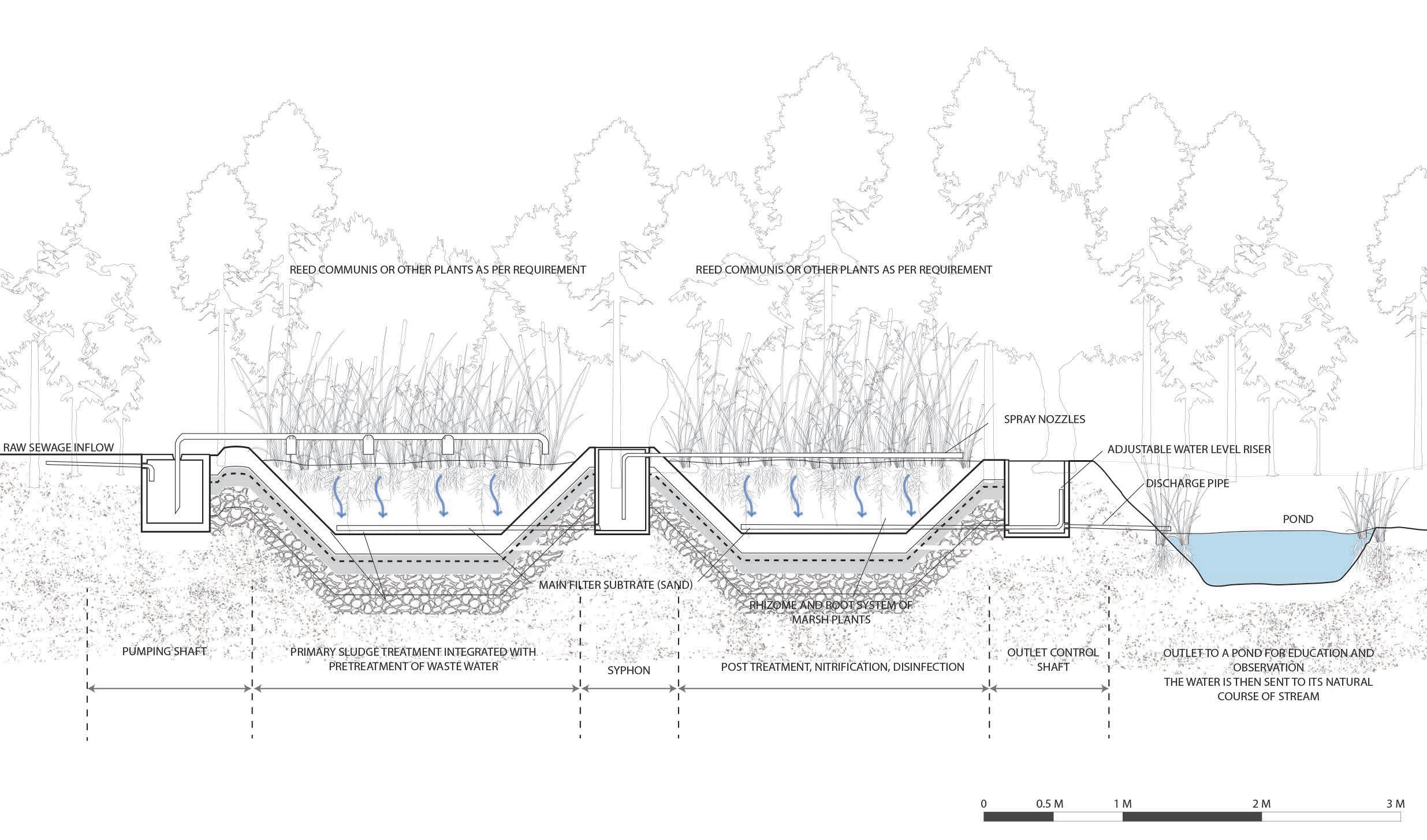
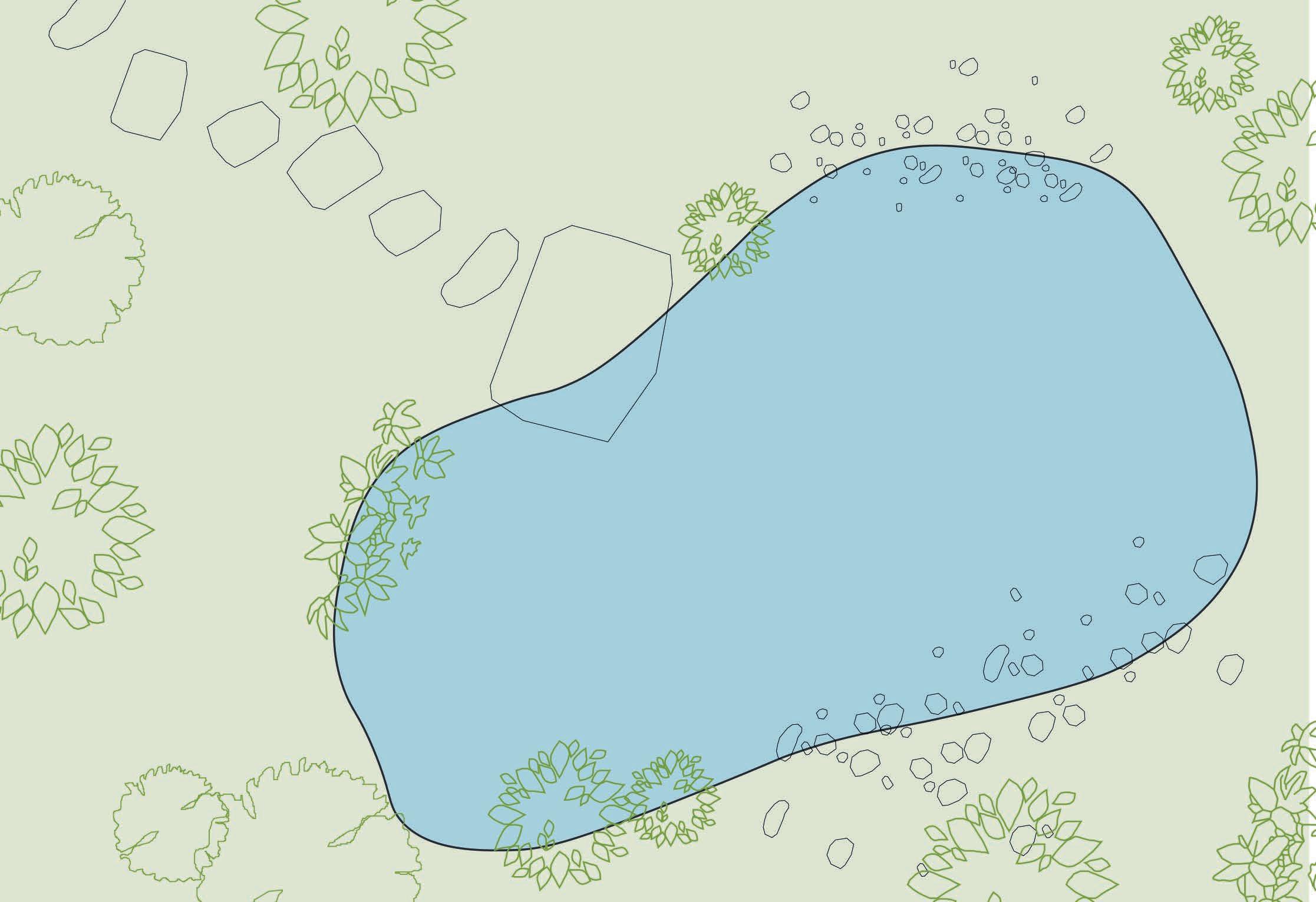
Vernal pools are a very sensitive habitat and are easily disturbed by certain human activities. The forest fragment where many of there vernal pools are naturally found, are zoned in the design to protect.
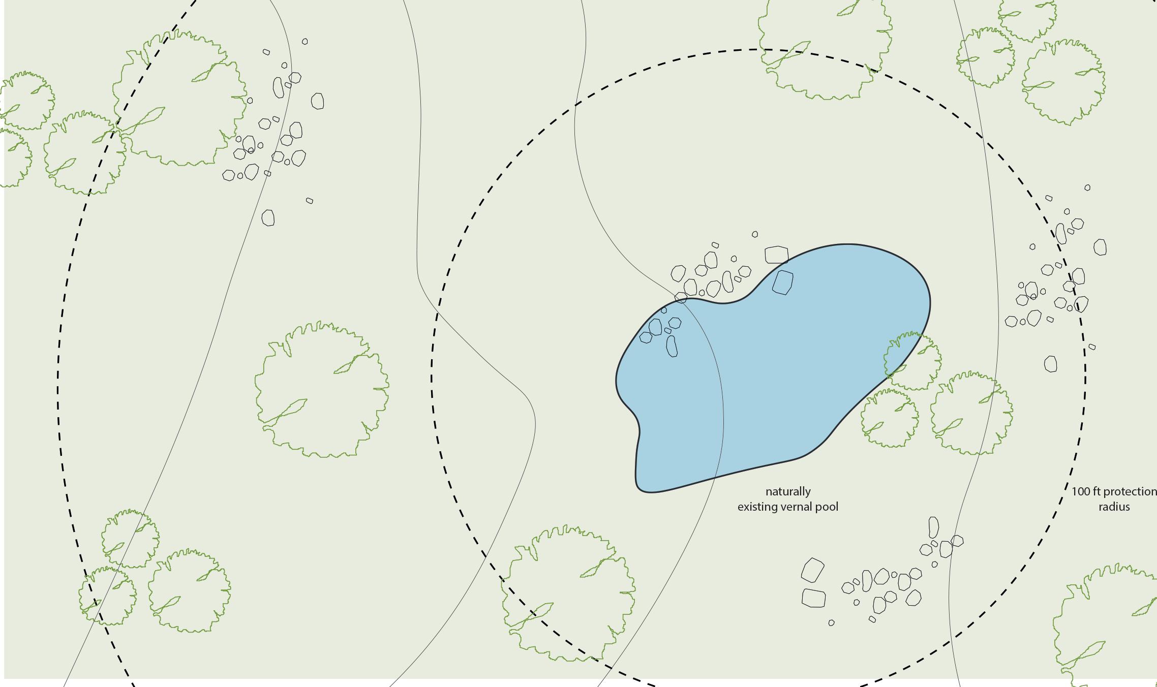
The immediate protection zone is about 30m (100 ft) and a larger buffer zone is 120 (400 ft) indicated by wetland protection acts. This suggested protection is considered in the design and the zones are marked using simple wooden stags and fence. Appropriate sign-ages will inform the visitors about the importance and sensitivity of this zone and help them navigate their way in a safe manner to the pool. It would also suggest them to refrain from entering the area unless required.
The habitat of vernal pools expands beyond the pool bed. Young vernal pool animals begin their lives in the water, but they eventually mature into adults who live on land. They had to get out of the pool before it goes dry, or they will drown. Each successive generation of adults abandons the pool in search of a home on land. Adult amphibians seek food and refuge in the adjacent upland forest over the many months when a vernal pool is dry. They reside beneath rocks, decaying logs, and the damp layer of leaves on the forest floor, either underground or near the surface.
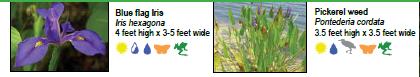
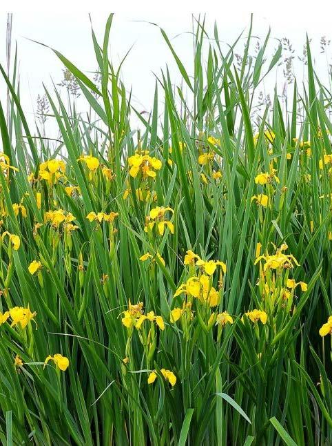
YELLOWFLAG Iris pseudacorus
KEY PLAN KEY PLAN DESIGN and TECHNICAL DETAILS- REED BED DESIGN and TECHNICAL DETAILS- VERNAL POOL DETAIL
A A’ A’ B B’ SECTION
- A’
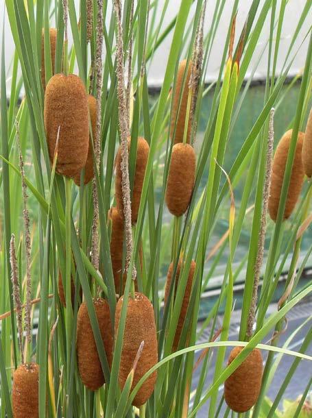
Common Bulrush Typha latifolia Common Reed Phragmites australis
A
A
SECTION B - B’
Bio-pnds are designed around the existing smaller ponds of forest that are formed due to collected water in ditches. Appropriate habitat is initially introduced which will grow and invite more species of insects and birds creating its own elaborate pond habitat.

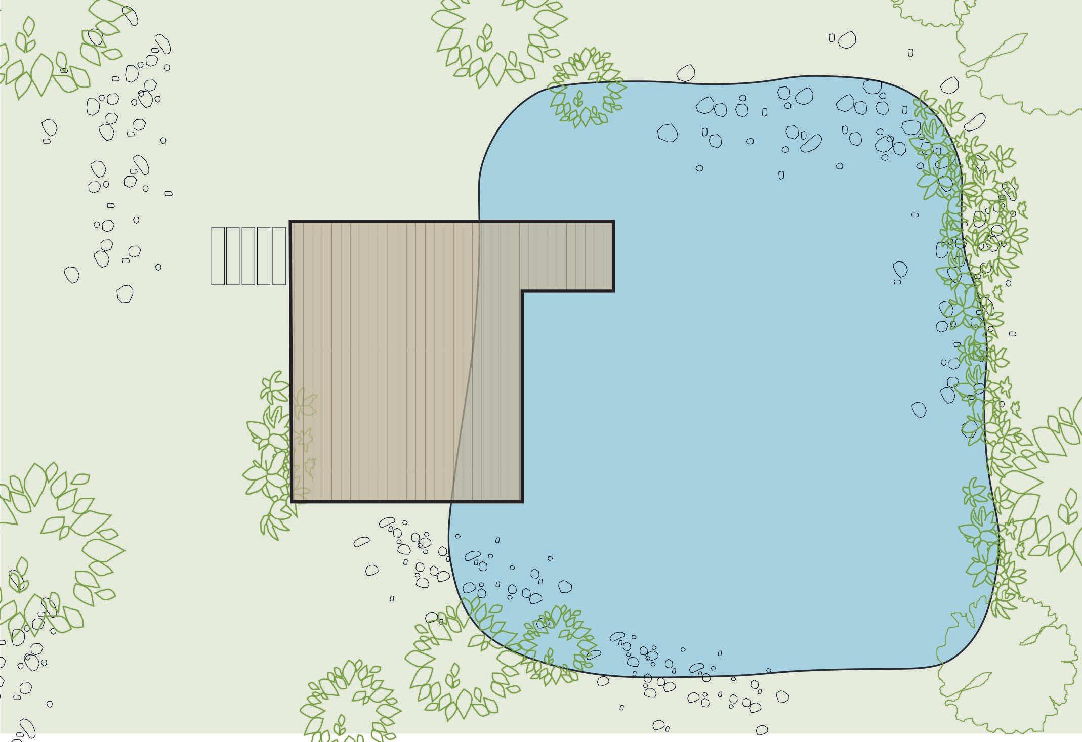
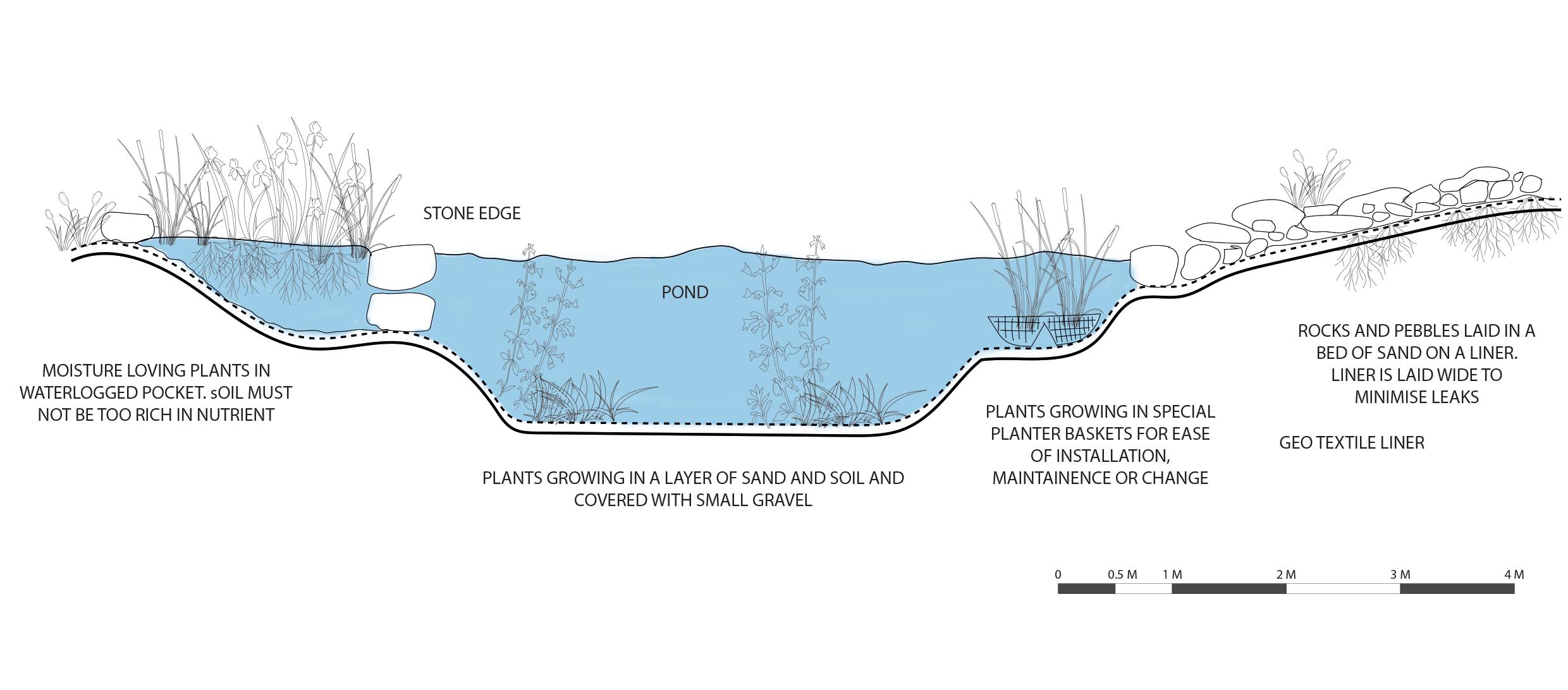
SECTION A - A’
SECTION B - B’
POND ACTIVITIES FOR KIDS POOL ACTIVITIES FOR KIDS
The pond is an amazing place to explore. There are so many things for kids to learn and discover. Kids will learn to observe and appreciate nature. Identifying different insects and mammals at their different stages of lie, identifying plants and studying their role in a habitat
In addition to nature study, kids also explore themselves growing up in an unstructured play zone. They understand balance, physics - by pond dipping, walking on the banks, skipping stones and such.
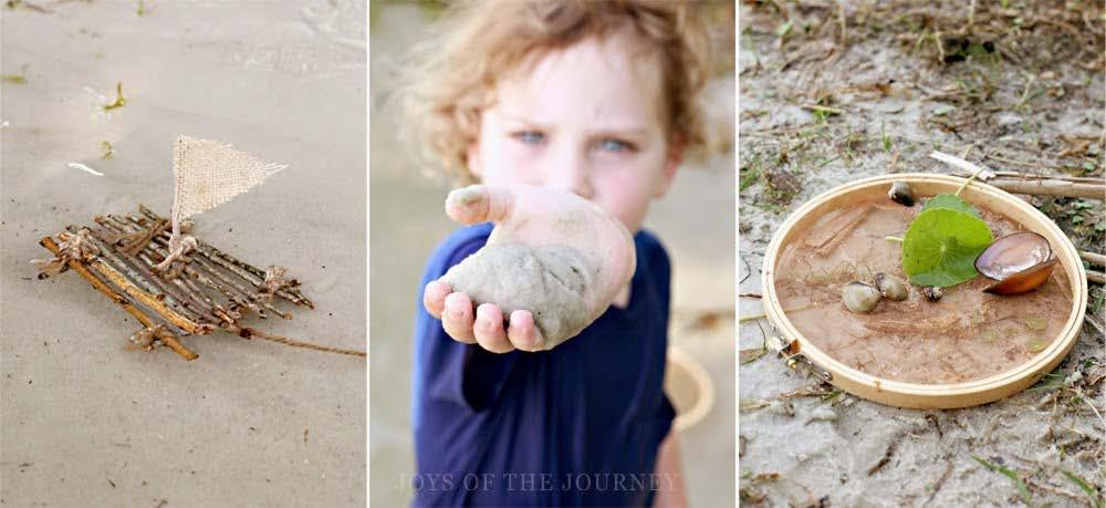
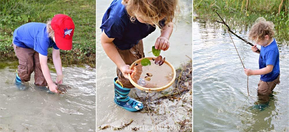
Sensory exploration is another activity for kids to explore near pondshearing how the water moves and stabilizes, insects and plants. looking at different colours of plants and insects - talking about nature and discussing it with their teachers. Regular maintenance will be necessary for these pools to keep a check on the water quality and safety.
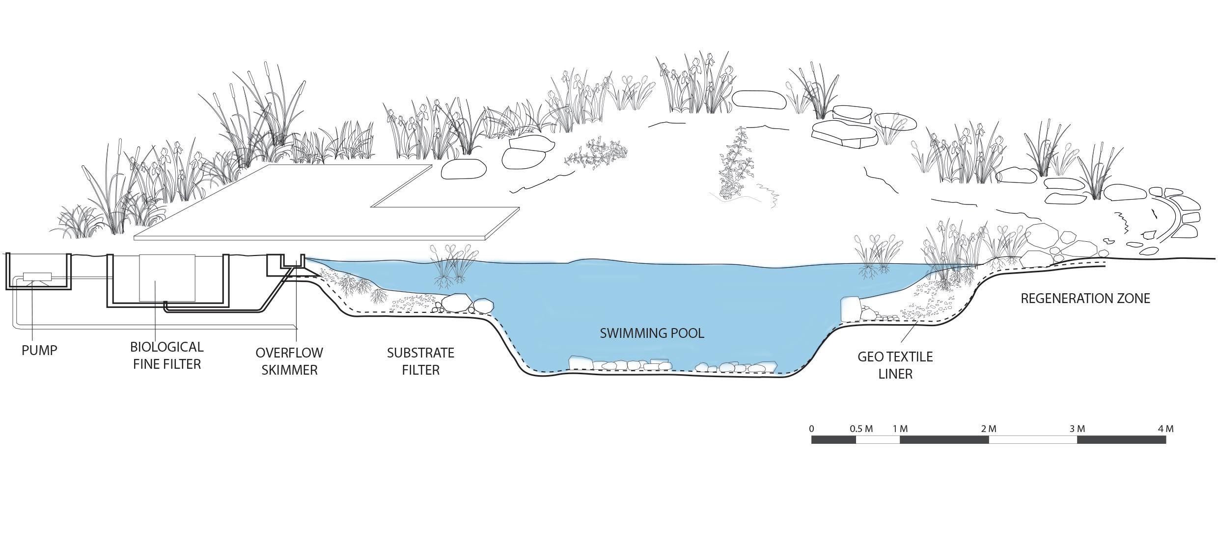
Bio-pools are designed here for kids to take a dip and experience swimming a more traditional manner. No chemicals are used in a bio pool, but a small filtration system is installed to maintain the quality of water safe enough for kids to enter. The height and edge details are carefully designed to manage a safe environment for kids.
While the students are exposed to conventional subjects on a regular basis, all learning occurs naturally via inquiry and direct experience rather than through teacher-led lesson plans in a classroom.
DESIGN and TECHNICAL DETAILS- BIO POND DESIGN and TECHNICAL DETAILS- BIO POND KEY PLAN KEY PLAN A B’
B
A’
Image Source - (Natural Pools: organic pools for Swimming, 2022)
Image Source - (McGurk, 2022)
Wetland zones in design for Parkhurst are planned in a for a flood risk situation.
Located at the lower points in the forest, the designed water system of streams, swales, and ponds is directed towards these locations.
In case of heavy rainfall or storm, when the water system cannot handle the increased volume of water, these wetlands will provide a landscape to hold water until it can infiltrate in the ground.
Wetlands operate like natural sponges, absorbing and retaining water until it can seep into the earth. Because most of the runoff originates from prior groundwater withdrawals, increased infiltration in urban areas is substantial.
The wetland progressively releases any water that does not penetrate into the groundwater into adjacent streams. This gradual discharge aids in the prevention of floods during storms. Wetland vegetation also aids in reducing the pace with which water flows through the terrain.
- (2022)
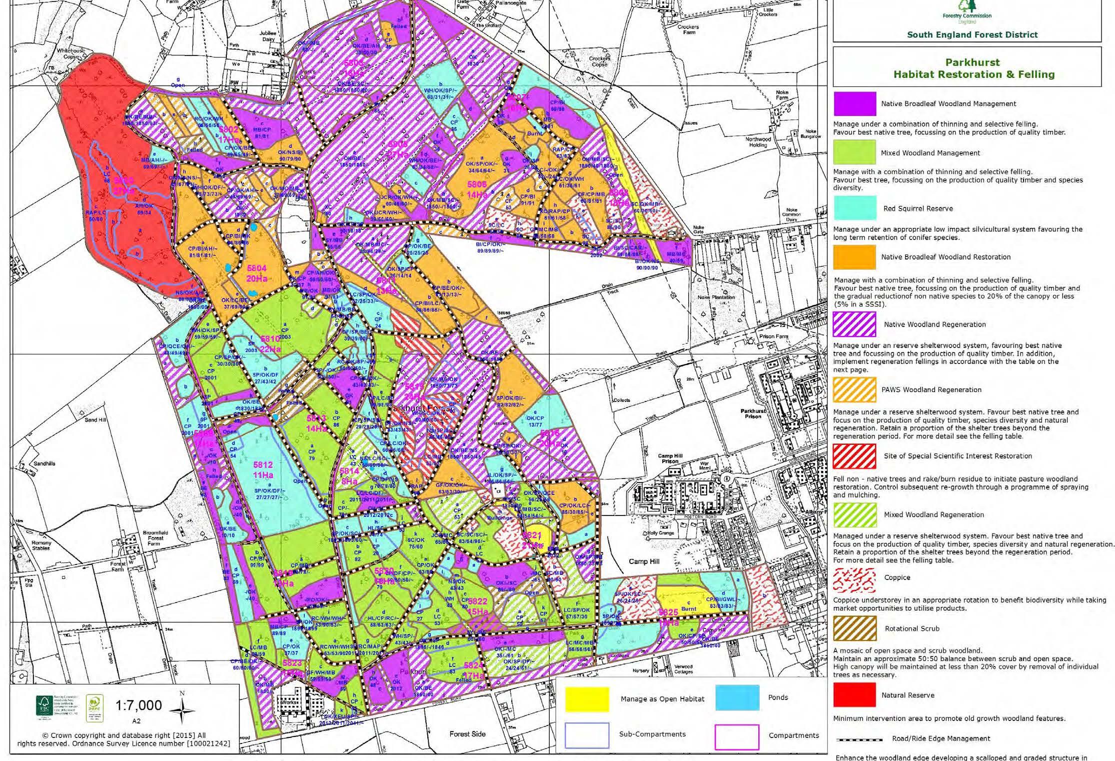
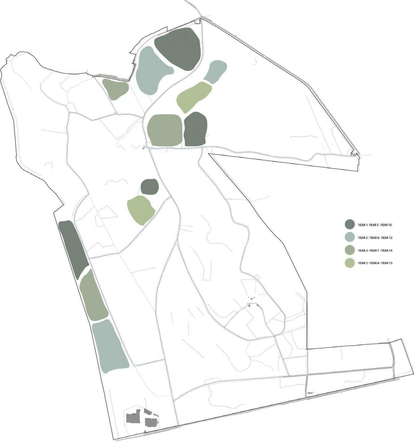
Coppice plan is done according the the given guidelines by the Forestry Commission of Isle of Wight. Initial design proposal suggests coppice management to be done in different parts of the forest every year. The frequency is decide so that the forest can be got back to its managed health but also not so that it receives a shock from sudden chopping of trees.
This coppiced wood will be the primary source of material on the site for forest school building, water management strategies to be built and for activities there on. Sourcing wood on site is the most economical and sustainable strategy for the forest’s development.
The part of woodland for coppice will be conifers and broadleaved with special focus on hazel plantation. The hazel plantation in the forest has suffered majority due to lack of management over the past few years, this has reduced the nut production ability of trees which in turn is causing a serious threat to the red- squirrel population in the Forest. Protection of these red-squirrels is of primary importance.
The coppice starts in denser zones first then working a plan around it. The denser regions of the forest receive less to no sunlight and has affected the lower layer of habitat. Regeneration of this habitat can be started with this coppicing plan.
WITH
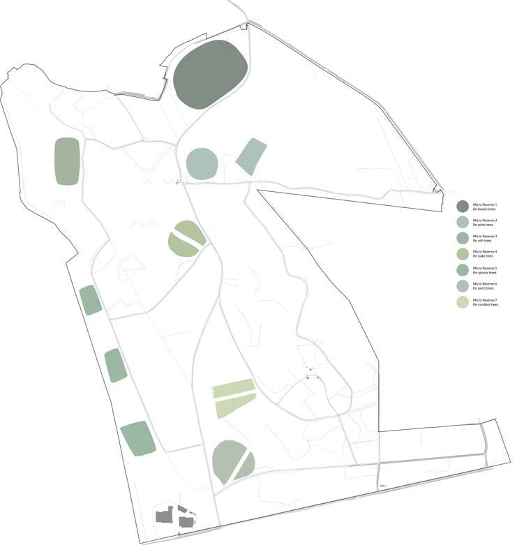
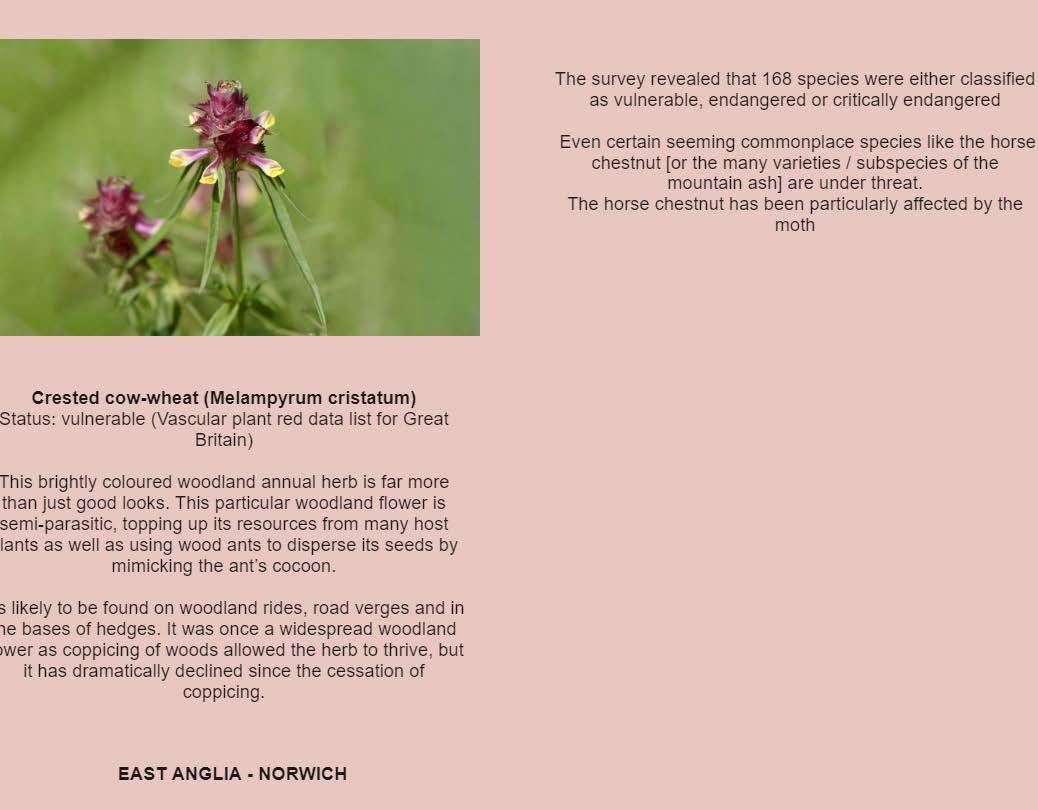
Plant Micro reserves (PMRs) are places with a modest surface area that are used to: - safeguard a sample of the key sub populations of rare, endemic, or vulnerable species; and - create a network that is constantly monitored. Many wildflower species are under threat due to climate change in the UK. The Isle has benefits due to its separation from the mainland due to the solvent. This helps to a certain level to naturally protect species from migrating diseases as well.
Such wildflower micro reserves are proposed in the coppiced areas- to protect the wildflowers, add life to a coppiced area, increase bio-diversity of the woodland and create seasonal recreational zones when all these flowers bloom and create a blanket of colour.

DESIGN and TECHNICAL DETAILS- WETLANDS DESIGN and
DETAILS-
RAIN STORM
TECHNICAL
COPPICING WETLAND SECTIONAL DETAIL WETLAND IN DIFFERENT SEASONAL SCENARIOS Image Source
MINIMAL RAIN HEAVY
OR FLOOD LEVEL RAINS
TRUNK AND A NEW SHOOT GROWING EXAMPLE OF A PROPOSED WILDFLOWER MICRO RESERVE IN COPPICED AREAS
STAGES OF COPPICE PROPOSED OVER GROWN TREES COPPICED FOREST PLANTED
MICRO-RESERVES CLOSE UP DETAIL OF A COPPICED
0 100 M 200 M 400 M 30 30 35 81.2 67.3 45 50 50 55 55 60 60 40 40 30 30 25 20 15 45 45 45 50 50 50 50 55 60 70 70 60
Forests help to keep the climate in check. They support livelihoods, manage ecosystems, maintain biodiversity, play an important role in the carbon cycle, and provide commodities and services that can help fuel long-term growth. “Halting the loss and degradation of forest ecosystems and promoting their restoration have the potential to contribute over one-third of the total climate change mitigation that scientists say is required by 2030 to meet the objectives of the Paris Agreement.” (Forests and climate change, 2022)
Nature – particularly trees and forests – can and must play a role in keeping global warming below the internationally agreed-upon two-degree limit.
DESIGN PROPOSAL - FOREST SCHOOL
This project has a potential to establish as a example and inspiration to think of different ways to protect and still inhabit a forest land. Not all forests in the world or specially in the UK are in a condition to be self satisfied in today’s age of climate change. There are numerous forests which have been heavily managed over the past many centuries for various reasons. Abandonment of these management plans, ecological faults in management, refusal to adapt with the current climate scenario to change management strategies, all could be a reason in declining health of a forest ecosystem.
As proposed in this project - A forest school aims to perform two tasks.
1. Provide children with education that centres around nature, teaching them the importance of nature from a young age and its significance in today’s time. They grow in an unstructured environment which not only aids their physical development but also teaches them lessons of physics, chemistry, biology, art, science.
2. Management strategies proposed that are carried out alongside forest school aids the forest to jump back to a healthy state of ecology. issues of coppice over growth, negligence, water accumulation, dense and dark uninviting forests that destroys the lowland habitat.
TECHNICAL FOCUS - WATER SYSTEM AND WATER MANAGEMENT
Similar to the design programme, the technical subject also has a potential to establish as a example and inspiration to develop a forest’s water ecosystem. Water ecology in a forest have many sensitive and important characteristics that make ot unique for its ecology. When a forest is inhabited for a certain use, thinking about its water system and designing for the betterment of all stakeholders involved - will prove to be a useful system in all projects.
- this research can be easily adapted to other forests of the ISLE of wight because of its similarity in geology and climate.
- other forests near by - and that of UK can take inspiration from the project.
INFERENCE
Bibliography
Geocaching.com. 2022. Vernal Pond - Temporary Living Quarters. [online] Available at: <https://www. geocaching.com/geocache/GC371G6_vernal-pond-temporary-living-quarters?guid=e02084e5-81044fac-a023-eee32670d064> [Accessed 27 April 2022].
Springcreekwatershedatlas.org. 2022. [online] Available at: <https://www.springcreekwatershedatlas. org/post/2018/12/19/vernal-pools-seasonal-ponds-for-special-amphibians> [Accessed 27 April 2022].
Organicpools.co.uk. 2022. Natural Pools: organic pools for Swimming. [online] Available at: <http:// www.organicpools.co.uk/> [Accessed 28 April 2022].
McGurk, L., 2022. The Amazing Benefits of Forest School. [online] Preschool Inspirations. Available at: <https://preschoolinspirations.com/benefits-forest-school/> [Accessed 28 April 2022].
Iow.gov.uk. 2022. [online] Available at: <https://www.iow.gov.uk/azservices/documents/2780-APPENDIX%20-%20PFRA.pdf> [Accessed 28 April 2022].
IUCN. 2022. Forests and climate change. [online] Available at: <https://www.iucn.org/resources/issues-briefs/forests-and-climate-change#:~:text=Forests’%20role%20in%20climate%20change,emissions%20after%20the%20energy%20sector.> [Accessed 28 April 2022].
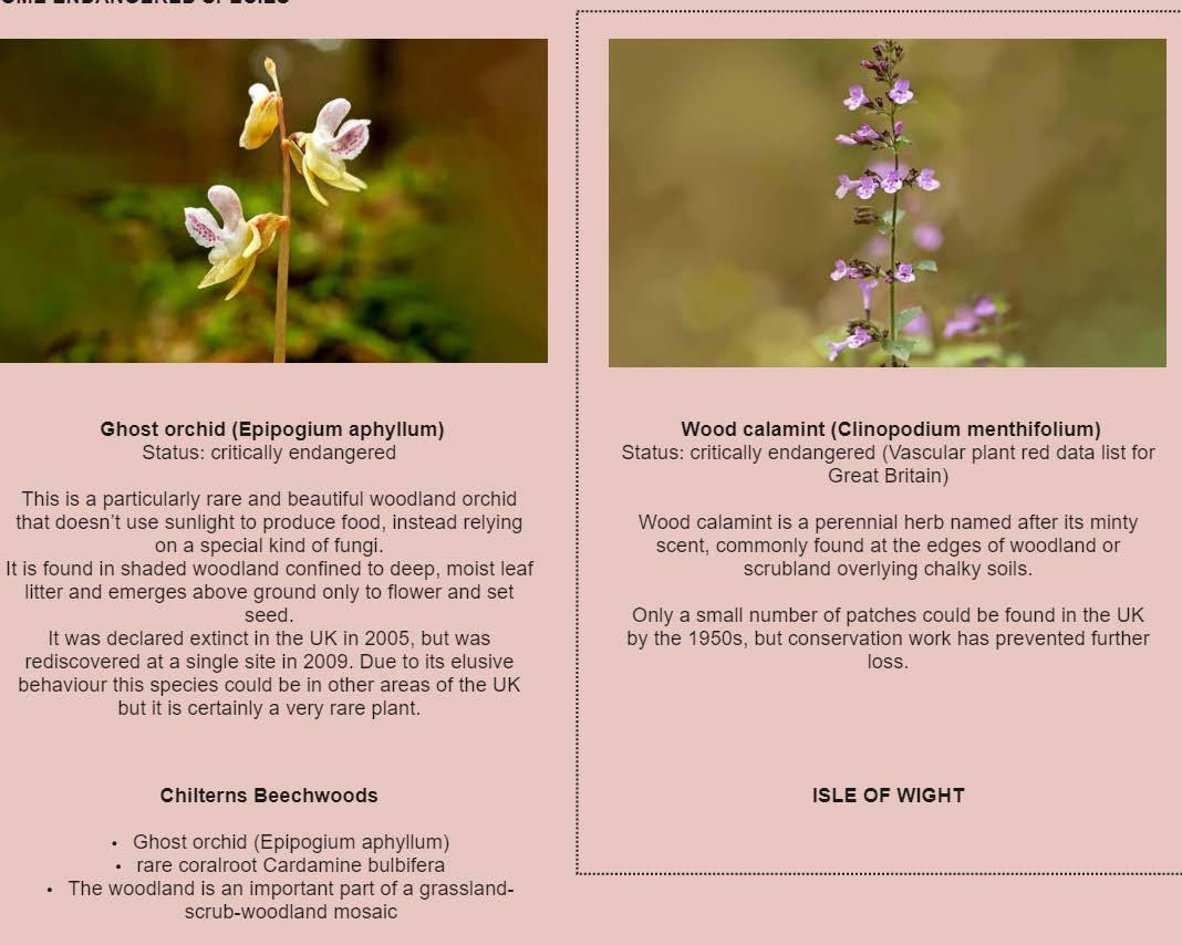
Wood calamint (Clinopodium menthi-

APPENDIX