
Revive|Restore|Reconnect Pallikaranai Marshland | Chennai Prakriti.S_PLA21255 LA4004_Designed Ecologies Spring’23 Enriching the ecology and hydrological sustainability of the marsh
Studio Brief:
With increasing urbanisation, there have been pressures on the existing natural processes. Due to this phenomenon, there are conflicts areas that are often highly stressed pockets which require an in-depth and empathetic approach.
Such areas are causing ecological disruption and affecting social constructs. It is the need of the hour to propose paradigms of designed ecologies to rebuild, support, and recollect gradually fragmenting land mosaics.
These devised ecosystems take time to evolve and are often the outcome of multiple interactions that are dynamic in nature, operating over multiple scales across socio-economic and physiological processes. The resilience of a city - the degree to which change is acceptable before reorganization to create a new set of structures - is highly dependent on these interactions.
The studio allows for self-exploratory research which gives foundation to the proposal, as well as explores design strategies to implement the research outcomes.
CONTENTS
Introduction:
Larger context
1. Introduction to site, locating the site
2. Chronology of the extent of the marshland
3. Land ownership inside the Marsh
4. Climate, topography and watershed mapping
5.Original and modified conditions of the marsh
Site Documentation & Analysis: Site context
1. First impression of site - Eidetic photo montage
2. Ramsar criteria’s for the site
3. Site Plan and site photos documentation
4. Site edge conditions
5. Topography and hydrology
6.Vegetation map and typologies
7. Different faunal species on site
8. Food web and conflicts
9. Locating the birds and habitat study
10. Activity and sensory mapping
11. Issues mapping
12. Systemic thinking
13.Vision ideation & eidetic photo montage
Conceptual Exploration:
1. Site synthesis and identifying zones
2. Ideating through layers
3. Programming
4.Guidelines
5. Zoning - Hydrology & Habitat conditions
6. Zoning - Edge conditions
7. Zoning - Human interactions
Crafting the Landscape:
1. Master plan
2. Edge conditions
3. Transect plan 1 and views
4. Transect plan 2 and views
5. Transect plan 3 and views
6. Transect plan 4 and views
7. Conclusion
8. Project outcome
Annexure:
1.References
2.Plant list
3.Fauna & Avifauna list
4.Initial zoning and concept ideations
5.Planting recommendations
6.Readings and seminar
7.Case studies, site visits and workshops
2 3
05 06 - 07 08-10 11 12-13 14-17 19 20-21 22-23 24-25 26-27 28-29 30-31 32-35 36-37 38-41 42 43-44 45 46-47 49 50-51 52 53 54-55 56-57 58-59 60-61 63 64 65-67 68-71 72-75 76-79 80-83 84-89 90-91
93 94 95 96-98 99-101 102 103-133 134-139
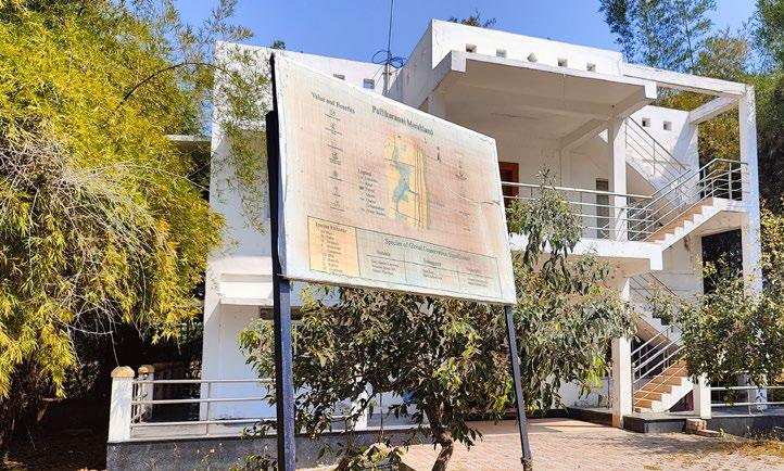
Pallikaranai marshland is a freshwater and partly saline marsh located in Chennai, India, along the Coromandel coast. It is the city’s only remaining wetland ecosystem, and it performs a vital role in acting as a sponge, absorbing excess water and preventing flooding. It also recharges the groundwater table, serves as a carbon sink, and provides a habitat for 334 flora and fauna species. Pallikaranai Marsh drains over 250 km2 of south Chennai, containing 30 wetlands, via two outlets, Okkiyam Madavu and the Kovalam Creek and flows into the Bay of Bengal. This system of the watershed is disturbed by encroachments in the marshlands like road and infrastructure development, landfill dumping, sewage water intrusion and invasive species etc. Given that, it’s located on the fringes of the city, it has shrunk by more than 90% over the decades due to the urbanization pressure. It is currently a designated Ramsar site and is protected from further disturbances. The aim of the project is to revive the ecology of the marsh, restore the edge and habitat conditions of the marsh and help people reconnect with the marsh. The project’s vision was developed using systematic thinking, and its key phrases in the title “REVIVE|RESTORE|RECONNECT” served as the framework for the project as a whole. As project outcomes through implementation guidelines, design strategies and interventions were ideated as a proposal for the reviving of the marshland.

4 5 INTRODUCTION: PROJECT BRIEF 1.
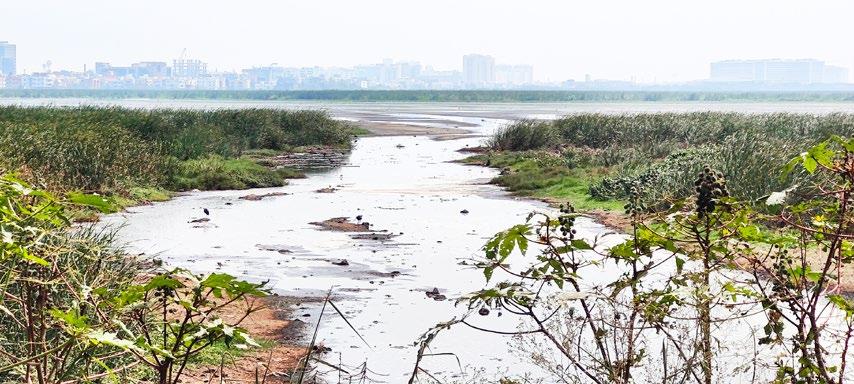
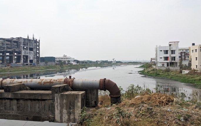
Photograph_View of sewage water entering into the marshland
Pallikaranai marshland is a freshwater and partly saline marsh located in Southern part of India along the Coromandel coast in Chennai. It is the only surviving wetland ecosystem present in the city as it plays as critical role in acting as sponge in absorbing excess water and thereby preventing flooding in the city. It also recharges the ground water table, acts as carbon sinks and habitat for 334 species of both flora and fauna.


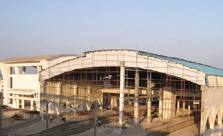
On its eastern periphery, the marsh is flanked by the Buckingham Canal and the Old Mahabalipuram Road, which houses the Information Technology (IT) Corridor. The southern and western boundaries are typified by mixed residential and institutional land use. To the North of the marsh the public infrastructure such as the Mass Rapid Transit system and dense human habitations are present.
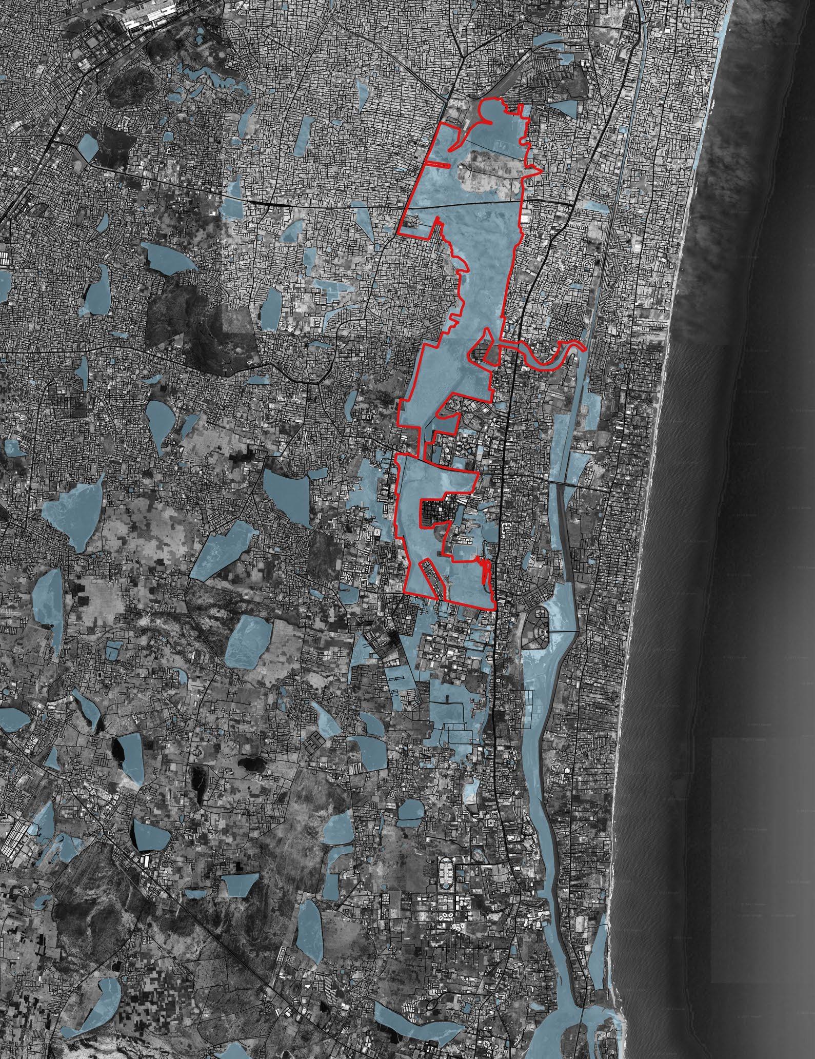
Locating the site
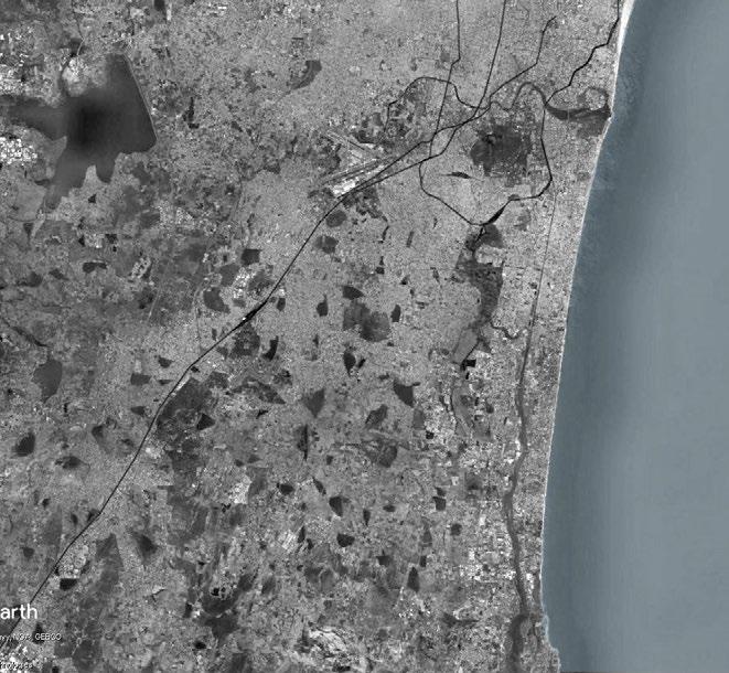
Larger context
Velacherry railway station
Pallikaranai Eco park
National Institute of Wind Energy


Perungudi landfill site

200 ft radial road (National Highway)
National Institute of Ocean Technology
Pallikaranai Marshland Okkiyam Madavu(canal)
Nanmangalam reserve forest
6 7
Pallikaranai Marshland Bay of Bengal Coromandel coast 800000 m 0 200000 400000
Pallikaranai Marshland Pallikaranai Marshland Bay of Bengal Coromandel coast 300000 m 0 75000 150000 Map source: Google earth Map source: Google earth Bay of Bengal Adyar river Coromandel coast 10000 m 0 2500 5000 Map source: Google earth
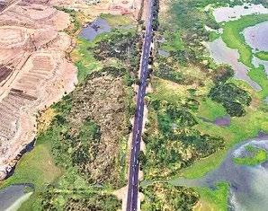
Aerial view of the State highway dividing the marsh into parts
View of the marsh from the highway
2000000 m 0 500000 1000000
View of the dried up marsh near the settlement
Buckingham canal Elcot city Perumbakkam mainroad
creek Map source: Qgis Site boundary(As per Ramsar site in 2022) Water bodies Landfill Bay of Bengal
Kovalam
Chronology of the extent of the marshland
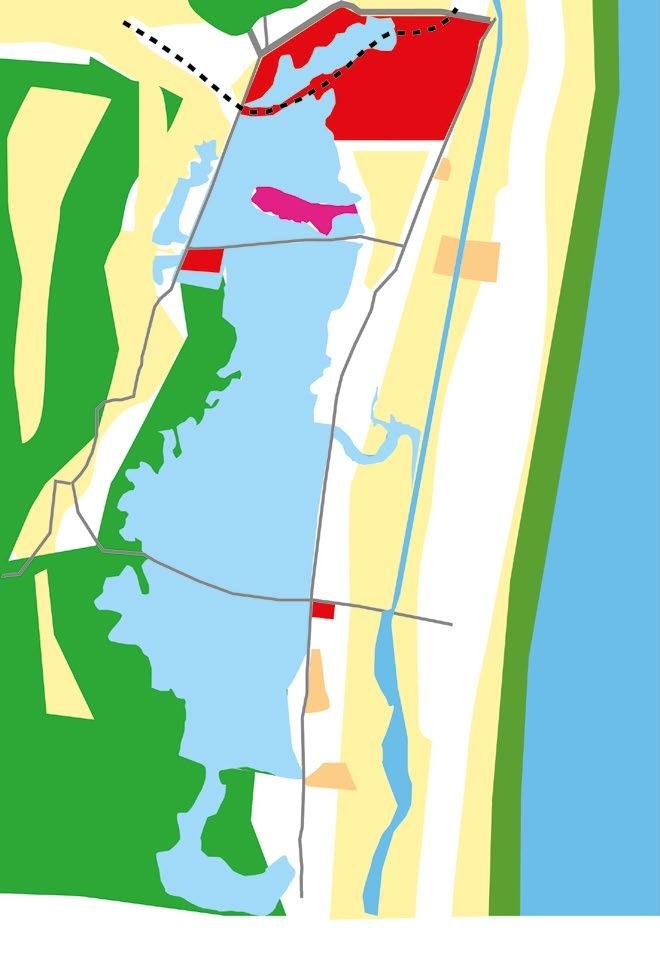

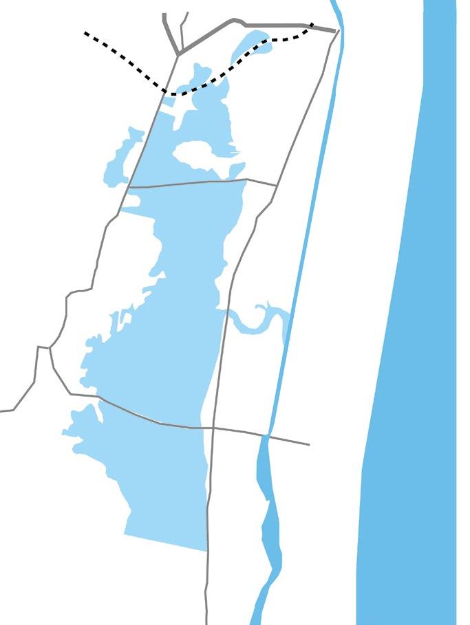
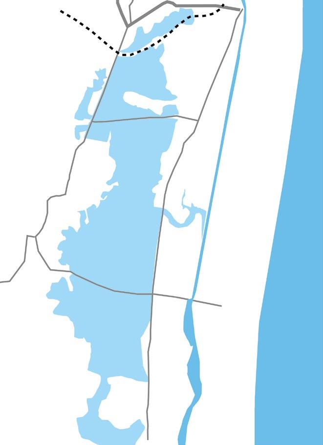
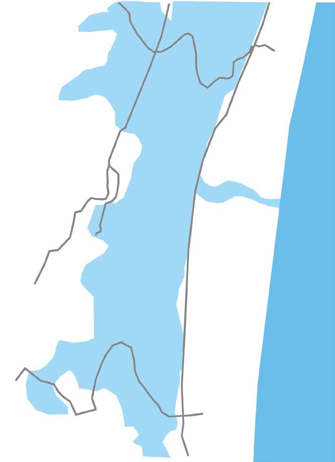
• The original extent of the marshland where the marsh had direct link to the sea.
Change in marsh extent



• The Buckingham canal was constructed in 1804, to carry ferried salt from Andhra Pradesh to Tamil Nadu.
• This lead to the breakage in the link to the sea water. The marshlands interconnection of backwater from the sea was from Okkiyam madavu(canal).
• The marshland has reduced in size over the years through urbanization pressures. The extent of the marsh is 2450 hectares.
• The water spread area has decreased to about 70% of the original condition due to increase in land cover.
• The Site had maximum pressures through settlements along the edges and agriculture has also had a huge impact on the marshland shrinkage.
• The extent of the marsh is 1880 hectares.
• The water spread area has decreased to about 50% of the original condition due to increase in land cover.
• The Site had more residential and commercial development in the early 2000’s, where people migrated from urban areas to peri urban areas due to lack of housing facities and congestion issues.
• The extent of the marsh is 990 hectares.
• The water spread area has decreased to about 35% of the original condition due to increase in land cover.
• The Site was booming with the IT corridor along the OMR road. Thus lot of development in residential, mixed use, institutional and industrial sectors started.
• The extent of the marsh is 500 hectares.
• The water spread area has decreased to about 10 % of the original condition due to increase in land cover.


• The site surroundings developed rapidly with lot of encroachments around the site. These rapid developements had left the Pallikaranai marsh to degrade.
• The southern portion of the marsh consisting of 620 Ha which was part of the SEZ(Industrial zone) earlier was included within the Ramsar site boundary.
• Site extent as per Ramsar(2022) extends upto 1,247.5 Ha.
Change in water spread to land cover ratio Change in land use around the marsh
8 9
Water spread area Legends Railway line Land cover (settlement pattern) Bay of Bengal Road Institutional Residential Agriculture land Mixed use CRZ zone Landfill Industrial
1700’s 1804 1990 2000 2010 2020 2022
1700’s 4000 m 0 1000 2000 1804
Grid size: 2000 x 2000 m 4000 m 0 1000 2000 4000 m 0 1000 2000 4000 m 0 1000 2000 4000 0 1000 2000 4000 0 1000 2000 4000 0 1000 2000 4000 0 1000 2000 1990 1990 1990 2000 2000 2000
Source: Prof.Rukmany, Care earth trust
Adapted
Ramsar
Change in water spread to land cover ratio Change in land use around the marsh
Land ownership inside the Marsh
Legends
Site boundary(As per Ramsar site in 2022)

Site extent as per TP scheme


Dumping yard
MRTS
Revenue land as per TNFA
Area taken from Chennai Corporation
Reserve land (317 ha)
NIOT


Drainage channel

ELCOT City
SEZ area

Residential area
Waterbody
Source: Forest department, Tamil Nadu (till 2022)
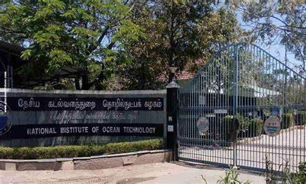
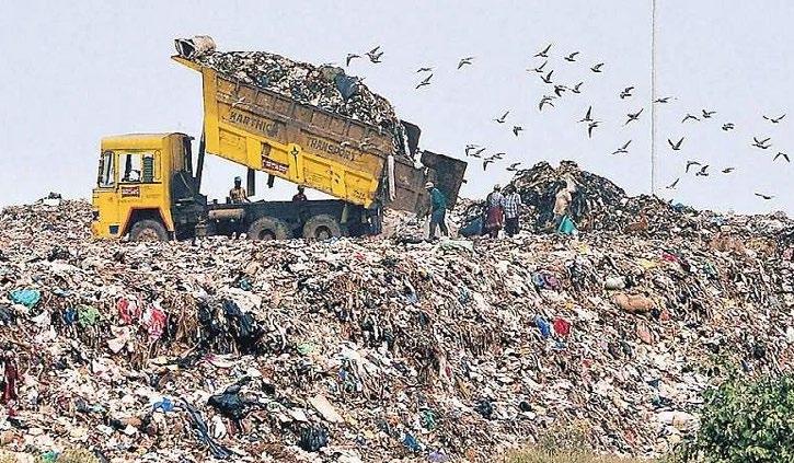
During the early 1900s, the marsh area covered 6000 hectares (60 km2), of which only 593 hectares remain (Care Earth, 2002). NIOT (National Institute of Ocean Technology) and CWET (Centre for Wind Energy Technology) have constructed institutes that have reduced and fragmented the marsh, and the Perungudi dumpyards and wastewater treatment plants have occupied a considerable portion of marsh land, while on the other hand, IT corridors, residential complexes have been constructed.
The dumping yard consists of 173.33 Ha, area taken from Chennai corporation is 170.405 Ha, drainage channel is 54.21 Ha, Elcot comprises of 85.43 Ha and revenue land as per TNFA is 131.55 Ha and the SEZ consists of 445 Ha.
Earlier, the Palikaranai marshland was considered uptil the Perumbakkam main road as the reserve boundary. Later the SEZ zone was also included when it was declared as the Ramsar site.
10 11
Grid size: 2000 x 2000 m 4000 m 0 1000 2000 4000 m 0 1000 2000 4000 m 0 1000 2000 4000 m 0 1000 2000 4000 m 0 1000 2000 4000 m 0 1000 2000 2010 2010 2010 2020 2020 2020 Change in marsh extent Ramsar site boundary Site boundary(before 2022) Grid size: 2000 x 2000 m
1500 m 0 375 750
Climate Topography
Wind direction


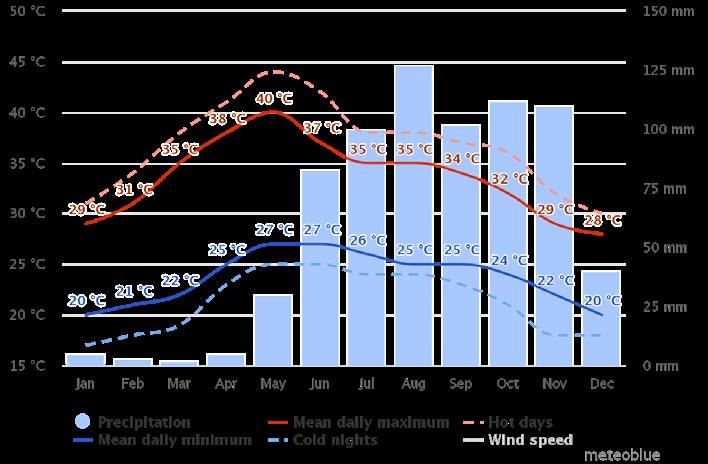
Annual temperature
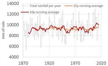
Rainfall data
Source: www.meteoblue.com
The wind direction is mostly towards south west direction. It receives an annual rainfall of 1,300 millimeters (51 in), mostly during the northeast monsoon (September–November), but also during the southwest monsoon (June–August). Temperature ranges from 35 to 42 °C (95 to 108 °F) during the summer, and from 25 to 34 °C (77 to 93 °F) in the winter.
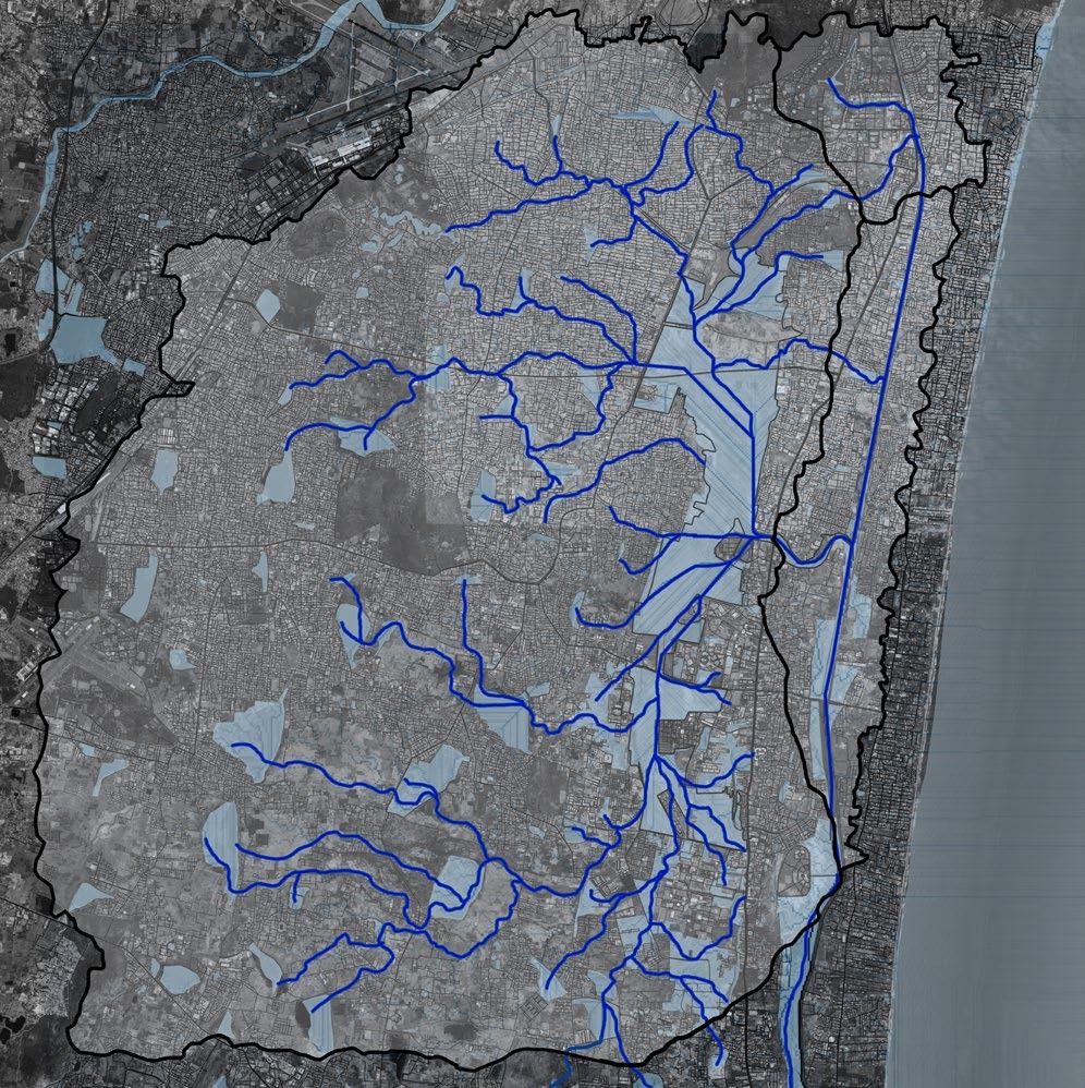
Map source: Qgis
Legend:
Grid size: 2000 x 2000m
Ramsar site boundary
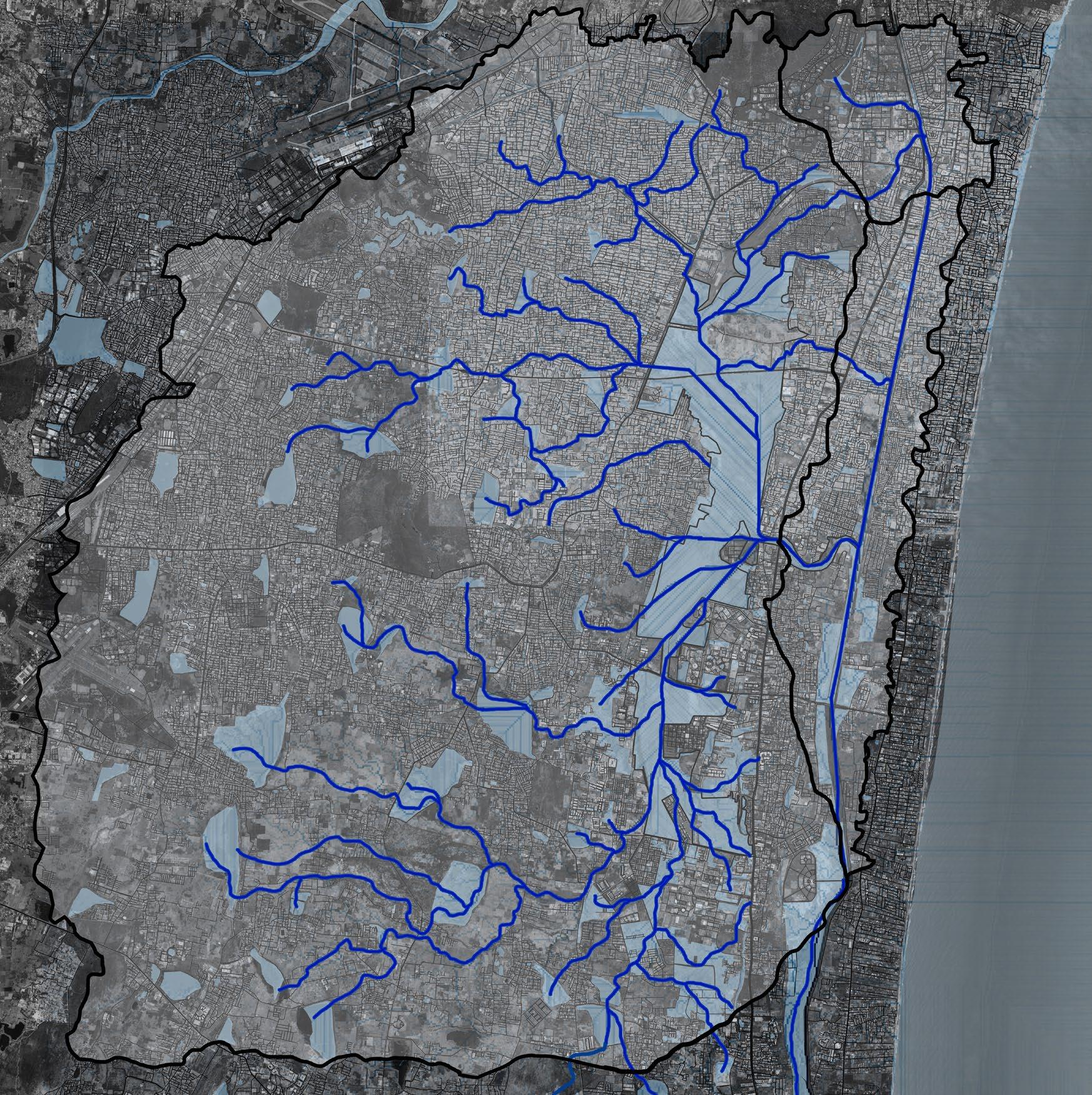
Watershed Map source: Qgis, Bhuvan

Legend:
Watershed boundary Stream line Water bodies
Pallikaranai Marsh and its wetland complexes are part of one watershed that is spread over an area of 231 km.
12 13
160m
0.5
The watershed area’s topography ranges from highest point being
and lowest point being
m.
10 0 20 30 40 50 60 70 80 90 100 110 120 130 140 150 160 m
4000 m 0 1000 2000 4000 m 0 1000 2000
Original condition of the marsh
Pre monsoon
Before the encroachments started within the marshland, steady connectivity with the surrounding water bodies was efficiently draining the water into the marshland.

Taking into account, the original spread of marshland to be around 5000 Ha and an average depth of 1m, during the peak monsoons (when flooding is also widespread) the water-holding capacity of the marshland may be estimated as 50 million cubic meters.
Post monsoon
The marshland is connected to 31 different water bodies all of which release surplus water into the marsh during the monsoons. There is backflow of water from sea via Buckingham canal during high tide which brings in the influence of brackish water into the marsh.


The mixing of freshwater and brackish water is brought about by the huge volume of surface runoff that the marshland receives year after year during the monsoons.
Right mix of freshwater and brackish water is important in maintaining the ecological integrity of the marshland.
Modified condition of the marsh
After encroachments
State Revenue records the marshland was classified as wasteland and so the Government of Tamil Nadu fragmented the marsh and large parts were reclaimed to be developed as residential and rehabilitation areas.
This system of the watershed is disturbed due to the pertubations all along the catchment area of the marsh.
Encroachments in the marshland like road and infrastructure development, landfill dumping, sewage water intrusion and invasive species etc. have also contributed to the lesser water retention quality of the marsh.
It has made the system of watershed not work due to the urbanization impacts.
Adapted Source: Care Earth trust
Encroachments Marshland

14 15 Section
XX’
100 m 0 25 50
4000 m 0 1000 2000 Key map Map source: Qgis, Bhuvan Watershed boundary Stream line Water bodies x Y Y’ x’
Buckingham canal
Change in topography and land use

Site section upto the sea - YY’
development Residential development
Buckingham canal
Due to residential, mixed-use and institutional development along the marsh’s catchment area, this system of the watershed has been disturbed.

16 17
Marshland
Marshland Marshland IT
Okkiyam madavu(creek) Okkiyam madavu (creek)
Corridor Mixed use development
Residential
Institutional
2000 2022
Residential development
development
Buckingham canal
ECR road
ECR road
CRZ-II zone CRZ-II zone
Bay of Bengal Bay of Bengal Freshwater Brackish water
Mixed use development Mixed use development Mixed use development Mixed use development
Residential
Residential development Residential development
development
The marshland drains water via Okkiyam madavu through Buckingham canal into the Bay of Bengal. The influence of brackishwater into the freshwater marsh is through the Buckingham canal.
In site documentation analysis section, site importance is established through Ramsar’s criteria. Later through site plan, photo documentation, topography, hydrology, vegetation typologies, habitat conditions and fauna documentation, food web and its conflicts and activity analysis and issues are mapped to understand the site layers. Later, the systemic thinking is arrived through synthesis. Then the vision is developed.
18 19 SITE DOCUMENTATION & ANALYSIS
2.
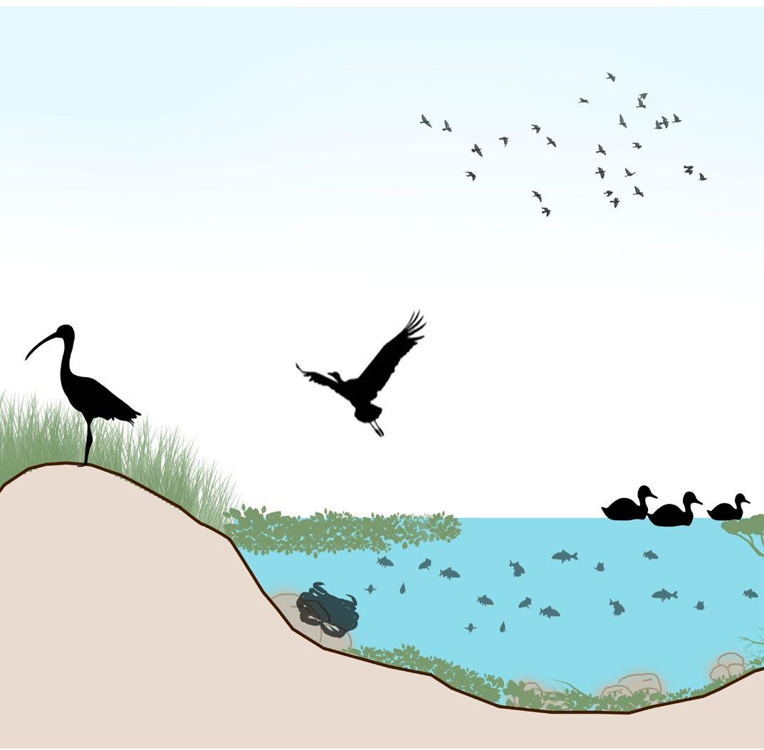
Figure_Section of deep water habitats
First impression of site - Eidetic photomontage Site photos

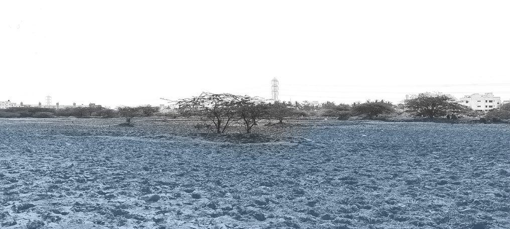
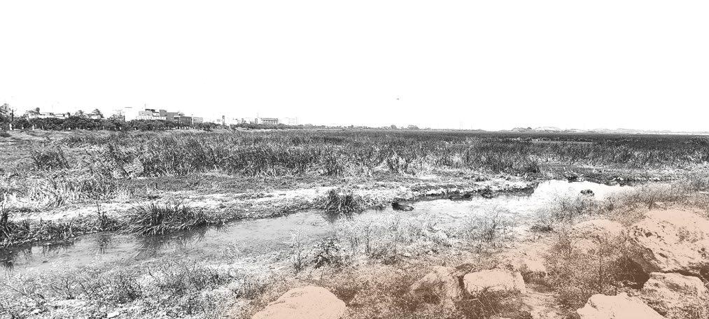
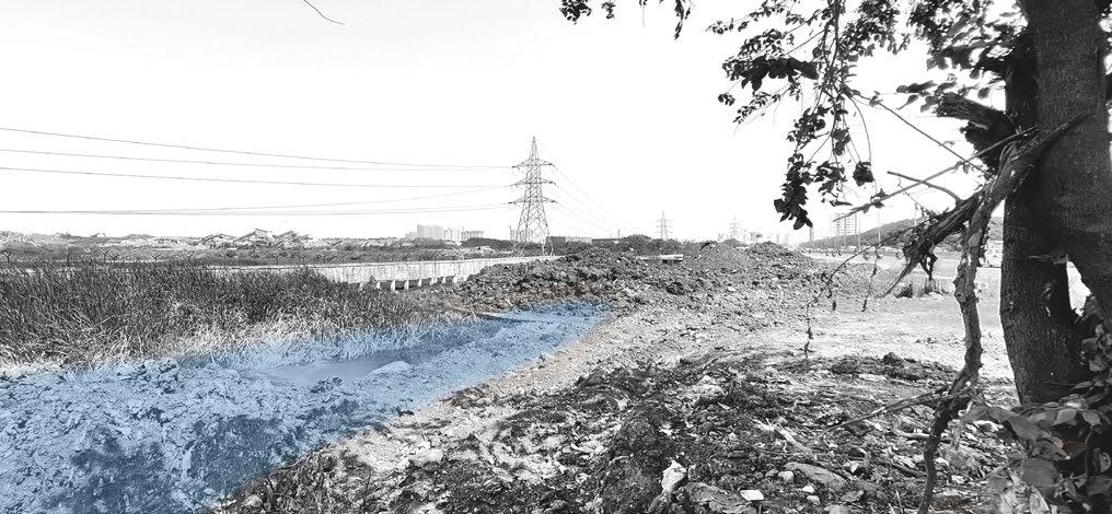
Distress / Destruction / Forgotten / Hope
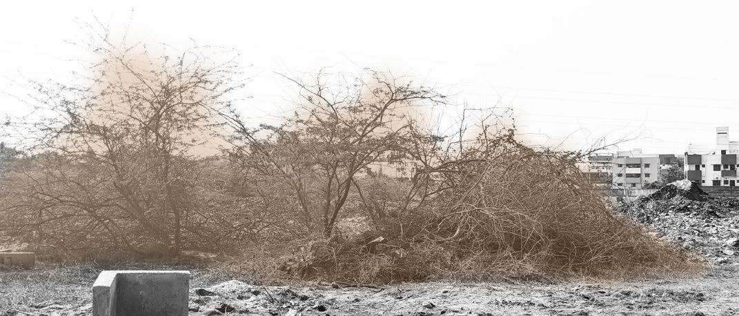
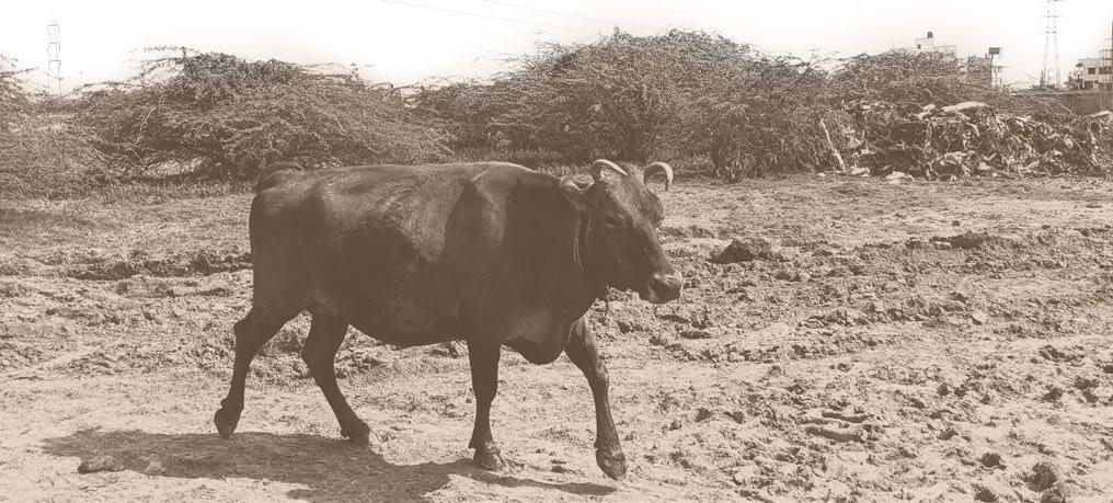
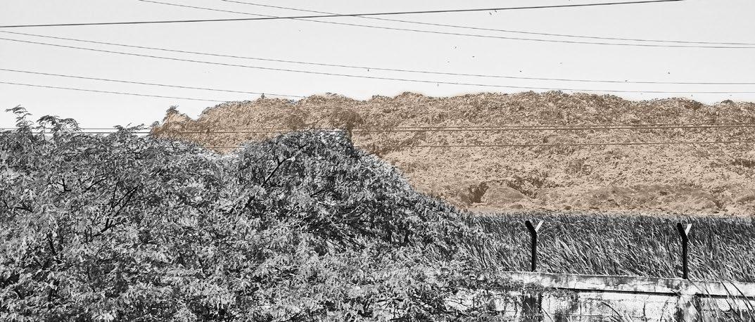
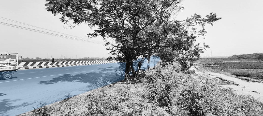
Increasing urbanization has encroached on the Pallikaranai marshland rapidly, resulting in its current plight. It is the only remaining wetland in the city, and it has been pushed to the brink of extinction due to anthropogenic pressure. The birds depend on this wetland as its their only hope for respite on their way home.

20 21
The State highway dividing the marsh into parts
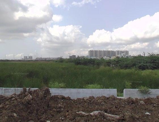
Landfill inside the marsh
Smaller puddles of waterbody inside the marsh
Prosopis juliflora invasion inside the marsh
Scrublands with Prosopis juiflora invaded marsh
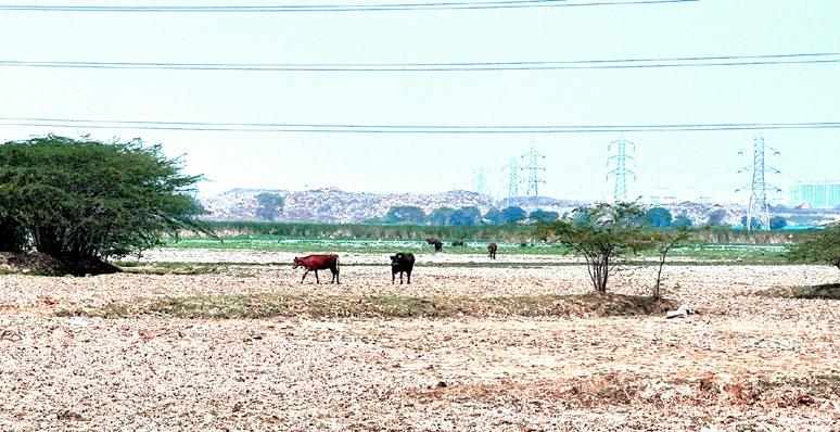
Grazing pressure inside the marsh
Construction debris dumped along the edges
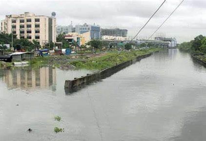
Entering of sewage water into the marsh
Photo credits: Author
Photo credits: Author
Ramsar criteria’s Site importance:
Criterion 1: Representative, rare or unique natural or near-natural wetland types
Pallikaranai Marsh acts as a sponge absorbing excess stormwater runoff from surrounding areas in the city of Chennai. The adjoining wetlands discharge water into it either as an overflow or through a drainage network.

Criterion 4 : Support during critical life cycle stage or in adverse conditions
Pallikaranai Marsh has a diverse habitat including large and deep reservoirs with several inlets and surrounding irrigated agricultural fields, which provide good nesting and foraging habitats for birds.


Criterion 6 : >1% waterbird population

The site regularly supports over 1% threshhold population of Calidris subminuta, Charadrius alexandrines, Dendrocygna bicolor, Limicola falcinellus, Himantopus Himantopus, Limosa limosa, Mycteria leucocephala, and Tringa erythropus.
Spot billied Pelican in the intermediate waters
Criterion 2 : Rare species and threatened ecological communities
It is the natural habitat to some of the most endangered reptiles like the Russell’s viper and birds such as the glossy Ibis, pheasant tailed Jacana, etc.
Criterion 3 : Biological diversity
Pallikaranai Marsh supports an estimated 381 species of flora and fauna.165 species of birds, 10 species of mammals, 21 species of reptiles, 10 species of amphibians, 50 species of fishes, 9 species of molluscans (snails and clams), 5 species of crustaceans, and 7 species of butterflies have been reported from the area.
Criterion 7 : Significant and representative fish
Significant and representative fish species include Anguilla bengalensis, Anguilla bicolor, Trichogaster chuna, and Channa orientalis. The above-mentioned fish species are known to use the site for feeding, breeding, and migration purposes from adjoining tributaries and vice versa.
Criterion 8 : Fish spawning grounds, etc.
Pallikaranai Marsh serves as feeding and spawning grounds for several fish species, such as Anguilla bengalensis, Anguilla bicolor, Trichogaster chuna, and Channa orientalis. These species periodically use (disperse/migrate) the site throughout the year to complete their life-cycle.
22 23
Flamingos in the shallow water
Photo credits: Dinesh
Photo credits: Dinesh
Lesser whisting duck in the wet meadows
Wood sandpiper in the wet meadows
Photo credits: Dinesh
Photo credits: Dinesh
Site pictures







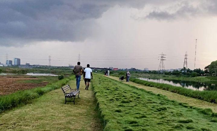


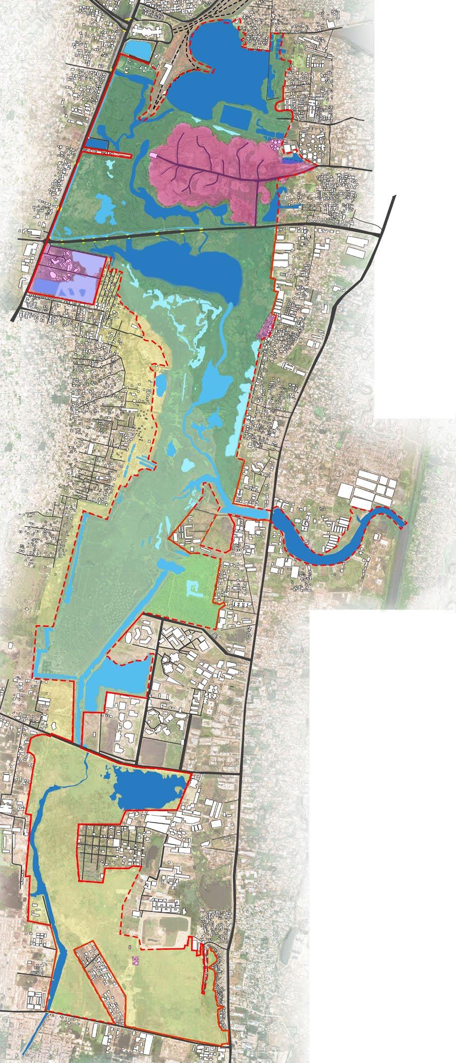
24 25 0 750 1500 3000 m Grid size: 500x500 m 1 2 3 5 15 14 6 7 8 9 13 16 10 11 12 4
Road
Site Plan A B B D D C C A E E F F Site extent as per Ramsar(2022) extends upto 1,247.5 Ha.
Waterbody Legends Green cover Ramsar site boundary with free edge Ramsar site boundary with compound wall
Buildings Built Structures inside Ramsar site boundary
Pallikaranai marshland Park
National Institute of Wind Energy
1 2 3 4
Perungudi dumpyard Velacherry railway station
National Institute of Ocean technology
Forest department watch tower Thangavelu Engineering College
5 6 7 8 ELCOT
Pallikaranai marshland conservatory
City
Buckingham
the
9 10 11 15 13 12 16 14
Okkiyam madavu(canal)
canal 200 ft radial road Perumbakkam main road Perungudi Sewage treatment plant Southern portion of
marsh Sewage channel entering into the marshland
Site edge conditions


Okkiyam madavu(canal) with Pontederia crassipes cover

200 ft Road with embankment


Grazing pressure edge Road

26 27 Section AA
+4 m lvl +4 m lvl Marshland
Section BB Section CC
Marshland edge with garbage dump
Marshland edge with construction debris
Marshland edge
Prosopis juliflora spread
+3 m lvl +3 m lvl +2 m lvl +2 m lvl +3 m lvl +2 m lvl +1 m lvl 0 7.5 15 30 m
Proposis juliflora edge Slum settlement
Section DD
Section EE
Section FF
Road
Marshland edge with Prosopis juliflora
Road edge with dumping
Marsh with Pontederia crassipes cover
Grass
Compound
-NIOT +3 m lvl +3 m lvl +4 m lvl +4 m lvl +2 m lvl +2 m lvl +3 m lvl +2 m lvl +1 m lvl +1 m lvl
Marshland
cover
wall
Topography and hydrology
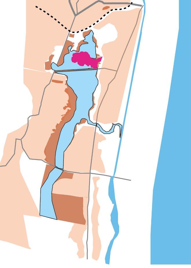
The maximum elevation is at 20 m and minimum elevation is at 0.5 m within the marshland.
Legends
Brackish water inflow during high tide
Deep waters (1-2m)
Intermediate waters (0.3-1m)
Shallow waters (0-0.3 m)
Waterbody Green cover
Built Structures inside Ramsar site boundary
Ramsar site boundary with compound wall Road Buildings
Ramsar site boundary with free edge


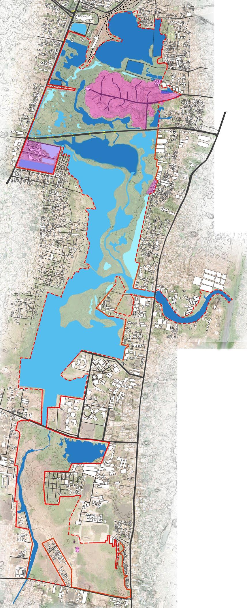


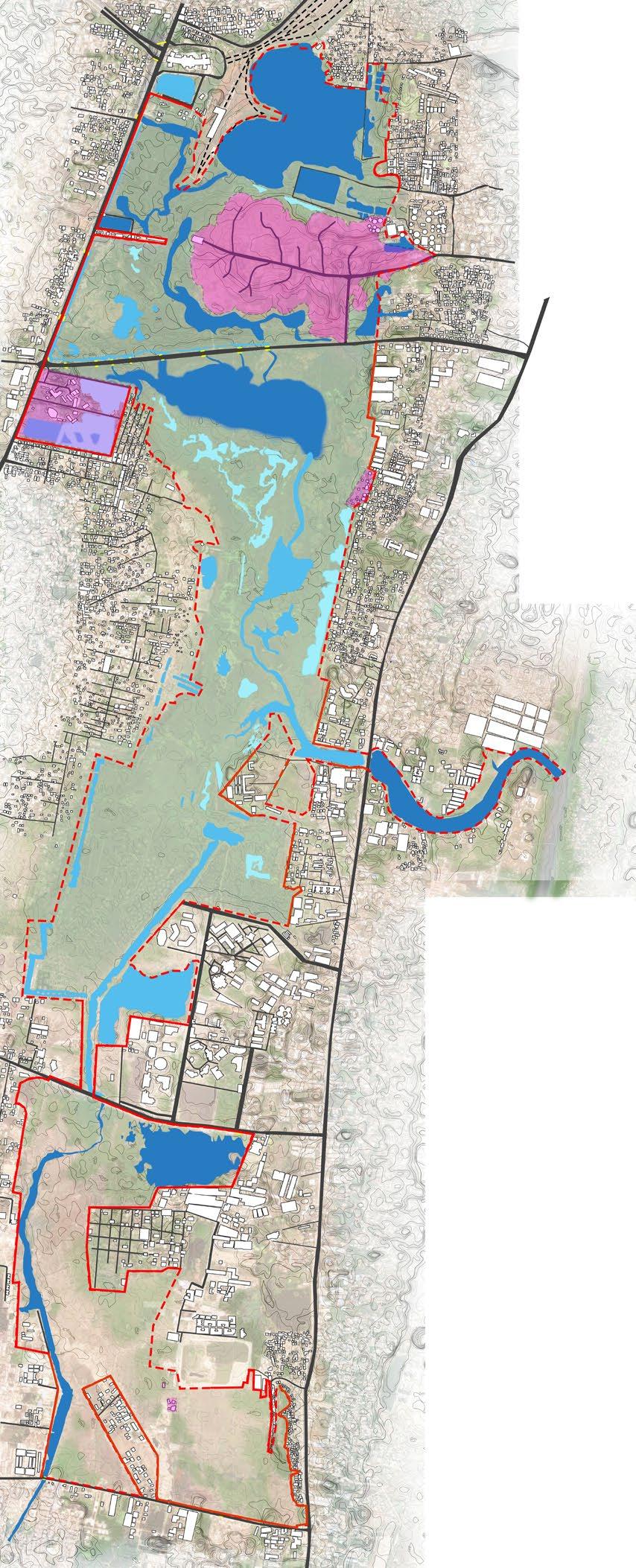
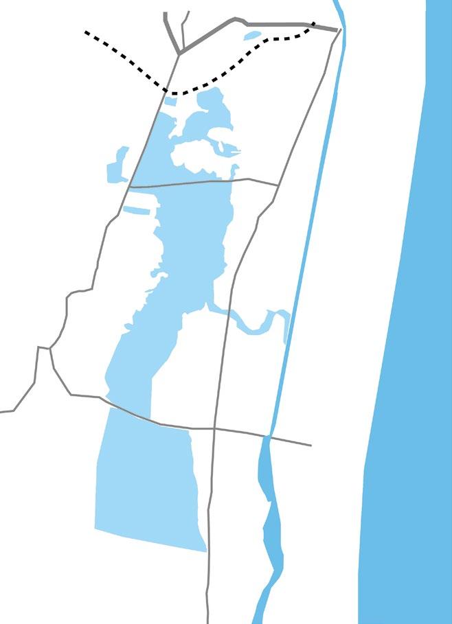
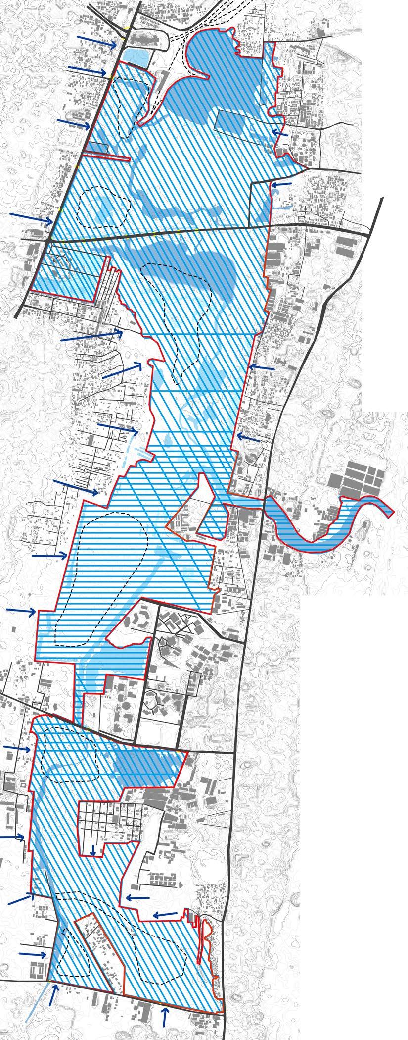
The southern parts remain dry while the northern and the central portion retain water. The water movement is from north to south draining in the Okkiyam madavu(canal). And movement of water is from south to north from the channel connecting from higher grounds in the south connecting the canal. There is a mix of brackish and freshwater at the high tide time and when the excess water enters the marsh through the Okkiyam madavu.
Adapted Source: Care earth trust
28 29
Different water depths typologies
Source: Qgis,Bhuvan Grid size: 500x500 m 0 750 1500 3000 m 0 750 1500 3000 m Legends 0 m 1-3 m 4-6 m 7-9 m 10-12 m 13-15 m 16-18 m 19-21 m 22-24 m 25-28 m
Source: Care earth trust
Elevation map Image
Adapted
Water movement 0 750 1500 3000 m Pre monsoon Post monsoon
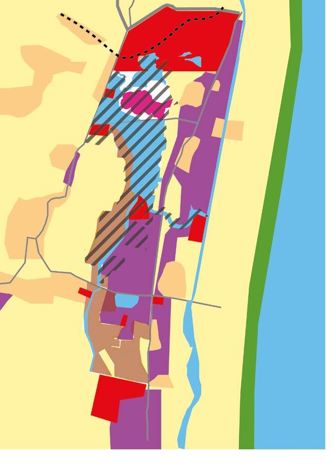
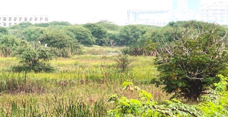
The vegetation exisiting now is highly altered state due to urbanization pressures on the marsh and its in relictual state with 10% of habitats intact.
Different habitat types
1.Deep open water
3.Mudflats
Adapted Source: Care earth trust
Grid size: 500x500 m
Shallow water Grassy banks
Deep open water
Grassy banks
Deep water attracts diving waterbirds like darters, cormorants, grebes, and some ducks that dive for bottom-dwelling invertebrates or aquatic vegetation.
Mudflats with sedges and grassy banks
Shallow water
Grassy banks & emergent reeds
Shallow waters and mudflats are rich feeding areas for a range of migratory waders who probe the water and flats for tiny animals. Larger waterbirds with long legs and bills such as the egret, pelican, heron, flamingo etc. can be found in the shallows probing, spearing, sieving and scooping for food.
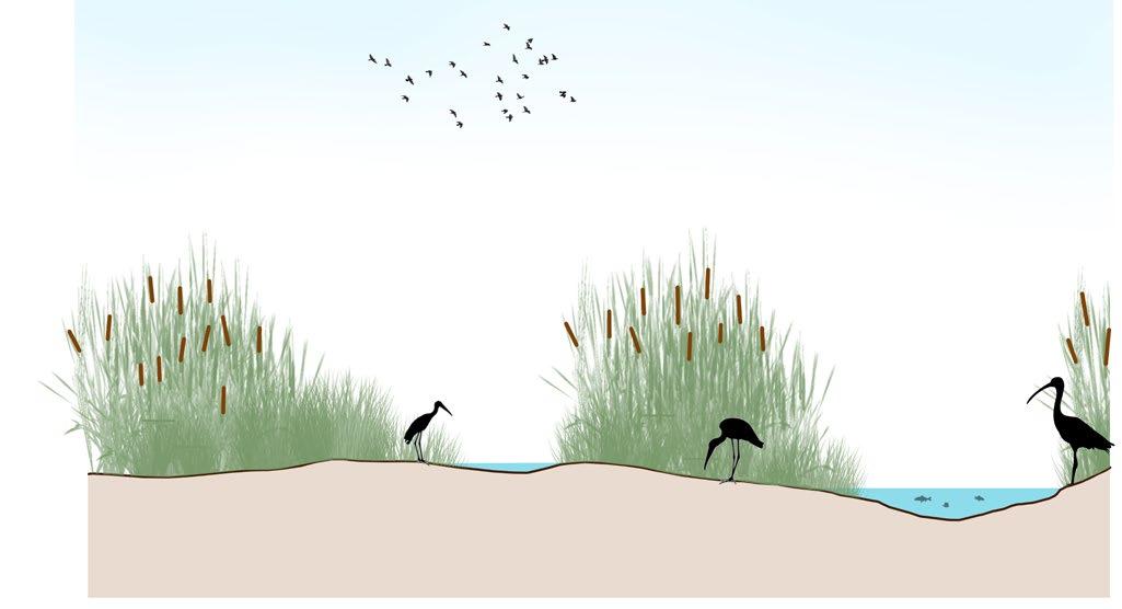
2.Emergent sedges, rushes and grassy bank areas
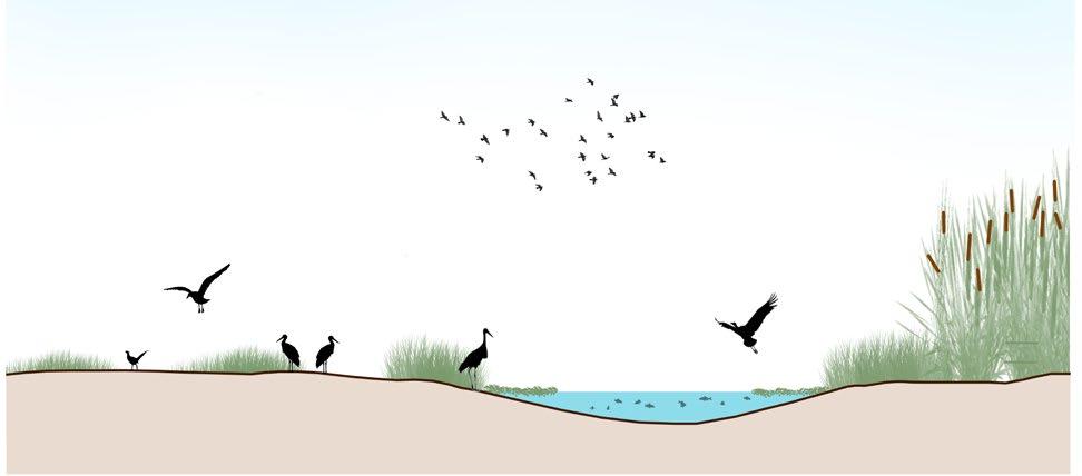
4.Islands
Legends
Brackish water inflow during high tide
Deep waters (1-2m)
Intermediate waters (0.3-1m) Shallow waters (0-0.3 m)

Waterbody Green cover Ramsar site boundary with free edge


Built Structures inside Ramsar site boundary
Ramsar site boundary with compound wall Road Buildings
Swampy grassland
Marshland Afforested area
Scrublands
0 750 1500 3000 m
Emergent reeds & grassy bank
Shallow water Intermediate water
Emergent reeds & grassy bank
Grassy bank
Many wading birds are attracted to emergent sedges, reeds, and grassy bank areas. This sort of vegetation provides cover for waterbirds. Ducks, moorhens, and coots forage in emergent plants and grassy bank areas near open water. Ibis, herons, and swamp hens are drawn to bordering sedges as feeding places as well.
Intermediate water
Islands with grassy banks
Shallow water
Grassy banks
Several types of ground-nesting species use islands and mounds as breeding grounds. Grasses have been planted to offer habitat for ducks such as teals and pintails. The elevated mounds were made to improve survival rates during prolonged inundation periods.


30 31 Vegetation typologies Vegetation map
Swampy grassland
Marshland
1 2 4 3 Pre monsoon
Scrubland Afforested area
Different faunal species on site
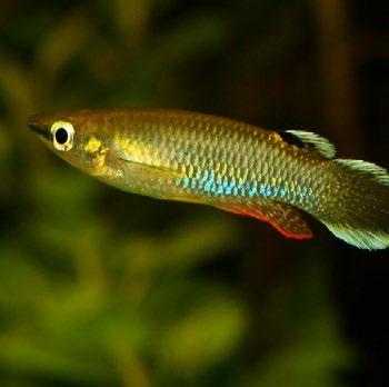
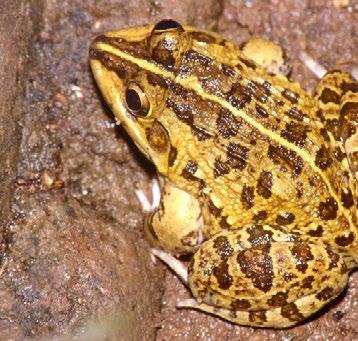
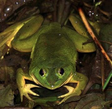
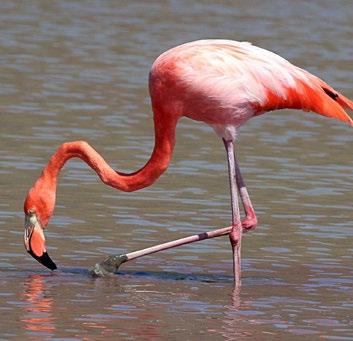
349 species of flora and fauna are found on the site.
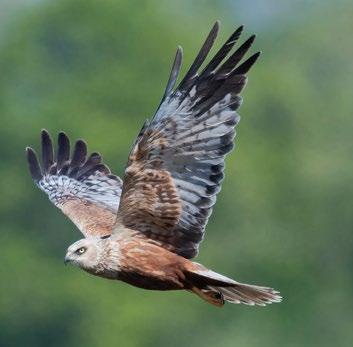
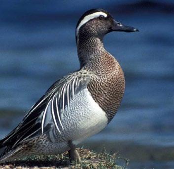
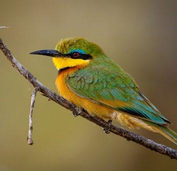
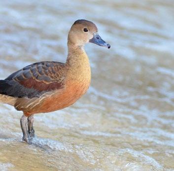
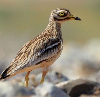
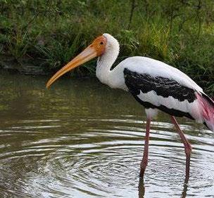
Birds (135 species in total)

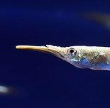
Fishes (50 species in total)
Spot-billed Pelican


Legend
Diadromous fish

Freshwater fish
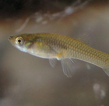
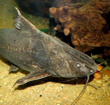

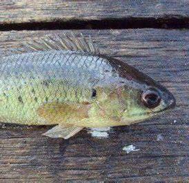
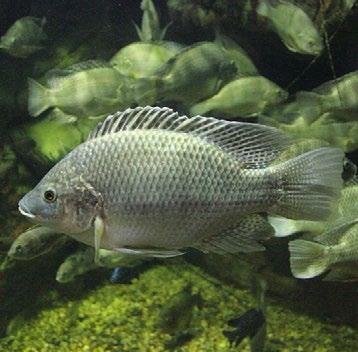

Amphibians (10 species in total)
Potamodromous fish
Legend
Swimming birds
Non diving birds
Predator birds


Arboreal birds
Shore/wading birds


Ground birds

Leaf walking birds
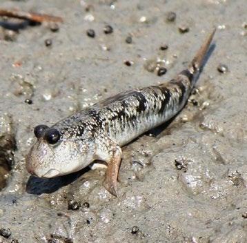
Indian Pond Frog Mudskipper Jerdon’s Bull Frog Indian toad

Images source: https://animalia.bio/collections
32 33
Glossy Ibis
Grey Francolin
Darter
Greater Flamingo
Pheasant-tailed Jacana
Eurasian Thick-knee
Marsh Harrier Rose-ringed Parakeet
Black-bellied Tern Small Bee-eater
Lesser Whistling Duck Garganey
Black Kite
Purple Heron Painted Stork
Long-fin Eel
Half beak
Panchax
Peninsular Olive Barb Common Tilapia
Climbing Perch
Mullet
Mosquito fish
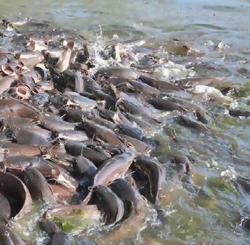
Giant African Catfish
Armored Catfish
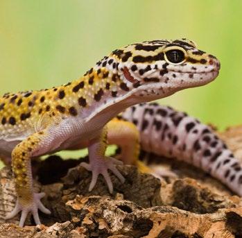
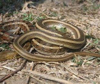
Reptiles(21 species in total)
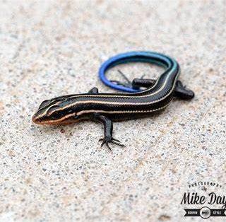
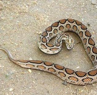
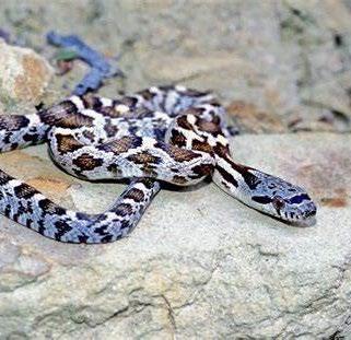
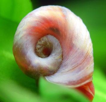
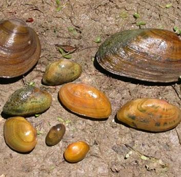
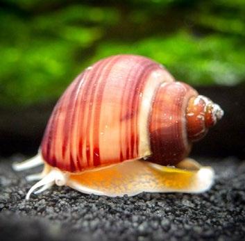
Molluscans (9 species in total)

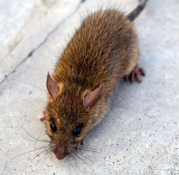
Mammals (10 species in total)

Indian
Butterflies (7 species in total)
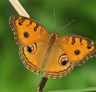
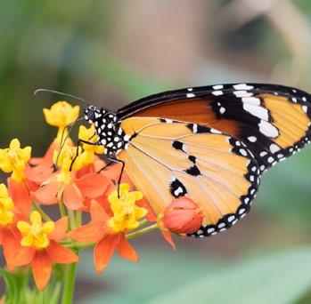
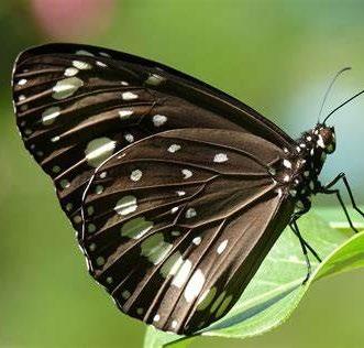
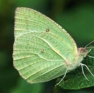
Three-striped Palm Squirrel

Crustaceans

Freshwater Semiaquatic Terrestrial Both brackish/freshwater
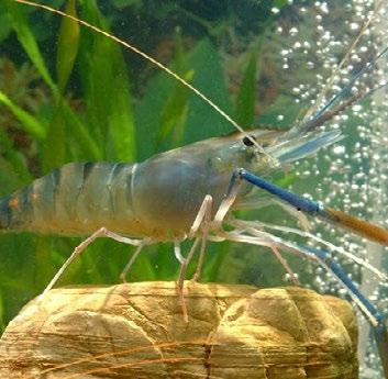
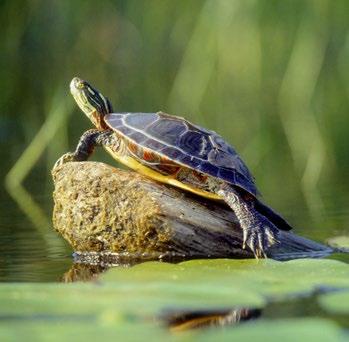
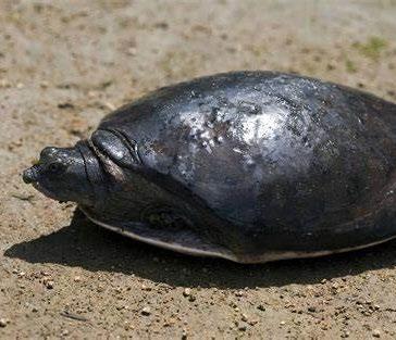

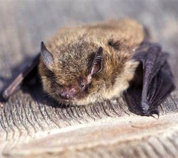
Pallikaranai Marshland is an ecologically rich with the mix of enormous Bay of Bengal Large Marine Ecosystem. It is home to about 130 bird species and over 50 fish species. Wetland ecosystems are defined by the presence of fish and fish-eating birds. Pallikaranai Marsh is also a feeding area for a variety of visitors. Migrants such as sandpipers and teals are abundant, while Black-winged Stilts can normally be found in small numbers near the water’s edge.
The population and diversity of waders and shorebirds in the marsh begin to increase during the northeast monsoon and peak between December and March, when the water recedes and becomes shallower.
34 35
Pipistrelle
Garden Lizard
Flapshell turtle
Spotted Gecko
Rat Snake
Russell’s Viper
Striped Keelback
Pond Turtle Common Skink House Rat Leaf-nosed Bat
Mottled Emigrant Common Crow Plain Tiger Peacock Pansy
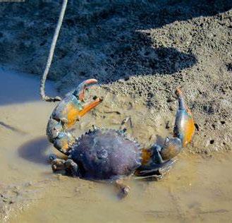
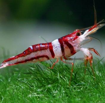
(5 species in total)
Apple Snail
Freshwater Shrimp
Freshwater Mussel
Fresh water prawn Pond Crab Mud Crab
Freshwater Snail Ram’s Horn Snail
Legend
Images source: https://animalia.bio/collections
Food web and conflicts
Predator bird
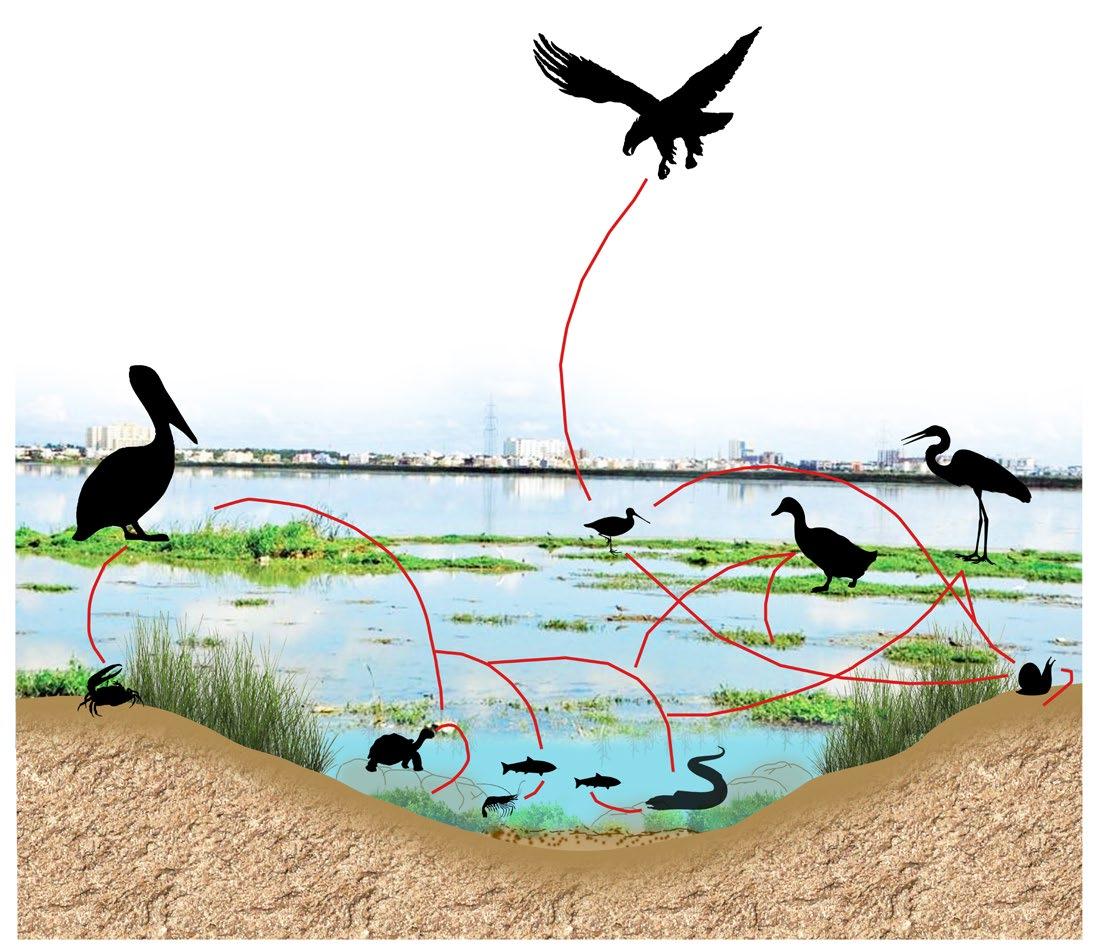
Food web - Brackish water marshland
Carnivorous bird
Insectivorous bird
Omnivorous bird
Foodweb complex of the freshwater organisms is important more maintaining the balance and healthy functioning of the ecosystem. The different bird varieties found on the marsh are dependent on the microhabitat conditions and the adequate food resources on the marshland. The underwater food web also plays an important role as it governs the food chain for the shore/wading and piscivorous birds.
Food chain
Conflicts in food web- Freshwater marshland

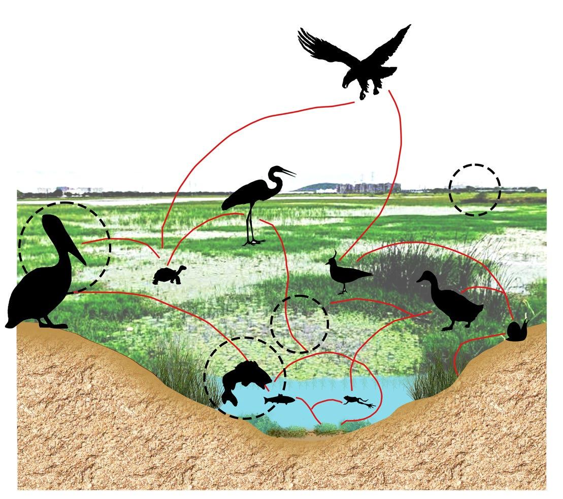

• Giant african catfish is affecting the underwater food web by competiting with the Piscivorous and Omnivorous bird species and feeding on other native species of fish found in the marsh.

• The bony skeleton of the catfish may cause chocking in smaller shore/wading birds.
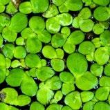
• The presence of Lemnaceae in the surface at continous stretches can cause oxygen depletion in the water affecting the underwater web.
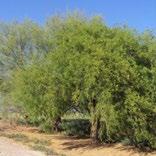
• The presence of Prosopis juliflora at the edges causes hindrance to nesting birds which visits the marsh causing the birds to migrate to some other locations.

Predator bird
Insectivorous bird
Carnivorous bird
Omnivorous bird
Grass/floating plants
Amphibian
Crustacean Soil Phytoplanktons
Piscivorous bird
Reptile
Foodweb complex of the brackish water is important for maintaining the right balance in the ecosystem. The presence of diadromous fish varieties indicates the connectedness to the sea and helps in feeding the piscivorous birds dependent on the coastal marsh conditions.
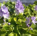
The underwater foodchain is in conflict due to the debris floating and the excessive growth of Pontederia crassipes in the marsh causing lesser oxygen levels in the underwater.
Grass
Fish
Reptile
Piscivorous bird
Crustacean Soil Phytoplanktons
Debris
Pontederia crassipes

36 37
web - Freshwater
Food
marshland
Giant african catfish
Lemnaceae
Prosopis Juliflora
Conflict spots
Conflicts in food web - Brackish water marshland
Conflict spots
Prosopis Juliflora
Food chain
Habitat study
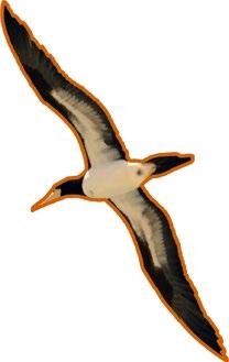
Species: Black-bellied
Type of bird: Wading shore-birds
Habitat: Open water
Type of visitor: Resident


Breeding period: February to April
Food requirement: Insects, and plunging obliquely into the water to feed on crustaceans, tadpoles and fish.


Basic habitat requirements: Lowland rivers and marshes, and sometimes ditches and pools, at altitudes of up to about 730 m.
Nesting sites: It nests on the ground, usually in depressions or scrapes in sand, gravel, or coral. They also use bare rocks or vegetated substrates, such as mats of dead leaves or grasses.
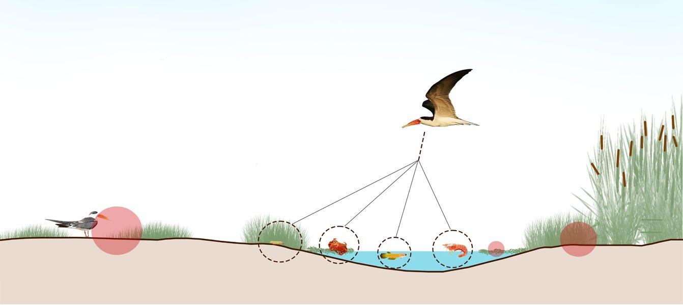
Species: Indian skimmer


Type of bird: Wading shore-birds
Habitat: Open water swamps and coastal estuaries
Type of visitor: Resident and winter migrant
Breeding period: February to May
Breeding habitat: Mudflats
Food requirement: Fish but also take small crustaceans and insect larvae.
Basic habitat requirements: Swamps and coastal wetlands such as estuaries. Nesting sites: It requires a specific habitat for nesting, which includes sandbars and islands within the waterbody. They prefer to nest on open sandbars that are free from vegetation and close to the water’s edge.
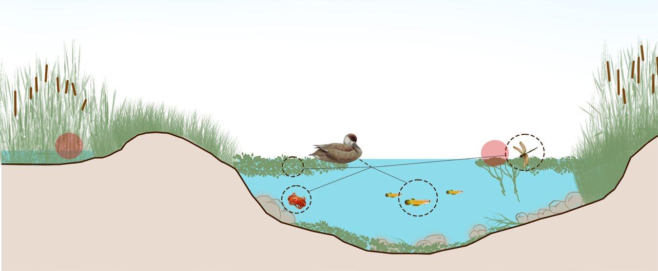
Species: Common pochard
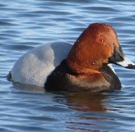

Type of bird: Diving bird

Habitat: Marshes and lakes with a metre or more water depth.
Type of visitor: Non breeding winter resident
Migration period: November to February
Food requirement: Aquatic plants with some molluscs, aquatic insects and small fish.
Basic habitat requirements: Freshwater and brackish wetlands with abundant emergent fringing vegetation.
Nesting sites: For nesting, the common pochard prefers to use dense emergent vegetation such as reeds, rushes, and sedges. It will also nest among grasses and other aquatic vegetation.
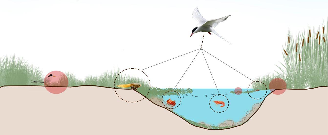
Emergent sedges, rushes and grassy bank areas - Deep water
Tadpole Pond crab Insect Freshwater Shrimp
Emergent sedges, rushes and grassy bank areas - Shallow water
38 39 Locating the
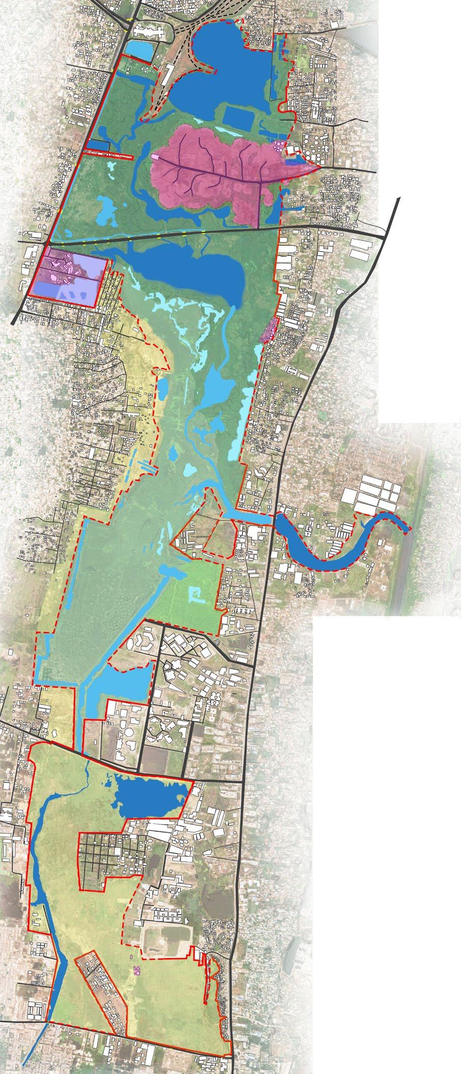
Legends Black-bellied Tern Habitat spots Indian skimmer Common pochard Scrublands Marshland Afforested area Swampy grassland Waterbody Road Buildings Ramsar site boundary with free edge Ramsar site boundary with compound wall Built Structures inside Ramsar site boundary
birds
Grid size: 500x500 m Adapted Source: Care earth trust 0 750 1500 3000 m
Worms Fish Pond crab Freshwater Shrimp
Fish Aquatic plants Pond crab Nesting sites Dragonfly
Emergent sedges, rushes and grassy bank areas - Deep water
Habitat study
Species: Great Knot
Type of bird: Wading shore-birds (brackish)
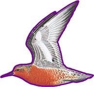
Habitat: Wet mudflats, Shallow puddles.
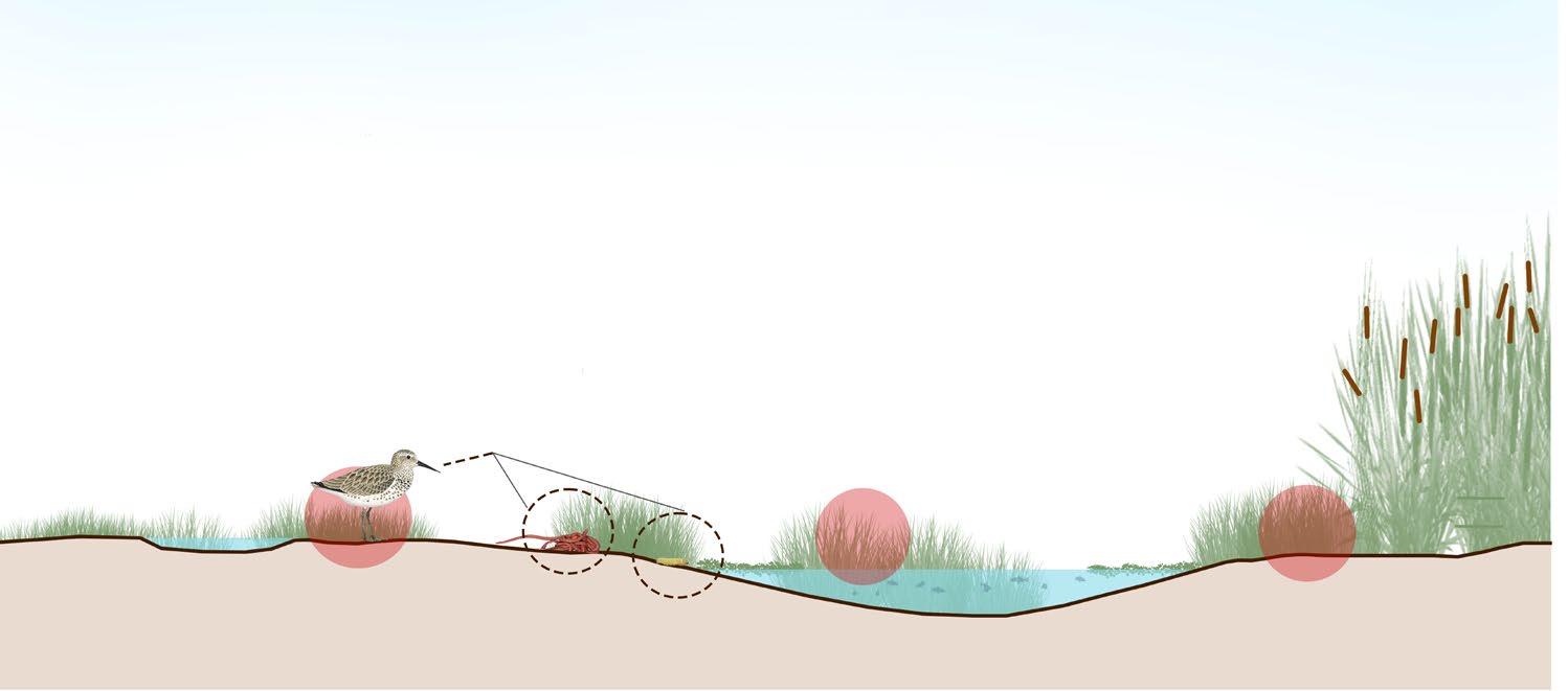
Type of visitor: Resident and winter migrant.
Migration period: October to March
Food requirement: Worms, larvae and other soil invertebrates.


Basic habitat requirements: Sheltered, coastal habitats containing large, intertidal mudflats, including inlets, bays, estuaries and lagoons.
Nesting sites: They rely on the surrounding vegetation for protection and camouflage. It prefers to nest in areas with low-lying vegetation, such as grasses, sedges, and small shrubs. The plants provide cover for the nest and chicks, which helps protect them from predators and harsh weather conditions.
During migration and wintering, the Great Knot uses a variety of habitats, including mudflats, sandy beaches, coastal wetlands, and intertidal zones.

Emergent sedges, rushes and grassy bank areas - Shallow water
Species: Great spotted eagle
Type of bird: Predator bird
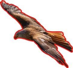
Habitat: Bogs, wetlands, some sea coasts, and other waterways surrounded by woodland or forested land.
Type of visitor: Resident winter migrant
Migration period: November to February
Food requirement: Prey on ground or on the water
Basic habitat requirements: Freshwater wetlands, grasslands, scrublands, forest and urban niches.

Nesting sites: Great Spotted Eagles typically build their nests in the crowns of large trees, using sticks, twigs, and other materials. They may also use other tall vegetation, such as reed beds or rushes, for nesting if suitable trees are not available.
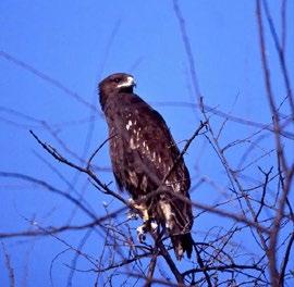
The nests are typically quite large, often measuring over a meter in diameter, and are built up over several years of use.


40 41
Great Knot Great spotted eagle
Locating the birds
Legends Habitat spots Scrublands Marshland Afforested area Swampy grassland Waterbody Road Buildings Ramsar site boundary with free edge Ramsar site boundary with compound wall Built Structures inside Ramsar site boundary Grid size: 500x500 m Adapted Source: Care earth trust 0 750 1500 3000 m
Worms Larvae
Fish Owl Pond crab Squirrel Freshwater Shrimp
Islands with shallow water
Issues map
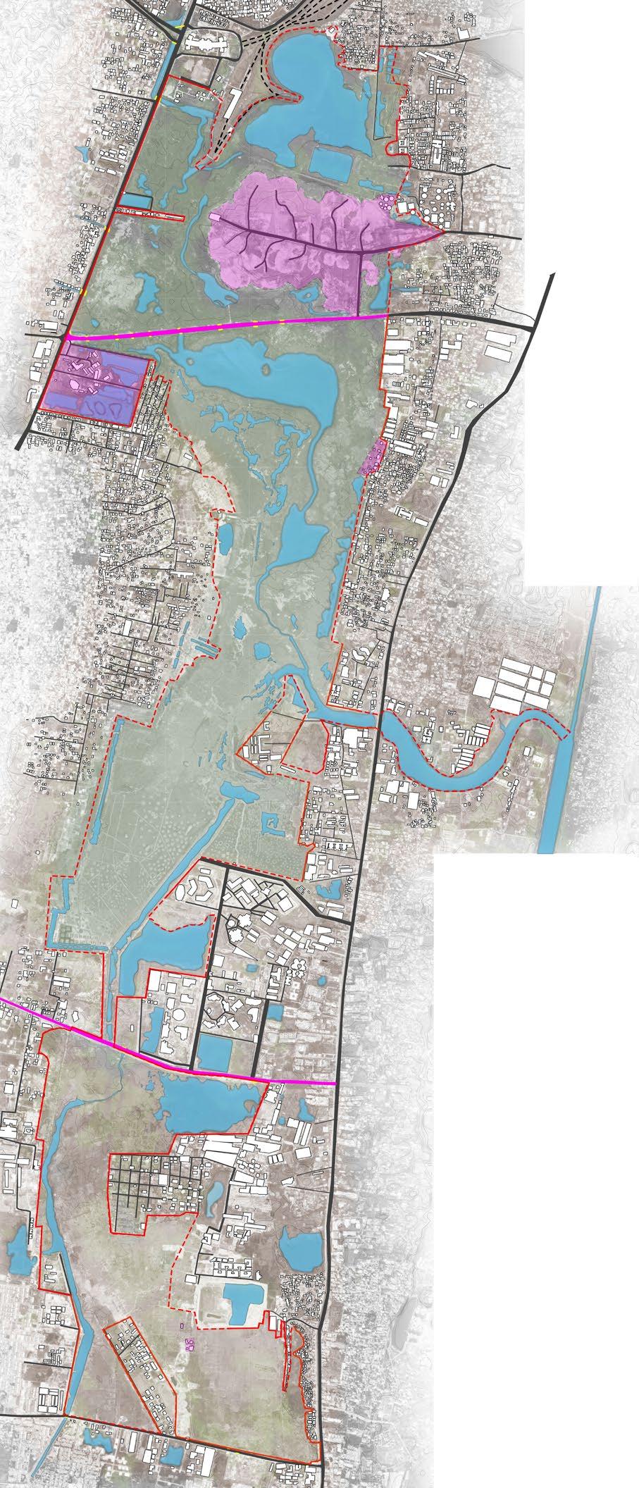
Issues on the site due to urbanization pressures


Major encroachments inside the marshland have atlered the hydrology and the ecology of the marsh.

The encroachments are residential, It offices, Dumpyard site, Institutions, NIOT, National institute of Wind energy, CMSSWB STP, and more squatter settlements.
Landfill
Grid size: 500x500 m


Produced leachate contains high contents of Mercury, Cadmium and Lead.
It is apparent that the Pallikaranai marsh is largely affected by organic waste disposal and contamination as is indicated by the high levels of Chloride and Sulphate. It has lead to Enviromental, air and water pollution which is becoming hazardous to people and other fauna species living in water.


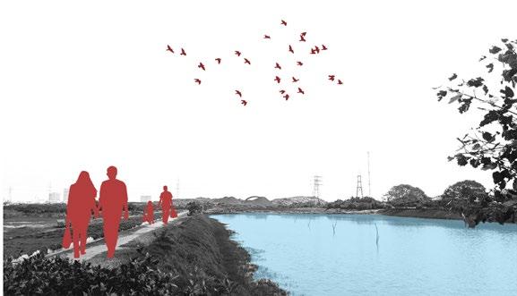
Water pollution
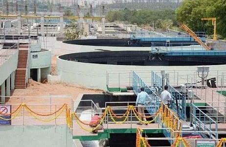
Untreated sewage water from STP and the drainage water flowing through the water channels is fed into the marshland, causing depletion in the water quality.

PH is acidic in nature near the dumpyard and the TDS level is higher in concentration than the permissible level 500mg/L, which is safe for drinking.
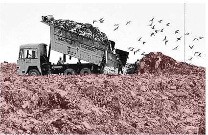
High levels of Chlorides and sulphates are present in the water leading to higher BOD levels near the dumpyard. Also leading to eutrophication near the water bodies.
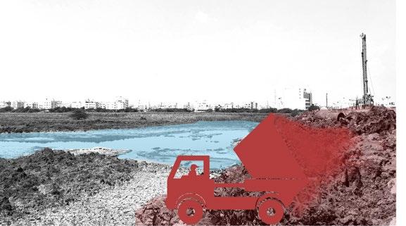

Invasive species - fauna
Giant African Catfish, the Armored Catfish, Kerala Pomphret were introduced by fisheries department for fishing activities. These species can grow larger in size and create conflict between the other native fishes.
It is larger in size and has bony skeleton which can chock smaller fish eating shore birds.
Habitat degradation
The availability of deep water is very less in comparison to shallow depth waters leading to habitat fragmentation. The maritime ecology of the marshland is also be responsible for the diversity of certain species of migratory waders, which is getting affected now.

42 43 Activity & Sensory map Activities on site Grid size: 500x500 m 1 2 6 3 7 5 4 Legends Dumping of garbage/ debris Foul smell Noise level Viewshed Water bodies Greencover Road Buildings Ramsar site boundary with free edge Ramsar site boundary with compound wall 0 750 1500 3000 m
1.Fishing on the marshland
2.Dumping the waste in the marshland (converted dumpyard)
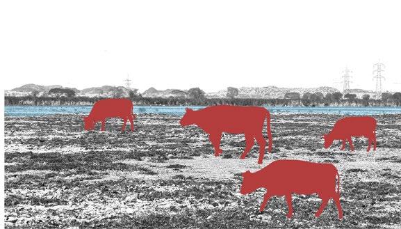
3. Grazing pressure on the marshland from the settlements
4. Dumping the construction debris into the road edges along the marshland
6.
0 750 1500 3000 m
5. Gathering wooden logs from Prosopis juliflora for a living
Leisure walk in the marshland eco park
Locating the spots
1694 MT OF MUNICIPAL WASTE DUMPED DAILY
Unprotected edge
Systemic thinking
URBANISATION
Unprotected edge along the marshland has altered vegetation patch density due to grazing pressure and dumping of construction and other debris on the edges.
The surface run off water from the surrounding residences are also causing pollution to the marshland and siltation along the eastern portions of the marsh. It is indirectly affecting the birds nesting and roosting habitats.
Lesser water retention
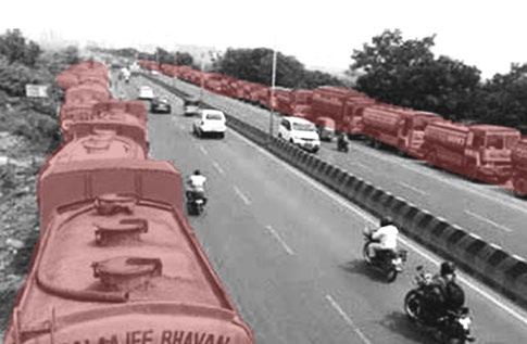
700-800 tankers extract water within 3 km of the Pallikaranai marshland either by directly pumping water from the wetlands or through bore-wells.
The shrinkage in water holding capacity is also due to alteration in marsh conditions due to encroachments and shrinkage in water spread.
Invasive species - flora
Invasion of Prosopis juliflora has been rapid along the site boundaries has altered the vegetation mosaic. Other aquatic invasive species are water lettuce, duckweed and water hyacinth.
It can quickly spread over a whole waterway and may double its size every 5 days under ideal conditions. It lowers water levels and water quality, affects water temperature and pH, reduces oxygen levels, and limits the quantity of sunlight under the water. This affects the fishes and other aquatic species.
Conversion of marshland into scrublands

According to TP Scheme, the southern portion comes under Industrial zone, where people have built residential and institutions on the marshland.
These encroachments lead to change in landform and species diversity to become scrublands with less grounds for open waters.
ENGAGEMENT
FISHING ENCROACHMENTS
CLEAN
ECOLOGICAL VALUES
SILTATION
GRAZING PRESSURE

UNPROTECTED EDGE
POLLUTION
HISTORY
UNIQUENESS
FLOOD MITIGATION
WATER DEPTHS
DUMPYARD
ECOSYSTEM
FRAGILE
RAMSAR SITE
BUFFER REPLACED BY HARD EDGE
WATER RETENTION
STORMWATER DRAIN
CAMPING
SAFETY BRAKISH WATER
RECONNECT
DEBRIS
ECONOMIC VALUE
REVIVE
FAUNA
PALLIKARANAI
MARSHLAND
HABITAT FRAGMENTATION
WATERSHED
INCLUSIVE
FIBRE/FUEL
FOOD CHAIN
RESTORE
IMBALANCE
EDUCATION
SCRUBLANDS
NATIVE FLORA
HABITATS
NATURE INFLUENCE
LOST
WATER QUALITY
INVASIVE SPECIES
MIGRATORY BIRDS
FRESHWATER INTERACTIONS
BIRD HABITAT
HERITAGE VALUES
SEWAGE WATER
THERAPEUTIC
LESS TREE COVER
IT CORRIDORS
ECOTOURISM
POTENTIALS ON SITE RECONNECT REVIVE
Pallikaranai marshland in Chennai, India, is one of the city’s last remaining wetlands. Unfortunately, the marshland has been subjected to severe encroachment and pollution over the years, resulting in its degradation. In order to arrive at strategic solutions for the proposal, the concepts of revive, restore, and reconnect emerged from the systemic thinking diagram.

The objective of the project is to resolve the marsh’s current challenges with specific recommendations and measures that could revitalize the ecosystem’s ecology and hydrology.
44 45 Issues map Locating the spots
0 750 1500 3000 m
Grid size: 500x500 m
The method of narrowing down the keywords entails transforming the crucial concepts and issues from systemic thinking into diagrams and listing them briefly to arrive at the vision.
HABITATS
WATER RETENTION
PALLIKARANAI MARSHLAND
Vision eidetic photomontage
WATER QUALITY
HYDROLOGIC & ECOLOGICAL VALUES
LANDFILL/DEBRIS DUMPING
PASSIVE RECREATION VALUE & COMMUNITY PARTICIPATION

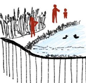
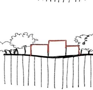
GRAZING PRESSURE
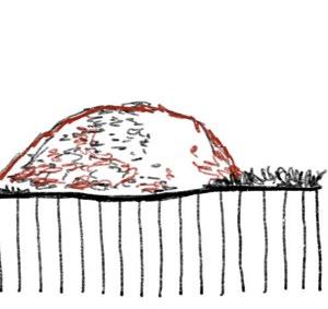
SEWAGE INFLOW
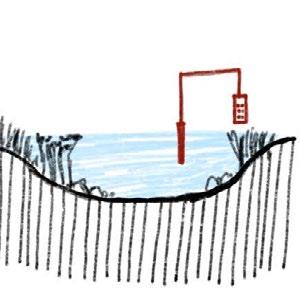
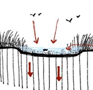
NATIVE FLORA
ENCROACHMENTS

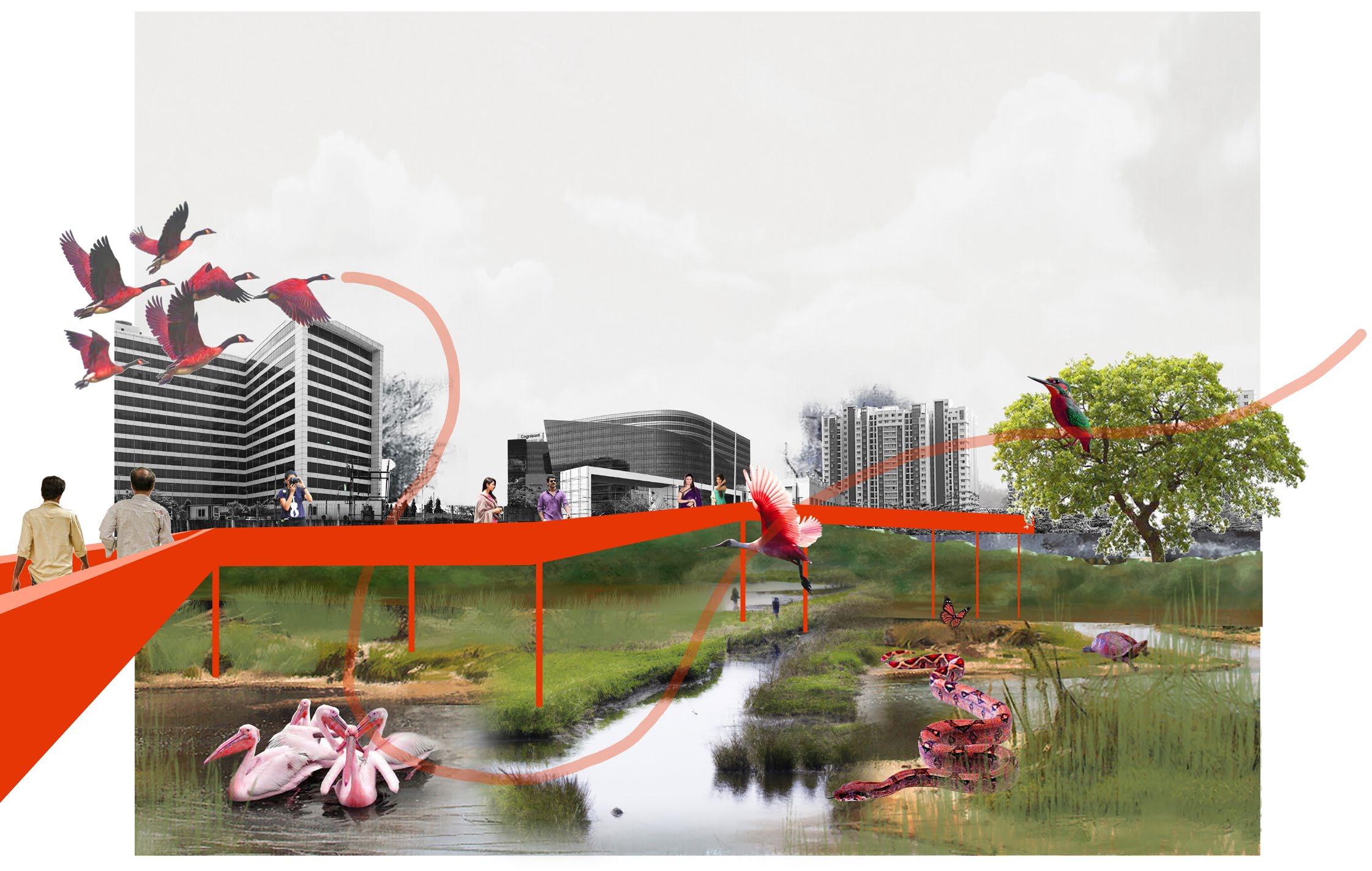
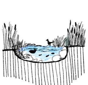
Protected / Sustainable / Activate / Co-existence
Vision statement:
The project aims to REVIVE the ecology of the marshland through interventions and guidelines, RESTORING with improved habitats for critical faunal and avifaunal species as well as RECONNECTING with the humanbeings.


46 47
Vision ideation
UNPROTECTED EDGES
EDUCATION & AWARENESS VALUE
INTERACTIONS
THE EXISTING THE LOST RESTORE
REVIVE
RECONNECT
In conceptual exploration section, the overall zones are identified through site synthesis. Moving forward, the conceptual zoning and programming are done based on case studies and inferences from projects. Then guidelines were framed, followed by zoning in different layers of the site through hydrology, edge and habitat conditions and interventions are formulated accordingly.
49 48
CONCEPTUAL EXPLORATIONS 3.
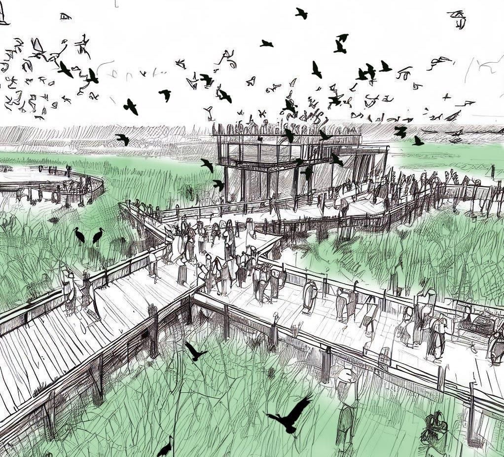
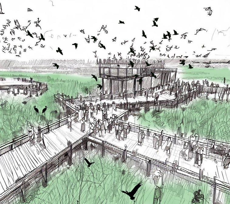
Figure_Illustration_View of the boardwalk ln the interpretation centre
Site synthesis
Site existing conditions
Existing structures
The existing structures included landfill and the infrasture developments inside the marsh.

Identifying the zones
ENVIRONMENTAL CRITICAL ZONE

This zone has undergone lot of changes due to landfill, which is now recovered by Bio mining.
Water levels- Pre monsoon
Deep waters (1-2m)
Intermediate waters (0.3-1m)
Shallow waters (0-0.3 m)
Water levels- Post monsoon
Deep waters (1-2m)
Intermediate waters (0.3-1m)
Shallow waters (0-0.3 m)
Water salinity
Brackish water
Sewage water inflow
Sewage water inflow
Grazing pressure + Prosopis juilifora invasion
Grazing pressure Prosopis juliflora
Sensory mapping
Dumping of garbage/debris
Foul smell

Noise level
SENSITIVE ZONE
This zone has undergone changes due to grazing pressure, debris dumping and unprotected edges.
AFFORESTED ZONE

This zone is a protected zone where proper maintanence of islands/mounds and water bodies have been taken care by the Forest department.
UNPROTECTED ZONE FOR POTENTIAL
This zone is unprotected as it wasn’t considered as marshland site before Ramsar designation. It has the potential of becoming terrestrial grounds for both fauna and avifauna.


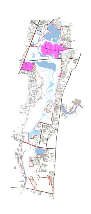
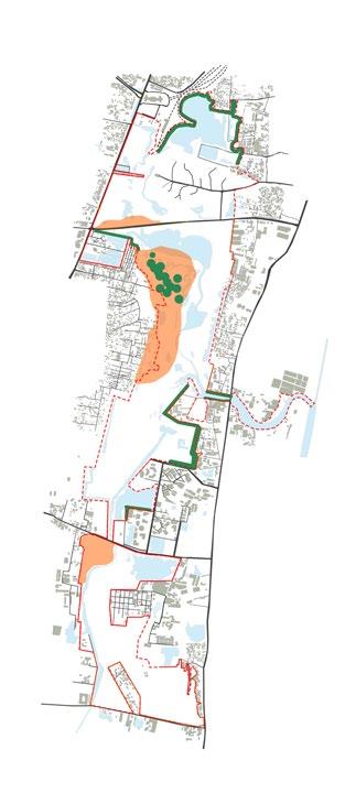

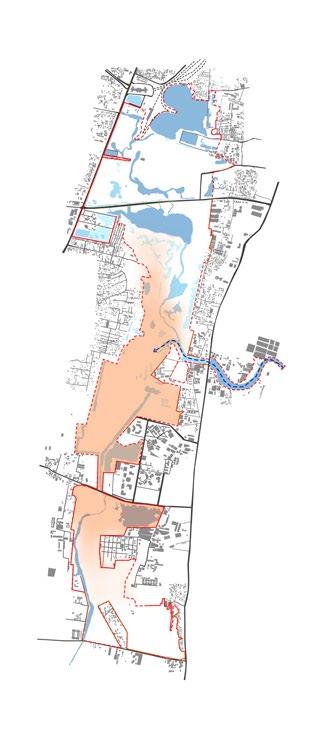
51
Guidelines
Based on Hydrology
Trenching, bund construction, and earthern mound construction are well-established procedures employed by the TN Forest Department for enhancing the marsh’s water retention capacity.
All areas identified as wetland / marsh areas needs to be protected and encroachments existing within the marsh should be relocated accordingly.
In order the network to operate properly, regions outside the scope of the marsh, particularly the 30 wetland complex specified under the catchment area, must be under the purview of the Pallikaranai Marshland Conservation Authority.
The guidelines for real estate developers around the marsh landscape must be unique, emphasising the dos and don’ts. For example, low-water-use gardens, rather than huge lawns, could become a possible norm.
All three Tilapia species imported into the country for fishing are presently flourishing in Pallikaranai marshland. These invasive species can be eliminated by continuously monitoring and harvesting the overabundance of these fishes.
Involving local community stakeholders in the restoration process will help them understand the ecology of the marshland and to stop extracting water in the adjoining, non-protected habitats through digging wells or drilling borewells.
Based on Ecology
Existing structures, particularly national institutions such as the National Institute of Ocean Technology and the Centre for Wind Energy Technology, have evolved to become refuges and nesting sites for some of the large wetland birds due to their location within the marsh.
The landfill site after ex situ approach of bio-mining can be reclaimed by phytoremediation and through this approach the polluted marshland could be reclaimed.
Underwater stacking of water-washed rocks to offer habitat for small creatures and fish that are prey for birds. Waterbirds can roost on logs and rocks that protrude from the water.
The institutions should abandon their intentions to extend or improve the current infrastructure on the basis of the benefit sharing mechanism with the landscape, as well as valuing the ecosystem services that the institutions could give.
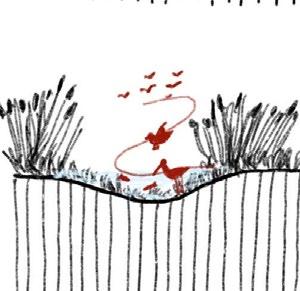
Placing branches and dead logs at varied heights around the border of the marsh to provide roosting and nesting areas. Providing a diversity of water depths offers habitat for waders, connect shallow mudflats to an island rather than the shoreline.
Promoting an increase in the wetland’s overall species diversity and thus ensuring ecological processes are in place and functional. The intent is to help avifauna and other faunal groups with their nesting, breeding, and feeding routines and preferences.
Using natural margins with slopes instead of steep banks. The addition of vegetated banks in bare areas will allow birds to traverse across the wetland and also allowing them to spot predators.
Based on Interventions
Removal of the alien species(flora) through methods like mechanical, Mechanical with application of systemic herbicide and Herbicide alone. Physical method can be used to remove water hyacinth from the infested water bodies. For large infestations, machines, like aquatic weed harvesters and crusher boats need to be employed.
Bio fencing can be used to restrict cattle access, hence reducing bank erosion and disruption to fringe vegetation. Natural regeneration is also possible in disturbed regions as a result of this.
Keeping mature trees around the marsh to provide habitat for birds and small animals. A variety of aquatic birds build their nests in tree hollows or forks.
Responsive eco tourism activities can be allowed such as nature trails, interpretative centre and wetland study centres to create awareness among the public regarding the marshland ecology and its unique species diversity.
Creation of more terrestrial islands and mounds through the similar trench method utilised by the forest department can increase the perching and resting habitats for the avifauna in the southern portion of the marsh.
54 55
*Reference taken from the site management plan proposed by Care earth trust
Methods
Excavation through digging trenches

Zoning - Hydrology & Habitat conditions
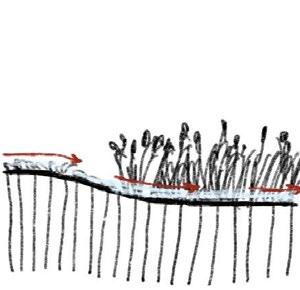
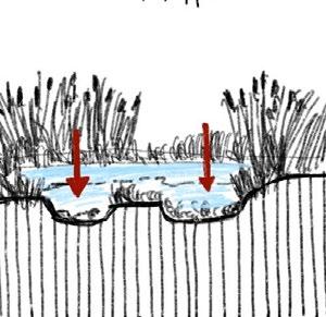
Trenches are dug out to deepen pits and increase the water retention capacity along the areas where water depths are less and siltation is a major concern.
Conceptual sections
Section A
Design strategies

1. Increasing the percolation capacity and connecting water bodies along the catchment area to the wetland.
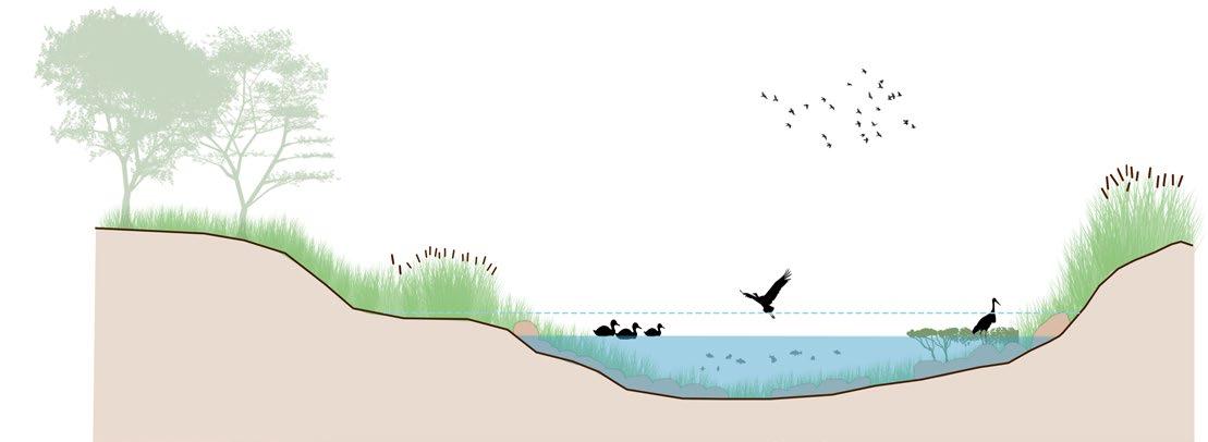
Road edge along compound wall
Section B
Buffer vegetation
Shallow water along the grassy banks
Creating islands/mounds
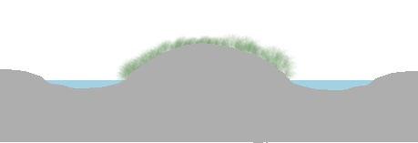
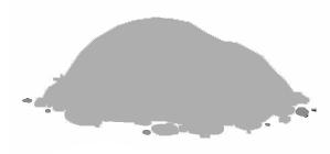
Mounds are created thereby excavating trenches all around the mound and also the excavated sand is used to create grassy mounds along edges.


Mounds around waterbody
These mounds help birds to perch and nest while the excavated trenches will help fishes to migrate during lesser water availabillity period.
Increased water depths
Legend
Swimming birds
Predator birds


Leaf walking birds
Non diving birds
Shore/wading birds

Arboreal birds


Ground birds
The proposed water depths will allow the marshland to retain more water capacity during pre monsoon months.
Freshwater
Brackish water
Mix of both fresh and brackish water


Proposed Stormwater connection

Water bodies
Proposed water bodies
Road edge along compound wall
Section C
Bio-retention pond Grassy mounds acting as a natural edge
2. Creating Bio-retention ponds and raingardens along the buffer edges which filters the runoff water and eventually released to the wetland.
Shallow water along the grassy banks
3. Increasing the water depths of deepwaters of the marsh to support more water holding capacity and also increasing the biodiversity of species living in the water.
Buffer vegetation
Increased depth in the deep water

Section D
Section E
Road edge along compound wall Dead
4. Introducing perching barks along the banks will increase lot of shore and terrestrial birds to rest on them.


Buffer vegetation along the edge
Perching barks
5. Introducing dead logs along the grassy banks will increase the population of Swimming, shore wading, ground and arboreal birds to nest and perch on them.
Grassy

56 57
A B E C A B E C D D 0 750 1500 3000 m Grid size: 500x500 m
logs along the shallow water Dead logs along the intermediate water
mounds
Methods
Zoning - Edge conditions

Conceptual sections

Section A
Section B
Design strategies
Buffer vegetation
The buffer vegetation is proposed along edges for edge protection and increased terrestrail habitats for the avifauna. It also blocks the noise from the surrounding.
Edge stablisation
Creation of gentle slopes surrounding the marsh with a height to length ratio of 2:1 or 3:1, as well as for irregular shorelines for the wetland can be ensured along the edges.


Type of edge
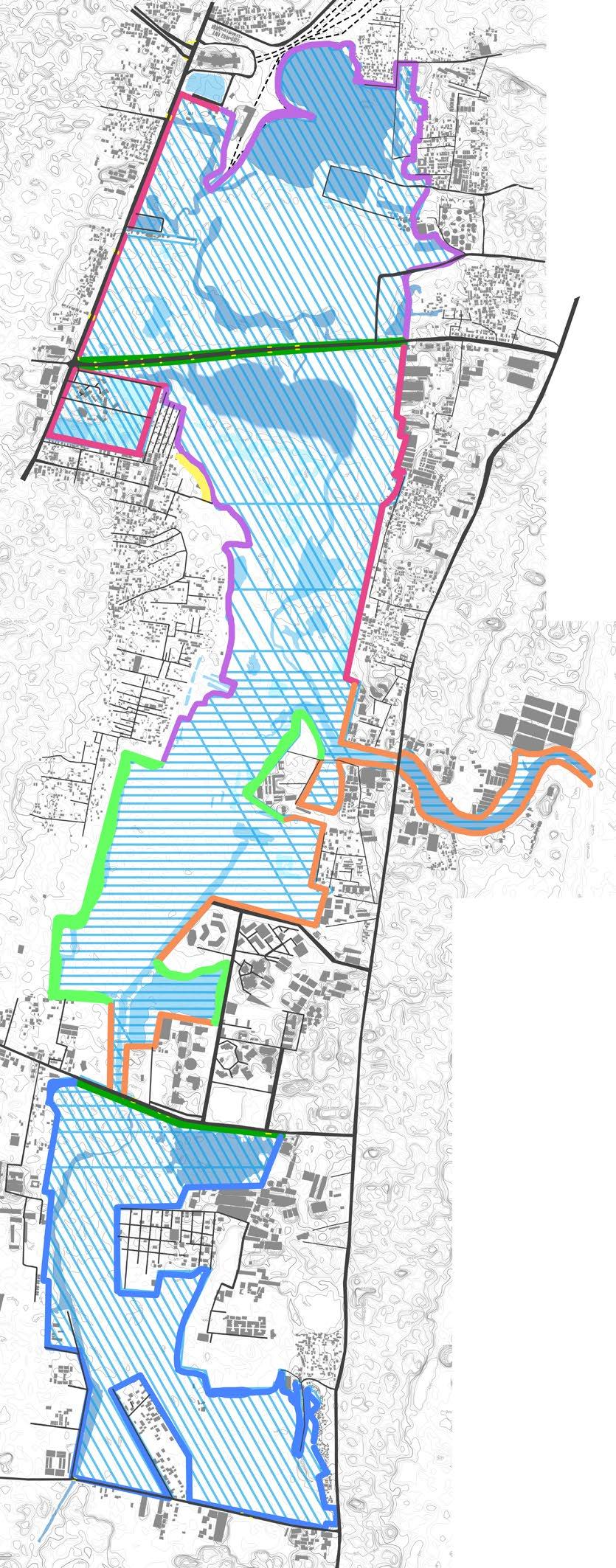
The edge conditions vary widely accordingly to the varied conditions all along marsh with varied treatment.
1. The strategy is to include more trees and shrubs along the compound wall and providing buffer vegetation along the banks.
The strategy of providing biofencing along the unprotected edges is used in section B as a protective edge


With the proposed edge condition the human conflict with the marsh can be avoided and the waterbody can be protected.
Legend
Freshwater
Brackish water
Mix of both fresh and brackish water
Water bodies
Compound wall edge with buffer vegetation
Biofence with thick vegetation
Buffer along the road
Grazing area with biofence
Mangrove species buffer
Mound acting as the edge
Thick vegetation cover with gradual slope

Road edge along compound wall
Section C
Buffer vegetation
Shallow water along the grassy banks
Road edge along compound wall
Buffer vegetation Biofence
2. Along the unprotected edges, the strategy is to provide biofencing with Euphorbia spp. as a protective layer preventing humans or animals to enter the waterbody.
Inspired from “Haha wall” providing controlled grazing areas will prevent people from entering the wetland.


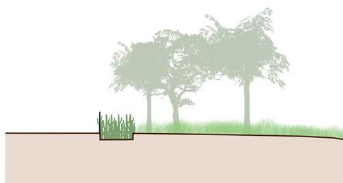
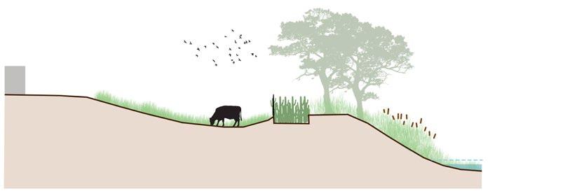

Road edge along compound wall
Section D
Grazing area
Biofence
Shallow water along the grassy banks
3. Introducing undulating mounds with fencing along the edge as a protective barrier for the wetland. It also acts as microhabitats for birds to feed and perch within the mounds.
Road edge along compound wall
Section E
Grassy mounds acting as a natural edge
4. Introducing mangrove species along the buffer edges of the brackish water to act as protective edges for the faunal species dependent on them and also as a support to the whole ecosystem.
Road edge along compound wall
Section F
Mangrove edge Shallow water along the grassy banks
5. Along the road edges thick buffer vegetation is created with stepped embankment for allowing more buffer against noise pollution and breaking the steeper slope which is existing.
Gradual slope with buffer vegetation
Shallow water along the grassy banks
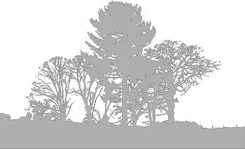
58 59
A B A B C D F E D F E C
0 750 1500 3000 m Grid size: 500x500 m
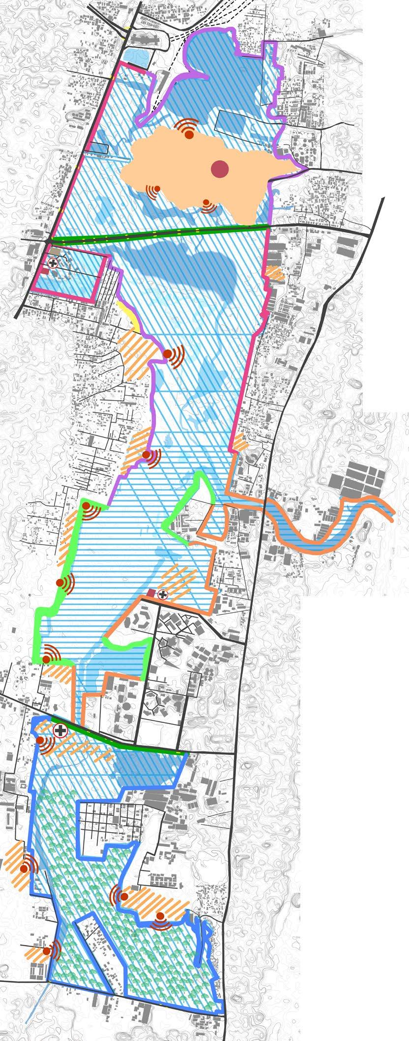
User group

Birdwatchers, nature enthusiasts, Scientists, researchers, hikers, outdoor enthusiasts, local residents and community members visit the marsh for varied interests accordingly.
Conceptual sections
Section A
Design strategies

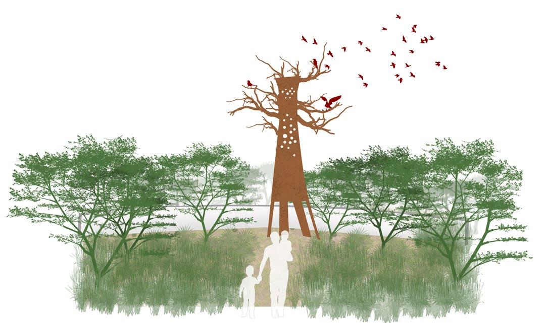
1. Introducing watch towers which replicates a tree as a strategy to add minimal distraction to the birds and also creating spaces where people can view the different bird species visiting there.

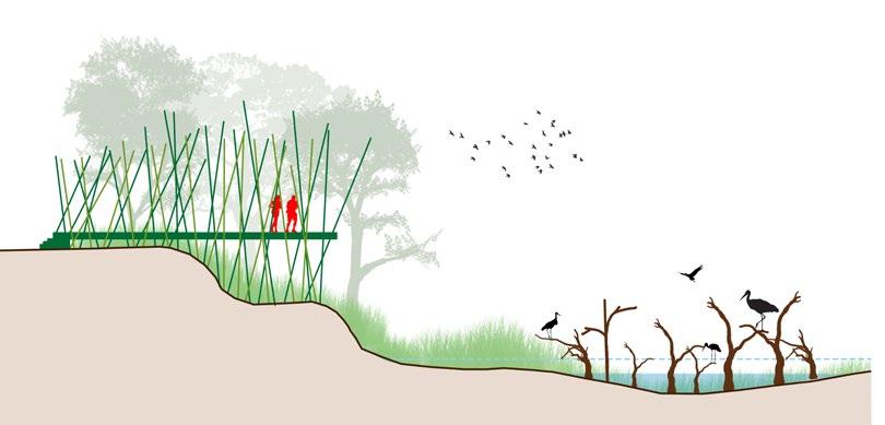
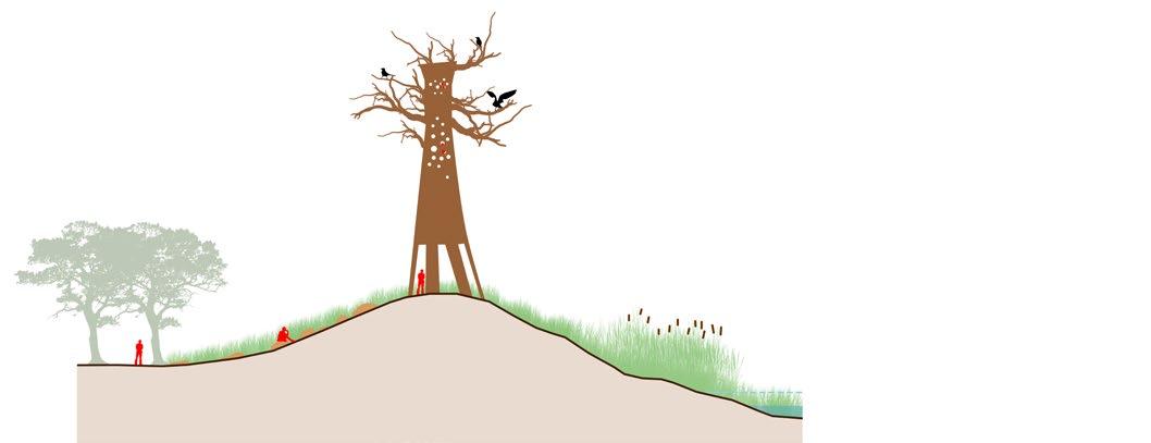
Watchtower along the grassy mounds
Section B
Monitoring and assessment


This facility can be helpful to tracking marsh health and determining the effects of human impact on these ecosystems. This may involve performing regular assessments of water quality, vegetation, and biodiversity surveys.
Educational outreach
A wetland monitoring study and interpretative center can be employed to teach people about the importance of wetlands. For students and members of the community, the center may offer guided tours, workshops, and educational programmes.
Legend
Floating bridge Grassy banks with perching barks
Section C
2. Introducing viewing decks along the interpretation centre where we can view the birds from a distance without disturbing them. It also has a informatory section to guide the user to check upon the different species they might spot.
Boardwalks are a valuable methods for integrating accessibility to the public and protecting the environment in flooded regions. Likewise programs are designated to allow public only in restricted
Freshwater
Brackish water
Mix of both fresh and brackish water
Water bodies
Compound wall edge with buffer vegetation
Biofence with thick vegetation
Buffer along the road
Grazing area with biofence
Mangrove species buffer
Mound acting as the edge
Dense vegetation cover with gradual slope
Intrepretation centre
Wetland study centre
Wildlife healthcare centre Interaction zones Viewpoints


Terrestrial grounds
Road edge along compound wall
Section D
3. Introducing Hideout viewpoints where people can come see from hidden points though private trails where people can use the space with paid entry.
Jogging track along the periphery
Section E
Buffer vegetation Shallow water along the grassy banks
Hideout spot
Grassy mounds acting as a natural edge
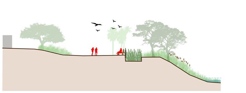
4. Introducing jogging tracks along the buffer spaces along the periphery of the wetland as passive recreation spaces for the community engagement.
5. Introducing pocket parks where people can sit and relax as a part of the community engagement which happens along the peripheral zones.
Road edge along compound wall Pocket park Bio-fence

Gradual slope with grassy bank edges
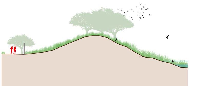


61
A B C A B C E E D D
Zoning - Human interactions
0 750 1500 3000 m Grid size: 500x500 m Methods
The overall strategy for the proposal is detailed in this stage using master plans along with transects details. The visualization of the spaces and the implementation measures are further detailed. The project outcomes are envisioned using visual narratives and as an end result of the proposal, the hydrological and ecological sustainability of the marsh is restored.
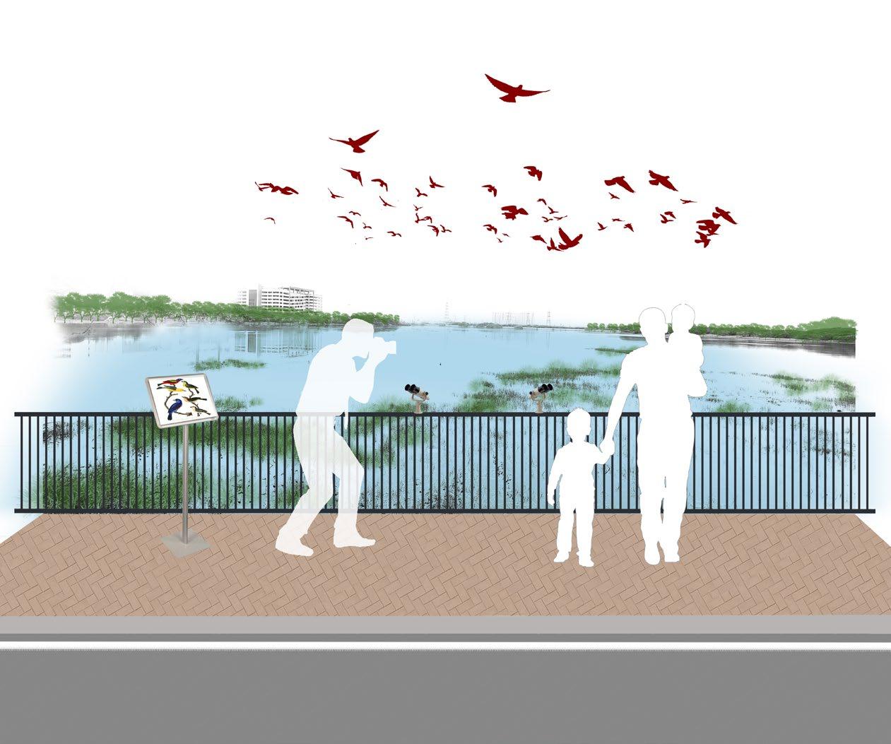
62 63 CRAFTING THE
4.
LANDSCAPE
Figure_Illustration_View of the interpretation walk along the bridge
Master plan
Legend
1.Intrepretation centre
2.Marshland eco park(exisiting)
3.Wetland study centre
4.Grazing area
5.Pocket park
6.Bridge walk
7.Afforested area with nature trails
8.Wildlife healthcare centre
Road
Buildings
Watch tower
Bridges
Rope walk
Parking

Edge conditions
Compound wall edge with buffer vegetation
Biofence with buffer vegetation
Mound edge
Mangrove species buffer

Dense vegetation cover with gradual slope
Habitats
Island vegetation
Mixed vegetation
Swampy grasslands
Terrestrial grounds
Vegetated mounds
Open waters (3-4m)
Deep waters (2-3m)
Intermediate waters (1-2m)

Shallow waters (0.5-1m)
Very shallow waters (0-0.5m)
Avifauna species
Swimming birds
Arboreal birds


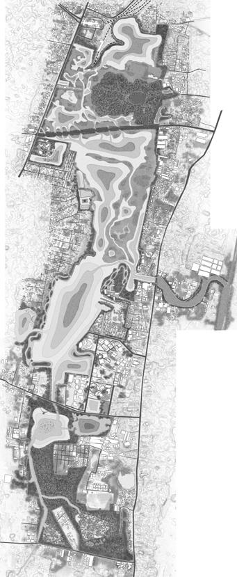
The master planning is planned based on the previously discussed design strategies and guidelines which are implemented on site to revive the lost habitats and water bodies, restore the edge conditions and reconnect with the humans.

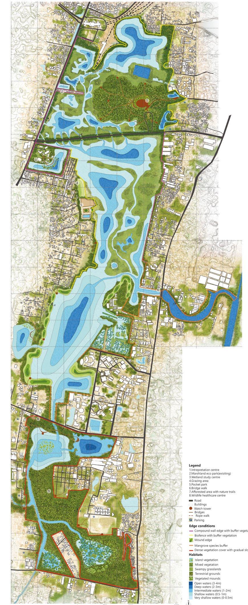
The site is about 1247.5 Ha and there are interventions made abiding to the Ramsar convention guidelines which doesnot impact the ecology of the marsh.
Edge conditions
Type a : Compound wall with buffer vegetation

Non diving birds
Shore/wading birds


Ground birds
Predator birds


Leaf walking birds
Type
b
: Biofence with buffer vegetation


Buffer vegetation of 25-30 m wide native vegetation is provided along the compound wall.
Perching barks and floating vegetation are introduced within the marsh for the improved habitat conditions and increase in the habitat diversity within the marsh.
Biofence is provided with 3 m deep and 5 m wide planting with Euphorbia species along with buffer vegetation along the waterbody.
64 65 0 750 1500 3000 m Grid size: 500x500 m
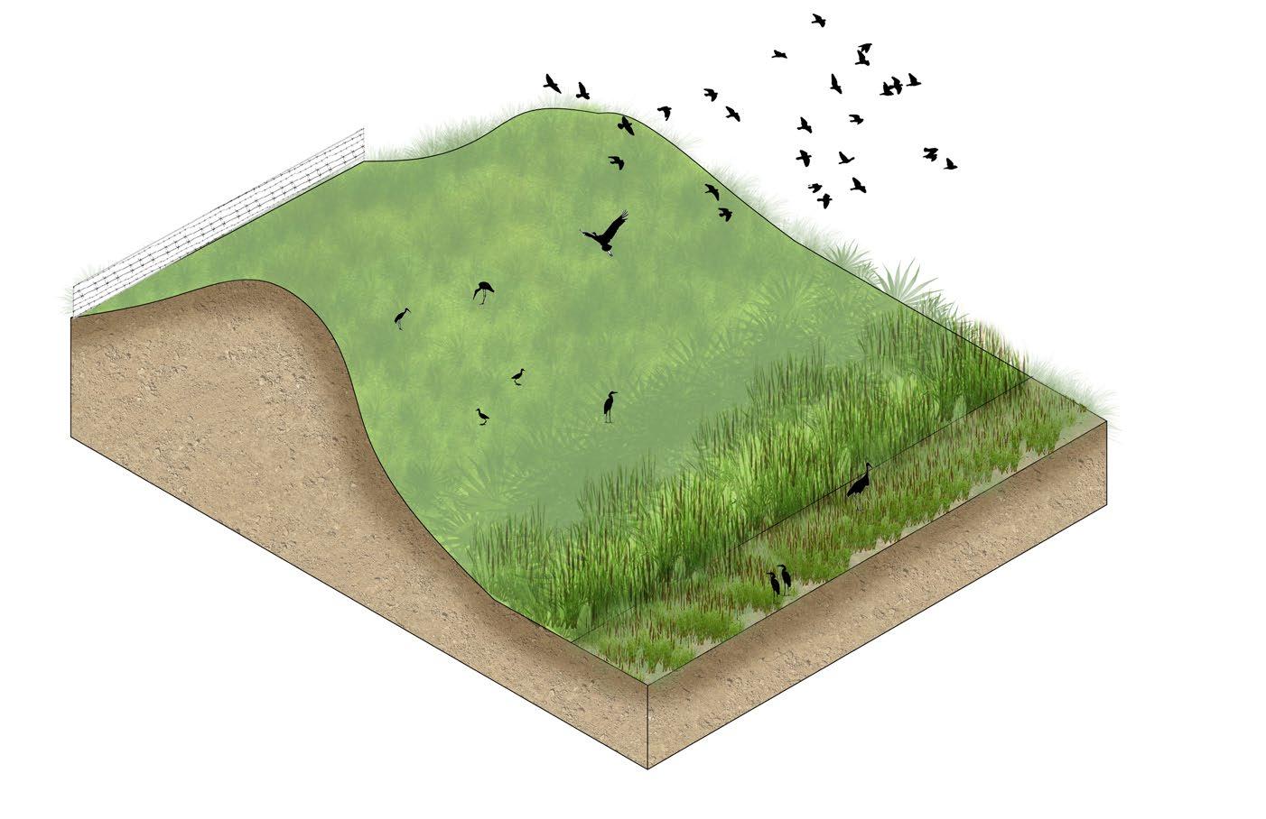
Mangrove species are planted along the edges of the brackish water condition with barbed wire fencing. It stabilises the shore line and also acts as habitats for the aquatic species.


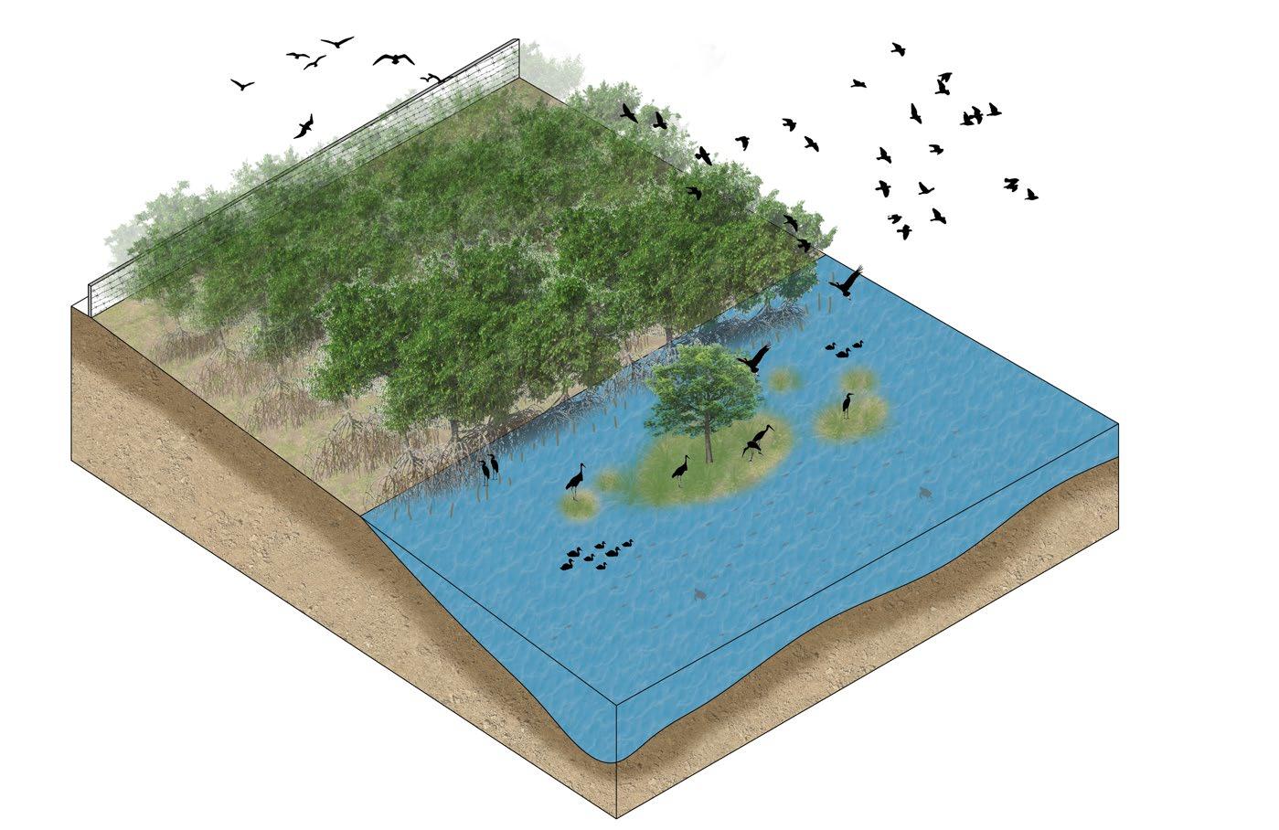


Dense buffer vegetation of trees for about 50100m wide are planted along the terrestrial ground as noise barrier and also for edge protection.









66 67
Type c : Buffer vegetation along road
Mound edge with heights ranging from 5 m to 7m within the undulations with 5% slope ratio. This mound is built with the excavated soil and native grass covering is given on the mound.
Type d : Mound edge with fencing
Buffer vegetation of 25-30m wide belt of trees with tall shrubs are planted along the highway as a strategy for noise buffer.
Type e : Mangrove edge with fencing
Type f : Dense buffer vegetation
Transect plan 1
Transect 1
Visual composition of the transect 1


Habitats
Mixed vegetation
Swampy grasslands


Terrestrial grounds
Open waters (3-4m)
Deep waters (2-3m)

Intermediate waters (1-2m)

Shallow waters (0.5-1m)

Very shallow waters (0-0.5m)
Compound wall with buffer vegetation
Shallow waters
Wetmeadows
Type of users & programme
Deep waters
Intermediate waters
Shallow waters
Intermediate waters
Visitors include birdwatchers, nature lovers, academicians, and researchers interested in learning more about the marsh’s avifauna and ecological state. They can learn about, observe, and take photographs of the species that visit the marsh with the aid of the nature trails, boardwalks, and watchtowers.


Locals and tourists visit the marsh because its located within the city limits, this could raise public awareness and produce revenue for the marsh’s protection and management.


Deep waters
Dense vegetated zone
Interpretation centre
Reclamation of the landfill site
After 2 years
Bio mining in the landfill site

Sesbania aculeata L is planted in the soil and harvested during the flowering season and its crushed and added back to the soil as a green manure to improve the soil condition.
Buffer vegetation

Shallow - deep waters
Biofence with buffer vegetation


After 6 months
Phytoremediation helps additional toxins from the soil are removed by growing trees and bushes that don’t contribute to biodiversity and aren’t edible. The species which is useful for firewood and timber can be grown.


After10-15 years
The intrepretation centre can be built with guided walks which can be part of the dense vegetated zone.
68 69
Swimming birds Shore/wading birds Ground birds Amphibians Arboreal birds Predator birds Leaf walking birds Non diving birds
Crustaceans Fishes Amphibians Human interaction Landfill reclaimed site
Key
0 1500 3000 m
Grid size: 500x500 m
plan
The marshland interpretation centre can help the local community, visitors and children to be educated and experience the marsh holistically.
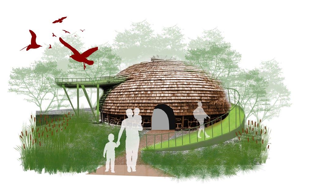
During the nature trails, the resting site is incorporated with the theme of emphasizing a particular bird community, its characteristics and its contribution to the ecosystem.
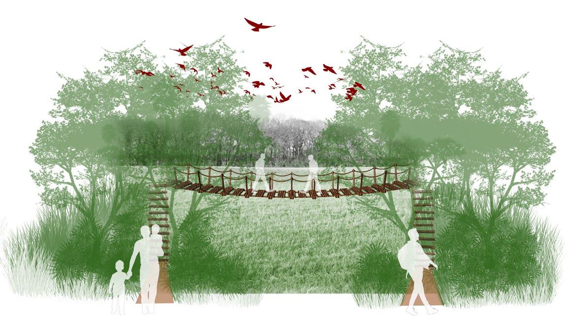
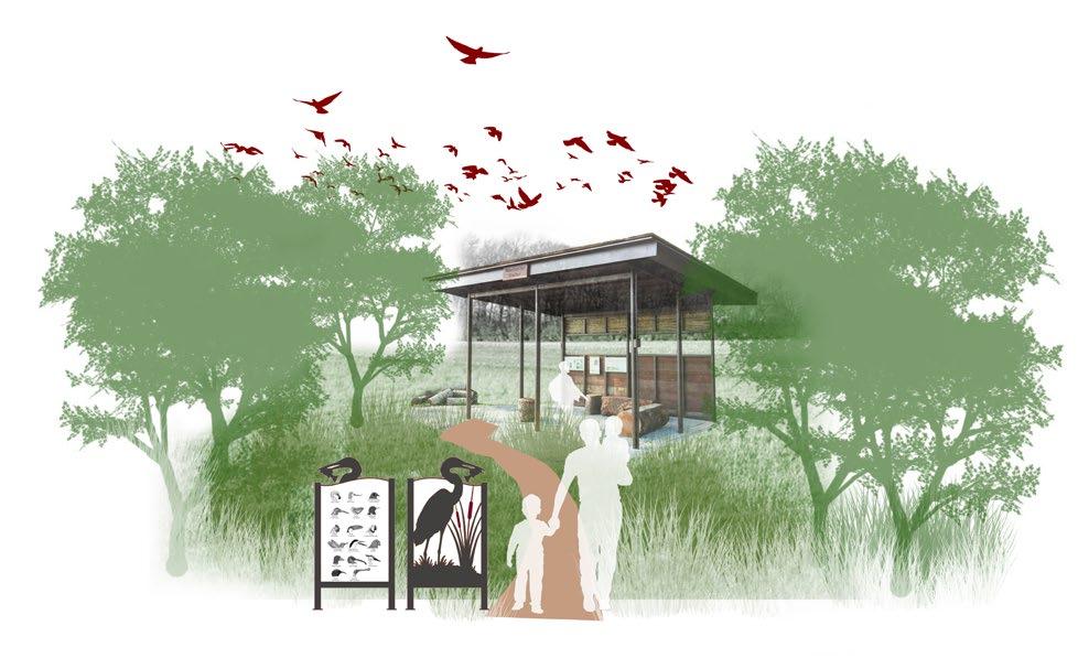
The ropewalk bridge allows the users to view the densely vegetated zone from an elevated view without causing much disturbance to the system.

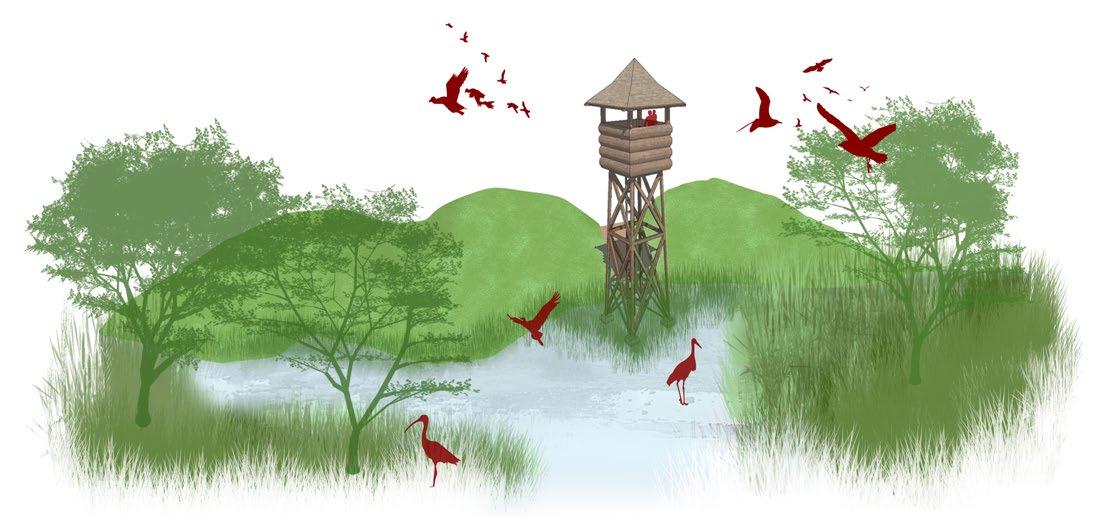
The watch towers are situated at closer perimeters to water bodies ranging from intermediate to deep waters. The watch tower is designed mimicking a tree trunk which doesnt disturb the bird habitat conditions and also allow resting spaces for the birds.

The floating bridge is situated at the site entry level, where users can the view the birds from a distance by viewing them from elevated platforms. Binoculars and information boards are placed on the bridge for educative purposes.
Camping tents are provided near the water body with dense vegetation to provide shade and to experience the natural setting of the space. Education camps and tours can be held here.
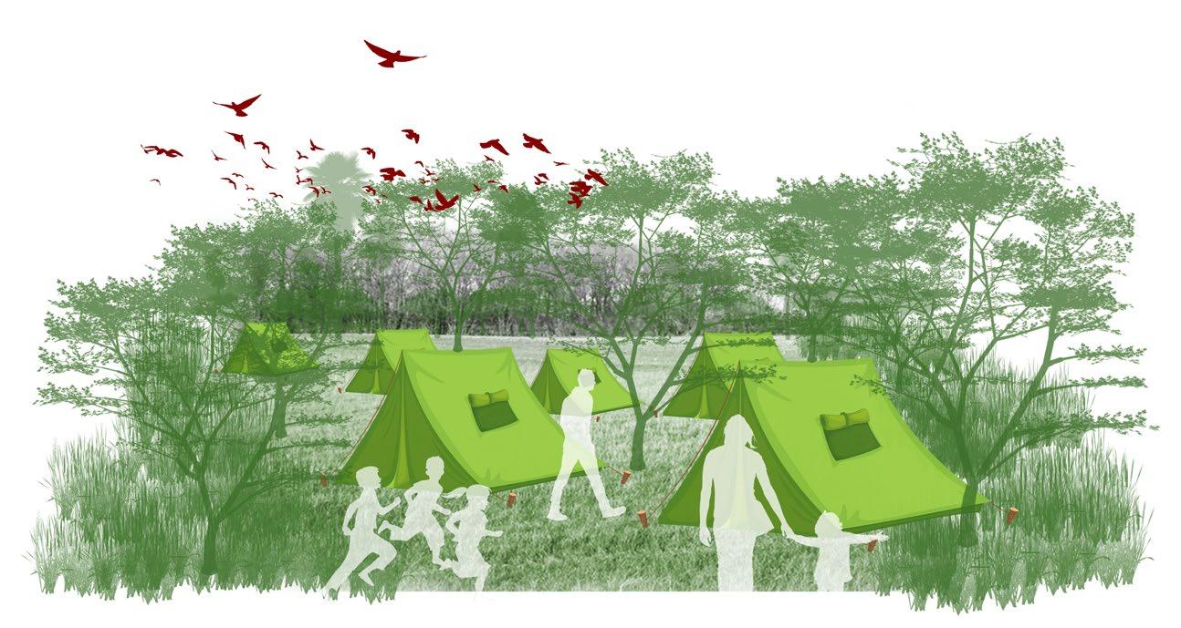

70 71
Key transect plan 1
1 5 2 4 3 6
Visualising the site - transect 1
Grid size: 500x500 m
1.Intrepretation centre
3.Floating bridge
2.Resting site
4.Watch tower
5.Rope walk bridge
6.Camping site
Visual composition of the transect 2


Habitats
Mixed vegetation
Swampy grasslands

Terrestrial grounds
Open waters (3-4m)
Deep waters (2-3m)


Intermediate waters (1-2m)

Shallow waters (0.5-1m)
Very shallow waters (0-0.5m)
Mound edge
Type of users & programme
Very shallow waters
Watch tower
Intermediate waters
Shallow waters
Deep waters
Visitors include birdwatchers, nature lovers, researchers, locals and tourists can take the trail along the periphery of the marsh along the edges and can access the watch towers and viewpoints to watch birds. The cycle trail also includes viewing points at every 2km interval along the entire stretch.
Intermediate to Shallow waters


Mound edge Institution
Very shallow waters
Dense vegetated zone
Reclaimed edge 1
Intermediate waters
Bridge walk
Mangrove edge Deep waters
Buffer vegetation


Reclaimed edge 2
Interlinked water bodies


The grassy mounds acts as protective barrier along the free edge of the marsh. As the elevation of the ground is very low the use of the mounds will act as natural barriers to prevent flooding and also creating habitats for the avifaunal species.
The Okkiyam madavu (creek) connecting to the Buckingham canal is the critical zone where exchange of freshwater and brackish water happens. The protective edge of planting mangrove species will help stabilise the bank and also provide habitats for fauna and avifaunal species.
The interlinking water bodies in the monsoon season helps in the mixing of fresh and brackish water sustaining the uniqueness of the ecosystem. It supports more biodiversity and also recharges ground water and also increasing the water retention capacity of the marsh during the pre monsoon months.

72 73
Transect plan 2
Swimming birds
Shore/wading birds Ground birds Amphibians Crustaceans Arboreal birds
Predator birds Leaf walking birds Non diving birds
Key plan 0 1500 3000 m
Transect 2
Fishes Amphibians Human interaction
Grid size: 500x500 m
Island vegetation
Visualising the site - transect 2
The mangrove edge is proposed along the areas where there is an influence of brackish water and planting strategy would allow to select species of mangrove according to the buffer width and land availabily along the marsh.
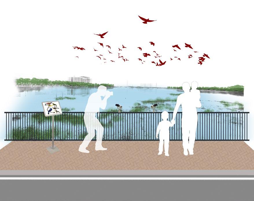
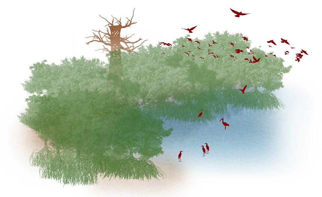

The watch tower is situated along the grassy mound edges where users can access from the periphery of the marsh and watch birds through it.
10.Afforested zone with trails
The densely vegetated zone was previously left barren and unprotected niche within the marsh. Thus this zone has the potential to provide habitats for fauna and avifaunal species which depend on brackish water regimes.
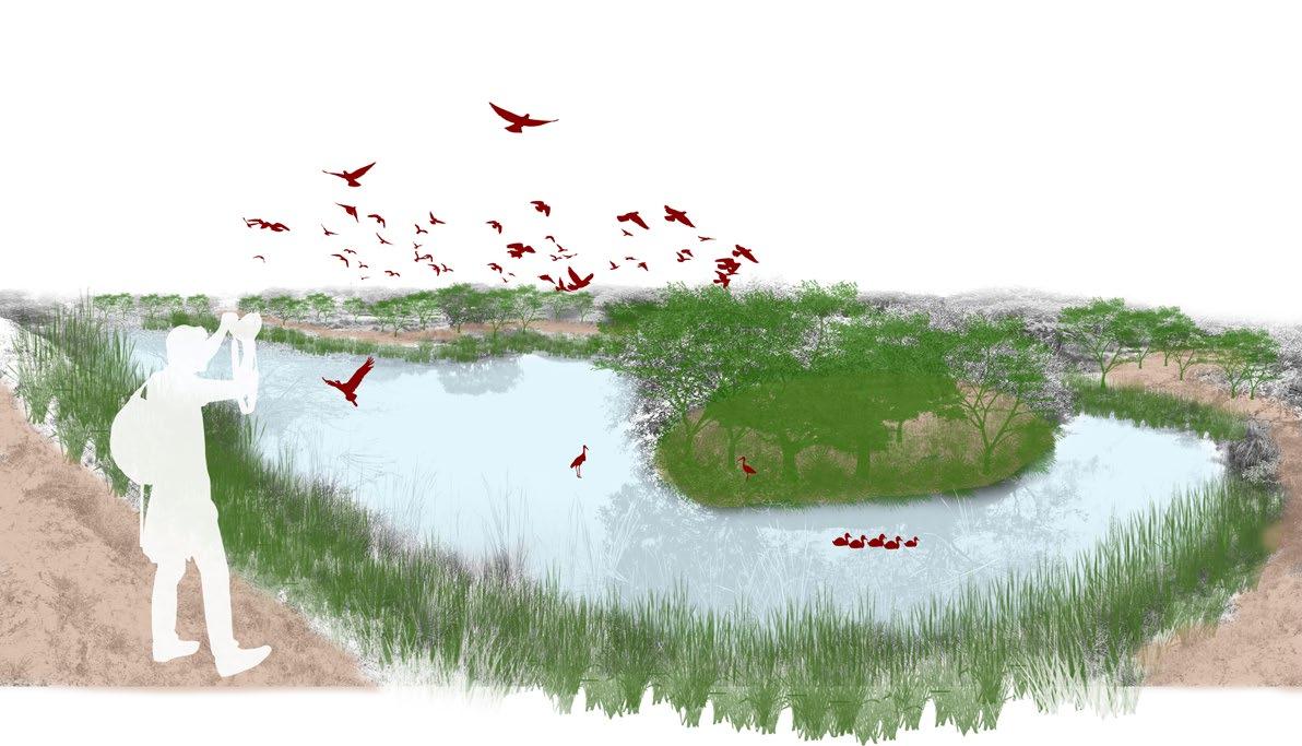
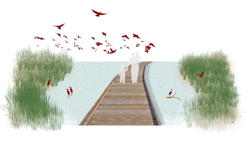
The intrepretation walk provided along the bridge connecting to the Old Mahabalipuram road acts as a viewpoint and a stopover point where people can view and enjoy the sight of the birdwatching from a distance.

12.Cycle track
The afforested zone with trails are provided by the forest department with pathways and floating bridges for the tourists, locals and nature enthusiasts to enjoy the guided walks inside the marsh.
11.Intrepretation walk
The cycle track is provided along the roadways parallel to the periphery of the marsh where tourists and localites can take a ride enjoying the surrounding.

74 75 7 12 11 8 9 10 Key transect plan 2
Grid size: 500x500 m
7.Watch tower
9.Dense vegetated zone
8.Mangrove edge
Transect plan 3

Compound wall with buffer vegetation
Deep Open Intermediate waters Very Shallow to shallow waters
Shallow waters Shallow waters Shallow

Type of users & programme

Reclaimed edge
Compound wall with


Waterbody with island vegetation
Nature trails
Habitats
Island vegetation
Mixed vegetation
Swampy grasslands


Terrestrial grounds
Vegetated mounds

Open waters (3-4m)
Deep waters (2-3m)


Intermediate waters (1-2m)

Shallow waters (0.5-1m)
Very shallow waters (00.5m)
Visitors include birdwatchers, nature lovers, researchers, locals and tourists can visit the southern portion of the marsh, which has nature trails, viewpoints and a wildlife healthcare centre for avi-faunal species. There a viewpoints situated along the outer periphery of the marsh .
The island vegetation which is proposed (replica of the islands created by the forest department) in the newly established waterbody gives more habitat space for the avifauna and also helps in the exchange of the freah and brackish water through the water channel leading from the northern portion.


The nature trails are proposed along the periphery where the users can experience the guided walk through the terrestrail grounds and also look at the birds and other fauna species from the floating decks and watch towers.


76
Swimming birds
Shore/wading birds Ground birds Amphibians Crustaceans Arboreal birds Predator birds Leaf walking birds Non diving birds
Visual composition of the transect 3
Key plan 0 1500 3000 m
Transect 3
Fishes Amphibians Human interaction Grid size: 500x500 m
Visualising the site - transect 3
Key transect plan 3

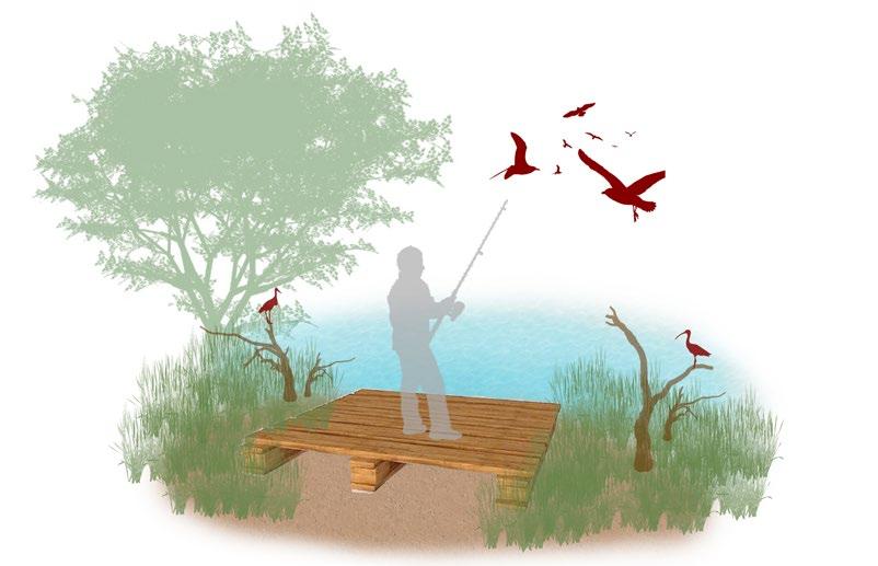
The fishing spot is provided as a part of ecotourism and it is strictly restricted towards the area demarcated for it and timely allowance and charged entry is ensured for this activity.
The hideout cabins are secret bird watching spots placed along edges of waterbody which doesnot disturb the surroundings and the avaifaunal species in the marsh. There are peep holes and movable louver windows for birdwatching purpose.
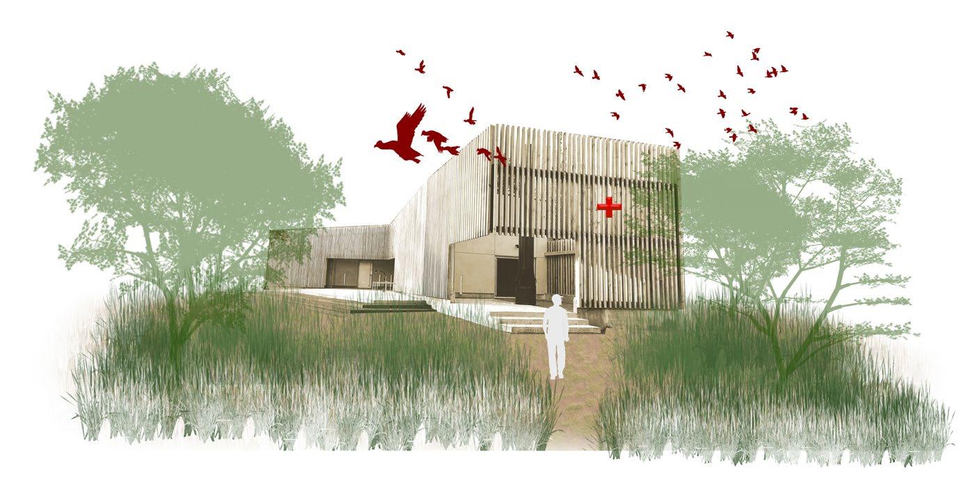
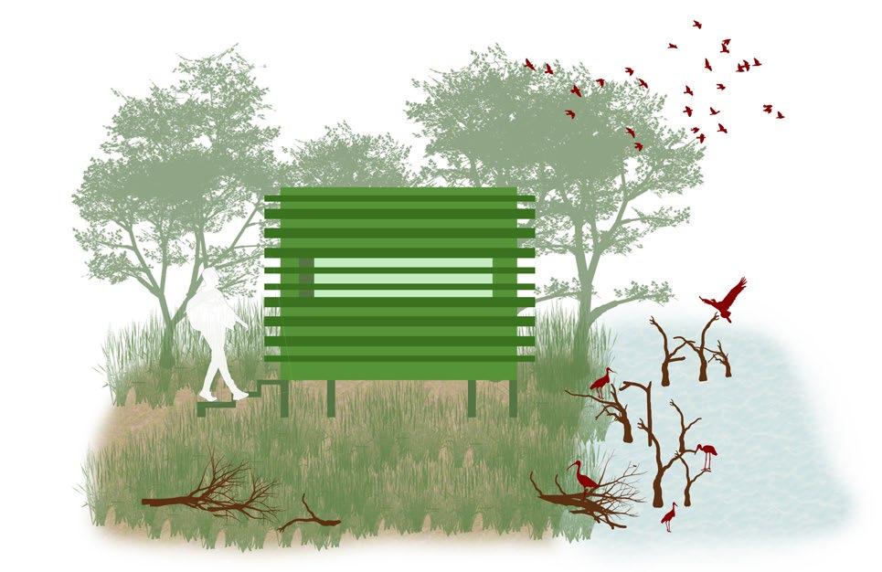

The wildlife healthcare centre is present along the entry of the marsh where it allows injured fauna and avifauna species to be treated. This centre is present at 3 more points along the marsh.

78 79 14 15 18 17 16 13
Grid size: 500x500 m
13.Board walk
15.Floating bridge
14.Fishing spot
The experience of walking on the waterbody is provided with the guided walkways through the boardwalks which are proposed along the periphery of the shallow waters.
The floating bridge is provided along the periphery of the deep water body where users can watch the birds from the deck on their way through the trails.
16.Woodland Trail
17.Hideout cabin
18.Wildlife healthcare centre
The woodland trail allows the users to get the experience of the terrestrial grounds through the walk.
Visual
Type of users & programme

Visitors include birdwatchers, researchers, localites and tourists can visit the southern portion of the marsh, through the trails along the periphery of the marsh. There are parking spaces provided along the trails and the entry points for user convenience.


Waterbody with island vegetation
The water channel are connected to the proposed waterbody where the freshwater inflow is there. Similar approach towards the island vegetation is proposed inside the waterbody which allows more aquatic animals and birds to feed and perch on the mounds.


Terrestrial grounds
Habitats
Island vegetation
Mixed vegetation
Swampy grasslands


Terrestrial grounds
Vegetated mounds
Open waters (3-4m)
Deep waters (2-3m)


Intermediate waters (1-2m)


Shallow waters (0.5-1m)

Very shallow waters (0-0.5m)
The terrestrial ground comprises of densely vegetated grounds which are topographically placed at higher elevation to the norther portions. It has both terrestrial mounds and island mounds present in water bodies, which gives more perching space for birds.


80
Buffer vegetation
Compound wall with buffer vegetation
Watch tower
Intermediate waters Intermediate waters Shallow waters Shallow waters Housing
Transect plan 4
Swimming birds
Shore/wading birds Ground birds Amphibians Crustaceans Arboreal birds Predator birds Leaf walking birds Non diving birds
composition of the transect 4
Key plan 0 1500 3000 m
Transect 4
Compound wall with buffer vegetation
Grid size: 500x500 m Fishes Amphibians Human interaction
Visualising the site - transect 4
Key transect plan 4
22.Crossover bridge
19.Terrestrial
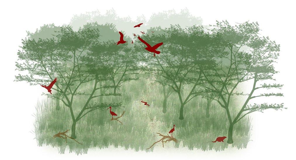
The terrestrial grounds are proposed along the southern portion where the land was dry scrublands earlier and had a potential of becoming a breeding and nesting grounds for lot of faunal and avifauna species.

20.Vegetated mounds
The egret trail is provided along the peripheral trails provided along the marsh boundary. Similarly there are many resting spots and views points provided for interaction and educational purposes along the trail.

24.Island vegetation
The crossover bridge is provided along the water channel which is part of the catchment area, which enters into the marsh through the peripheral buffer zone.
23.Egret trail
Island vegetation are proposed in the water body which acts as habitats and resting spaces for the birds and also for other semi-aquatic species residing in the marsh.


82 83 19 23 20 21 24 22
grounds
21.Watch tower along the periphery
Grid size: 500x500 m
The vegetated mounds are proposed inbetween the terrestrial grounds along the water body as perching and nesting grounds for birds.
Watch tower are provided along the periphery of the marsh as viewpoints from the outside of the marsh.
POLLUTED MARSHLAND
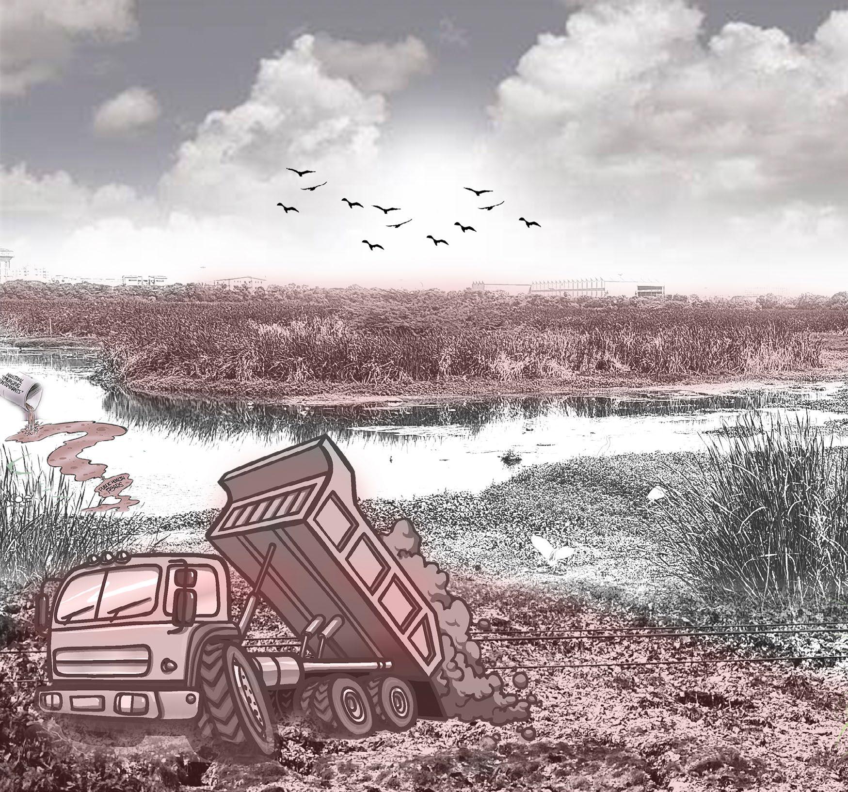
The Pallikaranai marshlands has been under a lot of pressure as the outcome of urbanisation. Construction debris has been dumped along the marsh edges, sewage water has been released into the marsh, and invasive species such as Prosopis juliflora and Pontederia crassipes are occupying the marsh and disrupting avifaunal habitats. There is air and soil pollution as a result of the dumping of waste and garbage. Pollution has severely impacted aquatic life, resulting in a loss of biodiversity in the region. The marsh’s water retention capacity has decreased due to siltation.
REVIVED HABITATS
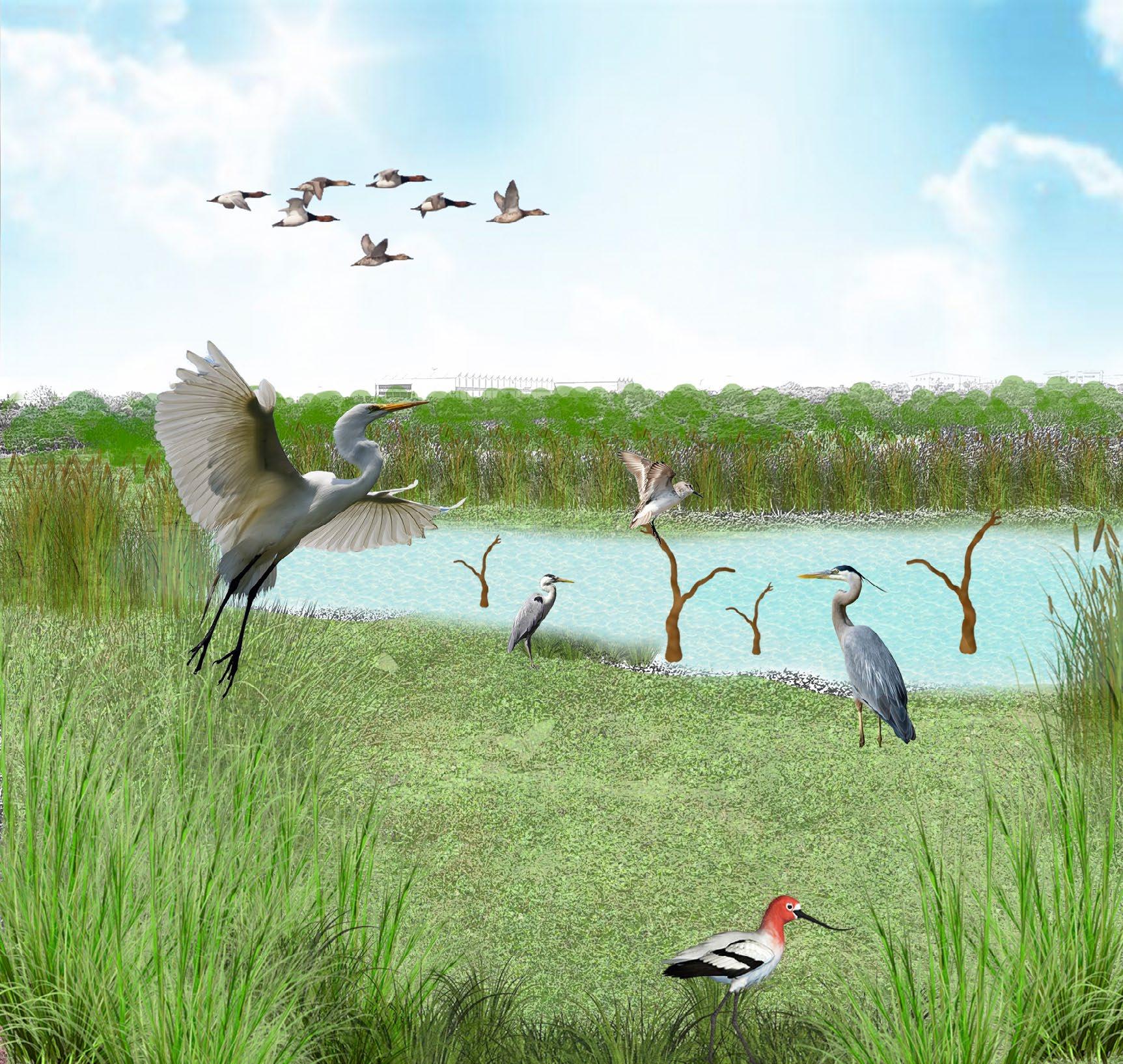
With the design strategies the idea of reviving the marshland’s ecology is achieved through increased water depths which allow water bodies stay interconnected during monsoon and support more aquatic life and avifaunal species. Introducing perching barks and floating vegetation and woodland species along the reclaimed portion of the landfill site which supports the marshland to recover from the pollution. Due to the improved ecological condition there is increase in carbon sequestration, oxygen levels and micro climate of the region.
84 85
BEFORE
Conclusion
THE ECOLOGY
REVIVING
AFTER
BEFORE
UNPROTECTED EDGE
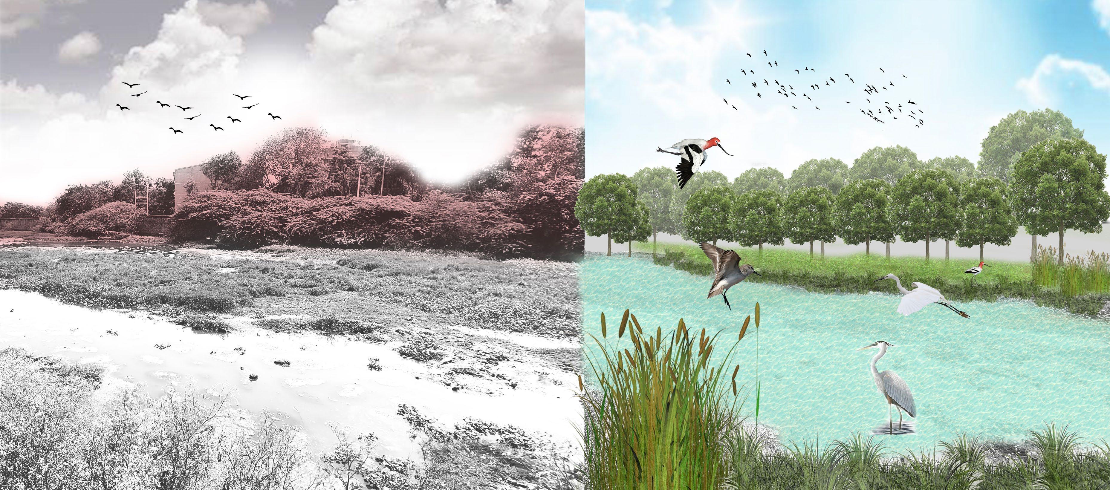

The edges of the marsh are unprotected due to infrastructure development, Prosopis juliflora invasion, grazing pressure, garbage dumping, conversion of edges to scrubland, entry of sewage water into the marsh, people entering the marsh to collect firewood, and fishing, all of which have an impact on the marsh’s ecology and biodiversity value. There is a lack of understanding among local residents and authorities about the importance of the Pallikarnai Marshland, which has contributed to the marsh’s pollution and negative impacts to this day.
RESTORING THE EDGES AFTER
RESTORED EDGE CONDITION
Shoreline stabilisation, buffer vegetation along compound wall edges, providing mound edges, mangrove edge vegetation, and biofence along free edges are all used to restore edge conditions. The dense buffer vegetation is proposed at the boundaries of the marsh in the southern portion, where it works as a protective barrier for the terrestrial grounds. There are cycling routes, nature walks, and view points throughout the periphery of the marsh that allow users to engage with the marsh without interfering with it.
86 87
Conclusion
LANDFILL SITE
Pallikaranai marsh is largely affected by organic waste disposal and contamination as is indicated by the high levels of Chloride and Sulphate It has lead to Enviromental, air and water pollution which is becoming hazardous to people and other fauna species living in water. In addition, the landfill has also led to the emission of harmful gases such as methane, which contribute to air pollution and climate change.
RECONNECTING WITH NATURE AFTER
NATURE TRAILS
The woodland species are planted in the reclaimed landfill site where the interpretation centre and nature trails will allow visitors to engage with marsh and educate themselves about the biodiversity and the ecological value of the marsh. There are viewpoints, watchtowers, ropewalks, floating bridges, camping sites within the marsh where local community, nature enthusiasts, bird watchers, wildlife photographers, tourists and students can enjoy the marsh and document their learning and contribute towards the well being of the marsh.


88 89
Conclusion
BEFORE
Project outcome
Design strategies Categories Categories
Hydrology
Benefits
Increase in water retention capacity
Recharging aquifer
Increased water depths in the marshland
Improved water quality
Sustaining the ecology of the marsh through the exchange of fresh and brackish water
Improved functioning of the catchment area through proper stormwater drains
Improved micro climate and biodiversity hotspot found within the urban context
The interconnectedness of the water bodies during the monsoon allows for healthy functioning of the marsh and also allows more species diversity in the aquatic life. Through the implementation guidelines the entering of the water into the marsh is monitored and also this allows water to sustain within the marsh during summer months and also allowing the avifauna to visit the marsh from the different regions.
Benefits Design strategies
Improved habitats for avi faunal species
Increased biodiversity
Bringing back the endangered and vulnerable species back to the marsh
Increased oxygen production
Habitat conditions
Reclaimed landfill site which will become a habit for lot of avifaunal species
Terrestrial grounds enhances the barren scrublands nurturing into a terrestrial marshland
Increased habitats for aquatic species and help them in ease of migration
Through the trenches around the islands/ mounds developed there is free movement of aquatic species to migrate during summer months. Woodland species , terrestrial grounds along with island and mound vegetation helps improve biodiversity. Revegetated edges, reintroduced native vegetation and floating planting will allow more avifaunal species to breed and nest on marsh.
Protected edges which as a safety barrier around the marsh
Edge conditions
Acts as breathable and passive recreational spaces for public
Increased perching and nesting spaces for avifaunal species
Improved edge stabilisation for the marsh
Buffer vegetation along compound wall, biofence with buffer vegetation, grassy mounds, edge stabilisation with mangrove species and thick vegetation buffer along the terrestrial grounds help in stabilising the edges and act as protective barrier for the marsh. There are certain interventions which allow users to enjoy along the periphery of the marsh.
Increased passive recreation along the peripheral edges
Users can get educated and enjoy the marsh
Human interactions
Community strengthening through awareness on the marsh
Acts as noise barrier and increased carbon sequestration.
Provides habitats for faunal species
Revenue generation that will allow to protect the marsh
Research and monitoring of marsh regularly
Viewing avifaunal species within city extents will save lot on travel expenditure for tourists and visitors
Through boardwalks, guided tours, watch towers, interpretation centre, nature and avifauna viewing hideout trails, community pocket parks and cycle tracks along periphery, users can enjoy the marsh without interfering with the marsh’s ecology.
90 91

92 93
ANNEXURE 5.
Photograph_View of the wetland in an urban setting
The project sources are detailed in this section, as well as the studio process, which includes readings from books, seminars for learning about the system, site visits, and workshops to further comprehend the site layers.
References for the study
1. Maheshwari, D. (2015). Defining urban and ecological interface when the citiy meets wetland : case of Pallikaranai Marsh, Chennai . http://hdl.handle.net/20.500.12725/8850
2. Surya, S. (2016). Landscape Ecological Urbanism for Restoration of Pallikaranai Marsh Land, Chennai, Tamil Nadu. Procedia Technology, 24, 1819–1826. https://doi.org/10.1016/j.protcy.2016.05.227
3. Milton, J., & Ganesh, J. (2016). CURRENT STATUS OF PALLIKARANAI WETLAND: A REVIEW. ResearchGate. https://www.researchgate.net/publication/324212327_CURRENT_STATUS_OF_ PALLIKARANAI_WETLAND_A_REVIEW/citations
4. Pallikaranai Marsh Reserve Forest | Ramsar Sites Information Service. (n.d.). https://rsis.ramsar.org/ris/2481
5. SWA Group. (2021, March 4). Optimizing Outdoors: 10 Pivotal Parks - SWA Group. https://www.swagroup.com/stories/optimizing-outdoors-10-pivotal-parks/
6. ASLA 2013 Professional Awards Ningbo Eco-Corridor - 3.3 km Living Filter. (n.d.). https://www.asla.org/2013awards/253.html
7. https://www.turenscape.com/en/project/detail/435.html
8. Slow Down: Liupanshui Minghu Wetland Park 2014 ASLA Professional Awards. (n.d.). https://www.asla.org/2014awards/002.html
9. The Siltcatcher: A Sediment-Capture System for Wetland Creation and Coastal Protection in Western Lake Pontchartrain | ASLA 2020 Student Awards. (n.d.). https://www.asla.org/2020studentawards/1267.html

10. Kranji Marshes, Singapore — Stephen Caffyn Landscape Design. (n.d.). Stephen Caffyn Landscape Design.
https://www.land-arch.net/kranji-marshes/774yz19k2d9lga1xompscfmkugl42w
11. Rani, S., Kumar, S., Ramulu, C., & Rao, J. (2020). Evaluation of Dhaincha (Sesbania aculeata L.) accessions for green manuring traits and soil fertility. ResearchGate. https://www.researchgate.net/publication/349677712_Evaluation_of_Dhaincha_Sesbania_aculeata_L_accessions_for_green_manuring_traits_and_soil_fertility_improvement
12. Jagdish. (2020, August 10). Bio Fencing Plants, Benefits in India - A Full Guide Agri Farming. Agri Farming.
https://www.agrifarming.in/bio-fencing-plants-benefits-in-india-a-full-guide
13. Forestry :: Mangroves. (n.d.). https://agritech.tnau.ac.in/forestry/forest_mangrove_index.html#:~:text=MANGROVES%20IN%20TAMIL%20NADU%20Top%20Mangroves%20in%20Tamil,decandra%20and%20Aegiceras%20corniculatum%20as%20the%20dominant%20flora.
14. Fletcher, J. A., Willby, N., Oliver, D., & Quilliam, R. S. (2019). Phytoremediation Using Aquatic Plants. In Concepts and strategies in plant sciences (pp. 205–260). Springer International Publishing. https://doi.org/10.1007/978-3-030-00099-8_7
15. Radhakrishnan, S., & Radhakrishnan, S. (2022). What do we do with Chennai’s legacy waste? Citizen Matters, Chennai. https://chennai.citizenmatters.in/chennai-legacy-waste-bioming-perungudi-kodungaiyur-fire-source-segregation-40678
16. Dt Next Bureau, & Dt Next Bureau. (2023). 7.5 MT CO2 emission prevented through biomining in Perungudi dump yard. DT Next. https://www.dtnext.in/city/2023/02/05/75-mt-co2-emission-prevented-through-biomining-in-perungudi-dump-yard
17. Freshkills Park NYC Parks. (n.d.). https://www.nycgovparks.org/park-features/freshkills-park/about-the-site
18. Bhagwat, R. V., Boralkar, D. B., & Chavhan, R. D. (2018). Remediation capabilities of pilot-scale wetlands planted with Typha aungstifolia and Acorus calamus to treat landfill leachate. Journal of Ecology and Environment, 42(1). https://doi.org/10.1186/s41610-018-0085-0
19. Martinez, S. L., Rivera, S. L., -González-Mondragón, E. G., & Velázquez-Martínez, J. R. (2019). PHYTOREMEDIATION OF LANDFILL LEACHATE USING VETIVER (CHRYSOPOGON ZIZANIOIDES) AND CATTAIL (TYPHA LATIFOLIA). ResearchGate. https://www.researchgate.net/publication/331563308_PHYTOREMEDIATION_OF_LANDFILL_LEACHATE_USING_VETIVER_CHRYSOPOGON_ZIZANIOIDES_AND_CATTAIL_TYPHA_LATIFOLIA
20. Tamil Nadu Treepedia. (n.d.). https://www.tntreepedia.com/trees/
21. Comprehensive Management Plan - for Pallikaranai Marsh (2014-2019), Conservation Authority for Pallikaranai Marsh - Care Earth Trust (2014)
Guided by : Prof. Dr. Deepa Maheshwari
Teaching associate: Anmol Tewari
LA4004 l Designed Ecologies
Master’s in Landscape Architecture
SPRING 2023 l CEPT UNIVERSITY
95 94


