Graduate Works
Kebele 19
Bottom-up SubUrbanism
Reykjanes Resource Park
Undergraduate Works
The Argent Floater
Emergent E_scapes
2018-2021
Professional Works
SELECTED WORKS RAN HE
I. Graduate Works
Kebele 19
A new weaving industry in Addis Ababa
Nominated Work
Harvard GSD Urban Design Studio| Spring 2022
Professor: Marc Angélil
Collaborator: Yu Qin

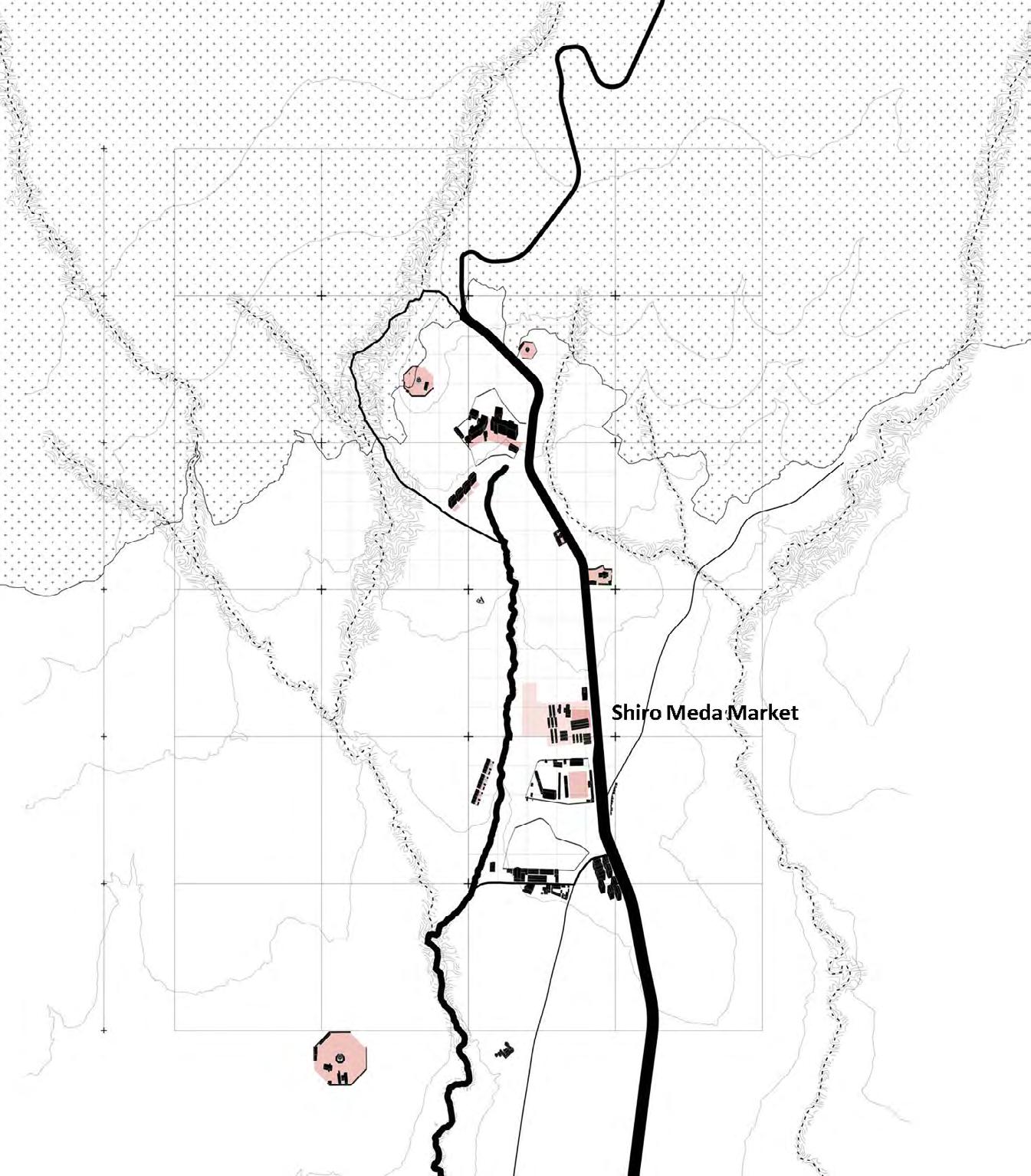
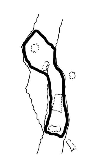
Shiro meda is a neighborhood famous for its traditional textile and clothing which is also known as kebele 19. This project will focus within, on, and beyond the boundary of kebele 19
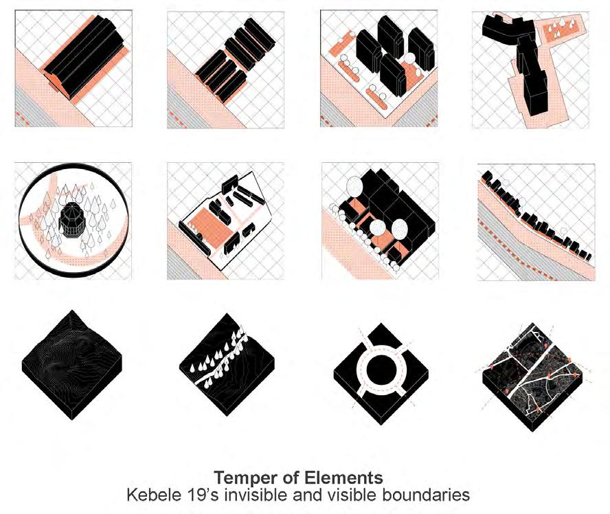
Ethiopia is currently considered the new frontier of the garment industry, with clothes “Made in Ethiopia” being the cheapest to produce globally. In fact, largescale factories have been built all over the country, particularly around Addis Ababa, producing for foreign markets and global brands, while exploiting the young labor force seeking to make a living.
Taking its clues from a long tradition of craftsmanship in textile-making and of artisans being organized in small-scale co-operatives, the studio sets out to explore modern-day alternatives to current lowwage, precarious production arrangements. In seeking to identify strategies for empowering people via locally embedded forms of economic development, solutions are sought for incorporating the labor force and the
workplace into the civic realm – socially and spatially.
Located in the north of the city, the site is in the popular and partially informal neighborhood of Shiro Meda, where traditional craftsmanship serves as the primary basis of securing a livelihood for those living and working there. The studio asks: How could this neighborhood of small-scale co-operatives become market-compatible in the future and still maintain its current qualities?
Left: Typology Studies
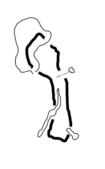
Right: Site Diagram
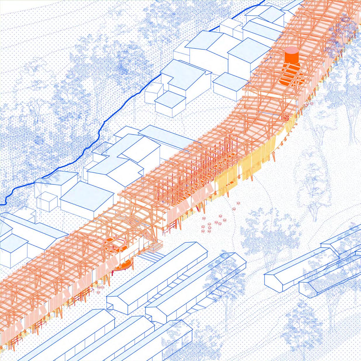
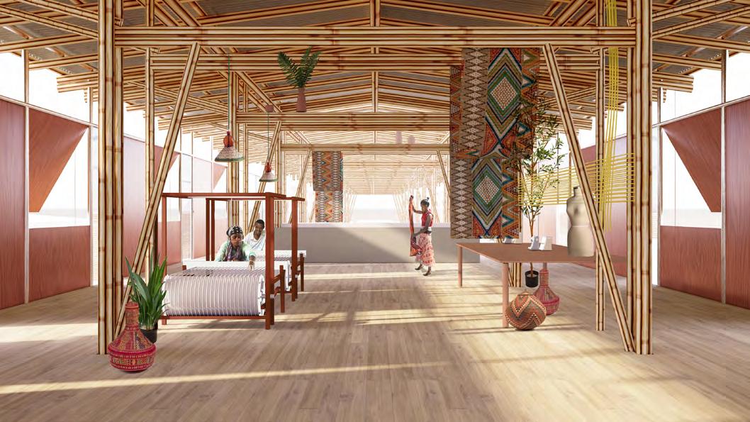
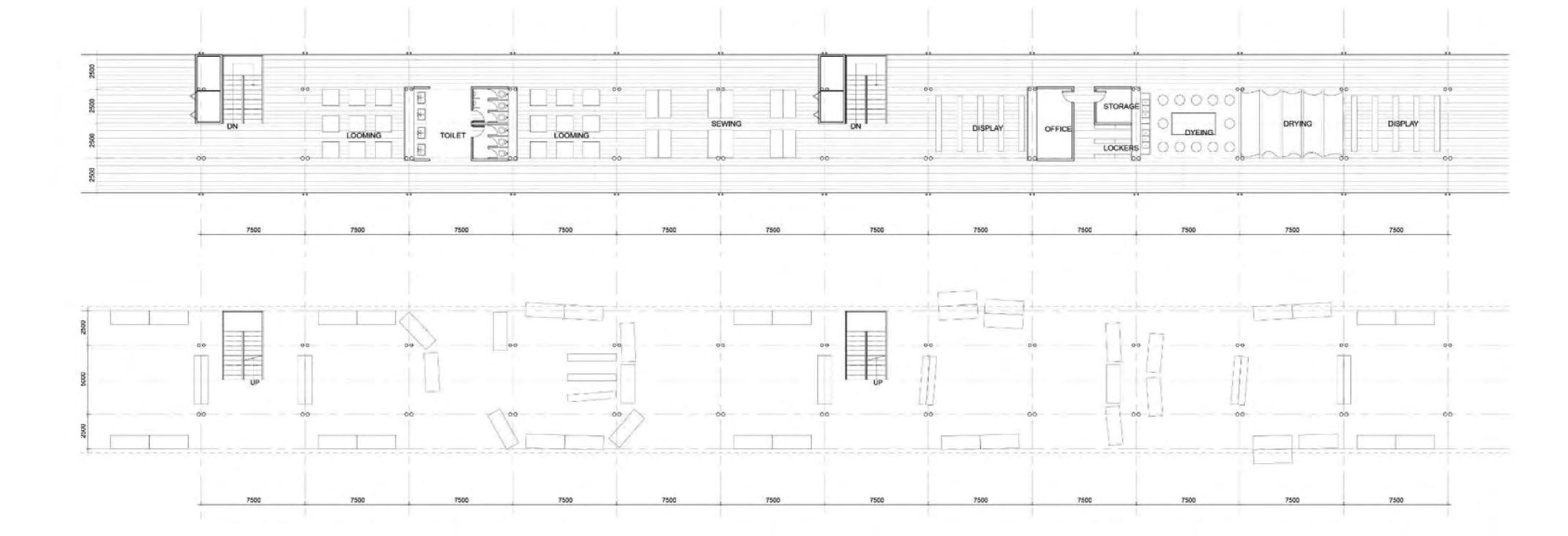
Here are the basic components of the ring architecture- a two-storey loop with the ground floor lifted up. This allows movement inside and out of the kebele. On the top floor the ring organizes the traditional textile making workflow. occasionally separated by utility rooms and circulation cores. On the lower level, space is left for markets which can be informal.
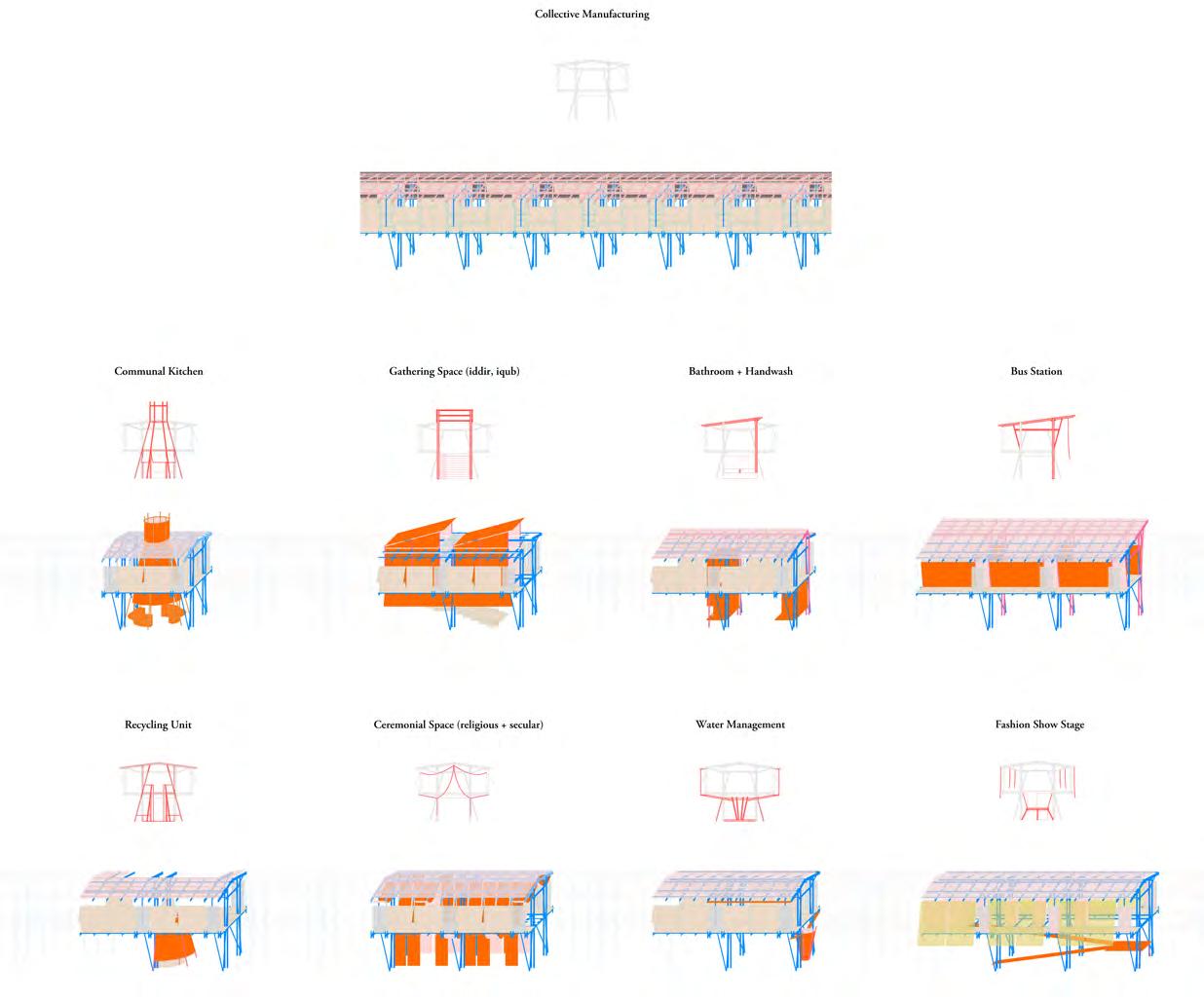
The building has a simple structure but it accommodates for various uses and reconfigurations should the need arise. We designed a list of spaces that could be fit inside the ring that relate to the local residents’ needs. Once again these are some of the possible auxiliary units that can be embedde in the ring.
These auxiliary facilities are can be permanent constructions or ad-hoc installations.The architecture also plays an important role in facilitating the resource, material and labor flows in and out of the kebele.
 Left: Building Diagrams
Right: Axonometric View
Top: Ring Perspectives
Bottom: Ring Plan

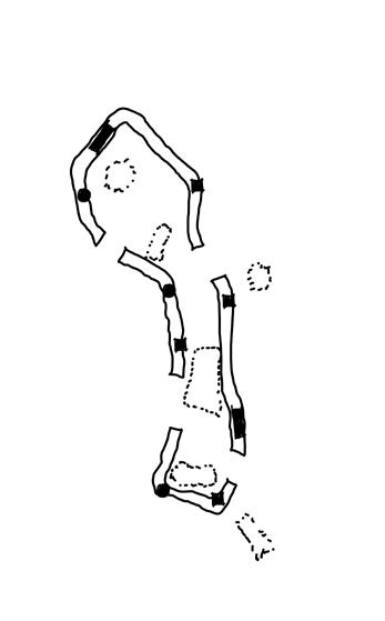
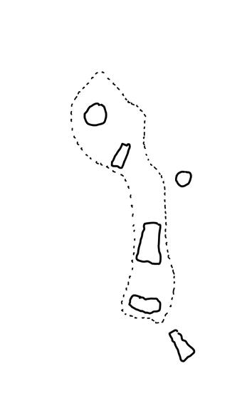
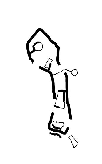
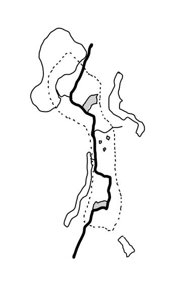
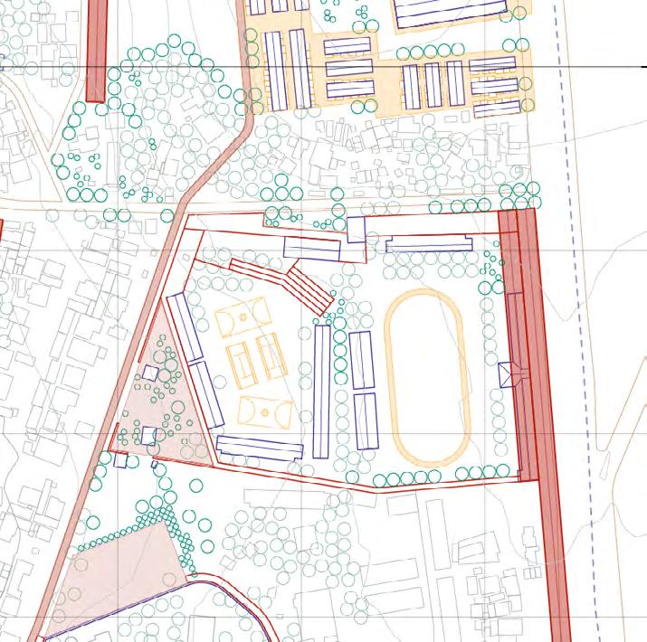
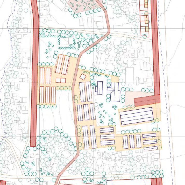
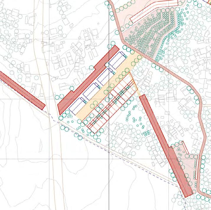 1. projection 2. breaking 3. addition 4. collision 5. transformation 6. connection
Top: Spatial Operations
Bottom: Zoom-in Plan
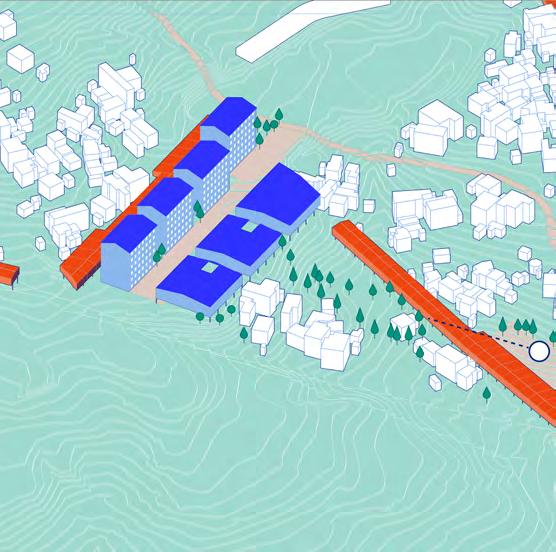

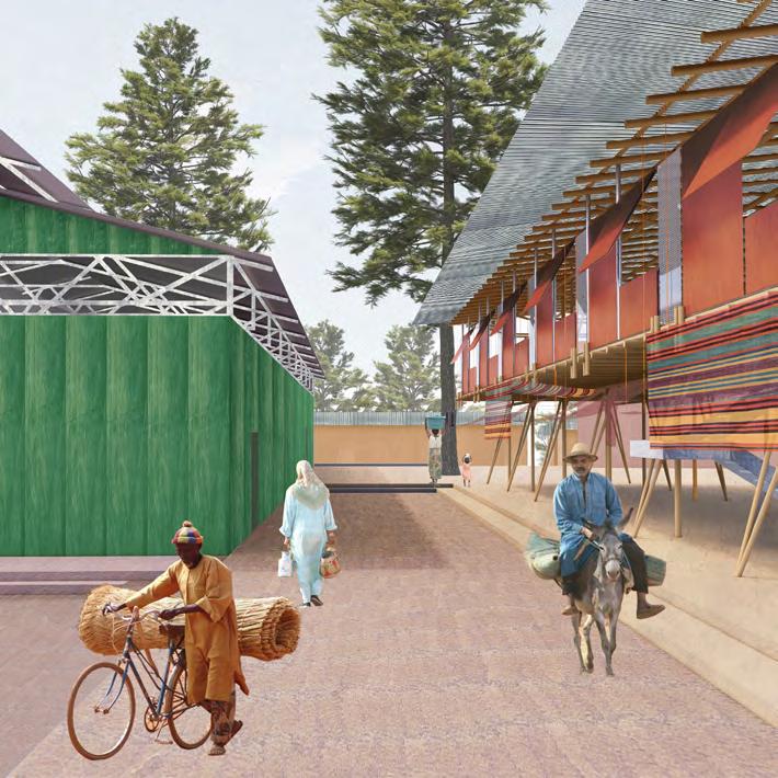
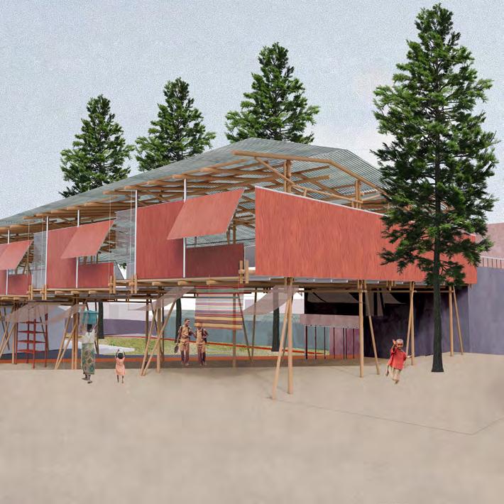
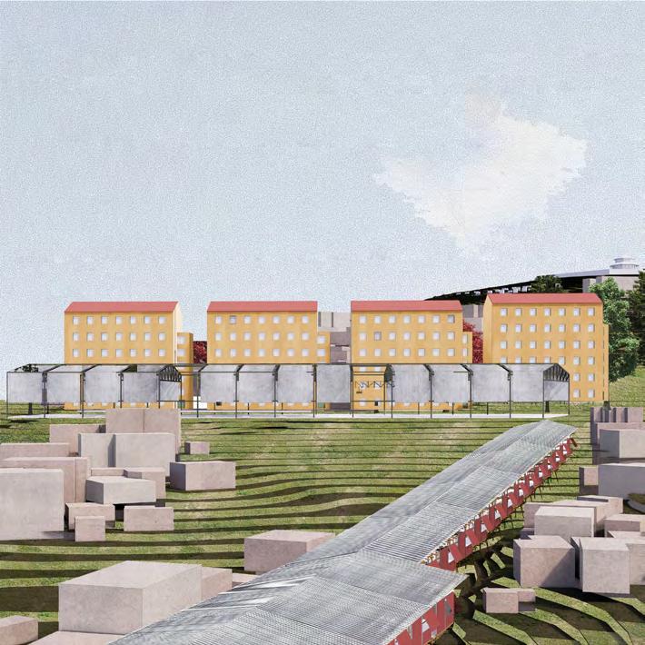
factory school + daycare shiro meda market
Top: Axonometric Diagrams
Bottom: Building Perspectives
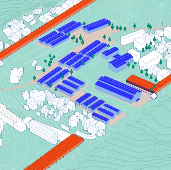
Shiro meda revolves around production and exchange of fabric and textiles. However, the space allocated for these two economic functions are often sporadic and disjointed. The kebele boundary provides a boundary which could unify these functions into a single system.
The original kebele boundary is unrefinedwith a underdeveloped river edge on the west side and an overextended road on the east. To mitigate these edges and to provide space for the aforementioned functions, we are proposing an architecturalized kebele boundary- a refined ring that circles the kebele.
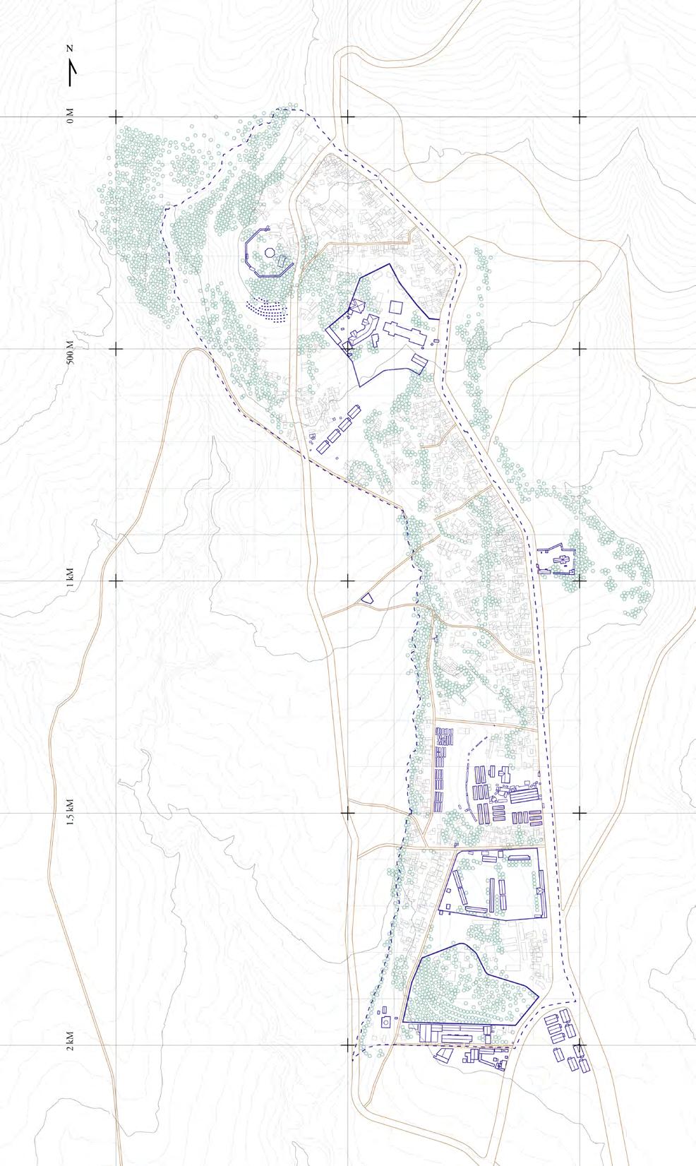
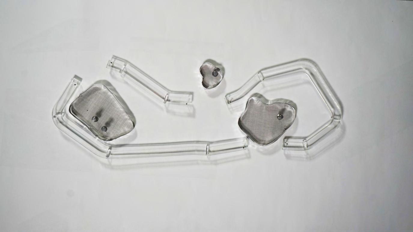
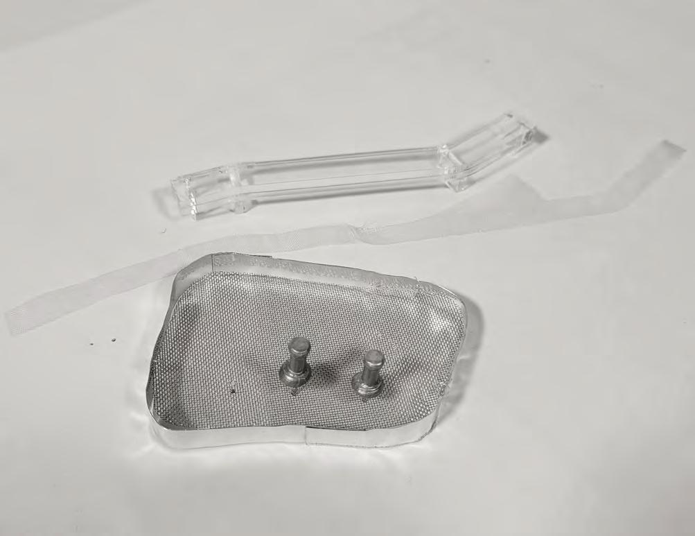
By introducing the ring, we connect to different kebele elements and interact with them. The ring also provides space for informal activities such as a carnival path for religious celebrations and informal selling around the band.
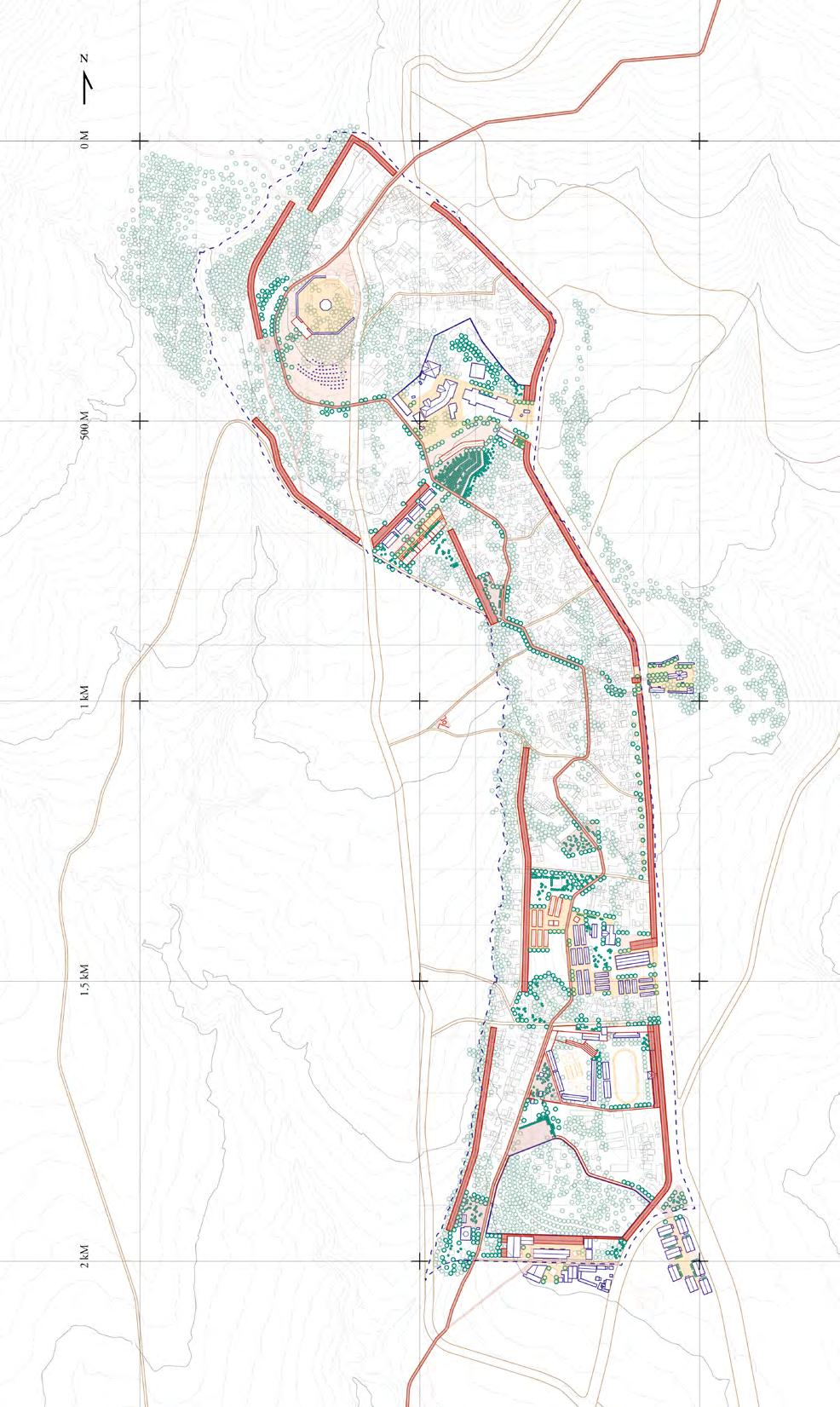 Left: Masterplan(Before)
Right: Masterplan(After)

I. Graduate Works
Reykjanes Resource Park

A new eco-industrial landscape
Harvard GSD Urban Design Studio| Fall 2022
Professor: Anna Gasco
Collaborator: Yu Qin, Ni Ye, Liang Yang
Our site is located in Iceland. A nation that is prized for its breathtaking natural landscapes. These landscapes not only encourage tourism, but they are also vital tools for production. The rivers and the geothermal activities enabled iceland to produce a hundred percent renewable energy that is used in a variety of industries.


However It is important to remember that industry and nature are not a dichotomy. Industries that rely on natural resources often have to be collocated with nature, these include geothermal powerplants, hydro plants, fisheries and many others. The industrial elements together with wilderness, have created a new landscape, an amalgam of natural ecology and productional apparatuses.


This juxtaposition, nevertheless, creates conflicts. the industrial expansion has a great impact on the natural aspect. This is especially critical in iceland because of large economies that are based on nature, such as tourism.
 Left: Concept Diagrams
Right: Regional Diagrams
Imagine industrial infrastructure such as metal pipelines that run through miles of undisturbed wilderness can be transformed into viewing platforms and wayfinding tools?


What if the boreholes that extract geothermal heat power can be used to cultivate a garden filled with local flora?


And finally What if the factories themselves can be better equipped, and spatially organized to mitigate its impact on the environment? To make the industrial parks more open to mixed use programs?
And thus, our project is based on the belief these small scale, bottom-up intervention can reconcile the natural and the industrial.


Features Pipelines + Changing Drillsites Attractions Roads + Trails Industry Buildings Wind Direction EXISTING CONDITIONS
Land
discharge Háleyjabunga Gunnuhver Skálafell Lighthouse Syrfell hill Valahnúkamöl historic site historic site lava field grassland manmade lake geothermal field black sand fish farm powerplant fish drying factory salt production factory
Left: Site Elements Diagrams Right: Proposed Vision
This planned Resource Park is located at the far end of the peninsula’s southwest corner. It enjoys an extensive coastline and is also the start node of the volcanic geothermal belt on the island. Due to its abundance of natural resources, the park is already home to a number of industries, such as energy production, fish farming and processing, and salt production.
The industrial infrastructure are in a frame with these sceneries. One is the pipelines. These silver lines creep from the turbine factory at the centre of the site and extend out in all directions. We take advantage of the extensiveness of the pipeline to construct a wayfinding system that connects dispersed attractions and pedestrian traffic across the sites. By integrating the walkway with pipelines, it will not only conserve the land use but also better guide the pedestrian footprint, thus preserving the fragile landscape.
 Right: Park Masterplan


R&D lab indoor
archive/library R&D lab
marine climate lab SPA apartments
salt
geological lab R&D lab outreach
apartment artist market biofuel
greenhouse
Axon View of Individual Sites
pipeline park
algae bioreactor drilling site Multi-Learning Center algae pond fish drying factory
Silica processing factory
waste processing science park
production factory
center
refinery
geothermal powerplant exhibition hall science park event space geothermal biotope lab
Based on our concept and plan, the site will be transformed into an eco-industry site with circular economy. As we mentioned before, our site will have a discrete distribution, and compared to the VSO’s proposal of 650 square kilometers, our site only takes 190 square kilometers which means that this project is less intrusive to the natural environment.The industries on the site are currently independent of each other and lack of communication. In order to better establish a circular economy industrial system, our goal is to change the site from a subdivided and isolated industrial plot into clusters with interaction, both physically and functionally.


The most important and visible industry on the site should be Reykjanes Power Plant. The Reykjanes Power Plant is a geothermal power station owned by HS Orka.
Energy for the plant is harnessed from twelve of the fifteen boreholes drilled in the area. There is a long history of using geothermal energy for industries and electricity production in Reykjanes.
Left: Stakeholder Diagrams
Right: Phasing, Material and Resource Flow
This eco-industrial park is a community of manufacturing and service businesses located together on a common property. Member businesses seek enhanced environmental, economic, and social performance through collaboration in managing environmental and resource issues. There will be functional and logistical links between the clusters of the site. The industries are capable of functional interaction and interchange of energy and materials.
The main energy and material cycle of this area is between the power plant and the greenhouse. Also educational and exhibition functions are an important part of this zone. Site Perspectives


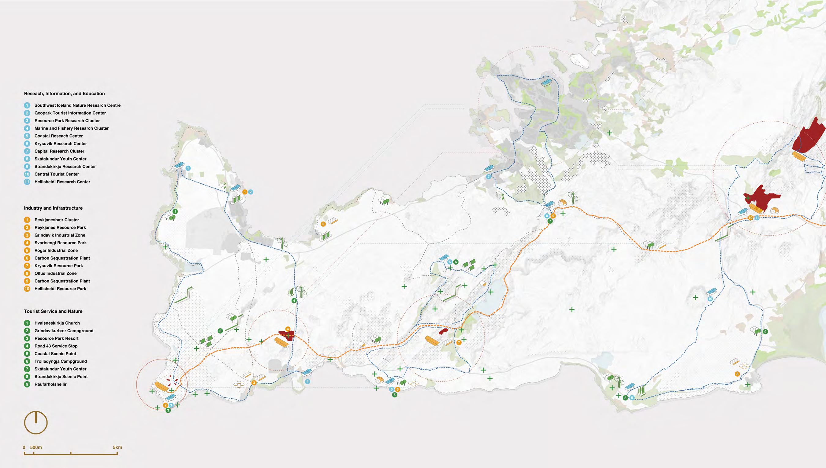
Regional Outlook
I. Graduate Works
Bottom-up Sub-Urbanism
Re-imagination of suburbia
Harvard GSD Urban Design Studio| Fall 2021


Professor: Stephen Gray, Rahul Mehrotra
Collaborator: Yixin Wu
In this project, we started off by analyzing parcels of the existing built environment- we identified “snapshots” of our site with mismatched adjacencies, incoherent programs, discontinuous public realm as well as underutilized spaces. Putting these elements together gave us a rough sense of how much potential the site has in each of these clusters.


Our goal is to strategically re-configure the existing site condition not through total redevelopment but by formulating a number of widely applicable “rules” which address building density, programs, street adjacencies, community connection, and the arrangement of nature and public green spaces. We wanted to see how much difference it would make by applying small and subtle local changes and applying them over the entire site.


ARTIFICIALITY
industrial park forest/wetland suburban outskirts suburban community
SCALE strip mall
University Ave (4-Lane) Residential Cul-de-sacs, 2-Lane Roads
Fountains, Gardens, Small Parks Forests and Wetlands
Plants Swimming Pools
I-95 (8-Lane) I-95 South (6-Lane)
Airport Runway
Yard
Left: Conceptual Diagram
Right: Proposed Guidelines
In this project, we started off by analyzing parcels of the existing built environment- we identified “snapshots” of our site with mismatched adjacencies, incoherent programs, discontinuous public realm as well as underutilized spaces. Putting these elements together gave us a rough sense of how much potential the site has in each of these clusters.
Our goal is to strategically re-configure the existing site condition not through total redevelopment but by formulating a number of widely applicable “rules” which address building density, programs, street adjacencies, community connection, and the arrangement of nature and public green spaces. We wanted to see how much difference it would make by applying small and subtle local changes and applying them over the entire site.
In this project, we started off by analyzing parcels of the existing built environment- we identified “snapshots” of our site with mismatched adjacencies, incoherent programs, discontinuous public realm as well as underutilized spaces. Putting these elements together gave us a rough sense of how much potential the site has in each of these clusters.

Our goal is to strategically re-configure the existing site condition not through total redevelopment but by formulating a number of widely applicable “rules” which address building density, programs, street adjacencies, community connection, and the arrangement of nature and public green spaces. We wanted to see how much difference it would make by applying small and subtle local changes and applying them over the entire site.

INTERSECTION ANCHOR LEFT OVER SPACE NODE BARRIER CORRIDOR SHELL HUB STREET PUBLIC INTERFACE INFRASTRUCTURE RENEWED PUBLIC SPACE
Top: Existing Site Map
Bottom: Proposed Typologies
Left: Masterplan Right:Zoning and FAR Proposals
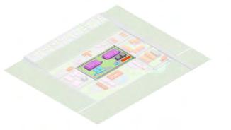
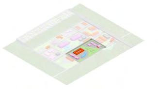
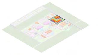


Retail/Office Functions Development Density H M L Housing/Hotel Large-scale Infrastructure (Parking Lot, Transportation Station, Power Plant, Sewage) High Medium Low Public Open Space(Parks, Urban Agriculture, Square) Public Service & Recreation(Community Center, School, Healthcare, Library Music Hall, Gym) Institutions (Research Center, Wild Life Preserve) ADJACENT ROADS: I-95, 1x Primary Road, 2x Secondary Road Designated Land Use: Rental Apartments with Retail Development Density: Medium, ~1.5 FAR Parcel Specific Requirements: Residential should be set back from major roads. Within the block, a green public park should be present to service the community. ADJACENT ROADS: Amtrak Rail, 1x Primary Road, 2x Secondary Road Designated Land Use: Light Industry Facilities with Public Service Institution Development Density: High, ~2.0 FAR Parcel Specific Requirements: Distribution Centers should be facing secondary roads, public facilities should be one of the following: public museum, library, gymnasium, performance art center, community center, school. On-site Waste Management: Due to the adjacency with protected wetlands, this parcel requires on-site water collection and treatment. I-95 Secondary Road Secondary Road Primary Road Secondary Road Secondary Road Secondary Road Secondary Road Secondary Road Primary Road Primary Road Amtrak RESIDENTIAL BLOCK INDUSTRIAL PARK COMMERCIAL ANCHOR ADJACENT ROADS: Amtrak Rail, 1x Primary Road, 2x Secondary Road Designated Land Use: Commercial Strip with Community Centers Development Density: Medium, ~1.5 FAR Parcel Specific Requirements: As the commerical anchor and major traffic generator, the local grocery market should also provide QoL improvement for the residents on adjacent lots. This includes but are not limited to bank services, public transit waiting areas, community gathering space, lunch/picnic area. Energy Generation: The strip mall should be aiming to reduce the overall carbon footpring by generating energy on site via rooftop PV panels or a green roof to enhance thermal efficiency.


Transport Hub a. provide a center for different methods of travel c. trim off excess parking to allow more diverse funcb. setup an entrance point into the site Corridor a. use buildings to bridge elevational gap on site c. use nature as endpoints for pedestrian traffic b. adapt existing buildings to connect new traffic Public Interface a. replace hard surfaces with open green public space c. provide prime commercial space along main street b. enrich pedestrian traffic and activities Renewed Public Space a. create a buffer between industrial center and forest c. extends traffic beyond the railway, connecting to nature b. provide educational facilities on environmental protection Anchor a. setup pockets of green/public space along secondary rds c. build a continuous streetwall along commercial edge b. put service roads/ parking spaces behind buildings Node a. consolidate spaces for public use b. compact buildings for economy of scale Design Visions
TO TRAIN STATION
NATURE PAVILLION
Main Sequence
We apply these little rules to the site as an anti-framework design, referring to the project in Oosterwold. The project done by MVRDV sets principal rules of roads and paths, accessible green, urban agriculture, and facilities for the inhabitants to ensure the smooth adjacency and good relationship between the lots. All the other stuff inside the lots were largely decided and developed by the inhabitants to create a versatile and exciting neighborhood.
We too start by applying the rules of transforming the station into transport hub as a driving force, typographic barrier into corridor for better connectivity, and also main street into public interface, rail into renewed open space such as linear park, road intersection into anchors, and left-over space into nodes for more open spaces and various activities.

Without large demolishment of the existing buildings, the small interventions and improvements step by step transform the space into a better place for suburban life and experience. Gradually, the vibrant places connect together and form two exciting routes. One along the University Avenue with continuous public streetscape providing high quality recreational, commercial and service experience, and the other along the rail lines serving as the ecological, sports and recreational spine.
By applying these re-configurations throughout our site, a greater framework begins to emerge. On the main street, the changes yield a more consistent public realm that offers a variety of activities and encourages pedestrian foot traffic. This sequence of space becomes the central commercial backbone that connects traffic from the train station to the residential neighborhoods and down to the industrial workplaces.
Main Axis Arrangements
COMMUNITY GARDEN
GREENHOUSE
TO HILLSIDE APARTMENTS MAIN STREET
TO INDUSTRIAL CENTER PICNIC AREA
PUBLIC MUSEUM
Green Spine


The series of open spaces along the rail lines provide green, lively experience from the transportation hub, through residential districts, to the offices and extends westward. Jogging or bicycling on the fitness tracks all along the green spine, people can get an access to natural exploration and wildlife protection center with intimate natural wild experience and river walk by crossing the pedestrian bridge or the getting through the tunnel, natural park for agriculture, picnic, sightseeing and various landscape experience, meditation zone for self-exploration, playground for entertainment, water park for observing the process of water purification, vibrant park for various team experience, sports park for exercise and having fun, and rain garden for playing with water. Green Belt
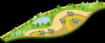

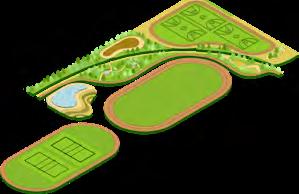

RAIN GARDEN SPORTS PARK VIBRANT PARK WATER PARK NATURAL PARK MEDITATION ZONE PLAYGROUND NATURAL EXPLORATION WATER PARK NATURAL PARK PLAYGROUND NATURAL EXPLORATION SPORTS PARK VIBRANT PARK RAIN GARDEN MEDITATION ZONE
Our first focal point is the University Park Amtrak Station. As an important gateway for traffic from Boston and nearby cities, this station facilitates both railway transit and acts as a stopping point for vehicles from nearby communities. At the moment the majority of building footprint is dedicated to parking and vehicle storage. However, being the very first building to be seen from the highway, we believe it has a lot more potential than its current development. A few changes on the architectural level, if introduced, could increase the surrounding foot traffic and establish a more coordinated local traffic network. An open ground floor with a central courtyard also provides much needed public space around this block.
We introduce convenient and pedestrian-friendly paths from the Westwood neighborhood to the site so that people get easy access to what makes their lives wonderful. The largely shortened distance also stimulates green travel with less reliance on private cars.


On the north west of the site where there’s dramatic elevation difference, a bridge connected to the roof garden on the strip mall then down to one of the main recreational green open spaces contributes to a pleasant walk. Elevators inside the buildings are also utilized for connection between different levels. The ground floor facing the lower side can be occupied by service stores at the front and car parking at the back and it reduces ground parking.
 Top: Main Street
Bottom: Street Views
II. Undergraduate Works
The Argent Floater
Spring 2018 Comprehensive Studio Professor: Elizabeth Kamell Collaborator: Sizhe Wang

SITE BOUNDARY
AVIATION MUSEUM
PROPOSED SITE HAMMONSPORT
KEUKA LAKE
The studio challenges a comprehensive approach in building design with integrated building systems and structures. The goal is to design a seaplane school and restoration workshop.

In this project, we created a blurred boundary between air and water- a gesture and analogy for the magnificient seaplanes themselves, but also because the building could perform a multitude of functions between two media.

By transferring our building site onto the shallow lake water, the building completes its analogy: void of reference or contact yet submerged both in air and water. Despite the fuzziness of boundary, its program and function are clearly divided between air and water.
 Left: Site Plan
Right: System Diagrams
However, the analogy between a seaplane and a building does not only occur on a functional level: aviation engineering achieved efficient use of materials and captivating form. At the beginning of the studio we analyzed components of a seaplane, breaking it down to its most significant parts.
From the exploded axonometric diagram, we begin to unravel the intricate relationship between function and space. The upper and lower planes separate a dedicated “room” for engine and fuel tanks- a gesture dictated by aerodynamics rather than expediency. Cockpits and gunner seats are carved into the main body which leaves just enough room for radio equipment, hydraulic controls and supplies. Buoys are just designed at the correct size to keep the plane afloat without sacrificing aerodynamics in flight. With all the internal compromises the plane has to cope with external pressure as a war machine. These qualities are what we had in mind when beginning to compile a comprehensive system for this aviation school.
With that in mind, we started to think about the structure we are adopting for a building such as this. The structure must be light, firm, consistent and allow large spans for moving seaplanes. A steel truss system with exterior curtain walls thus became the basis for future iterations.
On top of that, each façade needs to be individually analyzed and evaluated according to its program and energy requirements. Excessive sunlight causes unnecessary cooling thus a shading system is required.
Similarly, to a seaplane with draws its power of flight from air and sustenance from water, this building is designed to be self-sufficient in energy needs. By installing solar panels on the roof, a significant portion of the building’s energy cost could be offset. Sitting right on top of the water, the building has excellent access to grey water both used for general cleaning as well as maintaining the seaplanes. Water also offsets big temperature swings on land, which acts both as a heating and a cooling assistant.
SOLAR PANEL ROOF ROOF TRUSS OBSERVATION LVL CONFERENCE LVL CLASSROOM LEVEL STRUCTURE SOUTH FACADE CLASSROOM LEVEL EAST FACADE STEEL FOUNDATION
UPPER PLANE AILERON GAS TANK INTERPLANE BRACING ENGINES LOWER PLANE GUNNER SEAT COCKPITS TAIL FINS MAIN BODY BUOYS
Left: Seaplane Explosive Axon
Right: Project Axon
With that in mind, we started to think about the structure we are adopting for a building such as this. The structure must be light, firm, consistent and allow large spans for moving seaplanes. A steel truss system with exterior curtain walls thus became the basis for future iterations.


On top of that, each façade needs to be individually analyzed and evaluated according to its program and energy requirements. Excessive sunlight causes unnecessary cooling thus a shading system is required.
Similarly, to a seaplane with draws its power of flight from air and sustenance from water, this building is designed to be self-sufficient in energy needs. By installing solar panels on the roof, a significant portion of the building’s energy cost could be offset. Sitting right on top of the water, the building has excellent access to grey water both used for general cleaning as well as maintaining the seaplanes. Water also offsets big temperature swings on land, which acts both as a heating and a cooling assistant.
Left: Section AA’
Right: Ground Floor Plan


 Left:
Facade Studies and Interior Render
S South Facade E East Facade
Right: Physical Model (Wood, Paper, Metal Mesh)

Perspectival Render
II. Undergraduate Works
Emergent E_Scapes
Spring 2017 Advanced Urban Studio Professor: William MacDonald
//Collaborator: Furui Sun

TOURIST CULTURE
INFRASTRUCTURE CULTURE
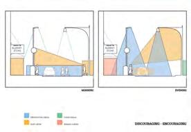
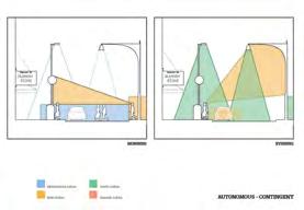
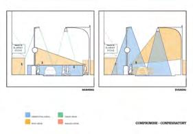




DOMESTIC CULTURE WORK CULTURE
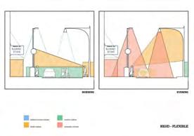
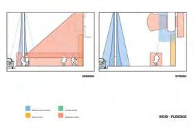
Hybrid Culture as Qualitative Affective Field
The urban life gives birth to our everyday cultures. These cultures affect the way we perceive our urban space. They interact or counterinteact with each other in various ways. Through interactions and changes through time, qualitative relationships are established spatially.




TOURIST CULTURE
DOMESTIC CULTURE
INFRASTRUCTURE CULTURE
WORK CULTURE
Intensity Mapping
Mapping of culture and qualities as fields in situ.
HYBRID CULTURE A.M.
HYBRID CULTURE P.M.
Intensity Mapping


Hyper Inflective Field placed on site to generate relationship between qualities.

DEFENSE SUPPORT
AGGRESSION RESPONSE
DEFENSIVE FORMATION


SUPPORTIVE FORMATION
AGGRESSIVE FORMATION
RESPONSIVE FORMATION
DEFENSIVE FIELD
SUPPORTIVE FIELD
AGGRESSIVE FIELD
RESPONSIVE FIELD


Overlaying Sport Strategy Diagrams


Field Strategy Applied to Existing Site


 Site+Strategy Field in Situ
Cells Diagrams and Quality Study
“Systemic Hybrid”
The ‘Systemic Hybrid’ method allows for the investigation of incremental and aggregative processes and systems in volumetric relations of form, space, and time. The studio will focus on a synthetic design research into complex adaptive geometries, that will eventually yield the potential of ‘open-ended systemic hybrids’. The ‘systemic hybrid’ method leads to continually generative architectural solutions with the potential to respond to sponsored systemic change via evolving variables [such as context, time, use, politics, economy, history, in other words culture at large]. The goal is to create an ‘adaptable’ and ‘anticipatory’ architecture. An architecture able to be altered with time, in time and by time. An architecture with these traits and attributes is especially beneficial when it is deployed as an educational environment.

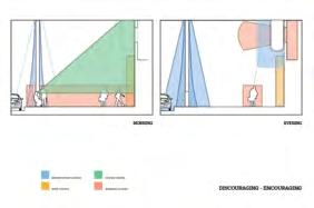
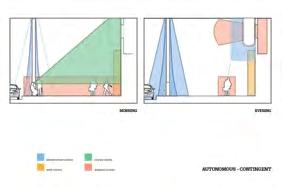
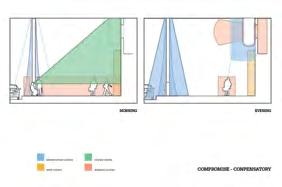
Building Envelope Analysis
Colours
Example Programs
collaborate, communicate
A. Encouraging C. Contingent exhibit rm learn, show
A. Encouraging D. Flexible activity space relax, play
office
gymnasium activate, nurture
café learn, think, nurture, comm. guide
educate, manage C. Contingent
C. Contingent B. Compensatory
D. Flexible B. Compensatory multimedia rm show, discover


A. Encouraging B. Compensatory noon
D. Flexible
A. Encouraging B. Compensatory labs practice, experiment, discover
C. Contingent
D. Flexible
A. Encouraging
A. Encouraging C. Contingent music rm practice, create, collaborate
garden nurture, experiment, discover
Building Envelope Quality Analysis
B. Compensatory
D. Flexible
B. Compensatory
C. Contingent
D. Flexible

noon - evening
morning - noon classroom
morning - noon
morning - evening
morning - evening
morning
morning - evening morning - evening morning
Adaptive Programs
Compensatory Compensatory Encouraging Contingent Flexible Flexible Flexible Flexible learn communicate think practice relax think practice relax learn communicate practice relax communicate collaborate learn nurture exchange communicate collaborate learn communicate collaborate learn nurture exchange communicate collaborate exchange manage show guide communicate experiment Encouraging Contingent Compensatory Encouraging Contingent Compensatory Encouraging Contingent Flexible Compensatory Encouraging Contingent communicate collaborate learn exchange communicate practice relax
Encouraging Compensatory Contingent Flexible C M Y K
traditional function activities qualities time
C: 70% M:20% Y 60% K: 7% C 60% M:16% Y: 80% K: 12% C 35% M:66% Y 44% K: 9% C: 66% M:57% Y 10% K: 8%


school school COMMUTERS COMMUTERS Students Students low Rise Residential High Rise Residential High Rise Residential TOURISTS COMMUTER COMMUTER TOURIST Worker SITE FIELD
Left:
Rendering Right: Project Axon Diagrams (Created by Ran He)
The ‘Systemic Hybrid’ method allows for the investigation of incremental and aggregative processes and systems in volumetric relations of form, space, and time. The studio will focus on a synthetic design research into complex adaptive geometries, that will eventually yield the potential of ‘open-ended systemic hybrids’. The ‘systemic hybrid’ method leads to continually generative architectural solutions with the potential to respond to sponsored systemic change via evolving variables [such as context, time, use, politics, economy, history, in other words culture at large]. The goal is to create an ‘adaptable’ and ‘anticipatory’ architecture. An architecture able to be altered with time, in time and by time. An architecture with these traits and attributes is especially beneficial when it is deployed as an educational environment.


 Left: Physical Model (Wood+ 3D Print)
Right: Renderings
III. Professional Works
Wuxi Sensor Park Urban Design

Wuxi, China
Design Internship with HKS Shanghai, 2021 Design Team: Bin Cao, Huaichang Wang, Johnny Chen, Rui Bao, Jiakang Li, Hongqiu Wang, Ran He
In this project, I assisted with the early conceptual design- developing diagrams documenting the site and studies on massing, street sections and design principles. Communication with the city’s planning department was a key part of this project and the diagrams played a key role in conveying design methods and strategies.
The Urban Design project of Wuxi Sensor Park started from an already-developed industrial park. The goal of the project is to strengthen the current establishments by connecting the park to the city.


Our team started by analyzing the existing site conditions and identifying major axes within the park. A series of studies were conducted on the road systems, tenants, building typologies.

i. Identification of major Axes
By formulating a series of design principles, the team aims to connect the site with surrounding city districts, such as downtown, civic centers, hightech districts and natural recreational areas. The new park embraces a multitude of uses including R&D, offices and complimentary service programs.


These overarching principles act as an urban armature and allowed subsequent design to be precise and on-point.

ii. developing design principles
Massing studies and skyline studies were carried out and discussed with the city planning department. Along a main central axis, several thematic corridors are laid out according to existing building clusters and design vision. Road system hierachies are established in the scope of pedestrians.


iii. mapping the site


iii. massing and color studies


III. Professional Works
Chengdu Vanke Tianhui
Chengdu, China
Design Internship with HKS Shanghai, 2021 Design Team: Bin Cao, Feng Xiao, Huaichang Wang, Johnny Chen, Peng Xie, Ran He
In this project, my role was to optimize and refine building models, with a special focus on developing facade strategies. The scope of this project ranges from schematic design to construction administration and it needed a unified building facade strategy.
In conversation with the client and a few consultants, I assisted with choosing the right materials and metal framing strategies for the project.

The site is located at the old industrial district of Chengdu. This development aims to combine the old memories many people hold dear with new and exiciting programs. From a rust belt to a vital district for local communities to gather and enjoy.


Combining industry with the theme of art and culture creates a powerful synergy. The close proximity to the surrounding residential areas means this is a great opportunity to design an event venue for the local people.
For a large project spanning across multiple plots, it is important to unify the buildings’ identities through facade design. Integrating different strategies across a range of programs such as ground level retail, dining plazas, gathering space and office towers is a crucial task.

i. revitalizing the rust belt
陶板 幕墙: 1.4*0.9
铝合金外框:(1100 -1400) 元/m2
不锈钢外框:(1600-1900) 元/m2
金属板幕墙: 1.4*1.8
铝合金外框:(1000 -1200) 元/m2
铝合金外框:(1100 -1400) 元/m2
不锈钢外框:(1600-1900) 元/m2
安全栏杆 SAFTY RAIL 办公塔楼标准幕墙剖透视 OFFICE TOWER TYPICAL SECTION


(避难层) VERTICAL GLASS PANEL (REFUGE FLOOR) 横向明框,竖向隐框 单元式幕墙 每平方造价约 1600元/m 框架式幕墙 每平方造价约 1300元/m


幕墙单元 1.8M 幕墙单元 1.8M 窗间墙阴影盒 SPANDREL GLASS - SHADOW BOX 店铺广告位 SHOP ADVERTISING 店铺广告位 SHOP ADVERTISING 广告展示窗 VISION GLASS 铝合金装饰框料 VERTICAL ALUMINUM FIN 铝合金装饰板材 VERTICAL ALUMINUM ALLOYS 铝合金幕墙型材 ALUMINUM PROFILES
普通玻璃幕墙:1.4*3
彩釉玻璃 陶板 木纹金属板吊顶 不锈钢框料 镀锌不锈钢框料 1.4M 1.4M 1.5M 3M 043 成都天荟 万科城市广场 CHENGDU VANKE TIANHUI PROJECT 1.5M 1.5M 1.5M 办公楼层 避难层 窗间墙阴影盒 SPANDREL GLASS SHADOW BOX 开启扇 OPENABLE WINDOW 可视区玻璃面 VISION GLASS 铝合金外挂特色装饰板 EXTERNAL ALUMINUM FEATURE PALTE 机房铝合金百叶(避难层) ALUMINUM LOUVERS (REFUGE FLOOR) 竖向玻璃板块
不锈钢外框:(1500 -1700) 元/m2 铝合金外挂特色装饰板 铝板 每平方造价约 600元/m 不锈钢 每平方造价约 1000元/m 注:单个装饰板投影面积 3m 办公塔楼装饰板数量 812个 铝板 总造价约 146万元 不锈钢 总造价约 243万元


045 046 成都天荟 万科城市广场 iii. facade model studies
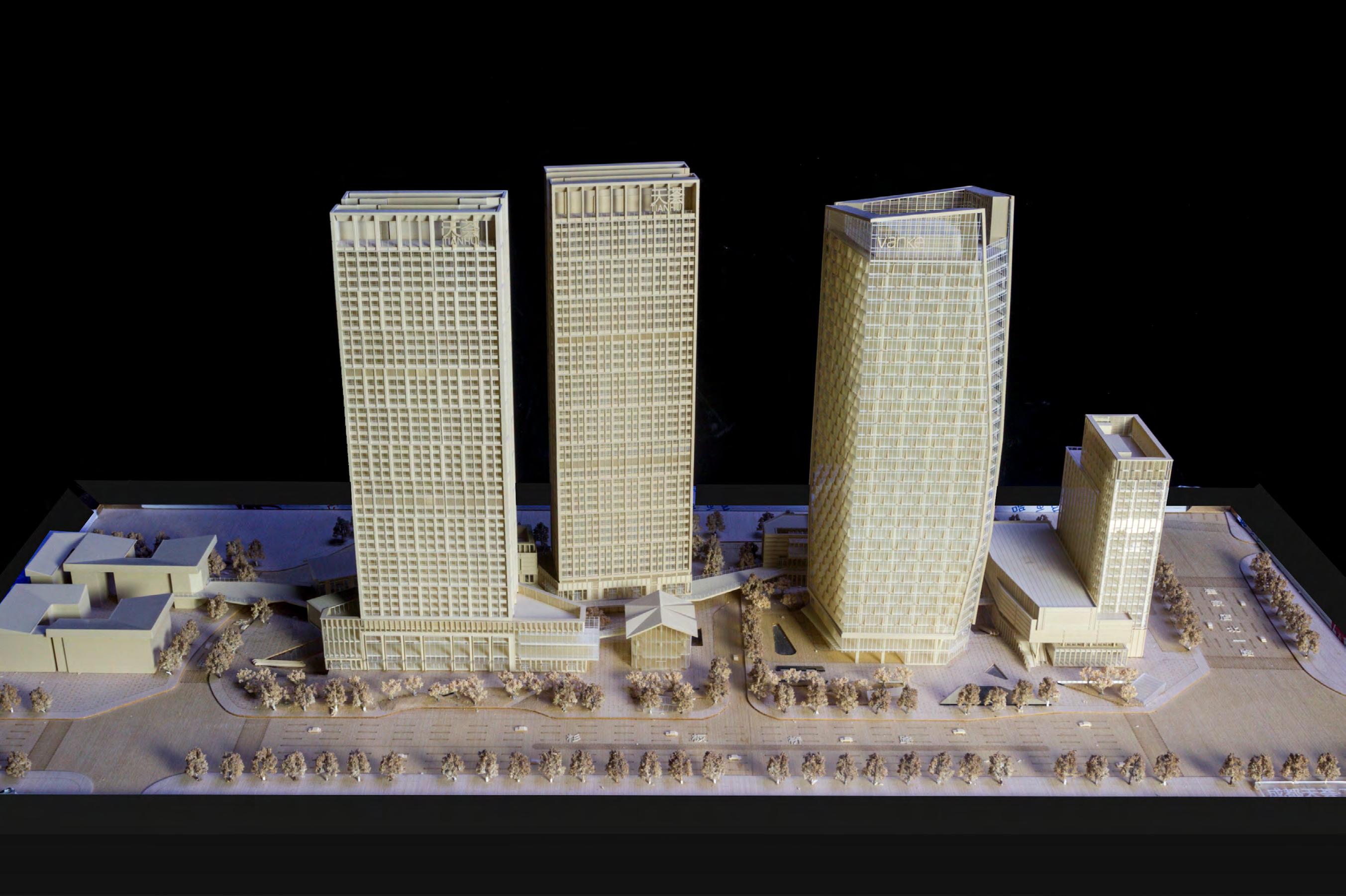 iv. overall building model


 Left: Building Diagrams
Right: Axonometric View


 1. projection 2. breaking 3. addition 4. collision 5. transformation 6. connection
Top: Spatial Operations
Bottom: Zoom-in Plan


 Left: Masterplan(Before)
Right: Masterplan(After)


 Left: Concept Diagrams
Right: Regional Diagrams


 Right: Park Masterplan


 Top: Main Street
Bottom: Street Views


 Left: Site Plan
Right: System Diagrams


 Left:
Facade Studies and Interior Render


 Site+Strategy Field in Situ
Cells Diagrams and Quality Study


 Left: Physical Model (Wood+ 3D Print)
Right: Renderings


 iv. overall building model