


TOWN OF ZIONSVILLE - MAY 2016 ZIONSVILLE
IMPLEMENTATION
STRATEGIC TRAILS
PLAN A PEDESTRIAN AND BIKEWAYS PLAN

The Implementation Strategy for the Zionsville Transportation Plan Pathways Plan
Zionsville, Indiana
1100 W. Oak Street
Zionsville, Indiana 46077
www.zionsville-in.gov
Mayor
Mayor Tim Haak
Zionsville Town Council
Susana Suarez, Town Council President
Elizabeth Hopper, Town Council Vice President
Josh Garrett
Jeff Papa
Tom Schuler
Kevin Spees
Bryan Traylor
Zionsville Plan Commission
David Franz, President
Jay Parks, Vice President
Josh Fedor
Franklin McClellan
Larry Jones
Sharon Walker
Kevin Schiferl
Zionsville Park Board
George Abel, President
Jeff Edmondson, Vice President
Manda Clevenger, Secretary
Wayne Bivans
Tim Casady
John Wollenberg
The Zionsville Strategic Trails Implementation Plan was funded by a grant from the Indiana State Department of Health and funds provided by the Town of Zionsville. This publication was supported by the Cooperative Agreement Number 1U58DP004806-01 from the Centers for Disease Control and Prevention. Its content are solely the responsibility of the authors and do not necessarily represent the official view of the Centers for Disease Control and Prevention.
Special thanks to the following people and organizations:
Mayor Tim Haak
Councilor Josh Garrett
Matt Dickey
Lance Lantz
Wayne DeLong
James VanGorder
Bradley Johnson
Adam Harper
George H. Abel
Jeff Edmondson
John Wollenburg
Manda Clevenger
Roger Burrus
Steve Bullington
Tim Casady
Wayne Bivans
Prepared by:
Rundell Ernstberger Associates
Note: A digital copy of the appendix, maps and figures is included on the CD in the back pocket of this document.
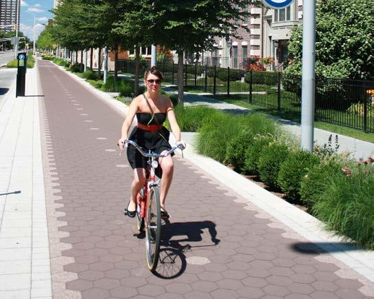
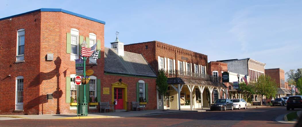
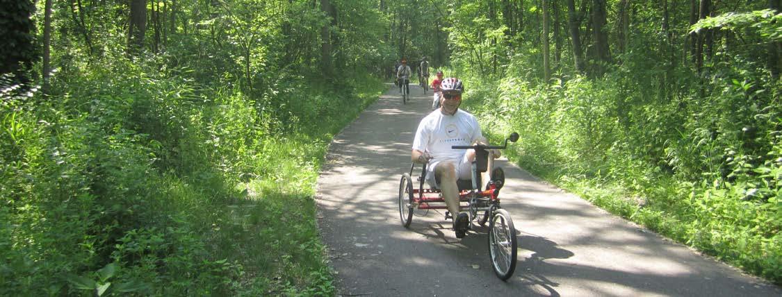
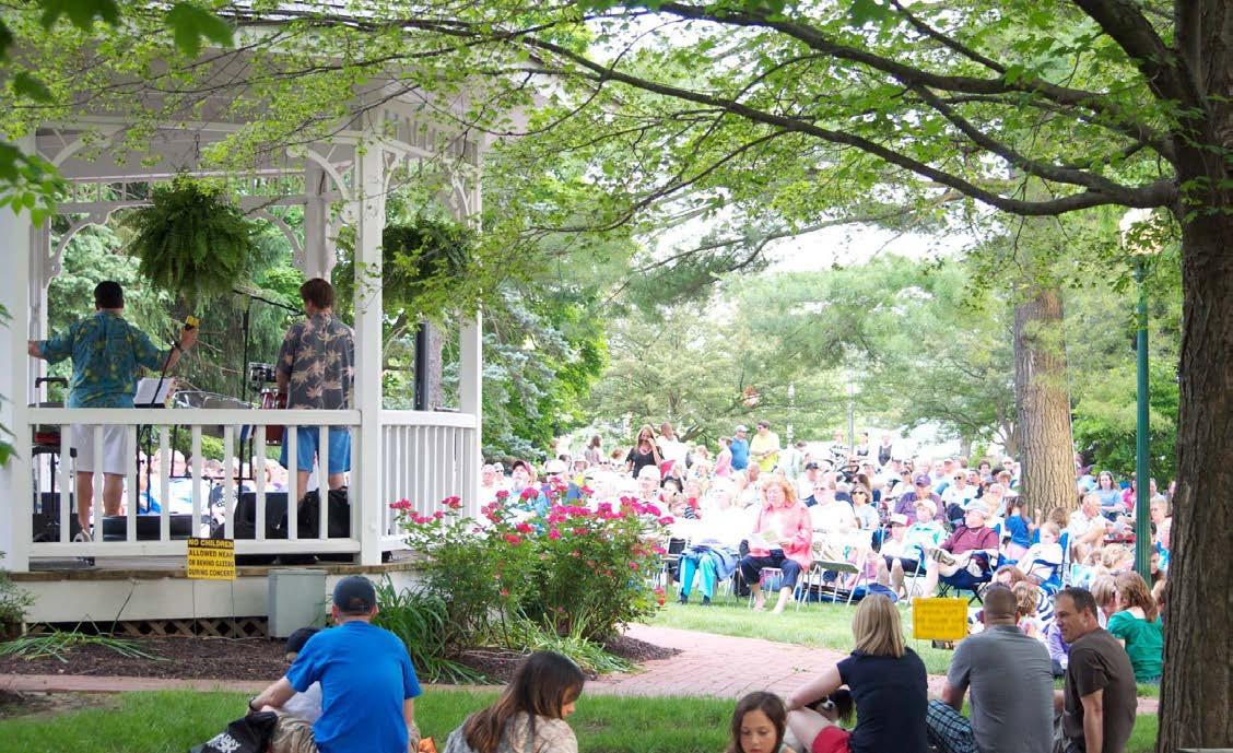
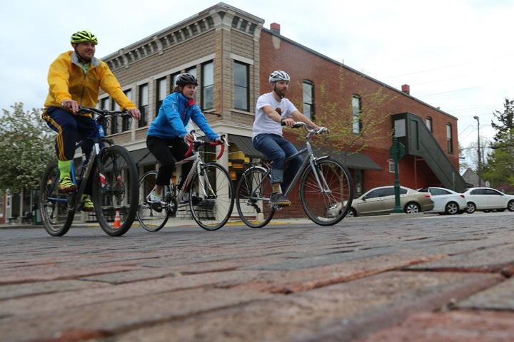
The Town of Zionsville is an active community with many biking and walking enthusiasts. From the crowds strolling along Main Street in the Village to the number of cyclists, joggers and walkers on the Zionsville Rail-Trail, residents and visitors are choosing walking and biking for transportation and recreation. This trend is representative of the same patterns across the United States. People across the country are biking and walking more frequently for exercise, visiting friends, recreation, shopping and commuting to work. Cities must respond to this need by providing safe, comfortable and connected facilities.
The Town has already established a pedestrian and bicycle-friendly community with over 18 miles of trails. Projects like the Zionsville Rail-Trail, streetscape enhancements along Main Street, multiuse paths along most school properties, creation of the Pathways Committee, and the many bicycle and pedestrian races and events demonstrate the town’s commitment to supporting healthy lifestyles and active transportation. The League of American Bicyclists Bronze Level Bicycle Friendly designation obtained by the Town in 2015 recognizes the Town’s efforts to create a more walkable and bikeable community.
The Town of Zionsville and the Zionsville Department of Parks and Recreation have undertaken an extensive, community-driven planning process to create the Zionsville Strategic Trails Implementation Plan (the Plan). The Plan outlines a vision for biking and walking in Zionsville, with developed goals and objectives to help guide the implementation of the vision. The Plan includes infrastructure and program recommendations that are supported by an action-oriented implementation strategy to sustain momentum and progress for years.
The physical improvement recommendations in the Plan will increase connectivity, accessibility and safety for pedestrians and cyclists. The education, encouragement and enforcement programs will foster a culture that values active transportation and recreation. These improvements will change not only the physical appearance of Zionsville but also the cultural environment for all users of the system. Zionsville will provide opportunities for people to be healthier, reduce vehicular miles traveled, support economic development, and attract tourism activity.
The Zionsville Strategic Trails Implementation Plan was funded by a grant from the Indiana State Department of Health and funds provided by the Town of Zionsville Parks and Recreation Department. This publication was supported by the Cooperative Agreement Number 1U58DP004806-01 from the Centers for Disease Control and Prevention. Its contents are solely the responsibility of the authors and do not necessarily represent the official view of the Centers for Disease Control and Prevention.
Creating a complete network of pedestrian and bike facilities provides Zionsville residents with more than just additional options for getting around town or to get some exercise. The infrastructure improvements have significant benefits in the form of improved community health, increased property values, greater recruitment and retention of commercial and retail opportunities leading to increased economic development, greater tax returns for local governments, lower healthcare costs for residents and safer facilities for all users.
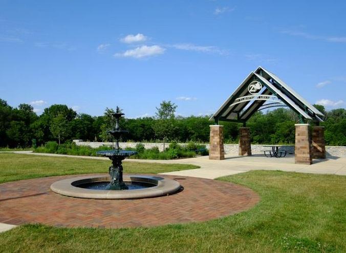
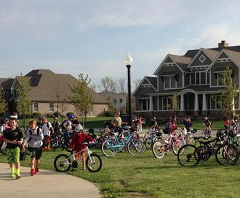
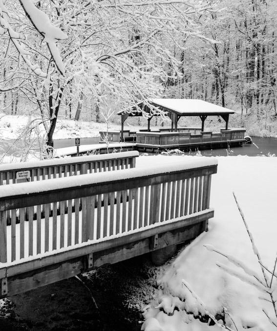
Turkey Foot Park
A community’s quality of life is one of the first attributes that businesses and people look at when relocating to a new community. Pedestrian and bike oriented communities provide a quality of life that is in high demand by all ages. The National Center for Bicycling and Walking has developed the following statements as a general description of a walkable community:
• People of all ages and abilities have easy access to their community – an automobile is not needed for every trip
• People walk more and the communities are safer, healthier, and friendlier places
• Parents feel comfortable with their children being outside in their neighborhoods – they don’t worry about the threat of automobiles
• Children spend more time outside with friends and neighbors and are more active, physically fit, and healthy
• Streets and highways are designed to provide safe and comfortable facilities for pedestrians and bicyclists, and are safe and easy to cross
• Pedestrians are given priority in neighborhood, work, school and shopping areas. Automobile speeds are reduced to ensure compatibility with pedestrian traffic
• Drivers of automobiles operate them in a responsible fashion, knowing that they will be held accountable for any threat, injury or death caused by their lack of due care or violation of the law.
• Streetscapes are designed to attract pedestrian use. There are buffers between cars and pedestrians, street trees, pedestrian scale buildings, setbacks, and interesting storefronts.
Bicycle and Pedestrian projects are providing economic benefits for residents, businesses and for towns and cities too. Trails, sidewalks and on-street bikeways are cost-effective components of a multimodal transportation system. Increases in property taxes, local spending and tourism activity provide additional tax revenue for local governments, providing strong returns on their investments. A 2012 report on the economic impacts of bicycling and walking in Vermont found that the bicycle and pedestrian activities in 2009 amounted to a net positive of $1.6 million of tax and fee revenues for the State of Vermont. Bicyclists on Minnesota trails spend $481 million annually, resulting in $40.6 million in state and local taxes.
Property values tend to be higher in walkable and bikeable communities and properties near trails have higher resale values than those located away from trails. For example, the five most walkable cities in the U.S. in 2015 according to Walk Score, the company that produces the go-to measurement for walkable cities, were New York, San Francisco, Boston, Philadelphia, and Miami. Each is among the leaders in property values in their region.
Many cities and town across the Nation have found investments in bicycling and walking infrastructure are cost-efficient catalysts for private development. Once complete, sidewalks, bikeways, and trails attract new businesses and increase retail activity. The Cultural Trail in Indianapolis has been a major catalyst for private development. For every dollar spent on capital improvements by the City, ten dollars in private investment has been invested into the local economy, and more than 11,000 jobs are projected to be added to the local workforce as a result of the project (Inside Indianapolis Business). In Fort Worth, Texas, retail businesses experienced a 163% increase in sales following the installation of bicycle lanes and improved bicycle parking between the years of 2009 and 2011 (Fort Worth South, Inc.).
Homeowners also benefit from trails, sidewalks and bike lanes. According to Walking the Walk: How Walkability Raises the Home Values in U.S. Cities published in 2009 on average, houses in areas with
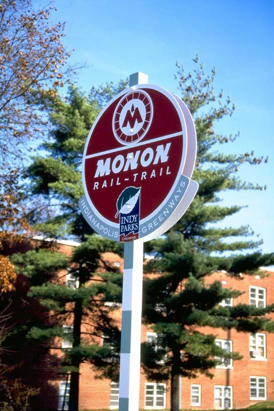
above-average levels of bike and walk amenities are worth up to $34,000 more than similar properties in less walkable and bikeable areas. A study in Indianapolis published by the Journal for Park and Recreation Administration found residential properties in Indianapolis with homes located half a mile closer to the Monon Rail-Trail increased by 11%.
Reduced transportation costs created by more biking and walking to local destinations can reduce both the personal and public costs associated with automobile use. For individuals, bicycling and walking offer an affordable transportation option. Owning and operating a bicycle is a fraction of the cost of owning and operating an automobile. Fewer vehicles on the road also lessen the demand for wider roads and bigger parking lots providing savings to the public.
Bicycle tourism contributes significantly to many local communities. When communities within a region can connect their various active transportation networks, there is an added draw to bike groups. Natural and tourism amenities such as the Zionsville Village, Eagle Creek Reservoir, Geist Reservoir and Conner Prairie within this region of the State create significant opportunities to expand, enhance and promote bicycle tourism.
The State of Indiana spent approximately $2.7 billion dollars in 2009 for obesity-related medical expenditures. Walking is the number one activity recommended by doctors and preferred by Americans to stay fit. Safe and desirable walking facilities create more opportunities for residents to exercise, increasing their health. A 2012 Benchmarking Report on Bicycling and Walking in the U.S. reported that if just one out of every ten adults started a regular walking program, the U.S. could save $5.6 billion in health care costs, enough to pay for the college tuition of one million students.
Communities across the U.S. are reconsidering the way streets are designed, built and maintained to address the increase in walking and biking. After years of building roads to support additional automobile traffic, cities are shifting their focus to safety and comfort for all road users, especially pedestrians and bicyclists. Providing improvements for bicycling
and walking such as bike lanes, multi-use pathways, crosswalks, traffic calming and sidewalks have shown to reduce injuries and fatalities for all road users, including motorists.
Creating more comfortable and safe streets not only reduces crashes but also encourages responsible bicycling and walking activity. Providing infrastructure for biking and walking increases bicyclists predictability, reduces sidewalk riding, and increases traffic control compliance.
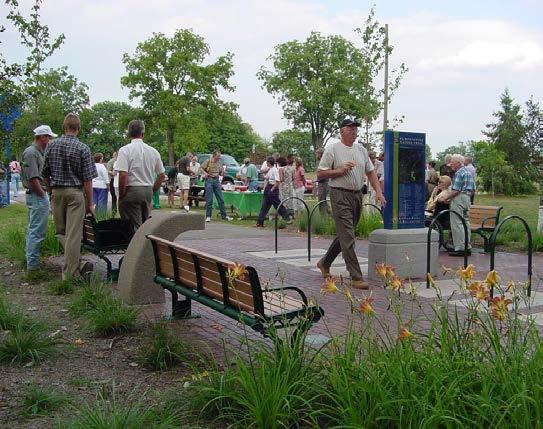
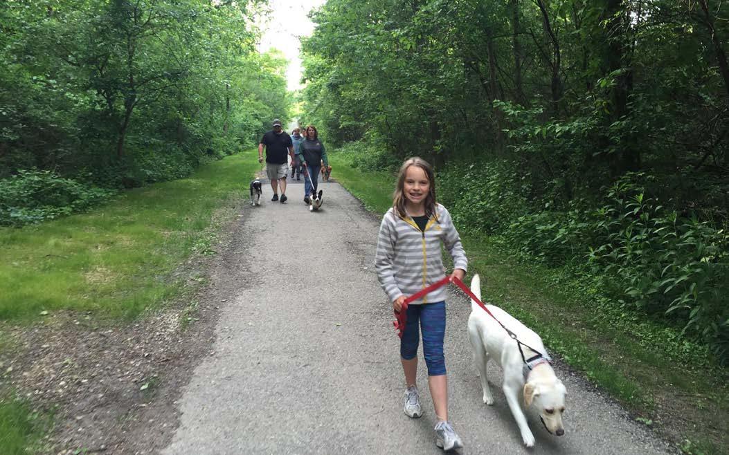
The parks system within a community is the primary source of recreation for residents. Providing safe access to parks is vital, especially for children. In a community survey performed as a part of the Zionsville 5-Year Parks Master Plan update citizens indicated a high desire for making connections between parks, homes and schools. In addition to providing connections between neighborhoods and parks, the pedestrian and bikeways network provides a system of linear parks for recreation. As evidenced by the popular use of the Zionsville Rail-Trail this is an important component of providing a complete parks system for the community.
Zionsville is an active community creating a high demand for various opportunities for exercise. The pedestrian and bicycle network provides additional safe opportunities for walking, jogging, and biking for recreation and for transportation. Studies have
shown a direct correlation between the presence of sidewalks, trails and bike lanes and an increase in bicycle commuting and recreational walking. Increased activity by residents in Zionsville results in a healthier community with lower health care costs.
The public stated their desire for improvements to the pedestrian and bicycle environment during public meetings and in response to a community survey. Over 75% of respondents to the survey indicated that improved facilities are very important to them. Some citizens indicated that they need better places to walk and bike. Others said they have limited time to incorporate walking or biking into their busy schedules. Some have a perception that it is not safe to walk or bike in Zionsville. Nearly all agreed that more sidewalks and pathways are needed to connect neighborhoods to parks and schools and shopping. Most agreed that additional facilities would encourage them to bike and walk more frequently.
Many residents voiced their enjoyment of biking and walking along the Zionsville Rail-Trail and their desire to see more facilities to connect to this community amenity.
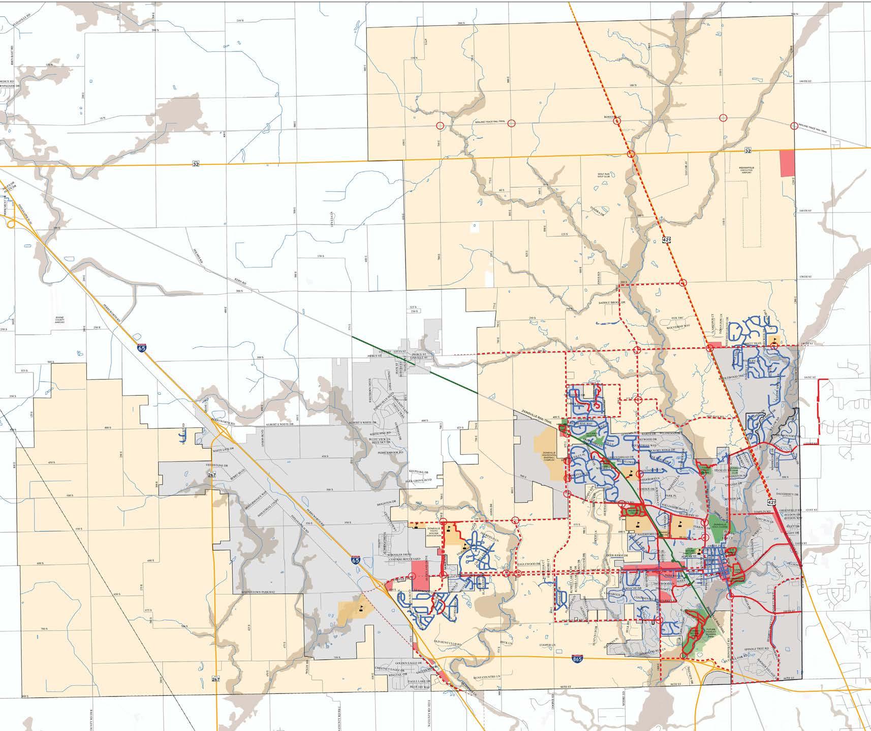
The study area for the Plan includes both the rural and urban districts of the Town of Zionsville (as reorganized per State-enabling legislation, in 2010 and 2015). The 2010 reorganization of additional property from Eagle and Union Township and 2015 reorganization with Perry Township by the Town of Zionsville increased the size of the town to 71 square miles and increased the population to 25,734 according to 2014 Census data. Not only does this affect the town in the short term with an increase in area and population but it will affect the Town’s future needs and planning with many areas available for development and infill.
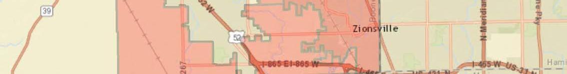
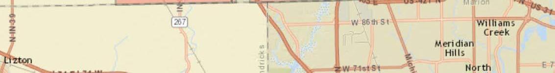
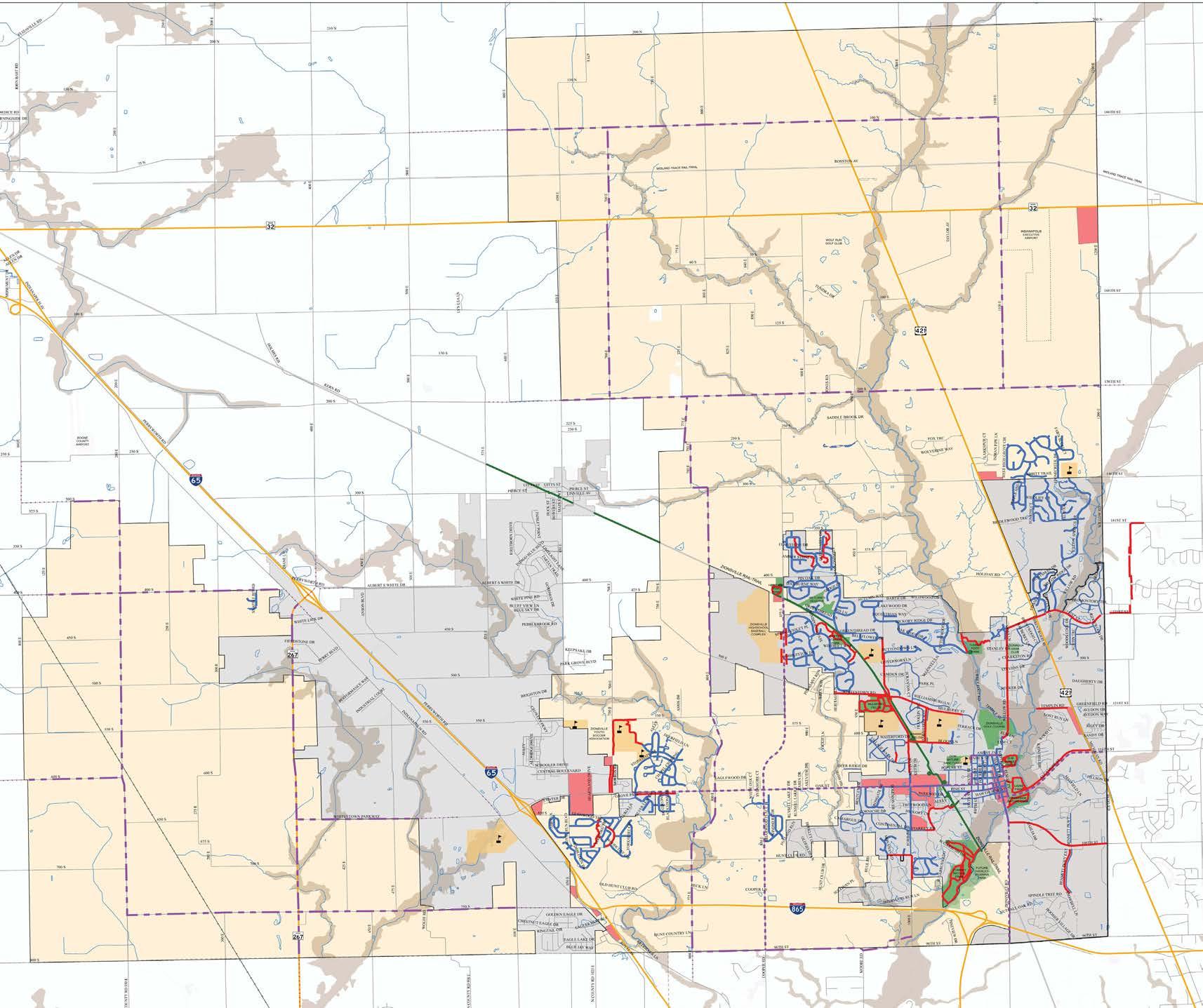
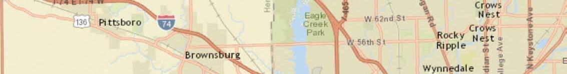 Figure 1 - Project Location Map
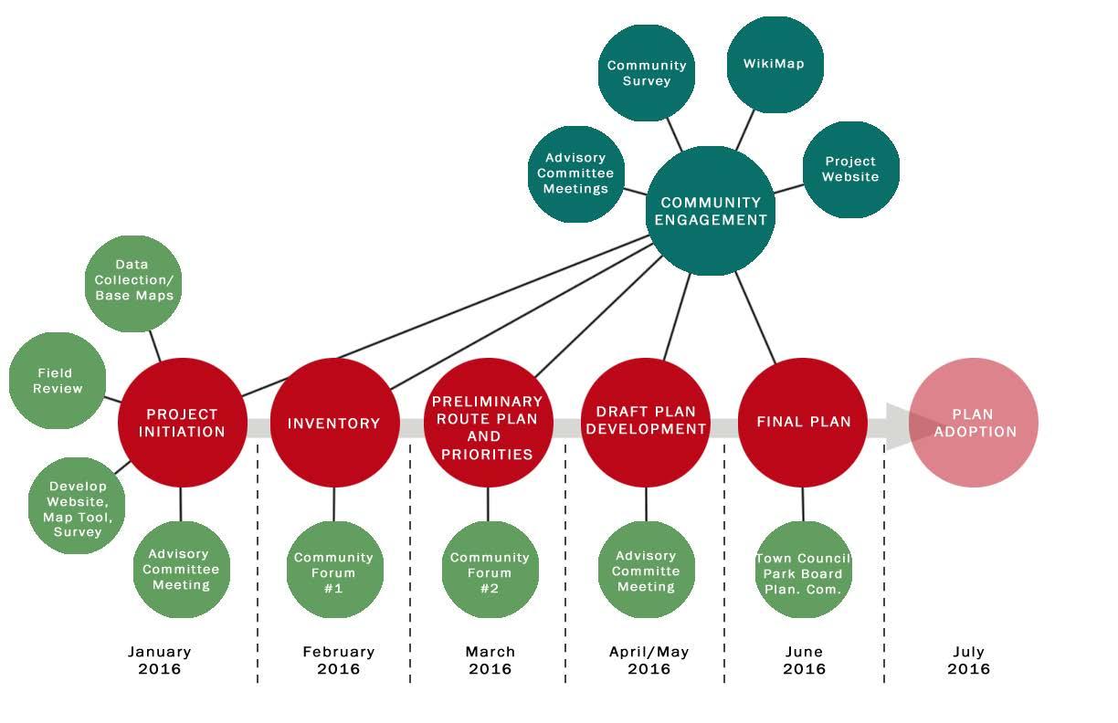
The planning process began in January of 2016 and concluded in April of 2016. The diagram below outlines the planning process from project initiation to plan completion and adoption. The process included an intensive public input phase providing various opportunities for residents to shape the Plan’s vision, goals, and recommended facility improvements. The planning process included steps to meet the following key plan objectives:
• Gather meaningful input from a wide cross-section of the community by providing multiple and various types of public input opportunities
• Develop goals and objectives that articulate the input received from the public and the Technical Advisory Committee
• Review existing documentation to understand the history of and future plans for the pedestrian and bicycle network
• Evaluate physical conditions to understand the current bicycle and pedestrian facilities
• Recommend facilities and strategies for implementation to continue the growth of the system
• Recommend policies and programs for pedestrian and bicycle facilities to support the physical improvements to the network
The Plan established goals and objectives to aid in the development of the planned network, help establish priorities, and to measure the continued progress of the Plan. The goals and objectives were developed utilizing community input gathered during the input phase. The objectives articulate specific actions to be taken to support the specific goals of the Plan.
Goal 1: Plan a system which provides active transportation choices for residents and visitors creating a balanced transportation system.
Objective: Develop a bicycle and pedestrian network that connects people to destinations both within Zionsville and within the region by creating a connected system of on-road and off-road facilities.
Objective: Create an interconnected street and pathways network to provide more route choices, reduce trip lengths and eliminate physical barriers to biking and walking.
Objective: Accommodate the transportation needs of all citizens regardless of age and ability by providing facilities for children, seniors and persons with disabilities.
Objective: Plan and construct all new streets and roadway improvement projects with an eye towards including feasible and appropriate facilities for walking and bicycling. Adopt a “complete streets” design philosophy for all transportation improvement projects.
Goal 2: Increase the number of available facilities where people are currently walking and biking while also creating new connections between neighborhoods; to schools and parks; and to entertainment/retail destinations.
Objective: Include biking and walking infrastructure in new development and redevelopment projects. Require the development of bike, pedestrian and trail facilities that connect residential areas, schools, parks and shopping centers.
Objective: Increase access to schools by alternative modes of travel by creating easy and safe bicycling and walking facilities which connect neighborhoods to schools. Include bicycle parking facilities at schools to encourage use.
Objective: Increase pedestrian and bike facilities which connect parks to neighborhoods and parks to other parks creating alternatives to the automobile for travel to parks.
Objective: Design schools, shopping centers, government centers and recreational facilities that are pedestrian-oriented, easily accessible by bike and provide amenities for each.
Goal 3: Provide economic benefits for the community by increasing the quality of life through the creation of a network of pedestrian and bike facilities.
Objective: Recognize the implementation of biking and walking improvements as essential activities that contribute to the economic health of communities.
Objective: Promote the pedestrian and bicyclefriendly qualities of Zionsville to encourage workforce attraction and retention.
Objective: Expand and enhance opportunities for pedestrian and bike tourism by connecting major tourism destinations with bike and pedestrian facilities.
Objective: Promote and market Zionsville as a destination for bicycle tourism.
Objective: Enhance public health goals and outcomes by making the community a place where people can easily bicycle and walk for fitness, transportation and recreation.
Goal 4: Increase safety and security for pedestrians and bicyclists by creating and maintaining a system where interactions between pedestrians, bicyclists and motorists are respectful and tolerant of other types of users.
Objective: Create a complete network of pedestrian and bicycle facilities which meet the needs of all transportation users including motorists, pedestrians and cyclists.
Objective: Ensure that all drivers, pedestrians, and cyclists understand and obey the rules of the road and act carefully and responsibly.
Objective: Work with the law enforcement department to develop education and enforcement programs to increase the awareness of all road users for rules and regulation concerning bicyclists and pedestrians.
Objective: Maintain sidewalks, pathways, streets and roads to ensure safe use for pedestrians and bicyclists.
Goal 5: Provide recommendations for policy and programs to educate, support, and encourage an increase in traveling by bike and foot.
Objective: Partner with health and environmental organizations to promote the benefits of bicycling and walking.
Objective: Provide programs utilizing the network of bicycle and pedestrian facilities such as fun runs, festival events, and group rides and races.
Objective: Promote the benefits of recreational use of the bike and pedestrian infrastructure.
Objective: Design and install signage and mapping to encourage bicycling and walking activities.
This chapter describes the current context for walking and bicycling and includes a summary of previous plans and studies, an examination of demand for walking and bicycling facilities, and inventory and analysis of current use and bicycle and pedestrian infrastructure. A thorough understanding of the current conditions and future plans for bicycling and walking in Zionsville will guide the development of future projects, programs and policies.
A review of planning documents that were applicable to bicycle and pedestrian planning and implementation in Zionsville was conducted as a part of the planning process. An in-depth summary of each of these documents as they pertain to walking and biking is located in the appendix of the plan. Reviewed documents include:
• 2010 Town of Zionsville Comprehensive Plan
• Town of Zionsville Zoning Ordinance (2010)
• Town of Zionsville Subdivision Control Ordinanace
• 5-Year Parks Master Plan (2013-2017)
• Transportation Plan (2011)
• Transportation Plan - Pathways Plan
• Planned Pathway Projects (Pathways Committee)
• 2015 ADA Transition Plan
• Central Indiana Regional Bikeways Plan (2015 Draft)
• Indianapolis Regional Transportation Plan (2006)
• Indiana Trails, Greenways and Bikeways Plan (2006)
• 2013-2015 Walk Friendly Application
• 2014-2015 Bike Friendly Application


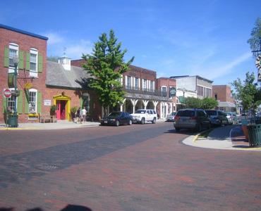
Zionsville has the foundation to become a strong bike and walk friendly community. The development of the Zionsville Rail Trail provides the spine for the network of facilities. The pedestrian oriented Village provides a central core creating a commercial destination for users. In addition, the Town has an established ordinance requiring developers to construct pathways and sidewalks with new development. These characteristics provide the Town with the framework to build upon and continue the growth of the pedestrian and bikeways network.
In addition to the positive traits that characterize Zionsville, there are challenges such as safety concerns, physical barriers and gaps in network connectivity. The following sections present existing network conditions and discuss the strengths and challenges of the transportation network for walking and bicycling.
Strengths and Opportunities
• The pedestrian focused Main Street slows cars down through the middle of downtown and directs major automobile flows around town
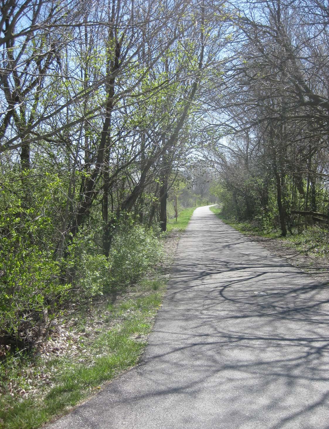
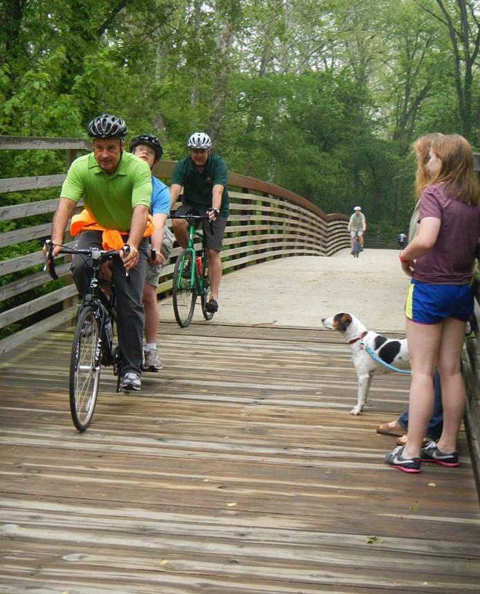
• The Zionsville Rail-Trail provides a unique opportunity for recreational use without roadway crossings
• Many subdivisions have sidewalks on both sides of the street creating walk-friendly environments
• The planned completion of the Zionsville Rail-Trail will provide a central spine to the pedestrian network connecting northern parts of Town with the Village area
• The existing network of multi-use pathways connecting neighborhoods to the Rail-Trail create many recreational loops within the system
• Busy traffic corridors such as Oak Street and U.S. Hwy 421 create barriers between areas of town
• Many existing sidewalks are narrow or deteriorating creating an obstacle for those in wheelchairs
• Many intersections lack crosswalk markings and curb ramps
• Areas of Town which are futher away from the Village area are disconnected from the Village
with a lack of sidewalks or other pedestrian facilities
• Typical subdivision development lacks connectivity to adjacent subdivisions and community destinations such as parks and schools
Strengths and Opportunities
• The number of existing multi-use pathways create the framework for the new improvements to build upon
• The Zionsville Rail-Trail provides a bike facility that is seperated from automobiles creating a safe environment for many skill levels
• The lower volume of automobiles on many of the rural roadways are attractive to recreational riders looking for longer rides
• Existing network of multi-use pathways and the Zionsville Rail-Trail near the schools create recreational loops which are attractive to many user types
• There is a high number of existing bicycle users within Zionsville creating a high demand for bike facilities
• While multi-use pathways near the Village area create connectivity within these areas there are areas of town further away from the downtown which do not connectivity to destinations within Zionsville
• Heavily traveled corridors such as Oak Street and U.S. Hwy 421 create barriers for bicyclists
• Many areas of Zionsville have been developed without right-of-way widths which would accommodate bicycle facitlites creating the need for many negotiations with homeowners
• On-street bike facilities for commuters are limited discouraging commuting by bike
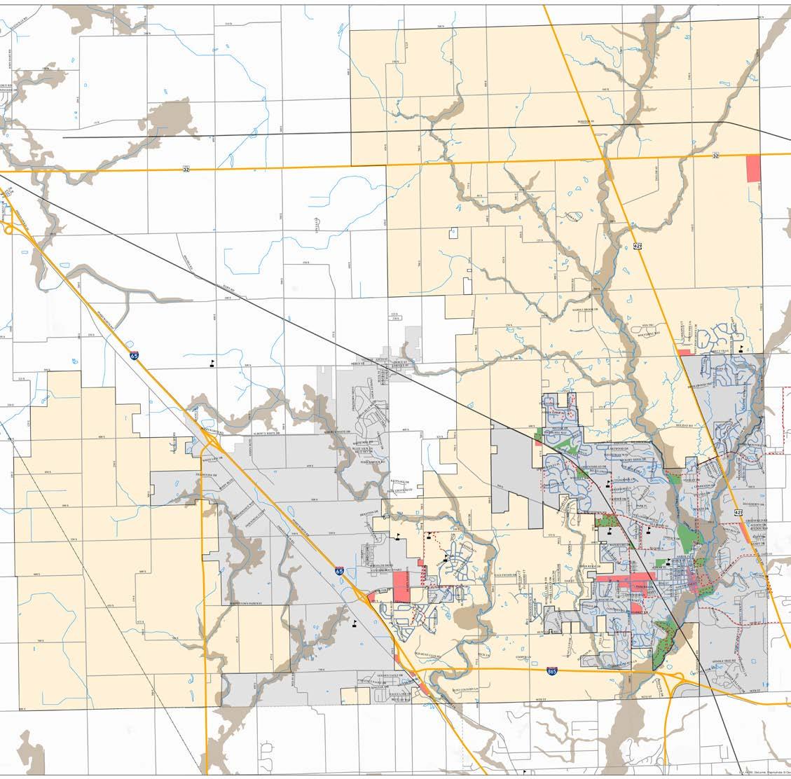
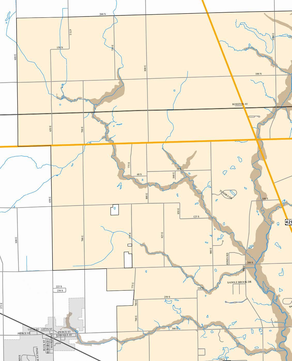
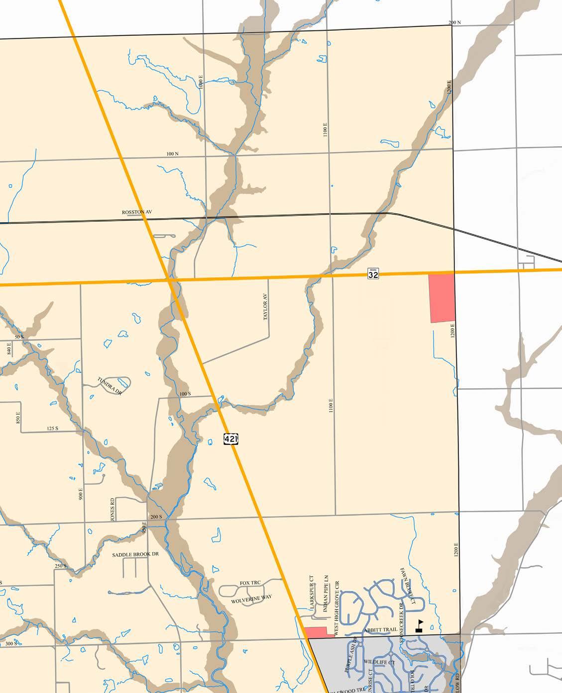
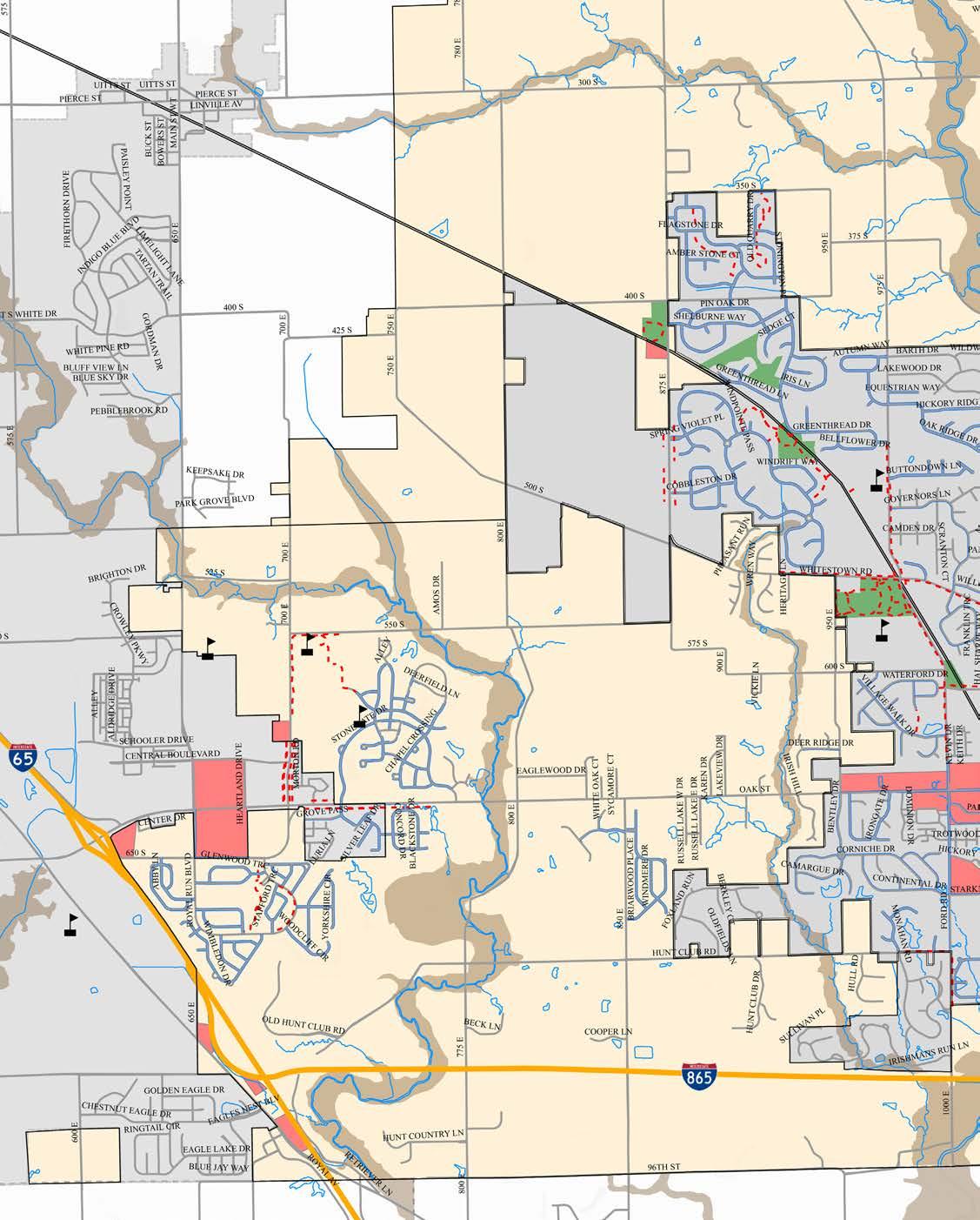
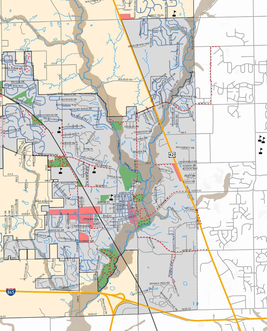
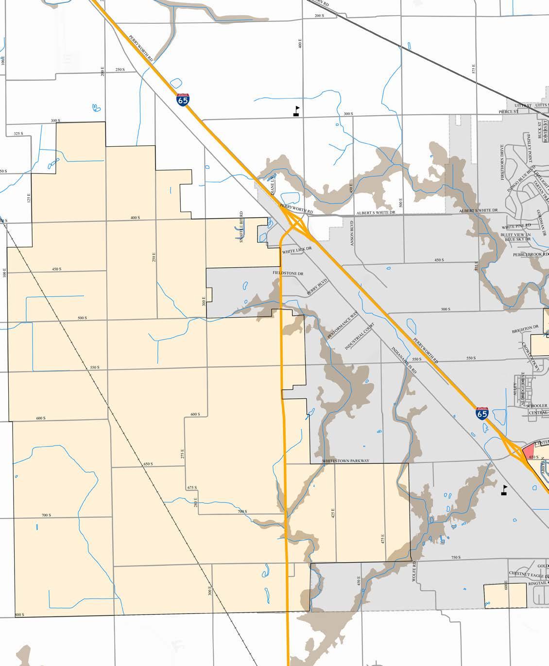
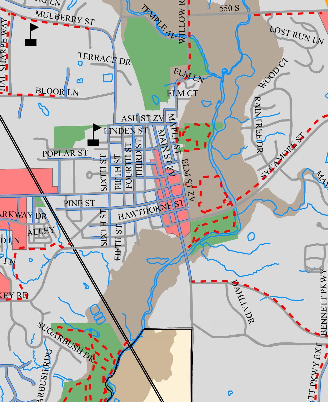
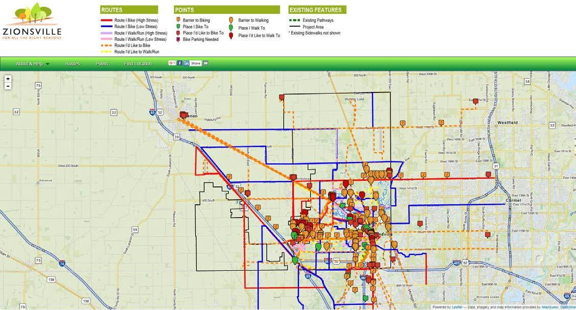
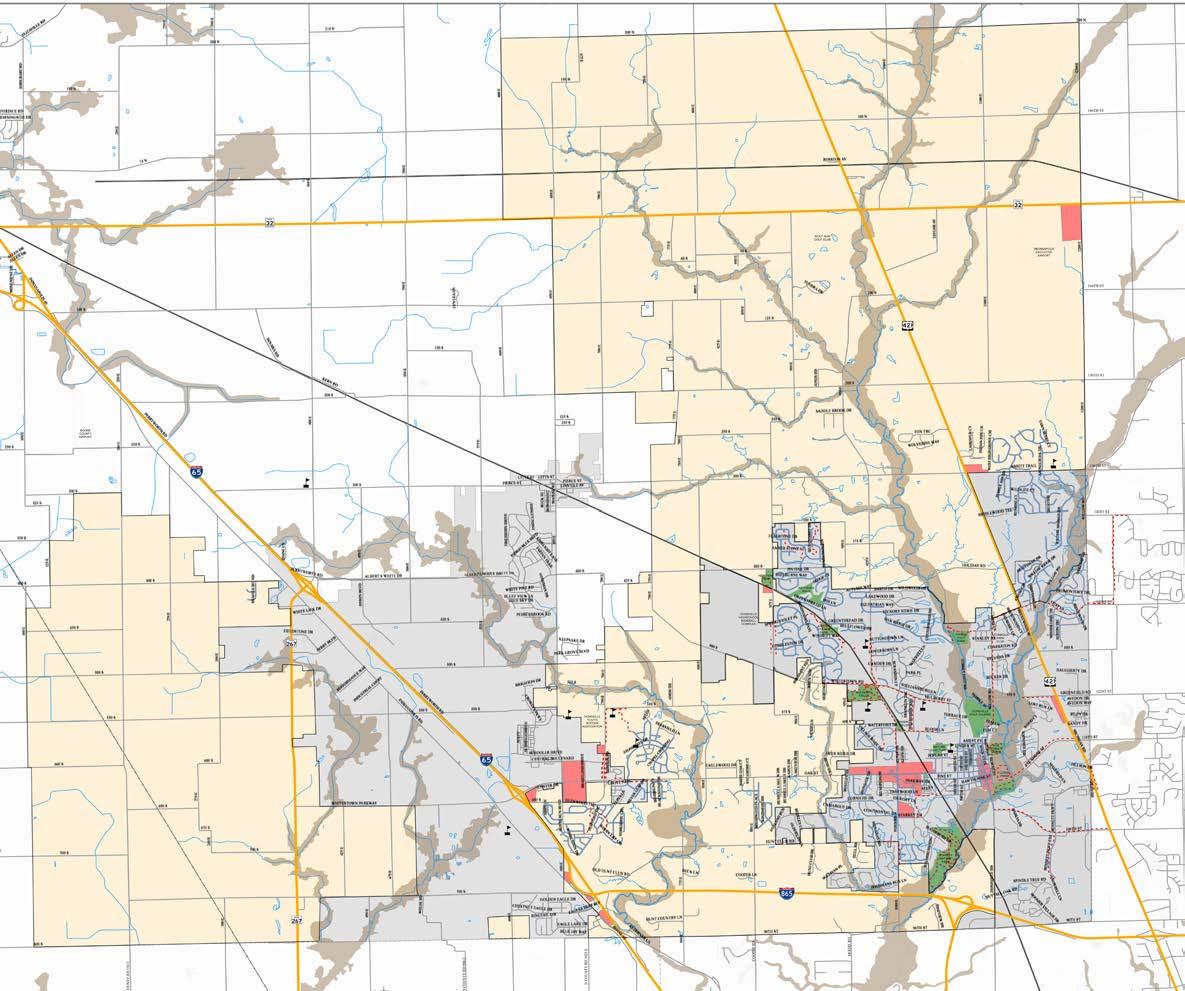
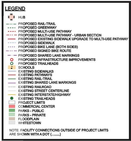
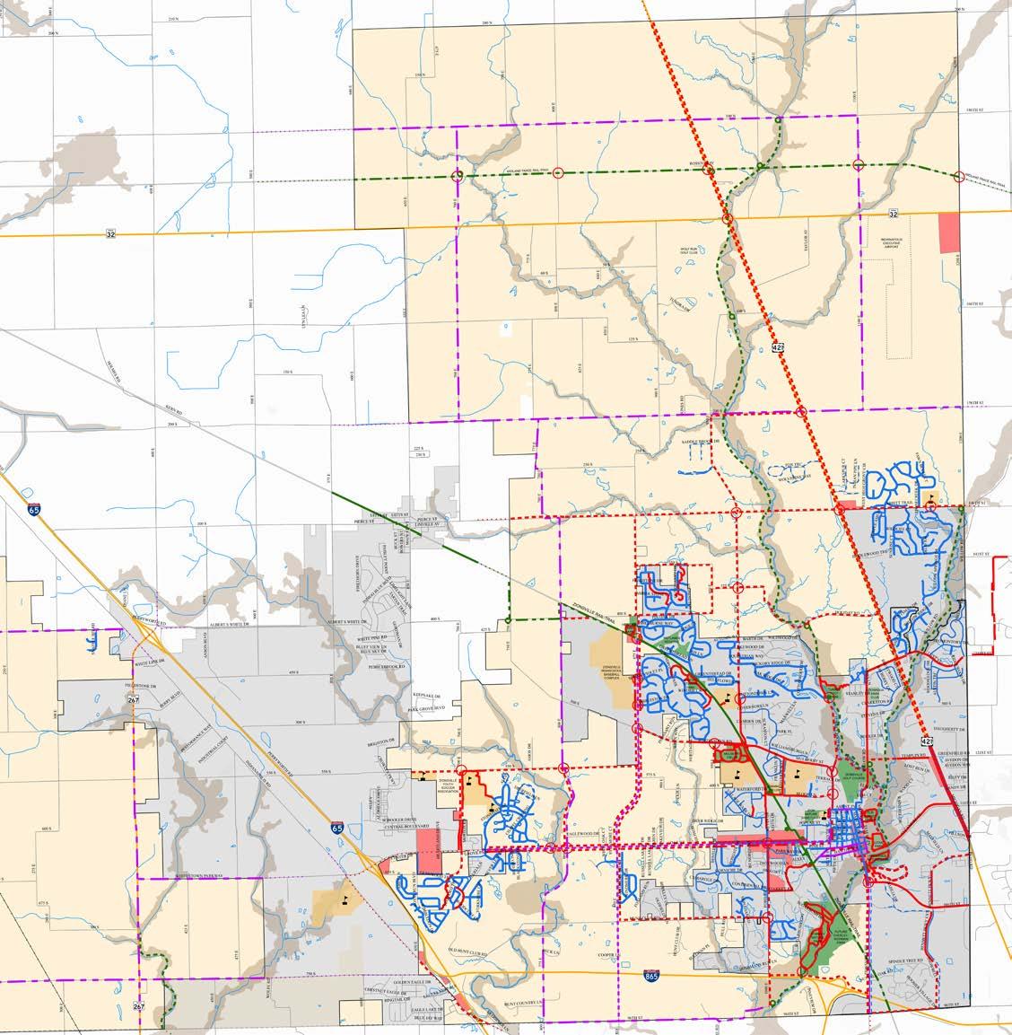
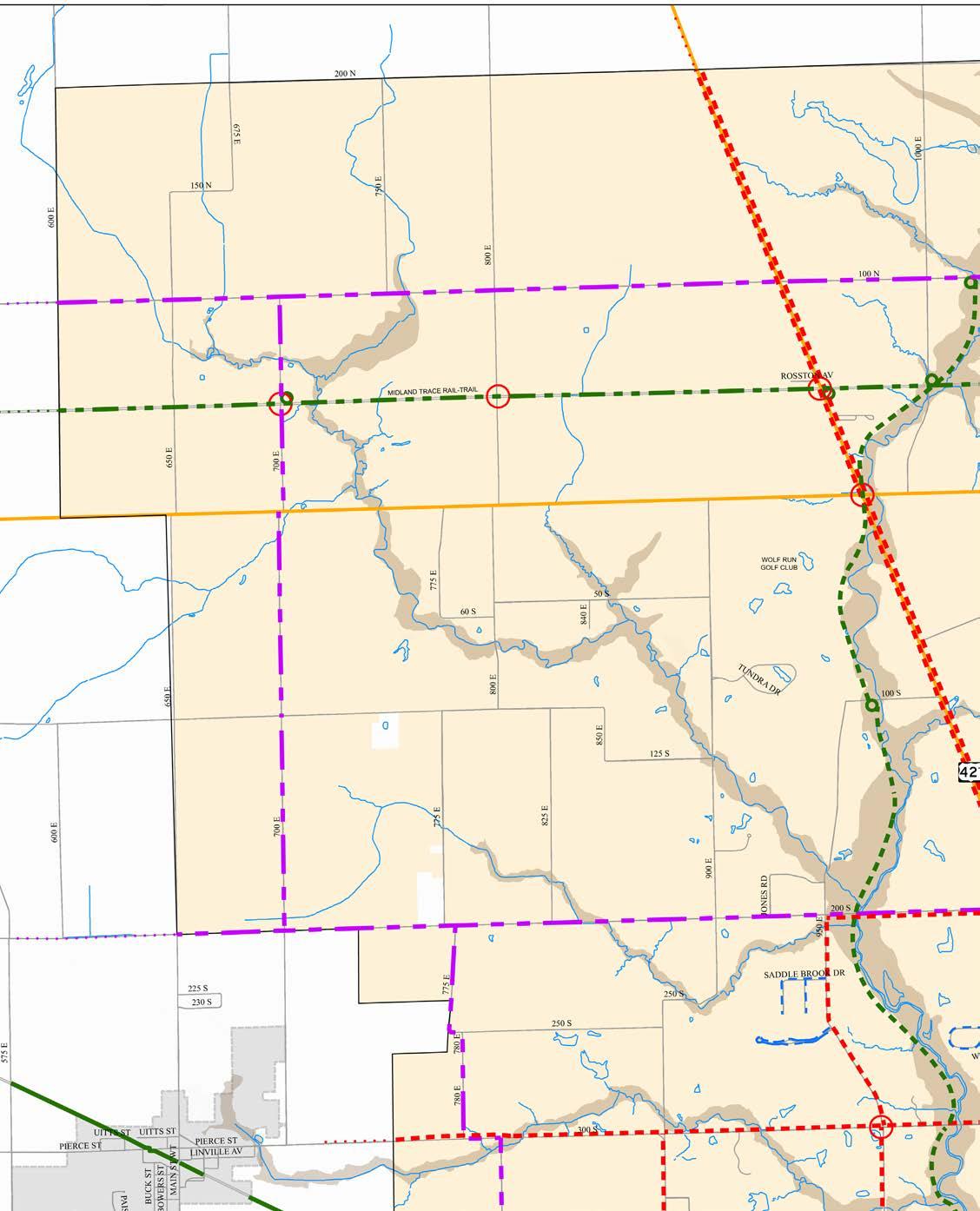
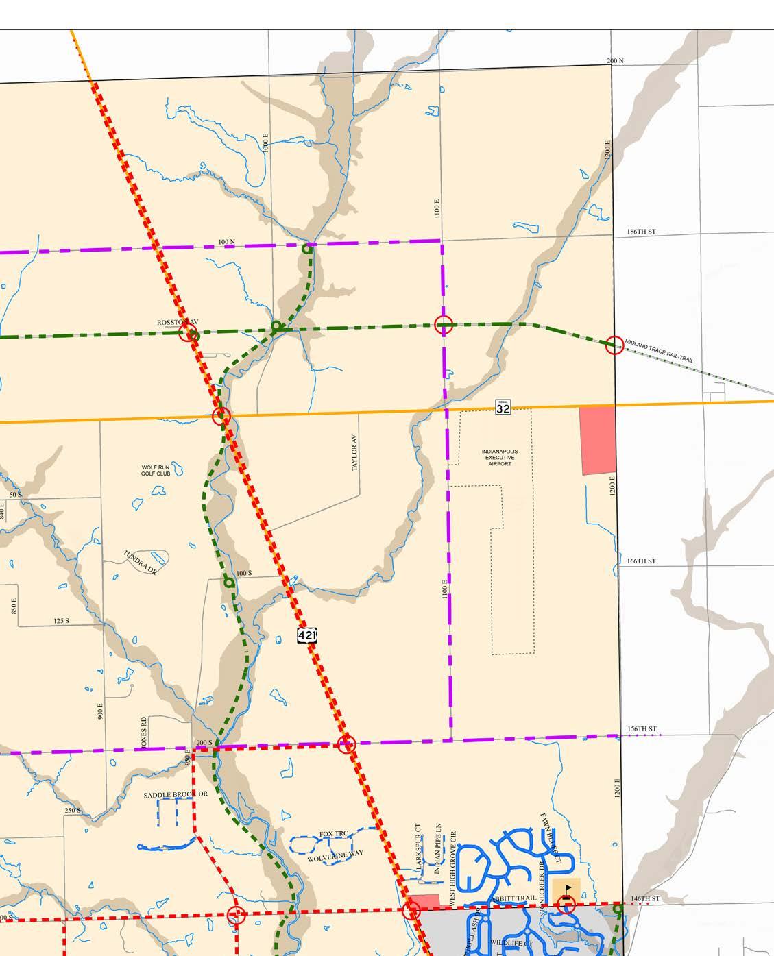
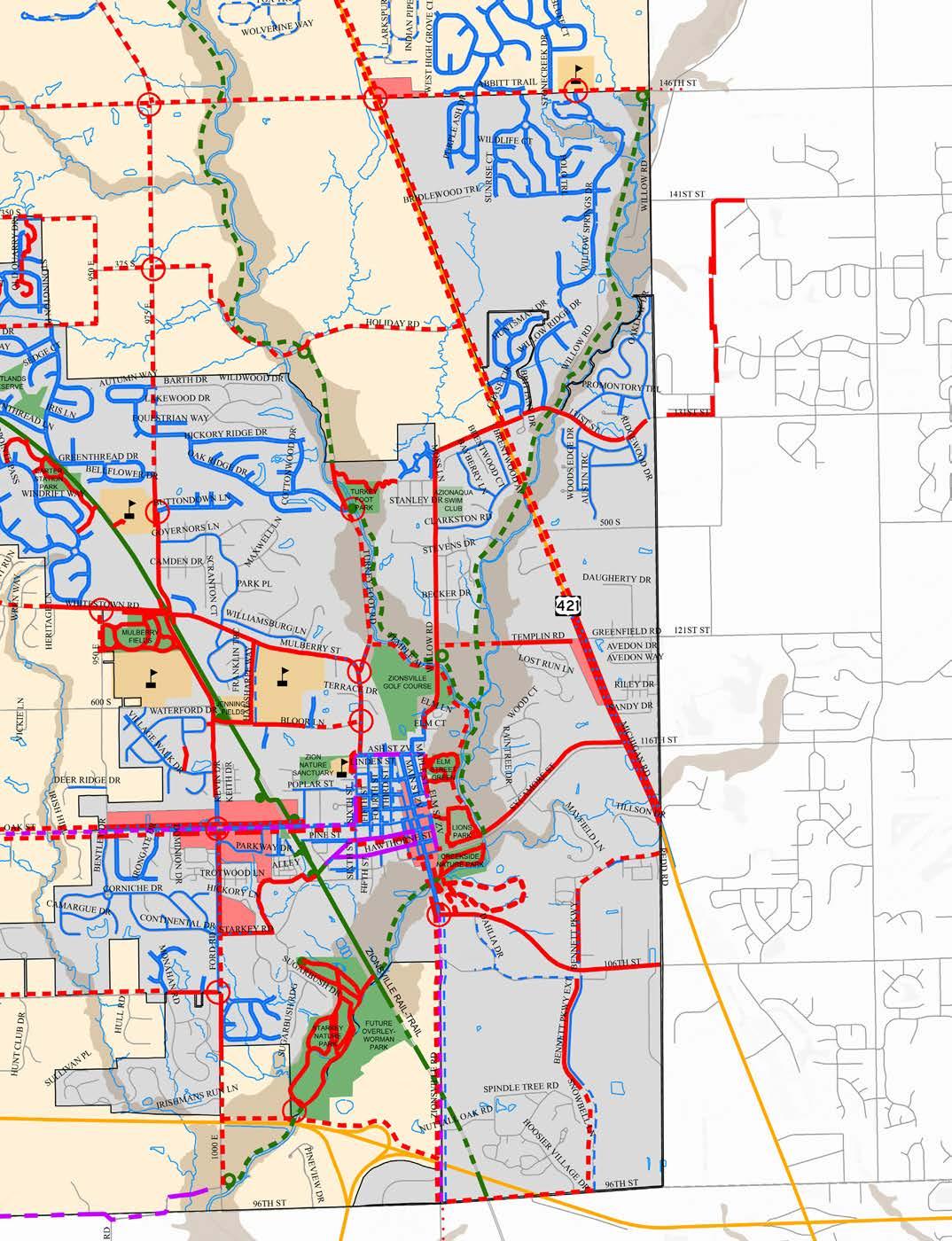
The existing inventory of pedestrian and bike facilities is shown on the following pages. The project area has been divided into quadrants as illustrated on Figure 3 - Existing Conditions Map. A detailed view of each quadrant has been provided to show the existing network of facilities. A digital copy of the entire project area Existing Conditions Map is also provided in the back sleeve of this document.
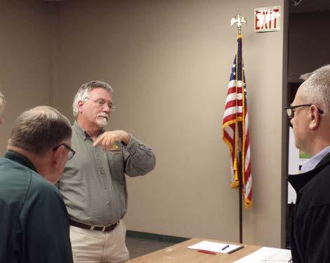
Public involvement is critical to the long-term success of the Plan. From online survey tools to public open house meetings, the planning process included a diverse array of opportunities for the entire community to shape the future of walking and bicycling in Zionsville. The input and ideas shared through these engagement activities guide the Plan’s vision, goals, objectives and recommendations. This chapter summarizes the public engagement activities conducted as a part of the planning process.
At the beginning of the planning process, a project advisory committee was formed to represent a diverse cross-section of town residents, bike and pedestrian enthusiasts, and Town officials. This group was formed to provide input and guidance at critical points of the process. The Project Advisory Committee was composed of representatives from the following groups:
• Zionsville Park Board
• Zionsville Town Council
• Zionsville Planning Commission
• Zionsville Department of Parks and Recreation
• Zionsville Street Department
• Zionsville Police Department
• Zionsville Fire Department
• Walking/Hiking Enthusiasts
• Running Enthusiasts
• Bicycle Enthusiasts
• Zionsville residents
The Project Advisory Committee met five times during the course of the planning process, providing valuable feedback and input regarding existing conditions, public engagement, plan recommendations, and implementation strategies. Their participation was vital to the creation of a plan that addresses the diverse needs of residents and sets the stage for integrating bicycling and walking into the fabric of the community.
Stakeholder meetings were conducted on February 3rd during the data gathering stage of the planning process to gather input from various agency representatives and community stakeholders with unique experiences and viewpoints. These interviews and discussions informed plan recommendations and have helped to establish walking and biking as key amenities that can enhance the quality of life for residents and enhance visitors experience in Zionsville.
The following stakeholder groups were interviewed:
• Zionsville Town Council
• Zionsville Town Staff
• Zionsville Park Board
• Pathways Advisory Committee
• Lions Club, Rotary, Optimist Club, American Legion
• Business Owners
• Walking, Running, Biking Enthusiasts and Groups
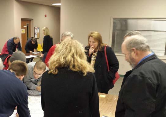
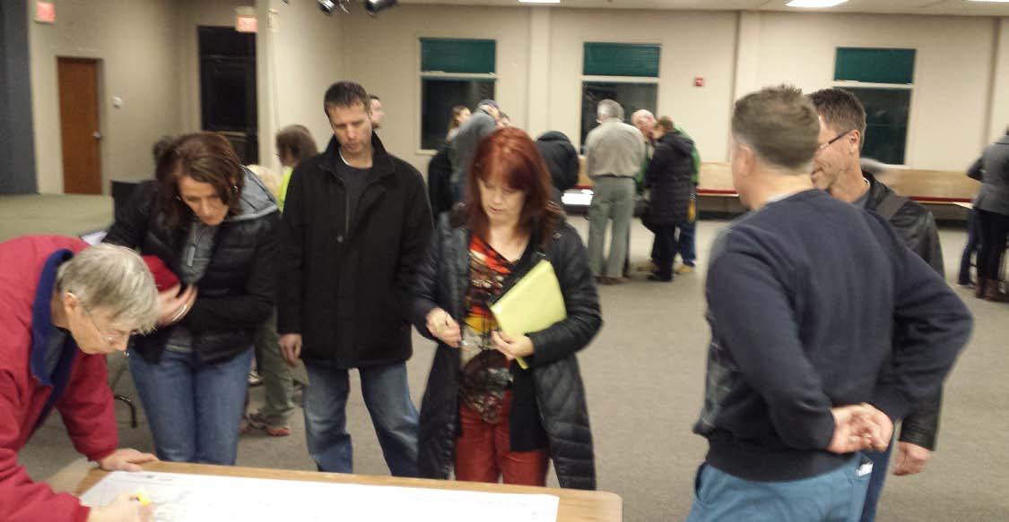
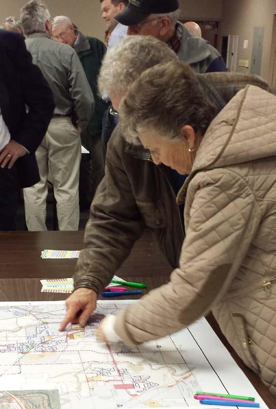
Public meetings were held at two key stages of the planning process. The meetings were held as open house meetings allowing residents flexibility to arrive during a two-hour window and to come and go as time allowed. The meetings included stations where residents were asked to give verbal comments and to draw routes and facilities on maps. This interactive and flexible format provided the opportunity for a wider range of residents to provide input versus the standard public meeting where typically one or two strong voices are the only ones heard.
The first open house meeting was held in February of 2016. This meeting was held in the evening at the Town Hall. This meeting included a general explanation of the purpose of the plan and the planning process followed by input from residents at several stations. Each station had a team member and map for discussion and specific input.
The first meeting was attended by nearly 60 people with many constructive comments. Residents identified many existing routes for walking and bicycling, as well as future opportunities for bicycling and walking connections. The map exercises were helpful in identifying barriers to bicycling and walking around the community.
The following were identified as priorities for connectivity and improvement around Zionsville as a part of the meeting:
• Common destination points for residents from all areas of Town included schools, parks, the Zionsville Rail-Trail and the Village
• Many regional destinations such as Eagle Creek Park were also identified as priorities for reaching by bike and foot
• Commuter routes were identified to reach Whitestown, Downtown Indianapolis, the Monon in Carmel, and the Lafayette Road bike lane
• Zionsville Road and Oak Street were identified as roadways and intersections with the most conflicts and challenges
• Comments were gathered regarding the safety of intersections and roadways which are barriers to Town connectivity because of the lack of safe crossings
• Many routes were identified as good routes in Zionsville for walking and biking
• Majority of requests for new facilities included routes along Oak Street, Zionsville road and completing the Rail-Trail to the north and south
• Need for connectivity from the western areas of Town to the Village and eastern areas of town
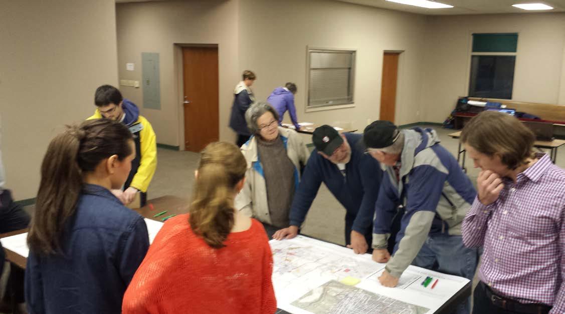
The second open house meeting was held in March of 2016 after the development of draft proposed routes and recommendations. The open house was held to share the proposed network of facilities and gather input from the community. In addition to gathering input on the specific routes and facility types, this meeting was used to begin the process of establishing priorities for implementation of the plan.
Stations with map exercises were again utilized during this open house meeting. The stations included maps to gather input on specific route location, facility type, and demand for routes providing destinations between key destinations. One station asked attendees to “vote” on routes in terms of their importance to residents. Priority corridors identified as a part of this exercise included:
• Oak Street corridor from the western edge of town limits to the Village
• Connection between Turkey Foot Park and the existing pathway system along Mulberry and Bloor Lane
• Connections from schools to the Rail-Trail
• Completion of the northern and southern end of the Rail-Trail to town limits
Online surveys provide a quick and convenient way for residents to share their input and ideas for walking and bicycling in Zionsville. A 22-question online survey was created to gather input from residents. This survey was advertised through social media, online and through local media outlets. The online survey gathered 821 responses. The survey asked respondents about their perceptions of current conditions, their walking and bicycling habits, destinations they would like to access by foot or bike, preferred bicycle and pedestrian facility types, improvements to address specific barrier to biking and walking, and facilities that would encourage more walking and biking. The complete survey results are included in the appendix.
Survey respondents feel strongly about the importance of walking and bicycling in Zionsville and acknowledge the need for additional facilities to support walking and biking in the town. Over 75% of respondents felt that improved facilities are very important. The demand for additional facilities was evident in responses. Over 40% of respondents currently walk 3-5 times a week and over 30% bike 2-3 times per week. Nearly 80% of respondents say they would walk and bike more if facilities were located closer to where they are.
The reasons for the need for additional walking and biking infrastructure varied between respondents. The majority of responses identified recreational and fitness needs as the number one priority for adding biking and walking facilities. However, transportation, connectivity and community building were also identified as important benefits of a complete network of facilities.
The survey results reflect the value that the community places on walking and bicycling as amenities which increase the quality of life by providing recreation amenities, alternative transportation choices and assets that increase opportunities for residents to be more active and improve their health.
In addition to the online community survey the planning process included a project website and an interactive online mapping tool. These were utilized to reach residents who might not typically attend public meetings and those who had conflicts limiting their attendance at the meetings.
A project website was created at the beginning of the process to provide residents with a basic overview of the purpose of the Plan, the planning process and the timeline for completion. The website was updated with summaries of the different phases of the planning process and included information regarding public meetings and opportunities for input including contact information of the project manager and Town official allowing residents direct access to the planning team. There were over 900 visits to the project website over the course of the planning process.
Q4 Would you walk/run more often if you were closer to pedestrian facilities (sidewalks, pathways, multi-use trails)? Answered: 805 Skipped: 16
Q5 Would you bike more often if you were closer to bike facilities (pathways, multi-use trails, bike lanes)?
Answered: 811 Skipped: 10
The planning process included an online mapping tool to provide Zionsville residents with an interactive and engaging way to share their ideas for improving bicycling and walking conditions throughout the Town. Visitors to the website were able to add their comments to the map including current walking and biking routes, physical barriers to connections, wants and desires for future routes and connections and areas of challenges for the system. The mapping tool also allowed visitors the opportunity to agree and disagree with routes that were drawn by other visitors. This created a similar experience to conversations that might take place during a public meeting with users “discussing” different route options. There were over 1000 comments added to the map by over 800 visits to the site.
The most frequently suggested improvements from users of the online map focused on extending the Zionsville Rail-Trail and adding facilities along Oak Street. Comments on the map centered around creating connections between the Village and all areas of town. Connections between neighborhoods and schools were also identified as a high priority.
Many visitors to the online map expressed concerns with challenges to connecting the network of facilities. Oak Street and U.S. Hwy. 421 were both identified as major barriers to connecting the northern and southern and eastern and western areas of town. Intersections along Oak Street and 421 were identified for needed improvements to increase the safety and comfort of users utilizing the pedestrian and bikeways network.
The online map gathered comments regarding rural roadways and routes that are typically used for recreational rides. The lower volume and mostly lower speeds of automobiles on these roadways makes them attractive to recreational riders looking for routes with longer mileage. Zionsville has a unique draw for a specific type of recreational riders with its gravel roadways. This faction of recreational riders seeks the gravel roads for their unique riding experience.
Policies and programs complement the existing and future infrastructure of the pedestrian and bikeways network and help to support the goals and objectives of the Plan. Programs and policies currently in place in Zionsville are discussed in this chapter, and recommendations are provided for strengthening these policies and programs or establishing new programs where appropriate.
Education of the residents and businesses within Zionsville is essential to expanding the role of walking and biking within the community and creating safer interactions and better harmony among bicyclists, pedestrians and motorists. The community should proactively educate new students on the rules of the road as part of a unified bicycle and pedestrian education campaign. Careful consideration of effective outreach tactics is essential to ensure that bicycle safety and encouragement messages reach the target audiences. Better education and messaging is also needed for the entire community to ensure continued harmony as more people utilize walking and biking.
Successful education campaigns rely not only on the content of the messages, but also in how they are delivered. It must be recognized that influencing behavior is challenging, and that creative approaches are needed to gain the attention of students in particular. The Town has several resources in place that can serve as the foundation for its pedestrian and bicycle education communications strategy. The following policies provide ways to facilitate the distribution of education programs:
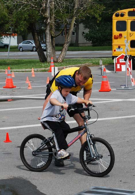
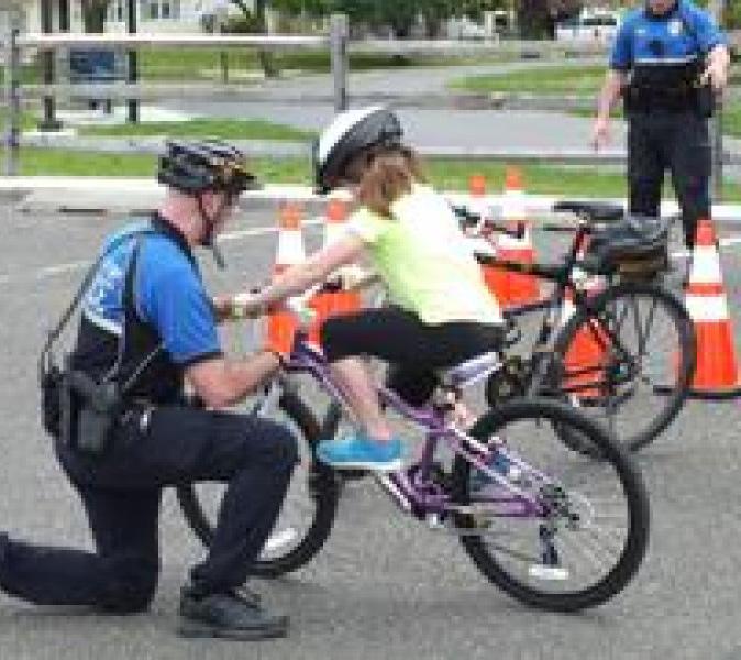
Partner with local organizations on bicycle education events such as bicycle rodeos and other activities. Bike Rodeos are a great way to direct and deliver bicycle related curricula to children. Similar events and classes can be held for adults. Topics discussed
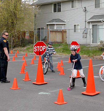
typically include the parts of a bicycle, how a bike works, how to fix a flat tire, proper helmet fitting, rules of the road, road positioning, and on-bike skills. These rodeos are often facilitated by local police departments and cycling clubs and model programs are available through the League of American Bicyclists website. The Town of Zionsville can continue to seek opportunities to continue supporting the provision of education events, in part by providing access to municipal parking lots, restrooms, and water fountains for such events. The Zionsville Police Department can develop programs to provide safety training at elementary schools and should assist in delivering the new education campaign to drivers, bicyclists, and pedestrians.
Include at least one piece of bicycle and pedestrian education annually in Town communications to residents (Town newsletter, utility bills, tax bills, etc.). Including bicycle and pedestrian related educational pieces in utility or tax bills is an easy way to reach a large group of people. Simple communications could cover a seasonal topic such as rules of the road, common etiquette, local bicycling ordinances and back-toschool safety information.
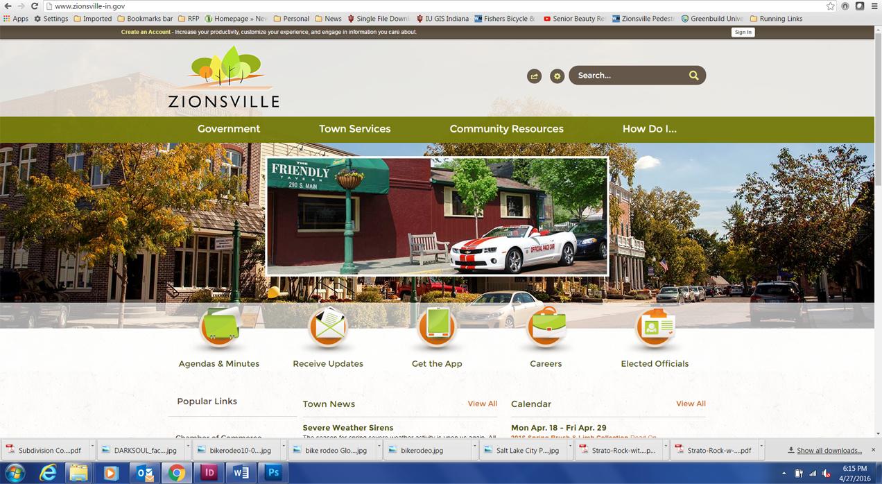
Provide road safety and education materials on the Town of Zionsville webpage. Providing bicycle and pedestrian safety and education material to residents via the Town’s webpage is another excellent way to reach potential and current users. Information should include:
• Maps and other resources (a bicycle user map could be provided as a part of this plan);
• Links to laws, statutes, and ordinances related to walking and biking – both local and state;
• Information about local biking and walking events;
• List of and links to local bike shops and their numbers; and
• List of and links to all walking and biking groups, including clubs, racing teams, and advocacy groups.
Investigate offering a bicycle and pedestrian education course as an alternative for bicyclists, pedestrians, and motorists who are first time offenders of bicycle and pedestrian-related rules of the road. Offering a bicycle and pedestrian education course as an alternative for bicyclists, pedestrians, and motorists who are first-time minor offenders of bicycle and pedestrian-related rules of the road is an efficient and cost effective way to deal with infractions. The Town will explore this option for educating rather than punishing some rules of the road violators. For repeat or major offenders, such a program may also be provided, but as an additional, rather than alternative, penalty.
Provide educational information on how bicyclists, pedestrians, and motorists should use roundabouts. This education can be provided on the Town’s website and via print media. It should include information on how bicyclists should use roundabouts and who yields to who at various roundabout locations. The Federal Highway Administration (FHWA) has a Roundabout Outreach and Education Toolbox that provides examples from across the country.
Encouragement combines many initiatives and the strategies of other policies and programs to build enthusiasm and interest in bicycling and walking. Encouragement programs include Cyclovias, National Bike Month activities, Walk to School days, launch parties for new pathways and facilities and employer-driven incentive strategies such as mileage reimbursements.
Sponsor Bike to Work Week and Bike and Walk to School Day. Bicycling to work or to other destinations is a great way to get exercise, save money, reduce pollution, and have some fun. Bike to Work weeks and Bike and Walk to School days are national activities that are part of National Bike Month (May of each year). Different elementary schools within Zionsville have participated in Walk to School days in the past and will likely continue to do so each year as a part of Bike Month celebrations. Bike/Walk to School Day is an important component of Safe Routes to School as it both encourages and educates students on how to get to school via bike or their feet. Zionsville should explore ways to encourage more of these types of events by partnering with the school system. Activities for these events may include:
• Morning commute stations where cyclists are treated to free coffee and breakfast, bike tune ups, and other incentives;
• Group rides with local civic leaders;
• Themed rides, such as a bike parade to school; and
• Discounts at local businesses for commuters and participants.
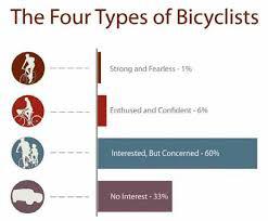
Sponsor and/or support local family-friendly event that promote walking and bicycling. Family friendly events can be a great way to capture the interested but concerned portion of the cycling population, as well as a great way to introduce kids to cycling as part of everyday normal life. Often these events are community oriented and can be as simple as a group ride organized on a Sunday. Other events include Cyclovias, themed rides, and rides organized around existing neighborhood festivals, parks, or cultural destinations.
Walking and Bicycling for Health Events. There has been an increased awareness across the Nation for the need to incorporate physical activity into daily routines. This Plan has been developed to provide active transportation connections throughout the community therefore encouraging fitness for its residents. The Town should pursue partnerships with community health foundations and departments to promote active transportation in the community. Through these partnerships, organizations can organize community bicycling and walking for health events. These can include group rides and walks, races and runs, festivals, or other activities that celebrate and promote personal fitness.
Design an Individualized Marketing Campaign. Individualized marketing campaigns are a unique approach to Transportation Demand Management (TDM) that focus on increasing bicycling, and walking trips through concentrated outreach, promotional materials, and personalized support. Programs like Go Bronzeville and Go Pilsen in Chicago and SmartTrips in Portland are shining examples of community transformation through these individualized marketing campaigns. Key actions for implementing a marketing campaign include:
• Explore partnerships, funding sources, potential neighborhoods, and other feasibility factors for the creation of an individualized marketing campaign
• Develop and publicize a bicycle user map. People who are not familiar with bicycling in a specific area, including visitors, new residents, and
long-time residents new to bicycling, often have a difficult time determining what their route to a specific location should be. Streets that they might use to drive to a destination may not be streets on which they are comfortable bicycling. Providing maps of bicycle facilities and streets that are suitable for bicycling is a good way to encourage people to bicycle more and to raise awareness of bicycle facilities.
Enforcement includes policies and actions that address safety issues such as speeding, illegal turns and movements, and general rules of the road. Programs include options for community members to work collaboratively to promote safe bicycling, walking and driving.
Continue to enforce posted speed limits, particularly in school speed zones. Too often speed limits are viewed as guidelines by motorists. Studies show that the probability of serious injury and death to non-motorized users when hit by a car exponentially increases with each increment of 5 mph. The enforcement of posted speed limits through warning, ticketing and yard sign campaigns can quickly make compliance the rule of the neighborhood.
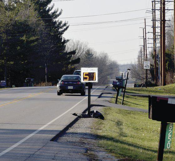
Utilize automated speed-tracking equipment to provide feedback to motorists when they are exceeding the speed limit. The use of automated speed-tracking equipment is a cost effective way to alert motorists to their speed. Zionsville currently uses this technique to alert motorists along Oak Street. Often located near schools and other places where pedestrians are known to be present, automated speed-tracking equipment can cause motorists to consciously slow down. The Zionsville Police Department should continue to utilize this tool in high pedestrian traffic areas.
Expand law enforcement training as a part of police academy curriculum and ongoing officer education. Law enforcement officers play a daily role in helping to foster a culture of respect and responsibility among all road users. Regular training creates a uniform understanding of their responsibilities with regard to traffic law enforcement for bicyclists, pedestrians, and motorists. Training can also create a dialogue
between officers and other Town staff, giving officers a chance to discuss ideas for new or revised legislation to further improve traffic safety.
Evaluation and planning policies and actions include monitoring outcomes, documenting the results of the implementation of the policies and programs, and planning subsequent actions. Data collection before and after infrastructure improvements are implemented, such as user surveys and bicycle and pedestrian counts, are critical to measuring the overall effectiveness of the network.
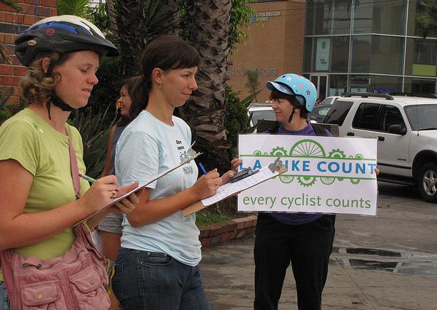
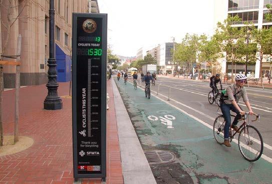
Conduct annual bicycle and walking counts throughout the Town to measure the usage of facilities and growth in these modes of travel. Annual bicycle counts provide a direct mechanism for tracking bicycling trends over time and for determining the impact of projects, policies, and programs that have been implemented. There are three methods available for performing counts:
• Volunteer-Based Visual Counts – The National Bicycle and Pedestrian Documentation Project provides a recommended methodology, survey and count forms, and reporting forms available for free online. Local trainers for the program are also available. Counts are conducted using volunteer labor and therefore put little financial burden on municipal budgets. It is important that counts be performed over a period of multiple days at various times in order to account for peak use. In other words, counts should be performed on weekends and weekdays and in the morning, midday, and late afternoon.
• Electronic Counts – These methods involve using electronic equipment to automatically count the number of users. The traditional method is to use pneumatic tube counters, which are readily available and easy to use. However, they can only count bicycles—not pedestrians. Another, more effective method is to use infrared counters, which are able to count pedestrians and differentiate between pedestrians and bicyclists. With either version of this method, counters should be installed for one entire week (including weekends) in various locations, twice per year to account for seasonal variation.
• Estimates using GPS Data – New technologies and systems allow users to record trips using GPS devices and then upload this data to an online system. The Town has some experience with basic data provided by Strava, which shows the most heavily-traveled routes. This company has recently begun selling more detailed databases to states and municipalities that will allow more accurate counts to be estimated. The limitation with this method is that it primarily records recreational bicyclists (though the company claims commuting bicycle trips can be estimated from its data). In addition, this data will provide citywide information, but only as estimates for any given street or path. This is opposed to the other methods, which provide accurate counts, but only for a few select locations.
Develop and maintain a Capital Improvement Plan for bikeways and paths. The Town of Zionsville does not have a multi-year plan for bikeway and path projects and the implementation of projects occurs more on an opportunity basis than on a need basis. Part of this Plan includes priority/phasing recommendations, but it is still recommended that the Town develop and maintain a multi-year capital improvement plan for bicycle and pedestrian projects. The emphasis of this plan will be on closing gaps in the path system and constructing high-priority routes. The plan will also track the total amount of bicycle facilities that have been built in the Town (including everything that exists today). Keeping track of the installed facilities within Zionsville will allow staff to plan appropriately for future improvements. Having a good understanding of existing conditions will enable planners to make the best use of capital dollars when implementing new facilities.
Develop a Town-wide Safe Routes to School plan to improve the safety of children walking and biking to school. Safe Routes to School is a multi-disciplined program designed to increase walking and bicycling to and from school and educate children about the basics of roadway safety. Successful Safe Routes to School Programs require support and leadership from the school district, individual schools, and Parent-Teach Associations. Once a program has been established in the schools, the Town may provide assistance by construction infrastructure improvements and providing police-led bicycle and pedestrian safety programs.
Establish a plan and program for acquiring right-ofway or easements for future paths along roadways. A regular challenge in Zionsville is acquiring right-ofway or an easement for the construction of paths along roadways. Often, several property owners will dedicate right-of-way, but one or two will refuse to do so, creating a gap in the proposed path. The Town should identify and inventory all path gaps and right-of-way for planned paths. It should then systematically work to acquire easements or rightof-way for planned paths, even if the path is not slated for construction in the near future. This takes advantage of the fact that property ownership changes; it is better to acquire right-of-way from a willing property owner before he or she sells to an unwilling one.
Establish a City-wide Wayfinding System for Bicyclists and Pedestrians. Wayfinding is a means of providing key information about destinations, direction, and distance to help bicyclists and pedestrians determine the best routes for their trips. Many communities have installed bicycle route signs, but these provide no real guidance other than stating the obvious: you are on a bicycle route. Complete wayfinding signs provide on-the-ground information that help people find their way around a community, or between communities, significantly stretching the utility of bikeway and path networks.
Establishing a wayfinding sign system involves four steps:
• Identify key destinations - Consider destinations for transportation and recreational users, including shopping and dining areas. The number of destinations will be limited so that wayfinding signs do not include too much text. Ideally, 2-3 town-wide destinations will be identified (downtown, a major park, etc.) that will be listed on signs throughout the Town, as well as 6-8 local destinations (for each half of the city) that will only be listed on nearby sign
• Identify primary routes - Wayfinding systems are most effective when they provide turn-by-turn guidance to destinations. This is best achieved by prioritizing sign placement to the primary routes that will be used by bicyclists and pedestrians to access destinations. In other words, signs are more effective along a path that parallels an arterial
street than along a neighborhood street that sees relatively little use.
• Determine sign placement - The placements and spacing of signs depends entirely on the distance to destinations and turns in the route that is being followed. In general, a wayfinding sign will be placed at the “decision point” (approximately 100 feet in advance of an intersection) so the user has adequate time to determine whether they should turn or go straight. Subsequently, confirmation signs will be placed approximately 100 feet beyond the intersection to assure users they have made the correct decision.
• Determine sign content - In general, it is recommended that destinations that are straight ahead be placed at the top of the sign, followed by destinations that require a left turn, then destinations that require a right turn.
Consider creating the position of bicycle and pedestrian coordinator or assigning the duties to existing staff. Once the Plan is complete, it will need to be implemented in order for successful improvements to be made within the community. The best way to achieve this is to have a Bicycle and Pedestrian Coordinator on staff. Hiring a bicycle/pedestrian coordinator or formally designating a coordinator within current staff would provide a centralized point of contact for planning, programming and policies related to both on and off street facilities within Zionsville. Typical job duties could include:
• Planning and managing new programs in the areas of non-motorized accommodations, safety, education, enforcement, courses, and recreation;
• Developing safety and promotional information such as quarterly newsletters and route maps;
• Arranging for special displays and events at public and technical information presentations;
• Development, review, and implementation of Plan projects and updates;
• Serving as principal contact with Federal, state, and local agencies on bicycles and pedestrian matters;
• Coordinating and maintaining budget and forecast budgetary needs;
• Seeking funding for implementation of bicycle facilities and working with appropriate offices to fully integrate bicycle and pedestrian projects in programming decisions;
• Developing priorities for special studies in areas such as the location and cause of crashes; effectiveness of new facility designs; barrier removal analysis; and annual bicycle and pedestrian counts.
This chapter provides a comprehensive set of facility recommendations designed to meet the goals and objectives of the Plan. These recommendations are built on a solid foundation of input from the public, Town staff, and technical analysis. The chapter includes infrastructure improvements for each of the pedestrian and bicycle networks; the complete network of facilities showing how all facilities work together; a closer look at 10 Keystone Projects; and the proposed Zionsville Bikeways System Loops. Pedestrian recommendations include sidewalks, multi-use pathways, and intersection treatments. The bicycle recommendations include bike lanes, shared lanes, signed routes and amenities such as trailheads and bike parking. Together, these recommendations provide the Town of Zionsville with the roadmap needed to continue the current momentum in pedestrian and bike facilities growth.
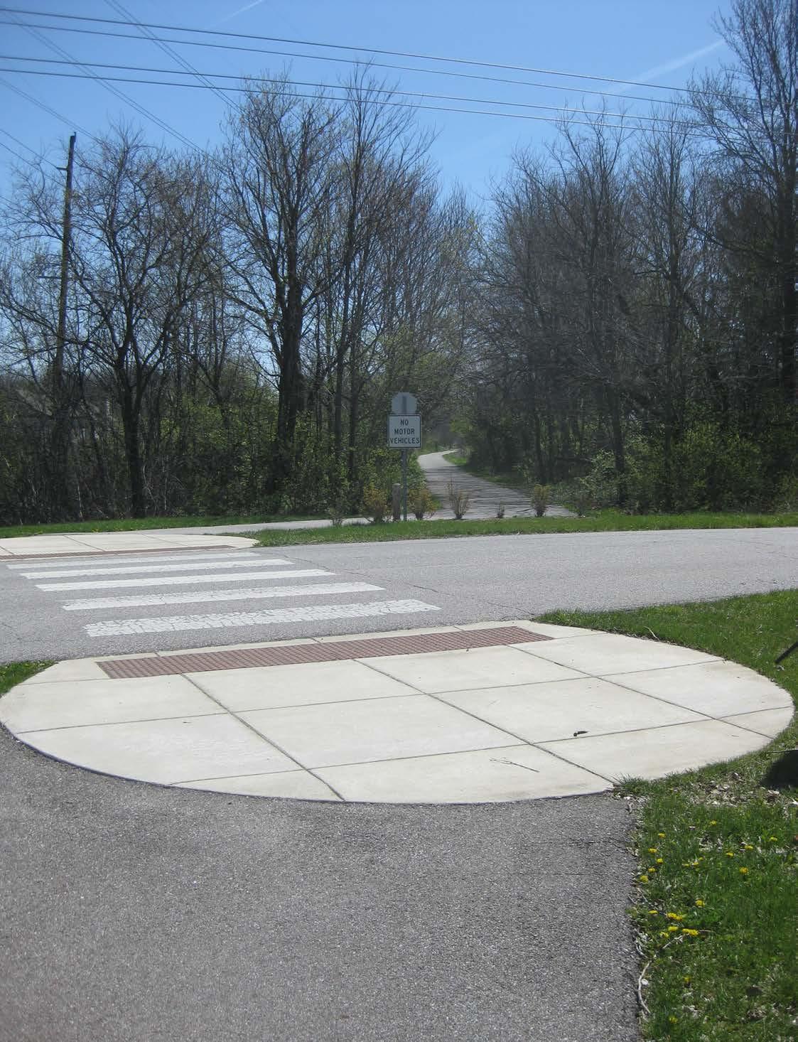
This section of the chapter identifies specific pedestrian infrastructure recommendations to increase connectivity, accessibility and safety for all pedestrians of all ages and abilities. The majority of trips begin and end as walking trips, even when in a car or riding a bicycle. Zionsville has an extensive network of pedestrian facilities including sidewalks and multi-use pathways but there are gaps in the system. Some of the existing sidewalks are deteriorating or are narrow and do not meet current ADA standards. Sidewalks that are too narrow or in poor condition present significant challenges to pedestrians, particularly those with limited mobility or physical impairments. The Town has begun to address some of these deficiencies by improving existing sidewalks, adding ADA-compliant street crossing, and adding new sidewalks as part of redevelopment, street reconstruction, new or upgraded traffic signals, and targeted spot improvements. The following strategies are aimed at reducing barriers to pedestrian travel by increasing safety, convenience and overall comfort for all user types.
The recommended pedestrian facilities are shown in Figure 10. This map illustrates the off-road facilities which provide the framework for the pedestrian network. While a complete pedestrian network supports opportunities for walking, additional streetscape enhancements and traffic calming elements transform the public realm by prioritizing walking as the primary mode of transportation, slowing and even reducing automobile traffic. This creates an inviting and comfortable environment that attracts pedestrian activity.
Streetscape enhancements can add to the pedestrian environment. Landscaping, street trees, pedestrian scale lighting, benches, street furniture, and even public art can have an effect on improving the pedestrian experience especially along highly traveled corridors. Improvements along Main Street in the Village have demonstrated this effect. Capital investments in creating these types of environments can have a significant impact on private development in Zionsville.
It is important to note that the recommended pedestrian facilities do not include a schedule of sidewalk projects. The Town of Zionsville should pursue and implement a specific schedule of sidewalk replacement and implementation projects in areas with high pedestrian use such as the Village. In addition, a large portion of the sidewalk network will be built as areas of town are developed both commercially and residentially.
Pedestrian Facility Types
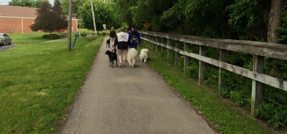
Unlike bicycle facilities which are often intended for different types and skill levels of bicyclists, every pedestrian facility is designed to accommodate all pedestrian types, regardless of age or ability. Sidewalks, multi-use paths and crosswalks form the foundation of the pedestrian network.
Pedestrian Wayfinding
Another component of a successful pedestrian network is wayfinding. As Zionsville continues to grow the town should consider an overall wayfinding master plan. This plan would address basic needs of wayfinding such as identifying destinations but could also include another layer of wayfinding identifying specific recreational or tourism loops within the system. This would include pedestrian level maps, mileage markers and directional signage.

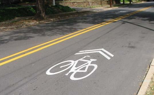
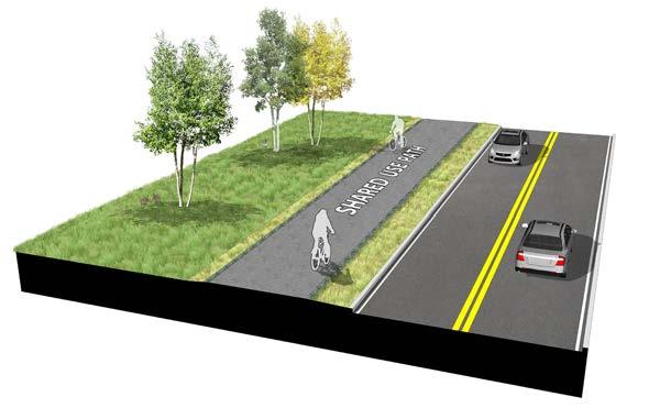
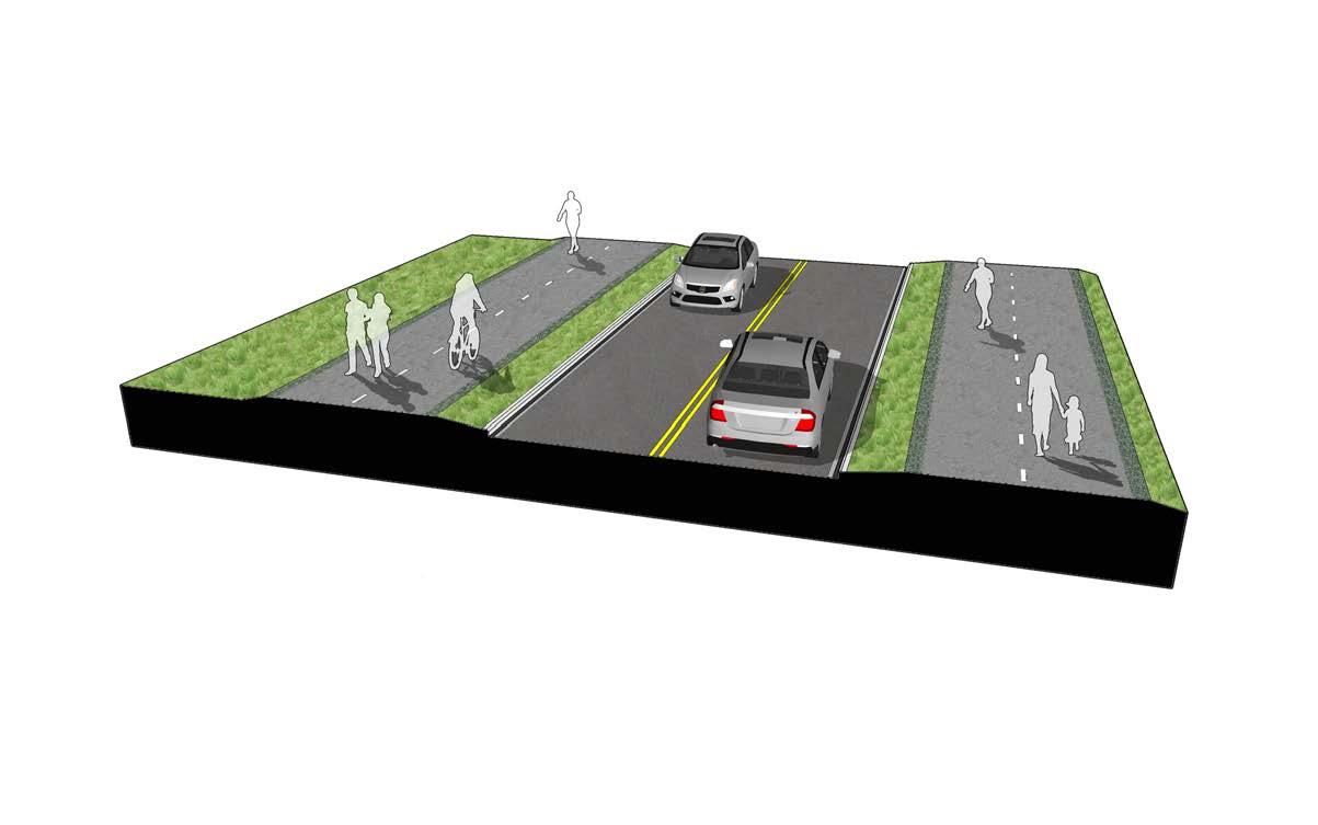
The ability and skill level of people who bicycle is varied. Creating a comprehensive system of bicycle facilities requires the design of safe, comfortable and convenient facilities for all types of bicycle riders. Many streets within neighborhoods have low traffic volumes and speeds providing a comfortable environment for riding. Other streets such as Oak Street and Zionsville Road have higher volumes and higher speeds and will require significant bikeway infrastructure investments. These infrastructure improvements will include both on-road and off-road facilities such as bike lanes, shared lane markings and multi-use pathways.
The Zionsville bicycle network includes a variety of facility types including bike lanes, shared lanes, signed routes, and multi-use paths. The recommended on-road bike facilities are shown in Figure 11. The multi-use pathways shown in Figure 10 supplement the on-road facilities and meet the needs of certain types of bicycle riders along with pedestrians.
Once installed, this comprehensive network will offer Zionsville safe, convenient and comfortable facilities that connect people to parks, schools, commercial centers, employment centers and other desired destinations. The bicycling recommendations provided in this chapter represent a master planning level of design and may change as individual projects are engineered and implemented. Individual segments may be enhanced or upgraded to a higher facility type as the context changes and opportunities present themselves.
The bicycle facilities vary greatly in character, context and intended user. These facilities include: bike lanes for the higher skill level; shared lane markings for routes on lower-volume streets; signed routes for the recreational rider and multi-use paths for the young and families.

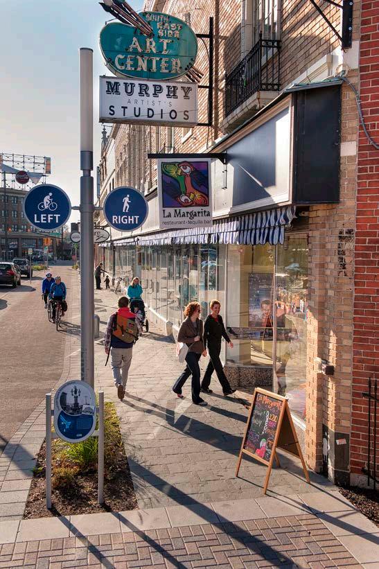
Wayfinding is important for residents looking for new bicycle routes but is especially important for visitors. Landmarks, destinations, natural features and other visual clues help residents navigate through Zionsville but these elements are not always as recognizable to visitors. Wayfinding helps to identify bicycle routes utilizing less familiar, lower-volume roadways that people may not typically use while traveling by automobile. Placement of wayfinding signs through the Town will indicate to bicyclists their direction of travel, location of destinations, and the distance to those destinations. In addition, wayfinding has an added benefit of increasing the awareness of motorists along these routes to the presence of bicyclists.
Zionsville should create a community-wide Wayfinding Signage plan that identifies:
• Sign locations along existing and planned bicycle routes
• Sign family – information to be included on the sign and the different sign types and designs
• Destinations to be identified on each sign specific to bicycle users
• Approximate distance and riding time to each destination.
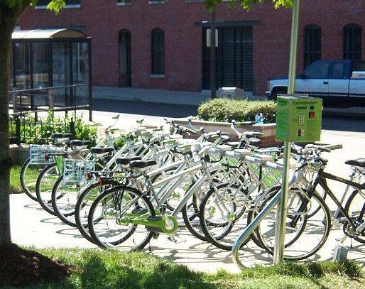
An important component of the bicycle network is the end-of-trip facilities. Safe, secure and convenient bicycle parking is needed for people to utilize bikes instead of their cars for transportation. Zionsville has installed many bike racks at schools and in the Village area. Zionsville should continue to build partnerships within the community to increase bicycle parking facilities. This should include short-term parking like bike racks at schools, parks and shopping locations as well as, long-term parking solutions like lockers and secure parking areas near employment and residential centers.
Bicycling share systems are emerging across the Unites States as an innovative program to increase active transportation for short trips. Bicycle share systems consist of a fleet of bicycles located throughout the service area that can be checked out and returned to any other station within the service area. These
systems can be implemented community-wide or at a smaller scale, such as downtown or other areas with higher employment densities.
Bike sharing in Zionsville was considered in the development of the Plan, but at this point, due to minimal transportation market needs, a full-service modern bike share system would need significant capital and operational subsidies. Alternatively, less formal bike pools/share programs, modeled more closely to what some corporations or hotels employ, might be more effective. In this model a certain number of bicycles are purchased by the company and maintained on-site for staff and employees to utilize. Bikes may be “checked out” and utilized for errands and trips. This model is especially effective where a company might have a satellite campus in close proximity to the corporate location.
As Zionsville continues to grow and expand its tourism industry the Town should consider a feasibility study for a bicycle share system to increase bicycle transportation and build upon Zionsville’s reputation as a healthy and active community.
The pedestrian and bicycle networks overlap in several areas as they serve the needs of both pedestrians and bicyclists. Although it is useful to see the separate facilities meeting the needs of the pedestrian and cyclists, ultimately the active transportation network facilities must all work together and compliment each other to meet the needs of all user types and of all skill levels.
The Network Framework Map is a conceptual illustrative map developed to guide the design of the active transportation network. Destinations and links were identified through the public input phases. The combination of these community connections created the conceptual diagram shown in Figure 12 - Planning Framework Map. The hub and spoke schematic is the driving concept behind the Planning Framework Map. This concept is used when designing many types of transporation systems. For instance, the airline industry uses a central hub with spokes that connect to other neighborhoods across the country. This allows the infrastructure and programs needed to run the
system to be located in one central location while serving several areas of the network. Similarly, the hub and spoke diagram shows a central hub located at the Town Hall with spokes connecting out to the different neighborhoods of Zionsville. The hub would serve as the central core of pedestrian and bicycle activities such as education programs and events.
The blue circles and corresponding blue lines represent destination points such as neighborhoods, parks, and schools and the connections needed between each. The red lines and concentric rings represent the larger cross-town and regional connections.
The Proposed Facility Network Map - Figure 13 defines a set of infrastructure improvements to be completed over the next several years to make Zionsville the best possible community for walking and bicycling for its residents and visitors. By increasing the facilities available for people to walk and bike Zionsville is creating a community which is environmentally and economically sustainable.
The Proposed Facility Network map is a visionary, yet achievable, action strategy to make Zionsville a world-class biking and walking town. It creates the framework and action plan needed to create a comprehensive network of pedestrian and bicycle facilities. Improving the safety and convenience for walking and biking in Zionsville will provide cost-effective, healthy and convenient transportation for residents who bike or walk. It will also increase the social interaction on street, offer an alternative to the automobile, and make Zionsville a healthier place to live.
Many of Zionsville’s residents bike and walk currently but have voiced the need for additional facilities to increase the amount of time they spend walking. Many stated that they would choose walking and biking for a variety of trips if the facilities were available to them.
Although it is helpful to look at the facilities that meet certain users (i.e. pedestrians versus bicyclists) separately, ultimately the network will function as one system of facilities with many overlaps. The multi-use path is the most common facility proposed for future improvements. This facility type is an economically responsible facility to build with both pedestrians and bicyclists utilizing the pathways. In addition, the multiuse path fits the comfort level of many cyclists and pedestrians. Especially those traveling as a family unit or with young children.
In addition to the multi-use path there are other facility types identified on the Proposed Facility Network Map to compliment the network of multi-use pathways. In some areas more than one facility is located along a corridor. These corridors have been identified as high-use/high-demand corridors that have the potential to see larger volumes of users and will serve many skill levels of bicyclists.
Not only will the proposed network provide connections between neighborhoods, parks, shopping, and schools but the routes will also create many recreational loops. These loops will create shorter loops near neighborhoods or provide longer loops when connected with existing facilities such as the Zionsville Rail-Trail.
Completing the infrastructure improvements shown on this map will create a transportation system for pedestrians and bicyclists which is equal to the transportation for automobiles. Providing community-wide amenities such as this will attract businesses and young professionals looking to relocate. Paired with the existing parks system, the pedestrian and bike network will support the high quality of life Zionsville is known for.
The proposed network of facilities is shown in the following pages. In addition, a full size digital copy can be found in the back sleeve of this document. Like the inventory maps, the proposed facility map has been shown in quadrants in the following pages to show additional detail.


Several Keystone projects were identified for each of the short-range, mid-range and long-range projects. These 10 Keystone Projects include preliminary concept drawings showing facility type and location. Each project also included a study of the number of people who would see a direct benefit from the project. The Walking Radius Maps utilized the standard 5-minute (0.25 mile) and 10-minute (0.50 mile) walking distance and 2010 census data to determine the number of houses and people within these area. Although the data is somewhat dated, the impact of these particular projects within the community can be seen by the number of people who are directly impacted.
These impacts are even further reaching if bicycle rides are considered. Standardizing the length of a bike ride is more challenging with varying lengths of rides being considered as “typical” depending on the purpose of the ride and the skill level of the rider. For example, the Short-Range Project #1 connecting Lions Park with Elm Street would have a 10 mile biking radius which essentially impacts all residents of Zionsville. The western most lands within the newly annexed area of Perry Township are a 10 mile ride from the nucleus of this project. The northernmost lands are just over 8 miles from this project.
The cost estimates shown are based on the same exceptions as those listed in the Implementation Chapter of this document. Costs do not include rightof-way negotiations or purchase and do not include engineering, administration or construction inspection. Cost has been included for limited drainage work, signs, fencing, and pavement markings.
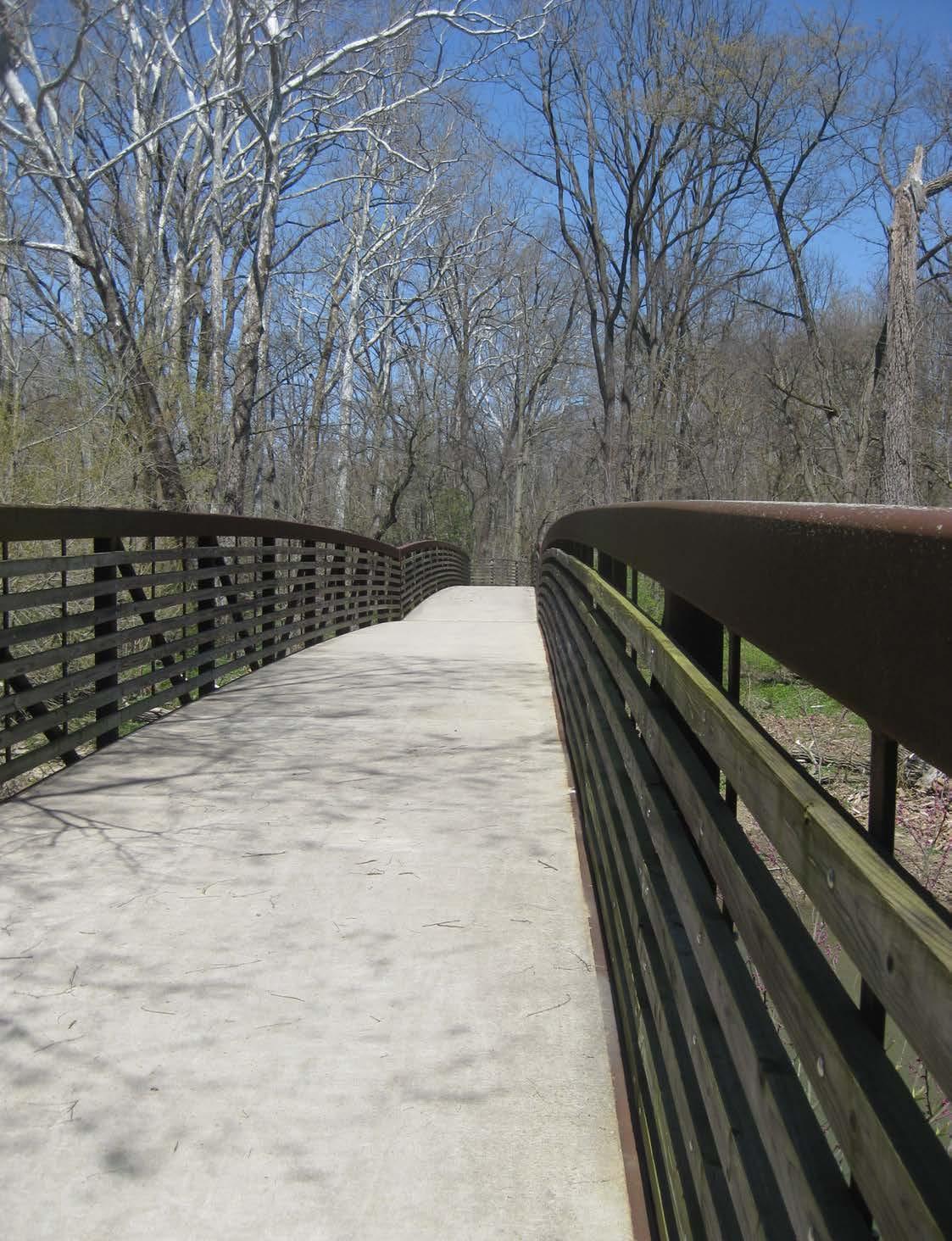
Although less than a tenth of a mile in length the Sycamore Street connection between Lions Park and Elm Street is a very important project. This connection will provide a safe, comfortable, and lowstress bikeway connecting Lions Park and Elm Street Green with the Village. The existing multi-use path and pedestrian bridge provide a facility which is separate from the busy roadway but falls just short of connecting with the Village.
Note: Data gathered from 2010 census

This project includes the construction of a multi-use path along the north side of Sycamore Street and another multi-use path connecting with the existing system within the park on the western end of the parking lot. Significant grade changes occur between the existing pathway and the sidewalk connection along Elm Street. Options for this future pathway include construction of a wall to make up grade and extending the pathway into the park to create a gradual rise in grade along the edge of the park. The connection along the western end of the parking lot will provide a safe and comfortable connection between the existing pathway within the park and the existing pathway along Sycamore Street.
Facility Type: Multi-use Path
Implementation Actions: Design grading and drainage and multi-use path to accommodate grade changes between Lions Park and Elm Street
Land Acquisition Level: Uncomplicated
Limits: Lions Park parking lot to Elm Street
Length: 0.23 Miles
Estimated Cost Range: $100,000 - $250,000
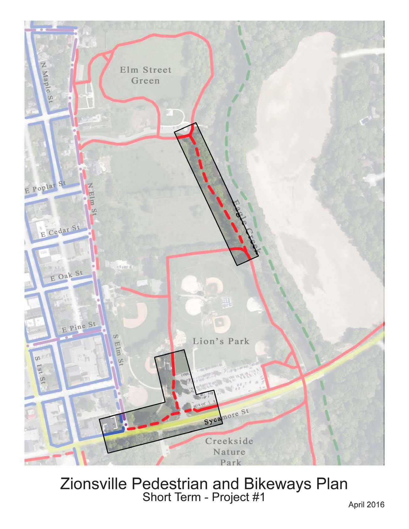 Figure 20 - Keystone Project | Short-Range #1
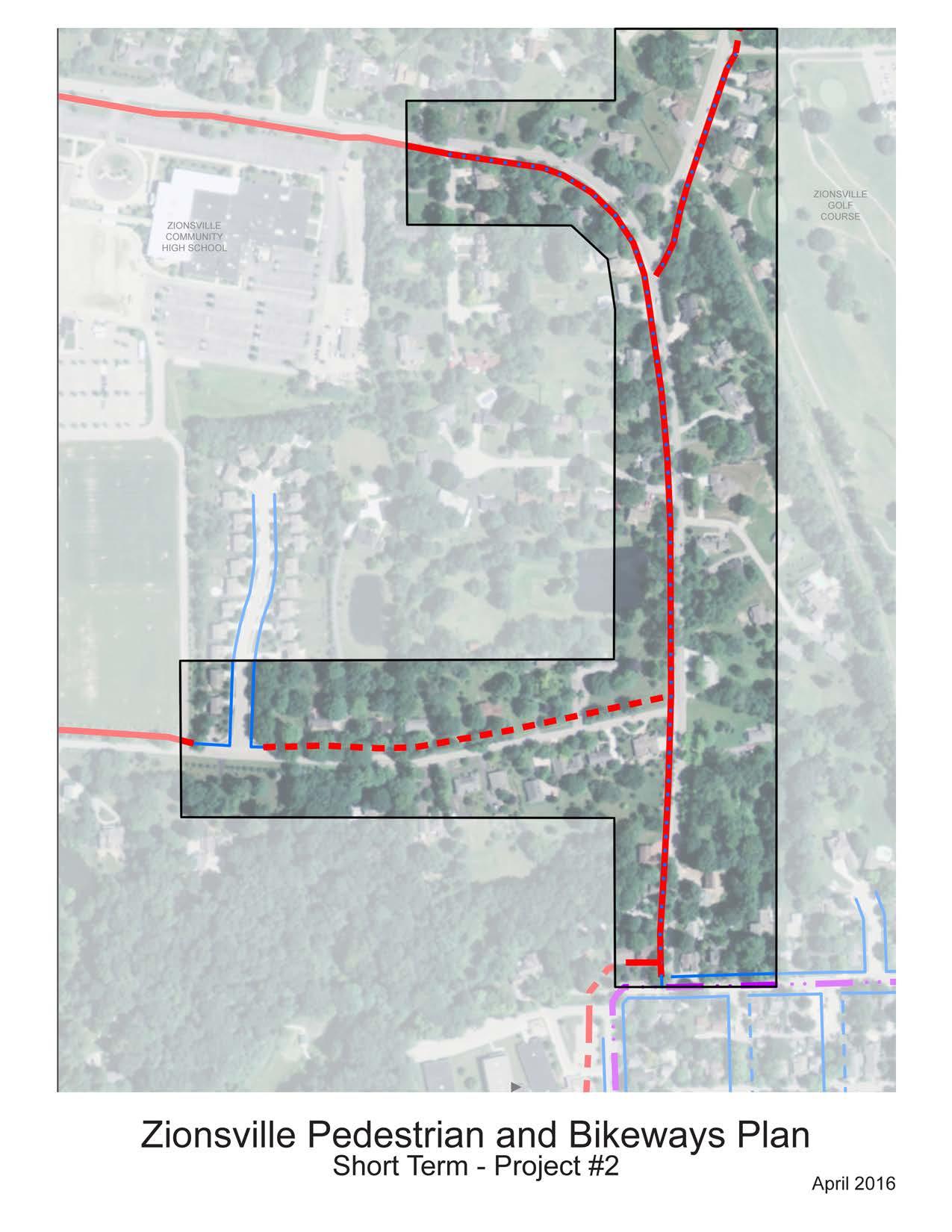
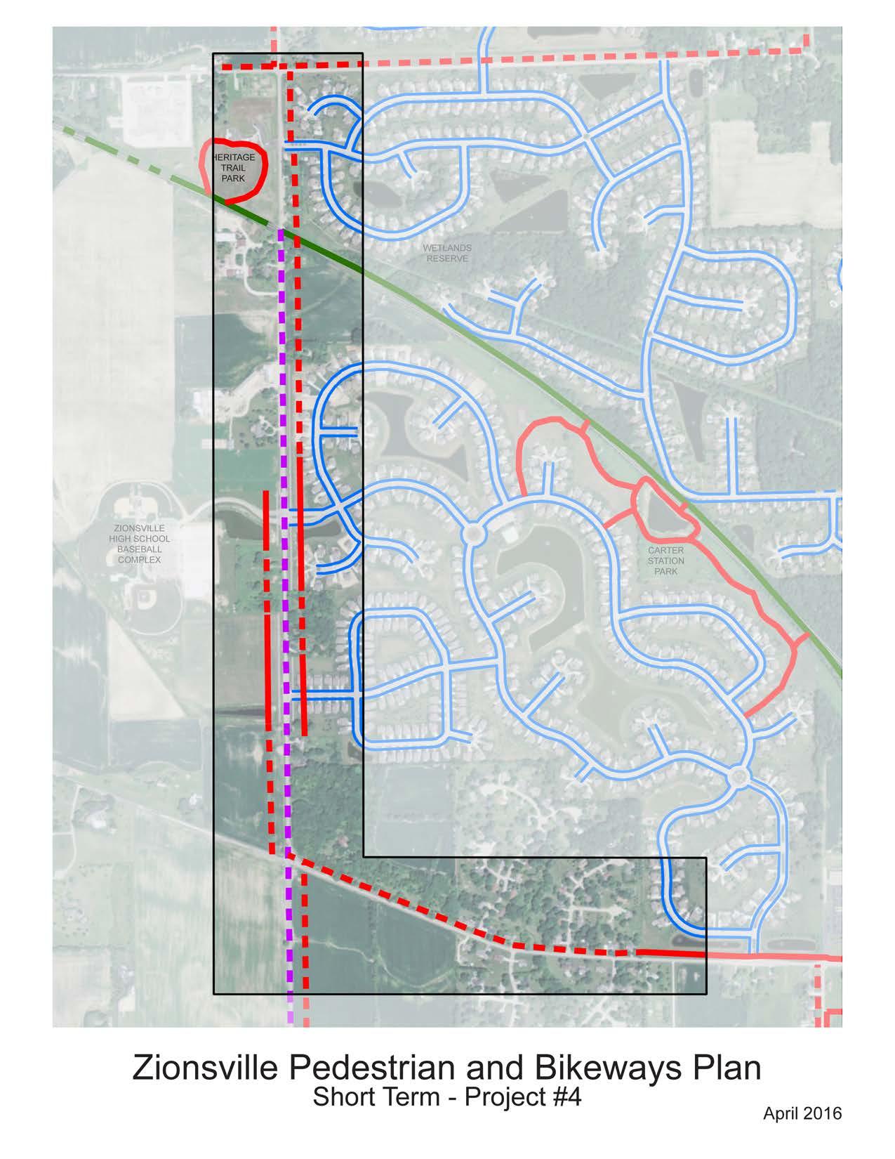
There is an extensive network of existing off-road bike and pedestrian pathways near and around the high school and middle school. However, one major gap in the system occurs along Bloor Lane. In addition, the sidewalks along Mulberry Lane are too narrow for bicycle use. This project will connect the gap along Bloor Lane and will improve the existing sidewalks along Mulberry Street to a full width multi-use path. The sidewalks along Turkey Foot Road will also be expanded to a full multi-use path beginning the connection to Turkey Foot Park. Completing the existing network of multi-use pathways around the schools provides connections for adjacent neighborhoods and creates recreational loops which can be used by the school athletic programs. In addition, the available parking at the school that is not utilized during the evenings and weekends makes a convenient meeting place for residents not located adjacent to an off-road facility who can then utilize this loop as a walking or running loop. Completing this network will also connect additional areas of town to the Rail Trail creating the opportunity for residents to travel to the Rail-Trail without having to get into their vehicles.
This project includes the construction of a multiuse pathway along the north side of Bloor Lane. Improvements also include replacing the existing sidewalk along Mulberry Street with a multi-use pathway. The project will also include replacing the existing sidewalk along Turkey Foot Road with a multi-use path. Intersection improvements including signage and pavement markings will be included at the intersection of Turkey Foot Road and Mulberry Street.
Short-Range Project #2 Walking Radius Map
Facility Type: Multi-use Path
Implementation Actions: Construct multi-use path along the north side of Bloor Lane. Replace the existing sidewalk along the western side of Mulberry Street with a multi-use path. Replace the existing sidewalk along the eastern side of Turkey Foot Road with a multi-use path creating a facility which can be utilized by cyclists in addition to pedestrians.
Land Acquisition Level: Relatively uncomplicated
Limits: Bloor Woods Court to Mulberry Street, Bloor Lane to existing multi-use path along Mulberry Street, Turkey Foot Road from Mulberry to the golf course entrance
Length: 0.86 Miles
Estimated Cost Range: $1,200,000 - $1,500,000
Project Description
The multi-use path along the north side of 300 South and intersection improvements will connect Union Elementary School and adjacent neighborhoods. There are a number of neighborhoods located in close proximity to the school and riding and walking within the neighborhoods is relatively comfortable for families and children. However, the busy 300 South creates a barrier between these neighborhoods and the school. The multi-use path would create a comfortable and safe facility for families. Intersection treatments will be a vital part of the success of this project. The intersection improvements will notify motorists to the presence of the school but also to the crossing cyclists and pedestrians.
Note: Data gathered from 2010 census
Project Recommendations
This project includes the construction of a multiuse path along the north side of 300 South and intersection improvements at the school and neighborhood streets. Signage and pavement markings will be added on the pavement of 300 South.
Project Details
Facility Type: Multi-use Path
Implementation Actions: Design multi-use path along the north side of the roadway. Incorporate signage and intersection improvements at key intersections of neighborhood roads and 300 South including at the school.
Land Acquisition Level: Moderate
Limits: County Limit to Michigan Road/421
Length: 1.25 Miles
Estimated Cost Range: $1,500,000 - $1,800,000
875 EAST HERITAGE TRAIL PARK TO WHITESTOWN ROAD
Project Description
The 875 East project provides connections to an existing path system with gaps. Completing these gaps will create an off-road connection between the middle school and high school and the athletic facility. In addition, completing this section of multi-use path will connect the schools with Heritage Trail Park and will create a longer recreational loop utilizing the existing Rail-Trail and multi-use pathways.
Project Recommendations
This project includes the construction of a multi-use path along the western and eastern sides of 875 East to complete the gaps in the existing multi-use path. The improvements also include a multi-use path along the northern side of Whitestown Road. Crossing improvements at the entrance to the Athletic Complex will be included with this project.
Project Details
Facility Type: Multi-use Path
Implementation Actions: Construction of a multiuse path along 875 East filling in the gaps in the
875 EAST, 350 SOUTH, 950 EAST
Project Description
The development of multi-use pathways along these roadways will complete a recreational loop by combining the facilities within this project with previously constructed facilities along 875 East and 400 South. In addition, this piece of the network will connect the adjacent neighborhoods with the Rail-Trail and Heritage Trail Park. Connecting these residents to the Rail-Trail provides facilities for walking and biking to the schools, multiple parks and shopping along Oak Street. This project also creates an external loop around the Rock Bridge Neighborhood which can connect with the internal pathways creating multiple options for recreation close to home.
Although the construction of this project will include negotiations with several property owners, the benefit felt by community and adjacent neighborhoods will make this a priority project within the mid-range projects. Coordination with utility corridors along these roadways will lessen the impact on property owners. Drainage considerations will be included with these projects.
Project Details
Facility Type: Multi-use Path
Implementation Actions: Construct a system of connected multi-use pathways along the western side of 875 East, the northern and then southern side of 350 South, and the western side of 950 East
Land Acquisition Level: Relatively uncomplicated
Limits: 875 East from 400 South to 350 South, 350 South from 875 East to 950 East, 950 East from 350 South to 400 South
Length: 1.74 Miles
Note: Data gathered from 2010 census
Estimated Cost Range: $2,100,000 - $2,500,000
Source: Esri, DigitalGlobe, GeoEye, Earthstar USDA, USGS, AEX, Getmapping, Aerogrid, User Community
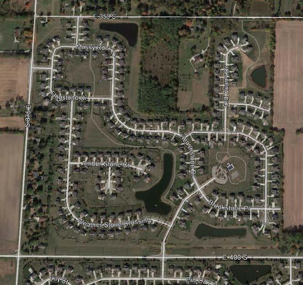
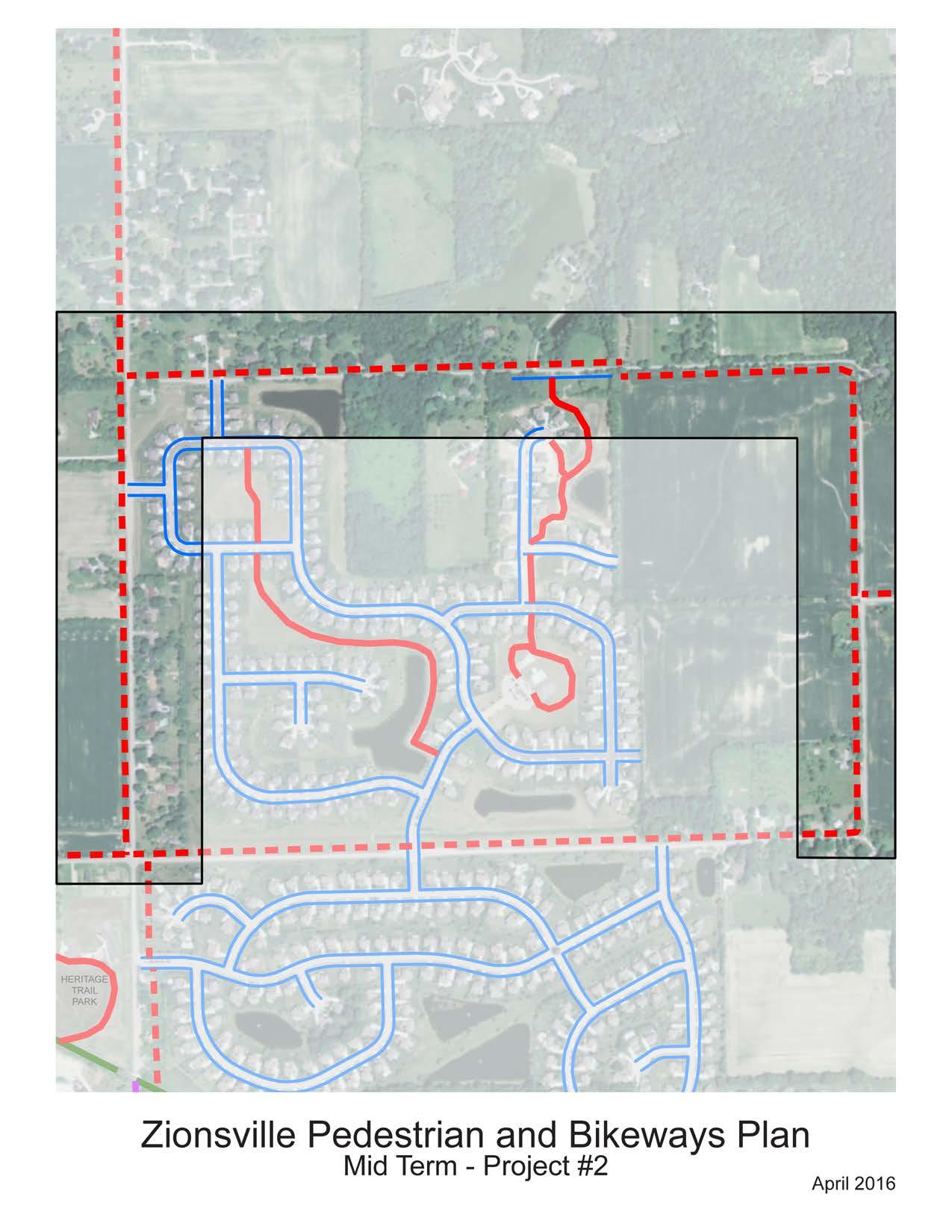
550 SOUTH, 875 EAST MULTI-USE PATH
Project Description
A common complaint that was heard at public meetings and seen in the community survey was the lack of connection between the existing walking and biking facilities within Zionsville and neighborhoods on the western end of town. This project would complete a network of multi-use pathways which would connect the western neighborhoods and schools to the RailTrail and many of the existing pathways. Construction of this section of pathway would connect the Soccer Complex and Zionsville West Middle School with the athletic facilities at the High School Athletic Complex on 875 East and through pathways constructed in previous phases, would connect the school to the High School and Middle School.
Project Recommendations
Note: Data gathered from 2010 census
Development of this project includes construction of a multi-use pathway along the southern side of 550 South and the eastern side of 875 East to connect with existing facilities along 875 East.
Project Details
Facility Type: Multi-use Path
Mid-Range Project #2 Walking Radius Map
Implementation Actions: Construct path and intersection improvements at key intersections especially at 550 South and 875 East Land Acquisition Level: Relatively uncomplicated Limits: Lions Park parking lot to Elm Street Length: 2 Miles Estimated
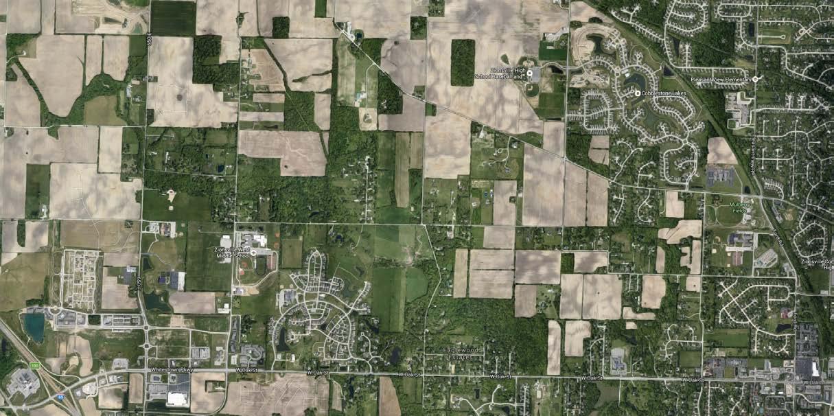
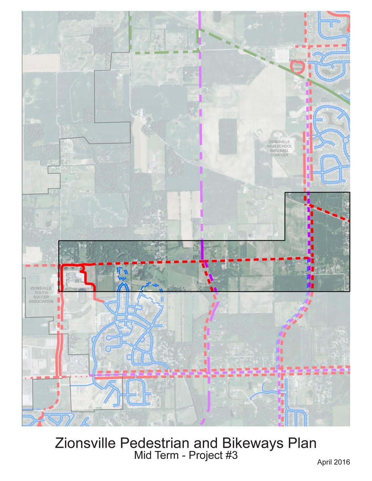
Although the focus of many of the first projects to be implemented is on offroad facilities, on-road facilities will be an important part of the pedestrian and bikeways network. Bike lanes provide a facility for the more confident cyclists and for those commuting to and from work. Bike lanes along Oak Street will help to create a major east-west connection through Town. In addition, the bike lanes further connect the areas of western Zionsville which currently feel disconnected from the Village. Portions of Oak Street currently have the roadway width to accommodate bike lanes. However, there are sections of the roadway which are narrow. Bike lanes in these areas will be implemented as roadway widening projects take place.
Although this project is identified as a Long-Range project it has also been identified as a priority project due to the importance of this connection between the different areas of town. Understanding that this will be a difficult project which will take years of planning mean that actions to implement this project should begin immediately. These actions might include developing a typical section including the multi-use path along both sides of the roadway and bike lanes on both sides. Having this developed typical section will help with roadway designs as portions of the roadway are widened. Other actions should include identification of properties in ownership flux which would create the opportunity to obtain right-of-way prior to the sale of the property.
While the roadway width and adjacent drainage conditions vary along this corridor it is important to develop a typical section including bike lanes in both directions to ensure consistent facilities as the roadway is widened.
Long-Range Project #1 Walking Radius Map
Facility Type: Bike lane (both sides)
Implementation Actions: Stripe bike lanes in each travel direction. Accommodate drainage and other infrastructure facilities while providing adequate width for the bike lane travel
Land Acquisition Level: Uncomplicated Limits: Stonegate Drive to Sixth Street
Length: 3.5 Miles
Estimated Cost Range: $52,500 - $63,000*
Note: Does not include costs for roadway widening projects
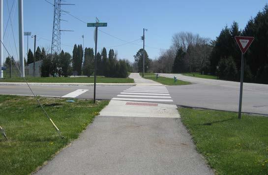
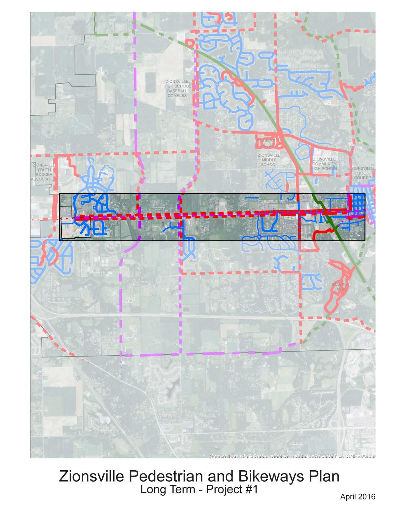
The Little Eagle Creek Greenway provides a key connection to regional facilities in adjacent cities and towns. Extending the greenway system north to the county line will connect the entire greenway network with planned greenways in Carmel. The wide floodplain area of Little Eagle Creek and Eagle Creek provide the opportunity to locate a pathway through natural environments while using underutilized lands which are prone to flooding. These natural corridors will provide a unique experience for trail users by creating a corridor through natural environments. In addition, greenway projects often include streambank stabilization and restoration projects providing an environmental benefit in addition to the recreational benefit. Many times greenways include educational programs such as interpretive signage and field trips for area school children. Greenways can provide access to areas that are often off-limits to children.
Project Recommendations
The project will include the construction of a greenway on flood prone lands preferably within floodways and not floodplains. Design considerations for floodwater inundation and maintenance after floods will be an important part of these projects. Areas of restoration will also be included with this project.
Project Details
Facility Type: Greenway
Implementation Actions: Construction of a greenway path along Little Eagle Creek within the floodway/floodplain areas of the creek. Close coordination with the city of Carmel will be required as a part of this project.
Land Acquisition Level: Challenging
Limits: 131st Street to 300 South/146th Street
Length: 2.0 Miles
Estimated Cost Range: $2,600,000 - $3,200,000
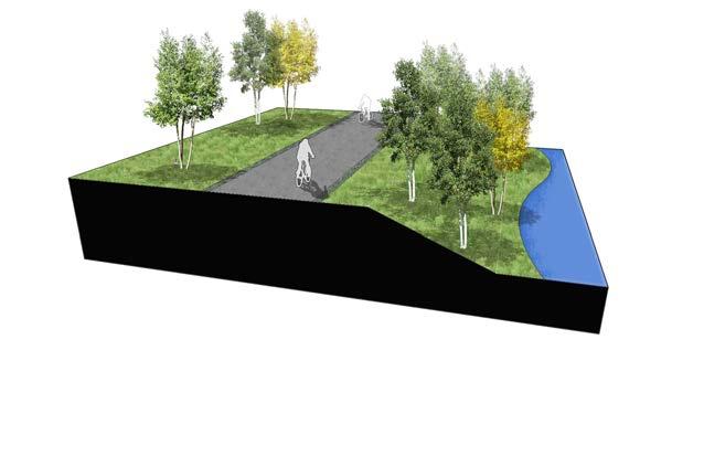
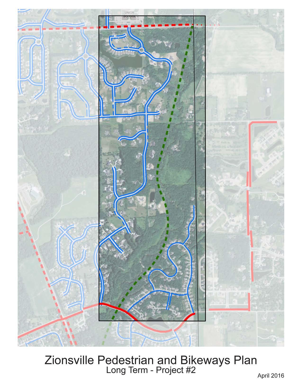
Project Description
Oak Street is the major east-west corridor through town. It provides convenient and efficient travel for automobiles. However, the high speeds and heavy traffic make this corridor unsafe and unfeasible for travel by foot or bike. The addition of bike lanes from Stonegate Drive to Sixth Street will provide an added bike facility for cyclists more comfortable on the road but still leaves this corridor lacking in pedestrian facilities and bike facilities for those who are less comfortable on the roadway. Providing the multi-use path along the north side of Oak Street will connect the western neighborhoods with shopping along Oak Street. With the completion of the multi-use path along the entire length of Oak Street connections will eventually be made all the way to the Village.
Project Recommendations
This project includes another phase of improvements for Oak Street by complimenting facilities built along the southern side of Oak Street. Intersection
Project Details
Long-Range Project #3 Walking Radius Map
Facility Type: Multi-use Path

Implementation Actions: Construct a multi-use path along the north side of Oak Street. Implement
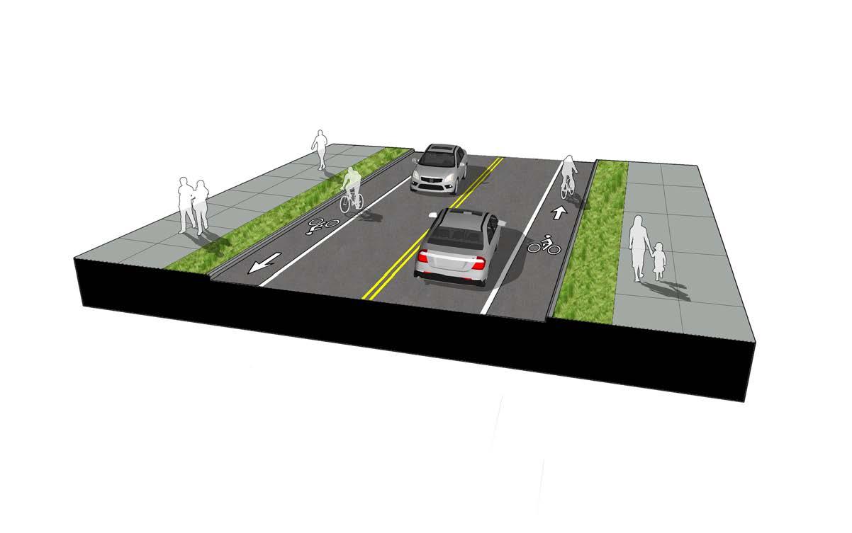
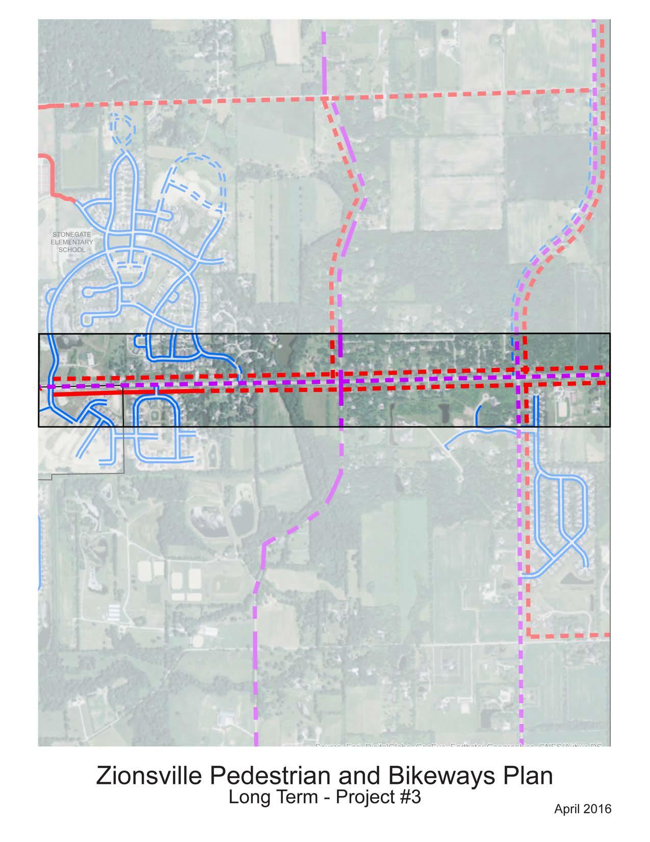
At just less than 2 miles this project will begin to complete the network connecting many residents to the south of Oak Street to shopping and services along Oak Street by bike and foot. The close proximity of these neighborhoods makes walking and biking very feasible because of the shorter trip length. The lack of dedicated bicycle and pedestrian facilities along these corridors limits the use of bikes and walking by residents within this area. In addition, the addition of a multi-use path along these corridors will extend the mileage available in the existing network of pathways along Ford Road. Improvements to the intersection at Ford Road make it one of the safest locations to cross Oak Street by foot. Additional improvements
should be made to accommodate bicyclists, especially families, crossing Oak Street at this location
The Plan recommends the addition of a multi-use pathway along the north side of Ford Road from the end of the existing pathway at Monahan Road to 850 east. The pathway will then continue north on the eastern side of 850 East to Oak Street.
Facility Type: Multi-use Path
Implementation Actions: Construct multi-use path while addressing drainage issues along the roadways. Land Acquisition Level: Challenging
Length: 1.95 Miles
Estimated Cost Range: $2,350,000 - $2,900,000
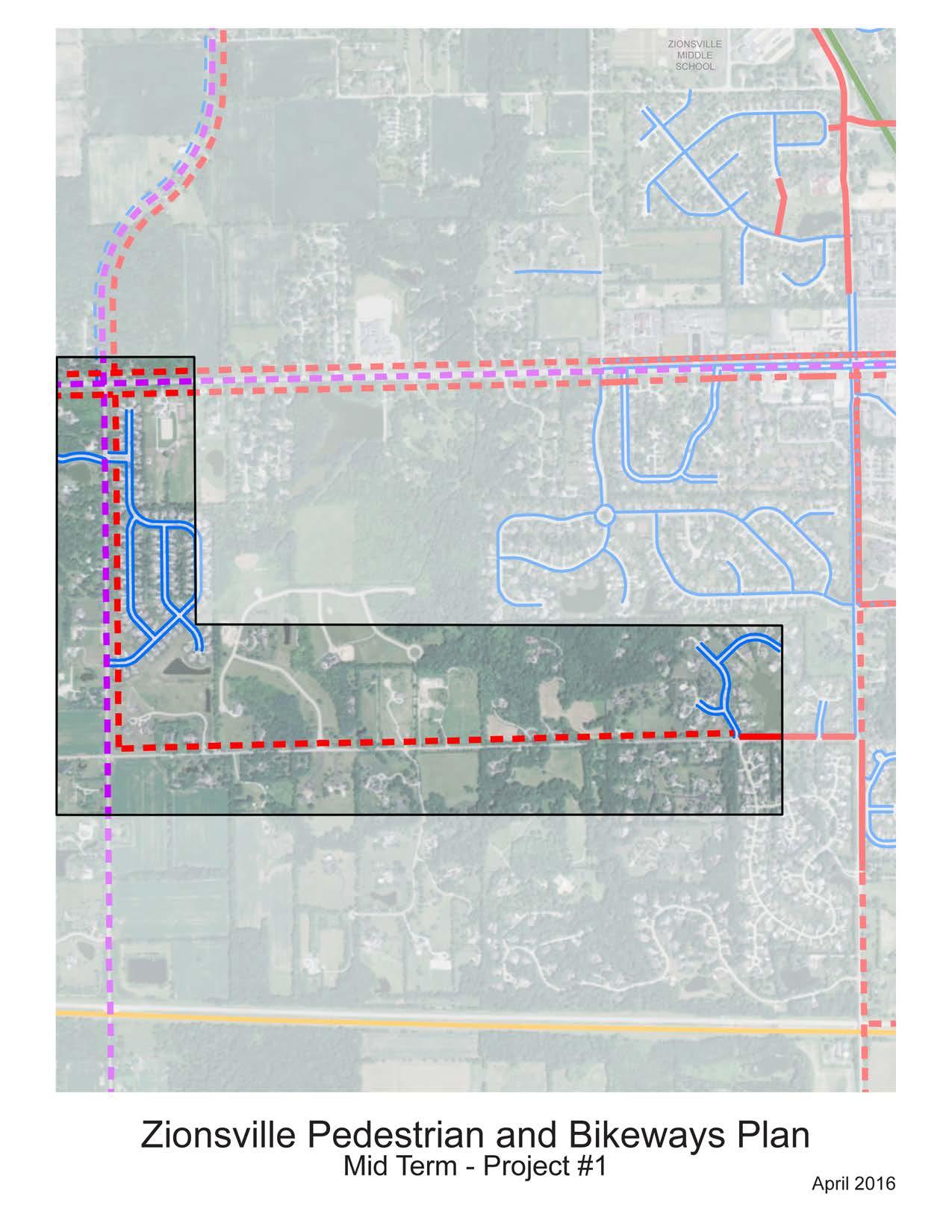
The Zionsville Bikeway System (ZBS) was developed to provide bike loops intended for longer trips and to provide access to various destinations throughout Zionsville as well as connections to adjacent communities. The bike loops/routes will guide their users to the same point at which they started, passing some of Zionsville’s best amenities along the way. Each loop, geared toward casual riders, will offer its own unique riding experience to cyclists by highlighting different areas within Zionsville. The Zionsville Bikeway System includes six bike loops. The length, difficulty level and a brief description is provided for each loop. Each loop provides a unique experience for riders. The variety of loops will appeal to a wide variety of user types and user trips. As the Plan is developed and pedestrian and bike facilities are built this system of loops will expand. New loops should be developed with existing demand of users in mind along with exposure of visitors to different areas of Town.
Length: 17.5 Miles
Difficulty Level: Advanced
Description: Mostly signed routes on rural roadways, includes one gravel road
Points of Interest: This route travels through the scenic rural areas of Zionsville utilizing mostly lowvolume rural roadways. The route includes Heritage Trail Park and connects with the Zionsville Rail-Trail.
Length: 19.3 Miles
Difficulty Level: Advanced
Description: Mostly signed routes on rural roadways, includes travel through Whitestown town limits
Points of Interest: This route travels through the scenic rural areas of Zionsville in Perry Township. The route begins and ends at the Soccer Complex providing a convenient place for parking cars of larger riding groups.
ELM STREET GREEN LOOP (Red Loop)
Length: 7.2 Miles
Difficulty Level: Beginner/Family
Description: This route includes a variety of off-road multi-use pathways, on-road neighborhood streets and
the Zionsville Rail-Trail.
Points of Interest: This route travels by the Zionsville Golf Course, Turkey Foot Park, Carter Station Park, Mulberry Fields and Lions Park creating a loop with many opportunities to stop and rest or partake in other recreational activities at Zionsville parks.
MULBERRY FIELDS LOOP (Blue Loop)
Length: 2.4 Miles
Difficulty Level: Beginner/Family
Description: Off-road multi-use path loop with very few roadway crossings.
Points of Interest: This loop is shorter in length providing a safe and comfortable route for families and pedestrians. This loop travels by Mulberry Fields Park and the middle school and high schools.
EAGLE CREEK LOOP (Green Loop)
Length: 3.0 Miles
Difficulty Level: Beginner/Family
Description: Off-road multi-use path loop with not roadway crossings to navigate.
Points of Interest: This route travels by Elm Street Green and Lions Park. Utilizing multi-use pathways the loop provides a reasonable 3.0 mile route for families with smaller children and for runners and walkers. This loop will be popular with visitors to Elm Street Green and Lions Park who are looking for additional pathways to extend their biking and walking activities.
CARTER STATION PARK LOOP (Purple Loop)
Length: 9.0 Miles
Difficulty Level: Intermediate
Description: Mostly off-road multi-use paths. This loop does cross Oak Street at Ford Road. Although this is a signal controlled intersection with crosswalks the volume of cars on Oak Street will affect the comfort of families with younger children.
Points of Interest: The Carter Station Park Loop provides a route with a variety of environments including more rural areas along 875 East, shopping along Oak Street, and the uninterrupted Zionsville Rail Trail. This loop travels close to Starkey Nature Park presenting a “detour” option for users to access the park via neighborhood streets. Additional “detours” are available to the Village and downtown parks via the shared-lane facilities along Hawthorne Street.
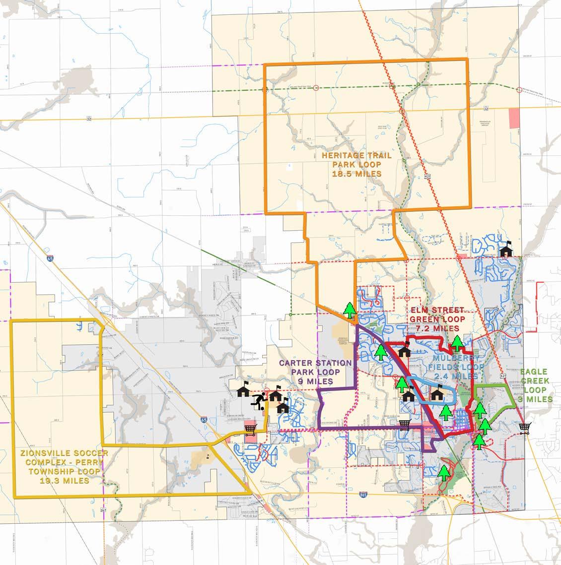
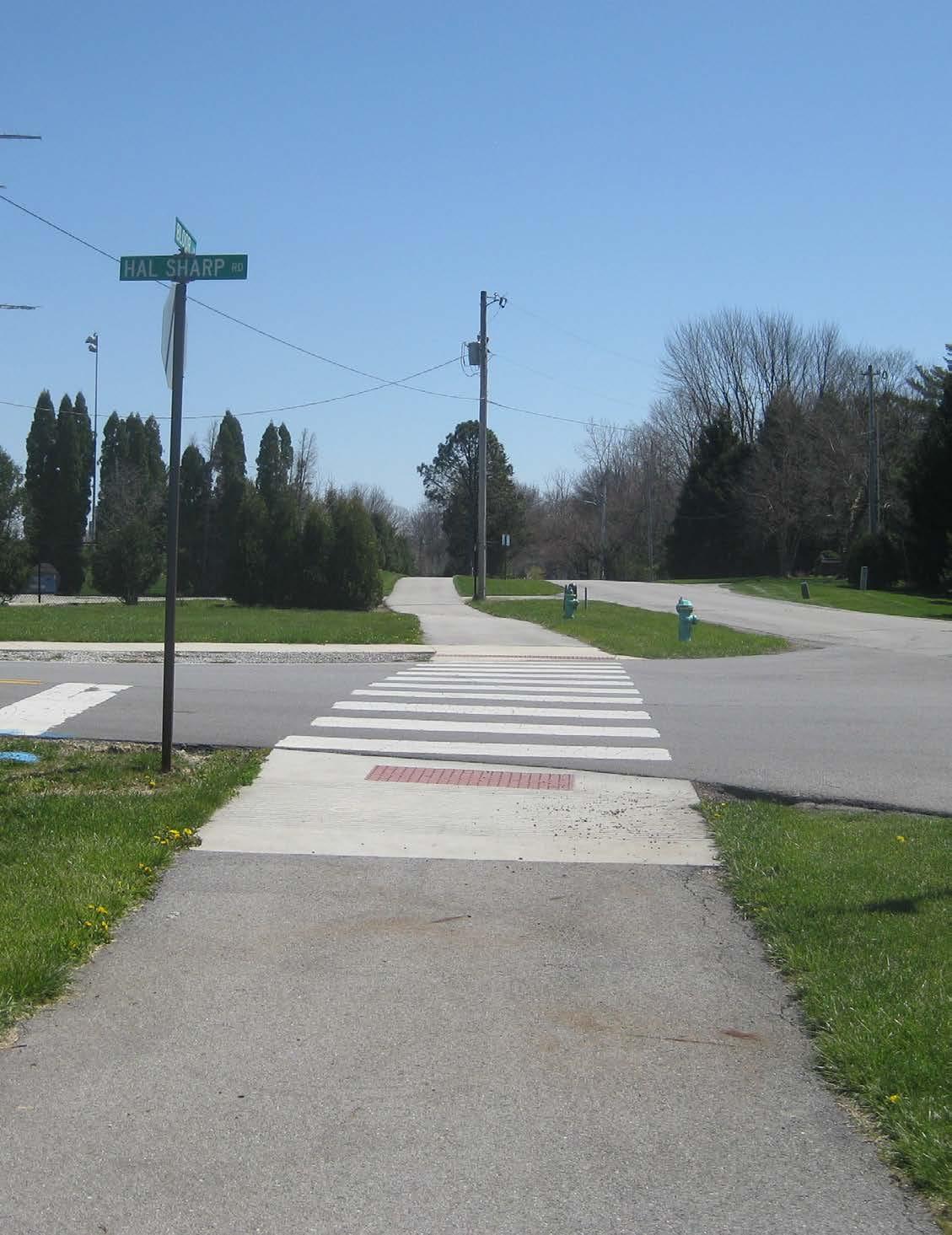
This chapter outlines the strategy and approach for implementation of the pedestrian and bikeways network. Pedestrian network recommendations will promote a safe, comfortable, and attractive pedestrian system. The proposed bicycle network will make bicycling safer and more convenient, and will help to promote a wider recognition and acceptance of bicycling as a transportation mode. The recommended policies and programs will further enhance the effectiveness of the Town’s transportation system for walking and bicycling.
Although many of the pedestrian and bicycle infrastructure improvements will be implemented as a part of larger roadway and streetscape projects it is still important to develop priorities and phasing strategies. It is necessary to remain flexible and open to opportunities for implementing recommendations and related pedestrian and bicycle improvements.
For example, programs such as resurfacing funds can create opportunities to add bike lanes or shared lane markings as streets are paved.
When considering the implementation chart and the recommended priority projects town staff should also consider the following general approaches to project implementation. These approaches will allow for flexibility of implementation of the pedestrian and bicycle network as opportunities are presented. The general priorities should be considered as guidelines, with opportunity playing a major role in determining actual implementation of the facilities within the system. Opportunity can come in many forms including the funding source (grants, dedication of lands, endowment, etc.) and the timing of related
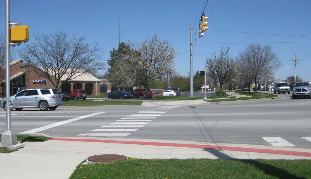
projects (both private and public). These opportunities may open the door for implementation of a specific facility that might have been lower on the priority list contained herein.
• Set a schedule for the Pathways Advisory Committee to review the implementation strategy and adjust the recommendation of projects based on current conditions.
• Proposed facilities on publicly owned landsFacilities on publicly owned land such as parks or in conjunction with right-of-way projects should be given high priority.
• Proposed facilities associated with other public or private improvements – As plans are developed by the Town of Zionsville or the Indiana Department of Transportation (INDOT) for road improvements where a pedestrian or bicycle facility is proposed coordination should occur to include the pedestrian and bicycle facilities as a part of the project. Private development should also include the implementation of recommended facilities.
• Expansion of existing system – proposed pathway and sidewalk segments which close a gap in the system shall be given higher priority. Filling in these gaps will provide maximum benefit to a larger number of existing users with reduced financial commitment.
• Source of funding – as funding becomes available projects meeting the requirements of the funding mechanisms will take priority.
• Increase safety for alternative modes of travel –projects which increase safety for pedestrians and bicyclists shall take priority. Continued study of corridors and intersections through the Town shall help to identify new locations of trouble spots. As these issues arise with new physical conditions to the environment projects will move in priority.
• Ease of construction – projects where construction of the project is considered to be simple and easy to build according to criteria such as lower costs and lack of design constraints such as grading and drainage shall receive higher priority. The quicker implementation of these projects creates a synergy needed to continue the current momentum of the implementation of the network.
Cost estimates are an essential planning tool used for budgeting capital improvements and drafting
applications for grants and external funding sources. Cost estimates were developed for each project based on initial planning level examples of similar constructed projects and industry averages. All facility designs and associated cost estimates proposed in this plan are conceptual and will undergo final engineering design to develop detailed project costs. These costs are provided in 2016 dollars and do not include costs for right-of-way acquisition or project design. These additional costs can generally be estimated at 25% of the facility construction cost.
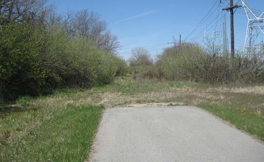
The recommended pedestrian and bicycle facility improvements have been organized into short-range, mid-range and long-range projects. The project timeframes were determined through analysis of the pedestrian and bicycle needs of the community and public input gathered during the second public forum. High priority facilities include those which would not only fulfill a high demand but would also have a high impact on the use of facilities by pedestrians and bicyclists by providing the framework for the network within the first year of facility construction.
Projects listed in the short-range capital projects chart are often considered high priorities in implementation of the system. Short-range projects help to create early success that builds momentum for other improvements recommended within this plan. These routes provide connections to destinations with high demand with a focus on reaching the majority of resident within Zionsville. Most of these projects are fairly easy to implement but some of the more difficult projects are listed within the short-term projects list where they will provide critical connections to gaps within the system.
Mid-range projects are usually more complex construction projects such as improvements to existing bridge facilities and new bike and pedestrian bridges separate from roadway bridges. In addition, as development spreads through Zionsville, new densities will be created outside of the existing neighborhoods. The mid-range projects provide connections to areas of expected growth as well as providing additional connections to destinations identified within this plan.
Long-range capital improvements require additional time for planning, design and budget planning. These projects also seek to incorporate improvements with long-term transportation projects such as road widening projects and bridge improvement projects. Although the majority of these projects will not be constructed for many years there are a number which will still be considered a high priority project with the planning stages of the project to begin in the shortterm. Projects like the improvements along Oak Street would fall into this high-priority, long-range project category.
The following list includes projects which are considered top priority projects. These projects may fall into different categories in the implementation charts but their inclusion as top priorities is indicative of their importance to the system and their role in providing connectivity to neighborhoods. Planning for these projects should begin in the short-term. Priority projects should be reviewed on a regular basis for relevance as the Town continues to grow.
• Bike lanes, multi-use path and sidewalks along Zionsville Road
• Bike lanes and multi-use paths along Oak Street
• Multi-use paths providing connections between the High School and the athletic facilities
• Completion of Sycamore Street connection between Lions Park and Main Street
• Completion of the Rail-Trail within Town Limits
• Greenway connection between Starkey Park and Creekside Nature Park
• Multi-use path connecting Turkey Foot Park with Mulberry/Bloor Lane pathways system
• Completion of stream side trail connecting Elm Street Green to Lions Park
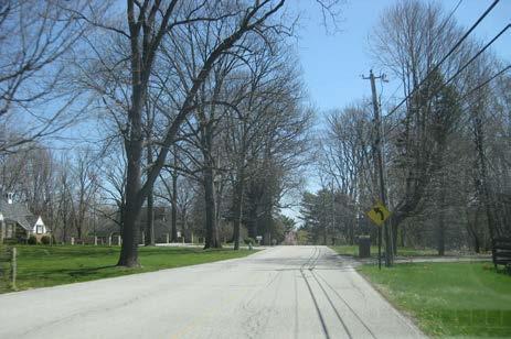
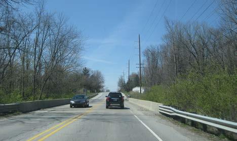
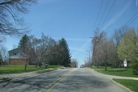
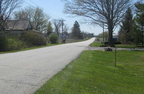
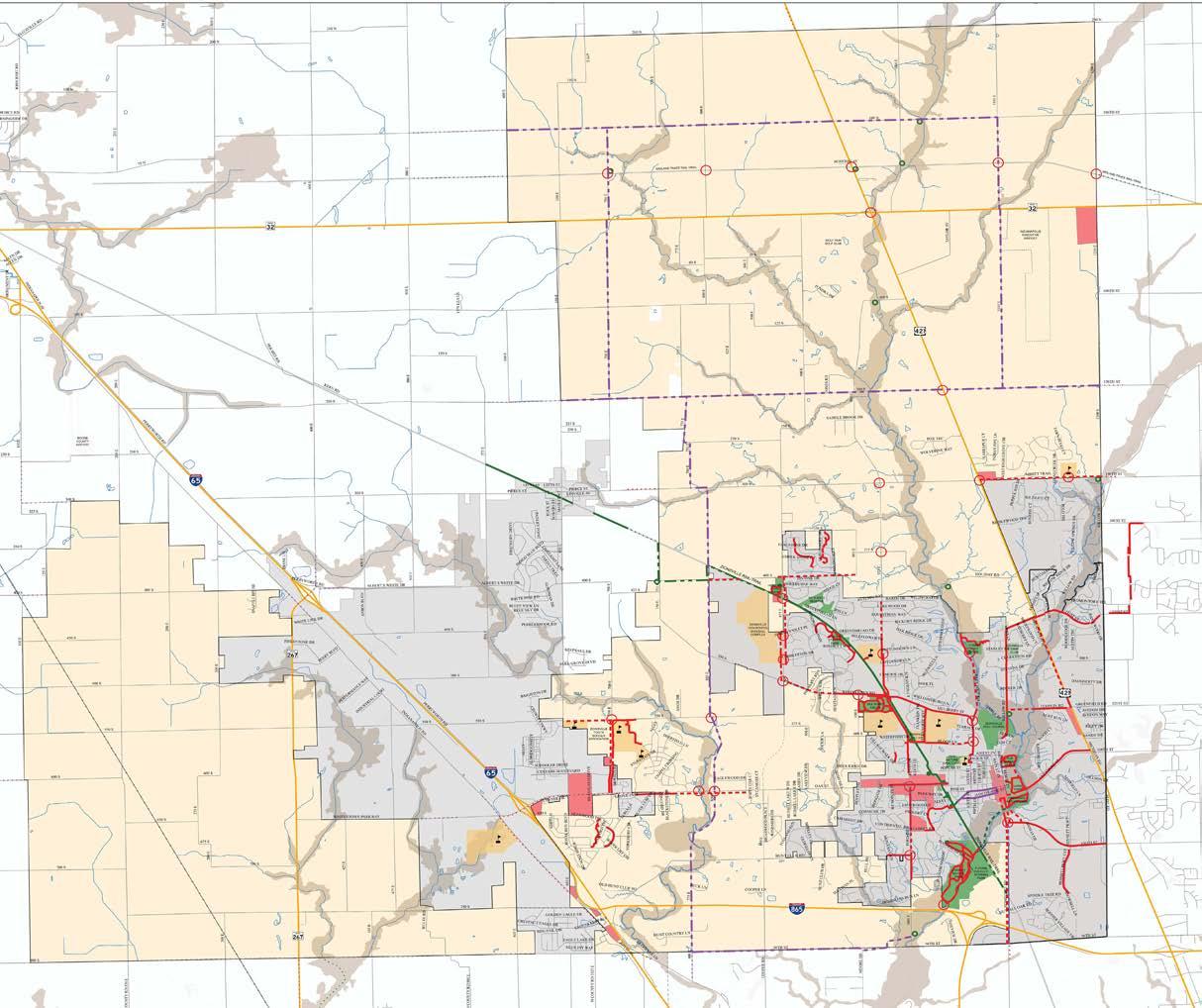
0.77$924,000.00$1,108,800.00
0.74$888,000.00$1,065,600.00
0.61$732,000.00$878,400.00
0.83$996,000.00$1,195,200.00
1.05$1,260,000.00$1,512,000.00
1.32$1,584,000.00$1,900,800.00
Improve existing sidewalk to full width multi ‐use path ‐ west side
Fill in gaps and improve existing sidewalk
West side ‐ complete path on east side
Turkey Foot Road (Mulberry Street to Turkey Foot Park Trailhead)Multi ‐use Path
Multi ‐use Path
Multi ‐use Path
Ford Road (Hunt Club Road to Oak Street)
700 East (Boys and Girls Club to 550 South)
400 South (Heritage Trail Park to 950 East) Multi ‐use Path North side
Michigan Road (131st Street to Templin Road) Multi ‐use Path West side
Zionsville Road (106th Street to 96th Street) Multi ‐use Path With road improvements ‐ west side
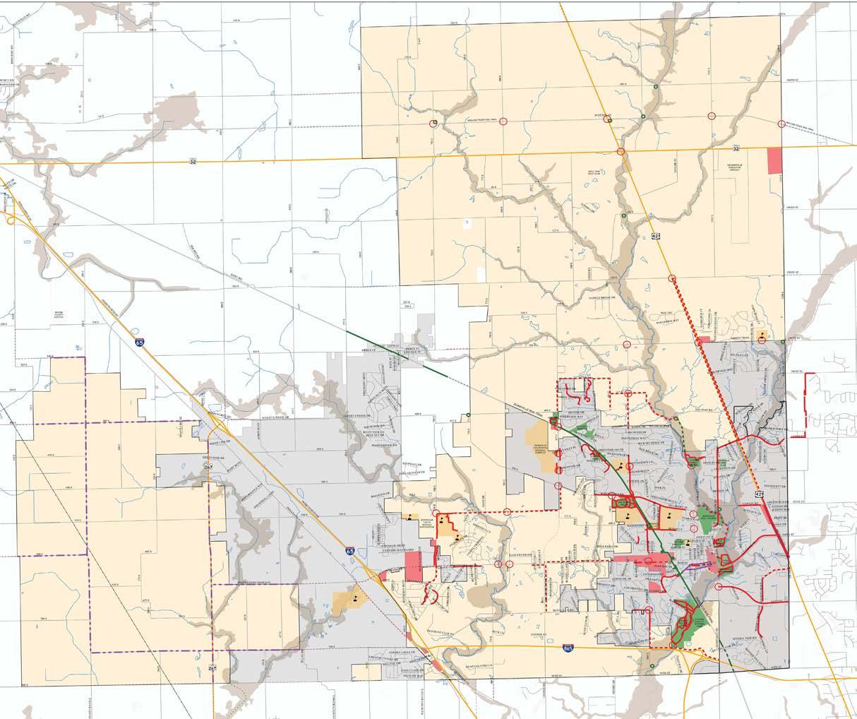
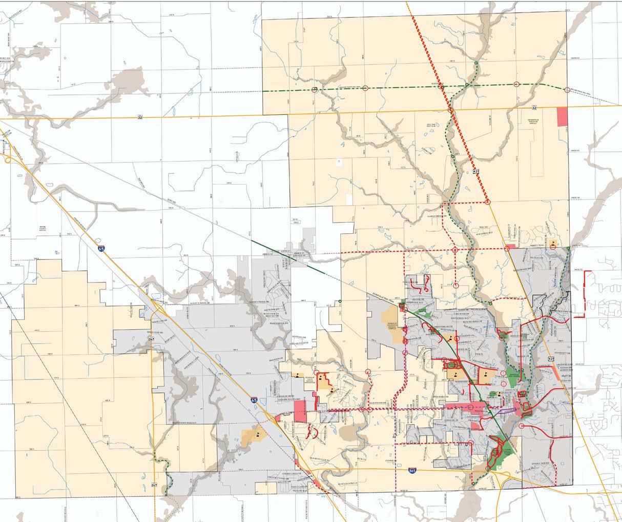
Long Range Capital Projects Recommendations
Zionsville
Creek Greenway (Michigan Road to 146th Street)Greenway
Little
Brownsburg Greenway (Town Limits to SR 267)
Eagle Creek Greenway (Sycamore Street to Willow Road)
Eagle Creek Greenway (Willow Road to Turkey Foot Park)Greenway
Funding for pedestrian and bicycle improvements can come from a broad variety of sources. Funding the physical improvements will mostly come from traditional transportation sources, through Federal, State and Town capital programs. Certain designated programs that are part of the Federal transportation program may be particularly important for implementing pedestrian and bicycle plan recommendations. Federal funding programs may change when a new authorization is passed by Congress. This may open up new or restrict existing opportunities for funding pedestrian and bicycle improvements. Even while pursuing federal, state and local funds, the Town must be flexible enough to capitalize on partnerships, in-kind matches, and other non-traditional opportunities to implement the Plan. The following section provides an overview of funding sources that should be utilized.
The Fixing America’s Surface Transportation (FAST) Act was signed into law by President Obama on December 4, 2015. The FAST Act is a five-year bill that will slightly increase funding and slightly change some policy from the previous MAP-21. The biggest change is that it will create long-term certainty for states, local governments and transportation stakeholders. The new bill includes an increase in funding for bicycling and walking and makes nonprofits eligible for that funding. The bill also creates a new safety education program and, for the first time, includes complete streets language.
The Surface Transportation Block Grant Program replaces the previously titled Surface Transportation Program (STP) under MAP-21. The Transportation Alternatives Program (TAP) and Recreational Trails (RT) Program were changed to now be apportioned as a percentage of STBGP.
Nonprofit organizations are now eligible to apply for funds, making it easier for nonprofits to conduct safety and education for Safe Routes to School programs. It also means that nonprofits who run bike share programs can apply directly. The FAST Act creates a priority safety fund to reduce bicycle and pedestrian fatalities. The program will focus on:
• education of law enforcement
• education of motorists, drivers, bicyclists and pedestrians
• implementation of enforcement campaigns
Courtesy of Federal Highway Administration
A new source of low-interest loan financing will now be made available to communities to help connect and accelerate completion of active-transportation networks. Many communities have individual trails, protected bike lanes or sidewalks scattered throughout neighborhoods, but filling in the gaps will enable more people to safely walk or bike to their destinations. Key points of the TIFIA include:
• The minimum project size is $10 million for projects involving local governments.
• Multiple segments of a network can be bundled into a single project, called a “Master Credit Agreement”, to meet the $10 million threshold, thereby making it possible for communities to complete projects faster and more cohesively.
• The application process is streamlined for low-cost, low-risk projects—like trail networks—to reduce the transaction costs and make it affordable to apply. In addition, at least $2 million per year will be available to defray application costs for smaller projects.
• State Infrastructure Banks may use TIFIA funds to make financing more accessible for rural projects.
The Department of Transportation’s Transportation Investment Generating Economic Recovery (TIGER) Discretionary Grants Program was created as part of the American Recovery and Reinvestment Act of 2009. The FAST Act included changes to ensure the TIGER Program will get $5 billion total over four years and no longer have to fight for its place in an appropriations bill every year. Of the 52 projects awarded funding in 2013, fifteen of the projects explicitly incorporated bicycle and pedestrian facilities as either a key component of the project or the sole component of and singular purpose of the project. These diverse projects include a shared-use path in Missoula County, Montana, the Southwest Atlanta Beltline Corridor Trail in Atlanta, Georgia, the Regional Pedestrian System in Foley, Alabama, and the Cultural Trail in Indianapolis. In 2013 awards ranged from $1.4 million to $20 million.
The goal of the Land and Water Conservation Fund is the creation and maintenance of high quality recreation amenities through the acquisition and
development of public outdoor recreation areas and facilities. The local sponsor matches 50% of the project cost prior to applying for the grant. After the project is approved, the sponsoring park and recreation board receives a reimbursement of 50% of the actual project costs. Applicants must submit a bill to the grant coordinator to request the federal share of the cost throughout the grant term. Only park and recreation boards established under Indiana law are eligible for the program. These entities must currently have a five-year parks and recreation master plan on file, approved by the Division of Outdoor Recreation. Funding ranges from $10,000-$200,000. Local agencies in Indiana have received over $26 million to date.
While not traditionally viewed as a source of funding for bicycle and pedestrian projects, the Community Development Block Grant (CDBG) program provides money for streetscape revitalization and other improvements that can enhance walking and bicycling. Federal Community Development Block Grant grantees may “use Community Development Block Grant funds for activities that include, but are not limited to: acquiring real property; reconstructing or rehabilitating housing and other property; building public facilities and improvements, such as streets, sidewalks, community and senior citizen centers and recreational facilities; paying for planning and administrative expenses, such as costs related to developing a consolidated plan and managing Community Development Block Grants funds; provide public service for youths, seniors, or the disabled; and initiatives such as neighborhood watch programs.”
Indiana Heritage Trust Program
The Indiana Heritage Trust Program was instituted to protect natural resources using funds generated through the sale of personalized environmental license plates. Greenways are eligible under the Division of Outdoor Recreation section of the program. The Division’s mission is to increase these opportunities for underserved regions and populations, regardless of their location in rural or urban settings. All projects must maintain state interests through conservation easements or similar agreements. The facilities must also be assumed by local interests, other division, or agencies. Greenways that make use of abandoned rail lines or other rights-of-way previously used for private/public transportation are eligible projects. From 1993 to 2012, the program has generated more than $32 million in license plate revenue to fund conservation and recreation projects across Indiana.
Administrated by the Indiana Office of Tourism Development and the Office of Community and Rural Affairs, the Place Based Investment Fund is a competitive matching grant program that supports collaborative community and economic development programs. Awarded funds, which range from $25,000 to $50,000, support projects that build upon unique community assets to strengthen the sense and quality of place and promote increased tourism activity and community investment. Local governments, visitor bureaus, public and private schools, and community foundations are eligible to apply.
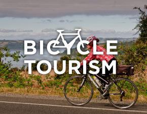
While external funding sources for pedestrian and bicycle projects and programs continue to be in short supply and high demand, local funds can often be the most reliable funding source to get projects built. In addition, local funding is often required as a match for external funding sources. Because of this, Zionsville should identify and pursue local funding strategies as a means of implementing the plan.
As with most towns and cities, Zionsville has limited funds. With other transportation and infrastructure projects pulling at the same source of funds, it is challenging to implement new pedestrian and bicycle facilities. By creating a dedicated set-aside in the Capital Improvement Plan, the Town can focus, prioritize and plan for capital expenditures for pathways, on-street bikeways, and other projects that improve conditions for walking and bicycling. This setaside may also be used as a local match for external funding sources, or as contributory toward bicycle and pedestrian elements of larger projects.
People for Bikes Community Grants Program
People for Bikes, formerly known as Bikes Belong, is a national organization working to make bicycling better throughout the United States through programs and advocacy work. People for Bikes has funded numerous infrastructure projects and education and encouragement programs since it first launched in 1999, including seven in the State of Indiana for a total of $52,500. The seven projects funded in Indiana reflect the diversity of bike and trail related initiatives in place across the state. In 2012, People for Bikes provided $10,000 in funding to INDYCOG
to develop bicycle infrastructure plans in five underserved urban neighborhoods. In 2013, $5,000 was awarded to the Covered Bridge Gateway Trails Association in Rockville to help fund an initial section of a 10-mile trail.
Community and corporate foundations can play an important role in funding pedestrian and bicycle improvements. With a growing understanding of the connection between pedestrian and bicycle infrastructure improvements and community health, health foundations through the country have joined with environmental foundations to support pedestrian and bike projects that increase opportunities for walking and bicycling within communities. Many corporate and national foundations have supported programs which reduce obesity, increase physical activity, and achieve other positive health related outcomes.
More and more businesses have begun to recognize the benefit of walking and bicycling as economic drivers and indicators of quality of life. Businesses have expressed interest in investing in bicycle and pedestrian infrastructure that supports healthy and active communities. Support from the business community is often the result of strong relationshipbuilding efforts and may come in a variety of forms from the funding of capital projects or associated amenities to the provision of volunteers to assist in trail maintenance activities.
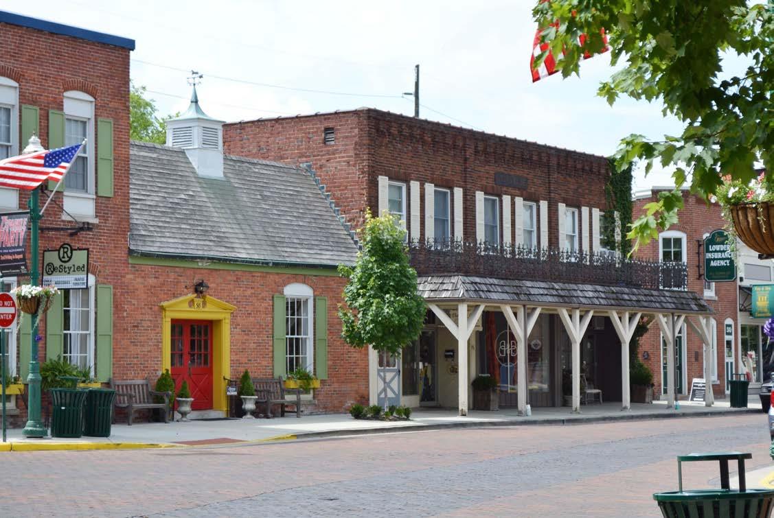

The design guidelines contained in this section are intended to support the recommendations presented in this Plan, and to serve as an ongoing reference for the Town of Zionsville. They are not intended as comprehensive design standards. Rather, they reference existing design standards and provide clarification or supplemental information as necessary. There are seven primary sources of pedestrian and bicycle and facility design information that were used to develop the guidelines provided in this section:
1. Indiana Department of Transportation (INDOT) 2013 Design Manual Chapter 51-Special Design Elements – This document provides guidance for pedestrian and bicycle facilities that are included in Department of Transportation designs. This design manual is used for Hendricks County projects as well.
2. Federal Highway Administration Manual on Uniform Traffic Control Devices (MUTCD) – The MUTCD is the national standard for signing, markings, signals, and other traffic control devices. Indiana has adopted a slightly modified version of the MUTCD, the Indiana MUTCD. The IMUTCD modifications do not impact the recommendations in this design guidance document. It should be noted that the IMUTCD does provide alternative methods for analyzing the need for pedestrian signals. Additional school bus warning signs are also included in the IMUTCD.
3. American Association of State Highway and Transportation Officials (AASHTO) Guide for the Development of Bicycle Facilities – This document is intended to present information on how to accommodate bicycle travel and operations in most riding environments. It is the design guidance upon which most state and local design guidelines are based. In many jurisdictions this document is considered to set the minimum values for bicycle design.
4. AASHTO Guide for the Planning, Design, and
Operations of Pedestrian Facilities – This document is intended to present information on how to accommodate pedestrian travel and operations in (primarily) roadway environments. It is the design guidance upon which most state and local design guidelines are based. In many jurisdictions this document is considered to set the minimum values for pedestrian design.
5. Institute of Transportation Engineers Designing Walkable Urban Thoroughfares: A Context Sensitive Approach – This document’s development was supported by FHWA. Designing Walkable Thoroughfares helps designers understand the flexibility for roadway design that is inherent in the AASHTO guide A Policy on the Geometric Design of Highways and Streets with a focus on balancing the needs of all users.
6. National Association of City Transportation Officials (NACTO) Urban Bikeway Design Guide – FHWA has issued a memo supporting the use of this document to further develop nonmotorized transportation networks, particularly in urban areas. Many of the designs in this document have been used successfully in urban areas. However, care should be exercised when applying the treatments described in this document to suburban or rural areas.
In this guidance section of the Plan the following facility types are discussed:
• sidewalks,
• curb ramps,
• midbloc k crossings,
• bike lanes,
• shared lane mar kings,
• bike routes,
• bike boulevards, and
• m ulti-use paths.
Chapter 51 of the INDOT Design Manual requires pedestrian facilities comply with the Americans with Disabilities Act “Accessibility Guidelines for Buildings and Facilities” the most recent of which are the 2010 ADA Standards for Accessible Design. FHWA recommends agencies adopt the guidance found in the Notice of Proposed Rulemaking for Proposed Accessibility Guidelines for Pedestrian Facilities in the Public Right-of-Way (July 2011). The below guidance is consistent with the public right-of-way guidance.
The preferred minimum sidewalk width is 5 feet. Under constrained conditions, 4-foot wide sidewalks are acceptable provided a 5-foot by 5-foot area with less than 2% cross slope is provided every 200 feet (maximum) to allow for the passing of one pedestrian using a wheelchair by another. Sidewalks placed at the back of curb should be at least 6 feet wide.
On roadways with curb and gutter sidewalks should be located six feet from the back of curb. This minimizes the encroachment of curb ramps and driveway cuts into the sidewalk width. On roadways without curb and gutter sidewalks should be separated from the roadway as shown by the following criteria, which are given in a sequence of desirability:
• at or near the right of way line (ideally, 3
• feet of width should be provided behind the sidewalk for access, construction, and maintenance),
• outside of the minimum required roadway clear zone, or
• as far from the edge of the driving lane as practical.
Sidewalk alignments, which are set back from the roadway, should taper for alignment closer to the roadway at intersections. This will allow for coordinated placement of crosswalks and stop bars.
The maximum cross slope on a sidewalk is 2%. This maximum cross slope must be maintained across driveways and crosswalks.
Sidewalks may follow the grade of the adjacent roadway. However, on new structures the
grade of the sidewalk cannot exceed 5%. If a grade of more than 5% is required on a new structure, an ADA compliant ramp must be provided.
A curb ramp is a ramp that cuts through or is built up to the curb. A blended transition is a relatively flat area where a sidewalk meets a roadway. Curb ramps and blended transitions are primarily used where a sidewalk meets a roadway or driveway at a pedestrian crossing location. Blended transitions include raised pedestrian street crossings, depressed corners, or similar connections between pedestrian access routes at the level of the sidewalk and the level of the pedestrian street crossing that have a grade of 5% or less. Accessibility requirements for blended transitions serve two primary functions. First, they must alert pedestrians that have vision impairments to the fact that they are entering, or exiting, the vehicular area. Second, they must provide an accessible route for those using wheelchairs or other assistive devices. Ideally, a separate ramp should be provided for each crossing of the roadway.
The slope of a curb ramp shall not exceed 8.33%. The only exception to this standard is when a sidewalk is located along a roadway with a significant slope, in which case the maximum length of the curb ramp is 15 feet.
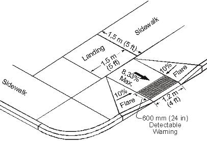
All curb ramps must have a landing at the location where a wheelchair user would have to turn to prepare to enter the roadway. For perpendicular ramps, this means a 4-foot by 4-foot landing at the top of the ramp (5-foot by 5-foot if there is a vertical obstruction adjacent to the landing). For parallel ramps where the sidewalk is depressed, the 4-foot by 4-foot landing is required at the bottom of the ramp.
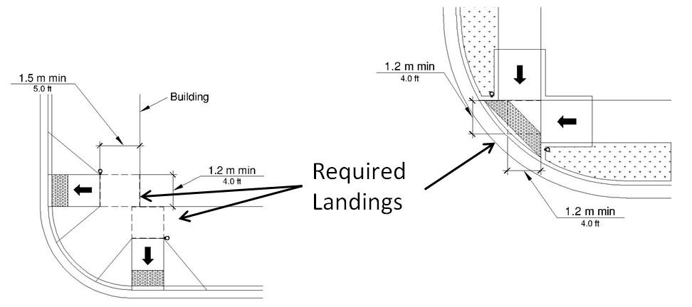
Detectable warning surfaces shall extend a minimum of 2 feet in the direction of pedestrian travel and shall extend the full width of the curb ramp. Detectable warning surfaces are not required, nor desirable, at crossings of residential driveways since the pedestrian right-of-way continues across residential driveway aprons. However, where commercial driveways are provided with yield or stop control, detectable warnings should be provided at the junction between the pedestrian and vehicular routes
Intersections are often the best and most direct place for pedestrians to cross a roadway and are the most common pedestrian crossing locations. Still, more than 70 percent of pedestrian fatalities occur away from intersections, so it is critical to design midblock crossings that both increase drivers’ awareness of the crossing and expectation of encountering pedestrians and encourage pedestrians to cross in the designated location. While drivers may not expect to encounter pedestrians at midblock locations as much as they do at intersections, midblock crossings have fewer conflict points between vehicles and pedestrians which is an important safety advantage over crossings at intersections.
Midblock crossings are different from intersection crossings in three important ways: there are many more potential crossing locations at midblock than at intersections, motorists are less likely to expect pedestrians crossing at midblock, and pedestrians with visual impairments have fewer audible clues for
determining the best time to cross. Each of these differences leads to important design considerations for midblock crossings:
• Make the crossing location convenient for pedestrians - Midblock crossings are provided in locations where crossings at intersections are not available or are inconvenient for pedestrians to use. Midblock crossings must be placed in convenient locations to encourage pedestrians to use them rather than other, more convenient, unmarked midblock locations.
• Make drivers aware of the crossing as they approach it - Drivers should be warned of the pedestrian crossing in advance of the crossing location, and the midblock crossing should be highly visible to approaching drivers. Drivers should have clear lines of sight to the crossing so that pedestrians at the crossing are visible. The approach to the crossing should encourage drivers to reduce their speeds prior to the crossing. Drivers should be given plenty of time to recognize the presence of a pedestrian and stop in advance of the crossing.
• Make pedestrians aware of the opportunity to cross - Provide aids for pedestrians with visual impairments to recognize the presence of a midblock crossing and the best opportunities for crossing. Auditory and tactile information should be provided for pedestrians with visual impairments since clues present at an intersection crossing are
not always available at a midblock crossing (such as the sound of traffic stopping and starting).
• Make drivers and pedestrians aware of their responsibilities and obligations at the crossing and provide opportunities to meet these responsibilities/obligations - Use MUTCD guidance to establish a legal crossing. Vehicle approach, pedestrian approach, and traffic control design should provide pedestrians with clear messages about when to cross and drivers about where to yield. Where necessary, a refuge area should be provided for pedestrians to complete the crossing in stages. Traffic control devices can be used to create gaps in traffic for pedestrians to cross.
The pedestrian approach is the area near the crossing where pedestrians wait on the side of the roadway and away from traffic until they are able to cross. It is often part of the sidewalk, if the sidewalk is adjacent to the curb line, or an extension or spur of the sidewalk that provides a path from the sidewalk to the crossing, if the sidewalk is not immediately adjacent to the curb. The pedestrian approach design should accomplish the following:
• Make pedestrians, especially those with visual impairments, aware of the crossing location. In complex pedestrian environments, wayfinding signs may be appropriate to guide people to their desired destination. Auditory and tactile cues can be provided with traffic control devices adjacent to and in the sidewalk to direct pedestrians toward the crossing.
• Direct pedestrians to the proper location to activate a pedestrian signal (if present) and wait for an appropriate time to cross. Pedestrian-activated traffic control devices should be accessible to pedestrians with visual impairments and those using wheelchairs, scooters, and walkers. The approach design should make clear where pedestrians should stand while waiting to cross.
• Encourage pedestrians to cross at the marked crossing. The approach design should discourage pedestrians from crossing away from the marked crossing to the extent possible. The path to the
crossing should be as direct and easy to navigate as possible.
• Keep pedestrians visible to approaching drivers and oncoming vehicles visible to pedestrians. Pedestrian furniture, traffic control devices, planters, and other objects should be located so they do not block pedestrians from the site of approaching drivers. Also, on-street parking should be restricted near the crossing so that parked vehicles do not limit sight lines.
• In areas with high volumes of pedestrians, there should be sufficient space for pedestrians to queue as they wait for an appropriate time to cross. Pedestrian storage should be designed to prevent crowds of pedestrians from spilling onto the roadway. Pedestrian storage area design can be especially important at bus stops, and care should be taken so that children can wait a safe distance from the roadway while waiting for a school bus.
Midblock curb extensions are a common and effective treatment at midblock locations and have many benefits.
As noted in the discussion about locating a midblock crossing, care should be taken to avoid locations where horizontal or vertical alignment of the roadway limit drivers’ sight distance, view of the pedestrian approach to the crossing, or view of the crossing itself. Consideration should be given to how trees, shrubs, poles, signs, and other objects along the roadside might limit a driver’s view of the crossing. On-street parking should be prohibited near the crossing using either signs and markings or physical barriers such as a curb extension, since a pedestrian who steps out into the road between parked cars can be blocked from the view of oncoming drivers.
Signing and markings on and along the motor vehicle approach to a midblock crossing should be designed in such a way as to make drivers aware of the crossing in time to notice and react to the presence of a pedestrian, and to enhance the visibility of the crossing. Advanced warning signs should indicate any special traffic control used at the pedestrian crossing. Refer to the AASHTO Guide for the Development of
Bicycle Facilities for examples of midblock control treatments for shared use paths.
Traffic calming devices and other measures to prevent high vehicle speeds should be considered along routes with midblock pedestrian crossings. More than 80% of pedestrians die when struck by vehicles traveling at greater than 40 mph versus less than 10% when cars are traveling at 20 mph or slower. In addition, vehicles traveling at lower speeds require less distance to come to a complete stop when braking.
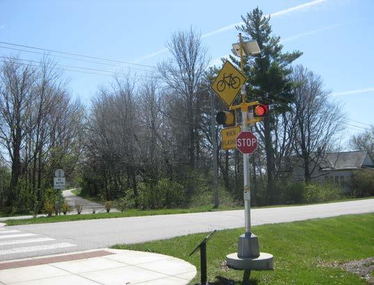
A bike lane is a portion of the roadway that has been designated for preferential or exclusive use by bicyclists by striping, signing and pavement markings (the MUTCD does not require signs). Bike lanes are intended for one-way travel, usually in the same direction as the adjacent travel lane. Bike lanes should be designed for the operation of bicycles as vehicles. They should be designed to encourage bicyclists and motorists to interact in a safe, legal manner. Bike lanes should be designated with bike lane markings, arrows, and bike lane signs.
The AASHTO Guide for the Development of Bicycle Facilities provides guidance on the width of bike lanes. The following points summarize this guidance:
• under most circumstances the recommendedwidth for bike lanes is 5 feet;
• for roadways with no curb and gutter
and no on-street parking, the minimum width of a bike lane is 4 feet;
• along sections of roadway with curb and gutter, a usable width of 4 feet measured from the longitudinal joint to the center of the bike lane line is recommended (this means that 4 feet of pavement is sufficient when coupled with the gutter pan; it is also conceivable to interpret the guidance as meaning that even narrower pavement can be used as long as a total of 5’ of rideable surface is maintained);
• additional width may be desirable on higher speed roadways.
At intersections, bike lanes must be designed to encourage legal movements at the intersection; this includes proper positioning of bicyclists and motorists. Bike lane stripes should be dashed on the approaches to intersections without right turn lanes. Where there are right-turn lanes, through bike lanes must be placed to the left of the right turn lane. Section 4.8 of the AASHTO Guide for the Development of Bicycle Facilities (2012) provides numerous graphics illustrating bike lane markings at intersections.
Bike lanes should be continuous through intersections. That is, if a bike lane is provided to the intersection, a receiving bike lane should be provided on departure side of the intersection.
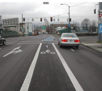
In locations where conventional left turns are prohibited or where bicyclists merging to a conventional left-turn would be inconvenient, a two-stage left turn can be utilized. To improve operational characteristics, and to avoid conflict with pedestrians and with rightturning traffic in the street into which the bicyclist is turning, a queuing area is needed. A two-stage turn queuing box is a waiting area for bicyclists to queue to turn left at an intersection by first proceeding to a position to queue at the right side of the intersection, then turning left and crossing as traffic permits, or when the traffic signal changes to green.
At locations where two-stage left turn queuing boxes are considered, potential impacts to right turn on red motorists should be analyzed because of the prohibition of this movement by the MUTCD. In addition, bicycle demand of the facility should be considered.
The more common implementation of a bike box, in which the box is placed between the stop bar and the crosswalk to provide for queuing of through bicyclists, is illustrated below (source: NACTO Urban Bikeway Design Guide). It should be noted that in some states (including Indiana) some operational factors may prevent this application from operating as intended. This occurs because right turn motorists are discouraged from moving into the bike lane (separated by a solid line), while the rules of the road require that a person driving a vehicle intending to turn right at an intersection “make both the approach for a right turn and a right turn as close as practical to the right-hand curb or edge of the roadway.” (IC 9-21-8-21)
A buffered bike lane is a bike lane that is separated from adjacent through lanes by a striped out buffer area. In some locations it may be desirable to use less than the full space available for a bike lane. Such locations include sections of roadway where a wide bike lane might be perceived as on-street parking or another travel lane. In these locations a buffered bike lane may be considered. A buffered bike lane may also be considered where a bike lane of six or more feet is being provided to meet a minimum level of accommodation. At midblock locations the buff-
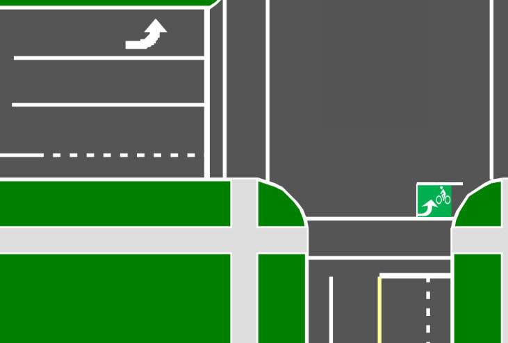
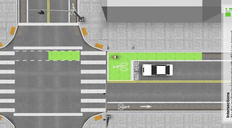
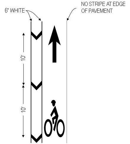
ered bike lane is separated from the travel lanes by a chevroned buffer. The width of the buffer will vary depending upon such conditions as motor vehicle speed, percent heavy vehicles, roadway cross slopes, and desired level of accommodation of bicycles.
At intersections, buffered bike lanes must be striped to allow for right turning motorists. Typically this is done by eliminating the buffer on the approach to intersections and striping the area as one would a regular bike lane.
Traffic lanes are often too narrow to be shared side by side by bicyclists and passing motorists. Where parking is present, bicyclists wishing to stay out of the way of motorists often ride too close to parked cars and risk being struck by a suddenly opened car door (being “doored”). Where no parking is present, as is the case throughout most of the Town of Zionsville, bicyclists wishing to stay out of the way of motorists often ride too close to the roadway edge, where they run the risks of being run off the road; being clipped by motorists who do not see them off to the side or misjudge passing clearance; or encountering drainage structures, poor pavement, debris, and other hazards.
Riding further to the left avoids these problems, and is legally permitted where needed for safety. However, this practice can run counter to motorist expectations. A Shared Lane Marking (SLM) is a pavement symbol that indicates it is legal and appropriate for bicyclists to ride away from the right hand edge of the roadway, and cues motorists to pass with sufficient clearance.
Research suggests that SLMs:
1. Alert motorists to the lateral locations bicyclists are likely to occupy within the traveled way,
2. Encourage safe passing of bicyclists by motorists,
3. Assist bicyclists with lateral positioning in lanes that are too narrow for a motor vehicle and a bicycle to travel side by side within the same traffic lane,
4. Reduce the incidence of wrong-way bicycling, and
5. Where on-street parking exists, to align bicyclists with lateral positioning in a shared lane with onstreet parallel parking to reduce the chances of a bicyclist impacting the open door of a parked vehicle.
SLMs are not to be used on shoulders or in designated bike lanes. MUTCD guidance suggests SLMs not be placed on roadways that have a speed limit above 35 mph. While this does not preclude the use of SLMs on higher speed roadways, no research is available as yet to suggest how effective they may be on such roadways.
SLMs encourage good lane positioning by bicyclists, and discourage them from riding too close to the pavement edge, curb, or parked cars. Riding away from the road edge allows bicyclists to avoid road edge hazards like drainage structures, poor pavement, and debris. It also places the bicyclist more directly in the motorist’s field of vision which, along with proper SLM treatments, encourages the safe passing of bicyclists by motorists.
Consequently, on roadways with on-street parking, the MUTCD requires that SLMs be placed with the centers of the markings at least 11 feet from the face of curb. On other roadways, the centers of the markings are required to be placed at least four feet from the edge of pavement.
SLMs are sometimes used at the ends of bike lanes or shoulders to inform motorists that bicyclists no longer have a separate space and will be sharing the main travel lane.
SLMs should be installed strategically and judiciously to ensure that their value is not reduced by overuse. When used, SLMs should be placed after each intersection and then periodically on spacings not exceeding 250 feet between markings.
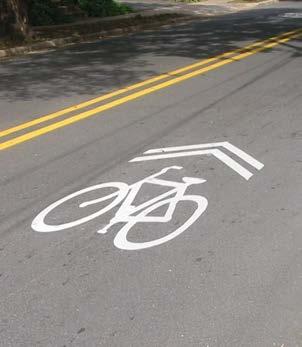
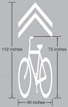
Bike routes are not an actual facility type. A bike route is a designation of a facility, or collection of facilities, that links origins and destinations that have been improved for, or are considered preferable for, bicycle travel. Bike routes include a system of route signs that provide at least the following basic information:
• Destination of the route,
• Distance to the route’s destination, and
• Direction of the route.
Bike routes can be designated in two ways: General Routes and Number Routes. General Routes are links tying specific origins to specific destinations. Number Routes form a network of bike routes that do not necessarily connect specific destinations, but serve as general travel routes through an area.
General Routes connect users to destinations within a community. Typical destinations include the following:
• Attraction Areas (i.e. library, parks, etc.)
• Neighborhood Areas (i.e. downtown, historic neighborhoods, etc.)
• Trail Networks or Trailheads (i.e. Rail Trail)
Bicycle Guide (the D11 series in the MUTCD) signs may be provided along designated bicycle routes to inform bicyclists of bicycle route direction changes and to confirm route direction, distance, and destination. The MUTCD provides a number of different types of signs that can be used to provide guidance along bike routes.
Some communities implement bike routes with unique designations (numbers or names). These routes should be designated using Bike Route signs.
The Town of Zionsville may want to sign some roadways with paved shoulders to either guide bicyclists to destinations or to alert motorists to the presence of bicyclists.
If the subject roadway is along a designated bicycle route, then bike route guidance signs can be used to alert bicyclists to the presence of the interregional or state route.
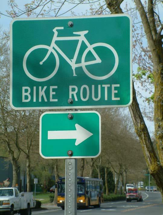
If the Town determines it is appropriate to warn motorists of the potential presence of bicyclists along a section of roadway with paved shoulders, then special signing would be required. The “Share the Road” (W16-1P) plaque is not appropriate as bikes on the shoulder are not on the road (which is defined the same way as roadway in the MUTCD and excludes the shoulder). Thus a special supplemental plaque such as “On Shoulder” might be appropriate.
Although no bike boulevards are proposed within the Plan a design guideline has been included in this Chapter in anticipation of the need for this type of facility in the future. As land ownership changes or new development occurs it may be desirable for the Town to include bike boulevards in the design of new facilities.
A bike boulevard is a local street or series of contiguous street segments that have been modified to provide enhanced accommodation as a through street for bicyclists while discouraging through automobile travel.
Bike boulevards often make use of low volume, very low speed local streets. Frequently, streets are made more accommodating for bicyclists by significantly keeping motorists’ speeds and volumes low. Often bike boulevards include bicycle friendly traffic calming treatments (speed pillows, mini traffic circles, chicanes with bike bypass lanes) to reduce speeds of motor vehicles along the roadway. While local motor vehicle traffic is maintained along the bike boulevard, motor vehicle traffic diverters may be installed at intersections to prevent through motor vehicle travel while having bypasses for bicyclists to continue on along the bike boulevard. Bike boulevards can be facilitated by connecting the ends of cul-de-sac roadways with shared use paths. At intersections the bicycle boulevard should be given priority over side streets.
Because of low motor vehicle speeds and volumes, bike lane markings are often not necessary along bike boulevards. SLMs may be used along bike boulevards. Alternatively, larger than normal bike symbols supplemented with the text BIKE BLVD have been used to designate bike boulevards.
In some communities, bike boulevard networks begin as a “one-off” system of bikeways. When a primary arterial roadway cannot be improved to a point where most cyclists feel safe and comfortable using the facility, a parallel roadway - often one street
off the main road (or “one-off”) - may be improved with bicycle facilities and traffic calming features to provide an enhanced cycling street. By paralleling the main road, the “one-off” network provides access to the businesses along the arterial using a pleasant cycling roadway. A “one-off” roadway can be improved in stages: initially with signage and shared lane markings and then into a bike boulevard by instituting more substantial features such as traffic calming and diverters.
Since bike boulevards typically serve as bike routes, wayfinding signage should be provided. This signage should include destination, direction, and distance (or travel time) information to attractors throughout Zionsville. Wayfinding adds to the utility of bike boulevards because it educates cyclists and would be cyclists that there are safe, comfortable ways of accessing Zionsville by bike.
Multi-use (or shared-use) paths, are facilities separated from motor vehicle traffic by an open space or barrier and either within the highway right-of-way or an independent right-of-way. They are open to many different user types and are often used by bicyclists, pedestrians, skaters, wheelchair users, joggers, and other non-motorized users. Motor vehicles are not allowed on shared use paths except for maintenance and emergency vehicles in specific circumstances. Most multi-use paths are two-way facilities.
Multi-use paths have design criteria for many of the same parameters as roadways. These include widths, horizontal clearances, design speed, horizontal alignment, stopping sight distance, cross slopes, grades, vertical clearance, drainage, and lighting. The AASHTO Guide for the Development of Bicycle Facilities should be consulted for design values.
The MUTCD provides the standards for signing, striping, and marking multi-use paths. In most cases, the signs and markings use on shared use paths are smaller versions of those used on roadways.
ing signs should be used on paths and to potential destinations along the path such as locations where users can access water fountains and restrooms. At trailheads and rest areas, the distance and direction to the next trail head should be posted.
Most multi-use path projects will be paved. Asphalt and Portland cement concrete are the two most common surfaces for multi-use paths. In areas where path use is expected to be primarily recreational, unpaved surfaces may be acceptable for shared use paths. Materials should be chosen to ensure the ADA requirements for a firm, stable, slip resistant surface are met. Even when meeting ADA criteria, some users such as in-line skaters, kick scooters, and skateboarders may be unable to use unpaved shared use paths.
The geometric and operational design of multi-use paths is quite similar to that of roadways. However, additional considerations such as aesthetics, rest areas, amenities, and personal security are also important ensure the maximum number of potential users is encouraged to use the path for both utilitarian and

communities, usually in terms of property values and crime/vandalism. A valuable resource in discussions of these matters is a summary of national research conducted for a state department of transportation. The studies cited collectively suggest that negative impacts are not an issue in either regard, and in fact suggests that property values frequently increase following the construction of shared use paths while crime rates are sometimes found to decrease.
Multi-use paths through floodplains, referred to as greenways within this plan, require special attention to design details. While the cross section and clearance requirements are the same as other trails the construction materials should be carefully chosen and installed to endure inundation by flood waters. This means special base materials should be used that are resistant to swelling and erosion. In addition, concrete is often selected a surface material in flood plains. In addition, adequate cross drains need to be installed to ensure water does not pond on the upstream side of the path.
The multi-use pathways located in the urban sections of Zionsville have been identified as a unique type of multi-use path. These pathways are the same as other multi-use pathways in geometric requirements and safety standards but would have a different character due to their location within the urban sections of Town. This is achieved with the use of different materials for the path itself and the amenities that would be required along these routes. Materials might include a typical wide concrete sidewalk, pavers, or stamped integral color concrete. Special design consideration should be given when designing these projects to match the aesthetic of the pathway with its urban surroundings. Amenities along the urban sections would include street furniture, signage and plantings or street trees.
Amenities should be provided along multi-use paths to make their use more attractive for transportation use. Any long multi-use paths or path network needs rest stops. These should be at intermediate points, scenic lookouts, or near amenities such as restaurants, convenience stores, picnic areas, or parking lots. Rest
areas should be away from the path so path users can pull off the path and not block traffic. At a minimum, they should include benches, shade, bike parking, and a trash receptacle. Bike parking racks should support a bike frame in two places and allow for locking of front and rear wheels. Some rest stops should include restrooms and potable water. Additional amenities which should be included include interpretive signs and informational kiosks. Bike repair stations including free air (presta and shrader valve compatible) and vending machines that dispense patch kits or tubes can be included at some trailhead facilities.