OUTCROP
Newsletter of the Rocky Mountain Association of Geologists













Rocky
PRESIDENT Rob Diedrich rdiedrich75@gmail.com
PRESIDENT-ELECT Ben Burke bburke158@gmail.com
1st VICE PRESIDENT Courtney Beck Antolik courtneyantolik14@gmail.com
1st VICE PRESIDENT-ELECT Ron Parker parkero@gmail.com
2nd VICE PRESIDENT Mark Millard millardm@gmail.com
2nd VICE PRESIDENT-ELECT
Matt Bauer matthew.w.bauer.pg@gmail.com
SECRETARY
Sandra Labrum slabrum@slb.com
TREASURER
Mike Tischer mtischer@gmail.com
TREASURER ELECT Anna Phelps aphelps@sm-energy.com
COUNSELOR
Jeff May jmay.kcrossen@gmail.com
EXECUTIVE DIRECTOR
Bridget Crowther bcrowther@rmag.org
OPERATIONS MANAGER Kathy Mitchell-Garton kmitchellgarton@rmag.org
CO-EDITORS
Courtney Beck Antolik courtneyantolik14@gmail.com
Nate LaFontaine nlafontaine@sm-energy.com
Elijah Adeniyi elijahadeniyi@montana.edu
Marlee Cloos marlee.cloos@bpx.com
Danielle Robinson danielle.robinson@dvn.com
NOON LUNCHEON RESERVATIONS
RMAG Office: 720-672-9898
Fax: 323-352-0046 staff@rmag.org




FEATURES
2022 RMAG Summit
Packet
Lead Story: The Arroyo Problem
Valley Fill Stratigraphy and Adventures in Southwestern Watershed Restoration


RMAG Publications: Come For The Cover Photos, Stay For The Science.
On the Rocks: Detroit City Portal/Rhodochrosite Mine Trip
NEWS
RMAG Summit Sponsors
RMAG Powder River Basin
Thank You!
Python Skills Series:
Data Pipelines
RMAG Helium Symposium
For Papers
RMAG Lunch Sponsorships
RMAG September 2022 Board of Directors Meeting
President’s Letter
Hybrid Lunch Talk: Christopher Smith
Welcome New RMAG Members!
Hybrid Lunch Talk: Benjamin Burke
Member Corner: Sandra Labrum
In The Pipeline
Outcrop Advertising Rates
WANTED: Colorado Rocks!
Advertiser Index
Calendar
View of Bonito wetlands.
photo credits: Kelly McCoy & Holden Brecht


April 21, 2022
RMAG could not exist without the very generous support of our Summit Sponsors, and we greatly appreciate all the companies that have contributed over the years
Following two pandemic years the world has reshaped itself and faces new challenges. Here in RMAG’s 100th year we have continued to adapt to the changing environment to meet both the needs of our members and the greater geoscience community, as well as honor our sponsors’ commitment to RMAG. In the past few months, we have transitioned from solely online events to hybrid lunches, where local members can gather for lunch and the talk and our members across the country and around the world can tune in for the talk. We will continue to do a mix of online and in person short courses as the year progresses, creating opportunities for learning and networking for all our members.
Your generous sponsorship dollars are supporting seven field trips this summer, from a raft trip on the San Juan to a tour of Colorado’s Glaciology, and we’ve already had a behind the scenes tour of the Denver Museum of Nature and Science and a virtual trip to learn about the soon to close CEMEX Niobrara Quarry. The RMAG Mentorship program is in full swing, connecting the next generation of geoscientists with veterans of the industry. As the weather improves and people return to the office, we look forward to many more events in person, from social to educational.
Your sponsorship dollars continue to support our excellent publications including the monthly Outcrop newsletter, the quarterly Mountain Geologist journal, and special publications such as Subsurface Cross Sections of Southern Rocky Mountain Basins We recognize your financial commitment with website and publication advertising as well as through social media before each online event. With a LinkedIn group of over 2600 members, we make our sponsors visible to the geoscience community for both virtual and in person events.
If you are already a Summit Sponsor or are looking for a smaller way to financially support the organization, the 2022 Golf Tournament will be on June 7th with plenty of sponsorship opportunities, and later this year we will be throwing the 100th birthday party, with multiple opportunities to sponsor the celebration
Thank you to those who are already a Summit Sponsor, and if you are not already a sponsor, please look at the many complementary benefits included with the sponsorship levels. Please feel free to contact our staff with questions about sponsorship by email: staff@rmag.org or by phone at 720 672 9898.
We and the staff of RMAG thank you all for your continued support and look forward to seeing you in person this year.
Rob Diedrich Bridget Crowther2022 RMAG President
RMAG Executive Director


Broadway,
Broadway,
Hi everyone! I can’t believe that it is already Oc tober! RMAG is officially 100 years old, and the birth day bash was a great way to start the next hundred years. If you are interested in participating, all the committees are looking for volunteers, so there has never been a better time to get involved! We are also actively seeking people to run for board positions for 2023. If you want to take a bigger role in RMAG, volun teer today.
The September Board of Directors meeting took place September 21st, 2022, at 4pm via Microsoft Teams. All board members except one were present. The Finance committee provided an overview of the financial review that they are undertaking as well as the rough budget for 2023.
The Continuing Education Committee is continu ing to host hybrid lunches with great success. Chris Smith will be presenting in October, CCS Risk Eval uation in the San Juan Basin Using Rock Volatile


Stratigraphy. The Membership committee is partner ing with the Diversity and Inclusion committee to cre ate a RMAG Women’s Group. We are planning on hav ing the first event on October 4th. We are meeting for coffee at Vibe Coffee. The coffee is sponsored so be sure to register on the website events page! The Pub lications Committee is didn’t meet this month due to the Powder River Basin symposium. The Educational Outreach committee is working with Dinosaur Ridge to staff Girl Scout Day on October 8. On the Rocks, has one final trip this year at the end of October. They are already hard at work brainstorming ideas for the 2023 season. Finally, Diversity and Inclusion commit tee has been hard at work bringing you member cor ners in each Outcrop as well as cohosting the women’s group coffee.
I hope you all have a fantastic month and ladies of RMAG mark your calendars our first event on October 4th at Vibe coffee. Until next time!



The Rocky Mountain Geoscience commu nity is fortunate to benefit from two Charita ble Foundations.
Most RMAG members know about our RMAG Foundation. However, it is often confused with the Rocky Mountain Section of the Ameri can Association of Petroleum Geologists (RMSAAPG) Foundation. The two Foundations have much in common. Both organizations provide important support for Rocky Mountain geosci entists. Each is a non-profit with an IRS 501 (C) (3) status. Both Foundations have been in ex istence for a long time (37 and 47 years.) Each is comprised of dedicated board members who are Rocky Mountain geoscientists. Their mis sion statements are very similar: to support charitable, scientific and educational activities related to the field of geology. And they both have modern, colorful logos! So, what distin guishes one from another?
Let’s begin with our own RMAG Founda tion. It was formed in 1975 and initially had just three trustees, John P. Lockridge, Chair man, John W. Rold and Robert J. Weimer, all past RMAG presidents. It began with funding largely from RMAG member donations. In its early years the Foundation provided significant finan cial support for RMAG’s continuing education
courses and guidebook publications. It also helped establish the Denver Earth Resources Li brary (DERL). In the late 1990s the Foundation sponsored signage for the I-70 Roadcut Geology Trail and helped the RMAG office staff join the digital age with grants for computer equipment.
Today’s RMAG Foundation has nine trustees and continues to provide support to RMAG and other geology-related organizations. For exam ple, the Foundation recently provided a grant to RMAG to purchase AV equipment and Zoom licenses, allowing us to provide our luncheon presentations in a hybrid format. It is also a consistent supporter of Dinosaur Ridge. Over the course of the last 25 years the RMAG Foun dation has extended its outreach to geoscience education. It runs a significant and meaningful annual scholarship program, to mostly grad uate-level geology students, using restricted funds set up by generous donors. The Founda tion currently provides 10 named scholarships to students conducting Rocky Mountain geosci ence research. In 2022 the RMAG Foundation granted students scholarships totaling $45,000. Additionally, the Foundation awarded one-year RMAG memberships to all 33 scholarship appli cants and their 17 faculty advisors.
NOVEMBER 1, 2022
The Rocky Mountain Association of Geologists is seeking oral presentations, prospects, and exhibitors for its 2023 North American Helium Conference. We plan to cover a range of topics related to Helium exploration and commercialization including (but not limited to):
• Elemental properties, source, migration, entrapment, reservoir characteristics, relationships to other gases in the reservoir.
• Exploration methods geophysical techniques (AVO/Inversion), well logging and mudlogging systems, geochemical exploration, remote sensing laboratory testing methods, isotopic evaluations, etc.
• Analogs North America and International, helium play types
• From stranded deposits to major accumulations
• Helium produced with methane, or carbon dioxide and\or nitrogen
• Helium purification: from modular membrane units to cryogenic units
• Gaseous vs Liquified Helium processing, transportation, gathering, tolling
• What does an explorationist need to consider to commercialize helium discoveries?
• The current state of the helium market, supply and demand dynamics
• Helium pricing in an opaque market
• Global Commodity the difference between Canadian, USA and International markets and valuations
• Helium exploration funding markets
• State and Federal regulations concerning helium as a mineral resource, etc.
America:
Central Plains of US and Canada:
• Alberta / Saskatchewan to the Anadarko Basin
• The great foreland basins plays of the interior Rockies down to the Anadarko Basin
• Look at the helium systems and plays, old and new discoveries, and concepts
Rockies and Western Basins:
• Paradox Basin, Holbrook Basin, the Greater Colorado Plateau, Wyoming, Montana, British Columbia, and the Western US
• Giant structures and smaller traps from basement to near surface the west has a plethora of plays and prospectivity
Eastern Basins to Mid Continent Rift Zone:
• Ontario through the Illinois Basin, the southern US, to the Mid Continent Rift Zone
• What prospectivity and helium systems exist?
• What are the known seeps, sources and seals?
For More information and to submit an abstract please visit: https://www.rmag.org/2023 north american helium conference
Questions? Email staff@rmag.org
Now let’s look at the RMSAAPG Foundation. Recall that the RMS-AAPG is made up of eleven Affiliated (geologic) So cieties representing the Rocky Mountain states (RMAG is one of the eleven and the largest.) In 1985, the RMS-AAPG Officers decided to form an independent non-profit foundation to sup port the Affiliated Societies and other geoscience organizations in the Rockies. The initial Board of Directors had five members. The Foundation was designed to represent the entire Rocky Mountain Section area, with di rectors from Affiliated Societ ies across the region including
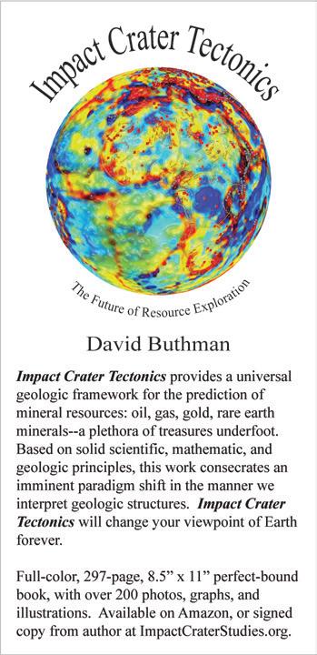
Colorado, Utah, Wyoming and Montana. RMAG Past President Lou Bortz was among those ini tial directors and served as the Secretary/Treasurer for the RMS Foundation for nearly 30 years.
Today’s RMS-AAPG Foun dation Board consists of sev en directors and now includes representation from western Colorado and Idaho. Since its inception the RMS-AAPG Foun dation has supported a wide variety of geological education and outreach activities in the Rockies. RMS-AAPG Affiliated Societies have been consistent beneficiaries, receiving support for guidebooks, road log pub lications and field conferences and for underwriting the costs associated with hosting speak ers from the AAPG Distingushed Lecture Series. This year the RMS-AAPG Foundation provided support for our RMAG Diversity and Inclusion Committee’s edu cation booth at the Denver June teenth Festival. The RMS-AAPG Foundation has also provided reimbursement for profession al educational opportunities for unemployed or underemployed geoscientists, especially during down years. And similar to the RMAG Foundation, the RMSAAPG Foundation has provided support to DERL for the acquisi tion, curation and digitization of geologic and well log data.
So how are these two Foun dations different? The first ma jor difference is how the two foundations receive their fund ing. The RMAG Foundation re ceives the majority of its fund ing from donors while the
RMS-AAPG Foundation receives its funding from the RMS-AAPG, largely from profits associat ed with the annual RMS-AAPG Meeting. Another significant dif ference is that while the RMAG Foundation offers student schol arships, the RMS-AAPG Foun dation provides support to col lege and university students in a different way. Over the last 15 years the RMS-AAPG Founda tion has distributed $135,000 to AAPG Student Chapters at Rocky Mountain universities and col leges. Chapters that apply re ceive $1000 annual grants to fund activities such as field trips, guest speakers and community service events. For many student chapters, this is the only source of revenue they receive.
For more information and to apply for grants and scholar ships please visit their websites at Rocky Mountain Association of Geologists Foundation Web site & Scholarships (rmagfoun dation.org) and RMS Foundation – AAPG RMS
For this month’s centenni al anecdote, we go back to 1997, RMAG’s 75th anniversary. A photograph of past presidents at that celebration shows 16 men, no women.
Compare that with the past president’s photo taken during last month’s RMAG centennial celebration. Of the 18 past pres idents gathered, 5 are women. In fact, RMAG has had 7 women presidents since 2001. And al most 40% of the volunteers who serve on our RMAG committees are women. Indeed, the face of RMAG has changed!
RMAG now offers lunch sponsorship opportunities. Sponsor a lunch, the bar at the lunch, or run a slide on the monthly luncheon slideshow.

On the first Wednesday of each month RMAG holds its monthly networking and education lunch. The RMAG luncheon program provides a professional format for networking, cultivating local/regional activity awareness and exposure to emerging exploration and technology.
See the RMAG website (www.rmag.org/sponsor-event) for details.

Colorful, rocky, desert landscapes? High mountain peaks covered in snow? Vast grass lands? Deep canyons? Ancient pueblos? Road runners? Coyotes? Think of any of these and you will be correct. The southwestern US is a diverse landscape geologically, ecological ly, and culturally. One landscape feature that many people will notice is the ubiquitous presence of incised stream channels. In Spanish the word ar royo means brook or stream. In the southwestern US the term refers to a channel, often ephemeral, which has incised into fine-grained cohesive valley fill to form a gully which has vertical walls and a flat bot tom (Fig. 1). Some arroyos can be upwards at 30m (100’) deep. Arroyos form when a stream initiates a knickpoint or “headcut” which propagates up stream through a valley bottom (Fig. 2). These chan nel forms have been the subject of a great deal of ac ademic study, including my own current PhD work.
The processes and effects of channel incision inter sect with the ecology and management of riparian systems in the arid southwestern US where long-term drought and a warming climate make the retention of water on the landscape and resilience of riparian sys tems critical issues.
This article will discuss my PhD work on Boni to Creek in northeastern New Mexico. Bonito Creek is a headwaters stream and wetland system on the eastern slope of the Sangre de Cristo Mountains at ~9000’ in elevation (Fig. 3). The wetland system is comprised of wet meadows and peat forming fens (Fig. 4). The Bonito Creek wetlands exist at the southern end of the range for these types of systems, which are more common in places like Colorado, Montana, and Canada. As such, Bonito Creek will be a bellwether for the effects climate change will have on these wetlands.

Arroyo cutting can occur rapidly and dramatically change the morphology of a valley bottom. An infamous summer monsoon in Silver City, NM in 1887 initiated downcutting which turned its main street into a chasm 30 feet deep (Fig. 5).
Studies have shown that many channels in the south west have undergone repeated episodes of incision and refilling during the Holocene. Most of the arroyos on the landscape today were cut during the period of ~1870 –1920 and the rapidity by which arroyo cutting occurred was noted by many writers at the time. This spurred a great deal of academic interest in the causes of “the


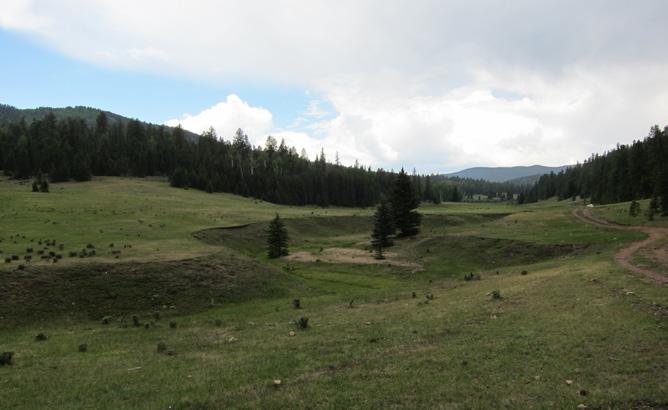
FIGURE 2: (above)
A large headcut in the valley floor of Bonito Creek.

FIGURE 3: (left)
Location of Bonito Creek in northeastern New Mexico

FIGURE 4: Wetlands along Bonito Creek. The wetlands fall into two categories: (1) fens, which are spring fed wetlands where the water table typically remains at or near the surface all year; and (2) wet meadows, where the water table fluctuates during the year. Fens are notable in that they accumulate peat (undecomposed organic material) because the high-water table creates anoxic conditions which inhibit decomposition. These are important carbon reservoirs on the landscape.
arroyo problem” and many geomorphologists, includ ing Stanley Schumm and Luna Leopold worked on the top ic during the following de cades. Academic debate on the topic has mainly been around whether the modern episode of channel cutting was due to land use change by Euro-Amer ican settlers and whether pre-historic episodes were caused by autogenic sedimen tary processes or are related to external climate forcing. This is a debate which has never been fully resolved.
FIGURE 5: Silver City, NM after the formation of an arroyo in the middle of town.


The field of riparian restoration has evolved rap idly in the past 10-15 years. Traditional river resto ration techniques focused on shaping channel forms to a desired end state, often with the use of heavy machinery. This is slow, expensive, and overlooks the fact that healthy rivers are dynamic systems with
channels that constantly move.
It is estimated that >75% of river miles in the continental United States have been impacted by human activities and one third are listed as impaired by US EPA. The New Mexico Environment Department estimates that nearly half of the state’s wetlands have been destroyed since the beginning of Euro-American
settlement. To have meaningful impacts, restoration needs to be large scale and low cost.
Recent research has documented that accumu lated woody debris and damming by beavers played an outsized role in shaping the morphology of water ways historically. The re moval of beavers (by trap ping) and woody debris (for instance by overgraz ing of willows and cotton woods) has created ripar ian systems which are less complex and more efficient at transporting water and sediment. This has result ed in rivers which are more prone to erosion, have less water storage capacity, and have less ecological diver sity. As a result of this new understanding the restoration community has begun to shift towards Process-Based Restoration (PBR) methods which emphasize removing causes of deg radation and reintroducing sources of morphologi cal complexity to riparian systems. Introducing com plexity is intended to set in motion processes which allow the river to evolve to a restored state over time under its own power. One PBR technique which has been gaining in popularity is the Beaver Dam An alog (BDA). The BDA is essentially a human con structed beaver dam. Large numbers of BDA’s can be installed quickly and inexpensively. They create sur face and groundwater storage and can help capture sediment to aggrade incised channels. They are of ten colonized by actual beavers which then maintain and expand them. The role which beaver historical ly played in shaping the morphology and ecology of North America’s rivers and streams has only recently been appreciated.

FIGURE 6: 1954 aerial photo with arroyo growth from subsequent aerial photos superimposed.
nearly caused their extinction with profound con sequences for North America’s streams. By 1900, it is estimated that only around 100,000 still lived on the continent. Today populations have rebounded to around 10-15 million, which is enough to prevent their extinction, but not enough to fully fill their pre vious role in modifying our riparian landscapes. Pro cess-based restoration aims to use beaver and woody debris to reverse this. Among the benefits of beaver colonization of streams include higher base flows, lower water temperatures, and the creation of natu ral riparian fire breaks.
An estimated 400 million beavers once inhabit ed North America. The 18th and 19th century fur trade
Bonito Creek is located on Philmont Scout Ranch, a 140,171-acre property owned and operated by the Boy Scouts of America. Each year approximately 20,000 teenage participants from around the coun try come for 7 – 21-day backpacking trips. The ranch
was donated to the BSA by Waite Phillips, an oil tycoon and philanthropist in 1938 as a place for young people to challenge themselves in the outdoors. The ranch is operated by a staff of 75 full time employ ees and 1400 seasonal staff. This includes a Conser vation Department of 120 staff members who main tain trails and conduct natural resource management. It was as a seasonal conservation staff member that I first became involved with Bonito Creek
In 1982 the Philmont Conservation Department hired a crew to build erosion control structures on arroyos in Bonito Creek. They built one large proto type structure, but the project was not continued. Further interest in restoration would not happen until 2010 when, Mark Anderson, Philmont’s Program Director, tasked myself and another staff member with conducting a survey of Bonito Creek. My back ground was in trail design and forestry, and I had lit tle experience in stream morphology, so Mark bought us some books and sent us to some restoration work shops. We spent two months measuring the creek’s longitudinal profile and documenting headcuts and other erosional features. We concluded that the creek had significant erosion issues and would benefit from further monitoring and restoration efforts. Mark also suggested that perhaps the project could be led by a graduate student, an idea which was to stick with me. I left the ranch in 2012 to pursue my master’s at Montana State University and then work for the US Forest Service, but the idea of a restoration project on Bonito Creek was always in the back of my mind. In 2017, I approached Dr. Jean Dixon, a geomorphologist at Montana State, about becoming my PhD advisor researching arroyo processes and restoration on Bo nito Creek. I reentered graduate school in the spring of 2019 and the project was fully funded by EPA 319 Clean Water Act grant beginning in 2021.
There are three components to my PhD: (1) a study of morphology and stratigraphy of Bonito Creek to determine its pre-disturbance conditions, the age of its wetlands, and what pre-historic pro cesses influenced the evolution of the watershed; (2) a study comparing the timing of arroyo cutting in Bo nito Creek to other nearby entrenched watersheds;
FIGURE 7: A soil pit in an arroyo wall at Bonito Creek. The arrows point to two layers of burned peat which has been subsequently buried by post-fire sedimentation.

and (3) the design and implementation of a process-based restoration program for Bonito Creek de signed to reverse the entrenchment of arroyos, re store wetlands, and build resiliency to drought and climate change.
Research questions which I hope to answer in my first study are how long it took wetland sediments to accumulate, whether the valley had undergone previous episodes of incision, and what geomorphic factors account for the formation of these unique wetlands. We are using a novel combination of study methods including historic aerial photographs (to de termine the rate of arroyo growth in historic times) (Fig. 6), physical geomorphic measurements to look at system morphology (i.e. - longitudinal profiles, cross sections, entrenchment rations, etc.), pits and
FIGURE 8A: (above) Paleo-arroyo unconformity in North Ponil watershed indicating a past episode of channel entrenchment and refilling.
FIGURE 8B: (below) Bone exposed in an arroyo wall in the North Ponil provides opportunities for radiocarbon dating.


core samples to study sediments and stratigra phy (Fig. 7), fallout radio nuclides and radiocarbon dating to measure the age of stratigraphic layers, ground penetrating ra dar (GPR) and electron ic resistance tomography (ERT) to look at valley stratigraphy and water table depth.

The second compo nent of the study involves comparing the stratig raphy of Bonito Creek to other arroyo forming systems in the area. The goal of this part of the project is to help shed light on whether arroyo entrenchment is related to autogenic sedimenta ry processes or allogen ic (i.e. – climatic) driv ers. We are specifically looking at another en trenched system, North Ponil Creek, which lies about 10 miles to the north of Bonito Creek (Fig. 8) This part of the study also involves a review of pub lished stratigraphic studies of other watersheds in the region which specifically look at the timing of en trenchment though the Holocene.
The third part of my dissertation is the develop ment and implementation of a restoration plan and monitoring regime for Bonito Creek. The develop ment of an actionable restoration plan was critical to obtaining EPA funding for the project. I believe that a key factor driving erosion in Bonito Creek has been the removal of woody riparian vegetation such as willows from the system. Today the valley floor hosts almost no willows, except for one area fenced to ex clude livestock. Digging in valley floor, however, one finds a great deal of woody debris (Fig. 9)
This is supported by other studies in similar
systems. This removal was likely facilitated by graz ing and browsing by both domestic livestock and elk.
Actual restoration work is wet, muddy, and of course fun. The restoration plan has three parts: (1) halting of erosion at headcuts; (2) the restoration of channel complexity using process-based restoration methods; and (3) fencing parts of the valley to prevent grazing and browsing by domestic livestock and elk. The halting of erosion is being accomplished by the construction of stone structures (termed “Zuni bowls” because they were developed in resto ration work on the Zuni reservation in western NM) (Fig. 10). These structures turn headcuts into hard ened stone waterfalls and prevent their upstream


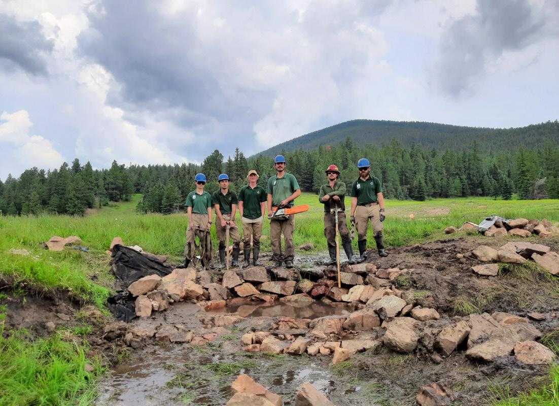

FIGURE 11: Photos of restoring channel complexity, refilling incised reaches of the valley, and recharging groundwater

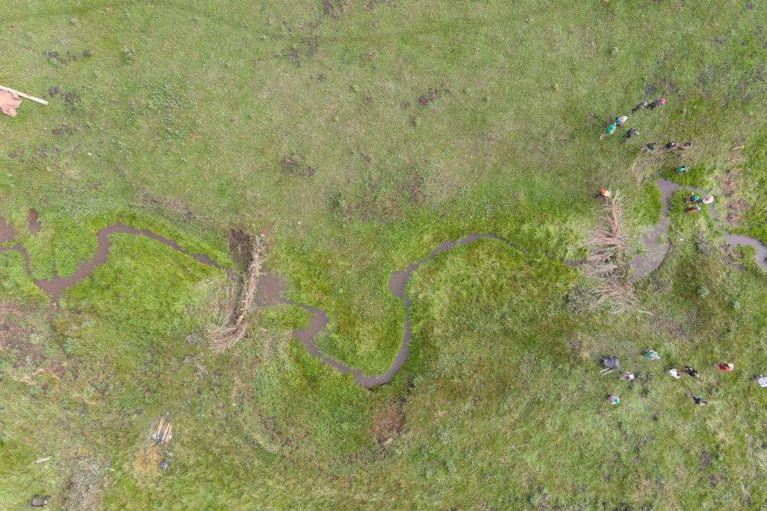
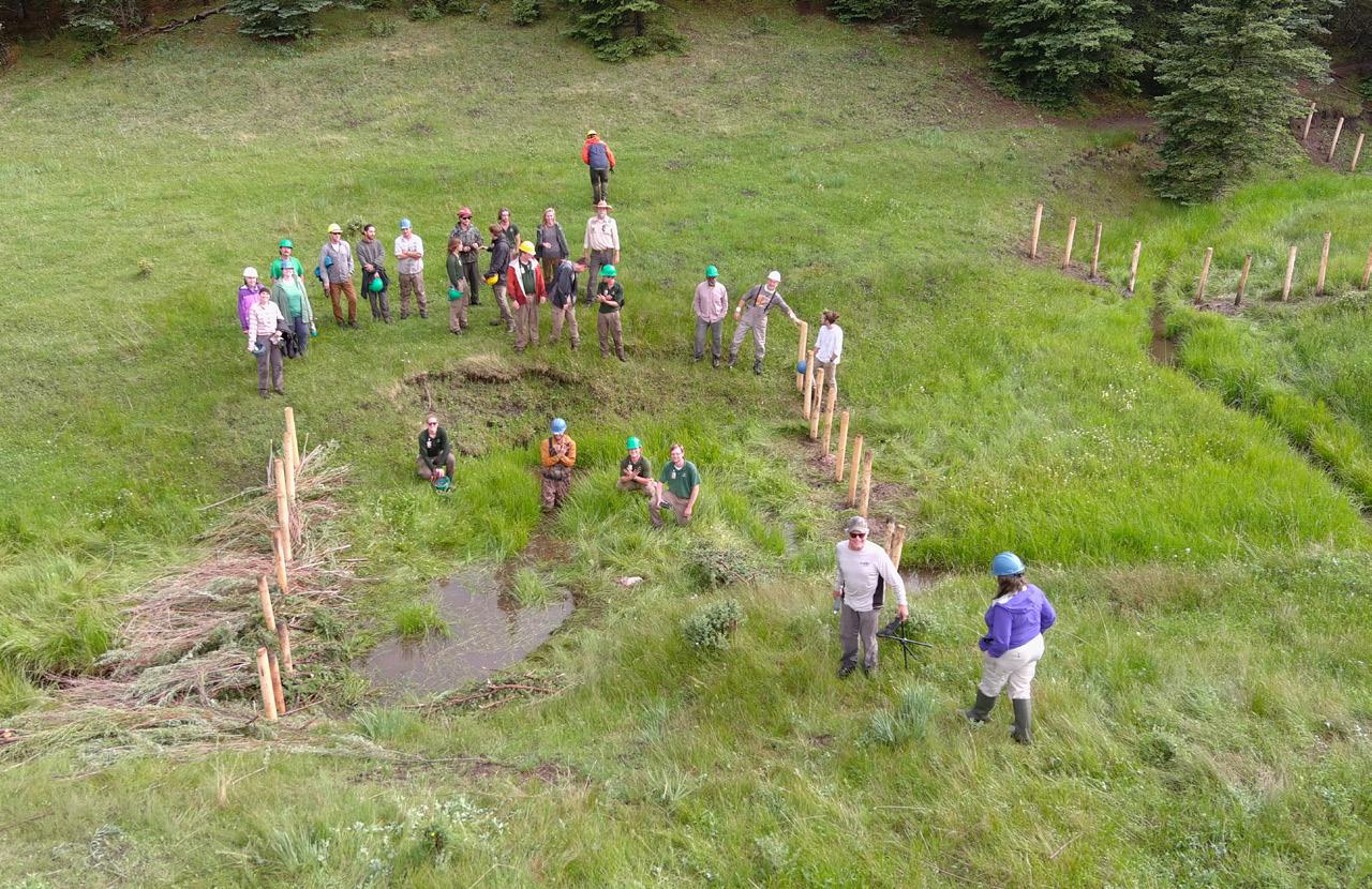
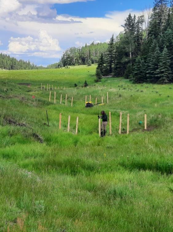
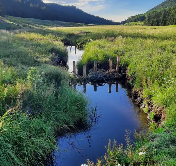


migration. The second part is using BDA’s and other process-based restoration treatments to begin the process of restoring channel complexity, refilling in cised reaches of the valley, and recharging groundwa ter (Fig. 11). Seven-foot fencing will keep elk and do mestic livestock out of the stream bottom and allow woody vegetation to regrow (Fig. 12). Restoration work began in 2021 and is being done by a five-per son crew hired with EPA funding as well groups of scouts and other volunteers. Work will include 15 Zuni bowls, ~150 BDAs, and ~5 miles of exclosure fencing. The first phase of restoration work will be completed in June of 2024.
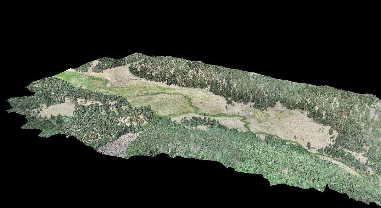
Monitoring will be critical to determine the ef fectiveness of restoration treatments. Monitoring in volves: (1) repeated drone flights and photogram metry of the valley floor to measure how treatments change valley topography and vegetation (Fig. 13); (2) repeated measurements of cross sections and the longitudinal profile; (3) a stream gauge and
precipitation gauge to measure stream discharge; (4) a water quality monitoring station and sampling regime to measure nutrient loads, dissolved oxygen, turbidity, E. coli, and general water chemistry; and (5) monitoring wells paired with repeated ERT mea surements to measure changes in groundwater reten tion related to restoration treatments.
Restoration work on Bonito Creek will take de cades, but hopefully this project will provide import ant background on the geological processes which drive watershed evolution as well as practical knowl edge on the implementation and effects of resto ration work. It will also hopefully inspire future geol ogists and restorationists to grab shovels, dig holes, and ask questions.
Semper lutulentus!
Premier, pay-as-you-go E&P software.
With the Shale Production Optimizer, you now have access to the most popular PIPESIM workflows in one, intuitively simple, pay-as-you-go subscription service. Design your wells. Run artificial lift optimization scenarios. Identify potential bottlenecks in production. Make better decisions based on data—not guesswork.
Learn more at commerce.slb.com/production
 Drone photo credits: Kelly McCoy & Holden Brecht
Speaker: Christopher Smith

Date: October 5, 2022 |
-
pm
1: Advanced Hydrocarbon Stratigraphy 2: New Mexico Tech.
As part of a DOE funded grant to examine the role of faults and other possible communication pathways which may allow injected CO2 to escape its target stor age zones New Mexico Tech (NMT) and Advanced Hy drocarbon Stratigraphy (AHS) have been working to gether in the San Jan Basin (SJB). The goal of the grant is to demonstrate the utility of new technologies for carbon capture and storage applications with the field work being done used to support NMT’s CarbonSAFE program at the Farmington site. The field work will culminate in a well to be drilled later in 2022; while being drilled as a monitoring well, it will be completed such that it could serve as a US EPA Class VI well and inject CO2 into the Jurassic aged Entrada and Bluff for mations. Prior to drilling, Rock Volatiles Stratigraphy (RVS), developed by AHS was used on legacy cuttings
from wells in the SJB and the Ute and Barker Dome fields to create an ~8 mile four well transect. RVS gen tly extracts, identifies, and quantifies over 40 vola tile compounds from rock samples that can be fresh or several decades old; compounds include the C1-10 hydrocarbons (HCs), water, CO2, and several sulfur species among others. The RVS analysis of the cut tings from the Jurassic section of Kirtland 1, drilled in 1961, revealed previously unknown fractures contain ing HC liquids, most likely condensate. The fractures in the Jurassic were charged by three different puls es of increasingly mature HCs with the most mature charge possibly matching the API gravity of Paleozo ic production from the relatively close Hogback Field. The SJB and the Ute Dome Field (UDF) are separated by the Hogback Monocline (HM) (which may possibly
CHRISTOPHER SMITH has been a Senior Chemist with Advanced Hydrocarbon Stratigraphy (AHS) since January 2019 and moved to Midland a few months ago. He works on data analysis, instrumentation (including possible well stie instruments), client engagements, and business development. Most of his analysis work focuses on the North Slope in Alaska, the Delaware Basin, the Anadarko and Arkoma basins in Oklahoma, and the Marcellus. Prior to working for AHS, he received his PhD in analytical chemistry from the University of Arizona in the Winter 2018 term with focuses on instrumentation, data analysis programing, spectroscopy, electrophysiology, surfactants, and surface modification chemistries. He also completed a MA in history at the University of Tulsa as a Henneke Research Fellow in 2012. He completed his undergraduate work cum laude in 2011 with degrees in chemistry, history, and biochemistry also from the University of Tulsa.

Expanded geologic focus:
Expanded geologic focus:
broad industry
West Texas
Plains
Texas
Mountain
Mexico
Mountain
New Mexico
Continent
of North America
northern British Columbia
America
Columbia
around
Expanded geologic focus:


of North America
Entire greater Rocky Mountain area of North America
British Columbia region

West Texas and New Mexico to northern British Columbia
Great Plains and Mid Continent region
be a fault/fold system) with 3-7000’ of displacement. The Paleozoic section of Stephenson 1, in the UDF less than a mile away on to the HM, aligns such that Paleozoic HC liquids on the HM could laterally charge the fractures in the Jurassic on the SJB side of the fault. The chemical composition of the HC liquids in the Pa leozoic section Stephenson and Kirtland share similar ities re-enforcing this mechanism. The Jurassic section of the Stephenson also shows HC liquid filled fractures that are vertically too removed to be charged by the Mancos shale in Stephenson but would reasonably be charged via lateral fractures from the Mancos in the “downthrown” SJB. These RVS data demonstrate later al communication across the HM. Other RVS signatures
from Stephenson document vertical gas migration. In terestingly, the nature of the interaction of the rocks on either side of the HM with CO2 is different suggest ing that the rock properties have been modified post deposition. Strong correlations in the RVS data with this rock property and sulfur species and gas migra tion signatures suggest it may be linked to the move ment of deeper previously documented sour gases on the “upthrown” side of HM which may have modified the surfaces of the rocks across several thousand feet of section. Other features of the transect will be dis cussed. It is yet unclear if the CarbonSAFE well will en counter these fracture networks – if the well has been drilled and RVS data are available these will be dis cussed too.
is a student at University of Texas at Austin and lives in Georgetown, Texas.
David Cannon is SVP, Geoscience and Technology at Diamondback E&P and lives in Midland, Texas.
Jason Currie is a Senior Geologist at Point Bar Energy LLC and lives in Oklahoma City, Oklahoma.
Devin Dennie is Geosciences Manager at Devon Energy Corporation and lives in Yukon, Oklahoma.
is General Manager at Upstream Advisors Group and lives in Spring, Texas.
Logan Heffner is VP Engineering at Rye Ridge Resources and lives in Denver, Colorado.
Stacey King is a Technical Sales AdvisorPetrophysicist at Premier Corex and lives in Oklahoma City, Oklahoma.
Jay Lebeau is Subsurface Manager at Red Willow Production Co. and lives in Bayfield, Colorado.
Matt Seitz is Principal Hydrogeologist at HRS Water Consultants, Inc. and lives in Lakewood, Colorado.
works at SM Energy and lives in Denver, Colorado.
Lisa Taylor is a geosciences teacher and lives in Littleton, Colorado.
is V.P. Geosciences at Liberty Resources LLC and lives in Centennial, Colorado.
Faye Troisi lives in Pagosa Springs, Colorado.
Matthew Ward lives in Golden, Colorado.
Mallard Exploration is a Denver based upstream Oil & Gas Exploration and Production company focused on the DJ Basin of Colorado. We are building a successful business with strong ethics, hard work and industry-leading technology.

Speaker: Benjamin Burke

Geothermal, as its Greek word roots suggest, is Earth heat. That heat expresses itself in a va riety of ways at a variety of depths in differing geologic environments. Geothermal, as a subset of the energy industry, also has different mean ings in its different engineering expressions: high temperature (>150° C/302° F) power gen eration applications at active margin locations around the world, medium temperature (90°150° C/194°-302° F) power generation appli cations a further distances from active margins, low temperature (<90° C/194° F) power gen eration in medium to high geothermal gradient
locations regardless of tectonic environment, as well as the myriad of direct use applications in agriculture, aquaculture, industrial process, and heating, ventilation, and air conditioning.
This luncheon talk surveys the above appli cations of geothermal and the geoscience behind them, with a focus on the keys to geothermal sys tems—analogous to petroleum systems—in sed imentary basins, namely, heat source and flux, reservoir quality and flow, and the importance of geochemistry of geothermal fluids. The Willis ton Basin and Basin and Range areas of the Unit ed States provide examples of geothermal power generation in low temperature regions.
BENJAMIN BURKE (he/him/his) is the Chief Technology Officer and Co-Founder of Transitional Energy, a geothermal development company. Prior to his current role, he held individual contributor and management roles as a geoscientist in the oil and gas industry in Houston and Denver with the ExxonMobil Upstream Companies, Anadarko Petroleum, Noble Energy, Fidelity Exploration & Production, Fifth Creek Energy, and Highpoint Resources. He began his career as a geoscientist with Woodard & Curran, Inc., an environmental consulting firm, in Cheshire, Connecticut.
Ben holds an AB magna cum laude from Bowdoin College in Geology and Russian Language, an MBA in general management from Texas A&M University, and a PhD from Dartmouth College in Earth Sciences. He is also an Affiliate Professor in the Geology & Geological Engineering Department at Colorado School of Mines and a Collaborating Professor in the Department of Geological and Atmospheric Sciences at Iowa State University.
He serves as the President Elect of RMAG and on the board of the Denver Earth Resources Library. He is a past member and chair of the Academic and Applied Geoscience Relations Committee of the Geological Society of America. He enjoys gravel cycling, alpine skiing, and, very occasionally, whitewater kayaking. From an early age, he is a hobbyist-level lunar and planetary astronomer.


Tuesday, November 16, 2022
Location: Colorado School of Mines, Student Center Ballroom D
Fee: $250, includes snacks, class notes, and PDH certificate
Instructors: Nicholas Kernan, US Dept of Interior
The valuation of oil and gas properties has rapidly developed into one of the most important skills within the energy sector. This course aims to introduce individuals to a basic workflow that will allow them to take raw data and develop an opinion of value for oil and gas acreage. The focus will be on shore U.S. unconventional resources. Valuations will be considered from both the standpoint of operators and royalty owners. Topics to be discussed are: the role of geology in valuations, forecasting production, commodity prices, development plans, defining risk, quantifying uncertainty, and the construction of discounted cash flows. All of these topics could be a course in their own right and this workshop does not aim to make participants experts i n any one of the above topics. Rather, it aims to bring all these concepts together in a practical workflow, providing the participant guidance for future investigation. It should also help give technical experts context of how their day to day work affects business decisions. This is an introductory class and is not meant for individuals that are already familiar with oil and gas property valuation. Some of the exercises will involve building discounted cash flows in Excel, as such, the class requires participants to bring their own computer and have basic knowledge of Excel.
quantifying uncertainty, and the construction of discounted cash flows. All of these topics could be a course in
Class Description and Register Online: Link
For more information, contact Mary Carr, 303.273.3107, mcarr@mines.edu; WWW.PTTC.ORG
When I was growing up my dad was a surviv al instructor for the Air Force, which means he went out with a group of pilots one week a month to teach them how to survive in the wilderness. Every time he took a group of students out, he would bring me back a cool rock that he found. I loved it and I loved the idea of working outside! Fast forward to my sopho more year in college when I was really struggling to find a major. So I signed up for Geology 101 among other elective sciences, remembering how I used to love getting cool rocks. The first part of the semester was focused on geomorphology and it was so inter esting to learn the reasons why the earth looks like it does. By the end of the semester, I had a new ma jor and as a bonus I could identify all the rocks in my old collection.
My first job in geosciences was also my cool est job. I worked for a summer between my junior and senior year in a remote gold mining camp in the Ambler Mining District in Alaska (180 miles north of Fairbanks!). As a junior geologist it was my job to help log core to determine where the hydrothermal veins of copper might be. We also measured fracture zones to determine future mining shaft stability. The coolest part of the whole job was that the entire oper ation was helicopter supported. Any time we needed to go out to the core rig to get more boxes or to go to the field to do any sampling our ride was a helicopter. By far the most adventurous geology job I ever had.
My career started in hard rock geology mostly be cause I went to school in the Pacific Northwest and all the geology jobs there related to mining. After logging core in Alaska, I next was a USGS intern. At the USGS I helped translate the geology words in internation al documents. After I graduated, I went to work for a lithium brine company in Reno, Nevada. My job was to go to playas that were surrounded by rhyolite tuffs and take samples of the subsurface brines and clays to test the lithium concentrations. The goal was to find high lithium concentration brines.
After this, I went back to grad school, where most of my time job wise was spent teaching. I taught Ge ology 101 lab and field camp. My last year of grad school I got an internship with ExxonMobil because they were the only oil and gas company that recruit ed at Washington State University. I like to say I ac cidently ended up in oil and gas; if Exxon hadn’t re cruited me, I never would have ended up where I did. It was my introduction to oil and gas and ultimately
RMAG’s Diversity and Inclusion Committee is featuring a monthly Member Corner. We hope you’ll enjoy learning about the diverse community of Earth scientists and wide variety of geoscience disciplines that comprise our membership. If you would like to appear in an upcoming column, or if there is someone you would like to nominate, please contact staff@rmag.org.
led to my career at Schlumberger.
I have been with Schlumberger for ten years, the first two in Houston, then Denver for the last eight. I started as a salt interpreter creating 3d Gulf of Mex ico salt models as an input to high resolution depth velocity models. After I had my first son, I transi tioned into seismic sales in Denver. In that role I sold our multiclient seismic library and seismic process ing services in the Rockies and Alaska. Right before maternity leave with my second son I transferred into my current role with Schlumberger. I work now as the geoscience technical solution sales rep for Denver, Midland, and Oklahoma City.
My current job is geoscience technical solution sales for Petrel. That’s a really long way of saying I help clients understand the capabilities of Petrel for their geology and geophysics workflows. Some days I help current clients optimize how they work in Pe trel or show them the new features, some days I pres ent technology demos to potential clients. I also test new technology being implemented in Petrel and Del fi. Currently my focus is testing our machine learn ing assisted seismic interpretation workflows for US land data.
The people! Because I am in a technical sales role, I get to see all the creative workflows that our clients come up with, and man you all are smart! I also find the teaching portion of my job really rewarding. Help ing someone make the most of all the data they have and utilize the tools that we helped develop has been really fun.
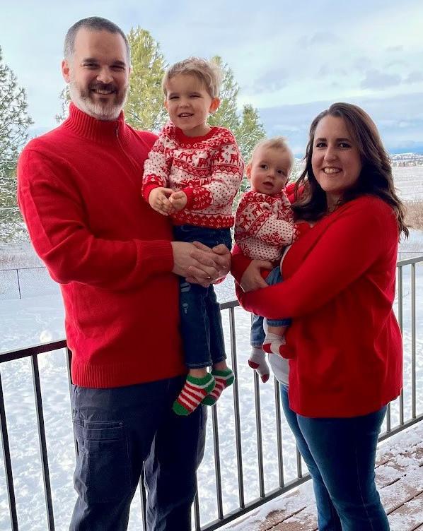
I have gotten really lucky with this. Schlumberg er is pretty supportive of a work life balance. I have two little boys (4 and 1) that occasionally have to come first. I find that the best thing I have done is be totally up front; my work knows that sometimes I won’t be available during the day but I will respond when I can. I also am lucky that I have an incredibly supportive husband that splits the kid duty with me. I think it worth the balancing act to show our boys that
both parents can have fulfilling careers and a family.
I grew up in Eastern Washington (state, not D.C) surrounded by the Columbia River basalts. I also went to college there. So for our sedimentology and stratigraphy course field work we had to take trips to Arches National Park to see any sedimentological fea tures in person.
Winter by far! I love the snow, especially the quiet after a big snowfall.
Mowing the lawn and pulling weeds. I hate every thing about it.
The Devil and Dark Water by Stuart Turton. I re ally liked it. Please don’t ask me how many books I am in the middle of.
If you’re an avid Outcrop reader, you’ve like ly grown to love our monthly articles about Rocky Mountain geology, the Mineral of the Quarter, RMAG’s history and On-The-Rocks field trips. We’re your one stop shop for information about upcom ing geo-events in the Denver area, monthly member highlights, scholarship and award announcements and much more.
Our article topics run the gamut from glaciers to GIS. While the majority of RMAG members work in the oil and gas industry, we try to feature a mix of topics that are a departure from the day-to-day. Some of our more popular and interesting articles have covered the geology of skiing (October 2020),
Colorado’s glaciers (June 2020), water storage in Colorado (October 2019), seismicity in Colorado (November 2020), the western land grid (July 2019), historical megadroughts in Montana (May 2020), field camp (March 2022), geology and railroads (De cember 2019) and so much more. The Outcrop ar chives go back to 2012—if there’s something you want to learn about Rocky Mountain geology, we’ve probably covered it.
Want to be featured in the Outcrop? Submit an article, cover photo, or participate in the member corner. Contact us at staff@rmag.org

Come for the cover photos, stay for the science.The publications committee in a pub. Bill Drake, Courtney Antolik, Clayton Schultz and Nate LaFontaine.
Elijah joined the publica tion committee in 2021 as a contributing editor of the Out crop. He loves to assist in the process of soliciting articles that serve the mission of the Outcrop in showcasing inter esting geologic research work in the Rocky Mountains and the opportunity to serve the RMAG. Elijah is a cur rent Ph.D. candidate at Montana State University.
Courtney joined the pub lications committee in 2018 and was the Outcrop lead ed itor from 2019-2021. She handed over the reins in 2022 when she started her role as the RMAG First Vice President. Formerly an oil & gas geolo gist, Courtney now works for an industrial marketing agency.
Marlee joined the publica tions committee in 2022 as a co-editor of The Outcrop. She joined The Outcrop as a way to combine two of her passions, reading and geology, and to get involved with the local geology community. Marlee currently works as a Geoscience Analyst at bpx energy in Denver.

Wylie joined the publica tions committee in 2019 as a co-editor of the Outcrop. He joined the Outcrop as an op portunity to get involved in the local geology community and to stay up-to-date in the latest Rocky Mountain geologic re search. Wylie currently works as a Geologist at Ovintiv in Denver.


Nate joined the Publications Committee as co-edi tor for the Outcrop in 2020; in 2022 became the Lead Editor for the publication. He joined as a way to get involved with RMAG, learn about the greater region’s geology, and support his interests in reading and writing. Nate works as a development geologist at SM Energy in Denver.
Ron Parker joined the Pub lication Committee in 2014 as an Assistant Editor for the Mountain Geologist; in 2016 he became an Associate Editor for Outcrop (2 years). He re joined the Publications Com mittee in 2022 as 1st Vice President-Elect. Ron writes the Mineral of the Quarter article for Outcrop and occa sional On-the-Rocks Field Trip Summaries. Ron is a Senior Geologist at Borehole Image Specialists where he analyzes and interprets resistivity and acoustic borehole images and associated petrophysical logs. Before working with borehole images, Ron spent 7 years as an Assistant Professor of Geology at Earl ham College where he taught Physical Geology, His torical Geology, Environmental Geology, Mineralogy, Sedimentology, Hydrogeology, Geochemistry and Se nior Seminar courses. Ron has a B.A. in Geology from Colgate University, and an M.S. in Geology from the University of Vermont. Ron worked on a doctorate in uranium hydrogeochemistry at Texas A & M Univer sity. Ron lives in Centennial with his wife, Kris, and (some of) their 5 children.


Danielle joined the publi cations committee in 2021 as a contributing editor for the Outcrop. She wanted to learn about the Outcrop publishing process and took the opportu nity to get involved and help the RMAG. Danielle works as a

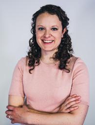
geologist at Devon Energy.
The Mountain Geologist currently has five all-vol unteer editors. The team works diligently behind the scenes to deliver the highest quality quarterly pub lications as possible to its readership. Typically this effort involves correspondence with authors, eval uating manuscripts, recruiting technical experts for peer reviews, guiding a thorough revision process, and lastly transforming proofs into their final publi cation form. Thanks to the hard work of the editors, turnaround time from submittal to full publication is commonly as short as just four months.
The Mountain Geologist has expanded its scope to the geology of the greater Rocky Mountain area of North America. Areas covered now range from West
Texas and New Mexico to northern British Columbia, as well as the Great Plains and Mid-Continent region. The range of topics covers almost every sub-discipline in the geosciences.
Bill is a geologic advisor for Jonah Energy, LLC in Den ver, Colorado, and he worked previously with Pioneer Nat ural Resources and QEP Re sources. He received his B.S. at UC Santa Barbara and M.S. at Northern Arizona University. His interests include tectonics, structural geology, basin evolution, sequence stra tigraphy, isotope geochronology, organic geochemis try, and all aspects of unconventional resource plays. Bill has served as executive editor of The Mountain
The Outcrop committee meets virtually every month. Members Courtney Antolik (bottom), Nate LaFontaine (bottom left) and Ron Parker (top right) dial in from Denver, Danielle Robinson (top left) dials in from Oklahoma City and Elijah Adeniyi dials in from Montana.

Geologist since January 2018, following six months as an assistant editor.

Mark is a sedimentologist and petrographer with exper tise in describing and inter pretating carbonate rocks, sandstones, and mudrock res ervoirs in the Rocky Moun tain region. He received his B.A. degree from Albion Col lege in Michigan in 1972 fol lowed by a Ph.D. in Geology from the University of Texas at Austin in 1976. He then joined the research lab of Cities Service Company in Tulsa, Oklahoma for five years before moving to Denver in 1981 to work for Coastal Oil and Gas Company as an explo ration geologist in the Williston Basin. From 1984 to 2006, he was a consulting geologist before joining QEP Resources, where he worked as their “Rock Ex pert’’ until 2018. Mark then joined the Denver Mu seum of Nature and Science as a Research Associate and continues to work on various projects with the Museum. His studies involve the description of cores, study of cuttings using both a standard light micro scope and in thin sections, and now, with the museum, the study of outcrops in the field and with stan dard petrographic thin sections and, on occasion, the Scanning Electron Microscope. This variety of tools and techniques allows for a better integration of sed imentology and petrology to interpret the deposi tional environments and diagenesis of whatever rock units he happens to be studying. He has been actively involved with The Mountain Geologist for more than 30 years as an editor, reviewing manuscripts, and publishing papers.
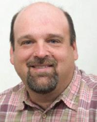

David Malone complet ed his Ph.D. at the University of Wisconsin. He is a Distin guished Professor at Illinois State University. His research interests are broad and involve sedimentary geology, structur al geology, geochronology, and
Precambrian Geology. He has been an assistant edi tor with The Mountain Geologist since 2019.
Clayton Schultz is a se nior geologist with SM Energy where his focus is on stratig raphy and reservoir character ization, working primarily in the Permian Basin and the on shore Gulf Coast. He has a BSc in Geological Sciences from the University of Idaho and a MSc in Geosciences from the University of Montana, where he developed a particular fondness for the Paleozoic section throughout the Rocky Mountains. Clayton joined the Mountain Geologist as an associate editor in 2019.

Becky Simon is a petroleum geologist who grew up in Colorado Springs, CO. She holds a BS in Geological Engi neering from Colorado School of Mines, an MS from the Uni versity of Texas at Austin, and a PhD from the University of Colorado at Boulder. Her stud ies have largely focused on the carbonate petroleum resources of the greater Rocky Mountain region, in cluding the Bakken/Three Forks and the Niobrara. She currently lives in Houston, Texas and has been a member of the RMAG publications committee for two years.
The publications committee is always looking for new members to help find articles for the Outcrop and Mountain Geologist. Email staff@rmag.org if you’re interested in getting involved.
On Friday, 19 August, ten lucky RMAG members ac companied Dean Misantoni, Colorado Calumet Mine Ge ologist, into the Detroit City Portal. The portal was driven recently to intersect updip structural extensions of the fa mous Sweet Home Mine. There is currently no man-made connection between Detroit City Portal and Sweet Home Mine. Cullen Baker, Colorado Calumet Mine Manager, also accompanied our tour, providing additional safety su pervision, mining education, and an awesome jackleg drill ing demo!
Silver/lead/zinc/copper/tungsten ores from the Sweet Home Mine, located approximately four miles west of Alma, Colorado, were produced intermittently from 1875 until 1967. From its earliest days the Sweet Home work ings were known for occasional discovery of euhedral cherry-red rhodochrosite specimens. The Sweet Home Mine was exploited and expanded for mineral specimens by a few operators from 1967 through 1985, when efforts ceased. Collector’s Edge and a few investors, under the leadership of Bryan Lees, leased the Sweet Home Mine in 1991. Mr. Lees later bought out his partners, purchasing the Sweet Home Mine and surrounding claims in 1998, and expanded the underground workings for careful and deliberate mining of rhodochrosite specimens, which continued until 2004. Geological mapping and mine planning/permitting/fund raising resumed in 2014, and in 2016 installation of the De troit City Portal, 180 ft above the Sweet Home Mine por tal, commenced.
Colorado Calumet (mine operator) and Collector’s Edge (mine owner) normally run private tours on Fridays in the summer for select groups, including geological so cieties and gem and mineral clubs, and the RMAG OTR Committee was fortunate to procure one of these slots again this summer. Underground mine workings in the Detroit City Portal are quite large (typically 10ft wide by 10ft high), but tour groups are limited to ten. Sixty RMAG members
expressed interest in attending, and two of the ten avail able slots were designated for a student and a teacher. Tour size is limited by the expense (including safety equipment) involved, disruption of the mine cycle, and MSHA restric tions. The Detroit City Portal is a very active mine, not a “tourist mine,” though Mr. Lees has accommodated close to one thousand interested parties since 1991.
Our tour started with a geological overview of the Greater Alma District by Dean Misantoni, including much history of local mines and exploration projects. Dean has lived in Alma for nearly forty years and has been associat ed with mining and exploration core-drilling much of that time, including long tenures at the prolific nearby London Mine and the Sweet Home Mine. Dean’s work as an eco nomic geologist has included exploration work in China, Turkey, Peru, El Salvador, Costa Rica, and all over Mex ico. First, we walked outside for a surface outcrop-based sense of the local geology, followed by a review of maps and cross-sections of the most productive veins. The geological model for mineral occurrence is very complex but includes relationships with the Alma Dome, the Climax (Tertiary porphyry-hosted) molybdenum orebody, Tertiary rhyolitic dikes, fractures & small faults, and the contact between ear ly Proterozoic (1,700 MA) granitic rocks and biotite schist/ gneiss, which is exposed in the Detroit Portal mine work ings. While the contact between “Xg” & “Xb” mapping units is drawn statewide as a broad, smooth line on geolog ical maps, it is very complicated underground, and very im portant to mineralization in the Sweet Home/Detroit City Portal area. Repeated, long lived tectonic activity, faulting, localization of younger Tertiary intrusive porphyries, hydro thermal fluids and post mineral brecciation, plus healing by younger stages of mineralization, are all evident in this com plex deposit.
RIGHT: Simplified geological model for Sweet Home Mine (SHM), after Lüders, et al, 2008


LEFT: Ten lucky tour participants at Detroit City Portal, with Mine Geologist Dean Misantoni (center w/yellow hardhat) and Mine Manager Cullen Baker (third from right w/ black hardhat)

Once we were suited-up with personal protective gear (hard hats, steel-toed boots, safety glass es, gloves, MSA “self-rescuers,” & slickers), we headed into the slightly inclined Detroit City Por tal. The portal was driven into Mount Bross to intersect the “Main” rhodochrosite-mineral ized vein, with raises developed upward along the vein, followed by opening of drifts and stopes along the mineralization. Drifts, raises, and stopes have been devel oped along other productive asso ciated veins. All of the mining in Detroit City Portal is conducted with great care to preserve valu able mineral specimens, and rho dochrosite is the primary objec tive. In addition to jackleg drills, fiber-optic endoscopes, diamond saws, and hydraulic “feather and wedge” splitters are employed to carefully open mineralized pockets. Mineral specimens are recovered by miners, Mr. Lees, and Collector’s Edge em ployees, once they are carefully exposed. While tours rarely see any of the rare, large, cherry-red, rhombohedral rhodo chrosite crystals for which the Sweet Home Mine is famous, we did see bright pink “contacted rhodos” tightly embedded in quartz matrix in mine walls.
Map of the Sweet Home Mine from Misantoni, in Bartos, et al, 2007.

Our tour included virtually all of the safely accessi ble mine workings, and we had the opportunity to traverse along the main haulage adit, currently being driven behind the known vein system, and also into a drift being driven parallel to the mineralized “Main vein” system. In this drift we were able to scramble over recently blasted muck and collect a few broken pieces of rhodochrosite, as well as py rite, chalcopyrite, galena, and sphalerite-hubnerite-fluorite bearing waste-rock. RMAG’s On the Rocks field trip plan ners are hopeful that we can run this most exceptional mine tour again next summer.
Numerous technical articles have been published on the geology and geochemistry of the deposit, in various publications (Mineralium Deposita, Geochemica et Cosmica) as well as the well-known Sweet Home Mine issue of The
Mineralogic Record. Also available online are many articles in Lapidary Journal and Gems and Gemology. Active re search on this fascinating mineral deposit continues today. Here are links to Denver City Portal news on Collec tor’s Edge website: https://collectorsedge.com/news-up dates/2020-detroit-city-mine-update. Additional informa tive material is available at their Sweet Home Mine site The Sweet Home Mine, Park County, Colorado, USA - Collec tor’s Edge (collectorsedge.com)
Bartos, Paul J, Eric P. Nelson, and Dean Misantoni, 2007, The Sweet Home rhodochrosite specimen mine, Alma District, Central Colorado: The porphyry molybdenum-fluorine connection, Mineralium De posita, Vol 42, No 3, p235-250
Lüders, V., R. L. Romer, H. A. Gilg, R. J. Bodnar, T. Pettke, and D. Misantoni, 2008, A geochemical study of the Sweet Home Mine, Colorado Mineral Belt, USA: hydrothermal fluid evolution above a hy pothesized granite cupola, Mineralium Deposita, 44, 4, 415-434



OCTOBER 4, 2022
RMAG Women’s Group Coffee. VIBE Coffee & Wine, Denver, CO.
OCTOBER 5, 2022
RMAG Luncheon.
Speaker: Christopher M Smith. “CCS Risk Evaluation in the San Juan Basin Using Rock Volatile Stratigraphy – Identification of Fractures, Lateral and Vertical Migration Pathways, Modified Rock Properties, and Implications for CO2 Injection and Storage.” Online or In-person at Maggiano’s, Denver. 12:00 PM-1:00 PM.
OCTOBER 13, 2022
WOGA Lean In Circle.
Speaker Sarah Bartlett. DERL, 730 17th Street, B-1, Denver, CO. 11:00 AM-12:30 PM.
OCTOBER 13, 2022
Denver Petroleum Club Lunch and Learn.
Talk: “Cyber Threats are the New Reality the Oil & Gas Industry is Facing: Be Prepared.” Denver Athletic Club. 11:30 AM-1:00 PM.
OCTOBER 19, 2022
COGA’s Small Operator Half Day.
OCTOBER 22-23, 2022
On The Rocks Field Trip. Picket Wire Canyonlands Dinosaur Tracksite.
OCTOBER 27, 2022
Energy Tech Symposium. Denver Earth Resources Library.


RMAG’s Educational Outreach committee wants to create a collection of Colorado rocks that can be paired with the Colorado geological map. The committee will use these rocks as an educational tool to teach elementary, middle, and high school students about the ge ology of Colorado, geological processes, and Colorado mineral resources.
While you are on your summer vacations to the many wonderful areas in Colorado, please consider picking up rocks for our collection. We ask you note where you collected the rocks and the formation name. ROCKD is a great app that uses your location and geolog ical maps to “map” the formation under your feet. Keep in mind to collect rocks where it is allowed.
