PORTFOLIO OF WORKS
Savvas
Stroumpas
Table of Contents
Applications of Circular Economy in the Town of Komotini
Diploma Thesis // Spring 2021 // Hardcopy Publication
Happy Cities
Diploma Research Thesis // Fall 2019 // Hardcopy Publication
Pop- Up Park
Neighborhood Square Regeneration through Participatory Design // Spring 2019
Space Under International Educational Urban Planning Seminar // Spring 2017
Regain Mesolonghi
Architectural Design Studio 7 // Fall 2017
Olympia: Terminal
Urban Design Studio 2 // Spring 2016
Elaionas: Urban Reforestation
Urban Design Studio 1 // Fall 2015
APPLICATIONS OF CIRCULAR ECONOMY IN THE TOWN OF KOMOTINI
Diploma Thesis Spring 2021 _ Grade: 10/10
Hardcopy Publication 25x30, 38 pages
Supervisor Alkistis Rodi
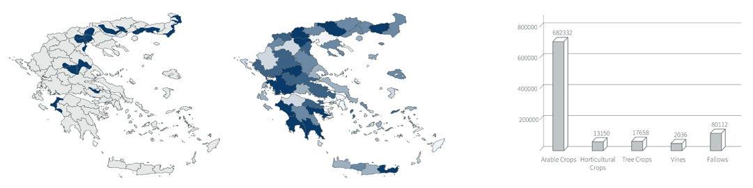
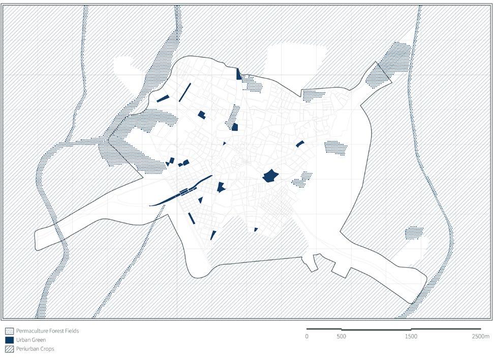
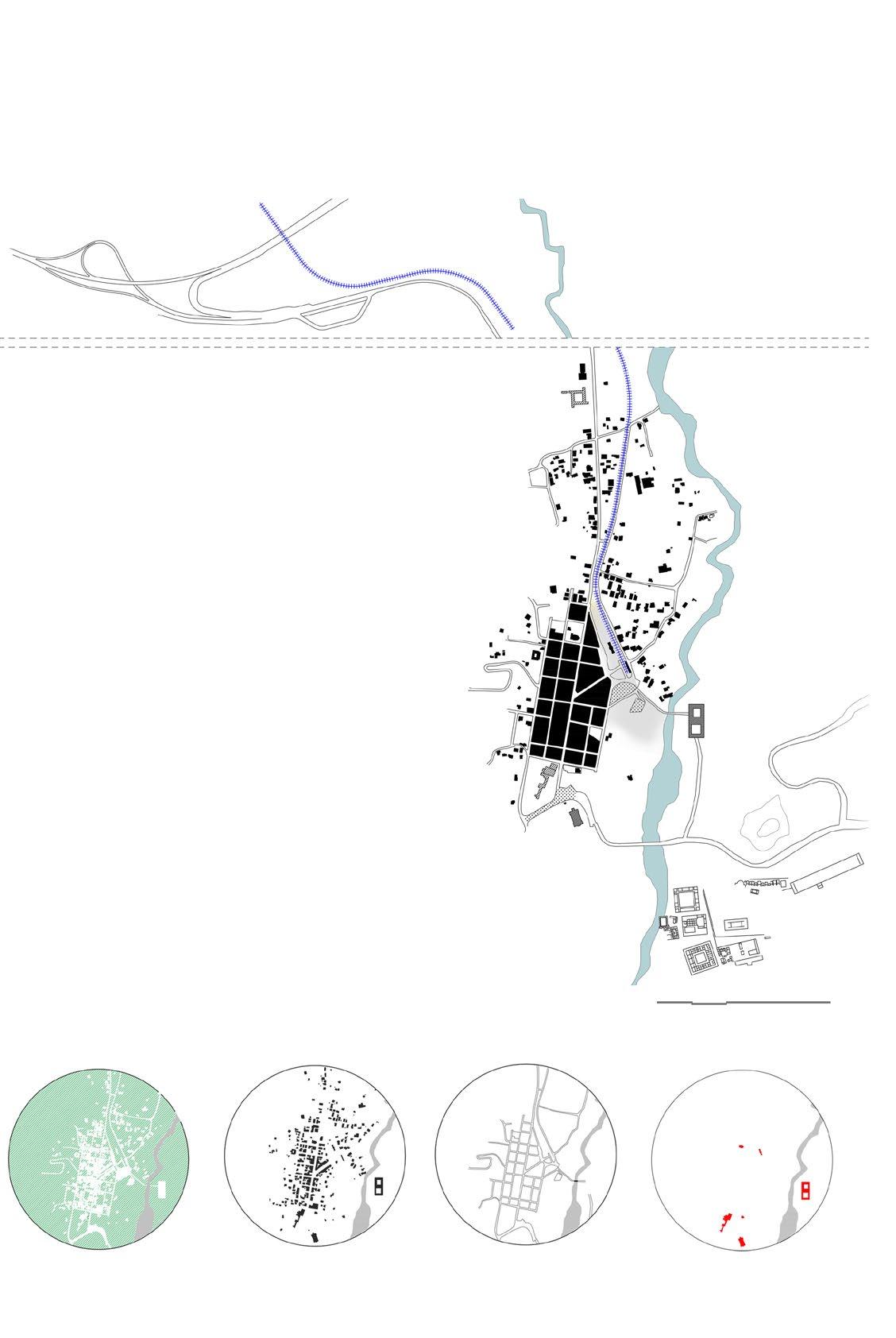
The region of Rodopi and Thrace in general includes the fourth largest plain in the country, making it an important productive center of the primary sector. A large percentage of the local economy is based on agriculture and livestock, since a significant part of the population owns plots of agricultural land which it cultivates. The main crops found are cotton and wheat in the south of the prefecture in lowland swamps, while in some semimountainous areas olive trees, vines and tobacco. Fruit and vegetables are grown on much less land.
However, the wide gap between the various crops, with almost exclusively that of cotton and wheat, has in recent years led to significant effects on the yield of agricultural land, the natural environment and local biodiversity in general, obviously having an impact and in local economic activity.
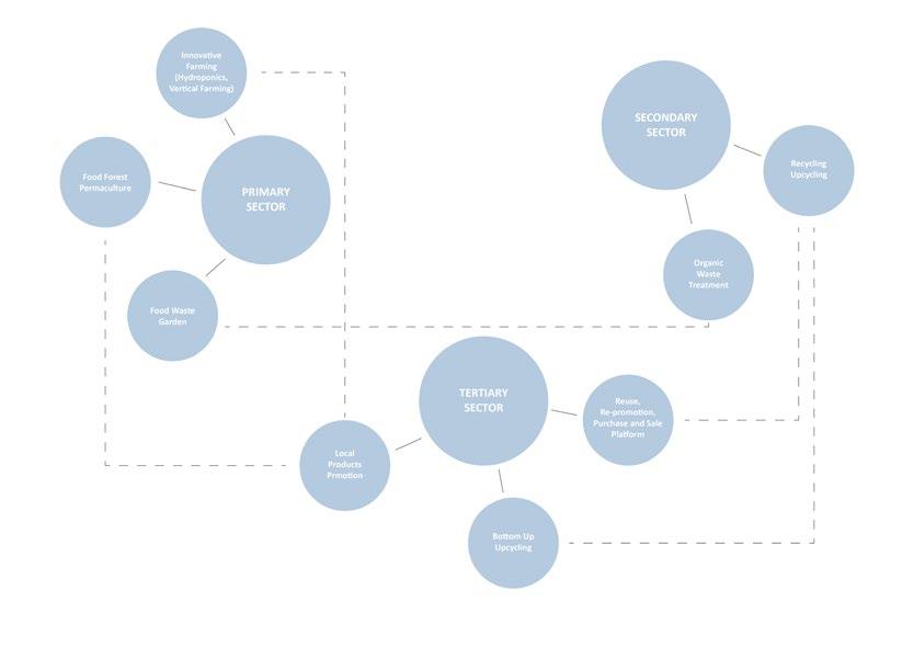
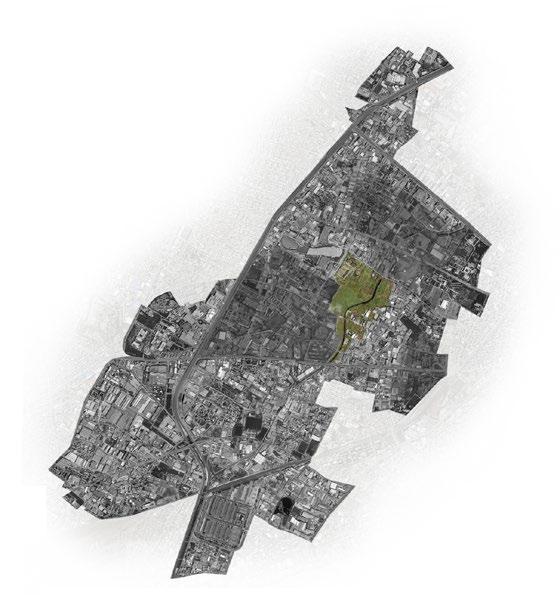
Therefore, the present dissertation identifies this issue and seeks to explore practices that could improve the situation. The aim is to form an economic and social system which will be based on and strengthen the already existing agricultural character of the region starting from the city of Komotini, which is the administrative, commercial and population center of Rodopi.
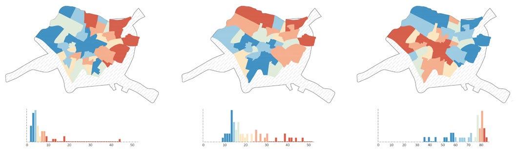
In the current situation, Komotini, as a mediumsized urban center, now gathers large percentages of employment from all productive sectors. However,
maintaining strong economic and trade relations with the peripheral rular settlements, it is found that over time, the most encouraging percentages of economic activity come from the primary sector.
Given these elements that shape the social and economic landscape of the city, the following question arises. How could a system be developed that redefines the basis of productive sectors so that human activity functions more symbiotic and less intrusive with the natural environment?
It is now clear that the need to seek more sustainable practices is imperative, as they will determine the development of the economy and therefore the quality of human life with a focus on the proper treatment of natural goods which is inextricably linked to the proper functioning of the natural environment.
A particular method of sustainable development that has emerged systematically in recent years is the system of the circular economy, which contrasts with the traditional linear economy that is applied and is based on the production model «take, make, dispose». The circular system seeks to decouple economic activity from finite resource consumption and waste generation, creating a closed-loop system with practices such as recycling, reuse, repair and reconstruction.
Percentage of Population Employed in the Primary Sector
Percentage of Population Employed in the Secondary Sector
Percentage of Population Employed in the Tertiary Sector
Employment Rates in the Primary Sector
 Cultivated Lands of Rodopi Prefecture (1000m2
)
General Plan of the CIty of Komotini, GR_ Ιntervention Αreas
Major Plains of Greece
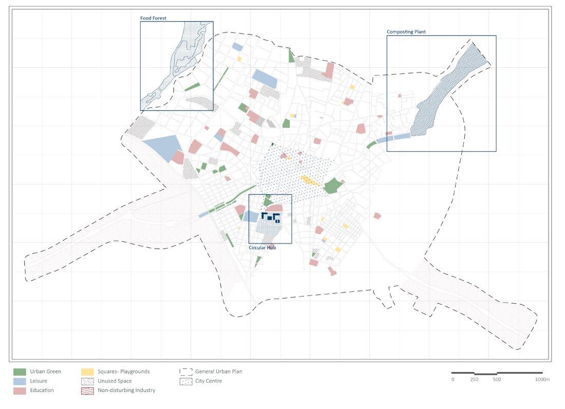
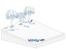
One of the solutions that is found in the philosophy of the circular economy and sustainability is the permaculture forests. Also known as food forests, they are a way of organizing crops that mimics the way a natural forest would grow. An integrated permaculture system provides food for the soil, humans, deep-rooted plants for subsoil decomposition, herbaceous, climbing and protective plants. A Food Forest is developed in eight levels of plantations, which are cultivated mixed and grown together with the least possible human intervention procedures, as the goal is the maximum yield in a natural way.

This practice can always be adapted to the local climatic conditions, the needs of growers, guarantees a continuous supply of goods throughout the year, while it can be applied from the garden of a house to an entire forest area.
_First Phase of Development Canopy and Groundcovers Layers _Second Phase of Development Lower and Shrubs Layers _Third Phase of Development Native Seasonal Plants _Fourth Phase of Development Foul Growth of Plant Layers
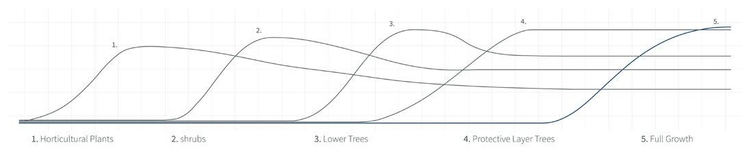
Food Forest Topographic Diagramm
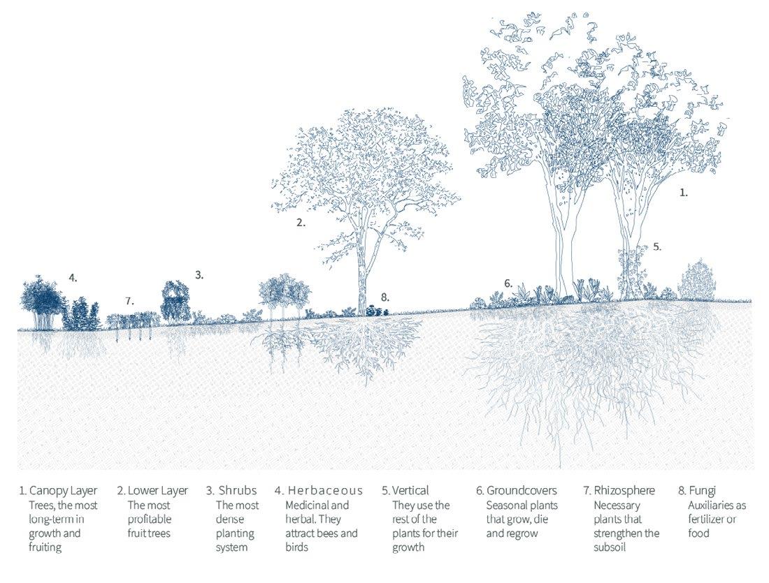
 Plantation Layers of Food Forest
Possible Future Development of Forest and Urban Green
Plantation Layers of Food Forest
Possible Future Development of Forest and Urban Green
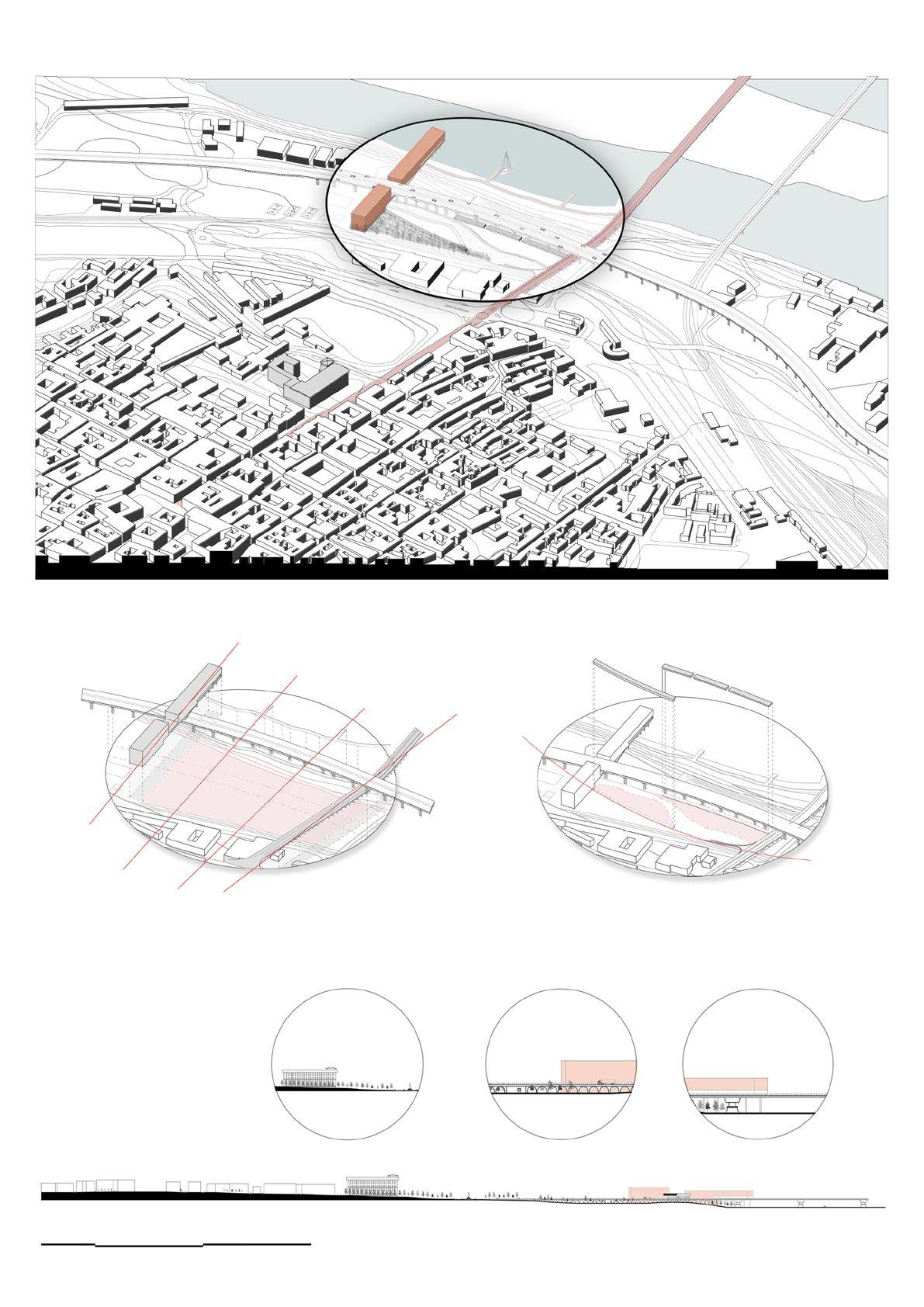
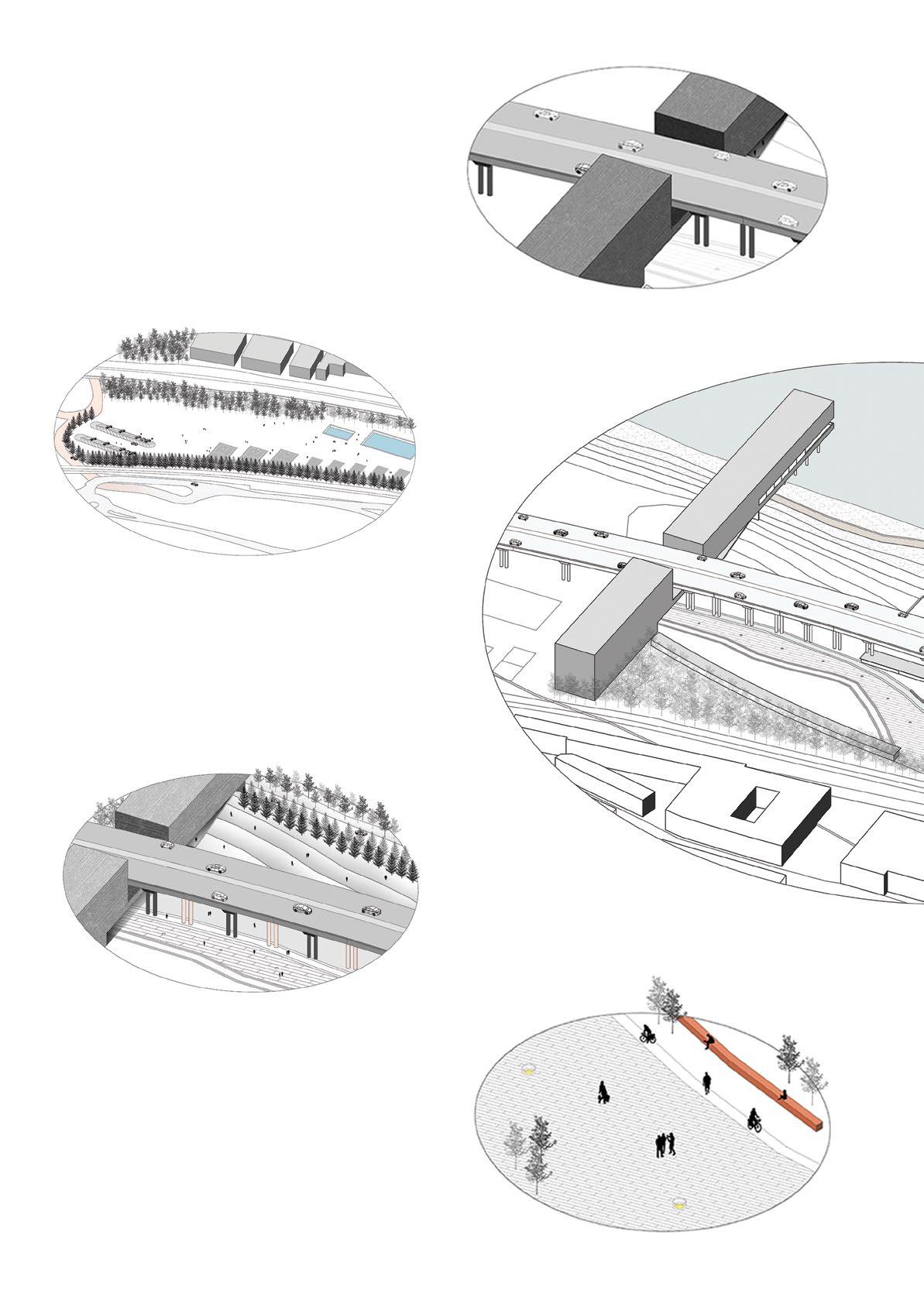
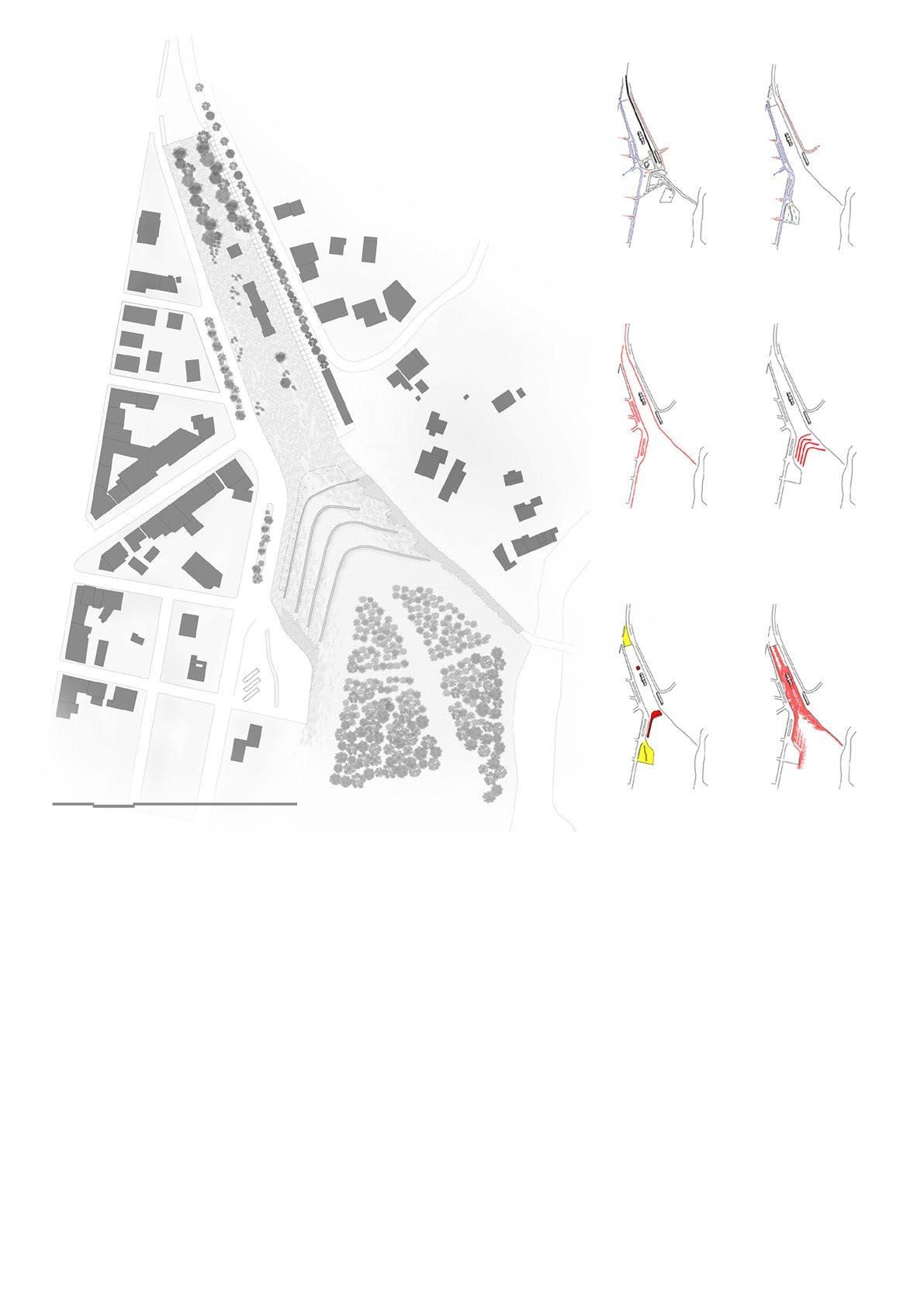
Waste management of human activity is imperative. Through the separation and treatment of mixed and homogeneous waste streams from producers, consumers and retailers, opportunities are offered to utilize the important nutrients that can be used in the agricultural sector. The processing of these secondary raw materials also provides opportunities for new packaging solutions, biochemicals and biofuels. Through all these processes, it must be understood that the future of the circular economy is rather based on this focal point, as here the closure of the production and consumption cycle can occur.
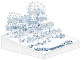
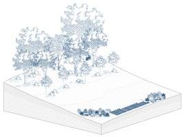
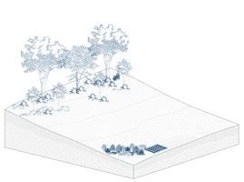
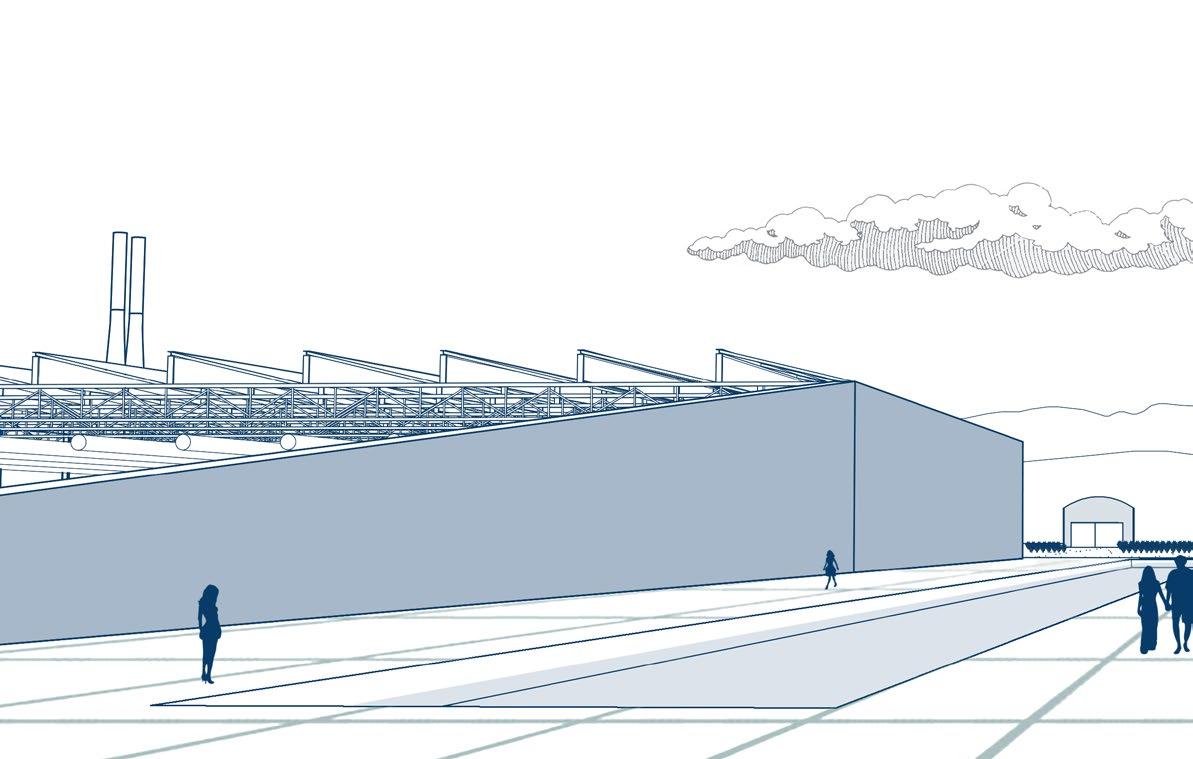
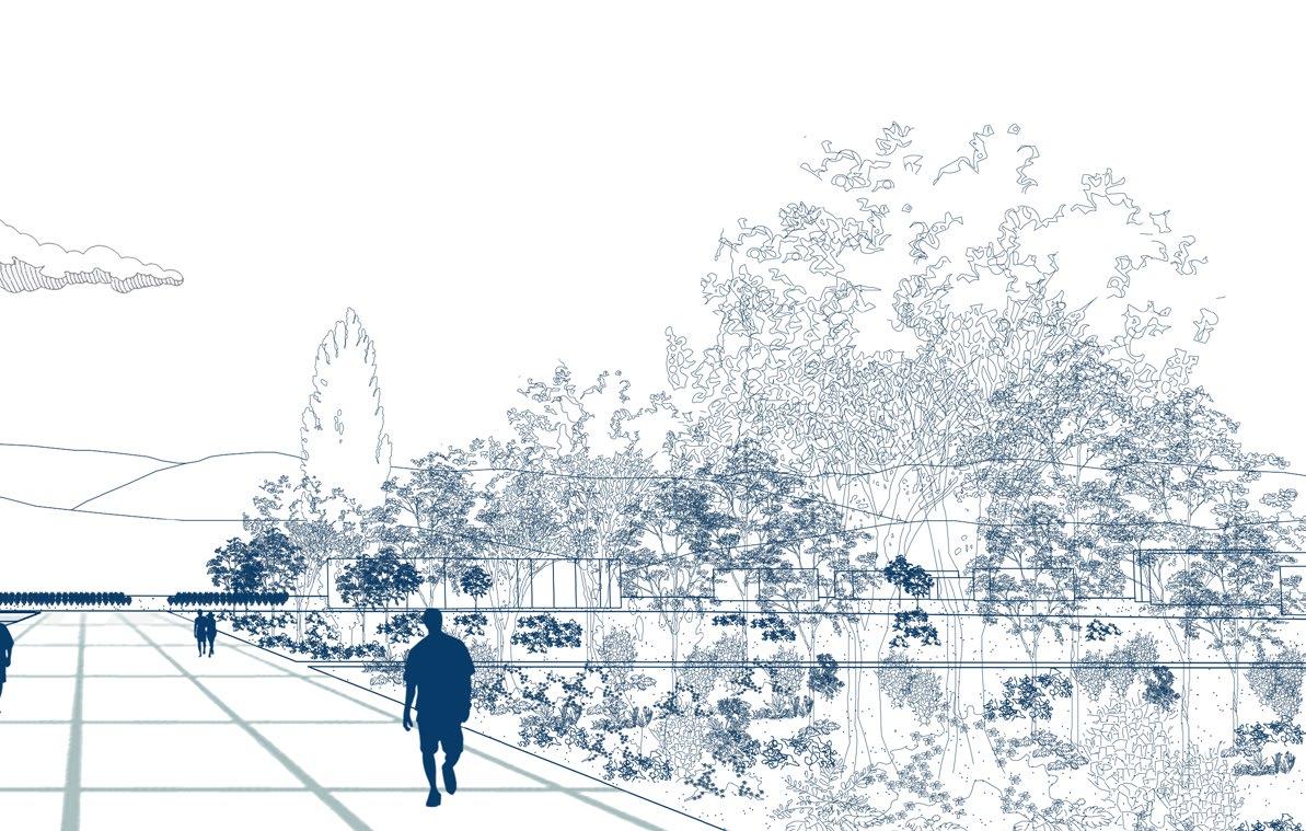
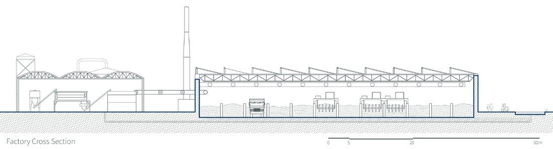
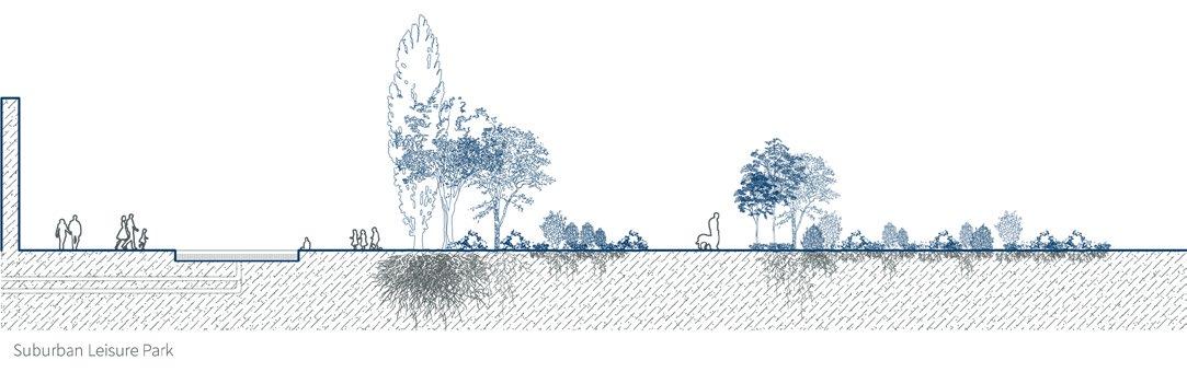
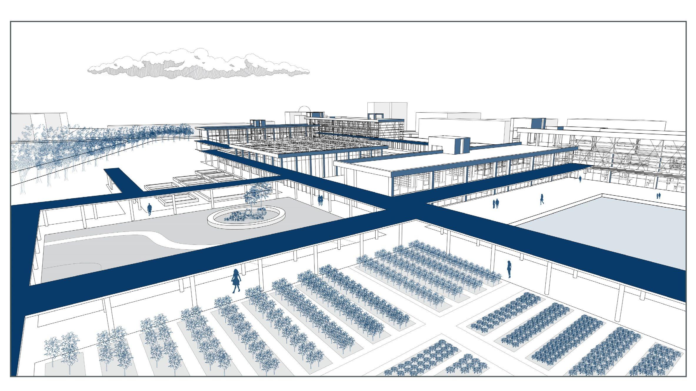
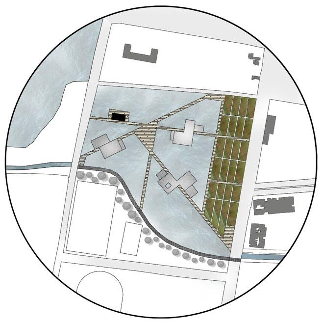
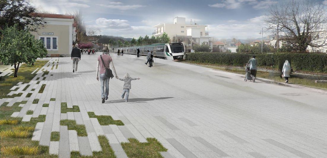
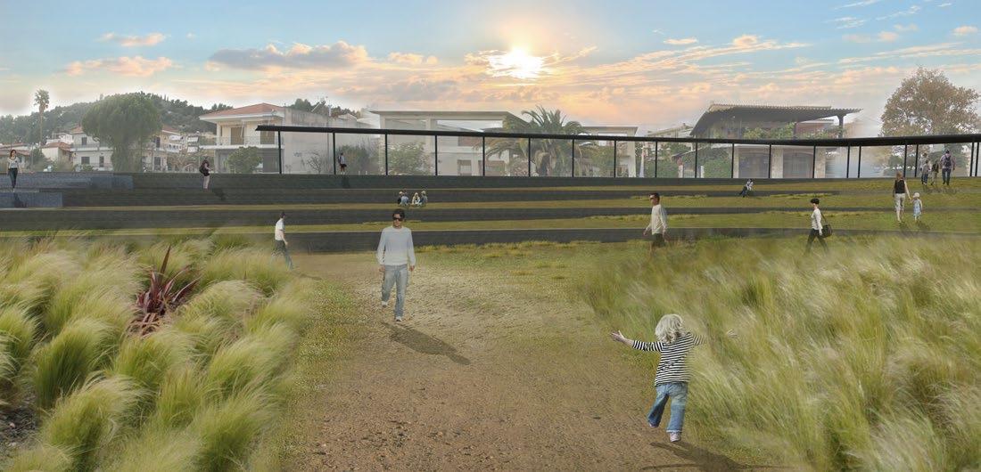
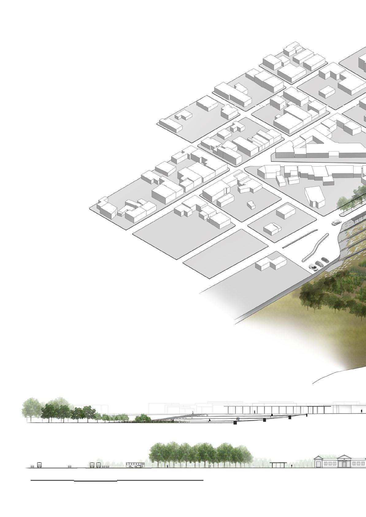
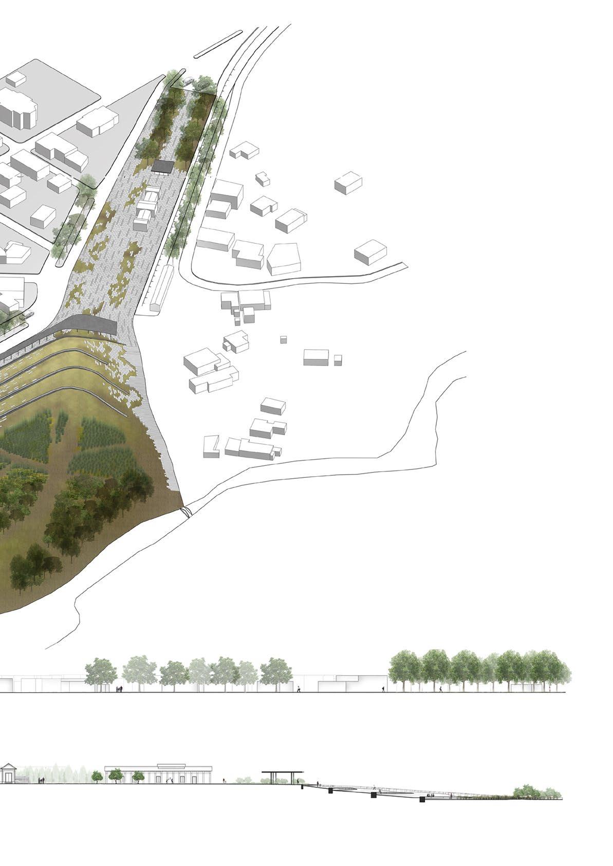
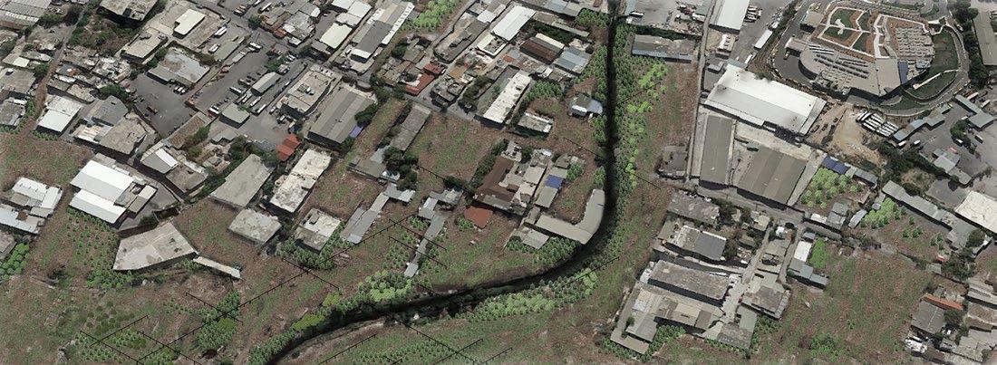
As a primary strategic step, the creation of a composting and bio-refining center was defined in an area on the northeastern borders of the city. Three operation programs were designed in the intervention plot. In addition to the factory, a peri-urban recreation park was formed and some plots of land intended for energy crops were organized
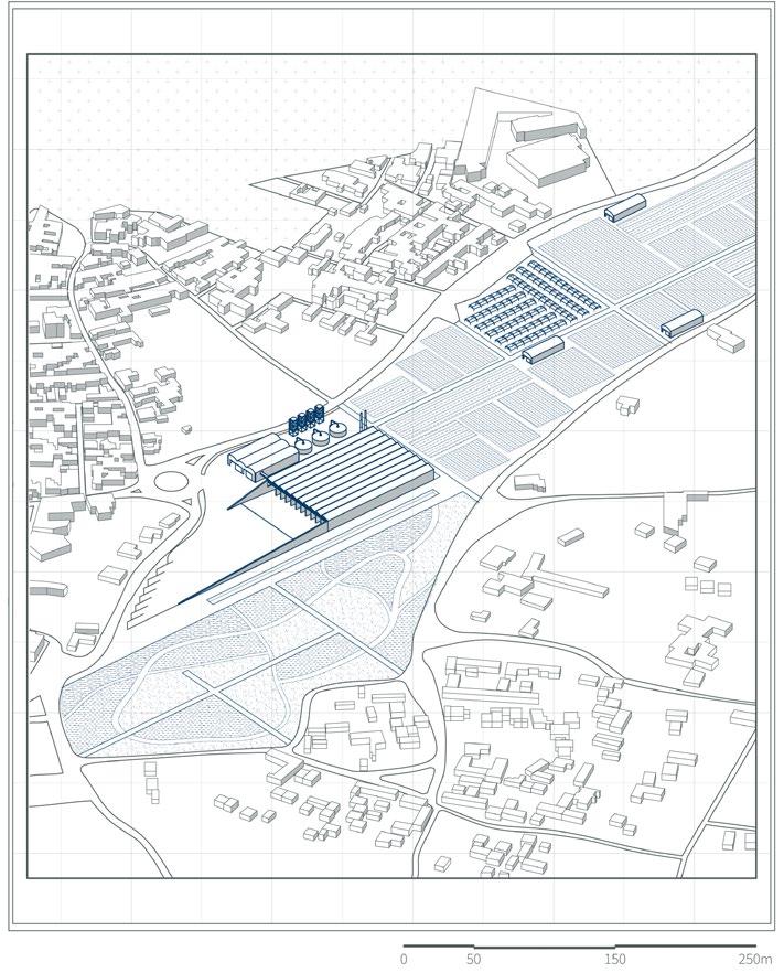
 Axonometric Plan of the Composting Plant District
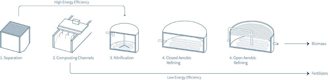
 Composting and Bio-refinery Flow
Factory Cross Section
Suburban Leisure Park
Composting and Bio-refinery Flow
Factory Cross Section
Suburban Leisure Park
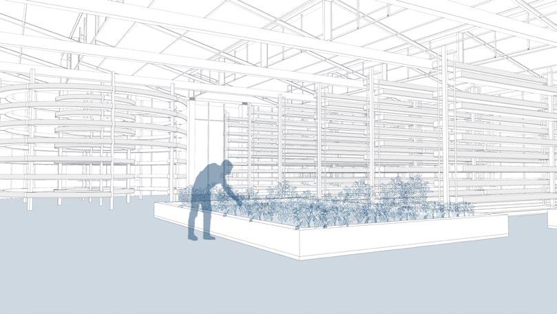
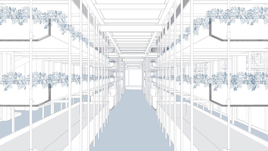
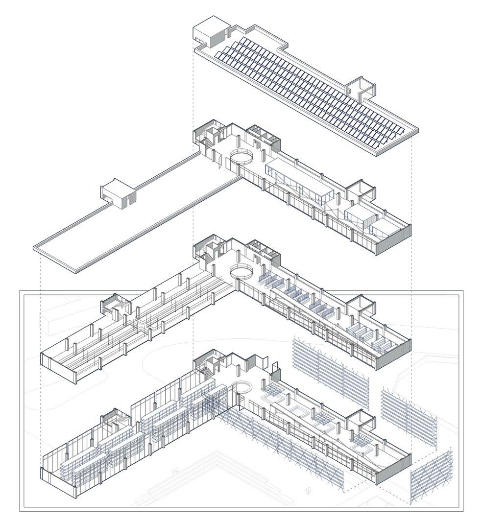
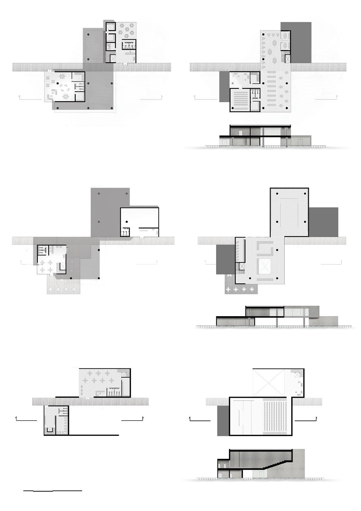
The tertiary sector is very much related to human communities. The main goal is to develop a network that will integrate the daily activities of citizens in order for them to be part of a circular society. It is worthwhile to set up structures that will promote cyclical practices and incorporate new technologies and ideas on issues such as indoor cultivation, reuse and upcycling.
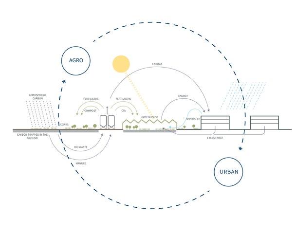

The creation of a center of circularity in the basic fabric of the city, lays the foundations for the promotion of the circular ideology to the citizens with standard circular practices open to the public
The left gamma-shaped building was transformed into a modern indoor cultivation structure, while the right building was formed into a community center with functions aimed at the groups and people of the city. The in between building was converted into a greenhouse with vertical crops enclosed by a food market. In the surrounding area between them, small urban garden activities are developed, while an observatory rises, acting in combination as a rainwater collector.
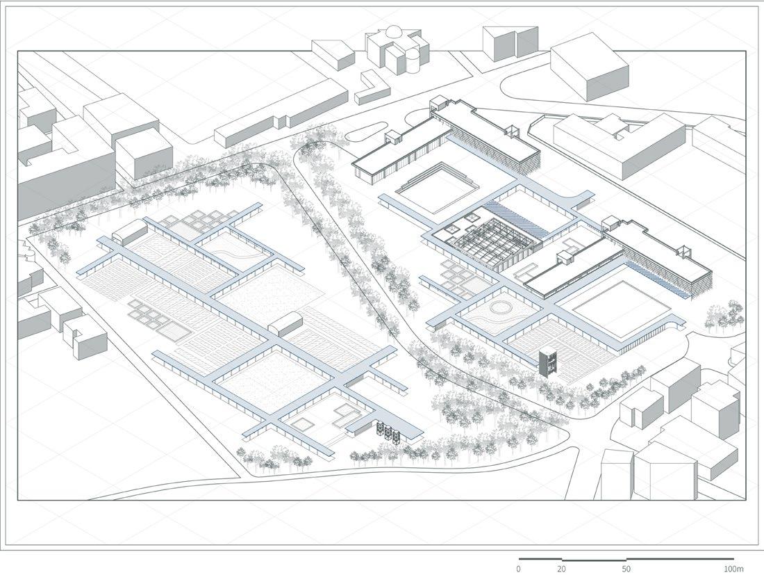
1.
2. Community
3.
4.
5.
6.
7.
Indoor Farming Structure
Hub
Greenhouse- Flea Market
Urban Farming- Gardens
Watchout Point- Water Tank
Canal
Open Air Theatre
Axonometric Plan of the Circular Hub District
1 2 3 7 5 4 4 6
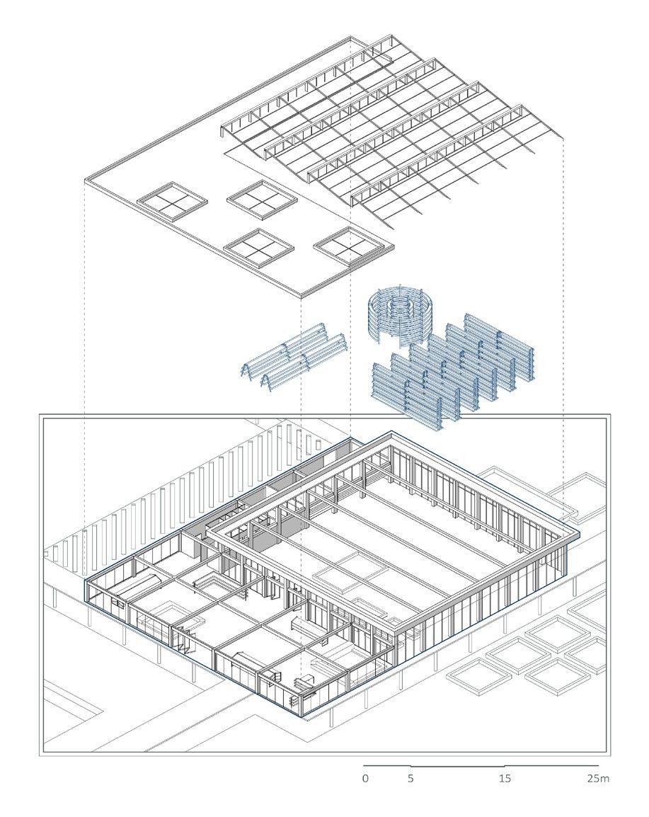
Urban Greenhouse 1. Vertical Farming Structures
Food Market
2.
1 2
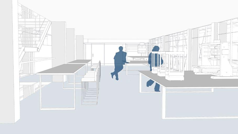
Indoor Smart Farming Hub 1. Hydroponic Towers 2. Reproduction Boxes 3. Microgreens Boxes 4. Labs- Storage 5. Green Scaffold 1 2 5 3 4
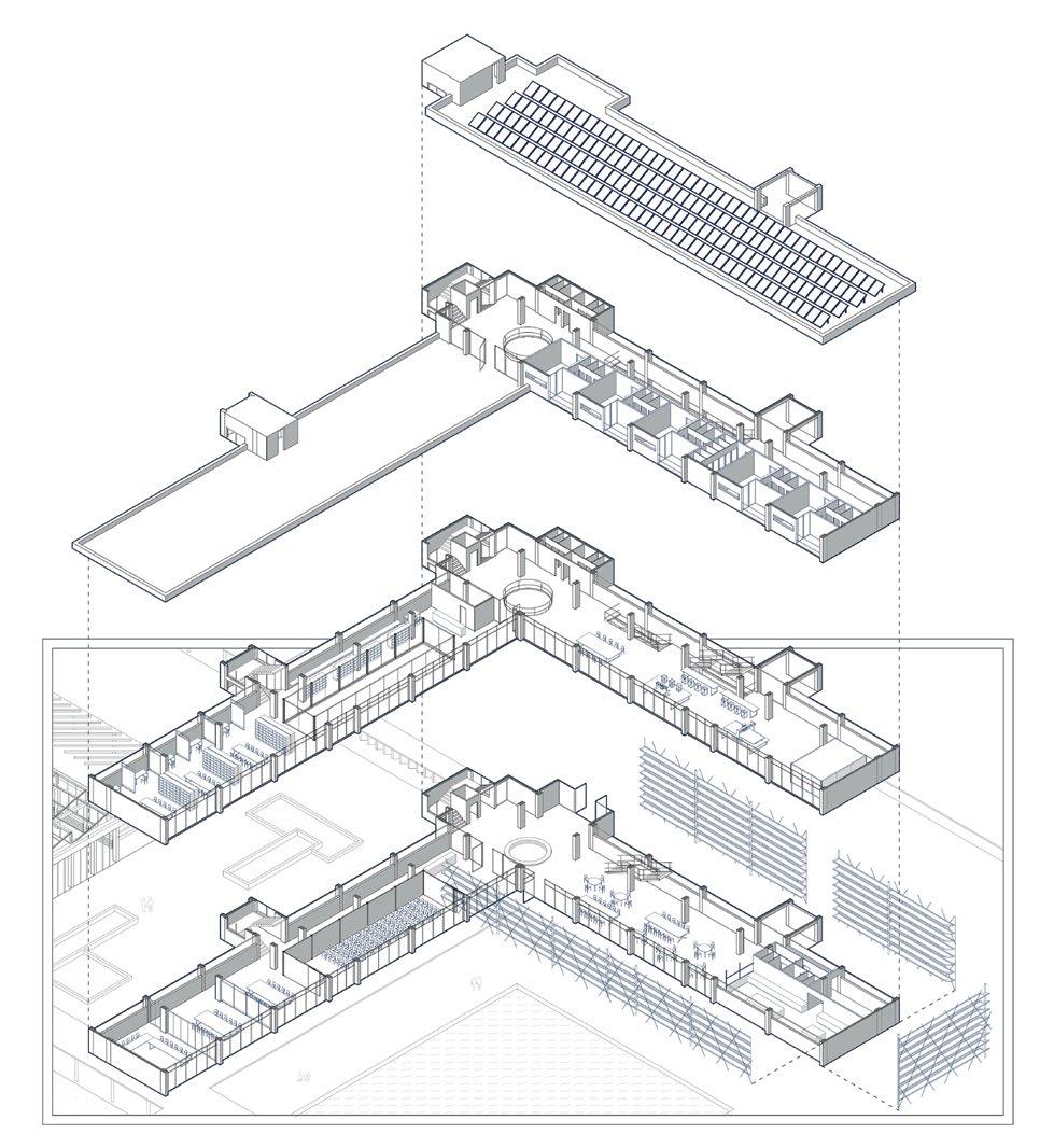
3.
5.
1 2 3 4 5 6
Community Hub 1. Conference- Meeting Rooms 2. Community Kitchen
Library 4. Fabrication Lab
Hostels 6. Green Scaffold
HAPPY CITIES
Strategies and applications in pursuit of urban well-being
Diploma Research Thesis Fall 2019
Hardcopy Publication 20x 25, 122 pages
Supervisor Prof. Alkistis Rodi
The pursuit of happiness is the ultimate goal of man throughout the development of Western culture. Since ancient times, Aristotle spoke about these elements of the city and its regime that offer suitable conditions for its citizens to be happy. Today, growing concerns about the spread of mental illness in the Western world have led to the development of a variety of theories about the pursuit of a better quality of life in developed cities.
From this reflection, the term “Happy Cities” has emerged, a term that investigates our understanding of happiness, and its possible connection with the urban planning and environmental characteristics of a city. The interpretations of happiness that have been rendered till the present day, along with recent developments in psychological and social research, comprise the core of this research. Subsequently, a novel combination of
urban design, and urban planning values is proposed, with the aim of the creation of a series of tools that promote social wellbeing in modern urban life.
The pursuit of urban happiness is a holistic process that concerns not only one’s personal way of living, but all those aspects of the way we live, think, socialize and build in the urban environment because they eventually shape cities. The challenge is not only design, but also psychological and social.
BIBLIOGRAPHY Bartetzky, Arnold, Marc Schalenberg, Louise Bromby & Christian Dietz. Urban Planning and The Pursuit of Happiness. Berlin: Jovis-Verl., 2009 / Bentham, Jeremy. An Introduction to The Principles of Morals and Legislation. Kitchener: Batoche Books, 2000 / Bruni, Luigino & Pier Luigi Porta. Handbook of Research Methods and Applications in Happiness and Quality of Life. Cheltenham: Edward Elgar, 2016 / Diener, Ed, Shigehiro Oishi & Richard E. Lucas. Subjective Well-Being: The Science of Happiness and Life Satisfaction. Oxford: Oxford University Press, 2018 / Helliwell, John F. How’s Life? Combining Individual and National Variables to Explain Subjective WellBeing. Cambridge: National Bureau of Economic Research, 2002 / Jevons, William Stanley. The Theory of Political Economy. London: Macmillan & Co, 1888 / Macunovich, Diane J. & Richard A. Easterlin. Easterlin Hypothesis. London: Palgrave Macmillan, 2008 / Marshall, Alfred. Principles of Economics. 8th ed. New York: Palgrave Macmillan, 2013 / Montgomery, Charles. Happy City: Transforming Our Lives Through Urban Design. London: Penguin Books, 2013 / Nussbaum, Martha, Amartya Sen. The Quality of Life. Oxford: Clarendon, 2010 / Smith, Adam. The Wealth of Nations: An Inquiry into The Nature and Causes of The Wealth of Nations. Oxford: Oxford University Press, 1976 / Aristotle. Nicomachean Ethics. μτφ. Δημήτριος Λυπουρλής. Thessaloniki: Ζήτρος, 2006 / Leyden, Kevin, Abraham Goldberg & Philip Michelbach. “Understanding the Pursuit of Happiness in Ten Major Cities”. Urban Affairs Review 47, no. 6 (2011): 861-888. / Sepe, Mirachela. “The Role of Public Space to Achieve Urban Happiness”. International Journal of Sustainable Development and Planning 12, no. 04 (2017): 724-733. / Happy City. “Thriving Places Index: Report Summary”, 2019 / How’s Life? 2011 - Measuring Well-Being. Paris: OECD Publishing, 2011
Neighborhood Square Regeneration through Participatory Design

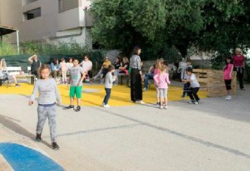
January - June 2019, Patras, GR
Organising Team Urban Commons (Astika Koina) www.astikakoina.org
Within the framework of the volunteer group “Commoners Code the City”, which was formed by professional architects and architecture students, an attempt was made to renovate and upgrade Eptanisou Square through participatory planning.
This particular square is located in a neighborhood in the area of Agia Sophia, Patras and was considered another urban void in the city without any particular feature.
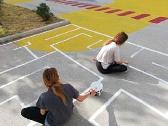
Through the conduct of certain participatory workshops and games in the square, information was gathered from the residents of the neighborhood regarding the way they experience a square and the deficiencies they consider it to have. This research turned out to be very important as the information gathered helped to redesign a space inspired by everyone for everyone.
Regarding the design procedures, several interventions took place on the ground. Four small “spots” were designed and painted in different colors, combined with a variety of floor games.
Apart from dealing with the floor, it was considered equally important to design some urban equipment that would allow childern to play but also encourage passersby and neighbors to sit in the square.
More specifically, as someone enters the square, is greeted by a 3D construction-toy shaping the word “Hello”, while below he meets a wooden platform made of pallets, which is designed so that he can sit or even lie down.
Finally, taking into account the climate of Patras, a study was carried out on the plantations that would renew the already existing flower beds of the square, which is likely to be done in a second stage of regeneration of the Heptanisou square.
POP- UP PARK
Before After
Villard 18 International Educational Urban Planning Seminar, Spring 2017 Sustainable Urban Regeneration, City of Piacenza, Italy
Supervisor Prof. Georgios A. Panetsos Project Team Kyriakidou Agapi, Stroumpas Savvas, Charalampopoulou Athina Distinction 1st Prize among three equals
Piacenza is a city and commune in the Emilia-Romagna region of northern Italy, located at a major crossroad between Bologna and Milan, Brescia and Tortona. It was former known for the agricultural production for the whole country of Italy.
However, this factor has lost its power because of the changes in the food production system. Instead, it is now a big attraction for logistics industry because of its advantageous position near to major cities of Italy.
Taking advantage of this particular feature, we design a cultural building-landmark, a gateway to the city’s entrance. Aiming to Piacenza’s sustainable regeneration, we create a new center for the city, filled with several activities, just above the banks of river Po. Sport courts, flea market, playground and otheρ frame the cultural building. His interior consists of a theater, a new municipal library and a natural history museum with a great view at the river.We create a grand new attraction, changing the city’s fate.
SPACE
UNDER
Natural Green
Residence
Major Network
Urban Fabric Roman Background
Urban Fabric Urban Green Commerce Industry
0 100 300 500m
Masterplan
City
Diagrammatic Design Development
Section
1. 2. 8.
1. Sport Courts 2. The “Gateway” 7. Urban Furnishing 8. Loggia
3. Docks 4. Parking Lot 5. Entrance Ramp 6. Element of Water 3. 4. 5. 6. 7.
0 10 30 50m Plan A Plan B Plan C
 Theater Market
Pedestrian
Theater Market
Pedestrian
Ramp Parking Plaza and Market Building Entrance
Libary
0 20 50 100m
Auxiliary Space Cafeteria Natural History Museum
Architecture
Design Studio 7th Semester Supervisor Georgios Panetsos Project Team Konstantinou Maria, Stroumpas Savvas
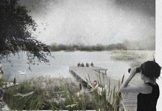
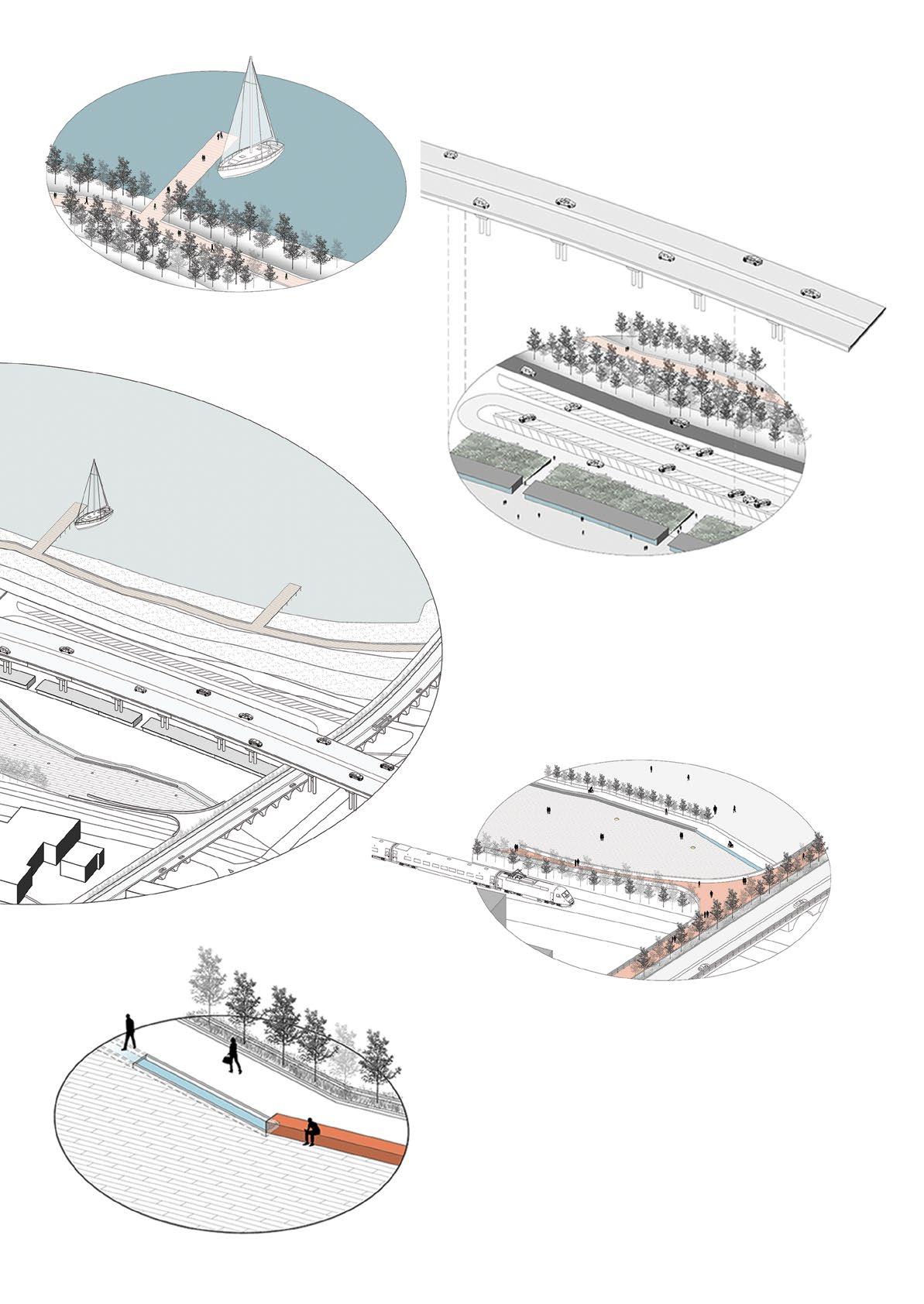
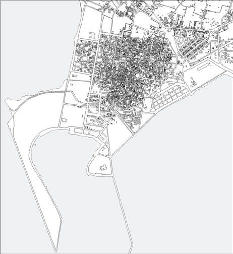
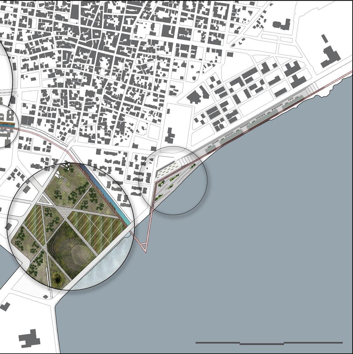
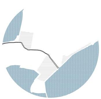
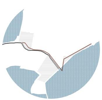
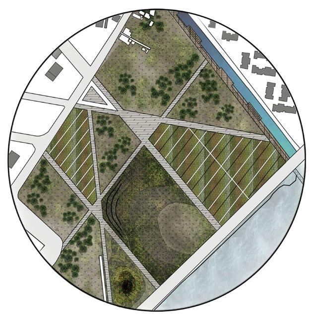
The town of Messolonghi is one of the most historic cities of Greece and is situated in a very privileged position surrounded by lagoons. However, its economy is much lighter since its tourist value has fallen sharply in recent years.
So the aim of the project is to upgrade the town of Mesolonghi in order to return to tourist conditions. For this reason, tourism, cultural and landscape interventions are planned.
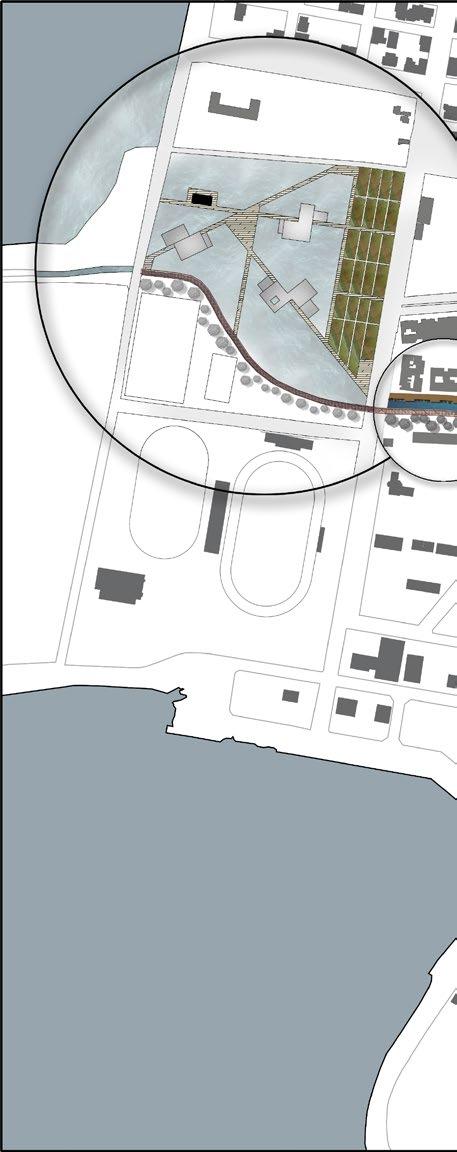
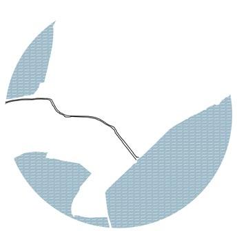
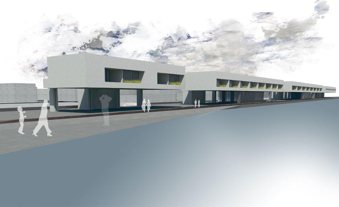
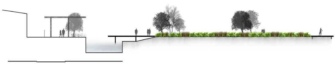
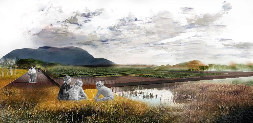
More specifically, the intervention areas are located on the two coastal fronts, east and west, as well as along the channel that runs the southern part of the city. The union of these three regions is achieved through a single engraving that is a public walk and unites all the programs. Starting from the east, the path is on the seashore and next to the hostels. Then continues on the water where the observatory is located above the water and then leads to the park of seasons. In the end, and after it has gone through the length of the channel it ends up on the west coast and the cultural park.
The town of Mesolonghi
REGAIN
MESOLONGHI
Background
0 150 300 500m
Areas of Interest Βasic �esign �ngraving
The hostels are located on the east coast where the character of the town is mainly residential. In order for the coastal path to remain public, the units are elevated and thus the loggia created underneath can attract public activity in combination with the view of the lagoon. The units include single-bed rooms, dubble-bed, four-bed(family rooms) and dorms for groups.
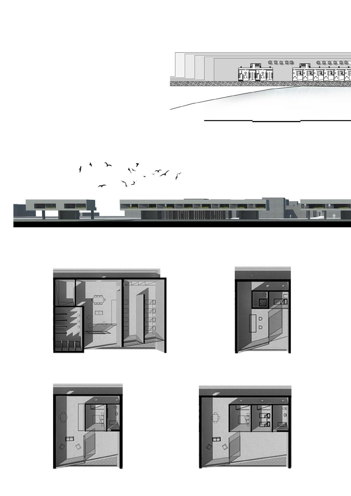
HOSTELS
Double Bed Four Bed 0 100 50
Dorms Single
Bed
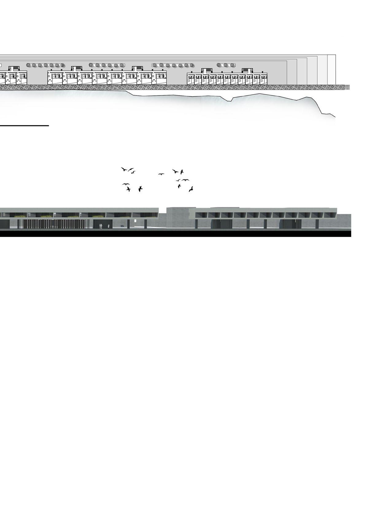
200m
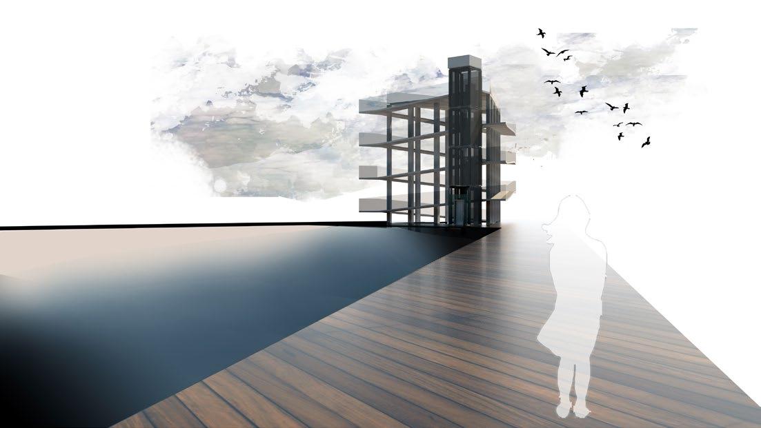
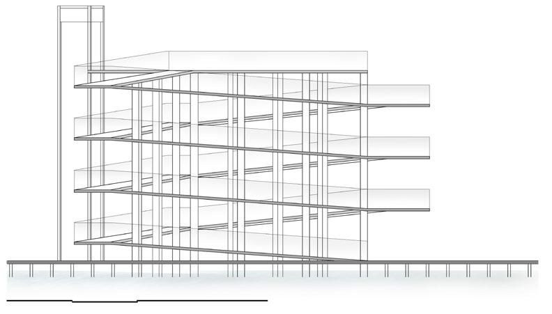
OBSERVATORY
The observatory is located at the most extreme end of the path, above the water separated from the rest of the urban web.It rises up to 12 meters and with the perimetric ascent to the top, the walker can get the general image of the city, its position and the rich natural landscape with the lagoons spread around it.
0 5 10 20m
PARK OF SEASONS
The park of seasons is located in an area that has remained unspent due to continuous floods. However, this situation is the starting point for the creation of a park that is changing according to the seasons. In addition the decks that have been designed allow the walk at any time and under any circumstances.
0 5 10 20m
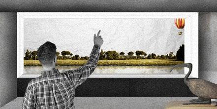
CULTURAL PARK
The cultural park on the west side is located in an artificial lake to remind of the situation where the town of Mesolonghi was located a century before, before the embankments were made.It consists of three buildings, the library, the museum and the theater, aiming to promote the rich culture of the town, which remains inactive.
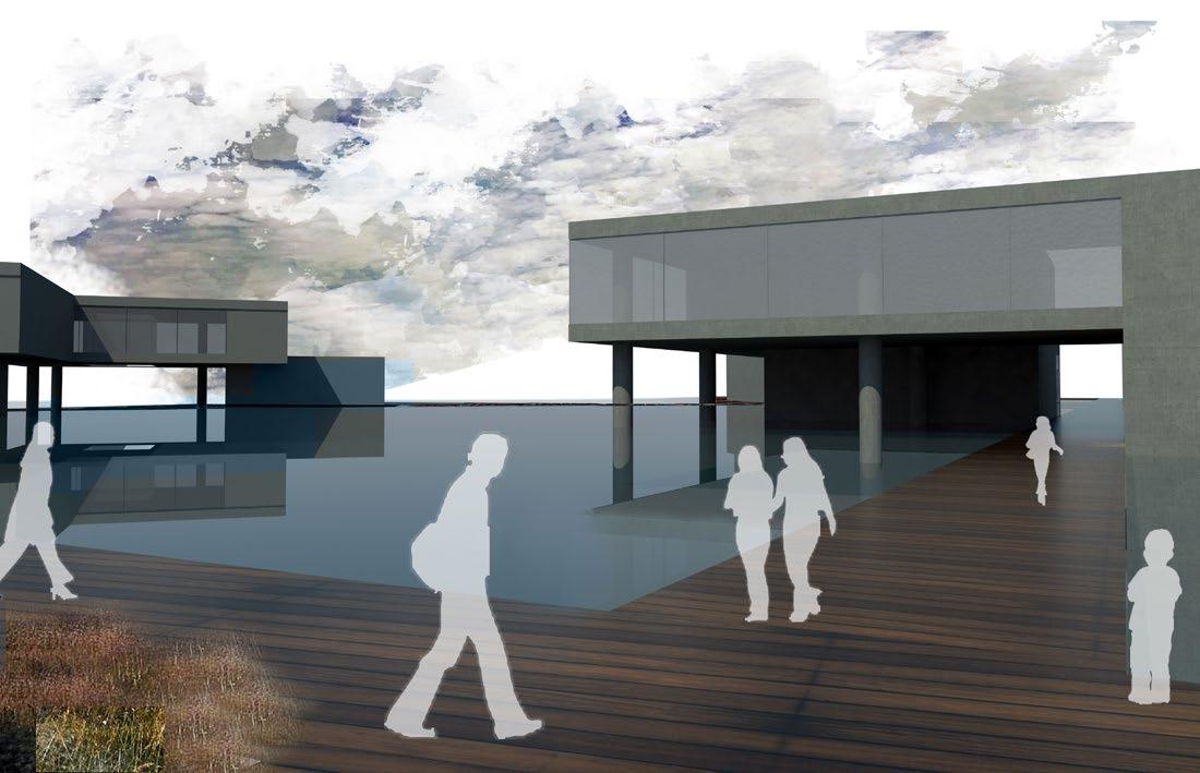
Theater 0 5 10 25m
Library Natural History Museum
Urban Design
Studio
6th Semester Supervisor Yannis Aisopos Project Team Gkikas Thomas, Stroumpas Savvas
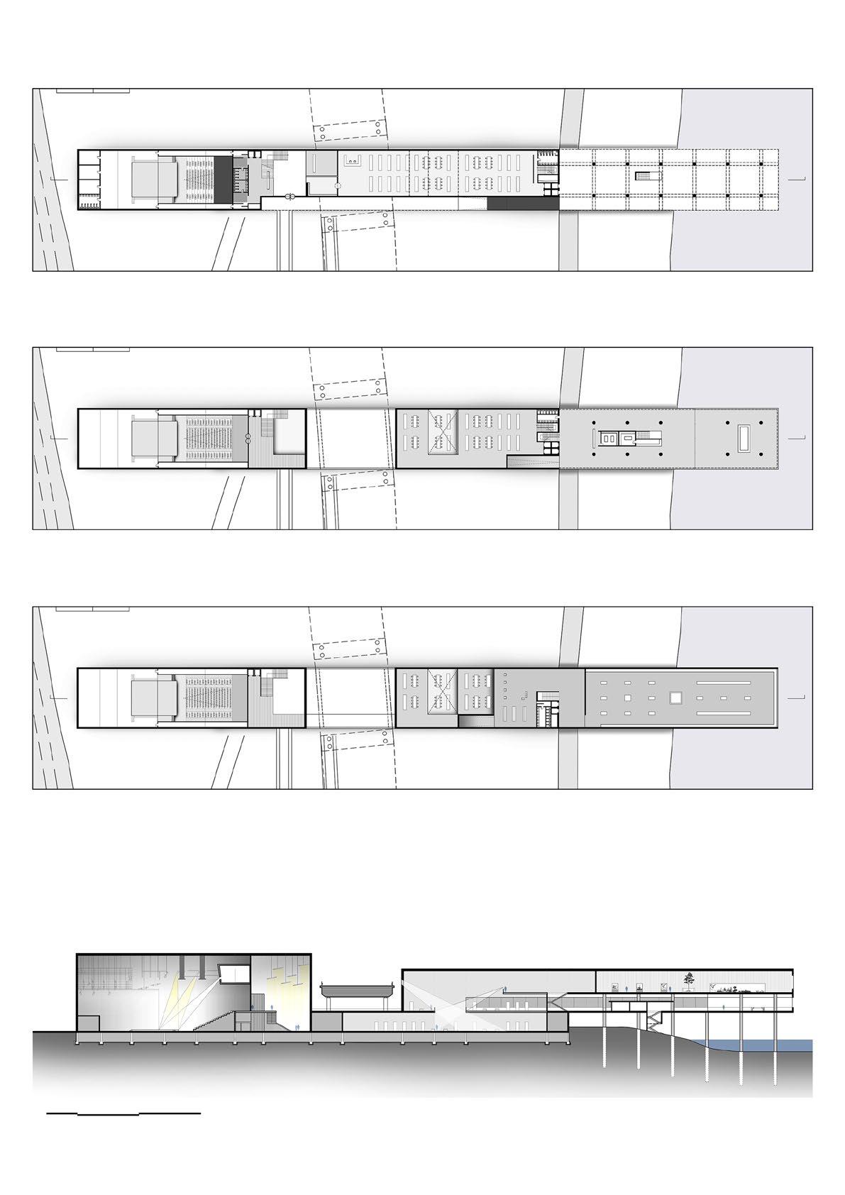
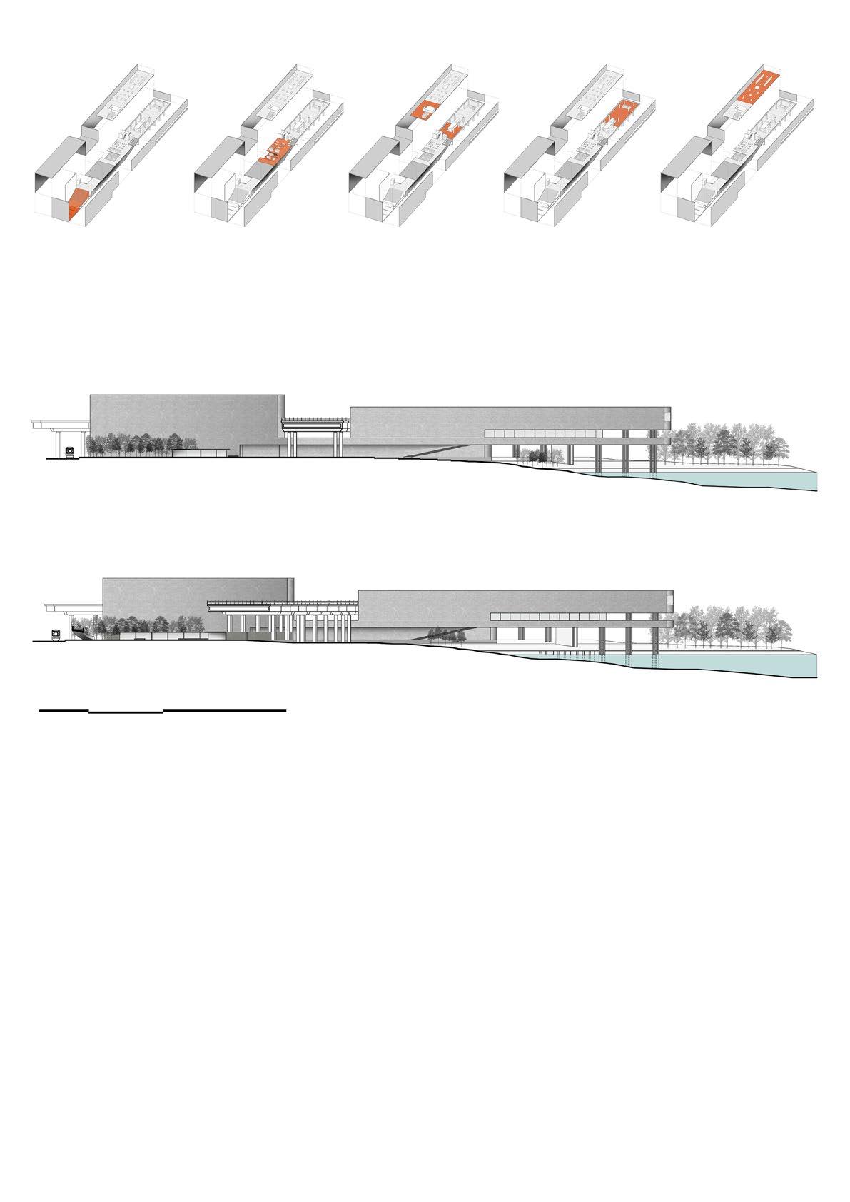
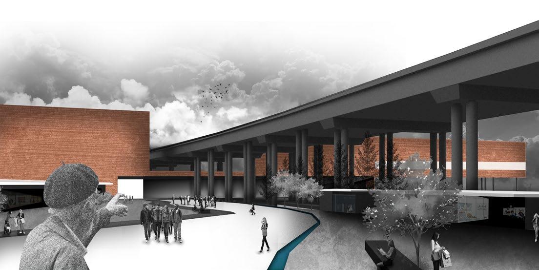
Next to the archaeological site of ancient Olympia, is located the new town of Olympia. The main feature of the area is that it depends exclusively on the tourist attraction due to the archaeological site. However, the infrastructure is minimal and rudimentary resulting in a serious problem in the management of the tourist populations annually.
This particular proposal focuses on the arrangement of the area of the train station and public car park, in order to integrate with the functions of the town and the natural landscape.
A basic planning strategy is the axis of the station platform, which as it goes down, breaks into two zones The terminal for tourist buses on the left and close to the town and that which leads to the archaeological museum on the right. Among them a park is developed which can be an attraction for both tourists and residents, since from that point the archaeological site and the sacred Cronious hill are visible.
OLYMPIA: TERMINAL
0 100 200 500m Green Built Environment Road Network Important Buildings
0 20 50 150m
0 25 50 100m
Urban Design Studio 5th Semester


 Supervisor Andreas Karavanas Project Team Gkikas Thomas, Stroumpas Savvas

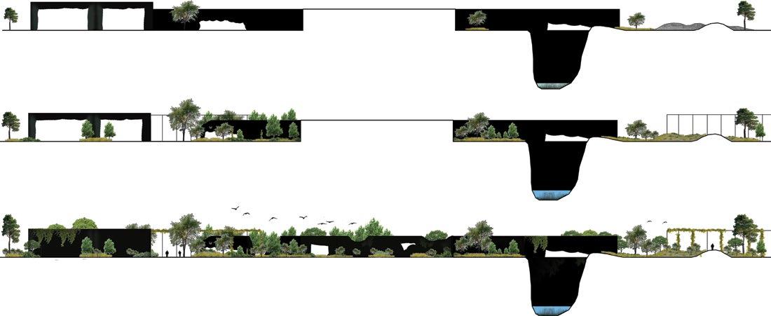
Very close to the center of Athens, on the west, lies the area of Elaionas. An area that is a brownfield for the city, as the lack of planning has led to its continuous abandonment and conversion to a dump.
The main objective for the area is to exploit this black hole that has been formed and to use the existing abandoned infrastructure under a new condition. The creation of a productive urban forest that will help revitalize the city through a new green oasis next to the center of Athens.


By creating a system of design, with basic tools the vacant land, abandoned buildings, the network of streets and the torrential flow that crosses the area, the principle of the development of the park is defined. The main advantage of this method is that the park can evolve into many phases in time and even with the least possible intervention since the creation. In addition, it is proposed to place a metal skeleton in the park, having as a role both the signaling of the paths and the arcade of the park.

ELAIONAS: URBAN REFORESTATION
The Design Approach
Vacant Land River Path Vacant Building Road <100m2 Free Vegeta�on Free Vegeta�on Path Square Path Free Vegeta�on Bushy Vegeta�on Tree Vegeta�on >100m2 >200m2 Primary Vacant Land> Vacant Building Vacant Land< Vacant Building Secondary Dirt Road
System
Possible Evolution of the Park


 Vacant Land Habitat
Habitat
Wetland Wetland
Path Path Path 2015 2015
Path Vacant Land Vacant Land 2020 2020
2025 2025
