Project grant recipient: Project funded by: Project consultant:


Cleveland Vacant Land Opportunity Tool Environmental Justice Collaborative Problem-Solving (EJCPS) Grant Cleveland, Ohio Mapping Summit May 26, 2023

Project grant recipient: Project funded by: Project consultant:
1. Project reorientation
2. Output review
3. Mapping introduction
4. City of Cleveland Planning / Community Development presentation
5. Mapping Workshop
6. Wrap Up
1. Vision
2. Partners
3. Focus geography
4. Tool development process
5. Timeline
A COLLABORATIVELY-BUILT, TRANSPARENT AND ACCESSIBLE PLANNING TOOL TO ACCELERATE VACANT LAND REUSE AND ADVANCE ENVIRONMENTAL JUSTICE.

GREY DEVELOPMENT will provide housing, create jobs, and improve walkability within key areas (near transit).
GREEN DEVELOPMENT will reduce maintenance burden, increase quality of life, and climate resiliency.

COMMUNITY DEVELOPMENT

PLANNING COMMISSION


PUBLIC WORKS

OFFICE OF SUSTAINABILITY
STAKEHOLDERS
30+ ORGANIZATIONS, INITIATIVES, AND INDIVIDUALS


CENTRAL KINSMAN
BUCKEYE-WOODHILL
BUCKEYE-SHAKER
MOUNT PLEASANT
UNION MILES
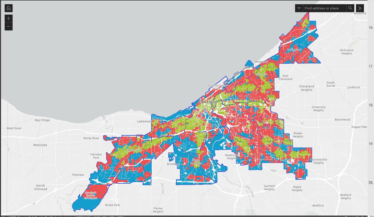
25% OF CLEVELAND LAND BANK INVENTORY


IDENTIFY PROBLEM RESEARCH PROTOTYPE DEVELOP MAINTAIN

USER RESEARCH PROBLEM IDENTIFICATION

WORKING GROUP PROTOTYPING
TOOL DESIGN AND DEVELOPMENT
MAINTENANCE LAUNCH
ACADEMIC RESEARCH
ADVISORY COMMITTEE
STAKEHOLDER SUMMIT 1.0
CWRU ENVIRONMENTAL LAW CLINIC
CORNELL L.ARCH.
RESEARCH FELLOW
1. Stakeholder Summit 1.0: User Experience Journey Maps
2. Stakeholder Summit 2.0: Working Group formation
3. Working Groups
4. Problem statements and prototypes
5. Pilot projects under development
IDENTIFY PROBLEM RESEARCH PROTOTYPE DEVELOP MAINTAIN


LONG-TERM STEWARDSHIP AND SUPPORT
PLANNING CRITERIA, METRICS, & INTEGRATION
PROCESS TRANSPARENCY & COMMUNITY ENGAGEMENT


POLICY AND FUNDING
PROTOTYPE PHASE
IDENTIFY PROBLEM RESEARCH PROTOTYPE DEVELOP MAINTAIN
LONG-TERM STEWARDSHIP AND SUPPORT
There is no consistent system of support that provides education, planning, and resources for green space developers, resulting in high rates of project failure and an increased maintenance responsibility for the City of Cleveland when projects fail.

LONG-TERM STEWARDSHIP AND SUPPORT
PROTOTYPE SOLUTION
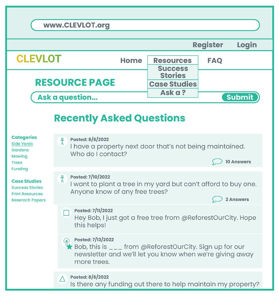
A web forum to access and archive crowd-sourced information about planning, funding, and operating vacant land reuse projects.

For residents, organizations, and developers wanting to reuse/revitalize vacant land, there is a lack of clarity around the process of acquiring land from the City of Cleveland Land Bank resulting in delays, lost investments, and diminishing trust.


A print and digital graphic representation of the vacant land reuse process for residents and organizations that identifies areas for community involvement.
The current Cleveland Land Bank disposition process is time-intensive, reactive, and lacks strategy, causing the rate of incoming parcels to outpace the rate of parcel disposition and a steady increase in parcel inventory.

A set of definitions and policies that empowers the Cleveland Land Bank to facilitate faster and more strategic disposition of vacant parcels.

Decision makers lack an environmental justice data tool to locate projects on vacant land with consideration to beneficial and harmful features and in alignment with neighborhood, city, and regional goals.


A selection of data to define environmental justice and method to capture community vision that informs vacant land reuse decisions.
PILOT DEVELOPMENT PHASE
IDENTIFY PROBLEM RESEARCH PROTOTYPE DEVELOP MAINTAIN
BASED ON PROTOTYPING PROCESS
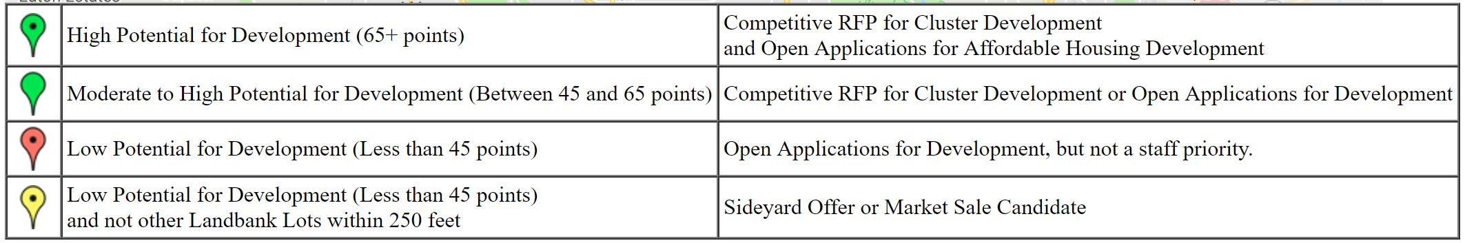
VACANT LOT REUSE PRIORITY MAP USER-FRIENDLY APPLICATION PROCESS

DEMONSTRATION PROJECT
DIGITAL RESOURCE CENTER
PHYSICAL RESOURCE CENTER


WHY ARE WE HERE?
1. Working groups and other research highlights need for criteria
2. Recommendation from CWRU Environmental Law Clinic research
3. Review of existing criteria included in Land Bank applications
4. City of Cleveland initiatives to integrate / upgrade criteria
Decision makers lack an environmental justice data tool to locate projects on vacant land with consideration to beneficial and harmful features and in alignment with neighborhood, city, and regional goals.

The current Cleveland Land Bank disposition process is time-intensive, reactive, and lacks strategy, causing the rate of incoming parcels to outpace the rate of parcel disposition and a steady increase in parcel inventory.


CRITERIA FOR VACANT LAND REUSE
8 IDEAS FOF VACANT LAND REUSE, CLEVELAND CITY PLANNING COMMISSION (C. 2010)


The Department of Community Development envisions a Cleveland where stakeholders are empowered to build the pathway to equity. This vision is realized by creating quality housing and vibrant neighborhoods that serve as the foundation for generational wealth and community prosperity.
Web: www.clevelandohio.gov/cd


Erie and River Access

Single Family
Transit Corridor


Single Family Infill
Neighborhood
Boundary
Side Yard Or other
High TOD
Competitive Infill
15 minutes
Single Family
Side Yard Or other
Single Family
Park/ School Development

• Slight different distribution between Cuyahoga River East and West
• Location with excellent Access to Public Transit and concentrated amenities
32 (Top 25% Score)• Distribution between Cuyahoga River East and West


• 28 is top 25%.
• Location concentrated with excellent amenities


• Public web map
• https://clevelandgis.maps.arcgis.com/apps/webappviewer/index.htm
l?id=1c40c47ecdf34f42b9118cf7f83c28a4
• Land Bank online application portal will be availed on June/July this year.
https://portal.neighborlysoftware.com/clevelandoh/participant

1. What we want to do today: check existing criteria, propose new
2. What we want don’t want to do today: create neighborhood masterplans
3. Group activity
MAP PHYSICAL FEATURES TO GUIDE SUSTAINABLE VACANT LAND REUSE
If there’s a transit stop, then build infill housing


If there’s a fire hydrant, then plant trees


MAPPING, NOT MASTER PLANNING
Collective experience
Ground truth data + community engagement
Implementation
Map physical features to guide decisions and improve communication
WE ARE HERE
Planning + design
-


STABILIZATION
-
URBAN AGRICULTURE
STORMWATER MANAGEMENT

GREENSPACE EXPANSION

ALTERNATIVE ENERGY
LAND ASSEMBLY

CONTAMINATION REMEDIATION
SUSTAINABLE DEVELOPMENT PATTERN

STABLIZATION
- Core development areas
- Core development area buffer
- Neighborhood centers
- Walkable areas
- Primary cooridors
- Neighborhood Stabilization Program target areas
- Strategic Investment Initiative areas
URBAN AGRICULTURE
Preferred:
- Core development area buffers
- Historic prime farmland soils
- Within 0.25 miles of a transit
- Within 0.25 miles of a park
- Within 0.25 miles of a school
Excluded:
- Core development areas
- Walkable areas around nodes
- Existing development projects
ALTERNATIVE ENERGY
Opportunities for wind:
- Wind speeds of 14 mph or greeater
- Major ridges
- Elevations 800’ or higher
Excluded:
- Riparian
LAND ASSEMBLY
- Current and anticipated development activity for residential, commericial, and industrial
- Well-drained and sandy soils
- Culverted streams
- Separate sewer system areas
- Existing wetland
- Proposed open space
- Riparian areas
GREENSPACE EXPANSION
- Park deserts
CONTAMINATION REMEDIATION
SUSTAINABLE DEVELOPMENT PATTERN
Risk factors:
- Within 500’ of a brownfield indicator
- Industrial land use
- Retail corridors
- Exposure factors:
- Neighborhood centers
- Within 1,000’ of a school
Suitable for intensified development:
- Neighborhood centers
- Rabid Transit Stops
- BRT Stops
- Walkable areas around Neighborhood Centers
- Walkable Area around Transit or Development Cooridor
- Proposed Open Space
- Proposed Residential Outside Walkable Distance
-
- Culverted streams
- Separate sewer system areas
- Existing wetland
- Proposed open space
- Riparian areas
- Core development areas
- Core development area buffer
- Neighborhood centers
- Walkable areas
- Primary cooridors
- Neighborhood Stabilization Program target areas
- Current and anticipated development activity for residential, commericial, and industrial
- Rabid Transit Stops
- BRT Stops
- Risk factors:
- Within 500’ of a brownfield indicator
- Industrial land use
- Retail corridors
- Park deserts
- Strategic Investment Initiative areas
- Walkable Area around Transit or Development Cooridor
Exposure factors:
- Neighborhood centers
- Historic prime farmland soils
- Within 0.25 miles of a transit
- Within 0.25 miles of a park
- Within 0.25 miles of a school
Excluded (urban ag only):
- Core development areas
- Walkable areas around nodes
Existing development projects
- Proposed Residential Outside Walkable Distance
- Within 1,000’ of a school
Opportunities for wind:
- Wind speeds of 14 mph or greeater
- Major ridges
- Elevations 800’ or higher
Excluded:
- Riparian
1. Discuss criteria for grey development in small groups
2. Discuss criteria for green development in small groups
3. Share and sort small group criteria on wall
4. Group discussion about criteria selection
5. Prioritizie the most important criteria


Cuyahoga County Rice Library and context

Cuyahoga County
Rice Library and context

Rice Library and context, census block
Rice Library and context, parcel