Final Plan - February 2023


Final Plan - February 2023


This project is funded through a Caltrans Sustainable Planning Grant award. Local match for this grant was provided by the San Francisco County Transportation Authority (SFCTA), made possible through Proposition K local transportation sales tax funds.

The San Francisco Municipal Transportation Agency (SFMTA) would like to thank District 9 Supervisor
Hillary Ronen and District 10 Supervisor Shamann Walton for their consistent support of the project. We would also like to thank critical community partners, including Family Connections Centers, River of Life Church, Portola Neighborhood Association, Portola Garden Club, Friends of McLaren Park, Portola Branch Library, Vis Valley Community Unity, Mission Blue Cafe, Asian Pacific American Community Center, Little Hollywood Neighborhood Assocition, the Felton Institute, Visitacion Valley Branch Library, the Visitacion Valley Greenway Project, the Vis Valley Neighborhood Association, John King Senior Center, the Samoan Community Development Center and many others. We would also like to thank our institutional partners: the SFCTA, the Recreation & Parks Department, Mercy Housing, the Department of Public Works, and others.
This Draft Plan will be finalized in the winter of 2023, with Final Plan adoption anticipated at the SFMTA Board of Directors in March of 2023.
Thank you to the communities of Visitacion Valley, Portola, Little Hollywood, and Sunnydale for their participation in the Vis Valley & Portola CBTP.
A. SFMTA Board
Directors
Gwyenth Borden, Chair of the Board
Amanda Eaken, Vice Chair
Stephanie Cajina, Director
Steve Hemminger, Director
Fiona Hinze, Director
Manny Yekutiel, Director
B. SFMTA Executive Team
Jeff Tumlin, Director of Transportation
Viktoriya Wise, Chief of Staff
Deanna DeSedas, Interim Director of Communications, Marketing & Outreach
Virginia Harmon, Senior Manager Contracts & Procurement
Bree Mawhorter, Chief Financial Officer
Jonathan Rewers, Chief Strategy Officer
Kimberly Ackerman, Chief People Officer
Kate Breen, Government Affairs Director
Josephine Ayankoya, Racial Equity Officer
Melvyn Henry, Director of Safety Division
Tom Maguire, Director of Streets Division
Kate Toran, Taxis, Access & Mobility Services Director
Julie Kirschbaum, Director of Transit
B. SFMTA Project Team
Tracey Lin, Senior Planner, SFMTA Transit Service Planning
Christopher Kidd, Senior Planner, SFMTA Planning
Maia Moran, Planner, SFMTA Planning
Mariana Maguire, SFMTA Communications
Kim Walton, Planner, SFMA Planning
Hannah Greenberg, Student Intern, SFMTA Planning
Javaun Garcia, Student Intern, SFMTA Livable Streets
Josephine Justin, Student Intern, SFMTA Planning
Kenny Li, Student Intern, SFMTA Planning
Elliot Goodrich, Engineer, SFMTA Livable Streets
Gabriel Ho, Engineer, SFMTA Livable Streets
Kim Walton, Senior Planner, SFMTA Planning
Chiamaka Ogwuegbu, Mayor’s Office
Chimmy Lee, Graphic Designer, SFMTA Creative Services
Leon Yu, Graphic Designer, SFMTA Creative Services
C. District 9 Supervisors Office
District 9 Supervisor Hillary Ronen
Ana Herrera, Legislative Aide
D. District 10 Supervisors Office
District 10 Supervisor Shamann Walton
Natalie Gee, Chief of Staff
Percy Burch, Legislative Aide
E. Community Partners
Robert Cowan, Pastor, River of Life Church
Eleazar Martinez, Family Support Director, Family Connections Centers
F. Technical Advisory Committee
Kimberly Overton, Caltrans
Brian Stokle, SF Recreation & Parks Dept
Rachel Schuett, City Planning Department
Annette Williams, SFMTA Taxi, Access & Mobility Services
Emily Heard, SFMTA Budget, Financial Planning & Analysis
Enrique Aguilar, SFMTA Communications
Jessica Garcia, SFMTA Transit Service Planning
Kenya Wheeler, SFMTA Curb Management
Paul Stanis, SFMTA Livable Streets
Paul Barradas, SF Public Works Department
Peter Walsh, SF Police Department
David Long, SF County Transportation Authority
Plan Purpose
Projects Map
Policy Recommendations
Public Outreach
Project Timeline
Statement of Intent
Plan Structure
Next Steps
The two communities of Visitacion Valley and Portola are located in the southeast corner of San Francisco. They are bounded on the south by Daly City, to the east by Highway 101, to the north by Interstate 280, and to the west by McLaren Park. These two communities are among San Francisco’s most diverse, with a long history of community advocacy and community beautification efforts.
Located far from the downtown core of San Francisco, the communities of Vis Valley and Portola face substantial barriers and challenges to their transportation needs. The future developments of Schlage Lock to the south and Candlestick Park to the east present opportunities for transportation investment in these communities, but also carry with them fears of displacement. Transportation investments in Vis Valley and Portola should be centered around meeting the needs of current residents, helping the most vulnerable grow-in-place without fear of displacement, and enhance the long history of community beautification.
The Visitacion Valley and Portola Community Based Transportation Plan (VV/P CBTP) is a 2-year community-driven planning effort. The VV/P CBTP is funded through a Caltrans Sustainable Planning Grant award, as well as a matching allocation from the Proposition K Transportation Sales Tax, managed by the San Francisco County Transportation Authority (SFCTA). The VV/P CBTP
seeks to improve physical mobility in the area by focusing on meeting the needs of the existing residents and businesses. This plan, and the public process around it, is also meant to deepen and strengthen the relationship between SFMTA and the broad array of stakeholders in these two diverse communities. This plan should be viewed a starting point for a series of projects in years to come, developed in collaboration with community stakeholders.
During a two-year planning process, SFMTA partnered with two essential organizations: Family Connections Center , reaching residents in the Portola community; and River of Life Church , reaching residents in the Vis Valley and Sunnydale communities. Through partnership with these organizations, we deeply reached residents across five different languages to develop the final plan.
This plan brings together a wide array of ongoing transportation projects being led by other divisions at SFMTA and by other City agencies. One purpose of this plan is to comprehensively assess the impacts of these various projects , then find complementing and connecting projects to strengthen them, create mutual benefit, and close the gaps in needs identified by community members. The Plan includes a set of proposed infrastructure projects and a set of policy recommendations for noninfrastructure needs identified by the community.
The CBTP’s intention is to create a transportation vision directly responding to the needs and values of residents living there today. Our Statement of Intent establishes what a responsive, accountable plan looks like. (See Page 32)
• Repair past harms and center community needs throughout the CBTP process
• Leverage past work to understand ongoing and evolving needs
• Work directly with the community to identify challenges and appropriate solutions
• Ensure community engagement is culturally competent
• Support community-prioritized challenges and solutions with relevant data
• Lay groundwork for early implementation
• Prioritize local funding and advocate for more funding
This plan includes $25.3 million worth of projects that were identified, developed, and prioritized by community input over a three-stage engagement process. Following adoption of the plan, the SFMTA will pursue near-term, mid-term, and long-term efforts to deliver the highest priority projects in the community.
Visitacion Valley & Portola
Community Based Transportation
Final
# Portola projects
Valley projects
Other Proposed Projects
Alemany 交汇处路径 | Con đường đi bộ Alemany Camino del Intercambiador de Alemany Landas ng Alemany Interchange
SFMTA Tra c Calming Projects (Speed cushions & crosswalk islands)
減速帶和改進的人行橫道
Streetscape
New Bikeways
新的自行車項目 | Dự án xe đạp mới nuevos proyectos de bicicletas | Mga bagong bikeway
新照明 | Ánh sáng mới nueva iluminación | Bagong ilaw
Crosswalk Flashing Beacons
đèn hiệu nhấp nháy cho ngườ đi bộ qua đường balizas intermitentes para cruces de peatones crosswalk na kumikislap na mga beacon
Raised Crosswalk
凸起的人行橫道 | Đường băng qua gờ giảm tốc paso de peatones elevado | nakataas na tawiran
Pedestrian Bulb Out
較短的人行橫道 | Đường băng qua ngắn hơn Cruces peatonales más cortos | Mas maiikling tawiran
速度颠簸 | Gờ giảm tốc badenes | Bilis ng bumps 3 6 5 5 8
Gờ giảm tốc và cải thiện ố sang đường Reductores de velocidad y cruces peatonales mejorados Bilis ng mga bump at pinahusay na mga tawiran
Visitacion Ave 步行和騎自行車安全項目
Visitacion Ave dự án an toàn đi bộ và đi xe đạp Proyecto de seguridad para caminar y andar en bicicleta Visitacion Ave naglalakad at pagbibisikleta proyekto
Portola Freeway Greenway (Portola Neighborhood Association)
波托拉高速公路綠道 | Đường cao tốc Portola greenway vía verde de la autopista de Portola
Portola freeway greenway
Sunnydale HOPESF Roadway Projects (New bike lanes & bike path)
桑尼代爾有自行車道的新街道
Những con phố mới vớ làn đường dành cho xe đạp ở Sunnydale Nuevas calles con ciclovías en Sunnydale
Yosemite Creek Daylighting Project (New Sidewalk - SFPUC)
Proyecto de acera de Yosemite Creek
新人行橫道 | lố băng qua đường mới nuevo paso de peatones | bagong tawiran
New Crosswalk Muni Stop Improvement
巴士站改善 | cả tiến trạm dừng xe buýt mejoras paradas de autobus | pagpapabuti ng bus stop
Sunnydale
Proyekto sa bangketa ng Yosemite Creek
Freeway Ramp Intersection Safety Study Phase 3 (SFCTA)
高速公路坡道安全研究 | Nghiên cứu an toàn lối ra xa ộ Estudio de seguridad de rampa de autopista Pag-aaral sa kaligtasan ng ramp ng freeway
Community needs in Vis Valley and Portola expand beyond the infrastructure projects identified in this plan, and often expand beyond areas under the direct control of SFMTA. This plan seeks to elevate and memorialize these community needs, to better support programmatic solutions following plan adoption. (See Page 79)
Community Partnerships: There are a broad array of diverse and dedicated community-based organizations in both Vis Valley and the Portola. Future work by the agency should always seek partnerships with these organizations to better engage residents.


Transit Service: Reduce crowding on existing lines; improve arrival time information & access; and pursue service connections to destinations like the Mission District.
Transit Safety: Install more transit shelters and increase lighting around transit stops; provide additional MTAP staffing on high-capacity lines to improve on-transit safety; prioritize sidewalk repair at or near transit stops.
Focus on Local Trips: Work with community organizations to better understand transportation gaps.
Access to Services: Increase multi-lingual outreach and assistance for programs like the Essential Trip Card, the Lifeline Transit Pass, and the Free Muni for Seniors program.
Support Community Greening: Support communitydriven efforts like the Portola Freeway Greenway, the Vis Valley Greenway, and beautification in McLaren Park.
Parking: Find strategies to reduce double-parking on San Bruno Avenue and to deter parking on sidewalks that are restorative and community supportive.
Bikes: Support programming, education, and access efforts for bicycling in Vis Valley & Portola, especially among low-income families and families with limited English proficiency.

Over 14 months, the project team engaged with residents, businesses, churches, and community organizations across both Visitacion Valley and the Portola. While methods and strategies were modified to account for COVID, centering community voice was always prioritized throughout. (See Page 46)

The Vis Valley/Portola Community Based Transportation Plan is an attempt to directly link the needs and values of the community to direct action and commitments by the SFMTA. By centering the lived experience of Vis Valley and Portola communities, this plan hopes to build familiarity, trust, and understanding between residents and city agencies.
The draft plan contains the following chapters:
Executive Summary
A short summary of what we did, who we worked with, what we heard from the community, and what we plan to deliver.
Community Profile
A background on Vis Valley and Portola history, its land use, who is living there today, and the state of the transportation network.
Project Approach
How we built a project that is truly centered on the voice and the needs of Vis Valley and Portola residents. Our promise to the public, our partners, and our process.
Community Engagement
Through a year’s worth of events, meetings, and partnerships, we took the needs and values of Vis Valley and Portola residents and turned them into projects with strong community support.
Projects and Policies
$25.3 million worth of projects, all of them prioritized by Vis Valley and Portola residents. We also explore the unmet transportation needs of residents that can’t be addressed through this plan.
The VV/P CBTP should act as a living document for both the SFMTA and for the communities of Vis Valley and the Portola. It should act as both a guide for future work and an accountability mechanism for the community.
Quick-Build Projects – The SFMTA will pursue Quick-Build solutions for the highest-priority projects, ensuring rapid delivery in the community.
Funding & CIP Programming – For more capital-intensive projects, projects needing more intensive design work, or projects needing more public engagement, SFMTA will seek additional project funding for programming into the SFMTA Capital Improvement Program.
Grant Applications – SFMTA will prioritize grant applications for the Mansell Streetscape project, as well as support community-based grant applications for projects such as the Freeway Greenway.
Action on Policy Recommendations
– SFMTA needs to demonstrate real commitment towards resolving the community issues and needs identified in the Policy Recommendations section.
What is a CBTP?
A Brief History of Visitacion Valley & Portola


Community Demographic Profile
Street Conditions
A Community-Based Transportation Planning program, or CBTP, brings residents, community organizations and transportation agencies together to identify the most important transportation challenges in Equity Priority Communities and develop strategies to overcome them. By collaboratively visioning, refining, and prioritizing potential projects with the community, the SFMTA will have a clear roadmap for transportation investments for years to come.
Vis Valley and Portola, two adjacent communities in the southeast corner of San Francisco, face acute and unique transportation challenges that can only be addressed by centering projects around community voice and lived experience. Communitydriven projects can improve quality of life and
community beautification in addition to solving transportation needs and improving traffic safety. Utilizing this plan, and the projects coming out of it, the SFMTA can strengthen and deepen their relationships with the residents of Vis Valley and Portola.
Especially for the most vulnerable residents in Vis Valley and Portola (low-income residents in Sunnydale, residents with low English proficiency, youth, seniors, and residents with disabilities), implementing transportation solutions that improve their quality of life is critical to their ability to grow and thrive in-place. Alternatively, these are the groups most vulnerable to changes to the transportation system, and projects implemented through the VV/P CBTP need to consider impacts to these groups first and foremost.
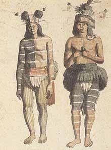
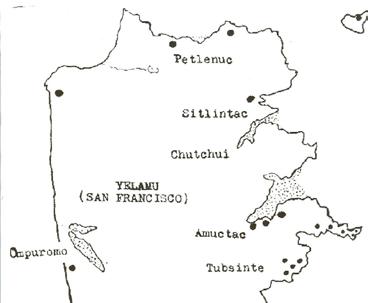
Visitacion Valley and Portola’s rich history goes back thousands of years. The Yelamu tribe of the Muwekma Ohlone resided in two villages in the area, Amuctac and Tubsinte . In the 18th century Spanish settlers and soldiers arrived, bringing violence and enslavement via the mission system across California, the impacts of which are still felt today. The name Visitacion Valley itself is derived from a 1777 Mexican land grant title, Rancho Canada de Guadalupe, La Visitacion y Rodeo Viejo. The Portola’s name is derived from a similar land grant title, Rancho Rincón de las Salinas y Potero Viejo . Under the Spanish the area was developed primarily for cattle herding and lumber.
“We acknowledge that we are on the unceded ancestral homeland of the Ramaytush Ohlone who are the original inhabitants of the San Francisco Peninsula. As the indigenous stewards of this land and in accordance with their traditions, the Ramaytush Ohlone have never ceded, lost nor forgotten their responsibilities as the caretakers of this place, as well as for all peoples who reside in their traditional territory. As guests, we recognize that we benefit from living and working on their traditional homeland. We wish to pay our respects by acknowledging the ancestors, elders and relatives of the Ramaytush Community and by affirming their sovereign rights as First Peoples.”
— Gregg Castro/Jonathan Cordero (Ramaytush Ohlone)Many German, French, Italian, Jewish, and Maltese emigrated to those two communities during the Gold Rush in the mid-1800s, establishing farms, dairies, and nurseries. Sometimes also known as “Valley of the Windmills,” Visitacion Valley during this era featured many windmills facilitating agricultural irrigation.
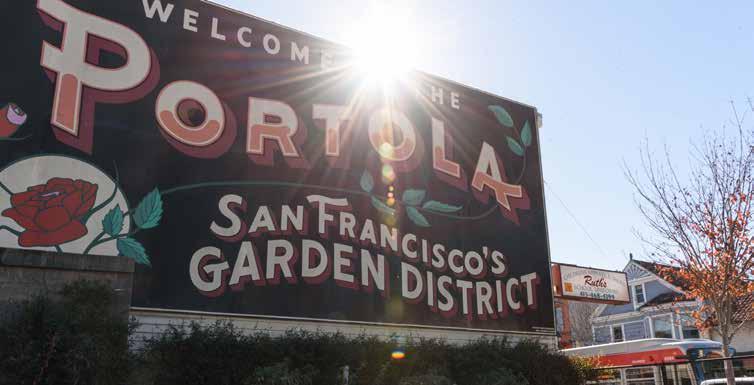
By the dawn of the 20th century, the Southeast area of the city became an industrial powerhouse, featuring Butchertown (in today’s Bayview), commercial-scale Italian vegetable gardens, Chineserun shrimp yards, steel mills, and electric power plants. The Portola, nicknamed “San Francisco’s Garden”, became renowned for its plant and flower nurseries. After the 1906 earthquake and fire many Chinese people relocated here, and the San Bruno Avenue corridor became a center of the Maltese community by the 1920s.
The Schlage Lock company, founded in 1907, established a massive factory site in the south of Visitacion Valley in 1925. This major employer operated until the site’s closure in 1999.
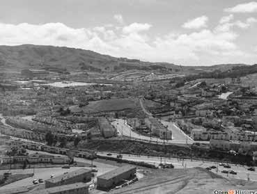
In the 1930’s, both the Vis Valley and Portola communities were subject to “red-lining”, a practice where federal housing policies and bank lending practices created de-facto segregation in cities across the United States. This resulted in barriers to investment in both communities, entrenching systemic and institutional racism against communities of color.
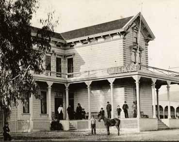
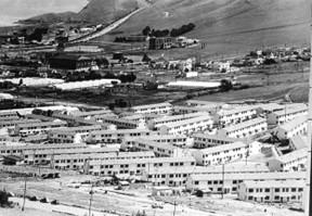
At the outset of World War II, the United States Navy took over the naval yards in the adjacent Bayview-Hunters Point neighborhood and migrant workers flooded into the City’s southeast to meet the demands of the national war effort. This rapidly expanded San Francisco’s African American population, with many settling in the city’s southeast. The African American community was further swelled in the 1950s as Urban Renewal demolished large portions of the Fillmore and Western Addition neighborhoods, with many displaced residents moving to the southeast quadrant of San Francisco . Also in the 1950s, Highway 101 and Interstate 280 were built & rebuilt around the edges of the Vis Valley and Portola communities, reinforcing political, economic, racial, and social divisions.
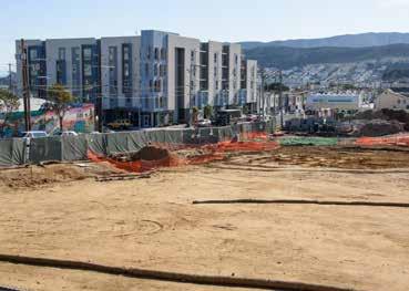
Valley, is San Francisco’s largest public housing community: Sunnydale. This 48-acre site was conceived of during the Great Depression as a housing solution for low-income families in San Francisco, with the first units opening in 1941. The San Francisco Housing Authority maintained segregation in Sunnydale in its opening years, with only White families allowed to rent homes until the United States Supreme Court struck down the Housing Authority’s racist policies in 1954. Following integration, Sunnydale developed large African American and Samoan communities. The site also fell into a pattern of deterioration and neglect by the City, with residents there trapped in a spiral of poverty, crime, and violence.
Following World War II, much of the temporary housing erected for wartime workers in the City was converted into public housing under the newlycreated San Francisco Housing Authority.
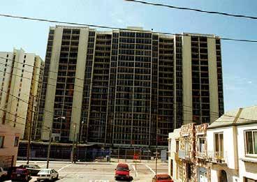
Geneva Towers was a well-known 20-story twintower high rise apartment complex near Garrison Avenue and Schwerin Street in Visitacion Valley. On the former site of the Sunnydale Nursery greenhouses, the project was built by the famous Bay Area architect Joseph Eichler, opening in 1964. Built with Federal Housing Authority financing, the project was meant to be offered to middle-income and low-income families. The Eichler Company declared bankruptcy in 1967 and the building was placed into federal receivership. Throughout this period, the building slowly deteriorated with little-to-no on-site maintenance; at the onset of the Crack epidemic in the late 1980s, the building became a locus of crime, with 7 murders in 1991. The buildings were knocked down in 1998 after the Department of Housing and Urban Development closed it due to rising crime and maintenance costs. The site was replaced with the townhome-scale Heritage Homes affordable housing development.
Situated at the base of McLaren Park, and topographically isolated from the rest of Visitacion
Sunnydale is now being rebuilt, under the HOPE SF program launched in 2008, with a mix of affordable and market-rate housing. The director of HOPE SF, Theodore Miller acknowledged, “these are dynamic, diverse and resilient communities. We need to do right by these families and repair a historic wrong” .
In post-war years, the neighborhoods have seen significant in-migrations from Chinese, Vietnamese, Black, Latinx, Filipino, and Samoan communities. Today Visitacion Valley and Portola remain mostly residential, working-class neighborhoods made up of two-story single-family homes. Both communities have a long history of advocacy and beautification.
In the Portola, community activists in the mid2000s formed a grassroots movement to preserve and celebrate the cut-flower agricultural history of the neighborhood. This resulted in beautification projects in the Alemany Interchange, the creation of pocket parks on streets dead-ending into Highway 101 off of San Bruno Avenue, and the construction of the Portola Freeway Greenway. In parallel with these efforts, a community campaign was launched in 2013 to preserve the Rose Factory, the last remaining greenhouse in the Portola. In the Spring of 2021, this coalition secured the right to purchase the greenhouses, with plans to convert them into a community center with active urban farming & educational programming.
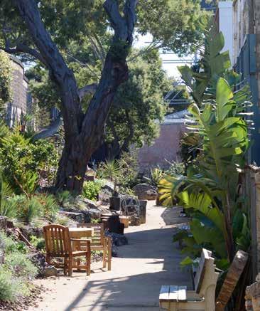
The Vis Valley Greenway is the result of a 25-year partnership between community organizers, the City of San Francisco, and the Trust for Public Land. The greenway cuts across six city blocks in the eastern portion of Vis Valley. Each portion of the Greenway was intentionally designed to act as an outdoor classroom and recreation area. Portions of the greenway host agricultural crops, public art,
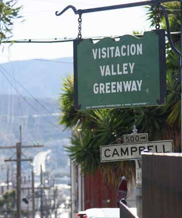
and community gathering spaces. The greenway is maintained by a coalition of community volunteers.
Looking ahead, there are a number of large housing development projects in and around the plan area that will bring new residents and new demands on the transportation network.
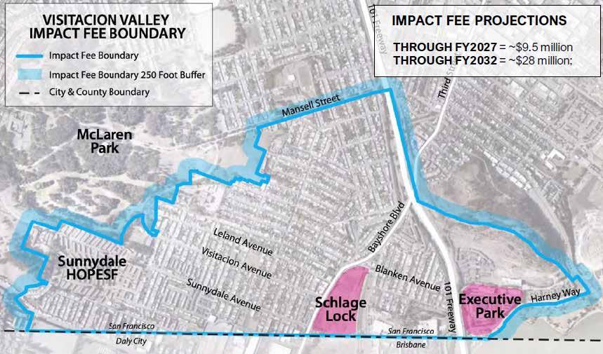
The former Schlage Lock Company factory in Visitacion Valley is slated for redevelopment as a mixed-use community known as Baylands North. The development agreement was approved in 2014 and the project is still ongoing. The historic office building on the site was restored and will be open in part for community use in 2022. Construction timing for housing and retail space is to be determined. There is a 15% affordable housing requirement for the planned 1,679 residential units. The site will also include two public parks, Leland Greenway and Visitacion Park, that will be
purchased and maintained by the Recreation and Parks Department.
Across Highway 101, the Executive Park and Candlestick Park developments are both approved for thousands of new units of housing, as well as substantial office and retail developments.
The Sunnydale HOPE SF redevelopment in process with Mercy Housing will replace the existing legacy public housing with a mix of high-density affordable housing & market rate units. This will substantially increase the number of residents, while still ensuring today’s residents retain their housing.
The plan area for the Vis Valley & Portola CBTP is bounded by features both natural and those built by human hands. To the west is McLaren Park, San Francisco’s second-largest park, atop a series of hills that overlook the plan area. Two freeways act as human-imposed boundaries, Interstate 280 to the north and Highway 101 to the east. To the south is a more esoteric and invisible boundary, the San Francisco city limits. But within this plan area is contained a series of unique and diverse neighborhoods.
The Portola neighborhood is located north of Mansell Street, mostly flat with hills to the west. San Bruno Avenue acts as both the primary business district and the spine for the transit network.
Vis Valley is located to the south on Mansell Street. Steep hills in the north give way to a bowl valley in the south. Leland Avenue is the main commercial corridor in this neighborhood.
Little Hollywood is a small neighborhood tucked between Bayshore Boulevard and Highway 101. To its south are the Recology recycling plant and the Caltrain Bayshore station.
Sunnydale is west of Hahn Street, immediately adjacent to Vis Valley. This neighborhood largely consists of the Sunnydale HOPE SF site, with the Cow Palace immediately to the south.
Visitacion Valley and Portola residents are diverse and varied across the neighborhoods. Almost 90 percent of residents are people of color, far more diverse than San Francisco as a whole.
The racial and ethnic makeup of the plan area varies significantly from neighborhood to neighborhood. Only two census tracts (Western Portola & Sunnydale) don’t have a majority Asian population, and the northern neighborhoods have a larger proportion of White residents. There are substantial Black communities in both Sunnydale and Little Hollywood, while Sunnydale is also home to a large Pacific Islander community. The Latinx community is distributed fairly evenly across the plan area, with the exception of Southeast Portola (10.8%) and Little Hollywood (8.7%).
Source: ACS 2015-2020 5-Year Estimate, Table B03002 "Hispanic or Latino Origin by Race"
Over 80% of households in Vis Valley and Portola own vehicles, with the majority of households owning either 1 or 2 private automobiles. The location of these neighborhoods at the edge of the city, the pattern of single-family home development, and their distinct geography contributes to higher rates of vehicle ownership than the City overall.
In part due to higher rates of vehicle ownership, over-parking on the street is a significant challenge. Cars
are sometimes parked within intersections or blocking sidewalks, posing safety and access challenges for seniors, residents with disabilities, and youth in the community.
The Sunnydale community is the notable exception, with more car-free households (35%) than the city at-large (31%). Given the Sunnydale community is also the poorest within the plan area, the transit and transportation needs of these residents are of particular importance.
Seniors in the neighborhoods make up roughly 15 percent of all residents, the same as San Francisco overall.
The northern portion of the Portola (census tract 257.02) has the highest proportion of seniors (21%) and Sunnydale (census tract 605.02) the lowest (7%).
The percentage of youth, just over 20 percent of all
residents, is higher than the City (15%) and is reflected in the large number of schools in the area. More than a third (36%) of the residents in the Sunnydale census tract (605.02) are under the age of 20.
A significant number of residents (29%) are either at or below 200 percent of the federal poverty level. This is higher than San Francisco as a whole (21%). Almost 60% of residents in Sunnydale are below 200 percent of the federal poverty line. The median annual income in Visitacion Valley and Portola is $80,250, over $30,000 less than the City’s $112,449.
A substantial proportion of residents (17%) predominantly speak languages other than English, much higher than San Francisco overall (11%). Spanish, Chinese (Cantonese), Vietnamese, Filipino (Tagalog), and Samoan are all commonly spoken in Vis Valley and Portola.
Almost one-third (30%) of residents in the northern part of the Portola (census tract 257.02) have limited English proficiency, and more than a quarter (25.3%) in the eastern part of Vis Valley (tract 264.03). Asian & Pacific Islander languages are most common across the entire plan area; the areas around Mansell Street (tracts 258 & 264.02) and around Sunnydale (tracts 264.04 & 605.02) have over 20% Spanish-speaking residents.
Commuting with automobiles is the single largest travel mode in the plan area, whether solo or in a carpool. Tracking closely with the higher rate of vehicle ownership in these communities, just under 50 percent of people drive alone for their regular commute. The next common commute method is via transit (33%), with walking and biking rates much lower than citywide averages.
Sunnydale (45%) and the neighborhoods closest to the San Bruno Avenue corridor in Vis Valley (41%) and Portola (39%) have the highest rate of commuting by transit in the plan area. Sunnydale is also the only part of the plan area where fewer than half (48%) commute by car or carpool.
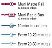
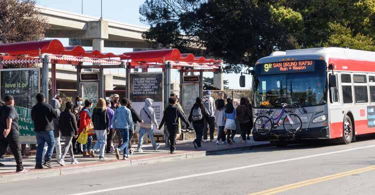
The VV/P communities are currently served by 1 Muni light rail line, 8 Muni bus lines, 3 Muni rapid or express bus lines, and 2 Muni OWL overnight bus lines. San Bruno Avenue is the main commercial corridor for the Portola neighborhood and sees high volumes of drivers and pedestrians, as well as the 8 Bayshore, 8AX Bayshore Express, 8BX Bayshore B Express, 9 San Bruno, and 9R San Bruno Rapid Muni lines. At peak periods, buses travel on San Bruno Avenue through Portola and Visitacion Valley every 2 minutes.
The Caltrain Bayshore station, providing access to regional transit, is located just south of the CBTP project area, within walking distance of the T Third, 8 Bayshore, 9 San Bruno, and 56 Rutland. Trains depart Bayshore every 30-60 minutes weekdays and every hour on weekends. Caltrain is in the process of electrifying their trains, which will increase frequency, improve travel times, and reduce emissions. Passenger service on the electrified trains is anticipated mid-2024.
In April 2020, shortly after the COVID-19 pandemic began and the city’s Shelter in Place Health Order was issued, the SFMTA implemented the COVID-19 Muni Core Service Network reducing the number of routes in the Muni system from 79 to 17. The reduction in service was driven by a OSHA cleaning requirements, a drop in staff availability, and reduced travel demand. The initial core service plan focused on maintaining service for essential trips and to maintain access to transit for 90% of San Francisco residents within one mile of a transit stop.
As of April 2022, all pre-pandemic lines serving the Visitacion Valley & Portola communities have been restored. The Transit Service Planning section of SFMTA continues to update and fine-tune routes and frequencies to get back to full pre-pandemic service across the entire transit network. The next Muni service update is expected in Winter 2023.
congested San Bruno Avenue corridor often experiences transit delays due to double-parking vehicles and high demand for on-street parking.
The San Bruno Multimodal Improvement Project, started in 2015, sought to improve safety along the corridor for people walking and biking, improve reliability and travel times for transit riders, and reduce double parking through improved parking management. The recommendations of the project were approved at the SFMTA Board of Directors in 2016. Recommended projects extended from the intersection of San Bruno Avenue at Arleta Avenue in the south to the intersection of San Bruno Avenue at Silver Avenue in the north. Projects along the corridor were implemented from 2017 to 2019.
Implemented project elements include:
• Six pedestrian bulbs at Woolsey Street (3 corners), Wayland Street (2 corners), and Burrows Street (one corner)
• A new traffic signal at Felton Street with transit priority
• Rapid flashing pedestrian beacons at Burrows Street and at Wayland Street
• Five transit bulbs at Silver Avenue, Thornton Avenue, Bacon Street (both sides), and Mansell Street. The installation of transit bulbs, at certain locations, allowed for the installation of transit shelters
• Turn pockets at Silver Avenue, Silliman Street, and Bacon Street to reduce intersection blocking by turning vehicles
• Intersection “daylighting” (no-parking zones near intersections to improve visibility)
• Consolidation of closely-spaced transit stops to improve transit travel times
The Muni Transit Assistance Program, launched in 1996, trains and hires Transit Ambassadors to act as an unarmed safety presence on Muni lines. Transit Ambassadors are trained in conflict resolution, deter acts of vandalism, and assist bus operators and the public as needed. Transit Ambassadors historically are assigned to Muni lines serving middle schools and high schools, as violent confrontations often take place when buses become crowded immediately after school dismissal. Within the VV/P project area, the 29 Sunset and 44 O’Shaughnessy lines have MTAP staffing.
The San Bruno Avenue corridor through the Portola serves more than 50,000 daily transit riders, hosting some of the city’s highest frequency transit lines. The corridor is also on the High Injury Network, and the
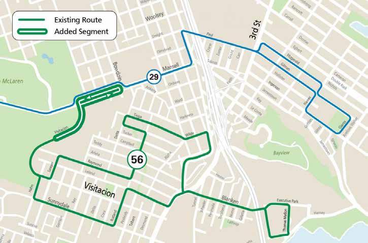
The northern part of the 56 Rutland was extended to Mansell Street in April of 2022 as part of the COVID-19 Muni Core Network service changes, providing a connection to the 29 Sunset and access to Burton High School on Mansell Street. The previous terminus of the 56 Rutland was on Visitacion Avenue next to Visitacion Middle School.
Mansell Street, San Bruno Avenue, Bayshore Boulevard, and Geneva Avenue make up most of the designated bicycle network within the plan area. Most of those streets today either have Class III bike routes or standard Class II bike lanes, neither of which are classified as a “high-comfort bikeway”. The lone exception is the “Mansell Promenade” in McLaren Park, which is a car-free roadway for walking and biking.
San Bruno Avenue, Geneva Avenue, Mansell Street, Bacon Street, and Goettingen Street are all on the San Francisco Vision Zero High Injury Network. Collisions involving people walking or riding bikes are concentrated along San Bruno Avenue, Bayshore Boulevard, and Visitacion Avenue.
Part 1 violent crimes include assaults, homicides, rapes, and robberies. From 2003 to 2021, these crimes concentrate along San Bruno Avenue in the Portola, and in Sunnydale in Vis Valley. There is a lesser concentration of reported crime around the intersection of Arleta Avenue at Bayshore Boulevard.
The 2021/22 Muni Service Equity Strategy identified 5 different proposals for improving transit service in Visitacion Valley. At the time of the publication of the 2023/24 Muni Service Equity Strategy, the following projects have been completed.
8/8AX/8BX Bayshore – Express service restored for 8AX/8BX. 8/8AX/8BX Bayshore – Existing transit lanes on Stockton and 4th Street colorized red. 9 San Bruno/9R San Bruno Rapid – Transit lanes extended on Market Street from 3rd Street to Main Street.

Statement of Intent
Community Interviews
Plan Review
Partner Coordination
Project Coordination
Community Partner Profiles
The CBTP will create a transportation vision for these neighborhoods by:
• Repairing past harms and centering community needs throughout the CBTP process
• Understanding previously stated community needs documented in past plans
• Working directly with the community on challenges and solutions
• Ensuring culturally competent outreach methods and approaches
• Supporting community-priorities with relevant data
• Laying the groundwork for early implementation of top priority projects
• Securing funding avenues to implement plan recommendations
All interactions between the SFMTA and the Vis Valley & Portola communities will be grounded in respect for their lived experiences, energy, and time. The SFMTA acknowledges the traditional lack of investment and historical harms that have fallen on these communities. We seek to repair past harms and uplift the community throughout the CBTP process.
How do we show Respect?
• Work directly with the community to identify challenges and appropriate solutions.

• Explore alternative solutions with the community if needs do not appear to align with agency goals or are not feasible due to resource or jurisdiction constraints.
• Leverage previous planning studies to understand ongoing and evolving needs, respecting the time and energy that has already been given to the planning process.
• Provide opportunities for feedback beyond what is in the CBTP scope.
This area of focus prioritizes the authenticity of the community’s lived experience and aspirations throughout the planning process. The SFMTA recognizes that quantitative data does not always provide a complete picture of the transportation experience. Transportation recommendations should be supported by residents and businesses as assets for the Vis Valley & Portola communities to grow and flourish in place.
How do we Center the Community?
• Support community-prioritized needs and challenges with relevant data
• Use outreach strategies that overcome commonly experienced barriers.
• Coordinate with other agencies on outreach opportunities and reduce community burnout.
• Link survey results and qualitative input to final plan recommendations
• Collect letters of support from key community groups
The SFMTA is committed to providing transparency around impacts and benefits of transportation projects, both intended and unintended. The SFMTA also commits to clear communication of expectations for community input and control. The outreach process will clearly communicate what information will be gathered, how it will be used, and what other factors lead to project decisions.
• Outreach will clearly describe what feedback we are seeking and how it will be used
• The project will be clear about what can and cannot be accomplished through the plan process
• Transportation tradeoffs and benefits will be clearly described for each project
• Provide clear language explaining how project & funding decisions were made
Accountability
The SFMTA commits to multiple accountability mechanisms for project outcomes. The SFMTA commits to a final plan that is equitable, community-centered, and measurably impactful. The SFMTA commits to timely delivery of projects in a community that has lost trust with the City.
• Prioritize CBTP projects for local funding and advocate for regional and state funding.
• Begin implementation of near-term recommendations during the 2023 calendar year.
• Ensure funding allocated for CBTP projects cannot be reallocated to other projects.
• Allocate sufficient staff resources to deliver projects on-time.
The (Build) Trust focus area creates the foundation for long term partnerships by deepening the relationship between the Vis Valley & Portola communities and the SFMTA. This focus areas seeks to build community assurance in the Agency’s ability to deliver tangible transportation solutions by listening to community members and building actions that are rooted in community desires.
• Partner with local organizations for plan engagement and outreach, using culturally competent outreach methods and approaches, reaching a broad section of the public
• Provide summaries and findings for each phase of outreach, and show people how their input was used.
• Track and publish outreach efforts and results with different key stakeholder groups.
• Validate quantitative data with the lived experience of residents; incorporate personal narratives into projects and plan findings.
Community interviews were conducted at the beginning of the project in January and February 2021 to get input on outreach methods, understand potential barriers to participation in the community, build further connections, and discuss transportation concerns in the community. Twelve interviews were conducted, with twenty-one total participants. Interviews conducted in the fall of 2021 directly informed both the “Statement of Intent” for the CBTP as well as a series of commitments to the community.
Devin Hunter
Boys and Girls Club (Assistant Clubhouse Director)
Edith Yamanoha
Visitacion Valley Community Unity
Eleazar Malabanan
MidPen Housing (Service Coordinator)
Eleazar Martinez
Portola Family Connections (Program Manager)
Fran Martin
Visitacion Valley Planning Alliance
Harold Love
Boys and Girls Club (VP of Program Services)
Hazel Lee
SF Shanghai Association
Hilary Burdge
Boys and Girls Club (VP of Programs, Strategy, Impact)
Jessica Campos
Visitacion Valley Hispanic Group
Lia Smith
Portola Neighborhood Association
Maggie Weis
Portola Neighborhood Association
Malcolm Jaramillo
SF Bicycle Coalition, Portola resident
The Plan Review provides the context within which the Vis Valley & Portola CBTP operates: a consolidation of the already-identified needs of the community and reflection on the successes and failures of previous planning processes. In total, 16 plans and studies conducted since 2013 were reviewed, including six ongoing planning projects.
Marlene Tran
Visitacion Valley Service Providers Collaborative; Visitacion Valley Asian Alliance
Neo Veavea
Samoan CDC & Mayor’s Disability Council
Phyllis Rizzi
Daly City Bayshore Friendship Senior Club
Priyoti Ahmed
Portola Neighborhood Association
Rex Tabora
Asian Pacific American Community Center
Rick Laubscher
SF Transit Riders
Rick Yuen
APA Family Support Services, lead agency of Visitacion Valley Strong Families collaborative
Robert Cowan
Visitacion Valley Community Unity
Ronald Colthirst
The Village (Community Facility Manager)
Russel Morine
Little Hollywood Neighborhood Association
Shelly Leonard
Sunnydale Tenant Association
Yensing Sihapanya
Portola Family Connections
• Language access is critical, including Vietnamese
• Incentives are important to participation
• Traffic calming & reducing driving speeds are high priorities
• The project needs to work with the broad coalition of active community organizations
• Community trust is low, as projects like Schlage Lock drag on without end
• As single-family homes are subdivided into multiple units, the number of vehicles is increasing
• Be clear about what resources are available and what decisions residents can influence
• Personal safety is just as important as traffic safety in these communities
• The Sunnydale community is distinct from other Vis Valley neighborhoods
• Uplift ongoing community efforts, like the Portola Freeway Greenway
• Muni Forward
• Temporary Emergency Transit Lanes
• 2022 Muni Service Network
• Southeast Muni Expansion
• Harney 101 Transit Crossing
• Muni Service Equity Strategy – FY2021
• District 10 Mobility Study
• Bayshore Multi-Modal Facility Study
• Bi-County Transportation Study
• VV/P Traffic Calming Project
• Yosemite Creek Daylighting Project
• McLaren Park Pedestrian, Bike and Streetscape Project
• Sunnydale HOPESF Roadway projects
• Alemany Interchange
• Freeway Ramp Intersection Safety Study Phase 3
• Schlage Lock development agreement
Development concerns – concern of displacement and increased congestion due to new housing Public safety – safety both on transit and in the public realm due to inadequacy of existing physical infrastructure
Micromobility accessibility – availability of micromobility options & car-sharing, interest in the development of microtransit services to key destinations
Bicycle network – existing gaps in network make travel by bike difficult; network gap closure needs to be prioritized
Pedestrian comfort – vehicle speeds, congestion, and lack of visibility for pedestrians are all major contributors to pedestrian safety and comfort within the plan area
Transit connectivity – lack of transit connections to local and regional destinations, goods, and services
Transit reliability – identification of inconsistent or inadequate service of existing transit routes that serve the community & services within the neighborhood
Over the course of project development, the Vis Valley Portola CBTP project team sought to collaborate and build working relationships with partner project teams on similar timelines within the project area. Project staff from various partner projects were included as members of the Technical Advisory Committee or were engaged with individually across the entirety of plan development. This coordination leveraged resources to identify overlapping needs and priorities, facilitating additions and deletions to proposed project lists, with the intention of building a shared vision for development of community.
SFTMA staff are recommending that the SFMTA Board approves a Slow Streets Program (Program) to establish low-stress routes on residential streets in San Francisco for shared transportation. Local traffic is permitted on these corridors, but these streets prioritize biking, walking, and other forms of active transportation. Each corridor will be designed to achieve the overall goal of the Program:
Recreation & Park Department: The Rec & Park project teams were close collaborators for both the McLaren Park Pedestrian, Bike and Streetscape Project within McLaren Park and along Visitacion Avenue, and the Upper Yosemite Creek Daylighting Project on the northeast portion of McLaren Park starting at Yosemite Marsh, running down Oxford Street and Wayland Street to the Louis Sutter Playground athletic fields. Across the projects, we coordinated outreach events, and met regularly to discuss changes to project scope and identify ways to reduce project redundancy and pool project resources to identify traffic calming measures along Wayland Street and bike improvements along Visitation Avenue.
Mercy Housing: The Sunnydale HOPE-SF Roadway projects are a component of the redevelopment currently underway around the HOPE-SF housing sites, a joint effort of the Mayor’s Office on Housing and Community Development and the site operator Mercy Housing. As part of this redevelopment process, the street network within Sunnydale will be rebuilt. We incorporated their streetscape plans into the CBTP project list to identify supplemental projects and overlapping ideas. We also attended the regular meetings for housing residents to communicate plan development and changes across the phases of the project.
Department of Public Works: In coordination with the SFMTA, the Alemany Interchange project will build a multi-use path across a median island underneath Interstate 280, creating a direct and safe bicycle & pedestrian connection to the Alemany Farmer’s Market on the north side of Alemany Boulevard. The improvements new traffic signals, additional lighting, marked crosswalks, new curb ramps and a new bulb-out at eastbound Alemany Boulevard. In coordination with this project & to supplement the upcoming streetscape changes, the VVP CBTP proposed pedestrianscale lighting along high-traffic corridors adjacent to the Alemany Interchange project area.
San Francisco County Transportation Authority: The SFCTA is currently seeking funding to initiate a freeway ramp intersection safety study, that would include the three ramps identified within the CBTP project area. The VVP CBTP project team will share priority projects for the intersections identified by the community with the SFCTA to support their project development, if funded.
Develop low-stress streets that provide active transportation connections within neighborhoods and connect to and/or enhance the City’s recommended bikeway network with a focus on improving residential streets by calming vehicle traffic, making them easier to navigate and friendlier for walking and biking.
Fifteen corridors are being recommended for inclusion in the Slow Streets Program. The initial set of corridors proposed for inclusion in the permanent Slow Streets program reflect the most successful corridors introduced as part of the COVID Response Slow Streets program, along with two other corridors that meet programmatic criteria. In the Vis Valley Portola CBTP project area, Somerset Street from Silver Avenue to Woolsey Street is an existing corridor authorized as a COVID-19 response street being recommended for the permanent program.
Pending authorization from the SFMTA Board of Directors, SFMTA staff propose to begin collecting updated vehicle volume and speed data for each of the authorized Slow Streets.

The Vis Valley & Portola Traffic Calming Project is an effort led through the Livable Street Traffic Calming section and pre-dates the Vis Valley & Portola CBTP. The project consists of 55 speed cushions, 11 pedestrian crosswalk islands, 1 raised crosswalk, and 1 traffic circle. The projects were developed by the Traffic Calming team based on both resident input as well as engineering assessments. The project budget overall is $900,000 – with $750,000 through a Proposition K allocation from the SFCTA and $150,000 of NTIP funds from the District 9 Supervisor’s Office. The project team anticipates construction will be complete by June of 2023.
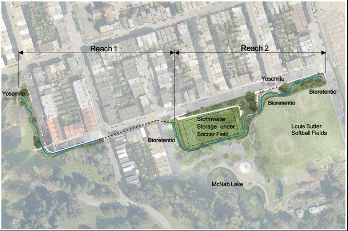
The Upper Yosemite Creek Daylighting Project is one of eight Early Implementation Projects (EIPs) that the San Francisco Public Utilities Commission (SFPUC) will construct in San Francisco’s urban watersheds as part of the Sewer System Improvement Program (SSIP). This project is a collaboration with SF Rec & Park, with a total construction budget of $10,036,200. The project is set in the northeast portion of McLaren Park starting at Yosemite Marsh, running down Oxford Street and Wayland Street to the Louis Sutter Playground athletic fields.
Relevant streetscape updates include:
• Two new street crossings at the corner of Oxford and Wayland Streets to connect the new ADA accessible sidewalk on the west side of Oxford Street with the rest of the street network.
• New curb ramps on each corner of Wayland and Cambridge Streets. New curb ramps at the Wayland and Yale Street intersection.
• Two perpendicular curb ramps at the southeast corner of the Wayland and Yale Street intersection along with a new sidewalk that runs along the south side of Wayland Street to the end of a new passenger drop-off area.
• Three crosswalks at the intersection of Wayland and Princeton Streets, with six associated curb ramps.
SFPUC is investigating the possibility of converting the 500 block of Oxford Street and the 1400 block of Wayland Street to one-way streets to preserve street parking in this area. Coordination with SFFD is ongoing to ensure changes to street design meet emergency vehicle access needs.
The McLaren Park Pedestrian, Bike and Streetscape Project is an effort led by the Recreation and Park Department to improve safety for people walking, biking, taking transit and driving on McLaren Park’s streets and wide pathways, including: Visitacion Avenue, Sunnydale Avenue, Crocker Amazon access, and John Shelley Drive Promenade.
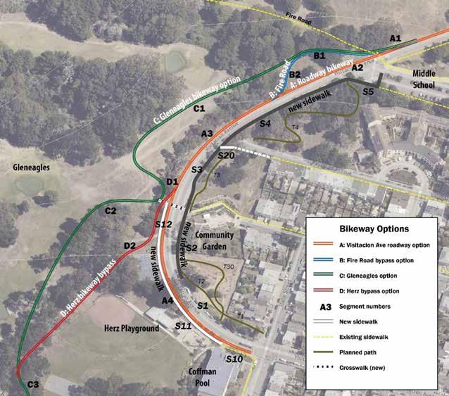
The initial effort known as the Visitacion Avenue Pedestrian and Bicycle Safety Project will concentrate on Visitacion Avenue, from Mrs. Jackson Way (formerly Hahn Street) in the south to Mansell Street in the north. The project will bring a variety of improvements to the corridor including new sidewalks, new bikeways, new paving, and traffic calming, as well as opportunities for a new crosswalk, new landscaping, and lighting. The project is currently in the planning and outreach stage, with no timeline established yet for design & implementation.
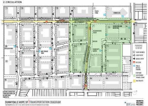
The Sunnydale housing development, a legacy public housing site nestled on the western edge of Visitacion Valley up against McLaren Park, is currently under redevelopment in a joint HOPE SF project between the Mayor’s Office on Housing and Community Development and the site operator Mercy Housing. As part of this redevelopment process, the street network within Sunnydale will be rebuilt. This will include:
• An off-street Class I multi-use path on Sunnydale Avenue from Santos Street in the east to McLaren Park in the west.
• Westbound uphill bike lanes and eastbound downhill sharrows on Sunnydale Avenue from Hahn Street in the east to Santos Street in the west.
• Bike lanes in both directions on Santos Street from Geneva Avenue in the south to Sunnydale Avenue in the north.
• Sharrows on Blythedale Avenue from Santos Street in the east to Brookdale Avenue in the west.
• Sharrows on Brookdale Avenue from Geneva Avenue in the south to Sunnydale Avenue in the north.
• Bus shelters and bus-bulbs will be provided at six locations on Santos Street and Sunnydale Avenue.
• Publicly accessible bike parking will be provided at eight locations around the HOPE SF site.
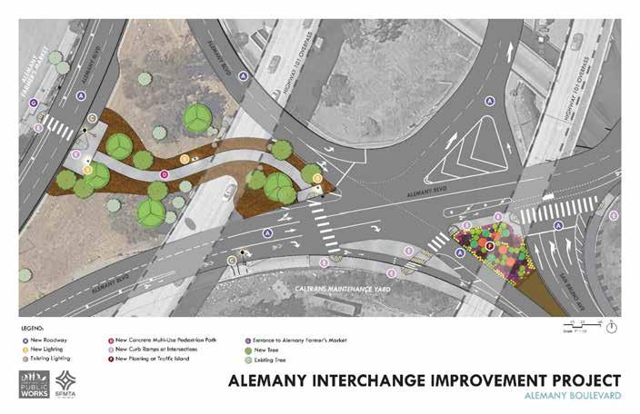
The Alemany Interchange project is a joint effort between the SFMTA and the SF Public Works Department to build a multi-use path across a median island underneath Interstate 280. The project creates a direct and safe bicycle & pedestrian connection to the Alemany Farmer’s Market on the north side of Alemany Boulevard. The improvements will include a new multi-use path connecting San Bruno Avenue to the Alemany Market, new traffic signals, additional lighting, marked crosswalks, new curb ramps and a new bulb-out at eastbound Alemany Blvd.
The project budget is $1,837,000 and construction is expected to be completed by Winter 2023.
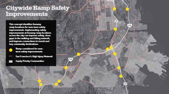
The San Francisco County Transportation Authority (SFCTA) identified 14 freeway ramps in need of safety improvements as a part of the Streets and Freeways Strategy for ConnectSF. ConnectSF is a multiagency effort meant to inform the long-range San Francisco Transportation Plan (SFTP 2050) and the Transportation Element of the General Plan Update. The Streets and Freeways Strategy identified near- to long-term concepts for San Francisco’s major roads and freeways. In the CBTP project area, three freeway ramps were identified: US-101 at Bayshore/Hester, US-101 Southbound at Mansell, and US-101 Silliman.
The SFCTA is currently seeking $400,000 in funding to initiate a freeway ramp intersection safety study, based on the concept in the Streets and Freeways Strategy. This study, called the Freeway Ramp Intersection Safety Study Phase 3, includes the three ramps identified within the CBTP project area. The study would focus on improving safety for all travelers through near-term safety improvements.
The 29 Sunset is one of Muni’s longest lines, extending nearly 14 miles from the Bayview to the Presidio, serving three different schools within the plan area. The 29 Sunset corridor is also part of the SFMTA’s “Five Minute Network” with the goal of providing service on the line every five minutes.
The 29 Sunset Improvement Project aims to improve travel times and reliability for passengers along this route. The first phase of the project is focused on the west side of the route, with potential improvements including:
likely include elements similar to the first phase (above) to help improve transit reliability and safety. The project team has also heard feedback from community partners in strong support of a 29R Sunset Rapid, which would serve fewer stops but would have a faster travel time. Approval of the second phase of the 29 Sunset Improvement Project is targeted for early 2025, with construction start expected in 2026.
The Muni Service Equity Strategy (MSES) was first adopted in 2016 and is updated every two years, which identifies and corrects transit performance disparities in Equity Priority Communities, including Visitacion Valley. The current MSES was adopted in April 2022.
• Bus bulbs or bus boarding islands
• Queue jumps for transit vehicles at traffic signals
• Transit signal priority for buses
• Moving transit stops across intersections to take advantage of transit signal priority
• Turn lanes or restrictions on left-turn movements
• New and enhanced transit shelters
Quick-Build projects across both the eastern and western portions of the route are expected to start in 2023. Construction of more permanent project elements is expected in 2025/2026.
The second phase of the project, which focuses on the route east of Junipero Serra and Holloway to the end of route on Gilman Ave in the Bayview, has already begun preliminary planning and outreach in 2022. The 29 Sunset on the eastern segment of the route travels through a number of key neighborhoods identified in the Muni Service Equity Strategy, including Ingleside, Mission, Portola, and Bayview. The planning and outreach phase will
The Transit Delay Hot Spots program aims to tackle the 10 worst “delay hot spots” each year, where buses crawl between stops at four miles an hour or less. Common causes of Muni delays include very close stop spacing (where stops are on both sides of the same intersection), tricky turns, traffic and curb space issues. The SFMTA addresses these delays with a toolkit of priority treatments.
Two locations along the 44 O’Shaughnessy line were identified in 2019 and incorporated in the first round of the Transit Delay Hot Spot Program. These locations are Silver Avenue/San Bruno Avenue to Silver Avenue/Bayshore Boulevard, and Woodside Avenue/Portola Drive to O’Shaughnessy Boulevard/ Portola Drive.
Improvements between Silver Avenue/San Bruno Avenue and Silver Avenue/Bayshore Boulevard that were installed in fall of 2022 include a bus zone extension, additional commercial loading zones, and a relocated short-term parking zone to allow for the bus to more easily serve riders and move through the intersection.
Improvements at Woodside Avenue/Portola Drive to O’Shaughnessy Boulevard/Portola Drive include a stop removal where there are stops closely spaced at both sides of the intersection, to help the bus to catch the green light more easily. This will be implemented in early 2023.
Below are the service improvements planned for 2022 identified within the MSES. Some of these improvements have already been implemented at the time of this report’s writing.
Restore 8AX/8BX on the corridor, which improves travel time for 8 Bayshore riders.
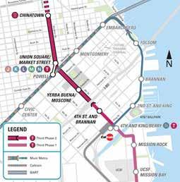
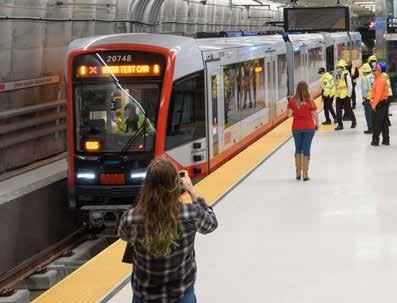
The Central Subway, a hybrid on-street and underground light rail line from 4th and King to Chinatown, will soft launch on November 19 and commence full service in January 2023. The new alignment will provide direct connections between Visitacion Valley, Bayview, Dogpatch, SoMa, downtown, and Chinatown. All the neighborhoods served by the T Third line will have a faster and more direct connection to regional transit.
Increase vehicle capacity in Winter 2022; adjust frequency of service to align with operator availability. Restore frequency to 10-minute headways as resources are available.
Increase weekday frequency from 10 minutes to 9 minutes.
Extend route to Burton High School on Mansell Street.
The 3rd Street Traffic Signal Optimization Project seeks to improve transit reliability, travel time and safety through the implementation of smart technology traffic signals the entire length of 3rd Street, from downtown to where 3rd Street meets Bayshore Boulevard in Bayview-Hunters Point. By responding to the demands of real-time traffic flow, the system will speed up transit travel times for the T Third light rail line, improving transit reliability for residents of Vis Valley and Little Hollywood. The SFMTA has an active grant application for this project, and should receive decisions on both by summer of 2023.
The Muni Forward plan has identified a potential future project along the 8 Bayshore corridor in Visitacion Valley. There is no current timeline, but it is anticipated that the project will be included in a future Capital Improvement Program as funding allows. The project would include Muni Forward transit reliability and pedestrian safety improvements, such as transit bulbs and potential stop spacing updates. Some elements could be delivered sooner in coordination with the Sunnydale HOPE SF redevelopment project.
Updates to the 2022 Muni Service Network proposals will roll-out throughout 2023 and 2024 as transit operator availability allows. This includes restoring the frequency of the 9R San Bruno Rapid to every 10 minutes on weekdays.
The SFMTA updates the Muni service network three times per year, adjusting service operating hours, frequencies, and route extents. The next service update is expected in January/February 2023.
The Harney-101 Multimodal Crossing Project, as part of the SFMTA Southeast Muni Expansion Project, seeks to improve transit access and service via an undercrossing improvement at Alana Way underneath Highway 101 as well as nearby streets. The Alana Way undercrossing provides access between the Executive Park, Candlestick Park, Schlage, and Baylands developments and the Bayshore Caltrain station.
The Harney-101 Multimodal Crossing Project identifies potential near-term improvements for bicycle & pedestrian travel, as well as the opportunity to convert an abandoned rail tunnel just south of the crossing to a one-way transit only lane. The project is developing designs that could be compatible with a larger interchange reconfiguration if future growth and development justify it.
The SFMTA, in partnership with the SFCTA, is planning to begin community engagement in 2023. Additional funding and project staffing resources will need to be identified before recommendations can be implemented.
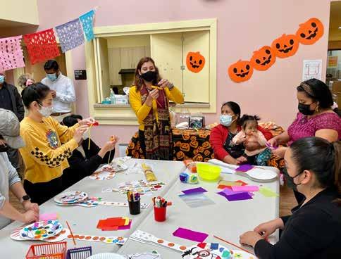
Family Connections Centers supports the development of strong, healthy families and thriving communities. They operate community programming centers in the Excelsior and Portola neighborhoods.
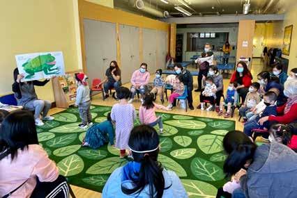

What was your role in the VV/P CBTP and what do you consider the most important outcome of your involvement?
Family Connections’ staff have strong relationships with the community that we serve. Through our weekly Support Groups (offered in Cantonese, Spanish, English, and Vietnamese), our Parent Advisory Board, and community outreach, we shared the research and proposals developed by SFMTA. One of our most important outcomes was helping families in our community feel heard. The CBTP meetings, facilitated by FCC and SFMTA, were a meaningful way for individuals to share their feedback and perspectives on their neighborhood’s transportation and safety needs and feel heard by the SFMTA team. We believe that the trust FCC staff have with families contributed to the successful attendance and participation in these community meetings.
How do you think the VV/P CBTP will help meet the transportation needs Vis Valley/Portola?
We hope that SFMTA hears the concerns from the Portola/Vis Valley residents regarding the safety of pedestrians. There were several attendees that shared similar experiences of feeling unsafe in their neighborhoods, and it was helpful to see those ideas incorporated. SFMTA should continue to provide opportunities for people that live/work in Southeast SF to share their ideas and concerns. The proposed plan outlines some important improvements that will help decrease congestion, improve the way that drivers move through these residential areas, and offer greater access to public
transportation, a primary means of commuting for residents.
What is a message you would like to share with the City about transportation needs in Vis Valley/Portola?
The City should regularly offer forums for people to share ideas and feedback. Although the surveys were offered in various languages, the process was confusing for some and limited participation. I would recommend using virtual and in-person forums/conversations to gather initial feedback from people, before the plans are made, so that the community feels that they can help shape the decisions.
Community-based organizations should always be leveraged for these types of projects and their outreach. Through the trusted relationships between the community and organizations/staff, the impact is much greater and participation in the various phases is increased. CBOs often support residents in advocating for neighborhood-based changes, and can effectively coordinate City plans, field questions, and communication information.
River of Life Church is a community center for the residents of Visitacion Valley, Sunnydale, and former residents of both communities. They regularly host block party events during holidays like Thanksgiving and Juneteenth.
What was your role in the VV/P CBTP and what do you consider the most important outcome of your involvement?
My name is Robert Cowan. I am pastor of River of Life Biblical Fellowship that is strategically located at 1430 Sunnydale Avenue since 2004.
As part of the community, River of Life used its network to promote the planning events throughout the Visitacion Valley community. The important outcomes from our involvement will be measured in increased convenience and safety for Visitacion Valley residents that use the walkways and transit; as well as the community satisfaction from having been heard.
Do you think the VV/P CBTP will help meet the transportation needs Vis Valley/Portola? If so, how?
Whether or not the VV/P CBTP will help meet the transportation needs of Visitacion Valley residents depends on whether their is follow-through. While we are glad for the current political will to improve transportation conditions in our community, we hope it continues throughout the years it will take to implement the ideas that have been developed.
What is a message you would like to share with the City about transportation needs in Vis Valley/Portola?
It is important that the City continue to seek community input to inform transportation decisions. Since people that live in the community possess information and perspective unique to residents, it is critical to hear from them to create environments that support their comfort and convenience.

Outreach
Phase 1: August 2021 - February 2022
Phase 2: May 2022 - August 2022
Phase 3: November 2022 - February 2023
Throughout the phases of the Vis Valley Portola CBTP, COVID reshaped the ability of the project team to conduct outreach and engagement. The rise of the Omicron variant of the COVID-19 virus either precluded in-person outreach or greatly hindered the effectiveness of in-person outreach during the first phase of outreach in Winter of 2021/22. While the project team was able to incorporate in-person outreach to a greater degree during Phase 2 in Summer 2022, existing community programming remained limited. Most community events and meetings were held virtually. Phase 3 similarly relied on a hybrid engagement structure with attendance at virtual meetings and some in-person community events.
Due to these challenges, the project team supplemented traditional in-person outreach with alternative methods.
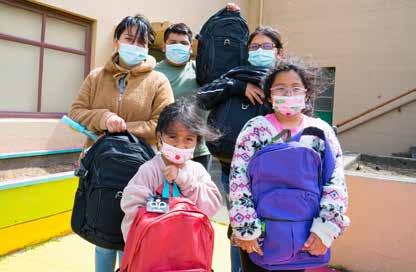
• Direct engagement with community residents through informational door hangers & posted flyers
• Online surveying
• Outreach collaboration with partner project teams
• Small outdoor pop-ups at community hubs such as libraries, farmer’s markets, and grocery stores
• Virtual and hybrid meetings
The first phase of outreach for the VV/P CBTP stretched from August 2021 through February 2022. Due to the challenges posed by the Omicron variant of COVID, the project team supplemented traditional inperson outreach with alternate methods such as virtual meetings and smaller pop-ups. The project team utilized presentations, display boards and a survey that was available both on paper and online. Surveys were translated into Spanish, Chinese, Filipino, and Vietnamese. The project team focused on capturing resident input on modes they used, key streets or intersections, priorities for those locations, and demographic information.
During this period, the VV/P CBTP Team:
• Held 3 virtual events with community partners River of Life Church and FCC; events offered interpretations services in Chinese, Spanish, Vietnamese, and Filipino
3 virtual events held with community partners Family Connections Centers and River of Life Church
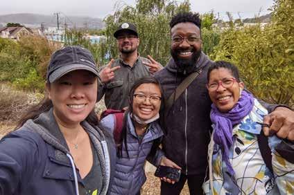
6 surveying sessions at area bus stops
7 Pop-Up events at libraries, grocery stores, and local cafes
• Conducted 3 small-scale events with Chineselanguage, Spanish-language, and Vietnamese support groups
• Attended 19 events and 6 public survey sessions at bus stops in the community
• Spent 80 hours in the community
• Engaged with almost 1,000 residents
• Collected 316 surveys
• Recorded 200 written comments
Using input from interviews with community leaders and the results of the Plan Review, the Phase 1 survey asked people to rank ten transportation priorities for the plan overall. Participants were asked to rank the priorities from 1 (highest) to 9 (lowest). In the survey “safer” was defined as improvements that enhance safety features such as raised crosswalks, bus shelters, or accessible bus stops and “easier” is defined as improvements that target connectivity, such as bike lanes or reliable
9 community events or meetings
3 in-language meetings with Spanish, Chinese, and Vietnamese support groups
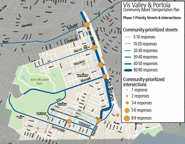
Residents were asked to identify which streets and intersections the plan should focus on for improvements – as well as what kinds of challenges they experience at those locations today. Streets like San Bruno, Mansell, Bayshore, Visitacion, Sunnydale, and Leland were identified as priority streets by many respondents. Most community-prioritized intersections were along San Bruno Avenue: at Silver, Bacon, Dwight, Mansell, and Arleta.
Safer pedestrian crossings (51%), shorter travel times on Muni (50%), safer bus stops (46%), and sidewalk landscaping (43%), were identified as the highest priority improvements.
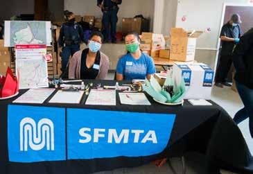
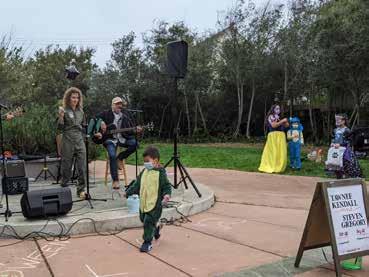
This was the project’s first official outreach event. The project team worked with Leland Ave merchants. There was an estimate of 100 attendees, many of whom were families with young children in costumes. Live music was provided by a local band. Staff passed out candy and other giveaways.
The project team gave a brief overview about the project and asked attendees who were interested to please fill out our survey and come out to upcoming outreach events.
The Pop-Up was held at Palega Rec Center during a time when many people go to the rec center to play ping pong. A Chinese-speaking staff person was present because the rec center had informed the project team that many Chinese-speaking community members visit at this time. Almost all conversations with the public were conducted in Chinese.
Focus Groups were held in Cantonese and Spanish at the end of January 2022. The Cantonese Focus Group met in person and the Spanish Focus Group was held virtually at FCC. FCC provided translations. Staff passed out project factsheets and giveaways at the in-person meeting and provided an overview of the project and encouraged attendees to take the online survey.
Three hybrid meetings were held in February 2022 that were open for participation virtually and in-person. The meetings were hosted by Family Connections Centers (FCC) and River of Life Church and provided Spanish and Chinese translation. $5 gift cards were provided to those who came and filled out a survey, facilitated by FCC and the River of Life Church event offered a $300 raffle that garnered strong participation. Staff also received several questions from attendees, resulting in good dialogue.
The second phase of public outreach, from May 2022 to August 2022, was still impacted by the Coronavirus, namely through staffing capacity challenges. Despite those limitations, the project team engaged more residents and collected more combined surveys & comments than during Phase 1. Phase 2 outreach captured community input on a range of proposed projects, demographic data, and qualitative data through a survey available to community members in-person or online. Survey materials were translated into Spanish, Chinese, Filipino, and Vietnamese. Feedback was also provided via comments written directly on the proposed projects map and comment cards available at all events. In addition to the list of proposed projects, the project team took input on other project locations residents wanted included in the final projects list.
During this period, the project team:
• Held 2 virtual events with community partner FCC and 1 hybrid event with River of Life Church; events offered interpretations services in Chinese, Spanish, Vietnamese, and Filipino
• Conducted 3 small-scale events with Chineselanguage, Spanish-language, and Vietnamese support groups
• Attended 13 events
• Spent 75 hours in the community
• Engaged with over 1,000 residents
• Collected 279 surveys
• Recorded 250 written comments
Using Phase 1 data, the project team developed a series of proposed projects aligned with the corridors, intersections, and priorities collected from residents the winter before. Residents were asked to score individual projects on whether they were desirable or not, as well as given a space to provide comments on anything that
3 Pop-up events at community libraries
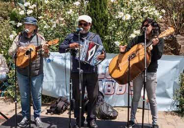
3 in-language meetings with Spanish, Chinese, and Vietnamese support groups
3 virtual events held with community partners Family Connections Centers and River of Life Church
was potentially missing. In addition to the survey instrument, the project team developed a display board where residents could mark-up the project map with pens, place stickers for projects they preferred, or write comments.
4 community events or community meetings
In addition to indicating preference for each project, community members could provide written comments following each geographical sub-section in the survey. The SFMTA received 247 written comments from survey responses. The responses were then categorized according to theme under the following categories: transit, parking, pro-bike, anti-bike, pedestrian safety, lighting, enforcement, traffic, and other. Table 2 shows the proportion of comments within each project location according to theme.
For the comments categorized as “other”, common
topics included: crime/safety, slow streets, improved connections, landscaping, locations of collisions, parklets, and general commentary on SFMTA practices.
These written comments along with the surveys collected helped inform the development of projects for the draft plan. The addition of speed humps and pedestrian bulb outs was a focus because there was a broad consensus from outreach that pedestrian safety and traffic calming are top priorities. Portola residents expressed more pro-bike sentiment, so new bikeways were proposed in that neighborhood. The Sunnydale area in Vis Valley expressed a need for improved Muni stops.
Bloom Shaboom
SFMTA staffed a table at the Bloom Shaboom,
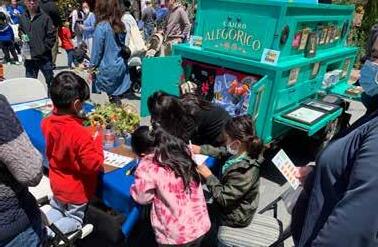
Vis
WHAT DO YOU THINK ABOUT THESE PROJECTS? 你怎麼看待這件事?| ¿Qué piensa usted al respecto?
Community
Bạn nghĩ gì về nó? Ano sa tingin mo tungkol dito?
What I like is ...
速度颠簸 Gờ giảm tốc badenes Bilis ng bumps Streetscape Project 重建街道 Xây ạ đường phố
reconstruir la calle Muling itayo ang kalye
New Bike Lanes
新的自行車道 Làn đường xe đạp mớ
nuevos carriles bici Bagong bike lane
New Sidewalk
新人行道 Mớ v a hè nueva acera Bagong bangketa
Raised Crosswalk
凸起的人行橫道 Đường băng qua gờ giảm tốc paso de peatones elevado nakataas na tawiran
Pedestrian Bulb Out
較短的人行橫道 Đường băng qua ngắn hơn Cruces peatonales más cortos Mas maiikling tawiran
New Crosswalk
新人行橫道 lối băng qua đường mới nuevo paso de peatones bagong tawiran
Muni Stop Improvement
巴士站改善 cả tiến trạm dừng xe buýt mejoras paradas de autobus pagpapabuti ng bus stop
Other Proposed Projects
Speed Humps/Cushions
速度颠簸 Gờ giảm tốc badenes Bilis ng bumps
Streetscape Project 重建街道 Xây ạ đường phố reconstruir la calle Muling itayo ang kalye
New Bike Lanes
新的自行車道 Làn đường xe đạp mớ nuevos carriles bici Bagong bike lane
Raised Crosswalk or RRFB
凸起的人行橫道 Đường băng qua gờ giảm tốc paso de peatones elevado nakataas na tawiran
Pedestrian Island
交通島 đảo giao thông
Isla de tráfico lugar ng trapiko
我喜歡 me gusta tôi thích gusto ko
What I don’t like is ...
我不喜歡 no me gusta Tôi không thích ayoko
This project is missing ...
缺了點什麼 Algo falta Thiêu một thư gi đo May nawawala
a community event organized by community partner Family Connections Center in the Portola neighborhood. The Bloom Shaboom is a familycentered event with many games, activities, and giveaways. Staff interacted with approximately 720 residents.
SFMTA held a hybrid community workshop with River of Life Church at the close of their church service. Interpretation in 4 languages was provided for online participants. Approximately 40 people attended in-person and 15 people attended the meeting online. In-person participants expressed strong reservations about the implementation of bike network projects in their community, while others disagreed over the advisability of removing a local bus stop.
SFMTA held two online community workshops with Family Connection Center. One meeting was geared towards Cantonese-speaking community and the other towards the Spanish-speaking community, with simultaneous interpretation provided. There were 100 attendees across both workshops.

Comments focused on crime, traffic, and transit service along the San Bruno Avenue corridor.
SFMTA participated in Family Day, an event thrown by Mercy Housing, the manager of the Sunnydale HOPESF housing site. The event was held at Herz Playground in adjacent McClaren Park and approximately 400 residents attended the event. SFMTA staff tabled at the event, with display boards, paper surveys, and giveaways. Staff collected 20 surveys and received input from 50 residents.
SFMTA staff set up 3 pop-ups at the Portola Library and Vis Valley Library with interactive display boards, paper surveys, and giveaway items. Staff interacted with a total of 50 residents at these events.
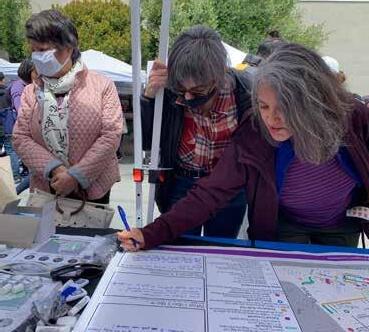
The third phase of outreach for the VV/P CBTP extended from October 2022 through January 2023. This outreach phase was still impacted by the spread of Coronavirus, namely through staffing capacity challenges that limited the number of events the team was able to staff. Outreach also included door hanger distribution, posters in neighborhood commercial districts, and public service announcements. In total, the Vis Valley & Portola CBTP team spent approximately 50 staff hours in the community, engaged with over 600 residents, and collected 296 surveys during Phase 3 outreach. Outreach events during Phase 3 were intentionally selected to reach across both communities, engage hardto-reach residents, and meet residents where they are.
During this period, the project team attended 15 events.
• 3 Virtual meetings organized by community partners Family Connections Center and the River of Life Church
3 virtual events held with community partners Family Connections Centers and River of Life Church
6 surveying sessions at area bus stops
7 Pop-Up events at libraries, grocery stores, and local cafes
• 2 language-specific support groups led by Family Connections Center
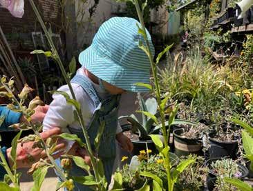
9 community events or meetings
3 in-language meetings with Spanish, Chinese, and Vietnamese support groups
• 1 event coordinated with Mercy Housing, specifically to reach residents of the Sunnydale development
• 8 pre-existing events led by other community groups
• 1 community event pop-up
The Phase 3 portion of the project built off feedback received during Phase 2 to prioritize proposed projects in the Draft Plan that were presented in Phase 2. In Phase 2, community members ranked proposed projects along priority corridors identified in Phase 1 ranging from “Very Desirable”, “Neutral”, to “Very Undesirable”. In addition to indicating a preference for each project, community members could provide written comments following each geographical sub-section in the survey. The input gathered during Phase 2 was used to develop a finalized set of projects and policy recommendations, including the Streetscape Plan, the Transit Action Plan, and the Cost & Implementation Plan. Suggested improvements include areas near McLaren Park, San Bruno Avenue, the Visitacion Valley Greenway, and other previously identified priority sites. Projects were organized by neighborhood in the surveys, to better communicate them to community members.
The VV/P CBTP organized Phase 3 outreach to capture the following types of information:
• Priority Ranking of Each Proposed Project by Neighborhood
• Demographic Data
• Qualitative Data
All three types of data were captured through a survey instrument, available to community members in-person through a paper format or available at any time in an online version. Survey materials were translated into Spanish, Chinese, Filipino, and Vietnamese. In the survey instrument, residents were asked to rank all proposed projects from #1 (most desirable) to #8 (least desirable). The survey specified that resident ranking would be used to
determine the order of implementation for the final list of projects.
In the Portola residents consistently ranked the Portola Freeway Greenway connector as their highest project. In Vis Valley, responses were much more mixed, showing a diversity of opinion on the highest priority for implementation.
Bikeway projects ranked both very highly (San Bruno Ave Protected Bikeway) and also at the bottom in both communities (Girard/Woolsey/University Bikeway and Sunnydale Ave Bike Lanes).
The Mansell Streetscape project ranked among the bottom of choices in Portola, but ranked second among residents in Vis Valley.
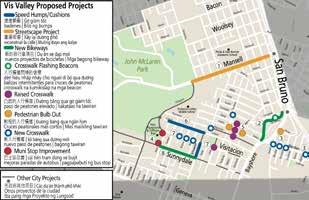
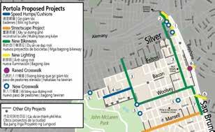
The project team attended a resident meeting hosted by the Felton Institute on Sunnydale with a Chinese translator. A status updated was provided, in addition to a walk-through of proposed projects. At least 22 community members attended, many of whom completed surveys and asked questions related to the presented material.
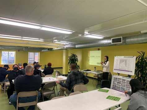
The project team participated in the Vis Valley Festival of Lights, an event organized by community activists and light installation artists to host lightup art exhibitions along the Vis Valley Greenway. The project team worked with the organizers to secure street closure permits for the event, due to the Vis Valley Greenway spanning 5 separate blocks through the neighborhood with unmarked midblock crossings.
The project team staffed a table at the festival with display boards, surveys, fact sheets, and SFMTA giveaways.The project team also collaborated with Fran Martin, one of the founders of the Vis Valley Greenway, to make a demonstration crosswalk with spray-chalk. The event drew over 600 visitors and the SFTMA team engaged with approximately 300 residents.
The project team gave a presentation to the SFMTA Citizens Advisory Council on the evening of January 5th in a virtual meeting. There were 22 in attendance, including council members and members of the public. After a discussion with the council, they introduced and passed a resolution of support for the Draft and Final Plan.
The project team attended a monthly Chineselanguage support group held by Family Connections

Center. The project team presented the Draft Plan and administered surveys. There were 15 residents in attendance. Conversation focused on resident opposition to bike lanes and support for improved access to the Alemany Farmer’s Market.
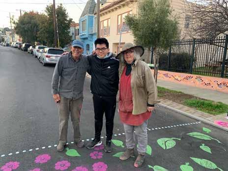
All Projects
CBTP Projects

Mansell Streetscape Concepts
Funding & Implementation
Project Types
Project Development
Policy Recommendations
# # Portola projects
Vis Valley projects
速度颠簸 | Gờ giảm tốc badenes | Bilis ng bumps
重建街道 | Xây lạ đường phố reconstruir la calle | Muling itayo ang kalye
新的自行車項目 | Dự án xe đạp mớ nuevos proyectos de bicicletas | Mga bagong bikeway
New Lighting
新照明 | Ánh sáng mới nueva iluminación | Bagong ilaw
Crosswalk Flashing Beacons
đèn hiệu nhấp nháy cho ngườ đi bộ qua đường balizas intermitentes para cruces de peatones crosswalk na kumikislap na mga beacon
Raised Crosswalk
凸起的人行橫道 | Đường băng qua gờ giảm tốc paso de peatones elevado | nakataas na tawiran
Pedestrian Bulb Out
較短的人行橫道 | Đường băng qua ngắn hơn Cruces peatonales más cortos | Mas maiikling tawiran
New Crosswalk
新人行橫道 | ố băng qua đường mới nuevo paso de peatones | bagong tawiran
Muni Stop Improvement
巴士站改善 | cả tiến trạm dừng xe buýt mejoras paradas de autobus | pagpapabuti ng bus stop
Geneva
Alemany 交汇处路径 | Con đường đi bộ Alemany Camino del Intercambiador de Alemany Landas ng Alemany Interchange
SFMTA Tra c Calming Projects (Speed cushions & crosswalk islands)
Gờ giảm tốc và cả thiện ối sang đường Reductores de velocidad y cruces peatonales mejorados Bilis ng mga bump at pinahusay na mga tawiran
Visitacion Ave Pedestrian & Bicycle Safety Project (Rec Park)
Visitacion Ave 步行和騎自行車安全項目
Visitacion Ave dự án an toàn đi bộ và đi xe đạp Proyecto de seguridad para caminar y andar en bicicleta
Visitacion Ave naglalakad at pagbibisikleta proyekto
Portola Freeway Greenway (Portola Neighborhood Association)
波托拉高速公路綠道 | Đường cao tốc Portola greenway vía verde de la autopista de Portola
Portola freeway greenway
Sunnydale HOPESF Roadway Projects (New bike lanes & bike path)
Những con phố mới với làn đường dành cho xe đạp ở Sunnydale Nuevas calles con ciclovías en Sunnydale Mga bagong kalye na may bike lane sa Sunnydale
Yosemite Creek Daylighting Project (New Sidewalk - SFPUC)
Yosemite Creek 人行道项目 | Dự án vỉa hè Yosemite Creek
Proyecto de acera de Yosemite Creek
Proyekto sa bangketa ng Yosemite Creek
Freeway Ramp Intersection Safety Study Phase 3 (SFCTA)
| Nghiên cứu an toàn lố ra xa ộ Estudio de seguridad de rampa de autopista Pag-aaral sa kaligtasan ng ramp ng freeway
Vis Valley Proposed Projects
Speed Humps/Cushions
速度颠簸 Gờ giảm tốc badenes Bilis ng bumps Streetscape
重建街道 | Xây lại đường phố reconstruir la calle | Muling itayo ang kalye
New Bikeways
新的自行車項目 | Dự án xe đạp mới nuevos proyectos de bicicletas Mga bagong bikeway
新照明 Ánh sáng mới nueva iluminación | Bagong ilaw
Raised Crosswalk
凸起的人行橫道 | ường b ng qua gờ giảm tốc paso de peatones elevado | nakataas na tawiran
New Crosswalk
新人行橫道 | lối băng qua đường mới nuevo paso de peatones bagong tawiran
1 Portola Freeway
2 San Bruno Ave
Protected Bikeway
3 Girard/Woolsey/University Bikeway
Pedestrian-scale lighting on San Bruno Avenue between Silver Avenue and Alemany Boulevard. Upgraded crosswalks at Hale Street, Gaven Street, and Rickard Street.
Protected 2-way bikeway on the west side of San Bruno Avenue between Rickard Street and the Alemany Interchange.
Neighborhood bike route along Barneveldt Avenue and Girard Street from Rickard Street in the north to Woolsey Street in the south; neighborhood bike route between San Bruno Avenue and Silver Avenue on Woolsey Street and University Street.
4 Bacon Street Traffic Calming Speed humps on Bacon Street between University Street and Oxford Street.
5 Park & Stairway Crosswalks Crosswalks and curb ramp upgrades at: Gambier Street at Burrows Street; University Street at Woolsey Street; University Street at Dwight Street; Goettingen Street at Dwight Street.
6 Undercrossing Improvements Pedestrian-scale lighting in the Bacon Street and Paul Avenue Hwy 101 underpasses; mid-block raised crosswalk on Bacon Street.
7 San Bruno Ave Bike Lanes Portola
8 Mansell Streetscape
Create safe and comfortable conditions for people walking to the Alemany Farmer’s Market.
Create safe and comfortable bike network connection between the Alemany Farmer’s Market and the Girard bikeway.
Provide low-volume, low-stress north/south and east/west bike network altneratives to San Bruno Avenue or Silver Avenue that are direct and with few hills. Connects to other proposed bike network projects
Reduce neighborhood speeding.
Improve pedestrian visibility and access at park entrances and at public stairways.
Streetscape
重建街道 | Xây ạ đường phố reconstruir la calle Muling itayo ang kalye
New Bikeways
新的自行車項目 Dự án xe đạp mới nuevos proyectos de bicicletas Mga bagong bikeway Crosswalk Flashing Beacons
人行橫道閃爍的信標
đèn hiệu nhấp nháy cho người đ bộ qua đường balizas intermitentes para cruces de peatones crosswalk na kumikislap na mga beacon
Raised
Remove 1 northbound travel lane to install bike lanes between Mansell Street and Paul Avenue.
Protected bikeway, transit bulbs, and landscaped median open space along Mansell Street between San Bruno Avenue and Visitacion Avenue.
Improve pedestrian visibility and comfort in freeway underpasses; connect the segments of the Portola Freeway Greenway.
Connects bike network between Mansell Street, San Bruno Aveue, Paul Avenue, and the proposed Woolsey/University Bikeway and Girard Bikeway.
Transform Mansell Street median into linear park for the community.
凸起的人行橫道 | ường b ng qua gờ giảm tốc paso de peatones elevado | nakataas na tawiran
較短的人行橫道 | Đường băng qua ngắn hơn Cruces peatonales más cortos Mas maiikling tawiran New Crosswalk
新人行橫道 lối băng qua đường mới nuevo paso de peatones bagong tawiran
Improvement
巴士站改善 cải tiến trạm dừng xe buýt mejoras paradas de autobus | pagpapabuti ng bus stop
Rank Vis Valley Projects Project Why
Other City Projects
市政府其他项目 | Các dự án thành phố khác Otros proyectos de la ciudad Iba pang mga Proyekto ng Lungsod
1 San Bruno Ave Bike Lanes Vis Valley Uphill-only bike lane from Bayshore Boulevard to Campbell Avenue; rapid flashing beacons at existing crosswalk at Beeman Lane Stairway.
2 Little Hollywood Projects Pedestrian bulb out on Hester Avenue at Bayshore Boulevard; crosswalk and curb ramp upgrades on Blanken Avenue at Tunnel Avenue, Wheeler Avenue, Peninsula Avenue, and Gillette Avenue.
3 Sunnydale Transit Improvements Transit bulbs, bus shelters, and arrival time signage for bus stops on Hahn Street at Visitacion Avenue and at Sunnydale Avenue.
4 Vis Valley Greenway Connector
Decorative raised crosswalks mid-block on Raymond Avenue, Arleta Avenue and Teddy Avenue; Pedestrian bulb-outs on Arleta Avenue at Alpha Street and at Rutland Street; decorative crosswalk on Rutland Street at Campbell Avenue.
5 Leland Ave Traffic Calming Speed humps on Leland Avenue between Schwerin Street and Hahn Street.
6 Visitacion Ave Traffic Calming Raised crosswalk on Cora Street at Visitacion Avenue; upgraded crosswalks and curb ramps on Visitacion Avenue at Rey Street, Britton Street, and Loehr Street.
7 Sunnydale Avenue Bike Lane Uphill-only westbound bike lane on Sunnydale Avenue from Schwerin Street to Hahn Street.
8 Mansell Streetscape Protected bikeway, transit bulbs, and landscaped median open space along Mansell Street between San Bruno Avenue and Visitacion Avenue.
Provides separated space for slow-moving bicyclists going uphill without removing street parking; improve pedestrian safety and slow driver speeds.
Improve pedestrain safety and visibility.
Improve transit access & comfort for Sunnydale residents & park users.
Connect the Vis Valley Greenway in a continuous pedestrian path.
Slow driver speeds and improve pedestrian safety.
Slow driver speeds and improve pedestrian safety.
Separated space for slow-moving bicyclists going uphill without removing parking; connects to uphill-only bike lane being built on Sunnydale Avenue west of Hahn Street.
Transform Mansell Street median into linear park for the community.
The final map for the Vis Valley & Portola Community Based Plan consists of 45 different projects across the plan area.
Proposed projects were designed in collaboration with the community over 3 phases of outreach, and are meant to directly respond to the needs, challenges, and values of residents. Proposed projects are also meant to coordinate with, and build off of, ongoing transportation projects in the plan area.
Mansell Street, from San Bruno Avenue in the east to Visitacion Avenue in the west, was identified as a street with a high level of interest from the community and the potential for a transformative project competitive for future grant funding. There have been previous community efforts at beautifying Mansell Street and there is high community interest in supporting this project.
Mansell Street currently has a large, planted median that divides a single westbound travel lane and a single east bound travel lane. It climbs a substantial hill in the westbound direction towards McLaren Park and the median within the divided road has a substantial cross-slope on some blocks. The divided roadway on either side of the median is excessively wide (approximately 42’), with a standard bike lane and a parking lane. The 29 Sunset and 56 Rutland Muni bus lines run on this portion of Mansell Street. To the west of University Street, Mansell Street enters McLaren Park and two-way vehicle traffic is restricted only to the southern half of the divided roadway west of Visitacion Avenue in the park. The northern half of the divided roadway is reserved only for people walking and bicycling within
McLaren Park – dubbed the “Mansell Promenade”.
The project team sought to develop concept designs for Mansell Street that could accomplish the following goals:
• Improve safety for all roadway users
• Better connect the bike network between Bayview-Hunters Point and McLaren Park
• Improve transit service for the 29 Sunset and 56 Rutland Muni lines

• Increase access to the median for surrounding neighbors
• Create opportunities for programed open space and public art within the median
The three streetscape concept designs are show on the following pages. Due to significant crossslope in sections of the median, a combination or blending of elements of the three concept designs may be required in any eventual project.
As the SFMTA pursues grant funding, additional rounds of public engagement and design, especially focused on the activation of the median open space, will be conducted with partners in the community.
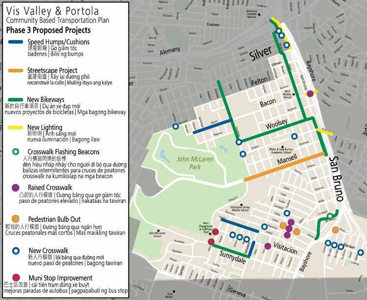
In all, this map represents over $25 million of potential projects in Visitacion Valley & Portola.

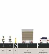
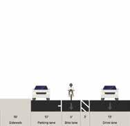
Construct two-way protected bikeway adjacent to median on westbound Mansell St. This orientation eliminates con icts with transit and parking, but introduces additional con icts at intersections.
Construct bus bulbs and/or curb extensions and relocate bus stops to improve access to Muni busses and shorten crossing distances for people walking. Coordinate with 29 Sunset Improvement Project.

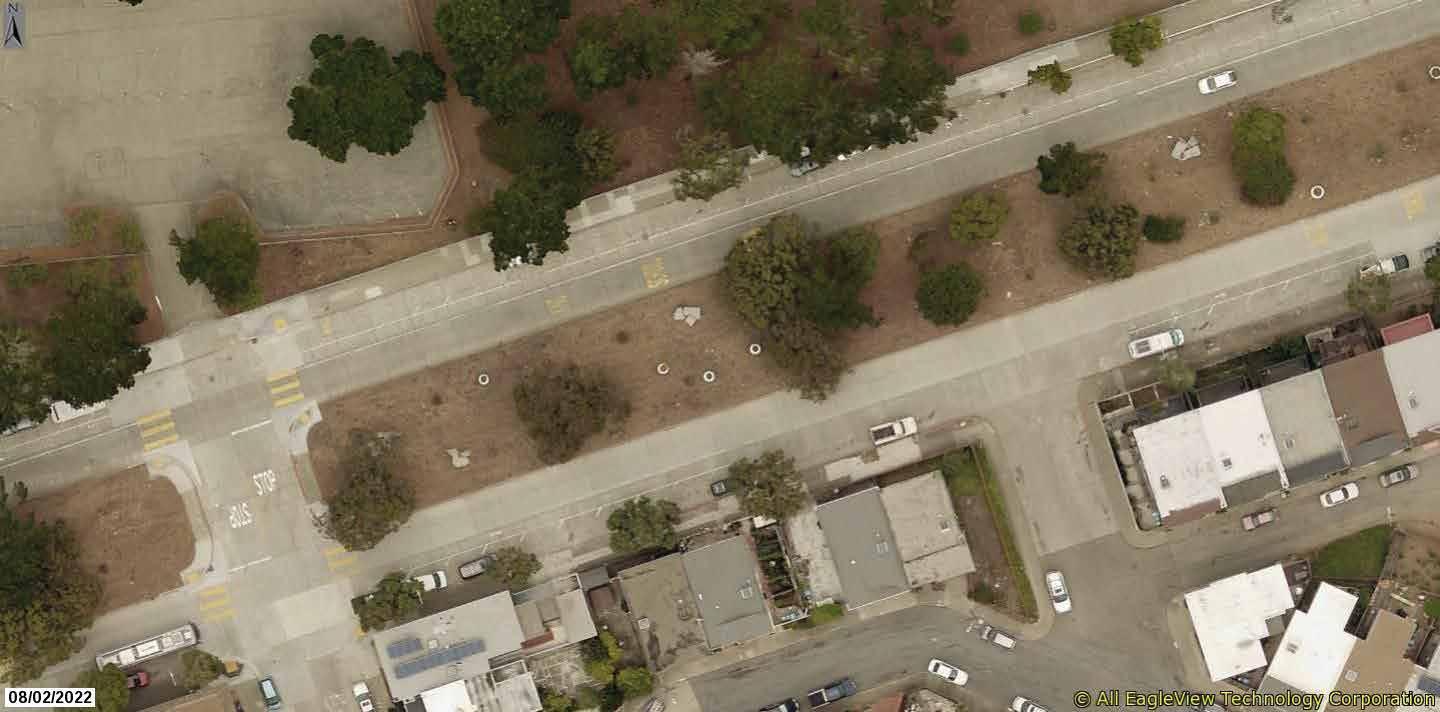
Retain on-street park ing and loading on Mansell St. Narrow park ing lane from 11 feet to 8 feet to accommodate bikeway.


1
Widen median and constuct sidewalk-level shared-use path. This orientation eliminates con icts with transit and parking, but introduces additional con icts at intersections, as well as additional costs compared to an on-street bikeway.
Construct bus bulbs and/or curb extensions and relocate bus stops to improve access to Muni busses and shorten crossing distances for people walking. Coordinate with 29 Sunset Improvement Project.
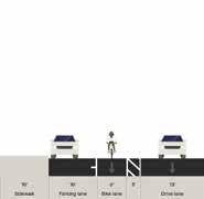
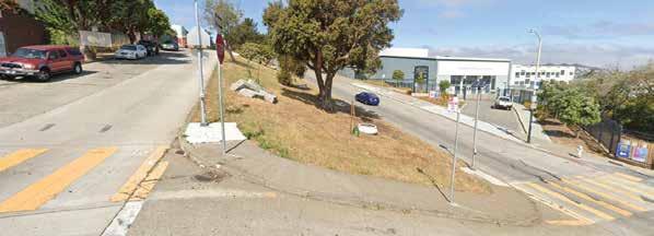
3
Retain on-street parking and loading on Mansell St. Narrow parking lane from 11 feet to 8 feet to accommodate bikeway.
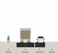
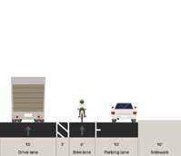
Construc t shared-use path within existing median. Provide spaces for programming, such as seating, public ar t, or exercise stations where appropriate and space and topography allow. This alternative would likely require tree removal. No changes would be made to existing roadway cross-sec tion.
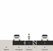


would entail signi cant construction costs due to cross-slopes and

Construct bus bulbs and/or curb extensions and relocate bus stops to improve access to Muni busses and shorten crossing distances for people walking. Coordinate with 29 Sunset Improvement Project.

The table below identifies the value of projects identified in the Draft Plan. Costs have been estimated at the planning level, using unit-cost estimates provided by SFMTA and SFDPW.
Total Corridor Costs $ 19.0 million
Total Location Costs $ 6.3 million
Total Project Costs $ 25.3 million
Near Term - SFMTA Vis Valley & Portola Traffic Calming: $900,000
This package of traffic calming projects, in development during the VV/P CBTP plan process, is anticipated to start construction in July of 2023.
Near Term - Neighborhood Transportation Improvement Program (NTIP): $400,000
The SFMTA is currently working with the office of Supervisor Shamann Walton to apply Proposition K sales tax funds to the implementation of the highest prioritiy projects in the Vis Valley community.
Mid-Term – SFMTA Quick-Build Program:
~$1,000,000/year
Working off the highest-priority projects from the VV/P CBTP, the SFMTA Livable Streets QuickBuild team will allocate future Quick-Build funds to projects in Vis Valley and Portola. These projects should be expected to start in Summer 2023 with implementation in Winter/Spring of 2024.
~$15,000,000
The SFMTA will continue work within the community to refine design concepts for the Mansell Streetscape project, with an eye towards an application to the Caltrans Active Transportation Program. The next application cycle is anticipated
in Spring 2024, with awards in late 2024 and construction likely to start in 2026.
Over the course of the last 2 years, a three-stage public engagement process was held to develop and refine the program areas, strategic actions, and recommendations. The Plan reflects the shared priorities and actions that will need to be prioritized and implemented in the years ahead to meet community-defined goals.
The investments recommended by the Plan would not commit the City to a definite course of action in carrying out any individual proposal; these actions may be considered, evaluated as appropriate under the California Environmental Quality Act (CEQA), and finally approved or disapproved individually by the applicable decision-making body at a future time.
The Capital Improvement Plan (CIP) is a fiscally constrained 5-year program of SFMTA’s capital projects that operates as an implementation plan for regional, citywide, and agency-wide strategies and policy goals. The CIP documents and details the projects that the agency aims to implement over the subsequent five-year period and is based on citywide planning initiatives & project-specific feedback. SFMTA staff are working to identify funding sources and include Vis Valley & Portola CBTP projects in the CIP for future project implementation.
Proposition K - Prop K is a half-cent sales tax administered by the SFCTA. It includes 21 programmatic categories such as street resurfacing, new signals and signs, traffic calming, and transit enhancements. Prop K serves as a primary funding vehicle for CBTP implementation both through
direct funding and through providing local match for other grant funding sources. Proposition K was reauthorized by San Francisco voters in 2022 as Proposition L. At the time of writing, eligibility criteria for Proposition L categories are being determined, however we anticipate that many projects recommended by the Vis Valley and Portola CBTP will be eligible for funding If this ballot measure does not pass, it could significantly impact the SFMTA’s ability to implement plan recommendations in the VV/P CBTP.
There are a variety of possible funding sources outside of the Prop K sales tax that fund work carried out by the SFMTA, Public Works, and other city agencies. The SFMTA also pursues competitive funding sources and submits grant applications for specific projects and programs including those outlined below.
• Proposition B - Prop B was approved by San Francisco voters in 2014 requiring the city to increase General Fund contribution to the SFMTA by a percentage equal to the City’s annual population increase, accounting for both daytime and nighttime populations.
• General Obligation (GO) bond - The $500 million Transportation and Road Improvement GO bond was approved by San Francisco voters in 2014 and funds critical capital investments to upgrade the transit system, improve service, enhance safety and accessibility, and renovate Muni’s maintenance and storage facilities. This funding source is utilized by the SFMTA to supply its services to all of San Francisco.
• Proposition AA - Prop AA is a ten-dollar San Francisco Vehicle Registration Fee that generates about $5 million a year for transportation since it was approved by voters in 2010. Funds are administered by the San Francisco County Transportation Authority to local projects in three program areas: Street Repair and Reconstruction 50%, Pedestrian Safety 25%,
and Transit Reliability and Mobility Improvements 25%.
• Active Transportation Program (ATP) - ATP is a statewide grant funding source for the construction of projects encouraging active transportation. This grant source is specifically interested in funding projects in disadvantaged communities that have been vetted by the community through thorough outreach processes.
• Sustainable Transportation Equity Project (STEP) Grant - The California Air Resource Board (CARB) STEP grant is a new transportation equity pilot that aims to reduce greenhouse gas emissions increase transportation access, and address community needs.
• Proposition D – Prop D was approved by San Francisco voters in 2020 requiring a 3.25% charge to rides on transportation network company (TNC) vehicles, such as Lyft or Uber. The tax generates between $30 to $35 million per year, with half of the funds dedicated to Muni transit operations and half of funds allocated to the SFCTA for transportation safety projects. Prop D funds could go towards QuickBuild implementation projects in the VV/P CBTP plan area.
• Affordable Housing and Sustainable Communities (AHSC) Program – The AHSC program, managed by the Strategic Growth Council, funds coordinated affordable housing and transportation improvement projects. Projects within the VV/P CBTP plan area, when paired with affordable housing development (such as the Sunnydale HOPE SF site) could be eligible for future rounds of AHSC funding.
• Development Agreements – Major planned developments in the area, such as Schlage Lock, have the potential to provide additional funding for transportation & safety improvements within the VV/P CBTP plan area.
Continental Crosswalks consist of a roughly twofoot-wide striped pattern at pedestrian crossings. The design helps to distinguish pedestrian crosswalks at intersections, thereby allowing for higher visibility of pedestrians by drivers.
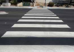

Landscape improvements such as installation of trees or public are as streetscape features reflect community identity, inviting more street usage and activation. Landscape improvements were a common request during community outreach.
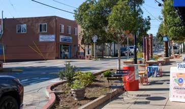
Pedestrian refuges are protected areas where people may safely pause or wait while crossing a street. A pedestrian refuge or traffic island is used at intersections and can also provide an opportunity for landscaping and visual enhancements.
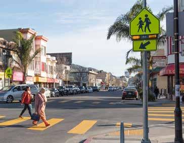
Raised crosswalks are roadway crossing where pavement is raised to the level of the sidewalk. This street design channels pedestrians and promotes safety by slowing vehicles as they approach the crossing.
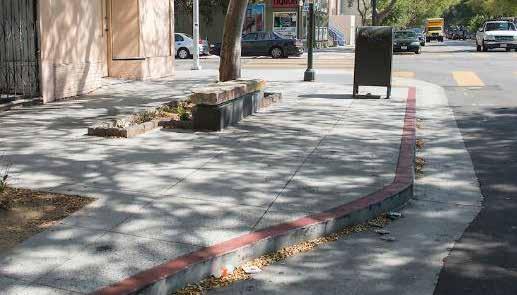
Curb ramps are essential in providing an accessible path of travel on and off public sidewalks; older sidewalks in the Vis Valley & Portola area need to be adapted with ramped curbs when intersection crosswalks are upgraded. Curb ramps are crucial to a full transit network and to pedestrian safety. Without curb ramps in place, people with mobility disabilities are often forced to travel in the street with traffic.
Street lighting specifically targeted towards illuminating the pedestrian environment. It provides a decorative, human-scale element in the streetscape, fostering neighborhood identity and improving the aesthetics of the urban environment. It also encourages walking and biking trips while improving perceived safety and comfort along corridors. Street lighting is particularly important in the Vis Valley & Portola, where residents frequently express concern for personal safety when walking or waiting for transit at night.

Pedestrian bulbs are an extension of the sidewalk at an intersection expanding space where people may safely pause or wait while crossing a street. They increase pedestrian visibility and safety when crossing the street. Pedestrian bulbs may be expanded to include landscaping. A similar treatment to pedestrian bulbs is a pedestrian safety zone – a painted buffered curb-side space between the sidewalk and moving vehicles. Their footprint resembles a bulb out, helping to emphasize that the space should not be treated as part of the roadway. Painted safety zones are a low-cost, easily implemented treatment that enhance pedestrian safety.
Rectangular Rapid Flashing Beacons are solarpowered lights at the side of a roadway that flash when activated by a person walking. RRFBs are treatments designed to increase motorist yielding to people walking in crosswalks at key locations.
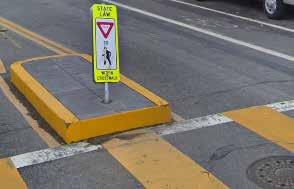
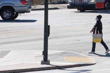
sidewalks are wide enough to accommodate shelter installation. Planned shelters will include updated Muni route maps and technology tools providing real-time arrival data and scheduling information.
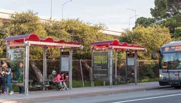
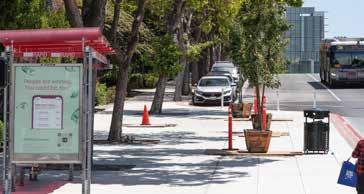
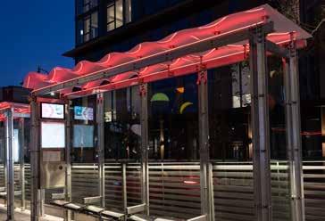
Speed cushions are a traffic calming measure that is a rounded device across the roadway that causes vehicles to reduce their speed. Speed cushions can be designed to accommodate emergency vehicle access. Transit
Bus bulbs are curb extensions that align the bus stop with the parking lane, allowing buses to stop and board passengers without ever leaving the travel lane. Bus bulbs help buses move faster and more reliably by decreasing the amount of time lost when merging in and out of traffic. They can improve pedestrian conditions by locating the transit waiting area and transit shelter outside of the primary sidewalk.
Protected bikeways are separated from vehicle traffic by a physical barrier. This can take the form of the parking lane, plastic bollards, or concrete “K-rail” barriers.
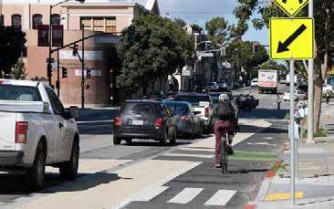
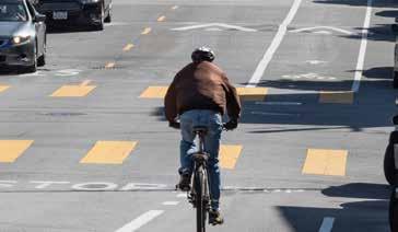
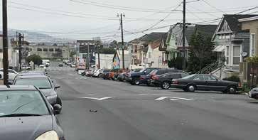
Neighborways and Slow Streets are streets where people on bicycles share the roadway space with vehicle drivers without physical separation. Both facilities focus on low-volume, low-speed roadways and can include treatments to further slow traffic or divert vehicle traffic (especially non-local through traffic) off of the sthreet.
Bus lighting improvements to waiting areas and loading zones for transit passengers includes installation of pedestrian-level street lighting.
Installation of bus shelters is a collaborative process between SFMTA and Clear Channel Outdoor, with authorization power from the Department of Public Works. Bus shelters give transit users protected locations to wait for arriving buses. The locations identified for potential new bus shelters need to be reviewed for suitability, specifically ensuring
Bike lanes are a separated roadway space for people on bikes adjacent to the travel lane. Separated by paint, a bike lane can include a buffer area of painted space to achieve greater horizontal separation from vehicle traffic.
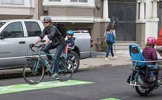
SFMTA is committed to uplifting community voice and demonstrating how it was used to make decisions.
During pre-outreach community interviews, the project team gained insight on how the community should be engaged for the purposes of building trust and conveying the worthiness of participating in the plan process. This insight directly informed how the project team sought input during Phase 1.
From community interviews, the project team learned that they needed to keep surveys flexible, simple, and easy to fill out. This allowed the project team to deploy surveys in a wide range of social situations, from workshops, to community presentations, to tabling at libraries, to bus stop walkup surveys.
During Phase 2 residents were asked to score their preferences for a list of proposed projects mapped across Vis Valley & Portola. In addition to scoring their preferences, residents also had the opportunity to suggest other projects or provide other comments.
Using both the preference scoring and the comments provided in Phase 2 surveys, the project team removed projects, updated projects, and added new projects. Coordination with organizations like the Portola Neighborhood Association, Friends of McLaren Park, and residents at Sunnydale HOPESF between outreach phases also informed the development of projects that aligned with other efforts ongoing in the community. This resulted in the list of projects documented in the Streetscape Plan.
Community based organizations in Portola and Vis Valley are essential partners in reaching key stakeholders, especially seniors, youth, and residents with low English proficiency. The SFMTA needs to support these organizations and find opportunities to align our projects with their priorities for the benefit of both communities.
Actions:
• Contract with community partners for outreach and programming in future SFMTA projects.
• Pursue easier pathways for contracting community partner organizations.
• Build ongoing, sustained relationships with key organizations to facilitate communication and coordination within both communities.
• Pursue grant funding opportunities for a community shuttle program in Vis Valley & Portola.
• Work with Community-based organizations to craft a shuttle program fitting community needs.
Both Vis Valley and Portola have a large number of ongoing transportation projects managed by a broad array of City agencies, including the Department of Public Works, RecPark, and the Public Utilities Commission. Residents are concerned that the priorities of the CBTP will be lost on other agencies if there is not active collaboration and accountability.
Actions:
• Set up recurring coordination meetings between project teams in the plan area.
• Jointly staff community events and meetings to demonstrate to residents that collaboration is ongoing.
During Phase 1 residents were asked to identify corridors and intersections most in need of improvements, as well as what kinds of improvements they wanted to see on those corridors.
Input from the public allowed the project team to strategically choose high-priority corridors and intersection for potential projects, as well as clear guidance on what types of solutions residents wanted to see. The project team developed an array of projects across the community directly addressing input from Phase 1. Projects were also vetted with internal stakeholders to ensure their viability and consistency with other agency goals.
During Phase 3 residents will be asked to rank the final list of projects in the Draft Plan.
Ranking from residents will be the sole input used for ordering projects for implementation following Plan adoption.
The substantial hills and geographic barriers across Vis Valley & Portola can make travel within the community difficult, especially for senior residents or residents with disabilities. Many community-based organizations have trouble providing services to residents due to these transportation challenges.
Actions:
• Increase promotion of existing SFMTA services like VanGogh and Shop-a-Round
• Pursue grant funding opportunities for a community shuttle program in Vis Valley & Portola.
• Work with Community-based organizations to craft a shuttle program fitting community needs.
The high proportion of limited-English speakers in Vis Valley & Portola are more likely to be low-income seniors than the rest of the community. These residents are often the most vulnerable to transportation changes & challenges, and often have the least access to information.
Actions:
• Increase multi-lingual outreach and assistance for the Essential Trip Card program
• Increase multi-lingual outreach and assistance for the Lifeline Pass program
• Increase multi-lingual outreach and assistance for the Free Muni for Seniors program
Bicycle network projects get a mixed reception in both Vis Valley and Portola. Due to the high rates of vehicle ownership, and pre-existing challenges with overparking, bike projects should attempt to avoid or mitigate parking loss in this community. Access and personal safety are also significant barriers to for residents to overcome in these communities.
Actions:
• Increase Spanish and Chinese language bicycle education programming.
• Pursue programmatic funding to improve resident access to bicycles.
Both Vis Valley & Portola are starved for easily accessible & programmed open space. Despite close proximity to McLaren Park, resident access can be deterred by the substantial geographic barriers in the community. Transportation projects going forward should look for opportunities to increase and support existing open space in close proximity to business corridors and activity centers.
Actions:
• Support the Portola Freeway Greenway
• Support the Vis Valley Greenway
• Support the Mansell Street Streetscape
Residents expressed concerns for safety and comfort when accessing and using transit. This included a desire for more lighting at transit stops and more bus shelters. Future Muni projects in this area should focus on potential placement for new shelters and assessment of lighting levels at existing transit stops. SFMTA could partner with SFDPW for pedestrian-scale lighting projects within the CBTP plan area that could benefit multiple transit lines. Especially in the Sunnydale community, any future changes to stop locations should consider instances of community violence, and strategies to improve the reliability and perception of personal safety at stops.
Residents also expressed a desire for a safety presence on transit. This could be accomplished through additional staffing from the MTAP program on lines that serve the VV/P communities.
Actions:
• Prioritize shelter improvements such as lighting & electricity access for transit shelter currently without power
• Prioritize MTAP staffing for transit lines in the plan area
• Prioritize SF DPW sidewalk repair projects on key routes to transit stops
Residents expressed many needs and challenges in relation to transit service. While service to downtown
San Francisco is strong, via the 8 Bayshore and 9 San Bruno, residents experience challenges reaching other areas of the city. Transit crowding is a common complaint in both communities, with seniors and residents with disabilities often fearing injury when buses become too crowded. Events at McLaren Park, which draw from the whole region, can sometimes exacerbate crowding on transit. Access to transit information, especially for trips taken at night, is crucial to residents feeling safe and comfortable using transit. Residents also experience trouble reaching certain destinations such as the Mission District.
Actions:
• Develop event-responsive scheduling to provide supplemental service for the 29 Sunset and the 54 Felton when major events are taking place in McLaren Park.
• Prioritize Vis Valley & Portola locations for the roll-out of new transit arrival-time signage.
• Prioritize transit connections to locations like the Mission District around 24th Street BART.
Vis Valley and Portola are over-parked communities, with more cars on the street than available parking spaces. On the San Bruno Avenue corridor, double-parking in the travel lane is common, creating safety hazards, congestion, and transit delays. Parking at intersections blocks curb ramps for pedestrians with disabilities or families with strollers, and parking on sidewalks creates a hazardous and unfriendly environment for people walking in the neighborhood. But traditional enforcement measures, especially in the lowest-income areas of both communities, can cause substantial harm for those least able to afford it.
Actions:
• Pursue non-punitive measures to enforce legal parking
• Boost transit service to reduce car dependence
• Promote effective use of curb space on and nearby the San Bruno Avenue corridor to reduce double parking
The community is not a monolith: there will be many instances in the future where different stakeholders and groups within the community will be opposed on the course of action for a given transportation project. For example, residents around the San Bruno Avenue corridor want continued improvements for existing transit lines, while others want to shift some Muni lines to Bayshore Boulevard, citing rising crime and homelessness. These are representative of larger societal challenges that transportation projects alone cannot solve, but that SFMTA staff need to be aware of, and sensitive towards, for future project development and outreach.