New generation paving from Tarmac TECHNOLOGY EXPERTISE

MAT_0622 TARMAC.COM ©2022 Tarmac Trading Limited. ‘Tarmac’ and the ‘circle logo’ are registered trademarks.
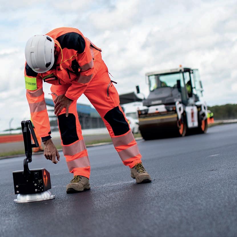
EQUIPMENT INSTANT RESULTS
Here at Tarmac, we like to think we know a thing or two about asphalt and paving.
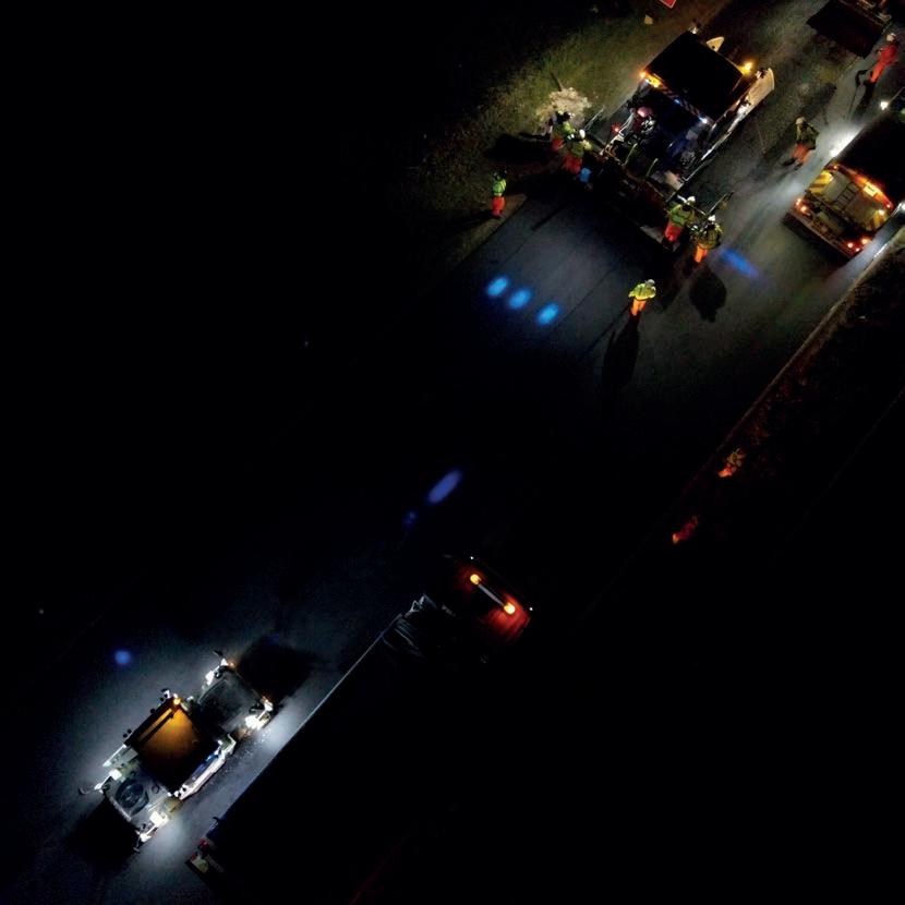
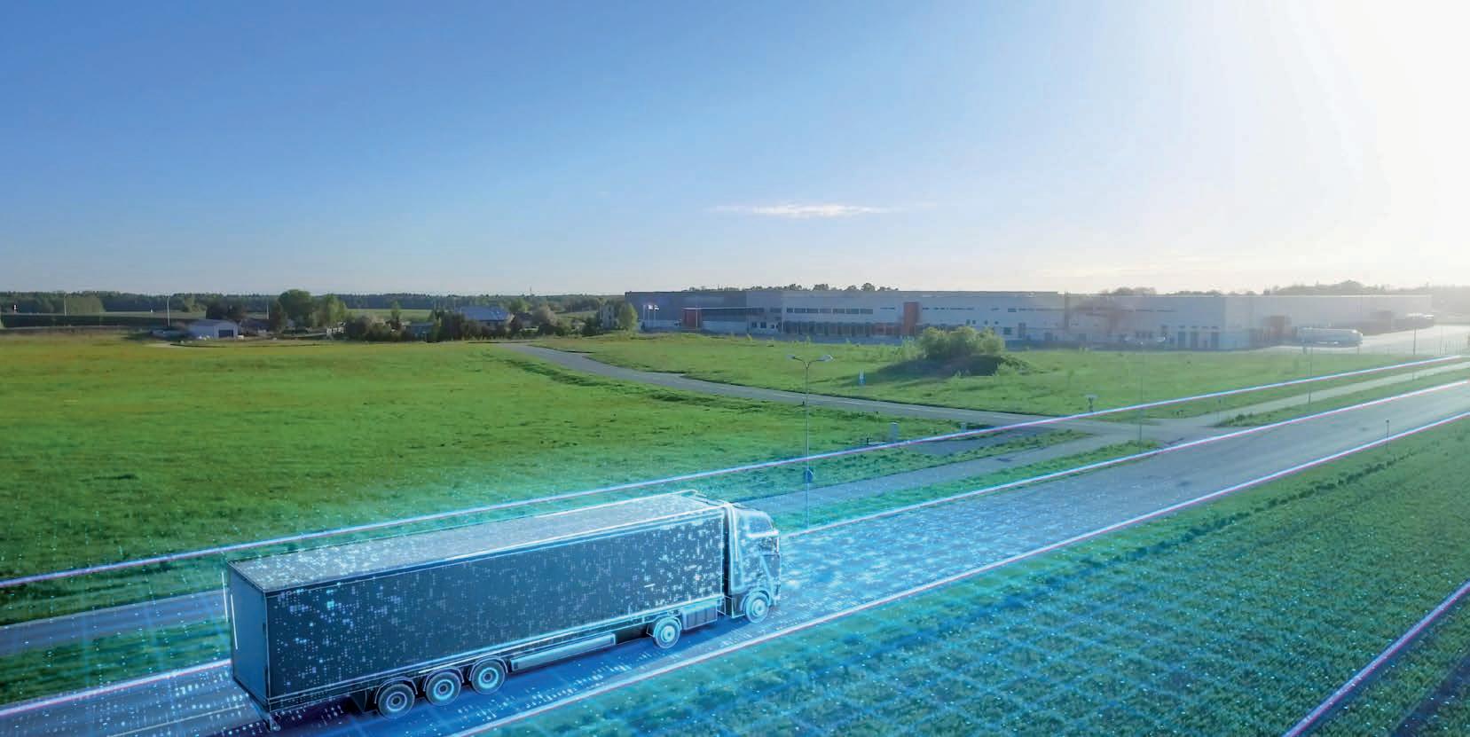
Our latest solutions in process and programme modelling are available now. They deliver immediate results. The latest generation of digital applications allow both client and contractor to reduce all elements of the process.
Cut programme time and associated costs
Optimise designs to reduce carbon | Improve ride quality Implement fast installation paving
It is time to enter a new generation of PAVE.

PAVE_ PROGRESS
A11 Thetford Upgrade
Saved 1154 Tonnes of CO2
The equivalent of the carbon produced driving 115 road trips around the world.
PAVE technology solutions
Pave offers solutions to everyday surfacing challenges. Precision, efficiency, productivity, and sustainability. The suite of technology has been proven across the UK to deliver against varied and specific programme demands.
PAVE_ PRECISION
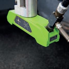
“To achieve the new profile a combination of GPS for coordinates, and radio control, for level, was utilised on the planing machines. This achieved time-saving efficiencies and an accuracy of plus-minus two millimetres from design.”
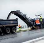
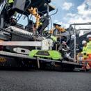
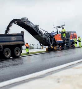
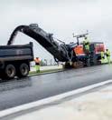
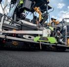
Milling
Paving
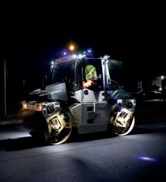
Compaction
Digital milling and paving
Digital records
Carbon
PAVE solutions guide
Milling
4m wide milling
Multiplex
Mill assist
Fine milling
Surface mining
Paving
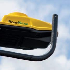
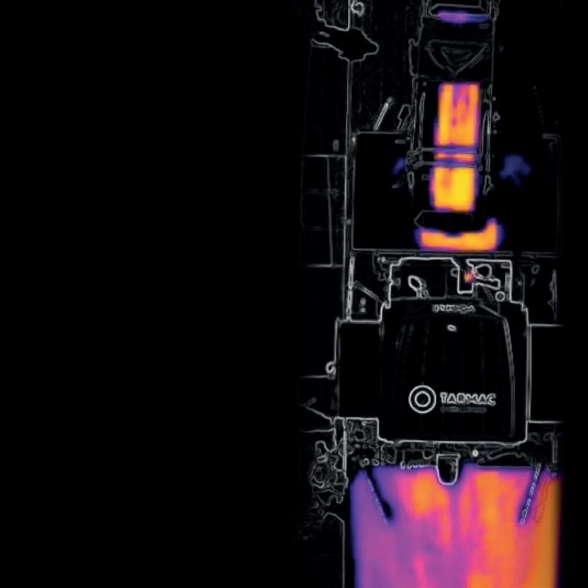
Thermal imaging
Av. beams
Principles of paving
Transfer vehicles
Echelon paving
Product specific machine calibration
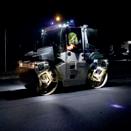
Compaction
Digital compaction
Intelligent compaction
Oscillation
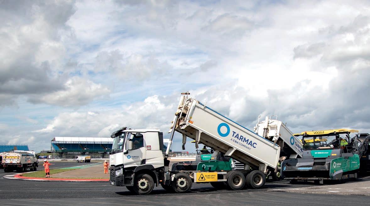
Pave offers and range of integrated technology, data, plant and logistics solutions for highways.
Digital paving and milling
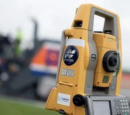
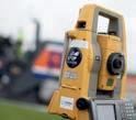
Total station machine guidance

Total station machine guidance with width and steering control
SmoothRide paving
SmoothRide milling
Surface scan - lidar
Laying model development
Thermal imaging
Digital records
Laying records - GNSS correlated digital laying records
GNSS correlated testing results
Surface scan
Compaction records
Compaction data recording
Texture records
Surface regularity
Point of work weather data
Automated measurement of area surfaced and milled
Augmented reality 3D modelling
Carbon
Digital carbon planning Capture

Reporting

Putting technology to the test
Pave technologies have been implemented on schemes across the UK. As a solution-based capability Pave offers you the opportunity to engineer a programme to meet scheme requirements. Data driven, technology means your programme will benefit from transparency, accurate analysis, and quality delivery.


Milling P a v i n g Compaction Digitalpavingandmilling D iig t a l r e c o r ds Carbon
BRITISH CONSTRUCTION EXCELLENCE
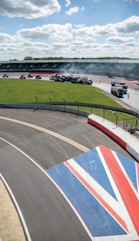
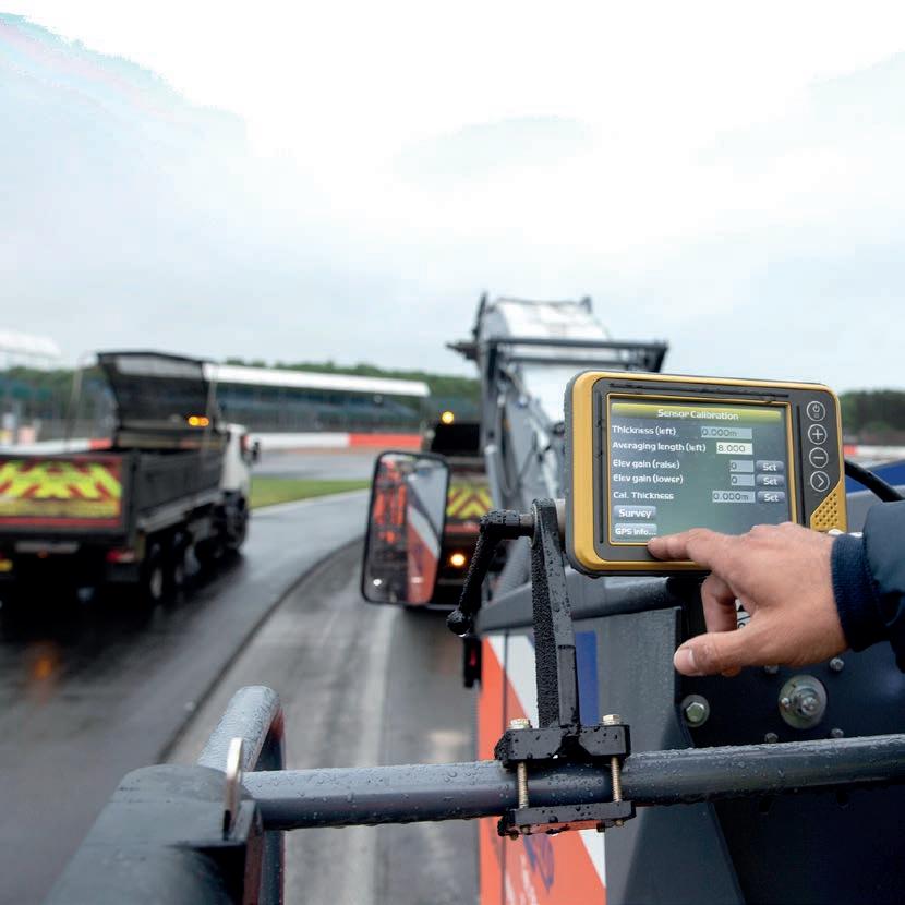
Silverstone

Generation Pave started here. All process, technology and innovation were piloted in the 2019 delivery of the Silverstone race circuit. Smart technology and supply chain excellence provided a platform for inspired performance of ground breaking UK construction.


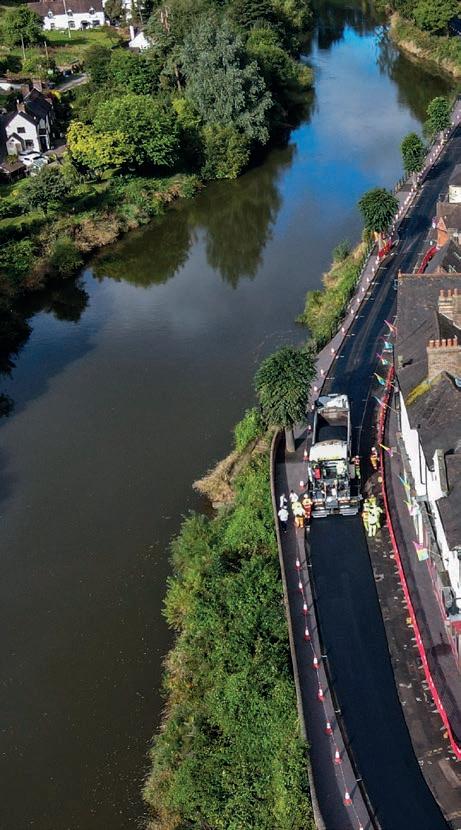
Ironbridge heritage project
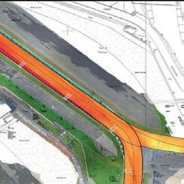
Annual flooding of this important heritage wharfage required a re-profiling of the road to deliver a smooth, stable base for temporary flood defences.
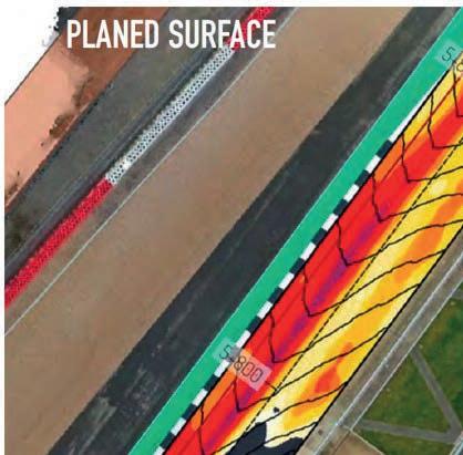
Pave enabled a programme delivery in a 5 week window and 5mm tolerances achieved through 3D modelling and precision milling. The new profile was created by precision profile milling to facilitate the placement of a two-layer asphalt solution, installed to a high degree of accuracy with particular attention to the transverse regularity.
Milling P a v i n g
iD ig t a l r e c o r ds Carbon
Compaction Digitalpavingandmilling
Milling P a v i n g Compaction Digitalpavingandmilling iD ig t a l r e c o r ds Carbon
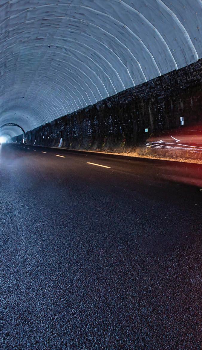
Catesby Tunnel
Technologies were implemented to create a track within the confines of a 1.7m, 1897 disused rail tunnel to create a controlled environment for testing.
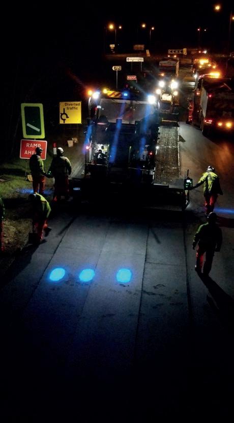
A55 Dobshill
Deployment of technology on the highway
No wind impact and stable temperature
Repeatability drag/noise/ cooling
RCC pavement /seamless PMB surface course finish 6.3m wide
ECI
Full closure at nights and weekends
Full width 3.8m milling/ excavation and Multiplex
Feeders and Av. beams for SAMI-pad and SC
P a v i n g
iD ig t a l r e c o r ds Carbon Milling P a v i n g Compaction Digitalpavingandmilling iD ig t a l r e c o r ds Carbon
Milling
Compaction Digitalpavingandmilling
MIRA – Motor Industry Research Association
Install the flattest test area in the world: cornering load and tyre performance - omni directional IRI value <1 required on 300m test circle.

of high specification works of which +/- 2mm
A11 Thetford
A new generation of sustainable roads Carbon cutting objectives, drove delivery, design and durability benefits across this 8km programme.
150kt type1, 45kt Base/binder machine control
/Trimble
Mira is now recognised to be the smoothest paved service in the world.
11kt SC with feeders/ averaging beams/ 2/3 pavers echelon
1154t CO₂e carbon saved Completed in budget Ahead of schedule – all in the middle of a pandemic.
P a v i n g Compaction Digitalpavingandmilling iD ig t a l r e c o r ds Carbon Milling P a v i n g Compaction Digitalpavingandmilling iD ig t a l r e c o r ds Carbon
Milling
Performance
Programme planning
Tracked pavers, echelon paving, scheduled transfer vehicles, averaging beams and oscillating rollers for a smooth finish.
Quality
Roadscan thermal imaging for a consistent finish.
Compaction quality for improved durability – continuous monitoring
3D Modelling
Planing to +/- 2mm capability
GPS position control for fully optimised planing.
System control
Data monitored installation for transparency and performance evaluation.
Engineer your programme solution against critical KPIs
The Pave solution offers complete control of your project. Select the right technologies to deliver against the scheme objectives.
Look at how safety, ride quality and efficiency can be optimised by adopting a pick and mix approach to fit budget and timescale challenges.
Total station machine guidance
Z value only. Usual reference absolute Z
Safety
Total station machine guidance with width and steering control X, Y and Z value. Usual absolute Z
SmoothRide milling
X, Y values feed to machine Z value derived from relative information in model. Improves profile by creating a consistent platform to work from
PAVE can improve the safety performance of
your programme.
Safety benefit
Removes setting out pins
Safety benefit
Removes setting out pins and he need for drive lines
SmoothRide pave
X, Y values feed to machine Z value derived from relative information in the model. Improves profile
Safety benefit
Removes setting out pins and engineers
Point of work weather data
BPO / Pave assist / Road scan
GNSS digital laying records
Geo-located positions accurate to 30cm X and Y inclusive of load pin locations, product description, unloading temperatures. Time and date stamped UK Sector 16 compliant
Safety benefit
Removes the requirement for technicians on site and in works area
Averaging beams up to 13m
length
Improves short wave length profile works to relative elevation with no consideration or reference to absolute Z values
Safety benefit
Removes setting out pins and engineers
Compaction data recording
Geo-located positioning to 30cm X and Y can produce reports and analysis. Temperatures / pass counts evibe values dynamic and static pass count separation. Displayed visually and graphically on satellite or OS map imagery. Exportable.
Safety benefit
Removes setting out pins and engineers
Safety benefit
Removes the requirement for technicians on site and in works area
GNSS correlated testing results for textures using MPD and Profile (RSE) Data collection on site, instant reporting for compliance, data geospatially represented
Safety benefit
Removes the requirement for technicians on site and in works area
Optimised planning
Milling, material installation, logistics and continuous paving. The model outputs and simulates the impact of changes to ensure just in time deliveries
Safety benefit
Just in time deliveries to limit site congestion and manage workflow
Automated measurement of area surfaced
Machine sensor data records the distance travelled, screed width and approximate depth paved. Correlated using mounted thermal cameras
Safety benefit
Removes the requirement for technicians on site and in works area
Augmented reality
3D modelling
3D design using VR helmet or AR hand held
Safety benefit
Removes the requirement for onsite technicians in the works area. Improves site safety for engineers/surveyors
Safety benefit
Removes risk by being able to check and walk through situations at ECI. Can be used for briefings and similar scenarios
Total station machine guidance
Z value only. Usual reference absolute Z
Efficiency
Total station machine guidance with width and steering control
X, Y and Z value. Usual absolute Z
Pave solutions deliver improved efficiency. Integrated technology delivers real time performance guidance throughout all stages of the work schedule.
SmoothRide milling
X, Y values feed to machine Z value derived from relative information in model. Improves profile by creating a consistent platform to work from
Compaction data recording
Geo-located positioning to 30cm X and Y can produce reports and analysis. Temperatures / pass counts evibe values dynamic and static pass count separation. Displayed visually and graphically on satellite or OS map imagery. Exportable.
Efficiency
BIM data straight from 3D model to construction and back
SmoothRide pave
X, Y values feed to machine Z value derived from relative information in the model. Improves profile
Efficiency
BIM data straight from 3D model to construction and back
Averaging beams up to 13m length
Improves short wave length profile works to relative elevation with no consideration or reference to absolute Z values
Efficiency
BIM data straight from 3D model to construction and back
Efficiency No setting out and improved profile
Efficiency
BIM data straight from 3D model to construction and back
Efficiency
Instant compliance testing. Data geospatially recorded
Product specific machine calibration
Improved quality control on installation
Optimised planning
Milling, material installation, logistics and continuous paving. The model outputs and simulates the impact of changes to ensure just in time deliveries
Point of work weather data
BPO / Pave assist / Road scan
GNSS digital laying records
Geo-located positions accurate to 30cm X and Y inclusive of load pin locations, product description, unloading temperatures. Time and date stamped UK Sector 16 compliant
Efficiency
Instant compliance testing. Data geospatially recorded
Efficiency
Instant compliance testing. Data geospatially recorded
Digital testing results
On site data collection, texture depths, transverse beam, rolling straight edge and density figures. instant reporting for compliance.
Data geospatially represented
Efficiency
Removes the requirement for technicians on site and in works area
GNSS correlated testing results for textures using MPD and Profile (RSE)
Data collection on site, instant reporting for compliance. Data geospatially represented
Efficiency
Removes the requirement for technicians on site and in works area
Automated measurement of area surfaced
Machine sensor data recording of the distance travelled, screed width and approx. depth paved correlated using mounted thermal cameras
Efficiency
As built data captured live and reported instantly. Geospatially presented BIM
Thermal imagery
Live thermal profile of pre-compacted material. Live compaction thermal profile installed to ensure quality
Efficiency
Instant compliance testing. Data geospatially recorded
Digital carbon planning, capture & reporting
Pre-works carbon modelling. Cradleto-gate capture of carbon cost and analytic reporting to summarise spent construction carbon
Efficiency
Instant carbon footprint data recorded and reported per shift. Carbon forecasting and modelling deliver informed sustainability choices
Augmented reality
3D modelling
3D design using VR helmet or AR hand held

Efficiency
Removes risk with the ability to check and walk through situations at ECI. Can be used for briefings and similar scenarios
Ride and Customer benefits
Pave technologies have been proven to deliver improved ride quality and wide-ranging customer benefits.
Total station machine guidance
Z value only. Usual reference absolute Z
Total station machine guidance with width and steering control
X, Y and Z value. Usual absolute Z
SmoothRide milling
X, Y values feed to machine Z value derived from relative information in model. Improves profile by creating a consistent platform to work from
Compaction data recording
Geo-located positioning to 30cm X and Y can produce reports and analysis. Temperatures / pass counts evibe values dynamic and static pass count separation. Displayed visually and graphically on satellite or OS map imagery. Exportable.
Ride and customer benefit
BIM data straight from 3D model to construction and back
Ride and customer benefit
BIM data straight from 3D model to construction and back
SmoothRide pave
X, Y Values feed to machine Z value derived from relative information in model. Improves profile
Ride and customer benefit
BIM data straight from 3D model to construction and back
Averaging beams up
Improves
Ride and customer benefit
BIM data straight from 3D model to construction and back
Ride and customer benefit
Instant compliance testing. Data geospatially recorded
Sonic Levelling Sensors
Improved quality control on installation
Optimised planning
Milling, material installation, logistics and continuous paving. The model outputs and simulates the impact of changes to ensure just in time deliveries
Point of work weather data
BPO / Pave assist / Road scan
GNSS digital laying records
Geo-located positions accurate to 30cm X and Y inclusive of load pin locations, product description, unloading temperatures. Time and date stamped UK Sector 16 compliant
Ride and customer benefit
Instant compliance testing.
Data geospatially recorded
Ride and customer benefit
Instant compliance testing.
Data geospatially recorded
Digital testing results
On site data collection, texture depths, transverse beam, rolling straight edge and density figures.
instant reporting for compliance.
Data geospatially represented
Ride and customer benefit
Instant compliance testing.
Data geospatially recorded
GNSS correlated testing results for textures using MPD and Profile (RSE)
Data collection on site, instant reporting for compliance. Data geospatially represented
Ride and customer benefit
Instant compliance testing.
Data geospatially recorded
to 13m length
short wave length profile works to relative elevation with no consideration or reference to absolute Z values
and customer benefit No setting out and improved profile
Ride
Automated measurement of area surfaced
Machine sensor data recording of the distance travelled, screed width and approx. depth paved correlated using mounted thermal cameras
Ride and customer benefit
As built data captured live and reportable instantly. Geospatially presented BIM
Thermal imagery
Live thermal profile of pre-compacted material. Live compaction thermal profile installed to ensure quality
Ride and customer benefit
Instant compliance testing. Data geospatially recorded
Digital carbon planning, capture & reporting

Pre-works carbon modelling. Cradleto-gate capture of carbon cost and analytic reporting to summarise spent construction carbon
Ride and customer benefit
Instant carbon footprint data recorded and reported per shift. Carbon forecasting and modelling deliver informed sustainability choices
Augmented reality
3D modelling
3D design using VR helmet or AR hand held
Ride and customer benefit
Removes risk with the ability to check and walk through situations at ECI. Can be used for briefings and similar scenarios
We invented the modern road surface in 1902. Today, we have innovated the next generation of paving solutions.
