ENTRE TIERRA Y AGUA

Instituto Tecnológico y de Estudios Superiores de Monterrey Escuela de Arquitectura, Arte y Diseño
Profesores
Msc Urb Mar. Arq. Diana García Cejudo
Mtr. Arq. Psj. Rodrigo Pantoja Calderón

Tutores

Andrea Parga
Equipo
Karol Patrica Gutiérrez Lara
Naxhely Ramírez Olguín
Pamela de la Peña Zaldívar
Proyecto Final de Carrera
Periodo | Febrero- Junio 2023
Lugar | Querétaro, Qro. México
Agradezco este logro a mi mamá por estar siempre a mi lado, a mi novio por desvelarse conmigo y alientarme en los momentos más complicados, y a mis amigos por haber estado presentes estos 5 años. Recocimiento especial a Naxh y a Luga por su apoyo y cariño incondicional. También le agradezco a mis profesores por retarme cada semestre a dar lo mejor de mí. Sobretodo quiero agradecerme a mí por no rendirme y haber llegado hasta este punto en mi vida.
-Karol Gutiérrez
6 ENTRE TIERRA Y AGUA
A mis padres, Naxhely y Filogonio, por su apoyo incondicional, amor infinito, consejos alentadores y esfuerzo para permitirme ser la persona que soy hoy en día, gracias.
A mi hermana, Montse, por cada aventura, por darme motivación, cariño incondicional, talento, y recordarme que soy capaz de cualquier reto que se me presente.
A mi familia y amigos, por su cariño y respaldo, risas y momentos que me han impulsado a mejorar y no darme por vencida.
A mi niña interior, por aventurarme a nuevos retos, confiar en mi, por siempre cuidarme de todo aquello que nos lastima, y por darme la certeza de que no hay nada que nos detenga. Tras cinco años, muchas altas y muchas bajas, lo logramos. A todos aquellos que me acompañan día a día y los que están a la distancia, gracias infinitas.
-Naxhely Ramírez
Agradezco este logro a mis papás por haberme dado la oportunidad de estudiar una carrera universitaria y por haberme apoyado incondicionalmente a lo largo de estos 5 años, durante los cuales me desarrollé como persona y profesionista. Del mismo modo, agradezco a mis hermanos, quienes fueron una inspiración para mí y establecieron un objetivo en mi vida profesional, el cual fue una motivación día con día. Agradezco también a mis amigos y a mi novio, quienes siempre me brindaron su apoyo y ayuda cuando más lo necesitaba. Ellos fueron una parte fundamental en mi crecimiento a lo largo de esta carrera, y sin lugar a dudas, su compañía mejoró cada instante de la misma. Por último, deseo expresar mi más sincero agradecimiento a mis queridos profesores, quienes generosamente han compartido su tiempo, sus valiosas experiencias y sus amplios conocimientos con nosotros. No lo hacen por obligación, sino con la esperanza de moldearnos en futuros arquitectos destacados.
7
-Pamela de la Peña

8 ENTRE TIERRA Y AGUA
9
“El agua y la tierra, los dos fluidos esenciales de los que depende la vida, se han convertido en latas globales de basura.”
– Jacques Cousteau
PREFACIO
Querétaro se fundó en 1531 a partir de un pensamiento conquistador que propagó un sentido de opulencia e inconsciencia por la sobreexplotación de recursos “infinitos”. Desde la antigüedad, los primeros asentamientos humanos se constituyeron cerca de zonas con recursos naturales “suficientes y abundantes” para garantizar el abastecimiento de sus necesidades principales: alimento, protección y afecto.
Sin embargo, el recurso natural más importante y desperdiciado a nivel mundial es el agua. Querétaro, no es la única ciudad con este problema, que además crece descontroladamente y el riesgo de quedarse sin agua es latente.
En este libro presentaremos un preámbulo de la situación hídrica actual del estado, una propuesta integral desde la perspectiva arquitectónica, para contribuir a la generación de soluciones más innovadoras en beneficio del entorno natural, social y económico.
Querétaro was founded in 1531 from a conquering thought that propagated a sense of opulence and unconsciousness due to the overexploitation of “infinite” resources. Since ancient times, the first human settlements were established near areas with “sufficient and abundant” natural resources to guarantee the supply of their primary needs: food, protection, and affection.
However, the most important and wasted natural resource worldwide is water. Querétaro is not the only city with this problem, which is also growing uncontrollably, and the risk of running out of water is latent.
In this book, we will present a preamble to the current water situation of the state, a comprehensive proposal from the architectural perspective to contribute to the generation of more innovative solutions for the benefit of the natural, social, and economic environment.
10 ENTRE TIERRA Y AGUA

11
CONTENIDO
12 ENTRE TIERRA Y AGUA
ENTRE CIUDAD & ESPONJA 01
Estado de Querétaro
Zona Metropolitana de Querétaro
Ciudad Esponja
Ejemplos Análogos
ENTRE MUNICIPIOS 02
Espacio agrícola y urbano Sitio
Contexto Urbano Querétaro & Corregidora
Análisis in situ
ENTRE AGUAS NEGRAS 03
Actores
Condicionantes
Problemáticas
Oportunidades
Visión
ENTRELAZANDO LÍMITES 04
Primeras intensiones
Estrategias
Sistema entre tierra y agua
Secciones y elevaciones
Estructura
ENTRE ESPACIOS EXPERIMENTALES 05
Movilidad
Habitabilidad
13
14 ENTRE TIERRA Y AGUA
15 01 ENTRE CIUDAD & ESPONJA
ESTADO DE QUERÉTARO
El Estado de Querétaro es una de las 32 Entidades Federativas que conforman la República Mexicana; es considerado como uno de los estados más influyentes dentro del país debido a su diversidad industrial y su importancia como socio comercial nacional e internacional. Se ubica al centro del país dentro del Altiplano central y colinda con los estados de Guanajuato, San Luis Potosí, Hidalgo, México y Michoacán de Ocampo, lo que le permite tener diversas conexiones con el resto del país.
The State of Querétaro is one of the 32 Federative Entities that make up the Mexican Republic; It is considered one of the most influential states within the country due to its industrial diversity and importance as a national and international trading partner. It is located in the center of the country in the central Altiplano. It borders the states of Guanajuato, San Luis Potosí, Hidalgo, México, and Michoacán de Ocampo, giving it various connections with the rest of the country.
16 ENTRE TIERRA Y AGUA
Querétaro Simbología
Ubicación

17 UBICACIÓN ESTADO DE QUERÉTARO ENTRE CIUDAD Y ESPONJA
SISTEMA HIDROLÓGICO
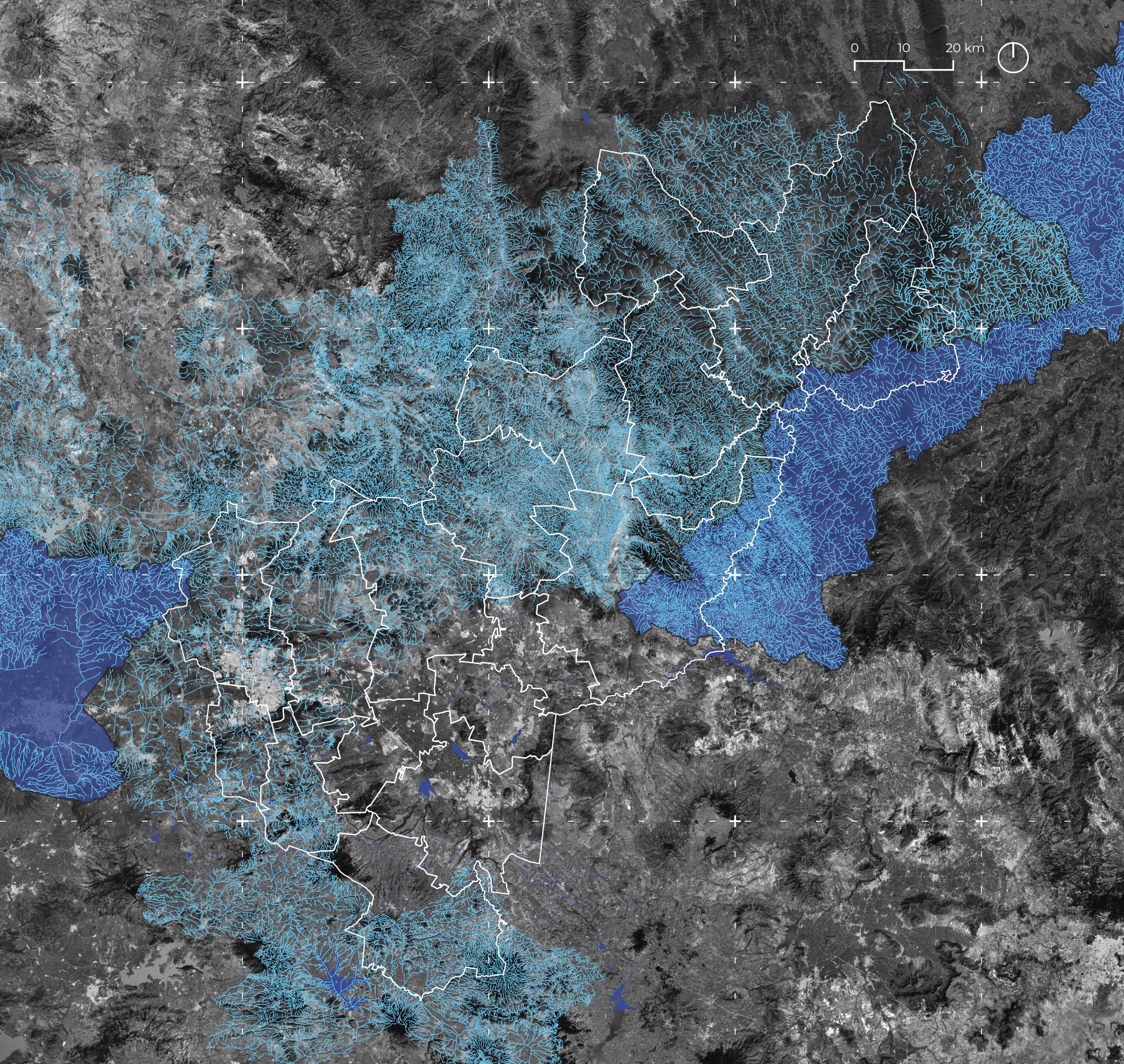
Su sistema hidrológico esta principalmente conformado por las cuencas Pánuco, que desemboca en el Golfo de México, y LermaSantiago, que fluye al lago de Chapala y termina posteriormente en el Océano Pacífico. La región hidrológica Pánuco cubre el 78.8% de la superficie estatal, de ella nacen los ríos y cuerpos de agua con mayor importancia para la entidad:
Río Santa María
Río Moctezuma
La Presa de Zimapán
La Presa de Santa Catarina
Its hydrological system mainly comprises the Panuco basin, which flows into the Gulf of Mexico, and the Lerma-Santiago basin, which flows into Lake Chapala and later ends in the Pacific Ocean. The Panuco hydrological region covers 78.8% of the state surface, from which the most important rivers and bodies of water for the entity are born:
Santa Maria River
Montezuma River
The Zimapán Dam
The Santa Catarina Dam
Simbología
Límite Municipal
Red Hidrológica
Corrientes de agua
Cuerpos de agua
Subcuencas
18 ENTRE TIERRA Y AGUA
19 SISTEMA
ENTRE CIUDAD Y ESPONJA
HIDROLÓGICO QUERÉTARO
REGIÓN HIDROLÓGICA PÁNUCO
Es uno de los afluentes del Río Pánuco; se origina en el estado de San Luis Potosí, que a su vez atraviesa la Sierra Gorda de Querétaro. Forma parte del límite territorial entre Querétaro y San Luis Potosí.
It is one of the tributaries of the Panuco River; it originates in the state of San Luis Potosi, which in turn crosses the Sierra Gorda de Queretaro. It is part of the territorial limit between Queretaro and San Luis Potosí.

20 ENTRE TIERRA Y AGUA
Río Santa María
Santa Maria River
Fuente: Jalpan travel
Río Moctezuma
Es el afluente más caudaloso dentro del acuífero, pasa por el Valle de México y sirve como canal de desagüe para el drenaje profundo de la Ciudad de México. Sus aguas continúan por el Río Tula y posteriormente por las presas Requena, Endhó y Tlamaco, hasta terminar su recorrido en la presa de Zimapán, en Hidalgo.

Montezuma River
It is the largest tributary within the aquifer, passes through the Valley of Mexico, and serves as a drainage channel for the deep drainage of Mexico City. Its waters continue through the Tula River and later through the Requena, Endho, and Tlamaco dams until it ends at the Zimapan dam in Hidalgo.
21
ENTRE CIUDAD
Fuente: Guillermo Ibargüengoitia
Y ESPONJA
REGIÓN HIDROLÓGICA PÁNUCO
Presa de Zimapán

Se sitúa en la intersección de los cauces de los ríos Tula y San Juan, entre el límite territorial de Querétaro e Hidalgo. Se construyó para generar energía eléctrica.
Zimapan Dam
It is located at the intersection of the channels of the Tula and San Juan rivers, between the territorial limit of Querétaro and Hidalgo. It was built to generate electricity.
22 ENTRE TIERRA Y AGUA
Fuente: Secretaría de Turismo de Hidalgo
Presa de Santa Catarina
Es conocida por su importancia en agricultura, pesca y el desarrollo de actividades acuáticas de la región. También es conocida con el nombre “Corea” por el nombramiento de un operador de transporte en 1963. Se ubica sobre la carretera Querétaro- San Luis Potosí.
It is known for its importance in agriculture, fishing, and the development of aquatic activities in the region. It is also known by the name “Corea” by the appointment of a transport operator in 1963. It is located on the Querétaro-San Luis Potosí highway.

23
Santa Catarina Dam
ENTRE
Fuente: Expreso Querétaro
CIUDAD Y ESPONJA
ENTORNO GEOGRÁFICO - SEMI DESIERTO
La topografía del estado está delimitada principalmente por la Sierra Madre Oriental, la Mesa Central y el Eje Neovolcánico, donde las principales elevaciones que rodean la entidad son: El Zamorano, El Espolón, La Pingüica, Las Vigas y La Laja.
Por otro lado, la zona central del estado es conocida como el semi desierto Queretano debido al clima seco y su vegetación compuesta por matorrales, cactus y plantas espinosas. Esta zona presenta el mayor nivel de aridez en todo el estado; sin embargo, dicha aridez también se extiende a las cercanías de Guanajuato e Hidalgo.
The topography of the state is delimited mainly by the Sierra Madre Oriental, the Central Table, and the Neovolcanic Axis, where the main elevations that surround the entity are: El Zamorano, El Espolón, La Pingüica, Las Vigas, and La Laja.
On the other hand, the state’s central area is known as the Queretaro semi-desert due to the dry climate and its vegetation composed of scrub, cacti, and thorny plants. This area presents the highest level of aridity in the entire state; however, said aridity also extends to the vicinity of Guanajuato and Hidalgo.

24 ENTRE TIERRA Y AGUA

25
MIRADOR CUATRO PALOS
ENTRE CIUDAD
Fuente: Roberto Pedraza Ruíz
Y ESPONJA
ESTRÉS HÍDRICO
El estrés hídrico es un concepto utilizado para medir la relación entre la cantidad de agua disponible y la demanda de este recurso, por lo que gran parte de la entidad tendrá problemas para abastecerse de agua en los próximos ocho años. Considerando el aumento de la demanda de agua en el estado por su crecimiento de, se estima que en 2030 el estrés hídrico en todo el estado será del 80%, y todas las entidades se vean afectadas gravemente.
Water stress is a concept used to measure the relationship between the amount of water available and the demand for this resource, which is why a large part of the state will have problems supplying itself with water in the next eight years. Considering the increase in the demand for water in the state due to its growth, it is estimated that in 2030 water stress will be 80%, and all entities will be seriously affected.
26 ENTRE TIERRA Y AGUA
IMPERMEABLE 35-50% IMPERMEABLE
IMPERMEABLE
27
30% Evapotranspiración
10% Infiltración superficial
5% Infiltración profunda
75-100%
10-20%
21% Infiltración superficial
21% Infiltración profunda
35% Evapotranspiración
40% Evapotranspiración
ENTRE CIUDAD Y ESPONJA
25% Infiltración superficial 25% Infiltración profunda
USOS DE AGUA
De acuerdo con la CEA (Comisión Estatal de Aguas Querétaro), el Acueducto 2 abastece el 40% del consumo de agua potable de la ZMCQ, mientras que los pozos subterráneos del acuífero del Valle de Querétaro aportan el 60% restante.
Asimismo, la CEA detalla el uso porcentual del agua potable en Querétaro de la siguiente manera:
63% Actividades agropecuarias
30% Público urbano
6% Industrial
1% Generación de energía eléctrica
According to the CEA (Querétaro State Water Commission), Aqueduct 2 supplies 40% of the drinking water consumption of the ZMCQ, while underground wells from the Querétaro Valley aquifer provide the remaining 60%.
Likewise, the CEA details the percentage use of drinking water in Querétaro as follows:
63% Agricultural activities
30% Urban public
6% Industry
1% Electric power generation
28 ENTRE TIERRA Y AGUA

29
ENTRE CIUDAD Y ESPONJA
Fuente: Re-evolución
SOLUCIONES MOMENTANEAS
La escasez de agua en el Estado de Querétaro ha sido una problemática solucionada durante años desde la emergencia en la época del caos. Asimismo, gran parte de las soluciones diseñadas y propuestas a lo largo del tiempo han sido siempre desde una perspectiva de ingeniería, conectando tramos y tramos de tuberías para traer agua a la ciudad. Esta problemática se ha disfrazado con discursos políticos que solo prometen llevar agua a la población, sin considerar las consecuencias que estas “soluciones” generan en el entorno natural.
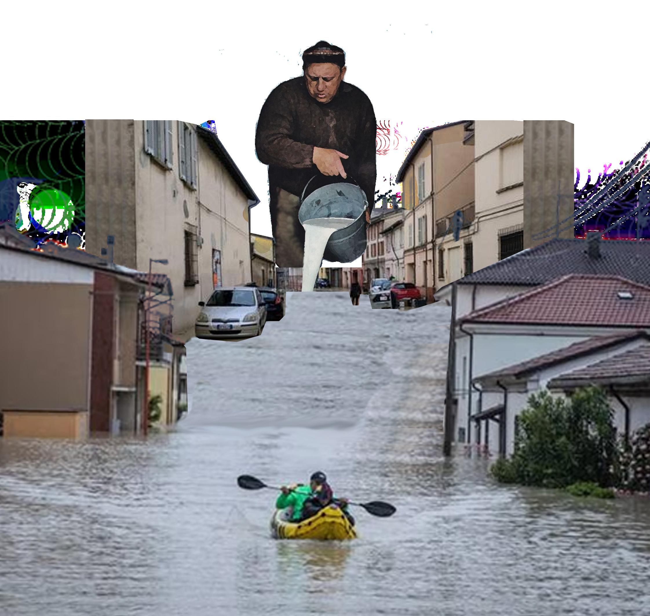
Sin embargo, cuando llega la temporada de lluvias, todo el estado entra en pánico. La gente comienza a pelearse ahora contra el agua levantando costales de arena como barricada para impedir las inundaciones provocadas por las corrientes naturales de los ríos. Al mismo tiempo, el gobierno se regocija al ayudar a la población con más costales rellenos de arena y solucionando todo al momento de la emergencia.
Water scarcity in the State of Querétaro has been a problem that has been solved for years since the emergency at the time of the chaos. Likewise, many of the solutions designed and proposed over time have always been from an engineering perspective, connecting sections and sections of pipes to bring water to the city. This problem has been disguised with political speeches that only promise to bring water to the population without considering the consequences that these “solutions” generated in the natural environment.
However, the entire state is in a panic when the rainy season arrives. People are now beginning to fight against the water, raising sandbags as a barricade to prevent flooding caused by the natural currents of the rivers. At the same time, the government rejoices in helping the population with more sacks filled with sand and solving everything at the time of an emergency.
30 ENTRE TIERRA Y AGUA
31 ENTRE CIUDAD Y ESPONJA
ZONA METROPOLITANA DE QUERÉTARO
Se denomina como Zona Metropolitana de Querétaro a la región comprendida por los municipios de Corregidora, El Marqués, Huimilpan y Querétaro que concentra aproximadamente al 64.6% de la población total del Estado.
Esta zona nace de los asentamientos humanos que se establecieron a las orillas del Río Blanco, el cual a través de acequias proveía de agua a los cultivos de los habitantes. Este río nacía del Cerro del Zamorano y se alimentaba de los manantiales más cercanos a su recorrido. Las personas solían salir a caminar a la orilla del río, algunos incluso nadaban en él y otros realizaban paseos en pequeñas canoas.
The Querétaro Metropolitan Area is the region comprised of the municipalities of Corregidora, El Marqués, Huimilpan, and Querétaro, which concentrates approximately 64.6% of the total population of the State.
This area was born from the human settlements established on the banks of the Blanco River, which through ditches, provided water to the crops of the inhabitants. This river was born from Cerro del Zamorano and fed from the springs closest to its route. People used to walk on the river’s banks; some even swam in it and took other trips in small canoes.
Simbología
Querétaro de Arteaga
División Territorial Corregidora y Querétaro
Con motivos de análisis en el capítulo subsecuente, se resaltan en naranja los municipios de Corregidora y Querétaro. For purposes of analysis in the subsequent chapter, the municipalities of Corregidora and Querétaro are highlighted in orange.
32 ENTRE TIERRA Y AGUA

33
ENTRE CIUDAD Y ESPONJA
ZONA METROPOLITANA DE QUERÉTARO
HISTORIA & CONTEXTO HÍDRICO

Fuente: Re-evolución

ENTRE CIUDAD Y ESPONJA
CRECIMIENTO URBANO

Querétaro ha crecido en los últimos años debido a un fuerte fenómeno migratorio de personas provenientes de la Ciudad de México y oros estados provocado por diversos factores sociales y económicos.
Instituciones como el Consejo Estatal de Profesionales Inmobiliarios de Querétaro (Cepiq) han hecho un llamado a las autoridades para diversificar el desarrollo urbano fuera de la capital del estado, dadas las estadísticas de este crecimiento “híper acelerado”. Por ello, se han aprobado 65 estrategias en el Plan Estatal de Desarrollo, para minimizar las consecuencias de dicho crecimiento.
Sin embargo, todos los esfuerzos se han concentrado dentro del sector constructor para generar un mayor número de desarrollos habitacionales. Esta situación ha generado un déficit del 43.3% en obras enfocadas al agua, transporte, electricidad, telecomunicaciones y urbanización, las cuales son de mayor urgencia para la población queretana.
Querétaro has grown in recent years due to a robust migratory phenomenon of people from Mexico City and other states caused by various social and economic factors.


Institutions such as the State Council of Real Estate Professionals of Querétaro (Cepiq) have called on the authorities to diversify urban development outside the state capital, given the statistics of this “hyper-accelerated” growth. Therefore, 65 strategies have been approved in the State Development Plan to minimize the consequences of said growth.
However, all efforts have been concentrated within the construction sector to generate more housing developments. This situation has developed a 43.3% deficit in works focused on water, transportation, electricity, telecommunications, and urbanization, which are urgently needed for the Queretaro population.
36 ENTRE TIERRA Y AGUA
Límite Municipal Mancha Urbana 2005 2015 2020 Simbología

37
ENTRE CIUDAD Y ESPONJA
CRECIMIENTO URBANO ZONA METROPOLITANA DE QUERÉTARO
CIUDAD ESPONJA
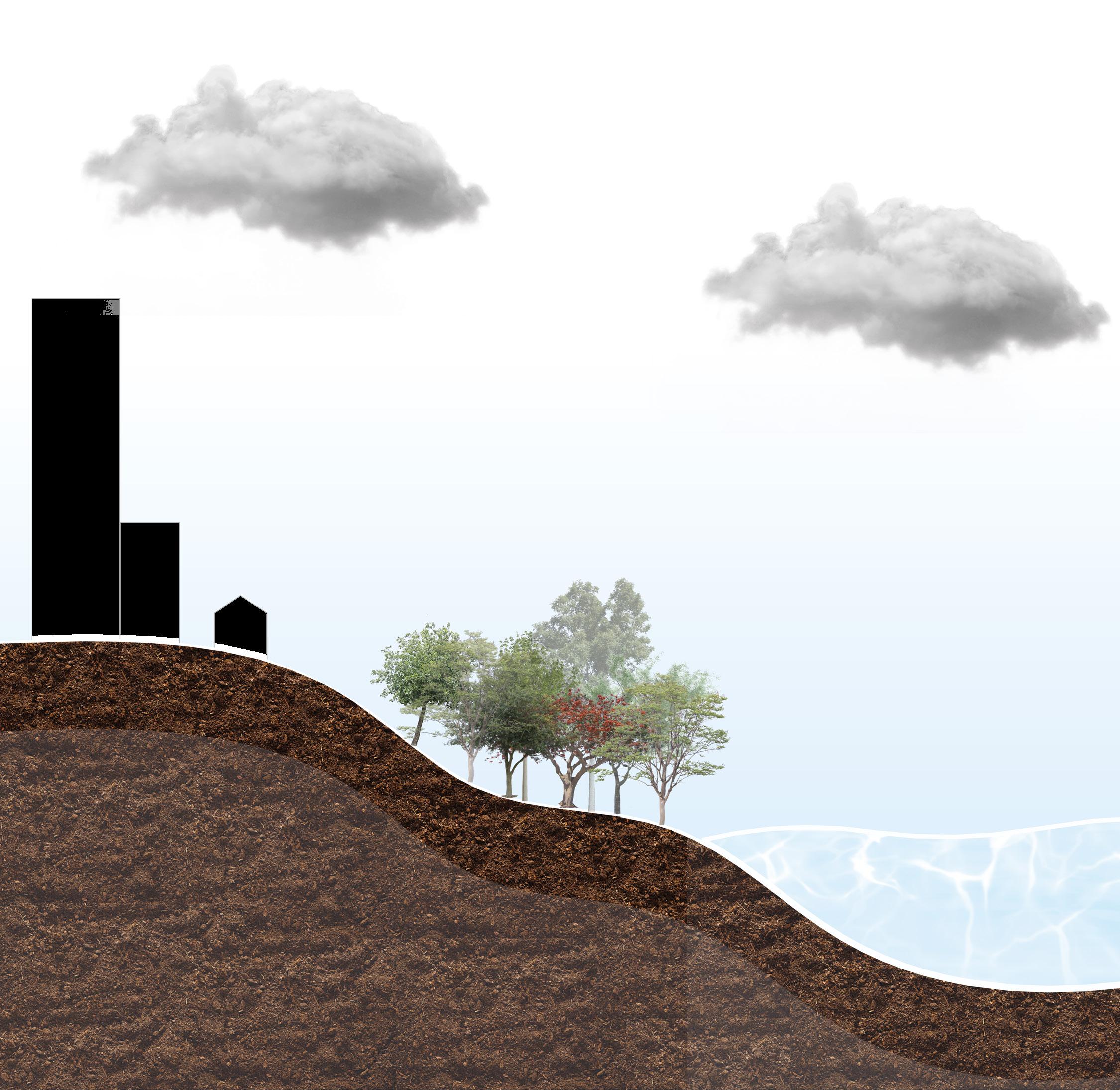
“La ciudad esponja es un modelo de diseño urbano que gestiona las aguas pluviales para aprovechar sus escorrentías, evitar inundaciones y establecer un equilibrio con el ecosistema.” (Pantoja, 2022)
Debido al rápido crecimiento urbano que tuvo China en las últimas décadas, fue el primer país en proponer y emplear este modelo de planificación. Anteriormente, su infraestructura urbana estaba construida a base de pavimentos duros y otros elementos que imposibilitaban la permeabilidad del suelo, esto ocasionó que cada año los problemas de inundaciones aumentaran y empeoraran. Con este nuevo modelo se aprovecharon los escurrimientos naturales del agua, estos fueron absorbidos a través de suelos permeables. A su vez, esto ayudó a contrarrestar la crisis hídrica del país, nutrir los mantos acuíferos, regenerar el suelo y disminuir las inundaciones provocadas por la impermeabilidad de las ciudades.
Este modelo propone una nueva forma de ver y tratar temas del agua a nivel mundial, cada país y ciudad tiene la libertad de adaptar las premisas que el modelo promueve. Asimismo, es momento de generar soluciones basadas en la naturaleza que ayuden a promover ecosistemas saludables y ciudades sostenibles.
“The sponge city is a model of urban design that manages rainwater to take advantage of its runoff, prevent flooding and establish a balance with the ecosystem.” (Pantoja, 2022)
Due to the rapid urban growth that China had in recent decades, it was the first country to propose and use this planning model. Previously, its urban infrastructure was built based on rigid pavements and other elements that made the permeability of the soil impossible; this caused the flooding problems to increase and worsen every year. With this new model, the natural runoff of water was used; these were absorbed through permeable soils. In turn, this helped to counteract the country’s water crisis, nourish the aquifers, regenerate the ground, and reduce flooding caused by the impermeability of cities.
This model proposes a new way of seeing and dealing with water issues worldwide; each country and city can adopt the premises the model promotes. Likewise, it is time to generate nature-based solutions that help promote healthy ecosystems and sustainable cities.
38 ENTRE TIERRA Y AGUA

39
ENTRE CIUDAD Y ESPONJA
Fuente: Re-evolución
PREMISAS
La ciudad esponja está basada en premisas que nos dan las pautas para saber en qué se basa para ser eficiente y efectiva ante cualquier contexto. Las premisas son las siguientes:
1. Reutilizar el exceso de agua mediante la depuración de aguas grises por medio de la biorremediación (uso de microbios para limpiar el agua subterránea).
2. Aumentar las estructuras de captación de agua.
3. Detener el exceso de agua mediante el incremento de áreas verdes permeables, y lograr tener más vegetación en toda la ciudad.
4.Gestionar el uso de aguas pluviales para evitar y/o reducir la extracción de agua de los mantos acuíferos. Usar aguas grises, pluvial y tratada para uso humano y actividades como la agricultura y ganadería.
5. Infiltrar el exceso de agua a la tierra mediante factores hidrogeológicos. Infiltrar los escurrimientos urbanos para regresar el agua al subsuelo.
6. Biorremediación el cual emplea organismos para recuperar un ambiente contaminado y poder reducir el impacto que tienen las actividades industriales en el medio.
The sponge city is based on premises that give us the guidelines to know what it is based on to be efficient and effective in any context. The premises are the following:
1. Reuse excess water by purifying gray water through bioremediation (using microbes to clean groundwater).
2. Increase water collection structures.
3. Stop excess water by increasing permeable green areas, and achieve more vegetation throughout the city.
4. Manage the use of rainwater to avoid and/or reduce water extraction from aquifers. Use grey, rainwater, and treated water for human use and activities such as agriculture and livestock.
5. Infiltrate excess water into the earth by hydrogeological factors. Infiltrate urban runoff to return the water to the subsoil.
6. Bioremediation uses organisms to recover a contaminated environment and to reduce the impact that industrial activities have on the environment.
evapotranspiration
Shelters / Habitat
bioremediation
permeable green areas
40 ENTRE TIERRA Y AGUA
Fuente: Re-evolución

41
ENTRE CIUDAD Y ESPONJA
EJEMPLOS ANÁLOGOS
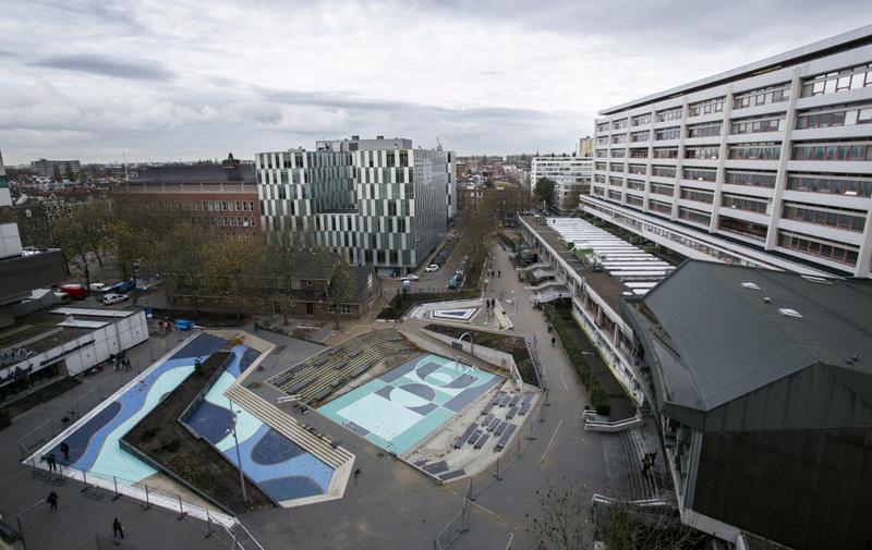
Plaza de Agua en Benthemplein Rotterdam, Países Bajos
“La plaza del agua combina el almacenamiento de agua con la mejora de la calidad del espacio público urbano.” (Urbanisten).
Waterplein Square Benthemplein Rotterdam, The Netherlands
“The water square combines water storage with the improvement of the quality of urban public space.” (Urbanisten)

42 ENTRE TIERRA Y AGUA
Fuente: Urbanisten
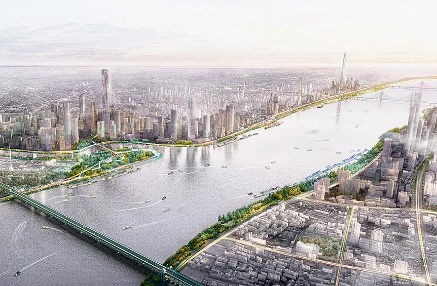
Parque de la orilla del río Yangtze Wuhan, China
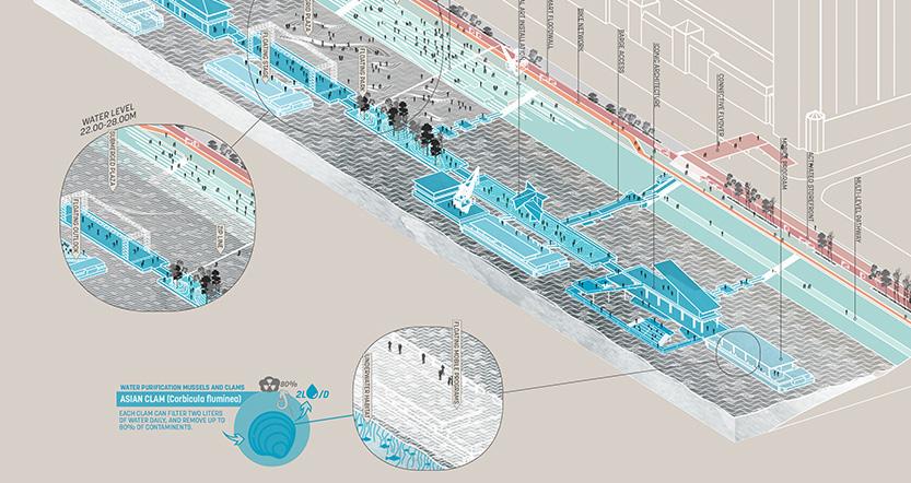
Aprovecha la inundación del río para nutrir una ecología regional y crear una experiencia recreativa en sintonía con la crecida del río.
Wuhan Yangtze Riverfront Park Wuhan, China
Leverages the river’s flooding to nurture a regional ecology and create a recreational experience in tune with the river´s flooding.
43
Fuente. SASAKI
ENTRE CIUDAD Y ESPONJA

44 ENTRE TIERRA Y AGUA
45 02 ENTRE MUNICIPIOS
ENTRE LO AGRÍCOLA Y LO URBANO
El aumento de la inversión extranjera en la industria automotriz y agrícola en la entidad ha provocado la migración de personas provenientes de la Ciudad de México, Estado de México, Veracruz y Guanajuato. Esto ha su vez genera una reacción en cadena por parte del sector inmobiliario, aumentando la oferta de bienes inmuebles para cubrir con la demanda de viviendas en la entidad.
Debido al crecimiento migratorio y el crecimiento descontrolado de la ciudad, los espacios agrícolas cercanos a la ciudad fueron desapareciendo poco a poco convirtiéndose en nuevos fraccionamientos residenciales y de interés social.
The increase in foreign investment in the automotive and agricultural industry in the entity has caused the migration of people from Mexico City, the State of Mexico, Veracruz, and Guanajuato. This has in turn generated a chain reaction in the real estate sector, increasing the supply of real estate to meet the demand for housing in the entity.
Due to the migratory growth and the uncontrolled growth of the city, the agricultural spaces near the city gradually disappeared, becoming new residential subdivisions and those of social interest.


46 ENTRE TIERRA Y AGUA
Límite Municipal Zona Agrícola Mancha Urbana 2005 2015 2020 Simbología

47
ENTRE MUNICIPIOS
CRECIMIENTO URBANO ZONA METROPOLITANA & ZONAS AGRÍCOLAS
ENTRE LO AGRÍCOLA Y LO URBANO
Esto a su vez ha generado una urbanización del espacio agrícola invasiva a base de materiales impermeables, generando diversos puntos caóticos donde la combinación de problemáticas termina afectando principalmente a la sociedad civil.
Teniendo presente el objetivo de contribuir a la evolución de la ciudad de Querétaro en una ciudad esponja, se identificaron diversos puntos donde la combinación de problemáticas presentaba constantemente un estado de emergencia y alarma.
This, in turn, has generated invasive urbanization of agricultural space based on impermeable materials, generating various chaotic points where the combination of problems ends up affecting mainly civil society.
Bearing in mind the objective of contributing to the evolution of the city of Querétaro into a sponge city, various points were identified where the combination of problems constantly presented a state of emergency and alarm.

48 ENTRE TIERRA Y AGUA

49 ENTRE MUNICIPIOS
SITIO & PULMONES NATURALES
Por lo tanto, se propuso realizar el análisis territorial, social, económico y ambiental de un sitio en peligro de extinción inmerso dentro de la Zona metropolitana de Querétaro. Se buscó que principalmente fuera un sitio sin registro de intervenciones previas, así como contar con un gran porcentaje de permeabilidad en el suelo y que tuviera una relación interesante con su contexto inmediato.
Therefore, it was proposed to carry out the territorial, social, economic, and environmental analysis of a site in danger of extinction immersed within the metropolitan area of Querétaro. It was sought that it was mainly a site with no record of previous interventions, as well as having a large percentage of permeability in the soil, and that it had an interesting relationship with its immediate context.

Simbología

Límite Territorial Áreas
Zona agrícola
Pulmones naturales
Álameda Central Alcanfores
Bicentenario
Cerro de las Campanas
Cimatario
Club Campestre
Menchaca
Querétaro 2000
50 ENTRE TIERRA Y AGUA

51 UBICACIÓN
ENTRE MUNICIPIOS
GEOGRÁFICA DEL SITIO Y PULMONES NATURALES
SITIO
El sitio se ubica entre el límite territorial del municipio de Querétaro y el municipio de Corregidora. Colinda al norte con la autopista Querétaro- Celaya y al sur con Boulevard Hacienda el Jacal, al este con Querétaro y al oeste con Corregidora.
The site is located between the territorial limit of the municipality of Querétaro and the municipality of Corregidora. It borders to the north with the Querétaro-Celaya highway and to the south with Boulevard Hacienda el Jacal, to the east with Querétaro, and to the west with Corregidora.
Simbología

Límite Territorial Principales Vialidades
Área de Cultivo
52 ENTRE TIERRA Y AGUA
Blvrd.
Hacienda el Jacal

53 UBICACIÓN GEOGRÁFICA DEL SITIO ENTRE MUNICIPIOS
Carretera Querétaro-Celaya
QUERÉTARO
CONTEXTO URBANO - QUERÉTARO
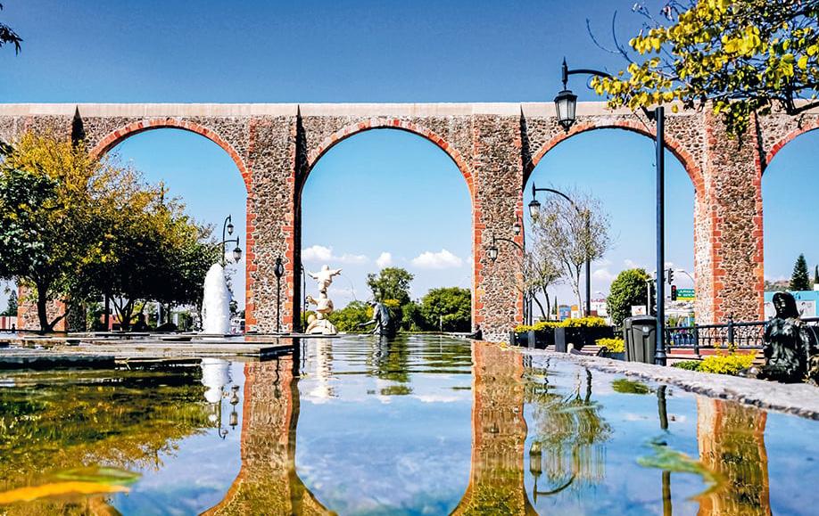
Querétaro es una ciudad conocida por su arquitectura colonial española, cuya construcción principal es el Acueducto, y por su economía en constante crecimiento debido a la inversión industrial.
Queretaro is a city known for its Spanish colonial architecture, whose main construction is the Aqueduct, and for its constantly growing economy due to industrial investment.
54 ENTRE TIERRA Y AGUA
Fuente: Yarhim Jimenez
CORREGIDORA CONTEXTO URBANO -
Corregidora es un municipio conocido principalmente por sus tradiciones y su zona Arqueológica. Su desarrollo urbano se concentró alrededor del Centro Ceremonial El cerrito.
Corregidora is a municipality known mainly for its traditions and its Archaeological zone. Its urban development was concentrated around the El Cerrito Ceremonial Center.

55
Fuente: México10
ENTRE MUNICIPIOS
QUERÉTARO - TERRITORIO
La superficie territorial del municipio representa el 5.8% del territorio estatal. De acuerdo con las cifras publicadas en el Panorama sociodemográfico de 2020 en Querétaro viven 1537.6 personas por km2.
Estos datos ayudan a generar informes confiables sobre el mercado inmobiliario en la entidad. Asimismo, se realiza un análisis en cuanto a la oferte y la demanda de viviendas que hay cada año.
Querétaro cuenta con 668 487 viviendas y 3.4% de habitantes por vivienda.
The territorial surface of the municipality represents 5.8% of the state territory. According to the figures published in the 2020 Sociodemographic Panorama, 1,537.6 people per km2 live in Querétaro.
These data help generate reliable reports on the real estate market in the entity. Likewise, an analysis is carried out in terms of the supply and demand of homes that exist each year.
Querétaro has 668,487 homes and 3.4% of inhabitants per home.
682.7
Viviendas particulares habitadas
668 487
1537.6
3.4%
Viviendas abandonadas
600
56 ENTRE TIERRA Y AGUA
TERRITORIAL
DISTRIBUCIÓN
Superficie (km2)
Densidad de población (hab. / km2)
Ocupantes por vivienda
VIVIENDA
CORREGIDORA - TERRITORIO
La superficie territorial del municipio representa el 2.0% del territorio estatal. De acuerdo con las cifras publicadas en el Panorama sociodemográfico de 2020 en Querétaro viven 905.0 personas por km2.
Corregidora cuenta con 6 356 viviendas y 3.3% de habitantes por vivienda.
The territorial surface of the municipality represents 2.0% of the state territory. According to the figures published in the 2020 Sociodemographic Panorama, 905.0 people per km2 live in Querétaro.
Corregidora has 6,356 homes and 3.3% of inhabitants per home.
234.9
Densidad de población (hab. / km2)
905.0
Ocupantes por vivienda
3.3%
Viviendas abandonadas 200
VIVIENDA
Viviendas particulares habitadas 64 356
57
TERRITORIAL
DISTRIBUCIÓN
Superficie (km2)
ENTRE MUNICIPIOS
QUERÉTARO - EQUIPAMIENTO
Debido al rápido crecimiento poblacional en la entidad y al bajo desarrollo en las obras de equipamiento, algunas viviendas en la entidad no cuentan con servicios completos de agua entubada, drenaje y almacenamiento de agua.
En Querétaro el 95.4% de las viviendas tienen acceso a agua entubada, pero el 85% cuentan con tinaco y solo el 20.9% con cisterna o aljibe. Esto nos indica que la población queretana está acostumbrada a tener acceso al agua sin pensar en el almacenamiento en caso de escases.
Due to the rapid population growth in the entity and the low development in equipment works, some homes in the entity do not have complete piped water, drainage, and water storage services.
In Querétaro, 95.4% of homes have access to piped water, but 85% have a water tank and only 20.9% have a cistern or cistern. This tells us that the Queretaro population is used to having access to water without thinking about storage in case of shortages.
58 ENTRE TIERRA Y AGUA
SERVICIOS Y EQUIPAMIENTO 0 25 50 75 100 95.4% 99.0% 99.2% 99.4% 85.0% 20.9% Cisterna o aljibe Agua entubada Drenaje Servicio Sanitario Energía eléctrica Tinaco
CORREGIDORA - EQUIPAMIENTO
En Corregidora el 95.5% de las viviendas tienen acceso a agua entubada, diferencia mínima con el 95.4% en Querétaro. Sin embargo, en Corregidora 26.5% de las viviendas cuentan con cisterna o aljibe a pesar de que un menor porcentaje de las viviendas, el 81% en comparación con Querétaro, tienen tinaco.
In Corregidora, 95.5% of the homes have access to piped water, a minimal difference from the 95.4% in Querétaro. However, in Corregidora, 26.5% of the homes have a cistern or cistern despite the fact that a lower percentage of homes, 81% compared to Querétaro, have a water tank.

59
SERVICIOS Y EQUIPAMIENTO 0 25 50 75 100 95.5% 99.4% 99.6% 99.7% 81.0% 26.5% Cisterna o aljibe Agua entubada Drenaje Servicio Sanitario Energía eléctrica Tinaco ENTRE MUNICIPIOS
QUERÉTARO - EDUCACIÓN
Los centros educativos o escuelas en Querétaro suelen estar ubicadas en diferentes sitios cercanos a zonas residenciales. Cerca del sitio, algunas escuelas imparten talleres de arte o de deportes que ayudan a complementar los estudios académicos de los estudiantes.
Educational centers or schools in Querétaro are usually located in different places close to residential areas. Near the site, some schools give art or sports workshops that help complement the academic studies of the students.


60 ENTRE TIERRA Y AGUA
EDUCACIÓN 2.5% Sin escolaridad
Básica
37%
25.6% Media superior 34.7% Superior
CORREGIDORA - EDUCACIÓN
En Corregidora, la mayoría de las escuelas actualmente cuentan con actividades extracurriculares dentro de las instalaciones de las instituciones. Asimismo, en varias plazas comerciales existen academias que ofrecen clases de baile y otras disciplinas.

In Corregidora, most of the schools currently have extracurricular activities within the facilities of the institutions. Likewise, in several commercial places, some academies offer dance classes and other disciplines.

61
EDUCACIÓN 2.2% Sin escolaridad 29.8% Básica 23.7% Media superior 44.2% Superior ENTRE MUNICIPIOS
QUERÉTARO - VIALIDADES
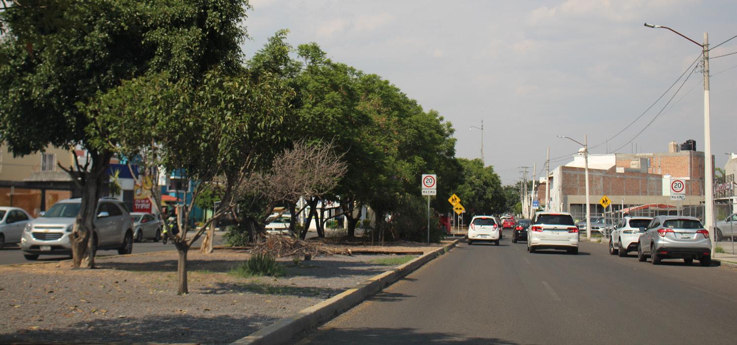
Las avenidas y calles en Querétaro suelen estar más llenas de vegetación y sombra generada por los árboles. Esto también ayuda a que las calles se sientan frescas al andar y ayuda a reducir el aumento de la temperatura provocada por el pavimento.
The avenues and streets in Querétaro are usually fuller of vegetation and shade generated by the trees. This also helps keep the streets feeling cool to walk on and helps reduce the temperature rise caused by the pavement.

62 ENTRE TIERRA Y AGUA
CORREGIDORA - VIALIDADES
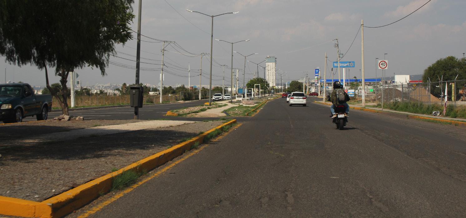
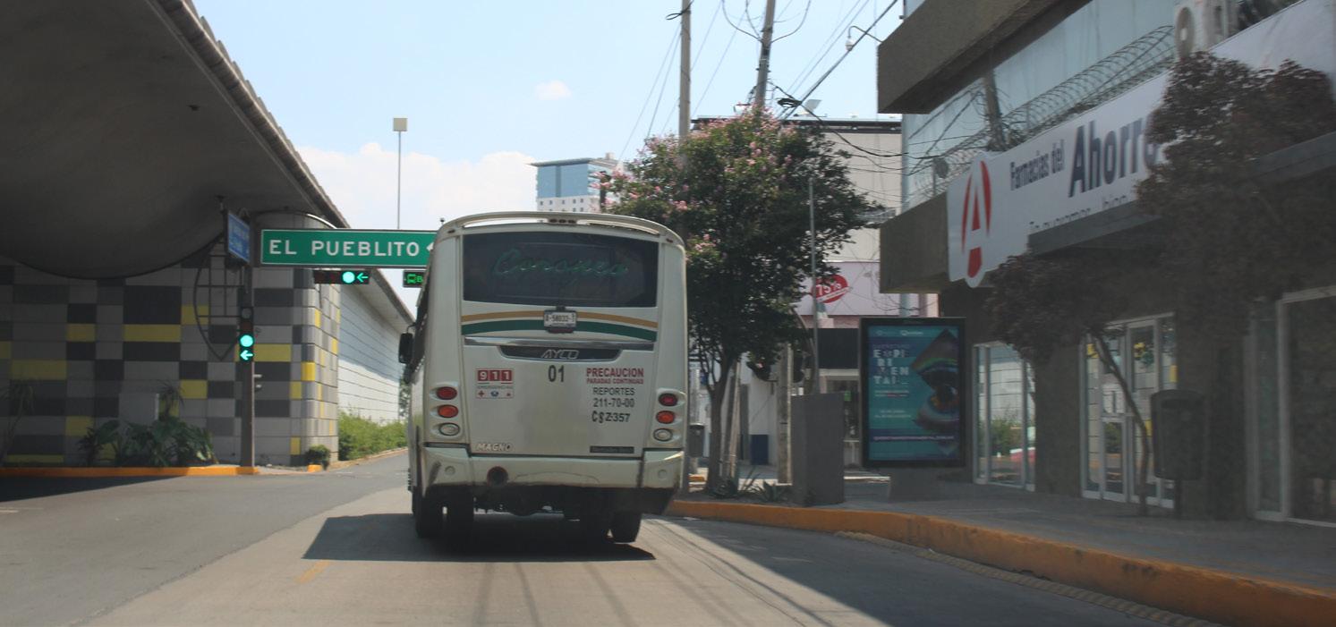
En Corregidora, las avenidas suelen ser amplias con camellones al centro, pero no suelen tener tanta vegetación como las de Querétaro. La falta de vegetación y la distancia entre los fraccionamientos residenciales fomenta la generación de paisajes llenos pavimento y aceras intransitables por la incidencia solar.
In Corregidora, the avenues are usually wide with ridges in the center, but they do not usually have as much vegetation as those of Querétaro. The lack of vegetation and the distance between the residential subdivisions encourage the generation of landscapes filled with paving and impassable sidewalks due to solar incidence.
63
ENTRE MUNICIPIOS
QUERÉTARO - ESPACIOS PÚBLICOS
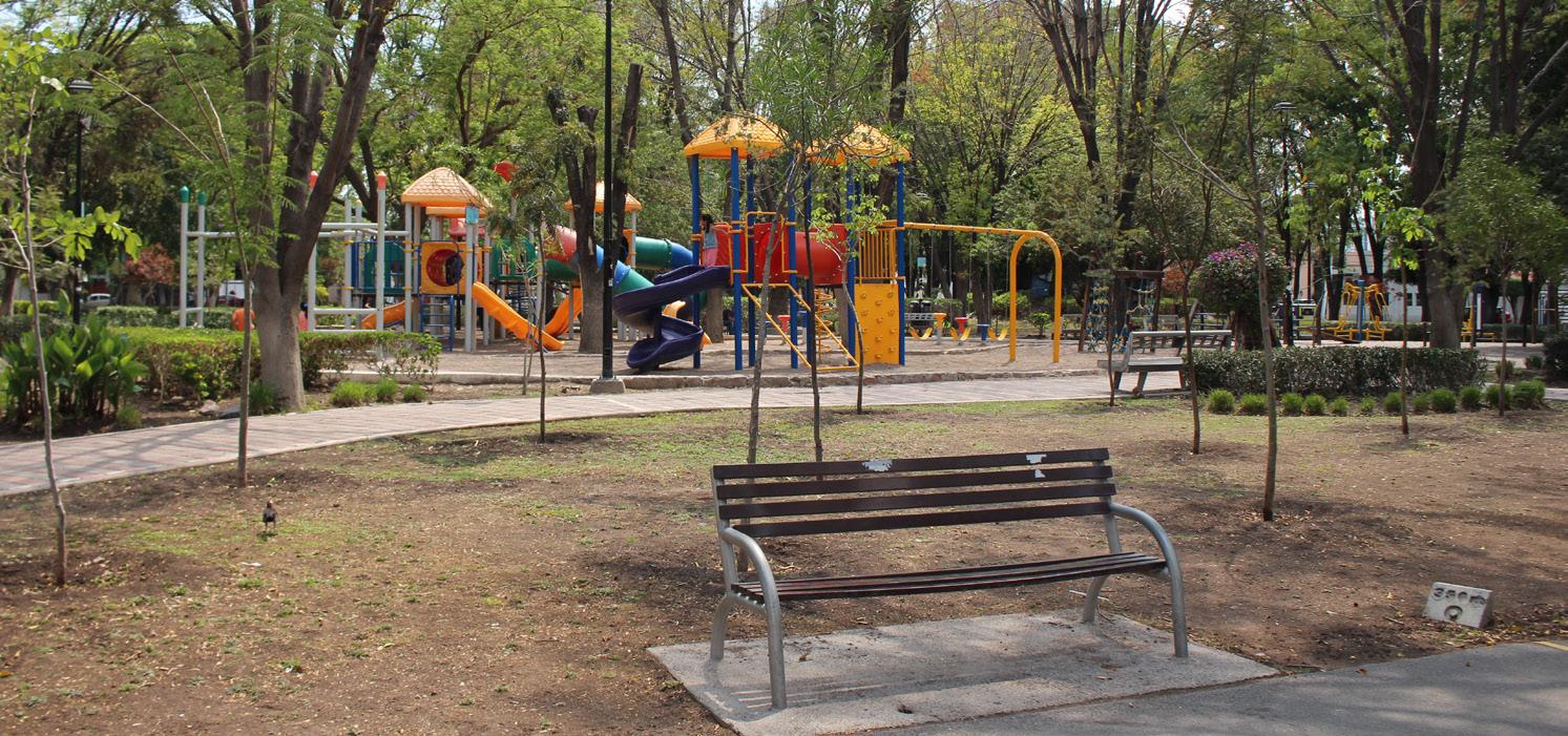
Los parques y espacios públicos suelen estar abiertos al público, todos en la colonia y también personas externas tienen acceso. Los parques tienen árboles altos que proveen de sombra las áreas de juego y los parques en general. Esto genera el ambiente ideal sobre todo en temporada de verano.
Parks and public spaces are usually open to the public, everyone in the neighborhood, and also outsiders have access. The parks have tall trees that provide shade for the playgrounds and the parks in general. This creates the ideal environment, especially in the summer season.

64 ENTRE TIERRA Y AGUA
CORREGIDORA - ESPACIOS PÚBLICOS
Los parques y espacios públicos en el municipio de Corregidora son más cerrados, solamente las personas que viven dentro de los fraccionamientos que cuentan con estos espacios pueden hacer uso de esas instalaciones. Los pocos espacios que parecen abiertos, en realidad pertenecen escuelas deportivas.
The parks and public spaces in the municipality of Corregidora are more closed, only the people who live within the subdivisions that have these spaces can make use of these facilities. The few spaces that seem open actually belong to sports schools.


65
ENTRE MUNICIPIOS
QUERÉTARO - COMERCIO
En Querétaro, los espacios de comercio han evolucionado para poder adaptarse al entorno y las necesidades de los residentes de la zona. En varios casos, empresas como Oxxo buscan establecerse en puntos estratégicos dónde las personas en general tengan acceso a este tipo de establecimientos.
In Querétaro, commercial spaces have evolved to be able to adapt to the environment and the needs of the residents of the area. In several cases, companies like Oxxo seek to establish themselves in strategic points where people in general have access to this type of establishment.


66 ENTRE TIERRA Y AGUA
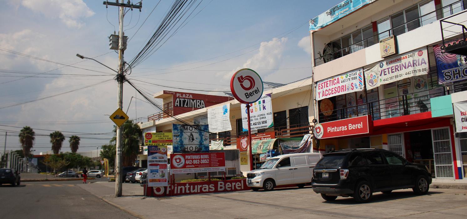
CORREGIDORA - COMERCIO
Por el otro lado, las plazas en Corregidora han ganado popularidad, pues la construcción de nuevos fraccionamientos ha designado ciertos espacios o terrenos para la construcción de estas plazas, suelen ofrecer diferentes tipos de productos y servicios. Sin embargo, por las características y la ubicación de estas plazas, la gente se ve en la necesidad de usar sus autos para poder llegar a ellas.

On the other hand, the plazas in Corregidora have gained popularity, since the construction of new subdivisions has designated certain spaces or land for the construction of these plazas, they usually offer different types of products and services. However, due to the characteristics and location of these squares, people find it necessary to use their cars to get to them.
67
ENTRE MUNICIPIOS
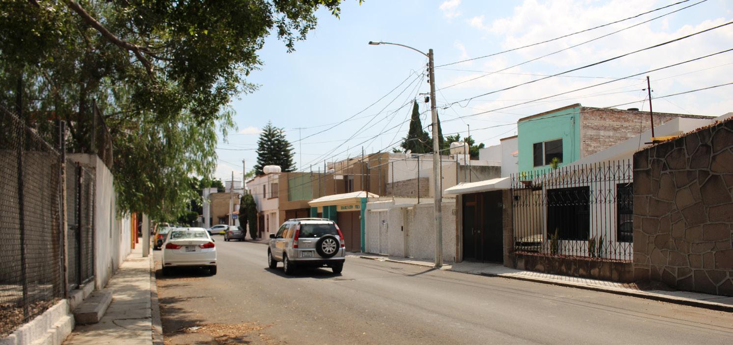
QUERÉTARO - VIVIENDA

El sitio se encuentra delimitado por fraccionamientos como Puerta Real, Residencial Santa Fe, Provincia Santa Elena, Parque la Gloria, Misión la Joya, La Joya, San Mateo, Claustros Campestre, San Jerónimo y Terranova.
Estas colonias y fraccionamientos se distinguen entre ambos municipios ya que del lado de Querétaro las colonias son abiertas y existen algunas casas que han sido adaptadas para compartir un uso comercial.
The site is delimited by subdivisions such as Puerta Real, Residencial Santa Fe, Provincia Santa Elena, Parque la Gloria, Misión la Joya, La Joya, San Mateo, Claustros Campestre, San Jerónimo, and Terranova.
These neighborhoods and subdivisions are distinguished between both municipalities since on the Querétaro side the neighborhoods are open and there are some houses that have been adapted to share a commercial use.
68 ENTRE TIERRA Y AGUA
CORREGIDORA - VIVIENDA
Mientras tanto, en el municipio de Corregidora el uso habitacional y comercial están divididos por zonas, y los conjuntos habitacionales suelen ser cerrados y con accesos restringidos. Puerta Real Residencial es el conjunto habitacional que por excelencia cuenta con este tipo de restricciones, por ejemplo: accesos controlados, vigilancia las 24 hrs, rejas y bardas para delimitar los fraccionamientos.

Meanwhile, in the municipality of Corregidora, residential and commercial use are divided by zones, and housing complexes are usually closed and with restricted access. Puerta Real Residencial is the housing complex that par excellence has this type of restrictions, for example controlled access, 24-hour surveillance, bars, and fences to delimit subdivisions.

69
ENTRE MUNICIPIOS
QUERÉTARO - ANDADORES PEATONALES
Los andadores peatonales en Querétaro suelen estar llenos de vegetación diversa con múltiples árboles a lo largo de estos camellones, esto ayuda a disminuir el aumento de la temperatura causado por la incidencia solar. Las personas se sienten más felices al caminar por estos espacios pues la vegetación genera un ambiente de frescura y llena de sombra estos espacios.
The pedestrian walkways in Querétaro are usually full of diverse vegetation with multiple trees along these ridges, this helps to reduce the increase in temperature caused by solar incidence. People feel happier when walking through these spaces since the vegetation creates a fresh atmosphere and fills these spaces with shade.


70 ENTRE TIERRA Y AGUA
CORREGIDORA - ANDADORES PEATONALES
Sin embargo, en Corregidora, estos lugares cuentan con menor presencia de árboles que puedan proveer de sombra a estos espacios en avenidas principales, además, en los fraccionamientos los andadores suelen estar acompañados por muros de bardas, esto provoca que los espacios sean intransitables y la experiencia de caminar sea monótona.
However, in Corregidora, these places have fewer trees that can provide shade to these spaces on main avenues, in addition, in subdivisions the walkways are usually accompanied by fenced walls, this causes the spaces to be impassable and the walking experience monotonous.


71
ENTRE MUNICIPIOS
ANÁLISIS IN SITU - CONEXIONES

A pesar de ser un sitio rodeado de dinámicas sociales y elementos urbanos tan diferentes, el sitio ayuda a mimetizar la transición entre un municipio y otro. En general los habitantes de la zona buscan conectar rápidamente con las principales vialidades, así como estar cerca de diversas amenidades y espacios de comercio.
Sin embargo, es muy notoria la diferencia entre los accesos que tienen los fraccionamientos cerrados y las colonias abiertas. Las barreras físicas que existen actualmente para “brindar seguridad” generan una división con el paisaje y promueven el uso de los automóviles en lugar de promover el uso de otros transportes e incluso la realización de actividades físicas.
Despite being a site surrounded by such different social dynamics and urban elements, the site helps to mimic the transition between one municipality and another. In general, the inhabitants of the area seek to connect quickly with the main roads and be close to various amenities and commercial spaces.
However, the difference between the accesses that closed subdivisions have and open neighborhoods is very noticeable. The physical barriers that currently exist for “providing security” generate a division in the landscape and promote the use of automobiles instead of promoting the use of other transports and even physical activities.
72 ENTRE TIERRA Y AGUA

73
ENTRE MUNICIPIOS
UBICACIÓN GEOGRÁFICA DEL SITIO
ANÁLISIS IN SITU - USUARIOS

Por otro lado, el comercio se ubica sobre las vialidades principales, ya sea en plazas comerciales o en locales privados, esto genera accesibilidad y visibilidad para los comercios. Además, en esta zona encontramos desarrollos habitacionales cuyo mercado objetivo son las familias con nivel socioeconómico medio. Sin embargo, tanto las familias que se van a vivir a esta zona, como las personas que actualmente viven dentro del sitio, buscan tener conexión con las vialidades principales y las zonas comerciales.
On the other hand, the trade is located on the main roads, either in commercial centers or in private premises, this generates accessibility and visibility for the businesses. In addition, in this area we find housing developments whose target market is families with a medium socioeconomic level. However, both the families that are going to live in this area, as well as the people who currently live within the site, seek to have a connection with the main roads and commercial areas.
74 ENTRE TIERRA Y AGUA

75 UBICACIÓN GEOGRÁFICA
SITIO ENTRE MUNICIPIOS
DEL
ANÁLISIS IN SITU - AGUA

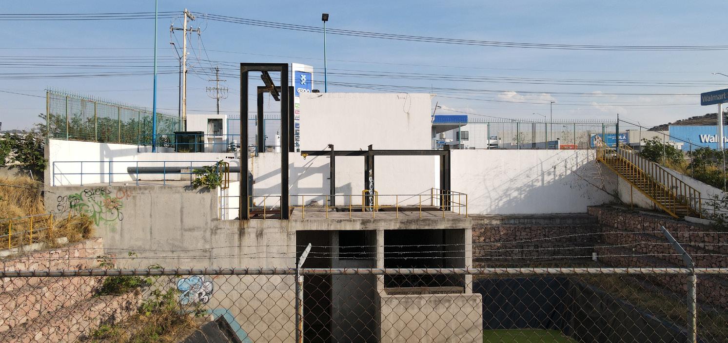
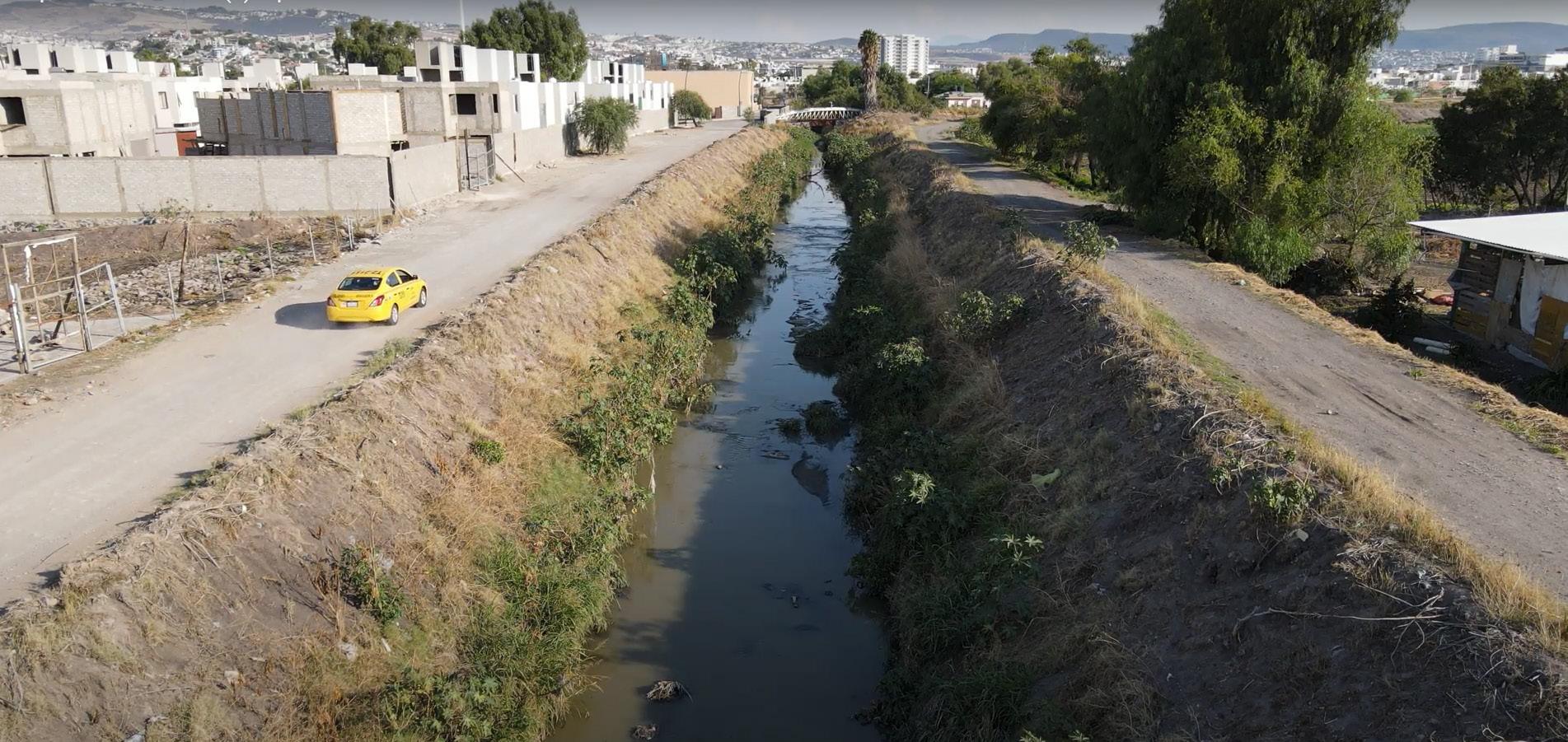
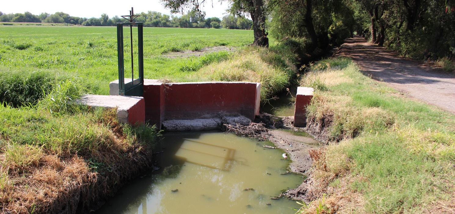
Uno de los elementos principales del sitio es el canal de agua pluvial que lo atraviesa de un extremo a otro, pero al mismo tiempo marca la división territorial entre los municipios de Querétaro y Corregidora. Además, encontramos 2 plantas tratadoras de aguas residuales y 1 cárcamo de bombeo, los cuales se conectan con el canal pluvial. Asimismo, ubicamos 2 cuerpos de agua naturales, que ayudan a retener, almacenar e infiltrar el agua en temporada de lluvias.
Finalmente, un dato impactante es que el Fraccionamiento Puerta Real Residencial Desarrollo Urbana 08, cuenta con 14 albercas cuyo consumo individual inicial de agua es de 140 m3, y a eso se le suman anualmente otros 43m3. Sin embargo, cada una de estas albercas esta rodeada por un área verde compuesta de pasto tipo kikuyo, cuyo consumo de agua es de 6 a 9 litros por metro cuadrado duplicándose en temporada de verano.
One of the main elements of the site is the rainwater channel that crosses it from one end to the other, but at the same time marks the territorial division between the municipalities of Querétaro and Corregidora. In addition, we find 2 wastewater treatment plants and 1 pumping station, which are connected to the pluvial channel. Likewise, we located 2 natural bodies of water, which help to retain, store and infiltrate water in the rainy season.
Finally, an impressive fact is that the Fraccionamiento Puerta Real Residencial
Desarrollo Urbana 08 has 14 pools whose initial individual water consumption is 140 m3, and another 43 m3 are added annually. However, each one of these pools is surrounded by a green area composed of kikuyo-type grass, whose water consumption is 6 to 9 liters per square meter, doubling in the summer season.
76 ENTRE TIERRA Y AGUA

77
GEOGRÁFICA
ENTRE MUNICIPIOS
UBICACIÓN
DEL SITIO
PALETA VEGETAL
El ecosistema del sitio está actualmente compuesto por una paleta vegetal muy variada con especies principalmente de uso medicinal y de ornato. Sin embargo, se ha observado que algunas de estas especies son tóxicas y otras incluso son invasivas, lo que genera repercusiones para el ecosistema en general.
El análisis de la paleta vegetal ayuda a generar un diagnóstico del entorno para crear una nueva propuesta del paisaje que beneficie a la flora y fauna del lugar.
The ecosystem of the site is currently composed of a very varied plant palette with species mainly for medicinal and ornamental use. However, it has been observed that some of these species are toxic and others are even invasive, which generates repercussions for the ecosystem in general.

The analysis of the vegetable palette helps to generate a diagnosis of the environment to create a new landscape proposal that benefits the flora and fauna of the place.
Lantana de Texas

Lantana urticoides
Uso: Ornamental Invasora
Requerimiento hídrico: Medio
Servicios ecosistémicos: -polinización
Campanilla plateada Convolvulus cneorum
Uso: Ornamental
Requerimiento hídrico: Bajo
Servicios ecosistémicos:
Ricino Ricinus communi

Uso: Ornamental invasora
Requerimiento hídrico: Medio
Servicios ecosistémicos:
78 ENTRE TIERRA Y AGUA
ÁRBOLES
Negundo Acer Negundo
Uso: Ornamental
Requerimiento hídrico: Bajo
Servicios ecosistémicos:
-regulación de la erosión
-moderación de los eventos extremos
-materias primas
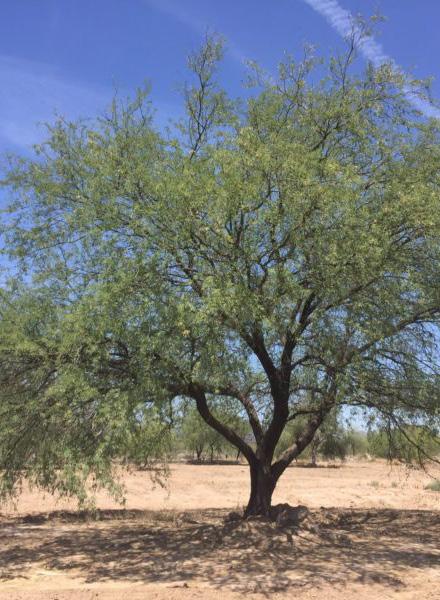
Mezquite
Prosopis juliflora
Uso: Maderable y comestible
Requerimiento hídrico: Medio
Servicios ecosistémicos:
-formación del suelo
-purificación de agua
-materias primas
Plátano
Musa paradisiaca

Uso: Comestible
Requerimiento hídrico: Alto
Servicios ecosistémicos:
-ciclo de nutrientes
-regulación del agua
-recursos medicinales
-alimentos
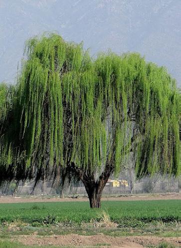
Sauce blanco
Salix alba



Uso: Maderable y comestible
Requerimiento hídrico: Alto
Servicios ecosistémicos:
-materias primas
-recursos medicinales
-alimentos
Pirul
Schinus Molle
Uso: Ornamental
Requerimiento hídrico: Medio
Servicios ecosistémicos:
-formación del suelo
-regulación de la erosión
-moderación de los eventos extremos
Árbol coral
Erythrina lysistemon

Uso: Ornamental
Requerimiento hídrico: Bajo
Servicios ecosistémicos:
-polinización
Guayabo
Psidium guajava

Uso: Comestible
Requerimiento hídrico: Medio
Servicios ecosistémicos:
-regulación del agua
-recursos medicinales
-animales
Guaje
Leucaena diversifolia
Uso: Medicinal
Requerimiento hídrico: Medio
Servicios ecosistémicos:
-formación del suelo
-ciclo de nutrientes
-regulación del agua
-regulación de la erosión
-recusos medicinales
79 ENTRE MUNICIPIOS
FLORA MEDICINAL
Bola africana del rey
Leonotis Mepetifolia

Uso: Medicinal y Ornamental


Requerimiento hídrico: Medio
Servicios ecosistémicos: -polinización -recursos medicinales
Azumiate
Baccharis salicifolia

Uso: Medicinal
Requerimiento hídrico: Medio
Servicios ecosistémicos: -recursos medicinales
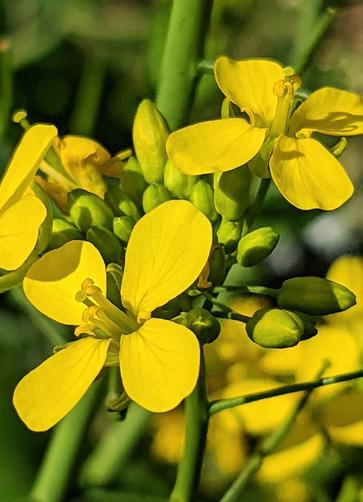
Flor de nabo Brassica rapa
Uso: Medicinal
Requerimiento hídrico: Medio
Servicios ecosistémicos: -recursos medicinales
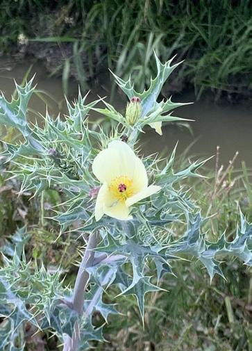
Cardo
Argemone ochroleuca
Uso: Medicinal y tóxico
Requerimiento hídrico: Medio
Servicios ecosistémicos: -recursos medicinales
Limoncillo
Thymophylla pentachaeta
Uso: Medicinal
Requerimiento hídrico: Medio
Servicios ecosistémicos: -control de plagas y enfermedades -recursos medicinales
Mastuerzos mayores
Lepidium perfoliatum

Uso: Medicinal Invasora
Requerimiento hídrico: Medio
Servicios ecosistémicos: -recursos medicinales
Revienta caballos
Solanum elaeagnifolium
Uso: Medicinal y tóxica para ganado
Requerimiento hídrico: Medio
Servicios ecosistémicos: -recursos medicinales
80 ENTRE TIERRA Y AGUA
FLORA ORNAMENTAL

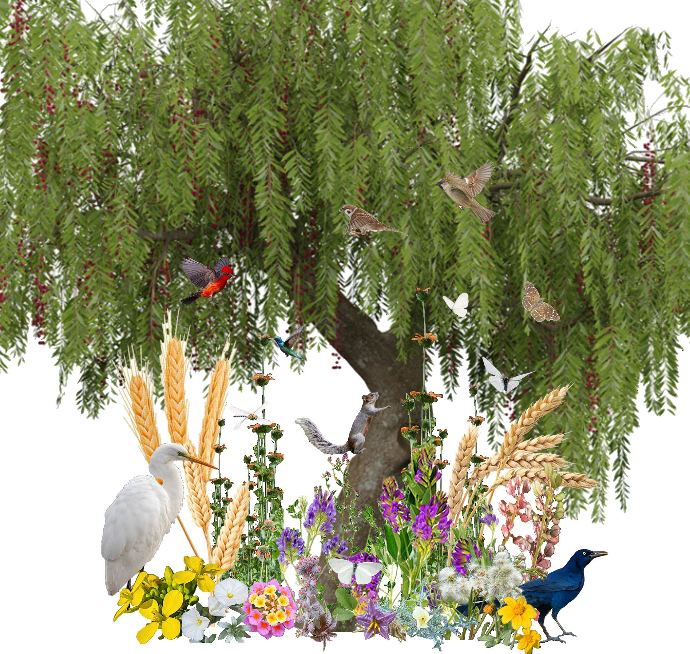
SALTAMONTES


81 ENTRE MUNICIPIOS
ARDILLA
COLIBRI
GARZA BLANCA
ZANATE
MARIPOSA BLANCA
GORRIÓN
PETIRROJO
MARIPOSA CAFÉ
LIBÉLULA
HORMIGA ROJA
HORMIGA NEGRA
SERVICIOS ECOSISTÉMICOS

82 ENTRE TIERRA Y AGUA
83 ENTRE MUNICIPIOS

84 ENTRE TIERRA Y AGUA

85 ENTRE MUNICIPIOS

86 ENTRE TIERRA Y AGUA
87 03 ENTRE
NEGRAS
AGUAS
ACTORES
Dentro del esquema de actores se pueden identificar distintos núcleos que generan influencia sobre espacios agrícolas como el sitio. Espacios que por distintas condiciones van quedando bajo la huella inmobiliaria. Para generar un crecimiento económico en las ciudades, el gobierno constantemente esta en busca de inversión.
En el caso de Querétaro, la mayor parte de la inversión extranjera proviene de la industria, lo que genera un movimiento migratorio por el personal que estas empresas suelen necesitar. Por lo tanto, la población va incrementando alrededor de estas zonas industriales, lo que provoca que las inmobiliarias analicen los datos para conocer cuál es la demanda y las ofertas puedan aumentar.
Within the scheme of actors, different nuclei can be identified that generate influence on agricultural spaces such as the site. Spaces that due to different conditions are left under the imprint of real estate. To generate economic growth in cities, the government is constantly looking for investment.
In the case of Querétaro, most of the foreign investment comes from the industry, which generates a migratory movement for the personnel that these companies usually need. Therefore, the population is increasing around these industrial zones, which causes real estate companies to analyze the data to find out what the demand is and the offers can increase.
88 ENTRE TIERRA Y AGUA
SERVICIOS
AGUA - CEA
LUZ - CFE
GAS
MOBILIDAD
GOBIERNO ESTADO INDUSTRIA
MIGRACIÓN
INMOBILIARIASCRECIMIENTO POBLACIONALEJIDATARIOS
DESARROLLO RESIDENCIAL

ESTADO
S E C RETARÍADE DESARROLLOURB A ON MUNICIPIO
MUNICIPIO
ÓRGANOSUPREMO DE LA ASAMBLEAEJIDALAGRICULTOR EJIDO
EJIDATARIO
89 ENTRE AGUAS NEGRAS
ACTORES
Asimismo, el gobierno genera Planes de Desarrollo Urbano para regular el crecimiento de la ciudad. En la realidad, empresas privadas suelen hacer ofertas económicas a los ejidatarios para comprar tierras a un precio más accesible que el resto, aunque esto signifique que esas tierras no están consideradas dentro de los Planes de Desarrollo Urbano. Por lo tanto, las desarrolladoras inmobiliarias “convencen” al gobierno de otorgarles los permisos necesarios para explotar las zonas agrícolas y convertirlas en zonas residenciales, sin considerar el equipamiento completo que se necesita.
Likewise, the government generates Urban Development Plans to regulate the growth of the city. In reality, private companies usually make economic offers to local property owners to buy land at a more affordable price than the rest, even if this means that these lands are not considered within the Urban Development Plans. Therefore, real estate developers “convince” the government to grant them the necessary permits to exploit the agricultural areas and convert them into residential areas, without considering the complete equipment that is needed.

90 ENTRE TIERRA Y AGUA


91 ENTRE AGUAS NEGRAS
CONDICIONANTES
Una de las principales condicionantes del sitio es el crecimiento urbano que hay actualmente alrededor de él. Este crecimiento involucra distintos cambios importantes sobre el paisaje y las dinámicas socioeconómicas de la zona.
Asimismo, este crecimiento genera presión sobre el espacio y sobre los ejidatarios, quienes, dadas las condiciones del mercado agrícola, se ven en la necesidad de vender múltiples hectáreas a las desarrolladoras inmobiliarias que buscan ampliar la oferta de viviendas en la zona. Por otro lado, el sitio cuenta con acceso a 2 vialidades importantes en la zona, lo que genera un alto transito automovilístico dentro del sitio y significa un valor agregado para el sitio, pues hay mayor posibilidad de tener accesos alternos.
One of the main conditions of the site is the urban growth that currently exists around it. This growth involves various important changes to the landscape and socioeconomic dynamics of the area.
Likewise, this growth generates pressure on space and on local property owners, who, given the conditions of the agricultural market, find it necessary to sell multiple hectares to real estate developers seeking to expand the housing supply in the area. On the other hand, the site has access to 2 important roads in the area, which generates high automobile traffic within the site and means an added value for the site, since there is a greater possibility of having alternate accesses.
92 ENTRE TIERRA Y AGUA

93 ENTRE AGUAS NEGRAS
PROBLEMÁTICAS - INUNDACIONES
Alrededor del sitio, se tiene un comportamiento relacionado al agua que genera 2 circunstancias, este comportamiento tiene un mayor impacto durante la temporada de lluvias.
En primer lugar, los fraccionamientos residenciales que cuentan con mayor infraestructura e inversión tienen menor probabilidad de sufrir inundaciones, debido a su infraestructura de drenaje y servicios sanitarios. Por el otro lado, las colonias abiertas suelen sufrir las consecuencias de la contaminación del canal pluvial, ya que varias descargas ilegales de drenaje desembocan en este generando problemas de salubridad y contaminación del espacio agrícola.

Around the site, there is a behavior related to water that generates 2 circumstances, this behavior has a greater impact during the rainy season.
In the first place, the residential subdivisions that have greater infrastructure and investment are less likely to suffer flooding, due to their drainage infrastructure and sanitary services. On the other hand, the open colonies usually suffer the consequences of the contamination of the pluvial channel, since various illegal drainage discharges flow into it, generating health problems and contamination of the agricultural space.
94 ENTRE TIERRA Y AGUA
Zonas Inundables Simbología

95 ZONAS INUNDABLES ENTRE AGUAS NEGRAS
PROBLEMÁTICAS - CONTAMINANCIÓN
El canal que atraviesa el sitio de extremo a extremo y divide territorialmente los municipios de Querétaro y Corregidora, es considerado como foco de infección y contaminación sensorial y visual debido a la alta presencia de microorganismos como Bacilos gramnegativos, Escherichia coli, Pseudomonas aeruginosa, entre otros. Las infecciones por este tipo de microorganismos pueden desencadenar distintas enfermedades y en algunos casos incluso provocar la muerte.
Por otro lado, los olores que se generan a partir de los desechos que lleva el canal provocan que el espacio sea poco habitable para el peatón y los residentes de la zona.
The channel that crosses the site from end to end and territorially divides the municipalities of Querétaro and Corregidora, is considered a focus of infection and sensory and visual contamination due to the high presence of microorganisms such as Gram-negative Bacilli, Escherichia coli, Pseudomonas aeruginosa, among others. Infections by this type of microorganisms can trigger different diseases and, in some cases, even cause death.

On the other hand, the odors generated from the waste carried by the canal make the space hardly habitable for pedestrians and residents of the area.

96 ENTRE TIERRA Y AGUA

97 ENTRE AGUAS NEGRAS
PROBLEMÁTICAS - CONSUMO DE AGUA
En el sitio suelen cultivarse diversas especies de plantas para alimento de ganado; las principales son alfalfa con un consumo promedio de 0.8 litros por planta a la semana, avena con 1.05 litros por planta a la semana y el trigo con 0.5 litros por planta por semana. Cabe mencionar que, por su cercanía al canal, a las plantas tratadoras y al cárcamo; los cultivos actualmente se riegan con aguas residuales.
Además, en el análisis del consumo hídrico agrícola del sitio se consideró el consumo promedio 100 litros de agua por animal al día. Esto confirma la relevancia de este recurso dentro del desarrollo de las actividades agrícolas, e indica la urgencia de implementar métodos agrícolas con un consumo más consciente del agua en todas sus etapas.
Various species of plants are usually cultivated on the site for livestock feed; the main ones are alfalfa with an average consumption of 0.8 liters per plant per week, oats with 1.05 liters per plant per week, and wheat with 0.5 liters per plant per week. It is worth mentioning that, due to its proximity to the canal, to the treatment plants, and to the ditch; crops are currently irrigated with wastewater.
In addition, in the analysis of the agricultural water consumption of the site, the average consumption of 100 liters of water per animal per day was considered. This confirms the relevance of this resource within the development of agricultural activities and indicates the urgency of implementing agricultural methods with a more conscious consumption of water in all its stages.
98 ENTRE TIERRA Y AGUA
Alfalfa 0.7 - 0.9 Litros por planta por semana
0.60 cm 0.40 cm 1.70 cm
Avena 0.4 - 1.3 Litros por planrta por semana
Ganado 100 Litros por animal por día, temporada de calor
Trigo 0.5 Litros por planta por semana
99 semana EQUIPAMIENTO
ENTRE AGUAS NEGRAS
PROBLEMÁTICAS - ESPACIOS PÚBLICOS
Otro factor importante a considerar es la falta de espacios públicos debido al rápido crecimiento urbano que prioriza la construcción de vialidades y conjuntos habitacionales, dejando de lado este tipo de espacios donde los habitantes tengan la oportunidad de desarrollarse física y mentalmente. La falta de espacios públicos promueve la individualidad y el excesivo uso del automóvil para trasladarse a otros puntos de la ciudad.
Los desarrollos habitacionales que suelen contar con áreas verdes o de recreación son espacios cerrados que limitan el uso de esos espacios mediante reglamentos de convivencia privatizando así los espacios públicos.
Another important factor to consider is the lack of public spaces due to rapid urban growth that prioritizes the construction of roads and housing complexes, leaving aside these types of spaces where the inhabitants have the opportunity to develop physically and mentally. The lack of public spaces promotes individuality and the excessive use of the car to move to other parts of the city.
Housing developments that usually have green or recreation areas are closed spaces that limit the use of these spaces through coexistence regulations, thus privatizing public spaces.
Simbología

100 ENTRE TIERRA Y AGUA
Espacios Públicos

101 ESPACIOS PÚBLICOS ENTRE AGUAS NEGRAS
PROBLEMÁTICAS - ANDADORES PEATONALES
En las últimas décadas, el desarrollo urbano de las ciudades se ha generado a partir de las necesidades del automovilista dejando de lado las necesidades del peatón o del ciclista. Este modelo de movilidad y diseño urbano ha generado vialidades con alto riesgo de cohesiones entre el tránsito local, ya que no se consideran conscientemente las relaciones espaciales y sociales de los residentes de la zona o de la población en general.
In recent decades, the urban development of cities has been generated from the needs of the motorist leaving aside the needs of the pedestrian or cyclist. This model of mobility and urban design has generated roads with a high risk of cohesion between local traffic, since the spatial and social relations of the residents of the area or the population, in general, are not consciously considered.
Simbología
Andadores peatonales

102 ENTRE TIERRA Y AGUA

103 ANDADORES PÚBLICOS ENTRE AGUAS NEGRAS
PROBLEMÁTICAS - DENSIDAD POBLACIONAL


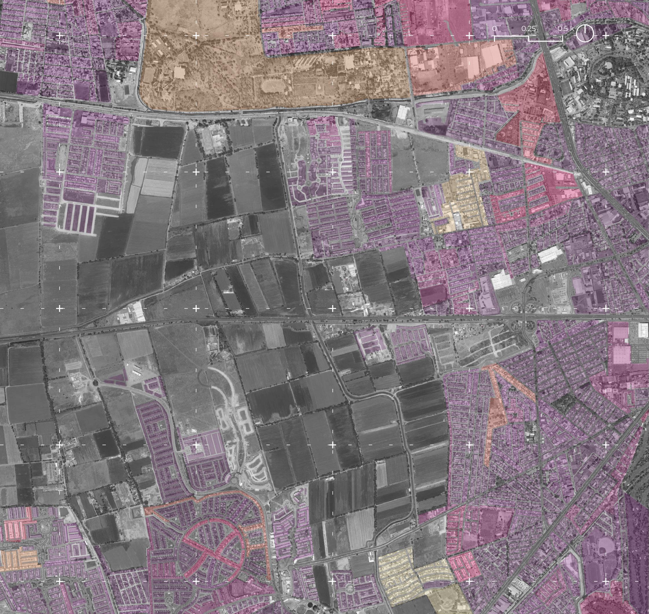
Debido a la baja densidad poblacional de la zona y al incremento de la construcción de nuevos conjuntos habitacionales, los escasos espacios naturales que ayudan a captar el agua pluvial, rellenar los mantos acuíferos y regenerar los ecosistemas se ven amenazados por el crecimiento urbano a diario.
Asimismo, en la zona cercana al sitio se promueve la vivienda tipo Residencial con amenidades exclusivas como: alberca, áreas verdes, cercanía a vialidades rápidas, entre otras. Esta tipología de vivienda implica un alto costo de mantenimiento, además de promover el desperdicio de agua y paisajes llenos de vegetación con alto requerimiento hídrico.
Due to the low population density in the area and the increase in the construction of new housing complexes, the few natural spaces that help capture rainwater, refill aquifers, and regenerate ecosystems are threatened by urban growth on a daily basis.
Likewise, in the area near the site, Residential type housing is promoted with exclusive amenities such as a swimming pool, green areas, and proximity to fast roads, among others. This type of housing implies a high maintenance cost, in addition to promoting the waste of water and landscapes full of vegetation with high water requirements.
Simbología


104 ENTRE TIERRA Y AGUA
Traza Urbana Personas por manzana 01 a 100 101 a 200 201 a 300 301 a 400 401 a 500 501 a 600 601 a 700 701 a 800 801 a 900 901 a 1000 + 1000
105 DENSIDAD POBLACIONAL ENTRE AGUAS NEGRAS
PROBLEMÁTICAS - VIVIENDAS RESIDENCIALES
“En Querétaro hay 4 mil 700 casas abandonadas”
– AM Querétaro
Actualmente hay una oferta amplia y variada en el sector inmobiliario, por lo tanto, se ha considerado que una de las características principales del proyecto es: respetar las viviendas preexistentes del sitio. No hay necesidad de generar más vivienda dentro del sitio para no abrir la posibilidad del desarrollo y construcción de nuevos fraccionamientos habitacionales.
Currently, there is a wide and varied offer in the real estate sector, therefore, it has been considered that one of the main characteristics of the project is: respect for the pre-existing housing on the site. There is no need to generate more housing within the site so as not to open the possibility of the development and construction of new housing subdivisions.
106 ENTRE TIERRA Y AGUA

107 ENTRE AGUAS NEGRAS
PROBLEMÁTICAS
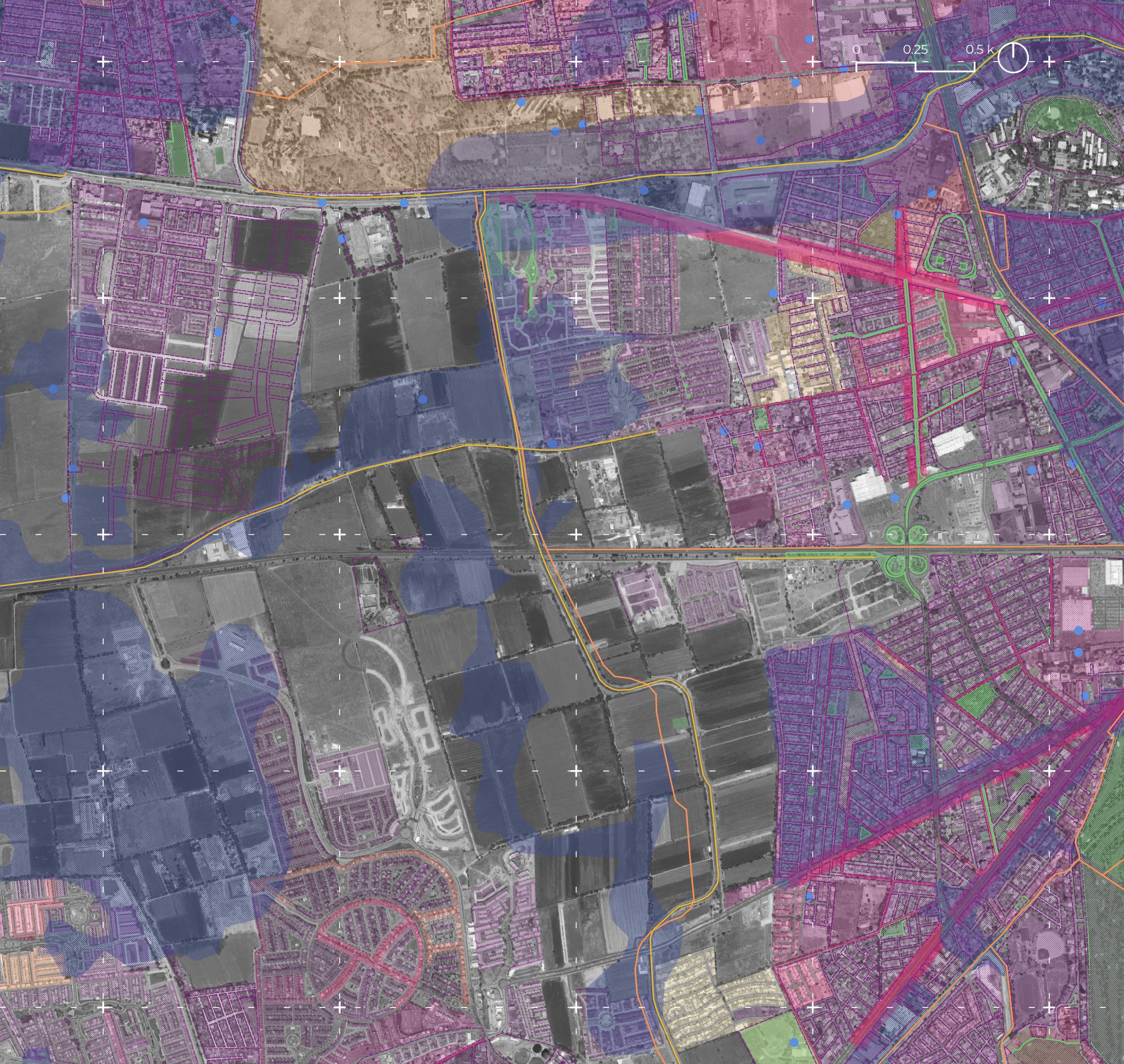
La combinación de las problemáticas anteriores dentro del sitio provoca la existencia de un desbalance ecológico, dónde cada usuario y cada actor culpan al municipio que está del otro lado del canal, dejando los problemas sin solución.
Sin embargo, es necesario entender la raíz de los problemas para identificar las oportunidades que tiene el sitio. Por ello, las principales problemáticas son:
Inundaciones
Contaminación de canales
Uso desmedido de agua en agricultura
Carencia de espacios públicos
Andadores peatonales
Densidad poblacional
Viviendas residenciales
The combination of the previous problems within the site causes the existence of an ecological imbalance, where each user and each actor blame the municipality that is on the other side of the canal, leaving the problems without a solution.
However, it is necessary to understand the root of the problems to identify the opportunities that the site has. Therefore, the main problems are:


Floods
Channel contamination


Excessive use of water in agriculture
Lack of public spaces
Pedestrian walkers
Population density
Residential housing
108 ENTRE TIERRA Y AGUA
Traza Urbana
Públicos Andadores peatonales Elementos Hídricos Zonas Inundables Pozos Pozos Drenes Canal Personas por manzana 01 a 100 101 a 200 201 a 300 301 a 400 401 a 500 501 a 600 601 a 700 701 a 800 801 a 900 901 a 1000 + 1000 Simbología
Espacios
109 CONLUSIONES PROBLEMÁTICAS ENTRE AGUAS NEGRAS
OPORTUNIDADES
Las principales oportunidades del sitio que aportan a la generación de una Ciudad Esponja, son las siguientes:
Conexiones urbanas y sociales
Espacio agrícola
Ecosistema
Topografía
Tránsito local y habitantes
Cada elemento representa una oportunidad, ya que con una intervención estratégica el sitio puede evolucionar para generar aportes significativos que apoyen los servicios ecosistémicos que se necesitan para regenerar las ciudades.
The main opportunities of the site that contribute to the generation of a Sponge City are the following:
Urban and social connections
Agricultural space
Ecosystem
Topography
local transit and people
Each element represents an opportunity since with a strategic intervention the site can evolve to generate significant contributions that support the ecosystem services that are needed to regenerate the cities.
110 ENTRE TIERRA Y AGUA

111 ENTRE AGUAS NEGRAS
VISION
Espacio que cuenta con un programa permeable, regenerativo y que une a las comunidades que lo rodean. Creando espacios experimentales, que inspiren a tener una cultura de revalorización por el agua.

112 ENTRE TIERRA Y AGUA

113 ENTRE AGUAS NEGRAS


