Farewell to Robert E. Reece Searching For Consensus
Call us t o g et your complete work flow s olution today ! Efficiency and versatility that will accelerate productivity comes part of a workflow solution that includes the FC-6000 field controller, Magnet software, a HiPer VR receiver and the GT-1200/GT-600 single-operator robotic system. The power of longrange reflectorless measurements comes in your choice of 1”, 2” or 3” GT-1200 models or 2”, 3” or 5” GT -600 models.
The F lorida Surveyor is the official publication of the Florida Surveying and Mapping Society, also known as FSMS. It is published monthly for the purpose of communicating with the professional surveying community and related professions who are members of FSMS. Our award winning publication informs members eleven months out of the year about national, state, and district events and accomplishments, as well as articles relevant to the surveying profession. In addition, continuing educational courses are also available.
PRESIDENT’S Message
January 2025
Happy and Promising 2025,
As we move into this new year, I am hopeful that we all can find the positive side of life on a personal level and as Surveyors and Mappers. There are so many things out there to be thankful for, so focusing on your family, your health and well-being, and your staff’s future is a good way to start the year.
Let’s face it, surveying has changed so drastically in the past 10 years that we are under constant pressure to be competitive. Whether it involves looking for qualified staff, training existing or new staff in the latest technologies, upgrading equipment and software, and just trying to perform more with less, its exhausting at times and it takes a lot of energy and your constant attention.
President
Richard Pryce
(954) 651-5942
All Surveyors share a unique and fascinating job and profession. We are not pigeonholed into one definition, but encompass a broad spectrum of disciplines, trades, and other professions that include: researchers, woodsmen, hunters, trackers, investigators, innovators, deep thinkers, head-scratchers, historians, decision makers, educators, scientists, artists, teachers, astronomers, mathematicians, drafters, computer geeks, programmers, pilots, engineers, hydrographers, statesmen, adventurers, sometimes politicians, and former US Presidents.
rdpryce@gmail.com
With the new US administration coming in on January 20th, optimism is running at a very high level. The possible changes based on all of the preliminary reports and new appointees to high level positions could go either way at this point, so there’s that level of uncertainty and nervous anticipation to deal with as well, but I personally am happy to see this as very positive for the Country.
In regard to FSMS, I see opportunity and I believe that we as a Country are finally on the right track to make a recovery like we haven’t se en in several
PRESIDENT’S Message
decades. We as Surveyors are in the right position to capitalize on the upcoming changes in Government and growth through less regulation. But we also have to be politically active and watchful as a reduction in regulation could also turn the other way, and professions like ours could be considered standing in the way of progress. The idea is to stay alert and start meeting politicians that are friendly and understand what Surveyors bring to the table. Why we are an important part of the development and protection side of the building industry, the country and state infrastructure, and th e identification, location and protection of our environment. Support FSMPAC now!
With that, a reminder that FSMS is a certified education provider , and the biennium is coming at the end of February 2025, so if you still need credits, now is the time to finish them up and renew your license.
Respectfully submitted,
Richard D. Pryce, RLS/PSM
2024-25 Districts and
Directors
District 1 - Northwest
Bay, Calhoun, Escambia, Franklin, Gadsden, Gulf, Holmes, Jackson, Jefferson, Leon, Liberty, Madison, Okaloosa, Santa Rosa, Taylor, Wakulla, Walton, Washington
Constitution & Resolution Advisory Committee Pablo Ferrari
Annual Meeting Committee Allen Nobles
Legal & Legislative Committee Jack Breed
Surveying & Mapping Council Randy Tompkins
Strategic Planning Committee Bob Johnson
Executive Committee Rick Pryce
Special Committees
Equipment Theft Manny Vera, Jr.
Awards Committee Howard Ehmke
UF Alumni Recruiting Committee Russell Hyatt
Professional Practice Committee Lou Campanile, Jr.
Workforce Development Committee Lou Campanile, Jr.
Liaisons
CST Program Alex Jenkins
FDACS BPSM Don Elder
Surveyors in Government
Richard Allen
Academic Advisory Justin Thomas UF / Todd Bates FAU
FES
Lou Campanile, Jr.
Practice Sections
Geospatial Users Group
Young Surveyors Network
Richard Allen
Melissa A. Padilla Cintrón, SIT
round the State A
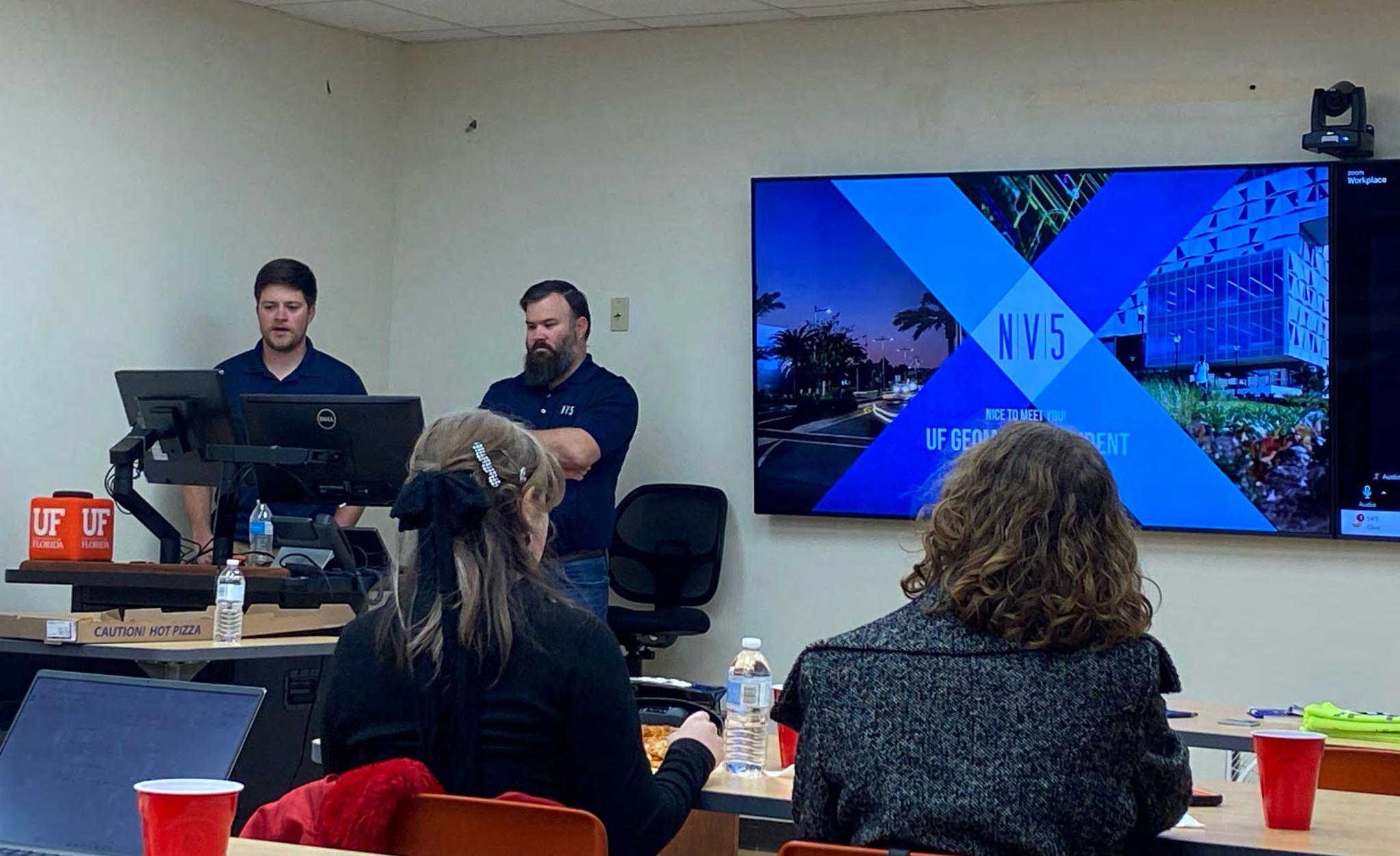
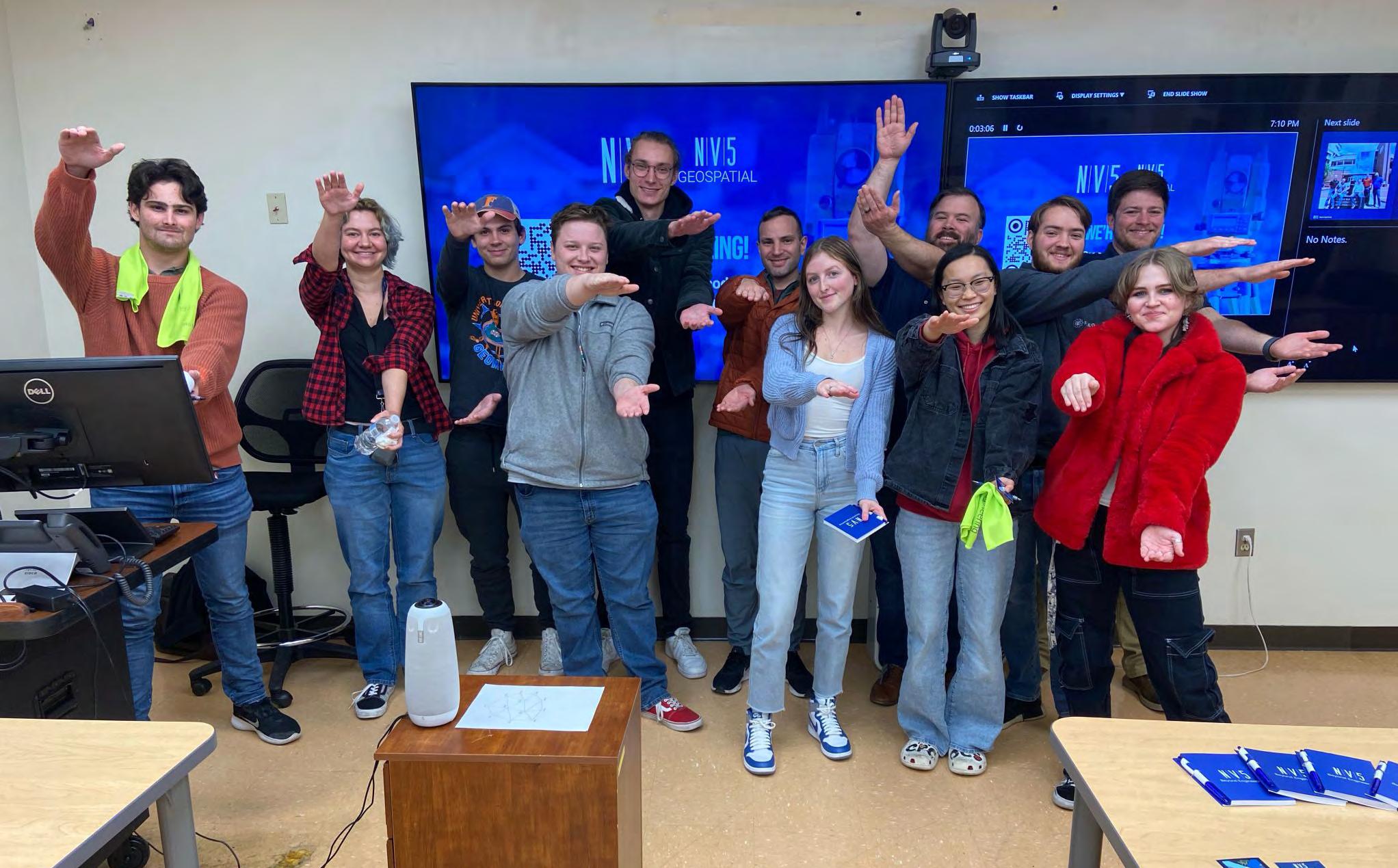
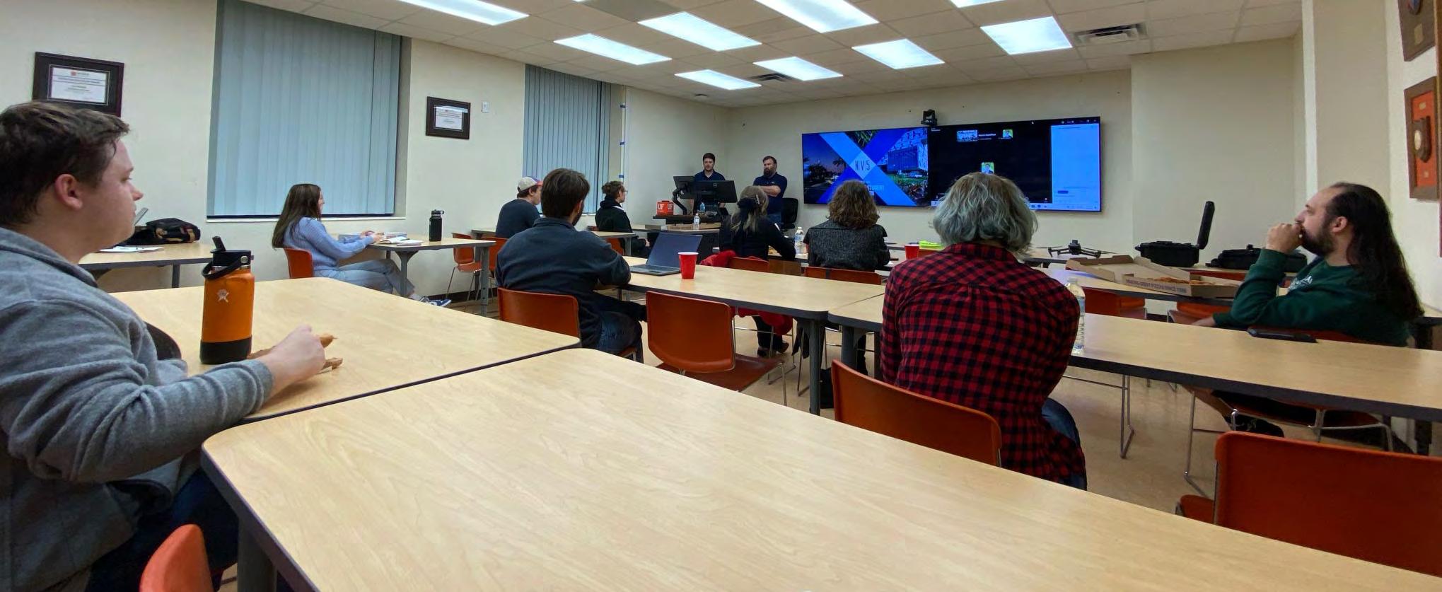
From UF Geomatics Student Association
We’d like to thank Chad Colson, PSM and William Kyle Crowley from NV5 for coming out and kickstarting a great semester of GSA meetings.
LAWS OF FLORIDA
CHAPTER
10275—(No. 253).
AN ACT to Regulate the Making of Surveys and filing for Record of Maps and Plats in the State of Florida.
Be It Enacted by the Legislature of the State of Florida:
Section 1. That whenever maps or plats of any land within this State are brought to a County Clerk or other public recording officer to be placed on public record, it shall be the duty of the County Clerk or other public recording officer, before filing, to examine said map or plat and see that it complies in form with all the require ments of this Act. If this Act has been complied with, he shall so certify, with date of filing for record, on the map or plat and also on the copy thereof required by Section 11 of this Act; otherwise he shall return the map or plat to the owner for correction.
Sec. 2. Whenever any City, Town or addition thereto shall be laid out or altered as hereinafter provided or whenever any land shall be platted into lots and blocks within this State, the proprietor or proprietors thereof, shall cause a survey and true map or plat thereof, to be made by a Civil Engineer or competent Surveyor.
Sec. 3. Such map or plat shall in every case be made with India ink, or some other equally substantial and distinct method, and be made on a scale sufficiently large to show plainly all details, on tracing cloth (of such size as each county may require). In case of a large plat it may require two or more sheets, in which case the sheets are to be numbered, and the number of the sheets to be indicated on the first sheet below the title.
Sec. 4. The plat shall have a title or name. If the plat be a Town, City or Village, the full name of such Town, City or Village must appear as the title or name of the plat; if the land platted be an addition to or a subdivision of a Town, City or Village already platted, then shall the title of the plat include, with the name of such addition or subdivision, the name of the Town,
City or Village, as the case may be, of which platted land is a subdivision, or to which it is an addition. The name of the County and State in which the land platted is situated should ap pear under the title.
Sec. 5. There shall be written or printed upon the tracing cloth on which map or plat shall be made a full and detailed description of the land embraced in said map or plat showing the Township and Range in which such lands are situated and the Section and parts of Sections platted. If the premises are in a Spanish grant or are not included in the subdivision of the Government sur veys, then the boundaries are to be defined by metes and bounds and courses. The initial point in the description shall be tied to the nearest Government corner, forty-acre corner, or other recorded and well established corner. The description must be so complete that from it without reference to the plat, the starting point can be determined and the outlines run. If a subdivision of a part of a previous recorded plat is made the previous lots and blocks shall be given. If the plat be a re-subdivision of the whole of a previous recorded plat the fact shall be so stated.
Sec. 6. In connection with the desrciption there shall be a dedication of the plat by the owner or owners, and his or their wives, whose signatures must be witnessed, and their execution of the dedication must be acknowledged in the same manner as deeds conveying lands are required to be witnessed and acknowledged; and in all cases the title, caption and dedication must agree. In case the dedication is to be made by a corporation then it shall be signed by the President and Secretary, respectively, of the corporation, by and with authority of its Board of Directors.
Sec. 7. In making the survey a sufficient number of permanent monuments, in no case less than two (2) and in no case more than two thousand (2000) feet apart, shall be placed either within the tract or on the exterior boundaries thereof, or both, so as to provide definite reference points from which may be located any points, lines or lots set forth on the said plat. The monuments so placed shall be of metal not less than 3 inches in diameter and 24 inches long, driven in the ground, or if smaller, to be incased in a solid block of concrete, said monuments having the reference point marked thereon. They shall have their position in reference to each other indicated by distances and angles and not less than one of said monuments shall have
its location indicated on the plat in reference to the nearest Government corner or other corner referred to in Section 5 hereof. The position of said monuments shall be indicated on the plat by a small circle and shall be marked “PERMANENT REFERENCE MONUMENT” or the initials “P.R.M.” to designate the same.
Sec. 8. In drawing the map or plat three inches shall be left blank on the left edge of the tracing cloth for binding in the record book. A plain designation of the cardinal points, the date of survey, and the correct scale of the drawing, shall be given. The drawing shall be made in a workman-like manner and must agree with the description. All section lines and quartersection lines occuring in the map or plat shall be indicated by lines drawn upon such map or plat, with appropriate words and figures. If the description is by metes and bounds, the point of beginning shall be indicated together with all bearings and distances of the boundary lines.
All lots shall be numbered either by progressive numbers, or if in blocks, progressively numbered in each block, and the blocks progressively numbered or lettered, except that blocks in numbered additions bearing the same name shall be numbered consecutively throughout the several additions. Excepted parcels must be marked “Not included in this plat.” The dimensions of all lots and the width of all streets and alleys shall be given on the plat. Where all lots in any block are of the same dimensions it shall be sufficient to mark the precise length and width of one tier thereof; but all gores, triangles or other lots which are not squares or parallelograms, shall have the length of their sides and angles plainly defined by figures. The streets must be named or numbered and the alleys or public grounds properly designated. All land within the boundaries of the plat must be accounted for either by blocks, lots, out lots, parks, streets, alleys or excepted parcels. But no strip or parcel of land shall be reserved by the owner when recording a sub-division, unless the same is sufficient in size and area to be of some practical use or service.
Sec. 9. The Engineer or Surveyor making the survey or plat shall certify on the plat that it is a correct representation of the land platted and that permanent reference monuments have been placed as called for under Section 7 of this Act.
Sec. 10. Before said map or plat shall be presented to the County
Clerk for record, the owner or owners shall cause to be placed thereon a certificate of approval by the County Commissioners Town Board, or Council, or the Board of Commissioners (in municipalities having a commission form of government) or their accredited representatives, having jurisdiction over the land described in the said map or plat. However, such approval shall not bind the County Commissioners, Town Board, City Council or Board of Commissioners to open up and keep in repair any parcels dedicated to the public in any map or plat so offered, but they may exercise such right at any time.
Sec. 11. For purposes of record the owner or owners, shall present to the County Clerk in and for the County in which the land platted is a part, a map or plat of the land platted drawn on tracing cloth together with a print or photographic copy of the tracing made on cloth.
Sec. 12. The map or plat on tracing cloth is to be filed by the County Clerk in his office in a book of the proper size for such papers so that it shall not be folded, and kept in the vault. The print or photographic copy on cloth shall be filed in a similar book and kept in his office for the use of the public.
Sec. 13. It shall be a misdemeanor for any person or persons to molest any monuments established according to this Act, or to deface or destroy any map or plat placed on public record.
Sec. 14. All laws and parts of laws in conflict with the provisions of this Act are hereby repealed.
Sec. 15. This Act shall take effect upon its passage and approval by the Governor, or upon becoming a law without such approval.
Approved June 11, 1925.
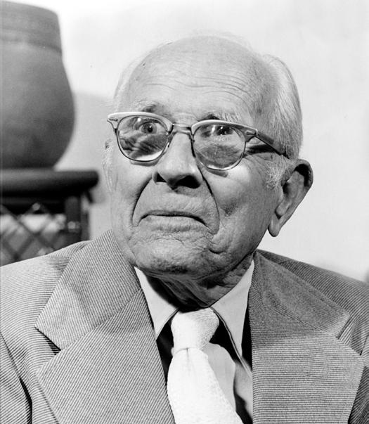
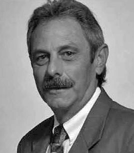
Robert Edward Reece
November 1 st , 1939 – December 27 th , 2024
We regret to inform you on the passing of Robert Edward “Bob” Reece, a.k.a. “Papa Boat,” of Key West, FL, who set sail on his final voyage the morning of December 27, 2024.
Born November 1, 1939, in Kansas City, Missouri, Bob was always an innovator, entrepreneur and hard worker. Even as a child, he delivered groceries on his bicycle. Bob attended Rockhurst High School, where he played football as a right guard. He earned a Bachelor of Science in Civil Engineering from Rockhurst College, and then attended Marquette University. Throughout college he was a member of the Alpha Delta Gamma fraternity. He then received an MBA from Pepperdine University. Bob served our nation as an Airman First Class Reservist at Richards-Gebaur Air Force Station. Joining the Peace Corps, Bob used his engineering skills and desire to help people to lead projects bringing clean water to rural Bolivian villages in the rugged Altiplano, saving countless lives. Despite nearly dying of amoebic dysentery, Bob continued the mission, building a large water well in Montero north of Santa Cruz, where he met and married Marcela, later having four children. During the Vietnam conflict, Bob again left the safety of the U.S. and volunteered with the US Department of State. He was decorated for his service in leading construction projects for the Montagnard villagers deep in the highlands of Vietnam north of Pleiku.
Back in Kansas City, Bob met Judy. They were married in 1974 and enjoyed a loving connection for almost 51 years. Bob dabbled in various businesses, including owning and operating a Dairy Queen franchise, but seeking ocean breezes, Bob and Judy moved to Palm Beach. During dinner one night Judy was talking about the residential survey backlog at her mortgage firm. Both Bob and Judy made the leap and created a company from scratch that significantly streamlined the mortgage loan closing process even opening up multiple offices. Digging roots in South Florida, Bob and Judy built and operated Lender’s Services in the Palm Beach area, later founding Reece Surveying in the Keys. He was truly a Renaissance man listening to those around him, developing innovative concepts, devouring books about the topic and putting ideas into action!
Bob was a traveler at heart and a traveler with heart, his adventures spanning over eight decades, touching lives of hundreds and likely thousands of people. Family was his anchor, and his friends were his lifelong crew. His infectious energy and wild generosity drew
folks from all walks of life and made for a large extended family. He brought people together, over laughter, food, and music, with a drink in hand. Bob found paradise in the Florida Keys and resided there for the past 30 years where he not only ran his business, but also volunteered with the Big Pine Key Fire Department. He was also very involved with the local Rotary Club and Chamber of Commerce. Over the years he amassed a small armada of boats, most named “Seaveyor” and jokingly earned the nickname “Papa Boat” from his grandchildren.
Bob was the captain of his own ship in every sense of the word, charting each course of life with control, grace, and an adventurous spirit. Always planning the next journey, he not only dreamed but actually took his family and friends around the world to share unforgettable experiences and create memories. In a final act of love and intention, Bob returned to his home port in Kansas City to spend Christmas surrounded by his family. The “Annual Reece Family Reunion”: was a treasured tradition, bringing together his children and grandchildren each summer to celebrate the family bonds he valued so deeply. Unsinkable, Bob now continues his journey with those who preceded him in death. Without a doubt, he is hosting the ultimate “Reece Reunion,” reunited with his parents, Charles and Kathryn; siblings, Dick and Lois; nephew, David; his beloved children, Michael and Lili; and grandson, Aidan.
Bob is survived by his devoted wife, Judy Reece; his son, Dan Reece (Tabetha); his daughters, Lara Caldwell, Angela Reece (Tia) and Jennifer Bryant (Don); his grandchildren, Steven Reece (Caitlin), Mark Reece, Trevor Reece, Allison Reece, Robert Reece, Kyle Reece, Kurt Jr. Caldwell, Zeke Caldwell, Gabi Bryant (Cody), Andrew Bryant (Sarah), Jake Bryant, Quinn Bryant; and his great-grandchildren, Riley and Roland.
Bob knew no stranger and left behind countless friends all over the world. Bob treasured his bonds with his Rockhurst High School pals, with friendships spanning 70 years; he maintained close relationships with his family and friends in Peru and Bolivia, his huge fan club in St. Louis, and of course, his community in the Florida Keys. If you would like to leave a comment on Bob's obituary, you can do so by clicking here: https://signaturefunerals.com/robert-reece/
The End of the Biennium is on February 28, 2025!
• This is the deadline for License Renewal.
• Licensed Surveyors are Required to have Completed at least 24 Continuing Education Credit Hours. Need Continuing Education Credits? (Click Here)
WIN A PACKET ONE REGISTRATION FOR ANNUAL CONFERENCE!
FSMS is Awarding a Recruitment Bonus for Current Members Bringing in New Memberships
The Bonus will be a Conference Packet One Registration (includes One Wed. BBQ Ticket, One Fri. Exhibitor's Luncheon Ticket, One Fri. Recognition Banquet Ticket, and Six Sat. Seminar CECs) along with a 2 Night Stay at Naples Grande Beach Resort.
• The Recruitment Bonus will be Awarded based on a Point System.
• 6 Points for each New Full Member, Gov. Surveyor, & Sustaining Firm.
• 1 Point for each New Associate, Affiliate, & Student Member.
• Whenever a New Member fills out their membership form they must provide referred current member's name when asked, “Were you referred by a Current Member of FSMS?”
Points will be awarded during Open Enrollment between now and March 31, 2025. The Member with the most points will be deemed the Winner and be announced in April's edition of The Florida Surveyor!
2025 MEMBERSHIP IS OPEN!
Membership for 2025 is open and available for those needing to renew or for those wanting to join The Florida Surveying and Mapping Society. You can Renew your current membership by Clicking Here and logging-in to your FSMS account.
For those New Members wishing to join or rejoin if they were not a member in 2024, Click Here to read about our Membership types and click on the “Join FSMS Today ” button at the top of the page to begin your membership with The Florida Surveying and Mapping Society.
Stephen H. Gibbs Land Surveyors, Inc. 954-923-7666
Stoner Inc. 954-585-0997
Suarez Surveying & Mapping, Inc. 305-596-1799 Survey Data Solutions, LLC 352-816-4084
Survey Pros, Inc. 305-767-6802
SurvTech Solutions, Inc. 813-621-4929 T T2 UES Inc. 407-587-0603
Tectonic Engineering and Surveying Consultants 845-534-5959
F irm S Directory
Thurman Roddenberry & Associates
850-962-2538
TopoDOT
407-248-0160
TranSystems
727-822-4151
UF/IFAS
352-846-0850
Upham, Inc.
386-672-9515
352-753-6511
WBQ
561-687-2220
LinkedIn = 1,669 Followers
Facebook = 1K+ Followers
X = 382 Followers
Instagram = 388 Followers
YouTube = 48 Subscribers • 16 Videos
CHAPTER FOURTEEN
Searching for Consensus: Sustainability and the Move Towards Everglades Restoration
As the South Florida Ecosystem Restoration Task Force coordinated federal activities regarding Everglades restoration, the Clinton administration, embracing the principle of sustainable development, made overtures to Florida’s powerful sugar industry in order to gain its support of restoration efforts. These endeavors accorded with President Clinton’s belief in the necessity of balance to resolve environmental disputes. Just as he demonstrated at his vaunted Forest Summit in Portland, Oregon, in April 1993, Clinton’s aim in South Florida was to create common ground by persuading all sides to relinquish a little, end the fighting without declaring winners or losers, and move forward with a new consensus. Much to the discomfort of many environmentalists, this meant bringing Big Sugar into the circle.
President Clinton’s environmental team had good reasons for wanting to work constructively with the sugar industry. Beyond the immediate goal of ending the litigation and clearing the way for cleanup to proceed, the Clinton team wanted to secure Big Sugar’s philosophical and financial commitment to a long term ecosystem restoration plan. Such promises would ensure that growers made genuine progress in developing Best Management Practices (BMPs) aimed at reducing phosphorus levels in agricultural runoff; no one was in a better position than the industry itself to conduct research and development on the effects of farming on the natural ecosystem. Securing commitments would also ease the burden on federal and state coffers, and would create real, long range business incentives for the adoption of BMPs.1
According to Clinton administration officials, sugarcane growers had much to gain by supporting the restoration effort. They could improve their public image, deflect environmentalists’ demands that the sugar industry pay a far greater share of the cleanup, and place their business on an environmentally sustaina ble footing. This latter action was the Clinton administration’s overarching goal, for the industry provided a livelihood to thousands of people in South Florida who would have little alternative employment if the industry collapsed. Many of the agricultural workers were underprivileged African Americans, Hispanics, and West Indian migrants who had worked their entire adult lives in the sugarcane fields and sugar mills. Despite frequent charges that the industry mistreated their workers, these rural inhabitants of the EAA were, for the most part, strongly attached to the region and supportive of the industry.2
As the Clinton team initiated settlement talks with sugar growers early in 1993, it sought to implement principles of “sustainable development.” If ecosystem management was at the center of an intellectual ferment among scientists and resource managers, sustainable development was a concept that excited interest among economists and policy makers. Like ecosystem management, it predated the advent of the Clinton administration by a few years. It had first emerged as a concept for addressing disparities of wealth between developed and developing nations in the context of caring for the global environment. One of the first organizations to develop the idea was the United Nation’s World Commission on Environment and Development, or Brundtland Commission, which first met in 1984. The Brundtland Commission defined
sustainable development as “development that meets the needs of the present without compromising the ability of future generations to meet their own needs.” The thrust of sustainable development, as explained in the Brundtland Commission’s final report to the United Nations, Our Common Future (1987), was to meld economic and environmental concerns into a unified program. The environment could not be protected effectively without economic development, nor could economic development be sustained without environmental protection. Principles of sustainable development were outlined further at international conferences in New Delhi in 1990, Dublin in January 1992, and the Earth Summit in Rio de Janeiro in June 1992. 3
Only after the Rio meeting did political leaders in the United States begin to suggest that sustainable development was a useful concept for domestic issues; President Clinton broadened the idea to include social justice perspectives. In June 1993, he formed the President’s Council on Sustainable Development. This group was composed of 25 members drawn from government, industry, labor, and civil rights organizations. The council’s guiding principle was to recognize the interdependence of economic prosperity, environmental protection, and social equity. Its mission was to explore “bold, new approaches to achieve our economic, environmental, and equity goals.”4 Sustainable solutions, like a three-legged stool, rested on the points of intersection between what was ecologically viable, what was economically feasible, and what was socially desirable. The council was to innovate ways to achieve “sustainable development” through a balance of ecological, economic, and social values.5 Clinton took a concept that had been steadily gaining ground in the international environmental community and made it central to his administration’s domestic environmental policy. Sustainable development was an idea that would have great force in transforming the C&SF Project into the Comprehensive Everglades Restoration Plan.
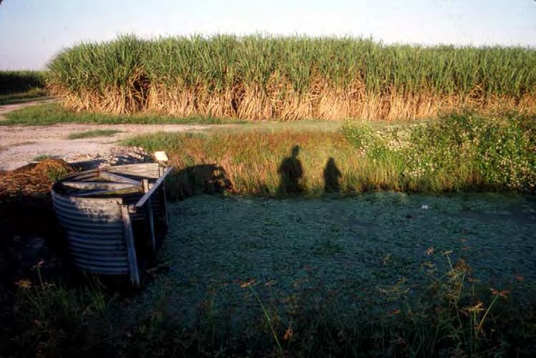
A sugar cane field and canal in Moorehaven, Florida. (Source: The Florida Memory Project, State Library and Archives of Florida.)
The first milestone in the Clinton administration’s efforts to co-opt Big Sugar was a muchballyhooed “Statement of Principles,” which Secretary of the Interior Bruce Babbitt, Florida Governor Lawton Chiles, and sugar industry leaders jointly announced on 13 July 1993 in a public ceremony held in the grand auditorium at the Department of the Interior in Washington, D.C. Largely orchestrated through the efforts of Gerald Cormick, the “leader of the school of alternative dispute resolution,” the Statement of Principles represented give-and-take by the sugar industry, state, and federal agencies.6 It called for a 90-day stay of Dexter Lehtinen’s litigation; it provided an overview of a Technical Plan that was in development and would be finalized during the next 90 days as part of a final settlement agreement; and, most importantly, it spelled out financial commitments by the agricultural industry, the state, and the federal government. Babbitt and Chiles hailed the accord as the closing chapter to a five-year court battle that had been costing valuable time and diverting money away from where it was most needed. “With this action,” Babbitt related, “we expect to head off what could have been another decade of litigation and to immediately begin restoration.”7
Industry representatives sounded the note on sustainable development. Nelson Fairbanks, president of U.S. Sugar Corporation, told the audience that he had “long believed that it was possible to save the Everglades while saving farm-related jobs,” and this plan would do just that. “It asks farmers to pay a lot, much more than we wa nted to pay,” he said. “But it also lets us and our communities survive. That is what we have wanted all along.” Robert Buker, senior vice president of U.S. Sugar and one of the chief negotiators for the industry, praised the Clinton administration for its role in the talks and called the breakthrough a “new paradigm” for resolving environmental disputes.8 Alfonso Fanjul, president of Flo-Sun, said the Clinton administration had stood conventional wisdom on its head. “What’s good for the environment can also be good for business,” he said.9
The Statement of Principles began with a preamble asserting the parties’ understanding of the problem. Nearly a century of human manipulation of the Everglades had made an attractive environment in South Florida that was now home to millions of people as well as a flourishing agricultural industry. “But in the last decade we have come to realize the tremendous cost this alteration of natural systems has exacted on the region,” the statement read. “We pledge to inaugurate an unprecedented new partnership, joining the Federal and State governments with the agricultural industry of South Florida, to restore natural values to the Everglades while also maintaining agriculture as part of a robust regional economy.” The parties further pledged to conduct future scientific research in a spirit of cooperation, and they expressed their hope that ecosystem restoration in South Florida would “become a national and international model for sustaining both the environment and the economy.”10
Under the heading “Management Principles,” the statement echoed the Settlement Agreement and Consent Decree in calling for the acquisition and establishment of flow-through filtration marshes, known as stormwater treatment areas (STAs), as the major component for cleanup of nutrients in the EAA. Water would pass through these marshes, allowing plants and other matter to cleanse the resource of phosphorous and other nutrients. The statement stipulated that parts of the Holey Land and Rotenberger tracts be used for these STAs, and it provided strong incentives for industry to implement BMPs. Unlike the earlier documents, however, it did not stipulate target levels for phosphorus outputs: these would be developed through subsequent
research and calculations. In the following section on “Financial Principles,” the statement described the respective commitments by the agricultural industry, the state, and the federal government in considerable detail. The agricultural industry agreed to pay up to $322 million over the next 20 years for construction, research, monitoring, and operation and maintenance of the STAs. This constituted an impressive two-thirds of a $465 million plan. However, the contribution by Big Sugar was much less than these gross figures suggested. The state and federal governments would outspend the agricultural industry by more than two to one in the early going, and the agricultural industry’s overall share, which would potentially escalate in the latter part of the 20-year period, would be substa ntially reduced through a credit system if target levels for phosphorus outputs were met according to schedule.11
Environmentalists almost unanimously denounced the Statement of Principles as vague, weak, and ingenuous. They did not like the provisions regarding the Rotenberger and Holey Land tracts, which they still wanted to use as buffer zones for the water conservation areas and Everglades National Park. They also wanted hard target levels of parts per billion, as they did not trust federal and state officials and industry representatives to calculate specific limits at a later time.12 With regard to the financial commitments, environmentalists believed the sugarcane growers had obtained a sweetheart deal from the Clinton administration. They wanted the growers to give up more of their land for filtration marshes and to pay a greater share of the cleanup cost. The Statement of Principles was vague on how the money would be collected, they declared, as well as how the credits would be assessed. In addition, environmentalists pointed out, some large sugarcane growers were not parties to the agreement.13
The Statement of Principles opened a fissure between environmentalists and the Clinton administration that would widen over the next three years. Environmentalists felt excluded by the mediation process, and although the Everglades Coalition and other environmental groups were invited to attend the ceremony at the Department of the Interior, the community was not mollified. EC members were quick to condemn the Statement of Principles as a sell-out to Big Sugar, whom they had been vilifying for years. Indeed, the fanfare surrounding its announcement, the photo opportunity for sugar industry moguls to share the podium with Secretary Babbitt and Governor Chiles, even the decision to unveil the Statement of Principles in the opulent auditorium of the Department of the Interior, all seemed calculated to offend in the view of some environmentalists. For Joe Browder, a consultant to the EC, the idea of inviting Big Sugar to proclaim its commitment to ecosystem restoration in the venerable old auditorium at Interior was no less than an act of defilement. “This [was] like pissing in the holy water,” he would later comment.14
Browder had harsh words for Secretary Babbitt at the conclusion of the event. As the press conference was drawing to a close, Browder rose from his chair and said angrily, “It’s an absolute betrayal, Bruce, and it won’t stand.” A few minutes later he buttonholed Babbitt on the floor of the auditorium. “This whole plan is bad science. I can’t understand why you would agree to this.” A Miami Herald reporter who was standing behind a pillar out of the secretary’s view recorded the exchange. “Well that’s my job, Joe, to find compromise,” was Babbitt’s exasperated reply.15
A diagram of STA-1 East. (Source: U.S. Army Corps of Engineers, Jacksonville District.)
The first page of the Statement of Principles.
Dexter Lehtinen, who had spearheaded the earlier Settlement Agreement in 1991, blistered the federal government for giving away too much in the Statement of Principles. “It’s vague and ambiguous on all the important points,” he said. “It reminds me of Vietnam. You give up, declare victory, and go home.”16 A group called Clean Water Action immediately condemned the Statement of Principles as a taxpayer bailout of the sugar industry. Clean Water Action, more than any other group, appealed to people’s pocket books. Florida taxpayers, particularly those in the SFWMD, would soon face a substantial hike in property taxes. Sylvia Kule, a member of Clean Water Action, promised to lead a bus load of senior citizens from Delray Beach to West Palm Beach to confront the governing board of the SFWMD when it met to approve the new $21 million ad valorem tax as called for in the Statement of Principles.17
Environmentalists were not the only ones who had problems with the Statement of Principles; the Miccosukee and Seminole Indians vilified the arrangement as well. Because no Miccosukee had participated in the negotiation of the principles, Billy Cypress, chairman of the tribe’s business council, denounced them as sacrificing the Miccosukee’s interests “on the alter [sic] of consensus.” The document contained “shocking concessions to the special interests,” Cypress continued, and he charged negotiators with deliberately preventing the Miccosukee and environmentalists from participating in the discussions because of their objections.18 Lehtinen, speaking on behalf of the Miccosukee, went even further, claiming that the Statement of Principles would become known as “the Munich of the Everglades,” where the federal government purchased “peace in our time with Big Sugar, leaving to others the difficult task of actually saving the Everglades.”19 The specific problems with the principles, according to Cypress and Lehtinen, who the tribe had hired as th eir attorney, was that they allowed delays in implementing water quality standards; they provided no “method or mechanism for achieving final [water quality] standards”; and they allowed Big Sugar to “pay less than the full cost of its own pollution.” Instead, Cypress wanted to see the state and federal government adopt a final phosphorous standard of 10 parts per billion, achieved by 2002 in the water conservation areas, Big Cypress National Preserve, and Everglades National Park.20 The Seminole were less strident in their comments, but still believed that the principles had several problems, including the possibility that they would “change the quantity of water flowing across the Big Cypress Reservation, . . . the timing and distribution of this water, and its quality.”21
Although the environmental community and the Miccosukee had some legitimate complaints of the Statement of Principles, in many ways their opposition demonstrated a growing belief that a plan that made any kind of concessions to Big Sugar was wrong, regardless of the benefits it might produce. This belief stemmed from many factors, but the primary dynamic was the mutually beneficial relationship that the sugar industry had with the federal government. The industry profited from federal subsidies and price supports and returned the favors with large donations to politicians that looked out for sugar’s interests. As one article reported, between 1979 and 1994, the sugar industry donated $12 million to both Democratic and Republican politicians, including more than $660,000 to sitting members of the House Committee on Agriculture between 1985 and 1990. In return, Florida’s sugar industry alone had received more than $5 billion in government subsidies since the 1940s. These figures, coupled with the notion that the industry abused its labor force for large profits, made any kind of compromise with Big Sugar hard for many environmentalists to swallow. 22
YOUR FLORIDA GEOSPATIAL PARTNER
Duncan-Parnell, along with our valued partners, including Trimble and other top brands, are proud supporters of the Florida Surveying & Mapping Society. From solutions including GNSS, scanning, GPR, drones, and more to services including support, rentals, training, and repair, we are pleased to be your one-stop shop for geospatial professionals throughout the Sunshine State.
Jacksonville, FL (904) 620 - 0500
Orlando, FL (407) 601 - 5816
www.duncan-parnell.com
Therefore, it was not surprising that Jim Webb of the Wilderness Society was the only environmentalist who endorsed the Statement of Principles. Having earlier worked with Babbitt and officials in the Corps to get Congress to fund a restudy of the C&SF Project, he now accepted the compromise as a necessary step in moving the ecosystem restoration effort forward. Amid all the criticism from the environmental community, Webb’s endorsement was a slender reed on which Babbitt and his team hoped to bring environmentalists back into the fold. But as some Democratic strategists soon observed, most environmentalists in Florida had nowhere else to go, as they would not vote Republican.23
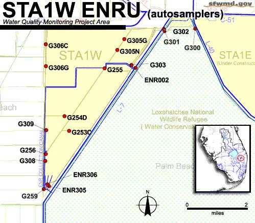
Attention now turned to the state’s Everglades Nutrient Removal Project, the prototype for the $465-million system of STAs mandated by the Statement of Principles and prescribed by the Settlement Agreement and Consent Decree prior to that. Begun in August 1991, the construction project was nearing completion. At a cost of $14 million, the constructed marsh occupied a 3,742-acre delta-shaped area situated on the border of the EAA and the Loxahatchee National Wildlife Refuge. Surrounded on all sides by eart hen berms, the marsh was to be fed by a twomile supply canal that would drain 35,000 acre-feet of water per year from the West Palm Beach Canal and farm seepage. The nutrient-laden water was to flow through a series of cells, each one filled with aquatic plants that would absorb phosphorus and “scrub” the water before it moved to the next cell. The first cell in the sequence, called the “buffer cell,” was a 135-acre area dense with cattails and algae that had a high capacity for taking phosphorus out of the water. As the cattails and algae died and decomposed, they would form a bottom layer of peat that would trap phosphorus permanently. From the buffer cell the water flowed through four massive cells, each covering several hundred acres and host to a different type of aquatic vegetation. Scientists hoped to compare the relative effectiveness of each type of aquatic plant for phosphorus removal. In addition, in Cells 1 and 2, separate 7.5-acre research cells would test different combinations of water depth, speed, and quantity. Engineers expected to apply the test results to the design of other, larger facilities that would be built at other locations around the EAA.24
Some scientists worried that the restoration effort relied too heavily on this single technological solution. The goal of the Everglades Nutrient Removal Project was to reduce phosphorus concentrations from 200 parts per billion (ppb) to 50. These results had been achieved from constructed wetlands before, but only where the wetlands were far larger in relation to the quantity of water flowing through them. Here the technology was being applied in an intensified form on an unprecedented scale, and it was being put forward as the primary solution to the problem. It remained to be seen whether the STAs could get phosphorus concentrations down to 50 ppb, and it was also unknown how effective the STAs would be on a long-term basis. Some skeptics complained that too much was riding on untried technology, that Babbitt and others were pushing “voodoo science.” Other scientists shared these concerns, but emphasized that the Everglades cleanup could not wait for more answers. Richard Harvey of the Florida Department of Environmental Protection was one scientist who believed the gamble to be necessary. “Given a lot of time, waiting would be a valid argument,” he told a reporter. “We’re not willing to wait two to three years. We don’t want the process to be slowed down.”25
In November 1993, activation of this first experimental STA hit an unexpected snag. Water discharging from the STA into the Loxahatchee National Wildlife Refuge did not meet the 50 ppb standard. The EPA, citing authority under the Clean Water Act, decided that the SFWMD
must obtain a federal permit to make further releases of this polluted water, a position consistent with the Settlement Agreement and Consent Decree of 1991-1992. It was also in step with plans in Congress to review the Clean Water Act in the upcoming session and extend its reach to farmpolluted water. But the requirement took SFWMD administrators by surprise. With water collecting in the STA and threatening to overtop the berms, the SFWMD resumed discharges into the Loxahatchee National Wildlife Refuge without a federal permit. Despite earlier threats, the EPA declined to levy a fine against the SFWMD. Nevertheless, the confrontation between EPA and the SFWMD alarmed farmers, who complained that they did not want to spend millions of dollars building filtration marshes only to have them commandeered by EPA. Moreover, they were concerned that the federal government would condemn a portion of their sugarcane fields for wetlands restoration without due compensati on. In December, even as federal and state officials worked out their differences over the permit issue, agriculturists walked out of mediation talks, with representatives of the U.S. Sugar Corporation and the Sugar Cane Growers
Map of the Everglades Nutrient Removal Project. )Source: South Florida Water Management District.)
Cooperative of Florida refusing to sign the final version of the 1993 compromise. By early January, the litigation threatened to begin anew, as the administrative law judge set two hearings to schedule more than 150 depositions.26
Federal and state officials were stunned by the breakdown of negotiations. Their effort to forge consensus lay in tatters. Six months earlier they had alienated the Everglades Coalition; now at the end of 1993 they had lost the farmers as well. But the Clinton and Chiles administrations remained committed to working together on an Everglades restoration plan; there would be no more division between the federal government and the state. The Settlement Agreement and Consent Decree ensured against that. Moreover, the Clinton administration still had links to Alfonso Fanjul, Jr., president of Flo-Sun and a generous donor to the Florida Democratic Party. When the farmers broke off ne gotiations, Florida Crystals, Inc., a subsidiary of Flo-Sun (and the largest sugar producer in the EAA) kept the lines of communication open. In February 1994, Florida Crystals and federal negotiators quietly reached a separate agreement, whereby the corporation agreed to pay for nearly half of the construction costs of the STAs in exchange for not having to implement phosphorous standards until 2008. This arrangement infuriated nearly everyone: the Miccosukee Indians, environmentalists, and even Florida Crystals’ counterparts, the U.S. Sugar Corporation and the Sugar Cane Growers Cooperative, whose strategy was now in disarray. Environmentalists and the Miccosukee took the issue to court, while Fanjul reaped the benefits: he was invited by Vice President Gore to attend an economic summit at the White House, and he hosted a tour of a waste-to-energy facility on his sugar plantation by the President’s Council on Sustainable Development. 27
If the beginning of 1994 seemed to mark the nadir of the Clinton administration’s effort to build consensus around South Florida’s water management issues, it also galvanized public opinion for a renewal of that effort. On 3 March 1994, Governor Chiles announced that he was establishing the Governor’s Commission for a Sustainable South Florida to solicit points of view and forge consensus in water matters. The commission would include 35 voting members appointed by the governor representing the business community, public interest and environmental organizations, county and city governments, and one representative each from the SFWMD, the South Florida Regional Planning Council, the Treasure Coast Regional Planning Council, the Florida Department of Environmental Protection, the Florida Game and Fresh Water Fish Commission, the Florida Senate, and the Florida House. In addition, it would include four nonvoting federal officials representing the Corps, the Department of the Interior, EPA, and NOAA. The commission’s primary charge was to “improve coordination among and within the private and public sectors regarding activities impacting the Everglades Ecosystem.” Like the
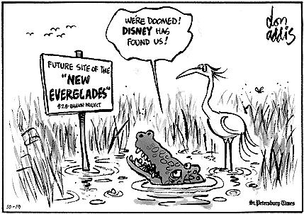
An editorial cartoon showing the disgust that some felt with the continuing litigation over phosphorous cleanup.
President’s Council on Sustainable Development, it was to “recommend strategies for ensuring the South Florida economy is based on sustainable economic activities that can coexist with a healthy Everglades Ecosystem.”28
Governor Chiles asked Estus Whitfield, the longtime advisor to Florida governors on environmental matters, to recommend a chairman for the commission. Whitfield suggested Richard Pettigrew, a former state legislator and speaker of the house. It was a fortunate choice. Pettigrew had the necessary prestige to make the commission visible to the public; he had experience at building consensus in the state legislature; and he had the right personality and temperament to control a large commission: patient, soft-spoken, empathetic, a skilled debater. In 1994, Pettigrew had been retired from state politics for some years and was practicing law in Miami, but he agreed to serve as chairman, holding the position until the commission completed its work in 1999.29 Everglades hands who worked with the Governor’s Commission universally praised his leadership: “a masterful job,” “a fantastic job,” “a master at bringing the interests together,” “absolutely critical to the success.”30
But this remarkable achievement still lay several years in the future. As the Governor’s Commission began its work in the spring of 1994, federal and state legislators were working to enact two pieces of legislation – one federal and one state – that would further define the Everglades restoration process as a joint federal-state undertaking. The first of these, passed by Congress in March 1994, amended the Everglades National Park Protection and Expansion Act of 1989 to allow the secretary of the interior to take funds appropriated for flood control projects in the East Everglades and apply them for land acquisition in that area instead. The authorization paralleled another federal commitment to land acquisition in the Kissimmee River Valley and buttressed the state’s ability to purchase land in the EAA. As such, it marked another step in the gradual transformation of the C&SF Project into the Comprehensive Everglades Restoration Plan. In a timely show of bipartisanship, Congressman Clay Shaw of Miami, a Republican, and Congressman Peter Deutsch of Broward County, a Democrat, co-sponsored the bill in the House, while Senator Bob Graham saw it through the Senate.31
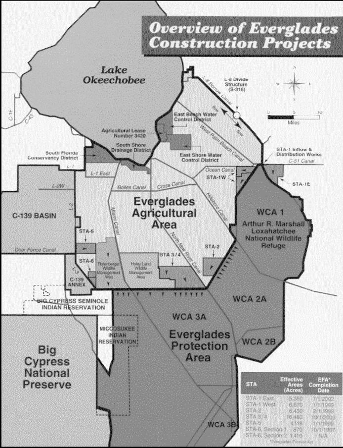
State legislators, meanwhile, crafted a state law that went even further in solidifying federal support for Everglades restoration. The Everglades Forever Act, which Governor Chiles signed into law on 3 May 1994, codified construction projects and other cleanup efforts embodied in the Settlement Agreement (1991), Consent Decree (1992), and Statement of Principles (1993). The law described a treatment system, funding plan, regulatory program, research program, land use plan (including land acquisition in the East Everglades Area), and restoration schedule. The treatment system, which would be built by the SFWMD and known as the Everglades Construction Project, featured a combination of STAs and BMPs. In addition to the six STAs previously contemplated, the law required the Corps to complete a seventh, STA 1-E as part of its work on a flood control project in the western C-51 basin.32
The funding plan called for a contribution of between $233 and $322 million by farmers (the same as in the Statement of Principles), and approximately $400 million by the state (a substantial increase over what had been outlined in the Statement of Principles). These amounts would be accompanied by an $87 million contribution by the federal government. The Florida Department of Environmental Protection and the EPA would regulate discharges by the STAs, and the SFWMD would supervise discharges by agricultural interests. The law mandated
research to establish a scientific, numerically based standard for phosphorus levels and stipulated a default standard of 10 parts per billion if the Department of Environmental Protection did not set a standard by 2003. The restoration schedule called for the various STAs to become operational between 1997 and 2003, and all areas of the Everglades were to meet applicable water quality standards by December 31, 2006.33
In the spirit of achieving “balance,” the Everglades Forever Act involved give and take by all sides. Governor Chiles could finally claim some success in bringing an end to the lawsuits and getting a restoration plan in place, while the Clinton administration had achieved its goal of establishing a long-range partnership between the federal government, the state, and the private sector. The sugar industry had held the line on its financial commitment, and it had obtained a reprieve of several years before more stringent guidelines on phosphorus levels would take effect. Environmentalists had won their point that the extensive acreage required for STAs should come out of agricultural lands, not the state-owned Rotenberger and Holey Land tracts.
Still, the environmental community, together with the Miccosukee Indians, believed that Big Sugar was the winner in this law, and that the environment and Florida taxpayers were the losers. The main problem, these groups contended, was that the Everglades Forever Act pushed back deadlines for agriculturists to meet water quality standards, essentially allowing the pollution of the Everglades to continue until 2006. These provisions convinced environmentalists and the Miccosukee that the Clinton and Chiles administrations, as well as state legislators, had sold out to the powerful sugar lobby, which, they said, had flooded the state capital with some 30 to 40 lobbyists.34 They characterized the law as a disgraceful retreat from the Marjory Stoneman Douglas Everglades Protection Act of 1991. Indeed, the 1994 legislation began as an amendment to the earlier act and was only given a new title after Douglas, the grand dame of Everglades preservation, denounced the effort and demanded that her name be taken off the bill.35 Although sugar interests contended with the notion that it had unduly influenced state politicians to pass the act, they did not disagree that the industry benefited from the law. According to Barbara Miedema, vice president of communications for the Sugar Cane Growers Cooperative of Florida, the Everglades Forever Act provided “a far better, more comprehensive solution” than the Settlement Agreement or Consent Decree.36
The Miccosukee were especially vehement in their denunciations of the Everglades Forever Act, claiming that it merely codified the objectionable parts of the Statement of Principles and that it kowtowed to the sugar industry. In protest, the tribe took several actions. First, it, along with other entities, petitioned the Florida Department of Environmental Protection to implement a 10 ppb phosphorous standard immediately. When the department refused, the tribe filed a case in the federal district court, charging that the act changed Florida’s water quality standards. At the same time, the Miccosukee – under the authority granted it by its water rights compact –began developing its own water quality standards, declaring that any water flowing onto reservation lands that exceeded the 10 ppb phosphorous limit would violate these standards. The tribe officially adopted these standards in December 1997, causing an uproar among the SFWMD and other agencies that would continue for the rest of the 1990s.37
Passage of the Everglades Forever Act was not the only setback for environmentalists and the Miccosukee in the spring of 1994. In its January meeting, th e Everglades Coalition had made a strategic decision to endorse a petition drive to place a penny-a-pound pollution tax on sugar on
The Everglades Construction Project and STAs. [Source: U.S. Army Corps of Engineers, Jacksonville District, Central and Southern Florida Project Comprehensive Review Study: Final Integrated Feasibility Report and Programmatic Environmental Impact Statement (Jacksonville, Fla.: U.S. Army Corps of Engineers, Jacksonville District, 1999).]
the statewide election ballot.38 The penny-a-pound tax was the brainchild of George Barley, an Orlando developer whom Joe Browder called “the strongest citizen Everglades leader in Florida.”39 As we have seen, Barley first got the attention of the environmental community for his efforts on behalf of Florida Bay. His success in bringing national attention to the degradation of Florida Bay was soon overshadowed, however, by his bold strategy to confront the Everglades polluters at the ballot box with the initiative for a tax on sugar. Barley’s organization, the Save Our Everglades Committee, argued that Big Sugar was not only the major culprit in the decline of the Everglades, but that it was trying to pass the buck for cleaning up its own waste. This line of argument had broad public appeal, especially among the urban populace of South Florida who paid, according to Barley’s organization, 111 times the amount that Big Sugar provided for water.40
The Everglades Coalition decided to get behind the Save Our Everglades campaign, a momentous decision as this was tantamount to the whole environmental community making a frontal attack on Big Sugar.41 Anticipating a hard fight, coalition members concluded that they needed new leadership. They asked Joe Browder, the irascible critic of the Statement of Principles and no friend of the Clinton administration, to provide that direction. Browder agreed to serve, but wanted a co-chairman. The coalition elected Browder and Tom Martin as cochairmen, while Theresa Woody of the Sierra Club was appointed grassroots coordinator.42
The penny-a-pound campaign soon acquired its own momentum. By the spring of 1994, more than half a million Florida voters had signed the petition, with 104-year-old Marjory Stoneman Douglas heading the list. The sugar industry fought back in the courts, complaining that the language in the petition unfairly passed judgment on the industry. In May, the Florida Supreme Court ruled that the initiative as written read too much like partisan rhetoric and could not go on the November ballot. With so many si gnatures already gathered, it was too late to reword the petition. The Save Our Everglades Committee, acknowledging that it had lost the battle but not the war, vowed to fight on and pursue a sugar tax by some other means, and the Everglades Coalition closed ranks behind it. The Supreme Court decision came less than three weeks after Governor Chiles signed into law the Everglades Forever Act. Locked in a struggle over the proposed sugar tax, the coalition had no choice but to place itself in opposition to the federal-state-agricultural partnership established under the Everglades Forever Act.43
The grassroots campaign to tax sugar – to make the “polluter pay” – had yet to reach full steam. That would happen in the context of presidential election year politics in 1996. In the meantime, environmentalists retreated into a skeptical funk as the state and federal governments moved ahead with the Everglades Construction Project – the name given to the system of STAs and other civil works mandated by the Everglades Forever Act.44 As construction plans advanced through conceptual and preliminary design stages, the SFWMD acquired lands in portions of the EAA designed for STA 3 and 4. EPA granted a two-year extension of the SFWMD’s operating permit for the Everglades Nutrient Removal Project, or STA 1 W. Sugar growers, playing their new role of public-spirited private enterprise, implemented BMPs, and the governor’s office declared that the BMPs made a total phosphorous reduction of 44 percent compared to the baseline level of the previous decade.45
The federal and state governments proceeded as well with their respective efforts to build consensus for a comprehensive ecosystem restoration plan, aided by a workshop held in June
1994 for natural and social scientists funded by the U.S. Department of State’s Man and the Biosphere Program. These scholars – both academicians and government personnel – discussed principles of ecosystem restoration and used South Florida as a case study of sustainability, primarily because “the Everglades and South Florida exemplify the complex set of issues that must be addressed to sustain human-dominated ec osystems.” The group decided that federal and state forces needed to consider “urban, agricultural, and ecological systems” as they developed plans to maintain “fresh, flowing water” throughout the Everglades system. Based on a study of different hydrologic restoration scenarios, the group proclaimed the possibility of restoring the Everglades while continuing to meet urban and agricultural needs.46
At the same time, issues with Florida Bay continued to percolate. Scientists, including those from the NOAA, the SFWMD, and various universities, studied the issue in order to determine what was causing problems in the bay and how they could be resolved. Different subgroups of the Interagency Working Group and the South Florida Ecosystem Restoration Task Force examined the issues as well; the Interagency Working Group on Florida Bay sponsored efforts to develop an interagency science plan for the bay. In 1994, the plan was completed, representing “the first interagency science plan for any South Florida subregion formulated under the aegis of the South Florida Ecosystem Task Force.” Among other things, the plan called for trying to understand Florida Bay’s condition prior to drainage and separating human-caused change from natural evolutions. It recommended the use of computer models to simulate how the bay would respond to change, and it posed a series of questions that needed answering.47
Despite these efforts, the end of 1994 saw little real progress, and the Florida Keys National Marine Sanctuary Advisory Council noted that no single issue was more important “to all of us, than getting restoration moving on Florida Bay.” Likewise, George Frampton, assistant
secretary of the interior who chaired the task force, emphasized the importance of getting general restoration efforts off the ground. “This is not rescuing an ecosystem at the last minute,” he declared. “This is restoring something that has gone over the edge.”48
Meanwhile, the Governor’s Commission for a Sustainable South Florida led the state’s effort to achieve consensus, meeting monthly and reporting to the governor on a quarterly basis. This body provided a crucial forum for representatives of the environmental community and the agricultural industry to go toe to toe and talk through their is sues. In the early meetings, Chairman Richard Pettigrew enlisted the Florida Conflict Resolution Consortium to facilitate the process. With myriad issues to tackle, the commission had to decide whether to form committees or work through all the issues in a large group.
At first the members did not trust each other to divide into committees, but this soon changed. The commission met in a new location each month – Clewiston, Fort Myers, the Keys –and on the second day of these two-day meetings there was regularly a no-host event at which members had an opportunity to get to know one another as individual human beings, which built relationships of trust. This was essential to their mission of finding common ground. Gradually, commission members united behind a single vision: to put forward a plan for ecosystem restoration that would benefit all interests, be they agricultural, urban, recreational, or environmental. Indeed, Carol Rist, an environmentalist on the Governor’s Commission, stated that a critical turning point for the commission came when agricultural and urban interests realized that they would not get federal money for reinventing the C&SF Project unless it was part of a program for restoring the Everglades. At that moment, Rist remembers, group members began to look for common ground with each other and with the environmental community. 49
Meanwhile, the Corps proceeded with the reconnaissance phase of its restudy and, in 1995, presented a six-year plan for a feasibility study. An article in Science delineated the ultimate plan for restoration, stating that federal and state agencies wanted to “replumb the entire Florida Everglades ecosystem, including 14,000 square kilometers of wetlands and engineered waterways” at a cost of $2 billion, one-third of which was supposed to come from the federal government. The efforts would attempt to “take engineered swampland riddled with canals and levees and transform it into natural wetlands that flood and drain in rhythm with rainfall.” Wetlands managers across the world were watching with interest, the article claimed, to see if the Florida plan would succeed, hoping to discover solutions for “their own ravaged regions.” However, since nothing this complicated had ever been attempted, the restoration, which still did not have a “final blueprint,” would have to operate on “a hefty dose of scientific uncertainty.” In addition, politics threatened to capsize the undertaking, especially since it was unclear whether the “broad coalition of interests and money, from federal and state agencies to environmentalists and urban developers” could hold together over the life of the project. “We have the technical knowledge to do the restoration,” John Ogden, a biologist for Everglades National Park stated, “but I worry about sustaining the political will.”50
Indeed, despite state and federal efforts, environmentalists and sugarcane growers remained hostile. In January 1995, the EC announced that it would initiate a nationwide campaign against sugar price supports. If the growers refused to pay a fair amount to clean up their own waste, environmentalists reasoned, then the next step was to attack federal subsidies and allow market forces to drive some of the producers out of the EAA. Many now argued that sugarcane did not
belong in the area at all: it was grown in the Caribbean at much less expense and without so much harm to the environment. Environmentalists soon found an unexpected ally in U.S. Senator Richard Lugar, a Republican from Indiana.51 In the fall of 1995, Lugar was looking for voter support in Florida in his bid for the Republican Party presidential nomination. To court environmental interests, he proposed a federal tax on sugar, suggesting that the revenue be used to buy sugar plantations in the EAA for conversion into wetlands, thereby protecting the Everglades.52
Lugar’s opponent in the Republican Party primaries, Senator Robert Dole, had a counter proposal. Under Dole’s guidance, a section was inserted in the Federal Agricultural Improvement and Reform Act of 1996 appropriating $200 million (available to the secretary of the interior on 1 July 1996) to acquire property in the Everglades ecosystem for restoration purposes and to “fund resource protection and resource maintenance activities in the Everglades ecosystem.” Although this was one of the first federal appropriations specifically for Everglades restoration, it still upset some environmentalists because it did not force the sugar industry to contribute to the cost of these purchases.53
Not to be outdone, Vice President Albert Gore announced in February 1996 a comprehensive seven-year plan developed by the Clinton administration to restore the Everglades. This plan included both a slug of federal money to buy sugarcane plantations in the EAA and a penny-a-pound tax on Florida sugar. It proposed to double the federal government’s current spending levels on Everglades protection to at least $500 million.54 Sugar growers were not pleased; according to one account, Alfonso Fanjul called President Clinton after Gore unveiled the plan and “bitched” the President out. “He’d campaigned for Clinton, delivered a lot of votes,” one lobbyist explained, “and here was Gore paying him back with a tax.”55
In addition, the timing of Gore’s announcement, coming on the heels of the two Republican proposals and on the eve of the state primaries in the 1996 presidential election campaign, gave some observers the impression that South Florida’s environmental problems had ignited a bidding war. Newsweek saw the plan, which could ultimately total $1.5 billion, as “the highwater mark of reform,” trumping Dole’s “more modest plan to spend $200 million of taxpayer funds – not sugar money – to buy some of the sugar cane land for a water-restoration project.”56 The Economist, a conservative British magazine, described the administration’s restoration plan under the jaundiced title, “The Florida Everglades, River of Money.” This writer had no doubt that the federal largesse was aimed at capturing Florida’s 25 electoral votes in the coming presidential election. “The federal cash has one source: election year politics,” the article intoned.57
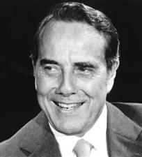
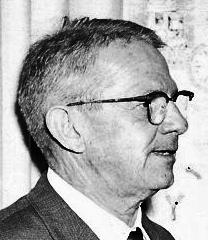
Senator Bob Dole. (Source: U.S. Senate.)
Election year politics continued to frame the issues. Buoyed by the administration’s support for a penny-a-pound tax on sugar, the Save Our Everglades campaign secured enough signatures to get three proposed amendments to the Florida constitution on the November 1996 ballot. One would impose a penny-a-pound tax on sugar grown in the EAA, another would establish the
principle that polluters were responsible for cleaning up their own waste, and the third would create a trust fund for Everglades restoration. The amendments were a bold and unusual step in two respects: they took the matter directly to a vote of the people, and they sought to hold one industry chiefly accountable for the pollution of the Everglades. After George Barley died in a 1995 plane crash on the way to an Everglades restoration meeting, his wife Mary headed the penny-a-pound campaign, using the financial backing of Paul Tudor Jones, the founder and chairman of the Tudor Group of Companies (a money management firm in Connecticut). Jones, a friend of the Barleys who had become interested in Florida’s environmental health, pledged at George’s funeral to pick up the environmental flag. With Jones’ bankroll, Mary’s citizen effort provoked a massive response by the sugar industry, which filed some 38 lawsuits challenging the amendments and spent around $35 million on advertising that opposed the penny-a-pound tax; environmental interests were only able to generate approximately $11 million for advertising. The advertising campaign reached a crescendo on Election Day, when the industry spent more than a million dollars to convince voters that the tax would ruin the industry and eliminate 40,000 jobs. Voters approved two amendments, but they rejected the crucial penny-a-pound tax.58
Environmentalists were not only stung by this second defeat of the tax initiative, some were embittered by what they viewed as a second betrayal by the Clinton administration. Once the Save Our Everglades campaign succeeded in getting the amendments on the ballot, the Clinton administration dropped its own proposal for a penny-a-pound tax on sugar. Ostensibly, the administration wanted to defer to Florida voters on this issue, a natural position, but environmentalists saw in this development the nefarious hand of Big Sugar. They were even more doubtful of the administration after it backpedaled from Gore’s earlier pledge to take no less than 100,000 acres out of sugarcane production and rededicate the land for pollution abatement. Reportedly, the administration modified its position on this matter after another telephone call to the White House by Alfonso Fanjul.59
Embittered environmentalists claimed that the Clinton administration had politicized the planning process initiated by Secretary Babbitt in 1993 in order to win the state of Florida in the election of 1996. They accused Vice President Go re of grandstanding with the “Gore plan” while capitulating to the sugar interests, so that Clinton and Gore could win votes and maintain Big Sugar’s political support.60 In fact, Florida did swing narrowly into the Democratic column in President Clinton’s re-election. It should be remembered that the Florida vote barely tipped to President George H. W. Bush in 1992, and would be so close in 2000 as to confound the national election until the U.S. Supreme Court decided the matter for President George W. Bush. It is impossible to draw a precise connection between Florida’s crucial role in these national elections and the growing willingness by the White House and Congress to invest in Everglades restoration during the 1990s, but the connection cannot be ignored. As EPA administrator Carol Browner observed about the $200 million for Everglades restoration included in the 1996 farm bill, “suddenly, the political stars aligned.”61 The same thing would be said about CERP four years later.
But even with the Clinton administration’s apparent backpedaling, there were glimmers of hope. The U.S. Army Corps of Engineers, for example, had completed the reconnaissance phase of its Restudy of the C&SF Project, declaring in November 1994 that “the fundamental tenet of
South Florida ecosystem restoration is that hydrologic restoration is a necessary starting point for ecological restoration.” Using an environmental evaluation methodology that compared the hydrological effects of different restoration projects, the Corps determined that “the hydrologic function of the historic south Florida ecosystems can be recovered,” and it recommended that it proceed with a feasibility study of the different restoration options that it could pursue.62 Accordingly, the Clinton administration directed that the Corps complete, in the words of H. Martin Lancaster, Assistant Secretary of the Army (Civil Works), “a study to develop a comprehensive restoration plan for South Florida.” This study, Lancaster explained, would try to “determine the feasibility of structural and/or operational modifications to the Central and Southern Florida Project to restore the Everglades and Florida Bay ecosystems.” 63
Congress authorized the feasibility study in the Water Resources Development Act of 1996 (WRDA-96), drafted largely by Michael Davis, Deputy Assistant Secretary of the Army (Civil Works), directing that the Corps develop “a proposed comprehensive plan for the purpose of restoring, preserving, and protecting the South Florida ecosystem,” including ways to protect water quality and to restore water to the Everglades, before 1 July 1999. The legislation stipulated that the Corps work with the South Florida Ecosystem Restoration Task Force (which it formally established) in this study, and it gave the Corps the authority to implement any restoration project “expeditiously” if it discovered that such an undertaking would “produce independent, immediate, and substantial restoration, preservation, and protection benefits.”64 To fund these efforts, the law appropriated $75 million, a large amount for projects that would normally fall under the umbrella of “continuing authorities.” Such continuing authorities were usually capped at $5 million in order to preserve congressional control over them, meaning that it required, in the words of Davis, “some heavy lif ting” on the part of the Corps before Congress would authorize the $75 million. The law also stipulated that non-federal interests share 50 percent in the cost of any restoration effort. Because of these features, and because of the relatively short time span for the study, Davis considered it a “watershed event” that “set the bar high” for future restoration endeavors.65 The South Florida Ecosystem Restoration Task Force agreed, declaring in a 1998 biennial report that WRDA-96 was “an ambitious milestone in the goal of restoring a sustainable South Florida.”66
By 1997, then, several pieces had fallen into place, expediting restoration of the Everglades ecosystem. Federal funding had been provided, both in the Federal Agricultural Improvement
Editorial cartoon from the St. Petersburg Times about Everglades restoration. Used by permission of the St. Petersburg Times.
and Reform Act of 1996 and in WRDA-96. Congress had stipulated that the Corps complete a restoration study by 1999, and had also authorized it to begin restoration efforts that would have a significant effect on the ecosystem. These gains were achieved, in large part, because of the cooperation of federal, state, and non-government interests, largely through the workings of the South Florida Ecosystem Restoration Task Force and the Governor’s Commission for a Sustainable South Florida.
But beneath this veneer of consensus, trouble still brewed, primarily between the sugar industry and environmentalists. Environmentalis t criticism of the 1993 Statement of Principles and the Everglades Forever Act, which were supposed to end Dexter Lehtinen’s lawsuit, upset sugar magnates who had compromised to get them enacted, and these hard feelings were intensified by the environmental community’s efforts to enact the penny-a-pound sugar tax. Sugar forces, meanwhile, enraged environmentalists by filing new suits against water quality controls and by influencing politicians, including President Clinton, to weaken the industry’s responsibility for cleanup efforts. Because of these conditions, restoration efforts would proceed with some difficulty, even though they now had a level of unprecedented federal support.
Chapter Fourteen Endnotes
1 G. H. Snyder and J. M. Davidson, “Everglades Agriculture: Past, Present, and Future,” in Everglades: The Ecosystem an Its Restoration, Steven M. Davis and John C. Ogden, eds. (Delray Beach, Fla.: St. Lucie Press, 1994), 111.
2 Snyder and Davidson, “Everglades Agriculture: Past, Present, and Future,” 111. For more information on field workers (and for criticism of their treatment), see Wilkinson, Big Sugar
3 Lynn R. Martin and Eugene Z. Stakhiv, Sustainable Development: Concepts, Goals and Relevance to the Civil Works Program, IWR Report 99-PS-1 (Alexandria, Va.: Institute for Water Resources, Water Resources Support Center, U.S. Army Corps of Engineers, 1999), 3-5.
4 “President’s Council on Sustainable Development, Overview” <http://clinton2.nara.gov/PCSD/ Overview/index.html> (1 September 2005).
5 F. Douglas Muschett, ed., Principles of Sustainable Development (Delray Beach, Fla.: St. Lucie Press, 1997): 53-57.
6 Rodgers, “The Miccosukee Indians and Environmental Law,” 10924.
7 As cited in “Everglades Plan Comes Under Fire,” National Parks Magazine 67 (September/October 1993): 10.
8 Department of the Interior News Release, 13 July 1993, File Pro Ever Everglades Restoration History, Box 21213, SFWMDAR; The Tampa Tribune, 15 July 1993.
9 The Miami Herald, 14 July 1993.
10 Statement of Principles, 13 July 1993, File Pro Ever Everglades Restoration History, Box 21213, SFWMDAR.
11 Statement of Principles.
12 Environmental groups had practical as well as philosophical reasons to be mistrustful: in their public service role as watchdogs over government regulatory agencies, environmental groups needed hard target levels to help them monitor the government’s job performance.
13 Everglades Coalition to Bruce Babbitt, Secretary of the Interior, 30 July 1993, in House Subcommittee on Oversight and Investigations and House Subcommitee on National Parks, Forests and Public Lands, Committee on Natural Resources, and House Subcommittee on Environment and Natural Resources, Committee on Merchant Marine and Fisheries, Florida Everglades Ecosystem, 103rd Cong., 1st sess., 1993, 461-465; Sun-Sentinel, 13 July 1993; Mark Derr, “Redeeming the Everglades,” Audubon 95 (September/October 1993): 130.
14 Browder interview, 7.
15 All quotations in The Miami Herald, 14 July 1993; see also Browder interview, 7; Grunwald, The Swamp, 298.
16 Sun-Sentinel, 13 July 1993.
17 Browder interview, 7; The Tampa Tribune, 15 July 1993.
18 Billy Cypress, Chairman, Miccosukee Tribe of Indians of Florida, to Honorable Harry Johnston, Member of Congress, 9 July 1993, File Everglades Mediation Miccosukee, Box 19706, SFWMDAR.
19 As cited in Rodgers, “The Miccosukee Indians and Environmental Law,” 10918.
20 Billy Cypress, Chairman, and Dexter Lehtinen, General Counsel, “Position Statement Regarding Everglades ‘Statement of Principles,’“ 13 July 1993, File Everglades Mediation Miccosukee, Box 19706, SFWMDAR.
21 “Seminole Tribe of Florida Comments and Concerns with the Everglades Mediation Technical Plan,” 3, File Miccosukee WQ Standards, Box 19706, SFWMDAR.
Chapter Fourteen Endnotes
22 See Gary Barlow, “A Sweet Deal for the Sugar Industry,” In These Times 20 (14 October 1996): 10. For an explanation of general federal policies towards the sugar industry, see Andrew Schmitz and Douglas Christian, “The Economics and Politics of U.S. Sugar Policy,” in The Economics and Politics of World Sugar Policies, Stephen V. Marks and Keith E. Maskus, eds. (Ann Arbor: The University of Michigan Press, 1993), 49-78.
23 Joe Browder, Tom Martin, and Theresa Woody to Everglades Coalition leadership, 7 April 1994, document provided by Joe Browder to author.
24 David Kohn, “Polishing an Ecological Jewel,” Engineering News-Record 231 (9 August 1993): 29.
25 Kohn, “Polishing an Ecological Jewel,” 29.
26 Sun-Sentinel, 10 December 1993; Palm Beach Post, 10 December 1993; Malcolm Wade, Jr., interview by Julian Pleasants, 3 April 2001, 5, Everglades Interview No. 5, Samuel Proctor Oral History Program, University of Florida, Gainesville, Florida [hereafter referred to as Wade interview]; “Discord Swamps Everglades Talks,” Engineering News-Record 232 (3 January 1994): 9; “Everglades Case Heads Back to Court,” National Parks Magazine 68 (March/April 1994): 11-12.
27 Wade interview, 9; Levin, Liquid Land, 211; Joe Browder et al. to Everglades Coalition leadership, 7 April 1994; “Everglades Case Heads Back to Court,” 11; Paul Roberts, “The Sweet Hereafter,” Harper’s 299 (November 1999): 62. Fanjul had Clinton’s ear as well; it was alleged that he talked to the president in February 1996 about a proposed sugar tax, interrupting Clinton’s break-up speech to Monica Lewinsky. Grunwald, The Swamp, 309.
28 State of Florida, Office of the Governor, Executive Order Number 94-54, “Governor’s Commission for a Sustainable South Florida,” Governor’s Commission for a Sustainable South Florida <http://www.state.fl.us/everglades/gcssf_eo.html> (8 September 2005).
29 Whitfield interview, 39.
30 Bonner interview, 4; Carol and Karsten Rist interview by Theodore Catton, 9 November 2004, 2 [hereafter referred to as Rist interview]; Causey interview, 9; Whitfield interview, 39.
31 House, Exchange of Certain Lands in California, 103d Cong., 1st sess., 1993, H. Rept. 103-362; Act of 9 March 1994 (108 Stat. 98).
32 Glynn D. Kay, “Outline of Florida Everglades Legislation,” 20 April 1994, File PRO Ever Everglades Legislation, Box 21213, SFWMDAR.
33 Kay, “Outline of Florida Everglades Legislation,” 20 April 1994; “Governor’s Office: Everglades Bill Summary,” 3 May 1994, File PRO Everglades Forever Act 94, Box 15232, SFWMDAR. The full text of the bill with additional commentary is in House Committee on Natural Resources Subcommittee on National Parks, Forests, and Public Lands, Oversight Hearing on the Land Use Policies of South Florida, With a Focus on Public Lands and What Impact These Policies are Having, 103d Cong., 2d sess., 1994, 119-221.
34 Save Our Everglades, “Everglades Forever Act,” no date, and Florida Audubon Society, The President’s Letter 19 (June 1994), File PRO Everglades Forever Act 94, Box 15232, SFWMDAR.
35 Joe Browder, Tom Martin, Theresa Woody to Everglades Coalition leadership, 7 April 1994.
36 Wedgworth and Miedema interview, 5.
37 See Alfred R. Light, “Miccosukee Wars in the Everglades: Settlement, Litigation, and Regulation to Restore an Ecosystem,” St. Thomas Law Review 13 (Spring 2001): 731-732; Miccosukee Environmental Protection Code, Subtitle B: Water Quality Standards for Surface Waters of the Miccosukee Tribe of Indians of Florida, copy in Miccosukee WQ Standards, Box 19706, SFWMDAR; Sam Poole for Frank Williamson, Jr., to Secretary Murley, Florida State Clearinghouse, 13 October 1997, ibid. The Seminole also adopted its own water quality standards, but since it set phosphorous levels at 50 ppb, it was not as controversial as the Miccosukee code. See Seminole Water Commission, Seminole Tribe of Florida, “Proposed Rules, Water Quality Protection and Restoration; Rules to Carry
Chapter
Out the Federal Clean Water Act and the Tribal Water Code including Water Quality Standards for the Big Cypress Reservation, File Indian Affairs,” Seminole Water Quality Standard Research 94-98, Box 22792, SFWMDAR.
38 The Everglades Coalition, “Past Conferences, 2005” <http://www.evergladescoalition.org/site/ pastconference.html> (13 September 2005).
39 Joseph Browder, e-mail communication with author, 17 November 2004.
40 Save Our Everglades, “Everglades Forever Act,” no date, File PRO Everglades Forever Act 94, Box 15232, SFWMDAR.
41 The Everglades Coalition, “Past Conferences, 2005” <http://www.evergladescoalition.org/site/ pastconference.html> (13 September 2005).
42 Everglades Coalition Meeting Minutes, 13-16 January 1994, document provided by Joseph Browder to author.
43 Save Our Everglades News Release, 26 May 1994, File PRO Everglades Forever Act ‘94, Box 15232, SFWMDAR, Tallahassee Democrat, 31 May 1994; Browder interview, 8.
44 The Everglades Coalition invited Governor Chiles to deliver the keynote address at the coalition’s annual meeting in January 1995, despite its condemnation of the Everglades Forever Act less than a year earlier.
45 Office of the Governor, Save Our Everglades: A Status Report by the Office of Governor Lawton Chiles (n.p., 1994), 6-7.
46 As reported in Victoria Myers, “The Everglades: Researchers Take a New Approach to an Old Problem,” Sea Frontiers 40 (December 1994): 15. For more information on this study and on its findings, see Mark A. Harwell, “Ecosystem Management of South Florida,” BioScience 47 (September 1997): 499-512. Harwell was the chair of the Man and the Biosphere Program Human-Dominated Systems Directorate.
47 “Interagency Florida Bay Science Plan,” March 1994, Billy Causey’s Task Force Files, FKNMSAR.
48 As quoted in Elizabeth Culotta, “Bringing Back the Everglades,” Science 268 (23 June 1995): 1688.
49 Rist interview, 2-3.
50 All quotations in Culotta, “Bringing Back the Everglades,” 1688.
51 Levin, Liquid Land, 212.
52 “The Florida Everglades, River of Money,” The Economist 362 (30 March 1996): 32.
53 Quotations in Federal Agricultural Improvement and Reform Act of 1996 (110 Stat. 888, 1022-1025); see also Kim O’Connell, “Gore Unveils Everglades Plan,” National Parks 70 (May/June 1996): 13-14.
54 Harvey Wasserman, “Cane Mutiny,” The Nation 262 (11 March 1996): 6.
55 As cited in Paul Roberts, “The Sweet Hereafter,” Harper’s Magazine 299 (November 1999): 62.
56 Peter Katel, “Letting the Water Run into ‘Big Sugar’s’ Bowl,” Newsweek (4 March 1996): 56.
57 “The Florida Everglades, River of Money,” 32.
58 Gail DeGeorge, “Big Sugar is Bitter over the Everglades,” Business Week (4 November 1996): 192; Levin, Liquid Land, 216; Grunwald, The Swamp, 308-309; Reed interview, 7.
59 Levin, Liquid Land, 214; Michael Grunwald, “When in Doubt, Blame Big Sugar,” The Washington Post, 3 November 2004.
60 Big Sugar’s influence on the White House was not just direct; it also came through Florida politicians whose own re-election chances depended on Big Sugar’s continued campaign funding support.
Chapter Fourteen Endnotes
(continued)
61 Browner quoted in “The Florida Everglades: River of Money,” 32.
62 U.S. Army Corps of Engineers, Jacksonville District, Central and Southern Florida Project, Reconnaissance Report, Comprehensive Review Study (Jacksonville, Fla.: U.S. Army Corps of Engineers, Jacksonville District, 1994), EX-1 – EX-4, 223-231.
63 House Committee on Transportation and Infrastructure Subcommittee on Water Resources and Environment, Water Resources Development Act of 1996: Hearings Before the Subcommittee on Water Resources and Environment, Committee on Transportation and Infrastructure, House of Representatives, 104th Cong., 2d sess., 1996, copy at <http://web.lexis-nexis.com.weblib.lib.umt.edu:2048 /congcomp> (3 January 2006).
64 Water Resources Development Act of 1996 (110 Stat. 3658, 3767-3768).
65 Michael Davis interview by Theodore Catton, 21 December 2004, 1-2.
66 “Maintaining the Momentum: South Florida Ecosystem Restoration Task Force Biennial Report to the U.S. Congress, Florida Legislature, Seminole Tribe of Florida, and Miccosukee Tribe of Indians of Florida,” Draft, December 1998, 1, File Administrative, 1998, FKNMSAR.
The Presidents: Jimmy Carter
FACES ON THE FRONTIER
FLORIDA SURVEYORS AND DEVELOPERS IN THE 19TH CENTURY
by Dr. Joe Knetsch
CHAPTER 14
IMPOSSIBILITIES NOT REQUIRED: THE SURVEYING CAREER OF ALBERT W. GILCREST
For surveyors, simple instuctions can be deceiving. A basic order to follow along the line of “mean high water” in the meandering of a beach appears straightforward. It is clear, perspicuous and concise. What instruction could be easier to follow? How difficult could it be to determine such an obvious line? In the mangrove and buttonwood jungles of coastal southwest Florida, this simple one line directive could be one of the most difficult assignments given to anyone.
When he signed his contract and posted his bond in June of 1897, U.S. Deputy Surveyor Albert W. Gilchrist had little idea of the difficulties he was about to encounter. This was not because of a lack of knowledge of the terrain he was to traverse and measure. He was very familiar with Sanibel and Captive Islands and the surrounding outcroppings. Gilchrist had already surveyed lands on Gasparilla and LaCosta islands and had a good idea of the labor such a task would involve. What he was not prepared for was the extensive criticism he encountered from the Surveyor General of Florida, his superiors in Washington and some of the very settlers he was attempting to assist. 1
1Gilchrist’s contracts, bonds and some valuable correspondence are to be found in Drawer “U. S. Deputy Surveyors A-H,” File, “U. S. Deputy Surveyor, Albert W. Gilchrist,” Land Records and Title Section, Division of State Lands, Florida Department of Environmental
Protection, Tallahas see, Florida. Hereafter, “Contracts and Bonds file.”
Gilchrist had a great deal of experience in the profession of surveying. After receiving training in the subject at the United States Military Academy at West Point, he returned to Florida and found employment with the Plant System of railroads. From 1882 through much of 1885, he was employed by the system in sur veying routes throughout much of western peninsula of Florida. In the latter year he left Plant to join the staff of the Florida Southern Railroad, which had an agreement with the Plant System not to build a road to Tampa, but instead go further south to Charlotte Harbor.2 By the following year, young Albert Gilchrist was settling down in the new frontier town of Trabue, named for its founder and benefactor, Issac Trabue. Trabue, an attorney from Louisville, Kentucky, had struck an agreement with the railroad to have the terminus of the line at his new town, which he had had surveyed and platted. But trouble soon arose and the inhabitants voted to change the name of the town to Punta Gorda, with Albert Gilchrist at first opposed but later voting with the majority. Setting up shop in the town. young Gilchrist soon had a thriving private business in surveying and real estate. 3
2Vemon E. Peeples, “Charlotte Harbor Division of the Florida Southern Railroad,” Florida Historical Quarterly , 58 (January 1980). Peeples fully explains the events leading to the construction of the railroad to Charlotte Harbor. To date, no one has been able to uncover the documents, if they exist, which show why, how and when the deal was struck between the two systems.
3Vernon E. Peeples, “Trabue, Alias Punta Gorda,” Florida Historical Quarterly , 46 (October 1967), 145.
While his business was beginning to take off, his political aspirations suffered their first setback in the first elections of Punta Gorda. Gilchrist ran for the office of mayor in the shadowy election of October 1887. W. H. Simmons, the town’s first mayor, defeated him. One of the main reasons for this defeat may have been his hesitation to vote on the name change. 4 The loss of this office did not dampen his enthusiasm for office holding and he was soon to be back in the thick of local politics.
4 Ibid , 145.
On December 6, 1887, he wrote to Surveyor General William Bloxham, the former governor, for permission to survey an uncharted island in Section 19, of Township 44 South, Range 22 East. In a rather unusual arrangement with Dr. Issac A. Silcox, his employer, he advised Bloxham that, “I understand he will be paid in land warrants, which he can turn over to me as payment for my services.” This is the area now known as Josselyn Island, of the coast of Big Pine Island. 5 In March of the following year, Gilchrist surveyed lands on Gasparilla Island and made some keen observations that put the Surveyor General’s Office on notice that something was amiss. On March 25th, he wrote, “The plats at Gainesville, U. S. Land Office, shows the northern part of Gasparilla, unsurveyed. Section 4, T. 43 R 20 E is the most northerly point represented on the Island. Will you please send me a plat of the Island north of Section 4 in T 42 R 20, and the adjacent Islands … There are numbers of surveys down here requiring careful work. I would ask if you [illegible] not appoint me Deputy U. S. Surveyor.” By which he meant, obviously, that he did want the position. Curiously, the Surveyor General’s Office replied that, “Our maps do not show any Survey of northern part of Gasparilla Island in 42/20. Survey stops off at line starting between Township 42 & 43 S.” 6 The Surveyor General, however, could not allow Gilchrist to make the surveys needed to answer the wishes of the inhabitants of Gasparilla or any other islands along the coast because the Commissioner of the General Land Office in Wash ington had issued a stop order for all further surveys of these islands. Gilchrist implored Bloxham to write the GLO and ask for a reconsideration of this policy. As he noted, “I would note that our country is rapidly settling up, owing to the advent of the R. R. There are numbers of Islands occupied by citizens, who are anxious to secure their land titles and are willing to pay for the survey. The action of the Commissioner in ordering no more surveys of Islands works an unjust hard ship on our locality and Charlotte Harbor Bay in particular. 7 ”
5 Miscellaneous Letters to Surveyor General , Volume 13, 388. Letter of 6 December 1887, Gilchrist to Bloxham. Land Records and Title Section, Division of State Lands, Florida Department ( Environmental Protection, Tallahassee, Florida. This collection of bound letters is very extensive and is not indexed. All of the letters in the volumes are originals, however, because of their fragile nature, micofilm copies are used and open to the public. Hereafter, MLSG , volume number and page number (if available).
6 MLSG , Volume 14, 66. Letter of March 25, 1888. Gilchrist to Bloxham.
7
MLSG , Volume 14, 88. Letter of April 16, 1888. Gilchrist to Bloxham.
The surveys of the islands in Charlotte Harbor would be a major challenge to the former Gadsden County resident who was born just three years prior to the outbreak of the Civil War on January 15, 1858, in Greenwood, South Carolina, his mother’s family home. The son of the prosperous farmer, William E. Kilcrease— note difference in name’s spelling— young Albert did not have the opportunity of knowing this strong-willed man for very long. His father passed away in May 1860 and the wealth he had amassed soon vanished as the Confederate dollar became worthless. Like most Gadsden residents, Albert and his mother, Rhoda, saw the residents of the wealthiest county in Florida sink rapidly into debt, depres sion and destitution. Only through the local political connections did Albert find his way into West Point, where he began the studies that led to the profession of surveying. 8 For Gilchrist, who lived through Reconstruction Florida and who made a habit of taking up large challenges, the surveys of the rugged coastal islands of southwest Florida were to be one of his toughest of his life.
8For the best study of Gilchrist’s life to date, see Ric A. Kabat, “Albert W. Gilchrist: Florida’s Progressive Governor,” (Unpublished Masters Thesis, Florida State University, Tallahassee, Florida. 1987). Kabat’s interest is in Gilchrist’s political career and his work is very strong on this aspect of his subject’s life. There is little mention of his career in the surveying profession. Pages 7-28 discuss the family background and his early education.
The islands had been reserved for possible military use prior to the Civil War and not until 1885 were some of them released for sale and homesteading. Sup posedly the larger islands of Pine, Gasparilla, LaCosta, Sanibel and Captiva were surveyed in the early 1870s by Horatio Jenkins, a carpetbag politician who had prospered as part of the political machine in Duval County. His abilities as a poli tician far outstripped any he possessed for surveying. Modern surveyors up and down the west coast of Florida have constantly reflected upon the poor quality of his work. This frequent criticism is an echo of the words written by A. W. Barber, Examiner of Surveys, when he wrote, “the original survey of 1875 was grossly inaccurate and largely fraudulent; the section lines exist only on paper, by protrac tion.” 9 Faced with having to deal with fraudulent surveys and nonexistent lines. Gilchrist was sorely tested as a professional surveyor.
9
“Examinations of Surveys,” Record Group 49, National Archives, Washington D.C. “Field Notes of the Examination of Surveys (Florida)…as Examined by A. W. Barber. December 31, 1899 – Janu ary 19, 1900.” Hereafter, “Barber Examination.” My comments concerning modern criticism of Jenkins’ surveys comes from my seminars on the history of surveys and surveying in Florida. Many of my students, all of whom are professional land surveyors have commented negatively and given first hand illustrations of the poor work. Especially helpful in this regard are the numerous discussions I have had with Mr. Jeff Cooner and his colleagues at Johnson Engineering of Fort Myers, Florida, whom I wish to acknowledge for their time, efforts and documentation.
He did not always have the cooperation of the established settlers in the region when he attempted to find the lines or survey their property. Some, like C. W. Wells of Lacosta, stated, “The was som surveyors down Hear Surveying and claimed tha Could not be any lines as proof to the Island ever bin surveyd and also got up a pertition for a resurvey of the Island Since then I have found the Lines and witness trees Thear is No use of a resurvey of the land a gain it will just cause Confusion and do no good.” 10 Fellow surveyor G. H. Milman who homesteaded on Sanibel, confirmed the fact that the lines did not exist and wanted the islands resurveyed for proper legal descriptions. He, too, noted the lack of quality of the Jenkins surveys, “I wish to call your attention to the fact that the survey of Sanibel Island (recently thrown open to homestead entry) in Tp. 46 S., Ranges 21, 22 and 23 E., Florida, made by Horatio Jenkins, Jr. D.S. in 1875 is utterly fraudulent and to the effect such fraudulent survey is having upon parties now seeking to enter homesteads upon this island.” 11 Partisan politics also complicated any discussion of these surveys and Republican C. W. Wells accused Democrat John Crawford of helping his political colleagues in Gainesville reject his claims on LaCosta. He went so far as to blame local political pressure for forcing him off this land and resettled in Leesburg, where he anxiously awaited the return of the Republicans to power. 12 Gilchrist, a staunch and relatively conservative Democrat, might have been the surveyor alluded to in these tirades.
10 MLSG , Volume 14, 186. Letter of July 10, 1888. C. W. Wells to Bloxham.
11 MLSG , Volume 14, 296. Letter of December 26, 1888. Milman to the Commissioner of the Gen eral Land Office, Washington D.C.
12 MLSG , Volume 16, 305-06. One letter undated and the other dated August 21, 1890. C. W. Wells to “Surveyor General of Lands.”
Albert W. Gilchrist did not just survey the islands of Charlotte Harbor. In the early 1890s, his work carried him to nearly every corner of DeSoto County and parts of neighboring Lee County. These were prosperous times in DeSoto County because of the discovery of pebble phosphate in very large quantities in the bed of Peace River, the largest tributary to Charlotte Harbor. Arcadia and the surround ing settlements took on aspects of boomtowns. Land was in great demand and with this came the demand for more surveys. Gilchrist was busy enough to open a second office in the Bank Building in Arcadia in addition to his Punta Gorda office in the Southland Block. The letterhead on his office stationary, obviously used for letters to potential buyers, noted that the total commerce for Punta Gorda in 1887 was $50,000 but it had, by 1893, risen to $2,000,000. 13 These figures represented the influence of phosphate mining and the shipment of ore out of the Florida Southern Railroad terminal in Punta Gorda. It also represented the continued export of cattle from the rich range lands of DeSoto and southern Manatee counties. Gilchrist and his various associates were in the middle of all of this activity.
13Florida Department of State, Division of Archives and Records Management. Record Group 593, Series 914. Correspondence of the Secretary of the Board of Trustees of the Internal Improve ment Trust Fund. Carton 51, Folder “G” 1894. Letter of October 26, 1894. Gilchrist to Louis B. Wombwell. This letter has the map/promotional information on the back. Carton 48 (Same Series), Folder “G” 1891, contains letters with the letterhead referred to in the text. This tells the locations of Gilcrist’s offices.
During this period, Albert W. Gilchrist also platted out numerous settlements and subdivisions, including the Gilchrist Subdivision in Arcadia. According to the calculations of Ric Kabat, whose work is the most usable biography of Gil christ we have, Gilchrist in 1891 alone sold 144 parcels of land and purchased seventeen others. In the course of his business as a real estate broker, he was involved in 1,105 transactions in DeSoto County alone, as evidenced by the large amount of correspondence found in the State Archives and the Land Records and Title Section of the Division of State Lands. 14 In 1893, he became involved with an attempt to charter and form the South American and International Railroad. John W. Whidden of Arcadia and James G. Gibbs of South Carolina, who was probably his stepfather or first cousin, assisted him in this venture. The scheme was to connect Charlotte Harbor with Columbia, South Carolina, through many
interconnecting railroads. 15 However, this plan did produce any results. The con tinued growth of the land business meant that he had more than enough to keep him occupied.
14Kabat, 30-31.
15Florida State Archives, Record Group 593, Series 914, Carton 51, Folder “G” 1894. Legal sized sheet with the charter and questions at the bottom. No date is affixed to the document.
Gilchrist also found time to serve in the State Legislature during this period. He was elected to the House of Representatives in 1893 and 1895, but was defeated for re-election in 1897, mostly because of his lack of sympathy with the plight of the farmers. He was a staunch conservative Bourbon Democrat and opposed the currency reforms proposed by the Silver Democrats and Populists. As a real estate agent, he believed in a hard currency, namely gold, and was not infatuated with the inflationary schemes to freely coin silver. While in the House of Representatives, he stood for closing of saloons on election days, indexing real estate deeds, requiring complete abstracts for all property and taxation for school sub-districts. In his second term, he voted for the railroad commission. Prior to his service in the legislature, he had served on the county board of health and, more importantly, had been appointed first colonel and then brigadier general of the Florida Militia. He held the latter post until 1901. 16
16Kabat, 32-44.
Beginning in 1893 and little known to Gilchrist, the settlers on Sanibel had begun the process of getting their island resurveyed. In early March of that year, they sent a petition to the Surveyor General of Florida John C. Slocum requesting that the work be done. When they had not received a reply, one of them, T. H. Holloway of St. James City, wrote to Slocum noting “it is pretty hard to be compelled by law to live on a piece of land & not know where it is. I have build & made other improvements on what is supposed to be my land but there is no man living can say it is mine.” 17 Within the next few years, they were to get their wish.
17MLSG, Volume 17, No page number. Letter of 22 May 1893. T. H. Holloway to J. C. Slocum.
Faces on the Frontier
The gentleman assigned to the task of re-surveying Sanibel and Captiva was Albert W. Gilchrist. It is doubtful that on the day he signed his contract and bond. Gilchrist would have ever dreamed of the problems he was to encounter. He left his office on June 20, 1897, and headed to Sanibel by the morning steamer. Because of the well-known problems with the Jenkins surveys, he requested that the Surveyor General send him specific instructions as to how to start the survey. As he stated the problem to the Surveyor General W. H. Milton:
As to the location of the lines as regards the points and natural features as shown especially on the Harbor side, there distances, I am satisfied, though shown to be regularly chained, are irregular. I have checked enough of this man’s work on LaCosta and Gasparilla Islands to know this. If these points are to be fixed as the appear on the map, regardless of where they are but to come, it would pay me to traverse that side before I attempted to connect them by Section lines. I have hear that this was measured by counting the strokes of the oar. On some parts of La Costa this was not even done. You can easily verify this by compar ing the map with the coast chart 175 , the chart is accurate, the map is not. 18
18 MLSG , Volume 21, 213-14. Letter of 20 June 1897. Gilchrist to Milton.
Gilchrist soon received the instructions, which may not have given him as specific instructions as he deemed necessary. He continued to note for the benefit of the Surveyor General the false and inaccurate nature of the Jenkins work. These warnings should have told that gentleman that many of the marks supposed to be on the land, including meander corners, simply were nonexistent. The signs were there for those who wished to read them, however, it appears that the Surveyor General was not one of that number.
On June 28, he left for Pine Island to commence the work there in preparation for continuing the lines on Sanibel. He immediately noted that corners were miss ing and bearings and distances not given. The notes for the meander and triangulation of Section 13 of Township 46 South, Range 22, he complained, were omitted. How could he successfully begin the survey if the lines and bearings were not available? On July 6 he wrote Milton that he had made two triangulations from Sanibel to Pine Islands, but, that the
The Florida Surveying and Mapping Society has an eLearning Platform that is now linked to your FSMS membership account.
When accessing the eLearning platform, use your FSMS membership username (Not Available for Sustaining Firm Memberships) and password to log in. As always, Correspondence Courses are available by mail or email.
Updated Correspondence & eLearning Courses:
• Writing Boundary Descriptions
• Basics of Real Property
• Map Projections and Coordinate Datums
• Elevation Certificates and the Community Rating System
• Datums (eLearning Video Course)
• FL Surveying and Mapping Laws
CHECK YOUR CREDITS HERE
bearings given by the old survey for these lines were wrong. “It is impossible,” he said, “for a line to be run from this Island to Pine Island with such Easting and Southing or Westing and South ing. My only recourse is to erect the M.C. for Secs 13 T 46 S R 22 E & 18 T 46 S R 23 E. by the points of land.” The erection of a new meander corner in place of those allegedly set previously was not within the scope of his instructions. He continued, in this letter, to complain of the lack of notes for the setting of these corners and the running of various lines from them.19
19 MLSG , Volume 21, 214-7. The page numbers in this volume were changed, by hand, over time and appear to have begun in the middle of this letter. Letter of 6 July 1897. Gilchrist to Milton.
As if the problems of a lack of information were not enough, the rainy season began in the first part of July 1897. Writing to Milton on July 10th, Gilchrist noted:
I am getting along fairly well. A storm is now raging, commencing night July 8. mosquitoes are of course not bad during the storm. One of my men expressed the status fairly at Pine Island when he said if you would swing a bucket around your head, it would be full of mosquitoes. The rainy season is certainly upon us. An ordinary rain we do not mind, but there is now a regular storm raining almost continuously for nearly 3 days with a howling wind. The work is tedious owing to the inaccu racy of original Survey. Only about l/3 or 1/4 of these lines were ever run … . The chances are that he crossed over in an open space and set the corners from the Gulf, avoiding the mangrove swamps. No posts where there is mangrove growth can be set at mean high water because mean high water is often a mile from shore, nor can any meander line be run at mean high water along the mangroves. It would take 5 men a week to cut a line in red mangrove bordering the low beach. Such lines can only be run on the edge of the water bordering the mangroves. As soon as the storm is over I shall run over to the Gulf Beach, cutting through the Island, down the Range line. 20
20 MLSG , Volume 21, 8. Letter of 10 July 1897. Gilchrist to Milton.
Although very truthful in his description of the difficulty of running a line through red mangroves, the surveyor general was not satisfied. The instructions specifically stated that the line would be run at mean high water and that was that, no matter the difficulty in determining or cutting said line.
Gilchrist also saw that by continuing the line projected from Sanibel to Captiva, there would be a “jog” in the line. He noted too that the Surveyor General had already anticipated this problem. He recommended that the survey be stopped at Blind Pass and not continued to the north on Captiva, LaCosta and Gasparilla. Bluntly stating his position, “So much of the survey as affects said Islands I would recommend be thrown away, as that can not be continued on Captiva, Lacosta and Gasparilla.”21 Upon finding part of the range line, the surveyor continued on toward the meander of the beach on the Gulf side and, unexpectedly, found the lines to be east of the best topographical features by nearly 3/4 of a mile. Finally, he again urged that the survey be stopped at the northern end of Sanibel, and not be carried over to Captiva. The only positive sign arising from the survey was the discovery of an abundance of sea grapes, which he thought, “would make a fine wine.” 22
21 MLSG , Volume 21, 18. Letter of 21 July 1897. Gilchrist to Milton.
22 MLSG , Volume 21, 32. Letter of 4 August 1987. Gilchrist to Milton.
Toward the end of August, Gilchrist had reported that the survey of Sanibel was nearly complete and that he had delayed sending his returns because of the press of other business and a two-week illness. The excess of time beyond the deadline he explained by the fact that an error in the original survey had thrown his crew off several miles. The errors in the meandering, he maintained, also caused the excess of mileage to be thrown into the next township, which meant that the entire line had to be re-run to discover the error. This error, once discovered, led to a re-running of the boundary line, which meant that G. M. Ormsby, an early Sanibel settler, was not in any defined township and his property descrip tions were invalid. The misidentification of Palmetto Key also added confusion and delayed the finish of the survey. For all of this work and calculation, the sur veyor put in a bill for $566.83, which was more expected. 23
23 MLSG , Volume 21, 51, 89.
Confusion relating to the instructions for filling out the required forms and in the proper manner also delayed the final submission of the work for review. Again the Surveyor General questioned the surveyor closely on the existence of the former survey lines depicted on the earlier returns. And, again, Gilchrist pointed out the essential problem of the Jenkins surveys:
I would state that there is now no line of the original Survey in exist ence and from all appearances and from the statements of the settlers, there never was any such line. In reference to all the work done under Jenkins’ Contract, it is safe to say that no man, on Sanibel, Captiva, La Costa or Gasparilla Islands has ever seen an old government line on any of these Islands. I own much land on Gasparilla Island. I have worked on it for land lines, I have never seen one, and I do not know, ever, had I ever heard of a man who has ever seen any such line on it. I have worked on La Costa Island, I have seen several of its settlers. I know of no such lines there.
He went on to state with great certainty that no lines had ever been found by any of the settlers of those islands. He also complained, though tactfully, that the instructions to run a line from one island and continue it on the next through trian gulation was risking imperfect lines and endangering the property of the settlers. 24
24MLSG, Volume 21, 128. Letter of 8 November 1897. Gilchrist to Milton. This is the last letter between these two men. Milton was replaced by R. L. Scarlett before the end of December.
When R. L. Scarlett became Surveyor General for Florida in December 1897, Gilchrist immediately tried to acquaint him with the problems of the Jenkins sur veys and to justify his actions in running the lines. He also tried to inform the new man about the conditions under which a surveyor worked in South Florida during the summer season:
Being far off from communication and knowing the survey had to be finished up, I completed the work at my own risk. Besides, in the Summer time, with rains, myriads of mosquitoes and sand flies, mud
10 to 12 inches deep, then was the time to get them [illegible] it, while I was hardened to it. Instead of diminishing the amount, if there is any way of estimating what a hell, the foregoing combination will make, I hope the estimate will be increased by the addition of the “connecting lines,” heretofore mentioned for which no estimate is submitted.
Significantly, Scarlett recommended that the amount submitted for payment be reduced. This response began to set the tenor for the next group of letters to pass between the two men. 25
25MLSG, Volume 21, 162 1/2. (6 page letter) Letter of 7 December 1897. Gilchrist to Scarlett.
With his large number of investments and other commitments, Albert Gilchrist became impatient with the Department of Interior’s slowness in payment. On February 5, 1898, he wrote to Scarlett requesting information about when he might be receiving even a partial payment for the work performed. 26 By the time Scarlett got around to answering this question, numerous settlers on Sanibel including the Lee County Surveyor, were beginning to question the validity of the work. The population of the islands began to rise rapidly and knowledge of where exactly the lines were was becoming crucial. Again the Jenkins surveys came to the forefront of the discussions. In a letter of August 2, 1898, Captain Sam Ellis wrote that he had been informed by J. Jenkins, Jr. of Tallahassee who had been one of the crew on Horatio Jenkins’ survey that “the surveys were made about 28 years ago on Sections 23 and 24 on Tarpon Bay by simply counting the strokes of an oar allowing 3 ft. to each stroke, and the map shows the land one mile too far west. Where the map is marked land there is water, and where marked water there is land.” 27
26 MLSG , Volume 22, 207. Letter of 5 February 1898. Gilchrist to Scarlett.
27 MLSG , Volume 22, 25. Letter of 2 August 1898. Samuel Ellis to Scarlett.
By early September 1898, Scarlett was searching for Gilchrist. The exact location of the surveyor was necessary for him to make necessary corrections in the field notes and vouchers. However the chances of the Surveyor General finding him near Charlotte Harbor were slim, since Albert
Faces on the Frontier
Gilchrist had enlisted in the Army to fight in Cuba and was, at that moment, at Guantanamo, Cuba. Gilchrist had enlisted as a private, but was quickly promoted to lieutenant and then captain. Scarlett, who thought Gilchrist was jumping ship to avoid having to make the cor rections began taking a very belligerent tone in his letters to the surveyor. Scarlett was to the point of demanding that the officer abandon the Army to finish out his contract. From the hills below Santiago, Gilchrist replied, “Under no circum stances could I leave in the face of the enemy, if we had one, or in the face of an epidemic, never. I have waited nearly a year on your Department [through] no fault of yours or your deputy, and I trust you will wait on me, especially as I am here in the government employ.”
28 Scarlett did not appreciate the pointed references to the slowness of the government’s reply. When Gilchrist wrote him on December 18 explaining the nature of surveying in the mangroves and the near impossibility of chaining in the morass while wading in chest high water to find the line of mean high water, the only response, written on the face of the sur veyor’s letter, was, “Merits no response.” 29
28 MLSG , Volume 22, 79. Letter of 2 October 1898. Gilchrist to Scarlett.
29 MLSG , Volume 22, 218. Letter of 18 December 1898. Gilchrist to Scarlett.
Scarlett was furious with his deputy and was not about to have his bureaucratic power flaunted. The situation had reached an impasse. Into the foray stepped an old political acquaintance of Gilchrist’s, United States Senator Sam Pasco of Flor ida. Pasco’s letter to Scarlett, dated February 17, played down the alleged “objec tionable” tone of Gilchrist’s reply, and reminded the Surveyor General that the deputy was in the service of his country and therefore, “it is proper to grant all possible indulgence to those who have taken up arms in defense of the country during the period of war.” 30 Pasco’s gentle pressure may have been the turning point in the relationship between Gilchrist and Scarlett, especially after the Senator noted that he had contacted the Commissioner of the General Land Office, who was Scarlett's boss. 31
30 MLSG , Volume 22, 53. Letter of 17 February 1899. Sam Pasco to R. L. Scarlett.
31 MLSG , Volume 23, 41. Letter of 6 February 1899. Pasco to Scarlett.
By May of 1899, the furor seems to have passed and Gilchrist was back on the job, attempting to find the nonexistent lines on Captiva Island. To do this, he had to retrace the lines and “locate [them] where [they] should have been put.” He requested the field notes for Captiva and began to get the corrections made. 32 Gil christ made the necessary corrections by the end of June, 1899 and filed for the payment due him for the original work. Yet before final payment could be made. the government sent down an inspector, A. W. Barber, to investigate the situation. Barber brought with him a new camera to take pictures of the mangroves that had so much delayed the work and had been the point of contention in running the mean high water line. In his report, Barber noted the controversy:
In his original returns he stated that he had to either run outside in the water or back in dense brush almost impassable, so he went outside. The Surveyor General was disposed to think this was inexcusable, and a sharp correspondence ensued over it. I assured the Deputy that the Department did not require impossibilities, and that the meandered shore line was not regarded as a strict boundary of the lots; and that his method would receive no further criticism…In conclusion, I cannot see how Dep. Gilchrist can have made any profit on this work, and he certainly has not intentionally slighted it in any respect. The accounting officers will only do justice to his good faith if the allow compensation for his patient searches and retracements, on a liberal basis. I think the survey should be accepted as now made; and that the Surveyor General should first be directed to make the lottings of the sections conform to the diagram furnished by the joint action of the Deputy and myself. 33
32 MLSG , Volume 23, 188. Letter of 28 May 1899. Gilchrist to Scarlett.
33Barber’s Examination, 1. The photographs tell the story and show a nearly pristine Sanibel shoreline in 1900.
Barber’s report had worked wonders for Gilchrist’s esteem and smoothed the way between the two men. Indeed, Scarlett even offered a contract for surveying St. Andrews Bay to his former antagonist, but, because of other commitments, Gilchrist had to refuse.
After beginning his work in 1897, Albert W. Gilchrist, whose future as gover nor of the State of Florida still awaited him, finally got paid for his surveys of the islands in Charlotte Harbor. Writing to Scarlett on March 21, 1901, Gilchrist hap pily pronounced “I have re’cd the joyful news that I will be paid for the excess of my contract with the Gov. I feel very grateful. I thank you and the others who rec ommended it. Very Truly, Albert W. Gilchrist.” 34
34 MLSG , Volume 25, no page number. Letter of 21 March 1901. Gilchrist to Scarlett.
It would be interesting to speculate just what the last thoughts of Governor Gil christ were on May 16, 1926, when he breathed his final gasp, however, one may venture the idea that his surveys of Charlotte Harbor may have been among them. After all, he had attempted the impossible.
Next Month …
CHAPTER 15
HAMILTON DISSTON AND THE DEVELOPMENT OF FLORIDA
Joe Knetsch has published over 170 articles and given over 130 papers on the history of Florida. He is the author of Florida's Seminole Wars: 1817-1858 and he has edited two additional books. Faces on the Frontier: Florida Surveyors and Developers in 19th Century Florida is a history of the evolution of surveying public lands in Florida and traces the problems associated with any new frontier through the personalities of the majort historical figures of the period. As the historian for the Division of State Lands, Florida Department of Environmental Protection, he is often called to give expert witness testimony involving land titles and navigable waterways issues.
SUPPORT FSMPAC TODAY!
Your contribution can make a monumental difference in ensuring that our profession thrives and our voices are heard where it matters most.
Join FSMPAC and become a driving force for the future of Surveying & Mapping in Florida.
FSMPAC, the Florida Surveying & Mapping Political Action Committee, is your ticket to shaping the future of our profession. Our mission thrives on the generosity of dedicated Surveyors and Mappers who want to champion and safeguard our profession.
Your contributions go toward researching, identifying,and supporting candidates who champion our concerns.
Le arn More & Donate Here
PRECISION BEYOND BOUNDS
FRONTIER PRECISION UNMANNED SOLUTIONS
Frontier Precision has been leading the way in delivering innovative solutions – on land, air and underwater with our Unmanned technology. Now, every place on earth is reachable – with our UAS/ Drones, ROV’s, and LiDAR solutions. We help you with the latest technology to get your job done efficiently while keeping your business profitable.
UAS / DRONE DOCKS
The latest innovations in drones and docks to deliver the right product for the right UAS application.
LIDAR / SENSORS
LiDAR/Sensor solutions designed for precision data collection.
UNDERWATER ROVS
Deep Trekker’s underwater ROVs showcase proven durable and innovative solutions.
FRONTIER PRECISION | JACKSONVILLE, FL
Jordan Baranowksi | 904.855.9827 [Office] or jordanb@frontierprecision.com
FIND OUT MORE AT: www.frontierprecision.com/unmanned
ARCHIVES FROM THE
SCENES IN A SURVEYOR’S LIFE ; OR
A
RECORD OF HARDSHIPS AND DANGERS ENCOUNTERED. AND AMUSING SCENES WHICH OCCURRED, IN
THE
Operations of a Party of Surveyors IN SOUTH FLORIDA .
By W. L. PERRY.
JACKSONVILLE:
C. DREW'S BOOK AND JOB PRINTING OFFICE 1859.
CHAPTER XV
R alf , Sile, Tap, Shepley, and myself, started at break of day, on the morning following our fire-hunt, to look for the crippled deer.
On reaching the spot, which we had marked, by blazing a number of trees, we found, from the blood on the grass and other signs, that he was badly wounded, and, in all probability, but a short distance off, dead. We had Bull tied by the neck, and when we put him on the track, he led off in a southerly direction, with such eagerness that it took two of us pretty hard pulling to hold him back.
After following the trail for a mile, expecting every moment to come upon the venison, we came to a small lake, about three hundred yards across, in the center of which was an island about one-fourth of an acre in extent, and, as we saw the tracks of the wounded deer leading into the water in that direction, we concluded he must be on the island. I told the boys to take their stands at equal distances apart, around the lake, so as to cut him off should he attempt to pass out to dry land; and if he seemed to be pretty badly crippled, to meet him in water deep enough to give them the advantage; and I would take the gun and go upon the island, and if he was not already dead, would either kill him or run him out to some of them.
Waiting until all had reached their places, and giving Bull over to Ralf, I started in. I found the fording pretty deep, as a hundred yards or more of the distance the water was up to my chin. I reached the island, however, in safety, and succeeded in keeping the gun dry.
The bushes were very thick, and I hunted about among them some time before seeing anything indicating the presence of either a dead or
living deer; but I stirred him up at last, and before I could get a chance to shoot, on account of the thick bushes, heard him plunge into the lake, some fifteen yards from where I stood, with the view of reaching the woods in the precise direction in which Ralf was stationed with Bull. I ran out to the edge of the bushes, and saw the large buck making for the shore, then in a direct line between Ralf and myself. Without any idea of shooting, as I knew the shot would be as apt to hit Ralf as the buck, or any other particular object in view, I raised the gun to my shoulder and sighted as if about to shoot. The moment I did so, I was surprised and greatly amused to see Ralf commence a series of springs into the air from the high grass in which he stood, throwing up his arms in the most approved theatrical style, and shouting, at a rate indicating the utmost power of his lungs, “ Hey, Jinx, stop! hold! Hello!—Look out, there! Don ’ t shoot this way; you ’ ll kill me! ”
Without taking any apparent notice of him, I continued very deliberately to sight; and he, supposing there was no chance to avert the shot, fell flat on his stomach in the grass, but not feeling at all secure in that position, remained but a moment, when up he jumped and again commenced his wild shouts and convulsive springs into the air, for the purpose of attracting my attention.
“ Let down that ’ ere gun, I say! ” he yelled. “ Don ’ t you fire—if you do, and don ’ t kill me, it ’ s as much as your neck is worth. Hey! Hello! Thunder and sawdust! Wh-o-o-p-e-e–e! ”
At this interesting point, fearing the buck ’ s attention might be attacted by his outrageous clatter and capering, and turn its course in some other direction, I lowered the gun and shouted to Ralf to make ready to catch the deer whenever it should get into water sufficiently shallow to enable him to manage it easily. He immediately loosed the line from Bull ’ s neck, and both of them started into the lake meeting the buck, and both caught him at a place where the water was about four feet deep, when commenced a fight, by the side of which the Major ’ s memorable adventure in the creek swamp, almost sunk into insignificance.
I saw from my position that the struggle was going to be a deadly one, and as the water was too deep for me to go to him, I shouted to the other boys, stationed around the lake, to run to Ralf ’ s assistance, which they did as speedily as possible. When they reached the spot,
Ralf was so exhausted and torn by the buck ’ s hoofs as scarcely to be able to stand. Bull, however, though nearly as badly used up as Ralf, hung to his hold by the throat, and with the help of the boys just arrived, the buck was soon en route for the camp, strung on a pole.
Late in the afternoon of this same day, while quietly pursuing our business, the Captain accidentally casting his eye up to a hole in a large pine, discovered a bee-tree. As the sun was only about an hour high, and all the hands becoming exceedingly hungry for honey, we concluded to stop and cut it at once, camping there for the night. We laid off our packs, therefore, and went at it at once, so as to get the honey out in time for supper. Tap and Shepley were to cut the tree down, Ralf and I to stop the hole at which the bees passed in and out, and Sile and the Major were to take the honey out. Ralf having a large lightwood torch prepared, and I a bunch of moss to stop the hole, we stood in readiness to perform our part whenever the tree should fall.
The tree had hardly touched the ground when we were there, Ralf burning the enraged bees to death as they came out of their hole in search of some object to vent their spleen upon, and I endeavoring to stop the door, and thus make them prisoners until we were ready to walk into their store of sweetness. We found, however, that this was not so easily accomplished, as there were several holes, and before I could get one of them stopped, the bees were swarming about us as thickly as musquitoes at the Haulover.
As soon as they began to sting pretty freely, Ralf, the rascal, took to his heels with all his might, carrying the torch with him, which, however, he soon put out in the fight, while thumping and slapping about his ears as he ran.
But a minute or two elapsed before some five hundred of them, more or less, had worked their way up my breeches legs, shirt sleeves, and into my bosom, and thence all around my body inside the shirt. In the fight, my hat got knocked off, and probably not less than one or two hundred more entangled themselves in my long, uncombed hair, and each seemed vieing with his neighbor as to the extent of damage he could inflict.
Of course the place soon became too hot for me, and seeing no other chance of getting clear of them, I made tracks, amidst the shouts
of the boys, for an open pond some two hundred yards off, and didn ’ t stop until I entirely disappeared beneath its silvery waves, where I remained as long as possible without coming up to take breath.
Rolling about in the water, and dipping my head under for some time, I went out on shore, took off my breeches and shirt and shook out of them a tolerably sized swarm of the drowned varmints , besides those remaining to be raked out of my hair.
At sunset I returned to camp, finding Ralf and the other boys luxuriating in the fine white-combed honey, and laughing no little at my misfortunes. I slept but little through the night on account of the burning and stinging sensation caused by the bees, and on rising in the morning, found I had a scorching fever, and my eyes both swollen until they were entirely closed, and each lip, at the lowest calculation, an inch thick.
As the reader may very easily imagine, I was not in a condition to do business, and was therefore, left at the camp, with the Major to take care of me, while the Captain and the boys went forward with the work. My fever continued two days without abating, during which time I suffered vastly from the pricking and itching sensation all over my body.
On the evening of the second day the Captain returned to where he had left us, on his way back to camp, as the provisions were running low. After a good night ’ s rest all round, we collected on large pieces of freshly peeled pine bark, the honey taken from the tree, which was no little, and set out for the regular camp.
We reached it in a day and a half, without meeting with any adventure worthy of record, finding Smith well, but, to use his own language, “ shockingly lonesome. ” I, of course, knew how to sympathize with him, as I had myself had some experience, while laid up with a fried foot, in staying by one ’ s self for six, eight, and ten days in those wild, wild woods without seeing a human being; and with nothing to drive away the feeling of loneliness save the deep-toned hoot of the owl perched on some neighboring tree, the dismal howl of the wolf, or shrill scream of the panther, while pursuing his nightly peregrinations in search of his prey. •
Past Presidents
1956 - 1957
H.O. Peters
1960 - 1961
Hugh A. Binyon
1964 - 1965
James A. Thigpenn, III
1957 - 1958
C.
1961 - 1962
Russell H. DeGrove
1965 - 1966
Harold A. Schuler, Jr.
1958 - 1959
P. Goggin
1962 - 1963
Perry C. McGriff
1966 - 1967
Shields E. Clark
1959 - 1960
1963 - 1964
Carl E. Johnson
1967 - 1968
Maurice E. Berry
Harry
Schwebke
John
R.H. Jones
Past Presidents
1968 - 1969
C. Hart
1972 - 1973
Broward P. Davis
1976 - 1977
Robert S. Harris
1969 - 1970
1973 - 1974
E.R. (Ed) Brownell
1970 - 1971
1974 - 1975
E.W. (Gene) Stoner
1971 - 1972
1975 -1976
Lewis H. Kent
Robert W. Wigglesworth
William
Frank R. Shilling, Jr.
William V. Keith
James M. King
Past Presidents
1980 - 1981
Ben P. Blackburn
1984 - 1985
Buell H. Harper
1988 - 1989
Stephen G. Vrabel
1981 - 1982
William B. Thompson, III
1985 - 1986
H. Bruce Durden
1989 - 1990
W. Lamar Evers
1982 - 1983
John R. Gargis
1986 - 1987
Jan L. Skipper
1990 - 1991
Joseph S. Boggs
1983 - 1984
Robert A. Bannerman
1987 - 1988
Stephen M. Woods
1991 - 1992
Robert L. Graham
Past Presidents
1992 - 1993
D.
1995 - 1996
Thomas L.
1999 - 2000 Jack Breed
1993 - 1994
1996 - 1997
R.
- 1995
1997 - 1998
E.
1998 - 1999
Nicholas
Miller
Loren E. Mercer 1994 -
Robert D. Cross
Kent Green
Gordon
Niles, Jr.
Dennis
Blankenship
W. Lanier Mathews, II
Connor
Past Presidents
Stephen M. Gordon
Richard G. Powell
Michael J. Whitling 2007
Robert W. Jackson, Jr. 2008 -
Pablo Ferrari
Steve Stinson
Dan Ferrans 2011
Jeremiah Slaymaker
Ken Glass
Russell Hyatt
William Rowe 2003 -
David W. Schryver
Past Presidents
2015 - 2016
2019 - 2020
2016 - 2017
2020 - 2021
2017 - 2018
2021 - 2022
2018 - 2019
2022 - 2024
Lou Campanile, Jr.
Robert Strayer, Jr.
Dianne Collins
Don Elder
Hal Peters
Lou Campanile, Jr.
Howard Ehkme
Dale Bradshaw
Advertise With Us!
All advertisements contained within the publication are published as a service to readers. Publication of the advertisements does not imply or express any endorsement or recommendation by FSMS.
Benefits: Full color; hyperlinks added to your webpages as well as email addresses.
Requirements: Contracts for one year (11 issues) receive 10% discount if paid in advance; 15% for Sustaining Firms. (Ads should be in jpeg, pdf, or png format)
New ads and/or changes are due by the 25th of each month.
Questions? Call our office at (850) 942-1900 or email at communications@fsms.org