

T he F lorida Surveyor


Call us t o g et your complete work flow solution today ! Efficiency and versatility that will accelerate productivity comes part of a workflow solution that includes the FC-6000 field controller, Magnet software, a HiPer VR receiver and the GT-1200/GT-600 single-operator robotic system. The power of longrange reflectorless measurements comes in your choice of 1”, 2” or 3” GT-1200 models or 2”, 3” or 5” GT -600 models.


A Very Special Thank You to Hal & Beth Peters for their wonderful photography. This year, they had help from a young enthusiast Eli Mattix Donaldson, son of Eli Donaldson. Thank you all so very much! We enjoy seeing what your cameras capture each year.


The F lorida Surveyor is the official publication of the Florida Surveying and Mapping Society, also known as FSMS. It is published monthly for the purpose of communicating with the professional surveying community and related professions who are members of FSMS. Our award winning publication informs members eleven months out of the year about national, state, and district events and accomplishments, as well as articles relevant to the surveying profession. In addition, continuing educational courses are also available.
PRESIDENT’S Message
August 21st, 2024

Members,
First let me say a huge thank you to the membership for entrusting me with this important responsibility for the next year. I feel truly blessed and honored to have been elected President at this stage of my career and want you to know that I am committed to seeing that the Society’s goals and new challenges are not only met, but exceeded in the coming months.
I will do my best in this role to ensure that the Florida Surveying and Mapping Society remains in a leadership position for our profession, and I will be focusing on the following:
1. Protection of the Profession through our Legal & Legislative Committees actions.
2. Assisting in finding new ways to fully Fund and Support our Political Action Committee, for without their help and our Lobbyist Firm, we would be talking about a completely different Society.

3. Being proactive as opposed to reactive to legislative issues from the past year. We will begin by using the collective knowledge and experience of our Board and other members in helping to rewrite parts of our current laws that need fixing and work with our regulatory board to get the proces s started.
4. Meeting, talking with, and encouraging the Geomatics Students at UF, FAU and any other colleges with a Geomatics program, to hear what they have to say, helping them understand what the Society does and can do for them, and encouraging active participation for their future.
5. Finally, but also important, I will be working with and assisting with the new Work Force Development Committee. UF has a new person (Katie Britt
PRESIDENT’S Message
k.britt@ufl.edu ) whose job is to work on this issue. I trust that all of our members will assist her in getting this program up and running.
We had a great Conference in July and based on the attendance and all of the responses from the attendees it was a huge success, with about 520+ people attending. We haven’t seen that type of attendance in decades so we must be doing something right. We have set a high standard now as we look forward to next conference in Bonita Springs and we hope to have similar success in the future.
And lastly, I take to heart those ominous words from our own Jack Breed after congratulating me on my new position: “Don’t sink the ship ” .
Respectfully submitted,
Richard D. Pryce


2024-25 Districts and
Directors
District 1 - Northwest
Bay, Calhoun, Escambia, Franklin, Gadsden, Gulf, Holmes, Jackson, Jefferson, Leon, Liberty, Madison, Okaloosa, Santa Rosa, Taylor, Wakulla, Walton, Washington
Angela Bailey (850) 559-5039 bailey.angelak@yahoo.com
Chad Thurner (850) 200-2441 chad.thurner@ sam.biz
District 2 - Northeast
Alachua, Baker, Bradford, Clay, Columbia, Dixie, Duval, Gilchrist, Hamilton, Lafayette, Levy, Marion, Nassau, Putnam, Suwannee, St. Johns, Union
Nick Digruttolo (863) 344-2330 ndigruttolo@pickettusa.com
Pablo Ferrari (904) 219-4054 pferrari@drmp.com
District 3 - East Central
Brevard, Flagler, Indian River, Lake, Okeechobee, Orange, Osceola, Seminole, Martin, St. Lucie, Volusia
Al Quickel (352) 552-3756 alq.fsms@gmail.com
Brion Yancy (772) 475-7475 byancy@bowman.com
District 4 - West Central
Citrus, Hernando, Hillsborough, Pasco, Pinellas, Polk, Sumter
Tim Morris (813) 506-4015 tmorris@civilsurv.com
Alex Parnes (813) 493-3952 alexwolfeparnes @gmail.com

2 3 4 7 6 5
District 5 - Southwest
Shane Christy (941) 840-2809 schristy@georgefyoung.com
Donald Stouten (239) 281-0410
dstouten@ ardurra.com
District 6 - Southeast
Broward, Palm Beach
John Liptak (786) 547-6340 JohnLiptak@ICLoud.Com
Earl Soeder (954) 818-2610
earl.soeder@ duncan-parnell.com
District 7 - South
Miami-Dade, Monroe
Jose Sanfiel (305) 375-2657 psm5636@gmail.com
Manny Vera, Jr. (305) 221-6210 mverajr@mgvera.com
Russell Hyatt (941) 812-6460
russell@hyattsurvey.com
Charlotte, Collier, DeSoto, Glades, Hardee, Hendry, Highlands, Lee, Manatee, Sarasota
Angela Bailey bailey.angelak@yahoo.com
2024-25 Chapter
Jonathan Gibson jgibson0102@gmail.com Chipola
Jesse Snelgrove jsnelgrove@ snelgrovesurveying.com
FL
Jeremiah Slaymaker jslay@wginc.com
Brandon Robbins brndrbbns@netscape.net
Jeremy D. Hallick jdhallick@hotmail.com
Kenneth Dell kennethdell@ufl.edu
2024-25 Committees
Standing Committees
Nominating Committee
Bob Johnson
Membership Committee Don Stouten
Finance Committee
Bon Dewitt
Ethics Committee Shane Christy
Education Committee Greg Prather
Constitution & Resolution Advisory Committee
Pablo Ferrari
Annual Meeting Committee Allen Nobles
Legal & Legislative Committee Jack Breed
Surveying & Mapping Council Randy Tompkins
Strategic Planning Committee Bob Johnson
Executive Committee Rick Pryce
Special Committees
Equipment Theft Manny Vera, Jr.
Awards Committee Howard Ehmke
UF Alumni Recruiting Committee Russell Hyatt
Professional Practice Committee Lou Campanile, Jr.
Workforce Development Committee Lou Campanile, Jr.
Liaisons
CST Program Alex Jenkins
FDACS BPSM Don Elder
Surveyors in Government
Richard Allen
Academic Advisory UF Bon Dewitt
FES
Lou Campanile, Jr.
Practice Sections
Geospatial Users Group
Young Surveyors Network
Richard Allen
Melissa A. Padilla Cintrón, SIT


202 4 S u S taining
A
AA Surface Pro, Inc.
239-471-2668
A. D. Platt & Associates, Inc.
850-329-5551
AIM Engineering & Surveying
239-332-4569
Allen & Company, Inc.
407-654-5355
Allen Engineering
321-783-7443
Altapro Surveyors
386-837-0244
American Government Services Corporation
813-933-3322
American Surveying, Inc.
813-234-0103

Amerritt, Inc.
813-221-5200
AOI (Area of Interest) Solutions, Inc.
321-877-0056
Arc Surveying & Mapping, Inc.
904-384-8377
ARCVERTEX LLC 631-480-2201
Ardurra, Inc. 239-292-7773
Associated Land Surveying & Mapping, Inc. 407-869-5002
ATWELL, LLC 866-850-4200
Avirom & Associates, Inc. 561-392-2594
AXIS
GeoSpatial, LLC 410-822-1441
BBarnes, Ferland and Associates, Inc. 407-896-8608
Barraco & Associates, Inc. 239-461-3170
Bartram Trail Surveying, Inc. 904-284-2224
Bello & Bello Land Surveying Corporation 305-251-9606
Bennett-Panfil, Inc. 941-497-1290
Berntsen International 608-443-2772
Betsy Lindsay, Inc. 772-286-5753
BGE, Inc. 561-485-0824
Biscayne Engineering Company, Inc. 305-324-7671
Boatwright Land Surveyors, Inc. 904-241-8550
Bock & Clark Corporation(NV5) 330-665-4821
Bowman Consulting Group 703-454-1000
Bradshaw-Niles & Associates, Inc. 904-829-2591
Brown & Phillips, Inc. 561-615-3988
BSE Consultants, Inc. 321-725-3674
Buchanan & Harper, Inc. 850-763-7427
F irm S Directory
C
Calvin, Giordano & Associates, Inc.
954-921-7781
Carnahan, Proctor & Cross, Inc.
407-960-5980
Carter Associates, Inc.
772-562-4191
Caulfield & Wheeler
561-392-1991
Chastain-Skillman, Inc.
863-646-1402
CivilSurv Design Group, Inc.
863-646-4771
Clements
Surveying, Inc.
941-729-6690
Coastal Engineering Associates, Inc.
352-796-9423

Colliers Engineering & Design
732-383-1950
Cousins Surveyors & Associates, Inc.
954-689-7766
CPH Consulting, LLC
407-322-6841
Craven-Thompson & Associates, Inc.
954-739-6400
Culpepper & Terpening, Inc.
772-464-3537
DARIUS
561-427-9514
DeGrove
Surveyors, Inc.
904-722-0400
Dennis J. Leavy & Associates
561-753-0650
Dewberry 407-843-5120
Donald W. McIntosh Associates, Inc.
407-644-4068
Donoghue Construction Layout, LLC. 321-248-7979
Douglass, Leavy & Associates, Inc. 954-344-7994
DRMP, Inc.
833-811-3767
DroneView Technologies 248-321-9417
DSW Surveying & Mapping, PLC. 352-735-3796
Duncan-Parnell, Inc.
800-849-7708
Durden Surveying and Mapping, Inc. 904-853-6822
E
ECHO UES, Inc.
888-778-3246
Eda Consultants, Inc.
352-373-3541
Eiland & Associates, Inc.
904-272-1000
Element Engineering Group, LLC.
813-386-2101
Engenuity Group, Inc.
561-655-1151
Engineering Design & Construction, Inc. 772-462-2455
ER Brownell & Associates, Inc.
305-860-3866
ESP Associates
803-802-2440
202 4 S u S taining
ETM Suryeying & Mapping
904-642-8550
Exacta Land Surveyors, Inc.
866-735-1916
Fortin, Leavey, Skiles, Inc.
305-653-4493
Frontier Precision Unmanned 701-222-2030
F.R.S. & Associates, Inc.
561-478-7178
Ferguson Land Surveyors
727-230-9606
First Choice Surveying, Inc.
407-951-3425
Florida Design Consultants, Inc.
727-849-7588
Florida Engineering & Surveying, LLC.
941-485-3100
FLT Geosystems
954-763-5300
Ford, Armenteros & Fernandez, Inc.
305-477-6472
GCY, Inc.
772-286-8083
GeoData Consultants, Inc 407-732-6965
Geoline Surveying 386-418-0500
Geo Networking, Inc. 407-549-5075
GeoPoint Surveying, Inc. 813-248-8888
George F. Young 727-822-4317
Germaine Surveying, Inc. 863-385-6856
GPI Geospatial, Inc. 407-851-7880
Gustin, Cothern & Tucker, Inc. 850-678-5141
Hyatt Survey Services 941-748-4693
Haley Ward, Inc. 207-989-4824
Hanson Professional Services, Inc. 217-788-2450
Hanson, Walter & Associates, Inc. 407-847-9433
H.L. Bennett & Associates, Inc. 863-675-8882
Hole Montes, Inc. 239-254-2000
HUB International 850-386-1111
Ibarra Land Surveyors
305-262-0400
I.F. Rooks & Associates, LLC. 813-752-2113
K
KCI Technologies 954-776-1616
Keith and Associates, Inc. 954-788-3400
Kendrick Land Surveying, LLC 863-533-4874
KPMFranklin (407) 410-8624
F irm S Directory
L
Landmark Engineering & Surveying Corporation
813-621-7841
Land Precision Corporation
727-796-2737
L&S Diversified, LLC.
407-681-3836
Langan Engineering and Environmental Services, Inc.
973-560-4900
Leading Edge Land Services, Inc.
407-351-6730
Leiter Perez & Associates, Inc.
305-652-5133
Lengemann Corp.
800-342-9238
Leo Mills & Associates
941-722-2460
Longitude Surveyors, LLC
305-463-0912
Long Surveying, Inc.
407-330-9717
Lynx Surveyors & Engineering
833-721-2907 M
Manuel G. Vera & Associates, Inc.
305-221-6210
Massey-Richards Surveying & Mapping, LLC. 305-853-0066
Masteller, Moler & Taylor, Inc.
772-564-8050
McKim & Creed, Inc. 919-233-8091
McLaughlin Engineering, Co. 954-763-7611
Metron Surveying and Mapping, LLC. 239-275-8575
Mock Roos & Associates, Inc. 561-683-3113
Moore Bass Consulting, Inc.
850-222-5678
Morris-Depew Associates, Inc. 239-337-3993
Murphy’s Land Surveying 727-347-8740 N Navigation Electronics, Inc. 337-237-1413
NEXGEN ENTERPRISES
561-207-7446 Northwest Surveying, Inc. 813-889-9236
NV5, Inc
954-495-2112
O
On The Mark Surveying, LLC. 321-626-6376
P
PEC Surveying & Mapping
407-542-4967
Pennoni Associates, Inc. 863-594-2007
Perret and Associates, Inc 904-805-0030
Pickett & Associates, Inc. 863-533-9095
Platinum Surveying & Mapping, LLC. 863-904-4699
Polaris Associates, Inc. 727-461-6113
202 4 S u S taining
Porter
Geographical Positioning & Surveying, Inc.
863-853-1496
Pulice Land Surveyors, Inc. 954-572-1777
Q Grady Minor & Associates, PA
239-947-1144
R
Reece & White Land Surveying, Inc.
305-872-1348
Rhodes & Rhodes Land Surveying, Inc. 239-405-8166
Richard P. Clarson & Associates, Inc. 904-396-2623
Ritzel-Mason, Inc.
786-472-0358
River City Surveying & Mapping, LLC
904-675-9300
R.M. Barrineau & Associates, Inc. 352-622-3133
Robayna and Associates, Inc. 305-823-9316
S
SAM Surveying & Mapping, LLC. 850-385-1179
SCR & Associates NWFL Inc. 850-527-1910
Sergio Redondo & Associates, Inc. 305-378-4443
Sexton Engineering Associates, Inc. 561-792-3122
SGC Engineering, LLC. 407-637-2588
Shah Drotos & Associates, PA 954-943-9433
Sliger & Associates, Inc. 386-761-5385
Southeastern Surveying & Mapping Corp. 407-292-8580
Stephen H. Gibbs Land Surveyors, Inc. 954-923-7666
Stoner Inc. 954-585-0997
Suarez Surveying & Mapping, Inc. 305-596-1799
Survey Data Solutions, LLC 352-816-4084
SurvTech Solutions, Inc. 813-621-4929
T
T2 UES Inc.
407-587-0603
Tectonic Engineering and Surveying Consultants 845-534-5959
Thurman Roddenberry & Associates 850-962-2538
TopoDOT 407-248-0160
TranSystems Corporation Consultants 727-822-4151
UF/IFAS
352-846-0850
SOCIAL MEDIA LINKS
LinkedIn = 1,457 Followers
Facebook = 1000 Followers
X = 401 Followers
Instagram = 336 Followers
YouTube

561-790-5515
954-771-7440


Frontier Precision has the latest innovations in drone aircraft and sensors to fit your job. We offer industry-leading products and software to make sure you get the right product for the right UAS application.
UAS applications include geospatial surveying & mapping, agriculture, construction, energy, forestry, infrastructure, mining, mosquito & vector control, oil & gas, and public safety.
LEARN MORE: www.frontierprecision.com/uas-page


As surveying technologies continue to advance, a trusted and knowledgeable partner can help you stay ahead of the game. For over 75 years Duncan-Parnell has provided leading-edge products and services to help surveyors succeed.

•Robotic Total Stations
•Trimble GNSS Instruments
•UAS/Drone Solutions
•Technical Training
•Software for Survey & Mapping
•Survey Supplies
•Instrument Repair & Maintenance
•Monitoring Solutions

www.duncan-parnell.com

Jacksonville, FL (904) 620 - 0500


Orlando, FL (407) 601 - 5816


69 th Annual Conference


Annual Conference Recap


Golf tournament at shingle creek


sponsored by:


welcome barbeque


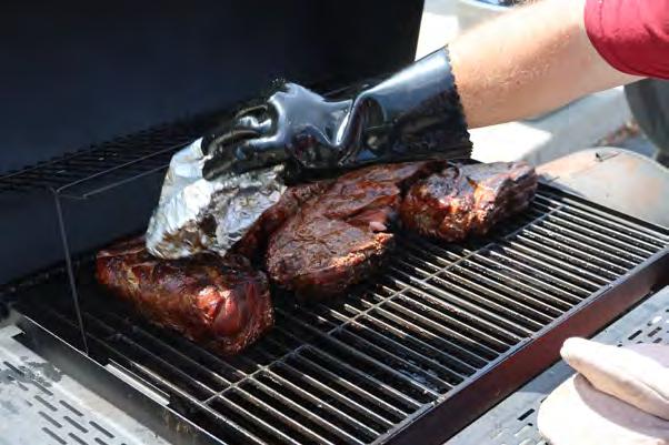


welcome


barbeque


barbeque


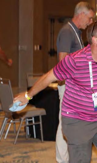
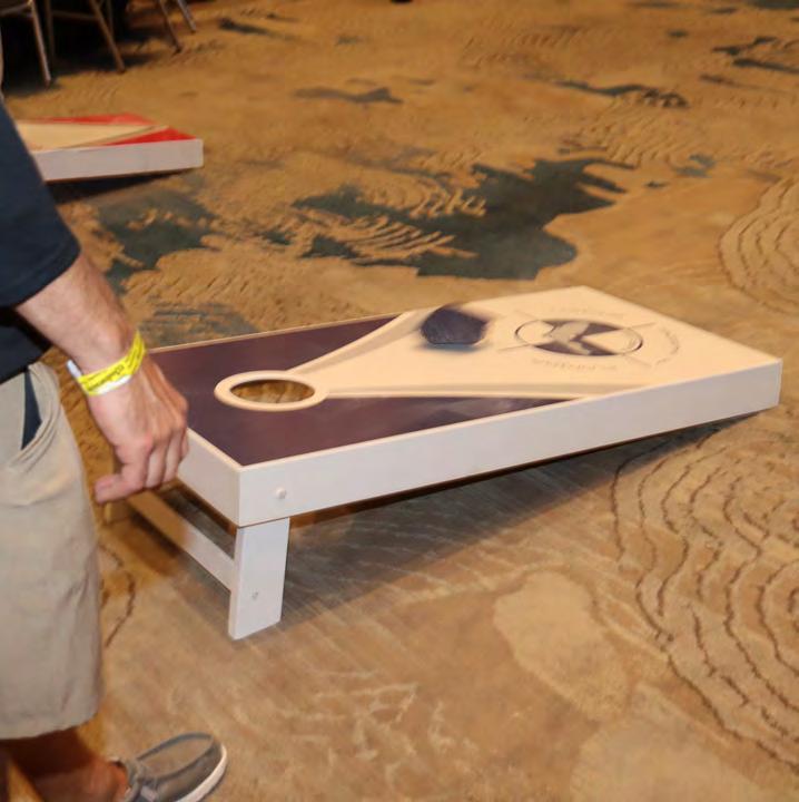
cornhole


sponsored by:


tournament
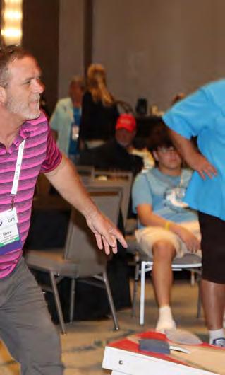


cornhole


tournament


cornhole


tournament


cornhole


tournament


cornhole


tournament


Subsurface Utility Engineering (Sue) Services

CTS Engineering utilizes the latest and most reliable technologies in the industry to provide the highest level of precision, safety, and e iciency.
Our experienced team will provide you with the most valuable resource to develop your project: Current Data.


Collaborate with us today by scanning the QR Code.


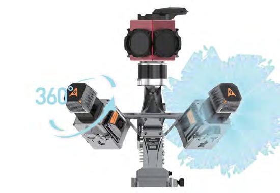
ADVANCED MULTI-PLATFORM HIGH-END LiDAR SOLUTIONS

CHCNAV's mobile mapping division enables the digital world by merging and fusing technologies. Ground and airborne mobile mapping systems combine state-of-the-art, high-performance hardware, such as accurate long-range laser scanners, high-resolution HDR panoramic cameras, and advanced GNSS receivers with high-precision IMU. Our drones and mobile mapping platforms are portable and robust, allowing for efficient deployment in the field. In addition, our advanced software algorithms process massive 3D point clouds quickly and efficiently.

CHC Navigation USA Corp

the historical cartography of florida


dr. joe knetsch, phd seminars


Presented to Dr. Knetsch was a Published Geodetic Control Marker located in Tallahassee, FL.

impact of ngs 2022 datum & low distortion projections to mapping


mapping & engineering projects vas kalogirou, rpls, pls, ps, psm, ls


topgolf


topgolf


topgolf


exhibit hall grand opening


opening & ribbon cutting

To
All of Our Exhibitors and Sponsors!


EXHIBITORS
PLATINUM
Duncan-Parnell
Duncan-Parnell is an authorized Trimble dealer for land survey, mapping/GIS, and construction instruments and accessories, and has been the leading provider of survey & mapping solutions in Florida for over 25 years. Our product offerings include GNSS receivers, drones/UAVs solutions, robotic and manual total stations, software for workflow integration, digital and automatic levels, 3D laser scanners, mobile mapping and monitoring solutions, utility locating equipment (GPR), construction lasers, as well as a full range of field supplies and accessories. DuncanParnell is your full field-to-finish provider. Our Geospatial team has decades of industry experience, certified maintenance centers, and experienced trainers on staff. We’re ready to be a trusted partner and assist with your sales, rental, or maintenance needs. Contact us today!


EXHIBITORS GOLD
Big Sky Aerial Solutions
Big Sky Aerial Solutions is a leading LIDAR and specialized aerial data collection organization with advanced sUAS capabilities. Our focus is on meeting the specific requirements of professional licensed surveyors and engineers through tailored solutions.
Collaboration lies at the heart of our approach, where we seamlessly integrate your expertise into our deliverables. Founded on safety, accuracy, and efficiency, Big Sky utilizes cutting-edge technology and specific Federal Aviation Administration operational waivers, including Beyond Visual Line of Sight (BVLOS), as we maintain the utmost due diligence. We can assist surveyors from a simple orthomosaic photo overlay to complex surface development on large, expansive, and heavily vegetated projects.


EXHIBITORS
GOLD
Caulfield & Wheeler, Inc. (CWI)
Caulfield & Wheeler, Inc. (CWI) was incorporated in October of 1982 in Palm Beach County, Florida. Its principals and employees provide professional Civil Engineering, Planning, Land Surveying, Landscape Architecture, 3D Laser Scanning, and Unmanned Aerial Systems services. CWI has been contracted by many prestigious municipalities, developments, and governmental agencies throughout Florida. CWI's principals have over 200 years of combined experience serving as active project managers, ensuring every project meets our technical quality standards while remaining within the client's budget and schedule.


EXHIBITORS
SILVER
American Government Services Corporation
American Government Services (AGS) is a full-service title company that specializes in providing real estate services to government agencies. AGS has been providing title and closing services in the State of Florida since 1979. American Government Services is a 100% women-owned business, certified as a DBE/MBE firm with the State of Florida and registered as a real estate broker corporation with the Florida Department of Business and Professional Regulation. AGS hopes to meet and exceed all of your Title service needs.


EXHIBITORS
SILVER
Atwell, LLC
Atwell, LLC is a national consulting, engineering, and construction services firm with offices throughout the country that deliver a broad range of strategic and creative solutions to clients in three core markets: real estate and land development, power and energy, and oil and gas. Atwell provides comprehensive turnkey services including land and right of way support, engineering, land surveying, environmental compliance and permitting, and project and program management. We are pleased to announce that effective January 2024 the Fort Myers and Port Charlotte offices of Banks Engineering have merged with Atwell, LLC.


EXHIBITORS
SILVER
Frontier Precision Unmanned
Frontier Precision Unmanned has the latest innovations in drone aircraft and sensors to fit your job or application. We offer industry-leading products and software from Ascent AeroSystems, Autel Robotics, Censys Technologies, DJI, Freefly Systems, Inspired Flight, Parrot, Quantum-Systems, Watts Innovations, YellowScan, Emesent, Deep Trekker, Phase One, FLIR, Pix4D, and many others to make sure you get the right product for the right UAS application. UAS applications include geospatial surveying & mapping, agriculture, construction, energy, forestry, infrastructure, mining, mosquito & vector control, oil & gas, and public safety.


EXHIBITORS
SILVER
Leica Geosystems
Leica Geosystems – when it has to be right With more than 200 years of history, Leica Geosystems, part of Hexagon, is the trusted supplier of premium sensors, software and services. Delivering value every day to professionals in surveying, construction, infrastructure, mining, mapping and other geospatial content-dependent industries, Leica Geosystems leads the industry with innovative solutions to empower our autonomous future.


EXHIBITORS
SILVER
Navigation Electronics, Inc. (NEI)
Navigation Electronics, Inc (NEI) is a woman-owned small business, with Barbara Poche serving as President & CEO. NEI is a Trimble Geospatial solution provider in the Southeast and has been in business for 35 years. NEI represents Trimble as its’ premier product line distributor and has been a Trimble distributor since 1990. We are committed to excellent customer service and have a long history of customer satisfaction.

NEI has assembled a team of professionals, each having unsurpassed expertise in various areas of Surveying. NEI currently has three licensed land surveyors on staff, two GIS professionals and three Part 107 pilots on staff. These individuals will ensure that all components of this bid will be addressed to complete satisfaction. NEI’s corporate headquarters, a state-of-the-art facility in Lafayette, LA and has over 100 years of service experience. This facility is complimented by a training center and sales office in Duluth, Georgia. NEI also maintains satellite offices in Florida, Mississippi, Alabama, and Arkansas.

EXHIBITORS
SILVER
R-E-A-L.iT
R-E-A-L.iT is a leading provider of customized reality capture workflow solutions for clients across diverse industries. Established by Derek deBlois in 2021, our company has rapidly evolved to become a trusted partner for businesses seeking innovative solutions in industries like engineering, architecture, public safety, visual effects (VFX), and more. At R-E-A-L.iT, we are dedicated to delivering comprehensive reality capture solutions, expert consulting, and tailored software development to address the unique needs of our valued clients.


EXHIBITORS
SILVER
TopoDOT
TopoDOT is a point cloud processing software application offering a comprehensive feature extraction tool suite with the right balance between automation and quality assurance. TopoDOT offers a well-documented process to extract Digital Twin deliverables such as topographies, assets, 3D models, measurements, analyses, and reports meeting the highest quality-controlled standards. Our TopoShare product provides a comprehensive process to organize, store and share your data across operations at the lowest possible cost. TopoDOT LLC is headquartered in Winter Garden, Florida.


YellowScan
SILVER EXHIBITORS

At YellowScan we design, develop and produce UAV Mapping solutions for professional applications. Fully integrated, ultra-light and easy to use, these highly automated data collection tools are used by customers around the world in fields such as surveying, forestry, environmental research, archeology, corridor mapping, civil engineering and mining. With more than 13 years of field experience, YellowScan is committed to delivering the highest level of performance, reliability and robustness for its solutions. Our platforms are field tested all over the world in multiple environments (tropical forests, bare soils, mountains, rivers, coast lines, open-pit mines, power lines).
For more information, please go to www.yellowscan.com

Frontier Precision has the latest LiDAR photogrammetry innovations to fit your job or application. Our staff has the knowledge and real-world experience to help you select the solution that’s best for you and the training to make you more proficient and profitable. Just as important, our professional services group can help you implement LiDAR and photogrammetry solutions on your next project – from field data capture to data processing – we have the expertise to make sure your project is done right.


The YellowScan LiDAR UAV delivers the highest level of accuracy and density for real-time georeferenced point cloud data. Lightness and accuracy combine for a LiDAR solution that works hard for you.
Emesent automates the collection and analysis of data in challenging GPS-denied environments, delivering revolutionary efficiency, safety, and operational insights to underground mining and other industries. It’s core areas of expertise are drone autonomy, SLAM-based LiDAR mapping, and data analytics.
EXHIBITORS STANDARD
The Arc of Bradford County
At The Arc of Bradford County, we are committed to helping people with intellectual and developmental disabilities live full and rewarding lives. Founded in 1975 on inclusion and acceptance, we work tirelessly to ensure the individuals we serve receive the care and attention they deserve. Everyone has something valuable to contribute to society, and we are committed to helping our participants realize their full potential.
Bowman Consulting
Bowman is a trusted, multi-disciplinary consulting firm offering a broad range of real estate, energy, infrastructure, and environmental management solutions to both public and private clients across the country. From large commercial developments, to master planned communities, to local transportation projects, Bowman delivers outstanding project results, builds long-lasting relationships and leverages the growth of our organization to serve the constantly changing needs of our clients.
As a result of systematic corporate planning and diligent implementation, our dynamic leadership has focused on strategic expansion that has resulted in a national project portfolio and opportunities to increase our geographic presence for both new and existing clients. Bowman offers on-demand technical genius and industryleading talent that, when combined, produce innovative and effective results.


EXHIBITORS
STANDARD
CARLSON
Carlson Preferred Solutions is the exclusive Carlson Software Authorized Dealer for the state of Florida. Specializing in Carlson centric GNSS RTK base and rover solutions, total stations, RTK drones, data collection hardware & software, and CAD software to the Land Surveyor, Civil Engineer, and Construction professional.
CARNAHAN PROCTOR & CROSS
CPC is proud to celebrate its 46th year as a full-service geomatics firm. As surveying technologies advance, CPC is a leader in utilizing cutting-edge technology, equipment, and software. CPC is involved in a wide variety of information-gathering activities and applications to design, develop, and operate systems for collecting and analyzing spatial information. Our Geomatics group utilizes technologically advanced tools like robotic total stations, global positioning system (GPS) equipment, digital aerial imagery, 3D Terrestrial Laser Scanning, Building Information Modeling (BIM), computer-based drafting and design (CADD), and geographic information systems (GIS) to provide clients with the most cost-efficient and innovative solutions.


EXHIBITORS
STANDARD
CHC Navigation USA
CHC Navigation is a global leader in navigation, positioning, and mapping solutions for various professional applications. Our offerings include surveying, GNSS technology, 3D data collection, precision agriculture, unmanned navigation, real-time GNSS infrastructure, and more. With a commitment to technology advancement and affordability, we serve geospatial professionals in over 120 countries.
CTS Engineering
CTS Engineering, Inc is a well-known and respected leader in providing Professional Engineering services throughout the State of Florida for over 12 years. We offer a wide array of services to our clients including transportation planning, traffic engineering, public transit support, roadway design, policy planning, data collection, statistical analysis, PD&E studies, multimodal improvements and surveying and mapping services. Our team of Professional Surveyors & SUE experts have provided high quality deliverables for Surveying & Mapping assignments to our clients including utility coordination to many FDOT Districts, Counties and Cities. CTS is a certified DBE firm with offices throughout the state to support all your Surveying, SUE & Utility Coordination needs. CTS will provide a turnkey package of all these services.


STANDARD EXHIBITORS
Dorado Graphix
Dorado Graphix LLC is your go-to source for all large format printing, laminating, scanning equipment, and their associated software and supplies. We have media for every application from CAD Bond, to photo grades, to outdoor banner material and much more. We service everything we sell and some that we don’t. Dorado Graphix is a veteran owned company and we pride ourselves on providing quality products, service, and training for our customers. Please call us at (904) 751-4500 or visit our website www.doradographix.com
DUKE ENERGY
Duke Energy is a Fortune 150 company headquartered in Charlotte, N.C., is one of America’s largest energy holding companies. The company’s electric utilities serve 8.4 million customers in North Carolina, South Carolina, Florida, Indiana, Ohio and Kentucky, and collectively own approximately 54,800 megawatts of energy capacity. Its natural gas utilities serve 1.7 million customers in North Carolina, South Carolina, Tennessee, Ohio and Kentucky.
Duke Energy is executing an ambitious clean energy transition to achieve its goals of net-zero methane emissions from its natural gas business by 2030 and netzero carbon emissions from electricity generation by 2050. The company is investing in major electric grid upgrades and cleaner generation, including expanded energy storage, renewables, natural gas and nuclear.


EXHIBITORS STANDARD
eGPS Solutions
At eGPS Solutions, we are a full-service survey equipment and supplies distributor. At the best prices, we sell top-quality equipment from GeoMax, CHC, DJI, and LiDARUSA to create unique solutions to fit your surveying needs. We also provide comprehensive services to fully support our customers, including supplies, M2M data plans, certified repairs, technical support, and UAV-LiDAR training, all just a phone call away. So look no further than us for all your surveying needs because, at eGPS Solutions, we will not let you fail.
FAU Florida Atlantic University
The NCEES award winner, Florida Atlantic University Bachelor of Science degree in Geomatics Engineering is one of the state-of-the-art ABET accredited engineering programs in the nation. The award-winning faculty has outstanding teaching and research experience and diverse professional backgrounds. Students can collaborate with other engineering and science disciplines such as geosciences, computer science, urban planning, and other fields. While this program prepares students for the Professional Land Surveyor (PLS) license, some students successfully pass the NCEES Fundamentals of Surveying (FS) and Fundamentals of Engineering (FE) examinations before graduating from the program.


EXHIBITORS
STANDARD
(FAST) Florida Aerial Survey Technologies
Florida Aerial Survey Technologies (FAST) excels in swiftly delivering high-quality aerial survey and mapping data through advanced methods including LiDAR and photogrammetry. Our team’s extensive experience in drone-related software development has led to the creation of proprietary survey software and systems. These innovations significantly reduce project timelines while maintaining data integrity, establishing FAST as the aerial surveying market leader in Florida.
FLT Geosystems
FLT Geosystems (Florida Level & Transit) is a full-line dealer for Leica Geosystems (optical, GPS, HDS scanning, & lasers), Topcon Positioning (optical & lasers), Spectra Precision (optical, data collectors, & lasers), Carlson Software, Septentrio, and many more. Our home office is in Ft. Lauderdale, with a full-service office in Tampa.
FOUNDATION RISK PARTNERS
FRP Professional Risk offers a unique combination of industry leaders and datadriven professionals, leveraging their expertise to provide tailored insurance and risk management solutions for our customers. Our team of more than 30 professionals collaborates to unburden our clients from risk through education, insurance, and counsel. No matter the size of your firm, our service is designed to meet your needs.


STANDARD EXHIBITORS
(FREAC) Florida Resources and Environmental Analysis
The Florida Resources and Environmental Analysis Center (FREAC), established in 1969, is the original center within the Institute of Science and Public Affairs (ISPA) at Florida State University (FSU). FREAC professionals conduct research in the general areas of resource management and environmental analysis, as well as provide advice and technical assistance to state and local agencies. Public lands research and analysis, geographic information system development, and graphic representation of digital databases are current and long-range FREAC research interests. FREAC also trains university students in these areas through direct involvement in projects, providing realworld experiences.
GeoNetworking
Geo Networking is a Topcon/Sokkia distributor located in central Florida. The company focuses on end-to-end sales through a consultive sales strategy. In this process, Geo Networking is able to match the right product to meet your team’s goals for your deliverables. Geo Networking is proud to offer the Quantum Systems line of drones that include the Trinity Pro and a powerful line of sensors with LiDAR options. We are also excited to welcome FARO to our lineup of terrestrial scanners. The all new Orbis is a handheld SLAM scanner that is really making waves in the mass data capture arena. These products matched with the very well known products from Topcon/Sokkia make any job a slam dunk.


EXHIBITORS
STANDARD
GPI Geospatial, Inc.
For fifty years, GPI Geospatial, Inc., a subsidiary of Greenman-Pedersen, Inc., has delivered advanced geospatial services in both public and private sectors throughout the eastern United States. Our comprehensive offering of professional surveying and mapping services caters to engineers, architects, land developers, planners, and a wide range of both public and private markets, such as energy, transportation, and private development. GPI Geospatial provides the most accurate remote sensing and survey data by utilizing specialized aircraft, vehicles, and personnel outfitted with cutting-edge equipment and software. Our unwavering commitment to precision, innovation, and client satisfaction has earned GPI Geospatial an unparalleled reputation, making them the preferred firm of choice for those seeking unrivaled geospatial solutions tailored to their needs. Our team is comprised of dedicated subject matter experts and support staff, many of whom are licensed Land Surveyors, ASPRS Certified Photogrammetrists and Mapping Scientists, GIS Professionals, FAA Licensed Pilots, and Project Management Professionals.


STANDARD EXHIBITORS
Geospatial Users Group
The Geospatial Users Group is a practice section of FSMS that facilitates Communication and Outreach between practitioners, experts, suppliers, and users of GNSS and their applicable systems. Its purpose is to act as a central voice to protect the accessibility and provide education of such systems. The Group promotes education, outreach, and information to act as a liaison between users and the various industries interacting with GNSS and advanced geomatic positioning based systems.
Green Equipment Company
Green Equipment Company is your source for “DAMAGE PREVENTION” tools and products that lead the industry in Innovation and Quality. We offer “Value” through exceptional customer service and competitive pricing. Our highly trained, experienced sales team covers eight states and represents world-leading manufacturers. We are problem solvers, dedicated to meeting our customer’s needs. With Green Equipment Company, you receive continual service after the sale. Green Equipment Company sales team members are located in Texas, New Mexico, Oklahoma, Arkansas, Louisiana, Mississippi, Alabama and Florida, each with inventory for local distribution.


EXHIBITORS STANDARD
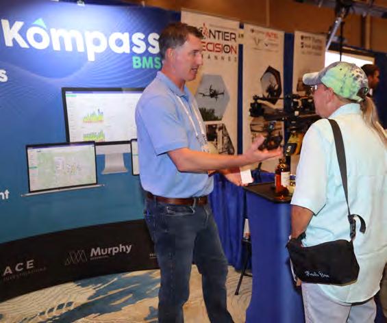
Kompass BMS
Kompass BMS is a fully integrated software system designed to streamline business operations for surveying & engineering companies. Developed by surveyors for surveyors, it includes an intuitive dashboard, a robust CRM, project mapping, crew scheduling, timesheets, expense reporting, and real-time visibility. The platform provides powerful features to improve collaboration, project financials, and the sales process, enabling companies to efficiently manage and grow their business.
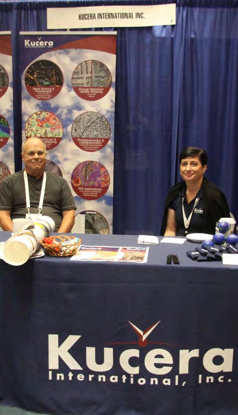
Kucera International, Inc.
Kucera International, Inc. is a leading provider of aerial remote sensing, lidar processing/classification, photogrammetric mapping, orthoimaging, CAD and GIS conversion and support, and related services for surveying/engineering, government, industrial/ commercial, and educational/research applications. Kucera’s in-house staff of over 60 experienced geomatic professionals working at offices in Florida, Ohio, and Pennsylvania includes licensed/certified photogrammetrists, surveyors, engineers, GIS/CAD specialists, project managers, pilots, and aircraft mechanics. For aerial data acquisition, Kucera maintains a fleet of high-performance, multi-port manned aircraft outfitted with latest generation aerial lidar, digital aerial imaging, and multispectral sensing systems integrated with advanced airborne GPS/IMU georeferencing technologies. For data processing, mapping, conversion, and support, Kucera uses a variety of robust, proven remote sensing, photogrammetric, imaging, and GIS and CAD technologies/software. Kucera regularly works throughout Florida, the Caribbean region, and other areas of the U.S. Kucera is a long-standing Florida professional surveying and mapping firm and a sustaining member of ASPRS.


STANDARD EXHIBITORS
L & S Diversified
L&S Diversified is a fully integrated firm positioned to design, survey, map, model, and designate utilities for governments, businesses, and organizations in the state of Florida. We provide surveying and mapping, construction surveying, LiDAR, GIS and subsurface utility engineering to the transportation, private development, environmental, energy, and government markets.
LENGEMANN
Established in 1962, Lengemann Corporation is celebrating 60 years of meeting customer needs. Lengemann Corporation is one of the leading Topcon and Sokkia full line surveying instrument dealers in the United States. We sell/rent/ finance GPS, Robotics, Total Stations, Drones, Machine Control, and supplies. Lengemann Corporation is the only authorized Topcon and Sokkia master repair facility in the state of Florida. We also operate one of the largest, privately owned GPS networks in the U.S. called L-Net. Our new onsite training facility is equipped for all your survey and machine control needs.


EXHIBITORS STANDARD
McKIM & CREED
McKim & Creed is an employee-owned firm with more than 800 staff members in offices throughout the U.S., including North Carolina, South Carolina, Florida, Virginia, Texas, Louisiana, and Pennsylvania. The Raleigh, North Carolina-based company, which was founded in 1978, specializes in civil, environmental, mechanical, electrical, plumbing, and structural engineering; industrial design-build services; airborne and mobile lidar/scanning; unmanned aerial systems; subsurface utility engineering (SUE); and hydrographic and conventional surveying services for the energy, transportation, federal, land development, water and building markets.
NV5

NV5 is a leading provider of technology, conformity assessment, and consulting solutions for public and private sector clients supporting infrastructure, utility, and building assets and systems. The Company primarily focuses on six business verticals: construction quality assurance, infrastructure support services, utility services, buildings & technology, environmental health sciences, and geospatial technology services. NV5 operates out of more than 100 offices nationwide and abroad, with 9 offices serving the Florida Region. NV5 is a leading provider of technology, conformity assessment, and consulting solutions for public and private sector clients supporting infrastructure, utility, and building assets and systems. The Company primarily focuses on six business verticals: construction quality assurance, infrastructure support services, utility services, buildings & technology, environmental health sciences, and geospatial technology services. NV5 operates out of more than 100 offices nationwide and abroad, with 9 offices serving the Florida Region.


STANDARD EXHIBITORS
SAM
For over thirty years, SAM has built a reputation as a trusted, knowledgeable, and innovative partner. Our licensed professionals transform petabytes of complex spatial data into intelligent insights in a holistic Managed Geospatial Services™ (MGS™) framework. As North America's premiere MGS™ company, SAM provides practical, precise, and high-fidelity solutions designed to enhance decisionmaking, mitigate risks, achieve strategic objectives, and drive costs out of our client's business. Our vision is to advance spatial data acquisition, improve analysis capabilities, and develop predictive analytics to redefine and transform how infrastructure assets are developed and managed throughout their lifecycles.
SmartDrone

Founded in 2020 and based in Tyler, Texas, SmartDrone is a leading innovator in the field of unmanned aerial technology. We design, engineer, and manufacture state-of-the-art U.S.made mapping drones. Our products are designed to redefine industry standards and are equipped with advanced technology to deliver highly accurate data. SmartDrone is not just a drone manufacturer; we are a complete solution provider. With our team of drone specialists stationed across the U.S., we offer comprehensive drone services that cover every phase from data collection and processing to delivery. Our team is dedicated to provide fast, accurate, and cost-efficient services to support the vital work of surveying, construction, engineering, mining, and more.


EXHIBITORS
STANDARD
Surveyors Instrument Services, LLC
Surveyors Instrument Services, LLC is a land surveyor and construction equipment supplier based in Tampa, Florida. We offer repairs, service, rentals, supplies, new and used equipment options for all of your surveying needs. Owner, Stan Denison, has 40+ years or service and expertise in the surveying and construction industry. We provide customers with superior service and a quick turnaround time. Our years of experience, knowledge, and service in the industry has allowed us to be a reputable company for our customers. The list of equipment we sell and service is extensive.
THE UNDERGROUND DETECTIVE
The Underground Detective locates private utilities using state-of-the-art equipment for all pre-excavation and site planning needs. The state one-call (811) only marks public utilities, those which are before the service meter. Any utility beyond the service meter is usually considered private, which will require a second call to The Underground Detective.
Although The Underground Detective is not a licensed civil engineer or surveyor, we can map the utility locations with sub-meter accuracy and provide GPS coordinates with a shapefile and a Google Earth overlay. This valuable information can be used in your Auto CADD project, but our mapping work is to give our clients a basic overview of the project they are engaging in and help assess what to expect when designing, updating, or performing preliminary site work.


STANDARD EXHIBITORS
Timeless Fence System
Timeless Fence System is proud to announce its latest innovative application of Rigid PVC posts, now being used as Survey Marker posts for land surveying. This groundbreaking use of Timeless Fence's products showcases the versatility and durability of Rigid PVC posts, marking a significant advancement in the field of land surveying. Traditionally, land surveyors have relied on various materials for marker posts, but Timeless Fence's Rigid PVC posts offer a modern, efficient, and durable solution. Designed to withstand the elements and the test of time, these posts are becoming an essential tool for surveyors across the nation. Timeless Witness Posts are manufactured with the highest quality standards, ensuring that they provide reliable and long-lasting markers for land surveying. Their visibility, durability, and resistance to environmental factors make them an ideal choice for this precise field.
The University of Florida Geomatics

The UF Geomatics program was established in 1973 and is the preeminent Geomatics program in Florida. Consisting of six full-time faculty members, 80 Bachelor’s degree students, 19 graduate students, and boasting two remote educational facilities in Ft. Lauderdale and Plant City, it has become the premier and leading resource for students seeking a degree in Geomatics from one of the country’s most prestigious institutions. The UF Geomatic Student Association (GSA) is an active student chapter of the Florida Surveying & Mapping Society (FSMS) and has been a regular Exhibitor at their Annual Conference for many years, providing GSA members the opportunity to interact with FSMS members, gain inspiration and professional Awareness, as well as increase visibility of the GSA and UF Geomatics program to prospective students.


“I saw this incredible product in American Surveyor magazine and thought I would give them a try. They were much easier to set than the typical carsonite's we have used in the past and far more affordable. These are a great option when hiking into the back county to set metal t-posts next to property corners. The white stands out and the stickers are a great touch. I'm looking forward to another project I can use these on.”
Bill Buntrock,
PLS - Owner, True North Surveying & Mapping, LLC
"I’ve been looking for a non-metal material as a witness post and Timeless Fence Systems delivered. The price fits our budget significantly better than the Carsonite products available. No more spray painting and carrying heavier metal fence posts. The labels look great as well."
Wes Hand ~Owner, Hand Land Surveying Co.


•Robotic

•Trimble
•UAS/Drone
•Technical
•Software
•Survey
•Instrument
•Monitoring


SPONSORS
Exhibitor Reception Trimble
Recognition Banquet Broward Chapter


Recognition Banquet Miami-Dade Chapter

Room Keys Whidden Surveying & Mapping, Inc.

SPONSORS
Conference Tote Bags L ANGAN
Young Surveyors Event
Swag Sponsor PICKETT


Lanyards E TM
Name Badges GPI Geospatial, Inc.


Welcome BBQ CONTROL POINT ASSOCIATES

Welcome BBQ GEORGE F YOUNG

Welcome BBQ KEITH

Welcome BBQ LONGITUDE SURVEYORS
SPONSORS
Program Book (Front Cover) WGI

Casino Night AT WELL
CST Exams
Casino Night L & S Diversified
Registration Desk & Signs
Casino Night SAM


SPONSORS
Legislative Reception Hyatt Survey
Registration Desk & Signs BGE


Registration Desk & Signs S SMC

Exhibit Hall Door Prizes TAMPA BAY CHAPTER

SPONSORS
Exhibit Hall Luncheon FLORIDA CROWN CHAPTER

SIT Test Prep Bowman
Young Surveyors Network Event

SIT Test Prep
CFB Clymer Farner Barley
Cornhole Tournament DRMP

SPONSORS
Cornhole Tournament LENGEMANN
Golf Tournament Central FL Chapter
Registration Packets
Young Surveyors Event


Exhibitor Welcome Bags B ROWN & PHILLIPS

Exhibitor Welcome Bags Collier-Lee Chapter

SPONSORS
Exhibitor Welcome Bags Manasota Chapter

Program Book (Inside Back Cover) LLW

Exhibit Hall Coffee Break NW FL Chapter
Exhibit Hall Coffee Break Volusia Chapter


SPONSORS
Registration Packets Palm Beach Chapter

Saturday Seminar Sponsor halff
General Sponsorship

legislative


reception

sponsored by:

Stan McClain represents Florida House of Representatives District 27 serving portions of Marion, Lake, and Volusia Counties.
For the 2022-2024 term, he was appointed as the Chairman of the Ways and Means Committee. McClain has served in the Florida House since 2016 and is running for Florida Senate District 9 in November 2024. The district includes all of Levy and Marion counties, and a portion of Alachua County. McClain began his time in public service on the Marion County Board of County Commissioners from 2004-2016. He served as Chairman of the Board three times. He achieved the designation as a Certified County Commissioner and Advanced County Commissioner from the Florida Association of Counties.

casino


sponsored by:


casino


SURVEYORS INSTRUMENT SERVICES
(813) 999 8998
SURVEYORSINSTRUMENT.COM
INFO@SURVEYORSINSTRUMENT.COM 6091 JOHNS RD., TAMPA FL, 33634, SUITE 4

Surveyors Instrument Services , LLC, is a full-service surveying equipment retail store. We offer repairs, sales, rentals and consignments. SIS is a full-line dealer for Geomax, Topcon, Sokkia, Carlson, Seco and Schonstedt. We pride ourselves in providing our customers with superior service and a quick turnaround time. Owner, Stan Denison, has 40+ years of service and expertise in the surveying and con struction industry. Check out our website for current deals, promotions, and consignment instruments!
NEW AND USED EQUIPMENT CALIBRATION AND REPAIR RENTALS
SUPPLIES


MAPPING OF POSSIBILITY A WORLD


general business


business session


general business


business session


general business


business session


exhibit hall


sponsored by:

exhibit hall door prizes
sponsored by:

exhibit hall


luncheon


exhibit hall


luncheon


exhibit hall


luncheon


exhibit hall


luncheon


nsps meeting


fdot town hall & surveyors in gov.


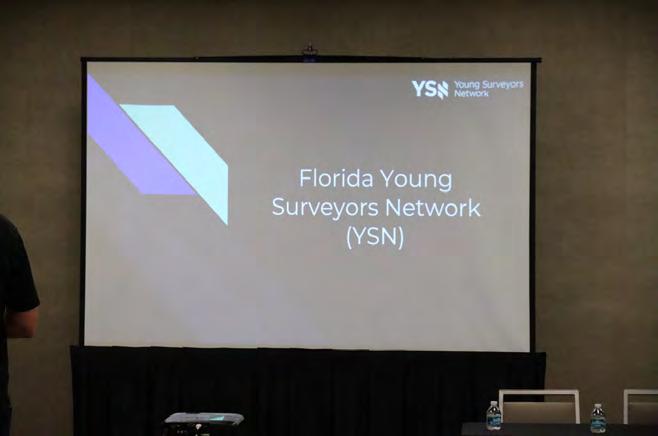

florida young surveyors


surveyors network
sponsored by:


recognition


sponsored by:
banquet


recognition


Past President Lou Campanile, Jr. presents Andrew Beckwith with the 2024 Large Chapter of the Year Award for Palm Beach Chapter.
Past President Lou Campanile, Jr. presents Brion Yancy with the 2024 Small Chapter of the Year Award for Indian River Chapter.

banquet

Past President Lou Campanile, Jr. presents Karol Hernandez with the 2024 Associate of the Year Award.

Past President Lou Campanile, Jr. presents Justin Thomas with the 2024 Professional Excellence Award.

Past President Lou Campanile, Jr. presents Brion Yancy with the 2024 Chapter President of the Year Award.

Past President Lou Campanile, Jr. presents Earl Soeder with the Fellow Member Recipient Award.
recognition

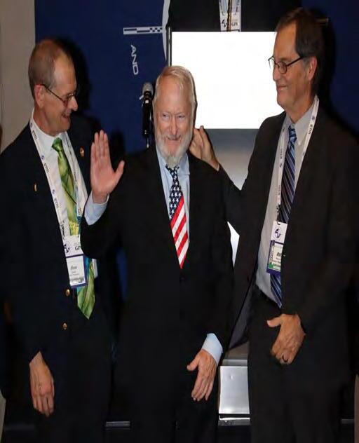
Past President Lou Campanile, Jr. presents Rick Pryce with the Life Member Recipient Award.

Outgoing President Howard Ehmke presents Allen Nobles with the 2024 Presidential Award.
Past President Lou Campanile, Jr. presents Earl Soeder with the 2024 Jim Bennet Board Member of the Year Award.

Outgoing President Howard Ehmke presents Robin Petzold with the 2024 Presidential Award.

banquet

Past President Lou Campanile, Jr. presents Jack Breed with the 2024 H.O. Peters Surveyor of the Year Award.


recognition


banquet


recognition


banquet


L & S Diversified is a Florida based company founded in 2010 with offices in Orlando and Melbourne, Florida. We are a fully integrated firm positioned to survey, map, model, and designate utilities for governments, businesses, and organizations in the state of Florida. We provide Surveying and Mapping , Civil Engineering , Aerial and Conventional LiDAR , and Subsurface Utility Engineering to the transportation, private development, environmental, energy, and government markets.


The Florida Surveying and Mapping Society has an eLearning Platform that is now linked to your FSMS membership account.
When accessing the eLearning platform, use your FSMS membership username (Not Available for Sustaining Firm Memberships) and password to log in. As always, Correspondence Courses are available by mail or email.
Updated Correspondence & eLearning Courses:
• Writing Boundary Descriptions
• Basics of Real Property
• Map Projections and Coordinate Datums
• Elevation Certificates and the Community Rating System
• Datums (eLearning Video Course)
• FL Surveying and Mapping Laws
CHECK YOUR CREDITS HERE
cst exam (certified survey technician)


proctored by alex jenkins III seminars


saturday
surveying the infrastructure of gis panel discussion
sponsored by:


seminars
boundary litigation & the surveyor instructed by knud hermansen, pls, pe, phd, esq.


saturday
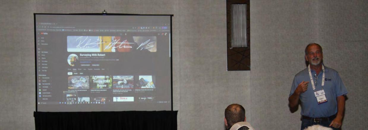
filling available survey positions with technology instructed by robert martin, ps


seminars
retracement of the initial baseline survey for FL instructed by allen nobles, psm


saturday
surveying railroad corridors with respect to property — instructed by leslie odom, psm


seminars
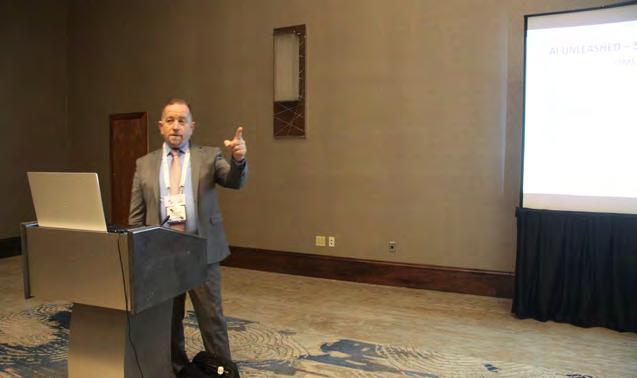
ai unleashed-surveyor's dream or nightmare instructed by dr. youseff kaddoura, phd & Mike Bartholomew, psm


saturday
an intro to leveraging remote sensing & surveying practices for design-grade survey projects instructed by michael zoltek, ls, cp, cfeds, gisp, pmp and jeffrey young, psm, cp, pps, sp


seminars
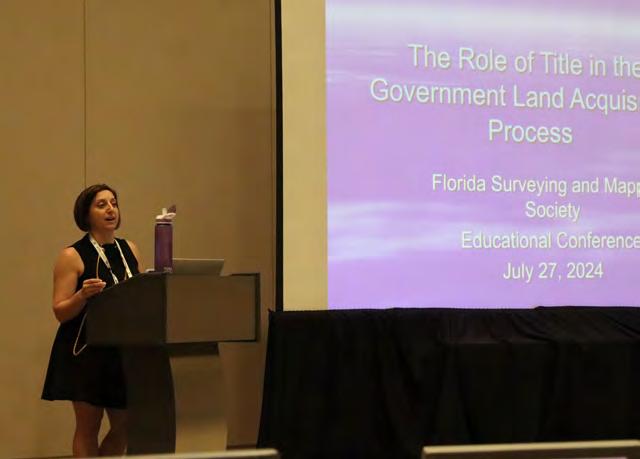
the role of title in the government land acquisition Due Diligence process instructed by wendi m c aleese


NGS Geospatial Product Updates
NGS has recently updated some of its most popular geospatial products available, including the Alpha SPCS2022 Experience, Datasheet shapefiles. Additionally updates to the Feature Services utilized by the NGS Map are coming soon.
Alpha SPCS2022 Experience
The Alpha SPCS2022 Experience was upgraded from using Raster Tile Layers to Tiled Image Layers. Instead of simply viewing images of the distortion layers, users can now click and retrieve pixel values for the distortion on all layers. Additionally, users can now bring these layers into their own online maps or desktop maps and extract or reclassify the raster data. Finally, the application’s updated responsive design improves usability on computers and mobile devices.
Datasheet Shapefiles
NGS recently updated the Datasheet shapefiles, moving the beta format to production and retiring the old format. The now singular Datasheet shapefile format includes the more expansive list of fields that was popular in the beta format. More specific information about all changes to the shapefile datasheets can be found in the Datasheet_Shapefile_Changes document.
ArcGIS Online Datasheets, CORS and OPUS Shares Solution Assets
This month NGS will update the ArcGIS Online Feature Services utilized for the NGS Map [ Datasheets , CORS , and OPUS Shared Solutions ] and change to Views of these Feature Services. This update will change the service URLs, so anyone currently using these feature services in web maps/ applications will need to update their service links by October.
The Datasheets View , NOAA CORS Network View , and OPUS Shared Solutions View are already publicly available and can be used for your maps and applications today.


Past Presidents

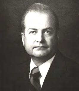
1956 - 1957
H.O. Peters

1960 - 1961
Hugh A. Binyon

1964 - 1965
James A. Thigpenn, III

1957 - 1958
C.

1961 - 1962
Russell H. DeGrove

1965 - 1966
Harold A. Schuler, Jr.

1958 - 1959
P. Goggin

1962 - 1963
Perry C. McGriff

1966 - 1967
Shields E. Clark

1959 - 1960

1963 - 1964
Carl E. Johnson

1967 - 1968
Maurice E. Berry
Harry
Schwebke
John
R.H. Jones
Past Presidents

1968 - 1969
C. Hart

1972 - 1973
Broward P. Davis

1976 - 1977
Robert S. Harris

1969 - 1970

1973 - 1974
E.R. (Ed) Brownell


1970 - 1971

1974 - 1975
E.W. (Gene) Stoner


1971 - 1972
1975 -1976
Lewis H. Kent

Robert W. Wigglesworth
William
Frank R. Shilling, Jr.
William V. Keith
James M. King
Past Presidents

1980 - 1981
Ben P. Blackburn

1984 - 1985
Buell H. Harper

1988 - 1989
Stephen G. Vrabel

1981 - 1982
William B. Thompson, III

1985 - 1986
H. Bruce Durden

1989 - 1990
W. Lamar Evers

1982 - 1983
John R. Gargis

1986 - 1987
Jan L. Skipper

1990 - 1991
Joseph S. Boggs

1983 - 1984
Robert A. Bannerman
1987 - 1988
Stephen M. Woods

1991 - 1992
Robert L. Graham
Past Presidents

1992 - 1993
D.

1995 - 1996
Thomas L.

1999 - 2000 Jack Breed

1993 - 1994

1996 - 1997
R.


- 1995

1997 - 1998
E.


1998 - 1999

Nicholas
Miller
Loren E. Mercer 1994 -
Robert D. Cross
Kent Green
Gordon
Niles, Jr.
Dennis
Blankenship
W. Lanier Mathews, II
Connor
Past Presidents


Stephen M. Gordon
Richard G. Powell
Michael J. Whitling 2007
Robert W. Jackson, Jr. 2008 -
Pablo Ferrari
Steve Stinson
Dan Ferrans 2011
Jeremiah Slaymaker
Ken Glass
Russell Hyatt
William Rowe 2003 -
David W. Schryver
Past Presidents

2015 - 2016
2019 - 2020

2016 - 2017

2020 - 2021

2017 - 2018

2021 - 2022

2018 - 2019

2022 - 2024
Lou Campanile, Jr.
Robert Strayer, Jr.
Dianne Collins
Don Elder
Hal Peters
Lou Campanile, Jr.
Howard Ehkme
Dale Bradshaw


COMING
IN
JANUARY 2025 — Seminars at Sea


Live Seminar at Sea:


Relax, Rejuvenate & Learn!
Join your fellow surveyors & bring along the family & friends in January of 2025 on a 4 night cruise to the Bahamas on Royal Caribbean’s Voyager of the Seas. We will leave from Orlando (Port Canaveral), Florida on Thursday, January 30th 2025 at 4 pm, and return Monday, February 3rd at 7 am.
GROUP SPACE IS BEING HELD!
• Book early to get the best rates.
• Cabins starting as low as $456.
• Rate is per person based on double occupancy!
• Be sure to book with our Travel Advisor, Gail Oliver to get the Group benefits. Click Here for more information and booking availability.
Course # 10757 (5 CECs) FL Surveying and Mapping Laws, Rules, and Other Statutes. — Saturday, 2/1/25 from 7:30 am to 12:00 pm.
Description: This course will review various laws and rules which regulate the practice of surveying and mapping within the jurisdiction of the State of Florida. It will also include "other" random laws the surveying profession has listed and that you may not have heard or thought of. Get ready for an interactive fun discussion on laws and rules, including Standards of Practice!
Included with Registration: One voucher for a 6 hour correspondence course of your choice. Contact education@fsms.org after registering with course selection to redeem your voucher. Link to Seminars at Sea Webpage
SPONSORSHIPS:
For Sponsorship Opportunities & Info contact Education Director Sam Hobbs at education@fsms.org.
Thank You to our T-Shirts Sponsor — E.R. Brownell & Associates

Education Sponsor $1000 (Provides Coffee & Pastries during the Education Class, Printed & digital signage displayed in the classroom, Dedicated “Sponsor Thank you” on FSMS website & social media posts, Listed in all Seminars at Sea Communication, Recognition in The Florida Surveyor Magazine)
Private Cocktail Party Sponsor $3000 (Pirate Themed Welcome Party with cocktails & appetizers (1 Hour), Verbal Recognition during Event, Dedicated “Sponsor Thank you” on FSMS website and social media posts, Listed in all Seminars at Sea Communication, Featured Full-page ad in The Florida Surveyor Magazine)
Please email communications@fsms.org to notify us of

Advertise With Us!
All advertisements contained within the publication are published as a service to readers. Publication of the advertisements does not imply or express any endorsement or recommendation by FSMS.
Benefits: Full color; hyperlinks added to your webpages as well as email addresses.
Requirements: Contracts for one year (11 issues) receive 10% discount if paid in advance; 15% for Sustaining Firms. (Ads should be in jpeg, pdf, or png format)
New ads and/or changes are due by the 25th of each month.
Questions? Call our office at (850) 942-1900 or email at communications@fsms.org