Call us t o g et your complete work flow solution today ! Efficiency and versatility that will accelerate productivity comes part of a workflow solution that includes the FC-6000 field controller, Magnet software, a HiPer VR receiver and the GT-1200/GT-600 single-operator robotic system. The power of longrange reflectorless measurements comes in your choice of 1”, 2” or 3” GT-1200 models or 2”, 3” or 5” GT -600 models.
The F lorida Surveyor is the official publication of the Florida Surveying and Mapping Society, also known as FSMS. It is published monthly for the purpose of communicating with the professional surveying community and related professions who are members of FSMS. Our award winning publication informs members eleven months out of the year about national, state, and district events and accomplishments, as well as articles relevant to the surveying profession. In addition, continuing educational courses are also available.
PRESIDENT’S Message
September 10th, 2024
Members,
I am thankful for the invitation from the University of Florida’s Student Chapter and the North Central Florida Chapter joint meeting last month to come and meet and speak with the new students at their first meeting of the year. It was great to hear their stories about what brought them to the Geomatics Program, what their goals were and how many of them were leaning towards surveying or the geospatial track, about 60/40 in this group, that didn’t include all students.
I gave a 1-hour presentation to both Chapters, covering some unique project experiences I have had over the past 5 decades. These were not your typical survey projects, but ones that had significant challenges to overcome. It was appropriately named “Thinking Outside the Box, with Lasers and GIS” .
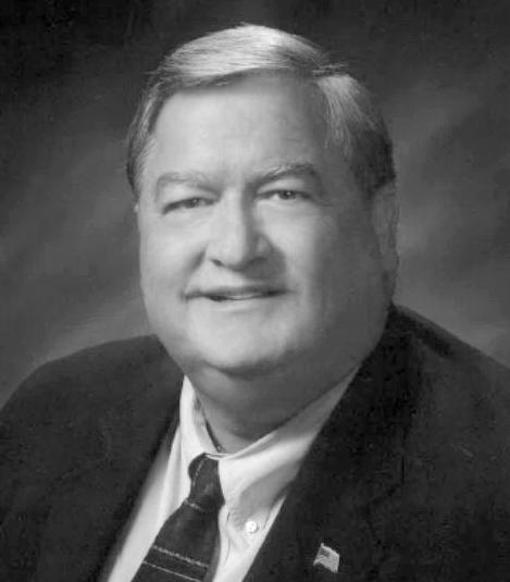
President Richard Pryce (954) 651-5942
rdpryce@gmail.com
I have always enjoyed a challenge that spurs the imagination and gets the blood and brain working overtime. I am constantly researching things that inter est me related to surveying, mapping, remote sensing and history. However, I h ave to credit my enthusiasm, confidence, and inspiration to the terrific mentor s I had in my first 20 years in Surveying. Two well respected Surveyors in my area, John Z. Rowe, RLS 1901 and Robert P. Legg, RLS 2972. They both were uni que in their personalities and survey experiences, and both taught and inspired me to continue to learn as much as I could every day.
I am a true believer in the concept of “pass it forward”, as it was given to me early in my career, and I think has served me well in everything I have accomplished since. I look out there in our profession and see this vast resource of knowledge and experience in my friends and peers, and I am hopeful that all of them are willing and able to do the same.
PRESIDENT’S Message
I think our future as a profession, deeply rooted in history, and with access to some of the most advanced technologies available to any business, is in a unique position to leverage those resources to make a difference and draw in more younger people to join us and expand our position and repu tation.
Call me optimistic, but the sharing of our knowledge and experiences to others, mentoring of students or those individuals in our own organizations that may be potential Surveyors of the future can only help to provide them with more important information than they would get in any school, and help them feel more confident and make them better students and employees. Givi ng of your time to others to help lift them up benefits everyone. The shari ng of those hidden stories from our careers can be the platform to expand our presence and reach a vast and as yet untapped resource of new Surveyor/Geomatic students and/or recruits from other professions.
Our newly formed “ Work Force Development ” committee and UF ’ s commitment on the same subject with the new hire of Katie Britt is a step in the right direction. Even though it won ’ t do much in the short term, we have made the commitment to look toward the future and are taking the steps necessary to make it happen. Your support, ideas, and suggestions to FSMS and UF ’s program will be greatly appreciated in this endeavor.
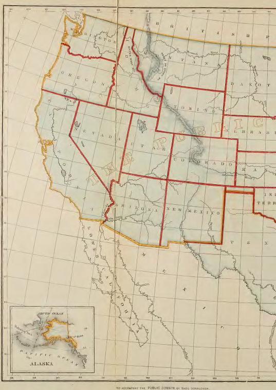
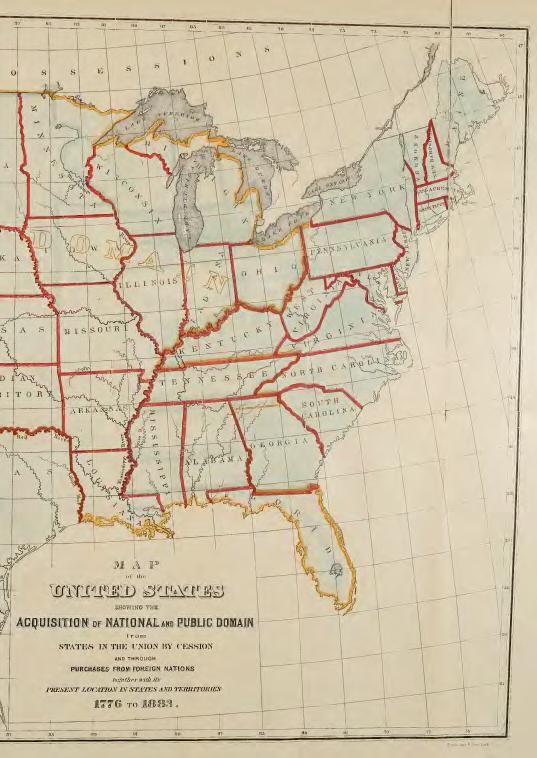
Lastly, I recently found one of those hidden treasures from history. It’s an unbelievable account of the USA Public Domain (Public Lands) from 1883-84, in a report by Thomas Donaldson of the U. S. Public Land Commission, Committee on Codification with statistics and historical data on all of the Public Lands in the USA covering the continental US and Alaska at the time. I separated out the information on the history of Florida in a separate download link, and also supplied the link to the entire 1415-page report in this volume of “The Florida Surveyor” magazine.
Hope you enjoy and immerse yourself in some fascinating reading and history.
Respectfully submitted,
Richard D. Pryce
To All of my fellow Surveying History Buffs, Friends and Peers out there,
Research becomes a passion when you find something unique accidentally, while searching for something else. It’s always a surprise when you happen upon these hidden gems, that may have been well known in their days, but have somehow disappeared over the years, in this case 140+ years, but someone had the foresight to save for posterity.
With the evolution of technology, especially in recent years, it becomes increasingly easier to find things that were once hidden and onl y available to a more exclusive audience, probably academics or governmental agencies for statistical purposes. This document is unique in my opinion and a treasure for Surveyors across the US, as it is a Report by Thomas Donaldson, a member of the U.S. Public Land Commission and the Committee on Codification, initially done in 1880 and then updated in 1884.
This is truly like finding the Rosetta Stone for the Public Domain history of the United States.
“It deals with the origin, growth and disposition of the public domain, tracing the several systems from their origin, and giving full statistics of operations under and results of the several acts for sale and disposition of the public lands up through December 31, 1883. The book includes revisions and addenda to the original June 30, 1880, report.”
A pristine paper copy was found in August 2018 at the Universit y of Toronto, by M Shumaker, Chief Mineral Examiner, at the U.S. Department of Interior, Bureau of Land Management, and digitally copied at the California State University, Monterey Bay and provided through their Digital Commons website.
I have extracted the Florida portion for our members which covers the Purchase, Treaty, Ratification, Proclamation, Transfer, and Boundaries of Florida, in extensive textual details.
See excerpt below along with a link for just Florida: https://fsms.memberclicks.net/assets/docs/SurveyingDocs/The_public_ domain_FloridaHistory1884.pdf
A true treasure find for all Surveyors, the entire report in PDF format is 1,415 pages you can find it at: 1884 - The Public Domain, Its History with Statistics, Public Land Commission, Thomas Donaldson (csumb.edu)
2024-25 Districts and
Directors
District 1 - Northwest
Bay, Calhoun, Escambia, Franklin, Gadsden, Gulf, Holmes, Jackson, Jefferson, Leon, Liberty, Madison, Okaloosa, Santa Rosa, Taylor, Wakulla, Walton, Washington
Professional Practice Committee Lou Campanile, Jr.
Workforce Development Committee Lou Campanile, Jr.
Liaisons
CST Program Alex Jenkins
FDACS BPSM Don Elder
Surveyors in Government
Richard Allen
Academic Advisory UF Bon Dewitt
FES
Lou Campanile, Jr.
Practice Sections
Geospatial Users Group
Young Surveyors Network
Richard Allen
Melissa A. Padilla Cintrón, SIT
round the State A
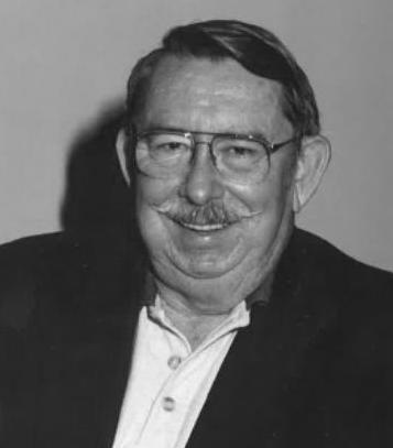
George F. Young, Inc. honors Greg Nipper, PSM for his 35 Years of Service
Greg Nipper, PSM is honored at his retirement party for his 35 years of being an integral part of the George F. young survey team and helping grow it into what it is today. Congratulations, Greg!
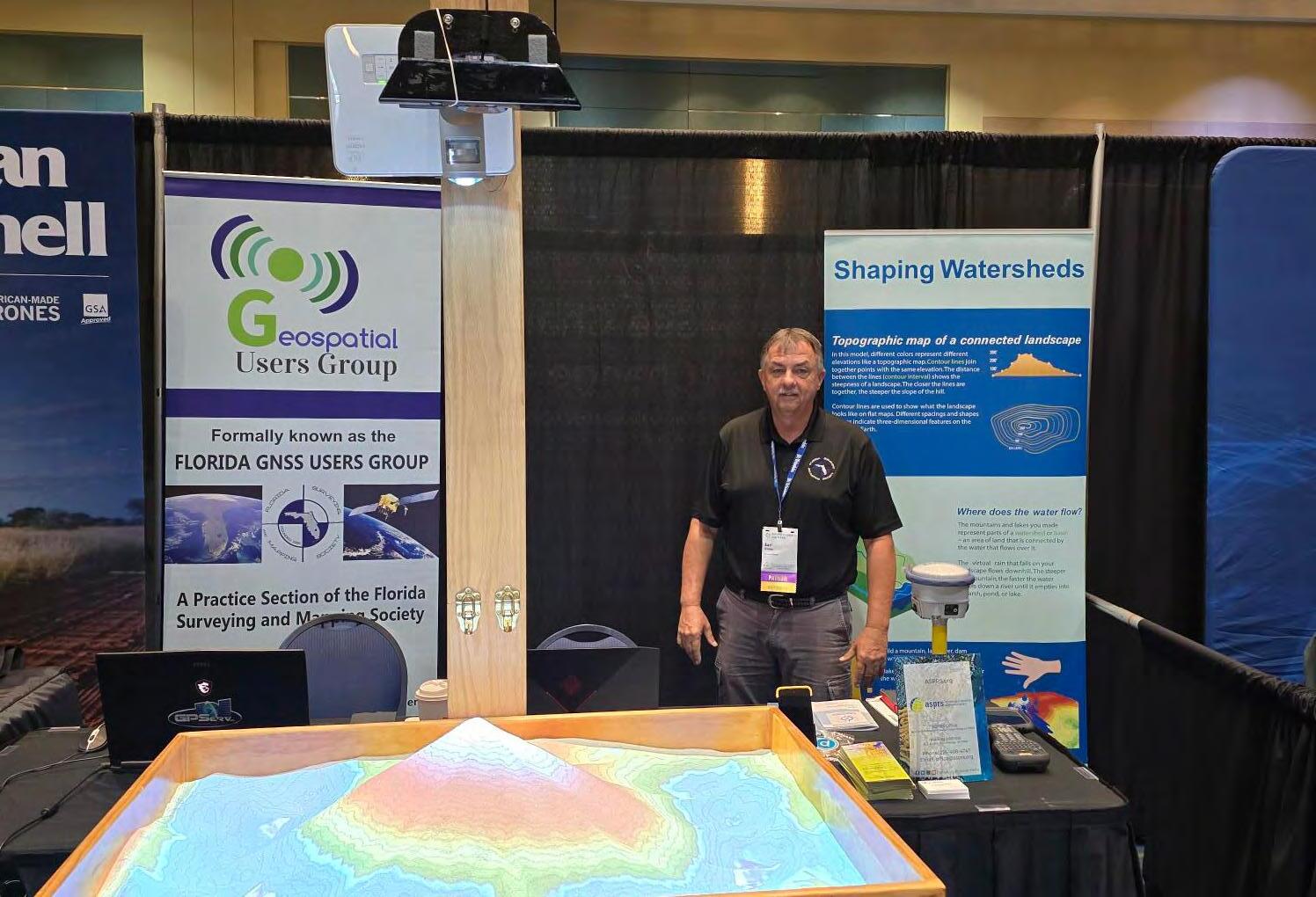
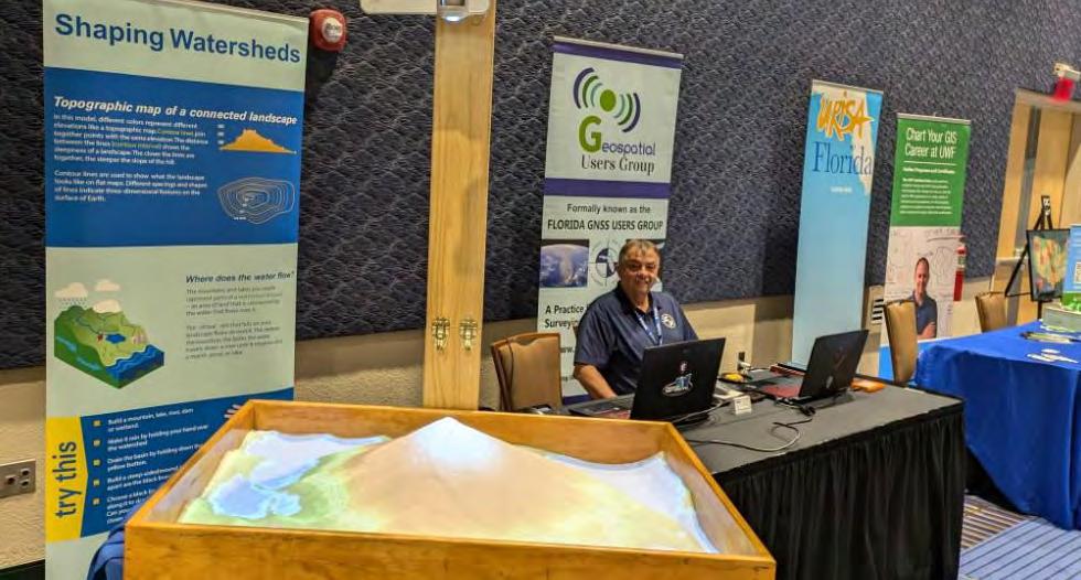
Central & South Florida GIS Expo 2024
Southeast Director Earl Soeder, PSM representing Geospatial Users Group at South Florida GIS Expo (above) and Central Florida GIS Expo (below). The "Sandbox" display
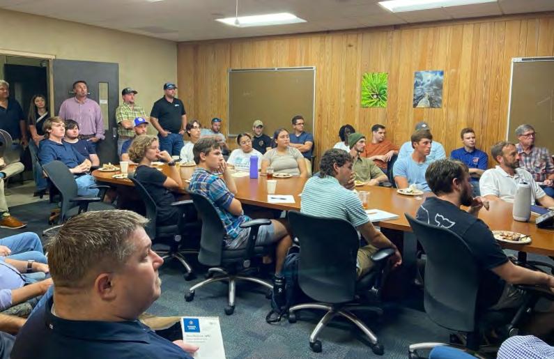
The University of Florida Geomatics Student Association (via Instagram) President Rick Pryce gives presentation titled, "Thinking Outside-the-Box" with relation to lasers, GIS, and more to UFGSA and NorthCentral FL Chapter members. Thank You to North Central FL Chapter for providing BBQ from 4 Rivers Smokehouse and President Rick Pryce for his presentation.
YOUR FLORIDA GEOSPATIAL PARTNER
Duncan-Parnell, along with our valued partners, including Trimble and other top brands, are proud supporters of the Florida Surveying & Mapping Society. From solutions including GNSS, scanning, GPR, drones, and more to services including support, rentals, training, and repair, we are pleased to be your one-stop shop for geospatial professionals throughout the Sunshine State.
Jacksonville, FL (904) 620 - 0500
Orlando, FL (407) 601 - 5816
www.duncan-parnell.com
202 4 S u S taining
A
AA Surface Pro, Inc.
239-471-2668
A. D. Platt & Associates, Inc.
850-329-5551
AIM Engineering & Surveying
239-332-4569
Allen & Company, Inc.
407-654-5355
Allen Engineering
321-783-7443
Altapro Surveyors
386-837-0244
American Government Services Corporation
813-933-3322
American Surveying, Inc.
813-234-0103
Amerritt, Inc.
813-221-5200
AOI (Area of Interest) Solutions, Inc.
321-877-0056
Arc Surveying & Mapping, Inc.
904-384-8377
ARCVERTEX LLC 631-480-2201
Ardurra, Inc. 239-292-7773
Associated Land Surveying & Mapping, Inc. 407-869-5002
ATWELL, LLC 866-850-4200
Avirom & Associates, Inc. 561-392-2594
AXIS
GeoSpatial, LLC 410-822-1441
BBarnes, Ferland and Associates, Inc. 407-896-8608
Barraco & Associates, Inc. 239-461-3170
Bartram Trail Surveying, Inc. 904-284-2224
Bello & Bello Land Surveying Corporation 305-251-9606
Stephen H. Gibbs Land Surveyors, Inc. 954-923-7666
Stoner Inc. 954-585-0997
Suarez Surveying & Mapping, Inc. 305-596-1799
Survey Data Solutions, LLC
352-816-4084
SurvTech Solutions, Inc. 813-621-4929
T
T2 UES Inc.
407-587-0603
Tectonic Engineering and Surveying Consultants 845-534-5959
Thurman Roddenberry & Associates 850-962-2538
TopoDOT 407-248-0160
TranSystems Corporation Consultants 727-822-4151
UF/IFAS
352-846-0850
LinkedIn = 1,498 Followers
Facebook = 1000 Followers
X = 401 Followers
Instagram = 351 Followers
YouTube
561-790-5515
954-771-7440
CHAPTER TEN
Envelopes of Protection: Land Acquisition Programs in Florida, 1980-1990
At the beginning of the 1980s, many Floridians were concerned with the continuing growth of the state and the ever-increasing encroachment that this produced on South Florida’s fragile ecosystem. To solve these problems, Governor Bob Graham, in his Save Our Everglades program, called for increased state and federal involvement in land acquisition efforts. Florida already had an ambitious purchasing program, but Gr aham and others believed that it needed to be expanded and strengthened, and they instituted new measures accordingly. Especially concerned with the Florida panther and its habitat in the Big Cypress and Fakahatchee Strand, Graham and Florida’s congressional delegation proposed that the state – with federal help –acquire lands to add to the Big Cypress National Preserve, and Congress passed this measure in 1988. This was a significant achievement in the 1980s, especially given the negative attitude that the Reagan administration and its Interior Department had about land purchases. However, Governor Robert “Bob” Martinez, who succeeded Graham in 1987, believed that Florida needed to go even further, and he proposed Preservation 2000 in 1990, a massive funding effort for environmental land acquisition. By the early 1990s, Florida had the most impressive land acquisition program of any state, and it had secured vital territory in the Big Cypress area.
In the early 1980s, Florida already had a few ways to purchase environmentally endangered land. In 1963, state legislators amended the state constitution, authorizing officials to issue revenue bonds in order to acquire lands, water areas, or other resources in the interest of recreation or conservation. Income from these bonds was placed in a Land Acquisition Trust Fund.1 The state empowered itself further in 1972 with the passage of two significant pieces of legislation. As we have already noted, the Florida Environmental Land and Water Management Act allowed the state to designate regions as areas of critical state concern. The state also passed the Land Conservation Act, which established the Environmentally Endangered Lands Bond Issue, whereby the state could issue $200 million in bonds so that it could purchase, in the words of Graham, “environmentally significant and threatened lands.”2 Even though the Land Acquisition Trust Fund enabled the state to buy land for conservation purposes, some Florida officials, including Estus Whitfield, who served as an environmental adviser to Graham, saw Environmentally Endangered Lands as “the first major state land-acquisition program in Florida.”3
The next important piece of legislation came in 1979 when the state legislature created the Conservation and Recreation Lands Program (also known as CARL). The Florida Department of Natural Resources called this plan a “direct successor to the Land Conservation Act.”4 It created a priority list for land purchases, administered by a Land Selection Committee. This committee had to follow certain procedures before placing lands on the final priority list, including holding public meetings and comparing and analyzing the selections. Each July, the committee
presented its final priority list to the state cabinet for approval, and the state then worked to purchase the lands on that list.
Despite these measures, enormous growth in South Florida continued to threaten the environmental health of the region, especially the Everglades. Between 1970 and 1980, the population of Florida jumped from 6.8 million to 9.7 million, and it would escalate to 12.9 million by 1990. Demographers estimated that as many as 1,000 new residents came to Florida every day. Much of this growth occurred in South Florida, where areas such as Fort LauderdaleHollywood grew by 64.2 percent between 1970 and 1980. In addition, tourism was increasing, as 36 million people visited the state in 1980 alone. The tremendous growth had dire implications for South Florida’s environment. “We’re going to see enough water for the people,” Patricia Dooris of the Southwest Florida Water Management District related, “but we’re not going to have enough water to maintain th e ecosystem that people expect in Florida.”5 Meanwhile, the sugar industry continued to expand in the EAA, creating pressure for more agricultural land and increasing the political influence of sugar growers. One 1984 publication noted that growers planted 349,000 acres to cane sugar in the EAA, a value of $600 million. This made Florida the largest sugar producing state in the United States. Likewise, farmers in Dade County were producing 75 percent of the country’s winter vegetables and 95 percent of its limes.6 The expanding agricultural industry and the increasing population meant the development of more and more land, leading to growing encroachment on Everglades National Park and Big Cypress National Preserve.
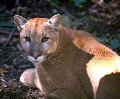
The development especially affected wildlife. By the mid-1980s, some estimated that approximately 90 percent of wading birds in the Everglades had disappeared, dropping the population from more than 2.5 million in the 1930s to 250,000. The alligator was similarly imperiled, as were 13 other endangered species, including the Florida panther (placed on the Interior Department’s first endangered species list in 1967), whose traditional habitat north of Big Cypress was jeopardized by citrus growers building orchards in the area. The problem for the panther (Puma concolor coryi) was that it needed around 300 square miles of land to hunt, and development intruded on that territory. State Highway 84, also known as Alligator Alley, a 76-mile-long roadway that crossed the Big Cypress National Preserve, the Fakahatchee Strand, and Water Conservation Area No. 3, bisected the panther’s habitat as well, and the highway death rate for the animal surpassed its reproduction rate. 7
In order to protect wildlife, as well as to preserve the quality of water flowing into Everglades National Park, restrictions on development or outright land purchases were
Workers harvesting vegetables in the EAA. (Source: South Florida Water Management District.)
necessary. But, as discussed previously, the Reagan administration did not place a high priority on environmental protection in the 1980s, and it weakened existing regulations and programs through budget cuts. The reduction in funding meant that little federal support was forthcoming for land purchases. As one periodical noted in 1985, the NPS “has not been buying land of late.”8
Because of the federal government’s attitude, Governor Graham and the state took even more responsibility to ease Florida’s environmental stress. In 1981, the Florida legislature passed a bill to implement the Save Our Rivers program, which used revenue from a documentary stamp tax to create the Water Management Lands Trust Fund, administered by the Department of Environmental Protection. With this money, the state’s five water management districts could purchase lands necessary for water management, water supply, and water conservation, following five-year plans that each district would develop. Also in 1981, the legislature established the Save Our Coasts program, which expanded the Land Management Trust Fund so that coastal lands could be acquired and preserved.9 To coordinate these different programs, the state developed the Florida Statewide Land Acquisition Plan, thereby providing “a long-range strategy for the primary state-level acquisition programs.”10
When Graham issued his Save Our Everglades program in 1983, land acquisition for environmental preservation was a big part of the program. Two areas especially were highlighted: Big Cypress, and the Holey Land and Rotenberger tracts (which bordered Conservation Area No. 3). Graham proposed that the state use Holey Land and Rotenberger as a wildlife buffer against agriculture and development, but one of the problems was that the Rotenberger Tract was a part of the Seminole Indian’s state reservation and the Seminole were unwilling to agree to the flooding of this land. Negotiations over this area spilled into settlement talks over a lawsuit that the Seminole had introduced against the state in 1974, charging that Florida had never adequately compensated them for the flooding of their land in Conservation Area No. 3. After several years of negotiation, the two sides finally reached an agreement in September 1986. According to this settlement, the state would pay over $11 million to the Seminole for the Rotenberger Tract, the title and easement to other land flooded by Conservation Area No. 3, and for compensation for past projects conducted in Conservation Area No. 3A. Congress ratified this agreement in December 1987 under the Seminole Indian Land Claims Settlement Act, allowing the state of Florida to use the Rotenberger Tract for its buffer zone.11
Graham and state officials also focused on Big Cypress land acquisition, fearing that growth was adversely affecting both the Florida panther and the Big Cypress ecosystem. In order to obtain more information on these issues, he created the Big Cypress Area Management Task Force, composed of representatives from Collier County, the SFWMD, Florida Department of Environmental Regulation, Florida Game and Fresh Water Fish Commission, Florida Department of Natural Resources, Florida Department of Transportation, the NPS, and the FWS. The governor instructed this committee “to review the known information concerning present and future access and uses in the Big Cypress Area” and to complete a report outlining the “environmentally sensitive areas” and what specific management actions were necessary. 12 In February 1983, the task force issued its conclusions. A “basic conflict” existed between “protection of endangered species and other uses of the area,” it declared, such as hunting and the utilization of off-road vehicles. The task force also noted that plans were in the works to
make Alligator Alley a part of Interstate 75, and it feared that this upgrade would “heavily impact the Preserve.”13
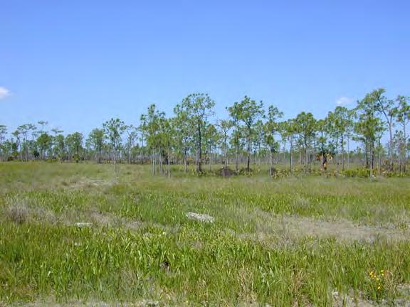
The same effects could be seen in the Fakahatchee Strand, a tract of land located at the western end of Big Cypress Swamp and containing several watercourses and ponds, as well as hammock forests and over 45 species of orchids.14 The state had designated the strand as a state preserve in 1974, and the Department of Natural Resources had attempted to acquire all of the acreage within the preserve. By 1983, it had purchased approximately 2/3 of the land, but it estimated that over 5,000 landowners still held tracts. According to an official with the Florida Natural Areas Inventory (a project jointly operated by The Nature Conservancy and the Florida Department of Natural Resources to identify land and water areas in need of protection), it was essential to acquire these remaining lands, as well as three other parcels outside of the preserve’s boundaries, in order to manage and protect the area effectively.15
Fakahatchee was especially important because it was one of the primary habitats of the Florida panther. Therefore, both the FWS and the Florida Game and Fresh Water Fish Commission examined how the panther could best be preserved in the area. Whatever the two agencies decided, it was clear that some action had to be taken, as the Fakahatchee was
Fakahatchee Strand. (Source: U.S. Geological Survey.)
threatened with agricultural development and drainage projects. “It would be counterproductive to try and halt all development in the area,” the Florida Natural Areas Inventory reported, but “development must be directed away from the most sensitive areas.”16
Meanwhile, the NPS studied the question of how to protect more land in Big Cypress. In 1979, the Service had developed a land acquisition plan for the area, but in May 1982, the Interior Department had issued a policy statement that required any purchase programs to be either revised or replaced. Accordingly, in April 1983, the NPS announced that it was beginning a “land protection planning process” for the region. This included deciding what lands needed to be held in public ownership, as well as examining “the means of protection available to achieve the purpose of the Big Cypress as established by Congress.”17 The NPS noted that although 95 percent of the Big Cypress National Preserve had been purchased, over 550 tracts remained either in private or non-federal ownership. In order to maintain the preserve, the NPS would either have to acquire such lands or develop ways to manage them in accordance with the preserve’s purpose. Robert L. Kelly, president of the Tropical Audubon Society, emphasized how important it was to complete the purchase of Big Cypress Preserve, stating that it was not only “an important area for several endangered species,” but it also “protect[ed] the water supply of the western portion” of Everglades National Park.18
The importance of Big Cypress to endangered species was emphasized as state and federal officials continued to study the Florida panther problem. In October 1982, Graham and the state cabinet issued a one-year moratorium on oil and gas leasing within the Big Cypress National Preserve so that such practices would not “further compromise the panther’s already tenuous survival” (only between 20 and 30 panthers still existed).19 In addition, the Florida Game and Fresh Water Fish Commission tracked panther movement and habitat, and it reported in July 1983 that three “elements of public use” in Big Cypress especially threatened the panther: the utilization of access points and mineral roads, new kinds of off-road and all-terrain vehicles, and “a rapid increase” in recreation.20 To combat these problems, the commission, together with the NPS, proposed certain management actions, such as requiring recreational use permits and annual vehicle registration, and supervising deer and hog hunting more closely (since those animals constituted the panther’s main prey). The commission would also continue to study the panther, since any decision or action affecting the management of Big Cypress needed to be “based on sound logic and scientific knowledge.”21
But Governor Graham decided that purchasing more land, rather than better management of the preserve, was needed, and he included acquisition of Big Cypress land and related regions as priorities in his Save Our Everglades program, announced in August 1983. Graham explained that development threatened the Florida panther, and he called on the federal government to purchase 70,000 acres of Big Cypress Swamp to provide protection. He also recommended that the state acquire the Fakahatchee Strand in order to forestall development in the panther’s main habitat. The governor related that both Big Cypress and Fakahatchee held “immense ecological value,” as they contained “some of the most diverse plant and animal communities in North America.” At least four endangered animal species lived in the regions – the panther, wood stork, peregrine falcon, and red-cockaded woodpecker – as did 15 threatened plant species. Yet extensive development jeopardized this rich and fragile ecosystem. Therefore, Graham designated the Fakahatchee Strand as a “high priority for acquisition under the CARL program,”
and he lobbied the NPS “to increase its efforts to complete the acquisition of the Big Cypress National Preserve.”22
Graham also asked President Reagan for federal help, informing the president that one of “the issues which must be resolved” was “completion of the acquisition of the Big Cypress National Preserve.” This could not be done, Graham continued, without the cooperation of the Interior Department. “We pledge to work with you in such efforts,” Graham stated, “with a special emphasis on the protection of Everglades National Park and the Big Cypress National Preserve.”23
Before the Reagan administration could respond, Graham began formulating a land acquisition plan centered on the transformation of Alligator Alley into part of Interstate 75. Through consultations with federal officials from the Interior and Transportation departments, he reached an agreement that the restructuring of the highway be formulated so that the state could create a buffer zone around Everglades National Park, thereby protecting its resources and creating “permanent habitat for the Florida panther and other rare and endangered species.”24
Under this proposal, the state and the federal government would acquire 165,000 acres in the Big Cypress Swamp and Fakahatchee Strand. The majority of this acreage, approximately 127,738 acres, was located northeast of the existing preserve, adjacent to the Miccosukee Indian Reservation, while the other 37,010 acres consisted of the northern part of Fakahatchee Strand. As a state news release reported, the land contained “wetlands, cypress swamp and hardwood hammock,” as well as “a diversity of rare and endangered plants and animals including the panther, the bald eagle, and native orchids.”25 A large chunk of this acreage – mostly owned by Collier Enterprises and the Barron Collier Company – would be damaged by the highway expansion, necessitating damage payments by the Department of Transportation (90 percent) and the state (10 percent). State officials proposed that this compensation be used to reduce the total cost of acquisition, and that the state (20 percent) and the Interior Department (80 percent) assume the rest of the charges, with the state’s contribution coming from Conservation and Recreation Lands Program funds. In addition, Graham proposed that the Department of Transportation build panther crossings into Alligator Alley, and that it design the reconstruction “to correct hydrologic problems in the Everglades.”26 On 18 April 1984, Graham announced this plan and asked Congress to approve it.
Over the next year, Graham met with Florida’s congressional delegation to develop the necessary legislation, and in January 1986, U.S. Representative Thomas F. Lewis, a Republican from Palm Beach, introduced into Congress H.R. 4090, a bill to authorize additions to the Big Cypress National Preserve. U.S. Senator Lawton M. Chiles, Jr., a lifelong Florida Democrat,
Florida panther. (Source: South Florida Water Management District.)
W HY FSMS?
FSMS is a professional membership society representing the Surveying & Mapping Profession, including: Photogrammetry, Imagery, Remote Sensing, Base Mapping, GIS/LIS, Cartography, Geodesy, Geomatics, GPS, Geographic Information and Geospatial Data.
MEMBERSHIP OPPORTUNITIES
• NETWORKING
• CONTINUING EDUCATION
• LEGISLATIVE FSMPAC
• PROMOTING THE PROFESSION
• PROTECTING LICENSURE
• ADDRESSING UNLICENSED PRACTICE
• ENCOURAGING FUTURE SURVEYORS
• AWARDS & SCHOLARSHIPS
• CAREER OPPORTUNITIES
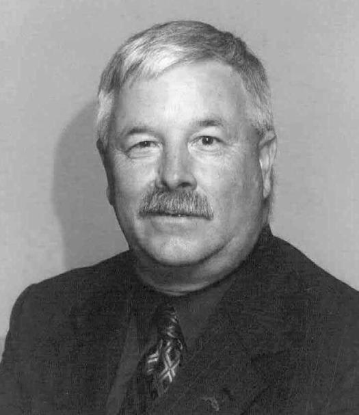
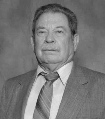
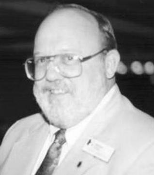
H.O. Peters Surveyor of the Year Award
Jack Breed
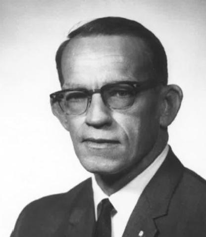
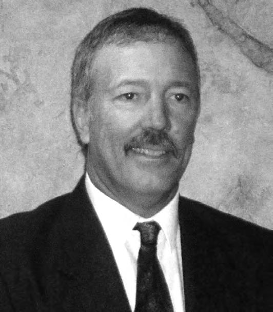
Jim Bennett Board Member of the Year Award
Earl Soeder
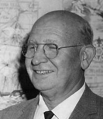
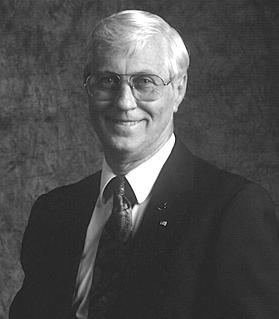
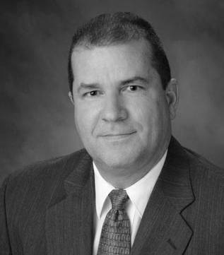
Life Member Recipient
Rick Pryce
Fellow Member Recipients
Earl Soeder & Rick Ritz
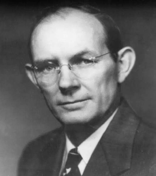
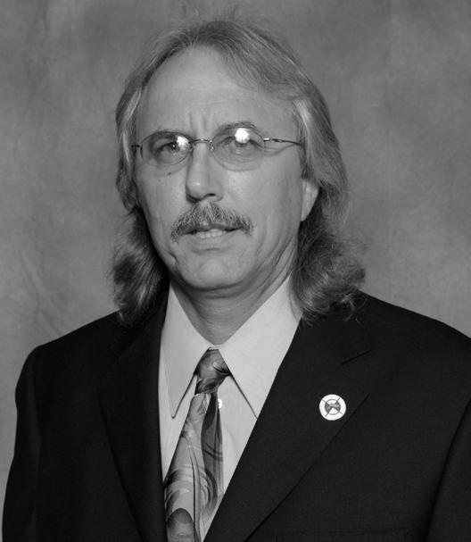
Committee Chair of the Year Award
Bon Dewitt
Young Surveyor of the Year Award
Paige Rogolino
Associate of the Year Award
Karol Hernandez
Professional Excellence Award
Justin Thomas
Perry C. McGriff Outstanding Civic Contribution Award
Brett Wood
Steven Woods Exceptional Service Award
Pam Hyatt
Chapter President of the Year Award
Brion D. Yancy
Small Chapter of the Year Award
Indian River
Large Chapter of the Year Award
Palm Beach
submitted a companion measure to the Senate (S. 2029), showing that, once again, environmental concerns in Florida were largely bipartisan. The bills proposed that the federal government add approximately 128,000 acres to the Big Cypress National Preserve, to be known as the Big Cypress National Preserve Addition. These lands were necessary, the bills continued, in order to “limit development pressure on lands which are important both in terms of fish and wildlife habitat . . . and of wetlands which are the headwaters of the Big Cypress National Preserve.”27 The bills did not go into great detail about how the lands would be purchased, delineating only that the federal government would not pay more than 80 percent of the total cost (meaning the total acquisition costs minus any charges incurred by the Federal Highway Administration or the Florida Department of Transportation in damage payments).
In May 1986, the House Subcommittee on National Parks and Recreation of the Committee on Interior and Insular Affairs held a hearing on H.R. 4090. Several individuals testified in favor of the acquisition, including Florida’s congressional delegation, James E. Billie, chairman of the Seminole Tribe of Florida, and Graham. As Graham stated, the acquisition would establish “an envelope of protection around Everglades National Park,” preventing more Big Cypress acreage from becoming “citrus groves and subdivisions.”28 The purchase would also help preserve the Florida panther and other endangered animal and plant species.
Representatives from environmental organizations provided their support at the hearing. Paul C. Pritchard of the National Parks and Conservation Association told the committee that the Everglades Coalition had been reconstituted, in part to fight for “the addition of these critical environmental lands to the Big Cypress National Preserve,” and he reported that the Sierra Club, Florida Audubon Society, Friends of the Everglades, and Florida Defenders of the Environment, among others, all backed the acquisition. Almost all of those who testified implored Congress to act quickly while the reconstruction of Alligator Alley was occurring, in order to minimize costs to both the federal government and the state of Florida.29
But not all were in favor of the acquisition. Benjamin G. Parks of the National Inholders Association protested the measure, stating that it left too many questions for property owners in the area. Claiming that approximately 1,000 litiga tion cases from the original establishment of Big Cypress National Preserve were still pending in court, Parks wondered whether an additional “4,000 small landowners” would be “left to battle in court for years . . . in order to receive a fair price on the property.” Parks admitted that the legislation was “well intended,” but he insisted that this solution to “an alleged wildlife problem” would create “a very real problem to the people – the access to their property and recreational use of the preserve.”30 Many landowners agreed; James Humble, an avocado grower, had earlier related his displeasure with state and federal land acquisition efforts to the U.S. News & World Report, saying that “in the fervor for environmentalism, a basic property right is being run over.”31
More startling, however, was the opposition expressed by P. Daniel Smith, deputy assistant secretary of the interior for fish, wildlife, and parks, at the hearing, especially since Graham had testified that Florida had worked closely with the Interior Department in the development of the acquisition strategy. According to Smith, the department could not “support the legislation based on current program and budgetary priorities” because it could not spend $40 million (Smith’s estimate of the costs) for lands that “do not appear to be essential for purposes of the existing Big Cypress National Preserve.” Smith claimed that no one had ever explored “the
majority of the tract” to determine panther occupancy – Game and Fresh Water Fish Commission efforts notwithstanding – and he claimed that no panthers actually lived in the proposed acreage, since their primary habitat was located on the Fakahatchee Strand. The Interior Department was already involved in a process to acquire Fakahatchee Strand, Smith continued, and it was examining less expensive ways, such as exchanges, to acquire more land in South Florida.32
In some ways, Smith’s testimony was accurate – the Fakahatchee Strand did constitute the main panther habitat, and most of the land to be purchased was not in the strand. However, Smith ignored the fact that panthers used a wi de expanse of territory for hunting, and that the acquisition would protect such larger areas.33 Another problem with Smith’s testimony was that it implied that panther protection was the only reason why the legislation was necessary. While that was certainly an important reason for the measure, and perhaps even the driving force behind it, the preservation of water supply and water quality for South Florida was also a large reason why state officials wanted the land. Big Cypress National Preserve was created in 1974 to secure high quality water for Everglades National Park, and the addition would further that goal. Likewise, as Representative Lewis explained to his supporters, “this legislation is needed to ensure that South Florida’s water supply will keep pace with its population increases,” mainly because “the growing urban population of South Florida” was “dependent” on wetlands such as those in Big Cypress Swamp “as recharge sources for drinking water.”34
Tree islands in the Big Cypress National Preserve. (Source: U.S. Geological Survey.)
Indeed, Representative John F. Seiberling (D-Ohio) believed that Smith was just throwing up a smokescreen to hide the Reagan administration’s distaste for land purchases. “I am disappointed in the way the administration tempers its evaluation of things like this by the policy and ideology that is currently in vogue,” Seiberling declared, charging that Reagan had his priorities “screwed up.” The administration continually displayed an unfavorable reaction to “anything but the military,” Seiberling continued, even though the Florida situation constituted “a very serious problem.” “We ought to have a more cooperative approach from the Administration,” he concluded.35
When the Senate held a hearing on Chiles’ bill in September 1986, William P. Horn, who also served as assistant secretary for fish, wildlife, and parks, made the same declarations as Smith. “We are aware that the lands covered by this legislation would be a desirable addition to the Big Cypress National Preserve,” he stated, but “a distinction must be drawn between desirable lands and critical lands.” The cost of the acquisition was prohibitive as well, Horn said, making it impossible for the Interior Department to support the measure.36
But Horn explained that another possibility existed to acquire at least some of the land: an exchange. According to Horn, the Interior Department proposed to give Collier Enterprises and Barron Collier Corporation federal lands in Phoenix, Arizona, currently housing a Navajo Indian school and worth $100 million, in exchange for 115,000 acres owned by the Colliers in South Florida and a payment of $50 million. The lands provided by the Colliers would consist of 70,000 acres to be added to the Big Cypress National Preserve; 16,000 acres to be used in the development of a Florida Panther National Wildlife Refuge; and 20,000 acres to establish the Ten Thousand Islands National Wildlife Refuge. If the exchange worked, Horn continued, the state of Florida would have to acquire only 57,000 acres to equal what it wanted the Interior Department to purchase, and the state already had the money necessary to do this under its Conservation and Recreation Lands Program program. Horn claimed that the land gained through the exchange would “constitute a significant addition to both the Park and Refuge systems . . . at no direct cost to the federal taxpayer,” something that the Reagan administration fully supported.37
Nathaniel Reed, who was representing the environmental community, could see no real objections to the Interior Department’s plan, other than the difficulty of its execution. The exchange “has got some real politics and . . . some very, very difficult things to overcome in Arizona,” he related, but “it is doable, perhaps.” Yet Reed also advised Congress to pass the proposed legislation anyway as a sort of “safety” measure in case an exchange could not be effected.38 Steven Whitney, director of the national parks program for The Wilderness Society, agreed, explaining that “the exchange . . . would not be foreclosed by the passage of this legislation.”39
Accordingly, the House of Representatives approved Lewis’s bill in July 1986, but the Senate took no action before the adjournment of Congress, in part, according to one source, because of “Administration opposition to all discretionary federal land purchases.”40 Lewis and Chiles planned on reintroducing the measures in the subsequent Congress, believing that “the level of support” for the original bills indicated “a strong possibility” that they could pass.41 Accordingly, in January 1987, the two submitted S. 90 and H.R. 184, which, for the most part, were no different than the previous measures, except that they now proposed that 136,000 acres
be acquired instead of 128,000. The new bills also specified that the Seminole Indians would maintain their traditional hunting, fishing, and trapping rights in the addition, just as they did in the original preserve.42
In February 1987, the Senate Subcommittee on Public Lands, National Parks and Forests held a hearing on the reintroduced bills. As in the 1986 hearings, many of the same individuals and organizations testified in favor of the legislation. Graham, who by now had become a U.S. Senator for Florida, claimed that not only was the addition necessary to preserve endangered wildlife such as the panther, it was also “crucial to the success of the Save our Everglades initiative, and to the maintenance” of Everglades National Park.43 Florida Governor Bob Martinez declared his support for the addition as well, stating that “timely authorization and funding of federal acquisition” would serve several purposes, such as protection of Everglades National Park and southwest Florida’s water supply, preservation of the Florida panther and other endangered species, and more recreational opportunities.44 In addition, environmental groups continued to support the legislation, although some now asked the Senate to amend the bill so that the entire Fakahatchee Strand could be added to the preserve.45
The Interior Department, however, maintained its opposition to the measure; Horn testified that unless the bill was “amended to provide for acquisition by exchange,” the department would not support it. “Our fundamental problem with S. 90 has nothing to do with the resources,” Horn
Pine prairie in the Big Cypress National Preserve. (Source: U.S. Geological Survey.)
insisted, but everything to do with fiscal conservatism. He reiterated that the Arizona/Florida land exchange proposal was still the best method to pursue, and he claimed that the department was “in the process of completing negotiation” of such an exchange. Upon further questioning, Horn admitted that the interested parties in Arizona had not agreed to the exchange, but he believed that “the outlook [was] entirely positive.”46
Whether because of the Interior Department’s intransigence or not, no federal legislation was forthcoming in the summer of 1987. The major holdup came from the Senate, as the House had passed the legislation in March. In December, the Senate finally considered S. 90, with Chiles and Graham offering several amendments. First, the senators increased the amount of acreage to be acquired to 146,000. Second, they included a new section in the legislation, specifically allowing oil and gas exploration, development, and production in the area under certain terms. Production companies had to obtain a permit from the NPS before conducting any activities in the addition, for example, and the secretary of the interior would have to establish rules for such activity largely in conformance with regulations in “similar habitats or ecosystems within the Big Cypress National Preserve.”47 No debate ensued over these amendments, and they readily passed, as did the entire measure.
When the bill went back to the House, Representative Bruce Vento of Minnesota noted that the legislation would not affect the land exchange discussions. However, Vento also explained that the “Arizona-Florida land exchange has proven to be quite complex.” He was not sure whether it would come to fruition, but he encouraged the House to pass the amended bill anyway, stating that the government should not “del ay the addition of critical lands to the Big Cypress National Preserve on the basis of a land exchange that may or may not come about.” 48 The Everglades Coalition agreed, petitioning Congress at the coalition’s third annual conference in January to approve the measure.49 Accordingly, the House passed the bill, and President Ronald Reagan signed it into law in April 1988, although he insisted that the land exchange proposal be pursued and executed as a condition of his approval.50
Only a few days after Reagan signed the act, Representative Morris Udall of Arizona introduced the Arizona-Florida Land Exchange bill into Congress. This measure, Udall explained, would allow the transfer of 118,000 acres owned by the Collier family in South Florida (valued at $45.1 million) to the federal government in exchange for 68 acres in downtown Phoenix and a payment of $34.9 million. That money would be used to establish an Indian education trust fund to compensate the Navajo for the loss of their boarding school, while the Collier’s land would be added to the Big Cypress National Preserve and used to create the Florida Panther National Wildlife Refuge.51 Governor Martinez of Florida strongly supported this bill, calling it “a unique opportunity to acquire over one-half of the authorized Big Cypress Addition relatively quickly,” and he urged Florida’s congressional delegation to work hard for its passage. 52
For the next several months, this measure wa s debated in both chambers of Congress. Various senators and representatives raised objections over the valuation of the land and the effect that the closure of the Navajo school would have on the Indians – some, such as Representative Sidney R. Yates of Illinois, even characterized the proposal as “a cozy, private, preferential deal” between the secretary of the interior and the Collier interests.53 Many, however, including Lewis, Graham, and Chiles, advocated the measure as a win-win situation for
both Florida and Arizona. Likewise, in a hearing held on the bill in July 1988, numerous environmentalists and state officials favored the acquisition. Finally, on 18 November 1988, the measure, known as the Arizona-Florida Land Exchange Act, became law. 54
Yet the authorization did not prevent problems that developed in the execution of the exchange. For one thing, Collier interests and the city of Phoenix could not reach agreement on the use of the exchanged land. Barron Collier wanted to create 7.7 million square feet of commercial and residential space on the acreage, while the city wanted a 90-acre park. For another, a recession in the first part of the 1990s devalued the land from $80 million to between $25 and $35 million, causing the Collier interests to declare that they were no longer interested in the exchange. By 1991, the agreement was still undecided, and the federal government had made no appropriations for the purchase of the Big Cypress land.55 However, in December 1996, the land exchange finally occurred, meaning that by the end of the 1990s, 146,000 acres had been added to the Big Cypress National Preserve, making a total of 700,000 acres under protection.56 In addition, 26,400 acres in the northern portion of the Fakahatchee Strand was preserved as the Florida Panther National Wildlife Refuge, administered by the FWS.
Some environmentalists, however, believed that the protection was not adequate. For one thing, hunting and off-road vehicles were still permitted in the Big Cypress National Preserve, even though earlier state studies had noted the threat that they posed to wildlife. For another, original landowners were permitted to maintain their mineral rights in the land, and oil and gas drilling could still occur, albeit under NPS supervision. To many, these concessions, granted at the bequest of Congress due to the pleadings of groups such as the National Rifle Association, meant that Big Cypress National Preserve was a “park service stepchild” and that the NPS could not adequately protect the region’s ecology.57
Regardless, the state of Florida had successfully obtained the means to acquire Big Cypress land. Yet state officials were not done. Governor Martinez, who many environmentalists had believed would work against ecological concerns and the Save Our Everglades program, actually accelerated environmental land acquisition efforts during his one term as governor. In the late 1980s, he ensured that Florida’s Conservation and Recreation Lands Program fund had $43 million for land acquisition, and he proposed that over the next nine years, the state enhance the fund by $200 million.58
As the 1990s approached, Martinez developed a plan to generate even more money for land acquisition, in part because, even with the efforts that the state had already made, much of Florida’s rich ecology still remained in danger. In 1990, a state commission investigating environmental concerns reported that by the year 2020, another three million acres of wetlands and forests would be lost to development. It was also estimated that, according to the Department of Environmental Protection, “about 19 acres per hour of forest wetland and agricultural land was being converted for urban uses.” Many Floridians were concerned with these facts; a November 1989 poll indicated that 88 percent of Florida residents wanted the state to devote more attention to the environment. Aware of these trends, Martinez proposed – and the Florida legislature passed – a huge land acquisition program in 1990 known as Preservation 2000.59
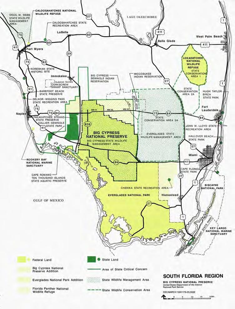
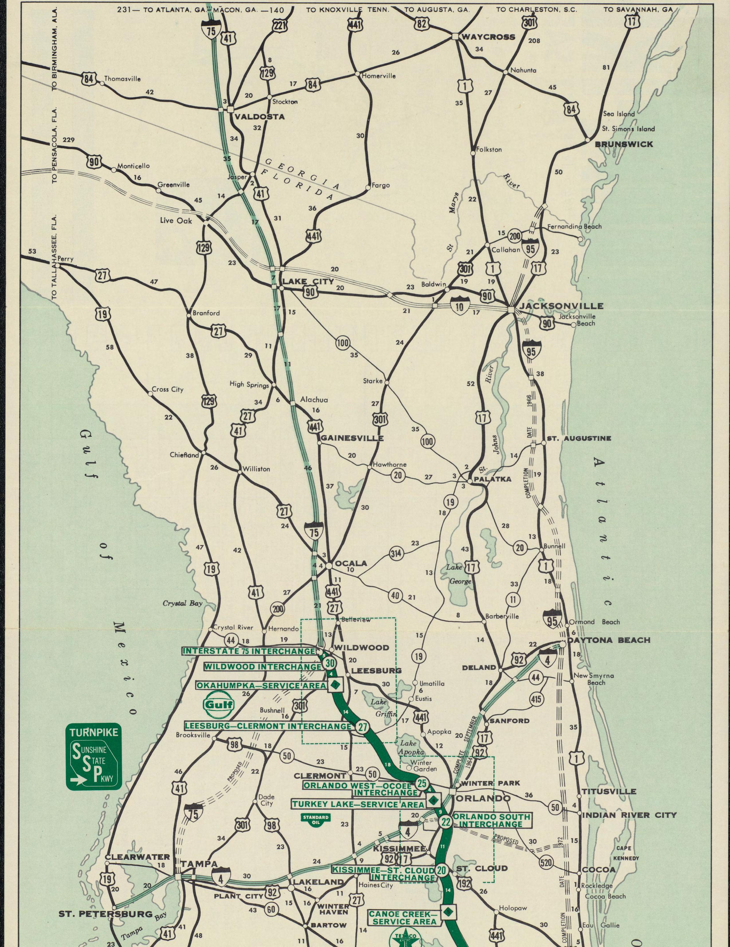
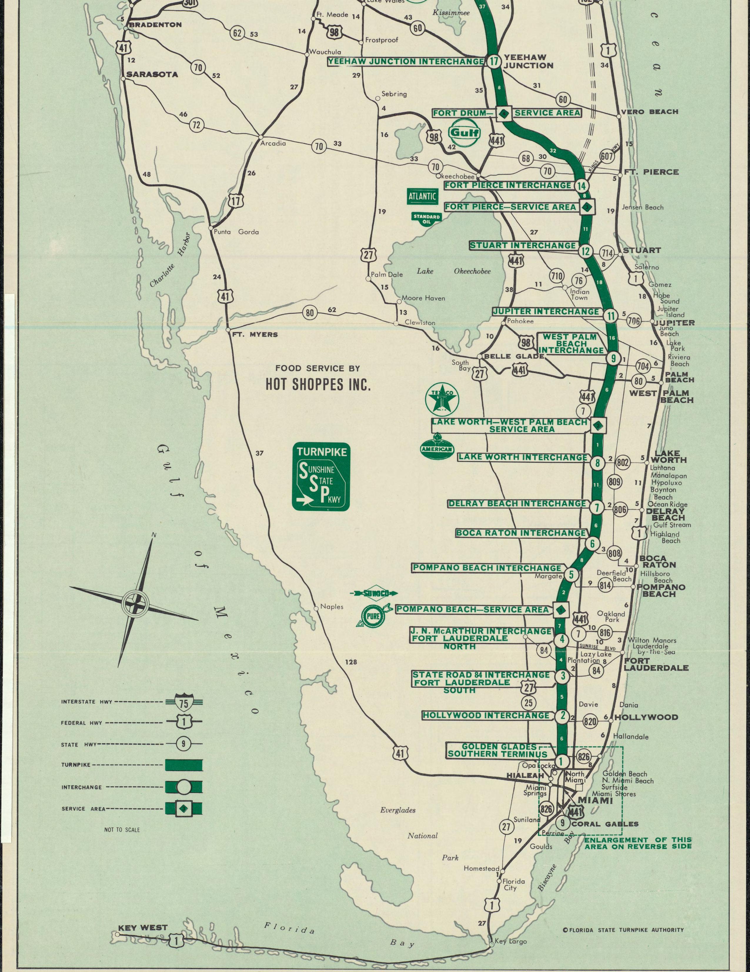
Map of the Big Cypress National Preserve and Addition. (Source: National Park Service, Big Cypress National Preserve, Florida: General Management Plan, Final Environmental Impact Statement, Volume 1, 5.)
Under Preservation 2000, the state increased the tax on real estate documents to fund an additional $300 million in bonds every year. With such an arrangement, Florida would have a $3 billion land preservation fund by the year 2000 – more than the federal government spent on environmental land acquisition efforts. Martinez justified such a huge amount by saying that Floridians had “an important choice to make: We can buy up environmentally sensitive lands that would otherwise be lost to future generations, or we can let a golden opportunity slip by.”60 Newspaper editorials called the program “staggering,” “unprecedented,” and “one of the most significant environmental initiatives in the past two decades,” and environmentalists were pleased as well. “This, I think, is going to change the face of Florida more than any single thing I can think of,” Nathaniel Reed noted.61 Others agreed. Ernest “Ernie” Barnett of the Department of Environmental Protection claimed that Preservation 2000 was the shining environmental jewel in Martinez’s administration, and that it established a program that spent more per year than the federal government and many small countries on land acquisition.62
Yet Preservation 2000 was merely the culmination of land acquisition programs that the state developed in the 1960s and 1970s. Always one of the most ambitious states in terms of environmental land purchases, the state increased its efforts in the 1980s with the establishment of the Conservation and Recreation Lands Program, the Save Our Rivers and Save Our Coasts legislation, and the Save Our Everglades plan. This focus on land acquisition was necessary in the 1980s because of the Reagan administration’s discouragement of federal land purchases. In the words of one NPS officer, “it was administration policy that they didn’t want to be expanding parks that they’d have to pay for.”63 Even though all sides agreed that additional lands in Big Cypress Swamp and in the Fakahatchee Strand were necessary for preservation, their acquisition occurred only after the Interior Department negotiated an exchange – not a purchase – between the Collier interests and the federal government. At the same time that the state fought for Big Cypress acquisition, however, an even bigger battle was occurring over another area in need of protection: the East Everglades. The fight over that land – largely between the NPS, the Corps, and agriculturists, hunters, and others interested in the region – would dwarf the Big Cypress difficulties.
Chapter Ten Endnotes
1 See Supreme Court of Florida, Opinion No. 76,984, 20 December 1990, Florida Supreme Court Briefs & Opinions, College of Law Library, Florida State University, Tallahassee, Florida <http://www.law.fsu.edu/library/flsupct> (15 February 2006). In 1968, a new constitution was adopted in Florida that prohibited the issuance of any of these bonds, but Senate Joint Resolution No. 292 rescinded that prohibition and allowed the Land Acquisition Trust Fund to continue.
2 Senator D. Robert Graham, “A Quiet Revolution: Florida’s Future on Trial,” The Florida Naturalist 45 (October 1972): 149.
3 Whitfield interview, 11.
4 Florida Department of Natural Resources, “Statewide Land Acquisition Plan and Procedure for Individual Project Design and Acquisition Phasing,” 20 November 1984, 2- 3, Appendix 4, copy in File Department of Natural Resources Statewide Land Acquisition Plan, 1984-85, Box 02161, SFWMDAR.
5 As quoted in “Florida’s Growth Straining Fragile Groundwater,” Engineering News Record 216 (3 January 1985): 26.
6 Hansen, “South Florida’s Water Dilemma,” 17, 20; Land Acquisition Selection Committee for the Board of Trustees of the Internal Improvement Trust Fund, Florida Statewide Land Acquisition Plan (Tallahassee, Fla.: Board of Trustees of the Internal Improvement Trust Fund, 1986), 1 [hereafter referred to as Florida Statewide Land Acquisition Plan]; Southwest Florida Regional Planning Council, “Demographics” <http://www.swfrpc.org> (16 December 2005).
7 Moreau, “Everglades Forever?” 72-74; James Carney, “Last Gasp for the Everglades,” Time 134 (25 September 1989): 26.
8 Yates, “Saga of the Glades Continues,” 38.
9 Florida Department of Natural Resources, “Statewide Land Acquisition Plan and Procedure for Individual Project Design and Acquisition Phasing,” 3.
10 Florida Statewide Land Acquisition Plan, 2. It appears that the need for a comprehensive plan was first addressed in 1984. See Florida Department of Natural Resources, “Statewide Land Acquisition Plan and Procedure for Individaul Project Design and Acquisition Phasing.”
11 Seminole Indian Land Claims Settlement Act of 1987 (101 Stat. 1556); Kersey, “The East Big Cypress Case, 1948-1987,” 466-474.
12 Quotations in Big Cypress Area Management Task Force, “Report to Governor and Members of the Cabinet,” 17 February 1983, 3-4, File Big Cypress Area Mgmt Task Force Report, 1983-85, Box 02186, SFWMDAR; see also Rob Magee, State of Florida Department of Community Affairs, Division of Local Resource Management, to Nancy Linnan, 5 July 1983, Folder 30, Box 25, Series II, Marjory Stoneman Douglas Papers, Manuscript Collection 60, Archives and Special Collections, Otto G. Richter Library, University of Miami, Miami, Florida [hereafter cited as Douglas Papers].
13 Big Cypress Area Management Task Force, “Report to Governor and Members of the Cabinet,” 29-30.
14 Senate Committee on Energy and Natural Resources Subcommittee on Public Lands, National Parks and Forests, El Malpais National Monument and Big Cypress National Preserve: Hearing Before the Subcommittee on Public Lands, National Parks and Fo rests of the Committee on Energy and Natural Resources, United States Senate, 100th Cong., 1st sess., 1987, 74 [hereafter referred to as El Malpais National Monument and Big Cypress National Preserve].
15 Steve Gatewood, Florida Natural Areas Inventory, to Jim McKinley, FLTNC, 6 June 1983, Folder 36, Box 25, Series II, Douglas Papers.
16 Gatewood to McKinley, 6 June 1983.
17 “National Park Service Initiates Land Protection Planning for Big Cypress National Preserve,” National Park Service News Release, 25 April 1983, Folder 2, Box 23, Series II, Douglas Papers.
18 Robert L. Kelley, “The Future of Everglades National Park,” Folder 27, Box 25, Series II, Douglas Papers.
19 “Panther Preservation in the Big Cypress National Preserve: A Discussion of the Issues,” March 1985, File PRO Everglades Panther, Box 21213, SFWMDAR.
20 “Florida Panther Recovery: A Status Report to The Governor and Cabinet, July 7, 1983,” File PRO Everglades Panther, Box 21213, SFWMDAR.
21 “Florida Panther Recovery: A Status Report to The Governor and Cabinet, July 7, 1983.”
22 “Issue Paper: Save Our Everglades,” 9 August 1983, 9-10, copy in Folder 16, Box 2, Marshall Papers. The Save Our Everglades program also called for land acquisition efforts in East Everglades; this will be dealt with in another chapter.
23 Bob Graham, Governor, to Honorable Ronald Reagan, 8 August 1983, Folder 16, Box 2, Marshall Papers.
24 “Save Our Everglades: Restoring Everglades National Park,” 18 April 1984, 2, Folder 16, Box 2, Marshall Papers.
25 “Save Our Everglades: Restoring Everglades National Park,” 2-5.
26 “Save Our Everglades: Restoring Everglades National Park,” 2-5.
27 Quotations in House Committee on Interior and Insular Affairs Subcommittee on National Parks and Recreation, Additions to the National Park System in the State of Florida: Hearings Before the Subcommittee on National Parks and Recreation of the Committee on Interior and Insular Affairs, House of Representatives, 99th Cong., 1st and 2d sessions, 1985 and 1986, 105-107 [hereafter cited as Additions to the National Park System]; see also Bob [Graham], Governor, to Mrs. Marjory Stoneman Douglas, Friends of the Everglades, 25 February 1985, Folder 85, Box 30, Series II, Douglas Papers.
28 Additions to the National Park System, 164.
29 Additions to the National Park System, 187-188.
30 Additions to the National Park System, 173-174.
31 As quoted in Ronald A. Taylor, “Saving a Fountain of Life,” U.S. News & World Report 100 (24 February 1986): 64.
32 Additions to the National Park System, 151-152.
33 For a good discussion of panther movements in the Big Cypress area, see Levin, Liquid Land, 99-117.
34 “Big Cypress Addition: An Attempt to Preserve Water, Life in ‘Glades,” Congressman Tom Lewis’ Florida Environment Report, n.d.
35 Additions to the National Park System, 158-159.
36 Senate Committee on Energy and Natural Resources Subcommittee on Public Lands, Reserved Water and Resource Conservation, Additions to the Big Cypress National Preserve; Establishing the San Pedro Riparian National Conservation Area; Designating the Horsepasture River as a Component of the National Wild and Scenic Rivers System; and Amending FLPMA: Hearing Before the Subcommittee on Public Lands, Reserved Water and Resource Conservation of the Committee on Energy and Natural Resources, United States Senate, 99th Cong., 2d sess., 1986, 99-103 [hereafter referred to as Additions to the Big Cypress National Preserve].
37 Additions to the Big Cypress National Preserve, 99-103.
38 Additions to the Big Cypress National Preserve, 162.
Chapter Ten Endnotes
39 Additions to the Big Cypress National Preserve, 162.
40 “Big Cypress Expansion Legislation Fact Sheet, January 1987,” File Washington Office Big Cypress, Box 2, S1401, Executive Office of the Governor Subject Files, 1987-1998, FSA.
41 “Big Cypress Addition: An Attempt to Preserve Water, Life in ‘Glades.”
42 El Malpais National Monument and Big Cypress National Preserve, 20-30, 41.
43 El Malpais National Monument and Big Cypress National Preserve, 39-42.
44 Bob Martinez, Governor, to Senator Dale Bumpers, Chairman, Senate Subcommittee on Public Land, National Parks and Forests, 12 February 1987, in El Malpais National Monument and Big Cypress National Preserve, 43-44.
45 El Malpais National Monument and Big Cypress National Preserve, 356. At a January 1987 meeting of the Everglades Coalition, the organization encouraged the Reagan administration to support the new measures, stating that “all available methods including possible land exchanges, should be considered to bring these critical lands under public ownership.” “Statement of Everglades Coalition Members, Lake Wales, Florida, January 17, 1987,” File 10-1-7a (Kissimmee River-Lake Okeechobee, FL) 12222, Box 25, Accession No. 077-96-0033, RG 77, FRC.
46 El Malpais National Monument and Big Cypress National Preserve, 67-81.
49 “Coalition Outlines Plan to Halt Everglades Decline,” National Parks Magazine 62 (March/April 1988): 9.
50 Act of 29 April 1988 (102 Stat. 443); Ronald Reagan, “Statement on Signing the Big Cypress National Preserve Addition Act,” 29 April 1988, Ronald Reagan Presidential Library Archives <http://www.reagan.utexas.edu/archives> (20 December 2005).
52 Bob Martinez, Governor, to The Honorable Lawton Chiles, United States Senate, 6 July 1988, File Big Cypress Land Swap, Box 88-02, S1331, Executive Office of the Governor, Brian Ballard, Director of Operations, Subject Files, 1988, FSA.
54 Act of 18 November 1988 (102 Stat. 4571); see also Congressional Record, 100th Cong, 2d sess., 27 July 1988, 134:5895.
55 “Everglades Land Swap Imperiled,” National Parks Magazine 65 (September/October 1991): 10-11.
56 See “Save Our Everglades: A Status Report by the Office of Governor Lawton Chiles,” 30 June 1996, 9, copy provided by SFWMD.
57 See, for example, Levin, Liquid Land, 101-102.
58 “Past Accomplishments,” File Governor’s Environmental Initiatives, Box 1, S1401, Executive Office of the Governor Subject Files, 1987-1988, FSA.
59 Florida Department of Environmental Protection, “History of Florida’s Conservation Efforts” <http://www.dep.state.fl.us/lands/acquisition/P2000/BACKGRND.htm> (20 December 2005).
60 As cited in “Florida’s Preservation 2000,” St. Petersburg Times, 25 January 1990.
61 Reed and editorial quotations in “Florida’s Preservation 2000,” St. Petersburg Times, 25 January 1990; see also Florida Department of Environmental Protection, “History of Florida’s Conservation Efforts.”
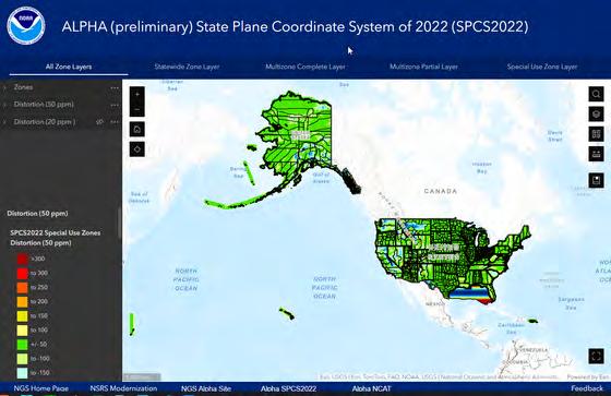
NGS Geospatial Product Updates
NGS has recently updated some of its most popular geospatial products available, including the Alpha SPCS2022 Experience, Datasheet shapefiles. Additionally updates to the Feature Services utilized by the NGS Map are coming soon.
Alpha SPCS2022 Experience
The Alpha SPCS2022 Experience was upgraded from using Raster Tile Layers to Tiled Image Layers. Instead of simply viewing images of the distortion layers, users can now click and retrieve pixel values for the distortion on all layers. Additionally, users can now bring these layers into their own online maps or desktop maps and extract or reclassify the raster data. Finally, the application’s updated responsive design improves usability on computers and mobile devices.
Datasheet Shapefiles
NGS recently updated the Datasheet shapefiles, moving the beta format to production and retiring the old format. The now singular Datasheet shapefile format includes the more expansive list of fields that was popular in the beta format. More specific information about all changes to the shapefile datasheets can be found in the Datasheet_Shapefile_Changes document.
ArcGIS Online Datasheets, CORS and OPUS Shares Solution Assets
This month NGS will update the ArcGIS Online Feature Services utilized for the NGS Map [ Datasheets , CORS , and OPUS Shared Solutions ] and change to Views of these Feature Services. This update will change the service URLs, so anyone currently using these feature services in web maps/ applications will need to update their service links by October.
The Datasheets View , NOAA CORS Network View , and OPUS Shared Solutions View are already publicly available and can be used for your maps and applications today.
Executive Business in the Senate
COMING
IN
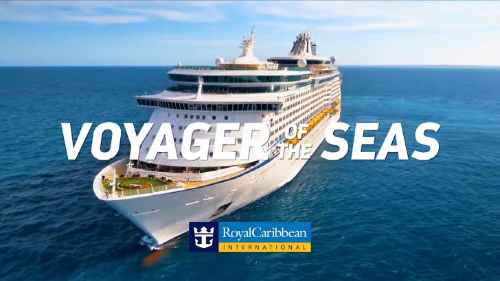
JANUARY 2025 — Seminars at Sea
Live Seminar at Sea:
Relax, Rejuvenate & Learn!
Join your fellow surveyors & bring along the family & friends in January of 2025 on a 4 night cruise to the Bahamas on Royal Caribbean’s Voyager of the Seas. We will leave from Orlando (Port Canaveral), Florida on Thursday, January 30th 2025 at 4 pm, and return Monday, February 3rd at 7 am.
GROUP SPACE IS BEING HELD!
• Book early to get the best rates.
• Cabins starting as low as $456.
• Rate is per person based on double occupancy!
• Be sure to book with our Travel Advisor, Gail Oliver to get the Group benefits. Click Here for more information and booking availability.
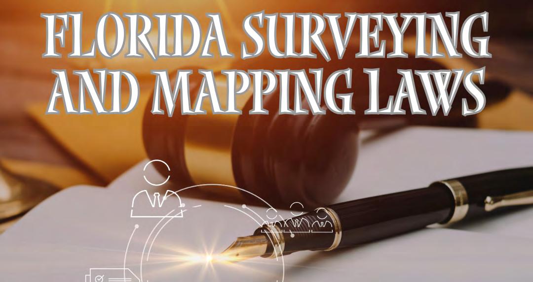
Course # 10757 (5 CECs) FL Surveying and Mapping Laws, Rules, and Other Statutes. — Saturday, 2/1/25 from 7:30 am to 12:00 pm.
Description: This course will review various laws and rules which regulate the practice of surveying and mapping within the jurisdiction of the State of Florida. It will also include "other" random laws the surveying profession has listed and that you may not have heard or thought of. Get ready for an interactive fun discussion on laws and rules, including Standards of Practice!
Included with Registration: One voucher for a 6 hour correspondence course of your choice. Contact education@fsms.org after registering with course selection to redeem your voucher. Link to Seminars at Sea Webpage
SPONSORSHIPS:
For Sponsorship Opportunities & Info contact Education Director Sam Hobbs at education@fsms.org.
Thank You to our T-Shirts Sponsor — E.R. Brownell & Associates
Education Sponsor $1000 (Provides Coffee & Pastries during the Education Class, Printed & digital signage displayed in the classroom, Dedicated “Sponsor Thank you” on FSMS website & social media posts, Listed in all Seminars at Sea Communication, Recognition in The Florida Surveyor Magazine)
Private Cocktail Party Sponsor $3000 (Pirate Themed Welcome Party with cocktails & appetizers (1 Hour), Verbal Recognition during Event, Dedicated “Sponsor Thank you” on FSMS website and social media posts, Listed in all Seminars at Sea Communication, Featured Full-page ad in The Florida Surveyor Magazine)
FACES ON THE FRONTIER
FLORIDA SURVEYORS AND DEVELOPERS IN THE 19TH CENTURY
by Dr. Joe Knetsch
CHAPTER 10
BENJAMIN CLEMENTS
Major Benjamin Clements was one of the most important surveyors in the history of Florida. In his very first contract with Surveyor General Robert Butler, a fellow Tennessean and intimate friend of Andrew Jackson, Clements was assigned the task of laying out the Prime Meridian, which divides all surveys between east and west in Florida. He followed this contract with one for the difficult survey of the Basis Parallel, West, running from the Prime Meridian to the Perdido River, dividing the western part of the territory north and south. 1 Thus this remarkable man ran two of the most essential surveying lines uti lized on all maps of Florida.
1Drawer, “U.S. Deputy Surveyors: A-H.” File, “U.S. Deputy Surveyor, Benjamin Clements, Con tracts & Bonds.” Land Records and Title Section, Division of State Lands, Florida Department of Environmental Protection, Tallahassee, Florida. Hereafter, Contracts and Bonds. These valuable files contain all of the contracts and bonds of the U.S. Deputy Surveyors and frequently include important correspondence which was not filed elsewhere.
Clements came highly recommended to Robert Butler by Andrew Jackson, in whose household the young Butler was reared. Jackson’s brother-in-law, General John Coffee, Surveyor General of the Territory South of Tennessee, also sent But ler his recommendation of Clements and his friend, James Exum:
Col. James W. Exum and Major Benjamin Clements, has made
known to me their intention to apply to you for appointments as deputy Surveyors in Florida, and have requested of me letters of recommendation &c., to which I most chearfully comply, and will remark to you that both of these Gentln. have surveyed for me in this department from its commencement, to its termination and I have always found them prompt, and strictly attentive to the discharge of the work assigned them, and are both of them excellent surveyors, and I have no doubt but they will execute any work you may assign them, with correctness and dispatch. 2
2Applications for Employment, Volume I, 1824-44. Letter of July 31, 1824. John Coffee to Rob ert Butler. Land Records and Title Section, Division of State Lands, Florida Department of Environ mental Protection, Tallahassee, Florida. These letters are the original letters in three bound volumes. They are open to the public on microfilm only as they are very fragile and subject to damage.
This letter was added to one written by John Bright, another Tennessee acquaintance of Butler’s. Bright’s ending sentence accurately sums up Clements’ personality, “As to Major Clements abilities as a Surveyor there is no doubt, as to his correctness and integrity in other respects there is as little, he is also a man of great industry and purseverance and will if possible accomplish any thing he undertakes.” 3 In the days and years ahead, this personality trait was to be greatly tested under some of the most trying circumstances found in the history of Florida surveying.
3 Ibid , Letter of July 25, 1824. John Bright to Robert Butler.
Benjamin Clements did have a great deal of experience upon which to draw prior to his arrival in Florida in 1824. He received a contract for surveying in Ala bama in 1817 and continued to survey there until the public land surveys there were terminated in 1823. 4 In a letter of November 1819, Coffee informed the head of the General Land Office Josiah Meigs that Clements had been contracted to lay out the town located at Fort Jackson on the Alabama River. 5 Thus, Ben jamin Clements had experience at laying out the lines for public land surveys and for platting out towns, a skill he used to advantage in 1835 when he assisted his son, Jesse, in surveying out the town of St. Augustine, Florida.
Faces on the Frontier
4 Territorial Papers of the United States , Volume XVIII, The Territory of Alabama: 1817-1819 . Clarence E. Carter, Editor (Washington: Government Printing Office, 1952), 277.
5 Ibid , 732.
In mid-1827, Clements, in company with another Jackson relative, J. R. Donal son, left for Pensacola from Nashville, Tennessee. The crops that year were poor because of a wet and cold spring that dampened the prospects of a large yield. 6 Along the way, they visited Clements’ property in Selma, Alabama, where he reported to Butler that both men were in good health and expected to reach Pensacola by early August. 7 Clements’ assignment was to survey private land claims and some public lands in the Pensacola region to the amount of six hundred and fifty miles of lines. The rate of pay was to be four dollars per mile. 8 Little did he know that the costs of surveying would be much greater than the money he would realize from the completion of the contract. Nor did Clements expect to find the resistance to his attempts to survey the land claims from those most expected to benefit from such work.
6 Letters and Reports to Surveyor General , Volume 1, 1825-1847. Letter of June 25, 1827. Clem ents to Butler, 57. Land Records and Title Section, Division of State Lands, Florida Department of Environmental Protection. Tallahassee, Florida. Hereafter, Letters and Reports, Volume number, date of letter and page number. Again, these are bound copies of the originals letters and are avail able for inspection from the microfilm copies available at the Land Records and Title Section.
7 Letters and Reports , Volume I. Letter of July 29, 1827. Clements to Butler, 61.
8Contracts and Bonds. Benjamin Clements.
The resistance to Clements and Exum in their attempt to survey the Escambia and Pensacola area land grants came from the claimants themselves. The main reason for this opposition to the surveying of the grants was the Spanish law that gave those who found errors in surveys a part of the grant or one fourth the value of said portion found in the error. Because the land commissions of East and West Florida found so many grants were either fraudulent or poorly surveyed, the recip ients of the grants were leery of anyone attempting to find the exact boundaries of these plots. Should an error be found in the surveying of the grant, the surveyor could potentially
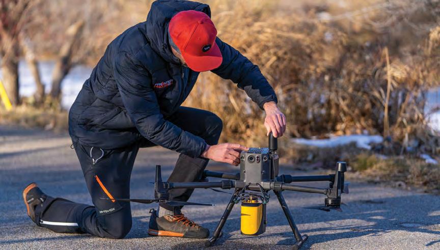
Frontier Precision has the latest LiDAR photogrammetry innovations to fit your job or application. Our staff has the knowledge and real-world experience to help you select the solution that’s best for you and the training to make you more proficient and profitable. Just as important, our professional services group can help you implement LiDAR and photogrammetry solutions on your next project – from field data capture to data processing – we have the expertise to make sure your project is done right.
The YellowScan LiDAR UAV delivers the highest level of accuracy and density for real-time georeferenced point cloud data. Lightness and accuracy combine for a LiDAR solution that works hard for you.
Emesent automates the collection and analysis of data in challenging GPS-denied environments, delivering revolutionary efficiency, safety, and operational insights to underground mining and other industries. It’s core areas of expertise are drone autonomy, SLAM-based LiDAR mapping, and data analytics.
become a rich man. Although this was not the case, the fear the old law engendered made many landholders reluctant to allow any survey to be made and some were hesitant in pointing out the boundaries of their grants. But ler warned Clements that some problems might exist and that he would need to exercise caution, “I congratulate you and Mr. Donalson on your arrival and hope for you every thing good; but you must put on the garb of patience_ you will have need of it.” 9
9“U. S. Surveyors A-H”, [File] “US. Deputy Surveyors, Clements and Exum.” Letter of August 21, 1827. Butler to Clements and Donalson, 10-11. Land Records and Title Section, Division of State Lands, Florida Department of Environmental Protection, Tallahassee, Florida. Hereafter, Clements and Exum, date of letter and correspondents.
On August 9, 1827, Clements wrote to Butler stating his observation about this situation:
I Got to this place 3d Instant in good health & have been here waiting Since have not yet received the first information from a Claimant relative to his Claim & fear I will not from what I can learn from Col. Exum as regards the dificulty he has had in procurring the necessary information & being in the neighbourhood of the Same Some of the Claimants Say, it is too far to go this hot weather & Shew there beginning corners Some not got there papers at home &c &c &c I shal wait here my time out & then take the woods hot or cold if will do the best I can giving them notice that I will be in this place again in a few weeks &c. 10
10 Letters and Reports , Letter of August 9, 1827. Clements to Butler, 65-66.
Five days later he reported that he had some of the information from nearly all of the claimants on the East side of the Escambia River, but was having some di ffi culty in locating the corners of the various grants. He also informed Butler that he had “taken one stand amongst them” to convince them to show him the places of beginning for their surveys and was firm in his dealings with the grant holders. If he had not done so, he believed, “I might wasted here the balance of the year.” 11
Letters and Reports , Letter of August 14, 1827. Clements to Butler, 69-70.
The problem of expenses constantly worried Clements on this survey because a surveyor had to perform the work at his own expense until he was paid for the completion of the survey. This process could take up to two years or more on the Florida frontier, which had no active banks that received federal funds. Almost all of the funds sent to the surveyors in the Territorial period of Florida were drawn on federal accounts in Mobile or Savannah. These funds were normally paid in drafts upon these banks, which meant that the surveyor would have to travel to Mobile or Savannah or find a local merchant who would accept these drafts as payment. Surveyors had to be men of enough means to enable themselves to attempt to fulfill their contracts or had to rely upon the ability of the Surveyor General to provide funds to them when needed, a very questionable practice in the days of unreliable mails and threats of violence to mail carriers.
This dilemma is clearly illustrated by the Clements correspondence in 1827. On the August 9, he wrote to Butler that he was short of cash because he had depended upon $500 to be sent to him from the Surveyor General. Because of this dependence he pleaded, “I have come without much cash depending on the $500 you will please Send it to my relief Soon. I have not more that $60 or $80 with me depending on that alone This is a hard Country to live in without cash &c.” 12 By August 14, Clements noted, “I have been compeled [sic] to borrow $160 to enable me to go on you will please send me the necessary apparatus &c or I Shall have to send to your Man for help as came here relying on it alone & made no other preparation at all I cannot live here without cash.” 13 By the end of the month, he had received the first letter from Butler. “I have,” he confirmed, “a few minutes Since received the first line from you & find enclosed the left hand half of 5 one hundred Dollar notes the other halves I hope to get Soon &c.” 14 Not until September 9, 1827, did Clements receive the right hand halves of the five one hundred dollar notes, which enabled him to carry on, but with some difficulty. As the Major informed Butler, “I also inform'd you that I have this day needed the right hand of the five bank notes of one hundred Dollars each the other halves I have receiv'd sometime before the Two hundred dollars in Georgia money I think will be of lit tle use to me here The balance I think will go well.” 15 The problem of sending money was obviously a difficult
Faces on the Frontier
one and the fact that it was sent by halves indi cates the uncertainty of the mails in the Territorial period. Also, the notation that the Georgia money would not be of use in Pensacola gives an idea of the dilemma faced by frontier settlers when they did receive bank notes. The values of these notes varied greatly and the uncertainty of a bank’s solvency made handling bank issued currency a problem for both settler and sutler.
12 Letters and Reports , Letter of August 9, 1827. Clements to Butler, 65-66.
13 Letters and Reports , Letter of August 14, 1827. Clements to Butler, 69-70.
14 Letters and Reports , Letter of August 28, 1827. Clements to Butler, 73-75.
15 Letters and Reports , Letter of September 9, 1827. Clements to Butler, 81-82.
The survey of the Escambia area was more costly in another way to Benjamin Clements. On August 28, 1827, he informed the Surveyor General of some unpleasant news, “I left camp yesterday early in the day left all well when I left camp but in hour since two of my boys came in search of me & tell me that 8 of my hands was [stricken by] yellow [fever] by evening was taken Sick which is not so pleasant Since I am going to take medicine plenty with me the weather has been very hot & we have been a great deal in the Swamp &c.” 16 By August 30, things had not improved:
I am at this time in camp at Florida 20 miles above Pensacola am good health myself but dont know how long I can to remain so I have bad news to tell you on the 27th Inst. after I left home for Pensacola two of my boys were taken sick Hosea was one of the last that was taken he is very sick & three of the others one is I hope a little better two I fear dangerous without Some relief Hosea I hope not yet dangerous I have a bad chance of a Doct. I have medicines plenty with me but it does not appear to do much good yet if there is no alternative by morning I Shall leave here to Pensacola for a Doct. & as soon as we can travel I shall move out from the Bay & River. 17
16 Letters and Reports , Letter of August 28, 1827. Clements to Butler, 73-75.
17 Letters and Reports , Letter of August 30, 1827. Clements to Butler, 77-78.
As a postscript to the letter, the troubled surveyor/father noted, “Hosea has at the present a high burning fever & his nerves appear much affected & I dont know what to do for him. O, if he only was at home with his mother Such a time as this I have never seen before in all my Travels five lying here at one time bad Sick if myself & one other gets sick What will I do when no body to wait on us but I hope for the better.” 18 The severe anguish of a father seeing his son, and his compan ions, fall sick to the yellow fever was an awful strain on the brave surveyor. On September 9, he reported to Butler that Hosea was in the hands of a Mr. Simpson. “one of the best hands in any country” and resting, but could not raise his head or turn over without aid. 19 The distraught father would not leave his son’s side and had to postpone the work on the private claims. At the end of October 1827, Hosea Clements and one other member of the crew died. Butler wrote to his friend and Deputy Surveyor on November 5, “I have just received your letter from Tennessee in which you mention your return to work in last month. I do most sin cerely sympathize with you for the loss you have sustained in the death of Hosea. He was a youth of much promise and one I esteemed highly.” 20 The costs of the survey of the Escambia country was, indeed, very high for Benjamin Clements.
18 Ibid
19 Letters and Reports , Letter of September 9, 1827. Clements to Butler, 81-82.
20Clements and Exum. Letter of November 5, 1827. Butler to Clements, 12.
As if the death of his son, the lack of money and the resistance of the claimants were not enough, Clements had also to solve the problem of foreign measure ments. What was an arpent? Did the Spanish surveyor use the Spanish or French measurement? On August 14, Clements wrote to Butler asking instructions on the Mitchel claim, since it was different from those he had previously surveyed. As he noted to the Surveyor General, “I assure you I am at a grate [sic] loss in this one case &c.” 21 Butler informed his deputy, in reply to his inquiry, “for your government and that of Mr. J. R. Donelson [Donalson] to whom you will communi cate, I inform you that the Arpent of France contains one hundred square poles of 18 feet each, and bears to the American acre in the proportion of 512 to 605. and the french [sic] foot as to the American as 16 to 15.” 22 Clements appears to have been dissatisfied with
his own work regarding the length of the arpent, however he did conclude:
As respects the length of the pearch of parish Col. Exum makes 19 2/10 feet which makes to 800 Arpents 677 Acres but I am of the opinion that he is incorrect in his calculations. [A]s Such I am waiting here to see him. When I saw last he still continued of the opinion that his calcu lation was right & as I was of different opinion. I have been a little at a loss to know what course to pursue but on examination of my calculations at present I make 800 Arpents 677 Acres agreeable to the length you give of the French [sic] foot tho T may be in error if so I hope you will correct me as Soon as possible & I must go over again & make it right before I am done &c. 23
21 Letters and Reports , Letter of August 14, 1827. Clements to Butler, 69-70.
22Clements and Exum. Letter of August 1, 1827. Butler to Clements, 10-11.
23 Letters and Reports , Letter of August 28, 1827. Clements to Butler, 73-75.
From the available correspondence, it does not appear that Butler had too much patience with Clements’ dilemma over the size of the arpent. On November 5th, in the same letter that he expressed his sympathies, he informed Clements, “I have previously given you the information sought for in relation to the calculation of Arpents and my decision on the private claims which was that you were not autho rized to alter the locations of private claims when marked lines existed.” 24 This quick and terse reply seems to have ended Butler’s discussion of the topic, although Clements was not totally convinced and asked for further instructions on August 30. No reply to this Letter has been found and it can only be assumed that the measurement, which relates 677 acres to the arpent, was correct.
24Clements and Exum. Letter of November 5, 1827. Butler to Clements, 12
Benjamin Clements also had questions regarding the location of the donations found within his surveying district. A “donation” is simply another name for a grant of land from the federal government and frequently, in the Territorial period, they approximated a section of land or 640 acres. In asking for directions about how to proceed, Clements indicated that his original
instructions did not cover the relationship of donations to the section lines already run in the area. “Col,” the frustrated deputy wrote, “I am at a loss to know whether or not the donation granted to a few settlers are to be run of[f] or are they confined to the Sectional lines I have 8 of them in my District. Col White tells me they are Confined to the Sectional lines & not to be run of[f] I wish your opinion on that matter as my Instructions Say nothing about it.” 25 Butler responded to this question quickly and to the point, “The Donation cases you are to lay down as near to the sectional lines of the public lands as possible in one entire body so as to include all the principal improvements claimed by the proprietor, not to include more than six hun dred and forty acres.” 26 In other words, give the donation holder one section of land and include all of the improvements within the survey when possible.
25 Letters and Reports , Letter of August 14, 1827. Clements to Butler, 69-70.
26Clements and Exum. Letter of August 21, 1827. Butler to Clements, 10-11.
That Clements actually went back into the field after the death of Hosea and the other young man in the face of sporadic outbreaks of the fever and extremely poor working conditions indicated the tenacity of the surveyor. Few today would begrudge him the time off from work and the request for an extension of his con tract. However, because the necessary surveys were not completed and the claim ants were still clamoring for satisfaction, he was required to put his loss behind him and proceed with the work. As he informed Butler, “I return’ d again Early in November & took up my work I went again to Pensacola about the 22d of November for the purpose of Seeing Some person or come themselves & Show me their lands Some did So & had there land Surveyed others would not come all of which I Surveyed that I could by any means find Some with the utmost difi culty [ sic ] &c.” 27 Yet, he still did not complete all of the private claim surveys required by the General Land Office and had to take the field again in the follow ing year.
27 Letters and Reports , Letter of July 10, 1828. Clements to Butler, 85-88.
In 1828, Clements was again teamed with James Exum, another experienced surveyor from the Alabama Territory, to finish up the public land surveys in and around Pensacola and to complete the laying out of the
SUPPORT FSMPAC TODAY!
Your contribution can make a monumental difference in ensuring that our profession thrives and our voices are heard where it matters most.
Join FSMPAC and become a driving force for the future of Surveying & Mapping in Florida.
FSMPAC, the Florida Surveying & Mapping Political Action Committee, is your ticket to shaping the future of our profession. Our mission thrives on the generosity of dedicated Surveyors and Mappers who want to champion and safeguard our profession.
Your contributions go toward researching, identifying,and supporting candidates who champion our concerns.
Le arn More & Donate Here
private claims in West Florida. Their orders were specific:
[Y]ou will proceed west, and take up all unfinished work above the parallel, except when it may interfere with Forbes & Innerarity's large Claims completing the same as far as practicable under your General Instructions. You will be furnished with a list of private claims which have been sanctioned and yet remain to be surveyed. Your attention is particularly called to the completion thereof so far as you can identify them. Should there not be found a sufficient quantity of Surveying to Complete your Contracts or the Season too far advanced before you Complete, you are authorized to desist from work provided you deem it hazardous to Continue the Same. It is extremely desirable that your visit to the west should supercede in future the necessity of again sending any Surveyor in that quarter. Wishing you much health and prosperous work. 28
28Clements and Exum. Letter of April 25, 1828. Butler to Clements and Exum, 8.
Although the surveys were completed as far as they could be identified, the problem of grant locations was still a major impediment to finishing the work. Also, the concept of “sufficient quantity” needs an explanation. Simply put, the contracts for deputy surveyors usually read that the surveyor agreed to measure a certain number of miles of survey lines and not specific grants, sections or other small divisions. It was unusual for Colonel Butler to wish any surveyor “health and prosperous work” in his official correspondence; however, given the great loss suffered by Clements during the 1827 season, this inclusion indicated the concern he had for his friend and deputy.
The tone of Butler’s next letter, written on May 13, 1828, however was some what more critical. The reason for this was the large number of criticisms he had received from the Commissioner of the General Land Office concerning the surveys of the private claims in West Florida. Although somewhat technical in nature, the criticisms were very important to the successful surveying of the land. It appears from Butler’s letter that Exum and Clements did not, in every case, fol iow instructions strictly and did not include some of their bearings in their field notes. Sometimes they did not connect all of the surveys of private claims to the survey lines of the public
lands, which created confusion for those trying to find their property. In one case cited by Butler, the township lines were not “perfectly protracted” and led to further confusion. These errors were to be corrected and the returns to the office made perfect before any payment could be authorized. 29 More importantly for the two deputies, Butler was now less confident in their work and would be more critical in the future.
29Clements and Exum. Letter of May 13, 1828. Butler to Clements and Exum, 11-12.
By the end of June 1828, Butler was under direct fire from the General Land Office because of the errors found in the work of Clements and Exum:
Glaring imperfections having been detected in the Surveys including private claims forwarded to the Commissioners office, and returned to this office for Correction, I must exact of you a more rigid adherence to your instructions, and a more strict and active attention to the accuracy of your work.
I again reiterate in the most positive manner, that the accuracy of every Survey must be tested in the field by Latitude & Departure; and in all cases, except where the error in closing be within a very limited degree, a resurvey must be made on the ground. In trying some of your Surveys by Latitude & Departure, serious errors are discovered both in regard to closing and Contents of Surveys which induce the belief that your work was not done by L & D. as you were specifically instructed to do.
The irate Surveyor General then proceeded to cite specific errors, such as the section in Township 3 South, Range 31 West, which by the Clements and Exum survey contained 1192 acres, somewhat above the expected 640. He also noted that some of the surveys of the private grants were not done according to the calls which neither man was authorized to do. 30 The correction of these errors meant a resurvey of the area by the deputies, at their own expense. It also created an atmo sphere of distrust of their work by all those required to scrutinize their work.
30Clements and Exum. Letter of June 30, 1828. Butler to Clements and Exum, 14-15.
At the end of the year, Exum and Clements were still in the area attempting to complete their work. To the finishing of the surveys of the private claims was added the testing of the plat of Pensacola by James Exum. The plat had to be tested in order to assure the authorities that the lots granted to private individuals in the city were patented correctly and the right amount of land was granted to each individual grant holder. Any errors were to be reported to the Surveyor Gen eral’s office for correction and replatting. 31
31Clements and Exum. Letter of November 5, 1828. Butler to Clements and Exum, 19.
A final problem survey was also included in this critical correspondence that demonstrates the extent of political involvement in the surveying business. This involved the island in the Escambia River claimed by Congressional Delegate Joseph White, one of the leading experts on Spanish land law in the United States. There had been some difficulty earlier with this survey in that Mr. [ ] Williams, White's agent who was instructed to point out the corners of the grant, did not show up at the appointed time. Clements wrote to Butler that, because of the large number of sloughs that ran through the grant, it would be impossible for any stranger to survey this land correctly without assistance. 32 White’s insistence led to the final issuance of title to the island and the notation that it was for 800 Arpents more or less . In November 1828, Clements was ordered to survey this grant in “conformity to the Original plat.” 33 White’s influence in Congress appears to be the motivation for the issuance of a title to this property prior to an official survey of the land, something not in conformity to general practice.
32 Letters and Reports , Letter of July 10, 1828. Clements to Butler, 85-88.
33Clements and Exum. Letter of November 5, 1828. Butler to Clements and Exum, 19.
From a technical point of view, the most difficult survey that Clements had to perform was the reconnection of the parallels. It appears from his letter of January 8, 1830, that an error was made in running the line in Range 29 West and in crossing the Escambia River. The lines coming from the west did not match with those coming from the east, run by Clements at an earlier date. As Clements pictured it:
Faces on the Frontier
being instructed in the later part of the year 1825 I believe to run the line from the paralell [sic] line west of the Escambia Bay as a Meridian line to the South boundary of Genl Coffees survey and close the work East of said line to the Escambie River & Afterwards the work being continued from the Meridian of this place to the East bank of the Escambia River & not being instructed to cross the same with the survey of the lines above the parlell [sic] I am not able to say any thing the connection but Sir it is presumed it would be a mere accident if the work was to close the circumstance of the error I fear in the paralell [sic] on the 29th Range will make the Survey clash occasionally if they are now to be connected across the River &c.
Clements offered to correct these errors as soon as possible with Butler’s approval, however, he noted that the work would have to be done in an area he considered impracticable to survey, since it was mostly river swamp and ponds.34
34 Letters and Reports , Letter of January 8, 1830. Clements to Butler, 89-90.
The survey of the Escambia country was further delayed by the high water in the river in early 1831. Clements and Exum had been sent there again to finish up all of the incomplete surveys, but, as Clements noted that even if I receded within two months, the area and time would be found to be in the midst of the sickly season and it would not be prudent to attempt the work at that time. By October, both men had their crews ready to survey in Township 1 North and Range 28 West, where local residents had several sawmills and brickyards operating in the settlement. The terrain was so rough that the survey was not finished until November 1831, when Jesse B. Clements, Benjamin's son, reported to Colonel Butler that within ten days he expected that the work on the final donations would be complete. 35 One could almost hear the sighs of relief from the Clements family with the news of the completion of the surveys of the Escambia country.
35 Letters and Reports , Letter of November 24, 1831. Jesse B. Clements to Butler, 145.
Surveying the Escambia country took nearly four years. The work was diff cult, dangerous and deadly. This work did not make any surveyor rich and was probably done at a cost to Clements and Exum that exceeded their
pay. Above all, the losses of life that occured during the course of the surveys could not be made up. Only the perseverance of Benjamin Clements allowed the work to be done in the most correct manner possible. The errors found did slow down the settlement of the area, especially the misconnection of the parallels, which caused the Sur veyor General to suspend public sales for nearly six months in that section of the country. Yet, through it all, Clements pushed on to their final completion. The bravery, tenacity and dedication to the job shown by Benjamin Clements says volumes about the type of men who mapped the frontier in Florida and allowed the final settlement of the land to take place. Without this type of dedication, the Ter ritory of Florida would not have evolved so rapidly toward statehood and the peo pling of the land would have been delayed for an unknown period.
Next Month …
CHAPTER 11
R.W.B HODGSON AND THE ORIGINS OF THE WHITNER-ORR LINE
Joe Knetsch has published over 170 articles and given over 130 papers on the history of Florida. He is the author of Florida's Seminole Wars: 1817-1858 and he has edited two additional books. Faces on the Frontier: Florida Surveyors and Developers in 19th Century Florida is a history of the evolution of surveying public lands in Florida and traces the problems associated with any new frontier through the personalities of the majort historical figures of the period. As the historian for the Division of State Lands, Florida Department of Environmental Protection, he is often called to give expert witness testimony involving land titles and navigable waterways issues.
Florida Turnpike Roadmap 1961
ARCHIVES FROM THE
SCENES IN A SURVEYOR’S LIFE ; OR
A
RECORD OF HARDSHIPS AND DANGERS ENCOUNTERED. AND AMUSING SCENES WHICH OCCURRED, IN
THE
Operations of a Party of Surveyors IN SOUTH FLORIDA .
By W. L. PERRY.
JACKSONVILLE:
C. DREW'S BOOK AND JOB PRINTING OFFICE 1859.
CHAPTER XI
THE different animals in and around the hole of water, described in the last number—and particularly the alligators—judging from their voraciousness, must have been in a starving condition. When one of the birds which fed upon fishes dipped into the water to secure his prey, it was at the peril of his life. The alligators watched with longing eye every motion of these fish birds, and whenever a water-turkey or fishhawk ventured within reach of their heads or tails, he was a ‘ goner. ’ I remember very well an instance that will show the temerity of the former bird, and the agility of the alligator, which should have served as a solemn warning to the other birds that witnessed the scene: An alligator floated on the water with a portion of himself, from his head to the end of his tail, above the surface, whether designedly to entrap the stupid turkeys, I know not; but this I know, that one of them, probably mistaking the alligator's back for a floating log, perched upon it, and almost as quickly as one would think, the head and tail of the alligator were brought together, and the turkey passed down the enormous reptiles's throat, kicking and fluttering as it went.
On making the least noise anywhere about the edge of the hole, the alligators flocked to the spot, thinking, I suppose, they might get something to satisfy their hunger, with such precipitancy as to make a sufficient splashing in the water to be heard several hundred yards. In this way Shepley called them up with a few feet, and amused himself and the crowd in shooting them. When one was shot and blood drawn from him, his comrades pitched him porpoise-like, and in less than two minutes his body was torn asunder, divided among, and swallowed by as many as could fight their way to the scene of blood. The first one
shot, as the ball struck him , floundered some three feet out of the water, and as he fell back again gave a tremendous roar, which seemed to be a signal to all the others to roar too; for every one—save about twenty, which were too busy devouring the body of the wounded one— hoisted their heads and tails, and commenced a thundering roar. The noise was deafening; the earth seemed fairly to quake under the hoarse and grating sound. The birds now commenced mingling their voices, and we had a repetition of the frightful din that had given us so much alarm the night previous.
In order to have a better view of the scene, Sile very imprudently climbed some twelve feet up in a tree which leaned at a considerable angle over the water, and while enjoying it in high glee, the branch on which he stood gave way, and he fell with a tremendous splash into the midst of twenty or so large alligators beneath. For an instant he was invisible, but presently his head popped up, and with the first breath he shouted, “ Help, or I ’ m gone. ” We ran to him as quickly as possible, and although he was not more than six or eight feet from the shore, it was only by dint of the most incessant shouting, and flourishing of sticks and whatever we could lay hands on at the moment, that we succeeded in keeping the alligators from laying hold of him, until he had approached near enough to the bank for us to catch hold of and draw him out; and when we had done so, there were a half dozen of the hungry creatures within three feet of him, with mouths open, ready to tear him in pieces.
Sile ’ s hair did not, as some men's have done when they were badly scared, turn white in a moment, but his face did; and in a husky voice, after acknowledging indebtedness to those of us who had come to the rescue, he breathed vengeance against the whole race of alligators henceforth as long as his life should last—vowing never to let one live when it was possible to kill him, which vow I presume he has kept inviolate up to this time.
At this place the Captain rigged up his fishing tackle, and as fast as he could put his line in the water and draw it out again, he caught as fine looking bream and trout as I have ever seen; but, taken as they were from muddy, stagnant water, we did not eat them.
Only a few hundred yards from this spot, we came to a high, open pine woods, when immediately all the troubles and hardships of the last
five days, in passing through a dense swamp of eighteen miles width, were forgotten in the joy of beholding once more open, dry ground. No mind, however romantic, ever enjoyed a scene from the loftiest peak of mountain, more than we did this sight of simply open woods.
On emerging from the swamp, we found that we had but just provisions enough for the day; but this we deemed rather in our favor than otherwise, as we should be encumbered with less weight to carry; and as it was only four miles to the southern extremity of our survey, we felt certain that we could run the line that distance and return to the camp again by the next night without difficulty.
Owing to a great number of swamps, though none of them were very large, it took the entire day to reach the end of the four miles, where, although cloudy and a little windy, we had a good night ’ s rest on the wire grass.
Early the next morning, without stopping to take breakfast—for the simple reason that we had no breakfast to take—we set out on our return to camp. We shaped our course so as to get back without passing through the swamp, as the Captain believed that there might be found an open way around it without going much out of the way.
The day was dark and cloudy, but the Captain, not doubting that he was pursuing the right course, only once or twice through the day took the precaution to set the compass, which was slung by a string, shot-bag fashion, over his shoulder, and marched steadily forward.
During the entire day we passed over a monotonous country of prairies and low pine land, meandering a great number of swamps, though none of them of very great extent.
About sundown, while walking as fast as our tired legs would carry us, every moment expecting to set eyes on some familiar spot in the neighborhood of the camp—for all agreed that we could not be very far from it—the Captain, who was in the advance, suddenly stopped, and looking carefully around, said:
“ Boys, here's a spot I've seen before—what place is it? ” “ Yes, ” said Ralf, taking a survey of the neighboring objects, “ we've seen this here place before some time or ‘ nuther, but if any of you
knows whar it is, you know mor ’ n I do, certain. ”
“ Thank the Lord, ” said Joe, “ we ’ ve come to some place we ’ ve seen before, and it won ’ t be long before we ’ ll be round old Smith ’ s mush pot. I wish we war there now. O! I ’ m so hungry. ”
Sile thought he knew the place, and undertook to explain that it was only two miles due east to the camp, but without being able to make the balance of us comprehend the location; for the ideas of all were somewhat confused about it.
“Ah,” said the Captain, who had all this time been looking about endeavouring to call to mind the place, “I see a section post down there about a hundred yards; go down to it Ralf, and see what the number of the section and township is marked upon it, and then we’ll know all about it.”
Ralf went down to the post, in accordance with the request of the Captain, and placing a hand on the top of it, took a long and earnest look at one face of it, then went round and took a similar view of the other. He next surveyed the four bearing trees standing at the four medial points of the compass, for some time, as if to fully satisfy himself, and then shouted at the top of his voice:
“Heavens and yeath! Captain, this here is the very identical post we set up last night. Here ’s where we camped; for here ’s the fire, and here ’s where we slept on the grass, and here ’s our tracks where we started off this morning. ”
“What! ” exclaimed the whole crowd, as a thrill of despair darted through every mind.
“What! ”
“True as I live, ” said Ralf, “come down and see for yourselves. ”
“Impossible, ” added the Captain, after a short pause; but on going down to where Ralf stood, a single glance sufficed to know that it was too true,—we were precisely where we had started from in the morning.
Of course a tremendous change came over the spirit of our dreams.
Joe ’s pot of mush vanished into thin air, and he groaned deeply. His face assumed a most hideous expression at the absolute certainty of another night without supper, another day without breakfast or dinner,
and twenty-two miles on a line through a rugged country to walk before we could get any thing to stay our clamorous stomachs.
Joe ’s face was not the only one that grew long at the doleful prospect.
“Never mind, my hearties, ” said the Captain, encouragingly, after a long and painful pause, “never mind, it ’s unfortunate, but we must make the best of it. To-morrow we ’ll be a little more particular about our course, and by this time tomorrow evening we shall be at camp snug enough, and as happy as if no misfortune had ever befallen us. ”
“But, Captain, ” interposed Joe, as the big tears involuntarily rolled down his cheeks, “we ’ll starve before we git there; I know I shan ’t be able to walk to-morrow, for my knees are so weak now, I can hardly walk. ”
“Hello, Joe, ” said Sile, “what are you crying about? ”
“You lie, sir, ” returned Joe, sharply, “I ’m not crying. If you want to know what makes my eye water so, a sand-fly got in it. ”
“Did a sand-fly get in both your eyes at the same time?” inquired Sile.
“None of your business, ” answered Joe, in anything but an agreeable tone of voice, at which all hands, notwithstanding the adverse circumstances surrounding us, made a desperate attempt at a laugh. • *2024 UPDATED COURSE 6 CECs Course #10630 (Correspondence) Course #10631 (eLearning)
Ways to Earn Your Required 24 Continuing Education Credits
1. Earn hour-for-hour continuing education credits by completing board-approved FSMS courses or seminars.
2. Earn up to 6 continuing education credits per biennium by attending local chapter, state or national professional meetings.
3. Earn 2 continuing education credits per day of attendance at meetings of the Board of Professional Surveyors and Mappers.
4. Earn 6 continuing education credits for each semester hour of a completed course in a “surveying and mapping subject” at a regionally accredited university or college.
5. Earn up to 10 continuing education credits by researching, writing and publishing a book, paper or article related to surveying and mapping.
6. Up to twelve (12) continuing education credits earned beyond the required twenty-four (24) may be carried forward to the following renewal period. (5J17.041, F.A.C.)
7. Newly licensed PSMs are not required to earn continuing education before their first license renewal. (5J-17.041(4), F.A.C.)
Past Presidents
1956 - 1957
H.O. Peters
1960 - 1961
Hugh A. Binyon
1964 - 1965
James A. Thigpenn, III
1957 - 1958
C.
1961 - 1962
Russell H. DeGrove
1965 - 1966
Harold A. Schuler, Jr.
1958 - 1959
P. Goggin
1962 - 1963
Perry C. McGriff
1966 - 1967
Shields E. Clark
1959 - 1960
1963 - 1964
Carl E. Johnson
1967 - 1968
Maurice E. Berry
Harry
Schwebke
John
R.H. Jones
Past Presidents
1968 - 1969
C. Hart
1972 - 1973
Broward P. Davis
1976 - 1977
Robert S. Harris
1969 - 1970
1973 - 1974
E.R. (Ed) Brownell
1970 - 1971
1974 - 1975
E.W. (Gene) Stoner
1971 - 1972
1975 -1976
Lewis H. Kent
Robert W. Wigglesworth
William
Frank R. Shilling, Jr.
William V. Keith
James M. King
Past Presidents
1980 - 1981
Ben P. Blackburn
1984 - 1985
Buell H. Harper
1988 - 1989
Stephen G. Vrabel
1981 - 1982
William B. Thompson, III
1985 - 1986
H. Bruce Durden
1989 - 1990
W. Lamar Evers
1982 - 1983
John R. Gargis
1986 - 1987
Jan L. Skipper
1990 - 1991
Joseph S. Boggs
1983 - 1984
Robert A. Bannerman
1987 - 1988
Stephen M. Woods
1991 - 1992
Robert L. Graham
Past Presidents
1992 - 1993
1995 - 1996
Thomas L.
1999 - 2000 Jack Breed
1993 - 1994
1996 - 1997
R.
- 1995
1997 - 1998
E.
1998 - 1999
Nicholas D. Miller
Loren E. Mercer 1994 -
Robert D. Cross
Kent Green
Gordon
Niles, Jr.
Dennis
Blankenship
W. Lanier
Mathews, II
Connor
Past Presidents
Stephen M. Gordon
Richard G. Powell
Michael J. Whitling 2007
Robert W. Jackson, Jr. 2008 -
Pablo Ferrari
Steve Stinson
Dan Ferrans 2011
Jeremiah Slaymaker
Ken Glass
Russell Hyatt
William Rowe 2003 -
David W. Schryver
Past Presidents
2015 - 2016
2019 - 2020
2016 - 2017
2020 - 2021
2017 - 2018
2021 - 2022
2018 - 2019
2022 - 2024
Lou Campanile, Jr.
Robert Strayer, Jr.
Dianne Collins
Don Elder
Hal Peters
Lou Campanile, Jr.
Howard Ehkme
Dale Bradshaw
The Florida Surveying and Mapping Society has an eLearning Platform that is now linked to your FSMS membership account.
When accessing the eLearning platform, use your FSMS membership username (Not Available for Sustaining Firm Memberships) and password to log in. As always, Correspondence Courses are available by mail or email.
Updated Correspondence & eLearning Courses:
• Writing Boundary Descriptions
• Basics of Real Property
• Map Projections and Coordinate Datums
• Elevation Certificates and the Community Rating System
• Datums (eLearning Video Course)
• FL Surveying and Mapping Laws
CHECK YOUR CREDITS HERE
Please email communications@fsms.org to notify us of
Advertise With Us!
All advertisements contained within the publication are published as a service to readers. Publication of the advertisements does not imply or express any endorsement or recommendation by FSMS.
Benefits: Full color; hyperlinks added to your webpages as well as email addresses.
Requirements: Contracts for one year (11 issues) receive 10% discount if paid in advance; 15% for Sustaining Firms. (Ads should be in jpeg, pdf, or png format)
New ads and/or changes are due by the 25th of each month.
Questions? Call our office at (850) 942-1900 or email at communications@fsms.org