EXTENDING THE REACH OF GNSS


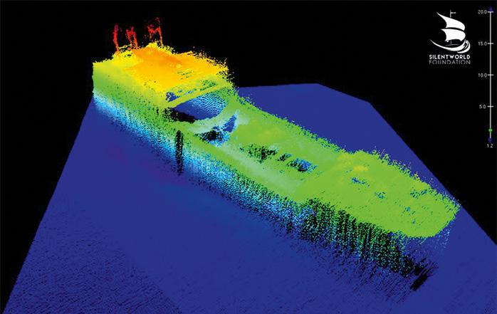
The location of the Japanese transport ship the SS Montevideo Maru has been an enduring mystery since it was torpedoed by the submarine USS Sturgeon on 1 July, 1942, off the coast of the Philippines. The submarine’s captain did not know that the ship was carrying approximately 1,060 prisoners from at least 14 countries, including 850 Australian service members from Rabaul. The ship was not marked as a Prisoner of War transport.
Almost twice as many Australians died in this one incident than were killed in the entire Vietnam War. Significantly more were lost than in the sinking of the HMAS Sydney (645) in 1941 and the hospital ship Centaur (268) in 1943.
The search — led by the not-forprofit Silentworld Foundation, deep-sea survey specialists Fugro, and supported by the Australian Department of Defence — commenced on 6 April in the West Philippine Sea, 110 kilometres north-west
of Luzon. After just 12 days, a positive sighting was recorded using state-of-theart technology, including an autonomous underwater vehicle with in-built sonar.
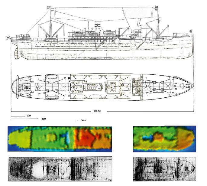
It took a number of days to verify the wreck using expert analysis from the project team, comprising maritime archaeologists, conservators, operations and research specialists, and ex-naval officers.
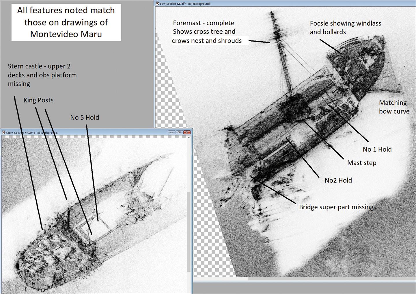
At over 4,000 metres depth, the wreck is deeper than the RMS Titanic
It took nearly five years of planning by Silentworld and 20 years of dedication from the Montevideo Maru Society to assemble the expedition team, led by Australian businessman, maritime history philanthropist and explorer John Mullen, the director of Silentworld.
“The discovery of the Montevideo Maru closes a terrible chapter in Australian military and maritime history,” Mr Mullen said. “I would like to express my gratitude to all of the dedicated Silentworld team involved in this expedition, to the outstanding Fugro crew and technical team on board the Fugro Equator, and to the Australian Department of Defence for their unwavering support.” n
13–15 June: RPAS in Australian Skies aaus.org.au/events/upcoming-events
21 June: World Hydrography Day 2023 HIPP Seminar geospatialcouncil.org.au/event/worldhydrography-day-hipp-seminar
22–23 June: World Hydrography Day 2023 Seminar, Suva ahs.wildapricot.org/event-4922919
11–12 July: Disaster &8 Emergency Management Conference anzdmc.com.au
13–18 August: 31st International Cartographic Conference and 19th General Assembly icc2023.org
30 August–1 September: S+SNZ 2023 Conference surveyspatialnzconference.org
13–15 September: AIMS 2023 National Conference aimsconference.com.au
13 October: WAIS Mini-Conference and AGM surveyorswa.org.au
23–24 October: Indo-Pacific Space & Earth Conference spaceandearthconference.com
26–28 October: CSA of NSW October Conference countrysurveyors.com.au
15 November: WA Digital Twin Summit & APSEA-WA sssi.org.au/events-awards/regionalconferences
6 December: 16th Australian Space Forum forum.andythomas.foundation
7–9 May 2024: Locate24 Conference https://locateconference.com/
22–25 October 2024: ISPRS Technical Commission IV 2024 Symposium geospatialcouncil.org.au/isprs-tciv24
For more events, go to www. spatialsource.com.au/event-listing
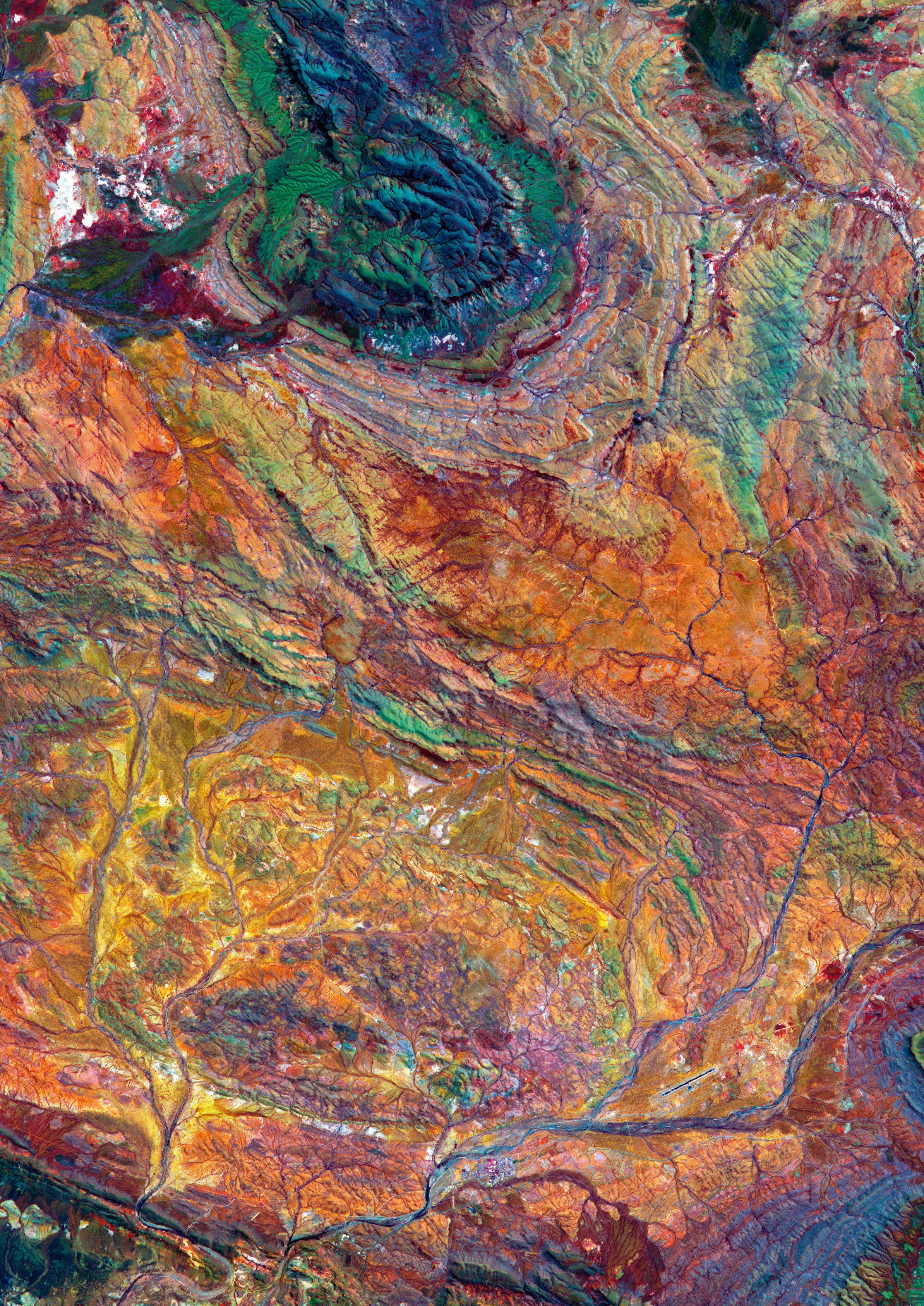
This amazing false-colour image of rock formations in the Hamersley Basin in Western Australia was acquired by the Advanced Spaceborne Thermal Emission and Reflection Radiometer (ASTER) on NASA’s Terra satellite. ASTER is a 15-channel imaging instrument; its data are used to produce detailed maps of parameters such as land elevation and surface temperature.
NASA Earth Observatory (J. Stevens)/METI/AIST/Japan Space Systems/US-Japan ASTER Science Team
Publisher
Simon Cooper
Editor
Jonathan Nally
jnally@intermedia.com.au
National Advertising Manager
Anna Muldrock
amuldrock@intermedia.com.au
Prepress
Tony Willson
Production Manager
Jacqui Cooper
Subscribe
Position is available via subscription only.
A 12 month subscription (6 issues) is AUD$76.00. To subscribe visit www.intermedia.com.au, phone: 1800 651 422 or email: subscriptions@intermedia.com.au website: www.spatialsource.com.au
Position is published six times a year, in February, April, June, August, October and December by Interpoint Events Pty Ltd.
ABN: 9810 451 2469
Address: 41 Bridge Road, Glebe NSW 2037
Ph: +61 2 9660 2113 Fax: +61 2 9660 4419
Reprints from Position are permitted only with the permission of the publisher. In all cases, reprints must be acknowledged as follows: ‘Reprinted with permission from Position Magazine’, and must include the author’s byline.
The opinions expressed in this publication are those of the authors and do not necessarily represent those of the publisher.
Supported by
I’m writing these words only a couple of weeks after returning from Adelaide, where I attended the Locate23 conference. And my head is still spinning from the huge variety of topics covered, announcements made and the celebration of new and old friendships.
The success of the conference is a testament to the hard work and dedication of the organising committee, the GCA and the Locate team. But it’s also a testament to the state of the geospatial sector in Australia. Sure, there are still many challenges to solve, but as a relative newcomer to this field I have to say that the sector really impresses me with its vigour and vitality, it’s ability to come together to thrash out ideas and find opportunities, and especially in its overarching goal to improve the lot of modern society.
Collaboration was, in fact, a major topic of discussion throughout the conference. One of the advantages of the sector is that it is not too big, nor too fractured, for most people to not know one another (or know of one another), and to use those personal connections to look for solutions and to help each other succeed and flourish. This is in marked contrast to many other sectors of society, where competing interests can make it almost impossible to achieve anything of significance.
The other theme running throughout the conference, was one that has been with us for a while and will remain with us for a long time to come — the workforce challenge (see page 23 of this issue). There is such a huge shortfall of skilled professionals at the moment, and it’s projected to stay that way. While no-one seems to have a magic solution, it does seem that everyone is committed finding ways to meet the challenge. It’s going to take time and a lot of hard work, but hopefully it will pay off in the end.
Jonathan Nally Editor
The Intermedia Group takes its Corporate and Social Responsibilities seriously and is committed to reducing its impact on the environment. We continuously strive to improve our environmental performance and to initiate additional CSR based projects and activities.
As part of our company policy we ensure that the products and services used in the manufacture of this magazine are sourced from environmentally responsible suppliers. This magazine has been printed on paper produced from sustainably sourced wood and pulp fibre and is accredited under PEFC chain of custody.
PEFC certified wood and paper products come from environmentally appropriate, socially beneficial and economically viable management of forests.
Advertising booking date: 7 July 2023
Advertising material date: 12 July 2023
Publication date: 3 August 2023
For article proposals, contact the Editor: jnally@intermedia.com.au
For advertising, contact the Advertising Manager: amuldrock@intermedia.com.au
The Intergovernmental Committee on Surveying and Mapping (ICSM) has endorsed a proposed new mechanism for exchanging cadastral survey data between the survey industry and land administration agencies.
The proposed 3D Cadastral Survey Data Model and the JSON encoding format has been endorsed as the standardised way for surveyors across Australia and New Zealand to lodge digital cadastral survey datasets.

The model and recommendations were developed by a consortium led by Surround Ltd under a contract funded by several Australian and New Zealand land administration agencies.
The conceptual and logical data model was developed using the detailed data requirements for each of the jurisdictions. It harmonises the common data elements across all the jurisdictions while also catering for the profiling of jurisdiction-specific elements. The model is based on international standards and vocabularies and caters for 2D and 3D survey data. The Model and the encoding recommendations are available on the ICSM website.
ICSM has now contracted Surround Ltd for a second phase of work. It aims to show how the proposed mechanism can be made to work for the providers of survey software and for the land administration agencies and operators that will facilitate the exchange of cadastral survey data. This project will develop a reference implementation to test the recommended mechanism for transferring for 2D cadastral survey data. The 3D elements in the model are not being tested in the same way but will be
The UK’s Geospatial Commission, part of the Department for Science, Innovation and Technology (DSIT), has launched a commercial Earth observation (EO) pilot for a number of UK public sector bodies, aiming to help to unlock the value of EO technology in priority policy areas, from emergency incident response to land use.

“The Earth Observation capability that is being piloted by the Geospatial Commission will test how we can drive innovation in the heart of government service delivery, from effective disaster response to enhancing the science behind our understanding of land use change,” said DSIT Minister, Viscount Camrose, Parliamentary Under Secretary of State, Department for Science, Innovation and Technology.
Following a competitive tender process, the data and services for the EO pilot initiative will be delivered in partnership with the winning supplier, Airbus Defence and Space, to public sector bodies throughout the UK. Eligible UK public sector bodies will be able to access and test the data against a range of use cases for the 12-month pilot period.
“Our Earth Observation pilot is aiming to keep the UK in its high geospatial orbit, increasing public sector capability and the demand for market innovation through testing new applications of EO data and technologies,” said Thalia Baldwin, Director, Geospatial Commission.
refined as part of this phase or work.
ICSM Chair and Surveyor-General of Victoria, Craig Sandy, said that “developing a consistent model that works across all Australian states, territories and New Zealand is crucial for survey software providers. It will give them the confidence to develop cadastral applications that serve the large surveyor market across both countries — and possibly beyond.”
“With the availability of such products, land administration agencies are aiming to eventually enable surveyors to lodge fully digital cadastral survey datasets for integration into the cadastre.”

Highly respected surveying professional Eddie Cichocki has been appointed Deputy Surveyor-General for Victoria. Announcing the appointment via LinkedIn, Alison Kealy, Executive Director Surveying and Spatial, wrote that “Eddie has been a valuable member of the SGV team for more than 35 years, and is well known and respected by the surveying community. I am thrilled to have Eddie take on this role as we work towards achieving our ambitious digital transformation strategy.”
Cichocki said that “It is a privilege to be appointed Victoria’s Deputy Surveyor-General and I look forward to supporting Surveyor-General Craig Sandy LS GAICD, Land Use Victoria and the broader Victorian surveying community to deliver projects and initiatives that embrace the future and respect the past.”
“Digital transformation is one of these, and I will support surveyors to continue to work harmoniously with Land Use Victoria to ensure our cadastre remains accurate and reliable as we move to a more digital way of working.”
Cichocki previously served for 10 years as Manager, Cadastral Infrastructure and Standards.
Aerometrex has entered into a minimum $2.65 million MetroMap licence agreement with Landchecker, a Melbourne-based property data and technology business. MetroMap’s high-resolution aerial imagery is currently used within Landchecker’s online platform and is subscribed to by Landchecker’s customers who use integrated products through the platform.
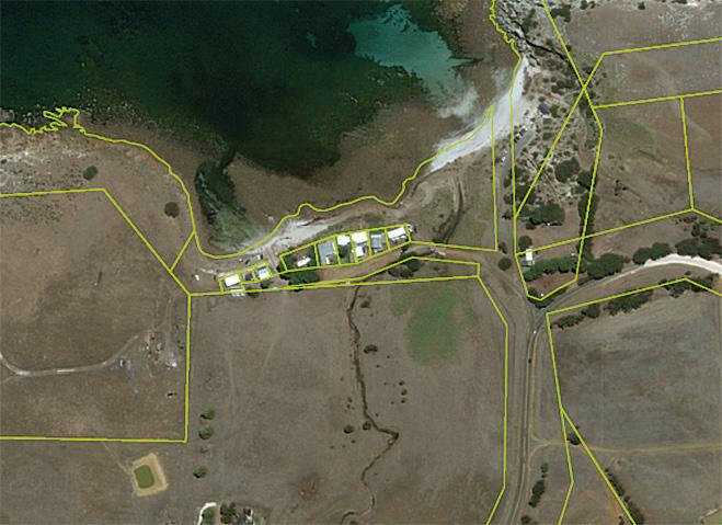
“This is a significant opportunity for both Aerometrex and Landchecker, building on the strong foundation and collaborative relationship between both companies. We are excited about what this new agreement can offer customers and look forward to working with Landchecker to realise its full potential,” said Aerometrex’s CEO & Managing Director, Steve Masters. “This is the largest MetroMap partner program agreement in Aerometrex’s history and will make a strong contribution to MetroMap’s Annual Recurring Revenue (ARR) stream over the contract term.”

“MetroMap’s high-resolution aerial imagery is an important data set many of Landchecker customers engage with daily,” added Landchecker’s Chief Executive Officer, Adam Gandolfo. “This partnership will enable us to provide more customers an equally compelling proposition, bundling our leading property data and insights with quality highresolution imagery from MetroMap under flexible, costeffective commercial arrangements.”
Australian space tech start-up Arlula has raised new investment funding of $2.2 million, which it will use to scale into new markets and further develop its Geostack Terra product. The funding round was led by Main Sequence, Australia’s deep tech investment fund founded by CSIRO, with participation from Black Nova Venture Capital.
Arlula was co-founded by Sebastian Chaoui and Arran Salerno, who met as students at UTS.

“Throughout my years working in the space industry, I realised that despite there being thousands of satellites monitoring the Earth’s surface, the data they were capturing was not being effectively operationalised and monetised,” said Chaoui. “Arlula was founded with a mission to rapidly deliver comprehensive imagery and data, enabling businesses to make data-driven decisions faster than ever before.”
“We figured by applying a customer first approach we could build infrastructure to connect both sides of the market through new SaaS technology and a commercially accessible business model,” added Salerno.
The new funding will be used to scale into new markets and expand the capabilities of Arlula’s Geostack Terra platform, which has access to both live data and archive imagery dating as far back as the 1970s.
The Intergovernmental Committee on Surveying and Mapping (ICSM) has produced a Standard for the Accuracy of Spatial Cadastres in Australia and New Zealand. The Standard establishes targets and a reporting framework for acceptable Positional Uncertainty (PU) for the horizontal position of parcels within spatial cadastres.
The Standard requires PU to be attributed to points, lines and/ or polygons within the spatial cadastre. The target PU for parcels in central business districts is 0.05m; urban, peri-urban and industrial areas 0.2m; rural areas 0.5m; and pastoral and remote areas 5m.
Vertical uncertainty of the spatial cadastre is not included in the Standard at present. As spatial cadastres evolve to meet the requirements of the Cadastre 2034 vision, recommendations for vertical uncertainty will be considered by ICSM. This means that jurisdictions now have a reporting framework and accuracy targets to achieve to ensure their spatial cadastres meet the requirements
of the Standard. Improved spatial cadastres do not provide a legal position of the location of boundaries; they are still considered a graphical representation of the boundaries using the best available survey data and control. The PU attribution cannot be relied upon for critical decisions and does not replace the need for a Licensed or Registered Land Surveyor to carry out a field survey for boundary reinstatement, and consideration of common law principles.
Aerometrex’s Steve Masters (left) with Landchecker’s Adam Gandolfo. Arlula co-founders Sebastian Chaoui and Arran Salerno.Vexcel has announced that, through its Vexcel Data Program, it will now provide free access to aerial imagery for government and commercial users in Australia and New Zealand through its webbased platform, Viewer. The company’s imagery covers 80% of the population in Australia and 56% in New Zealand.
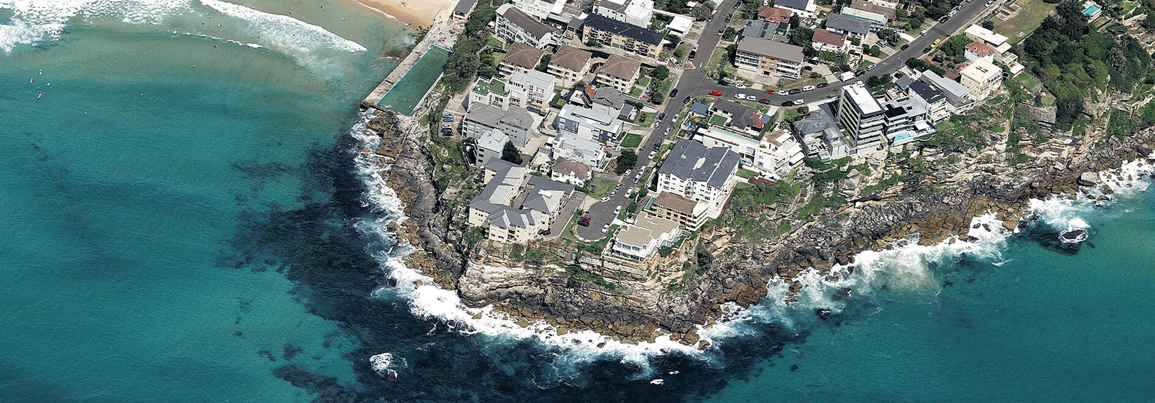
Announcing the initiative at the Locate23 conference in Adelaide, Ryan Bank, Managing Director of the Geospatial Insurance Consortium (an insurance industry partnership between the US National Insurance Crime Bureau and Vexcel), said that “It feels like the right thing to do,” adding that all of the imagery will be available for free — “no cost, no strings attached”.
The University of Auckland has become home to the first Trimble Technology Lab to be opened in New Zealand, making it the latest in a network of nearly 30 universities around the world to have such a facility. The Lab will give students access to Trimble hardware and software solutions used by professionals in the geospatial, construction and natural resources sectors.
The lab is housed within the Faculty of Engineering, but students from across the university will be able to use it for research in areas such as architecture, design and anthropology.
“Trimble’s digital technologies are transforming the way engineers, architects and others design and construct our built environment,” said Professor Gerard Rowe, dean of the Faculty of Engineering. “I’m incredibly proud that Trimble chose to partner with us. The Trimble Technology Lab will be the hub from which we can extend the use of innovative software and equipment across the university for the benefit of all our students and researchers.”
Trimble’s presence in New Zealand began 1991 when the company acquired Datacom Software Research to boost its software capabilities for mapping, land and hydrographic survey. Trimble New Zealand currently employs more than 400 staff with an office in Christchurch.

Bank said that “we look around and we think that there are so many potential partners — analytics companies, AI teams. Australia and New Zealand have been on the forefront of geospatial technology basically forever. We want to encourage additional use. So we think that by democratising access to the highest quality imagery, the industry will figure out new applications for it.”
“This is our priority market,” he added. “To be able to now find a way, a path forward, to be able to make it [the data] available to literally everyone in the country, I think it’s really going to open up things for the future of geospatial technology.”
Australian drone manufacturer, Carbonix, has announced its expansion in the US market via an operating partnership with ArgenTech Solutions. The two companies have signed a Master Service Agreement that will see ArgenTech Solutions provide services including flight operations, maintenance and pilot training, using Carbonix UASes.
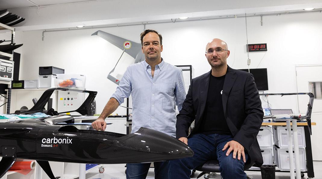
The partnership will enable Carbonix VTOL aircraft to be operated and supported by ArgenTech Solutions across various commercial, NGO and governmental customer missions mainly in the US, as well as the wider Americas where ArgenTech already has a presence or customer base.
“Expanding further into the US is a logical next step for Carbonix allowing us to bring our Australian experience and capabilities into a large and fast-growing market,” said Carbonix CEO Philip van der Burg.
“As we grow ArgenTech’s commercial business, we have expanded our worldwide capabilities and services to include wildfire monitoring for the US Bureau of Land Management, training, and subject matter expertise for commercial systems,” added ArgenTech CEO, Brian Veroneau.
Carbonix recently became one of just a handful of drone companies to receive beyond visual line of sight (BVLOS) approval in Greater Sydney.

Australia and New Zealand have signed a 20-year, $187.4 million contract with Inmarsat for the provision of the Southern Positioning Augmentation Network’s (SouthPAN) Satellite-Based Augmentation System (SBAS) signals from 2027.
The signals will be delivered by one of Inmarsat’s three new I-8 geostationary satellites, the first of which is due to launch in 2026.
SouthPAN is a partnership between Australia and New Zealand, led by Geoscience Australia and Toitū te Whenua Land Information New Zealand.
The system is intended to improve satellite-based positioning accuracy from metres at present, down to as little as 10 cm when the full system is up and running.
Early Open Services have been available since September 2022, with signals provided through the Inmarsat I-4 F1 commercial communications satellite.
According to Geoscience Australia, an additional as-yetunspecified satellite service will also be procured in order to provide redundancy.
It is expected that SouthPAN will provide a huge boost to a wide range of industries that rely on accurate positioning, from transport to farming, building and surveying and many more.
It will also be certified as providing safety-of-life (SOL) precision for operations such as landing aircraft in poor visibility. SOL certification is currently scheduled for introduction in 2028.
“The new SouthPAN satellite service, along with SouthPAN’s ground infrastructure, will bring widespread benefits and a $6.2 billion economic injection to Australia alone, with the value anticipated to increase as new applications are developed,” said Alison Rose, Chief of Space Division at Geoscience Australia.
“These services are a core component of the SouthPAN system, which will provide resilience in our precise positioning capabilities, especially for those applications that require highintegrity services with sub-metre level accuracy to improve safety and efficiency.”
“SouthPAN represents extraordinary potential for the region. It can save lives by enabling precision safety tracking, help farmers
improve productivity through automated device tracking, or even support transport management systems of the future,” added Todd McDonell, President, Inmarsat Global Government.
“We have a long history providing services for governments in the moments that matter most, and we are delighted that our Inmarsat-8 satellites will continue that legacy well into the 2040s.”
Inmarsat has contracted Switzerland-based firm SWISSto12 to develop the spacecraft, which will be based upon the latter’s HummingSat satellite platform. SWISSto12 will also leverage its 3D-printing capabilities and specialised radio frequency and other payload technologies.
The HummingSat platform is quite revolutionary, just 1.5 cubic metres in volume, with a form factor up to five times smaller than conventional geostationary satellites.
According to Inmarsat, the three l-8 satellites will provide an “extra layer of resilience” to complement its existing constellation… especially its two I-6-generation satellites, which were launched in December 2021 and February 2023.
“The I-8’s will not only underpin our existing capabilities for the future, but enable ever more advanced safety innovations like SBAS that can ultimately help save more lives,” said Peter Hadinger, Chief Technology Officer, Inmarsat. “We have chosen SWISSto12 because they have the ground-breaking technology that can make it a reality.”
“We are delighted that Inmarsat has selected SWISSto12 as its partner for its landmark l-8 program,” said Emile de Rijk, CEO, SWISSto12. “It demonstrates that, with HummingSat, we have created a highly-advanced new class of small geostationary spacecraft that delivers world-leading connectivity capabilities at a fraction of the cost.
“Our proprietary 3D printing of radio frequency payload technology allows us to push the limits of existing capability and service new and existing business cases for geostationary satellite communications.
“This is an important step in our journey to better connect and protect every corner of the world.” n
JONATHAN NALLYFrom 2027, Australasia’s SBAS will be boosted by signals from one of Inmarsat’s new I-8 satellites.
The highly affordable Emlid Reach RS2+ multi-band RTK GNSS receiver is working wonders in Australia’s Top End.
Cross Solutions is a Northern Territory-based surveying consultancy that started life in Gove in 1992. It has since expanded to cover most of the NT as well as far north Queensland, and has offices in Katherine, Gove, Groote Eylandt and Cairns.
Jonathan Piper-Green, GIS & Innovation Manager, who has been with the company for 10 years, says that Cross Solutions has become a preferred supplier for a lot of things that involve remote work.
“We do bathymetry, lots of drone survey related activity, laser scanning and so on. We cover all the major sectors, so we have surveyors doing cadastral work, as well as people working on defence projects, gas projects, mining, civil, materials handling, engineering and the process industry,” he said.
Piper-Green says a challenge the company faces, unlike for the southern states, is that there isn’t a well-fleshed out CORS network, or even SmartNET or Trimble VRS. So they have to use base stations for a lot of GNSS-related activity.
For the majority of the company’s life, Cross Solutions has mainly used high-end gear from the big traditional surveying equipment manufacturers. “Part of the problem with using that gear is that, being such proprietary equipment, there is an integration friction that you might face with trying to do anything but work within their ecosystem,” says Piper-Green.
“But also there’s a price point. Whenever you’re looking to set up a system, you’re essentially going to require a base station to pair with that system and there’s quite a significant cost involved with going down the path of to pair up with those systems,” he said. “So we’ve been looking for a more cost-effective option.”
That’s why the company began using Emlid Reach units about four years ago. Piper-Green says they integrate well with other devices Cross Solutions uses.
“Particularly what we like about it is that they’re controlled through a phone app, so you don’t have to invest in additional field
controllers or software, which lots of other receivers require,” he says. “You might have to buy a fully-fledged proprietary controller in order to work with those other devices, whereas with the Emlid you buy the receiver, you can use a smartphone which everyone has, and you’re good to go.”
“It definitely reduces the friction when pairing them up with other things; you don’t have to think about all that other complexity,” he adds. “It’s also quite easy to train people to use them, too. People are quite familiar with how to use their phone to connect things like Wi-Fi or Bluetooth as opposed to giving someone a new field controller.”
Piper-Green says the Reach RS2+ works in most senses like any other conventional survey GNSS receiver.
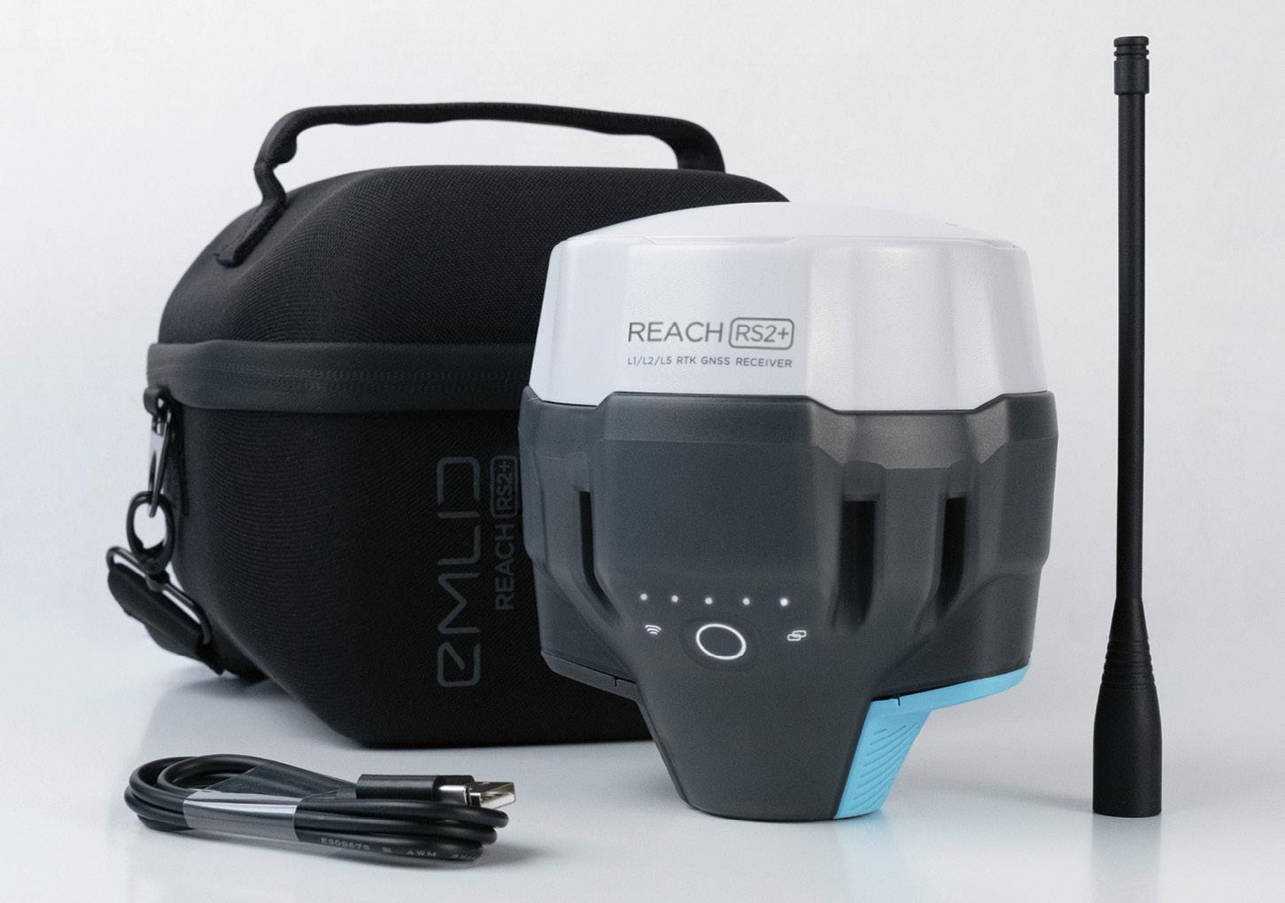
“We don’t typically use the RS2+ as a rover, meaning we’re not putting them on a pole and walking around and recording survey points with them — we typically find other uses for them because we rely on our conventional equipment for that sort of work. But they definitely have found a place in the business with some of those other applications, such as static logging or acting as a base station for a variety of different devices,” he said.
Piper-Green says the Emlid software is very intuitive, making it easy to “understand how to get them logging what you want them to be logging and then get the data back off them so that you can post-process it”.
“Also, since we first started using Emlid,
they’ve brought out a GUI-based software package that allows you to process static as well, which is quite handy. A lot of other companies charge for that sort of software, but Emlid doesn’t charge for firmware updates; they don’t charge for extra functionality.”
“And it’s pretty much all-inclusive. You don’t need a specialised controller, you don’t need extra software — you buy it and it’s ready to go.”
Another thing Piper-Green likes about Emlid is that the company has a longrunning online forum where it takes feedback on the software and functionality, which often results in new features and bug fixes. “It’s really good to see that outreach back and forth between the customer base and the development team; the product gets better and better over time and if you have some receivers from two or three years ago, you’re not paying any extra to get those improvements,” says Piper-Green.
Cross Solutions is a heavy user of drones, and according to Piper-Green the Reach RS2+ has been easily incorporated into their aerial operations.
“We use them particularly with the DJI Phantom 4 RTK drones for the RTK corrections. DJI provides a similarly priced base station option, which works quite well because it’s integrated with the Phantom 4. The problem is it has limited functionality… you can’t use it with anything else other than that drone, more
or less,” he says. Using the Reach RS2+ provides far more capability.
“If we go out and buy another drone, we tend to decide that we’re going to pair it up with the Emlid rather the drone manufacturer’s solution because of the benefits you get out of the Reach RS2+’s extra options. “When we’ve used the Reach, we’ve had a lot more consistent results than by using the drone base and you can then use the Reach for other tasks when it’s not needed as a drone base.”
The Reach RS2+ has also come into its own for some of Cross Solutions’ bathymetry tasks.
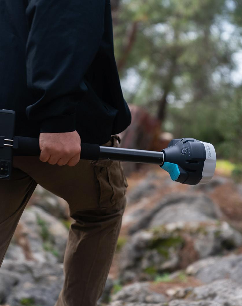
“We have a couple of radio-controlled boats and we’ve looked at real-time monitoring solutions where you have a GNSS receiver basically statically mounted on a pillar concreted into the ground, and you want to measure any movement that might occur. We’ve looked at integrating the Reach into that sort of set up, and in all those circumstances it’s performed exactly as intended,” he said.
“In fact, the integration with the Emlid gear has been generally the easiest part of the development projects that we’ve undertaken, because the system is so simple… there’s nothing that’s proprietary or hidden away or that you have to reverse engineer.”
According to Piper-Green, a major advantage of the Reach RS2+ is its affordability, which puts less strain on a business’ cash flow and provides a costeffective alternative for when the company has to do large static networks, particularly for cadastral work. “If you look at the cost of the Emlids, they definitely fit the bill for that sort of application really well.”

“Back in the day, there might have been a scenario which required five GNSS receivers that we just didn’t have as part of our inventory, so you’d have to start looking at things like renting the gear,” he said. “The consideration now is just, ‘Should we buy another Reach receiver?’”
“If you have to go out and rent the gear, maybe three or four receivers, you might not be able to get that in the timeframe you need it for. Whereas now you can have a bunch of spare receivers sitting on a shelf.” n
Type: RTK GNSS receiver
Multi-band: GPS/QZSS, GLONASS, BeiDou, Galileo
Fix: Survey accuracy up to 60 km in RTK, 100 km in PPK
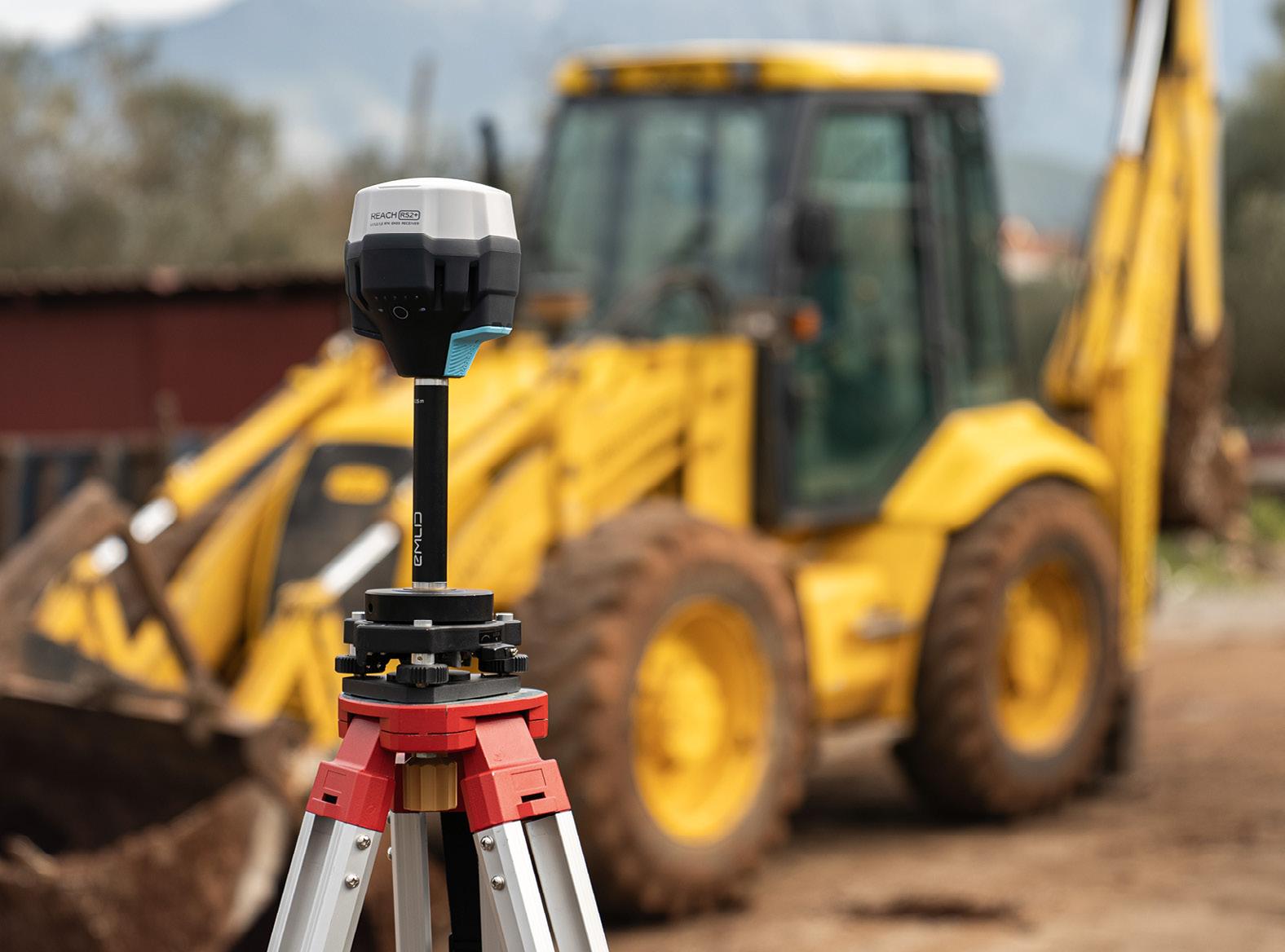
Storage: 16 GB (160+ days logging at 1 Hz)
LTE: Built-in, with 2G/3G fallback
Battery: Up to 22 hours data logging on one charge; up to 16 hours as an LTE rover
“You don’t need a specialised controller, you don’t need extra software - you buy it and it’s ready to go.”
Jonathan Piper-Green, Cross Solutions
Please tell us about your career background and your current role. Throughout my career, I have worked on spatial data applications, both in government and industry. I have worked at Geoscience Australia for about 12 years now, since moving to Australia with my family. In that time, I have led teams to deliver programs in natural disaster analysis, resources advice, and now positioning. Before that, I worked for a global disaster risk modelling company, following a PhD in environmental systems science. In my current role as Branch Head of Positioning Australia, I lead an amazing and diverse team who are all committed to delivering better positioning for Australia. I enjoy working in technical organisations. I am inspired by the passion and excitement across our teams, where people contribute their specialism to deliver something for stakeholders that is bigger than the sum of the parts.
The NPIC is described as adopting a ‘unified’ approach to ensure consistent, fit-for-purpose data. What is meant by ‘unified’?
Over the last 20 years the Commonwealth, state, territory governments and industry have built localised networks of positioning infrastructure. These networks have been focused around urban areas, or around industry-specific sites like mines or farms. In most cases, there has been limited coordination between operators, and there was no single standard to which these networks adhere.
What the National Positioning Infrastructure Capability (NPIC) provides is a unified approach to the management of the nation’s positioning infrastructure. That means NPIC provides the standards and framework that operators can follow to ensure that consistent, fit-for-purpose data
Martine Woolf leads a team of Geoscience Australia experts who are implementing Australia’s next-generation positioning projects.

and services are available to government, business and academia.
Through NPIC, everyone has access to high-quality data and services from certified reference stations. Station operators are supported in the establishment, operation and sharing of their infrastructure. Coverage of positioning services has been expanded and is consistent between providers. Service providers have increased ability to cover new regions and stakeholders, and to tailor offerings to different industry sectors.
The NPIC network currently consists of over 700 continuously operating reference stations (CORS) from 11 different operators. This network supports the delivery of centimetre-level positioning across areas of mobile phone coverage in Australia.
What can you tell us about work to modernise the ARGN?
The Australian Regional GNSS Network (ARGN) provides the geodetic framework for all spatial data in Australia. The network was originally established in the early 1990s and has evolved through programs such as AuScope.
Under the NPIC, Geoscience Australia has been able to modernise and expand this network to span all of Australia and its external territories. The final network will consistent of 200 stations that have a consistent build.
The modernisation has included:
• Upgrading the infrastructure to a modern, resilient design
• Ensuring the stations are fully multiGNSS compliant
• Focusing on the accurate and timely delivery of data in real-time
• Ensuring we have secure, long-term land tenure and access to all stations
• Maturing our approach to operating
the network to support existing and emerging industry users.
While rolling out a national infrastructure project during a global pandemic has been a challenge, we have been able to continue to progress ARGN delivery through strong partnerships with Australian industry. There are currently 154 stations that have been upgraded to the new consistent build, with the remainder under contract and scheduled for delivery by the end of September 2023.
What can we expect from the new versions of Ginan coming in the next 12 months?
Ginan is Geoscience Australia’s Analysis Centre Software. It is designed as an open-source toolkit for creating precise point positioning (PPP) analysis products, correction streams and positions. It is being actively developed as part of our Positioning Australia program. Geoscience Australia is establishing an operational instance of Ginan that produces PPP analysis products and streams on a continuous basis and which are available free of charge to the public.
The source code for the current version (1.5.3) of Ginan is available for download from the GitHub. New versions of Ginan with enhanced capabilities will be developed and released over time.
Ginan version 2.+ (to be released mid2023) will deliver:
• Unified user and network operation modes (one observation model and filter)
• Full multi-constellation capability
• Better internal frequency indexing (complete multi-frequency capability
• UnCombined/UnDifferenced (UDUC) processing (v1.5.3 is ionosphere-free only)
• Integrated and coupled precise orbit
“We have been able to continue to progress ARGN delivery through strong partnerships with Australian industry.”
determination (POD) capability
• More robust data handling in the filter for cycle slip and outlier detection and removal
• Complete RTCM3 phase 1 and Phase 2 message decoding and encoding
• Satellite laser ranging data handling fully implemented
• Performance improvements
Ginan version 3.+ (scheduled for late 2023) will deliver:
• The development of a Ginan Geographical User Interface (G-GUI) to help users derive the most benefit from of the software. This may be allied with new distributions to make installing the software simpler — on Windows machines for example.
• The consolidation of Ginan products to confirm data accuracy and availability, benchmarked against the International GNSS Service to provide users visibility of the product quality.
• The further development of algorithms that enable Ginan to produce atmospheric (troposphere and ionosphere) products to be delivered as real-time correction streams enabling a full PPP-RTK capability.
• Some specific functionality including: Box and wing solar radiation pressure (SRP) and Earth albedo modelling of GNSS satellites
Precise orbit determination capability,
including for low Earth orbit (LEO) satellites
Site specific tidal and non-tidal atmospheric pressure loading models
Hydrological loading models
Data product combination capability enabling combination of geodetic products from multiple geodetic techniques and analysis packages
Performance, accuracy and latency improvements.
Access to and provision of free and open data seems to be important. Has it been difficult to arrange this? By providing access to free and open positioning data and services, the Positioning Australia program is encouraging innovation, and enabling industry to offer new services, both of which are leading to economic growth across several industry sectors — including the geospatial sector.
To deliver NPIC and SouthPAN services, we have relied on our partnerships with government and industry. We have been fortunate that industry have seen the value in partnering in a national capability, despite a perception that NPIC could be competing with their offerings. The way I look at this is that we are not competing but rather enhancing industry offerings. For example, many positioning service providers combine our free and open data
with their offerings, adding value to their existing services.
Through NPIC we have partnered with 10 CORS network operators from across government and industry to license data from over 500 stations. In doing this we have been able to support the operators in maintaining and enhancing this infrastructure to improve accuracy and resilience.
The benefits of free and open data and services are considerable. For example, SouthPAN, which went live in September 2022, is estimated to inject at least $7.6 billion of economic benefits to Australia and New Zealand over 30 years.
We are also seeing the benefits from NPIC with the number of users consuming the data from NPIC continuing to grow. We now have over 2,000 registered users of our data streams, many of whom are on-selling services. This includes new companies and new offerings from existing companies.
We are also starting to see some specific benefits in the research and innovation space:
• Ginan is being actively used by the research community to better understand the effects of the ionosphere on positioning, and to investigate the potential of GNSS for disaster warnings
• Industry-led value-added resellers are connecting to the Ginan realtime data streams for product testing and validation.

GA and LINZ had to prepare for initial SouthPAN services during COVID. How much of a challenge was this?
Rolling out a complex space program such as SouthPAN is always a challenge, and COVID complicated that further. The SouthPAN project team is spread across Geoscience Australia and Toitū Te Whenua Land Information New Zealand (LINZ). This means we spend a lot of time online each day, as we work closely together on all aspects of the project. Not only has there been a high pace over these last few years, the team has also grown significantly over that time. Working across countries and time zones had always meant that the SouthPAN team would need to collaborate remotely. COVID only emphasised the adoption of inclusive ways of working with a remote team.
So, on the one hand, COVID absolutely was a challenge during the last few years. On the other hand, we benefited from our geographically dispersed team. We already had established working practices that
stood us in very good stead when borders were closed, and afterwards. We now have even our Australian team spread across the country. You could say it challenged any assumptions that you need to ‘be together to work together’. That said, we were very happy to meet for our first face to face workshop after borders reopened!
How will SouthPAN be of benefit for safety-of-life applications?
Integrity and trustworthiness are the key performance criteria for safety-of-life (SOL) applications. Stand-alone GNSS is currently used by aircraft almost everywhere in the world for safe navigation down to the runway approach phase and has been standardised by the UN International Civil Aviation Organisation since the 1990s. However, avionics must make conservative assumptions about errors on GNSS signals to achieve the required level of integrity. This results in lower navigation performance compared to non-SOL systems that do not need to make these

conservative assumptions.
The advent of Satellite Based Augmentation System services enable SOL users to maintain the required level of integrity while achieving better guaranteed accuracy. In the case of aviation, this means the aircraft can safely get closer to the runway during bad weather, decreasing the chance the pilot needs to divert to another airport. Of course, availability is also important. SouthPAN is designed to achieve a high level of availability, so pilots can use it when they have the need.
Have you had any feedback from early SouthPAN users?
While it is only early days for SouthPAN, with early Open Services available for only just over six months, early indications are that SouthPAN is being used as a cost-effective way to capture sub-metre positioning without the need for highcost surveying equipment, particularly in areas without mobile phone coverage. All indications are that SouthPAN early Open
“Early indications are that SouthPAN is being used as a cost-effective way to capture sub-metre positioning without the need for high-cost surveying equipment.”
Services are meeting a range of different requirements. The potential users and uses of SouthPAN will continue to expand as Geoscience Australia and Toitu te Whenua Land Information New Zealand gradually improve the resilience and redundancy in SouthPAN to be certified for safety-oflife applications.
If I want to use SouthPAN, do I need to buy new equipment?
Many consumer devices already have the required hardware and electronic chips to receive the SouthPAN services. Some devices will pick the early Open Services up now; others may require a firmware update or a more significant upgrade. For example, we received an enquiry by a user who notified us that they received SouthPAN on their new mid-range smartphone. We encourage you to check with your equipment manufacturer about whether your device can access PRN122 or SouthPAN.
Geoscience Australia is working with FrontierSI to provide technical support to users for adopting SouthPAN



and demonstrating its benefits. This includes testing receivers and liaising with equipment manufacturers to be able to increase the number SouthPAN compatible equipment.
Is SouthPAN free to use? Is there any cost to using it?
SouthPAN is a free and open service, which can be used without subscription fees, on compatible equipment.
What is the status of the roll out of the SouthPAN ground reference stations?
There will be 35 SouthPAN ground reference stations across Australia and New Zealand and their Antarctic territories. At present, we have not yet started construction; we are identifying and surveying suitable sites. SouthPAN early Open Services are currently delivered through stations in our existing ground reference networks via NPIC.
What’s the next step after the current early services stage?
As we roll out development of SouthPAN,
additional infrastructure will be integrated into the SouthPAN system that will improve accuracy and availability of Open Services. The additional GEO payloads will introduce a new navigation signal that is used for the precise point positioning (PPP) via SouthPAN services. We expect the system to achieve Full Operating Capability, including safety-of-life certification, by 2028.
How can people find out more about SouthPAN and how to make the best use of it?
More information on SouthPAN is available on the Geoscience Australia and Toitū Te Whenua Land Information New Zealand (LINZ) websites at www.ga.gov.au/southpan and https://www.linz.govt.nz/productsservices/geodetic/southpan. We have a factsheet and Service Definition Document for information on the early Open Services, aimed at users and equipment manufacturers. You can also subscribe to Geoscience Australia’s Positioning News newsletter, to keep up to date with the latest news from across our Positioning Australia program. n

It’s anyone’s guess as to how many older buildings and facilities there are in Australia for which only paper plans are available, or for which the plans have disappeared. Or maybe there have been so many alterations and modifications that any plans that do exist are no longer accurate.
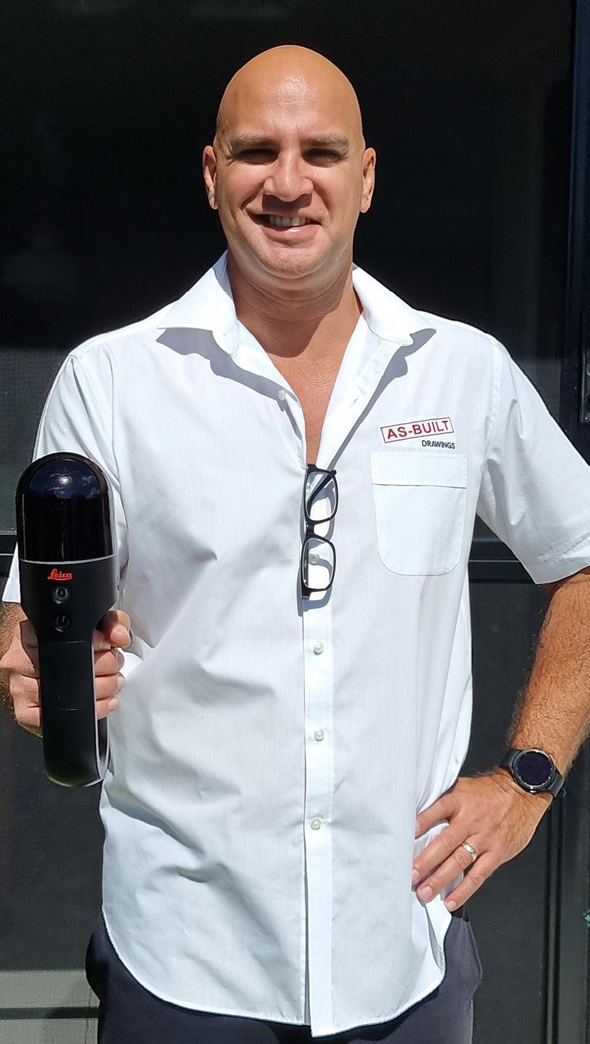
That’s where professionals such as Brad Ellis, managing director of Brisbanebased As-Built Drawings, come in. Brad specialises in surveying such buildings to produce new plans and digital models.
For years, Brad was doing this work the traditional way — measuring up and crunching the numbers to produce drawings. But late last year he invested in the latest and greatest technology for doing exactly this kind of work — the Leica Geosystems BLK2GO handheld imaging laser scanner from C.R. Kennedy.
Brad’s first job with the BLK2GO — and indeed the contract for which he bought the unit in the first place — was to scan multiple properties within a resort village in Tasmania. “The resort’s rooms were really tired and dated, so the client wanted to give it a good facelift and maybe a redesign. My drawings were going to be used by the architect and interior designers to do their stuff,” said Brad.
The problem for the client was that the buildings were so old that nobody, including the local council, had any real record of floorplans. And the scope of the job was huge — approximately 300 rooms within more than 50 buildings.
But with the BLK2GO in hand, Brad completed the entire scan in just two-anda-half days. The modelling to produce the floor plans took just five days more.
“It would have taken at least a couple of months to measure up and then draw it the old way, so my time-saving was huge,” he said.
Without the BLK2GO, Brad would have had no way of being able to easily handle the contract, which is why he’d decided
to bite the bullet and purchase the unit… and it paid for itself with that first job.
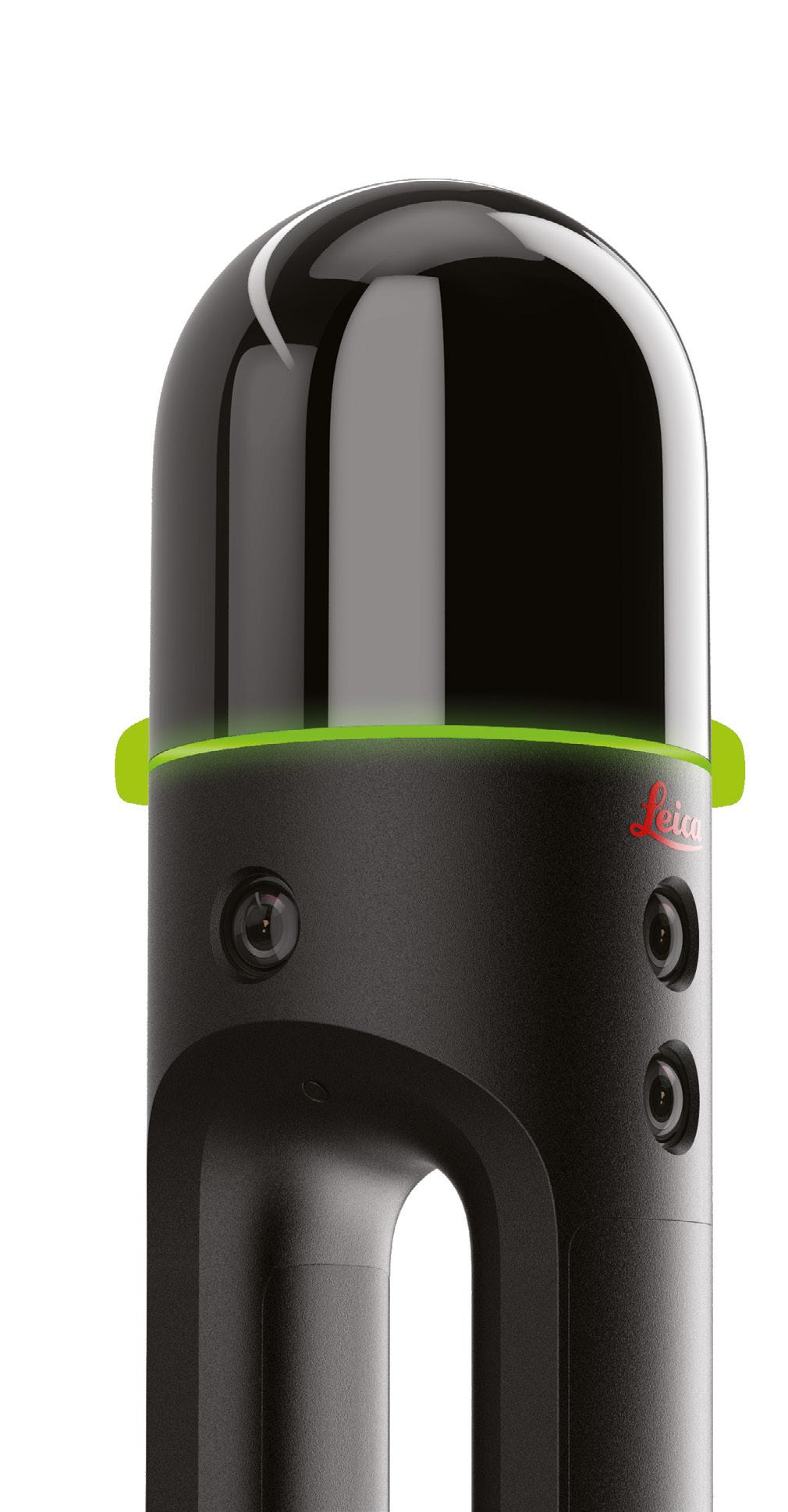
The BLK2GO recreates spaces in 3D by capturing images and dimensionally accurate 3D point clouds in real-time and uses SLAM (Simultaneous Localisation and Mapping) technology to record the user’s trajectory through space. The LiDAR data is automatically combined with the imagery to produce a colourised point cloud.
The device can scan over and under objects, through rooms and doorways, around corners, and up and down stairwells. The SLAM spatial awareness technology enables the BLK2GO to always know where it is and where it has been.
According to Leica Geosystems, the BLK2GO is the smallest dual-axis LiDAR available with what is claimed to be bestin-class accuracy. The unit is enclosed in a fully protected and encapsulated dome that scans up to 420,000 points per second. Both axes continually spin while scanning.
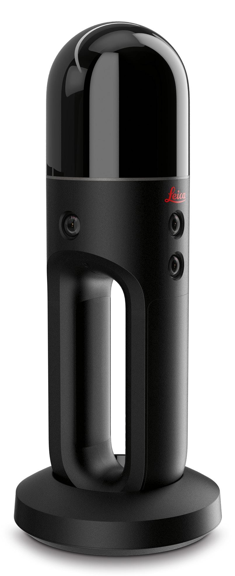
There’s no need for a tripod, and data is collected on board. The vision system is a 12-megapixel camera for high-contrast imagery plus three panoramic cameras for visual navigation via SLAM, point cloud colourisation and capture of panoramic imagery. The handle contains the WLAN connectivity electronics, a rechargeable battery capable of 45 minutes of continuous scanning, data storage for six hours of scans, and a USB-C port for fast data transfer and edge computing. A light guide that encircles the BLK2GO provides user guidance while scanning and communicates the device status and data quality. All up, the unit weighs in at just 775 grams.
The BLK2GO’s GrandSLAM technology combines the high-speed, dual-axis LiDAR, multi-camera vision system and an inertial measurement unit to make the unit self-navigating.
Another of Brad’s launch clients for the BLK2GO is the operator of a famous historic market in the Sydney CBD. The market comprises 13,000 square metres across two levels in an old building with a cramped interior comprising hundreds of stalls with walls, hoardings and other things that can get in the way of a survey, plus a complex network of ceiling services (eg. pipes and ducts).
Having got the call to do the job, Brad simply threw the BLK2GO into his backpack and flew from Brisbane to Sydney.
“I only had two photographs to quote on,” he said. “The client needed all the ceiling services scanned and modelled, but when I got on site and saw how many services there were, it was quite overwhelming.”
And yet the job ended up being a breeze.
“The time it took me to physically walk around and scan the market was only an hour and a half,” said Brad. “If you were
to try to do it the old-fashioned way, I just don’t think you could do it. The amount of manpower and time it would take to do what I did in an hour and a half, would see the cost just blow out and it wouldn’t have been feasible for the client to pay that.”
Because there were hoardings and other things blocking some views, Brad was able to scan only about 92% of the total volume… yet that was far more than the client had been expecting.
“I just got off the phone with the architect and the mechanical engineer, and they had just opened up the model and had a look, and it was ‘Brad, this is unbelievable’,” he said.
“To hear that sort of feedback from the client was wonderful.”
And it isn’t just large jobs that the BLK2GO is well suited for. Brad recently got a contract to scan a house extension — it took just eight minutes to do the whole house, inside and out.
A lot of Brad’s work comes from scanning existing buildings that are so old, their owners don’t have any floorplans and no services drawings exist.
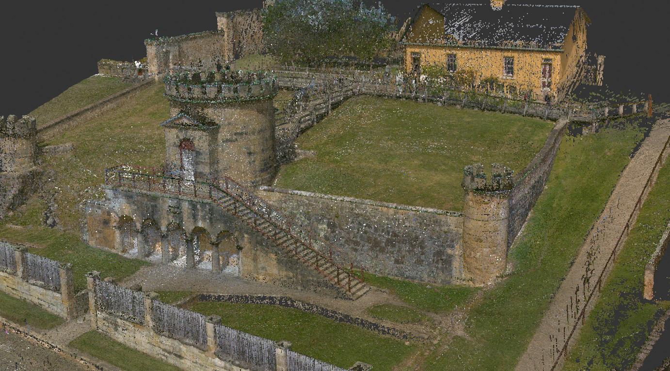
“More and more I’m hearing that ‘We have a bunch of drawings over the last 50 years, and there have been extensions and stuff like that, but we want a consolidated set of plans’,” he said. “So that’s when they
get me to come on and scan the job and then re-draw it up as one drawing, instead of having 50 different versions of the extensions over the years.”
“They can then work my model into their architectural drawings or presentation files and create 3D internal/external views for their client, or whatever else they need it for.”
Brad describes the BLK2GO as a game-changer.
“My time is extremely valuable,” he said. “I’m able to do so many jobs now that I wouldn’t have tackled before. It’s opening up opportunities for clients to accomplish work that they would have put in the toohard basket previously.”
“The BLK2GO is saving me so much time in terms of site visits, and then also measure ups, and just boosting the level and quality I can provide the clients. For instance, if they require panoramic imagery, this machine provides panoramic views. You can just click on a dot and zoom around and see it in real-time.”
Hearing Brad describe the BLK2GO and what it can do, really makes it sound like the stuff of sci-fi dreams from decades ago. But it’s not sci-fi anymore — it’s a real, offthe-shelf capability that can be operated by just one person and in just minutes or hours produce complex point clouds with ease… as opposed to days, weeks or even months doing it the traditional way. n
Large jobs can be scanned in just hours or days instead of weeks. The BLK2GO is just as at home outdoors as it is indoors. Brad Ellis with the Leica Geosystems BLK2GO handheld imaging laser scanner.“If you were to try to do it the old-fashioned way, I just don’t think you could do it.”
Brad Ellis, As-Built Drawings
The convergence of the space and spatial sectors was on full display at the Locate23 conference.
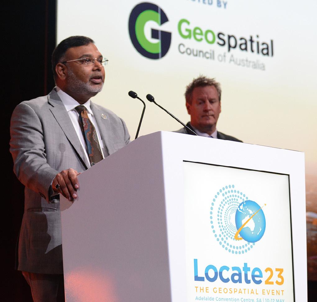
The Locate23 conference was held at the Adelaide Convention Centre in early May, and it was a great success, attracting approximately 750 delegates from across Australia and from around the world.
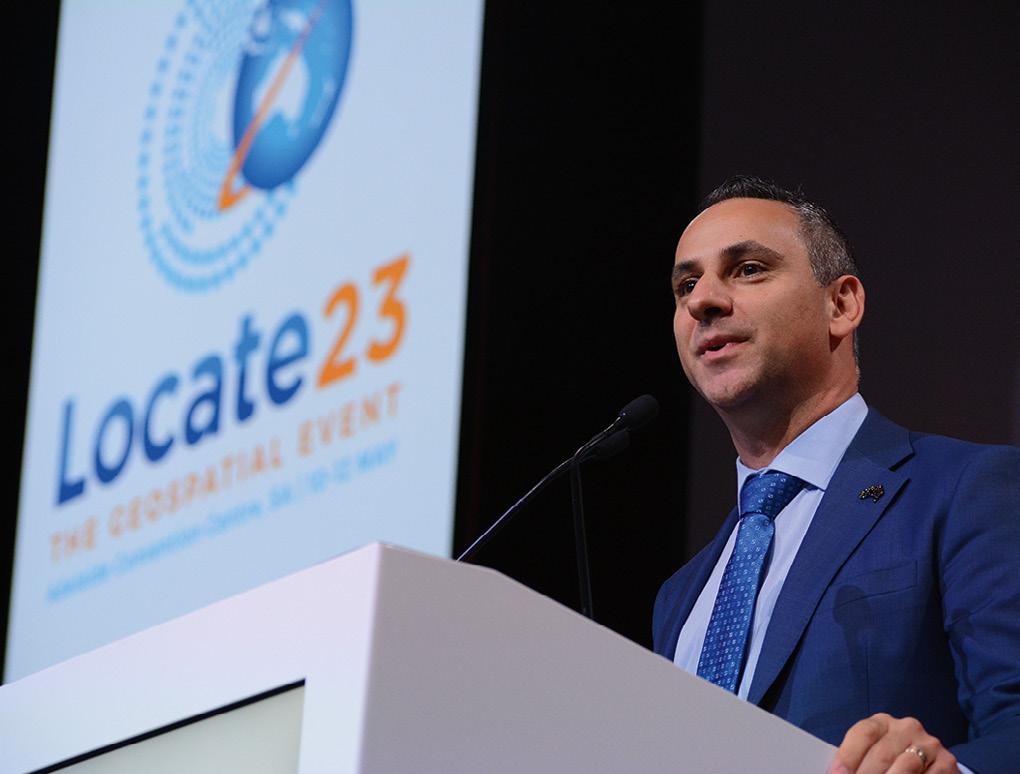

This was my second opportunity to attend a Locate conference, and I was not disappointed. There was just so much to see and hear; it was impossible to catch it all. But the specially crafted concurrent sessions meant that those who had particular interests were able to focus on their fields of endeavour and catch up on all the latest developments.
The conference was also a great opportunity to network and socialise. There was a definite buzz in the air, and it was plain to see that delegates were enjoying being able to meet and greet one another again.
The main event on the Wednesday was the Space & Geospatial Collaborative Workshop, jointly hosted by the Geospatial Council of Australia (GCA) and the Andy Thomas Space Foundation. Prior to the commencement of the workshop, Tony Wheeler, GCA’s CEO, took the opportunity to launch, in person, the extended version of the Space+Spatial Industry Growth Roadmap 2030. He also paid a touching tribute to Dr Peter Woodgate, who was the prime mover behind the initiation of the Roadmap and a giant of Australia’s geospatial sector. Dr Woodgate sadly passed away earlier this year.
The Workshop kicked off with a keynote presentation from Dr James Johnson, CEO of Geoscience Australia (GA). Dr Johnson covered a lot of ground, from the success of GA programs such as Digital Earth Australia and the Digital Atlas of Australia, to the need to use satellite data to present a single, integrated picture for the user (particularly for disaster response purposes). Dr Johnson said the need for “meaningful geospatial data” has never been greater.
Then followed a panel session moderated by Dr Zaffar Sadiq Mohamed-Ghouse, with panellists Reece Biddiscombe (Australian Space Agency), Professor Alison Kealy (Land Use Victoria), Paul Digney (Jacobs) and Professor Andy Koronios (SmartSat CRC). The
wide-ranging discussion touched on the need for everyone in the space and spatial sectors to reach out and understand one another’s needs, the democratisation of data and, perhaps most importantly, the acknowledgement that there is now no differentiation between the space and spatial sectors — they are each a vital part of the whole.
A second panel session brought together representatives from agriculture, emergency management, transport, hydrography, IoT and machine guidance to discuss how space and geospatial technologies are being used in everyday life across the country, by business, government and academia.
The Workshop concluded with an address by Dr Geraldine Baca Triveno (Deloitte), who outlined how she sees space technologies enabling new applications on Earth and beyond.
The remainder of Wednesday was given over to a series of concurrent workshops and a symposium, which covered a vast range of topics: from tackling weeds to building digital twins, from developing the geospatial workforce to using gaming engines for 3D spatial data.
The conference proper kicked off on the Thursday morning. As always, it was impossible to be everywhere at once during the concurrent sessions, but here is a snapshot of some of the things that caught my attention.
Professor Alan Duffy (Swinburne University of Technology) spoke about geospatial’s invisible interaction with our everyday lives and therefore its importance to the whole nation. Bradley Slape (Surveyor-General of South Australia) announced that an agreement had been struck with Flinders University to provide new degrees in surveying and GIS (including double degrees), helping to solve South Australia’s geospatial tertiary education crisis. Paul Digney spoke of how the GCA will become the trusted voice of the geospatial sector, and announced that Commodore Stewart Dunne, the official Hydrographer of Australia, has joined the GCA Board. And Andy Koronios (SmartSat CRC) announced two new space and spatial scholarships.
Head of the Australian Space Agency, Enrico Palermo, announced that the long-awaited positioning, navigation and timing (PNT) roadmap was close to completion. He also spoke of the ways in which space and geospatial combine, such as in forthcoming missions to the Moon.
However, there was no mention of funding implications from the federal government’s budget (which had been announced just two days prior), nor was there any information forthcoming on the National Space Mission for Earth Observation.

As mentioned above, a common theme running through the many presentations and panel sessions, was the convergence of the space and spatial sectors. They are now so vitally intertwined that it is no longer possible to see them as completely separate fields.
Interestingly, Joseph Seppi (Woolpert) posed the question: Is geospatial an industry or a sector? He spoke of how in the US, the term ‘geospatial’ is nowhere listed in that country’s official classification of sectors, industries and industry groupings. The same applies in the UK. In the EU, mapping, surveying and spatial activities are listed under ‘Engineering activities and related technical consultancy’ while ‘Aerial Photography’ falls into the same class as the videotaping of weddings.
Visiting the exhibition hall, it was great to see plenty of exhibits and displays from a wide range of companies, many of them at Locate for the first time. Products and services on show ranged from drones to software, from 3D laser scanners to consultancy services and everything in between.
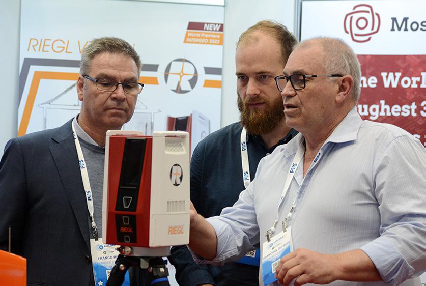
It was fabulous to see an effort being made to engage with school students — such as the work being done by She Maps — in the hope of inspiring some of them into geospatial careers. A number of school groups visited the exhibition and could be seen gazing in wonder at the gadgets and gear on display.
The 2022 Asia-Pacific Spatial Excellence Awards (APSEA) presentation ceremony was held during the gala dinner on the Thursday night. The whole affair was very well run, the food was great and the awards presentations were full of fun, surprise and a good deal of emotion. Many of the recipients (see next page) have dedicated their careers to the geospatial sector and to the use of geospatial data and technologies
for making the world a better place. There was a strong sense of gratitude among the recipients for the support and mentoring they had received over the years, with all of them returning the favour by themselves supporting the next generation of professionals and under-represented sectors of the community.
The conference concluded on the Friday afternoon with the announcement that Locate24 will be held at the International Convention Centre at Darling Harbour in Sydney. The convenor will be Narelle Underwood, Surveyor-General of NSW.

There were plenty of other announcements made during the workshops and conferences — too many to list them all here — so keep an eye on spatialsource.com.au as we continue to roll out more detailed coverage of the event.
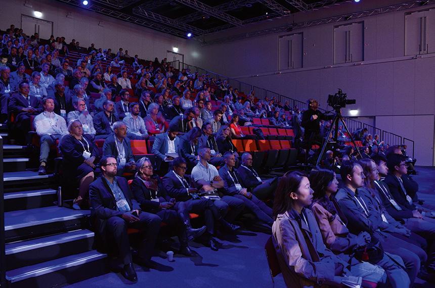
Finally, a big shout out to the organising committee, the GCA and the Locate events team, who put together a fabulous program and ensured the event ran perfectly smoothly. I eagerly await next year’s conference! n

Worthy individuals and organisations have been recognised with receipt of the industry’s premier awards.
Geospatial innovations for climate change, environmental impact solutions and Earth observations for First Nations are among the winners of the 2022 Asia Pacific Spatial Excellence Awards (APSEA). The APSEAs are conducted regionally across Australia and New Zealand, hosted by the Geospatial Council of Australia.
A strong theme this year was the focus on professional mentoring and workforce advancement through diversity and inclusion, with several individual winners recognised for their many years of commitment.
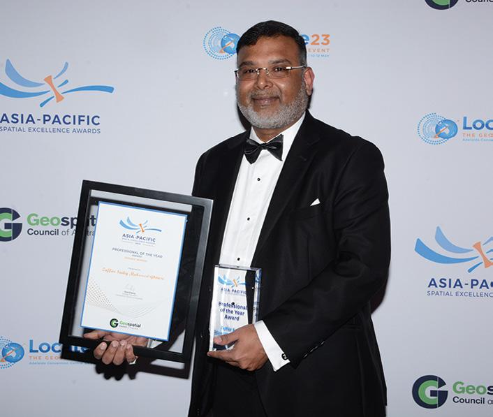
The Professional of the Year Award was presented to Victoria’s Dr Zaffar Sadiq Mohamed-Ghouse, Director, Advisory & Innovation at Woolpert Asia-Pacific. A global leader in the geospatial industry, government advisor and mentor to many geospatial professionals, Zaffar works with the United Nations Global Geospatial Information Management, and serves on the boards of the World Geospatial Industry Council and Open Geospatial Consortium.
The Future Leader of the Year Award had joint recipients: Dr Jun Wang and Andrew Bembrick. Dr Wang is a geodetic scientist, lead researcher and mentor at Land Solution Australia in Brisbane. He has published numerous academic papers and played an active role on many iconic infrastructure and construction projects. He has also mentored and supervised students and young professionals and established the Australian Chinese Geospatial Association group.
Andrew Bembrick graduated from RMIT University and joined Precision Hydrographic Services in South Australia as a trainee hydrographic surveyor. He has since become a senior hydrographic surveyor/project manager and mentor, managing complex surveys and leading a team of surveyors. He is also a career mentor at RMIT and works to raise the profile of the hydrographic industry.
The Diversity and Inclusion Award was presented to Yvonne Fong, from Western Australia. While working at NGIS Australia as an Earth observation data scientist, Yvonne advocated for EO solutions for traditional owners through the First Nations Earth Observations project, built capacity for Digital Earth Africa, led
as a project manager, and is now a Spatial Ecologist at Spectrum Ecology & Spatial.
The Educational Development Award was presented to Dr Jagannath Aryal from Victoria. Dr Aryal is an academic at the University of Melbourne who has worked in the government and academic sectors in close collaboration with private industry. He has delivered surveying and remote sensing education to students in Asia, Europe and Oceania.
The Undergraduate Student of the Year is Tong Ding, from Curtin University, for his thesis on GNSS radio occultations emerging as new technology for upper-air monitoring, which is crucial for tackling climate change and understanding changing weather patterns.
The Postgraduate Student Award was presented to PhD student Kexiang (Frank) Hu from Curtin University, whose strong background in hydroclimate and hydrogeology offered new insights into understanding Australian groundwater.
The Award for Community Impact was presented to Beca Limited, Waipā District Council, InPlace Limited, Maximize Limited and Interactionz for the Waipa Community Spatial Plan in New Zealand, which creates a blueprint for the district and the foundation for future planning and investment.
The Award for Environment & Sustainability went to FrontierSI, SmartSatCRC, Myriota, University of South Australia, NGIS and the SA Government (Dept for Environment and Water) for the SIG Water project, which deployed 70 groundwater bores with direct-to-space IoT communication and increased understanding of groundwater as a resource.
The Award for Innovation – Small Business was presented to Kurloo Technology for the Port of Brisbane Seawall project, which is meeting the challenge of protecting an environmentally sensitive marine park.
The Award for Innovation –Medium to Large Business went to FrontierSI, University of NSW, Omnilink, Commonwealth Bank, NSW Government, Liverpool Council and Slate Analytics for the Value Australia interactive platform, which uses AI and machine learning for
scenario planning and value uplift projects.
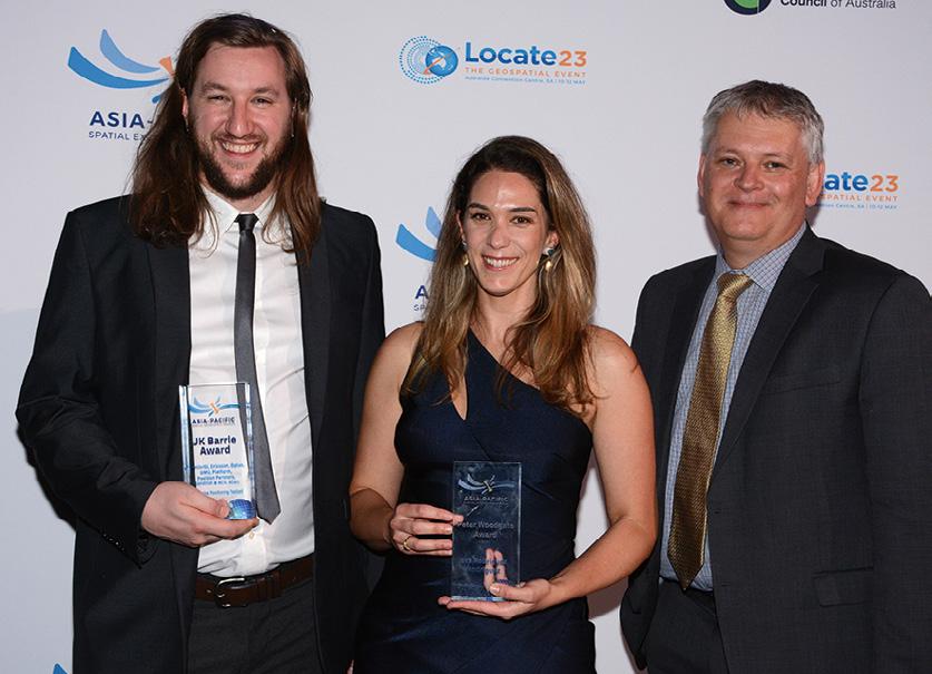
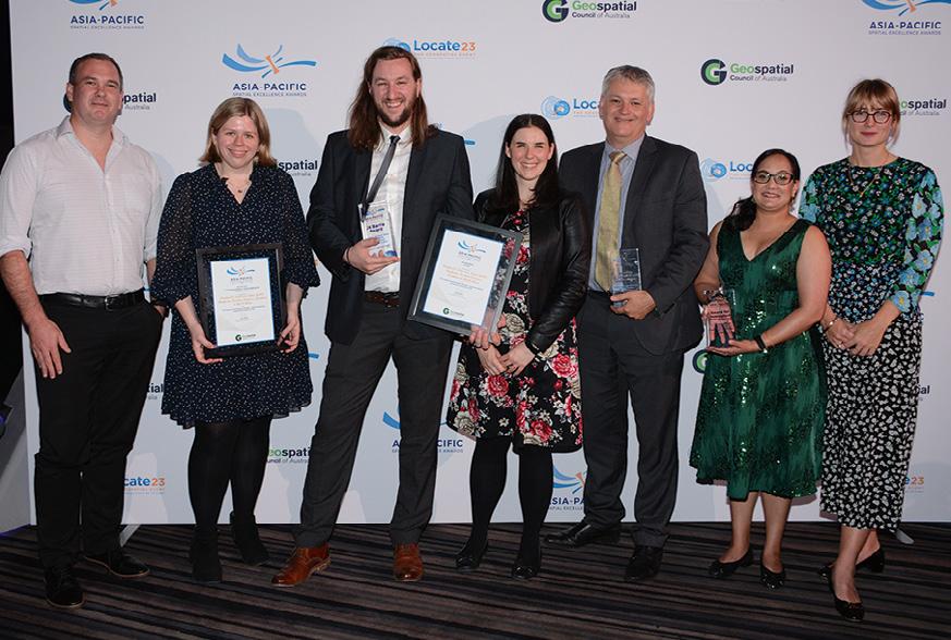
The J.K. Barrie Award and the Award for International Partnership were presented to FrontierSI, Ericsson, Optus, GMV, Platfarm, Position Partners, Kondinin and Acil Allen for the 5G Precise Positioning Testbed. The testbed used a global partnership to leverage the Optus 5G network and demonstrate the economic benefit of 5G precise positioning.
The Award for Spatial Enablement went to WildBear Entertainment and Esri Australia for mastering the art of storytelling with maps. WildBear develops optically stimulating, highly accurate maps for broadcast.
The Award for Technical Excellence was received by the Victorian Department of Environment, Land, Water and Planning (DELWP), DSM Soft, Spatial Vision and Jacobs for the Digital Cadastre Modernisation Project. The modernisation project will transform Victoria’s cadastral parcel and property boundaries into a data-driven, spatially accurate, 2D digital representation.
Finally, the Award for Workforce Development and Inclusion was presented to Veris and Wumara Group Alliance for the Indigenous Surveyor Employment Pathway Program, which offers indigenous Australians a pathway into the surveying industry. n
Happy recipients of the J.K. Barrie Award and the Award for International Partnership. Dr Zaffar Sadiq Mohamed-Ghouse was presented with the Professional of the Year Award.the associated infrastructure required for the 2032 Olympics in Queensland.
Director of Surex Surveyors, Cameron Mills, is especially concerned about the skills shortage, as his organisation works on major infrastructure projects in Queensland, New South Wales and Victoria.
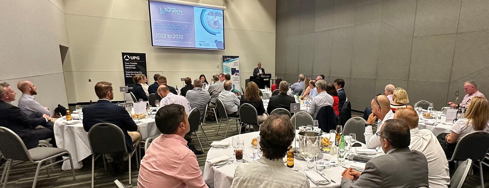
“I desperately need 20 more surveyors to meet current demand, so increased demand over the next ten years will only raise this figure. It impacts the commencement and completion of projects, adding undue pressure on our business and current teams,” he said.
CEO of Consulting Surveyors National, Michelle Blicavs, said that the statistics continue to reinforce the situation of severe shortages across Australia.
The shortfall in the surveying and geospatial sector will reach nearly 1,400 professionals nationally by 2024.
The completion of infrastructure for the 2032 Brisbane Olympics and several other major projects around the country may be affected if action is not taken to address the severe skills shortage in surveying, new data has revealed.
Total construction and building activity is set to increase nationally due to a strong pipeline of infrastructure projects and a backlog of residential work. But no building or infrastructure project can be started or finished without a surveyor.
The critical surveying shortage could affect other major projects around the country, such as Sydney’s Western Harbour Tunnel, the Melbourne Metro Rail, the Northern Territory’s RAAF Base in Tindal, Tasmania’s New Bridgewater Bridge and the Canberra Light Rail.
An independent economic analysis by BIS Oxford Economics — Determining the Future Demand, Supply and Skills Gap for Surveying and Geospatial Professionals: 2022-2032 — reveals the skills shortfall in the surveying and geospatial profession will reach nearly 1,400 professionals nationally by 2024, eventually reaching more than 2,000 in 2029. This equates to an average of 1,500 extra surveyors and geospatial professionals needed each year to meet national demands.
The current total workforce in Australia of the surveying and geospatial profession is estimated to be around 19,000 in 2021–22.
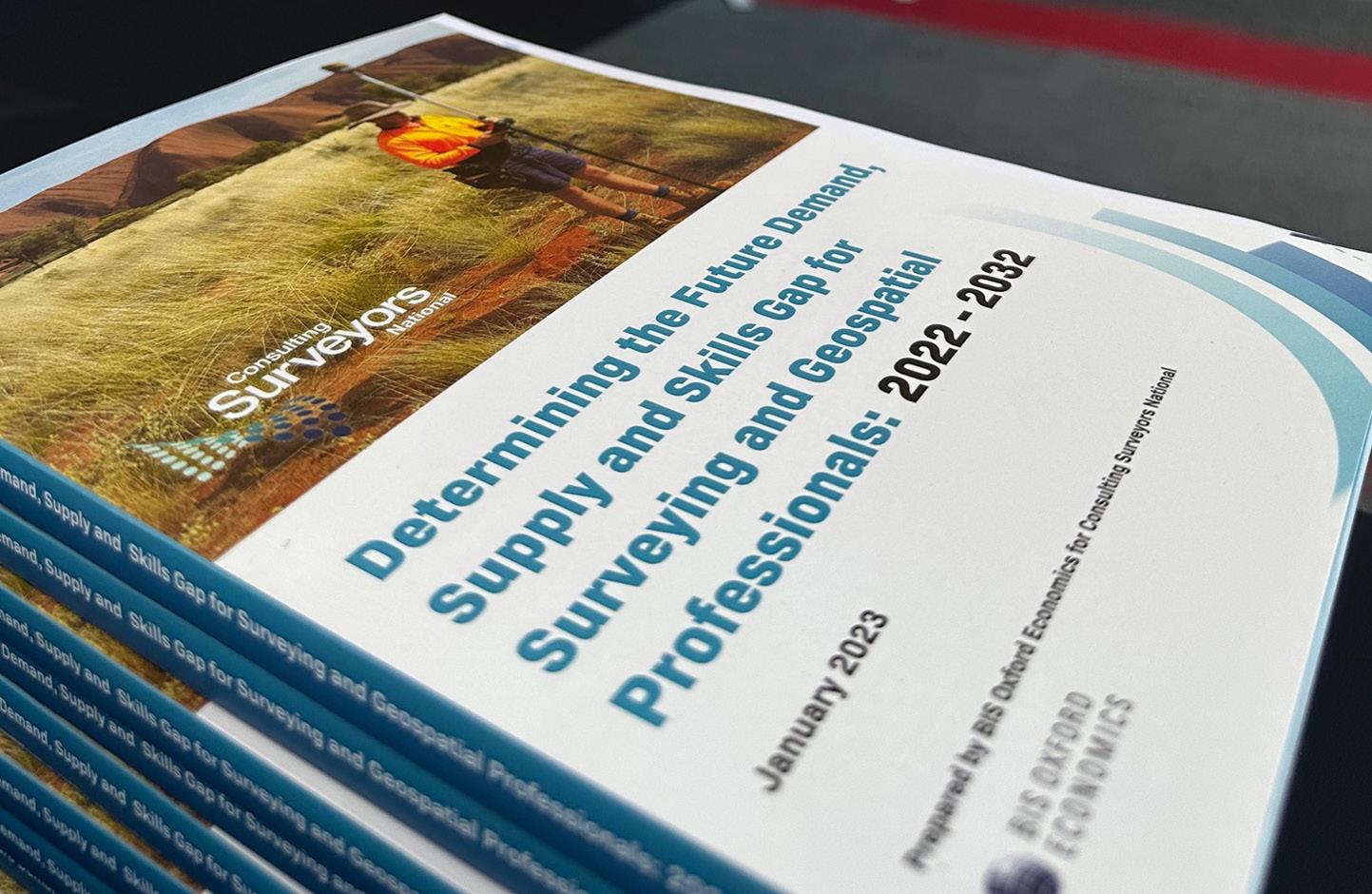
Research reveals that market demand for surveying and geospatial services will continue to grow over the next ten years, which will require a workforce of 21,000 professionals to meet demand.
Every state and territory will experience shortages, but Queensland and Western Australia will be the worst hit over the next ten years, as those states are set for elevated levels of construction activity due to a recovery in mining investment, elevated residential construction and historically high levels of public funding for infrastructure projects — especially given
“The industry has been working hard to increase the number of surveying professionals over the last 12 years, but the biggest challenge has been the TAFE sector not delivering the training required,” she said.
“We are working with universities around the country to increase the number of students studying surveying. But there is a severe lack of vocational training available, particularly in Queensland.
“Relevant surveying courses have been removed from TAFEs around the country so there’s just nowhere near enough vocational training in surveying across Australia, it’s actually non-existent in Queensland.
“Our industry has come together to develop our own national Surveyors Academy to combat this issue, but this Academy needs funding.”
The report can be downloaded from the Consulting Surveyors National website: consultingsurveyors.com.au. n
Australia needs thousands more surveyors over the next decade and beyond.









Cloud computing and software have rapidly changed the world around us in fundamental ways. But not all industries can move at the same pace. Our cities, homes, schools, bridges, roads, and offices are all still built using the same core principles that date back millennia: reliable and precise measurements. Why? Because they work. When it comes to understanding the world around us, when laying the foundations of our economies, infrastructure, and systems, reliability and precision are essential

While our principles stay the same, the world around us continues to change, to grow, and to speed up. Architecture, engineering, and construction projects are more ambitious, their scope and scale continuing to grow with every year. Public investment in infrastructure projects is rising but time frames for completion are getting shorter, all while regulatory and safety requirements are more stringent and exacting. Our principles stay the same, but our methods have to evolve to keep us fit for purpose.
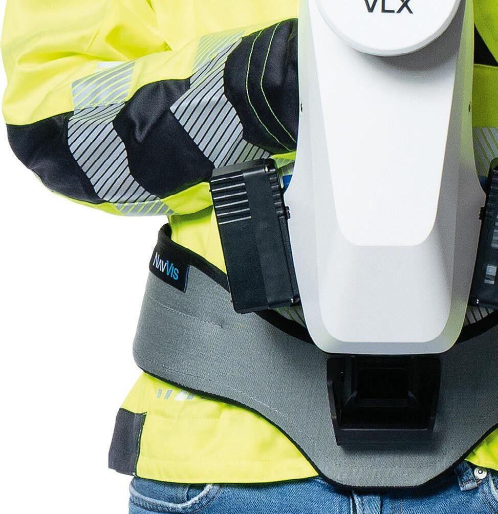
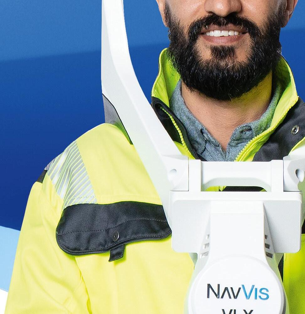
New methods and tools need to integrate with and evolve existing toolkits and practices. Drawing on the established power of software and the cloud, NavVis helps Laser Scanning Professionals expand their scanning, processing, and modeling toolkit in a natural, necessary way


The principles of reliability and precision are unchanged. NavVis helps you do more with them – quickly documenting, verifying, and collaborating on the world around us. NavVis gives Laser Scanning Professionals the right tools for the job so they can scan, process and model more data, from more sites, for more clients – in less time.

Please tell us about Lockheed Martin’s operations and facilities in Australia and New Zealand.
Lockheed Martin Australia (LMA) has had a presence in Australia’s space sector for more than 20 years. Over this time, we have established a number of different domestic facilities to ensure we can meet our customers’ diverse and changing needs. One of LMA’s most significant facilities is our telemetry, tracking and command facility at Uralla, NSW, which provides transfer orbit support services and initial orbit testing for satellites after they have been launched. As SouthPAN progresses, LMA will establish core infrastructure in Uralla as well as in Invercargill, New Zealand.
Can you give us an overview of Lockheed Martin’s involvement with SouthPAN?
LMA delivered the initial service just 14 days after the $1.18 billion SouthPAN contract was executed in September 2022. We achieved this initial milestone, known as ‘Build Zero’, by leveraging investments we had already made with our technology partners and the existing infrastructure at our Uralla facility. Currently, anyone with a Satellite Based Augmentation Systemenabled receiver can access SouthPAN’s satellite navigation signals, which will continue to become more accurate as we progressively roll out the ground network. Since being awarded the SouthPAN contract, we have more than doubled our technical workforce at Uralla to establish a 24/7 operations team and have also grown our back-end workforce in Canberra.
Lockheed Martin Australia’s Regional Director outlines the company’s growing space activities in Australasia.

David Ball’s 40-year career began as an engineering officer in the Royal Australian Air Force working on communication systems and capabilities. During the latter stages of his time in the RAAF, he worked on the early phases of the ADF military satellite communications project, sparking his passion for the space industry. After leaving the RAAF in 1995, he worked with companies such as PanAmSat, Intelsat, NewSat Limited, Envista Pty Ltd and the Space Environment Research Centre, in a variety of technical leadership and senior management roles. In 2020, he joined Lockheed Martin Space as Regional Director Australia and New Zealand, where he’s responsible for managing the existing capabilities and services as well as determining the company’s future activities and pursuits.
LMA has a 19-year contract to deploy and operate the SouthPAN service on behalf of Geoscience Australia and Toitū Te Whenua Land Information New Zealand. This involves progressively rolling out a number of stages in the coming years. ‘Build One’ will establish a dedicated network of ground reference stations across Australia, New Zealand and a number of neighbouring countries. Leveraging this infrastructure, SouthPAN is expected to be fully operational across Australia and New Zealand with safety-of-life certification from 2028 and will be provided as a service for 19 years with an option to extend.
Tell us about Lockheed Martin’s role in the GPS system.
Lockheed Martin has a deep heritage in GPS satellites. We designed and built 10 GPS III satellites which will provide significant capability improvements over earlier-designed GPS satellites on orbit, including three times greater accuracy and eight times greater anti-jamming capability. GPS III SV06 was successfully launched in January of this year, while GPS III SV07 to SV10 are completed and in storage waiting for the US Space Force to call them up for launch. Lockheed Martin is also designing and building the GPS III Follow On (GPS IIIF) satellites for the US Space Force. These satellites will feature even more innovative capabilities than their predecessors.
Do users need new gear to take advantage of GPS III satellites?
From a user perspective, the introduction of a new GPS satellite into the constellation
is effectively seamless. Of course, GPS III and GPS IIIF have new technologies and enhanced capabilities that require additional receivers in the market to enable access to those services. But for the everyday user on a device or in their vehicle, the ability to access GPS services from the enhanced constellation is automatic — it shouldn’t require updates to hardware or software. Ideally, the only thing they should notice is the improved connectivity of the GPS service.
Tell us about your company’s efforts to boost the space workforce.
Advancing the uptake of STEM is a critical focus for LMA, as the future of the nation’s space industry depends on a highly skilled, consistent pipeline of technical workers. To this end, LMA invests in a range of STEM initiatives and activities that span from primary school to earlycareer level… a number of which focus on driving engagement within regional and Indigenous communities. For example, as part of our JP9102 solution, we are working with Australian education provider STEM Punks to develop and implement a 10-year space-focused curriculum to educate, up-skill and inspire Australia’s next generation technical workforce. Over its lifetime, the program will be rolled out to 80 schools across Australia, with at least a quarter representing regional and Indigenous communities.
We’ve been investing in Australia’s space industry and growing our space presence here for over two decades. Today, with our dedicated space capabilities, as well as
our partnerships with Australian industry and research institutions, LMA represents a significant part of Australia’s growing sovereign space industry and is committed to playing a critical role in its development in the future. As an industry, we need to paint the full picture of the many exciting space career opportunities that exist. For example, it’s not just about the ‘upstream’ part of space, with satellites and launch vehicles, but in the ‘downstream’ too, with the myriad of applications and services that support those spacecraft when they launch and which leverage the data and content generated.
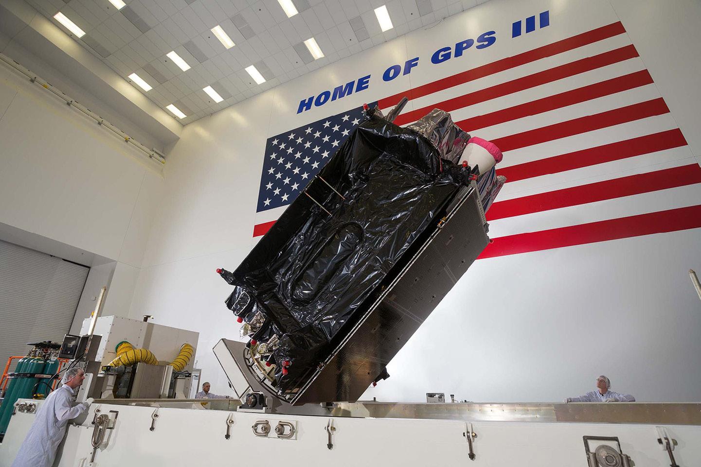
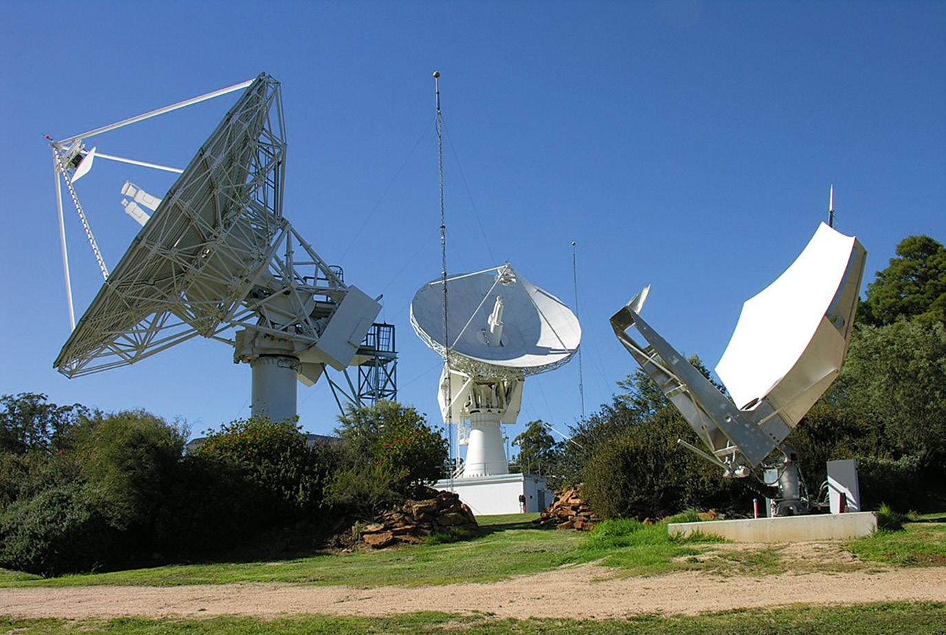
Over the past decade, advances in technology and increased demand for satellite-based services, coupled with the establishment of the Australian Space Agency and other government initiatives, have ignited Australia’s space sector. To maintain this momentum and compete globally, it is crucial for the sector to define its niche and expand its capabilities in areas such as satellite communications and space situational awareness. Innovation will play a critical role in this endeavour, which is why Australia requires businesses of all sizes, including start-ups, to succeed and grow. That’s why LMA invests in innovation through funds like Main Sequence Ventures, which help to galvanise Australia’s space start-up ecosystem and support the commercialisation of globally relevant technology.
Are there any gaps that need to be filled?
The way our space sector has developed, Australia has always been a net user of other people’s data. As our space segment capabilities grow and mature, we’ll start to generate more of our own data, such as in positioning with SouthPAN being deployed. I look forward to seeing research and development that will result in innovative space-based applications and the emergence of new user communities. For example, Australia is a world leader in remote mining — those technologies and capabilities could be extended to space as we start to think about the remote servicing of satellites and the mining of lunar resources.
Finally, is there anything you’d like to convey to the geospatial community?
LMA is honoured to be working with Geoscience Australia and Toitū Te Whenua Land Information New Zealand on the SouthPAN project. We look forward to the completion of the ground reference stations and the full integrity bounded signal by 2028. I’d also like to acknowledge the critical role the geospatial community is playing in developing the technology and applications that will drive Australia’s space sector forward. LMA is committed to working with industry to transfer valuable know-how and capability and help ensure that the Australian space sector remains at the forefront of innovation and continues to deliver benefits to society. n
“Since being awarded the SouthPAN contract, we have more than doubled our technical workforce at Uralla.”Lockheed Martin has designed and built 10 next-generation GPS III satellites.

Over the period May to July 2022, the SSSI Spatial Digital Twin Special Interest Group (SDT-SIG) conducted an industry survey on geospatial standards for spatial digital twins (SDT). The survey aimed to form an understanding of how the Australian spatial community utilises spatial standards in the development and delivery of digital twin products and services.
The survey focused on the standards produced by three of the top international standards development bodies — the Open Geospatial Consortium (OGC), International Standards Organisation Technical Committee 211 for Geographic information/Geomatics (ISO/TC211), and buildingSMART International (BIM) — with 73 standards from OGC, 38 from ISO/ TC211 and 12 from BIM being selected. The survey was completed by 42 respondents who were data decision-makers, data creators, users and other decision-makers from private companies, government bodies and academia. The resulting report provides a summary of the survey results and is available at https://geospatialcouncil.org.au/ spatial-digital-twins.
The survey clearly shows that the understanding of, and use of, standards is still marginal. The general benefit of employing standards seems to be understood well, but specific knowledge
is lacking. Only a few technical standards, which are adopted by software vendors and applied for data sharing, are well-known and largely used. The academic sector shows a slightly better interest in using and working with standards, but that is because many data modelling and sharing aspects are part of the research agendas of university groups. Furthermore, some researchers are directly involved in the design and modification of spatial standards.
The ISO standards are most used, followed by BIM and OGC standards. This may not come as a surprise since the ISO brand is a popular indicator of quality for most organisations. However, as the ISO standards need to be purchased, it would be interesting to investigate how an institution decides on the specific standard. Is the decision based on a recommendation from Standards Australia, ANZLIC or another governmental body? Are there cases where a standard has been purchased and never used?
Conflict points can arise when:
• Top-down decision-makers request standards without understanding requirements, the implications for databases/file formats, automation processes and existing schema relationships.
• Data producers are not given the time and resources needed to develop and maintain robust standard-based processes within the organisation,
and deliver solutions that break standardisation rules or change them based on the organisational requirements.
An important aspect is human resources. Who is able to read, understand and implement the concepts, notations and procedures described in the standards? Are there graduates with geospatial degrees who can read these documents and implement them? It would be worthwhile to study which universities in Australia have included spatial standards topics in their curriculum.
The results clearly illustrate that it would be beneficial to provide a specification for which spatial standards are relevant for an SDT. Thus, organisations and governments could be given further indications of where in the production chain of SDT they belong, and which standards are relevant for them. The results also indicate that there is a need to provide further guidance on the role and use of standards. Some standards (e.g. ISO 19115-1, OGC’s CityGML, WMS or WFS, BIM’s IFC) are related only to data and metadata sharing, which allow for bespoke data structures yet interoperable data exchange. There are standards that prescribe which kinds of vocabulary, semantics and attributes need to be used as well as how to model specific components of an SDT (e.g. walls in IFC). Other standards help perform transformations
More work needs to be done to properly employ spatial standards for the development of spatial digital twins.
between two data structures (e.g. CityGML to IFC). It would be useful to categorise the spatial standards according to their applications in the SDT production line (data lifecycle): data collection, modelling, storage, exchange, visualisation and/or analysis. These categories can be further matched with the needs of the organisation.
Help in using standards can come from different directions: providing a classification about the nature of standards (conceptual or technical), helping with prioritisation in production, preparing guidance on how to use standards, and developing standard-compliant implementation specifications.
The survey attempted to investigate tools and services that support standards, but the results only indicated that a more elaborate study is needed. Usually, the software is used ‘as is’, without a deep understanding of whether the tools and services are standardcompliant. Moreover, users could benefit from understanding how standards can be amended, or how international standards can be adopted for their specific use.
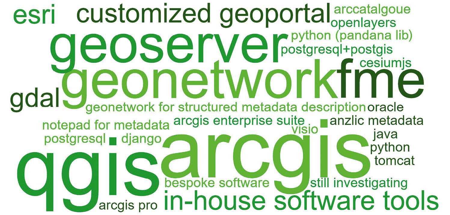
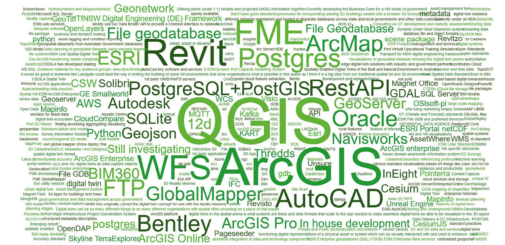
Further understanding about the OGC standards must be developed. These standards are free documents and, for many OGC standards, non-OGC members can also participate by providing feedback and
driving amendments. On the other hand, ISO standards are paid but hold greater official status and can be utilised to promote products and services as being compliant with official and recognised best practices as supported by a standards development body. OGC can have a corresponding ISO standard — this can enable users to test their implementation with OGC standards and then, if required by their organisational rules, obtain ISO documentation to ensure official compliance.
An interesting aspect, raised by some participants, is the interchangeable use of the terms ‘standard’ and ‘file format’. Almost every vendor has its own native format to export data, but not all file formats are necessarily a recognised standard. A typical example is the shapefile format. Any spatial schema can be exported as a shapefile. The shapefile can also carry information (geometry types, semantics and attributes) that is structured strictly according to a specific standard.
The issue is becoming even more complicated when 3D visualisation is needed. Depending on the type of file format, information (semantics, relationships, attributes, even some geometry types) can be easily lost. This is especially true when 3D game engines
(such as Unreal and Unity) are employed. The visualisation file formats take care only of properties that are needed for rendering on the screen (e.g. geometry and colour/ material). Furthermore, the rendering engines maintain more elaborate geometry data than GIS software. The link between specific file formats and standards needs to be clarified. In some cases, it may indeed appear that no standard is available, and a practical ad-hoc solution is employed.
Finally, the standards to be adopted need to be fit for purpose. Only in this way will it be possible to ensure quick developments of appropriate services, easy access to data (e.g. through APIs), transparent information about the quality of data, clear usage restriction and license obligations, as well as security and authentication. It should be also noted that SDTs should be integrated with many other nonspatial data, which means that the spatial communities need to interact with the broader standards to deliver an efficient spatial digital twin. n
Authors: Sisi Zlatanova, Prudence Lawrence, Ivana Ivánová, Jack Barton, Soheil Sabri, Chris Body, Jinling Wang, Irina Bastrakova, Murray Doling, Stephen Neale, Saif Peerbux, Abdoulaye Diakite, Bahram Saeidian.
Above: Word cloud of key phrases from all responses to the spatial digital twin survey. Right: Word cloud showing types of software that support some OGC and ISO standards.The survey clearly shows that the understanding of, and use of, standards is still marginal.
In the last several months, discussions concerning AI seem to be everywhere. One of the key reasons AI has garnered so much attention of late, is that by some measures, companies like OpenAI (makers of ChatGPT) and others are on the verge of resolving, or least greatly mitigating, what’s known in computational, biological and mechanical sciences, as the speed-accuracy trade-off, or SAT.
Modern AI is now fast enough and accurate enough (though still far from perfect) to approximate natural conversation with both speed and accuracy that mimics human-like exchanges with a computer’s speed of data retrieval. This same balancing act between speed and accuracy plays itself out in 3D laser scanning and its related offshoots like panoramic 360° photography and photogrammetry.
In traditional 3D reality capture, high-accuracy scans can take minutes to capture and much longer than that to process the information and register the point-cloud data. Accuracy at the loss of speed. This, for any company looking to complete large-volume scans, can mean a potential loss of business. A panoramic camera, however, can capture an image with great speed but the corresponding data is far less detailed than a 3D point cloud. Speed at the expense of accuracy.
But if AI research suggests that the end of the speedaccuracy trade-off is in sight, what is the next digital domino to fall? Not one to be left in second place, the 3D laser scanning industry, which includes 3D visualisations for architecture, engineering, construction and operations and maintenance, and public safety pre-incident planning applications, is poised to claim victory here too.
Today, those in the business of as-built documentation, are also continually looking for faster, better, easier ways to get the job done. They are looking to simplify tasks and streamline workflows — without sacrificing quality for speed and speed for quality.
Why are they looking for this ‘holy grail’ of speed and accuracy? Because the entire professional measurement services industry has a lot of work on their hands. And lots of time, money and human and technological resources are at stake if BIM models aren’t accurate or if image capture and processing speeds are too sluggish.
Across the globe collectively the industry is scanning the interior and exterior of large structures; they are mapping and measuring industrial facilities like power plants; they are assisting police and
law enforcement with their pre-incident planning; they are aiding specialty and general contractors in their engineering projects; and they are empowering facility managers/ owners with the real-time facility management insights they need to track building operations and to streamline and eliminate any inefficiencies they uncover.
Whether it’s the physical frontier, the biological frontier, the mechanical frontier or the computational/digital frontier whose limits are pushed by today’s fastest computers and ever smarter algorithms, what has been true since the first cities emerged from the Fertile Crescent of the Eastern Mediterranean thousands of years ago remains true today. As long as humans populate this world, large, complex structures, will be built, requiring fast, accurate assembly and long-term project oversight. And for public safety, the need to mitigate worst-case scenarios before they occur will be ever-present.
With these two realties a given, 3D laser scanning will continue to advance. Not only will speed and accuracy increase, but the equipment’s size, weight and bulk will continue to decrease. While
app-based LiDAR scanning is beyond the scope of this article, advances in generalist technology, no bigger than a smartphone or tablet is where the future ultimately lies.
Combined with the promise that quantum computing offers — the world’s first universal quantum computer with more than 1,000 qubits is slated for rollout by IBM later this year — the new frontier is likely to push well beyond the speed-accuracy trade-off in the decades to come.

But for now, hybrid reality capture is the technological breakthrough the 3D laser scanning industry is just beginning to capitalise on. The speed-accuracy trade-off, long the essential pain point for a variety of disciplines across time, is increasingly a challenge looking for a solution that’s about to be solved.
Acclaimed British science fiction writer Arthur C. Clarke may be known for his oftenquoted observation that:
“Any sufficiently advanced technology is indistinguishable from magic.” But while true, Clarke’s quote says nothing about how exciting the magic can truly be — if you’re one of the visionaries helping bring that magic to life. n
Oliver Bürkler is the Director of Laser Scanning, FARO Technologies, Inc.Building on our history of accuracy and reliability, the new FARO ® Focus Premium Laser Scanner is the fastest, most accurate and most data-sharing-enabled scanner on the market to date, featuring entirely new components with a proven design.
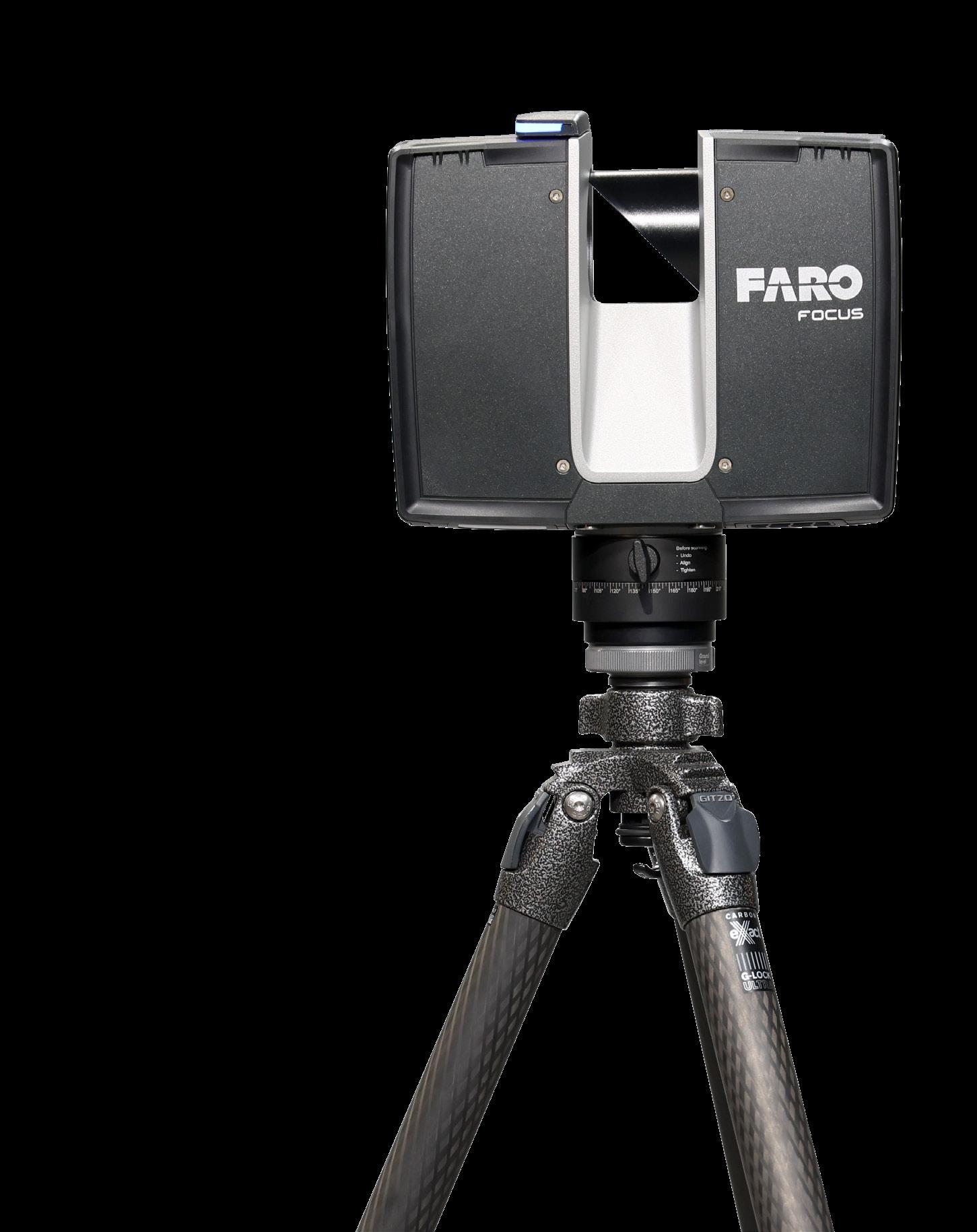
About 1 minute to complete a typical scan, in combination with the optional FARO PanoCam upgrade, even in color.
The latest color camera technology enables the Focus Premium to capture scans with up to 266 megapixel color information.

Competitive service means maximizing the life of this product while reducing the total cost of ownership throughout the device’s lifespan. Two years allows for maximum flexibility and the piece of mind knowing that any repairs or defective parts will be replaced.
Focus Premium provides exceptional capturing efficiency, data quality and accuracy for professional applications across the construction, public safety, operations & maintenance and manufacturing markets, while offering data quality at faster scan speeds (up to 1 minute per scan) reducing onsite scanning time by up to 50%. Meanwhile, faster loading and system response yields greater data management efficiency when paired with the new FARO Stream mobile app and uploaded to the new FARO Sphere cloud-based collaboration platform.
Focus Premium Features:
y Up to 350m scanning range, leading to superior area coverage per scan position
y Smartphone-enabled remote control capabilities, limited only by the range of a Wi-Fi network
y Improved wireless workflow with more stable and faster Wi-Fi operation
y On-site registration, the process of combining multiple scans using common overlap, means faster project completion and real-time awareness of scan errors or missing data
y Seamless connectivity with Stream and Sphere
y Scanner control can be executed on either the app or on the actual Focus
y Users have easy access to create projects, change scanner settings, manage image resolution, opt for color or black and white scans, group scans through clustering, and add annotations
y Rugged construction and housing can withstand the tough day-to-day work
y Integrated high-speed SSD data storage for maximum scan capacity and lighting fast scan processing
A CSIRO project team has confirmed the location of the wreck of MV Blythe Star, bringing an end to a 50-year mystery.
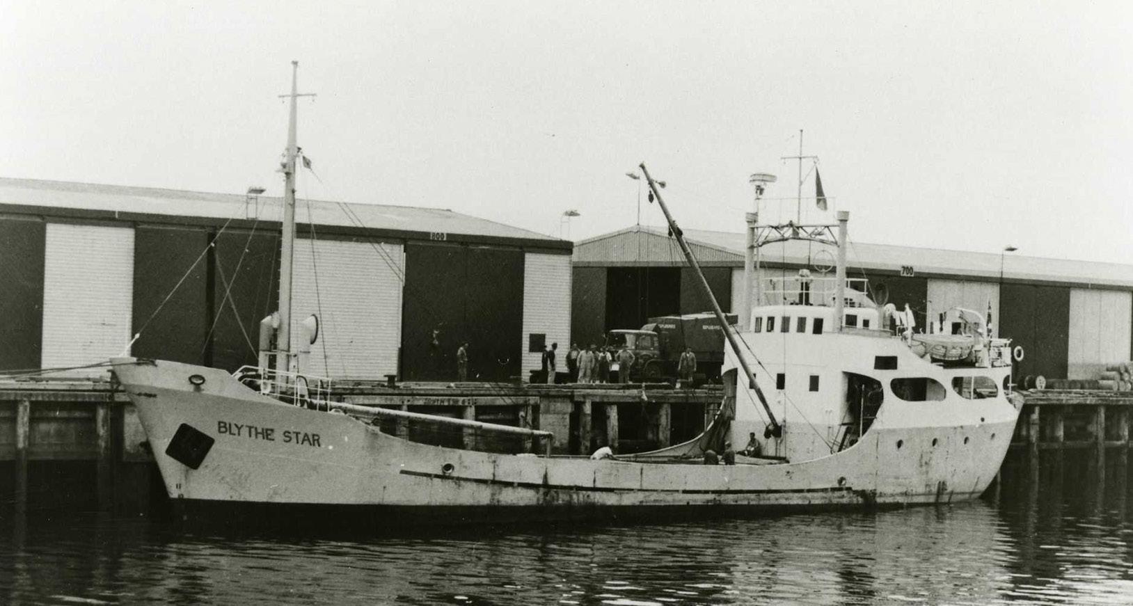
Early in the evening on Friday, 12 October 1973, the 44-metre coastal freighter MV Blythe Star cast its lines and departed Hobart bound for Currie on King Island. Aboard were 10 crew and a cargo of beer and fertiliser, the latter of which filled the vessel’s hold and was stacked atop its hatch covers.
In the days that followed, the ship and disappeared without a trace. This triggered the largest maritime search ever conducted in Australia to that time and led to important changes in maritime safety laws in Australia, improving safety at sea for future mariners.
Unbeknown to the rest of the world for nearly two weeks, the Blythe Star had suddenly listed then sunk off the southwest coast of Tasmania on the morning of 13 October. All 10 crew were able to escape the sinking vessel and climb into an inflatable life raft. Tragically, three crewmembers died before the survivors — who, at the mercy of ocean currents, drifted up and down the Tasmanian
coast in the life raft — were rescued on 24 October.
No trace of the Blythe Star was found.
A few months shy of the 50th anniversary of its disappearance, the location of the wreck of the Blythe Star was confirmed by scientists aboard the CSIRO research vessel RV Investigator during a voyage off the west coast of Tasmania. The primary purpose of the voyage, led by the University of Tasmania, was to study a massive submarine landslide on the continental shelf in the region.
The voyage included a ‘piggyback’ project to investigate an unidentified shipwreck in the area, suspected to be that of the Blythe Star. Piggyback projects are added to voyages where spare capacity or capability of the Investigator can be used to deliver additional projects of national benefit. The project was led by CSIRO’s Geophysical Survey
and Mapping (GSM) team in collaboration with the CSIRO Seagoing Instrumentation Team (SIT) on board.
The unidentified shipwreck had been pinpointed by fishing vessels and previous seafloor surveys in the region. It is not uncommon for shipwrecks to be located by fishing vessels.
On 12 April 2023, Investigator completed a systematic bathymetric survey of the unidentified shipwreck and surrounds. The survey was undertaken using the vessel’s Kongsberg EM710Mk2 multibeam echosounder operating at frequencies of 70 to 100 kHz. A narrow swath angle of 30° to port and starboard was selected for the survey. A data grid of 0.5-metre resolution was applied in map production. However, all soundings (points of data) were retained for point cloud visualisations. The EM710-Mk2 can map the seafloor down to approximately 1,600 metres at these frequencies.
Following the mapping and guided by the imagery that
had been collected during the survey, two underwater camera systems were deployed from the Investigator to conduct visual inspections of the shipwreck. The first system used was a dedicated drop camera system, capable of being deployed to depths of 6,000 metres. The second system was a specialised deep towed camera system; this is generally used for towed surveys of the seafloor but was configured for use as a drop camera for this deployment. The deep towed camera can be deployed to depths of 3,900 metres. The camera systems were deployed and operated by members of the SIT in partnership with the ship’s crew from ASP Ship Management.
The bathymetry data located the unidentified shipwreck lying in approximately 150 metres of water. The shipwreck was intact and sitting upright on the seafloor, orientated with the bow pointing towards the northwest. Importantly, the bathymetry showed that
CRAIG DAVEY, PHIL VANDENBOSSCHE and AUGUSTIN DEPLANTE, CSIRO The MV Blythe Star disappeared without a trace in October 1973. Its wreck has now been found. Image courtesy Queen Victoria Museum via AUCHD.the shipwreck matched the dimensions and profile of the Blythe Star.
Visual inspection delivered a definitive outcome. Deployment of the drop camera focused on searching for features from the stern through to the bow that could confirm the shipwreck identity. Careful manoeuvring of the camera and close inspection by the project team enabled the vessel name to be identified on the bow of the shipwreck, with S-T-A-R being just visible. This, combined
with confirmation of other distinctive features, confirmed that the wreck was that of the Blythe Star
The bathymetry and visual inspection showed the vessel was intact and in relatively good condition, covered with a minimal growth of algae and seaweed. The superstructure showed some signs of damage, possibly caused during its sinking or resulting from fishing trawls catching on it over the years. Most notably, the vessel’s wheelhouse is no longer present
and there is a large depression in the seafloor at midship’s on the port side.
Some debris was observed around the Blythe Star, including the front of the wheelhouse seen on the seafloor on the port side and what appears to be a large box located on the seafloor near the stern on the starboard side. The site was also found to have abundant marine life, with schools of small fish, crayfish and several fur seals spotted by the underwater cameras.
It is hoped that the bathymetry and camera imagery gathered may provide additional information to help answer questions about what caused the vessel to sink.
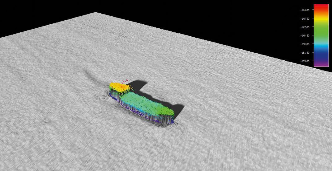
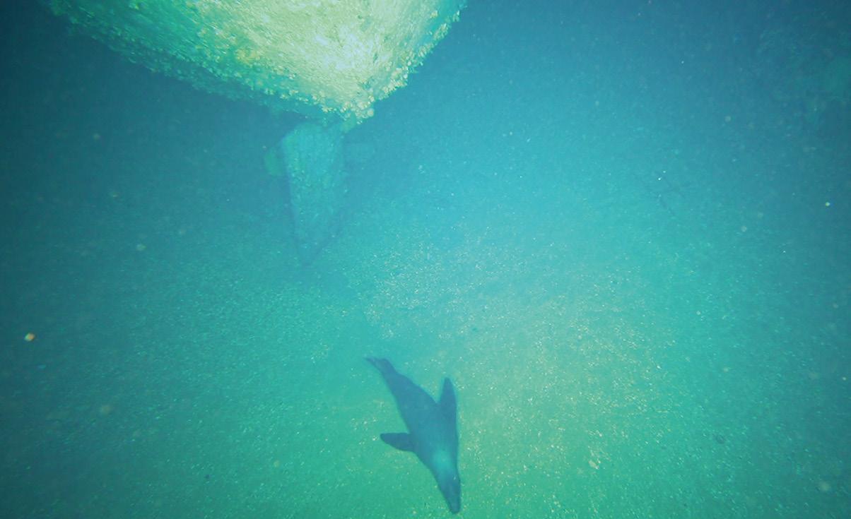
The data and video footage from the project have been provided to both state and national maritime heritage
agencies as part of the reporting process for the Australasian Underwater Cultural Heritage Database (AUCHD). The AUCHD contains historical and environmental information about shipwrecks, sunken aircraft and other types of underwater heritage sites located in the Oceania and Southeast Asian regions.
Importantly, the project included CSIRO maintaining close liaison and providing regular updates to stakeholders who had direct connection with the Blythe Star. This is an important part of any project that involves underwater cultural heritage.
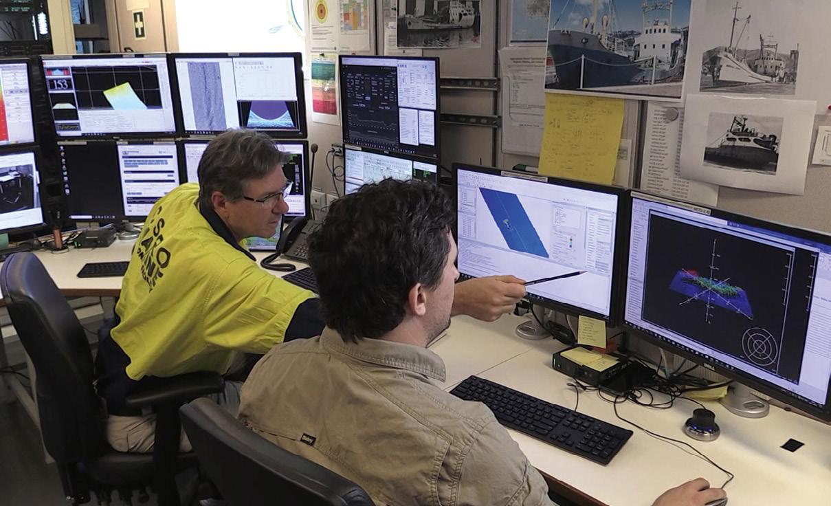
CSIRO, Australia’s national science agency, is pleased to be able to assist in providing closure to this 50-year mystery and confirm the resting place of the Blythe Star. The project was supported by a grant of sea time on Investigator by the CSIRO Marine National Facility. n

The bathymetry and visual inspection showed the vessel was intact and in relatively good condition.Bathymetry was used to locate and assess the wreck of the MV Blythe Star. All images courtesy CSIRO unless otherwise indicated. Inspecting the shipwreck from the RV Investigator’s Operations Room. The CSIRO research vessel RV Investigator.
Technologies able to provide precise time and position without the use of navigation satellites, have been put to the test.

In March, the Joint Research Centre (JRC) of the European Commission’s Directorate-General for Defence Industry and Space located in Ispra, Italy, released a report into its assessment of alternative positioning, navigation, and timing technologies for potential deployment in the European Union. The tests were conducted during 2022.
The JRC reported that viable technologies exist in the private sector. Even if GNSS networks such as Galileo or GPS became unavailable, the alternate technologies would mean services could be maintained, albeit at lower levels of accuracy.
The Australian LocataLite system produced by Locata Corporation in Canberra delivered the best position results in the tests. In static tests, the JRC found that LocataLite could position to within 13 mm 95% of the time. In kinematic tests, it gave 18 mm accuracy.
Locata and six other companies, four European and two from the US, were awarded a competitive tender in October 2021 to participate in the demonstration.
Critical infrastructure systems rely heavily on GNSS services. Energy supply networks, telecommunications and financial networks depend on accurate timing signals generated by the atomic clocks that are central to GNSS. Transport and logistics as well as a myriad of consumer applications, depend on positioning.

Australian farmers can bear witness to this. In April, the SouthPAN GPS augmentation service failed due to an outage on the Inmarsat I-4 F1 satellite. The loss of service affected winter planting across Australia and New Zealand, with farming organisations claiming the damage bill could run into millions of dollars.
But that’s small beer compared to the situation overseas. The EU says GNSS underpins about €2 trillion ($1.6 billion) worth of
infrastructure and has created more than 100,000 highly skilled jobs. Galileo and EGNOS (the European GPS augmentation system) have a tangible impact on many EU policy domains, such as the economy, the EU Green Deal, security and defence.
Thus, investigating the supply of alternative services, particularly ones that are locally based, is a priority. Augmentation services such as SouthPAN really do not make the cut, since they require an operational GPS to work.
All GNSS have well-known vulnerabilities. They all depend on a clear view of the sky, so they give poor results indoors and in places such as open-cut mine pits. Even when the sky can be seen, GNSS receivers can be baffled by reflections from buildings or metal structures — the so-called multi-path problem. Occasionally, the position of the satellites in the sky can result in poor geometry which leads to inaccuracies.
At a more sinister level, GNSS are all easily jammed by bad actors. And one way or another, all navigation systems are controlled by military organisations, which can degrade or shut down the service if it suits them.
That’s why the JRC study compared systems that do not depend on GNSS but could be deployed in parallel with them. Timing signals provided by OPNT, Seven Solutions, SCPTime, and GMV Aerospace were examined. In addition, the study considered three full PNT providers: Satelles and NextNav from the US and Locata Corporation from Australia.
All the systems use different technologies to achieve their ends, which gives each service unique advantages and disadvantages. The report cautions that “… the diversity in both the type of the assessed technologies and the test conditions that were applied are such that benchmarking of the performances cannot be made in a fair manner. The objective of the test campaign was rather
The JRC study compared systems that do not depend on GNSS but could be deployed in parallel with them.
directed to characterise each technology and understand its main points of strength. In addition, it is worth stressing that, even if the technologies’ performance was evaluated against common performance indicators, some critical elements (including operation mode and implementation) cannot be captured by simple metrics.”
The main conclusion of the test campaign, according to JRC engineers, is that all platforms fulfilled the minimum requirements to be a viable substitute for any of the GNSS. More specifically, all the systems showed a timing accuracy against Coordinated Universal Time of less than a microsecond after a day’s GNSS outage. Accuracy in all systems that offered positioning capability was better than the 100 metres, horizontal and vertically, which is the same as that delivered by unaided GPS. They all showed resilience to the usual failure modes and vulnerabilities, including frequency jamming and spoofing or unintentional interference.
It is worth noting, however, that although 100 metres is the minimum guaranteed accuracy, it is hardly adequate for many applications, especially machine control.
The positioning tests showed that the Locata system can produce accuracies that are two orders of magnitude better than either the Satelles or NextNav systems. However, Locata depends on a network of specially developed ground stations called LocataLites, which produce a LocataNet. The others are intended for wide-area deployment, making them cheaper to implement for continent-wide systems.
Locata’s technology is not new. The system has been under development for a decade,
during which time the company has amassed 170 patents and spent more than $110 million on R&D. In the process, the company’s engineers have overcome a number of fundamental problems.
One obvious problem concerns timing. The LocataLites need to be synchronised. In the absence of a master atomic clock, how is this to be achieved? A more subtle problem is the so-called near/far problem: how to communicate effectively between the mobiles and the LocataLites when the mobile might be a few centimetres from one terminal and 100 km from the other. Locata also claims to have a solution to the multi-path problem which plagues GNSS.
The JRC test also examined Satelles’ STL (Satellite Time and Location) product. STL is designed to use existing lowEarth orbit communications satellites and conventional antennae to deliver its service. In the tests, STL delivered horizontal positioning accuracy of 27 metres and vertical accuracy of 17 metres.
The third PNT provider, NextNav, had its TerraPoiNT service put to the test. Like Locata, it requires ground-based broadcast beacons. NextNav delivers outdoor kinematic accuracy of 11 metres, according to its own publicity, but JRC engineers were unable to confirm this result.

The relative advantages and disadvantages of these systems are reflected in their customer bases. NextNav has established a large network in Los Angeles, according to its publicity. Locata has working installations in the Port of Auckland and at container terminals in the US, where it forms the basis of systems that automatically move containers from ships to ground transport, as well as various mine sites and US military installations.
In economic terms, it is
probably true that GNSS’ timing signal is more valuable than positioning, given that it is now an essential part of phone, power and financial systems. The JRC conducted several tests aimed at assessing the ability of the products under test to generate a viable time signal over one day, 14 days and 100 days, and to transfer that signal over fibre, conventional wired networks and wirelessly.
OPNT has developed hardware to enable the transmission of the White Rabbit protocol over fibre. White Rabbit is a time and frequency distribution protocol developed at the European Organisation for Nuclear Research (CERN). The OPNT can deliver nanosecond time and frequency accuracy over very long distances (1,000 km).
Seven Solutions also offers a Time-as-a-Service product using White Rabbit. Its timing accuracy to UTC after 100 days is better than a nanosecond.
SCPTime disseminates UTC via conventional computer networks. In the test, the BiaTime D Premium service transmitted the time signal from the Observatoire de Paris via a server in Grenoble to the ISTIA research facility. After 24 hours, the timing accuracy was better than a microsecond.
GMV Aerospace
demonstrated its WANTime project to transfer time data from Madrid to Valladolid, 130 km away. It used a passive hydrogen maser and time transfer over fibre to generate accuracy of better that a microsecond after 100 days.
The authors of the JRC report say the availability of backups should be considered a priority for the EU’s critical infrastructures, which have become primary users of positioning and timing services. It suggests developing a permanently active alternate service to increase the robustness of classical GNSS.
So far, the European Commission has issued two relevant directives. The Directive on the Resilience of Critical Entities mandates member states to identify critical infrastructures and undertake measures to strengthen their resilience. The NIS2 Directive is a similar directive aimed at thwarting cyber-attacks.
Playing into this is the European Union’s current policy objective of strategic autonomy, with the Strategic Compass for Security and Defence requesting greater investment in capabilities and innovative technologies and cooperation with partners. n
All platforms fulfilled the minimum requirements to be a viable substitute for any of the GNSS.A Locata dish antenna pointing towards the EU’s Joint Research Centre, 44 km away. The Yagi antenna above it is pointed at a cell tower in Como and is used to connect the system for remote control and data logging. Image courtesy Locata.
Antenova has introduced the GNSSNova M20072, a GNSS receiver with integrated GNSS antenna and greatly reduced power consumption. The M20072 uses a MediaTek 12nm low-energy chip with 1.8V power supply, which uses 70% less power than older chipsets. The module contains an integrated omni-directional GNSS antenna, on-board LNA and a SAW filter which work together to boost the signal to the GNSS processor if lineof-sight to the horizon is difficult. The M20072 tracks four satellite constellations simultaneously in the 15591609 MHz bands: GNSS, GPS, BeiDou and GLONASS. This gives greater accuracy in positioning, and EASY and EPO are built in for a faster time to first fix.


Septentrio has announced its Agnostic Corrections Partner Program that facilitates the use of its receivers with various high-accuracy services, and which enables integrators and users to select the service which is most suitable for their specific application. In addition to the widely accepted RTK cm-level positioning, there has been an expansion in the market of affordable PPP-RTK corrections, which provide continental coverage, sub-decimetre accuracy and a fast convergence rate, delivered over internet or satellite. The Agnostic Correction Partner Program provides documentation for the use of Septentrio receivers with these high-accuracy services and already includes Polaris from Point One, Skylark from Swift Navigation, PointPerfect from u-blox.
Eos Positioning Systems has announced that its Arrow Gold+ GNSS receiver supports the free, new Galileo High-Accuracy (HAS) Initial Service correction service. This means that Arrow Gold+ users can achieve better than 20cm real-time accuracy with 95% confidence anywhere in the world. During the Phase 1 Initial Service, field workers worldwide can expect a convergence time of less than 20 minutes. In Phase 2, which the European Space Agency currently estimates will go live as early as 2024, these times will drop to less than two minutes for Europe and less than five minutes for the rest of the world. Current Arrow Gold+ customers can request a firmware upgrade to start using Galileo HAS for free.
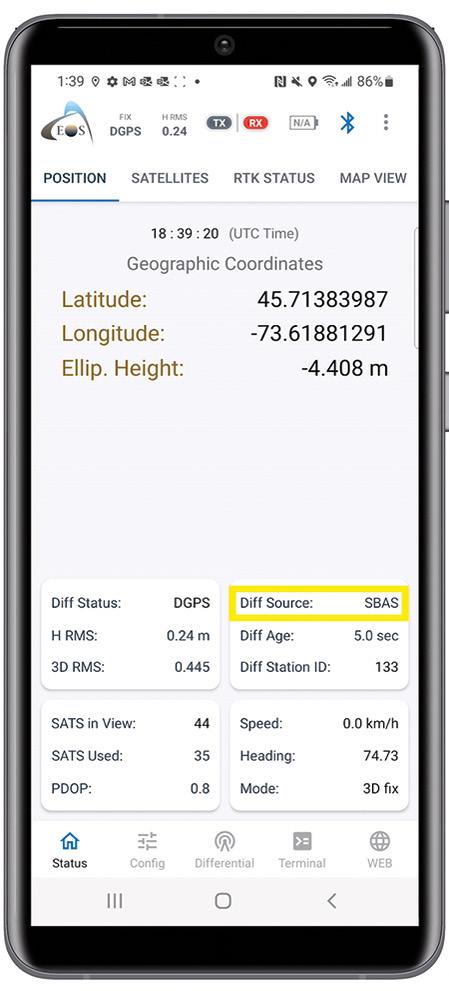
The Teledyne Geospatial CL-360 for marine applications is a LiDAR sensor that can be seamlessly integrated with high-resolution multibeam systems and the CARIS PingTo-Chart workflow, enabling full above- and below-water image capture with survey grade accuracy in a single workflow. The sensor’s 360-degree scanner and up to 2 million points/second collection rate provides a suitable solution for mapping coastal infrastructure. The CL-360 is designed for use on an uncrewed surface vessel.
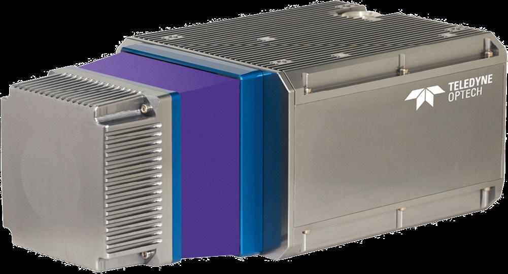

We’re back! What a relief it was to meet friends and colleagues in person at the Locate23 conference in May. We arrived in the Adelaide, Australia’s ‘space capital,’ ready to celebrate the official launch of the Geospatial Council of Australia and we left energised by an incredibly talented space and spatial community.
South Australia is home to the Australian Space Agency, SmartSat CRC and many key commercial space companies and start-ups, so there was an air of expectation around new business, export opportunities and high-tech jobs. There was even good news for students coming into our sector, with South Australia’s Flinders University announcing a Bachelor of Surveying degree along with its Geospatial Information Systems degree available from 2024 (also available as a double degree in Geospatial Information systems/Surveying).
It was, essentially, the right place and the right time to bring to life the Geospatial Council… Australia’s newest professional space and spatial organisation.
Locate23 took place right after the Australian Space Forum at the same venue, so it enabled many to stay on and connect at the conference, including the Head of the Australian Space Agency, Enrico Palermo.
As the Geospatial Council, we were pleased to co-host a Space and Geospatial Workshop with the Andy Thomas Space Foundation, covering topics of interest such as positioning, navigation and timing (PNT), Earth observation (EO) and
telecommunications. The level of interest and engagement at the workshop, and across the conference generally, reflected what the Geospatial Council is hearing in member conversations: We live in a digital world, underpinned by geospatial services and there is a strong desire to collaborate across sectors like agriculture, transport, retail, healthcare, manufacturing and construction. This year also featured a really strong exhibition of new technology and probably the best program yet.
You only need to look at the list of winners of this year’s Asia Pacific Spatial Excellence Awards (see page 22 of this issue) to see how geospatial is helping to drive innovation in Australia. The Awards provide an opportunity to single out future thinkers and reward excellence. When listening to some of the heartfelt acceptance speeches, it was clear that we have a really strong and special community.
I would like to call out some of the individual winners.
Dr Zaffar Sadiq Mohamed-Ghouse was named Professional of the Year. A former President of SSSI and former Locate Board Chair, Zaffar is a global leader in the geospatial industry, a government advisor and mentor to many geospatial professionals. He is well known to many of our community, especially for his work with the United Nations.
The inaugural winner of the Bruce Thompson Innovation Award is Nathan Quadros, recognised for his work using remote sensing, geodesy, open data and
spatial analytics, which has had such a significant impact on coastal resilience and planning across Australia and the Pacific.
The Peter Woodgate Award, a new joint award between AURIN and the Geospatial Council, honours the late Dr Peter Woodgate, with the first recipient being one of the sector’s rising stars — Eva Rodriguez Rodriguez. Eva is a recognised STEM champion, having worked at the European Space Agency prior to migrating to Australia where she worked with Peter at the CRC-SI. Having spent much of her career to date in applied research with CRCSI, Frontier SI and SmartSat CRC, she is also a proven innovator and is now applying that pedigree to commercialise the work of innovators and researchers through targeted investment with Breakthrough Victoria.
The Geospatial Council President’s Award was presented to industry consultant and Geospatial Council executive Danika Bakalich who delivered the Surveyors’ Trust-funded The Australian Surveying and Spatial Workforce — A National Roadmap, a ground-breaking piece of work that takes a holistic view of the issues holding back our workforce growth and identifies the key structural issues that needed addressing to enable sustained attraction of talent to the geospatial workforce. The Roadmap, released in 2022, has since fuelled a number of new workforce initiatives, many of which have involved or been led by Danika.
As you reflect on the achievements of this year’s APSEA winners, you are invited to consider how your organisation could
be recognised with a prestigious industry award — next year to be known as the Geospatial Excellence Awards. Look out for details coming soon on the Geospatial Council website.
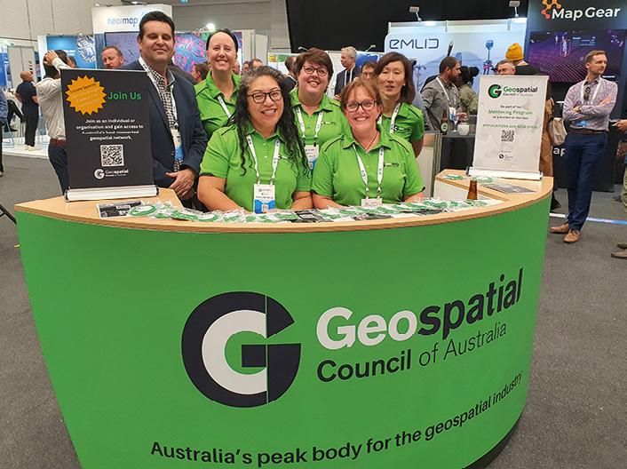

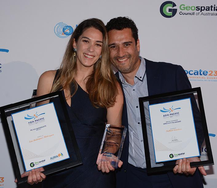
One of the most inspiring visions for the future at Locate23 was the launch of the extended version of the 2030 Space + Spatial Industry Growth Roadmap
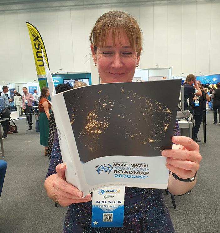
The release of this detailed Roadmap marks the culmination of two years of consultation by our industry. It was also pleasing to see Enrico Palermo quote from and reference this Roadmap during his opening keynote presentation at Locate23. However, the celebration was bittersweet as we missed our friend, the late Dr Peter Woodgate, who was the driving force behind the Roadmap. As Chair of the Roadmap steering committee, his vision for Australia’s space and geospatial future will live on. In his Foreword to the Roadmap Peter wrote: “Australia must think long term and do so with foresight, planning and ambition. If Australia collectively seizes this opportunity, it can accelerate the rate of growth of both industries and realise critical mass far more quickly. Building Australia’s space and geospatial capabilities is mission critical to the future of this nation.”
If the growing momentum and mood for change in the geospatial ecosystem is any indication, the Industry Growth Roadmap could be the blueprint for our mission.
 Tony Wheeler CEO, Geospatial Council of Australia
Maree Wilson checks out the Space+Spatial Industry Growth Roadmap.
GCA Board Director, Kate Ramsay, with GCA CEO, Tony Wheeler.
The GCA team with Acting President, Paul Digney.
Dr Peter Woodgate Award recipient, Eva Rodriguez Rodriguez, and Bruce Thompson Innovation Award recipient, Nathan Quadros.
The Geospatial Council of Australia asked geospatial professionals to volunteer their opinions, insights and hopes for the future of the sector. Here’s what they had to
What are the top challenges for the geospatial sector right now?
Dr Zaffar Sadiz Mohamed Ghouse
Director, Advisory & Innovation, Woolpert Asia-Pacific Fragmentation of niche services into united niche offerings. More coalition of niches to offer one-stop geospatial services. Invest in capacity and capability development at the school level to address digital twin and digital transformation requirements. Recognition of geospatial skills by the government and private sector, e.g. GISP is listed as a parameter in procurement.
Darren Mottolini Director SpatialWA, Landgate
Challenge one is, how can we embrace the digital change that has already informed and influenced the next generation coming through, so we ensure that geospatial capabilities and excellence remains a domain that people want to get involved in, and not simply be taught through ChatGPT and other online resources? This is a question of relevance in a digital age.
Challenge two is to ensure we build a single, accessible body of knowledge, known through a single voice so ‘geospatial’ remains a skilled domain, that future generations want to be involved in. We are already seeing undergraduate degrees in geospatial fields be consumed by other fields of knowledge and I don’t believe this will change any time soon, yet the opportunity exists to embed critical skills into many domains now. How we embed our value into many domains will be through the art of communication and awareness, so value is perceived by others and not simply by what we say.
Alexander Wiechert CEO, Vexcel ImagingDiscovering young talent — attracting promising young talent to the aerial survey industry is a challenge due to the lack of visibility and recognition of this dynamic field. Overlooked contributions — despite the significant contributions that the industry makes to society, it remains largely unrecognised and invisible to the public eye. And standardisation issues — the lack of well-defined standards for end products can lead to misleading outcomes and poses a challenge for the industry to meet expectations.
Graeme Kernich CEO, FrontierSL

Attracting, training and retaining the skilled workforce needed to meet the growing and evolving demand for spatial information. Educating leadership that the challenges of today relating to better preparedness to our changing world, require a robust and increased use of space-based and spatial information within their decision-making frameworks. To be more effective in terms of resource use and impact will require more timely, more frequent and better-quality data.



The spatial and surveying sectors offer such a wide variety of roles working with a broad range of industries, so you will constantly have the chance to expand your knowledge and skills. Embrace every opportunity that comes your way, and actively seek out and make your own opportunities to learn and grow. Even if something sounds like it is outside of your comfort zone, have the courage to say yes to any opportunity you are given. You will accomplish a huge amount if you have a go; certainly a lot more than if you don’t try.
Daniel Paull General Manager, Nearmap Australia& New Zealand
I’ve dedicated my career to geospatial because it has so much to offer — I’ve never imagined myself in any other field. If you’re starting out, I’d recommend focusing on becoming a well-rounded professional. You will never regret having a sound understanding of all the technical aspects of data collection, processing and analysis. But make sure you balance that with knowledge of business acumen, practices and management. As geospatial experts we spend much of our time absorbed in imagery, maps and data, but it’s really the people that make this industry so rewarding. Make sure you maintain those important connections. There is no limit to what you can achieve, so think big!
I am really looking forward to the harmonisation of national competency standards in the land surveying sector. This work, which is being driven by the Council of Reciprocating Surveyors Boards of Australia and New Zealand, will flow through the tertiary education institutions and into postgraduate training programs, and is critically important to minimise the time for postgraduate qualifications and registration to be achieved. All jurisdictions are feeling the reality of skills and workforce shortages and this work compliments the obligations of Automatic Mutual Recognition, facilitating transferable skills.
The next generation of geospatial and survey technologies and their interoperability with a range of sensors, IIOT, engineering solutions; the directions of AI and machine learning in information, data and process automation and the harnessing of cloud and edge computing; the diversification of spatial digital twins to simulation and process as enablers of predictive analytics; and a diverse and equitable workforce.
Alistair



I’m most excited by the emerging impact of Moore’s law on 3D digital LiDAR. We’re going to witness insane improvements in LiDAR performance — channel counts, point cloud density, sensor size and affordability. We are at a pivotal moment in time for the LiDAR sensor industry. Watch this space…
I’m also really looking forward to increasing unification of very precise and rich dynamic field data. I see this integrated in real time across mobile, desktop and web platforms, linking project managers and surveyors in the field. I see this increasingly happening regardless of location due to low Earth orbit communication platforms like Starlink.
Mary-EllenThe Geospatial Council of Australia recently honoured Associate Professor Petra Helmholz and Warwick Hehir the prestigious Fellow status. Both members have demonstrated outstanding expertise, achievements and contributions in their field.
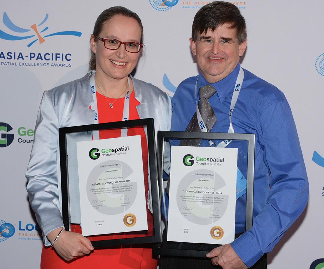
Petra Helmholz
Associate Professor Petra Helmholz has demonstrated exceptional dedication to the fields of surveying, geomatics, and photogrammetry over the years. She is an Associate Professor at Curtin University and has held many leadership roles within SSSI at a state and national level. Petra has been a strong advocate for showcasing remote sensing and photogrammetry applications and for raising awareness about the field within the geospatial sector.
It was only recently that Petra stepped down as the National Chair of SSSI’s Remote Sensing & Photogrammetry Commission (RSPC), a position she held for four years. Petra was also the WA representative of RSPC from 2012–16 and has been a General member of the WA Region Committee since 2018. Internationally recognised for her engagement with professionals and industry, Petra has been invited to
present at prestigious webinars and held leadership positions within the International Society for Photogrammetry and Remote Sensing (ISPRS).
Petra’s research expertise in digital photogrammetry, remote sensing and image analysis has led to the development of new technologies with significant impacts on various sectors, including healthcare, archaeology and Earth sciences. Some of her noteworthy projects include the Cliniface project, which improved the diagnosis of Foetal Alcohol Spectrum Disorder; the Photogrammetric Burn Analysis project, which provided precise measurements for reconstructive surgery; and the Sydney-Kormoran-Project, which involved 3D imaging of WWII wrecks HMAS Sydney II and HSK Kormoran Petra has published 21 journal articles spanning various disciplines, demonstrating the multidisciplinary nature of her research.
A dedicated educator, Petra
has provided leadership in developing and implementing significant course changes in surveying at Curtin University. Her commitment to teaching and mentorship have been recognised with multiple Asia Pacific Spatial Excellence Awards. Petra has also supervised numerous undergraduate, masters, and PhD students who have gone on to successful careers in academia and industry.
In summary, Associate Professor Petra Helmholz has made substantial contributions to surveying, geomatics and photogrammetry through her research, teaching and leadership roles. She has worked tirelessly to promote the discipline and engage with professionals and industry at both national and international levels.
Warwick Hehir
Warwick Hehir boasts over 20 years of experience working on GIS and Information Management projects for the NSW State Government. Warwick has held various leadership roles within SSSI, such as Chair of the NSW Regional Committee from 2009–12 and was the NSW Representative on the RSPC and SICC National Commissions. He has also been an active contributor on SSSI’s Disaster Management and Recovery Special Interest Group.
In his professional life, Warwick has held key roles in various state government groups, including Imagery NSW, the NSW Emergency Management data working group and the National Metadata Working Group, as well as the Emergency Management Spatial
Information Network Australia. Throughout his career, Warwick has contributed to the development and management of critical NSW State datasets, such as Coastal Catchments, Bush Fire Prone Land, Vegetation Entitlement, Fire Trails and Fire History. He also played a significant role in drafting state-level strategy and data management documents, including the 2007 NSW Imagery Strategy and NSW Metadata Policies and Standards.
During the 2019–20 ‘Black Summer,’ Warwick’s service as part of the State Operations Centre, Incident Management Teams, and as a Fire Fighter, earned him a Premier’s Citation and National Emergency Medal.
His work on the Fire Extent and Severity Mapping project, in collaboration with other state agencies, resulted in a semi-automated approach for mapping fire severity and extent in NSW. This project significantly contributed to the NSW Fire History dataset and led to a publication in the international journal Remote Sensing and Environment.
Warwick has also been actively involved in the National Fire History Project for the past two years, working on the EMSINA and Geoscience Australia-run project with Australia Research Data Commons funding under the Bushfire Data Challenge.
Throughout his career, Warwick has consistently exhibited dedication to the GIS and information management fields. He has actively engaged with SSSI, generously shared his research and knowledge, and mentored aspiring spatial science students. n
Undertake lifelong learning. Re-skill and upskill. Make sure your licence or endorsement is current and keep up-to-date with the latest tech – keep growing your network.

Surveyors measure and map the world using cutting edge technology and equipment to determine the accurate position features of space, earth and waters.
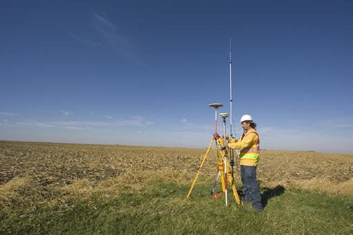
A registered or licenced surveyor (terms are jurisdictionally determined) is the only person legally authorised to perform land/cadastral titles or mine surveying and sign-o on projects.

Various career opportunities are available once a certificate or diploma is obtained. Look out for Graduate Programs o ered by companies. A certificate can lead to entry level positions as a survey assistant, technician, drawings technician, drone operator and more!
Internships Cadetships
WHAT
There are terrific career pathways into the industry o ered by employers.
Prep to year 10 options... build the foundations Year 11 & 12 options... advance your skills for your career Look out for STEM-based subjects at your school
STEM STEM is an approach to learning and development that integrates the areas of science, technology, engineering and mathematics. It is core to landing exciting jobs of the future.
ENGINEERING
RESOURCES You play a critical role in the design and construction of bridges, roads, buildings, towns and cities.
You make sure underground and open pit mines are accurate and safe.
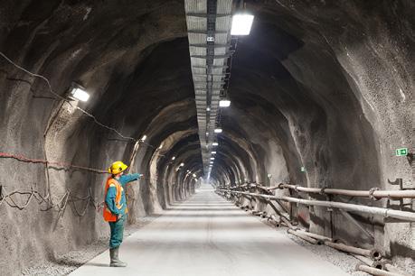
You determine the re-establishment, identification or adjustment of land boundaries.
GEODESY
You measure and understand the Earth's geometric shape and size, location in space and gravity.
HYDROGRAPHY
Oceans are critical to climate change, protecting the oceans, measure sea level rises, contribute to the blue economy.
For more information and to read the new Surveyor Career Pathway Paper, go to: thesurveyorstrust.org.au/Career-Development

