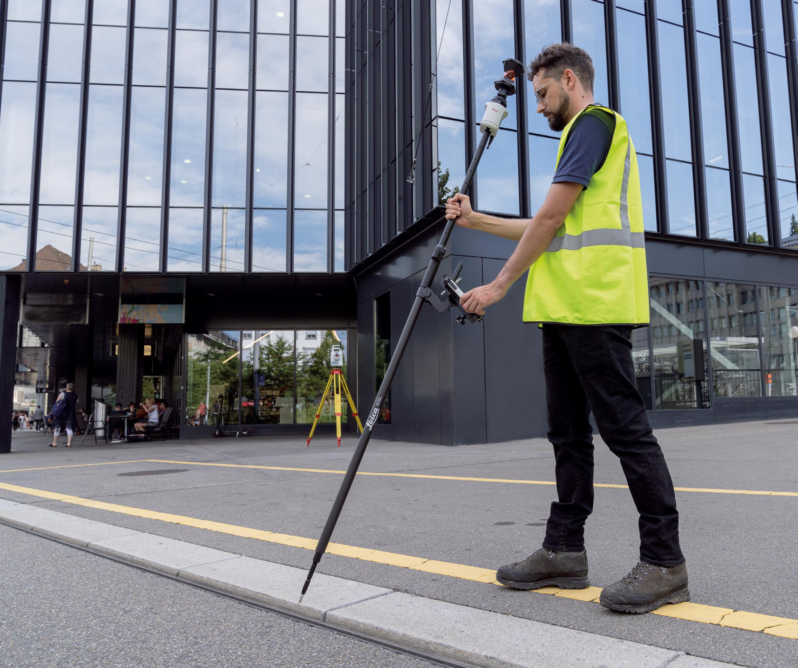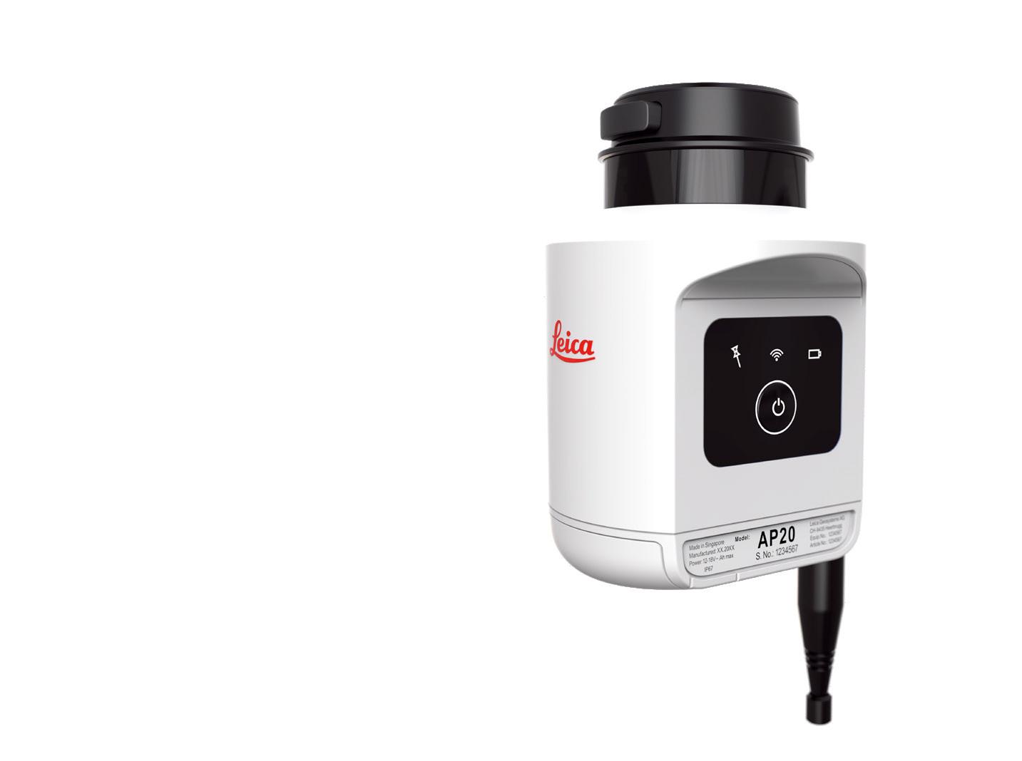


$9412
Includes all the components required to establish a robust, multi-frequency RTK survey setup, with a local base station and a rover unit.
KIT CONTENTS
• 2 x Emlid Reach RS2+ GNSS receivers
• Triangl Wooden Tripod 1.67m
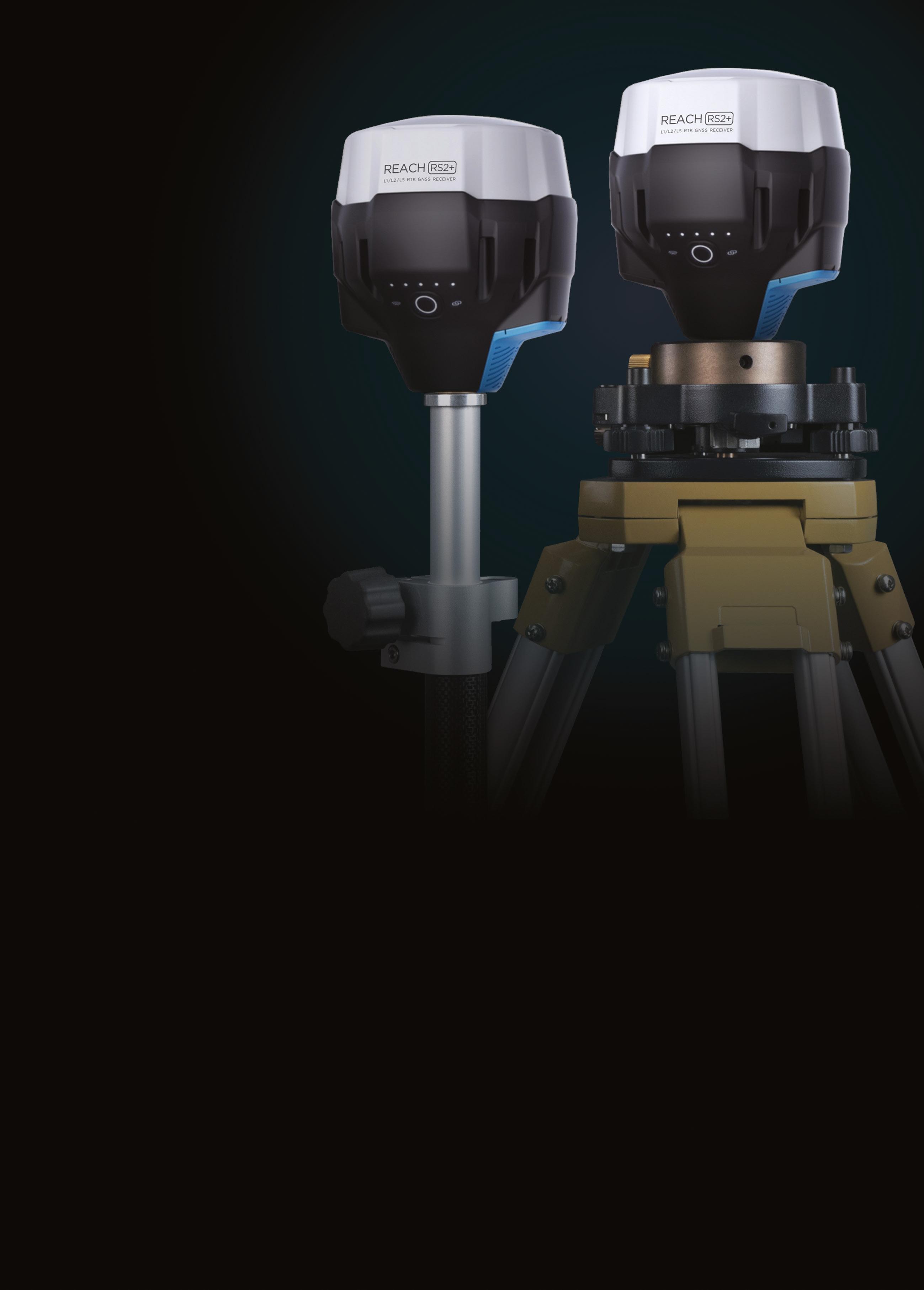
• Tribrach with Optical Plummet
• Rotating Tribrach Adapter
• Extension Pole 32mm x 500mm
• 2.4m Telescopic Survey Pole
• Thumb Release Type Bipod
‘High level expertise, speedy shipping and excellent customer service, nothing else you could wish for from Map Gear.

Highly recommend.’
Charlotte Mills



To help cater for growing demand, TAFE NSW has opened a mid-year surveying student intake at Yallah, south of Wollongong — the first time a midyear start has been offered at this campus. “As older surveyors retire, and infrastructure projects continue across the state, we’re seeing increased demand for more people willing to learn these skills, and there’s plenty of work out there,” said TAFE NSW surveying teacher, Jane Hayward.
Brent Nowland is in his first year of study and work, having studied construction as a VET HSC subject before enrolling in the TAFE NSW Certificate III in Surveying and Spatial Information Services. “I went with a surveying course at TAFE NSW Yallah because it was more practical and would give me the hands-on real-world experience, something I think helped make me more employable in job interviews,” he said.
Now almost six months into his TAFE training and a new career in cadastral surveying with the region’s largest surveying company, Allen Price & Scarratts, Nowland

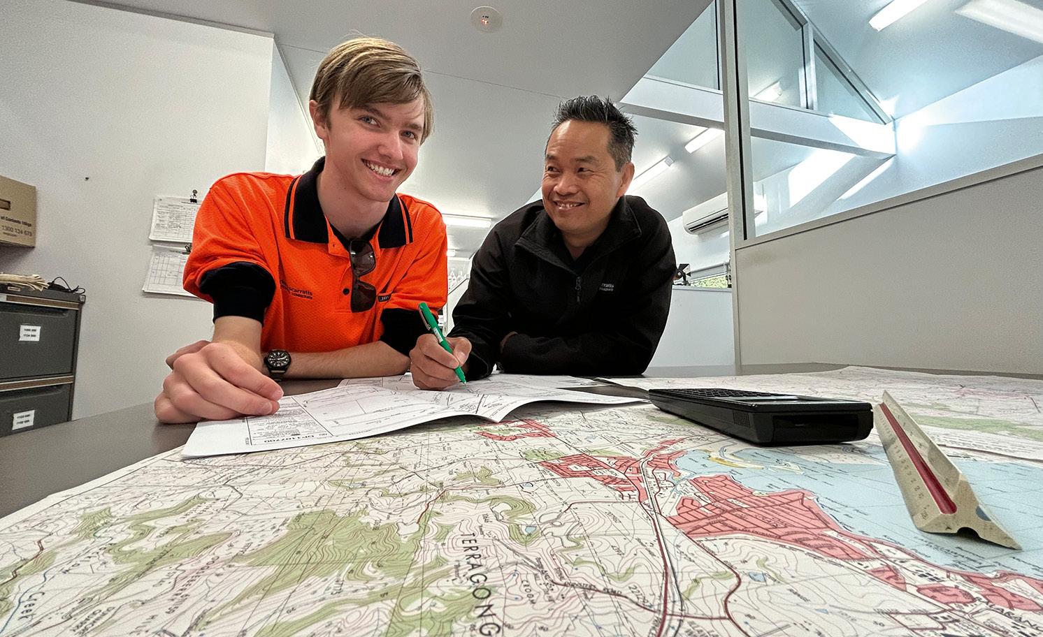
says that what he really enjoys about surveying “is that I can be in a different environment almost every day; it’s a good mix of working outdoors and in the office,” adding that he’s “… learning on the same equipment and technology we use in the industry, which means I can put what I’m learning to use in the field straight away”.
“Our students work through a mix of theory and practical coursework with industry qualified teachers using industrystandard equipment and technology,” Hayward said. “This means a student with a TAFE NSW qualification can move easily into the workplace with practical abilities using the latest equipment and techniques.”
Thanh Le, director at Allen Price & Scarratts, said the company is continuing to expand its team to meet the growing industry demand. “I was glad to hear about the mid-year intake at Yallah,” he said. “TAFE NSW is an excellent pathway into this sector because the trainees have the advantage of real-world handson experience.” n
13–18 August: 31st International Cartographic Conference and 19th General Assembly icc2023.org
24 August: NSW Geospatial Conference & Awards Dinner geospatialcouncil.org.au/event/ngc23/
30 August–1 September: S+SNZ 2023 Conference surveyspatialnzconference.org
1 September: Tasmania Geospatial Conference & Awards Reception geospatialcouncil.org.au/event/tgc23/
13–15 September: AIMS 2023 National Conference aimsconference.com.au
14 September: Victorian Geospatial Conference & Awards Dinner geospatialcouncil.org.au/event/vgc23/
21 September: GeoBuiz Europe Summit geobuiz.eu/2023
12–13 October: SmartSat CRC Conference smartsatcrc.com/news-events/ smartsat-crc-conference-2022/
13 October: WAIS Mini-Conference and AGM surveyorswa.org.au
20 October: Queensland Geospatial Conference & Awards Dinner geospatialcouncil.org.au/event/qgc23/
23–24 October: Indo-Pacific Space & Earth Conference spaceandearthconference.com
26–28 October: CSA of NSW October Conference countrysurveyors.com.au
15 November: WA Digital Twin Summit & APSEA-WA geospatialcouncil.org.au/event/ wdts23/
6 December: 16th Australian Space Forum forum.andythomas.foundation
For more events, go to www. spatialsource.com.au/event-listing
Building on our history of accuracy and reliability, the new FARO ® Focus Premium Laser Scanner is the fastest, most accurate and most data-sharing-enabled scanner on the market to date, featuring entirely new components with a proven design.
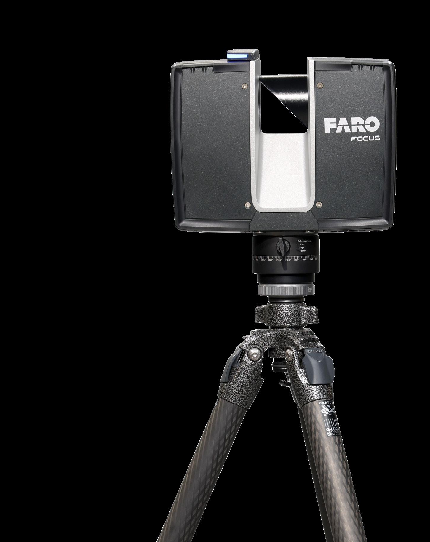
About 1 minute to complete a typical scan, in combination with the optional FARO PanoCam upgrade, even in color.
The latest color camera technology enables the Focus Premium to capture scans with up to 266 megapixel color information.

Competitive service means maximizing the life of this product while reducing the total cost of ownership throughout the device’s lifespan. Two years allows for maximum flexibility and the piece of mind knowing that any repairs or defective parts will be replaced.
Focus Premium provides exceptional capturing efficiency, data quality and accuracy for professional applications across the construction, public safety, operations & maintenance and manufacturing markets, while offering data quality at faster scan speeds (up to 1 minute per scan) reducing onsite scanning time by up to 50%. Meanwhile, faster loading and system response yields greater data management efficiency when paired with the new FARO Stream mobile app and uploaded to the new FARO Sphere cloud-based collaboration platform.
Focus Premium Features:
y Up to 350m scanning range, leading to superior area coverage per scan position
y Smartphone-enabled remote control capabilities, limited only by the range of a Wi-Fi network
y Improved wireless workflow with more stable and faster Wi-Fi operation
y On-site registration, the process of combining multiple scans using common overlap, means faster project completion and real-time awareness of scan errors or missing data
y Seamless connectivity with Stream and Sphere
y Scanner control can be executed on either the app or on the actual Focus
y Users have easy access to create projects, change scanner settings, manage image resolution, opt for color or black and white scans, group scans through clustering, and add annotations
y Rugged construction and housing can withstand the tough day-to-day work
y Integrated high-speed SSD data storage for maximum scan capacity and lighting fast scan processing
Publisher
Simon Cooper
Editor
Jonathan Nally
jnally@intermedia.com.au
National Advertising Manager
Anna Muldrock
amuldrock@intermedia.com.au
Prepress
Tony Willson
Production Manager
Jacqui Cooper
Subscribe
Position is available via subscription only.
A 12 month subscription (6 issues) is AUD$76.00. To subscribe visit www.intermedia.com.au, phone: 1800 651 422 or email: subscriptions@intermedia.com.au website: www.spatialsource.com.au
Position is published six times a year, in February, April, June, August, October and December by Interpoint Events Pty Ltd.
ABN: 9810 451 2469
Address: 41 Bridge Road, Glebe NSW 2037
Ph: +61 2 9660 2113 Fax: +61 2 9660 4419
Reprints from Position are permitted only with the permission of the publisher. In all cases, reprints must be acknowledged as follows: ‘Reprinted with permission from Position Magazine’, and must include the author’s byline.
The opinions expressed in this publication are those of the authors and do not necessarily represent those of the publisher.
Supported by
The revelation that the federal government had cancelled the National Space Mission for Earth Observation (NSMEO), and the off-hand way in which the announcement was made, was met with dismay from many quarters within Australia’s geospatial and remote sensing communities (see pages 13 and 38 of this issue). Our country has a long, storied history of applying its skills to the analysis of satellite Earth observations and has long been considered a worldleader in the field. That this has been achieved without the nation having its own sovereign, major, primary sources of data — i.e. remote sensing satellites — is even more remarkable.
The federal government has been warned many times that Australia is highly dependent upon the goodwill of other nations for free or low-cost access to their sovereign satellite capabilities, or likewise is dependent upon commercial providers. If the you-know-what were to hit the fan in a geopolitical sense and our access to those sources were to be reduced or denied, we would be left in a highly unenviable situation. We only have to think of recent experiences with access to vaccines and face masks to see how quickly things can go downhill.
Governments do not usually backtrack on their decisions, so it has to be assumed that the NSMEO — at least in the form that we were expecting it — will not be resurrected. The Government says that organisations are welcome to apply for funding for individual programs under other federal arrangements, but this sort of negates the whole idea of providing a coherent, national, sovereign capability.
On a brighter note, it’s great to see the new support being given to microcredential courses in geospatial-related disciplines (see page 32). The first iteration of the program will see approximately 200 people obtaining microcredentials in Drone Mapping and Navigation Systems (provided by UniSQ), GIS for Professionals (UniSQ) and Building Information Modelling (UTS), with the potential for further courses to be added in the next funding round. This concept sounds like a winner, and should go some way to helping solve the skilled workforce shortage.
Jonathan Nally Editor
The Intermedia Group takes its Corporate and Social Responsibilities seriously and is committed to reducing its impact on the environment. We continuously strive to improve our environmental performance and to initiate additional CSR based projects and activities.
As part of our company policy we ensure that the products and services used in the manufacture of this magazine are sourced from environmentally responsible suppliers. This magazine has been printed on paper produced from sustainably sourced wood and pulp fibre and is accredited under PEFC chain of custody.
PEFC certified wood and paper products come from environmentally appropriate, socially beneficial and economically viable management of forests.
Advertising booking date: 8 September 2023
Advertising material date: 13 September 2023
Publication date: 6 October 2023
For article proposals, contact the Editor: jnally@intermedia.com.au
For advertising, contact the Advertising Manager: amuldrock@intermedia.com.au

Members of Australia’s geospatial community were awarded some of the nation’s highest accolades in this year’s King’s Birthday Honours list.
Melissa Harris (Chief Executive of Land Use Victoria, Victorian Registrar of Titles and Chair of ANZLIC) has been awarded the Public Service Medal in recognition of outstanding public service to state and local government, and for transformation in the areas of geospatial, planning and land administration in Victoria.
Matt Higgins (currently Assistant Director, Space Technology in the Australian Space Agency’s Office of the CTO) also has been awarded the Public Service Medal, in recognition of outstanding public service to Queensland, with international impact in the fields of surveying, geodesy and spatial sciences.
John Trinder (currently Emeritus Professor in the UNSW School of Civil and Environmental Engineering) has been made a Member in the General Division of the Order of Australia for this significant service to tertiary education and to professional organisations.
Peter Tyrrell (former principal of surveying firm Kearney & Tyrrell) has received the Medal of the Order of Australia in recognition of his service to surveying and to professional organisations.
It’s wonderful to see these members of our profession receiving the recognition they, and the sector as a whole, deserve. Congratulations to all the recipients.
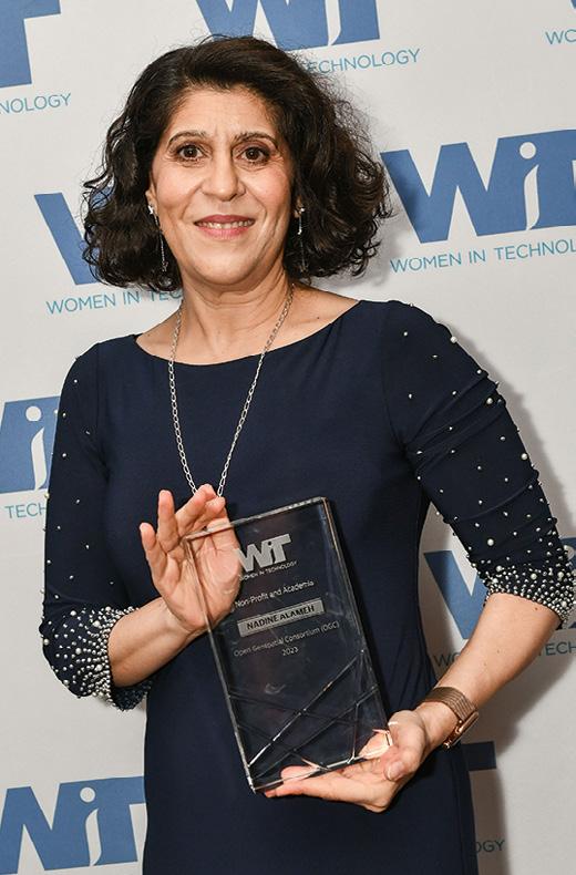
Dr Nadine Alameh, CEO of the Open Geospatial Consortium (OGC), has been awarded the 24th Annual Women in Technology (WIT) Leadership Award in the Non-Profit and Academia category. The award honours women who demonstrate exemplary leadership traits and have achieved success in a non-profit organisation or educational institution.
In the nomination letter for the award, Chair of the OGC Board, Jeff Harris, Vice Chair, Prashant Shukle, and Board member, Zaffar Sadiq Mohamed-Ghouse, said that the OGC board nominated
Nadine for her “outstanding global leadership of the Open Geospatial Consortium and its 500 members through a period of profound change”.
“When Nadine assumed the role of Chief Executive Officer, she articulated a new vision and role for the OGC – one where it had to be relevant at the speed of change,” they said. “To that end, she has worked tirelessly in pursuit of this vision as she mobilized some of the world’s largest technology companies, developed and developing national governments, and small- and medium-sized businesses and start-ups.
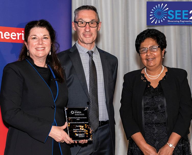
RapidMap has been awarded the Environmental Sustainability Award at the 2023 Institute of Public Works Engineering Australasia’s Engineering Excellence Awards. In a statement, the company said that “This remarkable recognition not only demonstrates our unwavering commitment to environmental stewardship but also underscores our dedication to promoting sustainability within the engineering industry”.
RapidMap works closely with biosecurity officers in local government and other local control agencies across several states and territories, integrating the Iconyx Summit Workforce Management System with GNSS technology.
“For nearly three decades, RapidMap
spatial technology experts have been collaborating with government agencies and industry leaders to tackle the complex issue of weed infestation surveillance and control,” the company said.
“Latest innovations in AI, drones, GNSS and airborne herbicide deployment are reshaping the landscape and enabling us to protect critical infrastructure, agriculture, parks and open spaces more effectively than ever before.
“We remain steadfast in our mission to revolutionise the engineering landscape by continually developing innovative solutions and integrating environmentally conscious approaches.”
“That she delivered in a not-for-profit entity and with a steely resolve to ensure the global public interest, not only speaks of the scale of her achievements but also its impact on the global public good.”
“Recognising the success of these women provides a vision for current and future leaders of what is possible with determination and focus and highlights the role of mentorship and sponsorship in building a successful and meaningful career,” added Amber Hart, President of WIT and the Co-Owner/Founder, The Pulse of GovCon.
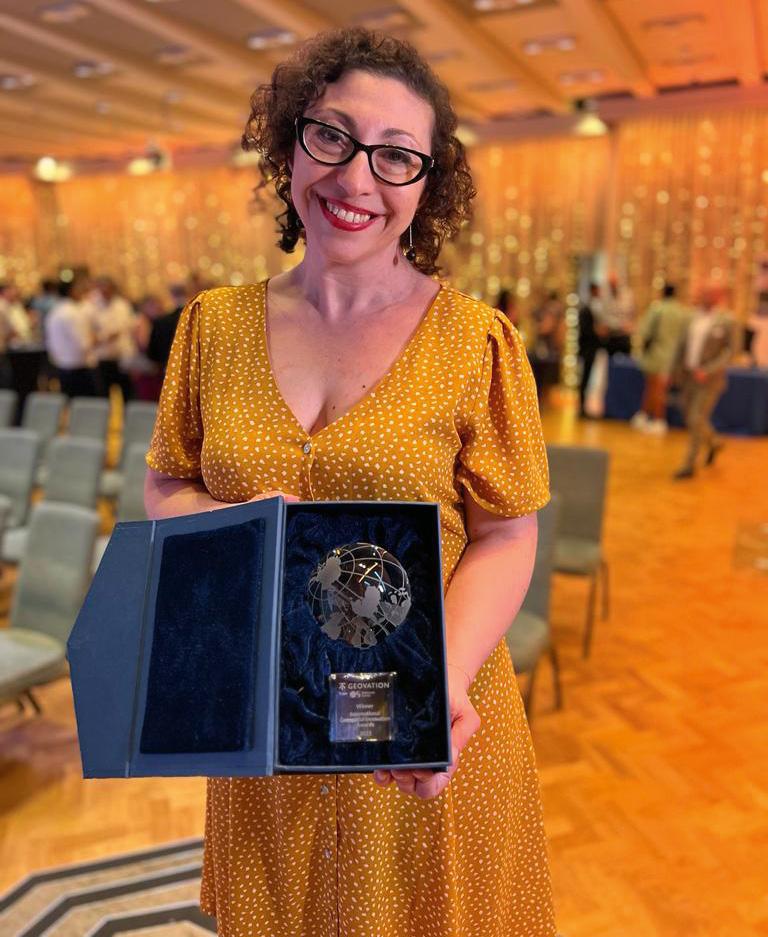
Clockwise from top left: John Trinder, Melissa Harris, Matt Higgins and Peter Tyrrell. Dr Nadine Alameh, CEO of the Open Geospatial Consortium. RapidMap’s Lyn Terrett (left) was presented with the Environmental Sustainability Award by Professor Sujeeva Setunge, Associate Deputy Vice-Chancellor (Research & Innovation) of RMIT University and David Hallett, CEO of IPWEA Victoria.Four start-ups and a lifetime achievement winner chosen from a global field competing in four separate geospatial categories, have been recognised in Geovation’s International Geospatial Innovation Awards at a gala ceremony in London.
Geovation is a UK Ordnance Survey initiative which, together with HM Land Registry, offers an Accelerator Programme that has so far kickstarted the business of more than 150 geospatial and property start-ups.
“What these awards show so well is just how transformational geospatial data can be,” said Ordnance Survey’s Chief Commercial Officer Paul French. “It’s so exciting to see the range of innovative ideas and applications being created and shines a light on the people and projects making a real tangible difference to the areas in which they operate.
The winners of Category 1 — Places for the Future: solutions that help build the cities and communities of tomorrow — are as follows:
• Winner: Where You At. Where You At helps users locate their friends in busy venues down to the floor-level, bar or cubicle, without a phone signal and with the option for timestamped SOS alerts.
• Highly Commended: The Future Fox. The Future Fox’s digital engagement platform, PlaceBuilder, enables communities to be brought into the discussion on trade-offs when designing new developments for their town.
The winners of Category 2 — Land, sea and air (developments that preserve and protect the environment) — are:
• Joint Winner: UP42. UP42 was founded in 2019 to provide quick and easy access to optical, radar, elevation and aerial data.
• Joint Winner: Global Plastic Watch. Global Plastic Watch is a digital platform that maps the world’s plastic pollution in near real-time using a unique combination of satellite imagery and artificial intelligence.
• Highly Commended: gtfs2emis. The gtfs2emis model is a novel, bottom-up method of estimating emissions from public transport, from single routes to entire public transport systems.
The winners of Category 3 — Resilience, safety, resource quality and protection of life — are as follows:
• Winner: WorldPop. WorldPop maps populations across the globe, partnering with governments and UN agencies to produce almost 45,000 open geospatial datasets that complement traditional sources.
• Highly Commended: Cirrolytix Research Services. Cirrolytix’ data-driven Aedes research project predicts dengue outbreaks; its framework has applications for managing other vector-borne diseases and health crises.
The winners of the 2023 National Surveying Consultancy Excellence Awards were announced in Sydney on 7 June during this year’s National Surveying Congress.

Rivland Surveyors in Wagga Wagga is the winner of the Small Firm Category, having impressed the judging panel with its allround professionalism and ongoing training efforts. In addition, Darwin-based survey and planning consultancy, Earl James & Associates, was Highly Commended for its commitment to the profession and for supporting workers in remote areas.
The award for the Medium Firm Category was presented to the team from Hanlons Consulting in Tamworth, NSW, with the award citation acknowledging the company’s outstanding commitment to the profession, team development and increasing surveyor student numbers. Reeds Consulting in Melbourne received a Highly Commended for demonstrating its professionalism to a strong and diverse range of clients and projects.
For the third year in a row, Sydney-based SDG took top place in the Large Firm Category. The award citation noted SDG’s efforts for going above and beyond for the profession, and for having a strong commitment to employee training and well-being.
Veris took out top spot in the National Firm Category, with the
The winners of Category 4 — Individual contribution to open geospatial innovation — are:
• Winner: Dr Qiusheng Wu. Dr Wu is an Assistant Professor in the Department of Geography & Sustainability at the University of Tennessee, Knoxville. His open-source packages for advanced geospatial analysis have gained huge popularity, with over three million downloads and 2,700 stars on GitHub.
• Highly Commended: Taslim Salaudeen. Salaudeen is a pioneer in GIS technology in Nigeria. Among other achievements, he developed the CensusPad geo-application, which reduced the time taken to set up mobile technology for a census in Nigeria from three months to just 10 to 15 minutes.
judges noting the firm’s investment in programs to promote careers in surveying and its implementation of a successful Indigenous Surveyor Employment Pathway Program.

CASA has introduced a new beyond visual line-of-sight (BVLOS) outside of controlled airspace (OCTA) exam for remote pilots. The Agency says the exam is an alternate pathway to sitting the Instrument Rating Exam (IREX), for remote pilot licence (RePL) holders intending to fly BVLOS OCTA.
The requirements and details for the new BVLOS exam are:
• You must have a RePL
• The cost is $166.79 per exam, made up of a $96.79 examiner fee and $70 CASA regulatory fee
• The duration is 90 minutes
• There are no permitted materials — all information is provided to candidates digitally
• The pass mark is 70%
CASA points out that RePL holders who intend to undertake BVLOS operations must operate under a remotely piloted aircraft operator’s certificate (ReOC) holder with a flight authorisation to conduct BVLOS operations. In addition, RePL holders who intend to undertake BVLOS operations in controlled airspace will still need to pass the IREX exam.
RePL holders will need to provide a copy of their exam results to the ReOC holder, and ReOC holders are required to ensure remote pilots have successfully passed the exam and are proficient in accordance with the approved documented practices and procedures.
CASA has produced RPAS BVLOS OCTA – Aeronautical Knowledge Standards and a Standards Guide to assist training organisations develop their own training material. Information on locations and exam booking times can be found on the Aspeq website. There’s also a recent webinar that explains the ins and outs of the BVLOS exam.
A new GNSS ground station has been established in Mildura as part of Positioning Australia’s National Positioning Infrastructure Capability (NPIC) program.
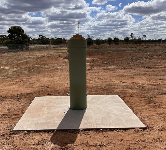
The new ground station is now streaming GNSS data used in precise positioning services, having expanded the reach of the GNSS ground station network and filled a gap in network coverage in north-western Victoria.
The Surveyor-General of Victoria (SGV) Geodesymanaged Vicmap Position – GPSnet network will incorporate the new site, which will be made available via commercial value-added reseller positioning services.
The new Mildura ground station was established in
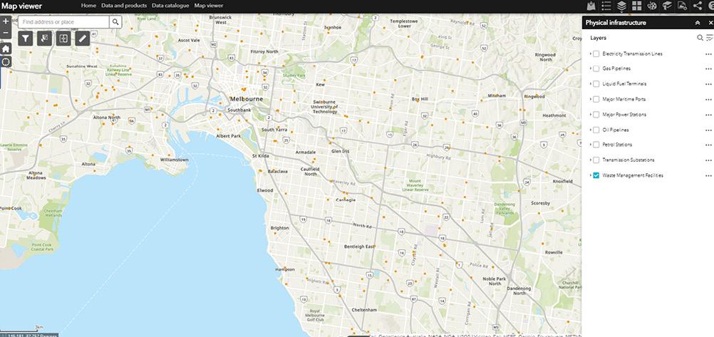
The public-facing Beta version of the Digital Atlas of Australia went live on 30 June 2023, enabling users anywhere to take advantage of the many options it offers.
The Atlas brings together a range of ‘trusted national datasets’ from across government and presents them on an interactive online platform.
The Atlas, which is based upon an ‘Integrated Geospatial Infrastructure,’ aims to connect data “across borders to transform and streamline how we connect, manage and use data. This infrastructure will move us from data swamps and silos to a digital ecosystem enabling seamless integration, sharing, and analysis of location data.”
The initiative was introduced as a result of two strategies outlined in the Federal Budget 2021–22 — the Digital Economy Strategy and Australian Data Strategy, which, together, aim to “transform Australia into a modern and leading digital economy by 2023 and focus on improving the accessibility and discoverability of the wealth of data held by Commonwealth organisations”.
In a statement issued in May 2021, Dr James Johnson, CEO of Geoscience Australia, said that the new platform “will embed analysis tools that allow anyone to explore, graph, analyse and compare information that meets their needs in their neighbourhood and across the country”.
“For example, a business will be able to explore and download demographic profiles of towns and regions, along with information on infrastructure, to determine the most commercially-viable places to set up new outlets, anywhere in Australia — making virtual design and planning possible without even having to visit the site.”
The Atlas groups data into a number of different themes: Administrative boundaries, buildings and settlements, land cover and land use, physical infrastructure, population distribution, transport and transport infrastructure, and water bodies.
Data will also be discoverable according to specific ‘initiatives,’ the first of which is bushfire intelligence, which brings together a new Historical Bushfires dataset and a range of interactive products to support bushfire research, national emergency management and risk management.
Further data will be added to the Atlas over the next two years, with final operating capability due in June 2025.
collaboration with SGV Geodesy, Lower Murray Water and Geoscience Australia on Millewa-Mallee land at Koorlong. SGV Geodesy identified the site and arranged land access, environmental assessment, lease area survey and site preparation work with assistance from Lower Murray Water. Geoscience Australia managed construction and installation.
SmartSat CRC has launched a new research program, Maya Nula, to develop Australian satellite Earth observation (EO) capability with space sensor technology to advance Australia’s agriculture sector.
The SmartSat-led initiative will facilitate research efforts to address the growing need for Australian farmers to reduce risk and boost agricultural productivity through environmentally friendly processes. Plus, it will support implementing and reporting on improved climate-resilient and sustainable farming practices.
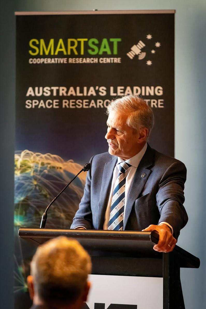
The name Maya Nula translates to “eyes here, there, everywhere” in the Dharug language. Dharug elders were consulted about the mission, including its name and the desired outcomes of any emerging technologies.
SmartSat will develop a series of projects to deliver a measurement, reporting, and verification (MRV) tool for communicating sustainable farming practices on soil health, crop conditions, biosecurity, and the environment.

The projects will be co-funded by research organisations, government, and industry.


According to SmartSat CEO, Professor Andy Koronios, space assets combined with on-ground sensor technology can assist in monitoring crops and developing more sophisticated prediction models to better guide commercial outcomes and protect our environment.
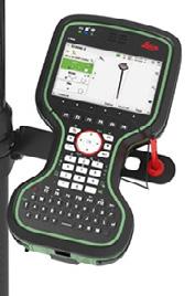

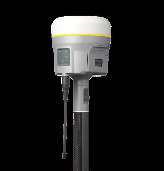
“With the world’s population predicted to reach 9.8 billion by 2050, sustainable farming practices are essential to meet the increasing demand for high-quality food,” he said.
“Through enhanced agricultural intelligence using terrestrial and space technologies, Maya Nula will enable our farmers to deliver higher yields of healthy food, meeting our needs and increasing exports of our agricultural products.”
All four of the Royal Australian Navy’s (RAN) Paluma-class hydrographic survey motor launches are now gone, following the decommissioning of HMA Ships Benalla and Shepparton on 16 June 2023.
The Paluma-class vessels, which were based at HMAS Cairns, operated as pairs and spent more than 30 years collecting data to help chart Australia’s northern coastline and the South Pacific Ocean. The RAN plans to replace the ships with remotely controlled uncrewed vessels with autopilot capabilities, autonomous systems and artificial intelligence to form a new ‘optimised hydrographic survey capability’.

Commanding Officer Benalla Lieutenant Commander Michael Casey said the ships had sailed the same distance it would take to go to the Moon and back four times.
“Old stuff is built to last. I treated Benalla with the respect I would with an old car,” Lieutenant Commander Casey said. “Surveying is exploring what we can’t see underneath, we would find things never seen before, such as wrecks, shoals and subsurface obstructions.
“It’s sad to see them go; these ships have served for over 33 years with distinction and have been home to hundreds of sailors,” he added.
The plan now is for the next Navy survey vessel to be built in Henderson, Western Australia, later this decade.
HMAS Benalla made her final entry into the HMAS Cairns naval base in Queensland in mid-June.Victoria’s Department of Transport and Planning has released a new suite of Vicmap 3D Buildings datasets through the Digital Twin Victoria (DTV) program. The 3D digital representation brings together licensed and open datasets, including City of Melbourne and Geoscape, to create the comprehensive Vicmap 3D Buildings suite available in the DTV platform.
The range of datasets will give new audiences and existing users, seamless access to a 3D representation of all of Victoria’s four million built structures in one online resource.
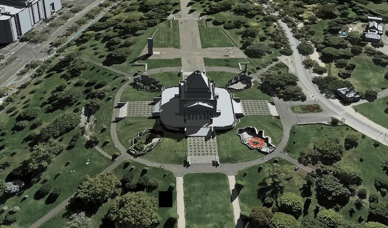
According to the Department, “This data will help to improve decision-making by providing a trusted source of building outlines in major population centres across Victoria to inform planning, environmental, asset and risk management activities. This includes analysis of buildings in the context of each other and environmental features, building heights and proximity to boundaries.”
One of the datasets is ‘Metro Block Buildings,’ a Vicmap product created with the help of machine-learning technologies. It presents highly accurate building data for 2.46 million properties and 2.68 million building features, covering more than 10,000 square kilometres across Melbourne and Geelong.
The machine-learning approach leverages Vicmap Imagery and elevation datasets to deliver building outlines faster and cheaper. Vicmap will continue to work with partners across the State to extend coverage of the machine-learning product.
The Vicmap 3D Buildings suite aligns to the Building and
Settlements data theme within the ANZLIC Foundational Spatial Data Framework (FSDF). The FSDF in turn aligns with the global UN Committee of Experts on Global Geospatial Information Management (UNGGIM) Building and Settlements theme. The UNGGIM’s themes recognise that critical spatial datasets that are necessary to support the UN’s Sustainable Development Goals.
The full suite of 2D and 3D buildings products can be accessed online. For queries, contact vicmap@delwp.vic.gov.au.
Geoscience Australia has issued a request for tender (RFT) for a second SouthPAN navigation transponder hosted to be hosted on a satellite in geostationary Earth orbit (GEO).

To be known as the SouthPAN GEO Payload – 02 (SGP-02), it will provide redundancy and resilience and — together with the previously announced payload to be hosted on the Inmarsat I-8 satellite — will be a critical part of the SouthPAN safety-oflife certification for aviation and other applications, scheduled for implementation in 2028.
The RFT, which will close on 25 September 2023, is for the procurement of the provision of:
• A Signal-In-Space (SIS) broadcast service for 15
years beginning no earlier than June 2027 and no later than December 2028.
• Operational services to support regulation of the uplink signal and configuration of the SouthPAN ground segment.
• Project and engineering management services to design, implement, integrate, ground test, launch, and in-orbit test SGP-02.
• Service management services, including monthly reporting.
SouthPAN (Southern Positioning Augmentation Network) is a joint initiative of Australia and New Zealand for the provision of a satellite-based augmentation system, or SBAS.
The New Zealand Government has launched a new National Space Policy, as the country looks to capitalise on its strengths and opportunities in the global space sector. A 2019 report from Deloitte showed that the New Zealand space sector contributed NZ$1.69 billion to the nation’s economy and supported 12,000 jobs in 2018–19.

“Our space sector is growing rapidly. Each year New Zealand is becoming a more and more attractive place for launches, manufacturing space-related technology and conducting space science and research,” said Economic Development Minister, Barbara Edmonds.
The Minister added that the Policy “identifies stewardship, innovation, responsibility, and partnership as key values for New Zealand in space. Harnessing these values will inform space-related engagements, policy creation and strategies across government.”
The Policy set out a range of overarching objectives that include growing an innovative space sector, protecting and advancing
national security and economic interests, and modelling sustainable space and Earth environments.
New Zealand has a number of advantages when it comes to spacerelated operations, including having one of the world’s largest ranges of launch azimuths.
The Policy says that New Zealand is a “a good location for ground-based space infrastructure, and testing remote sensing space technologies on our varied landscape” and has “research and development expertise across the space value chain (from manufacture to end use) including… remote sensing data analytics…”
The federal government has cancelled the $1.16 billion National Space Mission for Earth Observation (NSMEO), for what it says are “budget repair” purposes. Australia will now have to continue to rely upon overseas partners for access to Earth observation data.
The whole idea of the NSMEO was to reduce sovereign risk by providing Australia with its own major remote sensing capabilities. An Australian Academy of Science report published in early 2022 called for a 10-year plan to correct the situation, which would include “investment in a home-grown Earth observation satellite program, which would design, build, launch and operate the satellites and the sensors on-board used to collect a wide range of data types”.
Earth observation from space is vital for Australia’s interests, with a report issued by FrontierSI in 2021 finding that “Satellite Earth observations and other forms of remote sensing contribute over $5 billion annually to Australian GDP”.
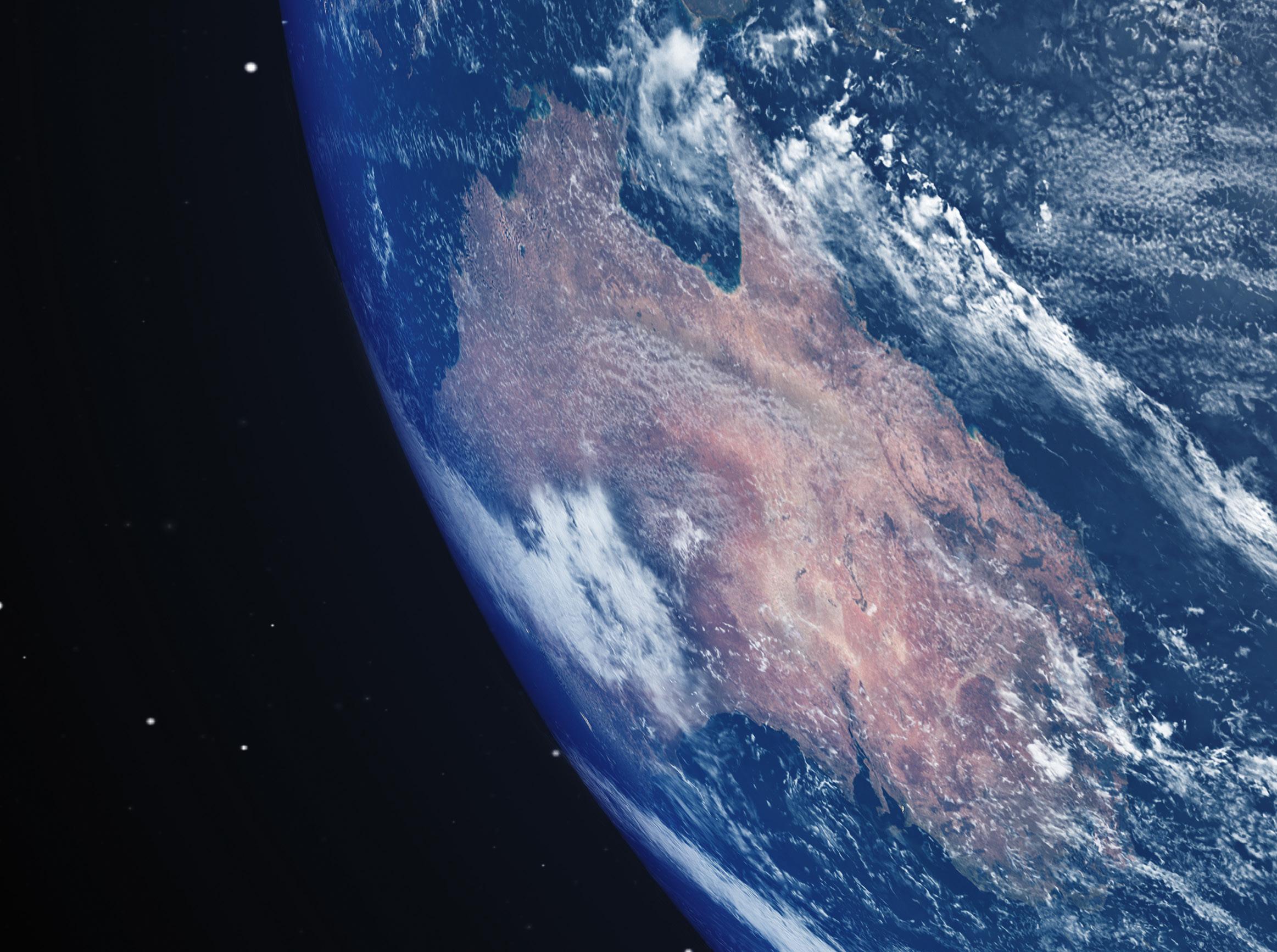
Another 2021 report, by Deloitte, found that “Australia’s EO sector, and the benefits EO data generates for other industries, is exposed to a significant sovereign supply risk: Australia does not own or operate any EO satellite systems. At the same time, the threat of a DOS [denial of service] event is becoming increasingly real, particularly in the context of Australia’s role in the
The Deloitte report went on to say that “The annual economic cost of a DOS event for EO is estimated as follows:
• 81% of activity in the EO sector would almost immediately cease to exist as we know it. This equates to $226 million in lost (direct) value added.
• The Australian economy (GDP) would contract by $1.9 billion due to the disruption in activity by end users of EO data (based on currently available data).”
When the then federal treasurer Josh Frydenberg delivered the 2022–23 Budget on 29 March 2022, $38.5 million per annum was earmarked for four satellites in the first phase of the NSMEO. The overall program was promised $1.16 billion out to 2039… about $70 million annually. As Position reported mid-last year, about 500 people were expected to be involved in the project.
Yet even at that time, there was speculation that politics could turn out to be the project’s Achilles heel.
Glen Tindall, chief executive of space systems at Electro Optic Systems, told Position in June 2022 that to build an industry to create, maintain and operate a satellite constellation would require a long-term commitment from government. “It takes decades to bring these missions to fruition,” he said.
As we reported in December 2022, “Upon taking office in May 2022, the incoming
Labor government ordered an urgent review of government spending. There was speculation in the media that this would include at least part of the space budget. However, according to a statement from the Australian Space Agency (ASA), which has carriage of the project, the NSMEO allocation survived not only the review, but also the first budget of the new government.”
At that time, a spokesperson for the ASA told Position that, “The Government remains committed to delivering on space programs that align with national priorities and deliver value for all Australians. There have been no changes to funding for space programs in this Budget.”
Nonetheless, there was a high degree of uncertainty and a lack a clarity around the goals of the NSMEO, with numerous industry figures expressing concern.
As we reported in December, “Rumours persist that the project is being delayed, or its scope reduced due to budget constraints in Canberra. It’s not clear whether this is true or not. What is for sure is that the project is effectively hidden from sight. Even well-connected figures in the industry are unsure of its fundamental aims.”
The cancellation of the NSMEO follows the axing in May 2023 of the Australian Spaceports program, which would have seen government funding provided to assist in the establishment of launch facilities on Australian soil. n
The National Space Mission for Earth Observation is no more, having been chopped for “budget repair” reasons.
Tasmanian engineering firm Gandy and Roberts recently deployed mobile mapping technology to improve its service offering for architects and builders through accurate, accessible point clouds at all stages of the construction lifecycle.

As advocates for technology to increase efficiency and reduce rework, the team at Gandy and Roberts encourages clients to try out innovation and new methods.
“The construction industry is notoriously slow at embracing technology, but our clients appreciate that we think outside the box a little bit and suggest giving new methods a try, both for the architects at the design phase and later the construction team,” said Klaus Stroehl, a company director.
Klaus said he has kept a close eye on scanning technology for the last few years, and the company has hired terrestrial 3D laser scanners for some projects. “We were waiting for the right solution and a few projects to come to life that we could use it on before we took the next step,” he said.
“I first experienced point cloud scanning technology in 2010 at a project for Frankfurt Airport in Germany. It was fascinating technology, but inaccessible at that time because it was very difficult and time-consuming to capture and process the
data. Not to mention how expensive it was!”
Despite the huge advancements in processing capabilities and data capture since, Klaus explained that on many projects it was still a costly and timeconsuming exercise to produce and manage a 3D point cloud.
“We hired a terrestrial scanner for a university redevelopment project in Launceston two years ago,” Klaus said. “It took me five full, 12-hour days to capture the data with around 900 scan stations, then a further week or two to process it all and stitch the data together. We then ended up with this huge data set that we couldn’t share easily with all stakeholders because it was just so big and difficult to use for untrained users. It was great data and of huge value to the project, but the workflow was still cumbersome and required specialised skills to manage it.”
When he heard about the wearable NavVis VLX mobile mapping system, Klaus thought it could be just the solution they were looking for. “By coincidence, my brother-in-law in Frankfurt was working with point clouds again and had used the VLX. When I heard how easy it was to
use, I couldn’t wait to see it when it came to Australia.”
Intelligent positioning solutions provider, Position Partners, is the Australian distributor for NavVis.
“Position Partners has been great onboarding us with the VLX. The instrument is very user-friendly, and we already understood the general concepts of how registration works, so it was easy to learn,” Klaus said. “A few times we had some technical issues or things that didn’t quite line up, and we weren’t sure if it was a user error or a system one. The Position Partners team has been very helpful and prompt with their support.”
With the ability to scan large areas as you walk, the NavVis VLX cuts down the time it takes to capture the data drastically. “Even on a large project, the scanning time is reduced to a day, maximum two,” said Klaus.
Processing the data is also seamless. “Because the workflow is so much more efficient and less time consuming, we can cost it at a price point where clients are willing to give it a try,” he added. “Previously, it was quite an investment, so understandably customers were more hesitant and would often stick to lessreliable paper plans and old methods, exposing clients to risk.”
Since purchasing their VLX a couple of months ago, Gandy and Roberts has completed some projects that would have otherwise been impossible. “We’ve done a large scan of parts of the local hospital, including the emergency department. I don’t know how we could have done that with a terrestrial scanner. You couldn’t have put a tripod up in prominent locations in a busy emergency ward without significant interruption and there is no down time in ED.”

It’s on jobs like the hospital project that using 3D documentation can really prove its worth, according to Klaus. “In these older buildings, you’ve got plans and documentation that are perhaps 60 years old. It’s very hard to read and interpret them, they have codes and abbreviations that aren’t used anymore, and they’re not accurate,” he said.
“Yes, at one point they were designed that way, but you can’t tell if that’s how they were built. Anyone who works in construction knows that adjustments are made during the build. So, you’re starting a redesign just guessing where the columns and beams are, what the thickness of the walls are, ceiling heights, services, etc,” he added.
“The initial scan and the accompanying 360-degree imagery is valuable for architects because they can clearly see all the important details to input into their designs, from fire doors to light switches, power points and so on.”
When demolition starts, Gandy and Roberts hope to re-scan the hospital to get accurate locations of columns, beams, and other load-bearing structures. As structural engineers, knowing the accurate location of the existing structure is essential.
“If we have the opportunity to verify our design at an early stage and confirm that the columns are actually where the plans say they are, it has the potential to save an enormous amount of rework further into the build,” Klaus said.
Without this early verification, the build could progress substantially before realising that a column or beam is not in the right location and adjustments need to be made. “Then we might have to redesign things and whatever has been done in terms of ducting, plumbing and other services may also need to be redone.”
On greenfield projects the same rework costs can be saved with 3D modelling at milestone stages of the build. Gandy and Roberts is currently working on a $74 million greenfield school development, with five buildings.
“I was driving past one day recently and took the opportunity to do a quick scan of the third building just before they poured the concrete, with the floor slab all set up and penetrations in place,” Klaus explained.
“I compared my scan data with the designs and could quickly identify several inconsistencies. For example, a pipe in a location that won’t work because there will be a solid wall over the top of it based on the design.”
Klaus sent a video to the builder, who of course immediately appreciated the rework this data had saved him. “That’s where I see the real potential for this technology; there is so much rework in construction, so if we can prove the value and benefit to builders, that will be key.”
Klaus recalls a similar win on a job five years ago, the company’s first full Building Information Modelling (BIM) project in Tasmania. “We identified issues with major services that were in the ground, before it got backfilled, that potentially saved many weeks of rework down the track. It was a great success, however it was difficult and expensive to do those tests with a scanner back then, whereas with the VLX at the school it was quick and easy.”
So far, architects have shown the most interest in Gandy and Roberts’ new 3D modelling capabilities. “Architects love point clouds and the 360-degree imagery, but they need help learning how to use them,” Klaus said.

With a background in Revit software, Klaus and the Gandy and Roberts team can make working with point clouds more accessible. “We have the expertise to help architects use point clouds effectively in their design software, and having webbased access to the data with NavVis makes it so much more user friendly.”
Longer term, however, the potential for use in building construction and subsequent facilities management, is huge, Klaus said. “Builders have a difficult time getting accurate as-built data and proving to their clients that structures are built to specification. So, having scans done regularly helps them identify any problems early, saving expensive rework and managing the site and subcontractors better.”
Ultimately, it is the developers and facilities owners who will really drive change and technology adoption, Klaus says. As an advocate for BIM, Klaus would love to see more pilot projects driven by the government and public sector.
“For BIM to work, it’s really a case of starting at the end and working backwards to ensure every stage is covered,” he said. “Currently there are no requirements, and we like to keep things simpler in Australia, I appreciate that. We also have a smaller market with a less specialised workforce. We also lack the skills because BIM and the use of modern technology is not currently taught across building, engineering and architecture. That said, we do have some forward-thinking private sector clients that can appreciate the value of a BIM model, perhaps not right away but in five years’ time for managing the property.”
In time, Klaus hopes that the value of BIM will be realised in the Australian market, especially in the public sector where it will really drive change. Until then, Gandy and Roberts will keep supporting their clients and saving on rework with their VLX, one point cloud at a time. n
A case study of mangroves and coastal protection, blue carbon storage and future steps in accounting for Australia’s vast ocean ecosystems.
The oceans are still a largely an undiscovered resource. While there are ongoing efforts across government and the scientific community to improve our knowledge, we are still far from having a comprehensive understanding. A consistent understanding of our ocean ecosystems and their value allows us to better support the management of a healthy and resilient ocean, make informed decisions on a range of oceanrelated policies, and measure their progress over time.
First released in August 2022, the National Ocean Accounts — a collaboration
between the Australian Bureau of Statistics (ABS) and the Department of Climate Change, Energy, the Environment and Water (DCCEW) — provide an insight into some of Australia’s key blue carbon ecosystems including mangroves, saltmarsh and seagrass.

Blue carbon ecosystems are coastal or marine ecosystems that sequester (capture and store) large quantities of carbon in both the plants and the sediment below. The Ocean Accounts describe the extent and condition of each ecosystem, as well as some of the ecosystem services they provide — namely, carbon
stock, carbon sequestration and coastal protection services.
Ocean accounts provide organised environmentaleconomic information that describes our relationship with the ocean. The Ocean Accounts are based on the United Nations System of EnvironmentalEconomic Accounting –Ecosystem Accounting (seea. un.org/ecosystem-accounting). This framework provides a standardised approach to uncovering the interactions between ecosystems and the economy by looking at how ecosystems contribute to human well-being in the form of identifiable ecosystem services.
In 2018, Australia became a member of the High Level Panel for a Sustainable Ocean Economy. Accounting for the coastal and marine environment is a key component of Australia’s participation in this panel. Work on the Ocean Accounts began in October 2021, with an extensive stakeholder consultation process and advice sought from ecological experts to ascertain the most appropriate data sources and metrics to use in the accounts.
As a new account, the Ocean Accounts are experimental in nature and a main objective was to establish baseline estimates for future work.
In 2021, there were 1,065,500 hectares of mangroves covering over 18,000 km of Australia’s coastline.
When producing any kind of environmental-economic account, it is necessary to define the scope of the area under investigation. The Ocean Accounts are presented at national, state and regional scales. They include Australia’s marine waters out to the Exclusive Economic Zone (EEZ), but exclude external territories such as Antarctica. State and territory boundaries for offshore areas were defined under the Offshore Petroleum and Greenhouse Gas Storage Act, while for regional-level reporting, we used Geoscience Australia’s Primary Sediment Compartments. These are part of a hierarchical structure that divides coastal zones on the basis of key environmental attributes to assist with coastal planning and management.
Data for the Ocean Account was integrated from a variety of sources, including Earth observation products, for each of the blue carbon ecosystems under investigation. For mangrove extent and condition accounts, we used the Mangrove Canopy Cover (cmi.ga.gov.au/data-products/
dea/634/dea-mangrove-canopycover-landsat#basics) product from Digital Earth Australia (DEA), managed by Geoscience Australia. This dataset provides data about the extent and canopy density of mangroves for each year from 1987 to 2021 for the entire coastline of Australia. It consists of an annual sequence of 30-metreresolution maps. These maps are generated by analysing the Landsat fractional cover product developed by the Joint Remote Sensing Research Program, and the Global Mangrove Watch (publish. csiro.au/mf/MF13177) layers from the Japanese Aerospace Exploration Agency.
All extent datasets were reprojected to the Geocentric Datum of Australia 1994 (GDA94) with Australia Albers EPSG3577 projection and then combined on a per sediment region basis.

Coastal protection: a case study in mangroves
Mangroves thrive in salt and brackish water and form unique intertidal forests at the edge of land and sea. Almost exclusively tropical, they also occur in the subtropics. Mangroves provide
coastal protection by acting as a living seawall, tempering floods during storm surges and slowing erosion. Mangrove forests also trap sediment, which helps the process of accretion, whereby coastal sediment returns to the visible portion of a beach or foreshore after a submersion event.
Coastal protection services may be afforded to communities from either mangroves, saltmarsh or a combination of both. You can read about saltmarsh coastal protection services in phase 2 of the Ocean Account (abs. gov.au/statistics/environment/ environmental-management/ national-ocean-accountexperimental-estimates/ nov-2022#coastal-protectionservices).
In 2021, there were 1,065,500 hectares of mangroves covering over 18,000 km of Australia’s coastline. This was made up of closed forest (54%), open forest (31.7%) and woodland (14.3%). Mangroves were predominantly located in the Northern Territory, Queensland and Western Australia, which
 ©stock.adobe.com/au/EvanTravels
account for almost 97% of mangrove ecosystems nationally.
We used a simple model to determine which of these mangroves provided coastal protection. Mangroves that were within 200 metres of the coastline and had a belt width of at least 90 metres were assumed to provide protection services up to 1 km from the coastline.
In 2021, more than 85,000 homes and 175,000 people were protected from storm surge by over 18,000 km of mangroves. The majority of these dwellings (52,000) were in Queensland.
To arrive at these figures, we counted all Mesh Blocks which were within 1 km of the coastline of mangrove patches considered to be providing coastal protection. We then added together the population and dwelling count for each of these Mesh Blocks, based on 2021 Census data, and aggregated population and dwelling counts by state and Primary Sediment Compartment.

Mesh Blocks are the foundation of the hierarchy
of geographical areas defined by the Australian Statistical Geography Standard (ASGS) and are designed where possible to contain 30 and 60 dwellings. As some mesh blocks in regional areas with low population density are very large and cover more than the 1 km radius considered in scope, this could lead to an overestimate of dwellings and population protected in these regions.
One way to estimate the value of an ecosystem is to calculate the cost to replace the service it provides, as recommended by the UN System of Environmental Economic Accounting – Ecosystem Accounting. We ascertained that it would cost Australia over $200 billion to replace mangroves providing coastal protection with seawall.
This cost was calculated by multiplying the cost per metre of seawall construction
(estimated at $11,600) by the total length of coast protected by mangroves. We also considered the annual service cost for this extent of seawall, based on seawall infrastructure being expected to last between 25 and 100 years, or a mean lifespan of 62.5 years. The minimum and maximum annual service cost for seawall was found to be $2.2 billion and $8.7 billion respectively.
Figures for the cost and longevity of seawall were based on estimates provided by Ware and Banhalmi (2017) (researchonline.jcu.edu.
au/50228/1/Funding Coastal Protection_ACCARNSI_ Discussion_Paper_1_Final.pdf).
Capable of storing up to four times more carbon than terrestrial forests, blue carbon ecosystems play an important role in climate change mitigation. Australia is considered a ‘blue carbon
hotspot’ and holds about 7 to 12 percent of global carbon stock.
The Ocean Accounts include estimates of blue carbon stocks and carbon sequestration for three ecosystems: mangrove, saltmarsh and seagrass.
For carbon stock figures, we calculated an average value of carbon per hectare for mangroves, saltmarsh and seagrass, based on estimates by Young et al. (2021) (pubmed. ncbi.nlm.nih.gov/34399348/). We then applied these numbers to extent data to produce estimates for the whole ecosystems. For mangroves, a huge 243 million tonnes of carbon were being stored as of 30 June 2021.
We also calculated figures for carbon sequestration — that is, the gross amount of carbon captured and stored by an ecosystem in an area over a period of time — split according to carbon sequestered in soil and in vegetation. The Ocean Accounts provide figures for gross rather than net sequestration. Net sequestration also accounts for the quantity of
carbon naturally released from an ecosystem over a time period.
There is still a long way to go in developing a full suite of ocean ecosystem accounts for Australia, allowing us to better manage our ocean ecosystems, resources and the economy.

There are some significant data gaps in the first National Ocean Ecosystem Account which affected our ability to produce estimates with a high level of confidence. Even for seagrass — a relatively shallow water ecosystem which is much more accessible than those deep in the ocean — the 30-year span of available data only covers those seagrass meadows located in the easiest to reach sites, meaning we don’t have good data on much of Australia’s vast coastline.
Going forward, our priority is to focus on obtaining more comprehensive data, as well as methodological refinement. We used experimental methods to integrate multiple sources where
data was available, or otherwise model metrics where feasible. We hope that the simple models developed in this first experimental account will act as a starting point for improving our methodological approach, as we continue to consult with experts and users and receive valuable feedback.
Although the Ocean Accounts cannot change the way we interact with oceans in and of themselves, they provide highly valuable information to decision makers across government and industry who have the vision to maximise the potential of our natural resources. n
Article supplied by the Centre for Environment and Satellite Accounts, Australian Bureau of Statistics. You can read more about the National Ocean Account, including full results and methodology, at author. absweb.aws.abs.gov.au/statistics/ environment/environmentalmanagement/national-oceanaccount-experimental-estimates/ latest-release#key-statistics.
Comments and feedback can be sent to environment@abs.gov.au.
There is still a long way to go in developing a full suite of ocean ecosystem accounts for Australia.
Matt Jordan began his own surveying company, Road and Civil Surveys, in 2016 as a ‘one-man band’. Having previously used a particular well-known brand of surveying equipment for around 10 years, he went ahead and invested a lot of money in that equipment for his new business. But six months in, “I quickly realised that I wasn’t going to get on any of the big road jobs if I didn’t have Leica Geosystems hardware,” he said.
According to Matt, in the transport and infrastructure space in which Road and Civil Surveys (rcsurveys.com.au) operates, effectively everyone uses Leica equipment.
“From the client standpoint, if they have a need for 15 or 20 surveyors, they don’t need them coming in with all different platforms,” he said. “You want to get everyone working
on the same system, so that it’s all the same datasets, it’s all the same answers.”
“If I set up my Leica total station with my 12D Field and I’ve got my data in my hand, I can get a guy who has exactly the same systems to set up in exactly that same spot the next day and achieve the same results. But when you have different systems — some people using X brand and some people using Y brand — the datasets are different, you have different outputs.”
Which is why Matt quickly began replacing the other brand’s equipment with Leica Geosystems hardware.
“I called C.R. Kennedy and got a really good deal. That was in 2017. I purchased a Leica TS16 with a GS16 GPS unit and the Panasonic with a 12D Field on it, and started learning and growing from there,” he said.
According to Nathan Thompson, NSW Geodesy Sales Manager for C.R. Kennedy, “Leica is at the forefront purely based on its precision, reliability and durability. The equipment is designed for smart, innovative surveyors.”

“When you’re buying surveying equipment, you need it to be reliable and repeatable, and that’s what Leica does,” he added. “Leica’s slogan is, ‘When it has to be right’. And when you’re pouring lots of concrete or building big structures, they need to be done to millimetre precision.”
Matt agrees. “It’s getting the job right, getting the information right the first time. You want to be giving your client the right answer and not having to set up the next day and it’s, oh, a couple of millimetres this way and a couple of millimetres that way.”
“I’ve just found the repeatability of the Leica equipment to be amazing,” he added. “It gives you a sense of confidence on site.”
Matt says that once his business switched to Leica equipment, it was able to scale and grow with its clients’ needs.
“The type of clients we could go for were dictated by the scale of their projects and the sort of suppliers they wanted to work with. As Road and Civil Surveys grew, we could take on bigger projects and offer the same quality service to all of our clients.” Road and Civil Surveys now has a staff of 20 in Sydney and Newcastle working on transport jobs, and effectively from top to bottom they are all Leica users (e.g. TS15 or TS16 total stations).
By 2020, Matt’s business began needing to provide scanning solutions for the projects it was working on, so he purchased a Leica RTC360. “Leica has other scanning equipment, such as handhelds. But because of the jobs that we were doing, we only needed an RTC360, which gives us a really good solution on site,” he said. “We use well-braced survey control networks to make sure that the point clouds and the string extrapolation is all crosschecked. It’s a really good instrument and a fantastic value-add to our business.”
“Mass data capture is what engineers want to see, and to visualise the data in proper 3D. Once they’ve seen this information, they’re always going to want more. If they’re not keeping up with technology, then they’re falling behind,” added Nathan from C.R. Kennedy.
“When I joined C.R. Kennedy, we started out with a laser scanner that was 50,000 points per second, and at that the time that was a lot of data,” Nathan said. “Now the latest scanner is so light, it’s just a case of putting it on a camera tripod, hitting ‘play,’ letting it spin for two minutes, and then move to the next point and make sure you have 30–40% overlap. That’s how simple it is.”
The scanning has been so successful that Matt acquired the Leica Cyclone software suite and set up another business in 2021, called Geotwin (geotwin.com.au), for the digitisation of land and structural assets. While Road and Civil Surveys operates in the large road and rail and heavy infrastructure sectors, Geotwin operates in the smaller AEC sector, where it does a lot of photogrammetry with a DJI drone, also purchased from C.R. Kennedy.


There is also an important safety aspect to these solutions. “We’re in a high-risk environment for staff on site,” said Matt. “With the drones and laser scanners, we can remove a lot of that risk from
projects. By using the RTC360, we’ve been able to do a lot of detail surveys where I’m not asking my personnel to be on live roads — it’s nice to be able to set up off to the side.”
Matt credits the rapport he has built with the team at C.R. Kennedy for helping his business to flourish.
“We’ve scaled up from a small family business, and we wouldn’t have been able to do it without C.R. Kennedy and Leica Geosystems. It’s been a great relationship,” he said.
“When we started out, Nathan would always pick up the phone and help me. He saw the strategy behind our business and where it was going to go,” Matt added. “And anytime something new comes onto the market that might value-add to our business, he’ll always give us a call and let me know about it.” n
For more information on Leica Geosystems solutions, contact C.R. Kennedy: survey.crkennedy.com.au

“I’ve just found the repeatability of the Leica equipment to be amazing. It gives you a sense of confidence on site.”
Matt Jordan
To effectively service current and future GNSS users’ demands in a robust way, geodetic data and their associated metadata — which are the main vehicle of any functional data or service subscription portal — need to be Findable, Accessible, Interoperable and Reusable (FAIR). At the same time, to support FAIR data reuse by both humans and machines, GNSS metadata also needs to be encoded in a machine-actionable way.
The FAIR guiding principles are reflected by the key characteristics of the data and services offered via data portals and subscription services. Through these, GNSS enable existing and emerging industries to use real-time precise positioning data, allowing them to improve productivity, efficiency and safety, while supporting a wide range of decision-making processes.
The range of current GNSS data users now extends significantly beyond the ‘traditional’ user segments. Traditional GNSS users, typically geodesists, geophysicists and surveyors, are trained to understand the specific jargon and data encoding used by data and subscription portals. ‘New’ users come from various
application domains where GNSS receivers (many of which are low-cost and widely available) are increasingly used for many data collection, monitoring and navigation applications.
General requirements for the use of GNSS in various traditionally recognised application domains, such as surveying, agriculture, aerial (drone), road, rail or maritime operations, are readily available in most GNSS textbooks and research articles. However, it is unrealistic to expect that the wider GNSS community is aware of these.
IVANAthe FAIR principles reasonably well.
Although ISO and OGC standards are developed for generic ‘geographic information,’ many of them are relevant in the GNSS domain as well. To increase the FAIRness of GNSS data and services, the use of domain-specific standards in addition to generic standards is essential.

the standard Standards play a crucial role when integrating GNSS and geodetic data with data from other domains in a FAIR manner. Current standards for geographic information that are relevant in the GNSS domain — such as the ISO 19100 series developed by the International Organisation for Standardisation and its Technical Committee for geographic information (ISO/TC211) or standards for geodata encoding and catalogue web services developed by the Open Geospatial Consortium (OGC) — support
To date there has not been work done to investigate how both traditional and emerging GNSS user sectors understand and perceive the FAIRness of provided precise positioning data and metadata. It is essential that GNSS data and service providers understand users’ perspectives of FAIR, as this will help to reveal the potential challenges they face when interacting with these resources. As ISO and OGC standards are further developed with a strong producer-centric understanding, the needs of current and emerging GNSS users will inform the next editions of these fundamental documents.
Our new paper (doi.org/10.1162/ dint_a_00185) summarises the perspectives of current precise positioning users regarding what constitutes data and metadata that comply with the FAIR
IVÁNOVÁ et alAnew study shows the importance of adhering to FAIR principles when offering GNSS data and services.
©stock.adobe.com/au/yutthana
principles. It also reviews support for FAIR in existing precise positioning and other related international standards, and investigates whether current standards have potential to address the expectations of GNSS users in various sectors.

Our results confirm that offering FAIR GNSS data and services is fundamental, but for a confident use of them, detailed and relevant metadata need to be offered to the GNSS community. We outline the approach towards fulfilling these expectations with standard-compliant GNSS community metadata profiles and providing relevant metadata with data on-demand through machine-actionable information models for FAIR GNSS data and services.
During our engagement with GNSS user sectors who operated across the GNSS value chain, we worked to understand user requirements, and to ensure that GNSS data and services that are compliant with
the FAIR principles could be delivered to each sector. We propose the following improvements to current GNSS data and metadata delivery:
• Extending the metadata model currently in use to accommodate the metadata requirements of current GNSS data users;
• Defining a specific international standards’ compliant metadata profile for the GNSS community; and
• Ensuring metadata related to data and data streams are delivered with these. Extended metadata encoded in or with GNSS data products will help users who subscribe to data services directly and help avoid the often-daunting browsing of metadata catalogues. This will be ensured by improved subscription services offering the best possible product as determined from comparison of expected quality requirements and metadata stored with the
product, for an application identified by the subscriber.
This process is currently underway as part of follow-up work to the stakeholder engagement presented in the paper. We expect that this work and continued discussions within the geodetic community at IAG/IUGG and within the standardisation communities at ISO/TC211 and OGC, as well as ANZLIC’s ICSM, will be instrumental in defining the GNSS community standard, and thus in providing FAIR data and metadata to all GNSS users. n
Authors: Ivana Ivánová (Spatial Sciences, School of Earth and Planetary Science, Curtin University), Ryan Keenan (Positioning Insights), Christopher Marshall (FrontierSI), Lori Mancell (Geoscience Australia), Eldar Rubinov (FrontierSI), Ryan Ruddick (Geoscience Australia), Nicholas Brown (Geoscience Australia), Graeme Kernich (FrontierSI).
It is essential that GNSS data and service providers understand users’ perspectives of FAIR, as this will help to reveal the potential challenges they face.Summary of GNSS end user metadata requirements for each GNSS sector. Source: https://frontiersi.com.au/wp-content/uploads/2020/11/P1003-Geodetic-Standards-Final-Report.pdf
Low Earth orbit satellite observations are revolutionising industries and accelerating society’s journey towards sustainability.
Some say the next and most profound industrial revolution in human history is underway in low Earth orbit (LEO), 400 kilometres above our heads.
According to Tom Vine, the CEO of US-based space infrastructure company Sierra Space, we are at a turning point in human history, pivoting from 60 years of
space exploration to a new era of unprecedented economic activity, manufacturing and growth focused in space.
While future space exploration is likely to have profound impacts here on Earth, LEO satellite observation is generating benefits today.
LEO observation is improving technology, productivity and sustainability
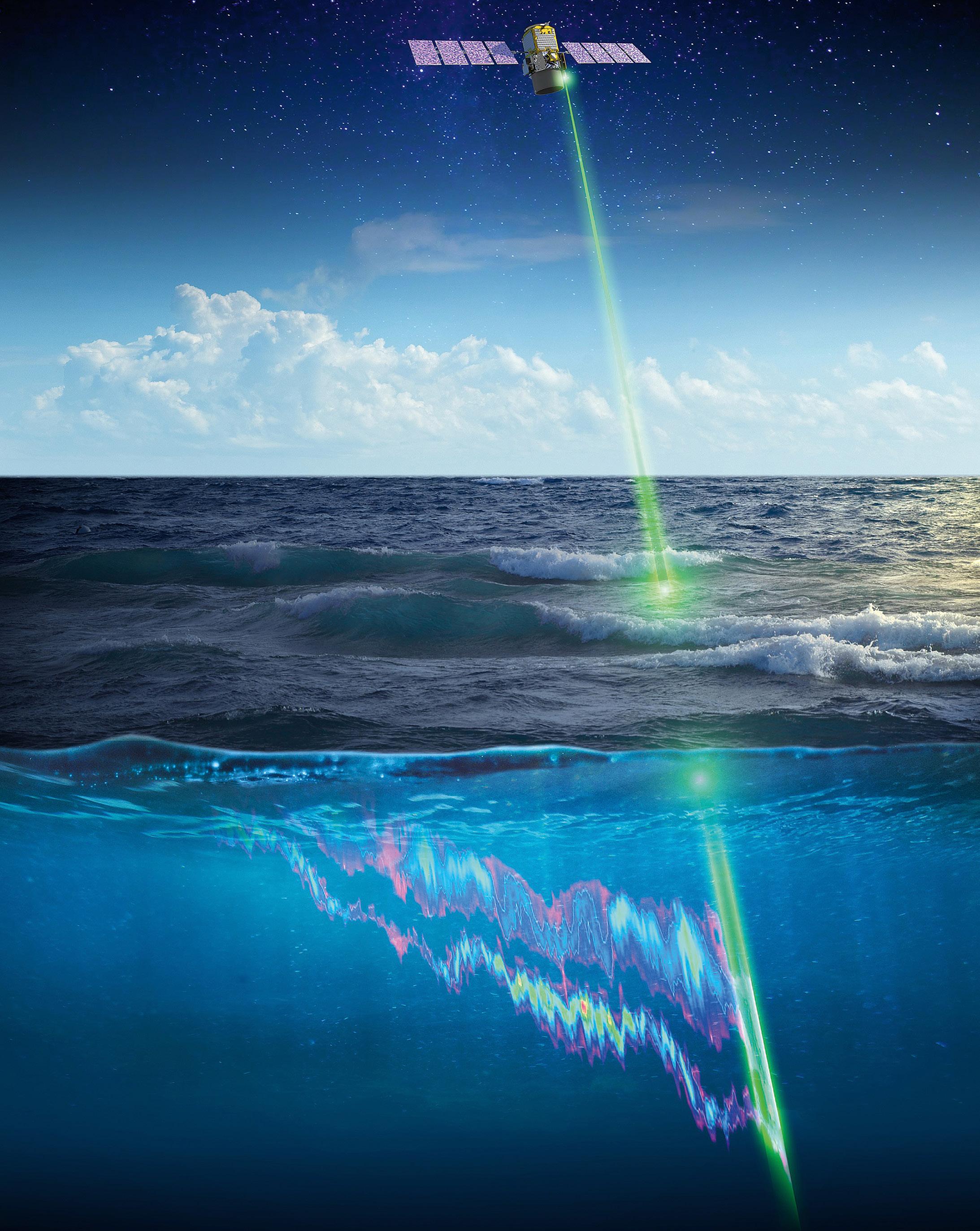
across a wide range of industries. Benefits include better land and water resource management, mitigating the impacts of climate change, and enabling greater, more effective use of remote operations.
Creative uses for data gathered from space abound. For instance, companies are increasingly turning to remote sensing data to inform business
decisions, such as tracking the number of cars parked at shopping centres, detecting gas pipeline leaks, optimising airline flight paths and fuel consumption, or assessing soil type and moisture content to maximise crop yields.
Satellite imagery already helps us observe and manage our environment and the impacts of climate change, from
The CALIPSO satellite, a joint effort between NASA and CNES, is monitoring the health of coral reefs from low Earth orbit. Image courtesy NASA/Timothy Marvel.flood and fire identification to better water and mineral resource management.
Australia’s fire agencies are using AI to analyse satellitegenerated data and images to help plan for bushfire seasons. By analysing historical bushfire data, vegetation growth and moisture, they can identify where fires are most at risk of breaking out. This helps the agencies decide when and where to backburn and where to deploy resources. They can also combine this data with analysis of social media, using AI to track key words and images, such as pictures of smoke.
Satellites deployed with hyperspectral imaging greatly enhance characterisation of the Earth. They can improve the search for deposits of critical minerals required for lower CO2 technologies, including for battery storage and solar panels.
Hyperspectral imaging can also help us characterise longer-term emergencies.
For example, Coral Vita, a Bahamas-based organisation specialising in coral reef restoration, is pioneering the use of visual spectrum satellite data and LiDAR to peer down across whole coral systems. This is helping to identify degraded areas for out-planting with site-specific and climate changeresilient farmed corals.
However, recent research by Coral Vita and NASA has shown there are inherent limitations in standard visual and LiDAR sensors that prevent us fully capturing the complexity and diversity of coral reefs.
For instance, these standard mechanisms cannot measure specific key indicators of coral health, such as tissue thickness, skeletal density or symbiont density. These indicators are influenced by factors such as water temperature, light intensity, nutrient availability and disease exposure. They can also vary significantly within and between coral colonies, making them hard to detect from space.
Some costly solutions to address these limitations include coupling standard remote sensing data with other methods of coral assessment, such as underwater surveys, genetic analysis and physiological measurements.
In the future, more advanced hyperspectral imaging could enable us to narrow down the health properties that currently elude us.
By analysing spectral data, researchers could identify different types of coral species, as well as their health status and environmental conditions. Hyperspectral imaging could help to detect stress, bleaching or disease in coral reefs by revealing changes in their pigmentation, morphology, and metabolism. For example, bleached corals have lower reflectance in the visible spectrum and higher reflectance in the near-infrared spectrum than healthy corals.
Hyperspectral imaging could also help to monitor the recovery of coral reefs after a disturbance event, such as a storm or a heat wave, by tracking the changes in their spectral characteristics over time. This, in turn, would allow us to prioritise more areas for restoration with a precision that was previously impossible.
The application of spaceaccelerated technologies is also creating a wide range of new and more diverse employment opportunities, in space and across all Earthbased industries. The future looks brighter for young people contemplating their career choices.
One of the Australian Remote Operations in Space and on Earth (AROSE) consortium’s most important goals is to uncover and widen the application of this space capability across industries to improve our approach to sustainability and decarbonisation.
AROSE members are at the forefront of these innovations. Many are using
LEO satellite observation and communications to improve productivity and sustainability, while creating a more diverse and skilled workforce. Some examples include:
MDA is helping Global Fishing Watch combat large-scale illegal fishing using the company’s 14year RADARSAT-2 satellite radar archive, which includes more than 970,000 images. RADARSAT-2 can image more than 250,000 km2 of ocean in less than a minute, regardless of weather conditions and time of day.

Gilmour Space, Curtin University and UNSW are developing and deploying satellite technologies that will increase Australia’s Earth observation capability.
Curtin University under SmartSaT CRC funding has used Earth observation optical data to help the Western Australia rock oyster industry prototype near-real time monitoring of farming sites.
EngineRoom’s highperformance computing helps companies supercharge the masses of satellite-generated
data to increase crop yields, render blockbuster visual effects, develop and simulate medical breakthroughs, calculate re-entry profiles for spacecraft, and give machine vision to robots and autonomous vehicles.
The Oceans Institute at the University of Western Australia (UWA) is using AI to analyse satellite data and images to identify plastic dumps in rivers before they enter the ocean, and climate change resilient coral formations in the Great Barrier Reef.
UWA’s International Space Centre has a dedicated facility developing world-leading hyperspectral infrared sensors, imaging devices, and electronic systems for space-based Earth observation.
As we stand at the dawn of this new era in space exploration, we must be mindful of the environmental challenges we face as a planet. With continued research and development, we can harness the power of LEO satellite observation to help create a more hopeful and sustainable future. n
Sentinel-3 image showing the Murray River plume from high outflow following extreme rains in South Australia. Image courtesy The University of Western Australia Oceans Institute.The federal government has updated the list of critical technologies that it says are vital for securing Australia’s future prosperity and security.
The List of Critical Technologies covers seven fields of technology, included amongst which are satellite, positioning and timing technologies. Other technologies covered include AI, quantum, autonomous systems, clean energy and advanced manufacturing.

“This List of Critical Technologies builds on the Government’s commitment to expand the number of next generation businesses working at the forefront of our changing economy,” said Ed Husic, Minister for Industry and Science.
“The Government is also targeting $1 billion of investment in critical technologies through the National Reconstruction Fund, which will further bolster Australia’s industry and economy.”
The List’s ‘Autonomous systems, robotics, positioning, timing and sensing’ theme specifically calls out the “satellites and systems that precisely measure position, navigation or timing data”.
The List recognises that satellite and PNT systems are needed for:
• Faster and more accurate surveying and mapping from the air and space
• More reliable and accurate navigation in sectors such as agriculture, aviation, construction, transport, and mining and resources
• Safer airline and maritime navigation
• Navigating without GPS
• Improving public safety
• Improving workforce safety and efficiency
• Reliable, efficient transport and logistics for land, sea, air and space
• Autonomous military applications
• Improved animal welfare management.
According to data cited by the Government, “Research into these technologies has been growing over the past 10 years, peaking in 2019 with almost 120,000 research publications published around the world”. That data shows a slow decline in 2020 and 2021.
The data also show that the US and China lead in the number of research papers published, with China well out in front.
The List specifically mentions the role played in Australia by PNT services, in sectors and applications such as:
• Monitoring essential services such as electricity supply and transportation
• Telecommunications
• Providing accurate timestamps for financial transactions
• Synchronising computer networks
The List also mentions that Australia’s “Earth observation systems and satellites are expected to contribute $1.7 billion to the economy by 2025. We have a strong satellite communications industry that is starting to embrace optical systems.”
It goes on to say that “Australia is also an ideal place for position, navigation and timing technology infrastructure because we:
• Have low noise and light interference
• Are well positioned to host ground stations that link earth and space.”
However, the associated ‘Critical Technologies Statement’ also cites a number of areas of risk, specifically that:
• Many other countries are competing with Australia to develop and use critical technologies. This could create challenges for our national security and supply chains.
• If a critical technology becomes compromised, it could have significant security implications. People or groups could steal information about our critical
©stock.adobe.com/au/TanyaJoy
technologies or use them in a way that harms Australia.
• Using more critical technologies could increase our risk of cyber-attacks.
• Industries that rely on a critical technology could be seriously disrupted if there are problems with the technology or its supply.
The Statement says that the government will “take advantage of the opportunities of critical technologies, and manage the risks” by:
• Carefully considering any impacts on Australia’s national interest
• Encouraging uptake across the economy
• Helping universities and businesses keep doing world-class research and development
• Encouraging local and international investment
• Working with other nations to develop technologies, protect supply chains and agree on technology standards
• Balancing Australia’s economic prosperity, national security and social cohesion when making decisions about critical technologies.
All that being said, at the time of writing the geospatial and space sectors were still awaiting publication of the long-anticipated PNT Roadmap, being prepared by the Australian Space Agency (ASA).
Speaking at the IGNSS conference in Sydney in November 2022, Elizabeth Pearce from the ASA described how PNT is at the heart of both terrestrial and space operations, from secure communications to timing synchronisation, space situational awareness to ionospheric monitoring, astronaut positioning (for search and rescue) to SLAM for robotics, Earth observation, lunar operations and many more emerging fields. n
JONATHAN NALLYSummit Biosecurity is revolutionising pest animal and weed control for budget-constrained local authorities.
Efficient weed management and pest animal control are essential components of preserving natural resources and protecting the environment, as highlighted in the recently released National Biosecurity Strategy.
Limited funding, field staff and weather problems often hinder these efforts. However, by incorporating the latest advances in spatial technologies, GIS data and related AI and Earth observation technologies, biosecurity organisations can overcome these challenges and streamline their field activities and compliance reporting.
RapidMap’s Summit Biosecurity solution — a multi-award-winning SaaS suite of mobile mapping applications — leverages the latest spatial technology and innovations in field mapping to help customers revolutionise pest animal and weed control operations. It has been endorsed by dozens of biosecurity organisations who use it every day to map and coordinate weed control and inspection across large regions of New South Wales, Queensland, South Australia and Victoria.
Summit Biosecurity’s GIS enhanced features have been developed in partnership with former military specialists who specialise in drone operations, as well as environmental and agricultural scientists who need to collect research evidence in the field. It capitalises on the advent of SouthPAN — the Southern Positioning Augmentation Network — and other Global Navigation Satellite System (GNSS) improvements to enable users to pinpoint infestations with unprecedented accuracy.
Biosecurity officers can now easily detect, map, and prioritise weed
infestations and pest control efforts with a level of precision that was unfeasible before. This same technology has also revolutionised agriculture, forestry and urban forest management, resulting in vast improvements in data accuracy during harvesting and monitoring.
Summit Biosecurity also incorporates abilities to make use of the latest drone technologies, whereby large-area imagery surveys can be captured in high resolution in a single flight with different onboard imaging equipment. Once the locations of weeds are identified accurately, UAVs can be used to deploy herbicides only where necessary — including in difficultto-access locations — thereby increasing the efficiency and effectiveness of weed management operations. There are strengths and weaknesses in where and how drones are deployed, though and pest animal control need other imaging devices to help with locating and identification to precede control activities.
Another prominent use for Summit Biosecurity is in combination with RapidMap’s 360-degree imagery capture along road corridors to track and monitor the extent of infestations due to the transport of cattle.
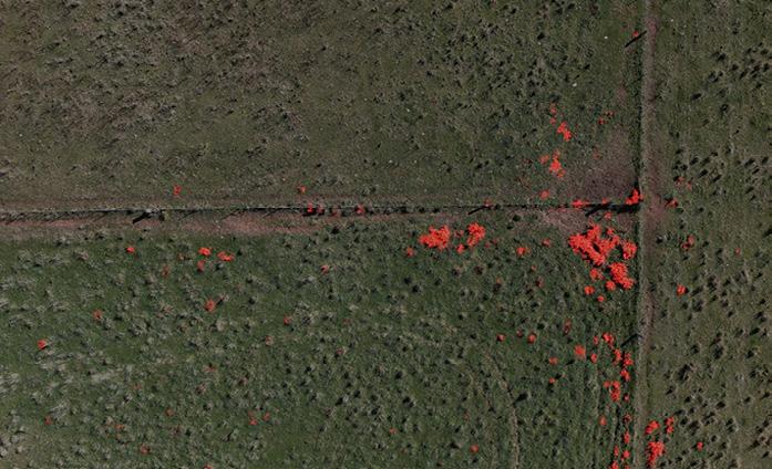
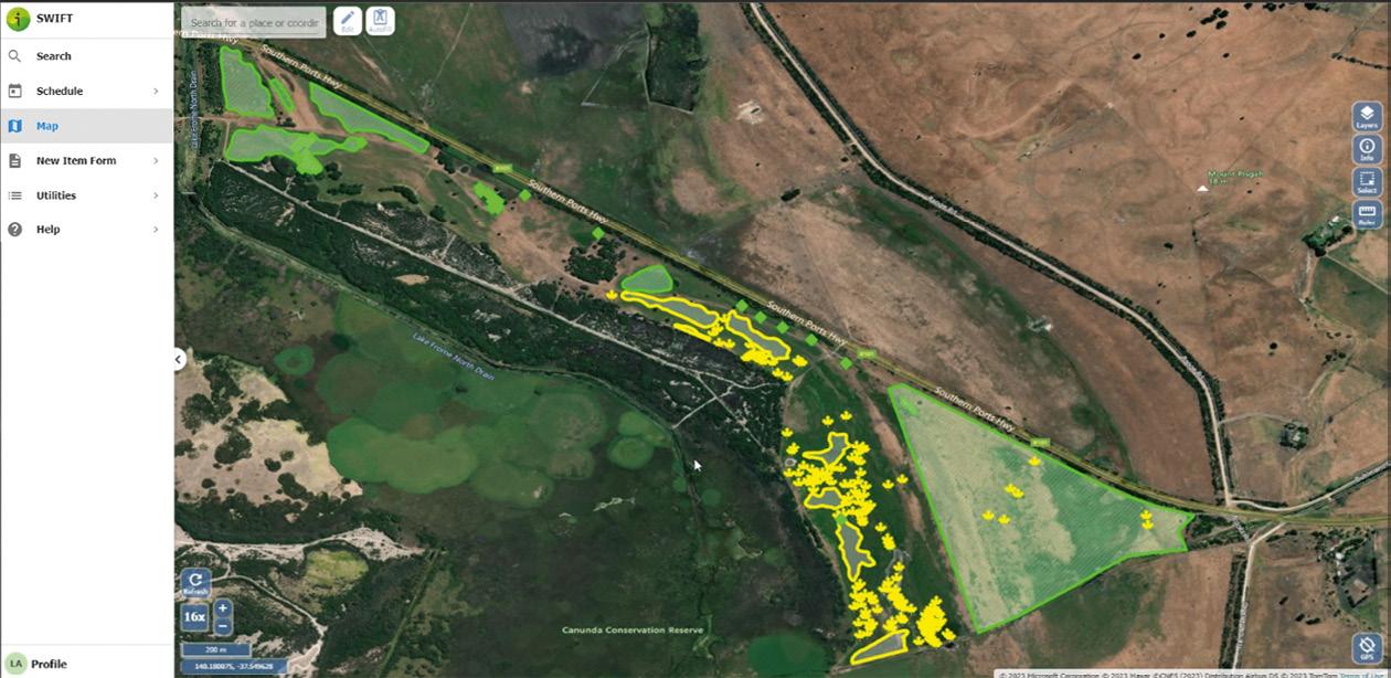
In summary, Summit Biosecurity’s capabilities can assist local authorities and researchers in many ways:
1. By leveraging the latest in precise GNSS positioning, 360-degree mobile mapping and UAV imagery to easily detect, map and prioritise weed infestations and pest control efforts.
2. By empowering field workforces and automating the scheduling of property inspections and weed/pest control programs.
3. By using AI and remote sensing
with RapidMap’s ground truthing to streamline machine learning and analysis of data collected from the field.
4. By capturing herbicide spray treatments with GNSS locations along roadsides to overlay as GIS data to record control activities.
5. By supporting closer collaboration between land managers, NRM Biosecurity Officers, Traditional Owners, farmers and contractors with mobile mapping apps.
Summit Biosecurity is easily integrated to share data with enterprise systems and GIS solutions. Combined with custom cloud, spatial data, tech support and mobile mapping apps we transform Local Control Authorities to significantly improve their efficiency and effectiveness and ensure that their limited budgets go further. n
RapidMap’s Lyn Terrett will present a paper on using drones for capturing highresolution imagery for weed and pest animal management, at the upcoming NSW Weeds Conference in Dubbo in August 2023.
Using drone capture and AI to identify silverleaf nightshade in a paddock. Summit Biosecurity enabled a small team to capture this much weed data in half a day. JOSEPH SEPPI
Geospatial practitioners often struggle to articulate their trade. There is that awkward use of the word ‘geospatial’ as an adjective, used to modify any number of nouns like ‘industry,’ ‘market,’ ‘profession,’ ‘ecosystem’ or ‘community’. It can be confusing.
When asked, “What do you do?” the geospatial practitioner will often say “I make maps”. This is easy to understand for most. But the real answer is difficult to articulate, complex and even unclear — because geospatial is like that.
Thirty years ago, it was not so difficult. There were a few clear answers, such as cartographer, photogrammetrist, geodesist or surveyor. Scientists and engineers, who routinely sketched and drafted maps of all scales, used fundamental principles of cartography.
In 1989, the famous landscape architect Ian McHarg, known for his pioneering work in the environmental movement, was using an early form of GIS — maps drafted on acetate drawn with Rapidograph ink pens to perform map overlay analyses. Then his students learnt CADD and early versions of GIS software. For him and his students at the University of Pennsylvania, GIS was a tool, a means to an end, but the data
and the analyses were the focus of his ecological planning methodology.
Back then, GIS was this incredibly powerful new tool, but there was very little digital data around. Most of what was needed was on paper or non-existent. If one wanted good, accurate mapping, they had to get out in the field and survey or digitise. Landsat data was on the scene, but its course resolution was not useful for many applications. Analog photogrammetry had been around since the early 20th century, and it too was undergoing a digital transformation around that time to soft-copy techniques.
GIS software quickly became the star of the show, and for a while many former cartographers, photogrammetrists, surveyors, geologists, statisticians and so on became known as the ‘the GIS person,’ as demand for those software user skills skyrocketed. It did not last long, and by the turn of the century there were four-year degrees being offered in GIS, and the realisation by many that being known as the ‘the GIS person’ was not a great career choice. Then the word ‘geospatial,’ the adjective, took off. The GIS person could be called the Geospatial Analyst, Architect, Technician, Developer, Manager, Visioneer or
Geospatial is more than an industry — it is a phenomenon that can change the world.
What we call the ‘geospatial industry’ is really just a part of many distinct industries in different sectors.©stock.adobe.com/au/Andrey
whatever. One result of this gold rush was the abandonment of core curricula, skills training and general appreciation of core competencies. Now the average age of a professional surveyor in the US is 57.
It is difficult to pinpoint the first usage of the term ‘geospatial industry’. This term has been prevalent for several years. By most definitions, an industry consists of establishments that offer products and services. Geospatial doesn’t fit nicely into an industry, or even an industrial sector. In fact, geospatial is not listed in the North American (NAICS) or the Australian and New Zealand Industrial Classification (ANZSIC) systems — the word ‘geospatial’ doesn’t even appear.
The same can be said for the EU classification of Economic Activities (NACE) — which groups aerial photography in the same industry as ‘videotaping of weddings — the UK Standard Industrial Classification (SIC), and even the United Nations International Standard Industrial Classification of All Economic Activities (ISIC Revision 4). Mapping and surveying are clearly identified as industries, often with professional services sectors.
What many call the ‘geospatial industry’ is the overlapping marketplace of many industries.
There are people working in geospatial today who have never used or even held a paper map in their hands. So much of what geospatial practitioners do depends on emergent technologies, and sometimes that technology depends on the practitioners.
Credit is due to geospatial (as a noun) and its origins in the scientific and government domains, now found in just about every industry with varying levels of maturity. Maps and cartographers have given way to digital twins and data scientists. Photogrammetry has evolved into computer vision
and deep learning. National Map Accuracy Standards and Spatial Data Infrastructure have become parts of ambitious globalist initiatives such as the ‘Geospatial Knowledge Infrastructure’.
Because everything has a location, geospatial believes it can do just about anything. Geospatial is now on a crusade to save the world from climate change and social injustice. Are geospatial organisations and practitioners really going to solve these problems or are they just being opportunistic? There are many screwdrivers out there trying to turn the same screw. In the meantime, surveyors, geologists, oceanographers, climatologists, engineers, planners and others tackle these problems with rigour, using appropriate technology. They are focused on the problem, not the tool.
Still on the books today in many countries are laws and policies clearly requiring licensed professionals to be the official mapmakers. Unfortunately, industrial ambiguity and the rapid emergence of competition with lower barriers to entry, led to lower standards for accuracy and changing government acquisition postures and reduced demand for licensed professionals.
Geospatial is in a state of high entropy. Estimates about the size of the Geospatial Industry are all over the place ranging from US$70 billion to US$1 trillion.
To Silicon Valley, “Geospatial feels like a sleepy industry that is waking up to new realities of technology innovation, major competition and users who have never heard of it” (Adrakopolous, Shawn 2023). Silicon Valley and Wall Street don’t really know this ‘industry’ exists.
At one point along geospatial’s rapid evolution the term ‘location intelligence’ was introduced. That term is one of the more appropriate. Everything in geospatial is about location, and location
intelligence is all about measuring movement of people and things through space and time. Entire supply chains exist for this purpose. Geospatial data is paramount. The pace of discussion about AI, digital twins, the metaverse and even multiverses has been breathtaking. For these things to work they will need near real-time updates, with a steady supply of exquisite highresolution geospatial data and location intelligence.
David Alexander, former GIO at the US Department of Homeland Security, gave a talk (tinyurl.com/yj2v5thv) titled ‘Geospatial information as a utility’… explaining how it has generation, transmission, and distribution segments. He said that, like a utility, geospatial information “is a vital need, deemed by state and federal lawmakers to be in the public interest…” (Alexander, David 2017). And potentially regulated but not owned by government.
Geospatial needs a robust midstream market that will make data producers less dependent on government enduser revenues. Data-hungry AI start-ups, DaaS, SaaS and other managed services platforms, may be just what is needed to create a more robust, healthy market for geospatial data and information.
Whatever those in geospatial call themselves, everything has a location, the Earth’s surface is constantly changing, even metaverses will constantly change, and soon there will be new markets for lunar and Martian spatial data. There are runways for growth of the technology, and hopefully practitioners will think about core principals and the value of science, mathematics and engineering.
A robust midstream marketplace for geospatial data will be good for geospatial and the consumer. Someday, there may be a real market for geospatial data, where it is bought and sold as a commodity, which would be potentially one great way to democratise it.
Geospatial is not an industry, at least not the way we tend to talk about it. Geospatial is mainly used an adjective. Used as a noun, this unique phenomenon carries its own gravity and could become more than an industry, or it might just come full circle. n
Joseph Seppi is Geospatial Sector Leader and Senior Vice President with global firm, Woolpert. This is an edited version of his plenary address at the Locate23 conference.

Kurloo enables professionals to perceive the world with precision, empowering them to make smarter, data-driven business decisions.
Imagine a network of sensors capable of withstanding the harshest conditions to alert you to any surface displacement or earth movement. Kurloo Technology, based in Brisbane, has transformed precise positioning technology, introducing a unique and accurate positioning-based monitoring service to the Australian and New Zealand market in 2023.
In the realm of traditional surveying, time, risk and cost have always been challenging factors, especially in high-risk and remote locations. Just over a decade ago, Kurloo’s founder, Lee Hellen, a consulting surveyor by profession, was driven by his clients’ need to find a solution that would revolutionise the industry, extending the capabilities of ground and structural movement assessment and prediction beyond anything previously thought possible.
And so commenced an extraordinary Australian-based journey of research and development that has assembled an
expert team of geodetic data scientists, machine learning enthusiasts, electrical and electronics engineers and more. Their relentless efforts, backed by significant investment, led to the creation of an ingenious and intelligent positioning sensor technology, today known as Kurloo technology.
This ground-breaking positioning technology possesses the remarkable capability to make the invisible visible, detecting millimetre-precise 4-dimensional movement of critical assets and infrastructure more frequently and efficiently than ever before. Kurloo automatically alerts users to the magnitude, direction and precise timing of any displacements. Inspired by the vigilant Bush Stone Curlew, a nocturnal Australian bird commonly found in coastline across Northern Australia, Kurloo seamlessly blends into its surroundings, diligently scanning for surface displacement and promptly alerting to potential risks.
“Developing Kurloo was a genuine partnership with our Brisbane-based design and manufacturing partner IntelliDesign,” said Lee. Built to rigorous standards under an aerospace AS9100D quality system, Kurloo has undergone extensive testing in harsh Australian environments, from the snow country in Victoria to the central desert and the Queensland coastline. Lee quips, “If they can withstand the Australian climate, they can survive anywhere!”
Kurloo’s geometry and materials are carefully selected for UV stability, weatherability, high strength, optical clarity and long-term performance. Kurloo technology was recognised at the recent 2023 Asia Pacific Spatial Excellence Awards for the Port of Brisbane Seawall project.
The intelligent Kurloo device includes expandable smart sensors, simplifying management through the ‘Kurloo Nest’ Cloud. Its integral high-grade professional GNSS antenna, solar panel and rechargeable battery enable high
precision and self-powered operation in low-Sun environments for up to three weeks. Onboard environmental sensors and accelerometers communicate changes and external interference, minimising errors and improving quality.
Kurloo’s unique device design supports solar operation, reflects heat, is bird-proof and resists snow and dust collection. Made with durable, UV-stable materials and sealed to IP67, Kurloo is designed to withstand harsh environments for a minimum of five years.
The Kurloo Nest is an advanced, cloudbased platform providing real-time data analysis. Accessible from any device, it sends alerts via email and SMS tailored to client specifications, delivering powerful data and reassurance.
In the dynamic field of surveying, Kurloo has pioneered a ground-breaking ‘Hardware- and Software-as-a-Service’ offering, providing unmatched flexibility for surveyors, geotechnical engineers and construction projects. With Kurloo, you can adapt to evolving project needs, deploying Kurloos to new sites or repurposing them as required. Kurloo’s commitment to service excellence includes comprehensive management services, equipment rental, installation, training and monitoring. Seamlessly integrating Kurloo empowers surveyors, engineers and project managers to revolutionise their approach and improve processes. Embrace the limitless possibilities Kurloo brings to surveying and geospatial industries, free from the constraints of traditional methods.
In the pursuit of enhancing remote operation capabilities, the Port of Brisbane made a game-changing decision — to add Kurloo technology to its Seawall project. Daniel Burley, Head of Infrastructure at the Port, enthusiastically expressed that
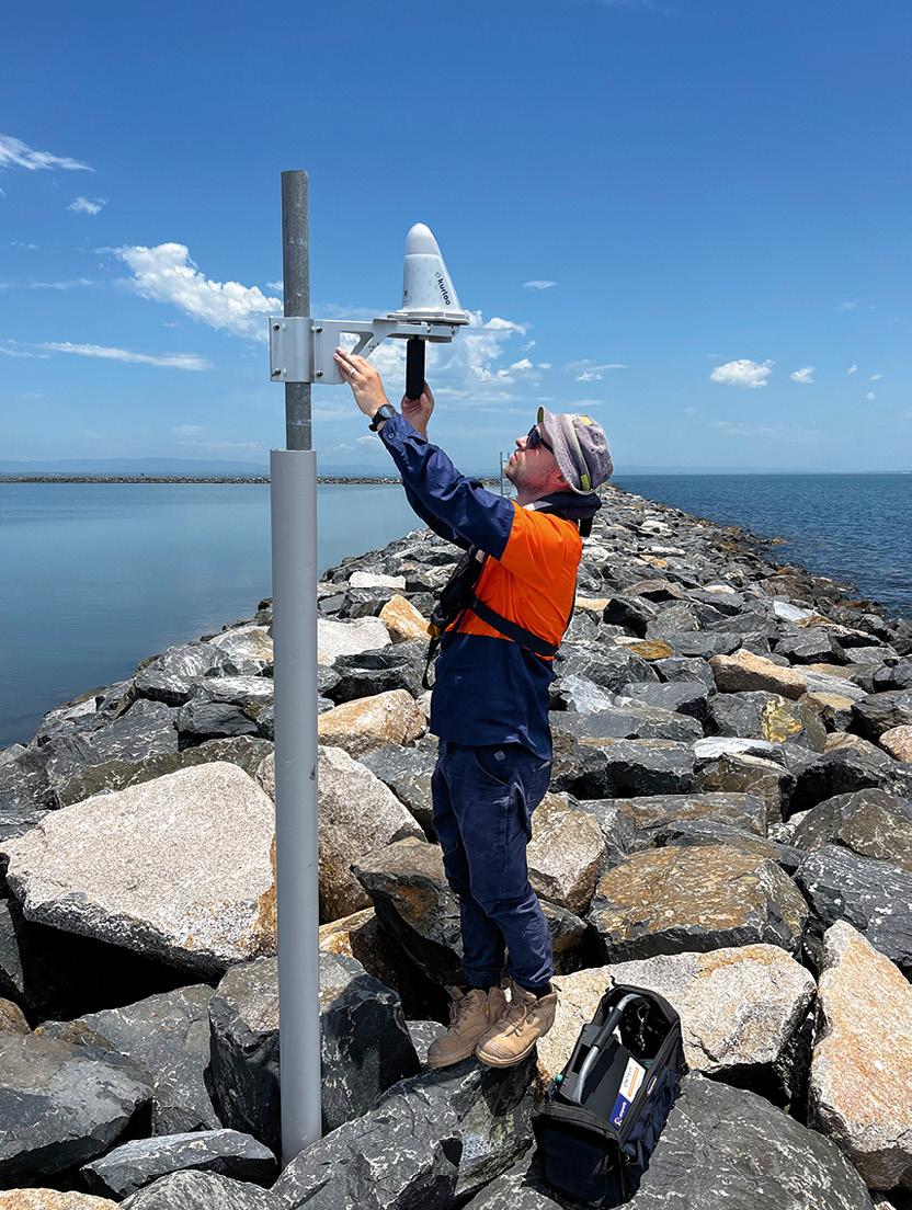
“Kurloo is providing the possibility of further empowering remote operation capability at the Port, with safer, more consistent, and frequent measurements. It delivers insights we can act on quicker than ever before, all with the confidence that the data is accurate. We’ve been pleasantly surprised by how effortless it is to install and operate Kurloo, thanks to the userfriendly Kurloo Nest platform.”
The deployment of Kurloo units along the Port of Brisbane seawall has been a transformative move, especially in monitoring movement and land reclamation areas to observe settlement patterns. Leveraging the power of GNSS technology, the equipment operates remotely, providing daily feedback on the stability of the rock during and after placement. This invaluable data empowers contractors with greater certainty that the works are performing as expected, resulting in minimal re-work and significantly reducing the risk of equipment loss and contamination of the adjacent Moreton Bay Marine Park.
The Port of Brisbane’s adoption of Kurloo serves as a shining example of how this innovative solution revolutionises remote operations and delivers tangible benefits.
Kurloo is a game-changer in workplace health and safety, addressing safety concerns and reducing time and financial costs associated with site shutdowns. Its suitability for high-risk environments makes it invaluable, providing insights without compromising safety. In remote locations like the Tasmanian wilderness, Kurloo drastically reduces time and cost barriers for surveying work. It also plays a vital role in preserving heritage sites and enables realtime monitoring of surface displacement, mitigating risks and ensuring preservation. Kurloo’s versatility extends to various sectors and disaster-prone regions, offering early detection and response capabilities.
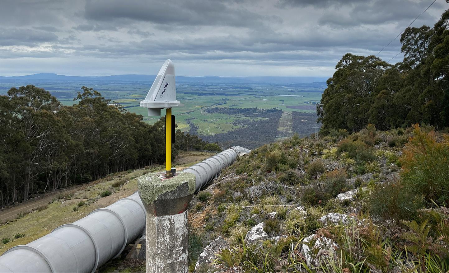
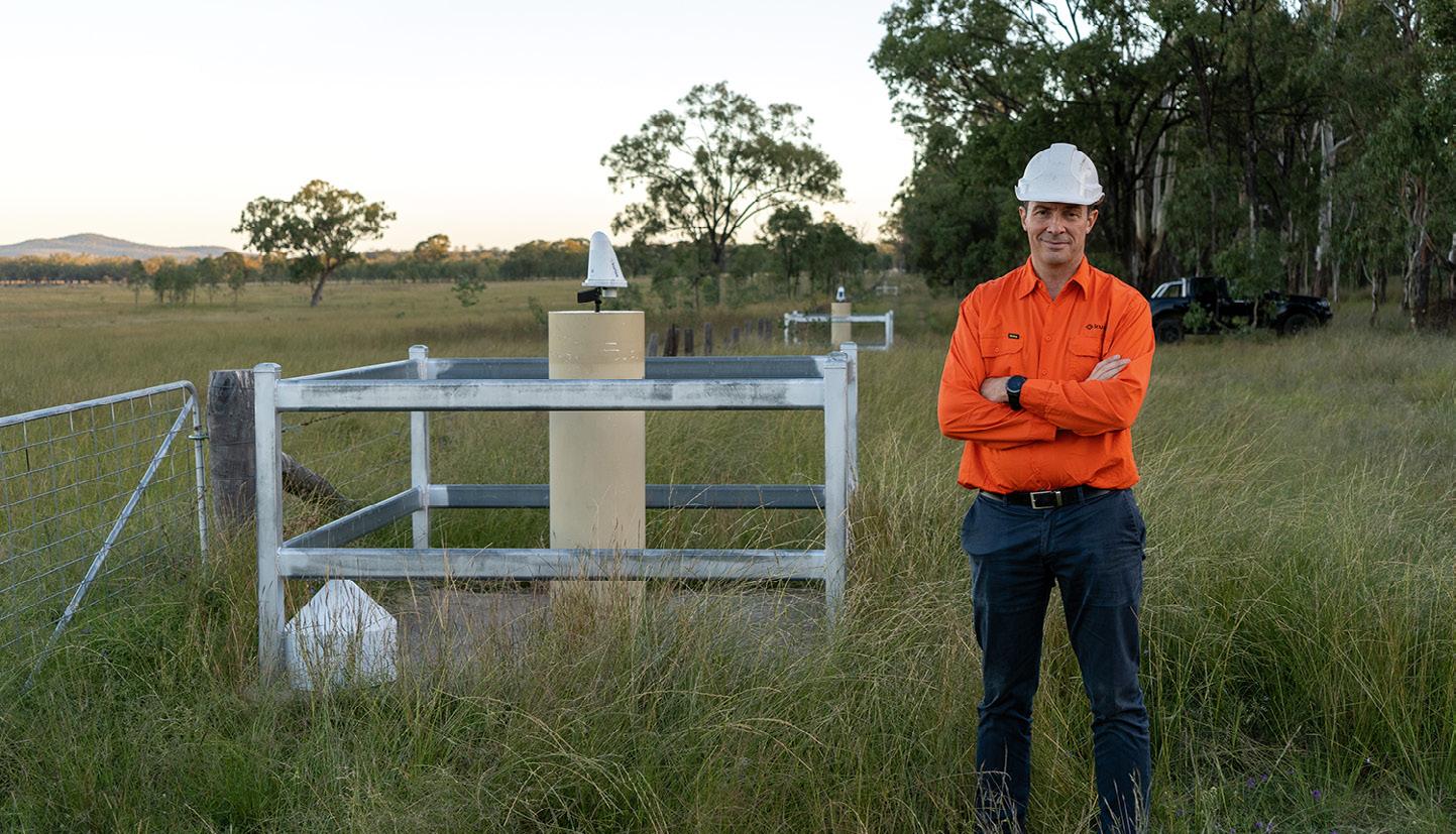
The cost of disasters, both financially and in terms of human lives, is significant. Kurloo empowers professionals to revolutionise disaster mitigation by providing the right facts, information and skills. With improved data science, Kurloo equips engineers with the tools to proactively monitor and analyse data, mitigating safety risks and averting major failures. Its simplicity and scalability make it easy to integrate into existing
workflows, providing real-time data for informed decisions and proactive measures to prevent disasters.
Kurloo’s journey towards innovation has some exciting possibilities. Lee said, “In the next two years, our vision is to achieve something extraordinary — predicting engineering and environmental disasters before they strike”. With the immense potential of machine learning and artificial intelligence, Kurloo aims to harness the power of data to identify and predict these catastrophic events, potentially saving countless lives.
“Imagine a future where quantitative data seamlessly integrates with emergency systems, providing real-time insights that enable swift and effective response measures. Kurloo is committed to making this vision a reality, pushing the boundaries of what is possible and revolutionising the way we safeguard our communities,” said Lee.
But Kurloo’s impact reaches far beyond disaster prevention. “We envision further advancements in Kurloo Technology for scientific and research applications, opening doors to unprecedented possibilities in precise positioning,” said Lee. “By making this technology more accessible, we are fostering an environment that
nurtures scientific discovery and unlocks new knowledge.”
“Moreover, collaboration holds immense potential in enhancing accessibility to positioning infrastructure, particularly in the developing world. By working together, we can bridge the gaps, democratise access to innovative solutions, and empower individuals and communities worldwide.”
Kurloo enables professionals to perceive the world with precision, empowering them to make smarter, data-driven business decisions. If you’re ready to embrace a future where technology transforms the way you manage your project sites, we invite you to connect with the Kurloo team today. Reach out to us at sales@kurloo.io and discover how Kurloo can reshape your approach to surveying, engineering and geospatial solutions.
Embracing a future where Kurloos tirelessly keep watch, ready to raise an alert of any surface or infrastructure movement, Lee and his team have embarked on a ground-breaking journey of innovation with a vision to create a safer world without limits. n
For more details about mobilising Kurloo for your project across Australia and New Zealand, visit www.kurloo.io or email sales@kurloo.io
Kurloo’s CEO and founder, Lee Hellen, in the field with a Kurloo unit.in-person attendance, with Gharineiat saying that there will be no educational prerequisites and “we estimate an enrolment of 60 students per course for the pilot, totalling 120 students”.
The surveyor profession (ANZSCO 232212) is on the shortage list of The National Skills Commission’s 2022 Skills Priority List in all states and territories. “These microcredential courses will equip participants with the necessary skills to pursue careers in surveying and spatial science, as well as other fields such as mining, agriculture and environmental sectors,” said Gharineiat.
JONATHAN NALLYbe a Certificate in Digital Engineering (Infrastructure).
“It’s designed to attract students from various engineering fields, in infrastructure and civil works projects, regional and metro areas, with or without undergraduate qualifications,” said Jupp.
The federal government has announced $18.5 million in funding to support the design and delivery of up to 28 microcredential courses from 18 universities across the country, to help fill the skills gap in crucial industry sectors.
The successful courses were selected from more than 90 submitted in the first round of the Microcredentials Pilot in Higher Education program.
Importantly for the geospatial sector — which, like many other sectors, is facing a severe shortfall of skilled professionals — the program will include three courses of direct relevance:
• Drone Mapping and Navigation Systems — provided by the University of Southern Queensland (UniSQ)
• GIS for Professionals — University of Southern Queensland
• Building Information Modelling (BIM) —
Sydney (UTS)
A second round is planned for within the next 12 months, under which more providers will be able to apply to take part in the Pilot.
Drones and GIS UniSQ, one of the country’s major providers of tertiary surveying education, will offer the GIS for Professionals and Drone Mapping and Navigation Systems courses.

“The first offering will be in January 2024,” said Associate Professor Zahra Gharineiat, Associate Head of School (Research) in UniSQ’s School of Surveying and Built Environment. “The duration of each microcredential course is yet to be decided but is expected to run over one trimester.”
The GIS for Professionals course will be conducted online, while the Drone Mapping and Navigation Systems course will be a mixture of online and
Participants who complete the Drone Mapping and Navigation Systems course will also receive remote pilot license training delivered by an industry partner.
In addition, participants who complete one of these courses will receive credits towards two courses in UniSQ’s surveying and GIS programs, while those who complete two microcredential courses will gain credits toward four courses in those programs.
Dr Julie Jupp, Associate Professor and Digital Engineering lead at UTS’ School of Civil and Environmental Engineering at UTS, said “Infrastructure engineering and construction reflect a real need and a real urgency for microcredentials targeting professional learners, and more so than ever in the digital engineering skills space.”
UTS’ Building Information Modelling microcredential course, while it comes under the banner BIM, will actually
“It focuses the national digital engineering policy principles that are going to ensure that students, regardless of their educational backgrounds [but] whilst still being in the field of engineering and construction, develop competencies in data governance, in information management, and in various model-based technologies and workflows.”
According to Jupp, the course is aligned with the highly successful Transport for NSW approach to digital engineering.
“We’ve really taken a cue from their very welldocumented standard that prescribes a data model for all the core disciplines… so moving beyond a BIM-centric approach to include survey and GIS.”
“It really does reflect that industry identified need to position core digital engineering competencies as a foundational field of study for modern infrastructure and civil works projects. Open BIM is a big part of that, where we see teaching of open standards as a core enabler of collaboration and communication.”
The roughly 15-week course will begin in 2024.
“The first offering of the course will be an online delivery format, and we’ll look at demand so as to potentially provide a hybrid [online/in person] offering,” said Jupp.
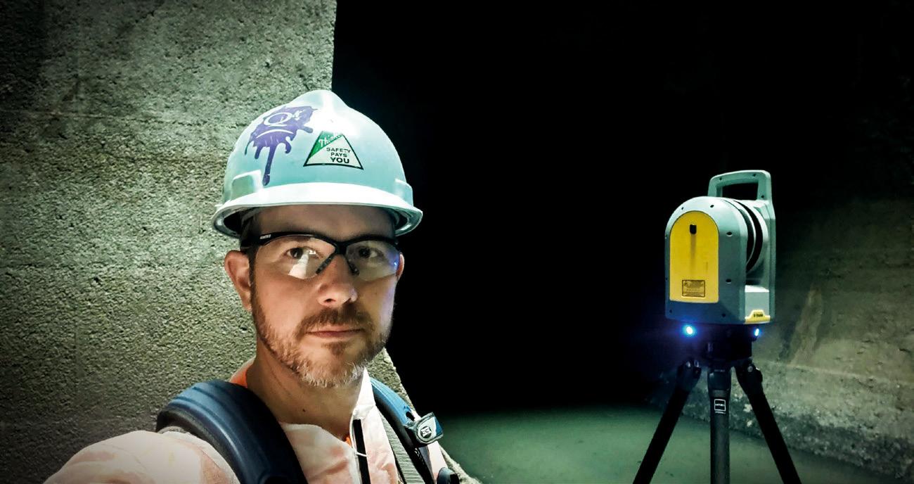

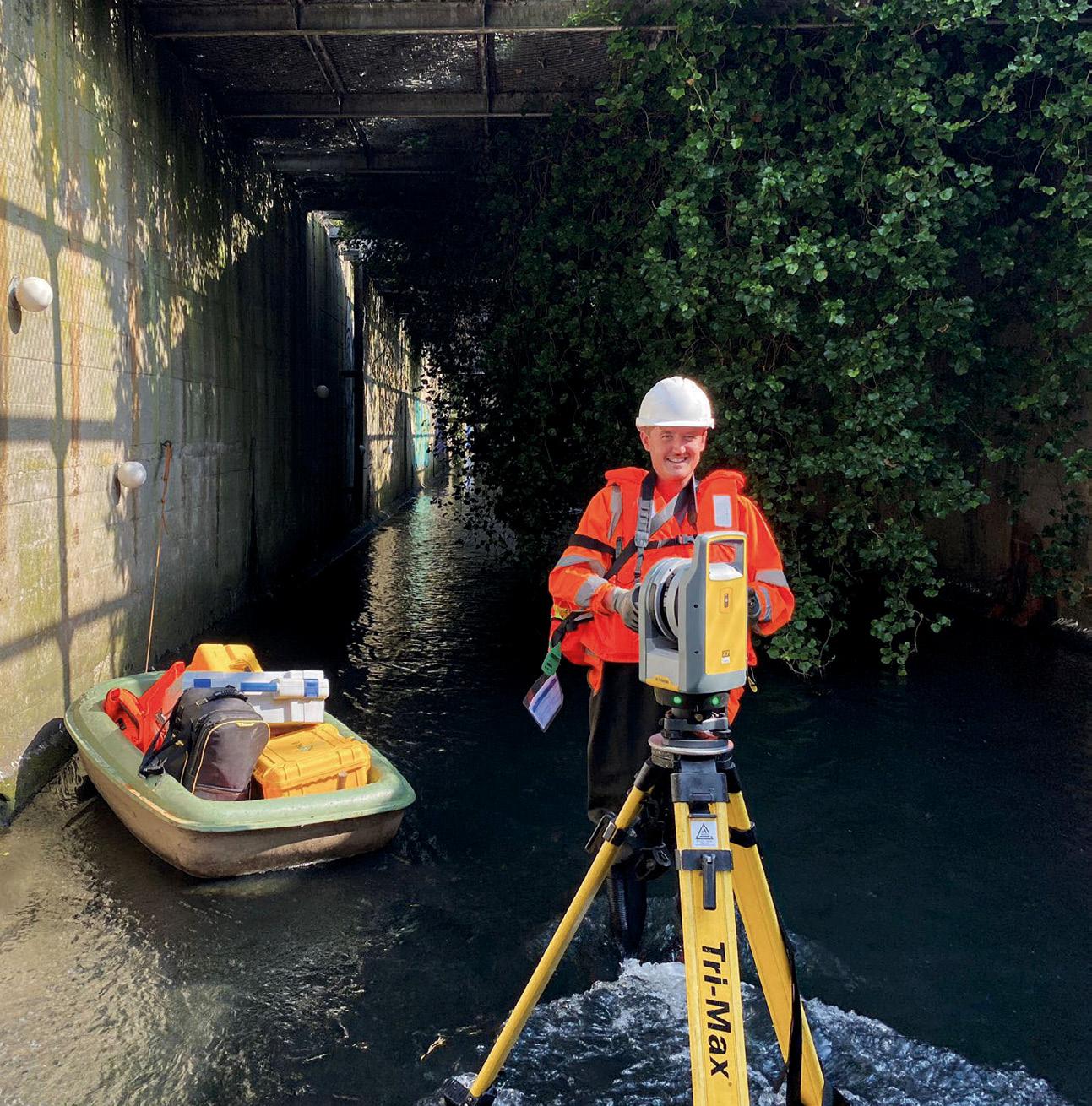
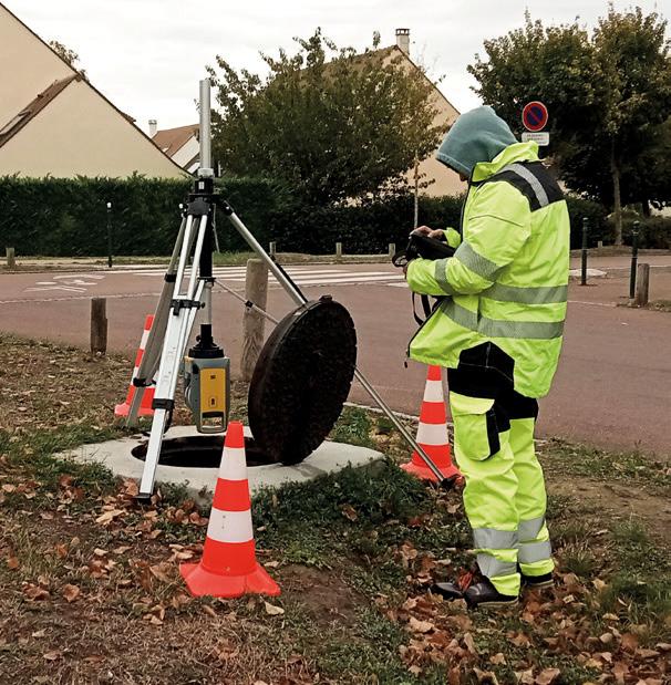
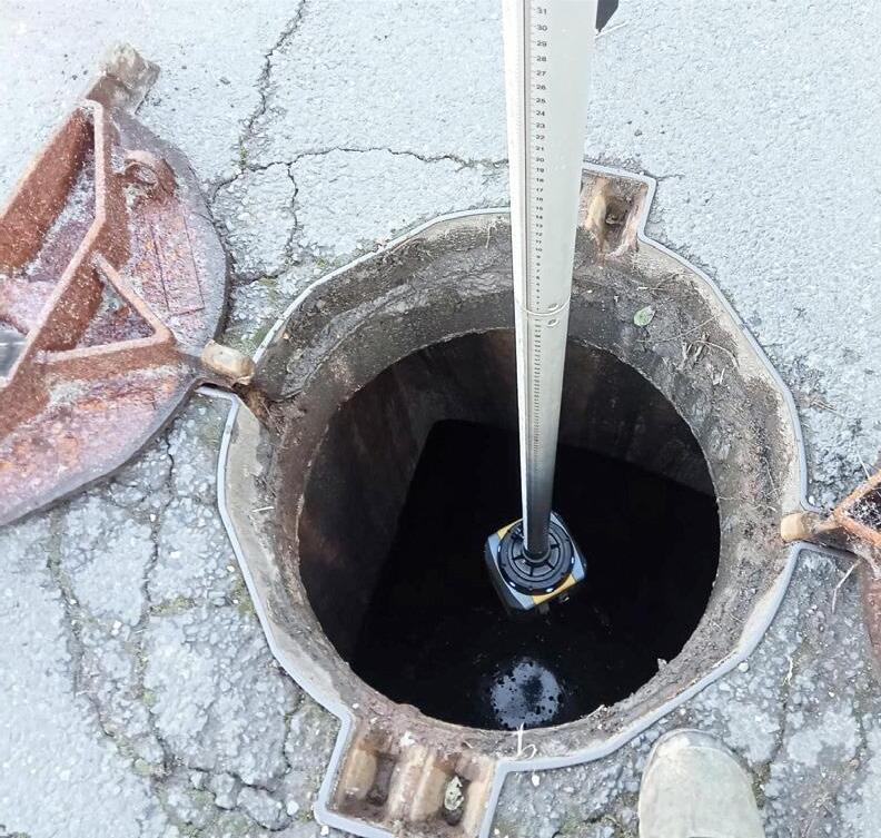
You make the impossible possible—going where others don’t want to go and achieving what others can’t. You lead the way in capturing and documenting the world around us with unparalleled accuracy and detail.
Push the boundaries of 3D laser scanning with powerful in-field automated registration, on-the-fly measurements, and annotations. Trimble® 3D laser scanning systems enable you to visualise and verify your projects before leaving the site, so you can capture complex real-world data with the confidence of getting it right the first time.
Find
The UK will seek to unlock billions of pounds worth of economic development by capitalising on technologies such as AI, satellite imaging and real-time data to boost locationpowered innovation.
That effort, which is at the heart of the UK Geospatial Commission’s newly released Geospatial Strategy 2030, will be used to drive the application of location data in property, transport, utilities and many other sectors.
“Location data and technologies power our economy and our Geospatial Strategy 2030 will ensure the UK remains an innovating world leader, by building on our successes and harnessing new opportunities from rapidly evolving technologies,” said Viscount Camrose, Minister for AI and Intellectual Property, Department for Science, Innovation and Technology.
“Our new strategy will grow our economy, embed the application of geospatial data in key decisions that affect our day-to-day lives while driving the private and public sector creativity needed to cement the UK’s status as a global science and technology superpower.”
The 2030 strategy renews and revises a similar strategy document issued in 2020, which set the scene for early developments in geospatial uptake across the UK.

The new strategy outlines three missions. Mission 1 is to “Embrace enabling technologies to accelerate geospatial innovation,” which, the Commission says,
“will require effective partnerships across academia, industry and the public sector, to focus on research and development, and the fostering of innovation from seed to scaleup and implementation”.
Specific Mission 1 targets include:
• Building an understanding of the geospatial ecosystem to provide an informed view of the potential impacts of disruptive technologies and outlining the opportunities and risks that they present.
• Working with public sector partners to drive coordination and direction in public sector funding for geospatial research and development.
• By the northern autumn of 2024, following the conclusion of an Earth observation (EO) pilot, publish key findings covering how the public sector’s access to and innovative use of EO data can be supported.
• By the end of 2024, conduct a review of the remote sensing market, including a review of the existing collective procurement of aerial photography for the public sector, with a view to exploring longer-term access models.
• By the middle of 2024, publish an assessment of the market for data about population movement, including its strategic importance, privacy and security implications and it use within the public sector.
Mission 2 will seek to “build awareness of the power of location data, technology and services [that] can be achieved by
driving and publicising the delivery of high value geospatial applications”. Its targets will include:
• By the northern spring of 2024, roll out the current, minimum viable product version of the National Underground Asset Register all across England and Northern Ireland, and have it fully operational by the end of 2025.
• By the end of 2024, explore the creation of a Land Use Analysis Taskforce to provide a spatially explicit evidence base that will help inform the delivery of key national priorities.
• Consider how government, academia and industry practitioners involved in land use decision making can improve links.
• By early 2024, develop with partners a standard taxonomy for key land use data.
• Publish findings on opportunities to unlock greater value across the property ecosystem through location data, technologies and services.
• By early 2024, conduct a review of the Public Sector Geospatial Agreement to ensure it remains fit for purpose over the remaining seven years of the agreement. Mission 3 will involve building confidence in the future geospatial ecosystem, by:
• In 2024, partnering with UK stakeholders to deliver an international geospatial conference on the power of location.
• By the middle of 2024, publish an evaluation of the Data, Digital, Diversity Training pilot programme to assess the value of this approach to upskilling geographic experts with digital skills.
• By the middle of 2024, work with universities to publish best practice as a first step towards embedding geospatial into data science and geography courses.
“Location-based insights have proven their enduring value again and again — during the coronavirus (COVID-19) pandemic, tracking outbreaks across the country was critical to inform public health decisions,” said Sir Bernard Silverman, Chair of the Geospatial Commission.
“The power of location will continue to underpin solutions to our biggest challenges including climate change, energy security and economic growth.” n
The updated strategy aims to place the UK at the forefront of geospatial innovation.
Mass redistribution from groundwater use has made the Earth’s rotation wander by nearly a metre over two decades.
By pumping water out of the ground and moving it elsewhere, humans have shifted such a large mass of water that the Earth tilted nearly 80 centimetres east between 1993 and 2010 alone, according to a new study published in Geophysical Research Letters
Based on climate models, scientists previously estimated humans pumped 2,150 gigatonnes of groundwater, equivalent to more than 6 millimetres of sea level rise, from 1993 to 2010. But validating that estimate is difficult.
One approach lies with studying the Earth’s rotational pole, which moves in a process called polar motion, whereby the position of the Earth’s rotational pole varies relative to the crust. The distribution of water on the planet affects how mass is distributed — like adding a tiny bit of weight to a spinning top, the Earth spins a little differently as water is moved around.
“Earth’s rotational pole actually changes a lot,” said Ki-Weon Seo, a geophysicist at Seoul National University who led the study. “Our study shows that among climate-related causes, the redistribution of groundwater actually has the largest impact on the drift of the rotational pole.”
Water’s ability to change the Earth’s rotation was discovered in 2016, and until now, the specific contribution of groundwater to these rotational changes was unexplored. In the new study, researchers modelled the observed changes in the drift of Earth’s rotational pole and the movement of water — first, with only ice sheets and glaciers considered, and then adding in different scenarios of groundwater redistribution.
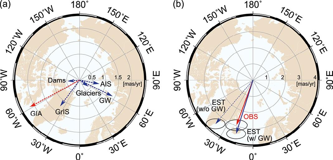
The model matched the observed polar drift only once the researchers included 2,150 gigatons of groundwater redistribution. Without it, the model was off by 78.5 centimetres, or 4.3 centimetres of drift per year.
“I’m very glad to find the unexplained cause of the rotation pole drift,” Seo said. “On the other hand, as a resident of Earth and a father, I’m concerned and surprised to see that pumping groundwater is another source of sea-level rise.”
“This is a nice contribution and an important documentation for sure,” said Surendra Adhikari, a research scientist at the Jet Propulsion Laboratory who was not involved in this study. Adhikari published the 2016 paper on water redistribution impacting rotational drift. “They’ve quantified the role of groundwater pumping on polar motion, and it’s pretty significant.”
The location of the groundwater matters for how much it could change polar drift; redistributing water from the mid-latitudes has a larger impact on the rotational pole. During the study period, the most water was redistributed in western North America and northwestern India, both at mid latitudes.
The Earth tilted nearly 80 centimetres east between 1993 and 2010 alone, according to a new study.

Countries’ attempts to slow groundwater depletion rates, especially in those sensitive regions, could theoretically alter the change in drift, but only if such conservation approaches are sustained for decades, Seo said.
The rotational pole normally changes by several metres within about a year, so changes due to groundwater pumping do not run the risk of shifting seasons. But on geologic time scales, polar drift can have an impact on climate, Adhikari said.
The next step for this research could be looking to the past.
“Observing changes in Earth’s rotational pole is useful for understanding continent-scale water storage variations,” Seo said.
“Polar motion data are available from as early as the late 19th century. So, we can potentially use those data to understand continental water storage variations during the last 100 years. Were there any hydrological regime changes resulting from the warming climate? Polar motion could hold the answer.” n
Courtesy of NASAPublished by Survey and Spatial New Zealand 335pp, surveyspatialnz.org
The cover of this handsome book shows a strapping young man making observations with a vernier theodolite under a tripod of bush poles. In the background are the shapes and colours of the rugged New Zealand landscape. Immediately we know that this is Archie Bogle, a surveyor, in an image from the first half of the 20th Century. We may also deduce that this man is no longer alive and that, with 20 mm thickness of book ahead, he was special. In all of that, our deductions are correct but incomplete — this book is more than just the recounting of a remarkable life.
The Measure of the Man is a compilation of three parts. The first is a reprint of Bogle’s own Links in the Chain, published in 1975 and republished in 2022. Written in the first person, it recounts some of his experiences from a time when the surveyor was the ‘pathfinder,’ preceding European settlement. The conditions were often primitive, the terrain inhospitable and the dangers many. Through these stories, told in an understated, even whimsical style, Bogle’s humanity and his interest in and care for people, comes through, particularly his appreciation of the Maori people whose lives were to be disrupted by the settlements that would follow him. Links in the Chain covers Bogle’s surveying life through to his early forties when he became a member of the Survey Board of NZ.
The second part, Surveyor Extraordinaire, is a concise biography of Bogle written by Donald McKay, who asks “Why was Archie so revered?” and then goes on to answer the question. Apart from entering private practice early in his career, he unselfishly contributed to society and his profession as a member of land, town planning and geographic boards. He also held high office in the New Zealand Institute of Surveyors, edited its journal for 29 years and contributed philosophical editorials and papers serious and ironic. He served in WWI and WWII. He was also known as an athlete, family man, poet, singer, actor, linguist and conversationalist. He was the recipient of many formal awards including the CBE. McKay has answered his own question with reverence.
The Measure of the Man hits its straps in its third part: The Best of Bogle is a

curated collection of editorials, papers, poetry and stories humorous and serious. There are public addresses, family stories, WWI human vignettes and more — even cartoons — all but a few the work of Bogle himself. And through this part the real Bogle finally appears. In Part 1 we get a glimpse of a capable, strong and humanistic man. In Part 2 we learn of his extraordinary contributions beyond his own practice and interests. In Part 3 the thoughtful, caring, witty man appears. His humour is without rancour or bite, his philosophy not laid on with a trowel. He loved his profession and demonstrated it. We learn why he was more than revered. Bogle was loved. The Measure of the Man is a love story.
The Measure of the Man is a valuable work for a variety of reasons. It is an historical record which accurately relates the rigorous contributions made by previous generations of surveyors who provided the foundation for what are now called the spatial sciences. Its number of pages may give the appearance of a heavy read, but it is a book to dip in and out of, to be savoured over time. For this reviewer, the book raises a question he cannot answer but nonetheless asks: Where, from our professional journals and written communications — which convey so well the important and serious matters of science, technology and its applications, education and certification etc — has the humour, the whimsy, gone? Bogle was an energetic and successful leader in action, thought and word. He recognised the essential binding elements of humour, lightness, whimsy and sentimentality in human relationships. Could this book be a catalyst for the re-introduction of these elements into the communication channels of professional societies?
The text is complemented with numerous, excellent photographs and illustrations, a comprehensive index and end notes for Part 2. The Glossary of Terms is a comprehensive yet relaxed guide for non-surveyors that may cause technocrats and perfectionists to suck their teeth.
Survey and Spatial New Zealand and its three editors should be congratulated for bringing The Measure of the Man to life.
Reviewed by Peter Byrne, Hon Fellow SSSI and author of Geometer Dreams (2022).
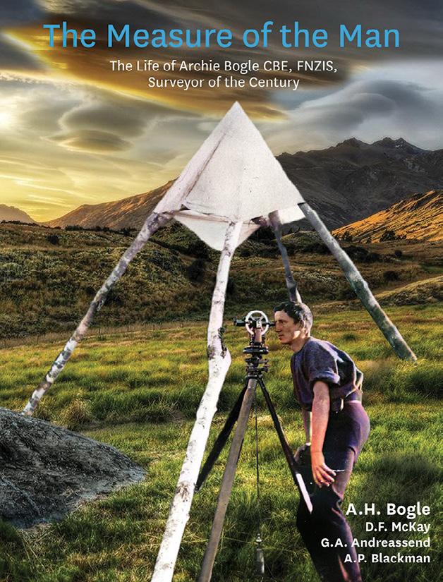

The Leica BLK2FLY is an autonomous flying laser scanner with built-in obstacle avoidance capabilities for reality capture of building exteriors, structures and environments and creation of 3D point clouds while flying. With a few simple taps on a tablet, users can send it aloft to autonomously scan building exteriors and features, including hard-to-access areas such as rooftops and facades. The device features GrandSLAM sensor fusion of LiDAR, radar, cameras and GNSS for full scan coverage, along with optimised flight paths and a shortest-return-to-home function. Users control the BLK2FLY through the BLK2FLY Live App on a tablet with no need for prior UAV experience — once the user has selected an area within a map on their tablet, the BLK2FLY will create its own flight path. The unit includes WLAN and LTE connections to the tablet for nearly unlimited communication range during flight.
Microchip Technology has released the 5071B caesium atomic clock which, the company says, can perform autonomous time keeping for months in the event of GNSS denials. The 5071B is available in a 3U 19-inch rackmount enclosure and has upgraded electronic components to address possible obsolescence or non-Restriction of Hazardous Substances Directive (RoHS) circuitry. The product provides 100 ns holdover for more than two months, maintaining system synchronisation when GNSS signals such as GPS are denied. As a caesium beam tube product with no deterministic long-term frequency drift, the 5071B provides absolute frequency accuracy of 500 quadrillionths over all specified environmental conditions for the life of the product. The unit is fully compliant with the RoHS Directive, meaning it is available in regions where regulatory policies are in place.

Designed for land survey, marine, agriculture, machine control and GIS operations and small enough to fit in a pocket, the ComNav Technology T20 GNSS receiver is only 48 mm thick with its battery and weighs just 680 grams. With its SinoGNSS K8 platform and third-generation IMU, the T20 is able to adapt to complex environments and collect accurate data, the company says. Powered by a 10,000mA lithium battery, the unit can operate for 12 hours and can track all current and planned constellations, including GPS, BDS-2, BDS-3, GLONASS, Galileo, QZSS and SBAS. The T20 can operate in static, PPK and RTK modes, is able to deal with up to 60° tilt with 2.5 cm accuracy, is IP67 rated and supports NFC and Bluetooth connections.

Kurloo is an Australian-designed and -manufactured sensor and processing service that can be permanently installed on ground surfaces or infrastructure to detect and transmit relative 3D displacement for mining and engineering applications. GNSS and onboard sensors automatically transmit readings to the Kurloo Nest processing platform for near-real-time data analysis and threshold alerts (email or SMS) through a secure, cloud-hosted web interface accessible from any desktop or mobile device. The Kurloo device comes in two variants —single-band L1 with GPS, Galileo, Beidou and QZSS, and multi-band L1, L2, E5b with GPS, GLONASS, Galileo, Beidou and QZSS for PPP applications. The device has on-board LTE Cat-M1 or Wi-Fi, integrated solarpowered battery (21-day charge life) and accepts over-the-air firmware upgrades. Kurloo is available as a fully managed Hardware-as-a-Service model though a network of partners in Australia and New Zealand.

The geospatial community has reacted with dismay to news the federal government has cancelled the National Space Mission for Earth Observation (NSMEO) program.
Cost cutting described as “budget repairs” have drastically impacted the $1.2 billion space program, which was to launch four satellites between 2028 and 2033, providing global Earth observation data.
Few people realise that Australia has almost no satellites of its own — we have only a few communications satellites, some recently launched small satellites providing IoT data and a few experimental CubeSats from universities. The NSMEO program would have provided an Earth observation capability.
Sadly, Australia will have to continue to rely on the goodwill of foreign owners to allow us to buy data from their satellites, a sovereign risk and critical vulnerability.
Industry and Science Minister, Ed Husic, assures industry that the Government is committed to industry growth and values the role the space sector plays.
The Minister says space-related firms will be able to access capital through the $15 billion National Reconstruction Fund plus the newly announced $392 million Industry Growth Program. The Government has stated that it understands it must meet its objectives of being able to
effectively monitor climate change, manage the environment, respond to natural disasters, and lift productivity — all of which are very efficiently aided by spacebased assets.
The Geospatial Council of Australia is disappointed with this setback for both the space and geospatial industries. But it is a fact of life that in difficult economic times, governments make unpopular decisions. We believe more can be achieved if we keep the channels of communication open through collaboration and consultation.

The Geospatial Council is committed to working with government at all levels to ensure Australia’s national interests, including space and geospatial industry sustainability, national economic growth, and productivity improvements remain a priority when it comes to access to spacederived geospatial information.
One of the beacons of hope has been the recently unveiled industry roadmap. The extended version of the 2030 Space+Spatial Industry Growth Roadmap highlights the critical role the space and spatial sectors have in driving growth in our key economic sectors, as well as in planning and mitigating the effects of a changing climate on our natural and built environments, and on our lives.
innovators and industry leaders, to continue working
Congratulations to the member volunteers (list below) who are taking up pivotal roles in our geospatial community as we work together to advance the goals of the Geospatial Council of Australia. The Geospatial Council would particularly like to recognise and thank the many hundreds of volunteers who contributed their time and expertise to leadership, committees and special interest groups for our founding organisations the Surveying and Spatial Sciences Institute (SSSI) and the Spatial Industries Business Association (SIBA).
State and Territory Chairs
ACT Chair
Mike Stapleton
Queensland Chair
Cameron Brittain
It outlines the steps required to realise an integrated space and spatial ecosystem through nine stated key objectives, associated actions and action champions.
This is an important piece of work, as it highlights that space and spatial technologies are an essential component of economic growth across nearly all sectors of the Australian economy and are important to lifting productivity.
Further investment and wellcoordinated national policy will accelerate these benefits. The Roadmap is the outcome of extensive consultation and it is now up to us all to play a role in its call-to-action and implementation.
The Geospatial Council will continue to speak out with one voice on behalf of its members.
Our advocacy agenda says globally competitive sovereign Australian space and spatial industries will give Australia the capability and capacity to:
Provide the nation with its critical sovereign space and spatial needs, including assured access to space and greater self-sufficiency in national defence.
Execute complex space projects in Australia, and make substantial technical, operational and management contributions to international missions.
Provide global leadership in integrating
the space and spatial domains and create market opportunities in adjacent and emerging disciplines. These include data-driven decision-making, artificial intelligence, precise positioning in real time, remote operations, artificial intelligence, machine learning, Spatial Digital Twins, optical communications and quantum technologies, amongst others.
Increase productivity and capture a much larger share of the rapidly growing global space and spatial markets.
Be a destination of choice for space and spatial specialists and companies and highly attractive for new space and spatial start-ups.
Be recognised as a key provider of research, education and training in space and spatial sciences and technologies with a highly skilled workforce and that achieves the required critical mass for recognition and growth.
Underpin critical supply and value chains across the whole Australian economy.
As events in recent weeks demonstrate, there has never been a greater need for our members, as individual professionals, innovators and industry leaders, to continue working together on our national priorities.
Tony Wheeler CEO, Geospatial Council of Australia
Queensland Vice-Chair
Koray Ozdogu
South Australia Chair
Graham Walker
South Australia Vice-Chair
Jennifer Brindle
Tasmania Chair
Anthony O’Flaherty
Victoria Chair
Richard Syme
Victoria Vice-Chair
Sam Houston
Western Australia Chair
Laren Collen
Areas of Practice Chairs
GDARS Chair
Dr Jagannath Aryal
Surveying Chair
Mike Stapleton
Hydrography Chair to be confirmed
Young and Emerging Professionals Chair
Oscar So
Western Australia Chair
Laren Collen
There has never been a greater need for our members, as individual professionals,
together.
Determining the value of geospatial information to the Australian economy, now and for the next decade.

The formation of the Geospatial Council of Australia in March 2023 represented a major milestone in the development of a peak professional body for the geospatial sector. That sector is extremely important to the productivity of the Australian economy, the sustainable management of its natural resources and environment and to the ongoing standard of living for Australians.
One of the priority actions of the Geospatial Council is to undertake an assessment of the economic impact of geospatial information on the Australian community. Scoping is underway and the project could be undertaken in collaboration with an industry partner.
The study would measure the direct economic impact of the geospatial industry. It would also inform policy making to support geospatial realising its potential contribution to the Australian economy. The Productivity Commission has highlighted
the lower rate of growth in productivity over the past 20 years. In fact, productivity in Australia has been in a steady declined since the 1970s, except for the period during 1990–2000 when there was a once-in-ageneration housing and mining boom, when Australia was

derided as still having an ‘old economy’. Since then, our nation has shifted more towards a services-based economy and our productivity has declined as a result of the absence of any technological improvements making a significant productivity impact (see Figure 1).
The fall in productivity growth in the 2019 to 2020 period appears to be COVID induced. That said, the productivity growth outlook post-COVID is concerning. Australia also faces many challenges in the post-COVID era. Productivity has been
declining in some industries and is relatively flat in others. The retreat from a global approach to trade has brought new challenges to maintaining Australia’s export markets and international competitiveness. The geopolitical framework has increased the political focus on sovereign capabilities.
The Productivity Commission has identified the building of a skilled workforce and harnessing data and digitisation as keys to improving productivity.
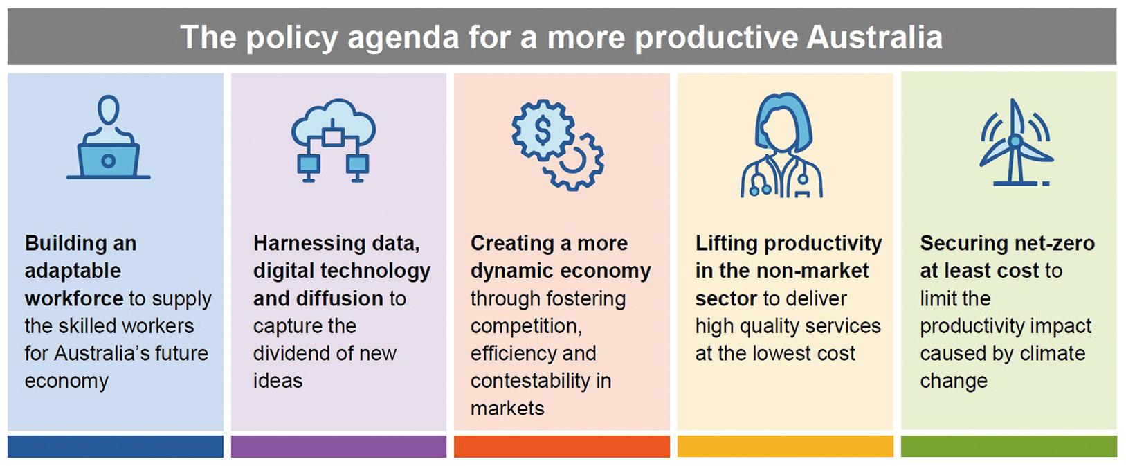
“The geospatial sector is critical to the digital transformation of the economy and has the potential to contribute to a more productive Australia, and it already is, but with the right policy settings and carefully targeted investment, there is strong potential for more substantial productivity gains,” said the Geospatial Council of Australia CEO’s, Tony Wheeler.
According to a 2021 Deloitte Economics study commissioned by Geoscience Australia, the economic impact of seabed mapping alone is estimated to be $9 billion.
“However, when other market segments are included, this figure is likely to grow
substantially. Sectors such as property, construction, resources, energy, water and environment, agriculture, transportation and logistics, and defence also heavily rely on geospatial services,” Wheeler said.
“However, the geospatial sector faces challenges. Growth in the sector in Australia has been around 3% to 5% per annum in Australia compared with estimates of around 14% to 16% globally. A shortage of skills and workforce needed to maintain the sector has emerged as a critical factor.”
To better understand the full economic impact of geospatial services, a second stage of the study would examine the skills gap and its effect on economic growth. The last time the value of geospatial information was undertaken on an economywide basis in Australia was in 2008. Since then, there have been considerable changes both in the Australian economy and in the use and application of geospatial technology.
The Geospatial Council, along with key industry stakeholders, has articulated the potential future through its 2030 Space+Spatial Industry Growth Roadmap. The
challenge now is to raise the awareness of policymakers to the importance of the geospatial sector to Australian society and its economy. This economic impact assessment will be a vital piece of work that will inform many important decisions by both our industry and the policymakers in government.
The Geospatial Council wants to:
• Increase the profile of geospatial-related occupations to attract and retain talent.
• Increase investment into, and the recognition of, the geospatial ecosystem to provide global best practice technology and services across the economy.
• Strengthen the voice of the geospatial ecosystem across whole of government, industry, and communities throughout Australia and internationally.
The proposed economic evaluation would support all these goals, promote the greater adoption of geospatial systems in the digital transition and address workforce issues currently constraining the growth and contribution of the sector. n
“The geospatial sector is critical to the digital transformation of the economy and has the potential to contribute to a more productive Australia.”
Tony Wheeler, CEO, GCA
An adventurous spirit led Jennifer Brindle to a career in hydrography; now she’s hoping more women will join the field.
Jennifer Brindle, Operations Manager with Precision Hydrographic Services (PHS) in South Australia, is only the fourth woman in Australia to become a Certified Professional Level 1 Hydrographic Surveyor (CPHS1), the highest level of certification awarded by the Australasian Hydrographic Surveyors Certification Panel (AHSCP). Currently women make up just 7% of the total number of CPHS1s in Australia. Jennifer is also the first female Surveyor in Charge (SIC) for the HydroScheme Industry Partnership Program, focused on conducting hydrographic survey activities to contribute to the Australian Hydrographic Office national charting priorities.
“Up until a year ago, after spending 14 years in the industry, I had only ever worked with one female but this year we employed two women Hydrographic Surveyors at PHS, so now
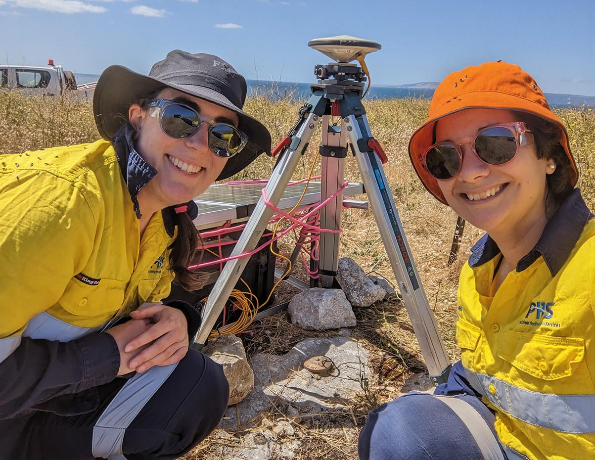
there are three of us here which has been fantastic,” she said. “Hydrography is such a small, specialised field that many people are unaware of — we want to raise the profile of hydrography generally and show people that it is an exciting career, and then I believe we will start to see a greater percentage of women looking at it as a serious career option.”
Jennifer graduated from New Zealand’s University of Otago in 2008 with a degree in land surveying and was immediately recruited by Horizon Geosciences to work in the Middle East.
“It was my first job out of university, and I was attracted to the idea of working in Dubai and trying hydrography. The company did surveys all over the world and that really appealed to me,” Jennifer said. During this time, she was involved in many interesting
projects, such as high-definition MBES surveys of shipwrecks offshore of Iraq, rig moves offshore of Qatar, and ROV pipeline inspections in the Persian Gulf.
In five and half years in the UAE, she had various roles including Base Surveyor, Project Manager and Offshore Hydrographic Surveyor. “As a woman it was harder to send me into the field due to cultural implications, meant I spent more time in project management, which ultimately fast-tracked my career,” she said.
In 2021, Jennifer was named Future Leader of the Year at the Asia-Pacific Spatial Excellence Awards, (now called the Geospatial Excellence Awards), building confidence in her ability to mentor others entering the field.

“Since I received the award, it has certainly helped me want to take more of a leadership role in the spatial community. I have really enjoyed helping the younger generation and promoting hydrography,
through networking and organising events,” she said.
She was also recently appointed the Geospatial Council of Australia’s Co-Chair for South Australia and is a keen proponent of the hydrographic coaching program.
What advice does she have for someone considering a career in hydrography?
“The hydrography community is very supportive in Australia and one of the best things you can do if you want to be a hydrographer is to get involved with the hydrography coaching program at GCA,” she said. “The program is aligned towards certification and connects you with Level 1 and Level 2 surveyors so that you can learn from them, and they can assist you towards certification.”
“You get to connect with senior hydrographers, so there’s mentoring benefit — you can call up and ask questions. I wouldn’t be where I am without the mentors who have guided me along the way.” n
Jennifer Brindle, Operations Manager with Precision Hydrographic Services.


