

GROWING
City of Sydney even cooler Official publication of inside Environment envoys Geospatial helping communities in the Gili Islands Feet to metres A look back to 1974, when surveying went metric Geodetic upgrade The US spends millions to modernise the system The Australasian magazine of surveying, mapping & geo-information February/March 2024 – No. 129
GREEN WITH GIS Making the
REDEFINED We’re ready to support your business with leading automation + positioning technologies for all geospatial applications. Learn more and get in touch today aptella.com
SHAPE THE FUTURE WITH POSITION PARTNERS



5
14
16
20 3D laser scanning
The RIEGL VZ-600i 3D is making an speedy impact.
22 Preserving history
25
26
The
28 UK’s geography strategy
Enhancing the profession within government.
29 Modernising US geodesy
Up to US$20m allocated to address key issues.
30 Environmental challenges
Humanitarian mapping on Indonesia’s Gili Islands.
32 Unriddling RINEX
RINEX’s benefits for storing and exchanging data.
36 Metrication memories
It’s 50 years since Australian surveying went metric.
30 16 22 contents February/March 2024 No.129 features
Hyperspectral imaging CyanoSat’s novel environmental imaging system.
Growing green with GIS Sydney’s plan for becoming a cooler, resilient city.
Meet the metaverse Geospatial’s vital role in the world of the future.
Almost 200 years of Queensland surveying history.
Kurloo’s simple solution
Revolutionary Australian monitoring technology.
Mapmaking for the world
ICA’s mission to support R&D and education.
regulars 4 Upfront 4 Upcoming events 7 From the editor 8 News 37 New products 38 GCA updates www.spatialsource.com.au 3
Landsat 2030 international initiative

Anew program that aims to increase US and partner governments’ ability to sustainably manage land, surface water and resource use has been launched by the US Department of the Interior.
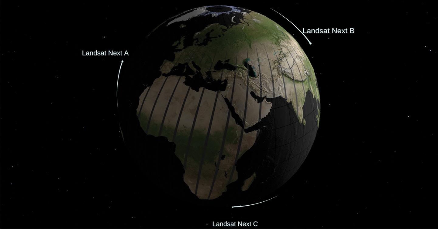
Known as the Landsat 2030 International Partnership Initiative, the program will take advantage of the new capabilities to be offered by Landsat Next Earth observation triple-satellite mission, which is due to launch in late 2030.
“Earth observations are vital in the face of a changing climate,” said Principal Deputy Assistant Secretary for Water and Science, Michael Brain.
“By combining Landsat’s long-term dataset and legacy of excellence with global partnership, the 2030 Initiative will provide actionable science that can help other science agencies, stakeholders, industry and academics tackle complex questions about how change is affecting landscapes, waterways and wildlife around the globe.”
The Landsat Next mission will boost both temporal and spectral coverage, with three satellites (all launched on the same launch vehicle) spaced 120 degrees apart at an orbital altitude of 653 kilometres. It will have the following characteristics:
• Spectral bands: 26
• Spatial resolution: 10-20 m (VSWIR), 60m (atmospheric/TIR)
• Mean equatorial crossing time: 10:10am ± 5 minutes
• Single satellite repeat interval: 18 days
• Triplet repeat interval: 6 days
• Global cataloguing grid system: WRS-3
• Scene size: 164 x 168 km
• Half angle field of view: 7.2 degrees
• Mission design life: 5 years
“I think this is going to be a phenomenally capable instrument, with the biggest leap in Landsat capability since Landsat 4,” said Bruce Cook, NASA Landsat Next Project Scientist at NASA’s Goddard Space Flight Center.
“This is basically the first chance we’ve had to completely re-conceive the Landsat mission.”
“As the impacts of the climate crisis intensify in the United States and across the globe, Landsat satellites are crucial to providing data and imagery to help make science-based decisions on key issues including water use, wildfire impacts, coral reef degradation, glacier and ice-shelf retreat, and tropical deforestation,” said USGS Director, David Applegate. n
Upcoming Events
6–7 March: Geo Connect Asia 2024
14–15 March: 3rd International Land Management Conference
18–20 March: APAS2024 Conference
22 March: AIMS Mudgee 2024
25–26 March: Wavelength 2024
8–10 April: MIGARS 2024 Conference
15–18 April: ION Pacific PNT Conference
2–4 May: GISTAM 2024
7–9 May: Locate24 Conference
9–10 May: 4th International Symposium on Applied Geoinformatics
13–16 May: Geospatial World Forum 2024
19–24 May: FIG Working Week 2024
4–6 June: ROTORTECH 2024
11 June: ISPRS TC II Symposium
1 July: International GNSS Service 2024 Workshop
22–23 July: Disaster & Emergency Management Conference
6–8 August: ISPRS TC V Symposium
19 August: AIMS 2024 National Conference
24–30 August: 35th International Geographical Congress
9–13 September: Advancing Earth Observation Forum
22–25 October: ISPRS TC IV 2024 Symposium
1–8 December: FOSS4G Conference
upfront
For more details about these events, go to www.spatialsource.com.au/ event-listing 4 position February/March 2024
Landsat Next will have 26 spectral bands.
Three satellites will mean more frequent coverage.
remote sensing
Homegrown hyperspectral payload begins work
The CyanoSat payload’s novel imaging system is designed to spot dangerous algal outbreaks from orbit.
Australian scientists are analysing the first images taken by CyanoSat, a hyperspectral imaging satellite payload designed and built by CSIRO in partnership with the University of Adelaide.
CyanoSat carries a special imaging system designed to spot dangerous cyanobacteria produced by algae along Australia’s coast and inland waterways.
It took just 18 months for the team to take CyanoSat from design to launch aboard a Skykraft satellite in June 2023.
The team had to work around problems caused by the COVID-19 pandemic.
“There were lots of doubts about whether we could get it done on time, and we had a lot of struggles with lockdowns and electronic parts shortages. There were times we couldn’t travel or even go to work in our own labs, but the passion of the team and the support of our partners was crucial,” said Dr Stephen Gensemer, the project leader.
Following launch, the payload has been put through its paces, with tests being conducted on its ability to capture short-burst images, along with on board data processing and on-orbit reprogramming.
“This data shows us that here in Australia we can design and build a sophisticated payload, custom-built for a specific application, integrate it into a satellite, and have it operating on orbit all within a very short period of time,” Dr Gensemer said.
“We’re thrilled to have helped make the CyanoSat test flight a success. The collaboration is a great example of how an Australian space company can
support new research of national significance by piggybacking off our commercial Air Traffic Management constellation development,” added Dr Doug Griffin, Chief Engineer at Skykraft.
CyanoSat was conceived as a way to build Australian satellite capability while testing water quality monitoring from low-Earth orbit. This type of monitoring would enhance CSIRO’s AquaWatch Mission, which comprises a system of technologies — including Earth observation satellites and ground-based water sensors — to monitor water quality with real-time data and predictive analysis.
Testing technology
CyanoSat’s success is based upon a novel telescope, imaging and electronics package. The telescope uses a three-mirror, off-axis design to avoid astigmatism and improve image quality and optical throughput while enabling a broad range of wavelengths to be captured. It produces 50-metre ground resolution from an orbital altitude of around 600 kilometres.
The imaging system has a linear-variable optical filter designed and manufactured by the CSIRO Space Optics team in conjunction with the Future Industries Institute at the University of South Australia. According to the CSIRO, the “transmissive optical filter has a resonant wavelength that varies linearly across one dimension. It is produced by precisely depositing a multilayer stack with a varying thickness, which can be tailored to capture any spectral range.” The filter is


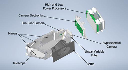
bonded directly to the camera sensor and produces data across more than 30 bands, from the visible to near-infrared.
The electronics package uses radiation-tolerant components and incorporates special radiation shielding materials developed by the CSIRO. To tackle the problem of sending copious amounts of data to the ground, the system has onboard algorithms that stores the data, pre-processes it to reduce
its size, and prioritises downlink transmissions. The system can also be reprogrammed on-orbit.
CSIRO is working on a next-generation payload, CyanoSat 2.0, due for launch in 2024, which will apply lessons learned from CyanoSat. The new payload will feature a wider field of view and will be used to further test the ability of the imager to detect and monitor algal blooms from low-Earth orbit. n
CSIRO Research Scientist Dr Joshua Pease, seen testing electronics for the CyanoSat payload. Images courtesy CSIRO.
www.spatialsource.com.au 5
Inside the CyanoSat hyperspectral camera system.


Publisher
Simon Cooper
Editor
Jonathan Nally
jnally@intermedia.com.au
National Advertising Manager
Anna Muldrock
amuldrock@intermedia.com.au
Prepress
Tony Willson Production Manager
Jacqui Cooper
Subscribe
Position is available via subscription. A 12-month subscription (6 issues) is AU$76.00. To subscribe visit spatialsource.com.au/magazine, phone 1800 651 422 or email subscriptions@ intermedia.com.au
Address for mail: 41 Bridge Rd, Glebe NSW 2037. Ph: 02 9660 2113
Position is published six times per year, in February, April, June, August, October and December by The Geospatial Council of Australia. ABN: 22 135 572 815
Reprints from Position are permitted only with the permission of the publisher. In all cases, reprints must be acknowledged as follows: ‘Reprinted with permission from Position Magazine’, and must include the author’s byline.
The opinions expressed in this publication are those of the authors and do not necessarily represent those of the publisher.
Official publication of
From metric to metaverse
You know you’re getting old when you can look back on something that happened half a century ago and remember it like it was yesterday. That something was the year 1974, when Australia made the final changeover to the metric system. I was in primary school at the time, so the plasticity of my young brain made it easy for me to make the switch from feet and inches, ounces and pounds, to centimetres and metres, grams and kilograms. It was a bit harder for some of the older folk, of course, who had to overcome a lifetime of imperial habit in order to grasp the new system.
The latter included surveyors, who had to move from links to metres and acres to hectares, and no doubt other more arcane conversions. But it was a change that had to be made and we’re all much the better for it, even if there were some traps for the unwary… as Tony Proust explains in his article in this issue (see page 36).

That was 50 years ago. But it makes me think, what will we be using 50 years from now? The metric and SI systems won’t be going away, I’m sure. But come 2074, will we ever have to manually measure anything? Will we have augmented reality embedded in our brains, automatically measuring and weighing everything we see? Will all surveying be completely robotic and automated? Will AI be running our entire cadastral, remote sensing and BIM systems? I’d bet good money that it will.
Which brings us to the ‘metaverse,’ the buzzword concept that is engaging so many minds at the moment (see page 16). According to McKinsey, the metaverse will have three basic features — a sense of immersion, real-time interactivity and user agency — with “platforms and devices that work seamlessly with each other”. That’s a concept that sounds tailor-made for the geospatial sector. Let’s just hope that today’s ‘old folk’ will be able to successfully manage the transition, just as our parents and grandparents did with metric in 1974.
Jonathan Nally Editor
We take our Corporate and Social Responsibilities seriously and is committed to reducing its impact on the environment. We continuously strive to improve our environmental performance and to initiate additional CSR based projects and activities. As part of our company policy we ensure that the products and services used in the manufacture of this magazine are sourced from environmentally responsible suppliers. This magazine has been printed on paper produced from sustainably sourced wood and pulp fibre and is accredited under PEFC chain of custody.
PEFC certified wood and paper products come from environmentally appropriate, socially beneficial and economically viable management of forests.
Advertising
Advertising material date: 12 March 2024
Publication date: 5 April 2024
The Australasian magazine of surveying, mapping & geo-information April/May 2024 — Issue 130 The science of where — Location services, precision measurement Public sector — Government geospatial projects and services Technology — Drones, RPAS, UAVs, aerial, UUVs and services
booking
date: 7 March 2024
For article proposals, contact the Editor: jnally@intermedia.com.au For advertising, contact the Advertising Manager: amuldrock@intermedia.com.au
Position magazine acknowledges the traditional custodians of country across Australia, and pay our respects to Aboriginal and Torres Strait Islander cultures and to their elders, past, present and emerging.
NEXT ISSUE
www.spatialsource.com.au 7 from the editor
Kurloo spreads its wings into NZ
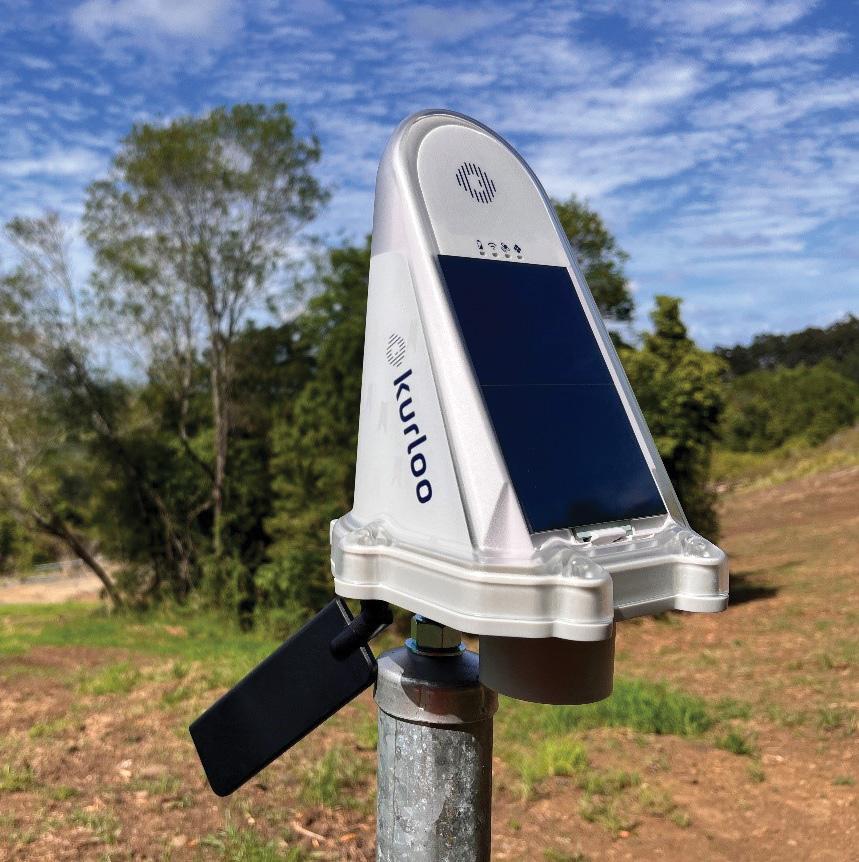
Australian IoT GNSS pioneer, Kurloo Technology, has reached a new milestone in its global expansion, with the appointment of Global Survey as its exclusive distribution partner in New Zealand.
In 2022, Kurloo Technology launched its displacement monitoring solution, which has since gained garnered substantial interest and uptake from surveyors, engineers and geotechnical professionals.
“We’re extremely proud of this important milestone in our company’s journey,” said founder and CEO of Kurloo, Lee Hellen.
“Global Survey has an incredible reputation for delivering quality solutions in New Zealand and is a trusted partner that aligns well with our values and ethos”.
Global Survey has a long history of delivering technology solutions to the surveying and civil construction industries and has been the Leica Geosystems dealer in New Zealand since 1984.
“Kurloo is a brilliantly simple technology that leverages the power of GNSS to make autonomous and remote monitoring of infrastructure and ground movement more widely accessible,” said Bruce Robinson, Director at Global Survey.
“Our team is excited about being able to offer Kurloo to our customers to enable data-driven decision making on critical projects across New Zealand.”
SmartSat, NZSA sign space growth MOU
Australia’s SmartSat CRC has signed a memorandum of understanding with the New Zealand Space Agency (NZSA) to collaborate on projects that will grow the countries’ space sectors.
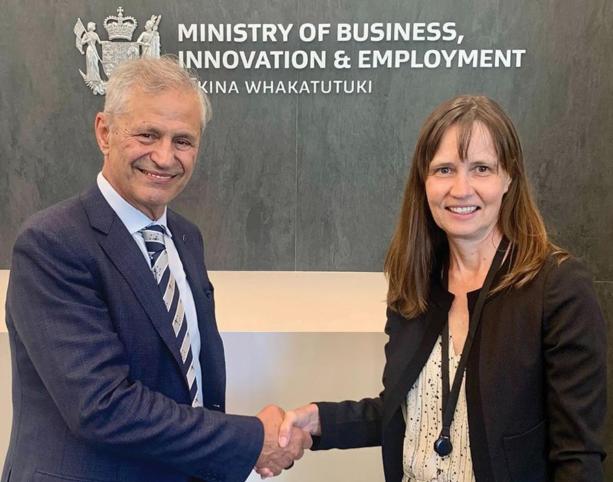
The agreement was signed at the NZSA headquarters in Wellington by Professor Andy Koronios, SmartSat’s CEO, and Robyn Henderson, Acting Head of the New Zealand Space Agency.
Under this arrangement, up to NZ$6 million will be made available from the NZ Government’s Catalyst Fund to support New Zealand researchers to participate in new joint research initiatives in:
Earth Observation: Covering natural capital, biosecurity, crop health, pasture condition, emission monitoring, south pacific synthetic aperture radar and maritime domain awareness projects for using space data to enhance decision making for land and sea-based environments.
Space Situational Awareness: Developing new techniques to monitor the orbital environment better, such as Satping, obtaining spacecraft position and velocity and ID from the spacecraft. Another is ground-sensor data processing and visualisations for anomalies and manoeuvre detections.
Optical Communications: Joint science work on adaptive optics to explore how to coordinate a network of Australasian optical ground stations that can actively support space exploration.
“We’re delighted to sign this agreement with the New Zealand Space Agency. This partnership will enable us to join forces and harness our resources and expertise for several important projects,” said Professor Koronios.
“Earth Observation research plays a critical role in better understanding environmental challenges that pose significant risks to both our countries.
“The agriculture sector is crucial for both Australia and New Zealand, and improving sustainable practices through pasture mapping, human activity, and emission monitoring will be vital for current and future food security.”
Professor Andy Koronios, CEO of the SmartSat CRC, and Robyn Henderson, Acting Head of the New Zealand Space Agency.
Dynamic Vicmap using AI and EO for better datasets
To tackle the demand for more accurate and upto-date spatial data, Dynamic Vicmap is using AI and space-based Earth observation data to find new ways to build and maintain Vicmap datasets to make them more accurate, and easier to maintain and enhance.
An example is the use of the Vicmap Hydro product to tag and link data to enrich the contextual detail of Vicmap’s data to, for instance, indicate what has changed, why it changed and who changed it. This will make it easier to find, sort and understand data in relation to other data and pieces of information.
Digital maps of information called Knowledge Graphs will be produced to show how entities are interconnected, using nodes to show how the different Vicmap datasets sit in context with each other.
A joint initiative of Vicmap and the Digital Twin Victoria program, supported by Frontier SI, SmartSat CRC and RMIT, Dynamic Vicmap will also look at using satellite technology for future earth observations, with the aim of helping to improve current aerial imagery practices and deliver more frequent updates that are captured using consistent methods.
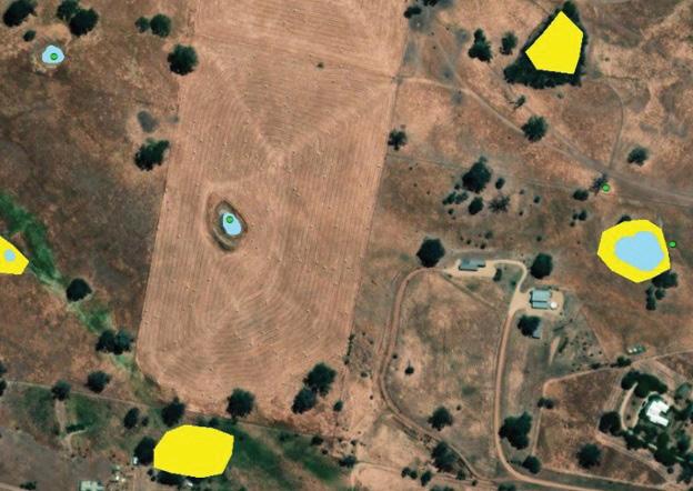 Water reservoirs represented with different geometries: yellow polygons representing authoritative Vicmap water features; blue polygons representing para-authoritative water features generated by a ML model; and green points representing authoritative Vicmap water features.
news 8 position February/March 2024
Advanced Navigation awarded $306k for photonic chips
Australia’s Advanced Navigation has been awarded a $306,631 Sovereign Industrial Capability Priority grant by the Australian Department of Defence to advance the country’s sovereign manufacturing capability for photonic chips.
Australia does not currently have commercial manufacturing capability for photonic chips, so the grant will help Advanced Navigation become the first company in the country to produce this technology… with capacity to manufacture 45,000 photonic chips per year.
“The technological breakthroughs enabled by photonic chips offer new opportunities for defence and commercial applications requiring always available, ultra-high accuracy, orientation and navigation, including subsea, marine, robotics, aerospace and space,” said Advanced Navigation CEO’s and co-founder, Xavier Orr.
“Advanced Navigation is honoured to be a major driver of this capability, and empower technologies to safeguard national security in a time defined by technological warfare and geopolitical uncertainty.”
The company uses photonic chips in its fibre-optic gyroscope (FOG)based inertial navigation systems (INS), which are becoming increasingly vital for assured positioning, navigation and
timing (A-PNT), especially for the military, which has needs such as autonomous capability, accurate positioning and high-value asset tracking.
According to Advanced Navigation, it is one of only four companies in the world to manufacture strategic-grade FOG components, and the only one to develop a completely digital FOG (DFOG).
Advanced Navigation’s DFOG amalgamates closedloop FOG technology with digital modulation techniques and a new photonic chip to offer a 40% reduction in size, weight, power and cost.
Inaugural Peter Woodgate scholarships
The SmartSat Cooperative Research Centre, in collaboration with the Andy Thomas Space Foundation, has named two Australian PhD students as the inaugural recipients of Dr Peter Woodgate Scholarships for Earth Observation.
Donna Fitzgerald, from the University of South Australia, and Oliver Hatswell, from Flinders University, will each receive scholarships valued at $35,000 per year for their research projects.
Fitzgerald’s project involves quantifying the dieback of eucalypt forests and vegetation health changes over time using comparative remote sensing techniques to monitor forest health.
The findings will be used to develop a remote sensing and scenario-based framework for dieback analytics in other forests.
“We’re delighted to award this scholarship to Donna Fitzgerald,” said Professor Andy Koronios, CEO of SmartSat CRC.
“We believe her project mirrors the scope of the scholarship, and the proposed research methods were very sound. Given Australia’s
climate change challenges, her research is a critical area of work.”
Dr Peter Woodgate began working in 1976 with the Forest Commission of Victoria as a crew leader in hardwood assessment, and later held positions as officer-in-charge of the Dieback Research Station in Yarram. The government highly sought his advice on forest change, ecology and conservation, amongst other areas.
“Donna’s project aligns with his vision and SmartSat’s mission of using space data to enhance decision making for land and seabased environments,” said Professor Koronios.
Hatswell’s project involves the innovative mapping of archaeological landscapes in the Australian Arid Zone using satellite remote sensing. It will undertake an extensive trial of high-resolution remote sensing and machine learning methods to map key geomorphic features and inform understanding of archaeological potential, chronology, and depositional history.

Michael Davis, Chair, Andy Thomas Space Foundation, said that Oliver’s research will play an important role in cultural heritage management, working in collaboration with the Yandruwandha Yawarrawarrka and Wangkangurru Yarluyandi, Traditional Owners of the Simpson Desert and Coongie Lakes.
“Oliver’s research may contribute to Aboriginal cultural heritage and pastoral landscape management, which the committee considered would align closely with the values of the Andy Thomas Space Foundation and SmartSat.”
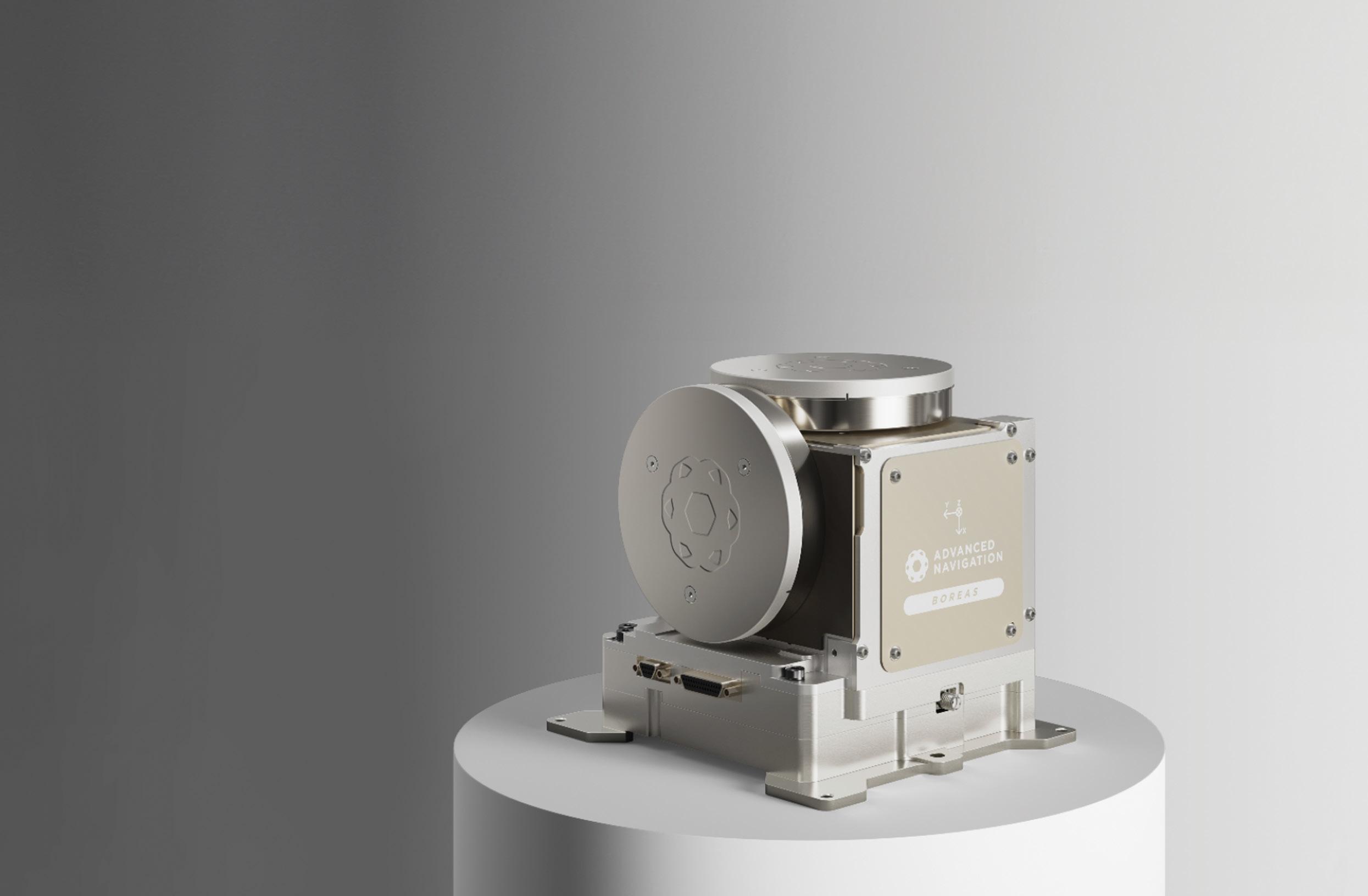
Advanced Navigation’s space-qualified Boreas X90 INS.
www.spatialsource.com.au 9
SmartSat CRC CEO, Professor Andy Koronios; Andy Thomas Space Foundation Chair, Michael Davis; Oliver Hatswell, Flinders University; and Donna Fitzgerald, University of South Australia.

SA cadet program to address skills shortage
An initiative designed to encourage young people to become para planners has been established by South Australia’s government, in an effort to help address skill shortages in the built environment professions.
The pilot Para Planner Cadet Program is being led by Planning and Land Use Services (PLUS) in the Department for Trade and Investment, and is a collaborative effort between the Department for Education, TAFE SA and the Planning Institute of Australia–SA.
Commencing in 2024, the program will run for 2.5 years and will see cadets gaining valuable work experience while undertaking a Diploma in Local Government (Planning) through TAFE SA.
The program is open to those under the age of 21, including high school leavers, regardless of ATAR results. PLUS is encouraging the private sector and SA Councils to offer the cadetship placements.
A para planner plays a crucial role in supporting qualified planners by contributing to professional projects, participating in on-the-job training, answering customer queries and undertaking assessments as part of development application processes.
Probing the deep ocean
An Australian and international research voyage has used bathymetric seafloor mapping, satellite remote sensing and ocean current analysis to reveal more secrets of the Southern Ocean.
The FOCUS voyage aboard CSIRO research vessel (RV) Investigator surveyed 20,000 square kilometres in high-resolution, three-dimensional detail down to the seafloor as much as 4,000 metres below.
The aim of the voyage was to gather data within the Antarctic Circumpolar Current in order to understand how heat leaking across that natural barrier contributes to the melting of Antarctic ice shelves and the potential for sea-level rise.
Voyage chief scientist Dr Benoit Legresy said the CSIRO and the Australian Antarctic Program Partnership worked with collaborators from the US and France, and made use of the Surface Water and Ocean Topography (SWOT) satellite, jointly developed by NASA and the French space agency CNES.
“The ocean has absorbed more than 90% of heat due to global warming and around 25% of human CO2 emissions, providing an enormous service as a ‘climate shock absorber’,” Dr Legresy said.
“We’ve been working in a gateway where heat is funnelled towards Antarctica, contributing to ice melt and sea level rise. We need to understand how this gate works, how much heat gets through and how this may change in the future.”
While mapping the ocean currents, the companion mapping of the sea floor using bathymetry has revealed ancient dormant underwater volcanoes.
Graeme Gammie steps down
After serving five years as Chief Executive Officer of Western Australia’s Land Information Authority, Landgate, Graeme Gammie has announced his decision to step down from the role in early 2024.
During his tenure, Gammie guided Landgate through a series of challenges, including the refocus and evolution of the organisation following partial commercialisation in 2019, the COVID-19 pandemic, the modernisation of WA’s electronic land dealings and its strata reform agenda.
He also led the way for Landgate to harness emerging digital technologies to support the sustainable economic, social and environmental management and development across the state.
Recruitment has commenced for a new CEO; in the interim, Bruce Roberts — currently General Manager Registration Services — will be appointed as Acting Chief Executive.
“I would like to thank Graeme Gammie for his valuable contribution to the Western Australian public sector over the last 26 years,” said Western Australia’s Lands Minister, John Carey.
“Particularly, it’s important to acknowledge his leadership of Landgate over the past five years, guiding a reform and innovation agenda that will ensure the agency will meet the needs of government, industry and the community into the future.
“On behalf of the State Government, we extend our gratitude and thanks to Graeme for his invaluable contributions and wish him success in his future endeavours.”

CSIRO geophysicist Dr Chris Yule said the team conducted high-resolution mapping with RV Investigator’s multibeam echosounder system. The survey spanned a seafloor area of 20,000 square kilometres, most of which hadn’t been mapped before.
“To our delight, we’ve discovered a spectacular chain of ancient seamounts, comprising eight long-dormant volcanoes with peaks up to 1,500 metres high and one with a double vent,” Dr Yule said.
“Four of them are new discoveries, and we filled in details on two seamounts and a fault line ridge partially mapped on a previous voyage. We now know the ridge, just west of the survey area, drops into a valley over a 1,600-metre-high cliff.”
Courtesy PlanSA
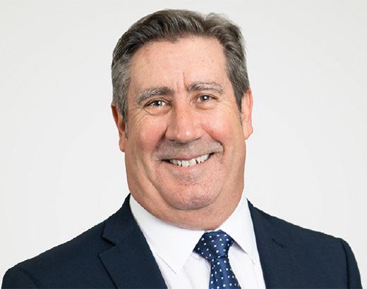
Graeme Gammie. Image courtesy Landgate.
The area surveyed during the FOCUS voyage, showing newly mapped seafloor features.
Courtesy CSIRO.
news 10 position February/March 2024
Millar Merrigan acquires AMS Land Surveyors
Victorian land development consultancy Millar Merrigan has announced the acquisition of AMS Land Surveyors. By acquiring the company and its 34-year legacy, Millar Merrigan says it aims to strengthen its survey department, and broaden its client base and reach within the market.
The acquisition integrates five established professionals from AMS Land Surveyors into the Millar Merrigan team.
“This acquisition of AMS Land Surveyors marks the beginning of an exciting new chapter for us,” said Simon Merrigan, Managing Director at Millar Merrigan. “AMS Land Surveyors bring a wealth of experience and talent, and a robust client base. We are eager to integrate these projects into our portfolio, and foster connections with our new clients.”
“The acquisition is a testament to the positive workplace culture we’ve cultivated. We’re honoured that Andrew chose Millar Merrigan, knowing that his staff will be in good hands.”
“I look forward to seeing the work Millar Merrigan does in the future,” added Andrew Smith, founder of AMS. “The work environment that Millar Merrigan has created leaves me with great hope, and I know that my team are going to be supported through their careers, well after I’m gone.”
Geospatial training for women in agriculture
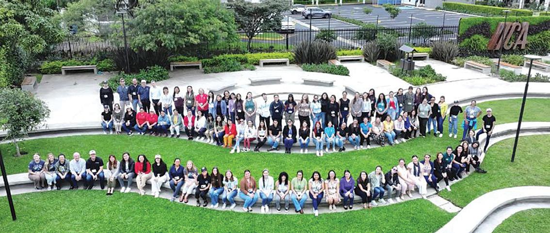
More than 100 women involved in the agrifood sector and natural resource conservation in rural Costa Rica, recently underwent training in geospatial technologies at a three-day event at the InterAmerican Institute for Cooperation on Agriculture (IICA) in San Jose, Costa Rica.
The event was an advanced version of the GeoFem: Women in Geospatial Technologies workshop, organised by IICA and partners such as the Central American Aerospace Network, SERVIR, NASA Harvest, Brigham Young University (BYU), the BYU Ballard Center, UNESCO, GEOGLAM and GEOGloWS.
The GeoFem workshops aim to build women’s technological, digital, geospatial and innovation capacities, enhance their growth and facilitate professional empowerment.
Participants were introduced to applications such as the GEOGloWS’ Streamflow Forecasting Service, a global hydrological model containing more than 40 years of historical flow data; and Climate Trends, which enables users to access and compare data from various global models.
They also were given training on geospatial analysis platforms such as GEOGLAM, ClimateSERV and Google Earth Engine, in order to learn how to gather satellite data and apply it to agricultural and food security monitoring.
The workshop was open to anyone 14 years of age and over. Since 2019, GeoFem has trained more than 500 women and girls in geospatial technologies.
“Forging partnerships with organisations such as the ones participating in this workshop expands the dissemination of knowledge and allows women working in the agrifood sector and in natural resource management to access these technological tools,” said Betzy Hernández, Regional Science Coordination Lead for Central America at SERVIR’s Science Coordination Office.

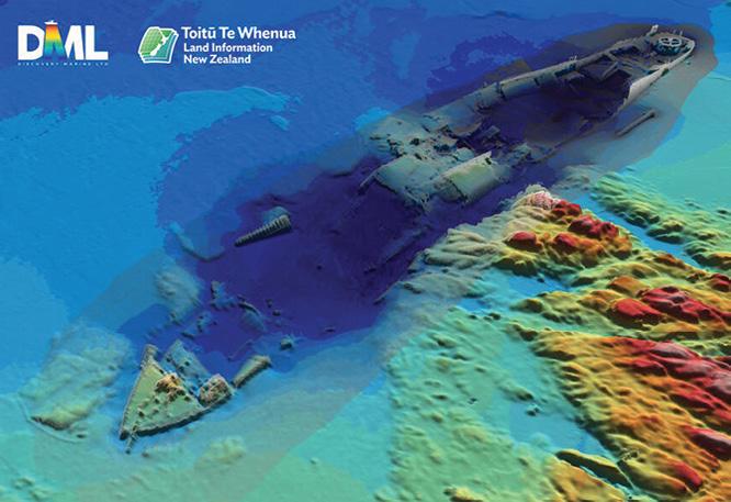
NZ shipwrecks mapped for first time
Two previously uncharted shipwrecks have been revealed and mapped during a hydrographic survey of Tūranganui-a-Kiwa/ Poverty Bay, in the Gisborne region on the north-eastern coast of New Zealand’s North Island.
The Toitū Te Whenua Land Information New Zealand (LINZ) survey of the Gisborne area uncovered the vessels: the hull and deck structure of the 7280-tonne steamer Star of Canada, which ran aground off Kaiti Beach on 23 June 1912, and the wreck of a barge used to dredge Napier and Gisborne harbours in the 1930s.
“It’s always satisfying when our surveys reveal features that were either unknown or uncharted,” said LINZ Principal Geospatial Specialist Stuart Caie. “Advances in technology mean that each time we resurvey an area we uncover details that were previously unknown. In this case, the last survey was done in the 1950s by the Navy and the echo sounding technology used this time has given us far greater coverage of the seafloor than ever before.
“While the local community is aware of these wrecks, they have never been charted.”
The Star of Canada regularly sailed from Australia and New Zealand to England between 1910 and 1912, carrying chilled and frozen meat and other produce. On 23 June 1912, a squall blew the vessel onto Kaiti Beach where it grounded just off the rocky shoreline and began taking on water. Fortunately, no lives were lost, but the vessel had to be abandoned.
The other wreck comprises the remains of the dredge Korua, which was scuttled off Young Nick’s Head when it was no longer of use.
Data captured in the overall survey, including details of the wrecks, will be used to update nautical charts of the area.
 Andrew Smith (left) and Simon Merrigan.
Sean Ryan, Millar Merrigan’s Sector Manager for Surveying, said that the strategic nature of the acquisition “reinforces our commitment to excellence in surveying”.
www.spatialsource.com.au 11
3D image of the Star of Canada wreck.
Countering GNSS spoofing and jamming
The European Union Aviation Safety Agency (EASA) and the International Air Transport Association (IATA) have announced the conclusions of a workshop jointly hosted at EASA’s headquarters, which looked at ways to combat incidents of GNSS spoofing and jamming.
The workshop’s high-level conclusion was that interference with satellitebased services that provide information on the precise position of an aircraft can pose significant challenges to aviation safety. Mitigating these risks requires short-, medium- and long-term measures, beginning with the sharing of incident information and remedies.
“GNSS systems offer tremendous advantages to aviation in increasing the safety of operations in a busy shared airspace,” said EASA Acting Executive Director, Luc Tytgat. “But we have seen a sharp rise in attacks on these systems, which poses a safety risk. EASA is tackling the risk specific to these new technologies.
“We immediately need to ensure that pilots and crews can identify the risks and know how to react and land safely. In the medium term, we will need to adapt the certification requirements of the navigation and landing systems. For the longer term, we need to ensure we are involved in the design of future satellite navigation systems. Countering this risk is a priority for the Agency.”
IATA’s Director General, Willie Walsh, said that airlines are seeing a significant rise in incidents of GNSS interference.
“To counter this, we need coordinated collection and sharing of GNSS safety data; universal procedural GNSS incident guidance from aircraft manufacturers; a commitment from states to retain traditional navigation systems as backup in cases where GNSS are spoofed or jammed,” he said.
“In actioning these items, the support and resources of EASA and other governmental authorities are essential. And airlines will be critical partners. And whatever actions are taken, they must be the focal point of the solution as they are the front line facing the risk.”
Measures agreed by the workshop to make positioning, navigation and timing (PNT) services provided by GNSS more resilient, include:
Reporting and sharing of GNSS interference event data. In Europe, this would occur through the European Occurrence Reporting scheme and EASA’s Data4Safety programme. As the problem is global, it will be important, for a better and complete understanding, to join all the information available from reports by connecting the databases such as IATA’s Flight Data Exchange (FDX), or EUROCONTROL’s EVAIR.
Guidance from aircraft manufacturers. This will ensure that aircraft operators are well equipped to manage jamming and spoofing situations, in alignment with EASA’s Safety Information Bulletin (SIB 2022-02 R2).
Alerting. EASA will inform the relevant stakeholders (airlines, air navigation service providers, manufacturing industry and airports) about attacks.
Backup. Aviation must retain a minimum operational network of traditional navigation aids to ensure that there is a conventional backup for GNSS navigation.

Finland boosts geoid model accuracy by 30%
The National Land Survey of Finland (NLS) has released a new geoid model which, it says, represents the shape of Earth with 30% more accuracy than the previous model.
Previously, Finland’s official geoid model was FIN2005N00, which had an accuracy of 2 cm. The accuracy of the new FIN2023N2000 model is 1.4 cm.
“The requirements for the accuracy of geospatial data are constantly increasing. The new geoid model better responds to modern requirements for the accuracy of geospatial data,” said Mirjam Bilker-Koivula, Group Research Manager at the Finnish Geospatial Research Institute (FGI) of the NLS.
The NLS has participated in BSCD2000, the Baltic Sea geoid model developed in international cooperation, which responds to the needs of shipping and nautical chart makers. FIN2023N2000 has been adapted to sea areas so that it is compatible with the new Baltic Sea model.
The NLS’s geoid model is based on years of hard work in geodesy research.
“In the north, tectonic uplift changes and distorts elevations, coordinates and gravity values. The geoid model needs to be updated to provide society with the most accurate and up-to-date elevation data,” said Senior Research Scientist Timo Saari.
The previous model was used for more than ten years. During that time, researchers gained access to new datasets and methods that have been used in the new model.
“In my doctoral dissertation, I studied the impact of gravity satellites and marine gravimetry on geoid modelling. The new model includes the datasets of the GOCE and GRACE satellite missions and the Gulf of Finland marine gravimetry campaign, which improve Finland’s geoid model both nationally and locally,” said Saari.
The soon-to-end GeoVaPaa project funded by the country’s Ministry of Forestry and Agriculture investigates what impact the resolution and accuracy of the gravity dataset has on the accuracy of the geoid model in Finland, and whether the current gravity dataset meets the accuracy and resolution requirements set for the geoid model of the future.
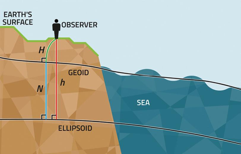 Finland’s new geoid model is 30% more accurate than the previous model.
Credit: National Land Survey of Finland ©stock.adobe.com/au/josevandyk
news 12 position February/March 2024
IBM’s Deon Newman joins HERE Technologies
Location data and technology company, HERE Technologies, has appointed Deon Newman as Senior Vice President and General Manager for the Asia-Pacific region in its Singapore office.
Newman joins HERE after more than three decades at IBM, during which time he served in various global and regional leadership roles across brand, product, field sales and marketing in Australia, the USA, Europe and Asia.

“I am truly honoured and excited to join HERE Technologies to lead the APAC team,” said Deon Newman. “The APAC region is a hotbed of technological innovation and creativity, and I look forward to collaborating with our exceptional team, customers and partners to move the region forward.”
“I am confident that Deon’s passion and strategic vision will propel HERE’s business forward and solidify our leadership in location technology and services,” added Jason Jameson, HERE’s Executive Vice President and Chief Customer Officer.
The company has more than 40 employees in Sydney and Melbourne servicing its customers and partners across Oceania.
2024 Geospatial Innovation Awards
Nominations are open for round two of Geovation’s Geospatial Innovation Awards, which aim to showcase the best in geospatial innovation and the impact it has on people, places and planet.
Geovation is the open innovation hub of the United Kingdom’s Ordnance Survey.
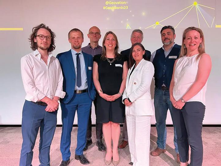
The 2024 awards, which are open to international entries, will build on the success of the inaugural awards held in 2023, which saw nearly 100 entries received from 26 countries.
“Geospatial innovation is shaping the world around us. I was incredibly impressed by the range of international nominations at the first awards — a testament to both large- and small-scale innovation and a clear demonstration of the positive impact that geospatial data and technology is having on our world,” said David Henderson, Chief Geospatial Officer for Ordnance Survey.
The 2024 award categories are:
• Cities of the future: showcasing the solutions that will help build the cities and communities of tomorrow.
• Nature and environment: rewarding development that helps preserve and protect the environment.
• Protection of life: highlighting solutions that improve the safety and security of people, communities and countries.
• Contribution to diversity: recognising efforts in broadening diversity in the geospatial innovation sector.
• Scottish geospatial technology: recognising Scottish projects and tech innovations that generate outstanding results from using geospatial solutions.
Organisations of any size, from start-ups to larger companies, which are working on specific projects in the geospatial sector, are eligible to nominate. Individuals can also nominate themselves, their company or someone they think deserves to be recognised.
There is no cost to enter, and nominations will be open until 15 April 2024 (UK time). The awards ceremony will take place in person and online on 13 June 2024.
Some winners of the inaugural awards.

Successful aviation testing for UK SBAS
Viasat says that it has demonstrated a UK satellite-based augmentation system (UK SBAS) for the first time, showing how highly accurate GPS data can maximise safety and improve efficiency.
The test flight, flown from Cranfield Airport last month using the UK National Flying Laboratory Centre’s Saab 340B aircraft, showcased a UK-based SBAS that delivers more precise, reliable navigation data.
The UK is no longer part of the EU’s similar European Geostationary Navigation Overlay Service (EGNOS), following its exit from the European Union. While EGNOS can still be used for non-safety applications in the UK, the trial aims to provide a first step toward a complementary UK SBAS which can be used for critical safety of life navigation services across air, land and sea.
Viasat’s research with one regional flight operator indicated that close to 40% of flights cancelled due to weather could have gone ahead had UK SBAS been available for its fleet.
Around the UK, 19 airports had EGNOS procedures in place prior to leaving the European Union. In total, as many as 72 airports no longer have access.
With the aviation test complete, the system will now be tested in other transport applications, for example for rail, uncrewed aerial vehicles, or autonomous road vehicles.
UK SBAS generates a test signal overlaid on the US Global Positioning System (GPS), fully compliant with International Civil Aviation Organization (ICAO) standards, to enable assessment of more precise, resilient and high-integrity navigation for maritime and aviation users in UK waters and airspace.
The signal is being broadcast in coordination with the US Federal Aviation Administration (FAA), the European Space Agency (ESA) and the European Union Space Programme Agency (EUSPA). Broadcast capability for UK SBAS is being provided by Viasat’s I-3 F5 satellite.
www.spatialsource.com.au 13
Growing green with GIS: City of Sydney
The City of Sydney local council has set ambitious greening targets to grow a cooler, more diverse, and resilient city with mapping technology.
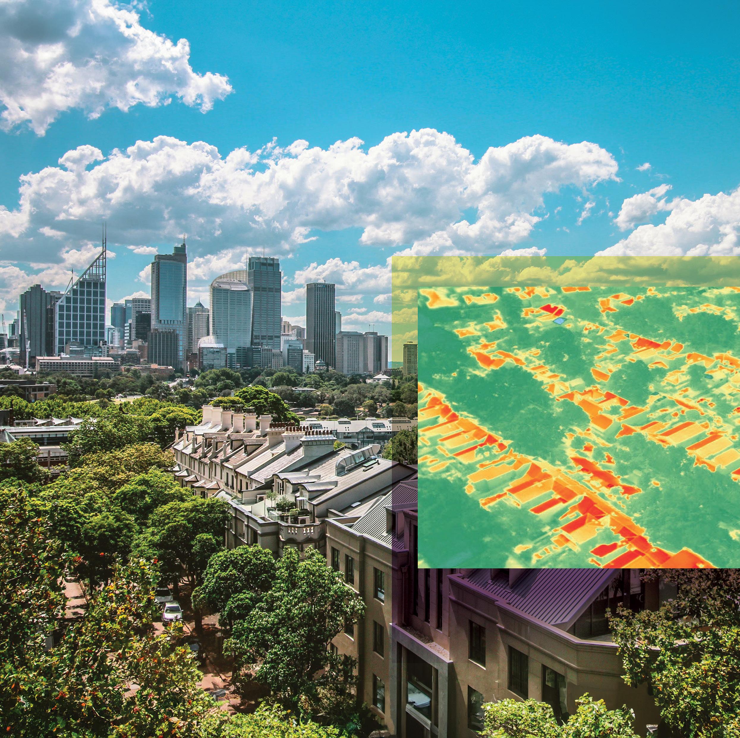
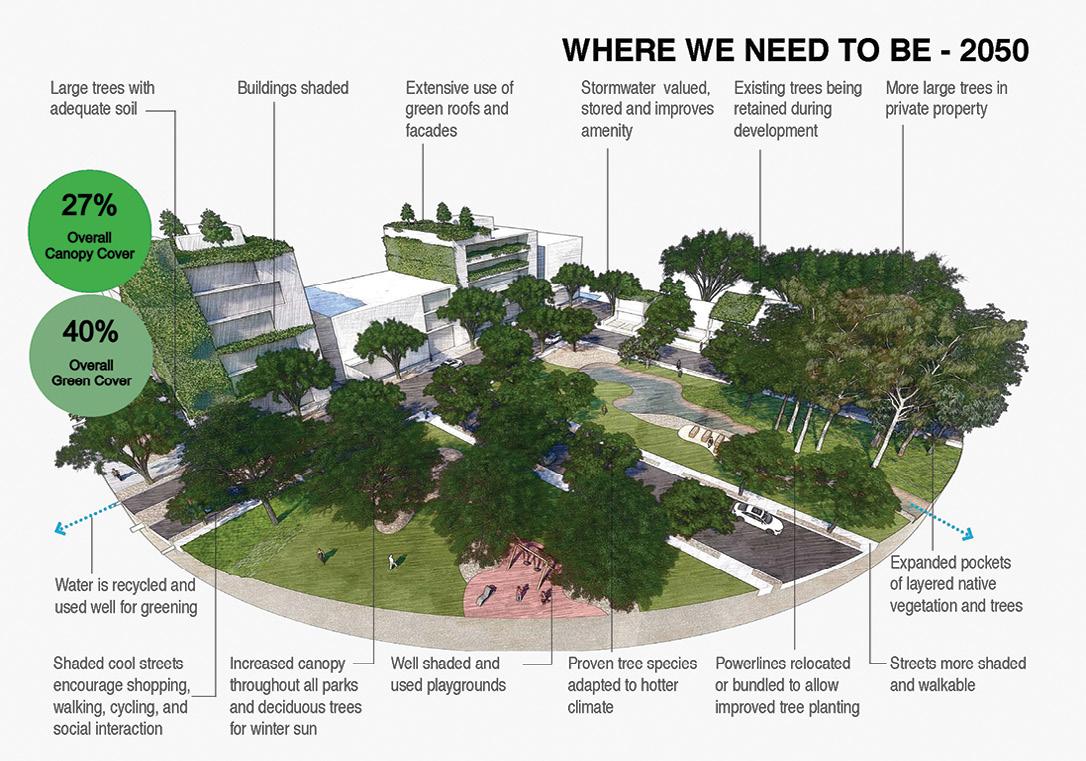
The City of Sydney intends to increase tree canopy cover from 19% to 27% and green cover from 33% to 40% by 2050, to help reduce the impacts of rising urban temperatures and improve community health and wellbeing.
Spatial analysis, using Esri’s ArcGIS suite, is one of the mechanisms through which the Council intends to reach its targets, providing its urban forest team spatial data to inform decisions and solutions relating to tree management. Since 2008, the team has consistently increased the City of

Sydney local government area’s canopy cover — one of few councils and the only capital city in Australia to achieve this.
Surface temperatures in Australia have increased by 1.4°C since 1910, with projections for further increases by 2050. Experts are warning that neighbourhoods lacking sufficient tree cover will significantly impact residents’ amenity and liveability.
“Trees can last for well over 100 years, yet most people occupy their houses for less than 10 years. We must consider ourselves as custodians rather than masters, and nurture and improve our greenery for the benefit of following generations,” said Lord Mayor of Sydney, Clover Moore.
In the past decade, more than half of Greater Sydney’s neighbourhoods lost urban forest cover to population growth. Canopy trees help to cool surrounding hot air and surfaces, through shading and evaporative cooling. With Greater Sydney’s population expected to grow to 6.1 million by 2041, extreme heat islands, where zones of persistently high temperatures caused by concentrated artificial materials (buildings, pavement, bitumen) that absorb and emit the sun’s rays, rather than reflect it, are on the rise. A multipronged approach to managing Sydney’s biodiversity is important to counteract these warmer areas.
Growing cooler, diverse, resilient cities with ArcGIS
The analysis and interpretation of location-based (spatial) data has become an important tool for urban forest practice and management. City of Sydney has applied new spatial analysis techniques that reduce barriers to gather and calibrate localised environment data on a street-by-street basis, to provide greater insight and better manage the urban forest for the entire community — through more accurate projections and calculations.
Data acquired from satellites, drones, LiDAR and aerial visuals taken by a camera mounted to an aircraft, form the bedrock foundations of the Council’s urban forest management program. The data allow spatial analysts and the urban forestry team to collaborate and identify trends.
Tree canopy analysis was first undertaken in 2010 using standard RGB aerial imagery and unclassified LiDAR. Over more than a decade, refinement in measurement has progressed to thermal and hyperspectral capture using ArborCarbon’s ‘ArborCam’. The team can now capture heat and the unique signatures of trees across 11 bands of imagery in high resolution.
Each circle (100m radius) indicates the amount of canopy coverage across the City of Sydney, from 0% (red) to more than 30% (dark green). The image was captured in 2022.
14 position February/March 2024
partner feature
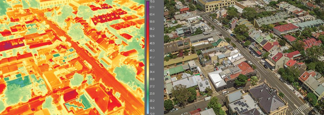
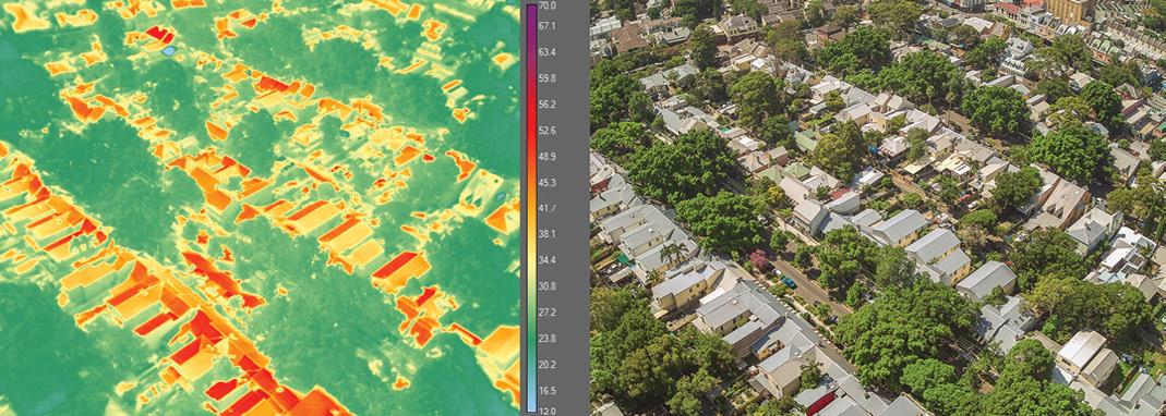
Analysis of the data involves establishing a grid of uniformly spaced reference points at 100 metres, spread across the Council area, totalling 2,600 reference points. At each reference point, canopy data is gathered and summarised from a buffer radius area surrounding it. This technique enables more equitable and resilient data analysis and mapping. Reference points with low scores can be prioritised for future planting opportunities.
Precision analytics identifies which trees are best suited to particular locations so that they can thrive in a changing climate, providing benefits for people and habitat for native fauna. The analytics also help the Council’s sustainability and resilience team to monitor neighbourhood temperatures and mitigate heat islands. The flow-on effects for residents, businesses, commuters and visitors include more attractive and comfortable outdoor spaces for everyday use. The benefits of better tree management are multi-dimensional — a cooler, calmer environment, improved mental and physical health and less demand on energy.
Using ArcGIS web maps and ArcGIS dashboards, the urban forest team can then map out specifications and make decisions about the type of trees to be planted to help grow a resilient and diverse tree canopy. The data guides the team to create new workflows, to predict, plan and mitigate the consequences of development and climate change and understand how heat islands, tree species, tree age and biodiversity influence the local environment.
Challenges of lost urban forest
Diversity of tree canopy ensures young trees are plentiful for the future while mature trees provide the full benefits of shade, air filtration and cooling. One mature tree can absorb 3,400 litres of stormwater over a year-long period and filter 27 kg of pollutants from the air. It can also provide a cooling effect equivalent to running 10 air conditioners. Diversity of tree species is also important for animals, to limit plant disease spread, and to avoid all trees reaching maturity at the same time.

Consulting community through GIS
To develop the award-winning Street Tree Master Plan 2023, the urban forest team consulted with the community through two separate ArcGIS Survey123 polls.
Residents could provide feedback on tree selection — there were up to five suitable species to choose from — before the draft Plan was adopted.
Additionally, residents could stay updated and informed as to which trees were selected for the street, and the rationale for the recommendation, through an ArcGIS interactive map and dashboard.
Spatial analysis was conducted on all streets to determine aspect, soil types, existing species, current coverage and relationship to assets such as overhead wires, kerbs and traffic islands.
ArcGIS Field Maps was used by arborists in the field while the tree management team monitored progress and diversity of selections from the
office using ArcGIS dashboards.
In 2023, the Street Tree Master Plan won three Australian Institute of Landscape Architecture Awards, including the Award of Excellence for Landscape planning, the NSW Shadesmart Award, and the National Climate Positive Design Award.
Interact with the Greener Sydney Strategy
A geographic approach helps provide insight into the challenges of climate change and drives solutions for a sustainable future. Userfriendly GIS tools act as platforms to share data with internal stakeholders and various publics to support accountability and transparency.
The City of Sydney developed a StoryMap demonstrating its strategy to meet its 2050 targets and its results to date. Visit https://bit.ly/GrowGC to explore. n
Content supplied by Esri Australia and City of Sydney.
WANT TO KNOW MORE?
To learn how you can implement ArcGIS applications to support your community’s sustainability initiatives, visit www.esriaustralia.com.au
 Left: The effects of heat on display at St Johns Rd, Glebe, where less than 20% canopy coverage is recorded. Right: A more comfortable and cooler climate on Westmoreland Street, Glebe, with 35% canopy coverage.
www.spatialsource.com.au 15
Meet the METAVERSE

According to a McKinsey study, more than US$120 billion of investment flowed into the metaverse in 2022.
It’s a buzzword that has been around for quite a few years, but for many people the ‘metaverse’ is still either a complete unknown or is something that applies only to gaming and entertainment. Yet whether we like it or not, and whether we understand it or not, the metaverse appears to be a concept that is here to stay and is growing in leaps and bounds.
So what is the metaverse and what will it do? It sort of depends on who you ask. According to the Metaverse Standards Forum, “The metaverse is motivating the novel integration and deployment of diverse technologies for collaborative spatial computing, such as interactive 3D graphics, augmented and virtual reality, photorealistic content authoring, geospatial systems, end-user content tooling, digital twins, real-time collaboration, physical simulation, online economies, multi-user gaming, and more — at new levels of scale and immersiveness.”
16 position February/March 2024 virtual world
The geospatial sector is set to both underpin the metaverse and capitalise on the opportunities it presents.

Neil Trevett, president of the The Khronos Group — a non-profit consortium of companies involved in 3D graphics, AR, VR and machine learning — says the metaverse will “bring together diverse technologies, requiring a constellation of interoperability standards, created and maintained by many standards organisations”.
“The metaverse will ultimately encompass all our activities and support them with applications. Just like standardisation has been an important foundation for open knowledge sharing and rapid development in the Web age, the same is true for the metaverse,” says Arno Hollosi, CTO at Blackshark.ai.
All of this makes it sound as if the metaverse is tailor-made for the geospatial sector. Indeed, spatial data and technologies will themselves be some of the primary enabling factors underpinning the success of the entire metaverse concept.
Standardisation
Like any industry sector, or any profound technological development (e.g. electronics, computing, medicine), standardisation and interoperability will be one of the metaverse’s key drivers, making it possible for anyone, anywhere to contribute to and take advantage of what it has to offer.
“Technology and standards are the bricks and cement of the metaverse,” says Qi Wang, assistant president at 0xSenses. “Safe, reliable, and ethical interoperability is especially important as humans become part of the metaverse.”
The Metaverse Standards Forum, for instance, says that its mission is to “explore where the lack of interoperability is holding back metaverse deployment and how the work of Standards Developing Organizations (SDOs) defining
JONATHAN
NALLY
©stock.adobe.com/au/sutlafk www.spatialsource.com.au 17
virtual world

and evolving needed standards may be coordinated and accelerated,” adding that it will “focus on pragmatic, actionbased projects such as implementation prototyping, hackathons, plugfests, and open-source tooling to accelerate the testing and adoption of metaverse standards, while also developing consistent terminology and deployment guidelines.”
The Open Geospatial Consortium (OGC) has formed the OGC Geo For Metaverse Domain Working Group, which will “serve as a forum for the collective geospatial expertise of the OGC community to gather to help build and grow the open metaverse”.
According to the OGC, the metaverse is “perhaps the ultimate distributed digital twin of the world. It has the potential to represent everything in the world alongside imagined spaces. The challenges to Standards Development Organisations (SDOs), technologists, artists, and society are huge, but the payoff is believed to be equally tremendous. The metaverse is not a single thing but, like the internet, is a collection of platforms and technologies: a world of objects that can be navigated and interacted with.”
Importantly, the OGC says that the geospatial community can contribute to the success of the metaverse, via its “expertise in 3D, modelling and simulation, artificial intelligence, digital twins, streaming, augmented and virtual realities, routing, mapping, and more — all at scale”.
Commercial opportunities
Private companies and geospatial data providers are jumping on board the metaverse, offering products and services that will see the sector grow.
For example, 12 months ago Maxar Technologies introduced SYNTH3D, which it describes as “a high-performance,
geotypical 3D representation of the entire planet for gaming, simulation, entertainment, virtual reality (VR), smart cities and metaverse”.
SYNTH3D was developed in partnership with blackshark.ai, and according to Maxar enables “developers and creators to simulate and visualise 3D environments representative of real-world locations where aesthetics and performance are key to commercial applications”.
3D data visualisation firm, Cesium, has built a Smart Construction app for Komatsu, which uses 3D tiling pipelines and a visualisation engine to enable Komatsu to “monitor a construction site from anywhere in the world, watch how it changes over time, compare architectural plans with real-world data, and run precise and near real-time measurements”.
According to Airbus Intelligence, “For geospatial companies, the metaverse represents a tremendous opportunity”. It says that “geospatial companies will be asked to deliver massive quantities of data that are visually detailed, spatially accurate, and timely,” noting that “these metaverse requirements are the same as many current applications of geospatial data”.
Many large consultancies, software and hardware firms are eager to grab a slice of the metaverse pie; companies such as PWC, Accenture, Adobe, Deloitte, NVIDIA, Esri, Microsoft, Google, Meta, Woolpert, Oracle, Trimble, Planet, just to name a few. Qualcomm Ventures, for instance, has established the Snapdragon Metaverse Fund, with the aim of investing up to US$100 million in developers and companies innovating in the fields of AR, mixed reality and VR.
The opportunity is huge. According to a McKinsey study, more than US$120 billion of investment flowed into the metaverse in 2022, and more than 15% of corporate
revenue is expected to arise from the metaverse in the next few years (according to 25% of the senior executives surveyed). McKinsey says the metaverse has the potential to generate up to US$5 trillion in value by 2030.
The geospatial metaverse
For the geospatial community, the metaverse presents exciting challenges, with plenty of scope for every private company, public sector organisation and research institution to get involved and capitalise on the opportunity.
In a landmark report released late last year, ‘Bringing Geospatial Context to the Metaverse: Considerations for the Next Steps,’ the World Geospatial Industry Council (WGIC) has outlined what the metaverse means for the sector, calling it “A digital, and therefore, virtual, representation of the universe”. The report:
• Examines metaverse market opportunities and risks for the geospatial sector.
• Looks at how the metaverse relates to concepts such as digital twins, cyber geography, and virtual reality.
• Presents a strategic outlook for developing a geospatial ecosystem in the metaverse.
The report also outlines four priority steps that will be needed to make this happen:
• Priority 1 involves understanding perceptions, since the metaverse will affect interactions between people and their world.
• Priority 2 will be to set up stakeholder engagement and collaboration across the private and public sectors.
• Priority 3 will be to understand the complexities of technological interoperability and data governance.
• Priority 4 will be to create the conditions
18 position February/March 2024
Figure 1: Estimated market size of the metaverse in the coming decades. Courtesy WGIC report, Bringing Geospatial Context to the Metaverse: Considerations for the Next Steps.

under which the geospatial sector will be ready to grab the commercial opportunities inherent in the metaverse value chain.
The WGIC’s research has found that the metaverse market is going to be huge (see Figure 1): US$800 billion this year alone, and into the double-figure trillions in the 2030s.
The WGIC report says that “the metaverse will require geospatial approaches, technology, and experience at its foundations,” adding, however, that it is “essential to note that some milestones and challenges already exist or would arise during the construction of the geospatial foundations of the metaverse”.
It also says, however, that “Several synergies exist between the geospatial domain and the metaverse, where the geospatial offerings naturally address the core needs of the metaverse formation”. Such existing capabilities include:
• The ability to have an online presence across multiple devices
• Data and technology suitable for realtime productivity scenarios
• Real-time interoperability on a massive scale
• User control of content and creation
• Automation and performance enhancement using AI/ML
• Production of 3D content and modelling for virtual worlds
Reaching the metaverse
There’s no doubt that the basic technologies exist (or can be foreseen) for making the metaverse a reality, and that the geospatial sector will have a crucial role to play in its realisation. The WGIC’s four priority steps will provide vital guidance in this regard. Yet it is important to remember that, according to the organisation, the achievement of such milestones requires “engaging with topics that are generally not widely discussed within the geospatial industry. These issues include political drivers, social concerns of the public and governments, value propositions to investors and companies, and technological challenges such as hardware, data, software, and governance interoperability”.
The WGIC makes it clear that the four steps don’t need to be tackled sequentially — they can operate in parallel.
Enabling Priority 1, understanding societies’ perceptions, will take a lot of work, as there are many aspects to consider. While there is some awareness of the metaverse amongst the public and policymakers, a concerted effort will need to be made to reassure them of the value of the metaverse and to dispel or deal with fears regarding AI, deep fakes, trust in data and so on. Many national governments are taking steps to deal with those challenges, but it remains to be seen how successful they will be and whether
“The metaverse will require geospatial approaches, technology, and experience at its foundations.”
World Geospatial Industry Council
piecemeal approaches will hinder uptake of metaverse solutions.
Priority 2, stakeholder engagement, will go a long way to assuring the success of Priority 1. The WGIC particularly recommends deep engagement with governments, industry groups and expert consortia.
The WGIC says that Priority 3, tackling the complexities of technological interoperability and data governance, “are perhaps the most well-understood of all future issues”. It cites the excellent work being done by the Metaverse Standards Forum and the OGC in this regard, and notes that the development of a Universal Digital Twin and ensuring the quality of visualisation will be important foci.
Priority 4, the creation of economic opportunities and market readiness markers, poses some challenges, with experts consulted by the WGIC offering the following advice:
• To kick-start momentum, a unique value proposition, even if simple, must demonstrate the value of bringing geospatial context to the metaverse.
• Symbiotic business models (e.g. publicprivate partnerships) and other revenue generation (e.g. data licensing, IPR) have to be developed for a tangible and enduring return on investment.
• There is a need to overcome a measure of risk aversion for companies to invest funds and time in developing ideas and offerings.
In summary, the WGIC says that “The metaverse represents a significant opportunity for the geospatial industry to develop new products and services, generate new revenue streams, and create new jobs. However, it also presents several risks the geospatial ecosystem must address to ensure the ethical and responsible use of geospatial data in the metaverse”. n
Figure 2: Geospatial data and analysis will be vital to all aspects of the metaverse. Courtesy WGIC report, Bringing Geospatial Context to the Metaverse: Considerations for the Next Steps.
www.spatialsource.com.au 19
partner feature
3D laser scanning at the speed of light
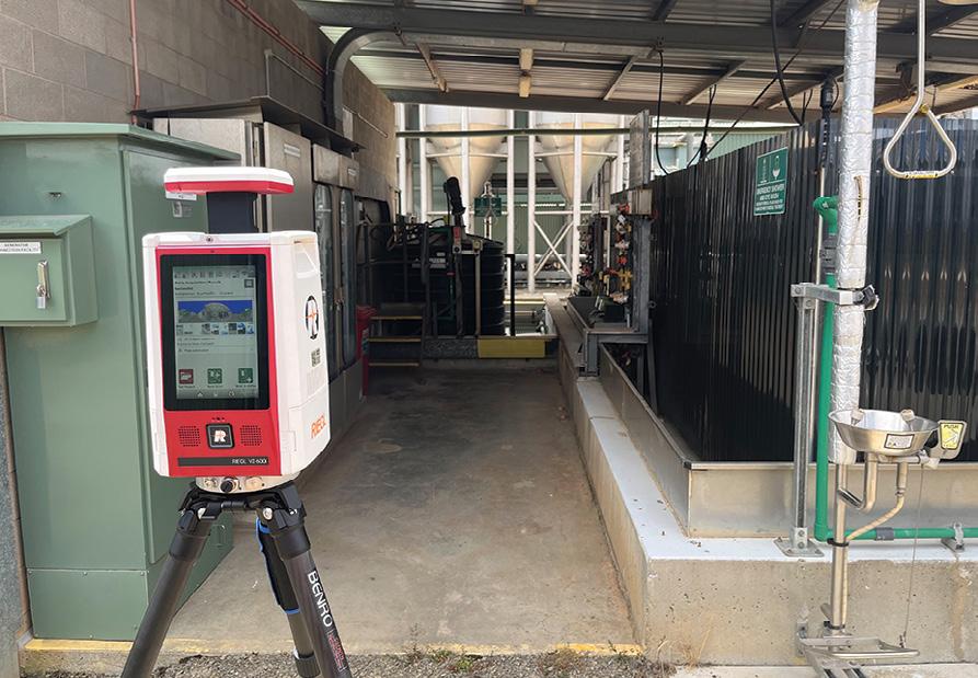
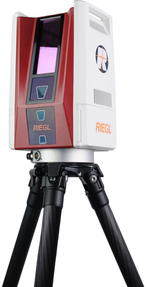
The new RIEGL VZ-600i 3D terrestrial laser scanner is making an impact with its speed and versatility.
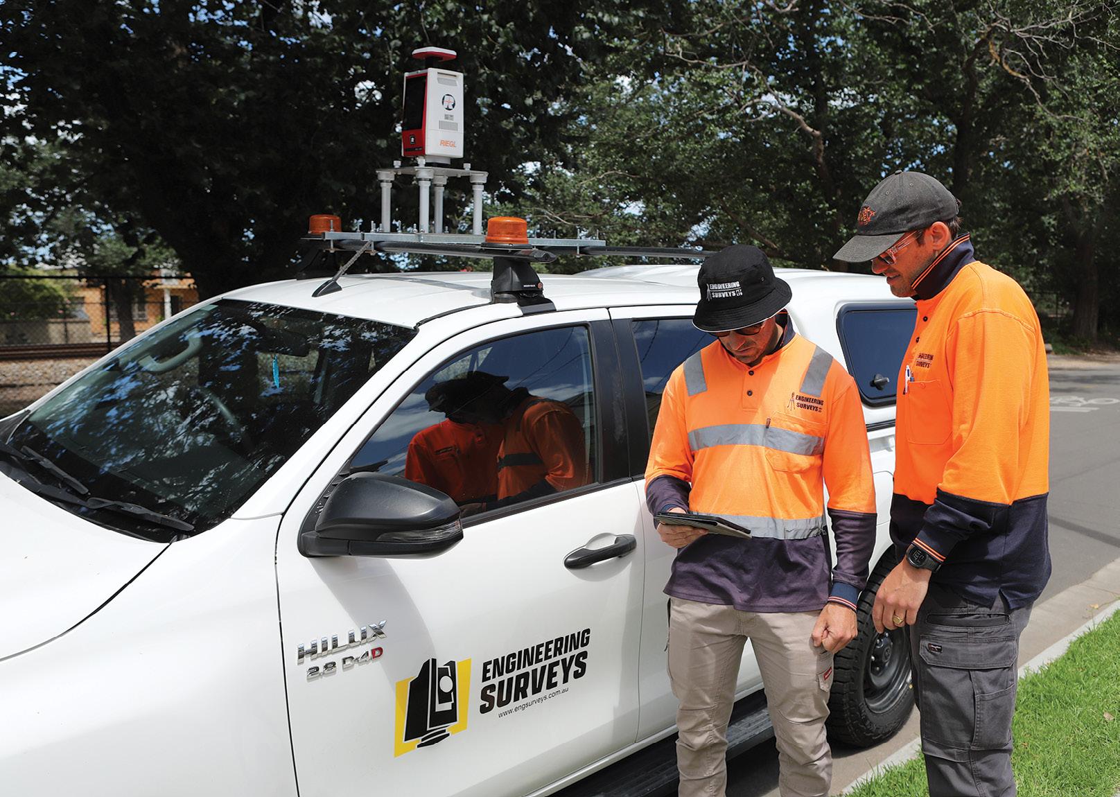
Adelaide-based Engineering Surveys provides a range of services, primarily for the construction sector — high-rises to bridges, from rail to roads. The firm began life in 1989 and currently has 27 surveyors on staff, conducting engineering and construction surveys, detail and topographic surveys, civil and roadworks surveys, boundary surveys, aerial mapping using drones, and 3D laser scanning.
It is for work in the latter category that the company acquired its latest piece of equipment — a RIEGL VZ-600i 3D terrestrial laser scanner. It has been in the company’s hands for only a few months, but already it has made a dramatic impact on efficiency, productivity and even safety.
“Speed, that’s the biggest factor,” says David Topfer, company director and Engineering Division Manager. “We have two other scanners and they’re great, but this one is a real game changer in terms of speed. You can go on-site and get 60 scans in an hour. It’s just phenomenal.”
Spectacular specifications
The VZ-600i’s RIEGL’s latest generation of terrestrial laser scanner, providing extreme versatility, high productivity and performance. With one-touch button operation and, simultaneous scan and image data acquisition and on-board, real-time automatic registration, the unit is super easy to operate and super capable. Its specifications (see box) speak for themselves — with exceptional accuracy, fast scanning times, ability to scan close or far, suitability for indoor and outdoor use, and with the option for mobile (e.g. vehicle-mounted) applications, the VZ-600i is designed with productivity in mind.
It also has three internal cameras, which give you the option of colourising the points that are picked up.
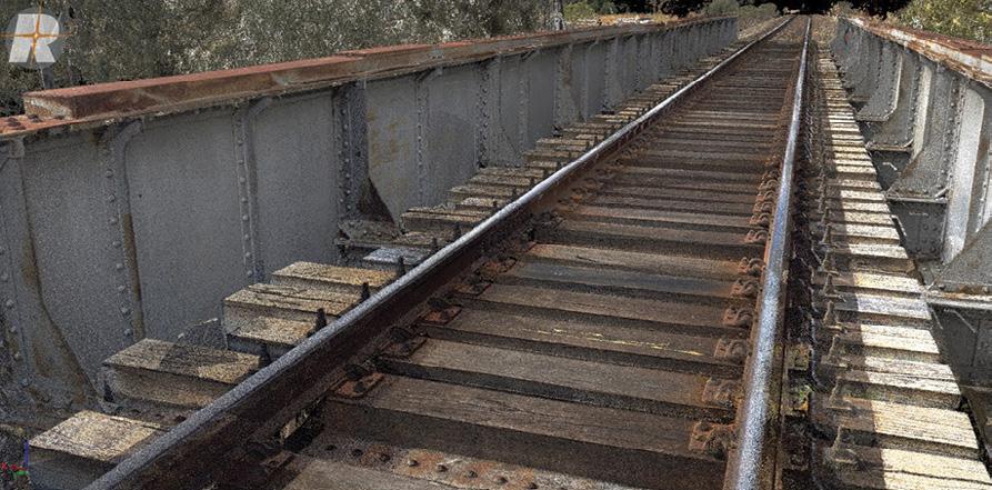
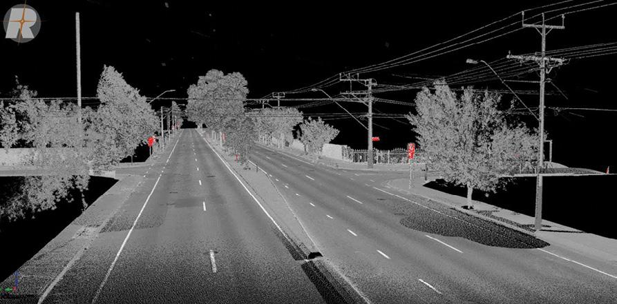
The VZ-600i is equally at home when conducting scans for construction inspection and verification, road and railroad surveying, high-speed scanning
with millimetre precision for building information modelling, mapping… and even for capturing incident scenes for public safety and forensic purposes.
“It’s so fast that you can just absolutely smash out your scans,” says Topfer. “We’re talking about two million points per second as it shoots. It’s quite an amazing bit of technology.”
Versatility for different venues
Engineering Surveys is employing the VZ600i for indoor and outdoor applications. “It works just as effectively in both situations,” says Topfer. “The bonus when you’re using it externally is that it has the RIEGL GNSS RTK receiver so that it helps do the registration as you go.
“But we’ve also used it quite a lot inside in very densely partitioned office environments, and we’ve had great success with it. It has an on-board IMU, and as long as you get sufficient overlap, it registers all the different scans in the background with the on-board software. It’s quite impressive the way it does it.”
It also has on-board processing onthe-go, synchronising in real time to a CF
card. “At the end of your scans you simply pull the CF card out,” says Topfer. “It has a preliminary registration and then there’s fine registration that happens back in the office. But RIEGL have really thought about the workflows — there are no lengthy periods of downloading your data; it’s already there.”
And Topfer points out that the VZ-600i a lot more accurate than handheld 3D laser scanners — RIEGL quote 3D positional accuracy of 3 millimetres at 50 metres. “It will even give you sub-millimetre accuracy for certain things, if you want to go down that track,” says Topfer.
Who needs millimetre accuracy?
“We did a job where we had concrete columns that were big and round and two storeys in height,” says Topfer. “The client had a very exact proposition for a tile pattern going around these columns. The tiles were 30 mm wide and 200 mm long, and they didn’t want to have to cut a single tile. So they needed a specification at half-metre increments to determine the circumference up each of these columns, and there were about 15 of them.”
“This was a complicated site that required setting up in multiple locations.
20 position February/March 2024
“The time saving is just enormous. It’s probably ten times faster than our old scanner.”
Justin Scott, Engineering Surveys
Our surveyor did it in about 50 to 60 scans and he was on site for only about two hours. Without the scanner it would have taken forever.”
Client expectations
So with the advent of high-precision 3D laser scanning, and with the capabilities of the RIEGL VZ-600i in particular, are clients becoming more demanding with their requests?
“That’s an interesting question. It definitely has ramped up the expectations, that’s for sure,” says Topfer. “But it’s also that the expectations have reached a level now which make us need to educate our clients a little bit.”
“As surveying has evolved, we’ve gone from basic surveying instruments and setting out with a chain or a tape. That’s what I was doing 30 years ago,” he says. “But now we have all these extra technologies and greater abilities. And you would think that it might be counterproductive because we can do things so much faster – it would mean we’d have less work. But it seems to have had the opposite effect – we have more work now because we’re so much more capable.”
“For example, we can pick up a kilometre section of road in a few hours, whereas with a traditional team you might take a few days,” he adds. “We’ll still have surveyors doing the traditional components, but we might use the scanner to operate on a really busy road to keep those surveyors off the road, so that we don’t need traffic control. Or there are areas where you simply can’t have a person out on the road at all — in that case, we can mount the VZ-600i on the roof of a car.”
“I think a lot of people still don’t quite understand 3D scanners and what they’re capable of,” he adds. “They might think ‘a 3D scanner is just a 3D scanner,’ but the RIEGL VZ-600i is really next generation.”
Data delivery
The other aspect that is pleasing clients is the way the data can be presented to them. While some are happy with traditional point clouds, the VZ-600i and the software it can be used with are adding value to the point cloud.
“We’re using a program called TopoDOT, which runs on Microstation (3rd party software) and enables us to extract strings from the scan data and get the maximum value out of it,” says Scott. “So rather than giving a gigabyte point cloud to a client, they can have just the strings and the actual data presented in a sort of a traditional survey format with all the correct layers and the stringing and the points and symbols.”
Topfer’s colleague, Justin Scott, Senior Surveyor and 3D Scanning Team Lead, says that on top of the speed of scanning, the workflow efficiency “is the thing that stands out the most”.
“I did a project last week which was 150 scans, and which took me about four hours in the field — 3.5 kilometres of linear road — and I think it was something like 80 GB.”
“With the old scanner we were looking at about 12 minutes for a 360° scan, whereas this one’s around 30 seconds. The time saving is just enormous. The overall workflow is probably ten times faster than with our old scanner,” he says. “I’ve used the previous RIEGL unit, the 400i, and this is a pretty huge step up from that, just with the internal cameras and internal batteries. They really refined what was a pretty good system already.”
Asked to sum up the RIEGL VZ-600i, Scott returns to the speed. “That’s really the biggest thing,” he says. “The speed and the workflow improvements as well — we can just start work rather than spending a lot of time acquiring scans and processing.” n
For more information on the RIEGL VZ-600i, head to survey.crkennedy.com. au/_brands/riegl.
Riegl VZ-600i 3D laser scanner specs
• ‘One-touch’ button operation
• Concurrent scan and image data acquisition
• Precise real-time on-board automatic registration
• Suitable for indoor and outdoor 3D mapping
• Broad range capability (0.5 m up to 1,000 m)
• Lightweight (approx. 6 kg)
• 30 sec scan time (6mm resolution @10m distance)
• High-speed data download of up to 500 MB/s
• Ready for robotic operation integration
• Option for kinematic laser scanning
• Flexible mounting platform
www.spatialsource.com.au 21
Preserving the history of surveying in Queensland
KAYE NARDELLA
Almost two centuries of surveying history are maintained and displayed at the Museum of Lands, Mapping and Surveying.
Queensland’s earliest surveyors faced many challenges — extreme weather conditions, harsh terrains, long distances travelled, wildlife and fauna which included crocodiles, insect infestations, and so much more. Today, the stories, maps and tools of these surveyors and cartographers are preserved at one of the most comprehensive digital and physical collections of maps and artefacts in the world — the Museum of Lands, Mapping and Surveying, located in Brisbane.
Opened in 1982, the museum has an extensive collection of original material, artefacts, photographs and published material. It can also access government materials including maps, survey plans, aerial photographs and land records.
This article presents some of those fascinating artefacts and images, and the stories that go with them.
A look back in time
Figure 1 shows a 7-inch Bamberg theodolite held by the Museum. This theodolite played an important role in confirming the Queensland/ Northern Territory border. It was used in 1885 by Queensland Staff Surveyor Cecil Twisden Bedford to help check the longitude of the earlier border survey as carried out by South Australian surveyors, Poeppel and Carruthers. Bedford first determined the longitude of the telegraph station at Boulia from the datum of Sydney Observatory and then conducted a traverse

survey from this point to the Queensland/ Northern Territory border at Tobermorey, to confirm that the longitude of the border was 138o east.
Figure 2 shows ‘We of the Survey,’ an illustrated poem created by John William Sorby around 1890. It is a humorous look at the surveying profession captured in 24 verses. At the time, the artist was a chainman for William Daniel Cooke during his survey for the MackayBowen Railway.
Figure 3, one of the 7,000 historical photographs held by the museum, shows surveyor James Reibey Atkinson and other men at a coal mine at Ipswich, around 1870. Atkinson was a land, railway and sometimes mining surveyor. Note the mining dial at right and the broadband steel tape held by the man in the centre.
Figure 4 shows survey plan BNT478, which captured a 1914 survey by Claude Newcombe of Portions 129 and 132 in the Parish of Broadwater (southwest of Stanthorpe). It described the area as having ‘sandy soil … very thickly and heavily timbered Stringybark, Gum, Blackbutt and Pine’. The cartographer drawing the survey plan added some illustrations of men who appear to be playing hide and seek amongst the ‘Huge Boulders’
The 7-inch Bamberg theodolite played an important role in confirming the Queensland/Northern Territory border.
22 position February/March 2024 history
Life in the field
In 1839 the first three surveyors, Robert Dixon, Granville Stapylton and James Warner were sent from Sydney to Brisbane to commence surveying in what became Queensland, to support the colonial government’s desire for free settlement in the area. They conducted feature surveys and trigonometrical surveys for survey control, cadastral surveys and undertook mapping. These steps were critical to enable the subdivision and sale of land. Instructions were provided to surveyors to capture soil types, vegetation and any existing features or improvements, for example footprints of buildings. For surveyors, it was about gathering information to support the management of land and development. The information captured on these survey plans has tremendous historical value.
An interesting oddity was noted by surveyor H.B.R. Harrison as part of his 1883 survey of an
Some early field books held by the Queensland Department of Resources record lists of supplies to be ordered, including alcohol.
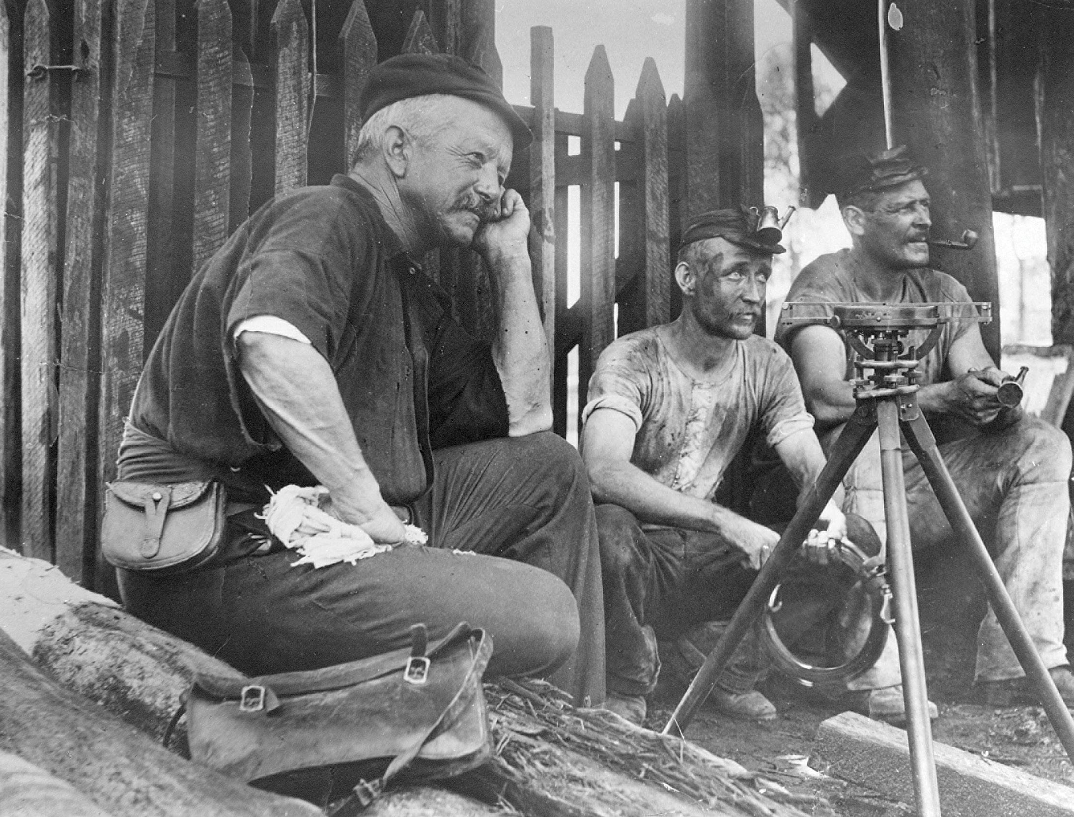 Surveyor James Reibey Atkinson (left) and other men at a coal mine at Ipswich, around 1870.
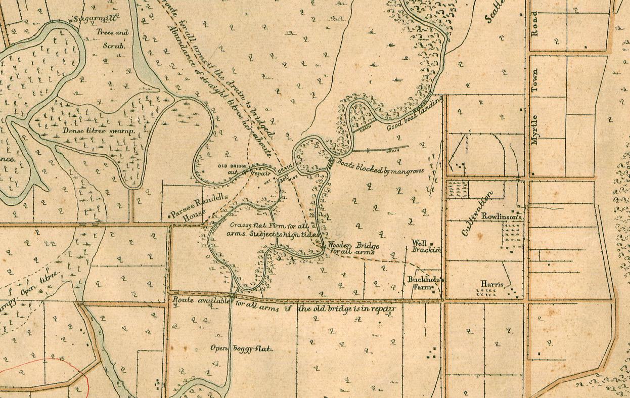
This 1889 map that is one of the earliest topographic maps drawn over Queensland, covering the northeast area of Brisbane.
www.spatialsource.com.au 23

area near Belyando River and Mount Gregory (northwest of Clermont). He recorded on survey plan K103657 sheet 1, ‘Subterranean noises frequently heard here’ near Mount Gregory. By 1938, this had been embellished on a Queensland fourmile series cadastral map (4m71) with the addition of ‘Like a roll of Artillery’.
Surveying life could be challenging. New South Wales Surveyor-General Sir Thomas Mitchell explained in 1855, when describing the pioneering efforts of his department (which included surveyors working in Queensland), that ‘… the work of those days, in tracing rivers and ranges, was about the most onerous of our duties’, and the isolated, itinerant life had lost him many good surveyors ‘from the odious habit of Drunkenness’ (Source: T.L. Mitchell, in ‘Minutes of Evidence Taken before the Select Committee on the Management of the Survey Department,’ V&P of the NSW Legislative Assembly, 1855, vol.2, p26). Some early field books held by the Queensland Department of Resources record lists of supplies to be ordered, including alcohol.
Suveyors working in the field had to be versatile and innovative. Wire was an important part of a surveyor’s kit as it could be put to valuable uses. For example, it could be bent into a U shape and used as a ‘spiderweb catcher,’ as spiderweb threads in earlier times were used as crosshairs in surveying equipment. If the crosshairs broke while the surveyor was out in the field, he would bend wire into a U shape, locate a spider, encourage the spider onto the catcher, turn it and collect the thread as the spider dropped. This thread would then be added to the reticule of the instrument and the surveyor was back in business. (Hopefully the spider was gently sent on its way after its assistance.) The museum has three spiderweb catchers on display.
The efforts of surveyors in gathering information were captured in field books and recorded on survey plans, information that was the building block for creation of maps and for land administration in
The need for this map was spurred by concern that the Russians were expanding into the Pacific region.
Queensland. The types of maps created include cadastral maps (showing property boundaries and property descriptions), topographic maps (showing relief and features) and themed maps.
Figure 5 is a portion of an 1889 map that is one of the earliest topographic maps drawn over Queensland. It was created by the Queensland Defence Force and covered the northeast area of Brisbane. The need for this map was spurred by concern that the Russians were expanding into the Pacific region. Its military purpose was reflected in the details added: for example, ‘Route available for all arms if the old bridge is in repair’. The map’s historical value is shown with the annotation of features such as the Sugar mill, the location of buildings and the names of owners of farms.
Preserving the past
The Museum of Lands, Mapping and Surveying’s role also includes digitising and making discoverable material such
as these historical maps, plus engagement and historical land research. For example, more than 11,000 historical map scans can be accessed for free via the Queensland Open Data (data.qld.gov.au) platform and via a Historical maps topic (tinyurl.com/ mt22y3nf) available from the Queensland Globe (qldglobe.information.qld.gov.au).
A future task is to investigate traditional knowledge in mapping and land management.
The Museum (tinyurl.com/yru5esvn) is located at 317 Edward Street, Brisbane, and is open Monday to Friday from 9:30am to 4:00pm. It can also be accessed virtually via the Museum’s website (tinyurl.com/ w42xuz9m). You can also follow the Land Queensland Facebook page (facebook.com/ LandQueensland) for more stories on the history of surveying in Queensland. n
Kaye Nardella is Senior Curator at the Museum of Lands, Mapping and Surveying | Spatial Information, within the Queensland Department of Resources.
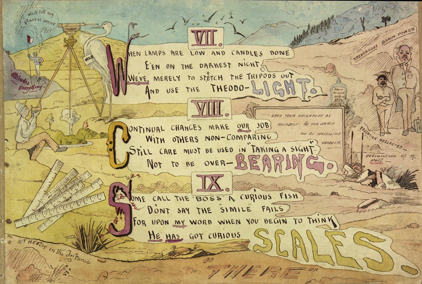 Survey plan BNT478 captured a 1914 survey by Claude Newcombe of parts of the Parish of Broadwater (southwest of Stanthorpe).
‘We of the Survey’ was created by John William Sorby around 1890. Courtesy of the Cooke collection.
24 position February/March 2024 history
Kurloo’s brilliantly simple SOLUTION
Transformational Australian-designed displacement monitoring technology that’s enabling new business opportunities for surveyors and engineers.
Routine displacement and settlement monitoring measurements of critical infrastructure has required a surveyor to be physically present on-site or the use of sophisticated monitoring equipment. This presents a significant barrier to entry for many surveying and geotechnical engineering businesses wanting to offer the service due to limitations in expert staff availability and the associated risks of investing in dedicated automated equipment, especially for short-term projects.
In response to this challenge, Kurloo was born — a wholly Australian-designed and -manufactured geodetic monitoring service. The Kurloo device leverages IOT and GNSS technology to deliver an automated and cost-effective monitoring solution. It is simple for your site teams to install a flock of one or many Kurloo in most locations in as little as 10 to 15 minutes per point. Once the Kurloos are installed, simply log-in to the Kurloo Nest software and receive daily insight from the frequent millimetre-accurate measurements, straight to your device.
For additional insight, the 4D measurements are autonomously visualised against rainfall or other site variables to determine cause and effect of changes in the readings. The result is that Kurloo delivers significant improvement on previously available methods of routine site measurement, through its flexible and scalable frequent reading to millimetre accuracy over several kilometres without line of site… making it widely successful in delivering improved outcomes for roads, railways, dams, ports, mining and infrastructure projects in Australia and New Zealand.
Nick Herath, the Technical Director at Veris, attests to the transformative impact of Kurloo technology.
“The Kurloo technology proved to be a game-changer for us. It addressed safety concerns and facilitated daily precise measurements in areas with restricted access,” he said. “As a cost-effective solution, it significantly enhances our monitoring capabilities.”
Mike Neighbour, Principal Geotechnical Engineer at Butler Partners Pty Ltd, says that “With Kurloo we have a new tool to quantify and manage risk at a more sensible cost. As consultants, our reputation is elevated by being able to get in front of clients with
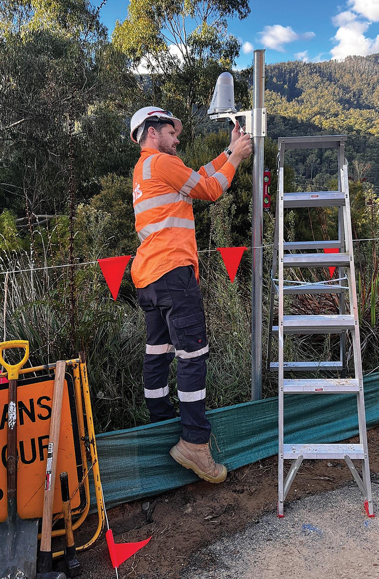
new technologies that save them time, money and improve safety.”
Kurloo is offering a transformative monitoring solution for surveyors and engineers. Not only does it solve the existing problems of current monitoring options, but it offers unparalleled data insights that can validate remediation where applicable using continuous and accurate data. n

Curious about how Kurloo can enhance your business service offering in 2024?

Visit their website at www.kurloo.io and contact Australian Sales Manager, Amy Hooper via email, sales@kurloo.io.
www.spatialsource.com.au 25 partner feature
Mapmaking for a better world
AMY GRIFFIN
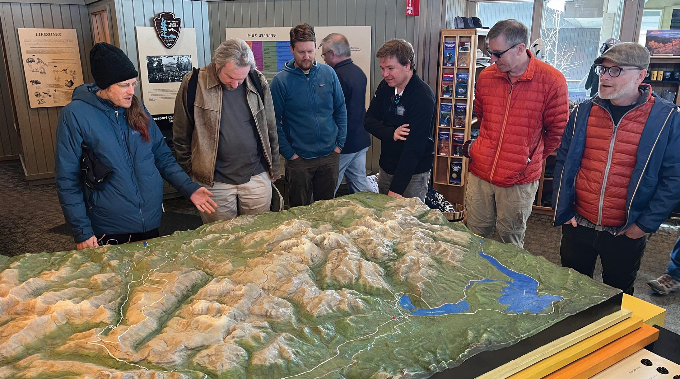
Leafing through the pages of any issue of Position magazine will illustrate how fundamental maps and geospatial visualisations are to the practice of surveying and geospatial science. Whether they are used to communicate the results of a complex spatial analytical workflow, to understand the location of a resurveyed boundary in relation to historical surveys of the area, or to depict the potential impacts on a location of developing a new piece of infrastructure within a spatial digital twin, maps and visualisations help us to understand the world. Maps influence both our thinking and our behaviour, and successful maps help their readers to solve problems and understand environments.
The peak international body that supports the development and practice of mapmaking is the International Cartographic Association (ICA: icaci. org). The ICA was founded in 1959 in Switzerland with 13 members and since that time its membership has grown to include
74 countries. It welcomes participation from anyone with an interest in maps, including government mapping agencies, researchers, private companies, educators, map enthusiasts and software developers. It has as its aim “the promotion of the disciplines and professions of cartography and GIScience in an international context”.
The ICA is an organisation of organisations — something like the United Nations for cartography, its primary members are national members. These national members represent the interests of mapmakers from that country at the ICA every four years at a special meeting called the General Assembly, which takes place during the International Cartographic Conference. Each national member is entitled to send one delegate to the General Assembly.
National members are typically national cartographic, geographical information associations or national institutions such as national mapping agencies. In the
Australasian region, the national members include the Mapping Sciences Institute of Australia (joined 1964), the New Zealand Cartographic Society (joined 1976) and Badan Informasi Geospasial (the Indonesian Geospatial Information Agency, joined 1980 when it was formerly called Bakosurtanal).
The ICA also welcomes affiliate members, which may include organisations, companies or institutions whose membership supports the ICA’s activities and mission. In the Australasian region, affiliate members include the Australian and New Zealand Map Society and Toitū Te Whenua Land Information New Zealand.
What does the ICA do?
The ICA undertakes several types of activities, including:
• Supporting cartographic research and development.
• Building capacity in and transferring cartographic knowledge to countries with limited mapping expertise.
The International Cartographic Association is on a mission to support cartographic R&D, education and knowledge dissemination.
26 position February/March 2024 cartography
Attendees at the 12th Mountain Cartography Conference in Colorado, USA, in April 2023 discussing a physical 3D map at a national park visitor centre. Credit: Anna Riling.
• Promoting cartographic and geospatial scientific education.
• Maintaining authoritative repositories of cartographic knowledge.
• Participating in the development of professional and technical standards, including with other organisations such as the Open Geospatial Consortium and the International Standards Organisation.
• Hosting international meetings and cartographic exhibitions, such as the biennial International Cartographic Conference, to share cartographic expertise.
• Providing fora for disseminating cartographic knowledge, such as the ICA News or eCartoNews, and scientific publications such as the Proceedings of the ICA and the International Journal of Cartography
• Offering cartographic expertise to international organisations such as the United Nations, including to the UN Committee of Experts on Global Geospatial Information Management.
• Membership in and cooperation with related organisations and sister societies (e.g. International Science Council, Open Geospatial Consortium, International Society of Photogrammetry and Remote Sensing, International Federation of Surveyors, International Geographical Union, International Hydrographic Organization, International Map Industry Association).
The people and products of the ICA
The work of the ICA is undertaken by the Executive Committee and the Chairs of Commissions and Working Groups. Members of the Executive Committee and Commission and Working Group Chairs are nominated by their national member and elected or approved by the General Assembly. Each of the ICA member countries within the Australasian region have participated in the executive leadership of the ICA. Australia and Indonesia have had several Vice Presidents (Australia: B.E. Goodrick, William Cartwright, Amy Griffin; Indonesia: Sukendra Martha), while Igor Drecki from New Zealand was the long-standing ICA News Editor until his untimely passing in 2023. Cartographers from the Australasian region, too numerous to list individually, have also been Commission and Working Group chairs.
The research and development work of the ICA is undertaken by the Commissions and Working Groups. Commissions are composed of cartographers from any sphere (government, industry, universities)
Credit: Zdeněk Stachon.
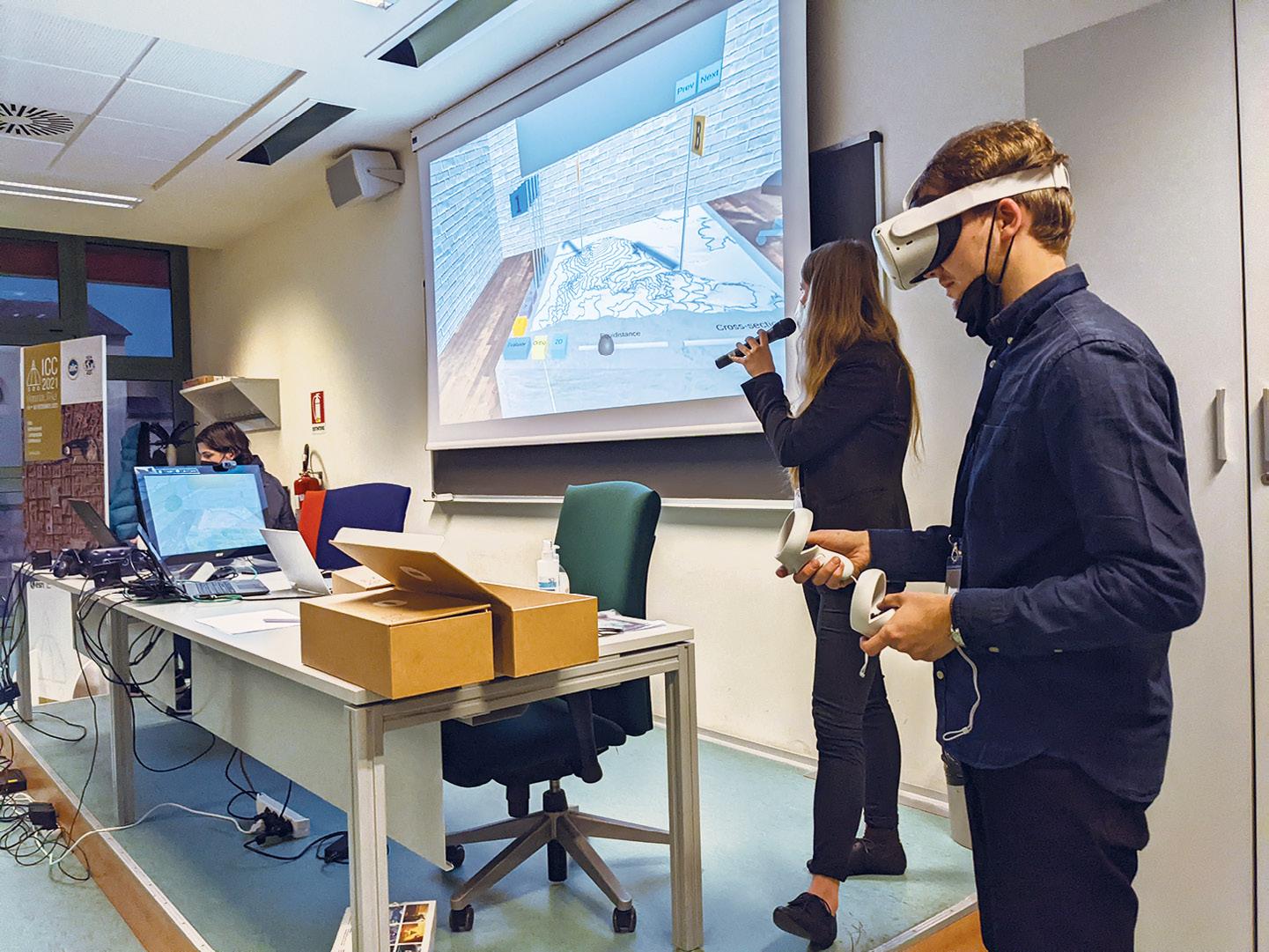
who come together to investigate specific problems related to the Commission’s theme. Some examples of current commissions include Art & Cartography, Atlases, Cartography & Sustainable Development, Cartography in Early Warning and Crisis Management, Ethics in Cartography, GeoAI, Geovisualisation, Location-based Services, Map Design, Map Projections, Marine Cartography, Topographic Mapping, and User Experience, among others.
This work happens both online and offline and results in a range of products, including scientific publications, education and training materials, workshops, and books about cartographic best practices. One publication that you might be interested to explore and that is freely available online is a joint publication produced by the ICA and the United Nations, a book on mapping best practices entitled Mapping for a Sustainable World (available as a downloadable pdf: unilibrary.org/content/books/9789216040468).
This book uses data measuring progress towards the Sustainable Development Goals to explain and illustrate cartographic best practices.
Find out more
In future articles for Position, we will profile some of the ongoing projects being undertaken by ICA Commissions. ICA also has biannual print (icaci.org/ica-news) and monthly electronic (icaci.org/emailnewsletter) newsletters and the eCarto News publication (edited by retired RMIT University professor David Fraser), which compiles information about interesting maps and mapping developments.
The ICA website includes information about the structure of the organisation, upcoming and past International Cartographic Conferences, and links to Commission webpages where you can find out more about the work of specific commissions.
If you’re interested in getting involved in ICA, you can contact relevant Commission Chairs directly, or send me a message (amy. griffin@rmit.edu.au), and I’ll help you find the right person to speak with. n
Amy Griffin is a Senior Lecturer in Geospatial Sciences at RMIT University, and current ICA Vice President.
 A joint publication of the ICA and the UN, Mapping for a Sustainable World outlines mapping best practices.
Demonstrating navigation within a virtual environment that includes a terrain model, at the Workshop on Immersive Cartography/Cartography for Immersive Environments, Florence, Italy, December 2021.
www.spatialsource.com.au 27

The UK’s new Geography Profession Strategy
The strategy sets out three pillars of activity that will enhance the profession’s influence within the government.
The UK Government has released its Geography Profession Strategy 2023–36, which outlines plans to boost the discipline across the public sector.
Writing in the Strategy document’s foreword, David Wood, Head of the UK’s Government Geography Profession (GGP), said the Strategy is a plan for supporting “geographical decision making across the public sector by supporting and growing a diverse community of geographers and increasing the impact and influence of the discipline in government and beyond”.
“Our expertise covers the full breadth of our discipline, including physical and social science aspects of geography, and our members are located across the UK. Our membership includes people involved in analytical, scientific, policy and operational delivery roles,” Wood added.
The GGP, which was launched in 2018, has built a community of experts across public sector organisations to support geographers in their work. The GGP’s vision statement is to “create and grow a high-profile, proud and effective geography profession that attracts fresh talent and has a secure place at the heart of decision making”.
The Strategy outlines three pillars that will enable the GGP to achieve that vision.
Pillar 1 — Maximise impact
Pillar 1 involves development of an environment in which geographers can have maximum impact across the government and public sector. The Strategy states that this pillar “will be delivered through the inclusive leadership of the Organisational and Community Heads of Profession through their work to support and raise the profile of
geographers within their organisations”. Within each of their organisations, those Heads of Profession will:
• Encourage and promote GGP membership across their organisation.
• Develop an inclusive and diverse local community of geographers, providing them with development opportunities through volunteering and contributing to the management of GGP initiatives.
• Share geo best practice across the organisation through local initiatives.
• Share activities and lessons learned from initiatives to the GGP leadership.
• Contribute to wider conversations as part of organisational governance alongside other professions.
Pillar 2 — Promote professionalism
Pillar 2 involves “professionalising” and progressing the use and applications of geography across the government and public sector. This pillar will involve:
• Implementing a skills and training offer for GGP members. This will include working with partner organisations and the wider Analysis Function (see below).
• Developing a GGP mentor program.
• Identifying mechanisms for geography to have the same recognition as other profession within the Analysis Function.
• Promoting the opportunity for members to gain professional accreditation.
• Recognising and celebrating the work of GGP members through annual Geography in Government awards.
• Identifying gaps in geographical guidance across the public sector.
• Ensuring that other guidance across the analytical function incorporates geo principles.
Pillar 3 — Increase diversity
The third pillar of the Strategy will involve “growing a diverse and inclusive community of geographers within the profession and public sector”. To achieve that aim, this pillar will:
• Develop and update resources that can be used for outreach to the education sector.
• Engage with existing outreach schemes and networks.
• Monitor wider public sector entry routes and ensure geography is represented.
• Work with and across government professions and networks to ensure the digital approach of the GGP is joined up and consistent.
• Engage with networks to improve the equality, diversity and inclusion within the GGP.
Spatial analytics skills
The UK’s Geospatial Commission — established in 2018 and responsible for setting the UK’s geospatial strategy for delivering improved public services — is the departmental sponsor of the GGP, while the GGP itself is one of seven professions that make up the Analysis Function, the goal of which is to be the go-to hub for best practice research and analysis services within the Government.
“Geography, a discipline distinctive for its spatial analytical skills and tools, is key to this understanding,” said Wood. “It provides an important bridge between different teams, expertise and organisations — helping to forge holistic considerations of places and communities in analysis, policy, and delivery.”
“Since our creation in 2018 we have become an established stand-alone profession, our membership has grown, we have dedicated resources for the profession and have developed an offer for all our members, such as our annual awards and annual conference.
“These are areas that we will continue to develop, but there is a lot more that we want to do, which you will see in this strategy.” n
 The UK’s Head of Geography Profession, David Wood (far right) at the presentation ceremony for the inaugural UK Geography in Government Award.
©stock.adobe.com/au/StudioProX 28 position February/March 2024 government
Money for modernising US geodesy
Four projects worth up to US$20 million will address key issues facing the United States’ geodetic community.
Four US research organisations have been awarded a total of up to US$20 million in funding as part of the Geospatial Modeling Grant competition.
Each of the projects will comprise cooperative agreements with the National Oceanic and Atmospheric Administration’s (NOAA) National Geodetic Survey (NGS) for a five-year period, with the aim of addressing key issues facing the geodetic community.
NGS is a program office within NOAA’s National Ocean Service (NOS) that provides the authoritative coordinate system for all geospatial and positioning activities in the US.
Oregon State University, Scripps Institution of Oceanography, Michigan State University and Ohio State University have initially been awarded a total of approximately US$4 million in grant funding, with the potential for that to be raised to US$20 million.
The projects will research emerging problems in the field of geodesy and support a Geodesy Community of Practice to address a nationwide deficiency of geodesists, as well as developing tools and models to advance the modernisation of the US’ National Spatial Reference System (NSRS).
The four projects and their funding grants, are:
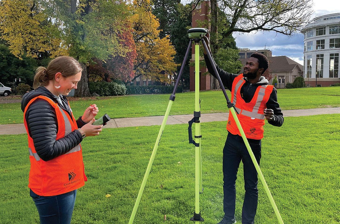
• Oregon State University (OSU): US$1,304,056 annually for a potential total of US$6,520,280 over a five-year period for a project titled ‘NSRS Modernisation and Geodetic Workforce Development,’ the primary objectives of which are to modernise geodetic tools for the NSRS, create new operating procedures for working with the NSRS, and develop a geodetic workforce for the future.
• Scripps Institution of Oceanography (SIO): US$1,300,000 annually for a potential total of US$6,500,000 over a five-year period for a project titled ‘NSRS Intra-Frame Deformation Model and New SIO Geodesy Program,’ the primary objectives of which are to create a formal geodesy program in support of the nationwide deficiency of geodesists and to modernise geodetic models for the NSRS.
• Michigan State University: US$800,000 annually for a potential total of

US$4,000,000 over a five-year period for a project titled ‘Software Tools and Education for Enhancing Geodetic Infrastructure,’ the primary objectives of which are the same as that of the SIO’s project.
• Ohio State University: US$536,000 annually for a potential total of US$2,680,000 over a five-year period for a project titled ‘Developing a Fully Kinematic, Backwards-Compatible Reference Frame for the Continental United States of America and Canada,’ the primary objectives of which are to modernise geodetic tools and models and to develop a geodetic workforce for the future.
OSU’s research will be conducted by its new Geospatial Center for the Arctic and Pacific (GCAP).
“Society and our technologies are increasingly connected and spatially aware,” said GCAP director Chris Parrish of the OSU College of Engineering. “Groundbreaking advances are occurring in areas like self-driving vehicles, smart cities and geospatial artificial intelligence. What all of those have in common is the need for accurate, consistent spatial coordinates that define locations on, above or below the Earth’s surface.”
Parrish points out that the US NSRS’ last major update was four decades ago, and that modernisation is critically needed to meet 21st century accuracy demands.
“GCAP will contribute impactful geodetic research, infrastructure, education and workforce development to support a new, diverse generation of geodesists, surveyors and geospatial professionals.” n
Ellery Ohlwiler and David Abiola collect GNSS data on the Oregon State University campus.
Photo by Chris Parrish, OSU College of Engineering.
www.spatialsource.com.au 29 geodesy
Graduate student Kenneth Kenney collects topographic measurements. Photo by Ezra Che, OSU College of Engineering.
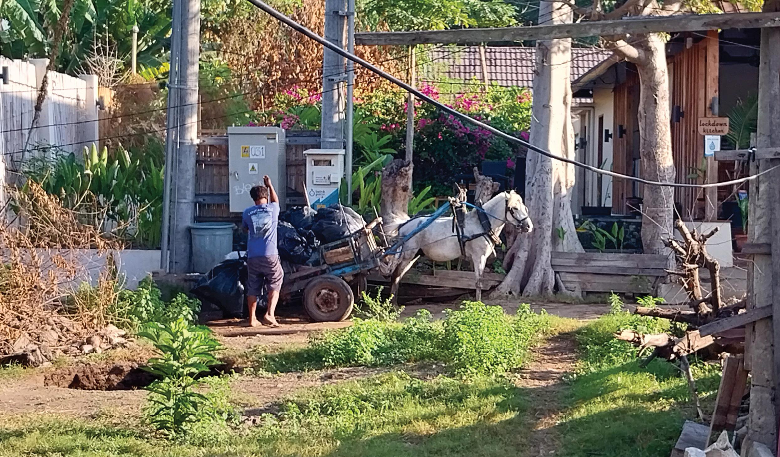
Environmental challenges in the Gili Islands
mapping and humanitarian engineering project on Indonesia’s Gili Islands is tackling community needs.
The three Gili Islands, located in North Lombok, Indonesia, have long been a tourist attraction due to their beautiful beaches and stunning coral reefs. However, behind their natural charm, these islands face issues affecting the sustainability of the economy and livelihoods of the residents, the most pressing of which are waste management and clean water supply.
In the wake of the 2018 earthquakes in Lombok, Dr Alfita Puspa Handayani from the Faculty of Earth Science and Technology at the Institute of Technology Bandung (ITB), Indonesia, is adapting her PhD research, which focused on land value prediction and land administration, to offer tangible solutions for communities in the Lombok and Gili regions.
In partnership with Dr Craig Roberts and Dr Andrew Dansie from the School of
Civil and Environmental Engineering (UNSW), an innovative new Humanitarian Engineering project to address waste management, environmental conservation, clean water infrastructure and land administration concerns is evolving. ITB students will bring their geospatial and mapping expertise to combine with the broader UNSW engineering skills.
Humanitarian Engineering (HE) is a new minor offered within the Bachelor of Engineering (Surveying) at the University of New South Wales (UNSW). With a close eye on the UN Sustainable Development Goals, HE connects people and problems, and combines science, social science and arts to create, design, develop and enhance technologies and processes that promote the well-being of populations facing significant
challenges. Geospatial science enables visualisation of how communities interact with their environment, highlighting trends and patterns in their behaviour which inform better solutions to social problems.
However, engineering solutions are futile if there is no community ‘buy in’ and due consideration given to the context within which a technical solution operates. Will communities adopt new practices? Will businesses support these changes? What is the cost? Are there legal ramifications? Are proposed solutions adaptable, scalable or specific for the Gili Islands? Are these solutions sensitive to cultural and religious practices of island residents? Will these solutions make a measurable difference to the lives of all who reside on the islands?
Gili Trawangan, the largest of the three islands, has a
larger population and more tourist facilities, including hotels, cafes and bars spread across the 338-hectare island. According to data from 2018, up to 20 tonnes of waste can be produced on the island per day. Concerns about the garbage issue began to arise among visitors in 2015.
The North Lombok provincial government has established an integrated waste management centre covering an area of 6,000 square metres on Gili Trawangan. However, it is apparent that this facility, including a large-capacity incinerator, will not be effective in resolving the waste issue if there is no waste separation at the household level.
Another issue arises on Gili Meno, concerning clean water supply. Most homes rely on government-built wells, which provide water that is often too salty to drink. Residents must
DR ALFITA PUSPA HANDAYANI and DR CRAIG ROBERTS
30 position February/March 2024
co-operation
A
regional

instead purchase bottled water in 21-litre bottles, accounting for 10% of their income every month.
Under the guidance of Dr Handayani, using various brainstorming activities, students have been encouraged to comprehensively examine issues from multiple perspectives — assessing the current conditions, identifying gaps, mapping behaviours, compiling a list of possible solutions, and evaluating community acceptance and likely implementation. Students must also calculate the financial costs and ensure that materials and spare parts can be easily obtained at an affordable price. Capacity and time span are also considerations when assessing the feasibility of implementing alternative solutions.

Geospatial tools can also be enlisted to map human behaviour and monitor community understanding of waste management.
Two groups comprising seven UNSW students proposed a solution for waste management and clean water issues. The first group, which focused on waste management, found that the root cause of the problem in Gili is the community’s understanding of waste and the need to raise awareness of managing it. For this, the students explored the behaviour of the community and found a crucial need for education and public awareness regarding waste processing and efforts to implement householdscale waste management. It was found that using social media and enlisting well-known individuals as advocates for the community is an effective strategy. From the behavioural insights, it was inferred that people tend to listen to public

figures. Geospatial tools can also be enlisted to map human behaviour and monitor community understanding of waste management. Socialisation and education can then be targeted accurately to improve understanding at the household level.
The second group concentrated on initiatives to supply clean water and assessed three approaches for rainwater treatment and filtration: UV purification, ultrafiltration and chlorine disinfection. Community behavioural investigations found that people in Indonesia are not accustomed to drinking water directly without boiling it first. The boiling process would render chlorination ineffective but boiling costs a lot of energy. Therefore, students decided to investigate a UV purification and ultrafiltration system as a possible solution for the clean water system. Mapping well locations, the proximity between clean water locations and the clean water distribution routes, will provide a more comprehensive solution to the issue of water availability on the island.
Both outcomes demonstrate how HE operates, involving knowledge about habits, traditions and characteristics
to ensure that the proposed solutions are targeted and most likely to be accepted and implemented by the local community.
Dr Handayani will introduce HE concepts to students at the ITB and encourage them to leverage their expertise in land administration, geospatial science and mapping to ensure that engineering solutions are not only technically sound, but also legally and environmentally sustainable in the long term. The combined ITB and UNSW team plan to visit the Gili Islands in late 2024 to combine staff and students in a hands-on joint project whilst engaging deeply with the community. n
Dr Alfita Puspa Handayani is a Lecturer specialising in Land Administration from the Faculty of Earth Science and Technology at the Institute of Technology Bandung, Indonesia. Dr Craig Roberts is a Senior Lecturer in Surveying/ Geodesy from the School of Civil and Environmental Engineering, University of New South Wales. UNSW students will receive funding from the New Colombo Plan. The authors acknowledge the funding provided by the WCU Funding Grant from the Faculty of Earth Science and Technology at ITB.
The UNSW Student Team, with Dr Alfita Handayani fourth from right, and Dr Andrew Dansie fourth from left.
A horse-drawn cart, known in Indonesia as a cidomo, is used to carry waste from home to landfill locations.
www.spatialsource.com.au 31
A waste incinerator facility located close to homes.
Unriddling the elements of RINEX
Uncovering the history, philosophy and benefits of RINEX for the storage and exchange of GNSS data.
The Receiver Independent Exchange (RINEX) format is the international standard for the storage and exchange of Global Navigation Satellite System (GNSS) data. It allows efficient and unambiguous archiving of GNSS data and associated metadata in one place (in a human-readable form), while also facilitating the easy transfer and distribution of such data, independent of the equipment used and the data processing software employed.
Over the years, the RINEX format has continually been improved and expanded to cater for modern satellite positioning data collected by a growing number of satellite constellations and their signals. Without RINEX, the generation of many valuable products and services by the International GNSS Service (IGS) would not have been possible.
RINEX files are universally used by
international and national organisations, academia, all levels of government and private industry. Online processing services, such as Geoscience Australia’s AUSPOS, require the user to submit data in RINEX format.
Consequently, it is important for professional surveyors to understand the contents and format of these files. This article provides a brief history of the RINEX format, outlines examples of recent RINEX versions and discusses the editing of observation files.
RINEX history
All manufacturers store raw GNSS (and most other survey) data in proprietary, binary (non-human readable) formats. These are designed to be compact, optimise specific observations, enhance performance with their own algorithms and software modules (or suites) and lock users into their brand.
VOLKER JANSSEN
Swapping raw survey data between brands was never intended — until RINEX was invented.
The RINEX format was initially developed in the late 1980s by the Astronomical Institute of the University of Bern, Switzerland, to facilitate the exchange of GPS data to be collected during the first large European GPS campaign, EUREF89, which involved more than 60 GPS receivers of four different manufacturers.
Note the complexity and delicacy of negotiations and confidence that was entrusted to this organisation to gain access to the proprietary intellectual property of the major manufacturers and the very idea of championing interoperability.
RINEX defined three different file types to account for GPS observation data, navigation messages and meteorological data. Each RINEX file consisted of a header section containing metadata related to the station
32 position February/March 2024 surveying

Over many years, and under the umbrella of the IGS, the RINEX format has since been modified, expanded and improved.
occupied and the equipment used, followed by a main body with the actual data.
The files were designed to have a maximum line length of 80 characters, written in American Standard Code for Information Interchange (ASCII) to enable humans to read (and edit) the data and guarantee the easy exchange between different computer systems. Consequently, data observed by a multitude of receiver brands and models could be processed together.
Over many years, and under the umbrella of the IGS, the RINEX format has since been modified, expanded and improved to allow multi-GNSS data to be handled, thus becoming the international standard for the archival and distribution of GNSS data by the IGS and countless other users worldwide.
For example, this has resulted in the computation of the ever-improving International Terrestrial Reference Frame (ITRF). Based on the collation and processing of globally collected GNSS data, the IGS provides a wide range of valuable products, including precise satellite orbits and clocks, terrestrial reference frame products (e.g. station positions and earth rotation parameters) and global ionospheric maps.
RINEX versions
The original RINEX version 1 was introduced in 1989. Version 2 followed in 1990, adding the possibility to include tracking data from different satellite systems. Over time, it was modified via several subversions, culminating in version 2.11.
Version 3 was developed in the early 2000s and initially released in 2007 to support multi-GNSS and clearly identify the different tracking modes by introducing
3-character observation codes for all GNSS constellations. Over time, it was modified via several sub-versions, culminating in version 3.05.
Version 4 was released in 2021 as a necessary step to support the modern multi-GNSS navigation messages by introducing navigation ‘data records’ to hold individual satellite navigation messages, constellation-wide parameters and global parameters transmitted by the different GNSS constellations. It has since been updated to version 4.01.
RINEX 3.04 and 3.05
Following several revisions for improvement and clarification, RINEX 3.05 is the last official version 3 format. Its major difference to the earlier RINEX 2.11 is that it fully supports multi-GNSS (G = GPS, R = GLONASS, E = Galileo, C = Beidou, J = QZSS, I = NavIC/IRNSS, S = SBAS) and clearly identifies the tracking mode of each observation via 3-character observation codes.
Some software currently supports formats up to RINEX 3.04 only, which has minor differences to the latest version (apart from missing signals and tracking codes to fully support the second and third generation of Beidou).
The RINEX 3.04/3.05 file naming convention (Figure 1) stipulates a much longer file name than RINEX 2.11, providing more detailed information about the dataset collected by being more descriptive, flexible and extendable. Introduced with RINEX 3.02, this facilitates the efficient storage and exchange of RINEX data in large communities like the IGS.
For practical surveying applications, this naming convention may appear too detailed to be adopted. However, users of
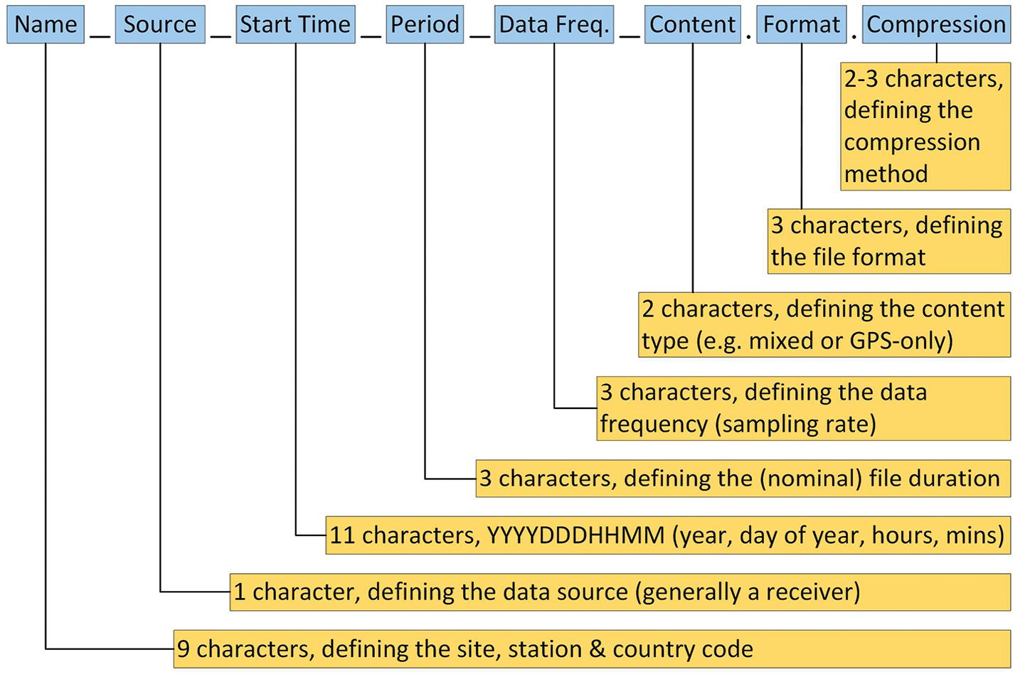 Figure 1: Philosophy of long RINEX file names (adapted from RINEX document by DCS Spatial Services).
www.spatialsource.com.au 33

IGS products or Continuously Operating Reference Station (CORS) data need to understand the long RINEX file names to obtain the desired data for their purposes.
The following examples illustrate the benefit of the long file naming convention, with data source, start time, duration, sampling rate and data type now easily visible as part of the file name.
BATH00AUS_R_20230621500_03H 30S _MO.rnx indicates a RINEX observation file for Bathurst CORS (being the first monument [0] and the first receiver [0, unless additional receivers are connected to the same antenna] located at this site in Australia), sourced from a receiver (via vendor or other software), observed in 2023 on day of year 062 and starting at 15:00 hours, that contains 3 hours of data at a 30-second sampling rate and mixed GNSS observation data (as opposed to GPS-only).
Accordingly, BATH00AUS_R_ 20230620000_01D_MN.rnx.gz indicates a compressed (the added gz extension specifies gzip compression) RINEX navigation file collected at Bathurst CORS, being the first monument and receiver at this site, sourced from a receiver, observed in 2023 on day of year 062, starting at 00:00 hours and containing 1 day of mixed GNSS navigation data.
As in the older versions, the RINEX observation file consists of a header section followed by a data section and ends with a blank line. While each row in the header continues to have a maximum length of 80 characters, this limitation has been removed for the data section.
Figure 2 shows a typical RINEX 3.04 header, including the following information:
• Line 1: RINEX version, specifying an observation file with mixed GNSS data.
• Line 2: Program used to generate the RINEX file, who ran it (here blank) and when it was run.
• Line 3: Marker name, here the 4-character ID issued to NSW by Geoscience Australia.
• Line 4: Marker number, here the Survey
Control Information Management System (SCIMS) number used in NSW.
• Line 5: Marker type, here geodetic (earth-fixed, high-precision monument). Selecting an attribute other than GEODETIC or NON_GEODETIC (lowprecision monument) indicates that the data was collected by a moving receiver (e.g. on a person, car, aircraft, glacier or animal).
• Line 6: Observer and agency, here indicating an organisation external to DCS Spatial Services.
• Line 7: Receiver serial number, receiver type and firmware version.
• Line 8: Antenna serial number (for integrated antennas the same as the receiver) and antenna type (using the IGS naming convention).
• Line 9: Approximate site position in Cartesian coordinates.
• Line 10: Antenna height (measured vertically between ground mark and the Antenna Reference Point, ARP) and any horizontal offset from the mark (if applicable).
• Line 11-14: For each satellite system, the number and types of observations, here specifying eight observation types for GPS, four for GLONASS, six for QZSS and four for Galileo. The 3-character observation codes include observation type (C = pseudo-range, L = carrier phase, D = Doppler, S = signal strength, X = receiver channel number), band/ frequency (range 1-9) and attribute (tracking mode or channel, e.g. C, P, W, I, Q). For instance, for GPS, L1C and C1C are the L1 carrier phase and pseudo-range derived from the C/A code, while L2W and C2W are the L2 carrier phase and pseudo-range derived from Z-tracking (an effective method to acquire the encrypted P(Y) code under Anti-Spoofing conditions). This example only contains code and carrier phase measurements to keep the file width manageable.
• Line 15: Signal strength unit (DBHZ = signal-to-noise ratio in dbHz).
• Line 16: Sampling interval, here 30 seconds.
• Line 17: Comment, here the raw binary file name (can be placed anywhere between the first and last line in the header).
• Line 18-19: Time of first and last observation epoch, here 01:46:00 and 05:15:30 hours (GPS time) on 29 June 2023, respectively.
• Line 20: Receiver clock offset applied (0 = no, 1 = yes).
• Line 21-22: GLONASS slot and frequency numbers, indicating the number of satellites in the list followed by each satellite number and its frequency number (range -7 to +6).
• Line 23-25: Phase shift correction used to generate phases consistent with respect to cycle shifts, stated for each affected satellite system and carrier phase observation code. Here, three observation codes include a correction of -0.25 or +0.25 cycles.
• Line 26: Number of leap seconds between GPS time and UTC, here 18.
• Line 27: End of RINEX header indicator. Figure 3 shows a typical RINEX 3.04 observation data block, containing the following information:
• Line 28: Observation epoch date and time in the format year, month, day, hours, minutes, seconds (here 01:46:00 hours on 29 June 2023), epoch flag (0 = OK, 1 = power failure between current and previous epoch, >1 = special event, e.g. 2 = start moving antenna), and the number of satellites in the current epoch (here 15). The special character ‘>’ preceding the epoch information was introduced as an identifier to enable reading programs to easily detect the next epoch in case of a corrupted data file or when streaming observation data in a RINEX-like format.
• Each following line contains the observations from a single satellite, starting with the system identifier and satellite identifier (PRN). In this example, two Galileo, seven GPS,
34 position February/March 2024 surveying
Figure 2: Typical RINEX 3.04 header (courtesy DCS Spatial Services)
one QZSS and five GLONASS satellites were observed. The previous length limitation to 80 characters per row no longer applies as this now depends on the observation type list declared in the RINEX header and the available observables per satellite per epoch.
• Line 29: Observations recorded for the first satellite (E02) — see line 14 in Figure 2 for the corresponding Galileo observation types in the RINEX header. Each observation value continues to be defined as a float value of total length 14 with 3 decimals (F14.3), followed by two optional single-digit integer records (I1) representing the Loss of Lock Indicator (range 0-7 or blank, phase observations only) and the Signal Strength Indicator (range 1-9 for increasing signal strength or blank).
• Line 30-43: Observations recorded for the other satellites in this epoch, with missing observations (or those not observed) indicated as blanks.
RINEX 4.00 and 4.01
Adopted by the IGS in December 2021, RINEX 4.00 was necessary to accommodate the modernised navigation messages from all the different GNSS constellations. Once fully implemented, version 4 will future-proof the format of the navigation messages long term.
RINEX 4.00 observation files are backward compatible with RINEX 3.0X, hence there is no issue with their storage and usage. RINEX 4.00 provides minor extensions in observation types and extended header lines but no major format change, making adoption a minor evolution.

However, RINEX 4.00 navigation files are not backward compatible with RINEX 3.0X files. This is why the RINEX version number was increased rather than utilising another RINEX 3.0X sub-version.
But no change is necessary in file naming and storage because navigation files of all types can be stored together in different RINEX versions without any issue. All RINEX files state the version number in the first line and most reader programs will skip over unknown navigation file versions until they are ready to process them.
Development has since continued to add clarifications and new observation codes for upcoming GPS satellites and for L1 NavIC signals, resulting in RINEX 4.01 being released in July 2023. This development has been conducted in collaboration with equipment manufacturers and software generators, ensuring that equipment and software tools able to produce and process RINEX version 4 files will be available in due course to enable implementation and broader adoption.
Editing RINEX observation files
Regardless of the version used, the RINEX header often contains incorrect or incomplete information when initially generated (e.g. the manufacturer’s receiver and antenna names not following the IGS naming convention, a default antenna type or a zero antenna height), so thorough editing is important to avoid confusion further downstream.
For example, the RINEX format stipulates the antenna type as a 20-character
name (see columns 21-40 of line 8 in Figure 2), including several spaces and ending with a 4-character indication of the radome (antenna cover) used (NONE = no radome present). This IGS naming convention is also used by AUSPOS.
If the antenna height was not measured directly and vertically to the ARP in the field, then it must be converted using the offsets and method specified in the GNSS equipment manual (generally applying Pythagoras in conjunction with a vertical offset). The correctness of antenna height and type is crucial to allow the correct antenna model to be applied correctly in processing.
This particularly applies for data archival, data sharing or submission to third parties (especially where machineto-machine processes are likely to be employed). Ensuring the correctness of the information in the RINEX header is not only good practice but also very valuable when mining data for purposes not envisaged when originally collected (see Position 122, Dec/Jan 2022–23).
The RINEX file should be visually inspected to ensure that the first and last few epochs contain reasonably complete data blocks. If epochs at the start/end of the observation are deleted, the time of the first/last observation in the RINEX header should be modified accordingly.
Hopefully, this article has helped you to better understand the RINEX format, the philosophy behind it, and its benefits. n
Dr Volker Janssen works at DCS Spatial Services, a unit of the NSW Department of Customer Service.
Adopted by the IGS in December 2021, RINEX 4.00 was necessary to accommodate the modernised navigation messages from all the different GNSS constellations.
Figure 3: Typical RINEX 3.04 observation block (courtesy DCS Spatial Services).
www.spatialsource.com.au 35

Metrication memories
It is now 50 years since surveying went metric in Australia. Tony Proust looks back to what things were like in 1974.
Icompleted my surveying studies in Perth in 1974
just as metrication came in. Consequently, for the duration of my career as a surveyor, the standard conversion factors — 0.201168 for the conversion of links to metres and 0.3048 feet to metres — were indelibly imprinted in my head. We all knew by heart that the standard offset distance for a buried reference mark — 1ft 6 inches — was 0.45m. This would be the case for a whole generation of surveyors.
Thankfully I began my career along with the development of the first handheld programable calculators. My first such device was the HP25, which had a 50-step programable capacity. My colleagues and I rapidly developed, or swapped, programs to do the various calculations we needed on a daily basis — double missing distance, double missing bearings, traverse close, area calcs etc — each using only 50 steps.
The test program in the HP manual revealed the genesis of the calculator. Imagine you are in a lunar lander spacecraft and about to land on the moon. You had ‘x’ units of fuel left to power your retro rockets during descent to the lunar surface, and you had to slow your speed to ‘y’ metres per second so
that you could land without crashing. It was one of the first computer games. With only two variables, we all learnt how to beat the computer after a couple of attempts.
For the first eight years of my career, I was an engineering surveyor on large engineering projects were everything was in metres — easy peasy. But once I gained my registration in 1983, I had to deal with thousands of old survey plans that were in either links or feet. I quickly
maths mistake. In 1999, after 10 months travel to Mars, the Mars Climate Orbiter burned and disintegrated into pieces. On a day when NASA engineers had expected to celebrate mission success, the reality was very different… and all because someone failed to use the correct (metric) units of measurement. It turns out that NASA was using metric units of measurement while the contractor who built the spacecraft was using Imperial
I had to deal with thousands of old survey plans that were in either links
learnt to distinguish between them by the road widths — 100 links or 66 feet wide. It was a rule of thumb which rarely failed, as the simplest rules are the best. And for the rest of my surveying career, until I handed in my registration in 2017, I was converting links and feet into metres. Even as a town planner those skills came in handy.
Metrication was one of the smartest changes we ever made, along with decimalisation of our currency in 1966. Consider the tale of NASA losing a spacecraft due to a metric
or feet.
— inches, feet and pounds. Can you believe it? By failing to successfully convert from one to the other, the spacecraft was ‘lost in translation’.
These days the United Kingdon has a contradictory approach to metrication. Most of government, industry, commerce and scientific research use the metric system, but Imperial units are used for journey distances, vehicle speeds and some other measurements. How weird is that? And in the United States, despite a number of
feeble attempts by government to convert the country to the metric system, they never have and probably never will.
One of my colleagues, Mitchel Hanlon, recently told me a story of when he first used a particular EDM, a HP3820A, more than 30 years ago. He soon realised the distances he measured, while correct within themselves, were in fact wrong and he could not understand why. Then, looking closely at the switches on the instrument he discovered the one that toggled between ‘ft’ and ‘m’. All his measurements were in feet, not metres. Once he flicked the switch to ‘m’ everything went smoothly. The boss never found out, but the chainman probably thought it was hilarious.
In the early days of metrication, I do recall hearing of older surveyors who continued to measure in feet, sometimes decimal feet, only to convert the job to metres at the plan drawing stage. Change can be difficult. Nevertheless, going metric probably resulted in one of the single greatest leaps in productivity the land development industry has ever seen, before or since. n
Do you have an interesting surveying tale to tell of the year Australia went fully metric? Please contact the editor at jnally@intermedia.com.au.
36 position February/March 2024 surveying

Multispectral LiDAR
IRIDESENSE has unveiled what it claims is the first 3D multispectral LiDAR sensor capable of analysing plant health and soil humidity levels remotely in real-time, while adding that the unit is also suitable for other applications, such as industrial quality control and forest management.
The long-range (300-metre), 60W 3D LiDAR is based on proprietary SWIR multispectral laser technology, featuring five colours in infrared and high-resolution image quality. The unit can operate completely independent of lighting and meteorological conditions, weighs only 3.5 kg and has dimensions of 142 mm x 220 mm x 192mm.
The company says it is actively searching for partners to deploy the technology to collect data to improve its artificial intelligence.
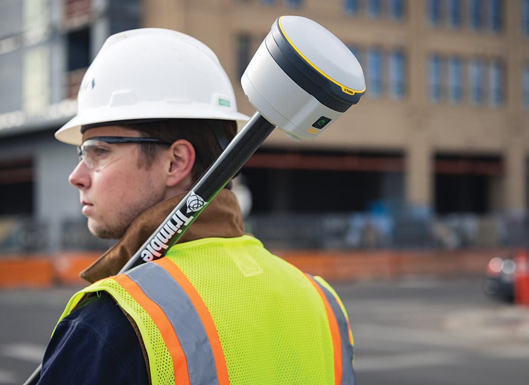
GNSS receiver
Trimble has introduced the R580 GNSS receiver, describing it as the next generation in its portfolio of ProPoint GNSS positioning engine-enabled receivers. The company says the R580 provides high-accuracy, surveygrade GNSS performance for surveying, mapping, GIS, civil construction and utilities, through the capture of centimetre-level positioning.
The on-board ProPoint GNSS engine enables users to measure points in challenging environments, such as under tree canopies or near buildings, while the Trimble EVEREST Plus technology can identify and remove unwanted multipath signals for improved accuracy and data confidence. Using the Trimble Maxwell 7 chipset technology, the receiver provides anti-spoofing capability and the ability to track all available GNSS constellations.
The R580 also supports Trimble RTX correction services for RTK-level precision without the use of a local base station or VRS network wherever correction sources are available.
new products
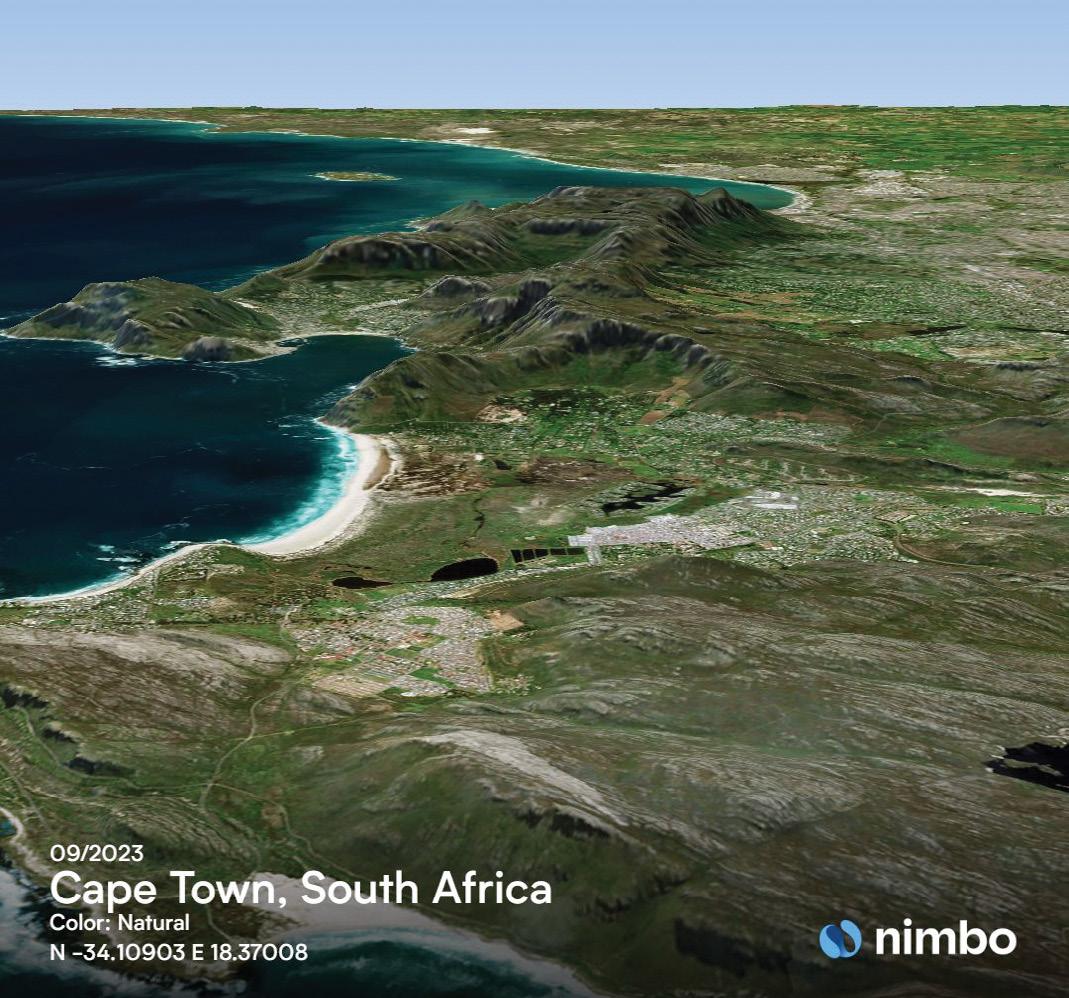
Cloudless image access
French firm Kermap has released Nimbo, a free web platform enabling accessing to time series 2D and 3D cloudless satellite views of the Earth.
The company says it relies on innovative AI methods to process, clean and homogenise Copernicus Sentinel 1 and 2 ten-metre resolution satellite imagery, while catering to the needs of GIS professionals by providing API access to its monthly basemaps from any GIS software, including a dedicated QGIS plugin. It adds that the clarity and homogeneity of its Earth Basemaps make them suitable for geospatial applications based on machine learning: time series analysis, object extraction and change detection.
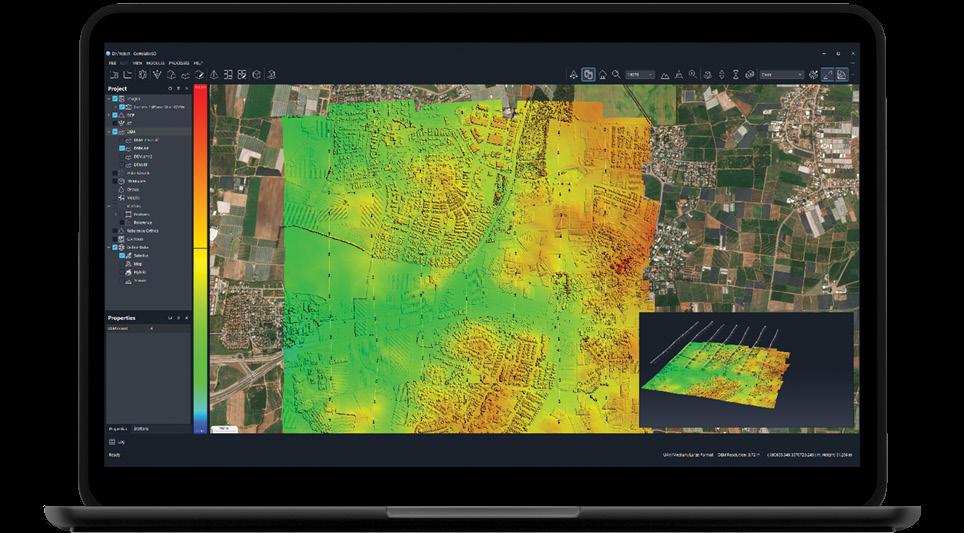
Enhanced cloud capabilities
SimActive has announced the enhancement of its Correlator3D high-end photogrammetry suite for improved cloud environment productivity. Correlator3D is an end-toend solution for the generation of high-quality geospatial data from satellite and aerial imagery, including drones. It performs aerial triangulation and produces dense digital surface models, digital terrain models, point clouds, orthomosaics, 3D models and vectorised 3D features. Powered by GPU technology and multi-core CPUs, Correlator3D supports the rapid production of large datasets.
SimActive says the enhancements provide faster processing, along with survey-grade accuracy and detailed reports.
www.spatialsource.com.au 37
News and views from the Geospatial Council of Australia

CEO’s Column
GCA Board Members
GCA Board Members
Kate Lundy President/Chair
Paul Digney Acting President
Alistair Byrom Deputy President
Alistair Byrom Co-Deputy Chair
IJacinta Burns Director
Darren Mottolini Director
Paul Digney Director
Roshni Sharma Director
Stewart Dunne Director
Jacinta Burns Director
Mary-Ellen Feeney Director
Kate Ramsay Director
Darren Mottolini Director
Kate Ramsay Director
38 position February/March 2024
n August, the Geospatial Council of Australia made a submission to the Australian Government’s review of the Australian and New Zealand Standard Classification of Occupations (ANZSCO), advocating for increased recognition of geospatial professions. The important work on the GCA’s submission was led by Danika Bakalich, Executive Manager, Workforce and Strategy. Since then, we are pleased to provide an update on the Australian Bureau of Statistics (ABS) ANZSCO Review (Round 2) Preliminary Proposed Changes. ABS is making important adjustments to ANZSCO. These changes, if they proceed, are designed to provide a more accurate representation of the geospatial workforce in Australia, and they include the following key modifications:
Proposed to retire the occupation ‘Surveyor’ (232212) and replace with proposed occupations:
• Engineering Surveyor (232215) — Specialisation: Construction Surveyor
• Land Surveyor (232216) — Specialisation: Registered or Licensed Land Surveyor
• Mine Surveyor (232217)
• Surveyors and Spatial Scientists nec (232299) — Occupations within this group include: Geodetic Surveyor Hydrographic Surveyor
All occupations under these classifications sit at Skill Level 1 and more detail is provided around tasks.
Proposed change to the principal title ‘Other Spatial Scientist’ (232214) to ‘Geospatial Specialist’ (232214):
• Specialisations include: Geospatial Analyst, GIS Consultant, GIS Manager
All occupations under this classification sit at Skill Level 1 and this proposed change includes greater detail related to tasks.
Proposed change to the title ‘Surveying or Spatial Science Technician’:
• Geospatial Technician (312123)
/ Alternative title: Geographical Information Systems (GIS) Officer
• Surveying Technician (312124)
— Specialisations include: Survey Draftsperson
All occupations under these classifications sit at Skill Level 2 and more detail is provided around tasks.
Proposed to retire the classification
‘Surveyor’s Assistant’ (821915) and replace with proposed occupation:
• Surveyor’s Assistant (821916) /
Alternative Title: Surveying Assistant
This occupation now sits at Skill Level 4 (previously at Skill Level 5), while proposing the inclusion of additional functions/tasks.
GCA views these proposed changes positively, as they are expected to provide a more accurate assessment of the geospatial workforce across Australia.
ANZSCO review: Preliminary proposed changes GCA
Roshni Sharma Director
Our commitment is to collaborate with the ABS and industry stakeholders to enhance visibility and promote positive developments within the sector. This progress is very pleasing so far, however we also realise there is still quite a bit of scope for improvement. It is gratifying that GCA’s submission, carefully prepared after wide consultation, has influenced ABS in these important changes. It should however be noted that these changes are part of a process, and we were under no illusion that it would take a few steps in the process to get to where we think we need to be.
Since the ABS published its proposed changes at the end of last year, questions have arisen, particularly from the perspective of skilled migration. I therefore want to provide additional insights and clarification on some of the key enquiries raised.
1. Specialisation and visa eligibility. The term ‘specialisation’ in the proposed changes signifies a more detailed breakdown of occupations within the geospatial sector. As the changes are still in the proposal stage, the existing system for skilled migration remains until confirmed adjustments are implemented. Eligibility for visas will continue to be assessed based on academic requirements, and candidates meeting these criteria can proceed with skills assessment.
2. Cadastral surveyors and 3D laser scanning surveyors. Cadastral surveyors will be considered under the broader category of ‘Surveyors and Spatial Scientists nec’ in the proposed changes. The absence of 3D laser scanning surveyors in the initial proposal is acknowledged, and ongoing discussions will address the inclusion of such specialties.
3. Flexibility and general ‘Surveyor’ category. During the transitional phase, any occupation associated with ‘Surveyor’ will be assessed under the general category of Surveyor. This approach allows for flexibility as the proposed changes are implemented.
4. Skills assessments and fairness. Acknowledging concerns about skills assessments, GCA is actively exploring ways to shift towards competency standards. Discussions include recognising vocational education and training, shorter degrees, and micro-credentials combined with relevant experience.
5. Migration challenges for experienced professionals. GCA recognises the challenges faced by experienced professionals in the migration process. Efforts are focused on moving away from strict educational
requirements towards a more balanced approach that considers competency and experience as well. For example, the requirements for land surveyors (licensed cadastral surveyors) in Australia are set via local legislation in each jurisdiction and there is a surveyors’ licencing board in each state and territory of Australia. This will not happen overnight, but it is part of a global trend across many professions where the emphasis is shifting from solely education standards to a combination of education and demonstrable competency and experience.
Hydrographic surveyors already have a rigorous process of educations standards and competency standards with the Level 1 and Level 2 certification standards, which are approved by the International Hydrographic Organisation.
As the skills assessment authority for surveying, in order to make any changes to our assessment criteria for skilled migrants, we must seek the agreement of the relevant professional standards organisations, in this case being CRSBANZ (The Council of the Reciprocating Surveyors Boards of Australia and New Zealand) and IHO (International Hydrographic Organisation). We are therefore constrained by intergovernmental and international bodies when we wish to implement positive reform in this area.
GCA’s ongoing discussions with relevant bodies aim to streamline the migration process for qualified professionals within the constraints of local legislation and professional standards. This clarification underscores the commitment of GCA to collaborate with industry stakeholders and skilled migrants in shaping a classification system that accurately represents the dynamic geospatial workforce, as well as ensuring it reflects what is practically required in the workplace. The proposed changes present an opportunity to enhance the sector’s visibility and promote positive developments. As discussions progress, GCA remains dedicated to addressing concerns, facilitating a smooth transition, and advocating for a more inclusive geospatial classification system.
The review has so far noted that, given the rapid evolution of the geospatial industry, it is anticipated that future reviews of the classification will be essential to ensure its continual alignment with the labour market and the changing dynamics of the field. We will continue to keep you updated as we work towards a more transparent and representative classification system for the geospatial industry in Australia. n
State and Territory Chairs and Co-Chairs
NSW Chair
Brittany Baker
NSW Vice-Chair
Hanno Klahn
ACT Chair
Mike Stapleton
Queensland Chair
Cameron Brittain
Queensland Vice-Chair
Koray Ozdogu
South Australia Chair
Graham Walker
South Australia Vice-Chair
Jennifer Brindle
Tasmania Chair
Anthony O’Flaherty
Victoria Chair
Richard Syme
Victoria Vice-Chair
Sam Houston
Western Australia Chair
Laren Collen
Areas of Practice Chairs
GDARS Chair
Dr Jagannath Aryal
Surveying Chair
Mike Stapleton
Hydrography Chair
Neil Hewitt
Young and Emerging Professionals Chair
Oscar So
39
www.spatialsource.com.au
Beyond TROPHIES
Unleashing the strategic power of awards participation.
In the dynamic and ever-evolving landscape of professional achievements, participating in industry awards programs has transformed beyond a mere celebration of success. The strategic advantages extend far beyond the glint of trophies and the applause of peers, presenting a unique opportunity for individuals and businesses to solidify their standing in the industry. In this article, I delve into the multifaceted impact of industry awards participation, exploring its transformative influence on both individuals and businesses in the professional landscape.
Awards participation transcends the momentary glory of trophies, offering a strategic advantage that shapes the trajectory of both individuals and businesses.
Individual impact
CLAIRE GERBER, GCA NATIONAL EVENTS MANAGER
For individuals, involvement in awards programs offers a momentous chance to showcase and celebrate achievements alongside the industry’s most prominent figures. The recognition and credibility garnered from such accolades become invaluable tools for building a personal profile within the industry. Leveraging social media platforms and professional portfolios, awardees can extend their influence and create lasting connections with like-minded professionals. Additionally, the allure of networking opportunities with industry leaders further enhances the individual’s professional journey.
In essence, these accolades act as more than just trophies; they act as catalysts for personal growth, motivation, and a clear pathway to building a successful and distinguished career.
Business benefits
For businesses, participation in awards programs is a strategic move that goes beyond mere recognition. Achievements acknowledged by industry peers not only build brand credibility, but also enhance the overall reputation of the business. This recognition cascades through the organisation, offering a trifecta of benefits.
1. Team dynamics: Morale, talent attraction and innovation
The impact on the team is profound. Awards ceremonies become more than just celebratory events; they are opportunities to reward, recognise and celebrate hardworking team members. Many businesses attend these events with their entire team, fostering a sense of pride and boosting overall morale. Beyond internal dynamics, the recognition earned through awards positions the business as an ‘employer of choice,’ attracting top talent in a competitive environment. Furthermore, the pursuit of awards success becomes a motivational force that drives innovation within the team.
2. Strategic marketing: Amplifying success across channels
Leveraging awards for marketing opportunities is a crucial aspect that often goes underutilised. Whether as a finalist or a winner, participation in awards can be integrated across various marketing channels. Media coverage, press releases, website highlights, newsletters and social media platforms become powerful avenues to broadcast the business’ achievements. Visual representations, such as a collection of awards medallions showcased on a website or embedded in an email signature, create a compelling narrative of success.
As we look to enhance our own Awards program, we are pleased to announce that those participating in the GCA Excellence Awards in 2024 will have the added advantage of not only receiving certificates and awards medallions, but also exclusive social media assets to be shared across marketing channels, ensuring a broader reach within the industry.
GCA 40 position February/March 2024
3. Future prospects: Integrating awards into the business narrative Beyond immediate gratification, awards play a pivotal role in future business endeavours. Winners and finalists can seamlessly incorporate their achievements into the brand’s story when tendering for future projects. This showcase of excellence serves as a commitment to potential clients and stakeholders, reinforcing the business’s dedication to delivering exceptional results.
Tips for maximising awards programs
1. To make the most of awards programs, adopt a year-round mindset. For outstanding projects, gather essential data, collate multimedia elements and note key milestones, ensuring your submission is well-prepared when the time comes.
2. Engage your team in the process, encouraging them to identify innovative aspects of projects that merit recognition. Gather input from various team members about their perspectives on the project; the enthusiastic descriptions they provide can add vibrancy and excitement to your submission.
3. Keep a keen eye on awards opening dates. Leaving award submissions to the last minute can have an impact on the strength of your submission. Involve your team early in the
submission process so that your submission has the best possible chance to shine.
4. Focus on the excellence of your work! Submission text does not need to be lengthy to have an impact. It is much more impactful to have a submission supported by evidence, data and testimonials.
5. Lastly, maximising exposure throughout the entire awards process is crucial. Share your participation, finalist status, and, hopefully, your victory on social media platforms. Regardless of the outcome, the positives derived from awards programs are numerous, making the journey itself worthy of celebration. In conclusion, awards participation transcends the momentary glory of trophies, offering a strategic advantage that shapes the trajectory of both individuals and businesses within the industry. By embracing these opportunities, professionals can amplify their influence, and businesses can solidify their position as industry leaders, setting the stage for future successes. In an era where recognition is a currency of its own, strategic participation in awards programs emerges not just as a celebratory gesture, but as a transformative force propelling individuals and businesses towards enduring success. n
Upcoming GCA events
International Women’s Day Breakfasts: 8 March
We will be hosting our ‘Women in Geospatial Breakfast’ in New South Wales, Queensland and Victoria on Friday, 8 March, International Women’s Day. This isn’t simply a networking event, it’s part of something much bigger. Join us as we discuss the future of the geospatial sector, and empower the women who are shaping it.
WA Digital Twin Symposium: 14 March
We are pleased to be hosting our special symposium in Perth to discuss spatial digital twins. This will be a fantastic opportunity to explore this important and relevant topic for all geospatial professionals. The symposium aims to bring together experts, researchers and practitioners in the field of digital twin technology to share insights, exchange ideas and explore the latest advancements in this rapidly evolving domain. Topics covered will include case studies and best practices, challenges and future directions in digital twin technology, digital twin modelling and simulation, and many more.
Locate24: 7–9 May
Registrations for the upcoming Locate24 conference are officially open. Scheduled to take place from the 7 to 9 May 2024, Locate24 will enable geospatial professionals to share their knowledge, discuss emerging trends and showcase cutting edge technologies that are shaping the future of geospatial services. Hosted at the International Convention Centre in Sydney, the conference will offer an ideal setting for networking, collaboration and learning against the backdrop of one of the world’s most vibrant and dynamic urban landscapes. In response to feedback, there has been a significant decrease in registration fees, making the event even more accessible. There is also an early-bird discount available until 5:00pm AEDT, 4 March.
Webinars: Save the date
Surveying webinar: 29 February
Surveying webinar: 21 March

Hydrography webinar: 4 April
GDARS webinar: 11 April
Surveying webinar: 18 April
©stock.adobe.com/au/borisblik
Find full details of these and other events can be found at geospatialcouncil.org.au/events. www.spatialsource.com.au 41
Stewart Dunne: From sea to boardroom
In a significant move for the Geospatial Council of Australia (GCA), Stewart Dunne, the former Hydrographer of Australia, recently joined the organisation’s board. Bringing more than three decades of naval expertise, he is set to play a pivotal role in shaping the future of the geospatial industry.
Commissioned into the Royal Australian Navy in 1990, Stewart began his journey into the geospatial industry as a hydrographic surveyor. Over the course of 34 years, he specialised in hydrography and gained extensive experience in command, operations, training and capability development. His career took him to remote areas, both domestically and overseas, and earned him leadership roles at the Australian Hydrographic Office in Wollongong, where he served as the Hydrographer of Australia, and as the Chair of the Australasian Hydrographic Surveyors Certification Panel, a role he is most proud of.
As a graduate of Australia’s War College Centre for Defence and Strategic Studies, Stewart’s commitment to the field is underscored by his qualifications. These include a Hydrographic Cat A and B, recognition as a Royal Australian Navy Charge Surveyor, and a Graduate Diploma of Hydrographic Surveying from Plymouth University. His diverse educational background also includes a Masters of International Relations and a Graduate Certificate in Defence and Security Studies from Deakin University, along with a Masters of Arts in Strategy and Security from the University of New South Wales.
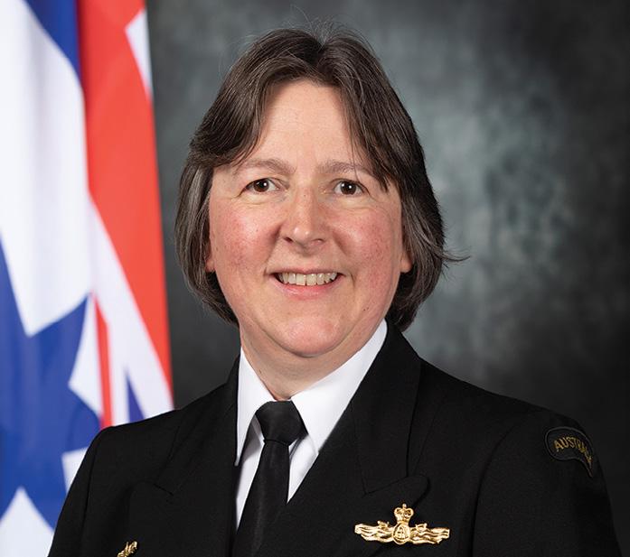
Commodore Robyn Phillips, RAN has been appointed to the position of Hydrographer of Australia. CDRE Phillips joined the Royal Australian Navy in 1990 as a Maritime Warfare Officer and
Building an inclusive and innovative community
Having recently stepped into the role of a board member at GCA, Stewart shares insights into his motivation. After leaving the Defence sector, he sought opportunities to remain involved in the hydrospatial industry, aiming to contribute to its future trajectory. Drawing from his experience as the Hydrographer of Australia, he has in-depth understanding of both the challenges and opportunities within the maritime domain. GCA’s vision and purpose resonated with him, particularly the emphasis on empowering industry members for the betterment of the nation.
He was also drawn to the idea of community. Stewart sees a unique opportunity for GCA to become the trusted voice of Australia’s geospatial industry, uniting diverse disciplines through focused advocacy, education and advice, to create an inclusive and innovative professional community.
Passion for advocacy
As a board member, Stewart is deeply passionate about advocacy, especially for the hydrospatial discipline. He stresses the importance of impactful representation through studies, white papers and policy development. In the context of hydrography in Australia, he emphasises the need for a sustainable and robust foundation supported by a domestic education program and certification process. Recognising the significant contributions of different geospatial sectors to the economy and society, he is keen to leverage his experience and network to highlight the importance
subsequently specialised in meteorology and oceanography. She has enjoyed a varied Defence career, including postings to the Department of Prime Minister and Cabinet as well as being the Commanding Officer of two establishments, HMAS Waterhen and HMAS Albatross, where she was awarded a Royal Australian Navy Gold Commendation for her exemplary performance during the 2019–20 bushfires.
As Hydrographer of Australia, CDRE Phillips leads Australia’s national hydrographic authority, the Australian Hydrographic Office, headquartered in Wollongong, New South Wales.
On her appointment, CDRE Phillips
of hydrospatial data in the maritime domain. His goal is to work collaboratively with stakeholders to strengthen the sector’s foundation and promote its compelling narrative.
Reflecting on GCA’s evolution, Stewart acknowledges the completion of the initial merger of SSSI and SIBA that formed the organisation. Historically, he says surveying and spatial sciences have been linked but separate, whereas today it is more correct to think of a multitude of disciplines and technologies that collectivise into one. He believes GCA is currently evolving in recognition of this new need, and that the GCA Strategic Plan 2023–24 clearly articulates what is required and the steps that will be taken.
Encouraging the next generation
For those aspiring to enter the geospatial industry, Stewart offers simple yet powerful advice — he encourages them to understand that a geospatial career provides a lifetime of opportunities and variety. It takes them all around Australia and possibly the world, offering access to cutting-edge technologies and engaging tasks within a community that is both innovative and interesting. Give it a go, he says. n
said: “I am exceptionally pleased to be leading the Australian Hydrographic Office, an incredibly dedicated team of geospatial professionals. I would also like to acknowledge the achievements of CDRE Stewart Dunne, particularly his work to secure funding for the HydroScheme Industry Partnership Program for the next ten years. It is an exciting time to be a part of Australia’s hydrographic community with the HIPP driving industry growth and delivering world class bathymetry for Australia”.
CDRE Phillips is also the ex-officio Chair of the GCA’s Australasian Hydrographic Surveyors Certification Panel.
GCA 42 position February/March 2024
The
Hosted at the International Convention Centre in Sydney, the conference will offer an ideal setting for networking, collaboration and learning against the backdrop of one of the world’s most vibrant and dynamic urban landscapes.
In response to valuable feedback received from past delegates, the Locate24 Conference is thrilled to announce that there has been a significant decrease in registration fees, making this premier geospatial event even more accessible for professionals, enthusiasts and students alike.






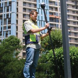





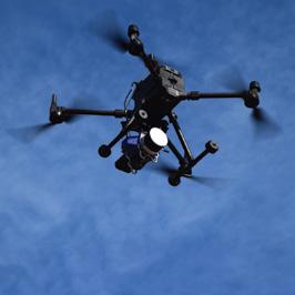


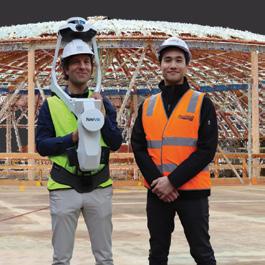


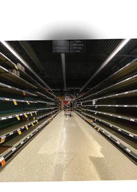
EXTENDING THE REACH OF GNSS Surveying operations in Australia’s Top End Recognising the geospatial sector. positioning projects spatial standards. Mobile mapping Capturing survey-grade point clouds at speed Spotting bushfires imagery More than $1.5bn satellite Challenges facing industry DIGITAL TWINS for smarter futures Complete guide to United Kingdom? Industry experts coming in 2024 Complete guide to and services revolution Industry experts ahead THE YEAR OF THE CAREER Tackling the industry’s skills challenges in 2022 MAP FOR GOOD Air traffic helping the planet Full guide to 2023’s conference Craig Sandy outlines initiatives these two vital sectors SPECIAL CONFERENCEISSUE LOCATE Full guide to 2022’s conference Enhancing the reference system Surveying’s risky possession cases GIS-POWERED INNOVATION Inside Energy Queensland’s digital revolution SPECIAL CONFERENCEISSUE LOCATE LOCATE BEFORE YOU DIG Boosting accuracy for sub-surface surveys From military career LiDAR and timing tech Plotting the path of FIGHTING FLOODS FROM ABOVE Surveying Byron Bay’s aftermath with LiDAR surveying Improving NSW’s control network Making digital SS LakeIllawarra APPLICATIONREADY INSIGHTS The fourth era of geospatial data Surveyors dig deep project Developments location services SUPPLY CHAIN PAIN Locating the solution SAVING REWORK WITH 3D MAPPING Transforming design and build with mobile scanning pilot for drones, GIS and BIM Canberra puts PNT technologies Accounting for ocean ecosystems Location intelligence Having the right data at the right time Low- and high-end the field. CASA’s roadmap for beyond. geodesists? ISSUE 130 — April/May 2024 • Location services, precision measurement • Government projects and services • TECH: Drones, RPAs, UAVs, aerial, UUVs and services ISSUE 131 — June/July 2024 • Digital twins, smart cities, IoT, transport, logistics, infrastructure • Agriculture, forestry, conservation, environment, sustainability • TECH: Space services, GNSS and PNT devices and services ISSUE 132 — August/ September 2024 • Remote sensing, Earth observation, photogrammetry • Mining, resources, offshore, geology, exploration • TECH: LiDAR, 3D modelling, photogrammetry ISSUE 133 — October/ November 2024 • Space industry, space services • Data analysis, AI, machine learning, augmented reality • TECH: Surveying and mapping devices, software and field services ISSUE 134 — December/ January 2024-25 • Annual Directory + Leaders Forum issue • Looking ahead — trends in surveying, space and geospatial, R&D • TECH: 3D capture, processing and modelling, point clouds Survey these OPPORTUNITIES Your organisation has amazing success stories to tell, right? Then make sure you share them with the readers of Position magazine, Australia’s geospatial journal of choice, now into its fourth decade. Match your work to the features list below, and let us help spread your message. For article proposals, email the Editor Jonathan Nally jnally@intermedia.com.au For advertising, contact the Advertising Manager Anna Muldrock amuldrock@intermedia.com.au POS_HPH_SurveyOpp_house_FM24.indd 1 8/2/2024 9:20 am
the upcoming Locate24 conference are officially open!
Registrations for
Locate24 Conference,
the 7 to 9 May 2024, will enable geospatial professionals to share their knowledge, discuss emerging
and
that
of geospatial services.
scheduled to take place from
trends
showcase cutting‑edge technologies
are shaping the future
REGISTRATIONS NOW OPEN To receive an EARLY-BIRD DISCOUNT on your registration, head to the Locate24 website prior to
locate.geospatialcouncil.org.au www.spatialsource.com.au 43
4 March 2024:
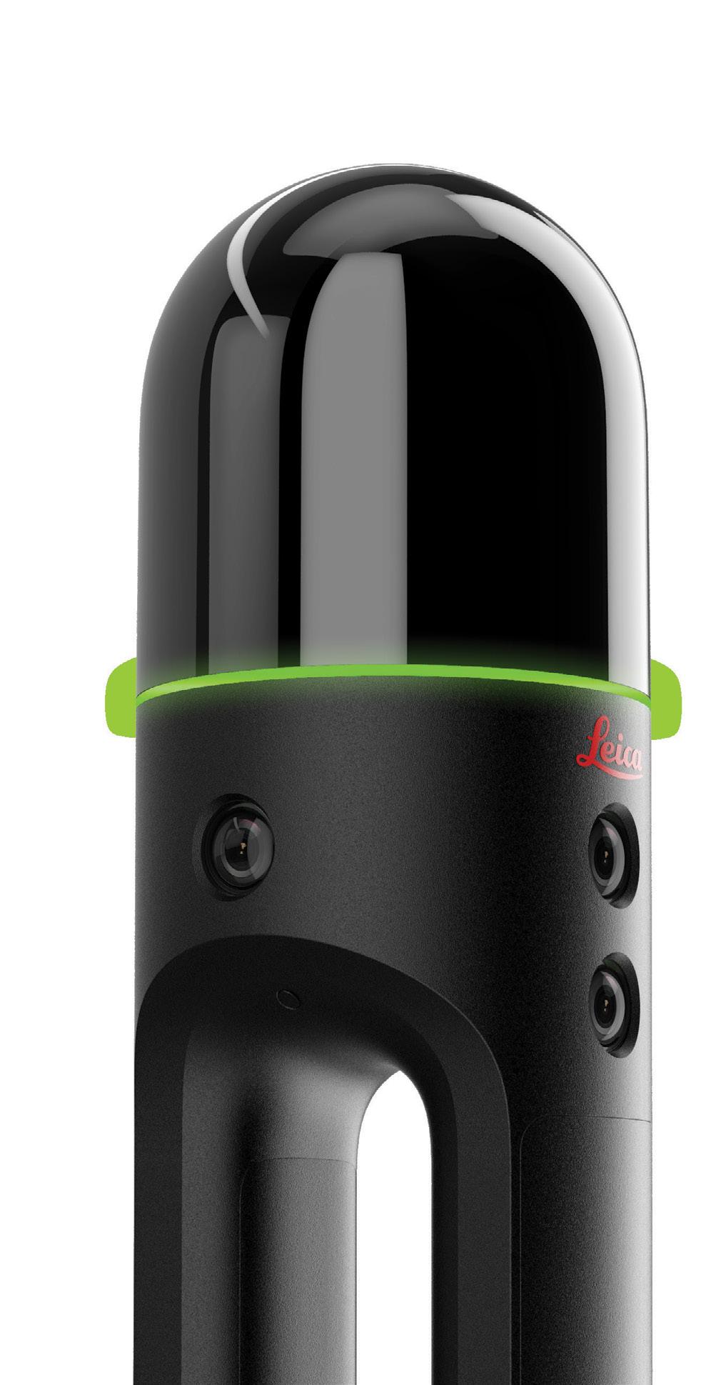


 Water reservoirs represented with different geometries: yellow polygons representing authoritative Vicmap water features; blue polygons representing para-authoritative water features generated by a ML model; and green points representing authoritative Vicmap water features.


 Andrew Smith (left) and Simon Merrigan.
Sean Ryan, Millar Merrigan’s Sector Manager for Surveying, said that the strategic nature of the acquisition “reinforces our commitment to excellence in surveying”.

 Finland’s new geoid model is 30% more accurate than the previous model.
Credit: National Land Survey of Finland ©stock.adobe.com/au/josevandyk


 Left: The effects of heat on display at St Johns Rd, Glebe, where less than 20% canopy coverage is recorded. Right: A more comfortable and cooler climate on Westmoreland Street, Glebe, with 35% canopy coverage.


 Surveyor James Reibey Atkinson (left) and other men at a coal mine at Ipswich, around 1870.
This 1889 map that is one of the earliest topographic maps drawn over Queensland, covering the northeast area of Brisbane.

 Survey plan BNT478 captured a 1914 survey by Claude Newcombe of parts of the Parish of Broadwater (southwest of Stanthorpe).
‘We of the Survey’ was created by John William Sorby around 1890. Courtesy of the Cooke collection.


 A joint publication of the ICA and the UN, Mapping for a Sustainable World outlines mapping best practices.
Demonstrating navigation within a virtual environment that includes a terrain model, at the Workshop on Immersive Cartography/Cartography for Immersive Environments, Florence, Italy, December 2021.

 The UK’s Head of Geography Profession, David Wood (far right) at the presentation ceremony for the inaugural UK Geography in Government Award.


 Figure 1: Philosophy of long RINEX file names (adapted from RINEX document by DCS Spatial Services).


