RAPID REMOTE SURVEYS


FIG Working Week 2025 & Locate25 o ers a dynamic opportunity to strengthen your organisation's exposure to your key target markets. The conference will bring together surveyors (cadastre, valuation, mapping, hydrography, and quantity surveyors), geospatial professionals and related professions from across the globe thus providing direct access to diverse cross-section of highly sought industry stakeholders.
Attendees include professionals at all levels related to the use of geospatial technologies, including Government and Agency Representatives, CEOs, CIOs, CTOs, business owners, senior managers, project managers, information analysis, technical professionals, academics and students.
Sponsorship packages and exhibitor opportunity levels vary, and are tailored to suit your marketing strategies. FIG Working Week continues to be one of the premier international events, providing your company the valuable opportunity to network with the most in uential people at the forefront of the latest research, technology and development, position your brand at the front line of the industry, to build and strengthen relationships with key industry gures.





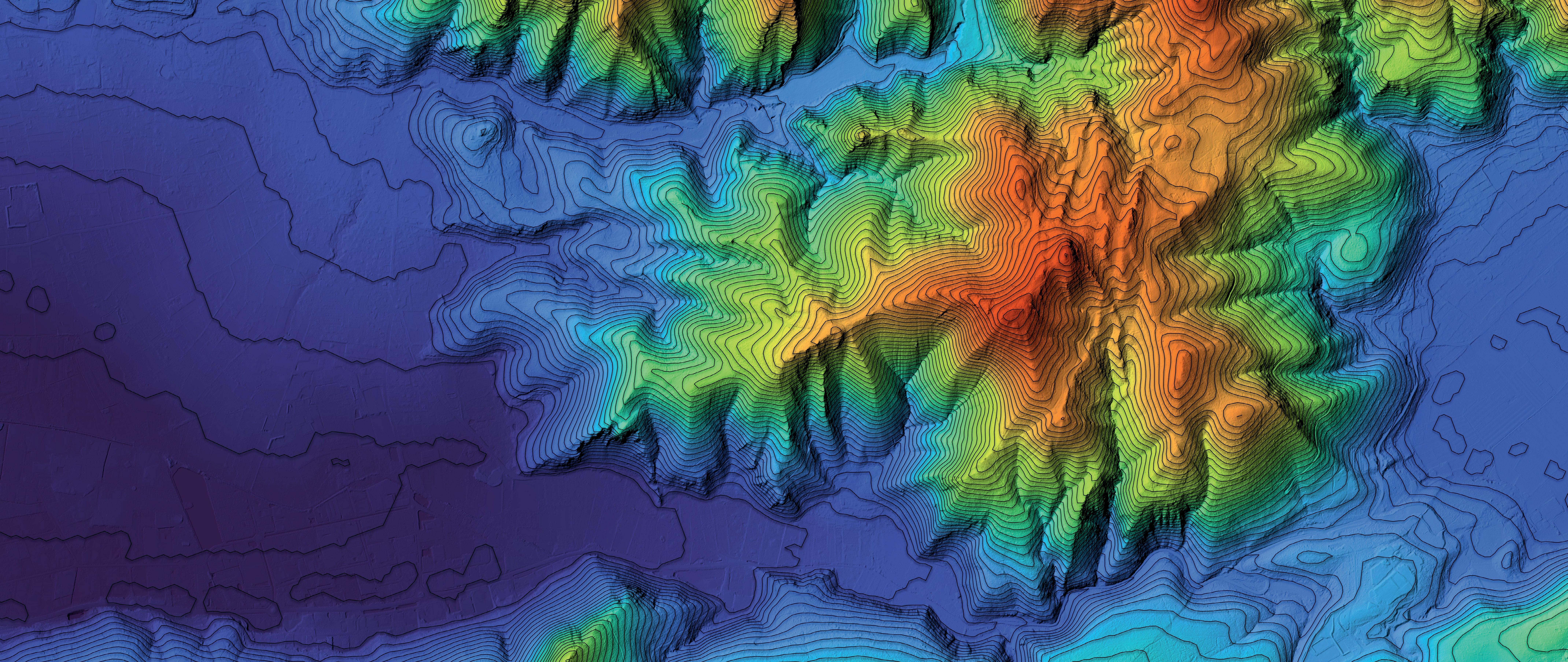


Tuvalu is testing a new high-resolution mapping initiative as part of its plan to create a digital twin of the entire Pacific island nation, cataloguing it’s physical assets, including trees, houses, significant cultural sites and infrastructure.
In early 2024, the Pacific Community (SPC) and PLACE, in partnership with the Tuvalu Government, undertook a data collection exercise in Funafuti to test new ways to cost-effectively and regularly update the kind of datasets needed for the country make the best decisions for its survival in the face of rising sea levels.
PLACE, along with personnel from the Tuvalu Ministry of Lands and Survey Department, used drone and street camera technology to extensively map Tuvalu’s capital atoll island of Funafuti in just a few weeks. A processed true ortho image was
delivered just one week after completing data collection.
“Working in partnership with SPC and PLACE has helped the Land & Survey Office realise our vision for building a digital twin for Tuvalu,” said Director Faatasi Malolonga of the Tuvalu Department of Lands & Survey. “Using the powerful combination of AI and street and aerial imagery means that Tuvalu will be at the cutting edge of technology as we plan for the future”.
The accompanying PLACE ground imagery, composing ground-level images captured from car-, motorbike- and backpack-mounted cameras, was delivered in July, following the de-identification of images through masking of faces and car number plates.

Surveyors from SPC and the Department of Lands & Survey established nearly 40 ground control points across Fongafale and Amatuku.
“This collaboration enables us to use the collected data to tackle climate change challenges, such as assessing the impact of rising sea levels,” said Sapolu Tetoa, Mineral Officer at the Lands & Survey Department of Tuvalu. n
10–12 February: Geo Week 2025, Denver
20–21 February: ISNSW Annual Conference, Sydney
24–26 March: APAS 2025 Conference, Hunter Valley
1–3 April: GISTAM 2025, Portugal
1–4 April: 59th Photogrammetric Week, Stuttgart
3-4 April: Country Surveyors Association Easter Conference, Sydney
6–10 April: Locate25, Brisbane
6–10 April: FIG Working Week 2025, Brisbane
6–11 April: ISPRS Geospatial Week 2025, Dubai
9–10 April: Geo Connect Asia 2025, Singapore
22–25 April: Geospatial World Forum 2025, Madrid
27–29 April: WGIC Horizons 2025, Denver
2–4 May: ISV Wangaratta Regional Conference
July: 18th Australian Space Forum, Adelaide
14–15 July: Disaster & Emergency Management Conference, Gold Coast
26–29 August: GIScience 2025, Auckland
17-19 September: 2025 AIMS National Conference, Sunshine Coast
29 Sep–3 Oct: 76th International Astronautical Congress, Sydney
November: FOSS4G 2025, Auckland
For more details about these and other events, go to www.spatialsource.com.au/ event-listing
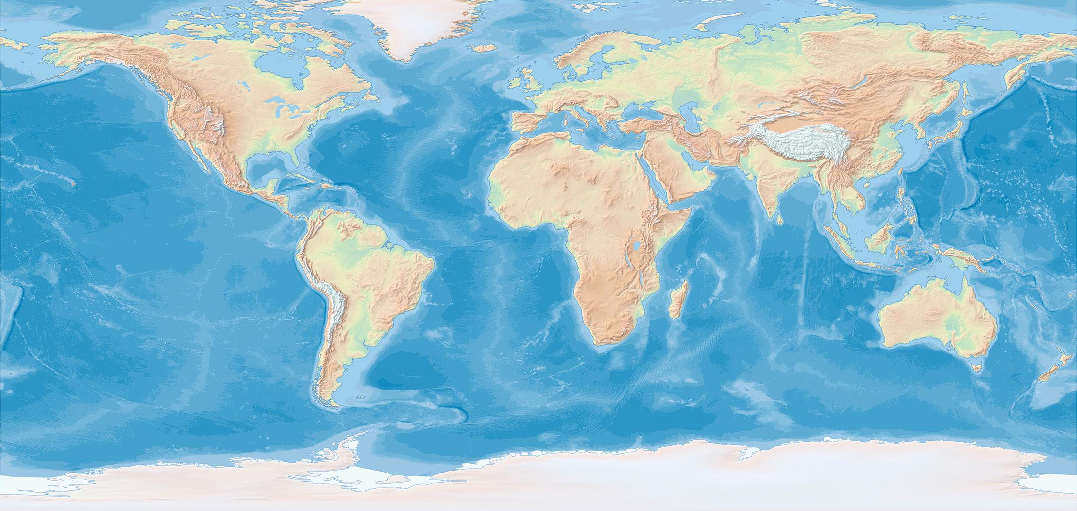
GA will play an active role in supporting Seabed 2030’s mission of accelerating ocean floor mapping.
Geoscience Australia has signed a new partnership with the Nippon Foundation-GEBCO Seabed 2030 Project, an initiative that aims to accelerate ocean floor mapping by the end of the decade.
The partnership agreement was signed by Dr James Johnson, Chief Executive Officer of Geoscience Australia (GA), and Seabed 2030 Director, Jamie McMichaelPhillips, at a ceremony held at Geoscience Australia’s headquarters in Canberra.
Under the collaboration, GA will play an active role in supporting Seabed 2030’s mission by contributing vital bathymetric data to further enhance the global understanding of the seafloor. A key component of this is the AusSeabed initiative, a national seabed mapping collaboration that co-ordinates and publishes seabed mapping data from across the Australian region.
GA will provide high-quality, accessible AusSeabed mapping data, bolstering Seabed 2030’s efforts to create a seamless digital map of the world’s ocean floor.
“We are thrilled to formalise our partnership with Seabed 2030 and join in the global effort to map the world’s seabed by 2030,” said Dr Johnson.
“Welcoming Geoscience Australia as a partner marks a significant step forward in the global pursuit of a fully mapped ocean floor,” added McMichaelPhillips. “Together, we are moving closer to achieving a comprehensive map of the ocean and we look forward to working closely with Geoscience Australia to advance our ambitious mission.”
GA’s Head of Oceans, Reefs, Coasts and the Antarctic Branch, Dr Jodie Smith, said that Geoscience Australia has committed to providing data to Seabed 2030 on behalf of the Australian seabed mapping community.
“We publish seabed mapping data through the AusSeabed data portal, and this data supports decision-making across
a range of marine applications, including offshore renewable energy, hazard modelling and marine park management,” said Dr Smith.
Australia has one of the largest marine jurisdictions in the world and is responsible for around 4% of the world’s oceans.
“To manage this resource sustainably, seabed mapping data is necessary because it allows us to better understand the environment, which improves decisionmaking and supports the sustainable growth of Australia’s ocean economy,” said Dr Smith. “We have made great progress, but there is a lot more work still to be done.”
Geoscience Australia will reprocess, review and publish valuable archives of legacy offshore data, and collate it with new offshore data, to better understand the geology and geography of the seabed.
All data collected and shared with the Seabed 2030 project is included in the free and publicly available GEBCO global grid
In other news, a newly released study highlights the importance of global seabed mapping and outlines 12 major use cases for the endeavour.
The compendium — prepared by the Seabed 2030 Project in partnership with NLA International — identifies the role of seabed mapping in addressing some of the world’s most pressing marine and maritime
challenges, such as climate change mitigation, marine biodiversity protection, Blue Economy development, ocean sustainability, policy development and economic growth.
The use cases were compiled to provide critical empirical data to inform the development of a prioritised, targeted seabed mapping strategy.
The twelve use cases are:
• Seabed mapping innovation
• EEZ seabed mapping in the absence of a national hydrographic organisation
• Subsea cable planning and design
• Tsunami propagation and storm surge modelling
• Renewable energy — offshore wind energy
• Climate change ocean models
• Small Island Developing States (SIDS) sea level rise and coastal inundation
• Marine biodiversity
• SIDS marine and coastal development and seabed mapping for marine spatial planning
• Government policy
• Ocean discovery and ocean exploration
• Driving hydrographic industry expansion and human capital benefits
The study also seeks to bring together the global hydrographic community and stakeholders in the marine and maritime sectors, to establish a unified global seabed mapping priority list. n


Groundbreaking performance and productivity
• Improve layout productivity up to ten times compared to traditional chalk-line layout.
• Autonomous printing with obstacle avoidance.
• Printed on-slab text helps deliver executions as per plan.
layouts
• Precise printing to complete every project accurately.
• Complex layouts spot-on, laying out intricate arcs and circumferences.
• Raise the bar of predictability, minimizing redos and with great rigour.
One easy solution to do it all
• Simple layout management with cloud-based tools.
• Easily print on most surfaces thanks to HP inks expertise.
• Compact design that fits in a portable case for effortless transport.
Publisher

jnally@intermedia.com.au
National Advertising Manager
amuldrock@intermedia.com.au
Production Manager
is available via subscription. A 12-month subscription (6 issues) is AU$76.00. To subscribe visit spatialsource.com.au/magazine, phone 1800 651 422 or email subscriptions@ intermedia.com.au
Address for mail: 41 Bridge Rd, Glebe NSW 2037. Ph: 02 9660 2113 is published six times per year, in February, April, June, August, October and December by The Geospatial Council of Australia. ABN: 22 135 572 815
Position are permitted only with the permission of the publisher. In all cases, reprints must be acknowledged as follows: ‘Reprinted with permission from Magazine’, and must include the
The opinions expressed in this publication are those of the authors and do not necessarily represent those of the publisher.
Official publication of
Our final issue for the year once again features our annual Leaders Forum, where we asked leading geospatial experts to assess the state of the sector and prognosticate on what will, or should, be its priorities for the coming year. And it has to be said that many of their concerns are the same as in previous years, with the workforce shortage challenge being a common theme. This seems to be an intractable problem, and unfortunately so far there doesn’t seem to be a magic bullet with which to solve it.

But it’s not all bad news for 2025! Our experts are excited by emerging technologies such as AI, with most deeming that it can definitely be a force for good if used properly and if its limitations are understood.
The presentation season for the annual regional Geospatial Excellence Awards has now concluded (see page 14), with numerous very worthy recipients — both individuals and collaborations — taking home well-deserved titles and trophies. I’m looking forward to the presentation of the national awards, which will take place at the Locate25 conference in Brisbane in April next year.
And on the subject of Locate25, there are now fewer than six months to go until this event joins forces with the International Federation of Surveyors’ (FIG) Working Week conference to produce the biggest geospatial event this country will ever have seen. With the expected huge influx of attendees from around the planet, Australian geospatial professionals will have a unique chance to meet and mingle with like-minded experts from across the world and showcase Australia’s vibrant local ecosystem to a global audience. Make sure you keep an eye on www.SpatialSource.com.au for the soon-to-be-made announcements detailing registration and other important matters. See you there!
Jonathan Nally Editor
We take our Corporate and Social Responsibilities seriously and is committed to reducing its impact on the environment. We continuously strive to improve our environmental performance and to initiate additional CSR based projects and activities. As part of our company policy we ensure that the products and services used in the manufacture of this magazine are sourced from environmentally responsible suppliers. This magazine has been printed on paper produced from sustainably sourced wood and pulp fibre and is accredited under PEFC chain of custody.
PEFC certified wood and paper products come from environmentally appropriate, socially beneficial and economically viable management of forests.
Our Environment issue — Our first issue for 2025 will take a deep dive into the environment, featuring news, views and interviews about sustainability issues, the climate change challenge, the energy sector, agriculture, and also mining and resources.
For article proposals, contact our Editor: jnally@intermedia.com.au
For marketing, contact our Advertising Manager: amuldrock@intermedia.com.au
Advertising booking date: 17 January 2025
Advertising material date: 22 January 2025
Publication date: 14 February 2025
Position magazine acknowledges the traditional custodians of country across Australia, and we pay our respects to Aboriginal and Torres Strait Islander cultures and to their elders, past, present and emerging.
There has been a changing of the guard in the locating and inspection sector, with C.R. Kennedy becoming the master distributor for Vivax Metrotech instruments in Australia, New Zealand and the Pacific.
The move has come after the previous distributors — long-time business partners Greg and Peter MacMahon — decided to retire after 17 years of representing Vivax Metrotech and more than 33 years in the industry.
Vivax Metrotech’s product line includes pipe and cable locators and inspection cameras, serving the needs of contractors, municipalities and utilities.
Although C.R. Kennedy had been the
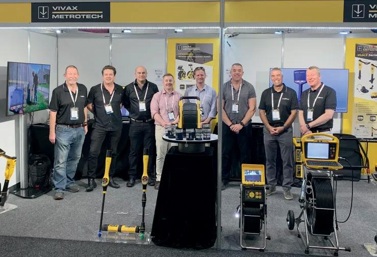
exclusive Australian distributor of the vLoc3-Pro utility locator for a number of years, the new master distributorship will see the company expand its product range and continue “being a one stop shop for utility locating equipment,” according to Philip Byrne, National Sales Manager GIS and Detection in C.R. Kennedy’s Survey Division.
“Vivax was the first brand to integrate its utility locators with RTK GPS, and now other brands are following this trend,” said Byrne. “Innovation is key for the end user, as everybody works in a fast-paced environment these days.”
Byrne adds that C.R. Kennedy will now have service centres in Sydney, Melbourne, Brisbane, Perth and Adelaide for CCTV inspection systems and utility locators. The company has also acquired a calibration rig for all Vivax utility locators, which means that all servicing and calibration will be done in Australia.
“We wish Peter and Greg MacMahon all the best in retirement,” said Byrne. “They have been unbelievable to deal with over the last few years. They are real gentlemen of the industry, and their knowledge of the Vivax Metrotech brand is outstanding.”
What has been described as Australia’s most detailed regional climate projections are now mapped and available on SEED, the central repository for Sharing and Enabling Environmental Data in NSW. Known as the NSW and Australian Regional Climate Modelling (NARCliM) project, it is helping decision-makers understand and prepare for the effects of climate change.
In particular, NARCliM projections are being used for managing risks such as bushfires, floods, droughts and heatwaves.

As extreme weather events become more common, NARCliM projections provide strategies to reduce their impact on infrastructure, businesses, health, industries, and communities. One example cited is the need to know when temperatures are likely to rise above 40°C, as this is when railway lines might begin to buckle or warp, and train speeds therefore need to be reduced to prevent derailments.
SEED’s interactive map enables users to combine NARCliM data with other datasets, such as those for bushfire-prone land or species sightings, enabling decisions to be made to help protect infrastructure, ecosystems and communities.
According to Matthew Riley, Director, Climate and Atmospheric Science in the NSW Department of Climate Change, Energy, the Environment and Water (DCCEEW), NARCliM is “the finest-resolution climate modelling ever made available for states and territories in Australia”.
“We want to ensure that there is a consistent approach to interpreting climate change information. Councils are likely to be required to develop disaster adaptation plans,” added Sarah Penny Joyce, Executive Officer, Sydney Coastal Councils Group.
“Plans will look at various hazards including sea level rise, urban heat, bushfire, and the NARCliM data will get a strong evidence base to develop those plans.”

Australian drone manufacturer
Carbonix has inked an agreement with Toll Uncrewed Systems, a part of Toll Aviation and a provider of UAS flight operations and training, that will see Toll become the primary training organisation for Carbonix drones in Australia.
“We are delighted to form a partnership with Toll Uncrewed Systems, whose expertise in training and operations will broaden our own future growth and development,” said Carbonix CEO, Philip van der Burg. “This partnership will allow us to focus and scale on our core business of developing highly effective drone platforms and equipping them with best of breed sensors that will enhance existing long range operations, and ensure that world class training is available across the board.
Carbonix’ UAV platforms are larger than the typical drone and have longer range, and can be equipped with a variety of payloads, including LiDAR, photogrammetry, ISR and multispectral sensors.
This, combined with their fixedwing flight with vertical take-off and landing capabilities, makes them suitable for executing expansive aerial surveys and for obtaining data across remote terrain.
A Carbonix aircraft recently became the first Australian fixed-wing VTOL drone to execute a fully automated beyond-visual-line-of-sight mission, gathering remote critical data for a power network customer.
“An official partnership with Carbonix is an alignment with our own values supporting sovereign entities in the uncrewed world,” said Toll Uncrewed Systems’ Chief Pilot, Wayne Condon. “Our experienced trainers are excited about the opportunity to work with an Australian-based manufacturer and match these sophisticated platforms with Australian training excellence.”
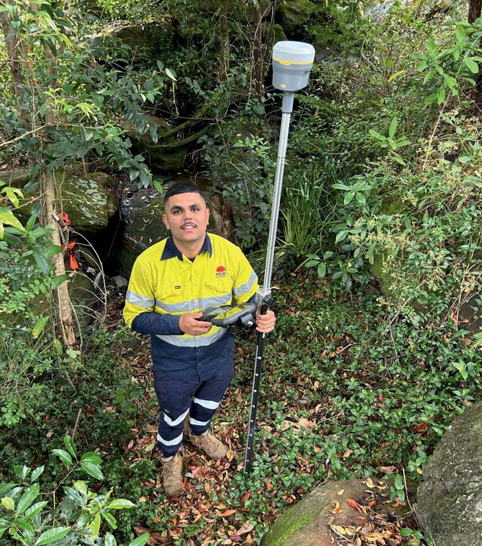
TAFE NSW graduate Nick Baran is quickly achieving success in the surveying industry, putting to use the practical skills and knowledge of modern technology he acquired during his studies to help enhance Sydney’s transport infrastructure.
Jobs and Skills Australia estimates the number of surveyors will grow by about 9,300 jobs over the decade to 2033.
TAFE NSW is delivering a pipeline of workers to meet this industry demand through its Certificate III in Surveying and Spatial Information Services, Certificate IV in Spatial Information Services (Surveying), and the Diploma of Surveying.
“When one of my teachers explained what surveyors do and how integral their role is, it ignited a curiosity in me and I decided to follow that career,” Baran said.
“The surveying trade is evolving with new technology and equipment, like drones and laser scanners, becoming more commonplace. TAFE NSW gave me a strong understanding of the basics of these as well as the older techniques, which has been invaluable when using the modern automated equipment.”
After graduation, Baran worked for a private company, and then six months later landed a job working for Transport for NSW on infrastructure projects across Sydney.
He has recently been promoted to act in Engineer Surveyor roles, which involves managing projects, and recently finished work on sites at Granville and on the M4 and has just started working on a job at Auburn.
Queensland University of Technology’s Dr Fernando Vanegas Alvarez has been awarded an Advance Queensland Industry Research Fellowship $240,000 grant for a project to develop a proven framework for classifying and mapping invasive plant species using drone-collected imagery.
Dr Vanegas Alvarez, from QUT’s School of Electrical Engineering & Robotics and QUT Centre for Robotics, said his research project would identify the most appropriate protocols for aerial and ground data collection and the best AI models for each species and site.

survey and collect data, detect different species and then map vegetation using aerial imagery.
“Invasive plants have negative effects on agriculture and farming, damage existing infrastructure, and in some cases cause irreversible damage to unique ecosystems,” Dr Vanegas Alvarez said.
“My industry partner, the Sunshine Coast Council, is committed to using innovative technologies to better understand the extent of invasive plants, how they spread and their effects on ecosystems to inform on-ground decisions.”
Dr Vanegas Alvarez is working with drone operator Aspect UAV Imaging to develop a standardised methodology to
“Fine detail and high-resolution mapping of vegetation and weed species are required to understand and assess the environmental impact and support decision-making,” Dr Vanegas Alvarez said, adding that “… drones equipped with ultra-high resolution, visible-light (RGB), multispectral (MS) cameras, and high-precision global positioning systems can capture imagery over 4 hectares of land in one flight.
“Their high resolution enables us to distinguish individual leaves and patterns of plants and multispectral cameras capture light reflected by plants in wavelengths outside the visible spectrum for humans.”

The NSW National Parks and Wildlife Service (NPWS) has awarded Sphere Drones a tender to supply its HubX drone-in-abox system for environmental monitoring activities. The award has been made under the NSW Government’s $1.89 million Natural Hazards Technology Program.
Initial deployments will take place in key national park locations, including Yirraldiya Park, and the Tugalong, Nattai, Yathong and Kosciuszko National Parks. The operations will enable NPWS to monitor critical areas from a central control centre, boosting
its ability to manage natural hazards, preserve biodiversity and protect feral-free zones.
Sphere Drones says it has worked closely with NPWS and its Chief Remote Pilot (CRP), Gareth Pickford, to fully understand the extent of the Service’s BVLOS approvals and applications.
“We’re proud to partner with NPWS to safeguard some of the most ecologically important regions in New South Wales,” said Paris Cockinos, CEO of Sphere Drones.
The company will also collaborate with Forestry Corporation NSW and the NSW Reconstruction Authority to extend the scope of the Natural Hazards Technology Program.
The Program began in January 2024 and will run until June 2025, which includes a 12-month pilot phase.
The latest assessment of the world’s best commercial space-based remote sensing systems shows China pulling slightly ahead of the US. China now leads the world in five out of 11 satellite remote sensing performance categories, with the US leading in four.
These conclusions are found in a new report entitled Gold Rush: The 2024 Commercial Remote Sensing Global Rankings, published by the US Center for Strategic and International Studies (CSIS).
The study is a follow-up to research published in 2021 by the US National Geospatial-Intelligence Agency (NGA), which became known as the ‘Commercial Imaging Olympics’. In that research, the NGA revealed that the US and China each won ‘gold’ in three of nine performance categories. In the new CSIS study, based on the 11 performance categories, Chinese systems won gold in five fields while the US took out the top spot in just four. Finland and South Korea each secured a single gold medal.
The research shows that almost half of the top spots went to satellite systems launched between 2021 and 2024, which, the authors say, demonstrates the pace of introduction of advanced capabilities on commercial satellites.
The report, which is written from a US perspective, outlines “actions the U.S. government should take as ‘a regulator, investor, and customer’ to keep U.S. companies at the cutting edge of technology and globally competitive”.
“With a nascent commercial market, the government is the primary customer and market driver. It will need to take a more strategic and active role in advancing commercial capabilities that must endure and be competitive against Chinese commercial offerings, among others,” the report says.
“The stakes are high,” the report adds. “Should any one country dominate the commercial remote sensing market, not only could it gain economic advantages, but it would also control the information narrative about the entire planet, from the environment to natural resources to human conflict.”

The United Kingdom’s re-entry into the EU’s Copernicus program has been credited with providing the necessary funding for final approval to be granted for the development of all six Copernicus Sentinel Expansion Missions.
The Expansion Missions will expand upon the capabilities of the current generation of Sentinel satellites, such as the Sentinel 1 synthetic aperture radar spacecraft and the Sentinel 2 optical imaging craft.
The individual missions will be:
• CO2M, a constellation of three satellites that will track greenhouse gas emissions.
• CIMR, comprising two satellites equipped with a microwave radiometer to provide detailed insights into sea ice and the polar environment.
• CHIME, a duo of satellites carrying a visibleto-shortwave infrared spectrometer to gather hyperspectral observations from Earth’s surface.
• CRISTAL, a successor to the CryoSat mission will be two satellites carrying a dual-frequency radar altimeter and microwave radiometer to monitor ice thickness and change.
• LSTM, two satellites hosting a high spatialtemporal resolution thermal infrared sensor to map land-surface temperature variations.
• ROSE-L, a satellite duo carrying a synthetic aperture radar for high-resolution, all-
weather imaging with a spatial resolution of 5 to 10 metres. The antenna will be the largest deployable planar antenna ever built, measuring 40 square metres.
“The decision by the UK Government to participate to the EU Copernicus Programme has been essential to secure the completion of the Copernicus Sentinel Expansion Missions,” said Simonetta Cheli, ESA’s Director of Earth Observation Programmes.
These missions are critical for addressing EU policy and gaps in Copernicus user needs, and to expand the current capabilities of the Copernicus Space Component.”

Aptella has announced that it has acquired Altech Distributors, a Melbourne-based, family-owned business that specialises in cable locators and altimeters used in the construction industry to enhance safety and accuracy.
The acquisition will give customers throughout Australia and New Zealand access to the full range of C.Scope pipe and cable locator tools.
“With service centres throughout Australia and New Zealand, plus decades of experience with all manner of levelling, measuring and positioning instruments, we look forward to supporting and expanding our combined customer base,” said Martin Nix, CEO of Aptella. “On behalf of the Aptella team, our congratulations to Alan and Lesley Winford for their hard work over many years to establish and grow Altech Distributors, and our best wishes for their well-deserved retirement.”
C.Scope pipe and cable locators are used to accurately pinpoint the location and depth of underground utilities and services, to increase safety and mitigate financial risks during excavation and building projects.
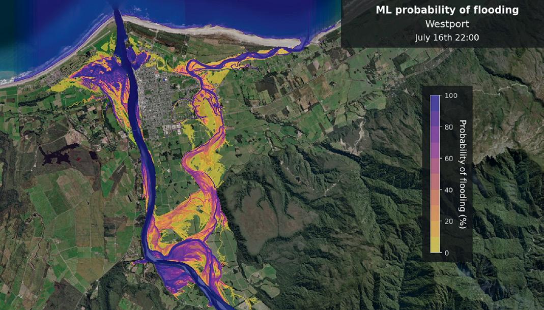
New Zealand’s National Institute of Water and Atmospheric Research (NIWA) is using machine learning to forecast flood inundation in a fraction of the time required to run physical models.
NIWA Climate, Atmosphere & Hazards platform manager Nava Fedaeff leads the project, and says effective flood preparation and response requires detail beyond river flows.
“What people really want to know is not just whether the river is running high, but what areas will be flooded, and what’s at risk from that potential flooding. We’re exploring how AI will help us to move from weather forecasts to inundation forecasts quickly enough so that useful information gets to those who need it,” said Fedaeff.
Generating predictive flood maps with physical models can take 24 hours but with machine learning it takes only one to two minutes.
Five days ahead of an event, scientists combine several elements such as weather forecasting, river flow predictions, inundation mapping and exposure assessments. This enables them to produce models that detail — down to street level — people, property or infrastructure at risk when storms strike.
NIWA data scientist Dr Deidre Cleland used the port town of Westport on the west coast of New Zealand’s South Island as a case study for the project.
“Our next step is operationalising this machine learning capability so that rapid flood map forecasting is available for a real incoming flood event in Westport,” said Dr Cleland.
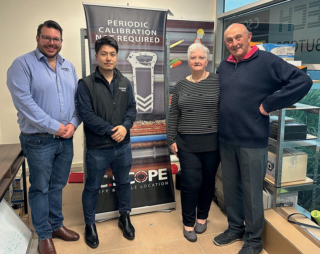
“The C.Scope solutions complement Aptella’s comprehensive range of levelling and construction tools, including Topcon and iMEX lasers and accessories,” said Josh Allan, Services Executive Manager at Aptella.
A platform that maps vegetation across Greater Hobart in order to assess the potential exposure of residential buildings and communities to bushfires, has been given a substantial update.
The 2024 Greater Hobart Bushfire Exposure Index has been produced by geospatial technology and climate risk analysis firm Geoneon, with grant funding provided by the Australian Government.
The Index updates an earlier version from 2022 and offers expanded insights into bushfire severity and exposure across the Greater Hobart region.
The project aims to provide vital information for communities, local governments and emergency services as the summer bushfire season approaches.
The 2024 update incorporates new data for the Clarence, Sorell and Brighton council areas, adding to the original coverage of Hobart, Kingborough and Glenorchy.
The 2024 platform update provides:
• Bushfire Hazard Severity Index: A detailed assessment of potential fire severity based on factors such as vegetation density and topography.
• Bushfire Exposure Index: A measure of building exposure to bushfires, focusing on proximity to bushland and surrounding vegetation.
• Interactive Mapping: A web platform visualising bushfire severity and exposure levels across Greater Hobart.


Four joint Australian and New Zealand space-based Earth observation projects focusing on environment and agricultural management, have been awarded funding under the Australia-New Zealand Collaborative Space Program.
This is the second tranche of projects funded under the program, administered by the New Zealand Space Agency and Australia’s SmartSat CRC.
The efforts, which will commence this month, will address crop and agricultural monitoring, advance biomass mapping, and support indigenous communities through Earth observation (EO) technologies.
“By investing in space technologies for farm management, land monitoring and the integration of indigenous knowledge, we are improving our understanding of how to more reliably and sustainably look after our unique countries,” said SmartSat CRC CEO, Professor Andy Koronios.
The first project is called ‘Indigenous pathways to advance fuel moisture Earth observation technologies for improved fire planning management strategies’. A joint effort of the Bushfire Research Centre of Excellence, Fenner School of Environment and Society, Australian National University, and Scion (New Zealand Forest Research
The United States has eased restrictions on the export to Australia of certain satellite-based remote sensing technologies. According to the US Commerce Department’s Bureau of Industry and Security (BIS), the updated space-related export controls will promote USA’s innovation and technology leadership while protecting its national security and foreign policy interests.
The relaxed restrictions also apply to the United Kingdom and Canada.
Specifically, the new ruling removes licensing requirements for items involving space-based remote sensing that:
• Have electro-optical capabilities and having a clear aperture greater than 35 cm but less than or equal to 50 cm.
• Have capabilities beyond NIR (i.e. SWIR, MWIR or LWIR).
• Have radar capabilities (e.g. AESA, SAR or ISAR) with a centre frequency equal to or greater than 1.0 GHz, but less than 10.0 GHz, and having a bandwidth equal to or greater than 100 MHz, but less than 300 MHz.
The ruling also applies to “space-based logistics, assembly, or servicing spacecraft destined for Australia, Canada, and the United Kingdom,” as well as sensitive defence-related equipment and components.
Institute), this project will use satellite data to create ‘life maps’ that integrate science-derived models with traditional methods of reading the landscape and assessing fuel flammability — such as moisture content in vegetation — with a view to developing a near real-time flammability monitoring system.
The second project is ‘Enhancing fractional cover models using hyperspectral data for improved pastoral condition assessment in Australia and New Zealand’. This FrontierSI and Manaaki Whenua–Landcare Research project will seek to enhance fractional cover data products (used to analyse and interpret proportions of vegetation and bare ground in a landscape) calibrated and proven in Australian conditions for use in monitoring pasture conditions across New Zealand.
The third project is ‘Satellite sensing into agricultural practices: Phase A - ANZ’s Cal/ Val campaigns of satellite, airborne and ground GNSS sensing of soil moisture’. Run by the University of Newcastle, FrontierSI and the University of Canterbury, it will demonstrate the integration of soil moisture measurements collected using GNSS from several platforms, including satellites, aircraft and ground receivers.
The final project is ‘SilverEye –Satellite imaging for land vegetation, environmental recovery in ecosystems and yield enhancement’. The CSIRO and the University of Auckland aim to develop satellite capability to improve return time and resolution of agricultural monitoring, supporting crop management and environmental best practices across the wider Southern Hemisphere.
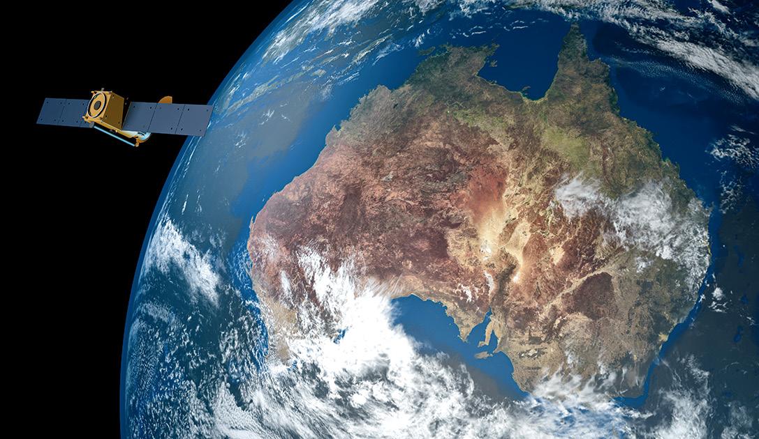
The BIS says it expects the removal of these license requirements for Australia, Canada and the UK will result in a reduction of 90 license applications being submitted to BIS annually.
“Modernising our space-related controls to keep pace with today’s commercial space innovation and foreign policy environment is of critical importance,” said Under Secretary of Commerce for Industry and Security, Alan F. Estevez.
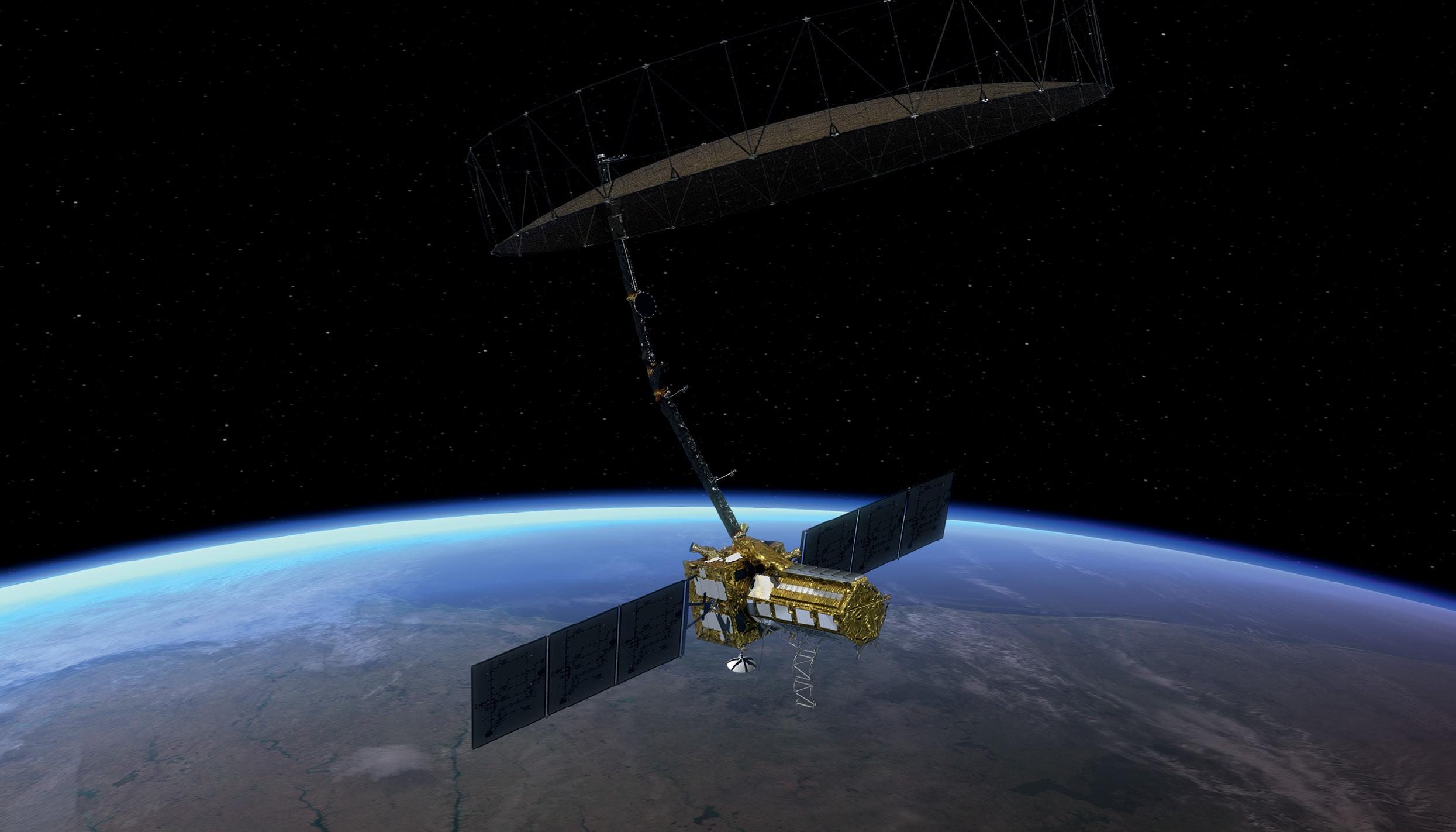
NASA has completed its work on the antenna reflector for the NASA ISRO Synthetic Aperture Radar (NISAR) satellite, and the hardware has been delivered to the Indian Space Research Organisation’s (ISRO) spacecraft integration and test facility in Bengaluru in preparation for launch in 2025.
NISAR will scan nearly all of Earth’s land and ice masses twice every 12 days and will thereby help scientists better understand changes in the planet’s surface.
“This kind of regular observation allows us to look at how Earth’s surface moves across nearly the entire planet,” said Cathleen Jones, NISAR applications lead at NASA’s Jet Propulsion Laboratory (JPL).
NISAR will be the first satellite to carry both an L-band system (built by JPL) and an S-band system (built by ISRO). The L-band instrument will be able to penetrate dense
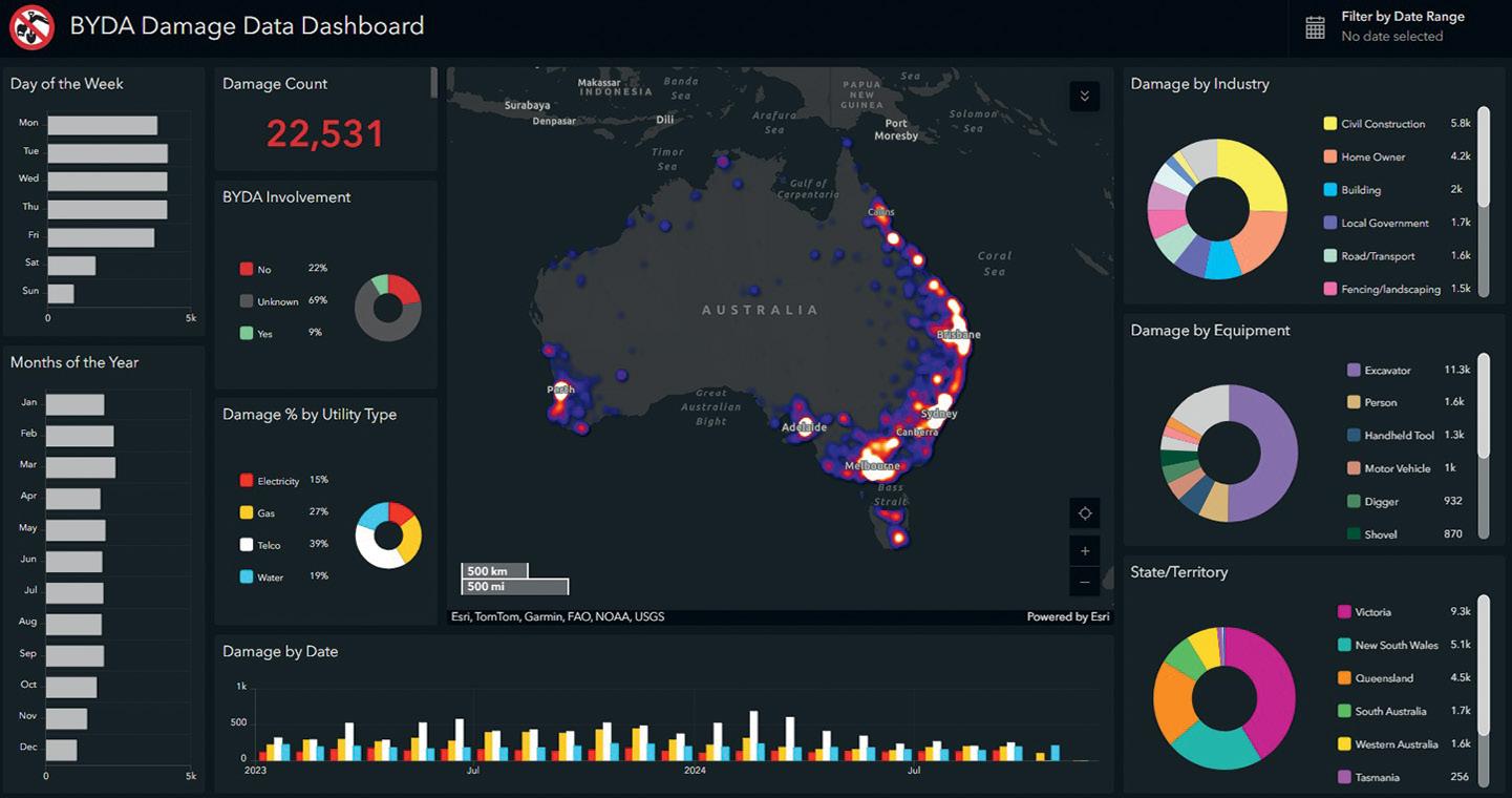
Before You Dig Australia (BYDA) is calling for urgent reforms to address $5 billion in economic losses caused annually by preventable utility strikes.
New research from BYDA reveals that most of strike incidents stem from outdated regulations, low data standards and insufficient workforce training.
“$5 billion a year in preventable damage is an unacceptable burden on the Australian economy. It’s time for a national overhaul of how we manage utility risks,” said Mell Greenall, CEO of BYDA.
“Our research shows that with the right reforms, we can significantly reduce these incidents, protect workers, and save billions for the economy. This is a national issue that demands immediate attention and coordinated action.”
One of the recommended reforms is for the development of nationally consistent legislation for underground asset management. Only New South Wales currently mandates asset registration with BYDA for electricity, gas, and oil, while other states lack uniform requirements.
Another recommendation is for mandatory digital standards for utility location data. According to BYDA, utility location data is often of low quality and accuracy, is outdated, is presented at
predominantly at Quality Level D (the lowest standard under Australian Standard 5488), and is typically delivered in PDF format. Reliance on outdated methods persists despite the availability of higherquality digital data, such as engineeringvalidated as-built plans, surveyor reports and utility locator information.
BYDA says that establishing minimum data standards and developing a digital asset register for utility locations would lead to a $782 million annual saving through reduced utility strikes.
vegetation to measure ground motion. This capability will be especially useful in areas surrounding volcanoes or faults that are obscured by vegetation.
NISAR will be of interest to those concerned with disaster response, producing data to assist in mitigating and assessing damage.
“The NISAR satellite won’t tell us when earthquakes will happen. Instead, it will help us better understand which areas of the world are most susceptible to significant earthquakes,” said Mark Simons, the US solid Earth science lead for the mission at Caltech.
“From the ISRO perspective, we are particularly interested in the Himalayan plate boundary,” said Sreejith K M, the ISRO solid Earth science lead for NISAR at the Space Applications Centre in Ahmedabad, India. “The area has produced great magnitude earthquakes in the past, and NISAR will give us unprecedented information on the seismic hazards of the Himalaya.”
It also cites international models, such as the UK’s National Underground Asset Register, in showing how secure digital systems can reduce errors, prevent delays and minimise utility strikes.
“We have the tools to fix this — better data, stronger laws, and a skilled workforce,” said Greenall.
“We need leaders from the utility, construction and government sectors to come together and support these reforms.”
Before You Dig Australia’s utility strike dashboard.

The final regional award ceremonies have been held, with the winners now in the running for the national awards.
The presentation season for the annual regional Geospatial Excellence Awards has now concluded, with all the Australian state and territory events, as well as New Zealand’s, having been held. Below, you’ll find the lists of the award recipients for Tasmania, Western Australia, the ACT and New Zealand. Please refer to the Oct/Nov 2024 issue of Position for the earlier announcements of the Victorian, South Australian, New South Wales and Queensland state winners, or find them on www.SpatialSource.com.au.
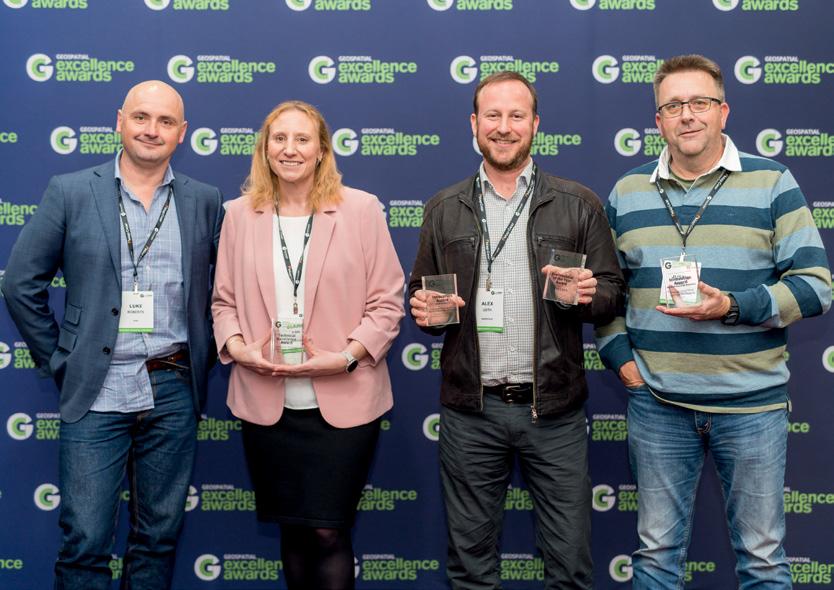

All regional recipients are eligible for the prestigious Oceanic awards, the presentation ceremony for which will be held during the Locate Conference in Brisbane in April 2025.
Tasmania awards:
• Innovation Award (Medium to Large Business): Veris for its Hellyer Gold Mine Tailings Monitoring project.
• Innovation Award (Small Business): Auspatious, FrontierSI and the CEOS Systems Engineering Office for The Cloud Native Geospatial for Earth Observation Workshop.
• Technical Excellence Award: Tasmania State Emergency Service, Mineral Resources Tasmania, and the Department of Premier and Cabinet for its Tasmanian Strategic Flood Map –Baseline Risk Assessment.
• Professional of the Year Award: Alex Leith GAICD
Western Australia awards:
• Educational Development Award: Amir Allahvirdi-Zadeh, Curtin University
• Professional of the Year Award: Mary Murphy, Esri Australia
• Community Impact Award: NGIS, FrontierSI and CSIRO for the Vanuatu Climate Futures Portal.
• Environment and Sustainability Award: FrontierSI, Rio Tinto, Roy Hill, BHP, FMG, Atlas Iron, Mineral Resources, Curtin University, DWER, DBCA for the ENVestigator Toolkit
• Innovation Award, Medium to Large Business: NGIS and Google for TraceMark
• International Partnership Award: NGIS and Google for TraceMark
• Technical Excellence Award: Cartographic Services Unit of the DBCA for the Thematic Mapping for the Forest Management Plan 2024-2033.
Australian Capital Territory awards:
• Diversity & Inclusion Award: Aurora Foo, Geoscience Australia
• Professional of the Year Award: Megan McCabe, Geoscience Australia
• Community Impact Award: Geoscape Australia, Resilient Building Council, for Location Intelligence for Bushfire Resilience.
• Environment and Sustainability Award: Geoscience Australia, CSIRO, Australian Climate Service and EMSINA, for National Bushfire Boundaries Data Services.
• Innovation Award – Medium to Large Business: Geoscience Australia, Australian Bureau of Statistics, Esri Australia, Onneer and Nova Systems, for the Digital Atlas of Australia.
• Technical Excellence Award: Geoscience Australia for Position Verification at Geoscience Australia.
• Community Impact Award: Aerometrex, Anindilyakwa Land Council, Geoscience Australia, Australian National University and the Cooperative Research Centre for Developing Northern Australia (CRCNA), for Integrating Indigenous priorities in spatially enabled planning of the Indigenous estate.
New Zealand awards:
• Community Impact Award: Fire and Emergency NZ, for the Fire and Emergency Common Operating Platform (COP).
• Environment and Sustainability Award: Beca and Kāinga Ora, for the Amenity Access Tool: Helping Kāinga Ora reduce their carbon footprint.
• Innovation Award – Medium to Large Business: Aurecon, Waka Kotahi, HEB, Fulton Hogan, Tonkin & Taylor, for O Mahurangi Penlink; and Wood & Partners Consultants, for GeoTrack.
• Technical Excellence Award: WSP NZ, New Zealand Transport Agency Waka Kotahi, for Asset Management Data Standards – Network Model.
• Workforce Development and Inclusion Award: Eagle and New Zealand Emerging Spatial Professionals, for New Zealand Emerging Spatial Professionals. n


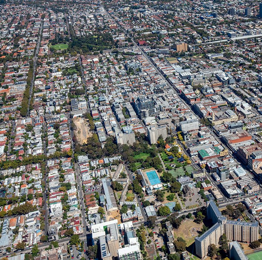


Welcome to Position’s annual Leaders Forum, in which we ask geospatial experts to share their insights into the current state of the sector, where it is headed in 2025 and how we’ll get there.
We asked them to identify which challenges they see as being the most pressing and how they might be solved, whilst also identifying the industry’s strengths and its capacity to find solutions for some of the world’s most taxing problems.
So please turn the page and begin your glimpse into what the world of geospatial will look like over the coming 12 months.


What opportunities and challenges do you see in 2025?
The outlook information that we use, indicates a stabler building and construction sector for 2025 and uplift in 2026. There is a strong pipeline for infrastructure projects into next year, and with the skills shortage in the survey profession there is always more work than there are surveyors to do it. We continue to see an increase of geospatial technology being used by the building sector, partly due to limited surveyor resources, although there are challenges around building trades checking work and not simply accepting the digital design.
Another challenge is how best to ensure quality control over projects with the everincreasing amount of data, and its speed of capture, from modern instruments such as terrestrial scanners, survey drones and mobile mapping systems. Machine learning and AI are already showing great benefits in automated feature recognition, data analysis and reporting, albeit with a need for human oversight and verification.
What is your attitude to emerging tech such as AI?
AI is working successfully in many systems such as feature recognition collision avoidance technology to protect human life. The potential of AI as a business and productivity tool is exciting and there is no doubt its reach and sophistication will continue to grow. However, for most
Manager Geospatial & Building, Aptella
Adam Burke began his career as a surveyor, then worked for CivilCAD for five years before joining Laserquip, one of Aptella’s founding companies, in 2005. He has benefitted from mentors who prioritised customer service and who got a thrill out of resolving problems through positioning innovation. These remain his core passions and drivers.
businesses there are still some important aspects to work through before the benefits can really be harnessed. Creating some rules of engagement to get the right balance for employees about when and where to use it whilst mitigating any IT or copyright risks, is important. So too is agreeing on where it can add value, because the options are seemingly endless! Like any technology, it is about learning where it adds maximum efficiency and productivity and how best to enable people with the skills and capacity to use it effectively.
Can and should the geospatial sector work more co-operatively?
There are many good examples of existing collaborative alliances sharing expertise and IP, such as the recent alliance between u-blox and Topcon for improved global positioning infrastructure.
The demand for and use of positioning, machine control and automation technology continues to expand faster than the capacity of the survey profession to provide all the services. So, easy-touse systems that automate and integrate many positioning procedures directly into construction processes (e.g. machine control substituting traditional set out) continue to expand. There is a continuing need for collaboration between stakeholders to deploy such systems to lift productivity without sacrificing quality and accuracy; a surveyor’s role to control and certify quality and accuracy remains crucial. Collaborating
to work alongside the building trades, engineers, consultants, contractors and others is a key area. At Aptella we are helping to connect our customers through tailored data services, while simultaneously collaborating with tertiary education institutions to ensure next-gen users are trained on the most recently released systems.
What excites you about this sector and your role in it?
The explosion of mass data capture, and innovations in automation and robotics, is exciting. It’s a privilege to be at the cutting edge and the conduit between the innovators and our customers. Working with newer customers in the building trades and hearing their delight at becoming proficient in the use of positioning tools has been a particular highlight.
What are your organisation’s plans for 2025?
Continuing to seek the latest and greatest innovations from around the world to support our customers. Also, enabling the rollout of autonomy, robotics and IoT applications through our AllDayRTK team, who collaborate with public and private sector initiatives to ensure Australia is wellplaced to deploy solutions at scale through robust, accurate and readily available positioning infrastructure.
“The explosion of mass data capture, and innovations in automation and robotics, is exciting.”
How Revolver Resources made its Dianne copper mine project more efficient with Mangoesmapping.

Pat Williams, Managing Director of Revolver Resources
Pat Williams, Managing Director of Revolver Resources, an ASX-listed public company specialising in mineral exploration, is passionate about demonstrating that mining can be done not only commercially, but also ethically and responsibly.
“We work to leave projects in a better condition than when we found them, and we listen to everyone with a stake in the projects,” he says.
Revolver Resources is currently focused on the Dianne Copper mine project, located about 260 kilometres northwest of Cairns. The mine was operational in the 1970s and 1980s, and Williams is on a mission to make it profitable again. “My stakeholders keep me motivated to deliver the best possible results in an ethical, timely and cost-effective manner,” he says.
Williams spends much of his time working to deliver results for his customers. For instance, while he had access to mapping and surveying services, he found that the remoteness and extreme environmental conditions at the mine made it challenging to achieve deliverables on the timescale required; that is, weeks.
“We found ourselves in unfamiliar waters with surveying and mapping; we were presented with project timelines of months from different providers when what we needed was to make decisions in weeks, not months,” he says.
“We’re recommencing the operations at the mine, and we don’t want hassles or delays if we get the wrong data or if the data doesn’t make sense. We’re working on a timeline to get information to assemble environmental amendment submissions, plans and designs on site.”
Williams discovered that engaging
Mangoesmapping meant the project could recommence operations and get a return on investment faster, seeing final results in just weeks. He also enjoyed the personalised approach of Mangoesmapping. “Engaging Mangoesmapping services allowed us to keep going on a very tight timeline. They went the extra mile to suit our needs”, he says. “I was resigned to get answers in months until my project manager heard about Mangoesmapping — I see now, there’s a better way to do it.”
Mangoesmapping integrated four survey techniques for the project — control survey, ground survey, aerial survey and bathymetric survey. The company collected raw (static) data and employed RTK and PPK bases and rovers to deliver a 3D site model with sub-50mm horizontal and vertical positioning uncertainty.
Mangoesmapping gave Williams the information he needed, when he needed it and in the way that made the most sense to him. “Alistair and his team went out of their way to explain the technology and how it worked”.
“I know that the 3D mapping tells me almost, if not everything, that I need to know about our assets,” Williams added.
It was also essential to follow Queensland’s statutory regulations, with Williams expecting all external providers to follow procedures as per the mine’s health and safety policies. “The people who came to the mine site were implementing those procedures,” he says. “Mangoesmapping practice what they preach.”
Williams also valued Mangoesmapping’s transparency and accountability. “There


were some risks with the terrain, even with the vessel doing the bathymetry. Alistair foreshadowed those risks, which were overcome, and we got good quality data over the whole project area.”
For Williams, Mangoesmapping’s end-to-end approach set it apart from any other provider he’s used. “I trust Mangoesmapping to deliver the surveying and mapping information I need, when and how I need it,” he says. “I’m confident I’m seeing the results to build my business plan and recommence the Dianne mine operations. I particularly commend Mangoesmapping’s passion for the geospatial space. The last thing I need as a business owner is to have people doing work they don’t want to do.”
“I’ve employed a lot of consultants in my working life, and Mangoesmapping has shown us that they are meticulous, accurate, fast and cost-effective. It is rare when service providers tick all these boxes.” n
View the Dianne copper mine survey case study video at youtube.com/@ MangoesmappingAU.

“I’m confident I’m seeing the results to build my business plan and recommence the Dianne mine operations.”
Pat Williams, Revolver Resources

What opportunities and challenges do you see in 2025?
Opportunities include the continued embrace of generative AI for new applications, in ways that we may not have imagined. I am excited by the creativity of the solutions I see emerging in this space. And at the recent GCA conference in Perth, it was acknowledged that LiDAR is increasingly accepted as a data source and embraced as an accessible technology. I think we will see this trend continue, and the capacity for localised generation of digital twins become further democratised.
What is your attitude to emerging tech such as AI?
When thinking about AI, I embrace one of my broader principles for operating a business: ‘trust but verify’. And it’s important to differentiate between machine learning and generative AI built on large language models (LLMs). Machine learning has delivered amazing improvements, for example with the speed and capability for image analysis and remote sensing. This is a relatively secure and trusted technology.
LLMs are mind-blowing in their capabilities, however they are substantially less mature and have an increased potential for hallucination/errors of commission and pose greater security risks. Despite that, they are fantastic tools for rapid code development and building data-querying expressions inside GIS packages. To ignore these opportunities and the potential for competitive advantage would be a bit odd.
Alistair Hart Founder, Map Gear and Mangoesmapping
For 30 years, Alistair Hart has passionately believed in the power of geospatial systems to support evidence-based decision making. By enabling visibility of issues surrounding financial, asset and environmental sustainability, he actively contributes to a sustainable future for everyone.
Can and should the geospatial sector work more co-operatively?
There is a lot of discussion of, and some evidence for, competitive isolation, distrust and races to the bottom on price. Despite this, I suspect that there is a lot more cooperation than is communicated widely. We should probably communicate these ‘good news’ stories better, to help people embrace more of this cooperation.
I joined the geospatial industry on the survey side and then spent 16 years focused exclusively on the GIS side, where there has been an explosion of demand. So I suppose I have an expansionist view on the industry, where, in general terms, the pie is always growing. We should not be focused on fighting over it, but rather, we should be focused on working together to delight our customers and defend its continued growth.
What excites you about this sector and your role in it?
Firstly, educating potential clients and seeing their lightbulb moments, and transforming their business by helping them create authentic value. The second big thrill is leading a genuinely values-based business to position a better future for the planet, and also for our local community, our team and their families, by building a technology business in regional Australia. This all sounds pretty cheesy, but it boils down to having a clear understanding of, and building internal consensus for, our values and related active-living statements.
What will you be keeping your eye on in 2025?
We’re very interested in SLAM LiDAR right now. Emesent has recently demonstrated fusion of RTK GNSS data with their Hovermap SLAM sensors and there is a huge growth in solutions on the market, so I expect that will drive increased innovation in solutions offered to the market and an increase in adoption by service-providers.
What are your organisation’s plans for 2025?
Map Gear has developed a profile as an industry disruptor, having introduced Emlid’s RTK GNSS receivers to Australia. We’ve been busy enabling RTK for sectors that were previously excluded based on the capital expense for big-brand RTK gear, and I foresee this trend continuing. At the same time, I anticipate a continuing trend of existing RTK survey operators having an open mind and embracing our RTK solutions to help scale their businesses.
We’re observing a massive growth for products such as Ouster’s VCSEL/SPADbased digital LiDAR pucks, offering rugged data collection sensors that pack 128 channels into a device smaller than your coffee cup. We’re excited by some of the applications we see for this technology.
“I have an expansionist view on the industry, where, in general terms, the pie is always growing.”

What opportunities and challenges do you see in 2025?
Our profession is at the forefront of addressing significant global challenges, such as poverty reduction, rapid urbanisation and the impacts of climate change. FIG is firmly established as a global knowledge network operating across land management and geospatial domains.
Opportunities to leverage the sector’s knowledge are embedded in the FIG fouryear work plan, which includes a Task Force considering the role of the FIG community in the geospatial information ecosystem. This initiative is a pillar of our vision to ‘serve society’ by recognising the pivotal role that geospatial data plays as an enabler across all domains of land management.
Our community of specialists operating across the mapping, land management and geospatial domains, is united by our expertise in the measurement, management and analysis of data and, increasingly, geospatial knowledge infrastructure.
In this era of digital transformation, data — especially location data — along with allied technologies, is reshaping economies. The strength of our diversity, the depth of our expertise, and our collective know-how add immense value to society. Regardless of our specialisations, the acquisition, analysis, and productive use of data across urban, rural, and natural environments underpin our activities.
Diane
President, International Federation of Surveyors
As International Federation of Surveyors (FIG) President, Diane Dumashie represents the interests of land and built-environment surveyors and geospatial professionals worldwide. FIG is a UN-recognised NGO of national member associations, government agencies and ministries, universities and corporates from more than 120 countries.
What excites you about this sector?
There is much to be excited about in our sector. Here are a few highlights:
Digital transformation: We are not only end users implementing technologies but also collaborators with software developers, driving innovation in land management.
People-to-land: Our profession is fundamentally about the relationship between people and land, helping to secure land rights and build better cities.
Global sustainability: FIG is actively involved in supporting the UN Global Geospatial Information Management community of experts, and our knowledge and contributions are valued across geographic regions.
Attracting new talent: The dynamic nature of digital transformation is a major plus for building expertise in our sector and attracting younger generations. Working across the generational cohort (Gen Baby Boomers, XYZ), and the opportunity to build upon Gen Z tech-savvy attributes and adaptability, we will ensure that entrepreneurial spirit and innovation are embraced.
Purpose-driven work: Our sector’s ability to offer meaningful and impactful work helps us attract and retain new talent.
What will you be keeping your eye on in 2025?
Digital transformation has been a major focus, but equally important is how this transformation can support sustainability
efforts. The ecosystem is not static; it evolves and branches out, making it essential to anticipate the next steps. We are recognising and upskilling along the value chain of data acquisition, analysis and use of data towards influencing policy decisions.
Then there’s skills development. Developing the necessary skill sets requires a partnership between universities and industry. And it is vital to address data barriers, particularly those affecting data security for women and girls; finding ways to reduce these barriers will be a key focus. Plus, we need to prove to younger generations that mapping and geospatial work are exciting fields.
What are your organisation’s plans for 2025?
FIG thrives as a knowledge creation network, driven by innovation, sharing and advancing the goalposts. We achieve this collectively with vision and diversity in our approaches.
In 2025, FIG will host its annual global conference in Brisbane from 6 to 10 April, co-located with the Geospatial Council of Australia’s Locate24 conference. This event will highlight the work of professionals and showcase our corporate partners’ hardware and software. It will be a platform for private, corporate, public and academic networks to discuss the themes mentioned above. We warmly invite you to attend and submit a paper.
“We need to prove to younger generations that mapping and geospatial work are exciting fields.”
Allison Patrick is the acting Assistant Secretary, Foundation Geospatial Branch, in the Australian Geospatial-Intelligence Organisation and has over 20 years’ experience working in Defence, with the last three years leading AGO-Bendigo’s specialist teams producing geospatial data for the Australian Defence Force and National Intelligence Community.
What opportunities and challenges do you see in 2025?
The unprecedented volume of geospatial data presents a significant challenge to the sector. As geospatial tools and data become more accessible and user friendly, and customers want outcomes quicker, it will be a challenge for the sector to implement and adhere to data standards, maintain data quality, and ensure that geospatial outputs are fit for purpose and assured. An increasing reliance on automation to deal with this unprecedented volume of data, potentially at the expense of data assurance, accuracy and quality, further compounds this challenge.
Another challenge is one of workforce. It takes time and trained professionals to make quality, assured and accurate data. Regrettably, the industry is currently suffering from a lack of trained geospatial professionals. This is particularly noticeable in the fields of geomatics and geodesy, on which our industry depends.
What is your attitude to emerging tech such as AI?
Emerging technologies, such as AI, will be critical to process and analyse massive volumes of data. It will streamline time- and resource-intensive tasks, and in this way act as a complementary tool: distilling the noise, improving efficiency, and enabling professionals to derive more complex insights and analysis, or increased focus on more strategic applications.
The challenge will be how we ensure that data quality and standards are maintained and assured. The value of the geospatial sector is providing an information advantage to decision makers, which means providing trusted and assured data. If data collection, processing and analytics becomes too much of a black box solution, there is a risk to data accuracy, quality and assurance. At best this results in a diminishing value of geospatial data for decision making, with at worst (such as in Defence), potentially catastrophic consequences.
To mitigate this the industry will have to grapple with how we train and educate geospatial professionals to keep pace with advancements in AI, while also emphasising the responsible, ethical and considered use of it.
Can and should the geospatial sector work more co-operatively?
Competition supports innovation and creativity, accelerating the adaptation and consumption of new technologies and products. At the same time, there is value in fostering co-operation and collaboration. Co-operation reduces duplication of effort, which, in a sector with a workforce risk, is a significant consideration. Furthermore, collaborative commercial licencing provides opportunities for supporting increased data sharing across the industry, reducing costs in data procurement but also reducing capability costs.

What excites you about this sector and your role in it?
I am excited about the evolution that I have witnessed in the geospatial sector over the course of my career. In particular, I am thrilled to see geospatial data and technologies valued by decision makers across government. In Defence, the fundamental importance of geospatial data is being recognised as a critical decisionmaking tool to provide the information advantage, and as an enabler of advanced capabilities. Defence and the whole-ofAustralian Government are recognising the significant value of geospatial data and technologies and demanding trusted, assured and authoritative data like never before.
What are your organisation’s plans for 2025?
Our priority in 2025 is to increase our authoritative data holdings to close the gap between Defence and whole-of-government requirements and our production capacity. To achieve this, I will be strengthening partnerships with industry, academia, traditional and non-traditional partners. I aim to evolve our tradecraft by leveraging new technologies and industry best-practise approaches; and to achieve efficiencies and expanded offerings through modernised methodologies and implementing automation and emerging capabilities where possible.
Finally, my focus will be on recruiting to expand our workforce across geographic locations, whilst supporting, retaining and uplifting our existing workforce.
“The challenge will be how we ensure that data quality and standards are maintained and assured.”

Take a step forward from classic detailing with a pole. With the new Leica Nova MS60 scanning speed of up to 30.000 points per second you will be able to deliver complex projects even before the deadline. Saving time means saving money. The quick distance and long-range reflectorless measurements, fast motorisation and reliable prism Search&Aim will help you additionally speed up your performance. Why not have it all?
Find out more: leica-geosystems.com/MS60

What opportunities and challenges do you see in 2025?
I believe there are more opportunities than challenges in the construction industry. One of the primary challenges is the shortage of skilled workers. Australia faces a significant demand for infrastructure improvement and development, but the workload is becoming increasingly stretched. Since I moved from Ireland to Australia in 2010, there has consistently been a lack of surveyors and utility locators, which was a key factor in my decision to come here. However, this challenge also presents a tremendous opportunity with the rise of artificial intelligence. For example, we are currently utilising AI maps for our GPR processing with 3D GPR systems. This means you don’t need to be a geophysicist to process GPR data, which was often necessary in the past. I believe that within the next 5 to 10 years, AI will take over many processing workflows, particularly in underground detection. We are just starting to explore this technology and are already achieving remarkable results.
What is your attitude to emerging tech such as AI?
AI is essential both now and for the future. In recent years, automation of instruments has greatly increased, yet there has often been a backlog in data processing. A prime example of combining autonomy and AI
Philip Byrne’s background as a certified utility locator and construction surveyor has given him a strong understanding of machine operations. Being Product Manager, GIS and Underground Detection at C.R. Kennedy provides him with the perfect opportunity to delve into his passion for the latest technology.
is the Leica Pegasus TRK mobile mapper. Its sensors function autonomously along a designated route, ensuring that no detail is missed. Additionally, the Pegasus TRK incorporates an AI algorithm that can blur people and vehicles directly in the imagery, significantly cutting down processing time. Data processing has always been the most time-consuming deliverable of a project. We have run tests internally using AI and have seen surprising results — 70% of costs were saved while using AI software for GPR processing.
What excites you about this sector and your role in it?
I may be in the minority, but I truly love my job. The utility detection sector in Australia feels very tight knit; everyone knows each other. This fosters open discussions about the industry and how it can evolve for the better. For example, many in the utility detection industry have begun conducting their own GIS data collection, which would have been unimaginable just five years ago. Now, I estimate that about 75% of utility locators use some form of GNSS device for accurate surveying. My role involves informing the sector about available technologies and assessing whether they can enhance workflows. If they do, it will hopefully lead to a more seamless operation within the industry.
Can and should the geospatial sector work more co-operatively?
I believe that in business, collaboration is essential. Should the sector be more cooperative? Absolutely! Can it be? I think it already is. As the construction industry, and particularly the geospatial sector, has become busier, it has driven more companies in the field to work together. This trend has been prompted by increasing workloads and rising expectations. As these expectations continue to grow, so will the need for further collaboration. When businesses co-operate, standards naturally improve. With collaboration comes innovation, and I believe that’s exactly what the industry needs to meet the growing demand.
are your organisation’s plans for
At C.R. Kennedy, we take great pride in the cutting-edge technology we represent. Our goal is to stay at the forefront by investing in innovations that will inevitably shape the future of the industry. We collaborate closely with our partner Hexagon/Leica Geosystems, as well as IDS Geosystems, Vivax Metrotech, DJI and others, to ensure we offer industry-leading solutions. Our top priority is to streamline workflows for our clients, enabling them to execute their projects with maximum efficiency, costeffectiveness, and speed.
“With collaboration comes innovation, and I believe that’s exactly what the industry needs to meet the growing demand.”



What opportunities and challenges do you see in 2025?
The cost-of-living pressures and project cost overruns this year have been the dominant challenges facing the construction industry. We will increasingly utilise new technologies as they enable us to increase our client’s productivity and reduce their project spend. Typically, survey costs on most construction projects are a small percentage of the overall project value. However, our teams are heavily integrated across all project aspects and are integral to the success of these broader project components. This positions us well to implement small-scale innovative solutions which, when amplified across multiple project components, deliver significant benefits.
What is your attitude to emerging tech such as AI?
We have a great record of being early adopters of emerging technologies and consider this vital to helping us to better meet our clients’ needs. A strong knowledge of GPS machine control systems, and collaborating with industry experts in hydraulic lockout systems, enabled us to take the concept of a 3D machine control
Travis Gains has extensive surveying experience on projects in Australia and the UK, working across many industry sectors, including tunnelling, urban development and civil infrastructure.
excavator system with a hydraulic lockout system from an initial R&D stage through to a fully developed product with industry collaboration.
I see AI providing an important part in addressing the skills shortages in the industry as well as providing better digital solutions to help reduce project costs.
Can and should the geospatial sector work more co-operatively?
Yes. Despite having about 100 staff across four states, each day we work collaboratively with other surveying firms to help cover our projects and are very fortunate to have built some long-lasting relationships with our trusted subcontractor firms. Collaborating with other firms helps ensure our clients’ needs can be met.
It would be great to see more collaboration between the geospatial sector and government agencies, to use the immense data collected by surveying and locating firms across the country to update their databases.
What will you be keeping your eye on in 2025?
I am eager to see what new technology we can integrate to enhance our productivity
and counter the skills shortage the industry is facing. We are particularly interested in technology that assists with project quantification and emerging software to streamline workflows in the digital engineering.
I will be keeping an eye on autonomous drones’ flights and emerging AI software developments in the digital engineering space. There has been some great technology released in 2024 for autonomous drones but, in terms of practical usage for our urban projects, we are yet to see this come to fruition with regulation approvals and would want to see some traction in this space before committing to embracing this technology.
What are your organisation’s plans for 2025?
After successfully expanding our offering to South Australia this year, we are looking to continue growing our team and capabilities in that state. We will also be targeting new growth areas and refining our capabilities in service locating and servicing infrastructure projects.
“It would be great to see more collaboration between the geospatial sector and government agencies.”

What opportunities and challenges do you see in 2025?
The skills shortage! The geospatial sector is growing at an unprecedented rate, and there aren’t enough skilled individuals to meet the need, particularly in Australia. A 2022 Consulting Surveyors National study said an extra 1,500 surveying and geospatial professionals were required every year to meet Australia’s demands. Over 6.5 million big-data-related tech jobs are needed by 2030 to keep up with the digital transformation. The challenge will be varying typical (dare I say, archaic?) recruitment practices to connect with an untapped local pool of candidates that have the appropriate skills, experience and, most importantly, attitude. But this is the opportunity. And yes, I know where you can find these individuals in Australia!
What is your attitude to emerging tech such as AI?
It’s essential to remain curious about AI as it will have an impact on the sector. Is it vital? To achieve more with less resources, you could argue it is. As an employer within the geospatial industry, we need to evaluate how these use cases can benefit us and remain cognisant of the displacing effect they can have on existing people within an organisation. It calls for businesses to think forward, hypothesise and plan how organisations will adjust practices, and skilling and supporting employees to accommodate the changes.
Samantha Garbutt Chief People Officer, Australian Spatial Analytics
Samantha Garbutt manages the People and Impact Team to support ASA’s team of neurodivergent data analysts. She is passionate about supporting leaders to revitalise their recruitment and workplace practices to enrich their teams, practice greater inclusivity and exceed project outcomes.
Can and should the geospatial sector work more co-operatively?
Absolutely! Now more than ever, I’m seeing new and diverse leadership bring a more cooperative mindset. The geospatial sector is a growing industry with a skills shortage and increased pressures to perform. Working more co-operatively may include sub-contracting, referring business, joint tender submissions (to draw on each other’s strengths) and co-presentations. With the evolution of technology, we can no longer be everything to everyone. The key is to focus on your strengths and join forces to support your gaps.
What excites you about this sector and your role in it?
What excites me about this sector is its potential for unsung heroes to shine. The industry welcomes individuals with a skillset of focus, pattern recognition and attention to detail; a passion for making an impact in their surroundings and environment; and a willingness to embrace technology.
I get excited to welcome neurodivergent youth (through recruitment) into the sector. It’s a sector that many of our team fall in love with, feel passionate to contribute to and see a future in. An even greater thrill is supporting them into employment with other geospatial organisations that promise them a future career in the sector and a fulfilling life.
What will you be keeping your eye on in 2025?
I’ll be keeping an eye on companies seeking to bring their data work back to Australia from offshore, which is an industry worth over one billion dollars every year. This can be the ideal opportunity to partner with ASA as a first step, as well as creating social impact from their supply chains. An added benefit is that organisations have control over data sovereignty. Our point of difference is providing a passionate junior workforce at scale.
What are your organisation’s plans for 2025?
In 2025, our number one priority is supporting more organisations in the sector to work with and employ our exceptional team members. It’s not poaching, as it 100% aligns with our mission to increase workforce participation for neurodivergent youth and foster a generation of data professionals. For an industry experiencing a skills shortage, it’s a great match. Plus, every data analyst that transfers their employment from us to another inclusive organisation means we can backfill that position with someone else experiencing long-term unemployment.
“What excites me about this sector is its potential for unsung heroes to shine.”
Data visualisation and mapping have a vital role in preparing for and responding to hazards and disasters.
Information and warnings are decisive elements in the field of integrated risk management. Warnings increase preparedness and are one of the organisational measures (along with forecasts and emergency planning) for responding to hazards and risks.
Near-real-time data and warnings need to be available, accessible, communicable and understandable, and must be issued and distributed according to the needs of various target groups. User-centred, impact-based warnings aim to complement meteorological forecasts with impact forecasts. This requires a dedicated collaboration between meteorological services, warning services and user groups.
Visualisation, communication, and information management are crucial for effective forecasting, nowcasting, and warning systems and thus are the key to better disaster prevention and management. Cartography and geo-visualisation, in general, offer various means for this. Today’s maps are almost entirely digital: web-based, interactive and updated in real time. However, visualisation of spatiotemporal data streams and impactbased warnings comprise maps and full geoinformation systems, including digital twins and multimedia.
Yet there are still open questions that remain to be discussed and answered regarding user-centred information management, large data processing, visualisation, and communication of operational consequences. As well, there are the humanitarian and economic impacts of natural hazards, visualisation of uncertainties, and other perspectives coming from geovisualisation, cognitive visualisation, GeoAI, interoperability of systems, standardisation of processes, distribution channels of early warnings, and early action.
Many organisations have had interest in applying cartography and geographic information systems for early warning and crisis management, including the International Cartographic Association (ICA). At ICA, activities around the topic ‘cartography in early warning and crisis
management’ (CEWCM) resulted in the establishment in 2005 of a working group and, in 2007, a formal ICA Commission devoted to the topic (https://cewcm.icaci.org).
During the last 20 years of commission activities, several well-cited publications have been created from conferences and workshops and links have been established to other research organisations and organisations within the United Nations system. The topic of early warning has moved very high on the agenda of the UN and the ICA is contributing to this work through the CEWCM commission.
The Commission is concerned with the concepts, models and standards for the cartographic visualisation of early warning, disaster management, monitoring and resilience. Another important topic is the integration of spatiotemporal information and related data in humanities and social sciences with thematic data for disaster detection, early warning, monitoring, damage assessment, response and training/education.
From a technical point of view, the development of technologies in the field of big data analysis, social computing, coherent and timely information distribution technologies (e.g. cartographic APIs), crowd-sourcing and artificial intelligence technologies for early warning and crisis management are deemed important to the current leadership of CEWCM.
Further research and application touchpoints addressed by the Commission include:
• The study, discussion and comparison of hazard zone, vulnerability and exposure maps for hazards such as fires, cyclones, floods, droughts, volcanoes, earthquakes, infectious diseases, etc, and for the identification and assessment of potential risk and disaster zones.
• Fostering high-quality mapping and cartographic modelling, including visualisation and dissemination technologies, geospatial process and publishing tools, for early warning and crisis management.
• Providing methodological and technical
CHRISTOPHE LIENERT and JIE SHEN
inputs and advice for efficient technical systems for risk reduction and increase of resilience: monitoring, multi-hazard early warning systems, impact assessment, and risk-based decision-making.
• Promoting the development of disaster management plans for pre-, during and post-disaster situations and enhancing support for early warning systems, emergency events mitigation and decision making.
• Developing technical training and know-how transfer about emergency geospatial information for partners and developing countries.
To further these objectives, international workshops and conferences are held on selected aspects of cartography and GIScience in early warning and crisis management. We encourage everyone with an interest in this field to become a commission member and/or attend one of our conference and workshop events. n
Upcoming events with ICA CEWCM Commissionsupported activities.
AsiaCarto 2024
8-10 Dec 2024, Hong Kong, China
https://asiacarto.org/2024

A regional conference that looks at how big data and GeoAI can support early warning and disaster management.
RIMMA 2025
28-31 Jan 2025, Bern, Switzerland
https://www.rimma2025.org
The interdisciplinary international conference series on Risk Information Management, Risk Models and Applications.
ICC 2025
6-22 Aug 2025, Vancouver, Canada
https://icc2025.com
The 32nd International Cartographic Conference will be co-located with the 2025 Geo-Information for Disaster Management conference.
The Victorian Department of Transport and Planning’s Geodesy team has completed a large-scale airborne gravity survey across the south and east of the state. Conducted from 2022 to 2024, the survey collected consistent and evenly distributed gravity measurements across Melbourne, the Australian Alps, eastern Victoria, and the coast from Cape Bridgewater to Cape Howe.
The resulting survey comprises the largest airborne gravity dataset ever collected in Victoria, including hard-to-access areas that previously had had little data coverage.
The survey employed experienced pilots and two small, fixedwing aircraft (Twin Otters) from Sander Geophysics. Each aircraft carried sensitive gravity-sensing instruments to measure extremely small variations in the Earth’s gravitational field due to the varying terrain and geology below.
The pilots had to fly precise routes spaced either 500 metres, 1 kilometre or 2 kilometres apart, eventually racking up 197,217 kilometres of flight lines. Because the aircraft had to fly very low (150 metres altitude over rural areas and 300 metres over built-up areas), the work could only be conducted in favourable weather.
The area covered was around 150,000 square kilometres, or two thirds of the state.
When integrated with previously captured airborne — coastal Gippsland (2011), south-west Victoria (2019) and Bendigo (2004, 2019) — and land survey gravity datasets, the new data will improve gravity models used in GPS devices to obtain heights to an accuracy of a few centimetres.
The data will be employed by governments and other users to manage Earth resources, infrastructure and natural hazards. It will also benefit a variety of applications in the precise positioning field, such as surveying and mapping, construction, water and environmental management, transport and precision agriculture.
The project was organised and accomplished together with the Victorian Department of Environment, Energy and Climate Action’s Geological Survey of Victoria and Geoscience Australia.


Earlier this year, NSW DCS Spatial Services announced the completion of Australia’s first statewide airborne gravity model, covering more than 800,000 square kilometres of NSW and the ACT. n

A new land registry ‘supergroup’ has been formed, following the establishment of the Australian Land Registry Operators (ALRO) collective, which represents five private operators and service providers of land registries across Australia.
ALRO brings together Secure Electronic Registries Victoria (SERV), NSW Land Registry Services (NSW LRS), Titles Queensland, Land Services SA and Land Services WA.
Together, the five bodies represent 95% of the nation’s land registry data and support more than $10 trillion in residential property by value.
ALRO says the step has been taken as a direct response to feedback from customers, who had found it difficult to access consistent land registry data solutions. Its aims include empowering information brokers and enabling the Proptech sector to scale nationally.
Long-term, ALRO says the efficiencies offered by this initiative will see data products become consistent across each of the five states — the data they contain will be equivalent, in the same format, and accessed through the same connection points. n
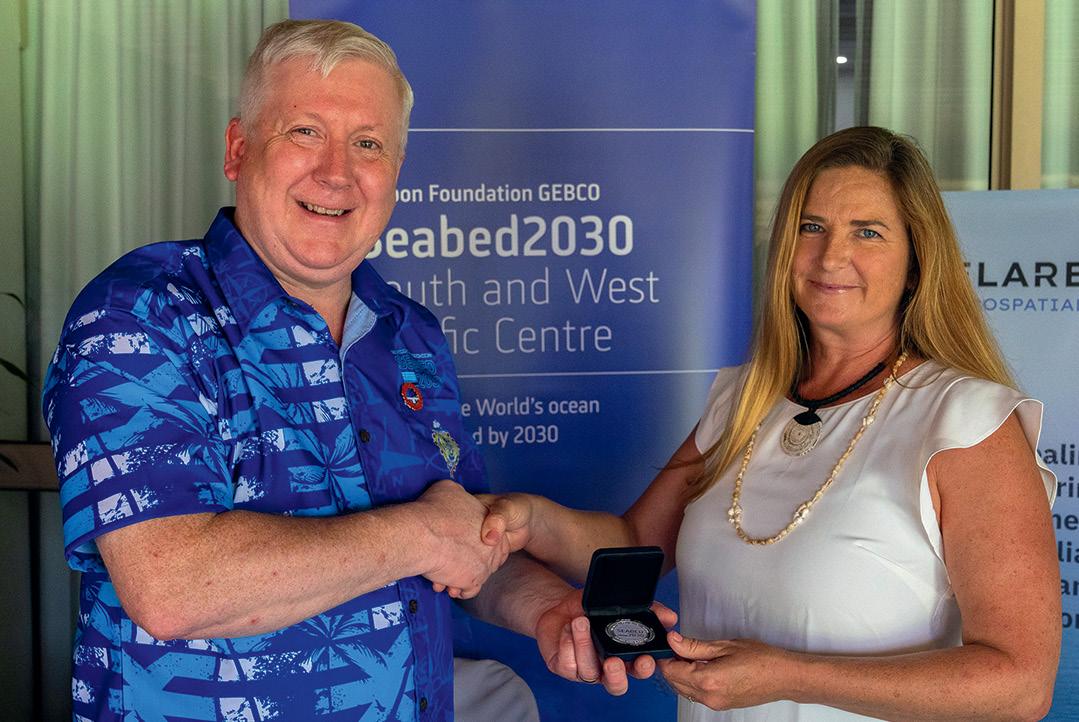

Specialist Australian hydrographic and geophysical surveying Revelare Hydrospatial and international geospatial firm Hexagon, have signed new partnership agreements with the Seabed 2030 project.
The memorandum of understanding between Revelare Hydrospatial (formerly Precision Hydrographic Services) and Seabed 2030 was signed by Seabed 2030 Director, Jamie McMichael-Phillips, and Revelare Hydrospatial’s Principal Geophysicist, Elizabeth Johnstone.
“Partnering with Revelare Hydrospatial marks a significant step in our work to achieve a complete map of the world’s ocean,” said McMichael-Phillips. “Revelare’s expertise in both hydrography and geophysics will enhance our efforts — especially in the South Pacific, where accurate ocean mapping and geohazard data can support regional safety and sustainable development.”
“We are excited to participate in this initiative, especially with so much left to be discovered and surveyed in the South Pacific region,” said Johnstone. “Our team is ready to bring our talent and technology to support Seabed 2030’s global vision.”
The agreement with Hexagon also was signed by McMichael-
Audits of surveys submitted in Queensland over the period July 2023 to September 2024 have revealed improvements in some respects but little change in others. That’s according to numbers released by the Department of Natural Resources and Mines, Manufacturing and Regional and Rural Development, formerly known as the Department of Resources.
Since auditing was implemented in mid-2023, the Department has conducted around 140 desk audits per quarter. The results show that compliance has increased from 46% at the start of the period to 74% during the latest quarter (July to September 2024). Some of the errors that continue to be seen include a failure to search for corner or reference marks, and inaccurate or incomplete dimensions.
As far as field audits go, at least 150 are conducted per year, with the Department reporting that compliance has not significantly improved — it has remained in the range of 35% to 52% for the last five quarters. The most significant areas of non-compliance include poor marking, corner or reference marks not searched, and incorrectly applied scale factors on longer lines.
The Department says that several criteria are used when selecting surveys for audit, including a random aspect. It says that “aspects with the lowest compliance rates are surveys carried out by surveyors who operate from locations outside Queensland (34%
Phillips, along with the Vice President of Bathymetric Services at Hexagon’s Geosystems division, Andrew Waddington.
“We are delighted to welcome Hexagon as a valued partner in our mission to achieve a fully mapped ocean floor,” said McMichael-Phillips. “Hexagon’s advanced digital capabilities and commitment to innovation are invaluable as we work to create a definitive map that will benefit science, industry, and conservation efforts across the globe.”
“Hexagon is proud to support Seabed 2030’s ambitious goal of compiling a map of the global seafloor by the end of the decade,” said Waddington. “This collaboration aligns with Hexagon’s vision of using cutting-edge technology to improve our understanding of our world and work towards a more sustainable future.
The agreements were formalised at the recent Pacific Ocean Mapping Meeting in Nadi, Fiji, which brought together a range of participants to address ocean mapping imperatives across the Pacific region.
They come shortly after Geoscience Australia signed a new partnership agreement with Seabed 2030 and reflect a growing interest in ocean floor hydrography in the region. n

compliant), surveys with ambulatory boundaries (43% compliant), and surveys carried out by surveyors with poor past performance (58% compliant)”.
Interestingly, the best results — an overall compliance rate of 91% — were attained by surveyors who have been endorsed for less than two years.
The Department says that identification surveys have been one of its foci, with compliance increasing from 31% to 84% over the five quarters. n

Positioning, navigation and timing (PNT) vulnerabilities have been the most critical challenge facing many geospatial professionals for some time now. With our modern world daily becoming more reliant on PNT for the provision of essential services, the need for ensured, reliable and resilient PNT is growing ever stronger.
Yet both the global and domestic PNT ecosystem is facing increasing strains and threats, from denial of service (as any pilot flying in certain parts of the Middle East and Eastern Europe will tell you), to the sovereign risk of relying on foreign-owned PNT assets, to a lack of suitably qualified individuals in geodesy, which is the backbone of PNT.
PNT is especially vital for the operation of many of Australia’s critical infrastructure sectors, such as telecommunications, defence, health and many others. According to the federal government’s Cyber and Infrastructure Security Centre, “… a substantive loss of or loss of access to, or deliberate or accidental manipulation of, PNT services that would affect the functioning of a critical infrastructure asset, is a material risk.”
That’s why a group of leading Australian geospatial professionals are now pushing for the establishment of an Australian Cooperative Research Centre for PNT, which would be known as the Secure, Hardened, Integrity-Enhanced, Location and Timing Defence (SHIELD) PNT CRC.
To find out more about the proposed CRC and what it would do, we spoke with Professors Allison Kealy, the inaugural Director of Swinburne University’s Innovative Planet Research Institute, and Professor Andrew Dempster, Director of the Australian Centre for Space Engineering Research (ACSER) at UNSW, both leading figures in Australian geodesy/PNT research.
Where did the idea come from for an Australian PNT CRC?
The idea for an Australian PNT CRC arose from our involvement in, and recognition of, the significant international efforts focused on addressing the risks to critical infrastructure and national security due to their heavy reliance on trusted PNT services.
Similarly in Australia, PNT services, provided by satellite-based systems such as the GNSS, have become as essential and relied upon as other utilities. Just like electricity or telecommunications,
they are assumed to be consistently available and trusted, for critical functions across a wide range of sectors, including the electrical power grid, communication networks, mobile devices, transportation systems, banking, precision agriculture, weather forecasting, and emergency response. This reliance has not been matched by a corresponding urgency or strategic effort to protect and secure our core PNT services.
The need for a resilient, secure, and independent PNT capability is now critical. In the UK, it has been estimated that a 24-hour GNSS outage could result in a £1.4 billion loss to the economy, with a seven-day outage costing £7.6 billion. The majority of these losses would come from impacts on emergency services, road transport and maritime transport, representing 87.5% of the total economic losses.
To address this, the UK Government has developed a Government Policy Framework for Greater PNT Resilience, including a ten-point plan that establishes a National PNT Office and a National Timing Centre, along with back-up plans for GNSS disruptions, terrestrial timing networks, and precision clock research to boost resilience and reduce risk.
Similarly, in the USA, Executive Order 13905, Strengthening National Resilience Through Responsible Use of Positioning, Navigation, and Timing Services, was issued in February 2020 and aimed at ensuring that critical infrastructure sectors such as energy, finance, and transportation are resilient to disruptions in GPS or other sources of PNT.
Australia, however, lacks a comparable strategy or a dedicated plan to address these vulnerabilities, which is concerning given the growing number and complexity of threats. While many sectors are increasingly aware of the risks posed to PNT services, there remains a need for greater coordination and preparedness to manage potential disruptions and cascading impacts.
A dedicated entity is essential to assess risks, drive innovative solutions, and strengthen industry collaboration to ensure Australia can detect and mitigate vulnerabilities in the PNT services that underpin critical infrastructure. The SHIELD PNT CRC is being designed to meet these needs.
An Australian PNT CRC would bring together academia, industry and government stakeholders to develop and implement solutions that deliver a trusted PNT utility that enhances critical infrastructure resilience. In principle, we are focused on delivering PNT solutions that are not only fit for purpose but also aligned with the specific risk profiles of each sector. These solutions will be designed to either maintain optimal performance under threat, degrade gracefully to minimise disruption, or recover within a predefined, rapid timeframe.
By leveraging cutting-edge technologies and innovative frameworks, the CRC would ensure that PNT services are highly resilient, enabling critical infrastructure and national security operations to continue seamlessly even in the face of complex and evolving challenges.
In short, an Australian PNT CRC would be the cornerstone of a national effort to secure PNT services, enabling the country to withstand and respond to disruptions, ensuring the continuous operation of essential services, and safeguarding Australia’s national interests.
Resilient PNT refers to the ability of PNT systems to provide ‘trusted’ information, even during disruptions, interference or attacks. It ensures that the systems supporting critical infrastructure and national security can continue to function effectively under adverse conditions. The concept of ‘trusted’ can be expanded to include graceful degradation of services, timely warnings of failures and/or automatically switching to alternative or multiple technologies as required. Key aspects include:
• Redundancy: Incorporating multiple, diverse sources of PNT data (such as satellite, terrestrial and inertial systems) to ensure that if one source fails or is compromised, others can take over without a significant loss of service.
• Adaptability: The ability of PNT systems to dynamically adjust to different levels of threat or degradation, maintaining a certain level of accuracy and performance even when under attack or in environments that degrade satellite signals (such as urban canyons or dense forests).
• Cybersecurity: Protecting PNT systems from intentional interference, such as jamming, spoofing or hacking, which could compromise the accuracy and reliability of the service.
• Graceful degradation: In cases where full functionality cannot be maintained, resilient PNT systems are designed to degrade in a controlled manner, ensuring that services are not completely lost, but instead reduce precision or functionality temporarily.
• Rapid recovery: The ability to quickly restore full PNT functionality after a disruption, ensuring that any loss in service is minimal and temporary.
• System monitoring and response: Continuous monitoring for potential disruptions and having systems in place to quickly detect, diagnose, and respond to any threats or failures in PNT services.
Are there any other important considerations?
One critical point I’d like to highlight is that the domain of PNT extends well beyond the concepts of sensors and generating coordinates and timing information. Underpinning PNT is the global geodetic supply chain that produces the geodetic products at the foundation of these coordinates and timing information. Strengthening this supply chain through workforce planning, securing the global geodetic infrastructure and understanding the relationship between geodesy and PNT is often ignored in discussions about PNT from non-PNT sectors. With significant impacts on gravity, location determination and reference frames, identifying threats around resilience cannot be decoupled from a conversation about geodesy
The geospatial/PNT experts involved in the kick-off meeting for the SHIELD PNT CRC proposal: Safoora Zaminpardaz (RMIT), Amir Khodabandeh (UMelb), Suelynn Choy (RMIT), Jeff Kasparian (KasComm), Ryan Keenan (Positioning Insights), Graeme Kernich (FrontierSI), Allison Kealy (Swinburne), Andrew Dempster (UNSW) and Eldar Rubinov (FrontierSI).
How does Australian PNT compare to other countries?
Australia has made significant strides in PNT, particularly with the development of capabilities such as the Southern Positioning Augmentation Network (SouthPAN) and investments in satellitebased augmentation systems. However, compared to other advanced countries such as the US, Europe and Japan, we are still developing our resilience in PNT capabilities. These regions have assessed the economic impact of loss of PNT to their economies and put in place resilience frameworks that make their PNT assets much more robust. They heavily invested in alternative PNT technologies.
The SHIELD CRC would give Australia the opportunity to catch up to the state of the art for the Australian context, develop sovereign capabilities and advantages, and lead in areas specific to our needs, such as remote and maritime PNT solutions.
What sort of response have you had so far?
The response has been overwhelmingly positive. Key stakeholders from the Australian geospatial/PNT sector, defence and companies involved in critical infrastructure sectors have expressed strong interest. We’ve already engaged with several leading universities, industry leaders and government bodies who recognise the importance of resilient PNT systems. Moving forward, we aim to expand our network and bring in partners from diverse sectors like telecommunications, transportation, energy, emergency services, and cybersecurity to ensure a wide-reaching impact.
What’s the next step?
The next step is to solidify partnerships and define the research priorities for the CRC proposal. This involves building a strong consortium of collaborators and engaging with key government agencies to demonstrate the critical need for this initiative. The formal CRC bidding process involves submitting a detailed proposal to the Australian Government’s CRC Program, which outlines the scope, impact and potential outcomes of the research. This will be followed by an evaluation process where proposals are assessed based on their alignment with national priorities and the potential for economic and societal benefits.
How can people become involved?
People who are interested in learning more about the Australian PNT CRC or becoming involved can reach out directly via email (akealy@swin.edu.au). We encourage interested parties from academia, industry and government to connect with us, as we are actively looking to expand our consortium and welcome diverse perspectives. n
From manual map scribing to digitised data, the NSW Spatial Cadastre has come a long way over the decades.
The evolution of the NSW Spatial Cadastre, commonly referred to as the DCDB (Digital Cadastral Data Base), is a remarkable story of digital transformation, from its initial inception to its present state as an essential component of the state’s digital infrastructure.
The NSW Spatial Cadastre is a representation of all land parcel and property boundaries across the state, encompassing records of more than 4.5 million land parcels. In its current form it not only facilitates informed decision-making at various levels of government but also serves the wider community, promoting effective land management and governance.
To achieve this, the state was divided into three divisions, each defined by a specific map scale used for each map sheet within that division. The sparsely populated Western division had a map scale of 1:100,000, with the Central division being more detailed at 1:50,000 and the more developed Eastern division more detailed again with a 1:25,000 scale. Map sheets were supplemented with more detailed maps (commonly 1:2,000 or 1:4,000) as required, typically for major towns and villages.
The story of the NSW Spatial Cadastre begins with a patchwork of individual Crown and Deposited Plans, along with detailed charting maps of the state’s 141 counties, 7,459 parishes and many others such as pastoral and town maps. In the 1960s, these diverse sources, ranging in scale from 1:1,000 to 1:100,000, were combined to create standardised map sheets of the entire state.
The ‘let-in method’ was employed as an innovative technique at this time, used to combine maps for improved accuracy. In this process, a map image was layered under a scribe sheet made of light-blocking plastic. The scribe sheet displayed a printed image that outlined either topographic or cadastral features. To ensure precise spatial positioning, targets identified by our surveyors were employed, making it easier to correlate features visible in aerial imagery with those being mapped.
As our cartographers worked with the scribe sheets, they meticulously aligned roads within designated road corridors, matched creeks to their respective waterways, and ensured that fence lines corresponded accurately with cadastral boundaries. This careful manipulation not only helped improve the accuracy of the maps but also enabled the adjustment of any errors to be spread between known points.
Each map consisted of multiple layers of scribing sheets that represented a range of information from contours, roads, water, annotation, state forest and national parks in addition to cadastral land parcels. Once the scribing process was finished, the layers were aligned with registration pins to make one map sheet and then printed onto chromoflex, an opaque plastic material.
The original scribe coat or chromoflex from the printed maps were kept and updated as new survey plans and gazettal information was received. The maps were updated using plotting or drafting machines that used vernier scale. allowing the cartographer to get bearings within a five-minute accuracy and scale to measure the lines.
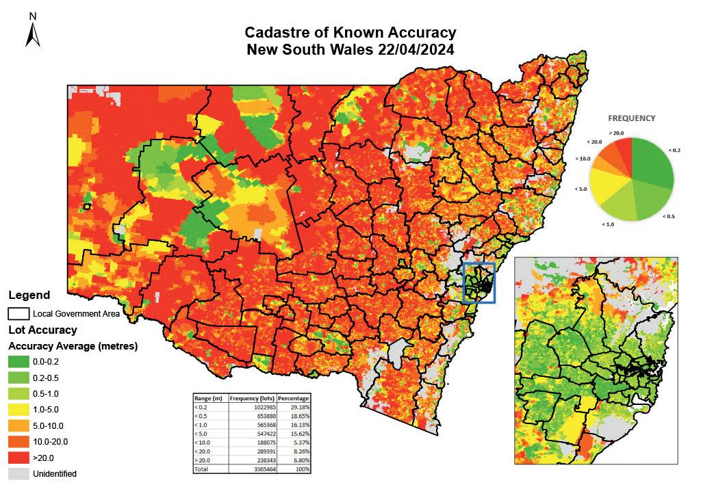
The scale of the map had a significant bearing on the accuracy of the lengths of boundary lines. For example, at 1:25,000 each millimetre on the map represented 25 metres on the ground. Due to the techniques involved, especially the let-in method stage, accuracy was only guaranteed to half the map scale. Therefore, for a 1:25,000 map an acceptable error would be less than 12.5 metres. Unlike today, there was no link to any survey marks, so the position was based solely on topographic or occupation features (such as fencing).
From the late 1980s, following advancements in computer technology, the chromoflex map sheets were digitised to form the NSW Spatial Cadastre (or DCDB). Initially, a tracing digitisation method was used, where a 1:25,000 map was mounted onto an electronic board and crosshairs were placed over existing points. The co-ordinates of that point or line were then digitised into the computer. For a map at a scale of 1:25,000 map, the linework would be two to three meters thick on the ground, leading to potential errors depending on the crosshair’s placement.
Some of the work was completed in-house, however, during the trace digitisation project approximately 75% of the work was completed by private enterprise. The project aimed for a positional accuracy of digitisation being within 0.2 millimetres. In practice this meant that at 1:25,000, a 20-metre-wide road could become either 15 or 25 metres wide while still fitting within specifications. It took approximately a decade to complete the digitisation project and create the DCDB.
Inaccuracies in the NSW Cadastre have developed over time due to several factors:
• Hand tracing: Original maps were created using hand tracing, scanning and other manual capture methods. Even slight deviations by cartographers with their tracing tools

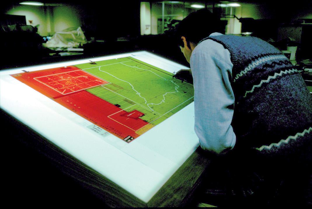
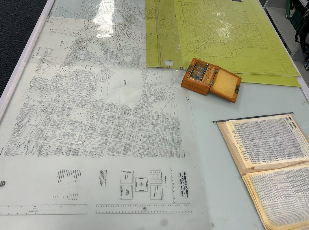
could cause a large displacement of the cadastre.
• Variable scales: Maps were drawn at different scales and combined, leading to inconsistencies.
• Material expansion: Temperature fluctuations affected the chromoflex used in map production, causing the material to shrink or expand, which caused distortion.
• Different map scales: Town maps were created independently from parish maps. When these maps were fitted together, they did not have matched scales, resulting in gaps or overlaps.
• Lack of survey control: There were no survey control or ground ties when the original maps were drawn and digitised. It has only been with the introduction of digital imagery and survey marks that these inaccuracies are now seen.
From the late 1980s, following advancements in computer technology, the chromoflex map sheets were digitised.
maps were updated using plotting or drafting machines that used vernier scale, enabling the cartographer to get bearings within a five-minute accuracy and scale to measure the lines.
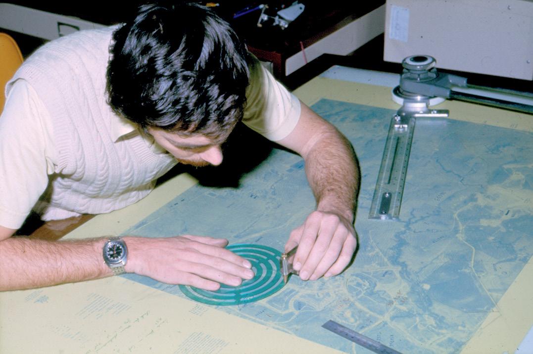

DCS Spatial Services is custodian of the land parcel and property theme of the NSW Foundation Spatial Data Framework (FSDF) and under the Surveying and Spatial Information Act 2002, is responsible for maintaining the ‘State Cadastre’ on behalf of the Surveyor-General.
In total, DCS Spatial Services has positionally improved more than 1.3 million parcels within the Spatial Cadastre across the state, ensuring improved accuracy within the NSW Cadastre which provides important data for government, industry and the community. n
Article provided by NSW DCS Spatial Services. You can learn more about this work at https://www.spatial.nsw.gov.au/what_we_ do/land_and_property_boundaries/cadastre
GABRIEL SCARMANA
New advanced sensors are making barometric levelling valuable for obtaining elevation data where GNSS data are unavailable.
Barometric altimeters, once primarily linked with aviation, parachuting and mountaineering, have now expanded into a wide range of applications due to the increased availability and affordability of advanced atmospheric pressure sensors. These altimeters are now integrated into various electronic devices alongside Global Navigation Satellite Systems (GNSS), enabling the recording of vertical profiles along with latitude and longitude data. Consequently, barometric altimeters are embedded in a vast array of consumer electronics, including smart phones, watches, fitness bands, bicycle computers, GNSS-enabled handheld devices, and vehicle tracking systems. In drone systems and aviation modelling, barometric altimeters are extensively used, with barometry often serving as a primary method for altitude measurement. Drones, in particular, use multiple altitude-measuring systems and switch between them as needed (e.g., radio, GNSS, infrared or laser altimeters). The barometer in a drone can measure both relative and absolute altitude, and provide readings in mean sea level (MSL) and above ground level (AGL) units, depending on the application.
This highlights the potential to further reassess the role of barometric altimeters in the geospatial industry, especially in large-scale topographic surveys and remote area mapping where traditional levelling methods are impractical. Barometric altimeters offer a cost-effective solution for determining elevation differences across extensive terrains, facilitating the creation of digital elevation models (DEMs) and aiding in the planning of infrastructure projects. Moreover, barometric altimeters have revived interest in barometric levelling, a once forgotten surveying method for determining height differences between points on the Earth’s surface. Though this technique was commonly referenced in surveying textbooks, it fell out of favour as newer levelling technologies emerged. However, advancements in precise barometric sensors (e.g. MEMS sensors) and portable weather stations have significantly
improved the accuracy and practicality of barometric levelling, making it a viable and straightforward levelling method.
This approach is particularly advantageous in environments where traditional levelling techniques face challenges, such as urban canyons, dense forests, tunnels or indoor navigation systems, where other altimetry methods may struggle. Once considered suitable only for reconnaissance or exploratory surveys due to perceived accuracy limitations, barometric levelling now challenges those assumptions with its enhanced precision and ease of use.
Under stable weather conditions, barometric levelling can be more reliable and accurate than a navigational GPS/GNSS receiver for measuring relative elevations between multiple points. Some handheld GPS/GNSS receivers incorporate built-in barometric altimeters and algorithms to fuse GPS/GNSS and atmospheric pressure data. This integration ensures that users can obtain more accurate and reliable elevation data, even in the absence of optimal satellite signals.
This article offers a concise and informative overview of the principles, instruments, methodology and applications of this overlooked levelling technique, highlighting its significance and practical use through a real data capture example. More in-depth theoretical explanations have been intentionally omitted but are available in specialised literature on barometric altimetry.
How does barometric levelling work?
As in barometric altimetry, barometric levelling operates on the principle that atmospheric pressure decreases with altitude. The barometric formula, which relates pressure to height, is the foundation of this method. By measuring atmospheric pressure at different points and applying this formula, it is possible to determine the height difference between those points. In other words, it is based on the basic standard that the pressure caused by the weight of the column of air above the
observer decreases (or increases) as the observer goes higher (or lower) in elevation.
As with any levelling technique, the accuracy of barometric levelling is influenced by several factors, including temperature, humidity, the survey procedure, the skill and experience of the survey team, and the vertical and horizontal distances between measuring stations. Additionally, optimal results with this technique are achieved when the weather is stable and climatic conditions remain consistent, which in general are also common requirements for current levelling methods.
There are two primary methods for conducting barometric levelling surveys. The first is the single-base method, which involves using one base station for reference. One barometric altimeter remains at a base station, the elevation of which is known, while the other altimeter (the roving altimeter) is taken to other points or measuring stations where the elevation is to be determined. The difference in simultaneous reading corrected for temperature and pressure changes will give the desired elevation.
The second method, referred to as the two-base method is, considered the standard for accuracy. At a suitable low point within the area being surveyed, one base station is established while a second base station is positioned at a much higher elevation. One barometric altimeter is employed at each base and simultaneous readings are taken and recorded at predefined time intervals at the measuring stations across the area of interest.
The literature on barometric levelling also describes the leapfrog technique as a variation of the single-base method. In this approach, both instruments are initially read together at the base station. The rover then moves to the first measuring station, where readings synchronised with the base station are taken. Afterwards, the rover moves to the next measuring station, while the base station instrument relocates to the previous rover station. This leapfrog procedure keeps the instruments close together, enhancing the accuracy of the assumption that air pressure variations are

Barometers, once large and cumbersome, have now been miniaturised.
consistent across locations. By bringing the instruments together more frequently, atmospheric drift is better controlled. Two operators are usually required for this technique to work.

Barometric levelling is most effective when measurements are conducted within a few kilometres of the base station.
To enhance accuracy, it’s essential to measure air pressure and temperature simultaneously at both the base and measuring stations. Barometric levelling is most effective when measurements are conducted within a few kilometres of the base station, especially on days with stable barometric pressure, often seen with gentle winds and clear or overcast skies. The distance between the base and measuring stations can vary depending on the accuracy of the barometric instruments, local weather conditions and the precision needed for the survey.
Barometric levelling offers several advantages. First, it enables elevation measurement in areas where GNSS signals are obstructed, making it ideal for locations with limited satellite access. Second, data computations can be easily performed using common office software like Microsoft Excel, streamlining data processing and analysis. Third, it is effective in rugged or inaccessible terrains, minimising the need for extensive physical groundwork. Additionally, modern barometric altimeters and weather data loggers are lightweight, compact and cost-effective, and they can be integrated into other devices, enhancing their practicality for field operations.
A barometric levelling survey was conducted on 6 July 2023 at Pacific Pines, a suburb of the Gold Coast (central coordinates E 153.326238, S -27.936753). The survey took place on a sunny morning with mild winds (2-4 km/h) and temperatures ranging from 17°C to 20°C. Barometric observations were collected at 25 randomly selected stations, averaging 0.7 km apart within a 10-square-kilometre area. The base station had a nominal elevation of 46.97 m, while the 25 measuring stations varied in elevation from 2 m to 140 m, as determined by differential levelling with an accuracy of ±0.02 metres.
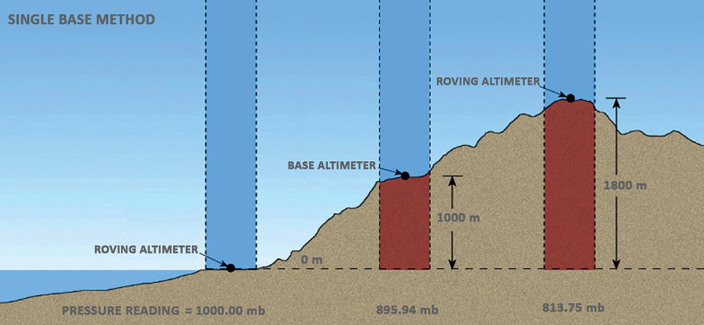


Known elevations at the 25 measuring stations in Pacific Pines were used as reference values to determine the actual difference at each station. Measurements were taken using a Kestrel DROP D3, a wireless temperature, humidity and pressure data logger, and the Kestrel 2500 weather meter (both made by the Nielsen-Kellerman Company, USA). The manufacturer specifies the accuracy (of the Kestrel 2500) as 1.5 hPa (at 2 sigma) or +/- 0.75 hPa, and it is able to capture and store barometric pressure, temperature, wind speed and humidity, and transfer data via Bluetooth for further processing. The Kestrel 2500 costs about US$170, while the Kestrel DROP D3 costs about US$150. The survey, completed in about 2.5 hours, involved one observer who took readings at each measuring station after allowing one or two minutes for the instrument to settle.
The Kestrel DROP D3 data logger was placed at the base station of known elevation and recorded the time, pressure, temperature and humidity at 10-minute intervals. Note that the instrument at this data logging frequency can store information for up to 40-plus days. Humidity was monitored to ensure stable atmospheric conditions but did not impact elevation calculations. Readings were taken from a 10 cm timber portable platform located on top of each measuring station. An interpolation method was used to synchronise readings between the base station and the measuring stations. The Kestrel 2500rover was used as the measuring device at each station. Transport between stations was carried out by driving a car.
Since the elevations of all stations were known, the absolute error for each measurement station was determined, resulting in a final root mean square error (RMSE) of ±0.49 m. Both instruments used in the survey were capable of measuring and storing air pressure with a precision of two decimal places, indicating that submetre accuracy in elevation estimates was theoretically attainable.
A similar, second test was carried out to determine the influence that distances from a given base station may have on the accuracy of the elevation of a measuring station. For this purpose, this exercise used an established permanent survey mark (elevation = 4.00 m) as the base station, and 12 permanent survey marks of known elevation as measuring stations. The distances of the known measuring stations to the base ranged between 2 km and 14 km whereas the elevations ranged between approximately 2.00 m and 140.00 m.
As expected, the computed elevations were much better at the first few measuring stations, which were nearest the base station, than the elevations determined
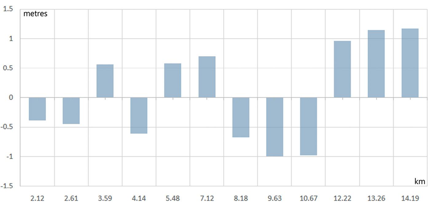
at the remainder of the route. The errors tended to increase as the rover moved away from the base until, at measuring station 12, a maximum was reached. To give an idea of the accuracy achieved, the differences between the nominal elevations and the computed ones can be seen in Figure 5. Readings of pressure, temperature, time and percentage of humidity (for monitoring purposes only) were carried out using the rover instrument and were synchronised with the base readings taken at intervals of 5 minutes. All subsequent computations followed the same process as per the previous example.
In this instance, measurements were taken in both forward and reverse directions, with the elevation results at each station averaged. The survey took approximately three hours to complete. For consistency, it was conducted under similar weather conditions as the previous exercise, on a sunny day with temperature variations of about 2.5°C from start to finish. As before, the task was carried out by a single operator.
One of the main challenges with barometric levelling is its sensitivity to changes in atmospheric conditions. Variations in weather patterns and local weather phenomena can introduce errors in the readings, leading to inaccuracies in the elevation measurements. To mitigate these issues, apart for ideal weather conditions, it is crucial to use portable barometric instruments (preferably of the same manufacturer) that can generate accurate simultaneous observations of pressure and temperature.
Using two synchronised barometric instruments helps simultaneously detect and correct sudden changes in atmospheric pressure, improving result reliability. This approach also reduces systematic errors that might affect each device differently. By synchronising the readings from both
instruments, biases specific to each device are minimised, leading to better results.
Improving atmospheric correction models, developing more accurate barometric instruments, using more base stations with real-time data logging capabilities, and integrating data with other height measurement techniques is still recommended.
In summary, barometric levelling is valuable for obtaining elevation data where GPS/GNSS signals are unavailable. Advancing sensor technology and methods will enhance the precision and expand the use of barometric levelling in diverse geospatial fields, including areas related to environmental monitoring, geological surveying and infrastructure development.
One could argue that a similar survey could be conducted using portable GPS/ GNSS receivers rather than using portable weather stations, as many smart phones and devices like Garmin© products are capable of also displaying latitude and longitude coordinates along with atmospheric data such as pressure and temperature. Although these products are valuable due to their high performance and advanced features, they are generally more expensive.
In contrast, using two instruments from the same manufacturer as described above, renowned for their reliable weather data logging capabilities at set intervals, ensures consistent measurement and availability of data collected by a single operator. Additionally, instruments specifically designed for portable weather stations, offer a more cost-effective solution. Their relatively lower cost combined with their suitability for accurate and dependable data collection makes them an appealing choice for barometric levelling surveys. n
Gabriel is an associate member of the academic staff at the University of Southern Queensland. He has maintained a longstanding, active interest in the fields of GIS and surveying throughout his career.
The Leica Geosystems GS05 GNSS RTK rover smart antenna is now available in Australia through C.R. Kennedy. The unit features streamlined data-collection functionalities which, Leica says, enable surveyors to accomplish more each day. Weighing just 750 grams, the GS05 offers integrated UHF radio or a 4G modem, WLAN and Bluetooth, internal memory, 10 Hz positioning, NMEA output, plus a 10-hour internal battery. It can be used as a base or as an RTK rover; as the latter, it functions with single base stations or in RTK Networks such as Leica Geosystems SmartNet. Tilt-compensating functionality, plus total station interoperability on a SmartPole set-up, enables increased productivity.

C.R. Kennedy has announced that it is now distributing the Teledyne Ladybug6 high-accuracy 360-degree camera. The Ladybug6 is designed to capture spherical images from moving platforms, and is able to do so in all-weather conditions due to its industrial-grade design. Out-ofthe-box factory calibration combined with global shutter CMOS sensors produces 72 MP images with pixel values that are spatially accurate within +/-2 mm at a distance of 10 metres. Suitable customer applications include panoramic street image production, road surveying, asset inspection, feature extraction for HD map generation, and it is fully compatible with laser mobile scanning systems from Leica, Riegl, Trimble and others.
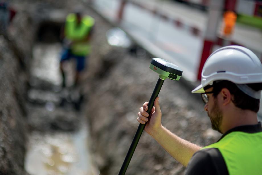

Teledyne Geospatial and Inertial Labs have announced EchoONE, a collaboration that combines Teledyne’s LiDAR and camera technology with Inertial Labs’ IMU and INS technology. Featuring NDAA-compliant data security, lightweight design and real-time operation, the system is designed to deliver long range, engineering-grade 3D point clouds for operators in the land surveying, electric utility vegetation management and asset modelling sectors, as well as transportation and infrastructure projects. EchoONE weighs 1.2 kg and can be operated from UAVs such as the Freefly Astro, Inspired Flight IF800 and DJI M300/M350.
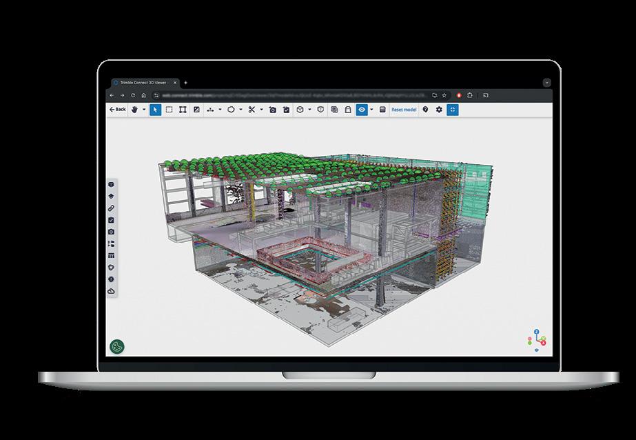
Trimble has announced its Trimble Reality Capture platform service, which, it says, will enable collaboration and the secure sharing of massive reality capture datasets captured with 3D laser scanning, mobile mapping and UAVs. The service is available as an extension to Trimble Connect, a cloudbased common data environment and collaboration platform, and can work with massive datasets captured through mobile mapping by terrestrial laser scanners such as the Trimble MX series and Trimble X9, as well as from thirdparty hardware. The platform is aimed at professionals in the building construction, surveying, transportation infrastructure, utilities, energy and mining sectors.
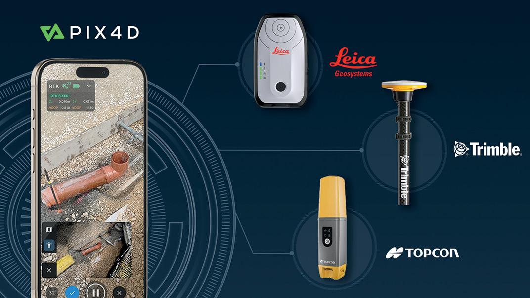
Pix4D has announced that integration with the Leica Zeno FLX100, Trimble DA2, and Topcon HiPer CR is now fully supported by PIX4Dcatch, giving users the option to choose the RTK solution that best suits their specific needs. The company says the news will be of interest to professionals across industries such as construction, engineering and GIS, who will be able to use PIX4Dcatch’s 3D scanning and augmented reality features with greater accuracy and reliability.

Kate Lundy President/Chair
Kate Ramsay Deputy Chair
Alistair Byrom Deputy Chair
Jacinta Burns Director
Paul Digney Director
Stewart Dunne Director
Mary-Ellen Feeney Director
Darren Mottolini Director
Roshni Sharma Director
At the end of October, we proudly launched the Economic Impact of Geospatial Services in Australia report at Parliament House in Canberra. This comprehensive study, the first of its kind since 2008, reveals the remarkable contributions of geospatial technology to our national economy. It uncovers a powerful narrative: in the 2023–24 financial year alone, geospatial services contributed an impressive $39 billion to Australia’s economy, with projections that this will grow to a cumulative $689 billion by 2034.
Commissioned by the Geospatial Council of Australia (GCA) and conducted by ACIL Allen, the report underscores the strategic value of geospatial technology in keeping Australia informed, resilient and competitive. The Honourable Kate Lundy, GCA Chair, aptly noted that geospatial technology is much more than a set of technical tools — it’s an essential enabler of smarter decision-making, with substantial impacts across sectors like national security, emergency response and environmental management.
Looking forward, the report forecasts that by 2033–34, the sector’s economic output could reach $90 billion annually, supporting an additional 32,000 full-time jobs. Realising this growth will require favourable policy settings and strategic investments. At GCA, we’re calling on leaders across all sectors to recognise and act on the opportunity geospatial services offer to drive Australia’s future economic success.
One of the most exciting aspects of this report is the sector-specific insights it provides. For instance, mining, a major GDP contributor and export revenue generator, relies heavily on geospatial information for everything from exploration to environmental monitoring and cost savings in logistics through automation. As Australia pivots toward a net-zero future, the mining sector’s reliance on geospatial data to locate and manage critical minerals will only deepen, highlighting geospatial technology’s role in supporting our nation’s sovereignty and environmental goals.
But it’s not just the large industries that stand to gain. From urban planning to agriculture, the report outlines how geospatial data is enhancing productivity, driving efficiencies, and enabling innovative solutions across industries and communities. The everyday lives of Australians are enriched by geospatial information, whether it’s routing their morning commutes, optimising farm yields, or supporting disaster response.
It is also not just about economic growth. Geospatial services, data and technology is also powering productivity gains across most sectors of the economy. In the 2023–24 financial year, geospatial services amounted to 1.4% of GDP. By the 2033–34 financial year geospatial is project to increase to 3% of GDP and is then expected to be turbocharging productivity improvements in our economy.
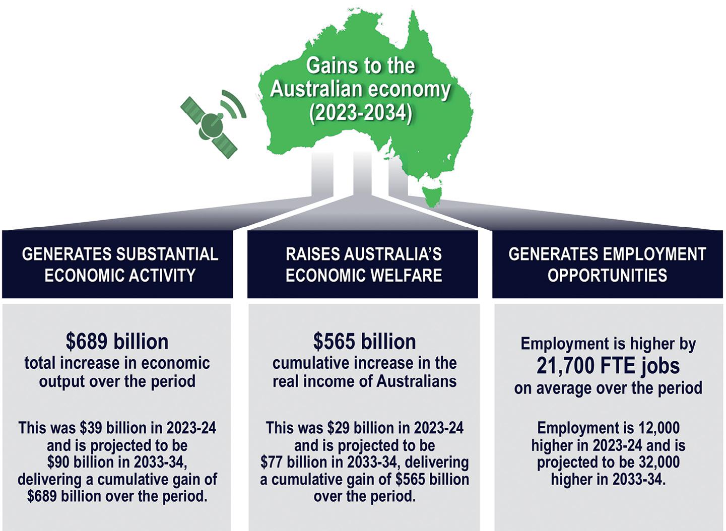
To achieve the favourable outcomes outlined in the report, the geospatial sector requires a robust digital and data framework that addresses several key areas:
• Enhanced policies for data sharing, privacy and security: Establishing comprehensive mechanisms that govern the ownership, access and sharing of geospatial data is essential. This will ensure that data can flow freely while maintaining the privacy and security necessary for stakeholder confidence.
• Strengthened collaboration with related fields: Fostering partnerships with adjacent sectors, such as digital engineering and critical infrastructure, will enhance the application and integration of geospatial technology. This collaboration can drive innovation and efficiencies across industries.
• Investment in critical geospatial infrastructure: To support the digital economy, significant investment is needed in essential geospatial infrastructure, including digital twins and satellite systems. These technologies will underpin the effective use of geospatial data and enhance decisionmaking capabilities.
• Educational and workforce initiatives: To ensure the sector’s continued growth,
it is vital to develop educational and training programs that equip the workforce with the necessary skills. By fostering a pipeline of talent at both professional and technical levels, we can address the increasing demand for geospatial expertise and support the industry’s evolution.
• Defence and security: Securing resilient access to space-based systems and services including Earth observation from space, positioning, navigation and timing, and satellite communications, through system redundancy or sovereign alternatives.
As you might already notice, this report is more than just an economic assessment; it’s a call to action for all industries, from government to private enterprise, to recognise the immense value that geospatial technology brings to Australia’s economy and society. Let’s seize the opportunity to collaborate, invest, and support policies that will enable our geospatial sector to thrive, creating a more productive, sustainable, and resilient Australia for generations to come.
The full report, including state and industry breakdowns, as well as the companion report featuring 65 case studies, is available on our website: www.geospatialcouncil.org.au. n

State and Territory Chairs and Co-Chairs
NSW Chair
Brittany Baker
NSW Vice-Chair
Hanno Klahn
ACT Chair
Mike Stapleton
Queensland Chair
Cameron Brittain
Queensland Vice-Chair
Koray Ozdogu
South Australia Chair
Graham Walker
South Australia Vice-Chair
Jennifer Brindle
Tasmania Chair
Anthony O’Flaherty
Victoria Chair
Nicole Kiely
Western Australia Chair
Laren Collen
GDARS Chair
Dr Jagannath Aryal
Surveying Chair
Mike Stapleton
Hydrography Chair
Neil Hewitt
Young and Emerging Professionals Chair
Oscar So
STELLA BLAKE-KELLY, DIGITAL CARTOGRAPHER at CARTISAN
This September, the space, spatial and surveying (SSS) industry launched the second edition of the Inclusive Employer Index survey, building on insights from the inaugural 2021 survey. Led by the Space, Spatial & Surveying Diversity Leadership Network (SSS-DLN), this ongoing initiative aims to measure progress in diversity and inclusion (D&I) across the industry, and is supported by a partnership with the Diversity Council of Australia (DCA) and industry sponsors. For the first time, the industry now has comparative data, providing insight into the evolution of D&I over the past three years and establishing priority areas for improvement.
This year, the survey gives insight into specific trends within SSS by providing data separately for each sector. Maintaining a sample size of approximately 1,000 respondents across Australia and New Zealand, the survey’s longitudinal data allows the industry to monitor changes since the 2021 baseline. New this year, the survey provides data at a sector level for SSS, and also identifies the sources of discrimination and harassment, shedding light on the specific challenges employees face within the industry.
The survey shows the growing diversity of the SSS industry:
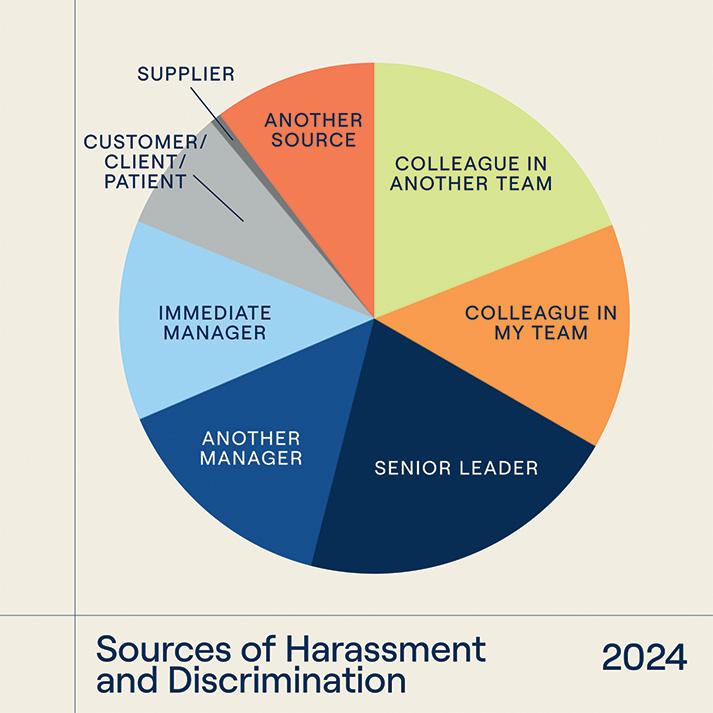
• 94 distinct cultural backgrounds and 74 languages spoken.
• 45% of respondents were born overseas.
• 36% speak multiple languages.
• 19% identify as having a disability.
• 15% identify as LGBTQI+
However, despite best efforts, the survey again saw limited representation from Aboriginal and/or Torres Strait Islander participants, highlighting an area for focused engagement.
In line with broader Australian workforce trends, the SSS sector observed a slight decline in team inclusivity, though not as sharp as in other industries. The number of employees in non-inclusive teams rose from 9% in 2021 to 11% in 2024, compared to a national increase from 12% to 19%. Team inclusivity in SSS is assessed across four key areas: respect, connection, contribution and progress.
Insights into team inclusivity based on demographics reveal variation in respondents who felt they were treated as a valued and respected team member:
• Women: 84.2% felt they were, with 9.5% feeling otherwise, compared to 90.6% of men feeling included and 4.3% not.

• LGBTQI+ respondents: 87.5% felt included, 10.7% did not, compared to 87% of non-LGBTQI+ participants.
• Workers with disabilities: 78.2% felt included, while 12.4% did not, compared to 89.3% of respondents without disabilities who felt included.
Inclusivity within managerial relationships is also critical. Nationally, employees with non-inclusive managers increased from 18% to 27%; however, the SSS sector saw only a marginal increase from 17% to 18%. Respondents rated managers based on their value for diverse and inclusive teams, openness to ideas, fairness, and responsiveness to exclusive behaviour. At an organisational level, SSS continues to outperform the national inclusivity benchmark. Reports of an inclusive climate rose from 57% to 59% between 2021 and 2024, while the national rate climbed from 40% to 52%. However, this rapid national growth suggests SSS must continue to innovate in inclusion practices to maintain a competitive advantage in the tight labour market.
The survey underscores the tangible benefits of inclusivity on employee satisfaction, retention and performance. Workers in inclusive teams were 14.1 times more likely to be “very satisfied” with their jobs — double the 2021 survey’s finding. Retention also benefits from inclusivity; in inclusive teams, only 6.8% were likely to seek other employment in the coming year, compared to 51.8% in non-inclusive teams.
• Inclusion also correlates strongly with performance:
• Inclusive teams were 5.5 times more likely to work effectively.
• They were 8.7 times more likely to be innovative.
• Members of inclusive teams were 4.5 times more likely to deliver excellent performance.
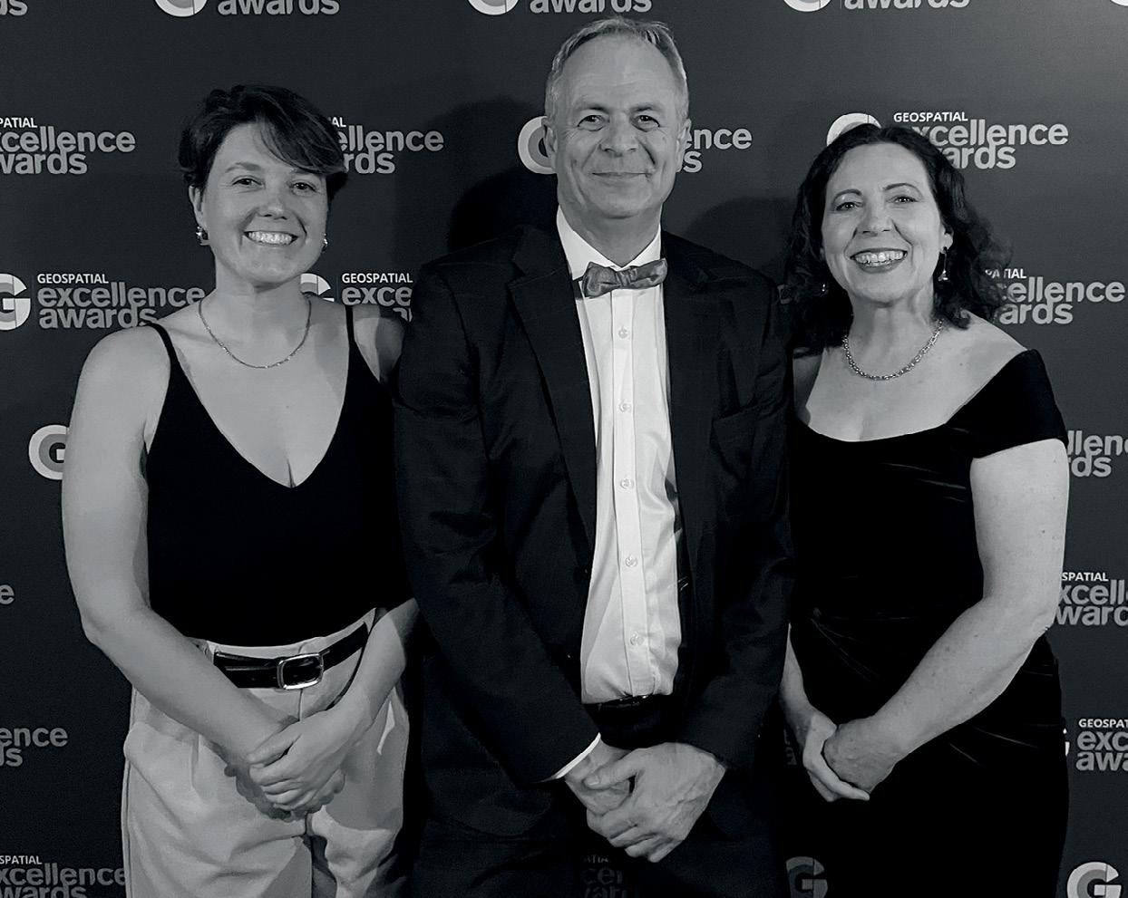
These results demonstrate inclusion is not just an ethical ideal but a key driver of business success.
This year’s survey provided a breakdown of the sources of discrimination and harassment within the SSS industry, revealing some interesting statistics. While Australia-wide rates of discrimination and harassment rose from 22% in 2021 to 30% in 2024, the SSS industry reported a decrease from 26% to 23.4%. However, instances of harassment observed by others increased from 20% in 2021 to 23.5% in 2024.
Senior leadership and management were identified as the largest source of these experiences accounting for 20.4%, with the second highest coming from colleagues at 14.2%. Nationally, senior leaders were the source for 7.6%, compared with 8.8% in SSS. This feedback highlights the need for stronger accountability and culture shift at the leadership level, a key area for targeted focus moving forward.
We see positives to celebrate but also some stark warnings, especially regarding discrimination and harassment. It’s disheartening to note that the highest proportion of these experiences stemmed from senior leadership and management.
The full report, with detailed actions for advancing inclusivity, will be available in early 2025. Stakeholders and interested parties are encouraged to view the preliminary report online at www.sssinclusion.report and contact the SSS-DLN for involvement in the next steps. n
The 2024 survey was a joint effort between peakorganisations and business leaders from Australia and Aotearoa New Zealand to work together on a common challenge. It is organised by the Space, Spatial and Surveying Diversity Leadership Network in partnership with the Diversity Council of Australia.
Survey partners and sponsors: 1Spatial, ANZLIC, Aptella, Australian Space Diversity Alliance, Australian Spatial Analytics, Earth Observation Australia Inc, FrontierSI, Fugro, Geoscience Australia, Geospatial Council of Australia, IIC Technologies, Institution of Surveyors NSW, Land Solution Australia Pty Ltd, LOCUS, Ocean Infinity, Snowy Hydro Limited, Space Industry Association of Australia, Spatial Vision.
The Australasian Hydrographic Surveyors Certification Scheme’s (AHSCS) core guidance manual, the ‘Guidelines for Specialist Certification In Hydrographic Surveying’ is currently under review.
The first phase of community consultation has been completed and GCA would like to thank those who were actively involved and provided feedback. The Review team has taken this input, as well as the input from AHSCP Panel/ Secretariat face-to-face workshops, to review the Guidelines line by line. Whilst all suggestions were considered, the AHSCS must remain compliant with the IBSC international standards for hydrographic surveyors S-5A and S-5B.
Over the coming months we will consult the hydrography community further on some of the more significant suggested changes to the Guidelines.
The key suggested improvements to date include:
1. Reshape the Guidelines so that they are easier to follow, and easier to present on the GCA website.
2. Refresh Annex F – Hydrographic Surveyors Certification Roles, Responsibilities and Definitions to better reflect the responsibilities of contemporary CPHS L1 and CPHS L2.
3. Introduce guidance around the currency of claimed experience, i.e. that 75% of the ‘Logbook of Practical Experience’ should be within the five years preceding their application.
4. Refine the definition of sea-time.
5. Move away from the terminology of ‘Allied Discipline’ and replace with ‘qualification that meets the learning outcomes of S-5A or S-5B’.
6. Broaden the definition of education to include short courses that meet S5 learning outcomes.
7. Introduce Recognition of Prior Learning for certain S-5A and S-5B learning outcomes.
The new Guidelines will be published on the GCA website in the new year at the same address as the current Guidelines: https://geospatialcouncil.org.au/apply-forhydrographic-certification. n
AHSCP past and present panel members, chairs and secretariat.
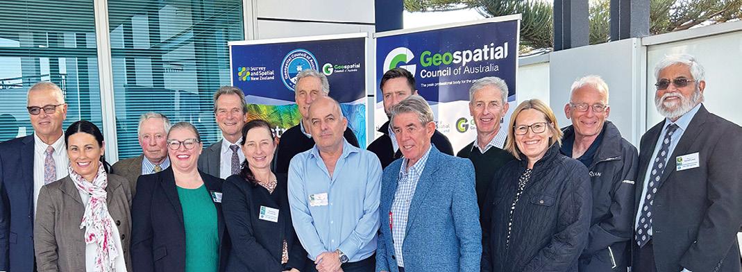
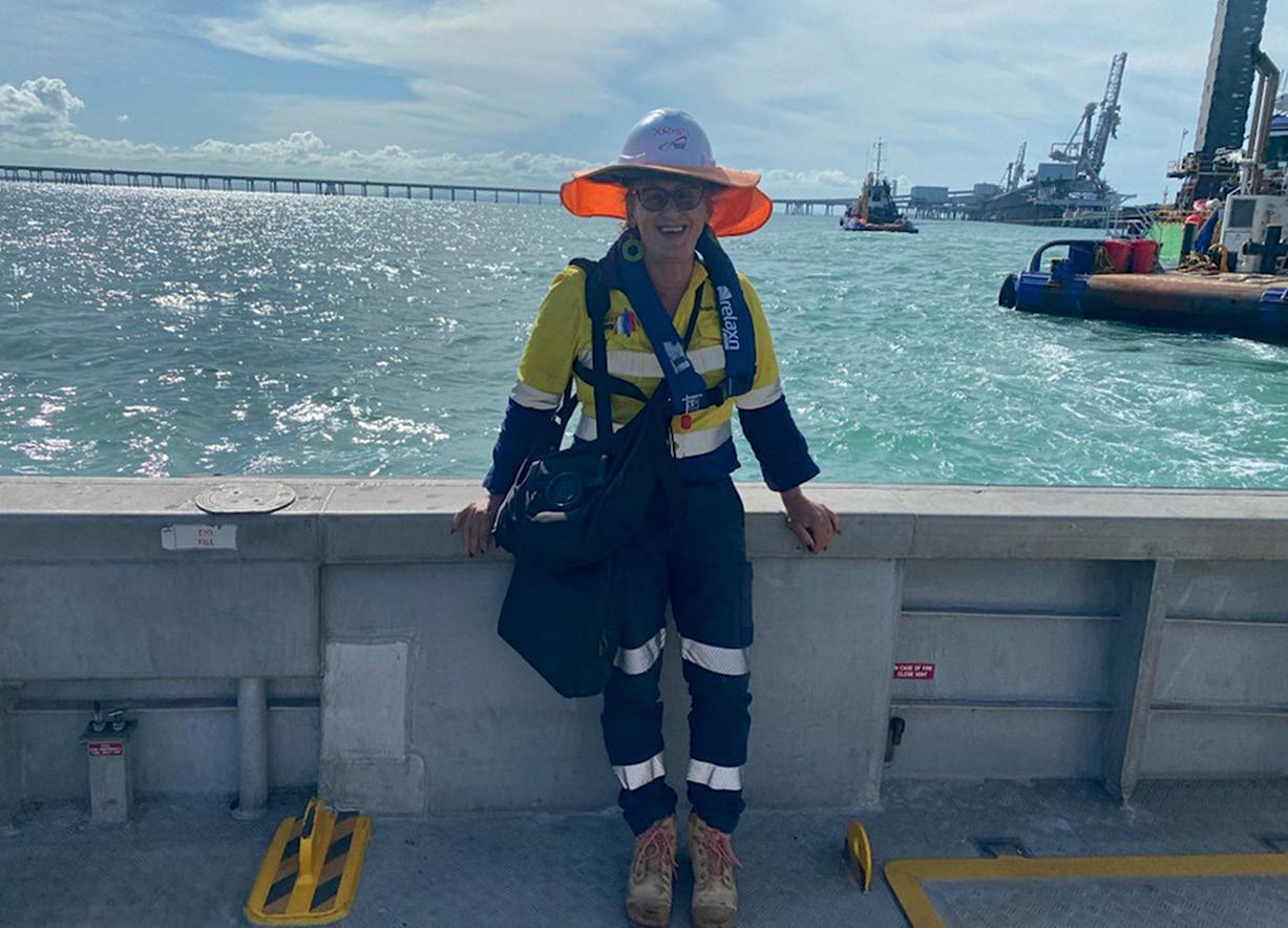
A conversation with Xristi Gibson about her career and the value of obtaining certification.
With the recent update to the Geospatial Council of Australia’s National Engineering Surveying Certification, we caught up with Xristi Gibson, Survey Manager at Minstaff Survey Pty Ltd, and an accredited engineering surveyor, to hear her story and discover the impact of certification on her career.
Xristi’s journey into engineering surveying started “unexpectedly”.
“My first job after school was as a site engineer on a brewery construction site in South Wales back in 1978,” she says. “I had no idea what I was getting into, but I loved the hands-on nature of the work, setting out structures and being involved in every detail.”
From there, Xristi’s fascination with surveying only grew, leading her to briefly study civil engineering at Manchester University. “University wasn’t for me at that point,” she says. “But years later, I found my way back to it when I discovered a surveying degree program at RMIT.”
Balancing full-time work as a cabinet maker with her studies, Xristi’s second university experience was transformative. “This degree was perfect for me — it combined maths, geography and a career
outdoors. Continuous assessment and engaging content kept me motivated, and I graduated with honours, even picking up a few best-student awards along the way.”
Over the years, Xristi’s work has taken her across Australia, from coal mines in central Queensland to infrastructure projects such as the Melbourne Metro, the Woolgoolga-to-Ballina Pacific Highway upgrade, and the Cross River Rail in Brisbane.
“Each project is unique, and every site has its own challenges,” she reflects. “I’ve worked on everything from dam lifts to sewer tunnels, and recently, the Centenary Bridge Upgrade in Brisbane.”
Xristi says that surveying’s role on these sites is often misunderstood. “Surveying isn’t just another step in construction. It’s the foundation — literally — for accuracy and alignment throughout the entire project. There’s a lot of responsibility in making sure structures are set out correctly, and that requires a deep understanding of both the technical and practical sides of the job.”
As Xristi’s career progressed, the need for formal credentials became increasingly important.
“As clients began asking for accredited professionals, I realised the landscape was shifting.”
“For a long time, I didn’t think I needed certification,” Xristi admits. “I had my degree, and contractors were satisfied with that. But as clients began asking for accredited professionals, I realised the landscape was shifting.”
Obtaining the GCA’s National Engineering Surveying Certification has since become essential for her, she explains, not only to meet evolving client demands but also for career mobility.
“With the GCA’s certification, I’m not tied to a specific state,” she says. “I can work on projects across the country with a credential that’s recognised everywhere, and that’s been invaluable with the variety of work I do. It’s a standard that clients trust, and it helps my employer, and our projects stand out.”
GCA’s National Engineering Surveying Certification has been instrumental in expanding Xristi’s skills and knowledge, particularly in adapting to fast-paced technological changes.
“Keeping up with the latest industry practices is crucial, especially with technology advancing so quickly,” Xristi says. “For example, BIM (Building Information Modelling) is becoming a standard part of what clients expect. Through upskilling and continuous professional development, which the certification encourages, I’ve been able to learn about integrating BIM data, managing attributes, and adding details like concrete pour dates to digital records. It’s a rewarding challenge.”
Reflecting on her journey, Xristi shares valuable advice for those considering a career in engineering surveying, or certification itself. “Be ready for a steep learning curve, especially in the early stages,” she says. “The demands are high, and every day is different. But it’s worth it if you love solving problems and being part of something that lasts.”
As for the GCA certification, Xristi encourages it for anyone looking to advance. “The GCA’s certification is more than just a box to check; it’s a commitment to quality, accountability, and professional growth.”
Today, Xristi’s career is not only defined by the high-profile projects she has worked on but also by the standards she upholds. Her certification with GCA allows her to practice across Australia and has strengthened her role as a survey manager, ensuring she leads her team with a solid foundation of trust, precision and expertise. Her journey highlights the vital role of engineering surveyors in shaping the nation’s infrastructure, and the importance of national certification in upholding professional standards across Australia. n
