8 minute read
Riverfront and Public Market
Big Move 8. RiverFront and Public Market
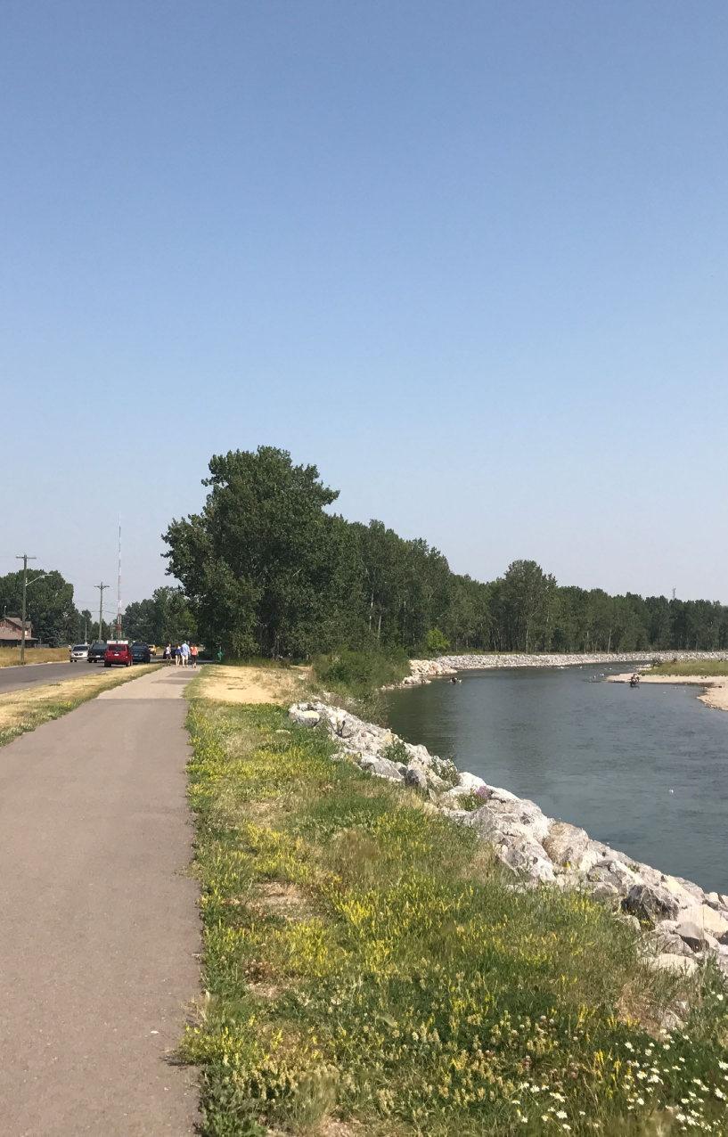
The Riverfront is the most natural of the four character areas. Development in this area will adhere to the intent of the Sheep River Valley Management Plan to protect, maintain and rehabilitate the river valley lands on the publicly owned natural environments allowing for sensitive development of the adjacent lands.
Advertisement
CURRENT CONDITIONS
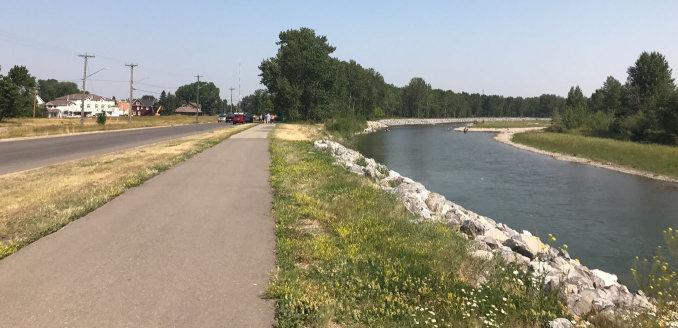
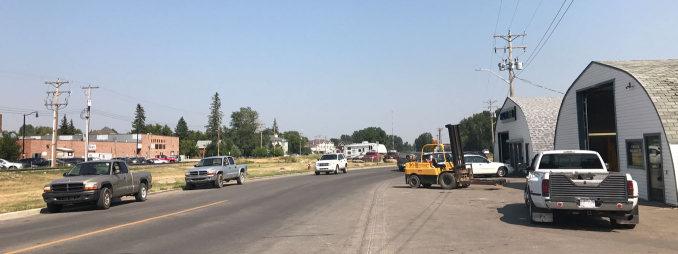
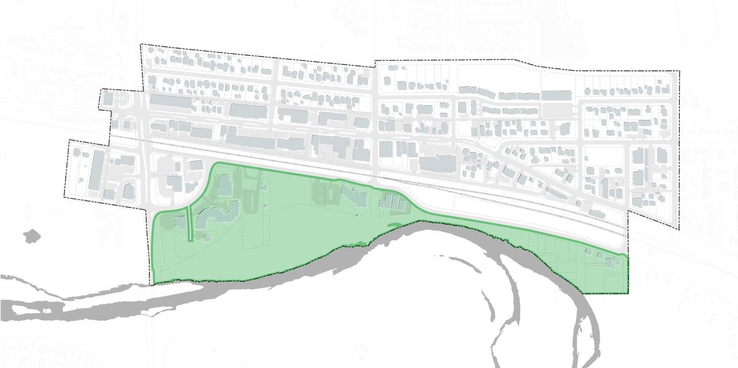
FUTURE POTENTIAL This map marks locations of the riverfront.
ELMA ST W
NORTHRIDGE DR RIVERSIDE GATE ELK ST ELMA ST W
ELIZABETH ST
RIVERSIDE DR
ELMA ST E VETERANS WAY McRAE ST
DAGGETT ST
SHEEP RIVER CLARK AVE GLOROND PL
McRAE ST McRAE ST
RIVERSIDE DR
SHEEP RIVER MAPLE ST
ALBERTA AVE LINEHAM AVE
N RAILWAY ST
POPLAR AVE
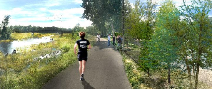
This image provides a conceptual illustration of the impact on the public realm of changes over time to the existing built form in this area. This image is not intended to be a future design nor set requirements for ways to adapt the current buildings or business at this location.
RIVER VALLEY GUIDELINES
Riverfront and Public Market Guidelines
ENVIRONMENTAL PROTECTION

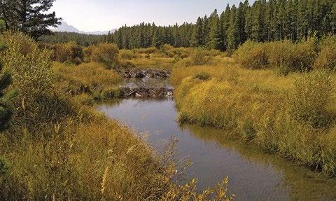
The Sheep River ecosystem should be managed and protected within the town to ensure its long-term viability and integrity. Wildlife habitat and species within the town should be managed and protected on a sustainable basis.
WATER MAINTENANCE The integrity of natural watercourses, springs, seeps and other waterbodies should be maintained. NATIVE AND NATURAL VEGETATION HISTORICAL PRESERVATION
Native and natural vegetation of the valley and other natural areas within the town should be managed and protected. This includes geological features and native grass land.
OPEN SPACE ELEMENTS
ACCESS AND CONNECTIVITY River valley, urban parks and important open spaces should be easily accessible and well connected through pedestrian and cyclist infrastructure. Each plaza park and open spaces should be part of the larger network of open space linked by trails and pathways, connecting the neighbourhoods.
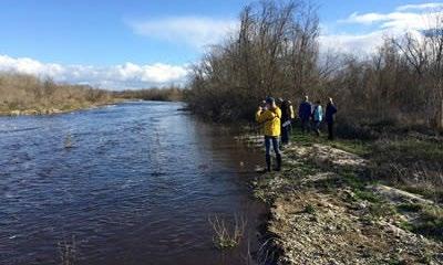
Historically significant sites, such as the Lineham sawmill site, should be managed and protected. This includes the identification and protection of culturally significant features such as archaeological sites, tipi rings, cairns and historical trails.
INTERPRETIVE ELEMENTS
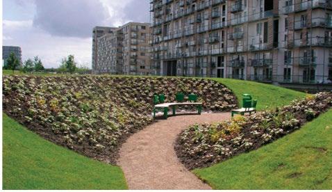
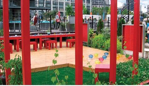
Identify spaces with natural and cultural importance within the river valley and incorporate interpretive elements with the built environment to educate and inform the public about Okotoks’ heritage.
STREETSCAPE ELEMENT ON RIVERFRONT ROAD
STREET SWALE CURB EXTENSION EMBED GREEN IN PARKING
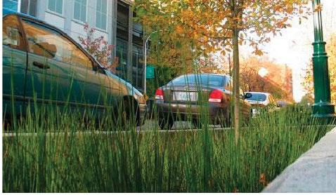
Street swales are naturalized planted areas that intentionally create a green ditch along the roadside. It captures stormwater runoff from roads and overflow from nearby systems, while enhancing the streetscape when planted with vegetation such as tolerable grasses. Maintenance is required to clean and unclog the swale from debris as needed.
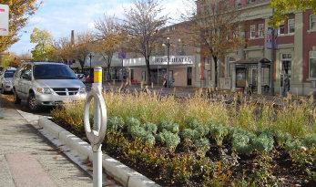
Also known as a “bulb-out”, curb extensions are used when the sidewalk can expand into the adjacent roadway (usually a parking lane) to shorten the distance of a crosswalk. Typically deployed on intersections but can be applied mid-block. Curb extensions can accommodate more pedestrians on sidewalks with heavy pedestrian activity and simultaneously slow down vehicular traffic on the road. The curb extension also provides the opportunity for a broader program of planting and furniture in the public realm. Where onstreet parking is proposed, encourage the establishment of landscaped curb bulbs for buffers.
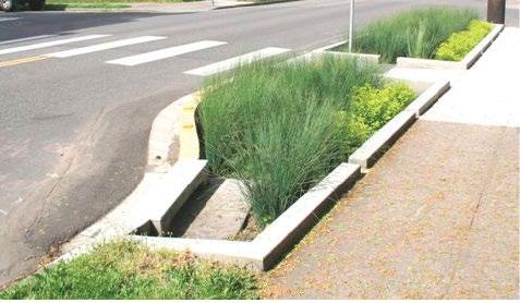

Promote best management practices and increase infiltration within and around parking areas. Initiatives can include the use of permeable paving and bioswales to promote the infiltration of stormwater and decrease runoff. Along on-street parking, employ planting design details such as continuous street tree trenches and structural soils to improve permeability.
STREETSCAPE ELEMENT PLANTING
CONNECTED TREE PITS TREE PIT DESIGN STORMWATER CAPTURING TREE PITS PLANTED AREA
Connected tree pits form a single trench, giving more space and air to the trees that share the space. It is not recommended to cover the tree-pit with a walkable surface unless there is an alternative method of hydration in place other than traditional runoff from precipitation. Employ planting design details such as continuous street tree trenches and structural soils to improve the long term prospects for successful establishment.
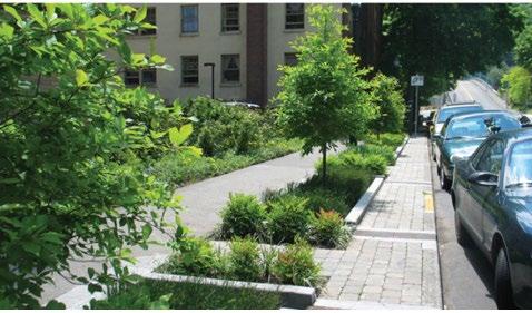
Identify the location of all existing and proposed above and below ground utilities including street lighting early in the design process to facilitate the preparation of a feasible tree planting plan. The use of structural soils or structural soil cells (or equivalent) may provide opportunity to maximize amounts of soil volumes available for growth and root structure to ensure the health and vitality of new street tree planting. Provide the largest possible space for the roots of each planted tree.

Designed either for individual or a series of connected tree pits, Stormwater Capturing Tree Pits connect to the stormwater system of a nearby roadway and have the ability to properly filter and bank water, reducing the need for human maintenance and external water for its survival.
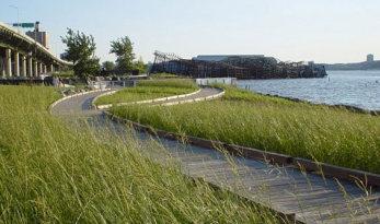
Planted areas are great ways to beautify the streetscape, and provides opportunities to capture and store stormwater. They can be located in trenches either on a portion of the sidewalk, the furniture zone, traffic islands or medians. They are often flexible in size, length and depth, and can easily be implemented in a variety of settings.
Plaza
2.50 m Sidewalk 2.00 m Bioswale
3.35 m Tra c Lane
3.35 m Tra c Lane 1.67 m 1.67 m Bike Lanes
4.26 m Sidewalk Frontage Zone
RIVERSIDE DR
2.80 m Multiuse Pathway 2.45 m Parking Connection to Sheep River
4.10 m Tra c Lane
3.70 m Tra c Lane 2.45 m Bike Lane Sidewalk s RAILWAY ST
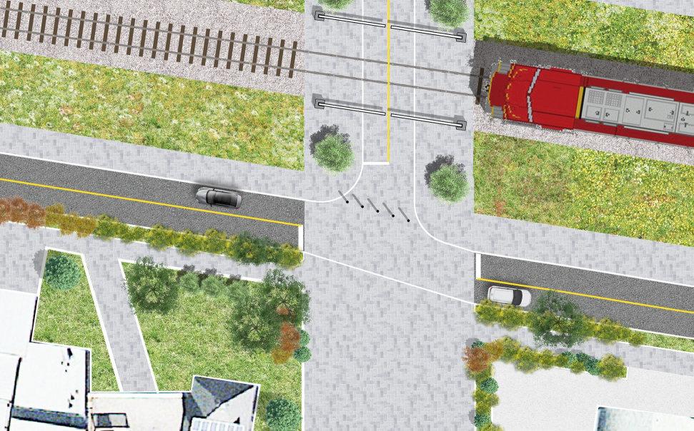
Plaza The proposed South Railway Street and Riverside Drive connection is a conceptual design subject to detailed design and further technical analysis.
Frontage Zone Rear Parking
N
3.35 m Tra c Lane
3.35 m Tra c Lane
1.50 m 2.00 m Bioswale Sidewalk S RAILWAY STREET
Frontage Zone
3.00 m Frontage Zone
3.00 m Heritage Parkway
IMPLEMENTATION
The implementation of the UDMP will take place incrementally, by both the public and private sectors, over the next decade or so. Ultimately, Town Council will decide, through capital funding, the priorities at the time and order of the projects.
IMPLEMENTATION GUIDELINES
The Town will ensure any changes to the Municipal Development Plan support and align with the vision and guiding principle of the UDMP The Town will review and update the downtown Land Use Districts of the Land Use Bylaw to ensure the regulations support the direction of the UDMP. This review should include reviewing parking requirements and sunlight access requirements.
The Town will undertake a periodic review of how the UDMP direction is being achieved, including the status of priority projects. The Town will ensure utility replacement planning and construction is integrated with public surface enhancements. The Town should ensure municipally designed historical properties are protected from incompatible redevelopment.
PRIORITY PROJECTS
The following priority projects are identified to ensure implementation of the vision and guiding principles of the UDMP. These projects are in addition to changes to statutory plans and the Land Use Bylaw to align with the plan and are of varying importance, cost, and timing.
GATEWAY The Gateway project is a priority project as it was listed as one of the most desired projects to attract visitors for the benefit of Downtown Okotoks.
ELIZABETH STREET Elizabeth Street has had improvements in the past that are starting to show signs of ageing. Capital funding should be set aside for rehabilitation, including new pedestrian pavers. In the short term, a pilot project to test a rainwater garden/soil cells may be initiated near the Town Municipal Centre to demonstrate the potential of such elements in the future streetscape. As new developments occur, it is important to ensure that the buildings follow the sustainable mixed-use building guidelines.
RIVERSIDE DRIVE The development of a streetscape for Riverside Drive should be coordinated with future developments and ideally would be implemented along the whole length of the street in one project to redefine the image of the south side of Downtown.
ELMA STREET Recommendations for Elma Street include the addition of a sidewalk on the north side of the street and heritage-style pedestrian lighting to build on the character of the street. This project could be implemented as part of regular upgrades to the street. As new developments occur, it is important to ensure that buildings follow the sensitive-infill guidelines. PLAZA Although a public plaza has been identified as high priority in previous studies and at the public engagement, the town does not currently own a suitable site to locate this. Once a site has been secured, the plaza should be developed through a citizenengagement process.
PUBLIC ART A public-art policy should be developed to initiate a coordinated approach to secure funding for the creation of public art pieces incrementally on a project-byproject basis.
TRIANGLE PARK Triangle Park currently has an ageing playground and is fenced off from the sidewalk. This parkette should be redeveloped with a different program so that the fence can be removed and the space could be opened for other public uses.
PUBLIC FARMERS MARKET The public engagement revealed that a farmers market could be highly successful and attractive in Downtown Okotoks. A feasibility study should be initiated to outline the potential for a successful farmers market.
BICYCLE LANES The engagement process identified a strong desire for bicycle lanes along the main streets of Downtown. A future study should examine the feasibility of implementing bicycle lanes across the Downtown.
APPENDICES
