Map showing hotels, apartments, lodging and rooming houses within a given area on the west side of the City of Portland investigated by the Vice Commission. Removed from the 1913 Vice Commission report. Classifies hotels, apartments, lodging and rooming houses in west Portland which are moral, doubtful and immoral.
This page: James Wood birds eye map of Portland, 1890.
Includes images of some buildings and residences around the border and a numbered key that illustrates places and structures on the map. Facsimile of a map held at the Library of Congress.
Instructors:
Dr. Enrica Dall’Ara (MLA), enrica.dallara@ucalgary.ca
Dr. Graham Livesey (MArch), livesey@ucalgary.ca
Dr. Fabian Neuhaus (MPLan), fabian.neuhaus@ucalgary.ca
TA: Gordon Skilling, gordon.skilling1@ucalgary.ca
TEACHING APPROACH
This interdisciplinary senior studio focuses on the design of a sustainable community (residential, employment, commercial, and cultural/institutional) for a brown field waterfront site in Portland, Oregon. Portland has gained an international reputation since the 1970s as a progressive city that has innovated in many areas including limiting growth, developing transit oriented communities, district revitalization, sustainable infrastructure, and high-quality urban design. This senior studio will allow students in the MArch, MLA, and MPlan programs to work in teams (of 3 students) on a complex urban design scheme, where students will produce community plans and developed aspects of the plans. Topics could include: waterfront revitalization, densification, diversifying function, optimizing transit, developing green infrastructure, urban agriculture, environmental factors, alternative typologies, integrating ecologies, green space systems design, etc. Students are expected to participate in a visit to Portland, scheduled for September 17-20, 2018.
This studio, while developing skills, is also seen as being a site for discovery through analysis and process. The studio will explore the nature of contemporary urban design, with respect to program, site analysis, cultural and social forces, technology, ecology, etc. The course is a studio course with an emphasis on visual representation techniques for documenting, analyzing, designing, and presenting; Students are expected to use a variety of media in their design development. The studio will involve the integration of research, readings, field trips, lectures, precedent studies, etc. Handouts will be given out during the term as required.
COURSE LEARNING OUTCOMES
1. To understand the principles of sustainable urban design, with an emphasis on innovative urban form and high quality public realm, and to understand the inter-relationship between architecture, public space, and infrastructure in cities.
2. To develop and refine urban design skills and processes for dense, mixed-use, and highly complex urban environments.
3. To demonstrate an ability in relevant drawing, modeling, and presentation skills. To learn representational methods.
4. Understand how critical observation, analysis, and experimentation apply to urban design processes.
5. To learn to work effectively in interdisciplinary teams.
6. To learn about urban design approaches as practiced in Portland.
ST 18 Design Studio
The site - Brown field waterfront site in Portland (Oregon, USA). Zidell-owned site, the northern edge is defined by the Tilikum Crossing and the southern end is marked by the South Waterfront Lower Tram Terminal. The west side is defined by SW Moody Avenue and on the east side by the Willamette River. Crossing the site is the Ross Island Bridge.
Program outline - not to scale.
Topic, groups, time table, structure, expectations
Introduction
Portland Field Trip
Site visits, data gatering, discussions, talks, walks
Dr. Enrica Dall’Ara, enrica.dallara@ucalgary.ca, Cell:
Dr. Graham Livesey, livesey@ucalgary.ca, cell: 403.477.8964
Dr. Fabian Neuhaus, fabian.neuhaus@ucalgary.ca, cell: 403.919.2628
TA: Gordon Skilling, gordon.skilling1@ucalgary.ca
DATE ACTIVITYLOCATIONCONTACT
Monday, Sept. 17
9:30Introduction Tour of Downtown ZGF Offices: 1223 SW Washington Street, Suite 200
12:00Lunch
13:30Presentation Zidell Yards Offices 2020 SW 4th Avenue, Suite 600
15:00Assignment 1.1 Site Visit and Documentation (Group)
Site
19:00 Happy Hour Bridgeport Brewing, 1313 NW Marshall Street
Tuesday, Sept. 18
9:30 History of Planning and Urban Design Innovation in Portland Room 270, Urban and Public Affairs Building, 506 SW Mill Street, Portland State University
9:30Tilikum Crossing, Ziddell Yards, and South Waterfront Tilikum Crossing Starbucks Kaitlin Lovell (Environmental Services, City of Portland) and Troy Doss (Planning, City of Portland)
12:00Lunch
13:00Assignment 1.1 Complete Site Documentation
17:00Visit Completed
See p.26 for assignment detail. See also Jan Gehl, How to Study Public Life and works by Georges Perec.
Paving Map of Portland 1894. This is a beautifully rendered map of Portland by City Surveyor T.M. Hurlburt. It includes color coded references to the composition of many Portland streets. River depths and ferry crossings are also noted.
Submit digital copies: D2L by Sept. 14, 2:00 pm. PDF format, Maximum 25MB/file.
Thereafter this forms part of each submission.
On the Matrix as a working tool
Design is a complicated subject where everything and nothing matters.
Humans are fundamentally designers — humans create artifacts, shelters, communities, and landscapes. Design involves conceiving, representing, and executing constructions across a wide range of scales. Traditional, or pre-modern, cultures tend to develop well-established design practices that evolve slowly over time and reflect cultural and often religious practices. Modern cultures, since the Renaissance, have placed an emphasis on individual human creativity resulting in the culture of celebrated designers. Postmodern culture uses a wide variety of traditional, modern, and contemporary techniques. Design can be subjective and/or objective, artistic and/or scientific, structured and/or unstructured, borrowed and/or original, material and/or immaterial. Ultimately design is creative and technical and satisfies the needs and aspirations of a culture in that it creates culture. Increasingly, designers are faced with the challenges of a rapidly changing world.
Design draws from what some scholars have called practice knowledge (Cross, N., 2006. Designerly Ways of Knowing. London: Springer London.). You as the designer can make this your own process, you take control of it based on your judgment that makes sense in the broader narrative. In other words, you as the designer take ownership of and responsibility for it.
To help structure this ongoing decision-making process, we are introducing the matrix (MX) as a working tool. It guides the conversation. The idea is to use the proposed families of keywords as a reference to select a hand full of key areas that are of specific interest to the task at hand or the project at large. The four families are: temporarily, process, place and representation and organised in two layers: keywords and examples. The focus is on the keywords, the examples are for illustrative purposes. See short description of keywords on page 18.
For your selection you rate each keyword on a scale of 1 to 3 regarding their importance (personal/group judgment/discussion), 3 bing the most important one. Instead of touching on every subject we want you to focus on the areas that are significant for your proposal. The rating should be distributed about equally in 1/3s. Make sure to be able to support your decision with a clear argument.
The top four subjects areas that emerge will guide your tasks for the assignment. As you learn more about your project through the investigation and design work you can make adjustments on the fly to your initial rating, but this must be documented and again be backed up by a coherent argument. Make sure this process is well documented. This process will form part of your assignment submission/presentation where you are required to explain your matrix as a process before and after the phase. This documented decision-making process will be the basis to discuss your proposal.
Step by step:
. Discuss the subject areas in all four families concerning the assignment and the project at large in the group.
. Rate each area on a scale of 1 to 3 with about 1/3 in each classification.
. Visualyse your ratings as a spider diagram
. Document the arguments for your decision
. Focus the work of the assignment according to your selection
. Make adjustments as required only as a group after discussion
. Always document any changes made to the original choice. Submit the matrix and the documentation together with your assignment.
Process Design Matrix (MX) Families
The Matrix Families
*TEMPORALITY
*Function - The workings and usages of a planning program that give space to an activity. See also Functionalism: Theory that good design results from or is identical with functional efficiency, i.e. architecture should be determined by function alone. (Curl, J.S., 2015. The Oxford dictionary of architecture. Third edition. Oxford: Oxford University Press. p.297.)
Example: *land use, *mix, *program
*Activity - The doing of sorts, usually human activity in the sense of doing something, going somewhere. At the same time, this refers to the act as well as the provision thereof/therefor.
Example: *circulation, *practice, *movement,*mode of transport
*History - the connection to the broader context in the past concerning the aging and processional change of all things. Includes both physical and conceptual arrangements and focuses profoundly on temporal sequences/ narratives. History is dynamic rather than static (Giedion, S., 1982. Space, Time and Architecture: The Growth of a New Tradition. 5th ed., rev. and enl. ed. Cambridge MA: Harvard University Press. p5). To look at, investigate history means to change it: every spectator at every period - at every moment, indeed - inevitably transforms the past according to his own nature.
*Regulation - collective agreements on defined aspects that tie to specific requirements to full fill and meet the required standards.
Example: *code, *policy, *framework, *plan
*Social - an attitude or behavior which takes the interests or needs of others into account as the organisational principles of humans as social beings and their implications for social relationships and social interaction. With a focus on the tendency to form groups in various ways including the division of labor as economics and the possible moments of friction, e.g. power.
*Resources - raw material or supply available. Often associated with a benefit or potential product. A resource can both be physical and intellectual. It is in the form of energy of the constrained by the idea of a closed energy circle in which energy can be transformed and reshaped, but not be lost.
Example: *waste, *energy, *sustainability, * human resource
*Infrastructure - the provision of facilities and systems for specific *function or *activities. Not exclusively physical but instead defined as hard and soft infrastructure. It can range from Bridges to social services and belong both to the public or private domain.
*Context - the surroundings to which a piece in both a physical and theoretical sense is linked or can be linked. Often requires a narrative. There is always a context.
*Location - place in both a geographical and imaginary sense and the ways it relates to other sites. It can be well defined or fuzzy by physical objects, memories, references or narratives. As an entity, it can carry attributes and also influences its occupancy, neighbors and interactions.
*Fabric - the build-up of structures and *processes in the context of a cultural landscape as a result of human activity.
Example: *scale, *morphology, *density
Precedent (PT)
On the Precedent as a working tool
A study on urban design precedents will guide and inspire your design process. We conceive the precedents as working tool, a source to learn about design approaches and methods, narrative of the project, and representation techniques. Building our work on previous knowledge is a crucial attitude. A continuous dialogue with the precedents will make you more aware and confident during the entire design process. In many ways the PT can be looked at as a mentor. At first it is imitated then copied and finally extended and adapted to work for the specific project. In each phase of the studio sequence - analysis, programming, flows and form - you are expected to critically and creatively refer to the precedents, going beyond a merely imitative work.
Steps:
Research the chosen precedent.
With your group, explore the assigned precedents and select one of them as a guide through the entire design process
Present the selected precedent to the class through a 5 minutes presentation (See the Course Schedule at page…) in order to share information and stimulate a class discussion in the initial stage of the studio sequence
Develop each assignment working on the precedent through a critical reflection
During desk critics and the presentation of each assignment, be ready to argument the evolution and outcomes of your dialogue with the precedent
right - Linked Hybrid, Peking, China, 2009 - Steven Holl Architects
Start: Sept. 07, 2018, 2:00 pm
Deadline: Oct. 01, 2018, 2:00 pm
Verbal Presentation: Oct. 01, 2:00 pm – 12 minutes per group: 5 minutes of presentation and 7 minutes of discussion
Submit digital copies: D2L by Oct. 01, 2:00 pm. PDF format, Maximum 25MB/file.
Evaluation % of Course Grade:
Assignment 1.1 (group) 10
Assignment 1.2 (group) 5
Assignment 1.3 (individual) 5
Total 20
Note: All readings are available online through the University of Calgary Library.
Analysis
The work focuses on analysis and interpretation of an urban site in Portland (Oregon, USA and its city context, as a preparatory phase to develop an urban renewal project whose design process will follow in the studio sequence. Students will study the various parameters that define the city’s (infra)structure and the urban landscape to engage in evaluating the role of these elements for the design process.
Field activities will be a fundamental part of the analysis to experience the place and its various conditions first hand. The phase consists of three assignments: Mapping and Data, Urban Transect and Field observations in a public space leading to an analysis using different methods on a range of scales. The assignments are to be undertaken both in groups and individually. We want to emphases an interpretative documentation. This means that the work has to go beyond a mere representation of the current state to amount to a reflective and visionary statement or interpretation. The topic(s) covered are defined through the matrix (MX). Similarly, the method of representation is guided by the chosen precedent (PT). Both of these working tools can be adapted as required and these changes are to be documented and form the basis of the review discussions (crits).
Modern art like modern science recognizes the fact that observation and what is observed form a complex situation - to observe something is to act upon and alter it (Giedion, S., 1982. Space, Time and Architecture: The Growth of a New Tradition. 5th ed., rev. and enl ed. Cambridge MA: Harvard University Press. p6). In other words analysis is as much design work as jotting down ideas for a new product. This brings however complications to the fore that need to be taken into account as conclusions are drawn and findings formulated.
LEARNING OUTCOMES
By the completion of the Assignment, students should be able to:
o Explore and represent the main features of an urban site and its context through field observation
o Inter pret the main urban features through section drawings (transects)
o Analyze an urban site and its context through mapping of amongst others environmental components, cultural landscapes, land use, functions and architectural systems (structures)
o Collect and represent various sources of data and information related to the project to support a coherent narrative.
o Evaluate the role of various urban elements for the later design process
o Understand and be able to apply the use of various methods of analysis
READINGS
o Alexander, C., “A City is Not a Tree,” Architectural Forum, Volume 122, No. 1 (April 1965): 58-62.
o Kullmann, K., “Thin Park/Thick Edges: Towards a Linear Park Typology for (Post)infrastructural Sites,” Journal of Landscape Architecture, Volume 6 (2): 70-81.
o Latour, Bruno, “On actor-network theory. A few clarifications plus more than a few complications,” Soziale Welt, Vol. 47 (1996): pp. 369-381.
o Nijhuis, S. and D. Jauslin, “Urban Landscape Infrastructures: Designing Operative Landscapes for the Built Environment,” Research in Urbanism Series, 2015, Volume 3(1): 13-34.
o Perec, G., “The Street” in Species of Spaces and Other Pieces (London: Penguin, 1997), 46-56.
o Sorkin, Michael. 1998. “Essay: Eleven Tasks for Urban Design.” Perspecta, Volume 29: 22-27.
o Wall, Alex, “Programming the urban surface,” in James Corner, ed., Recovering landscape: Essays in contemporary landscape architecture (New York: Princeton Architectural Press, 1999), 233-249
Assignment 1.1 (group) Mapping and Data
Based on the matrix and the precedent the site and its context are investigate using drawings, maps and data visualisation or diagrams. In its entirety the urban fabric is a very complex organism. To understand various aspects of interest a process of simplification and abstraction is required. The visual representation is a means to reduce and focus the information that is presented. Singular aspects can be isolated and be compared to selected compatible features in order to investigate a certain storyline. The sources of your information can cover everything from observations, history, conversations, consulting documents, statistics or also speaking to people. It is essential that you plan ahead and organize this work into portions that you can do before, during and after the trip. Expected are a minimum of four detailed drawings. These are to illustrate and critically discuss the site and its wider context, clearly highlighting the areas of interest. The key is to demonstrate the value of the analysis in respect to the location of the site as well as for the following phases of your design project.
Product: min. 4 detailed drawings incl. reference to/ and reflection on MX and PT
Time: week before the Portland trip, in Portland Monday and Thursday afternoon, finalize in the week after the Portland trip.
Work: Interdisciplinary groups of maximum 3
Coaching: studio times (see schedule) and during the trip to Portland
All images this page: Kempf, P., 2009. You are the City. Pap/Trspy ed. Baden: Lars Müller Publishers.
Assignment 1.2 (group)
Urban Transects
To place the site in its wider context of the city of Portland, learn about connections on the urban scale as well as get to know the changing identities of the local communities each group produces a cross section. By this we mean a linear vertical section along a path. Urban coherence refers to the degree to which features of different kinds are related to each other in space or time. It defines the character and quality of cities and landscapes in terms of historical and spatial relationships between horizontal and vertical components, including natural features and the built environment. This is to start at the site and reach to the edge of the city in a straight line. The methods of the section acts as the framework covering the topography and the physical characteristics. The content is generated according to MX and visualised in reference to PT. The parameters such as time, space or media are to be defined to support the message.
Product: one section incl. reference to/ and reflection on MX and PT. Choice of 4 lines see illustration on p. 25.
Time: in Portland Tuesday afternoon, finalize in the week after the Portland trip.
Work: Interdisciplinary groups of maximum 3.
Coaching: studio times (see schedule) and during the trip to Portland.
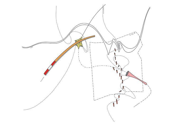
Patrick Geddes, 1909. Valley Section.
Boullée, Cénotaphe à Newton [Cenotaph for Isaac Newton] (1784).
Andreas Vesalius, 1543. Drawing from De Huani Corpis Fabrica
Koolhaas, OMA, 1992. Jussieu – Two Libraries. Competition
Assignment 1 Analysis B Urban Transect
American Map and Reproducing Company’s Map of Portland and Vicinity from 1912. The map shows neighborhood/addition names, railroads, street car lines, parks and meadows, rivers, creeks, lakes, and city limits. Use it as the guide to the transect. Two groups per line starting opposite sides. The white circle is approx 6km diameter.
Assignment 1.3 (individual)
Field observations in a public space
Portland has a great reputation for its public spaces. Over the last decades the city has made an effort to realise a series of projects to provide high quality public spaces. This directly affects the public live and the general public’s attitude towards public spaces and toward public space in general. The culture of a place is to be found in all aspects of everyday live. The public space however plays a crucial role as this is where a sense of collective activity is to be found. It is the place where negotiation and mediating take place. Very much as Christopher Alexander argues in regard to the semi lattice, the public space is where subsystems overlap creating very specific meaning for urban elements that feature in various subsystems. In other words, public space has many stakeholders generating a fascinating mix of blended agencies. You are asked individually to observe and study one such space in detail over the course of an afternoon (Wednesday). The space can be a square a street or a plaza or similar. Selection is open, but not more than two people should be documenting the same space. The focus is defined according to MX with a view on the relationship between public and private using methods such as an observation report, writing, sketching, photographs, interviews, drawings , diagrams, video and audio (edited) or found objects.
Product: four pieces of documented observations incl. reference to/ and reflection on MX and PT. Time: in Portland Wednesday afternoon, finalize in the week after the Portland trip.
Work: Individual Work
Coaching: studio times (see schedule) and during the trip to Portland
Perec, G., 2010. An attempt at exhausting a place in Paris. Imagining science. Translated by M. Lowenthal. Cambridge, MA : New York: Wakefield Press.
David Hockney | „Jerry Diving Sunday Feb. 28th 1982“ | Composite Polaroid | 10 1/2 x 24 1/2“ | (David Hockney / Photo credit: Richard Schmidt)
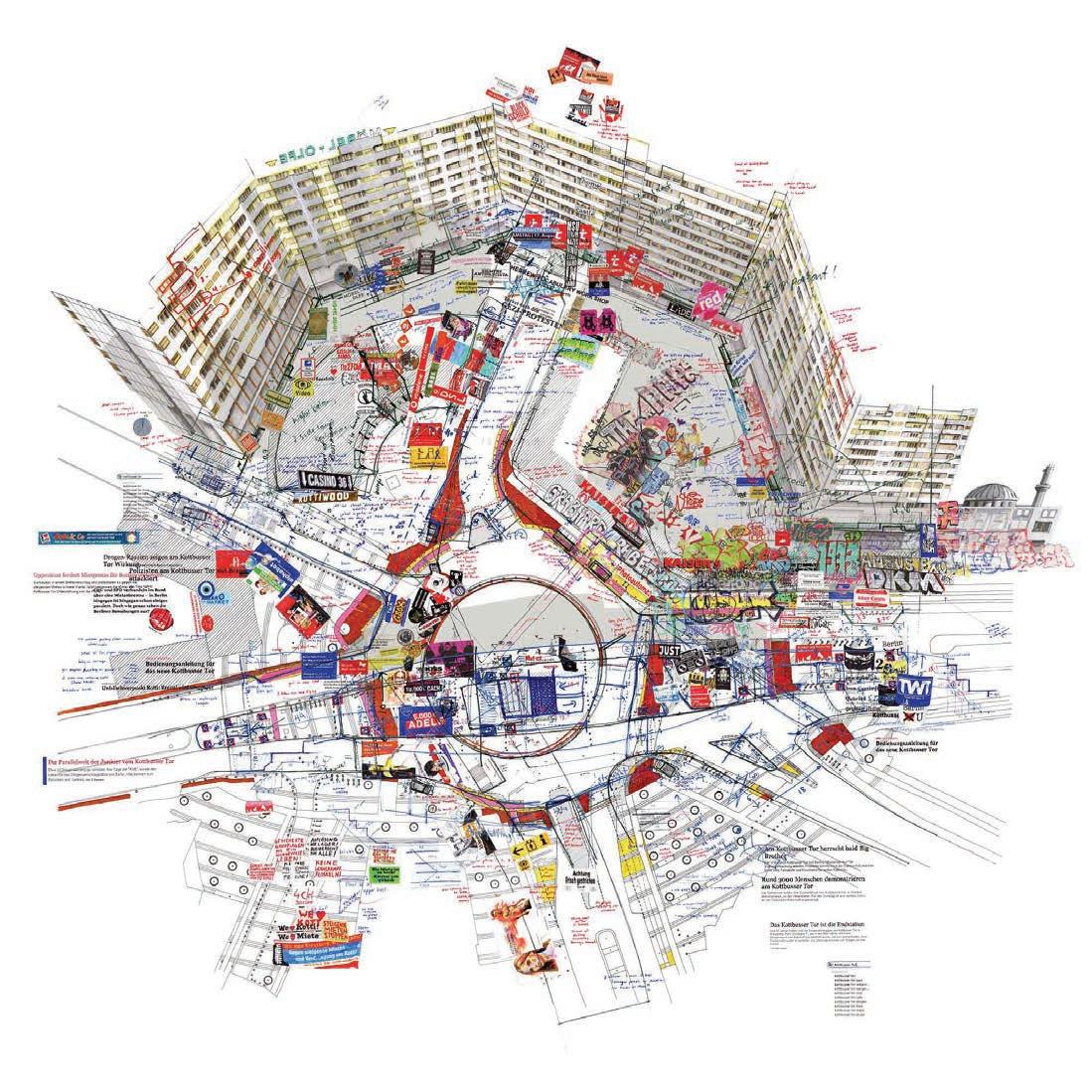
Fassler, L., 2014. Kotti (revisited), Berlin, Germany. Fine Art Print, Dimensions: 157 x 160 cm.
Start: Oct. 02, 2018, 2:00 pm
Deadline: Oct. 12, 2018, 2:00 pm
Verbal Presentation: Oct. 12, starting 2:00 pm – 12 minutes per group: 5 minutes of presentation and 7 minutes of discussion
Submit digital copies: D2L by Oct. 12, 2:00 pm. PDF format, Maximum 25MB/file.
Evaluation % of Course Grade:
Assignment 2 (group) 15
Programming
The city in many ways works through its many smaller parts producing, consuming and transporting a whole lot of stuff (people, waste, organisms, goods, etc.) around the clock. To operate effectively, the conditions in the city have to be favorable, and the overall organism benefits from its smaller entities. Each function has its dependencies and an ability to contribute to a total ecological order.
Programming is about setting out the desired conditions under which the preferred ideal working state of the design can operate and evolve, or the functional organization of the design. The program covers a whole range of different areas including spatial, economic, social, ecological and legal frameworks. We want to look not only at the program but also be very precise as to how these programs interact. Keep in mind that the scenario should be innovative and address transportation, land use mix, green infrastructure, public space, etc
Task
Design the usages (program and functions) as well as the interaction (benefits, requirements and interdependencies) within the program. This aim should be a vision for the place and how the proposed program ties into the existing urban programs of the location and Portland overall. The vision should include a density analysis, a scenario regarding the population and uses that will occupy the site, to be presented visually
Outcome
o Detailed program including functional breakdown between residential, commercial, industrial, institutional, entertainment, etc.
o Density calculations, population counts, demographics, economic factors, green targets, etc.
o visualisation of the interactions and potentials (internal and external)
Assignment details to be defined.RefertoD2L.
Requirements
o Matrix completed, pre/post and visualised
o Schematic visualisation of the program (media free)
o detailed report for each function/land use
o 3-D visualisation of the interactions and potentials (internal and external) within the program (media free)
Sir Leslie Patrick Abercrombie, 1942. Community map of London. Part of the County of London Plan (1943) with John Henry Forshaw and the Greater London Plan (1944).
Koolhaas, R., OMA, 1991. Yokohama Master plan Usage Diagram. Source: Rem Koolhaas, Jennifer Sigler, Bruce Mau, Hans Werlemann and Office for Metropolitan Architecture, 1998. S,M,L,XL. 2. Aufl. ed. New York: Monacelli Press.
Start: Oct. .22, 2018, 2:00 pm
Deadline: Nov. 02, 2018, 2:00 pm
Verbal Presentation: Nov. 02, starting 2:00 pm – 12 minutes per group: 5 minutes of presentation and 7 minutes of discussion
Submit digital copies: D2L by Nov. 02, 2:00 pm. PDF format, Maximum 25MB/file.
Evaluation % of Course Grade:
Assignment 3.1 (individual) 10
Assignment 3.2 (group) 10
Total 3 20
3
Assignment details to be defined.RefertoD2L.
Flows
The environment is in a constant state of flux. The changing seasons bring new colours and live to the spaces and the hustling and bustling of the everyday moves the goods. The city follows its routine. Masses of people migrate over the course of the day through the city, rush hour after rush hour. Large volumes of products move into the city for consumption or out into national systems for trade together with finances, energy and waste. These various mechanical, natural, artificial, social or natural flows make up the exchanges of the urban fabric. As a collective, they are responsible for a large part of the characteristic of a particular place. They are in sync with the uses but make up a distinct, mostly invisible or at least temporal portion of the urban fabric.
What do we mean by flows/designing flows
The flows are generated through activity by and between the different usages. Examples of flows can be Transport, Ecology, Energy, Economy, Knowledge, Waste, Technology, and so on. Most of these are temporary. They fluctuate or disappear entirely during certain hours, days or months, e.g. pedestrian flows or rainwater. Others are not tangible but instead manifest mainly through infrastructure, e.g. power lines or finances.
Task
To design the flows for the proposal integrating both external and internal flows. It is critical to pay attention to the flows capacities to interact and the temporal dimension of flows. This stage should build on and extend the previously proposed “programming” of the site.
Outcome
o identify all relevant flows for the proposal (internal and external)
o design the flow trajectories and interaction
o developing a good understanding of the temporality of the project-specific flows.
Requirements
3.1 individual
Write a 1500-word narrative describing the planned community, including functions, atmospheres, experiences, objectives, role of public space.
3.2 group
o Matrix completed, pre/post and visualised
o schematic representation of flows across the site (media free)
o outlining the characteristics of each flow
o detailing three crucial points of flow interaction, potential and problems
o describing the changes in flow volumes and connected implications - temporality of the site/ project (media free).
Charles Minard‘s 1869 chart showing the number of men in Napoleon’s 1812 Russian campaign army, their movements, as well as the temperature they encountered on the return path. Lithograph, 62 × 30 cm
Barr, A., 1936. Cubism and Abstract Art, visuaisation for the MoMa exhibition. MoMa.
Start: Nov. 05, 2018, 2:00 pm
Deadline: Nov. 23, 2018, 2:00 pm
Verbal Presentation: Nov. 23, starting 2:00 pm – 12 minutes per group: 5 minutes of presentation and 7 minutes of discussion
Submit digital copies: D2L by Nov. 23, 2:00 pm. PDF format, Maximum 25MB/file.
Evaluation % of Course Grade:
Assignment 4, Form 1 (group) 20 Assignment 5, Form 2 (individual) 15
Total 35
ST 18 Design Studio
Assignment 4 and 5
Form
While programs and flows are fluid and flexible their cousin the physical form is somewhat static and permanent in most cases. This aspect of the form, however, does not imply a hierarchy of sorts neither is without the other. The form is both an enabler and hindrance and plays therefor a crucial role to ensure the “workings” of a proposal. The form does however also have its unique characteristics in regards to texture and haptic qualities. With volumes, the dimension of materials and expression is added to the mix creating the quality of the atmosphere.
By giving the proposal a physical form the program and the flows are coming to, and the developed logic can be validated. Proposing the form means to construct it. The third dimension is considered in its physicality and material quality.
Task
Form 1 - Based on the program and the flow the project takes shape. Develop the physical outlines and massing across the site for all buildings and voids. The proposal should be developed both in plan and in the 3rd dimension, e.g. mode, section and visualised with a collage.
Form 2 - finalising and detailing the ground floor plan with references to the volumes/levels above. This should cover access, usage and circulation, especially vertical. Depending on the development of the model and the collage can be updated.
Outcome
o Form 1
develop the project as a three-dimensional artifact concerning program and flow
o Form 2
a detailed ground plan covering usage, access and circulation
Requirements
Assignment details to be defined.RefertoD2L.
o Form 1
ground plan of the site - overview, scale 1:500
3 sections
2 collages/perspective/renderings
o Form 2 (selected part, tbc)
ground plan of selected part, scale 1:100 one section of detail area 1 collage
Form 2 Form 1
Liebeskind, D., 1989. Between the Lines. Competition entry for the Jewish Museum Berlin.
SANAA, 2010. Rolex Learning Center in Lausanne, Switzerland.
Date: Dec. 13, 2018, 09:00 pm
Deadline: Dec. 12, 2018, 2:00 pm
Verbal Presentation: Dec. 13
starting 09:00 pm – 40 minutes per group: 15 minutes of presentation and 25 minutes of discussion
Submit digital copies: D2L by Dec. 12, 2:00 pm. PDF format, Maximum 25MB/file.
Evaluation % of Course Grade:
Final Crit (group) 10
ST 18 Design Studio
Assignment 4/5
Final Presentation
The final presentation provides the opportunity to present the complete project. This is not simply a recap of the several phases that led up to it, but a synthesis thereof and should be a standalone product.
At the same time it provides the opportunity to reflect on the process in general and the different choices and decisions along the way more specifically. To facilitate and illustrate this the MX graphs should be used.
The third objective is to discuss the role of the precedent for the project and reflect on how it has influenced the project development as well as how its use and representation has evolved.
Task Outcome
Requirments
o sequence of all MX visualisations across the phases pre and post, as well as all intermittent updates.
o comparison between the key graphic of the PC and its evolved counterpart taken from the final presentation.
Assignment details to be defined.RefertoD2L.
Architects at the 1931 Beaux-Arts Architect Ball. From left to right: Stewart Walker (Fuller Building), Leonard Schultze (Waldorf-Astoria), Ely Jacques Kahn (Squibb Building), William Van Alen (Chrysler Building), Ralph Walker (1 Wall Street), D.E.Ward (Metropolitan Tower), Office for Metropolitan History and Joseph H. Freelander (Museum of New York).
SPECIAL BUDGETARY REQUIREMENTS
There is a mandatory $150.00 supplementary fee approved by the University for this course.
MEANS OF EVALUATION
Evaluation will be based on the project phases. Some of the work will be completed in groups and some individually (see below). Students will receive a common grade for work done in groups, unless it is clear to the instructors the balance of work has been unfairly distributed between team members. Class participation is a key component of the grade and will be evaluated based on attendance to class, studio, and group work. Any anticipated absence should be communicated to the teaching team as soon as possible.
Late submission of work is not acceptable; grades will be deducted for work submitted later than the deadline specified in the assignment brief or as discussed in class. One grade will be deducted per late day for example an A will be downgraded to A-.
Students are expected to complete all course assignments on time. There will be no final exam. Students must obtain an overall passing grade to pass this course, however, if a student or group fails any two phases of the course totaling 30% or more they will fail the course. A student who feels that a piece of graded term work (term paper, essay, test, etc.) has been unfairly graded may have the assignment re-graded. The student shall discuss the work with the instructor within fifteen days of being notified about the mark or of the item’s return to the class. More information can be found in the Graduate Calendar: http://www.ucalgary.ca/pubs/calendar/grad/current/gs-o.html
GRADING SCALE
Final grades will be reported as letter grades, with the final grade calculated according to the 4-point range.
Grade Grade Point Value 4-Point Range Percent Description
A+ 4.00 4.00 95-100 Outstanding - evaluated by instructor
A 4.00 3.85-4.00 90-94.99 Excellent - superior performance showing comprehensive understanding of the subject matter
A- 3.70 3.50-3.84 85-89.99 Very good performance
B+ 3.30 3.15-3.49 80-84.99 Good performance
B 3.00 2.85-3.14 75-79.99 Satisfactory performance
B- 2.70 2.50-2.84 70-74.99 Minimum pass for students in the Faculty of Graduate Studies
C+ 2.30 2.15-2.49 65-69.99 All final grades below B- are indicative of failure at the graduate level and cannot be counted toward Faculty of Graduate Studies course requirements.
C 2.00 1.85-2.14 60-64.99
C- 1.70 1.50-1.84 55-59.99
D+ 1.30 1.15-1.49 50-54.99
D 1.00 0.50-1.14 45-49.99
F 0.00 0-0.49 0-44.99
CACB STUDENT PERFORMANCE CRITERIA
(for MArch students only):
The following CACB Student Performance Criteria will be covered in this course at a primary level (other criteria will be covered at a secondary level):
A2: Design Skills; A3: Design Tools; A4: Program Analysis; A5: Site Context and Design; A6: Urban Design; A8: Design Documentation; B1: Critical Thinking and Communication; B5: Ecological Systems.
Notes
1. Written work, term assignments and other course related work may only be submitted by e-mail if prior permission to do so has been obtained from the course instructor. Submissions must come from an official University of Calgary (ucalgary) email account.
2. Academic Accommodations. Students who require an accommodation in relation to their coursework or to fulfill requirements for a graduate degree, based on a protected ground other than disability, should communicate this need, preferably in writing, to their Instructor or the designated contact person in EVDS, Jennifer Taillefer (jtaillef@ucalgary.ca). Students who require an accommodation unrelated to their coursework or the requirements for a graduate degree, based on a protected ground other than disability, should communicate this need, preferably in writing, to the Vice-Provost (Student Experience). For additional information on support services and accommodations for students with disabilities, visit www.ucalgary.ca/ access/
3. Plagiarism - Plagiarism involves submitting or presenting work in a course as if it were the student’s own work done expressly for that particular course when, in fact, it is not. Most commonly plagiarism exists when:(a) the work submitted or presented was done, in whole or in part, by an individual other than the one submitting or presenting the work (this includes having another impersonate the student or otherwise substituting the work of another for one’s own in an examination or test),(b) parts of the work are taken from another source without reference to the original author,(c) the whole work (e.g., an essay) is copied from another source, and/or,(d) a student submits or presents work in one course which has also been submitted in another course(although it may be completely original with that student) without the knowledge of or prior agreement of the instructor involved. While it is recognized that scholarly work often involves reference to the ideas, data and conclusions of other scholars, intellectual honesty requires that such references be explicitly and clearly noted. Plagiarism is an extremely serious academic offence. It is recognized that clause (d) does not prevent a graduate student incorporating work previously done by him or her in a thesis. Any suspicion of plagiarism will be reported to the Dean, and dealt with as per the regulations in the University of Calgary Graduate Calendar.
4. Appeals: If a student has a concern about the course, academic matter, or a grade that they have been assigned, they must first communicate this concern with the instructor. If the concern cannot be resolved with the instructor, the student can proceed with an academic appeal, which normally begins with the Faculty: http://www.ucalgary.ca/provost/students/ ombuds/appeals
5. Information regarding the Freedom of Information and Protection of Privacy Act (https:// www.ucalgary.ca/legalservices/foip)
7. Safewalk information (http://www.ucalgary.ca/security/safewalk)
8. Contact Info for: Student Union (https://www.su.ucalgary.ca/contact/); Graduate Student representativehttps://gsa.ucalgary.ca/about-the-gsa/gsa-executive-board/) Student Union Wellness Centre: https://www.ucalgary.ca/wellnesscentre/; Library Resources: http:// library.ucalgary.ca/ and Student Ombudsman‘s Office (http://www.ucalgary.ca/ombuds/).
RECOMMENDED READINGS
Allen, S., Points + Lines, Diagrams and Projects for the City. Banis, D. and H. Shobe, Portlandness: A Cultural Atlas.
Boelens, L., The Urban Connection: An Actor-relational Approach to Urban Planning. Bullivant, L., Masterplanning Futures. Calthorpe, P., The Next American Metropolis. Calvino, I., Invisible Cities.
Chermayeff, S. and Alexander, C., Community and Privacy. Corner, J., ed., Recovering Landscape: Essays in Contemporary Landscape Architecture. Cranz, G. The Politics of Park Design: A History of Urban Parks in America. Dernie, David. Architectural Drawing.
Erickson, D., MetroGreen: Connecting Open Space in North American Cities. Europan 7, Suburban Challenge: Urban Intensity and Housing Diversity. Farr, D., Sustainable Urbanism: Urban Design with Nature. Farrelly, L., Drawing for Urban Design. Fleming, S., Cycle Space.
Forman, Richard T.T., Urban Ecology: Science of Cities. Gatje, R., Great Public Squares. Gausa, M., Housing: New Alternatives, New Systems. Giradet, H., Creating Sustainable Cities. Hillier, B. and J. Hanson, The Social Logic of Space. Hough, M., City Form and Natural Process. Hutchison, E. Drawing for Landscape Architecture: sketch to screen to site.
Jackson, J.B., The Stranger Path. Jacobs, J., Death and Life in Great American Cities. Lefebvre, H., Rhythmanalysis: Space, Time and Everyday Life. Lehnerer, A., Grand Urban Rules. Lukez, P., Suburban Transformations. Lynch, K., The Image of the City. McGrath, B. and Marshall, V., Designing Patch Dynamics. McHarg, I. Design With Nature. Michael Sorkin Studio, Wiggle. Morphosis, Combinatory Urbanism: The Complex Behavior of Urban Form. Mostafavi, M. and Ciro Najle, eds. Landscape Urbanism: A Manual for the Machinic Landscape. Mostafavi, M. et al, Ecological Urbanism. OMA and B. Mau, S, M, L, XL. Perec, G., An Attempt at Exhausting a Place in Paris. Pont, M.B. and P. Haupt, Space Matrix: Space, Density and Urban Form. Reed, P., Groundswell: Constructing the Contemporary Landscape. Rowe, C. and F. Koetter, Collage City. Sandalack, Beverly A. & Andrei Nicolai The Calgary Project: urban form/urban life. Schwanke, D., Mixed-Use Development Handbook. Shane, G., Recombinant Urbanism. Sorkin, M., “Future Zones, Eleven Tasks for Urban Design,” in Perspecta 29 (or [Re]Reading Perspecta).
Steffen, A., ed., World Changing: A User’s Guide for the 21st Century. Thomas, R., Sustainable Urban Design: An Environmental Approach. Turner, M.G., R.H. Gardener, and R.V. O’Neill, Landscape Ecology in Theory and Practice. Waldheim, C., ed., The Landscape Urbanism Reader. Waldheim, C., Landscape as Urbanism: A General Theory.