Master Planning Visioning Research for Downtown Welaka


April 24th., 2023
Gainesville, FL

Master Planning Visioning Research for Downtown Welaka


April 24th., 2023
Gainesville, FL
Jack Shad
Economic Director of RCI | Northeast Florida Regional Council
Monica Dominguez
Regional Planner | Northeast Florida Regional Council
Robert Jordan
Regional Planner | Northeast Florida Regional Council
Professor Martha Kohen
Director Center for Hydro-generated Urbanism
University of Florida, DCP, School of Architecture mkohen@ufl.edu
Nancy Clark
Assoc. Prof., Director Center for Hydro-generated Urbanism
University of Florida, DCP, School of Architecture
Maria Estefania Barrios
UF | CHU Research Associate
M. Arch + M. Building Construction
University of Florida, DCP, School of Architecture
Giselle Martins
Urban Design, Ph.D., University of Strathclyde, Glasgow, Scotland
UF | CHU Research Associate University of Florida, DCP, School of Architecture
Ruth Stainer, Ph.D. Professor & Director
Center for Health & the Built Environment
University of Florida, DCP, School of Architecture
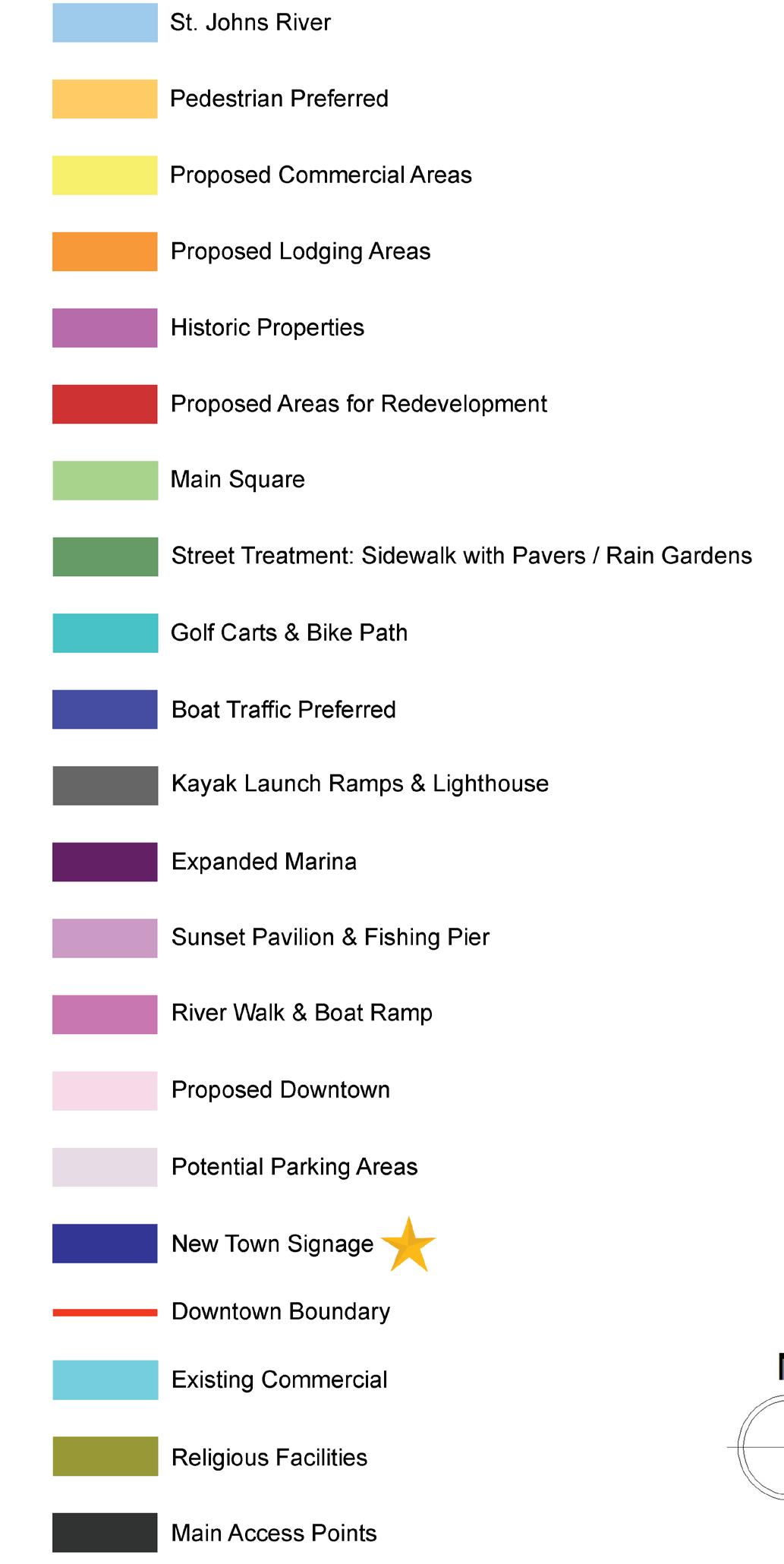
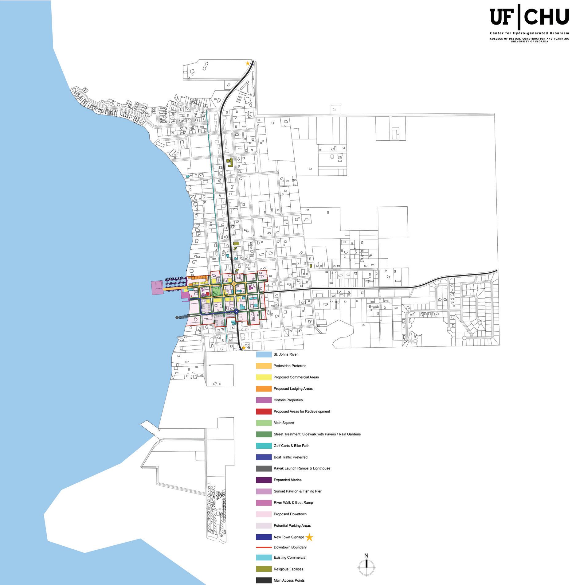

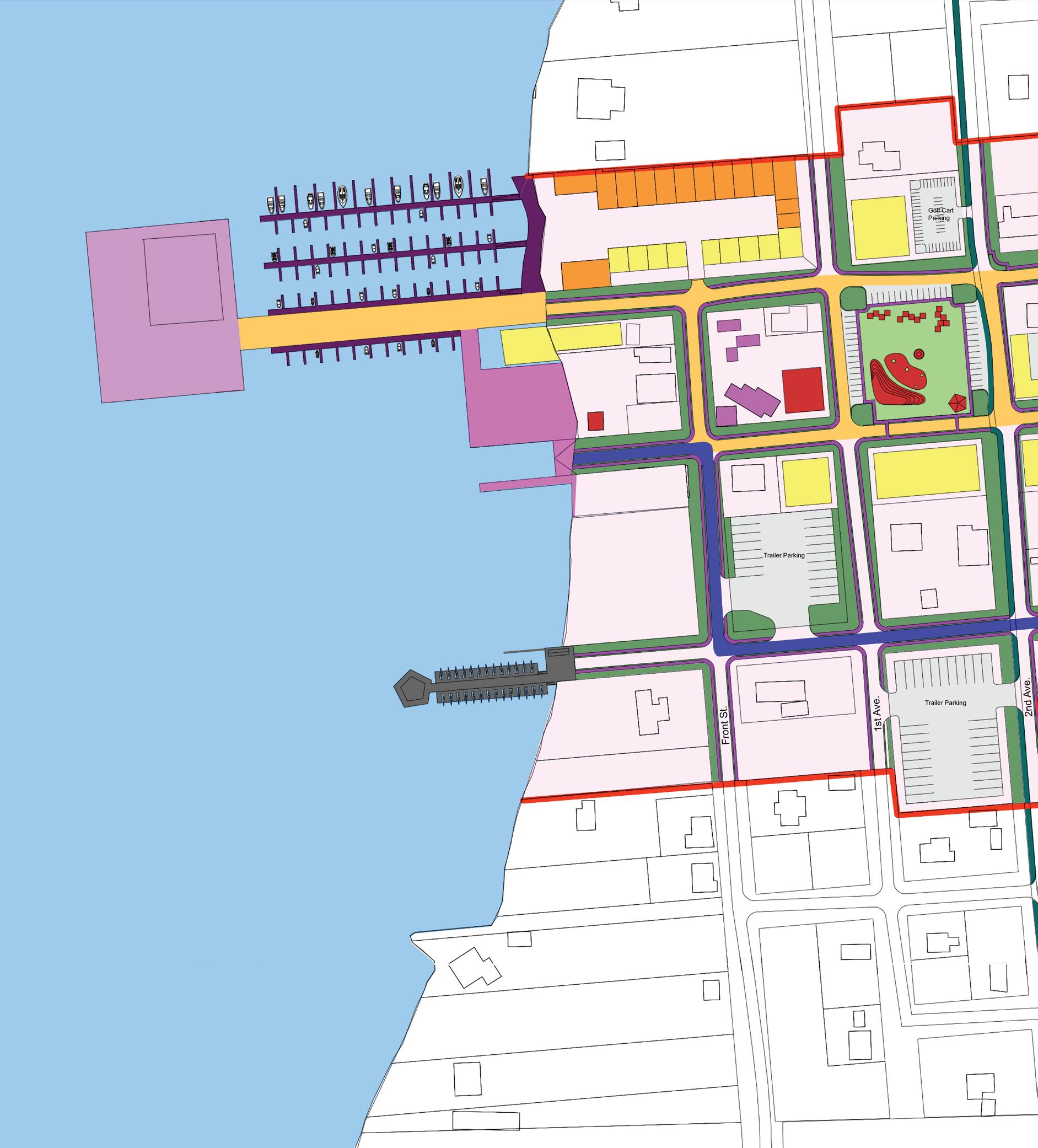


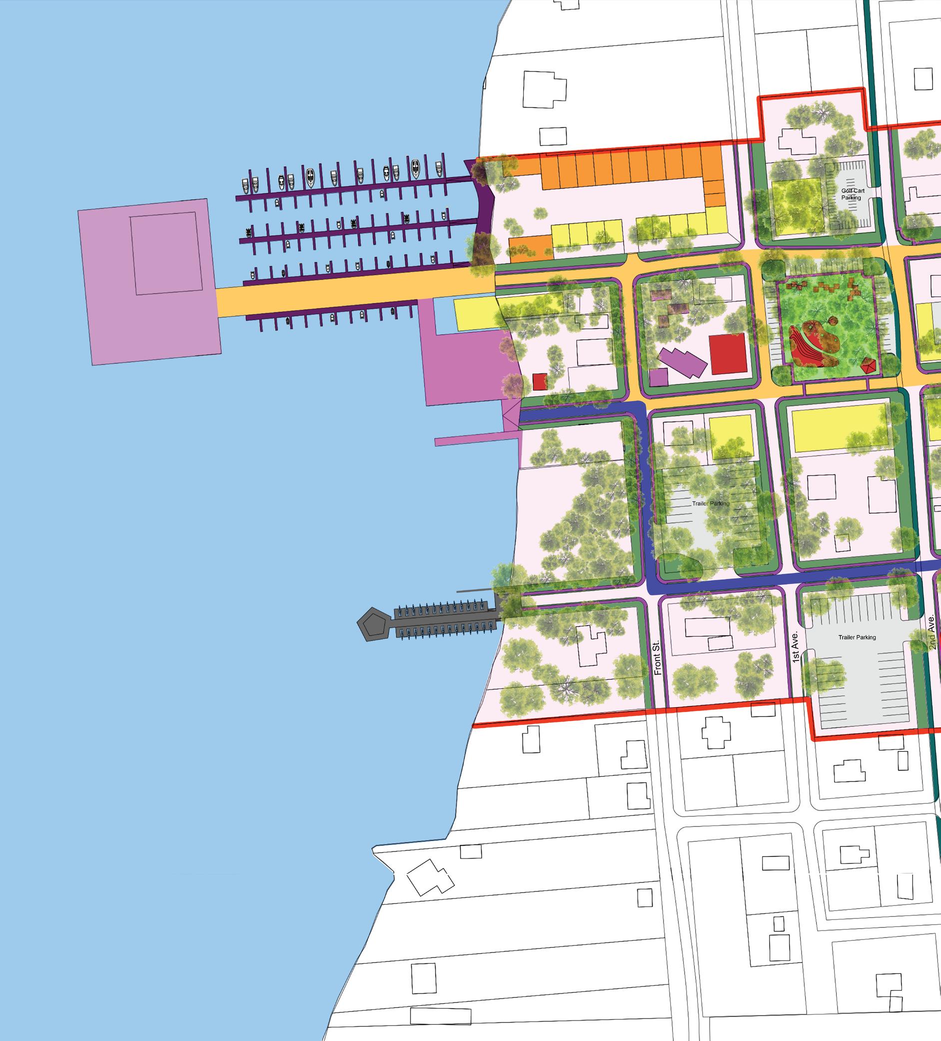


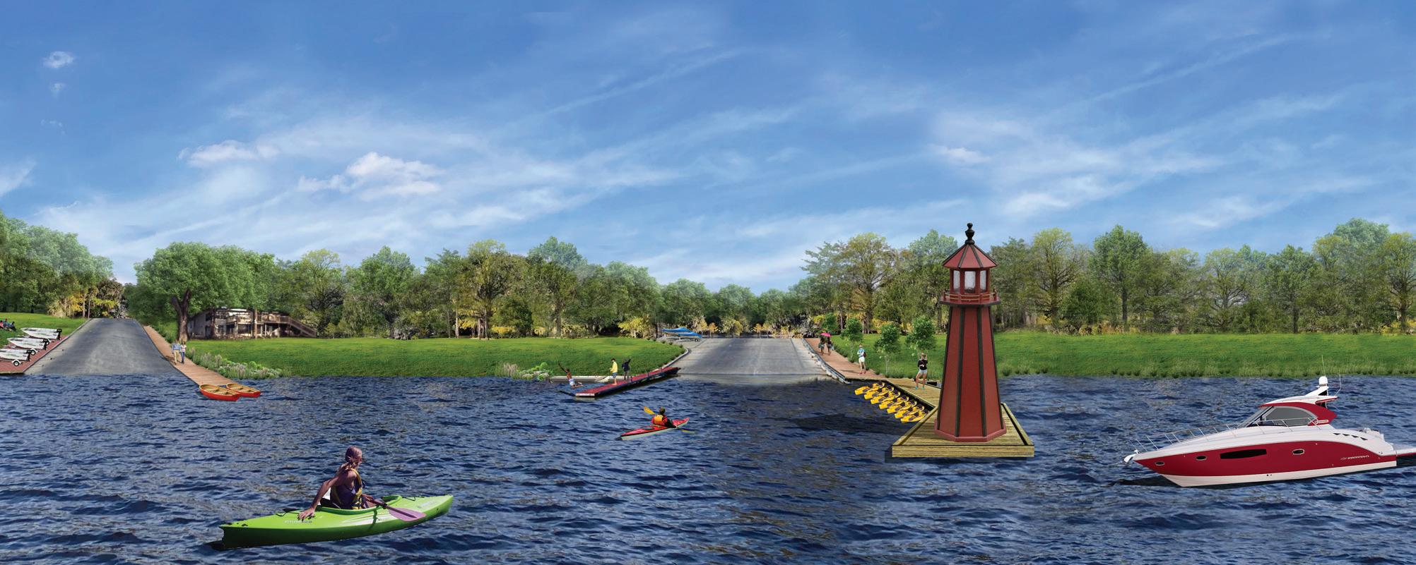
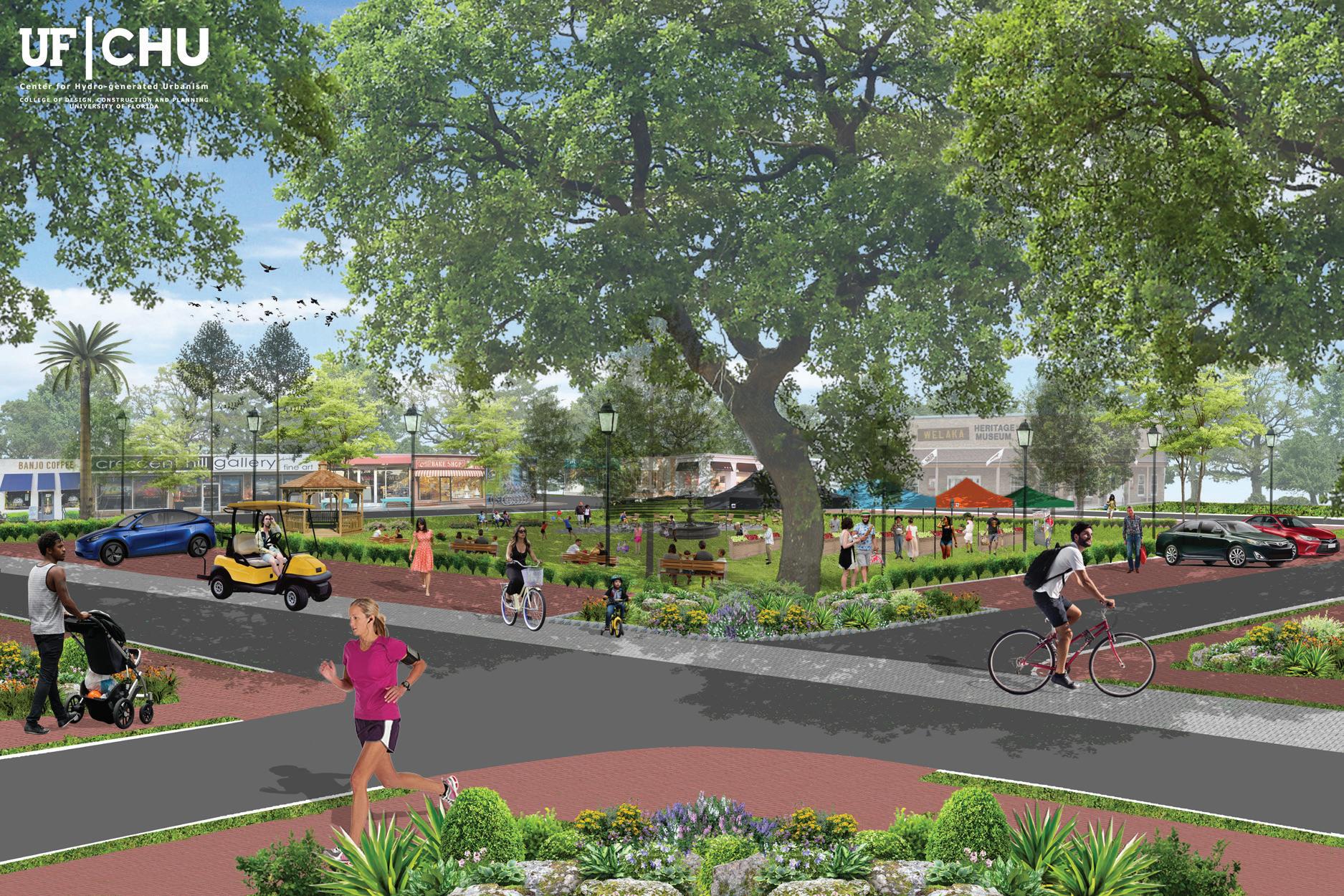
Images represented in this report are meant to create a possible vision of the elements discussed with stakeholders, agencies, residents, professional and experts. Images are not meant to be final or in any way to be imposed as a definitive architectural design, they are created to explore various ideas and possibilities within the realm of the town and its needs.
Disclosure
*Images represented in this report are meant to create a possible vision of the elements discussed with stakeholders, agencies, residents, professional and experts. Images are not meant to be final or in any way to be imposed as a definitive architectural design, they are created to explore various ideas and possibilities within the realm of the town and its needs.
**Many existing vegetation has been omitted in this drawing to show intent and design elements.
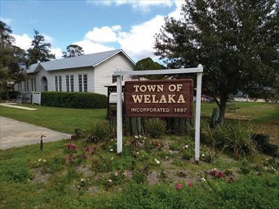
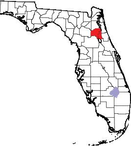
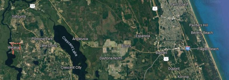
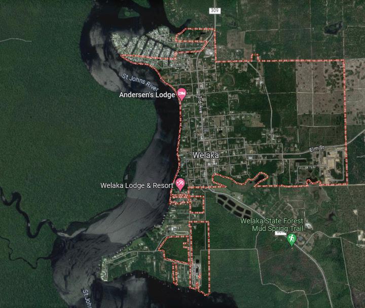
Welaka is a town situated on the St. Johns River in Putnam County, Florida, United States. The population was 701 as of the 2010 census. According to the U.S. Census Bureau’s 2018 estimates, the town had a population of 712. The town is part of the Palatka Micropolitan Statistical Area.
Welaka is approximately 90 miles south of Jacksonville and is accessible by highway or the Atlantic Ocean via the St. Johns River. It is located at 29°28′54″N 81°40′18″W (29.481556, –81.671555). According to the United States Census Bureau, the town has a total area of 1.4 square miles (3.6 km2), of which 1.4 square miles (3.6 km2) is land and 0.04 square miles (0.10 km2) (2.86%) is water.
As of the census of 2000, there were 586 people, 276 households, and 173 families residing in the town. The population density was 431.4 inhabitants per square mile (166.6/km2). There were 368 housing units at an average density of 270.9 per square mile (104.6/km2). The racial makeup of the town was 67.06% White, 28.84% African American, 0.34% Native American, 0.17% Pacific Islander, 2.22% from other races, and 1.37% from two or more races. Hispanic or Latino of any race were 3.41% of the population.
There were 276 households, out of which 16.7% had children under the age of 18 living with them, 47.5% were married couples living together, 12.7% had a female householder with no husband present, and 37.3% were non-families. 31.9% of all households were made up of individuals, and 17.8% had someone living alone who was 65 years of age or older. The average household size was 2.12 and the average family size was 2.63.
In the town, the population was spread out, with 17.2% under the age of 18, 5.5% from 18 to 24, 19.6% from 25 to 44, 30.2% from 45 to 64, and 27.5% who were 65 years of age or older. The median age was 52 years. For every 100 females, there were 86.6 males. For every 100 females age 18 and over, there were 84.4 males.
The median income for a household in the town was $25,069, and the median income for a family was $30,938. Males had a median income of $29,583 versus $20,938 for females. The per capita income for the town was $14,495. About 15.8% of families and 25.0% of the population were below the poverty line, including 38.2% of those under age 18 and 11.1% of those age 65 or over.
Welaka has a Strong Mayor–council government where Two Council members are elected in even-number years, and the Mayor and two Town Council members are elected in odd-numbered years. The present Mayor is Jamie D. Watts, who assumed office on March 5, 2021, as the 37th Mayor of the Town of Welaka. Jamie Watts is an American author, politician, and small business owner. Before serving as Mayor, Jamie served on the Welaka Town Council from March 2008 through March 2021, when he was elected Mayor of the Town. His responsibilities as Strong Mayor include acting as the Town Manager, Utility Director, Finance Director, and Police Commissioner. He also oversees the Building Department, Codes and Zoning, and Public Works. He was re-elected unopposed for a second term as Mayor on January 20, 2023. (Wikipedia)
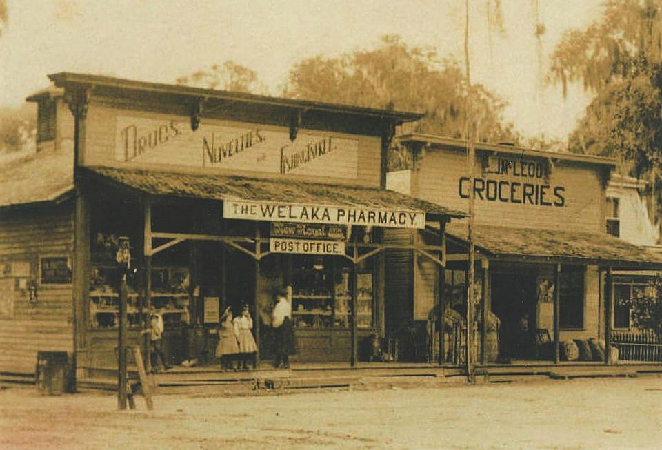
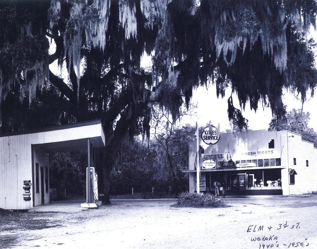
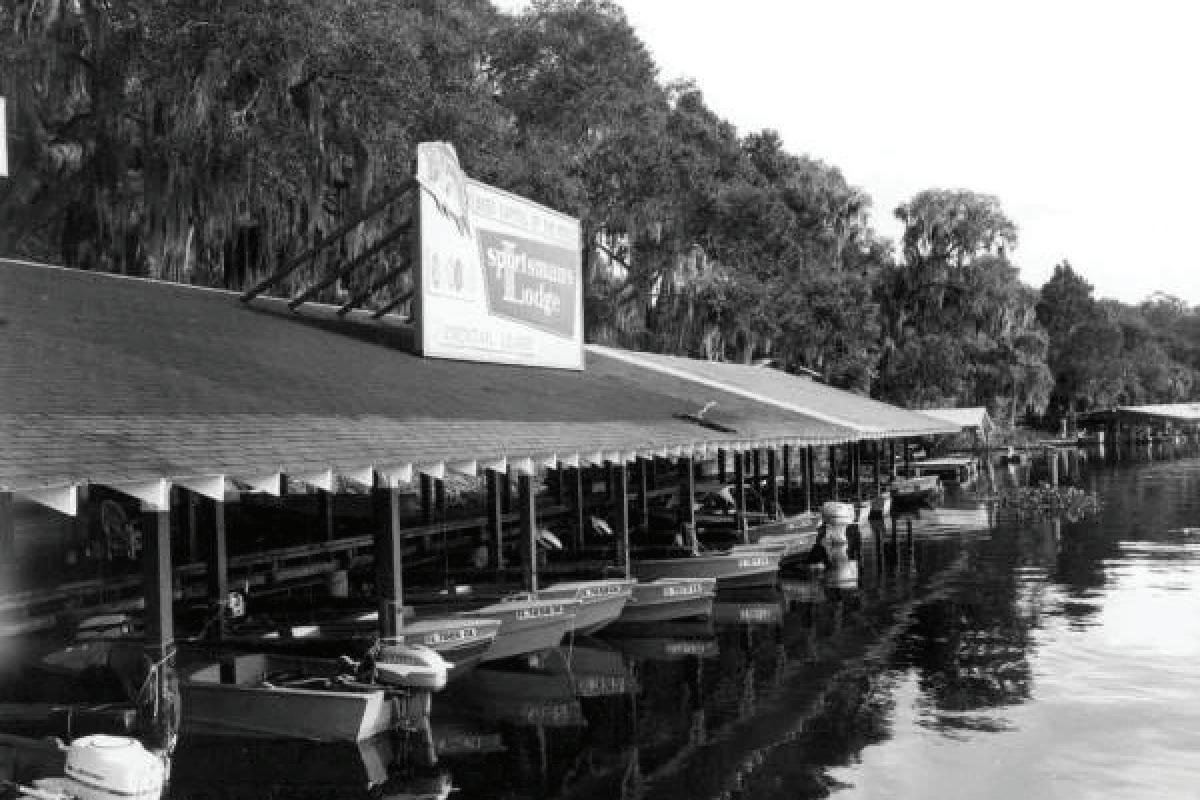
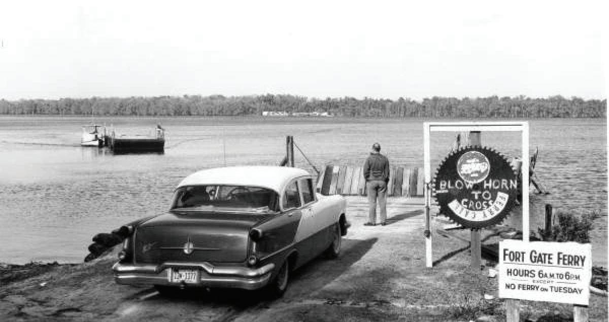
It is not known when the area was first settled, but the nearby Mount Royal archaeological site is a possible remnant of a Timucua Indian village from c. 1250 CE to 1500 CE, and may have a connection to the town of Enacape, an important center of the Utina tribe. The settlement was originally a 500-acre tract purchased by James William Bryant in 1852 and was known as Mt. Tucker.
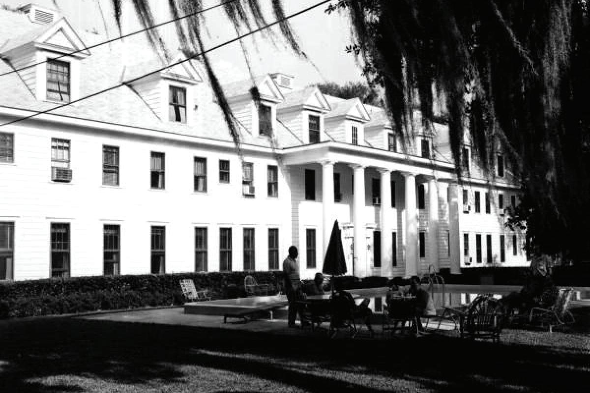
Pursuant to an election held April 23, 1887 the town was incorporated June 21, 1887 and Welaka was affirmed as the Town’s name and an official seal was adopted. At the outbreak of the Civil War in 1860, Welaka`s population numbered more than 100. At the end of the war fewer than 20 remained. Prior to the war, there were large orange groves and cotton plantations. Cotton, foods, and livestock were raised, marketed and recorded. Wool and cotton were spun and woven into cloth from which the family and soldiers’ clothing was made. By the mid-1880s, Welaka had become a resort town attracting visitors seeking medicinal cures from the many springs that provided mineral water. By 1907, Welaka was famous for its “healing waters”. The Welaka Mineral Water Company was incorporated on November 15, 1907.
According to its brochure “the mineral water comes from a subterranean spring 329 feet below the surface, and is put up in bottles in its natural state at the springs. All bottles are carefully sterilized before being filled, thus avoiding the great danger of infectious diseases so often conveyed by the use of bottles refilled without sterilization.”

The Mineral Water Company brochure further stated they had “on file volumes of unsolicited testimonials from physicians and the most reliable people all over the United States, giving conclusive evidence that Welaka Mineral Water has been the means of curing a number of ills by stimulating the biliary circulation modifying conditions believed incurable.” Another brochure advertising Welaka 1910-20s, stated “in addition to the mineral spring, there are a number of sulfur springs convenient to the town, which afford ideal bathing, winter and summer. This water is of such chemical composition as to improve the complexion and health, and has a practically constant temperature of 70 degrees Fahrenheit.”There were shell sidewalks in the downtown area. All farm fences were made of rails. The law of the open range prevailed from Palatka to Lake Okeechobee throughout the 19th century. The fence had to be ten rails high to be legal to keep livestock out of farms or gardens. Picket fences were used around yards. Some of the menaces of Welaka were Malaria, mosquitoes and the fruit fly. A drug Atabrine - was discovered and helped eradicate Malaria. The dread Hoover fruit fly appeared in 1929-30 attacking the citrus. Some areas were quarantined. All plants and shrubbery entering the state were inspected at stations along the State line.
Many of the early settlers had huge vineyards from which wine was made and sold. Many homes had wine cellars in which to store wine. The “Big Freeze” in 1895 came killing overnight grape vines and fruit trees. Entire families moved away, leaving their homes and everything in them. The forgotten homes soon decayed. Fortunately, after the Big Freeze Welaka had one dependable asset to fall back on - the fishing industry. From this industry the Welaka Seafood Company, the O.H. Morris Fish and Crab Co. and the St. Johns River Crab Company were born from the period 1879 - 1974. The Welaka Pharmacy opened in 1885 and was a well appointed store carrying a carefully selected line of drugs and sundries. (Welaka Gov. Website)
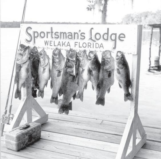


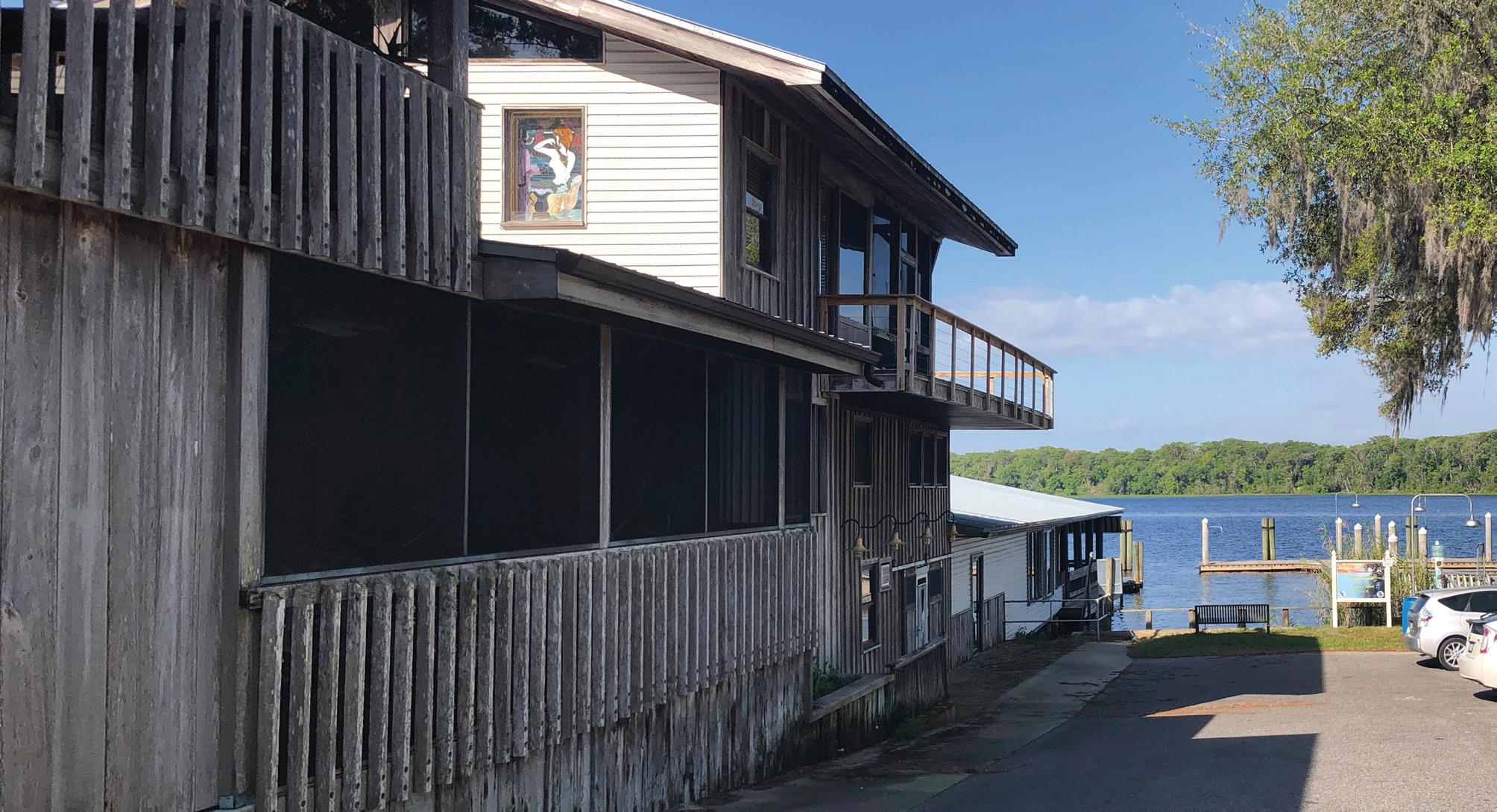
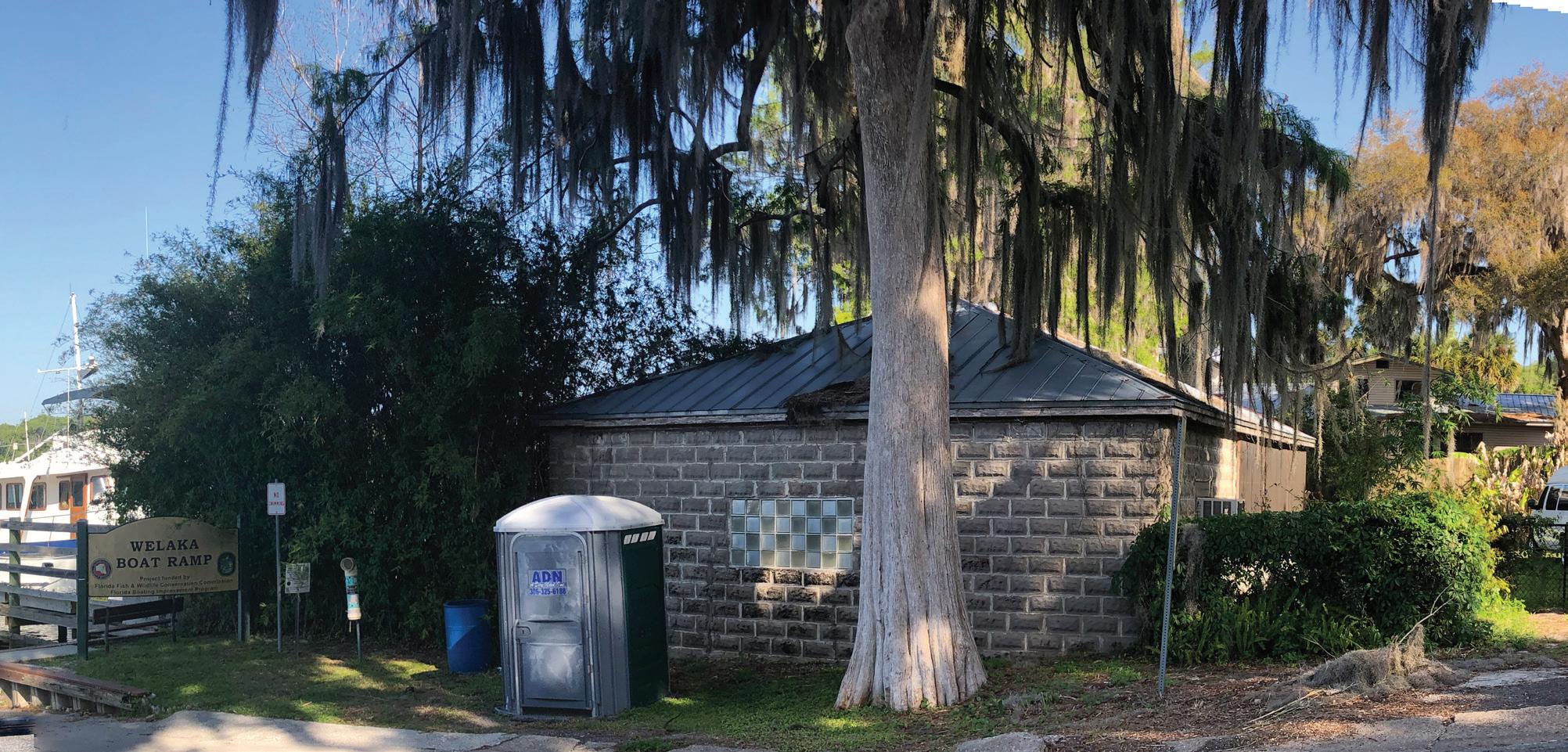

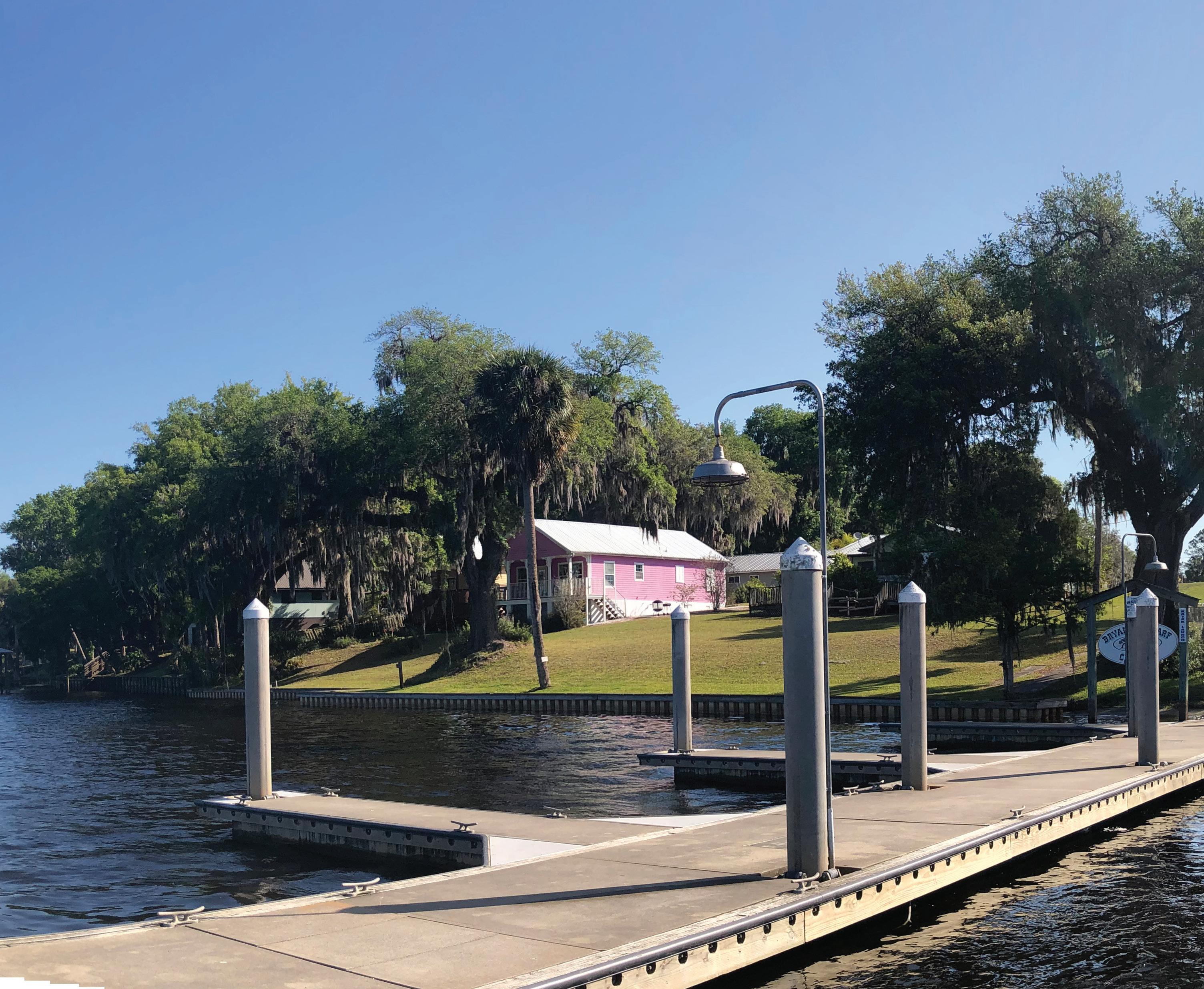

Small towns and rural communities throughout the United States are looking for ways to strengthen their economies, provide a better quality of life for their citizens, and build on local assets while protecting their unique characteristics, history, assets, and cultural background. According to the American Planning Association1, rethinking small towns and rural communities is imperative, as technological advances, economic shifts, and demographic changes are transforming rural America.
In Welaka, Florida, the challenges are complex: climate change, the pandemic, telecommuting, and accelerating land costs in large cities have fueled a slow but noticeable relocation of people and services to smaller towns in American rural areas. Associated with that, the State of Florida had one of the highest net migrations in the country in 20222. Some 318,855 people moved to Florida in 2022, a population gain of almost 2%. Cities like Ocala and Tallahassee were among the most popular for American movers, showing that Northern Florida and the Panhandle are becoming popular destinations.
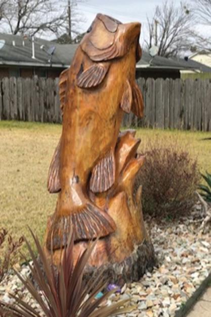
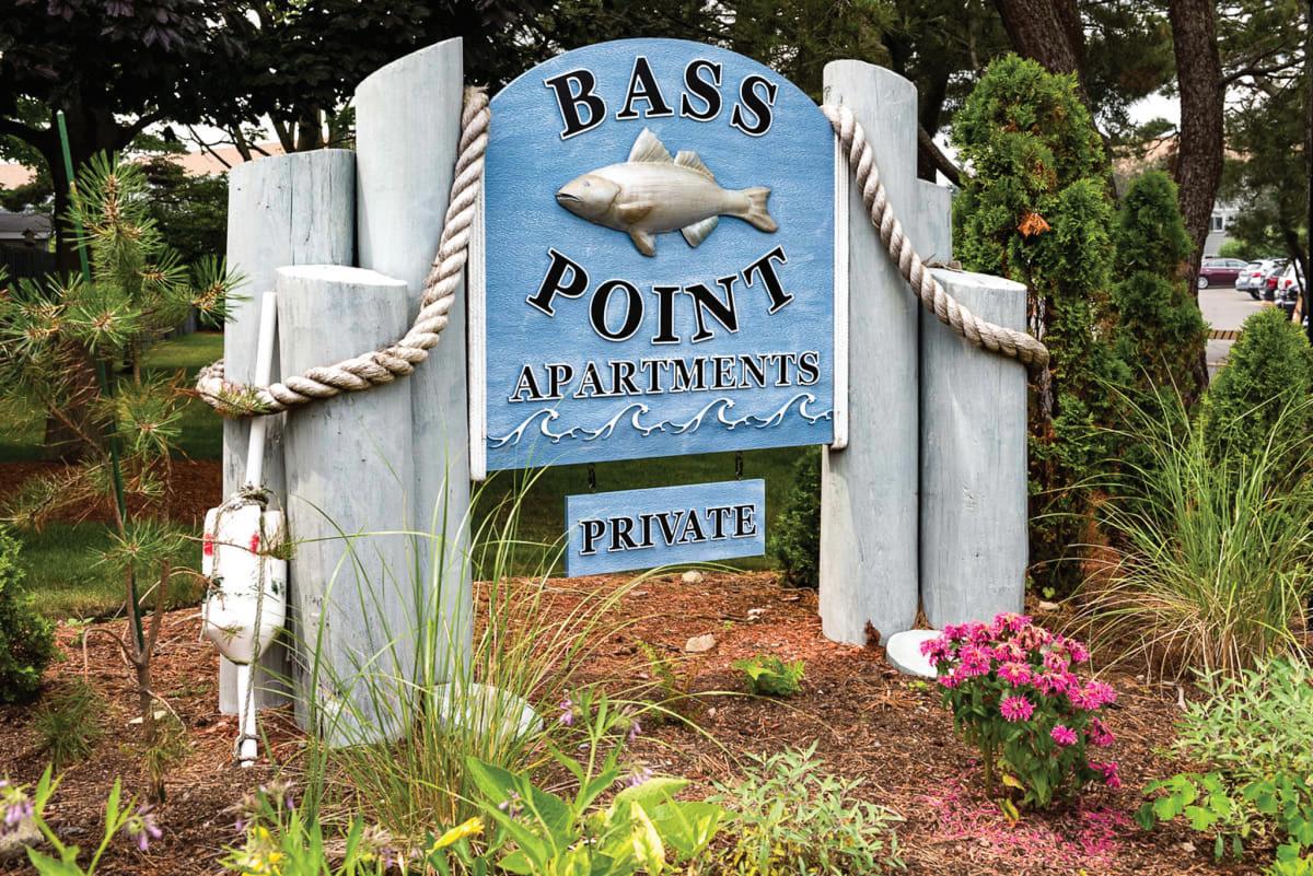
Besides these changing demographics, Welaka still faces a very particular challenge. Bass Pro Shops has recently purchased 5.200 acres of land in southern Putnam County. One part of that land is close to Satsuma, and the second piece runs from the St. Johns River by the town of Welaka - east to Highway 17. The company has not revealed its plans yet, but they are known to own outdoors-themed resorts across the country, and it is correct to assume that a large project of the same kind can be expected soon.
In this context, the Town of Welaka is creating a vision for its future, to face these challenges successfully, and yet retain its small-town values, historical character, scenic beauty, sense of community, and sustain a prosperous economy.
- New Ruralism
According to the Small Town and Rural Planning Division of the APA summer 2017 newsletter3 :
“New Ruralism is about rural communities finding new ways and sustainable approaches to create economic opportunities, provide livable-wage jobs, improve access to local foods, offer better aging-in-place options, expand access to social services, improve access to transportation, grow the local economy, and provide for a number of other basic needs. It is about communities finding creative ways to adapt to and succeed within today’s economy without compromising local values and culture”
The focus of new ruralism is to protect and improve rural communities. However, many small towns and rural communities are expanding quickly on the periphery of urban areas and must manage this growth.
In addition, remoter rural areas are losing residents due to a dwindling economy and a falling tax base. While some rural towns beg for tourists to visit, others need help to handle the heavy seasonal influx. While some areas are capitalizing on a revival in agriculture, others are luring in newcomers interested in remote employment, and many are doing both.
According to New Ruralism, for rural communities to thrive, there must be a coordinated sustainability focus on the economic, environmental, and social spheres. To succeed, rural planning, policy, and grassroots initiatives must incorporate new economic sustainability strategies like cooperatives and the creative economy. They must uphold environmental sustainability by safeguarding the ecosystem and maintaining functional landscapes. Additionally, they must invest in social sustainability, fostering community, strengthening their safety net, and nurturing active democracy. The blending of these concepts makes for robust rural communities.
The APA – New England Chapter4 states that to promote sustainability in rural community planning, we must contemplate the following:
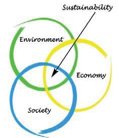
Economic Aspects: Recent developments in high-tech communication have boosted innovation, entrepreneurship, local ownership, small enterprises, and cooperatives. Developing decentralized infrastructure for electricity, communication, transportation, water, and wastewater supports this. In addition, economic development is praised as having its roots in historic preservation.
Environmental Aspects: There is a strong sense of responsibility, care, and connection to natural systems because people know how much land and water are necessary for community health. The surrounding open space is preserved for human enjoyment and “working” by bolstering the expansion of regional food, energy, and fiber enterprises. Strategies focusing on interconnected, closed-loop systems to solve problems reflect a more excellent science knowledge and are integrated across sectors.
Social Aspects: Creativity, innovation, and community resilience are all fostered by a compassionate acceptance of everyone. Social solid networks coexist with independence and self-sufficiency. Democracy and volunteerism are blooming. People have a sense of empowerment and importance for everyone. A strong sense of place or community is proudly promoted, strengthening the network even more.
According to the EPA – United States Environmental Protection Agency5, Smart growth strategies can help rural communities achieve their goals for growth and development while maintaining their distinctive rural character.
To help rural communities and small towns face their specific challenges, the EPA published the manual: Putting Smart Growth to Work in Rural Communities (2010), focusing on smart growth strategies that can help guide growth in rural areas while protecting natural and working lands and preserving the rural character of American communities.
The report focuses on three central goals:
- Support the rural landscape by creating an economic climate that enhances the viability of working lands and conserves natural lands.
- Help existing places thrive by taking care of assets and investments such as downtowns, main streets, existing infrastructure, and places the community values.
- Create great new places by building vibrant, enduring neighborhoods and communities that people, especially young people, do not want to leave.
Let us start on the summary perception of the state of the Town, its assets, and the considerations of the citizens.
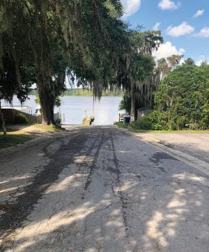
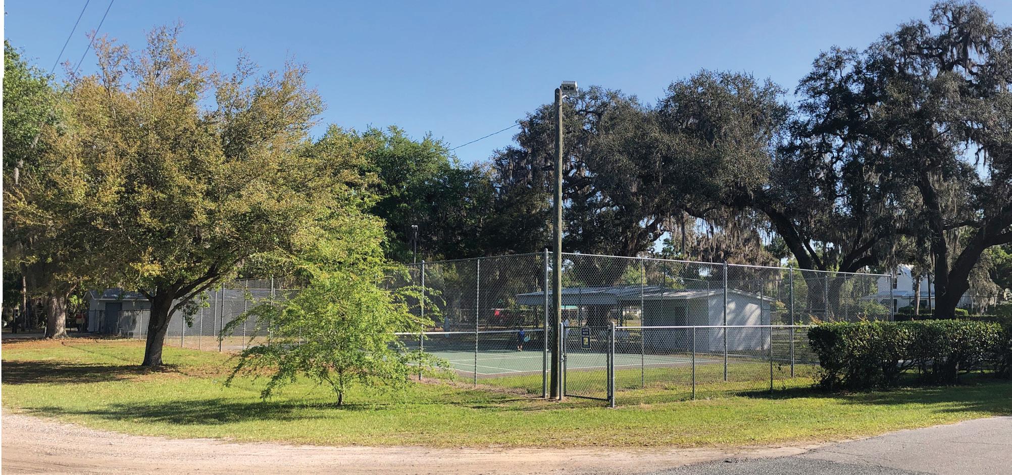
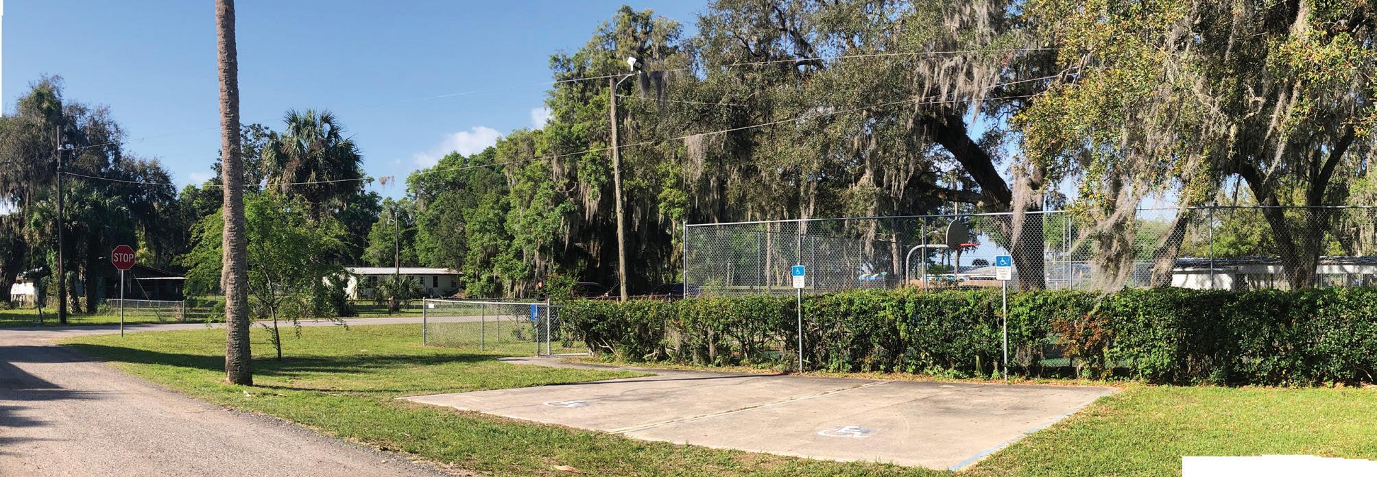
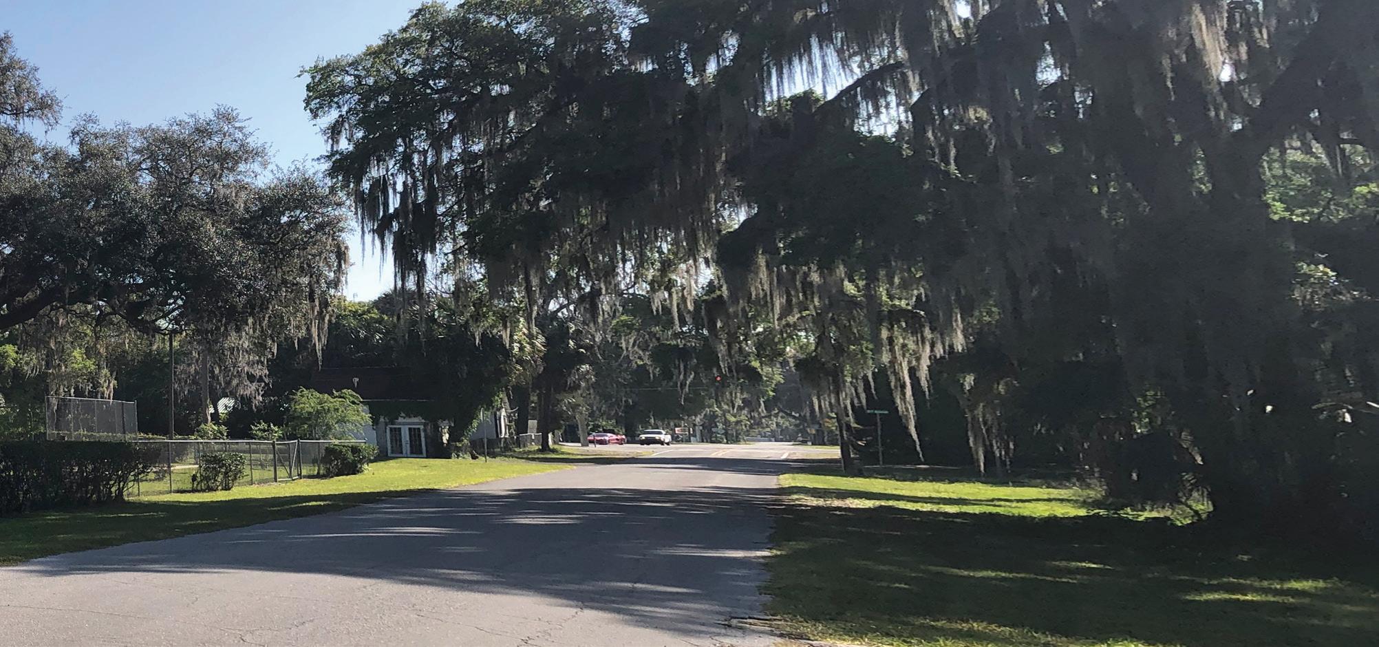
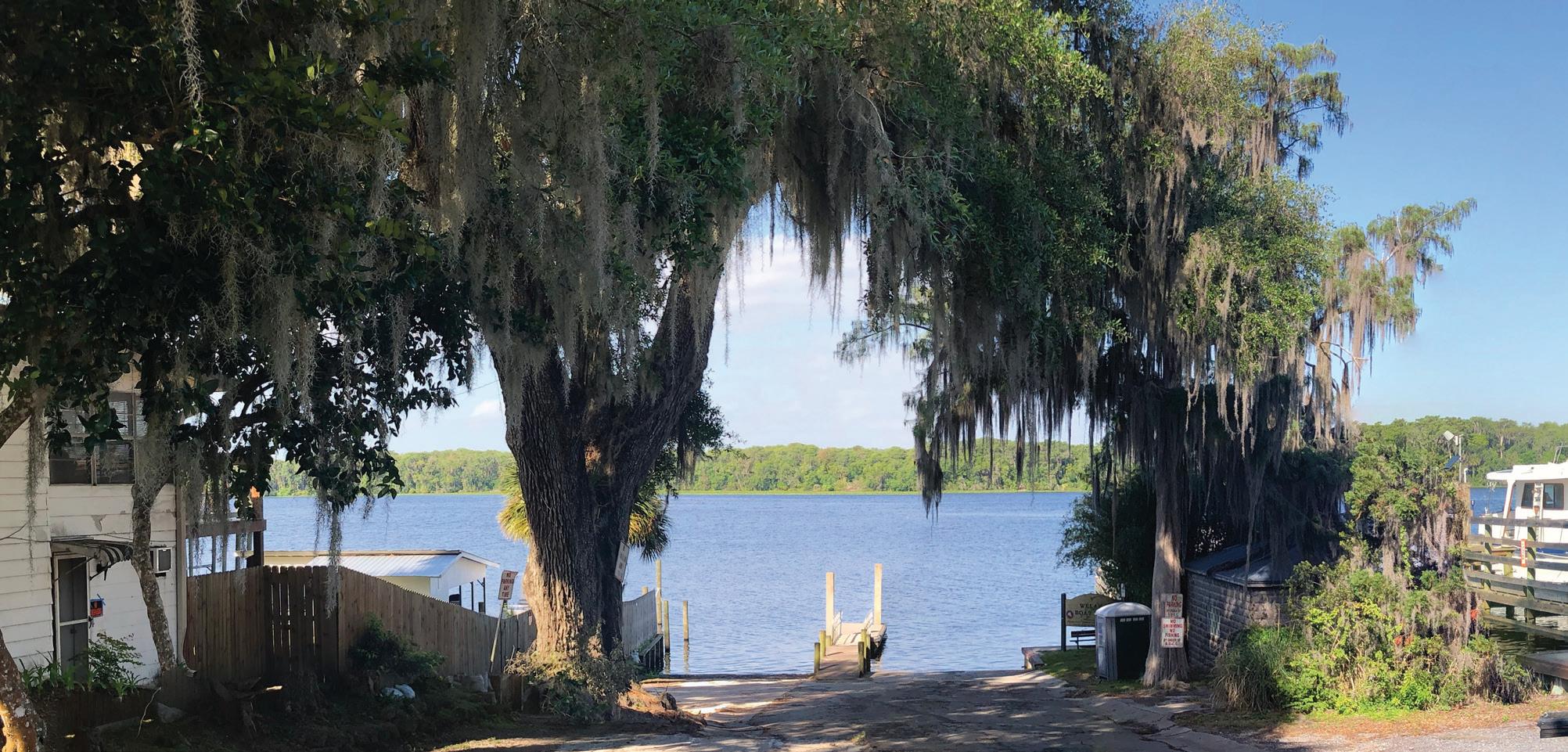
Welaka is a precious, mostly unaltered historic village by the East bank of the grand St. Johns River in North Florida, inhabited by less than 800 active neighbors. Its unpaved streets and lots are bearers of magnificent old-growth oaks, where traditional homes, mostly early XIXth century, are sparsely located. It has public river access in three successive streets that abut to the river level from the safe 20’ bluff where the settlement occurs. The river will permanently keep its vast conservation lands across the West Bank, where magnificent sunsets are a daily spectacle. It is traversed by a County Road (CR309), where some commercial businesses are sparsely located. A few miles North and West, and separated by conservation and undeveloped lands, we find the neighboring lower-income locations of Satsuma and Pomona.
This immutable status has though an evolutionary challenge, provoked by the acquisition of a large adjacent tract of land, North of town, for the development of a Nationally Branded Fishing high end resort.
The Community in its organized bodies is developing a vision for the future character of the town, where our CHU contribution together with the NEFRC directions are constituting the discussion platform towards the definition of alternative directions.
Our proposals are based in the principles outlined in the town meetings and in contemporary thinking that we register as our direct references.
As a starting point, we register the situation gifts revealed as:
- Access to the beautiful St. Johns River and its associated nature preserves
- Sunsets over the water views
- Forested historic Village shaded environments
- Untouched Historical assets and character
- Availability of publicly owned land in the Central area
- Infrastructure upgrading in process, such as the Sewer Plant
- A committed and organized Community, art lovers
- Nearby affordable communities
From a SWOT analysis, that identifies Strengths, Weakness, Opportunities and Threats, we can highlight the opportunity of capturing growth, as well as the threat that growth poses and the challenge of its management.
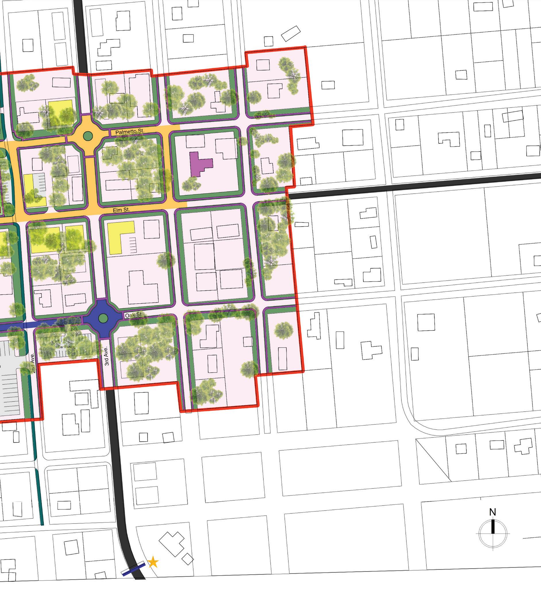
Establish a pedestrian friendly Downtown area that will promote identity and a socially attractive environment, while creating development opportunities. This is achieved by the following proposals, discussed publicly to foster the character of the Town of Welaka:
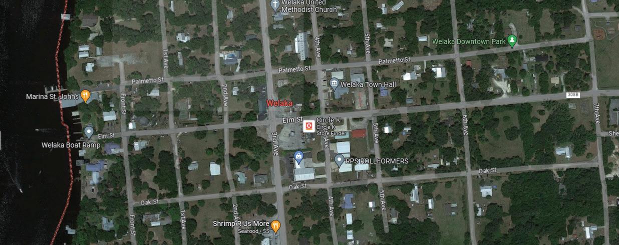
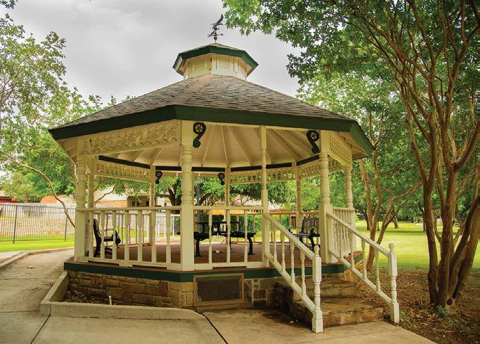
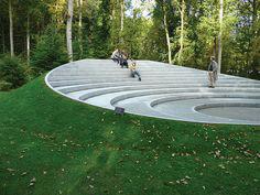
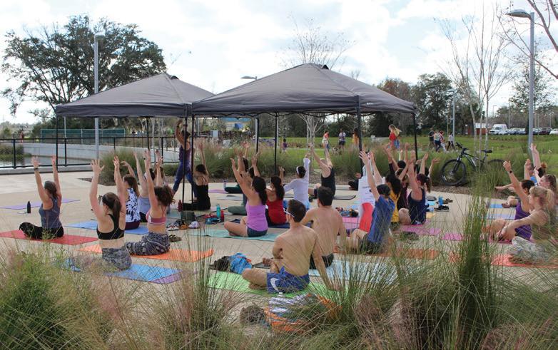
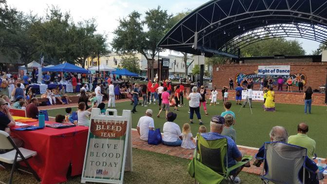
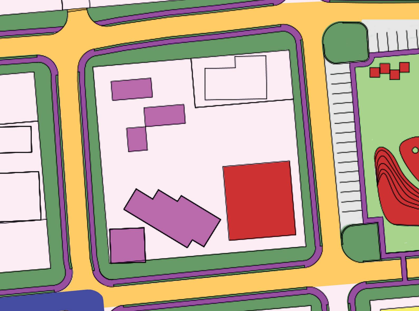
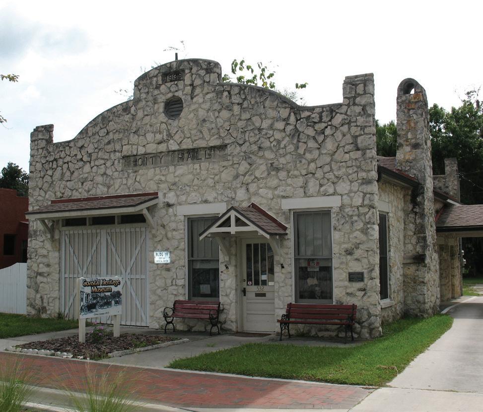
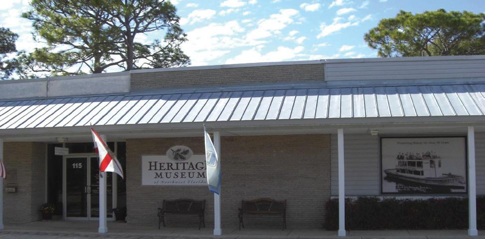
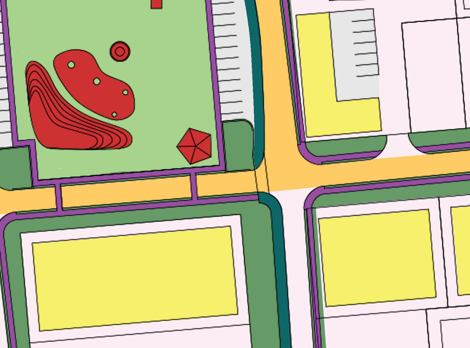
1. Transform the sports oriented square limited by Palmetto, Elm, 2nd and Front streets into a civic oriented activities square, with surrounding selected commercial opportunities in the adjacent areas, focusing on quality construction and aesthetically defined elements for hospitality, museum and art programs.
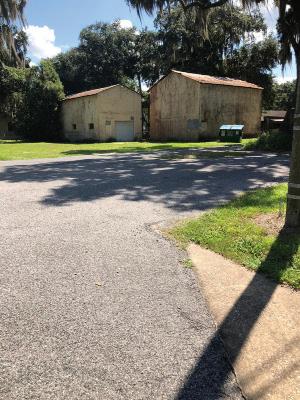
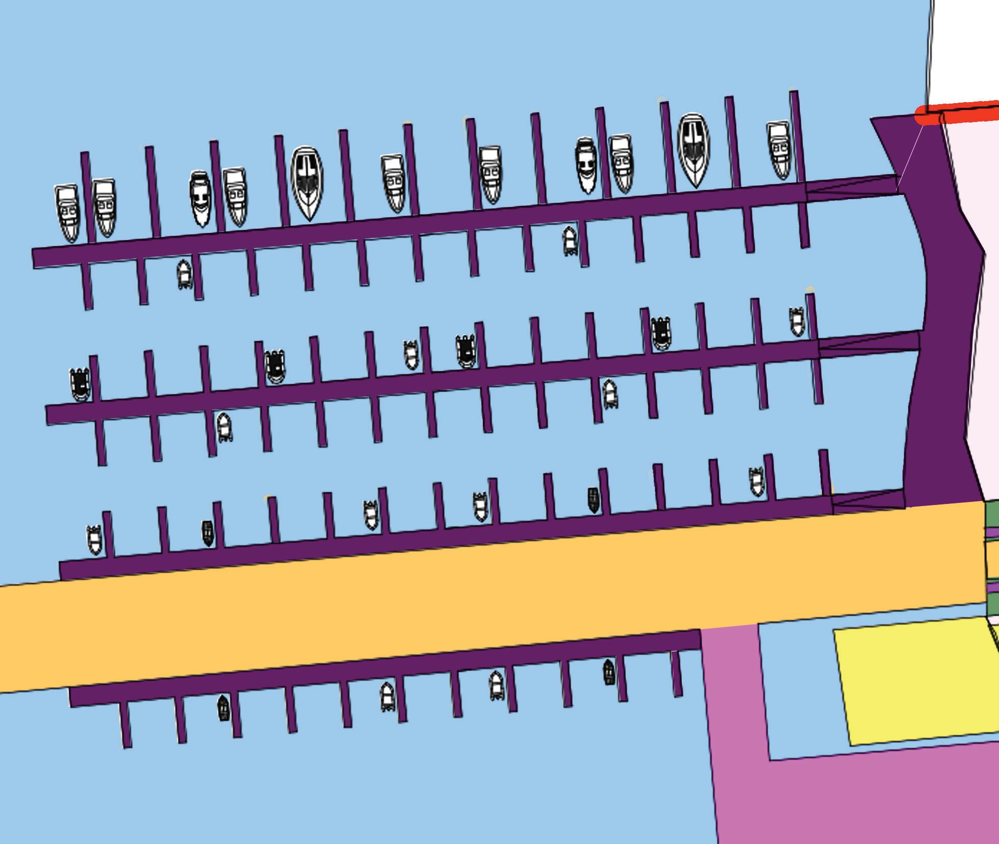
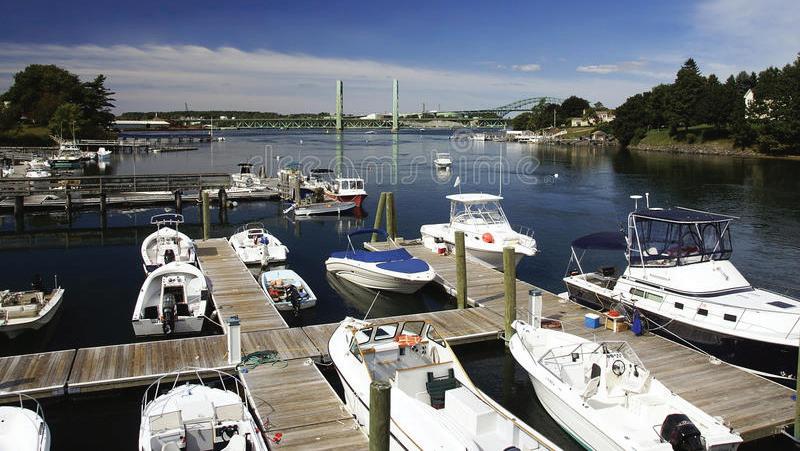
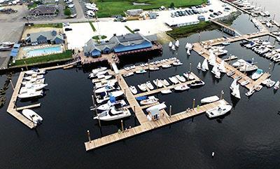
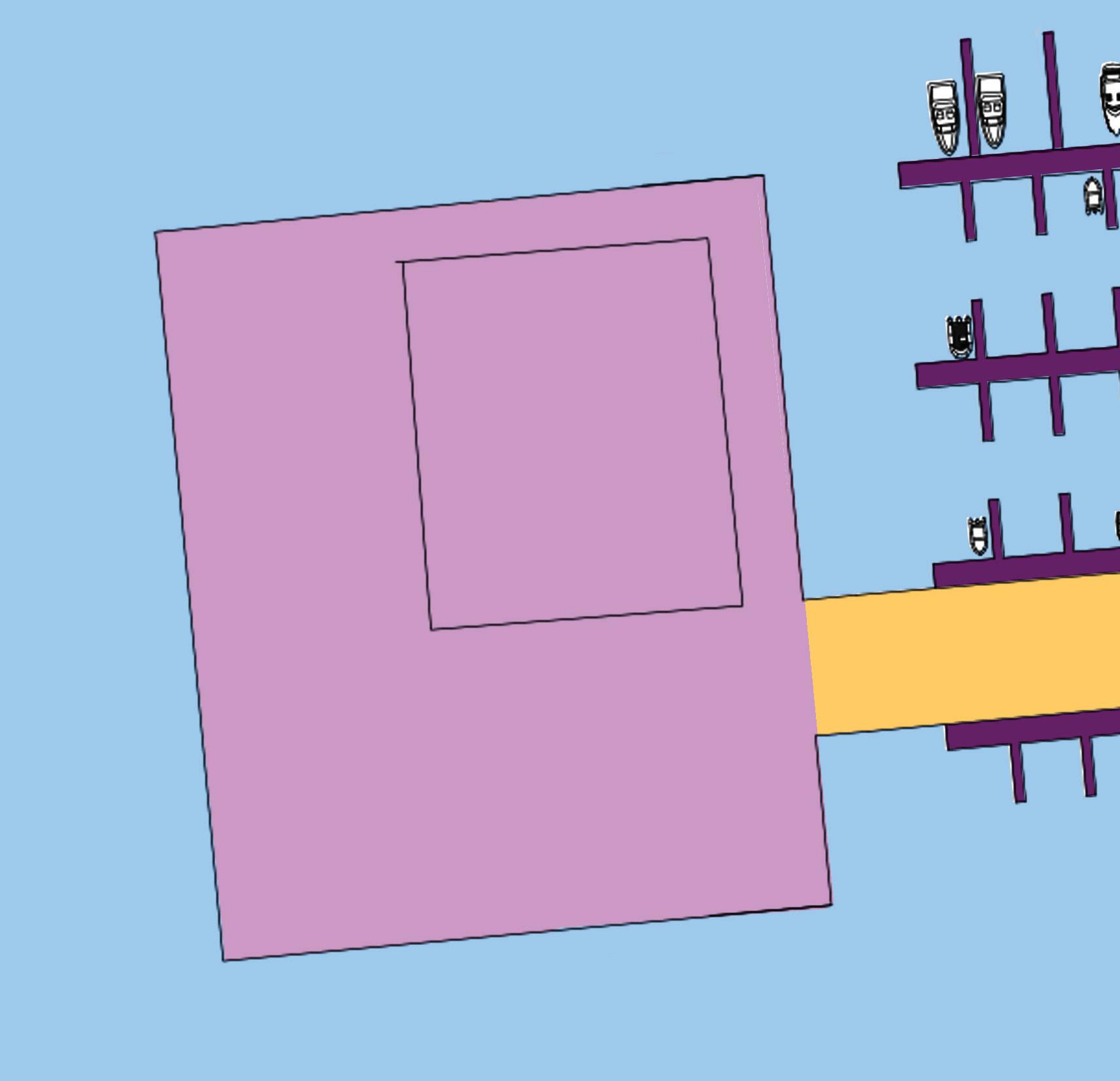
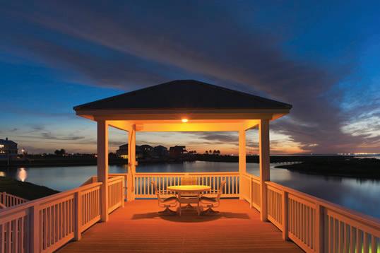
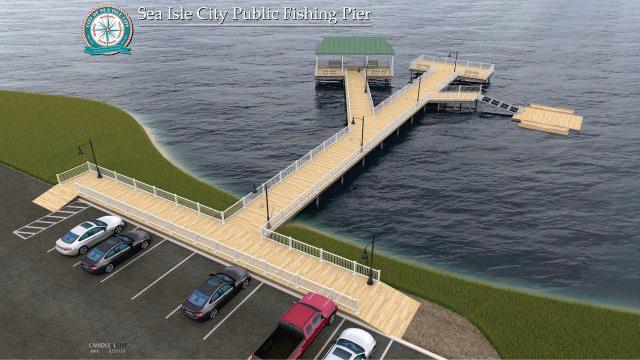
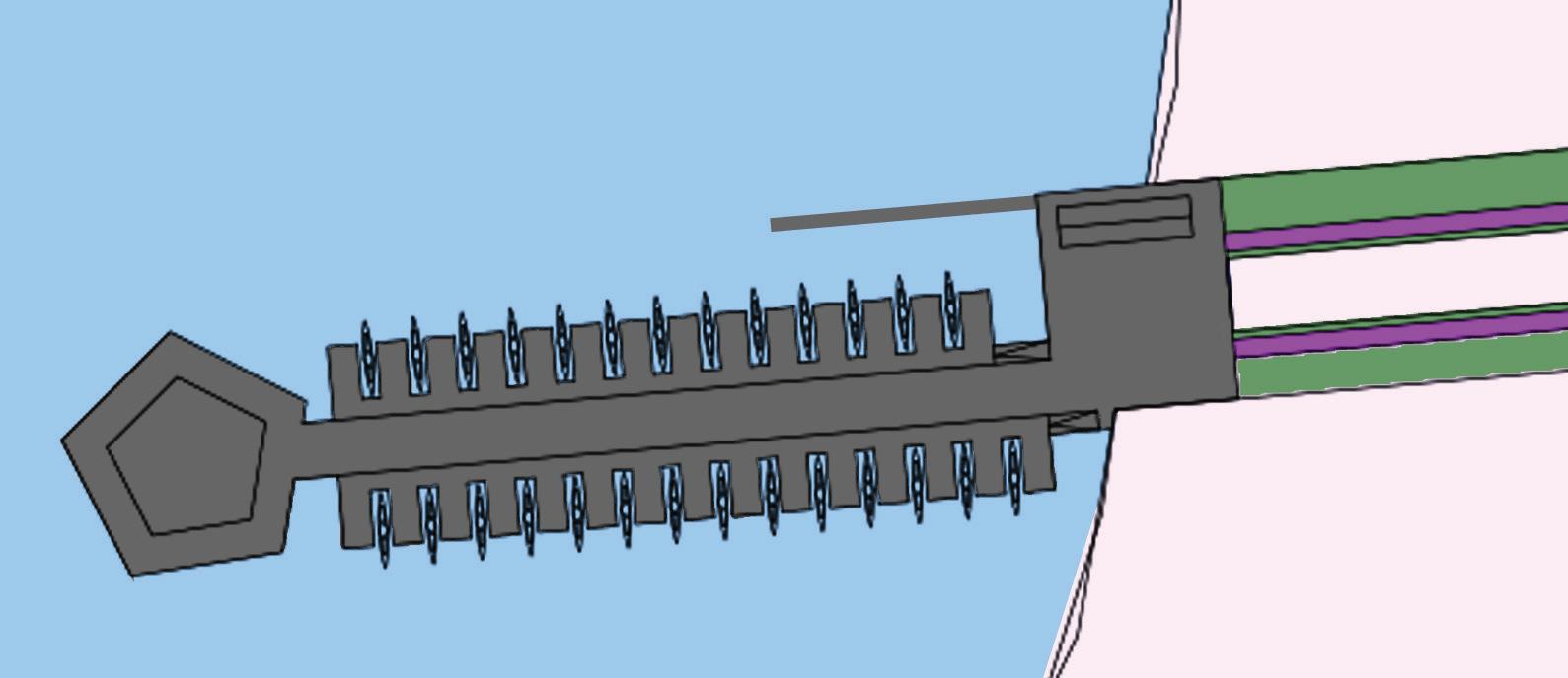
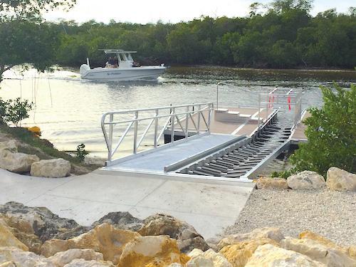
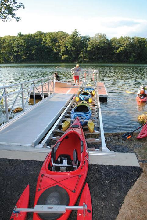
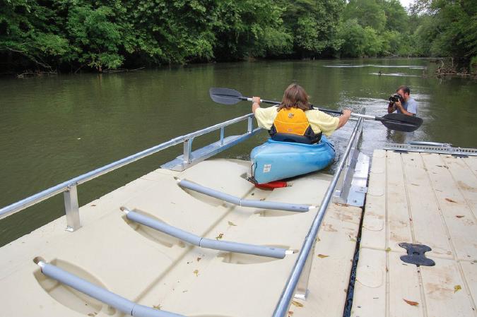
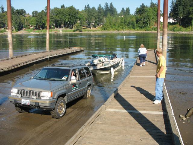
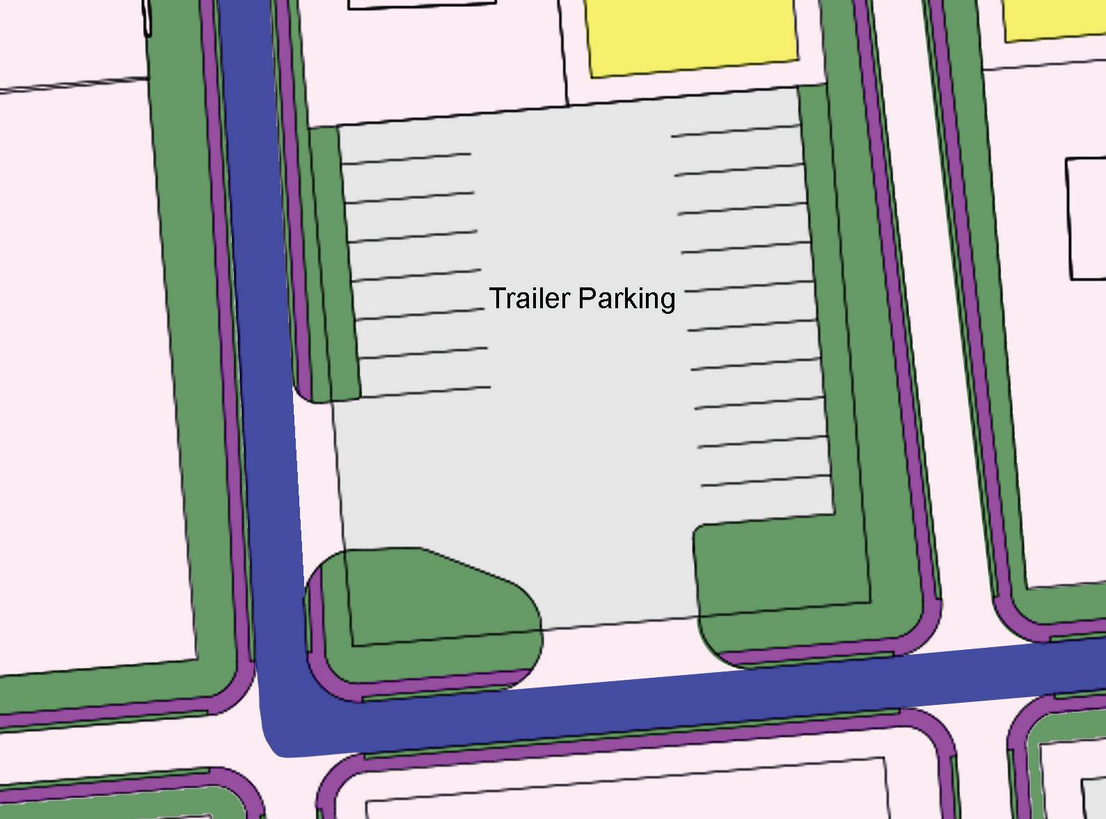
2. Expand the waterfront opportunities by enlarging the Marina in Palmetto Street, providing a Sunset Pavilion, a new Kayak launching platform and landing in Elm Street, and conditioning the Oak Street River access as a boat ramp, supported by new areas for boat trailer parking.
3. Define the streets hierarchy and propose conditioning them for rain management and modality split, dedicating 2nd street to light transportation, and sharing uses in the surrounding streets. Further studies are recommended for the proposals on CR 309.
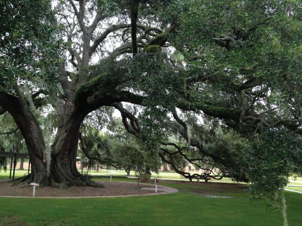
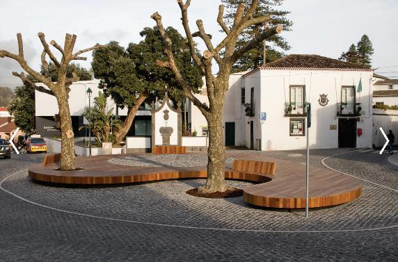
4. Protect and accommodate the valuable canopy of old growth oaks and historic architectural and archaeological assets.
These four directions seek to preserve and enhance the Natural Beauty of the location, and the Town’s unique character, while creating conditions for the controlled adaptation to an intensified influx of visitors to the area. More specific follow up investigations are recommended regarding various aspects the proposal, in particular the documentation for historic preservation, archaeological research, canopy protection and the conditioning of the County Road 309.
Some crucial aspects to be considered are:
Have a vision for the future
Create an Inventory of assets
Build plans on the enhancement of existing assets
Use education and incentives, not just regulation
Pick and choose among development projects
Cooperate with neighbors for mutual benefit
Pay attention to community aesthetics
Have strong leaders and committed citizens
Through community planning, local governments work collaboratively with residents and stakeholders to articulate how they want their communities to look, feel and function in the future. Discussing Welaka Downtown Vision helps the community to answer questions such as: How do we see our community in 15/20 years? Where will we build new homes, schools, businesses, roads, and public infrastructure? How do we deal with parts of the community that are deteriorating or inappropriate? How do we preserve those parts of the community that we value? How do we invest in our town?
Welaka Downtown Vision should provide a menu of possibilities for how the community will overcome today’s challenges and be best prepared for the future. The Downtown Vision will most certainly result in different plans that will document the community’s past, present, and future and will be able to guide decisions related to land use, economic development, environmental protection, community revitalization, infrastructure and service provision, and other related matters.
Community planning entails a lot of time, work, and resources. It includes making difficult decisions that are neither quick nor easy. There were 5 official community meetings during Welaka Downtown Vision
Discussions and a few, tangible benefits to the planning process. We enumerate some:
- Education and engagement of the public. The participation of the Welaka community was massive. The meetings were an opportunity to learn and re-learn about the community, its residents, and their hopes and wish for the future. As a process, planning strives to make local decision-making more open and democratic.
- Conservation of natural, historic and cultural landscapes. The discussions resulted in the interest in making a Town Historical Survey and Tree Survey.
- Promotion of economic development.
- Protection of private property rights and public spaces quality. Good planning can protect property values and minimize negative impacts associated with new developments. Especially considering the new projects that are coming to the area.
a. Initial Meeting
NOV. 15, 2022
Kick-off Meeting & Visual Preference Survey
b.1st. Community Meeting
JAN 10, 2023
Meeting with Commission – Present Meeting Summary and Short Vision document
c.1st Council Meeting
d. 2nd Community Meeting & Asset Management
MARCH 2023
Community Asset Inventory with DEO and stakeholders
APRIL 2023 - DRAFT VISION
MAY 2023 - Review Final Vision Document
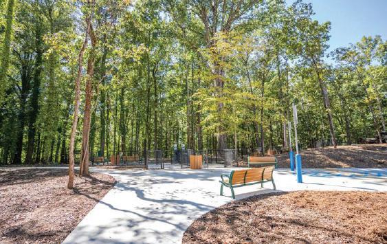
Welaka Downtown Park is a vital town asset and deserves a new project. However, it is up to the community to decide if it will keep its green space features or if it will assume public open square characteristics. Open green spaces are essential in towns as they provide space for rest, relaxation, and exercise. In contrast, town squares are open public spaces that reflect the cities’ identity and the communities’ cultural background. Green spaces are known to impact the community’s physical and mental health positively, and town squares define the center of public life because they are where people gather, and “urban life” takes place.
According to Levy (2012), the main difference between a public park and a public square is that “on a square, citizens are not connected to manifestations of nature, but to the heart of urban culture, their history, and memory.” But those qualities are not exclusive; an excellent urban design project can transform the Downtown Park into the green area the population admires, and the town square the city craves for.
A street is the basic unit of urban space through which people experience a city. Streets are multidimensional spaces consisting of many surfaces and structures. They must be considered from one property line to another, including the building edges, land uses, and setbacks that define each side.
Streets are dynamic spaces that can adapt over time to support new urban needs, but they can also be changed. This includes moving curbs, changing alignments, daylighting corners, and redirecting traffic where necessary to support environmental sustainability, public health, economic activity, and cultural significance.
According to the Global Design Cities Initiative6, understanding a street’s various portions as either continuous or interchangeable offers a flexible approach to street design. While sidewalk paths, bike lanes, and travel lanes must be continuous and connected to function effectively, interchangeable elements such as parking spaces, trees, and transit stops allow a street to be adapted to serve its context.
Streets are an economic asset as much as a functional element. Well-designed streets, presenting public seating, adequate sidewalk width, shade, and independent stores that open directly to the public space, can provide higher revenues for businesses and higher values for homeowners.
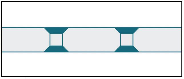
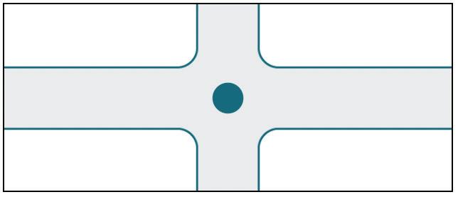
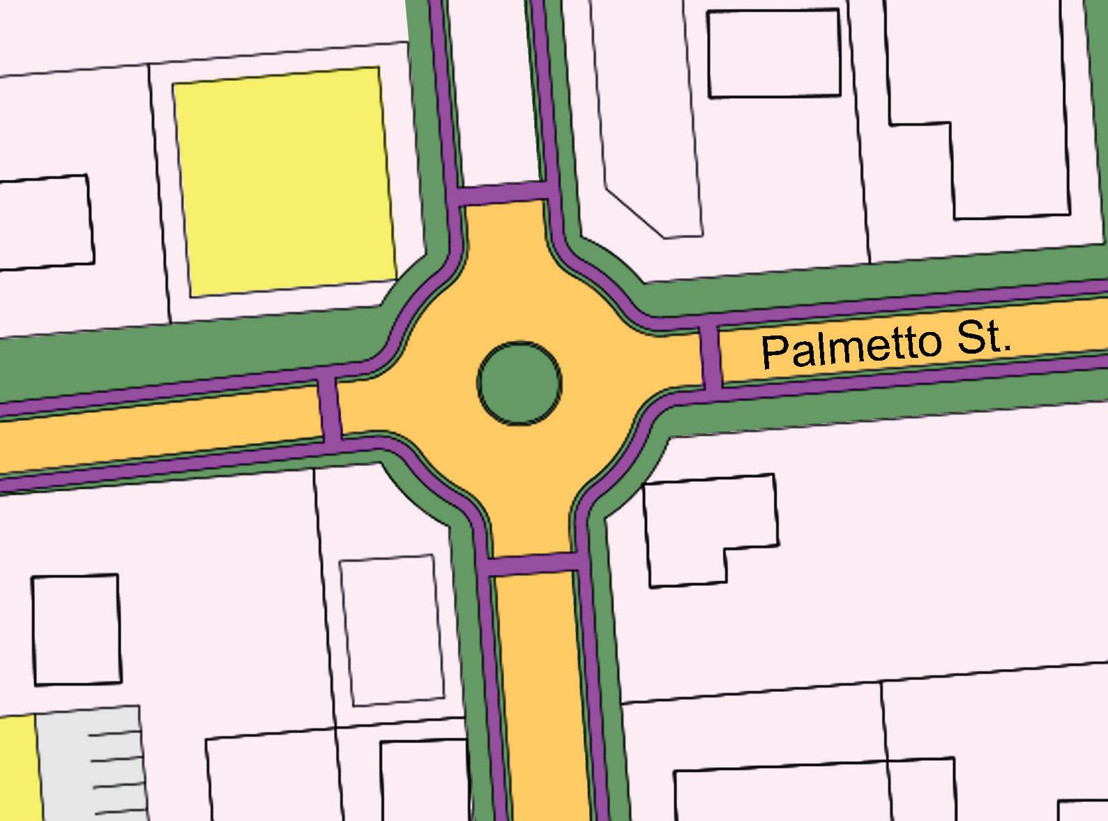
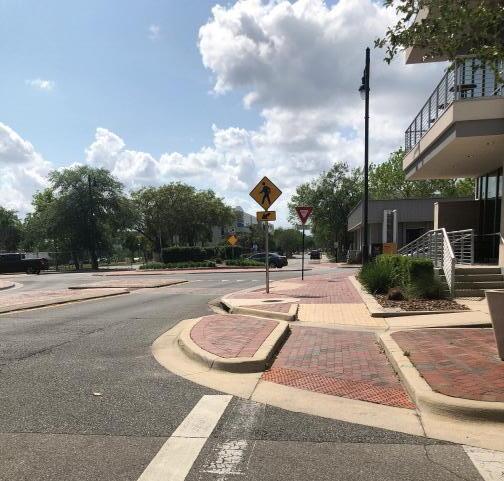
The redesign of 3rd Avenue may include some traffic calming strategies such as chicanes, lane shift, speed humps, and roundabouts on main intersections. According to Nacto’s Global Street Design Guide7, speed is the single most crucial factor in the safety of a street as it is directly proportional to the risk of a pedestrian
Chicanes slow drivers by altering parking or curb extensions along the corridor
Lane Shift horizontally deflects a vehicle and may be designed with striping, curb extensions or parking

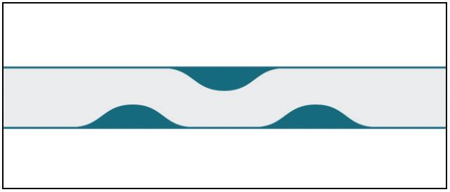
Speed Humps vertically deflect vehicles and may be combined with a mid block crosswalk
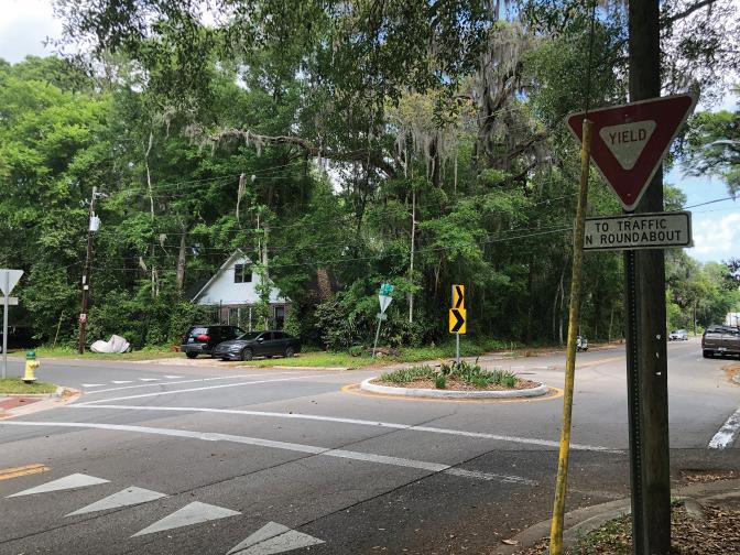
Roundabouts reduce traffic speeds at intersections by requiring motorists to move with caution through conflict points.
Growing international evidence shows that re-designing more people-centered spaces with fewer cars benefits local businesses, the environment, and population health.
Some streets in Welaka Downtown can be designed as pedestrian-preferred streets. These streets must be designed for both mobility and community life, so they will only allow public transit vehicles, delivery trucks, and residents to access the buildings around them.
Pedestrian-preferred streets may present a particular paving with different finishing materials and colors. Also, the re-design of pedestrian-preferred streets in Welaka must include a street furniture project and a new public lighting network.

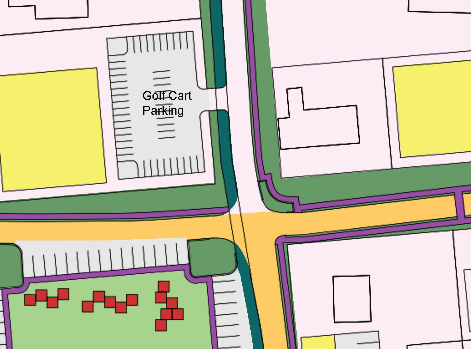
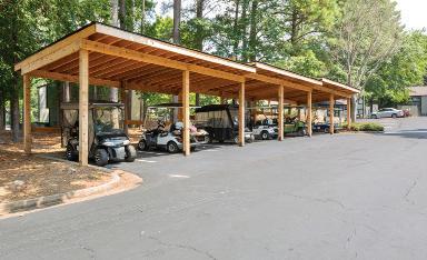
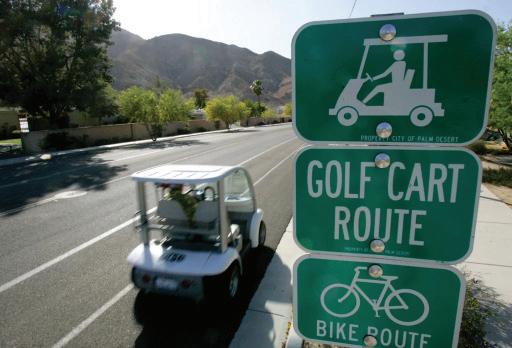
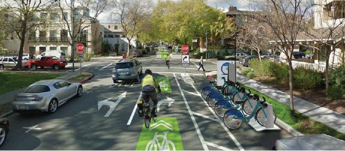
Micro-mobility devices such as golf carts and bicycles are widely used in Welaka. Golf carts and bicycles create a more diverse, convenient, and accessible transportation network in the town, providing more transportation options, reducing congestion, and improving quality of life.
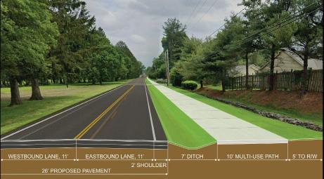
2nd Avenue can be redesigned as an exclusive Golf cart and Bike Path. It is proposed as a conventional multi-use path, allowing for two-way, off-street bicycle use, but it may also be used by pedestrians, skaters, wheelchair users, joggers, and other non-motorized users. Conventional multi-use path standards should be tailored specifically to the needs of golf carts while still comfortably accommodating other users.
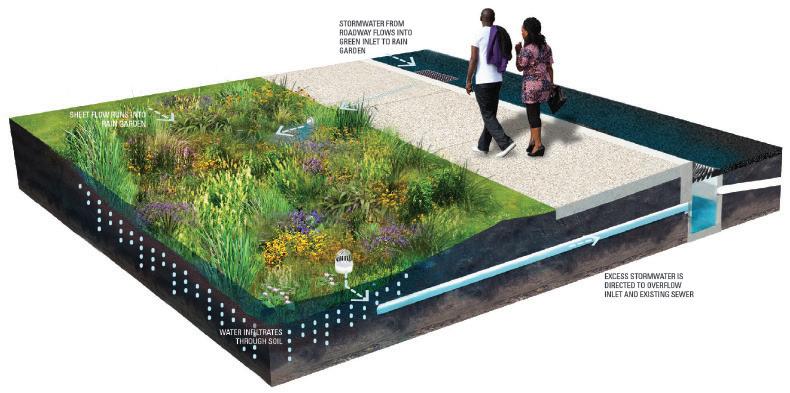
Incorporating green infrastructure into transit street design can improve general water quality, control stormwater flows, reduce the volume of stormwater runoff, and relieve the burden on municipal water treatment systems8. Sustainable stormwater management is less costly than upgrading large sub-grade pipe networks and allows for flexible, modular installation. Green infrastructure can also complement transit by calming traffic, enhancing comfort while waiting for transit, and creating safer opportunities for pedestrian crossing.
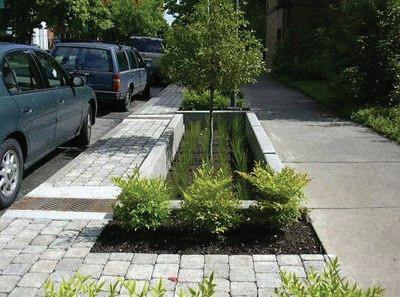
The green stormwater infrastructure toolbox contains different design components that must be chosen, scaled, and set up to fulfill the project site’s needs, such as Bioretention Planters, Biofiltration Planters, Bioswales or Hybrid bioretention cells.
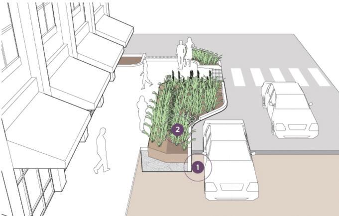
Bio retention planters are stormwater infiltration cells constructed with walled vertical sides, a flat bottom area, and a large surface capacity to capture, treat, and manage stormwater runoff from the street.
1. Where pedestrian activity is moderate or high, at least 8–12 feet of clear width should be dedicated to pedestrian movement between the edge of the planter and the building or property line. Where activity is low, a 5- to 6-foot preferred minimum allows two people to pass comfortably.
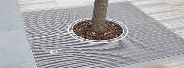
2. Provide an edge that can be detected using a cane or other mobility device to prevent incursions, such as a 4-inch curb or low fencing (less than 24 inches tall). Plants that grow to at least the height of the wall (preferably with some variable height) act as a visual barrier and discourage incursions.
3- Planters configured adjacent to on-street parking should provide a level step-out zone along the curb to accommodate vehicle entry and exit, and mitigate soil compaction and trampling, typically 36 inches wide from the curb face. Provide regular access paths between the curb and pedestrian through-zone, at least 5 feet wide.
Shorter planters (20 feet or less in length) with regular access paths between the curb and sidewalk can enable narrower step-out width on constrained sidewalks; 12–18 inches of firm, the compacted surface behind the curb face can accommodate vehicle entry and access. Provide designated parking and loading spaces with accessible paths and clearances for people using mobility devices on every block and at major destinations.
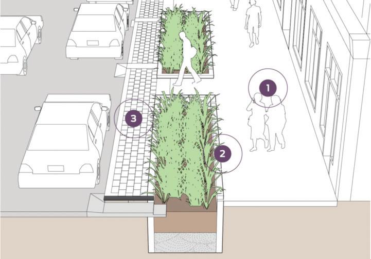
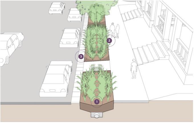
Bio filtration planters provide water quality treatment and reduce runoff volumes and may be applied in more limited rights-of-way.
Where infiltration cannot be accomplished due to contextual characteristics, native soils, or other constraints, walled planters can be designed with an impermeable base and supporting drainage infrastructure that collects water, filters runoff downward through soil media, and channels treated runoff through an under drain (perforated) pipe.
1. Install a perforated pipe at the base of the facility to collect the treated runoff.
2. Use a raised drain or curb cut (as illustrated) to drain overflow back to the gray water system that exceeds the design rain event. The planter must be designed to drain within 24 to 72 hours.
3. Maximize the surface footprint of the bio filtration cell, especially if multiple cells drain into a continuous rock layer below. Multiple surface expressions can be connected to maximize the bio retention footprint of a facility. Under-sized surface cells may be at risk for increased erosion or large amounts of debris.
4. Provide a pedestrian cut-through (at least 5 feet wide) approximately every 20 to 40 feet to facilitate access to the curb. Cut-through may separate cells or be provided as ramps. Use native plantings that are suitable for each site or micro-climate, are able to handle seasonal flooding or drought, and require minimal irrigation or maintenance.

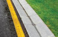
Bioswales or Bio retention swales are shallow, vegetated, landscaped depressions with sloped sides. They are designed to capture, treat and infiltrate stormwater runoff as it moves downstream. Swales are less expensive to build but use more space for infiltration and conveyance than planters, and can handle low to moderate flows of runoff.
1. The bottom area of a bio retention cell along with the side slopes (up to the ponding depth) provides for the infiltration footprint area of the facility. More runoff can be detained as the flat bottom area is widened, or as the side slopes are made steeper.
2. In areas where pedestrians may step off the sidewalk or curb into the bio retention swales, hardy vegetative ground covers can delineate the cell’s edge. Barriers such as short fencing can also help protect the facility from trampling, similar to that found on urban tree pits. Regular pedestrian access paths between the sidewalk and street can also discourage entry into swales.
3. In areas with significant on-street parking turnover, consider paving a 12- to 24-inch concrete strip at the back of the curb. In this instance, tailor the side slope to 3H:1V for the reduced level area in the step-out zone for pedestrian comfort.
A hybrid bio retention cell combines elements of both swales and planters, featuring a walled side opposite a graded side slope to increase vegetated space and infiltrating area, while providing a softer street scape treatment for people walking. Walls or graded sides can be configured adjacent to either a street or sidewalk, and can utilize a range of materials including concrete, rocks, or steel-faced curbs.
1. In contexts where the vertical wall is located on the street side, the wall should be designed to support vehicular loads. This construction process may require new curbs and/or repaving for a portion of the street.
In contexts where the vertical wall is located on the sidewalk side, the wall should be designed to support pedestrian loads, and may require construction of structured footings, bracing, and potentially sidewalk replacement.
2. Three feet is a preferred minimum bottom width for stormwater performance, space consumption in the right-of-way, and maintenance access to the cell bottom. Width may vary along the graded edge, especially along a longitudinal slope to achieve greater infiltration area.
The image of Saint John’s River is deeply intertwined with the history of Welaka. Welaka’s Downtown vision for the riverfront includes a master plan that aims to improve accessibility, equity, sustainability, and resilience of the downtown area. The plan must embrace the town’s history and cultural background and respect its natural environment to create a sports and leisure infrastructure that prioritizes pedestrian movement and activates public spaces.
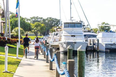
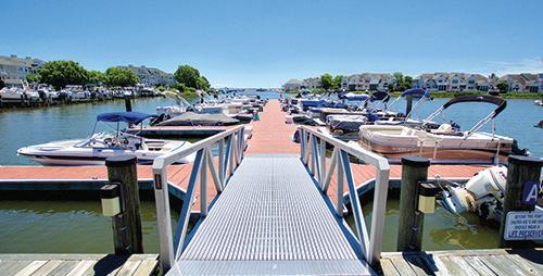
The master plan for Welaka’s riverfront includes projects for an expanded Marina, a Sunset Pavilion, a Kayak Ramp on Oak Street, and a new Boat Ramp on Elm Street. These interventions are meant to respect private property while provide the community and visitors the benefits and the gift of the St. John’s River.
Low impact water sports such as kayaks and water boarding will help create economic opportunities, attract visitors and promote water sports within the area.
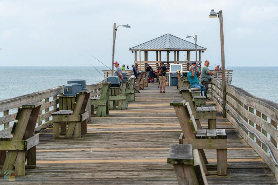
The Sunset Pavilion will provide an area for resting, reflection and contemplation of the beauty embracing the town, while the Expanded Marina will allow visitors from other towns to stop by and generate economic opportunities within the town.
References
1 https://nne.planning.org/knowledge/new-ruralism/
2 https://southfloridaagentmagazine.com/2023/01/11/florida-continues-to-see-influx-of-new-residents-in-2022/
3 American Planning Association [APA], 2017. Small town and rural planning division. Small Town & Rural Planning (Summer). Retrieved. https://planning-org-uploa ded-media.s3.amazonaws.com/document/DivisionSmall-Town-Rural-News-201 7-Sum.pdf.
4 https://nne.planning.org/knowledge/new-ruralism/
5 https://www.epa.gov/smartgrowth/smart-growth-small-towns-and-rural-communities
6 https://globaldesigningcities.org/publication/global-street-design-guide/
7 ibid
8 https://nacto.org/publication/urban-street-design-guide/street-design-elements/
Ruth Steiner met with CHU Team
Feb 17, 2023
Points discussed:
Roundabouts
- Roundabouts are safer for vehicular traffic but inconvenient for pedestrian movement.
- They make crossing safer because they reduce vehicular speed, and the car is always ahead of the pedestrian. Also, they can provide two crossing movements for pedestrians.
- Roundabouts can create traffic retention, mainly when the street hierarchy differs between crossing streets and when the pedestrian traffic is heavy.
- Floridian drivers tend to disrespect the right of way at roundabouts.
- Many Florida cities use roundabouts as a gateway to city centers or other important areas in the city. (Sarasota and the Marina i.e.).
- According to the Florida Greenbook1 the benefits of roundabouts are:
Safety
- Fewer crashes, 90% fewer fatalities, and 75% fewer injuries
- Fewer severe crashes
- 10 to 40% fewer pedestrian/bicycle crashes
- Roundabouts are safer for beginner and elderly drivers
- It can be used in multiple road intersections
Time Savings
- 30 to 50% increase in traffic capacity for intersections, less delay waiting at stops and signals
Environmentally Friendly
- Reduces pollution (from cars not waiting at traffic signals), reduces noise, reduces fuel consumption
- Roundabout islands can be landscaped with native plants and trees
- Roundabouts generally take less land than traditional intersections as they do not require turning lanes
- Without traffic signals, no cost for traffic signals and yearly maintenance
- Intersection still operates in power outages; no need for police to direct traffic.
- Roundabouts can help improve sales at nearby businesses across the country as more people can walk or easily drive to locations compared to traditional intersections.
- It can act as a marker for a business or downtown district.
Community benefits
- Traffic calming
- Aesthetic landscaping
Traffic lights
- Traffic lights cannot be proposed before traffic analysis.
- Federal guidelines establish minimum conditions under which a signal installation should be considered. The traffic engineer is to follow while investigating conditions and circumstances
regarding installing a new traffic signal or improving the operation of an existing traffic signal.
- Bass Pro will probably develop a Traffic Impact Assessment – TIA. The TIA aims to identify the potential traffic impacts of new development on the transportation system and to develop mitigation strategies to offset those impacts according to previously established methodologies and provisions.
Safer Streets:
- There are two possibilities for safer streets:
- 1. A street that separates different traffic in space and time.
- Roundabouts separate different traffic in space; traffic lights separate different traffic in time.
- 2 . No separation at all or “Planned chaos” – Shared Streets. According to the Global Street Design Guide2
- Many narrow, crowded streets worldwide already operate informally as shared streets at busy times of the day or in congested areas. By removing the formal distinctions between spaces
dedicated to pedestrians, cyclists, and motorized vehicles, the street is shared by everyone, with each user becoming increasingly aware and respectful of the others.3
- Shared streets provide pedestrians with the right of way. While designs vary based on local context and culture, curbs are removed, and the materials and space allocation indicates that vehicles are guests.
- Shared streets can significantly contribute to the public space network in commercial areas, adding vibrancy and activity with outdoor dining, public seating, artwork, and landscaping. In residential areas, shared streets become the extension of front yards, places to meet neighbors, and build communities. Shared treatments make streets safer for all users.
Conclusions:
Though decisions regarding the Character of the streets in the town can be taken by urban design criteria, It is important to consult a traffic engineer to address the planning, design, and operation of the specifications for the CR 309 passage through the Welaka town and in particular the Town center. Notably, with a prevision of increased circulation, the measures can only be proposed after the real-time assessment of conditions. The recommendation, therefore, for the project of the CR 309 crossing the downtown will be pending in this instance of definitions.
References
1 https://www.fdot.gov/agencyresources/roundabouts/benefits.shtm
2 https://globaldesigningcities.org/publication/global-street-design-guide/streets/shared-streets/
3 Levy B. Urban Square as the Place of History, Memory, Identity, In: Dusica Drazic, Slavica Radisic, Marijana Simu (eds), Memory of the City, Kulturklammer, Belgrade.






Wikipedia, https://en.wikipedia.org/wiki/Welaka,_Florida
Welaka Gov. Website, https://www.welaka-fl.gov/about-welaka/slideshows/welaka-history
Jane Jacobs The nature of economies, Vintage 2001
Tad Orr and Mike Lucas Architectural Gardens, Princeton Arch Press 2021
COP 27 November 2022 recommendations
Bass Pro Shops Resorts, a commitment to conservation, Bigcedar.com
Rem Koolhaas Countryside A Report Guggenheim Tashken 2019
Vanessa Miriam Carlow, Ruralism, The future of Villages and Small Towns in an Urbanizing World. Jovis 2016
https://nne.planning.org/knowledge/new-ruralism/
https://southfloridaagentmagazine.com/2023/01/11/florida-continues-to-see-influx-of-new-residents-in-2022/ American Planning Association [APA], 2017. Small town and rural planning division. Small Town & Rural Planning (Summer). Retrieved. https://planning-org-uploa ded-media.s3.amazonaws.com/document/Division-Small-Town-Rural-News-201 7-Sum.pdf.
https://nne.planning.org/knowledge/new-ruralism/
https://www.epa.gov/smartgrowth/smart-growth-small-towns-and-rural-communities
https://globaldesigningcities.org/publication/global-street-design-guide/ ibid
https://nacto.org/publication/urban-street-design-guide/street-design-elements/
https://www.fdot.gov/agencyresources/roundabouts/benefits.shtm
https://globaldesigningcities.org/publication/global-street-design-guide/streets/shared-streets/
Levy B. Urban Square as the Place of History, Memory, Identity, In: Dusica Drazic, Slavica Radisic, Marijana Simu (eds), Memory of the City, Kulturklammer, Belgrade.
Figure 1. Pictures taken by CHU/NEFRC Team
Figure 2 - 7. Images produced by CHU Team
Figure 8. https://business.putnamcountychamber.com/list/member/town-of-welaka-1860
Figure 9 - 10. https://www.facebook.com/townofwelaka/
Figure 11 - 15. https://www.welaka-fl.gov/about-welaka/slideshows/welaka-history
Figure 16. https://en.wikipedia.org/wiki/Putnam_County,_Florida
Figure 17 - 19. https://www.google.com/maps/place/Welaka
Figure 20 - 27. Pictures taken by CHU Team
Figure 28. https://nne.planning.org/knowledge/new-ruralism/
Figure 29 - 34. Nacto Urban Street Design Guide
Figure 35. Image produced by CHU Team.
Figure 36. https://www.auburnalabama.org/parks/facilities/dinius-park/
Figure 37. https://healthstreet.program.ufl.edu/2017/09/27/uf-healthstreet-to-host-2nd-annual-night-of-dance/
Figure 38. http://www.depotpark.org/
Figure 39. https://www.pinterest.com/poomphurit/terrace-stepped-landscape/
Figure 40. https://www.eulesstx.gov/departments/parks-and-community-services/rental-information/gazebos
Figure 41. https://cfmatl.org/eav/grant-park-farmers-market-2/
Figure 42. Image produced by CHU Team
Figure 43. Not Found
Figure 44. https://www.dreamstime.com/photos-images/small-marina.html
Figure 45. https://meecosullivan.com/
Figure 46. https://www.opalcollection.com/longboat-key-club/marina/
Figure 47. Image produced by CHU Team
Figure 48. https://seaislenews.com/kayak-project-flood-warning-system-receive-county-funding/
Figure 49. https://www.sunsetcovegalveston.com/living/
Figure 50. https://www.outerbanks.com/oceanana-fishing-pier.html
Figure 51. Image produced by CHU Team
Figure 52. https://www.kayakdock.com/
Figure 53. https://www.nps.gov/articles/000/wheels-to-water-inclusive-recreation-on-the-saluda-river.htm
Figure 54. https://boardsafedocks.com/projects/cape-coral-ada-accessible-kayak-launch-installed/
Figure 55. https://boardsafedocks.com/portfolio/ada-kayak-dock-launch-for-adaptive-paddlers-unveiled-in-state-park-lake/
Figure 56. Image produced by CHU Team
Figure 57. https://burgessart.wordpress.com/2013/11/23/a-new-platform-by-the-river/
Figure 58. https://www.kgw.com/article/news/local/clackamas-county/construction-on-a-new-cedaroak-boat-ramp-in-west-linn-to-beginin-mid-august/283-284485549
Figure 59. Image produced by CHU Team
Figure 60. https://www.mass.gov/service-details/demonstration-3-permeable-paving-materials-and-bioretention-in-a-parking-lot
Figure 61. Image produced by CHU Team
Figure 62. https://www.trip.com/travel-guide/attraction/valpraiso/heritage-museum-of-northwest-florida-58307708/
Figure 63. https://digitalcommons.unf.edu/historical_architecture_main/5578/
Figure 64. Image produced by CHU Team
Figure 65. Image taken by CHU Team
Figure 66 - 67. https://www.google.com/search?q=welaka+food&bih=568&biw=1366&rlz=1C1GCEB_enUS930US931&hl=en&sxsrf=APwXEddV1vRoR85MrdO3UqzkcdVqwvbOPA%3A1682301332848&source=hp&ei=lOFFZMqKMcyzqtsPkpaCqAw&iflsig=AOEireoAAAAAZEXvpJ8YXs1Fp38Gwrh2wkJrapCkb78p&oq=&gs_lcp=Cgdnd3Mtd2l6EAEYADIHCCMQ6gIQJzIHCCMQ6gIQJzIHCCMQ6gIQJzIHCCMQ6gIQJzIHCCMQ6gIQJzIHCCMQ6gIQJzIHCCMQ6gIQJzIHCCMQ6gIQJzIHCCMQ6gIQJzINCC4QxwEQ0QMQ6gIQJ1AAWABghgpoAXAAeACAAQCIAQCSAQCYAQCwAQo&sclient=gws-wiz#rlimm=14506595537238959386&lpg=cid:CgIgAQ%3D%3D,ik:CAoSLEFGMVFpcFBXRDNPYVQtcHk2eTZ6d0RFdFNVQVNIaXhibXNjZVIxdkRsbVIy
Figure 68. Image produced by CHU Team
Figure 69. https://blog.altaplanning.com/complete-streets-2-0-responding-to-the-fast-pace-of-change-in-transportation7e080b82efce
Figure 70. https://pinehallbrick.com/aesthetic-paving-brick-gives-designs-a-competitive-edge/
Figure 71. https://bicycledutch.wordpress.com/2011/08/18/but-we-have-driveways/
Figure 72. https://thegreensatpeachtreecity.com/gallery/
Figure 73. https://www.nbcnews.com/id/wbna26058387
Figure 74. Image produced by CHU Team
Figure 75. https://www.akron.com/articles/plans-presented-for-raber-road-trail-in-green/
Figure 76. https://stock.adobe.com/images/rainwater-in-the-canal-is-a-cement-ditch-of-a-drainage-system-on-the-side-of-wet-tarmac-road-with-yellow-line-and-a-green-lawn-on-roadside-environment/292052604
Figure 77. https://pacinst.org/managing-urban-flooding-in-the-san-francisco-bay-area-from-a-concrete-bowl-to-a-green-sponge/ Figure 78. http://archive.phillywatersheds.org/category/blog-tags/green-stormwater-infrastructure
Figure 79. Image taken by CHU Team
Figure 80. Image taken by CHU Team
Figure 81. https://www.archdaily.com/971738/parks-and-squares-20-public-space-designs
Figure 82. https://www.kentstainless.com/product-category/street-furniture/tree-protection/
Figure 83. https://www.hgtv.com/outdoors/flowers-and-plants/trees-and-shrubs/caring-for-live-oak-trees
Figure 84. https://www.istockphoto.com/photos/town-welcome-sign
Figure 85. https://basspoint.jmcandco.com/
Figure 86. https://www.kltv.com/2021/01/12/alba-man-has-foot-tall-bass-carved-out-tree-stump/