Cijena pojedinaËnog broja Price per issue Hrvatska: 75 kn
Europa | Europe: 24 Eur Izvaneuropske zemlje | Outside Europe: 27 Eur U cijene su ukljuËeni troškovi poštarine. Postage and handling included in the price.
Besplatan pristup internet izdanju Ëasopisa Free On-line Access to Internet Edition
Dostupni su svi Ëlanci publicirani u svim dosad izašlim brojevima u PDF formatu. All published articles in previous issues are available in PDF format.
EISSN 1333-9117
PROSTOR Online: www.prostor.hr https://hrcak.srce.hr/prostor
PROSTOR m space, room; (površina) area; (zona) tract; (prostranstvo) extent, expanse; (za kretanje/ manevriranje) elbow-room, playroom, leeway, scope; (prostorije, smještaj) premises, accomodation | životni ~ living space; stambeni ~ housing; školski ~ school space; poslovni ~ office space/premises; ~ za noge legroom; prema raspoloživom ~u on a space available basis; fig pružati ~za offer/give scope for; posvetiti (pokloniti) ~ (u novinama) devote (give) space to; zbog pomanjkanja ~a because of limited space; radi uštede na ~u to save space; povreda zraËnog ~a violation of airspace, aerosp; istraživanje ~a space exploration
ŽELJKO BUJAS (1999.), Veliki hrvatsko-engleski rjeËnik | Croatian-English dictionary, Nakladni zavod Globus, Zagreb
»asopis PROSTOR objavljuje znanstvene Ëlanke iz svih grana arhitekture i urbanizma, ali i radove iz drugih znanstvenih podruËja (povijesti umjetnosti, arheologije, etnologije, sociologije, geografije, graðevinarstva, geodezije, šumarstva, dizajna...), ako su sadržajem vezani za problematiku arhitekture i urbanizma. PROSTOR je primarni znanstveni Ëasopis i tiska samo neobjavljene Ëlanke, koji istodobno i u istom obliku ne mogu biti ponuðeni drugom izdavaËu. Osim znanstvenih priloga koji podliježu recenziji, decimalnoj klasifikaciji i kategorizaciji (izvorni znanstveni Ëlanci, prethodna priopæenja, pregledni Ëlanci, izlaganja na znanstvenim skupovima), iznimno æe se objavljivati i struËni Ëlanci analitiËkog karaktera. U skladu s navedenim, u PROSTORU se neæe objavljivati recentni projekti ni ostvarenja, osim u sluËajevima kada je posrijedi visokostruËno, odnosno primijenjeno znanstveno rješenje nekoga posebnog pitanja ili problema u sklopu projekta, uz uvjet da je sadržaj prikazan na znanstveni naËin (koncepcijski, tehniËki, tehnološki ili metodološki problem, a ne projekt ili zgrada kao takvi).
U prateæim rubrikama publiciraju se prijevodi, bibliografski prilozi, recenzije i prikazi (Ëasopisa, knjiga, izložaba, znanstvenih skupova), vijesti i aktualnosti iz struke, kronika Arhitektonskog fakulteta te sažeci obranjenih doktorskih disertacija i magistarskih radova.
• »asopis PROSTOR prijavljen je Ministarstvu znanosti i tehnologije RH (sada Ministarstvo znanosti i obrazovanja) kao primarna znanstvena publikacija za podruËje tehniËkih znanosti: znanstveno polje: arhitektura i urbanizam.
• »asopis PROSTOR upisan je u evidenciju periodiËnih tiskovina pri Ministarstvu informiranja RH (sada Ministarstvo kulture RH) pod prijavnim brojem 38 (Potvrda o prijavi periodiËke tiskovine od 12.05. 1992., kl. 104, ur. br. 523-021/92-847/38).
• PROSTOR izlazi polugodišnje (dva broja u godištu). U godištu 1 (1993.) i 2 (1994.) Ëasopis je izlazio tromjeseËno (Ëetiri broja u godištu).
• Predajom potpisanoga primjerka rukopisa autor jamèi da je iskljuèivi nositelj autorskog prava predmetnoga djela te pristaje na objavu èlanka u tiskanom i elektronskom izdanju èasopisa (Prostor Online), kao i na referiranje u sekundarnim bazama.
• Rukopisi prihvaæenih Ëlanaka ne vraæaju se.
• Objavljeni se prilozi ne honoriraju.
• Za znanstvene stavove i iznesena mišljenja u Ëlanku, toËnost podataka, te pravo objave tekstualnih i ilustracijskih priloga odgovorni su autori.
• Sva prava umnožavanja i komercijalne reprodukcije pridržava nakladnik. Korištenje podataka dopušteno je, uz obvezno citiranje potpune reference PROSTORA.
Izlaženje Ëasopisa financijski potpomaže Ministarstvo znanosti i obrazovanja Republike Hrvatske.
The journal PROSTOR publishes scientific papers from all branches of architecture and urban planning as well as texts from other fields of science (art history, archaeology, ethnology, sociology, geography, civil engineering, geodesy, forestry, design...) if their content relates to architectural issues.
PROSTOR is a primary scientific journal and accepts only previously unpublished papers which cannot be simultaneously offered in the same form to another publisher. In addition to scientific contributions, which are subject to evaluation by reviewers, decimal classification and categorisation (original scientific papers, preliminary communications, reviews, conference papers), professional papers of analytical character will be published exceptionally. In accordance with the above, design projects will not be published in PROSTOR, except in cases that display a highly expert or applied scientific solution for a particular issue or problem within a project, unless the content is presented in a scientific manner (a conceptual, technical, technological or methodological problem, but not a project or a building itself).
The accompanying sections include translations, bibliographies, evaluations and reviews (of journals, books, exhibitions, conferences), the latest news and topical issues in the field, chronicle of the Faculty of Architecture as well as summaries of defended doctoral dissertations and master’s theses.
• The journal PROSTOR is registered with the Ministry of Science and Technology, RC (now Ministry of Science and Education), as a primary scientific publication in the area of technical sciences: scientific field: architecture & urban planning.
• The journal PROSTOR is registered as a periodical publication with the Ministry of Information, RC (now the Ministry of Culture, RC) under the entry number 38 (Registration of a Periodical Publ. Certif. from May 12, 1992, class 104, Reg. No. 523-021/92-847/38).
• PROSTOR is a half-yearly publication (two issues a year). In vol. 1 (1993) and 2 (1994) the journal was published quartarly.
• By delivering his / her signed paper, the author guarantees that he is the sole copyright holder of his work and grants his consent to its publishing in hardcopy or electronic edition (Prostor online) as well as to its abstracting / indexing in secondary data bases.
• Typescripts of accepted papers are not returned.
• The author does not receive any payment.
• Responsibility for scientific attitudes and opinions presented in the paper, the accuracy of data and the right to publish the text(s) and illustrations rests with the author(s).
• All rights (copying and commercial reproduction) reserved by the Publisher. The use of data is permitted with obligatory citation of full reference to PROSTOR.
The journal is financially supported by the Ministry of Science and Education of Republic of Croatia.
PROSTOR
ZNANSTVENI »ASOPIS ZA ARHITEKTURU I URBANIZAM
A SCHOLARLY JOURNAL OF ARCHITECTURE AND URBAN PLANNING
OsnivaË i nakladnik Founder & Publisher
SveuËilište u Zagrebu, Arhitektonski fakultet
HR - 10000 Zagreb, KaËiæeva 26 www.arhitekt.hr
Za nakladnika For the Publisher
Izv.prof.dr.sc. Krunoslav Šmit
Dekan fakulteta | Dean of the Faculty
Glavni i odgovorni urednik Editor-in-Chief
Izv.prof.dr.sc. Zlatko Karaè
SveuËilište u Zagrebu, Arhitektonski fakultet
Zamjenica glavnog urednika Deputy Editor
Prof.dr.sc. Ariana Štulhofer
SveuËilište u Zagrebu, Arhitektonski fakultet
Uredništvo Editorial Board
Prof.dr.sc. SreËko Pegan
SveuËilište u Zagrebu, Arhitektonski fakultet
Dr.sc. Tomislav Premerl Zagreb
[Poèasni èlanovi uredništva | Honorary members]
Prof.dr.sc. Bojana Bojaniæ Obad Šæitaroci
Sveuèilište u Zagrebu, Arhitektonski fakultet
Prof.dr.sc. Zlatko Juriæ
SveuËilište u Zagrebu, Filozofski fakultet
Izv.prof.dr.sc. Mia Roth-Èerina
Sveuèilište u Zagrebu, Arhitektonski fakultet
Prof.dr.sc. Karin Šerman
SveuËilište u Zagrebu, Arhitektonski fakultet
Izv.prof.dr.sc. Zoran Veršiæ
Sveuèilište u Zagrebu, Arhitektonski fakultet
Prof.dr.sc. Feða Vukiæ
SveuËilište u Zagrebu, Arhitektonski fakultet, Studij dizajna
Meðunarodno uredništvo International EB
Prof.Arch. Nezar AlSayyad, Ph.D. University of California, Berkeley, USA
Prof. Joan Busquets, Ph.D. GSD, Harvard University, Cambridge, USA
Prof. Rudolf Klein, Ph.D. Ybl Miklós Építéstudományi Kar, Szent István Egyetem, Budapest, Hungary
Sveuèilište u Zagrebu, Arhitektonski fakultet HR - 10000 Zagreb, Kaèiæeva 26 Hrvatska | Croatia
Tel. +385/1 4639 382
Fax. +385/1 4828 079
E-mail: prostor@arhitekt.hr
Prilozi objavljeni u PROSTORU referiraju se u: PROSTOR is abstracted or indexed in:
• Academic Search Complete
• Art & Architecture Source
• Central & Eastern European Academic Source [CEEAS] EBSCO Information Services, Ipswich, MA, USA
• Architectural Publications Index [API]
Royal Institute of British Architects [RIBA], The British Architectural Library, London, UK
• Avery Architectural & Fine Arts Library Index Columbia University in the City of New York, New York, USA
• CAB Abstracts
Centre for Agriculture and Biosciences International [CABI], Wallingford, Oxfordshire, UK
• Google Scholar
• Hrèak - Portal znanstvenih èasopisa Republike Hrvatske Sveuèilište u Zagrebu, Sveuèilišni raèunski centar, Zagreb, Hrvatska
• Hrvatska bibliografija: niz B - prilozi u èasopisima i zbornicima; niz C - serijske publikacije Nacionalna i sveuèilišna knjižnica, Zagreb, Hrvatska
• ICONDA
Fraunhofer Information Center for Regional Planning and Building Construction [IRB], Stuttgart, Germany
• Index Islamicus
School of Oriental and African Studies, London, United Kingdom
Instituto de Lenguas y Culturas del Mediterráneo y Oriente Próximo, Madrid, Spain
• Scimago Journal and Country Rank [SJR] Consejo Superior de Investigaciones Científicas [CSIC], University of Granada, Extremadura, Carlos III (Madrid) and Alcalá de Henares, Spain
• Scopus
Elsevier, Amsterdam, Netherlands
• The Library of Congress, Washington D.C., USA
• VINITI Database RAS, All-Russian Institute for Scientific and Technical Information Institute for Scientific Information, Moscow, Russia
• Web of Science Core Collection - Arts & Humanities Citation Index [WoS-A&HCI]
Clarivate Analytics, Philadelphia, PA, USA
Znanstveni prilozi Scientific Papers
2-19 BORIS DUNDOVIÆ
20-39 DARKO KAHLE
The Bassegli-Gozze Palace in Dubrovnik
Spatial Genealogy and Architectural Features UDC 728.3.03:72.034:72.035 (497.5 Dubrovnik) ”17/18”
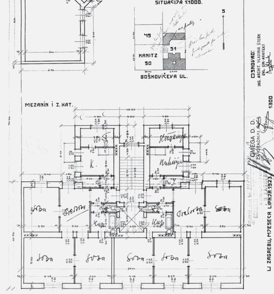
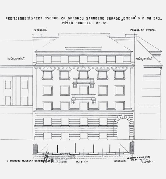
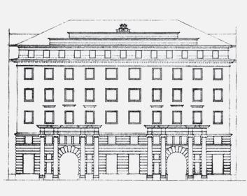
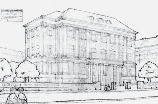
The Architectural Office Vladimir Šterk in the Period 1923-1941
UDC 72.008 V. Šterk ”19”
Palaèa Basiljeviæ-Guèetiæ u Dubrovniku Povijesno-prostorni razvoj i odlike arhitekture UDK 728.3.03:72.034:72.035 (497.5 Dubrovnik) ”17/18”
Arhitektonski ured Vladimir Šterk u razdoblju 1923.-1941. UDK 72.008 V. Šterk ”19”
40-51 VLADIMIR BOJKOVIÆ
The Meander Building by Architect Bruno Miliæ
The Beginning of Modernism in the City of Nikšiæ
UDC 72.036:728.2 B. Miliæ (16.16 Nikšiæ)”19”
PRETHODNO PRIOPÆENJE PRELIMINARY COMMUNICATION
52-67 ZEHRA LAZNIBAT MLADEN OBAD ŠÆITAROCI
68-81 TIHANA HRASTAR
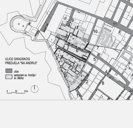
Gradski predjel „Na Andriji” u povijesnoj jezgri Dubrovnika Prostorni razvoj i urbanistièka obilježja
UDK 902.6:726.7:711.424 (497.5 Dubrovnik) ”12/16”
Izdvajanje postotka graditeljskih investicija za umjetnièke intervencije Inicijative i propisi druge polovice 20. stoljeæa u Hrvatskoj i svijetu UDK 721.1:7 ”19”
Zgrada Meander arhitekta Brune Miliæa Poèeci moderne u Nikšiæu UDK 72.036:728.2 B. Miliæ (16.16 Nikšiæ)”19”
Architectural Programs as Corporate Communications Platforms
UDC 721.17:061.5 ”20”
Javni prostor središta Trešnjevke i Dubrave u Zagrebu Kriteriji kvalitete i modeli preobrazbe UDK 711.4-163:711.523:712.25 (497.5 Zagreb) ”20”
Urban Area ”Na Andriji” in the Historic Core of Dubrovnik Spatial Development and Urban Planning Features
UDC 902.6:726.7:711.424 (497.5 Dubrovnik) ”12/16”
Percent for Art in Building Investment Projects Initiatives and Ordinances in the Second Half of the 20th Century in Croatia and Worldwide UDC 721.1:7 ”19”
Arhitektonski programi kao komunikacijske platforme korporacija UDK 721.17:061.5 ”20”
Public Spaces in Zagreb Districts Trešnjevka and Dubrava Quality Criteria and Transformation Models UDC 711.4-163:711.523:712.25 (497.5 Zagreb) ”20”
The Urbanscape Duality during a Disaster and Post-disaster
UDC 711.4:712.25 ”20”
Dualnost urbanog pejsaža tijekom i poslije katastrofe UDK 711.4:712.25 ”20”
PREGLEDNI ZNANSTVENI ÈLANCI SCIENTIFIC
SUBJECT REVIEWS
116-131 CEREN KATIPOğLU ÖZMEN
132-145 SANJA GAŠPAROVIÆ
ANA SOPINA
146-155 HRVOJE CARIÆ MARKO JAKELIÆ
156-169
LUCIJA AŽMAN MOMIRSKI
170-183 KAJA POGAÈAR PETER ŠENK
184-197 MEHDI KHAKZAND KOOROSH AGHABOZORGI
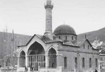
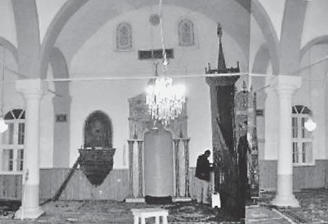
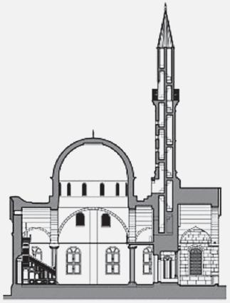
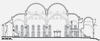
Challenging the Canon: Reading the 19th Century Ottoman Architecture through Provincial Mosques UDC 72.01:726.2(560)”18”
Uloga pejsaža u planiranju grada Zagreba od poèetka 20. do poèetka 21. stoljeæa UDK 712:711.4-122 (497.5 Zagreb)”19”
Informirano upravljanje posjeæivanjem u zaštiæenim podruèjima
UDK 711.113:712(2)(497.5)”20”
Negotiating Dynamic Variables in Urban Regeneration process
Case Study of the Degraded Kranj Railway Station Area
UDC 711.4:725.31 (497.4 Kranj)”20”
Alternative Approaches and Tools for the Transformation of Streetscapes Direct Physical Interventions and Different Modes of Participation
UDC 711.4-163:712.36”20”
Comparative Study of the Performance of Landscape Architectural Education and Professional Landscape Architectural Projects in Iran
UDC 712:72.01:37 (55) ”20”
Propitivanje kanona: interpretacija osmanske arhitekture 19. stoljeæa na primjerima provincijskih džamija UDK 72.01:726.2(560)”18”
The Role of Landscape in Planning the City of Zagreb from the Early 20th to the Early 21st Century UDC 712:711.4-122 (497.5 Zagreb)”19”
Informed Visitor Management in Protected Areas
UDC 711.113:712(2)(497.5)”20”
Pregovaranje dinamièkih varijabli u procesu urbane regeneracije Degradirano podruèje željeznièke stanice u Kranju - Studija sluèaja UDK 711.4:725.31 (497.4 Kranj)”20”
Alternativni pristupi i alati u preobrazbi prostora ulice Izravne fizièke intervencije i razlièiti naèini participacije UDK 711.4-163:712.36”20”
Komparativna analiza profesionalne naobrazbe i projekata krajobrazne arhitekture u Iranu
UDK 712:72.01:37 (55) ”20”
200-201 MLADEN OBAD ŠÆITAROCI
ANDRIJA MUTNJAKOVIÆ
ZLATKO KARAÈ
202-204 NENAD FABIJANIÆ
205 MIA ROTH-ÈERINA
206 MARINA BERTINA
207 ZLATKO KARAÈ
208 MARINA ŠIMUNIÆ BURŠIÆ
209 VESNA POLJANÈIÆ
210-211 KRUNOSLAV ŠMIT
212-213 MLADEN OBAD ŠÆITAROCI
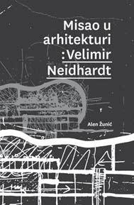
Misao u arhitekturi: Velimir Neidhardt Alen Žuniæ
Zagreb u škarama Kritike - polemike - komentari
Snješka Kneževiæ
Slike po Ivanu [Ðovaniju]
Nenad Fabijaniæ
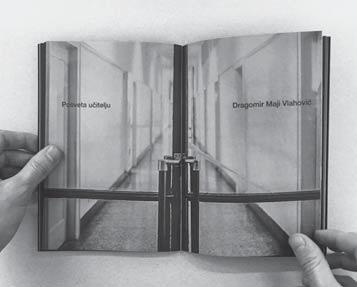
Posveta uèitelju - Dragomir Maji Vlahoviæ
Izložba i publikacija
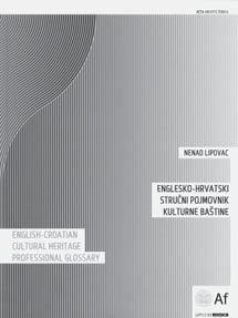
Englesko-hrvatski struèni pojmovnik kulturne baštine
Nenad Lipovac
Šegviæev Mediteran
Studentski putopis
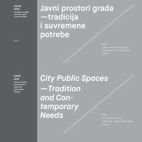
ZADAR 2020. / Javni prostori grada - tradicija i suvremene potrebe Povijesna središta, suvremeni grad i održivi turizam
Ljetna arhitektonsko-urbanistièka radionica
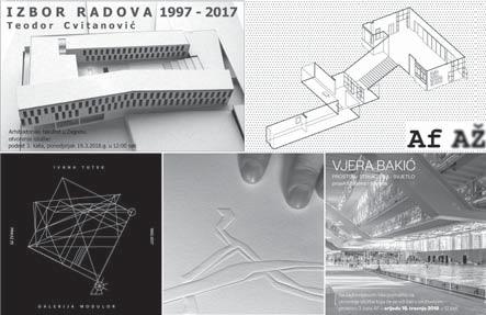
Izložbe nastavnika Arhitektonskog fakulteta: Ivana Tutek, Zorana Protiæ, Ivana Ergiæ, Teodor Cvitanoviæ, Vjera Bakiæ
Prostorne èarolije
Ivan Šimunoviæ
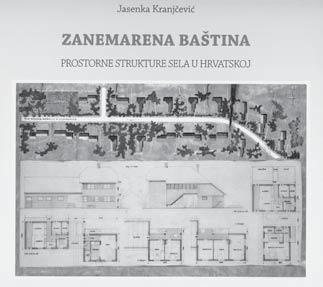
214 ZLATKO KARAÈ Zanemarena baština
Prostorne strukture sela u Hrvatskoj
Jasenka Kranjèeviæ
Thinking Theory in the Architecture of Velimir Neidhardt Alen Žuniæ
Zagreb in Scissors Critiques - Polemics - Commentaries Snješka Kneževiæ
Images of Ivan [Giovanni] Nenad Fabijaniæ
Hommage to the Teacher - Dragomir Maji Vlahoviæ Exhibition and Publication
English-Croatian Cultural Heritage
Professional Glossary
Nenad Lipovac
Šegviæ’s Mediterranean
Student travel book
ZADAR 2020. / City Public Spaces - Tradition and Contemporary Needs Historic Centres, Contemporary Cities and Sustainable Tourism Summer Architecture and Urban Planning Workshop
Faculty of Architecture Teaching Staff
Exhibitions: Ivana Tutek, Zorana Protiæ, Ivana Ergiæ, Teodor Cvitanoviæ, Vjera Bakiæ
Spatial Magic
Ivan Šimunoviæ
Neglected Heritage
Spatial structure of villages in Croatia
Jasenka Kranjèeviæ
215 NEDA MRINJEK KLISKA
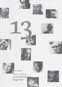
13 arhitektonskih razgovora
Davor Salopek
216 IVA MURAJ
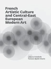
French Artistic Culture and Central-East European Modern Art
Ljiljana Kolešnik, Tamara Bjažiæ Klarin [ed.]
13 Talks on Architecture
Davor Salopek
Francuska umjetnièka kultura i moderna umjetnost srednjoistoène Europe
Ljiljana Kolešnik, Tamara Bjažiæ Klarin [ur.]
MEMENTO NA OBLJETNICU
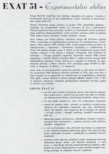
Izlaskom prošloga sveska našega èasopisa PROSTOR je obilježio 25 godina redovitog izlaženja (pokrenut je 1993.), tijekom kojih su izdana èak 54 broja s više od tisuæu objavljenih èlanaka! O povijesti èasopisa pisali smo u nekim ranijim prigodama - uz 20. obljetnicu izlaženja (u br. 44) i nedavno uz jubilarni 50. broj, te ovaj put retrospektiva nije nužna. Tek podsjeæanje na uistinu dug put i dosegnutu respektabilnu razinu kvalitete, za koju su zaslužni dosadašnji èlanovi uredništva, vrsni recenzenti i osobito brojni autori iz cijeloga svijeta, pa tako u našem registru danas imamo zabilježeno oko 400 znanstvenika u raznim suradnièkim statusima koji su gradili èasopis PROSTOR.
Na žalost, uz ovu važnu obljetnicu bilježimo i tužnu vijest da nas je napustio naš dugogodišnji zaslužni èlan uredništva dr.sc. TOMISLAV PREMERL, koji je preminuo 7. travnja 2018. godine. U uredništvu PROSTORA kontinuirano je djelovao pune 23 godine - od br. 9 (1995.), gdje je svojim redaktorskim i leksikografskim iskustvom te autoritetom plodnoga znanstvenika bitno pridonio razvoju i fizionomiji èasopisa kakav danas imamo. Uza zahvalnost za sve godine zajednièkoga rada - dr. Premerlu, kao memento, posveæujemo ovaj broj.
Glavni i odgovorni urednik Zlatko Karaè
MEMENTO ON THE ANNIVERSARY
With the last volume of our journal Prostor we marked the 25th anniversary of its regular publishing (started in 1993). Over the past quarter of a century we published 54 volumes with more than one thousand papers! We wrote about the history of our journal on some previous occasions: on the 20th anniversary (in vol. 44) and recently to mark the jubilee 50th volume so there is no need now for retrospection. Just a brief reminder that we have come a long way to make Prostor a high-quality journal as it is today. Credit goes to all members of our editorial board, expert reviewers, and especially a great number of authors from all over the world who contributed their papers to our journal. We now have around 400 scientists registered in our database who deserve credit for building up the profile of the journal Prostor.
On this occasion we announce with sadness that our eminent editorial board member, dr.sc. Tomislav Premerl passed away on April, 7, 2018. He was continuously active in Prostor over the last 23 years (since vol. 9 in 1995) and greatly contributed to the development and present profile of our journal. We dedicate this volume to dr.sc. Premerl as a token of our gratitude for his long-term support and contribution.
Editor-in-chief
Zlatko Karaè
Odlazak zaljubljenika i zagovornika hrvatske moderne arhitekture
U POVODU SMRTI DR.SC. TOMISLAVA PREMERLA (1939.-2018.), DUGOGODIŠNJEGA UVAŽENOG ÈLANA UREDNIŠTVA ÈASOPISA PROSTOR
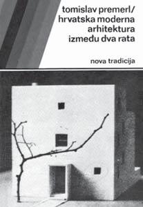
U travnju 2018., u 79. godini života, napustio nas je dr.sc. Tomislav Premerl, istaknuti povjesnièar i teoretièar arhitekture, arhitekt i konzervator, znanstvenik i projektant, pisac i pjesnik hrvatske arhitekture, dugogodišnji uvaženi èlan uredništva našega znanstvenog èasopisa Prostor. Hrvatska arhitektura time je izgubila jednoga od svojih najpredanijih istraživaèa i analitièara, najvrsnijih poznavatelja i interpreta. Zaštitni znak njegova opsežnoga znanstvenog i struènog opusa zasigurno je bila, i trajno æe ostati, knjiga Hrvatska moderna arhitektura izmeðu dva rata - nova tradicija, jedna od najutjecajnijih, pionirskih knjiga hrvatske moderne arhitektonske historiografije. Tim su djelom bili postavljeni temelji za detaljno poznavanje i istraživanje arhitektonske produkcije meðuratnog razdoblja i tumaèenje moderne arhitekture kao presudne odrednice suvremene hrvatske arhitektonske kulture. Tu je, naime, bio uèinjen prvi napor sinteznog i sistematiènog pregleda toga prijelomnog razdoblja te uspostavljen preliminarni teorijski okvir za njegovo integralno tumaèenje. Stoga se upravo na toj knjizi napajaju, sada gotovo veæ trideset godina, generacije studenata, arhitekata i povjesnièara umjetnosti, uèeæi o slojevima, specifiènostima i potencijalima ovdašnjega modernistièkog naslijeða.
No lepeza interesa dr. Premerla bila je dojmljivo bogata i široka, a u svojim je raznolikim licima portretirala mnogobrojne fasete ove kompleksne prostorne discipline, u kojih je preklapanju i oploðivanju omoguæeno njezino integralno spoznavanje i razumijevanje.
Roðen u Zagrebu 5. studenoga 1939., formiran širinom znanja Klasiène gimnazije i kasnijim profesionalnim fokusom Srednje graðevinske škole, Tomislav Premerl završava studij arhitekture na zagrebaèkom Arhitektonskom fakultetu 1969. godine. Odmah potom zapošljava se u Regionalnom zavodu za zaštitu spomenika kulture u Zagrebu (1969.-1972.) i djeluje kao arhitekt konzervator, nastavljajuæi time svoje bavljenje temama graditeljske baštine zapoèeto još u studentsko doba. Kroz to ulazi u tajne konzervatorske struke, njegujuæi ljubav za povijesne slojeve te ovladavajuæi suvremenim tehnikama i postupcima njihova èuvanja i obnove. Projektira i izvodi cijeli niz rekonstrukcija i adaptacija proèelja povijesnih zgrada, te izraðuje mnogo konzervatorskih studija. Kao konzervator poslije æe plodno djelovati na mnogim povijesnim graðevinama, mahom sakralnih namjena, raznih povijesnih razdoblja i stilova, od romanièke crkve sv. Kvirina u Krku i sv. Petra u Supetarskoj Dragi na Rabu, samostanske crkve i samostana u Portu i svetišta crkve u Poljicama na Krku, do franjevaèke crkve u Makarskoj i brojnih drugih.
Spoznate vrijednosti i ljepote povijesne arhitekture, baš kao i univerzalne zakonitosti i principe struke, imao je pritom potrebu i nesebièno dijeliti, pa se zarana posveæuje i pedagoškom radu. Od 1973. do 1980. predaje u Graðevinskom školskom centru u Zagrebu temeljna struèna znanja i pristupe arhitekturi, da bi se poslije posvetio poduèavanju njezinih složenijih i eteriènijih razina, predavajuæi, od 1995., kolegije iz domene sakralne arhitekture na Teološkom studiju i Filozofskom fakultetu Družbe Isusove u Zagrebu. Tim se transcendentalnim temama posveæuje i u projektantskoj praksi, u zadatcima oblikovanja prostora duhovnosti i sakralnoj arhitekturi, težeæi pritom nalaženju istinskih prostornih odljeva sagledanih metafizièkih tema. Projektira èitav niz crkava i sakralnih objekata u koje sustavno pretaèe svoje iskustvo, oblikujuæi ih integralnim pristupom do najsitnijih elemenata i detalja. Rjeèiti primjeri njegova prostornog promišljanja tako su, meðu ostalim, i nova crkva i pastoralni centar sv. Pavla Apostola u Retkovcu u Zagrebu (1990.-1998.), crkva i pastoralni centar sv. Benedikta u Mièevcu pokraj Zagreba (2005.-2012.), crkva Majke Božje Lurdske u Èulincu u Zagrebu (2002.-2005.) i druge.
Evidentnu tendenciju likovnoj ekspresiji Premerl pretaèe i u polje èistoga slikarskog izraza. Arhitekturu, naime, pasionirano crta, analizirajuæi je kroza skicu, potez, studiju, kroki. Zbirka Premerlovih crteža - crteža arhitekture, ali i prirodnih krajolika i povijesnih urbanih ambijenata izvedenih u razlièitim tehnikama od ugljena, olovke, flomastera do pastela - svjedoèi o darovitu crtaèu, strastvenom i suptilnom, preciznom i perceptivnom, koji nepogrešivo uoèava bitni detalj te ga vješto predoèava i interpretira. A motivi tih crteža otkrivaju ljubav za prirodnu i graditeljsku baštinu iz koje sustavno derivira vlastitu arhitektonsku optiku i filozofiju. Dojmljivu prezentaciju tog aspekta njegova stvaralaštva donijela je nedavna izložba Bilježenje arhitekture u Galeriji Modulor 2017. godine, razotkrivši nesvakidašnji senzibilitet i likovni nerv. Uz nju ostvario je još tri izložbe vlastitih crteža (2008., 2009. i 2012. s H. Devideom), kao i nekoliko kritièkih izložbi arhitekture.
Sve te raznorodne pristupe kompleksnoj arhitektonskoj disciplini protkali su i uvjereno zaokružili njegovi brojni pisani radovi. Kroz medij rijeèi i teksta djelovao je Premerl tijekom cijeloga svoga profesionalnog života. Dapaèe, pisati poèinje neobièno rano, još kao student, 1962., kada objavljuje prve tekstove u „Poletu” i „Studentskom listu”. Otada æe pisana rijeè postojano pratiti i bitno obilježiti njegovo djelovanje, otkrivajuæi èitavu lepezu fokusa i interesa, od sfere likovnosti i umjetnosti, aktualnih društvenih pitanja i širih kulturnih tema, pa do par excellence pitanja same arhitekture. Njih prati i šarolik dijapazon profila i karaktera èlanaka - od popularizacijskih i polemièkih, edukativnih i motivacijskih, pa sve do strogo kritièkih i istraživaèkih - namijenjenih podjednako i široj kulturnoj javnosti, kao i struci.
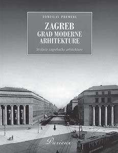
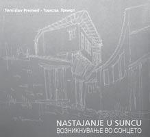
Zov teksta vodio ga je od uloge autora i pisca sve do odgovornih pozicija urednika. Bio je dugogodišnji èlan uredništva stožernih struènih èasopisa: „Arhitektura” (1970.-1977.) i „Èovjek i prostor” (1977.-1980.), kojemu postaje i glavni odgovorni urednik (1981., 1982., 1987.-1990.). Aktivan je i kao voditelj nakladnièke djelatnosti Udruženja hrvatskih arhitekata, kojeg je i dopredsjednik 1995.-1999. Godine 1995. postaje i istaknutim èlanom uredništva znanstvenoga èasopisa „Prostor” Arhitektonskoga fakulteta, u kojem od tada kontinuirano i aktivno djeluje i koji zadužuje brojnim konstruktivnim prilozima, diskusijama i instruktivnim recenzijama. Iz brojnih pristupa kristalizirao se, meðutim, kao Premerlu središnje važan upravo onaj znanstvenoistraživaèki. Stoga 1985. izraðuje i brani doktorsku disertaciju na Arhitektonskom fakultetu u Zagrebu, na temu Hrvatska moderna arhitektura izmeðu dva rata - nova tradicija, rad koji æe postati osnovom njegove kasnije antologijske knjige. Knjiga istoimenog naslova prvi je put objavljena 1989. u izdanju Nakladnog zavoda Matice hrvatske, ponovno izdana godinu dana poslije, a nedavno je, 2015., doživjela i svoje treæe, znaèajno revidirano i nadopunjeno izdanje u nakladi EPH Medije. Nju su slijedile i brojne druge knjige, primjerice, Zagreb - grad moderne arhitekture - stoljeæe zagrebaèke arhitekture [Durieux, 2003.], Nastajanje u suncu - esej o makedonskoj arhitekturi [HMD, 2003.] i ostale.
Svoje bogato znanje, ljubav prema rijeèi i sklonost istraživanju slio je Premerl i u svoje dugogodišnje znaèajno djelovanje u Leksikografskom zavodu kao urednik za arhitekturu i likovnu struku (1980.-2004.). Posebno je zadužio i Maticu hrvatsku; gotovo od samih poèetaka Matièina èasopisa „Vijenac” objavljivao je u njemu zapažene arhitektonske kritike, a duže je vrijeme djelovao i kao urednik tema iz podruèja arhitekture. Matica hrvatska izdala je još jedan od njegovih bitnih naslova - Prepoznavanje arhitekture 2005. godine, a u ovome nas je trenutku napustio i u ulozi aktualnog proèelnika Odjela za arhitekturu Matice hrvatske.
Rad dr. Premerla potvrðen je znaèajnim nagradama i priznanjima: dobitnik je nagrade „J.J. Strossmayer” za publicistièki rad [HAZU, 1994.] i nagrade „Neven Šegviæ” [UHA, 2010.] za cjelokupan teorijsko-publicistièki rad na podruèju arhitekture i urbanizma.
Kao svojevrstan podsjetnik na impresivan spektar tema kojima se bavio i kapitalnih pitanja koje je oslovljavao, prošle je godine izdana i knjiga Povijesnost arhitekture [UPI-2M, 2017.] kao zbirka pedeset tekstova objavljivanih u raznim glasilima tijekom pedeset plodnih struènih godina. Glavna misao knjige i njezin svojevrstan konceptualni supstrat jest onaj o, kako autor to kaže, „povijesnosti arhitekture”, shvaæene kao „zbir individualnog i kolektivnog povijesnog pamæenja i iskustava interpretiranih angažiranom sviješæu u sadašnjem vremenu”. Za njega to povijesno pamæenje svoju najjasniju manifestaciju doživljava u potentnom modernistièkom oèitovanju - kao „trajnom i još nezavršenom procesu naše žive povijesti” i time po njemu postaje trajna odrednica hrvatskoga arhitektonskog puta i razvoja. S tim konceptualnim okvirom kao svojom dragocjenom ostavštinom, dr. Premerl nas ostavlja bogato opremljene za naše buduæe arhitektonsko i teorijsko djelovanje, na bilo kojoj od ovih razina kojima se on sam tako virtuozno kretao. Na tako vrijednom daru i nepokolebljivom uvjerenju, oplemenjenom posloviènim entuzijazmom i vjerom u snagu i smisao arhitekture preostaje nam tek duboko se pokloniti i iskreno mu zahvaliti, te pokušati njegovu plodnu misao održati živom u vlastitim nadogradnjama i promišljanjima.
KARIN ŠERMAN
Za sve znanstvene Ëlanke objavljene u Ëasopisu PROSTOR Uredništvo je, iz kruga uglednih naših i inozemnih znanstvenika, osiguralo najmanje dvije neovisne recenzije.
The Editorial Board provides at least two independent reviews by prominent Croatian or foreign scholars for all the scientific contributions published in the journal PROSTOR.
Znanstveni prilozi Scientific Papers
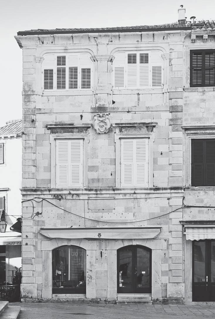
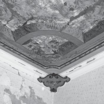
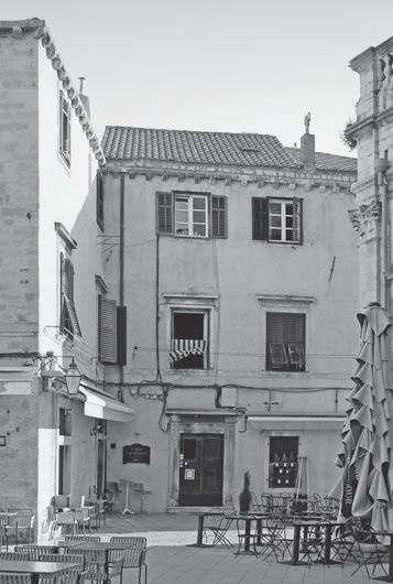
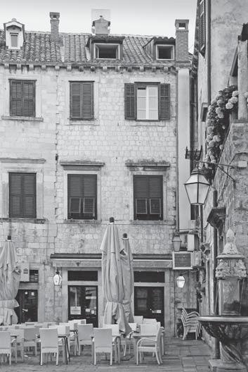
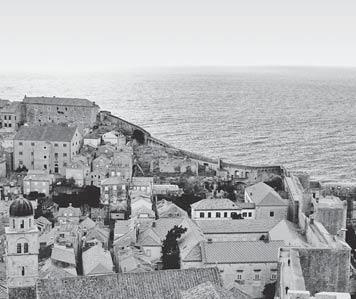
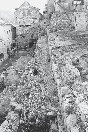
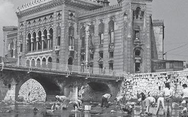
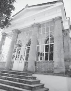
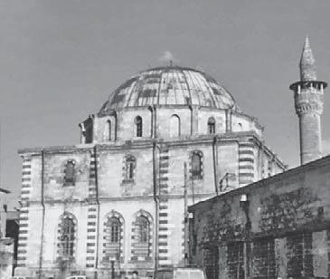
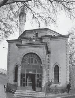
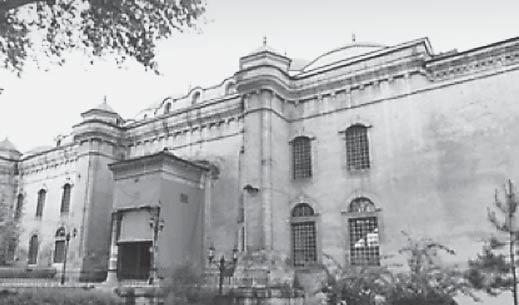
Fig. 1 The Bassegli-Gozze Palace in Dubrovnik, east elevation, 2015
Sl. 1. Palaèa Basiljeviæ-Guèetiæ u Dubrovniku, istoèno proèelje, 2015.
Boris
Dundoviæ
Vienna University of Technology [TU Wien]
Faculty for Architecture and Planning
Institute of History of Art, Building Archaeology and Restoration Austria - 1040 Vienna, Karlsplatz 13 boris.dundovic@gmail.com
Tehnièko sveuèilište u Beèu [TU Wien] Fakultet za arhitekturu i urbanizam Institut za povijest umjetnosti, povijest graditeljstva i zaštitu spomenika Austrija - 1040 Beè, Karlsplatz 13 boris.dundovic@gmail.com
2.01.04. - Povijest i teorija arhitekture i zaštita graditeljskog naslijeða Èlanak primljen / prihvaæen: 15. 5. 2018. / 8. 6. 2018.
The Bassegli-Gozze Palace in Dubrovnik
Spatial Genealogy and Architectural Features
Palaèa Basiljeviæ-Guèetiæ u Dubrovniku
Povijesno-prostorni razvoj i odlike arhitekture
Baroque and Neo-Classicist Architecture
Bassegli-Gozze Palace, Dubrovnik Gunduliæ and Buniæ Square historical city core identity factors residential block
The Bassegli-Gozze Palace in Dubrovnik is one of the most representative examples of residential architecture of the 18th and 19th centuries located in the historical core of the city. With its numerous historical layers, some believed to be dating even from the late antiquity, the palace is deeply embedded in the urban evolution of its residential block. This paper presents the previously unknown spatial genealogy of the palace, its urban and cultural significance, and rich architectural features.
Palaèa Basiljeviæ-Guèetiæ [Bassegli-Gozze] u Dubrovniku eklatantan je primjer stambene arhitekture 18. i 19. stoljeæa smještene unutar povijesne gradske jezgre. Zbog svojih brojnih povijesnih slojeva, od kojih neki pretpostavljeno datiraju èak u kasnoj antici, palaèa je znaèajan èimbenik urbanoga razvoja cijeloga stambenog bloka. Ovaj rad donosi dosad nepoznatu prostornu genezu palaèe, predstavlja njenu urbanu i kulturnu važnost te opisuje funkcionalne i oblikovne odlike njene arhitekture.
INTRODUCTION
UVOD
Eachnew research of historical layers present in the old city core of Dubrovnik recounts and enriches the knowledge on the complex but highly prosperous milieu that built the urban structure as we know it today. Each architectural component of that structure should be perceived as a vital part of the historically sustainable urban mechanism. In order to further illuminate its architectural history, we need to switch the research focus from Dubrovnik’s iconic buildings to its minor architecture, namely town houses and palaces which constitute residential blocks of the sophistically planned urban fabric of the historical city core, that have remained unexplored to this day. Throughout the history of Dubrovnik, the highest principle in urban planning and architectural enhancement consistently followed the organisation of Ragusan social and cultural life, that is, affairs were never considered individually, but rather generally, as parts of a wider coherent system. This research1 is a contribution to the understanding of that urban planning effort. It highlights the role of the Bassegli-Gozze Palace (Fig. 1) in the emergence of the residential block flanking the Dubrovnik Cathedral from the north-west and opening towards three significant city squares with its main elevations. In recognising the Palace as an inseparable part of the urban block, the paper2 primarily focuses on the historical and spatial development of the Palace and its im-
mediate urban surroundings. It also delves into its identity factors, such as its spatial and architectural concept, as well as its urban presence.
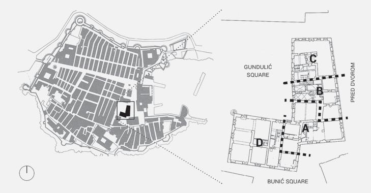
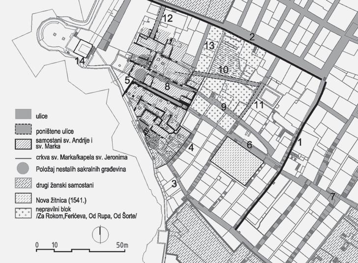
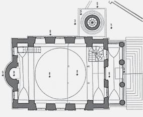
The present-day residential block (Fig. 2) includes four palaces surrounded by open spaces of three significant public squares: Buniæeva poljana (Buniæ Square) in the south, Gunduliæeva poljana (Gunduliæ Square) in the north-west3, and Pred Dvorom (the public square in front of the Rector’s Palace) in the east. The Bassegli-Gozze Palace stands at the south-east corner of the block. Its representative façade faces the Rector’s Palace on Pred Dvorom, while its residential entrance is approached from the Buniæ Square. It is neighboured by the Sorgo-Gozze Palace on the south-east corner, and by the BassegliGozze-Katiæ Palace from the north, while the succeeding Ragnina Palace marks the end of the building sequence on the north side of the block.
Today, the Bassegli-Gozze Palace is mostly known for its unique Neo-Classical east façade, which greatly contributes to its distinctive, recognisable, and refined appearance. Yet, the quintessential feature of the palace is the impressive assemblage of archaeological and architectural layers interwoven into the built structure. In order to shed light on the rich building strata of the palace, this research provides a synthesis based on sources not disseminated before, such as the original archive material from the Bassegli-Gozze fund at the National Archive in Dubrovnik, material from the private collection of the present-day owner, and an unpublished manuscript of a conservation study (of the entire residential block) by the Institute for Protection of Cultural and Natural Monuments in Dubrovnik. This research also includes published studies, with emphasis on the work of Nada Grujiæ, Željko Pekoviæ, Ivana
1 The research was conducted as part of the course ”Dubrovnik: History of Architecture and Urban Planning” carried out by Assoc. Prof. Jasenka Gudelj, Ph.D., and Assist. Prof. Ana Marinkoviæ, Ph.D., at the University of Zagreb, Faculty of Humanities and Social Sciences, Department of History of Art, in academic year 2017/2018.
2 This paper was published as part of the author’s work on the scientific research project ”Heritage UrbanismUrban and Spatial Planning Models for Revival and Enhancement of Cultural Heritage” [HERU]. The project is financed by the Croatian Science Foundation [HRZZ-2032] and carried out at the University of Zagreb, Faculty of Architecture, under the leadership of Prof. Mladen Obad Šæitaroci, Ph.D., F.C.A.
3 Cro. poljana - a wider open and unbuilt space between the houses in Croatian coastal towns; a clear; a square
4 In the 14th century, the present-day Buniæ Square was called platea Sanctae Marie Maioris, and it was ”a part of the Romanesque cathedral architectural ensemble” [Seferoviæ, Mojaš, Žile, 1984: 7].
5 Lazareviæ, 2012: 68; Vojnoviæ, 1913: 110 (mentioned as sexterium S. Mariae Majoris)
Lazareviæ, Renata Novak Klemenèiè, and Irena Benyovsky Latin. Finally, the collected information is comparatively analysed according to the building survey, conservation and restoration research and documentation. The described comprehensive methodology of the research ministers to the principal aim of this paper: to instigate the recognition of the Bassegli-Gozze Palace as an important and unique cultural monument.
SPATIAL DEVELOPMENT
OF THE RESIDENTIAL BLOCK BEFORE 1667
PROSTORNI RAZVOJ STAMBENOGA BLOKA PRIJE 1667. GODINE
Given their proximity, the Cathedral has played a significant role in the architectural life of the Bassegli-Gozze Palace through its history. Archaeological excavations under the Buniæ Square4 carried out in the 1980s have proven that the earliest historical layers of the Palace are inseparably interwoven in its present-day architecture. Moreover, the urban fabric of mediaeval Dubrovnik, which existed in the area of the present-day Gunduliæ Square and the palaces forming its south and east elevation before 1667, was part of the historic district associated to the cathedral, the sexterium of St Mary.5
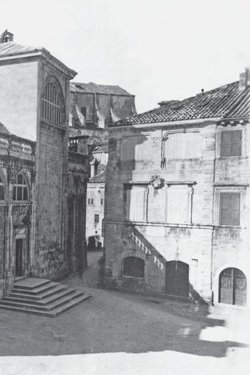
The excavations under the Cathedral and Buniæ Square (Fig. 3) began in 1981 and were led by Josip Stošiæ. To this day, those findings remain the most complex collection of construction residues discovered in the city core of Dubrovnik. Systematic excavations carried out from 1984 to 1985 revealed the oldest found structure under the Buniæ Square: the 25- to 30-metre long part of the defence wall dating - according to Stošiæ - from the late antiquity, built in the fifth or sixth century. Stošiæ believed the wall fortified a bigger architectural complex, allegedly ”the Byzantine
6 The chronological dating of the wall was determined according to the building technique called opus reticulatum - the bricks laid in a characteristically Roman diagonal pattern - and according to the depth of the original wall foundations. For a more detailed description, see: Stošiæ, 1988: 15-16.
7 Pekoviæ, Babiæ, 2017: 5
8 Zeliæ, 2014: 32
9 Ž. Pekoviæ and K. Babiæ depict the basilica on their map of the ninth-century Civitas. They also recognise the fortified complex of the basilica as the ”Cathedral castellum”, dating its emergence to the 9th century. [Pekoviæ, Babiæ, 2017: 5, 17]
10 One of the main hypotheses is Željko Pekoviæ’s theory on the architectural genesis of the first St. Blaise church, located on the place of the present-day cathedral. His study premises a humble, domed church separated from the quadrifolium/tetraconch structure (later baptistery) built nearby. According to Pekoviæ’s research, the first St. Blaise was still present in year 972, and by year 1020 it was integrated into the structure of a larger basilica. [Pekoviæ, 1998: 116-146]
castrum” of Rausion.6 On the other hand, the latest synthesis by Željko Pekoviæ and Kristina Babiæ asserts that the location of the present-day Buniæ Square and Cathedral remained completely outside the fortification walls of historical Rausion and its suburbium up until the ninth century7, therefore rendering the true origin of the wall structure uncertain. It is possible, however, that the wall was a part of the church fortification. Architectural features of the fortified church were interpreted by Stošiæ as Byzantine8 owing to the characteristics of the archaeology found under the Cathedral.9 Several research studies10 defend the hypothesis that the Stošiæ’s Byzantine basilica was preceded by another church, this one dating from the sixth century. However, that assertion is based on the few architectural fragments found under the
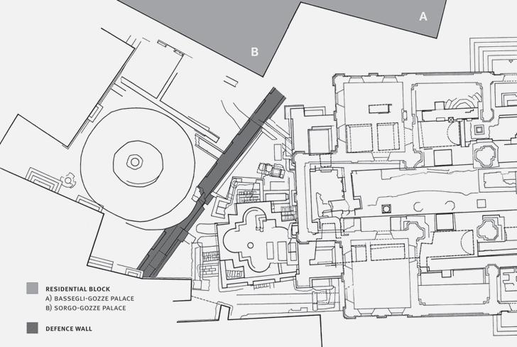
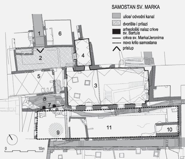
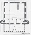
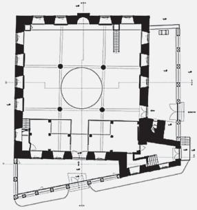
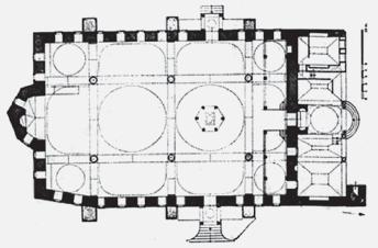
Fig. 2 Position of the residential block and its palaces in the historical city core of Dubrovnik: A - Bassegli-Gozze Palace, B - Bassegli-Gozze-Katiæ Palace, C - Ragnina Palace, D - Sorgo-Gozze Palace
Sl. 2. Položaj stambenoga bloka i njegovih palaèa u povijesnoj gradskoj jezgri Dubrovnika: A - Palaèa Basiljeviæ-Guèetiæ, B - Palaèa Basiljeviæ-Guèetiæ-Katiæ, C - Palaèa Ranjina, D - Palaèa Sorkoèeviæ-Guèetiæ
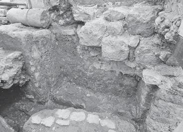
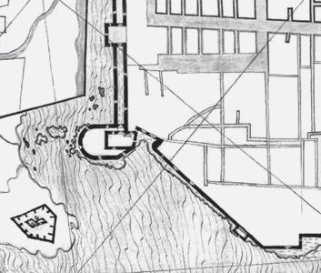
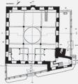
Fig. 3 Archaeological excavations under the Dubrovnik Cathedral and Buniæ Square led by Josip Stošiæ from 1981 to 1985
Sl. 3. Arheološka iskapanja ispod Dubrovaèke katedrale i Buniæeve poljane koja je vodio Josip Stošiæ od 1981. do 1985. godine
Fig. 4 Position of the part of supposed defence wall of the cathedral castellum on the overlapped survey of the ground-floor level of the residential block, cathedral and surrounding public squares
Sl. 4. Smjer pružanja pretpostavljenog obrambenog zida katedralnog kaštela na preklopljenom arhitektonskom snimku prizemne razine stambenoga bloka, katedrale i okolnih javnih površina
Buniæ Square: a stone base of the column, fragments of six columns dating from the late antiquity, and three early Christian marble capitals of the Corinthian order.11
The defence wall was reinforced in the later pre-Romanesque period and, at that point, its thickness was doubled to roughly two metres.12 The pilaster strips, characteristic of the pre-Romanesque building technique, were found on the west front of the wall13, but only on the parts where the wall remained untouched by the later addition of the baptistery foundation.14 That corresponds to the period of the tenth century, when the city expanded onto the wetland area, thus ensuring solid ground for the immediate surrounding area of the Cathedral.15
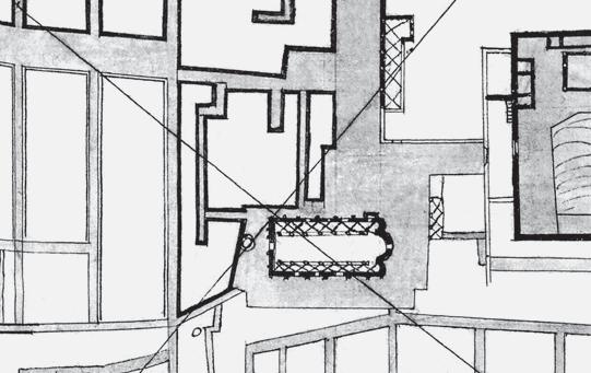
Palace, the plan depicts a small retraction on the block boundary positioned exactly at its central part. It corresponds to the position of the presumed fortification wall, and even though it is evident from the drawing that the cathedral at that point was no longer fortified, the boundary of the lots still followed the fortification’s line (Fig. 6). Furthermore, in 1336 and 1338, the Statute of Ragusa inaugurated strict laws and extremely high fines concerning the usurpation of the public space22, which corroborates the precise depiction of the west boundary of the block, as depicted on the plan from 1607-08 .
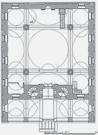
Fig. 5 The architectural survey of the residential block, ground-floor plan with a visible two-metre thick wall positioned in the central axis of the east wing
Sl. 5. Arhitektonski snimak stambenoga bloka, tlocrt prizemlja s vidljivim dva metra debelim zidom smještenim u središnju os istoènoga krila
The excavation line of the wall under the Buniæ Square extending towards the northeast stops at the south façade of BassegliGozze Palace, but the excavated wall continues as a wall fragment inside the built structure of the palace.16 The architectural survey of the block17 implies that the wall fragment, two metres thick, was incorporated in the palace’s ground-floor layout (Fig. 5). By observing the irregularities in the thickness of the walls, the wall fragment can be traced all the way to to the wall dividing the original Bassegli-Gozze Palace from Ragnina Palace, which flanks it from the north. Although the wall fragment requires further research, its position overlaps with the position of the cathedral fortification system as assumed by Pekoviæ and Babiæ18, which also stops at the wall dividing the two palaces and turns towards the Rector’s Palace. The authors also mention that the corner of the wall was once flanked by Sersi Tower, built around 1255 as part of the fortification system enclosing the suburbium north from the original civitas, but it left no visible traces in the layout. Regarding the Rector’s Palace, studies by Nada Grujiæ have shown that its oldest and most significant part is the former Duke’s Tower, which is integrated in its present-day palace complex as the south-east part of the structure.19 The original structure of the Duke’s Tower (also mostly preserved on the groundfloor level)20 includes the two-metre thick wall fragment, continuing eastward: toward the analogous wall present in the BassegliGozze Palace. All mentioned structural fragments considered, the direction of the defence wall can be reconstructed from Buniæ Square as passing through the present-day structure of the Palace to the south-east part of the Rector’s Palace (Fig. 4).
The cogency of the said conclusion is backed by a plan of the city dating from 1607-0821, which shows a clear distinction between the built and public areas. On the west elevation of the residential block facing the Rector’s
Even though it is yet to be confirmed by archaeological evidence is, many written archival sources often mention a smaller mediaeval church called Saint Saviour of the Wetland (ecclesia Sancti Salvatoris de Paludo) built on the location of the later BassegliGozze Palace and overlooking the Rector’s Palace. Its first occurrence in historical writings dates from 1279, and its existence is mentioned again in the testament of M. Mioša in 1592.23 Based on the ubicated position of the defensive walls surrounding the Romanesque basilica of St Mary, we can as-
11 Zeliæ, 2014: 38-39
12 Stošiæ, 1988: 16, II/1 (32-33)
13 Zeliæ, 2014: 33
14 The baptistery was an integral part of the Buniæ Square from the 14th century until the 1830s when it was permanently demolished. For a more detailed account on the baptistery, see: Marinkoviæ, 2017.
15 Pekoviæ, Babiæ, 2017: 5
16 Seferoviæ, Mojaš, Žile, 1984: 8
17 *** 1990: 152
18 Pekoviæ, Babiæ: 17
19 Grujiæ, 2005: 156, 159
20 In her study on the Rector’s Palace from 2008, N. Grujiæ mentions the resolution of the Minor Council dating from July 1440, which forbids the thinning of the original walls of the Duke’s Tower during the reconstruction of the Rector’s Palace (1435-1443). [Grujiæ, 2008: 14]
21 AST, Biblioteca Antica, vol. 5, fol. 244v, 245, Dubrovnik: Pianta della città (also published in: Principe, 1991)
22 Beritiæ, 1958: 21
23 Seferoviæ, Mojaš, Žile, 1984: 6
24 Beritiæ, 1958: 10
25 L. Beritiæ makes the identical statement on the boundaries of the block, despite positioning the inner public communication differently [Beritiæ, 1958: 12, 6667]. According to his assumption, the street called Kriva ulica (Cro. kriva = curved, irregular, incorrect) was L-shaped and led from the Buniæ Square to Pred Dvorom, penetrating the houses which formed the west elevation of the block. The premise for his assumption was the permit given to Ambroz and Fran Gozze to build a house in said street in 1521 [Beritiæ, 1958: 22]. However, the plan of 1607-08 clearly depicts a very irregular street through the block in north-south direction, with much more similarities to the descriptions of Kriva ulica. The alley presumed to be Kriva ulica also surrounds a bigger residential palace on the Buniæ square, as L. Vojnoviæ described in his list of the streets of Dubrovnik from the 14th to 17th century [Vojnoviæ, 1913: 119; also mentioned in Seferoviæ, Mojaš, Žile,
sume that Saint Saviour was a smaller church that served the religious purposes of the residential block that developed outside the cathedral complex.
Until the Great Earthquake of 1667, the present-day area of Gunduliæeva poljana was a densely populated urban fabric crowded with smaller houses. A suburban residential block flanking the cathedral from the north-west
1984: 3]. For a more detailed account on characteristics of alleys in residential blocks of mediaeval Dubrovnik, see: Planiæ-Lonèariæ, 1989.
26 It is known that the residential area west and southwest of the cathedral consisted of several properties by the Volcassio (Vukasoviæ) family as well. They were, like Gozzes, among the wealthiest property owners who actively participated in the political and economic activities in mediaeval Ragusa. Furthermore, the so-called ”Volcassio block” was located west of Luèarica Street and south of Izmeðu Polaèa, and it is possible that certain pre1667 parts of palaces encompassing the Gunduliæ Square originated in their residences. [For a more detailed account on the Volcassio family estates, see: Benyovsky, Lediæ, 2014]
27 Family names of Ragusan nobility customarily have two variants, Italian and Croatian. This paper uses the Italian variant of the surname, followed by the Croatian one in the brackets only in its first mention. First names are, however, presented only in Croatian due to the inconstant availability of other variants in the written sources. Also, the possessive form of the middle name denoting the father’s name is omitted in this paper.
29 Traditonally, members of the same Ragusan family lived in the same part of the city. From the 13th century, the Gozze family consisted of two lines, known by the location of their home: Gozze de Pusterna (Pustjerna) and Gozze de Platea (presumably due to the area in front of the Romanesque cathedral, today Buniæ Square). The tradition of grouping same noble family lines in a one part of Dubrovnik helped their economic growth. For that reason, Gozzes may have had the pre-emption right in buying Marko Sorgo’s and other lots of the block [Benyovsky Latin, 2008: 52; Grujiæ, Tenšek, 2001: 101]. The pre-emption right would have come from their previous ownership of a building adjacent to the cathedral [Novak Klemenèiè, 2017: 183].
30 Heyer von Rosenfeld, 1873: 11; Schiller, 1900: 257
31 DADU, fund HR-DADU-16, Venditiones Cancellariae, vol. 10, fol. 11, 13th May 1659 (also mentioned in Lazareviæ, 2014: 192, 105)
32 Zeliæ, 2014: 52
emerged already in the codification of the Statute in 1272.24 Its pre-earthquake boundaries - according to the plan od 1607-08 - are the street called Ulica od Puèa on the north, Luèarica Street on the west, Buniæ Square on the south, and public area of Pred Dvorom on the east. Additionally, the plan depicts two smaller streets or alleys passing through the urban structure of the block in the direction north-south.25 The alley behind the later built Bassegli-Gozze Palace and Ragnina Palace is also depicted in the plan. Due to the strict boundaries of cadastral parcels, the exact direction of the alley can be seen today, manifested in the irregularity of the sequence of façades forming the east elevation of the Gunduliæ Square. The proportions of the built surfaces depicted on the plan lead to the conclusion that the houses pre-existing on the location of Bassegli-Gozze Palace had frugal layouts, with rooms no deeper than ten metres, which is also the rough distance between the former defensive wall and the façade facing the Gunduliæ Square today.26
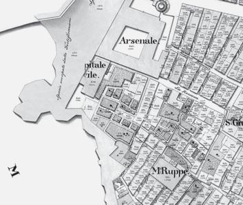
In the first half of the seventeenth century, the entire lot flanking the cathedral from the north-west on Buniæ Square was owned by the Sorgo family. In 1659, Marko Sorgo (Sorkoèeviæ)27 sold the lot to Vladislav Gozze (Guèetiæ)28, whose family already owned lots in the block29 and were recognised as ”Ragusan patricians” by the Holy Roman Empire.30 According to the transaction documents31, the lot with the house was bought for 2,700 ducats. Apart from the information concerning the owners of the surrounding houses, and that its south façade overlooked the public square in front of the cathedral, there is no precise information on the house itself. The most detailed of the maps dating from the mid-seventeenth century Ragusa - the one from the Society of Friends of Dubrovnik Antiques32 - indicates that it was a three- or four-storey palace forming the north elevation of the square in front of the cathedral
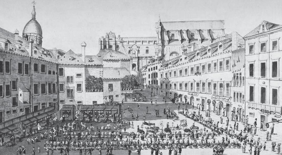
Fig. 6 Pre-earthquake plan of the city dating from 1607-08, detail of the cathedral and the built structure of the city on the present-day Gunduliæ Square
Sl. 6. Pretpotresni plan grada iz 1607-08, detalj katedrale i izgraðene gradske strukture na današnjoj Gunduliæevoj poljani
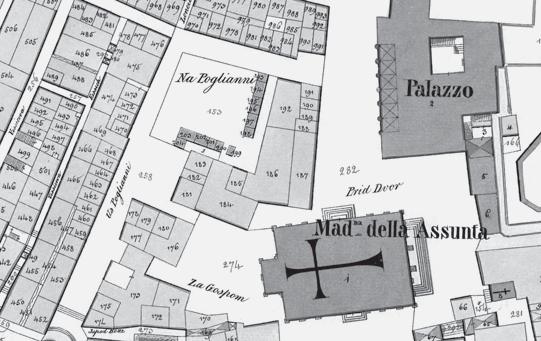
Fig. 7 Cadastral map of Ragusa, 1837, detail of the cathedral, Rector’s Palace and the residential block on the Gunduliæ Square
Sl. 7. Katastarska karta Dubrovnika iz 1837. godine, detalj katedrale, Kneževa dvora i stambenoga bloka uz Gunduliæevu poljanu
family crest as it was before 1667
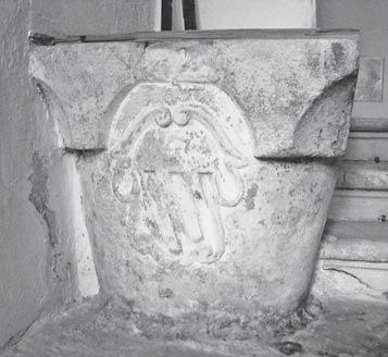
Sl. 8. Kamena kruna gustijerne u ulaznom dijelu prizemlja palaèe Basiljeviæ-Guèetiæ, s izvornim obiteljskim grbom Guèetiæa kakav je bio prije 1667. godine
entrance.33 However, just eight years after the change of ownership to the Gozze family, Ragusa was hit by the Great Earthquake of 1667, which resulted in severe damage on the bought lot and its edifices.34
THE EIGHTEENTH-CENTURY PALACE AND ITS URBAN AND ARCHITECTURAL CONCEPT
PALAÈA OSAMNAESTOGA STOLJEÆA, NJEN URBANISTIÈKI I ARHITEKTONSKI KONCEPT
A high level of seismic activity on the territory of Dubrovnik has been recorded by countless documents since the fifteenth century until today. The city and its surrounding territory are highly exposed to the impact of the movement of Adriatic blocks, which can result in vigorous calamity and unpredictable destruction in the form of earthquakes, which are often followed by fires that spread from the ruins. However, never has the outcome been as catastrophic as the one after the Great Earthquake of 1667. That year on April 6, slightly after eight o’clock in the morning, the ground was shaken unexpectedly. Numerous buildings collapsed, and their shambles, along with other structures, were soon consumed by the fire that raged for days.35
the construction line of the neighbouring house on the north, thus adding to the visual identity of the public space.37 On the cadastral map from the 1830s (Fig. 7), the original lot is numbered as 186, and the added lot as 187. The map also depicts the market stalls located on the other side, along the former alley behind the palaces. They emerged following the decision that the ruins of the former residential block were to be cleared to provide the city with a new open space, concluded within mere months following the Great Earthquake. The area gradually became the town marketplace, a function that Gunduliæ Square has maintained to this date.
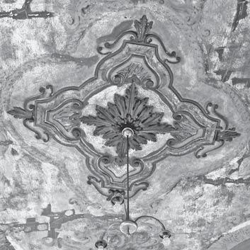
9 The barrel vault of the staircase with Rococo stucco decorations
9. Baèvasti svod stubišta s rokoko štukaturama
In addition to the destruction and damage of major community edifices such as the cathedral and the Rector’s Palace, the fire also consumed entire residential blocks. Utter destruction also befell the entire residential block on the present-day Gunduliæ Square. Despite the fact that the urban structure was greatly damaged, the Ragusan defensive walls remained intact. It was thereupon decided that the city was to be rebuilt and revitalised. The process commenced almost instantly for the sake of reinstating the social structure and securing the continuity of state institutions. In the intervening time of rebuilding and building anew the substantial civic buildings (a process that started within a few months of the earthquake), there were assiduous endeavours to also reconstruct and revitalise the entire former urban blocks.36
As mentioned afore, the original Statute of Ragusa strictly forbade any appropriation of or expansion onto the public space, which was regulated by a system of high penalties for the owners. However, regardless of the previous restrictions, the urban reconstruction that ensued after the Great Earthquake allowed for minor adjustments in order to integrate public space elevations such as the west façade of Pred Dvorom, an important square in front of the Rector’s Palace. Thereupon, Gozzes were allowed to buy an additional lot and extend the house layout to fit
The original pre-eighteenth-century BassegliGozze Palace can be found only in fragments. For instance, according to the study from 1984, the south part of the west façade is built from stone quadrels of dimensions and with building technique characteristic for the seventeenth century, while its north part implies somewhat later materialisation. On the other hand, in the north part of the ground-floor layout, one can even find several pre-Earthquake elements: groined vaults made of stone, halfcapitals all’ antica flanking the entrance gate, and stepped cornice - all typical for the mixed Gothic-Renaissance stylistic idiom38 used in sixteenth-century Ragusan architecture.39 It is evident that certain parts of the palace indeed existed before Vladislav Gozze’s purchase and were built in the palace that emerged after 1667, a claim that is corroborated by the irregularities of its layout, uncommon for architectural principles of the period.40
33 In her paper, R. Novak-Klemenèiè presents an exhaustive insight into the documents that mention the palace of Georgio de Gozze built in the 15th century, and located on the present-day Buniæ Square. For a more detailed elaboration, see: Novak Klemenèiè, 2017.
34 Although the number of residential and other units on the lot before the Great Earthquake remains uncertain, the ownership records of Vladislav Gozze’s sons in the following period imply it concerns the surface of cadastral lots 4154, 4155, and 4157 (1034, 1035, 1033, and 1031 in the old survey).
35 Harris, 2006: 319-321
36 Markoviæ, 1990: 137
37 For further account on the importance of façade lines and sequences in Dubrovnik after the Great Earthquake, see: Markoviæ, 1990: 145-146.
38 Seferoviæ, Mojaš, Žile, 1984: 11
39 For a comprehensive insight into the mixed GothicRenaissance architectural idiom used in Ragusan architecture of the 15th and 16th centuries, see: Grujiæ, 2009.
40 As a contrast, floor plans of the neighbouring SorgoGozze Palace are extremely regular: they are symmetrical, with the staircase in the centre, which is in line with the postulates of Renaissance and Baroque architecture theory. Therefore, the layout implies that it was built completely anew after the earthquake of 1667.
41 As early as August 1667, first Italian architects and engineers were sent by the Pope to rebuild the Republic of Ragusa. After a quickly-changing sequence of foreign
Fig. 8 The stone well head (gustijerna) located in the entrance foyer of the Bassegli-Gozze Palace, with the Gozze/Guèetiæ
Fig.
Sl.
In the post-earthquake period, Dubrovnik saw a series of Italian architects who were hired to rebuild the city.41 This kind of artistic exchange enabled architectural transference and brought new Baroque tendencies to the city. The Italian Baroque reterritorialised in Dubrovnik and intensified primarily in public (both sacral and administrative) buildings and squares, but also resonated strongly in residential architecture with elevations overlooking significant open spaces.42
The façades overlooking the Rector’s Palace were given an architectural treatment characterised by a simple repertoire of forms and unified openings, patterned upon the existing urban identity, but were also articulated in dynamic horizontal extension typical for Baroque, first appearing on the houses of Placa (Stradun), the main pedestrian street.43 The 1830s cadastral map shows that the most representative façade of the BassegliGozze Palace at that point was indeed the one overlooking the Rector’s Palace, while the residential entrance remained from the Buniæ Square.
It is known that through the second half of the seventeenth century the Bassegli-Gozze Palace (lots numbered 186 and 187 on the map) was a single large patrician house that belonged to Vladislav Gozze’s son Rado (1647-1707). Rado Gozze was also the owner of the neighbouring Sorgo-Gozze Palace (lots 181-185), adjoined to the first house at its north-east angle.44 The two residences thus completely enclosed the south-east corner of the newly formed Gunduliæ Square. Rado
architects coming mostly from Rome, Venice and Genova, the name of Ilija Katièiæ, a local, appeared in November 1712 in a letter naming him as a Ragusan builder who carried out the finalisation of cathedral building, as well as several other buildings in Dubrovnik and Perast (today in Montenegro) [Prijatelj, 1982: 712-716]. A detailed account on foreign and local master builders who designed and built the cathedral after the Great Earthquake and their specific impact is presented in: Gudelj, 2016: 203223. Also, for further information on the building process and architectural features of the cathedral after 1667, consult: Horvat-Levaj, 2016.
A local master building in the Baroque architectural idiom at the beginning of the 18th century is the ultimate evidence that Baroque architecture quickly took root in Dubrovnik. For an extensive overview and comparative analysis of Baroque architecture in Croatia, see: HorvatLevaj, 2015.
42 For a detailed account on the stylistic and typological transformations of the Ragusan residential architecture between 1780 and 1900, see: Horvat-Levaj, 2000.
43 Horvat-Levaj, 2001: 24
44 Lazareviæ, 2014: 192
45 Heyer von Rosenfeld, 1873: 11, 49; Vekariæ, 2012: 141
46 The original variant of the Gozze family crest is depicted on the heraldic plate of 35 noble families of Ragusa kept in Sponza Palace until 1809. It lists only the original Ragusan nobility, before the additions that occurred after the Great Earthquake. [Rudiæ, 2006: 184]
47 Grujiæ, 2013: 290-291
Gozze’s patrician palaces gained even more significance when he was awarded with the hereditary noble title of Hungarian count de Trebigne et Popovo by emperor Leopold I on 23 April, 1687.45 In addition, Rado Gozze established a fideicommissum as part of his testament, which prevented his son Pavao Gozze (1692-1755) to sell the residences in the future. Among all the cadastral lots under Rado’s fideicommissum, only the lot 187 (the one acquired after the Great Earthquake) was under the fideicommissum of Vladislav Gozze (1678-1746), Rado’s nephew.
The ground floor of the Bassegli-Gozze Palace was mostly reserved for the merchant services, and the shops were approachable from Pred Dvorom. The entrance for residents of the palace was, however, from the calmer Buniæ Square on the south, behind the cathedral. In the entrance foyer, next to the first two steps of the staircase, there is a modestly ornamented stone well head (gustijerna) with the original Gozze family crest (Fig. 8), as it was before 1667.46 With its circular base which widens into an upper rectangular element with spherically cut lower corners, the well head implies that its origins can be traced to the fifteenth or sixteenth century.47 It was after the Great Earthquake, though, that the well was incorporated into the entrance foyer we witness today.
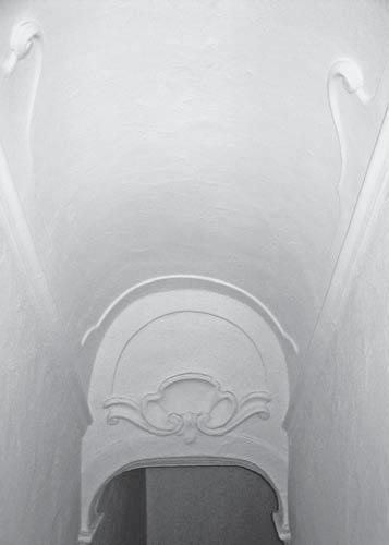
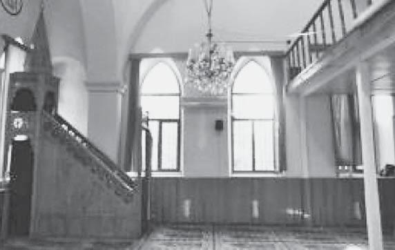
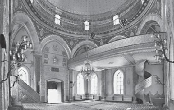
The L-shaped staircase starts at the back of the foyer, and leads to the upper, representative floor. The stone staircase lies on moulded false three-centred arches placed upon fluted pilasters. In this vertical communication, staircase flights are followed by barrel vaults, while each landing has a groined vault. The barrel vaults are adorned with Rococo stucco decorations (Fig. 9).
On the second storey (that is, the representative floor), the staircase is divided from the rest of the storey by a wall articulated with two openings featuring semi-circular arches placed upon moulded column casings, to-
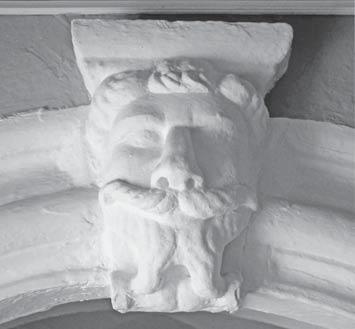
Fig. 10 The keystone mascaron on the semi-circular opening between the staircase and the receiving salon of the piano nobile level
Sl. 10. Maskeron kao zaglavni kamen polukružnog luka na prilazu iz stubišta u salonu prvoga kata (reprezentativne etaže)
Fig. 11 Drawing of the three ornamental mascarons with a male act study, eagle and lion by Perino del Vaga, around 1545-1547
Sl. 11. Crtež triju ornamentalnih maskarona sa studijom muškoga akta, orlom i lavom, Perino del Vaga, oko 1545.-1547.
Fig. 12 The preserved stucco corner decoration of the ceiling corner in the former dining room
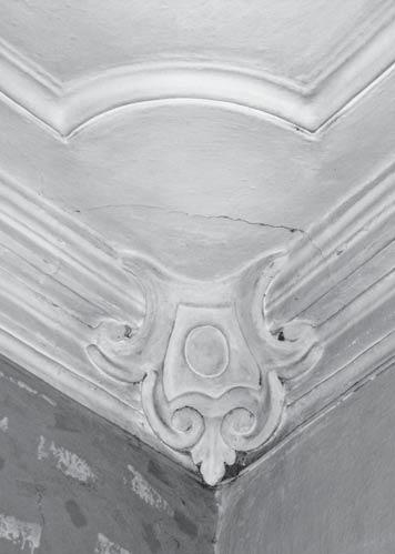
Sl. 12. Oèuvana kutna stropna štukatura u prostoru bivše blagovaonice
Fig. 13 Drawing for the commission of furniture for the Bassegli-Gozze Palace, beginning of the 19th century
Sl. 13. Crtež za narudžbu namještaja za palaèu Basiljeviæ-Guèetiæ, poèetak 19. stoljeæa
Fig. 14 The preserved original painted and stucco ceiling of the former pinacotheca: a) detail of the corner with perspective illusion painting; b) marmorised and painted central stucco decoration
Sl. 14. Oèuvani izvorni oslikani i štukaturni strop bivše pinakoteke, detalji: a) detalj kuta s oslikanom iluzijom perspektive; b) mramorizirana i oslikana središnja štuko dekoracija
gether with capitals and plinths. At the top of each arch crown, a mascaron is placed instead of a keystone (Fig. 10). The mascaron - shaped as a wide-nosed, smiling, bearded old man - uncannily resembles the grimacing mascarons typical of Italian Mannerism (Fig. 11).
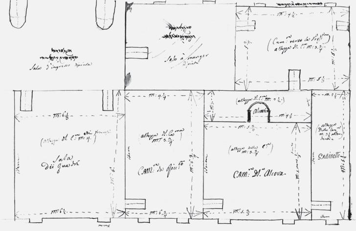
A drawing dating from the first half of the nineteenth century48 (Fig. 13) shows that the staircase leads to a room unburdened by divisions that followed in later periods. The room on the drawing is described as Sala d’ingresso dipinta, a painted salon for receiving guests. This kind of salon, which served as a staircase landing for gathering guests, was typical of Baroque palaces.49
On the wall opposing the arched openings for the staircase, two doors follow the openings’ axes. The receiving salon was thus swiftly connected to Sala dei quadri, a pinacotheca,
serving as a living room. The pinacotheca was the beginning of the enfilade of rooms with windows - slightly higher than those on the storey below - overlooking the busiest promenade of the city and its Rector’s Palace; the sequence continued with Cam[e]ra di gialo (the ‘yellow’ room), Cam[e]ra della alcova (the sleeping-niche room), ending with Cabinetto, a dressing room.
Positioned laterally to the staircase, on the north side of the receiving room, there was a door leading to Sala à manger dipinta, a painted dining-room, whose windows overlooked Gunduliæ Square (then called Na Poljani Square). The room continued to a room simply described with Cam[e]ra verso la Pogliana (a room overlooking Na Poljani), which was connected to the master bedroom, and thus probably served as a servants’ room.
During the mid-twentieth century, during an attempt at refurbishment, the owners of the Bassegli-Gozze Palace discovered that the original wall paintings of the former pinacotheca and dining-room (both marked as dipinta, ‘painted’, on the drawing) were still preserved under the layer of later applied paint. In the former dining-room, stucco elements of the ceiling (now overpainted in white) were also present (Fig. 12). On the other hand, an entirely preserved ceiling was present in the former pinacotheca, with gilded and marmorised stucco elements, and complete with secco paintings (Fig. 14).
The playful lines of stucco decorations, the vivid colours applied on both ceiling and wall surfaces, and rich whimsical floral and shelllike motifs depicted with a deft illusion of perspective - all those elements assuredly point to the ornamental language of Rococo. Even though they were partially uncovered and saw but a few stratigraphic probes that occurred upon their discovery, the walls and ceilings with their decorative schemes were left intact and unexplored to this day.
48 ÈFA, Drawing for the commission of furniture, beginning of the 19th century
49 In the typology system of Ragusan Baroque palazzos devised by art historian Katarina Horvat-Levaj, that type is classified as ”palaces with a staircase organisationally related to the main sala”, which developed from the GothicRenaissance tradition of Ragusan architecture. [HorvatLevaj, 2000: 61-62; Horvat-Levaj, 2001: 58-59]
50 Vukoviæ, 2000: 35
51 The Jesuit Steps between the Boškoviæ Square and the Gunduliæ Square are believed to be designed by Pietro Passalacqua in 1738 [Prijatelj, 1982: 724]. The monumental Baroque stairs were modelled after the Spanish Steps in Rome, which were designed and built by Francesco de Sanctis and Alessandro Specchi, between 1723 and 1726. For further account on Passalacqua’s oeuvre between 1735 and 1741 in Ragusa, see: Markoviæ, 1981.
52 Vukoviæ, 2000: 35
53 Muljaèiæ, 2003: 126
54 Vekariæ, 2012: 142-143; Bersa, 1941: 27
THE PALACE FROM THE DUSK OF THE REPUBLIC UNTIL THE MID-NINETEENTH CENTURY
PALAÈA OD PADA REPUBLIKE DO SREDINE DEVETNAESTOGA STOLJEÆA
While Napoleon’s army rapidly advanced towards Italy, the very turn of the eighteenth to the nineteenth century saw the peak of the second golden age for the Republic of Ragusa. It was the epoch characterised by both economic prosperity and cultural renaissance rooted in the philosophy of Humanism and Enlightenment.50
Two years after the French occupation of 1806, Napoleon’s general Auguste de Marmont abolished the Republic and became the self-proclaimed Duke of Ragusa, which thoroughly discomposed the established social and cultural milieu of the city. The changes were evident even shortly after the occupation, when most of the churches and monasteries intra muros were repurposed for military needs. Even the Jesuit complex, connected to the Gunduliæ Square with the monumental Baroque staircase51, was converted to a military hospital.52
However, during those years of cultural and social turbulences in Dubrovnik, the Gozze family did not suffer many nuisances as they were highly respected members of society, distinguished politicians, and noted Francophiles. At that time, the Bassegli-Gozze Palace was home to Baldo-Jakov Gozze (17451817), son of earlier mentioned Pavao Gozze, and his wife Terezija (Deša), born Bassegli/ Basiljeviæ (1759-1804).53 To substantiate the family’s affinity towards French influences, on 15 June 1812 their son Pavao (1778-1838) married Anne Marguerite (Anica), born Calogan de Valois54, who belonged to declining French aristocracy. Following the death of the last member of his mother’s family line in
55 Heyer von Rosenfeld, 1873: 27, 112; Lazareviæ, 2014: 192
56 Bersa, 1941: 48
57 Lazareviæ, 2014: 192
58 Gozze Villa in Trsteno is one of the most renown Renaissance villas on the East Adriatic coast, primarily due to its arboretum dating from the late fifteenth century, one of the first such landscaped gardens in this part of the world. For more information on the architectural history of the villa, consult: Majer Jurišiæ, 2016. For a detailed account on the arboretum, see: Obad Šæitaroci, Kovaèeviæ, 2014.
59 Piploviæ, 2016: 118-120
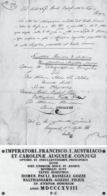
60 The original text in Latin read: imperatori francisco i. austriaco / et carolinae augustae conjugi / optimis et indulgentissimis principibus / quod / dies undecim hisce in aedibus / diversati sunt / tantis hospitibus / domus pauli bassegli gozze / balthassaris gozzei filius / ad aeternam memoriam / anno mdcccxviii / p. c [Èièovaèki, Èièovaèki, Dundoviæ, 2018: 7]
The request for the marble plate was received by the imperial court on 24th July. The permission, together with the
1806, Pavao inherited all their estates, but he had to in turn accept his mother’s born surname, thus inaugurating a new family branch: Bassegli-Gozze.55
After Napoleon’s abdication in 1814 and the conclusions of the Congress of Vienna the following year, Dubrovnik and its historical territory were annexed to the Empire of Austria, together with the rest of the Illyrian Provinces. The palace in 1814 was described by Josip Bersa as ”a convenient residence with fashionable and the most contemporary furniture, since Pavao chose it himself in Paris, when he married A. Calogan Valois”, additionally mentioning how the Empire style (which was then most contemporary) pervades both the interior and clothes of the eighteen-year-old mistress of the house.56 The rest of the residents in 1817 were Pavao’s brother Melkior, two of his daughters, and six servants.57
In 1818, the Bassegli-Gozze Palace served as accommodation to Francis I, the first Emperor of Austria, during his Dalmatian trips. He arrived on the 24th of May and stayed in the palace for eleven days with his wife Caroline of Bavaria. Even though Pavao Bassegli-Gozze belonged to Ragusan nobility which held strong animosity toward the Austrian rule, it was a festive event for the city and a great honour for the hosts. It was even more so when Francis I, upon leaving on the 3rd of June, also decided to stop at the Gozze Villa58 in Trsteno for lunch.59 On that account and not much later that year, Pavao BassegliGozze installed two memorial plates in honour of the Emperor’s visit, one in each of his residences. The marble plate of the BassegliGozze Palace (Fig. 15) was placed on its east façade and read: ”To the emperor Francis I. of Austria and his spouse Caroline Augusta, the best and most forgiving leaders, who spent eleven days in the dwelling, and were accommodated with many guests. The home of Pavao Bassegli-Gozze, son of Baltazar Gozze, in eternal memory, on the year of 1818.”60
Even though it witnesses just a small episode in the life of the Bassegli-Gozze Palace, the marble plate inscription is proof and exhibition of its significant cultural history. It is proof that in 1818 the palace met the highest criteria for accommodating a monarch with his wife and their entourage. That is corroborated by the description of the palace by Francis I in his diary, which states that the main façade at that point was the one turned toward the Rector’s Palace and that it was a three-storey building.
He also mentions that the palace ”has a good staircase”, and that the ”rooms on the first floor are well furnished”. The same entry also implies that one part of the house was, at
Fig. 15 Written permission of the Imperial Court for the memorial plate on the east façade of the Bassegli-Gozze Palace, 1st August 1818 (up), and the proposed reconstruction of the plate based on a research study, 2018 (down)
Sl. 15. Pisana dozvola carskoga dvora za mramornu spomen-ploèu na istoènome proèelju palaèe Basiljeviæ-Guèetiæ, 1. kolovoza 1818. (gore), i predložena rekonstrukcija ploèe temeljena na istraživanju iz 2018. (dolje)
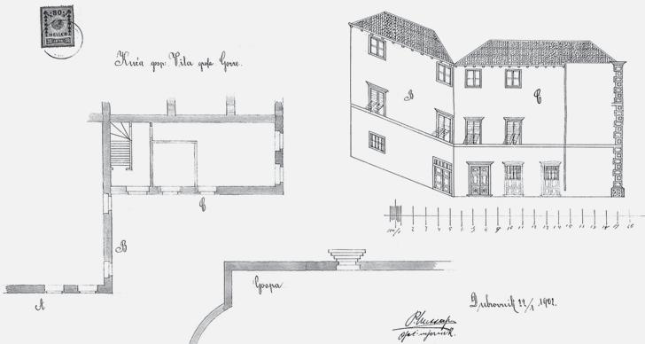
Fig. 16 Plan for the division wall between the Bassegli-Gozze Palace and Bassegli-Gozze-Katiæ Palace, 1853: a) ground floor, b) first floor, c) second floor, d) attic
Sl. 16. Nacrti za pregradni zid izmeðu palaèa Basiljeviæ-Guèetiæ i Basiljeviæ-Guèetiæ-Katiæ, 1853.: a) prizemlje, b) prvi kat, c) drugi kat, d) potkrovlje
that point of time, rented out for the girls’ school.61
Prior to his wedding with Anica, Pavao was presented with a promise of a large dowry; however, for years after the wedding, money still was not reaching him.62
In 1821, Anica had to take a mortgage loan on her inherited house to cover for her dowry, which was at that point estimated to 79,100 fiorini altogether: that is, 3,000 pounds in the English bank, 12,000 francs, and 8,000 francs in her possessions, including jewellery. Five years later, Pavao had to take an additional loan of total 3,616.40 fiorini (7,000 ducats), this time from the Opera Pia foundation in Dubrovnik. This time, the loan affected his properties, as he put the Bassegli-Gozze Palace, together with its stores and magazines, under mortgage.63
Following the family’s financial problems, and due to its proximity to the cathedral, the palace was rented to church and served as the bishop’s residence in 1830.64 The cost estimate for the necessary renovation of the palace, issued in May the same year, reveals that the façades needed renovation and many of the interior walls on the first floor were damp. It was also decided that the interior doors of the first and second floor should be repainted in light grey, while the future colour of the outer doors and windows was described as the ”Viennese green”.65
As the middle of the nineteenth century approached, it became apparent that the palace was a great burden for the Bassegli-Gozze family. Considering its size, it was an unsus-
tainable property that was increasingly draining the family’s finances. Come 1850s, Bassegli-Gozzes had to take drastic architectural measures to keep their family residence.
THE EMERGENCE OF THE PRESENT-DAY PALACE AND FACTORS OF ITS ARCHITECTURAL IDENTITY
NASTANAK DANAŠNJE PALAÈE I ÈIMBENICI NJENA ARHITEKTONSKOG IDENTITETA
When Pavao’s son Baldo Bassegli-Gozze (1822-1893)66 inherited the palace in 1853, he immediately commenced its division into two separate houses.67 The drawings enclosed to the contract, soon executed without alterations, show the division of the palace vertically by completely closing a wall between the dining room and the servants’ room, continuing with the position of the built-in preRomanesque wall, and finishing with the wall between the pinacotheca and the ‘yellow’ room, in vertical continuation through all four storeys from the ground floor up to the attic (Fig. 16).
In April 1855, Baldo sold the separated part of the palace to Lucijan Pozze (Puciæ), who had paid it in full in the following year.68 The separated house, today known as the Bassegli-Gozze-Katiæ Palace69, saw complete refurbishment of its interior. The plans also show that the entrance for the new palace was envisioned from Gunduliæ Square, and its staircase was interpolated along the north wall neighbouring the Ragnina Palace. The
exact text of the plate, was issued on 1st August the same year. [ÈFA, No. 124, p. r., Ad Nobil Sig: Paolo Bassegli nato de Gozze a Ragusa, Dal Capitanato Circolare di Ragusali 1mo Agosto 818]
It is important to note that the text of the plate also appeared in S. Skurla’s book Ragusa: cenni storici, self-published in 1876, but it provides the reader with an inaccurate transcription. [Skurla, 1876: 101]
61 Pederin, 1979: 463
62 In a letter written in English and sent on 30th November 1814, Anica’s mother writes: Your uncle talks of coming to Paris, he writes me very kind letters; I have lately corresponded with him and the lawyer about certifying your fortune in the funds, as your has written so often about, he complains to the Il--- that I have not answered, how comes it that my letter on that subject should not reach him, and that you receive them regularly: tell Mr. Paul [Pavao] that nothing should be left undone on my part, towards satisfying his mind, but that all matters of law are tedious when people are not on the spot much more so. On derrived ressort should Polland agree my brother can give with his signature, a certificate of the sum vested in the funds, as mentioned in my marriage sett[l] emant, as soon as ever I receive the papers, I shall address them to your husband, that he may have no more doubts, and that he may know when apply on my decease, pray make him acquainted with all this. [ÈFA, Letters to Madame de Contesse Bassegli de Gozzé à Raguse Illyrie, No. 37]
63 Lazareviæ, 2014: 192
64 Seferoviæ, Mojaš, Žile, 1984: 15
interior of the Bassegli-Gozze-Katiæ Palace underwent a thorough renovation: its salons were completely refurbished and their most unique decorative elements at the time were panoramic wallpapers of French provenance, originally produced by the Zuber Rixheim factory in the 1820s.70
Even though the original Bassegli-Gozze Palace lost half of its original floor area to the newly separated palace, the monumentality of the block corner next to the cathedral (Fig. 17) was successfully regained with a NeoClassical east façade - at that time considered modern and different from any of the traditional solutions in the city core of Dubrovnik - which remains an important identity factor of Pred Dvorom to this day. Keeping one third of its former width, the façade now counts two window axes (Fig. 18) and its vertical borders are highlighted with decorative quoins.
The ground-floor and first floor are separated with a humble stepped string-course, and the attic lies upon a simple cornice of somewhat deeper projection compared to that of the neighbouring palace. The ground-floor level was designed as a commercial space for rent71; its door and window were identical openings with segmental arches equal in height,. Beyond them and under the stringcourse, positioned in the centre, stood Pavao Bassegli-Gozze’s memorial plate for the Emperor’s 1818 visit. The representative second storey is opened by two rectangular windows framed with eared stone architraves and topped with separate friezes under cornices. Between the cornices stood the coat of arms
65 Seferoviæ, Mojaš, Žile, 1984: 13-14 (the original document in Italian was translated by Marina Desin)
66 Vekariæ, 2012: 143
67 The contract for refurbishment and division of the palace was signed by Baldo Bassegli-Gozze on 14th February 1853. [Seferoviæ, Mojaš, Žile, 1984: 16]
68 Seferoviæ, Mojaš, Žile, 1984: 16-18
69 In this work, the palace that emerged from the detachment will be referred to as the Bassegli-Gozze-Katiæ Palace, as it is listed in the Registry of Cultural Property of the Republic of Croatia (Ministry of Culture, reg. no. RST1299-1986). Ernest Katiæ became the owner of the palace in 1923, and Katiæs were the last known owners before it became the permanent seat of the Society of Friends of Dubrovnik Antiquities in 1960s.
70 During the renovation that occured from 1998 to 2000, the original wallpapers and floors were completely restored. For more detailed information on the wallpapers and course of their restoration, see: Vetma, 2016.
71 Historically, the ground-floor level of the BassegliGozze Palace was a coffee house. In 1941, Josip Bersa described it in his book as follows: ”The only finely furbished coffee house at the dusk of the 19th century was located in the ground floor of Gozze’s house by the cathedral; its official name was Caffé Grande, but the citizens called it U Zvicera, as the owners were Swiss. The coffee house was frequented exclusively by the nobility, with seldom Antunins and Lazarins [members of Ragusan merchants’ confraternities].” [Bersa, 1941: 109]
72 Heyer von Rosenfeld, 1873: 112, Plate 7
of the Bassegli-Gozze family, the variant greatly similar to the one confirmed by the Emperor in 183772, depicting a crest of combined Gozze and Bassegli heraldry, a knight’s helmet with mantling at the top, this one flanked by two unicorns on each side instead of one (Fig. 19). Still, the most striking elements of the east elevation are two wide windows of the third storey loggia, which depart from any historically established type of windows in the city core. Divided by a pilaster strip, they fill the space between quoins, and their false three-centred arched with keystones lie on the half-capitals of their simple stone frames (Fig. 21).
The south façade of the Bassegli-Gozze Palace, enclosing the Buniæ Square, kept its function of the main residential entrance, clearly marked with a corniced but simple portal. On the plan dating from 1902 (Fig. 20), the façade (C) is depicted in both the existing and proposed condition, the only difference being the planned enlargement of the two window openings on the ground-floor level. Still, the appearance of the upper storeys’ windows is analogous to the preserved east façade of the Bassegli-Gozze-Katiæ Palace: simple and rectangular, but higher and corniced on the first floor. It ends with a small roof cornice supported by simple modillions. The plan isometrically shows the east façade of the neighbouring Sorgo-Gozze Palace as well (B), as its two corner rooms of each storey were attached to the Bassegli-Gozze Palace, with openings following the same design. Still, the present-day condition of the south façade of the Bassegli-Gozze Palace is the result of interventions that occurred in 1903.
The plan dating from October that year (Fig. 23) shows that the entrance doors were designed with a transom band underneath the cornice. It also shows that at that point only one window, next to the door, underwent the extension planned the year before, and the other one remained short and rectangular. After the interventions validated in 1903, both windows were identical - high and rectangular with simple stone frames (Fig. 22) - and the third-storey loggia was given an addition-
Fig. 17 The Dubrovnik cathedral and the east elevation of the residential block, view from the Pred Dvorom Square
Sl. 17. Dubrovaèka katedrala i istoèno proèelje stambenoga bloka, pogled s trga Pred Dvorom
Fig. 18 The east elevation of the residential block with the Bassegli-Gozze Palace, Bassegli-Gozze-Katiæ Palace, and Ragnina Palace, view from the Pred Dvorom Square, 2018
Sl. 18. Istoèno proèelje stambenoga bloka s palaèama Basiljeviæ-Guèetiæ, Basiljeviæ-Guèetiæ-Katiæ i Ranjina, pogled s trga Pred Dvorom 2018. godine
Fig. 19 The coat of arms of the Bassegli-Gozze family on the east façade of the palace, reconstructed in 2008 without clear features of the crest
Sl. 19. Grb obitelji Basiljeviæ-Guèetiæ na istoènome proèelju palaèe, rekonstruiran 2008. godine bez jasnih obilježja samoga štita
Fig. 20 Architectural design for the reconstruction of the main residential entrance to the Bassegli-Gozze Palace from the Buniæ Square, 1902
Sl. 20. Arhitektonski nacrt za rekonstrukciju glavnog stambenog ulaza u palaèu Basiljeviæ-Guèetiæ s Buniæeve poljane, 1902.
Fig. 21 East façade of the Bassegli-Gozze Palace in year 1900
Sl. 21. Istoèno proèelje palaèe Basiljeviæ-Guèetiæ 1900. godine
Fig. 22 The residential entrance to the Bassegli-Gozze Palace from the Buniæ Square today Sl. 22. Stambeni ulaz u palaèu Basiljeviæ-Guèetiæ s Buniæeve poljane danas
al rectangular window, which was closed again during the twentieth century.
The development of the west façade facing the Gunduliæ Square also greatly follows the original design, unlike the façade of the neighbouring Bassegli-Gozze-Katiæ Palace which was reconstructed and cladded anew following the purchase of Lucijan Pozze in 1855.73 A simple comparison of a detailed drawing depicting the square during the nineteenth century74 (Fig. 26) and presentday condition of the Bassegli-Gozze Palace’s west façade (Figs. 24, 25) leads to a conclusion that the distribution of the openings remained the same (in two vertical axes), although the second-floor windows were en-
larged, and ground-floor openings were slightly altered into large stone-framed door and window, both with transoms.75
The palace stayed in the family until the midtwentieth century, although its separate storeys were inherited by different descendants and its rooms were often partitioned and reconstructed anew into separate residential units. Due to the terms issued by the conservation department, it was often done with consideration to original forms. For example, that is the case of the former receiving salon on the first floor: it was divided into several smaller rooms by thin walls constructed from hollow clay bricks, but new door frames were exact copies of the existing ones, although their mouldings were modelled in mortar.76
Until 1935, the whole palace was owned by Baldo’s son Vito Bassegli-Gozze (18531950)77, and from 1937, one half was owned by Vito’s cousin Vlaho as well.78 Vlaho inherited the representative second storey, and he sold it to Anka Lukoviæ the following year. In 1959, Vito’s part (the third-storey apartment) was inherited by his niece and stepdaughter Linda, who donated it to the Congregation of Daughters of Mercy from Korèula.
Apart from the entrance foyer and the staircase, the only original part of the interior that kept its historical features is the second-storey apartment. Although it was completely refurbished during the first half of the twentieth century, and the original salons were divided into smaller rooms by partition walls, the original eighteenth-century decorations and wall paintings are preserved under the layers of paint. In April 1981, the apartment was bought by Anka Èièovaèki79 and bestowed upon her descendants, its current owners.80
CONCLUSION
ZAKLJUÈAK
As one of the oldest noble and patrician families of Ragusa, known from the thirteenth century, Gozzes had a significant impact on
73 During the separation of the Bassegli-Gozze-Katiæ Palace and construction of its new west façade, the owner added several spolia such as the circular stone rosette which provides the lower end of the staircase with light, and Romanesque plate with an early Christian lamb motif above the main entrance portal. Two more windows were added into the axis inaugurated by the application of the rosette: the oval one for the staircase on the representative second storey, and the circular for the storey above.
74 ÈFA, Gunduliæ Square in the 19th century, drawing by unknown author
75 As it is discernible from the drawing, the window with the transom existed on the left and a door topped with a detached window stood on the right axis. The present-day openings switched its functions: on the left there is a door, and window is placed on the right side.
76 K. Horvat-Levaj claims that the salon partition was carried out in the 18th century [Horvat-Levaj, 2001: 238-
cultural, political and social life of the city. They commissioned and were owners of numerous palaces, houses and villas in Dubrovnik and surrounding landscape. The Bassegli-Gozze palace is the city residence of a family branch founded by Pavao BassegliGozze in 1806. Based on the overlay of presented historical and spatial facts, the development of the palace can be divided into three major phases: 1) the phase before the Great Earthquake of 1667, 2) the phase between years 1667 and 1853, and 3) the phase from 1853 until today.
During the first phase, the built structure was in the immediate surrounding of the monumental fortified church (dating from the sixth century) or, precisely, leaning on its defensive wall. It is not clear how many separate buildings the block consisted of, but the occupied area was smaller, and their west façade line is analogous to its present-day position. During the second phase, the palace was built as a single patrician residence between the SorgoGozze Palace and Ragnina Palace.
The adjoined lot acquired after the earthquake supplied the palace with an overall wider building area, and the possibility of building a representative façade that overlooked the Rector’s Palace. In this phase, the palace was laid out in the typical Baroque sequence of lavishly decorated salons on the second storey, starting with an equally ornamented staircase. The third phase is the palace as we know it today, with its Neo-Classical façade facing the Rector’s Palace, and its interior refurbished into a complete single house.
The exemplary east elevation of the BassegliGozze Palace, which concludes the façade sequence of the block that counterbalances the monumentality of the Rector’s Palace, has for long a crucial identity factor of open urban space leading to the cathedral. The west façade is, on the other hand, a historically significant backdrop of the Gunduliæ Square. Ultimately, the carefully thought out south façade - which provides the residents
-240]. However, the archival drawings undoubtedly show that such thing did not occur until the second half of the 19th century.
77 Vekariæ, 2012: 143-144
78 Vlaho was son of Melkior Bassegli-Gozze (1855-1914), Baldo’s brother. [Vekariæ, 2012: 143]
79 PUK-DU, vol. 272-280, lots 1034 and 1035
80 For more than three decades, Èièovaèki family has been committed to research of the architectural and cultural history of the Bassegli-Gozze Palace. Their family archive counts an enviable collection of written and graphic sources on the Bassegli-Gozze family and their residences.
81 Included in decisions as follows: no. 12-8/1-66 of 15 January 1966, no. 12-8-3-66 of 10 November 1966, and UP/I-86/1969 of 25 June 1969. In the Registry of Cultural Property of the Republic of Croatia, Ministry of Culture, it is registered under the number Z-3818.
with a peaceful micro-ambience of piazzetta in front of the entrance - is a spatial demonstration of Mediterranean culture. The architectural corpus of the palace is altogether a significant part of the urban fabric and makes its authentic component.
The protection of the Bassegli-Gozze Palace began in 1966, when the Old Town of Dubrovnik was declared the historical urban entity by the Decision of the Institute for the Protection of Cultural Monuments of Dubrovnik.81 However, for the time being, the palace itself is still not individually listed as a cultural monument, and apart from the owners’ and certain institutions’ endeavours to preserve and restore the historic building, it lacks the formal
Fig. 23 Architectural design for the main residential entrance to the Bassegli-Gozze Palace from the Buniæ Square, October 1903
Sl. 23. Arhitektonski nacrt za glavni stambeni ulaz u palaèu Basiljeviæ-Guèetiæ s Buniæeve poljane, listopad 1903.
Fig. 24 The west façade of the Bassegli-Gozze Palace viewed from the Gunduliæ Square around the year 1920
Sl. 24. Zapadno proèelje palaèe Basiljeviæ-Guèetiæ prema Gunduliæevoj poljani oko 1920. godine
Fig. 25 The west façade of the Bassegli-Gozze Palace, 2018
Sl. 25. Zapadno proèelje palaèe Basiljeviæ-Guèetiæ, 2018.
means of protection and conservation. The principal aim of this paper82 is to shed light on the importance of the Bassegli-Gozze Palace for the urban history of Dubrovnik. The outstanding abundance of historical layers that compose its appearance incites further research and action in the field of practical building conservation. Its authentic and unique interiors call for exhaustive research and restoration work, as well as a detailed presentation
of the those carried out in the last fifty years. Conclusively, comprehensive conservation will not be accomplished by simply awarding the palace the status of an individually protected monument, but it would, nevertheless, be a great starting point.
[Written in English by author; proof-read by David Edel, BA]
82 This paper is the result of collaboration with several names without which this research would not be possible. The author’s highest gratitude goes to Josip Èièovaèki, who generously shared his extensive knowledge and numerous findings on the Bassegli-Gozze Palace. The author also wishes to thank David Edel who assiduously discussed and tirelessly proofread each version of this research, and to Jasenka Gudelj and Ana Marinkoviæ for their suggestions and guidance during the writing process.
Fig. 26 Gunduliæ Square in the first half of the 19th century, drawing by an unknown contemporary
Sl. 26. Gunduliæeva poljana u prvoj polovici 19. stoljeæa, crtež nepoznatog suvremenika
Bibliography Literatura
1. Benyovsky Latin, I. (2008), Smještaj gradskog plemstva u dalmatinskim gradovima srednjeg vijeka, ”Acta Histriae”, 16 (1-2): 37-58, Koper
2. Benyovsky Latin, I.; Lediæ, S. (2014), The Estate of the Volcassio Family in Medieval Dubrovnik, ”Dubrovnik Annals”, 18: 7-45, Zagreb/ Dubrovnik
3. Beritiæ, L. (1958), Urbanistièki razvitak Dubrovnika, Zavod za arhitekturu i urbanizam Instituta za likovne umjetnosti Jugoslavenske akademije znanosti i umjetnosti, Zagreb
4. Bersa, J. (1941), Dubrovaèke slike i prilike, Matica hrvatska, Zagreb
5. Èièovaèki, D.; Èièovaèki, J.; Dundoviæ, L. (2018), Spomen-ploèa na istoènom proèelju palaèe Bassegli-Gozze u Dubrovniku: Opis ploèe, unpublished manuscript, Dubrovnik
6. Fiskoviæ, C. (1954), Fragments du style roman à Dubrovnik, ”Archaeologia Iugoslavica”, 1: 117137, Beograd
7. Grujiæ, N.; Tenšek, I. (2001), Domus illorum de Caboga, ”Radovi Instituta za povijest umjetnosti”, 25: 101-118, Zagreb
8. Grujiæ, N. (2005), Knežev dvor u Dubrovniku prije 1435. godine, ”Prilozi povijesti umjetnosti u Dalmaciji”, 40 (1): 149-170, Split
9. Grujiæ, N. (2008), Onofrio di Giordano della Cava i Knežev dvor u Dubrovniku, in: Renesansa i renesanse u umjetnosti Hrvatske, Zbornik Danâ Cvita Fiskoviæa II [eds. Markoviæ, P.; Gudelj, J.], Institut za povijest umjetnosti u Zagrebu / Odsjek za povijest umjetnosti Filozofskog fakulteta Sveuèilišta u Zagrebu: 9-50, Zagreb
10. Grujiæ, N. (2009), Gotièko-renesansna arhitektura Dubrovnika u 15. i 16. stoljeæu, u: Sic ars deprenditur arte: Zbornik u èast Vladimira Markoviæa [eds. Cvetniæ, S.; Pelc, M.; Premerl, D.], Institut za povijest umjetnosti / Odsjek za povijest umjetnosti Filozofskog fakulteta Sveuèilišta u Zagrebu: 235-254, Zagreb
11. Grujiæ, N. (2013), Kuæa u Gradu: Studije o dubrovaèkoj stambenoj arhitekturi 15. i 16. stoljeæa, Matica hrvatska - ogranak Dubrovnik, Dubrovnik
12. Gudelj, J. (2016), Architettura e diplomazia tra Roma e Dubrovnik: San Girolamo dei Croati e la cattedrale di Dubrovnik nel secondo Seicento, ”Römisches Jahrbuch der Bibliotheca Hertziana”, 40 [2011/12]: 185-239, Munich
13. Harris, R. (2006), Dubrovnik: A History, Saqi Books, London
14. Heyer von Rosenfeld, C.G.F. (1873), Der Adel des Königreichs Dalmatien, Verlag von Bauer und Raspe, Nürnberg
15. Horvat-Levaj, K. (2000), Od baroknog klasicizma do neoklasicizma: Stilsko-tipološke transformacije stambene arhitekture Dubrovnika iz-
meðu 1780. i 1900. godine, ”Radovi Instituta za povijest umjetnosti”, 24: 61-72, Zagreb
16. Horvat-Levaj, K. (2001), Barokne palaèe u Dubrovniku, Institut za povijest umjetnosti / Hrvatska akademija znanosti i umjetnosti - Zavod za povijesne znanosti u Dubrovniku, Zagreb/ Dubrovnik
17. Horvat-Levaj, K. (2015), Barokna arhitektura, Naklada Ljevak, Zagreb
18. Horvat-Levaj, K. (2016), The Architecture of the Baroque Cathedral, in: The Cathedral of the Assumption of the Virgin in Dubrovnik [ed. Horvat-Levaj, K.], City Parish of the Assumption / Institute of Art History / ArTresor: 121-187, Dubrovnik/Zagreb
19. Lazareviæ, I. (2012), Granice dubrovaèkih seksterija, ”Anali Zavoda za povijesne znanosti Hrvatske akademije znanosti i umjetnosti u Dubrovniku”, 50: 63-74, Zagreb/Dubrovnik
20. Lazareviæ, I. (2014), Vlasteoske kuæe u gradu Dubrovniku 1817. godine, Hrvatska akademija znanosti i umjetnosti / Zavod za povijesne znanosti u Dubrovniku, Zagreb/Dubrovnik
21. Majer Jurišiæ, K. (2016), Stilovi i lica ljetnikovca Guèetiæ u Trstenom: Rezultati konzervatorsko-restauratorskih istraživanja, ”Peristil”, 58: 1937, Zagreb
22. Marinkoviæ, A. (2017), O gradnji, funkciji i rušenju krstionice-zvonika dubrovaèke romanièke katedrale, ”Ars Adriatica”, 7: 83-98, Zadar
23. Markoviæ, V. (1981), Pietro Passalacqua u Dubrovniku, ”Peristil”, 24: 95-114, Zagreb
24. Markoviæ, V. (1990), Kuæa i prostor grada u Dubrovniku nakon potresa 1667. godine, ”Radovi Instituta za povijest umjetnosti”, 14: 136-149, Zagreb
25. Muljaèiæ, Ž. (2003), Jedno novo vrelo za prouèavanje sintakse i paremiologije (Primjeri prebacivanja koda s talijanskoga na hrvatski u pismima jedne dubrovaèke vlasteoske obitelji s kraja 18. stoljeæa), ”Hrvatski dijalektološki zbornik”, 12: 125-136, Zagreb
26. Novak Klemenèiè, R. (2017), Locating and Analysing the Appearance of Private Houses in 15th Century Dubrovnik: The Case of Georgio de Gozze House, in: Mapping Urban Changes [ed. Plosniæ Škariæ, A.], Institute of Art History, Zagreb
27. Obad Šæitaroci, M.; Kovaèeviæ, M.A. (2014), Arboretum Trsteno: The Gardens of a Renaissance Villa, ”Art Bulletin”, 64: 101-131, Zagreb
28. Pederin, I. (1979), Putni dnevnik cara Franje I. o Dubrovniku (1818. g.), ”Anali Zavoda za povijesne znanosti Hrvatske akademije znanosti i umjetnosti u Dubrovniku”, 17: 431-465, Zagreb/ Dubrovnik
29. Pekoviæ, Ž. (1998), Dubrovnik: Nastanak i razvoj srednjovjekovnoga grada / Dubrovnik: La
fondation et le développement de la ville médiévale, Ministarstvo kulture Republike Hrvatske / Muzej hrvatskih arheoloških spomenika u Splitu, Split
30. Pekoviæ, Ž.; Babiæ, K. (2017), Predgraðe dubrovaèke Civitas, ”Anali Zavoda za povijesne znanosti Hrvatske akademije znanosti i umjetnosti u Dubrovniku”, 55 (1): 1-63, Zagreb/Dubrovnik
31. Piploviæ, S. (2016), Posjeta cara Frane I. Dalmaciji, ”DG Jahrbuch - Godišnjak njemaèke zajednice”, 23: 105-126, Osijek
32. Planiæ-Lonèariæ, M. (1989), Zajednièki prostori stambenih zona srednjovjekovnog Dubrovnika, ”Radovi Instituta za povijest umjetnosti”, 12-13: 64-75, Zagreb
33. Prelog, M.; Grujiæ, N. (1971), Dubrovnik, Institut za povijest umjetnosti, Zagreb
34. Prijatelj, K. (1982), Barok u Dalmaciji, in: Barok u Hrvatskoj [eds. Horvat, A.; Matejèiæ, R.; Prijatelj, K.], Sveuèilišna naklada Liber / Odjel za povijest umjetnosti Centra za povijesne znanosti / Društvo povjesnièara umjetnosti Hrvatske: 649-916, Zagreb
35. Principe, I. (1991), Tri neobjavljene karte Dubrovnika iz XVI.-XVII. st., ”Dubrovnik”, 2 (1): 191202, Dubrovnik
36. Rudiæ, S. (2006), Reip(ublicae) Ragusi(nae) eiusq(ue) optimatum insignia: zbornik znamenja dubrovaèkih porodica, ”Istorijski èasopis”, 53: 173-194, Beograd
37. Schiller, B. (1900), Örökös főrendiség eredete Magyarországon, Kilián Frigyes Utóda, Budapest
38. Seferoviæ, S.; Mojaš, M.; Žile, I. (1984), Blok 2: Gunduliæeva poljana - Pred Dvorom: Analiza razvoja i stanja, unpublished manuscript, Zavod za zaštitu spomenika kulture i prirode Dubrovnik, Dubrovnik
39. Skurla, S. (1876), Ragusa: cenni storici, selfpublished, Zagreb
40. Stošiæ, J. (1988), Prikaz nalaza ispod katedrale i Buniæeve poljane u Dubrovniku, in: Arheološka istraživanja u Dubrovniku i dubrovaèkom podruèju, zbornik znanstvenoga skupa [ed. Rapaniæ, Ž.], Hrvatsko arheološko društvo: 15-38, Zagreb
41. Vekariæ, N. (2012), Vlastela grada Dubrovnika: Vlasteoski rodovi (M-Z), Svezak 3, Hrvatska akademija znanosti i umjetnosti / Zavod za povijesne znanosti u Dubrovniku, Zagreb/Dubrovnik
42. Vetma, G. (2016), Repair/Renovation of the Hall of the Society of Friends of Dubrovnik Antiquities (1998-2000), in: Society of Friends of Dubrovnik Antiquities: History and Works on Monuments of Culture 1952-2016 [ed. Orliæ, D.], electronic web publication, Society of Friends of Dubrovnik Antiquities: 158-163, Dubrovnik
43. Vojnoviæ, L. (1913), Dubrovaèko-gruške prodaje kuæâ i ulice starog Dubrovnika: XIV.-XVII. vijeka, ”Rad Jugoslavenske akademije znanosti i umjetnosti”, 82 (196): 101-123, Zagreb
44. Vukoviæ, G. (2000), Preobrazba Dubrovnika poèetkom 19. stoljeæa, ”Radovi Instituta za povijest umjetnosti”, 24: 35-60, Zagreb
45. Zeliæ, D. (2014), Arhitektura starih katedrala, in: Katedrala Gospe Velike u Dubrovniku [ed. Horvat-Levaj, K.], Gradska župa Gospe Velike / Institut za povijest umjetnosti: 30-64, Dubrovnik/ Zagreb
46. *** (1990), The Restoration of Dubrovnik 19791989 [ed. Kneževiæ, S.], Zavod za obnovu Dubrovnika, Dubrovnik
Sources Izvori
Archival and Document Sources
Arhivski i dokumentacijski izvori
1. Archivio di Stato di Torino [AST], Sezione Corte, Piazza Castello 209, Turin - Biblioteca Antica, Architettura militare, disegni di piazze e fortificazioni, parte su pergamena
2. Èièovaèki Family Archives [ÈFA], private collection
3. Državni arhiv u Dubrovniku [DADU], Ulica Svetog Dominika 1, Dubrovnik - HR-DADU-16, Prodaje Dubrovaèke kancelarije; HR-DADU-50, Graðevinski planovi opæine Dubrovnik; HR-DADU-157, RO Bassegli Gozze
4. Državni arhiv u Splitu [DAST], Ulica glagoljaša 18, Split - HR DAST 152, Arhiv mapa za Dalmaciju, Katastar Dalmacije
5. Ministarstvo kulture Republike Hrvatske, Konzervatorski odjel u Splitu [MKRH-KOST], Porinova bb, Split - Fototeka, Dubrovnik
6. Muzej za umjetnost i obrt [MUO], Odjel dokumentacije, Trg Republike Hrvatske 10, ZagrebOld Photography fund (Fotografija - starija, Razglednice)
7. Musée du Louvre [ML], 99 Rue de Rivoli, ParisRF 42259, Département des Arts graphiques, Fonds des dessins et miniatures
8. Podruèni ured za katastar Dubrovnik [PUK-DU], Ante Starèeviæa 23, Dubrovnik
Illustration Sources
Izvori ilustracija
Fig. 1 Photo by Josip Èièovaèki, 2015
Fig. 2 Illustration by the author according to the schematic map of Dubrovnik (http://likovna-kultura.ufzg.unizg.hr/ konstruktor/radovi/Dubrovnik.jpg), and the architectural survey of the residential block (*** 1990: 152)
Fig. 3 Stošiæ, 1988: Drawing I between pages 32 and 33 (elements highlighted by the author)
Fig. 4 Prelog, Grujiæ, 1971: Tlocrt prizemlja 1:500 (position of the wall drawn by the author)
Fig. 5 *** 1990: 152 (elements highlighted by the author)
Fig. 7 DAST, HR DAST 152, Arhiv mapa za Dalmaciju - Katastar Dalmacije, boxes 144/1 and 144/2 Dubrovnik (Ragusa), kotar Dubrovnik I, ref. no. 36
Figs. 8, 9, 12, 17 Photos by Duško Èièovaèki, 2003
Figs. 10, 14, 18, 22, 25 Photos by Josip Èièovaèki, 2018
Fig. 11 ML, RF 42259, Département des Arts graphiques, Fonds des dessins et miniatures, inv. no. 50350232041, drawing no. 24
Fig. 13 ÈFA, Drawing for the commission of furniture
Fig. 15 ÈFA, No. 124, p. r., Ad Nobil Sig: Paolo Bassegli nato de Gozze a Ragusa, Dal Capitanato Circolare di Ragusali 1mo Agosto 818; Èièovaèki, Èièovaèki, Dundoviæ, 2018: 24
Fig. 16 Seferoviæ, Mojaš, Žile, 1984: 17-18
Fig. 19 Photo by Luka Dundoviæ, 2014
Fig. 20 DADU, RO Bassegli-Gozze, architectural drawing titled ”Kuæa gosp. Vita grofa Gozze” from 1902
Fig. 21 ÈFA, Photograph of the Bassegli-Gozze Palace in 1900
Fig. 23 Seferoviæ, Mojaš, Žile, 1984: 23
Fig. 24 MUO, inv. no. 008745/0931
Fig. 26 ÈFA, Gunduliæ Square in the first half of the 19th century
Summary Sažetak
Palaèa Basiljeviæ-Guèetiæ u Dubrovniku
Povijesno-prostorni razvoj i odlike arhitekture
Palaèa Basiljeviæ-Guèetiæ [Bassegli-Gozze] u Dubrovniku sastavni je dio stambenoga bloka omeðenog trima znaèajnim javnim prostorima povijesne gradske jezgre: Buniæevom poljanom na južnoj strani, Gunduliæevom poljanom na zapadnoj te Pred dvorom na njegovoj istoènoj strani. Danas palaèa Basiljeviæ-Guèetiæ èini tek manji dio bloka, no kljuèni je èimbenik njegova povijesno-prostornog razvoja. Iako èini bitan dio gradskoga tkiva povijesne jezgre i sadrži brojne arheološke i povijesne slojeve, upravo stambena arhitektura Dubrovnika èesto ostaje nedovoljno istražena. Ovaj rad stoga donosi dosad nepoznatu prostornu genezu palaèe, predstavlja njenu važnost u urbanom i društveno-kulturnom tkivu grada, te opisuje funkcionalne i oblikovne odlike njene arhitekture. Najraniji slojevi današnje palaèe Basiljeviæ-Guèetiæ upisani su u njenu prizemnu zonu. Arheološkim istraživanjima podno Buniæeve poljane, koja je vodio J. Stošiæ 1984. i 1985. godine, otkriven je ostatak kasnoantièkoga obrambenog zida. Njegova orijentacija i debljina od oko dva metra odgovaraju zidu prisutnom u prizemnoj razini palaèe, što podupire teoriju Ž. Pekoviæa i K. Babiæ o takozvanom katedralnom kaštelu, gdje je obrambeni zid bio sastavnim dijelom fortifikacijskoga sustava. Štoviše, zid se u prizemnoj zoni palaèe prekida upravo na mjestu gdje bi se njegov smjer spojio sa zidom jednake debljine koji se pruža od Kneževe kule ugraðene u Knežev dvor, pa se tako može pretpostaviti njegov toèan smjer i položaj. To potvrðuje i plan grada iz 1607./1608. godine koji, iako jasno prikazuje kako zida u to doba više nema, ipak ukazuje na to da su zemljišta i dalje pratila vlasnièke odnose. Da je dio koji je pripadao katedralnom kaštelu ostao neizgraðen, èita se ponajprije u izmaknutoj liniji istoènoga proèelja, uvuèenoj upravo na mjestu gdje je u tlocrtu prizemlja smješten ostatak obrambenoga zida. Do sredine 17. stoljeæa prostor današnje Gunduliæeve poljane bio je gusto naseljen. Ondje je dubrovaèka plemiæka obitelj Guèetiæa (Gozze) veæ posjedovala nekoliko zemljišta prije negoli je 1659. go-
[Autor]
Biography
Biografija
BORIS DUNDOVIÆ, M.Arch., is a doctoral student at the Vienna University of Technology [TU Wien]. He read architecture and urban planning at the Faculty of Architecture, University of Zagreb, where he currently collaborates on the Heritage Urbanism [HERU] research project. He also teaches a university course in the history and theory of Hungarian architecture, and works as an architect in built heritage conservation and restoration. He authored and co-authored several academic and professional papers.
dine Marko Sorkoèeviæ (Sorgo) prodao Vladislavu Guèetiæu i zemljište s palaèom pred ulazom u katedralu. No, u travnju 1667. godine Dubrovnik je pogoðen razornim potresom i veæina je izgradnje pritom uništena. Kako bi grad dobio kvalitetne javne prostore, nakon potresa odluèeno je da æe današnja Gunduliæeva poljana ostati neizgraðena. Izvornom je zemljištu palaèe Basiljeviæ-Guèetiæ pritom omoguæeno i pripajanje dijela javnoga prostora pred dvorom kako bi se stvorilo kontinuirano istoèno proèelje stambenoga bloka. Tako je stambeni blok na istoènoj strani Gunduliæeve poljane dobio svoj današnji tlocrtni oblik.
U Dubrovnik je nakon potresa pridošlo mnoštvo stranih arhitekata i graditelja koji su iz Italije donijeli jaka barokna i klasicistièka stilska stremljenja. To se manifestiralo i u izgradnji stambenih palaèa i kuæa, poglavito onih s proèeljima na glavnim gradskim trgovima. Palaèa Basiljeviæ-Guèetiæ u tom je razdoblju èinila veæi dio stambenoga bloka što svojim istoènim proèeljem gleda na Knežev dvor. Omeðena palaèom Ranjina (Ragnina) sa sjeverne strane, a svojim jugozapadnim dijelom povezana s palaèom Sorkoèeviæ-Guèetiæ, èinila je veliku patricijsku kuæu s ugraðenim elementima prijašnjih razdoblja, od kojih se istièu križni svodovi i kapiteli polustupova iz sjevernoga dijela palaèe, a gustijerna s pretpotresnom inaèicom grba Guèetiæa podno nekadašnjega glavnog stubišta na južnom dijelu palaèe. Stubište u obliku slova L, kojeg baèvasti svod sadrži rokoko štukaturne ornamente, vodi do reprezentativne etaže gdje je primaæa dvorana (saloèa) od njega odvojena zidom s dva otvora plitkih lukova. Umjesto zaglavnih kamenova, na tim su lukovima prisutni maskeroni u obliku grotesknih bradatih staraca, tipièni za talijanski manirizam. Crtež iz prve polovice 19. stoljeæa saloèu prikazuje kao jedinstvenu prostoriju, što ukazuje kako je današnja podjela toga dijela palaèe rezultat kasnijih pregradnji. Iz toga oslikanoga primaæeg salona prelazilo se u pinakoteku, kojom je zapoèinjao niz reprezentativnih prostorija orijentiranih prema Kneževu dvoru. Iz saloèe se moglo uæi i u blagovaoni-
cu, kojom je pak zapoèinjao niz gospodarskih prostorija što su gledale na Gunduliæevu poljanu. Mnoge od reprezentativnih prostorija sadržavale su štuko elemente te oslikane zidove i stropove, a to je u velikoj mjeri oèuvano i do danas. Zbog svoga bogatog oblikovanja i ureðenja palaèa je 1818. godine poslužila za smještaj caru Franji I. i njegovoj supruzi tijekom posjeta Dubrovniku. Tomu je svjedoèila i ploèa postavljena iste godine na istoèno proèelje. U to je vrijeme vlasnik palaèe bio Pavao Basiljeviæ-Guèetiæ, koji je šest godina ranije oženio francusku plemkinju Anicu Calogan de Valois i pritom opremio palaèu najmodernijim pariškim namještajem. Pavao je rodonaèelnik loze Basiljeviæ-Guèetiæ, pridodavši 1806. godine majèino prezime oèevu kako bi mogao prihvatiti nasljedstvo posljednjega Basiljeviæa. Nakon 1853. godine, kada palaèu nasljeðuje njihov sin Baldo, palaèa je okomito podijeljena na dvije kuæe. Sjeverna je kuæa prodana Lucijanu Puciæu (Pozze) i danas je poznata kao palaèa Bassegli-Gozze-Katiæ te je pojedinaèno zaštiæeno kulturno dobro. Južni je dio palaèe nakon podjele dobio svoje prepoznatljivo neoklasicistièko istoèno proèelje, na kojem se našao i kameni grb obitelji Basiljeviæ-Guèetiæ te karakteristièni otvori loggie na drugom katu. A 1902. i 1903. godine izraðeni su i planovi ureðenja proèelja prema Buniæevoj poljani, koje sadrži glavni ulazni portal u palaèu. Proèelje prema Gunduliæevoj poljani zadržalo je do danas svoje izvorne oblikovne znaèajke, uz manje zahvate ujednaèavanja prozorskih okvira. Palaèa je u vlasništvu obitelji Basiljeviæ-Guèetiæ ostala sve do polovice 20. stoljeæa, kada je njen vlasnik bio Vito Basiljeviæ-Guèetiæ, a od 1937. godine i Vlaho Basiljeviæ-Guèetiæ. Vitino vlasništvo na drugome katu palaèe 1959. godine nasljeðuje njegova pokæerka Linda, koja ga je poslije donirala sestrama Družbe Kæeri milosrða s Korèule. Godine 1981. stan je na reprezentativnoj etaži kupila Anka Èièovaèki, koje potomci i danas ondje žive te se aktivno zalažu za zaštitu i obnovu palaèe, kao i za afirmaciju njene uloge u razvoju toga dijela gradskoga tkiva povijesne jezgre Dubrovnika.
BORIS DUNDOVIÆ, mag.ing.arch., polaznik je doktorskoga studija Tehnièkoga sveuèilišta u Beèu [TU Wien]. Diplomirao je arhitekturu i urbanizam na Arhitektonskom fakultetu Sveuèilišta u Zagrebu, gdje trenutaèno suraðuje na istraživaèkom projektu Urbanizam naslijeða [HERU]. Izvoðaè je sveuèilišnog kolegija o povijesti i teoriji maðarske arhitekture 19. stoljeæa, a kao arhitekt djeluje u polju zaštite i obnove graditeljskoga naslijeða. Autor je i suautor nekoliko znanstvenih i struènih radova.
Fig. 1 6s CAB Rosinger & Dr Jungwirth, 30 Draškoviæeva St. ZG, 1930-32, photographs of the model showing variant solutions for westernmost oriel in Ðorðiæeva St. Sl. 1. Šestoetažna uglovna ugraðena najamna stambena zgrada s duæanima Rosinger & Dr Jungwirth, Draškoviæeva 30, ZG, 1930.-32., fotografije modela s varijantnim rješenjima za zapadni erker u Ðorðiæevoj ulici
Darko
Kahle
Croatia - 10000 Zagreb, Jurjevska 18 Independent scholar darko.kahle@gmail.com
Original Scientific Paper
UDC 72.008 V. Šterk ”19”
Technical Sciences / Architecture and Urban Planning
2.01.04. - History and Theory of Architecture and Preservation of the Built Heritage Article Received / Accepted: 19. 3. 2018. / 8. 6. 2018.
HR - 10000 Zagreb, Jurjevska 18 nezavisni znanstvenik darko.kahle@gmail.com
Izvorni znanstveni èlanak UDK 72.008 V. Šterk ”19” Tehnièke znanosti / Arhitektura i urbanizam
2.01.04. - Povijest i teorija arhitekture i zaštita graditeljskog naslijeða Èlanak primljen / prihvaæen: 19. 3. 2018. / 8. 6. 2018.
The Architectural Office Vladimir Šterk in the Period 1923-1941
Arhitektonski ured Vladimir Šterk u razdoblju 1923.-1941.
architectural office Korka, Jovan Šterk, Vladimir Zagreb 1923-1941
The article reconsiders the oeuvre of Architect Vladimir Šterk through his own Architectural Office and parallel joined office with Architect Jovan Korka in the period 1932-36. A thorough examination of circa 600 folders from various archives reveals 181 signed or attributed projects and realizations. Possibly, at least further 400 items were in some manner products made by employees or collaborators of Architectural Offices he effective controlled.
arhitektonski ured Korka, Jovan Šterk, Vladimir Zagreb 1923.-1941.
Èlanak preispituje opus arhitekta Vladimira Šterka kroz djelovanje njegova arhitektonskog ureda i paralelnog zajednièkog ureda s arhitektom Jovanom Korkom u razdoblju 1932.-1936. Detaljan pregled oko 600 signatura iz razlièitih arhiva razotkriva 181 oznaèen ili atribuiran projekt i izvedbu. Moguæe je da je barem još 400 zahvata bilo u neku ruku produkcija arhitektonskih ureda koje je kontrolirao, odnosno razlièitih zaposlenika ili suradnika.
INTRODUCTION & BRIEF LITERATURE REVIEW
UVOD I SAŽETI PRIKAZ LITERATURE
Thisfinal article about Arch. Vladimir Šterk describes the role of the circle that surrounded him, also known as the ”Network”, in the history of Croatian architecture between the World Wars.1
The first article about the architect and his oeuvre took the form of a preliminary report2 that included an initial list of projects and actual buildings3 signed by him in the period 1923-41, plus a shorter list of projects he commenced outside Zagreb and finally a partial list of items yet to be researched, contained in the article footnotes. While researching this, it became evident that Šterk employed or worked with a large number of collaborators, of whom the most important during the period of the inauguration of the Modern Movement in Zagreb from 1928 to 1934 were the architects Kiverov, Korka and Krekiæ; subsequent research has included their work also. The initial article about them4 was composed primarily with the aim of outlining their careers. A further article about the beginning and consolidation of the Modern Movement in Zagreb5 discussed the importance of the Architectural Office of Vladimir Šterk, and listed many of the houses designed by Šterk and his collaborators. Additionally, a few Šterk’ buildings containing interiors designed by the Arch. Zlatko Neumann have been identified.6
Also in the course of the study, some important articles written in the 1930s and 1940s
were located. Arch. Dr Pavao Deutsch wrote an explanatory article about flat roofs in 19327, citing and illustrating important buildings designed by Šterk (A.43.,45.) among the examples of contemporary ultramodern design.
Surprisingly, some supporters of the quisling Ustasha regime that was in power during the period of the Independent State of Croatia (1941-45) appreciated the work of both Šterk and Jovan Korka. In his handbook for designing and building community houses8, Arch. Aleksandar Freudenreich, a long-term partner of Dr Deutsch between the World Wars, mentioned the elegant frontage and the magnificent interior of the Workers’ Chambers Palace (A.61.,62.). Arch. Kruno Jurišiæ, a highranking Ustasha official, included Šterk in the list of important professionals in his summary of Croatian architecture in the first half of the 20th Century.9
Recently, three important books about architecture in Zagreb have included buildings designed by Šterk: The Lexicon of Architects by Prof. Uchytil and his collaborators, which is in Croatian10; and two guides in English: The Architectural Atlas compiled by Prof. Damjanoviæ11 and the Architecture Guide composed by Prof. Karaè & Dr Žuniæ.12
METHODOLOGICAL REMARKS
METODOLOŠKE NAPOMENE
The aim of this research has been to compile a complete catalogue of the items designed by Vladimir Šterk, i.e. to find and list every building in each chosen area in the selected period in which he was wholly or partially or
1 I want to thank to the reviewers, Dr Tamara Bjažiæ Klarin, Ivana Hanièar Buljan, Dr Živana Heðbeli, Prof. Dr Zlatko Juriæ, Prof. Dr Zlatko Karaè, Dani Sterk, Vojko Jehuda Sterk, Dr Hela Vukadin (in alphabetical order) and finally late Emil Pernar, for improving the article and making it more pleasant to read. I would also like to thank Dr John Milsom for proofreading.
2 Kahle, 2008: 193 ff., in Croatian. This article was written with intent to be smoothly translated in English via the Google Translate ® or similar computer software with ease of access.
3 Further: items.
4 Kahle, 2017: 256 ff., in English
5 Kahle, 2016a: 48 ff., in English
6 Kahle, 2015: 28 ff., in English
7 Deutsch, 1932: 20-21, in Croatian
8 Freudenreich, 1943: 324-325, in Croatian
9 Jurišiæ, 1943: 583, as Sterk, Eng. Vladimir (in Croatian), although partially erratic. Two points can be made here: first, that the quisling Ustasha regime accounted Croatian Jews into Croatian professionals and/or artists and second, that the very same regime regarded edifices with flat roofs with some merit, differently from the Nazi regime who banned them from 1933 (except for industrial purposes, see: Zukowsky, 1994: 11; Frampton, 2007: 217).
10 Uchytil, et al., 2011
11 Damjanoviæ, 2016
12 Karaè, Žuniæ, 2015
even slightly involved. The data inputs were the legal documents for the area, usually in the form of building codes and additional decrees which allow one to recognize the groups of landowners, architects and contractors active there at the time. Despite the fragmentary nature of the other contemporary supporting documentation, e.g. the records of architectural offices or construction companies as legal entities, it has been possible to build a model of the Architectural Office of Vladimir Šterk, defining the people who were partners, architects or structural engineers, whether assigned to particular projects or groups of projects or structural calculations.13 This method may be useful in many ways: for the correction of earlier errors in the chronology of the design or construction of some important masterworks, for the precise attribution of buildings to particular architects instead of anonymous employees of the construction company which signed drawings as a contractor14 and, last but not least, for modeling the as yet unknown paths to social acceptance or recognition of buildings that can now be seen as forerunners of new styles in a particular area, which hugely influenced other architects there.15
It can be stated that the actual number of items designed or built by Vladimir Šterk will never be exactly known. He signed or left other persuasive written evidence for 79 buildings (class A.).16 It is possible, indeed probable, that he also designed or helped to design, or corrected otherwise inappropriate designs, for more than 300 buildings, bringing the total to about 400. His primary means of communicating designs were sketches made on tracing paper, found signed at least
13 During the research in State Archives in Zagreb [http://daz.hr/en/], I learned that only specific kinds of factual nodes may protect a researcher from being stranded into incorrect assumptions. To finally shape a network of specific architectural knowledge, one should develop tools to build reliable and convincing stories mined from myriad parts of stored data not in existence elsewhere. In the other hand, there are frequently in circulation certain lists of buildings or other achievements given by descendants or heirs of corresponding architects, either incomplete or cleaned of entries assumed to be not enough modern or fashion making or deliberately omitted of work considered as unimportant.
14 Frankl, 1988: 149-156
15 There is evident influence of Architect Vladimir Šterk on e.g. Architect Prof. Zvonimir Vrkljan (who was, from September 1926, an apprentice in Ign. Fischer Arch. Office): Corner office building of the ”International Bank Co.”, 11 Martiæeva St, Zagreb, building permit issued on May 10th, 1927; Residential complex with shops AleksanderDomac, 1-3/2-4 Dežmanova St, Zagreb, building permit issued on June 17th, 1927; etc. etc.
16 Including invited competition for the Palace ”Janekoviæ”, 1926: 1st prize Denzler, 2nd prize Freudenreich & (Dr) Deutsch, 3rd prize Šterk under the motto ”Sphynx”, commission: Ehrlich; competition for the dormitory complex ”Hrvatski Radiša”, Sept 1930: 1st Schindler, 2nd -, 3rd Albini, commission: Schindler & Šterk, all according to Tamara Bjažiæ Klarin.
Fig. 2 5s AB Peæina, 6 Kukuljeviæeva St. ZG, 1939-40, plan
Fig. 3 3s V Pick&Šterk, O.&M.& Štoos, 55 Voæarska St. ZG, 1936-37, plans
Sl. 2. Petoetažna ugraðena najamna stambena zgrada Peæina, Kukuljeviæeva 6, ZG, 1939.-40., tlocrt
Sl. 3. Troetažna vila Pick&Šterk, O.&M.&Štoos, Voæarska 55, ZG, 1936.-37., tlocrti
Fig. 4 5s AB Trajbar, 30 Grada Mainza St. ZG, 1939-40, plan
Sl. 4. Petoetažna ugraðena najamna stambena zgrada Trajbar, Grada Mainza 30, ZG, 1939.-40., tlocrt
Fig. 5 2s V Vidan&Miliæ, 19 Grškoviæeva St. ZG, 1940, project, plan
Sl. 5. Dvoetažna vila Vidan&Miliæ, Grškoviæeva 19, ZG, 1940., neizvedeno, tlocrt
in one case (A.75.; Fig. 2).17 A set of unsigned sketches was found in another dossier (B.82.; Fig. 3).18 It appears that he was not particularly interested in signing every design he made, but rather felt that in some cases it would be better to leave the signing to various construction companies, especially where these were licensed for architectural design. What is being modeled here is an architectural design office, organized hierarchically around a master architect, his apprentices and other professionals involved in design. The pattern for the structural organization of the office - i.e. the distinction between important tasks that Šterk would sign himself and less important ones that he would allow other professionals to sign - cannot be rigidly defined, because there exist important designs which he left for others to sign (B.102.; Fig. 4),19 while at roughly the same time he signed for some minor tasks such as a garage and a brick wall (A.71.).20 The probable answer would be a dynamically defined set of basic rules which included the context - the landowners and contractors, the tax policy in Zagreb and the Kingdom of Yugoslavia, the positions of his collaborators21 etc. Five classes of items can be recognised: A) Signed, i.e. 100% certainty (Table I); B) Attributed to him, with a certainty of more than 80% (Table II); C). Probably, but not provably, some involvement in design decisions22; D) Assumed involvement, with a certainty of less than 20%; E) Designs by other people or groups in which he had at least some influence.
17 Dossier apartment building Peæina, 6 Kukuljeviæeva St, Zagreb
18 Dossier villa Štoos-Šterk, 55 Voæarska St, Zagreb
19 Dossier villa Vidan & Miliæ, 19 St, Zagreb
20 Fence, dossier 10 Ivana Gorana Kovaèiæa St, Zagreb
21 Trajbar signed the official return of drawings for apartment building Mikašinoviæ, 18 Bogišiæeva St, Zagreb, which appeared to be his only proven contact with this project.
22 Buildings not included in class B but could have been include the apartment building Massan, 16 Šubiæeva St (Gereš); apartment building Trajbar, 18 Grahorova St (Trajbar), apartment buildings 8 Vodovodna St, 16 Kaèiæeva St project & 17 Kn. Ljudevita Posavskog St (all three Pavao Pavša Baranyai), apartment building 19 Buconjiæeva St (Sladoljev); front 29 Palmotiæeva St (Pollak & Bornstein); apartment buildings 2 & 5 Radnièki Dol St (Ebenspanger); apartment villa 55 Srebrnjak St (Badovinac); apartment building 5 Vlatka Maèeka Sq. (Planiæ); corner apartment building 18 Solovjevljeva St (Badovinac); apartment buildings 3 Degenova St & 6 Maksimirska St (Kiverov, Holesek & Aranjoš), 2 fronts designs for Eng. Kollibaš (13 Krajiška St & 36 Gunduliæeva St project), corner apartment building 13 Tomašiæeva St (Badovinac, Aranjoš), apartment building 8 Brozova St (Trajbar), corner apartment building 15 Buconjiæeva St, (Badovinac), apartment building 44 Nova St (Trajbar), 57 Maksimirska St (Bösenbacher, Gereš), apartment building 18 Tratinska St (Badovinac), (22), all in Zagreb, to name a few.
23 The graduates of the Final Exam (Abitur, Matura) at the Natural Sciences High School in Zagreb were: 1908: Stjepan Hribar, Pavao Jušiæ; 1909: (Dr) Marko Vidakoviæ, Vladimir Šterk; 1910: Stjepan Cernjak, Otmar Kanet, Gjuro (Ðuro) Kastl, Josip Neumann; 1912: Oto Strgar, Ivan Zemljak, Drago Ibler; 1913: Franjo Kollibaš; 1914: Leo Neuberger, Ljubomir Miciæ; 1915: Mirko Fijember, (Dr) Pavao Deutsch; 1916: Alfred Albini; 1917: Jaromir Dubsky, Bela Auer; 1918: Zlatko Neumann, etc. etc. among the others.
[Primary sources: HSGERs]
24 LRE, approved via the Decree No. III C 1070/Mar 31st, 1911, was the Croatian official examination under the Austro-Hungarian building code. It was applied in the King-
dom of SHS until the centralization of examining in Belgrade in 1925.
Taken on Jun 15th, 1920 (9 passed the exam): Struct. Eng. Stanko Juzbašiæ, Struct. Eng. Stjepan Szavits-Nossan [Saviæ-Nosan], Struct. Eng. Robert Stiastny, among the others.
Taken on Nov 15th, 16th, 17th, 1920 (12): Struct. Eng. Rajko Kuševiæ, Struct. Eng. Josip Vesely, Struct. Eng. Ilija Èavlina, Struct. Eng. Dragutin Spiller, Struct. Eng. Josip Šurina, among the others.
Taken on Apr 20th, 1921 (6): Struct. Eng. Petaj [Pettaj] Veljko, Struct. Eng. Fridman [Friedmann] Armin, Struct. Eng. Senk Ivan, among the others.
Taken on Nov 25th, 1921 (6): Struct. Eng. Josip Pilar, Struct. Eng. Josip Neumann, Struct. Eng. Stjepan Cernjak (B grade), Struct. Eng. Robert Kolenc [Kollenz], Arch. Marko Vidakoviæ, Arch. Oton Strgar (C grade), among the others.
Taken on Mar 21st, 22nd, 23rd, 1922 (17): Struct. Eng. Josip Seifert, Struct. Eng. Franjo Kollibaš, Struct. Eng. Stjepan Novakoviæ, Struct. Eng. Vlado Štulhofer, Struct. Eng. Aurel Spiller, Arch. Zlatko Prikril, Arch. Ivan Zemljak, Arch. Vladimir Šterk, Arch. Ðuro Kastl, Arch. Otmar Kanet, Arch. Stjepan Hribar, Arch. Marko Vrbaniæ, Arch. Milivoj Petrik, among the others.
Taken on Sept 20th, 21st, 1922 (14): Struct. Eng. Ferdo Keller, among the others.
Taken on May 17th, 18th, 1923 (15): Struct. Eng. Mate Crniæ, Struct. Eng. Nikola Mark, Struct. Eng. Karlo Šefèek, Struct. Eng. Josip Uršiæ, Arch. Stjepan Gomboš, Arch. Ivo Marèelja, among the others.
Taken on Mar 12th, 1924 (9): Struct. Eng. Albrecht Helfmann, Struct. Eng. Mirko Fijember, among the others.
Taken on Aug 12th, 1924 (8): Struct. Eng. Marin Beziæ, among the others.
Taken on Feb 18th, 1925 (6): Struct. Eng. Ivan Kurtoviæ, among the others, summa 102.
25 His wife Ankica Neumann and Vladimir Šterk’ wife Aleksandrina were sisters born in the Roman Catholic family Favalle.
26 For distinction between him and Architect Zlatko Neumann see: Kahle, 2016b: 183.
27 I.e. the people who together with him standardized plan layouts for speculative apartment building construc-
THE OFFICE: DESCRIPTION OF HIS CIRCLE (THE NETWORK)
ARHITEKTONSKI URED: OPIS KRUGA (ILI NETZA, ODNOSNO MREŽE)
By considering the friendships and professional links which Šterk established during his childhood, schooling23, study, professional exams24 and later through his fruitful professional and artistic life, it is possible to describe, delineate and depict his method of finding and making his future allies, colleagues, collaborators and/or friends. Members of the first, innermost, circle were close family members or close collaborators, e.g. his future brother-in-law Eng. Josip Neumann25 and his business partner Eng. Stjepan Cernjak, who founded ”Cernjak & Neumann (, J.),” which was one of the most innovative construction companies building with reinforced concrete in Zagreb and the surrounding area from 1923 to 1941.26 In the second circle are people whom Šterk met or became acquainted with during his study in Prague and/or imprisonment as a PoW in Russia or on similar occasions, e.g. (Dr) Marko Vidakoviæ (graduate of the Czech Institute of Technology in Prague), Ivan Zemljak (German Institute of Technology in Prague), Stjepan Hribar (Institute of Technology in Dresden)27, Franjo Kollibaš (Prague?), Jaromir Dubský (Prague?) and last but not least Ðuro (Gjuro) Kastl (German Institute of Technology in Prague?), who was the architect in the firm
Fig. 6 6s AB ”Omega d.d.”, 3 Kr. Zvonimira St. ZG, 1923-24, plan
Sl. 6. Šestoetažna ugraðena najamna stambena zgrada „Omega d.d.”, Kr. Zvonimira 3, ZG, 1923.-24., tlocrt
Fig. 7 6s AB ”Omega d.d.”, 3 Kr. Zvonimira St. ZG, 1923-24, front
Sl. 7. Šestoetažna ugraðena najamna stambena zgrada „Omega d.d.”, Kr. Zvonimira 3, ZG, 1923.-24., proèelje
Fig. 8 6s OAB ”Gradska štedionica etc. [= City Savings Bank]”, 10 Bana Josipa Jelaèiæa Sq. ZG, 1922, 1st competition entry, project Sl. 8. Šestoetažna ugraðena uredska i najamna stambena zgrada, „Gradska štedionica”, Trg bana Josipa Jelaèiæa 10, ZG, 1922., prvi natjeèajni projekt, neizvedeno
Fig. 9 Elementary school ‘Zavrtnica’, today SUVAG, 10 Kn. Lj. Posavskog St. ZG, 1924-25, perspective
Sl. 9. Puèka škola ‘Zavrtnica’, danas SUVAG, Kn. Lj. Posavskog 10, ZG, 1924.-25., perspektiva
Fig. 10 3s CAB with shops ”t.t. C. Benèeviæa sinovi d.d. [= Benèeviæ Sons Co.]”, 8 Kr. Petra Krešimira IV St. SB, 1928-29, contemporary photograph
Sl. 10. Troetažna uglovna ugraðena najamna stambena zgrada s duæanima
„t.t. C. Benèeviæa sinovi d.d.”, Kr. Petra Krešimira IV 8, SB, 1928.-29., suvremena fotografija
Sl. 11. Petoetažna ugraðena najamna stambena zgrada Weiller, Krajiška 18, ZG, 1931.-32., fotomontaža
”Špiller & Šurina” after Šterk left them and entered the Fischer Office. The third circle consists of people whom Šterk trusted or who were his closest collaborators in a given period of time, such as Stjepan Planiæ (before his defection28 to Ibler), Albert Planer, Jovan Korka and Ivan Trajbar. In the fourth circle were people who put their trust in Šterk for the design, construction or supervision of specific projects or groups of projects, or in the making of structural calculations, or for other specific professional assistance, e.g. Stjepko Aranjoš (who later employed Alfred Hollesek, one of most gifted master builders) and his one-time partner Dragan M. Popoviæ (who later signed projects designed by Georg Kiverov), Struct. Eng. Dr. Petar Krajèinoviæ, who signed a series of projects in the1930s, Struct. Eng. Veljko Pettaj, subcontractor on the ”Zavrtnica” primary school (A.7.; Fig. 9), probably Ilija Badovinac29, who was informally employed by ”Cernjak & Neumann (, J.)” at the same time as he was formally employed by ”Dubský & Co.”30, Struct. Eng. Holub and Struct. Eng. Herceg from Slavonski Brod, etc. The fifth circle includes students and graduates of the Department of Architecture of the Zagreb Institute of Technology, where Šterk taught as a non-contractual assistant (Albert Planer, Ilija Badovinac, Georg Kiverov, Jovan Korka, Milan Delenardo, probably Ernest Weissmann31). The most important member of this group was Gjuro Ancel-Medaniæ who, following graduation and military service, was an apprentice in the Šterk’ office, was later employed by ”Špiller & Šurina” and eventually became a public servant responsible for issuing permits from the City Construction Office. The sixth circle includes people who might be described as draftsmen, especially master builders, such as Josip Gereš, originally an unqualified draftsman in the City Construction Office, who became a licensed master builder after working for the ”Gereš, Novaèiæ & Wollmost” construction company, Dragutin Bösenbacher,
who drafted 300 to 500 projects as a public servant, Architect without License Osvald Schindler (who may also be considered a
tion in mid-1920es (compare Kahle, 2017: 259): 1) Rectangle plan with lateral light wells, 1900 by Holjac; 2) Rectangle plan with lateral cutouts, 1910 by Šega (Fig. 4); 3) Plan with yard wing (T-form) and central light well, 1923 by Šterk (Fig. 6); 4) Plan with yard wing without central light well, 1926 by Šterk alone or together with Zemljak.
28 Šterk was so stunned with the fact that Planiæ signed drawings for famous Villa Pux (as Željka Èorak christened it ”Puks”) instead of its true designer Prof. Ibler, that he vehemently rejected invitation to technical inspection (survey) in the process of issuing occupancy permit for adaptation Maravec in 26 Hebrangova St, Zagreb (A.25., which he designed and Planiæ was contractor-in-charge), with words written by the red pencil: Back! Eng VŠterk, on Jun 20th, 1928.
29 It is possible that Ilija Badovinac and Ivan Trajbar belonged either to the second circle, or to the fifth.
30 Ilija Badovinac was very interesting figure between the World Wars. He was employed by Dubský via Prof. Karl Gentzkow. After his dismissal from the Zagreb Institute of Technology faculty staff and replacement with Vrkljan (who appropriately forgot to mention any fact on Badovinac ever after), Šterk unofficially employed him for afterhours at his brother-in-law and partner Eng. Josip Neumann’s firm (Cernjak & Neumann), probably saving his professional career. Badovinac was stated as one of collaborators at AB Ebenspanger, 15 Ilica St., being formally a Dubksý employee. He later became partner in ”Faltus Bros. & Badovinac”, obtained the licensure and after short period of being on his own (1935-36, the affair with apartment villa Eng. Kolariæ, 55 Srebrnjak St, Zagreb), probably attended the firm ”Kauèiæ Bros & Gyiketta”. Šterk usually corrected his designs. He was probably the person who, after Šterk’ death and immediate establishment of the quisling Independent State of Croatia, saved lives of Šterk’ widow Aleksandrina and sons Veljko & Vojko-Jehuda, forced them to move from the villa 103A Pantovèak St to a smaller attic apartment in Draškoviæeva St and to destroy the archive of late Architect Vladimir Šterk, according to Vojko-Jehuda Šterk oral conversation.
31 Villa Bogdanoviæ, 90 Tuškanac St, where he was draughtsman temporarily employed for finishing drawings for issuing building permits. [Tamara Bjažiæ Klarin, oral communication]
32 The person who coined (or probably transferred) the term ”Netz” (de) or ”Mreža” (hr) i.e. the Network is the late Architect Emil Pernar, who attended my dissertation defense exam in 2007, through Dr Hela Vukadin.
33 Hlavinka, 1906: 68-70
34 The startup construction company ”Špiller, Juzbašiæ & Šurina”, whose principals passed the LRE in 1920.
member of the third circle), who worked for Šterk between 1928-35, probably Marijan Turky and Ašer Kabiljo, possibly Stjepan Kundiæ and Emanuel ”Manko” Behrmann and, last but not least, Alfred Hollesek, who was originally apprenticed to Stjepko Aranjoš, later became independent and was killed the war in April 1941. This overall organization of the business of architecture one may call the Network.32
DISCUSSION AND CONCLUSION
DISKUSIJA I ZAKLJUÈAK
Arch. Vladimir Šterk attended the Realgymnasium in Zagreb in the first decade of 20th century, together with a dozen or more future structural engineers, chairmen of construction enterprises and civil servants involved in the construction industry between the World Wars, including the future founder of Zenitism, Ljubomir Miciæ. Becoming interested in architecture while still at school, he probably read Hlavinka’s article on the centenary of the Czech Institute of Technology in Prague33 and decided to enroll there after graduating from high school; there was a wide choice of possibilities, including every Institute of Technology in Austria-Hungary or Germany, e.g. Vienna, Budapest, the German Institute of Technology in Prague, Munich, Karlsruhe, Dresden or Charlottenburg (today Berlin IT).
His generation was the one most affected by the outbreak of the First World War, being conscripted into the armed forces with a real prospect to being captured and confined in a PoW camp. Having experienced all that, he managed to finish his studies and decided to return to Zagreb in the middle of the postwar construction boom in 1920-23. He chose to start his apprenticeship with some of his peers who were already Licensed Engineers34, but being disappointed by their lack of commissions, due to their inexperience, which is typical of hierarchical societies such as the Zagreb of the 1920s and 1930s, he soon switched to the Architectural Office Ignjat Fischer, as probably one of its most experienced professional employees but ineligible to sign documentation because of his lack of formal higher education. There his abilities in architectural design went unrecognised and after acquiring his license he left Fischer and established his own Architectural Office in the Spring of 1923.
Most of his Matura peers acquired licenses, either as Civil Architects (Architectural Engineers) or Civil Engineers (Structural Engineers) in the period from 1920 to early 1925, when the former Construction Section of the Interior Affairs Department of the state government of Croatia-Slavonia-Dalmatia, by then designated as the Construction Directorate of the Construction Department of the
Fig. 12 6s CAB Rosinger & Dr Jungwirth, 30 Draškoviæeva St. ZG, 1930-32, photographs of the model showing variant solutions for westernmost oriel in Ðorðiæeva St. Sl. 12. Šestoetažna uglovna ugraðena najamna stambena zgrada s duæanima Rosinger & Dr Jungwirth, Draškoviæeva 30, ZG, 1930.-32., fotografije modela s varijantnim rješenjima za zapadni erker u Ðorðiæevoj ulici
Fig. 14 5s DORM block for students ”Hrvatski radiša”, 12 Kr. Zvonimira St. ZG, 1930, perspective from the competition entry, project Sl. 14. Petoetažni sklop studentskoga doma „Hrvatski radiša”, Kr. Zvonimira 12, ZG, 1930., perspektiva natjeèajnoga rada, neizvedeno
Fig. 15 3s V Dr Vragoviæ, 51 Nazorova St. ZG, 1939-40, perspective Sl. 15. Troetažna vila dr. Vragoviæ, Nazorova 51, ZG, 1939.-40., perspektiva
new state, continued to manage license examinations in the old way. After this time, professional licensing was reorganized and the examination system was centralized in Belgrade. Vladimir Šterk was among the 102 engineers of all professions who passed this exam, as were almost all of the colleagues with whom he would work in the future. These were the ideal circumstances in which to build up a reliable network of colleagues, collaborators and apprentices to carry out his architectural initiatives, and it is wrong to consider him as merely an ordinary construction entrepreneur. When he opened his architectural office in the spring of 1923 the stage was set, but due to a shortage of finance, which caused a slow-down in building activity, he was forced to take unofficial employment in the City Construction Office from Spring 1924 to Autumn 1925. After that he ran his own office until his death in 1941. Being for part of this time (probably from 1924 to 1926) unofficially employed as a lecturer at the Zagreb Institute of Technology, he was able to select the brightest students, people such as Planer, Badovinac, Ancel, Kiverov, Korka, Delenardo, for his office.
The system of office organization was made as simple as possible, to take into account the needs of the landowners, the obstacles to be circumvented when obtaining building and occupancy permits, and the needs of other collaborators of various types. The fact that the projects were not equally distributed through any given area but were grouped around one or more major programmes suggests that new clients were usually acquired by recommendation from existing clients, which was the normal way in which these things were managed in the Jewish community and the upper and middle classes in the recently defunct Habsburg Monarchy. He is seldom mentioned in newspapers and/or professional journals, and articles that he wrote himself are rare. Unlike Zlatko Neumann or Drago Ibler, he did not advertise. After acquiring clients through his Network, he carefully chose the people who would be working directly with him on parts of the project and those who would be working with one of his collaborators (e.g. Planiæ, Badovinac, Korka, Delenardo, Schindler, Trajbar). If he concluded that he could not sign a design, he didn’t. He probably communicated with
Fig. 16 Shop ”Engleski magazin [The English Warehouse]”, 10 Praška St. ZG, 1923, front Sl. 16. Duæan „Engleski magazin”, Praška 10, ZG, 1923., proèelje lokala
Table I. Documented projects, realizations and services 1921-1941 (A. 1.-79.)
Tabl. I. Dokumentirani projekti, realizacije i usluge 1921.-1941. (A. 1.-79.)
No.AddressLandlord Date of preliminary official survey ContractorCollaboratorsTypology*
A.1.5 Mažuraniæa Sq., Zagreb ”Narodna šumska industrija [Peoples’ Forrest Industry]”
A.2.Zaprešiæ, vicinity of Zagreb ”Industrija mesnih proizvoda [Meat Products Industry]”
A.3.10 Martiæeva St, Zagreb ”Jugoslavenska banka [Yugoslav Bank Co.]”
A.4.10 Praška St, Zagreb ”Engleski magazin [The English Warehouse]”
technical survey Jun 18th, 1920
inquiry Aug 28th, 1920
technical survey Mar 2nd, 1921
technical survey Mar 16th, 1923
A.5.3 Kr. Zvonimira St, Zagreb ”Omega d.d.”technical survey Jul 11th, 1923
A.6.10 Praška St, Zagreb ”Engleski Magazin [The English Warehouse]”
technical survey Nov 11th, 1923
Arch. I. Fischer; signed Prister Lic. Arch.; contractor Jos. Dubsky & Co. Lic. struct. Eng.
Arch. I. Fischer; contractor: not known yet
Arch. I. Fischer; signed Miliæ Lic. Master Builder; contractor: not known yet
Aranjoš & Popoviæ Lic. Master Builder
Ivanèiæ & Wolkenfeld Lic. struct. Eng.
Union Eng. Kollibaš Lic. struct. Eng.
Šterk Architect-incharge as apprentice in Ign. Fischer Arch. Office
Šterk Architect-incharge as apprentice in Ign. Fischer Arch. Office
Šterk Architect-incharge as apprentice in Ign. Fischer Arch. Office
6-story office and apartment building
HR-DAZG-1122-ZGD Mažuraniæev trg 5, sign. r.-b.1805
1-story pigstyHR-DAZG-9-Kotarska oblast (Sresko naèelstvo), sign. R1-R9 Graðevne i uporabne dozvole - 1920.
various contractorsGaupp? Kiverov?2-story dormitory for manual workers
A.12.Paris, FranceKingdom SHS pavilion at ”Exposition des Arts Décoratifs” exhibited from Apr 28th to Oct [31st(?)],1925 -
HR-DAZG-10-GPZ/GO Pataèiækina 4b, sign. 166
Atelier Kerdiælighting devices in the hall; dismantled *** 1925: 7; Kahle, 2008: 204-206
A.13.28 Klaiæeva St, Zagreb Iliniætechnical survey Nov 7th, 1925 - Kiverov? Korkareconstruction of 4-story office and residential building; not executed
A.14.3 Gunduliæeva St, Zagreb Prägertechnical survey Mar 20th, 1926
A.15.25 Tuškanac St, Zagreb Schönbaumtechnical survey Apr 16th, 1926
Carnelutti Bros. Co. Lic. struct. Eng. Ancel, Korka, Planer? Planiæ? Schindler 6-story office and apartment with shops
Felix Florschütz & Hintermeier Bros Lic. Master Builder
A.25.20 Gajeva St, Karlovac ”Boroveèki”building permit Dec 7th, 1927 not known yetnot known yetshop; dismantledHR-DAKA-0086-ZGD Grada Karlovca 2.1. Gajeva 20, 1928
A.26.26 Hebrangova St, Zagreb Moravectechnical survey Dec 9th, 1927 Stjepan Planiæ Lic. Master Builder
Ancel, Korka, Planiæreconstruction of 3-story apartment and residential building
A.27.43 Deželiæeva St, Zagreb Kolartechnical survey Apr 16th, 1928 contractor: the landlordKiverov? Korkareconstruction of 3-story apartment and residential building with shops
A.28.8 Kr. Petra Krešimira IV St, Slavonski Brod
”t.t. C. Benèeviæa sinovi d.d. [=Benèeviæ Sons Co.]”
structural calculation: Dr Krajèinoviæ signed: Stiastny; Badovinac, Korka, Schindler
7-story office and apartment building with shops
A.33.Brod na Savi, today Slavonski Brod ”Brodska Vinogradarska Zadruga [=Winery Cooperative of Brod [na Savi]]” building permit Jul 17th, 1929 not known yetSchindler2-story factory; damaged by bombings in WWII; demolished
A.34.68 Nazorova St, Zagreb Radotechnical survey Sept 9th, 1929 not known yetKiverov? Korkareconstruction of 1-story villa
A.35.1 Tuškanac St, Zagreb ”Edison Palace Teatar” technical survey Jan 30th, 1930 Stanko Horvat Lic. BricklayerHorvat, S.reconstruction of theatre
Badovinacshop; dismantledHR-DAZG-1122-ZGD Trg Petra Preradoviæa 4, ”Kino Zagreb”, 1901.-1942. sign. r.-b.3052; Kahle, 2017: 264-265
A.47.12 Kr. Zvonimira St, Zagreb ”Hrvatski Radiša” drawings date May 20th, 1931 Josip Aljinoviæ Lic. struct. Eng.Schindler5-story dormitory block for students HR-DAZG-1122-ZGD Zvonimirova 12, sign. r.-b.2836; Kahle, 2008: 204-206
A.48.5 Radiæeva St, Zagreb ”Kureševiæ”technical survey Oct 19th, 1931
HR-DASB Gradsko poglavarstvo Slavonski Brod 1.3., sign. 7 Graðevni odjel / 1933 / Inv.br. 31 - Dr Duffek
building permit Sept 1st, 1932 not known yetKiverov, Korka, Krekiæ4-story hotelHR-DASB Gradsko poglavarstvo Slavonski Brod 1.3., sign. 7 Graðevni odjel / 1933 / Inv.br. 31 - Hotel Benèeviæ
”Palaèa Radnièkih Ustanova [=Workers’ Institutions’ Palace] competition announcement Jan 21st, 1933 - structural calculation: Dr Krajèinoviæ; Korka 5-story office and apartment complex with cinema; not executed
A.55.1 Braæe Radiæ Quai, Slavonski Brod Ackermann [F.] & Schwendemann building permit Jun 1st, 1934 not known yetKiverov, Korka, Krekiæ3-story corner apartment building
A.56.29 Radiæeva St, Zagreb Mažiætechnical survey Jul 10th, 1934
A.57.15 Kr. Zvonimira St, Zagreb City Public Employment Office (”Javna burza rada”)
A.58.8 Ozaljska St, Zagreb
technical survey Apr 6th, 1935
Gabriel Mecnar, Lic. BricklayerKiverov, Korka, Krekiæfaçade reconstruction of 4-story apartment building
Faltus Bros. Co. Lic. Arch. & Lic. struct. Eng.
structural calculation: Dr Krajèinoviæ; Kiverov, Korka, Krekiæ
6-story office building with dormitory apartments
Palèiætechnical survey Apr 10th, 1935 not known yetKiverov, Korka, Krekiæreconstruction of 2-story apartment building
HR-DAZG-10 GPZ Odsjek za opæinske zgrade sign. 227 Klaiæeva ulica Palaèa radnièkih ustanova; ibid. GPZ Tržni odsjek Radnièke ustanove - Šterk; Kahle, 2017: 264-265
HR-DASB Gradsko poglavarstvo Slavonski Brod 1.3., sign. 7 Graðevni odjel / 1934 / Inv.br. 34 - Ackermann / Schwendemann
A.64.56 Nazorova St, Zagreb Rodaniætechnical survey Mar 18th, 1936 Jos. Dubsky & Co. Lic. struct. Eng. Kiverov, Korka, Krekiæ2-story villa Šterk, 1939: 146; Kahle, 2008: 204-206
A.65.35 Baboniæeva St, Zagreb Fürsttechnical survey Jun 20th, 1936 Franjo Durlen Lic. BricklayerTrajbar3-story villaHR-DAZG-1122-ZGD Baboniæeva 35, sign. r.134/8 b.-; Kahle, 2008: 204-206
A.66.16 Gajdekova St, Zagreb Eng. Kranjèectechnical survey Dec 29th, 1936 Eng. I. Kurtoviæ Co. Lic. struct. Eng. Trajbar3-story villaHR-DAZG-1122-ZGD Gajdekova 16, sign. r.1032/8 b.678; Kahle, 2008: 204-206
A.67.9 in-the-yard Škrlèeva St, Zagreb Grünwaldtechnical survey Jan 23rd, 1937 Franjo Durlen Lic. BricklayerTrajbar3-story villa annexHR-DAZG-1122-ZGD Škrlèeva 9, sign. r.-b.3202/3; Kahle, 2008: 204-206
A.68.4 Arnoldova St, ZGDr Medvedtechnical survey Mar 9th, 1937 V. Pettaj Lic. struct. Eng.structural calculation: Dr Krajèinoviæ; Trajbar 5-story apartment building
A.69.3 Gunduliæeva St, Zagreb Präger [D.]technical survey Sept 9th, 1937 not known yetTrajbaroffice annex at 2nd floor of 6-story office and apartment building with shops
A.70.1 Tuškanac St, Zagreb ”Tuškanac”technical survey Jan 16th, 1938
A.71.10 Ivana Gorana Kovaèiæa St, Zagreb
A.72.10 Ivana Gorana Kovaèiæa St, Zagreb
Zmajiætechnical survey May 5th, 1938
Zmajiætechnical survey Jul 14th, 1938
Dragutin Švab [Schwab], Lic. Master Builder structural calculation: Dr Krajèinoviæ; Trajbar unofficial technical survey and preliminary structural report of adaptation of theatre
Table II Attributed designs and realizations 1921-1941 (B. 1.-102.)
Tabl. II. Atribuirani projekti i realizacije 1921.-1941. (B. 1.-102.)
AddressLandlord Date of preliminary official survey
B.1.10 Vonèinina St, Zagreb Markustechnical survey Sept 15th, 1921
B.2.1 Žrtava fašizma Sq., Zagreb ”Vacuum Oil Company d.d.”, later Brunner Sons. technical survey Feb 8th, 1922
B.3.23-23A Savska St, Zagreb ”Slavonija d.d.”, today five story handicraft high school building
B.4.10 Ban Josip Jelaèiæ Sq., Zagreb ”Gradska štedionica etc. [=City Savings Bank]”
technical survey Sept 18th, 1922; change of project 1923?
technical survey May 12th, 1923
B.5.57 Bosanska St, Zagreb Dr Šabantechnical survey Apr 5th, 1924
B.6.11 Grškoviæeva St, Zagreb Kraustechnical survey Aug 27th, 1924
B.7.20 in-the-yard Preradoviæeva St, Zagreb
Mautnertechnical survey Feb 3rd, 1925
B.8.104 Ilica St, ZagrebFischer, B.&P.technical survey Nov 4th, 1925; change of project 1926?
B.9.3rd floor, 4 A. Starèeviæa Sq., Zagreb
B.10.3rd floor, 6 Frankopanska St, Zagreb
Schottentechnical survey Feb 2nd, 1926
Weinbergertechnical survey May 20th, 1926
B.11.2nd floor, 10 Šenoina St, Zagreb Piskertechnical survey Jun 1st, 1926
B.12.20 Smièiklasova St, Zagreb Massantechnical survey Aug 24th, 1926
B.13.3 Kn. Višeslava St, Zagreb Weinbergertechnical survey Jan 21st, 1927
B.14.5 Kn. Višeslava St, Zagreb Schrengertechnical survey Jan 21st, 1927
B.15.7 Kn. Višeslava St, Zagreb Hubat (Hubad)technical survey Jan 31st, 1927
B.16.16 Križaniæeva St, Zagreb Fuchstechnical survey Feb 3rd, 1928
B.17.17 Maruliæev Sq., Zagreb the ”Retirement fund of employees of Croatian Statal Theatre”
technical survey Dec 3rd, 1928
ContractorCollaboratorsTypologyArchival source, literature
Arch. I. Fischer; signed Prister Lic. Arch.; contractor Jos. Dubsky & Co. Lic. struct. Eng.
Arch. I. Fischer; signed Prister Lic. Arch.; contractor Jos. Dubsky & Co. Lic. struct. Eng.
Arch. I. Fischer; signed Prister Lic. Arch.; contractor Jos. Dubsky & Co. Lic. struct. Eng.
Šterk designer as apprentice in Ign. Fischer Arch. Office
Šterk designer as apprentice in Ign. Fischer Arch. Office
Dubsky probably recommended Šterk for front design
Arch. I. Fischer; signed Miliæ Lic. Master Builder; contractor Kaiser & Šega Lic. struct. Eng. Šterk designer as apprentice in Ign. Fischer Arch. Office
signed Eng. Šiloviæ Lic. struct. Eng. & Eng. Seifert
signed Cernjak & [J.] Neumann Lic. struct. Eng.
signed Janko Holjac & Co. Lic. Arch.; contractor Union Eng. Kollibaš Lic. struct. Eng.
signed V. Pettaj Lic. struct. Eng.; later Cernjak & [J.] Neumann Lic. struct. Eng.
signed & contractor Cernjak & [J.] Neumann Lic. struct. Eng.
signed & contractor Cernjak & [J.] Neumann Lic. struct. Eng.
signed & contractor Cernjak & [J.] Neumann Lic. struct. Eng.
signed & contractor Gereš, Novaèiæ & Wollmost Lic. Master Builder
signed & contractor Cernjak & [J.] Neumann Lic. struct. Eng.
signed & contractor Cernjak & [J.] Neumann Lic. struct. Eng.
signed & contractor Cernjak & [J.] Neumann Lic. struct. Eng.
signed & contractor Cernjak & [J.] Neumann Lic. struct. Eng.
signed & contractor Cernjak & [J.] Neumann Lic. struct. Eng.
2-story villa
4-story corner apartment building with shops
4-story corner office building
6-story office and apartment building with shops
Gereš4-story villa; not executed
HR-DAZG-1122-ZGD Vonèinina 10, sign. r.-b.3293
HR-DAZG-1122-ZGD Trg žrtava fašizma 1, sign. r.-b.3077/1
B.26.5 Preradoviæeva St, Zagreb Deutsch, S.technical survey Aug 25th, 1930
Arch. I. Fischer; colaborator M. Kovaèeviæ); contractor Cernjak & [J.] Neumann Lic. struct. Eng.
B.27.55 Tratinska St, Zagreb Weissinquiry Aug 1930signed Ašer Kabiljo, Lic. Master Builder
B.28.117 Vlaška St, Zagreb Ivankoviætechnical survey Sept 14th, 1930 signed & contractor Stjepko Aranjoš, Lic. Master Builder
B.29.89 Deželiæeva St, Zagreb Šafranko, later Rosenberg change of project Sept 21st, 1930
B.30.17 Krajiška St, Zagreb Brauntechnical survey Oct 11th, 1930
Delenardoalteration and legalization of fronts in Preradoviæeva and Teslina St
Badovinac? Kiverov2-story apartment building with shops; changed in execution
Holesek? Kiverov, Korka 3-story apartment building with shops
signed & contractor Dragan M. Popoviæ, Lic. Master Builder Kiverov, Turky5-story corner apartment building with shops
signed & contractor Stjepko Aranjoš, Lic. Master Builder
B.31.6 Krajiška St, Zagreb Kikinistechnical survey Oct 11th, 1930 signed Cernjak & [J.] Neumann Lic. struct. Eng.
B.32.4 Krajiška St, Zagreb Kikinistechnical survey Oct 13th, 1930 signed Cernjak & [J.] Neumann Lic. struct. Eng.; contractor Pollak & Bornstein, Lic. Master Builder
B.33.53 Draškoviæeva St, Zagreb Davidoviæ (Davidson) technical survey Oct 15th, 1930 signed & contractor Cernjak & [J.] Neumann Lic. struct. Eng.
B.34.19 in-the-yard Rep. Austrije St, Zagreb Neumann, Jos.technical survey Oct 21th, 1930 signed Ivanèiæ & Wolkenfeld, Lic. struct. Eng.; contractor Špiller & Šurina Lic. struct. Eng.
B.35.6 Medvešèak St, Zagreb Vrbaniætechnical survey Jan 13th, 1931 signed Franjo Car, Lic. Master Builder; contractor Franjo Durlen, Lic. Bricklayer
B.36.4 Bosanska St, Zagreb Ferkoviætechnical survey Jan 26th, 1931 signed & structural calculation: Dr Krajèinoviæ, Lic. struct. Eng.; contractor Presièek & Co., Lic. Bricklayer
B.37.7 Bauerova St, Zagreb Majdakchange of project Feb 2nd, 1931
B.38.36 Grškoviæeva St, Zagreb Nazortechnical survey Mar 24th, 1931
signed & contractor Josip Gereš, Lic. Master Builder
signed Korka, Jovan, Lic. Arch. Eng.
B.39.14 Slavujevac St, Zagreb Mautnertechnical survey Apr 14th, 1931 signed Korka, Jovan, Lic. Arch. Eng.; contractor Leo Ebenspanger, Lic. Master Builder
Kiverov, Korka, Krekiæ6-story apartment building with shops
Anon.2-story villa; not executed
Kiverov5-story apartment building
Anon.2-story apartment building with shops
B.65.5 Frankopanska St, Zagreb Ondrušinquiry Nov 1932, rejected signed Franjo Car Lic. Master Builder Badovinac? Kiverov, Turky? 5-story apartment building with shops; not executed
B.66.1 Petretiæev Sq., Zagreb Müller1932unsigned sketchAnon.6-story corner apartment building with shops; not executed
B.67.25 Nova St, ZagrebEng. Rechnitzertechnical survey May 13th, 1933
B.68.43 Kr. Zvonimira St, Zagreb Longhino & Bernetich technical survey Jun 30th, 1933
B.69.5th floor, 104 Ilica St, Zagreb Fischer, B.technical survey Oct 5th, 1934
B.71.3 Pilarova St, Slavonski Brod Šegotainquiry Jul 3rd, 1935signed & contractor Ladislav Holub Lic. struct. Eng. Kiverov, Korka, Krekiæ3-story apartment building HR-DASB Gradsko poglavarstvo Slavonski Brod 1.3., sign. 7 Graðevni odjel / 1935 / Inv.br.35 - Gradnja Šegota; Kahle, 2017: 264-265
B.72.3 Kr. Petra Krešimira IV St, Slavonski Brod
Stipanèeviætechnical survey Oct 31st, 1935 signed & contractor Andrija Herzer Lic. struct. Eng.
Anon.4-story hotel with shops
HR-DASB Gradsko poglavarstvo Slavonski Brod 1.3., sign. 7 Graðevni odjel / 1935 / Inv.br.35 - Hotel Stipanèeviæ
B.73.1 Kustošijanska St, Zagreb not known yet1935no documentationattribution by design pattern 5-story corner apartment building with shops NKY; Kahle, 2008: 204-206
B.74.16 Preradoviæeva St, Zagreb
”Assicurazioni Generali” technical survey Mar 2nd, 1936
signed & contractor Cernjak & [J.] Neumann Lic. struct. Eng.
B.75.1 Žrtava Fašizma Sq., Zagreb Brunnertechnical survey Apr 17th, 1936 signed & contractor Košæica & Omerzo Lic. Master Builder
Anon.7-story apartment building with shops
Badovinac?installation of elevator and studio apartment per floor in corner office and apartment building
1. Bjažiæ Klarin, T. (2015), Ernest Weissmann: Socially Engaged Architecture, 1926-1939 / Ernest Weissmann: Društveno angažirana arhitektura, 1926.-1939. (BL: en&hr), HAZU/Croatian Academy of Sciences and Arts - HMA / Croatian Museum of Architecture, Zagreb, Croatia
2. Damjanoviæ, D. (2015), Architect Marko Vidakoviæ, the Zagreb exhibition of Contemporary Czechoslovakia architecture (1928) (ML: en), „Soudobé dějiny (Contemporary History)”, ISSN 1210-7050, Institute of Contemporary History of the Academy of Sciences of the Czech Republic, 10 (1): 1-20, Prague, Czech Republic
3. Damjanoviæ, D. (2016), Zagreb: Architectural Atlas, AGM, Zagreb, Croatia
4. Deutsch, dr. P. (1932), Ravni krovovi [Flat roofs] (ML: hr), ”Graðevinski vjesnik”, 1 (2): 1821, Zagreb, Yugoslavia
5. Frampton, K. (2007), Modern architecture: A Critical History, Fourth edition, Revised, expanded and updated; Thames & Hudson: world of art, London, UK
6. Frankl, P. (1938, 2001), Das System der Kunstwissenschaft [The System of Art Science] (ML: de), Rohrer, Brünn [Brno, CZ], Leipzig; 2001 Reprint: Gebr. Mann Verlag, Berlin, Germany
7. Frankl, P. (1988), Zu Fragen des Stils [To Questions of Style] (ML: de), VEB E.A.Seeman Verlag, Leipzig, ex GDR
8. Freudenreich, A. (1943), Prosvjetna ognjišta: priruènik za poticanje na graðenje, osnivanje i izgradnju družtvenih domova s dvoranama u Hrvatskoj [Educational hearths: A Manual for the promotion of the foundation, design and construction of Community centers with theaters in Croatia] (ML: hr), Hrvatska državna tiskara, Zagreb, NDH: Nacrti: XLVI-XLVII: Dvorana Radnièke komore u Zagrebu, osnovali: ing. Vladimir Šterk arh. i ing. Jovan Korka arh., 1938, p. 324-325, Zagreb
9. Hlavinka, V. (1906), Stogodišnjica tehnièke škole u Pragu [A hundred years of technical school in Prague] (ML: hr), ”Viesti hrvatskog družtva inžinira i arhitekta” [The News of the Croatian Society of Engineers and Architects], 27 (6): 68-70, Zagreb, Austria-Hungary
10. Jurišiæ, K. (1943), XVI. Hrvatska znanost: Tehnika: Arhitektura [XVI Croatian Science: Technique: Architecture] (ML: hr), in: Naša domovina, Knjiga I. Nezavisna Država Hrvatska [Our
homeland, Book I. Independent State of Croatia], 579-585, Zagreb, NDH
11. Kahle, D. (2007), Modern Residential Buildings in the Northern Parts of Zagreb in the Period from 1928 to 1945, Doctoral Dissertation, Summary (ML: en), ”Prostor”, 15 (2 /34/): 332, Zagreb, Croatia
12. Kahle, D. (2008), Potpisani projekti i realizacije Vladimira Šterka u Zagrebu od 1923. do 1941. [Projects and Realizations by Vladimir Šterk in Zagreb between 1923 and 1941] (ML: hr), (summary: en), ”Prostor”, 16 (2 /36/): 193-209, Zagreb, Croatia
13. Kahle, D. (2015), Architect Zlatko Neumann: Buildings and Projects between the World Wars (summary: hr), ”Prostor”, 23 (1 /49/): 28-41, Zagreb, Croatia
14. Kahle, D. (2016a), Residential Buildings of Neues Bauen in Zagreb between 1928 and 1934 (summary: hr), ”Prostor”, 24 (1 /51/): 48-61, Zagreb, Croatia
15. Kahle, D. (2016b), Architect Zlatko Neumann: Works after the Second World War (1945-1963) (summary: hr), ”Prostor”, 24 (2 /52/): 172-187, Zagreb, Croatia
16. Kahle, D. (2017), Architectural Work of Georg Kiverov, Jovan Korka and Ðorðe Krekiæ in Zagreb, 1926-1940 (summary: hr), ”Prostor”, 25 (2 /54/): 256-271, Zagreb, Croatia
17. Karaè, Z.; Žuniæ, A. (2015), Zagreb Architecture Guide: An Anthology of 100 Buildings, Af & UPI2M Books, Zagreb, Croatia
18. Šterk, V. (1939), Dom Hrv. društva planinara „Runolist” na Sljemenu [The Croatian Society of Mountaineers ”Runolist” in Sljeme] (ML: hr), „Tehnièki list”, 21 (11-12): 146, Zagreb, Yugoslavia
19. Uchytil, A.; Barišiæ Mareniæ, Z.; Kahroviæ, E. (2009, 20112), Leksikon arhitekata Atlasa hrvatske arhitekture XX. stoljeæa [Lexicon of Architects - Atlas of 20th Century Croatian Architecture] (ML: hr), Sveuèilište u Zagrebu, Arhitektonski fakultet, Zagreb, Croatia
20. Zukowsky, J., ed. (1994), The Many Faces of Modern Architecture: Building in Germany between the World Wars, Prestel, Munich, Germany
21. *** (1925), Exposition Internationale des Arts Decoratifs et Industriels Modernes: Section Serbe-Croate-Slovene [International Exhibition of Modern Decorative and Industrial Arts: SerbCroat-Slovene Section] (ML: fr:), Paris 1925
Sources
Izvori
Written primary sources
Pisani primarni izvori
HSGERs = High school graduation examination records [1908-17, 1918-22] [in: HR-DAZG: IV, F 6; Arhiv grada Zagreba; Kr. (I.) realna gimnazija u Zagrebu; Glavni zapisni[ci] za ispit zrelosti], Croatian SVHSGER = Sterk, Vladimir, High school graduation examination record [in: HR-DAZG: IV, F 6; Arhiv grada Zagreba; Kr. realna gimnazija u Zagrebu; Glavni zapisnik za ispit zrelosti 1908-1917/B, 41x27 cm, list 553/; No.88], Croatian VSŠV = Study report [Výkaz studií.] [of] Mr. Šterk Vladimír, issued by Imp. [-erial] R. [-oyal] Czech Technical University [c. k. Èeska vysoka škola technicka v Praze], today the ÈVUT-CTU, Czech Technical University in Prague, No. of the matriculation letter [èis. listu imatr. /-ikulace/] 605, Czech, in possession of the Šterk family, courtesy of Vojko Jehuda Šterk TJA = Technical Journal, Announces [Tehnièki list, Vijesti/Vesti iz Udruženja], Croato-Serbian
Arhitekt Vladimir Šterk pohaðao je Realnu gimnaziju u Zagrebu u prvom desetljeæu dvadesetoga stoljeæa, zajedno s tucet ili više perspektivnih arhitekata ili graðevnih inženjera, buduæih direktora graðevinskih tvrtki ili javnih graðevnih èinovnika u razdoblju izmeðu dva svjetska rata, ukljuèivo buduæeg osnivaèa zenitizma Ljubomira Miciæa. Pokazavši zanimanje za studij arhitekture, najvjerojatnije je proèitao èlanak posveæen stogodišnjici C. Kr. èeške visoke tehnièke škole u Pragu i odluèio tamo upisati arhitekturu poslije mature, iako je mogao upisati bilo koju visoku tehnièku školu u Austro-Ugarskoj ili Njemaèkoj, u Beèu ili Budimpešti, Njemaèku visoku školu u Pragu (DTH Prag), Münchenu, Karlsruheu, Dresdenu ili Charlottenburgu (danas TU Berlin). Njegova generacija bila je najviše pogoðena izbijanjem Prvoga svjetskog rata, odreðena za mobilizaciju s moguæom perspektivom zarobljavanja i internacije u logoru za ratne zarobljenike. Iskusivši sve to, on je uspio završiti studij, nakon èega se odluèio vratiti u Zagreb usred poslijeratnoga graðevinskog buma od 1920. do 1923. godine. Odabrao je trojicu malo starijih vršnjaka, veæ ovlaštene graðevne inženjere, kako bi zapoèeo pripravništvo u njihovoj tvrtki, ali ostavši razoèaran nedostatkom narudžbi zbog njihova neiskustva, ubrzo se prebacio u Arhitektonski ured Ignjat Fischer, s vjerojatno jednim od najiskusnijih profesionalaca, ali koji nije mogao potpisivati nacrte zbog nedostatka formalne akademske edukacije. Šterk je ubrzo iskusio potpuno ignoriranje vlastitih projektantskih sposobnosti pa je nakon odreðenog razdoblja poslije polaganja struènog ispita napustio Fischera i osnovao vlastit arhitektonski ured u proljeæe 1923. godine.
Veæina njegovih vršnjaka s mature položila je ispit za ovlaštenje kao ovlašteni civilni arhitekti odnosno inženjeri u razdoblju od 1920. do proljeæa 1925. godine, kada su se ispiti održavali u Zagrebu kod Graðevinske direkcije Ministarstva graðevina Kraljevine SHS, sljednika bivšega Graðevinskog ureda Odjela za unutrašnje poslove Kr. zemaljske hrvatsko-slavonsko-dalmatinske vlade, do reorganiza-
[Autor]
Biography
Biografija
DARKO KAHLE, Ph.D., Architect [ARB, UK], Architekt [BYAK, Bavaria], Licensed Architect [HKA, Croatia], Senior Research Fellow [MZOS, Croatia]; 1989 MArch, 2002 MSc, 2007 PhD in Architecture and Urban Planning (University of Zagreb, School of Architecture, Graduate School of Built Heritage Split). 13 scientific articles, 3 conferences (AiP9, Ostrava, CZ; 71st SAH Annual Conf., St. Paul., MN, USA), 4 renovations & 3 rewarded competition projects.
cije inženjerskih komora i centralizacije ispita za ovlaštenje u Beogradu. Izmeðu 106 inženjera koji su licencirani u ovome razdoblju bio je arhitekt Vladimir Šterk i gotovo svi njegovi buduæi kolege s kojima je vodio poslove u svom profesionalnom životu. Time su se stvorile idealne okolnosti za organiziranje pouzdane mreže [Netz] kolega, suradnika i pripravnika koji æe nositi njegove arhitektonske poticaje. Kada je otvorio vlastiti ured u proljeæe 1923., pozornica je bila spremna, ali zbog nedostatka sredstava u financijskom sustavu bila je usporena graðevna aktivnost, pa je bio prisiljen neslužbeno biti zaposlen u Gradskom graðevnom uredu od proljeæa 1924. do jeseni 1925. Nakon toga imao je vlastiti ured sve do smrti 1941. Kako je približno u isto vrijeme (1924.-1926.) bio neformalno zaposlen kao asistent na Tehnièkoj visokoj školi u Zagrebu, mogao je odabrati pouzdane studente za svoj ured, poput Planera, Badovinca, Ancela, Kiverova, Korke, odnosno Delenarda. Sustav organizacije arhitektonskog ureda bio je maksimalno pojednostavljen, prema potrebama perspektivnih kuæevlasnika, oèekivanim zaprekama u procesu ishoðenja graðevne ili uporabne dozvole i položajem ostalih suradnika u sustavu. Èinjenica da zahvati nisu po gradu rasporeðeni jednakomjerno, nego su grupirani oko jedne ili nekoliko važnijih realizacija, upuæuje na prevladavajuæi naèin dobivanja novih poslova ili klijenata, to jest usmenom preporukom rodbine ili bliskih prijatelja, što je signifikantno za židovsku zajednicu, ali i za srednju i višu klasu upravo nestale Habsburške Monarhije. Šterkove su promidžbe u novinama ili èasopisima rijetke, kao i èlanci koje je sam pisao. On se nije reklamirao ni poput Zlatka Neumanna ni poput Drage Iblera. Nakon dolaska klijenta, gdje je velik utjecaj imala mreža njegovih kolega, on je pomnjivo birao koje æe poslove zadržati za sebe, a koje prepuštati nekomu od suradnika (tj. Planiæu, Badovincu, Korki, Delenardu, Schindleru ili Trajbaru). Ako je zakljuèio da ne želi potpisati projekt, nije ga ni potpisao. Projektantski je komunicirao sa suradnicima putem malih potpisanih ili nepotpisa-
nih skica nacrtanih olovkom na pausnom papiru. Buduæi da je bio u dnevnom kontaktu s njima, obièno bi korigirao njihove inicijalne projekte (npr. nekoliko je puta korigirao Badovinèeve projekte). Ovaj je sustav bio idealan za plaæanje znaèajno manjih svota poreza jer su graðevni inženjeri ili majstori graditelji kao izvoðaèi smjeli potpisivati projekte za ishoðenje graðevne dozvole. Prema željama èlanova mreže popravio je odreðene traljave projekte vila graðenih za razlièite gradske dužnosnike i pretvorio ih u kuæe modernog pokreta. Kada je 1930./1931. došlo do novoga graðevinskog buma, on je u mrežu angažirao nove ljude, uglavnom ovlaštene graditelje. Ideološka svaða izmeðu Šterkove grupe (pojaèane Vidakoviæem) i Iblerove grupe pojaèavala se iako su obje grupe stvarale jednakovrijedne zgrade modernoga pokreta. Natjeèaj za palaèu Radnièkih ustanova na Ciglani bio je raspisan 1932. godine, kada je graðevinski bum poèeo jenjavati. Kao dobitnik jednoga od dvaju najviših plasmana u prvom krugu, Korka je pozvao Šterka da mu pomogne. Nakon dobivanja izvedbe njih su dvojica službeno osnovali zajednièki Arhitektonski ured, ali negdje oko 1935. Korka, Kiverov i Krekiæ odvojili su se. Vjerojatno je gotovo nemoguæe odvojiti u potpunosti njihov rad od Šterkova sve do 1936. ili 1937., ponajprije zbog uèinkovita naèina organizacije posla u uredu, bez nepotrebne papirologije odnosno bez spremanja skica. Èak je moguæe da su njih trojica neformalno s njime radili na nekim kasnijim projektima kako bi isplatili odreðene stare dugove, baš kako ih je Šterk svojedobno morao plaæati Fischeru. Majstor graditelj Ivan Trajbar bio je neformalni namještenik Šterkova ureda u kasnim tridesetima, a vjerojatno i inž. Ilija Badovinac. Šterkova iznenadna smrt u proljeæe 1941. godine konaèno je raspustila mrežu, ali je Trajbar samostalno nastavio projektirati stambene zgrade, koje više ne krasi vještina umrloga majstora. Šterk je ostao upamæen za Drugoga svjetskog rata, ali je nakon toga zaboravljen, da bi ga Planiæ ‘otkrio’ u diskusiji 1976. godine.
Dr.sc. DARKO KAHLE, arhitekt [ARB, UK; BYAK, Bavarska], ovl. arhitekt [HKA, Hrvatska], viši znanstv. suradnik [MZOS, Hrvatska]. Godine 1989. dipl.ing. arh., 2002. mr.sc., 2007. doktor tehnièkih znanosti (Sveuè. u Zagrebu, Arh. fakultet, Medit. centar za gradit. naslijeðe Split). Objavio 13 znanstv. radova; 3 izlaganja na znanstv. skupu, 2 u inozemstvu (AiP9, Ostrava, Èeška; 71. godišnja konf. SAH, St. Paul, SAD); 4 adaptacije; 3 nagraðena natjeèajna rada.
Fig. 1 Meander Building in urban block built according to Seissel’s plan, postcards from the 1960s Sl. 1. Zgrada Meander u gradskom bloku izgraðenom prema planu Seissela, razglednice iz 1960-ih
Vladimir Bojkoviæ
Università Politecnica delle Marche
Dipartimento di Ingegneria, Edile e Architettura
Italy - 60131 Ancona, via Brecce Bianche - Monte Dago bojkovicv@gmail.com
Original Scientific Paper
UDC 72.036:728.2 B. Miliæ (16.16 Nikšiæ)”19”
Technical Sciences / Architecture and Urban Planning
multi-apartment high-rise building Nikšiæ, Montenegro
Architect Bruno Miliæ (1917-2009) designed one of the first multi-apartment high-rise building in the city of Nikšiæ, the Meander Building, in 1958. Built in a modernist manner with a strong respect for the context, the Meander Building has a characteristic shape that is unique not only in Montenegro, but also further afield. The traditional elements of Nikšiæ’s city architecture are presented in a new way in the Meander Building without losing its own identity.
zgrada Meander, 1958. Miliæ, Bruno moderna višestambena zgrada Nikšiæ, Crna Gora
Arhitekt Bruno Miliæ (1917.-2009.) projektirao je jednu od prvih višestambenih zgrada u Nikšiæu - zgradu Meander 1958. godine. Izgraðena u stilu moderne s izrazitim poštovanjem prema kontekstu, zgrada Meander ima karakteristiènu formu koja je jedinstvena ne samo u Crnoj Gori veæ i na podruèju bivše Jugoslavije, ali i izvan nje. Tradicionalni elementi gradske arhitekture u Nikšiæu predstavljeni su na nov naèin a da se njezin identitet nije narušio.
INTRODUCTION
UVOD
Thework of architect Bruno Miliæ (1917-2009) in the urbanism and architecture of Nikšiæ is significant for several reasons. As an associate of Professor Josip Seissel (1904-1987), he participated in the preparation of the first post-war urban plan of Nikšiæ in the period 1956-58. This plan clearly defined the city zones and enabled the city’s logical development in continuity with the first city plan by Josip Šiloviæ Slade (1828-1911) of 1883. In one of the new city zones, Miliæ designed one of the first multi-apartment high-rise building, the Meander Building, which construction began in 1958. The shape of this building is unique not only in Montenegro and the former Yugoslavia, but also further afield. In the process of analysing the Meander Building, it is interesting to note certain similarities with the form and concept of buildings of Gröndal settlement (1944-1945) in Stockholm, designed by Sven Backström (1903-1992) and Leif Reinius (1907-1995). The Meander Building also has some similarities with the form of buildings of Vällingby settlement (1952-1956) in Stockholm, designed by architect Sven Markelius (1889-1972).
Based on the examples of Scandinavian experience, the Meander Building was built in a modernist manner, but with a strong respect for the context. Miliæ interpreted the themes of Nikšiæ’s traditional city architecture in the Meander Building in a new way without losing its own identity.
THE DEVELOPMENT OF NIKŠIÆ AFTER WORLD WAR II AND SEISSEL’S PLAN (1956-1958)
RAZVOJ NIKŠIÆA POSLIJE DRUGOGA SVJETSKOG RATA I SEISSELOV PLAN (1956.-1958.)
The first urban plan of the city of Nikšiæ from 1883, prepared by architect Josip Šiloviæ Slade (1828-1911)1, was applied in continuity during the first half of the 20th century, as long as historical circumstances allowed it.
The Balkan Wars, World War I and World War II left an indelible mark on this region, both in terms of the human victims and the material destruction (Fig. 2).
Nikšiæ’s post-war development required the rapid implementation of urban planning. There was no institution for dealing with the implementation of urban plans and controlled construction of the city after World War II. The organisation of the urban planning service was implemented gradually.
The Council for Urbanism, Communal and Housing Affairs was formed first, then over time it become the Council of Urbanism in 1955. The Municipal Institute for Urban Planning and Design was established in December 1963, and pursued a unique and thoughtful policy of urban and architectural design of the city, ranging from studies and analyses, to detailed projects. Hence, all the post-war urban plans of Nikšiæ were carried out by design organisations or individuals from outside of Montenegro.
The project studio of the Stojanoviæ Brothers from Belgrade drew up the first post-war urban plan. The Municipal Commission did not accept this plan due to reasonable criticisms.2
The Urban Planning Institute of the Faculty of Architecture, Construction and Geodesy in Zagreb carried out the second post-war urban plan for Nikšiæ in 1954-1958. The author of this plan was the professor and architect, Josip Seissel (1904-1987), assisted by the architects Dragan Boltar (1913-1988), Boris Magaš (1930-2013) and Bruno Miliæ.3 It is im-
1 Generally, the shape of the city of Nikšiæ has a radial form. This is a rare form of city layout, even for European developed environments. The radial matrix is particularly suitable for the morphological concept of small and medium-sized cities. [Ðokiæ, 2004: 163]
2 This plan demonstrated the desire for the realisation and regulation of large-scale interventions. The economic conditions in the city were not suitable for such great undertakings, so we can conclude that this plan was not in line with the economic possibilities. Hence, it is not surprising that its adoption was dropped.
3 Dr Zdravko Ivanovic, who was the first person to deal with research into the urban plans that shaped Nikšiæ as a city, gives a description of this plan. It extends within the boundaries from the Duklo Bridge over the River Zeta, then along the River Bistrica to the eastern fence of the
portant to note that this urban plan, for the first time, clearly defined and determined the wider and narrower construction zones of the city.4 This plan had some similarities with Slade’s plan regarding the central green belt, in which the construction of social, public and large-scale facilities was foreseen. Seissel’s plan also foresaw that the central part of the city should remain as it was built, according to Slade’s plan.
In addition to the green zone, Seissel’s plan also had a zone of multi-apartment buildings, or a zone of high-rise construction. In this belt, there are block-type buildings with skyscrapers and auxiliary premises. It is a multistorey zone with wide main streets and backstreets where workers from the city’s industrial zone live (Fig. 3). Besides this zone, there is a zone of mixed construction - multiapartment high-rise buildings and single family buildings - and after that zone, a peripheral and satellite suburban settlement with single family buildings. The industrial zone is located outside the settlement, but is directly connected to the city and to transit traffic through a good road connection with the city grid. The territorial expansion of the city was planned towards the River Bistrica to the north, northeast and east of the industrial zone. Within the city limits, the construction of the border with business and commercial facilities would still be retained.
The quality of this urban plan is reflected in the fact that it fully accepted the solutions and basic principles of Slade’s urban plan as the basis from which the modern city has evolved. Consequently, there has been a continuity in the development of the city. In addition, the quality of this plan is reflected in the appropriate positioning of buildings of social significance in the continuous zone along the historical core. One of the disadvantages of this plan was the position of the brewery, which remained in the centre of the city, next to a primary school. Then the location of an eight-floor building was problematic because it disturbed the panorama of the city and did not fit into the concept for Sava Kovaèeviæ Square and many other things.
Boris Kidriè Ironworks, crossing the Nikšiæ-Šavnik road. Then it goes along a straight line to the bank of the River Graèanica. From there it extends along the right-hand bank of the river, including the ”Budo Tomoviæ” settlement to the bridge over the River Graèanica, then from this bridge to the road to Ozriniæi in front of Trebjesa Hill, then on to the source of the River Mrkošnica, and then along this river to the ”Small Bridge”. From the Small Bridge, it extends via the industrial railway branchline from the ironworks to the main railway, and then from the railway line to the Petroviæ houses. Then it extends via the edge of Studenaèke glavice to the place where the railway line and the Nikšiæ-Trebinje road cross and from there along the railway line next to the River Zeta to Duklo Bridge. [Ivanoviæ, 1977: 93]
4 Bojkoviæ, Bajiæ, 2015: 44
Although this plan envisaged that, the buildings should have either one or two storeys, the city planners subsequently rebuilt a series of buildings with three or four storeys and with five or six storeys, which was in complete contradiction to the 1958 plan (Fig. 4). The plan from 1958 provided a lot of space for individual buildings, whereas it was possible to easily select premises of various sizes for the construction of social facilities. The plan provided areas for the construction of block buildings, both for individual and for social facilities, which contributed to the de-
Fig. 2 Regulatory Plan of Nikšiæ 1883, arch. Dr Josip Šiloviæ Slade Sl. 2. Regulacijski plan Nikšiæa, 1883., arh.dr. Josip Šiloviæ Slade
Fig. 3 The General urban plan from 1958, arch. J. Seissel, D. Boltar, B. Magaš, B. Miliæ Sl. 3. Generalni urbanistièki plan iz 1958., arh. J. Seissel, D. Boltar, B. Magaš, B. Miliæ
velopment of illegal, unregulated construction in Nikšiæ, as was the case in other Yugoslav cities of that time.5
the mid-sixties.The building which was intended for multi-apartment high-rise building, was built in one of the brand-new urban blocks foreseen by Seissel’s plan. The urban block has an approximately regular rectangular shape, with the long sides facing east and west, located where Vuk Miæunoviæ Boulevard borders the city core that was built according to the first urban plan from 1883. To the west, it borders with the railway station and the edge of the hill on which the Bedem Fortress lies. To the south, it borders with the straight Gojko Garèeviæ Street, which connects Sava Kovaèeviæ Square with the railway station. To the north, it borders with the remains of the Turkish settlement called Stara Varoš or Old City (Fig. 5).
5 The location of Meander Building
Meander
Fig. 6 The shapes of the buildings as a motif for the shape of the Meander Building, urban plan of city center from 2006
Sl. 6. Oblici zgrada kao motiv za oblik zgrade Meander, urbanistièki plan centra grada iz 2006.
SPATIAL ANALYSIS OF THE MEANDER BUILDING
PROSTORNA ANALIZA ZGRADE MEANDER
Construction of the Meander Building began in 1958. Since it is composed of seven interconnected segments, it was built in stages. The last, northernmost segment was built in
According to the first city plan, it was envisaged that the street from the direction of Sava Kovaèeviæ Square would pass through this urban block. From the implementation of the first urban plan until the beginning of World War II, this street was never built. The question arises as to why Seissel’s plan did not carry out the construction of this urban block according to Slade’s plan. The answer may be that after World War II, it was necessary to start reconstruction of the city in accordance with the requirements of the given moment.
Seissel’s plan seemed to offer a new burst of energy and concept for the life of the city, but without erasing the past. On the contrary, the urban core of the first urban plan was completely protected and totally fitted in with the new urban block. The Meander Building, designed by the architect Miliæ, the Union Building and the residential tower block, designed by the architect Ðorðije Minjeviæ (1924-2013), contributed to the transition between the old and new (Fig. 7).
The basic characteristic of the Meander Building is its shape. In the former Yugoslavia, during the post-war period and later on, this remained a unique building precisely because of its shape. The name Meander is justified because the building is associated with the meandering of a river. A river is a dynamic formation, constantly on the move, bringing with it change. As if in a symbolic way, Miliæ wanted to represent the spirit of change and movement with this building.
The area of the urban block was moved by means of a façade that extended onto Vuk Miæunoviæ Boulevard. The pockets of space formed in the front and back yards gave the
5 After the development of this urban plan, the Municipality of Nikšiæ entrusted the revision of the plan to a special expert commission consisting of the architects Somborski, Maksimoviæ and Radovanoviæ, who concluded that the plan should be complemented with a preliminary project of a sewerage system, a preliminary water supply project and a preliminary project of city levelling.
Fig. 4 Model of the Seissel Plan from 1958
Fig. 4. Model Seisselova plana iz 1958.
Fig.
Sl. 5. Lokacija zgrade
opportunity to form intimate spaces with trees and a small park, both of which were intended for the inhabitants of the building and for all the city’s residents (Fig. 8).
If we carefully analyse the shape of the Meander Building, we will see that it is defined by the shape of buildings that were previously built on the corners of the centre of the city’s urban blocks. The shape of these buildings seems to represent the fragments that Miliæ linked to the chain-shaped Meander Building. In this way, communication with the past was accomplished in an interesting way (Fig. 6).
Continuity was kept through the interpretation of the already established construction patterns, in accordance with the requirements of that particular time. In addition, in terms of materialisation and façade design, Miliæ was consistent in his interpretation of the enclosed architectural patterns. The building was two-storey with a four-sided roof, just like the existing buildings. It seems that house of the Zirojeviæ family, located on the eastern edge of the Sava Kovaèeviæ Square, served as a model for interpreting these observed aspects in a new way (Fig. 9).
One special feature of the building is the staircases that extend out from the façade and are lit with large windows. The windows of the residential units form long horizontal strips that divide the building into storeys. The washrooms and auxiliary rooms have round windows. It is interesting to note that in the central part of the building, Miliæ formed a vast passageway that connects the front and inner courtyards on the ground floor. This is a practical solution because the building is very long, but this is also reminiscent of a portun, a typical element of city houses built according to the first urban plan from 1883.
FUNCTIONAL ANALYSIS OF THE MEANDER BUILDING
FUNKCIONALNA ANALIZA
ZGRADE MEANDER
The shape of the Meander Building is composed of seven linearly connected fragments. The chain of these fragments forms three semi-hexagons, a form that would be especially applied in the work of the architect Slobodan Vukajloviæ (1934-2006), which was also carried out in Nikšiæ.
The ground floor of the rectangular wide section contains two groups of residential units that are actually identical and symmetrically located in relation to the passageway. We can see the solution of a studio that is about 25 m2 large and contains a hallway, a bathroom and a bedroom. The second apartment has a toilet, bathroom, kitchen, living room and one bedroom. The size of the apartment is about 62 m2. The apartments can be reached through the main entrances positioned along the passageway. The entrance is spacious and well-lit. It has a single-sided staircase that is illuminated through the windows on the façade. The passageway contains four smaller storage rooms for the needs of the four apartments on the ground floor (Fig. 11).
Fig. 7 Urban block with the Meander Building, arch. B. Miliæ; Union Building and residential tower (Ð. Minjeviæ), postcard from 1962. The last, northernmost segment of the Meander Building is almost finished.
Sl. 7. Gradski blok sa zgradom Meander, arh. B. Miliæ; zgrada Doma sindikata i stambeni neboder (Ð. Minjeviæ), razglednica iz 1962. Posljednji, najsjeverniji segment zgrade Meander gotovo je dovršen.
Fig. 8 The Meander Building
Sl. 8. Zgrada Meander
Fig. 9 Zirojeviæ House on Sava Kovaèeviæ Square
Sl. 9. Kuæa Zirojeviæ na Trgu Save Kovaèeviæa
Fig. 10 Plan of a two-storey typical house
Sl. 10. Tlocrt tipiène dvokatnice
The first and second floors of the rectangular wide section consist of four comfortable onebedroom apartments with an area of about 62 m2. The apartments contain a storage room, bathroom with toilet, a kitchen with pantry, a living room and one bedroom. These apartments also have an advantage over the onebedroom apartments on the ground floor, since they have balconies. The apartments are symmetrically positioned in accordance with the construction scheme (Fig. 12).
The ground floor of the polygonal wide section contains six apartments of different sizes. The one-bedroom flats, located next to each other at the point of connection with the rectangular wide sections, can be accessed via entrances set into the exterior of the façade. The apartments have a hall, bathroom, kitchen and living room. In the central part of the wide section, there are two symmetrically arranged spacious entrances with hallways. In the hallway of each of the entrances, there is a spacious staircase. From the hall, it is possible to enter two identical apartments that contain a hall, bathroom, toilet, storage room, kitchen and bedroom (Fig. 13). The first
and second floor of the polygonal wide section has several one-bedroom apartments and one studio apartment. The residential units are of different sizes. The studio and the four one-bedroom apartments have balconies (Fig. 14).
ELEMENTS OF NIKŠIÆ’S TRADITIONAL CITY ARCHITECTURE SEEN IN THE EXAMPLE OF THE MEANDER BUILDING
ELEMENTI TRADICIONALNE GRADSKE ARHITEKTURE NIKŠIÆA NA PRIMJERU ZGRADE MEANDER
Three factors influenced the early city architecture of Nikšiæ during the implementation of the first urban plan after the liberation from Turks in 1878. The first factor relates to the economic conditions in the country. Although Montenegro emerged from the wars as a victor and expanded its territory considerably, the numerous wars still left their consequenc-
6 Šakotiæ, 1996: 101
7 Maksimoviæ, 1961
Fig. 11 Ground floor of rectangular wide section Sl. 11. Prizemlje pravokutnoga širokog dijela
Fig. 12 The first and second floor of the wide section Sl. 12. Prvi i drugi kat pravokutnoga širokog dijela
es on the country. It is therefore not surprising that mostly stone from the destroyed towers and parts of the Old City was used for the needs of the construction of the city.6
Another important factor that influenced the appearance of the future city was the ability of the builders to respond to the functional and architectural requirements of the used facilities. The beginning of construction attracted a large number of builders and other workers from Herzegovina, Boka, Dalmatia and Italy, who, despite the absence of professional designers, and limited by money and time, were able to recognise the needs of the future users of this space (Fig. 10).
In the end, the urban plan, with its structure and morphology, influenced the positioning of the buildings and therefore the physiognomy of the city. Insolation plays a major role in the orientation of the housing, however, at that time the main factor in orientation was the street layout. Considering the economic situation of the citizens of Nikšiæ, the plan envisages the construction of ground-level buildings or facilities with one or two floors along the edges of the urban block.7
The basic characteristic of the architecture of the city’s houses and facilities in Nikšiæ is simplicity and modesty, and we can almost talk about there being archetypal models of houses. They are oriented towards the street and built largely next to each other, which further established the concept of Slade’s plan visually and morphologically. The roofs are usually two-sided and most often covered in ceramic roof tiles. The houses are made of semi-carved stone and fully carved stone. The façades are finely plastered and painted white or pastel colours - most often green, blue or pink.
Considering that the houses had their main façades oriented towards the street, almost every household had a yard within the interior of the block. Depending on the way that communication was accomplished between the yard and the street, it is possible to classify houses into those that contain a portico, or portun, and those houses that do not. Those houses with a portun have direct connection between the street and the yard of the house. Those houses that do not have a portun communicate directly through an enclosed corri-
Fig. 13 Ground floor of polygonal wide section
Sl. 13. Prizemlje poligonalnoga širokog dijela
Fig. 14 The first and second floor of the polygonal wide section
Sl. 14. Prvi i drugi kat poligonalnoga širokog dijela
Fig. 15 Passage as a reminiscence to portun
Sl. 15. Prolaz kao reminiscencija na ’portun’
Fig. 16 Gröndal settlement, 1944-1945
Sl. 16. Naselje Gröndal, 1944.-1945.
Fig. 17 Central low apartment building, Vällingby settlement, 1952-1956
Sl. 17. Niska višestambena zgrada, naselje Vällingby, 1952.-1956.
dor. The portun, as a passage, served the needs of the household and was designed and dimensioned so that a horse bearing a load could pass through it undisturbed.
If we summarise the main characteristics of the early city architecture of Nikšiæ, at the end of the 19th and the beginning of the 20th century, it would be one of modesty in terms of ornaments and details, a simple composition and a portun as main communication element between the public and private spaces. It seems that Miliæ took this element from the typical city architecture of Nikšiæ, the portun passageway. In the Meander Building, this passageway is located in its central part and connects the inner courtyard of the building with the public walking area of the boulevard. Modest architecture without ornaments and particular detailing is present also in the example of the Meander Building (Fig. 15).
PARALLELS BETWEEN THE MEANDER BUILDING AND THE STOCKHOLM GRÖNDAL AND VÄLLINGBY FORMS OF ARCHITECTURE
USPOREDBA ZGRADE MEANDER
I ARHITEKTURE GRÖNDALA
I VÄLLINGBYJA U STOCKHOLMU
During the 1950s in Sweden, brick-built construction was a recent tradition. One positive contribution of this decade was the abandonment of a monotonous layout of settlements in favour of differentiated planning, in which the architects tried to create an environment more suitable for housing. In addition, the plans of the building are often studiously conceived. Associates Sven Backström (1903-1992) and Leif Reinius (1907-1995) are the most famous architects of such projects.8 Their typical project from that time was the Gröndal settlement, built in the period from
1944 to 1945. According to the architectural historian Fredric Bedoire, the star-shaped houses in Gröndal are Stockholm’s finest housing groups9 (Fig. 16).
Almost the same design principles can be found in the ”Meander” project. At the time when the building was built, it had the most comfortable apartments, mostly intended for workers. Almost all the public buildings necessary for everyday life were located close to the building. The shape of the residential buildings determines the basic characteristic of the Gröndal settlement in the context of its architecture. Namely, the star-shaped, threepoint structure is the main module that branches and connects at its ends, thus forming a complex structure. A result of this formation is hexagonal courtyards. There is a similar procedure with the Meander Building in which the mass of the building is less compact and semi-hexagonal courtyards are formed. The architects’ interesting and innovative architecture, especially the star-shaped houses, soon began to be imitated in Europe. In Sweden, however, renowned functionalists criticised Backström and Reinius.10
The next example is the satellite settlement of Vällingby, built from 1952 to 1956 by the architect Sven Markelius (1889-1972), most of all consisting of low-rise apartment buildings (Fig. 17). The central low-rise apartment building dominates in the urban composition of the settlement of Vällingby. Its shape consists of nine chain-linked segments, producing a building of accentuated length and horizontality. The problem of the length of this building was resolved in the same way as
8 Gerd, 1970: 270
9 Bedoire, Andersson, 1977: 253
10 Hultin, 2002: 211
with the Meander Building: by introducing a centrally located passage. In addition to its practical role, this passage is also symbolic because it connects the older buildings of the settlement with the new ones, since the lowrise apartment building represents a kind of spatial barrier. The passage applied in the Meander Building has a similar practical and symbolic role. The urban block containing the Meander Building, in terms of its content and size, is far smaller than Vällingby, but it is interesting to note that these two similar ideas of modern urbanism were created at almost the same time.
CONCLUSION
ZAKLJUÈAK
For the time in which the Meander Building was built, it is an unusual and unique solution on the Yugoslav architectural scene. The demands of the then inhabitants were met. However, the lack of two-bedroom or threebedroom apartments at a time when the population growth in Nikšiæ was the highest in the country could be the main deficiency of this building in the context of functionality. However, in terms of design and communica-
tion with the environment, this building is a successful solution that transforms traditional elements into modern patterns (Fig. 18).
[Written in English by author; proof-read by Peter Stonelake, Polyglot group Ltd, Nikšiæ, Montenegro]
Fig. 18 The segments of Meander Building, today Sl. 18. Segmenti zgrade Meander danas
Sažetak Summary
Zgrada Meander arhitekta Brune Miliæa
Poèeci moderne u Nikšiæu
Nakon Drugoga svjetskog rata grad Nikšiæ ubrzano se razvijao i postao jedno od vodeæih industrijskih središta ne samo u Crnoj Gori veæ i u cijeloj bivšoj Jugoslaviji. Brz razvoj industrije doveo je do velikih migracija stanovništva iz okolnih ruralnih podruèja u gradove, pri èemu se ukazala potreba za razvojem postojeæe, ali i gradnjom nove infrastrukture te višestambenih zgrada. U tom kontekstu bilo je potrebno izraditi urbanistièke planove kojima bi se definirale lokacije i namjene gradskih blokova, osobito onih namijenjenih gradnji višestambenih zgrada.
Grad Nikšiæ ima karakteristiènu urbanu osnovu. Matrica grada predstavlja idealnu, radijalnu renesansnu shemu koja se razvila prema Prvom regulacijskom planu iz 1883. godine koji je izradio trogirski arhitekt Josip Šiloviæ Slade. Geometrijska matrica omoguæava logièko nadopunjavanje, pozicioniranje gradskih blokova i distribuciju njihovih funkcija. Nakon završetka rata gradske su vlasti Nikšiæa zatražile od Zavoda za urbanizam pri Arhitektonskom fakultetu u Zagrebu izradu Generalnoga urbanistièkog plana grada. Zadatak je bio povjeren profesoru Josipu Seisselu kao voditelju projekta, a ostali su èlanovi te radne skupine bili njegovi asistenti - Dragan Boltar, Boris Magaš i Bruno Miliæ.
Njihov urbanistièki plan bio je logièna nadopuna Prvoga regulacijskog plana s jasno definiranim novim gradskim blokovima i njihovom namjenom. Novim urbanistièkm planom prepoznale su se potrebe rastuæega grada i njegovih stanovnika. Ipak, tim su se planom prilagodili novi zahtjevi postojeæoj urbanoj matrici, što pokazuje kontinuitet razvoja grada. Jedan od specifiènih novih gradskih blokova smješten je na mjestu razrušenoga južnog podruèja Staroga grada i na neki naèin povezuje ovaj dio grada s dijelom koji je bio izgraðen prema Prvom regulacijskom planu nakon oslobaðanja od Turaka. Ovaj gradski blok, smješten na samom ulazu u grad, postao je mjesto na kojem se gradilo u duhu internacionalnog stila. Tamo su sagraðena
znaèajna arhitektonska djela, kao što su zgrada Doma sindikata arhitekta Ðorðija Minjeviæa kao jedna od prvih zgrada u bivšoj Jugoslaviji s vertikalnom zaštitom od sunca (brise-soleil), zatim jedna višestambena zgrada istog autora te jedna od prvih višestambenih zgrada nazvana Meander arhitekta Brune Miliæa. Zgrada Meander donijela je novu kvalitetu života graðanima u to doba. Stanovi u njoj prostrani su i dobro graðeni. Velik broj stambenih jedinica rezultirao je socijalizacijom i stvaranjem novih obièaja. Ipak, ono po èemu se zgrada Meander istièe jest njezina forma. Osnovu zgrade èini geometrijski lanac izgraðen od sedam pravilnih povezanih pravokutnika koji dijele lokaciju na poluheksagonalna polja. Zgrada je paralelna s Bulevarom Vuka Miæunoviæa, tvoreæi tri polovice heksagonalnih polja, od kojih je jedno smješteno ispred zgrade uz Bulevar. Druga dva poluheksagonalna polja smještena su na drugoj strani zgrade u unutrašnjem dvorištu. Na taj naèin razlomljena struktura podsjeæa na meandar, krivudavi tok rijeke i otuda je zgrada i dobila ime. Istovremeno, oblik zgrade podsjeæa na fragment košnice. Arhitekt Miliæ nije sluèajno osmislio ovakvu formu zgrade. Upravo suprotno, oblik zgrade najvjerojatnije je proizišao iz analize nekoliko èimbenika. Prvi se odnosi na potrebu osiguranja dovoljnog broja udobnih stanova. U strukturi stanova postoje dvosobni i jednosobni. Zgrada ima i stanove s dvostrukom orijentacijom - prema jugoistoku i jugozapadu, dok je manji broj stanova orijentiran prema samo jednoj strani - jugoistoku ili jugozapadu. Arhitekt Miliæ takoðer je predvidio manji broj zajednièkih prostora u vidu širokih ulaznih holova i zajednièkih spremišnih prostora. Drugi važan èimbenik u oblikovanju zgrade jest njegova pozicija. U novome gradskom bloku, u kojem do tada nije bilo arhitektonski znaèajnijih zgrada, Miliæ je projektirao zgradu koja je postala dominantan element prostornog identiteta, simbol napretka i novih tendencija u razvoju grada. Ovdje dolazimo do treæega èimbenika koji je utjecao na
oblik zgrade, a to je referenca na postojeæu arhitekturu u gradu, izgraðenu na temelju smjernica iz Prvoga regulacijskog plana.
Iako arhitektura u Nikšiæu na prvi pogled djeluje skromno, neke se karakteristike mogu uoèiti kao pravilo. Tipologiju, osobito gradskih kuæa, karakterizira jednostavnost elemenata s jasno naglašenim glavnim otvorom, prozorima, krovom i prolazom (‘portun’) koji spaja ulicu s dvorištem kuæe smještene unutar gradskoga bloka. Kuæe su boèno naslonjene jedna na drugu i èine frontu ulica. Èini se da je arhitekt MIliæ preuzeo karakteristièan element arhitekture grada Nikšiæa - kao što je ‘portun’. Na zgradi Meander taj je prolaz smješten na njezinu središnjem dijelu i povezuje unutarnje dvorište zgrade s javnim pješaèkim dijelom bulevara. Taj centralni motiv zgrade Meander ima praktiènu funkcionalnu svrhu. Naime, zgrada svojom najdužom stranom tvori neobièan zid koji granièi s novim gradskim blokom, u unutrašnjosti kojeg se nalazi nekoliko višestambenih zgrada i središnji dio grada izgraðen prema Prvomu regulacijskom planu. Zgrada koja je najvjerojatnije utjecala na arhitekta Miliæa pri projektiranju zgrade Meander jest kuæa obitelji Zirojeviæ. Smještena je na jugoistoènom rubu današnjega Trga Save Kovaèeviæa. Ova je zgrada sagraðena sredinom dvadesetih godina 20. stoljeæa i jedna je od prvih višestambenih zgrada u gradu. Ako podvostruèimo oblik zgrade i rotiramo jedan od dobivenih oblika te ih potom spojimo, dobivamo oblik zgrade Meander
Prema istom principu umnožavanja i rotacije, sve zgrade smještene na kraæim stranama trapezoidnih gradskih blokova daju karakteristiènu formu zgrade Meander. Zanimljivo je primijetiti da su se u nekim dijelovima Švedske u istome razdoblju gradile takoðer višestambene zgrade gotovo identiène forme kao i zgrada Meander. Danas je ta zgrada još uvijek višestambena zgrada. Mogu se uoèiti tragovi propadanja zbog nedovoljnog ili neodgovarajuæeg održavanja ili zbog intervencija samih stanara iz potrebe za novim prostorima.
Biography
Biografija
VLADIMIR BOJKOVIÆ received his Ph.D. in March 2018 at Università Politecnica delle Marche at Dipartimento di Architettura in Ancona. The research is focused on architectural/urban city identity phenomenon, its methodological approach determination and its problems of continuity and discontinuity.
Dr.sc. VLADIMIR BOJKOVIÆ doktorirao je 2018. godine na Sveuèilištu Politecnica delle Marche na Odsjeku za graditeljstvo i arhitekturu u Anconi. Bavi se istraživanjem identiteta grada, odreðivanjem metodološkog pristupa te problemima kontinuiteta i diskontinuiteta.
Sl. 1. Povijesni razvoj arheološkog predjela „Na Andriji”: 1 - 13./14. stoljeæe, 2 - Komunalni radovi 1410.-1415., 3 - Apostolska vizitacija G.F. Sormana 1573./1574., 4 - Dogradnje samostana sv. Marka i sv. Andrije 1578.-1584.
Fig. 1 Historical development of the urban area ”Na Andriji”: 1 - 13/14th century, 2 - Communal works 1410-1415, 3 - Apostolic visitation of G.F. Sorman 1573/1574, 4 - additions to the convents of St Mark and St Andrew 1578-1584
Zehra Laznibat1, Mladen Obad Šæitaroci2
1 Ministarstvo kulture
Konzervatorski odjel u Dubrovniku
HR - 20000 Dubrovnik, Restiæeva 7
2 Sveuèilište u Zagrebu
Arhitektonski fakultet
HR - 10000 Zagreb, Kaèiæeva 26 zehra.laznibat@gmail.com mos@arhitekt.hr ; scitaroci@gmail.com
Prethodno priopæenje
UDK 902.6:726.7:711.424 (497.5 Dubrovnik) ”12/16” Tehnièke znanosti / Arhitektura i urbanizam
2.01.02. - Urbanizam i prostorno planiranje
2.01.04. - Povijest i teorija arhitekture i zaštita graditeljskog naslijeða Èlanak primljen / prihvaæen: 20. 3. 2018. / 8. 6. 2018.
1 Ministry of Culture
Department for Conservation in Dubrovnik Croatia - 20000 Dubrovnik, Restiæeva 7
2 University of Zagreb
Faculty of Architecture
Croatia - 10000 Zagreb, Kaèiæeva 26 zehra.laznibat@gmail.com mos@arhitekt.hr ; scitaroci@gmail.com
Preliminary Communication
UDC 902.6:726.7:711.424 (497.5 Dubrovnik) ”12/16”
Technical Sciences / Architecture and Urban Planning
2.01.02. - Urban and Physical Planning
2.01.04. - History and Theory of Architecture and Preservation of the Built Heritage Article Received / Accepted: 20. 3. 2018. / 8. 6. 2018.
Gradski predjel „Na Andriji” u povijesnoj jezgri Dubrovnika
Prostorni razvoj i urbanistièka obilježja
Urban Area ”Na Andriji” in the Historic Core of Dubrovnik
Spatial Development and Urban Planning Features
arheološko naslijeðe samostanska klauzura samostanski sklopovi urbana struktura povijesna jezgra Dubrovnika
Temeljem rezultata provedenih arhivskih, arheoloških i drugih istraživanja u radu se donosi prvi cjeloviti prikaz prostorno-povijesnog razvoja gradskog predjela „Na Andriji” u povijesnoj jezgri Dubrovnika. Sagledavajuæi razvoj samostanskih sklopova sv. Andrije i sv. Marka od 13. do 17. stoljeæa, analiziraju se urbani smještaj i struktura, parcelacija, ulice i dominantne graðevine te razmatra njihov utjecaj na tkivo grada. Istraživanje se primjenjuje u oèuvanju i revitalizaciji arheološkog naslijeða.
archaeological heritage clausura
monastic complex urban structure
historic core of Dubrovnik
This paper is the first complete and systematic study on the spatial and historical development of the urban area Na Andriji in the historic core of Dubrovnik. The history of the monastic complexes of St Andrew and St Mark between the 13th and the 17th century serves as a basis for analysis of their urban setting and structure, subdivision of land, streets and dominant buildings and their effects on the urban fabric. The research results are used in the preservation and revitalization of archaeological heritage.
UVOD
INTRODUCTION
Gradski
predjel „Na Andriji” u jugozapadnome dijelu povijesne jezgre Dubrovnika jest prostor nekadašnjih ženskih benediktinskih samostana, srušenih i zatrpanih u velikom potresu 1667. godine, nakon kojeg je potpuno izmijenjena konfiguracija toga gradskog podruèja. Premda se u povijesnim izvorima spominju tek od 12. i 13. stoljeæa, ženski benediktinski samostani u Dubrovniku se uspostavljaju vjerojatno veæ u 11. stoljeæu, ubrzo nakon osnivanja prvih muških samostana.1 Koliko je njihovo znaèenje za društveni život grada, najbolje pokazuje èinjenica da je do potresa 1667. godine unutar gradskih zidina postojalo pet samostana benediktinki: sv. Andrije, sv. Marka (prvotno posveæen sv. Bartolomeju), sv. Marije od Kaštela, sv. Šimuna i sv. Tome.
Izvjesno je da je u tim samostanima od njihovih poèetaka postojao blaži oblik klauzure2, koju su zahtijevale tradicionalne norme srednjovjekovnoga društva3, pri èemu im je smještajem u južnome dijelu grada, veæinom duž oboda gradskih zidina, pružena sigurnost i izolacija. Prvi opæi zakon o strogoj klauzuri za pripadnice bilo kojeg monaškog ili prosjaèkog reda nalazi se u odluci Periculoso, pape Bonifacija VIII. iz 1298. godine4, no tek nakon Tridentskoga crkvenog sabora u drugoj polovici 16. stoljeæa poèet æe se provoditi stroga klauzura.5 Klauzura, jedna od odrednica arhitektonskog razvoja samostana, uglavnom se nije podudarala s granicom posjeda. Èesto je
iz klauzure bila iskljuèena crkva, kao i drugi prostori (parlatorij, dvorište). Isti je pojam oznaèavao propise i obièaje izlaska redovnika/redovnica iz samostana, kao i pristup laicima u odreðeni prostor.
Arheološko nalazište ženskih benediktinskih samostana „Na Andriji” omeðeno je s južne i jugozapadne strane gradskim zidinama prema moru, sa zapada i sjevera današnjim Domom za starije i nemoæne osobe „Domus Christi”, a na istoku ulicama Feriæevom i Na Andriji (Sl. 2.). Topografska obilježja terena daju tim sakralnim sklopovima specifiènost u organizaciji prostora. Oni se nalaze podno hrpta najvišega uzvišenja grada, uz jugozapadni pojas grebena, gdje se teren blago spušta prema kopnu na sjeveru, dok je s morske strane nepristupaèna litica, visoka tridesetak metara, ostvarivala prirodno zaklonjen i siguran prostor za izgradnju.
Ženski benediktinski samostani sv. Andrije i sv. Marka nalazili su se sjeverozapadno od nekadašnjega Kaštela (Castellum), koji mnogi istraživaèi smatraju najstarijom utvrdom grada. Dvije samostanske cjeline razdvajala je ulica, smjera istok-zapad, pritom nastavljajuæi pravac današnje Strossmayerove ulice i ulice Od Rupa. Južno od ulice pronaðeni su ostatci samostana sv. Andrije koji se terasasto uspinjao do južnih gradskih zidina. Sjeverno od te ulice prostor je samostana sv. Marka koji je prvotno bio posveæen sv. Bartolomeju (Sl. 3.).
Cilj je rada istražiti prostorno-povijesni razvoj i elemente urbane strukture jugozapadnoga dijela povijesne jezgre Dubrovnika. Sagledavajuæi razvoj samostanskih sklopova sv. Andrije i sv. Marka od 13. do 17. stoljeæa, analizirani su smještaj, zakonitost nastanka izgraðenoga podruèja, parcelacija, ulice i dominantne graðevine te je razmotren njihov utjecaj na morfologiju gradskog predjela.6
Razvoj sklopova prati se i u odlukama dubrovaèkih vijeæa o komunalnim radovima - o izgradnji opæinskih jama za èuvanje žita u prizemljima samostana sv. Andrije, sv. Marka i u
1 Ostojiæ, 2010: 115
2 Klaiæ, 1989: 694. U etimološkom smislu, klauzura potjeèe od latinske rijeèi claudere (zatvoriti) što oznaèava prostor kamo nije dopušten ulaz svjetovnjacima, osobito osobama drugog spola.
3 Ostojiæ, 1963: 135
4 Thomas, 2003: 76
5 Ostojiæ, 1963: 137
6 Istraživanje je dio znanstvenog projekta Heritage Urbanism - Urban and Spatial Planning Models for Revival and Enhancement of Cultural Heritage [HERU-2032] koji financira Hrvatska zaklada za znanost, a provodi se na Arhitektonskom fakultetu Sveuèilišta u Zagrebu.
7 Ostojiæ, 2010: 174-175, 179-181
8 Beritiæ, 1958. Položaj prvih zidina postavio je nešto sjevernije od današnje Strossmayerove ulice, južnim krajevima Ulice M. Kaboge i Uske, odnosno po rubu hridina
nekim ulicama, kao i u odlukama o trasiranju odvodnog kanala koji je završavao u blizini kule Kalarinje. Istraživanje u ovome radu pridonosi rješavanju pitanja nestalih sakralnih graðevina: crkve sv. Martina, kapele sv. Martina i crkve sv. Bartolomeja, kojih je nestanak uvjetovan razvojem samostanskih sklopova.
Dosadašnje spoznaje - Gradski predjel „Na Andriji” dosad je obraðivan u kulturno-povijesnom prikazu benediktinskog redovništva na dubrovaèkom podruèju7, sumarno u djelima o urbanom razvoju Dubrovnika i u dvama radovima koja djelomièno obraðuju rezultate arheološkog istraživanja (Sl. 5.).
Urbanu povijest Dubrovnika prouèavali su mnogi istraživaèi, no najveæi je doprinos dao Lukša Beritiæ objavom nekoliko temeljnih djela o urbanistièkom razvoju i obrambenom sustavu grada. Južni dio gradskog predjela „Na Andriji” smješta u stariju jezgru grada8, a obradom brojnih arhivskih dokumenata, puno prije arheoloških istraživanja, izradio je prvi pregled nestalih javnih i sakralnih sklopova na tome podruèju.9
Marija Planiæ-Lonèariæ u tkivu grada prepoznaje nepravilne i pravilne blokove, formirane oko unutarnjih dvorišta sa slijepim prilazima, te izgradnju nizova stambenih kuæa uz uliène pravce. Nehomogene blokove u širem obuhvatu gradskog predjela tumaèi kao protourbanu etapu koja je prethodila planiranoj izgradnji.10
U prouèavanju urbanistièkoga razvoja Dubrovnika, pa tako i jugozapadnoga dijela grada, doprinos je dao Željko Pekoviæ.11 U recentnim radovima s Kristinom Babiæ obraðuje dubrovaèko srednjovjekovno predgraðe i odredbe Statuta o regulaciji ulica u 13. stoljeæu12, a nastavno na raniju tezu o položaju prvih zidina staroga grada13, arheološki predjel „Na Andriji” smještaju u zapadno predgraðe oko crkve Svih Svetih.
Irena Benyovsky Latin i Stipe Lediæ, istražujuæi smještaj zemljišnih sklopova u srednjovjekovnom predgraðu Dubrovnika koji su bili u
od sv. Margarite na istoku do ugla kasnije opæinske bolnice „Domus Christi” na zapadu.
9 Beritiæ, 1956: 43-46, 55-56, 72-76
10 Planiæ-Lonèariæ, 1980: 17-31
11 Pekoviæ, 1998.
12 Pekoviæ, Babiæ, 2017: 1-63
13 Pekoviæ, 1998: 52-62. Položaj gradskog zida, uza sjeverni rub Strossmayerove ulice, Pekoviæ potkrepljuje analizom urbanog tkiva, rezultatima arheoloških istraživanja i planom Dubrovnika s poèetka 17. st.
15 Žile, 1996: 279-295. Prema navodu autora: „(...) preliminarno izvješæe lišeno je striktnijih atribucija i datacija, jer je potrebno istražiti još više od 30% tretirane arheološke zone”.
16 Marinkoviæ, Laznibat, 2017: 196-219
vlasništvu nekoliko vlasteoskih rodova, analizirali su njihov utjecaj na procese naseljavanja i urbanizacije grada.14
Ivica Žile objavio je preliminarne rezultate sustavnih arheoloških istraživanja (1989.1991.). U katalogu predromanièke plastike s lokaliteta „Na Andriji” autor je dao pregled pronaðenih arheoloških struktura, no zbog nepotpune obrade arheološkog nalazišta (nedovršena iskopavanja, nepotpuna snimka postojeæeg stanja i dr.) izostala je interpretacija nepokretnoga arheološkog naslijeða.15
U sklopu istraživaèkog projekta Dubrovnik: Civitas et Acta Consiliorum [DUCAC] Ana Marinkoviæ i Zehra Laznibat16 - na primjerima šest ženskih samostanskih sklopova u južnom dijelu grada, ukljuèujuæi i samostane sv. Andrije i sv. Marka - analizirale su pomoæu
Sl. 2. Smještaj arheološkog nalazišta „Na Andriji” u povijesnoj jezgri Dubrovnika
Fig. 2 Archaeological site ”Na Andriji” in the historic core of Dubrovnik
Sl. 3. Panoramska snimka gradskog predjela „Na Andriji”
Fig. 3 Panoramic view of the urban area ”Na Andriji”
1 položaj crkve sv. Andrije
2 samostan sv. Andrije
3 dvorište s gustijernom
4 komunalna žitnica
5 ulaz u komunalnu žitnicu
6 pretpostavljeni položaj kapele sv. Martina
7 ulica izmeðu samostana sv. Andrije i sv. Marka
8 pretpostavljeni položaj crkve sv. Martina
9 položaj crkve sv. Bartolomeja
10 ulica uz crkvu sv. Marka
11 dvorište samostana sv. Marka
12 crkva sv. Marka
13 kapela sv. Jeronima
14 novo krilo samostana sv. Marka
15 ulica prema samostanu sv. Marka
Sl. 4. Arhitektonska snimka postojeæeg stanja na georeferenciranoj zraènoj fotografiji
Fig. 4 Architectural survey of the site at present in the georeference aerial photo
1 Od Kaštela
2 Na Andriji
3 ulica izmeðu samostana sv. Andrije i sv. Marka
4 Od Rupa
5 Puzljiva
6 ulica uz crkvu sv. Marka
7 regulacijski pravac poništene ulice
8 Od Šorte
Sl. 5. Ulice gradskoga predjela „Na Andriji”
Fig. 5 Streets of the urban area ”Na Andriji”
Sl. 6. Arhitektonska snimka postojeæeg stanja: popreèni presjek 1-1; uzdužni presjek 2-2 (crkva sv. Marka)
Fig. 6 Architectural survey of present condition: cross-section 1-1; longitudinal section 2-2 (Church of St Mark)
9 ulica prema samostanu sv. Marka
10 Feriæeva
11 Za Rokom
1 komunalna žitnica / samostan sv. Andrije
2 ulica izmeðu samostana sv. Andrije i sv. Marka
3 novo krilo samostana sv. Marka
arhivskih dokumenata razvoj samostanskih sklopova s utjecajem na oblikovanje urbane strukture Dubrovnika u kasnomu srednjem i ranomu novom vijeku.
Dosadašnja arheološka istraživanja - Zbog iznimnog položaja i mnogobrojne pisane graðe, gradski predjel „Na Andriji” arheološki se istraživao u nekoliko navrata, od prvih iskopavanja 1963. godine17, sondažnih radova 1987. i 1988. godine18, do sustavnih arheoloških istraživanja (1989.-1991.), kada su pronaðeni ostatci samostana sv. Andrije od Kaštela i sv. Marka u Kalarinji.19 Arheološka su istraživanja prekinuta zbog poèetka Domovinskoga rata i nisu dovršena prema zapoèetom programu.
U razdoblju od 2012. do 2016. godine provedeni su revizijski istražni radovi, temeljeni na interdisciplinarnoj obradi arheološkog naslijeða kao polazištu za daljnje postupke njegova oèuvanja, prezentacije i integracije u suvremeni život grada.20 Arheološko-konzervatorski elaborat iz 2013. godine bio je usmjeren na dokumentiranje, opisivanje i interpretiranje arheoloških struktura i pokretnih nalaza, pri èemu su korišteni arhivski dokumenti, kartografska dokumentacija i drugi izvori.21 Radovi rekonstrukcije odvodnog kanala tijekom 2016. godine potakli su arheološka istraživanja prilikom kojih je pronaðena ulica u produžetku Puzljive (uz južni zid crkve sv. Marka) i ostatci crkve sv. Bartolomeja.22 Arheološka istraživanja nisu završena u sjevernom dijelu lokaliteta, a arheološko nalazište do danas nije u cijelosti obraðeno niti publicirano.
4 crkva sv. Marka
5 kapela sv. Jeronima
6 gospodarski prostor
Izvori korišteni u istraživanju - Buduæi da su samostanski sklopovi u jugozapadnom dijelu povijesne jezgre Dubrovnika nerazriješenoga tijeka gradnje, u ovome su radu sintetizirani podatci dosadašnjih istraživanja, relevantne znanstvene/struène literature, pisane, kartografske i slikovne graðe, s ciljem otkrivanja konstitutivnih naèela prostorne strukture jugozapadnoga dijela grada. Analizirani su arhivski dokumenti obraðeni u mnogim studijama, kojima su pridruženi i neobjavljeni izvori prikupljeni tijekom arhivskih istraživanja.23 U ovom radu koriste se arhivski izvori: dokumenti iz serija rukopisnih arhivskih knjiga iz
17 Prva sondažna istraživanja provedena su 1963. neposredno uz južne gradske zidine, gdje je pretpostavljeni položaj crkve sv. Andrije (Institut za povijest umjetnosti i arheologiju Filozofskog fakulteta Sveuèilišta u Zagrebu; Eduard Galiæ i Lukša Beritiæ).
18 Tijekom 1985. izraðena je Predstudija prostornog razvoja s potencijalnim nalazima (Zavod za graditeljsko naslijeðe Split, Arhitektonskog fakulteta Sveuèilišta u Zagrebu), koja je prethodila sondažnim arheološkim istraživanjima 1987. i 1988. godine. Sondažna arheološka istraživanja u prostoru samostana sv. Marka izvedena su 1987. (Zavod za graditeljsko naslijeðe Split; Željko Rapaniæ), a nastavljena su i 1988. (Dubrovaèki muzej; Romana Menalo, Jelica Pekoviæ). Važnost arheoloških nalaza potakla je sustavna istraživanja za koja je izraðen elaborat Pripreme istraživanja jugozapadnog podruèja grada (autorica Marina Oreb).
19 Zavod za zaštitu spomenika kulture i prirode u Dubrovniku; Ivica Žile - voditelj istraživanja, Paula Koliæ, Zehra Èomor i Miljenko Mojaš [*** 1991.]
20 Radove je financiralo Društvo prijatelja dubrovaèke starine iz Dubrovnika - arheološka istraživanja: Arheo Plan d.o.o. iz Dubravke, Nela Kovaèeviæ Bokarica; arhitektonska snimka: Zehra Laznibat, Ante Butorac, Habitat Geo d.o.o. iz Dubrovnika; arhivska istraživanja: Ana Marinkoviæ, Rozana Vojvoda; restauratorska istraživanja: Veronika Šuliæ.
Državnog arhiva u Dubrovniku, apostolska vizitacija Giovannija F. Sormana (1573./1574.) iz Tajnoga vatikanskog arhiva u Vatikanu24, plan Dubrovnika s poèetka 17. stoljeæa iz Državnog arhiva u Torinu25, katastarska karta iz 1837. godine26 i slikovni prikazi grada.27 Kartografski izvori odnose se na katastarske karte i orto-foto snimku iz 2005. godine. Arhitektonska snimka postojeæeg stanja i georeferencirana zraèna snimka izraðene su tijekom arheoloških istraživanja28 (Sl. 7). Metode istraživanja - Unutar gradskog predjela „Na Andriji” provedena je analiza osnovnih sastavnica urbane strukture koje su rezultat prirodnih i antropogenih èimbenika, ovdje navedene u obrnutome kronološkom redoslijedu, i to: urbane mreže (linije terena, gradske zidine, ulice), izgraðeno podruèje i parcelacija.29 Metoda istraživanja utemeljena je na naèelima morfološke analize samostanskih sklopova koji su utjecali na izgled gradskog predjela - istraživanje je usmjereno na zakonitost nastanaka izgraðenog podruèja u odnosu na parcelaciju, ulice i položaj graðevina.
Dragocjeni izvor podataka za istraživanje prikupljen je tijekom izrade arhitektonske snimke postojeæeg stanja, dokumentiranjem arhitektonskih/graðevnih struktura i terenskim izvidima (Sl. 6. i 8.). Plan Dubrovnika iz poèetka 17. stoljeæa, preklopljen s katastarskom kartom iz 1837., katastarskom izmjerom iz 1878. godine i suvremenom katastarskom kartom omoguæio je prepoznavanje nekih ulica znaèajnih za urbanistièki razvitak toga gradskog podruèja. Primjenom stratigrafske analize prepoznata je etapnost gradnje, dok je usporedbom dobivenih rezultata s drugim vrstama izvora (pisani, kartografski, osobine materijala) omoguæen uvid u povijesni razvoj samostanskih sklopova. Ukljuèenjem analiza
21 *** 2013.
22 *** 2016.
23 Arhivsko istraživanje (1989.-1991.) bilo je povjereno Anti Marinoviæu. Ponovljeno istraživanje arhivske graðe (2012.-2013.) provele su Ana Marinkoviæ i Rozana Vojvoda.
24 ASV, Congr.Vescovi e Regolari,Visita Ap. 28. Zahvaljujemo Ani Marinkoviæ što je ustupila izvod iz apostolske vizitacije.
25 AST, Dubrovnik, Pianta della città, V,f. 244v-245
26 DAST, Katastarska opæina Dubrovnik (Comune di Ragusa), odnosno grad unutar zidina, u mjerilu 1:720, katastarska izmjera iz 1837. s reambulacijom iz 1878. godine
27 Zeliæ, 2016: 10-33
28 Izraðivaèi arhitektonske snimke: Zehra Laznibat i Ante Butorac; georeferencirana zraèna snimka: Habitat Geo d.o.o. Dubrovnik
29 Cohen, 2001: 40-49, 97-127
30 Blanco Rotea i sur., 2003: 21-24
31 Na taj zakljuèak upuæuje arheološki materijal pronaðen na lokalitetu; metodom karbonske analize (C14) na uzorku kosti iz groba unutar samostana sv. Andrije ustanovljena je starost od 1020. do 1160. godine. [ *** 2013]
razlièitih struènih razina (povijesna, prostorna) obuhvaæen je prostorni okvir i kontekst arheološkog naslijeða.30 Rezultati istraživanja (povijesni razvoj i konstitutivna naèela urbane strukture) prikazani su na arhitektonskoj snimci postojeæeg stanja, a ukljuèuju podatke o izgraðenom podruèju, parcelaciji, podjeli na javno i privatno, položaju ulica, te je izraðen grafièki prikaz razvoja samostanskih sklopova.
Metodološki okvir integralne i interdisciplinarne obrade gradskog predjela „Na Andriji” temelj je za utvrðivanje identitetskih obilježja i vrjednovanje naslijeða, a to je preduvjet za iznalaženje prikladnih modela oèuvanja, revitalizacije i unaprjeðenja postojeæeg stanja.
POVIJESNI RAZVOJ
SAMOSTANSKIH SKLOPOVA
HISTORICAL DEVELOPMENT OF MONASTIC COMPLEXES
Benediktinski samostani sv. Andrije i sv. Marka nastali su izvan fortifikacijske jezgre Kaštela (Castellum), unutar jednoga od prvih srednjovjekovnih predgraða koje se formiralo u 11./12. stoljeæu.31 Prvotni izgled podruèja nastanka tih samostanskih sklopova do donošenja Statuta 1272. godine nije pouzdano utvrðen, a dosadašnje spoznaje uglavnom su usmjerene na povijest izgradnje gradskih zidina. Iz objavljenih radova, utemeljenih na Statutu i podatcima dubrovaèkih kronika32, proizlazi da je jugozapadni dio grada zaokružen zidinama do sredine 13. stoljeæa. Izgrad-
Sl. 7. Arheološko nalazište „Na Andriji”, zraèna snimka Fig. 7 Archaeological site ”Na Andriji”, aerial view
Sl. 8. Arhitektonska snimka postojeæeg stanja, tlocrt: 1 - položaj crkve sv. Andrije, 2 - samostan sv. Andrije, 3 - dvorište s cisternom, 4 - komunalna žitnica, 5 - ulaz u komunalnu žitnicu, 6 - pretpostavljeni položaj kapele sv. Martina, 7 - ulica izmeðu samostana sv. Andrije i sv. Marka, 8 - pretpostavljeni položaj crkve sv. Martina, 9 - položaj crkve sv. Bartolomeja, 10 - ulica uz crkvu sv. Marka (u nastavku Puzljive), 11 - dvorište samostana sv. Marka, 12 - crkva sv. Marka, 13 - kapela sv. Jeronima, 14 - novo krilo samostana sv. Marka, 15 - ulica prema samostanu sv. Marka Fig. 8 Architectural survey of present condition, plan: 1 - Church of St Andrew, 2 - Convent of St Andrew, 3 - courtyard with a cistern, 4 - communal granary, 5 - entry to the communal granary, 6 - Chapel of St Martin, the assumed position, 7 - street between the convents of St Andrew and St Mark, 8 - Church of St Martin, the assumed position, 9 - Church of St Bartholomew, 10 - street adjacent to Church of St Mark, 11 - courtyard of the convent of St Mark, 12 - Church of St Mark, 13 - Chapel of St Jerome, 14 - new wing of the convent of St Mark, 15 - street leading to the convent of St Mark
Sl. 9. Samostan sv. Andrije, smještaj Fig. 9 Convent of St Andrew, position
Sl. 10. Veduta Dubrovnika prije potresa 1667., detalj, Društvo prijatelja dubrovaèke starine
Fig. 10 Veduta of Dubrovnik before the 1667 earthquake, detail, Society of Friends of Dubrovnik Antiques
Sl. 11. Veduta Dubrovnika, detalj, Franjevaèki samostan Male braæe u Dubrovniku
Fig. 11 Veduta of Dubrovnik, detail, Franciscan monastery of the Friars Minor in Dubrovnik
nja pojasa zapadnih zidina, prema opisu dubrovaèkih kronièara, sa zapada prema sjeveru, smatra se tek etapom izgradnje konaènoga bedema kojim je obuhvaæeno i sjeverno predgraðe iznad Prijekog. Prva srednjovjekovna predgraða, sjeverno od zidina staroga grada33 i zapadno od crkve Svih Svetih, strukturirana su kao naselja veæ u 11./12. stoljeæu. Na širemu podruèju obraðivanoga gradskog predjela prepoznati su nepravilni, gusto izgraðeni graðevni sklopovi oko zatvorenoga dvorišta sa slijepim prilazima, koji prethode urbanoj izgradnji.34 Takav tip prostorne organizacije Planiæ-Lonèariæ uoèila je u prostoru omeðenom ulicama: Feriæeva, Za Rokom, Od Rupa i dijelom poništene ulice Od Šorte, a nalazio se istoèno od crkve sv. Marka. Prema istraživanjima Benyovsky, do izgradnje konaènoga novog bedema oko Prijekog veliku su ulogu u zaštiti srednjovjekovnih predgraða imale privatne kule, a ne iskljuèuje se ni moguænost postojanja neke parcijalne fortifikacije.35
SAMOSTAN SV. ANDRIJE OD KAŠTELA
CONVENT OF ST ANDREW (OD KAŠTELA) - Smještaj (Sl. 9.) - Ženski benediktinski samostan sv. Andrije od Kaštela nalazio se uz južne gradske zidine, u jugozapadnome dijelu Dubrovnika.36 Prostirao se na blagoj padini terena usmjerenoj prema sjevernom dijelu grada, s pristupom iz ulice Od Kaštela na koji se nastavljao prilaz do pretpostavljenog položaja crkve i samostanskih prostora. Premda nisu pronaðeni graðevni ostatci samostanske crkve sv. Andrije, o njenu položaju, neposredno uz gradske zidine, svjedoèe povijesni dokumenti, orijentacija zidanih grobnica i drugih samostanskih prostorija. Osim toga, okolnosti oblièja terena bile su odluèujuæe za smještaj samostanskoga sklopa sjeverno od crkve, jednako i za grupiranje gradnji u terasastom ustroju predjela. Veduta Dubrovnika prije potresa 1667. godine, unatoè ošteæenju slike u prikazu toga dijela grada, ilustrira zatvorenost samostanskog sklopa, opasanog ogradnim zidovima37 (Sl. 10. i 11.).
- Samostan sv. Andrije, 13./14. stoljeæe (Sl. 12. i 1.1) - Samostani sv. Andrije i sv. Barto-
lomeja prvi se put spominju 1234. godine u oporuci Ivana i Dobroslave Gunduliæ.38 U pojedinim dokumentima nalazimo naziv samostana sv. Andrije od Kaštela (sancti Andree de Castello), što ukazuje na njegovu teritorijalnu povezanost s gradskim predjelom Kaštio. Bitne odrednice tlocrtno-prostorne organizacije samostanskoga sklopa, kao i perimetar gradnje, zacrtani su sjeverno od pretpostavljene crkve i oko dvorišta s cisternom. U saèuvanom obrisu graðevne strukture vidljivo je slobodno grupiranje kuæa razlièita tlocrtnog oblika; sukladno oblièju terena, tlocrtno je usmjerenje istok-zapad, s denivelacijama u organizaciji prostora. Poznato je da je sredinom 14. stoljeæa ova benediktinska zajednica imala samo èetiri redovnice, a taj æe se broj zadržati i u drugoj polovici stoljeæa.39 Polazeæi od èinjenica da se radi o maloj zajednici, da ni redovnièka praksa, a ni Pravilo sv. Benedikta ne zahtijevaju život u strogoj klauzuri, upuæuju na zakljuèak da je poèetna jezgra sakralnoga sklopa organizirana sjeverno od samostanske crkve i uz dvorište s gustijernom.
Uz ulicu Na Andriji vidljiva je parcelacija dvostrukoga niza kuæa, odijeljenog odvodnim kanalom (klonèinom) koji je na južnom kraju poništen samostanskim prilazom i ima oblik jednostrukog niza širine oko šest metara. Takva geometrizirana organizacija prostora, s kvadratnim graðevnim èesticama, prihvaæena je kao opæi model izgradnje nakon regulacije Prijekog i terena nadbiskupije pa je primijenjena i na predjelu oko današnjih Rupa.40 Samostan sv. Andrije i komunalna žitnica, 15. stoljeæe (Sl. 1.2) - Dubrovaèke su vlasti od druge polovice 15. stoljeæa pokušavale benediktinkama nametnuti klauzuru, ali bez
33 Veæina je istraživaèa suglasna s time da je stari bedem grada bio položen linijom današnje Strossmayerove ulice.
34 Planiæ-Lonèariæ, 1980: 12-13
35 Benyovsky Latin, 2012: 17-18
36 Detaljan opis pronaðenih arheoloških struktura objavljen je nakon arheoloških istraživanja 1989.-1991. [Žile, 1996: 279-282], a u ovome je radu dopunjen sistematiziranim podatcima nakon revizijskih istraživanja.
37 Veduta Dubrovnika, iz obitelji Saraka, Društvo prijatelja dubrovaèke starine
38 Codex diplomaticus III: 399-402
39 Lonza, 2013: 47
40 Planiæ-Lonèariæ, 1980: 28
41 Ostojiæ, 2010: 115-116. „Dubrovaèko je vijeæe još 1469. godine bilo donijelo zakljuèak quod monasteria monialium clausura stingantur, ali bez uspjeha.” Tijekom prve treæine 16. stoljeæa, na zahtjev dubrovaèke vlade i uz potvrdu pape Klementa VII. (1529. g.), benediktinke svih pet gradskih samostana trebale su biti podvrgnute doživotnoj klauzuri. Ipak, tek nakon Tridentskoga sabora poèela se provoditi stroga klauzura, a o tome svjedoèi posjet apostolskog vizitatora dubrovaèkim samostanima iz 1573./1574. godine.
uspjeha.41 Upravo izgradnja opæinskih jama za žito, poèetkom 15. stoljeæa, dobro ilustrira funkcionalno razgranièenje raznorodnih sadržaja, gdje se u sklopu samostanske zajednice mogao formirati utilitarni prostor od osobite važnosti za grad. Postoje brojne odluke dubrovaèkih vijeæa o izgradnji opæinskih jama za èuvanje žita (fossae) sjeverno od crkve sv. Andrije, u kuæištu Dimka Vetranija, u prizemljima (stragnis) samostana sv. Andrije i sv. Marka te unutar opæinske bolnice42, koji svjedoèeæi o odredbama za komunalnu žitnicu nužno otkrivaju razvoj samostana. Funkcionalnom razgranièenju samostana od utilitarne žitnice u najveæoj su mjeri pogodovali geomorfološki èimbenici i razdvojeni prilazi. Komunalna žitnica je tako orijentirana prema sjeveru, s pristupom iz javne ulice43, dok je samostan imao pristup na njegovu južnom kraju, uza same gradske zidine. Veæina suhih bunara smještena je na velikoj placeti (placeola), reguliranoj prema kosini terena i poploèanoj opekom u slogu riblje kosti (opus spicatum)44 (Sl. 13.). Takav naèin poploèenja bio je uobièajen za javne površine i ulice poèetkom 15. stoljeæa, a pronaðen je na nekoliko mjesta u gradu.45 Uèestali radovi održavanja i natkrivanja toga otvorenog prostora omoguæili su širenje samostana prema sjeveru,46 a opseg konaèno natkrivene placete (26,5´6,0 m) potvrðen je u zakljuèku Vijeæa umoljenih (1541.) o izboru prikladnog mjesta za izgradnju novih rupa.47
Uredbe o stražarenju i usavršavanju fortifikacija utjecale su na prostorni odnos crkve i samostana prema gradskim zidinama. Kako je vidljivo iz brojnih zapisnika dubrovaèkih vijeæa, ta su granièna podruèja bila strogo nadzirana i pod posebnim režimom vlasti, a odred-
43 U arheološkim istraživanjima utvrðen je ulaz u komunalnu žitnicu, a nalazio se unutar ulice na razmeðu sa samostanom sv. Marka.
44 Jeremiæ, Tadiæ, 1938: 30 [DAD, Ref. 33, f.175]
45 Žile, 2007: 438
46 Beritiæ, 1956: 45 [DAD, Min. Cons. 14, f.2v]; (…) da mogu poveæati reèeni samostan iznad gradskih rupa za žito od istoka prema zapadu 12 lakata i od juga prema sjeveru za onoliko koliko je široka kuæa reèenih rupa za žito (…);
47 Beritiæ, 1956: 45 [DAD, Cons. Rog. 145, f.130v-131r.]; „(…) Nalazimo da je kuæa sv. Andrije gdje su rupe duga 52 lakta i široka 12 lakata izmeðu zidova (…) u kojoj je deset rupa (…). U žitnici unutar samostana sv. Andrije pronaðeno je ukupno 19 jama za žito, dubine 6-8 m.”
48 Beritiæ, 1989: 44 [DAD, Cons. Rog. 3.f. 301v]
49 Beritiæ, 1956: 73-74 [DAD, Min. Cons. 4, f. 155]
50 Vekariæ, 2011: 248, 257. Krajem 15. st. stanovništvo grada dosegnulo je vrhunac, možda èak 7000 stanovnika. Veæ u prvoj polovici 16. st. ovaj se broj smanjio.
51 Godine 1525. broj redovnica po samostanima (moniales claustrales bez opatice): S. Petrus apostolorum - 15, S. Maria de Castello - 40, S. Clara - 66, S. Marcus - 37, S. Thoma - 34, S. Andreas - 35, S. Michael - 26, S. Symeon - 33 [Distributiones testamentorum, sv. 30, f. 152r152v]. Zahvaljujemo Nelli Lonza na ustupljenim podatcima istraživanja.
be se odnose na ogranièenje visine kuæa i zabranu otvaranja prozora u samom gradskom zidu te na uspostavu ulice duž zidina. Tako je tijekom utvrðivanja/podizanja gradskih zidina (1426.), od crkve sv. Andrije do zida Kalarinje, umjesto ulice izveden hodnik nad svodovima.48 Ubrzo nakon toga, 1428. godine, poduzeti su i radovi na produljenju samostanske crkve te zatvaranju ulice s njene istoène strane.49
- Apostolska vizitacija G. F. Sormana 1573./ 1574. (Sl. 1.3) - Gospodarski i kulturni procvat Dubrovnika u 16. stoljeæu, netom nakon dosegnutoga demografskog vrhunca50, posredno je utjecao i na razvoj ženskih samostana. Narastao je tada broj redovnica po dubrovaèkim samostanima51, pa tako i onih u jugozapadnom dijelu grada, èime æe im biti potaknuto plansko širenje na obližnje podruèje grada.
Iz arhivskoga dokumenta iz 1542. godine, molbe opatice i redovnica samostana sv. Andrije upuæene Vijeæu umoljenih, doznaje se
Sl. 12. Samostan sv. Andrije, prostorna analiza: 1 - prostor crkve sv. Andrije, 2 - dvorište s gustijernom, 3 - kuæište Dimka Vetranija, 4 - prvo proširenje samostana na prostor žitnice, 5 - drugo proširenje samostana na prostor žitnice, 6 - treæe proširenje samostana na prostor žitnice, 7 - ulaz u komunalnu žitnicu, 8 - pretpostavljeni položaj kapele sv. Martina, 9 - ulica izmeðu samostana sv. Andrije i sv. Marka
Fig. 12 Convent of St Andrew, spatial analysis: 1 - Church of St Andrew, 2 - courtyard with a cistern, 3 - Dimko Vetrani’s dilapidated house, 4 - the first extension of the convent to the site of the granary, 5 - the second extension of the convent to the site of the granary, 6 - the third extension of the convent to the site of the granary, 7 - entry to the communal granary, 8 - Chapel of St Martin, the assumed position, 9 - street between the convents of St Andrew and St Mark
Sl. 13. Komunalna žitnica u prizemlju samostana sv. Andrije, ‘placeta’ s jamama za žito Fig. 13 Communal granary on the ground level of the convent of St Andrew, storage space
Sl. 14. Panoramska snimka gradskog predjela „Na Andriji”
Fig. 14 Urban area ”Na Andriji”, panoramic view
Sl. 15. Samostan sv. Marka, prostorna analiza: 1 - ulica prema samostanu sv. Marka, 2 - dvorište samostana, 3 - crkva sv. Marka, 4 - kapela sv. Jeronima, 5 - gospodarski prostor, 6 - kuæa Mata Bonica, 7 - arheološki nalaz crkve sv. Bartolomeja, 8 - ulica uz crkvu sv. Marka / odvodni kanal, 9 - pretpostavljeni položaj crkve sv. Martina, 10 - septièka jama, 11 - novo krilo samostana sv. Marka
Fig. 15 Convent of St Mark, spatial analysis: 1 - street leading to the convent of St Mark, 2 - convent’s courtyard, 3 - Church of St Mark, 4 - Chapel of St Jerome, 5 - service area, 6 - Mato Bonico’s house, 7 - Church of St Bartholomew, archaeological findings, 8 - street along the Church of St Mark / drainage canal, 9 - Church of St Martin, the assumed position, 10 - tank, 11 - new wing of the convent of St Mark
Sl. 16. Samostan sv. Marka, smještaj Fig. 16 Convent of St Mark, position
da je njihova crkva zbog velikog ošteæenja srušena, a potom ponovno izgraðena.52
Iako izvješæe apostolske vizitacije iscrpno svjedoèi o opremljenosti samostanske crkve i o uvjetima klauzure u samostanu53, nedostatak materijalnih dokaza onemoguæuje potpuniju rekonstrukciju toga sakralnog sklopa. Ipak, iz izvora se može zakljuèiti da su crkva sv. Andrije i dvorište pred njom izvan klauzure, ali organièki isprepleteni s drugim samostanskim prostorima. Redovnièke su nastambe vrlo skuèene - imaju zajednièku spavaonicu i odvojenu za opaticu.
Dakle, samostan sv. Andrije u doba apostolske vizitacije obuhvatit æe prostor od južnih gradskih zidina do ulice, na razmeðu sa samostanom sv. Marka, a krajem 16. stoljeæa proširit æe se na preostali, zapadni dio komunalne žitnice (Sl. 1.4).
Položaj crkve sv. Martina - U povijesnim izvorima crkva sv. Martina s rekluzorijem prvi se put spominje u 13. stoljeæu54, ali njen bi titular mogao ukazivati na ranosrednjovjekovno podrijetlo. Iako ostatci crkve nisu saèuvani, mnogi su je istraživaèi pogrješno smještali u blizinu kule Kalarinje.55
Doprinos rješavanju pitanja te nestale graðevine dali su apostolska vizitacija i u njoj sadržana isprava iz 1557. godine koja dokazujuæi pripadnost crkve sv. Martina samostanu sv. Andrije, svjedoèi o njenu položaju.56 Prema navodima vizitacije redovnice sv. Andrije, nakon što su došle u posjed ruševne crkve sv. Martina, izgradile su zamjensku kapelu istome svecu u èast, a ona se nalazila u „samo-
stanu nasuprot glavnoj crkvi”.57 Izgradnju te kapele potvrðuje i arhivski izvor iz vremena izgradnje (1559.)58, koji je dosad pogrješno pripisivan starijoj crkvi sv. Martina, podrazumijevajuæi joj pritom i položaj uza same gradske zidine.
Starija, ruševna crkva sv. Martina u potpunosti je nestala 1578. godine prilikom izgradnje novoga južnog krila samostana sv. Marka, dakako - uz isplatu odštete redovnicama sv. Andrije.59 Zasigurno je ta isplata omoguæila, 1584. godine, proširenje spavaonica u samostanu sv. Andrije, prema zapadu, iznad praznog prostora opæinske žitnice.60
Prema svemu iznesenom, stara crkva sv. Martina nalazila se pokraj samostana sv. Marka i sv. Andrije, na prostoru novoga krila
52 Beritiæ, 1956: 74 [DAD, Cons. Rog. 45, 227r]
53 ASV, Congr. Vescovi e Regolari, Visita Ap. 28, 841r842v; 846r-846v
54 Èremošnik, 1951: 19
55 Beritiæ, 1956: 55-56; Pekoviæ, 1998: 95
56 ASV, Congr. Vescovi e Regolari, Visita Ap. 28, 654v; „(…) Ta kapela je smještena u Dubrovniku, blizu reèenog samostana sv. Andrije, a granièi joj na istoku vrt Jakova Vetraniæa, a s juga, zapada i sjevera nalazi se javna ulica, dok je s južne strane reèeni samostan preko reèene ulice (…)”.
57 ASV, Congr.Vescovi e Regolari, Visita Ap. 28, 842v
58 Beritiæ, 1956: 56 [DAD, Cons. Rog. 54, 299v]
59 Beritiæ, 1956: 56 [DAD, Cons. Rog. 64 f. 75, Cons. Rog. 64 f. 270v i 277v]
60 Beritiæ, 1956: 73 [DAD, Cons. Rog. 68, f. 143v]
61 DAD, Dist. test. 1, f. 159v-160r. Iz zapisa o izvršenju oporuke Petre, žene Marina Vitagne, koja je umrla krajem 1354., proizlazi da je u samostanu sv. Klare tada bilo 19 redovnica, u sv. Bartolomeju 3, u sv. Andriji 4, u sv. Mariji 7, u sv. Šimunu 5, u sv. Tomi 3 (ukupno 22 benediktinke).
samostana sv. Marka, a takvu pretpostavku, osim arhivskih izvora, potkrepljuju nove spoznaje o položaju ulica koje su je okruživale.
SAMOSTAN SV. MARKA/BARTOLOMEJA
CONVENT OF ST MARK/BARTHOLOMEW
Smještaj (Sl. 16.) - Samostan sv. Marka nalazio se sjeverno od graniène ulice prema samostanu sv. Andrije. Prostorna cjelina samostanskoga sklopa organizirana je u dvije terasaste razine, s time da je crkva sv. Marka izgraðena na nižoj koti terena, a ostatak samostana na onoj višoj koja se uzdiže s južne strane (Sl. 14.). U prvim dokumentima i tijekom 13. stoljeæa taj se samostan naziva imenom sv. Bartolomeja; tijekom 14. stoljeæa broji samo tri redovnice61 i nosi ime sv. Marka i sv. Bartolomeja, dok se poslije, nakon odluke o izgradnji opæinskih jama za žito, redovito javlja pod nazivom sv. Marka.62
Položaj crkve sv. Bartolomeja, 13.-14.stoljeæe (Sl. 15. i 1.1) - Za odreðenje prve samostanske jezgre znaèajan je nalaz graðevne strukture u sjeverozapadnom dijelu nalazišta, uz koju je poèetkom 15. stoljeæa izveden proboj ulice s odvodnim kanalom prema jugozapadu.63 Buduæi da je teren s južne strane viši, zidna je struktura ukopana, dok je sa sjeverne strane rašèlanjena dvama masivnim „T” polupilonima, meðusobno povezanim niskom klupicom.64 Zidna struktura ukazuje na morfološku srodnost s primjerima preureðenja ranosrednjovjekovnih crkava65 i premda nema pouzdanih parametara za tlocrtni oblik graðevine, zateèeni konstruktivni elementi mogu upuæivati na arheološki nalaz predromanièke crkve sv. Bartolomeja (Sl. 17.). Istodobno s odreðenjem položaja poèetne sakralne jezgre nameæe se pitanje i prvih javnih komunikacija u ovome dijelu grada. Pozornost privlaèi ulica smjera jugozapad-sjeveroistok, ucrtana u planu Dubrovnika s poèetka 17. stoljeæa, vidljiva u parcelaciji katastarske
Na ustupljenim podatcima istraživanja zahvaljujemo Nelli Lonza.
62 KMB, Matijaševiæ, 113: 78
63 Jeremiæ, Tadiæ, 1938: 57
64 *** 2016
65 Fiskoviæ, 1988: 189-208. Umetanje masivnih pilona unutar perimetra postojeæe graðevine omoguæuje konstrukciju svoda i novu rašèlambu prostora, kao što je sluèaj kod nekoliko crkava južnodalmatinskog podruèja (Majsan, sv. Petar u Stonskom polju).
66 Beritiæ, 1958: 24 [DAD, Min. Cons. 1. f. 50v]. Arheološki nalaz potvrðuje i izvor iz 1415. god., prema kojem je službenicima za poploèavanje ulica nareðeno da daju napraviti kanal od stubišta Andrije Menèetiæa do crkve sv. Marka u Kalarinji.
67 *** 2016. Utvrðeno je istovjetno oblikovanje ulice uz južni zid crkve sv. Marka i ono s njene zapadne strane (obrada i nagib hodne površine).
68 Beritiæ, 1956: 45 [DAD, Deb. Not. 1. f. 101v-102]. U crkvi sv. Marka pronaðene su tri, a u povijesnim dokumentima spominje se šest jama za èuvanje opæinskog žita.
izmjere iz 1837. godine i u prežitku regulacijskog pravca obližnje stambene izgradnje. Pravac ulice vodio bi do pronaðene graðevne strukture, pretpostavljene poèetne jezgre samostana sv. Bartolomeja. Drugi ulièni pravac, u nastavku ulice Puzljive, zabilježen je takoðer u istome planu Dubrovnika, a utvrðen je sjeverno od kasnije crkve sv. Marka. Crkva sv. Marka i komunalni radovi, 15. stoljeæe (Sl. 1.2) - Iako nema pouzdanih pokazatelja za kronološki slijed poduzetih gradnji, iz arheoloških je nalaza vidljivo da je prvu crkvu sv. Bartolomeja, izmještanjem prema istoku, zamijenila crkva sv. Marka. Razjašnjenju stanja u prostoru znaèajno su doprinijeli uvidi o komunalnim radovima koji su se poèetkom 15. stoljeæa odvijali u jugozapadnom dijelu grada. U arheološkim istraživanjima južno i zapadno od crkve sv. Marka pronaðena je ulica u nastavku Puzljive, unutar koje je utvrðen odvodni kanal sa završetkom u blizini kule Kalarinje.66 Taj je podzemni kanal dijelom položen ispod jugozapadnog ugla crkve sv. Marka, što prekida kontinuitet ulice i dijeli je na zapadni i južni odvojak.67 Osim toga, južni je odvojak ulice smanjene širine zbog pojaèanja boènih zidova crkve sv. Marka. Po svemu sudeæi, pronaðene arheološke strukture ukazuju na ulicu koja je zaobilazila raniju, nešto manju crkvu sv. Marka (Sl. 18. i 19.).
Drugi važan komunalni zahvat vezan za samostan sv. Marka bila je izgradnja opæinskih jama za žito koje su pronaðene unutar samostanske crkve.68 U organizaciji prostora opæinska je žitnica morala imati javni pristup izvan samostanske klauzure, a kako je vidlji-
Sl. 17. Ostatci crkve sv. Bartolomeja pronaðeni u sjeverozapadnom dijelu nalazišta, na trasi ulice koja se pružala uz crkvu sv. Marka
Fig. 17 Remains of the Church of St Bartholomew in the northwest part of the site in direction of a street that was once adjacent to the Church of St Mark
Sl. 18. Ulica s odvodnim kanalom zapadno od crkve sv. Marka
Fig. 18 Street with drainage canal west from the Church of St Mark
Sl. 19. Ulica uz crkvu sv. Marka, suženje stubišta nakon pojaèanja boènih zidova crkve
Fig. 19 Street adjacent to the Church of St Mark, narrowing staircase after strengthening the side walls of the church
Sl. 20. Ostatci arhitektonske dekoracije na proèelju kapele sv. Jeronima prema dvorištu samostana sv. Marka
Fig. 20 Remains of architectural decoration on the front of St Jerome’s chapel towards the courtyard of the convent of St Mark
Sl. 21. Preslika arhivskoga dokumenta iz 1543., sa skicom ulice prema samostanu sv. Marka
Fig. 21 Copy of an archive document from 1543 with a drawing of the street leading to the convent of St Mark
Sl. 22. Unutarnji prostor crkve sv. Marka, njen zapadni dio prema ulazu i kapeli sv. Jeronima, tijekom istraživanja i konzervacije
Fig. 22 Interior of the Church of St Mark, its western part towards the entrance and the Chapel of St Jerome, during research and conservation
Sl. 23. Ulica izmeðu nekadašnjih ženskih benediktinskih samostana sv. Andrije i sv. Marka Fig. 23 Street between the former Benedictine convents of St Andrew and St Mark
vo na jednom nacrtu iz 1543. godine, samostanu i crkvi prilazilo se iz ulice sa sjeverne strane preko unutarnjeg dvorišta69 (Sl. 21.).
Crkva sv. Marka, 16. stoljeæe (Sl. 1.3) - Nakon posljednjih istraživanja raspolaže se s mnogo detaljnijim tlocrtom posljednje etape crkve sv. Marka, koje prostorna organizacija i morfologija plastièno-dekorativnih elemenata upuæuje na razdoblje 16. stoljeæa. Može se pretpostaviti da je ona poveæanjem tlocrta u dobroj mjeri zadržala dijelove ranije graðevne strukture, nakon što je negirala ulicu protegnutu južno i zapadno od ranije crkve. U prilog takvoj pretpostavci govore dvostruki boèni zidovi na kojima je vidljiva slojevitost gradnje. Pojaèanje zidova zasigurno je bilo u funkciji presvoðenja visokoga prostora i velikoga raspona konstrukcije svoda (Sl. 22.). Pomoæu saèuvanih perimetralnih zidova i konstrukcije svoda sa susvodnicama ustanovljen je tlocrtni koncept dvorane (19,20´ 9,10 m), u kojoj su brod i svetište iste širine.70 Svetište je pritom tretirano kao zakljuèak jedinstvenog prostora s lateralno izvedenim ugaonim, zidnim pojaèanjima kao uporištem dijagonalnog luka na grebenu svoda.71 Crkva je imala ulaz sa sjeverne strane, pristupom iz samostanskoga dvorišta. U blizini ulaza, u zapadnom zidu, saèuvan je velik, horizontalno položen otvor - parlatorij.72 O opremljenosti prostora doznajemo iz apostolske vizitacije 1573./1574. godine i arheoloških nalazau crkvi je bilo sedam oltara, propovjedaonica i orgulje, a na njenu zapadnom kraju, nasuprot glavnom oltaru, vidljivi su ostatci pjevališta.73 Uza sjeverni zid crkve utvrðeni su
ostatci kapele sv. Jeronima (3,90´6,90 m) s pristupom iz zajednièkoga samostanskog dvorišta. Samo proèelje kapele istièe se kvalitetom obrade zidnog plašta, a saèuvani elementi arhitektonske dekoracije govore u prilog recepciji zreloga renesansnog stila 16. stoljeæa (Sl. 20.). Prema apostolskoj vizitaciji kapela sv. Bartolomeja smještena je iznad crkve sv. Marka (vjerojatno zamjenska kapela za porušenu crkvu), no taj prostor danas nije saèuvan.74 Osim toga, iznad crkve nalaze se i samostanske prostorije (mansiones)75u dormitoriju sve redovnice spavaju zajedno, ali uz napomenu da su odijeljene u svoje æelije (celle).76
Sedamdesetih godina 16. stoljeæa poduzeto je širenje samostana sv. Marka na podruèje s njegove južne strane, gdje je u korpus novoga krila ukljuèen i prostor kapele sv. Martina. Izgradnja dodatka (37,40´7,90 m), izmeðu crkve sv. Marka i graniène ulice prema samostanu sv. Andrije, potaknut æe rastvaranje sakralnoga prostora crkve nizom velikih luènih otvora koji su zbog konfiguracije terena postavljeni uza susvodnice svoda (Sl. 1.4).
69 Beritiæ, 1956: 74 [DAD, Cons. Rog. 46,f.200]
70 Zapadni dio crkve saèuvan je u elevaciji, dok je njen istoèni kraj ugraðen u obližnju stambenu izgradnju: jugoistoèna strana svetišta djelomièno je oèuvana ispod recentne terase koja je nasjela na arheološke strukture, a sjeveroistoèna je strana svetišta poništena pristupnim stubištem i terasom u privatnom vlasništvu.
71 *** 2015. U jugoistoènom dijelu svetišta pronaðeni su ostatci glavnog oltara i zazidan otvor vrata, najvjerojatnije prema sakristiji.
72 Parlatorij je bio zatvoren rešetkom, a kao što mu ime sugerira - oznaèavao je prostor gdje su pripad-
URBANISTIÈKA OBILJEŽJA ARHEOLOŠKOG NALAZIŠTA
URBAN PLANNING FEATURES OF THE ARCHAEOLOGICAL SITE
Sagledani razvoj samostanskih sklopova od 13. do 17. stoljeæa pridonosi razumijevanju urbane strukture gradskoga predjela „Na Andriji”, tako da se analiziraju smještaj, zakonitost nastanka izgraðenoga podruèja, parcelacija, ulice i graðevine (Sl. 1.).
- Obilježja urbanoga smještaja - Prostorni ustroj arheološkog predjela odreðuje središnja ulica koja se nastavlja na pravac Strossmayerove i ulice Od Rupa, razgranièavajuæi pritom samostanske sklopove sv. Andrije i sv. Marka (Sl. 23.). Zateèeno stanje sugerira niz odrednica presudnih za strukturno-vizualna obilježja arheološkog predjela, a to su: topografija terena, orijentacija prema sjeveru i rubni položaj uz gradske zidine. U topografskom smislu, gradski predjel „Na Andriji” obilježava blaga padina koja se ravnomjerno spušta prema sjevernom dijelu grada, dok ga s južne strane zatvaraju gradske zidine, podignute duž nepristupaène hridi prema moru. Takav rubni položaj bio je osobito pogodan za smještaj ženskih samostana, koji su unutar gradskih zidina imali sigurnost, ali i izolaciju za pobožnost u zajednici. Oblièje predjela, zasnovano na prirodnim datostima reljefa i pružanju slojnica u smjeru istok-zapad, odrazilo se na terasastu organizaciju prostora i orijentaciju prema sjevernom dijelu grada. - Urbana struktura/izgradnja - Polazeæi od fizièke analize gradskog predjela i èimbenika koji su utjecali na njegovo oblikovanje, istražuje se zakonitost nastanka i razvoja urbane strukture u odnosu na konstitutivne sastavnice: urbane mreže, izgraðeno podruèje i podjele zemljišta. Osim prirodnih, topografskih linija, gradski predjel „Na Andriji” strukturiraju južne gradske zidine i mreža ulica. Te oblikovno razlièite urbane mreže uzajamno se dopunjuju i odreðuju ustroj zatvorenoga, izgraðenog podruèja koje je pak uvjetovano razvojem samostanskih sklopova. Naime, u urbanome prostoru Dubrovnika ženski samostani mahom su smješteni u južnom dijelu grada, duž oboda gradskih zidina. Smještaj, perimetar i organizacija tih velikih urbanih
nici svjetovne obitelji ili laika mogli razgovarati s redovnicama.
73 ASV, Congr.Vescovi e Regolari, Visita Ap. 28, f. 826r-828r
74 ASV, Congr.Vescovi e Regolari, Visita Ap. 28, f. 829r
75 ASV, Congr.Vescovi e Regolari, Visita Ap. 28, f. 837r; (…) redovnice imaju prostorije iznad crkve i ne mogu biti dobro zbrinute zbog skuèenosti mjesta i jer nemaju druge nastambe niti mjesto gdje bi mogle biti (…)
76 ASV, Congr.Vescovi e Regolari, Visita Ap. 28, f. 832rv
77 Marinkoviæ, Laznibat, 2017: 196-219
sklopova rezultat je prirodnih i antropogenih èimbenika (geomorfologija, zakonitost postojeæe urbane formacije s javnim ulicama, potrebe redovnièke zajednice, odluke gradske vlasti).77
Velièina/oblik samostana odreðeni su i brojem redovnica. U poèetku su to male ženske zajednice koje su vodile religijski život u skromnim kuæama ili namjenski izgraðenim sklopovima, kako je to vidljivo u obrisu arheoloških struktura samostana sv. Andrije. Ta poèetna jezgra samostanskog sklopa prepoznaje se u slobodnom planu samostanskih gradnji sjeverno od crkve i oko dvorišta s cisternom. Znaèajne promjene u organizaciji samostanskih sklopova dogaðaju se s poveæanjem broja redovnica i uvoðenjem strožih disciplinskih mjera u 16. stoljeæu, premda je prvo proširenje samostana sv. Andrije zabilježeno veæ sredinom 15. stoljeæa. Nedovoljno je istraženo/poznato kada je i zašto izmeðu kraja 14. stoljeæa i prve polovice 16. stoljeæa došlo do poveæanja benediktinskih ženskih samostana, ali te su se okolnosti odrazile na njihovo plansko širenje i omjer izgraðenoga prostora. Poveæanje broja redovnica bilo je odluèujuæe za oblikovanje samostanskoga sklopa sv. Marka koji je proširenjem južno od istoimene crkve negirao javnu ulicu i zauzeo veliko podruèje u jugozapadnome dijelu grada.
Temeljno obilježje gradskoga predjela „Na Andriji” jest zatvorenost velikoga izgraðenog podruèja - uspostavljen je velik omjer privatnog posjeda naspram javnoga prostora. Topografija terena uvjetovala je horizontalnu
Sl. 24. Podruèje jugozapadnoga dijela Dubrovnika, prikaz nestalih sakralnih graðevina i ulica: 1 - Od Domina, 2 - Za Rokom, 3 - Od Kaštela, 4 - Na Andriji, 5 - ulica izmeðu samostana sv. Andrije i sv. Marka, 6 - Od Rupa, 7 - Strossmayerova ulica, 8 - ulica uz crkvu sv. Marka, 9 - Puzljiva, 10 - ulica smjera jugozapad-sjeveroistok, 11 - Od Šorte, 12 - ulica prema samostanu sv. Marka, 13 - Feriæeva ulica, 14 - kula Kalarinja
Fig. 24 Southwestern area of Dubrovnik, former religious structures and streets (no longer present): 1 - Od Domina, 2 - Za Rokom, 3 - Od Kaštela, 4 - Na Andriji, 5 - street between the convents of St Andrew and St Mark, 6 - Od Rupa, 7 - Strossmayerova st., 8 - street adjacent to the Church of St Mark, 9 - Puzljiva, 10 - street in the direction southwest-northeast, 11 - od Šorte, 12 - street leading to the convent of St Mark, 13 - Feriæeva st, 14 - Kalarinja tower
Sl. 25. Plan Dubrovnika, poèetak 17. st., detalj Fig. 25 Plan of Dubrovnik, early 17th century, detail
usmjerenost izgraðenoga podruèja i, premda je izgradnja saèuvana samo u arheološkim strukturama, istièe se ponajprije kompaktnim volumenima, položenim usporedno sa slojnicama terena (Sl. 24.).
- Parcelacija - U analizi razvoja samostanskih sklopova razmatraju se razlièite podjele izgraðenoga terena, u smislu velièine graðevne parcele, smjera podjele zemljišta (prema topografiji) te razgranièenja prostora na javno i privatno.
U tlocrtnom obrisu južnoga dijela samostana sv. Andrije saèuvano je slobodno grupiranje samostanskih gradnji razlièita tlocrtnog oblika i funkcije oko manjega dvorišta s cisternom. Nehomogenost cjeline ukazuje na obilježja gradnje iz razdoblja nastanka samostanskoga sklopa uz južne gradske zidine. Na zapadnoj strani ulice „Na Andriji” saèuvana je struktura dvostrukog niza kuæa istog oblika/velièine. Obilježje geometriziranog plana i velièina kvadratnih, jednoæelijskih kuæa (3´3 sežnja)78 svjedoèe o modelu izgradnje koji se primjenjivao nakon regulacije 1296. godine, a potvrðen je na predjelu oko Rupa, odnosno izmeðu nekadašnjih samostana sv. Andrije i sv. Šimuna.79 Uz ulicu prema samostanu sv. Marka saèuvana je graðevna parcela velièine 13´13 lakata, zabilježena u skici dokumenta iz 1543. godine.
Poveæanjem samostana i provoðenjem stroge klauzure, od sredine 16. stoljeæa, dolazi do ujedinjavanja veæih i manjih parcela, i to slijedi terasastu uslojenost podruèja, formirajuæi tako velike, zatvorene prostorne cjeline. Horizontalna uslojenost podruèja, bilo da je proizišla iz obilježja topografije terena ili okrupnjivanja parcela, predstavljena je placetom komunalne žitnice unutar samostana sv. Andrije, ulicom izmeðu samostanskih sklopova, novim krilom samostana sv. Marka, crkvom sv. Marka, dok na sjeveru nema jasnog razgranièenja u tkivu grada.
- Ulice - U planu Dubrovnika s poèetka 17. stoljeæa jugozapadno je podruèje grada gotovo shematski prikazano, ali su precizno zabilježene nestale ulice koje su oblikovale urba-
ni prostor, i to: 1) ulice smjera istok-zapad (ulica izmeðu samostanskih sklopova, ulica uz crkvu sv. Marka); 2) ulica smjera jugozapad-sjeveroistok (ulica izgubljena u tkivu grada - od crkve sv. Bartolomeja do ulice Od Šorte); 3) ulica smjera sjever-jug (pristup samostanu sv. Marka), (Sl. 25. i 26.).
- Graðevine - S obzirom na obilježje stanovite zatvorenosti samostanskih sklopova analiziraju se redovnièke crkve i komunalna žitnica u strogom funkcionalnom razgranièenju od samostanskog prostora. Za smještaj i prostornu organizaciju crkve, kao ishodišta samostanskoga sklopa, presudni su nedostatak prostora, zadanosti konfiguracije terena, ali i pristupaènost iz ulice, jer su redovnièke crkve bile otvorene za laike.
Premda nisu pronaðeni arheološki ostatci crkve sv. Andrije, prema svjedoèenju arhivskih izvora njen je položaj pretpostavljen uza same gradske zidine, što dobro ilustrira slikovni prikaz - veduta Dubrovnika prije potresa 1667. godine.80 Topografska situacija terena omoguæila je dominantan položaj crkve nad samostanskim sklopom, bilo da se radi o poèetnoj grupaciji samostanskih kuæa ili planskom proširenju samostana iznad opæinske žitnice na kraju 16. stoljeæa.
U arheološkim istraživanjima pronaðeni su ostatci crkve i samostana sv. Marka iz 16. stoljeæa. Prema apostolskoj vizitaciji iz 1573./ 1574. godine, iznad crkve sv. Marka nalazila se kapela sv. Bartolomeja i redovnièke prostorije. Te okolnosti bile su odluèujuæe za tlocrtni koncept dvoranske crkve u kojoj su brod i svetište iste širine, dok je monumentalnost sakralnoga prostora ostvarena sustavom svoðenja i bogatstvom arhitektonske dekoracije.
Za smještaj komunalne žitnice u samostanu sv. Andrije pogodovala su topografska i geomorfološka obilježja terena, ali i pristupaènost iz javne ulice. Na taj je naèin osigurana neovisnost, odnosno funkcionalno razgranièenje utilitarnoga od sakralnoga prostora.
ZAKLJUÈAK
CONCLUSION
Gradski predjel „Na Andriji”, u jugozapadnome dijelu povijesne jezgre Dubrovnika, prostor je nekadašnjih ženskih benediktinskih samostana, srušenih i zatrpanih u potresu 1667. godine, nakon kojeg je potpuno izmijenjena slika toga dijela grada. Zbog iznimnog položaja i mnogo pisane graðe taj se gradski
78 Herkov, 1977: 171. Dubrovaèki sežanj (passo di Ragusa) = 2,0499172 mm; 1 dubrovaèki lakat (braccio di Ragusa) = 513,4383 mm
79 Planiæ-Lonèariæ, 1990: 28; Grujiæ, 2013: 18
80 Veduta Dubrovnika, franjevaèki samostan Male braæe
predjel parcijalno istraživao u nekoliko navrata, do sustavnih arheoloških istraživanja (1989.-1991.) kada su pronaðeni ostatci samostanskih sklopova sv. Andrije i sv. Marka (prvo posveæen sv. Bartolomeju).
Samostan sv. Andrije organiziran je sjeverno od istoimene crkve, smještene uz gradske zidine prema moru i oko omanjeg dvorišta s cisternom, dok poèetnu jezgru samostana sv. Bartolomeja, u sjeverozapadnome dijelu nalazišta, odreðuje nalaz predromanièke crkve. Uz položaj starijih sakralnih graðevina vežu se i prve javne komunikacije, ulice potvrðene povijesnim kartografskim izvorima, arheološkim istraživanjima, kao i analizom gradskoga tkiva. Bitne odrednice tlocrtno-prostorne organizacije poèetne jezgre samostanskoga sklopa vidljive su u obrisu graðevne strukture u samostanu sv. Andrije. Obilježava je organièko povezivanje samostanskih gradnji, razlièita tlocrtnog oblika i funkcije sjeverno od samostanske crkve.
Provedena arheološka istraživanja na trasi odvodnoga kanala uz crkvu sv. Marka pružila su nove uvide o kronološkom slijedu gradnji u samostanu sv. Marka. Uz ostatke predromanièke crkve sv. Bartolomeja utvrðena je ulica i odvodni kanal sa završetkom blizu kule Kalarinje, koji su izvedeni poèetkom 15. stoljeæa. Iako nema pouzdanih pokazatelja o tijeku gradnje, iz arheoloških je nalaza vidljivo da je prvu crkvu sv. Bartolomeja, izmještenu prema istoku, zamijenila crkva sv. Marka. U tom slijedu gradnji, trasa odvodnoga kanala i ulice takoðer ukazuju i na raniju, manju crkvu sv. Marka koju je, po svemu sudeæi, ta ulica zaobilazila. Za daljnje spoznaje o prostorno-povijesnom razvoju crkve sv. Marka potrebno je nastaviti interdisciplinarna istraživanja arheološkoga nalazišta.
U urbanoj strukturi, gradski predjel „Na Andriji” ima obilježje velikoga zatvorenog, nekad izgraðenog podruèja. Strukturiran je od razlièitih urbanih mreža koje su u razlièitim meðuodnosima formirale izgraðene prostorne cjeline, uvjetovane razvojem samostanskih sklopova. Iako je saèuvan samo u arheološkim strukturama, razvidna je ujednaèena gradnja kompaktnih volumena u horizontalnoj uslojenosti.
U analizi samostanskih sklopova prepoznati su razlièiti oblici podjele graðevnoga zemljišta - od slobodnog plana organizacije samostanskih gradnji uz južne gradske zidine do geometriziranog plana dvostrukog niza kuæa iste velièine uz ulicu Na Andriji i uz ulicu prema samostanu sv. Marka. Tek poveæanjem samostana i provoðenjem stroge klauzure u 16. stoljeæu dolazi do planskih zahvata proširenja i poveæanja izgradnje.
Analizirane su nestale ulice zabilježene u planu Dubrovnika s poèetka 17. stoljeæa, i to: 1) ulice smjera istok-zapad: ulica u nastavku
Puzljive koja je potvrðena trasom odvodnog kanala; ulica izmeðu samostana sv. Andrije i sv. Marka, gdje je utvrðen pristup komunalnoj žitnici; 2) ulice smjera sjever-jug: ulica prema samostanu sv. Marka; 3) ulica jugozapad-sjeveroistok: ulica izgubljena u tkivu grada koja bi vodila prema pronaðenim ostatcima crkve sv. Bartolomeja. Iz provedenih je analiza vidljivo da su u mijenama gradskog tkiva ulice bile podložne promjenama. Èini se da je granièna ulica izmeðu samostana sv. Andrije i sv. Marka bila ogranièenoga javnog pristupa radi pristupa komunalnoj žitnici.
U percepciji karaktera gradskoga predjela „Na Andriji” od posebnoga su znaèenja javne crkve (chiesa publica). Prisutna su dva povijesna modela organizacije sakralnoga prostora: jedan je isticanje volumena crkve u hijerarhijskom poretku arhitektonskih struktura (crkva sv. Andrije), a drugi je, u nedostatku prostora, zahtijevao smještaj crkve unutar samostanskoga krila, iznad kojeg su redovnièke prostorije (crkva sv. Marka).
Istraživanjem je ustanovljen razvoj samostanskih sklopova i komunalne žitnice.
Samostan sv. Andrije razvio se od poèetne jezgre, organizirane organièkim grupiranjem samostanskih gradnji oko istoimene crkve i dvorišta s cisternom do planskog proširenja i konaènog opsega u 17. stoljeæu.
Poèetna jezgra samostana sv. Bartolomeja (prethodi samostanu sv. Marka) organizira se oko istoimene samostanske crkve, pronaðene u dijelu arheološkog nalazišta. U prostorno-povijesnom razvoju samostana crkva sv. Marka premješta se prema istoku, a konaèni razvoj završen je izgradnjom južnoga krila i zauzimanjem velike površine u jugozapadnome dijelu grada.
Utvrðen je pristup i opseg komunalne žitnice u samostanu sv. Andrije, nastale tijekom 15./16. stoljeæa natkrivanjem opæinskih jama za èuvanje žita. Izgradnjom žitnica omoguæeno je širenje samostana sv. Andrije prema ulici na razmeðu sa samostanom sv. Marka, gdje su takoðer pronaðene jame za èuvanje žita.
Prilog srednjovjekovnoj topografiji povijesne jezgre Dubrovnika jest i rješavanje pitanja nestale crkve sv. Martina, koju se dosad pogrješno smještalo uz gradske zidine u blizini kule Kalarinje. Prema arhivskim izvorima utvrðeno je da se crkva sv. Martina nalazila pokraj samostana sv. Marka i sv. Andrije, a poništena je izgradnjom novoga krila samostana sv. Marka.
Rezultati istraživanja u ovome radu pridonijet æe utvrðivanju identitetskih obilježja i vrjednovanju arheološkog naslijeða, što je polazište za postavu prikladnih modela oèuvanja, revitalizacije i unapreðenja postojeæega stanja predjela „Na Andriji”.
Literatura Bibliography
1. Benyovsky Latin, I. (2012.), Obrana dubrovaèkog predgraða sredinom 13. stoljeæa. Prilog istraživanju privatnih kula, „Historijski zbornik”, 65 (1): 17-39, Zagreb
2. Benyovsky Latin, I.; Lediæ, S. (2013.), Posjed obitelji Volcassio u srednjovjekovnom Dubrovniku, „Anali Zavoda za povijesne znanosti HAZU u Dubrovniku”, 51 (1): 17-60, Dubrovnik
3. Beritiæ, L. (1956.), Ubikacija nestalih graðevina u Dubrovniku, „Prilozi povijesti umjetnosti u Dalmaciji” 10: 15-83, Split
4. Beritiæ, L. (1958.), Urbanistièki razvitak Dubrovnika, JAZU, Zavod za arhitekturu i urbanizam, Institut za likovne umjetnosti, Zagreb
5. Beritiæ, L. (1989.), Utvrðenja grada Dubrovnika, Društvo prijatelja dubrovaèke starine, Dubrovnik
6. Blanco Rotea, R.; Mañana Borrazás, P.; Xurxo M. Ayán Vila, X. (2003.), Archaeology of Architecture: theory, methodology and analysis from Landscape Archaeology, u: Archaeotecture: Archaeology of Architecture [ur. Ayán Vila, X.M.; Blanco Rotea, R.; Mañana Borrazás, P.]: 17-39, BAR S1175, Oxford
7. Cohen, N. (2001.), Urban Planning Conservation and Preservation, McGraw-Hill, New York
8. Èremošnik, G. (1951.), Spisi dubrovaèke kancelarije I., Zapisi notara Tomazina de Savere 1278.-1282., JAZU, Zagreb
9. Fiskoviæ, I. (1988.), Srednjovjekovna preureðenja ranokršæanskih svetišta u dubrovaèkom kraju, u: Arheološka istraživanja u Dubrovniku i dubrovaèkom podruèju [ur. Èeèuk, B.; Rapaniæ, Ž.; Tomièiæ, Ž.]: 189-208, Zagreb
10. Grujiæ, N. (2013.), Ovaj grad rese mnoga lijepa i velièanstvena privatna zdanja, u: Kuæa u Gradu, Studije o dubrovaèkoj stambenoj arhitekturi 15. i 16. stoljeæa, [ur. Zeliæ, D.]: 11-58, Dubrovnik
11. Herkov, Z. (1977.), Prinosi za upoznavanje naših starih mjera za dužinu i površinu - nastavak, „Zbornik Odsjeka za povijesne znanosti Zavoda za povijesne i društvene znanosti Hrvatske akademije znanosti i umjetnosti”, 8: 143215, Zagreb
12. Jeremiæ, R.; Tadiæ, J. (1938.), Prilozi za istoriju zdravstvene kulture starog Dubrovnika, 1, Centralni higijenski zavod, Beograd
13. Klaiæ, B. (1989.), Rjeènik stranih rijeèi, Tuðice i posuðenice [ur. Klaiæ, Ž.], Zagreb
14. Lonza, N. (2013.), O nosu i ponosu: sveæenik Barbije Longo pred crkvenim i svjetovnim vlastima srednjovjekovnog Dubrovnika, u: Bertošin zbornik: zbornik u èast Miroslava Bertoše II [ur. Jurkoviæ, I.]: 45-59, Sveuèilište Jurja Dobrile u Puli - Državni arhiv u Pazinu, Pula-Pazin
15. Manacorda, D.; Francovich, R. (2014.), Arheološki rjeènik [ur. Sršen, I.] Sandorf, Zagreb
16. Marinkoviæ, A.; Laznibat, Z. (2017.), Monastic enclosure as urban feature: Mapping conventual complexes vs. public space in early modern Dubrovnik, u: Mapping urban changes [ur. Plosniæ, A.]: 196-219, Institut za povijest umjetnosti, Zagreb
17. Ostojiæ, I. (1963.), Benediktinci u Hrvatskoj i ostalim našim krajevima. 1: Opæi povijesno-kulturni osvrt, Benediktinski priorat Tkon, Split
18. Ostojiæ, I. (2010.), Benediktinci i benediktinski samostani na prostoru Dubrovaèke nadbiskupije, u: Benediktinci na podruèju Dubrovaèke nadbiskupije [ur. Puljiæ, Ž.; Sivriæ, M.]: 113-192, Dubrovaèka biskupija, Dubrovnik
19. Pekoviæ, Ž. (1998.), Dubrovnik: nastanak i razvoj srednjovjekovnog grada, Muzej hrvatskih arheoloških spomenika, Split
20. Pekoviæ, Ž.; Babiæ, K. (2017.), Predgraðe dubrovaèke civitas, „Anali Zavoda za povijesne znanosti HAZU u Dubrovniku”, 55 (1): 1-63, Dubrovnik
21. Planiæ-Lonèariæ, M. (1980.), Planirana izgradnja na podruèju Dubrovaèke Republike, Centar za povijesne znanosti, Odjel za povijest umjetnosti, Zagreb
22. Smièiklas, T. (1905.), Diplomatièki zbornik Kraljevine Hrvatske, Dalmacije i Slavonije III, JAZU, Zagreb
23. Thomas, A. (2003.) Art and Piety in the Female Religious Communities of Renaissance Italy: Iconography, Space, and the Religious Woman’s Perspective, Cambridge University Press, New York
24. Vekariæ, N. (2011.) Vlastela grada Dubrovnika. 1: Korijeni, struktura i razvoj dubrovaèkog plemstva, HAZU, Zavod za povijesne znanosti u Dubrovniku, Zagreb
25. Zeliæ, D. (2016.), Grad u slici, u: Dubrovnik prije trešnje, konzervatorsko-restauratorski radovi i interpretacija slike [ur. Gamulin, Lj.]: 10-33, Društvo prijatelja dubrovaèke starine, Dubrovnik
26. Žile, I. (1996.), Novi nalazi predromanièke plastike u dubrovaèkom kraju, u: Starohrvatska spomenièka baština. Raðanje prvog hrvatskog kulturnog pejzaža [ur. Jurkoviæ, M.; Lukšiæ, T.]: 279-295, Zagreb
27. Žile, I. (2007.), Srednjovjekovna kanalizacija grada Dubrovnika, „Starohrvatska prosvjeta”, 3 (34): 437-449, Split
Izvori Sources
Arhivski izvori
Archive Sources
1. Knjižnica Franjevaèkog samostana Male braæe, Placa 2, Dubrovnik [KMB], Matijaševiæ, M.I., Zibaldone III(435), Memorie storiche su Ragusa raccolte dal P. Gian Mattei, 113:78
2. Archivio Segreto Vaticano, Cortile del Belvedere, Città del Vaticano [ASV], Congr.Vescovi e Regolari, Visita Ap. 28
3. Archivio di Stato di Torino, Piazza Castello 209, 10124 Torino [AST], Architettura militare, disegni di piazze e fortificazioni, Dubrovnik. Pianta della città, V, f. 244v-245
4. Državni arhiv u Splitu, Arhiv mapa za Dalmaciju, Glagoljaška 18, Split [DAST], Katastarska karta Dubrovnik (Comune di Ragusa) iz 1837. u mjerilu 1:720
Dokumentacijski izvori
Document Sources
1. *** (1991.) Preliminarni konzervatorski elaborat, Zavod za zaštitu spomenika kulture i prirode, mr.sc. Ivica Žile, prof.; Konzervatorski odjel u Dubrovniku [KOD]
2. *** (2013.) Arheološko-konzervatorski elaborat o provedenim istražnim radovima „Na Andriji” - Dubrovnik, Arheo plan d.o.o., Dubravka, Povijesni pregled i konzervatorski elaborat (Z. Laznibat, dipl.ing.arh.), Izvještaj o provedenim arheološkim istraživanjima (Arheoplan d.o.o.), Konzervatorsko-restauratorski radovi (V. Šuliæ, konzervator-restaurator), Društvo prijatelja dubrovaèke starine, Dubrovnik [DPDS]
3. *** (2015.) Izvještaj o provedenom arheološkom nadzoru „Na Andriji” - Dubrovnik, graðevinski radovi kanalizacije, Arheo plan d.o.o., Dubravka, Maris Kristoviæ, dipl. arheolog; Društvo prijatelja dubrovaèke starine, Dubrovnik [DPDS]
4. *** (2016.) Izvještaj o provedenom arheološkom nadzoru „Na Andriji” - Dubrovnik, sanacija zidanog kanala mješovite odvodnje, Arheo plan d.o.o., Dubravka, Domagoj Kristoviæ, dipl. arheolog; Društvo prijatelja dubrovaèke starine, Dubrovnik [DPDS]
5. *** (2016.a) Dopuna arhitektonskog snimka zidanog kanala mješovite odvodnje, Arheo plan d.o.o., Dubravka, Ante Butorac, grað. tehn.; Antonio Kovaèeviæ, grað. tehn.; Društvo prijatelja dubrovaèke starine, Dubrovnik [DPDS]
Nacrti i planovi
Drawings and plans
1. Arhitektonska snimka postojeæeg stanja (2013.2016.), Z. Laznibat, dipl.ing.arh.; A. Butorac,
grað.tehn.; Arheo plan d.o.o., Dubravka, Habitat Geo d.o.o., Dubrovnik, Društvo prijatelja dubrovaèke starine, Dubrovnik [DPDS]
2. Katastarski nacrt u vektorskom obliku, nova izmjera k.o. Dubrovnik, Državna geodetska uprava [DGU]
Internetski izvori
Internet Sources
1. ICOMOS (1996.), Principles for the Recording of Monuments, Groups of Buildings and Sites, https://www.icomos.org/charters/archives-e.pdf [19.2.2018.]
Sl. 2. Crtež na katastarskom planu: Z. Laznibat, 2018.
Sl. 3. Snimka: A. Baæe, 2010.
Sl. 4. Crtež na georeferenciranoj zraènoj snimci: Z. Laznibat, 2013.
Sl. 5. Crtež: Z. Laznibat, 2018.
Sl. 6., 8., 9. Crteži: Z. Laznibat, 2018.
Sl. 7. Snimka: Habitat geo d.o.o., 2013.
Sl. 10. Veduta Dubrovnika prije potresa 1667., detalj, Društvo prijatelja dubrovaèke starine
Sl. 11. Muzej Franjevaèkog samostana Male braæe, snimka: Institut za povijest umjetnosti, Zagreb, P. Mofardin, IPU-F-27924_PM
Sl. 12. Crtež: Z. Laznibat, 2018.
Sl. 13. Snimka: Arheo plan d.o.o., 2013.
Sl. 14. Snimka: A. Baæe, 2013.
Sl. 15. Crtež: Z. Laznibat, 2018.
Sl. 16. Crtež: Z. Laznibat, 2018.
Sl. 17.-19. Snimke: Arheo plan d.o.o., 2016.
Sl. 20. Snimka: Arheo plan d.o.o., 2012.
Sl. 21. Državni arhiv u Dubrovniku (Cons. Rog. 46,f. 200)
Sl. 22. Snimka: A. Baæe, 2014.
Sl. 23. Snimka: Arheo plan d.o.o., 2012.
Sl. 24. Crtež: Z. Laznibat, 2018.
Sl. 25. Državni arhiv u Torinu
Sl. 26. Državni arhiv u Splitu
Sažetak Summary
Urban Area ”Na Andriji” in the Historic Core of Dubrovnik
Spatial Development and Urban Planning Features
The urban area called ”Na Andriji” in the southwestern part of Dubrovnik’s historic core is the largest archaeological site inside the town walls. Archaeological excavations carried out between 1989 and 1991 revealed the remains of the Benedictine convents of St Andrew and St Mark (first dedicated to St Bartholomew). Benedictine convents in Dubrovnik originated as early as the 11th century soon after the first Benedictine monasteries had been founded. Unlike the monasteries, the convents were located in the southern part of the city along the perimeter of the town walls. The convents of St Andrew and St Mark were built outside the fortification core of Castellum (Kaštel) in one of the first medieval suburbs formed in the 11th/12th century. Spatial organization of this urban area is dictated by the central street in the direction east-west that divided the two monastic complexes.
South of the street are the remains of the convent of St Andrew in terraced configuration rising to the south edge of the towns walls while the area north of the street was occupied by the convent of St Mark. In terms of their architectural layout the convents were organized around the clausura area as their typical feature according to medieval social norms and requirements. In the second half of the 16th century Trident Church Council introduced a form of clausura that was even stricter.
This paper presents a synthesis of all research results conducted so far including relevant literature, written texts and documents, maps and visual material with the aim to determine spatial and historical development of the monastic complexes and urban planning features of the area called ”Na Andriji”. Methodologically, this research is based on morphological analysis of the monastic complexes that had effect on the surrounding urban area. It focuses on legitimate origins and development of the area in terms of land subdivision, streets and layout plan of the buildings.
The convent of St Andrew overlooking the sea was located north of the church with the same name. It was organized along the town walls and around a smaller courtyard with a cistern. The nucleus of St Bartholomew’s convent in the northwestern part of the site was defined by a pre-Romanesque church. The sites of these older religious buildings corre-
Biografije Biographies
ZEHRA LAZNIBAT, dipl.ing.arh., diplomirala na Arhitektonskom fakultetu Univerziteta u Sarajevu. Podruèje znanstvenog interesa: urbana integracija i revitalizacija arheološkog naslijeða u povijesnoj cjelini Dubrovnika.
Akademik MLADEN OBAD ŠÆITAROCI, redoviti profesor Arhitektonskoga fakulteta Sveuèilišta u Zagrebu. Podruèje znanstvenog interesa: kulturno naslijeðe, obnova i revitalizacija naslijeða, povijest urbanizma, povijest perivojne arhitekture. [www.scitaroci.hr]
spond to the first public communication links in the southwestern part of the town as well as the streets confirmed by historical maps, archaeological excavations and the analysis of the urban fabric. The original nucleus of the monastic complex in terms of its plan and spatial organization is visible in the layout of the built structure in the convent of St Andrew. Free plan is the result of the nuns’ community and its size (four Benedictine nuns) that live without a clausura area.
Construction and maintenance of the communal granary storage space north of the church and on the ground-floor level of St Andrew’s convent from the early 15th to the end of the 16th century made possible the extension of the convent to the boundary street towards the convent of St Mark. The convent could be functionally separated from the communal service area due to topographic and geomorphological features of the terrain and a separate access.
Archaeological research conducted around a drainage canal along the Church of St Mark provided fresh insight into the chronological sequence of building stages in the convent of St Mark. Archaeological findings confirm that the first Church of St Bartholomew was relocated eastwards and replaced by the Church of St Mark whose spatial and morphological features seem to indicate that it happened in the 16th century. In the sequence of building stages, the route of the drainage canal and a street also suggests the existence of an earlier, smaller church of St Mark which was probably circumvented by this street.
Spatial organization of monastic complexes in the 16th century was considerably influenced by enlarged monasteries and a strict form of clausura resulting in their planned extension to the surrounding area.
Topographic features of the terrain render this urban area unique regarding its spatial organization. It is situated along the southwestern ridge where the terrain gradually slopes to the north while from the sea an inaccessible cliff provides a naturally sheltered and safe site for construction. Such borderline position is particularly suitable for convents.
In the urban structure, the area ”Na Andriji” is a large enclosed area, built up in the past on the
edge of Dubrovnik’s historic core. Besides natural, topographic lines it is made up of various urban networks which formed the entire spatial entities largely determined by monastic complexes and their development. The formation of this large area, built up in the 16th/17th century, confirmed just by archaeological findings, is characterized by compact volumes.
The analysis of monastic complexes reveals various forms of building land subdivision: from a free plan of monastic complexes along the southern town walls to geometrical plan of a double row of houses of the same size along the street ”Na Andriji” and the one leading to the convent of St Mark. The enlarged convent and a strict form of clausura from the mid-16th century resulted in planned integration of bigger and smaller lots. A terraced configuration of the terrain was respected resulting in the formation of large, enclosed spatial entities.
The study also examines the streets that vanished, yet are clearly visible on Dubrovnik map from the early 17th century. They are highly relevant for urban design. Analysis confirms that changes in the urban fabric were necessarily reflected in changes of the streets.
Monastic churches as the nucleus and origin of monastic complexes are particularly important in the perception of an urban area and its character. Their setting and spatial organization were largely determined by a lack of space, terrain configuration and accessibility from a public street since monastic churches were open to lay people.
The research proves the existence of communal granaries in the convent of St Andrew. Exploring the issue of vanished churches would be a great contribution to the medieval topography of Dubrovnik’s historic core (Church of St Bartholomew, Church of St Martin and Chapel of St Martin).
The methodological framework of an integral and interdisciplinary analysis of monastic complexes is an appropriate basis for defining the identity features and assessing the archaeological heritage. This is a necessary prerequisite for developing suitable models that would be used in the preservation, revitalization and improvement of the urban area ”Na Andriji”.
ZEHRA LAZNIBAT, Dipl.Eng.Arch., graduated from the Faculty of Architecture, University of Sarajevo. Her research interests are focused on urban integration and revitalization of archaeological heritage in the historic core of Dubrovnik.
Academician MLADEN OBAD ŠÆITAROCI, Ph.D., F.C.A., full professor at the Faculty of Architecture in Zagreb. The main areas of his research interests are: cultural heritage, restoration and revitalization of cultural heritage, history of urban planning, history of landscape architecture. [www.scitaroci.hr]
Sl. 1. Ilièki neboder, interijer kavane, 1958. - zidna slika R. Goldonija i namještaj B. Bernardija
Fig. 1 High-rise building in Ilica, interior of the cafe, 1958 - mural painted by R. Goldoni and furniture designed by B. Bernardi
Tihana Hrastar
Sveuèilište u Zagrebu
Arhitektonski fakultet
HR - 10000 Zagreb, Kaèiæeva 26 thrastar@arhitekt.hr
Izdvajanje postotka graditeljskih investicija za umjetnièke intervencije
Inicijative i propisi druge polovice 20. stoljeæa u Hrvatskoj i svijetu
Percent for Art in Building Investment Projects
Initiatives and Ordinances in the Second Half of the 20th Century in Croatia and Worldwide
graditeljska investicija postotak za umjetnost propisi umjetnièka intervencija
Èlanak prouèava propise za izdvajanje postotka graditeljskih investicija za umjetnièke intervencije u drugoj polovici 20. stoljeæa. U Europi i SAD-u uspostavljene su razne inaèice propisa, dok je na podruèju Jugoslavije postojala neobvezujuæa Preporuka, koja nije prerasla u zakonski akt. Rad daje pregled sadržaja Preporuke i njene recepcije u struènoj javnosti, kao i drugih formaliziranih naèina podupiranja umjetnosti te strukovnih inicijativa koje su se zalagale za povezivanje umjetnosti i arhitekture.
building investment percent for art ordinances art intervention
This article explores percent for art ordinances in the second half of the 20th century. Various versions of such ordinances were introduced in Europe and the USA. In the former Yugoslavia, however, there was just a non-binding Recommendation which never turned into a legal regulation. This article analyses the Recommendation and its reception in professional circles. In addition, it gives an overview of other formal ways of art funding policy including professional initiatives designed to forge stronger bonds between art and architecture.
IZVORIŠTA PROPISA O IZDVAJANJU
POSTOTKA ZA UMJETNOST U EUROPI I SAD-U
PERCENT FOR ART ORDINANCES AND THEIR ORIGINS IN EUROPE AND THE USA
Integracija
umjetnosti u izgraðenu okolinu oduvijek je predstavljala znaèajan aspekt kulturne razvijenosti društva. Od 20. stoljeæa nadalje, u razdoblju naglog rasta modernoga grada, ona izostaje pa se poèinje javljati niz inicijativa s ciljem povezivanja arhitekture i umjetnosti.1 Izmeðu dva rata, a posebice u drugoj polovici 20. stoljeæa, u zemljama Europe i SAD-a doneseni su propisi i zakonski akti koji su preporuèivali ili obvezivali na uvoðenje umjetnosti u arhitektonske projekte i aktivno poticali suradnju izmeðu navedenih struka. Takvi programi mogu se svesti pod zajednièki naziv Postotak za umjetnost [Percent for Art] - mehanizma koji osigurava da se dio postotka sredstava namijenjenog izvedbi projekta odreðenih kategorija izdvoji za umjetnièke intervencije u sklopu novoplaniranog prostora. Zakonskom propisu èesto je prethodila i neobvezujuæa smjernica koja može predstavljati i jedini oblik programa pojedinih gradova.2 Inicijative poput ovih polaze od pretpostavke da je umjetnost nuždan i poželjan dio izgraðenog okoliša te da se njima unaprjeðuju arhitektura i javni prostor.3 Uspostavljani su na razlièitim razinama - od državne i regionalne pa sve do opæina i neovisnih institucija ili udruženja. Ideja za obvezujuæim propisom ove vrste javlja se u Francuskoj 1936. godine, iako Francuska svoj prvi zakon uspostavlja tek 1951. godine.4 Pojedine zemlje i gradovi razvijaju svoje inaèice propisa pa ih tako nalazimo u više od 80 gradova SAD-a i u zemljama Europe poput Velike Britanije, Belgije,
Nizozemske, Norveške, Njemaèke, Austrije, Švicarske, Italije, Finske, Irske itd. Propisi se razlikuju prema fiksnom ili varijabilnom postotku namijenjenom umjetnosti, tipu graðevina na koje se odnose i sl.5 Postotak varira od 0,5% do 2% ukupnog proraèuna namijenjenog za izvedbu projekta, pa tako, primjerice, Belgija, Francuska, Nizozemska, Norveška i Švedska propisuju 1% za sve projekte javnog znaèaja, dok Njemaèka i Italija uvode 2%.6 Propisi se mogu odnositi na nove zgrade ili na rekonstrukcije postojeæih graðevina, na nabavu veæ gotovih umjetnièkih radova, kao i izradu site-specific umjetnièkih intervencija. Programi ukljuèuju javne, ali i privatne investicije kojih proraèun prelazi odreðenu svotu, pri èemu se investitorima zauzvrat osiguravaju pogodnosti poput izgradnje dodatnih etaža.7 Osim navedenih prednosti, investitori najèešæe uviðaju kako takav pristup ujedno donosi dodatnu kulturnu, ali i financijsku vrijednost prostoru.8 Oèito je da su razlozi za uvoðenje i korištenje propisa raznoliki te da nisu bili iskljuèivo estetske naravi. Antropologinja Clare Melhuish navodi kako su u Velikoj Britaniji takve inicijative ponajviše bile motivirane potrebom poboljšanja uvjeta rada umjetnika i dopiranja do negalerijske publike.9 Zbog nedovoljnog otkupa umjetnina izlaganih u galerijama ovim se putem ostvarivala egzistencija i veæa autonomija umjetnika. Isti se razlog oèituje i na primjeru SAD-a iz doba Velike depresije 1933., kada je ministarstvo financija putem projekta Umjetnièki radovi u javnom prostoru (Public Works of Art Project - jedna od mjera New Deala) angažiralo više od 3000 nezaposlenih umjetnika za raznovrsne zadatke ‘ukrašavanja javnih zgrada’.10 U državama njemaèkoga govornog podruèja povjesnièar umjetnosti Philip Ursprung kao dodatni razlog brojnih inicijativa za povezivanje arhitekture i umjetnosti vidi u njihovoj snažnoj tradiciji wagnerijanskog koncepta gesamtkunstwerka. 11
Na primjeru SAD-a od 1960-ih do 1990-ih godina može se pratiti razvoj takvih propisa kroz naèin na koji se ostvarivala suradnja arhitekata i umjetnika. Prva obvezujuæa uredba o izdvajanju postotka za umjetnost na podruèju SAD-a donesena je u Philadelphiji 1959. godine pod nazivom Aesthetic Ornamentation of City Structures.12 Uredba je osiguravala da se 1% proraèuna predviðenog za izvedbu javnih zgrada izdvoji za umjetnièke radove pa su, zahvaljujuæi tome, javne graðevine obogaæene stotinama umjetnièkih radova u vidu murala, tapiserija, skulptura, reljefa, te je slièan model primijenjen u brojnim gradovima SAD-a.13 Meðutim, on je rijetko ukljuèivao usku suradnju arhitekata i umjetnika, pa zato dominiraju radovi kreirani kao dodatak arhitekturi. Izvode se brojne skulpture velikog mjerila koje upotpunjuju veæ gotove trgove ispred poslovnih zgrada (tzv.
1 Sinteza umjetnosti postaje jedan od ciljeva meðunarodno priznatih skupova, udruženja i grupa, kao što su: CIAM, UIA [Damaz, 1956: 72], Association for Sythesis of the Arts [Ockman, 2007: 39], International Association of Plastic Arts, grupe Espace [Koll, 1999: 161, 221-236] itd.
2 U SAD-u je u više od 80 gradova uveden obvezujuæi propis, dok su u 20 gradova aktivni neobvezujuæi programi [Hamilton, Forsyth, de Longh, 2001: 288].
3 Marajh, 2009: 95
4 Hamilton, Forsyth, de Longh, 2001: 288
5 U Italiji se 1949. uvodi propis koji zahtijeva izdvajanje 2% proraèuna za sve javne zgrade za njihovu dekoraciju, dok se u Norveškoj slièno pravilo uspostavlja još 1937. [https://www.artquest.org.uk/artlaw-article/percentagefor-art-2/]
6 Hamilton, Forsyth, de Longh, 2001: 288
7 Marajh, 2009: 95
8 Marajh, 2009: 95, prema: Flemming, R.L. (2007.), The art of placemaking, Merrell Publishers Limited, London. Od 1990-ih istražuje se ekonomski utjecaj programa izdvajanja postotka za umjetnost te 1993. izlazi studija Umjetnost kao industrija: njihova važnost za metropolitansku regiju New York-New Jersey s ciljem isticanja mjerljivoga ekonomskog aspekta, uz veæ priznate ‘duhovne vrijednosti’ koje se pripisuju umjetnosti. Studija je pokazala kako je ukupan ekonomski utjecaj umjetnosti u 1992. godini u gradskom podruèju New Yorka iznosio 9.2 milijuna amerièkih dolara. [Finkelpearl, 2001: 38]
9 Melhuish, 1997: 25
10 Veæ iduæe godine, 1934., isto je ministarstvo osnovalo Odjel za slikarstvo i skulpturu (Section of Painting and Sculpture, poslije nazvan Section of Fine Arts) koji do 1943. nastavlja sa sliènom praksom, izdvajajuæi za rad umjetnika 1% sredstava od ukupnog proraèuna. [Lackritz Gray, 2001: 464]
11 Navodi kako se u Njemaèkoj neobvezujuæe smjernice javljaju još 1930-ih, dok se u Švicarskoj zaèetci prakse javljaju tek poèetkom 20. st. i za umjetnost se izdvaja èak 2%. [Ursprung, 2006: 17]
12 Propis se odnosio na ‘estetsku ornamentaciju’ zgrade, mosta ili bilo koje druge strukture, djelomièno ili u potpunosti financirane od strane grada. [Abernethy, 1988: 119]
13 Varijante propisa Postotak za umjetnost donesene su 1970-ih u Seattleu, Miamiju, Chicagu, Cambridgeu, Portlandu (Oregon), a 1980-ih u New Yorku, Dallasu, Los Angelesu i Phoenixu. [Finkelpearl, 2001: 21]
14 Finkelpearl, 2001: 32
15 Autor projekta zgrade Chicago Federal Center jest Mies van der Rohe. Arhitekti Gene Summers i Carter Manny bili su dio tima koji je nadgledao izgradnju objekta nakon Miesove smrti. [Bjone, 2009: 102]
16 Glavni motiv za ukljuèenje umjetnika bila je nepopularnost ove vrste projekta pa je uloga umjetnika bila da projekt trafostanice uèine prihvatljivijim široj populaciji. Kao rezultat lokacija je promijenjena u prostor koji postaje sastavni dio života zajednice, i to isprepletanjem infrastrukturnih elemenata, mobilnih skulptura i dizajniranih elemenata za sjedenje. [Finkelpearl, 2001: 26-27]
17 Umjetnici Michael Singer i Linnea Glatt, uz konzultacije s arhitektima (Richard Epstein i Sterling McMurrin), osmislili su projekt koji je otvoren posjetiteljima i omoguæava uvid u postupak zbrinjavanja otpada. [Finkelpearl, 2001: 197-218]
18 Rendell, 2006: 163
19 Fernie, 2006: 88
20 U Irskoj se shema javlja 1978., no tek se 1997. proširuje na sve javne graðevine od veæega znaèenja. [https:// publicart.ie/fileadmin/user_upload/PDF_Folder/Public_ Art_Per_Cent_for_Art.pdf]. U Finskoj je ideja zaèeta još 1930-ih, a prvi propisi donose se 1950-ih, koji u raznim varijantama egzistiraju i do današnjeg dana [Pulkkinen, Hannus, 2015: 34]. Estonija, primjerice, tek 2011. uvodi Estonian Commissioning of Artworks Act [https:// www.riigiteataja.ee/en/eli/ee/517062015013/consolide/ current].
‘plaza art’). U urbani okoliš svoje radove smještaju ikone modernizma poput Pabla Picassa, Alexandra Caldera i Henryja Moora, s ciljem stvaranja simbola novoga urbanog identiteta.14 Jedan od takvih radova jest skulptura Alexandra Caldera postavljena na trg ispred zgrade Chicago Federal Center u Chicagu 1974. godine, kao prvi rad naruèen u sklopu državnog programa Percent for Art kojim je rukovodila General Services Administration, neovisna državna agencija. U ovome sluèaju arhitekti Gene Summers i Carter Manny15 od tri umanjena modela odabiru poznatu skulpturu Flamingo (Sl. 2.) bez konkretnije suradnje s umjetnikom. Postupno, od 1960-ih pa do 1990-ih i nadalje, odnos arhitekata i umjetnika postaje sve složeniji, pri èemu umjetnici dobivaju znaèajniju ulogu u projektima. Umjesto dotadašnjeg principa ukljuèivanja umjetnika na kraju projekta radi dekoracije i popunjavanja praznih prostora, umjetnici poèinju usko suraðivati s arhitektima u raznim etapama projekta, sudjelujuæi u diskusijama o konceptualnim i prostornim konceptima. Kao prvi timski projekt u SAD-u u kojem su umjetnici ukljuèeni od samog poèetka Tom Finkelpearl navodi trafostanicu Viewland/Hoffman iz 1967. godine.16
Kao primjer još znaèajnijeg pomaka u suradnji istièe postrojenje za zbrinjavanje otpada u Phoenixu iz 1993. godine (Sl. 3.), gdje su umjetnici u ulozi glavnih projektanata (uz konzultacije s arhitektima) postrojenje koje se inaèe skriva od oèiju javnosti uèinili aktivnim dijelom života lokalne zajednice.17
Progresija u naèinu suradnje izmeðu arhitekata i umjetnika prisutna je i u drugim zemljama, pa se tako, primjerice, u Velikoj Britaniji 1991. godine uspostavlja shema Art for Architecture Award, u organizaciji Royal Society for Arts, s ciljem osporavanja dotadašnjega tradicionalnog modela suradnje.18 Prema direktorici programa Jes Fernie ovo je jedna od prvih shema koja je poticala na razgovor, razmjenu ideja i eksperimentiranje od samog poèetka, bez pritiska da mora rezultirati prethodno predviðenim umjetnièkim radom. Jedan od takvih istaknutih primjera u Velikoj Britaniji jest preureðenje galerije Ikon u Birminghamu iz 1997. godine u kojem umjetnica bliskom suradnjom s arhitektima, Tania Kovats predlaže netipiènu umjetnièku intervenciju oblaganja podnožja, stvarajuæi time dojam zgrade na postamentu, poput umjetnièkoga galerijskog djela.19
Do kraja 20. stoljeæa pojedine regulative doživjele su svoje modifikacije, dok u velikom broju zemalja i danas predstavljaju aktivan oblik poticanja suradnje arhitekata i umjetnika. Istovremeno se u posljednjih petnaestak godina pojavljuju propisi i u zemljama u kojima dosad nisu postojali.20
Sl. 3. Postrojenje za zbrinjavanje otpada, Phoenix, 1993.
Fig. 3 Sanitation facility, Phoenix, 1993
Sl. 2. Dvije od triju Calderovih maketa za skulpturu Flamingo, postavljenu na trg ispred zgrade Chicago Federal Center 1974.
Fig. 2 Two of the three Calder’s scale models for the Flamingo sculpture at the square in front of the Chicago Federal Center, 1974
Sl. 4. Naslovna stranica Preporuke Savjeta za kulturu Narodne Republike Srbije o izvoðenju i korištenju radova i djela likovnih umjetnosti u investicijskoj izgradnji, tiskana 1958.
Fig. 4 Cover of the Recommendation of the Council for Culture of the Republic of Serbia on the Realization and Use of Art Works in Building Investment Projects, printed in 1958
„PREPORUKA SAVJETA ZA KULTURU NARODNE REPUBLIKE SRBIJE O IZVOÐENJU
I KORIŠTENJU RADOVA I DJELA LIKOVNIH
UMJETNOSTI U INVESTICIJSKOJ IZGRADNJI”
I NJEZINI ODJECI U STRUÈNOJ JAVNOSTI
”RECOMMENDATION GIVEN BY THE COUNCIL FOR CULTURE OF THE REPUBLIC OF SERBIA ON THE REALIZATION AND USE OF ART WORKS IN BUILDING INVESTMENT PROJECTS” AND ITS RECEPTION IN PROFESSIONAL CIRCLES
Unatoè tome što je kulturno-umjetnièku scenu Jugoslavije nakon Drugoga svjetskog rata takoðer zahvatio polet vezan za pokušaje ostvarivanja sinteze svih umjetnosti, na našim prostorima nisu doneseni zakonski propisi poput Postotka za umjetnost. Pokušaj reguliranja suradnje nalazimo, meðutim, u smjernici koja je poticala na ukljuèivanje likovnih umjetnosti u graðevinarstvo, a vezana je za inicijativu djelokruga likovnih i primijenjenih umjetnika Srbije. Ovdje se radi o Preporuci Savjeta za kulturu Narodne Republike Srbije o izvoðenju i korištenju radova i djela likovnih umjetnosti u investicijskoj izgradnji iz 1958. godine21 (Sl. 4.). Preporuka se obraæa narodnim odborima kotara i opæina, investitorima svih znaèajnijih graðevina (poglavito javnoga društvenog karaktera) te arhitektima, likovnim umjetnicima i „drugim umjetnièkim i struènim projektantima i realizatorima” takvih graðevina.22 Svim subjektima sugerira da u svojim projektima predviðaju radove iz podruèja likovnih umjetnosti i da osiguraju njihovu kvalitetu.
Sve navedeno trebalo bi se postiæi ukljuèivanjem predstavnika likovnih umjetnika u rad komisija prilikom donošenja i izvršenja urbanistièkih planova, formuliranjem programa investicija, izradom projekata kojima se predviða lokacija, vrsta, naèin i uvjeti izvedbe i primjene radova likovne umjetnosti, te biranjem radova putem natjeèaja.23 Isto tako navodi se i sugestija „da projektanti i likovni stvaraoci neposredno suraðuju na projektiranju radova likovne ili primijenjene umjetnosti u odgovarajuæim investicijama”.24
Korištenje djela likovnih umjetnosti posebice se preporuèuje pri izgradnji ili ureðenju prostora kao što su trgovi i parkovi, ali i druge javne površine na istaknutim mjestima u gradovima i naseljima, javne zgrade kulturno-prosvjetnog karaktera (škole, fakulteti, knjižnice, instituti, kazališta, kina, koncertne dvorane, domovi kulture i dr.), zdravstvene zgrade svih vrsta (bolnice, klinike, oporavilišta i dr.), monumentalne zgrade (administrativnoupravne zgrade, reprezentativni hoteli i dr.), sportske graðevine (vježbališta, igrališta, stadioni i dr.), graðevine namijenjene trgovini (robne kuæe, veæe prodavaonice, velike
trgovaèke agencije i dr.), graðevine namijenjene prometu (agencije, èekaonice, prodavaonice karata, putnièke postaje, garaže, pristaništa, parkovi, pošte, radiopostaje i dr.), turistièke graðevine (hoteli, odmarališta, kupališta, planinarski domovi, turistièki uredi i dr.), industrijske zgrade (radionice, hale i dr.), graðevine na javnim površinama (èekaonice za vozila gradskog prometa, kiosci i dr.) naselja ili zajednièki prostori za stanovanje.25 Preporuka je uvedena kao najprilagodljiviji vid smjernice koji omoguæuje testiranje njene efikasnosti prilikom konkretne primjene u praksi. Iz publiciranih tekstova jednoga od potpisnika Preporuke, pjesnika i novinara Miodraga Paniæa-Surepa, moguæe je išèitati generalnu intenciju da se naknadno oformi i zakonski propis koji bi bio obvezujuæi, odnosno da se „kategoriziraju objekti, koji se ne mogu podizati bez doprinosa likovnih umjetnosti”26, za koje bi se predviðao odreðeni postotak od ukupnog proraèuna. U projektu zakonskog teksta o umjetnièkim radovima na novogradnjama navode se i konkretni predloženi postotci27 koji bi se trebali izdvajati za odreðenu vrstu graðevina, te kako „[v]rstu rada, koja æe se izvesti na novogradnji, predviða projektant, a konaènu odluku o njima donosi savjetodavna komisija pri organu za odobrenje projekta”.28
21 Preporuku je 28. ožujka 1958. donio Savjet za kulturu Narodne Republike Srbije [*** 1958.], na osnovi èl. 30 Zakona o organima uprave u NR Srbiji, a u suglasnosti sa Savjetom za urbanizam izvršnog vijeæa Narodne skupštine Narodne Republike Srbije
22 *** 1958. (bez numeracije)
23 Natjeèajni žiri trebao bi biti sastavljen od „predstavnika investitora, urbanista i arhitekata, likovnih umjetnika, zainteresiranog organa za urbanistièke poslove, kao i drugih javnih i kulturnih ustanova i organizacija, ukoliko to zahtijeva namjena ili znaèaj odreðenog objekta”. [*** 1958.]
24 *** 1958. (bez numeracije)
25 *** 1958. (bez numeracije)
26 Paniæ-Surep, 1957.b: 4
27 Za monumentalne zgrade 3-5%, za prosvjetne zgrade 1%, za društvene i upravne zgrade 2%, za sportske objekte 1-2%, za trgovaèke objekte 1%, za zdravstvene ustanove 1%, za turistièke objekte 2%, za parkove postotak odreðuje investitor prema važnosti i znaèenju parka, a za ostale objekte 1-2% (iz projekta zakonskog teksta o umjetnièkim radovima na novogradnjama). [Mutnjakoviæ, 1958.b: 8]
28 Mutnjakoviæ, 1958.b: 8
29 Kao probleme praktiènog ostvarivanja ovih zadataka navodi individualizam modernog umjetnika, gubitak principa zajednièkog djelovanja arhitekta i umjetnika, te sustav financiranja koji bi takve suradnje omoguæio. [Meštroviæ, 1958: 9]
30 U ožujku 1948. doneseno je Rješenje o odobrenju osnivanja i rada Saveza likovnih umjetnika FNRJ sa sjedištem u Beogradu, dok je u svibnju 1948. doneseno Rješenje o odobrenju osnivanja i rada Savezu društava inžinjera i tehnièara FNRJ sa sjedištem u Beogradu [Èavloviæ, 2017: 422-423]
31 „Ma koliko bili odreðeni specifiènom kulturnom klimom grada i lokalne kulturne scene, svi protagonisti umjetnièke scene toga vremena i njihova djela, istovremeno su akteri šire društvene scene socijalistièke samo-
Preporuka se javlja kao jedan od aspekata tendencije onoga vremena - usmjerene sintezi umjetnosti. To proizlazi i iz teksta kritièara i teoretièara Matka Meštroviæa iz 1958. godine u kojem navodi da je „ono jedinstvo koje je oznaèavalo sve plodne i stvaralaèke periode historije arhitekture i likovnih umjetnosti i danas nužno, i da ima svoj naroèiti smisao i znaèaj, koji bi možda trebao biti daleko širi i daleko potpuniji nego što je ikad bio”, naglašavajuæi pritom kako ta potreba „ima danas i svoje socijalno znaèenje”, odnosno „zadatak humanizacije životnih prostora èovjeka”.29 S obzirom na to da su udruženja Saveza likovnih umjetnika Jugoslavije i Saveza društava inženjera i tehnièara Jugoslavije imala svoja sjedišta u Beogradu30 te da je cjelokupna kulturno-umjetnièka scena unutar Jugoslavije31 bila izrazito premrežena, odluke donošene u Beogradu imale su odjeka i u ostatku Jugoslavije. Andrija Mutnjakoviæ u dva navrata u publikaciji „Èovjek i prostor”32 daje osvrte na netom donesenu Preporuku u Srbiji, pa tako možemo ustvrditi da je arhitektonska i umjetnièka scena Hrvatske bila upuæena u njeno postojanje i njezin osnovni sadržaj. Mutnjakoviæ kritizira Preporuku, ukazujuæi na kompleksnost suradnji i sinteze umjetnosti koja nadilazi jednostavnu recepturu jednopostotne umjetnosti te konstatira kako „upravo sada, u fazi izrade Zakona o
upravne Jugoslavije. Produkcija, utjecaji, komunikacija, informacije, pa djelomièno i kompetitivnost autora i njihovih poetika, definiraju se dinamiènim odnosima izmeðu kulturnih centara jugoslavenske federacije (…).” [Kršiæ, 2015: 216]
32 Mutnjakoviæ, 1958.a; 1958.b
33 Mutnjakoviæ, 1958.b: 8
34 Mutnjakoviæ, 1958.b: 8
35 Navodi kako se sinteza ne može ostvariti kroz aplikaciju umjetnièkih radova u ambijent èovjeka, „veæ stvaranjem tog ambijenta umjetnièkim djelom”. [Mutnjakoviæ, 1958.b: 8]
36 Protiæ, 1958: 15
37 U ono su doba u Beogradu otkup likovnih djela obavljala uglavnom samo dva tijela vrlo skromnog proraèuna: Savjet za kulturu NR Srbije i NO Beograda. [Paniæ-Surep, 1957.a: 1]
38 Protiæ, 1958: 15. Isto tako, potpisnik Preporuke Milorad Paniæ-Surep naglašava obostranu korist u povezivanju graðevinarstva i likovne umjetnosti, navodeæi kako bi graðevine „nesumnjivo postale prijatnije i udobnije”, kako bi „arhitekt i darovit likovni umjetnik zajedno mog(li) stvoriti onaj javni plastièni oblik kojemu se daje oznaka: izraz epohe!”(…) Likovne umjetnosti, s druge strane, profitirale bi time što bi se odmaknule od atelijerskog slikarstva pa bi „(l)ikovni umjetnik postao aktivni, neposredni i traženi uèesnik u životu zajednice”. S obzirom na to da bi se umjetnicima posao davao putem natjeèaja i žirija, „likovni umjetnici ne bi više zavisili ni od èije uviðavnosti, veæ samo od svojih sposobnosti”. [Paniæ-Surep, 1957.b: 4]
39 Mutnjakoviæ, 1959: 4
40 Razgovor s Andrijom Mutnjakoviæem iz ožujka 2018.
41 Popoviæ, 1958: 8
42 Stupanjem ove uredbe prestaje vrijediti Uredba o graðevinskom projektiranju iz 1958. i Uredba o graðenju, koje takoðer nisu ukljuèivale takve smjernice. [Èavloviæ, 2017: 438]
arhitekturi i zakona o projektiranju, u fazi društvene sklonosti za usvajanje obaveznog tretiranja izgradnje kao formiranja umjetnièkih ambijenata, momenat je kada se može kompleksno zahvatiti ova problematika”.33 Preporuku smatra „aktom, koji ispravno pretendira na društveno-pozitivne stimulacije”, ali opasnost vidi u tome „što je problematiku zahvatila iz uskih aspekata financijsko-staleških interesa ‘svete umjetnosti’”.34 Navodi kako suradnja „mora poèeti veæ u prvotnim impulsima stvaranja i formiranja objekata, (…) kretati se dalje kroz razradu te ideje, pa onda i do eventualnog ukljuèenja specifiènih likovnih problema obrade jedne stijene ili slike na toj stijeni”35, što smatra da preporuka nedovoljno stimulira.
Za razliku od Andrije Mutnjakoviæa, slikar, teoretièar i osnivaè MSU-a u Beogradu Miodrag B. Protiæ promatra Preporuku iz perspektive likovnih umjetnosti pa joj pristupa pozitivno, promatrajuæi njen generalni doprinos koji „pokušava da poveže ponovo ono što je nekada bilo spojeno pa zatim postalo tragièno razdvojeno”.36 Iz njegova teksta u èasopisu „Politika” oèito je da je i u Jugoslaviji jedan od znaèajnih motiva za inicijativu donošenja propisa o izdvajanju postotka za umjetnièke radove bilo materijalno zbrinjavanje likovnih umjetnika37 i pristupaènost umjetnosti širokoj publici.38
Unatoè svim polemikama vezanim za ‘jednopostotnu umjetnost’, u sljedeæem razdoblju zakonski propisi ni u kojem pogledu nisu obuhvatili rad umjetnika u sklopu arhitekture. O tome svjedoèi i tekst Andrije Mutnjakoviæa, napisan gotovo dvije godine nakon donošenja Preporuke, gdje navodi kako su o temi sinteze likovnih umjetnosti „pale veæ tolike deklaracije, preporuke i velike izjave”39 te se daje išèitati da do znaèajnijeg pomaka na planu zakonodavne regulative nije došlo. Prema Mutnjakoviæu razloge nalazimo i u relativno siromašnim uvjetima žurne izgradnje velikog broja potrebnih stambenih kapaciteta, pri èemu je Preporuka „možda prerano došla. Bili smo presiromašni da bismo se time mogli baviti, s obzirom na èinjenicu da se veæ graðenje balkona ili loðe smatralo luksuzom”.40
Slièno tome, srpski umjetnik Miæa Popoviæ u beogradskom listu „NIN” kritizira da mjesecima nakon objavljivanja „(…) Preporuka postaje zaludan, besmislen i beskrajno žalostan komad papira. Nepotreban, nemoæan, stidljiv savjet (…)”.41 Nakon svega navedenog i s obzirom na to da Osnovni zakon o izgradnji investicionih objekata donesen 1961. godine takoðer nije ukljuèivao smjernice za ukljuèivanje umjetnosti u arhitektonske projekte42 - nameæe se zakljuèak da Preporuka nikada nije prerasla u zakonom obvezujuæu regulativu Postotka za umjetnost.
Sl. 5. Zgrade CK SKH („Kockica”) u Zagrebu I. Vitiæa, 1968. - reljef S. Luketiæa
Fig. 5 Buildings of the Central Committee of the Croatian League of Communists (”Kockica”) in Zagreb, designed by I. Vitiæ, 1968 - relief by S. Luketiæ
Sl. 6. Hotel „Libertas” u Dubrovniku A. Èièin Šaina i Ž. Vinceka, 1974. - reljefi u betonu R. Goldonija, E. Kokota i F. Vejzoviæa
Fig. 6 Hotel Libertas in Dubrovnik, designed by A. Èièin Šain and Ž.Vincek, 1974 - reliefs in concrete by R. Goldoni, E. Kokot, and F. Vejzoviæ
Sl. 7. Privredna banka u Rijeci I. Emilija, 1979. - stakleni zid R. Goldonija
Fig. 7 Privredna banka in Rijeka, designed by I. Emili, 1979 - glass wall by R. Goldoni
FORMALIZIRANI OBLICI SURADNJE ARHITEKATA
I UMJETNIKA INICIRANI OD STRANE STRUKE
TYPES OF FORMAL COLLABORATION BETWEEN ARCHITECTS AND ARTISTS INITIATED FROM PROFESSIONAL CIRCLES
KULTURNA KLIMA VREMENA:
ÈASOPISI I SURADNJE POSREDSTVOM UMJETNIÈKIH UDRUŽENJA I ZADRUGA
CULTURAL CLIMATE OF THE PERIOD: MAGAZINES AND COLLABORATION THROUGH ART ASSOCIATIONS AND COOPERATIVES
Iako u poslijeratnoj Hrvatskoj nisu postojali propisi koji bi obvezivali na suradnju, od 1950-ih godina nadalje ostvareni su brojni arhitektonski projekti koji su ukljuèivali likovne umjetnosti (Sl. 5.-7.). Razloge tome ne treba tražiti u obvezujuæoj regulativi ili preporuci, nego u paradigmi vremena koja je okupljala umjetnike i arhitekte s ciljem oblikovanja cjelokupne životne okoline.43 Prema Mutnjakoviæu spomenuta se Preporuka javlja u „sastavu odreðene klime, te je teško procijeniti koliko je ta klima utjecala na Preporuku, a koliko Preporuka na klimu”.44 Za afirmaciju te klime posebice su zaslužni èasopisi „Arhitektura”, „Èovjek i prostor” te „15 dana”, koji se obraæaju razlièitim publikama, ali s istim ciljem sustavnog pregleda nad zbivanjima u kulturi i umjetnosti. „Èovjek i prostor” [ÈIP] poèinje izlaziti 1954. godine i pokriva širok spektar podruèja - poput arhitekture, hortikulture, urbanizma, slikarstva, kiparstva, primijenjene umjetnosti i dizajna, a sve u duhu tadašnjih tendencija za sintezom svih umjetnosti. S obzirom na prioritetne zadatke izgradnje stambenog fonda, koncept sinteze ponajviše se pojavljuje u kontekstu stambenog ambijenta i kulture stanovanja, od oblikovanja prostora pa sve do dizajna pojedinih elemenata u njemu. Putem sveobuhvatnog
pristupa prostornim problemima, te aktivno prateæi problematiku arhitektonske i umjetnièke profesije, ÈIP je predstavljao bitan izvor tekstova koji su pozivali na suradnju arhitekata i umjetnika te na njihovo povezivanje s industrijom. U nešto manjem opsegu tema se provlaèi i kroz èasopis „Arhitektura”, u kojem se veæ krajem 1940-ih godina navodi kako æe èasopis „osim primijenje[noj] umjetnosti posvetiti (…) periodièno po nekoliko stranica i likovnoj umjetnosti, koja je, uostalom, nedjeljiva od arhitektova rada i koja mu služi kao podrška u radu i kao logièna nadopuna”.45 Za razliku od ÈIP-a i „Arhitekture”, orijentiranih ponajprije struènoj publici, èasopis „15 dana”, od 1957. u izdanju Centra za kulturu Radnièkog sveuèilišta „Moša Pijade” u Zagrebu, obraæa se širokoj publici - „èlanovima Centra, radnicima i službenicima radnih kolektiva”.46 Kao svojevrstan pandan hrvatskom ÈIP-u, u Beogradu od 1953. do 1961. godine izlazi èasopis „Mozaik” koji kao svoj zadatak navodi uspostavljanje „nužne veze
43 Tome svjedoèe brojni izvedeni primjeri poput Ilièkog nebodera u Zagrebu (1958., N. Šegviæ, B. Bernardi, R. Goldoni, E. Murtiæ i V. Bakiæ), zimskog plivališta „Mladost” u Zagrebu (1958., V. Antoliæ, B. Tušek, M. Stanèiæ, D. Džamonja i F. Bahovac), Radnièkog sveuèilišta „Moša Pijade” u Zagrebu (1961., N. Kuèan, R. Nikšiæ i B. Bernardi), Osnovne škole u Visu (1964., N. Šegviæ, R. Goldoni i A. Augustinèiæ), hotela „Maestral” u Brelima (1965. A. Rožiæ, J. de Luca, M. Salaj, B. Bernardi, J. Buiæ-Bonetti, A. Karoly, E. Murtiæ, V. Lipovac, O. Petlevski i A. Srnec), putnièke zgrade zagrebaèkog aerodroma (1966., J. Uhlick, B. Bernardi i J. Buiæ-Bonetti), Zgrade CK SKH („Kockica”) u Zagrebu (1968., I. Vitiæ, R. Goldoni, J. Buiæ-Bonetti, D. Džamonja, S. Luketiæ, E. Murtiæ i Z. Prica), hotela „Libertas” u Dubrovniku (1974., A. Èièin Šain, Ž. Vincek, R. Goldoni, E. Kokot, F. Vejzoviæ, E. Murtiæ i I. Picelj), Privredne banke u Rijeci (1979., I. Emili, R. Goldoni), Galerije Gradec u Zagrebu (1985., I. Emili i R. Goldoni) itd. Sveobuhvatni katalog izvedenih arhitektonskih primjera, napravljenih suradnjom arhitekata, umjetnika i dizajnera, autorica je sastavila tijekom doktorskog studija na Arhitektonskom fakultetu Sveuèilišta u Zagrebu.
44 Razgovor s Andrijom Mutnjakoviæem iz ožujka 2018.
45 *** 1947: 52
46 Kršiæ, 2015: 223
47 Kršiæ, 2015: 245
izmeðu umjetnika, industrije i potrošaèa”47, dok u Sloveniji od 1964. izlazi èasopis „Sinteza” koji nastaje spajanjem èasopisa „Arhitekt” i „Likovna revija”.48
Znaèajan aspekt djelovanja, koji je pridonosio onovremenoj umreženosti arhitekata i umjetnika, vezan je za naèin poslovanja arhitekta 1950-ih kroz umjetnièku domenu. Osim putem projektnih organizacija, tih su godina arhitekti aktivno djelovali i preko èlanstva u umjetnièkim udrugama i zadrugama, poput Udruženja likovnih umjetnika Hrvatske [ULUH], Udruženja umjetnika primijenjenih umjetnosti Hrvatske Andrija Buvina, te zadruga Sklad (Zadruga umjetnika primijenjenih umjetnosti), zadruge Likum (Zadruga likovnih umjetnika Hrvatske) i zadruge Arhitekt. 49 Radom preko navedenih udruženja arhitekti su imali znatno veæu slobodu projektantskog rada pa su se mogli baviti širim spektrom arhitektonskih zadataka manje zanimljivih velikim biroima, kao što su interijeri i postavi
48 Vukiæ, 2008: 264
49 Èavloviæ, 2017: 215-216, 245
50 Za navedene poslove nije zahtijevana izrada arhitektonskih elaborata, a autorima poput Vjenceslava Richtera bilo je omoguæeno bavljenje zadatcima kao što su opremanje izložbenih manifestacija i prije steèene diplome. [Galjer, 2004: 319]
51 Više o zadruzi u: Èavloviæ, 2017: 230-245
52 Èavloviæ, 2017: 220
53 Denegri, 2000: 114
54 Grupa Exat 51 bila je jedna u nizu grupa sliènih aspiracija za sintezom umjetnosti koje su u razdoblju nakon Drugoga svjetskog rata aktivno djelovali diljem Europe i svijeta. Izmeðu ostalih možemo spomenuti grupu Espace u Francuskoj, Movimento Arte Concreta i Forma Uno u Italiji, Arte Madi u Argentini. [Denegri, Košèeviæ, 1979: 67, navodi prema: Jürgen, C. (1967), Kunst Heute - Personen, Analysen, Dokumente, Rowohlt: 148, Hamburg]
55 A 1952. pridružuje se Kristl. [Susovski, 1995: 15]
56 Oglasni zavod Hrvatske [OZEHA] bila je prva te dugi niz godina i najjaèa hrvatska oglašivaèka agencija osnovana 1945. godine u Zagrebu. Sastavni dio èinio je i projektni biro koji je radio na poslovima postava i aranžmana izložaba. Kao projektant u agenciji, još tijekom studija na Tehnièkom fakultetu, radi i Vjenceslav Richter. [Èavloviæ, 2017: 216-217]
izložbenih paviljona u inozemstvu i domovini50, s time da se zadruga Arhitekt naknadno doregistrirala i za poslove visokogradnje.51 Zadruge su ovim putem „pružile vrlo plodnu platformu za angažman arhitekata na mnogobrojnim interdisciplinarnim poslovima koji su lavirali izmeðu usko arhitektonske i umjetnièke sfere zahtijevajuæi njihovu blisku kreativnu suradnju”.52 Tako se ostvaruje èitav niz umjetnièkih suradnji na izložbenim velesajamskim prostorima poput paviljona za hotel Esplanade (1955., I. Peniæ, E. Murtiæ i B. Dogan; Sl. 9.), na interijerima poput knjižare Mladost u Zagrebu (1949., N. Šegviæ, R. Goldoni, M. Ostoja i S. Èiliæ; Sl. 8.) te projektima veæeg opsega poput Centra za zaštitu majke i djeteta V. Turine u Klaiæevoj ulici u Zagrebu, na krovu kojeg D. Džamonja postavlja svoju skulpturu Majka i dijete
EXAT 51 I STUDIO ZA INDUSTRIJSKO OBLIKOVANJE
EXAT 51 AND STUDIO FOR INDUSTRIAL DESIGN
Znaèajnu ulogu u afirmaciji suradnja imala je grupa Exat 51 koje su manifest (Sl. 10.), ali i djelatnost njenih èlanova - tijekom i nakon razdoblja aktivnoga djelovanja grupe - postali nezaobilazan primjer buduæim suradnjama. U duhovnom raspoloženju optimizmom prožetog vremena, u manifestu grupe se „izmeðu ostalog govori o sintezi svih likovnih umjetnosti, o potiranju granica izmeðu ‘èiste’ i ‘primijenjene’ umjetnosti”53 s krajnjim ciljem oblikovanja cjelokupnoga životnog prostora.54 Manifest su 1951. godine potpisali Bernardo Bernardi, Zdravko Bregovac, Ivan Picelj, Zvonimir Radiæ, Božidar Rašica, Vjenceslav Richter, Aleksandar Srnec i Vladimir Zaharoviæ.55
Preko OZEHA-e56 Richter, koji se aktivno bavi pitanjem sinteze na teoretskom i praktiènom
Sl. 8. Interijer knjižare „Mladost” N. Šegviæa - zidna slika R. Goldonija
Fig. 8 Interior of the bookshop Mladost, designed by N. Šegviæ - mural by R. Goldoni
Sl. 9. Velesajamski paviljon hotela „Esplanade” u Zagrebu I. Peniæa - zidne dekoracije E. Murtiæa i B. Dogana
Fig. 9 Trade Fair pavilion of the Hotel Esplanade in Zagreb, designed by I. Peniæ - wall decorations by E. Murtiæ and B. Dogan
Sl. 10. EXAT 51 - letak s kronološkim prikazom djelovanja i manifestom grupe, tiskan 1953. Fig. 10 EXAT 51 - leaflet with a chronological list of works and manifesto, printed in 1953
Sl. 11. Jugoslavenski paviljon za Expo u Bruxellesu V. Richtera, 1958.
Fig. 11 Yugoslavia’s pavilion for Expo in Brussels, designed by V. Richter, 1958
Sl. 12. Hotel „Ambasador” u Opatiji Z. Bregovca, 1966. - pogled na reljef A. Srneca u restoranu
Fig. 12 Hotel Ambasador in Opatija, designed by Z. Bregovac, 1966 - relief by A. Srnec in the restaurant
planu, zajedno sa Srnecom i Piceljom, veæ od kasnih 1940-ih izvodi niz paviljona za meðunarodne gospodarske izložbe u inozemstvu. Paviljone èlanovi grupe koriste kao poligon za eksperimentiranje na kojima su zbog iznimne autorske slobode mogli sustavno provoditi naèela plastiène sinteze.57 Kulminaciju navedenih aspiracija nalazimo u Richterovu Paviljonu Jugoslavije u Bruxellesu, izvedenom za Expo 1958. godine (Sl. 11.), gdje cjelovita studija interijera pod nazivom „Modularna koncepcija” putem ortogonalnoga modularnog rastera osigurava jedinstvo eksponata i arhitekture paviljona. Idejna likovna i izvedbena razrada interijera timski je rad autora odabranih meðu najistaknutijim jugoslavenskim arhitektima, umjetnicima i dizajnerima, dok su grafièki dizajner Emil Vièiæ i arhitekt Ðuka Kavuriæ odabrani za koordinaciju radova interijera.58 U Exatu, u kojem su arhitekti bili kohezijska sila59, treba istaknuti i Zdravka Bregovca, autora jednog od najistaknutijih primjera hotelske arhitekture 60-ih godina 20. stoljeæa, hotela „Ambasador” (Sl. 12.), za koji su umjetnici i dizajneri osmislili sve elemente opreme i inventara.60 Zvonimir Radiæ, takoðer potpisnik manifesta, osim suradnje s Vjenceslavom Richterom na nizu izložbenih paviljona izvodi i koloristièku koncepciju škole Josipa Broza u Kumrovcu 1956., u sklopu kojeg Bernardi oprema interijer, a Zlatko Bourek izvodi mural. Socijalno angažirano djelovanje grupe Exat 51 vuèe svoje korijene još od tridesetih godina i grupe Zemlja61, a uoèljivo je „ponajprije kroz promišljanje problematike stanogradnje, u sklopu èega se i stvorila ideja o ‘oblikovanju’ kao novom izvornom konceptu ‘primijenjene umjetnosti’, koja u sprezi s industrijom stvara izvorne predmete za opremu stanova”.62 Ovdje se istièe angažman Bernarda Bernardija, koji kao projektant i dizajner sudjeluje u iznimno velikom broju interdisciplinarnih umjetnièkih suradnji na nizu izložaba Porodica i domaæinstvo (Sl. 13.). Izložbe su bile edukacijskog
karaktera i koristile su kompletno opremljene stambene modele u mjerilu 1:1 kao najneposredniji oblik generiranja novih navika modernoga èovjeka i potrošnje63. Za opremanje stambenih modela korišteni su radovi umjetnika i dizajnera, dok se tlocrt Stana bliske buduænosti (Sl. 14.) s 3. izložbe 1960., u iduæih dvadeset pet godina godina realizirao u tisuæama primjeraka, ali nijedan pod potpisom Bernardija.64
Najreprezentativniji kompletno opremljen stambeni ambijent nastao kroz interdisciplinarnu umjetnièku suradnju zasigurno je onaj izveden za XI. Milanski trijenale 1957. godine, koji je ujedno i nagraðen srebrnom medaljom. Koncept postava osmislili su Mario Antonini i Boris Babiæ, dok je cjelokupni ambijent realiziran suradnjom arhitekata i umjetnika.65 „Namještaj, keramika, tekstil, pribor za jelo, rasvjetna tijela i sl., bili su predmeti
57 U veæini sluèajeva rijeè je zapravo o štandovima, odnosno izložbenim prostorima interpoliranim u interijerima veæih zgrada, koji su u tadašnjoj domaæoj periodici nazivani paviljonima. [Galjer, 2009: 315-316]
58 Autor arhitekture paviljona i osnovnih postavki oblikovanja postava jest V. Richter, dok su autori Modularne koncepcije I. Picelj, A. Srnec, B. Dogan i dr. [Galjer, 2009: 394-433]
59 Denegri, 2000: 150
60 Suradnici na projektu su: Z. Bourek, B. Dogan, I. Kalina, E. Murtiæ, Š. Periæ, D. Džamonja, Z. Lonèariæ, I. Picelj, A. Srnec, M. Vulpe, I. Kostinèer-Bregovac, D. Kosec i B. Vižintin.
61 Manifest grupe Exat evocira društveno odgovornu tezu Iblerova proglasa grupe Zemlja s glavnom distinkcijom u likovnom izrazu koji kod zemljaša nema dodirnih toèaka sa zemljaškom arhitekturom, dok je kod Exata likovni izraz programatski dio sinteze s arhitekturom. [Polak, 2007: 598]
62 Vukiæ, 2002: 424
63 Galjer, Ceraj, 2011: 279
64 Odak, Silaðin, 1986: 12
65 Konzultant za polikromiju: I. Picelj. Namještaj: M. Antonini, B. Babiæ, N. Kralj, V. Richter. Rasvjetna tijela: M. Antonini, M. Šimanoviæ, V. Richter (izvedba S. Antoljak i F. Rosiæ). Uporabni tekstil: S. Antoljak, J. Buiæ-Bonetti. Tapiserija: I. Picelj (izvedba S. Antoljak). Ulja na platnu: B.
kojima su predstavili svoja stremljenja, želeæi skrenuti pozornost domaæe industrije na kreativne pojedince.”66 Projekt se smatra najveæim uspjehom Studija za industrijsko oblikovanje [SIO] osnovanog 1956. godine, s primarnim ciljem kvalitetnog oblikovanja predmeta svakodnevnog života i povezivanja s postojeæim industrijama u Hrvatskoj.67 Specifiènost SIO-a jest da su se meðu njegovih 28 èlanova nalazili vodeæi hrvatski arhitekti i umjetnici. Izmeðu ostalih: Bernardo Bernardi, Zdravko Bregovac, Zvonimir Radiæ, Božidar Rašica, Vjenceslav Richter, Ivan Picelj i Aleksandar Srnec68, koji su ujedno èinili i jezgru grupe Exat, pa je u radu SIO-a vidljiv svojevrstan transfer naèela ‘totalne plastièke sinteze’ promoviranih od grupe Exat.69
Unatoè svemu navedenom, standard vezan za likovnu opremu i namještaj prezentiran na nizu didaktièkih izložbi nije odmah ostvaren
Rašica, A. Srnec. Skulpture: K. Angeli Radovani, V. Bakiæ, Z. Bourek. [Ceraj, 2015: 52]
66 Križiæ Roban, 2015: 76
67 Ceraj, 2015: 52
68 Galjer, 2004: 93-94
69 Na tragu Exatova manifesta SIO 1956. u èasopisu „Arhitektura” objavljuje vlastiti manifest s fokusom na problem uspostavljanja komunikacije izmeðu dizajnera, industrije i mreže za distribuciju proizvoda. [Galjer, 2004: 95]
70 Komentirajuæi paviljon na 11. milanskom trijenalu, Vera Sinobad-Pintariæ konstatira kako bi se „(…) takav standard namještaja mogao (...) na domaæem tržištu doista poželjeti!” [Sinobad-Pintariæ, 1957: 4-5]
71 Udruga UIII zalaže se za uvoðenje Zakona o umjetnosti u javnom prostoru u Republici Hrvatskoj, kojim bi se postotak sredstava za izvedbu graðevina od javnog znaèenja namijenilo umjetnièkim intervencijama.
72 Specifièan segment èini spomenièka plastika 60-ih i 70-ih godina 20. stoljeæa posveæena NOB-u i revoluciji, nastajala uglavnom pod ingerencijom S(U)BNOR-a putem anonimnih javnih natjeèaja te kroz usku suradnju arhitekata i umjetnika poput Dušana Džamonje, Vojina Bakiæa, Vanje Radauša, Bogdana Bogdanoviæa, Vuka Bombardellija i brojnih drugih.
73 Kritovac, 2010: 30
74 Kritovac, 2010: 30
u prosjeènom kuæanstvu70, no dugoroèan utjecaj bio je znaèajan, što pokazuje i èinjenica da je 1963. godine osnovan Centar za industrijsko oblikovanje [CIO] u sklopu kojeg su se nadalje razvijali podruèje i metodologija nove discipline, što je znatno pridonijelo uspostavi profesije dizajna u Hrvatskoj.
PUBLIC COMPETITIONS AND ZAGREB SALON PROPOSAL - INSTITUTIONALIZED FORMS OF FINANCIAL SUPPORT
Unatoè nedostatku zakonskih regulativa u obliku zakona 1% za umjetnost71, u Hrvatskoj su postojali drugi oblici podrške umjetnosti, i to posebice vezani za umjetnost u otvorenome javnom prostoru 70-ih i 80-ih godina.72 Fedor Kritovac te godine opisuje kao „razdoblj[e] organiziranih poticanja i ogledavanja kreativnih ideja radi oblikovno-kulturnog u prvom redu, ali i praktièno-namjenskog artikuliranja izgleda i korištenja odabranih mjesta i poteza (…)”.73 Uspostavljaju se tzv. delegacije za kulturu s djelatnošæu širokog raspona, od komunalnih poboljšanja do identitetskih promjena mjesta. Poduzimaju se brojne akcije koje su ukljuèivale i likovne intervencije, poput oslikavanja proèelja ili postavljanje skulptura u javni prostor, a ostvarivane su uglavnom putem natjeèaja financiranih iz javnih sredstava. Glavni inicijatori ovakvih projekata i realizacija bili su centri za kulturu, narodna sveuèilišta i društvene organizacije, SIZ-ovi (Samoupravne interesne zajednice stambene i komunalne djelatnosti, kulture itd.), OUR-i (Organizacije udruženog rada), poduzeæa i druge institucije te društva, udruženja (udruge) na razini èitavoga grada, opæina i mjesnih zajednica.74 Primjer iz tog
Sl. 13. Izložbeni model trosobnog stana za 4-5 osoba u mjerilu 1:1 za 2. izložbu Porodica i domaæinstvo, Zagreb, 1958. - oprema i namještaj èlanova grupe SIO (tapiserija: I. Picelj /izvedba S. Antoljak/, zavjesa: J. Buiæ-Bonneti, polunaslonjaè: B. Murkoviæ, predmeti od keramike: V. Baranyai, M. Šribar, M. Petrièiæ; sjedalica uz radnu plohu višenamjenskog ormariæa, stoliæ za posluživanje i podesiv ležaj: B. Bernardi)
Fig. 13 Exhibition model of a two-bedroomed apartment for 4-5 people in the scale of 1:1 for the 2nd exhibition Family and Household, Zagreb, 1958 - equipment and furnishings designed by members of the group Studio for Industrial Design (tapestry: I. Picelj /made by S. Antoljak/; curtain: J. Buiæ-Bonneti; armchair: B. Murkoviæ; ceramic objects: V. Baranyai, M. Šribar, M. Petrièiæ; chair and a multi-purpose cabinet, tray table and adjustable bed: B. Bernardi)
Sl. 14. Tlocrt stana bliske buduænosti s 3. izložbe Porodica i domaæinstvo,1960. - B. Bernardi Fig. 14 Apartment in the near future, floor plan, 3rd exhibition Family and Household, 1960 - B. Bernardi
razdoblja jest projekt Urbana slika N. Ilijiæa i B. Bernardija iz 1980. godine (Sl. 15.) na Trgu O. Keršovanija u Zagrebu, koji èini zidna slika na proèelju uza stilizirano djeèje igralište.75 U ovom kontekstu važno je spomenuti i sekciju Prijedlog Zagrebaèkog salona koja se u razdoblju od 1971. do 2002. godine zalagala za „intenzivniju participaciju umjetnika svih disciplina u oplemenjivanju zajednièke životne okoline”.76
Sa stajališta problematike ovoga rada, najveæe znaèenje sekcije oèituje se u njenim nastojanjima „(…) izvlaèenja umjetnièkog djela iz položaja izoliranosti i komfornosti na raskrsnicu što šireg, javnog opticaja i ophoðenja s vrednotama njegova estetskog sadržaja i sa željom da sugestije, prijedlozi umjetnika postanu svakodnevnom situacijom na gradilištima javnih interijera i eksterijera (…)”.77 No u praksi se pokazalo da je Sekcija bila najproduktivnija u podruèju javne skulpture grada Zagreba, te u manjoj mjeri drugih gradova Hrvatske.78
Fig. 16 Grounded sun sculpture by Ivan Kožariæ, proposal (reproduction from the catalogue of the 6th Zagreb Salon, 1971)
Tako su u sklopu ove platforme izvedeni javni spomenici poput Kožariæeve skulpture Antun Gustav Matoš na Strossmayerovu šetalištu, koje postav radi arhitekt B. Silaðin; Kožariæeve skulpture Prizemljeno sunce 1971. godine (Sl. 16.) i Koydlove skulpture-fontane iz 1981., koja tvori sastavni dio cjelovitoga plastièko-urbanistièkog oblikovanja glavnoga trga Zapruða.79 Meðu istaknute inicijative ubraja se i prijedlog J. Knifera iz 1981. godine za oslikavanje zida u Branimirovoj ulici u Zagrebu. Potrebno je dodatno naglasiti kako je Zagrebaèki salon, kao znaèajna izložbena manifestacija, zajednièkim izlaganjem radova svih umjetnièkih disciplina (likovnih umjetnosti, arhitekture, urbanizma, primijenjenih umjetnosti i dizajna) nastojao „pridonijeti potiranju granica izmeðu tzv. èiste i primijenjene umjetnosti, a skupna prezentacija svih plastiènih umjetnosti prepoznata je kao posebnost Zagrebaèkog salona u odnosu na sliène godišnje preglede umjetnièke produkcije u tadašnjoj državnoj zajednici, pa je u tom obliku zadržana do 10. Salona 1975. godine, kada se uvodi ciklièka izmjena srodnih disciplina u trijenalnom ritmu, mjerodavna do naših dana”.80
ZAKLJUÈAK
CONCLUSION
U drugoj polovici 20. stoljeæa, u sklopu brojnih inicijativa vezanih za sintezu umjetnosti u zemljama Europe i SAD-a javljaju se legislative koje su poticale ili obvezivale na povezivanje arhitekture i umjetnosti. Uspostavljaju se mnogobrojne inaèice programa Postotak za umjetnost kojima se prilikom izvedbe arhitektonskih projekata odreðeni dio proraèu-
na osigurava za umjetnièke intervencije. Od 1960-ih pa do 1990-ih možemo pratiti promjene tradicionalnih modela suradnje, pri èemu umjetnici dobivaju sve znaèajnije uloge u projektima. Velik broj takvih programa održao se i do današnjih dana, dok pojedine zemlje i u novije vrijeme poèinju s uvoðenjem sliènih regulativa. U istome razdoblju na našem podruèju nije donesen obvezujuæi zakonski propis, no unatoè tome realiziran je èitav niz arhitektonskih projekata na kojima je ostvarena umjetnièka interdisciplinarna suradnja. Razloge tome pronalazimo u kompleksnoj paradigmi vremena koju je karakteriziralo zalaganje za sveobuhvatno preoblikovanje èovjekove okoline sintezom umjetnosti i arhitekture. Suradnja arhitekata i umjetnika proklamirana je u brojnim èasopisima poput ÈIP-a, „Arhitekture”, „15 dana” i „Mozaika”, a ostvarena je, izmeðu ostalog, radom preko umjetnièkih udruženja i „zadruga” na specifiènim projektantskim zadatcima paviljonskih prostora i interijera na granici izmeðu umjetnièke i arhitektonske sfere. Javljaju se strukovno inicirani formalizirani oblici povezivanja arhitekture i umjetnosti, putem grupa i udruženja poput Exat 51 i SIO (kasnije CIO), a djelatnost njihovih aktera ostvarila se na teoretskom, praktiènom i edukacijsko-izložbenom planu. U sklopu te klime javlja se i neobvezujuæa smjernica u obliku Preporuke za izvoðenje i korištenje radova i djela likovnih umjetnosti u graditeljskim investicijama, donesena 1958. od strane Savjeta za kulturu Srbije. Preporuka je napisana s intencijom proširenja u konkretniju zakonodavnu regulativu, a predviðala je odreðeni postotak za pojedinu arhitektonsku namjenu i odabir umjetnièkih radova natjeèajnim putem. S obzirom na onodobnu premreženost èitave kulturno-umjetnièke scene Jugoslavije, Preporuka je imala odjeka u èitavoj federaciji, pa tako i na prostoru Hrvatske. O sadržaju Preporuke polemizira se u zagrebaèkim i beogradskim periodièkim publikacijama, pri èemu se istièe stajalište A. Mutnjakoviæa koji kritizira pojednostavljeni pristup sintezi ‘jednopostotnom’ umjetnošæu i zalaže se za kreiranje èitavih ambijenata umjetnièkih kvaliteta.
Unatoè tome što Preporuka nikada nije prerasla u zakonom obvezujuæu regulativu, uspostavljeni su brojni drukèiji vidovi financijskog podupiranja umjetnosti i suradnje putem akcija i natjeèaja na razini mjesnih zajednica, opæina, gradova i države.
75 Kritovac, 2010: 39
76 Butkoviæ, 2007: 73
77 Iz predgovora Organizacijskog odbora i žirija, 13. Zagrebaèki salon: situacija: prijedlog: tribina (bilj. 14).
78 Butkoviæ, 2008: 8
79 Butkoviæ, 2008: 52
80 Butkoviæ, 2008: 7
Sl. 16. Prizemljeno sunce Ivana Kožariæa, prijedlog (reprodukcija iz kataloga 6. Zagrebaèkog salona, 1971.)
Sl. 15. Urbana slika na Trgu O. Keršovanija, N. Ilijiæ i B. Bernardi, 1980.
Fig. 15 Urban painting at O. Keršovani square, designed by N. Ilijiæ and B. Bernardi, 1980
Literatura Bibliography
1. Abernethy, L.M. (1988.), Benton Sprunace. The Artist and the Man, The Art Alliance Press i London and Toronto: Associated University Presses, Philadelphia
2. Bjone, C. (2009.), Art+Architecture: Strategies in Collaboration, Springer Verlag, New York
3. Butkoviæ, L. (2008.), Sekcija Prijedlog Zagrebaèkog salona 1971.-2002.: Zamisli i realizacije na polju javne skulpture grada Zagreba, „Anali Galerije Antuna Augustinèiæa”, 27 (27): 7-74, Klanjec
4. Ceraj, I. (2015.), Bernardo Bernardi. Dizajnersko djelo arhitekta 1951.-1985., Hrvatski muzej arhitekture HAZU, Zagreb
5. Èavloviæ, M. (2017.), Utjecaj transformacija arhitektonske profesije na arhitekturu Zagreba 1945.-1961., disertacija, Arhitektonski fakultet, Zagreb
6. Damaz, P. (1956.), Art in European Architecture, Reinhold Publishing Company, New York
8. Denegri, J. (2000.), Umjetnost konstruktivnog pristupa. EXAT 51 i Nove tendencije, Horetzky, Zagreb
9. Finkelpearl, T. (2001.), Dialogues in Public Art, MIT Press, Cambridge, Massachusetts
10. Fernie, J. (2006.), Two Minds. Artists and Architects in Collaboration, Black Dog Publishing, London
11. Galjer, J. (2004.), Dizajn pedesetih u Hrvatskoj, Horetzky, Zagreb
12. Galjer, J. (2008.), Raul Goldoni. Dizajn, katalog izložbe, Muzej za umjetnost i obrt, Zagreb
13. Galjer, J. (2009.), Expo 58 i Jugoslavenski paviljon Vjenceslava Richtera, Horetzky, Zagreb
14. Galjer, J.; Ceraj, I. (2011.), Uloga dizajna u svakodnevnom životu na izložbama Porodica i domaæinstvo 1957.-1960. godine, „Radovi Instituta za povijest umjetnosti, (35): 277-296, Zagreb
15. Hamilton, J.; Forsyth, L.; De Iongh, D. (2001.), Public art: A local authority perspective, „Journal of Urban Design”, 6 (3): 283-296, Napoli
16. Koll, A. (1999.), The Synthesis of the Arts in the Context of Post-World War II: A study of Le Corbuiser’s Ideas and His Porte Maillot Pavilion., disertacija, The City University of New York, Art History Faculty, New York
17. Kritovac, F. (2010.), Likovna intervencija u urbanom prostoru Maksimira. 1979.-1989., u: Prostor identiteta, prostor interakcije, prostor promjene [ur. Berc, D.; Leboš, S.], Udruga za interdisciplinarna i interkulturalna istraživanja: 30-36, Zagreb
18. Križiæ Roban, S. (2015.), Obilježja modernosti na podruèju arhitekture, urbanizma i unutrašnjeg ureðenja nakon Drugoga svjetskog rata, u:
Socijalizam i Modernost. Umjetnost, kultura, politika. 1950.-1974., Muzej suvremene umjetnosti, Institut za povijest umjetnosti: 57-128, Zagreb
19. Kršiæ, D. (2015.), Grafièki dizajn i vizualne komunikacije, 1950.-1975., u: Socijalizam i Modernost. Umjetnost, kultura, politika. 1950.-1974., Muzej suvremene umjetnosti, Institut za povijest umjetnosti: 219-296, Zagreb
20. Lackritz Gray, M. (2001.), A Guide to Chicago’s Murals, University of Chicago Press, Chicago
21. Marajh, T. (2009.), Stealing a Look on Your Way to Life: Public Art and the Relationship to Landscape Architecture, magistarski rad, University of Manitoba Winnipeg, Faculty of Graduate Studies, Department of Landscape Architecture, Winnipeg, Manitoba
22. Melhuish, C. (1997.), Art and Architecture: The Dynamics of Collaboration, specijalno izdanje èasopisa „Architectural Design - Frontiers: Artists and Architects” [ed. Toy, M.], John Wiley & Sons: 24-29, London
23. Meštroviæ, M. (1958.), Unesco, „Èovjek i prostor”, 5 (80-81): 9, Zagreb
24. Pulkkinen, M.; Hannus, H. (2015.), The Handbook of the Percent for Art Principle in Finland, The Percent for Art project, Helsinki
25. Mutnjakoviæ, A. (1958.a): Teze za èlanak na temu SINTEZA, „Èovjek i prostor”, 5 (75): 2-3, Zagreb
26. Mutnjakoviæ, A. (1958.b), Umjetnost i arhitektura, „Èovjek i prostor”, 5 (80-81): 8, Zagreb
27. Mutnjakoviæ, A. (1959.), Sinteza u okvirima zagrebaèkog nebodera, „Èovjek i prostor”, 6 (92): 4-5; Zagreb
28. Ockman, J. (2007.), A Plastic Epic: The Synthesis of the Art Discourse in France in the Mid-Twentieth Century, u: zbornik Architecture+Art: New Visions, New Strategies [eds. Pelkonen, E.; Laaksonen, E.], Alvar Aalto Academy: 30-61, Helsinki
29. Odak, T.; Silaðin, B. (1986.), Bernardo Bernardi - ljudska pojava i kulturna èinjenica. Nagrada „Viktor Kovaèiæ” za životno djelo, 1984., „Èovjek i prostor”, 33 (394): 12-15, Zagreb
30. Polak, N. (2007.), Kontekst koji traje. Hrvatska arhitektura dvadesetog stoljeæa, u: Suvremena
hrvatska arhitektura - testiranje stvarnosti, Arhitekst: 570-620, Zagreb
31. Popoviæ, M. (1958.), Skrnavimo svetu umetnost! Kakvi su uslovi pod kojima rade likovni umetnici?, „Nedjeljne informativne novine”, 8 (391): 8, Beograd
32. Protiæ, M. (1958.), Nova sinteza. Likovne umetnosti i gradnja, „Politika”, 2 (50): 15, Beograd
33. Paniæ-Surep, M. (1957.a), Slike traže kupca. Ko je glavni kupac likovnih dela u socijalizmu, „Književne novine”, 8 (43-44): 1, Beograd
34. Paniæ-Surep, M. (1957.b), Ko je glavni kupac likovnih dela u socijalizmu. Na tragu rješenja. Graðevinarstvo kao najpozvaniji faktor, „Književne novine”, 8 (45): 4, Beograd
35. Rendell, J. (2006.), Art and architecture: A Place Between, I.B. Tauris & Co. Ltd, London
36. Schwalba, R. (1999.), Igor Emili, Muzej grada Rijeke, Rijeka
37. Sinobad-Pintariæ, V. (1957.), XI. Triennale, „Èovjek i prostor”, 4 (66): 4-5, Zagreb
38. Susovski, M. (1995.), Konstruktivizam i kinetièka umjetnost. Iz zbirke Galerije suvremene umjetnosti, u: Konstruktivizam i kinetièka umjetnost [ur. Susovski, M.], MSU: 13-24, Zagreb
39. Ursprung, F. (2006.), What Happened to the Gesamtkunstwerk? The Love-Hate Relationship Between Art and Architecture, u: Two Minds. Artists and Architects in Collaboration [ed. Fernie, J.], Black Dog Publishing: 16-29, London
40. Vukiæ, F. (2002.), Pojam ‘oblikovanje’ u hrvatskoj kulturi pedesetih godina, „Društvena istraživanja: èasopis za opæa društvena pitanja”, Institut Ivo Pilar, 11 (2-3): 413-431, Zagreb
41. Vukiæ, F. (2008.), Modernizam u praksi, Meandar, Zagreb
42. Vincek, Ž. (1979.), Arhitektonski studio - 19551977, Panprojekt, Zagreb
43. *** (1947.), Likovni umjetnici iz NRH na omladinskoj pruzi, „Arhitektura”, 1-2 (4-6): 52-54, Zagreb
44. *** (1958.), Preporuka savjeta za kulturu Narodne Republike Srbije o izvoðenju i korištenju radova i djela likovnih umjetnosti u investicijskog izgradnji, Savjet za kulturu Narodne Republike Srbije, Beograd
45. *** (1967.), Hotel „Ambasador” - Opatija, „Arhitektura i urbanizam”, 45-46: 18-24, Beograd
Razgovor s akademikom Andrijom Mutnjakoviæem, ožujak 2018.
Kratice
Abbreviations
UIA - International Union of Architects
UIII - Udruga za interdisciplinarna i interkulturalna istraživanja
SIO - Studio za industrijsko oblikovanje
Izvori ilustracija
Illustration Sources
Sl. 1. Galjer, 2008: 59
Sl. 2. Bjone, 2009: 102
Sl. 3. http://www.publicartarchive.org/work/solid -waste-transfer-and-recycling-center [1.3.2018.]
Sl. 4. *** 1958., bez numeracije
Sl. 5. Foto: autorica, 2016.
Sl. 6. Vincek, 1979: 127
Sl. 7. Schwalba, 1999: 89; Urliæ, 2009: 128
Sl. 8. Galjer, 2008: 61
Sl. 9. Galjer, 2004: 133
Sl. 10. Ceraj, 2015: 31
Sl. 11. Galjer, 2009: 478
Sl. 12. *** 1967: 22
Sl. 13. Ceraj, 2015: 80
Sl. 14. Galjer, Ceraj, 2011: 289
Sl. 15. Kritovac, 2010: 40
Sl. 16. Butkoviæ, 2008: 49
Percent for Art in Building Investment Projects
Initiatives and Ordinances in the Second Half of the 20th Century in Croatia and Worldwide
The integration of art into the built environment has always been an important aspect that clearly demonstrates the level of cultural development of a society. From the 20th century onwards, in the period of rapid growth of modern cities, it was practically absent. As a result, new initiatives began to emerge with the aim to develop stronger bonds between architecture and art. In the second half of the 20th century, in European countries and in the USA, new legal regulations were designed to stimulate or even force the inclusion of art in building projects. The Percent for Art program was introduced through a variety of forms. Essentially, it was based on the idea that a certain portion of the budget reserved for a building project is set aside for art projects. The idea of this kind appeared first in France in 1936. However, it was not until 1951 that it was legally regulated. Specific versions of such ordinances were adopted in more than 80 American cities and in European countries like Great Britain, Belgium, the Netherlands, Norway, Germany, Austria, Switzerland, Italy, Finland, Ireland, etc. The allocated percentage varies between 0,5 and 2% of the total budget and is intended for the purchase of art works or the commission of site-specific art projects. The ordinances embrace the construction of new buildings and the rehabilitation of the existing buildings as well as public and private investments whose budgets exceed a particular sum. They were introduced on all levels, from state and regions to municipalities and independent institutions. Many of them are still in force. Some countries, like Estonia, have only recently begun with similar initiatives. By contrast, the USA and Great Britain show a continuous line of development of this legislative framework from the 1960s to the 1990s characterized by a shift from a traditional model of artists’ inclusion just for the purpose of filling up empty spaces.
Despite the fact that Croatia was after WW II swept by the same enthusiastic wave of arts synthesis, no legal regulations were introduced. However, in 1958 the Council for Culture of Serbia tried to legally regulate such forms of collaboration in their Recommendation for the Use of Art Works in Build-
ing Investments. The Recommendation was written with the aim to be adopted as a legal regulation. It required a certain percentage for art projects depending on the purpose of the building and the selection of art works through competitions. It suggested projects that would clearly specify the location, type and execution or application of fine art works. Considering mutual connections within the cultural and art scene in the former Yugoslavia with Croatia and Serbia as their constitutional republics, the Recommendation had a powerful effect on the whole federation. Its content was the subject of debate in periodical publications. Croatian architect A. Mutnjakoviæ criticized a simplified approach to the arts synthesis in the form of ”one percent” art. He opted for the entire ambiences of artistic qualities. The Recommendation document was the product of a specific cultural climate characterized by an effort towards a total redesign of the human environment through a synthesis of arts and architecture.
Starting in the 1950s, Croatia became a hot spot for a substantial number of architectural projects characterized precisely by an art-based interdisciplinary collaboration. The synthesis of arts was actively promoted in various magazines. Architects and artists were effectively organized: in the 1950s they used to work in various forms of alliances and associations such as the Croatian Association of Fine Artists, the Croatian Association of Applied Artists including a few cooperatives like Sklad, Likum, and Architect. These organizations greatly contributed to their networking as they represented the formal channels of doing business in the 1950s. They provided a framework for the realization of numerous interior design projects and exhibition layouts both at home and abroad that were on the borderline between the architectural and the artistic as a result of a close collaboration between architects and artists. Stronger formal bonds were established at the time between architecture and art, primarily through groups and organizations such as Exat 51 and Studio for Industrial Design. Their members were architects and artists whose work greatly enriched the theoretical, practical and educational aspects of their profes-
sions including exhibition organizations. Exat 51 group is comparable to the similar associations of the period: the group Espace in France, MAC and Forma Uno in Italy, Arte Madi in Argentina etc. Their manifesto from 1951 speaks about the abolition of the boundaries between the so-called ”pure” and applied art ultimately aiming at the redesign of the entire living environment. Members of the group made a series of projects which turned into representative models for any subsequent collaboration. An outstanding example is the exhibition pavilion architecture by V. Richter, hotel architecture by Z. Bregovec and Bernardi’s architectural and design work for a series of didactic exhibitions called Family and Household. For exhibition purposes, architects and artists made models of fully equipped residential units in the scale of 1:1 in order to provide solutions for current housing problems. The most representative residential ambience resulting from such collaboration was the pavilion built for the 11th Milan Triennale in 1957. The pavilion is generally thought of as the most successful project made by Studio for Industrial Design. The Studio was founded in 1956 with the aim to produce highquality design of everyday objects and establish the link with industry following the principles of a ”total plastic arts synthesis” promoted in the period of the Exat group.
Despite the absence of legal regulations in the form of percent for art policy, Croatia established different forms of financial art support and collaboration through activities and public competitions on the level of the local community, municipality, towns and the state itself. Various so-called delegations for culture were in charge of a broad range of activities, from public utility improvements to changing identities of places including art interventions like facade painting or placing sculptures in public space. The work of the Zagreb Salon Proposal stands out in the context of public sculpture. Between 1971 and 2002 they were dedicated to the participation of artists from all disciplines in the improvement of the living environment. They based their work on the collaboration between architects and artists.
Biografija Biography
TIHANA HRASTAR, dipl.ing.arh., zaposlena je na Katedri za arhitektonsko projektiranje Arhitektonskog fakulteta Sveuèilišta u Zagrebu, gdje pohaða i doktorski studij Arhitektura i urbanizam. U žarištu su joj istraživaèkog rada suradnje izmeðu arhitekata, dizajnera i umjetnika. Sudjelovala je na znanstvenom projektu „Atlas hrvatske arhitekture 20. stoljeæa”. Nagraðena je i za rad u praksi, kao autorica i suradnica Studija BF u Zagrebu.
TIHANA HRASTAR, Dipl.Eng.Arch., employed in the Department of Architectural Design at the Faculty of Architecture of the University of Zagreb and currently a Ph.D. student. Her research interest focuses on the collaboration among architects, designers and artists. She was a co-researcher in the project Atlas of 20th Century Croatian Architecture She was awarded for her work in the BF Studio in Zagreb.
Fig. 1 W. Sobek, D.E. Hebel, F. Heisel, Exterior View of the Urban Mining and Recycling Unit at Empa Nest, Dübendorf, Switzerland, 2017
Sl. 1. W. Sobek, D.E. Hebel, F. Heisel, Vanjski pogled na jedinicu urbanog rudarstva i reciklaže, pri Empa Nest, Dübendorf, Švicarska, 2017.
Aleksandar Homadovski
University of Zagreb
Faculty of Architecture
Croatia - 10000 Zagreb, Kaèiæeva 26 ahom@arhitekt.hr
Preliminary Communication
UDC 721.17:061.5 ”20”
Technical Sciences / Architecture and Urban Planning
Architectural Programs as Corporate Communications Platforms
Arhitektonski programi
kao komunikacijske platforme korporacija
architectural program
communications platform industry 4.0
Internet of Things thematic park
Corporate communications platforms in an environment of the Internet of Things [IoT] are illustrated with a review of a case study pertaining to new phenomena that affect the design of architectural programs. Based on the architectonics of the Information Age and the Industry 4.0, the possibilities of active design systems are being recognized, additive construction techniques are being reasserted, natural and technical sciences parks are being examined as programs of designed place identities; also, transformations of housing, working, trading and transport places are being valorised as places with embedded values of full sustainability.
arhitektonski program komunikacijska platforma industrija 4.0 internet stvari tematski park
Komunikacijske platforme korporacija u okruženju interneta stvari [IoT] predstavljene su istraživanjem studije sluèaja za nove fenomene koji utjeèu na oblikovanje arhitektonskih programa. Radi se o projektnoj diseminaciji kao skupu postupaka kojima se postiže bolja vidljivost namjera i rezultata projekta. Na temeljima arhitektonike informacijskog doba i industrije 4.0 spoznaju se moguænosti aktivnih sustava dizajna, reafirmiraju aditivne tehnike graðenja, istražuju se prirodoslovno-tehnièki znanstveni parkovi kao programi projektiranih identiteta mjesta te valoriziraju transformacije mjesta stanovanja, rada, trgovine i transporta s ugraðenim vrijednostima potpune održivosti.
INTRODUCTION
UVOD
Thedevelopment of new architectural programs recognized as corporate communications platforms1 in an environment of Internet of Things [IoT] and the Industry 4.02 are a result of globalization flows in heterogeneous industries partly supported by models of public-private partnership and locally designed place identities of various scales, as phenomena of the architectonics of the Information Age.3 Universities with virtual programs are forerunners in the dynamics of that development; remote learning models are asserted, digital libraries in the field of pedagogy of architecture are being formed4, whereas the possibilities for art design and visual culture are being refined. In the domain of design software application, components of multi-parameter design5 and of virtually and dynamically generated environment6 are being developed, as well as particularly advanced active systems of architectural design with simulated homeostatic functions.7 Inciting commitment to acquisition of knowledge in the natural and technical sciences and to developing studies for the new work generations, for the needs of research and development in the environment of Industry 4.0, indirectly leads to transformation of architectural programs, competitively designed identities of places and locations of different scales: from architectonic details, natural and technical sciences parks, centres, and museums, corporate communications platforms as architectonic pilot pro-
jects, to transregionally shaped communities.8 Architectural design9 in an Industry 4.0 environment, in its programmatic foundations depends on the infrastructural connections of the Internet of Things10 - collected, interpreted and operationalized data from substantial information databases - generated from the stated connections (data mining), which can service the shaping of new series of architectural ambients in vast variety of scales, products, services, and maintenance servicing. Corporate communications platforms in their architectural-programmatic complexity and manifestation announce new trends in selection of locations of activities, and transform architectonic parameters of housing, work, trading, and transport. At the
1 In his previous works, the author has researched the influence of technological revolutions on the development of architectural programs and plan composition. Recent changes in the industrial paradigm (pertaining to Industry 4.0), which approximately date back from the transition to the second decade of the 21st century, opened a new research field for phenomena affecting the development of certain architectural programs as corporate communications platforms. In this way, a preliminary research was conducted as basis for applying with a scientific-research project financed by the University of Zagreb, while at the same time there is an on-going research within HIS’s [Croatian Engineering Association] program ”Development of professional competencies for green construction”, the author being a fellow on the project, financed by EU-SF/ESF.
2 The term ”Industry 4.0” originates from the strategic program for development of the next generation of industrial plants, manufacturing, research, maintenance servicing, and services based on: ICT foundations, unification of robotics, the Internet of Things, operationalization of data from process conditions recorded in big digital databases (data mining) etc., which in the period 2011-2013 was instigated by the German state as a project dedicated to new ways of high technologies implementation. Akatech - German Academy of Technical Sciences - presented the recommendations for the implementation in 2013, prepared at the instigation of the Federal Ministry of Education and Research [BMBF]. Kagermann et al., 2013: 79
3 Homadovski, 1997
4 Miller, 2016; S.P.I.R.O. Digital Library, Berkeley, Director of the Visual Resources Centre. The digital database was founded in 1992 and locked in 2016, providing computerized access to analogue photographic collections management via an on-line catalogue of 35 mm slide library. The 2016 system migrated to new platforms; ARTstore and Omeka with restrictive access rights. [https: // archives.ced.berkeley.edu/blog/the-spiro-image-database-1992-2016 (11/8/2016)]
5 Gehry Technologies [GT] was founded in 2002, and created by the Gehry Partners development team. In 2005, GT entered into partnership with the company Dassault Systems in order to introduce innovations from the aeronautical and manufacturing sector into AEC (Architecture Engineering Construction). The partnership resulted in the development of the Digital Project and created the framework of GT’s process of technological reinventions. DP Designer is a software profile developed on basis of Dessault Catia‘s product portfolio: the product includes 3D and BIM modelling of high performances for architectonic design, engineering and construction with components: multi-parameter modelling of surface, advanced modelling of solid state, automation based on know-how, project organization etc.
6 In the 1990s, the association CIRAD-AMIS developed AMAP [Plant Modelling Programme]. The technology be-
same time and not in opposition to the capacities of Industry 4.0, new relations are being examined in the research of energy resources usage efficiency; constructions and projecting methods are being conjectured and embedded design-wise, and it is with these methods’ additive-linear approaches that new solutions are found for high degrees of material exploitability and recycling procedures. Corporate communications platforms in an environment of Internet of Things are illustrated by examined architectural programs put in the function of dissemination of strategies, values, and achieved results in selected corporate projects and they are also dimensioned by case studies for the respective fields.
hind the dynamically generated environment was transferred to the company Bionatics; its software editor provides 3D solutions for decision-making in the process of territory management. The software enables 3D modelling and visualization of sizeable urban or rural landscapes as well as simulation of their evolution through time.
7 The active systems represent a concept of bionic-cybernetic technology of multistat and its ability to establish possible conditions of balance depends on the functioning of the network of semi-stable homeostats. The development of active systems as concepts of mechanical and civil engineering constructions is a result of the technological transfer from series of scientific domains into fields like aviation, robotic factories engineering, artificial intelligence development, engineering of machines and measuring instruments in astronomy etc. Sobek et al., 2006; http://www.uni-stuttgart.de/ilek/forschung/adaptivitaet/ [14/12/2017]
8 Branding for the region Øresund. ”We find examples of implemented arbitrary markers with the design company Wolff Olins in order to develop a branding strategy for Øresund, a cross-border region of eastern Denmark and southern Sweden, 1999.” [Homadovski, 2010: 197]. ”The Øresund Region that connects Copenhagen metropolitan area in Denmark and Southern Sweden is an interesting example of European cross-border collaboration.” [Falkheimer, 2016]
9 Berkel, 2017. Ben van Berkel and UNStudio have launched UNSense, a new ”arch tech” start-up that ”explores and develops new integrated tech solutions specifically designed for cities, buildings and indoor environments.” ...It aims to enable the built environment to catch up with the ”digital revolution [that] is driving change in every part of our lives.” CitySense: ”Health, safety, liveability and mobility are complex challenges that require innovative, social and adaptive solutions. The goal of urban planning should not be to meet efficiency targets, but moreover to positively impact the life of people in the city. To do this we collect data through a sensory digital infrastructure. Based on this data, we design and implement positive, personal experiences for people and continuously improve on them, profoundly changing the way people live and work in our cities.” [http://unsense.com (1/12/2017)]
10 International Telecommunication Union, 2013: 3. The Internet of Things [IoT] has been defined as a global infrastructure for the information society, enabling advanced services by interconnecting (physical and virtual) things based on existing and evolving interoperable information and communication technologies. Recommendation ITU-T Y.2060 provides an overview of the Internet of Things. It clarifies the concept and scope of the IoT, identifies the fundamental characteristics and high-level requirements of the IoT and describes the IoT reference model. The ecosystem and business models are also provided in an informative appendix.
DISSEMINATION OF KNOWLEDGE RELATED TO PROGRAMS OF THEMATIC PARKS
DISEMINACIJA
ZNANJA NA PROGRAMIMA TEMATSKIH PARKOVA
Modern dissemination of knowledge in the natural and technical sciences, functioning as instrument for forming place identities, is realized through new architectural programs, being typologically realized as museum destinations and/or locations of thematic parks of special purpose. The following are analysed for the purpose of case studies: Swiss Science Centre Technorama, Winterthur; Universeum, Public Science Centre, Korsvägen, Gothenburg; Glasgow Science Centre; Phaeno Science Centre, Wolfsburg; Exploratorium, San Francisco; The Exploratory, Bristol; Cité des Sciences et de l‘Industrie, Pariz. The selected examples confirm the developmental tendency of those institutions, as well as the changes in architectural programs i.e. the changes in design composition and museological concepts due to their establishment or additional development by means of public-private partnership (faculties, research centres, industries, and state/regional administration) and not as private or state museums of classical format; also by dissemination of knowledge from natural and technical sciences aimed at training new generations so as to achieve the work-oriented quotas of their industrial partners. Museological presentation with high-degree interactivity, conditioned by the change of the project holder, normally unfolds in settings of distinctly opened plans, observable in terms of perspective. The architectural program and the plan composition are entirely subordinated to the mission of knowledge dissemination; hence, the architectural format, in its manifestation, takes over the role of communications platform. At the same time, the stated destinations are extremely successful in terms of their potential as tourist attrac-
Fig. 2 J.P. Dürig AG (& P. Rämi), Ned Kahn, Swiss Science Centre Technorama, Winterthur, Switzerland, 2002
Sl. 2. J.P. Dürig AG (& P. Rämi), Ned Kahn, Švicarski znanstveni centar Technorama, Winterthur, Švicarska, 2002.
Fig. 3 Wingårdh Arkitektkontor, Gert Wingårdh, Universeum, Public science centre, Korsvägen, Gothenburg, Sweden, 2001
Sl. 3. Wingårdh Arkitektkontor, Gert Wingårdh, Universeum, Javni znanstveni centar, Korsvägen, Gothenburg, Švedska, 2001.
Fig. 4 Wingårdh Arkitektkontor AB, A-Hus, Vattenfall, Volvo Cars, Siemens et al., One Tonne Life project, Hässelby Villastad, Stockholm & Gothenburg, Sweden, 2010-2011
Sl. 4. Wingårdh Arkitektkontor AB, A-Hus, Vattenfall, Volvo Cars, Siemens i sur., Projekt - Život od jedne tone, Hässelby Villastad, Stockholm & Gothenburg, Švedska, 2010./2011.
Fig. 6 Sekisue, Honda, Toshiba, Sekisui House, Green First Zero, Saitama, Japan, 2012
Sl. 6. Sekisui, Honda, Toshiba, Sekisui House, Zelena Prva Nula, Saitama, Japan, 2012.
tors. So far, two destinations have been researched, with confirmed hypothesis on designed place identity, as follows:
Swiss Science Centre Technorama, Winterthur, 2002 [App. 1]11, architects: J.P. Dürig AG (& P. Rämi), Ned Kahn, 8,050 m2, The Technorama park area 15,000 m2, 2016: +270,000 visitors (Fig. 2)
Universeum, Public Science Centre, Korsvägen, Gothenburg, 2001 [App. 2]12, architects: Wingårdh Arkitektkontor, Gert Wingårdh, 11,000 m2, 2012: 615,000 visitors (Fig. 3)
ARCHITECTURAL SHAPING IN AN INDUSTRY 4.0 ENVIRONMENT
ARHITEKTONSKO OBLIKOVANJE
U OKRUŽENJU INDUSTRIJE 4.0
In the last five years (2013-2017), Internet of Things and Industry 4.0 have taken the central position in the understanding of the transformational paradigm of industrial development; hence, the methodological as well as the terminological research of these phenomena are dominant in both scientific and professional publicist writing.13 Within the strategies of corporate management, communication of higher values and agency on local levels have been directed towards forms of dissemination of messages and activities as well as towards development of new programs of special interest for those communities. Within architectural typology we recognize corporate communications platforms as spatial frameworks of those strategies, collaborations of interest partners and their respective programs, which today, in following industrial development trends, employ structures of Industry 4.0 as backbones of values and action modalities. The operation of corporations in the selection of locations for their activities has been recognized (for example: Google data centre, Hamina, Finland14) transform the architectonic
parameters of housing locations, as well as working, trading and transport locations. For the needs of the case study, three thematic fields have been selected: housing, work, and trading and industrial programs, whereas each of them was illustrated with examples. For the housing field, the case study included: One Tonne Life project, Stockholm & Gothenburg; Sekisui House, Green First Zero,
13 Kagermann et al., 2013; Drath, Horch, 2014; „The increasing integration of the Internet of Everything into the industrial value chain has built the foundation for the next industrial revolution called Industrie 4.0. Based on a quantitative text analysis and a qualitative literature review, the paper identifies design principles of Industrie 4.0. A case study illustrates how the identified design principles support practitioners in identifying Industrie 4.0 scenarios.” [Hermann et al., 2016]; Gausemeier, Klocke, 2016; http:// www.plattformi40.de/I40/Navigation/DE/Industrie40/ WasIndustrie40/was-ist-industrie-40.html [1/12/2017]
14 Basalisco et al., 2017: 5
15 The stated acronyms stand for English abbreviations of various types of infrastructural connections (for example: h2g - house to grid) in systems which, until the technological boom of the Internet of Things [IoT] had not had a possibility to communicate and therefore no possibility to balance or mutually share energy resources (”demand response”). Such connections are particularly important for the development of intelligent cities, cities exposed to extreme environmental conditions as well as during critical periods for urban environments, which had emerged due to natural disasters.
16 Woodward, 1997: 335-344. Cost Effective Design through a Life Cycle Costing - LCC. Originally: ”Especially in the last two decades of an increasingly-competitive business environment, dwindling resources and an everincreasing need to obtain value for money in all areas of corporate activity, it has become essential that all available resources be used optimally [Griffith, J.W. and Keely, B.J., Cost Engineering, 1978: 165-168]. Physical assets form the basic infrastructure of all businesses and their effective management is essential to overall success. It has thus become essential to plan and monitor assets throughout their entire life cycle, from the development/ procurement stage through to eventual disposal. Life cycle costing (The concept is not new, and was actively pro-
Saitama; Aktivhaus praxis 41-14, Weiswnhofsiedlung, Stuttgart; NEST Unit UMAR, Dübendorf. With regard to the work field, the case study included: Bosch Research Campus, Renningen; Science Park Getheborg; BMW alpenhotel, Ammerwald; Audi Akademie, Ingolstadt; Office building, Lustenau; House of Logistics and Mobility, HOLM, Frankfurt am Main. For the field of industrial programs and trading, the case study involved: Google data centre, Hamina; Amazon fulfilmentcentres Carteret 2 & Dunfermline; Amazon Go retail chain, Seattle. Fundamental values being disseminated through cooperative activities of the partners on the majority of the stated projects are: balanced transfer and cohesion of various energy sources (creating shared value strategy: h2h, h2g, h2c, c2h, c2g, g2g etc.)15, general resource optimization in construction programs with low greenhouse gas footprints, impact on changes in life cycles and habits in (experimental) housing programs, recent reassertion of the Life Cycle Costing [LCC] model16 with the intention to bring about complete recycling in construction and manufacturing procedures, intelligent manufacturing and construction processes management as well as maintenance
moted in the UK by the Department of Industry through its Committee for Terotechnology in the mid- to late-1970s. See Sherif, Y.S. and Kolarik, W.J., Omega, 1981, 9, 287-296 for a brief history of the concept.) is concerned with optimising value for money in the ownership of physical assets by taking into consideration all the cost factors relating to the asset during its operational life. Optimising the trade-off between those cost factors will give the minimum life cycle cost of the asset. This process involves estimation of costs on a whole life basis before making a choice to purchase an asset from the various alternatives available. Life cycle cost of an asset can, very often, be many times the initial purchase or investment cost (Hart, J.M.S., Tetrotechnology Handbook, p. 22, HMSO, London, 1978; Hysom, J.L., Journal of PropertyManagement, 1979, 44, 332-337). It is important that management should realise the source and magnitude of lifetime costs so that effective action can subsequently be taken to control them. This approach to decision making encourages a long-term outlook to the investment decision-making process rather than attempting to save money in the short term by buying assets simply with lower initial acquisition cost. It is suggested project managers should familiarise themselves with what the approach involves, to better appreciate how they might then contribute to the enhanced quality decision making which it makes possible.”
17 Sekisui House [http://world.honda.com/news/2014/ c140521eng.html (21/5/2014)]
18 One Tone Life [http://onetonnelife.se/ (15/6/2016)]
19 Habel et al., 2015; Turning waste into building blocks of the future city [http://www.bbc.com/future/story/201 30524-creating-our-cities-from-waste (6/2/2014)]; NEST Unit UMAR [https://www.wernersobek.de/en/projects/ material/specials/nest (14/12/2017)]
20 Bosch Center [http://www.sfp-architekten.de/bosch -zentrum-fuer-forschung-und-vorausentwicklung (15/6/ 2014)]; Bosch Research Campus [http://www.boschpresse.de/pressportal/de/en/bosch-officially-opens-new -research-campus-in-renningen-42977.html (14/10/2015)]
of plants based on cohesion of sensory data from the Internet of Things, opening new (logistic) models of work settings and business operations of high flexibility and efficiency, by integrating robotics and humans at the same work posts etc. For the field of housing, so far three locations with confirmed values have been researched, as follows:
Sekisui House, Green First Zero, Saitama, 2012 [App. 3]17, Sekisui, Honda, Toshiba (Fig. 6)
One Tonne Life project, Hässelby Villastad, Stockholm & Gothenburg, 2010-2011 [App. 4]18, Wingårdh Arkitektkontor AB, A-Hus, Vattenfall, Volvo Cars, Siemens et all (Fig. 4)
NEST Unit UMAR, Dübendorf, 2017 [App. 5]19, Swiss Federal Laboratories for Materials Science and Technology, W. Sobek, D.E. Hebel, F. Heisel (Fig. 1)
For the field pertaining to work, so far two locations with confirmed values have been researched, as follows:
Office building „2226”, Lustenau, 2013 [App. 7]21,Headquarters of Baumschlager
Fig. 7 Google data centre, Hamina, Finland, 2012, Aalvar Aalto, originally a paper mill, mechanical engineering facility, 1953
Sl. 7. Google podatkovni centar, Hamina, Finska, 2012., Aalvar Aalto, izvorno tvornica papira, strojarnica, 1953.
Fig. 8 Baumschlager Eberle Architekten, office building ”2226”, Lustenau, Austria, 2013 Sl. 8. Baumschlager Eberle arhitekti, uredska zgrada „2226“, Lustenau, Austrija, 2013.
Fig. 9 Amazon Fulfillment Centar, Carteret 2, New Jersey, USA, 2016 Employee picking packages with Amazon robotics
Sl. 9. Amazon logistièki centar, Carteret 2, New Jersey, SAD, 2016. Djelatnik sortira pakete uz Amazon robotiku.
Short Glossary
Kratki pojmovnik
The active systems - Represent a concept of bionic-cybernetic technology of multistat and its ability to establish possible conditions of balance depends on the functioning of the network of semi-stable homeostats. The development of active systems as concepts of mechanical and civil engineering constructions is a result of the technological transfer from series of scientific domains into fields like aviation, robotic factories engineering, artificial intelligence development, engineering of machines and measuring instruments in astronomy.
Adaptation or adaptivity - Refers to the ability to change the properties as a consequence of changed influencing variables.
Corporate Communication Platform - Is a project-based dissemination, representing a collection of procedures which achieve better visibility of the project intentions and results. The partners assembled state their reasons for contribution in an expert field of knowledge, which in the community, along with other approaches, makes the uniqueness of the solution of architectural programs created as communications platform of all associated partners.
Industry 4.0. - The term originates from the strategic program for development of the next generation of industrial plants, manufacturing, research, maintenance servicing, and services based on: ICT foundations, unification of robotics, the Internet of Things, operationalization of data from process conditions recorded in big, digital databases, which in the period 2011-2013 was instigated by the German state as a project dedicated to new ways of high technologies implementation.
Internet of Things [IoT] - Is defined as a global infrastructure for the information society, enabling advanced services by interconnecting (physical and virtual) things based on existing and evolving interoperable information and communication technologies.
Life Cycle Costing [LCC] - The concept is concerned with optimising value for money in the ownership of physical assets by taking into consideration all the cost factors relating to the asset during its operational life. Optimising the tradeoff between those cost factors will give the minimum life cycle cost of the asset. This process involves estimation of costs on a whole life basis before making a choice to purchase an asset from the various alternatives available.
Place branding - A balanced development of space rely on methods of place branding in the construction and on transfer of images of renewed and sustainable development by creating conditions and infrastructure for investments in economy, culture, industry of tourism and leisure time, labor market that is attractive to professional profiles as well as on differentiation of own market of products, services and utilities. Strategic formation of the image of spatial, designed identity by means of branding contributes to the programs of regional and inter-regional connection. Locally, place branding supports coherent centering of developmental policies for a range of investment cycles: creation of location portfolios, destination branding, development of the infrastructure of educational systems, formation of corporate communications platforms, etc.
Ever since 2014, Amazon’s logistics-distribution centres in Europe and USA have been transforming places of work and goods distribution by fusioning robotic automation with human work environment in single work stations. The total potential of Amazon Robotics (former Kiva Systems technology) currently comprises 100,000 robotic units on global level. Robotics in logistic centres changes the dimensioning of (mechanical) warehouses by omitting communication corridors for human serving, while hybrid work posts are dimensioned in a way that enables safe coexistence of humans and machines for specific (shared) forms of work processes as well as procedures of human supervision.
Hybridization of work posts in Industry 4.0 increased production efficiency in so-called ”real time” (i.e. it decreased costs of operation)22, disburdened the workers in terms of heavier and repetitive operations and significantly reduced communication work flows, both in factories and in distribution centres. Goods and services delivery terms were cut while at the same time specialization of new work posts is being enabled (at least for now). In the existing system development so far there hasn’t been reduction in the number of work posts in Amazon’s logistic centres, while at the same time the company’s consolidation in trading and goods distribution logistics reduced the number of work posts in the trade department in general.
The development of factories in Industry 4.0 is in its inception phase and as with all branches with new infrastructural ICT integration, exponential growth is expected.
CONCLUSION
ZAKLJUÈAK
The beginning of the functional flow of the third industrial revolution dates back to the early sixties of the previous century23; it unfolded until it reached maturity in the transition of millennia when automation processes in manufacturing started developing vigorously.
Simultaneously, social and scientific engagement in issues pertaining to ecologic and environmental conditions of the civilization were at work (starting with the Club of Rome and so forth...).
Within the framework of the paradigmatic context of informatization, pedagogy in architecture has been following that development in technical terms since the nineties of the previous century (remote learning, digitalization of study corpus, development of software tools for designing more complex forms, multi-parameter design, dynamically generated environment etc.). With the inauguration of Industry 4.0 and the Internet of Things, architectural programs and design fell partly under the influence of cybernetization of physical systems (Cyber Physical Systems) and phenomena of the environment falling within the scope of construction procedures are observed in a more complex manner under modalities of sustainability. All of the above is a new framework within which forms of dissemination of knowledge and operational strategies are being transformed. Corporate communications platforms are being inaugurated.
The new programmatic context in architecture (for example, presenting knowledge in the natural and technical sciences) changes architectural plans of cultural institutions in terms of content; experiments are rendered with various solutions for housing spaces while places of work and manufacturing change the logistic infrastructure as well as the spatial shapes of work units.
Corporate communications platforms in the environment of the Internet of Things is an initial research of transformation of architectural programs and place compositions, dimensioned with a case study for the stated phenomena, within which so far nine out of thirty anticipated examples from thematic fields have been elaborated (institutions in culture, housing, work, and industrial manufacturing). The representative quality of the show-case examples is explained in an introductory text, and they are presented with graphical, study corpus as well as with an appendix of source texts in expanded format.
[Written in English by author; proof-read by prof. Slavica Košæa-Vrlaziæ]
22 Cline, 2017
23 Mindell, 2011
Appendix
Dodatak
The need to present the broadly quoted texts in the appendix mainly emanates from the particularities in which corporate statements (with examined programs) include bigger number of stakeholders in the realization of architectural solutions as equal partners. The author positively evaluates the methods and circumstances of their emergence, the aspect of leadership in promoting the responsibility of architectural design towards the social values of sustainability. At the same time, these pilot projects represent the maximum quality of newly implemented architectural programs available in the market today. In the realisation, it is a projectbased dissemination, representing a collection of procedures which achieve better visibility of the project intentions and results. The partners state their reasons for contribution in an expert field of knowledge, which in the community, along with other approaches, makes the uniqueness of the solution of architectural programs created as communications platform of all associated partners. It was assessed that bigger number of fragmentally quoted sources of study corpus would dissolve the focus and emphasize the integrative nature of the methods of agency employed by partners actively involved in the examined projects. At the same time, some of the highlighted show-cases are experimental programs or pilot projects realized in the last five years, and there are no more significant or independent sources related to them, apart from the existing corporate information. In that context, presentation followed with broadly quoted texts is deemed valuable. The author italicized particularly important parts of the corpus from the study corpus.
App. 111
Swiss Science Centre Technorama - As early as 1947, an organisation was established for the foundation of a technical museum for Switzerland, and potential exhibits were collected, principally redundant pieces from industrial firms in the region, and from what was described at the time as the ”golden triangle” of Swiss mechanical engineering - Winterthur, Zurich and Baden. VTW Vereinigung Technorama und Wirtschaft (Association Technorama and Economy), which is the economic patron association for the Swiss Science Centre Technorama. Currently, there are over 30 known industrial and service companies in the association. In 1969 a foundation was set up called ”Technorama of Switzerland” with a supplementary purpose document, ”Science and Technology in a living Exhibition”. The intention was obviously to set up an exhibition which would permit a wide public to have direct experimental contact with particular topic areas. 1982 saw the opening of an exhibition which was very conventional and technical museum-like, with a large amount of verbal material, mainly in the form of an audio-visual ”superstructure”. In 1990, however, an entirely different model was adopted which was inspired by the leading science centres in the USA and England (the Exploratorium in San Francisco and the Exploratory in Bristol). The theoretical basis of an interactive science centre had
been substantially worked out by Frank Oppenheimer (USA) and Richard Gregory (UK), together with publications by Steve Pizzey (UK) and a comprehensive collection of reports and evaluations by the American ASTC (Association of Science and Technology Centres). In addition, the work of the German educationist, Hugo Kuekelhaus (1900-1984) was a great influence on the way in which stimulating exhibits were to be designed and built. In the following decade (up to 2000), the dusty museum was systematically transformed into the current science centre - a diverse, atmospheric experimental area dedicated to informal learning, with a strong element of play. Technorama was establishing itself as an increasingly indispensible ”Oasis” in the field of extra-curricular science education. In 1999 VTW promotes the understanding and enthusiasm of young people for science and technology, thus supporting the preservation and expansion of modern science and economy. For this purpose, it provides the Foundation Technorama financial Funds available for the extension and renewal of the Swiss Science Centre Exhibition, for the execution of workshops and laboratory courses, as well as for the intro-and continuing education services for teachers. VTW does not pursue commercial purposes and does not seek profit. Architecture: The core of the project is a new access axis running through the Technorama. This elongated space functions simultaneously as the foyer, entrance, rest space, communication place, orientation aid and acts as a distinguishing feature. The space is architecturally formed as a rectangular tube, both ends of which symbolically jut out of the building and mark the entrance from the forecourt and the park. The entrance façade is designed by the Californian artist Ned Kahn.
App. 212
Universeum, Public Science Centre - Founders: Universeum AB is owned by the Korsvägen Foundation. The foundation consists of Chalmers University of Technology members (Gothenburg University), the Göteborg regional councils, West Swedish Chamber of Commerce (Vastsvenska handelskammaren). Partners: AkzoNobel, APS, AstraZeneca, BASF, Cybercom Group, Ericson, Folk-Tand-Varoen, Hans Anderson Recycling, Hogia, Jordbruks verket, Milk, SAAB, SERNEKE, SKF, Swedbank, Tripnet, Volvo, Vastra Gotalandsregionen. Universeum is a public science centre and museum. Universeum is a non-profit organisation. As a science centre, we have an important role to play in strengthening Sweden’s skills and ability to transform into a sustainable society. Knowledge is doubtless the key to solving that challenge. Knowledge is also what our mission is about: Universeum is a public arena for lifelong learning where children and adults explore the world through science and technology. We create experiences that enhance creativity and innovation, increase knowledge and activate critical thinking. With science as a foundation and an education that engages, we challenge people to enrich their lives and act for a sustainable world. Having been an inspirator who interests children and young people in science and technology, we are now advancing to becoming an actor who transforms people and challenges them to engage in global work for a sustainable world. Universeum has over half a million visitors each year. It
not only makes us the most visited science centre in the Nordic region, but also an important force in society. Together with our founders and partners, we strengthen the supply of skills and contribute to sustainable development. Architectural concept: Wingårdh decided early on that the building would need to be a general, flexible volume. At the bottom of the hill, adjoining the street would be the ”wooden nave,” the great general volume inspired by Wanås. Above this, the sprawling ”glass stair,” a glass-roofed rainforest, would cover most of the hillside. In the middle of the complex lies a massive ”stone chest” that holds the aquariums. At the top is a transparent volume that will house an exhibition on Swedish landscapes. A vast roof hovers over the complex, dominating together with the wooden nave the appearance from Korsvägen. Circulation through the 10,000 square meter science centre is from the top down. The complex produces its own energy nearly to the point of selfsufficiency and has advanced systems for recycling water and waste products. These systems serve a highly pedagogic purpose: the building itself is an integral part of the educational project.
App. 317
Sekisui House - Toshiba and Honda Embody 2020 Lifestyle of the Future with Real-World Smart House. Three Companies Conduct Joint Demonstration Testing Toward Practical Applications of Their Smart Community Technologies; Sekisui House, Ltd., Toshiba Corporation and Honda Motor Co., Ltd. have jointly built a new demonstration test house in Saitama City, Japan, and have begun verification of the advanced lifestyle with their information technologies, personal mobility and energy management technologies designed to realize comprehensive control over supply and demand of energy for houses, mobility products and community. The new demonstration test house is a fully liveable two-family house designed to further advance technologies in real world that will support future life by testing new technological challenges such as the mutual supply of electricity and hot water generated in the two households, non-contact recharging of an electric vehicle, electric supply from the vehicles to the home and community, and the creation of the residential space that enhances the usability of personal mobility products. For example, surplus electricity by photovoltaic generation in one of the two households can be used in another household. Striving to realize a future where people can enjoy a safer, more comfortable, more convenient and more fun lifestyle, the three companies have been proactive players in the area of promoting the realization of a smart community. Under a brand vision of ”SLOW & SMART”, Sekisui House has been promoting various initiatives to utilize advanced technologies for a comfortable and enjoyable lifestyle. While envisioning popularization of ”net zero-energy” houses in 2020, Sekisui House has been offering a smart house, under the brand name of ”Green First Zero,” which is equipped with various energy creations and saving technologies optimally controlled by HEMS (home energy management system). In order to accomplish a stable energy supply and creation of comfortable and efficient living space, Toshiba has
been offering solutions that combine energy devices, smart home appliances and cloud services. Such solutions have been provided in a broad range of forms from household appliances for a household to the demand-response demonstration for a community which connect houses and the community. Striving to realize ”the joy and freedom of mobility” and ”a sustainable society where people can enjoy life”, Honda built two demonstration test houses in Saitama City in April 2012 and Honda Smart Home US in California, and has been verifying the effectiveness of its energy management technologies which enable in-house energy production and consumption. Honda also has been studying the ideal future of personal mobility. Moreover, in November 2013, the three companies jointly exhibited at the SMART MOBILITY CITY 2013, an organizer-themed project held within the venue of the 43rd Tokyo Motor Show. Through this exhibit, the three companies collaborated beyond the boundaries of industries and proposed a future lifestyle where houses, electric appliances and automobiles are linked to one another. This time, the three companies envisioned an enjoyable lifestyle that is sustainable throughout the course of a person’s lifetime, as well as a 2020 lifestyle of the future where houses and mobility products emit zero CO2, and such lifestyles were embodied in the newly-built fully liveable two-family demonstration test house. Utilizing this new test house, the three companies will conduct various verification tests with the aim to establish technologies that realize a futuristic lifestyle and to put such technologies into practical use.
App. 418
”One Tonne Life” is a project where A-hus, Vattenfall, Volvo Cars and cooperative companies create a climate-friendly household. A chosen family of children will try to get to the emission level a ton of CO2 per person per year and still live a normal life. To help them, they get a climate-smart house with solar cells on the roof that supplies the house with electricity and ”tanks” the electric car on the garage uphill. A Hous ooden house manufacturer Ahouse wants to lead the development of climate and energy-efficient housing solutions. The goal is to make climate-smart wooden houses widely available on the market. Vattenfall is currently working in several projects to develop smart power grids and energy solutions for households in terms of energy efficiency. An important part is to visualize energy use in the home. In ”One Tonne Life”, Vattenfall contributes, among other things, to new technology for measuring family electricity consumption in real time. ”One Tonne Life” gives Volvo Cars an opportunity to study how the Volvo C30 Electric car fits into a modern family’s living environment. The family’s use of the car will show what is required for a battery-driven car to be attractive and cost-effective to drive and own. Industry partners: Siemens: Approximately 50% of household energy consumption at home goes to the appliances. Thus, there is a very high energy saving potential for a family in using climate-friendly energyefficient appliances. Siemens contributes with innovations and new technology in the One Tonne Life household, so the family, taking into account
the environment, does not need to compromise on its convenience. Over the past 15 years, Siemens has reduced the energy consumption of appliances on average by between 40 and 80 percent - and the figures for energy and water consumption in the most efficient devices are world-class. One Tonne Life gives ICA the opportunity to find new ways of communicating so that customers are committed to making significant choices both in the store and at home. Other partners: Chalmers is a technical university that studies and educates on a wide front in technology, science and architecture. Chalmers has contributed to One Tonne Life by developing a method for calculating the family’s greenhouse gas emissions. In addition, the university’s researchers perform emissions calculations and factual parts of the material within the project. Stockholm’s city has a long tradition of ambitious climate work that led to reduced greenhouse gas emissions. The goal is to reduce emissions per inhabitant in Stockholm by almost 44 percent from 1990 levels to three tonnes of greenhouse gases in 2015. By 2050, the goal is that Stockholm will be a fossil fuel-free city.
App. 519
NEST Unit UMAR - The Urban Mining & Recycling [UMAR] Experimental Unit is part of the NEST research building on the campus of the Swiss Federal Laboratories for Materials Science and Technology (Empa) in Dübendorf, Switzerland. The building design created by Werner Sobek in collaboration with Dirk E. Hebel and Felix Heisel demonstrates how a responsible approach to dealing with our natural resources can go hand in hand with appealing architectural form. The project is underpinned by the proposition that all the resources required to construct a building must be fully reusable, recyclable or compostable. This places life-cycle thinking at the forefront of the design: Instead of merely using and subsequently disposing of resources, they are borrowed from their technical and biological cycles for a certain amount of time before being put back into circulation once again. Such an approach makes reusing and repurposing materials just as important as recycling and upcycling them (both at a systemic and a molecular/biological level, e.g. via melting or composting). This conceptual emphasis means that UMAR functions simultaneously as a materials laboratory and a temporary material storage. The following approaches lie at the heart of the design: - Temporary removal and borrowing instead of permanent acquisition and disposal; - Maximal modularisation and prefabrication; - The potential for all materials and products to be extracted cleanly, separated out and sorted. The building, which is created on the basis of a modular construction concept, is fully prefabricated and tested in the factory. The supporting structure and large parts of the façade consist of untreated wood, a material that can be reused or composted after the building is dismantled. The façade also includes aluminium and copper, two types of metal that can be separated out cleanly, melted down and recycled. The interior of the unit contains an extremely diverse range of serially manufactured building products whose various constituent materials can be separated out and sorted before being introduced back into their respective materials cycles without leaving behind any residue or waste. Among the technologies used here are cultivated
mycelium boards, innovative recycled bricks, repurposed insulation materials, leased floor coverings and a multifunctional solar thermal installation. Visitors can learn about all of the materials and products used in the project at the entrance to the unit and in the dedicated materials library. The UMAR unit is not just a material storage, but also a public repository of information that is intended to serve as a model example and a source of inspiration for other building projects. UMAR wants to make a contribution to the paradigm shift that is required in the construction industry. The module functions both as a laboratory and a test run for sustainable building projects and the processes associated with them. In collaboration with partners from the worlds of planning, administration and production, the unit’s goal is to examine resource consumption and the key issues in the construction industry and use its insights to develop a range of innovative tools and approaches.
App. 620
A completely new work environment for creative minds: with its Renningen research campus, Bosch wants to encourage interdisciplinary collaboration, and in this way further enhance its innovative strength. At the new centre for research and advance engineering on the outskirts of Stuttgart, some 1,700 creative minds are doing applied industrial research. The campus brings together many disciplines from science and technology. Whether electrical engineering, mechanical engineering, computer science, analytics, chemistry, physics, biology, or microsystems technology - in Renningen, a total of 1,200 associates in corporate research and advance engineering, plus 500 PhD students and interns, are now working on the technical challenges of the future. Up to now, these researchers were spread over three locations in the greater Stuttgart area. In the special campus atmosphere, Bosch’s pioneering minds will work on both new products and innovative manufacturing methods. Their work will focus on areas such as software engineering, sensor technology, automation, driver assistance systems, and battery technology, as well as on improved automotive powertrain systems. One area that is becoming increasingly significant is software expertise - particularly for IoT connectivity. Apart from the main building, eleven laboratory and workshop buildings, and two buildings for site maintenance, there is also a modern proving ground for testing driver assistance systems. A networking matrix was used to determine who should occupy the individual buildings. It was based on analyses of how intensively individual disciplines exchange information with each other: The closer units work together, the shorter the physical distance between them on the new campus. Bosch paid particular attention to working conditions in Renningen. Whether inside or out, the researchers will encounter a modern work environment. Essentially, the entire campus is a workplace. ”Brainwaves in the fresh air, technology at the water’s edge - all this is possible here in Renningen” Denner said (Volkmar Denner, chairman of the Bosch board of management). WiFi connections are available in every building and everywhere on the grounds. Laptops, tablet computers, and voice over internet mean that work can
be done in every corner of the campus. Office layouts have been designed on the basis of a comprehensive analysis of the innovation process. When they are exploring ideas, researchers need to have peace and quiet. Later on, exchange and collaboration with others take on more importance. These phases, as well as associates wishes, were considered when planning the complex. The result of the joint consultation with everyone involved was a completely new office concept. Apart from individual workplaces, 270 meeting rooms of various sizes are the salient characteristic - meaning that there is sufficient room for both focused activity and teamwork. On average, each associate is just ten meters away from the nearest meeting room, and thus possibly also from the next innovative breakthrough.
App. 721
Headquarters of Baumschlager Eberle Architekten - Although modern buildings require less and less energy, the effort required for maintenance and servicing is becoming ever greater... What can humans regulate if they do without any heating, ventilation and cooling systems in an office building? The answer is 2226 and is in the Millennium Park Lustenau. More than just architecture. And a not arbitrarily chosen name: in the 2226 rule constantly between 22 and 26 degrees. The heat sources in the house are those that are present anyway: the users themselves - each person has an average heat output of 80 watts - as well as the lighting, computers, copiers and even coffee machines. Living with the elements: In the perfect room climate, noticeable well-being is fulfilled by the calculated angles of incidence of the sun and the intelligently controlled flow of the wind. In high rooms and clearly structured architecture unfolds a generous, light-filled atmosphere. Behind it the technical vision: based on the findings of more than 35 years Baumschlager Eberle Architekten. Through reduction, lower construction costs, low energy costs, more natural climate and thus more well-being. In winter, the waste heat of all heat sources ensures a pleasant room temperature. Interior-hinged, sensor-controlled ventilation windows of the windows open automatically as soon as the CO2 content or the temperature in the room rises. In summer heat, the wings open at night to cool the 2226 with natural drafts. The climate system sensors can be bypassed and the air vents operated individually by hand. The necessary thermal stability of the building is provided by the thermal mass: as an elementary means of architecture, the outer walls (76 cm) are divided into 38 cm static and 38 cm insulating brickwork. The walls were given a smooth lime plaster on both sides, which on the outside becomes increasingly harder and dirt-repellent under the sun during the course of time. A first glimpse into the future of the 2226 concept, which will last a long time as a building built with quality materials, with a life span of 200 years. First, however, 2226 will be a model for new thinking for a long time to come...
Naturally ”2226” is not really a passive house, even if the outer walls with their U value of approx. 0.14 W/m²K could well meet this standard. Yet although the triple-glazed windows with their com-
pletely insulated frames (assuming that 78 centimetres of brickwork can be regarded as insulation) are also approved element in the passive house construction kit, the office building in Lustenau has no heat recovery ventilation system. Instead the architects opted for window-based or rather shuttered aeration in the form of vent shutters in the façade. These are operated by either mechanical or software-controlled means to ensure a sufficient supply of fresh air both independently of the users on the one hand, and to prevent the building from cooling out in winter or overheating in summer on the other. Sensors automatically open the vents whenever the carbon dioxide content of the indoor air exceeds a certain level, and on summer nights the building is also ”bathed” in fresh air for a cooling effect, whereby the large high-ceilinged rooms (4.21 metres on the ground floor and 3.36 metres in the upper storeys) support the circulation of air throughout the building. The users can override the automatic control system whenever desired to open the vents themselves, but closing takes place automatically. As Willem Bruijn, Managing Partner at be baumschlager eberle, explains, the house without heating indeed reacts sensitively to oversights. What with high-ceilinged rooms and brick walls 76 centimetres thick, ”2226” uses the attributes that many people value in housing typical of the late 19th century. Yet as proved by the window control system alone, the building naturally does not simply return to 120 years ago on a structural design level. Nor does the edifice manage without the 20th-century achievements of construction chemicals in building materials. The flat roof has a classical superstructure made up of sealing foil, 30 to 40 centimetres of Styrofoam tapered insulation and a gravel layer, and the shutter vents in the facade have vacuum insulation panels on the inside and thus the most efficient system that the insulation branch currently has to offer. ”2226” is a simple building - and like so many other simple buildings is the result of a thought and planning process that was all the more complex and multifaceted. The architects soon realised that the calculation standards that form the base of performance certificates would not be of much help since they do not adequately model either the building’s enormous thermal storage mass or the true heat loss caused by the automatic aeration system. Rather, the architects relied on their experience first and foremost in their design - and on dynamic simulation calculations done for them by experts from the U.S.A. Shortly after its completion, the new building by Baumschlager Eberle had become a much-visited object of identification for architects and many other construction professionals. In a day and age caged in by regulations and constraints, a day and age with a longing for the luxury of simplicity and a growing appreciation of immaterial values, it seems to touch a nerve. The luxury of ”2226” can be seen in its generous interior spaces, its use of high-quality materials and the awareness of working in a building designed for a lifespan of 200 years. Luxury can also be seen in the 76-centimetre-thick outer walls, which would undoubtedly be out of the question for downtown investment projects in which every rentable square centimetre counts. Yet ”2226” wasn’t expensive to build: Willem Bruijn puts the construction costs according ÖNORM 1801, not including fixtures
and furnishings and the costs of the property, at Euro 950/m² net. In other words, the architects offset the costs of the enormous room heights, the additional thermal mass and the longevity compared to an average building by dispensing with technical equipment.
App. 814
Google data centre, Hamina - From paper mill to data centre. In March 2009, we purchased the Summa Mill from Finnish paper company Stora Enso and outlined our plans to convert the 60 year old paper mill into a data centre. After investing an initial €200 million, we completed the first phase of the project in September 2011. More than 2,000 individuals working for 50 companies (mostly Finnish and from the local area) contributed to the project. In August 2012, we announced an additional €150 million investment in Phase II of the data centre, which will involve the restoration and conversion of an Alvar Aalto-designed machine hall. We expect the conversion to last approximately 18 months and to provide work for approximately 500 engineers and construction workers. The facility is one of the most advanced and efficient data centres in the Google fleet. Our high-tech cooling system, which uses sea water from the Bay of Finland, reduces energy use and is the first of its kind anywhere in the world. Why did Google choose Hamina? Hamina has the right combination of energy infrastructure, developable land and available workforce for the data centre. We had the unique opportunity to salvage an old paper mill in Hamina and use the pre-existing infrastructure to build a data centre there. First, data centres create jobs in remote areas that include IT technicians, electrical and mechanical engineers, catering, facilities and security staff. Second, the signalling of a large and well known company (such as Google) investing in a region can influence others to invest there too, by confirming the presence of skills, suppliers and resources that other investors are also looking for. Google’s presence is used actively by regional development entities to promote further investments in the regions. Third, research has found that large multinational companies’ hold technical, operational and managerial knowledge that can improve the productivity of local suppliers through knowledge spill-overs and market-size effects. Google’s data centres demonstrate this research finding; their presence, training and their business increases the local suppliers’ productivity and competitiveness. Last, Google supports the local data centre community, for instance, through grants. Almost EUR 3 million in grants has been donated across Europe over the past few years. Google also supports communities via teaching collaborations in local colleges, which builds the local skills base. Google’s data centres are leaders in energy efficiency in Europe. Over the years, Google has been able to reduce its energy dispersion indicator (power usage effectiveness, PUE) to an average 1.12.6 The European data centre sector average is much less efficient at 1.70. If data centres in Europe were as efficient as Google, electricity consumption would drop every year by around 26 TWh (the equivalent of the electricity consumption of all Polish households).
1. Basalisco, B.; Holm, S.R.; Theilgaard, C.H.; Gustafsson, C.; Fredslund, N.C.; Rytter, S.E.; Thelle, M.H. (2017), European data centres, How Google’s digital infrastructure investment is supporting sustainable growth in Europe, ”Copenhagen Economics A/S”, Copenhagen, digital edition: https://static.googleusercontent.com/media/www.google.com/hr//about/ datacenters/eustory/report/Google_EU-DCs_ Report.pdf [14/12/2017]
2. Drath, R.; Horch, A. (2014), Industrie 4.0: Hit or Hype?, ”IEEE Industrial Electronics Magazine”, 8 (2): 56-58, Wiener Neustadt
3. Falkheimer, J. (2016), Place branding in the Øresund region: From a transnational region to a bi-national city-region, ”Place Branding and Public Diplomacy”, 12 (2-3): 160-171, London, digital edition: https://lup.lub.lu.se/search/ publication/8c753ece-e7d5-49db-bf6d-38633d 31dfce [30/6/2016]
4. Gausemeier, J.; Klocke, F. [ed.] (2016), Industrie 4.0, International Benchmark, ”Options for the Future and Recommendations for Manufacturing Research”, Aachen
5. Habel, D.E.; Wisniewska, M.H.; Heisel, F. (2015), Building from Waste, ”Albenaa Magazine”, 36 (302): 48-79, Riyadh
6. Hermann, M.; Pentek, T.; Otto, B. (2016), Design Principles for Industrie 4.0 Scenarios, 49th Hawaii International Conference on System Sciences [HICSS], Koloa, HI, USA, ”IEEE Computer Society Conference Publishing Services (CPS)”: 3928-3937, Washington, DC
7. Homadovski, A. (1997), The Architectonics of the Age of Information, ”Social Research”, 6 (32): 803-812, Zagreb
8. Homadovski, A. (2010), Place Branding in the Culture of Design, ”Prostor”, 1 (39): 190-203, Zagreb
9. International Telecommunication Union (2013), Recommendation ITU-T Y.2060 (6/2012), Next Generation Networks - Frameworks and functional architecture models, Overview of the Internet of Things, Geneva
10. Kagermann, H.; Wahlster, W.; Helbig, J. (2013), Recommendations for implementing the strategic initiative INDUSTRIE 4.0, Final report of the Industrie 4.0 Working Group, acatech - National Academy of Science and Engineering, München
11. Lessing, H-E. (2006), Phenomena in the Technorama, Huber, Zurich
12. Mindell, D.A. (2011), Digital Apollo: Human and Machine in Spaceflight, Reprint edition, The MIT Press, Cambridge
13. Olins, W. (2008), B®ands, makes in the contemporary world, Golden marketing - Tehnièka knji-
ga, Zagreb (2004, ON B®AND, Thames & Hudson, London)
14. Sobek, W.; Teuffel, P.; Weilandt, A.; Lemaitre, C. (2006), Adaptive and Lightweight, Adaptables2006, TU/e, International Conference on Adaptable Building Structures: 6-38, Eindhoven
15. Woodward, D.G. (1997), Life cycle costing - Theory, information acquisition and application, ”International Journal of Project Management”, 15 (6): 335-344, Elsevier with Association for Project Management [APM] & International Project Management Association [IPMA], Atlanta
2. Berkel, vB. (2017), Ben van Berkel and UNStudio have launched UNSense, http://unsense. com [1/12/2017]
3. Bosch Centre for Research and Advance Engineering, Renningen, http://www.sfp-architekten. de/bosch-zentrum-fuer-forschung-und-vorausentwicklung [15/6/2014]
4. Bosch Research Campus, http://www.boschpresse.de/pressportal/de/en/bosch-officiallyopens-new-research-campus-in-renningen-429 77.html [14/10/2015]
5. Cline, G. (2017), Industry 4.0 and Industrial IoT in Manufacturing: A Sneak Peek, http://www. aberdeenessentials.com/opspro-essentials/industry-4-0-industrial-Internet of Things-manufacturing-sneak-peek/ [14/12/2017]
6. Institute for Lightweight Designing and Engineering, http://www.uni-stuttgart.de/ilek/forschung/adaptivitaet/ [14/12/2017]
7. Joachim, M. (2013), Turning waste into building blocks of the future city, BBC Online News, http: //www.bbc.com/future/story/20130524-creating-our-cities-from-waste [6/2/2014]
8. Miller, J. (2016), The SPIRO image database: 1992-2016, https: //archives.ced.berkeley.edu/ blog/the-spiro-image-database-1992-2016 [11/8/2016]
9. NEST Unit UMAR, https://www.wernersobek. de/en/projects/material/specials/nest/ [14/12/2017]
10. One Tone Life, http://onetonnelife.se/ [15/6/2016)]
12. Sekisui House, Toshiba and Honda Embody 2020 Lifestyle of the Future with Real-World Smart House, http://world.honda.com/news/ 2014/c140521eng.html [21/5/2014]
13. Technorama, Swiss Science Centre, History and Corporate Form, http://www.technorama.ch/ en/about-us/technorama/history-and-corporate-form/ [15/6/2016]
Fig. 8 Jakob Schoof: https://www.detail-online. com/article/house-without-heating-officebuilding-in-austria-16667/
Fig. 9 Amazon, Eric Slomanson
Arhitektonski programi kao komunikacijske platforme korporacija
Razvoj novih arhitektonskih programa koji se prepoznaju kao komunikacijske platforme korporacija u okruženju interneta stvari i industrije 4.0 proizlaze iz strateškog projekta razvoja sljedeæe generacije industrijskih pogona, proizvodnje, istraživanja, servisa i usluga (npr. diseminacije znanja i integracije mjesta za istraživanje i razvoj) temeljenih na ICT osnovama, na objedinjavanju robotike, interneta stvari, asimilaciji i operacionalizaciji podataka iz digitalnih baza. Internet stvari razumijeva se kao globalna infrastruktura za informatièko društvo s potencijalima razvoja naprednih programa, proizvoda, servisa i usluga nastalih na interakciji meðusobno povezanih stvari. Operacionalizacija tih aktivnosti zahtijeva poticanje opredjeljenja za stjecanje prirodoslovno-tehnièkih znanja i studija u generacijama novih radnih naraštaja, a za potrebe razvoja i istraživanja u okruženju industrija 4.0. Posredno dolazi do transformacije arhitektonskih programa, kompetitivno projektiranih identiteta mjesta kao dijelom nositelja tih aktivnosti. U sklopu paradigmatskog konteksta informatizacije, pedagogija u arhitekturi pratila je postupno taj razvoj u tehnièkom smislu od devedesetih godina prošloga stoljeæa, i to konstituiranjem uèenja na daljinu, digitalizacijom studijske graðe, razvojem softverskih alata za projektiranje složenih oblika, parametarskim dizajnom i dr. Komunikacijske platforme korporacija u svojoj arhitektonsko-programskoj složenosti i pojavnosti najavljuju trendove u izboru lokacija za svoje aktivnosti, transformiraju se arhitektonski parametri mjesta stanovanja, rada, trgovine i transporta. Suvremena diseminacija prirodoslovno-tehnièkih znanja u funkciji formiranja identiteta mjesta ostvaruje se putem novih arhitektonskih programa i tipološki realiziranih kao mjesta (muzejskih) destinacija i/ili tematskih parkova, istraživaèkih centara i kampusa posebnih namjena. Na temelju odabranih primjera studije sluèaja potvrðuje se tendencija razvoja institucija prema veæem broju nositelja integracije, promjena arhitektonskih programa,
[Autor]
Biography
Biografija
ALEKSANDAR HOMADOVSKI, Ph.D., full professor. He obtained his Ph.D. degree in 1994 from the Faculty of Architecture in Zagreb. In 1997 he completed his postdoctoral studies in Ljubljana with the thesis ”Virtual University Case Study - with the application on vernacular architecture”. He published more than thirty scientific and professional papers. He has authored or co-authored some forty architectural designs and competitions.
tj. kompozicije projektiranja i muzeoloških koncepata na naèin da su osnovane ili razvijene putem javno-privatnog partnerstva fakulteta, istraživaèkih centara, industrije i državne/regionalne uprave, te da diseminaciju znanja iz prirodnih i tehnièkih znanosti provode s vizijom osposobljavanja novih naraštaja u funkciji postizanja radno usmjerenih kvota partnerskih im industrija. Uvjetovana promjenom nositelja programa, muzeološka prezentacija visokog stupnja interaktivnosti odvija se u pravilu u ambijentima izrazito otvorenih i perspektivno sagledivih planova. Arhitektonski program i kompozicija plana u cijelosti su podreðeni misiji diseminacije znanja, stoga arhitektonski format u svojoj pojavnosti preuzima ulogu komunikacijske platforme. U sklopu strategija korporativnog upravljanja, komunikacija viših vrijednosti i djelovanja na lokalnim razinama usmjerena je na oblike diseminacije poruka i aktivnosti te razvoj novih programa od posebnog interesa za te zajednice. Radi se o projektnoj diseminaciji strategija i vrijednosti kao skupu postupaka kojima se postiže bolja vidljivost namjera i rezultata postignutih u (eksperimentalnim ili pilot) projektima. Partneri na projektu ugraðuju svoj doprinos iz ekspertnog podruèja znanja koji u zajednici s ostalim pristupima èini jedinstvenost arhitektonskih rješenja nastalih kao komunikacijska platforma svih pridruženih partnera. U tipologiji arhitekture prepoznajemo komunikacijske platforme korporacija kao prostorne okvire tih strategija, kooperacije interesnih partnera i pripadnih programa, a koji danas, slijedeæi trendove industrijskog razvoja, barataju sa strukturama industrije 4.0 kao jednom od okosnica vrijednosti i modaliteta djelovanja. U studiji sluèaja prepoznata su djelovanja korporacija u izboru lokacija aktivnosti, u kojima se višestruko povezuju društveni, kulturološki, radni i okolinsko-klimatski potencijali zajednice (npr. Google spektar aktivnosti u Finskoj/ Hamina i suradnja s Fondacijom Aalvar Aalto).
Za potrebe studije sluèaja izdvojena su tri tematska podruèja - stanovanja, rada te trgovine i industrijskih programa, od kojih je svako prezentirano primjerima. Dosad je obraðeno devet sluèajeva po odgovarajuæim segmentima od ukupno predviðenih tridesetak. Temeljne vrijednosti koje se diseminiraju kooperativnim djelovanjem partnera na veæini navedenih projekata jesu: balansirani prijenos i kohezija razlièitih energetskih izvora, opæa optimizacija resursa u programima izgradnje s niskim otiscima emisije štetnih staklenièkih plinova (koncepti zgrada gotovo nulte energije), utjecaj na promjene u životnim ciklusima i navikama pri platformama stanovanja, recentna reafirmacija modela cjenovno efektivnog dizajna kroz procjene cjeloživotnog vijeka graðevina, inteligentno voðenje procesa u proizvodnji i održavanju pogona temeljem kohezije senzorskih podataka interneta stvari, otvaranje novih (logistièkih) modela radnih ambijenata (kampusa) i poslovanja visoke fleksibilnosti i efikasnosti integriranjem robotike i èovjeka na istim radnim mjestima i dr. Robotika u logistièkim centrima mijenja dimenzioniranje skladišta roba, a hibridna radna mjesta dimenzioniraju se tako da omoguæavaju sigurnu koegzistenciju ljudi i strojeva (robota) za specifiène (dijeljene) oblike radnih procesa, kao i postupke ljudskog nadzora. Hibroidizacija radnih mjesta u industrijama 4.0 poveæala je efikasnost proizvodnje u realnom vremenu i bitno smanjila komunikacijske tijekove rada. Razvoj tvornica industrije 4.0 na samim je poèetcima pa se, kao i u svakoj od grana s novom infrastrukturnom ICT integracijom, oèekuje njihov eksponencijalni rast. Novi programski kontekst u arhitekturi sadržajno mijenja arhitektonske planove institucija, eksperimentira se s rješenjima u prostorima stanovanja, energetskom interakcijom stambenih jedinica, zajednica i susjedstva, dok mjesta rada i proizvodnje mijenjaju logistièku infrastrukturu, kao i prostorne oblike radnih jedinica.
Dr.sc. ALEKSANDAR HOMADOVSKI, redoviti profesor. Diplomirao je 1983., a doktorirao 1994. godine na Arhitektonskom fakultetu Sveuèilišta u Zagrebu. Završio je 1997. poslijedoktorski studij s tezom „Virtual University Case Study - with the application on vernacular architecture” u Ljubljani. Objavio je više od trideset znanstvenih i struènih radova. Autor je i koautor èetrdesetak arhitektonskih natjeèaja i projekata.
Sl. 1. Pogled na središte kvarta Gornja Dubrava
Fig. 1 View of the central area of Gornja Dubrava
Tihomir Jukiæ1, Jana Vukiæ2, Feða Vukiæ3, Ivana Podnar4
1 Sveuèilište u Zagrebu
Arhitektonski fakultet
HR - 10000 Zagreb, Kaèiæeva 26
2 Sveuèilište u Zagrebu
Filozofski fakultet, Odsjek za sociologiju
HR - 10000 Zagreb, Ivana Luèiæa 3
3,4 Sveuèilište u Zagrebu
Arhitektonski fakultet, Studij dizajna
HR - 10000 Zagreb, Kaèiæeva 26 tjukic@arhitekt.hr jana.vukic@ffzg.hr fvukic@arhitekt.hr ipodnar@arhitekt.hr
Preliminary Communication UDC 711.4-163:711.523:712.25 (497.5 Zagreb) ”20” Technical Sciences / Architecture and Urban Planning
2.01.02. - Urban and Physical Planning Article Received / Accepted: 27. 3. 2018. / 8. 6. 2018.
Javni prostor središta Trešnjevke i Dubrave u Zagrebu
Kriteriji kvalitete i modeli preobrazbe
Public Spaces in Zagreb Districts Trešnjevka and Dubrava
Quality Criteria and Transformation Models
Dubrava, Zagreb gradsko središte javni prostor kvaliteta života Trešnjevka, Zagreb
U radu se na primjeru dviju gradskih èetvrti grada Zagreba analizira transformacijski potencijal gradskih središta u podizanju kvalitete života. Polazi se od sagledavanja grada kao mreže javnih prostora, a ureðenje gradskih središta prema osnovnim i dodatnim kriterijima predlaže se kao regeneracijski model temeljen na održivosti u kojem se nevelikim urbanistièkim zahvatima znatno može pridonijeti kvaliteti života te zadovoljstvu stanovnika i korisnika prostora.
Dubrava, Zagreb
central urban area public space quality of life
Trešnjevka, Zagreb
This article focuses on two districts of Zagreb as suitable models for a study on the transformation potential of city areas with the aim to improve the quality of urban life. The starting point is the concept of a city as a network of public spaces. Planning and redesign of central urban areas according to basic and additional criteria is suggested as an appropriate regeneration model based on sustainable principles. Minor interventions may considerably improve the quality of life in a city.
UVOD1
INTRODUCTION
Suvremeni
su gradovi sve složeniji sustavi, kako tehnièki i infrastrukturno tako i u njihovu društvenom i simbolièkom aspektu. U globalno dominantno urbanome društvu još uvijek postoje goleme razlike u standardu života, pri èemu veæina svjetskog stanovništva živi u slamovima brzorastuæih gradova Azije, Afrike i Južne Amerike, bez osnovnih uvjeta za kvalitetan život dostojan èovjeka. Meðutim, europski gradovi - zahvaljujuæi svojem specifiènome povijesnom i današnjem društvenom razvoju - generalno zadovoljavaju sve osnovne standarde kvalitete života (bez obzira na postojanje odreðenih razlika, izmeðu i unutar samih gradova). Neki autori poput Yurija Kazepova stoga govore o konceptu Europskog grada, koji je specifièan zbog društvene organizacije i uloge društvenih institucija - od obitelji do države2, a odlikuje ga relativno visoka kvaliteta života i zadovoljstvo graðana.3 Istraživanja kvalitete života provedena u Hrvatskoj pokazuju da je u Hrvatskoj „minimum životnog standarda postignut za sve tipove naselja, odnosno da je u njima ispunjena elementarna razina života”4, ali se „dobra razina opremljenosti, prema veæini elemenata, najèešæe pokazala u Zagrebu i zagrebaèkoj mreži naselja, èime se potvrdio njihov najviši položaj unutar hijerarhijske strukture hrvatske mreže naselja”.5 Navedeni citat djelomièno ukazuje na postojanje brojnih i kompleksnih prostornih nejednakosti u Hrvatskoj, no važno je napomenuti da takve nejednakosti postoje i unu-
tar samoga grada, pa je tako i u gradu Zagrebu. Prema Svirèiæ Gotovac, kao i prema nekim ranijim istraživanjima6, „periferizacija grada u Zagrebu je veæ dugo na djelu, naroèito u tranzicijskim godinama, u kojima je prisutno uljepšavanje i gentrifikacija strogoga gradskog središta, dok se ostali dijelovi grada zapuštaju jer nisu dovoljno atraktivni”.7
Sagledavajuæi grad kao mrežu, Latoure8 nas poziva da na tragu Deleuzeova rhyzoma (umjesto tradicionalnoga gledanja prostora i analize društvenih odnosa u tom prostoru odnosno sagledavanja ’površine’) promijenimo perspektivu i uoèimo da se zapravo radi o nizu kapilarnih vlakana povezanih u društvenu mrežu javnih i privatnih prostora, infrastrukture i društvenih odnosa.9 Grad sagledan kao mreža analitièki nudi dinamièniji pogled na urbanu cjelinu i na njezine pojedinaène elemente (kvartove, susjedstva, pojedince i društvene grupe). U ovome je radu analiziran transformacijski potencijal dvaju gradskih središta koji bi mogao nevelikim urbanistièkim zahvatima znatno pridonijeti kvaliteti života te zadovoljstvu stanovnika i svakodnevnih korisnika tih prostora, istodobno podižuæi ukupnu kvalitetu urbane cjeline i poništavajuæi ranije spomenut negativni proces periferizacije.
Kvaliteta urbanog prostora izravno je povezana s njegovim društvenim, psihološkim i kulturnim dimenzijama, odnosno s društvenim životom na javnim prostorima i aktivnostima koje se odvijaju na njima. Aktivnosti su rezultat vitalnosti i raznolikosti odreðenog prostora i njegovih korisnika.
Gradska središta Trešnjevke i Dubrave jesu mjesta s raznolikim aktivnostima, mjesta koja koriste razlièite grupe ljudi, na razlièite naèine, za razlièite svrhe i u razlièito vrijeme. Preobrazba i ureðenje javnoga prostora mora omoguæiti lakoæu tokova razlièitih društvenih aktivnosti svim društvenim grupama i pojedincima. U našem sluèaju radi se ponajprije o uklanjanju prostornih barijera i fragmentiranosti prostora te stvaranja cjeline javnog prostora. U malome mjerilu èetvrti (poput zagrebaèke Trešnjevke i Dubrave) javni prostor
1 Istraživanje je izvršeno u sklopu znanstvenog projekta „Razvojni potencijal javnog prostora gradova Hrvatske” financiranog od strane Sveuèilišta u Zagrebu (2016.2018.), voditelj projekta: prof. dr.sc. Tihomir Jukiæ.
2 Kazepov, 2005: 33
3 Visoku kvalitetu života u EU pokazuju istraživanja Europske komisije, od èega je zadnje posveæeno upravo kvaliteti života u gradovima [Quality of Life in European Cities 2015, objavljeno 2016.].
4 Svirèiæ Gotovac, 2006: 121
5 Svirèiæ Gotovac, 2006: 122
6 Primjerice, Rogiæ, 1992.
7 Svirèiæ Gotovac, 2006: 122
8 Latour, 1990: 3, 6
ima svoju funkcionalnu dimenziju i ulogu (vezanu u prvom redu za dostupnost razlièitih sadržaja, povezanost dijelova fizièkog okoliša, mobilnost itd.), ali i onu simbolièku, tj. performativnu. Primjerice, u Dubravi zbog nedostatka kvalitetno oblikovanoga i objedinjenoga javnog prostora benzinska postaja služi ne samo kao orijentir nego i kao mjesto iskazivanja društvenog statusa (pokazivanja važnoga statusnog simbola - automobila, jer ju blizina niza kafiæa èini dijelom ’špice’), odnosno performativnoga simbolièkog prostora u kojem se iskazuje i dokazuje simbolièki kapital pojedinca.10 Spomenuta društvena praksa stanovnika jasno ukazuje na potrebu oblikovanja sigurnoga, pristupaènoga i inkluzivnoga javnog prostora. Trenutaèna neureðena situacija izuzetno je opasna za brojne korisnike prostora, posebice ranjive skupine poput starijih graðana, invalida ili male djece. Slièna je situacija i na Trešnjevci, pogotovo u predjelu oko tržnice.
Cilj, hipoteza i metoda istraživanja - Istraživanje je utemeljeno u tezi da se sveobuhvatnim interdisciplinarnim istraživanjem karakteristika javnih prostora i teorijskim sagledavanjem njegove strukturalno-sadržajne i društvene uloge, kao i strukture, te znaèenja vizualnog aspekta komunikacije u gradu, može doæi do preporuke za stvaranje modela koji bi pridonijeli kvalitetnijem dovršenju tih prostora i podizanju kvalitete života u naselju. Generalni cilj kojim se vodio istraživaèki tim jest ukazivanje na potencijal ureðenja javnoga prostora gradskog središta relativno malim intervencijama kojima se ostvaruju znaèajna poboljšanja kvalitete života prema urbanistièko-arhitektonskim i društvenim kriterijima.
Osnovni cilj bio je istražiti potencijal ureðenja javnoga prostora kvartovskih središta, kao bitnih elemenata za kvalitetu života u naselju, na primjeru središta dviju gradskih èetvrti Zagreba - Trešnjevke-sjever i Gornje Dubrave. Kriteriji za odabir dviju zagrebaèkih èetvrti odnosili su se ponajprije na neureðenost njihovih središta i njihovu po-
9 Latour, Paris ville Invisible, http://www.bruno-latour.fr/fr/node/93
10 Bourdieu, 1989.
11 Sociološko istraživanje provedeno je tijekom ljetnih semestara ak.god. 2015./2016. i 2017./2018., kvalitativnim metodama istraživanja - intervju, promatranje (sa i bez sudjelovanja) i analiza sadržaja, na prigodnom uzorku. Na podruèju Dubrave provedeno je stotinjak intervjua (veæinom strukturiranih i polustrukturiranih te nekoliko dubinskih) i dvije on-line ankete postavljene na Facebook grupe (prema temi istraživanja: korištenje parkova za djecu i korištenje parkova za pse). Na Trešnjevci je provedeno više od 40 intervjua (od èega je veæina polustrukturiranih, a desetak dubinskih intervjua). U istraživanju je sudjelovalo 27 studenata sociologije s Filozofskog fakulteta u Zagrebu, pod mentorstvom prof. emeritusa Ognjena Èaldaroviæa i doc. dr.sc. Jane Vukiæ.
tencijalnu važnost za širi prostor grada. Dodatni kriterij bio je da imaju broj stanovnika u stalnom porastu.
Istraživanje je ostvareno u sklopu znanstvenog projekta „Razvojni potencijal javnog prostora gradova Hrvatske” financiranog od strane Sveuèilišta u Zagrebu (2016.-2018.), a dio rezultata prikupljen je tijekom dvaju semestara studentskih istraživanja Trešnjevke i Dubrave u okviru interdisciplinarne suradnje na razini diplomskog studija Arhitektonskog fakulteta i Odsjeka za sociologiju Filozofskog fakulteta.11
POSTOJEÆE STANJE
SREDIŠTA GRADSKIH ÈETVRTI
TREŠNJEVKA I DUBRAVA
CENTRAL AREAS OF TWO CITY DISTRICTS AT PRESENT: TREŠNJEVKA AND DUBRAVA
Iako su Trešnjevka i Dubrava zagrebaèki kvartovi nastali na razlièite naèine, Trešnjevka veæim dijelom spontano tijekom povijesti oko postojeæih zaselaka, a Dubrava kao planirana struktura izmeðu dva svjetska rata, postoji znatna sliènost karakteristika njihovih središta.
Prostorna je organizacija gotovo identièna, odnosno kvartovsko središte u oba primjera djeluje podvojeno kao dvije odvojene grupacije sadržaja: na jednoj su strani tržnica, trgovaèko-uslužni sadržaji i crkva, a na drugoj strani centar za kulturu, dom zdravlja i dr. Gotovo da se može govoriti o bicentriènoj organizaciji središta s izrazito lošim komunikacijama i nekvalitetnim povezivanjem navedenih dijelova. Sve to prati i fragmentirani javni prostor. Oba navedena kvartovska središta nadovezuju se na jake gradske prometnice, uz koje su takoðer locirani sadržaji centra. I središta Trešnjevke i Dubrave dobro su prometno povezana s okolnim prostorom i ostalim dijelovima grada, a oslanjaju se i na linije javnoga gradskog prijevoza, kojeg su stajališta ulazi u te gradske èetvrti.
Sl. 2. Trešnjevka sjever - središte kvarta
Fig. 2 Trešnjevka north - district center
Sl. 3. Gornja Dubrava - središte kvarta
Fig. 3 Gornja Dubrava - district center
Tabl. I. Usporedni prikaz teme i lokacija istraživanja u dvjema gradskim èetvrtima u Zagrebu
Table I Comparative analysis of the research topic and site in two districts of Zagreb
Tema: Javni prostor kvartovskih središta
TrešnjevkaDubrava
Gradska èetvrtTrešnjevka-sjeverGornja Dubrava
Prostor istraživanjasredište èetvrti - centarsredište èetvrti - centar
LokacijaTrešnjevaèki trg - prostor tržnice i okolni prostor do crkve sv. Josipa i parka Zvonimira Milèeca
Središte Gornje Dubrave - prostor od Centra za kulturu Dubrava do Gradske tržnice
Tabl. II. Usporedni prikaz središta gradskih èetvrti Trešnjevka-sjever i Gornja Dubrava
Table II Comparative analysis of city districts Trešnjevka - north and Gornja Dubrava Karakteristike Trešnjevka-sjever - središteGornja Dubrava - središte
Nastanak gradske èetvrtiradnièka èetvrtradnièka èetvrt
Gradska èetvrtTrešnjevka-sjever
Gornja Dubrava Planska dokumentacijacentar planiran prije 1990.centar planiran / Urbanistièki plan ureðenja [UPU]
Razvoj središta veæi dio spontanomanji dio spontano Broj stanovnika122.000 st. - veliki kvart100.000 st. - veliki kvart
Struktura središtanekoherentnanekoherentna Osnovni sadržajitržnica / crkva / centar za kulturu / dom zdravlja
tržnica / crkva / centar za kulturu / dom zdravlja
Javni prostorizostanak mreže javnog prostoraizostanak mreže javnog prostora
Središnji trgnema središnji trgnema središnji trg
Veæi javni prostordio trga ispred robne kuæedio trga ispred Kulturnog centra
Kontinuitet kretanja pješakanepovezanonepovezano
Mreža javnog prostorafragmentiranafragmentirana
Prometna mrežapromet i dostava kaotiènipromet i dostava kaotièni Javni prometjavni promet: tramvajjavni promet: tramvaj/bus
Ureðene pejsažne površinemala parkovna površinabez parkovne površine
Urbana opremanedostatna i nekvalitetna urbana oprema
Orijentiri u prostorueksponirana toèka: robna kuæa, zvonik crkve sv. Josipa, tržnica (kao sadržaj)
eksponirana toèka: Kulturni centar i spomenik hrvatskim braniteljima, tržnica (kao sadržaj), benzinska crpka
Infrastruktura u središtubenzinska crpkabenzinska crpka
Geometriju prostora središta kvarta Trešnjevke odredili su povijesni tokovi, danas kanaliziranih potoka Kunišèak i Jelenovac, koji se upravo spajaju na tom prostoru, što ga odreðuje i jedna od ’pristupnih cesta’ danas zvana Nova cesta. Što se tièe pejsažno ureðenih površina, tu je u prednosti središte Trešnjevke s dvama manjim i jednim veæim gradskim parkom.
Na oba istraživana podruèja (središta Trešnjevke i Dubrave) najveæi je problem s javnim prostorom, njegovom mrežom te njegovom ’neorganiziranošæu’12, fragmentiranošæu i neprepoznatljivošæu. Iako je središte Dubrave veæim dijelom realizirano planski, a Trešnjevke veæim dijelom neplanski, tijekom dugoga razdoblja graðevna izgraðena struktura realizirana je bez ideje povezivanja i bez jasnoga koncepta, takoðer fragmentirana, a usto i odvojena glavnim prometnicama. Granica izmeðu javnoga i privatnoga prostora postupno se gubi.13
PREOBRAZBA JAVNOGA PROSTORA SREDIŠTA TREŠNJEVKE I DUBRAVE
TRANSFORMATION OF PUBLIC SPACES IN CENTRAL AREAS OF TREŠNJEVKA AND DUBRAVA
STRUKTURNO-SADRŽAJNA POREDBA JAVNOGA PROSTORA
STRUCTURAL AND FUNCTIONAL COMPARISON OF PUBLIC SPACES
Jedna od polaznih i najèešæe korištenih analiza javnoga prostora jest sigurno ona koja je nastala u Gehl Institutu14 prema radovima njegova voditelja i osnivaèa Jana Gehla iz 70-ih godina 20. stoljeæa. Istraživanjem su odreðeni kriteriji kvalitete javnog prostora koji se odnose na tri najbitnija podruèja, a to su: sigurnost ili zaštita prostora, komoditet ili ugodnost boravka u javnom prostoru te uživanje i doživljaj javnog prostora.15 Na temelju dvanaest kriterija kvalitete javnog prostora, koji se odnose na prethodno navedena tri podruèja kriterija, provedena je analiza podruèja kvartovskih središta Trešnjevke i Dubrave (Tabl. III.), a u nastavku analize Gehlovi kriteriji nadopunjeni su dodatnim kriterijima (Tabl. IV.).
Prema osnovnim kriterijima kvalitete javnoga prostora (prema Gehlu) središta kvartova Trešnjevka i Dubrava postižu relativno nizak rezultat, odnosno zadovoljavaju samo malen broj kriterija. U podruèju zaštite negativno su ocijenjene zaštita od prometa i nezgoda (ukljuèujuæi i osjeæaj zaštite, odnosno subjektivnu dimenziju), zaštita od kriminala i nasilja (ukljuèujuæi subjektivnu dimenziju) i zaštita od neugodnih vanjskih utjecaja. Prema kriterijima koji èine ugodnost boravka, tj. komoditet, središta obiju èetvrti takoðer su negativno ocijenjena - moguænost šetnje postoji, ali je površina za hodanje loša, ima puno zapreka (pogotovo u Dubravi), nema posebnog prostora za šetnju ni zanimljivih proèelja, odnosno ugodnog ambijenta. Moguænost stajanja i zadržavanja u prostoru takoðer je loša jer nema posebnih zona ili su one vrlo fragmentirane i loše, bez potpora ili zaštite, a ujedno je i moguænost sjedenja minimalna jer nema adekvatnog prostora i opreme (u Dubravi posebice), a jedino je osunèanost dobra. Tako je i s moguænosti promatranja, slušanja ili interakcije, jer nema adekvatnog prostora ni opreme, a razina buke je visoka, nema interesantnih pogleda, ugodne udaljenosti promatranja i sl. Prema kriterijima koji se odnose na treæe podruèje - uživanje, oba su središta takoðer negativno vrjednovana jer nema moguænosti igre i zabave, nema dobrog odnosa prostora i proporcija ljudskog
12 Carmona i sur., 2010: 171 i 178
13 Horvat, Jukiæ, 2015: 161
mjerila, niti estetske kvalitete prostora i pozitivnog iskustva boravka zbog kvalitetne urbane opreme, dobrih materijala, kvalitetnih pogleda i sl.
Prethodno analizirani kriteriji kvalitete javnog prostora prema Gehlu nisu dostatni ako želimo ostvariti vitalan i prepoznatljiv javni prostor ugodan za boravak graðana, jer su osim kvalitete oblikovanja prostora izrazito važni i drugi èimbenici: sadržaji kvartovskog središta, izgraðena struktura i udio stanovanja. Stoga su u analizu uvedeni dodatni kriteriji kvalitete javnog prostora u gradskim središtima koje æemo prikazati u nastavku.
Kvartovska središta svojim sadržajima trebaju privlaèiti korisnike u javne gradske prostore. Poželjna je diverzifikacija sadržaja i sveobuhvatna ponuda, tako da stanovnici gradske èetvrti mogu zadovoljiti svoje dnevne i tjedne potrebe u svojem podruènome stambeno-trgovaèkom centru. Važan je i raspored te meðuodnos sadržaja u centru (važno je uzeti u obzir vrstu i raspored sadržaja, tj. sadržaji trebaju biti objektima u okolini, primjerice uz tržnicu, crkvu ili dom zdravlja). Odgovarajuæim mjerama (primjerice subvencijama, stupnjevanom cijenom najma gradskih prostora) u postupku upravljanja gradom moguæe je privuæi odreðene sadržaje u pojedine zone središta kvartova (ili gradskih èetvrti). Nadalje, važno je da postoji razvijena mreža javnih gradskih prostora i da se sadržaji koncentriraju ili prate u nizu glavne smjerove kretanja stanovnika. Izgraðena struktura važna je zbog moguæih naèina korištenja prizemlja okolnih graðevina. Poželjno je da su u veæem postotku prizemlja u središtima, pogotovo uz glavne smjerove kretanja, graðevinski podobna (razina pješaèke komunikacije) i adaptabilna da prime odgovarajuæe sadržaje. Zatim, važni su jasni ciljevi kretanja i njihova dostupnost.
Prilikom planiranja središta potrebno je uoèiti ciljeve kretanja graðana i koje su toèke njihova konaèna odredišta. Uoèena je meðuovisnost ciljeva kretanja i sadržaja. Sadržaji najduže opstaju uz glavne komunikacije kretanja (smjer prema postajama gradskoga javnog prometa i sl.) ili se kretanje usmjerava prema dominantnim sadržajima (tržnica, trgovaèki centar i sl.). Izrazito su bitne dobre i jasne komunikacije izmeðu glavnih sadržaja gradskog središta, a one u oba kvartovska središta - Trešnjevke i Dubrave - ne postoje.
Osim toga, bitna je slojevitost nastanka prostora. Uvijek su prostori nastali u razlièitim razdobljima imali ’višu kvalitetu’ u doživljaju njihovih korisnika, nudeæi razlièite ambijente koji nisu u potpunosti projektirani do po-
14 https://gehlinstitute.org/ 15 Gehl i sur., 2006.
Tabl. III. Kriteriji kvalitete javnoga prostora središta Trešnjevke i Dubrave [prema J. Gehlu]
Table III Quality criteria of central public spaces of Trešnjevka and Dubrava (according to J. Gehl)
Kriteriji kvalitete javnoga prostora (prema J.Gehlu)
TrešnjevkaDubrava
Zaštita
1.Zaštita od prometa i nezgoda - osjeæaj zaštite - / - zaštita pješaka i eliminiranje straha od prometa - /
2.Zaštita od kriminala i nasilja - osjeæaj sigurnosti/ - /- ugodno javno okruženje// - kontrola ulice// - preklapanje sadržaja noæu i danju - dobro osvjetljenje
3.Zaštita od neugodnih vanjskih utjecaja - /- vjetar - kiša/snijeg - / - zagaðenje/prašina// - buka
Komoditet - ugodnost boravka
4.Moguænost šetnje // - prostor za šetnju - / - zanimljiva proèelja - bez zapreka/
- zone za stajanje i boravak uz rub/- potpore za stajanje, fasade uz koje je moguæe stajati/ -
6.Moguænost sjedenja/- prostori za sjedenje na otvorenom/- pogled/ljudi/- sunce ++ - dobar odabir lokacija za sjedenje // - klupe za odmor/ -
7.Moguænost promatranja/- ugodna udaljenost promatranja - pogledi bez barijera/- interesantni pogledi - dobra rasvjeta//
8.Moguænost razgovora i slušanja//- ugodna razina buke// - urbani mobilijar za zadržavanje i razgovor/Uživanje
9.Moguænost igre i zabave - fizièka aktivnost i vježbanje - igra i zabava na ulici/- ljeti i zimi, danju i noæu
10.Proporcije i humano mjerilo - prostori dobro dimenzionirani i humanog mjerila
11.Moguænost uživanja u klimi// - prostori omoguæavaju: sunce/sjena, toplo/hladno, zaštitu od vjetra//
12.Estetska kvaliteta prostora i pozitivno iskustvo boravka
- kvalitetna urbana oprema - dobri materijali
- kvalitetni pogledi
- drveæe, biljke// - voda u prostoru
Oznaka (+) da; oznaka (/) djelomièno; oznaka (-) ne (autorski prijevod izvornika)
Tabl. IV. Ostali èimbenici kvalitete korištenja prostora i njegove živosti, kao nadopuna osnovnim (12) kriterijima kvalitete prostora prema J. Gehlu
Table IV Other components of space: use and vibrancy as additional criteria of assessing quality of public space according to J. Gehl
TrešnjevkaDubrava
1.Sadržaji u prostoru
- adekvatni sadržaji koji privlaèe korisnike u javne gradske prostore (osim osnovnih centralnih sadržaja) //
- raspored i meðuodnos sadržaja
- kontinuitet, tj. nastavljanje sadržaja u nizu
- naèin korištenja prizemlja okolnih graðevina-/
- unikatni i specifièni sadržaji nekog kraja
- raznolika ponuda manjih trgovaèkih sadržaja/ -
- sadržaji s izlozima prema javnom prostoru/ -
2.Karakteristike prostora
- prostor ugodan boravku i ‘oku’
- kvalitetno arhitektonsko okruženje
- kretanje kroz javni prostor promjenjivih karakteristika//
3.Cafe i gastro kultura
- dovoljan broj ugost. sadržaja razlièite razine kvalitete / djelomièno i u vanjskom javnom prostoru //
4.Osobitosti kraja
- bitna je vremenska slojevitost nastanka prostora/ -
- tradicija i posebnosti, tj. karakteristike korištenja javnog prostora nekog kraja ili dijela grada //
5.Jasni smjerovi i ciljevi kretanja u prostoru
- jasni konaèni ciljevi kretanja//
- jasna primarna mreža kretanja+/
- osim primarnog kretanja i šira mreža istraživanja i otkrivanja
- stajališta javnog prijevoza (tramvaj, bus...)++
Oznaka (+) da; oznaka (/) djelomièno; oznaka (-) ne
sljednjeg detalja. Prekomjerna projektiranost prostora dovodi katkad do uniformnosti i dosade. Mora postojati moguænost da se izraze tradicija i posebnosti, tj. karakteristike korištenja javnog prostora nekoga kraja. Naèin korištenja javnog prostora s obzirom na posebnosti njegova korištenja možemo èesto vezati za klimu, religiju, multikulturalnost i lokalne navike. Bitna je i posebnost mreže javnog prostora i njegova raznolikost. Potrebna je odreðena mjera istraživanja i otkrivanja prostora, odnosno prostor koji nije monoton. Poželjna je izmjena dimenzije i karaktera javnog prostora (trg, ulica, prolaz, odmorište s vegetacijom i sl.), kao i kvalitetni orijentiri prema kojima se lakše mogu snalaziti njegovi korisnici. Potrebno je izvršiti i diverzifikaciju javnog prostora s obzirom na brzinu kretanja ili zadržavanja u njemu. Stanovanje u gradskom središtu važno je za svakodnevnu živost javnog prostora i za osjeæaj sigurnosti stanovnika te ostalih korisnika prostora. Za stalnu živost prostora (24 sata na dan i 7 dana u tjednu, ali promjenjivog intenziteta) neophodno je da se uz mrežu javnog prostora u kvartu nalaze i zgrade sa stanovima za stalno stanovanje. Kako kvartovska središta karakterizira izgradnja veæe
gustoæe, što podrazumijeva višestambenu izgradnju, i stanovanje u tim dijelovima može biti namijenjeno odreðenim grupama korisnika - onima kojima ne smeta živost i buka na ulici. Poželjni su stanovi za najam, hotel, hostel, kao i studentski smještaj u blizini, što sve pridonosi cjelodnevnoj živosti prostora. Kada kriterije koji se odnose na izgraðenu strukturu, stanovanje i sadržaje u gradskim središtima dodamo na kriterije kvalitete javnog prostora Jana Gehla, dobije se slojevitije vrjednovanje kvalitete javnog prostora i njegova sveobuhvatnog korištenja. Svi kriteriji kvalitete korištenja javnog prostora (J. Gehl) i dodatni kriteriji koji se odnose na izgraðenu strukturu i sadržaje u gradskim središtimamogu poslužiti za kvalitetnu analizu zateèenih središta gradskih èetvrti Trešnjevka-sjever i Gornja Dubrava. Takoðer se preporuèuje da se uzmu u obzir prilikom planiranja dovršetka istih, kako s obzirom na planirano dovršenje izgraðene strukture tako i vezano za planiranje i oblikovanje javnog prostora, ali i kvalitetan raspored sadržaja uz njega.
JAVNI PROSTOR TREŠNJEVKE I DUBRAVE
S DRUŠTVENOG ASPEKTA ANALIZE
PUBLIC SPACES OF TREŠNJEVKA AND DUBRAVA FROM THE SOCIAL VIEWPOINT
Pristup koji je osnova ovoga rada odnosi se na malo mjerilo urbanizma i èovjeka u njegovu središtu jer zagovaranje ureðenja javnog prostora, odnosno gradskog središta Trešnjevke i Dubrave, upravo istièe njihovu važnost - važnost kvarta i važnost èovjeka u cjelini grada. Prema Gehlu16 društvena je dimenzija prostora u gradu bila dugo zanemarivana i stanovnici su u gradovima pretjerano izloženi ogranièenom prostoru, zaprekama, buci, zagaðenju, riziku od nesreæa i opæenito - sramotnim uvjetima života. Upravo takva slika
16 Gehl, 2010: 3
17 U sklopu studentskog istraživanja Dubrave posebno je istražena tema (ne)prilagoðenosti središta Dubrave slijepim i slabovidnim osobama. Ustanovljeno je da je pješaèki prostor zakrèen zaprekama, križanja prometnica nisu pod pravim kutom, nema nikakvih oznaka ni signala za slijepe osobe te je vrlo opasno samostalno kretanje, jer zbog neureðenosti nogostupi èesto završavaju izravno na vrlo frekventnim prometnicama. Istraživanje je provela studentica koja je i sama slabovidna osoba, a rezultati se poklapaju s iskustvom iz drugih zagrebaèkih kvartova. 18 Rogiæ, Mišetiæ, Štambuk, 2004: 31. Zanimljivo je kako je Dubrava u ovom istraživanju oznaèena kao kvart s ’podijeljenim identitetom’, jer je od strane ispitanika percipirana i pozitivno i negativno. Kod onih koji negativno vrjednuju Dubravu predrasude se najèešæe vezuju za kriminal, pa se Dubravu doživljava kao ’opasan kvart’ (zahvaljujuæi i medijskoj prezentaciji), iako se prema stopi kriminala uopæe ne nalazi na prvome mjestu u Zagrebu (primjerice, stopa kriminala viša je u GÈ Donji grad i GÈ Pešèenica-Žitnjak).
19 Prema rezultatima studentskog istraživanja predrasude o Dubravi prisutne su kod onih koji ne stanuju u Du-
pojavljuje se kad analiziramo središte Dubrave - dominacija automobilskog prometa, zanemaren pješaèki i biciklistièki promet, fragmentiran i nepovezan prostor, te nedostatak osnovne urbane opreme (klupa - primjerice na autobusnom stajalištu i sl.). I Trešnjevku, poput Dubrave, odlikuje fragmentiranost prostora, dominacija automobilskog i tramvajskog prometa, pa su pješaci i biciklisti u jednako nepovoljnom položaju kao u Dubravi. Osim toga, obje su èetvrti potpuno neprilagoðene invalidima (posebice slijepim i slabovidnim osobama17). Ukratko, prvi dojam koji se stjeèe jest kaotiènost i neureðenost prostora.
U oba istraživana primjera, Trešnjevke i Dubrave, jasna je potreba da se urbanom preobrazbom prostora stvori gradsko središte i koherentan javni prostor namijenjen druženju i ugodnom boravku na otvorenom. Takvom bi se intervencijom, osim podizanja kvalitete javnoga prostora, ujedno pridonijelo pozitivnoj promjeni simbolièke slike èetvrtiu sluèaju Dubrave i promjeni njene negativne percepcije kao relativno nesigurnoga, neugodnoga, a time i nepoželjnoga zagrebaèkog kvarta. Prema sociološkom istraživanju iz 2004. godine o urbanim aspiracijama Zagrepèana: „na popisu najpoželjnijih zagrebaèkih naselja po ocjeni anketiranih jesu: Jarun, Pantovèak te sjeverni dijelovi grada opæenito. Spominju se još gradsko središte (bez razlikovanja Gornji/Donji grad) i Dubrava. Na popisu nepoželjnih spominju se Dubrava, Novi Zagreb, Kozari bok, gradsko središte i Žitnjak. Uoèiti je da su Jarun, Pantovèak i sjeverni dijelovi grada opæenito bez dodatnih ’negativnih’ naslova. To znaèi da su oni likovi opæih predložaka poželjnosti”.18 Prema odgovorima ispitanika u provedenome studentskom istraživanju, usprkos èestim predrasudama o Dubravi19, u obje je èetvrti potvrðena vezanost stanovnika za susjedstvo i kvart, ali i nezadovoljstvo zbog njihove neureðenosti.
bravi, a ne kod samih stanovnika. Kod stanovnika postoji drugi tip predrasuda - (mikro)lokalne, odnosno predrasude vezane za razlikovanje Gornje i Donje Dubrave. 20 http://mapiranjetresnjevke.com/
21 Prema Statistièkom ljetopisu Grada Zagreba iz 2017. prosjeèna starost stanovnika Grada Zagreba izmeðu dvaju popisa porasla je - s 39,7 godina iz 2001. na 41,6 iz 2011., a od 2014. broj umrlih viši je od broja živoroðenih. Vitalni indeks najniži je za centar grada, a visok je jedino u rubnim podruèjima Grada i èetvrtima koje ukljuèuju okolna naselja (GÈ Sesvete, Stenjevec i Novi Zagreb zapad).
22 Prema Statistièkom ljetopisu Grada Zagreba iz 2017. vidljiv je porast udjela samaèkih kuæanstava. Prema popisu stanovništva iz 2001. udio samaèkih kuæanstava iznosio je 23,7%, a prema popisu stanovništva iz 2011. 29,3%.
23 U navedenom kontekstu treba naglasiti da Dubrava ima relativno mlado stanovništvo (mlade obitelji i djeca kao znaèajna populacija), a za razliku od nje Trešnjevka ima ukupno starije stanovništvo i znaèajan udio starije samaèke populacije, što u oba sluèaja èini osjetljive populacije koje trebaju posebnu prilagodbu prostora i sadržaja. 24 Gehl, 2010: 109
Trešnjevka i Dubrava dvije su posebne zagrebaèke èetvrti, odnosno prostori nabijeni identitetskim znaèajkama. Obje su ’radnièki kvartovi’ po svome postanku, pri èemu je Trešnjevka imala epitet ’crvene Trešnjevke’20, dok je Dubrava od gradske periferije i doseljenièkog kvarta nakon Domovinskoga rata postala posebno oznaèena hrvatskim nacionalnim identitetom (druga važna identitetska odrednica Dubrave jest sport, a èesto su spojeni u jedno). Javni je prostor višestruko simbolièki važan, a u oba istraživana sluèaja ne postoji središnji trg, kao ni mreža javnog prostora ulica i manjih trgova koja bi omoguæila druženje, meðusoban susret i interakciju razlièitih populacija. Dubrava nema trg, a Trešnjevaèki trg samo je naziv za fragmentirani prostor koji stanovnici uopæe ne prepoznaju kao takav.
Stvaranje novog i društveno atraktivnog prostora, nefragmentiranog i jedinstvenog u smislu izostanka barijera (poput vrlo frekventnih prometnica koje sijeku središta ovih dvaju kvartova) svakako treba biti usmjereno na ukljuèivanje u društveni život i povezivanje razlièitih grupa stanovnika i korisnika. Kvalitetan javni prostor kao prostor interakcije omoguæuje stvaranje fine mreže susjedskih odnosa - iznimno znaèajne za održivost zajednice i pojedinih grupa, primjerice onih ranjivih, kao što su starije osobe i osobe s teškoæama u obavljanju svakodnevnih aktivnosti21, posebice stariji samci22, invalidi, djeca i mlade obitelji.23 Novi javni prostor gradskoga središta Dubrave omoguæio bi prevladavanje relativne socijalne distance i stvaranje veza meðu stanovnicima Gornje i Donje Dubrave, izmeðu ostalog i zbog orijentacije na jedinstveno gradsko središte te smanjenje potrebe za odlaskom u centar grada. Osim toga, s obzirom na to da se radi o gradskim èetvrtima u kojima je konstantno doseljavanje novih stanovnika, važno je spomenuti inkluzivnost kao važan kriterij jer, kako Gehl istièe: „grad služi demokratskoj funkciji gdje ljudi susreæu društvenu razlièitost i stjeèu bolje razumijevanje jedni drugih dijeljenjem istog gradskog prostora”.24 Ureðenje kvartovskog središta podiglo bi razinu opæe sigurnosti i sigurnosti u prometu (pogotovo tijekom veèernjih i noænih sati), a omoguæilo bi i bolju prilagodbu prostora Dubrave i Trešnjevke osobama s teškoæama u kretanju i djeci.
Kao dodatne preporuke za daljnji pristup u procesu preobrazbe podruèja dviju analiziranih gradskih èetvrti predlaže se sljedeæe:
oblikovanje trga kao prostora za druženje i interakciju (urbana oprema treba poticati takve aktivnosti) prenamjena prostora tržnice u poslijepodnevnim i veèernjim satima s naglaskom na korištenju od strane razlièitih grupa i populacija (inkluzivnost, afirmacija mladih i starijih)
ojaèati prisutnost kulturnih sadržaja (primjerice na tržnici - vezano na memoriju kvarta: kino na otvorenom, prostor za privremene instalacije i povremena dogaðanja na otvorenom)
posebna prilagodba osobama koje pripadaju najranjivijim skupinama (djeci, starijima i invalidima) jer se radi o vrlo frekventnim prostorima s velikim brojem sadržaja.
ANALIZA STRUKTURE I ZNAÈENJA
VIZUALNIH KOMUNIKACIJA
ANALYSIS OF STRUCTURE AND SIGNIFICANCE OF VISUAL COMMUNICATIONS
Naselje Trešnjevka, kojeg sjeverni dio broji više od 55.000 stanovnika, jedno je od simptomatiènih primjera konfliktne urbane koncepcije i realizacije. Prema analizi urbane slike Kevina Lyncha25 struktura naselja dominantno je heterogena, iako njegovi pojedini dijelovi, i to upravo oni koji su graðeni planski, imaju homogeni karakter s jasno definiranim rubovima (edges) i funkcionalno su povezani uliènom mrežom. Meðutim, analiza centra Trešnjevke pokazuje morfološku nepovezanost i strukturu kolaža kojeg dijelovi tvore svojevrsnu bipolarnu cjelinu:
tržnica i prateæi trgovaèki sadržaj na Trešnjevaèkom trgu i crkva sv. Josipa Park Stara Trešnjevka s kulturnim i upravnim sadržajima.
Prostor tržnice, ukljuèujuæi robnu kuæu na sjevernoj strani, tvori sadržajno èvorište (node) koje je zapravo glavni oznaèitelj u prostoru (landmarks) u formi maloga urbanoga zelenog otoka, no kojeg je zapuštenost u sukobu s postavljenom pametnom klupom što èesto funkcionira kao privremeni štand za prodaju robe. To potvrðuje problematièan raskorak planiranja i realizacije koji u mikro i makro mjerilu obilježavaju èitavo naselje. Dodatni èimbenik ugrožavanja èitljivosti jest i intenzivna neplanska izgradnja duž osnovnih funkcionalnih poteza Tratinske i Ozaljske ulice, kao i duž ulica koje se kapilarno vežu na njih, a kojih oblikovanje danas narušava nekad jasnu hijerarhijsku organizaciju glavnih i sporednih ulica.
Iduæe žarišno mjesto predstavlja Park Stara Trešnjevka, koje je funkcionalno povezano pješaèkom i tramvajskom komunikacijom s tržnicom na Trešnjevaèkom trgu. Iako je navedeni potez izmeðu dvaju èvorova udaljen nekoliko stotina metara, pješaèka je komunikacija èesto otežana automobilima parkiranim na ploèniku, a time se narušava i primarno trgovaèko-obrtnièko-ugostiteljski karakter Ozaljske ulice kao jedne od najvažnijih u urbanoj strukturi naselja. Na rubovima Parka smještene su zgrade javne i upravne namje-
ne, no kljuèni mu identitet daje Centar za kulturu Trešnjevka. Meðutim, njegova je vizualna komunikacija jedva prisutna. Èitav prostor Trešnjevke pokazuje problematiènu èitljivost urbane slike, koja je prisutna na nekoliko razina: sukob planiranog i izgraðenog, nedostatak promišljanja cjeline unutar samoga plana, izostanak vizualne komunikacije koja bi jasno usmjeravala pozornost prema zateèenim vrijednostima u prostoru.
Javni prostor središta Dubrave s vrlo malo komunikacijskih elemenata ne sugerira da je rijeè o središtu dijela grada u kojem živi gotovo stotinu tisuæa stanovnika. Kao što je taj prostor nepovezan u fizièkom smislu, odnosno njegovi glavni sastavni dijelovi nemaju logiènu prometnu vezu, tako i na razini komunikacijskih elemenata postoji analogija toj zateèenoj situaciji. Slijedeæi Lynchev terminološki okvir, moglo bi se reæi: glavni oznaèitelji u prostoru (landmarks) zatvoreni su u èvorišta (nodes), meðu kojima ne postoje funkcionalne staze niti se granièno dotièu rubovima. Kako je veæ pokazano u èlanku, vjerojatno najvažniji razlog tomu jest jaz izmeðu planiranoga i izgraðenoga tijekom proteklih tridesetak godina. Simbolièka analogija prostornoj situaciji može se pratiti po cijelom obuhvatu središta Dubrave, i to na nekoliko razina. Prvo, oèit je izostanak simbolièke žarišne toèke koja stalno okuplja ljude, jer èak ni improvizirani prostor izmeðu nedovršenoga Centra za kulturu i glavne prometnice, iako je obilježen najjaèom simbolièkom intervencijom - spomenikom braniteljima, ne funkcionira kao trg. Pritom je zanimljivo primijetiti kako se (svjesno ili nesvjesno) obnavlja tipologija simbolièkih rituala iz ideološki prošloga vremena: 88 ruža za druga Tita nekad i 145 ruža za 145. brigadu danas.
Kao alternativna simbolièka toèka okupljanja pojavljuju se prostori oko nove crkve, odnosno shopping-centra do stare tržnice. Oba su prostora dostupna automobilima, no teže pješacima, s obzirom na disperziju stambenih zgrada. Nepostojanje ureðenih pješaèkih poteza ili zona oèito je i na simbolièkoj razini, jer niti ima smjerokaza niti urbane opreme (klupa), osim nešto malo primjeraka zaostalih iz vremena planske izgradnje. K tome, nesustavna je prateæa oprema javnog prijevoza, koja se èesto svodi samo na oznaku postaje, ali izostaje zaštita od atmosferilija. Primjeæuje se i neusklaðenost osnovnoga topografskog nazivlja: Miroševec na prometnoj i Miroševac na ’turistièkoj’ signalistici, što je simptomatièno za cijeli Zagreb, pa i Hrvatsku, te vjerojatno upuæuje na nepovezanost planer-
25 Lynch, 1959.
26 Vukiæ, 2008.
27 Gehl, Svarre, 2013.
skih i dizajnerskih strategija na opæoj i lokalnoj razini uprave.
Istovremeno, naglašena je prisutnost razlièitih razina i tipova komercijalnih simbolièkih poruka: od obrta i malih te srednjih tvrtki u zoni oko tržnice, sve do elemenata kampanja velikih korporacija. Na vizualnoj ravni, u Dubravi kao i u svim gradovima u Hrvatskoj, oèita je razlika izmeðu spontano improvizirane semantike malih i posve kontrolirano ureðene komunikacije velikih aktera slobodnoga poduzetništva.26 Ta èinjenica upuæuje na dinamiku tranzicije ekonomije i društva, unutar koje su neureðenost i nesustavnost izgraðenoga i javnoga prostora jednake nesuvislosti komunikacijskih struktura u javnosti.
ZAKLJUÈAK
CONCLUSION
Analizirane su karakteristike javnoga prostora i odnos stanovnika prema njima u dvjema zagrebaèkim gradskim èetvrtima (Trešnjevka-sjever i Gornja Dubrava), razlièite po svojoj genezi, ali sliène po stupnju (ne)dovršenosti njihovih središta. Analizirana središta nisu samo stambeno-poslovna nego i važna društvena žarišta u tim dijelovima grada, što je prepoznato kao znaèajan potencijal za urbanu preobrazbu koja bi rezultirala poveæanjem kvalitete života u navedenim èetvrtima, kao i u široj okolici koja gravitira istraživanim prostorima ili bi im mogla gravitirati kada bi se formiralo kvalitetno oblikovano gradsko središte. Time bi se utjecalo i na zadovoljstvo stanovnika i korisnika prostora te kvalitetu života u gradu kao cjelini. Obraðena je teoretska osnova vezana na analizu kriterija kvalitete javnog prostora, a zatim izvršena komparacija tih kriterija za obje gradske èetvrti. Istraživanjem je utvrðeno da postojeæi kriteriji Jana Gehla nisu dostatni za cjelokupno sagledavanje prostora ako želimo ostvariti vitalan i prepoznatljiv javni prostor, ugodan za boravak graðana, pa se predlaže uvoðenje dodatnih kriterija kako bi se stvorili slojevitiji
kriteriji kvalitete javnog prostora i njegova korištenja.
Provedbom detaljne analize središta gradskih èetvrti Trešnjevka-sjever i Gornja Dubrava, a vezano na strukturu izgradnje, karakteristika javnoga prostora i sadržaja u njemu, može se doæi do sljedeæih zakljuèaka za oba gradska centra - oba su centra nedovršena s fragmentiranom mrežom javnih prostora i problemima u prometu, kako u prometu u kretanju tako i u mirovanju (parkiranje i garažiranje). Sadržajno gledano, oba centra imaju gotovo sve osnovne sadržaje koje bi jedno središte trebalo imati: trgovaèko-uslužni i ugostiteljski sadržaji (tržnica, trgovaèki centar, ugostiteljski sadržaji), sadržaji kulture i uprave (centar za kulturu, podruèni odjel gradske èetvrti, dom zdravlja, srednja škola), crkva sa župnim uredom i gradski servisi (pošta, Fina, banka, osiguravajuæe kuæe i dr.). Meðutim, uoèeno je da usprkos jakom identitetskom naboju dvaju kvartova, kulturna i simbolièka raznolikost te interakcijski prostor nisu iskorišteni i nisu prisutni u prostornom oblikovanju. Dakle, s društvenog i simbolièkog aspekta analize pokazuje se jasna potreba za stvaranjem javnoga prostora i njegovim oblikovanjem prema ljudskom mjerilu (Gehlov human scale)27 - uz uvoðenje kvalitetne urbane opreme, jasne signalistike i prilagodbe razlièitim populacijama korisnika. Možemo zakljuèiti kako bi se preobrazbom prostora i stvaranjem gradskog središta mogla znaèajno podiæi kvaliteta života stanovnika i korisnika tih zagrebaèkih kvartova (posebno ranjivih skupina, kao što su osobe s poteškoæama u kretanju, invalidi, djeca i drugi). Time je potvrðena polazna teza da se sveobuhvatnim interdisciplinarnim istraživanjem javnih prostora i sagledavanjem njegove strukturalno-sadržajne, društvene i identitetsko simbolièke uloge u gradu, može doæi do preporuka za stvaranje modela koji bi pridonijeli kvalitetnijem dovršenju javnih prostora i poboljšanju kvalitete života u gradu na lokalnoj razini - razini gradskih èetvrti.
Literatura Bibliography
Izvori
Sources
1. Bourdieu, P. (1989.), Social Space and Symbolic Power, „Sociological Theory”, 7 (1): 14-25
2. Carmona, M.; Tiesdell, S.; Heath, T.; Oc, T. (2010.), Public Places - Urban Spaces, The Dimensions of Urban Design, Elsevier
3. Gehl, J.; Gemzøe, L.; Kirknæs S.; Søndergaard B. (2006.), New City Life, Arkitektens Forlag / The Danish Architectural Press: 106-107, Copenhagen
4. Gehl, J. (2010.), Cities for people, Island Press, London
5. Gehl, J.; Svarre, B. (2013.), How to Study Public Life, Island Press, London
6. Horvat, J.; Jukiæ, T. (2015.), Zagreb - Public Space „Somewhere in Between: Contribution to the Deliberation of Planning and Selection of Locations and Public Space Design. Projects for an Inclusive City, u: Projects for an Inclusive City - Social integration through Urban Growth Strategies [ur. Marina, O.; Armando, A.]: 158-167, Skopje, Macedonia
7. Kazepov, Y. [ed.] (2005.), Cities of Europe, Blackwell Publishing Ltd.
8. Latour, B., On actor-network theory. A few clarifications plus more than a few complications, www.bruno-latour.fr/sites/default/files/P-67% 20ACTOR-NETWORK.pdf
9. Lynch, K. (1959.), The Image of the City: 46-116, Mit Press.
11. Rogiæ, I. (1992.), Periferijski puls u srcu od grada. Zamke revitalizacije, Hrvatsko sociološko društvo, Zagreb
10. Rogiæ, I.; Mišetiæ, A.; Štambuk, M. (2004.), Urbane aspiracije Zagrepèana, u: Rogiæ, I. [ur.] , Živjeti u Zagrebu: prinosi sociologijskoj analizi: 11-45, Institut društvenih znanosti Ivo Pilar, Zagreb
12. Svirèiæ Gotovac, A. (2006.), Kvaliteta stanovanja u mreži naselja Hrvatske, „Sociologija sela”, 44 (171 /1/): 105-126, Zagreb
13. Vukiæ, F. (2008.), Hrvatske posebnosti, Teorija i praksa identitetskih sustava, „Privredni vjesnik”: 263-284, Zagreb
Internetski izvori
Internet Sources
1. European Commission (2016.), Quality of Life in European Cities 2015 FLASH Eurobarometer 419, http://ec.europa.eu/regional_policy/sources/docgener/studies/pdf/urban/survey2015_ en.pdf
2. Gehl Institute, https://gehlinstitute.org/tool/ quality-criteria/
3. Latour, virtualbook Paris ville Invisible, http:// www.bruno-latour.fr/fr/node/93
SL. 2., 3. Geoportal, Zagreb - https://zagreb.gdi. net/zg3d/
Public Spaces in Zagreb Districts Trešnjevka and Dubrava
Quality Criteria and Transformation Models
This paper presents the central parts of two Zagreb districts similar in size and with similar characteristics of their business and residential areas: Trešnjevka-north and Gornja Dubrava. They are studied in this paper for two purposes: theoretical rethinking of public spaces and their characteristics and defining the criteria for their completion. This study aims to develop models and offer guidelines for their completion in order to raise the quality of life in these areas.
The quality of open urban spaces is directly related to their social, psychological and cultural dimensions i.e. social life and activities that take place there. The central areas of Trešnjevka and Dubrava districts are vibrant places with diverse activities. They are used by various groups of people, in various ways, for various purposes and at various times throughout the day. Their planning and transformation should be undertaken with the aim to facilitate the flow of social activities and bring benefits to all social groups and individuals.
Trešnjevka and Dubrava districts have developed differently through history. Trešnjevka grew up spontaneously around the existing villages while Dubrava was built up in a planned way in the period between the two World Wars. However, their central areas exhibit noticeably similar characteristics. They are both still unfinished with a fragmentary network of public spaces and serious traffic problems (both in motion and at rest). They have almost the same basic public facilities that any center should have. In both cases their central areas are characterized by bicentric organization with poor internal communication and connections and fragmented public space.
In both districts the biggest problem is actually their public space with its fragmented, poorly organized, and unrecognizable network. Although the central area of Gornja Dubrava was to a large extent planned (unlike Trešnjevka), its urban fabric has developed over a long time without a clear overall concept and no internal communication
Biografije Biographies
Prof. dr.sc. TIHOMIR JUKIÆ, doktorirao 1998., zaposlen na Arhitektonskom fakultetu u Zagrebu, Katedra za urbanizam, prostorno planiranje i pejsažnu arhitekturu.
Doc. dr.sc. JANA VUKIÆ, doktorirala 2013., zaposlena na Odsjeku za sociologiju Filozofskog fakulteta u Zagrebu gdje predaje kolegije iz urbane sociologije.
Prof. dr.sc. FEÐA VUKIÆ, doktorirao u podruèju teorije dizajna na Univerzitetu u Ljubljani, predaje na Studiju dizajna Arhitektonskog fakulteta u Zagrebu.
Dr.sc. IVANA PODNAR, pred., doktorirala povijest umjetnosti na Filozofskom fakultetu u Ljubljani, predaje na Studiju dizajna Arhitektonskog fakulteta u Zagrebu.
links. It has remained fragmented and internally separated by the main roads. In both analyzed cases there is a clear need for urban transformation that would help create a coherent public space and an urban center. This type of intervention would considerably improve the quality of public space and contribute to a more positive image of the whole area. In case of Dubrava it might even change a negative public perception of this district as a relatively unsafe part of Zagreb.
The approach advocated in this paper refers to small scale in urban planning and brings the user into focus. The need for public space transformation in terms of planning and redesign, in this case specifically the public spaces of Trešnjevka and Dubrava districts, is addressed here with the aim to stress the importance of human scale and the concept of a neighbourhood within a city.
One of the initial and most commonly used analyses of public space is the one developed in Jan Gehl’s institute. It is based on the principles established by Gehl in his researches in the 1970s. He identified three man criteria for assessing the quality of public space: safety, comfort, and enjoyment. However, the research presented in this paper indicates that these quality criteria are insufficient if we want to create public spaces that would be liveable, recognizable, and enjoyable for their users. It is not just high-quality design that matters. Other components of public spaces are highly relevant, too: public facilities and their functions, the built structure, and housing. Regarding the built structure of an urban center it is important how the ground levels of the surrounding buildings are used. Additionally, attention should be given to some special characteristics of public traffic network and its diversity, improved mobility and accessibility. It is vital to take care of the historical layers of a place, its tradition, peculiarities and the ways public spaces are used in a particular region.
A detailed analysis of two Zagreb districts Trešnjevka-north and Gornja Dubrava regarding the
built fabric, public space characteristics and functions leads to the following conclusions: both districts are still unfinished with a fragmentary public space network and traffic problems both in motion and at rest (parking spaces and public garages). In terms of social and symbolic aspects of the analysis, there is a clear need to create and design public spaces that would be essentially based on human scale (Gehl’s human scale). The whole area should be provided with quality urban equipment, clear signalization and should be adaptable to various users.
It is suggested to lay out the square as a place for social gathering and interaction: suitable urban equipment should be chosen to stimulate it, the market could be reused for different purposes in the afternoon and evening with emphasis on various users and age groups (inclusiveness, young and elderly users). Measures should be taken to strengthen cultural amenities (for example the market - related to market history: open-air cinema, temporary installations and occasional outdoor events) and to adapt the space to most vulnerable groups (children, elderly, disabled) as these are vibrant places with multiple facilities and functions.
The analysis of Trešnjevka and Dubrava draws attention to an unfavourable situation at present and shows the potential for appropriate public space planning and redesign. This confirms our initial hypothesis that a comprehensive interdisciplinary research and planning is vital for public space redesign. In this context a study into structural, functional, social, and symbolic roles of urban public space may help to set out guidelines for suitable models that would contribute to high-quality projects with the aim to make these spaces complete and fully functional and improve the quality of life in these areas. Transformation of the central areas in these two districts would greatly contribute to a better quality of life in Zagreb. This model of urban space planning and redesign based on sustainable principles and quality of life is highly recommended.
TIHOMIR JUKIÆ, Ph.D., received his Ph.D. degree in 1998, employed at the Faculty of Architecture in Zagreb, Department of Urban Planning, Physical Planning and Landscape Architecture.
JANA VUKIÆ, Ph.D., Assistant Professor, received her Ph.D. degree in 2013, employed at the Faculty of Humanities and Social Sciences, Department of Sociology. She teaches courses in urban sociology.
FEÐA VUKIÆ, Ph.D., received his Ph.D. degree with this thesis in design theory at the University of Ljubljana. He currently teaches at the School of Design, Faculty of Architecture in Zagreb.
IVANA PODNAR, Ph.D., Lecturer. She received her Ph.D. degree with her thesis in art history at the Faculty of Arts in Ljubljana. She currently teaches at the School of Design, Faculty of Architecture in Zagreb.
Table I Post-disaster case study analysis based on the disaster impact and post-disaster rehabilitation Tabela I Analiza primjera nakon katastrofa na temelju èimbenika utjecaja katastrofe i rehabilitacije nakon katastrofe
Case study disaster (country, region/city, date/year of disaster event)
Japan, Tohoku Region, 11 March, 2011
Disaster categoryEarthquake and Tsunami
Disaster name”The Great East Japan Earthquake Disaster”
Identity impact
Disaster damage statisticsPopulation impact: Total of 15,879 deaths and 2,712 missing persons across 12 prefectures. Property impact: About 130,000 homes in 10 prefectures were destroyed and about 260,000 homes in 13 prefectures were half-destroyed.
Post-disaster outcomesLong-term evacuation of population in the affected region due to the level of radiation.
Internal and external relocation of population.
Post-disaster rehabilitation strategyThe relocation of land use, physical rebuilding of local areas and future land use patterns.
Case study disaster
(country, region/city, date/year of disaster event)
United States of America, Gulf coast, 25 August, 2005
Disaster categoryFlood
Disaster name”Hurricane Katrina”
Identity impact
Disaster damage statisticsPopulation impact: Around 1800-2000 persons died. Property impact: The physical damage cost estimated to US$ 250 billion.
Post-disaster outcomesInternal and external relocation of population.
Post-disaster rehabilitation strategyFlood-resistant standards in building construction. Restoration of flooded buildings. Repair and rehabilitation of landscape.
Case study disaster (country, region/city, date/year of disaster event)
United States of America, Pacific region/California, 4 December, 2017
Property impact: 1,063 structures destroyed; 281,900 acres destroyed, out of which 181,300 acres are National Forest lands.
Post-disaster outcomesEvacuation and displacement of thousands of people. Evacuations of animals. Burning the vegetation transformed the landscape.
Post-disaster rehabilitation strategyRecovery of property in progress. Vegetation reestablishment.
Case study disaster (country, region/city, date/year of disaster event)
Bosnia and Herzegovina, Sarajevo, 1992-1996
Disaster categoryWar
Disaster name”The Siege of Sarajevo”
Identity impactDestruction of cultural heritage and memory; Changed identity through the transformation process.
Disaster damage statisticsPopulation impact: 10,514 civilians out of which 1,598 were children died or disappeared. 1,741 persons out of which 356 were children, were injured or became permanently disabled. During the war, 600,000 persons of the city’s pre-war population left and 150,000 displaced persons arrived. Property impact: 60% of the houses were destroyed Identity impact: Destruction of cultural heritage and memory.
Post-disaster outcomesInternal and external relocation of population. Urban transformation as the result of deliberate destruction.
Re-defined identity of the urbanscape.
Post-disaster rehabilitation strategyReconstruction of physical damage. Rehabilitation process still in progress. Reconciliation with the past.
Nerma Omiæeviæ1, Bojana Bojaniæ Obad Šæitaroci2
1 International University of Sarajevo
Faculty of Engineering and Natural Science
BiH - 71210 Sarajevo,15 Hrasnièka road
2 University of Zagreb
Faculty of Architecture
Croatia - 10000 Zagreb, Kaèiæeva 26 nomicevic@ius.edu.ba bbojanic@arhitekt.hr
Preliminary Communication
UDC 711.4:712.25 ”20”
Technical Sciences / Architecture and Urban Planning
This paper explores the role of urbanscape in a disaster and post-disaster context by focusing on the usage of open public space in this specific period. In terms of the factors arising from disaster consequences and their impact on society and space, the research will focus on understanding the importance and role of these open public spaces and their urban structure through the analysis of the selected post-disaster case studies. The purpose of the research is to reveal the duality of urbanscape, by emphasizing its positive and negative qualities during a disaster and in its aftermath.
katastrofa dualnost
rehabilitacija urbani pejsaž urbanistièka snaga
Èlanak istražuje ulogu urbanog pejsaža usmjereno na naèin korištenja otvorenih gradskih prostora tijekom i poslije katastrofe. Uzimajuæi u obzir èimbenike koji proizlaze iz posljedica katastrofa i njihovog utjecaja na društvo i prostor, istraživanje se bavi razumijevanjem znaèaja i uloge otvorenih gradskih prostora i njihove urbanistièke strukture kroz analizu odabranih primjera. Cilj istraživanja je pokazati ulogu dualnosti urbanog pejsaža, naglašavajuæi njegove pozitivne i negativne kvalitete koje se ogledaju tijekom i poslije katastrofa.
INTRODUCTION
UVOD
Manycities across the world have been forced to meet the challenges of unpredictable disasters. The United Nations International Strategy for Disaster Reduction defines disaster as a ”serious disruption of the functioning of a community or a society involving widespread human, material, economic or environmental losses and impacts, which exceeds the ability of the affected community or society to cope using its own resources”.1
Disasters have a short-term and a long-term impact on the society and the urbanscape. The urbanscape in this research is understood as the open public spaces within the city (streets, parks, squares, bridges, the surrounding hillside, the river, etc.), that include the natural and built environment of a city. According to the Report of The United Nations Development Programme [UNDP] Bureau for Crisis prevention and Recovery (2010), 208 million people were affected by natural disasters in 2010, including earthquakes, floods, cyclones, volcanic eruptions, and droughts.2 In total, 373 natural disasters led to 300,000 deaths and the displacement of 42 million people, up to 17 million in 2009.3 The urban structure that holds and forms a city becomes ruptured during a disaster. Therefore, the need for rehabilitation and urban resilience becomes inevitable in the aftermath of a disaster. The United Nations International Strategy for Disaster Reduction defines resilience as ”the ability of a system,
community or society exposed to hazards to resist, absorb, accommodate to and recover from the effects of a hazard in a timely and efficient manner, including through the preservation and restoration of its essential basic structures and functions”.4 This work explores strategies for achieving resilience on case studies affected by different types of disasters. Therefore, the structure of the paper has two main parts: the disaster typology overview and the case study analysis using the methodology of comparison.
The main questions we need to address are: Why do we search for the duality of urbanscapes? How is this duality expressed? What are the positive and negative qualities of these open public spaces during a disaster and in the aftermath of a disaster?
During a disaster, urbanscapes as the open public spaces within a city, serve as one of the main targets of impact (vulnerability)5, but at the same time, in post-disaster situations they serve as spaces for fleeing and evacuations (security) or as places in which redesign can occur with healing intentions.6 They embody the duality of security and vulnerability. For this reason, the purpose of the research is to reveal how this duality of security and vulnerability is expressed.
The role of urbanscape duality in this paper is shown through the natural and the built environment of a city, referring to a range of green spaces (parks, greenways, river, surrounding hillside), the system of open public spaces (street, squares, etc.) and urban structure. Open public places include social and cultural activities within the built environment and provide an immense benefit to urban life. Therefore, parks and squares enable urban interaction and gathering and natural green spaces offer sustainability.7 This network of open public spaces within the urban context contributes to the quality of everyday life and at the same time plays an important role in disaster management. Places for gathering in everyday life become transformed into places for temporary shelters and evacuation routes. The people’s perception and use of these spaces in everyday activities emphasizes their inherited qualities in order to cope with disaster situations.8 Therefore, by understanding
1 UNISDR, 2009: 9
2 UNDP, 2010
3 ODI, 2013
4 UNISDR, 2009: 24
5 ”The characteristics and circumstances of a community, system or asset that make it susceptible to the damaging effects of a hazard.” [UNISDR, 2009: 30]
their qualities in the everyday urban pattern, open public spaces can reduce the impact of a disaster and influence the post-disaster rehabilitation.
DISASTER CLASSIFICATION OVERVIEW
PREGLED TIPOLOGIJE KATASTROFA
Disasters can be divided into two main categories: disasters under the natural impact, such as earthquakes, floods, wildfires, etc. and disasters under the human impact such as war, terrorism, genocide, etc. Unlike the man-made disasters that often occur expectedly, some of the natural disasters appear without a warning and do not leave enough time to prepare for evacuation. In terms of their unpredictable factor of appearance, the disaster impact can be divided into several phases: the pre-disaster phase of everyday life, the disaster impact phase, the urban resilience and evacuation phase after a disaster and the post-disaster and rehabilitation phase.9
As a part of the Heritage Urbanism research project10, the research shows how urbanscape becomes the urban resilience layer during a disaster and the main medium during the disaster impact and in the post-disaster rehabilitation process.
The disaster impact has been studied in various studies indicating that it is not only the impact of the disaster on the environment that is important, but also the ability of the environment to recover and the possibility to return to the normal pattern of life.11 The normal pattern of life and everyday behaviour have been analysed to show their importance in the resilience process during a disaster and how this resilience pattern is influenced by the pre-war condition.12 In the domain of the use of public spaces to prevent and reduce the disaster impact, studies have explored their possibilities in terms of handling a disaster and their importance in the recovery and rescue process. Their role in the prevention of floods has proved that the maintenance of wetland was a better option to sustain the flood impact than building dams, since the roots systems of trees can easily slow down the flood water rising.13 Many
10 Heritage Urbanism - Urban and Spatial Models for Revival and Enhancement of Cultural Heritage is the project financed by the Croatian Science Foundation [HERU HRZZ-2032] and it is being carried out at the Faculty of Architecture, University of Zagreb, principal investigator is academician Mladen Obad Šæitaroci, Ph.D.
earthquake planning regulations have all emphasized the need for having open spaces in the surrounding environment of buildings that need to be identified to enable easy evacuation of people and places for essential supplies. One of the important factors in the emergency planning for wildfire disasters is the continuity of fuels in the form of building fire lines. The practice of fire breaks is carried out regularly during the fire impact. These open spaces are created in the forest by controlled burning of the existing vegetation to prevent the fire spreading.14
Most of the studies explore the role of open spaces in disaster management, but their role has not been sufficiently explored from the dualistic point of view, that is, their role of security and vulnerability at the same time. Therefore, the aim of this paper is to confirm the existence of urbanscape duality during a disaster and to explain its importance in the disaster resilience and post-disaster rehabilitation process.
DISASTER CASE STUDIES
COMPARATIVE ANALYSIS
KOMPARATIVNA ANALIZA PRIMJERA KATASTROFA
For the purpose of the research, the selected case studies within this paper are related to both natural disaster and man-made disaster events. They were chosen by the criteria of diversity in disaster events and the significance in strength, which influenced the power of the impact on the people and space. The chosen case studies include the analysis of the earthquake and tsunami in Japan (2011), floods that occupied the Gulf Coast of the United States (2005), the wildfire in California (2017) and Sarajevo during the Bosnian War (1992-1996). The comparative analysis of the selected case studies that is given in Table I is based on the classification of the disaster impact and the post-disaster rehabilitation strategies. In terms of their impact and rehabilitation, the main aim is to show different outcomes in each of the selected disaster categories. Based on these outcomes, the case studies are further analysed in Table II, focusing on the disaster and postdisaster function of the urbanscape, through its green, open public spaces and urban structure. Each of these elements assesses a different role in creating the function and influence of the urbanscape in terms of the disaster impact and resilience.
The great east Japan earthquake - The earthquake in Japan in 2011 was, with the Moment Magnitude [M] 9.0, the largest recorded disaster of that type in Japan.15 As a large ocean-type reverse fault earthquake, it induced a great tsunami that was measured
over a wide area, mainly along the Pacific side of the Tohoku region and the northern part of the Kanto region.16 The combined impact of the earthquake and tsunami left a total of 15,879 deaths and 2,712 missing persons reported across 12 prefectures (as of December 26, 2012). About 130,000 homes in 10 prefectures were destroyed, and about 260,000 homes in 13 prefectures were halfdestroyed.17 Most of the victims died as a consequence of the tsunami, 92% of the victims died because of drowning.18 The nuclear disaster that followed in the Fukushima Prefecture led to a long-term evacuation because of the level of radiation. Due to this evacuation, many people were forced to leave their homes which led to the external and internal migration of the affected population. During the disaster, it is shown that the open public spaces within the affected region made it possible to implement easy evacuation of people. Many parks were occupied with shelters. The familiar movement of the existing roads and routes within the urban structure influenced this decision-making process.19 In the aftermath of the disaster, the diversity of the urban structure and planning the process in advance made it easy to provide temporary accommodation for people that were evacuated. The surrounding hillside landscape enabled a clear overview of the scope of the disaster impact. The postdisaster rehabilitation strategy included developing future land-use patterns to reduce
the risk of future tsunami impact. The future land-use patterns involved the re-location of land use and raising the elevation of land in the form of relocating communities to higher ground. Due to the contamination of the nuclear power plant, many of the people will not be able to return to their homes for more than 10 years.20
Hurricane Katrina was characterized as one of the strongest storms in the last 100 years in the United States. On 25 August, 2005 the hurricane hit the southeast coast of Florida as a category 1 strength hurricane and later evolved to a category 5 hurricane.21 With two more landfalls, the hurricane caused severe destruction in physical damage and the death of 1800-2000 people.22 Open public spaces during the disaster had an important role in establishing the rescue and recovery management. The unbuilt open spaces provided places for refugee zones, rescue tents and the necessary medical facilities. During the disaster, one of the main factors that increased the flood levels was the shallowness and the urban shape of the shoreline. The existing urban structure in the post-disaster response offered the possibility to create a strategic overview for positioning the rescue zones for food, water and medicine supply. The post-disaster rehabilitation included implementing flood-resistant construction standards, restoration of flooded buildings and the rehabilitation of landscape.23
The Thomas Fire started on 4 December 2017 and occupied the Ventura and Santa Barbara County in California.24 Being the largest wildfire in the history of California, it caused the burning of 281,900 acres of land, out of which 181,300 acres were National Forest lands, the destruction of 1,063 structures and the death of 2 people.25 Half of the burned area was not even under the fire impact within the last 30 years.26 The extensive property damage led to the evacuation of thousands of people and their displacement. Due to the appearance of strong winds it was difficult to stop the fire growing. The fire burned the vegetation that supports the slopes and transformed the landscape. Unlike other natural disasters, wildfires are perceived to be preventable by having the possibility of controlled burning. During the fire, strategic locations were to be
Fig. 1 Sendai Yuriage neighbourhood before and after the earthquake in Japan, 2011 Sl. 1. Naselje Sendai Yuriage prije i poslije zemljotresa u Japanu, 2011.
Fig. 2 Biloxi, Mississippi neighbourhood before and after the hurricane that struck the Gulf coast of the United States of America, 2005 Sl. 2. Naselje Biloxi, Mississippi prije i poslije uragana koji je zahvatio morsku obalu Sjedinjenih Amerièkih Država, 2005.
built to defend fire lines and control the fire. These fire lines are open spaces created in the forest that should have a discontinuity in their pattern to reduce the fire extending.27 Along with their role to sustain the fire impact, this controlled burning can also help to promote diversity in the reestablishment of the vegetation. The post-disaster rehabilitation is still in progress and it will include the reestablishment of the vegetation and property recovery.
The Siege of Sarajevo - The Siege of Sarajevo, during the Bosnian War for independence, was one of the longest in modern history and lasted from 5 April, 1992 to 29 February, 1996.28 Positioned in the surrounding hillside, the Serb forces continuously attacked the city resulting in massive population and property destruction and the destruction of cultural heritage with the main aim to erase history and identity. Approximately 400,000 residents were trapped in the siege, and they were cut off from food, medicine, water and electricity supplies.29
During the siege, 10,514 civilians out of which 1,598 were children died or disappeared. 1,741 people out of which 356 were children, were injured or became permanently disabled. 60% of the houses were destroyed.30
During the war, 600,000 people of the city’s pre-war population left the city and 150,000 displaced people arrived.
During the siege, the surrounding hillside served as the main strategic position, both for the aggressor and the defensive line. Situated in the valley, the urban structure of the city provided a clear view for the aggressor attacks, but at the same time made it possible to provide a spatial defensive strategy in creating a belt of urban resilience. During the siege and after the war, many green spaces and parks were transformed into cemeteries. Due to the lack of heating supply, three-quarters of all urban trees and nearly all peri-urban trees within the siege line were cut down for firewood.31 Many green spaces and parks have been deliberately contaminated with landmines by the aggressor. Everyday life and the urban pattern of the city had to be transformed and shifted from the ground to the underground layer of the city, by creating an underground corridor.32 Being cut from all
essential supplies, the familiar routes that defined the people’s movement pattern influenced the routes for food and water supply as the main source for survival and essential needs. These routes determined positioning the strategic points of the urban resilience within the city to misguide the snipers from the surrounding hillside, while at the same time these open public spaces were continuously under the impact of the snipers, being their main target points.
The post-disaster rehabilitation is currently still in progress and it is manifested through the internal and external relocation of people, reconstruction of physical damage, redefined identity of the urbanscape and the possibility of reconciliation with the past.
DISCUSSION
DISKUSIJA
The case study analysis enables the comparison of disaster outcomes, both natural and man-made. Based on the comparative analysis of four significant disaster case studies, out of which 3 natural and 1 man-made, war is the only disaster that leaves both loss of civilian life and property destruction and the deliberate destruction of cultural heritage and memory to erase history and identity. This is because war is primarily a man-made and organized act and secondly because the
3 Sarajevo during the siege and after the war ended, 1992-1996 Sl. 3. Sarajevo tijekom opsade i nakon završetka rata, 1992.-1996.
Fig. 4 Coffey Park, Santa Rosa neighbourhood before and after the wildfire in California, 2017 Sl. 4. Naselje Coffey Park, Santa Rosa prije i poslije šumskog požara u Kaliforniji, 2017.
Fig.
Table II Post-disaster case study analysis through the role of urbanscapes during the disaster and in post-disaster response, with the use of green spaces, open public spaces and urban structure. Tabela II Analiza primjera nakon katastrofa promatrajuæi ulogu urbanog pejsaža tijekom katastrofe i poslije katastrofe, korištenjem perivojnih prostora, gradskih otvorenih prostora i urbane strukture.
Case study disaster Japan, Tohoku Region, 11 March, 2011; Earthquake and tsunami
Urbanscape category
The role of urbanscapes during the disaster and in the post-disaster response
Green spacesIn the aftermath of the disaster, the hillside landscape enabled a clear overview of the disaster destruction; Many parks were used for shelters.
Open public spacesDuring the disaster open public spaces enabled evacuation of people.
Urban structureDiversity in the urban structure created spaces for accommodating people in the aftermath of the disaster; The familiar movement lines before the disaster influenced the decision-making in the evacuation process during the disaster.
Case study disaster United States of America, Gulf coast, 25 August, 2005; Flood
Urbanscape category
The role of urbanscapes during the disaster and in the post-disaster response
Green spacesThe shallow depth and the urban shape of the shoreline increased the flood level during the disaster.
Open public spacesOpen public spaces had an important role in the rescue and recovery management during the flood;
The existing roads were used as evacuation routes in the aftermath of the disaster;
The unbuilt open spaces enabled positioning refugee zones, recue tents and medical facilities in the aftermath of the disaster.
Urban structureThe urban structure offered the possibility to create an overview for setting rescue zones for supplies in the aftermath of the disaster.
Case study disaster United States of America, Pacific region / California, 4 December, 2017; Wildfire
Urbanscape category
The role of urbanscapes during the disaster and in the post-disaster response
Green spacesThe controlled burning helped to reduce the impact of the disaster and to promote diversity in the reestablishment of the existing vegetation.
Open public spacesOpen public spaces were used to create fire lines in the forest to control the fire during the disaster.
Urban structureThe discontinuity in the urban pattern of the fire lines helped to reduce the spreading of the fire during the disaster.
Case study disaster Bosnia and Herzegovina, Sarajevo, 1992-1996; War
Urbanscape category
The role of urbanscapes during the disaster and in the post-disaster response
Green spacesThe surrounding hillside was used as the main strategic position both for the snipers and the defensive line during the disaster;
Green spaces and parks were transformed into cemeteries during the disaster and in the aftermath of the disaster; Trees within the siege line were cut down for firewood during the disaster;
During the disaster, many green spaces were deliberately contaminated by landmines.
Open public spacesOpen public spaces were used as the main target points of snipers during the disaster;
The familiar everyday routes influenced the urban resilience pattern for the defensive line to sustain the impact of constantly being under attack.
Urban structureSituated in a valley, the urban structure made it possible to create a belt of urban resilience, as a defensive spatial strategy during the disaster;
The everyday movement pattern influenced the routes for food and water supply - the source of survival and essential needs during the disaster;
The urban structure allowed the transformation of everyday life and spaces into the underground by creating an underground urban corridor to sustain the impact during the disaster.
interval in which the aggressive disaster happens can last for a much longer time than in other categories. In their post-disaster rehabilitation process, every disaster category has the same outcome in the form of relocation of its population. In comparison with natural disasters, this relocation of population is more expressed in war disasters. In terms of the disaster impact and the time interval in which the disaster lasts, the results from the post-disaster case study analysis show that the number of casualties is bigger in natural disasters. This is mainly because natural disasters occur without a warning and do not leave enough time for resilience and evacuation. The impact on property is immense in all disaster categories.
In all disaster categories, during the postdisaster response the network of open public spaces within the urbanscape enabled a clear overview of the scope of the disaster impact and strategic positioning of rescue zones during earthquake and flood disasters. It allowed creating strategic lines and locations to control fire in forests and to provide urban resilience during the war impact. Open public spaces made it possible to establish easy evacuation during the disaster and temporary accommodation in the aftermath of the disaster. They provided places for refugee zones, rescue tents and the necessary medical facilities. Within the natural disaster categories, the post-disaster rehabilitation strategy was based on the assessment and historical review of the area that has been under impact. It included future urban redevelopment in terms of re-location of land use to reduce the risk of future disaster impact. As a part of this urban redevelopment, open public spaces have been transformed and enabled to support the survival and recovery process according to their function. They became the link between the way people use them every day and their role during the post-disaster rehabilitation interventions. The deliberate destruction of cultural heritage during the war with the intention to erase history and memory left an enormous impact on the urbanscape identity. Therefore, the rehabilitation of war-torn urbanscape requires a redefinition of their identity and finding the possibility to reconcile with the past, unlike the natural disaster affected regions that require rehabilitation in terms of physical reconstruction. This redefinition is carried out based on the hypothesis of how some of these spaces within the urbanscape behave when they are deformed or destroyed and how the hypothesis of redefinition brings back or sets a new urbanscape by redefining its purpose in the form of recovery after the destruction.
The criteria for re-assessing the role of urbanscapes during the disaster and post-disaster
response are based on their urban resilience during the disaster and rehabilitation process and their role as the disaster impact. The analysed data points out that planning should include the criteria for urbanscapes purpose under natural disaster in their overall assessment and positioning, because urbanscape embodies the urban resilience role in the form of evacuation during the disaster and recovery management in the aftermath of the disaster. During war, open public spaces simultaneously present the main target points of impact and the urban resilience line of protection. Therefore, the dualistic role of urbanscapes during a disaster is evident under the impact of war. Their role of security and vulnerability transforms the urbanscape and the people’s everyday life during a disaster. The everyday life pattern plays an important role in both disaster categories, the decision about evacuation routes in natural disasters and forms of resilience in man-made disasters.
CONCLUSION
ZAKLJUÈAK
The research shows how the role of duality that shapes the urbanscapes can be perceived from two perspectives - their primary role of everyday life and their secondary role in disaster occurrences. The role of everyday life is a familiar urban pattern, but the secondary role as an invisible urban pattern alters and enhances the existing urban layers of the city. The presented analysis shows how this hidden and imaginative layer is influenced by people’s perception and use of the places that form the urbanscape.
With the main aim to reveal the duality of vulnerability and security, the purpose of the presented analysis was to show how the duality of urbanscapes during a disaster and post-disaster event reveals an imaginative and hidden urban layer of the city that needs to be re-assessed in order to adapt to the transformation in disaster situations. The reassessment occurs in altering the urban pattern of everyday life into the role of urban resilience during a disaster and the role of urban recovery in the aftermath of a disaster. Since this urban layer remains hidden until a disaster occurs, as a result it is necessary to emphasize the awareness of its existence in terms of future planning. The involvement of this temporary hidden urban layer in future planning could reveal an urban resilience model that would reduce the impact during deliberate destruction and strengthen the belt of urban resilience during disasters.
[Written in English by authors; proof-read by Vedrana Marinoviæ, mag.philol.angl.]
1. Allan, P.; Bryant, M. (2010), The Critical Role of Open Space in Earthquake Recovery: A case study, in: New Zealand Society for Earthquake Engineering [NZSEE], New Zealand
2. Bojaniæ Obad Šæitaroci, B.; Mariæ, T. (2015), Memorials as Cultural Landscapes / Memorijali - naèin stvaranja kulturnog krajolika, u: International Scientific Conference Cultural Heritage - Possibilities for Spatial and Economic Development, Proceedings / Meðunarodni znanstveni skup prostorne i razvojne moguænosti kulturnog naslijeða, Zbornik radova [gl.ur. Obad Šæitaroci, M.], Arhitektonski fakultet: 244-249, Zagreb
3. Bojaniæ Obad Šæitaroci, B.; Zaninoviæ, T.; Sargolini, M. (2017), Design of Memorials - The Art of Remembering, Method of Place Regeneration / Stvaranje memorijala - umijeæe sjeæanja, Metoda obnove mjesta, „Prostor”, 25 (2 /54/): 306-315, Zagreb
4. Ernst, J.Z.; Vukicevic B.; Jakulj T.; Ilich, W. (2003), Sarajevo paradox: Survival throughout history and life after the Civil War, „InterMarium”, 6 (3)
5. Glantz, M.H. (2008), Hurricane Katrina as a „teachable moment”, „Advances in Geosciences”, 14: 287-294
6. Harris, K.; Keen, D.; Mitchell, T. (2013), When disaster and conflicts collide, „Overseas Development Institute, ODI”, London
7. Johnson, L.A.; Olshansky, B. (2016), After Great Disasters, How Six Countries Managed Community Recovery, „Lincoln Institute of Land Policy”, Cambridge
8. Kazama, M.; Noda, T. (2012), Damage statistics (Summary of the 2011 off the Pacific Coast of Tohoku Earthquake damage), „Soils and Foundations”, 52 (5): 780-792, Japan
9. King, A.; Veich, D. (2018), Thomas Fire, Los Padres National Forest, „Burned Area Emergency Response, BAER Assessment”, Specialist report, Phase 2 - Geologic Hazards
10. Lacan, I.; McBride, J.R. (2009), War and trees: The destruction and replanting of the urban and peri-urban forest of Sarajevo, Bosnia and Herzegovina, „Urban Forestry and Urban Greening”, 8 (3): 133-148
11. Maureira, V.M.; Kayvan, K. (2017), The everyday and the post-disaster urban system as one thing. A configurational approach to enhance the recovery and resilience of cities affected by tsunamis, in: Proceedings of the 11th Space Syntax Symposium, Instituto Superior Técnico, University of Lisbon, 91: 1-17, Lisbon
12. Pilav, A. (2012), Before the War, War, After the War: Urban Imageries for Urban Resilience, ”International Journal of Disaster Risk Science”, 3 (1): 23-27
13. Saxena, M.R. (2016), Role of Open Spaces in Disaster Management, „School of Architecture and Planning, Goenka Unievrsity”, Gurgaon
14. Troncota, M. (2015), Sarajevo - a border city caught between its multicultural past, the Bosnian War and a European Future, ”Eurolimes”, 19: 119-138
15. *** (2006), Mitigation Assessment Team Report, Hurricane Katrina in the Gulf Coast, Building Performance Observations, Recommendations and Technical Guidance, ”FEMA”
16. *** (2009), 2009 UNISDR Terminology on Disaster Risk Reduction, ”United Nations International Strategy for Disaster Reduction”, Geneva
17. *** (2010), 2010 Annual Report, ”United Nations Development Programme, UNDP”, Bureau for Crisis Prevention and Recovery
18. *** (2011), Learning from Earthquakes, The Japan Tohoku Tsunami, ”EERI Special Earthquake Report”, Earthquake Research Institute, University of Tokyo
19. *** (2013), Recovery status Report, The Great East Japan Earthquake, case studies, ”International Recovery Platform, IRP”
Fig. 1 Authors; photos of the earthquake and tsunami in Japan: http://www.nbcnews. com/id/42064847/ns/world_news-asia -pacific#.WvvlhIiFPIU [16.5.2018.]
Fig. 2 Authors; photos of the floods that occupied the Gulf coast of the United States: http://survinat.com/2012/09/naturaldisasters-a-view-from-space-part-1/ [16.5.2018.]
Fig. 3 Authors; photos of Sarajevo during the Bosnian War: http://balkans.aljazeera. net/vijesti/otvorena-sarajevska-vijecnica; https://commons.wikimedia.org/ wiki/File:Sarajevo_Vijecnica_2013.JPG [16.5.2018.]
Fig. 4 Authors; photos of the wildfire in California: https://www.nytimes.com/interactive/2017/10/10/us/california-firesmaps-photos.html [16.5.2018.]
Tables I, II Authors
Summary
Dualnost urbanog pejsaža tijekom i poslije katastrofe
Katastrofe su nepredvidljivi dogaðaji kojih je rezultat promjena uobièajenoga naèina života i urbane strukture grada, a mogu se podijeliti u dvije glavne kategorije: katastrofe kao posljedice prirodnog utjecaja (potres, poplava, požar i dr.) te katastrofe kao posljedice utjecaja ljudskog djelovanja (rat, terorizam, genocid i sl.). Za razliku od katastrofa uzrokovanih ljudskim djelovanjem, koje su nekada predvidive, prirodne katastrofe pojavljuju se bez najava i ne ostavljaju dovoljno vremena za djelovanje. U oba sluèaja utjeèu na društvo i okoliš. Karakter grada vidljiv je u urbanom krajoliku pa ovaj rad istražuje naèine korištenja urbanoga krajolika (pejsažnih površina, sustava otvorenih javnih prostora i urbanih struktura) u situacijama razlièitih katastrofa. Otvoreni javni prostori oblikuju urbani krajolik i u svakodnevnom su životu prostori okupljanja, dogaðanja i kretanja. Tijekom katastrofa oni postaju prostori nesigurnosti, a u situacijama nakon katastrofa služe kao prostori za bijeg i evakuaciju te time utjelovljuju ideju dualnosti putem sigurnosti i ranjivosti. Veæina studija istražuje ulogu otvorenih prostora u upravljanju gradom nakon katastrofa, ali nije istražena dualnost javnih prostora, njihova istovremena dvojna uloga: sigurnosti i ranjivosti. Cilj je ovoga rada potvrditi postojanje dvojnosti urbanoga krajolika i objasniti njegovu važnost za vrijeme i u procesu oporavka nakon katastrofe. Stoga su glavna pitanja analize primjera u metodi usporedbe sljedeæa: što je dualnost gradskih krajolika u trenutcima katastrofa; kako se izražava dualnost; koje su pozitivne i negativne kvalitete otvorenih
[Autorice]
Biographies Biografije
NERMA OMIÆEVIÆ, M.Arch, is a senior assistant at the International University of Sarajevo, Faculty of Engineering and Natural Sciences and Ph.D. student at the Faculty of Architecture, University of Zagreb. Prof. BOJANA BOJANIÆ OBAD ŠÆITAROCI, Ph.D., architect, is Head of the Department of Urban Planning, Spatial Planning and Landscape Architecture at the Faculty of Architecture in Zagreb. [www.scitaroci.hr]
javnih prostora urbanoga krajolika tijekom i nakon katastrofe. Rad u sklopu istraživaèkog projekta Urbanizam naslijeða pokazuje kako urbani krajolik postaje dio sloja urbane otpornosti za vrijeme katastrofa i glavni medij tijekom utjecaja katastrofa na društvo i okoliš te èimbenik u procesima obnove i oporavka nakon katastrofa. Analizirani primjeri ukljuèuju: potres i tsunami u Japanu (2011.), poplavu u SAD-u (2005.), požar u Kaliforniji (2017.) i razaranje Sarajeva tijekom rata 1992.-1996. Analiza je provedena na temelju klasifikacije utjecaja katastrofe na prostor i stanovništvo te strategije oporavka nakon katastrofe, s obzirom na ishode prema vrstama katastrofa. Usporedbenom analizom navedena èetiri primjera, od kojih su tri posljedica djelovanja prirode i jedan posljedica djelovanja ljudi, rat predstavlja specifiènu katastrofu koja uz gubitak moguænosti graðanskog življenja i uništavanje prostora sadrži takoðer namjerno uništavanje kulturne baštine, te na taj naèin zatiru povijest i identitet urbanoga krajolika. Rat je teško usporediv s prirodnim katastrofama jer je organiziran i dogaða se tijekom duljeg razdoblja. Katastrofe donose i posljedicu privremenog iseljavanja stanovnika pa je, u usporedbi s prirodnim katastrofama, preseljenje stanovnika izraženije tijekom i nakon rata. U pogledu utjecaja katastrofe i vremenskog intervala u kojem katastrofa traje, rezultati analize primjera pokazuju da je broj ljudskih gubitaka veæi u prirodnim katastrofama. Rezultat je to nepredvidivosti prirodnih katastrofa. Uništavanje urbanoga prostora prisutno je u svim ka-
NERMA OMIÆEVIÆ, mag.ing.arh, viša je asistentica na Fakultetu prirodnih i tehnièkih nauka Internacionalnog univerziteta u Sarajevu i doktorandica na Arhitektonskom fakultetu Sveuèilišta u Zagrebu. Prof. dr.sc. BOJANA BOJANIÆ OBAD ŠÆITAROCI, dipl. ing.arh., predstojnica je Katedre za urbanizam, prostorno planiranje i pejsažnu arhitekturu Arhitektonskog fakulteta u Zagrebu. [www.scitaroci.hr] Sažetak
tegorijama. Urbani prostori pogoðeni prirodnom katastrofom zahtijevaju obnovu fizièke strukturerekonstrukciju, a ratom razoren urbani krajolik zahtijeva i oporavak - redefiniranje identiteta i medijaciju s prošlošæu. Kriteriji za procjenu uloge i moguænosti korištenja urbanoga krajolika tijekom i nakon katastrofe temelje se na sposobnosti urbanoga krajolika da se prilagodi procesu katastrofe i oporavka. Analizirani podatci ukazuju da bi planiranje trebalo ukljuèivati kriterije za urbani krajolik i njegovu fleksibilnost jer urbani krajolik utjelovljuje ulogu sigurnosti i prilagodljivosti grada tijekom i nakon katastrofe. Tijekom rata otvoreni su javni prostori istovremeno glavni prostori napada, ali i obrane. Zbog toga dualnost urbanoga krajolika, njegova uloga sigurnosti i ranjivosti, omoguæava svakodnevni život ljudi i tijekom katastrofe. Potvrðivanje postojanja dualnosti urbanoga krajolika uvodi i analizu dualnoga urbanog prostora koja otkriva maštovit i skriven gradski sloj koji se treba obnoviti i koji je neprocjenjiv u fleksibilnosti funkcioniranja grada za vrijeme katastrofa te istovremeno preuzima ulogu glavnog prostora urbanog oporavka nakon katastrofe. Buduæi da taj urbani sloj ostaje skriven do katastrofe, kao rezultat potrebno je istaknuti svijest o neophodnosti njegova postojanja i nezaobilaznog sloja planiranja za buduænost. Ukljuèivanje toga skrivenoga urbanog sloja u buduæe planiranje moglo bi stvoriti model urbane otpornosti koji bi smanjio utjecaj tijekom namjernog uništenja i ojaèao urbanu otpornost tijekom katastrofe.
Table I Brief information on the mosques in the provinces Tabl. I. Kratka informacija o džamijama u provincijama
Name of the Mosque Province (Vilayet) District (Liva) SubDistrict (Kaza)
1 Çanakkale Fatih Mosque HüdavendigarBiga Kal’a-i Sultaniye 1862-3 / restore in 1904
Abdülaziz (restore Abdülhamid II)
2 Konya Aziziye Mosque Konya__1872-76Abdülaziz
3 Samsun Great (Hamidiye, Valide) Mosque Trabzon Samsun (Canik) _1884-6Abdülhamid II
4 Kütahya Great Mosque HüdavendigarKütahya_1888-93Abdülhamid II
Biga Governor Hakkı Pasha (1862-6) 9-units, one small dome in the middle
Abdülaziz I and Pertevniyal Valide Sultan one dome supported by 4 semi-domes
Abdülaziz I (?), Pertevniyal Valide (?), Abdülhamid II
Abdülmecid and Abdülaziz II, Abdülhamid II two domes supported by 6 semi domes
6 İzmir Hamidiye Mosque Aydın İzmir_1890 (1892?)Abdülhamid IIAbdülhamid IIone
7 Burhaniye Great (Koca) Mosque Hüdavendigar Karasi (Balıkesir) Burhaniye (Kemer Edremid before 1894) 1891 -1908?Abdülhamid IInot known
8 Adıyaman Great Mosque Mamuretü’l Aziz (Elazığ) MalatyaAdıyaman1895-6Abdülhamid II Kolağası Mustafa Ağa and Hacı Molla
9 Ayvalık Hamidiye Mosque Hüdavendigar
Karasi (Balıkesir) (since 1843) Ayvalık1894-7Abdülhamid IIAbdülhamid II
one dome, supported by 4 vaults and 4 small barrel vaults on the corners
one dome, supported by 4 vaults and 4 small domes on the corners
one dome enlarged by 2 vaulted structure on the south north axis
10 Aydın Ramazan Pasha Mosque AydınAydın_1899Abdülhamid IIAbdülhamid IIone
11 Thessaloniki New Mosque Selanik__1900-3Abdülhamid IIAbdülhamid
(Balıkesir) (since 1864) _1902-3Abdülhamid II Abdülhamid II and Governor Ömer Ali Bey
one dome suported by three vaults and one small dome, and also 4 small domes on the corners
ıntab1903-9Abdülhamid IIAbdülhamid II one dome carried by octagonal baldachin 300 m2
14 Pınarbaşı Aziziye Mosque SivasSivas Aziziye (Pınarbaşı) 1903-9Abdülhamid II Abdülaziz I, Abdülhamid II
(totally rebuilt)
(totally rebuilt)
yes (totally rebuilt)
one dome, supported by 4 vaults and 4 small domes on the corners 218 m2 34 m2 none6.11 m.?
Söğüt Çelebi Sultan Mehmet Cami Hüdavendigar Ertuğrul (Bilecik) Söğüt19th century ?Abdülhamid IIAbdülhamid II12 domes461 m2 none86 m2
-repaired)
Söğüt Hamidiye Mosque Hüdavendigar Ertuğrul (Bilecik) Söğüt1905Abdülhamid IIAbdülhamid II one dome carried by octagonal baldachin 142 m2 31 m2 30 m2 8.80 m.no
17 Tomarza Merkez Mosque AnkaraKayseriyeDeveli1906Abdülhamid IIAbdülhamid II one big dome supported by a semi dome on the north side 200 m2 40 m2 15 m2 9.0 m. yes (totally rebuilt)
18 Malatya Yeni Mosque Mamuretü’l Aziz (Elazığ) Malatya_1893-1913Abdülhamid IIAbdülhamid II
one dome, supported by 4 vaults and 4 small domes on the corners 596 m2 68 m2 88 m2 9.70 m. yes (totally rebuilt)
19 Firzovik Great (Merkez) Mosque KosovoÜsküpFirzovik19th century ?Abdülhamid IIAbdülhamid IIone big dome252
sible to formulate an alternative historiographic narration to include buildings that do not fit the definition of ‘masterpiece’ and the buildings of ‘unknown’ architects whose identities are not as important as the building itself.
Secondly, the buildings that are scrutinized to understand the development of 19th century Ottoman architecture are often chosen from those located in the capital. All interpretations and definitions are limited to the characteristics of the buildings in İstanbul; yet there was significant construction activity in the provinces particularly during the Abdülhamid II’s era (ruled between 1876-1909), which is often ignored. The provincial buildings, specifically the mosques which constitute the main focus of this paper present valuable information to understand the architectural evolution in the 19th century. This paper contributes a missing piece to the present narration of 19th century Ottoman architecture by telling the history of provincial mosques constructed during the same period. Although the relationship between the capital and provinces during the 19th century plays an important role, the architecture of the ‘capital’ is often favored with respect to that of the ‘provinces’ due to its abundance of monumental buildings and its proximity to central authority in the current architectural historiography. The aim of this work is to reinterpret the architecture of the province within the framework of a reciprocal centerperiphery relationship instead of a hierarchical and polarized one.
The third problem is related with the stylistic nature of the existing debates on 19th century Ottoman architecture. The majority of these debates focus on categorizing the stylistic features of the mosques under known and well established western architectural styles, such as the neo-classical, neo-gothic or neobaroque in order to explain the use of these ‘alien’ styles in the Ottoman architecture. Because most of these debates on stylistic fea-
book ‘Ottoman Architecture’, Kuban states that the 19th century was an era of European-imported architecture, controlled by the foreign and non-Muslim architects [Kuban, 2007: 605-606]. Similar to Kuban, Aslanapa and Arseven have also a similar conception for 19th century Ottoman architecture. Aslanapa calls the architectural edifices of the period as ‘poor’ and ‘worthless buildings in a style alien to Turkish taste’ [Aslanapa, 1971: 236-237]. In the same way, Arseven criticizes the period under the light of ‘style debate’ by describing the monuments with the words ‘without a style, tasteless and rough’ [Arsevan, 1984: 180]. Goodwin, who has also written a survey book on Ottoman architecture, describes the architectural features of the 19th century’s monuments in a very detailed manner by focusing on the forms that are used. Like the Turkish scholars, he also mentions the styles, yet he tries to understand the aim for using these ‘alien forms’ [Goodwin, 1971].
4 Tanzimat era was the period of the administrative reforms in the Ottoman Empire which started in 1839 and ended in 1876.
tures concentrate solely on the facades of the mosques, the mutual relation of the facade with the spatial configuration of the building remains largely unexplored. In addition, the role the building plays within the surrounding urban context is also overlooked. For this reason, this paper aims to scrutinize the provincial mosques not only according to their stylistic features, but also according to their spatial configurations, and within the nearby and urban context.
Ultimately, the main objective of this paper is to show a broader picture to develop an overall consideration and to propose an alternative historiography for 19th century Ottoman architecture, specifically mosque architecture, without the biased Eurocentric paradigms, by including the ‘unseen’ actors of this history, the disregarded provincial mosques of 19th century Ottoman architecture. The selection of case studies (Table I) aims to move the emphasis of the architectural historiography from the capital to the provinces to achieve a thorough understanding of the Ottoman architectural mentality concerning mosque architecture and imperial construction. The case studies are chosen among the examples located in the former Anatolian provinces of the Empire including one case from the Balkans. The provincial mosques are selected according to their construction dates and founders. In this respect sultan mosques in the provinces which were constructed or which underwent comprehensive restoration after the Tanzimat era4 are taken into consideration. The following questions are included in this discussion: Can 19th century mosque architecture be distinguished from established interpretations such as tasteless or imitation of western modes? How do the sultan’s mosques in the capital and in the provinces differ from or resemble each other? What kind of power relations can be observed between the capital and its provinces by studying the characteristics of mosque architecture? How was the sultan and/or state ideology represented in the Ottoman provinces during the 19th century?
‘CAPITAL’
AND ‘PROVINCE’ RELATIONS IN THE OTTOMAN CASE
ODNOSI IZMEÐU GLAVNOG GRADA
I ‘PROVINCIJE’ U OSMANSKOM CARSTVU
An inquiry of the architectural production in the Ottoman provinces most certainly requires a survey on the hegemonic relations between the capital and its provinces. The Ottoman Empire’s political history shows that there was always a dynamic and ambivalent relationship between the capital and its provinces. A generally accepted definition states that the capital, or center, represents
the hegemonic, defining, supervising and formative body, while the provinces, or periphery, represent the ruled, supervised and structured one. Even the origin of the word ‘periphery’ is derived from -peri, meaning ‘around’, to describe the outer position of a main core, similar to the term’s Turkish equivalent, taşra, from the Persian affix -ra, to refer also to the outside of a thing.5
At the beginning of the 19th century, during the reign of Sultan Mahmud II (ruled between 1808-1839), the meaning of the center shifted from the absolute authority of the sultan to the executive organs of the government, or in other words, to Bab-ı Ali.6 Tanzimat reforms enhanced this political structure and separated the body of the government and the sultan which were previously one and the same. The separation of those two powers continued until the reign of Abdülhamid II (1876-1909). After 1876, Abdülhamid II’s wellfounded centralization rules dismissed the authority of the executive organs, and again power was consolidated by the sultan one more time. Meanwhile, the Ottoman Empire aimed to protect the integrity of its lands against the aims of the European Powers in Ottoman provinces during the 19th century. The increasing demand for raw materials and new markets for their products made the Ottoman provinces valuable. However, Ottoman lands were exposed to capitalism and the threat of European occupation in the 19th century.7 Between 1839 and 1876, until the reign of Abdülhamid II, both the sultan and the bureaucrats (Bab-ı Ali) shared control over the Ottoman lands. Thus, the word ‘center’ for these forty years referred both to the sultan and the executive organs of the state. However, two years after the promulgation of the First Constitution in 1876 (Kanun-i Esasi), Abdülhamid II (1876-1909) gained complete control. Ottoman historians would agree that the thirty-three years during the Hamidian Era (1876-1909) represents the meaning of a centralized state.8 The political atmosphere of the late 19th century, specifically the threat of nationalist movements, forced the Sultan to maintain unity in the Ottoman lands against the fragmentation of the Empire into national states. Thus on one hand, Abdülhamid II continued the structural transformation of the system, which started with Sultan Mahmud II’s (ruled between 1808-1839) reforms and continued with Tanzimat, to use all means of the empire’s institutions to strengthen the state; on the other hand, he planted the seeds for a very wellcontrolled and personally ruled empire by regulating the responsibilities of the governors in the provinces.9 The obedient governors of Abdülhamid II and the new provincial system increased the dichotomy between Bab-ı Ali, which wanted to be included in the
control mechanism of the state, and the Sultan who wanted all authority for himself. Both the vizier and the ministries stayed out of the central polity, and the central authority was represented by the Sultan himself.
MOSQUES RE-DEFINED IN THE PROVINCES; ISLAM AS A TOOL TO LEGITIMIZE THE CENTRAL AUTHORITY
REDEFINIRANJE DŽAMIJA
U PROVINCIJAMA; ISLAM KAO SREDSTVO LEGITIMIZACIJE CENTRALNE VLASTI
The idea of Islamic unity or using Islam as a legitimizing tool for the central authority was not an alien concept for Muslim rulers, specifically for the Ottomans up to the Tanzimat era. Particularly, after the conquest of the Arab lands of Asia and Africa by Selim I in 1517 and Süleyman I’s subsequent conquest of central Mesopotamia, the Ottoman state was transformed into an Islamic Empire. Selim I and his followers became the supreme caliph of all those Muslim lands. Towards the Tanzimat era, a strong emphasis was placed on the Sunni interpretation of the Islamic faith contrary to the presence of other sects of Islam and faiths, like Shiism, Yezidism or Zeyidism. However, the reform movements in the Tanzimat era forced the empire to construct a more secular state system for all its subjects. The Tanzimat edict granted freedom of worship for all forms of religion and the 1856 Paris Treaty confirmed the rights of the Ottoman Christian subjects as a continuation of the modernization process of the Ottoman Empire. The new codes on commercial and penal laws in addition to the new education system enhanced the secularization of the state between the years 1839 and 1876. Ottoman bureaucrats aimed to unite all subjects under the idea of ‘Ottomanism’ which was used by the state against the nationalist movements which were propagandized by the European powers.10 From this perspective, ‘Ottomanism’ became an alternative to the role of Sunni Islam for central authority. Despite the promoted ‘Ottomanist’ idea, the nationalist and secessionist movements caused the repeated failures of Ottoman governors and the loss of large European territories throughout the 19th century.11 The loss of
5 Tanyeli, 2013: 97
6 The term Bab-ı Ali, also known as Sublime Port, Ottoman Porte or High Porte, is used for define the central government of the Ottoman Empire whose members were grand vizier, viziers, ministers. [Kırmızı, 2007: 2]
7 Karpat, 2001: 3
8 Karpat, 2001; Deringil, 2004; Ortaylı, 2009
9 Deringil, 1991: 345; Karpat, 2001: 308
10 Somel, 1999: 179
11 Deringil, 2004
the Balkan provinces resulted in a decrease of over one-third of the population and substantial revenues. Subsequent to this reduction, the Muslim population in the Asian Arab lands became more significant than ever before. At this juncture, Abdülhamid II continued the nation-state discourse to the Arab Lands, and if Muslims had accepted ethnicity as a foundation for nationhood, the result would have been total disintegration of the Ottoman state.12 Therefore, Abdülhamid II’s first goal was to prevent the fragmentation of the Ottoman lands into territorial states. He emphasized the Ottoman Sultan’s title ‘Caliph of Islam’ as a unifying motif for the integration of the Muslim population and for the maintenance of the Empire’s territorial integrity against the intervention of European powers. A Sunni orthodox interpretation of the Islamic faith was used and propagandized as the main ideological tool of the Ottoman State. When the Ottoman geography of that time is considered, a fear of an Arab Caliph originally provoked this type of Islamic manifestation for the Ottoman State.13
Under these circumstances, Abdülhamid II developed a more powerful imperial symbolism than that of his predecessors. He used it as a propaganda tool to strengthen his authority and to manifest and spread his policy over the whole territory. The ideological and the political messages of the sultan were then spread to his subjects through this rich world of symbolism demonstrated in many different ways such as the newly designed coat of arms, commemorative medallions, even in a military march composed by Euro-
12 Karpat, 2001: 183
13 Çetinsaya, 2006: 11
14 Deringil, 2004: 26-27; Karpat, 2001: 227
15 Önal, Bekçi, 2007
16 Erkmen, 2011
17 Erkmen, 2011: 124
18 Parmaksız, 2008
19 Uluçam, 1989; Ekici, 2006
20 Ekici, 2006
pean composers.14 Among these tools of legitimacy, architectural endeavors played a significant role. Both the waqf records and the other archival documents indicate that during Abdülhamid’s era (1876-1909), there was substantial construction activity in the whole of the empire.15 Examples of this construction activity include clock towers in city centers, fountains, city gardens, schools, railway stations, hospitals, government halls and mosques. In her study on Abdülhamid II’s jubilee structures, Alev Erkmen states that there was an increase in this activity throughout the empire near the 25th jubilee of Abdülhamid II’s ascension to the throne.16 She considers that based on a construction list prepared for his 25th jubilee, 1376 buildings were constructed or renewed in Ottoman lands, and most of these were in the provinces.17 Even though it is unlikely that all of the buildings on that list were constructed, this list is significant in understanding the importance of construction activities for Abdülhamid II.
The new and modern buildings in the cities reminded people of the existence of a strong, central authority in the capital. Among the immense building activities, two types of structures drew particular attention in the cities; mosques and schools. While schools (the high schools - idâdi, secondary schoolsrüştiye and primary schools - iptidâi) were considered as the new face of the modernized state18, the construction of the mosques enhanced the official state message which was based on the Sunni Islamic faith of the empire. According to Uluçam, the archival documents and subsequent research prove that during the Abdülhamid II’s era (18761909), there was a considerably large number of construction projects prepared for the Ottoman territories of the Middle East, particularly in Iraq and Anatolia.19 The majority of the architectural drawings found in the Ottoman archives consist of the projects for schools and mosques. While the school projects were new buildings, the projects prepared for the mosques were mostly for restoration.20 Be-
Fig. 1 Ayvalık Hamidiye Mosque, 1894-1897 Sl. 1. Džamija Ayvalık Hamidiye, 1894.-1897.
Mosque Burhaniye Great (Koca) Mosque Adıyaman Great Mosque
C. Space Structured under Multiple Domes (Bursa Type)
Mosque
Kütahya Great Mosque Söğüt Çelebi Sultan Mehmet Cami
cause the interests of the British regarding Iraq forced Abdülhamid II to take action against the separatist ideas in today’s Iraq and with the intervention of the Shi’i Iran to the east, there was significant threat to the state during these times.21 Therefore, Abdülhamid II aimed to use the schools and mosques as a sign both for his symbolic representation in those provinces and also as the sign for Sunni Islam and for the Caliph of all Muslims.
PROVINCIAL MOSQUES WITH RESPECT TO PLAN SCHEMES AND SPATIAL CONFIGURATIONS
PROVINCIJSKE DŽAMIJE
S OBZIROM NA TLOCRTNE SHEME
I PROSTORNU KONFIGURACIJU
The spatial organization of an Ottoman mosque is tightly related with the ground plan. The ground plan gives its general forms to the mass and cover system, which in turn defines the volume of the building. Basically, the ground plan and the cover define the major characteristics of a mosque and the space itself. Two of the written documents that pro-
vide a guide to understanding the essence and the logic of the Ottoman architecture in the classical period are Tezkiret-ül Ebniye and Tezkiret-ül Bünyan which were written by poet Sai Mustafa Çelebi in the 17th century.22 Based on these two records, Sinan introduced the main task of Ottoman architecture which was to ”construct domes, half domes and bind them with arches in a satisfying way depending on the sufficiency or deficiency of pillars, columns and buttresses”.23 This statement clearly suggests that the whole design mainly originated from a generally modest plan scheme, and the incorporation of cover which refers to the organization of the domes, semi domes or in some cases vaults in Ottoman architecture. The combination of these two specifies the height and width of the main space and also the position and numbers of the vertical elements. From this perspective, the spatial configurations of the provincial mosques have been categorized into three main groups based on their plan schemes and covers (Table II). The space configurations of these mosques are going to be evaluated according to their ground plans and the observations made by the author.
In group A, single-domed mosques are gathered. Based on this plan scheme, the single dome covers the whole harim part (main prayer hall part) of the mosque. This single dome is the most dominant element of the whole mass. In almost all of the mosques of this category, the dome is elevated by an octagonal drum. While in the Hamidiye Mosque in Ayvalık (Fig. 1), the small unique dome sits on a cylindrical drum, and in the Alauddevle Mosque in Gaziantep (Fig. 2) a polygonal drum provides the transition between the main body and the dome itself. Though the single-domed mosques were commonly used in classical Ottoman architecture, generally the three or five-domed portico on the south façade typically accompanied this scheme. However, in the 19th century provincial mosques, the absence of the porticos is noted as one of the significant differences. The last prayer hall was eliminated from the main structure, not only in single-domed mosques, but also in other types of mosques. Hamidiye Mosque in Kütahya (Fig. 3), Alauddevle Mosque in Gaziantep, Fatih Mosque in Çanakkale (Fig. 4), Great Mosque in Burhaniye (Fig. 5), Zagnos Pasha Mosque in Balıkesir (Fig. 6) and Hamidiye Mosque in Söğüt (Fig. 7) were constructed without any vestibule or preparation space. Differences regarding the last prayer hall highlight the contrast in architectural language between the capital and
21 Çetinsaya, 2006
22 For the Turkish translation of the books, see: Sai Mustafa Çelebi, 2002
Table II Classification of the mosques based on their plan scheme
Tabl. II. Klasifikacija džamija na osnovu njihovih tlocrta
A. Space Structured under Single Dome
Konya Aziziye Mosque
Samsun Great (Hamidiye, Valide) Mosque Kütahya Hamidiye Mosque İzmir Hamidiye Mosque Ayvalık Hamidiye Mosque
Aydın Ramazan Pasha Mosque
Selanik Yeni Mosque Gaziantep Alaüddevle Mosque Söğüt Hamidiye Mosque Tomarza Merkez Mosque Firzovik Great Mosque
B. Space Structured under a Dome Surrounded by Vaults
Çanakkale Fatih
Aziziye Mosque Malatya Yeni Mosque
the provinces. Compared with the large spaces of the vestibule sections of the 19th century mosques in the capital, the eliminated last prayer halls in the provinces emphasize a different design approach.
Furthermore, this kind of a variation is also observed in the spatial organization of the sultan lodges (hünkar mahfili). In the capital, the sultan’s lodges are almost bigger than the main prayer halls and gained a slightly independent character from the rest of the structure. It is more suitable to designate these sections as ‘pavilions’ since they have a distinct spatial organization and cover system from the whole building. This separation is never observed in the provincial architecture except in the New Mosque in Thessaloniki (Fig. 8); the architectural function of which showed some distinctions from traditional Sunni shrines. Since it was constructed for the Dönme community, it is believed that the different religious rituals carried influence from the Jewish rituals, Muslim rituals and masonic rituals.24 The function of the large two-storied section of the building could have served for one of those particular rituals. Naturally, the need of an exaggerated pavilion can be explained by the presence of the sultan, but since he lived in the capital, there had to be a specific section for his worship in his own mosque. Yet, this was unnecessary for the provinces.
While the spatial organization of the provincial mosques which have single-domed plan schemes can be interpreted as a continuation of the classical period; the dome-vaults plan scheme in group B can be considered a novelty that developed in the provinces in the 19th century. In this group, the space structured under a central dome is surrounded by vaults. In this plan scheme, the corners are covered with small domes or barrel vaults.
23 Meriç, 1965: 21
24 Baer, 2010
25 Elmes, 1826
Even though creating a comprehensive space for the congregation is the main goal in a mosque’s design, the dome and the vaults around it divide the main prayer hall. The high elevation of the inner space prevents the compartmentalization of the prayer hall like that in the Great Mosque in Burhaniye (Fig. 5), Zagnos Pasha Mosque in Balıkesir (Fig. 6), Aziziye Mosque in Pınarbaşı (Fig. 9) and Yeni (New) Mosque in Malatya (Fig. 10). Here the central dome is much more symbolic and minor than the mosques constructed in the classical period of Ottoman architecture. The dominant view of the single dome is replaced by this new scheme in the 19th century provincial architecture presenting a new space concept as well as a novel approach to facade design.
In addition to the two different interpretations of the single-domed plan schemes in group A and B, there are also mosques with a multiple-domed plan scheme in the provinces. While in Great Mosque in Kütahya (Fig. 11), the two big domes are supported by small domes and semi domes on its four sides, in the Celebi Sultan Mehmet Mosque in Söğüt (Fig. 12) 16 domes cover the main space. It is believed that for these two examples, the columns of the former mosque were used without changing their existing position in the building, which may be the reason for using multiple-domed plan schemes in those mosques.
PROVINCIAL MOSQUES WITH RESPECT TO FACADE DESIGNS
PROVINCIJSKE DŽAMIJE
S OBZIROM NA DIZAJN PROÈELJA
The evaluation of the facade arrangements of these mosques should begin with a discussion on the meaning and connotations of the term ‘facade’ in relation to the term elevation. While the word ‘elevation’ as a technical term mainly refers to the geometrical representation of an edifice measured vertically25,
Fig. 2 Gaziantep Alaüddevle Mosque, 1903-1909
Sl. 2. Džamija Gaziantep Alaüddevle, 1903.-1909.
the word ‘facade’ derived from the Latin word ‘facies’, synonymous with the ‘face’ and ‘appearance’ is described as the front view or partial elevation of a building that is seen by the eye at a single glance, mostly restricted to the principal front.26 The two terms elevation and façade are differentiated from each other by indicating the latter as the public face of a structure. It is important to point out the meaning and connotations of these terms when discussing the ‘facade’ designs of 19th century provincial mosques, especially in light of works such as Krier’s that state the facade is the most essential architectural element capable of communicating the function and significance of a building.27 He adds that the facade never only fulfills the ‘natural requirements’ determined by the arrangement of the rooms behind; it talks about the cultural situation at the time when the building was constructed.28 Krier’s statement has significance in interpreting the ‘facade’ designs of the provincial mosques, because these facades may be considered as a ‘face’ of the Sultan himself who wanted to expand his appearance outside of the capital and also as a ‘frame’ that outlined the Sultan’s ideology. For these reasons, the word ‘facade’ is deliberately used for the four sides of the provincial mosques in place of ‘elevation’ throughout this article.
In classical Ottoman mosque architecture, the elevations are mainly determined by the cover of the structure. The northern elevation, which consists of the main entrance, is distinguished from the other elevations with its more elaborated appearance.29 The southern elevation in particular is plain and less decorated than the others and generally contains a mihrab projection. However, in the 19th century provincial mosques, all facades were equally enhanced and decorated including the mihrab facades. For instance, in the Alauddevle Mosque in Gaziantep (Fig. 2), a second layer of wall was added behind the mihrab section by which a small closure is created in the inside of the mosque. From the outside, two blind windows were placed on the façade containing the mihrab to continue the same facade arrangement on all sides of the mosque’s exterior. A similar example is seen in the Great Mosque in Burhaniye (Fig. 5) which has three entrances on its north, east and west sides. The architectural language of those outer facades is continued on all sides including the mihrab facade.
Behind this obsession for designing consistent, uniform and equally elaborate facades that even required creating blind windows is the idea that the facades of the provincial mosques were perceived as a public image of the Sultan’s legitimacy during Abdülhamid
Fig. 3 Kütahya Hamidiye Mosque, 1905 Sl. 3. Džamija Kütahya Hamidiye, 1905.
Fig. 4 Çanakkale Mosque, 1862-1863 Sl. 4. Džamija Çanakkale, 1862.-1863.
II’s era (1876-1909). Thus the ‘faces’ of those mosques became an imperial symbol for dissemination of the sultan’s authority as a part of his centralization policy. The size and the silhouette of the main dome and also the small domes around it were regarded as an approval for the presence of the sultan’s authority in the provinces during the classical period of Ottoman architecture, but in the 19th century, the dominance of the dome was replaced with the dominance of facades. This novelty on the facade design brings a new architectural mentality to the structural system of the mosques. Even though the space perception of the main prayer halls does not encounter a significant change, the new facade arrangement affected the exterior of the structure as observed mosques such as Great Mosque in Burhaniye (Fig. 5), Great Mosque in Adıyaman (Fig. 13), Zagnos Pasha Mosque in Balıkesir (Fig. 6), Aziziye Mosque in Pınarbaşı (Fig. 9), and Yeni (New) Mosque in
Malatya (Fig. 10). While the main domes were becoming smaller, the vaults on the sides became part of the cover for the main prayer hall. The arches of those vaults became gable walls at the top of each facade in those mosques. In some mosques, the vaults are hidden behind another pediment like the triangular wall on the facades and a second pitch roof cover close the vaults on the top. This kind of a triangular pediment on four facades can only be seen in the Pertevniyal Valide Mosque in Istanbul. The mosques in the provinces are distinguished from the other mosques with their particular facade arrangements. This new design concept on the facades provides a more dynamic appearance for the entire building with the additional pediment-wall which can be evaluated as a development in Ottoman Architecture in the 19th century.
The other reason for the need of a facade organization can be explained by the urban de-
Fig. 5 Burhaniye Great Mosque, 1891-1908
Sl. 5. Velika džamija Burhaniye, 1891.-1908.
Fig. 6 Balıkesir Zağnos Paşa Mosque, 1902-1903
Sl. 6. Džamija Balıkesir Zağnos Paşa, 1902.-1903.
velopment in the cities. Some of the provincial mosques which were constructed in a newly urbanized part of the cities had to be taller to be seen among the other three or four storied new government buildings such as high schools, governor’s offices, city halls, port offices, hospitals nearby. The large and high windows on the facades and the vertical elements surrounding the four sides of the mosque create a perception that there are several stories in the mosque and reflects this intention.
CONCLUSION: AN ALTERNATIVE READING ON THE NINETEENTH CENTURY PROVINCIAL SULTAN MOSQUES
ZAKLJUÈAK: ALTERNATIVNA
INTERPRETACIJA PROVINCIJSKIH
SULTANOVIH DŽAMIJA 19. STOLJEÆA
This paper proposes an alternative historiography to the 19th century Ottoman mosque architecture by emphasizing existing dualities in the great canon such as the notions of capital versus province and the narration of Ottoman architecture before and after the 19th century. The background information on the centralization agenda of the Hamidian regime is significant for the evaluation of provincial architecture since this type of strict
centralization policy created its own imperial symbolism within its own protected domains. This paper, scrutinizing 19th century provincial mosques almost all of which were built during Abdülhamid II’s era (1876-1909), demonstrates that mosques can be counted as one of the most significant parts of the Hamidian regime’s legitimacy structures in the cities, as they represented the official symbol for the Ottoman’s Sunni-Islamic faith. Table I clearly shows that Abdülhamid II emphasized the construction of mosques more than any of his predecessors, in both building new ones and also restoring the old ones. Consequently, he used mosques as a propaganda tool to strengthen his political message based on the ideology of the unifying role of the Sunni Islam and of the Caliphate of all Muslims throughout the Ottoman territories. Within the light of these observations, one can speak of a certain canon or archetype consciously determined by the center. The mosques studied for this paper lead to the conclusion that the provincial archetype differs distinctly in certain aspects from the architectural language in the capital. The architectural analysis for this paper was conducted based on two basic categories, namely plan type and façade design. The analysis concerning the plan types has led to the following results: It is possible to identify three
Fig. 7 Söğüt Hamidiye Mosque, 1905 Sl. 7. Džamija Söğüt Hamidiye, 1905.
Fig. 8 Thessaloniki New Mosque, 1900-1903
Sl. 8. Nova džamija Thessaloniki. 1900.-1903.
distinct groups in terms of plan type or spatial configuration. In the first group, there are the mosques where a single dome covers the harim section similar to the mosques in the capital with the three or five-domed portico on the south façade accompanying this scheme. A significant difference is observed in the absence of the porticos. The last prayer hall was eliminated from the main structure, not only in single-domed mosques, but also in other types of mosques. The contrast in architectural language regarding the eliminated last prayer hall in contrast with the large vestibule sections of the 19th century mosques in the capital is significant to note. Similarly, there are variations in the spatial organization of the sultan lodges which are not observed as separate from the main building in the provinces, unlike the sultan’s lodges in the capital which are bigger than the main prayer halls and gained a slightly independent character from the main building.
In the second group, the mosques were built according to the dome-vaults plan scheme, a novelty which developed in the provinces in the 19th century. In this group, the space structured under a central dome is surrounded by vaults. Here, the central dome is more symbolic and minor than that in the mosques constructed in the classical period of Ottoman architecture. The dominant view of the single dome is replaced by this new scheme in the 19th century provinces. This scheme presents a new space concept as well as a novel approach to facade design.
In the third group, there are mosques with the multiple-domed plan scheme. Similar to those structures in the previous category, a mere formal similarity with the Bursa Great Mosque has led to interpretations of a return to the past; however, the analysis suggests a more practical reason where the columns of the former mosques are used without changing their existing position in the building. This pragmatist approach in the use of a former structural configuration has led to the use of multipledomed plan schemes in those mosques.
The analysis conducted regarding façade designs does not strictly follow the three categories in terms of plan types. Instead it is possible to reach more general conclusions concerning the architectural principles governing the façade designs of the 19th century provincial mosques. One of the major distinctions of this paper from the existing literature is in its search for an alternative reading of the facades in contrast with the traditional stylistic analyses of Ottoman mosques. This paper interprets the facades of the mosques with respect to their relation and interactions with their surroundings and the symbolic meanings and messages propagated by these facades towards the city.
A significant distinction in the facade design of the 19th century provincial mosques is in the equally enhanced and decorated approach to all the facades - including the mihrab façade - in contrast with the elaborated single facade tendency of the past.
Fig. 9 Pınarbaşı Aziziye Mosque, 1903-1909
Sl. 9. Džamija Pınarbaşı Aziziye, 1903.-1909.
Fig. 10 Malatya Yeni Mosque, 1893-1913
Sl. 10. Džamija Malatya Yeni, 1893.-1913.
There are two main reasons for this new obsession as designing consistent, uniform and equally elaborated facades. The first is that the facades were considered to be a public manifestation of the Sultan in the cities. Thus the ‘faces’ of those mosques became an imperial symbol for the dissemination of the sultan’s authority. The dominance of the dome in the city silhouette was replaced with the dominance of the high facades. This emphasis on the exteriors was achieved by the modification of the structural system of the mosques. The main domes got smaller, the vaults on the sides became part of the cover and the arches of those vaults became gable walls at the top of each facade. In some mosques, pitch roofs covered the vaults and those pitch roofs are seen as a pediment.
These facade arrangements were the distinguishing aspects of the mosques in the provinces. They provided heightened appearance for the entire building through the additional pediment-wall which can be evaluated as a new development in Ottoman Architecture in the 19th century.
The second reason for the need of a taller and emphasized facade organization is the urban development in the cities. Mosques constructed in newly urbanized parts of the cities, with three or four-story buildings nearby had to be taller and visually more impressive than all of the surrounding buildings to achieve their symbolic function. The large and high windows on the facades and the vertical elements that surrounded the four sides of the mosque created a perception that there are several stories in the mosque and can be evaluated as a reflection of this intention.
If a discussion of the historiography of 19th century provincial mosques was to be conducted according to the framework of the existing style paradigm in the great canon, then, inevitably, a stylistic analogy based on the existing repertory of architectural historiography would interpret the architectural features (such as the engaged columns on the facades, quoins, balustrade lines, cornices, high and slim columns in certain last prayer halls, pediment-like triangular gable walls, colonnaded entries) as mere imitations influenced by the neo-classic style in Europe. A further step in such a discussion would be to interpret these mosques as a deviation or a breaking point along the classical tradition of Ottoman architecture. Such a line of thought would conclude by stating that the characteristics of the 19th century provincial mosques reflected the political decay of the Ottoman Empire in the field of architecture within the framework of the concepts of westernization and decline.
The alternative proposed by this paper is to view the architecture of 19th century provincial mosques not as a deviation, but as a natural step within the continuity of the changing and evolving path of Ottoman ar-
Fig. 11 Küthaya Great Mosque, 1888-1893
Sl. 11. Džamija Küthaya Great, 1888.-1893.
Fig. 12 Söğüt Çelebi Sultan Mehmet Mosque, 1890(?)
Sl. 12. Džamija Söğüt Çelebi Sultana Mehmeta, 1890.(?)
chitecture with its spatial characteristics, the relationships established with the city, and the symbolic meanings imposed by the political agenda of the day. After all, based on the evaluations of this paper, it is not farfetched to say that architectural features such as the layout of the harim section has not changed at all compared to 16th century examples or that there is a similar spatial relationship between the space covered by the main dome and the surrounding half-domes and vaults when comparing these mosques and Sinan’s later period works. On the other hand, western modes used on the facades with European origins should be considered as a reflection of the established taste of the times and the architectural language of the capital. This is a natural result within the dynamics of an architectural production mechanism dominated by the centralist approach of the capital with a strong political agenda. However, as demonstrated in the article, these architectural elements with foreign origins are used within the continuity of Ottoman architecture in the provincial mosques, in addition to the well-known mosques of the capital.
[Written in English by author; proof-read by Catherine E. Bobbitt, Pennsville, New Jersey]
26 Elmes, 1826
27 Krier, 1983: 52
28 Krier, 1983: 52
29 Erzen, 2004
Fig. 13 Adıyaman Great Mosque, 1895-1896 Sl. 13. Velika džamija Adıyaman, 1895.-1896.
Sažetak Summary
Propitivanje kanona: interpretacija osmanske arhitekture 19. stoljeæa na primjerima provincijskih
U historiografiji Osmanskoga carstva postoji snažna tendencija da se razdoblje 19. stoljeæa opisuje i definira kroz paradigmu slabljenja i propadanja njegove moæi. Slièno stajalište postoji i u osmanskoj arhitektonskoj historiografiji u pogledu razlièitih arhitektonskih stilova. Uspostavom republike povjesnièari arhitekture kreirali su tijekom vremena službeno prihvaæenu historiografiju osmanske arhitekture utemeljenu na apsolutnoj prevlasti Sinanove arhitekture.
Jaèanjem neortodoksnih arhitektonskih i umjetnièkih pokreta 19. stoljeæa jaèao je i kriticizam prema mainstream historiografiji. Do prije nekoliko desetljeæa ideja prodora zapadnjaèkog mentaliteta koristila se kako bi se objasnila ova vrsta ‘skretanja’ u kontekstu arhitekture. Povjesnièari arhitekture natjecali su se u definiranju arhitektonskih stilova i u nalaženju odgovora na koji su naèin ti stilovi prodirali u osmanski arhitektonski jezik. Velikim su se dijelom te rasprave vodile oko stilskih obilježja zgrada.
Teme rasprava uglavnom su se odnosile na monumentalna djela arhitekture 19. stoljeæa, odnosno remek-djela izgraðena u prijestolnici Osmanskoga carstva prije svega u pogledu stilskih karakteristika, a upravo je to i nedostatak povijesti osmanske arhitekture. U ovome se radu nastoji ukazati na tri glavne teme o kojima vrijedi progovoriti, a koje oèito nedostaju u današnjoj historiografiji arhitekture. Prvi problem osmanske arhitektonske historiografije 19. stoljeæa odnosi se na èinjenicu da su sve one graðevine koje se ne smatraju dovoljno znaèajnima ili monumentalnima, ili koje nisu definirane kao remek-djela, izuzete iz razmatranja. Stoga se jedno od pitanja na koje se u ovome radu nastoji dati odgovor upravo odnosi na razmatranje moguænosti formuliranja alternativnoga historiografskog pristupa kojim bi se obuhvatile i one graðevine koje ne odgovaraju definiciji remek-djela ili graðevine nepoznatih autora kojih identiteti nisu toliko bitni kao njihove graðevine same po sebi. Drugo, one graðevine koje su odabrane radi istraživanja razvoja osmanske arhitekture 19. stoljeæa, upravo su one koje se nalaze u samoj prijestolnici. Sve interpretacije i definicije odnose se na obilježja
džamija
graðevina u Istanbulu. Meðutim, u provincijama su se takoðer odvijale znaèajne graditeljske aktivnosti, osobito za vladavine Abdülhamida II., a to se èesto prešuæuje. Cilj je rada reinterpretacija arhitekture u provincijama u kontekstu reciproènog odnosa centra i periferije umjesto pristupa koji se temelji na odnosima hijerarhije i polarizacije. Treæi se problem odnosi na pitanja stila u raspravama o osmanskoj arhitekturi 19. stoljeæa. Veæina ovih rasprava odnosi se na klasifikaciju stilskih obilježja džamija kroz poznate i dobro utvrðene arhitektonske stilove zapadnoga kulturnog kruga, kao što su neoklasicistièki, neogotièki ili neobarokni, kako bi se objasnilo korištenje tih ‘stranih’ stilova u osmanskoj arhitekturi. Stoga se u ovome radu nastoji analizirati džamije u provincijama ne samo prema njihovim stilskim obilježjima veæ i prema njihovim prostornim konfiguracijama, kao i u njihovu urbanom kontekstu. Glavni je cilj prikazati širu sliku kako bi se ova tema sagledala u cjelini i kako bi se predložila alternativna historiografija osmanske arhitekture 19. stoljeæa, osobito arhitektura džamija bez primjesa pristranih eurocentriènih paradigmi. To je moguæe ukljuèivanjem ‘nevidljivih’ sudionika ove povijesti, tj. zanemarenih provincijskih džamija osmanske arhitekture 19. stoljeæa.
Analiza džamija pokazuje da se provincijski arhetip znaèajno razlikuje u nekim aspektima u odnosu na arhitektonski jezik prijestolnice. Arhitektonska je analiza ovdje utemeljena na dvama glavnim kriterijima: tip tlocrta i dizajn proèelja. Analiza tipova tlocrta pokazuje da postoje tri razlièite grupe graðevina s obzirom na tip tlocrta i prostornu konfiguraciju. U prvoj su grupi one džamije gdje jedna kupola pokriva dio harim slièno džamijama u prijestolnici, koje imaju tri ili pet kupolom nadsvoðenih portika na južnom proèelju.
Znaèajna je razlika - odsutnost portika. Zadnja je molitvena dvorana eliminirana iz glavne graðevine ne samo u džamijama s jednom kupolom veæ i u drugim tipovima džamija. U drugoj grupi džamije su graðene prema kupola-svod tlocrtnoj shemi, što predstavlja novost koja se razvila u provincijama u 19. stoljeæu. U ovoj grupi prostor ispod centralne
kupole okružen je svodovima. Ovdje je centralna kupola više simbolièna i manje znaèajna negoli u džamijama izgraðenima u klasiènom razdoblju osmanske arhitekture.
Dominantan pogled na jednu kupolu zamijenjen je novom shemom u provincijama u 19. stoljeæu. Ova shema predstavlja novi prostorni koncept, kao i novi pristup dizajnu proèelja. U treæoj su grupi džamije s tlocrtnim planom i više kupola. Slièno graðevinama u prethodnoj kategoriji, formalna sliènost s Velikom džamijom Bursa rezultirala je interpretacijama o povratku prošlosti. Meðutim, analiza ukazuje na praktiène razloge, odnosno korištenje stupova prijašnje džamije bez mijenjanja njihove pozicije unutar graðevine.
Analiza dizajna proèelja ne podudara se u potpunosti s trima kategorijama koje proizlaze iz analize tipova tlocrta. Umjesto toga, moguæi su opæenitiji zakljuèci u pogledu arhitektonskih principa koji su vrijedili u oblikovanju proèelja u 19. stoljeæu u provincijskim džamijama. Jedna od glavnih razlika koja dijeli ovaj rad i postojeæu struènu literaturu odnosi se na traženje alternativne interpretacije proèelja nasuprot tradicionalnim stilskim analizama osmanskih džamija.
Rad donosi analizu proèelja džamija u odnosu na njihov odnos i interakciju s okolišem, kao i simbolièkim znaèenjima i porukama tih proèelja u odnosu prema gradu. Znaèajna razlika u oblikovanju proèelja provincijskih džamija u 19. stoljeæu odnosi se na podjednako naglašen i dekorativan pristup svim proèeljima, ukljuèujuæi proèelje mihrab, za razliku od tendencije artikuliranja jednog proèelja u prošlosti. Dva su glavna razloga za ovu novu tendenciju oblikovanja konzistentnih, uniformnih i podjednako artikuliranih proèelja. Prvi se odnosi na èinjenicu da su se proèelja smatrala javnom manifestacijom sultana u gradovima. Tako ‘lica’ džamija postaju carski simbol širenja sultanova autoriteta. Drugi razlog naglašenije artikulacije proèelja jest sam razvoj gradova. Naime, džamije izgraðene u novijim urbaniziranim dijelovima grada s trokatnicama ili èetverokatnicama u blizini morale su biti više i vizualno impresivnije od okolnih zgrada kako bi postigle svoju simbolièku funkciju.
Biography
Biografija
CEREN KATIPOğLU ÖZMEN, Architect, Ph.D., is an Assistant Professor of Architecture at the Faculty of Architecture, Çankaya University in Ankara. She received her Master and Ph.D. degrees in the Architectural History program from Middle East Technical University, Ankara. Her interest is focused on theory/history of Ottoman Architecture, Ottoman Architectural Practices and Provincial Architecture.
DR Sc. CEREN KATIPOğLU ÖZMEN, arhitektica, docentica na Arhitektonskom fakultetu Sveuèilišta Cankaya u Ankari. Magistrirala je i doktorirala u podruèju povijesti arhitekture na Srednjoistoènom tehnièkom sveuèilištu u Ankari. Njezini su istraživaèki interesi usmjereni na teoriju i povijest osmanske arhitekture kao i arhitekture provincijskih regija.
Sl. 1. Direktivni regulatorni plan Zagreba, 1948.
Fig. 1 Directive Regulation plan of Zagreb, 1948
Sanja Gašparoviæ, Ana Sopina
Sveuèilište u Zagrebu
Arhitektonski fakultet
HR - 10000 Zagreb, Kaèiæeva 26 sgaspar@arhitekt.hr asopina@arhitekt.hr
Uloga pejsaža u planiranju grada Zagreba od poèetka 20. do poèetka 21. stoljeæa
The Role of Landscape in Planning the City of Zagreb from the Early 20th to the Early 21st Century
pejsaž pejsažni koncept urbanistièki planovi Zagreb
Razvoj teorije pejsažne arhitekture i suvremenih svjetskih primjera dobre urbanistièko-pejsažistièke prakse govore u prilog sve veæem znaèenju i višestrukim ulogama pejsaža za razvoj grada. Èlanak donosi pregled uloga i zastupljenosti pejsažnog koncepta u urbanistièkim planovima grada Zagreba od poèetka 20. do poèetka 21. stoljeæa. Ukazuje na problem postupnog zapostavljanja jasnoga planerskog stajališta prema pejsažu i slabljenja aktivnog pristupa njegovu planiranju.
landscape
landscape planning concept urban plans
Zagreb
The development of landscape architecture theory as well as some contemporary examples of good urban and landscape practice amply illustrate a growing importance of landscape and the multiple roles it performs in the development of a city. This article gives an overview of the landscape planning concepts, their roles and presence in the urban plans of Zagreb from the early 20th to the early 21st century. It brings into focus a gradual decline of a clear landscape planning strategy.
UVOD
INTRODUCTION
Pejsaž je oduvijek imao znaèajnu ulogu u formiranju slike i identiteta grada Zagreba. Jedna od važnih odrednica urbanistièkog planiranja grada tijekom 20. stoljeæa bila je uspostavljanje pejsažnog koncepta koji se temeljio na oèuvanju prirodnih datosti sitarijeke Save na jugu i gorja Medvednice na sjeveru - te njihovu meðusobnom povezivanju planski zacrtanim pejsažnim prodorima kroz tkivo grada. Te pejsažne cezure èuvane su u urbanistièkim planovima grada kao podruèja velikoga ekološko-biološkog i estetsko-doživljajnog znaèenja.1 Tijekom posljednjih desetljeæa, zbog sve veæih pritisaka zauzimanja slobodnih prostora urbanim širenjem, planersko se stajalište prema ulozi pejsaža mijenja, a jasnoæa koncepta pejsažnim prodorima premreženoga Zagreba postupno gubi. Zelene površine više se ne sagledavaju cjelovito, njihova je tipologija opæenita i ogranièena, a mnoge se gube pred drugim prioritetnim namjenama.2
Istodobno, mnoge svjetske metropole pristupaju projektima urbanih preobrazbi kojima odgovaraju na suvremene zahtjeve u pogledu neizgraðenih prostora u gradu te pokazuju sve veæi interes za svoje javne i neizgraðene prostore. Suvremena perivojna arhitektura dobiva sadržajno nove teme i nov arhitektonsko-gradotvorni karakter. Ona preoblikuje i oblikuje gradske prostore postavljajuæi nove standarde za ureðenje i osmišljavanje gradova, a pejsaž zamjenjuje arhi-
tekturu kao osnovno gradbeno sredstvo suvremenog urbanizma.3
Istraživanje polazi od teze da koncept cjelovite pejsažne slike grada treba smatrati urbanistièkim naslijeðem koje neupitno pridonosi oèuvanju identiteta grada i unapreðenju kvalitete života u njemu. Cilj je ukazati na promjene i postupno nestajanje prepoznatljivoga pejsažnog koncepta grada Zagreba te na potrebu njegove revalorizacije.
Metodologija istraživanja - Usporedbenom analizom i grafièkom interpretacijom urbanistièkih planova grada Zagreba od 1930-ih do 2003. godine utvrðeno je u kojoj se mjeri pejsaž pojavljuje kao važan formativni element planske slike grada, odnosno u kojim je planskim etapama bio zastupljen jasan cjeloviti koncept pejsaža na razini grada. Istraživanje je provedeno u sklopu znanstvenoistraživaèkog projekta Urbanizam naslijeða i primijenjena je HERU metoda.4 Temeljem analize tekstualnih dijelova planova i/ili kartografskih prikaza utvrðene su uloge pejsaža u planiranju grada te èimbenici prepoznatljivosti pejsažne slike kao kriteriji prepoznatljivosti pejsažnog koncepta unutar urbanistièkog koncepta cjelovitoga Plana.
Analiza kartografskih prikaza planova polazi od grafièkog ujednaèavanja svih sastavnica pejsaža (planski kategoriziranih kao zelenilo) i meðusobne usporedbe planskih etapa s ciljem utvrðivanja kvantitativnih promjena pejsažne slike grada (Kartogrami I.-III.). Kvalitativne promjene pejsažne slike, vidljive u veæoj ili manjoj cjelovitosti pejsažnog koncepta, ilustrirane su interpretativnim skicama pejsaža grada i okolice te valorizirane temeljem kriterija - prepoznatljivost kompozicije i èitkost sustava na razini grada (skice I.-VI. u tablici I.). Sinteza provedene usporedbene analize Planova (uloga pejsaža, èimbenika prepoznatljivosti i èimbenika cjelovitosti pejsažnog koncepta) donosi usporedbu osnovnih obilježja pejsažnog planiranja pojedinih planerskih etapa i valorizaciju planerskog pristupa prema pejsažu.
Dosadašnja istraživanja - Dosadašnja znanstvena istraživanja bavila su se razlièitim aspektima zagrebaèkog pejsaža i ukazala na razine moguæih unapreðenja njegova meðuodnosa s gradom. Potrebno je istaknuti radove znanstvenih konferencija Zelenilo grada Zagreba iz 1990. i 2013. godine koje se tematski fokusiraju na relevantne teme zagrebaèkoga javnog zelenila, ulogu pejsažne arhitekture u ureðenju grada i problematiku sustavnog ostvarivanja novih zelenih površina. Više autora povezuju slièni zakljuèci o gradskom pejsažu: neupitna uloga zelenih površina u urbanistièkom oblikovanju grada Zagreba kao važan dio povijesti i naglašava potreba zaštite kvalitete pejsažne slike grada5; degra-
dacija postojeæih i nedovoljna zastupljenost novih pejsažnih prostora grada, kao i potreba utvrðivanja novih modela njegova planiranja; gubitak bioraznolikosti i potreba uspostavljanja cjelovita strateškog modela6; nedostatak propisa kojem bi predmet bilo zelenilo, ali i nedostatak pojmovnog odreðenja te potreba stvaranja nove urbanistièke paradigme usmjerene k planiranju grada novim prostorno-perivojnim vrijednostima.7 Cjelovito i sustavno istraživanje urbanistièkog planiranja grada Zagreba s aspekta pejsažnog koncepta grada dosad nije provedeno.
ULOGA PEJSAŽA U SLICI GRADA - TEORIJSKA POLAZIŠTA
THE ROLE OF LANDSCAPE IN THE IMAGE OF A CITY - THEORETICAL STARTING POINTS
Gradovi su na odreðeni naèin ukorijenjeni u svoj sit - povezani sa svojim pejsažima te iz njihova meðuodnosa proizlazi identitet prostora, moguænosti, ali i problemi razvoja.8 Od druge polovice 20. stoljeæa do danas brojne urbanistièke teorije rasvjetljavaju višestruke uloge i znaèenje pejsaža u urbanom kontekstu. Posebno mjesto zauzimaju rasprave koje ukazuju na važnost pejsaža u oblikovanju grada, prepoznajuæi znaèenje razlièitih tipova i mjerila pejsažnih površina koje predstavljaju specifièno mjesto te s kojima se stanovnici poistovjeæuju. Takvi prostori pridonose ’nezamjenjivosti’ grada, identifikaciji s njime i osjeæaju pripadnosti.9
Za utvrðivanje važnosti uspostavljanja prepoznatljiva vizualnog identiteta i èitkosti urbane strukture posebnu je ulogu imala 1960-ih godina Lyncheva ’teorija percepcije grada’. Metoda objektivizacije vizualne kvalitete ’javne’ mentalne slike posebno istièe fizièke elemente koji pridonose èitkosti grada. Meðu njima se navode otvoreni prostori, zelenilo, osjeæaj sigurnosti pri kretanju, vizualni kontrasti, prepoznatljiva podruèja i slièni elementi urbanoga krajolika koji ostvaruju èitkost, omoguæavaju identificiranje pojedinih dijelova, ali i cjelovite slike. Oni omoguæavaju vizualno sagledavanje i razumijevanje složene slike grada.10
Nasuprot vizualno-doživljajnoj analizi grada, McHargova ’ekološka metoda’ iz 1970-ih istražuje sastavnice prirodnog identiteta i polazi od pretpostavke da osnovni karakter grada potjeèe od same lokacije (site) uvjetovane prirodnim postankom - nizom procesa geološke i biološke evolucije. Slika grada sastoji se od prirodnog identiteta i stvorenih oblika, a njena izvrsnost je rezultat oèuvanja, iskorištavanja i naglašavanja genius of the site Valorizacija prirodnih ekoloških i fiziograf-
skih komponenti grada pomaže razumijevanju njegove morfologije te omoguæava unapreðenje prostora, i to ne individualnim pojedinaènim projektima, veæ doprinosom glavnih èimbenika identiteta i vrijednosti grada.11 Albert Fein u to doba definira interes pejsažne arhitekture s oblikovnom ulogom, ekološkim potrebama, javnom dobrobiti i uživanjem, te udobnosti i zadovoljstvom pojedinca.12 Na prijelazu stoljeæa svjedoci smo svojevrsne renesanse razlièitih koncepata ’zelenog urbanizma’ Suvremena prostornoplanska i urbanistièka praksa ponovno osvješæuje i reinterpretira ulogu pejsažnih prostora u strukturiranju grada, a društveni razlozi za takav pristup proizlaze iz sve naglašenije percepcije tzv. ekološke krize i sve prisutnijeg koncepta održivosti na svim razinama planiranja.13 U uspostavljanju meðuodnosa gradpejsaž utvrðuju se sve složeniji zadatci za buduænost, kao što su rješavanje problema klimatskih promjena, opskrbe hranom, prijenosa energije i slièno.14
Razvija se sveprisutniji ’koncept zelene infrastrukture’ - artikuliranje otvorenih prostora grada u obliku cjelovite i koherentne multifunkcionalne mreže koja omoguæuje pogled na ’veliku’ sliku gradskoga pejsaža i njezino povezivanje s mnogo širim regionalnim okvirima.15 Uspostavljanje ekološkog okvira za oèuvanje zdravlja okoliša, društva i gospodarstva temelji se na formiranju sustava meðusobno povezanih prirodnih i otvorenih podruèja grada, koji se ponajprije planira zbog oèuvanja prirodnih vrijednosti i funkcija ekosustava (oèuvanja kvalitete zraka i vode, npr.), ali i drugih pridruženih koristi stanovnicima.16
Snažna teorija i metoda planiranja Landscape urbanizam17 polazi od „(re)organizacije discipline u kojoj pejsaž zamjenjuje arhitekturu u smislu osnovnoga gradbenog sredstva suvremenog urbanizma. Osim uloge išèitavanja i doživljaja urbanog prostora, njegove ’zelene’ scenografije, krajolik postaje gradotvorni medij”.18 Osnovni pristup Landscape urbanizma temelji se na ponovnom otkrivanju zapuštenih i zanemarenih prostora u gradu, koji stvaraju sustave za njihovu afirmaciju i novu aktivnu urbanistièku, te gospodarski i društveno relevantnu ulogu, naglašavajuæi pritom važnost prirodnih sastavnica. Cilj je stvaranje prepoznatljivih mjesta prilikom širenja i obnove gradova primjenjujuæi naèela pejsažne ekologije i pejsažne arhitekture, gdje se važnost krajolika istièe u njegovoj sposobnosti da oblikuje i preoblikuje grad. Pejsaž postaje okvir kroz koji se gleda suvremeni grad, kao i glavni medij kojim se uoblièuje.19
Danas ’brendiranje zelenoga grada’ postaje sve znaèajniji uvjet u ostvarivanju strateških
1 Pejsaž se u suvremeno doba definira kao ukupan prostor koji možemo (vizualno) doživjeti i rezultat je meðudjelovanja prirodnih i antropogenih èinitelja. Slijedom takve definicije pejsaž grada mogao bi se smatrati ukupnim prostorom grada, njegovim izgraðenim i neizgraðenim podruèjima. Pejsaž, u kontekstu ovoga istraživanja, predstavlja iskljuèivo neizgraðeni prostor grada u kojem dominira vegetacijska sastavnica, tj. koristi se kao sinonim za pojam koji se kolokvijalno naziva zelenilom. Premda novija znanstvena istraživanja [Dumboviæ Bilušiæ, 2015.] daju prednost korištenju termina pejsaž i/ili krajolik, pojam zelenilo kontinuirano se provlaèi, kao planska kategorija i tema, u svim urbanistièkim planovima grada koji su temelj ovoga istraživanja pa je stoga na mnogim mjestima u tekstu kao takav i korišten.
2 Anièiæ, 2016: 129
3 Obad Šæitaroci, Bojaniæ Obad Šæitaroci, 2013.
4 Znanstvenoistraživaèki projekt Urbanizam naslijeða [Heritage Urbanism - Urban and Spatial Planning Models for Revival and Enhancement of Cultural Heritage - HERU] financira Hrvatska zaklada za znanost [HRZZ-2013], a provodi se na Arhitektonskom fakultetu Sveuèilišta u Zagrebu. Voditelj projekta je akademik Mladen Obad Šæitaroci, a predmetno istraživanje dio je istraživaèkog modula Naslijeðe u krajoliku, s fokusom na kulturni krajolik, tj. oblikovani krajolik.
5 Jurkoviæ, 1990: 20
6 Bužan, Duiæ, 2013.
7 Sopina, Radiæ, Bojaniæ, 2013: 175
8 Timmermans, 2015.
9 Lendholt, 1970.
10 Lyncheva istraživanja utvrdila su da urbani pejsaž može imati vrlo snažan izražajni smisao - znaèajnu socijalnu ulogu, simbolièno znaèenje te biti prostorom kolektivnih uspomena. [Lynch, 1960: 6]
11 McHarg, 1969.
12 Fein, 1972.
13 Hauck, Czechowski, 2015: 20
14 Timmermans i sur., 2015.
15 Bužan, Duiæ, 2013: 320
16 Benedict, McMahon, 2006: 3
17 Waldheim, 2006.
18 Corner, 2006.
19 Bojaniæ Obad Šæitaroci, Matuhina, 2012.
Sl. 2. Regulacijski plan Zagreba, 1936. Fig. 2 Regulation plan of Zagreb from 1936
20 Konijnendijk, 2010.
21 Neki su od primjera: Grünes Netz (2004.) - pejsažna strategija grada Hamburga koja ima za cilj uspostavu sustava zelene infrastrukture grada povezivanjem pejsažnih i otvorenih javnih površina s predgraðem; Strategie Stadtlandschaft - strategija urbanoga pejsaža Berlina (2030.2050.), prema kojoj pejsažni prostori imaju kljuènu ulogu u naglašavanju i izoštravanju ukupne slike grada te kao okosnica njegova održivog razvoja; Raggi verdi (2015.)pejsažna strategija za milansku metropolu - promovira, definira i promièe novu polaganu mobilnost kao novu zelenu infrastrukturu u urbanom tkivu grada.
22 Vitruvius, 1999: 18
23 Thompson, 2000.
24 Turner, 2001: 28
25 Meðu brojnim inicijativama unapreðenja urbanih krajolika istièe se nagrada European Green Capital pokrenuta od strane Europske komisije 2008. godine. Nagrada se godišnje dodjeljuje gradu dosljednom u postizanju visokih standarda zaštite okoliša; predanom i ambicioznom u postizanju ciljeva za daljnje poboljšanje okoliša i održivi razvoj. Izbor grada za dodjelu priznanja procjenjuje se na temelju 12 okolišnih pokazatelja, meðu kojima zelena urbana podruèja, održivo korištenje zemljišta te priroda i bioraznolikost zauzimaju istaknuto mjesto.
26 Blaževiæ-Perušiæ, 2013.
27 Spomenuti problemi rezultat su Druge regulacione osnove iz 1923. godine koja je zahvaæala dotad neplanira-
planerskih razmišljanja kojim se suvremeni gradovi, zbog velikih pritisaka globalizacije, sve više natjeèu za novac i pozornost, za prepoznatljivost, inovativnost i kreativnost. On se ostvaruje, izmeðu ostaloga, kroz sustave gradskih parkova i drugih zelenih površina, podruèja koja pridonose zdravom i atraktivnom urbanom okruženju.20 Pejsažne strategije neizostavan su dio strategija razvoja gradova, osiguravaju oèuvanje i unapreðenje zelenih metropola.21
Suvremena uloga pejsaža u planiranju grada nastavlja se na opæa pravila arhitekture koje je postavio Vitruvije (Vitruvius) u Deset knjiga o arhitekturi (De architectura libri decem): èvrstoæu (firmitas), korisnost (utilitas) i ljepotu (venustas).22 Ian Thompson ih reformulira i prilagoðava ciljevima, odnosno kljuènim podruèjima znanja pejsažne arhitekture - ekologiji, zajednici i ljepoti.23 Reklasifikaciju ciljeva pejsažne arhitekture nastavlja Tom Turner definirajuæi njene prirodne, socijalne (društvene) i vizualne ciljeve.24
Zakljuèno, premda se tijekom povijesti promatranje uloge pejsaža za grad mijenja, od dominantno doživljajno-oblikovnog do prirodno-ekološkog, razvoj teorijske misli i planerskih praksi pokazuje da suvremeno doba pejsažu u gradu pridaje sve veæe i višeznaènije uloge. Njegova je zastupljenost u suvremenim europskim gradovima nezamjenjiva. Pejsaž istovremeno nudi odgovore na pitanja oèuvanja kvalitete okoliša, kao i oblikovanja prepoznatljive urbane slike.25
PEJSAŽNI KONCEPT U URBANISTIÈKIM PLANOVIMA ZAGREBA
LANDSCAPE PLANNING AND DESIGN CONCEPT IN THE URBAN PLANS OF ZAGREB
• Pejsaž u planovima Zagreba prve polovice 20. stoljeæa - Istraživanje polazi od 1930-ih godina kada se u zakonskoj regulativi i planskim dokumentima razvija misao o gradogradnji povezanoj s ulogom zelenila, odnosno posebno znaèenje u strukturiranju grada pridaje pejsažu.26 Uprava grada 1930. godine raspisuje Meðunarodni natjeèaj za regulacijsku osnovu Zagreba 1930./1931. s ciljem rješavanja problema velikih nereguliranih podruèja zahtjevnih urbanistièkih rekonstrukcija.27 Tadašnje podloge za izradu natjeèaja „Podaci i smjernice”, izmeðu ostaloga, obuhvaæale su napomene vezane za sprjeèavanje beskonaène i amorfne monotonije u izgradnji, koje je potrebno „ispreplesti mrežom zelenila i markirati izvjesnim visinskim akcentima u plastici grada”.28 Rješenja dobivena nagraðenim radovima poslužila su kao podloga za izradu nove Regulacijske osnove grada, usvojene 1936. godine, koje je glavno obilježje bilo jasno zoniranje grada. Na vrlo jednostavnoj, jasnoj i konceptualno shvatljivoj razini planiran je grad raznovrsnih namjena te potaknute rasprave o konceptima sportskih parkova i razvoju grada i na desnoj obali Save. Uza stambene i industrijske zone, zone opskrbe i raspodjele, zone uprave i kulture, planirane su tada i dvije osnovne zone rekreacije - Sljeme i pojas uz rijeku Savu. Sljeme se planira kao glavni centar rekreacije, na padinama kojeg se predviða zeleni pojas uz brdska naselja s oporavilištima, sanatorijima, domovima i zabavom. Posebno se naglašava važnost uspostavljanja što dubljih prodora zelenila - produženjem zelenoga pojasa Zagrebaèke gore preko obronaka sve do u sam grad. U zelenome širokom pojasu, obostrano uz rijeku Savu, predviðen je središnji park kulture i razonode cijelom dužinom grada, povezan sa stambenim naseljima. Lokalne i rubne šume te parkovi upotpunjuju se mrežom gradskog zelenila s ciljem izolacije stanovanja od industrije i za smještaj javnih ploha.29 Tada jasno postavljen pejsažni koncept naslijeðen je u planskoj slici grada i u desetljeæima koja slijede (Sl. 2.).
• Pejsaž u Direktivnoj regulatornoj osnovi Zagreba 1949. (1953.) - Direktivna regulatorna osnova Zagreba30 - vizija novoga modernoga grada 20. stoljeæa - naglašava funkcionalno zoniranje po principu meðuodnosa jednozonskih podruèja. Funkcionalni grad obilježava suvremeno rješenje prometa31 (bulevari s vizurama i simbolièkim znaèenjem) te podjela na osnovne zone industrije (rada) i
stanovanja, koje su jasno razlikovane od zona zelenila, sporta i rekreacije. Zelenilo je zastupljeno kao strateška kategorija prostorne strukture za razdvajanje odreðenih funkcionalnih cjelina (osobito industrijske namjene) i obilježavanje dvaju izrazitih i prepoznatljivih prostora: prostora Medvednice i savskoga koridora, meðusobno povezanih u zaštitni pojas. U pripremi dokumentacije izraðene su i brojne analize kojima se dokazuje opravdanost oèuvanja šuma i drugih površina od izgradnje organizacijom prostora na naèelu aktivne uloge zelenila.32
Sastavni je dio Regulacijske osnove i plan zelenila kao jedan od najvažnijih oblikovnih elementa grada. Njegov je cilj ostvariti sunèanje, ozraèenost i bogatstvo zelenih površina - osnovne principe tadašnjega planiranja.33 Podruèja zelenila predstavljaju tada sastavni dio prostora za život i rad te omoguæavaju slobodnu organizaciju kretanja i rekreaciju na otvorenom. Predviðena su, na tragu prethodno postavljenog koncepta, uza Savu i u spletu parkova i šuma što se spuštaju poput svojevrsne zelene osovine ’Sljeme-Sava’ zelenim kracima s Medvednice na široko i prazno aluvijalno podruèje Save. Obostrano uza Savu bio je predviðen središnji park, bez izgradnje (izuzev kupališta, velesajma i hipodroma te središnjega stadiona) razvuèen u kilometarskome praznom prostoru kao najvažniji sportsko-rekreacijski prostor grada. Planirano je i novo groblje na Miroševcu te izvangradska izletišta na okolnom gorju.34 Osnova urbane sheme ostvarena je prepoznatljivim gradotvornim elementima - Sljemenom i pejsažnom prazninom Save, meðusobno povezanim zelenim kracima i naglašenim strukturnim akcentima izgradnje kao kontrapunktom vizualnoj dominanti Sljemenu (Sl. 3.).
Direktivna regulatorna osnova dopunjena 1953. godine, koja je predstavljala zaokružen i jasan koncept „zelenog Zagreba kao idealnog grada 20. stoljeæa”, nikada nije u potpunosti prihvaæena i služila je samo u pojedinim segmentima u daljnjoj izgradnji grada.
• Pejsaž u Urbanistièkom programu Zagreba 1965. - Zbog intenzivnijeg rasta grada, u iduæim godinama, sve se više osjeæa nedostatak prihvaæenoga urbanistièkog plana za èitavo gradsko podruèje pa se pristupa izradi Urbanistièkog programa Zagreba, usvojenog 1965. godine. On je bio svojevrsna programska priprema ili prva etapa za Generalni urbanistièki plan 1971. kojim su postavljene smjernice za razvoj grada za daljnja tri desetljeæa. Program predviða širenje grada i gradnju Novoga Zagreba preko Save, a u namjeni površina i prostornoj organizaciji radikalno rašèlanjuje gradske površine te hijerarhijski postavlja organizaciju svakoga gradskog
sustava. Odreðuju se smjernice i normativi za pojedine površine. Tematske cjeline zelenila, rekreacijskih i sportskih površina usmjeruju se na oèuvanje postojeæeg zelenila i prostora za nove parkove, zaštitne zelene pojase, šume i sportsko-rekreativne zone, te na široki kontinuirani zeleni pojas oko grada. Za podruèje grada planira se stvaranje veæih površina zaštitnog zelenila izmeðu industrijskih i stambenih zona, dok se za podruèja Medvednice i priobalnih podruèja Save planira zaštita i valorizacija za rekreaciju.35
Smjernice Programa temelje se na principu jedinstvenosti gradskog podruèja na kojem se predviðaju teritorijalne urbanistièke jedinice (stambeni rajoni) s ciljem ostvarenja što kompaktnije i funkcionalno ekonomiènije aglomeracije i humanizirane sredine za život i rad graðana.36 Kao jedno od osnovnih polazišta prostorne organizacije grada istièe se nastojanje da se u svakom pogledu èovjeku dade neometana moguænost kretanja u njegovu središtu, u zonama stambene namjene, rekreacije i odmora. Težnji programa za stvaranjem posebnih oblikovnih vrijednosti kako bi grad dobio u cjelini specifiènu fizionomiju, pridonosi i jasno definirana osnovna hortikulturna koncepcija. Ponovno se, dosljedno, i u ovoj planskoj etapi grada ona sastoji u tome da se s južnih padina Medvednice kontinuirano, poput ’klinova’, provuku pojasi zelenila kroz gradsko tkivo i industrijske zone te da se spoje s postojeæim zelenim površinama u gradu37 (Sl. 4.).
Sl. 3. Direktivna regulaciona osnova Zagreba, 1948. - Plan zona
Fig. 3 Directive Regulation basis of Zagreb, 1948 - Zoning Plan
na podruèja (južno od pruge i neke brdovite predjele) i polazila od pogrešne premise da je nagli priljev stanovništva samo privremena pojava, ne vodeæi stoga raèuna o promjenama koje nastaju na širim podruèjima grada dajuæi im potpunu slobodu graðenja. Rezultat takvih odluka jest stihijska izgradnja velikih dijelova grada (Trešnjevka i Trnje), podruèja nerješivih prometnih, zdravstvenih i drugih urbanistièkih problema.
28 Antoliæ, 1949: 8
29 Antoliæ, 1949: 15-17
30 Zapoèeta izrada 1947.-1949. i doraðena 1953. godine u Urbanistièkom institutu tadašnje Narodne Republike Hrvatske. Istaknuti autori-urbanisti: Vladimir Antoliæ, Josip Seissel, Stjepan Hribar, Antun Ulrich.
31 Ivankoviæ, 2013.
32 Blaževiæ-Perušiæ, 2013: 85
33 Dakiæ, 1995: 5
34 Ivankoviæ, 2013.
35 Odreðen je normativ za zelenilo javne namjene od 10 m2 i u stambenim zonama od 16 do 25 m2 po stanovniku. [Blaževiæ-Perušiæ, 2013: 86]
36 *** 1963: 68
37 *** 1963: 49. U to doba planirano je poveæanje površina namijenjenih za parkove, šume i zaštitno zelenilo s postojeæih 8876 ha (26,18%) na planiranih 10.880 ha (32,08%). Površina grada 33.910 ha.
Sl. 4. Urbanistièki program Zagreba, 1963. - šume, parkovi i zaštitno zelenilo
Fig. 4 Urban program of Zagreb, 1963 - forests, parks, and protective greenery
38 Jurkoviæ, 2013: 99
39 Glavni planer tadašnjega Urbanistièkog zavoda grada Zagreba komentira da je Zagreb, nekada ’zeleni grad’, veæ davno izgubio ove karakteristike... Pa èak i tamo gdje je ostavljen slobodan prostor, zelenilo se jedva osjeæa. [Uhlik, 1970: 13]
40 *** 1970: 58
41 Uhlik, 1970: 12-13
42 Hebar, 2008: 215
43 Uhlik, 1970: 13
44 O opravdanosti i realiziranosti plana: „Veæ od samih poèetaka primjene GUP-a 71. zapoèeto je njegovo prilagoðavanje zateèenom stanju u prostoru. Provoðenje zelenila po zacrtanim sistemima zelenih pojaseva nije doživjelo nigdje realizaciju, posebno ne gdje je to pretpostavljalo rušenje postojeæih kuæa. U zacrtavanju principa zanemarene su manje prostorne moguænosti koje su postojale za stvaranje zelenih oaza u gradskom podruèju. U zonama predviðenim za zelenilo nalazilo se blizu 10.000 postojeæih stanova.” [*** 1986: 17]
45 *** 1986: 75
46 Miješanje funkcija postupno dovodi do pretežitog planiranja mješovite namjene. Takav pristup, u doba tranzicije nakon devedesetih godina, postat æe osnovno planersko korištenje, kojeg je posljedica postupan gubitak površina za druge namjene - prije svega one za zajednièke javne potrebe. [Jurkoviæ, 2000.]
47 Koliko je štete nanijelo takvo stajalište u ubrzanom ’progušæivanju’ grada danas možemo potvrditi, a èak i slutiti neke namjere buduæim profiterskim stavovima o financijski isplativijim namjenama koja su slijedile nakon devedesetih. [Jurkoviæ, 2013: 99]
48 Jurkoviæ, 1990: 20
• Pejsaž u Generalnom urbanistièkom planu 1971. - Urbanizam moderne koji se primjenjivao od èetrdesetih do sedamdesetih godina prošloga stoljeæa davao je veliku ulogu zelenim površinama kao neophodnim èimbenicima kvalitetnoga gradskog života.38 Usprkos, tijekom toga razdoblja kontinuiranom, jasno zacrtanom konceptu zelenila, stanje prostora 1970-ih godine ne doèarava ’zeleni grad’.39 Uoèava se nedostatan udio zelenih i neizgraðenih površina u odnosu na izgradnju, pa se istièu problemi nemoguænosti uspostavljanja zaštitnih pojasa u dolinama potoka i kontinuiranih putova kroza zelenilo do Medvednice - što su prvi pokazatelji ugrožavanja ideje pejsažnih kopèi.40
Koncept Generalnoga urbanistièkog plana (1970.) predstavlja ponovnu priliku da se važnost pejsažne komponente prostora revalorizira. U naèelima oblikovanja grada naglašava se prisutnost specifiènih èimbenika koji gradu osiguravaju individualnost i oblikovnu kvalitetu. Smještaj grada zauzima posebno mjesto, a naglašava se potreba poštivanja pejsažnih i urbanistièko-arhitektonskih vrijednosti kojih oèuvanje, posebno u oblikovnom smislu, mora biti izraženo reciproènim odnosom nove izgradnje prema tim vrijednostima (Kartogram I.).
Za razliku od ranijih planova, urbano podruèje radikalno se proširuje (od Medvednièkih obronaka do Vukomerièkih gorica), zadržava sustav zoniranja, a razvoj zasniva na širenju gradskog središta preko Trnja u Novi Zagreb i oko 12 tzv. sekundarnih gradskih centara. Predviða se da æe se gradsko tkivo srediti u
tadašnjim granicama te postupno proširivati u nove prostore (osobito preko Save) s ciljevima uspostavljanja višega standarda stanovanja u buduænosti, smanjenja gustoæe u središnjim zonama i poveæanja potreba za zelenilom te slobodnim i rekreativnim površinama.41 Plan se ne osvræe na postojeæu gradnju koja smeta njegovu konceptu i planira potpunu rekonstrukciju prostora. Stara, ali i poèetci novijih bespravnih naselja namjenjuju se za industrijske zone (izmještene na rubne dijelove grada) ili zelenilo.42 Istièe se važnost izgradnje novih zelenih površina, predlaže sadnja veæih parkovnih masiva u južnom Zagrebu, priobalju Save i drugdje, te postupno stvaranje manjih parkova u gusto izgraðenim podruèjima. U gradskom krajoliku posebno mjesto pripada Medvednici koju u buduænosti treba vrjednovati kao najdragocjeniji biološki element i savskom priobalju kao rekreacijskom podruèju.43
U kartografskim prikazima plana prikazuje se (pejsažni) prostor znatno širi od obuhvata samoga plana, što ukazuje na svijest o važnosti uspostavljanja pejsažnog kontinuiteta i veza sa širim kontekstom urbane regije. Posebno se izdvaja prikaz elemenata zaštite i oblikovanja grada, u kojem zeleni masivi, prostori karakteristiènih vizura i toèaka atraktivnih vizura zauzimaju posebno mjesto te potvrðuju visoku svijest o važnosti pejsažnog koncepta za naèin èitanja grada (Sl. 5.). Važan èimbenik oblikovanja jest zelenilo pa se u vizijama buduænosti grada ponovno naglašava „koncepcija zelenih pojaseva - dilatacija u izgradnji u smjeru sjever-jug, koje osim svog funkcionalnog opravdanja trebaju pridonijeti obogaæenju gradskog pejsaža. Planiran je sistem neizgraðenih površina (zelenih pojaseva) koje se namjeravaju realizirati sa svrhom ekološkog balansa i prostornog rašèlanjivanja grada”.44
• Pejsaž u Generalnom urbanistièkom planu 1986. [GUP 1990., GUP 1998.] - Plan iz 1986. godine uz sustavne je dorade (izmjene i dopune) usmjeravao prostorno ureðenje Zagreba i poslužio kao svojevrstan tranzicijski dokument u novim uvjetima nakon 1990. Najznaèajnije razlike u odnosu na prethodne planove oèituju se u sužavanju planske granice na dvostruko manje urbano podruèje - izuzimanjem ekološki važnih podruèja savskoga vodonosnika i medvednièkih šuma. Koncept urbanistièkog razvoja iznesen u osnovama Generalnoga urbanistièkog plana upuæuje na napuštanje „koncepcije grada postavljene kao formalno teoretski model” te se oslanja na poznavanje prostora i oèuvanje postojeæih vrijednosti. Afirmira se grad i gradskost, a traže se prostorne rezerve unutar samoga grada - teži se obnovi, popuni i ureðenju dotad zanemarenih dijelova periferije.45 Prekida se sa strogim zoniranjem grada i poku-
šava promovirati princip mješovite namjene - uzajamnim prožimanjem i miješanjem raznih životnih sadržaja46 (Sl. 6.).
Osamdesete su donijele postmodernistièku kritiku velikog udjela zelenila u naseljima, uvodeæi èak termin zelenih pustinja, aludirajuæi na nekorištenje te socijalnu i prostornu prazninu, koje je donio takav urbanizam47 (Kartogram II.). Iz Plana se izostavlja zelenilo kao gradotvorni element i pripisuje mu se neprikladnost i neprimjerenost.48 Prvi put unatrag 60 analiziranih godina planiranja grada poopæeno se spominju neizgraðeni prostori, bez naglašenoga cjelovitog koncepta i/ili pejsažnog plana. Navodi se položaj grada u pejsažu kao karakteristièna ’slika Zagreba’ odreðena masivom Medvednice, savskom ravnicom, oèuvanju koje treba pridonijeti gradnjom u zelenilu i prekidima izgradnje parkovima i park-šumama. Naglašavaju se primarno kvantitativna obilježja zelenila49, dok se u oblikovnom smislu daju tek opæenite napomene za pojedine tipove/podruèja grada50 - bez posebnog osvrta na znaèenje uspostavljanja cjelovito osmišljenoga pejsažnog sustava.
Ni u grafièkom dijelu Plana (Plan namjene površina) nije moguæe prepoznati nekadašnji pejsažni koncept. Posebno razgranièeni parkovi samo se dijelom mogu razluèiti od površina za druge namjene, jer se za sve zone mješovite namjene, kao i za sve nove prostore na kojima je bio predviðen oblik intervencije gradnjom, ostavlja moguænost predviðanja parkova naknadno, temeljem provedbenih urbanistièkih planova.51
• Pejsaž u Generalnom urbanistièkom planu 2003. [GUP 2003. i GUP 2007. s Izmjenama i dopunama] - S ciljem konsolidacije Generalni urbanistièki plan 2003. predviða rašèlanjivanje prostora grada na tri grupe: visokokonsolidirani, konsolidirani i niskokonsolidirani predjeli grada.52 Prostor grada dijeli se nadalje na prostorne jedinice (temeljem fizionomskih, prirodnih, zemljopisnih i povijesnih obilježja), za koje se utvrðuju urbana pravila.53 Na slièan naèin predviða se i rašèlanjivanje više kategorija neizgraðenih površina, za koje se preciznije odreðuju znaèajke i posebna pravila ureðenja.
Struène kritike na najnoviju generaciju Planova upuæuju se primarno na sve veæe udaljavanje od naèela cjelovitog sagledavanja prostora i zadržavanje na rascjepkanomu prenormiranom postupku koji se po obilježjima približava programu gradnje bez planskog i dugoroènog sagledavanja posljedica - korištenja i gradnje prostora. Zamjera se i napuštanje diferenciranih korištenja odreðenih namjena te pretvaranje Plana u regulatorni dokument podložan željama pojedinaènih investitora, èime se zakidaju javni,
zajednièki, društveni te socijalni interesi i potrebe54 (Sl. 7.).
Premda je struèna javnost svjesna nužnosti stvaranja cjelovitog plana pejsaža grada, GUP ta nastojanja ne akceptira.55 U ciljevima (prostornog razvitka) Plana naèelno se naglašava potreba oèuvanja neizgraðenih prostora, oèuvanja zelenog pojasa zona s visokim ekološkim sustavom (vodozaštitne površine, šume i poljoprivredne površine), nastojanja ostvarivanja zadovoljavajuæeg odnosa izgraðenih i neizgraðenih površina, te omoguæavanja postojanja cjelovite i povezane mreže prirodnih i neizgraðenih zelenih površina.56 Meðutim, uza sve struèno opravdane opæe ciljeve osiguranja racionalnog korištenja i zaštite prostora, Plan ne navodi konkretne smjernice za njihovo uspostavljanje niti se ne referira na poštivanje oblikovnih i konceptualnih polazišta za cjelovito sagledavanje grada s aspekta pejsaža. GUP više nema prepoznatljiv pejsažni koncept, što uvelike umanjuje prepoznatljivost identiteta grada i njegovu povezanost (ukorijenjenost) s prirodnim sitom (Kartogram III.).
Prilika za formuliranje jasnijega planerskog stajališta u kontekstu uspostavljanja pejsažne koncepcije grada propuštena je i gradskim projektima - instrumentu reprodukacije grada za prostore koji potencijalno predstavljaju moguænost uspostavljanja sustava urbanoarhitektonskih projekata, a podrazumijevaju investiranje Grada u javne programe (poput ulica, trgova, javnog prometa, javnih graðevina i sl.).57 Od ukupno 57 planiranih gradskih projekata, kod njih sedam zelene se površine
Sl. 5. Generalni urbanistièki plan grada Zagreba - zelene, sportske i rekreacijske površine, Urbanistièki zavod grada Zagreba, 1970. Fig. 5 Master plan of Zagreb - green, sports and recreational areas, Urban Planning Institute of Zagreb, 1970
49 Planom namjene površina predviða se šest kategorija površina koje nisu namijenjene izgradnji (neizgraðene površine). Meðu njima površine pejsažnog i zaštitnog zelenila obuhvaæaju 3490 ha te zajedno s parkovima i park-šumama od 3044 ha daju ukupnu površinu zelenila od 7 m2 po stanovniku (bez Medvednice te velikih poljoprivrednih i šumskih površina).
50 Tako, primjerice, u sjevernim i prisavskim podruèjima parkovi trebaju biti ureðeni pejsažno, a u gusto izgraðenim dijelovima grada u obliku gradskih parkova kao prekid kontinuiteta izgradnje.
51 Minimalna parkovna površina koju je trebalo zadovoljiti prilikom izrade provedbenih urbanistièkih planova iznosila je 3 m2 po stanovniku [GUP 1986., 1990.]. Taj sigurnosni kriterij uspostave kvantitativnog omjera izgraðenog i neizgraðenog prostora nestaje poèetkom devedesetih godina kada je veæina provedbenih planova, koji su odredili detaljnija rješenja pojedinih podruèja grada, stavljena izvan snage. Od tada gradi se tako da se od sluèaja do sluèaja procjenjivalo kako i koliko graditi, te u velikoj mjeri u ovisnosti o moguænostima pojedinih investitora. [Hebar, 2003: 215]
52 GUP-u iz 2003. prethodi Plan Zagreb 2000+ Nova urbana strategija, koji je bio svojevrsna priprema programa za prijedlog GUP-a 2000. godine, a koji nije usvojen. Ciljeve i naèin sagledavanja i planiranja prostora koje postavlja GUP 2003. preuzima GUP 2007., koji je s izmjenama i dopunama [Odluka o donošenju, „Službeni glasnik Grada Zagreba”, 16/07, 08/09, 07/13, 09/16, 12/16] trenutaèno na snazi.
53 Valorizira se povijesna raznolikost i utvrðuju razlièiti oblici urbanog ureðenja (morfologija, javni prostori, gabariti, sustavi gradske infrastrukture, prijedlog procedura ureðenja grada, prijedlog instrumenata urbane
Sl. 6. Generalni urbanistièki plan grada Zagreba - shema prostorne organizacije
Fig. 6 Master plan of Zagreb - spatial organization scheme
reprodukcije) [GUP 2003: 45]. Planom iz 2003. predviða se rašèlanjivanje neizgraðenih površina u više kategorija kako bi se preciznije definirale njihove znaèajke i za svaku kategoriju odredila posebna urbana pravila za njihovo ureðenje.
54 Jurkoviæ, 2000.
55 „Hitno pristupiti izradi plana zelenog sistema grada Zagreba” jedan je od važnijih zakljuèaka u kategoriji Prostorno i krajobrazno planiranje (izrada planersko-projektnih dokumenata) znanstvenog savjetovanja Zelenilo grada Zagreba iz 1990., na kojem je sudjelovalo više od 30 relevantnih struènjaka ovoga podruèja.
56 Pritom nije dovoljno samo zadovoljiti kolièinu, veæ treba uspostaviti odgovarajuæi raspored slobodnih i zelenih površine te odgovarajuæe fizièke veze meðu njima. Uspješno funkcioniranje održivog metabolizma grada zahtijeva postojanje dovoljnog udjela prirodnih površina u gradu. Izdvojene mjere osiguranja racionalnog korištenja i zaštite prostora odnose se, izmeðu ostaloga, na namjenu prostora i oèuvanje šumskih površina unutar grada, ureðenje parkova i planirano ureðivanje novih zelenih površina. [*** 2003: 41-42]
57 Od sadržaja gradskih projekata, u kontekstu ovoga istraživanja potrebno je izdvojiti: afirmaciju postojeæih i novih gradskih poteza (Sava), projekte zelenila, sportsko-rekreacijskih zona te ekoprojekte novih gradskih parkova i sl. [*** 2003: 6, 70]
58 Ako se dodaju i gradski projekti namijenjeni sportu i rekreaciji, ukupan ih je broj - 11. [Jukiæ, Smode Cvitanoviæ, 2011.]
59 Blaževiæ-Perušiæ, 2013: 96
60 Jurkoviæ, 2013: 99
(Z) navode kao jedna od namjena ili kao pojedinaèna namjena, a zapravo se samo dva (Park Novi Zagreb i prostor Save) - po svojim obilježjima, znaèenju i mjerilu - odnose na teme relevantne za ovo istraživanje.58
Krizna pozicija Generalnoga urbanistièkog plana kao dugoroènoga prostornoplanskog dokumenta za ureðenje grada dokazuje se sadržajem i uèestalošæu njegovih izmjena i ispravaka èesto na zelenim i drugim javnim površinama.59
Stupanj opadanja udjela zelenih površina u rekonstrukciji grada može se pratiti usporedbom prikaza GUP-ova iz 2000-ih naovamo i izmjenama temeljenim na tzv. toèkastom urbanizmu, koji pokazuje kako je progušæivanje grada pretvoreno u preiskorištavanje.60
RASPRAVA
DISCUSSION
Premda je pejsaž oduvijek imao znaèajnu ulogu u formiranju slike i identiteta grada Zagreba, istraživanje je pokazalo kako planersko stajalište prema toj znaèajnoj sastavnici prostora grada nije u svim planskim etapama bilo podjednako osviješteno. Usporedbenom analizom i grafièkom interpretacijom urbanistièkih planova grada Zagreba od 1930-ih godina do poèetka 21. stoljeæa utvrðeni su kriteriji valorizacije pristupa pejsažu u planiranju grada.
Uloge pejsaža u planiranju grada:
fizionomska/oblikovna uloga: uspostavljanje prepoznatljivosti i èitkosti slike grada komunikacijska uloga: uspostavljanje fizièkih i vizualnih komunikacija grada funkcionalna uloga: osiguravanje prekida izgradnje, razdvajanje namjena i utvrðivanje ruba širenja grada
ekološka uloga: osiguravanje ekološke održivosti, oèuvanje bioraznolikosti i sl.
Uloga pejsaža u planiranju grada prepoznata je kao važan kriterij za utvrðivanje ciljeva pejsažnog koncepta i njegova integriranja u sveobuhvatni urbanistièki koncept razvoja grada. Pridavanjem višestrukih uloga pejsažu ujedno jaèa i znaèenje pejsažnog koncepta. Èimbenici prepoznatljivosti pejsažne slike grada Zagreba:
naglašavanje sita (dominantnih pejsažnih obilježja grada) Save i Medvednice kao potencijala neizgraðenog prostora naglašavanje perivoja grada (npr. Zelena potkova, Potkova Novoga Zagreba) uspostavljanje pejsažnih poveznica izmeðu gorja Medvednice i rijeke Save oèuvanje kontinuiteta pejsažnih poveznica grada i njegove šire regije.
Èimbenici cjelovitosti koncepta na razini grada: èvrstoæa (interpretativnost) pejsažne kompozicije na razini èitavoga grada umreženost pejsaža u sustav na razini cijeloga grada.
Prepoznatljiv i cjelovit pejsažni koncept, kao važan dio pojedinoga urbanistièkog plana grada Zagreba, prisutan je u planovima od 1930-ih do 1980-ih godina. Planerska nastojanja uspostavljanja urbanistièki (prostorno i identitetski) prepoznatljivih gradskih cjelina jasno se mogu oèitati i u podruèju pejsažnoga planiranja. Tako se, èitajuæi pejsaž, jasno razlikuju: Podsljeme, Donji grad i Trnje (ili šire središte grada), zapadna i istoèna predgraða te Novi Zagreb.
Meðu analiziranim planovima posebno se izdvajaju Direktivna regulatorna osnova iz 1949. godine, koje je sastavni dio ’hortikulturna koncepcija’, te GUP 1971. koji u sklopu radikalne rekonstrukcije grada ’osvaja’ nova podruèja za proširenje pejsaža. Aktivan planerski pristup pejsažu u planovima toga razdoblja ogleda se u sagledavanju pejsaža kao važnoga gradotvornog elementa prepoznatljive prostorne kompozicije i vidljivog sustava pejsažnog koncepta. Za navedene planove može se zakljuèiti da su se najviše približili ostvarivanju pejsažne koncepcije - poštujuæi i naglašavajuæi èimbenike prepoznatljivosti pejsaža Zagreba (Medvednica, Sava, pejsažne poveznice sjever-jug, perivoji grada) te
uvažavajuæi višestruke uloge pejsaža u planiranju (oblikovanje grada, stvaranje komunikacija i vizura, razgranièavanje funkcionalih cjelina, ekološka održivost).
Tijekom posljednjih desetljeæa, zbog sve veæih pritisaka zauzimanja slobodnih prostora urbanim širenjem, planersko se stajalište prema ulozi pejsaža mijenja. GUP 1986. donosi promjene u teorijskoj osnovi planiranja grada, s formalno teoretskog modela moderne na prepoznavanje i oèuvanje postojeæih vrijednosti postmoderne, te sagledava utjecaj pejsaža strogo unutar administrativnih granica obuhvata plana. Novi pristup planiranju grada zapostavlja viziju cjeline, a usredotoèuje se na detaljno normiranje fragmenta. Mnoge od uloga pejsaža u planiranju zapostavljaju se. Predviðanje javnih prostora i sadržaja unutar pejsažnog sustava zamjenjuje se tematskim parkovima, sportskim i rekreacijskim površinama, a posebno se naglašavaju ekološki aspekti pejsaža. Uloga pejsaža u ostvarivanju slobodnog kretanja i vizura te razdvajanju pojedinih funkcionalnih cjelina zamijenjene su uvjetima ostvarivanja zadovoljavajuæeg odnosa izgraðenih i neizgraðenih površina. Prioritet se daje kvantificiranju udjela ’zelenila’ u gradu, a jasnoæa i cjelovitost pejsažnog koncepta gube se. Iako se u GUP-ovima (1986., 2003. i 2007.) prepoznaju ’otoci’ pejsaža Medvednice, zelene potkove Donjega grada i Novoga Zagreba te pejsažni potez uza Savu - pejsažni sustav grada sve je više fragmentiran, a pejsažni koncept neprepoznatljiv. Planerski pristup pejsažu postaje pasivan - planiranjem se èuvaju neizgraðeni prostori od izgradnje, ali mu se u nedovoljnoj mjeri pridaju ostale uloge koje su preduvjet za percepciju pejsaža kao aktivnog èimbenika urbanosti.
ZAKLJUÈAK
CONCLUSION
Usporedbenom analizom razvoja teorijskih promišljanja uloge pejsaža u slici grada i promjena planerskih stajališta o pejsažnom konceptu Zagreba, tijekom razdoblja od polovice prošloga stoljeæa do današnjeg doba, utvrðena su znaèajna mimoilaženja. Za razliku od kontinuiranoga postupnog uslojavanja znaèenja pejsaža za grad i podizanja svijesti o njegovoj važnosti za suvremeni urbani održivi razvoj na teorijskoj razini, pejsažna komponenta planiranja grada Zagreba postupno gubi na svome znaèenju. Vidljivo je to po kvantitativnim, a posebno po kvalitativnim obilježjima pejsažne planerske slike grada. Pojedini urbanistièki planovi dijelom su se približili sveobuhvatnomu aktivnom pristupu planiranju pejsaža grada na tragu stvaranja pejsažne koncepcije, no ona u punom smislu
rijeèi nikada nije u potpunosti planirana niti realizirana. Pejsažna koncepcija je sveobuhvatna zamisao cjelovitoga pejsažnog sustava grada koja podrazumijeva jasne ciljeve (višestruke uloge pejsaža) i mjere (uspostavljanje èimbenika identiteta) za njegovu realizaciju. Temeljena je na pejsažnoj strategijiprostorno i vremenski odreðenom slijedu planskih mjera, kojih je svrha ostvarivanje cilja (pejsažne koncepcije) na temelju kontinuiranoga dugoroènog planiranja.
Zbog dinamiènih promjena Zagreba i smanjivanja znaèenja uloge pejsaža tijekom više desetljeæa, povratak na nekadašnji prepoznatljiv pejsažni sustav i naèin planiranja vizionarskom ’velikom gestom’ vjerojatno više nije moguæ. Meðutim, neophodno je u planerska razmišljanja vratiti svijest o važnosti uspostavljanja pejsažne koncepcije cijeloga grada, kojih uloge i znaèenja treba uslojavati, a ne pojednostavnjivati. Uporišta za promjenu paradigme pejsaža grada treba tražiti u suvremenim teorijama pejsažnog planiranja i dobrim urbanistièkim praksama. Planiranje i provedba jasno konceptualno zacrtanih pejsažnih strategija gradova i njihova širega regionalnog prostora - imperativ je održivoga planiranja suvremenoga doba. U nastavku æe se istraživanja na primjerima suvremenih pejsažnih strategija europskih gradova usporedivih sa Zagrebom ispitati moguæi modeli revitalizacije, unapreðenja i/ili suvremene interpretacije pejsažne koncepcije grada.
Sl. 7. Kartogramski prikaz: sport, rekreacija, javne zelene i vodene površine, GUP 2003.
Fig. 7 Map: sports, recreation, public green and water areas, 2003 Master plan
Kartogram I. Prikaz zelenila grada Zagreba prema GUP-u 1971.
Map I Greenery in Zagreb according to the 1971 Master plan
Kartogram II. Prikaz zelenila grada Zagreba prema GUP-u 1986. s naznakom površina zelenila koje su izostavljene iz Plana u odnosu na prethodno plansko razdoblje - GUP 1971.
Map II Greenery in Zagreb according to the 1986 Master plan with the marked green areas that are left out from the Plan when compared to the previous planning period - 1971 Master Plan
Kartogram III. Prikaz zelenila grada Zagreba prema GUP-u 2003. s naznakom površina zelenila koje su izostavljene iz Plana u odnosu na prethodno plansko razdoblje - GUP 1986.
Map III Greenery in Zagreb according to the 2003 Master plan with the marked green areas that are left out from the Plan when compared to the previous planning period - 1986 Master plan
Tabl. I. Valorizacija pristupa pejsažu u planiranju grada Zagreba
Table I Evaluation of the landscape design approach in the strategic planning of Zagreb
Urbanistièki plan grada
Uloga pejsaža u planiranju grada
Èimbenici prepoznatljivosti pejsažne slike
Èimbenici cjelovitosti koncepta
fizionomska / oblikovna komunikacijska funkcionalna ekološka poveznice sjever-jug potez Save pojas Medvednice gradski perivoji veze sa širim gradskim prostorom prepoznatljivost kompozicije vidljivost sustava
Interpretativna skica pejsažne slike grada Prema planu (GUP-u)
SKICE I-VI: Interpretacija planskih kategorija pejsaža (zelenila), poljoprivrednih te vodenih i vodozaštitnih površina u odnosu na pejsaž šireg gradskog podruèja ukoliko je Planom prikazan [Autorice, 2018.]
Regulacijska osnova grada 1936.
Direktivna regulatorna osnova Zagreba 1949.
Urbanistièki program Zagreba 1965.
GUP Zagreba 1971.
GUP Zagreba 1986.
- pejsaž u ulozi sprjeèavanja monotonije izgradnje te razgranièavanja podruèja - pejsaž integrira gradske sadržaje - uoèljivi elementi kompozicije - zaèetak prepoznatljivosti pejsažnog sustava
AKTIVAN planerski pristup
- Plan zelenila sastavni dio Osnove ‘49 - pejsaž je integralni dio prostora za život i rad - strateška uloga pejsaža u razgranièavanju funkcionalnih cjelina - zeleni kraci povezuju Medvednicu i Savu (središnji park, rekreacija) - geometrijska kompozicija / jasno zoniranje grada - kontinuirano umreženi pejsažni sustav AKTIVAN planerski pristup
- Hortikulturna koncepcija sastavni dio Programa ‘65 - naglašena fizionomska uloga - tematski jasno rašèlanjenje površina (zelenilo, rekreacija, sport, pojas oko grada) - pejsažni klinovi s Medvednice kroz gradsko tkivo - geometrijska kompozicija središnjeg podruèja grada (Gornji grad - Novi Zagreb) - djelomièno umreženi pejsaž AKTIVAN planerski pristup
- radikalna rekonstrukcija grada u funkciji ‘osvajanja’ prostora za proširenje pejsaža - jaèanje ekološke uloge pejsaža - zeleni pojasevi u funkcionalnoj i oblikovnoj ulozi - naglašene zelene potkove Donjeg grada i Novog Zagreba - pejsažne cezure razgranièenja istoènih i zapadnih predgraða AKTIVAN planerski pristup
- kritika velikog udjela pejsaža, smanjivanje površine pejsaža - poopæen pristup pejsažu - kvantificiranje pejsažnih površina - nepostojanje kompozicije pejsaža - fragmentiranost pejsažne slike bez sustava
- izostanak cjelovitog sagledavanja grada - pejsaž kao ekološki sustav - pejsaž kao ‘zadovoljavajuæi’ odnos izgraðenog i neizgraðenog prostora - nepostojanje kompozicije pejsaža - fragmentiranost pejsažne slike bez sustava
PASIVAN planerski pristup
PASIVAN planerski pristup
Skica I. Interpretativna skica pejsažne slike grada prema Regulacijskoj osnovi grada 1936.
Skica II. Interpretativna skica pejsažne slike grada prema Direktivnoj regulatornoj osnovi Zagreba 1949.
Skica III. Interpretativna skica pejsažne slike grada prema Urbanistièkom programu Zagreba 1965.
Skica IV. Interpretativna skica pejsažne slike grada prema Generalnom urbanistièkom planu Zagreba 1971.
Skica V. Interpretativna skica pejsažne slike grada prema Generalnom urbanistièkom planu Zagreba 1986.
Skica VI. Interpretativna skica pejsažne slike grada prema Generalnom urbanistièkom planu Zagreba 2003. Legenda:
1. Anièiæ, B. (2016.), Krajobrazno planiranje u funkciji urbane sanacije, u: Strategije urbane regeneracije [ur. Korlaet, A.], Hrvatski zavod za prostorni razvoj: 125-135, Zagreb
2. Antoliæ, V. (1949.), Regulacioni plan i direktivna regulaciona osnova Zagreba - Urbanistièki institut Hrvatske, „Arhitektura”, 18-22 (3): 5-30, Zagreb
3. Belanger, P. (2017.), Landscape as Infrastructure: A Base Primer, Taylor & Francis, Routledge Landscape Series
4. Benedict, M.A.; McMahon, E.T. (2006.), Green Infrastructure: Linking Landscapes and Communities, 2nd Edition, Island Press, Washington, D.C.
5. Bojaniæ Obad Šæitaroci, B.; Matuhina, N. (2012.), Landscape urbanizam - nova prostorna paradigma, „Prostor”, 20 (1 /43/): 106-117, Zagreb
6. Bužan, M.; Duiæ, R. (2013.), Koncept zelene (krajobrazne) infrastrukture kao strateški okvir za planiranje zelenih/otvorenih prostora grada Zagreba, u: Zelenilo grada Zagreba [ur. Božièeviæ, J.; Nikšiæ, M.; Mlinariæ T.J.; Missoni, E.], HAZU: 318-329, Zagreb
7. Corner, J. (2006.), Terra Fluxus, u: The Landscape Urbanism Reader [ur. Waldheim, C.], Princeton Architectural Press: 21-33, New York
8. Dakiæ, S. (1984./1985.), Ususret Zagrebu - Uz novi Generalni urbanistièki plan Zagreba, „Arhitektura”, 37/38 (189-195): 124-131, Zagreb
9. Dakiæ, S. (1995.), Zagreb u sustavu održivog razvitka, u: Zagreb/govor o gradu, Gradski zavod za planiranje razvoja i zaštitu okoliša, Zagreb
10. Dumboviæ Bilušiæ, B. (2015.), Krajolik kao kulturno naslijeðe - metode prepoznavanja, vrjednovanja i zaštite kulturnih krajolika Hrvatske, Ministarstvo kulture Republike Hrvatske, Uprava za zaštitu kulturne baštine, Zagreb
11. Fein, A. (1972.), A study of the profession of landscape architecture, American Society of Landscape Architects Foundation, Washington
12. Hauck, T.; Czechowski, D. (2015.), Green Functionalism - A Brief Sketch of Its History and Ideas in the Unated States and Germany, u: Revising Green Infrastructure: Concepts Between Nature and Design [ur. Czechowski, D.; Hauck, T.; Hausladen, G.], CRC Press Taylor & Francis: 3-29, Boca Raton
13. Hebar, Z. (2008.) Smjernice urbanistièkog razvitka Zagreba, u: Razvitak Zagreba, Poglavarstvo Grada Zagreba i Hrvatski inženjerski savez, Zagreb
14. Ivankoviæ, V. (2013.), Koncept zelenog Zagreba u viziji arhitekta Vladimira Antoliæa, u: Zelenilo grada Zagreba [ur. Božièeviæ, J.; Nikšiæ, M.; Mlinariæ T.J.; Missoni, E.], HAZU: 26-36, Zagreb
15. Jukiæ T. (1997.), Strukturalne promjene rubnih dijelova grada - prilog prouèavanju urbanistièkog razvoja Zagreba, disertacija, Arhitektonski fakultet, Zagreb
16. Jukiæ, T.; Smode Cvitanoviæ, M. (2011.), Zagreb - gradski projekti u postupku planiranja grada, Acta Architectonica, Sveuèilište u Zagrebu, Arhitektonski fakultet, Gradski ured za strategijsko planiranje i razvoj grada, Zagreb
17. Jurkoviæ, S. (1990.), Kompozicijski elementi oblikovanog zelenila i fizionomskog naslijeða zagrebaèkih parkova, u zborniku: Zelenilo grada [ur. Božièeviæ, J.], Znanstveni savjet za promet JAZU: 20-21, Zagreb
18. Jurkoviæ, S. (2000.), Osvrt na prijedlog novoga Generalnog urbanistièkog plana Grada Zagreba, „Prostor”, 8 (2/20): 275-278, Zagreb
19. Jurkoviæ, S. (2013.), Postojanost zagrebaèkih parkova, usprkos svemu - vremenu i našem odnosu; u Zborniku radova meðunarodnog znanstvenog skupa Zelenilo grada Zagreba [ur. Božièeviæ, J.; Nikšiæ, M.; Mlinariæ T.J.; Missoni, E.], HAZU: 83-96, Zagreb
20. Konijnendijk, C.C. (2010.), Green Cities, Competitive Cities - Promoting the Role of Green Space, in City Branding, IFPRA World Congress, Hong Kong
21. Lendholt, W. (1970.), Funkcije mestnega zelenja, u zborniku Zelenje v urbanem okolju [ur. Ogrin, D.], Inštitut za varstvo in oblikovanje krajine, Biotehnièka fakulteta, Univerza v Ljubljani: 1-25, Ljubljana
22. Lynch, K. (1960.), The Image of the City, The MIT Press, Cambridge Massachusetts
23. McHarg, I. (1969.), Design with nature, Garden City for the American Museum of Natural History, Natural History Press, NY
24. Mušiæ, B. (1970.), Krajinsko oblikovanje kot integralni del urbanizma, u zborniku Zelenje v urbanem okolju [ur. Ogrin, D.], Inštitut za varstvo in oblikovanje krajine, Biotehnièka fakulteta, Univerza v Ljubljani: 39-48, Ljubljana
25. Obad Šæitaroci, M.; Bojaniæ Obad Šæitaroci, B. (2013.), Gradotvornost perivoja i pejsažareinterpretacija perivoja i konstelacija suvremenih pejsažnih tema, u: Zelenilo grada Zagreba [ur. Božièeviæ, J.; Nikšiæ, M.; Mlinariæ, T.J.; Missoni, E.], HAZU: 56-68, Zagreb
26. Perušiæ-Blaževiæ, J. (2013.), Hrvatska regulativa u planiranju zelenila na primjeru grada Zagreba, u: Zelenilo grada Zagreba [ur. Božièeviæ, J.; Nikšiæ, M.; Mlinariæ, T.J.; Missoni, E.], HAZU: 83-96, Zagreb
27. Premerl, T. (1970.), O prostorno-urbanistièkom razvoju Zagreba, „Arhitektura”, 24 (107-108): 110-115, Zagreb
28. Sopina, A.; Radiæ, K.; Bojaniæ Obad Šæitaroci, B. (2013.), Perivoji u kontekstu urbanistièkog razvoja grada Zagreba, u: Zelenilo grada Zagreba [ur. Božièeviæ, J.; Nikšiæ, M.; Mlinariæ, T.J.; Missoni, E.], HAZU: 165-177, Zagreb
29. Thoppson, I. (2000.), Ecology, Community and Delight: Sources of Values in Landscape Architecture, Taylor and Francis, London
30. Timmermans, W.; Woestenburg, M.; Jonkhof, J.; Annema, H.; Shllaku, M.; Yano, S. (2015.),
The rooted city - European capitals and their connection with the landscape, Blauwdruk Publishers, Wageningen
31. Turner, T. (2001.), Hyperlandscapes, Landscape Design - The journal of the Landscape Institute, 304: 28-32, Liverpool
32. Uhlik, J. (1970.), U povodu prve projekcije generalnog urbanistièkog plana Zagreba, „Arhitektura”, 24 (107-108): 11-15, Zagreb
33. Vitruvius (1999.), Deset knjiga o arhitekturi, Golden marketing, Institut graðevinarstva Hrvatske, Zagreb
34. Waldheim, Ch. (2006.), Landscape Urbanism, Princeton Architectural Press, New York
35. Waldheim, Ch. (2016.), Landscape as Urbanism: A General Theory, Kindle Edition
Izvori
Sources
Prostornoplanska dokumentacija
Spatial Planning Documents
1. *** (1965.), Urbanistièki program Zagrebasmjernice za razvoj, Urbanistièki zavod grada Zagreba, Zagreb
2. *** (1970.), Generalni urbanistièki plan grada Zagreba, Urbanistièki zavod grada Zagreba, Zagreb
3. *** (1986.), Generalni urbanistièki plan grada Zagreba, Urbanistièki zavod grada Zagreba, Zagreb
4. *** (2003.), Generalni urbanistièki plan grada Zagreba, Gradski zavod za planiranje razvoja grada i zaštitu okoliša, Zagreb
5. *** (2016.), Izmjene i dopune Generalnog urbanistièkog plana grada Zagreba, Knjiga IIA - obrazloženje Plana; Zavod za prostorno ureðenje Grada Zagreba, Zagreb
Izvori ilustracija
Illustration Sources
Sl. 1. Antoliæ, 1949: 19
Sl. 2. Jukiæ, 1997.
Sl. 3. Antoliæ, 1949: 19
Sl. 4. *** 1965.
Sl. 5. *** 1970.
Sl. 6. Dakiæ, 1984./85.
Sl. 7. *** 2003.
Kartogrami I.-III., Skice I.-VI. i Tabl. I. Autorice, 2018.
The Role of Landscape in Planning the City of Zagreb from the Early 20th to the Early 21st Century
Cities are integral parts of their surroundings and deeply connected with their landscapes. This relationship acts like a driving force that creates the identity of an area. It suggests possible lines of its development and points to certain problems that might arise in this context. From the second half of the 20th century, numerous urban planning and landscape theories have attempted to clarify the significance of landscape and multiple roles it performs in urban context. Viewpoints about the role of landscape in a city constantly change ranging from those that are predominantly experience and design-based (Lynch’s Perception of the urban environment) over nature and ecology-based ones (McHarg’s Ecological Method) to green infrastructure as an increasingly present concept, and the perception of landscape as a basic building element of contemporary urbanism (Waldheim’s Landscape urbanism). In many cities worldwide public unbuilt areas are seen as a key to urban transformation. Landscape gradually replaces architecture and becomes an essential element in urban design and development. Green city branding is becoming more and more important in strategic planning. Landscape planning strategies are vital in the preservation and improvement of green cities. Landscape has always had an important role in the formation of Zagreb city’s image and identity. One of the important principles in Zagreb urban planning was the concept of landscape based on the preservation of sit - natural resources: the river Sava in the south and mountain Medvednica in the north. The intention was to connect the two areas by means of planned landscaped corridors through the urban fabric. In urban plans they were preserved as areas of great ecological and biological significance as well as of aesthetic and perceptional value. During the past decades, due to a growing pressure to occupy unbuilt areas for urban development, the planners’ attitude towards the role of landscape considerably changed. The concept of Zagreb as the city crisscrossed by landscape network gradually faded. The process is clearly evident in the analysis of quantitative and especially
qualitative features of analyzed landscape image of the city in urban planning.
This research starts from a hypothesis that the concept of an overall landscape image of the city needs to be viewed as urban heritage that undeniably contributes to city’s identity and improves quality of life. It aims to draw attention to a changed attitude and gradual disappearance of a recognizable landscape concept of Zagreb and highlight the need for its reevaluation. A comparative analysis and graphic interpretation of Zagreb urban plans from the 1930s to the early 21st century show the extent to which landscape was thought of as a formative element in a planned image of the city. This research was conducted as part of the scientific research project called Heritage Urbanism using HERU methodology. The research reveals that in various stages urban planners did not have an equally intense awareness of landscape as a vital component of urban space. The comparative analysis and graphic interpretation of Zagreb urban plans have produced a set of defining criteria for the evaluation of landscape in urban planning: a) Role of landscape in urban planning: physical appearance / aesthetic, communicational, functional and ecological role.
b) Components of a recognizable landscape image of Zagreb: emphasizing the sit (prevailing urban landscape features), emphasizing city parks, establishing landscape connections with mountain Medvednica and the river Sava; preserving the continuity of urban landscape connections and its wider surroundings.
c) Elements making up the totality of the concept on the level of the city: coherence (interpretative quality) of a landscape composition; system of networked landscape.
A recognizable and a complete landscape concept as an important part of individual urban plans of Zagreb, was part of the plans between the 1930s and the 1980s. The 1949 Plan is particularly worth mentioning since it includes a ”horticultural concept” as one of its integral parts. Equally important was the 1971 Plan which ”occupies” new areas for
landscape purposes in the context of planned radical urban reconstruction.
Plans from that period show an active planning approach towards landscape which was considered a key component of urban planning. Qualities of urban planning are recognizable in spatial composition and visible concept of landscape network. They came closest to the realization of landscape concept with their emphasis on elements that build up recognizable Zagreb landscape and multiple roles of landscape in planning.
Over the past decades urban expansion has led to increased pressure on unbuilt areas. As a result planners have changed their attitude towards the role of landscape. An integral vision of the city has been clouded. Instead, the new approach favours detailed standardization of urban fragments. Many of the landscape roles have been disregarded in urban planning processes. The role of landscape has been reduced to a mere relationship between the built and unbuilt areas. Priority has been given to quantification of green space ratio in the city while clear vision and overall landscape concept has been lost. Although the urban plans from 1986 and 2003 contain some recognizable landscaped areas, the overall landscape system of the city is more and more fragmented with landscape concept practically unrecognizable. Planning approach towards landscape is passive: it primarily aims at preventing further construction in unbuilt areas whose full potential is largely unrecognized and underrated. Due to dynamic changes in Zagreb and the fact that its landscape concept has been grossly neglected over several decades, a return to the former recognizable landscape system in the manner of grand visionary planning is obviously no longer possible. Nevertheless, it is vital to raise public awareness of landscape concept and its importance for the whole city. Planning and implementation of clearly defined landscape strategies for cities and their regions is vital for contemporary sustainable planning. Further research will focus on revitalization models, improvement and/or contemporary interpretations of urban landscape concept.
Biografije
Biographies
Dr.sc. SANJA GAŠPAROVIÆ, dipl.ing.arh., izvanredna je profesorica na Katedri za urbanizam, prostorno planiranje i pejsažnu arhitekturu Arhitektonskog fakulteta Sveuèilišta u Zagrebu. Nositeljica je kolegija Pejsažno planiranje. Èlanica je znanstvenoistraživaèkog projekta Heritage Urbanism. ANA SOPINA, dipl.ing.arh., asistentica je na Katedri za urbanizam, prostorno planiranje i pejsažnu arhitekturu Arhitektonskog fakulteta Sveuèilišta u Zagrebu. Podruèje istraživanja: odnos pejsaža i grada, urbanistièki razvoj Zagreba. Èlanica je znanstvenoistraživaèkog projekta Heritage Urbanism.
SANJA GAŠPAROVIÆ, Dipl.Eng.Arch, Ph.D., Associate Professor in the Department of Urban Planning, Physical Planning and Landscape Architecture, Faculty of Architecture, University of Zagreb. She teaches courses in Landscape Planning. She is researcher in the project Heritage Urbanism.
ANA SOPINA, Dipl.Eng.Arch, Assistant in the Department of Urban Planning, Physical Planning and Landscape Architecture. Her research interests are focused on the relationship between landscape and the city, and urban development of Zagreb. She is researcher in the project Heritage Urbanism.
Sl. 1. Izvod iz grafikona koji prikazuje izraèun broja istodobno prisutnih motornih vozila na Donjem Kamenjaku temeljem podataka o ulascima i izlascima motornih vozila. Deblja isprekidana horizontalna linija oznaèava broj parkirnih mjesta [PM] prema važeæem PPPPO [1668 PM] - sredinom kolovoza, broj istodobno prisutnih motornih vozila u satima najveæeg optereæenja premašuje planirani broj pm za oko 50%.
Fig. 1 Graph showing the number of vehicles simultaneously present in Donji Kamenjak based on the entry/exit traffic flow data. The bold broken line indicates the number of parking places [PM] according to the PPPPO [1668 PM] currently in force. The number of simultaneously present vehicles in peak season (mid August) during peak hours exceeds the parking capacity by 50%.
Hrvoje
Cariæ1, Marko Jakeliæ2
1 Institut za turizam
HR - 10000 Zagreb, Vrhovec 5
2 Grgureviæ & partneri d.o.o. za planiranje i projektiranje
HR - 10000 Zagreb, Èaniæeva 6 hrvoje.caric@iztzg.hr mj@grgurevic.com
Rad se bavi kljuènim pitanjem upravljanja zaštiæenim podruèjima: kako informirano upravljati posjeæivanjem, bez ugrožavanja konzervatorskih ciljeva i zdravlja ekosustava, odnosno na kakvim podatcima i postupcima temeljiti upravljaèke procjene i odluke. Na osnovi prikazanih interdisciplinarnih iskustava u istraživanju nosivoga kapaciteta zaštiæenog podruèja, rad nudi smjernice za izradu studija upravljanja posjeæivanjem.
informed decision-making carrying capacity indicators visitor management protected area
This article deals with the key issue of the protected area management: how to efficiently manage the visits without jeopardizing the conservation goals and eco-system health and what data and procedures should govern the assessment and decision-making management process? Based on interdisciplinary experiences in the research of a protected area in terms of its carrying capacity, this article offers guidelines for a visitor management study.
UVOD1
INTRODUCTION
Složenostfenomena rekreacije i turizma na globalnoj razini oèita je u brojnosti selektivnih vrsta, trendova i tržišnih niša. U znanstvenim i struènim raspravama, koje tu složenost zahvaæaju iz rakursa ekonomije doživljaja te održivog upravljanja destinacijama i atrakcijama, sve istaknutije mjesto zauzima i tema upravljanja posjetiteljima [engl. visitor management]. Prema Albrecht (2017.), upravljanje posjetiteljima zahvaæa raznovrsne probleme, kao što su sadržaji za posjetitelje, ulazi i orijentacija, smjerovi prometa i tokovi posjetitelja, voðenje i interpretacija, a „(...) upravljanje posjetiteljima odnosi se na sve upravljaèke alate i intervencije kojima se regulira kretanje i ponašanje posjetitelja u destinaciji. Doživljaji posjetitelja i njihovo zadovoljstvo, oblikovani su tim intervencijama”. U ovome se radu izraz ’zaštiæeno podruèje’ u opæenitom smislu koristi u skladu s IUCN definicijom2, pri èemu se za zaštiæena podruèja Republike Hrvatske preciznije odnosi na zaštiæene dijelove prirode u skladu sa Zakonom o zaštiti prirode3 - geografski jasno odreðene prostore koji su namijenjeni zaštiti prirode i kojima se upravlja radi dugoroènog oèuvanja prirode i prateæih usluga ekološkog sustava. Stoga je u sluèaju zaštiæenih podruèja [dalje: ZP] upravljanje posjetiteljima, odnosno posjeæivanjem kao jednim od oblika korištenja prostora, specifièno upravo zbog primata utvrðenog koncepta zaštite prirodnih vrijednosti (sukladno kategoriji zaštite) nad drugim oblicima i konceptima korištenja ZP.4
Nadovezujuæi se kako na aktualni diskurs u RH tako i u SAD-u5, nadalje se u radu koristi izraz upravljanje posjeæivanjem. U kontekstu ZP, izraz posjeæivanje [engl. visitor use] odnosi se na „ljudsku prisutnost u zaštiæenom podruèju prirode u svrhu rekreacije, ukljuèujuæi edukaciju, interpretaciju, inspiraciju te fizièko i mentalno zdravlje”.6
S obzirom na oèekivani daljnji rast dolazaka i noæenja u RH, sve veæu potražnju i promociju posjeæivanja ZP, pritiske za razvojem raznovrsnih posjetiteljskih sadržaja i prateæe posjetiteljske infrastrukture, prateæe pojave koje prijete kako narušavanjem prirodnih vrijednosti tako i zadovoljstva (iskustava, doživljaja) posjetitelja - može se zakljuèiti kako se upravljanje ZP u RH nalazi pred izazovima koji traže žurna i uèinkovita rješenja. Sukladno navedenom, ovaj rad želi pridonijeti pronalaženju odgovora na jedno od kljuènih pitanja upravljanja zaštiæenim podruèjima: kako upravljati posjeæivanjem bez ugrožavanja konzervatorskih ciljeva i zdravlja ekosustava? Preciznije, rad se fokusira na sljedeæa pitanja: na kakvim podatcima i postupcima temeljiti upravljaèke procjene i odluke u tom specifiènom segmentu upravljanja ZP, odnosno kako informirano upravljati posjeæivanjem u sklopu cjelovitog sustava upravljanja ZP?
U radu se predstavljaju istraživanja i studije izraðene za znaèajni krajobraz [ZK] Donji Kamenjak i medulinski arhipelag. Primjer smatramo referentnim s tri kljuèna aspekta: 1karakteristièno za RH, obilježen je izrazitom sezonalnošæu posjeæivanja koje pri vršnom optereæenju rezultira intenzivnim pritiscima na prirodne vrijednosti, uz istovremeni (pretpostavljeni) negativan utjecaj na zadovoljstvo posjetitelja; 2 - izražene namjere javne ustanove [JU] koja upravlja tim ZP da svoje daljnje upravljaèke odluke i akcije utemelji na što jasnijim pokazateljima koji kao polaznu osnovu koriste koncept nosivog kapaciteta ZP za rekreaciju; 3 - interdisciplinarnosti pristupa, odnosno koreliranja niza pokazatelja u istraživanjima i studijama provedenim za ovo ZP. Razmatrajuæi navedeni primjer, uz osvrte kako na relevantne teorijske i konceptualne, tako i
1 Ovaj je rad dio znanstvenog projekta Arhitektonskog fakulteta Sveuèilišta u Zagrebu: „Inovativni modeli formiranja javnih prostora - Upravljanje posjeæivanjem zaštiæenih podruèja prirodne i kulturne baštine” voditelja izv. prof. dr.sc. Krunoslava Šmita.
2 Dudley, 2008.
3 NN 80/13, 15/18; èl. 9., st. 1. toèke 49. i 50.
4 Marinoviæ-Uzelac, 2001.
5 *** 2018.; IVUMC, 2016.
6 IVUMC, 2016.
7 Sumner, 1936., prema Manning, 2007: 19
8 Sumner, 1942., prema Stankey i sur., 1984: 455-456
9 Wagar, 1964. i 1968., prema Manning, 2007.
10 Graefe i sur., 2011: 33 (slobodni prijevod)
regulatorne okvire, autori žele pokazati: a) konceptualna polazišta i potencijal istraživanja nosivog kapaciteta - izraðenih studija - u donošenju informiranih upravljaèkih odluka; b) kako se razlièita istraživanja na tragu koncepta nosivog kapaciteta mogu pozicionirati unutar višestruko korisnih interdisciplinarno izraðenih studija upravljanja posjeæivanjem, a kojih se rasponi specifiènih tema i fokusi (naglasci, prioriteti) mogu prilagoditi specifiènostima i potrebama razlièitih ZP.
OD NOSIVOG KAPACITETA
DO POKAZATELJA ZA INFORMIRANE UPRAVLJAÈKE ODLUKE FROM CARRYING CAPACITY TO INDICATORS FOR INFORMED DECISION-MAKING IN MANAGEMENT
Dostupna znanstvena i struèna literatura nudi širok raspon koncepata i metoda povezanih s planiranjem i upravljanjem ZP. U praksi odgovorni za upravljanje suoèeni su s odabirom najprimjerenijeg pristupa i postupaka za utvrðivanje specifiènih ciljeva upravljanja te podataka relevantnih za upravljaèke odluke i akcije, suoèavajuæi se s nizom pitanja vezanih za prikupljanje, obradu i praæenje tih podataka.
U evoluciji sustava (okvira, modela) upravljanja ZP posebno mjesto zauzima koncept nosivog kapaciteta ZP. Uvoðenje pojma nosivi kapacitet u kontekst ZP i definiranje nosivog kapaciteta ZP bilježe se 1930-ih7 odnosno 1940-ih8 u SAD-u, proizlazeæi iz pitanja: koliko najviše posjetitelja, odnosno koliku razinu korištenja za rekreaciju, ZP može prihvatiti bez narušavanja svojih temeljnih vrijednosti i u skladu sa svojim dugoroènim oèuvanjem? U koncept se 1960-ih uvode komponenta zadovoljstva posjetitelja (preko pitanja percepcije gužve u ZP) i komponenta uèinaka upravljanja na nosivi kapacitet9, pa u daljnjim razradama koncept nosivog kapaciteta ZP postaje sve kompleksniji. Tako Graefe i sur. (1984.) konstatiraju kako nosivi kapacitet nije jedna apsolutna vrijednost koja èeka da bude otkrivena, veæ je prije rijeè o veæem broju vrijednosti koje moraju biti povezane s odreðenim
11 Graefe i sur., 2011.
12 Manning i sur., 2011.; Whittaker i sur., 2011.
13 IVUMC, 2016. IVUMC - Interagency Visitor Use Management Council; šest federalnih agencija: Bureau of Land Management, Forest Service, National Oceanic and Atmospheric Administration, National Park Service, U.S. Army Corps of Engineers i U.S. Fish and Wildlife Service.
14 Svjetska turistièka organizacija [World Tourism Organization - WTO] 1981. prihvatila je definiciju kapaciteta okoliša za turiste u turistièkoj destinaciji kao maksimalni broj ljudi koji istovremeno mogu posjetiti zadano podruèje a da ne uzrokuju destrukciju fizièkog, ekonomskog i sociokulturnog okoliša ni neprihvatljivo smanjenje kvalitete boravka ili posjeta toj destinaciji.
ciljevima upravljanja za odreðeno podruèje. Sukladno navedenom, znanstvena i struèna rasprava razvija se u razlièitim smjerovima do danas. Graefe i sur. (2011.) i Salerno i sur. (2013.) zakljuèuju da rasprave usredotoèene na konceptualne i teoretske aspekte nosivog kapaciteta ne pridonose iznalaženju odgovora na složene planske i upravljaèke izazove s kojima se suoèavaju ZP. Zbog tog su se razloga èetiri federalne agencije SAD-a odluèile usredotoèiti na praktièna pitanja upravljanja posjeæivanjem [engl. visitor use management], definirajuæi ga kao „dinamièni proces planiranja i upravljanja razinom, terminima i distribucijom posjeæivanja, posjetiteljskih aktivnosti i ponašanja, te biofizièkim settingom, kako bi se postiglo željeno stanje resursa i doživljaja posjetitelja, a korištenjem strategija kao što su edukacija, upravljanje lokalitetima, regulacija, prisila i racionalizacija/alokacija”.10 Ostvarivanje ovoga cilja jedino je moguæe ako æe se javnim ustanovama osigurati ljudski i materijalni resursi te alati monitoringa11, pri èemu je nužno razviti odgovarajuæe pokazatelje i standarde.12 Daljnjim razvojem koncepta u SAD-u, šest federalnih agencija suraðuje u vijeæu posveæenom razvoju najboljih praksi upravljanja posjeæivanjem na federalno upravljanim zemljištima i vodama, a upravljanje posjeæivanjem definiraju kao „proaktivan i prilagodljiv proces upravljanja karakteristikama posjeæivanja, prirodnog i upravljaèkog okruženja, korištenjem raznovrsnih strategija i alata kako bi se održalo željeno stanje resursa i doživljaja posjetitelja”.13
Nosivi kapacitet turistièkih destinacija14 i ZP veæ se dulje vrijeme razmatra u djelovanjima istraživaèkih institucija u RH (primjerice: Institut za turizam, Arhitektonski fakultet u Zagrebu, Institut Ruðer Boškoviæ) u rasponu od izraèuna nosivog kapaciteta kupališnih prostora15 do iskustava u istraživanju nosivog kapaciteta ZP. Izbjegavajuæi prethodno naznaèene teorijske i konceptualne rasprave, dominantni diskurs u RH držao se praktiène strane i kada je u pitanju nosivi kapacitet i kada je u pitanju razumijevanje održivog razvoja. U takvom je pristupu svrha odreðivanja parametara nosivog kapaciteta, odnosno kvalitativnih i kvantitativnih pokazatelja koji upuæuju na uèinke i limite odreðenih oblika korištenja, pružiti temelj za informirane procjene i odluke dionika u sustavu upravljanja ZP.
Na širem planu, aktivnosti Svjetske turistièke organizacije Ujedinjenih naroda [United Nations World Tourism Organization - UNWTO)] još prije dvadesetak godina stavile su u žarište održivost turizma, a u suradnji s drugim meðunarodnim institucijama objavljene su vrijedne i utjecajne publikacije od kojih u ovom kontekstu istièemo:
Smjernice za održivi razvoj i upravljanje turizmom u nacionalnim parkovima i zaštiæenim podruèjima [UNWTO/UNEP/IUCN, 2002.]
2. ZK DKiMA - Brojanje parkiranih vozila (primjer: predjel Kršine), pomoæu CAD programa, na slikama ekstrahiranim iz videozapisa napravljenih dronom
Fig. 2 ZK DKiMA - Registered parked vehicles (example: Kršine area) by means of a CAD program in the pictures extracted from the video made by a drone
Metodologije razvoja pokazatelja s primjerima za razlièite tipove destinacija, odredišta i vrsta turizma [UNWTO, 2004.a i 2004.b]. I Europska komisija intenzivira mehanizme upravljanja i izvještavanja temeljene na pokazateljima održivosti te nudi moguænosti financijskih potpora, a navedene dinamike RH je popratila u recentnom Akcijskom planu razvoja zelenog turizma.16 Stoga zakljuèujemo kako se na svim razinama (domaæim i meðunarodnim) i vezanim djelatnostima (upravljanje turistièkim destinacijama, upravljanje ZP) sve više pozornosti posveæuje uspostavi konkretnih parametara i pokazatelja radi informiranog odluèivanja.
ZNAÈAJNI KRAJOBRAZ DONJI KAMENJAK
I MEDULINSKI ARHIPELAG - STUDIJE
SIGNIFICANT LANDSCAPE OF DONJI KAMENJAK AND THE MEDULIN ARCHIPELAGO - STUDIES
Javna ustanova [JU] Kamenjak, koja upravlja znaèajnim krajobrazom Donji Kamenjak i medulinski arhipelag [ZK DKiMA], naruèila je 2016. godine izradu elaborata Studija nosivog kapaciteta ZK DKiMA17 [dalje: Studija] s ciljem uspostave operativnog koncepta nosivog kapaciteta i odreðivanja pokazatelja za predmetno podruèje. Paralelno, JU je zapoèela i s izradom plana upravljanja ZK DKiMA. Prema inicijalnim procjenama JU krajem sezone 2015. godine, intenzitet korištenja DKiMA poèeo je prijetiti narušavanju obilježja zbog kojih je zaštiæeno podruèje proglašeno. Takoðer, JU procjenjuje kako važeæi prostorni plan podruèja posebnih obilježja [PPPPO], u nekim svojim aspektima i rješenjima, postaje i ogranièavajuæi èimbenik pri naporima JU u upravljanju ZK DKiMA s ciljem oèuvanja i održivog korištenja prirodnih dobara. Stoga je svrha izrade Studije bila da se primjenom
koncepta nosivog kapaciteta, uz prepoznavanje potreba razlièitih dionika, objektiviziraju i racionaliziraju odnosi koncepata zaštite i koncepata korištenja zaštiæenog podruèja te postigne uporabljivost Studije kao struène podloge za nastavne planske i upravljaèke dokumente. U prikupljanju podataka za izradu Studije raðena su sljedeæa terenska istraživanja tijekom sezone 2016.:
istraživanje zadovoljstva posjetitelja i percepcije gužve, obilazak prometnica uza snimanje georeferenciranog videozapisa, videosnimanje bespilotnom letjelicom s visine 40-50 m i 400 m (Sl. 2.), ruèno brojanje prometa kao dopuna i provjera postojeæeg sustava automatskog brojanja, pješaèki obilasci predmetnog podruèja s detaljnim fotodokumentiranjem posebno koncentriranim na geomorfologiju i korištenje obale ZK DKiMA.
Nakon detaljnog uvida u stanje u prostoru poseban je naglasak stavljen na obradu i analizu svih dostupnih podataka dobivenih brojanjem prometa kako bi se dobio što jasniji uvid u složenu dnevnu i sezonsku dinamiku broja motornih vozila (u kretanju i mirovanju) te procijenjenih ukupnih brojeva posjetitelja - istodobnih i ukupnih dnevnih. Pri obradi i usporedbi prikupljenih podataka uoèene su i neusklaðenosti u podatcima automatskog brojanja što je u koordinaciji s JU Kamenjak dovelo do unapreðenja aplikacije koja se koristi za brojanje prometa pa su naknadno pribavljeni i obraðeni korigirani podatci (Sl. 1.).
Prema svim javno dostupnim podatcima, detaljna istraživanja i sustavni podatci - posebice o broju istodobnih posjetitelja za razlièite primjere, kako znaèajnih krajobraza tako i drugih kategorija zaštiæenih podruèja prirode RH - a koji bi se mogli koristiti kao pokazatelj u moguæim usporedbama, vrlo su rijetki i tek se razvijaju. Usuðujemo se tvrditi kako napori JU Kamenjak usmjereni k uspostavi kvalitetnog sustava brojanja prometa i posjetitelja, u funkciji sustava upravljanja posjetiteljima temeljem sustavnih struènih studija - predstavljaju rijedak i vrijedan primjer. U utvrðenomu postojeæem opæem konceptu korištenja, broj i distribucija motornih vozila u prostoru nedvojbeno se pokazao kao najznaèajniji kritièni ili ’granièni’ pokazatelj (Sl. 1.).
Studija razmatra èetiri osnovna parametra prihvatnog kapaciteta:
16 Vidjeti: ETIS, TOUERM i Guide on EU Funding for the Tourism Sector 17 „Studija nosivog kapaciteta znaèajnog krajobraza Donji Kamenjak i medulinski arhipelag” sastoji se od ela-
Sl.
1. Okolišni i ekološki parametri - razmatraju aspekte utjecaja na kopnene ekosustave, more i obalni rub te su kao prioritetni za ovu prigodu selektirani utjecaji cestovnog prometa i upravljanje rizicima od požara. Prema dostupnim istraživanjima ustanovljeno je da skarabeji kao bioindikatorska vrsta indiciraju promjene u ekosustavu zbog emisije prašine iz prometa.
Temeljem korelacije statistike posjeæivanja i bioindikatora (koprofagnih kornjaša) ustanovljena je povezanost smanjenja broja jedinki u odnosu na poveæanje dolazaka turista u destinaciju Medulin. Iz preliminarne procjene konstatirano je da ukupno 22 km prometnica (2500 m glavnih i 20.231 m sporednih) sudjeluje u emisiji prašine te da je kontakt-zona kontaminacije prašinom oko 22,7 hektara (izraèun od 50 m od prometnice u svakom smjeru). Takoðer je na osnovi dostupnih informacija i studija konstatirano da kombinacijom visoke vjerojatnosti nastanka požara i sporije evakuacije postoji visoka razina rizika.
2. Posjetiteljski parametri - temelje se na istraživanjima provedenima u predsezoni i sezoni, na osnovi èega je bila moguæa komparacija u razlièitim režimima i intenzitetima korištenja. Glavni rezultati istraživanja:
Od sedam analiziranih obilježja posjetiteljima je najveæi problem kolièina prašine koju je 36% posjetitelja percipiralo kao prilièan ili vrlo ozbiljan problem;
Èak 69% ispitanika ocijenilo je gužvu umjerenom ili velikom, zakljuèuje se da intenzitet korištenja u promatranom razdoblju vrhunca sezone prelazi granicu visoke razine korištenja i ulazi u prekomjernu razinu korištenja. Na najoptereæenijim lokacijama percepcija gužve ide i do 75%;
Percepcija gužve opæenito je ukazala na veæu zasmetanost brojem automobila; Odreðena je razina broja posjetitelja preko koje poèinje znaèajnije rasti razina zasmetanosti;
Tek svaki drugi posjetitelj svjestan je da se nalazi na podruèju europske ekološke mreže NATURA 2000, a oni posjetitelji koji dolaze ciljano na ugostiteljsko/kupališni sadržaj još su i lošije informirani;
A 24% posjetitelja smatralo je da je kvaliteta prometnica prilièan ili vrlo ozbiljan problem. Iz svega navedenog jasan je problem percepcije gužve i korelacija gužve s ukupnim brojem automobila, te da problem prašine predstavlja najznaèajniji aspekt negativnog utjecaja na kvalitetu posjeta. Takoðer, informiranost o osnovnim obilježjima zaštiæenog
borata koje su izradili: Grgureviæ & partneri d.o.o. za prostorno planiranje i projektiranje, Promet i prostor d.o.o., Institut za turizam i ADIPA - društvo za istraživanje i oèuvanje prirodoslovne raznolikosti Hrvatske.
podruèja - dostupnost informacija - nije zadovoljavajuæa, što upuæuje JU na odgovarajuæe akcije.
3. Prometni parametri - Promatrani su u dvije etape: analiza i preporuke. Analiza naèina kretanja i parkiranja motornih i nemotornih vozila te broja posjetitelja: za ovu su potrebu izvršena dodatna brojanja prometa kako bi se dobio što jasniji uvid u složenu dnevnu i sezonsku dinamiku broja motornih vozila (u kretanju i mirovanju), te procijenjenih ukupnih brojeva posjetitelja - istodobnih i ukupnih dnevnih. Naime, u utvrðenome postojeæem opæem konceptu korištenja, broj i distribucija motornih vozila u prostoru nedvojbeno se pokazao kao najznaèajniji kritièni ili ’granièni’ pokazatelj (Sl. 1.). Kao ilustracija intenziteta, utvrðeno je da u najoptereæenijim danima na podruèje DKiMA (dakle, na neureðene prometnice) uðe više vozila nego što prosjeèno dnevno ulazi i izlazi prometa iz RH u Republiku Maðarsku na graniènom prijelazu Gorièan. Analiza ostalih parametara prometnih tokova (gustoæa, kapacitet, razina usluge) takoðer pokazuje da su ispod granice prihvatljivosti za funkcionalno odvijanje prometa.
Preporuke i prijedlozi razraðuju moguæe ciljeve i modele prometne mreže i prometne infrastrukture. Oèito je da postojeæa organizacija prijevoza ima brojna praktièna ogranièenja, ali i znaèajne utjecaje na okoliš, kao što su emisija prašine, vibracije, mala sigurnost prometa, male brzine kretanja i sl. U studiji je odreðeno 5 elemenata (vrsta kolnika, parking, javni prijevoz, pješaci i biciklisti) koji su razraðeni u 8 varijanti modela alternativnoga prometnog sustava (Sl. 2.).
4. Prostorni parametri - Prostorni parametri odreðeni su detaljnom analizom stanja te preciznim kartiranjem namjene i korištenja površina (odnosa planiranog i postojeæeg stanja) u kontekstu relevantnih propisa i dokumenata prostornog ureðenja. U elaboratu prostornih pokazatelja identificirane su zone intenzivnog korištenja unutar predmetnog podruèja, kljuèni pritisci te konflikti korištenja i zaštite koji se odvijaju na oko 345 ha DKiMA. Pomoæu terenskih istraživanja uspostavljeni su kljuèni pokazatelji prostorne i vremenske distribucije vozila i posjetitelja, pa je:
Konstatirana granica nosivosti s pozicije poštivanja važeæih dokumenata prostornog ureðenja, odnosno prostornih planova kao podzakonskih akata; Ukupan dnevni broj posjetitelja/ha - u vrhuncu sezone prelazi uobièajene velièine (pokazatelj gustoæe po površini) kakve se prosjeèno bilježe u sluèaju zaštiæenih dijelova prirode koji se koriste i za rekreaciju; U jeku turistièke sezone gustoæa korištenja svih poteza plaža (u užem smislu - žala i površina pogodnih za pristup moru) - proma-
Sl. 3. ZK DKiMA - Kartografski prikaz konflikata zaštite i korištenja: podruèja zaštite stanišnih tipova travnjaka i obale (svjetlije horizontalne crte) i zone intenzivnog korištenja (automobilistièki, biciklistièki i pješaèki promet u kretanju i mirovanju, te kupanje i rekreacija - zatamnjena podruèja).
Fig. 3 ZK DKiMA - Map showing the conflicting tendencies in protection and use: the protected native grass lawns and the coastal area (lighter horizontal lines) vs intensive use zones (vehicular, cycle and pedestrian movable and holdup traffic as well as bathing and recreation - dark areas).
trana kroz ’inverzni pokazatelj’ - iznosi 5-15 m2/kupaèu, što je ispod kriterija Regionalnoga plana upravljanja plažama („Službene novine Istarske županije” broj 14/15 i 17/15), koji se referira na standard 20 m2/kupaèu. Kako je u studiji poseban naglasak stavljen na obradu, analizu i korelaciju svih dobivenih podataka koji se zasnivaju na terenskim istraživanjima, prije svega prostorno-vremenske distribucije posjetitelja, osigurani su uvjeti za uspostavu konkretnih pokazatelja. Temeljem toga izraðeni su zorni kartografski/kartogramski prikazi kako bi omoguæili transparentnu identifikaciju konflikata izmeðu koncepata korištenja i koncepata zaštite prostora (Sl. 3.).
Èesta praksa dominiranja jedne struke ili diskursa (npr. prostornih standarda i ogranièavanje na tzv. fizièki nosivi kapacitet ili fokusiranja samo na istraživanje posjetiteljanjihovih motiva, doživljaja, zadovoljstva i percepcije gužve) može pokazati ogranièenosti u ovisnosti o temeljnim karakteristikama promatranog prostora, vrstama njegova korištenja, motrištima dionika itd. Upravo je zato vrijednost prikazanih studija u interdisciplinarnom pristupu s jasnim ciljem meritornog identificiranja konflikata korištenja i zaštite kako bi se ponudili racionalni i objektivni temelji za informirane upravljaèke odluke. U tom smislu, studije raðene za ZK DKiMA daju doprinos razumijevanju kako pristupiti informiranom upravljanju jer: identificiraju kljuène (’kritiène’) aspekte okoliša (prašina, opasnost od požara); fokusiraju se na precizan uvid u prostorno-vremensku distribuciju posjetitelja; provode istraživanje zadovoljstva posjetitelja s fokusom na percepciju gužve; provode istraživanja i izraèune u ’realnom vremenu’ koreliranjem trenutaènog broja po-
sjetitelja na zadanoj površini i anketiranja zadovoljstva posjetitelja; koriste prometno modeliranje; koreliraju bioindikatore s posjeæivanjem; koriste ’nove’, zapravo raširene i razmjerno dostupne tehnologije (informatièko modeliranje, snimanje dronom, georeferenciranje foto i videozapisa i sl.); daju zakljuèke i/ili smjernice koje implicitno i eksplicitno upuæuju na kljuène upravljaèke odluke i buduæe planiranje upravljanja posjeæivanjem.
Istraživanja ZK DKiMA velikim su dijelom interpretirana kroz prostorne pokazatelje, problematiku prometa u kretanju i mirovanju, te identificiranjem zona konflikata korištenja (posjeæivanja) i koncepta zaštite prirodnih vrijednosti. Kljuèno je da rezultati istraživanja u oba sluèaja daju osnove za informirane dalekosežne upravljaèke/planerske odluke. Nadalje, i sliènosti i razlike opisanih istraživanja upuæuju na moguænost razvoja i/ili prilagodbe primijenjenih modela, saznanja i iskustava u drugim ZP.
SMJERNICE ZA IZRADU STUDIJA UPRAVLJANJA POSJEÆIVANJEM
GUIDELINES FOR A STUDY ON VISITOR MANAGEMENT
Zbog primata koncepta zaštite pojedinaèna istraživanja povezana s upravljanjem posjeæivanjem trebaju težiti utvrðivanju jasnih i mjerljivih pokazatelja i standarda biološkog i fizièkog stanja podruèja te iskustva i zadovoljstva posjetitelja.18 Nosivi kapacitet u užem (’tradicionalnom’) smislu samo je jedan od moguæih alata pa se može javiti i kao rezultat procesa, a ne prejudicirani parametar i glavni cilj. Stoga, koristeæi izraz istraživanja ’na tragu’ koncepta nosivog kapaciteta, govorimo o procesu kojim se dubinski analizira postojeæe i/ili planirano stanje korištenja konkretnog prostora, odreðuje više mjerljivih pokazatelja (indikatora) koji to stanje opisuju, mjeri intenzitet korištenja prostora i razina promjena u prostoru do kojih korištenjem dolazi, odnosno kvaliteta okoliša i doživljaja koji se nudi posjetiteljima itd. Žarište se usmjerava prema utvrðivanju prihvatljive razine promjena, odnosno problematici sustava upravljanja posjeæivanjem. Svrha procesa jest omoguæiti dosljednu primjenu doktrine informiranog upravljanja. Meðutim, detaljna elaboracija interdisciplinarnih istraživanja povezanih s upravljanjem posjeæivanjem ZP prelazi uvriježene preporuke za izradu plana upravljanja kao strateškog, odnosno sveobuhvatnog i jezgrovitog dokumenta, pa i samog
18 Manning, Lawson, 2002.
19 Vidjeti primjerice: Viskaniæ, 2005: 14-16, 35-36, 70-71
(akcijskog) plana upravljanja posjetiteljima ZP.19 Stoga zakljuèujemo kako je odgovarajuæa istraživanja i elaboraciju okvira upravljanja posjeæivanjem primjereno obraditi zasebnom struènom podlogom - studijom upravljanja posjetiteljima.
Pristup izradi studija upravljanja posjeæivanjem trebao bi biti prilagodljiv specifiènostima zaštiæenoga podruèja, tj. uvažavati specifièan kontekst pritisaka posjeæivanja na okoliš, osjetljivosti habitata, rizike i sl., te, uz cjelovit pregled, dati uvid i u kljuène lokacije unutar ZP. Nadalje, pristup bi trebao biti interdisciplinaran - ukljuèivati primjenu raznovrsnih iskustava (bio-konzervatorska, prostornoplanerska, krajobrazna, zelenog turizma, prometna, sociološka, zaštite okoliša i sl.) radi ostvarivanja korelacije odnosa, kao što su npr. zadovoljstvo posjetitelja i rizici po okoliš te dr.
Uz interdisciplinarni tim koji obvezno ukljuèuje predstavnike odgovarajuæih službi javne ustanove koja upravlja zaštiæenim podruèjem, tijekom izrade studije poželjno je konzultirati širi niz dionika (putem struènih rasprava i/ili radionica s lokalnim dionicima), uvažavajuæi naèela participativnog i prilagodljivog upravljanja. Izraðena studija upravljanja posjetiteljima zakljuèno treba sadržavati pregledan, komunikativan i uèinkovit sustav potpore odluèivanju, odnosno omoguæiti dionicima u sustavu upravljanja korištenje kvantitativnih i kvalitativnih pokazatelja kao podlogu za informirane procjene pri utvrðivanju specifiènih ciljeva upravljanja u samim planskim dokumentima i kasnijem praæenju stanja. Primjerice, temeljem evaluacije razlièitih varijanti provedene u sklopu studije, konaèno utvrðivanje npr. direktnih i indirektnih (’tvrdih’ i ’mekih’) strategija i tehnika upravljanja posjetiteljima20 pozicionira se u domenu nastavnoga akcijskog plana za specifièan segment upravljanja, tj. u domenu akcijskog plana upravljanja posjetiteljima [APUP] kao zasebnog dokumenta ili kao dijela plana upravljanja ZP.
U kontekstu RH posebno je važno naglasiti da studije posjeæivanja i nosivog kapaciteta trebaju biti u jasnoj funkciji ne samo deklarativnog razvoja sustava prilagodljivog upravljanja u dinamièkom okruženju veæ i prostornih planova koji se odnose na ZP (bilo da je rijeè o propisanim PPPPO za nacionalni park i park prirode ili drugim prostornim planovima razlièitih razina i obuhvata (PPŽ, PPUO/G, odnosno UPU).
Autori sugeriraju da se izrada studija upravljanja posjetiteljima podijeli u dvije osnovne etape:
20 To se èesto navodi kao glavna tema planova upravljanja posjetiteljima ZP - vidjeti, primjerice: IUCN, 2018.
I. Inventarizacija, analiza i evaluacija postojeæeg stanja - detaljna evaluacija postojeæih naèina posjeæivanja, rezultata dosadašnjih relevantnih istraživanja i upravljaèkog okvira, prakse i iskustava JU u provedbi plana upravljanja i/ili drugih upravljaèkih dokumenata. Po potrebi provode se dopunska istraživanja posjetitelja/posjeæivanja, odnosno utvrðuju smjernice za provoðenje takvih istraživanja u buduænosti;
II. Utvrðivanje opæih ciljeva i okvira upravljanja posjetiteljima - preispituju se moguænosti i ogranièenja unapreðenja sustava upravljanja posjetiteljima, u planskim razdobljima sukladnim kako aktualnim potrebama JU tako i potrebi revizije odnosno izrade plana upravljanja. Nakon konzultiranja lokalnih dionika odreðuju se /predlažu opæi ciljevi upravljanja posjetiteljima. Preispitivanjem razlièitih modela razvija se prijedlog odgovarajuæeg okvira upravljanja posjeæivanjem. Ovisno o potrebama konkretnog ZP, pozicioniranim prema obvezi izrade/revizije plana upravljanja, odnosno prostornih planova koji se odnose na ZP, temeljem studije upravljanja posjeæivanjem, uz konzultiranje javnosti, mogao bi se nastavno izraditi i APUP, osnovne strukture kako slijedi: glavni cilj, teme i specifièni [SMART] ciljevi upravljanja posjetiteljima ZP; aktivnosti za postizanje ciljeva upravljanja posjetiteljima ZP; pokazatelji za praæenje provedbe i procjenu uèinkovitosti upravljanja posjetiteljima ZP; prioriteti, dionici, resursi JU i procjena troškova; pri èemu je moguæe da se za odreðene prostorne upravljaèke cjeline daju prijedlozi ’mikro-zoniranja’ i odgovarajuæih mjera upravljanja [engl. site-design/management]. Na tragu predloženih etapa izrade navodimo kljuène postupke, teme i fokuse studija upravljanja posjetiteljima/posjeæivanjem za razmatranje JU prilikom planiranja provedbe istih:
pregled (istraživanja i nalaza) monitoringa vrsta i staništa te koreliranje s antropogenim utjecajima, meðu kojima se što jasnije identificira utjecaj samog posjeæivanja;
analiza atrakcijske osnove i potencijalnih resursa za posjeæivanje, te odgovarajuæe interpretacije;
analiza prometnog sustava (promet u mirovanju, pješaci, biciklisti, plovila, brojanje prometa itd.);
analiza prostornoplanske dokumentacije i korištenih prostornih pokazatelja i standarda; istraživanje posjetitelja (struktura, zadovoljstvo, potrošnja i dr.);
razumijevanje trendova u turizmu i analiza turistièkog okruženja;
Informed Visitor Management in Protected Areas
The purpose of this article is to present the results of a recent research into carrying capacity of the significant landscape of Donji Kamenjak and the Medulin archipelago and prove that they may be widely applicable in informed decision-making processes related to visitor management in protected areas. Three key aspects of this case study are highly relevant:
1. seasonal visits - a typical characteristic of Croatian tourism - results in intense pressure on natural resources and consequently a possible negative impact on visitors’ satisfaction;
2. intention of the authorities to base their further management decisions and activities on clear indicators which, in this case, start from the carrying capacity concept;
3. interdisciplinary approach, i.e. a series of indicators (tourist, environmental, ecological, and economic ones) are taken into consideration in the research conducted for this protected area starting from a detailed insight into space-time visitor distribution.
In this case study special consideration is given to data gathering in coordinated field researches (carried out in the season 2016) such as:
- analysis of visitors’ satisfaction and crowds perception;
- road inspection and georeference video recording;
- drone video recording at 40-50 m and 400 m altitude;
- manual traffic volume count as a supplement and check-up of the automatic (machine) count;
- walking tour of the site with detailed photo documentation (geomorphological analysis and coastline use analysis).
In current visitor management processes more and more emphasis is placed on the establishment of concrete parameters and indicators for an informed decision-making process. In this case study, the following parameters of carrying capacity are considered:
1. Environmental and ecological parameterstake into consideration aspects of the impact on off-shore ecosystems, the sea and the coastline. Priority in this area is given to road traffic effects and fire risk management;
2. Visitor parameters - based on researches conducted in pre-season and peak seasonal periods providing the basis for a comparison of various regimes and usage intensity;
3. Traffic parameters - based on the analysis of all kinds of traffic flows and especially, parking of motor and non-motor vehicles;
4. Spatial parameters - determined by an in-depth analysis and accurate mapping of the purpose and use of the area (the ratio between the planned and the existing situation) in the context of relevant regulations and space planning documents. These parameters of carrying capacity are vital for informed management because they:
- help identify the key (”critical”) aspects of the environment;
- provide clear and direct insight into space-time visitor distribution;
- give insight into visitors’ satisfaction with emphasis on crowds perception;
- clearly position the research and calculations in a specific time period through a correlation between the actual number of visitors on a given site at a particular moment and interviews about visitors’ satisfaction;
- use traffic modelling;
- correlate bioindicators with visits;
- use ”new”, i.e. widely used and available technologies (information modelling, drone recording, georeference photo and video recordings, etc.);
- point to the conclusions and/or offer guidelines which implicitly and explicitly suggest key management decisions as well as future planning strategies for visitor management.
The authors suggest guidelines for a study on visitor management adaptable to the specific features
of a particular protected area, conceived as a twostage process:
I Inventory-making, analysis and evaluation of the existing situation - thorough assessment of the present modes of visits, recent and relevant research results, management framework, practice and experiences in the implementation of management plans and/or other management documents. If necessary additional researches are carried out related to visitors / visits, i.e. guidelines are laid down for similar researches in the future.
II Setting up general goals and visitor / visits management framework: possibilities and restraints on improving the visitor management system in planned periods are reviewed in accordance with the current needs as well as the need for revision or for making a new management plan. After consulting the local participants, the common goals of visitor management are drawn up and proposed. Finally, by checking up various models it is possible to develop a proposal that would best suit a particular visitor management framework.
In conclusion the authors put forward arguments concerning the purpose and need for conducting visitor management studies within the legislative institutional framework of the Republic of Croatia. Such studies would primarily serve as professional bases in visitor planning and management processes, planning and management of protected areas but also in drawing up physical plans and other plans including strategic and other documents related to a particular protected area. Special emphasis is placed on the need for a detailed insight into space-time visitor distribution (local and simultaneous density, characteristics of the flows etc.) as well as the need for coordinated researches on spatial and traffic indicators accompanied by a research on visitors themselves (their structure, expectations, satisfaction). This would ultimately provide a basis for close coordination among various environmental, ecological, and economic factors.
Biografije Biographies
Dr.sc. HRVOJE CARIÆ, viši znanstveni suradnik, Institut za turizam, Zagreb. Podruèja su mu djelovanja interdisciplinarni meðunarodni i domaæi projekti koji primjenjuju koncepte proizašle iz okolišne i ekološke ekonomije, kao što su: nosivi kapacitet, vrjednovanje bioraznolikosti, rizici zaštite okoliša, usluge ekosustava i pokazatelji održivosti turizma.
MARKO JAKELIÆ, dipl.ing.arh., Grgureviæ & partneri d.o.o., u Zagrebu. Glavna su mu podruèja rada prostorno i urbanistièko planiranje te prostornoprogramske studije u obalnom podruèju Republike Hrvatske.
HRVOJE CARIÆ, Ph.D., Senior Research Associate in the Institute for Tourism in Zagreb. His research interests are focused on interdisciplinary international and home projects applying the concepts from environmental and ecological economics such as: carrying capacity, biodiversity assessment, risks in environment protection, ecosystem services and sustainable tourism indicators.
MARKO JAKELIÆ, Dipl.Eng.Arch., Grgureviæ & partners d.o.o., Zagreb. The main area of his work is spatial and urban planning. He carries out spatial planning and development studies for the Croatian coastal area.
Fig. 1 The old Kranj railway station is a cultural monument of local importance that has declined because of its degraded surroundings
Sl. 1. Stara željeznièka stanica u Kranju kulturni je spomenik lokalnog znaèaja koji je degradiran zbog zapuštene okolice
Lucija Ažman Momirski
University of Ljubljana
Faculty of Architecture
SI - 1000 Ljubljana, Zoisova 12 lucija.azman@fa.uni-lj.si
Scientific Subject Review
UDC 711.4:725.31 (497.4 Kranj)”20”
Technical Sciences / Architecture and Urban Planning
Negotiating Dynamic Variables in Urban Regeneration process
Case Study of the Degraded Kranj Railway Station Area
Pregovaranje dinamièkih varijabli u
procesu urbane regeneracije
Degradirano podruèje željeznièke stanice u Kranju - Studija sluèaja
degraded urban area dynamic variables
Kranj, Slovenia
negotiation
urban regeneration urban vision
Negotiations between the public and private sectors in the urban regeneration process can help achieve public interest objectives. Two conventional urban indicators, the floor area ratio [FAR] and the site coverage ratio [SCR], are used as steering instruments to examine the success of the city’s entrance into dynamic negotiations with private owners. A comparison of the starting development vision and final result at the conclusion of the negotiations shows that the negotiation process has yielded significant benefits for all parties involved.
degradirano urbano podruèje dinamièke varijable Kranj, Slovenija pregovaranje urbana regeneracija urbana vizija
Pregovori izmeðu javnog i privatnog sektora u procesu urbane regeneracije mogu pomoæi u postizanju ciljeva od javnog interesa. Dva konvencionalna urbana indikatora - koeficijent iskorištenosti [Kis] i koeficijent izgraðenosti [Kig] koriste se kao instrumenti za ispitivanje uspjeha u dinamiènim pregovorima grada s privatnim vlasnicima. Usporedba poèetne vizije razvoja i konaènog rezultata pri kraju pregovora pokazuje da je pregovaraèki proces poluèio znaèajne koristi za sve ukljuèene sudionike.
INTRODUCTION
UVOD
In1961 a revision of the New York City zoning ordinance1 introduced floor area ratio [FAR]2 (and other maximum bulk regulations3) into urban planning, and some authors refer to this event as the greatest innovation in twentieth-century American urban planning.4 Consequently it was possible to express urban condition in an abstract unit, to compare the density of one city with another, and to narrow the perceptions and visions of private investors and public administration. The relevant unit of measure became the individual parcel itself, and the relationship between public interest, private profit, and varieties of design proposal was much clearer. A maximum value of fifteen repetitions in the height of the parcel surface was no longer a maximum value, but a first bid by the city in negotiating urban form with private owners. These owners could have exceeded the maximum value, but in this case they were obliged to offer something in return to the city. The approach would become known as incentive zoning5 or the plaza bonus6, and would mean that upper building limits could be transgressed legally. In the mid-twentieth century there were no high-quality open public spaces in Manhattan, but the new rules offered an opportunity to provide such spaces on private parcels, specifically for plazas, which were ”located on private property yet, but unlike zoning’s yards, courts, and other open spaces, physically accessible to the publicat-large”.7 The developers would be granted
”a bonus of extra zoning floor area for use in their building, above what would otherwise be allowed by the zoning, if the developer would provide a plaza”.8 Such incentives were not first codified in New York, but in Chicago9, where the basic allowable density was set too high for the bonus to be utilized. In contrast, the city of New York opened up the power of zoning it held in an affirmative and encouraging manner rather than negatively and restrictively10, and the measure was a success11, although the aesthetic ideal was defined economically.12
Research subject - Can related negotiations based on bulk regulations (dynamic variables) also be used to help solve the problems of urban regeneration, which is an important aspect of planning in Europe?13 Former factory buildings, decaying industrial areas, and places with degraded infrastructure nodes have become sites that are available for investment and further development.
What is urban regeneration? - Urban regeneration is a process that mostly evolved in Europe after the Second World War. It was
1 See https://www1.nyc.gov/assets/planning/download/pdf/about/city-planning-history/zoning_maps_and _resolution_1961.pdf [12.3.2018.]
2 Floor Area Ratio or FAR is the total allowed building floor area on a zoning lot divided by the area of the zoning lot. In the 1961 Zoning Resolution, the top base FAR was set at 15 [Rautiola, 2016: 19]. Also floor space index [FSI]. In Germany, this ratio is referred to as the Geschossflächenzahl [Lehnerer, 2009: 175]. Different definitions of what the floor area can be found: ”The floor area of a building is the sum of the gross area of each floor of the building, excluding mechanical space, cellar space, floor space in open balconies, elevators or stair bulkheads and, in most zoning districts, floor space used for accessory parking that is located less than 23 feet above curb level” [http: //www1.nyc.gov/site/planning/zoning/glossary.page, /14.11.2017./]. Building basement floor areas (garages, car parks, cellars) are usually not calculated for the floor area of a building unless these floors are living space (e.g., for housing, business premises, or bars) or in primary use of the building (e.g., a garage) [Dimitrovska Andrews, 2011: 38].
3 ”Bulk regulations are the combination of controls (lot size, floor area ratio, lot coverage, open space, yards, height and setback) that determine the maximum size and placement of a building on a zoning lot.” See http: //www1.nyc.gov/site/planning/zoning/glossary.page [14.11.2017.]
4 Lehnerer, 2009: 175
5 Incentive zoning: New York inaugurated this in conjunction with the 1961 Zoning Resolution to interest developers of both residential and office towers in creating privately owned public spaces within or outside their buildings. [Kayden, 2000: 11]
6 Plaza Bonus: ”In exchange for providing certain public amenities, buildings may in some cases surpass the maximal values that normally apply (max. building height, utilization, etc.).” [Lehnerer, 2009: 41]
7 Kayden, 2000: 11
8 Kayden, 2000: 11
9 Lehnerer, 2009: 177
10 Kayden, 2000: 11
11 However, the design quality of some spaces has been questionable: they were functionally inaccessible or devoid
caused by the postwar decline of industries.14 Urban regeneration is a multidisciplinary field with many definitions. Some definitions focus more on planning issues: ”Urban regeneration (of the degraded urban area) is a definite local, contemporary, sustainable physical planning strategy for redevelopment of degraded urban parts of the city. These are areas that have undergone economic stagnation, physical decay, and/or social strife leading to value depreciation. Urban regeneration is the coordinated activity that targets these areas with rehabilitation planning policies, strategies and programs.”15 Other authors focus more on public sector leadership, locality, and outcomes: ”Urban regeneration is area-based intervention which is public sector initiated, funded, supported, or inspired, aimed at producing significant sustainable improvements in the conditions of local people, communities, and places suffering from aspects of deprivation, often multiple in nature.”16 Urban regeneration solutions must be compatible with the goals of sustainable development17, and to achieve these goals the public sector considered planning
of amenities that can attract public use. See https://urban-regeneration.worldbank.org/node/21 [5.5.2018.].
12 Willis, 1995
13 Since the 1990s, the European Union has played a key role in leading member states’ urban policy and regeneration practice: the Urban Pilot Projects, the URBAN Community Initiative, and the URBACT network in the last 2007-2013 cycle have been fundamental elements in building urban regeneration in EU cities. [Acierno, 2017: 9]
14 Since then, the evolution of urban regeneration policy has changed directions several times. Following British examples, it has thematically evolved from comprehensive redemption (in the 1950s to 1960s), public welfare (in the mid-1960s to the late 1970s), economic development (in the mid-1970s onwards), private sector property-led regeneration (in the 1980s), local area-based partnerships (in the early and mid-1990s), local strategic partnerships (in the late 1990s), and sustainable places (at the beginning of the twenty-first century) [McDonald, Malys, Malienė, 2009: 52]. The last two phases still overlap in practice.
15 Ažman Momirski, Oven, Staniè, 2011
16 Leary, 2013: 2
17 Sustainable development is defined as development taking into account the needs of the present generations without compromising the ability of future generations to satisfy their own needs within global physical limitations. The United Nations described seventeen Sustainable Development Goals by adopting the 2030 Agenda for Sustainable Development in 2015. The seventeenth and last goal is titled Revitalize the Global Partnership for Sustainable Development. See http://www.un.org/sustainabledevelopment/ [2.11.2017.].
18 Correia de Freitas, Amado, 2013
19 See https://urban-regeneration.worldbank.org/node /21 [23.4.2018.].
20 Many American cities use incentive zoning as a ”land use tool that enables developers to achieve extra floor area when they provide affordable housing and, in some zones, other public amenities.” See https://www.seattle. gov/Documents/Departments/OPCD/Vault/IncentiveZoningUpdate/IncentiveZoningOverview.pdf [23.4.2018.].
21 Koizumi, 2009: 9
22 See http://urban-regeneration.worldbank.org/about [29.10.2017.].
as a way of integrating them with communities’ desires.18 For sustainable development to be successful, this requires partnerships among the actors in the various urban processes, including within the urban regeneration process.
In the United States, an up-zoning approach is used by cities for ”changing the zoning to allow for higher-value (for example, from industrial to residential) or more dense use (for example, increasing allowable FAR)”.19 Washington, DC is an example of how a city can use up-zoning to advance its vision for urban regeneration.20 Similarly, Japan’s urban regeneration policy uses incentive zoning as a method to create public open spaces when promoting urban development projects.21
Tools for urban regeneration - The World Bank defines four tools for urban regeneration: scoping, planning, financing, and implementation.22 The scoping phase provides the analytical foundation, and the planning phase establishes the long-term vision and context. In the financing phase, private funding is incentivized because large-scale urban regeneration projects require immense resources for proper planning and implementation. In the implementation phase, the vision for long-term change is translated into the multiple relationships between the public and private sectors, including structuring organizations that can viably exist through multiple political administrations and develop contracts to translate the vision into a tangible partnership between the public and private sectors. Effectively planning an urban regeneration area will balance vision (which is the first step to formulating the second tool, planning), spatial documents, and planning principles, and negotiations among the public sector, private sector, and community. It is vital that the vision would be checked in line with the development initiatives, the inevitable changes, and unforeseen challenges
Fig. 2 The Merkur warehouses on the east side of the degraded Kranj railway station area show facades in disrepair, reflecting the company’s business problems
Sl. 2. Merkurova skladišta na istoènoj strani degradiranog podruèja željeznièke stanice u Kranju s oronulim proèeljima što odražava probleme u poslovanju tvrtke
(m2)32,798
of market and political cycles. In the second step, the development initiatives must meet regulations, which are essentially negative, limiting measurements. The planning structure should not be overly rigid.23
size (m2)5,124
(FAR)0.19 Building footprint (m2)4,696
(m2)104,690
(m2)52,205
(m2)17,297
coverage ratio (SCR)0.17
Introducing dynamic variables in urban regeneration tools - Within this process or working method, which functions well in complex urban conditions, a strategic steering instrument focusing on control of dynamic variables24 is developed. The dynamic variables considered25 are part of three basic categories of urban design criteria: measurable, unmeasurable, and general criteria.26 Measurable or quantitative criteria may relate to natural factors or physical form. There are two types of three-dimensional measurement of the incidence of urban form: conventional and innovative.27 The most frequently used conventional measurements are FAR and site coverage ratio [SCR28]. FAR and SCR are poor predicators of physical form, but they can be useful when the city enters into negotiations with private owners.
Negotiations in urban regeneration - The priority of the urban regeneration relies not only on mixed use, mixed scales, and various densities (within a clear structure of public spaces), but also on the performance of urban contemporary processes based on complex phases of negotiation between all actors in the various stages.29 Within the process, actors constantly reevaluate their interests and in the subsequent phase increments they seek and find new ways of cooperation.30 It is im-
portant that the negotiations in the process of urban regeneration are not forced; however, if they do not take place, private owners lose their profit bonus and remain committed to rigid basic standards. Not all actors are equally committed to partnerships, and they do not always know their role. One of the main questions for starting negotiations is how to convince the public sector to take a leading role in negotiations during the urban regeneration process and how to convince the private sector that it pays to enter into such negotiations. The actors are not only national, regional, or local governments, but also the private sector and civil society. They all play a significant role within urban regeneration because they at least share a vision and urban regeneration goals.
25 Relations between plot form and size, building typology, the public space network, traffic capacity, and other factors.
26 Shirvani, 1985: 29
27 Dimitrovska Andrews, 2011: 36
28 Also termed lot coverage, building coverage ratio, or site occupancy index. [Kresse, Donko, 2012: 703]
29 Baarveld, Smit, Dewulf, 2015
30 The transformation of a port in Copenhagen is an example of the complexity of a negotiation process involving various actors that at different stages of the process reassess and determine their interests, and in the subsequent phases take steps and find new ways to interact. Important parts are the learning process in the participants’ negotiations, their mutual cooperation, and adap-
Fig. 3
view of the degraded Kranj railway
LEGEND:
Research goal - Slovenian spatial legislation will change on June 1st, 2018.31 Article 9 of the new act presents the principle of spatial harmonization of public and private interests. The coordination of interests is to take place through responsible cooperation between those involved in spatial planning, through the development and protection of public interests, and between the state and local authorities. In spatial planning, the competent public and local authorities must, in addition to the public interest, take account of legitimate private interests and seek a consensual solution; in the event of conflict, the public interest is to take precedence over the private interest. The new act does not mention negotiations as a useful tool in the process of seeking harmonization.
ting approaches to achieve better solutions. [Ažman Momirski, 2013: 22]
31 See https://www.uradni-list.si/glasilo-uradni-list-rs/ vsebina/2017-01-2915/zakon-o-urejanju-prostora-zurep-2 [2.5.2018.].
32 See the Franciscean cadastre 1826 and the Franciscean cadastre 1867 [The Archives of the Republic of Slovenia, http://arsq.gov.si/Query/detail.aspx?ID=23253 /10.12.2015./].
33 The station was built in 1870 following a typical plan used by the Crown Prince Rudolf Rail Company and was subsequently extended several times (symmetrically enlarged in 1883 and asymmetrically elevated by one floor in 1906). It holds the status of a cultural monument of local importance [Cultural Heritage Register, Slovenian Ministry of Culture /12.8.2017./].
34 Èelik, 2008
The new Slovenian legislation is also changing the implementing spatial acts, which are the national spatial plan, the regulation on the most appropriate variation, the regulation on the protected area of spatial arrangements of national importance, the municipal spatial plans, the municipal detailed spatial plans, and the decree on regulating the character of settlements and landscapes.
The premise in this article is that steps in the urban planning process such as negotiations between public and private actors in the case of urban regeneration can help advocate the public interest on private land, such as arranging interior and outdoor urban public spaces. Additional research questions are how much public space of this type the city will acquire in such negotiations and which phase of spatial planning will be most appropriate for the negotiations to take place in.
DATA AND METHODOLOGICAL APPROACH - CASE STUDY
PODACI I METODOLOŠKI PRISTUP - STUDIJA SLUÈAJA
When the Upper Carniola railway line was built in 187032, a railway station and railway warehouses33 were built at the study site in Kranj. The railway station area in Kranj (Fig. 1) is used for transport, freight forwarding, storage of raw materials, products, and trade. In 1958, at the initiative of the Merkur company, the Consortium for the Construction of Central Warehouses in Kranj was established.34
Whole area border
Residential housing
Office building
Various programs
Shopping
Public building
Railway-related
Office/various prog. bldg. Footprint (m2) FloorsTotal floor area (m2) Tower M195465,724 Building M116311631 Tower M21,08444,336 Building M225871587
M388021,760
M51,89955,827 Existing building Building M42,258511,290 Residential Building S13283984
Building S284343,372 Building S339831,194 Building S43982796 Building footprint (m2)10,26036,501
Fig. 4 Plan and spatial view of the development vision of the degraded Kranj railway station area - FAR and SCR for Area 1
Sl. 4. Vizija plana razvoja i prostorni prikaz degradiranog podruèja željeznièke stanice u Kranju - Kis i Kig za Podruèje 1
LEGEND:
Private interest: negotiable area
Public interest: negotiable area
Area 1 Area size (m2)32,789
In 1959 the consortium began building large warehouses (Fig. 2) at the railway station.35
Existing
S43982796
Fig. 5 Plan and spatial view of the degraded Kranj railway station area after the first negotiation phase - FAR and SCR for Area 1
Sl. 5. Plan i prostorni prikaz degradiranog podruèja željeznièke stanice u Kranju nakon prve faze pregovora - Kis i Kig za Podruèje 1
Some areas, for example along Sava Street (Savska cesta), are residential areas.36 Currently, the location of the station is dislocated from the city center and is identified in the strategy documents as inadequate.37 The area is classified as a degraded urban area38 (Fig. 3a). The ownership structure of the area consists of private land, land owned by companies, and land owned by the Municipality of Kranj. The owners have an interest in renting out business premises and developing catering activities. The municipality has expressed its opinion that Kranj needs a new concert hall and open market.39 The size of the area is 104,960 m2 and it is located between the main railway station to the west, the Sava River to the east, Upper Sava Street (Gorenjesavska cesta) to the north, and Railroad Street (Kolodvorska cesta) to the south. For this study, the chosen location was divided into three subareas (Fig. 3b):
- Area 1: Located in the eastern part of the area, the first subarea measures 32,789 m2 Large warehouses of private companies are located here.
- Area 2: This subarea is in the northern part of the area and covers 5,124 m2; individual houses were built on it.
- Area 3: This is the largest subarea (66,777 m2) and is located in the western part of the area. It includes railway station buildings and warehouses.
The new Kranj Municipal Spatial Plan has not yet been adopted, but several spatial documents and professional guidelines40 have dealt with the area under consideration, also elaborating the spatial development vision for the area.41 The vision starts with relocating the national regional road parallel to the railway, which will allow the creation of a modern infrastructure node, combining a train and bus station, and establishing a P&R system. Regional government and administration are located directly at the node and are easily accessible from both the city center (via the planned new pedestrian bridge over the Sava River) and from other local, regional, and national centers (Fig. 4a).
With the relocation of the national regional road from the bank of the Sava River, its waterfront can be transformed into a public pedestrian zone, integrating walking and cycling trails. The northern part of the area is intended for a housing program, and the central and southern part for a mixed program of
35 Further expansion of Merkur in the area halted the construction of a new bypass road. The areas along the Sava River are mostly occupied by large production halls. The density of the entire area is relatively low because a large part of the area is occupied by open factory yards.
36 In some places, residential areas originate from the period before the entire area developed as an industrial and production part of the city, and elsewhere they were planned as housing for laborers.
37 Zupan, 2015: 19
38 Cotiè, 2017
39 The location of the open market is problematic in Kranj and there have already been attempts to relocate it
offices and boutique production units. The setting of Area 2 is not changed because the owners are not interested in any change, and the municipality does not wish to interfere in this area. In contrast, Area 3 is thoroughly redesigned. The vision foresees an increase in building density, the establishment of new programs, and the design of a city infrastructure hub, but it does not guarantee, enable, provide, or permit the use of buildings’ ground floors and potentially quality ambiences for public use. It takes into account owners’ individual interests and the requirements of spatial documents or the partial interest of the municipality, but it does not cover their common interest. Because there is no reconciliation of their interests at this stage of development, the proposal is not optimal for the owners or the municipality. The proposal (Fig. 4b) is merely a starting point for establishing communication between those involved in the planning of infrastructure corridor area of the Kranj railway station area.
to the old city center. Kranj also has a smaller open market in the Planina neighborhood.
40 Odlok o prostorskih ureditvenih pogojih za morfološko celoto urbanistiène zasnove mesta Kranja. Uradni list Republike Slovenije št. 72/04, str.8783-8808. Odlok o strateškem prostorskem naèrtu Mestne obèine Kranj, Mestna obèina Kranj, 2014. Urbanistièni naèrt mesta Kranj, obèinski prostorski naèrt Mestne obèine Kranj. Regijska razvojna družba, 2009.
41 Cobraman: Ažman Momirski et al., 2012
42 Holway et al., 2012
43 Kwartler, Longo, 2008
Scenario planning - The aim of scenario planning is to provide decisionmakers, experts, and public and private investors with better information about alternative spatial futures.42 Scenario planning is an effective way of specifying and evaluating these futures.43 Four scenarios are foreseen in the professional guidelines to allow a process that is long enough to truly make negotiations possible.
- First negotiation phase - In the first negotiation phase, the municipality discusses the construction of a concert hall in the southern part of the area. In exchange for building the concert hall, the municipality is offering a private investor permission to build a number of floors in some buildings owned by private investors, which increases the built area of the private owner (Fig. 5).
- Second negotiation phase - The creation of a new public program offers further opportunities for spatial development, as well as the possibility of further increasing public and private space. Therefore one could expect the partners to meet again in the next phase of the negotiations. Private capital representatives have expressed their desire to build a shopping center whose program performance is mainly related to the flow of people through the infrastructure hub. The shopping center, however, has a public character, but provides the owner with large returns both for use and for renting business premises. The city, on the other hand, negotiates the construction of a garage, which com-
Fig. 6 Plan and spatial view of the degraded Kranj railway station area after the second negotiation phase - FAR and SCR for Area 1
Sl. 6. Plan i prostorni prikaz degradiranog podruèja željeznièke stanice u Kranju nakon druge faze pregovora - Kis i Kig za Podruèje 1
Table I Comparison of FAR and SCR of the present state, the development vision, and the four phases of negotiations of the degraded Kranj railway station area
Tabl. I. Usporedba Kis i Kig indikatora u odnosu na sadašnje stanje, viziju razvoja i èetiri faze pregovora o degradiranom podruèju željeznièke stanice u Kranju
Table II Comparison of traffic infrastructure, program, and buildings in the development vision and four negotiation phases of the degraded Kranj railway station area
Tabl. II. Usporedba prometne infrastrukture, programa i zgrada u viziji razvoja i èetiri faze pregovora o degradiranom podruèju željeznièke stanice u Kranju Transport infrastructureProgramsBuildings
Vision - Roundabout constructed in the southern part of the area;
- Regional road (parallel to the Sava River) relocated into the area of the infrastructure corridor (parallel to the railway line);
- Pedestrian connection created (via a new footbridge between the old city center and the railway station area);
- Waterfront with a promenade along the Sava River (allowing cycling and walking trails)
- Railway station with the public and interior part of the station and a new information point maintained;
- Relocation of the bus station;
- Garage construction for the P&R system;
- Regional administration programs sited
First-step negotiation
Second-step negotiation
Third-step negotiation
Fourth-step negotiation
Talks about private initiatives and the consideration of the suitability of the initiative in the municipalities in terms of its compliance with the basic rules of spatial planning, the objectives of spatial development of the municipality, and the legal regimes in the area. The municipality is also obliged to review the initiatives from the point of view of the possibility of installing utilities on the land and other economic public infrastructure. As part of preparing the draft municipal spatial plan, various interests in the area are encountered and coordinated, and variant solutions could be prepared and evaluated.
If necessary for individual spatial arrangements, public consultations, workshops, or other means of cooperating with the public are carried out. To coordinate interests, consultation with spatial planning experts can be
- Concert hall
- Garage; - Shopping mall
- Public ground floors in buildings M1, M4, S1, S2, S3, and S4
- Restoration of the railway station building and the rail assembly in the northern part (protected cultural heritage);
- Partial preservation of building M4 on the equity plot;
- Maintaining the buildings in Area 2;
- Other existing buildings are demolished and replaced with a new building structure
- A smaller part of building M4 is kept;
- Concert hall building
- Garage partly built in a newly constructed building;
- Shopping mall building
- Demolition of building M41 and construction of a new building with an extended plan width;
- Extending the width of the shopping mall building
convened. The new legislation has the prescribed elements of interaction with private initiatives, which are not defined as negotiations, but can lead in their direction. The negotiations mostly do not take place in the spatial planning process because the negotiation process is not properly understood and there is no confidence of the actors that negotiations really work and that the final result of negotiations is a win-win situation for all of the actors in the process. The new legislation also offers enough support to achieve design quality in relation to economic viability in municipal development projects, especially those associated with urban regeneration initiatives.46
[Written in English by author; proof-read by Donald F. Reindl, Ph.D.]
Bibliography Literatura
1. Acierno, A. (2017), Integrated urban development and culture-led regeneration in the EU/ Sviluppo urbano integra - to e rigenerazione guidata dalla cultura nell’UE, ”International Journal of Urban Planning”, 10/1: 7-14, Napoli
2. Ažman Momirski, L. (2013), Obalne preobrazbe: Izola vzhod, Fakulteta za arhitekturo, Ljubljana
3. Baarveld, M.; Smit M.; Dewulf, J. (2015), Negotiation processes in urban redevelopment projects: Dealing with conflicts by balancing integrative and distributive approaches, ”Planning Theory & Practice”, 16/3: 363-384, London
4. Couch, C.; Fraser, C.; Percy, S. (2003), Urban Regeneration in Europe, Wiley-Blackwell, New York
5. Èelik, M. (2008), Industrijska degradirana urbana obmoèja v ožjem obmoèju mesta Kranj, Mestna obèina Kranj
6. Dimitrovska Andrews, K.; Butina Watson, G. (2001), City urban design in a free market economy - the case of Ljubljana, Slovenia, ”Urban Design International”, 6: 143-155, London
7. Dimitrovska Andrews, K. (2011), Orodja za usmerjanje in nadzor urbanih oblik, (Zbirka Urbani izziv), Urbanistièni inštitut Republike Slovenije, Ljubljana
8. Fraser, C. (2003), Review, in: Urban Regeneration in Europe [eds. Couch, C.; Fraser, C.; Percy, S.], Blackwell Science Ltd, Oxford
9. Freitas, J.C.; Amado, M.P. (2013), Crowfunding in urban planning: Opportunities and Obstacles, in: At Home in The Housing Market, RC43 Conference, Centre of Urban Studies, Amsterdam
10. Holway, J.; Gabbe, C.J.; Hebbert, F.; Lally, J.; Matthews, R.; Quay, R. (2012), Opening Access to Scenario Planning Tools, Lincoln Institute of Land Policy, Cambridge
11. Inroy, N.M. (2000), Urban Regeneration and Public Space: The Story of an Urban Park, ”Space and Polity”, 4: 23-40, London
Sažetak
Summary
Pregovaranje dinamièkih varijabli u procesu urbane regeneracije
Degradirano podruèje željeznièke stanice u Kranju - Studija sluèaja
Revizijom ureðenja coninga 1961. godine u New Yorku bio je uveden kvantitativni urbanistièki kriterij koeficijenta iskorištenosti [Kis]. Koeficijent je omoguæavao da se zbliže stajališta o prostornim vizijama privatnih investitora i javne administracije. Nova pravila pružila su moguænost oblikovanja javnih prostora na privatnim parcelama, posebno na trgovima. Grad New York održavao je moæ coniranja potvrdno i ohrabrujuæe, a ne negativno i restriktivno, a mjera je bila uspješna iako je estetski ideal bio ekonomski odreðen. Pregovori temeljeni na kvantitativnim urbanistièkim kriterijima mogu se koristiti i za rješavanje problema urbane regeneracije, procesa koji se uglavnom razvio u Europi nakon Drugoga svjetskog rata i koji je uzrokovan razvojem industrije. Bivše tvornice, propadajuæa industrijska podruèja i mjesta s degradiranim infrastrukturnim èvorovima u suvremenosti postaju mjesta koja su dostupna za ulaganja i daljnji gradski razvoj.
Urbana regeneracija multidisciplinarno je podruèje s mnogo definicija i rješenja koja se slažu s ciljevima održivog razvoja. Prioritet urbane regeneracije takoðer se oslanja na izvedbu urbanistièkih suvremenih procesa temeljenih na složenim etapama pregovora izmeðu svih dionika u razlièitim etapama. Najèešæe korišteni kvantitativni urbanistièki kriteriji u procesu planiranja urbane regeneracije jesu koeficijent iskorištenosti [Kis] i koeficijent izgraðenosti [Kig]. Kis i Kig jesu siromašni prediktori kvalitete urbane forme, ali mogu biti vrlo korisni kao instrumenti za upravljanje koji dopuštaju gradu da uðe u dinamiène pregovore s privatnim vlasnicima. Slovensko prostorno zakonodavstvo, koje se promijenilo 1. lipnja 2018. godine, osnovano je i na naèelu usklaðivanja javnih i privatnih interesa u prostoru. Meðutim, novi zakon ne spominje pregovore kao koristan alat u procesu traženja usklaðivanja. Pretpostavka u ovome istraživanju jest da pregovori izmeðu javnih i privatnih dionika u sluèaju urbane regeneracije mogu pomoæi zagovaranju javnoga interesa na privatnom zemljištu, kako
[Autorica]
Biography
Biografija
LUCIJA AŽMAN MOMIRSKI, Ph.D., is a professor of urban design at the Faculty of Architecture in Ljubljana. She has received several first prizes and awards in national and international architectural and urban design competitions and has led a number of international research and professional projects.
interijera tako i otvorenih javnih prostora u gradovima. Dodatno je pitanje vezano za istraživanje, koja æe etapa prostornog planiranja biti najprikladnija za pregovore.
Lokacija koja je bila odabrana za studiju sluèaja jest urbano podruèje željeznièkoga kolodvora u Kranju, izgraðenog zajedno sa skladištima 1870. godine. Godine 1959. uz postaju su izgraðena nova velika skladišta konzorcija za izgradnju centralnih skladišta u Kranju. Trenutaèno je sama postaja dislocirana iz središta grada Kranja pa je u strategijskim dokumentima identificirana kao neadekvatno podruèje, odnosno klasificirano je kao degradirano urbano podruèje. Vlasnièka struktura tog podruèja sastoji se od privatnog zemljišta, zemljišta u vlasništvu poduzeæa i zemljišta u vlasništvu Opæine Kranj. Novi prostorni plan Kranja još nije usvojen, ali u smjernicama je razraðena vizija prostornog razvoja tog podruèja. Vizija novoga ureðenja odabrane lokacije u Kranju jest ureðenje središnjega èvora gradske infrastrukture, poveæana gustoæa izgradnje i uspostava novih gradskih aktivnosti. Istovremeno, pitanje je kako osigurati javnu primjenu prizemlja i potencijalno visokokvalitetnih ambijenata. Èetiri scenarija predviðena su u smjernicama za odreðivanje prostorne buduænosti lokacije, a cilj planiranja scenarija jest pružiti donositeljima odluka, struènjacima, javnim i privatnim investitorima bolje informacije o alternativnim prostornim rješenjima. Druga razvojna etapa nagraðuje viziju. Ako vlasnik privatnog zemljišta dopusti izgradnju nove koncertne dvorane, grad dopušta izgradnju vlasnikovih privatnih zgrada za jedan kat više nego što je predviðeno u prostornom nacrtu. Uspostava novoga javnog programa otvara daljnje moguænosti razvoja ili poveæanja javnih i privatnih površina. Osiguravajuæi izgradnju parkirališta u treæoj etapi, nadograðuje se Park&Ride sustav, kao sofisticiranija i jeftinija izgradnja parkirališnih mjesta za vlasnièki smještaj. Trgovaèki je centar javan i omoguæava vlasniku velike prihode prilikom korištenja ili iznajmljivanja poslovnih prostora. Jav-
na uporaba prizemlja u zgradama uz obalu rijeke omoguæava vlasniku da se broj katova i na tome prostoru i u tim zgradama poveæava. Èetvrta etapa razvoja predstavlja završetak pregovora, u kojima vlasnik dobiva jednu treæinu više graðevinskih površina. Svaku od etapa prati precizno izraèunavanje urbanih varijabli, koeficijenta iskorištenosti [Kis] i koeficijenta izgraðenosti [Kig]. Usporeðujuæi pokazatelje na kraju pregovora s Kis i Kig pokazateljima za Sloveniju, oni nisu prelazili prethodno definirane vrijednosti, a dinamièke varijable praæene scenarijima i dalje su daleko ispod vrijednosti koje su dopuštene u Sloveniji za takve lokacije (Kis od 0,09 do 0,49 i Kig na 0,38). U scenarijima su gradski zastupnici mogli zagovarati javni interes na privatnom zemljištu i privatnim zgradama s novim javnim programima i zgradama - koncertnom dvoranom, javnom garažom i javnim prizemnim etažama u zgradama uz obalu rijeke - što potvrðuje pretpostavku da su pregovori korisni alati za podupiranje javnoga interesa. Grad nije samo dobio mnogo javnog prostora ove vrste u pregovorima veæ i gradske prostore koji mogu znaèajno pridonijeti poboljšanju atraktivnosti degradiranih podruèja. Bilo bi najpovoljnije da se pregovori održe na poèetku pripreme novoga prostornog plana opæine, kada opæina prikuplja privatne inicijative za izradu plana. Ako je potrebno, za pojedinaèno prostorno ureðenje provode se javne konzultacije, radionice ili druga sredstva za suradnju s javnošæu. Za koordinaciju interesa mogu se sazvati konzultacije sa struènjacima za prostorno planiranje. Novi zakon ima propisane elemente interakcije s privatnim inicijativama, koji nisu definirani kao pregovori, veæ mogu voditi u njihovu smjeru. U praksi pregovori se uglavnom ne odvijaju u procesu prostornog planiranja, i to zbog nekoliko razloga: proces pregovora nije dobro shvaæen, nema povjerenja meðu akterima ni u to da pregovori uistinu funkcioniraju, kao što nema povjerenja da je konaèni rezultat pregovora najbolje rješenje za sve dionike u tom procesu.
Dr.sc. LUCIJA AŽMAN MOMIRSKI profesorica je na Arhitektonskom fakultetu Sveuèilišta u Ljubljani. Dobitnica je nekoliko prvih nagrada na domaæim i meðunarodnim arhitektonskim i urbanistièkim natjeèajima. Vodila je brojne meðunarodne znanstvenoistraživaèke i struène projekte.
Fig. 1 Mariahilferstrasse transformation, Vienna, Austria: up - before intervention in 2012, down - after transformation, 2017
Sl. 1. Mariahilferstrasse - preobrazba, Beè, Austrija: gore - prije intervencije 2012., dolje - poslije preobrazbe, 2017.
INTRODUCTION
UVOD
Streets
have been used as multifunctional spaces throughout the urban history of mankind. A road was a market, a playground, a park, and also a thoroughfare.1 Structurally speaking, the linear urban space is an ’armature’, an assemblage which enables human interactions related to forming relationships, getting involved in commercial activities, entertainment, ceremonial or other communal activities.2 Due to the excessive expansion of mobility and motorization, especially after World War II, the former character of the street changed. Its role as a vivid social and economic environment, a space for human connections, interaction and exchange has been surpassed by its transport function.3 The pioneering of street space as a technical or infrastructural space, adjusted primarily to motorized traffic, changed the perception of city arteries. Unacceptable noise levels, as well as degrading air quality, drastically reduced the quality of life in many city areas, especially those along the main roads where the social interaction has weakened.4 An average of 80% of street space is nowadays still dedicated to motor traffic, and the remaining 20% to the movement and interaction of people - such as sidewalks for pedestrians, cyclists and other possible activities.5
The need to rethink spaces of mobility and to redesign streets into more human and heterogeneous places of a city, to reclaim city streets for people, occurred not only in pro-
fessional and scientific work but also in concrete actions already with the declining CIAM doctrine.6
Since the 1960s, the importance of a street as a social space and living environment has been promoted by Jane Jacobs, Gordon Cullen, Christopher Alexander, Colin Rowe and Fred Koetter, Donald Appleyard, Jan Gehl, and Alan Jacobs to mention some of the most prominent authors.7 In their recent contributions, Jan Gehl, Vikas Mehta, Zavestoski and Agyeman, or Lydon and Garcia8 analyzed, influenced and supported several concrete transformations of city streets and city centers with the aim to create better conditions for quality public life in cities, especially by improving conditions for pedestrians in accordance with the mantra of spatial planning for a human scale9, resulting also in symbolic reconstructions and city marketing in global competition.10 The change in street uses, mobility patterns, and the design of numerous city streetscapes with a primarily traffic function can be observed in many examples.11 Influential examples of the transformation of renowned or major city streets are also broadening the appeal of this topic.12
Although the scope of possible street transformation design scenarios and street uses are important and related topics, the focus of this paper, however, lies in processes and approaches - approaches to the transformation of motorized traffic streetscapes into inclusive and accessible public spaces. Being familiar with different tools that can help
1 Montgomery, 2013: 70
2 Grahame Shane, 2007: 198-218
3 Çelik, Favro, Ingersoll, 1994; von Schönfeld, Bertolini, 2017
4 Following Donald Appleyard’s showcase from the 1980’s analysis of the social interaction on three streets with heavy, moderate and light traffic, social analyses have proven that heavy motor traffic has weakened the sense of neighborhood and local community. [Appleyard, Gerson, Lintell, 1981; European Commission, 2004]
5 Lydon, Garcia, 2015
6 After Athens Charter prescribed 4 elements of organizing space, their revisionists’ critique attacked the isolated element of transport for being deprived of human associations and therefore a completely inappropriate category for modern space as well as inadequate for the modern man. Team 10 discussions from the 1950s and Alison and Peter Smithson’s studies on urban structuring sought after reestablishing of the human associations in relation to circulation and transportation patterns in different scale - within the city, district, street and house. [Smithson, 1967: 14-28; Smithson, 1968: 75-79]
7 Jacobs, 1961; Cullen, 1961; Alexander et al., 1977; Rowe, Koetter, 1978; Appleyard, 1981; Gehl, 1987; Jacobs, 1995
9 Jan Gehl uses the expression to address the development of cities in a more livable, safe and equal way. [Gehl, 2010]
10 Blaž Križnik presents Cheonggyecheon restoration in Seoul - the transformation from streetscape to a recrea-
trigger, support, stimulate, and achieve the desired change of the selected street environment, governments and communities can benefit compared to the long-lasting struggle or even inactiveness. According to Brezina and Emberger, the process of introducing change is often considered long-term and difficult.13 There are numerous approaches and tools to foster urban change, which can be pioneered by professional, political, and civil initiatives. While having in mind different actors, initiators, time-frames, cultural, economic as well as political backgrounds, specific approaches seem appropriate for a certain environment, ranging from the political top-down to the more recent bottom-up community-led approaches (e.g. citizen design science, tactical urbanism, DIY urbanism14). European Union policies also support the use of various participatory approaches to achieve sustainable urban change as showcased by ISUDS [Integrated Sustainable Urban Strategies], SUMP [Sustainable Urban Mobility Plans] or European Mobility Weeks. This article aims to focus on street transformation processes, presenting different approaches and tools - traditional or classic, as compared to emerging, contemporary or alternative ones, and to present their efficiency in immediate physical transformation. Following the related hypothesis, that the use of a multiplicity of tools which have a direct or immediate spatial effect, and champion the participation of different stakeholders, can accelerate or even render urban transformation processes of the streetscapes more efficient.
tional zone along a restored ancient stream to emphasize ”how symbolic reconstruction is related to, and influenced by, competitive urban policy, urban renewal and city marketing in Seoul”. [Križnik, 2011: 309]
11 More than 3,000 are presented at http://www.urb-i. com and some more at http://www.street-plans.com
12 These examples include the transformation of the New York’s 47th street and Broadway in Times Square, the Cheonggyecheon restoration in Seoul, Vienna’s Mariahilferstrasse (Fig. 1), Ljubljana’s Slovenska road (Fig. 2), streets in Montreal, Beijing, Barcelona, Sydney, Tokyo, and the proposed transformation of Oxford Street in London
13 ”Overcoming mental barriers among planners and decision makers as well as users not yet accustomed to a changed streetscape pose a considerable challenge for shaping society’s dynamically evolving urban transport regimes.” [Brezina, Emberger, 2017: 677]
14 According to Douglas, DIY urbanism is ”creative, highly localized, and largely anonymous practice that is aimed explicitly at ’improving’ the built environment of local communities”. [Douglas, 2011: 6]
15 ”The first represents the tendency towards centralism and de-politicizing decision-making, as well as enhancing the role and power of technical experts. On the other hand, there have been demands for more participation in decision-making, a call for more accountability on the part of local politicians and officials, and increasing criticism of technical expertise.” [Pissourios, 2014: 84]
16 Citizen participation could be treated as a ”significant strategy towards the goal to construct livable and resilient smart urban environments”. [Mueller et al., 2018: 182]
17 Lydon, Garcia, 2015
18 Bishop, Williams, 2012: 3
APPROACHES AND TOOLS OF URBAN TRANSFORMATION OF STREETSCAPES
PRISTUPI I ALATI URBANE VIZUALNE PREOBRAZBE ULICA (STREETSCAPE)
In this paper, the term ’approach’ is used as a general way of dealing with a specific situation or problem. When analyzing approaches to urban change, terminological distinctions such as top-down/bottom-up, formal/informal, non-participatory/participatory, classic/ alternative, traditional/emerging, but also integrated, interdisciplinary, sustainable, neoliberal and others, are used. They differ regarding the involvement of various actors, the aim of an initiative, and have different impacts at different stages of the process. They can be repetitive, reflect flexibility, adaptability or continuation, conservation, imply a physical impact, or they do not imply any physical impact at all, etc. In this paper, approaches are divided into two characteristic but diametrically opposite groups: the traditional approach associated with the topdown, formal or traditional point of view, versus the alternative approach with a bottom-up, informal or emerging perspective. Top-down and bottom-up are the two main tendencies that have marked the history of town planning over the past 50 years and are very much at odds with one another.15
Being divided between traditional top-down planning and participatory planning, one should be aware of the benefits and drawbacks of each. The benefits of a participatory approach lie in the strengthening of the role of citizens, and therefore, direct democratic process, identification with the community and the constructing of a smart urban environment.16 On the other hand, traditional urban planning can be inefficient - i.e. according to Lydon and Garcia, 80% of all plans are never implemented. It is also considered rigid and not able to adjust to short-term changes.17 According to Bishop and Williams, its inefficiency is a result mainly of lacking resources, power and control to implement formal masterplans.18
Fig. 2 Slovenska Street transformation, Ljubljana, Slovenia: left - before intervention in 2013, right - after transformation, 2015
Sl. 2. Preobrazba Slovenske ulice, Ljubljana, Slovenija: lijevo - prije intervencije 2013., desno - poslije preobrazbe, 2015.
Characteristic toolShort description
A1Strategic documentOutlines the vision and goals of future development
A2Urban planning, masterplanDefines future spatial development
Explores development possibilities in groups and reflecting upon them
B2ExhibitionPresentation to the wider public
B3Street artArtistic interventions in public space (murals, graffiti, street painting, etc.)
B4Urban hackingIllegal individual or group action in public space
B5Creative licensingSupports the use of streetscape as public space in a more flexible way e.g. ’Park(ing) day’ license
B6Demonstration projectTests and measures the effects of program changes in real-world situations (one day to one week)
B7Pilot project
B8Interim design project
Preliminary small-scale experiment, conducted to evaluate feasibility, time, cost, etc, with an attempt to improve full-scale implementation prior to implementation (one month to one year)
Improvement of public spaces in the short term, when funds are limited (one to five years)
B10Temporary eventTemporary change in the use of streetscape by festivals, marathons, fairs, etc.
B11Critical mass gathering, protests, referendum
Gathering of larger groups of people in an action or decision-making format
B12Discussion group/meetingGroups of different stakeholders meeting (including conferences, lectures, presentations with round tables, etc.) to discuss ideas and critical issues
B13Web-based community planning Involving communities in planning by using information- and web-based technologies
B14Urban hackathonCompact format involving group work on IT, programming and data mining to find creative solutions for urban problems
3 Charrette was used to transform Sonnenfelsplatz into a first shared space in Graz, Austria in 2011
Sl. 3. Charrette u akciji preobrazbe Sonnenfelsplatz u prvi zajednièki prostor u Grazu, Austrija, 2011.
Because of the complexity of urban issues, the combination of different approaches incorporating citizen participation seems to prove effective.19 Finding appropriate ways to engage citizens, policymakers, planners and other stakeholders in development processes and co-production seems a challenging task, be it by traditional means or alternative ones.
SELECTED EXAMPLES OF APPROACHES AND TOOLS
IZABRANI PRIMJERI PRISTUPA I ALATA
The approaches and tools listed in the table (Table I) have been recognized and selected from various cases of completed or ongoing urban streetscape transformation projects. The table is roughly structured according to prevailing (A) classic/traditional or (B) alterna-
tive/contemporary tools, which are accompanied by supporting tools (C). A special emphasis has been put on the methodological comparison of their observed indicators - physical impact with direct intervention in space as a step forward in the future use, as well as public participation along with different modes of participation in the transformation process, as a democratic way of constantly developing cities.20 As presented in the table, the selected tools can be compared according to the analyzed indicators marking their predominant or exceptional/limited occurrence.
TRADITIONAL TOOLS
TRADICIONALNI ALATI
Traditional urban planning and urban design tools are predominantly top-down oriented without an immediate physical intervention in space. They usually include programmed democratic participatory elements within a process, ranging from the stage of ideas to the finalization of a legally-binding document for spatial implementation.
A1 Strategic document - Strategic goals of plans are defined in strategic documents such as the spatial development strategy, as they outline the visions and goals of future developments. They are related to, and subject to, policies from different sectors.
Physical intervention: This tool does not have any direct physical impact on space.
Participation: In the preparation phase of the cooperation and interaction among different stakeholders, extended expert (inter)action can be implemented in order to constitute common visions, goals and policy-related synergies.
A2 Urban planning, urban design, masterplan - Strategic documents are traditionally followed by implementation plans employing urban planning projects, urban design projects, masterplans, etc., which define the vision of future spatial development.
Physical intervention: These tools do not have any direct physical impact on space.
19 As stated by Horelli, ”Due to its extreme complexity, the transformation of urban space is the result of planning decisions and of other processes, including the self-organization of different social groups and networks. Since urban problems are so complex, they cannot be solved by urban planning alone, requiring instead an active citizen engagement in the planning process.” [Horelli, 2013: 7]
20 The selected indicators constitute an immediate impact on streetscape and the mode of participation with the participatory nature of the selected tool. Extended expert action is primarily a professional activity within a multidisciplinary team with constant communication with a municipality/the government as well as procedural communication with the general public. Citizen/expert interaction involves professionals and citizens, and is a more open mode of participation, where citizens play a decisive role, especially in relation to events. Citizen action is public par-
Table I List of characteristic tools for streetscape urban transformation with indicators
Tabl. I. Popis tipiènih alata za urbanu vizualnu preobrazbu ulice (streetscape) s pokazateljima
Fig.
Participation: These traditional tools as regulated by the law predominantly include public participation in certain phases. Generally, before a spatial planning act can be confirmed as a law, the public must have access to it for a certain period. In this period, anyone can react to it, and propose amendments which are then considered by the administration and planners.
A3 Urban design competitions and architectural competitions are traditional tools to obtain more ambitious and creative streetscape solutions. They are an instrument for producing or acquiring competitive solutions to design problems, both in architecture and urban design. They are also a formal instrument for public architecture commissions and can be regarded as a form of research.21 They have been often deemed less efficient, because of mostly obsolete involvement of a large number of participants contributing their ideas, but also because of the potential exploitation of ’images’ for political purposes. Due to ambitious plans, many competition results are never implemented, or it takes several years and further adjustments, bringing up the final result far from the one presented at the competition. On the other hand, they can be very efficient when the task is clearly defined.22
Physical intervention: These tools do not have any direct physical impact on space.
Participation: Traditionally, these tools do not incorporate public participation. Nevertheless, a hybridization of traditional competitions has been observed recently. This means that alternative approaches of workshops or other participatory tools are introduced in the competition format, transforming it from a ’single author solution’ to ’consensus solution’ of ’competitors’, as has been successfully implemented in the case of Slovenska Street in Ljubljana.23
ALTERNATIVE TOOLS
ALTERNATIVNI ALATI
B1 Urban planning workshop, urban design workshop, charrette - Less binding and more process-oriented tools usually involve inter-
ticipation in its true sense, compared to ’citizen control’ degrees of Arnstein’s ’Ladder of Participation’ from 1969.
21 Andersson, Bloxham Zettersten, Rönn, 2013: 159
22 Bott, Grassl, Anders, 2013: 204-205
23 An extended workshop/competition with four selected designers, began in 2012. The four initial visions were presented to the general public in November 2012. More than two years of project workshops, with presentations and partial confirmations, resulted in one comprehensive ideas proposal for the new Slovenska Road by the initial four competitors by 2014. [Vuga, 2013: 29]
24 Theoretical reflection ”aims at providing a wider insight into the related theoretical field based on a generalized spatial issue”. [Šenk, Lobnik, 2013: 78]
25 Charrette is a condensed and multidisciplinary form of collaboration.
disciplinary work in groups. These can be very useful in the preparation phase, as they enable discussions between many actors involved (experts, or with involvement of citizens, municipality representatives...), as well as a theoretical reflection on specific problems.24
Physical intervention: Workshops often include site analysis and site exploration; physical models are produced either to support the analysis or to present the idea. Physical interventions in space during the workshop depend on the content of the workshop, and can provide temporary construction or appropriation of space.
Participation: Direct exchange of thoughts, experience and ideas between participants is the essence of these tools. Participatory workshops have become a common format also as part of many EU-funded projects and programs, such as SUMPs. A good example of the implementation of such a collaborative planning process was the proposal for the first shared space in Graz, Austria (Fig. 3), conceived as the result of a charrette25, which enabled various stakeholders’ involvement (municipality representatives, architects, traf-
Fig. 4 Exhibition as a street transformation tool by Prostorož. The info box was placed along Slovenska Street in Ljubljana, Slovenia, supporting its transformation process in 2013 (2 pictures on the left). Exhibition panels were placed along Koroška Street in Maribor, Slovenia, in 2015 (picture on the right).
Sl. 4. Exhibition kao alat preobrazbe ulice, ProstoRož. Info kutija postavljena duž Slovenske ulice u Ljubljani, Slovenija, kao potpora procesu njezine preobrazbe 2013. (2 slike lijevo). Izložbeni paneli postavljeni duž Koroške ulice u Mariboru, Slovenija, 2015. (slika desno).
Fig. 5 Street art/traffic measures example in Slovenska Street in Ljubljana, Slovenia, by multiPlan arhitekti from 2008 (left) and street art in Koroška Street in Maribor, Slovenia, in 2012 (right) as part of the European Capital of Culture (comics by Zdravko Duša and Damijan Stepanèiè placed on degraded facades thematized the violent local football fans).
Sl. 5. Street art/traffic measures u Slovenskoj ulici u Ljubljani, Slovenija, MultiPlan arhitekti, 2008. (lijevo) i street art u Koroškoj ulici u Mariboru, Slovenija, 2012. (desno) kao dio Europske prijestolnice kulture (stripovi autora Zdravko Duša i Damijan Stepanèiæa postavljeni na zapuštenim proèeljima tematiziraju nasilne lokalne nogometne navijaèe)
Fig. 6 Hacking urban streetscape by the ParaSITE structure by Michael Rakowitz, built and distributed to over 30 homeless people in Boston and Cambridge, MA and New York City, USA from 1998 (left). Placing symbolic bandages to degraded parts of a street in Maribor, Slovenia in 2015 (right).
Sl. 6. Hacking urbani streetscape, ParaSITE struktura autora Michaela Rakowitza, izraðena i podijeljena tridesetorici beskuænika u Bostonu i Cambridgeu, MA i New Yorku, SAD, 1998. (lijevo). Postavljanje simboliènih ovoja u zapuštenim dijelovima ulice u Mariboru, Slovenija, 2015. (desno).
fic planners, construction planners, lighting designer, sociologist as well as residents and neighboring institutions), understanding and acceptance of the new spatial concept.26
B2 Exhibition can be regarded as a traditional approach tool, but also as a participatory alternative approach tool for spreading information, and facilitating interaction and communication.
Physical intervention: When performed in the public space of a particular street, it works as an important and accessible information platform. As Koroška Street in Maribor, Slovenia, was redeveloped, an exhibition was set up as a physical element in the streetscape and used as a dialogical communication support at the time of the one-day demonstration project, and during the interim design project (Fig. 4). The exhibition was focused on the historical facts and contemporary urban data related to the street and its transformation potential.27
tioned. It can be a powerful tool of communication, both in well-kept or in degraded districts. According to Bearder ”Radical street art [is] about reclaiming the urban environment for an alternative discussion that those in charge would rather we did not have.”28
Physical intervention: Many street art projects are important orientation marks and cultural programs in public space. Examples range from graffiti, murals, video-projections, street installation to sculpture.
Participation: Apart from individual citizen approach, street art projects can formally be commissioned by municipalities or the private sector to improve certain aspects of public space (Fig. 5).
B4 Urban hacking - Generally, urban hacking involves small unauthorized spatial interventions that exceed, bypass or break the limitations of systems.29 ’Hacking’ is an act of creativity as showcased by the ’Hacking Urban Furniture’ project30 that questioned the possible future use of street furniture. Between artistic and social intervention, guerrilla urbanism supports a similar approach that points ”against the increasingly regulated, privatized, and diminishing forms of public space”.31
Fig. 7 Creative licensing as a tool in a play street in Bristol, UK (left) or Park(ing) Day in Maribor, Slovenia in 2013 (right)
Sl. 7. Creative licensing kao alat u ulici u Bristolu, Engleska (lijevo) ili Park(ing) Day u Mariboru, Slovenija, 2013. (desno)
Participation: Exhibition can be a product of collaboration and participatory process of not only experts but also of for example residents, students, pupils, etc. Visual communication in any creative form (billboards, stickers, posters, video-projections, wallpapers, wall & floor painting, etc.) can support the process of streetscape transformations.
B3 Street art is part of the field of individual artistic expression outside the context of traditional art venues, and is usually unsanc-
Physical intervention: Urban hacking is based on different kinds of usually temporary physical intervention in urban space. Various installations of ’parasitic’ structures, such as Michael Rakowitz’s inflatable shelters for the homeless or ’Homeless Vehicle Project’ by Krzysztof Wodiczko, also fit into this category (Fig. 6). These are humanitarian, rhetorical, and subversive structures that enable the homeless to survive in adverse weather conditions, and serve as an awareness-raising intervention in public space.32
Participation: These tools are characterized by the bottom-up approach and driven by citizens in a creative and open minded way, also critically appropriating public space.
B5 Creative licensing is a tool that enables the overcoming of bureaucratic obstacles when dealing with streets as public spaces
26 Walk-space.at, 2017
27 Pogaèar, 2017: 7
28 Bearder, 2012: 6
29 ”The concept of hacking questions the city as a habitat and as an architectural construction, using modification, reinterpretation, over-identification and alienation.”
[Freisinger, Grenzfurthner, Ballhausen, 2016: 35]
30 www.hackingurbanfurniture.net
31 Hou, 2010: 1
32 Šenk, 2018: 128, 140
33 Coombs, 2012: 64
34 There is a rising number of initiatives supporting the play street concept around the world (http://playingout. net/, https://www.playstreetsaustralia.com/…).
that are subject to standardization and official procedures, which often prevent creative use of streetscapes (Fig. 7).
Physical intervention: ’Park(ing) day’ is an example of such licensing and a worldwide phenomenon, documented in at least 850 ’parks’ in 183 cities.33 It enables the physical occupation of space that is usually reserved for parking. Similarly, ’play streets’34 also attempt to temporarily transform streets to be safer and user friendly as in the case of ’Gudvanger Strasse’ in Berlin, which was transformed into a play street [ger. ’Spielstrasse’] in the summer of 2015.35
Participation: Licenses for participatory and playful use of public spaces are demonstrated by the concept like ’Playful Commons’, which deals with licensing co-creation in public spaces.36 This triggers public debate on the use of public spaces through licensing to enable owners and administrators of public spaces to allow for clearly-defined kinds of playful uses (e.g. picnic, games, etc.), to create high-quality, safe and fun environments, and influence the design and construction of new public spaces.
B6 Demonstration projects often serve as a quick-checking tool, both for planners as well as users37 (Fig. 8).
Physical intervention: This tool brings immediate change into a streetscape with an agenda of a temporary intervention (e.g. 72-hour urban action). 38
Participation: To trigger a change in mindsets, wide public participation is crucial for demonstration projects to succeed Initiatives such as the ’Open Street Project’ (since 2010) show a change in paradigm and the potential for the transformation of streetscapes.39 Their aim is to introduce gradual change, e.g. by closing roads to traffic on weekends, so that people can gain a positive experience of different mobility systems other than driving, especially walking and cycling, but also to instigate a long-term change in perspective.
B7 Pilot projects are used for preliminary small-scale experiments conducted to evaluate feasibility, time, cost, and other factors,
and to attempt to improve a full-scale implementation within the time span of one month to one year prior to their implementation.40
Physical intervention: Pilot projects usually include direct physical intervention in streetscape to enable users to test e.g. new bike lanes, redeveloped parking spaces, etc. In the case of Bike NWA [Northwest Arkansas], a series of month-long bikeway pilot projects was implemented, to connect three cities with two-way protected bike lanes, which were tested for different materials for barrier elements. During the installation, data was collected for a survey which revealed a high overall public support for the pilot project.41
Participation: Pilot projects can be highly participatory, and mobilize municipalities, experts, various actors and groups as well as citizens. Public participation and its feedback are crucial for further development of a project.
B8 Interim design projects provide temporary solutions within the time span of one to five years, when funds are limited, but also when complex approval and regulatory processes are challenged to deliver the results that communities demand.42 ”An interim design can serve as a bridge to the community, helping to build support for a project and test its functionality before construction.”43
8 Demonstration project - bottom-up proposal for badly needed pedestrian crossings (left) and temporary installations (right) in Koroška Street in Maribor, Slovenia, in July 2015
Sl. 8. Demonstration project - bottom-up prijedlog za prijeko potrebne pješaèke prijelaze (lijevo) i privremene instalacije (desno) u Koroškoj ulici u Mariboru, Slovenija, srpanj 2015.
9 Interim design stage during the transformation process of Koroška Street in Maribor, Slovenia, in September 2015 (left), and Slovenska Street in Ljubljana, Slovenia, in 2013 (right)
Sl. 9. Interim design stage u procesu preobrazbe Koroške ulice u Mariboru, Slovenija, u rujnu 2015. (lijevo) i Slovenske ulice u Ljubljani, Slovenija, 2013. (desno)
Fig.
Fig.
Physical intervention: Physical transformations, such as the redesigning of a complex intersection or the pedestrianizing of a narrow corridor with low-cost and interim materials, can constitute the preparation phase for a permanent solution. In the case of Slovenska Street in Ljubljana, Slovenia (Fig. 9), the first stage (2008-2012) showed the potentials of this space to citizens, staging several interventions, such as facade renovations, lighting of facades, urban furniture, final surface renovations, and placement of ’urban chairs’ along a road, to evoke the feeling of a living street, etc. In the second stage (2013-2014), the major physical change was the temporary rearrangement of the streetscape which closed it for cars, narrowed the traffic corridors, and equipped it with groups of potted trees next to the tables and chairs on wooden platforms.44
Participation: Interim design projects can be highly participatory, and mobilize municipalities, experts, various actors and groups as well as citizens. In the case of Slovenska Street in Ljubljana, interventions have been proposed and implemented by several initiatives and actors commissioned by the municipality (organizers, experts, designers, architects, landscape architects, artists, etc.). On the other hand, the activities in Koroška Street in Maribor, Slovenia, were mainly initiated by civil society groups and local NGO. In 2015, the municipality supported an interim redesign of the street with movable equipment, three new creative pedestrian crossings, and greenery.
B9 Traffic measures - Numerous design guides refer to the implementation of traffic measures, such as traffic calming, upgraded signalization, and other infrastructure solutions which, together with soft measures, such as informing the public and stimulating walking, the use of bicycles and public transport, can also lead to streetscape character transformation.
Physical intervention: Applying traffic-oriented tools, such as ’traffic regime variability’, may induce changes by temporarily closing roads/streets/spaces to traffic in order to enable public use of space as in the case of the highway from São Paulo called Minhocão.45 Related to the acceleration of traffic, a ’reversible lane’ is a solution according to which traffic may use either direction on one or more lanes, which usually depends on the rush hour condition (used in many cities around the globe such as Washington, Beijing, Sao Paulo, Melbourne, and many others).
Participation: Although this tool as such is in the domain of experts and does not incorporate public participation, it enables it by transforming motorized streetscape into tempo-
rary pedestrian-friendly environments or even open public space in some cases.
B10 Temporary events like street fairs, parades, sports events, etc. demand a temporary change of streets from traffic corridors to venues. Large-scale events of the past have shown that ”quasi-permanent transformation (closures for vehicular traffic) evoke the transport system’s flexibility in reacting on such events: Mobility patterns adapt”.46 Temporary use of streetscapes is also driven by constantly changing demands, the need for time-limited exclusivity, the need for flexibility, and the opportunity to unlock site potentials with popup events, art installations, urban agriculture, sports and recreation events.47
Physical intervention: Temporary events, when performed in a regular fashion, i.e. weekly or monthly (or for example every Sunday for a street market, or once a year for a specific sports event), can provide a fresh perspective on streetscape, along with temporary spatial arrangements and use. Oxford Street in London used to be closed to traffic only at Christmas, but it paved the way for a decision on the permanent closing to traffic, foreseen to begin in 2018.48
Participation: Many times, the initiation and motivation for urban change are related to a major event with political or cultural legitimation as an ’event-based project’49 with extensive participation. Among them, the European Mobility Week has been an important campaign to promote clean mobility and sustainable urban transport since 2002. It has given people the chance to explore the role of city streets and to experiment with practical solutions to tackle urban challenges.50 During the European Mobility Week in 2017, the Ciottina Street in Rijeka, Croatia, was transformed in such a way for a week, enabling a variety of events: sports activities, street painting (street
44 www.ljubljana.si/sl/aktualno
45 van Schönfeld, Bertolini, 2017
46 Brezina, Emberger, 2017: 677
47 Bishop, Williams, 2012
48 Block, 2017
49 European Capital of Culture, Olympic Games, Presidency of the European Council and others act as stimulating agents of urban change in many cities. They can be generators of temporary events, as well as initiators of future permanent solutions.
50 In 2017, there were also 577 participating cities from Austria, 11 from Croatia, 202 from Hungary, 129 from Italy and 71 from Slovenia. [http://www.mobilityweek.eu/participants-archive]
B11 Critical mass gathering, protests, referendum - While streetscapes are also important for the expression of public opinion at demonstrations, protests, etc., they can be used as political spaces to influence the development of the transformation processes, in both positive and negative ways.
Physical intervention: These tools enable the appropriation of space, while the visibility of certain groups can also be enhanced.
Participation: One can speak about strong participatory tools, be it referendum (as in the case of Mariahilferstrasse in Vienna, Austria, where 48,642 residents of the area provided for a narrow 53.2% approval rate at a very high participation rate of 68.1%52) or even protests.53 But there is also a more spontaneous, positive, even celebrative way to express ’political’ demands and raise awareness through critical mass gathering. There are for example numerous cyclist critical mass gatherings happening regularly in many cities across the world, functioning as tools for reclaiming streets by direct action (Fig. 11).
B12 Discussion groups, meetings, including conferences, lectures, presentations with round tables, etc., serve as communication platforms, where ideas can be discussed, and
boulevard in the Gamonal district was announced, led to the abolition of the plan. [Pogaèar, 2015]
54 MIZA has a double meaning - in Slovenian language it means ’table’, but it is also an abbreviation for the Maribor Interest Society of Architects. ’MIZA cooks coffee’ were organized meetings of architects in different public spaces with improvised table and sitting opportunity, addressing critical issues on spatial development of the city of Maribor.
55 The project was developed within the scope of ’Actors of urban change’ program (2013-2015).
56 Praça et al., 2015; Schwegmann, 2015
57 Examples from the Netherlands show the participation of residents involved in a very broad range of activities, such as taking care of street space, maintaining, bringing content and even transforming (e.g. the OpzoomerMee project in Rotterdam where over 1800 street communities have been registered since 1994). [Pogaèar, 2017]
58 Horelli, 2013
59 www.citytoolbox
60 straddle3.net
61 www.citizenslab.eu
ways of their enactment orchestrated (Fig. 12). Formats can be adjusted to a specific target group. In this category, discussion groups and meetings of citizen initiatives are a powerful tool, which represents the bottom-up action, and is important for empowering citizens and enabling the growth of the community’s social tissue.
Physical intervention: These types of tools usually do not intervene in space in a physical sense, although finding, using or appropriating certain space for discussions can have a physical impact (especially if it happens in public space as in the case of ’MIZA cooks coffee’ in Maribor54 (Fig. 7, right). Certain physical objects can also work as good mediators or attractors for community meetings and discussion groups, as for example in the case of ’the Vivacidade - dress up the city voids’55 project in Aveiro. This project showcased a series of different communication formats for engaging inhabitants, municipality representatives and other actors in collective transformation of the neglected leftover space along the street, among them a wooden cube as a communication tool.56
Participation: Discussion groups, meetings and citizen initiatives57 are the core tool for participation. Since well-thought-out communication is one of the most important factors in successful participatory projects, expertise from the field of communicology can make a distinction also in the field of urban interventions before, during and after the project is completed, especially when different stakeholders are involved simultaneously.
B13 Web-based community planning - Information-based tools are being developed to support the self-activation of citizens.58 They can be administered by municipalities or different actors and groups.
Physical intervention: These tools do not have any direct physical impact on space. However, self-organized action in public space may be triggered by different webbased platforms, i.e. Citytoolbox,59 Straddle3,60 CitizensLab network.61
Participation: Web-based community planning or participatory e-planning is paving the way for better dissemination and reuse of information, more transparency, but also
Fig. 10 Temporary events in Ciottina Street in Rijeka, Croatia, at the time of the European Mobility
Sl. 10. Temporary events u Ciottinoj ulici u Rijeci, Hrvatska, u vrijeme Europskog tjedna mobilnosti, 2017.
Fig. 11 Critical mass gathering event intended to mobilize non-cycling population, Budapest 2018 Sl. 11. Critical mass gathering - dogaðaj s ciljem mobiliziranja nebiciklistièke populacije, Budimpešta, 2018.
Fig. 12 Meeting with inhabitants, municipality members, experts at the Tkalka development cooperative in Maribor, Slovenia, in April 2015 Sl. 12. Meeting - susret sa stanovnicima, èlanovima opæine, struènjacima u razvojnom centru Tkalka u Mariboru, Slovenija, travanj 2015.
Week 2017
ones, such as urban hacking, street art or creative licensing with direct spatial interventions and discussion groups, meetings and critical mass gatherings without it. It is also evident that traditional approach tools are facing transformation tendencies from predominantly top-down approaches to becoming more participatory. Considering the emergence of different approaches and tools, one can speak of pluralism as well as of the democratization of approaches and tools. There is still a long way to go before for example a strategic plan and an urban hackathon are treated with the same respect and relevance. But it is clear that bottom-up approaches should not be marginalized and considered less relevant.
CONCLUSIONS
ZAKLJUÈCI
Contemporary cities are facing a mobility change paradigm in their most central locations. Once heavily motorized traffic roads are being transformed into sustainable mobility streetscapes championing walking, cycling and public transport, along with supporting different uses and programs. It has been recognized that there is a much wider range of possible approaches and tools for the urban transformation of city streets now than in the past. The paper points out two major differences between traditional approach tools and contemporary ones. Contemporary tools are often characterized by the immediate physical intervention in streetscape. They are also characterized by the involvement of a wider range of actors, especially by the bottom-up participation of citizens and new modes of expert participation. Participation is considered the key element of contemporary approaches, since, the social fabric can be built along with the physical interventions through the involvement, cooperation and decision-making of the, for
example, local communities. This also confirms Lefebvre’s notion of space as a product of social (inter)action.65 From the viewpoint of mobility, behavioral patterns of people do not change easily, old habits and gained rights can be changed with top-down decisions, but incorporating the possibility of personal experience and public participation can primarily support the transformation of mindset. Cases that involve extreme changes in traffic regimes prove that wide participation during the process helps to trigger a change in perspective and consequently, a change in street space for it to become more inclusive, lively, and sustainable.
Although we are witnessing a rise of new ways of activity in public space, the development of new approaches and tools that would enable better connection and exchange between different sectors is more than needed. It is essential to improve the tracking of tools and experiences from different cities, and thoroughly research their policies, planning and interventions with impact on streetscape transformation.
The combination of the selected approaches and tools may vary according to local circumstances. To be effective, the planning of transformation processes of city streetscapes should be supported by participatory contemporary approaches involving citizen and expert initiatives. A list of instruments and tools can help to set up development strategies for streetscape transformation projects coordinators, either from the government/ municipality or the private sector. At the same time, it serves as a trigger list of tools for possible engagement of civil society in the context of sustainable development, in which the democratization and transparency of planning processes play a crucial role.
[Written in English by authors; proof-read by Laura Cuder Turk, univ.dipl.angl.]
Bibliography Literatura
1. Alexander, C.; Ishikawa, S.; Silverstein, M. (1977), A Pattern Language, Oxford University Press, New York
2. Andersson, E.; Bloxham Zettersten, J.G.; Rönn, M. [eds.] (2013), Architectural Competitions: Histories and Practice, The Royal Institute of Technology and Rio Kulturkooperativ, Stockholm
3. Appleyard, D.; Gerson, M.S.; Lintell, M. (1981), Livable Streets: Protected neighborhoods, University of California Press, Berkeley and Los Angeles, California
4. Bearder, P. (2012), Word on the Street: Subvertising and Rewriting the Urban Visual Streetscape with Street Art, in: Writing urban space [ed. Bell, M.; Goodwin, L.G.]: 6-14, Zero Books, Winchester, UK
5. Bishop, P.; Williams, L. (2012), The Temporary city, Routledge, New York
6. Block, I. (2017), Plans unveiled to pedestrianise London’s Oxford Street in 2018, in: Dezeen, June 30; https://www.dezeen.com/2017/11/06 /plans-unvieled-to-turn-londons-oxford-streetinto-a-traffic-free-art-filled-pedestrian-zone-byend-of-2018 [7.7.2017]
7. Bott, H.; Grassl, G.C.; Anders, S. (2013), Nachhaltige Stadtplannung: Konzepte für nachhaltige Quartiere, Edition DETAIL, Regensburg
8. Brezina, T.; Emberger, G. (2017), Changing Structures Induce Changing Behavior: Streetscape Revitalization and Human Mobility, Paper presented at the 22nd International Conference on Urban Planning, Regional Development and Information Society: REAL CORP, Panta Rhei - a world in constant motion: Vienna, September 12-14: 677-684; http://repository.corp.at/353/ 9. Çelik, Z.; Favro, D.; Ingersoll, R. [eds.] (1994), Streets: critical perspectives on public space, University of California Press, Berkeley and Los Angeles, California
10. Coombs, G. (2012), Park(ing) day, ”Contexts”, 11 (3): 64-65
11. Cullen, G. (1961), Townscape, The Architectural Press, London
12. Douglas, G.C.C. (2011), Do-it-yourself urban design. ’Improving’ the city through unauthorized, creative contributions, Paper presented in the Regular Session on Popular Culture at the American Sociological Association annual conference: Las Vegas, August 21; https://pdfs.semanticscholar.org/3418/43e2a767795670d7ac9b0 5881e36ed0f1716.pdf
13. Elden, S.; Brenner, N. [ed.] (2009), State, Space, World: Selected Essays by Henri Lefebvre, University of Minesotta Press, Minneapolis
14. European Commision (2004), Reclaiming city streets for people: Chaos or quality of life, Office for Official Publications of the European Com-
15. Flatau, S. (2016), Pankower Straße wird wieder zum Spielplatz, ”Berliner Morgenpost”, January 16; https://www.morgenpost.de/bezirke/pankow/article206933959/Pankower-Strasse-wird -wieder-zum-Spielplatz.html
16. Gehl, J. (1987), Life Between Buildings: Using Public Space, Van Nostrand Reinhold, New York
17. Gehl, J. (2010), Cities for people, Island Press, Washington
18. Grahame Shane, D. (2007), Recombinant Urbanism: Conceptual Modelling in architecture, Urban Design, and City Theory, Wiley-Academy, London
19. Horelli, L. [ed.] (2013), New Approaches to Urban Planning: Insights from Participatory Communities, Aalto University publication series, Helsinki; https://aaltodoc.aalto.fi/bitstream/handle/123456789/10244/isbn978952605 1918.pdf
20. Hou, J. [ed.] (2010), Insurgent public space: guerrilla urbanism and remaking of contemporary cities, Routledge, Abingdon
21. Jacobs, A. (1995), Great Streets, MA: MIT Press, Cambridge
22. Jacobs, J. (1961), The Death and Life of Great American Cities, Vintage Books, New York
24. Križnik, B. (2011), Selling Global Seoul: Competitive Urban Policy and Symbolic Reconstruction of Cities, ”Sociological review”, 41 (3): 291-313, https://doi.org/10.5613/rzs.41.3.2
25. Lydon, M. et al. (2013), The open streets guide: Opening Streets to People, Sharing Resources, Transforming Communities, Street plans, Miami, New York; http://www.bikewalkalliance. org/storage/documents/reports/OpenStreetsGuide.pdf
26. Lydon, M.; Garcia, A. (2015), Tactical Urbanism. Short-term Action for Long-term Change, Island Press, London
27. Mehta, V. (2013), The Street: A Quintessential Social Public Space, Routledge, Abingdon
28. Montgomery, C. (2013), Happy city: Transforming our lives through urban design, Penguin Books, London
29. Mould, O. (2014), Tactical Urbanism: The New Vernacular of the Creative city, ”Geography Compass”, 8/8: 529-539, John Wiley & Sons Ltd. doi: 10.1111/gec3.12146
30. Mueller, J. et al. (2018), Citizen design Science: A strategy for crowd-creative urban design, in: Cities 72, Part A: 181-188; https://doi.org/10. 1016/j.cities.2017.08.018
31. NACTO [National Association of City Transportation Officials] (2013), Urban Street design guide, Island Press, London
32. Pissourios, I.A. (2014), Top-down and bottomup urban and regional planning: Towards a framework for the use of planning standards, ”European Spatial Research and Policy”, 21 (1): 8399; doi: 10.2478/esrp-2014-0007
33. Pogaèar, K. (2015), ’Urban activator’ - Participatory and Bottom-up Tool of Urban Change: Definition and Selected Examples, ”Prostor”, 22 (2 /48/): 188-199; http://hrcak.srce.hr/131361
34. Pogaèar, K. (2017), Struggle for change - Process of Urban Transformation of Koroska Street in Maribor, in: A World in constant motion, Real Corp 2017, PANTA RHEI: proceedings = Tagungsband, 22nd International Conference on Urban planning, regional development and information society, 12-14 September 2017, Vienna, Austria: 549-560; http://programm.corp. at/cdrom2017/files/CORP2017_proceedings.pdf
35. Praça, H. et al. (2015), VivaCidade: Dress up city voids, Projeto VivaCidade, Porto
36. Reisinger, G.; Grenzfurthner, J.; Ballhausen, T. [eds.] (2016), Urban hacking: Cultural Jamming Strategies in the Risky Spaces of Modernity, transcript Verlag, Bielefeld
37. Rowe, C.; Koetter, F. (1978), Collage City, MIT Press, Cambridge, MA
38. Schwegmann, M. [ed.] (2015), Actors of urban change: Program documentation 2013-2015, Robert Bosch Stiftung, Stuttgart
39. Smithson, A.; Smithson, P. (1967), Urban Structuring, Studio Vista, London
40. Smithson, A. [ed.] (1968), Team 10 Primer, MIT Press, Cambridge MA
41. Šenk, P. (2018), Capsules: Typology of Other Architecture, Routledge, Abingdon, New York
42. Šenk, P.; Lobnik, U. (2013), Urban-architectural workshop as an opportunity for theoretical reflection: Example of the International Urban-Architectural Workshop Maribor-South, ”Igra Ustvarjalnosti - The Creativity Game”, 1: 78-84; doi: 10.15292/IU-CG.2013.01.078-084
43. von Schönfeld, K.C.; Bertolini, L. (2017), Urban streets: Epitomes of planning challenges and opportunities at the interface of public space and mobility, ”Cities”, 68: 48-55; doi: http:// dx.doi.org/10.1016/j.cities.2017.04.012
44. Vuga, B. (2013), Nova Slovenska cesta, ”ABArchitect’s Bulletin”, 197-198 (Dec.): 29
45. Zavestoski, S.; Agyeman, J. [eds.] (2015), Incomplete streets: Processes, practices, and possibilities, Routledge, Oxon
46. Žižek, A.; Pogaèar, K. (2016), Urban hackathon - alternative information based and participatory approach to urban development, ”Procedia Engineering”, 161: 1971-1976; https://doi.org/ 10.1016/j.proeng.2016.08.788
Fig. 10 Grad Rijeka - Europski tjedan mobilnosti 2017 / Libra
Sažetak
Summary
Alternativni pristupi i alati u preobrazbi prostora ulice
Izravne fizièke intervencije i razlièiti naèini participacije
Ulice se koriste kao višenamjenski prostori tijekom cijele urbane povijesti èovjeèanstva. Zbog velike mobilnosti i prevelikog broja motornih vozila, osobito nakon Drugoga svjetskog rata, ulica (kao prostor socijalnog i ekonomskog povezivanja ljudi i njihove interakcije) znatno se izmijenila. Potreba ponovnog promišljanja o prostorima mobilnosti, kao i potreba da se ulice preurede u humanija, heterogena mjesta, pojavila se ne samo unutar struène i znanstvene zajednice veæ i kroz konkretne akcije još u doba pada popularnosti CIAM-a. Od šezdesetih godina 20. stoljeæa raste važnost ulice kao socijalnog prostora i životnog okruženja. Recentne inicijative usmjerene su k preobrazbi gradskih ulica i centara s ciljem stvaranja boljih uvjeta za kvalitetan javni život u gradovima, s osobitim naglaskom na poboljšanje uvjeta za pješake. Ovaj se rad bavi preobrazbom prostora ulice (streetscape transformation) te predstavlja razlièite pristupe i alate, kao i njihovu uèinkovitost u procesu urbane preobrazbe. Posebno se naglašava registriranje stvarnih intervencija u prostoru u procesu preobrazbe (njihova fizièka intervencija u prostoru) kao korak naprijed u buduæem korištenju ulice, ali i sudjelovanje javnosti na razlièite naèine u procesima preobrazbe, što je demokratski naèin kojim se pridonosi kontinuiranom razvoju gradova.
Politika Europske unije podupire razne participativne pristupe u cilju ostvarivanja održivih urbanih promjena, kako to pokazuje djelovanje raznih organizacija: ISUDS (Integrated Sustainable Urban Strategies), SUMPs (Sustainable Urban Mobility Plans) ili European Mobility Weeks. Ovaj rad predstavlja nekoliko primjera projekata polazeæi od pretpostavke da korištenje mnogobrojnih alata (koji imaju izravan ili neposredan uèinak na prostor i podupiru participaciju razlièitih sudionika) može ubrzati procese preobrazbe ulica i uèiniti ih efikasnijima. Opæenito, pristupi se mogu podijeliti u dvije karakteristiène, no dijametralno suprotne skupine: tradicionalni pristup koji se povezuje s tzv. top-down,
formalnim ili tradicionalnim stajalištem, te pristup suprotan ovome, tj. alternativni pristup povezan s tzv. bottom-up, neformalnim i pristupom u nastajanju. Navedeni su pristupi i alati preobrazbe ulica prepoznati i odabrani izmeðu brojnih sluèajeva projekata koji su dovršeni ili su u tijeku. Iako su tradicionalni alati urbanistièkog planiranja i projektiranja primarno usmjereni odozgo prema dolje (top-down) bez neposrednih fizièkih zahvata u prostoru, oni obièno ukljuèuju programirane demokratske participatorne elemente unutar procesa koji obuhvaæaju etape od ideje do donošenja zakonski obvezujuæeg dokumenta za prostornu implementaciju. U tu kategoriju ulaze strateški dokumenti, urbanistièki planovi i projekti, glavni urbanistièki planovi, urbanistièki i arhitektonski natjeèaji. Manje obvezujuæi i alternativni alati usmjereni prema procesu, kao što su radionice urbanistièkog planiranja i projektiranja, charrette i izložbe, mogu se smatrati tradicionalnim alatima u pristupu, ali i alternativnim nezavisnim alatima koji omoguæavaju interakciju i komunikaciju. Nadalje, alternativni alati u nastajanju, kao što su zakonito kreativno licenciranje (creative licensing), zakonita ili nezakonita ulièna umjetnost (street art) ili po definiciji nezakonito urbano ‘hakiranje’ (urban hacking), ukljuèuju male neposredne i privremene prostorne intervencije izvedene radi poboljšanja nekih aspekata javnoga prostora i poticanja javne diskusije o korištenju tih javnih prostora. Organizacijski složeniji demonstracijski projekti, pilot-projekti i privremeni projekti omoguæavaju privremena rješenja prije nego što se realizira oèekivana glavna preobrazba ulice. Njih mogu pratiti privremene prometne mjere, privremeni dogaðaji, kao što su ulièni sajmovi, parade, sportski dogaðaji i sl., koji zahtijevaju privremene promjene na ulicama: od prometnih koridora do mjesta dogaðanja, grupe za diskusiju i susrete, masovna okupljanja i planiranje putem interneta kao participatorne komunikacijske platforme te urbani ‘hackatoni’
(urban hackathons) gdje se problemi rješavaju u ogranièenom razdoblju kroz intenzivnu suradnju sudionika i obièno s unaprijed definiranom temom. Osim toga, uza svaku etapu projekta razvojno-istraživaèki projekti, metrika i valorizacija mogu se provesti kroz ispitivanje javnog mnijenja i druge relevantne podatke povezane s projektom. Valorizacija može biti eksterna. Profesionalne nagrade mogu dati legitimitet odreðenom projektu i njegovoj politièkoj pozadini. Nagrade stimuliraju i svjedoèe o izvrsnosti u upravljanju, projektiranju i implementaciji. Prepoznato je da danas postoji znatno širi raspon moguæih pristupa i alata za urbanu preobrazbu gradskih ulica nego što je to bilo u prošlosti. Uvoðenje moguænosti osobnog iskustva i javne participacije može potaknuti preobrazbu stanja svijesti. Sluèajevi koji zahtijevaju velike promjene u režimu prometa dokazuju da široka participacija za vrijeme toga procesa pomaže potaknuti promjenu perspektive i, posljedièno, promjenu prostora ulica kako bi ona postala inkluzivnija, živahnija i održiva. S obzirom na pojavu razlièitih pristupa i alata, može se govoriti o pluralizmu i demokratizaciji pristupa i alata. U usporedbi s prošlošæu, alternativni su pristupi legitiman izbor kako bi se inicirala, podržala i postigla urbana promjena. Istovremeno, top-down pristupe treba preoblikovati kako bi se veæa pozornost usmjerila na komunikaciju koja bi trebala postati otvorenija i demokratiènija. Kako bi ti procesi bili uèinkoviti, razni suvremeni participativni elementi, kao što su graðanske i ekspertne inicijative, trebaju podržati planiranje procesa preobrazbe gradskih ulica. Brojni instrumenti i alati mogu pomoæi u definiranju razvojnih strategija za koordinatore projekata preobrazbe ulica, kako one iz vlade i opæine tako i one iz privatnog sektora. Istovremeno, to služi i kao poticaj za moguæe angažiranje civilnoga društva u kontekstu održivog razvoja u kojem demokratizacija i transparentnost u procesima planiranja igraju glavnu ulogu.
Biographies
Biografije
KAJA POGAÈAR, Ph.D., is an architect and a researcher of contemporary urban processes (Urban activator, Urban hackathon, Renewal of the city interiors…), also involved in numerous community activities for the revival of the old city center of Maribor.
PETER ŠENK, Ph.D., is a researcher and writer in the field of architecture, urban planning, and visual culture, an architect (Studio Stratum) and a curator. He is the author of the book Capsules: Typology of Other Architecture (Routledge, 2018).
Dr.sc. KAJA POGAÈAR, arhitektica i znanstvenica. Bavi se istraživanjem suvremenih urbanih procesa (Urban activator, Urban hackathon, Renewal of the city interiors itd.) i sudjeluje u brojnim aktivnostima vezanih uz obnovu starog centra Maribora.
Dr.sc. PETER ŠENK, znanstvenik i autor publikacija u podruèju arhitekture, urbanizma i vizualne kulture, arhitekt (Studio Stratum) i kustos. Autor je knjige Capsules: Typology of Other Architecture (Routledge, 2018.).
Table I The evaluation of concept and meaning dimension based on grounded theory and reviewing the performance of these within the context of Iranian architectural education and professional architectural projects
Tabl. I. Procjena dimenzije koncepta i znaèenja na osnovu utemeljene teorije i ocjena njihove uèinkovitosti u kontekstu arhitektonske naobrazbe i struènih arhitektonskih projekata u Iranu
Grounded Theory Analysis
The evaluation of the performance of landscape architecture in the field of education and professional projects
List of Conceptual Characteristics Major Category Core Category Key Words Professional Projects
Art, science, and culture
Landscape extracted from culture
Landscape extracted from experience, relationship and culture
Education Courses
Culture Pasban Hazrat: Jamshidieh Park
Seyed Amir Mansouri: Deh Vanak Neighbourhood
Ab-o-Atash (Water & Fire) Park
Landscape extracted from traditionTradition
Symbolism
Landscape extracted from myths and legends
Landscape extracted from nature and cultureNatural and cultural identity
Landscape based on the relationship between human and nature
Meaning extracted from art worksArtistic concepts
Landscape implied by the three dimensions of life, art, and meaning
Landscape resulting from changes of the Earth and human imagination
Symbol
Seyed Amir Mansouri: Deh Vanak Neighbourhood
Kamran Diba: Shafagh Park
Hadi Mirmiran: Iranian Consulate Building in Germany, The Building of Iranian Embassy in Thailand
Bahram Shirdel: The Iranian Embassy in Brazil
Nature Seyed Amir Mansouri: Deh Vanak Neighbourhood
Pasban Hazrat: Jamshidieh Park
- Painting and picturing - Cognition and expression
- Cognition and expression - Perspective - Contemporary landscape
- Painting and picturing - Basic theory and wisdom
Art Mehrdad Iravanian: Green Land Project in Shiraz, Sadra Park in Shiraz and Chamran Park in Shiraz - Perspective - Garden history and world landscape
Environment Pasban Hazrat: Jamshidieh Park
Aesthetic, human, environmentAesthetic
Pasban Hazrat: Jamshidieh Park
- Painting and picturing - Cognition and landscape expression
Seyed Amir Mansouri: Deh Vanak Neighbourhood - Design 2 - Landscape aesthetics
1 Sveuèilište za znanost i tehnologiju u Iranu Fakultet za arhitekturu i projektiranje okoliša Teheran, Iran
2 Islamsko azadsko sveuèilište u Qazvinu, Iran
mkhakzand@iust.ac.ir kooroshaghabozorgi@gmail.com
Pregledni znanstveni èlanak UDK 712:72.01:37 (55) ”20” Tehnièke znanosti / Arhitektura i urbanizam 2.01.05. - Pejsažna arhitektura Èlanak primljen / prihvaæen: 5. 12. 2017. / 8. 6. 2018.
Comparative Study of the Performance of Landscape Architectural Education and Professional Landscape Architectural Projects in Iran
Komparativna analiza profesionalne naobrazbe i projekata krajobrazne arhitekture u Iranu
grounded theory
Iran
landscape architectural education landscape architecture profession landscape architecture theory
This paper studies the performance of contemporary Iranian landscape architecture in the two areas, namely that of education and professional projects. It is divided into two sections; the first section being based on the qualitative method of grounded theory which analyzes theories by coding the concepts. The second section uses a comparative approach, whereby the criterion extracted from the first section is discussed in the two aforementioned areas of contemporary Iranian landscape architecture.
utemeljena teorija
Iran
obrazovanje u perivojnoj arhitekturi perivojna arhitektura kao profesija teorija perivojne arhitekture
Ovaj se rad bavi istraživanjem suvremene iranske perivojne arhitekture iz dvije perspektive: obrazovanja s jedne strane i struènih projekata s druge strane. Rad je strukturiran u dvije cjeline od kojih se prva bavi kvalitativnom metodom utemeljene teorije kojom se analiziraju teorije putem kodiranja koncepata. U drugom se dijelu rada komparativnim pristupom analizira kriterij dobiven u prvome dijelu u njegovoj primjeni na spomenuta dva podruèja suvremene iranske perivojne arhitekture.
INTRODUCTION
UVOD
Today,in the early years of the twenty-first century, landscape architects have begun to adopt new perspectives, and have accepted that technical, functional, ecological, economic and aesthetic aspects provide different forces that affect the design material and various dimensions of a concept. What is obvious is that one cannot achieve one’s goals without first studying and analyzing the field of landscape architecture. Accordingly, studying these areas can be very effective in the development of landscape architecture in all respects, including education and professional projects. Landscape architectural knowledge has a variety of dimensions that include: the history of garden and landscape architecture, human relationships, environment and cultural landscape, landscape assessment based on sustainability, ecology and ecological planning, the theoretical basis of design, research and teaching methods, urban landscape, urban infrastructure, construction and implementation methods, landscape planning, site engineering, familiarity with planting, professional rules and documentation, values and ethics, and communication technology.1
Although world-class landscape architecture has more than a century of professional and academic background, its academic history in Iran is only twenty years old (being in existence since 1998) and has not yet gained its true status in the professional community. This is due to the lack of its comprehensive definition, a lack of clarity of its field of activ-
ity and the interference of affiliated fields. Currently landscape architectural education in Iran is available only at master’s degree and PhD and its department is located in the art, architecture and urbanism faculties. Currently a practical undergraduate curriculum has not as yet been designed.
In addition, the link between what is presented as an academic section is not well established with the professional aspects of landscape architecture. Therefore, the need for a link between work and knowledge in this field is strongly felt. Predominantly, in both areas, diverse concerns and goals which are influenced by theories related to the field, from social, cultural-identity, aesthetic and artistic dimensions to functional or performance dimensions must be considered. By reviewing theories of contemporary thinkers and theorists, the recognition of the most significant categories which are the prerequisite for the improvement and promotion of landscape architecture in Iran should be carried out. In the following, we try to compare and evaluate the performance of contemporary Iranian landscape architecture in the two areas of education and professional projects based on the categories and theories that are extracted in an analytical process.
THE ORIGINS OF CONTEMPORARY THEORIES OF LANDSCAPE ARCHITECTURE
ISHODIŠTA SUVREMENIH TEORIJA PERIVOJNE ARHITEKTURE
In this section, the most important contemporary landscape architecture theories of the world were categorized. This conceptual categorization is the basis of the grounded theory analysis in chapter four.
Concept, Meaning, Landscape - Knowledge bases for Landscape Architecture Practice in-
cludes specialized knowledge, skills developed by its practitioners, scientific knowledge of biological sciences and scientific knowledge from social sciences.2 Landscape is a concept extracted from geological and biological processes, activities, human residence and imagination.3 Many believe that landscape is a social necessity.4 In addition to this, Marshal5 believes that landscape is an art that uses cultural and scientific knowledge. Corner6 declares that landscape is the result of cultural changes and is, to some extent, a representation of them7, and thus it is plausible to consider it to be a cultural product.8 Some others insist on the function of symbolic elements and creation of myths and legends in landscapes.9 However, the relationship between culture and nature and the bond between them is of great importance, since it has an influence on human’s experience in landscape.10
On the other hand, some scholars believe that landscape is a representation of art and they consider it to be a subgroup of the fine arts.11 Many others concur with the view that an artist’s work can be viewed as a meaningful form of resource in landscape design.12 In addition, according to Jacobs’ view13, landscape is a phenomenon defined in space, time and tradition. Another approach considers landscape as a type and subgroup of place which occurs in a direct relationship with architecture. Space and place in landscape architecture plays a more important role than portraiture or human effects.14 Candon15 places emphasis on cubist and volumetric space in landscape design. Murphy16 introduces landscape design as a means of management process and a shift towards the creation of a mysterious and compelling place, and believes that landscape architecture is space making, place making and sometimes depends on buildings. Turner17 thinks that landscape architecture is the reason for making good places.
Art, Aesthetic, Landscape - Others highlight the literary, narrative and metaphoric functions of landscape.18 Some landscape architecture scholars have paid more attention to aesthetic dimensions than other issues in designing and planning.19 Furthermore, it is of great importance to take delight, spirit and emotion into account in landscape experience.20 Turner21 considers the spirit of the place as the only acceptable factor in landscape design. In Crowe’s point of view, there are essentially two types of delight in landscape: enjoying the growing plant with its unique aesthetic, and enjoying the garden as a whole.22 Fein23 also believes that the concerns in Landscape Architecture practice include aesthetics, ecological needs, public welfare, enjoyment, comfort and delight for the individual.
When either the emotional content of the aesthetic or the excellence of the environment is high, the aesthetic experience can give a valuable mental stimulus. Bell24 expresses that all senses can be involved in aesthetics. Moreover, aesthetics is the perfect way of knowing and it deeply affects the relationship between the human and his environment25, though the comprehension of the aesthetic of a landscape depends on human’s mind.26 In addition, a mutual perception between the designer and the user was considered a necessity.27 Using aesthetic language for pattern recognition, Bell28 believes that landscape design involves balancing function and cost with aesthetics. He and Kaplans divide aesthetic criteria into three categories: diversity and complexity, coherence, and mystery, which is a perceptive characteristic.29 Others conceive that the aesthetic should be adjacent to human settlement and natural perspectives and believe that its key function is establishing and maintaining nature.30 Tom Turner31 is also one of the researchers who adhere to the principle of imitating nature on the basis of aesthetic principles.
Human, Culture, Landscape - Landscape architecture can play a significant role in the creation of social and public spaces of biological complexes. Dixon Hunt32 claims that landscapes are a kind of socio-environmental art. Some others place emphasis on the qualitative and quantitative relationship between human and landscape spaces, and refer to this importance in landscape designing.33 Newton34 subscribes to the view that the only intelligent assessment of a successful design is through the impact it has on its users. Many researchers have always approved of social participation in this process and studies on the attitudes and behavioural patterns of the citizens.35 Because of the use of new concepts, theories and prospects in direct contact with people can give deeper insights
to the designer.36 Garrett Eckbo37 is of the opinion that landscape architecture is primarily for human living spaces and it does not include agriculture or forestry. Moreover, landscape architecture has an important role in developing habitat landscape to be more appealing than the general one.38
Nature, Ecology, Landscape - Designing on the basis of natural principles and human understanding39, along with more coherence and unity between human and nature40, can be considered as a pattern in landscape architecture. This is due to the fact that nature is the resource of many spiritual and aesthetic human satisfactions.41
Many theorists define nature as the only available source for landscape design.42 In fact, nature is considered the criterion of landscape assessment.43 In landscape, life and design with nature and also preservation of health and diversity in ecosystems, as well as the personality of landscape, have been the focus of attention for others.44 Therefore, as landscape departs from its natural conditions on account of physical development of human elements, the isolation increases.45
In fact, ecology is the single indispensable basis for landscape architecture and regional planning.46 McHarg47 establishes a method called GIS, by which location was carried out on the basis of layers. Ecological design can stimulate human desires, so awareness of cultural expectations and human joy is a type of assessment for ecological efficiency.48 Many others claim that landscape is implied by ecology.49 Lyle50 believes in composition of various ecological periods (old and young ecosystems) and divides landscapes on the basis of fundamental ecological laws. However, ecological design involves aesthetic ideology51 which refers to visual specifications and necessities of landscape.52 This also refers to the preparation of information in relation to visual qualities of landscapes, and implications which rise from developmental activities in landscape is its purpose.53
Furthermore, inspiration from local sceneries in landscape design54 and the key role that cultural phenomena, climate, geology, and biology play in forming it have great significance.55 Robert Thayer56 suggests sustainable environmental technology could replace current technology. Lyle57 suggests the idea of Regenerative design, placing emphasis on the cyclic process of landscape, in order to preserve the existing recourses without harming the environment. This attitude accentuates preserving and monitoring resources and reducing energy consumption.58 It also refers to the idea that landscape architecture involves an environmental aspect59, and that it is flexible as an ecosystem.60
Form, Function, Landscape - Downing61 sees landscape and buildings as an integrated whole and expresses that architectural beauty should be a combination of ground and landscape aesthetics. Many other researchers discuss heterogeneity and diversity of species in landscape.62 Other landscape designers such as Brown believed in designs unlike features of formal gardens.63 Fractal geometry has been mentioned by a group as the basis for modern aesthetics.64 Marta Schwartz65 adhered to the group who were inspired by art and used unusual materials and artificial plants in designing landscapes.
Another approach applied a composition of ground art, sculpture and design in their landscape designing, which appeared with a specific integration with its surrounding environment.66 For instance, Repton (1752-1818) was one of the people who used painting in landscape design and held the belief that landscape function should take precedence over landscape aesthetics. Thompson67 defined function as one of the most important components of landscape. Colvin68 points out that function and landscape aesthetics are definitely complementary with one another.
Designing, Planning, Landscape - In landscape planning, patterns are a means for simplifying complex processes which are efficient for discovering relationships and modelling of landscape knowledge. The PAKILDA method was introduced by Turner69 which was a design style based on bee movement. Steinitz70 process also used ”fundamental concept modelling” in the landscape design for making decisions. Some believe in designing a program in order to reach flexibility and working with programs for developing particular works rather than focusing on form.
36 Hester, 1974
37 Eckbo, 1950
38 Hitchmough, 1993
39 Koh, 1988: 180
40 Eckbo, 1950; McHarg, 1969
41 Thompson, 2014
42 Treib, 1995; McHarg, 1969
43 Neckar, 1995
44 Murphy, 2005: 12; Beatley, 2000: 4
45 Gergel, Turner, 2001
46 McHarg, 1967
47 McHarg, 1969
48 Nassauer, 1995; Halprin, 1969
49 Treib, 1995
50 Lyle, 1985
51 Potteiger, Purinton, 1998
52 Colvin, 1972
53 Feimer, et al., 1981
54 Jensen, 1992; Beatley, 2000
55 Woodward, 1997
56 Thayer, 1994
57 Lyle, 1985
58 Laurie, 1986: 10
Table II The evaluation of the aesthetic dimension based on grounded theory and reviewing the performance of these within the context of Iranian architectural education and professional architectural projects
Tabl. II. Procjena estetske dimenzije na osnovu utemeljene teorije i ocjena njezine uèinkovitosti u kontekstu arhitektonske naobrazbe i struènih arhitektonskih projekata u Iranu
Grounded Theory Analysis
The evaluation of the performance of landscape architecture in the field of education and professional projects
List of Conceptual Characteristics Major Category Core Category Key Words Professional Projects Education Courses
Priority of aesthetic dimensionsLandscape and Joy
Semiotic, experience, delight
Delight and spirit in landscape
Five senses and delight
Major and minor delight
Delight Pasban Hazrat: Jamshidieh Park
Sense of the placeSense of place Nader Ardalan: Iran Center for Management Studies (Imam Sadegh University)
Effect of Aesthetic in perception and relation between human and non-human environment
Imagination of human in landscape
Mentalism
- Urban landscape
Designer’s thought and perceptionPerceptive dimension Perception - Painting and picturing - Urban landscape - Psychology of environment
Adaptation between organisms and environment Aesthetic and environment Art and nature
Using aesthetic basics and a balance between function and Aesthetic
Aesthetic of art and paintingNature-oriented Art
Aesthetic and nature
Setting a goal and defining the problem prior to writing the design program is of great significance.71 As such, process and holistic methodology in landscape is the chief focus.72 Landscape design is the conscious process of organizing, planning and making physical changes in the landscape.73
Landscape design is the pattern of function, flow pattern and shape pattern.74 The design process involves problem definition, development of ideas, implementation (changing the idea to design) and design evaluation.75
Delight is an integrated part of landscape function and should be internalised in it
Site planning, which is organizing the outdoor environment in order to adapt it for human behaviour, is a circular process which should include the quality of place, infrastructures, ground, and also life activities.76 Three aspects of landscape design are social equity, ecological coherence and a sense of belonging.77
Halprin78 introduced RSVP cycles, which used privileges for describing all processes in art complexes. This was developed for a more creative design, rather than the more traditional ”planning”. McHarg79 mentions layers of information and regional specifications in landscape planning.
According to the research mentioned above, certain concepts and criterion were identified that have been emphasized by theorists in each of the aforementioned six areas. These concepts will be analyzed and categorized textually as explained in the material and methods section below.
MATERIAL AND METHODS
MATERIJALI I METODE
This research was conducted in two sections: in the first section, grounded theory was used for data analysis, which is a problemcentered method and is related to linking of the steps that contribute to the theoretical structure of a problem. In this process, the collected data were converted to concepts
- Perspective - Garden history and world landscape - Painting and picturing - Basic theory and wisdom
Mehrdad Iravanian: Green Land project in Shiraz, Chamran Park in Shiraz
Pasban Hazrat: Jamshidieh Park
Farhad Ahmadi: Saba Garden in Tehran
Table III The evaluation of the socio-cultural dimension based on grounded theory and reviewing the performance of these within the context of Iranian architectural education and professional architectural projects
Tabl. III. Procjena socio-kulturološke dimenzije na osnovu utemeljene teorije i ocjena njezine uèinkovitosti u kontekstu obrazovanja u arhitekturi i struènih arhitektonskih projekata u Iranu
Grounded Theory Analysis
The evaluation of the performance of landscape architecture in the field of education and professional projects
List of Conceptual Characteristics Major Category Core Category Key Words Professional Projects
Studying people’s attitudes and beliefs and their participation
Social participation
Participation in Designing process
Profession and participation
Pluralism and social participation
Public participation in designing
Measurement and collective unconscious
Participation
Inspiration from traditionsTime and landscape
Anti-culture
Modernism and rejection of old traditions
Participation
Education Courses
- Urban landscape
Tradition Seyed Amir Mansouri: Deh Vanak Neighbourhood
Kamran Diba: Shafagh Park
Hadi Mirmiran: Iranian Consulate Building in Germany, The Building of Iranian Embassy in Thailand
Bahram Shirdel: The building of Iranian Embassy in Brazil
Cultural nativismCulture
Importance of historic and cultural landscape
Social life in landscape
Language
Landscape as the socio-cultural art
Life Social dimensions of landscape
Strengthening the quantitative and qualitative relationship of human and environment
Landscape has not been apart from human and his activities and these two are dependent on one another
Pasban Hazrat: Jamshidieh Park
Seyed Amir Mansouri: Deh Vanak Neighbourhood
Ab-o-Atash Park (water & fire)
Humanism Human landscape Social Mehrdad Iravanian: Sadra Park in Shiraz
Pasban Hazrat: Jamshidieh Park
Kamran Diba: Shafagh Park
and encoded into a processor-coupled continuum.80 As a result, the data were encoded in three stages (open, axial, and selective). Encoding is an analytical process in which data is segmented, conceptualized and integrated so that a final theory can be formulated. In the process of encoding, the unit of analysis is the concept.81
In the first stage, the theories related to the conceptual part (the origins of contemporary theories of landscape architecture) were categorized and in the open coding stage, the initial concepts (level 2), in the axial coding stage, the major categories, and in the selective coding step the core was extracted. The core should have analytical strength and accommodate other categories.82
In this way, the initial information from the six sections included: concept and meaning; aesthetics; socio-cultural; nature and ecology; design, form, function and planning, and design process, in order for the process of ground theory to be completed. Finally, the core or the final theory was extracted.
In the second section, a comparative method was used to measure and evaluate the categories extracted from the first part in the two
- Contemporary landscape - Cognition and expression
- Painting and picturing - Cognition and expression
- Recreational spaces - Psychology of environment
areas, namely that of education and professional projects of contemporary Iranian landscape architecture. In this regard, the authors, by converting the core categories into keywords, examined the performance of these two areas and ultimately compared them with regard to Iranian landscape architecture, the results of which are presented below. It should be noted that the basis of analyses in the professional projects section are the projects selected using the Delphi technique as identified by ten experts and commentators in the field landscape architecture. Bearing in mind that the number of projects in Iran is minimal, the experts were asked to identify the most suitable landscape projects from the past four decades related to each category from their point of view. Then, for each concept, the case which had been selected by the majority of experts was chosen to be analyzed. Also, in the education section, weighting criterion is based on the course syllabus approved by the Iranian Ministry of Science, Research and Technology for Postgraduate and Doctorate degrees.
80 Glaser, Strauss, 1967; Morse, 2001: 2, 5
81 Glaser, Strauss, 1967; Strauss, et al., 1998; Neuman, 2006
Table IV The evaluation of nature and ecology dimension based on grounded theory and reviewing the performance of these within the context of Iranian architectural education and professional architectural projects
Tabl. IV. Procjena aspekta prirode i ekologije na osnovu utemeljene teorije i ocjena njihove uèinkovitosti u kontekstu arhitektonske naobrazbe i struènih arhitektonskih projekata u Iranu
Grounded Theory Analysis
List of Conceptual Characteristics Major Category
Integration and the unity between human and nature
Designing with nature
Naturalism
Preservation of nature
Natural Landscape
Nature, Culture, Technology
Ecology as the basis of landscape planning and designing
Ecologic, social, and aesthetic approaches
Composition of species and ecological periods
Horizontality
Vernacular-oriented approach and contextualism
Importance of cultural and environmental issues
Nature and Landscape
The evaluation of the performance of landscape architecture in the field of education and professional projects
Nature
Seyed Amir Mansouri: Deh Vanak Neighbourhood
Pasban Hazrat: Jamshidieh Park - Painting and picturing
EcologyEcology
Pasban Hazrat: Jamshidieh Park Hossein Mahjoubi and Karim Saei: Saei Park
- Sustainability and ecology in landscape architecture
ContextualismContextualism
Aesthetic goals of landscapeVisual AestheticVisual Aspects
In this section, the information and theories of the aforementioned theorists are analyzed using grounded theory and their position in two areas, namely, in education and professional projects of landscape architecture of Iran is discussed with a comparative approach. According to Table I, it can be stated that in the field of Iranian landscape architecture education, attention is not given to meaning and space in landscape. Furthermore, in professional projects of Iranian contemporary landscape architecture, categories such as human and perception are less considered, while the architectural symbols and traditions of landscape architecture are well considered. Also, the appearance of art and nature in seen in both domains.
Based on Table II, it seems that in both fields of education and professional projects, the category of delight, which from the viewpoint of theorists is one of the most significant aes-
82 Strauss, et al., 1998: 123
Landscape has a Regenerative feature in respect to nature
Regenerative
City in landscapeGarden CityGarden City
Mehrdad Iravanian: Chamran Park in Shiraz
Seyed Amir Mansouri: Deh Vanak Neighbourhood
Nader Ardalan: Tehran Center for Celebration of Music - Sustainability and ecology in landscape architecture
Mehrdad Iravanian: Chamran Park in Shiraz
Pasban Hazrat: Jamshidieh Park
Farhad Ahmadi: Saba Garden in Tehran - Sustainability and ecology in landscape architecture
Mehrdad Iravanian
thetic goals of landscape architecture, as well as the sense of place and perception of the landscape, are mainly neglected. Delight alone is as valuable as the pursuit of meaning.83 This is why the natural and artistic dimensions are taken into account in the educational process of landscape architecture students and in professional projects.
As seen in Table III, the professional projects of landscape architecture place great importance on the consideration of tradition, culture and society. However, there has been little effort in the usage of collective sub-consciousness, as well as people’s participation in landscape architecture, in both the education and professional projects sections, which can be considered further and in fact requires more research and work. The concept of an ecosystem makes sense in terms of the social participation of living beings in abiotic environments since humans are one of those living beings.84 The performance of the education section is also acceptable in terms of tradition, culture and society.
Table IV shows that in general, issues such as ecology and contextualism have been thoroughly addressed in professional landscape architectural projects in Iran, but the dimen-
City
- Cognition and Landscape Expression
: Sadra
in Shiraz
Table V The evaluation of geometry, form and function based on grounded theory and reviewing the performance of these within the context of Iranian architectural education and professional architectural projects
Tabl. V. Procjena geometrije, forme i funkcije na osnovu utemeljene teorije i ocjena njihove uèinkovitosti u kontekstu arhitektonske naobrazbe i struènih arhitektonskih projekata u Iranu
Grounded Theory Analysis
List of Conceptual Characteristics
The evaluation of the performance of landscape architecture in the field of education and professional projects
Integration of architecture and landscapeAttachment of architecture and landscape
Space and volume
Complexity and diversity of species in designing Spatial discipline
Creativity
Anti-formality
Spatial discipline
Attachment with architecture - Landscape Design 3
Discipline
Seyed Amir Mansouri: Deh Vanak Neighbourhood
Iraj Etesam: Mellat Park
Hadi Mirmiran: Iranian Consulate Building in Germany,
The Building of Iranian Embassy in Thailand
Bahram Shirdel: The building of Iranian Embassy in Brazil
Nader Ardalan: Tehran Center for Celebration of Music
Fractal geometryGeometry
Seyed Amir Mansouri: Deh Vanak Neighbourhood
Kamran Diba: Shafagh Park
Hadi Mirmiran: Shiraz Library
Nader Ardalan: Tehran Center for Celebration of Music
Gabriel Guevrekian: Water and Light garden
Artistic view and use of artificial plantsArtistic view in designing Art Mehrdad Iravanian: Green Land project in Shiraz, Chamran Park in Shiraz, and Sadra Park in Shiraz
Art and sculpture
Function of visual art
Functionalism
Landscape presents itself by geometric patterns and spatial discipline
- Landscape Design 1,2,3 - Technical Design
- Landscape Design 1,2,3
- Perspective - Garden History and World Landscape - Landscape Design 1,2,3
FunctionalismFunction
Kamran Diba: Shafagh Park
Ab-o-Atash Park (Water & Fire) - Landscape Design 1,2,3
sion of the garden city is less considered, which is one of the most significant concerns of theorists and landscape designers. On the other hand, on the whole, natural and ecological issues in the landscape architectural education are not adequately addressed. Following this, the lack of ecological approaches in landscape architectural planning and design has impacted the sustainability of ecological networks and thus, its structure and functions have encountered drawbacks. Therefore, it is imperative to use and extend the ecological design framework in landscape architectural planning and design, and should to be further emphasized in landscape architectural education in universities.
The results of Table V indicate that in the context of connectivity and integrity of landscape with architecture, both areas of education and professional architectural projects are somewhat neglected, even though the connection between landscape and architecture is significant, and these two can be integrated as a whole.85 But the discipline and geometry that are considered to be the main characteristics of the Persian Garden are well addressed. Moreover, in terms of artistic and functional dimensions, these are both well addressed in the fields of education and professional projects.
Primarily, planning and designing activities are not independent and different from theoretical foundations, and there is a reciprocal relationship between them. Since landscape architectural planning does not begin with an unspecified mindset and design, it is signifi-
cant because of the complexity of the various aspects of the landscape architecture. The results of this study also show that both in the field of education and in Iran’s professional projects, models and patterns have been dealt with in the design. But the categories of flexibility and processes are not sufficiently highlighted in planning and designing, particularly in the field of professional projects (Table VI).
DISCUSSION
DISKUSIJA
In the first part of the research (Tables I-VI), theories were categorized and analyzed using grounded theory. Results illustrate that there are some major concepts and cores which have been clearly mentioned as the main features of the Persian Garden whereas such concepts have been neglected in both areas of professional projects and education in Iran. For instance, in the aesthetic part, the category of delight was emphasized which had a significant meaning for Iranians, and many gardens were also constructed for this purpose.86 Regarding natural and regenerative approaches, the conservation of resources such as water has always been one of the main goals of the Persian Garden.87 Thus, it seems that Persian Garden should be consid-
85 Downing, 1841
86 Wilber, 2004
87 Hob, 2006
88 ASLA, 2004
Table VI The evaluation of designing and planning dimension based on grounded theory and reviewing the performance of these within the context of Iranian architectural education and professional architectural projects
Tabl. VI. Procjena aspekta planiranja i projektiranja na osnovu utemeljene teorije i ocjena njihove uèinkovitosti u kontekstu arhitektonske naobrazbe struènih arhitektonskih projekata u Iranu
Grounded Theory Analysis
List of Conceptual Characteristics
Modeling as a basic concept
Theoretic and scientific approach
Flexibility
Freedom in designing Process-oriented and Holistic
Process-oriented landscape design
Problem definition, development of ideas, implementation
Equilibrium of social and ecological dimensions
The evaluation of the performance of landscape architecture in the field of education and professional projects
Patterns Seyed Amir Mansouri: Deh Vanak Neighbourhood Nader Ardalan: Iran Center for Management Studies (Imam Sadegh University) Hossein Mahjoubi and Karim Saei: Saei Park Nader Ardalan: Tehran Center for Celebration of Music
FlexibilityFlexibility
Creative processScoring process
Evaluation process
Layering information
Using patterns in designingDesign Models Using Planning and proper processes, landscape design reaches a desirable result
ered as the basis and theoretical model in the field of landscape architecture, and also as the means for improvement of this field in Iran. According to this finding, the next part attempts to compare the performance of Iranian landscape architecture in the areas of education and professional architectural projects and to assess to what extent landscape architects have been successful in order to consider these concepts in both areas.
Figure 1 examines the quality of the field of education and professional projects with regard to landscape architectural theories. Findings show that the performance of landscape architectural education in Iran was very good in 14% of the categories and good in 21% of the categories, while 45% of theories in the field of education were not covered at an acceptable level. Also, statistics were not significantly different in professional projects, and their performance was evaluated
weak in 40% of the extracted categories. Therefore, it is very important to address the weaknesses in the development of this field in Iran, as detailed in Figures 2 and 3.
Figure 2 shows weaknesses in the categories of participation, environment, delight, and landscape architecture dimensions in both domains. In fact, participation can play a significant role in the design and planning of landscape architecture, and affects the perceptual and subjective characteristics of space and landscape architecture. In addition, the components of delight and landscape dimensions that belong to the aesthetic debate also greatly contribute to the success and function of a landscape architecture. Therefore, regarding the above issues, its inclusion in the educational system should be proposed. It is also recommended to consider these issues in landscape architectural projects. Furthermore, in professional pro-
Fig. 1 The comparison of the performance and scope of the field of education and professional projects to landscape architecture theories
Sl. 1. Usporedba uèinkovitosti i obujma podruèja obrazovanja i struènih projekata u odnosu na teorije parkovne arhitekture
Sl. 2. Usporedba uèinkovitosti struènih projekata i obrazovanja prema svjetskim teorijama parkovne arhitekture
Fig. 3
architectural theories of the world
Sl. 3. Usporedba uèinkovitosti struènih projekata i obrazovanja prema svjetskim teorijama parkovne arhitekture
jects, dealing with issues such as history, humans, and sense of place is less common, whereas history and cultural systems were emphasized as significant categories in the professional projects in landscape architecture.88 But in the traditional discussions and symbols, the performance is very well evaluated. In addition, history and cultural systems were emphasized as a significant category in professional projects.
Based on Figure 3, in landscape architectural education, items such as space, meaning, ecology, vegetation diversity, regenerative, and connection to architecture were somehow overlooked. However, there is still no explicit meaningful field in landscape architecture that can reveal meaning in the environment, but this should not be the reason for ignoring it. Efforts have also been made in environmental, ecological, and regenerative research in the last decade, but there are still many shortcomings. Therefore, it is recommended to consider the above topics in the course syllabus approved by the Ministry of Science. Also, as issues such as garden city, connection to architecture, landscape planning and flexibility are some of the weaknesses in the field of professional projects, it is suggested that these factors should be further emphasized in future projects.
CONCLUSION
ZAKLJUÈAK
Since the landscape is a connecting definition of the phenomenon of human, city and architecture, questions arise as to whether or not this connection has been appropriately established. Many theorists believe that landscape is a text that, if it is known, can be read. In fact, it is a macro approach that can put all the sciences in its subcategory. This article has also tried to open and analyze these connection strings (theories) of related sciences to landscape architecture. Landscape architecture in Iran has always been considered as a phenomenon consistent with nature, and which has been presented with impressive geometry. Today, in contemporary Iranian projects, these symbols and values are expressed like a chain with repeatable functions, but represented in a modern way. But it does not seem to have paid enough attention to all aspects of the landscape architecture. The results in the first part (based on Grounded Theory) indicate that the Persian Garden can be considered as a theoretical and practical basis for the improvement of landscape architecture in Iran, because it contains much of the contemporary world theories. Therefore, it is necessary to translate patterns into today’s language, which should be reflected in the course syllabus as well as in professional projects.
The results of the second part show that there are still many shortcomings in the area of education and professional projects in the field of landscape architecture. The results indicate that Iran’s landscape architects and theorists tend to focus on traditional, cultural and symbolic aspects of the landscape architecture. It seems that issues such as participation, environment, perception, delight, and visual dimensions in both areas require more attention and revision. In addition, history, human and sense of place are the weak points of the landscape architectural profession. In the education section, there are also issues such as space, meaning, ecology, plant diversity, regenerative, geometry and connection to architecture which are recommended to be included in the curriculum of this field.
As a result, the most important step towards improving the qualitative and functional level of this discipline in Iran is to revise the curriculum approved by the Ministry of Science with regard to the weaknesses and strengths presented in the analysis, because it can now be shown with greater certainty that landscape architectural education and professional projects have largely not been successful and need to be refined and revised.
[Written in English by author; proof-read by Alison C. Bowie, BSc, 52 Denhill Park, Newcastle upon Tyne, NE15 6QH, UK]
Fig. 2 Comparing the performance of professional projects and education according to the landscape architectural theories of the world
Comparing the performance of professional projects and education according to the landscape
References Literatura
1. Allen, S. (1997), From Object to Field, ”Architectural Design”, 67: 24-31
2. Armstrong, J. (1993), Making community involvement in urban regeneration happen: lessons from the United Kingdom, ”Community Development Journal”, 28 (4): 61-355
3. Arnstein, S.R. (1969), A Ladder of Citizen Participation, ”JAIP”, 35 (4, July): 216-224
4. Beatley, T. (2000), Green Urbanism, Island Press, Washington
5. Bell, S. (1999), Landscape: Pattern, Perception and Process, F&FN Spon, London
6. Benson, J.; Roe, M. [eds.] (2000), Landscape and Sustainability, Spon Press
8. Carlson, A. (2001), Environmental Aesthetics, in: The Routledge Companion to Aesthetics [eds: Gaut, B.; Lopes, D.M.], Routledge: 423436, London
9. Colvin, B. (1972), Trees for town and country, Lund Humphries, London
10. Condon, P. (1988), Cubist Space, Volumetric Space, ”Landscape Journal”, 7 (1): 1-3 [Reprinted by permission of the University of Wisconsin Press and the author]
11. Corajoud, M. (2000), To the Students of the Schools of Landscape Architecture, http://corajoudmichel.nerim.net/10-textes/elements-des9-conduites/10neuf-conduites-traduction.htm [Accessed on 15th December, 2010]
12. Corner, J. (1992), Representation and Landscape, in: Swaffield, 2002: 144-165
13. Corner, J. (1999), Recovering Landscape as a Critical Cultural Practice, in: Corner, J. [ed.] Recovering Landscape: Essays in Contemporary Landscape Architecture, Princeton Architectural Press: 1-26, New York
14. Corner, J. (2006), Terra Fluxus, in: Waldheim, C. [ed.] Landscape Urbanism Reader, Princeton Architectural Press, New York
16. Cosgrove, D.E. (1998), Social formation and Symbolic Landscape, The University of Wisconcin Press
17. Cranz, G.; Boland, M. (2004), Defining the sustainable park: A fifth model for urban parks, ”Landscape Journal”, 23 (2): 102-120
18. Crowe, S. (1958), Garden Design, Hearthside Press Inc., New York
19. Deming, M.E.; Swaffield, S. (2011), Landscape architecture research : inquiry, strategy, design, Wiley, Hoboken, NJ
20. Downing, A.J. (1842), A Treatise on the Theory and Practice of Landscape Gardening, Adapted to North America
21. Eckbo, G. (1950), Landscape for Living, Dodge: 57-60, New York [Reprinted-with the kind agreement of Mrs. A. Eckbo]
22. Entwistle, T. (2008), The art of placemaking, ”Landscape”, October edition: 40-44
23. Fairbrother, N. (1970), New Lives, New Landscapes, William Clowes and Son: 6-8, London [Reprinted by permission of Butterworth Heinemann Publishers, a division of Reed Educational and Professional Publishing Ltd.]
24. Fein, A. (1972), A study of the profession of landscape architecture, Technical report, American Society of Landscape Architects Foundation
25. Glaser, B.; Strauss, A. (1967), Discovery of Grounded Theory, Transaction Publishers, U.S. Publisher
26. Halprin, L. (1969), The RSVP Cycles, George Braziller: 1-5, New York [Used with permission]
27. Hester, Jr. R. (1974), Community Design, Neighborhood Space, Stroudsburg, Pa.: Dowden Hutchinson and Ross: 173-176, 180-183 [Used with permission]
28. Hitchmough, J. (1993), The Urban Bush, ”Landscape Design”, 222 (August): 13-17
29. Hob, H. (2006), Garden of Persian, Tehran Publishers, Nazar
30. Holm, I. (2006), Ideas and beliefs in architecture and industrial design, Oslo School of Architecture and Design, Oslo
31. Hubbard, H.; Kimball, T. (1929), An Introduction to the study of landscape design, The Macmillan Company New York
33. Hunt, J.D. (2000), Greater perfection: the practice of garden theory, Thames&Hudson Press, University of Pennsylvania
34. IFLA (2003), Definition of the profession of landscape architect for the international standard classification of occupations, International federation of landscape architecture, Banff, Canada
35. Jacobs, P. (1991), De/Re/In[form]ing Landscape, ”Landscape Journal”, 1: 52-56 [Reprinted by permission of the University of Wisconsin Press and the author]
36. Jellicoe, G.; Jellicoe, S. (1975), The Landscape of Man: Shaping the environment from prehistory to the present day, Thames&Hudson, London
37. Jensen, J. (1992), Maker of Natural Parks and Gardens, The Johns Hopkins University Press
38. Koh, J. (1988), An Ecological Aesthetic, ”Landscape Journal”, 7: 177-191
39. Lassus, B. (1982), L, Intervention Minimale, ”Traverses”, 26: 148-151
46. Marshall, L. (1981), Landscape architecture: Guidelines to professional practice, American Society of Landscape Architects, Washington, DC
47. McHarg, I. (1967), An Ecological Method, ”Landscape Architecture”, 57 (2): 105-107 [Reprinted with permission from ”Landscape Architecture” magazine]
49. Morse, J. (2001), Situating Grounded Theory within Qualitative Inquiry, in: Shereiber, R.; Noerager Stern, Ph. [eds.]: Using Grounded Theory in Nursing, Springer Publishing Co., New York
50. Motloch, J.L. (2000), Introduction to landscape design, Chichester, John Wiley, New York
51. Mozingo, L.A. (1997), The Aesthetics of Ecological Design : Seeing Science as Culture, ”Landscape Journal”, 16 (1, Spring): 46-57
53. Nassauer, J.I. (1995), Messy Ecosystems, Orderly Frames, ”Landscape Journal”, 14 (2): 161170 [Reprinted by permission of the University of Wisconsin Press and the author]
55. Neckar, L. (1995), Review of Nature and Ideology : Natural Garden Design in the Twentieth Century, ”Landscape Journal”: 108-110
56. Neuman, L. (2006), Social Research Methods: Quantitative and Qualitative Approaches, Fourth Edition, Allyn and Bacon, London
57. Newton, N.T. (1973), Design on the Land : The Development of Landscape Architecture, Editorial UPR, USA
58. Olin, L. (1998), Form, Meaning, and Expression, ”Landscape Journal”, 7 (2): 155-157 [Reprinted by permission of the University of Wisconsin Press and the author]
59. Potteiger, M.; Purinton, J. (1998), Landscape Narratives: Crossing Realms, ”Landscape Review”, 4 (1): 16-26 [Portions of this essay were adapted]
60. Prominski, M. (2005), Designing Landscapes as Evolutionary Systems, ”The Design Journal”, 8 (3): 25-34
61. Repton, H. (1752-1818), Red Books: Sketches and Hints on Landscape Gardening (1795), Observations on the Theory and Practice of Landscape Gardening (1803), and Fragments on the Theory and Practice of Landscape Gardening (1816). These drew on material and techniques used in the Red Books.
62. Richards, R. (2001), A New Aesthetic for Environmental Awareness: Chaos Theory, the Beauty of Nature, and our Broader Humanistic Identity, ”Journal of Humanistic Psychology”, 41: 59-95
63. Robinson, N. (1993), Planting: New Dimensions, ”Landscape Design”, May: 35-39
64. Rose, J.C. (1993), Articulate Form in Landscape Design, ”Pencil Points”, February
65. Schwartz, M. (1985), Planting Plastic, by Paula Dietz, Home Design Section of the New York Times, September 22
66. Schwartz, M. (1992), Our Culture and the Art for Public Places, International IFLA Conference, Artivisual Landscapes
67. Simo, M.L. (1999), 100 Years of landscape architecture: Some patterns of a century, ASLA Press, New York
68. Solomon, R. (2005), Subjectivity, in: Honderich, T.: Oxford Companion to Philosophy, Oxford University Press, Oxford
69. Spirn, A.W. (1984), The Granite Graden: Urban Nature and Human Design, Basic Books
70. Spirn, A.W. (1988), The Poetics of City and Nature: Towards a New Aesthetic for Urban Design, ”Landscape Journal”, 7: 108-126
71. Spirn, A.W. (1998), The Language of Landscape, Yale University Press: 15-24, New Haven
72. Steinitz, C. (1990), A framework for theory applicable to the education of landscape architects (and other environmental design professionals), ”Landscape Journal”, 9: 136-143
73. Strauss, A.; Corbin, J. (1998), Basics of Qualitative Research, Sage Publications, London
74. Swaffield, S. [ed.] (2002), Theory in Landscape Architecture: A Reader, University of Pennsylvania Press, Philadelphia
76. Thompson, I.H. (2002), Ecology, community and delight: a trivalent approach to landscape education, ”Landscape and Urban Planning”, Elsevier, 60: 81-93
77. Thompson, I.H. (2014), Landscape architecture: a very short introduction, Oxford University Press, Oxford, UK
78. Treib, M. (1995), Must Landscapes Mean? Approaches to Significance in Recent Landscape Architecture, ”Landscape Journal”, 14 (1): 47-62 [Reprinted by permission of the University of Wisconsin Press and the author]
79. Treib, M. (2007), Design, in: Colafranceschi, D. [ed.]: Landscape + 100 Words to Inhabit It, Editorial Gustavo Gili, SL: 45-48, Barcelona
80. Tunnard, C. (1938), Gardens in the Modern Landscape, Penn Studies in Landscape Architecture
81. Turner, F. (1987), The Self-Effacing Art : Restoration as Imitation of Nature, in: Jordan, W.R.; Gilpin, M.E.; Aber, J.D. [eds.]: Restoration Ecology: A Synthetic Approach to Ecological Research, Chapter 4, Cambridge University Press
82. Turner, T. (1996), City as Landscape. A PostModern View of Design and Planning, Spon Press
83. Turner, T. (2001), Hyper Landscapes, ”Landscape Design”, 304: 28-32
84. Walker, P. (1997), Minimalist Landscape, Excerpted from: Walker, P.: Classicism, Modernism and Minimalism in the Landscape, Spacemaker Press: 19-20, Washington [Used by permission of Spacemaker Press]
85. Wall, A. (1999), Programming the Urban Surface, in: Corner, J. [ed.]: Recovering Landscape: Essays in Contemporary Landscape Architecture, Princeton Architectural Press: 233-250, New York
86. Warnock, M. (1967), Imagination, University of California Press, Berkeley
87. Wilber, D. (2004), Persian Garden and Garden Pavilions, Translated by Mahindokht Saba, Elmi-Farhangi Publication, Tehran
89. Zube, E.H. (1998), The evolution of a profession, ”Landscape and Urban Planning”, 42, 75-80
90. ASLA (2004), Landscape Architecture Body of Knowledge Study Report, Retrieved from https: //www.asla.org/uploadedfiles/cms/education/ accreditation/labok_report_with_appendices.pdf [October 28, 2004]
Summary Sažetak
Komparativna analiza profesionalne naobrazbe i projekata krajobrazne arhitekture u Iranu
Danas, u ranim godinama 21. stoljeæa, parkovni su arhitekti poèeli usvajati nove perspektive i prihvatili da tehnièki, funkcionalni, ekološki, ekonomski i estetski aspekti omoguæavaju razlièite utjecaje na dizajn materijala i razlièite dimenzije koncepta. Oèigledno, nije moguæe postiæi odreðene ciljeve a da se prethodno ne prouèi i analizira podruèje parkovne arhitekture. Sukladno tome, prouèavanje ovih podruèja može na razne naèine biti veoma uèinkovito za razvoj parkovne arhitekture u svim vidovima, ukljuèujuæi obrazovanje i struène projekte. Znanje o parkovnoj arhitekturi ima brojne dimenzije koje obuhvaæaju: povijest vrtne i parkovne arhitekture, ljudske odnose, okoliš i kulturni krajolik, valorizaciju krajolika na osnovi kriterija održivosti, ekologiju i ekološko planiranje, teorijske osnove dizajna, istraživanje i metodologiju poduke, urbani krajolik, urbanu infrastrukturu, izgradnju i metode implementacije, planiranje krajolika, inženjerstvo na terenu, poznavanje biljnih vrsta i naèina sadnje, struèna pravila i dokumentiranje, vrijednosti i etiku te komunikacijske tehnologije [Deming, Swaffield, 2011: 25].
Iako parkovna arhitektura u svijetu u svom profesionalnom i akademskom kontekstu ima tradiciju dužu od stotinu godina, njezina povijest u akademskom smislu u Iranu ne seže dalje u prošlost od nekih 20-ak godina (od 1998.) i još uvijek nije zadobila svoj pravi status unutar struène zajednice. To je posljedica nedostatka jedne sveobuhvatne definicije parkovne arhitekture, nedostatka jasnoæe u pogledu podruèja njezina djelovanja, kao i utjecaja povezanih podruèja. U ovome trenutku nastava u podruèju parkovne arhitekture u Iranu odvija se samo na diplomskom (master) studiju i u sklopu doktorskog studija, a odsjeci na kojima se poduèava postoje na fakultetima umjetnosti, arhitekture i urbanizma.
Usto, ono što se prezentira u akademskom kontekstu nije kvalitetno usklaðeno s profesionalnim aspektima parkovne arhitekture. Stoga se osjeæa snažna potreba povezivanja praktiène djelatnosti i obrazovanja. Pritom treba ponajprije voditi brigu o razlièitim interesima i ciljevima na koje utjeèu teorije povezane s tim podruèjem, poèevši od socijalne dimenzije, kulturnog identiteta, estetske i umjetnièke dimenzije - sve do funkcionalnih ili
provedbenih aspekata. Uzimajuæi u obzir teorije suvremenih znanstvenika i teoretièara, potrebno je prepoznati najznaèajnije kategorije kao preduvjete za poboljšanje i promociju parkovne arhitekture u Iranu. U ovome radu nastojimo usporediti i valorizirati uèinkovitost suvremene iranske parkovne arhitekture u dvama podruèjima - obrazovanju i struènim projektima na temelju kategorija i teorija izvedenih iz analize. Materijal i metode - Ovo je istraživanje provedeno u dva dijela: u prvome je dijelu korištena utemeljena teorija za analizu podataka kojom se objedinjuju svi koraci koji pridonose teorijskoj strukturi problematike. U tom su procesu prikupljeni podatci pretvoreni u koncepte i kodirani u tzv. processorcoupled continuum [Glaser, Strauss, 1967; Morse, 2001: 2, 5]. Na taj naèin podatci su kodirani u 3 etape (otvorena, aksijalna i selektivna). Kodiranje je analitièki proces u kojem su podatci segmentirani, konceptualizirani i integrirani tako da se može formulirati konaèna teorija. U postupku kodiranja, jedinica analize jest koncept [Glaser, Strauss, 1967; Strauss, i sur., 1998; Neuman, 2006]. U prvoj su etapi teorije povezane s konceptualnim dijelom (podrijetlo suvremenih teorija parkovne arhitekture) kategorizirane. U etapi otvorenoga kodiranja izluèeni su inicijalni koncepti (razina 2), u etapi aksijalnoga kodiranja glavne kategorije, a u etapi selektivnoga kodiranja jezgra. Ona bi trebala imati analitièku snagu i objediniti ostale kategorije. Na taj naèin inicijalna informacija iz šest dijelova ukljuèuje koncept i znaèenje, estetiku, sociokulturološki aspekt, prirodu i ekologiju, projektiranje, formu, funkciju i planiranje kako bi se dovršio proces utemeljene teorije. Na kraju se izvodi jezgrena ili konaèna teorija. U drugome dijelu korištena je komparativna metoda kako bi se izmjerile i valorizirale kategorije izvedene iz prvoga dijela u dvama podruèjima - obrazovanju i profesionalnim projektima suvremene iranske parkovne arhitekture. U tom smislu, autori su ispitali uèinkovitost ovih dvaju podruèja prenoseæi jezgrene kategorije u kljuène rijeèi te ih na kraju usporedili s obzirom na iransku parkovnu arhitekturu, a rezultati su prezentirani u ovome radu. Treba naglasiti da su analize u dijelu o struènim projektima utemeljene u projektima odabranima korištenjem Delphi tehnike prema tome
kako ih je identificiralo deset struènjaka i komentatora u podruèju parkovne arhitekture. Rezultati - Buduæi da krajolik definira povezivanje fenomena èovjeka, grada i arhitekture, javljaju se pitanja oko toga je li ta veza uspostavljena na primjeren naèin. Brojni teoretièari vjeruju da je krajolik tekst koji se može èitati ako je poznat. Zapravo, to je makropristup koji može sve znanosti povezati u potkategoriju. Ovaj rad takoðer pokušava analizirati veze srodnih podruèja s parkovnom arhitekturom. U Iranu se parkovna arhitektura smatra fenomenom povezanim s prirodom koji se prezentira impresivnom geometrijom. Danas su u suvremenim iranskim projektima ovi simboli i vrijednosti izraženi u vidu lanca s ponavljajuæim funkcijama, no predstavljeni su na moderan naèin. No, takav pristup ne vodi dovoljno raèuna o svim aspektima parkovne arhitekture. Rezultati u prvome dijelu (na temelju Utemeljene teorije) pokazuju da se perzijski vrt može smatrati teorijskom i praktiènom osnovom poboljšanja parkovne arhitekture u Iranu zbog èinjenice da u sebi sadrži mnoge aspekte svjetskih suvremenih teorija. Rezultati drugog dijela pokazuju da još uvijek ima dosta nedostataka u podruèju obrazovanja i struènih projekata parkovne arhitekture. Rezultati pokazuju da parkovni arhitekti i teoretièari u Iranu teže tradicionalnim, kulturnim i simbolièkim aspektima parkovne arhitekture. Èini se da problemi, kao što su participacija, okoliš, percepcija, ugoda i vizualna dimenzija, u tim podruèjima traže više pozornosti i reviziju. Usto, povijest, èovjek i doživljaj mjesta predstavljaju glavne slabosti parkovne arhitekture kao profesije. U dijelu obrazovanja takoðer postoje problemi, kao što su prostor, znaèenje, ekologija, biljna raznolikost, geometrija i povezanost s arhitekturom, koje bi trebalo ukljuèiti u nastavni plan u tom podruèju.
Stoga je najvažniji korak prema poboljšanju kvalitativne i funkcionalne razine ove discipline u Iranu - revizija nastavnoga plana koji je odobrilo Ministarstvo znanosti, s obzirom na prednosti i nedostatke koji su ovdje izneseni u analizi. Pokazuje se s veæom sigurnošæu da obrazovanje u parkovnoj arhitekturi i struèni projekti u velikoj mjeri nisu bili uspješni, što podrazumijeva nužnost njihova poboljšanja i revizije.
Biographies Biografije
MEHDI KHAKZAND is assistant professor in Landscape Architecture at Iran University of Science and Technology, Tehran. He developed his interests in landscape theory and landscape design process.
KOOROSH AGHABOZORGI graduated from Qazvin Islamic Azad University, where he received the Master’s degree in architecture. The themes of his research can be traced to two general areas: architecture and landscape architecture.
MEHDI KHAKZAND je docent na Sveuèilištu znanosti i tehnologije u Teheranu, Iran. Održava nastavu iz kolegija „Parkovna arhitektura”. Bavi se istraživanjima u podruèju teorije okoliša i njegovoga projektiranja.
KOOROSH AGHABOZORGI je diplomirao na studiju arhitekture na Islamskom azadskom sveuèilištu u Qazvinu. Njegovi istraživaèki interesi usmjereni su prema dva glavna podruèja: arhitekturi i parkovnoj arhitekturi.
Eseji i ogledi
Recenzije i prikazi knjiga, èasopisa i izložaba
Vijesti, suradnja, zanimljivosti, bibliografija, znanstveni skupovi, tribine i predavanja
Essays and Reviews
Evaluations & Reviews of Books, Journals and Exhibitions
Information, Cooperation, Topics of Interest, Bibliography, Conferences, Debates and Lectures
Thinking Theory in the Architecture of Velimir Neidhardt
Alen Žuniæ
The book presents a collection of theoretical texts written and published by academician Velimir Neidhardt in the last 50 years (starting in 1968). The editor of the book dr.sc. Alen Žuniæ selected 120 seminal texts written by V. Neidhardt including some that have never been published before. The texts belong to diverse genres: from short notes, essays, interviews, project presentations to serious research studies. They are grouped into nine thematic sections: topics about Zagreb, urban planning, theoretical and historical reflections on architecture, architects, methodological aspects of architectural design, problems of professional activity, books and exhibitions, and the author’s own works. Besides, the book comprises a selection of Neidhardt’s interviews about various professional topics, the culture of space use and construction. The book also contains a selection of texts written by relevant architecture critics who offered an objective discourse in judging Neidhardt’s work.
Prikaz knjige Misao u arhitekturi: Velimir Neidhardt uredništvo je priredilo kao širi objedinjeni osvrt s priloženim ocjenama triju recenzenata - akademika Mladena Obada Šæitarocija, akademika Andrije Mutnjakoviæa i dr.sc. Zlatka Karaèa, koji su knjigu pratili tijekom dužega razdoblja njena nastanka, sve do završnoga koncepta publikacije.
Knjiga koja je pred nama koncipirana je kao kritièki odabir najvažnijih znanstvenih i struènih tekstova akademika Velimira Neidhardta nastalih u proteklih pedeset godina (od 1968. do danas), što joj daje karakter svojevrsne teorijske retrospektive i sistematizacije njegova raznolikoga pisanog opusa. Iako je rijeè o izboru, dakle ne o cjelovitome pretisku svih Neidhardtovih pisanih radova, ova knjiga dojmljiva opsega na gotovo 660 stranica donosi èak 120 priloga, meðu kojima su, uz dominantno autorske tekstove, u posebnim cjelinama doneseni i odabiri struènih intervjua (koji u Neidhardtovim promišljanjima i odgovorima o hrvatskoj i svjetskoj arhitekturi i urbanizmu daju žanrovski zanimljivu ’sliku vremena’ u kojem su nastali), te izbor tekstova drugih relevantnih autora - kritièara i teoretièara arhitekture - koji su pak pisali o Neidhardtovu projektantskom opusu (meðu njima se istièu tekstovi A. Pasinoviæ, I. Maroeviæa, T. Premerla, A. Mutnjakoviæa, F. Gotovca i drugih). Ta svojevrsna vice versa pisanoj rijeèi Velimira Neidhardta daje zanimljivu poveznicu teorijskih refleksija i recepcije struke prema njegovu projektantsko-planerskom
djelovanju i predstavlja objektivizirani pogled drugih na njegov kreativni opus. U toj svjesnoj distanci i prema svojoj arhitekturi i prema vlastitim teorijskim promišljanjima, Neidhardt je selekciju tekstova za knjigu, njihovu sadržajnu strukturaciju i povezivanje u srodne tematske cjeline, te osobito analitièku elaboraciju i ocjenu svoga pisanog opusa, u potpunosti autorski prepustio dr.sc. Alenu Žuniæu, mladom arhitektu s veæ respektabilnim teorijskim opusom i iskustvom na pripremi sliènih zbirki tekstova. U tom je smislu Žuniæev autorski pristup bio vrlo selektivan i jasno profiliran, pa je èetrdesetak Neidhardtovih tekstova izostavljeno (ili ostavljeno za drugu prigodu), dok je s druge strane u knjigu uvrstio èak dvadeset dosad neobjavljenih Neidhardtovih radova, što ovoj monografiji nesumnjivo daje i karakter izvornosti. Podatci o svim tekstovima pregledno su navedeni u cjelovitome bibliografskom popisu na kraju knjige, ukljuèujuæi i reference s podatcima o prvotnim objavama. To, uz Neidhardtovu biografiju u prilogu, i vrsno napisanu Žuniæevu uvodnu znanstvenu studiju ovoj knjizi osigurava odlike metodološki uzorne i akribièno prireðene teorijske zbirke tekstova o arhitekturi, urbanizmu i kulturi prostora - u èemu je Neidhardt nenadmašan tumaè. Stoga je knjigu valjalo preporuèiti za objavu, a valja oèekivati široki interes i struke i kulturne javnosti, svakako i studenata, te doktoranada arhitekture i urbanizma koji æe ovdje naæi mnoga nova znanja.
Mladen Obad Šæitaroci
Sveuèilište u Zagrebu - Arhitektonski fakultet; UPI-2M PLUS d.o.o. Zagreb, 2018.
Str. 656, ilustrirano; bibliografija, biografija, o autoru [24,5/16,5 cm, dvobojno, tvrdi uvez, omot]
Prijevod na engleski: Graham McMaster Lektura: Mirjana Ostoja
Korektura: Mirjana Šah
Prijepis i unos: Ljiljana Loina-Hohnjec
Grafièko oblikovanje i prijelom: ‘Klasja & Zita’
Tisak i uvez: Grafièki zavod Hrvatske
ISBN 978-953-7703-26-4
CIP 000996000 [NSK Zagreb]
Meðu arhitektima s naglašeno projektantskim stvaralaèkim opusom te brojnim osmišljenim i realiziranim djelima rijetko nalazimo autore koji su tijekom cijele svoje karijere uspješno razvijali i teorijski diskurs djelovanja, s utjecajnim i brojnim objavama koje pamtimo po autoritetu intelektualnoga stajališta i jasnoæi izreèenih ili napisanih misli. Akademik Velimir Neidhardt izdvaja se kao jedan od korifeja takva kompleksnog i slojevitog djelovanja koje je, uz kapitalna izvedena djela naše suvremene arhitekture, obilježila i kontinuirana prisutnost u teorijskoj domeni te na arhitektonskoj publicistièkoj sceni.
Knjiga Misao u arhitekturi: Velimir Neidhardt prvorazredan je dokument njegova polustoljetnog nastojanja da pisanom rijeèju - znanstvenim istraživanjima, struènim elaboracijama, kulturološkim esejima i kritikom aktualnih pojava - obogati struku novim znanjima (koja je i kao sveuèilišni profesor desetljeæima prenosio) ili da javnost osvijesti o problemima u arhitekturi i prostoru, o èemu je kao djelatni arhitekt i urbanist uvijek mogao ponuditi uvjerljivu argumentaciju prožetu respektabilnim vlastitim stvaralaèkim iskustvom.
Vrlo je dobra odluka Velimira Neidhardta da revalorizaciju i kritièku interpretaciju vlastitih tekstova (pa i njihov izbor iz znatno veæega pisanog opusa) povjeri nezavisnom autorumladom arhitektu dr.sc. Alenu Žuniæu, koji se na sliènim zadatcima veæ afirmirao kao kompetentni teoretièar i arhitektonski kritièar. To je, osim provjere tematske relevantnosti neg-
dašnjih Neidhardtovih tekstova u današnjem vremenu, donijelo i zanimljiv ’meðugeneracijski’ diskurs u kriterijima izbora priloga za knjigu (uvršteno ih je 120, od toga 90 autorskih), gdje je dr.sc. Žuniæ i po osobnoj zainteresiranosti za pojedine teme, pojave, ali i naèin pisanja (poèevši od Neidhardtovih tekstova iz 1968.), mogao testirati materijale koji æe biti relevantni za današnje mlaðe generacije èitatelja. U tom smislu knjiga je pregledno strukturirana u desetak tematskih cjelina (urbanistièke teme, projektantska metodologija, problemi Zagreba, položaj struke, teorijski prinosi...) koje jasno pokazuju da Neidhardt ne piše nasumièno, veæ da tijekom nekoliko desetljeæa postoji jasna i kontinuirana profilacija njegovih interesa, koje je i u ovoj post festum provedenoj sistematizaciji njegova pisanog opusa dr.sc. Žuniæ uvjerljivo rasporedio i pozicionirao u okvirima velike i kompleksne autorove pisane graðe. Odmak od èistoga hrestomatijskog žanra knjige daje ekstenzivna uvodna studija dr.sc. Alena Žuniæa, u kojoj se cijeli Neidhardtov teorijski kompleks tumaèi na originalan sintezni naèin, s izraženim osobnim stajalištem autora.
Smatram da je pripremom ove knjige, uz velik napor na pronalaženju, kolacioniranju i obradi tekstova, ostvaren hvalevrijedan izdavaèki projekt uzorne autorske razine i nesumnjivo trajne vrijednosti za struke arhitekata, povjesnièara umjetnosti, urbanista i mnogih drugih, te stoga pozdravljam objavu ove monografije. Andrija Mutnjakoviæ
Nedavno publiciran knjižni projekt rezultat je višegodišnjega autorova istraživanja znanstveno-teorijskog opusa akademika Velimira Neidhardta, jednoga od kljuènih protagonista hrvatske kasne moderne (s decentnim refleksijama na postmoderni prosede) i prvoga inauguratora high-tech arhitekture u našoj sredini. S obzirom na to da je Neidhardtovo stvaralaštvo u domeni arhitekture višeslojno, pritom potvrðeno i u projektantskome opusu visoke kreativne razine i u teorijskoj elaboraciji tema kojima se istraživaèki bavio - od urbanizma do metodologije projektiranja i razvoja složenih arhitektonskih tipologija - kolega Alen Žuniæ u svojoj je analizi žarište stavio upravo na jedinstvenu simultanost Neidhardtova djelovanja. Iz osobnoga iskustva djelatnog arhitekta Neidhardt razvija uvjerljiv teorijski diskurs, kao i podlogu akademskih tumaèenja koja je prenosio brojnim generacijama studenata Arhitektonskoga fakulteta. Kontrapunkt Neidhardtovu tumaèenju vlastitih projekata i realizacija èini odlièno odabrani set ranije objavljenih tekstova nekolicine kljuènih arhitektonskih kritièara, koji su pak u ocjene pojedinih djela unijeli drukèiji diskurs èitanja Neidhardtovih rješenja.
Dr.sc. Žuniæ u ovoj je knjizi ponajprije posveæen obradi Neidhardtove pisane rijeèi, analizi znanstvenih istraživanja koja je vodio i ukupnome teorijskom korpusu elaboriranom dijakronijski, tematski i žanrovski. Prema vrsti djela ova je knjiga primarno znanstvena monografija s elementima teorijsko-hrestomatijskoga diskursa i kritièkoga pristupa, naglaše-
no prisutnoga u uvodnoj studiji. Posebnu metodološku vrijednost svojevrsnoga ’dokaznog postupka’ èine odabrane i u knjizi kritièki insertirane Neidhardtove studije na koje se Žuniæ u spomenutoj analizi referirao, što èitatelju omoguæava i neposredno vlastito išèitavanje brojnih teorijskih doprinosa o kojima se u knjizi iscrpno diskutira. Stratifikacija Neidhardtova pisanog opusa provedena je tematski sistematièno u devet cjelina knjige, gdje su problemi i istraživaèka žarišta grupirani po srodnosti, ali unutar toga nižu se i kronološki. Iako u knjigu nisu mogli biti uvršteni svi objavljeni tekstovi Velimira Neidhardta, urednièki minuciozno i cjelovito pripremljena bibliografija njegovih publikacija, koja je priložena na kraju ove hrestomatije, daje potpuni uvid u njegov teorijski opus. Vrijednost ove monografije nije samo u obraæanju struci, ili studentima i doktorandima arhitekture, veæ i široj kulturnoj javnosti zainteresiranoj za fenomene likovnosti, filozofije grada i antroposocijalnih dodira arhitekture kao umjetnièke i tehnièke discipline s društveno-humanistièkim aspektom promišljanja i oblikovanja prostora.
Rado sam podržao objavu ove važne i zanimljive knjige, kroz koju sam Velimira Neidhardta upoznao kao kompleksnu misaonu osobu - podjednako kompetentno posveæenu umjetnièkom èinu stvaranja arhitekture, kao i znanstvenoj ekspertizi u domeni brojnih prostornih problema kojima se tijekom karijere bavio.
Zlatko Karaè
Nenad Fabijaniæ
Zagreb u škarama
Kritike - polemike - komentari
Snješka Kneževiæ
Zagreb in Scissors
Critiques - Polemics - Commentaries
Snješka Kneževiæ
The fifth recently published book by art historian dr.sc. Snješka Kneževiæ contains a collection of her critiques, public polemics and commentaries on cultural life that were previously published in magazines, newspapers and on web sites mainly between 2014 and 2016. The book contains 32 thematically related texts classified in nine groups. The author focuses on the urban and cultural life of Zagreb, the use of public space, preservation and devastation of cultural heritage, attitudes towards city parks, contemporary monument presentation and architectural issues such as interpolations in Zagreb. Although Zagreb is her main topic of interest, the book also contains several texts dedicated to a similar range of culture-related problems in other cities (Dubrovnik and Bjelovar). The book is lavishly illustrated with interesting graphic design in which the photographs are used as a tool for a critical look at some spatial situations rather than just a book decoration.
Bilješka s predstavljanja knjige u utorak, 22. svibnja 2018. u 19 sati.
Uz autoricu sudjelovali su:
Marcel Baèiæ, likovni umjetnik i kritièar prof. Nenad Fabijaniæ, arhitekt Željko Žutelija, novinar i publicist
Dr.sc. Snješka Kneževiæ, znanstvena savjetnica, povjesnièarka umjetnosti, novinarka, književna prevoditeljica… Vrstan je, zasigurno najbolji poznavatelj povijesti zagrebaèke arhitekture i urbanizma 19. st. i poèetka 20. st. (protomoderna), nezavisni autor, pisac antologijskih knjiga; iza koje, po poznatom klišeju interesnih frakcija, ne stoji nijedna institucija, organizacija, stranka, lobby, frakcija urbane gerile, medij ili vidljivo-nevidljivi mecena. Objavila je èetiri knjige posveæene urbanistièko-arhitektonskim i kulturno-povijesnim temama Zagreba: Zrinjevac - 1873.-1993. (1994.), Zagrebaèka Zelena potkova (1996.), Zagrebu u središtu (2003.) i Zagreb: grad, memorija art (2011.), stotinjak znanstvenih i struènih te publicistièkih radova, uredila više struènih knjiga, zbornika i èasopisa, izradila tridesetak elaborata i povijesnih ekspertiza na podruèju zaštite kulturnih dobara, prevela s njemaèkoga niz romana, drama i teorijskih tekstova.
Na Treæem programu Hrvatskoga radija od 2003. ureðuje emisiju „Baština, mi i svijet” (dosad realizirano 620 emisija).
U ovoj knjizi mnoga se imena pojavljuju više puta. Svjestan èinjenice da se i moje ime spo-
minje u knjizi, djelomièno mi postavlja granice moga doprinosa i priloga pri predstavljanju ove izuzetne knjige, ali s druge strane pruža posebno zadovoljstvo. Spominju se, najèešæe, usporedno, ali ne i „ruku pod ruku”, dva antipoda, po struènosti i funkciji, dva Milana… Koja, kako i zašto? - razlaže knjiga. Što to zimi, i s proljeæa i ljeti fascinira posjetitelje klizališta i koncerata, povezanih s ležernim druženjem na travnjacima Tomislavca? Zacijelo ne ugostiteljska ponuda: kobasice, pivo, kuhana ili nekuhana rakija i vino, oduvijek uvriježeni na sajmovima, po svoj prilici ni programi kakvi su se u onodobnom ruhu i dizajnu odvijali na zagrebaèkim trgovima dok je na njima bilo stoèno sajmište - na Zrinjevcu od 1830-ih do 1870., kada se poèeo preureðivati u park; na današnjem Trgu maršala Tita (Trgu Republike Hrvatske!?) od 1872. do 1890., kada je fihplac protjeran, a oèito ni klizanje, jer boljih i veæih klizališta ima i drugdje. To je, kako to reklamiraju sami zaèetnici i provoditelji - jedinstvena scena što je èine Umjetnièki paviljon i dekorativni obodi tog trga, a nadasve pogled - do katedrale, Gornjega grada i Medvednice. I kad je rijeè o Zrinjevcu, koji se prigodnim okreèenim dašèarama veæ od 2000-ih nepokolebljivo pretvara u sajmište - to je pokrov platana, to je Glazbeni paviljon, to su palaèe koji uokviruju taj trg: HAZU, Moderna galerija, Arheološki muzej, pa i božeprosti - opasna Sudbena palaèa. A tu scenu, danju rogobatnu do ružnu, s bezbroj odbojnih detalja - snopovima kabela, spremnika, kojekakvih kanti, nepospremljene ambalaže i nemaskirane unutrašnjosti koliba
UPI-2M PLUS d.o.o. Zagreb, 2018.
Str. 256, ilustrirano; podrijetlo tekstova, podrijetlo ilustracija, kazalo imena, bilješka o autorici [25/20 cm, kolor, meki uvez]
ISBN 978-953-7703-51-6 CIP 000972476 [Sveuèilišna knjižnica Rijeka]
kojima se tepa kao o „adventskim kuæicama”; to klizalište, nespojivo s parkom kao tehnièki objekt i surova interpolacija - sve to noæu iluminacija pretvara u iluziju koja poziva na konzumaciju „magije”.
Ta magija zasnovana je na najodliènijem nositelju zagrebaèkoga urbanog identiteta i kulture: monumentalnom parkovnom okviru donjogradskog središta, takozvanoj i pogrešno zvanoj Lenucijevoj potkovi. Posrijedi je skupno umjetnièko djelo (Gesamtkunstwerk), u kojoj podjednako važnu ulogu igraju urbanizam, arhitektura, hortikultura i skulptura. No taj se velièanstveni ansambl magièno posreduje samo noæu, kad se vidi samo ono što je na umu režiseru: pojedini atraktivni detalji graðevina ili cjeline u difuznom ili toèkastom svjetlu, i to šarenom, što šarenijem. Tada se umijeæem iluzionista/opsjenara taj privid, taj nestvarni, strogo omeðen i kontrolirani ambijent, ta vašarska varka nudi kao poprište radosti iznuðene „bajkom” adventa, koji pak s katolièkim adventom nema ama baš nikakve veze, a puki je poziv na sumnjiv sajamski konzum i kvazidruštvenost koja ispari kao svaki mamurluk. U stvarnome svijetu nakon toga ostaje samo smeæe. Sve naslijeðeno vrijedno, jedinstveno i autohtono, sve što se proglašava kulturnim dobrom i visoko štiæenom baštinom - dozlaboga licemjerno, jer se nemilice krmèi - sve to služi kao sirovina industrije zabave koja je, èini se, dominantna preokupacija turizma i takozvanoga kulturnog turizma, barem onoga kako se predstavlja i poima u našoj varoši i državi. Ona proždrljivo, zvjerski i neselektivno guta sve, a
svojem proizvodu pripisuje nadnaravna i karizmatièna svojstva: vrhunsku promociju zemlje i ljudi, prirode i baštine, o kakvoj politika, kultura i druge prizemne discipline ne mogu sanjati niti je dosegnuti. Glavni je alat te samozadane misije prekomjerna, sofisticirana i nadasve skupa propaganda, koja sve aranžira u slike kièa i obmane. Dovoljno je pregledati turistièke prospekte kao obeæanja sreæe otkriæa i konzumiranja èuda. [S. K.]
ZAGREB U ŠKARAMA
Škare - alat, simbol, ovdje metafora. Sastoji se od dviju metalnih oštrica spojenih na takav naèin da oštrim bridovima klize jedna o drugu. Oblikom svedenim na svoju elementarnu funkciju, taj genijalni pra-izum vidim u kolekciji nekoga imaginarnog muzeja kao arhetipski simbol produkt dizajna. Ovisno o ruci i namjeri režu, uništavaju ili kroje, kreiraju... sve... i svilu, kao u intimi Irene Vrkljan, i grad kod Snješke Kneževiæ. Upuæuju na njegovo sjeckanje, komadanje, prekrajanje i patvorenje.
U skiciranoj situaciji baštine povjesnièar grada (urbanizma i arhitekture, kontinuiteta i identiteta) mora se usredotoèiti na etièku misiju, ima li moralne svijesti. Drugim rijeèima, upozoriti na simptome razaranja, a zagovarati putove sanacije i trajnog oèuvanja. Rastakanje ne prijeti samo baštini nego i populaciji - ili jednostavnije: kulturi i društvu, što ponovno i ponovno navraæa na esencijalnu temu identiteta i opstojnosti. [S. K.]
Sluèajevi provociraju i inspiriraju književnike, po njima nastaju književna djela. Sada, ovdje, samo DJELO je rijetkost, primjer i SLUÈAJkonceptualno smjerno komponirana, posebna i nesvakidašnja zbirka kritièko-analitièkih tekstova.
Napisati ovakvu knjigu znaèi predstaviti se, u potpunosti i s namjerom: knjigu valja svrstati u tematski posebnu, literarnu vrstu, … a pritom sebe samu bez predumišljaja u rijedak, gotovo nepostojeæi (s)pisateljski krug. Knjiga je posebna jer da je nema, druge ne bi bilo. Svi koji su se književnim jezikom i obradom dotakli ovoga grada i ove sredine, a nisu iskljuèivo znanstveno usmjereni povjesnièari ili dokumentaristi, od Matoša do Milèeca, posve su daleko. I Radovan Ivanèeviæ nastupao je posve drugaèije. Za usporedbe, èini mi se, nema potrebe.
Snješka Kneževiæ unatrag desetak godina sustavno prati proces negativnih promjena u po-
vijesnom središtu Zagreba: na spomenièkoj baštini, ambijentima i pojedinaènim objektima ili sklopovima… Upozorava na materijalnu i simboliènu degradaciju, apelira na odnos poštovanja prema identitetski najvažnijim i najkarakteristiènijim prostorima Zagreba, upozorava na njihovu nedovoljnu ureðenost i na potrebu smišljenih obnoviteljskih zahvata. Drugim rijeèima: na obvezu èuvanja i zaštite. Zalazi i u druge hrvatske sredine: Dubrovnik, Rijeku, Bjelovar, a katkad i drugdje, kada obrazlaže pojam i smisao projekta „Europska prijestolnica kulture”.
U najširem smislu, S. K. bavi se odluèujuæim temeljima civilizacijskog standarda - pismom i gradom. Problematizira sve vezano za ugrožavanje DOSTOJNOG ŽIVOTA U ZAJEDNIŠTVU, u organiziranom i oblikovanom GRADU, ovom ili negdje drugdje u Hrvatskoj. Razlaže urbani korpus složenim i gustim pismom, usporednim primjerima direktno, i jasno. Kad opisuje i ovdje i tamo, èak i onda kad ne znamo je li to i tako bilo ili nije, sigurno je, uvjerljivo vlada mjestom. Bez voditeljske ambicije stoji na èelu mnogih analitièara, u vremenskom luku, od prošloga prema buduæem. Svjesno upozorava na odgovornost u ime velike veæine koja èesto, onako usput i s razlièitim motivima i neukim pravdanjem, svoje stajalište i mišljenje (s)trese iz sebe. O ukusima, itekako, valja diskutirati.
Poratna konsolidacija, tranzicijska konfuzija, imigracije, centralizacija… sve i sva opravdanja za stagnaciju grada potrošilo je vrijeme. Na to još i negativna selekcija, ekonomska emigracija, problemi obrazovanja, ugroženoga životnog kontinuuma, nestanak srednjeg sloja i graðanske kulture - sve to i više od toga u išaranom gradu koji sve èešæe simbolizira, doslovno i metaforièki, crna boja.
Tu smo u gradu koji više ne razlikuje urbano zoniranje, ambijentalnu i tipološku prepoznatljivost.
Teritorij „metropole” koja ne razlikuje završno izgraðeni prostor od neizgraðenog prostora, gdje sve ostaje ili postaje periferija (Nikako do grada. Samo beskrajna predgraða. J. V.)
Grad kojim dominira i koncentrièno ga širi profitabilni nekretninski krater.
Grad koji je ugrozio svoju urbanu društvenost i neophodno bogatstvo razlika pa klaustrofobièno uspostavlja suprotnost tabora: u
kulturi, medijima, koncertnim dvoranama, ali i na stadionima.
Grad koji se opredijelio u svemu za manipulativno-koruptivni profesionalizam, a izgubio amaterski entuzijazam.
Grad koji ne razlikuje dopuštenu razinu buke i atmosferu neophodne tišine.
Grad koji….
KNJIGA S BEZBROJ RAZLOGA I MOTIVA Zbog toga, za pisati ove redove, toènije 250 stranica teksta, potrebno je smoæi snage, zapustiti neke znatno finije teme od osobnog interesa, bolje reæi - treba vremena i volje: provjeravati, odgovarati, dokazivati i suprotstavljati se, a to je najteže, ili najmanje inspirativno; biti na drugoj strani, kontra moæi - individualnoj, institucionalnoj, pa èak i veæinskoj, masovnoj struji prevladavajuæeg diletantizma ili malograðanštine. Biti metom kad frcaju populistièki æorci: „nezahvalno je, nepristojno, nepatriotski, pa i nehrvatski kritizirati”.
U ovoj knjizi na scenu stupa inicijalni kredibilitet autorice, osobe visoke struènosti, s glasnim, hrabrim otvorenim stajalištem prema svakome tematskom tabuu, kontra opæem, pasivnom i bezliènom žamoru.
U svakom skladno organiziranom europskom gradu, jasne razvojne strategije, a takvim se proglašavamo, o gradogradnji i svemu formativnom što to podrazumijeva: o njegovu identitetu i oblikovnoj strukturi, o prepletu urbanih tipologija i graðanskoj kulturi brinu se - ili bi to trebale - mnoge institucije urbanoga razvoja i kontrole.
Takve, nominalno, po tablama na ulaznim vratima njihovih ureda prepoznaje i ovaj grad. Kako se to, veæ otrcano, istièe i svakodnevno upotrebljava u politièkom žargonuinstitucije s „preuzetom odgovornošæu”: Gradski ured za prostorno ureðenje, izgradnju grada, graditeljstvo, komunalne poslove i promet
Gradski ured za strategijsko planiranje i razvoj grada
Zavod za prostorno ureðenje grada Zagreba Gradski zavod za zaštitu spomenika kulture i prirode
Ministarstvo kulture - Uprava za zaštitu kulturne baštine, Konzervatorski odjeli; Hrvatsko vijeæe za kulturna dobra
Ministarstvo zaštite okoliša i prirode
Udruženje hrvatskih arhitekata
Društvo arhitekata Zagreba
Hrvatska komora arhitekata
Društvo povjesnièara umjetnosti itd.
Reklo bi se: stameni bedem organizirane brige za zaštitu i razvoj grada.
Planerske institucije i gradski megauredi nadležni za sve aktivnosti u prostoru. Uporno ustrajuæi u preživjelim i odbaèenim doktrinama, ne prihvaæajuæi alternative i posvjedoèeno neinvazivna rješenja i metode, oni odreðuju razvojne strategije i vladaju javnim mnijenjem. Prema njima su nemoæne gotovo sve institucije zaštite kulturnih dobaragradske, regionalne i nacionalne, koje bi morale imati glavnu i zadnju rijeè kad je posrijedi spomenièka sredina - a ona je uvijek i svuda na meti. Veæ prema prilikama one se zadovoljavaju formalizmima i deklarativnošæu, a servilnim služenjem nositeljima vlasti i odluka pretvaraju se u objekte. Frustriranost kompenziraju rigidnom restrikcijom spram svakom odstupanju od petrificiranih naèela struke i spram svake promjene. U takvoj situaciji nikakvog izgleda nema kreativna inicijativa ili fantazija, pa arhitekti - najbolji i posvjedoèenih rezultata, nemaju pristupa u povijesne i spomenièke sredine u kojima vladaju anonimusi i diletanti. Za razliku od svojih kolega u Europi i svijetu, koji u dijalogu s baštinom stvaraju atrakcije, brendove ili globalno znamenje. [S. K.]
Usprkos britkosti izraza oèite siline, suprotstavljanjima, dokumentiranoj averziji prema nekim društvenim malformacijama, da u knjizi nema osvrta na recentno-aktualne arhitektonske projekte, po mojem sudu knjiga ne bi bila polemièkog karaktera. Knjiga, naime, u cjelini, potvrðeno spontanim fotoprizorima, nudi opis stanja naše stvarnosti, utemeljeno i precizno, realno, neupitno, duhovito, oštro, ali bez pretjerivanja.
Za „èitanje onoga što nije napisano” potreban je oprez i znanje. Knjigu treba èitati pomnjivo, polako. Nedvojbeno æe (p)ostati znak, opis jednog vremena i svjedoèanstvo svakodnevne estetike otuðenja kojoj se neæe naæi suprotstavitelja. Ako ih i bude, kako stvari stoje, novim dokazima u bliskoj buduænosti, bit æe ih sve manje.
Knjiga je priziv savjesti, svih i svagdje, poziv na prošlu pamet, ali ne i na prošlo vrijeme.
Jer, iako su knjige S. K. uvijek povijesne, po temi i po znaèenju, kod Snješke je uvijek rijeè o „nesentimentalnom rezanju prošlosti”. Njeno polazište i pismo nisu satkani od „uspomenskog tijesta”, rekao bi Ujeviæ, ili „svile prošlih zbivanja” [I. V.].
Izvjesnu dozu gorèine koju pijem i dijelim sa Snješkom Kneževiæ svakoga dana, veèeras i u ovom društvu, ne treba vezati na izljev „ljubavi za svoj grad”, jer nije rijeè o emocionalno obojenim stajalištima, veæ na manifestaciju struène odgovornosti jasnoga etièkog stajališta i uvjerljive reakcije demonstrirane senzibilitetom spisateljskog dara. Knjiga je još jedna u nizu knjiga koje afirmiraju autorièin arbitrarni kredibilitet za grad u kojem višegeneracijski utemeljeno živi cijeli svoj život, pisana za graðane, za asfalt i livade. Kao što se i danas kroz Benjaminove tekstove može nastojati pobjeæi od vlastitog prostora i svakodnevice… ovom knjigom, samo prividno kontradiktorno, pruža nam se nova prilika.
Citiram:
No ipak, živjeti se još može i u Zagrebu i u drugim hrvatskim gradovima - uz disonance i nesklapnosti. Kad kasno ujesen i rano s proljeæa nema opsade i odnekud izmile domaæa djeca, mladi i stari, Stradun i dalje oduzima dah; Zrinjevac, osloboðen od sajamskih dašèara i kioska, smrada užeglog ulja i prepeèenih kobasica, pokazuje svoje lijepo lice; na Hvaru miomirisom omamljuju ljubièasta polja lavande. Rijeka je sposobna rehabilitirati svoj fascinantni industrijski urbani krajolik; u Gredelju se mogu zamisliti novi centralni sadržaji, trgovi i parkovi; starim periferijama, Trešnjevki i Trnju, fantazije arhitekata pružaju šansu novog urbaniteta, Gornji grad izmještanjem ureda, politike i policije može postati gostoljubivijim i življim. I tim slikama nade upuæeni su ovi tekstovi, motivirani najèešæe bijesom i jadom. [S. K.]
Potvrdu da je Snješka Kneževiæ, pisac ove knjige, supstancijalno, MAJSTORICA MISLIpronaðite i provjeravajte èitajuæi je.
U svojoj ustrajnosti energièno sama kaže: Kad je u pitanju baština, zaštita i obnova njene supstance, razgovarat æu i sa crnim vragom.
Sve mi se èini, ide to i dalje…
Mia Roth-Èerina
Slike po Ivanu [Ðovaniju]
Nenad Fabijaniæ
Images of Ivan [Giovanni]
Nenad Fabijaniæ
The book ”Images of Ivan (Giovanni)” authored by Nenad Fabijaniæ provides a glimpse into the persona of one of the most distinguished protagonists of Croatian 20th century architecture Ivan Vitiæ, who is brought to life in a dialogue of two authors, shedding a new light on both their work and the specific context in which they grew. Fabijaniæ continues a format he established in various forms, contextualizing the work of artists and architects in relation to his own. In these dialogues, the superposition of authorial figures and approaches creates a new value whilst retaining their recognizable individual language. In this book they are manifested through intimate observations and projects in which Fabijaniæ enters the work of Ivan Vitiæ, creating a unique and timeless authorial conversation.
Knjiga i prateæa izložba „Slike po Ivanu” autora Nenada Fabijaniæa daju posve nov rakurs u promatranju djela jednoga od najistaknutijih protagonista hrvatske arhitekture 20. stoljeæa - Ivana Vitiæa, koji biva oživljen u autorskom (autorovu) dijalogu. Nastavljaju se na format Fabijaniæevih razgovora s arhitektima i umjetnicima za koje je autorski vezan, èije djelo u superpoziciji s njegovim stjeèe treæe znaèenje, iako svako uvijek zadržava svoju prepoznatljivost. U razlièitim se formatima tako iznova èitao Šebalj, Vaništa, Šegviæ, ali i Fabijaniæ. Kroz te razgovore, upravo stoga što ih promatramo kroz ravnopravno djelo, autori postaju dijelom prezenta, živi i prisutni. Pristup je temeljno civilizacijski - graðen na kontinuitetu posredovanom interpretativnom predajom. Legende i povijesti, izmeðu objektivnog i subjektivnog, prenose se s generacije na generaciju u kojoj svaka nova dodaje vlastit autorski sloj, obogaæujuæi tako izvor te èineæi ga uvijek aktualnim i relevantnim. Misli i zamisli, intimne bilješke i osobnosti, za razliku od stvarnih povijesnih èinjenica, prenose se izravnim uvidima i prijateljstvima, nasljeðuju se i prilagoðuju iz osobnih perspektiva. Kao što pokojnici nastavljaju živjeti kroz prièe i anegdote poznanika, tako i autori opstaju kroz uvijek novo èitanje njihova djela, u interpretacijama koje ih uvode u sada. Ta nova èitanja daju i široke perspektive nekadašnjeg konteksta superponiranog u odnosu na aktualni te ih tako možemo jasnije vidjeti u kon-
trastirajuæim vremenima. Prenesemo li napisano na kontekst arhitektonske scene, ovo nam djelo implicitno ocrtava obris vremena na izmaku. U herojskim vremenima profiliranja ovdašnja je scena, kao uostalom i zagrebaèka arhitektonska škola, bila personificirana snažnim osobnostima, i karakternim i autorskim, izmeðu kojih je karizmi i institucije stajao znak jednakosti. Posljednjih godina i zadnji meðu tim karizmaticima otišao je, a sponu s njima održava jedan od rijetkih koje bismo u tu skupinu ubrojili - profesor Nenad Fabijaniæ. On izravno povezuje vrijeme koje je nedvosmisleno bilo neko drugo, s trenutkom u kojem obilježavamo stogodišnjice roðenja njegovih protagonista. Te su obljetnice Fabijaniæu povod iniciranja, ili rasvjetljavanja, kolektivne autorske diskusije. Poèetkom 2017. godine, kada je projektirao izložbu povodom stote obljetnice roðenja prof. Šegviæa, pozvao je prve i druge generacije uèenika i svjedoka da uðu u refleksivne dijaloge sa Šegviæevim djelom, èitanim kroz njihovo vlastito. Ovdje pak Fabijaniæ razgovor uspostavlja i na intimnoj i na projektantskoj ravni, otvarajuæi nam posve nove uvide u život i djelo iznimne autorske osobnosti, ali i èovjeka intenzivnoga presencea, kontekstualizirajuæi njegovo djelo kroz vlastito.
U knjizi su ti dijalozi manifestirani kroz Fabijaniæeve projekte razlièitih mjerila superponiranih u odnosu na Vitiæeve - interijer stana/ atelijera na sedmome katu ili trg u srcu Vitiæeva kompleksa u Laginjinoj, projekt za zgradu
Oris d.o.o., Oris kuæa arhitekture Arhitektonski fakultet Sveuèilišta u Zagrebu Zagreb, 2018.
Str. 120, ilustrirano, hrvatski/engleski [21/26 cm, meki uvez]
Recenzenti: Zlatko Karaè, Mia Roth-Èerina Izvršne urednice: Ana Bedenko, Ivana Krmpotiæ Lektura: Mirjana Ostoja, Terezija Šijakoviæ Boškoviæ, Dunja Opatiæ, Tanja Vohalski Prijevod: Andy Jelèiæ Dizajn i prijelom: Borjana Katiæ, Ivana Krmpotiæ, Ana Vuko
ISBN 978-953-6888-50-4 [Oris]
ISBN 978-953-8096-23-5 [Oris kuæa arhitekture]
ISBN 978-953-8042-41-6 [Arhitektonski fakultet] CIP 000995782 [NSK Zagreb]
Vlade koji nadopunjuje savsku ‘Kockicu’ - a na izložbi jedinstvenim djelom i u Fabijaniæevu opusu - tapiserijom koja sublimira sve što je u Vitiæevu djelu, i javnom i privatnom, autor oèitao i raspisao u uvodnim poglavljima knjige - od Maljevièa i Rothka do naježene kože i senzualne taktilnosti.
U uvodnom poglavlju autor problematizira distorzije povijesti u sjeæanju i obrazlaže pristup citirajuæi oproštajnu crticu Nevena Šegviæa u èasopisu „Èovjek i prostor” povodom Vitiæeve smrti: „Analitièki pisati o djelu arhitekta Vitiæa bila bi profesorska pedanterija (…) a lik Ivana Vitiæa ostao bi neobasjan svjetlošæu koju zaslužuje”. Otvara pogled u konkretna okružja - mjesta, intelektualnu klimu, kulturne utjecaje, strukovnu scenu. Naèinje i šire pitanje oèuvanja baštine vrijedne arhitekture 20. stoljeæa koja, dijelom zapuštanjem a dijelom neprimjerenom obnovom, vremenom kopni. Posebna poglavlja - crtice posveæuje temi boje i likovnosti u arhitekturi, intriziènoj Vitiæevu djelu, te referentnim toèkama koje najavljuju koordinatni sustav unutar kojega se kreæe dijalog koji slijedi. U èetiri ‘slike’ Fabijaniæ potom otvara po jedno djelo, èitajuæi ga u vremenu nastanka, u pojedinaènoj sudbini, u objektivu vlastitog jukstaponiranog projekta. „Moj æe prilog biti samo oslikano sjeæanje na otvorenoj i nedovršenoj plohi njegovih djela, prepoznato novim èitanjem, doživljajima i odgovorima.”
U svakom segmentu ovoga nad-vremenoga razgovora, dva se autora gledaju oèi u oèi.
Marina Bertina
Posveta uèitelju - Dragomir Maji Vlahoviæ
Izložba i publikacija
Hommage to the Teacher - Dragomir Maji Vlahoviæ
Exhibition and Publication
The project entitled Hommage to the teacher encompasses a range of activities dedicated to our colleague, architect and retired professor Dragomir Maji Vlahoviæ. The project was conceived by Ivana Ergiæ as part of the second-year course Studio 1 of the Bachelor program in academic year 2016/17 at the Faculty of Architecture. The core task was conceived as hommage to the teacher: a research procedure preceding the research through creation. Eight houses designed by professor Vlahoviæ were analyzed and presented at the exhibition called ”Hommage to the teacher - Dragomir Maji Vlahoviæ” held at the Faculty of Architecture in Zagreb with an accompanying publication of the same title. The exhibition was conceived and mounted by Ivana Ergiæ and Luka Korlaet.
Doajeni Arhitektonskog fakulteta utjelovljuju istovremene, višestruke profesionalne identitete i snažne osobnosti koje se znaèajno odslikavaju u kolektivnom identitetu institucije pri kojoj djeluju. Dragomir Maji Vlahoviæ jedan je od njih.
Projekt pod nazivom „Posveta uèitelju” obuhvaæa ciklus aktivnosti koje su zapravo izraz poštovanja i zahvalnosti kolegi, arhitektu, umirovljenom profesoru Vlahoviæu u ime institucije pri kojoj je godinama djelovao, kolega s kojima je radio te generacija studenata/ arhitekata koje je poduèavao i kreativno nadahnjivao. Konceptualni okvir projekta postavila je Ivana Ergiæ u sklopu nastave kolegija Studio 1 ak.god. 2016./2017., a na njemu su uz nastavnike Kabineta za stambene zgrade sudjelovali studenti druge godine Preddiplomskog studija Arhitektonskog fakulteta. Studentski zadatak postavljen je kao hommage uèitelju, uèitelju uèitelja. Mikrokozmos obiteljske kuæe, nukleus Vlahoviæeva stvaranja i poduèavanja, tematski je kontekst zadatka, a Samobor, grad u kojem živi i u kojem je realizirao brojne projekte, onaj urbani. Istraživanju stvaranjem prethodili su istraživaèki postupci traganja za supstancom Vlahoviæeve arhitekture, za ishodištima njegove prostorne koncepcije i projektantskog prosedea. Odabrano je osam realiziranih projekata obiteljskih kuæa: Lindiæ, Gajski-Petercol, Profeta, Raubar-Kolovrat (Crna), Benkotiæ, Tomljenoviæ-Marcijuš (Indigo plava), Ferjaniæ (Crna III) i Kramer (Monokromna). Istraživani su koegzistencijom i konfrontacijom razlièitih metoda odabranih od voditelja grupa, pri èemu je
izmijenjen formalni model dijaloških pozicija sugovornika, dionika nastavnog procesa. Rezultati istraživanja poslužili su za iduæe korake, izložbu pod nazivom „Posveta uèitelju - Dragomir Maji Vlahoviæ”, otvorenu 12. sijeènja 2017. na Arhitektonskom fakultetu u Zagrebu i potom prateæu publikaciju. Autori koncepta i postava izložbe jesu Ivana Ergiæ i Luka Korlaet. Izložba je postavljena na treæem katu Fakulteta, mjestu višedesetljetnoga Vlahoviæeva pedagoškog djelovanja. Na granici polja razlièitih dogaðanja, komunikacije i crtaonica, osam ostakljenih otvora udomilo je osam odabranih kuæa, uoblièenih u izmijenjen grafièki vokabular rastavljenih aksonometrijskih prikaza i popraæenih mislima ekscerpiranim iz autorovih tekstova i objavljenih intervjua. Superponirani na transparentnu podlogu, združeni su s raznorodnim prizorima svakodnevne nastave koji konstantno preoblièuju doživljaj. Izložba se s vremenom stopila s posuðenim joj prostorom, završila je njezina temporalna, reprezentacijska uloga, a poèela ona didaktièka, otvorena za kreativni dijalog s uèiteljem i njegovim djelom. Publikacija „Posveta uèitelju - Dragomir Maji Vlahoviæ” autonomno je umjetnièko djelo, poništava granice izmeðu knjige i kataloga. Uvodne tekstove napisali su Ivana Ergiæ i Luka Korlaet, urednici, te Tonèi Žarniæ. U prvome su dijelu kronološkim slijedom prezentirane odabrane Vlahoviæeve kuæe. Parovi suprotnosti, tekstovi / autorove misli i grafièki prikazi / rastavljene aksonometrije pozicionirani su jedni nasuprot drugima kao odraz jednih u drugima. Drugi dio, fotografijama Marka Mi-
Sveuèilište u Zagrebu, Arhitektonski fakultet Acta architectonica - Edicija „O individualnom stanovanju” - 01 Zagreb, sijeèanj 2018.
Str. 40, hrvatski [14,8/10,5 cm, monokromatski, meki uvez]
Urednice edicije: Ivana Ergiæ, Tajana Jaklenec Urednici: Ivana Ergiæ, Luka Korlaet Recenzenti: Mladen Jošiæ, Vanja Iliæ
Lektura: Mirjana Ostoja Grafièko oblikovanje i prijelom: Sven Soriæ
ISBN 978-953-8042-35-5 CIP 000983085 [NSK Zagreb]
haljeviæa, sažima doživljaje izložbe. Suprotno aksonometrijskim prikazima utopljenima u bjelinu podloge prvoga dijela publikacije, ovi se raskrivaju poput holograma, ukljuèujuæi ispise svjetlosti i sjene, onoga ispred i iza, bliskog i udaljenog.
Grafièko oblikovanje i prijelom Svena Soriæa medijatori su senzibiliteta predstavljenog autora i autora-urednika koji ga predstavljaju. Karakteriziraju ih dvojstvenosti prisutne u Vlahoviæevim djelima: apstraktno i figurativno, reducirano i predstavljaèko, izvanjsko i unutarnje. Na tom su tragu ritmièke izmjene krajnje kontrastnoga, ali jednakovrijednog crnoga i bijeloga kroz kombinacije: lice i nalièje, pozitiv i negativ, lik i pozadina, crta i ploha... Ovitak je istovremeno plakat prelomljen na format publikacije. Crno otisnute aksonometrije kuæa na podlozi crnog papira poput uzorka emaniraju iz površine zasiæene 'Vlahoviæevom' mat, suhom crnom. Publikacija je prilog kratkoroènome umjetnièkom istraživanju „Diskurs individualnog stanovanja” voditeljice Ivane Ergiæ, a prva u ediciji „O individualnom stanovanju” urednica Ivane Ergiæ i Tajane Jaklenec. Promocija publikacije održana je u Samoboru, u Centru za mlade „Bunker”.
Projekt posvete uèitelju preobrazio se u proces uèenja o uèitelju, od uèitelja i s uèiteljem. Generirano je ozraèje u kojem su stvaranje znanja i poduèavanje postali kolektivno djelo. Dobiveni rezultati otvoreni su za interpretaciju i nadopunu, novo išèitavanje i razotkrivanje Vlahoviæeva opusa.
Zlatko Karaè
Englesko-hrvatski struèni pojmovnik kulturne baštine
Nenad Lipovac
English-Croatian Cultural Heritage Professional Glossary
Nenad Lipovac
The book is part of a series of professional glossaries compiled by the same author. The collection was launched in 2014 with the first volume entitled English-Croatian professional glossary for urban and physical planners, architects and landscape architects. The present volumededicated to cultural heritage - was written within the scientific research project HERU - Heritage Urbanism headed by academician M. Obad Šæitaroci. The glossary contains 1113 terminological entries (concepts) in English and Croatian bilingual format. Many entries are supplemented by visual illustrations in order to fully clarify their meanings. In addition to English-Croatian alphabetical list of concepts, the glossary also contains an index for inverse Croatian-English search. This two-directional glossary organization might be of interest to international readership and therefore opens up the possibility of reprinting the glossary abroad with translations into other languages. Today, in an on-going process of harmonizing our legislation with the European legislative framework, this book provides a valuable resource for correct interpretation of professional concepts and terminology.
Knjiga je dio šire autorove edicije struènih pojmovnika, metodološki i modelski inaugurirane 2014. objavom prvoga sveska - EnglishCroatian professional glossary for urban and physical planners, architects and landscape architects, za koji je Nenad Lipovac dobio Državnu nagradu za znanost u 2015. godini. Sada se, u sklopu znanstvenoga projekta HERU - Heritage Urbanism voditelja akademika M. Obada Šæitarocija, ova edicija nastavlja novim sveskom posveæenim specifiènom pojmovniku kulturne baštine. U knjizi je obraðeno 1113 selektiranih pojmova u dvostupèanom (ujedno dvojeziènom) slogu, gdje su termini objašnjeni usporedno na engleskom i hrvatskom, a mnogi su i ilustrirani karakteristiènim primjerima koji slikovnim jezikom dodatno pojašnjavaju neka specifièna znaèenja pomoæu crteža ili fotografije, što ih je priredio sam autor. Uz englesko-hrvatski abecedni slijed pojmova, knjizi je priloženo i kazalo za inverzno hrvatsko-englesko pretraživanje pojmovnika (povezanih brojem odrednice), pa je ta ‘dvosmjerna‘ moguænost korištenja knjigu uèinilo internacionalno zanimljivom i otvorila prilike za buduæe republikacije u inozemstvu s prijevodom na druge jezike (veæ je najavljeno španjolsko izdanje za Meksiko). U vrijeme integracije i intenzivne prilagodbe naše legislative europskim predlošcima ova se knjiga pojavljuje kao nezaobilazan lingvistièki alat za precizno tumaèenje dijelova struène terminologije. Nastavak izrade edicije struènih pojmovnika daje jedinstven znanstveni doprinos istraži-
vanju modela za utvrðivanje jednoznaènih struènih termina na više razina korištenjaod zakonodavnih do planskih okvira, podloga za konzervatorske studije i projekata obnove baštine, osobito kada su projekti financirani meðunarodnim sredstvima i kada elaboracija obvezno treba biti pripremljena prema toènomu engleskom jezièkom standardu.
Posebnost je knjige velik broj katkad i diferentno kodiranih pojmova koji se koriste u veæini država engleskoga govornog podruèja, ali s razlikama u znaèenju (SAD, Kanada, Velika Britanija, Indija, Australija, Novi Zeland…). Odliènim poznavanjem engleskoga jezika autor (koji je predavao na UC Berkeley, SAD) s autoritetom prevodi pojmove, definicije i sintagme, struèno i jezièno dosljedno oblikovane, uz grupiranje pojmova po abecednom redoslijedu kljuène rijeèi, što se bitno razlikuje od doslovnog prevoðenja ’rijeè-po-rijeè’, èega smo sve èešæe svjedoci. Osim samog pojma, Lipovac u cijelosti prenosi opis njegova znaèenja prema izvornim rjeènicima i leksikonima, uz navoðenje svih izvora koji koriste takav opis i tumaèenje. Pri prevoðenju terminologije autor koristi vrlo malo tuðica, nastojeæi precizno upotrebljavati matiène rijeèi hrvatskoga jezika, koje se u znanstvenim i struènim radovima danas èesto gube i zamjenjuju stranim rijeèima, pa u ’zatvorenome krugu’ sveprisutnoga engleskoga jezika ponovno tragamo za jasnim znaèenjem pojedinih termina. Za pojmove za koje postoji velik broj objašnjenja, autor daje i jezièni opis iz relevantnih rjeènika engleskoga jezika -
Sveuèilište u Zagrebu, Arhitektonski fakultet; UPI-2M PLUS d.o.o.
Izdanje: Acta Architectonica - Znanstvena monografija 12 [Znanstveni projekt HERU - Heritage Urbanism, HRZZ-2032] Zagreb, 2018.
Str. 234, ilustrirano; kazalo, izvori, popis kratica, o autoru [28,5/21,5 cm, kolor, tvrdi uvez]
Urednica: Tajana Jaklenec
Recenzenti: Zlatko Karaè, Dražen Arbutina, Dušan Nikoliæ, Pablo Francisco Miguel Aguilar
Prijevod s engleskoga: Nenad Lipovac
Lektorica: Ružica Lipovac
Dizajn i prijelom: Nenad Lipovac
Tehnièka suradnja: Nikolina Gradeèki
Tisak i uvez: Printera Grupa d.o.o.
ISBN 978-953-8042-34-8
CIP 00098380 [NSK Zagreb]
ENCARTA World English Dictionary, Oxford English Dictionary ili American Heritage Dictionary of the English Language (u veæoj je ili manjoj mjeri korišteno ukupno 130 pojmovnika!) te na taj naèin korisnika jezièno usmjerava na pravilno prevoðenje i razumijevanje nekih pojmova koji se èesto smatraju sinonimima, a to nikako nisu (npr. Conservation, Preservation, Protection, Restoration ...).
Na kraju knjige nalazi se iscrpan popis korištenih izvora (dokumenata, rjeènika, web-linkova i literature), izvori objavljenih ilustracija te popis korištenih kratica. Pojmovnik je namijenjen prije svega specijalistima u struci (arhitektima, urbanistima i konzervatorima), a kolateralno i pravnicima, te lingvistima. Ponajviše bi svoju primjenu trebao naæi u Službi zaštite spomenika, njezinu normativnom dijelu, konzervatorskim odjelima i onima za meðunarodnu kulturnu suradnju. Ovaj je pojmovnik (drugi u nizu od èetiriju najavljenih) vrlo znaèajan doprinos razvoju pojmovnih obrazaca iz podruèja urbanistièkog i prostornog planiranja te arhitektonskog i konzervatorskog projektiranja u odnosu na oèuvanje i zaštitu kulturnih vrijednosti, a od važnosti je i za pravnu regulativu, te buduæi razvoj znanstveno-struènog jezikoslovlja unutar hrvatskoga jezika. Sliènih knjiga u korpusu hrvatskoga jezika nemamo pa je ovaj pojmovnièki projekt dr.sc. Nenada Lipovca od kapitalne važnosti u povezivanju struène terminologije jednoga malog jezika i globalnoga engleskog utjecaja na lokalnu leksiku naše arhitektonske struke.
Marina Šimuniæ Buršiæ
Šegviæev
Mediteran
Studentski putopis
Šegviæ’s Mediterranean
Student travel book
Šegviæ’s Mediterranean is the title of a newly-published student travel book with 100 illustrations. The book was compiled and written by several enthusiastic Master program students of architecture, primarily Jana Horvat as the chief editor and graphic designer Dora Kasun. Besides students, editorial board members were also field class instructors for Dalmatia who teach the course Architecture in Croatian Regions. They wrote short reviews in honour of professor Neven Šegviæ’s architectural work and teaching. The book mainly contains students’ contributions: a series of selected and attractively presented impressions in the form of drawings, photographs and texts. Quick sketches are the first ”intuitive” analysis of prof. Šegviæ’s architecture while the selected photographs provide valuable documents. The text as the third medium of this book, appears in the form of hand-written notes ranging from serious and documentary ones to those reflecting personal impressions, dilemmas and questions. With its collection of 100 graphic contributions, this book is not only a reliable indicator of the young generation’s attitude towards architecture but also a valuable resource for future researches into Croatian architecture.
Knjigom „Šegviæev Mediteran” u izdanju Arhitektonskog fakulteta 2018. godine inaugurirana je nova struèno-esejistièka podvrsta: studentski putopis u 100 slika. Uvrštena u ediciju „Ljetne škole i radionice” pod brojem 30, ova je knjižica ipak broj 1 po jednoj novini: ona je plod entuzijazma studenata diplomskog studija arhitekture, ponajprije glavne urednice Jane Horvat i dviju èlanica uredništva: Hane Dašiæ i Sare Blekiæ. Uz njih, èlanovi su uredništva prof.art. Tin Sven Franiæ i prof. dr.sc. Andrej Uchytil, voditelji terenske nastave u Dalmaciji u sklopu kolegija Hrvatski prostor i arhitektura. Grafièki dizajn i prijelom djelo je Dore Kasun, studentice diplomskog studija dizajna.
Predgovor glavne urednice Jane Horvat otkriva da se iza naslova „Šegviæev Mediteran” krije niska studentskih impresija nastalih na terenskoj nastavi Arhitektonskog fakulteta 2017. godine, posveæenoj opusu prof. dr.sc. Nevena Šegviæa. Prof.art. Tin Sven Franiæ sažeto prikazuje program ’posebnog izdanja’ Terenske nastave, koja je, povodom stote obljetnice roðenja N. Šegviæa, uz veæ ’stalna mjesta’ obuhvatila i neka Šegviæeva djela koja se rjeðe obilaze jer su izvan uobièajenih trajektorija naše Terenske nastave.
Prof. dr.sc. Andrej Uchytil, dugogodišnji bliski Šegviæev suradnik, itekako ’optereæen’ osobnim poznanstvom s njim i njegovim opusom, prenosi pouke Šegviæeve metode pouèavanja. Uchytil - s koautoricama, dr.sc. Melitom Èavloviæ i Mojcom Smode Cvitanoviæ, dr.sc. in spe - istièe pedagošku stranu svestranoga
Šegviæeva djelovanja. Profesor Šegviæ vodio je terensku nastavu u Dalmaciji, ukazujuæi studentima na znaèajke i vrijednost arhitektonskih djela i sklopova na svoj temperamentni naèin. I sama se dobro sjeæam ’kapilarenja’ po Dioklecijanovoj palaèi kako bismo se uvjerili da „Split nema ulice, nego kapilare”: labirint ulièica, neoèekivanih proširenja, naglih slijepih završetaka. Šegviæeva metoda na terenskoj nastavi bila je daleko od predavanja ex cathedra; bio je to uzbudljiv i poticajan eksperiment.
Hoæe li studenti u godini Gospodnjoj 2017. razumjeti Šegviæev opus? Ili toènije: kako æe ga doživjeti? Odgovor na to pruža ovo djelce, maleno samo po formatu: to je niz impresija izraženih crtežom, fotografijom i rijeèju. Skice otkrivaju više ili gdjegod manje formiran rukopis više ruku: brzih i pedantnijih, sigurnih ili još bojažljivih, zaigranih, ozbiljnih, vještih ili manje vještih. Ti hitri crteži prva su, ’intuitivna’, analiza zdanja.
Odabrane fotografije dokazuju vještinu autora, brojnih studenata kojih su imena sa znanstvenom akribijom navedena na kraju knjige. Ti su prikazi vrijedan dokumentarni prilog, ali pokazuju i nužno subjektivan dojam: iz odabira motiva i njegove interpretacije išèitavamo što je privuklo pozornost studenta i kako je na to spontano reagirao.
Rijeè, treæi izražajni medij ove knjižice, javlja se u više registara: od ozbiljnog, dokumentarnog stila s obilježjima i temeljitošæu znanstvenog diskursa, do sasvim osobnih dojmova, dvojbi o uvriježenim tvrdnjama izraženih
Arhitektonski fakultet Sveuèilišta u Zagrebu Acta architectonica - Edicija Ljetne škole i radionice br. 30 Zagreb, 2018.
Str. 100, ilustrirano [20/14,5 cm, cb]
Glavna urednica: Jana Horvat
Uredništvo: Sara Blekiæ, Hana Dašiæ, Andrej Uchytil, Tin Sven Franiæ Grafièki dizajn: Dora Kasun
Recenzenti: Siniša Justiæ, Mia Roth-Èerina
Lektura: Mirjana Ostoja
Tisak: Cerovski d.o.o.
ISBN 978-953-8042-33-1
lakonski jezgrovitim, naizgled usputnim, rukom pisanim, zapažanjima, igrom rijeèi i rjeèotvorbom, koje pomalo podsjeæaju na kasniju liriku Ivana Slamniga - i èesto pitanjima. Postavljati pitanja i izražavati osobno stajalište - nejunaèkom vremenu usprkos - odlika je mladoga naraštaja koja daje nadu. Dizajn ove knjižice, koji potpisuje Dora Kasun, takoðer se odlikuje mladenaèkom razigranošæu, no iza lakoæe s kojom su sva tri izražajna medija ovoga opuscula uspješno integrirana u cjelinu, stoji dublji red - zahvaljujuæi kojem se lako snalazimo u ovome atraktivnom i mladenaèkom, a slojevitom djelu. Neobvezatne, rukom pisane dojmove treba proèitati, slojeve znaèenja treba pomnjivo otkrivati, poput priloga veæega formata koji je dosjetljivo složen da posluži kao omotnica knjižice. Knjižica Šegviæev Mediteran vrijedan je doprinos našoj arhitektonskoj publicistici: mladenaèki svježa, likovno atraktivna, dokumentarno utemeljena i vješto esejistièki pisana. Ovaj šarmantni opusculum, malen samo po formatu, urednièki je zaokružen i opremljen svim relevantnim prilozima koji odlikuju ozbiljan istraživaèko-struèni rad: od itinerara prikazanog simplificiranim skicoznim kartama i kronološkom tablicom, preko nacrta vizitiranih zdanja popraæenih osnovnim podatcima o njima, do preciznoga navoðenja autora grafièkih priloga. Stoga je ova knjiga, sa svojih 100 slika i 100 stranica, pokazatelj odnosa mladoga naraštaja prema arhitekturi ’starog majstora’, ali i vrijedan izvor za buduæa istraživanja arhitekture moderne.
Vesna Poljanèiæ
ZADAR
2020. / Javni prostori grada - tradicija i suvremene potrebe
Povijesna središta, suvremeni grad i održivi turizam
Ljetna arhitektonsko-urbanistièka radionica
ZADAR 2020. / City Public Spaces - Tradition and Contemporary Needs
Historic Centres, Contemporary Cities and Sustainable Tourism
Summer Architecture and Urban Planning Workshop
The booklet entitled City Public Spaces - Tradition and Contemporary Needs is the result of the second interdisciplinary summer school held in August 2017 at the University of Zadar as part of the project Historic Centres, Contemporary City and Sustainable Tourism, ZADAR 2020. It was organized by the Faculty of Architecture in Zagreb and the Department for Tourism and Communication Sciences of the University in Zadar and headed by professors dr.sc. Tihomir Jukiæ, dr.sc. Božena Krce Mioèiæ and dr.sc. Feða Vukiæ. Twenty-two students from various faculties produced their preliminary designs. Using an interdisciplinary approach to planning and design, they offered their visions of possible future interventions in city public spaces which are of great significance for everyday life of a city, yet have the potential to become tourist attractions.
Publikacija „Javni prostori grada - tradicija i suvremene potrebe” nastaje kao rezultat interdisciplinarne ljetne škole održane u sklopu projekta Povijesna središta, suvremeni grad i održivi turizam, ZADAR 2020., u organizaciji Arhitektonskog fakulteta Sveuèilišta u Zagrebu i Odjela za turizam i komunikacijske znanosti Sveuèilišta u Zadru, pod vodstvom prof. dr.sc. Tihomira Jukiæa, doc. dr.sc. Božene Krce Mioèiæ i prof. dr.sc. Feðe Vukiæa. Ljetna škola održana je na Sveuèilištu u Zadru s 22 polaznika razlièitih strukovnih podruèja, kao što su studenti arhitekture i urbanizma, sociologije, psihologije, poduzetništva, turizma i geografije. Kroz interdisciplinarnost studenata, ali i kontakte s lokalnom samoupravom i graðanima, cilj je radionice bio potaknuti drukèiji pristup planiranju, projektiranju i predviðanju moguæih intervencija u prostoru grada.
Tematika obuhvaæena ljetnom školom odnosi se na aktualne probleme koji se oèituju kroz preobrazbe javnih prostora grada. Dok aktualni trendovi u razvoju turizma upuæuju na porast urbanog turizma koji se temelji na željama za upoznavanjem novih lokalnih kultura i tradicija, prirodnih i kulturnih specifiènosti i atrakcija, nuždan je i adekvatan
pristup planiranju razvoja prostora grada s upravo takvom, autohtonom i autentiènom ponudom. Istovremeno, autentiènost i tradicija koju pojedini prostori nude sadrži u sebi nužnost participacije lokalnog stanovništva, bez kojeg bi se navedene kvalitete prostora izgubile.
Javni prostori grada predstavljaju velik potencijal u razvoju urbanoga turizma destinacije. Od iznimne su važnosti za svakodnevni život graðana koji mu daju autentiènost i održavaju tradiciju kroz korištenje te upravo na taj naèin nude željene atrakcije za razvoj urbanoga turizma. Na žalost, mnogi su javni prostori grada danas neopremljeni i zapušteni, te prostorno i funkcionalno neodreðeni. Cilj je ljetne škole propitati zateèene, ali i preobrazbom stvorene identitete takvih prostora koji æe participacijom lokalnog stanovništva dobiti novi potencijal i dati doprinos turistièkoj ponudi. Nadalje, revitalizacijom identiteta zateèenih prostora grada omoguæila bi se prostorna distribucija turistièki atraktivnih sadržaja, a samim time i rastereæenje trenutaèno turizmom preoptereæenih prostora, te istovremeno ostvarila njihova prepoznatljivost na razini identitetskog sustava grada.
Lektura engleskog jezika: Nenad Lipovac Prijelom teksta i grafièki dizajn: Karla Paliska
ISBN 978-953-8042-32-4
Sudionici ljetne radionice pristupili su aktualnom problemu planiranja razvoja javnih prostora grada, koje koriste i graðani i turisti, tako da se provede terensko istraživanje u samom gradu, unutar lokalne zajednice, uz interdisciplinarni pristup koji obuhvaæa analizu brojnih èinitelja u prostoru, kao što su fizièki, populacijski i gospodarski, ali i simbolièki. Rezultate ljetne škole moguæe je pratiti kroz sedam studentskih projekata prikazanih pomoæu ilustracija i tekstualnog opisa, od kojih svaki na svoj naèin preispituje program i naèin korištenja prostora, ali i moguænost stvaranja ili revitaliziranja zateèenoga, no zapuštenoga identiteta prostora. Studentski projekti preispituju moguænosti pojedinih prostora kroz ponovnu valorizaciju zapuštenih, ali tradicijski i povijesno vrijednih èinitelja prostora, za koje su projektima osmišljeni razlièiti moguæi scenariji korištenja od strane graðana, ali i turista.
Ljetna škola održana u kolovozu 2017. godine dio je cjelovitoga projekta ZADAR 2020. godine, koji se provodi kroz èetiri arhitektonsko-urbanistièke radionice. U sklopu ljetne škole predstavljena je i knjiga „Grad i njegovo zaleðe, Zadar 2020.” koja je nastala kao rezultat prethodne arhitektonsko-urbanistièke radionice održane 2016. godine.
Krunoslav Šmit
Izložbe nastavnika Arhitektonskog fakulteta:
Ivana Tutek,
Zorana
Protiæ, Ivana Ergiæ, Teodor Cvitanoviæ, Vjera Bakiæ
Faculty of Architecture Teaching Staff Exhibitions:
Ivana Tutek, Zorana Protiæ, Ivana Ergiæ, Teodor Cvitanoviæ, Vjera Bakiæ
The Faculty of Architecture as the leading institution for architectural education in Croatia takes great care to present the works of its teaching staff to the expert audience and to the general public. It seems vitally important to present and disseminate our research results, artistic, and scientific achievements and in this way make the work of our teaching staff visible and recognizable on the cultural and art scene as well as within the scientific community. Exhibitions seem to be the right way to promote architectural projects and research results as they encourage us to actively engage in productive dialogue that proves vital for the activities of our institution and our constant efforts for improvement. Through this dialogue we can fruitfully share our knowledge and experience. In the summer term of academic year 2017/2018 five members of our teaching staff - Ivana Tutek, Zorana Protiæ, Ivana Ergiæ, Teodor Cvitanoviæ i Vjera Bakiæ - presented their works to their colleagues, students, and others. Our exhibitions display a vast array of architectural topics dealt with in our research projects which undoubtedly provides a solid basis for our teaching.
Arhitektonski fakultet Sveuèilišta u Zagrebu jedna je od pedeset najboljih škola arhitekture u Europi prema izboru èasopisa „Domus”, jednoga od najuglednijih arhitektonskih èasopisa na svijetu. Ustanova okuplja oko 150 istraživaèa i 850 studenata koji discipline arhitekture, urbanizma i dizajna razvijaju u tehnièkom, znanstvenom i umjetnièkom podruèju. Fakultet u djelokrugu svoga umjetnièkog rada pokriva razlièite teme: od prostornih i urbanistièkih planova, krajobraznih projekata, arhitektonskih projekata, projekata interijera, pa sve do projekata industrijskog dizajna i vizualnih komunikacija.
Arhitektonskom fakultetu, kao obrazovnoj ustanovi, izrazito je važno da se javnosti (ne samo struènoj!) predstavljaju njeni nastavnici, da se njihova razmišljanja i istraživanja, umjetnièka ili znanstvena, mogu diseminirati te tako ostvariti prisutnost i vidljivost na kulturnoj, umjetnièkoj i znanstvenoj sceni. Autorske izložbe radova jedan su od najneposrednijih oblika diseminacije rezultata ostvarenih projekata.
Izložbe koje se organiziraju vrlo su nam vrijedne: s pomoæu njih razvija se i potièe dijalog, izrazito važan za djelovanje i unapreðivanje rada Fakulteta. To je dijalog izmeðu nastavnika i studenata, ali i dijalog izmeðu nastavnika i nastavnika, te izmeðu studenata i studenata - dijalog kojim se ostvaruje razmjena iskustva i znanja na temelju vrijednih spoznaja na koje nas upuæuju autori izložaba odabirom tema i poruka izloženih kroza svoje
radove. Stoga je pokrenuta uspostava suradnje i stvaranje otvorene platforme u koju se mogu ukljuèiti svi zainteresirani, a kojom æe se otvoriti moguænost organizacije predavanja i izložbi radova naših nastavnika i studenata. Prva je suradnja s Hrvatskim muzejom arhitekture HAZU, s kojim se osigurava prostor koji se može koristiti za organizaciju razlièitih oblika nastave, kao i za organizaciju predavanja i izložbi u sklopu redovnoga ili izvannastavnoga programa rada Fakulteta. Druga je suradnja s Muzejom suvremene umjetnosti, s kojim se priprema program u sklopu kojeg æe se kontinuirano moæi provoditi organizacija izložaba naših autora, nastavnika i studenata, a meðu prvima od njih mogla bi biti velika izložba Arhitektonskoga fakulteta povodom 100-godišnjice djelovanja. U ljetnom semestru akademske godine 2017./ 2018. petero je nastavnika Arhitektonskoga fakulteta prezentiralo svoje radove kolegama nastavnicima, studentima, kao i svima zainteresiranima. Zanimljivo je istaknuti širok spektar tema koje su u žarištu arhitektonskih istraživanja, što zasigurno daje dobru osnovu i za edukacijski rad na Fakultetu.
IVANA TUTEK 1992.-2017.: PRIKAZ 25
Galerija Modulor
Centar za kulturu Trešnjevka 20.2.-2.3.2018.
Ivana Tutek, autorica izložbe „1992.-2017.: Prikaz 25”, viša predavaèica Kabineta za crta-
nje i plastièno oblikovanje Katedre za arhitektonsko projektiranje, predstavila se pregledom svoga djelovanja u razdoblju od 25 godina. Izložba prikazuje radoznalost i raznovrsnost interesa autorice, kao i istanèanu umjetnièku interpretaciju širokoga raspona zadataka, s težištem na istraživanju prostorne kompozicije i pejsaža, koja se prepoznaje u radovima vezanim za razlièita podruèja arhitekture. U žarištu njezinih tema jesu: Muzej 21. stoljeæa (Shinkenchiku, 1992.), gradski trg (Kvaternikov trg, 1997.), obnova (Stara rafinerija, Sisak, 2001.), revitalizacija urbane povijesne cjeline („Zvijezda”, Karlovac, 2009.), oblikovanje elemenata interijera (Vitrajna slika „Uznesenje”, 2014.), oblikovanje spomen-obilježja (Gordanu Ledereru, 2015.), istraživanja obilježja urbaniziranog pejsaža (Dubrovnik, 2015.; doktorski rad), osnovne škole (Sesvetska Sopnica, 2007. i Horvati, 2008.), prostorno i likovno oblikovanje izložbe (Odlazak Baltazara Bogišiæa u Cavtatu, 2010.), studije zaštite prostora (za UPU Cavtat sa Zvekovicom, 2010.), muzej u povijesnom kontekstu (kuæa Bogišiæ u Cavtatu, 2013.) i oblikovanje trga (Poljana u Šibeniku, natjeèaj 2011.; graðevinska dokumentacija, 2017.). Istaknuta je raznolikost opusa koja je usporediva sa širinom podruèja djelovanja Arhitektonskoga fakulteta, a što može biti od izrazite važnosti za edukacijski rad u sklopu Kabineta za crtanje i plastièno oblikovanje, gdje se istražuju moguænosti izražavanja arhitekata za sva mjerila obuhvata projektnih zadataka.
ZORANA PROTIÆ: AFAŽ
Arhitektonski fakultet i Galerija AŽ - Atelijeri Žitnjak 1.-8.3.2018.
Posebnost izložbe AfAŽ arhitektice Zorane Protiæ (s M. Veleglavac, D. Lovreèiæ, stud.arh., M. Poštenik, stud.arh., dizajn plakata Af S. Soriæ) jest da izlaže razlièite pristupe i oblike istraživanja prostora u dvjema nepovezanim institucijama. U akademskom miljeu Af-a autorica izlaže 10 projekata, koje meðusobno povezuje ponavljanje odreðenih ideja unutar kontekstualnih razlika: upotreba jedne strukture stana u realizaciji triju urbanih vila u Zagrebu i u natjeèaju za POS u Sisku, zajednièkim prostorima kao središtu zbivanja u projektu za DV Borovje i OŠ Ivanja Reka, mimikriji u realizaciji centra socijalne skrbi kao posljedici tajnosti lokacije ili topografije terena projekta za poèetnu postaju sljemenske žièare, vrijednost javnoga prostora u projektima za Trg Pravde i Dom invalida URIHO, ili esenciju neodreðenosti i praznine u realizaciji privatnog stana i u natjeèaju za Kampus Borongaj.
Koristeæi osnovne alate discipline, liniju i model, autorica ove posebnosti interpretira kroz artefakte 5 grafika i maketa, apostrofirajuæi tako njihovo znaèenje. U Galeriji AŽ, koje je programski koncept odreðen pojmom perifernosti, autorica prikazuje istraživanja rubnih, marginalnih i jedva primjetnih pojavnosti na nizu studijskih primjera prostornih praksi. Stavljajuæi ih u meðuodnos s dvama studentskim radovima koji koriste iste metode djelovanja, autorica istraživaèki pristup prezentira kao didaktièki alat u edukacijskom procesu, ali i samom procesu projektiranja. Ova minimalna intervencija povezivanja središta i periferije daje uvid u naoko suprotstavljene ideje i pristupe, kao dijelove istoga postupka.
Docentica umjetnosti Kabineta za stambene zgrade arhitektica Ivana Ergiæ predstavila se specifiènom izložbom radova, izložbom koju
ona sama pomalo s oprezom, pomnjivo birajuæi rijeèi, katkad naziva i - antiizložbom. Ona prikazuje svoju arhitekturu na nearhitektonski naèin, stvarajuæi nearhitektonsku izložbu - arhitekture. Stvarajuæi izložbu kojom se u prvom planu naglašava Osobno i Posebno. Predstavljeni su Ivanini najdraži projekti: ideogramizirani, bez uporabe crteža ili modela, prezentirani reljefom, na poseban naèin, nevidljivom tehnikom. Pritom se kao medij komunikacije koristi format ’bilježnice’ s pomoæu koje ulazimo, dodirujemo i upoznajemo fragmente Ivanine arhitekture. Izložena su 22 projekta, nastala samostalno ili u koautorstvu, od 1998. do 2017. godine. Izloženi se projekti tematski mogu grupirati u tri skupine. U prvu se grupu mogu svrstati projekti u kojima se pojavljuju teme „Javnoga - kroz razlièita mjerila i projektne zadatke”: projekti trgova, šetališta, središta gradova, izložbenih prostora, multimedijskih centara, domova kulture, poslovnih zgrada i atelijera. Drugu skupinu radova èine projekti kojima je u fokusu „Stanovanje - u svim svojim arhitektonskim pojavnostima”, dok su u treæoj skupini grupirani radovi u kojima se provode studije (poput ’studije suvremenog stanovanja’) i istraživanja (’projekt kuæe za samca’). Dakle, radi se o projektima kojima su u žarištu javno, stanovanje i istraživanja - sve ono što Ivana s veseljem prouèava u arhitekturi.
TEODOR CVITANOVIÆ:
IZBOR RADOVA 1997.-2017. Arhitektonski fakultet 19.-30.3.2018.
Arhitekt Teodor Cvitanoviæ, predavaè na Katedri za arhitektonske konstrukcije i zgradarstvo, prezentirao je na izložbi „Izbora radova 1997.-2017.” dvadeset svojih odabranih natjeèajnih radova te izvedenih i neizvedenih projekata. Središnji dio izložbe predstavlja projekt Doma za starije i nemoæne osobe u Markuševcu, kojim se želi ukazati na proces što ga arhitektonska ideja prolazi od prvonagraðenoga natjeèajnog rada (autorske grupe: Cvitanoviæ, Laziæ, Pejkoviæ, Vrbanek) do detaljne razrade projekta, pri èemu se ukazuje i na vremenski aspekt još uvijek nedovrše-
nog procesa od ideje do realizacije, a koji traje veæ 12 godina - od 2006.
Iz kontinuiranog sudjelovanja na arhitektonskim natjeèajima vidljiva je širina interesa arh. Cvitanoviæa za istraživanjima razlièitih arhitektonskih tema: kulturni i poslovni gradski centar (Osijek, 1997.), bolnièke zgrade (Split, 2002.), zgrade opæinskih uprava (Baška Voda, 2004.), osnovne škole (Špansko-Oranice, 2005.), domove za starije osobe (Sloboština, 2005.), djeèje vrtiæe (Voltino, 2006.), zgrade ustanova socijalne skrbi (Firule, 2007.), gradske hotele (Maksimirska, 2016.), kao i za višestambene zgrade (Tkalèiæeva, 2017.). Steèena projektantska iskustava neupitno su važan dio znanja iz arhitektonske prakse, koja se kao ishodi uèenja - struène izvrsnosti, prenose studentima u sklopu obrazovnih procesa koji se provode i na kolegijima Katedre za arhitektonske konstrukcije i zgradarstvo.
VJERA BAKIÆ:
PROSTOR - STRUKTURA - SVJETLO Arhitektonski fakultet 18.4.-5.5.2018.
Arhitektica Vjera Bakiæ, viša predavaèica u Kabinetu osnove arhitektonskog projektiranja Katedre za arhitektonsko projektiranje, na svojoj je izložbi „Prostor - StrukturaSvjetlo” predstavila ponajprije sportske graðevine, projekte i realizacije, nastale u razdoblju 2006.-2018. godine, koje su joj bile u žarištu arhitektonskih istraživanja: zatvorena plivališta, gimnastièke dvorane i ljetne pozornice, pri èemu vrhunac predstavlja realizacija Bazenskoga kompleksa Svetice u Zagrebuarhitektonskog djela prepoznatog i nagraðivanog najvišim domaæim nagradama kao najbolje ostvarenje u svim podruèjima arhitektonskog stvaralaštva u 2016. godini. Izložba nam odabirom postava i grafièkim oblikovanjem stavlja fokus na temu Usporedbe, upuæujuæi nas na razlièite aspekte arhitekture sportskih graðevina kao što su meðuodnos prostora, konstrukcije i arhitektonskog izrièaja - izrazito važnih tema za istraživanje i projektiranje arhitekture te upravo važnih za one koji se bave studiranjem arhitekture i otkrivanjem njenih svojstvenosti.
Mladen Obad Šæitaroci
Prostorne èarolije
Ivan Šimunoviæ
Spatial Magic
Ivan Šimunoviæ
In his book Spatial Magic, Ivan Šimunoviæ, professor emeritus, raises a number of major and vital issues that provide a powerful stimulus for a professional interdisciplinary debate in the area of urbanism, physical planning, economic theory of space development, regionalism, and ecology. The title of the book highlights the author’s fascination with ”nature as the prime architectural ambience able to resist the challenges of times and peoples including all the good and bad scenarios and has nevertheless remained a desirable place to live for thousands of years”. Three themes are dominant in the book: identity of the city, metropolitanization and a spatial framework that defines us. The main impetus for a reflection on space is Split which has grown out of the Diocletian’s palace. Although the author’s ideas are not new, they are still topical today. Thus the theme of ”a regional city” or ”a city in the region” promoted by Ivan Šimunoviæ in the 1980s, still proves fresh and applicable today.
U konferencijskoj je dvorani Hrvatske gospodarske komore u Zagrebu 11. svibnja 2018. godine održano predstavljanje knjige Prostorne èarolije prof. dr.sc. Ivana Šimunoviæa, professor emeritus Sveuèilišta u Splitu. Kao diplomirani ekonomist na Ekonomskom fakultetu Sveuèilišta u Zagrebu (1965.) bavio se ekonomskom teorijom razvitka, planiranjem, regionalizmom, ekologijom i urbanizmom. Magistrirao je (1975.) i doktorirao (1984.) na tim srodnim podruèjima. Objavio je više od 80 znanstvenih radova, osam knjiga i veæi broj knjiga u suautorstvu. Suraðivao je s brojnim institucijama na projektima u Hrvatskoj i inozemstvu na temama njegovih specijalizacija, koje su pokrivale podruèja urbanizma, ekonomije obalnih podruèja i regionalizma. Predavao je na Ekonomskom fakultetu u Splitu, na Arhitektonskom fakultetu u Splitu, na poslijediplomskim studijima Arhitektonskog fakulteta Sveuèilišta u Zagrebu - „Urbanizam i prostorno planiranje” u Zagrebu i „Graditeljsko naslijeðe” u Splitu, te na meðunarodnom poslijediplomskom studiju za upravljanje obalnim zonama u Splitu, Veneciji i Sevilli.
Prostorne èarolije, najnovija knjiga profesora emeritusa Ivana Šimunoviæa, vraæa èitatelja u kasne 1970-e i rane 1980-e godine, kada su se urbanizam i prostorno planiranje uvažavali u našem društvu, kada se prepoznavala njihova važnost u oèuvanju i unaprjeðenju prostora, gradova i krajolika. Na taj i takav urbanizam i prostorno planiranje podsjeæa
me knjiga Prostorne èarolije. Bio sam tada, kasnih sedamdesetih i ranih osamdesetih godina, još student i mladi diplomirani inženjer arhitekture s poèetcima rada u Zavodu za urbanizam i na Katedri za urbanizam Arhitektonskog fakulteta Sveuèilišta u Zagrebu. Tada sam posredno upoznao i profesora Šimunoviæa koji je držao predavanja na poslijediplomskom studiju „Urbanizam i prostorno planiranje”. Ovaj je studij poèeo 1969. godine, a utemeljili su ga profesori Katedre za urbanizam - Dragan Boltar, Ante Marinoviæ-Uzelac i Bruno Miliæ.
Bio je to studij „Urbanizam i prostorno planiranje” u kojem je i sam autor knjige aktivno pridonosio unaprjeðenju i uvoðenju novih prostornoplanerskih metoda, s osobitim doprinosom u podruèju prostorne ekonomije. Nažalost, nema mlaðih struènjaka koji svoj struèni i znanstveni interes usmjeravaju prema prostornoj ekonomiji. Ona nam je danas važna, možda i važnija negoli prije. Danas nema više, ili je sve manje, onoga urbanizma i prostornog planiranja koji su svoje struène zakljuèke izvodili iz znanstvenih istraživanja i prepoznavanja identitetskih obilježja prostora. Prevladao je administrativno-birokratski urbanizam kojim se zadovoljava forma, manje se unaprjeðuje prostor, rijetko se stvaraju vrsne i zadovoljavajuæe vrijednosti u prostoru. Grade se zgrade, ispunjavaju se parcele i zemljišta, ali se ne misli grad, ne promišlja se prostor i ne èuva ga se na zadovoljavajuæi i razborit naèin.
Naklada Boškoviæ Split, 2018.
Str. 288, literatura [24/17 cm]
Recenzenti: Maja Fredotoviæ i Zoran Radman
ISBN 978-953-263-410-5
Prostorne èarolije ne evociraju samo na minula vremena drukèijih urbanistièkih i prostornoplanerskih motrišta. Èitajuæi knjigu prepoznajemo trajna naèela racionalnoga i logiènoga planerskog razmišljanja, koja su bila aktualna tada, aktualna su i sada, a bit æe i ubuduæe. Zbog toga ova knjiga nema trenutaènu vrijednost, nego æe biti literatura svima koji æe željeti razumjeti prostorno planiranje. Pisana je dostupno i jasno, èita se s lakoæom i zanimanjem. Premda se Prostorne èarolije najèešæe vežu za Split i okolicu, teme o kojima autor piše univerzalne su, pa se i drugi prostori i gradovi mogu u njoj prepoznati. Iako su nastale davno, mnoge su autorove teze aktualne i danas. Urbanizam i prostorno planiranje uvijek se promišljaju dugoroèno, èesto nisu ni shvaæeni u aktualno doba. Tako je „regionalni grad” ili „grad u regiji”, koji je Ivan Šimunoviæ promovirao kao temu i tezu 1980-ih godina, i danas aktualan, a èini se da æe biti još važniji u buduænosti. Ponegdje se veæ shvaæa, a shvatit æe se posvuda u Hrvatskoj - da ne mogu gradovi i opæine živjeti i opstati samo unutar svojih granica, poput malih feuda, veæ da veliki grad sa svojim ruralnim okruženjem i manjim gradovima u okolnom prostornom prstenu èine funkcionalnu, prostornu, ambijentalnu, gospodarsku i društveno-životnu cjelinu koja može živjeti održivo i bolje nego svaka sastavnica zasebno. Još od 1980-ih godina imao je viziju Splita koji æe se ‘preliti’ u regiju pa æe nastati nov oblik - sjedinjenje gradova i naselja regi-
Zlatko Karaè
Zanemarena baština
Prostorne strukture sela u Hrvatskoj
Jasenka Kranjèeviæ
Neglected Heritage
Spatial Structure of Villages in Croatia
Jasenka Kranjèeviæ
This book is an extended and adapted version of the author’s dissertation defended at the Faculty of Architecture of the University of Zagreb. It offers a synthesis of the author’s long-term research into Croatian rural heritage conducted as part of the scientific research project HERU - Heritage Urbanism headed by academician M. Obad Šæitaroci. The book focuses on the planned rural settlements that resulted from space planning regulations between the mid- 18th century and the early years following World War II. The book offers a diachronic overview of the major stages in village planning in Croatia with an elaborate presentation of the historical context, the effects of the building regulations, agrarian reforms etc. Each stage is vividly illustrated by 30 selected case studies. Moreover, the supplement of the book contains a table with 230 planned villages and basic information.
Nedavno objavljena knjiga Jasenke Kranjèeviæ proizašla je iz doraðene i prilagoðene autorièine disertacije obranjene na Arhitektonskom fakultetu Sveuèilišta u Zagrebu, koja u publiciranom obliku predstavlja zaokruženu sintezu njezina višegodišnjeg istraživanja hrvatske ruralne baštine provedene u sklopu znanstvenog projekta HERU - Heritage Urbanism, voditelja akademika M. Obada Šæitarocija. U žarištu je interesa autorice fenomen planiranih seoskih naselja koja nastaju kao rezultat prostornih regulacija od polovice 18. stoljeæa do prvih godina poslije Drugoga svjetskog rata. Monografija je komponirana u dijakronijskom slijedu poglavlja kroz koja se obraðuju glavne etape planiranja sela u Hrvatskoj, pri èemu se, uz ostalo, elaborira povijesni kontekst vremena, utjecaji graðevne regulative, agrarnih reformi i sl. Za svako razdoblje šire su obraðeni i grafièki iscrpno opremljeni odabrani primjeri, kojih je u knjizi 30-ak, no u tabliènom prilogu sažeto je donesena i sva bitna faktografija za još èak 230 planiranih sela.
Ova je znanstvena knjiga rezultat vrijednoga arhivskoga, bibliografskoga i terenskoga istraživanja, u sklopu kojeg je otkriven ili atribucijski potvrðen veæi broj dosad malo poznatih ili posve nepoznatih regulacijskih planova sela u Hrvatskoj. Zastupljene su sve regije Hrvatske, s tim da u odreðenom razdoblju postoje razlike u dominantnoj prisutnosti planskih regulacija na pojedinom podruèju. Tako su osim sela u Slavoniji, Baranji i Podravini prezentirane i ruralne aglomeraci-
je na otocima (Vis, Pag), Lici, Gorskom kotaru itd. Prilikom izrade regulacijskih planova dominiraju dva osnovna tipa prostornih struktura sela - linijski i zbijeni - s podtipovima koji se posebno obraðuju.
Planirana sela u Hrvatskoj, kao baština, još su uvijek novo podruèje istraživanja, posve deficitarno u sinteznim publikacijama, osobito u sloju arhitektonske izgradnje, poput baroknih intervencija sredine 18. stoljeæa. Stoga je odabir teme autorièina istraživanja opravdan i važan za prostornoplansku (ruristièku) djelatnost kao cjelinu, ali i za poznavanje nastajanja povijesnih slojeva planiranoga ruralnog prostora. Meðunarodnu važnost ove teme prepoznajemo u èinjenici da se prostorna struktura sela u Hrvatskoj promatra kao dio integralnog naslijeða te da na taj naèin ona pridonosi ukupnome prostornom identitetu Hrvatske, kako lokalne zajednice tako i nacionalnoga te europskoga ruralnog fenomena. Zanimljivo je da su planovi sela uglavnom nastajali u skolastièkom okruženju gradova i educiranih struènjaka, što je posebno vidljivo u dosljedno provedenomu funkcionalnom zoniranju i geometriènoj planimetriji agrarnih cjelina.
Bogati ilustracijski materijali uvršteni u knjigu, s faksimiliranim regulacijskim planovima i dokumentima iz nekoliko arhivskih fondova, rezultat su izvornih autorièinih istraživanja, ukljuèujuæi i rektificiranje terena na brojnim lokalitetima. U tom je pogledu ova knjiga doista pionirsko djelo s novim doprinosom u korpusu znanja o planiranju i izgradnji prostornih struktura sela u Hrvatskoj. U fundusu
Srednja Europa [Znanstveni projekt HERU - Heritage Urbanism, HRZZ-2032] Zagreb, 2018.
Str. 202, ilustr. 87, bilj. 80, izv. 20, lit. 298; zahvala, sažetak, prilozi, izvori i literatura, popis slika, kazala [23,5/24,5 cm, kolor, tvrdi uvez]
naše struène i znanstvene literature nema knjige sliènoga sadržaja i obuhvata, a upravo je Jasenka Kranjèeviæ jedina dosad objavljivala i èlanke o nastanku pojedinih planiranih sela u Hrvatskoj, kao analitièku predfazu u nastanku ove monografije. Knjiga je rezultat akribiènog rada autorice, po naèinu elaboracije pregledne je znanstvene razine, ali s elementima originalnog doprinosa u prosedeu istraživanja i prikupljenoj graði, što otvara moguænost za buduæe izvorne radove s detaljnom obradom pojedinih istaknutih primjera. Istraživaèki je i elaboracijski pristup za temu primjeren i dosljedno proveden, a struèna je terminologija u knjizi ispravno korištena te razumljiva i èitatelju izvan struke. Od standardnih ‘alata‘ dan je popis izvora (arhivskih i bibliografskih referenca, izvori ilustracija), kazala, sažetci i dr. Djelo je namijenjeno arhitektima, povjesnièarima, povjesnièarima umjetnosti, etnolozima, a prema profesionalnim grupacijama - sveuèilišnim nastavnicima i znanstvenicima, prostornim planerima, konzervatorima, turistièkim djelatnicima, a svakako i široj kulturnoj javnosti.
S obzirom na to da se knjiga bavi slabo istraženim, nezaštiæenim i zanemarenim korpusom naše prostorne baštine te da takvih djela nema u našoj znanstvenoj bibliografiji, njena se objava pokazala potrebnom i opravdanom, osobito stoga što je rijeè o prvoj sintezi u koju je ugraðeno sve bitno što je dosad identificirano i atribuirano u tematici naših planiranih sela.
Neda Mrinjek Kliska
13 arhitektonskih razgovora
Davor Salopek
13 Talks on Architecture
Davor Salopek
The book ”13 talks on architecture” is a collection of interviews conducted between October 1978 and January 1982 between the architect Davor Salopek and his colleagues: the architects Stjepan Planiæ, Igor Emili, Zdenko Kolacio, Juraj Neidhardt, Neven Šegviæ, Radovan Horvat, Božidar Rašica, Sena Sekuliæ-Gvozdanoviæ, Branko Hrs, Damir Periniæ, Boris Magaš, Vojtjeh Delfin, and the civil engineer Boris Bakraè. The common thread of all the interviews is a set of identical questions ranging from very personal ones to those related to the design process itself or those that address some very complex issues such as: the artistic component of architecture, the relationship between theory and practice, architecture and urbanism, the role of the architect in the society, the role of the user in program development, the relationship between investment and quality, creativity and engineering in education, localism and regionalism in architecture. However, each talk is quite specific and unique since the personality of each individual is gradually revealed through Salopek’s individual and sophisticated approach. The author received the ”Neven Šegviæ” award for his publishing work and criticism.
Kraj sedamdesetih godina prošloga stoljeæa vrijeme je preispitivanja postavki moderne. Christopher Alexander izdaje knjigu The Timeless Way of Building, a stadion na Poljudu netom je završen. Èasopis „Èovjek i prostor” - glasilo Udruženja arhitekata Hrvatske koje od 1954. kontinuirano prati arhitektonske realizacije, s tadašnjim glavnim i odgovornim urednikom Davorom Salopekom na èeluprilikom redizajna 1978. godine uvodi rubriku „Razgovor”.
Knjiga 13 arhitektonskih razgovora zbirka je razgovora objavljivanih u èasopisu „Èovjek i prostor”, koje je arhitekt Davor Salopek vodio s nizom sugovornika u razdoblju od listopada 1978. do sijeènja 1982. On pritom ponešto mijenja osnovnu anketnu formu i prilagoðava je svojim sugovornicima. Svakom razgovoru prethodi biografija sugovornika, koja je dopunjena u odnosu na onu izvorno objavljenu u èasopisu. Njegovi sugovornici bili su: arhitekti Stjepan Planiæ, Igor Emili, Zdenko Kolacio, Juraj Neidhardt, Neven Šegviæ, Radovan Horvat, Božidar Rašica, Sena Sekuliæ-Gvozdanoviæ, Branko Hrs, Damir Periniæ, Boris Magaš i Vojtjeh Delfin, te Boris Bakraè, inženjer graðevinarstva. Razgovor ih je nakratko zaustavio u razlièitim razdobljima života, neke gotovo pred kraj života, neke u najproduktivnijim godinama, s upravo realiziranim znaèajnim projektima. Podruèja pro-
fesionalnog interesa sugovornika razlièita su - od arhitekture, urbanizma, znanstvenog rada, edukacije buduæih arhitekata, do upravljanja gradnjom i politike. Neki djeluju u veæim gradovima, neki u manjim, a neki u inozemstvu. Svi su redom izuzetno zanimljivi sugovornici.
Osnovnu nit razgovora èini niz gotovo istih pitanja, od vrlo osobnog pitanja o tijeku stvaralaèkog procesa, o umjetnièkom u arhitekturi, odnosu teorije i prakse, odnosu arhitekture i urbanizma, ulozi arhitekta u društvu, ulozi korisnika u razvoju programa, odnosu investicije i kvalitete u arhitekturi, odnosu kreativne i inženjerske komponente u edukaciji te o autohtonosti i regionalizmu u arhitekturi. Pomoæu nekih od tih pitanja oèitavamo odnos prema tada aktualnom postmodernizmu u arhitekturi, kao i okvir tadašnjih društveno-ekonomskih okolnosti, a neka su gotovo bezvremenska pitanja s kojima se susreæe svaki djelatni arhitekt.
Zbog tek blago moderirane anketne forme moguæe je meðusobno usporediti stajališta sugovornika o sliènim temama. No naèin na koji Davor Salopek vodi razgovor zapravo je najveæa kvaliteta. Istanèanim pristupom sugovorniku svaki razgovor dobiva specifièan tijek i ton te u odgovorima naziremo osobnost svakog sugovornika. Možemo èuti zanos kojim Stjepan Planiæ objašnjava tijek stvara-
Arhitekti Salopek, Matica hrvatska u Petrinji, Oris, UPI-2M Petrinja, 2017.
Str. 180, uvodnik, proslov, kazalo imena, ilustrirano [23,7/16,7 cm, cb, hrvatski, meki uvez]
Urednik: Davor Salopek
Recenzentica: Željka Èorak
Prijevodi: Dubravka Vuèiæ, Viktorija Jurekoviæ
Lektura: Tonka Pezelj Grafièko oblikovanje i prijelom: Kuna zlatica Tisak i uvez: Tiskara Zelina d.d.
ISBN 978-953-6668-70-0 CIP 000976390 [NSK Zagreb]
laèkog procesa zgrade Napretkove zadruge na uglu Gajeve i Bogoviæeve ulice, poèevši crticom o skijaškom danu na Medvednici, a završivši reèenicom „Danas, ipak, letimo drukèije”; osjetiti temperament profesora Nevena Šegviæa veæ u prvoj reèenici, dok profesorica Sena Sekuliæ-Gvozdanoviæ oštrim protupitanjem na uvodno pitanje ukazuje na položaj žene u arhitekturi. Svaki sugovornik izmeðu redaka potvrðuje neupitnu pripadnost zagrebaèkoj školi arhitekture, a profesor Boris Magaš svojim odgovorima gotovo da ocrtava njezine konture.
Zbirka je to koja se brzo i lako èita, tjerajuæi nas da proèitamo što o odreðenoj temi misli onaj sljedeæi sugovornik, a teme su bliske svakom arhitektu. U današnje vrijeme sveopæe dostupnosti novih sadržaja teško dostupni sadržaji iz prošlih vremena bivaju zapostavljeni. Stoga je hvalevrijedna inicijativa da se oni ponovno prezentiraju u novoj formi i pritom osvijesti trajnost iste misli kroz generacije.
Uvodnik „Baštinjene misli” napisala je Karin Šerman, a biografije sugovornika Tomislav Premerl, Franjo Marinkoviæ, Davor Salopek i dr. Davor Salopek dobio je za knjigu 13 arhitektonskih razgovora nagradu „Neven Šegviæ” za publicistièki, kritièki, znanstvenoistraživaèki i teorijski rad na podruèju arhitekture i urbanizma za 2017. godinu.
Iva Muraj
French Artistic Culture and Central-East European Modern Art
Ljiljana Kolešnik, Tamara Bjažiæ Klarin [ed.]
Francuska umjetnièka kultura i moderna umjetnost srednjoistoène Europe
Ljiljana Kolešnik, Tamara Bjažiæ Klarin [ur.]
Behind the title there is a selection of essays developed out of the papers given at three international conferences that took place in 2014 and 2015, within the framework of the research project Parisian Art Scene and Croatian Modern Art, conducted at the Institute of Art History in Zagreb between 2013 and 2015. They are supplemented by the studies of authors who were invited to contribute to this publication the results of their respective long-term research on the art and architecture of the Central-East Europe. The investigations at the project were focused on the contextual approach to Croatian modern art and its encounters with the French artistic culture from 1918 to mid-1970s. The observed relation of Croatian artists and architects towards developments at the Parisian art scene and in French artistic culture was approached from the perspective of social mobility, cultural exchange and in particular - from the perspective of the processes of cultural transition, that were in the focus of this project. [From the book’s preface]
Knjiga „Francuska umjetnièka kultura i moderna umjetnost srednjoistoène Europe” tumaèi odnos izmeðu francuske umjetnièke kulture i srednjoistoènoeuropskih lokalnih likovnih fenomena. Pariz kao metropola moderniteta i dominantni francuski uzori tijekom veæega dijela 20. stoljeæa utjecali su na proces transformacije u naèinu mišljenja i prakticiranja moderne umjetnosti. U knjizi su opisane društveno-kulturne okolnosti koje su utjecale na prihvaæanje francuske moderne umjetnosti i posljedice njezina utjecaja na nacionalne umjetnièke scene, koje Hrvatska dijeli s ostalim zemljama srednje i jugoistoène Europe. Knjiga je zamišljena kao zbornik radova nekoliko autora (Mária Árvai & Daniel Véri, Tamara Bjažiæ Klarin, Ljiljana Blagojeviæ, Ana Bogdanoviæ, Sonja Briski Uzelac, Helēna Demakova, Éva Forgács, Jasna Galjer, Irena Kossowska, Vesna L. Kruljac, Lovorka Magaš Bilandžiæ, Ana Peraica, Petar Prelog, Ljubinka Stoilova, Stela Tasheva, Asta Vreèko, Simone Wille, Korinna Zinovia Weber) na engleskom jeziku. Tekstovi su rezultat trogodišnjeg projekta „Pariška likovna scena i hrvatska moderna umjetnost” provedenog na Institutu za povijest umjetnosti u Zagrebu od 2013. do 2015. godine u suradnji s Filozofskim fakultetom u Zagrebu i uz podršku Ministarstva kulture Republike Hrvatske.
Za ovu su publikaciju urednice odabrale 18 radova od 19 autora: šest iz Hrvatske, tri iz Srbije, dva iz Bugarske te po jedan iz SAD-a, Slovenije, Poljske, Latvije, Austrije, Maðarske i Švicarske. Knjiga obuhvaæa razdoblje od
poèetka 1920-ih do sredine 1970-ih godina, a podijeljena je u dvije cjeline: prvi dio o relacijama meðuratnoga razdoblja, a drugi o relacijama nakon Drugoga svjetskog rata. Oblikovni obrasci nastali preobrazbom stilskih i formalnih rješenja preuzetih s francuske likovne scene u meðuratnom razdoblju funkcioniraju kao važna poveznica meðu lokalnim umjetnièkim scenama, za razliku od razdoblja nakon Drugoga svjetskog rata koje je obilježeno složenijim politièkim okolnostima.
U širem smislu likovnim umjetnostima pripada graditeljstvo pa za arhitektonski krug èitatelja treba izdvojiti sljedeæih šest èlanaka o arhitekturi: Tamara Bjažiæ Klarin „Le Corbusier s’il vous plait? - Oui, mais... - Inter-war Architecture Between Zagreb and Paris” („Le Corbusier s’il vous plait? - Oui, mais... - Meðuratna arhitektura izmeðu Zagreba i Pariza”), Ljiljana Blagojeviæ „French Architectural Departures and Its Returns: Belgrade Chic, Balkan Mission, Montenegro Praxis” („Odmaci i vraæanja francuskoj arhitekturi: Belgrade Chic, Balkan Mission, Montenegro Praxis”), Ljubinka Stoilova „Influence of the French Artistic Culture on Bulgarian Architects and Urban Planners from the Inter-war Period” („Utjecaj francuske umjetnièke kulture na bugarske arhitekte i urbaniste u razdoblju izmeðu dva rata”), Jasna Galjer „International Exhibitions and Medialization of Hybrid Modernism. Examples of French Influence on the Architecture of Central and Southeast Europe in the 1920s and 1930s” („Meðunarodne izložbe i medijalizacija hibrid-
Institut za povijest umjetnosti Zagreb, 2018.
Str. 405, ilustrirano, suradnici, bibliografija, indeks engleski jezik [22,5/16,5 cm, meki uvez, u boji]
Za izdavaèa: Milan Pelc
Recenzenti: Frano Dulibiæ, Dalibor Pranèeviæ Izvršna urednica: Sanja Sekelj Suradnici: Dunja Opatiæ (prijevodi i jezièno ujednaèavanje) Grafièko oblikovanje: Mario Anièiæ
ISBN 978-953-7875-35-0 CIP 000971899 [NSK Zagreb]
nog modernizma. Primjeri francuskog utjecaja na arhitekturu srednje i jugoistoène Europe dvadesetih i tridesetih godina 20. stoljeæa”), Stela Tasheva „Le Corbusier and Post-war Architectural Graphics in Bulgaria” („Le Corbusier i poslijeratna arhitektonska grafika u Bugarskoj”) i Korinna Zinovia Weber „Georges Candilis - Architect, Urban Planner and Author with Socialist Ideas in a Capitalist World” („Georges Candilis - arhitekt, urbanist i autor sa socijalistièkim idejama u kapitalistièkom svijetu”). Tamara Bjažiæ Klarin opisuje veze i naèin prihvaæanja francuskoga arhitektonskog i urbanistièkog diskursa u korpus hrvatske meðuratne arhitekture. U svezi s beogradskom meðuratnom arhitektonskom scenom Ljiljana Blagojeviæ opisuje moderni arhitektonski diskurs beogradskih arhitekata pod utjecajem francuskih arhitektonskih kretanja. Autorice iz Bugarske opisuju utjecaje Le Corbusiera na bugarsku arhitekturu. Ljubinka Stoilova u svome radu daje pregled razvoja meðuratnog urbanizma i arhitekture, koji je bio pod utjecajem francuskih arhitekata, a Stela Tasheva istražuje osnovne trendove u prezentaciji i interpretaciji Le Corbusierovih teorija i projekata nakon Drugoga svjetskog rata unutar bugarskoga javnoga arhitektonskog prostora. Jasna Galjer opisuje ulogu izložbe održane pod nazivom Exposition Internationale des Arts Décoratifs et Industriels Modernes (Izložba dekorativnih umjetnosti) u Parizu 1925. godine. Korinna Zinovia Weber u svome radu detaljno opisuje životni put, djelo i djelovanje arhitekta Georgesa Candilisa.
Upute suradnicima Notes to Contributors
S obzirom na bitno smanjen priljev financijskih sredstava iz svih izvora na koje se èasopis oslanjao u dosadašnjem izlaženju (proraèunske potpore, izdvajanja Fakulteta, vlastiti prihodi), Uredništvo je - kako bi se osiguralo daljnje redovito izlaženje i održala dosegnuta razina kvalitete PROSTORA - odluèilo za znanstvene priloge primljene nakon 1. sijeènja 2013. uvesti nužnu financijsku participaciju autora. Podatci i upute za uplatu, kao i nova procedura koju æemo primjenjivati prilikom prijama rukopisa, nalaze se na web stranici èasopisa. Nadamo se razumijevanju cijenjenih suradnika.
Uredništvo
Due to large cuts in funding from all sources, the editorial board has decided to introduce a financial support from the authors for all papers submitted after 1st January 2013. in order to be able to continue regular publication and maintain the achieved quality of the journal PROSTOR. Further information and payment instructions including information about the new procedure for manuscript submission can be found on the journal’s web site. We sincerely hope for your understanding and support.
Editorial board
UPUTE SURADNICIMA
Opæa i koncepcijska profilacija èasopisa PROSTOR, otisnuta uz impresum, sastavni je dio Uputa suradnicima. Molimo suradnike da poštuju sljedeæe upute.
Priprema i predaja rukopisa
• Uredništvo prima iskljuèivo neobjavljene rukopise na hrvatskom ili engleskom jeziku.
• Rukopis (cjeloviti tekst èlanka s ilustracijama) dostavlja se Uredništvu u elektronièkom obliku (e-mail: prostor@arhitekt.hr).
• Autor e-poštom dostavlja dvije inaèice svoga èlanka: za Uredništvo: s naslovnicom 1. i biografijom autora na kraju; za recenzente: s naslovnicom 2. te bez biografije autora i bilo kakvih autorskih oznaka.
• U digitalnom se obliku putem e-pošte predaju: cjelovit tekst èlanka u jednom .doc fileu (MS Word) s ubaèenim ilustracijama male rezolucije; ilustracije: svaka spremljena kao zaseban file (skenirane s minimalnom rezolucijom od 300 dpi u nekom od sljedeæih formata: tif, jpg, psd, bmp, dwg, cdr); fileovi trebaju biti imenovani kratko (Sl. 1.; Sl. 2.; Tabl. I.). Tablice i grafikoni dostavljaju se u word ili excel fileu. Ilustracije veæe od 25 mb slati programskim servisima za slanje velikih datoteka (npr. Jumbo mail, WeTransfer i sl.)
• Svi radovi podliježu anonimnom recenzentskom postupku.
• Sve ostale opise (oznake znanstvenog podruèja, UDK oznake, datume prijama i prihvaæanja èlanka, dvojeziène elemente itd.) unosi Uredništvo.
• Na autorov zahtjev pismeno ili mailom æe se potvrditi prijam rukopisa.
• Predajom rukopisa autor jamèi da je rad njegovo izvorno djelo i da u izradi nije koristio druge izvore osim onih koji su u njemu navedeni.
Recenzije
• Za sve znanstvene priloge Uredništvo osigurava najmanje dvije neovisne recenzije, pri èemu su autorima recenzenti nepoznati, a isto su tako recenzentima nepoznati autori èlanka.
• Konaènu odluku o kategorizaciji rada donosi Uredništvo uzimajuæi u obzir mišljenja recenzenata.
• Objavit æe se svi pozitivno recenzirani i na sastanku Uredništva prihvaæeni èlanci, a redoslijed objave Uredništvo utvrðuje prema sadržajnim i koncepcijskim kriterijima svakoga pojedinog broja.
• Uredništvo æe autora obavijestiti o provedenom recenzentskom postupku, utvrðenoj kategoriji èlanka i eventualnim dopunama ili ispravkama koje je autor obvezan provesti prije konaènoga prihvaæanja èlanka za tisak.
• Autor je obvezan postupiti prema primjedbama recenzenata i ispravljeni rukopis dostaviti u roku od 30 dana, ponovno u istom obliku kao i prilikom prve predaje.
• Ukoliko autor ne doradi èlanak u roku od 30 dana, èlanak se odbija za tisak. Prepravljeni èlanak može se ponovno poslati kao novi tekst koji æe iæi u redovit recenzentski postupak.
Urednièka redaktura
• Radovi se u integralnom obliku pišu i objavljuju na hrvatskom ili engleskom jeziku, a sažetci, kljuène rijeèi, naslovi i podnaslovi, opisi ilustracija i biografija autora tiskaju se dvojezièno (prijevod osigurava Uredništvo).
• Èlanci cjelovito prevedeni na engleski jezik prihvatit æe se samo ako autor osigura jezièki kvalificiran prijevod i lekturu teksta i dostavi Uredništvu presliku dokumenta ovlaštenog prevoditelja/lektora.
• Uredništvo zadržava pravo manjih ispravaka, promjene naslova, jeziène lekture, prijevoda i uobièajene redakture teksta nužne radi prilagodbe èlanka propozicijama èasopisa.
• Autoru pripada jedan besplatan primjerak èasopisa i 15 posebnih otisaka (separata) njegova èlanka. Dodatni se otisci, na autorov trošak, mogu posebno naruèiti putem Uredništva.
Molimo suradnike da svoj èlanak, osim ovim opæim uputama, obvezno prilagode i Tehnièkim uputama objavljenim na: http://hrcak.srce.hr/prostor
Information about the general concept of the journal PROSTOR next to the impressum is an integral part of these notes. Contributors are asked to conform to the following notes.
Submission of Contributions
• Editorial Board accepts exclusively unpublished texts, written either in the Croatian or English language.
• Contributions (text and illustrations) should be submitted to the Editorial Board as electronic files (e-mail: prostor@arhitekt.hr).
• All contributions will be peer reviewed anonymously.
• All other descriptions (scientific field, UDC designation, dates of admission and acceptance of the contribution, bilingual elements etc.) are entered by the Editorial Staff.
• Authors should submit three identical copies via e-mail: for the Editorial Board: one copy with the front page and biography in the end of the contribution for reviewers: with the front page 2, without author’s biography or any other information on the author
• Contributions are submitted electronically via e-mail and should include: integral text of the contribution in a single .doc file (MS Word) with inserted illustrations in low resolution; illustrations - each saved as a separate file (scanned at 300 dpi in one of the following formats:
tif, jpg, psd, bmp, dwg, cdr); the name of the files should be short (Fig. 1; Fig. 2; Table I). Tables and graphs are submitted in word or excel file. Illustrations bigger than 25 mb should be sent via program services designed for large databases (Jumbo mail, WeTransfer etc.)
• Submission of the contribution will be confirmed in writing at the request of the author.
• By submitting the manuscript, the author confirms and guarantees that it is his/her own original paper and that he did not use any other sources except those listed in the article.
Reviews
• All scientific papers are subjected to at least two independent reviews provided by the Editorial Board. Reviewers are unknown to authors as well as authors to reviewers.
• Final decision concerning the category of papers is made by the Editorial Board taking into account the reviewers’ opinions.
• All contributions positively reviewed and accepted by the Editorial Board will be published. The order of their publication is subject to the Editorial Board’s decision regarding the content and concept of each particular issue of PROSTOR
• Authors will be informed about the review procedure, assigned category of the article and possible additions or corrections which should be made on the part of the authors prior to the final acceptance of the article.
• Authors are required to follow the instructions and suggestions of the reviewers and submit the revised manuscript within 30 days, in the same form and following the same procedure as when submitting it the first time.
• In case authors fail to submit the revised text within 30 days, the text will not be considered for publishing. It is possible to submit the revised text as a new contribution which will again undergo the standard editorial procedure.
Editing
• Articles are written and published in Croatian or English whereas abstracts, summaries, key words, titles and subtitles, captions and authors’ biographies are bilingual (translation is provided by the Editorial Board)
• Articles submitted in English translation will be accepted only on condition that the authors themselves provide high-quality English translation or proof-reading by an officially registered translator and submit a copy of the registered translator’s / proof-reader’s professional certificate to the Editorial Board.
• Editorial Board reserves the right to make minor corrections, changes of titles, language editing, translation and text editing in order to adapt the article to publishing requirements of the journal.
• The author is entitled to one free copy of the journal and 15 offprints of his contribution. Additional offprints may be ordered from the editor at the author’s expense.
Contributors are asked to adjust their contributions according to the Technical notes published on the web page: http://hrcak.srce.hr/prostor
Ovaj je broj èasopisa PROSTOR redakcijski pripremila i realizirala dr.sc. Ariana Štulhofer
je urednièki zakljuèen 8. 6. 2018. Grafièka priprema i tisak dovršeni su 21. 6. 2018.
Znanstveni prilozi | Scientific Papers
Boris Dundoviæ The Bassegli-Gozze Palace in Dubrovnik
Spatial Genealogy and Architectural Features
Palaèa Basiljeviæ-Guèetiæ u Dubrovniku
Povijesno-prostorni razvoj i odlike arhitekture
Darko Kahle The Architectural Office Vladimir Šterk in the Period 1923-1941 Arhitektonski ured Vladimir Šterk u razdoblju 1923.-1941.
Vladimir Bojkoviæ The Meander Building by Architect Bruno Miliæ
The Beginning of Modernism in the City of Nikšiæ Zgrada Meander arhitekta Brune Miliæa Poèeci moderne u Nikšiæu
Zehra Laznibat Gradski predjel „Na Andriji” u povijesnoj jezgri Dubrovnika
Mladen Obad Šæitaroci Prostorni razvoj i urbanistièka obilježja
Urban Area ”Na Andriji” in the Historic Core of Dubrovnik Spatial Development and Urban Planning Features
Tihana Hrastar Izdvajanje postotka graditeljskih investicija za umjetnièke intervencije Inicijative i propisi druge polovice 20. stoljeæa u Hrvatskoj i svijetu Percent for Art in Building Investment Projects Initiatives and Ordinances in the Second Half of the 20th Century in Croatia and Worldwide Aleksandar Homadovski Architectural Programs as Corporate Communications Platforms Arhitektonski programi kao komunikacijske platforme korporacija
Tihomir Jukiæ Javni prostor središta Trešnjevke i Dubrave u Zagrebu
Jana Vukiæ Kriteriji kvalitete i modeli preobrazbe
Feða Vukiæ Public Spaces in Zagreb Districts Trešnjevka and Dubrava
Ivana Podnar Quality Criteria and Transformation Models
Nerma Omiæeviæ The Urbanscape Duality during a Disaster and Post-disaster
Bojana Bojaniæ Dualnost urbanog pejsaža tijekom i poslije katastrofe Obad Šæitaroci
Ceren Katipoğlu Özmen Challenging the Canon: Reading the 19th Century Ottoman Architecture through Provincial Mosques Propitivanje kanona: interpretacija osmanske arhitekture 19. stoljeæa na primjerima provincijskih džamija
Sanja Gašparoviæ Uloga pejsaža u planiranju grada Zagreba od poèetka 20. do poèetka 21. stoljeæa
Ana Sopina The Role of Landscape in Planning the City of Zagreb from the Early 20th to the Early 21st Century
Hrvoje Cariæ Informirano upravljanje posjeæivanjem u zaštiæenim podruèjima
Marko Jakeliæ Informed Visitor Management in Protected Areas
Lucija Ažman Momirski Negotiating Dynamic Variables in Urban Regeneration process Case Study of the Degraded Kranj Railway Station Area Pregovaranje dinamièkih varijabli u procesu urbane regeneracije Degradirano podruèje željeznièke stanice u Kranju - Studija sluèaja
Kaja Pogaèar Alternative Approaches and Tools for the Transformation of Streetscapes
Peter Šenk Direct Physical Interventions and Different Modes of Participation Alternativni pristupi i alati u preobrazbi prostora ulice Izravne fizièke intervencije i razlièiti naèini participacije
Mehdi Khakzand Comparative Study of the Performance of Landscape Architectural Education
Koorosh Aghabozorgi and Professional Landscape Architectural Projects in Iran Komparativna analiza profesionalne naobrazbe i projekata krajobrazne arhitekture u Iranu