
Design Portfolio


I am a landscape architect who is passionate about bridging design with community engagement and ecological research for soil and water restoration. I design with an ethics of care, in harmony with dynamic processes, and believe that healing land is directly tied to healing communities and cultivating placemaking among displaced, marginalized groups. My work strives to develop resilient, sustainable, and diverse spaces, welcome to all species while holding frontline communities at the forefront of how we design.

My design intention stems from who I am as a person. I am a queer, firstgeneration Latinx immigrant from California who in my spare time likes to read about mycology and explore the built environment through skateboarding.
2
meAbout
intentionDesign
Pier 48 Laboratory, p. 10
3 workSelected

Tierra Media Project, p. 18


InterAction Nepal, p. 32
Daimler Circular City, p. Thrive Zone Amager, p. 34


Duwamish Valley Youth Vision Project, p. 06

Generous Grounds, p. 28Reframing Farmworker Justice, p. 20

72˚ degree viewing angle Kiosk Alleyway 0238
Community Foodscape Strategy, p. 38

Design Strategy

Small scale
My work with landscape thus far has been interdisciplinary and is always research-driven, utilizing environmental and sociological frameworks. The projects span across design and strategy, while addressing ecological and socio-cultural issues at different scales.


4
72˚ degree viewing angle Kiosk Alleyway 0238
Large scale

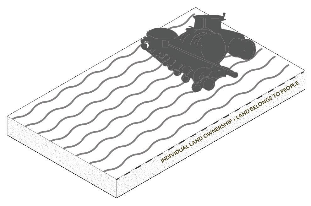
Sustainability without justice is just sustained injustice.
5
Academic Professional 6
South Park, Seattle, WA 2022 (in progress)
Duwamish YouthAssocation:SustainabilityValleyDuwamishVisionProject
The Duwamish Valley Youth Vision Project allows youth leaders to be the liaisons for the Seattle neighborhood, South Park. community in informing the City of Seattle’s Comprehensive Plan Update. Using the Urban Belonging app provided by Gehl Architects, three youth leaders (Joanne, Sebastian & Maria) are using photovoice and equitable data-gathering processes to collect and analyze community-generated data that will then be provided to the city. Community-generated photographs directly respond to the barriers and opportunities within South Park outlined by the City of Seattle’s Comprehensive Plan Update including: Climate Change, Economic Development, Housing, Parks & Open Space, Transportation, and Growth Strategy. After learning and mastering the app themselves, the youth leaders taught other youth and residents of South Park how to use the app and tell their stories. In the coming weeks, the youth leaders will lead workshops on discussing and analyzing the data gathered. This is a way to tell stories from community members on what they wish to improve, as well as preserve within South Park.
moretheirworkshopscommunityleadersCollectively,experience.theyouthwillleadmembersintoanalyzeowndatatogainnuancedinsights.
Local youth showing us their community via photovoice.
With data from the app as well as the workshops, maps will be created in GIS to spatially represent the community’s stories and lived experiences.
Analyzing data from app in a workshop
1 2 4 3 5
ENGAGEMENTCOMMUNITY
ADD ANALYSISGIS GEOMAPPINGAND

COMPILE MAIN INSIGHTS
WORKSHOPS TO INTERPRET DATA TOGETHER
PROMPT:
Together, the maps and information will be implemented into a report for the City of Seattle to use as a guide when re-writing the Plan.Comprehensive
7
Show us the Duwamish Valley through your lens and capture waht is meaningful to you. What would you like to improve, and what would you like to protect in your community?
COLLECTIONDATAPHOTOVOICE
Work closely with local youth leaders to design and frame the study. They also help shape the photovoice study; the prompt and annotations in app.


Use photovoice and Gehl App to engage youth leaders and community members in documenting their lived
Youth leaders teaching other local youth the app.
8
Seeing the community through their eyes
C: South Park is poorly connected to the rest of the city, due to bad infrastructure
SP
B: South Park is in flood zone and next to waterwaste and industrial shoreline
A: South Park is only residential urban village enclaved within industrial zoning
E: South Park has one of highest % income under 200% of poverty line

GIS MAPPING & PHOTOVOICE DATA
The project combines photovoice data (map E) with GIS analysis, showing how ecological, social justice and mobility issues are connected in South Park: Map (A) shows how SP is the only ‘residential area’ in the city enclaved within a industrial zone. Map (B) charts ecological data to show that SP is prone to flooding, is positioned next to industrial shoreline and has many private-owned wastewater drainages on the other side of the river polluting the river. B also shows almost no DWW swales (biofilters) installed in SP. Map (C) shows how SP is connected to the rest of the city via the street grid. Map (D) and (E) show that SP has one of the hightest percentagse in Seattle of people of color and people with income under 200% of the poverty line.


D: South Park has a high percentage population that are people of color

percentageline of color
% people with
E: Engaging local communities in South Park, member have captured 300+ photos of what they want changed in the neighborhood + what to preserve in SP.


SOUTH PARK & GEORGETOWN ARE AMONG ONEINANDNEIGHBORHOODS,LOWESTSEATTLE’SINCOMESOUTHPARK,PARTICULAR,ISOFTHECITY’SMOSTETHNICALLYDIVERSENEIGHBORHOODS.

Spring 2020 | Individual | Seattle, WA


Pier 48 Laboratory
Remediation Site, Research Facility, Cultural Center, Public Park
GEORGETOWN


LIFE EXPECTANCY IS 8 YEARS SHORTER IN THE DUWAMISH VALLEY THAN THE CITY OF SEATTLE AND KING AVERAGES,COUNTYAND A FULL 13 YEARS SHORTER COMPARED TO MORE NEIGHBORHOODSAFFLUENT
The lower waterway of the Duwamish River is a Superfund Site whose muddy bottom includes high levels of toxic sediment, a result of the river’s long history of industrial use and the continued pollution from stormwater runoff and Combined Sewer Overflows (CSOs). The Duwamish Valley’s riverfront neighborhoods of South Park and Georgetown are home to residents who are among those most impacted by the Superfund Site. With educational programming and participatory design, Pier 48 Laboratory will not only act as a public park, but a functional landscape that engages local communities in cleaning the polluted sediment of the Duwamish River. Pier 48 will become an inclusive space that connects communities with one another as well as the water. Dredge from the Duwamish is not deemed valuable for cleaning and reusing as is the case with most dredge. This park is asking for a paradigm shift in the way we think about dredge to understand it as a crucial and limited resource to restore shorelines, beaches, and wetlands. My design is an overall strategy rooted in design that uses plant science to clean water and soil.
Academic Professional 10
11 GEORGETOWNSOUTH PARK CONTAMINANTS: CAUSINGARSENIC,(PCBs),POLYCHLORINATEDBIPHENYLSDIOXINS,CANCER-POLYCYLICARMOMATICHYDROCARBONS(CPAHs) DUWAMISHRIVER TOXIC CHEMICALS THAT ORIGINATE FROM HUMAN-MADE SOURCES FORMERLY USED INDUSTRIAL CHEMICALS PERSISTENT ORGANIC POLLUTANTS (POPs) STUDYING THE CONTAMINANTS OF THE RIVER: BIPHENYLSPOLYCHLORINATED(PCBs)DDTCHLORDANEPOPs&DDEPCB


ELLIOTT BAY CAPPING PARK LABORATORY48
12 PIER THEDREDGE48PLANPROCESS
GEORGETOWN
LANDFILLROOSEVELT CAPPING

DREDGECONTAMINATED
PIER
CLEANING
LANDFILL
SOUTH
DREDGEREMEDIATED
RESEARCHACTIVATEDMONITORINGPHYTOTECHNOLOGIESCARBONGENERATION
Once a year for 6 months 137,134 cu.yd of dredge will be cleaned, moni tored, and mixed on site.
WATERWAYDUWAMISH WETLAND RESTORATION CLEAN
Contaminated dredge from the Duwamish Waterway is taken to the proposed Harbor Island Dredge Facility to be dewatered and prepared for phytotechnologies on Pier 48. Moved by barge, the dewatered dredge is transferred to Pier 48 where it will be placed in phytotest plots to be cleaned and monitored. Dependent on contamination levels, cleaning can take up to 10 years. Once deemed ready, cleaned sediment is moved to on site carbon plant to be mixed with activated carbon and prepared for departure.
17 year plan = 7 years of cleanup + 10 years of 960,00monitoring.cu.yd | 177 acres
HARBOR ISLAND DREDGE FACILITY DEWATERING PROCESS
CONTAMINATED DREDGE CLEANED DREDGE
STRATEGY FOR SOIL:
13 DREDGECONTAMINATEDARRIVES ON SITE EXPERIMENTATIONFORINSEDIMENTCONTAMINATEDPLACEDTESTPLOTSPHYTO WHILE IN TEST PLOTS, SEDIMENT IS MONITOREDCONSTANTLY PHTYOTECHNOLOGY: USE OF VEGETATION TO REMEDIATE, CONTAIN OR PREVENT CONTAMINANTS IN SOILS, SEDIMENTS, AND GROUNDWATER +/OR ADD NUTRIENTS, POROSITY + ORGANIC MATTER COMMUNITYCOLLECTIONDATAMAINTENANCE CHANGESPOLICY 10 YEARS ONCE SEDIMENT IS REMEDIATED,PROPERLY IT IS SPRINKLED WITH ACTIVATED CARBON THEN RETURNED TO DUWAMISH WATERWAY FOR RESTORATIONWETLAND MICRO LEVEL > PHTYOTECHNOLOGIES TO COMBAT CONTAMINANTS PLANT CAPS CONTAMINANT + HOLDS IT IN PLACE PHYTOSTABILIZATION PLANT STORESCONTAMINANT,TAKESIT,AND IS HARVESTED PHYTOEXTRACTION SOILS CONTAMINANTDESTROYSBIOLOGY RHIZODEGRADATION ON-SITE PROCESS > MACRO LEVEL


Wetland reserve constructed from dredge material. This is not only for educational purposes of how dredge material is beneficial, it is rhizofilitraion for the surrounding water body.
burned and reused for biomass material. Activated carbon will be generated on site, mixed into clean sediment, as well as shipped to other parts of the contaminated Duwamish Waterway for Natural Enchanced Recovery efforts.
EVENT SPACE
A Constructed Wetland

A C B
C Activated Carbon
14 CULTURALEVENTS EDUCATION STEWARDSHIPCOMMUNITY+RESEARCH OPPORTUNITIESJOB PIER 48 LABORATORY SITE PLAN
are spaces to connect visitors with cleaned dredge material, as well as the processes happening underwater. Mudrooms can not only act as outdoor classrooms but more spaces for cultural events.
ELLIOTT BAY ENTRANCE
ACTIVATED CARBON PLANT + MIXING SPACE WETLAND OBSERVATION POINT + BALLAST ISLAND LEARNING CRANESPACE+TRUCK DUMP SPACE BARGE
Activated carbon can be used to prevent PCBs and other pollutants from entering the food chain. It is created from biomass materials such as wood, coconut shells, and coal. The harvested plants from the phyto test plots will be
PHYTOTECHNOLOGY TEST BOARDWALKPLOTS
B CarvedMudrooms“mudrooms”
MOWED + ANNUALLYHARVESTEDTOREMOVE ANY POLLUTANTS EXTRACTED THICK VEGETATION PREVENTS SOIL EXPOSURE TO PEOPLE & SPECIESENVIRONMENTSELECTION HELPS BIND CONTAMINANTS TO SOIL THICK PLANTED LAYER WITH NO EXPOSED SOIL Zone of contamination (0-5 ft. deep) PLANTING MIX CAREFULLY SELECTED TO EXTRACT & STABILIZE A mixed herbacious planting utilizing phytotechnology mechanisms. Provides maximum amount of phytotechnology benefit over large area using low-height species with minimum exposure to risk. PHTYOTECHNOLOGY TEST PLOTS 1. annuusHelianthus 2.Sunflower virgatumPanicum 3.Switchgrass Carex aquatica Sedge 4. paniferaMaclura Osage orange 5. pectinataSpartina Prairie cordgrass 1 2 3 4 5


16
During an experimental film studio, I created a film titled We are Still Here, a commentary on the city’s neglegence to the pollution of the Duwamish River.


EXPLORING THE RIVER THROUGH FILM AND WATERCOLOR

17
Creating art works that communicate stories about the toxins in the Duwamish River, I explored various materials to make the otherwise invisible pollutants tangible, mixing watercolor with elements such as coffee grounds, nail polish remover, and candle wax.


In the Spring of 2020, I co-founded the Tierra Media Project alongside 8 other designers with roots in Latin America, supported by the Landscape Architecture Foundation’s Fellowship for Innovation + Leadership. In June 2022, we presented a yearlong project at the LAF Symposium launching an open space media platform that celebrates and supports alternative ways of knowing and working with the land. Rooted in a Latinx/ American perspective, we propose “La Tierra” as a reorientation of conventional landscape practices, replacing exploitative and disruptive methods with frameworks for designing with nature. We exist to provide a safe space for inspiration, connection, learning, and reflection about our relationship with each other and the land. Based on our own collective identities and experiences, we reckon with centuries of trauma, displacement, and erasure, and created Tierra Media as a platform that connects landscape to healing, community, representation and joy. Based in counter-archiving and environmental justice, the platform continues to collect research, stories, and resources that cultivates a collective imagining of new futures for ecology and the field of landscape architecture.
Tierra Media Project

Academic Professional 18
Making space for Latine/x/a/o voices in search of new definitions of engagement with the land
2021-2022 Landscape Architecture Foundation
19

Reframing Farmworker Justice: Decolonizing Land Stewardship


I applied methods of historical analysis, community outreach, mapping, interviews, and contemporary archival research to learn from the perspectives of different disciplines, amplify the voices of Latinx farmworkers and activists, and leverage traditional ecological knowledge from Latinx farmers. I first ground this project in a historical analysis of the U.S. agricultural complex then zoom into the Skagit Valley of Washington State to explore stories of resilience from six indigenous Latinx farmers to learn from their methods of place-making, preserving biodiversity, and protecting agroecosystems in the face of hegemonic structures as Indigenous sovereignty must be at the forefront of how we address climate crises.
+
My thesis was a speculative design project about rethinking the future of the U.S’s current industrialized agricultural system to one that is a community-based, reciprocal system led by the very people who are currently exploited in current paradigms, Indigenous Latinx farmworkers. Immigrants from Mexico, many embody and bring traditional ecological knowledge of tending to the land with them, which is a term I call displaced ecologies. To imagine an alternative future with full farmworker autonomy

+ NEW DEAL
2020-21 | Master’s thesis | Skagit Valley, WA
U.S.THEINFARMWORKOFHISTORY Academic Professional 20
21 AWARD + IMMIGRATION AND CUSTOMS ENFORCEMENT + BRACERO PROGRAM + THE UNITED FARMWORKERS + NAFTA + H-2A


CO2 H2O
SOIL EROSION + DEPLETION

22
PESTICIDES’ HEALTH EFFECTS
CURRENT EXTRACTIVE FARMING METHODS
TILLING KILLS + DESTROYS CRITICAL MYCORRHIZAL FUNGAL NETWORKS
AIR POLLUTION
H-2A FARMWORKERS ARE HIRED ON TEMPORARY WORK PERMITS AT THE BEGINNING OF THE SEASON AND SENT BACK TO THEIR HOMELANDS ONCE THEY ARE NOT
NEEDEDRESPIRATORY•PHLEGM•COUGHING•WHEEZINGACUTESYMPTOMS•STINGINGEYES•DIARRHEA•NAUSEA•BLISTERSCHRONICHEALTHEFFECTS•CANCER•INFERTILITY•BRAIN+NERVOUSSYSTEMDAMAGE•ASTHMA
These models depict the current industrialized agricultural system and its contribution to environmental crisis. It is a model that people at the top of the hierarchical business structure use to base their decisions solely on profit, leaving those at the bottom (people, land, and water) to suffer.
MAXIMIZING PROFIT
23
MONOCULTURE

DESPITE HAZARDOUS AIR QUALITY, FARMWORKERS CONTINUE TO WORK DURING WILDFIRE SEASON, PROVIDING US WITH OUR FOOD IN DANGEROUS CONDITIONS
GROUNDWATERTOXICRUNOFFENTERS
NO CROP ROTATION / COVER CROPS
WILDFIRE SEASON

THE AGRICULTURAL PRACTICE OF PRODUCING OR GROWING A SINGLE CROP, PLANT, OR LIVESTOCK SPECIES IN A FARMING SYSTEM AT A TIME. LACK OF DIVERSE CROPS REQUIRES INCREASE PESTICIDES AND FERTILIZERS

N
24
(above) Map of the geography of the Skagit Valley, illustrating the crops that are grown there. Each crop is ranked by color according to labor intensity; the need for manual labor is ranked high, dark yellow, whereas the use of the machines that could replace people is low, dark green. Through this mapping, I am making the assumption that more labor intensive farms, with crops that require hands-on labor, have a higher possibility of exploitation.

ZOOMING INTO THE SKAGIT VALLEY
(bottom) Closeup map of the Skagit Valley illustrating the effect of pesticides on the Skagit River.
Zooming into the Skagit Valley, Washington which is the richest agricultural areas in the Western Hemisphere. As depicted in the maps the current geography is one of farmworker exploitation and toxicity from pesticides. Amongst these oppressive structures, however, the valley is also home to six Latinx farmers who are at the forefront of revolutionizing farming with traditional ecological methods of growing and harvesting food, stewarding the land, and non-exploitative practices of labor. These tensions are creating two realities in the valley.

COMMUNITY ENGAGEMENT: LEARNING FROM SIX LATINX FARMERS


The organic methods that the Latinx farmers use are essential and their farm ownership is one step closer to creating a just agricultural system and changing the geography of the Skagit Valley to improve human and ecological conditions.


25

LAND SOVEREIGNTY
THE RIGHT OF PEOPLES TO HEALTHY AND CULTURALLY APPROPRIATE FOOD PRODUCED THROUGH ECOLOGICALLY SOUND AND SUSTAINABLE METHODS, AND THEIR RIGHT TO DEFINE THEIR OWN FOOD AND AGRICULTURE SYSTEMS
From what I gathered from the Skagit Valley farmers, an alternative future for a more just food system is not only possible, it is on its way. These drawings show sustainable and just ways of growing food, displaced ecologies being grounded into organic methods, and examples of how embodied knowledge can positively change the food system. These methods foster a collective community, a stronger connection to the land by elements of indigenous ecology and agrobiodiversity. These are the ways that strengthen ecological and economic resilience in the face of today’s climate, water, and energy crises, ones where the land and people are no longer oppressed, and offer a path forward for growing food for us all.
FOOD SOLIDARITYSOVEREIGNTYECONOMY
NO TILLING PROTECTS MYCORRIHZAL FUNGI + ENTIRE SOIL ECOSYSTEM + REDUCES EROSION
26
THE RIGHT OF WORKING PEOPLES TO HAVE EFFECTIVE ACCESS TO, USE OF, AND CONTROL OVER LAND AND THE BENEFITS OF ITS USE AND OCCUPATION, WHERE LAND IS UNDERSTOOD AS RESOURCE, TERRITORY, AND LANDSCAPE
AN ECONOMY THAT IS IN SOLIDARITY WITH THE EARTH, MEANING WE RELEARN OUR SKILLS AND LISTEN FOR THE LOGIC, RHYTHM, REASONING, AND METHODS THAT THE EARTH COMMUNICATES TO US
ALTERNATIVE FUTURES
AUTONOMY:FARMWORKER

CO2 SOILH2OHEALTH

IMPROVES SOIL FERTILITY, SOIL STRUCTURE, WATER INFILTRATION, AND MODIFIES CLIMATE AROUND PLANTS
MAINTAINING A FUNCTIONAL BALANCE, AGROECOLOGICAL SYSTEMS ARE BETTER ABLE TO RESIST PEST AND DISEASE ATTACK
27
COVER CROPS
SENSE OF COMMUNITY


NO PESTICIDES
INTERGENERATIONAL KNOWLEDGE
IMPROVEDWATERRETENTION
REDUCES WEED INFESTATION BY TAKING THE SPACE WEEDS WOULD NEED TO GROW
CROP ROTATION
Academic Professional 28
N
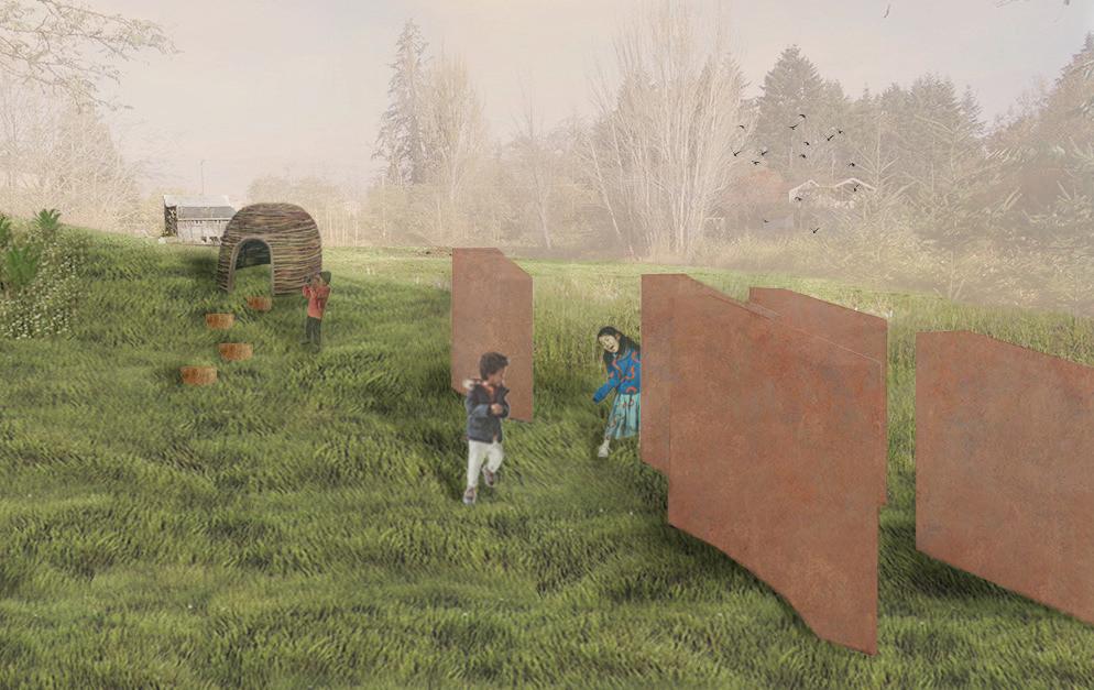
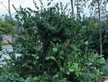
Our site proposal looks at prairie landscapes both as a precedent typology and as a symbol of generosity. Prairies were once abundant in the total original native landscape of Western Washington, but are increasingly fading as a natural environment of the region. To reintroduce this typology to the Heron Meadow, we promote four themes of generosity with our design: sanctuary, connection, biodiversity, and access for all that visit and dwell on the site. Because the meadow is loved already, we approached the site with a light touch, responding to the programs, features, and the ecologies that already exist. Studying the plant and wildlife habitats of Vashon Island, we proposed a design that embraces the landscape, cultivating a welcoming landscape to all species. Our proposal includes a boardwalk that loops around the site, nature play elements, an amphitheater and other performance spaces, a prairie restoration and management plan and a new wetland in the NE corner of the site. Ultimately, our site design is a bridge between local ecology and community, connecting people with nature.

Generous Grounds
Autumn 2020 | Group | Vashon Island, WA
Reciprocal Landscapes
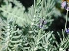
Prairie oak plant palette + species biodiversity diagram.


Image credit: Jocine Velasco


View of the site from West to East.
Prairie oak restoration phasing plan.


PHASE 1 PHASE 2
Adapted from: Bowcutt, F., & Hamman, S. (2016). plants of South Sound prairies (First edition.). The Evergreen State College Press.
C + N P WINTER SPRING
30

Image credit: Jocine Velasco
the
Vascular
WINTERSPRING WEED REMOVAL SEED DISPERSALNATIVE SPECIES PLANTING HABITAT SANCTUARY FOR SENSITIVE SPECIES SOIL AMENDMENT ADD SUGAR,CHARCOALORSAWDUST, TEST FOR CONDITIONSGROWINGIDEALFORPRAIRIE-OAKECOSYSTEMHERBICIDEREMOVALHAND PRESCRIBEDBURNSTHISTLEREEDGRASSCANARY TANSY RAGWORT CANIMMOBILIZATIONMICROBIALREDUCENAND P POTS PLANT PLUGS SEEDS STREAKED HORNED LARK TAYLOR’S CHECKERSPOT MARDON SKIPPER SOIL TEST PLOTSPECIES ESTABLISHMENTMOWING INVASIVE SPECIES
NATURE PLAY
SAVINGSEED BURNS

PLOT SAMPLING GARRY OAK ESTABLISHMENT
PHASE 3 SUMMER AUTUMN
31 SPRINGSUMMERAUTUMN
Bottom-right: People playing music and dancing in the grove in the NW area of the site.
SEASONAL
Top-right: Kids playing through the sculptural garden in the SW area of the site.

InterAction Nepal: Design, Development, + Global Health
Academic Professional 32
3 8 9 10 2 3 4 5 6 7 8 9 10 meters N DRAINAGE CONNECTION community park / garden / play area trees & vegetation for slope stablization community soundsystem along electric line chautari showersfinished connectionwall-benchesend-of-roadtocitydrain drainage connections future biocell at bottom of hill central waste collection motorcycle parking foot path & possible future road entrance gate biocell: greenery + stormwater mgmt electric lines along durable poles wall-bench shade/shelter&community message board water taps street porchesplantedgarbagesewageretaininglightswallpipes+recyclingareas
Autumn 2019| Group | Kathmandu, Nepal


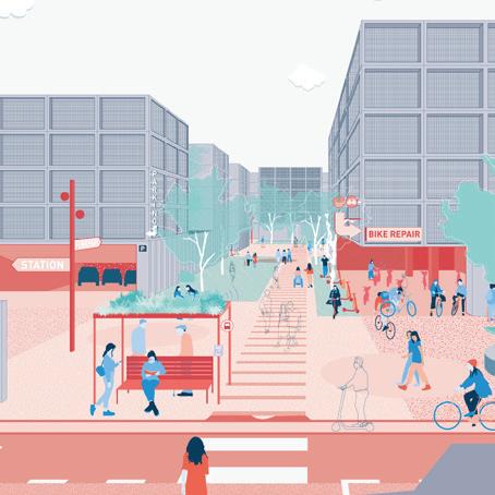
InterAction Nepal was an immersive, interdisciplinary study abroad program that challenged us to delve into contemporary issues surrounding urban development in the Kathmandu Valley to respond at a local scale through community based participatory design, implementation, and impact assessment. We worked with local students and families from Bhangal, an underserved community located in the outskirts of the city, both to design and construct a small-scale intervention, and to evaluate project impacts on human and environmental health. After several workshops with the Bhangal community, the residents requested a design for a community road. I was on the site design team that designed a paved road, drainage system, covered seating areas, and plantings. After a series of design iterations and voting sessions, we began construction. With support from municipal representatives and non-profit organizations, along with the leadership of community members, the project came to fruition.

PROCESSDESIGNIMPLEMENTEDDESIGNCONSTRUCTION


Biocell implemented to clean and stormwater.filter


33

Design recommendations to combat air pollution in cities

Academic Professional 34
ØrestadPrisemhaven, BryggeIslandsPark,Havnestaden BoulevardØrestadBusstop,
Gehl Architects: Thrive Zone Amager

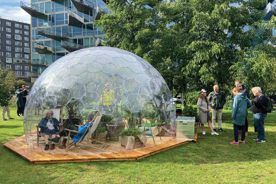
Image credit: Gehl Architects
The Thrive Zone Amager project used temporary pilot installations as a realistic test of how to address air pollution in cities. The project investigated how Ultra Fine Particles (UFP), Black Carbon and PM2.5-PM10 particles behave in city-specific contexts, whilst also exploring ways of reducing exposure and creating inviting public spaces for people through ecological design. One pilot included a vegetation barrier along a busy road with integrated seating, sandpit, colourful plantings and lighting. Two other pilots tested non-permeable dome barriers. We used a Measure-TestRefine methodology to enhance our understanding of urban design and its impact on air pollution by measuring UFP-levels in and around the pilots, while simultaneously studying how the installations affected people’s behaviour. This led to refined urban design recommendations for cities aiming to reduce citizen exposure to air pollution. In addition, the three pilots also proved to have positive social impact by providing different types of social meeting spaces, inviting people to spend time outside, and encouraging use of green areas for a range of activities. Copenhagen, Denmark 2021
NON-PERMEABLE BARRIER
NON-PERMEABLE
BARRIERVEGETATIVE BARRIER
Thrive zone pilot projects all three pilot projects have been built and continue to monitor UPF levels.
4. Where space is tight, incorporate non-permeable barriers (ie. 3mm polycarbonate) with thinner Type 5 Vegetation Barriers to improve their effectiveness
3. Design with thicker Type 3 Vegetation barriers where space permits (and incorporate nonpermeable barriers if feasible)
5m44m
a semi-controlled laboratory environment for testing
KINDY KINDY
35
proposed vegetation barriers protect against the most problematic wind directions at the specific site
2.quality.Ensure
Non permeable barriers
? ? ? ? ? ?
Non-permeable barriers
13% lower PM2.5 levels
1. Conduct wind analyses prior to design to evaluate the most problematic wind directions for local air
5. Consider surrounding communitiess/facilities and incorporate in-built seating (or other social furniture) within air pollution barriers to improve social environments
Ørestad ‘Open Street’ UFP Measurements Section
Due to high levels of air pollution and poor microclimatic conditions experienced in public places around Ørestad, the Thrive Zone team created a series of human scale protected semi-outdoor meeting places for locals in the form of polycarbonate domes. The domes created protected places for bus passengers who can wait up to 20 mins on polluted roadsides.
Our research highlights the effects of a new type of vegetative structure (on open roads): Type 5. Open road with an evergreen, thin green wall (without a non-permeable barrier).
3m
12% lower UFP levels
Vegetative barriers
36 ØS02a Prismehaven@A3 Pilot Ørestad Dome, Prisemhaven Pilot Ørestad Buslet, Ørestad Boulevard Planting plan Ørestad Buslet, Ørestad Boulevard Pilot Havnestaden Park, Islands Brygge Si Al 3 3Gr 3 Cr Ep 2 Vm 4 Vm VmVm8 Ep 3 La 7 Pt 5 La 4 Ep Si Tm 2 Vm 3 CrGm2 Ep 3 Pt Tm Si Fm Pmc Pmc


Thrive Zone Plant Matrix


Si Al Pl 3 Tl Gr5HeGr 4 Gr Cl Gr 2 La 2 Cr 8 Sb Fm FmFmTm Tm 3 Ep Gr Gr Gr GrGr Cr 6 Vm 2 He 2 Vm 3 Ep 3 Vm 3 Aj 4 Sb 3 La 2 He 7 Pt Tm 4 Gr 4 Gr 4 Gr 2 Vm 2 Vm 4 Aj 4 Aj Sa Tm TmTm 2 Co Pl Pl 9 PmcVm 3 FmCm 2 Mt 3 Pg Md
In the pilots, we used many of the specific species that are recommended for deposition of air pollution particles (in Kumar et al. 2019, Kumar & Barwise 2020), as well as new species which added a more biodiverse mix to the existing palette, and seasonal interest for people using the pilots in the summer months. The plant matrix also highlights the greenhouse tolerant plants that successfully survived the warm summer inside the polycarbonate Domes.


37 HairyLeaf WaxyLeaf SeasonalInterest HairyLeaf WaxyLeaf SeasonalInterest WindflowerCHARLOTTEKONIGINAnemonePurpleEchinaceaPachysandraJapaneseterminalisPachysandrapurpureaConeflowerjaponica serviceberryAlleghenylaevisAmelanchierMugo‘Columnaris’PinusBoxwoodsempervirensBuxusCherrylaurocerasusPrunuslaurelmugoPine Evergreen GreenhouseTolerant BroadLeafShrubs and Hedges Ficus caricaStrelitziaFig augusta White Bird of Common‘Woerner’HederaParadisehibernicaIvyClimbers GrapeVitisViburnum tinus WhitebeamSwedishSorbusViburnum‘Lucidum’intermedia Evergreen GreenhouseTolerant BroadLeafTrees AppledomesticaMalusCitroncitroenLemon HairyLeaf WaxyLeaf SeasonalInterestEvergreen Stachys CoralHeucheraFuchsiaHummingbirdFuchsiaEnglishangustifoliaLavandulaMyrtleVincaGardenTropaeolumCranesbillGeraniumLamb’s-earbyzanthinia‘Rozanne’majusNasturtiumminorLavendermagellanicasp.Bells GreenhouseTolerant BroadLeaf Groundcovers


Gehl StrategyCommunityArchitects:Foodscape
Site
Four neighborhoods studies each neighborhood offers different food experiences.
Professional2022
Site
Site
Academic Professional 38
This project is the result of a seven month collaboration with Cities Changing Diabetes (CCD). In Bogotá, Colombia, we studied four sites to explore two questions: 1) What is the relationship between the food system and urban environment ? 2) How might we achieve a positive dietary shift at neighborhood level through local interventions and strategies? The foodscape study combined an analysis of the food places, the public life, and the public space that makes up a specific environment. It works at a ‘systems thinking’ level with understanding three realms of influence over a foodscape; how individual people, businesses, and institutions shape the foodscape. Developing methodology to collect such data was key to bringing human stories and people-centered data into the conversation. The project concluded by offering recommendations to CDC about ways to implement, design and program activities to improve the food environment. These came in the form of pilot project concepts, and a pathway for how these can lead to achieving bold visions and lasting impact.

(Sur)Paraiso03
GREEN MARKET malnutritionof20%acute in experiencechildren64% lack of safety in spacesopen 50.4% of places in Bogotá suffer from commuting1.5-2insecurityfoodhourstoworkdaily
Site

Bogotá, Colombia
04 Los Oriente)(Centro)Puentes
01 El Porvenir

(Norte)Paraiso02

Develop Healthy Food Strategy Criteria For Success
By building upon data and human stories, and using pilot projects, we create lasting change in the foodscape.
Data Collection
Use success criteria and momentum from the pilot to attract larger change,investment,infrastructurepolicy&more.Interventions that start to achieve the foodscape strategy on a small scale at the neighborhood level. Pilots can help make the case for the larger, investmentslonger-termneeded.

39
NEWS BUS Café MARKET Super Market Café Café GREEN MARKET Super Market NEWS BUS Food places
Scale Strategy For City Wide Impact 1 2 4 3 5 6 Germantown Penrose Recreational Center St. St. St. ark German e.DiamondSusquehanna CecilMounMoogomeryBerNorris Diamond MounBergomeryNorris DauphinSt.orkSt. SusquehannaDauphinSt.ork CumberlandHuntingtonLeighAveAve LeighAve Fotterall Square onFocuslighirailline improvementsBusstop Mobilevacantvenders Create templeconnectionstrongerCelebrateDo-life-grewFoodspaceNew vendersmobilePermanizeedgeseating stationaryMoreImprovingsidewalksspaceforactivities Geasy Field PHILLYFARMERSPRODUCESTAND COLD BEER ComfortSafetyDelight 89% 10%1%
Evaluate & Set
Rather than things and artefacts, we engage with experiences, stories and Basednarratives.onthestories we find from observation and engagement, we develop a series of strategies to achieve 'lasting impact’ in a localindicatorslong-termlocalEvaluateneighborhood.successofprojectsagainstvaluecreationtogetherwithstakeholders.
A data driven approach to understanding the local context of where everyday life happens through a process.stakeholdermulti-planning
The components of a foodscape one’s surrounding environment, and defines the food experience of neighborhoods and communities.
Public Space
Intervening in the foodscape
UserUnderstandingExperience
Public life
Test With Pilot Projects
A bridge between quantitative and qualitative observational research. It places an emphasis on orienting data to design and then to action. Working with foodscapes requires a triangulation of data to understand the relationship between the city, its citizens, and the food they eat. This approach is based on the human dimension – the built environment’s effect on social interaction between people. From collecting data, the project distilled insights about this into ‘six pillars for a healthy foodscape’, which was used to engage local stakeholders in workshops to identify pilot projects best suited for their respective neighborhoods, anchoring actionable interventions in local insights from the affected communities.
The Public Life Study

40
We count people moving through the city on different modes of transportation. We map where and how people stay, the activities they engage in, and the demographics of people present or missing from the public realm.


The Foodscape Study

Methodology
The Intercept Survey
A People-First Approach
We conduct a range of qualitative methods (focus groups, on site interviews and online questionnaires). Questions are framed by how people spend time in the public realm, how they get around and to where, and the habitual relationship people have with food.

We measure food behavior - how people move food items, and how people stay in the public realm with food. We measure the food environment - mapping the frontages of food places to determine how they meet the street.
72˚ degree viewing angle Kiosk Alleyway 0238 3 out of 4 people cook and eat at home everyday 25% of people eats in public space or transit 40% of dailythancommutepeoplemore60minutes 75% of the offer is processed foodsultra-processedand From collecting data distilling insights1 2


Local stakeholders are presented with pilot proposals and decide which to test, anchoring interventions in community knowledge & needs

to
3 4
41
to
Image credit: Gehl Architects building strategy & proposing pilots selecting pilot projects in workshops


Academic Professional 42
RecreationalOffice
In this project an interdisciplinary team of architects, urban anthropologists and landscape architects advised German motorcompany Daimler on how to turn a 120 Ha office campus, Synergiepark, into a ‘circular city’, optimising the use of urban assets such as vehicles, buildings, parking lots and roads. With 25.000 people working in the office campus, the Synergiepark comprises its own small city. Being located a 13 min train ride from Stuttgart, the Synergiepark sees almost all its employees return to the city immediately after work. While the majority of workers commute singly in cars, 90% of parking spaces on campus stays empty post-covid as people are continuing to work from home. Combining research and design, we delivered conceptual design proposals for how to turn under-utilised car park spaces into public areas that invite for a richer life, while transforming the car-intensive mobility into a circular economy in which commuters combine train, micromobility and carpooling. Working with the ‘15 minute city’ we proposed ways to connect campus with Stuttgart, reduce waste, and combat air pollution.
To Stuttgart Stadtmitte
stationTrain Residential CampusV Synergiepark, Stuttgart 2021
Gehl DaimlerArchitects:Circular City
CLUSTERAMENITYTRAINSSUPERMARKET
43 stationTram
From the ‘Gehl’ toolbox we combined public life observations at three selected sites with facade analysis, and parking data collected by Daimler, revealing 22,225 square meters of unused space. Adding to the research, we did a spatial amenities study of campus as the ‘15 minute city’ with which we were able to geomap that the biggest amenity cluster is a 20+ walk away from campus. Meanwhile, GIS mapping revealed that the nearest programmed green space is 10 minutes walking from campus.
Synergie Park
Current Daimler campus misses opportunity to programme spaces for what could be the natural heart of the Synergiepark.
TRAMS
BUFFER
5 MIN AMENITIES
An isochrone takes into account the irregularity of the street grid. Each contour represents how far you can walk in 5 minutes.
Buffers represent the walking distance “as the crow flies” 1.25km
Present day an above ground experience is dominated by parking, whilst the underground facility is near empty.
Data
Under-performingSpacespaceswork
harder to create a more coherent, walkable urban experience.


44
Daimler’s assets leveraging existing assets to optimise performance.
The existing mobility offer ‘opened up’, establishing a mobility hub for the district.

Agents of change for sustainable circularity
Available, accessible and translatable data unlocks the potential to scale impact.MobilityPeople

m²
M T T FW
Präsidium Parking
A resourceful approach can contribute to a holistic vision of circularity. Over time, impact can be scaled from the parking spot to the district.
DekraAllianz
% 1MODULE ANDCOLLECTIONDATAPILOTBENCHMARKINGDISTRICTIMPACTSYNERGIEPARKIMPACTCAMPUSPROJECTSANALYSIS0MODULEXMODULE3MODULE2MODULE 45
Utilising space
Parking Space
Lapp Space
A Holistic Approach
By allowing cars to park underground, campus quality is improved with more space for pedestrians, greenery, and public life.


Thank for your consideration
you
46
