edited by SÉRGIO PADRÃO FERNANDES, PEDRO RODRIGUES
The space to live together: a new cartography of
SETÚBAL
urban-ground
LAB
SÉRGIO PADRÃO FERNANDES, PEDRO RODRIGUES


edited by The space to live together: a new cartography of urban-ground
SETÚBAL LAB
The space to live together: a new cartography of urban-ground ISBN 979-12-5953-030-1 (printed version)
edited by Sérgio Padrão Fernandes and Pedro Rodrigues
scientific coordinators
Sergio Padrão Fernandes, Pedro Rodrigues scientific board
Sérgio Padrão Fernandes, Pedro Rodrigues, Carlos Dias Coelho, Stefanos Antoniadis
editorial board
Sérgio Padrão Fernandes, Carlota Gala, Gonçalo Pirrolas, Rui Justo, Stefanos Antoniadis related laboratories and research programmes
The workshop and the book – The Space to Live Together: A New Cartography of Urban-Ground – has been framed in the research laboratory formaurbis LAB, CIAUD – FA.ULisboa under the Project “BUILDINGS” – Building Typology, Morphological Inventory of the Portuguese City. This book is financed by national funds through FCT – Fundação para a Ciência e a Tecnologia, I.P., under the Project with the reference PTDC/ART-DAQ/30110/2017
drawings by pags: 54, 55, 57, 59, 65, 67, 69, 75, 77, 79, 85, 87, 89, 95, 97, 99, 105, 109, 111 Rui Justo, Gonçalo Pirrolas
translation by Stefanos Antoniadis book design
Margherita Ferrari
publisher Anteferma Edizioni Srl via Asolo 12, Conegliano, TV edizioni@anteferma.it
First Edition: September 2022
Copyright
This work is distributed under Creative Commons License Attribution - Non-commercial - Share-alike 4.0 International
Workshop series
Sérgio Padrão Fernandes and Pedro Rodrigues
TABLE OF CONTENTS
Leonel Fadigas
_FOREWORDS
Stefanos Antoniadis and Gonçalo Pirrolas
Sérgio Padrão Fernandes, Rui Justo and Carlota Gala
_DESIGN STUDIO: BRIEF
THE SPACE TO LIVE TOGETHER: A NEW CARTOGRAPHY OF URBAN-GROUND
_THEORETICAL FRAME
URBANISM AND NATURE: LANDSCAPE DYNAMICS AND TERRITORIAL ORGANIZATION
THE SCAPE TO READ TOGETHER: A NEW ATLAS OF URBAN-GROUND
TOWARDS AN ARCHITECTURE FOR PUBLIC USE: A CONVERSATION WITH SAMI-ARQUITECTOS
6 10 12 21 22 32 42
_DESIGN STUDIO: THEMES
RUINS AND FRAGMENTS: VESTIGES
Sérgio Padrão Fernandes, Alessia Allegri, Pedro Rodrigues Danilo Tavares, Fernanda Costa, Mariana Reis, Roberto Lorenzon
HOUSING TOGETHER
João Leite, Maria Manuela da Fonte Ana Oliveira, Beatriz Cabral, Henrique Nunes, Mariana Frade
THRESHOLD: HYBRID SPACE
José Miguel Silva, Luís Carvalho Alessandra Pace, Carolina Martins, Filipa Lopes, Margherita Maggioni, Mattia Muresu
DISPLACEMENT: TRANSPORT / EXHIBITION
Sérgio Barreiros Proença, Filipa Serpa Cândido do Rosário, Francisco Janeiro, Paolo Richelli, Sara Alfonso, Sara Ribeiro
WALLS AND DOORS: TRANSITIONS
João Rafael Santos, Pedro Bento Elcio Djata, Francisco Manuel, Julianna Costa, Michela Stefanoni, Sara Faedda
_REPORTING FROM SETÚBAL _BIBLIOGRAPHY 53 56 66 76 86 96 107 116
FOREWORDS
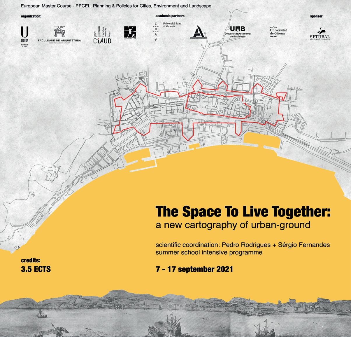
The outputs that are now disseminated correspond to the result of a workshop organized in September 2021 by the Lisbon School of Architecture – Universi dade de Lisboa, in the framework of the International Master PPCEL - Planning & Policies for Cities, Environment and Landscape, advanced education course shared with the University of Girona, the University of Barcelona, the Universi ty of Sassari, and the Università Iuav di Venezia.
The workshop, with the topic “The Space to Live Together: a new cartography of urban-ground”, was attended by 25 students from the different participating institutions. For ten days, they approached the territory of the city of Setúbal, whose urban richness allowed the development of reflections and works on an increasingly important theme in the organization and experience of our urban ground: public space.
Coinciding with the period of the COVID-19 pandemic, the meeting was carried out by the commitment of FA.U Lisboa teachers, among which the Co ordinators, Professors Pedro Rodrigues and Sérgio Fernandes stand out.
However, the realization of this workshop would not have been possible without the logistical, human and documentary support of the Municipality of Setúbal, which from the beginning was essential for the assembly of an event in such an exceptional period.
The reflection and high level of the work produced, which these pages so well illustrate, reveal the capacity that our cities have to be reinterpreted, but also the energy and confidence of the new generations of architecture students, who very soon will be part of the ensemble of the actors responsible for these urban processes.
7
The President of Lisbon School of Architecture Carlos Dias Coelho
The Universities, in general, and especially the University of Lisbon, continue to contribute to the expansion of knowledge around concrete urban problems by carrying out important initiatives. The workshop “The Space to Live Together: a new cartography of urban-ground” is another example of this good practice and, also, for this reason it is imperative to congratulate the organizers of this action to promote knowledge about cities, the way they work, the way we would like them to work.
Mayors have special responsibilities in defining policies and practices for bet ter urban development and, for this reason, we saw this training action in our city as another important opportunity to reflect on our daily options on these urban matters.
It is important to highlight that the Lisbon School of Architecture chose the city of Setúbal as the theme to focus its activities which, naturally, is the reason of our enthusiasm, deserving our support. It is of the utmost importance that students of a Schools that teach what being architect means, as well as the re spective teachers and researchers, were all together investigating and looking into concrete themes of a real city.
A better knowledge of the history and of the urban form will decisively con tribute to having better equipped professionals to intervene in urban layouts, built contexts and public spaces in the future, whether they become technicians working on private projects, or technicians working at any level in the public administration offices. Also for us, as mayors and technicians of the local admin istration, the elements collected in these investigation processes can provide useful tools for our daily task.
As Mayor of Setúbal, I express my satisfaction that our city and our county are such an inspiration for the universities’ investigation and didactic activity.
9
The Mayor of Setúbal André Martins
DESIGN STUDIO: BRIEF
THE SPACE TO LIVE TOGETHER: A NEW CARTOGRAPHY OF URBAN-GROUND
Pedro Rodrigues, professor, architect, CIAUD, Research Centre for Architecture, Urbanism and Design, Lisbon School of Architecture, Universidade de Lisboa
“Of all the architectural elements, the wall comes first. The primary purpose of a wall is to establish a relationship. Association comes before separation.”1
Hamed Khosravi
12 SETÚBAL LAB
Sérgio Padrão Fernandes, professor, architect, CIAUD, Research Centre for Archi tecture, Urbanism and Design, Lisbon School of Architecture, Universidade de Lisboa
The theme “The Space to Live Together: a new cartography of urban-ground” questions ¿what spaces we need tomorrow? and uses as reference the call for reflection of the Biennale Architettura 2021 in Venice “How will we live togeth er”, proposed by Hashim Sarkis.
¿ which public spaces we will need tomorrow?
Public space can be the answer for the challenge launched by the Biennale. The public space is what unify us in the city and, therefore, we propose as a working hypothesis the formulation of a new cartography of urban-ground and a new equilibrium to explore the potential of spaces within the intersection between public and private domains…new equilibrium !
The workshop proposes to re-imagining the public space and uses the city of Setúbal as case study, focus in five fragments of urban fabric with the physical and spatial qualities of a historic city, with a natural harbour vocation and a spe cial topographic context. However, the radical changes that are taking place all over the world will lead to a major transformation of what Setúbal is today. For example, the COVID-19 pandemic or the international economy is changing real estate, property and also the uses and activities that take place in the city. The city is always in transformation, under construction and in decay, in use and transgression. It is a constant process of appropriation and reinterpretation. Inspired on graphic method of Giambattista Nolli, we propose to investigate the public form of the city in order to develop urban projects that seek the possibility of transforming abandoned historical structures into contemporary places that respond to the new demands of a public life. We intend to continue imagining the city! But we also want to find a balance between the existing city, that we inherited from the past, and the need to transforming it in order to con tinue living together.
13
14 SETÚBAL LAB
Setúbal, a city in 3 lines and case studies identification.
15
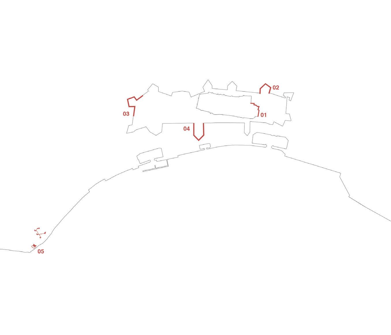
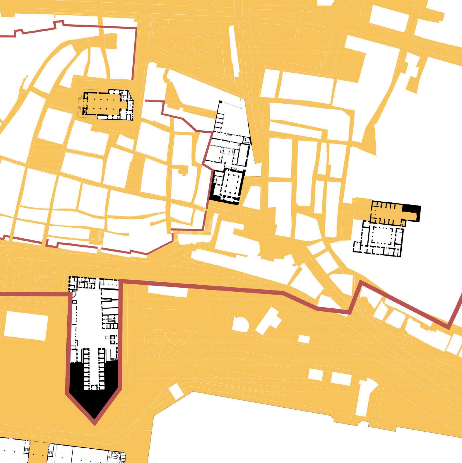
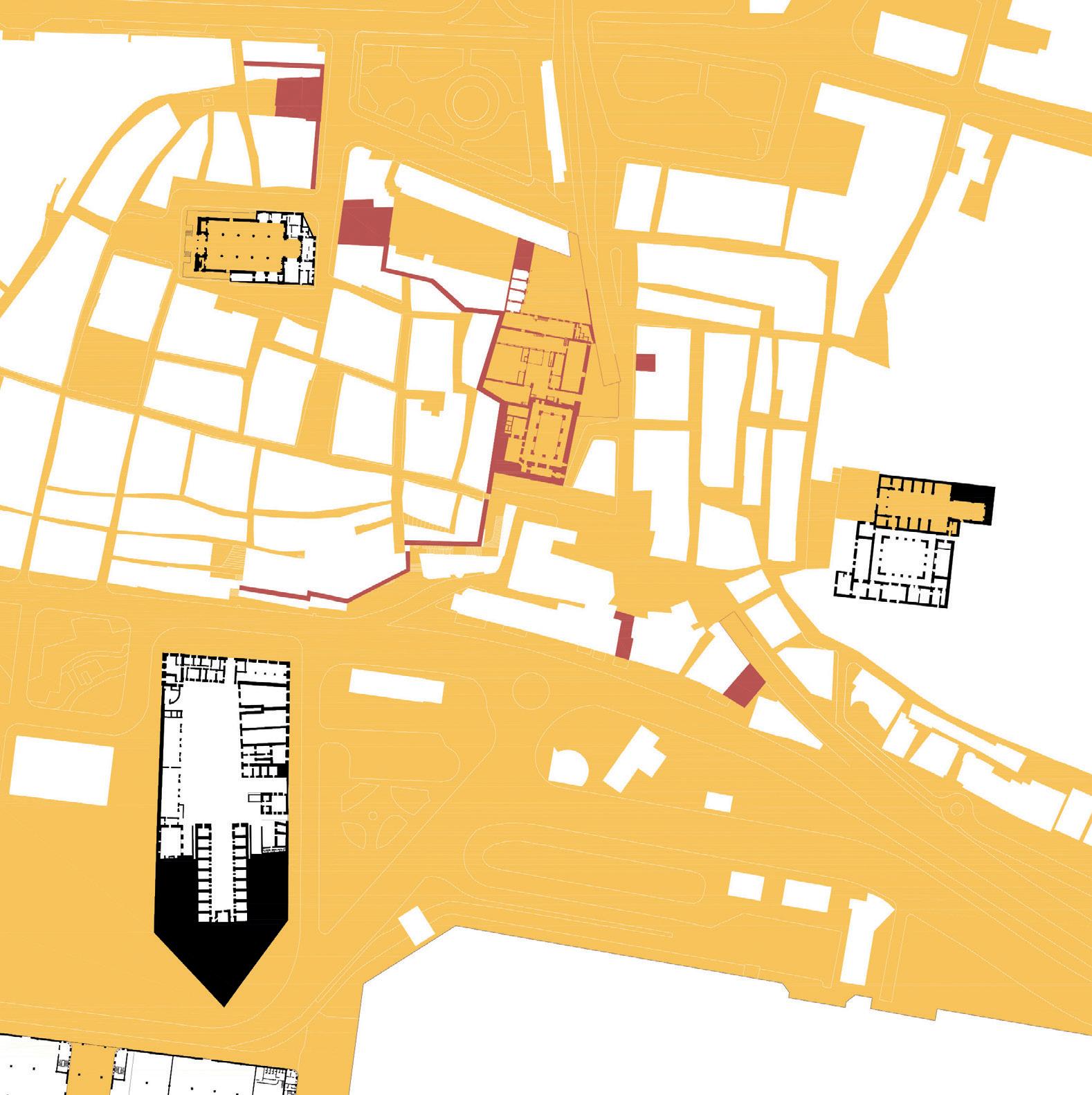
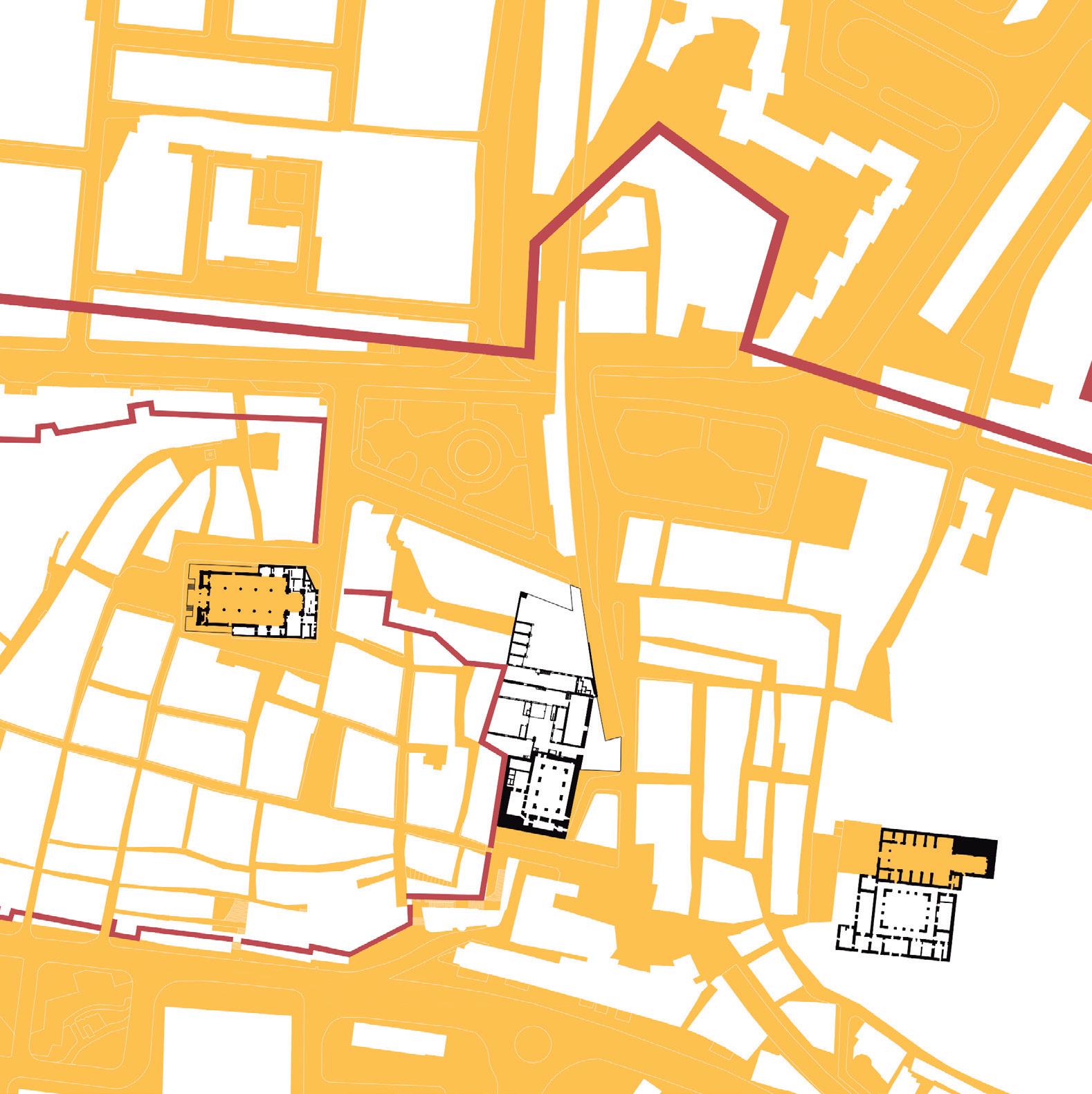
Case Study
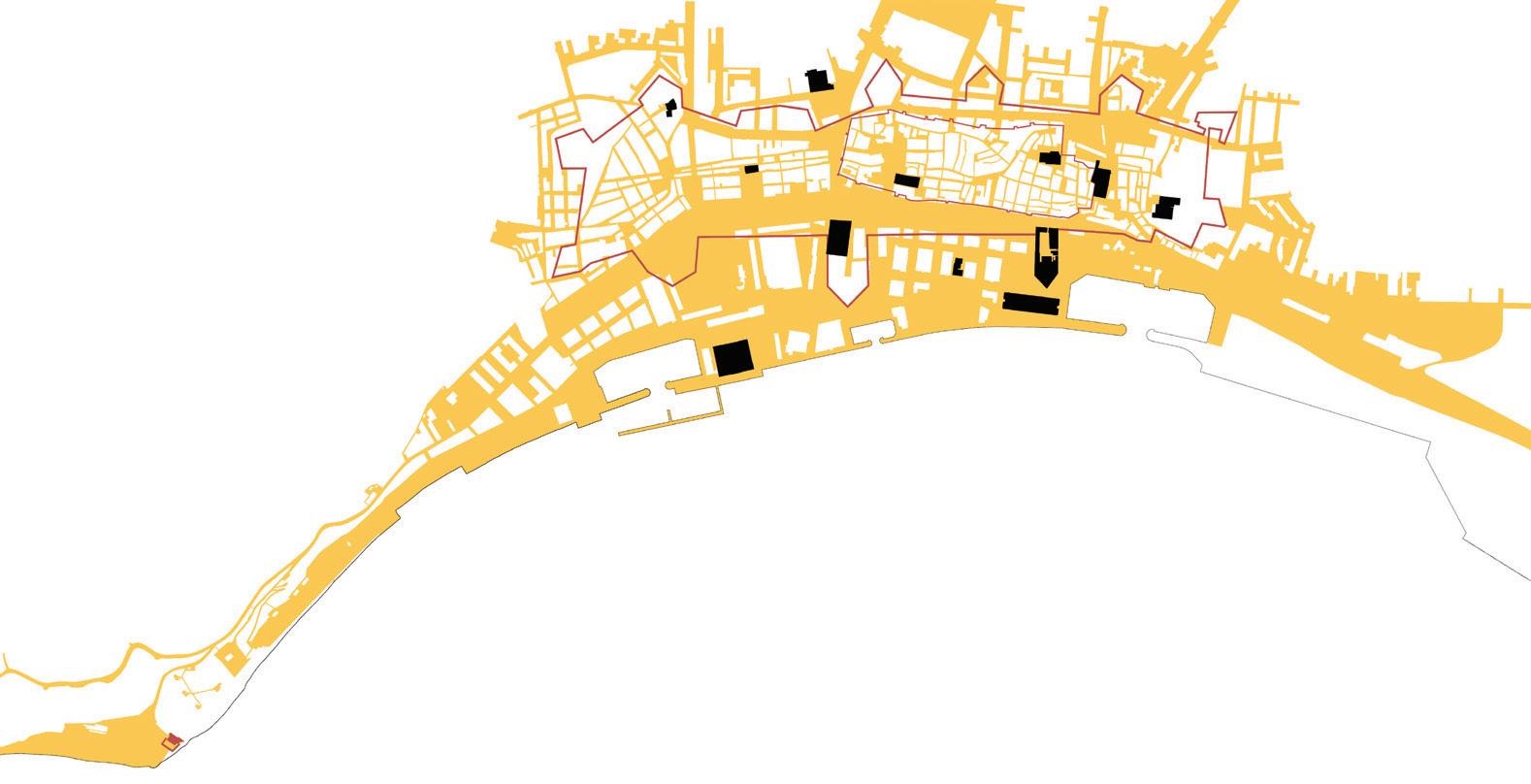
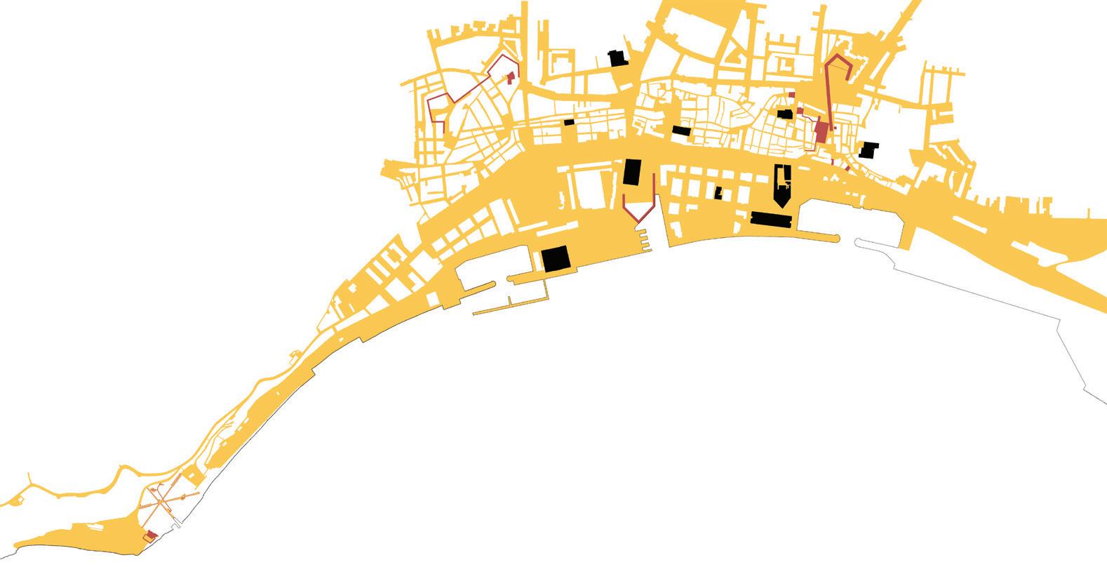
We will take the city walls of Setúbal and its surrounding buildings as our area of study, in broad sense. Within this framework we found 4 forgotten fragments of urban fabric where the wall still persists in time. Another case study, the fifth fragment, is a deactivated battery and an old small fort from the fortified Portu guese coastal line, that controlled the city entrance by the sea.
[case study 01] – medieval wall + old warehouse “a gráfica” + “pátio do Quebedo” [case study 02] – fortress of Sto. António + Quebedo square [case study 03] – fortress of Santo Amaro [case study 04] – fortress of Livramento + market [case study 05] – fortress of Albarquel + Battery of Albarquel + Arrábida
Process
The design studio is organized according to two main tasks: [tasks 01] – reading and concept
In the first task, each team is invited to look and think about the city form, its history, memory and shape. From the recognition of territory, the urban fabric is interpreted/decoded. Furthermore, from a selection/collection of images, new conceptual references to design are formulated.
Start reading the city form:
• public spaces: as squares, streets and alleys;
• accessible spaces: as shops, stores, markets, theaters, restaurants;
• invisible spaces: as rooms offered through the internet, secret courtyards, underground restaurants, hidden urban voids, lost unbuild plots, etc.
In the first task each studio analyzes the city and its existing reality to raise an interpretative and critical point of view in relation to the actual condition of the urban space and its public use through the relation between public-spaces, common-spaces and collective spaces. Select those spaces accurately and es tablish a nexus to relate them.
Deliverables. Synthesis board – containing the following information: 1. short concept text;
16 SETÚBAL LAB
2. interpretative cartography 01 – geral plan of the city walls; interpretative cartography 02 – the footprint plan of the case study; interpretative section – one section of the case study;
3. images – thinking in images / atlas of images that give a conceptual frame to the project;
4. conceptual diagrams – design strategies.
[tasks 02] – design
The second task of the workshop invites the students to reinvent the public urban ground of Setúbal from each fragment - case study. Each team develops an integrated design process using drawings and physical models, to reflect on the urban form surroundings and architectural spaces, exploring different scales of resolution and creative uses of public space.
The second task is based on the urban reading and its findings. Each studio is asked to design an urban system, composed by a set of public/ common/ collec tive spaces that can operate together as part of a network.
Each team is invited to establish an intersection between a site – case study –and a given topic of research – concept – that frames the design process.
Deliverables. Synthesis board – containing the following information:
1. short concept text;
2. new cartography 01 – geral strategy “collage plan” for city walls; new cartography 02 – the footprint plan of the project; new section – one section of the project; axonometric view of the project;
3. collages – proposed urban atmospheres;
4. physical model of the project [conceptual].
Strategy
The workshop activities are organized with a balance between the design studios work and parallel events that intersect the design thoughts and ac tions: a series of field trips [walks] and lectures [talks] that give the frame to the design studios work, mainly the theoretical support and the acknowledge of the city case study.
17
WALKS:
[walk 1] – Setúbal Historical City Jesus Convent, project by Carrilho da Graça architects
[walk 2] – Arrábida, where the natural landscape meets the city Arrábida convent and Arrábida tracks
[walk 3] – Public Buildings and Public Space School of Education, project by Siza Vieira architect Bela Vista neighborhood, project by Charters Monteiro architect
[walk 4] – Public Buildings and Public Space Parish Chapel of Coração de Maria, project by SAMI – architects
TALKS:
[talk 1] – about SETÚBAL place: Setúbal town-hall topic: Setúbal. historical framing lecturer: Isabel Pratas (CMS) topic: Setúbal, the new challenges of the city lecturer: Fernando Travassos (CMS) / Rita Carvalho (CMS)
[talk 2] – about PUBLIC SPACE place: Jesus Convent topic: Public Space and Temporary Use. The New Challenges for Design of Public Space lecturers: Alessia Allegri + João Rafael Santos + Sérgio Barreiros Proença
[talk 3] – about URBANISM and NATURE place: Arrábida Convent topic: Urbanism and Nature lecturer: Leonel Fadigas
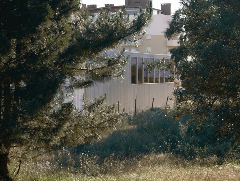
[talk 4] – about ARCHITECTURAL DESIGN: Space for Public Use place: Parish Chapel of Coração de Maria topic: The City and the Architectural Design of Public Places lecturer: SAMI – architects, Inês Vieira da Silva e Miguel Vieira
18 SETÚBAL LAB
The “students talks” are a set of short presentations of academic works, mas ter thesis of FA.ULisboa, which use the city of Setúbal as case study and address similar issues of this workshop. All the “students talks” takes place at “A Gráfica, centro de criação artística”.
Results
The workshop addresses a pedagogical experience based on a fundamental issue ¿which spaces we will need tomorrow? The approach advises an operative reading that should be understood as a process of conceptual transfer. Thus, the knowledge extracted from the analysis of built city may be used to define new concepts for designing the urban fabric or can be converted into design principles, whereby it may inform an active position on the way of thinking and shaping tomorrow’s cities.
The result was an exhibition that gave the city a new critical view of itself based on a fragmented model of Setúbal composed by 5 design studio projects and a set of collages. Each team built a model of their project for their case study. Each model represents one project with an integrated vision of the city but also represents an articulated relationship with the other design studio projects. In this sense, the models of each design studio became a project for the city and an exhibition that the workshop group, students and advisors, built in the main space of the artistic creation center “A Gráfica”.
Notes
Hamed Khosravi, Walls of association: Paradise in Hashim Sarkis, Ala Tanir (eds), Expansion: Responses to How will we live together? Venezia: La Biennale di Venezia, 2021.
19
THEORETICAL FRAME
URBANISM AND NATURE: LANDSCAPE DYNAMICS AND TERRITORIAL ORGANIZATION
Leonel Fadigas, professor, landscape architect, CIAUD, Research Centre for Archi tecture, Urbanism and Design, Lisbon School of Architecture, Universidade de Lisboa
Urbanism
Urbanism is a science and a technique for organizing inhabited space. It shapes the territory, a complex system that integrates urbanized, rural spaces and natural spaces where human life is organized. It sets up the formal and or ganizational relationships between open and built space and incorporates the intangible issues that make inhabited territories more sustainable and more comfortably livable. It shapes cities and their peripheries, while considering that the city is made by the continuous and balanced management of the territory that surrounds it and by the appropriation that people make of it. Making a city and modeling territories is the result of a process, sometimes long, of managing realities, constraints and incompatibilities where urbanism is the active instru ment of concertation of interests in which the plan, as a conceptual element, is the guide and reference.
Form, function and management are parts of a whole; they do not dispense with the coherence of governance that allows their integration into urban and territorial networks, in a sustainable, socially just manner, and in balance with the past and the future.
This is why urbanism is not limited to the design it appears to be.
SETÚBAL LAB 22
Contemporary urbanism must therefore be an instrument for creating condi tions to remake and keep environmental balances in transforming the territory and organizing inhabited spaces, that is, it is a key factor of sustainability. The urban reality of our days shows us, in the complexity of its different forms and consequences, how urbanization processes determined the structuring of the territory and the organization of inhabited spaces.
The new urban realities show diversified modes of social organization that reflect the way in which human relationships are set up and kept and the way in which the spatial organization of territories is processed. Making the effects of globalization and the social phenomena associated with it clearer and the greater dimension and visibility of migratory phenomena and the fact that, in more developed societies, demographic dynamics do not result only from the biological growth of populations. Contemporary urbanism handles providing in a sustainable, socially and environmentally just way, the answers that make it more livable in urban areas and rural territories. In a framework of balance in which the new realities resulting from it led not only to the production of urban land but also to the organization and sustainable structuring of territories and landscapes.
Landscape
Landscape is a diverse set of vegetation and buildings organized in such a way that it can be associated with an identity representative of human action in the territory. In fact, the landscape is an ecological, aesthetic, geographical and cultural unit resulting from the action of man and the reaction of nature to his actions. It is an ecological unit, because it supports life; it is an aesthetic unit, because the light, the color, the sky, the movement, the textures that life and land use, rural or urban, express, give it a scenic and visual dimension; it is a geographical unit because it represents a territory and its physical dimension. But it is culture that best names the landscape as a product and expression of human presence and action in the territory.
Landscape is a reality that only exists when, as a visual, aesthetic and cultural reality, there is someone to see and interpret it. As a cultural reality, the land scape expresses the diversity of relationships, over time, between men and the environment in which they live and their contemplation and interpretation of the physical and geographical reality that surround them. In its diversity, the landscape is sets of interconnected realities in which each set of distinct real ities contributes to a coherent organizational matrix that gives it identity and allows its reading and understanding.
23
From an ecological or systemic point of view, landscapes are heterogeneous territorial realities, composed of a set of interacting ecosystems, which evolve together, and whose organizational and functional pattern is similarly repeat ed. The existence of similar morphological and functional units, organized in patterns of identical visual expression, makes it possible to form the mosaics with which the identity image of landscapes is formed. A unity made of many diversities (Forman, Godron, 1986; Naveh, Liberman, 1994).
The actions resulting from geological, physical, climatic or other phenomena and the set of human actions in the territory contribute to the creation of land scapes and to their transformation, depending on their intensity and the time they take. With what landscapes become expressions of natural dynamics and the affirmation of various times and cultures.
Landscapes, however, do not exist in isolation from the physical and geographic conditions that support them; but it is the territory that gives it its dimension and organizes its limits. The territory is a condition without which the landscape does not exist because, in addition to it, it is its cultural part that runs through and goes beyond the physical, geological and geographical reality from which it is structured. Without human presence there is no landscape but only a territorial extension with vegetation cover, fauna and geological and geographical features.
The appearance of man on earth meant that the transformation and evolution of the territory ceased to depend only on natural factors. Human action, char acterized by the ability to transform habitats in an intelligent and programmed way, adapting them to the needs of the specie, has had, since its start, a modeling action of inhabited territories. This was accentuated with the sedentarization of populations and the progressive use of agriculture as the basis for organizing the food system. This new reality clearly marks the moment from which we can consider that there are landscapes, that is, extensions of territory shaped by human action and subject to nature’s reaction to this action.
With the technological development of societies, nature, as a factor and agent for the transformation of the territory, was thus progressively replaced by hu man intervention, in a harmonious way, maintaining the ecological balances on which the environmental sustainability of inhabited spaces depends, in some cases, in a conflictive and intrusive way. In cases where nature was violently thwarted, the environmental consequences were always very strong: droughts, floods, soil erosion and landslides, reductions in available water levels, fires, loss of biodiversity and impoverishment of the productive capacity of the soil with the consequent reduction of the population’s food subsistence capacity. A re ality known throughout history, and which explains the disappearance of cities and civilizations or their population, economic and cultural weakening.
SETÚBAL LAB 24
Ermida da Memória, Santuário de Nossa Senhora do Cabo Espichel, Setúbal, photo by S. Antoniadis, 2016.

Convento de Nossa Senhora da Arrábida, Setúbal, photo by S. Antoniadis, 2016.
25
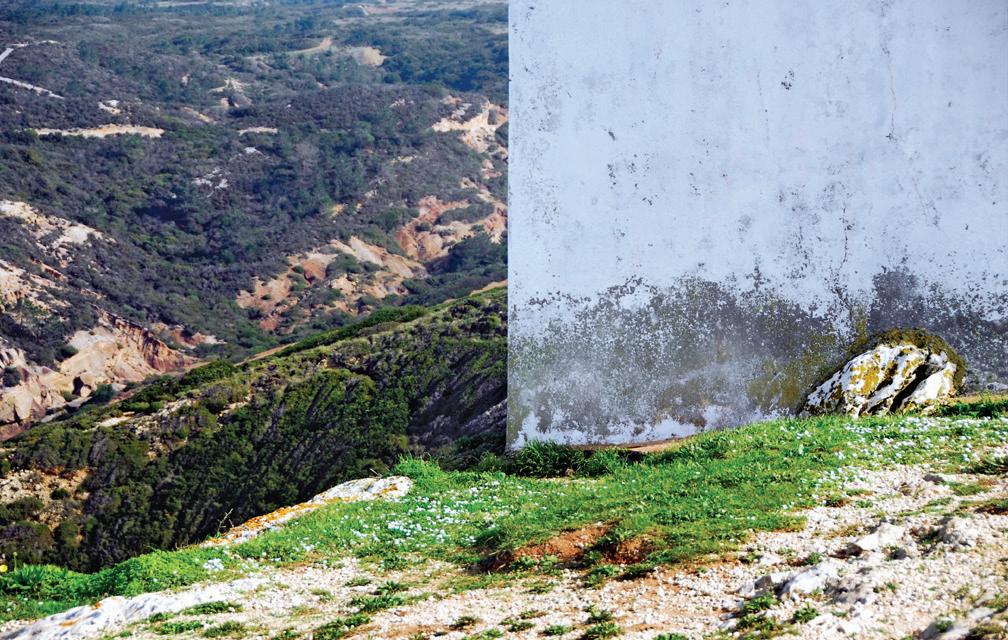
Forte Velho do Outão, remains, Setúbal, photo by S. Antoniadis, 2021.
SETÚBAL LAB 26
In this dynamic process of interaction between human action and nature’s re action, landscapes change and evolve, gain and lose complexity and functional ity through the joint action of man and nature. In their diversity, landscapes are nothing more than the result of a human history resulting from the cultivation and appropriation of the land, the construction of the habitat, and its registra tion, which expresses affective and economic relationships between men and the environment in which they live.
The basic structure of the landscape is, in its diverse geological origin, the relief, in permanent modification by the action of water, geomorphological processes, vegetation, fauna and human action. Which shows that the transformation of landscapes is part of their nature. As has always happened since the dawn of humanity, the intensity of landscape transformations being proportional to the level of technological development of society. The study of the evolution of landscapes therefore requires knowledge of their human and social history, that is, of the social, economic and cultural processes that mark times and cir cumstances and express the identity of human communities.
Territory and landscape dynamics
The territory is a complex system that integrates urbanized areas, rural areas and natural spaces and in which, in a dynamic and interactive way, human life is organized. In addition to its geographical reality, it corresponds to an area of influ ence and a space defined by power relations, and which defines power relations.
In it, the networks that format and combine it, guaranteeing the persistence of brands and symbolic values, contribute to the structuring of the landscapes that find it.
As a physical support for human activities, in its different complexity, the terri tory is organized according to the mode and intensity of the actions that occur in it. Its sustainable use therefore depends on the way in which its resources are ex ploited, and the rationality and efficiency of the processes and technologies used.
Regarding its intervention in a territorial dimension, urbanism organizes the processes of adapting the needs of current and future populations to the carrying ability of the territory and its biophysical determinants and socio-eco nomic demand. Thus, configuring the spatial distribution of human activities, the organization and formatting of urban spaces and the relationships between built-up areas, infrastructure networks and natural, agricultural, forestry and recreational spaces. From a perspective of organizing human habitats within a framework of better living conditions from an environmental, social and eco nomic point of view.
27
The territorial planning process, of which urbanism is an instrument, is, in this context, the spatial translation of the economic, social, cultural and eco logical policies of society that establishes the mode and form of the spatial distribution of activities and the exploitation of natural resources. In the set of actions that integrate it, the territorial planning process “includes urban planning and transport and communication systems; the planning and inte grated development of rural areas and the restructuring or reconversion of the productive base of rural areas; the rational management of natural, heritage and historical resources; the protection and enhancement of pro tected and ecologically sensitive areas; strategic planning of the territory, urbanism and urban projects and urban and environmental regeneration” (Fadigas, 2007, p.12).
The spatial distribution of land use, in its different forms, reflects the culture and technologies of the societies that occupy and have occupied it, the rela tionship between environmental conditions and human activity, the form and intensity of possession and use of the territory and defines the organizational matrix and characterization of the landscape. It is a brand that marks the nature of the processes, spontaneous and programmed, that shape the territory and give it conditions of continuity of use. Which depends on many factors.
The uses and forms of ownership contribute to the establishment of set tlement patterns that contribute to the territorial fragmentation that is an essential constituent of the textures with which the landscape patterns that characterize and find the different scenic and visual expressions of the terri tory are formed. The territorial dynamics, which contribute to the dynamics of the landscape in association with the occurrence of natural phenomena, can be, when they occur with great intensity in a brief period, be deciding factors of the fragmentation of the territory. Which, almost always, has consequenc es for the environmental conditions of the territory and its sustainability. Territorial fragmentation resulting from the densification of road networks and passage channels for large infrastructures, accentuated by urbanization processes, and by its consequences in terms of specialization of uses, which is felt in both urban and rural areas. In urban areas, the strong appreciation of the soil, compared to rural areas, leads to a fragmentation of uses that pro duce very fragmented urban fabrics, very striking in the definition of urban landscapes; in rural areas, especially in small properties, territorial fragmen tation results from the geometric irregularity of the plots and the variations in relief create unique textures.
The framing of these issues within the scope of environmental concerns that must be present in spatial planning and in the implementation of the pro
SETÚBAL LAB 28
Escola Superior de Educação by Alvaro Siza, Setúbal, photo by S. Antoniadis, 2021.
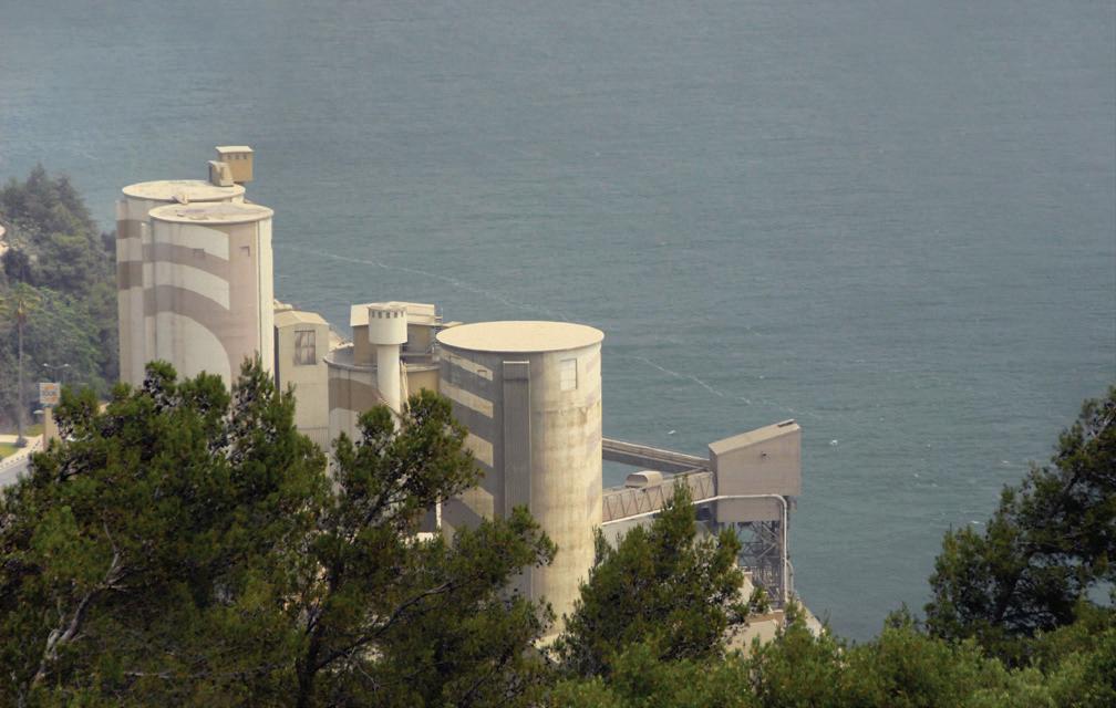
Cement Factory Secil-Outão, Setúbal, photo by S. Antoniadis, 2022.
29
posals that urbanism can support sustainable urban development is therefore essential. The transformation of landscapes that results from the urbanization process does not always happen with violent ruptures with the surrounding reality or with the anthropological references that link populations to their origins and the territories they occupy.
Contemporary demands
Contemporary societies have been seeing a change in social and functional paradigms with strong impacts on the shape and modes of appropriation of urban space. This accelerated the intensity of use of urban fabrics, namely the most central ones - where the loss of residents did not imply, in most cas es, loss of activities and functional importance - and a clear abandonment of those that lost importance, activities and features. The resulting functional and spatial marginality turns out to be also social and this is one of the most serious problems facing contemporary urbanism. The rapid transformations of the urban landscape, creating new identity references in urban icons, eras es memories and weakens individualities, not least because they happen in parallel with the expulsion to other areas of the city or the outskirts of a large part of the population that lived there.
At the same time, similar phenomena are found in rural areas, with a strong environmental and landscape impact. The change in agricultural production priorities, the reduction of cultivated areas and the reorganization of the dis tribution and consumption systems, generated the emergence of extensive areas of soil awaiting new uses and functions. What is not strange is the dif ference between the value of land for agricultural use and the value of land for urban use. As a result, environmental risk factors (fires, erosion, floods) have worsened and the sustainability conditions of the natural environment have been reduced, favoring physical desertification, the ecological simplification of the territory, the reduction of biodiversity and the impoverishment of hu man communities in it. with the consequent migration of the population to the existing urban areas, thus contributing to the expansion of their peripheries.
Which shows how the economy behaves as a modeler of landscapes, di rectly and indirectly. Its impacts can be factors of environmental and visual degradation or essential instruments for the environmental requalification and for the preservation of the territory’s resources. This depends on how one understands the role and importance of the economy in the context of the organization of society and its relations with the search for sustainable life models and environmentally balanced territories.
SETÚBAL LAB 30
Contemporary urbanism is thus confronted with the challenge and respon sibility of responding to the new demands of urban life and the need to create and organize sustainable and environmentally balanced territories. Territories capable of creating landscapes where the rural and the urban, the natural and the built, are interconnected in a harmonious and environmentally balanced way. Because it is that the landscape must be understood; and the territory, as such, must be organized.
It is up to each one, with intelligence, knowledge, balance and creativity, to contribute to this being so.
References
Leonel Fadigas, Fundamentos ambientais do ordenamento do território e da paisagem. Lisboa: Edições Sílabo, 2007.
31
THE SCAPE TO READ TOGETHER. A NEW ATLAS OF URBAN-GROUND
Stefanos Antoniadis, professor, architect, Lisbon School of Architecture, Universi dade de Lisboa
Gonçalo Pirrolas, research fellow, Lisbon School of Architecture, Universidade de Lisboa
Beyond the consolidated vocabulary
Whether we like it or not, the territory in which we live is not made up only by the elements of the historical and consolidated vocabulary. The elements that compose it seem no longer to agree with the grammar of the past. The vo cabulary of objects scattered throughout the territory has been considerably enriched. Nowadays territories are dotted with large production volumes and commercial malls, sport facilities and stadiums, intermodal hubs, infrastructural junctions, waterways, power lines, pylons, antennas, construction cranes, quar ries, landfills, smoking stacks, piezometric towers, hanging water deposits, silos, freight yards and villages covered by thousands of containers, immense docks, extensive car parks, shipyards, airports, power stations…
These results represent a considerable part – we could say the vast majority of the territory – of contemporary landscape which constitutes a ground of the oretical speculation, of didactic experimentation and of professional chances for designers, being ever more forced to manipulate, both with the gaze and inter ventions, the complexity of these common but unacknowledged artificial stuffs. Therefore, it is evident how important it is to baste a reading of the contem porary landscape as a fundamental means to reassess the objects and the layers
SETÚBAL LAB 32
of the territory, with the goal of facing more appropriately the complexity of the managing that the present entails.
If once conventional drawings and layouts, attributable almost exclusively to cylindrical and conical projections, were sufficient to confer form and order, harmonizing human limbs, urban and territorial elements and relate them to “the whole” – from the thought by Leon Battista Alberti to the basis of the Ge staltpsychologie of the early 20th century – now the manipulation of the scat tered landscape (Rasmussen, 1974) presupposes different engaging methods and techniques of reading.
The strategies for bringing back into play the vast contemporary urban and suburban areas, often declared Non-Places, disordered, without specific voca tion, cannot follow obsolete and past practices, based on a few known elements and operations. Rather, they must draw inspiration from investigation practices such as those typical of the nautical discipline, represented by the historical and event more recent pilot books, based on experience and observation, contain ing information relating to the regions to explore: preliminary and forerunner practices that transcended pre-established categorizations. A portolano, that’s the name for this kind of chart, reports useful information for the recognition of coastal landscapes by hybridizing different kinds of representation, keeping together textual descriptions, geographical maps and drawings of coastal sil houettes; it contains information on dangers and obstacles to navigation such as shoals or wrecks; it counts indications to recognize the entrance of ports, for anchoring and any other information deemed useful for navigation and safety. In it, a medieval watchtower, a hanging water deposit and a spur of bare rock, seen from the water, have the same dignity as elements useful for navigation. However, transcending the mere utilitarian aspect in the nautical field, we can’t ignore the forerunner look on landscape treating all those natural objects and artificial elements by their most basic and true characteristic: they’re forms contributing to the construction of a recognizable and transmissible landscape, identity and knowledge. A common ground for the for the pursuit of a shared, public and political habitat, in the noblest sense of the term.
Reading the urban ground
This approach holds true even more so for a riverside city, Setúbal, observed by the water still today. The large water basins of the estuaries of rivers such as the Tejo and the Sado, recreate a sort of measurable landscape, similar to the Medi terranean ones, close to the incommensurability of the Atlantic Ocean. The water basin works as a “contact interface between different cultures and knowledge,
33
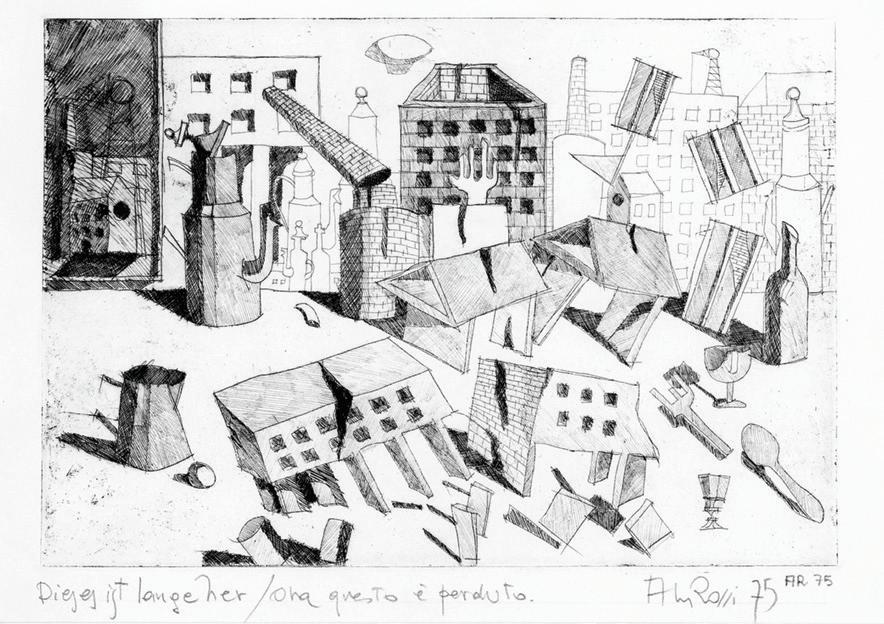
Dieses ist lange her / Ora questo è perduto, drawing by A. Rossi, 1974.
Postcard from (contemporary) Setúbal, photo by S. Antoniadis, 2021.
SETÚBAL LAB 34
an access to heterogeneous products and techniques; a space in which the sea represents the broad interface of contact, abundantly crossed, like a large square, a public space […] between peoples who settle permanently and in an increasingly significant way on its shores.”1 It is no coincidence that the Romans already organ ized the territory of Setúbal in a polycentric way around the estuary of the Sado River (Blot, 2003).
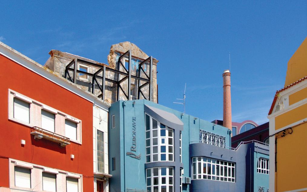
Even a small town, such as Setúbal, actually collects an enormous abacus of the mentioned above unacknowledged elements of the contemporary vocabulary as water towers, dock cranes, port warehouses, commercial malls, silos, antennas, a huge logistic roll-on/roll-off terminal, and there would also have been the for mer thermoelectric power station high smoking stacks (unfortunately recently demolished, which represented a strong landmark for the area).
Around the tiny historic centre – increasingly at risk of becoming a sort of fake “wedding favour” for tourists and prod-users in general – whose walled edges are now almost unrecognizable and fragmented, a land of cranes, infrastructure, car parks, warehouses, ruins and decommissioned areas extends especially towards the Sado River and awaits redemption.
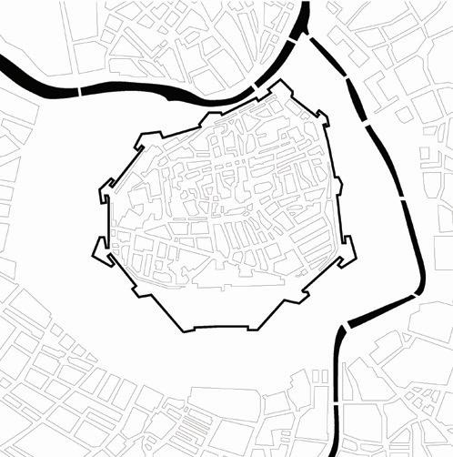
A situation not so distant, in some ways, from that of the 19th century urban dynamic in Vienna, considered paradigmatic for the history of architecture and urbanism. The known grand boulevard, the Ring, was built to replace the city walls, which had been built during medieval period. The walls and all the sur rounded fortification system were about 450 metres wide, where buildings and vegetation were prohibited for military defensive reason. By the late 18th century these fortifications had become obsolete, and the urban development was required to trigger a more significant change. The Ringstrasse plan was, in fact, the regeneration of an urban underused area by the dismantling of the city walls, open-air workshops, facilities and stalls to fill this large obsolete urban void with new public interventions of great importance to the city: palaces, museums, theatres, gardens.
Therefore, these intellectual approaches belonging to our European experi ence can still offer valid help today in the interpretation and resolution of urban landscape issues. It is a question of thinking of a new paradigm, however in con tinuity with our epistemic prerogative and with the same transformative force, for a more contemporary landscape. The challenge is played once again outside the consolidated city, beyond the walls, and beyond the unacknowledged lines2. Once again a rather desolate and underutilized dross-scape about 450 metres wide of ramparts mostly dismantled or incorporated by workshops, warehouses, uncovered areas, port support roads without any hierarchy, obsolete docks and pier close to the old city walls await acknowledging and reconfiguration.
35
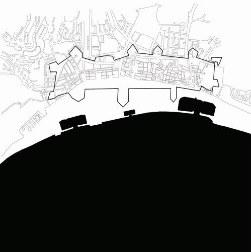
Vienna urban void and Setúbal urban void, drawings by G. Pirro las, 2021.
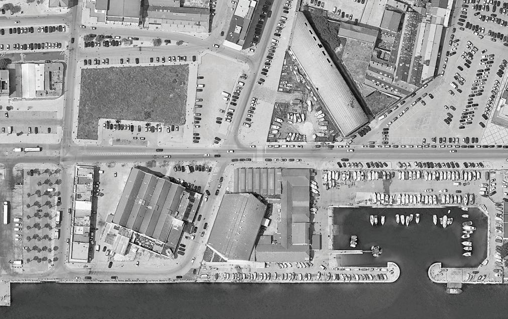
Setúbal dock-land, orthophoto from Google Earth, 2021.
SETÚBAL LAB 36
Acknowledging Setúbal urban stuff
Today, facing the new forms of the contemporary landscape, we have once again a sensational and epochal opportunity to propose new visions. Visions that can be investigated and conveyed through some integrated photographic tools, rather than through the construction of nineteenth century romantic pictorial postcards (still too similar to the pictures that intend to build a fake, picturesque, and attrac tive image of many today cities) for a more authentic and profound sharing of the places we live together. Photos, collages, formal analogies and homologies light up the transformation attitude of the object itself – or objects if a plurality – in new and many possible ways functional to the landscape assessment, the collective space, the shapes of contemporaneity in an up-to-date architectural portolano.
Hybridization and multiplicity of techniques are characteristics on the same wave length as the mixing of urban palimpsest, as well as the coexistence of diversified identities, typical of the contemporary city. In other words, contemporary systems of architectural representation seem to intrinsically possess the qualities of the land scape3 (Moraitis, 2013). Searching the applicative possibilities in the field of reading and re-writing the landscape can make it possible to better address the complexity of the architectural demand at the scale of the building, the city, and the territory.
Since the formal structures of the contemporary landscape live and change ac cording to the multi-cultural and multi-identity gazes of the communities of our time, photography, multi-vision and image processing, understood as a systematic and compositional reading apparatus, help to conduct and weave possible relationships between parts and fragments, to “reposition, without being able to move them, the existing forms along logical, thematic, spatial sequences by means of ordering devic es” (Stendardo, 2013) as new Alberti’s lineamenta4. It is about a real post-production operation – not surprisingly a term already in use for some time in the field of photo graphic technique but still viewed with distrust in architecture – and not of make-up or falsification through which architects and urban planners can manipulate areas of contemporary cities, especially the less measurable and digestible ones.
Setúbal upgraded common scape
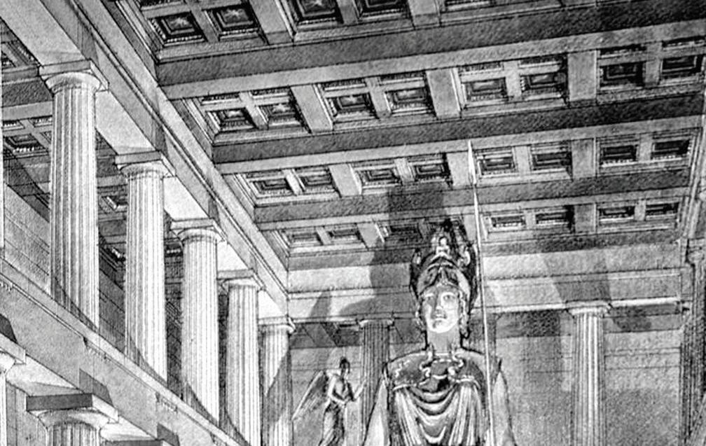
Combining a Greek temple of the classical era with a skeleton of port ware house, or a sacred cella of the Parthenon with the atrium of a social housing, or a silos with the volume of a tower or a bulwark is not a logical artifice of reductio ad absurdum, it is not an extreme and hostile provocation, it is not an improper and unscrupulous expedient. It is an attempt to enrich and integrate the abacus of letters and words that form the landscape in which we live.
37
La Città Analoga, drawing by A. Rossi, 1990.
Setúbal Analoga, photo by S. Antoniadis, 2021.
SETÚBAL LAB 38
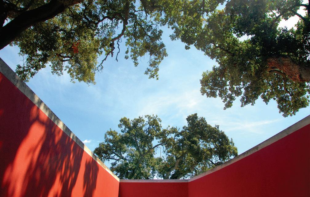
The Sacred Tree of Bela Vista, photo by S. Antoniadis, 2021.
The Sacred Statue of Athena, Parthenon, reconstructive draw ing by Candace Smith, 1990.
39
Setúbal upgraded abacus of the dignity of the elements, set of orthophoto from Google Earth (from the top-left: Livramento Bulwark, Municipal Pavilion “João dos Santos”, Auditorium “José Afonso”, Conceição Bulwark, São Filipe Fortress, St. Amaro Bulwark, Alegro Shopping Mall, Bullring “Carlos Relvas”, Purifiers Wastewater Treatment Station of São Sebastião, Bela Vista Water Tanks, constructions site in Nossa Senhora da Anunciada, Old Convent of Our Lady of Arrábida chapel), image by Sara Alfonso, 2022.
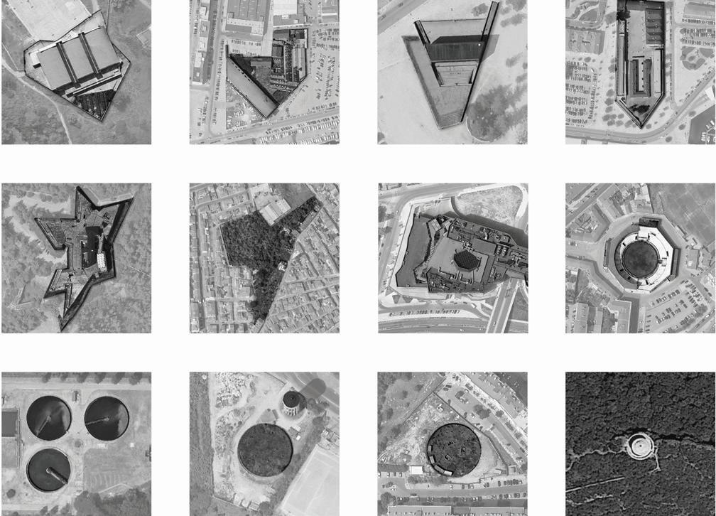
Exercising gathering and matching fragments of contemporaneity, the abstrac tion of the forms that constitute our geography, the systematic comparing of com mensurable objects of the present and cases of the past for which exists an estab lished and universal awarding of quality, the unveiling of a formal dialogue between elements, may represent a healthy training in order to overcome the dichotomy old vs new, uniqueness vs uniformity and appreciated vs unacknowledged.
Focusing on the mechanisms of acknowledgement may ward off the rhetoric between the bad and the good parts of the city – but reading in its forms, as an inexhaustible condenser of meanings –, may converse, discuss and produce sig nificant improvements towards the digestion of the territory.
Updating and upgrading the atlas of urban vocabulary could represent at the same time the disciplinary grounds for structuring evaluation models for creative proposals, for the issuing of a new generation of territory laws and regulation dedicated to distinctive areas, and the communities’ common ground for devel oping possible landscapes, our scape to read and re-signify together.
SETÚBAL LAB 40
Notes
1. João Nunes, Paesaggi costieri, in Antoniadis, S., Sulla Costa. La forma del costruito mediterraneo non accredita to. Conegliano: Anteferma, 2019, p. 7.
2. The expression constitutes the keyword and semantic basis of the urban and architectural research activities made in UniPD. Among these: Beyond Unacknowledged Lines - Landscape, Infrastructure, Urban Regeneration, cycle of seminars held at the School of Engineering of the University of Padua (2013) on the up-cycling of the existing city and especially its peri-urban areas (Scientific Board: Luigi Stendardo, Stefanos Antoniadis and Luigi Siviero). The formula mimics the movie Behind Enemy Lines (directed by John Moore, USA, 2001), in which an American fighter pilot was forced to wander in hostile zone, after his aircraft was shot down during the Bosnia- Herzegovina war, discovering territories, infrastructures and abandoned factories in the Srebrenica Region, before reaching the extraction point.
3. “Using a provocative assertion we may insist on the fact that contemporary electronic aided design ap pears to possess inherent «landscape qualities»” in Konstantinos Moraitis, Landscape Interpretation through Schematism: Schematism as a theory concept, and its correlation to Landscape Aesthetics and Landscape Design, p. 217; essay presented at the XXIII World Congress of Philosophy (Athens, Greece, 2013) “Philosophy as Inquiry and way of Life”, Session n.1: Aesthetics and Philosophy of Art (August 6th 2013).
4. The set of condition generated by the encounter between drawing (and now digital photography tech niques) and architecture.
References
Stefanos Antoniadis, Sulla Costa. La forma del costruito mediterraneo non accreditato . Conegliano: Antefer ma, 2019.
Luigi Stendardo, La stratificazione di forma e materia tra coltivato e costruito, in Stefanos Antoniadis, Alice Braggion, Alessandro Carabini, Enrico Lain (a cura di), BE CITY SMART! Scenari & progetti per un’urbanità 2.0 Padova: Overview Editore, 2013, p. 93; Konstantinos Moraitis, Landscape Interpretation through Schematism: Schematism as a theory concept, and its correlation to Landscape Aesthetics and Landscape Design, in XXIII World Congress of Philosophy proceedings, Athens, 2013, p. 217.
Maria Luísa Pinheiro Blot, Trabalhos de Arqueologia 28. Os portos na origem dos centros urbanos. Contributo para a arqueologia das cidades marítimas e flúvio-marítimas em Portugal. Lisboa: Gráfica Maiadouro, 2003, pp. 259-269.
Steen Eiler Rasmussen, London: The Unique City. Boston: The M.I.T. Press, 1974, chap. 1.
41
TOWARDS AN ARCHITECTURE FOR PUBLIC USE: A CONVERSATION WITH SAMI-ARQUITECTOS
an interview by
Sérgio Padrão Fernandes, professor, architect, CIAUD, Research Centre for Architec ture, Urbanism and Design, Lisbon School of Architecture, Universidade de Lisboa
Rui Justo, researcher, architect, CIAUD, Research Centre for Architecture, Urban ism and Design, Lisbon School of Architecture, Universidade de Lisboa
Carlota Gala, research fellow, Lisbon School of Architecture, Universidade de Lisboa
Inês Vieira da Silva and Miguel Vieira founded their practice SAMI-arquitectos in 2005, in the city of Setúbal, having gained international notoriety for their first work, the Visitors Center at Gruta das Torres, on the island of Pico, in the Azores.
Among other activities, the studio develops multidisciplinary projects at different scales and fields that have been recognized with several awards, such as the AICA de Artes Visuais e Arquitectura (2015 and 2017), awarded by the International Asso ciation of Art Critics, National Secretary for Culture, and Millennium BCP Founda tion; the BIAU Prize - Bienal Ibero-Americana de Arquitectura y Urbanismo (2014 and 2016); the AADIPA - European Award for Architectural Heritage Intervention (2015); the National Tektónica/OA Award for Emergent Architecture (2009).
SAMI were invited to participate in several international exhibitions too: in 2017 they were part of the 2nd Chicago Architecture Biennale, they participat ed in the 14th International Architecture Exhibition Biennale Architettura 2014 in Venice; in 2011 they were part of the Official Portuguese Representation at the 9th International Architecture Biennale of São Paulo.
They were selected for the Wallpaper* Architects Directory 2011, which dis tinguished the 20 most promising young architects internationally and in 2007 they were included in the short list, recommended by Herzog & de Meuron, of the 100 young architects invited to develop the Villa Ordos 100 project
SETÚBAL LAB 42
The conference that SAMI held at the Igreja Paroquial do Imaculado Coração de Maria in Setúbal, on September 13th, 2021, in the frame of the workshop “The Space to Live Together” was the opportunity for a conversation around the theme “architectural design and space for public use”. The interview is divided into three parts and explores three essential issues of the work of the studio that seek to reveal the attitude of this duo of architects towards the responsi bility of the act of architectural design and the public role of architecture.
Part 1: Questions about the idea of intimacy
The Map of Places of Intimacy is a poetic look at reality and an interpretive reading of the territory. It was prepared as part of a response to the challenge launched by the architect Pedro Campos Costa, curator of the Portuguese Pavilion “Homeland: News from Portugal” (Allegri and Costa, 2014) at the 14th Biennale Architettura in Venice, for the design of an isolated single-family house. The Map of Places of Intimacy proposes a reconnaissance of the territory from your very particular point of view, which is also a first approximation to the answer on what ideally is a detached house. Is it possible to generalize and say that the idea of intimacy and/or degrees of intimacy is a transversal idea in the work of the SAMI? And, going a little deeper into your creative sphere, is it possible to say that the notion of intimacy is, for the SAMI, the basis of a definition of Architecture?
Inês and Miguel: The “Map of Places of Intimacy” was the result of work de veloped with the architect Susana Ventura for the 14th Biennale Architettura in Venice, in response to the invitation of the curator Pedro Campos Costa, who proposed to us “to think and design an isolated single-family house, in a natu ral context, for a client that we should ideally find”. In view of this statement, it seemed interesting to identify our object of study by asking the following ques tion: “Is there a place in cities for detached houses, permanent housing, with a strong relationship with the landscape, designed by an architect in a connection of proximity with a specific customer?” It seemed much more interesting to us to bring the detached single-family house issue into an urban context, than to decline the theme of the isolated house in a natural place. We chose the city of Setúbal because of its relationship with the surroundings: the Serra da Arrábi da, the River Sado and its estuary. So, we went looking for land, within the city limits, on which it was possible to design a single-family house and we found sites still vacant, because of the difficulty of access, the pre-existence – many of them military – or the accentuated topography. We identified these places and tried to register them through a “Map of Places of Intimacy”, designed with the
43
SAMI-arquitectos with Bar bara Macaes. Map of Places of Intimacy.
Paulo Catrica, Map of Places of Intimacy, photo of Santo Amaro fortress.
SETÚBAL LAB 44
architect Bárbara Maçães, and registered through the eyes of the photogra pher Paulo Catrica”.
The idea of the “Map of Places of Intimacy” allowed us to synthesize, at that moment, our way of thinking and doing architecture. We found that our atten tion to the specifics of each place, the close relationship with the client and our approach to each project was similar, regardless of the scale of each project, its program, and the fact that it is a building for public or private. From that mo ment on, the idea of intimacy became clear in our exercise of discipline.
Intimacy is a quality usually attributed to rooms in the house hosting the most reserved life activities and which, therefore, constitute the very center of the private sphere. SAMI’s Map of Places of Intimacy transports this attribute to another reality, we can even speak of a transfer from the domestic scale to the city scale. Thus, Intimacy be comes a condition for questioning the territory in a bold and original approach! Is it possible to investigate the urban public space from this notion of intimacy? How can (your) notion of intimacy explain the diversity of collective spaces for public use that are proposed in the houses in Fontainhas project?
Inês and Miguel: The Fontainhas project represents the full realization of the challenge launched by the curator Pedro Campos Costa, three years after the 14th Biennale Architettura, when one of the lands we chose for the Map of Plac es of Intimacy became a project to be developed for a private client. In one of the five places we chose, together with the architect Susana Ventura, to reflect on the role that a single-family house could play in the regeneration of the city, we were asked to think and design 46 apartments. The land is characterized by a very accentuated topography, located at the eastern end of the Historic Center of Setúbal, precisely on a hinge street between the city and its industrial expansion, to the east. A land with a privileged view over the river Sado and with the 17th century city wall at its highest level, to the north. The diversity of typologies that we proposed, as well as the diversity of the outdoor spaces that we designed, are a reflection of the desire to redesign a significant part of the urban fabric similar to the historic center in which it is located. The various scales of exterior stairs, streets and squares that we created along the plot were intended to explore the particularities of the terrain and create spaces suitable for each place.
In this sense, we transcribe the words written by the architect Susana Ventu ra when the first issue of “Homeland” was published: “SAMI embarked in anoth er exercise starting, exactly, at this relationship of intimacy that the detached house builds with the landscape. If in a natural and idyllic landscape, like the
45
SAMI-arquitectos. Fontaínhas, floor 3 plan.
SETÚBAL LAB 46
places where some of their houses in the Azores were built, this relationship is clear, how does one create this similar space of intimacy on empty plots in the centre of a dense city? Taking as an example the city of Setúbal, where they work, they created, after several conversations and debate with the local authority urban planning teams, a “Map of Spaces of Intimacy” as an answer to that extremely difficult question posed of today’s cities and which seems to remit to the eternal question that Le Corbusier, facing the Acropolis, once asked: Why these temples? Why here? Sometimes, it is in unusual places, like the ones shown here, that architecture seems to provide another meaning to the landscape and makes it its home” (Ventura, 2014, p.126).
Somehow, the reading of the architect Susana Ventura anticipated what would later be our work when we developed 46 rooms for the same location that, without having a client, we aspired to design with the same degree of inti macy that we imagined in the Map of Places of Intimacy.
Part 2: Questions about reading and design
When I was attending the first year in the School of Architecture, I discovered a text where Álvaro Siza wrote that the idea is in the “place”, more than in the head of each one, but only for those who know how to see it (Siza, 1996, p. 60). At the time, this idea dazzled me and even today fascinates me the consequent meaning of reading the terri tory and the very understanding that the acknowledge, reading the site, can be the first act of the project. On this subject, I would like to return to the Map of Places of Intimacy which, in fact, is the representation of the territory, filtered through a very personal lens. At the same time, it reveals also a desire to question the territory, and to search in the careful reading of the context a strategy for the project. Why is it important for SAMI to explore the “reading-design” dichotomy in the creative process and architectural composition?
Inês and Miguel: Reading is the first phase of the design process, the first step on the path that each project will trace. Reading the physical territory is essential, along with reading its history, the socio-economic fabric in which the project is located or even its cultural context. The client we work for is also an important as pect to “read” from the beginning. However, also throughout the entire process, we would say that in our practice of architecture, the attention and reading of what surrounds us, of the “context” of the project, has to be constantly checked. And today, at the precise moment we are going through, it is impossible for us to work without these various readings validating the project, meaning that the project only finds its place at the intersection of all these readings.
47
SETÚBAL LAB 48
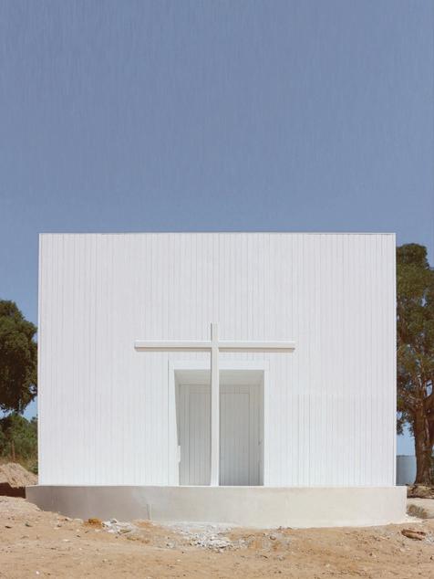
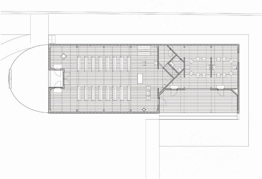
SAMI-arquitectos. Igreja do Coração de Maria, main façade west, elevation north, ground floor plan and detail of the head light lantern.

49
Supported by this constant process of understanding, composition is un doubtedly one of the fundamental points of the practice of Architecture, espe cially if we assume that architectural composition also includes the amalgam of a coherent whole that seeks to bring to the context in which we are working an attentive and revealing look. The architectural composition is one of the funda mental points that persists in any project, regardless of its constraints.
Part 3: Questions about space for public use
In this workshop, inspired by the call of the Biennale Architettura 2021 in Venice “How will we live together” (Sarkis and Tannir, 2021), we set out to re-imagine the cartogra phy of the city of Setúbal starting from the public space. The reason is that we continue to believe that the space that we collectively use and that is common to us will continue to have this power to keep us together in the future. How do you look to the future, how do you imagine that we will be able to live together again? And in this sense, what have we learned from the pandemic? What are the chal lenges for architecture and cities in this post COVID-19 era? Or, in a more personal field, what are the challenges facing SAMI and Setúbal, the city where you live and work?
Inês and Miguel: The pandemic came to remind us how much sharing, social izing outdoor is fundamental to the balance of each one. Awareness of public space as a collective asset was gained. In Setúbal, in particular, due to its unique natural surroundings – the mountains, the estuary, the bay, the beaches – we are invited to use this common space and to realize how crucial it is for every one’s future that this space is preserved and cared for. Here, too, we assume this role of responsibility whenever we have the opportunity to intervene in this context; whether through public projects or private projects, it is always through our understanding that we can add something to this common space.
A few years ago, in connection with the European Prize for Urban Public Space promoted by the Centre de Cultura Contemporània de Barcelona – CCCB, the architect Manuel Solà-Morales proposed in a short text the idea of “material urbanity” (Solà-Morales, 2013) as an attribute that refers us to the need for physical expression of the urbanity. And the urbanity as the quality of places reveal themselves through the physical form of public space with a collective meaning and content. In this sense, how do you imagine the contribution of the Igreja Paroquial do Imaculado Coração de Maria and of the entire project where the church is inserted, in the construc tion of a new cartography of public space in an area of growth of Setúbal that lacks the material condition of urbanity that we were talking about?
SETÚBAL LAB 50
Inês and Miguel: The church was born because there is a large and active Catholic community, which justifies it. Viewed in this way, it responds to a natu ral need to create a space for meeting and communion, both inside the church and outside, as a representative space for a celebration open to the community. Churches have always been, throughout history, elements of reference in the urban fabric of cities that often grew from this generating pole. This church comes in the opposite direction, filling an existing void. It is located on a plot of land surrounded by several huge-volume residential buildings, a primary and secondary school, and a large commercial area. An exposed place, almost bare, where only a large eucalyptus tree accompanied by an olive tree, at the highest point of the land, gave us some sense of implantation for the project.
We thought of the church as if it were a hermitage, as if we could think of this building detached from the urban fabric and emphasizing its relationship with the topography and existing vegetation. The exteriors were designed in the sense of making a route, a deambulation, an almost pilgrimage, to the churchyard.
This was a custom-made project for the community. All the «details» have been collectively achieved: the furniture (which we designed with the designer and friend Rui Alves), the lamps, carefully chosen and acquired as the commu nity manages to raise money for it. Also the exteriors will be made in this way.
In conclusion, almost as we started, we realize that this church is, after all, another place on our “Map of Places of Intimacy”.
References
Álvaro Siza, Um arquitecto foi chamado in Pedro de Llano and Carlos Castanheira (eds.) Álvaro Siza. Obras e Projectos. Milano: Electa, 1996, pp. 60-61.
Manuel de Solà-Morales, The impossible project of public space, 2013. Available at: https://www.publicspace. org/multimedia/-/post/the-impossible-project-of-public-space (accessed on May 2022).
Pedro Campos Costa, Alessia Allegri, (eds.), Homeland–News from Portugal. Lisboa: Note, 2014. Susana Ventura, How do we think and create intimacy in architecture?, in Pedro Campos Costa, Alessia Allegri, (eds.), Homeland–News from Portugal. Lisboa: Note, 2014, pp. 125-142.
51
DESIGN STUDIO: THEMES
RUINS AND FRAGMENTS: VESTIGES
Sérgio Padrão Fernandes, Alessia Allegri, Pedro Rodrigues, Danilo Tavares, Fernanda Costa, Mariana Reis, Roberto Lorenzon
HOUSING TOGETHER
João Leite, Maria Manuela da Fonte, Ana Oliveira, Beatriz Cabral, Henrique Nunes, Mariana David Frade
THRESHOLD: HYBRID SPACE
José Miguel Silva, Luís Carvalho, Alessandra Pace, Carolina Martins, Filipa Lopes, Margherita Maggioni, Mattia Muresu
DISPLACEMENT: TRANSPORT / EXHIBITION
Sérgio Barreiros Proença, Filipa Serpa, Cândido do Rosário, Francisco Janeiro, Paolo Richelli, Sara Alfonso, Sara Ribeiro
WALLS AND DOORS: TRANSITION
João Rafael Santos, Pedro Bento, Elcio Djata, Francisco Manuel, Julianna Costa, Michela Stefanoni, Sara Faedda
SETÚBAL LAB 54
55
Ruins and fragments: vestiges
“I am made from the ruins of the unfinished and it is a landscape of giving up that would define my being”
Fernando Pessoa, 1982
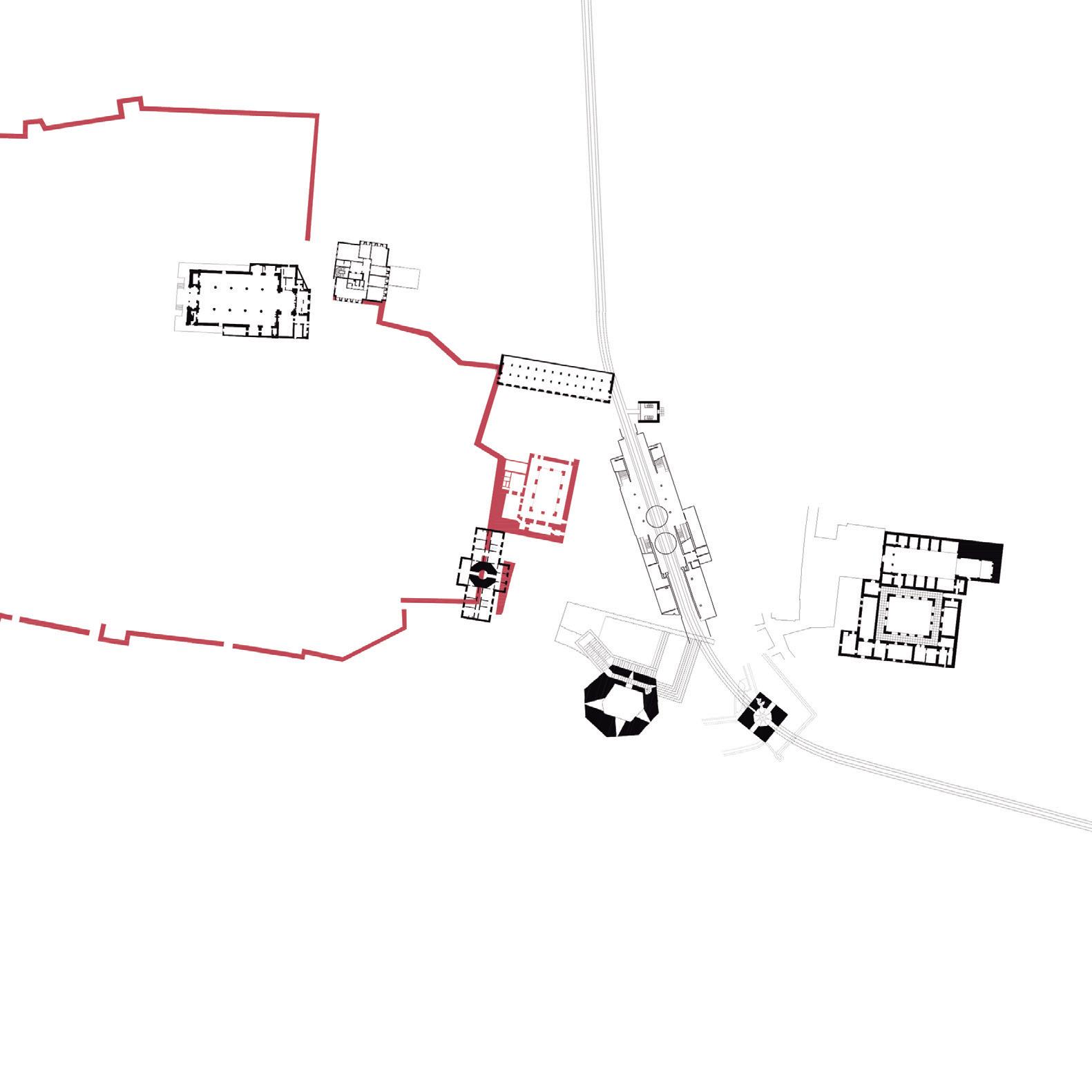
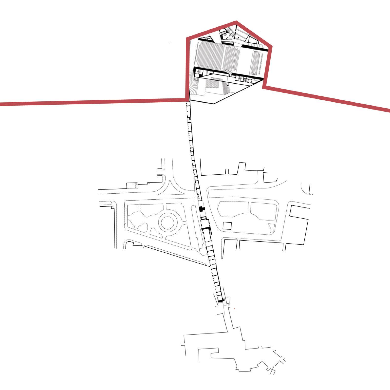
Case study 01
A Gráfica: Centro de Criação Artísica
A Gráfica: wrecks from time
Advisors
Sérgio Padrão Fernandes Alessia Allegri and Pedro Rodrigues
Students
Danilo Tavares
Fernanda Costa
Mariana Reis
Roberto Lorenzon
Within the scope of the workshop – that takes the walls of the city of Setúbal and the surrounding buildings as a pretext to reflect on the changes of the urban fabric over time, in order to develop urban projects that seek to transform abandoned histori cal structures into contemporary places capable of responding to the new demands of public life – our intervention area is the “A Gráfica”, in the old Sado Paper Warehouse, on the Ladeira da Ponte de São Sebastião, now transformed into an Artistic Crea tion Center by the Municipal Council of Setúbal. The built complex that houses “A Gráfica” is attached outside the oldest walls of the city of Setubal, built during the Middle Ages to protect the flourishing fishing village. The built fabric adjacent to the São Sebastião city gate, has undergone, more than once, transformations and changes in a constant process
56
57
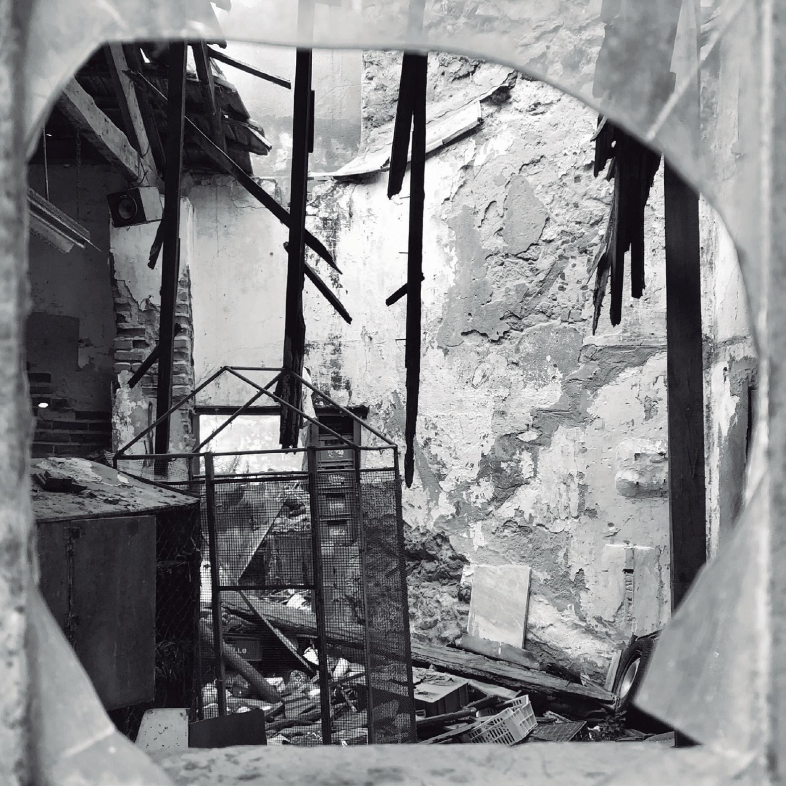
of appropriation and reinterpretation. Today, it is a useless palace built with part of an old monastery and vestiges of a warehouse attached to an aban doned Patio with housing for factory workers. Each transformation has left traces of a complex history which, in addition to be the fascinating witnesses of the past, we want them to be ele ments and interpretative tools for designing the future. Among other fragments that tell us about the vicissitudes of this place we find parts of the medieval wall, which is a symbolic element, but which is currently hidden and forgotten, adjacent spaces for public use, such as the workers Patio and the Quebedo Square, as well as the belvedere of São Sebastião. There is no spatial continuity between these places, worsened by the different topographical dimensions and, even more, by gross overlapping and juxtapositions of built structures, public and private, that do not consider preexist ing remains. The railway, that in early 20 th century was built to facilitate the transport of goods from the port towards the interior of the region, it is a clear example of this: it divides the city and the case-study territory into two distinct parts almost without connection.
Seamless Ruins
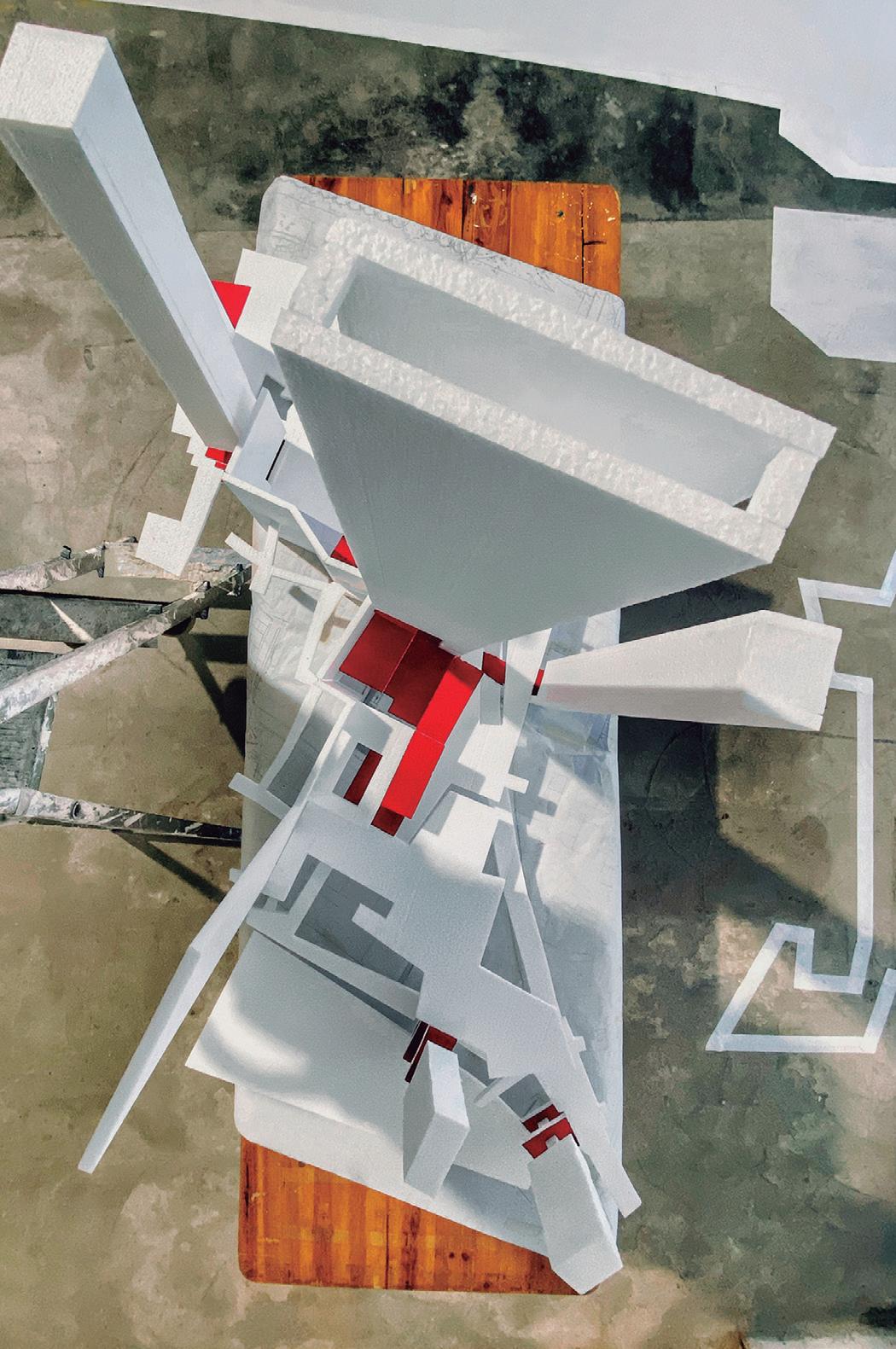
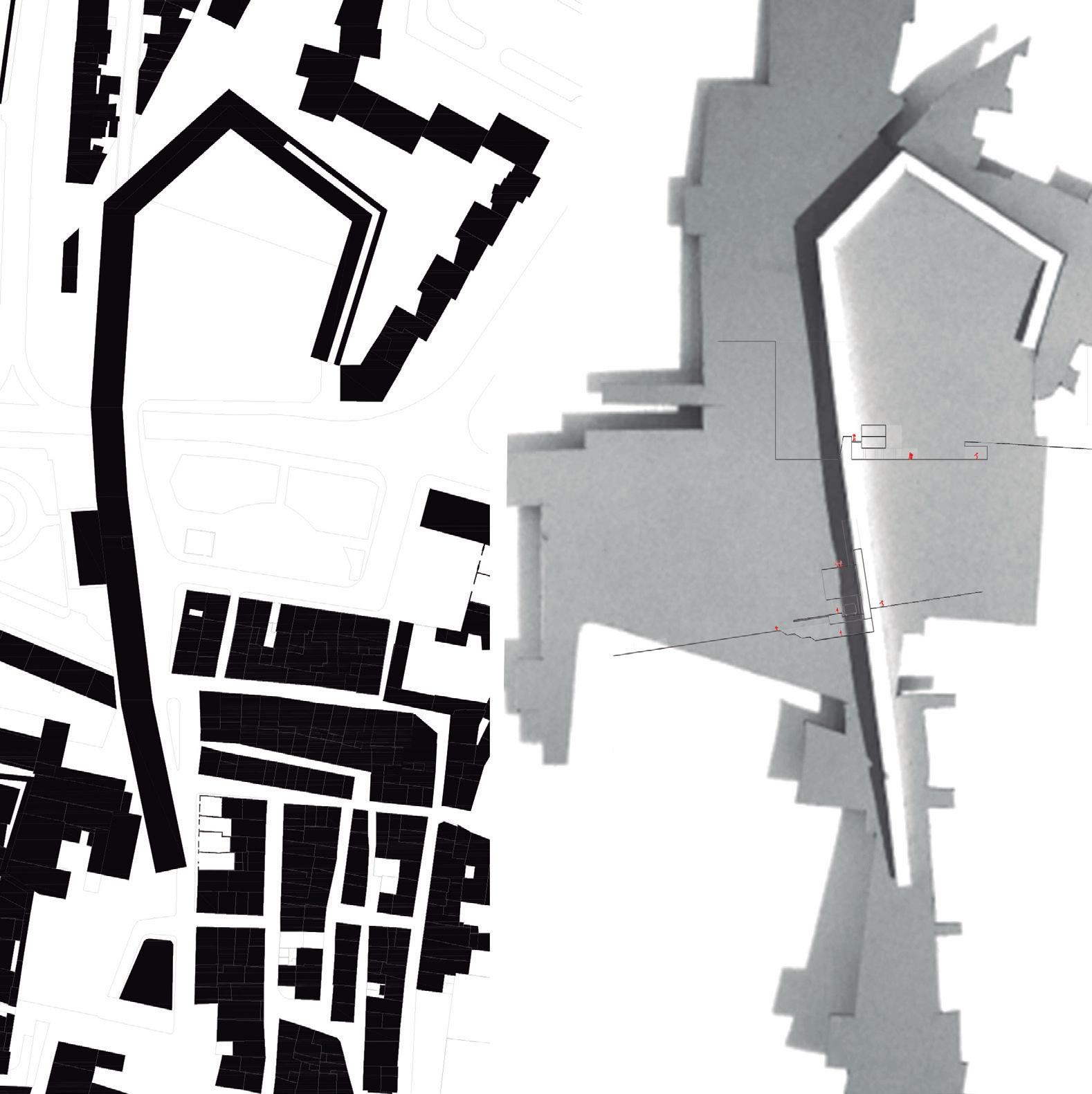
Considering the previous reflections, supported by a careful interpretative analysis of the cartography the project visualizes “A Gráfica” as the articulating element of all the surroundings. Central – and fun damental – point of the proposed intervention, it functions as a public interface that allows to reach and connect the different parts next to it with dif ferent ground levels and different functions. A kind of a multi-level platform that turns into a facilitator of urban connectivity, transforming the whole area into a network of public paths that “cling” to the fragments and vestiges of the past.
But public space is not only about mobility. It is a common living space, the integrated functioning of which determines the extent of social cohe sion and the quality of the living environment. To advance in the knowledge of public space, it is necessary to integrate tangible but also intangi ble aspects, to include the morphological basis of public space, but also reflect about the dynamics of use that unfold in it and the layers of meaning that are condensed there. The premise of the project concept is therefore the understanding of what public space is, in this spe cific context and in each concrete moment, and the interpretation of its specificities as an essential part of a process. The project proposes a place where openness prevails over enclosure and porosity is valued over rigor and rigidity. The project relies on city’s capacity to use the ruins to deconstruct, disas semble, reconfigure and reverse the public spaces.
Designing an inhabited urban ground
The work begins with a reflection on the public space as a space of connectivity, inclusiveness and as a space continuously built on its own history, evident in its morphological patterns and in the still recognizable fragments and vestiges of the past. Next, it is shown how the contemporary public space expands beyond the canonical urban typologies and contexts, leading to greater flexibility and hybridity of its forms and functions.
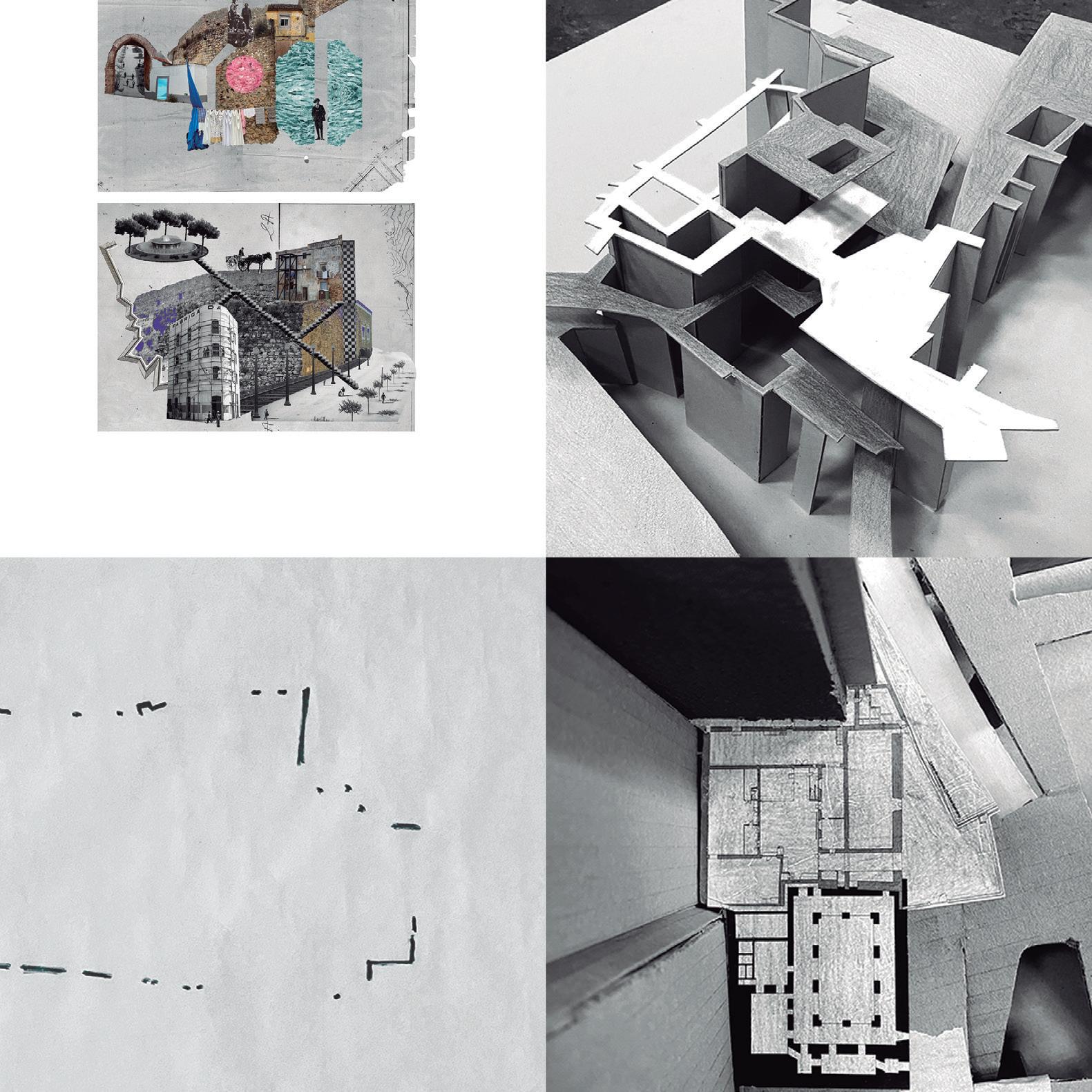
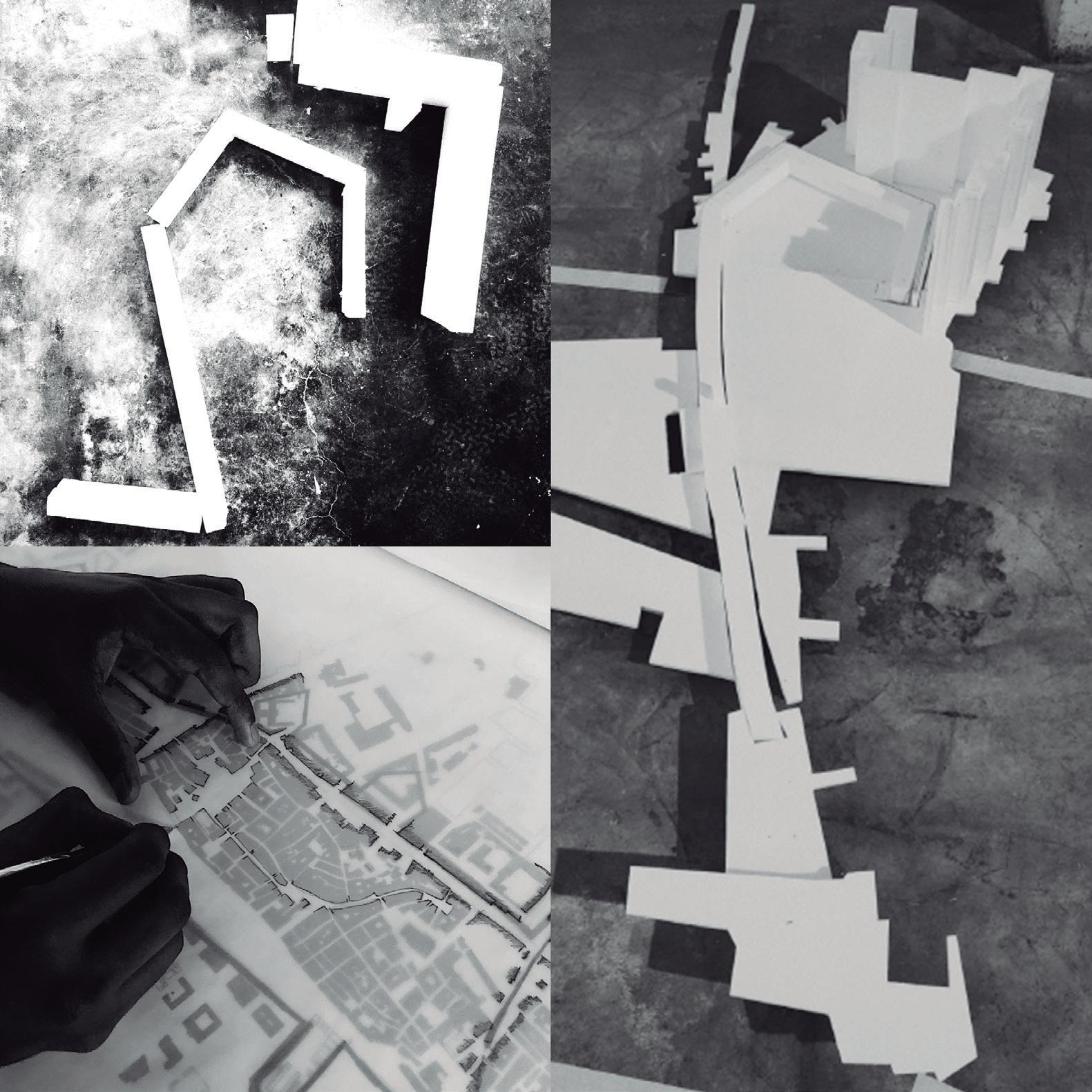
A reflection on the meaning of the ruins closes the analytical part. However, the entire design process is carried out through the construction of a series of conceptual models. The first model is an emotional object build without any scale. It is mainly a contin uous horizontal plane that represents the public space, supported by a vertical plane, which repre sented the medieval wall. This construction results from the interpretative analysis of the intervention
SETÚBAL LAB 60
area, allowing the identification of the medieval wall within the urban fabric and its powerful relationship with the surrounding public space.
A second model, at 1:500 scale, shows the different topographic levels as theoretical platforms that affect the intervention area, as well as emphasizing the existing urban fragmentation. The platforms +5m, +10m, +20m and +30m are defined as the reference levels of the public space in this area, the lowest level being the railway tunnel and the high est level being the medieval wall. The project gives to the city wall the role of reference in the land scape and gives it a new public role as a walkway/ promenade/belvedere. The singular and symbolic buildings that exist on the site – Fryxell Palace, the Graphic – become a new continuous building to host public programs. The railroad tunnel that cuts the Quebedo square becomes a new urban and pedestrian boulevard/promenade that connects the inner city with the waterfront. And, finally, the potential of the abandoned buildings that are scat tered throughout the site is used to propose public buildings that articulate different levels and become references of the urban landscape.
A final model, at 1:200 scale, summarizes the project proposal and highlights the intersection between the horizontal and vertical planes, understood as a continuous and permeable system. The very high vertical planes are purposely exaggerated and out of scale to highlight the connecting points of the entire project. These elements guarantee the continuity of the urban space and rescue the existing vestiges, ru ins and fragments, making them no longer forgotten and becoming an integral part of the city.
SETÚBAL LAB 64
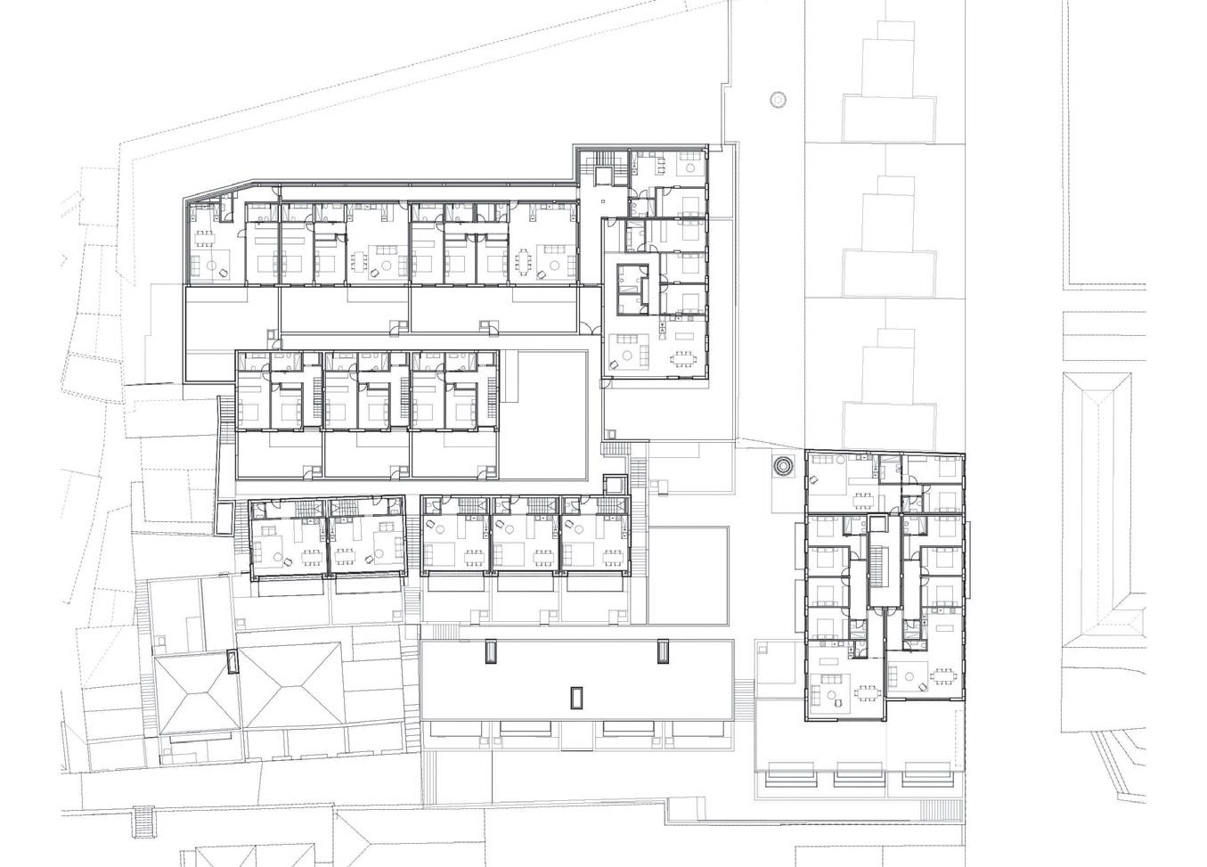
Housing together
Case study 02
Santo António fortress
The inhabited wall of Santo António fortress
Advisors
João Leite
Maria Manuela da Fonte
Students
Ana Oliveira
Beatriz Cabral Henrique Nunes Mariana Frade
The public space represents in the city the place of sharing, relationship and democratic freedom. Therefore, the public space assumes a structuring role in the urban form: defines space (Montaner, 2001), supports the plots, its built fabric (Dias Coel ho, 2013) and constituted itself as a place where people interact. The theme “The space to living together: a new cartography of urban-ground” chal lenges us to think of public space as a structure that (re)defines ways of inhabiting the city, emphasizing the relevance of the ground floor of the building as an interface between public and private sphere of the urban space. Through certain commercial and work activities, the public space extends into the built, widening the collective appropriation and reconfiguring the notions of limits and modes of permanence (Monteys, 2010). The importance of
66
“The relationship between man and space is none other than dwelling, strictly thought and spoken”
Heidegger, 1971
67
this porosity is already particularly revealed in the plan of Rome, by Giambattista Nolli in 1748, where buildings with a public vocation such as atriums, galleries, courtyards and churches are considerate “public spaces”. In this way, the link between built typology, architectural element, and public space is consolidated in a spatial ambiguity that encourages a collective, diverse and free use.
In the area surrounding Praça do Quebedo and Forte de Santo António, this theme of public space as a support for urban life, but also as an aggregat ing element, appears with special relevance. The disconnection from the urban fabric, brought about by the railway line, gives rise to an urgent need to (re)think public space as a device of connection and aggregation. In addition, the space for reflection also had as its specific theme “Housing Together” as a way of intervention and a way of questioning the current reality.
The space with a collective meaning thus emerges as a tool for articulating the two themes, at the same time that it expands spatial understandings and in terconnects public and private space. The threshold space (Boettger, 2014) acquired a greater thickness combining systems of transition and permanence, in an ambivalence structure that dissolves rigid limits and builds continuities between interior and exterior. The theme “Housing Together” finds echo through out the history of architecture and different inter pretations. However, it is important to highlight the working class inhabiting of the 19th century, beginning of the 20th century, in Portugal, with the labor villas. Typologically, the housing space extends to an outdoor space of a collective nature that, in turn, gives continuity to the public structure of the city. Later, the Modern Movement and its “dwelling machines” will configure these places of collective sharing along the horizontal distribution galleries and access to the housing units, but also in the spa
tial continuity of the hollowed ground floors; see the paradigmatic examples of the Unité d’Habitation in 1952, by Le Corbusier, in Marseille, or the various experiments carried out in cities such as São Paulo or Berlin, such as the Hansaviertel neighborhood. Even so, it was already in the 1960s that collective housing developed more intense formal links with the city’s public structure. Through the theoretical and experimental reflections of the Team 10 group, the public space finds logics of continuity within the built fabric, breaking boundaries and unifying circu lation systems and the urban layout.
In the first moment of observation of the interven tion area, Quebedo Square and Santo António For tress, there was early interest in the fact that in this land there is a clear and disturbing “wound” in the connection between communities and urban spac es, caused by the railway line. The particularity of the inhabitants of the area having little knowledge or awareness of the existence of part of the original structure of the fortress, even those who lived on it, was another important aspect observed during the workhop.
Establishing a visual and physical barrier between two very close communities (the one that inhabits the old wall inside the fort and the new wall created by the housing complex), it was one of the main ob jectives to take into account, favoring the inclusion of these two realities, through a building that served as an interface between the them.
After analyzing the place under study, the key con cepts and objectives were pointed out as a starting point for the project:
• Re-invent the concept of “Walls”, making it a habitable body and not a barrier or defense element;
• The idea of “Memory”, when the “new walls” is established, a forgotten past is reactivated, taking on a new expression and, above all, a
SETÚBAL LAB 70
new identity, proposing a new way of inhabiting;
• The idea of “Wound”, caused by the railway line, in which the way to “heal” it involves em phasizing the scar. To this end, the proposed building absorbs the infrastructure, incorpo rating it and transforming the previous bar rier into an element of connection between communities.
Thus the solution, based on these principles, in volves the creation of a large body that develops horizontally along the length of the railway line (corresponding to the section of Quebedo Square station), integrating at the highest elevation next to the São Sebastião belvedere.
In this way, the urban disruption created by the railway infrastructure is dissipated and, at the same time, a monumental character is imposed, in order to mark the urban landscape and developing a symbol ic meaning for the place: a spatial reference object to be inhabited by all arise from the urban layout. This huge sculptural arm will have housing, commer cial areas, services, various programs and activities, polarizing a large part of daily life towards the new built structure and, with this, promoting an inter connection of ways of life and ease of access and flows between the different parts, Quebedo Square and Santo António Fortress. Along with this large body comes the extension of the Quebedo Park, where a subtraction of the ter rain was made, creating a duality of spaces, implying a “natural” fruition between levels. Thus, an “unleve led square” is created with studios and commercial spaces, encouraging the passage and permanence of people. This space, at a lower level, will have ramps and stairs that will allow access to the upper level and to the wall structure indeed, providing a diversity of paths and possible links between the different parts of the urban fabric.
In addition, to making the connection between levels, the new wall doesn’t need to grow more in height, maintaining only the difference of three meters with the pre-existing wall, and cumulatively host more housing in its body, favoring a good sun exposure since the front is oriented to the south. This new built body, which recovers and (re)invents the wall, asserts itself, therefore, as a new guiding thread that restructures the entire area without denying the railway line, but rather, seeking to in tegrate it: the wound heals and consolidated. The limit is understood now as a place with thickness that everyone can live. The building now consti tutes new places of permanence where a collective appropriation can be consolidated together with the housing. The interior/exterior circulation and transition spaces of the new large building are part of the public layout of the city of Setúbal, extending its conceptual understanding as a collective place.
SETÚBAL LAB 74
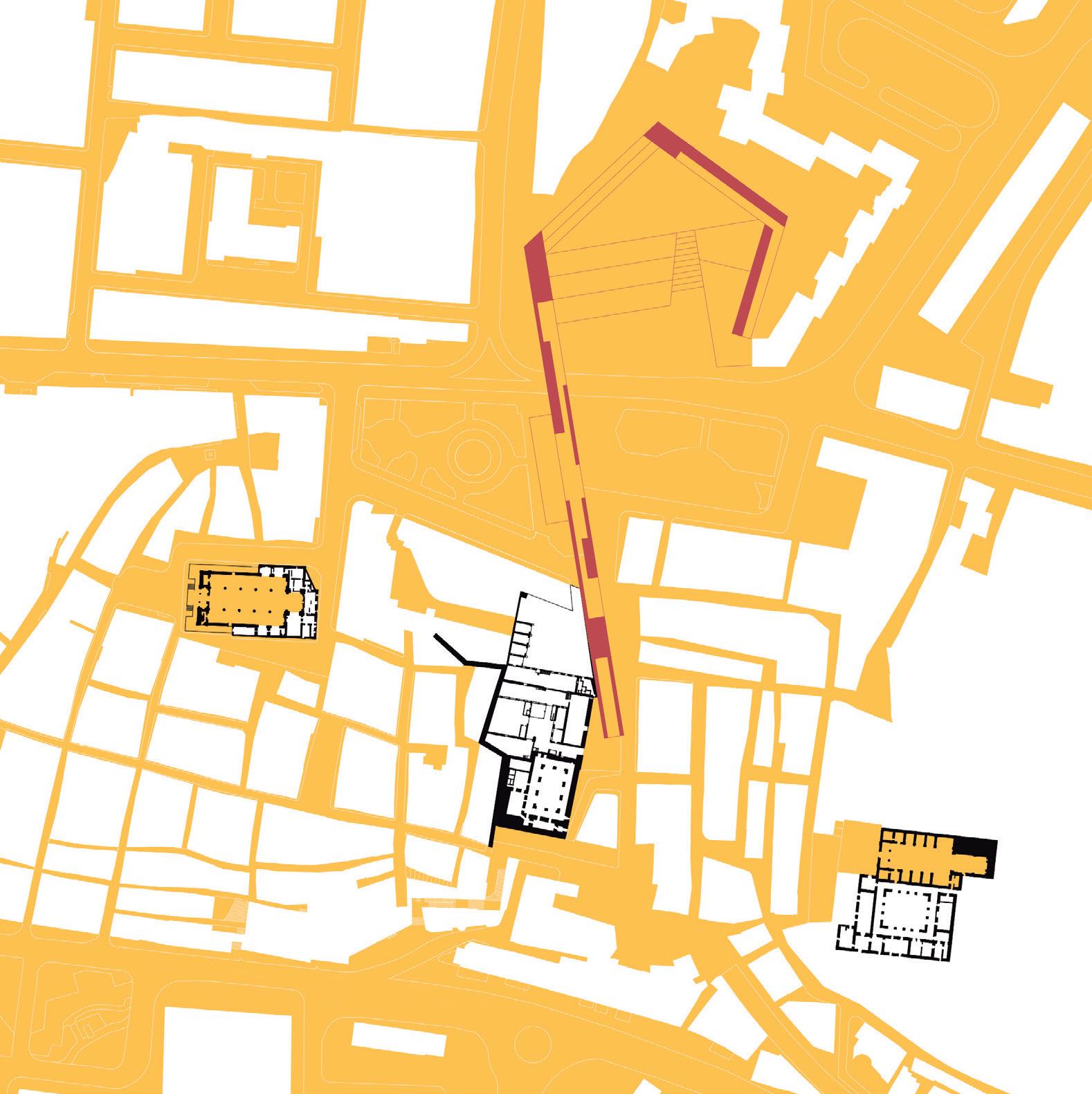
Threshold: hybrid space
“Projects that invent. These are the few initiatives that are born of an ill-defined occasion, without any specific programme, without purpose and without clear limits. They propose uncommon images on the basis of invent ing a type of public space for which, precisely, there is no type.”
Manuel Solà-Morales, 2013
Case study 03
Santo Amaro fortress
José
Santo Amaro: transition as new condition for the place
Advisors
Miguel Silva Luís Carvalho Students
Alessandra Pace Carolina Martins
Filipa Lopes
Margherita Maggioni Mattia Muresu
“The space to living together: a new cartography of urban-ground” was the topic launched for this work shop and which had as key global question “what are the spaces we need in the future?” Considering the reference-theme and the global question, “thresh olds” was the specific challenge for the case-study area around the Santo Amaro Fortress. The recognition of the different composition phas es of this territory over a long time, in particular the place of influence of the Santo Amaro Fortress in Setúbal, were crucial for the analysis, interpre tation and construction of a proposal intended to integrate this fortified memory in the current urban context.
The Fortress was built in the fourteenth century, in the extreme west of the medieval defensive sys
76
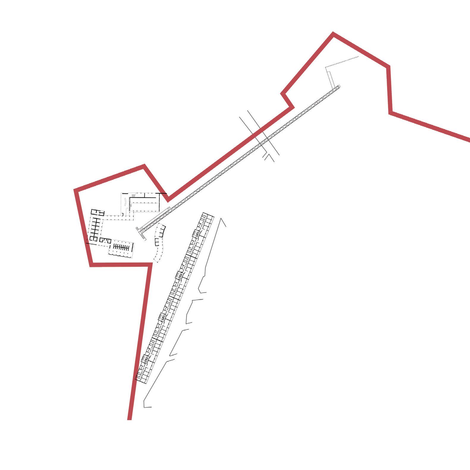
77
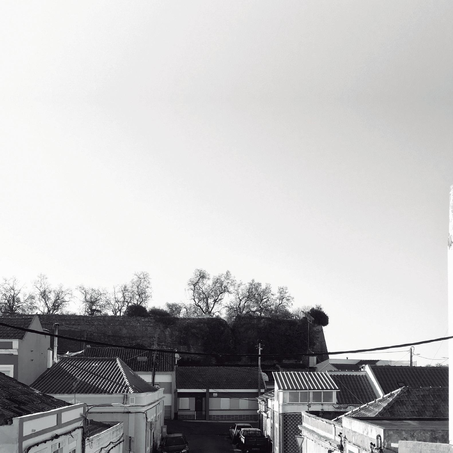
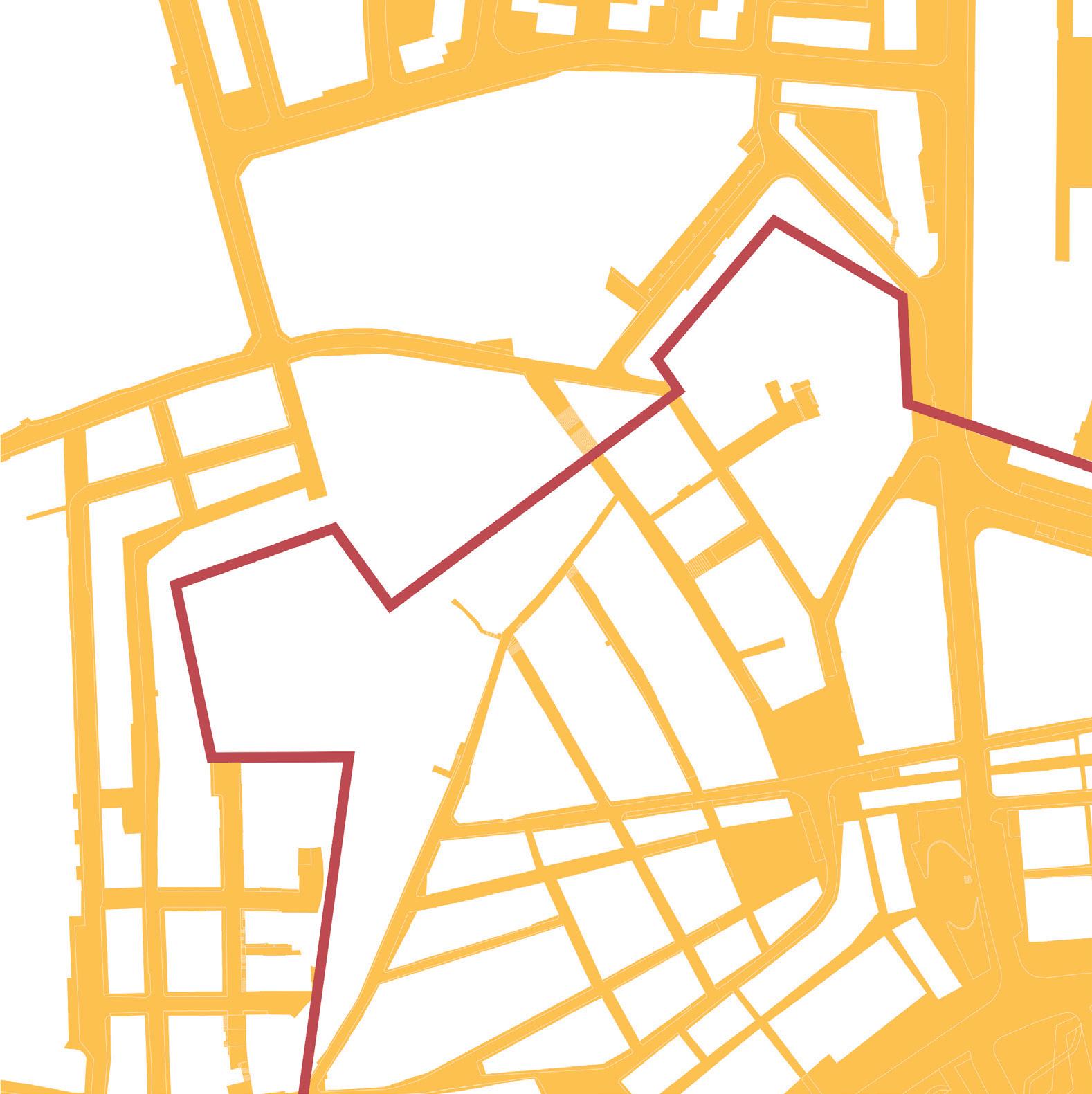
tem, attached to a topographic elevation facing the São Luís de Gonzaga Fort or Old Fort. Its pentag onal shape determines its military character, wide and unobstructed.
The area of intervention, around the Troino neighbourhood, has an impressive mark of long transformations with almost 400 years, in which two fortresses were built, Santo Amaro and Saúde ones, and a fort, the Luís Gonzaga one. Almost 4 centuries later these structures have a paradoxical character: they are large ruins, literally absorbed by time and the city, empty of any qualified use that would make them emerge from the urban struc ture and the Troino neighborhood day life. More, it is this qualitative sense of an apparent physical degradation of the urban set that define the oppor tunity to create an occupation and reintegration hypothesis for this defensive infrastructure in the context of the city of Setúbal.
The proposed challenge seeks to rethink the physi cal memory of the fortress through its reintegration into the urban fabric, particularly with the creation of a continuous circulation intended to resolve the relationship of the remaining walled cloth and its interstitial spaces with the Troino neighbourhood. But then, before creating a proposal around this intersection, it will be convenient to understand what can be of “interest” in this specific territory and how to include them in ideas of “spaces to live together” and in the answer to the question of what “spaces we need in the future”.
A close look at this territory it is possible to un derstand the existent fragilities in the relationship between the surrounding urban fabric and the old fortress, physical and socio-cultural limits. On one hand, it is an obstacle imposed by the juxtaposition or superposition actions in different construction moments that provokes an impasse in the public space continuity, for example the relationship be
tween the Troino and Viso neighbourhoods along the East-west axe. On the other, it is a question of local social experience. The difficulty of access and an apparent disqualification of the wall’s spaces takes away the human scale, even with those who live “wall-to-wall” with the fortress.
It was precisely the undertaking of this necessary path – a territorial and intellectual one between the apparent and the intrinsic – that ended up building the bases for the comprehension of how the future of this neighbourhoods and the fortress can offer spaces about what is needed, about what the city needs and about what the local citizens need. Thus, the recognition of the intervention site through time together with the perception of character and place identity, defined the path for the design process and for its four threshold di mensions:
• The threshold between “inside and outside” in which the “wall” assumed itself as a deter mining element;
• The threshold between the “centre and the eccentric” in which the urban fabric is as sumed as a basis for interpretation;
• The threshold between the “old and the new” in which, of course, time is the protagonist;
• The threshold between “high and low” in which the diversity and complexity of the ur ban elements marks the site of intervention. In the following drawings, the four dimensions are integrated as possible answers, always in relation to the variables that determine the place: time and its persistence. The design solution proposes to integrate the Fortress in a logic of public space continuity relating at different levels the Troino neighborhood and the existing ruin. To this end, the solution proposes the rebuilding of the limits of the wall, the redesign of the public space and the construction of two support buildings.
SETÚBAL LAB 80
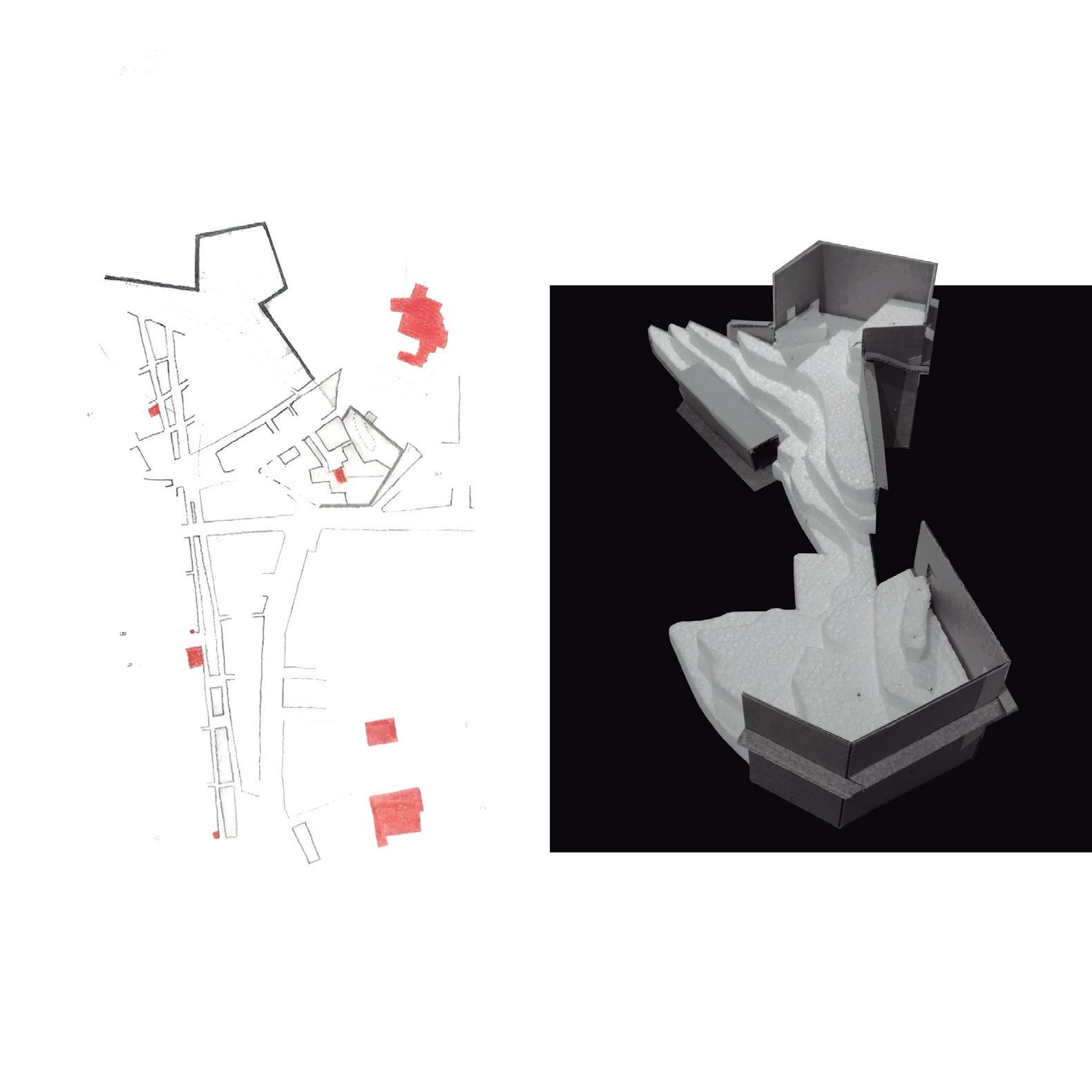
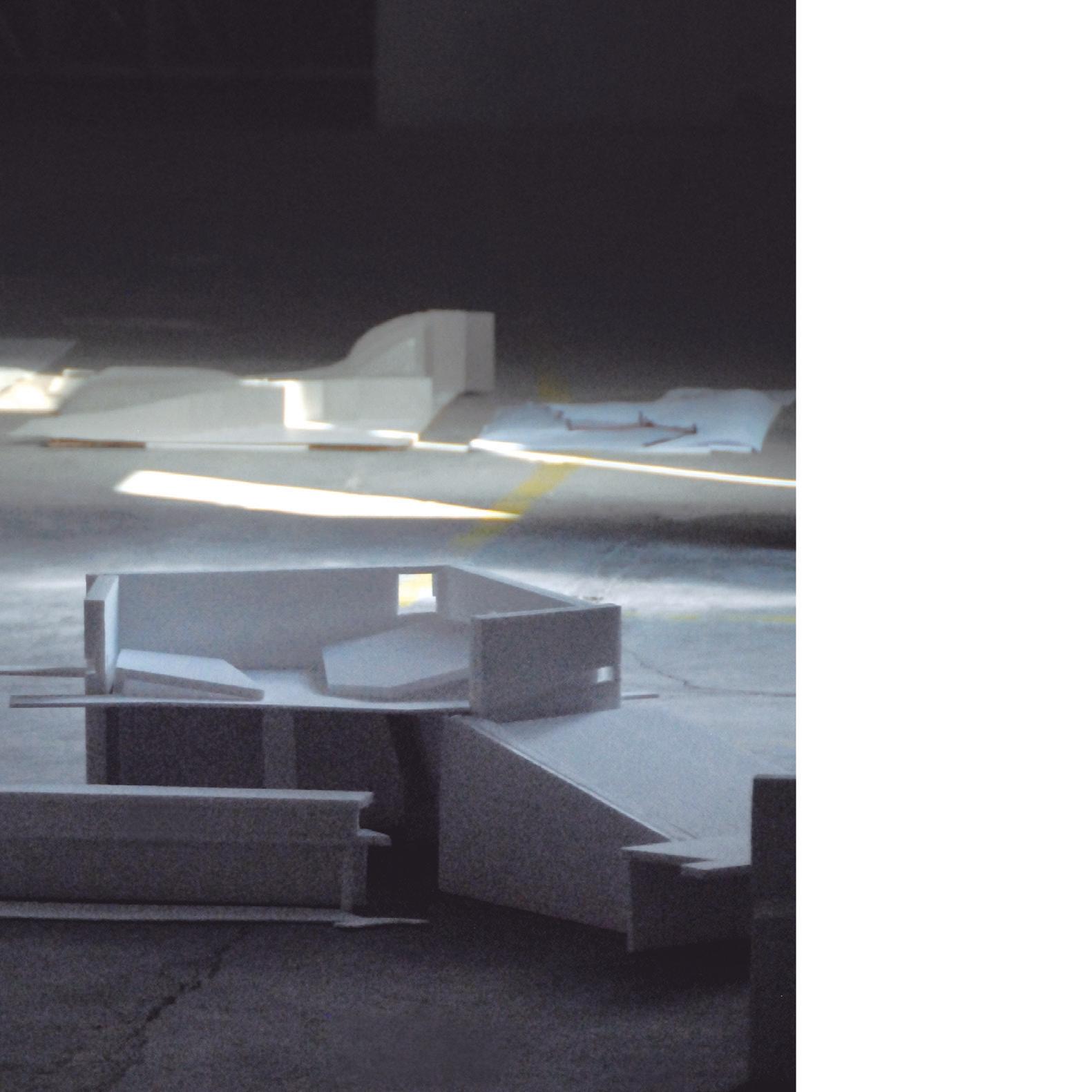
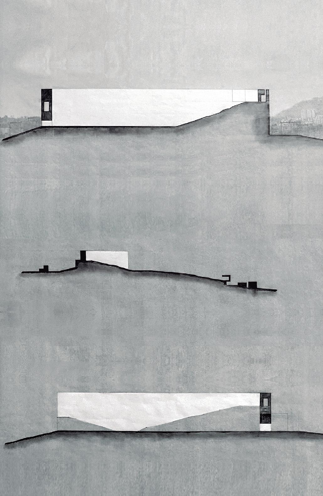
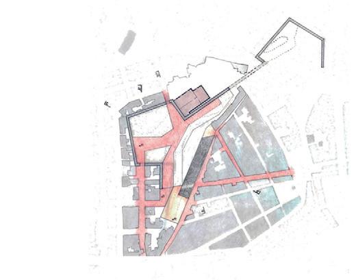
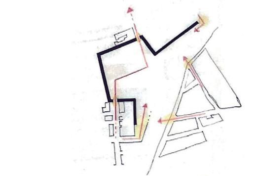
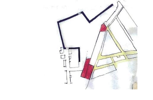
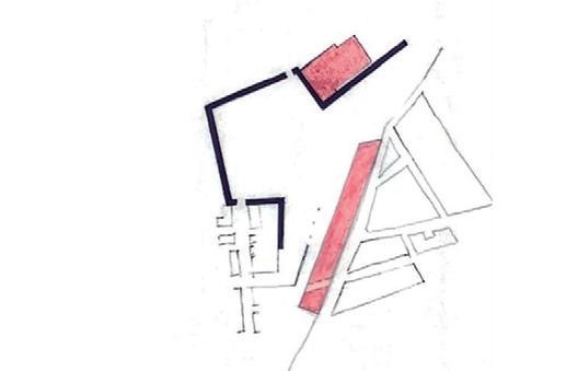
Living the threshold of the wall
The process of rebuilding the wall layout seeks to enhance its physical memory, not as a museological object, but as a live and walkable body. The thickness of the wall defines the expression of the path, exca vated spaces of crossing and permanence, of mass and void relationship, overlapping and subtracted parts of the existing fortress structure.
The superposition is a visible mark of time, a drawn line that emphasizes the dichotomy between the texture of the past and the materiality of the pres ent. This new element is a mnemonic of the built expression in its genesis, but which encloses in the absence of built mass the idea of a “patrol path”. The subtraction promotes the definition of inner paths included in the volume, marked by brief moments of light and expansion with the territory.
Continuities in the public space
The idea of continuity is also proposed as a solution to solve an apparent fracture in the urban layout, due the confrontation between the existent-built fabric and the limits fortress. thus, it is proposed the definition of two new paths: at a high level, it is intended to create a buried crossing that promotes the connection north/south of two dead ends, the streets of Boa Vista and Santo Amaro fortress; on the lower level, is proposed the redefinition of the Oliveiras street layout with the creation of a small square align with the Troino neighbourhood (East-west), as well as the relationship between the fortress and Machado dos Santos square through Paulino de Oliveira street.
Edification and re-Edification
The proposal for the construction of two buildings intends to provide the project with support pro grams of social and cultural vocation, at high and low levels respectively. Of these, the block to be built in
the Oliveiras street stands out, along with the pro posed public space, intends to redefine the lower limit of the fortress, longitudinally and detached from the ground to allow its crossing in a continuous path from the Troino neighbourhood.
SETÚBAL LAB 84
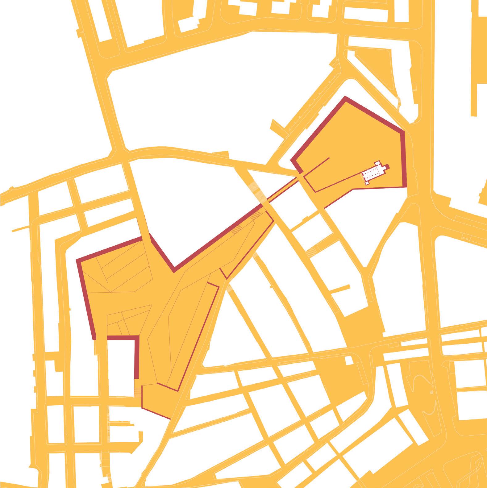
Displacement: transport / exhibition
“But now, talking about the time of my places, I think I’m trying to achieve something that I would call emotional reconstruction, by which I mean the formal and material qualities my buildings should have when they speak about the time of their place. This, of course, has nothing to do with scientific reconstruction as we know it.”
Peter Zumthor & Mari Lending, 2018
Case study 04
Livramento fortress
The Livramento bastion: the form of the place. Unveiling the wall
Advisors
Sérgio Barreiros Proença Filipa Serpa Students
Cândido do Rosário Francisco Janeiro
Paolo Richelli
Sara Alfonso
Sara Ribeiro
As a foreigner in a strange place, we arrive at the city of Setúbal looking at it with a new perception –seeing beyond and unveiling the origin of the urban and built form through its various urban layers. The urban fragment assigned to the workgroup suggested the existence of traces, physical imprints and remains of the wall of the Livramento bastion hidden in the strata overlap that compose this urban palimpsest. An element that, although present, it is not contemporary acknowledged. Walking a path along the ancient bastion remains, places us in face of an uncommon, thick, over two meter high wall that supported and enclosed aban doned warehouse buildings. A closed perimeter in the harbour landfill area with a strong impact on the public space form and dynamic.
86
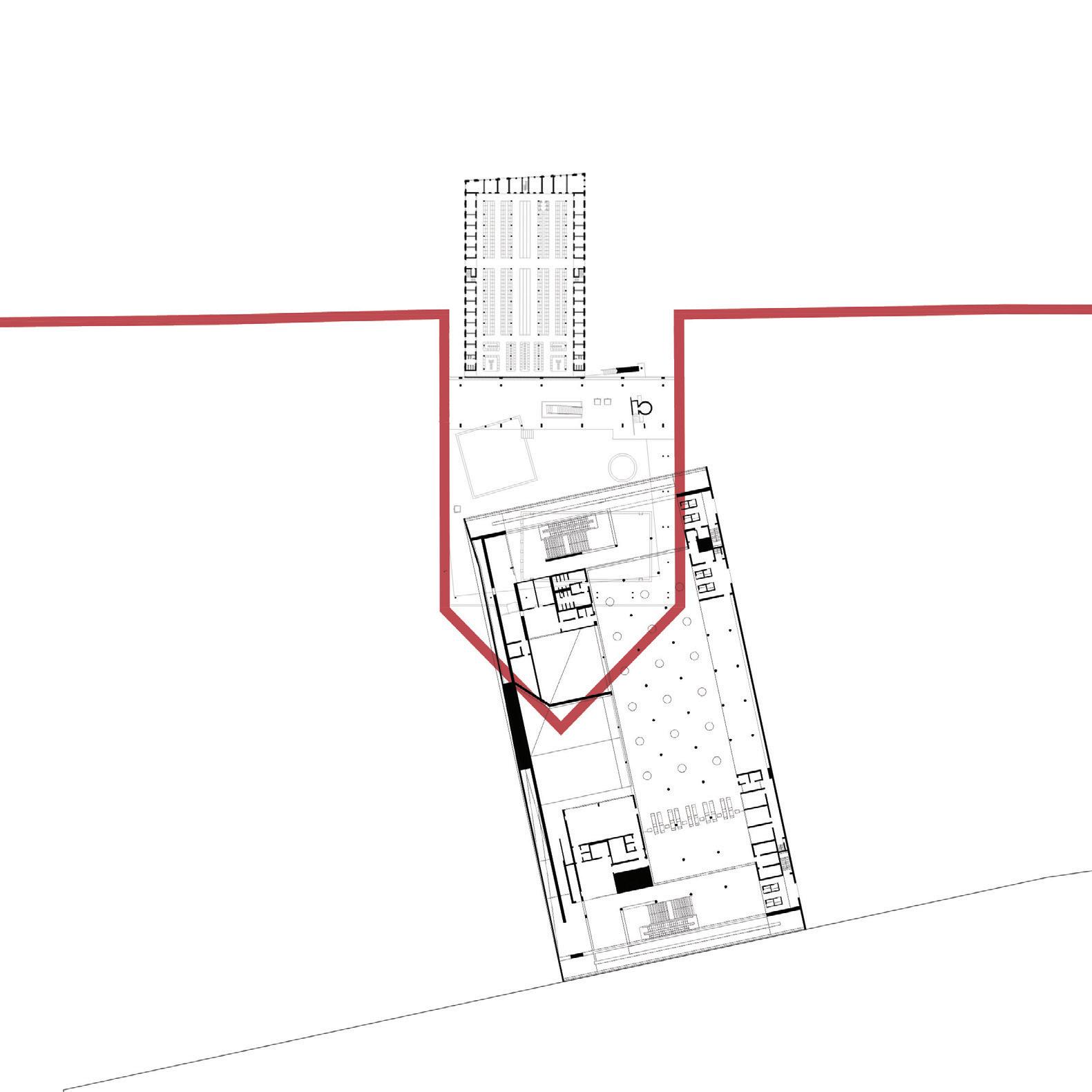
87
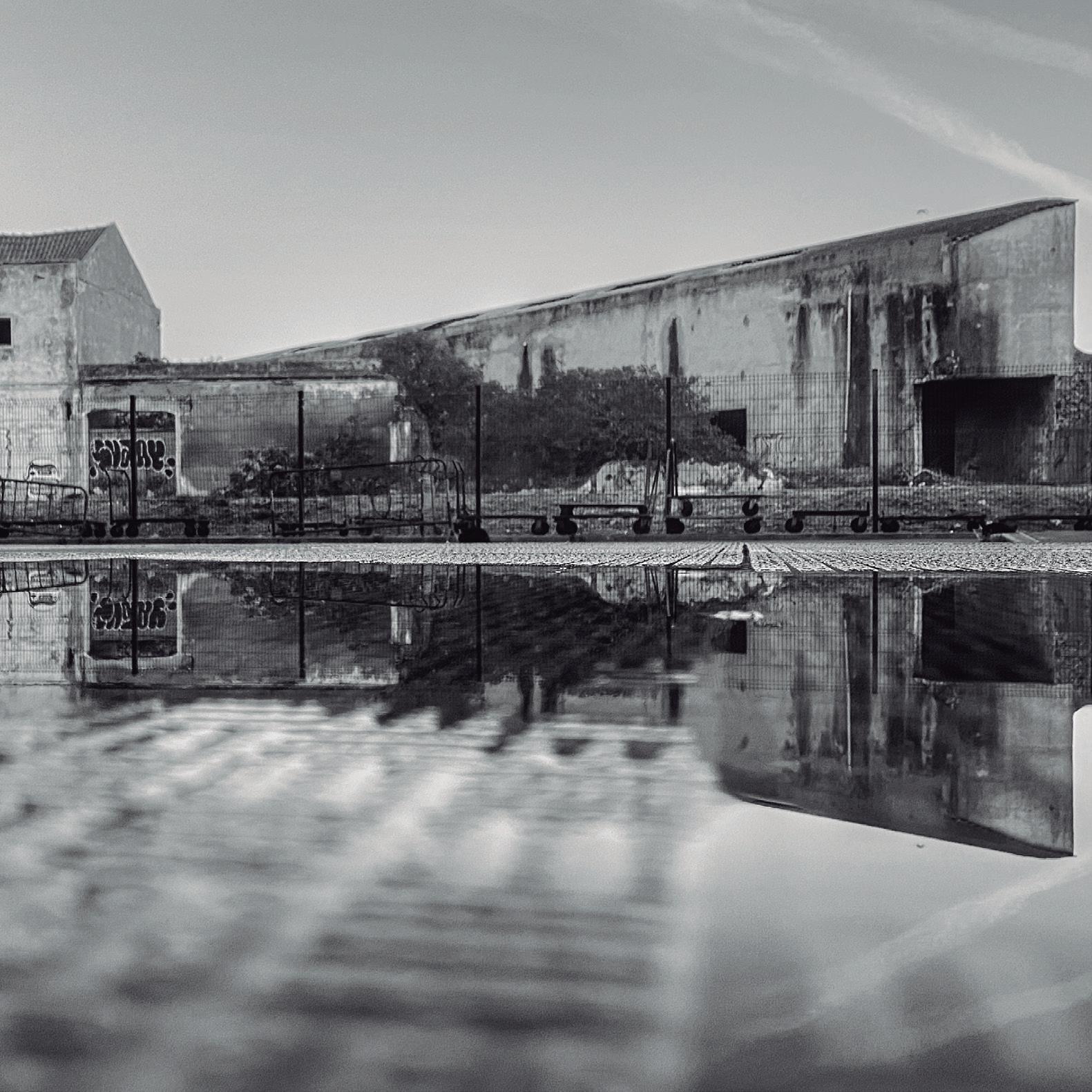
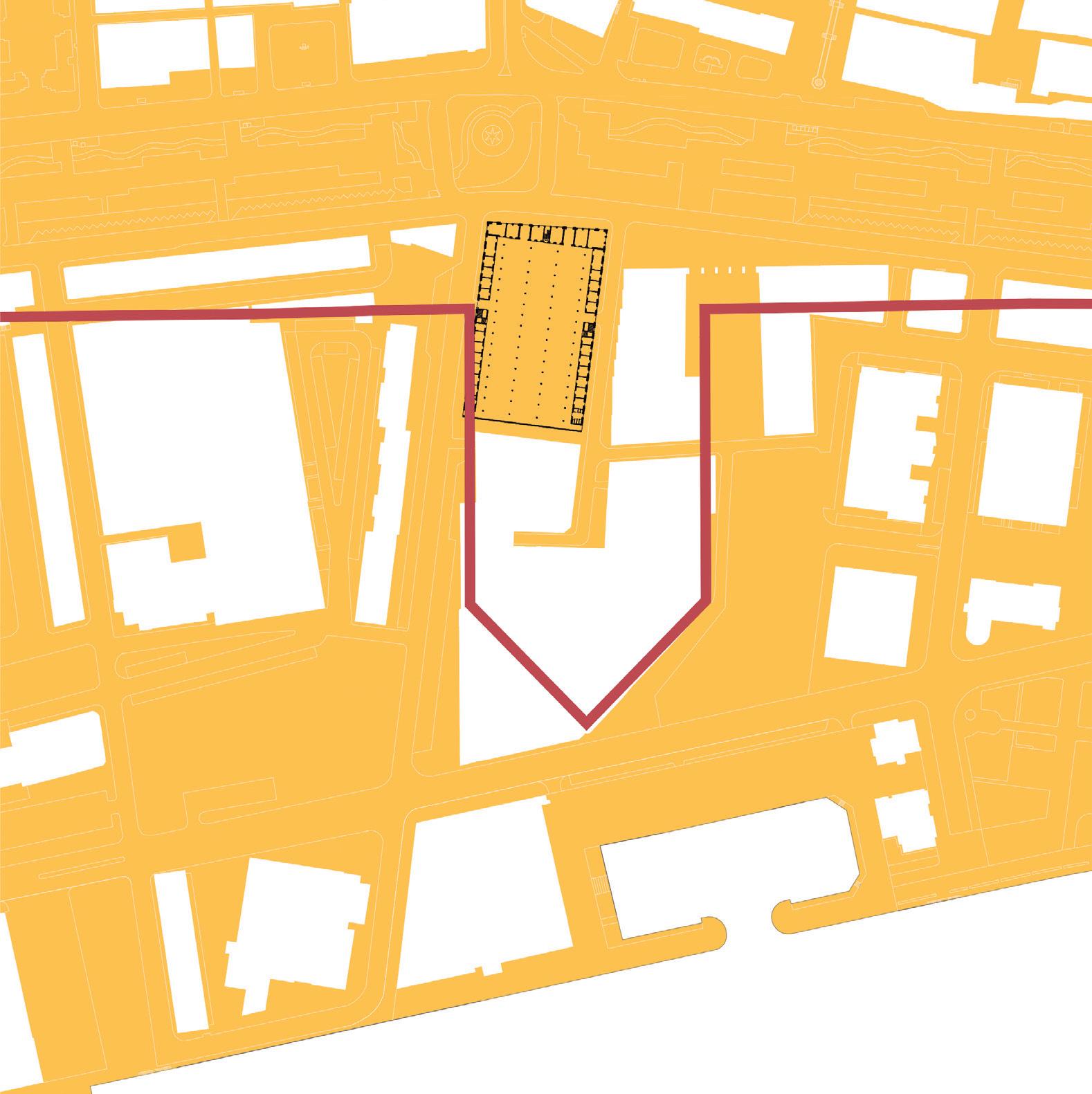
More than an image, the bastion wall traces revealed itself as the form of the place. Once a mediation threshold between the Sado River and the city, today the city’s dynamics are only able to pierce the bastion limits in the Livramento Market, adjacent to the city’s main avenue - Av. Luísa Todi.
The market is the life generator space of this urban fragment. If trade is the origin of living together, the market is the perfect physical manifestation of this idea: a permeable hypostyle room where people gath er to trade goods cyclically, the building being the fos silization of the repeated acts of people. Placed in the north-western corner of the former bastion limit, the market acts as a gravitational force attracting the city life. Facing south, the Livramento bastion establishes a shy, closed and distant relationship with the Sado river and the leisure dock, continuing to welcome the cyclical tidal movement that marks the pier walls.
Displacement
The challenge posed by “The space to live together: a new cartography of urban-ground” comes from the question posed by Sarkis at the Venice Biennale when he asked us to “imagine spaces in which we can gen erously live together”. We understand that it is in the context of the public space that this generosity can be achieved, overcoming barriers and achieving the “new equilibrium“ through an open fluidity between the bastion, people and water, the three ingredients of the place.
In addition, the predetermined conceptual theme –Displacement – was addressed not only under the general idea of the dynamic of things and meanings but, it was also understood under the historical lens of evolution in time. The interpretation of traces from distinct time strata in the urban fragment pal impsest and the reading of contemporary movement of people and water, were the support to address the Livramento bastion future.
Public space as a framework for life
The current static and inward occupation of the Livramento bastion portrays the antithesis of a “space to live together”. At the same time, the Livra mento Market consists of a focus of public life and it is closer to the full potential of the river and sea movement than it is apparent. Identifying the spaces of public use allowed an ex panded notion of the public space that enters the public buildings and confers different limits to the city form.
Robert Bresson once said that “to create is not to deform or invent people and things. It is to tie be tween existent people and things and as they exist, new relations.” The project aims to overcome the existing incoherency, evidence the bastion wall and establish the bastion as a mediation space between urban dynamics and water dynamics, reinterpreting its original relationship with the river.
The wall as a place to live
The proposal unveils the old bastion, working with different levels, now (re)appropriated for new ex periences, while reinforcing the acknowledgement of the bastion perimeter. The suggested reinterpre tation of the ancient bastion defines it as a place of intense urban life.
The project consists at the opening of transversal connections to the compact city and create a link to the water, re-signify the relation between the market and the water, being the old city wall the element that designs the public space and creates a layered and diversified public space to live together at different levels: i) the water space, ii) the ground space and iii) the terrace space.
The space to live together is redefined on multiple grounds. The water, with the dock and the urban pool of tides, a leisure place for boats and people; the ground space that supports the daily life of the
SETÚBAL LAB 90
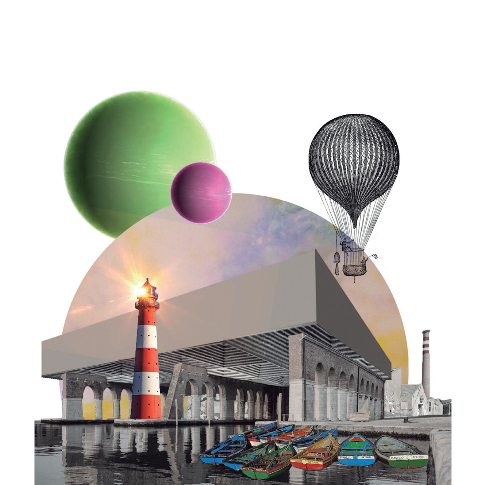
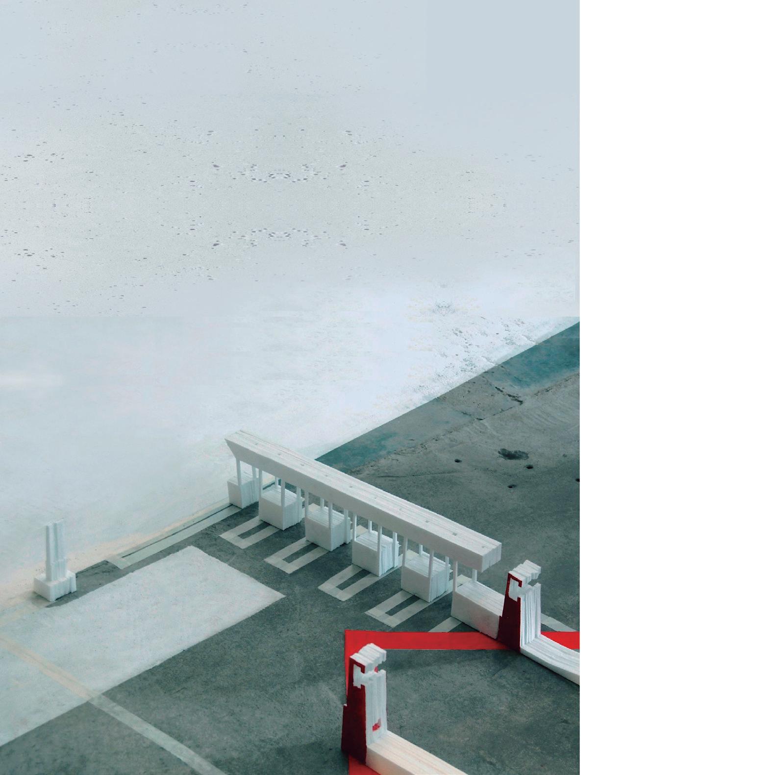
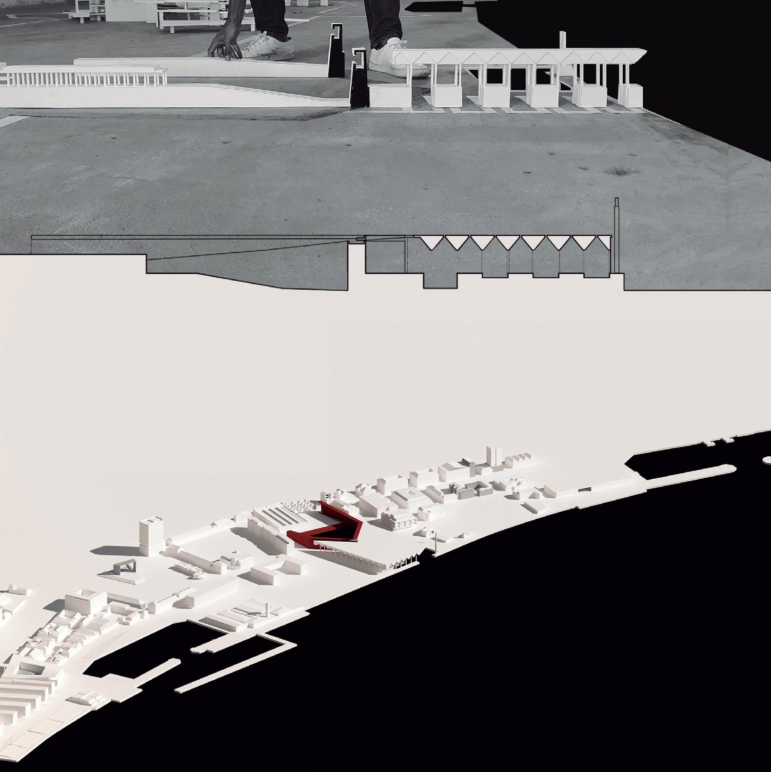
polis; and a public terrace overlooking the Sado and the city. The bastion wall is imagined as a porous interface, articulating levels, but also as a frame for public life to perform.
The design was conceptualized as an inversion of the historical relationship in which the bastion defends the city from water, to a new perspective in which the bastion accommodates and offers the city a space to live together in close contact with the water.
SETÚBAL LAB 94
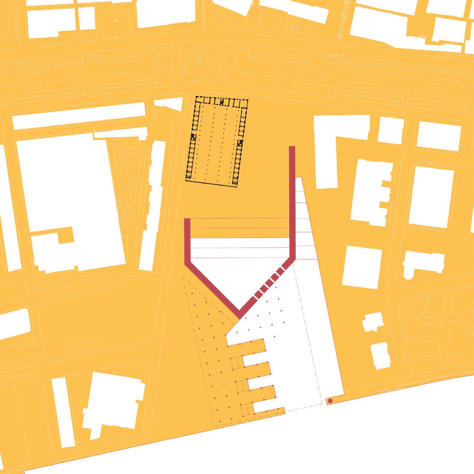
Walls and doors: transitions
“The architectural program is worked on a topograph ical, geographical scale, in which the enormous void is valued as an element of identity and convergence of all the movement [...]”
Gonçalo Byrne, 2007
Case study 05
Albarquel fortress Advisors
João Rafael Santos
Pedro Bento Students
Elcio Djata
Francisco Manuel
Julianna Costa
Michela Stefanoni
Sara Faedda
Albarquel: the (re)construction of a relational place
Albarquel’s coastal battery defines an outstanding place in the relationship between the city of Setúbal and its territory, not only at a local and immediate scale, but particularly at the complex, multi-scalar, and physiographical dimensions on which it is based, and of which is a defining element. Strategically po sitioned in a small promontory on the western range of Arrábida hills, it controls the maritime access to the Sado River, dominating the river’s mouth and the narrow channel between the north bank and Tróia Peninsula. This positional characteristic makes the site a prominent military defensive point: first with the construction of the Fort of Albarquel in the seventeenth century, as part of the coastal defense works of the Restoration period, and, later, with the building of a three pieces artillery battery on the
96
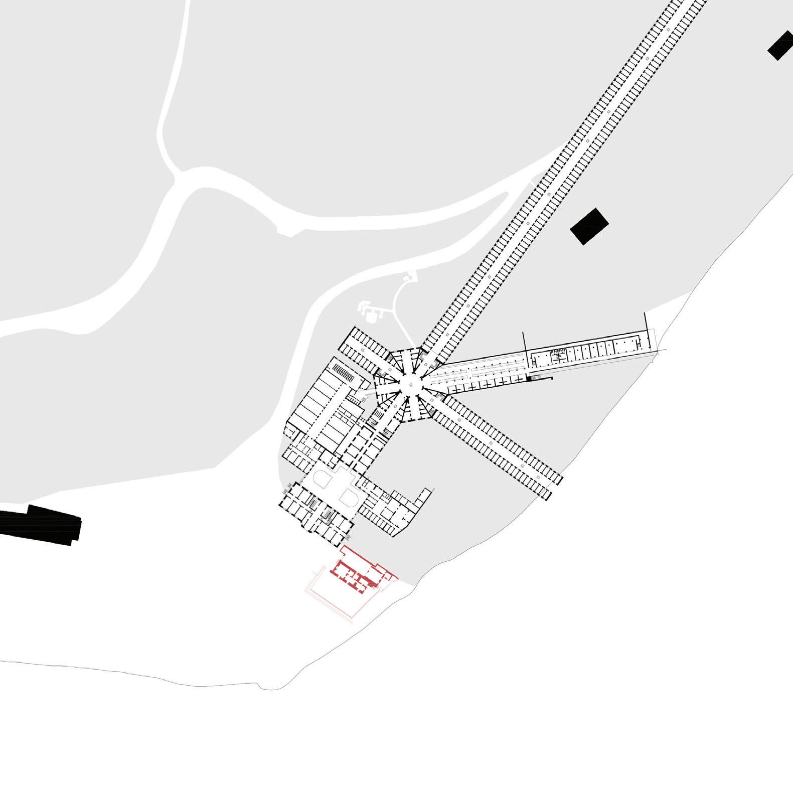
97
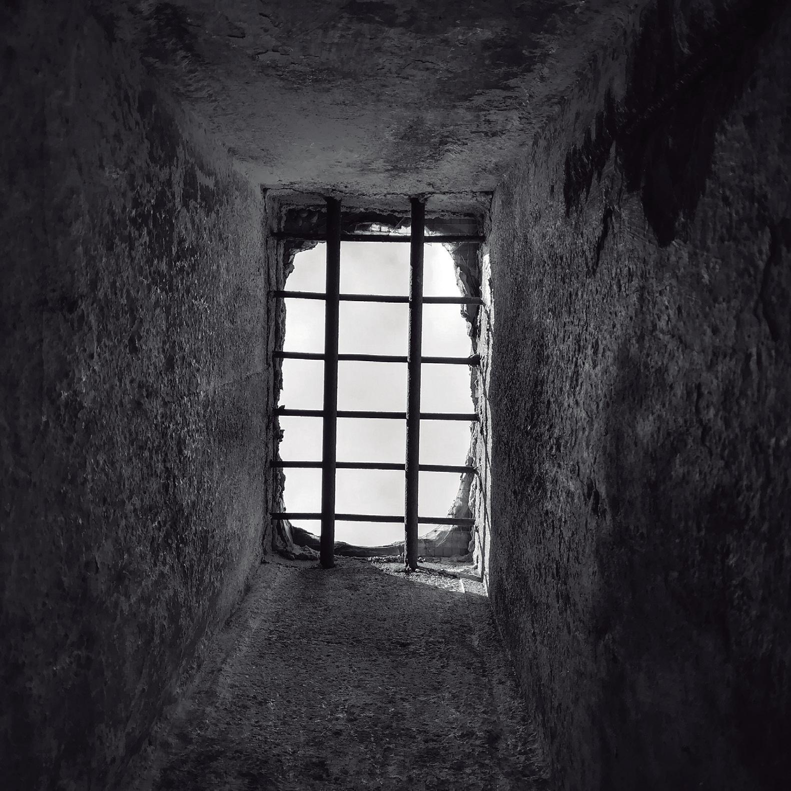
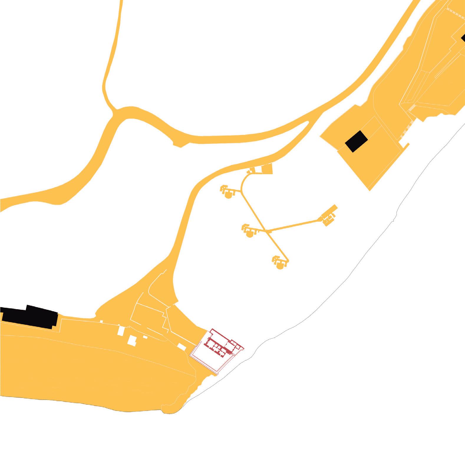
promontory’s upper levels in the 1940s. In a search for the site’s topographic potential, one discovers an extraordinary vocabulary of built artifacts asso ciated to each period: walls, bulwarks and terraces, underground galleries, barracks, shelters, bunkers, and armories. When looked in tandem with the two generations of Setúbal’s city walls (14th and 17th centuries) and with the Fort of São Filipe (built in the Philippine dynasty), Albarquel is an interest ing testimony to the evolution of military defense techniques and their constructive, architectural, and territorial expressions, particularly the complex geometry of its firing lines. More than an object drawing its value from the immediate surroundings, Albarquel battery defines and organizes itself ac cording to a vast system of long-distance relations between the land and the water. But Albarquel is also a site of close relations and of great significance for the people of Setúbal. As the first approach to the unique landscape and envi ronmental values of Arrábida, its beach and narrow embankment provide the opportunity for spaces of conviviality, leisure and collective enjoyment. Albarquel is the first and closest opportunity for safe and convenient beach bathing; the dense tree-cov ered old campsite, now an urban park, offers a pro tective shade in a sunny and Mediterranean climate; the traditions of recreational boating and water sports have good conditions to develop. Albarquel is, therefore, a place of intermediation and, because of that, in permanent transformation and interaction with everything that unfolds around it: between the city and the hills, between the shores and the river, between the military rationale of fortification and the collective possibility of fruition. This acknowledgment as a site of intermediation was the basis for the interpretation of Albarquel under the Walls / Doors / Transition thematic triangulation that was proposed as an instigator for consideration
and design in the workshop. From this interpreta tive approach, the idea that intermediation can be built from the topographic thickness that defines the site began to emerge, considering it either as geological matter, as a symbolic representation of a modern defensive wall, or as a potential gate to be crossed to discover multiple connections. “Living together” is thus a starting point to build a new system of more open relationships between the spaces that surround the battery, linking it to the beach and to the urban park and offering new connections between the promontory’s upper level and the riverside cliffs. It is also an invitation to rediscover the extended territorial relations that can be read, interpreted, and valued from that converging point: from Tróia to São Luís hills, from the Palace of Comenda to the water reservoir of the Bela Vista neighborhood, from the Outão Fort to the mills surrounding São Filipe Fort hills… New possibilities of approach, interaction and per manence are opened, in a dialogue with the material memory of the site, projecting the real and the im aginary lines of a potential new nautical chart of the 21st century’s Setúbal. The curious and stimulating proposal here presented would admit multiple readings and interpretations, but the aspect we would like to highlight is the ex traordinary ability it offers to develop at different scales: territorial, urban, and architectural/sculptural. The territorial scale would be emphasized through the long-distance visual relations between out standing landscape elements, axially drawn between Albarquel and Tróia’s roman archeological site, the Fort of Outão and Bela Vista neighborhood. The urban scale would be defined by the new artifact’s relationship with its most immediate sur roundings. Particularly, it would be materialized as a physical and visual urban connector between the hills and the river, facilitating a smooth East-West
SETÚBAL LAB 100
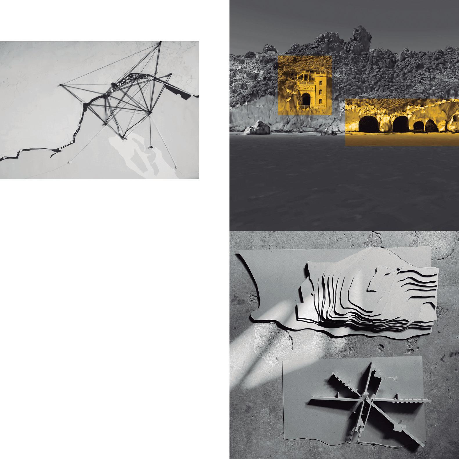
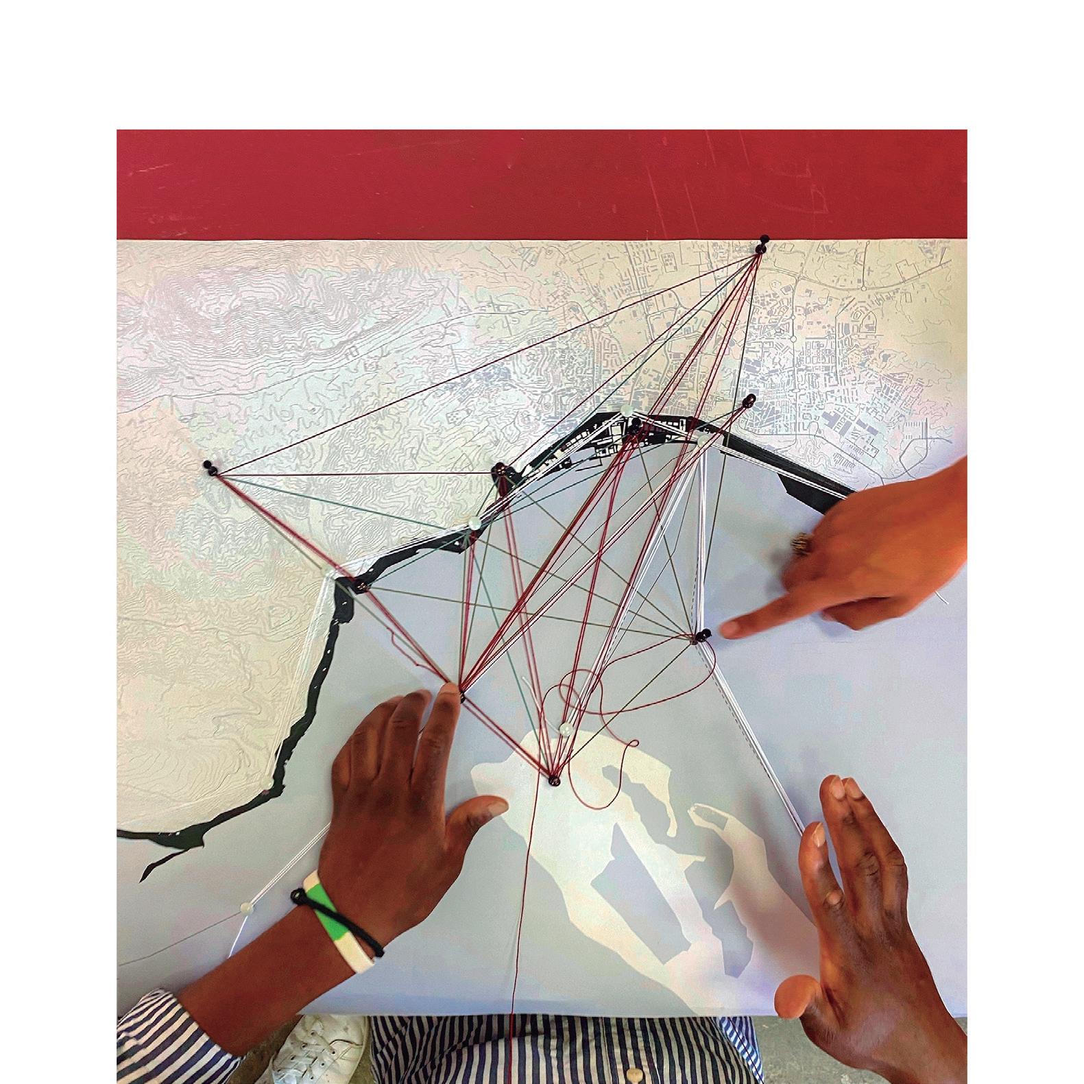
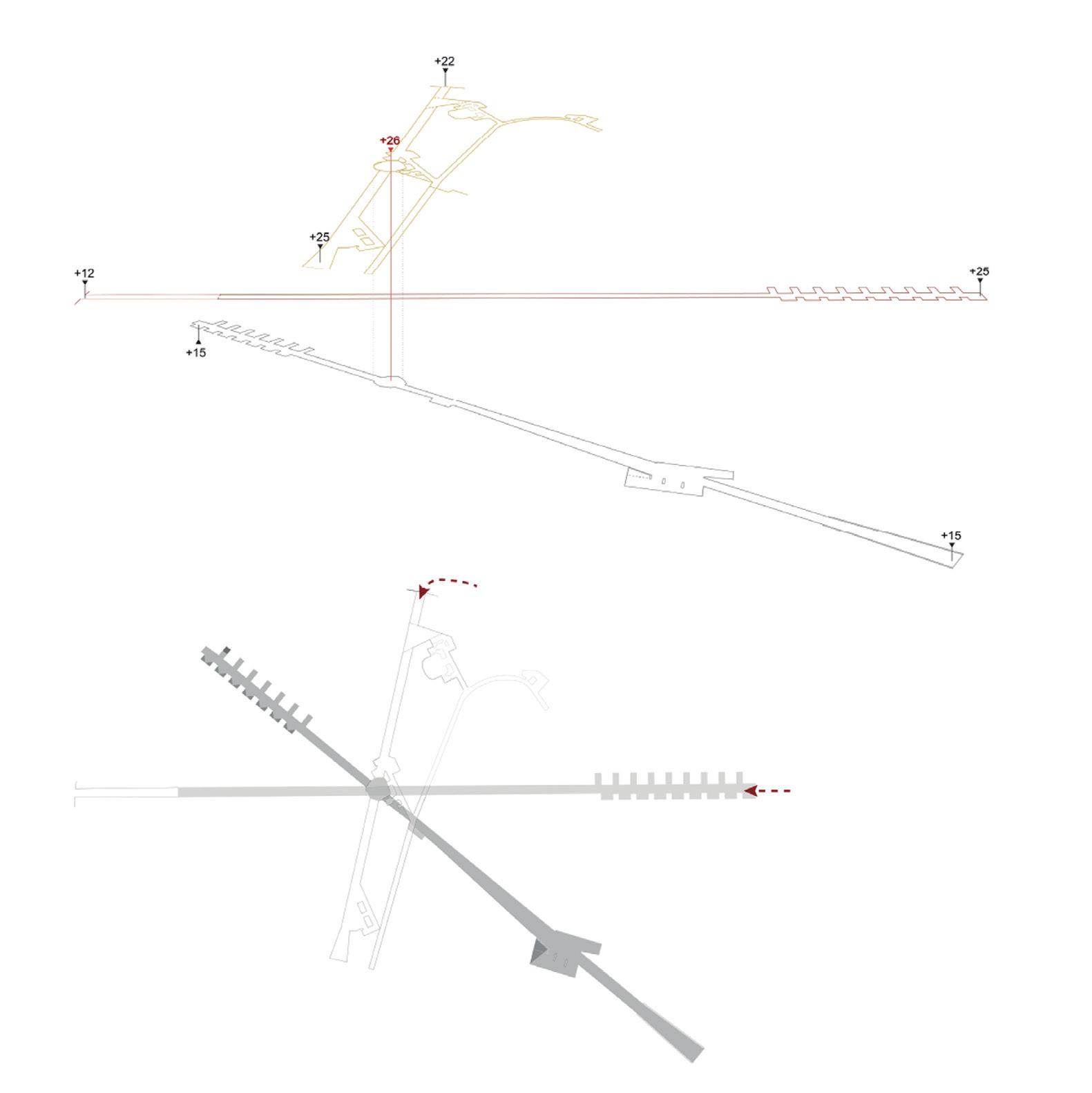
transition between Albarquel beach and the urban park, thus suggesting a new topographic thickness. The architectural/sculptural scale would result in the creation of a new public, hybrid, and complex space. A multilevel artifact that subtly redesigns the battery’s surface, somewhere between the park and the square, establishing new continuities with the galleries and other underground systems. On the promontory’s lower levels, three new axes charac terized by different types of lighting are excavated, intersecting, and partially opening the pre-existing military galleries.
Additionally, a set of supporting spaces (changing rooms, shops, cafeterias, small workshops) would be organized along one of the axes, introducing differ ent depths that would enrich the visitor experience and offer different possibilities of appropriation. At the intersection of these macro-architectural ele ments, a special collective space of contemplation would be shaped, celebrating the place’s historical memory, and providing a new atrium or entrance gate to the Arrábida hills range and its protected landscape and natural values.
The creation of this new nodal point would be an interesting contribution to reinforce the urban and regional landscape’s imaginability for this Southern territory of Lisbon’s metropolitan area. Ultimately, it could be a contribution to the shaping of a new and cherished territorial corner of leisure and fruition.
SETÚBAL LAB 104
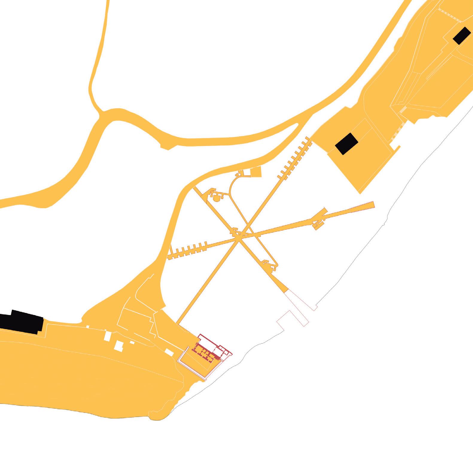
REPORTING FROM SETÚBAL
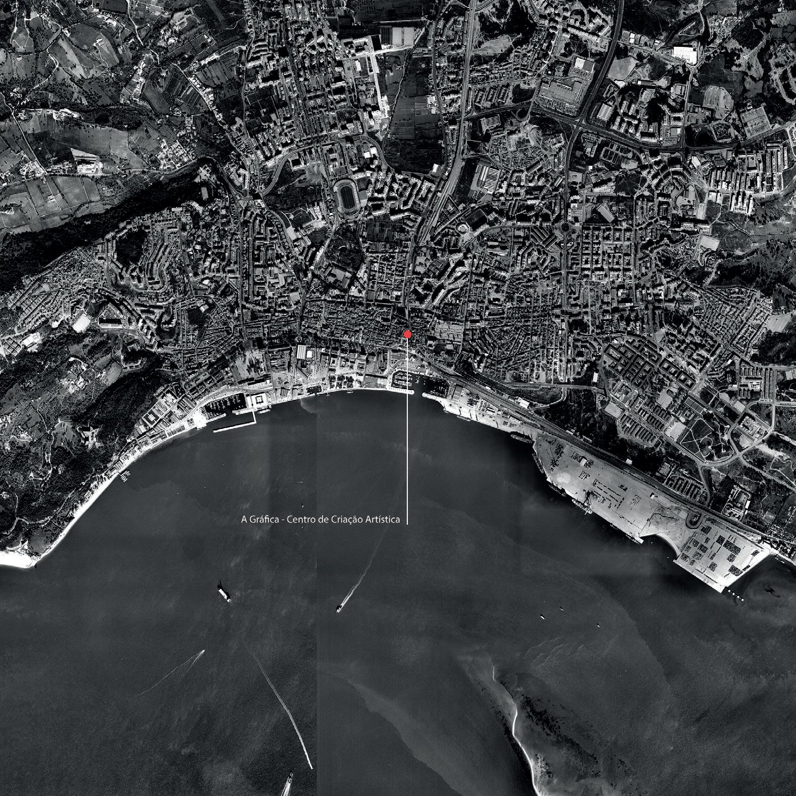
A Gráfica - Centro de Criação Artística.
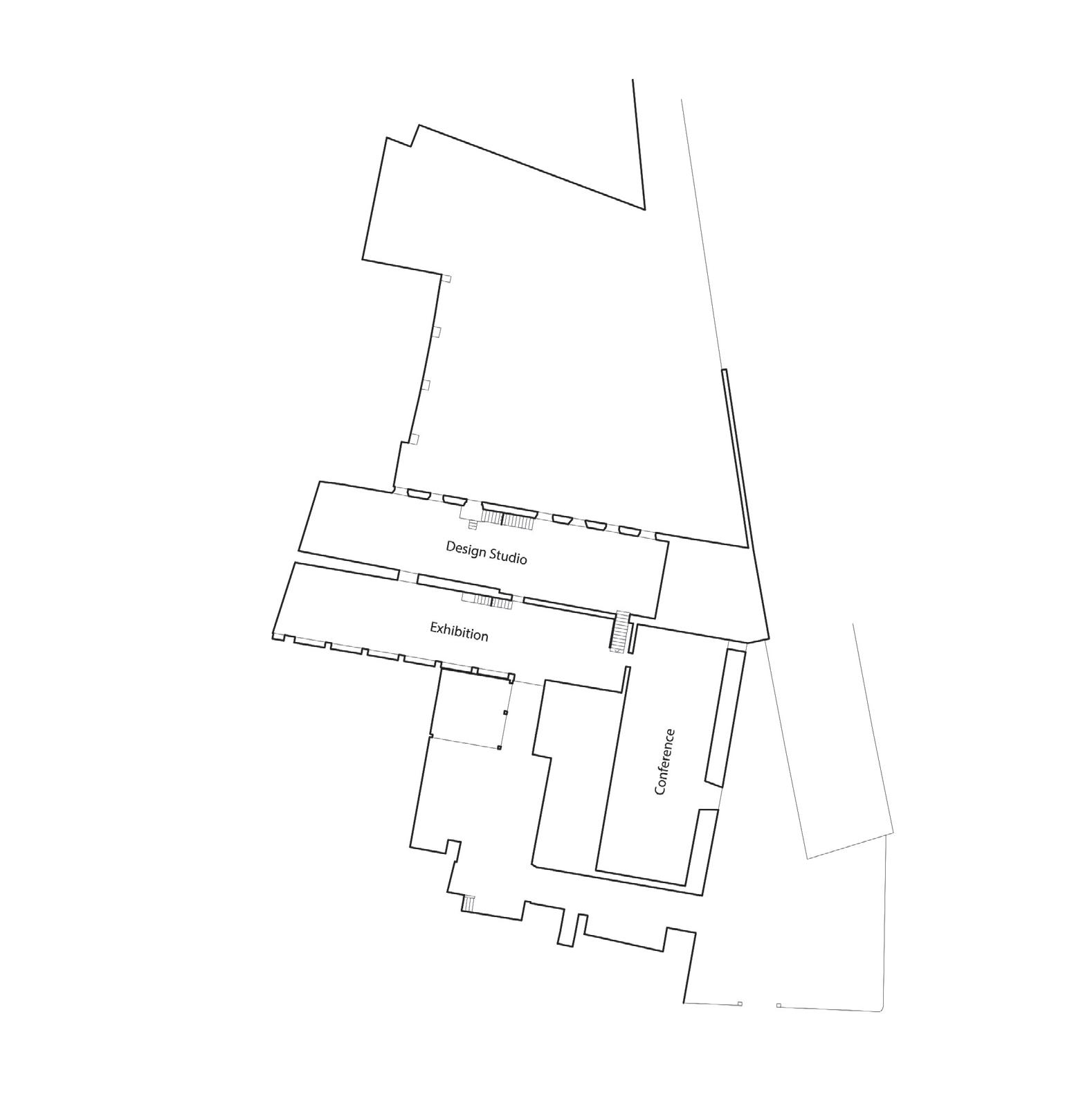
109
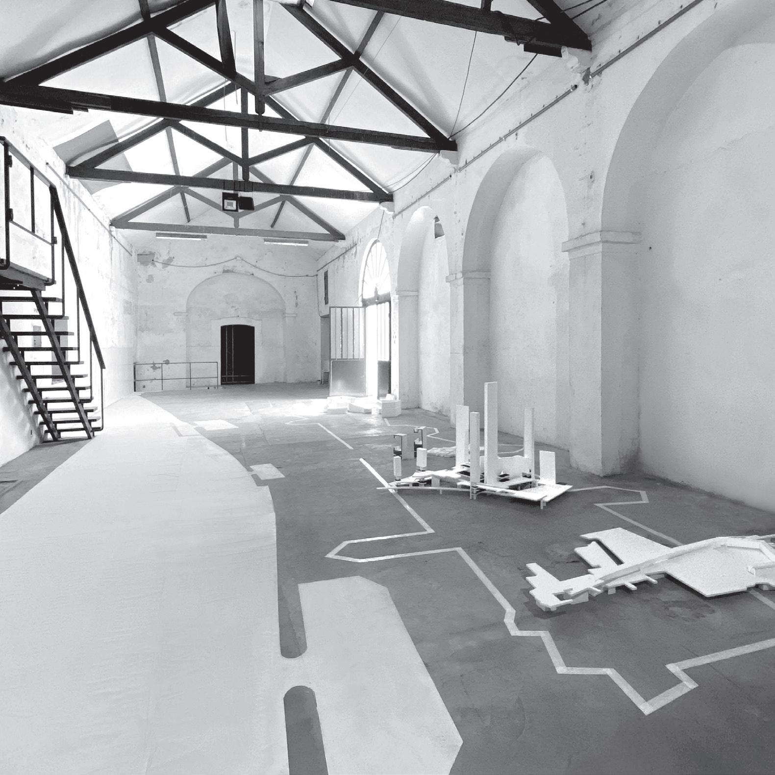
A Gráfica - Centro de Criação Artística, exhibition room.
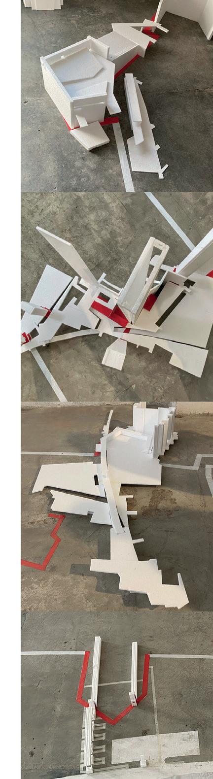
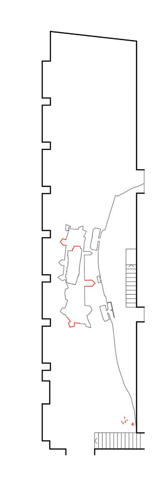
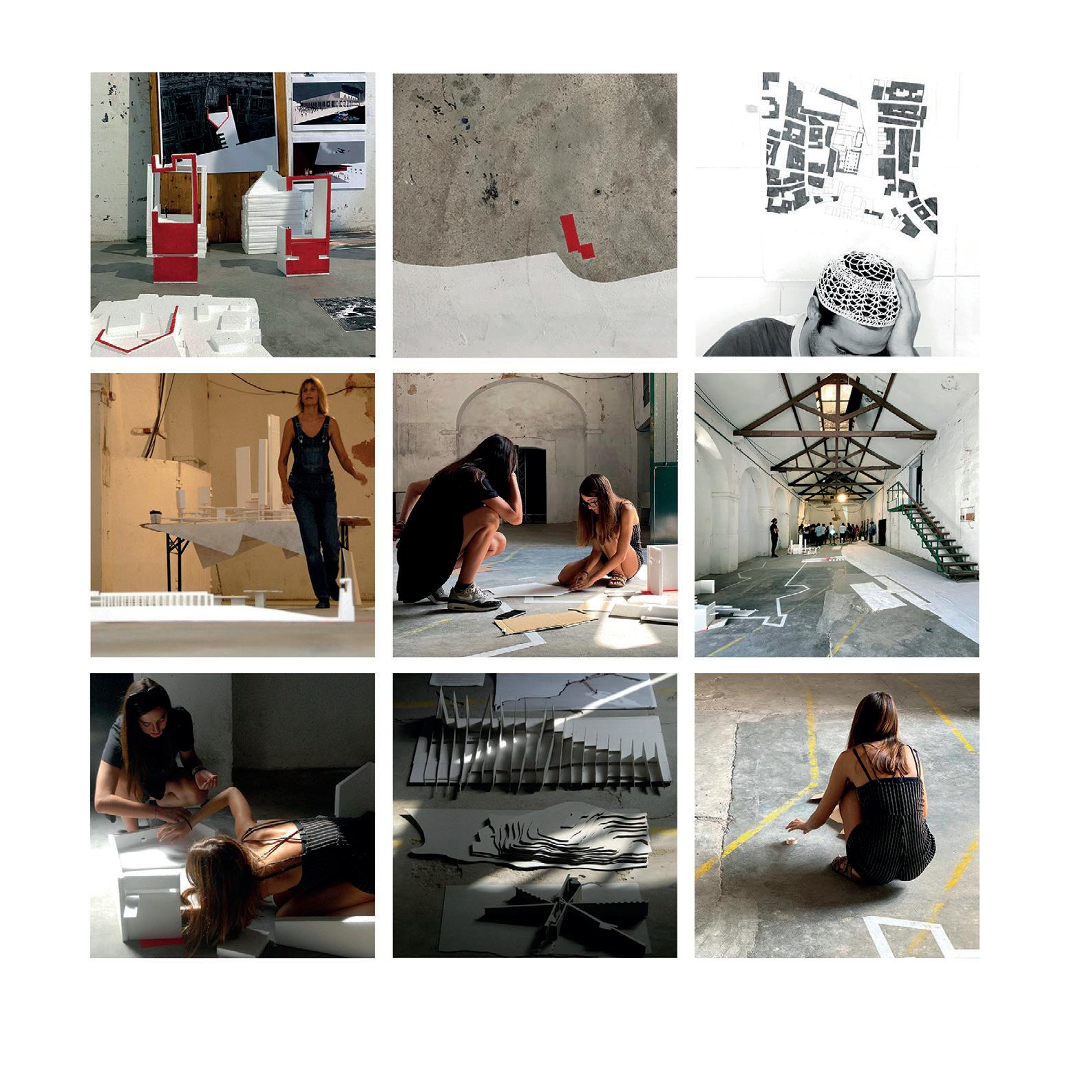
SETÚBAL LAB 112
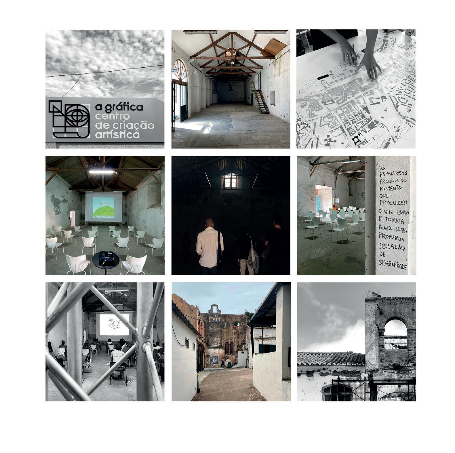
113
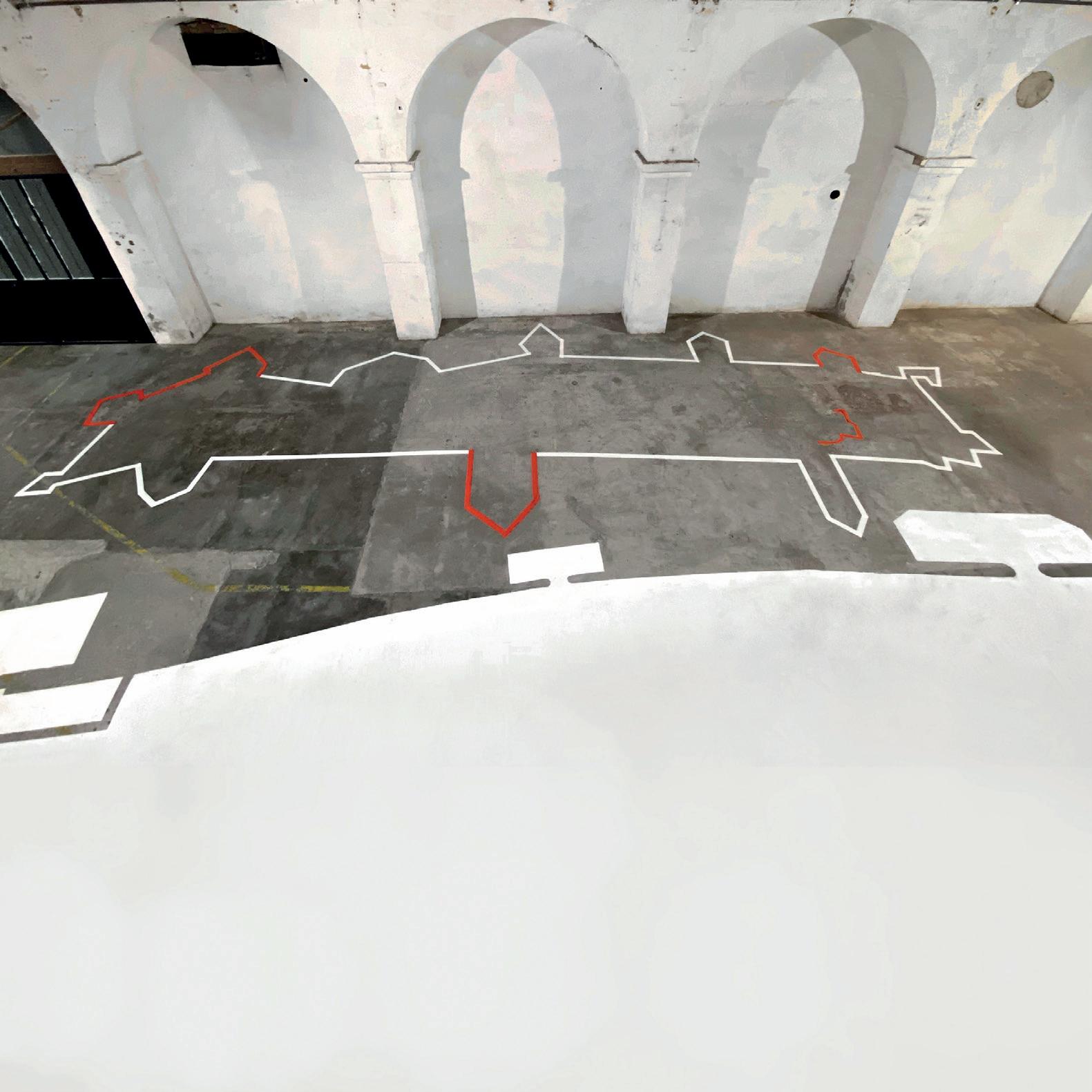
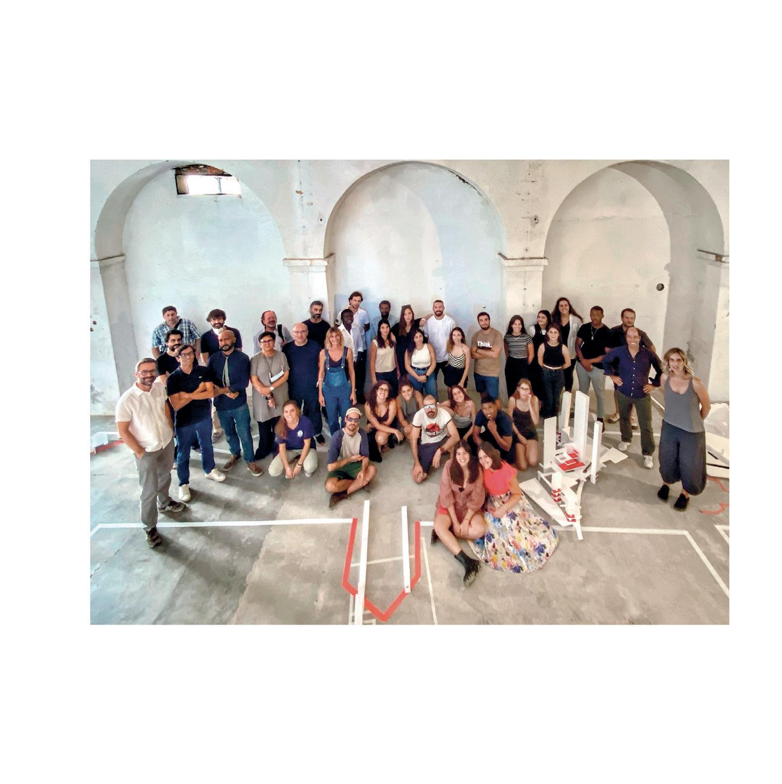
115
BIBLIOGRAPHY
Antoniadis, S. (2019). Sulla Costa. La forma del costruito mediterraneo non accreditato. Conegliano: Anteferma. Blau, E., Rupnik, I. (2007). Project Zagreb. Transition as Condition, Strategy, Practice. Barcelona: Actar.
Blot, M. L. P. (2003). Trabalhos de Arqueologia 28. Os portos na origem dos centros urbanos. Contributo para a arqueologia das cidades marítimas e flúvio-marítimas em Portugal. Lisboa: Gráfica Maiadouro.
Byrne, G. (2007). Geografias Vivas / Living Geographies. Lisboa: Ordem dos Arquitectos. Christ, E. Gantenbein, C. (2012). Typology transfer. Towards an urban architecture, in Typology – Hong Kong, Rome, New York, Buenos Aires. Zurich: Park Books.
Cruz, G., Frankowsky, N. (2019). Narrative Architecture. A Kynical Manifesto. Rotterdam: Nai010publishers. Degros, A., Bagaric, A. , Bauer, S., Radulova-Stahmer, R., Stefan, M. and Schwab, E., (eds.) (2021). Basics of Urbanism. 12 notions of territorial transformation. Zurich: Park Books.
Dias Coelho, C. (2013). Os Elementos Urbanos. Lisboa: Argumentum.
Fadigas, L. (2011). Fundamentos ambientais do ordenamento do território e da paisagem. Lisboa: Edições Sílabo. Fadigas, L. (2020). Urbanização, espaços verdes e sustentabilidade. Do jardim à agricultura urbana. Lisboa. Edições Sílabo.
Forman, R. T., Godron, M. (1986). Landscape Ecology. New York: John Wiley & Sons.
Ferrando, D. T., Lootsma, B. and Kanokwan, T. (eds.) (2020). Italian Collage. Siracusa: LetteraVentidue. Foscari, G. (2014). Elements of Venice. Zurich: Lars Muller Publishers.
Hashim Sarkis H., Tannir, A (eds.) (2021). EXPANSIONS. Responses to How We Live Together. La Biennele di Venezia. Harbison, R. (2015). Ruins and Fragments: Tales of loss and rediscovery. London: Reaktion Books. Heidegger, M. (1971). Building, Dwelling, Thinking, in Poetry, Language, Thought. New York: Harper Perennial, pp. 141-160.
Innerarity, D. (2006). O Novo Espaço Público. Lisboa: Teorema.
Jallon, B., Napolitano, U. and Boutté, F. (eds.) (2017). Paris Haussmann. Zurich: Park Books.
Mapa de Arquitectura de SETÚBAL (2004). Lisboa: Argumentum.
116 SETÚBAL LAB
Monteys, X. (coord.) (2010). Domesticar la Calle / Domesticating the Street in a+t – Strategy Public. Vito ria-Gasteiz: a+t ediciones, n. 35-36, pp.304-315.
Moraitis K. (2013). Landscape Interpretation through Schematism: Schematism as a theory concept, and its correlation to Landscape Aesthetics and Landscape Design, in XXIII World Congress of Philosophy proceedings, Athens, p. 217.
Murphy, M. D. (2016). Landscape architecture theory - an ecological approach. New York: Springer. Naveh, Z., Liberman, A. S. (1994). Landscape ecology - theory and applications. New York: Springer. Pessoa, F. (1982). Livro de Desassossego. Lisboa: Ática.
Quintas, M. da C. (2003). Porto de Setúbal um actor de desenvolvimento. Setúbal: Administração do Porto de Setúbal. Rasmussen S. E. (1974). London: The Unique City. Boston: M.I.T. Press. Sartogo, P. (ed.) (2015). Roma interrota. 12 interventions on the Nolli’s plan of Rome. Roma: Johan & Levi Editore. Schmid, S., Eberle, D.,Hugentobler, M. (2019). A History of Collective Living. Models of Shared Living. Basel: Birkhauser.
Silva, J. C. V. da (1990). Setúbal. Lisboa: Presença.
Solà-Morales, M. (2013). The impossible project of public space. Available at: https://www.publicspace.org/ multimedia/-/post/the-impossible-project-of-public-space (accessed on May 2022).
Stendardo L. (2013). La stratificazione di forma e materia tra coltivato e costruito, in Antoniadis S., Braggion A., Carabini A., Lain E. (a cura di), BE CITY SMART! Scenari & progetti per un’urbanità 2.0, Padova: Overview Editore, p. 93.
Tomé, M. (2018). Topologia e Tipologia Arquitectónica. Setúbal, Lisboa: Caleidoscópio.
Ungers, O. M. (2011). Designing and Thinking in images. Metaphors and Analogies in Morphologie: City Metaphors. Köln: Walther König, pp7-15.
Van Eyck, A. (2008) [1962]. The Child, the City and the Artist: An essay on architecture, the in-between realm Amsterdam: Sun.
Zumthor, P., Lending, M. (2018). A Feeling of History. Zurich: Scheidegger & Spiess.
117
WORKSHOP
The Space to Live Together A New Cartography of Urban-Ground
European Master – PPCEL, Planning & Policies for Cities, Environment and Landscape Summer School Intensive Programme, Setúbal 2021
Organization
FA.ULisboa – Faculdade de Arquitetura da Universidade de Lisboa CIAUD – Research Center in Architecture, Urbanism and Design, FA.ULisboa formaurbis LAB, research group
Scientific Coordination Pedro Rodrigues, Sérgio Padrão Fernandes
Scientific Board
Alessandra Casu (UniSS), Alessia Allegri (FA.ULisboa), Angel Cebollada (UAB), Anna Ribas (UdG), Carlos Dias Coelho (FA.ULisboa), Filipa Serpa (FA.ULisboa), Francesco Musco (Iuav), João Pedro Costa (FA.ULisboa), João Leite (FA.ULisboa), João Rafael Santos (FA.ULisboa), Jordi Nadal Tersa (UAB), José Miguel Silva (FA.ULisboa), Luís Carvalho (FA.ULisboa), Margari ta Castañer (UdG), Matelda Reho (Iuav), Maria Manuela da Fonte (FA.ULisboa), Pedro Bento (FA.ULisboa), Pedro Rodrigues (FA.ULisboa), Sérgio Padrão Fernandes (FA.ULisboa), Sérgio Barreiros Proença (FA.ULisboa), Silvia Sirreli (UniSS)
Sponsor Setúbal City Council
Accademic Partners
IUAV – Università Iuav di Venezia UAB – Universitat Autònoma de Barcelona UdG – Universitat de Girona UniSS – Università degli studi di Sassari, Architettura ad Alghero
Professors
Alessandra Casu (UniSS), Alessia Allegri (FA.ULisboa), Angel Cebollada (UAB), Anna Ribas (UdG), Filipa Serpa (FA. ULisboa), Francesco Musco (Iuav), João Leite (FA.ULisboa), João Rafael Santos (FA. ULisboa), Jordi Nadal Tersa (UAB), José Miguel Silva (FA.ULisboa), Luís Carvalho (FA.ULisboa), Margarita Castañer (UdG), Matelda Reho (Iuav), Maria Manuela da Fonte (FA.ULisboa), Pedro Bento (FA.ULisboa), Pedro Rodrigues (FA.ULisboa), Sérgio Padrão Fernandes (FA.ULisboa), Sérgio Barreiros Proença (FA.ULisboa), Silvia Sirreli (UniSS)
Invited Tutors
Carlota Gala (FA.ULisboa), Gonçalo Pirrolas (FA.ULisboa), Stefanos Antoniadis (FA.ULisboa)
Participant Students
Alessandra Pace (FA.ULisboa), Ana Oliveira (FA.ULisboa), Beatriz Cabral (FA.ULisboa), Cândido do Rosário (FA.ULisboa), Carolina Martins (FA.ULisboa), Danilo Tavares (FA.ULisboa), Elcio Djata (FA.ULisboa), Fernanda Costa (FA.ULisboa), Filipa Lopes (FA.ULisboa), Francisco Janeiro (FA.ULisboa), Francisco Manuel (FA.ULisboa), Henrique Nunes (FA.ULisboa), Julianna Costa (FA.ULisboa), Margherita Maggioni (Iuav), Mariana Frade (FA.ULisboa), Mariana Reis (FA.ULisboa), Mattia Muresu (UniSS), Michela Stefanoni (Iuav), Paolo Richelli (Iuav), Roberto Lorenzon (Iuav), Sara Alfonso (UniSS), Sara Ribeiro (FA.ULisboa), Sara Faedda (UniSS)
Setúbal LAB
The space to live together: a new cartography of urban-ground
edited by
Sérgio Padrão Fernandes
Sérgio Padrão Fernandes is Architect by Faculty of Architecture - Technical University of Lisbon (FA-UTL) and PhD in Urbanism by University of Lisbon (FA.ULisboa), with the thesis “Genesis and Form of Portuguese Urban-Layout”. Currently, he is Professor of Architecture and Urbanism at Lisbon School of Architecture. Since 2006 he is researcher of CIAUDResearch Center in Architecture, Urbanism and Design and founding member of formaurbis LAB research laboratory, whose work has received several national and international recognitions.
Pedro Rodrigues
Pedro Rodrigues is Architect by Faculty of Architecture - Technical University of Lisbon (FA-UTL) and PhD in Architecture by University of Lisbon (FA.ULisboa), with the thesis “Patri mónio, Território e Topologia do Lugar no Brasil no Estado de Goiás”. Currently, he is Professor of Architecture at Lisbon School of Architecture, President of School Council and Coordinator of the Master in Architecture. Since 1996, founder and coordinator of the Lisbon based studio – Pedro Rodrigues. Arquitectura Global.
with the particiaption of
Alessia Allegri, professor, architect, CIAUD, Research Centre for Architecture, Urbanism and Design, Lisbon School of Architecture, Universidade de Lisboa
Filipa Serpa, professor, architect, CIAUD, Research Centre for Architecture, Urbanism and Design, Lisbon School of Architecture, Universidade de Lisboa
João Leite, professor, architect, CIAUD, Research Centre for Architecture, Urbanism and Design, Lisbon School of Architecture, Universidade de Lisboa
João Rafael Santos, professor, architect, CIAUD, Research Centre for Architecture, Urbanism and Design, Lisbon School of Architecture, Universidade de Lisboa
José Miguel Silva, professor, architect, CIAUD, Research Centre for Architecture, Urbanism and Design, Lisbon School of Architecture, Universidade de Lisboa
Leonel Fadigas, professor, landscape architect, CIAUD, Research Centre for Architecture, Urbanism and Design, Lisbon School of Architecture, Universidade de Lisboa
Luís Carvalho, professor, architect, CIAUD, Research Centre for Architecture, Urbanism and Design, Lisbon School of Architecture, Universidade de Lisboa
Maria Manuela da Fonte, professor, architect, CIAUD, Research Centre for Architecture, Urbanism and Design, Lisbon School of Architecture, Universidade de Lisboa
Pedro Bento, professor, architect, CIAUD, Research Centre for Architecture, Urbanism and Design, Lisbon School of Architecture, Universidade de Lisboa
Sérgio Barreiros Proença, professor, architect, CIAUD, Research Centre for Architecture, Urbanism and Design, Lisbon School of Architecture, Universidade de Lisboa
Stefanos Antoniadis, professor, architect, Lisbon School of Architecture, Universidade de Lisboa
Rui Justo, researcher, architect, CIAUD, Research Centre for Architecture, Urbanism and Design, Lisbon School of Architecture, Universidade de Lisboa
Gonçalo Pirrolas, research fellow, Lisbon School of Architecture, Universidade de Lisboa
Carlota Gala, research fellow, Lisbon School of Architecture, Universidade de Lisboa
September 2022 PRESS UP Roma
The theme “The Space to Live Together: a new cartogra phy of urban-ground” questions ¿what spaces we need tomorrow? and uses as reference the call for reflection of Biennale of Venice in 2021 - “How will we live together”, proposed by Hashim Sarkis. The city is always in transformation, under construction and in decay, in use and transgression. It is a constant process of appropriation and reinterpretation. Inspired on graphic method of Giambattista Nolli, we propose to investigate the public form of the port city of Setúbal, in Portugal, in order to develop urban projects that seek the possibility of transforming abandoned historical struc tures into contemporary places that respond to the new demands of a public life. We intend to continue to imagine the city! But we also want to find a balance between the existing city, that we inherited from the past, and the need to transforming it in order to continue living together.
9 791259 530301 ISBN 979-12-5953-030-1 16,00 € Anteferma Edizioni
European Master PPCEL, Planning & Policies for Cities, Environment and Landscape Summer School Intensive Programme, Setúbal 2021
