


ALD Semester 7 Studio started with the documentation and analysis of the G North ward of Mumbai. The study was done through 5 topics - History and Ecology ; Land Use and Regulation ; Transport and Connectivity ; Building Typology and Character and Acitivity Study. By critically analysing the ward, the teams came up with certain Design Proposals to be executed at an Urban level. These Proposals are aimed at smooth and effecient functioning of the ward. The overall study has been compiled in the Report presented.


We would like to express our thanks to the college, Academy of Architecture, Rachana Sansad and associated faculties for providing us with the opportunity to carry out Dadar-Prabhdevi Urban Design Study Project as a part of Allied Design, Semester 7.
We also take this opportunity to express our sincere gratitude towards the subject Coordinators, Ar. Shekoba Sanap, Ar. Omkar Gupta, Ar. Paragi Mehta, Ar. Pooja Chichkar for guiding us and imparting us with a sound base of knowledge pertaining to the topic that ensured the successful completion of the project.
1.Introduction
1.1 Site
2.History and Ecology
2.1 Topography
2.2 History
3.Mapping
3.1 Land Use Mapping
3.2 Land Ownership Mapping
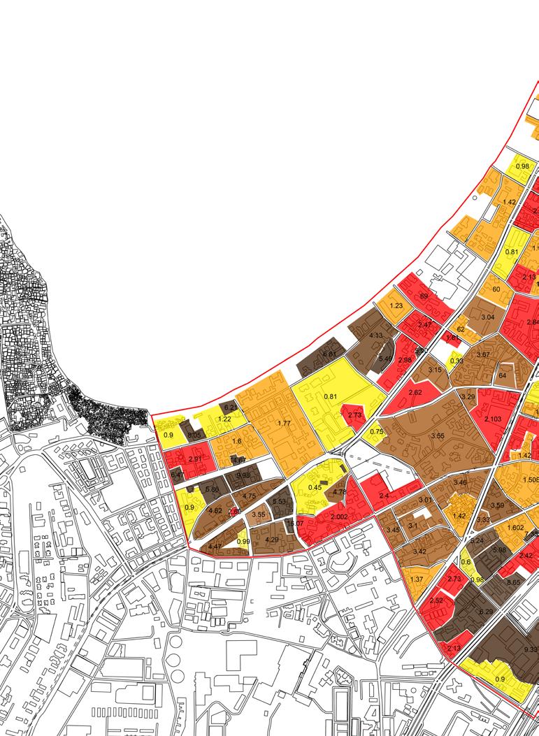
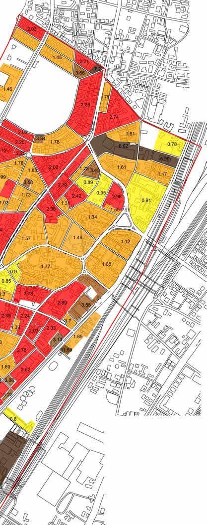
3.3 Existing FSI Mapping
3.4 Existing Property Rate mapping
3.5 Coastal Regulation zone mapping
3.6 Figure and Ground 3.7 Building Typology
3.8 Building Heights
4.Transport and Connectivity
4.1 Existing Transport system
4.2 Classification of Roads
4.3 Origin Destination 4.4 Shared taxi routes
4.5 Traffic density
4.6 Tilak bridge junction
4.7 Kabutarkhana junction
4.8 Elphinstone bridge
5. Activity Zones
5.1 Functional mapping 5.2 Activity mapping
5.3 Activity zones
6. Building Typology and Character
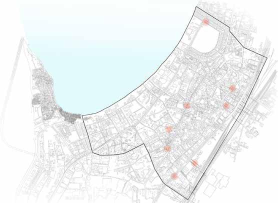
6.1 Raichand wadi
6.2 Dadar market
6.3 Flower market 6.4 Fully commercial chawl 6.5 Khed Gali chawl
6.6 One international center
7. Vegetation
7.1 Open spaces 7.2 Vegetation 7.3 Vegetation data
8.Proposals
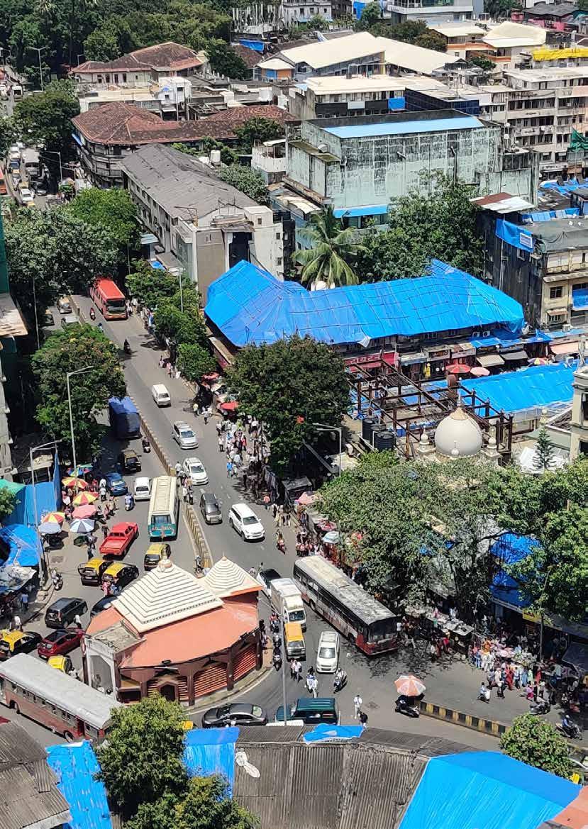
Dadar an initial suburb has grown to be an important neighbourhood located in the centrality of the city. Owing to the british colonisation and subsequent mill developments in the 19th century, Dadar developed to be a neighbourhood with varied user groups coexisting since the inception. Presence of important landmarks, newer transport routes and redevelopment of mill lands into modern residential or commercial towers has shaped the identity of Dadar as a neighbourhood of many where people of all classes, occupations and purposes coexist.
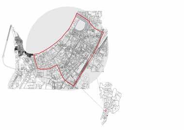
Site boundary
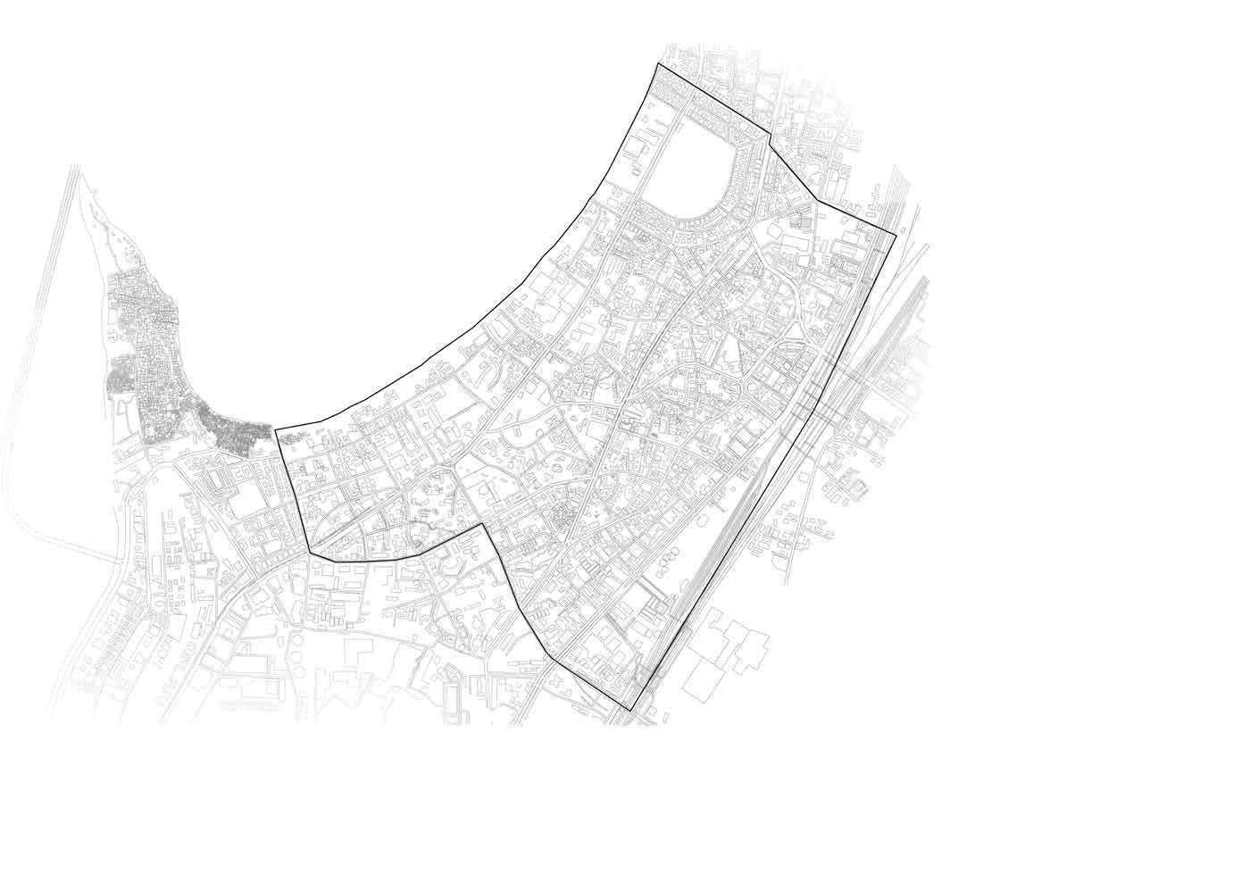
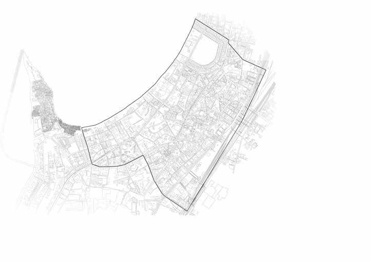
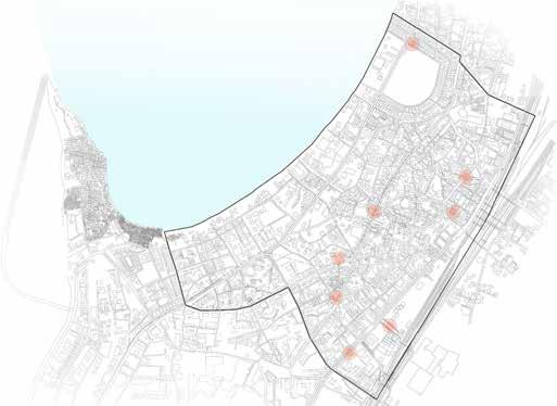
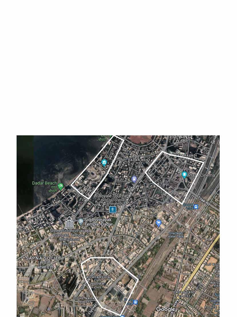
The selected area of study extends from the shivaji park precinct in the north to the prabhadevi railway station in the south. The area is defined by the Mahim bay and the railways on the west and the east respectively. The 2.9 square kilometer area of interest is an collective of varied urban fabrics including bustling markets, to quaint neighbourhoods; age old wadis to ultra modern skyscrapers. These patches trace unique narratives from history about the social, economical, political, cultural, and ecological evolution of the neighbourhood and the city as well.
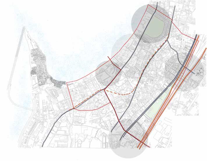
The site is connected to the city via the Jamsetji road, the SVS road and the railways on the north-south axis. The tilak road and the sayani-JB road cut across the site to connect to the eastern neighbourhoods. Metroline-3 is an upcoming subway metro-rail bringing faster and advanced connectivity, and thus development across the city.
Country India City Mumbai
Co-ordinates 72.8426858: 19.0099129
Elevation 10m (32.81 ft)
Climatic zone Hot and Humid
Annual high temperature 31.74 °C (89.13 °F)
Annual low temperature 26.26 °C (79.27 °F)
Average precipitation 288.1mm (11.34in)
Warmest month April (33.92 °C)
Coolest month January (23.42°C)
Wettest month July (1290.08mm)
Dryest month January (0.38mm)
Humidity 66.4%
Dadar lies in the Hot and Humid climatic zone with temperatures as high as 32 degree celsius and an average humidity of around 66%. With an average 288mm precipitation Dadar is also prone to heavy rainfall owing to its geography along the coast.
With soaring urban development post british interference on the islands, Mumbai is one of the most densely populous city in the world. Dadar being an old neighbourhood located in the central parts of the city is also home to around 1 lakh 20 thousand people in about 2 kilometer square’s space.
The archipelago of Bombay as per records was an untouched hinterland until the 15th century as mughal rule was majorly spread in the northern states of the indian subcontinent. The seven islands thus continued to remain disconnected from the mainland, hosting marine ecology and villages that lived off the sea.
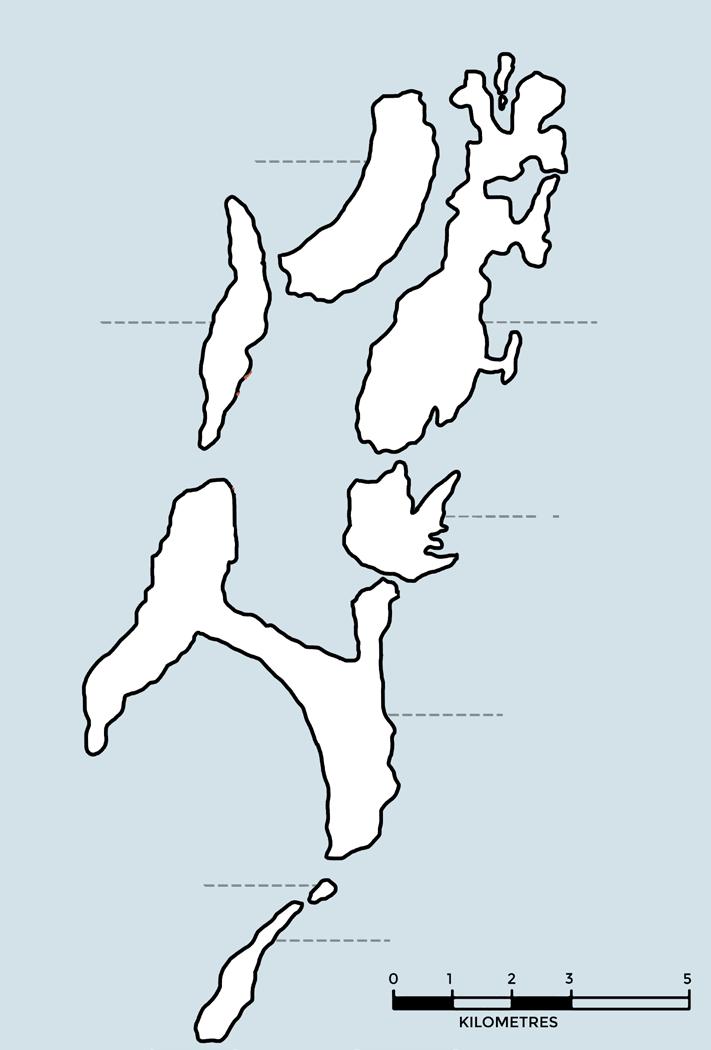
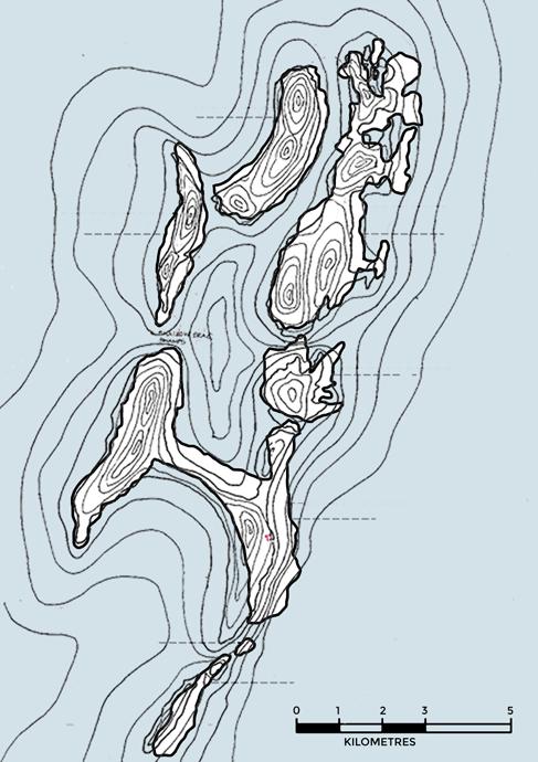
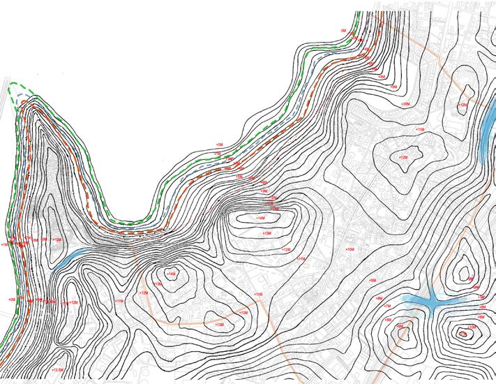
Contoured map of Seven Islands of mumbai shows the hilly terrain which was later flattened and the waste rocks were then used for reclamation, the flat land gained by reclamation also governs the path of the the railway route.
High Tide Low Tide
Average Water Body
In the present day topography one can observe the characteristics of a reclaimed land parcel. Less and infrequent major topographic variations make up for flat lands, with risk of water logging at certain junctions.The western coast of the region provides a narrower land parcel to accommodate the impacts of sea. Unfavourable conditions thus possibly rise along the coast during periods of high tide.
OLD WOMENS ISLAND COLABA Water Temples Figure 1.1 : Bombay islands in the 15th century
The earliest records of settlement, mention the existence of the Prabhadevi shrine and the Kalika Devi shrine on the Mahim island. Existence of fishing villages along the coasts was also identified.
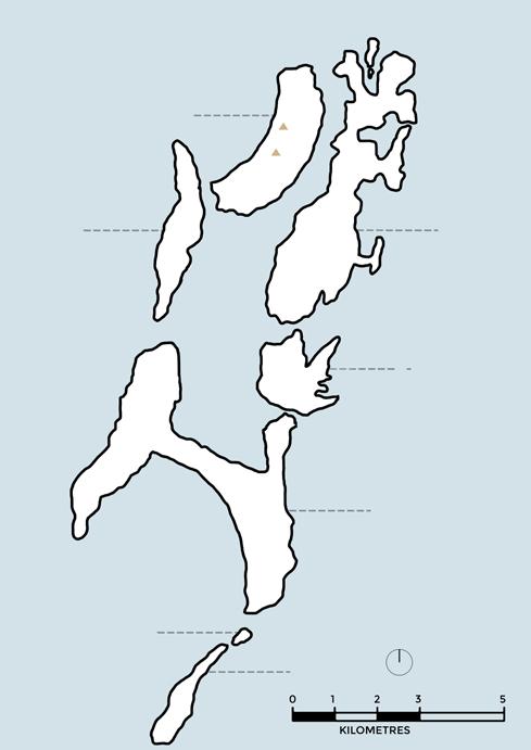
Figure 1.1 : Mahim and Worli islands in the 15th century
Kalika Mata Mandir
Agrarian Lands Settlements
Coconut tree Banyan tree Palmyra tree Religious establishment
The Mahim island referred as the Mahim woods was a land covered in cocoa-palm groves inhabited by a very less population that lived off agriculture and fishing.
Our Lady of Salvation, (1596) Churches
The historical period of Portuguese colonial rule for religious expansion (1534–1665) was governed from the Salsette island (present day Vasai) in the north of bombay. They carried erection of religious structures and reformed farming practices on the bombay islands.
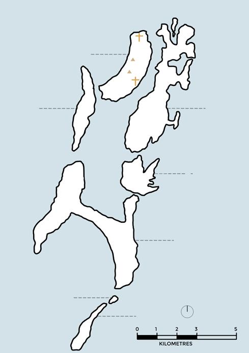
Figure 1.1 : Mahim and Worli islands during the portugese era
Agrarian Lands Settlements
Coconut tree Banyan tree Palmyra tree Religious establishment Fief Farmlands
The portuguese built the Our lady of Salvation Church on the Mahim islands in order to spread christainity. They introduced the fief (feudal) system in agriculture, wherein land rights or military ranks could be acquired post religious conversions.
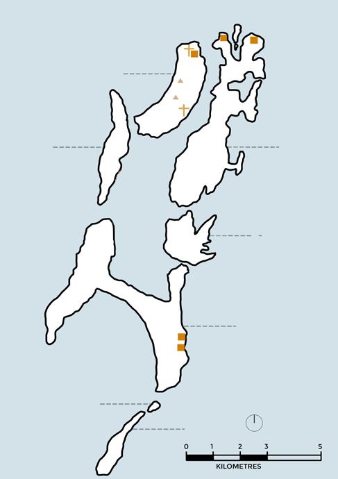
On 11 May 1661, the marriage treaty of Charles II of England and Catherine of Braganza, daughter of King John IV of Portugal, placed Bombay in the possession of the British Empire, as part of Catherine’s dowry to Charles. Sir George Oxenden became the first Governor of Bombay under the regime of the English East India Company. They constructed coastal forts for security purposes.
Churches
Forts
Figure 1.1 : Worli and Mahim islands during the early British era
Agrarian Lands Settlements
Coconut tree Banyan tree Palmyra tree Religious establishment Fief Farmlands Fort
Britishers gauged the importance of the geographical location of bombay and surveyed the islands. They abolished portuguese customs including the fief system, encouraging local agriculture. Worli fort and Mahim fort were constructed to observe and secure the western and north-eastern coasts.
Embankment Docks Causeways Settlements
Churches
Forts
After surveying the islands, the British proposed the reclamation and connection in order to create suitable land for establishing a port city. Hornby Vellard Embankment made it possible to reclaim the land between the seven islands until when the islands were connected via Causeways for trade.
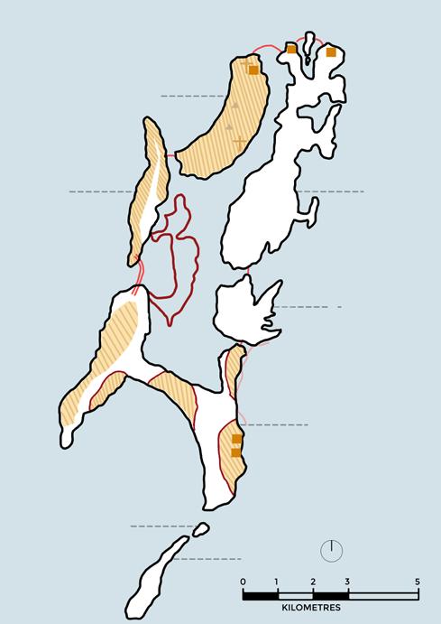
Figure 1.1 : Construction of Worli-Mahim causeway during the 18th century
Agrarian Lands Settlements
Coconut tree Banyan tree Palmyra tree Religious establishment FIief Farmlands Fort
The Worli-mahim causeway was constructed as a part of the larger network to connect the Islands in the south to the northern mainland. The causeway further propelled the reclamation of land on the eastern side of Mahim, joining it to the Parel island.
Figure 1.1 : Reclamation of Bombay
The stages of reclamation can be seen with the pattern of development with Fort George at its epicentre. Reclamation was carried out by digging hills present on the bombay islands. The process of reclamation have had a profound impact on Bombay’s ecology, effects witnessed even today with seasonal flooding and ever depleting biodiversity.
1st Reclaimed Land Water
Ports& Docks 3rd Reclaimed Land 2nd Reclaimed Land Colaba Causeway
Development
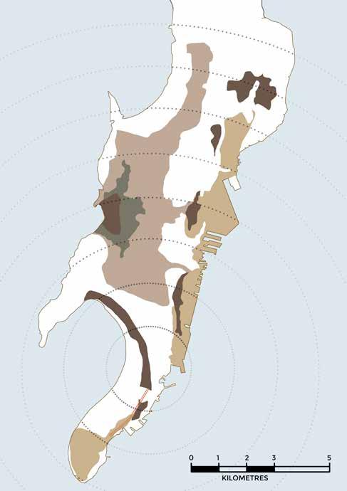
Figure 1.1 : Reclamation of Dadar
Agrarian Lands Settlements
Coconut tree Banyan tree Palmyra tree Religious establishment Fort
Reclaimed land near the Mahim and Worli islands was initially utilised for the purpose of agriculture and road networks. This land would be utilised in manifold ways post industrial revolution for purposes including transport and industries.
Water Temples Figure 1.1 : Urban developments during the 19th century
Churches Forts
LAND Contours Municipal Vestland Trust Vested Lines Railway lines Roadways
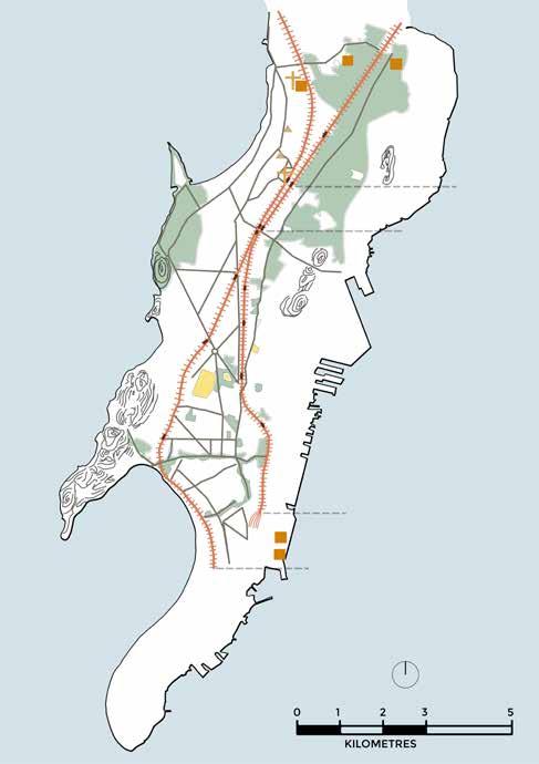
Bombay experienced havoc development post the reclamation with ensured resource flow from the countryside. Introduction to Railways conjunctly with the development of mills attracted lots of migrants around the occupation which led to construction of chawls and wadis. Public institutions to cater the influx started shaping the city as an urban agglomeration.
Mills
Cessed Buildings Roadways

Settlements
Coconut tree
Banyan tree Palmyra tree Religious establishment Fort
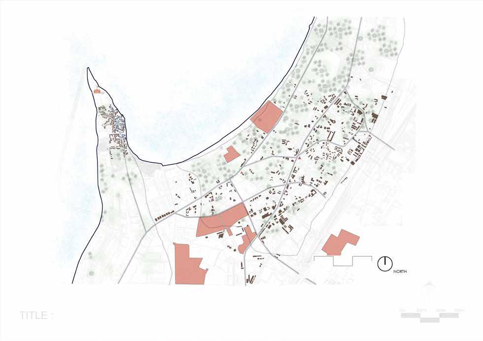
The introduction of mills drastically upturned by the shape of Mahim island. Land parcels generated post reclamation hosted development of cotton mills, those brought along hoards of population from the countryside. Dadar was a home to numerable chawls and wadis, with majorly middle class Marathi population residing in them.
Water Temples
Churches Forts
LAND Contours Municipal Vestland Trust Vested Lines Railway lines Roadways BIT Roadways
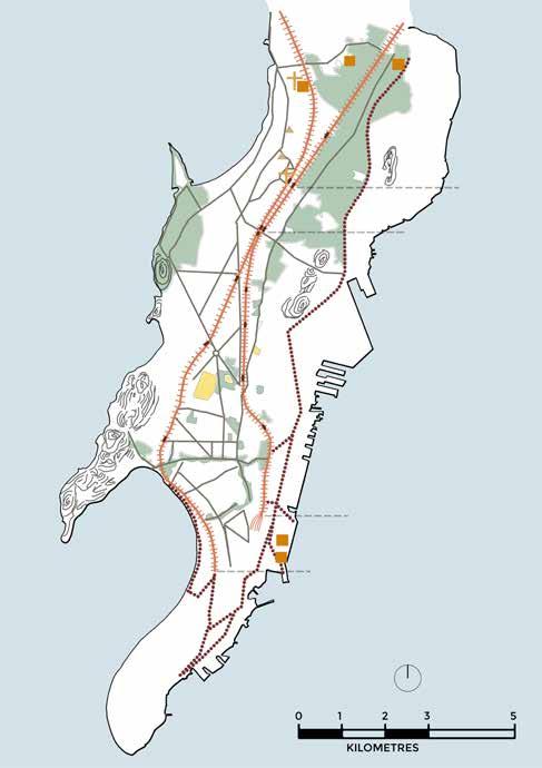
Figure 1.1 : Bombay in the early 20th century
The development in the late 19th century was largely uninformed, which led to adverse effects including the plague of 1896. Bombay improvement trust was established to overlook the urban planning and infrastructure of the city. Projects including the present day Mohammed Ali road
Mills

Cessed Buildings Roadways

Settlements
Coconut tree
Banyan tree Palmyra tree Religious establishment Fort
The Mahim scheme of the 1920’s introduced residences in the art deco style build around a public park along with the widening of the Cadell road and lady Jamsetji road. The added formal character of Dadar, with newer public and educational institutions, brought in a diverse population to live in the neighbourhood. Alongside development of markets at the nodes saw Dadar transforming into a bustling city centre.


Map 1.1 : Land Use Mapping
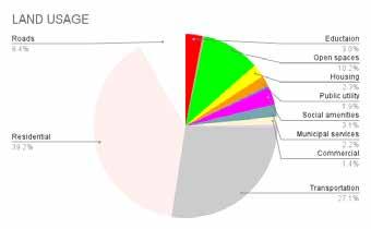
There exist emerging residential plots (high rates) with retail shops and 0.41sqm Per Capita Open space. There is a smaller amount of open space available which is unevenly distributed.
Central Business District Zones of Worli and Prabhadevi have less than 0.1 sqm per capita open space compared to the FSI and space demand of the areas. Well distributed Educational Institutes create walkable neighborhoods.
Scope for more Commercial Buildings in Dadar is present which can be taken advantage of if planned correctly.
Public Housing can be increased by planning and executing affordable Housing schemes. There is greater potential for more Mixed use development to be introduced in Parel.
Figure1.2 : Percentage Distribution of Land Use




The demand for Private Developments have increased over the years.
Public Land shall be claimed and retained for development of proposals that are free from encroachment.
There is a scope for involving trusts in developments raising concerns about safety, security, social health etc.


Map 1.2 : Land Ownership Mapping
Figure 1.3 : Percentage Distribution of Land Ownership
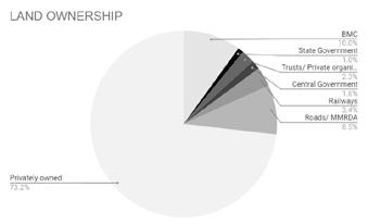
Central Government State Government BMC Trust Owned Railways



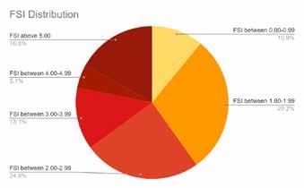
The area near Dadar station has immense potential for development. This also increases the demand for efficient functioning of the Transit Oriented Development setup and additional expected traffic.
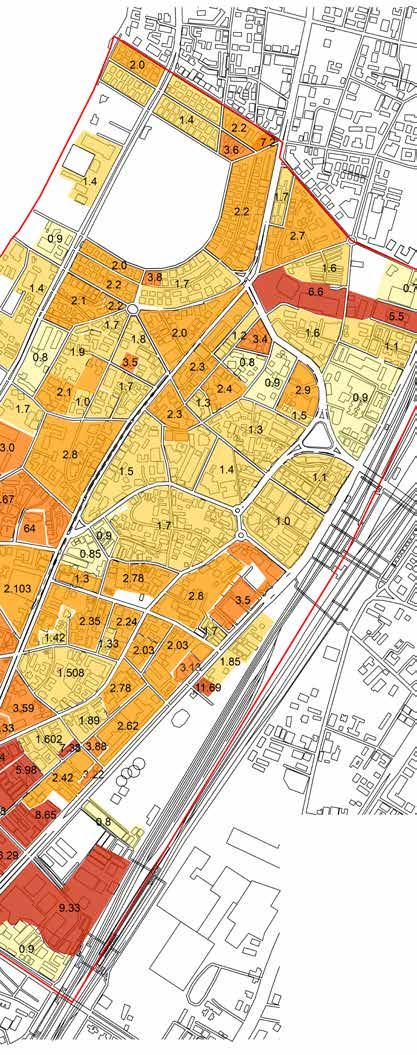
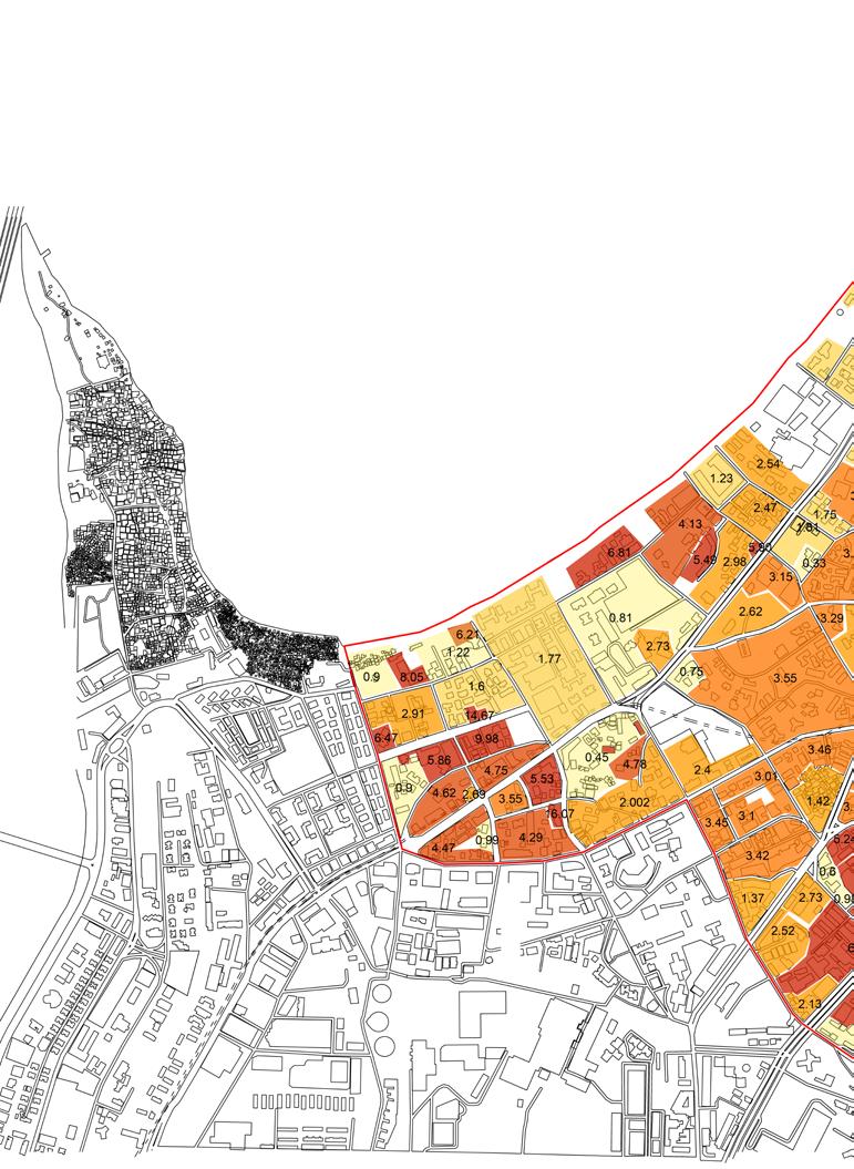
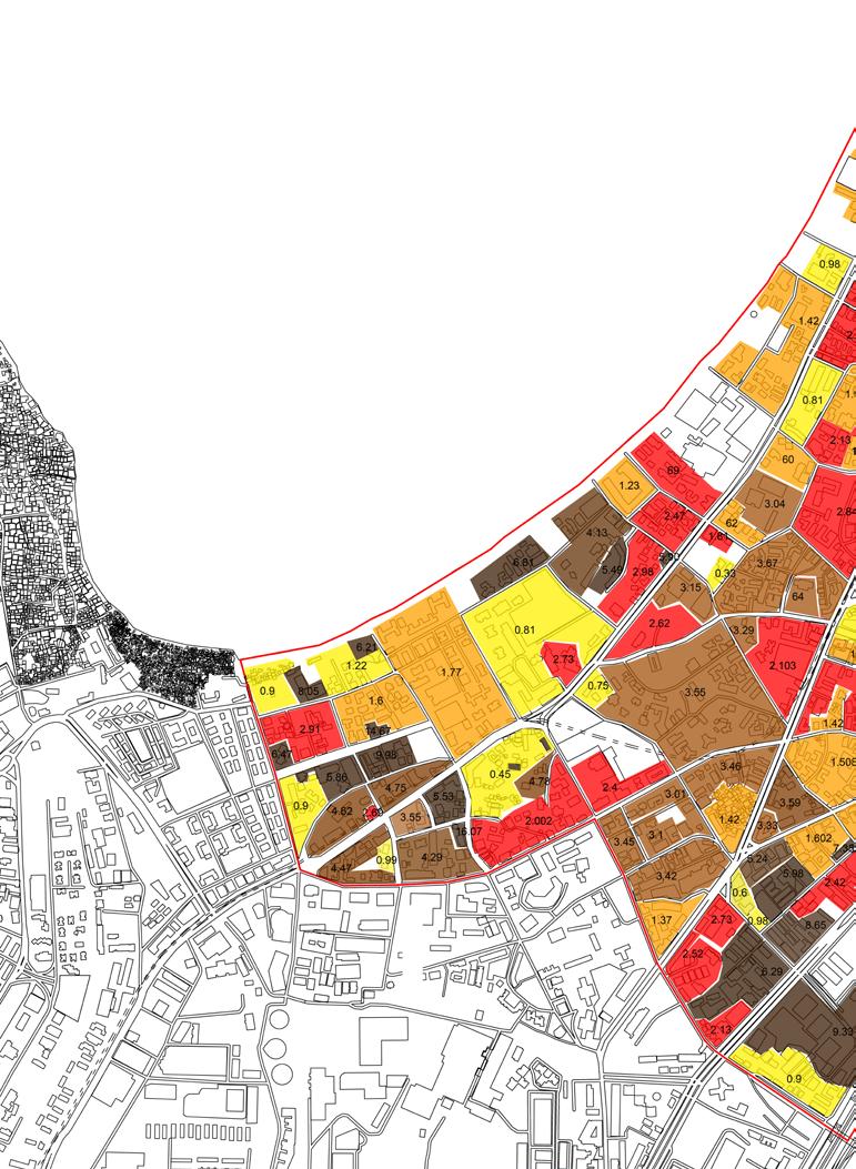
Parel has a higher Floor Space Index denoting its importance as the Central Business District catering to job stability and inviting for the floating population. Higher Floor Space Index with Higher Land rates is observed in Worli due to increased commercial activities and infrastructural development. Ready Reckoner Rates increase as a response in this area where the higher economic classes tend to settle. Thus Caddell Road sees a great increase in commercial property rates.
Higher Floor Space Index can be provided near Metro stations. Slums, Derelict buildings with old buildings of no heritage value occupy less than 1 Floor Space Index and have potential for redevelopment. One can follow the example set by Developers who have utilized Transferable Development Rights, Premium Floor Space Index, schemes like 33(7), 33(15), 33(18) to actively increase their Floor Space Index.


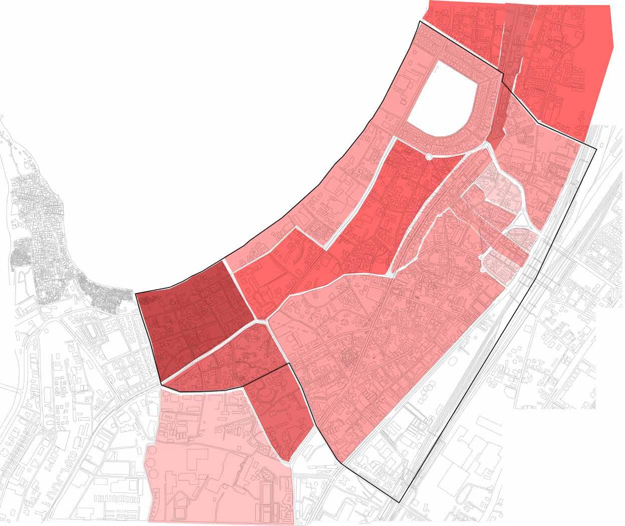

Map 1.4 : Existing Property rate mapping



The residential area in Parel which is located in the South part of Mumbai, is always in demand. In addition, the Lower Parel area is a major commercial district that has some of the most prestigious corporate houses. Furthermore, the area of Parel is very near to the Easter Expressway, making the connectivity of the area great.
Hence, it offers job stability to the users and increases the demand and rates for residential purposes spreading towards Worli. Being a part of the Secondary Business District (SBD), it houses dozens of office spaces and serves as a workplace for numerous people.
The Schools and other social amenities in Parel Real Estate offer good social infrastructure to residents.
Property Rates increase as a matter of redevelopment scope near the reclaimed mill areas.
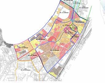
Figure 1.5 : Property Rates Overlayed on F.S.I. map
Map shows an increase in Ready Reckoner Rates where Floor Space Index is utilized to its complete potential and is comparatively high.
Worli has an average Floor Space Index of 3 where the land rates touch Rs. 7,00,000 While Areas Near Kohinoor Mills have an average Floor Space Index of 1.7 with land rates less than 2,50,000 per sqm.
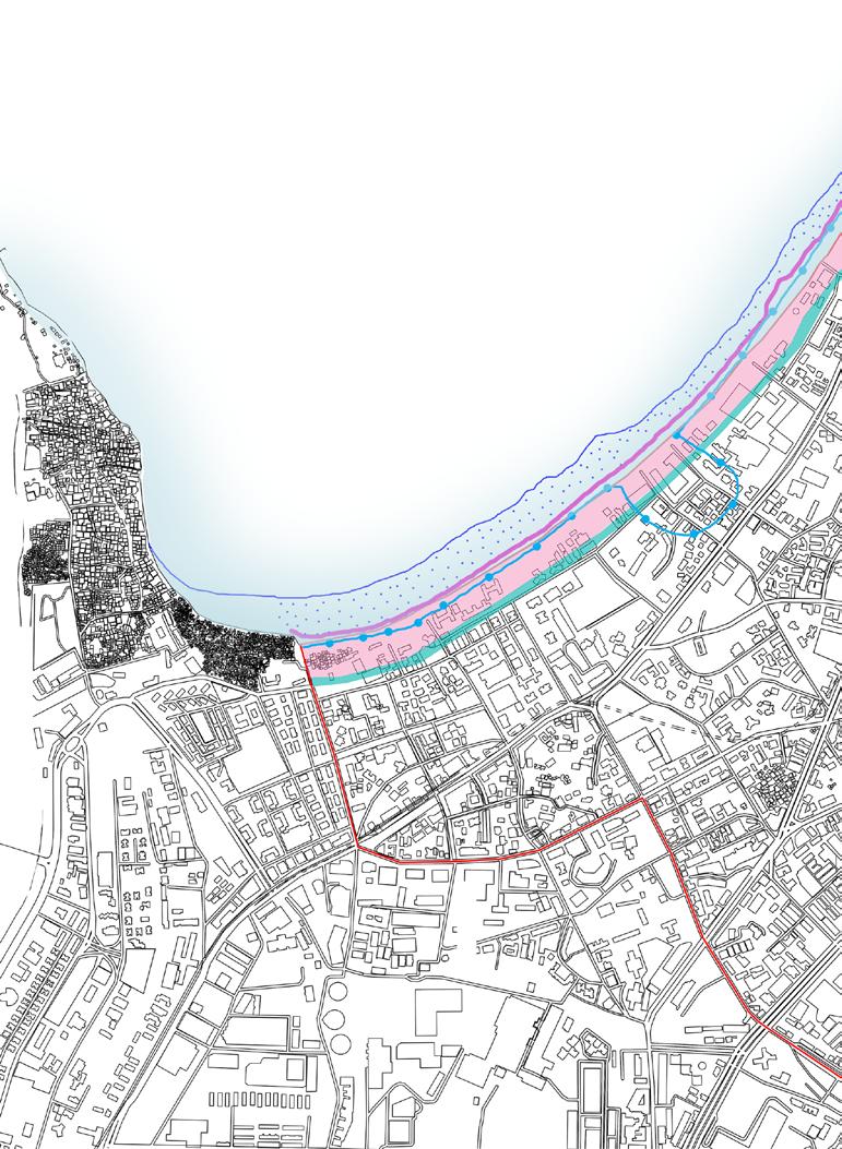

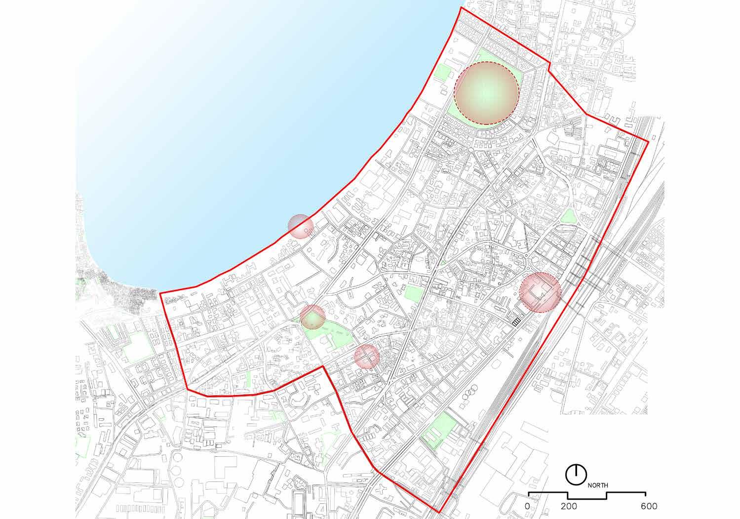
1. Dadar Chowpatti has potential to develop as a recreational space treating the coastal edge as an asset.
“ CRZ II : The areas that have already been developed upto or close to the shore-line. For this purpose, “developed area” is referred to as that area within the municipal limits or in other legally designated urban areas which is already substantially built up and which has been provided with drainage and approach roads and other infrastructural facilities, such as water supply and sewerage mains.”
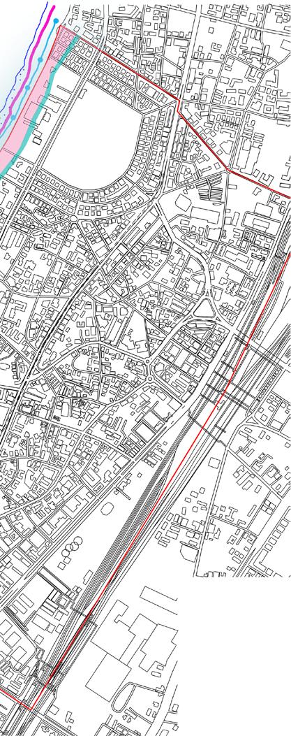

“NDZ : Such areas have a No Development Zone (NDZ) of 50 meters from the High Tide Line (HTL) as against 200 meters from the High Tide Line stipulated in the CRZ Notification, 2011.”
CRZ IB comprises ecologically sensitive / breeding grounds that can be activated without any physical constructed intervention.
2. Ecological conservation with plantation can be implemented to create a buffer area.
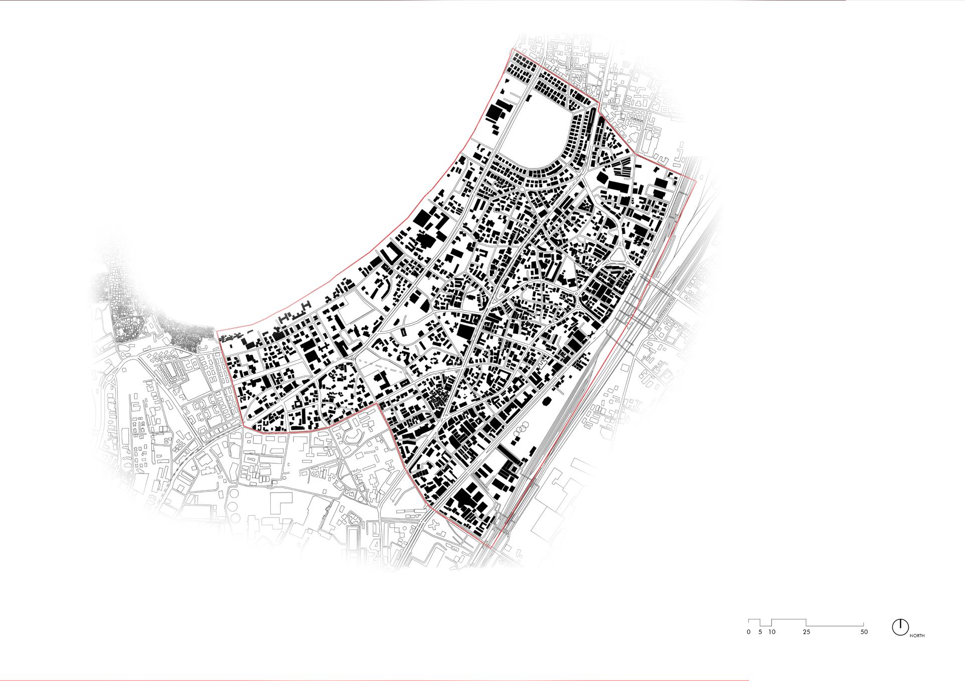


The figure and ground map shows us the relationship between built and unbuilt. The ratio of built to unbuilt for dadar west is ___. It has various grain textures from clusters to scattered built forms

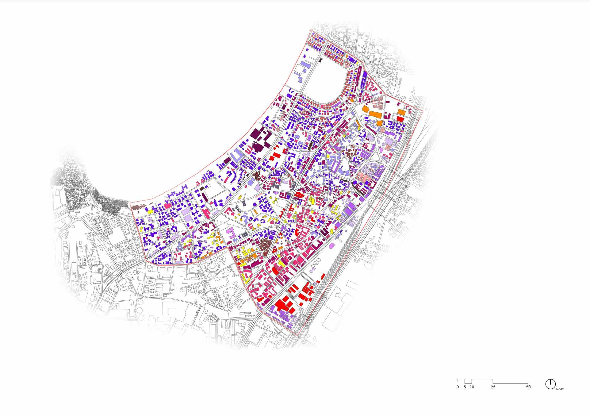


The Typology map shows the types of buildings present in Dadar. These are on the basis of the characteristic of a particular building, its function and form.
It is a way to analyse the third dimension of buildings and draw inferences of the relation between the built form and the connection it forms with the street.

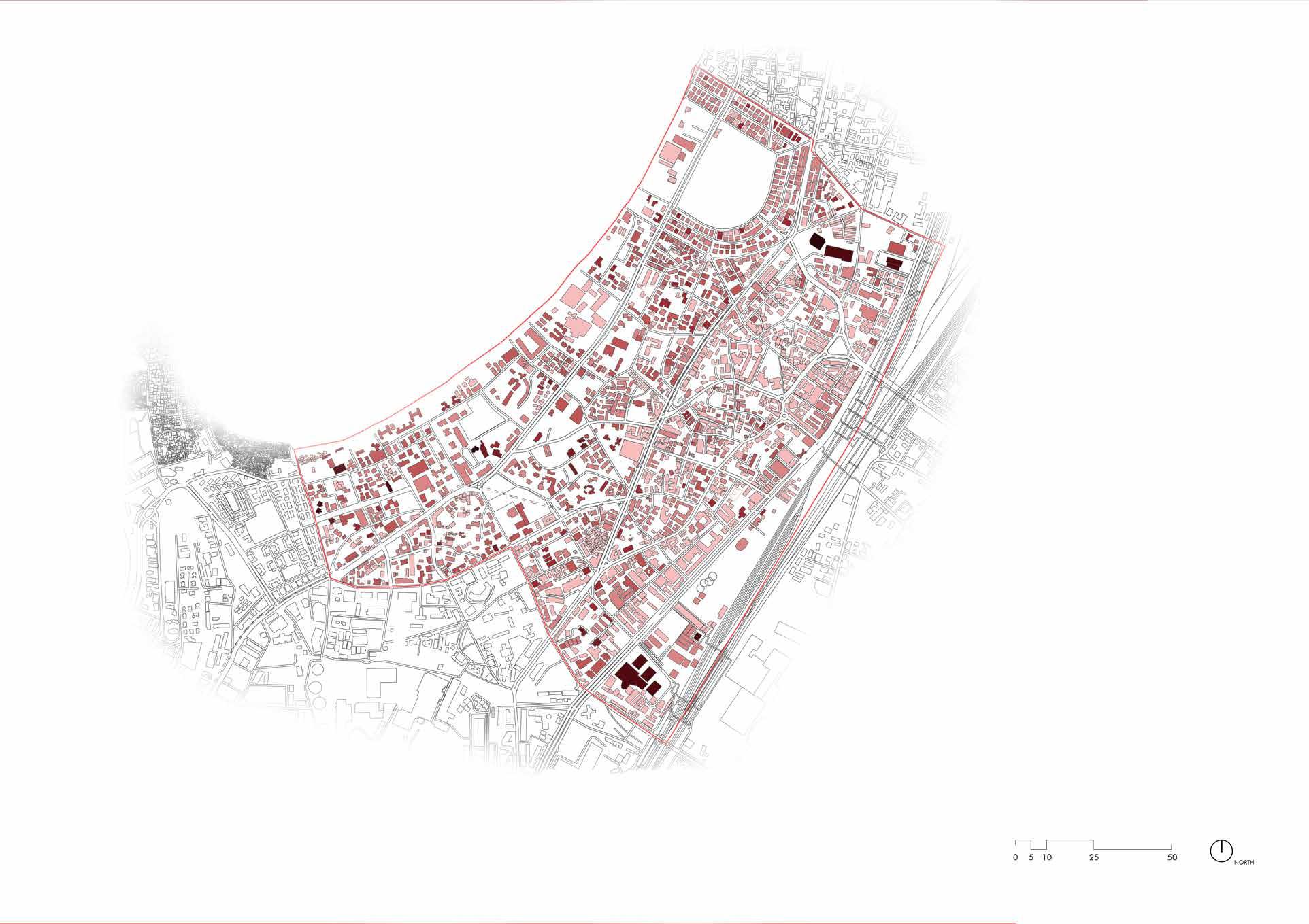


Building height map shows us the various heights of building indicating that the major buildings are mid rise in dadar.

LEGEND HIGH RISE
0-12 M 12-24 M 24-48 M 48-78 M 100-150 M 78-100 M 150-210 M
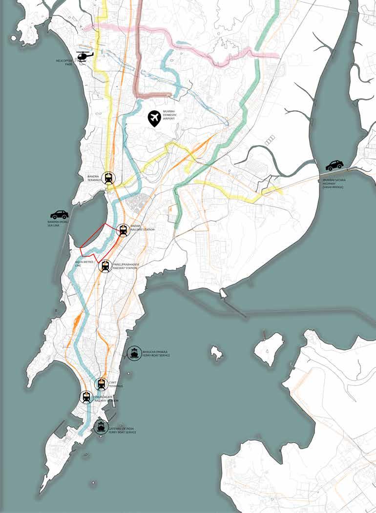
The site ,Dadar , a lively and bustling neighborhood is located in the south-western part of Mumbai .
Due to its central location, Dadar offers good connectivity to the rest of the city. The efficient local trains passing through the area connect it to the rest of the city via the Central and Western lines. Furthermore, Dadar is connected to the other parts of Maharashtra by excellent road connectivity and an efficient public transportation system namely the BEST buses, Dadar Asiad/Shivneri Stand or the Parel ST depot . The upcoming Mumbai Metro 3 will connect Dadar to Colaba, Bandra and SEEPZ. This will further enhance the connectivity by unclogging the traffic making commute easier for the people of the city.
At a distance of 17.6 Km from the site is the Chhatrapati Shivaji International Airport. The nearest Ferry system lies is in the South Mumbai area of Colaba and Gateway of India.
Situated along the South Western coast , the site is roughly defined by the Tilak Bridge to its north east , Dadar Central and Western Railway Station to its east, Elphinstone bridge , Century Bazaar to its south and Shivaji Park to its north west .
1.2 - MAP SHOWING CONNECTIVITY OF DIFFERENT MODES OF TRANSPORT IN THE SITE


Dadar is a prominent railway terminus on both the Western and Central lines of the Mumbai Suburban Railway network. Being the only common railway station to both the Central and Western lines, it makes a transit point for many passengers traveling through Suburban Railway
BUS STAND
BUS ROUTE
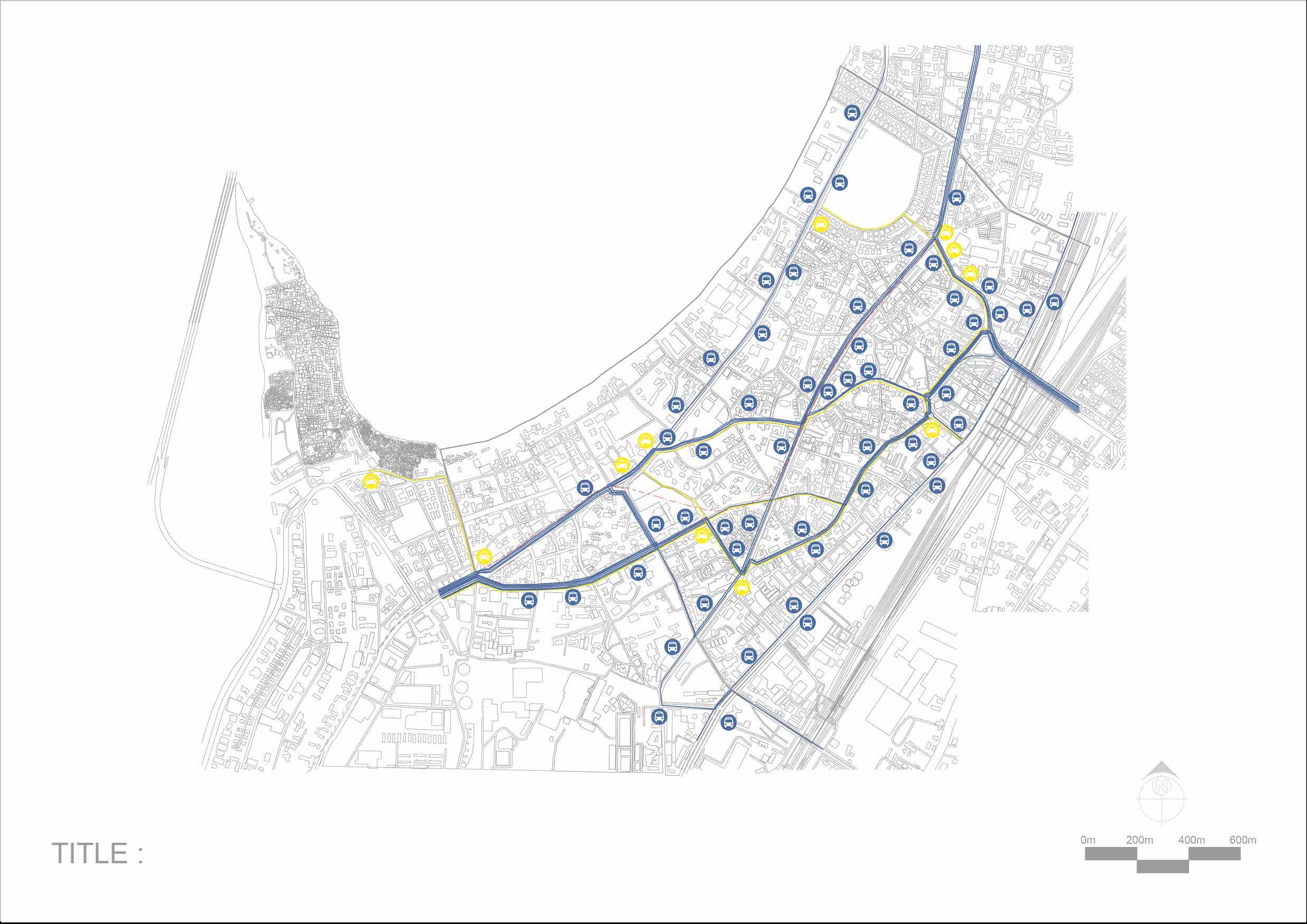
TAXI STAND
TAXI ROUTE
METRO LINE
FIG 1.3 - SITE MAP SHOWING CLASSIFICATION OF ROADS - PRIMARY < SECONDARY AND TERTIARY.
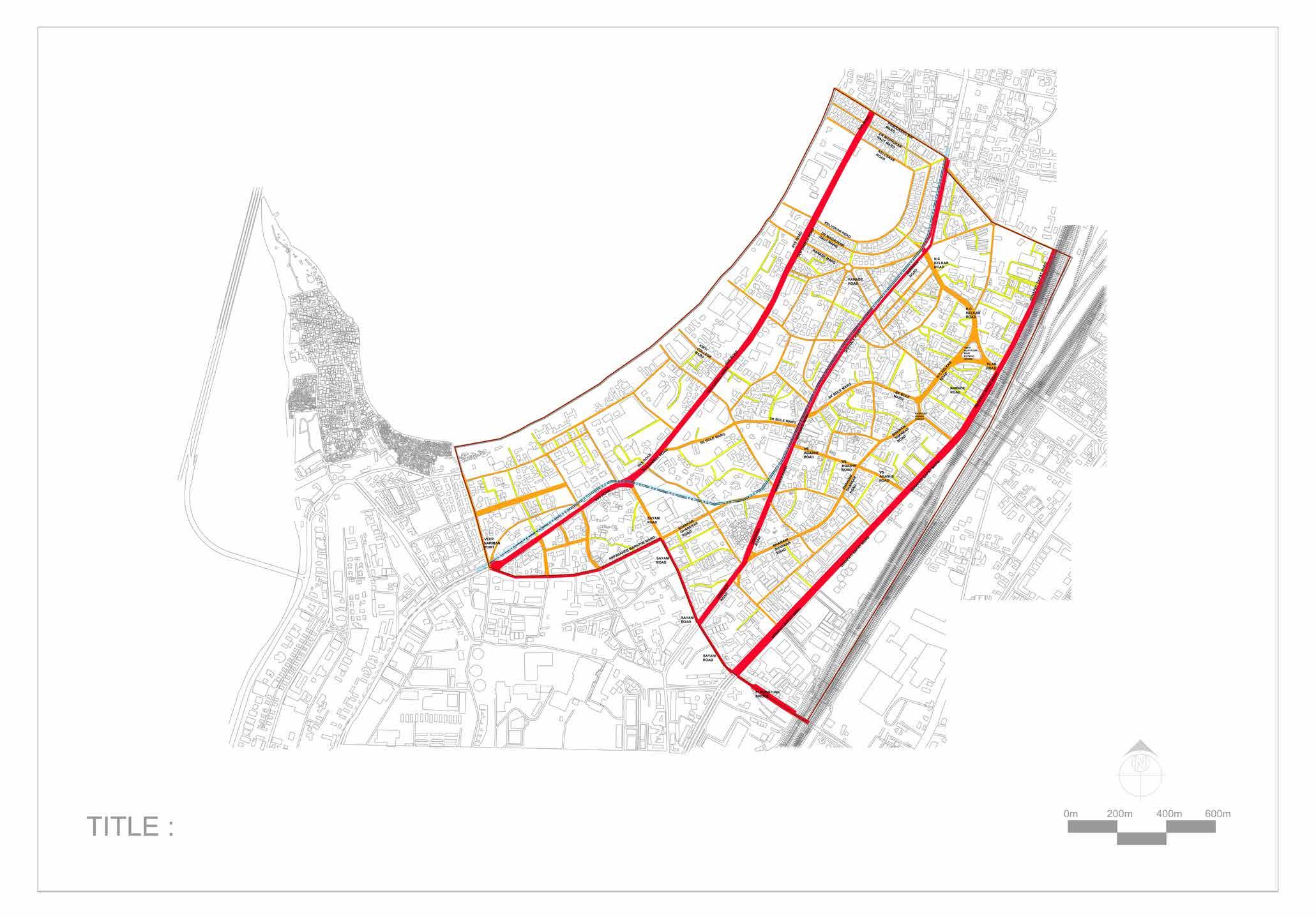
These roads serve as the principal network of traffic flow Joining central buisness districts to the residential areas and carry the load of the heavy traffic in the city.The SVS ROAD , SENAPATI BAPAT MARG , GHOKLE MARG connecting North and South, having a width ranging from 16M to 35M serve as the arterial roads and have further scope for development. User Group - Private vehicles , trucks , buses connecting north - south
These are the secondary roads which are comparatively of smaller width ranging from 12-16 m and carrying lesser traffic than the arterial roads. These roads can be used for pedestrian crossing at intersections .The SHANKAR GHANEKAR , AAPASAHEB MARATHE MARG, BHAVANI SHANKAR, RANADE ROAD , KELKAR MARG ,TILAK BRIDGE , ELFENSTOINE BRIDGE provide East West connectivity and are the major taxi and bus roads.User group - BEST buses , shared taxi , meter taxi , pedestrians.
These are the tertiary roads of width 6-12m which are meant to collect the traffic from the local streets to the arterial streets and are situated in residential, commercial and industrial areas.KHED GALLI , SK BOLE MARG , DESAI MARG function as Distributor roads which are

SECONDARY ROADS
TERTIARY ROADS
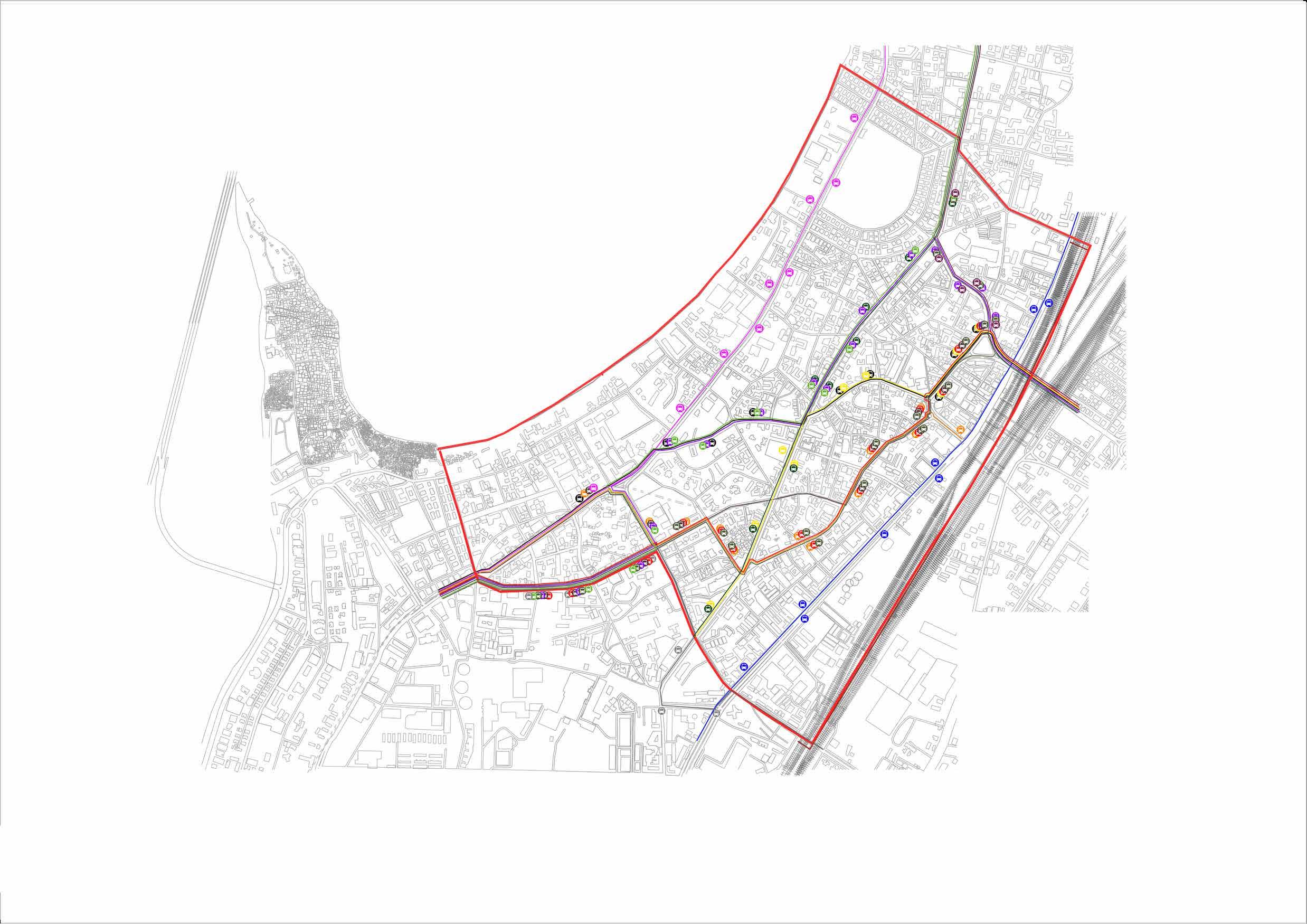

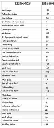

Dadar is well connected to other neighborhoods of Mumbai, namely Matunga, Wadala, Parel-Prabhadevi, and Mahim with BEST buses which primarily operates the public bus transport and runs multiple number of buses in Dadar
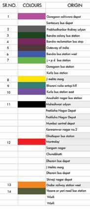
Major bus movement for East to West buses can be seen on Bhavani Shankar Marg and SK Bole Marg while SVS Road, Senapati Bapat Marg and Gokhale Marg are the major route taken for North- South connectivity

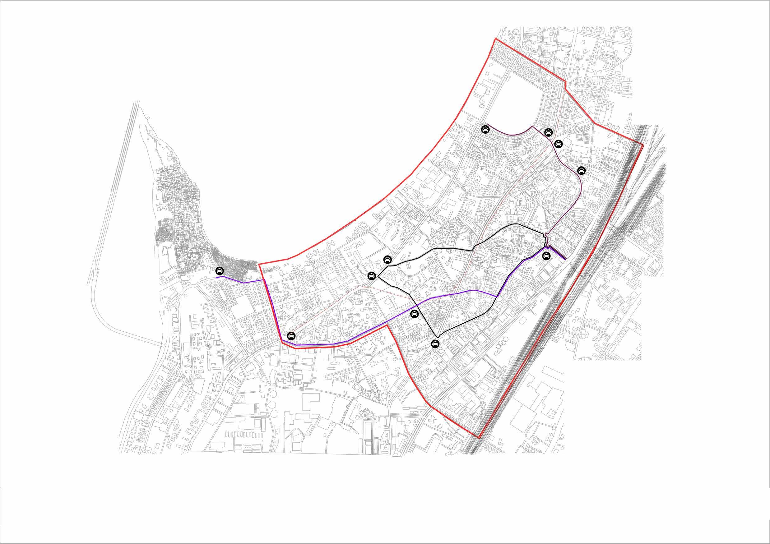


Shared Taxis in dadar covers the area between Dadar railway station,Siddhivinayak, passport office and worli koliwada.
Dadar railway station acts a transit point for many passengers which makes it an origin point for taxi service.
DADAR STATION TO SIDDHIVINAYAK
DADAR STATION TO SHIVAJI PARK
DADAR STATION TO WORLI KOLIWADA AND PASSPORT OFFICE
FIG 1.6.1 : WEEKDAY 8 to11 am
FIG 1.6.3 : WEEKDAY 4 to 6 pm
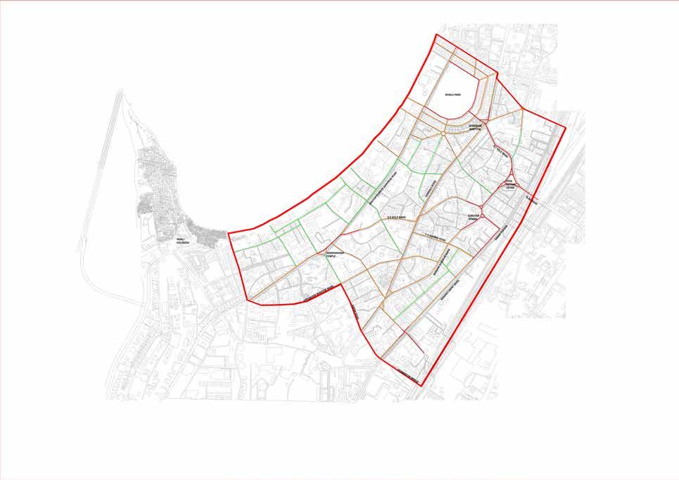
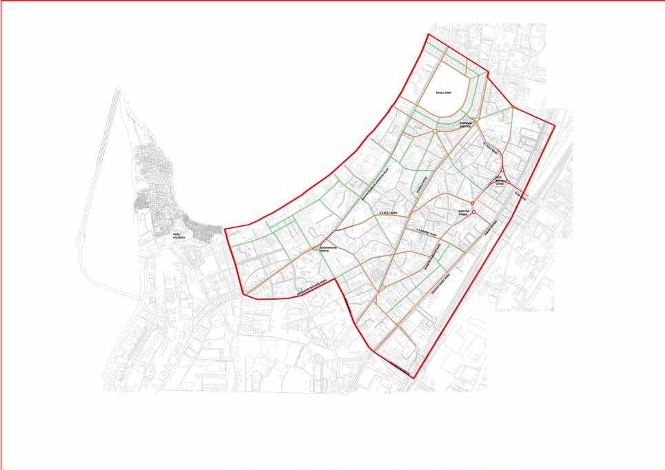

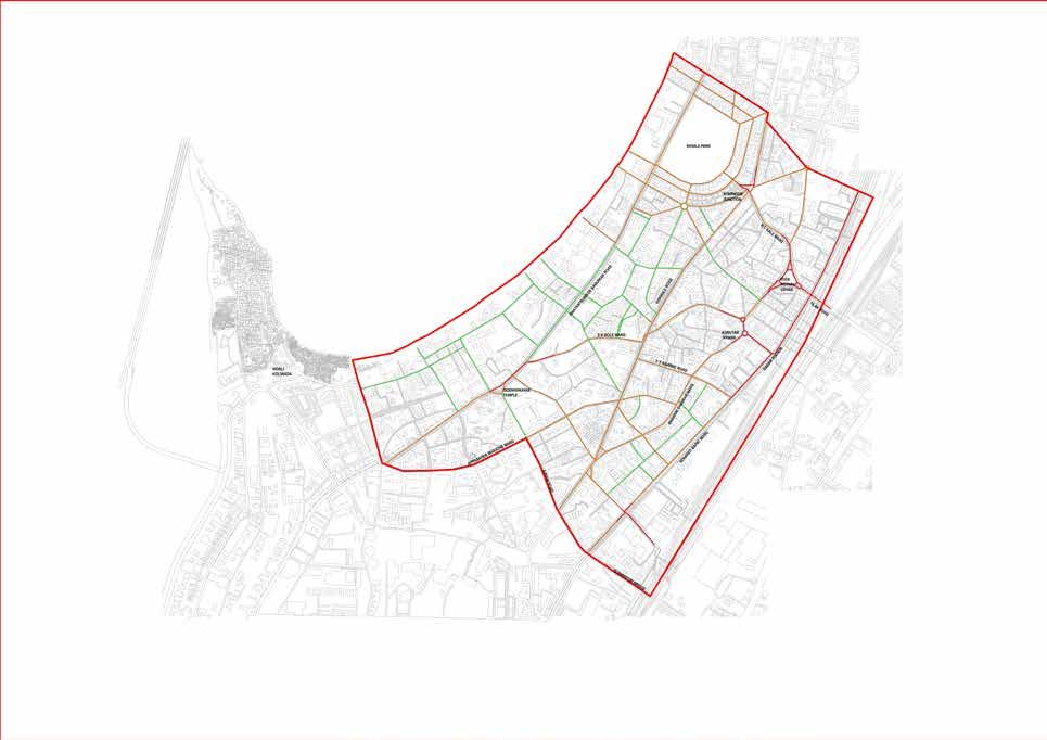
The major junctions namely-Plaza, Kabootar Khana, Siddhivinayak Temple, Century Bazaar, Elphinstone bridge have high traffic density in terms of both vehicular and pedestrian movement at all times of the day. The major arterial and Sub arterial roads namely SK Bole Marg, Bhavani Shankar road, Senapati Bapat Marg and Gokhale road carry the major vehicular traffic.


FIG 1.6.5 : WEEKEND 8 to11 am
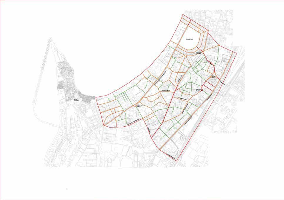
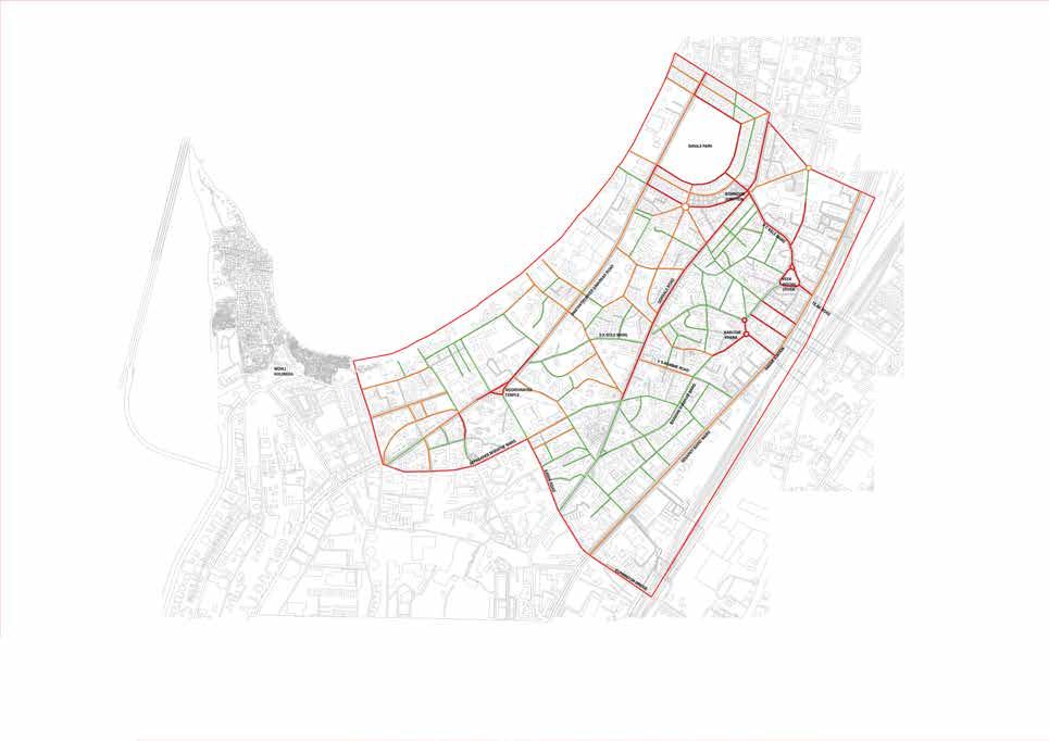
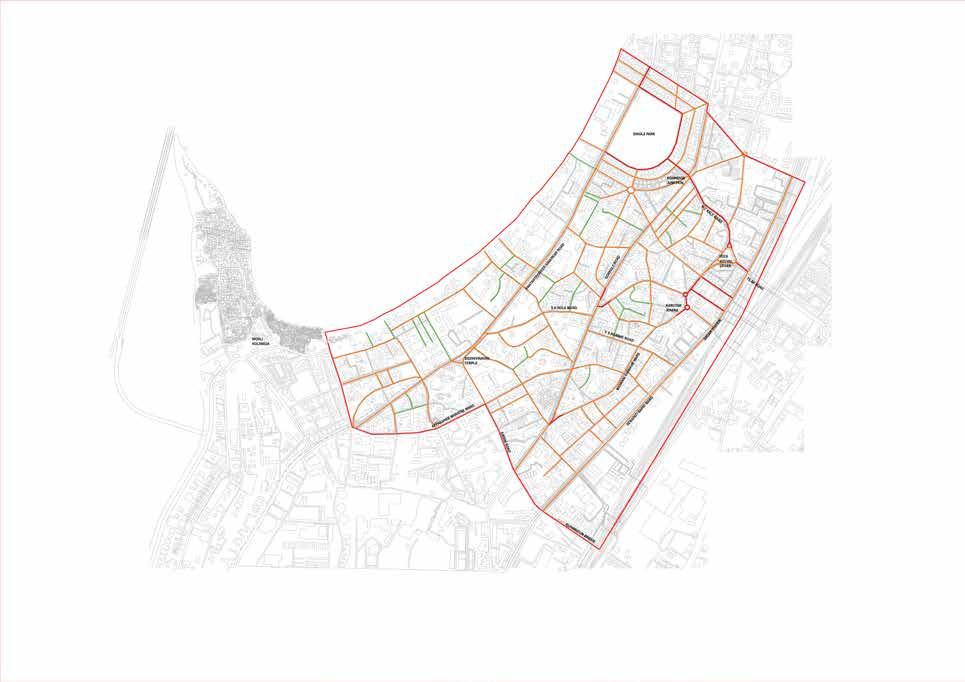
FIG 1.6.7 : WEEKEND 4 to 6 pm
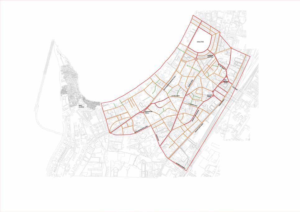
Gokhale road, Shivaji park, Plaza, Kabootar Khana, Siddhivinayak mandir and SVS road experience heavy vehicular movement due to recreational, religious, and
On analysing the traffic density maps we understand that the roads in particular namely N.C Kelkar road, S.K Bhole marg, Senapati Bapat Marg, Bhavani Shankar road and SVS Road depict the heavy vehicular movement throughout the day.On analysing the maps we see that the only East West connectivity happens via the Elphinstone Bridge and the Tilak Bridge leading to higher traffic load on the roads connecting the North South.


FIG 1.7.1 : Image showing pedestrian and vehicular movement at Tilar Bridge Junction
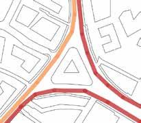
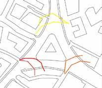
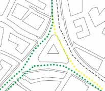
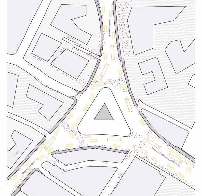
FIG 1.7.2 : FIG 1.7.3
FIG 1.7.4:
As analysed Kabutar Khana, Elphinstone bridge and Tilak bridge are the majorly affected nodes due to the vehicular movement. As the bridge is a major connection between the East and West , the Tilak Bridge has heavy vehicular density throughout the day which sometimes lead to slower vehicular movement on the bridge.
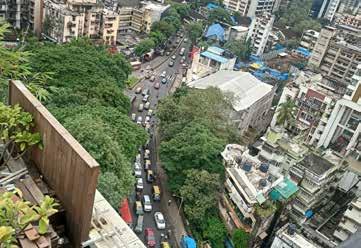
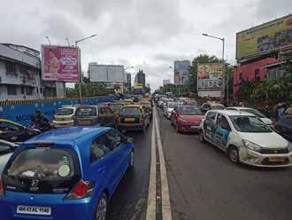
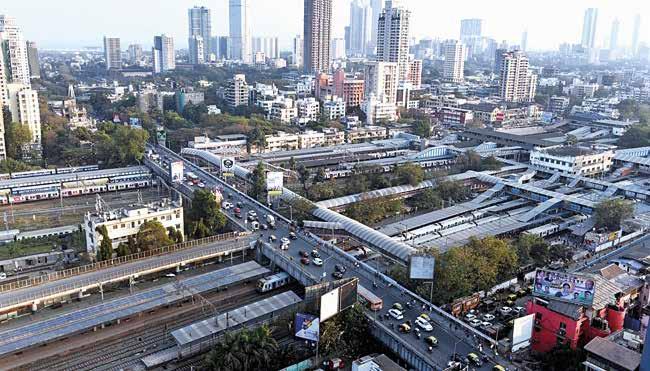
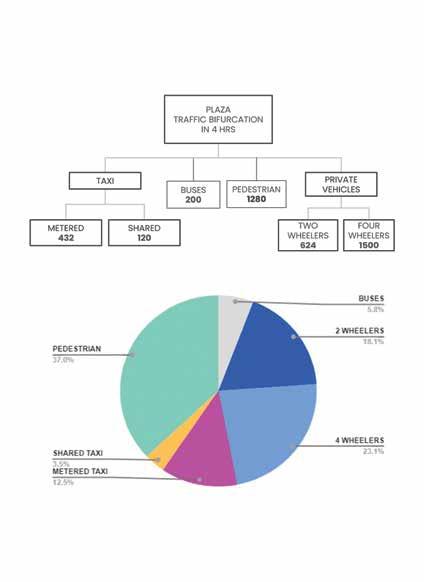
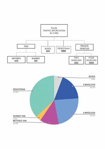 FIG 1.7.5 : Image showing arial view of Tilak bridge
FIG 1.7.8 : Pie chart representing user group and usage of the area FIG 1.7.9 : Calculation of number of vehicles and pedestrian in the area
FIG 1.8.1 : Image showing pedestrian and vehicular movement at Kabutar Khana Junction
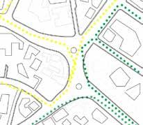
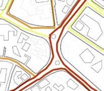
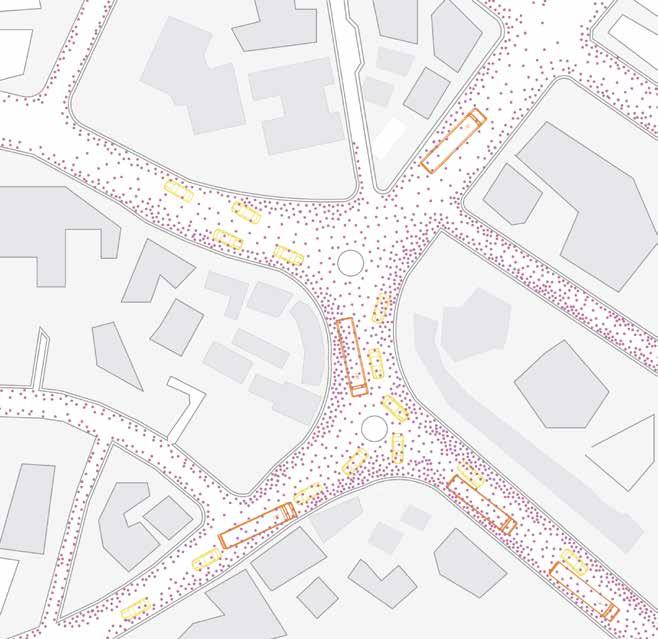
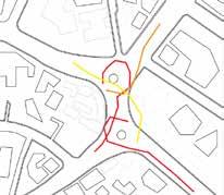
FIG 1.8.2 : FIG 1.8.3
FIG 1.8.4:
Incoming traffic from different directions create conflict points resulting in increased vehicular traffic. Furthermore, the problem is aggravated by the hawkers occupancy along the roads and of the footpaths.The node sees an increased influx of the floating population due to the close proximity of the railway station harboring both Central and Western Line.
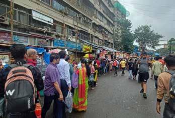
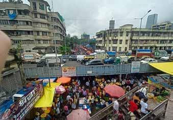
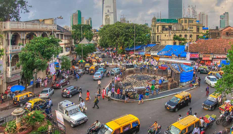
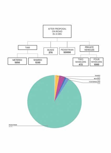
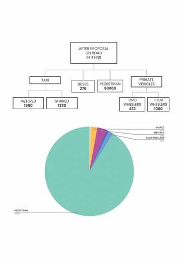 FIG 1.8.6 : Image showing vehicular movement on the Kabutar Khana Junction
FIG 1.8.5 : Image showing arial view of Kabutar Khana Junction
FIG 1.9.1 : Image showing pedestrian and vehicular movement at Elphinstone Junction
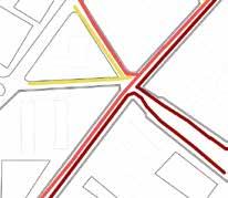
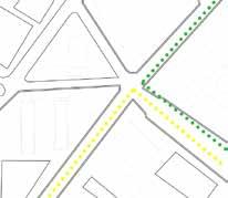
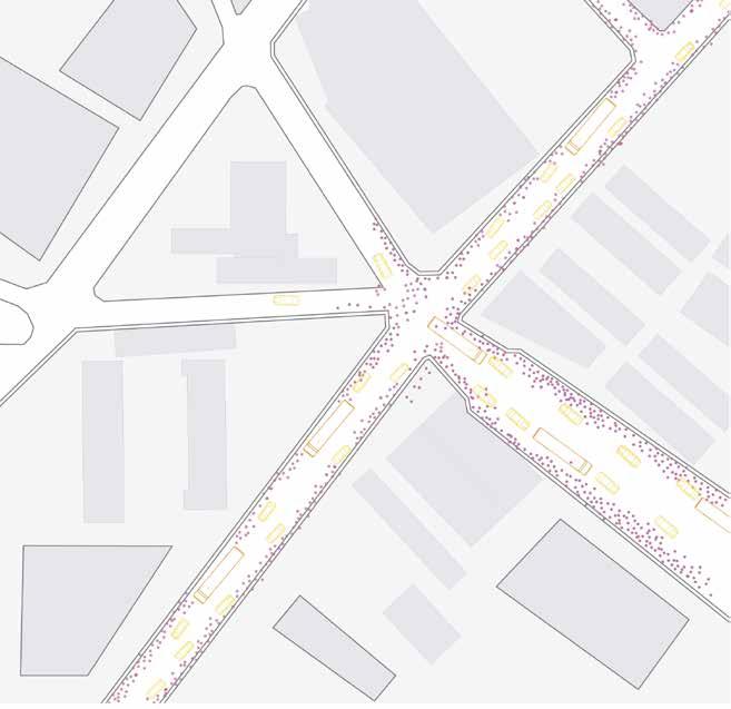
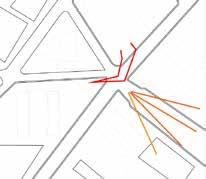
FIG 1.9.2 : FIG 1.9.3
FIG 1.9.4:
It is a two way bridge with each road being of inadequate width of both roads and pedestrian footpaths . Furthermore the bridge lies in between the available ticket counter and direct access to the station leaving no scope of pedestrian movement. This becomes the cause of great inconvenience for the user travelling from the bridge to the platform.
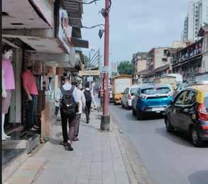
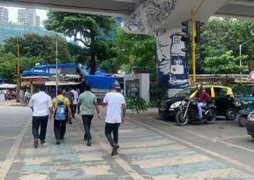
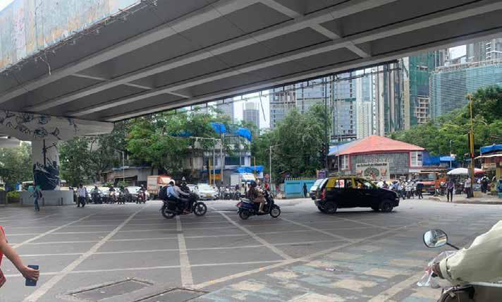

 FIG 1.9.5 : Image showing arial view of Elphinstone Junction
This map depicts the various functional activities in Dadar and Prabhadevi areas.
The functions include :
• Colleges/Institutions
• Schools
• Police stations/chowkis
• Ward offices
The area is well serviced by a network of buses and railroads that span the commercial and public facilities in the area.
There are elementary schools and high schools for local residents.
Universities and institutions of various disciplines attract students from other parts of the state and across India.
LESS RECOGNISED SCHOOLS NOTABLY RECOGNISED SCHOOLS WELL KNOWN SCHOOLS
LESS RECOGNISED COLLEGES NOTABLY RECOGNISED COLLEGES WELL KNOWN COLLEGES
LESS RECOGNISED POLICE STATIONS
NOTABLY RECOGNISED POLICE STATIONS WELL KNOWN POLICE STATIONS
WARD OFFICE
AREA OF INFLUENCE OF POLICE STATIONS- 250M RADIUS

This map shows the Healthcare facilities in Dadar and Prabhadevi area.
The functions include:
• Primary Healthcare
• Secondary healthcare
• Tertiary healthcare
PRIMARY HEALTHCARE: Health care provided in the community for those who go to a doctor or clinic for the first time for advice or treatment.
SECONDARY HEALTHCARE:
Secondary health care is specialized care provided by health care professionals to patients who are referred for specific specialty care.
TERTIARY HEALTHCARE: Tertiary care includes advanced and complex diagnoses, procedures and treatments performed by specialists in state-of-the-art facilities.
PRIMARY HEALTHCARE
SECONDARY HEALTHCARE
TERTIARY HEALTHCARE 250M RADIUS


This map represents the distribution of different types of activity throughout the region.
The main activities here are:
• Commercial
• Retail
• Religious
• Recreational
The movement of people to and from the station and their respective offices and educational institutions.
Establishment of stores and other commercial activities in the area.
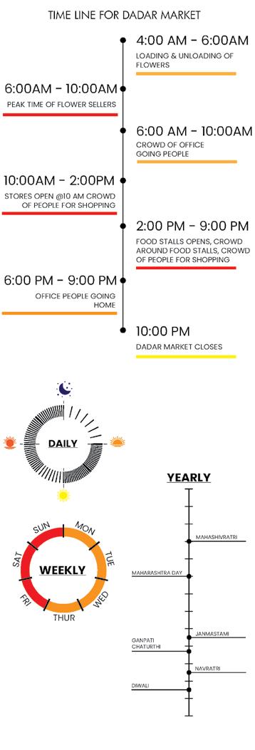
The popular flower market starts bustling from the break of dawn until late evening.
There are also groups of people who come here for religious activities
Recreational areas such as Shivaji Park attract people in the mornings and evenings for exercise and games.
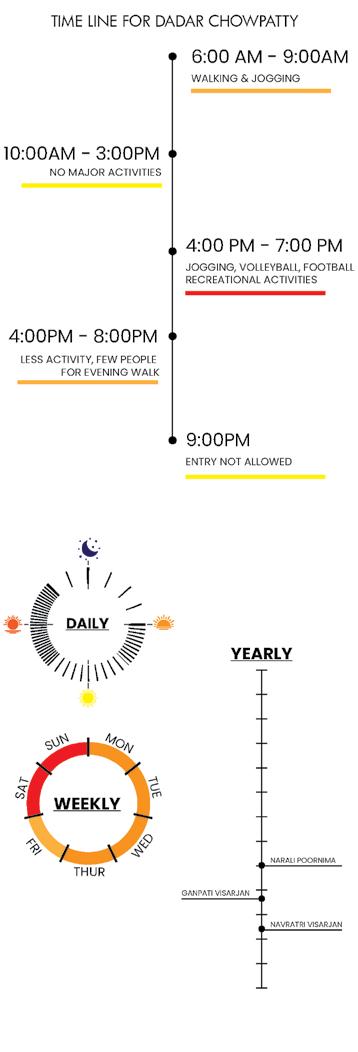
The site is divided into multiple neighborhoods and multi-layered activities, and understanding the diverse nature and coexisting homogeneity of the neighborhood requires fieldwork, photographic documentation, and mapping of social structures through data collection.

Different types of activities performed at different times and other factors help determine the quality of the physical environment and how physical influences determine the course of activity.

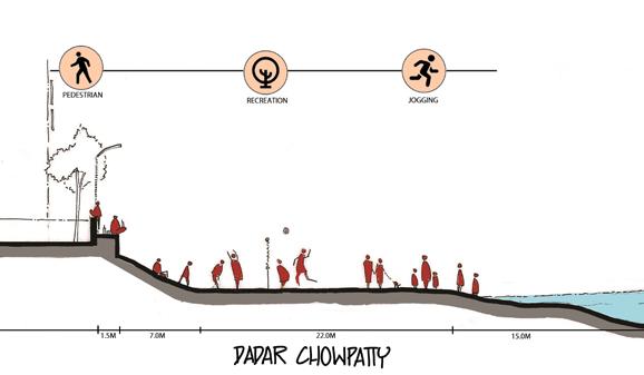
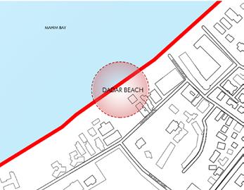
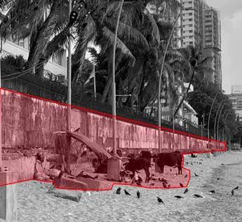
Dadar Chowpatty Beach is a natural sea beach with stunning and spectacular views of the Bandra Worli Sea Link Bridge. The beach has a large lookout near Chaityabhoomi overlooking the coastline and is mainly used for the glorious sunsets.
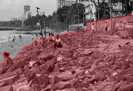
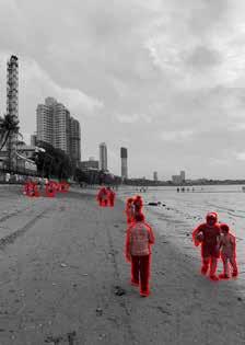
• People play sports like Volleyball, football etc
• walking/running
• People are seen sitting/eating and watching the sunset
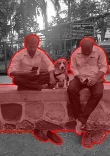
• The main areas of activity are centered around Shivaji Park and the main promenade of Dadar Chowpatty.
• Visitors are more likely to be seen on the beach while residents stroll Shivaji Park

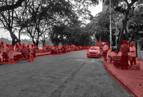
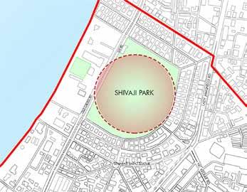
Shivaji Park, officially Chhatrapati Shivaji Maharaj Park, is the largest park in the island city. It has historical and cultural value due to the political and social gatherings witnessed in Mumbai before and after independence. Shivaji Park is known as the birthplace of Indian cricket. It is home to eight cricket clubs. It is now a training ground for all Dadar residents.
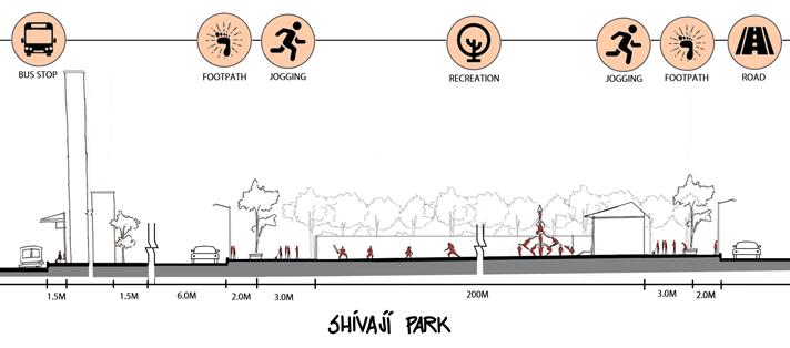
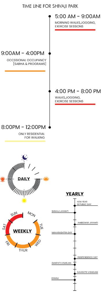
• Recreational activities and gathering spot
• There are multiple eateries around the park
• People come here for exercising, running
• Jogging and walking
• The pathway through the park reduces number of people using the sidewalk.
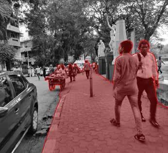
• Faster and convenient route for schools
• university, and office people.
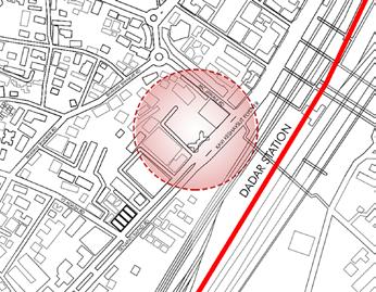
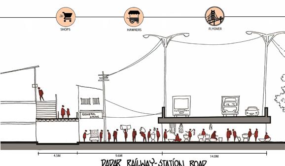
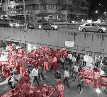
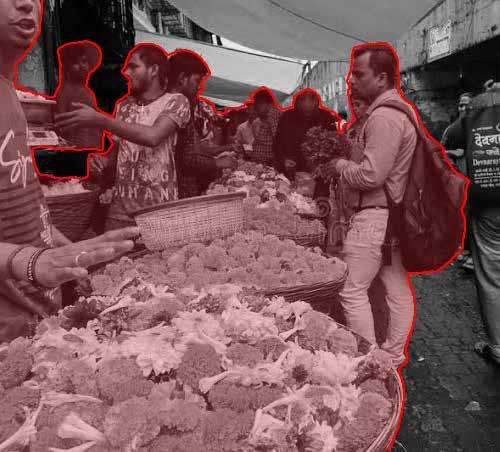
The Dadar Flower Market blooms right in front of the railway station under the flyover. The famous market alleys are lined with kiosks, stalls, tables and even baskets full of fragrant flowers. Wholesale also includes gadgets, clothing, decorations, and more.
3.2.3.1:
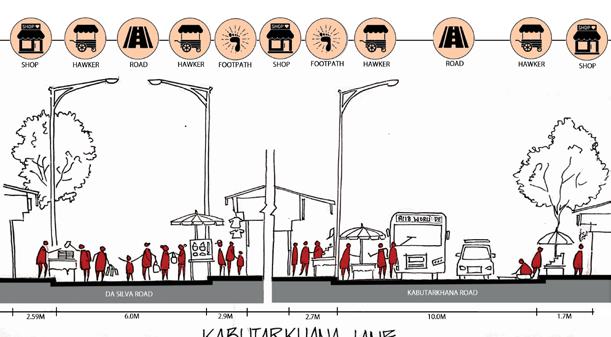
road
3.2.3.2:
•
• Pedestrians to/from Dadar Station
•
• Restaurants & eateries
• Each alley has at least 1-2 restaurants, each with a Pan Tapri outside
• A 2-meter sidewalk used or occupied by vendors in lieu of walking
• Each zone has its own identity depending on the item sold

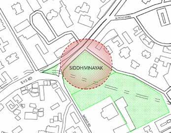
The Shree Siddhivinayak Ganapati Mandir is a Hindu temple dedicated to Lord Shri Ganesh and is one of the richest temples in India. This temple is one of the major landmarks in the city and has significant cultural significance. The temple is always visited by a large number of devotees daily, especially during Ganesh Chaturthi.

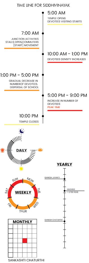
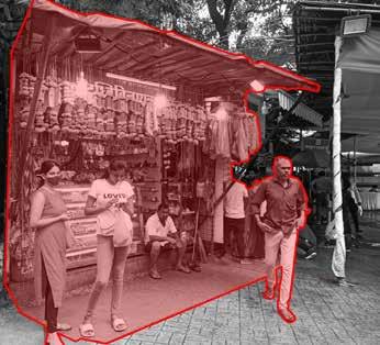
• Devotees come for Praying and conduct pooja
• Shops around sell flowers and items for pooja
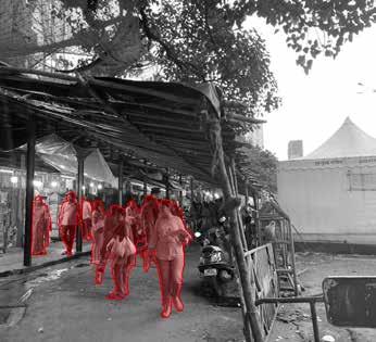
• Active movement of devotees throughout the day
• Retail outlets have developed in and around the religious features of temples.
• Standing at the node the temple is a famous landmark of Dadar
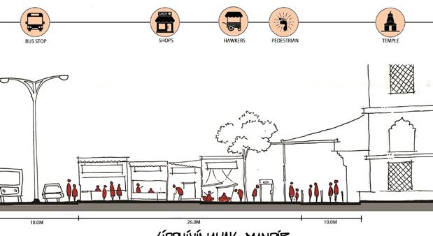
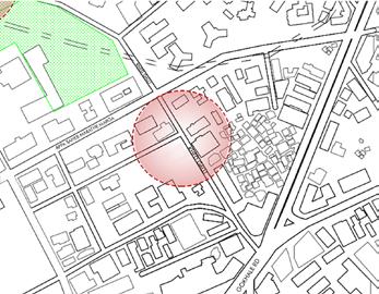
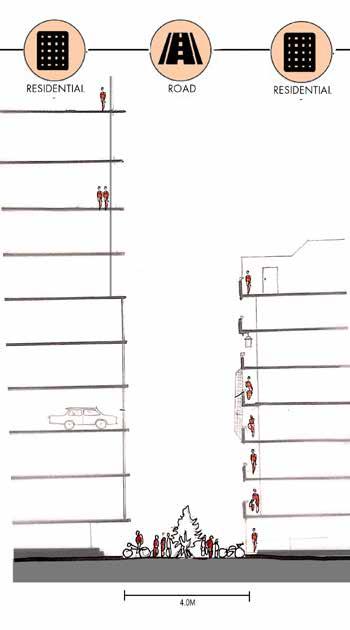
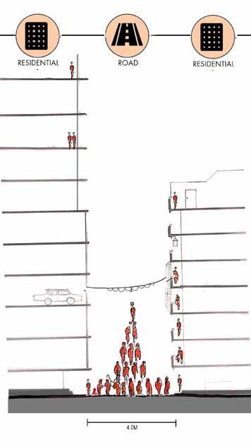
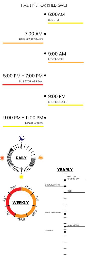
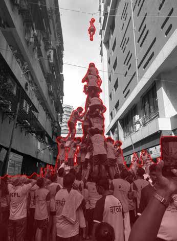
Khed Gali is a street lined with a traditional chawl system and a significant number of Hindu families live in this area. Festivals such as Dahi Handi, Ganesh Chaturthi, Ashadi Ekadashi and Diwali are celebrated on grand scale on the streets. Fig 3.2.5.1 & 3.2.5.2: Section through Khed galli
• Shops and street vendors that sell multiple items
• Pedestrians to/from Dadar Station
• Shoppers buy goods at the market
• Restaurants & eateries
• Most chawls and redeveloped buildings form a closeknit neighborhood community
• the hindu community celebrates their festivals
• Indigenous identities and behavioral patterns as a community are observed.
Dadar is a hub to different typologies ranging from ground structures such as wadis, shops, to highrises like motilal oswal, which makes its character distinct yet not of a specific type. Our documentation is based on studying one of each typology :
Wadi Chawl Market Bunglows Highrises
Fully Commercial Chawl

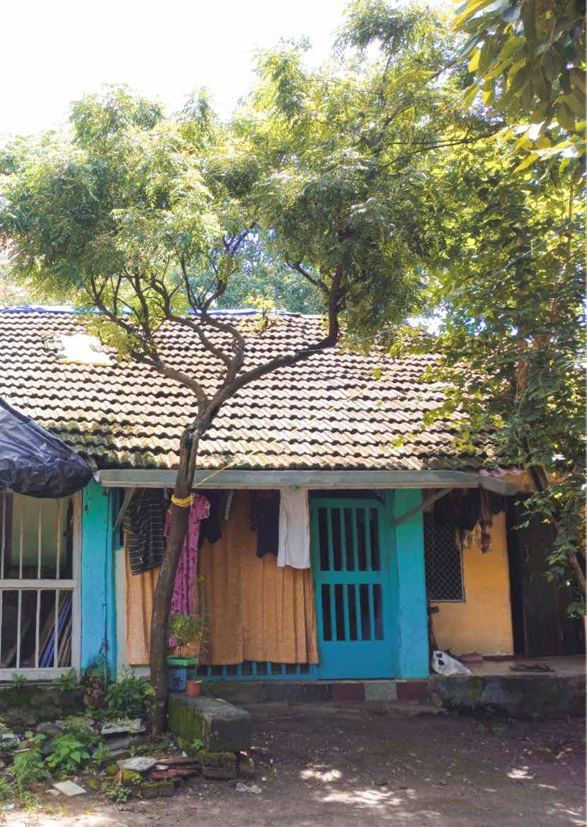
They are characterised by small nodes and open spaces with buildings around them thereby forming courtyards. A building within a wadi consists of single room tenements with common corridors and shared toilets. These corridors generally overlook a street or an open space. They are recognised immediately ny their unique combination of low rise, high density structures.
TYPOLOGY Wadi
OCCUPANCY
• Self-ownership
• Lower to middle class
• Room adjacent to road are converted to commercial use.
• If a (large) single family owns multiple residence then they also use exterior open space as their own.
BUILTFORM • Inward facing
• Narrow internal pathways
• Open spaces used for parking
• Ground structures with sloping roofs.
• Road acting as extended space to their home
• Helps to maintain proportions of open space with respect to urban form
• Varied material palette observed
EDGE CONDITION
• Toilets are located near edges
• Roadside commercial activities.
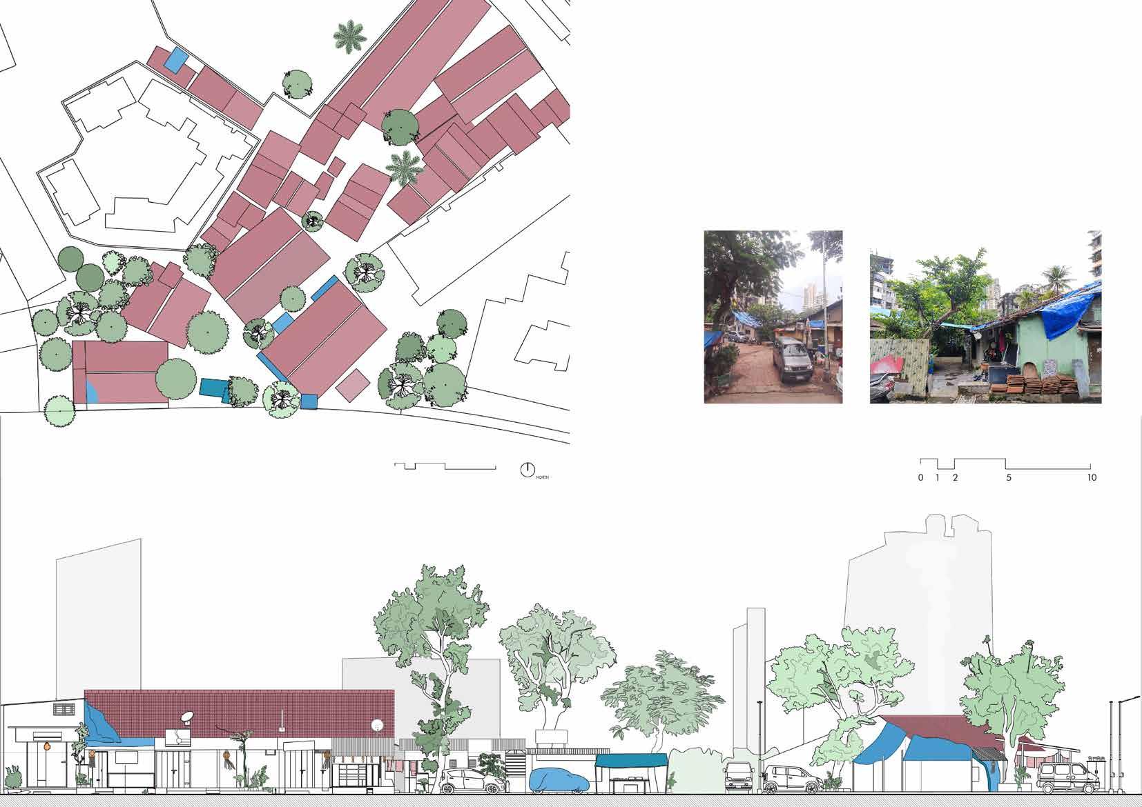
Raichand Wadi is located by the Baburao Phulekar Marg in Dadar West. It forms a community in itself with a salon, bakery, vegetable shop ad general store within its premises. It is surrounded by mid rise residential buildings around it.

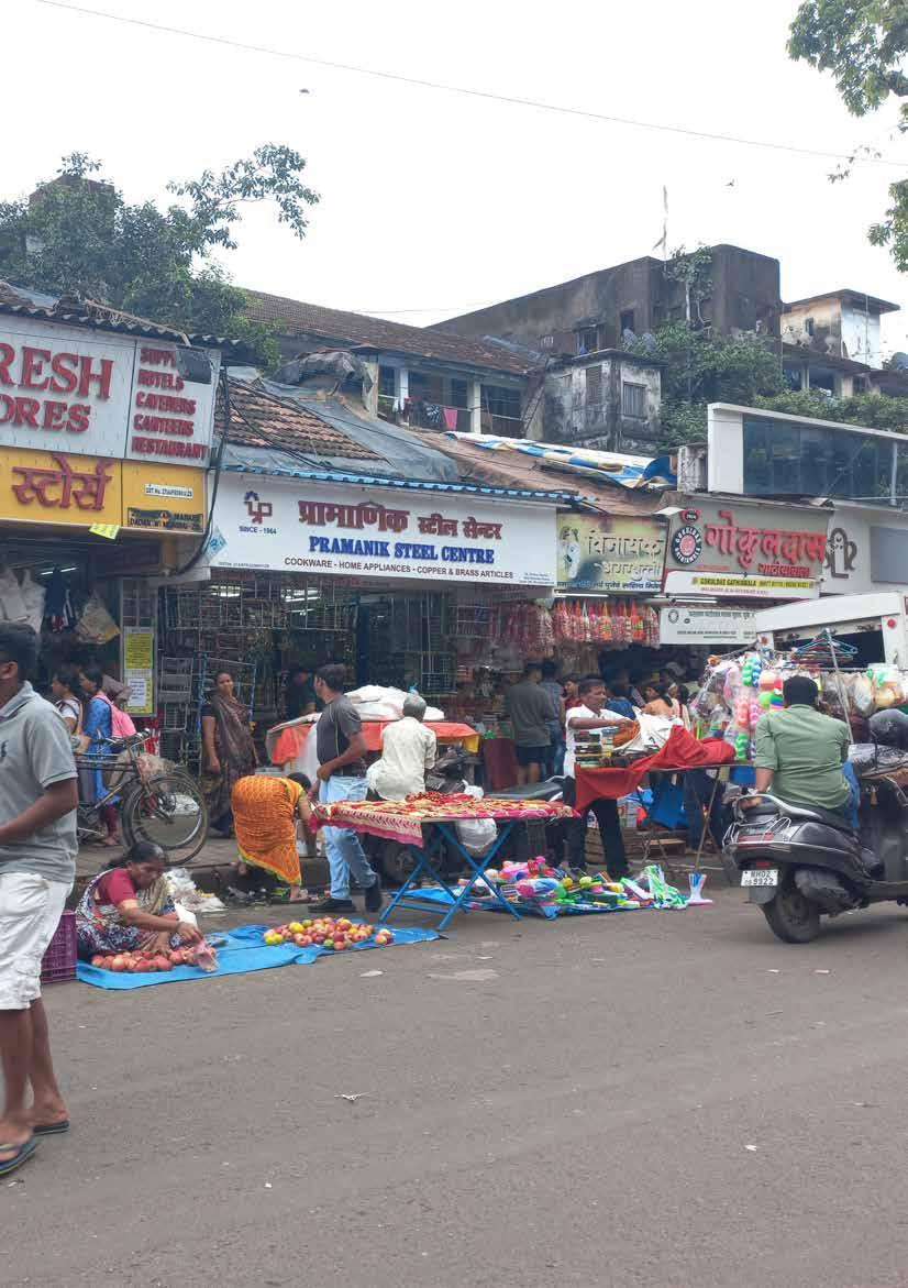
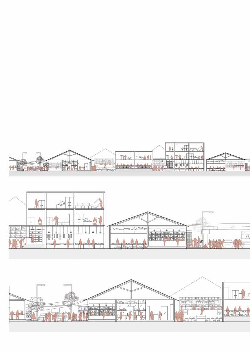
The dadar market area was the outcome of migrant workers coming to mumabi insearch of work. Due to Transit Oriented developemnt of the area and the railway station, further growth of the market took place. Now, it is one of the mumbai’s crowded place. One can find everything in this market ranging from clothes, stationery to vegetables, toys, etc. The market is characterised by low - mid rise built forms with curved facade at the corner plots. Shops prevail along the roadside while residents live in the interior lanes.
OCCUPANCY
• Lower to middle class
• Flower market + government occupancy
BUILTFORM
• Character of street varies with respect to festivals/ event
• Residential typology around market
• Shaded dynamic spaces
• Material- tin shades, mangalore tiles, plastic
• Hoardings placed at 1m to 1.5m distance
• Direct entrance from footpath to G+1 commercial floor
EDGE CONDITION
• 3 layers of market - vendors (hawkers), ground shops, G+2/3
• Temporary market (BMC) and licensed
• Edge conditions remain constant and changes at night
 WADI
WADI
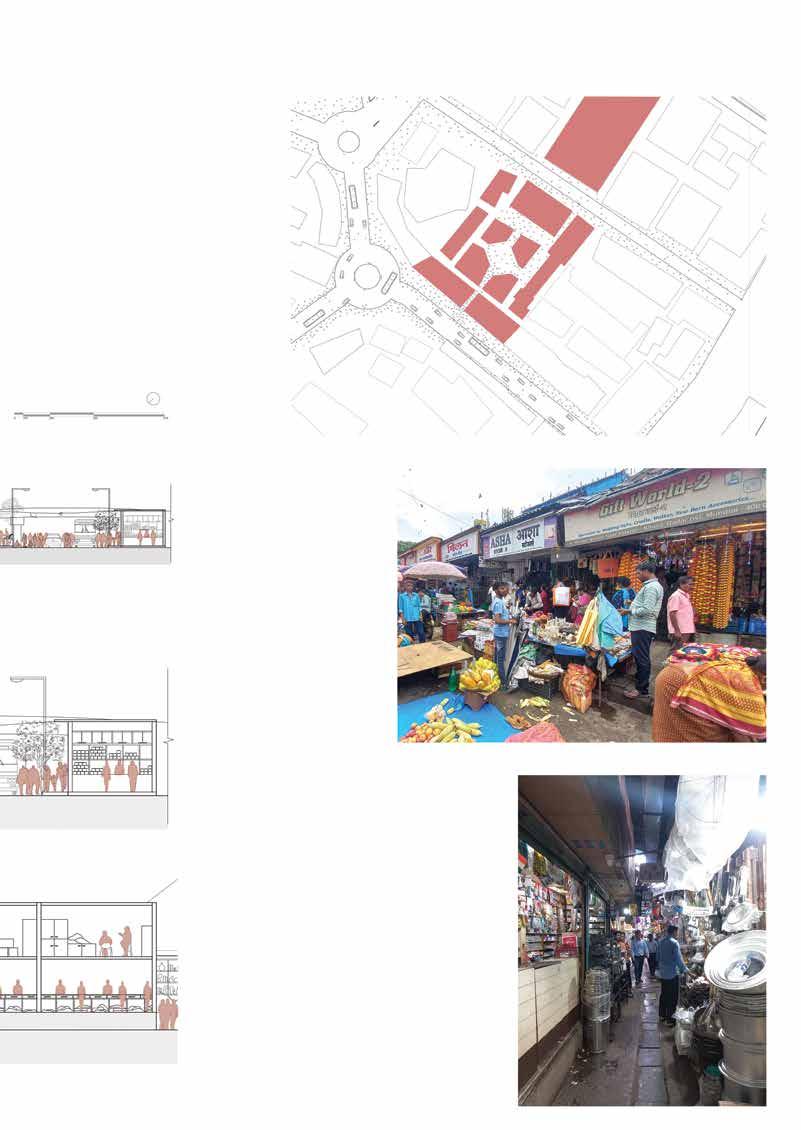
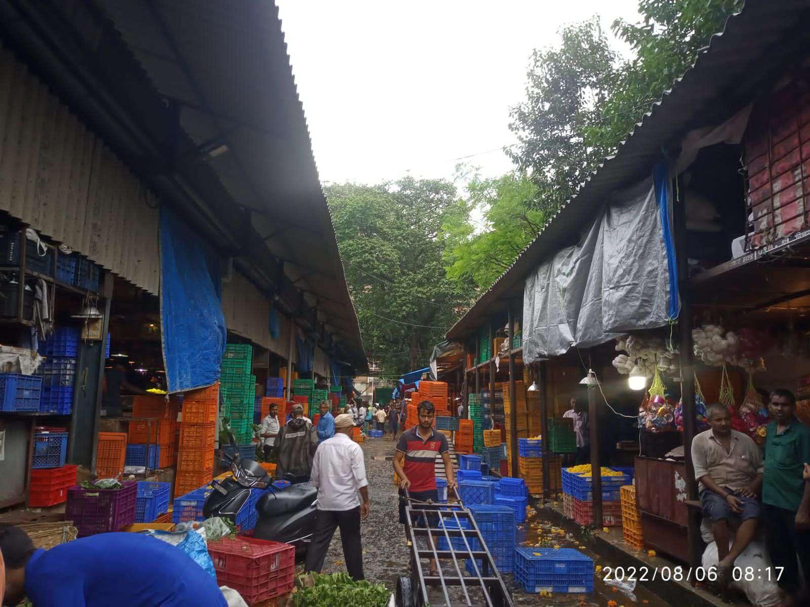
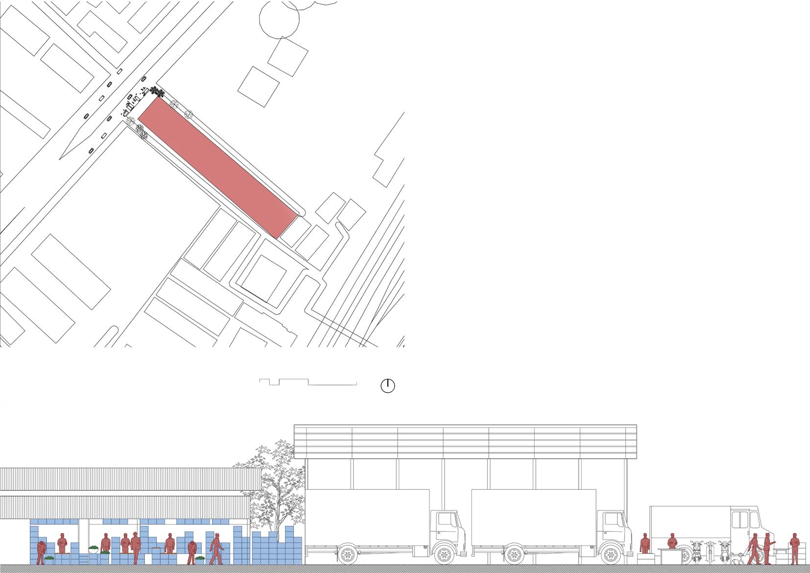
The flower market, situated in dadar, functions below the Kavi Keshavsut flyover and the Parel area. They are the most chaotic and messy places with the most beautiful fragrances from the flowers. These flowers are bought
TYPOLOGY Flower Market
OCCUPANCY
• Lower to middle class
• Flower market - Government owned
CULTURE / LIFESTYLE
BUILTFORM
• Internal shops extended till street
• Loft spaces used for storage as well as resting
• Material - tin shed
• Entrance space used for loading/unloading and parking of heavy vehicles
• Narrow space for pedestrain movement in between the shops
EDGE CONDITION
• Temporary market along the road during morning
• Parking of heavy vehicles
• Sense of entrance (straight axis to market )
• Peaking timing at morning
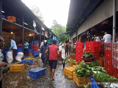


The flower market is located under the Kavi Keshavsut Flyover outside the Dadar Station is famous for its wide variety of flowers. However apart from this location the market has also frown informally onto the roads connecting to the station. These shops are under tin shades with small lofts or storage places adjacent to them.
It functions from early in the day to late at night, remaining chaotic and messy throughout the day. The peak time of the market is during daytime while at night informal lighting solutions are used due to lack of proper light and ventilation even in the evenings.
Chawls are either linear shaped with a common corridor aligned with adjacent placed rooms or a C or U shaped building with 3- 5 stories built with a common toilet, washing area and a balcony. The similarity between chawls on an architectural note is the shared balconies which acts like a common corridor. The corridor in the front of the house acts as an entry door and the corridor in the back provides a common passage to access the sanitary facilities. ,
TYPOLOGY Chawl
• Employees
• Advertisments hoardoings acts as a main facade element somehow creating visual hinderance.
BUILTFORM •
Extended spaces occupied by individual apartments. • Absence of common lobby • Design sometimes governed by roads • Proportionate built form • Common staircase (non- gated opening or street) • Facade becomes like a platform for advertisement hoardings
EDGE CONDITION • Inward character due to absence of external common lobby • Perceived sense or safety • Ground floor shop- serving the street (pedestrian connect) • Parking on footpath / roadside • Direct connect of shops and footpath (Footpaths are kept clean by shopkeepers)
• Made for mill workers originally
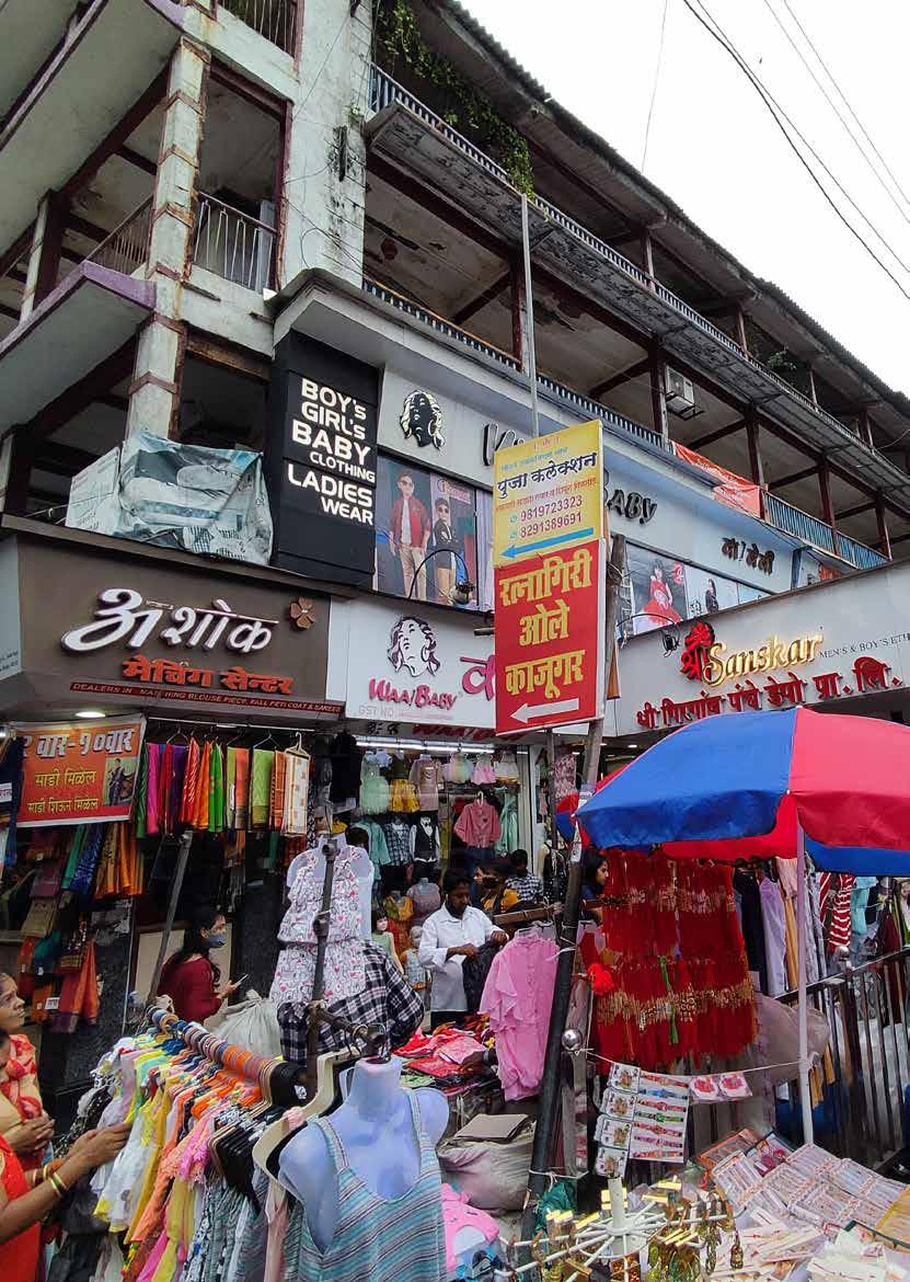
MERITS • Adaptive reuse and mixed use of chawls is observed • Purely commercial
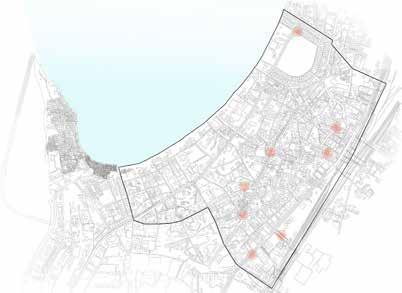
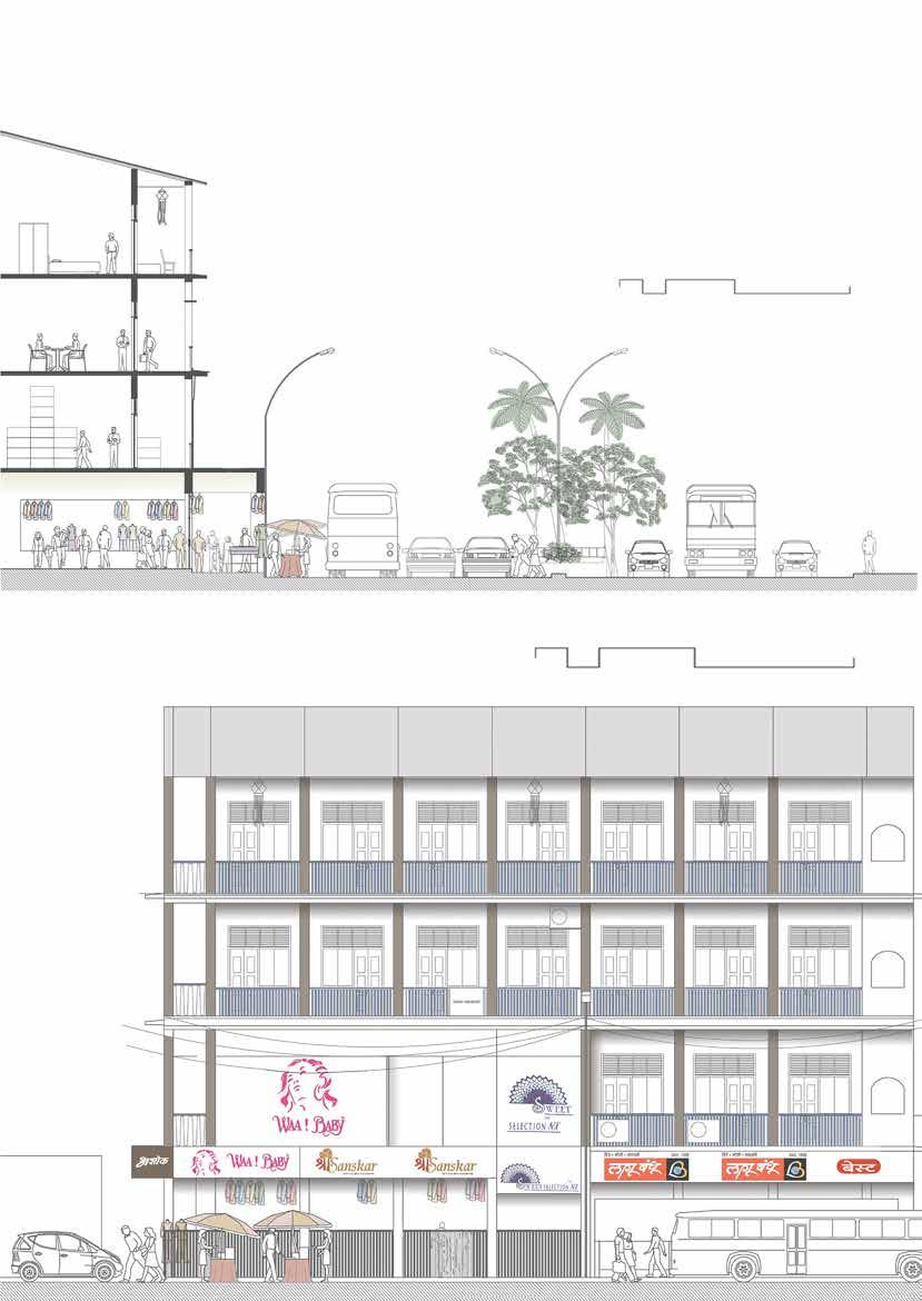
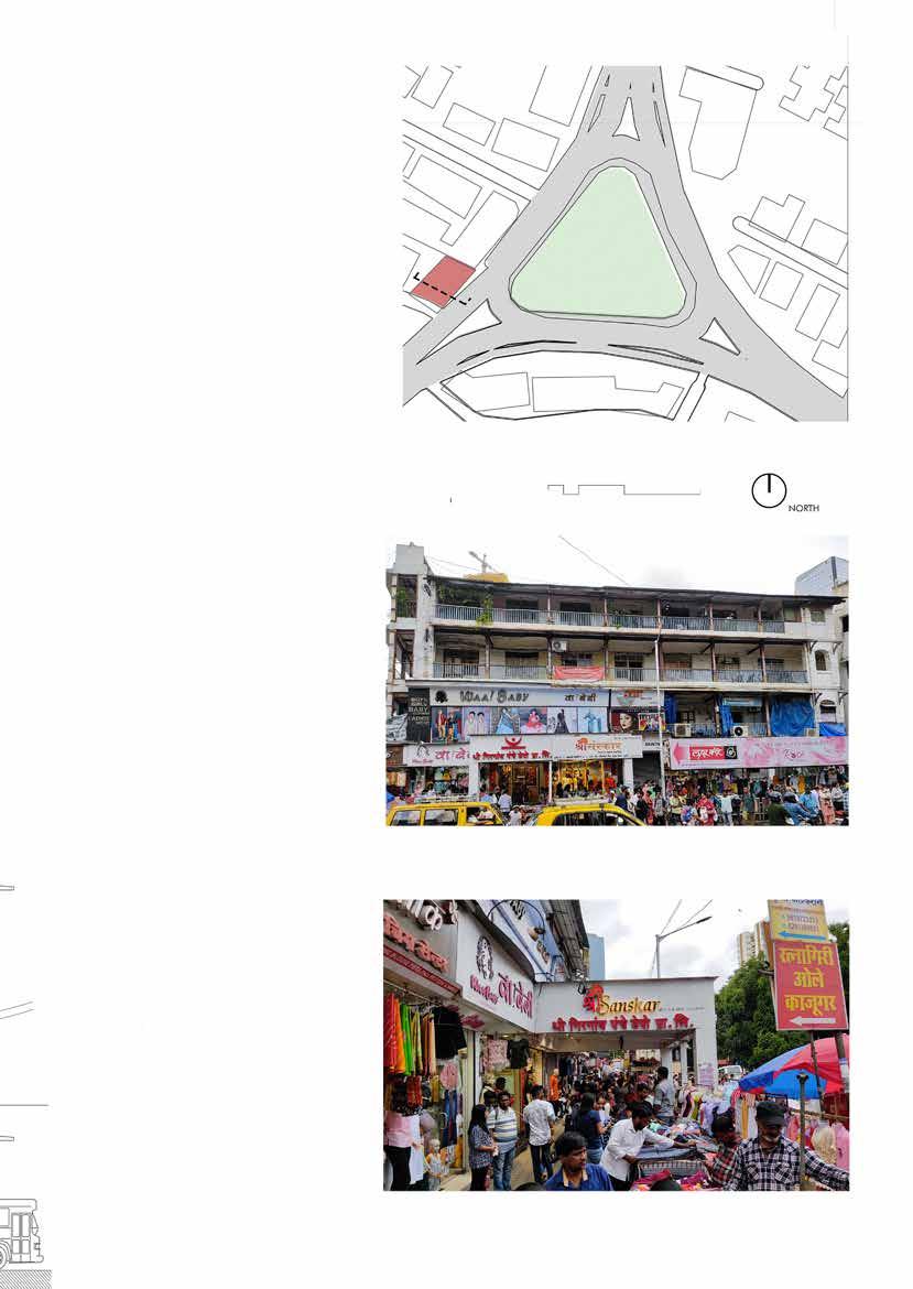
This chawl is located near Veer Kotwal Udyan Chowk. Its units are being used as commercial establishments; as a shopping complex on the ground floor while the first floor and above are used as office spaces or storage rooms
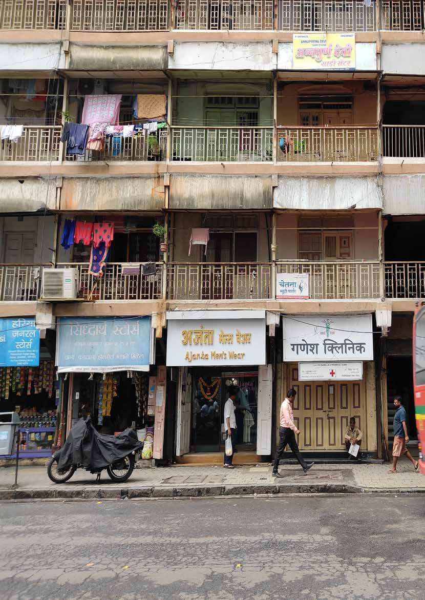
Chawls are typically two- to four- storeyed buildings that has 10x12 single occupancy rooms next to each other on a particular floor, with a shared toilet on each floor and two exits on either sides. Most chawls have an inner courtyard along which the floors were designed.
TYPOLOGY Chawls
OCCUPANCY
CULTURE / LIFESTYLE
• Migrants
• Lower-middle class
• Developed facade character
• Occupancy defined
• People also use corridor as extended space to their homes (storage, seating, plante etcr)
• Balconies are used for drying clothes (Railings)
BUILTFORM
• Common lobby either facing street or internal courtyard
• Design sometimes governed by roads
• Proportionate built form
• Common staircase (non- gated opening or street)
EDGE CONDITION
• Outward character
• Perceived sense or safety
• Visual transparency
• Ground floor shop- serving the street (pedestrian connect)
• Parking on footpath / roadside
• Direct connect of shops and footpath (Footpaths are kept clean by shopkeepers
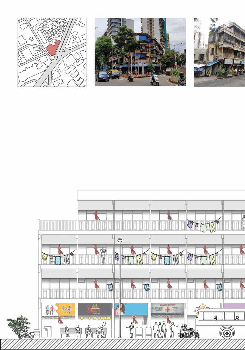
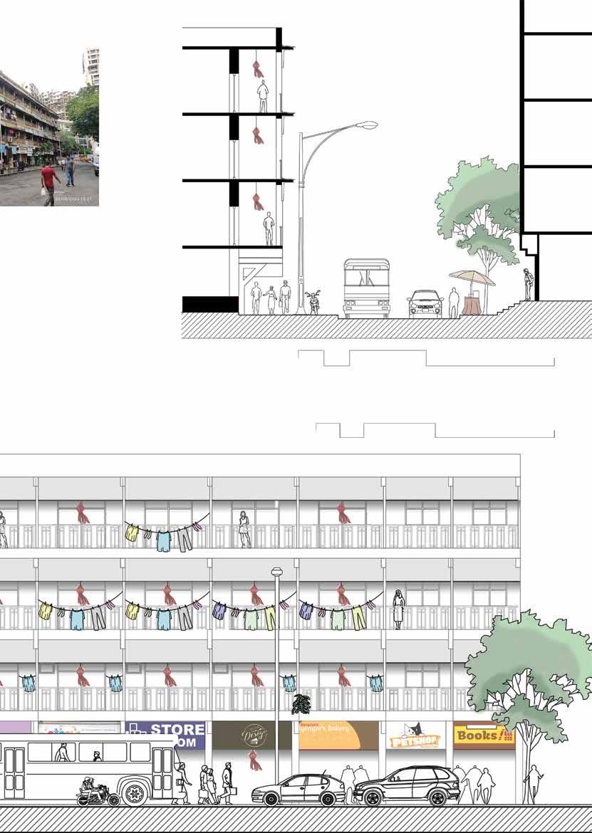
Khed gali chawl mainly looks onto the streets. The residents consider streets as a part of their home and use it as their spill out spaces for celebrations and festivities. The facade is mainly characterised by railings and fascia boards that cover their clothes hanging and drying. There are lanterns hanging in the corridor that acts as a connector as well as an extended space for the residents.
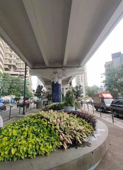
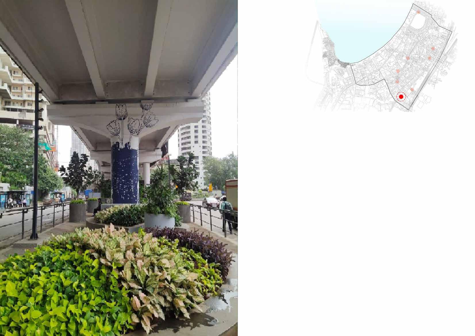
High Rise commercial buildings are dispersed throughout the entire area of dadar They form a very different street connect as compared to the other typologies in this area. Most of these buildings have a similar facade treatment of glass and cladding overlooking the roads. It has been observed that their adjacent edge conditions with the roads are well maintained and organised as opposite to that of the other built forms.
TYPOLOGY High rise commercial
OCCUPANCY
• Employees CULTURE / LIFESTYLE
• 9-5 job
• Tea breaks at nearby stalls during afternoon and evening
BUILTFORM
• Stilt /podium
• Opaque glass facades - no visual transparency
• Facade imposes character along main road/ nodes
• Food stalls and entry form opposite road maintaining the character of facade
• Less area - facade directly opens out on the road with stilt as parking
• Pedestrian traffic is less due to entry from rear side
• Stark contrast in road width, vehicular and pedestrian movement compared to other areas of Dadar.
• Footpaths used by vendors and for parking of 2 wheelers
• Landscape buffer between footpath and builtform
• Presence of bus stop nearby


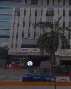
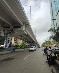
One International Center is located along the Senapati Bapat Marg in Dadar West, well connected to major roads like the Eastern Express Highway. It is a high rise commercial business centre building. It comprises of three tall towers in hierarchy. The elevation is aesthetically appealing with terraces and glass in the facade, though the privacy remains protected from the pedestrians and inhabitants of the residential establishments on the other side of the road. The building is a non government building and is high maintained on the exterior as well. To cater to the entry and exit from this building on a highly dense traffic road, changes have been made for widening of the road and landscape interventions
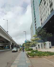
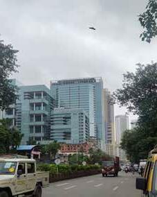 Wider footpaths in front of the bbuilding
Facade characterised by glazing and cladding
Parel Bagh below the flyover as a breakout space
Provision for MCGM parking has given them additional FSI


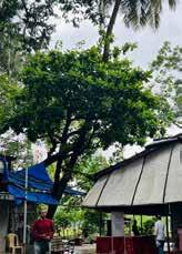
Vegetation found in the Dadar region is a mix of Native trees as old as 200 years and exotic trees that were particularly planted to beautify the avenues during the british era of development. Existence of native trees such as coconut palms were observed more on the western side, whereas the interior parts of the island and the reclaimed region are home to majorly non-indigenous trees. These trees are not efficient contributors to the ecological ecosystem and may be prone to disaster as well.
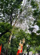
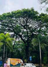
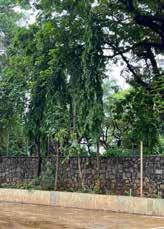
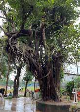
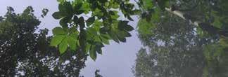
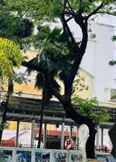
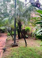
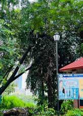


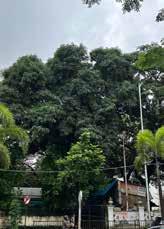
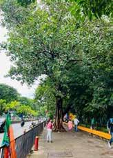
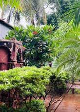
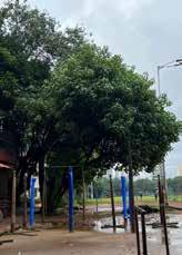
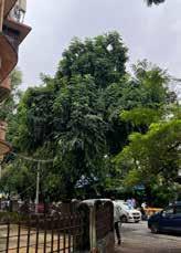
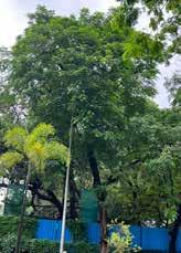


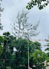
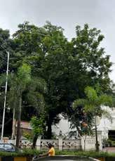


Shivaji park and the Pramod Mahajan kala park along with the dadar beach are the major open spaces utilised for recreational activities by the residents of dadar. One could identify open spaces with varied types of accessibility and ownership. The denser fabric and organic character of the southern areas provides for discontinuous open spaces of smaller scales. Numerous large scale open spaces like the Nardulla tank playground and redundant mill lands are being utilised for infrastructural development which forms a concern.
Figure1.2 : Open space vs Built area distribution in the selected site area
Public open spaces
Restricted open spaces
Layout open spaces
Natural open spaces (Seafront)
Under construction plots
Wadi grounds
Shivaji park and the Pramod Mahajan kala park along with the dadar beach are the major open spaces utilised for recreational activities by the residents of dadar. One could identify open spaces with varied types of accessibility and ownership. The denser fabric and organic character of the southern areas provides for discontinuous open spaces of smaller scales. Numerous large scale open spaces like the Nardulla tank playground and redundant mill lands are being utilised for infrastructural development which forms a concern.
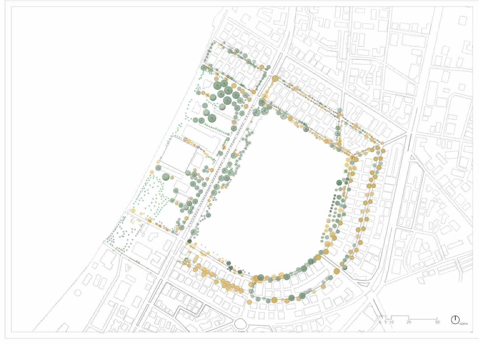

The particular chosen site of Shivaji park surrounding has abundance of trees of both native and non-native species. The Dadar-Matunga-Wadala-Sion Scheme of 1990 first introduce the area as Mahim Central park and thus has lead the existence of aged trees in the neighbourhood. Each tree in this site is spotted, identified and located on map to study the vegetation cover over the area.
Figure1.2 : Green cover in the Shivaji park precinct

Figure1.2 : Tree count statistics
The overall green cover of the Shivaji park precinct observes an existence of 38.1% Native tree species and 61.9% of Exotic tree species.. The trees are a mix of fruit bearing and non-fruit bearing species wherein he average lifespan of a native tree is longer than that of an exotic tree. Coconut is the most found indigenous tree whereas Yellow Gulmohar is the most found exotic tree.
Figure1.2 : Exotic trees and Native trees distribution


Tagging all the regional trees and presenting them to the public which will contribute towards educating and recognizing heritage and indigenousness preservation and for quicker resolution of problems by citizen-administration connectivity.
• Tagging and locating
• Creating Database
• Website and interaction
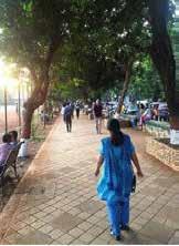
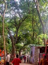
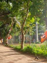
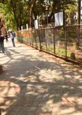
- Acts as antioxidants
- Maintains healthy heart
- Cure diabetes
- Cure skin diseases
- Cure hypertension
- Cure fever
- Boosts immunity
Merits of native trees
- Support local ecology
- Save water
- Low maintenance
- Pesticide freedom
- Reduce air pollution
- Prevent soil erosion
Merits of native trees
- Support local ecology
- Save water
- Low maintenance
- Pesticide freedom
- Reduce air pollution
- Prevent soil erosion
The trees like banyan, peepal, neem , mango , bael , etc and their products are part of Indian rituals and ceremonies and various Gods and Goddesses are associated with this trees.
– Any change in local flora has a direct impact on the native fauna species.
- Trees provide shelter and food for a variety of birds and small animals.
Native trees that attract fauna :
Banyan Peepal Neem Country fig Jamun
Educating about indeginious heritage
Public
Participatory Identification of problems
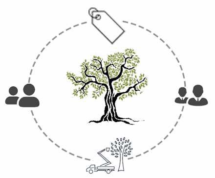
Maintenance and Updates
Creating MultiCharacteristics Database
• Educating and Preservation of heritage and Native vegetation
• Database and gps locations for qualitative policy implementation
• Quicker Identification of tree related problems in the region
• Raising concerns for damaged or dangerous trees
• Keep check of ecological factors and preservation of heritage
• Awareness for proposed project in area
• Suggestions for future Plantations
• Observation and Feedback
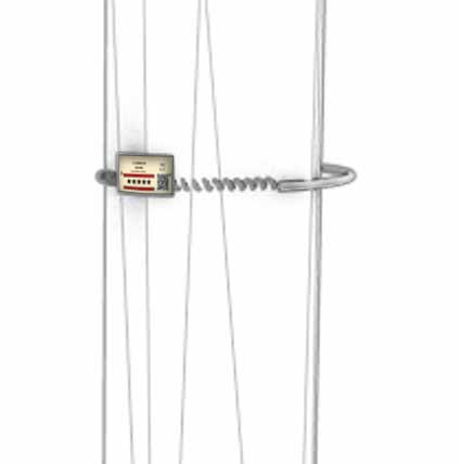
Stainless steel
Barcode Vulnerability Sensor
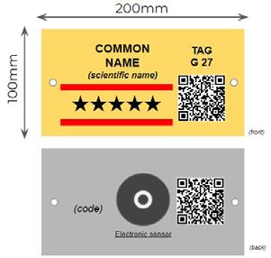
Horizontal Tag for larger trunk diameter
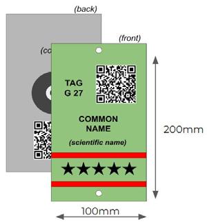
Vertical Tag for smaller trunk diameter
Among the different alternatives for tree tagging, metal tags are regarded as the best solution because of a number of advantages over painted codes or logos may wear out due to weather exposure over time.
Fixing the tags on the trees is a relatively easy and fast operation, particularly when the tying with spring system used.This solution is considered useful to enhance the endurance of tags.
This is considered important given that in areas with relatively high human density (tourists, daily exercisers, and strollers ), highly exposed tags would be prone to vandalism.
This solution is considered useful to enhance the endurance of tags. This is considered important given that in areas with relatively high human density (tourists, daily exercisers, and strollers ), highly exposed tags would be prone to vandalism.
During the marking of trees, the relevant information of each tree would be linked to the ID of the tag on a database with the same purpose-made online website and a similar set of measurement tools.
Additionally, any position that forces the tag to follow the circumference of the tree should be avoided. This is particularly relevant with small diameter trees, but in any case it is always advisable to place tags vertically on the trunk
•
• Resin emission
• Bark removal
Regardless the type of tag used, it is important to consider the effect of tree growth over time and minimize the damage that this can cause to the tags attached.
In general terms, attachment to the tree should be done in a single position (single staple or screw) rather than two or more, allowing the tag a certain degree of free movement that accommodates tree growth.
Laser engraving, Chemical Etching or Rotary Engraving for depth.

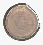

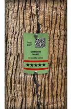
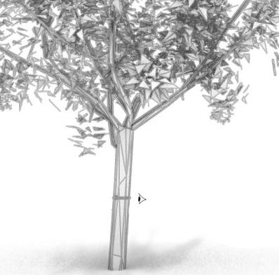

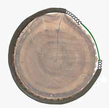
aluminum springs tied within rubber tube. Fixing the tags on the trees is a relatively easy and fast operation`
• Identification of problem by citizens.
• Specifically reporting the problem with help of tag numbers (scanning the barcode or entering the tag no.)
• Notification to the authority.
• Quick resolution of issues because of accurate location.
• Access to vast database by both citizens and administrators segregated lanewise.
• Awareness about initiatives and educated care of the surrounding flora.

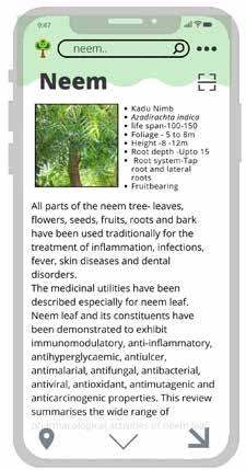
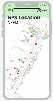
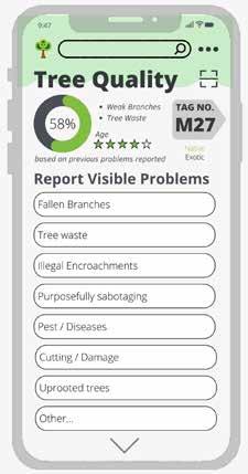


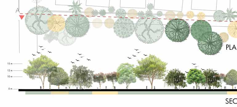
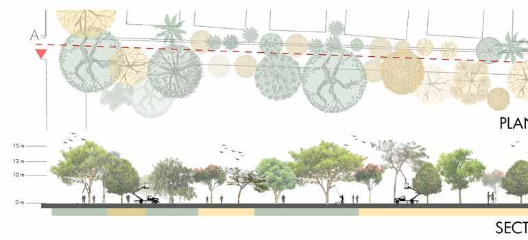
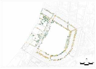
Image 1.1 : Key Plan
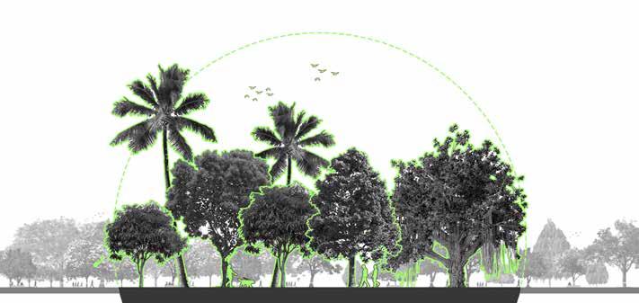
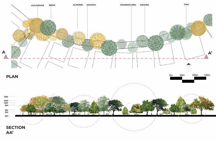
The drawings demonstrate the expected evolution of the tree cover at Shivaji park, wherein infographic of trees is articulated and made accessible to citizens. The articulation has further enabled the propagation of native species overtime, attracting diverse fauna.
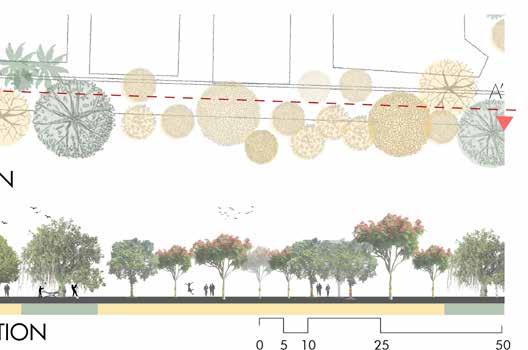
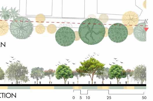
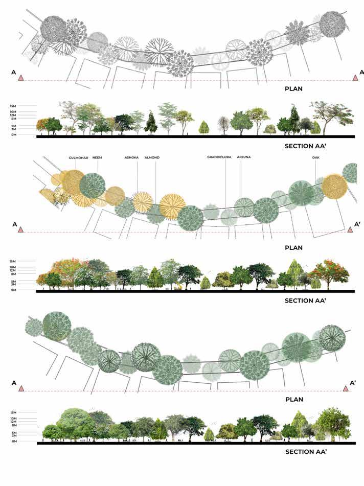
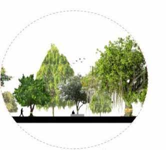
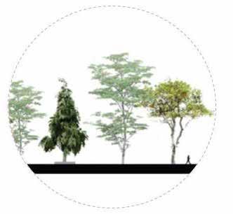
The proposal aims to atten public initiative in the process of education and conservation of the native vegetation. The society will benefit through the initiative as they experience an ecosystem better suited to their neighbourhood. Over a period of time, the count of non native species of trees can be brought down to zero, maintaining a completely natural ecosystem over the effective zone.
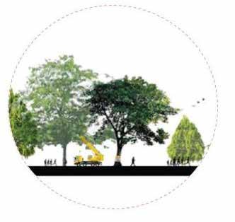
Overall the proposed vision aims to boost the user lifestyle and neighborhood experience in correspondence to resolving existing micro level issues.
The aim is to improve the context by modifying the urban form, thus regulating the development and adding incentives and regulations for the same.
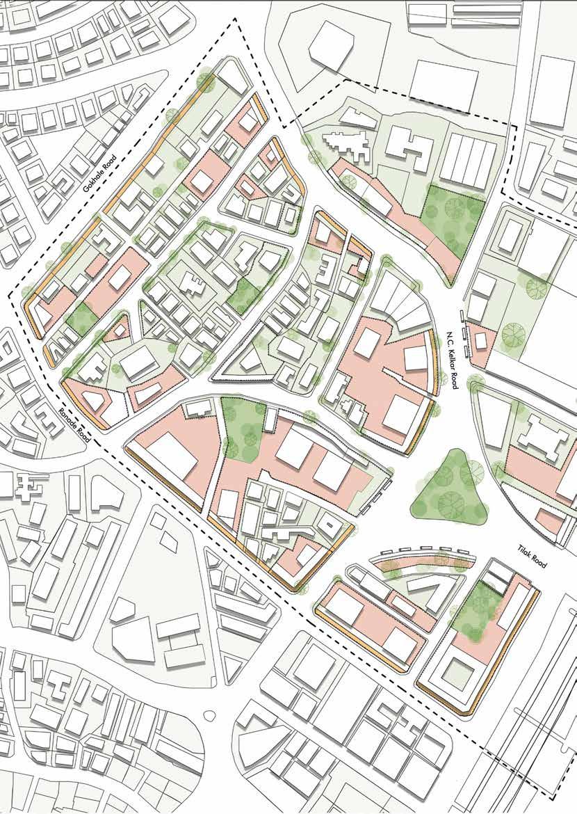
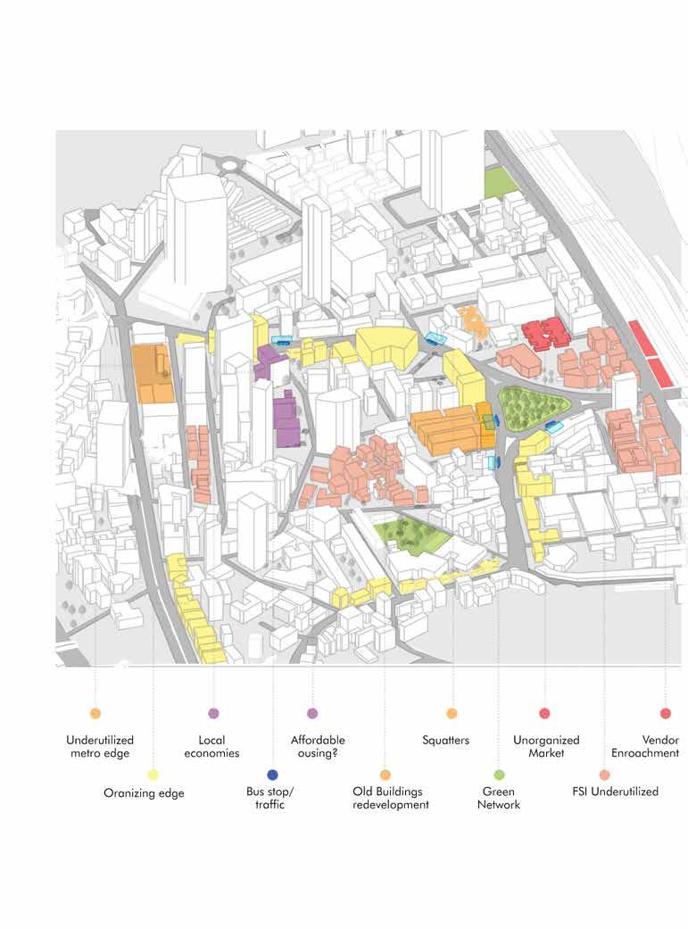
An existing character of the site opens up unequal spread of density, economic and social disparities, irregular mobility and underutilized potential of space. Market streets near the station are rushing with people during peak hours. This inference could induce strategies for commercial potential with consideration of the upcoming metro.
At a macro scale, the vicinity of a Central Business District tends to influence population density at Dadar that serves as a very significant transit edge. Hence, the thriving population could be balanced in the local radius of the railway station by upgrading the socioeconomic aura of the place. Edges that can be made profound to imbibe a junction character are brought into picture to add value to the streets. The vertical growth of the buildings are balanced by allotting void plots as open green spaces that deal with a comparatively versatile user group, eventually influencing the values of Floor Space Index and Ready Reckoner Rates.
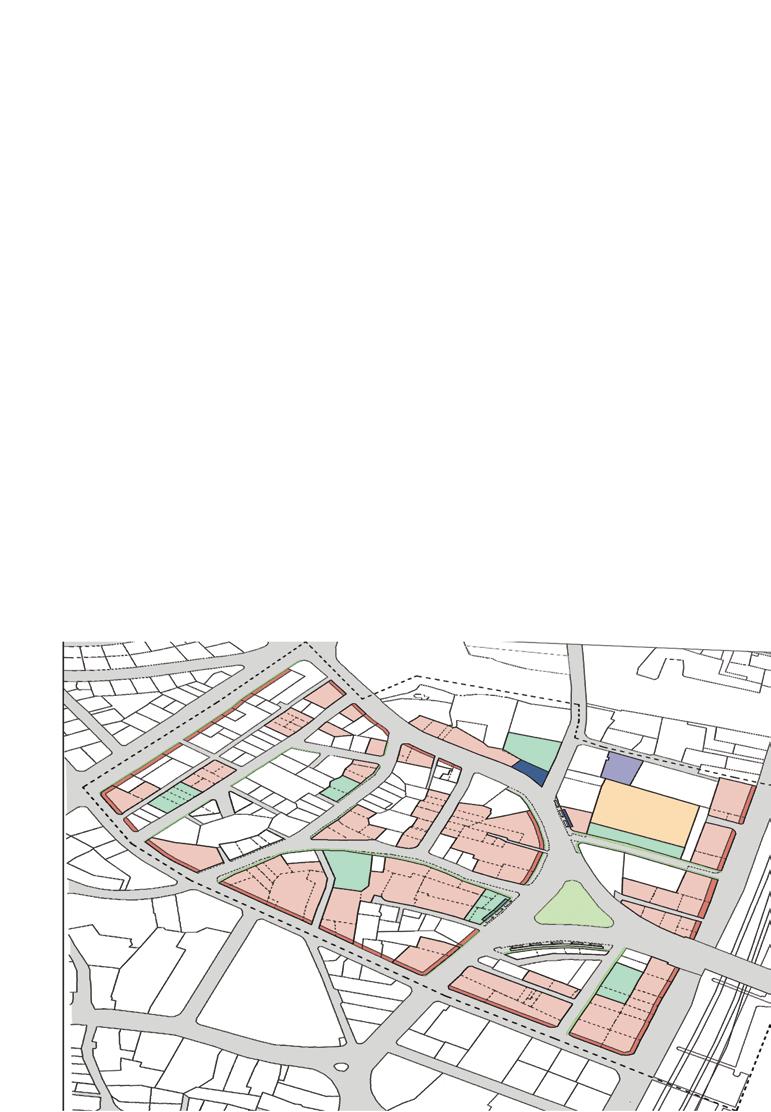
LAND DEVELOPMENT REGULATION AND ZONING significantly involves classification of zones based on the position of transit nodes.
PRECINCT ZONES: These include areas of Historic Significance, Spaces with a 100m radius of Public Open Spaces and spaces with Cultural Importance.
RESIDENTIAL ZONES: These include areas of local commercial development that deal with affordable real estate and diversified user income groups.
TRANSFERABLE DEVELOPMENT RIGHTS (TDR): Since redevelopment won’t happen at the precinct zones, these zones can use their transferable development rights to compensate for their Floor Space Index through exchange of TDR.
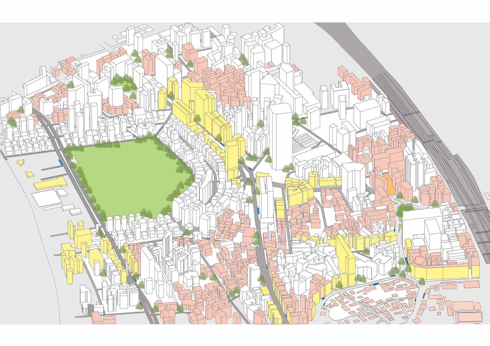


ZONAL CLASSIFICATION: Classifying the Urban contexts to organise future development considering the current problems, Proposed transit modes and future Urban requirements.
MEDIUM DENSITY MIXED USE ZONES: These include areas within 200 m radius and above of the railway station where special Norms for Floor Space Index, Commercial development, Parking, Front Open Space, Layout Open Space may apply.
HIGH DENSITY MIXED USE ZONES: These include areas within a radius of 200 m and lesser of the railway station where Transit Oriented Development, relaxations on Ready Reckoner Rates, increase in Floor Space Index, Redevelopment, Plot amalgamation, Multimodal Integration, High walkability and Active Building edges can be dealt with.
Figure 1.7 : High Density Mixed Use Zone
Figure 1.8 : Medium Density Mixed Use Zone

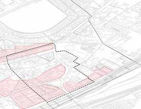
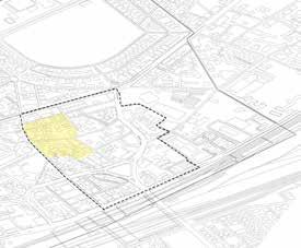
Figure 1.9 : Residential + Local Mixed Use Zone
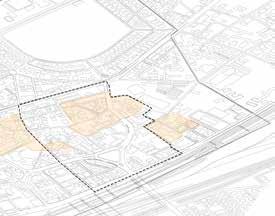
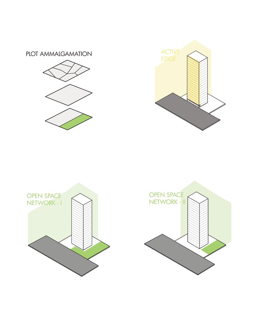
Plot Amalgamation: Amalgamated Plot is a continuous portion of land held in one ownership for the purpose of Development Control. The joining of two or more adjoining plots to make a single plot for the building purposes. One parcel of land resulting from amalgamation of more than one plot shall be considered as amalgamated plot.
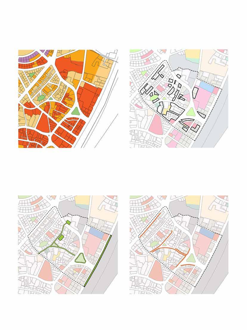
Road Widening: Road Widening means proposed widening of any road/ street by drawing up new alignments to deal with irregular mobility on roads. All the buildings on the roads declared under the Road Widening scheme shall be constructed only according to the setback in consultation with concerned authorities from time to time.
Green Space Networks : Green corridors in cities are linear natural infrastructure, such as trees and plants, that link up other green and open spaces to form a green urban network. These networks provide habitats and resources for urban wildlife; also providing services to urban populations such as mobility networks and access to green spaces through the provision of sustainable and active transport routes that link transport with mixed land use and open spaces.
Active Edge Design : is an approach to the development of buildings, streets, and neighbourhoods that uses architecture and urban planning to make routine activities and Commercial corridors more accessible, organised and inviting.
Protected Precinct
Residential Mixed Use
Green Open spaces
High Density Mixed Use
Medium Density Mixed Use
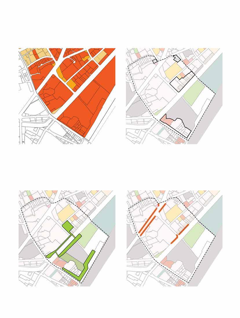
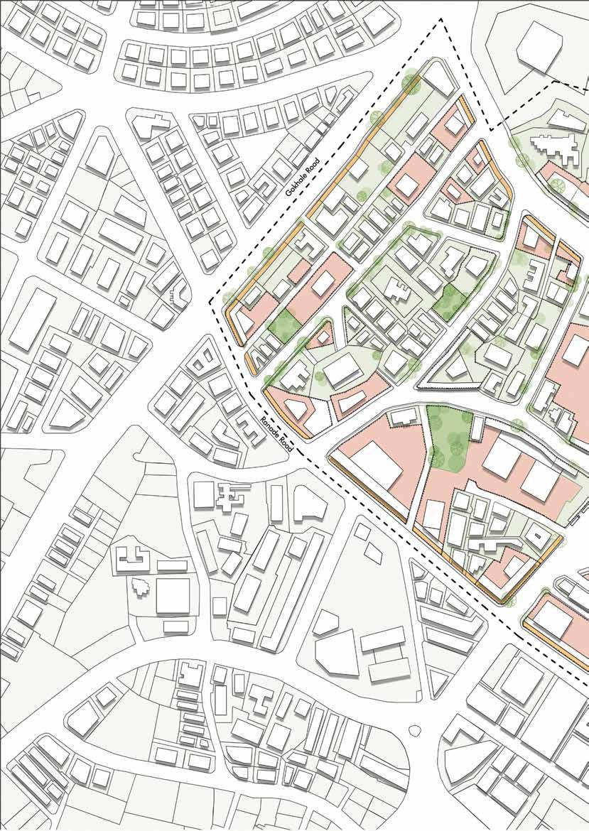
Extents : from Dadar Railway Station (South-East) to Metro Line 3 (North-West), from Ranade Road (South-West) to Kohinoor Mills (North-East).
Identifying and Classifying zones with respect to Dadar Railway, Metro Stations, existing Markets in and around the Block.
Most structures are G+3 or less and have redevelopment potential in the near future. Hence it increases Floor Space Index Utilisation, allows promotion of Mixed Use Development and aids in creating larger Open spaces and Social amenities.
Green and Open spaces are to be distributed well amongst the block creating a network of green spaces. Linear transitional open spaces can be planned in this format to increase walkability.
Active edge proposed for existing plots/developments - G AND G+1, Active edge provision for High Density Mixed use Zone and Medium Density Mixed use Zone shall focus on Retail and Business.
Active edge provision for Residential Zone shall focus on Local Businesses.
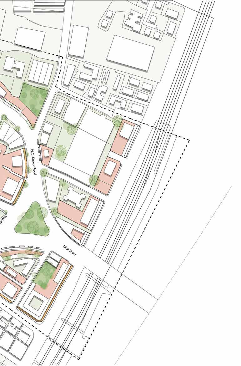
Extents : from Prabhadevi Railway Station (South-East) to Ananth Patil Marg (North-West), from Sayani Road (South-West) to BSV Road (North-East).
Zonal Classification:
Identify relevant blocks and classifying zones from a distance of 200 m from Prabhadevi Railway Station.
Organising older structures that are G+3 are inefficiently cluttered along with mixed use promotion due to proximity to the Central Business District. Hence Increases Floor Space Index Utilisation and aids in creating larger Open Spaces and Social Amenities.
High influx of people and Safety issues near Bottlenecks of Prabhadevi Station especially at Night can be tackled by creating a network of green spaces.
Active edge proposed for existing plots/developments - G AND G+1, Active edge provision (with Canopies) for High Density Mixed use Zone and Medium Density Mixed use Zone shall focus on Retail and Business.
Extents : from Cadell Road (South-East) to Dadar Beach (North-West), from Kirti College (South-West) to Shivaji Park (North-East).
Identify relevant blocks and classifying zones with respect to Proximity from upcoming Dadar Metro Station and Coastline.
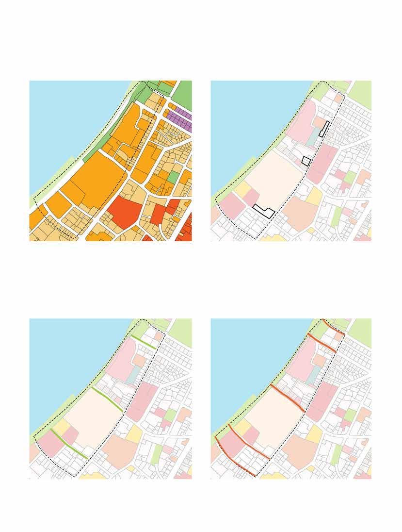
It will help in building Infrastructure like Plazas, Cultural Centres, Commercial Spaces, aiding in the development of the Coast.
Linear Green spaces connect Cadell Road to the Coast via Landmarks, improving the Transitional Experience and Making The Coastal Edge accessible and recreation
These edges can provide interactive experience to visitors, promoting the block as a visitor spot. Active edge For existing plots/developments - G TO G+2 and provision for High Density Mixed use Zone and Medium Density Mixed use Zone shall focus on Commerce, Social Amenities and Utility.
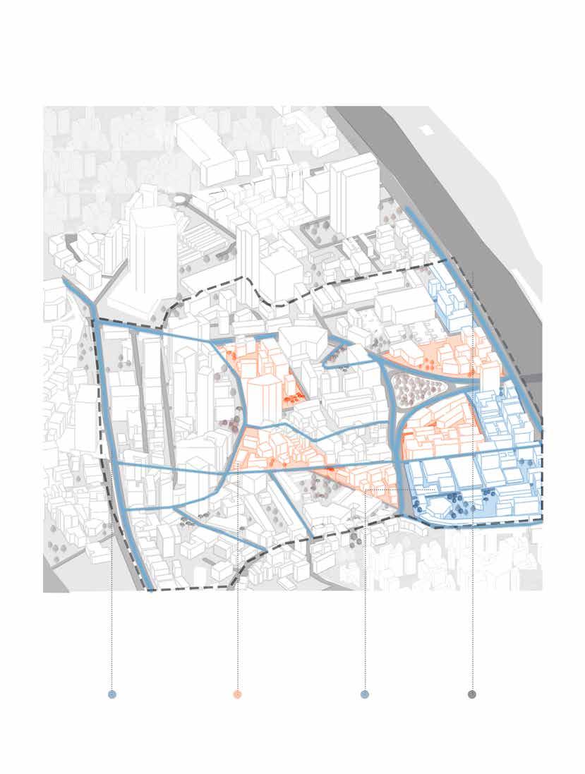
BLOCK 1, Due to the following reasons:

There is a potential to form larger amalgamated plots of derelict area with adequate scope for redevelopment of mismanaged buildings.
It also Covers Major Transit junctions, markets and roads. This opens up the area for a larger footfall. Thus the proposal would have a larger impact on the overall context.
There is a general Lack of Open Spaces as they may open up pockets that are either encroached or filthy.
It proves Feasible to create and define Hierarchies of High Density Mixed use zones, Medium Density Mixed use zones, Residential Zones in this Block.
Connectivity with arterial roads, Upcoming Metro Line
Scope for Larger Mixed use Development Dense Clustering of Built form resulting in lack of functional open spaces
Proximity to Dadr Railway Station , Tilak Bridge and Vegetable Market
Corner plots with higher potential of development are occupied with slums which need to amalgamated for better living and thus would help in widening of roads.
Under-utilized plot could be amalgamated together to form a unified block and then those plots could be utilized for enhancing the green cover and widening of roads.
There is encroachment of parked vehicles in the walking zones and roadscapes. Due to amalgamation, people would not only get seperate parking zones but also wide walkable roads.
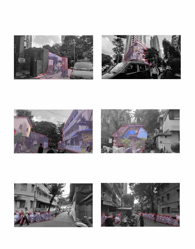
It directly consumes the access to the footpath. There is need for Proper spillover spaces and widened footpaths to make the junction less chaotic.
The Road scape is governed by under developed schemes, which could rather be converted to active edges.
Instead of widening of footpaths, larger plaza hosting all these functions could be housed in a bigger plaza integrated with other market. It would also provide better facility for the pedestrians to walk within.
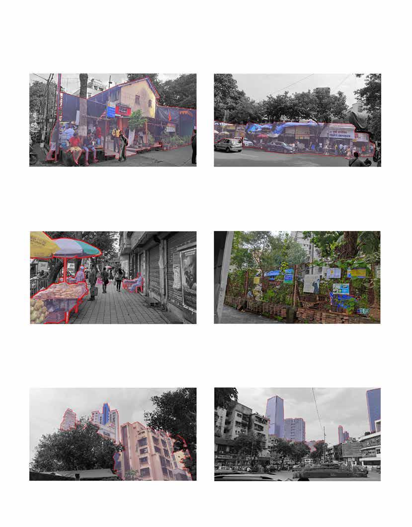
Green spaces could be enhanced more which would give rise to greater active edges.
The high rises and newly developed plots should be kept as they are.
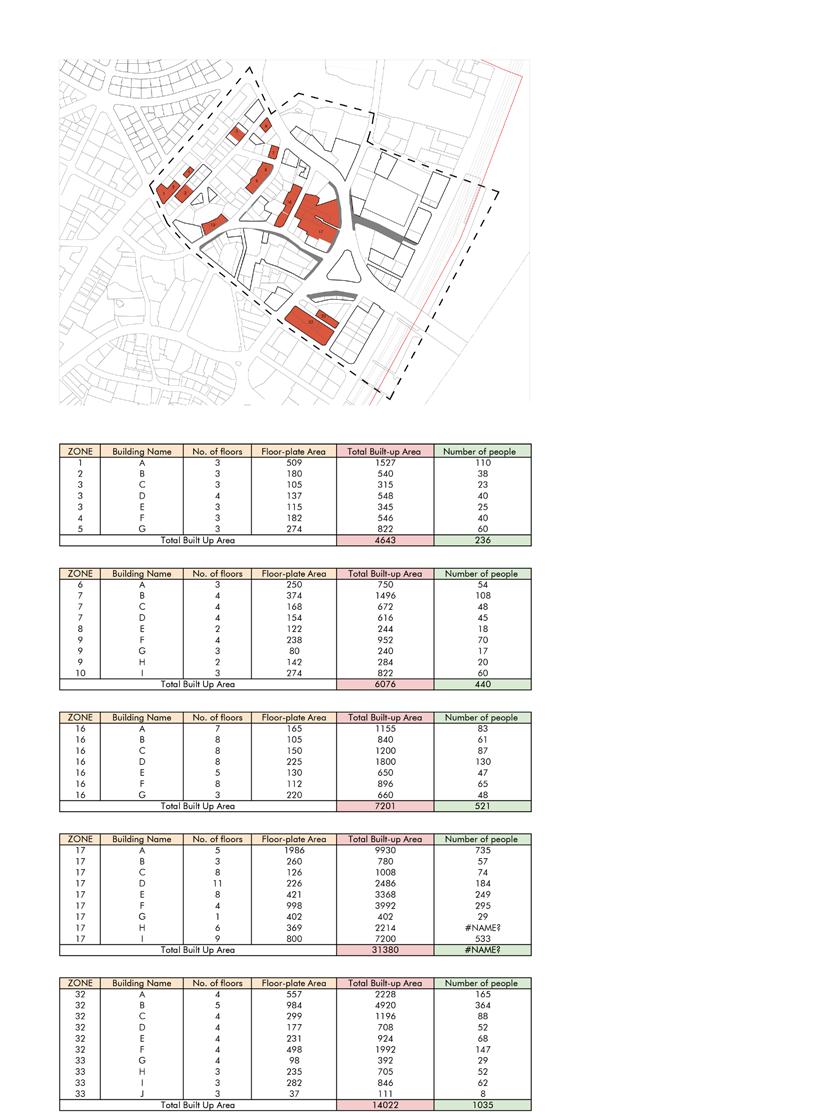
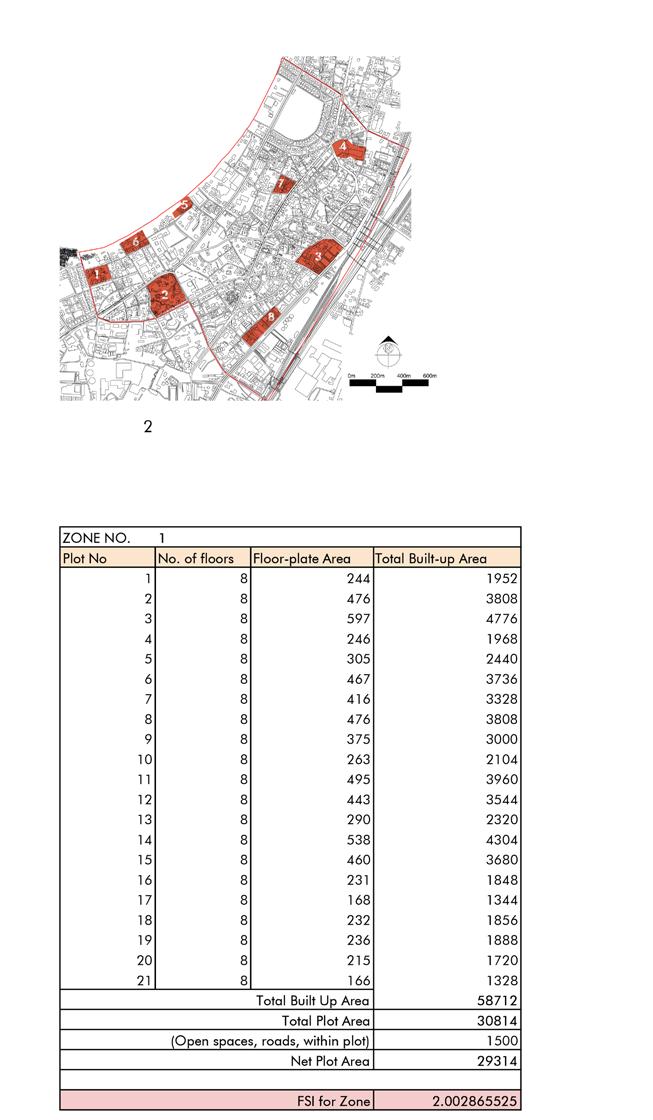
Amalgamated Plot means a continuous portion of land held in one ownership for the purpose of Development Control. One parcel of land resulting by amalgamation of more than one plot shall be considered as amalgamated plot
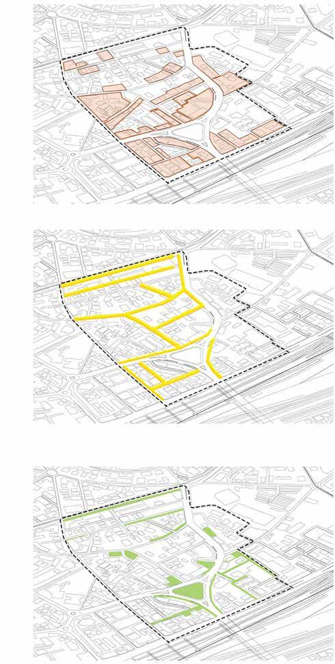
Diagram 1.1 : Plot Amalgamation
Active Edge Design is an approach to the development of buildings, streets, and neighborhoods that uses architecture and urban planning to make daily physical activity and healthy foods more accessible and inviting.
Green corridors in cities can be defined as linear natural infrastructure, such as trees and plants, that link up other green and open spaces to form a green urban network. These networks provide both ecological services, such as habitats and resources for urban wildlife; whilst also providing services to urban populations such as mobility networks and access to green spaces through the provision of sustainable and active transport routes that link transport with mixed land use (residential, commercial, education, recreation etc) and open spaces.
1. Compulsory 30% Open space.
Provision for Public or Private needs to be defined.
2. Full FSI Utilization restricted if plot area is less than 500 sqm
3. Increase in FSI by 10-20% as per amalgamated plot area.
4M Shaded Walkway provision along active edge for HDMZ buildings.
Office, commercial or recreational space for atleast three floors above the walkway.
For Plots facing 18M+ roads, L.O.S. Shall be provided facing the road.
Additional 10% BUA to be awarded for allocating 25% L.O.S For public Use
Additional 20% BUA for allocating 40% L.O.S. for Public use.
For Plots facing 9-18M roads, L.O.S. Shall or shall not be provided facing the road.
Additional 10% BUA to be awarded for allocating 25% L.O.S For public use.
Mixed Use Development to be promoted.
Following is the minimum % of Area that should be dedicated for commercial activities:
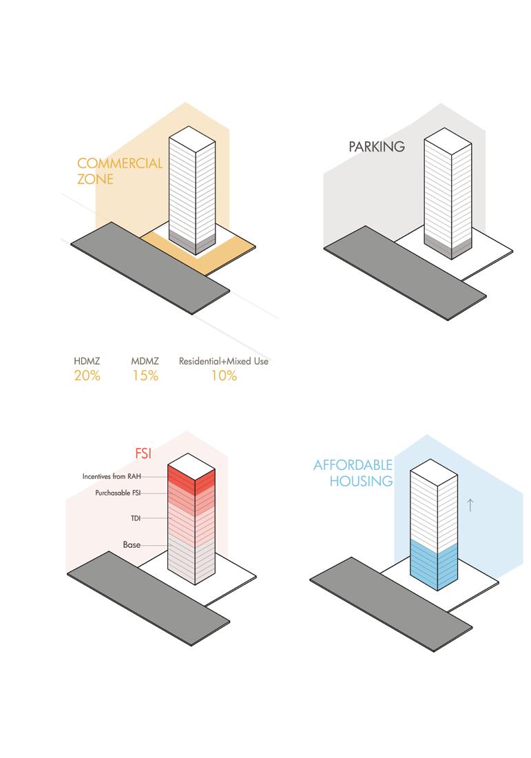
Additional BUA for dedicating/allocating Public Parking, 50 Car Parks + equal % of two wheelers - 10% 100 Car Parks + equal % of two wheelers - 15% 200 Car Parks + equal % of two wheelers - 20% 400+ Car Parks + equal % of two wheelers - 25%
Additional 20% BUA to be awarded for 50% Commercial Zoning
Maximum 2 FSI shall be awarded as an incentive FSI.
Premium FSI Shall be upgraded to as follows:
Less than 9m- 0.5
9-12 m- 0.75
12-18 m - 1
18-27 m27m +- 1.5
Additional 10% BUA awarded for 20% Affordable Housing
Additional 20% BUA awarded for 35% Affordable Housing
For the purposes of this Clause “Road Widening” means proposed widening of any road/street by drawing up new alignments. All the buildings on the roads declared under the Road Widening scheme shall be constructed only according to the setback prescribed by GDA in consultation with concerned authorities from time to time.
Figure 1.18 : Block Plan showing Road Widening

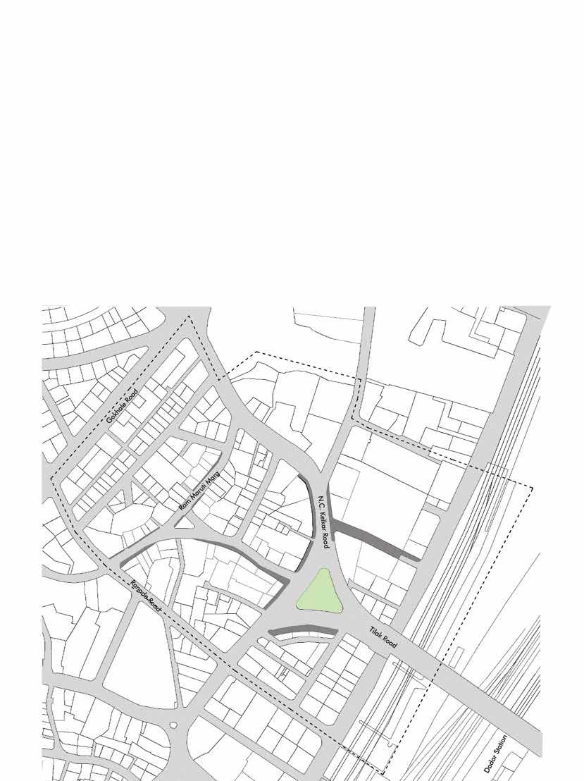
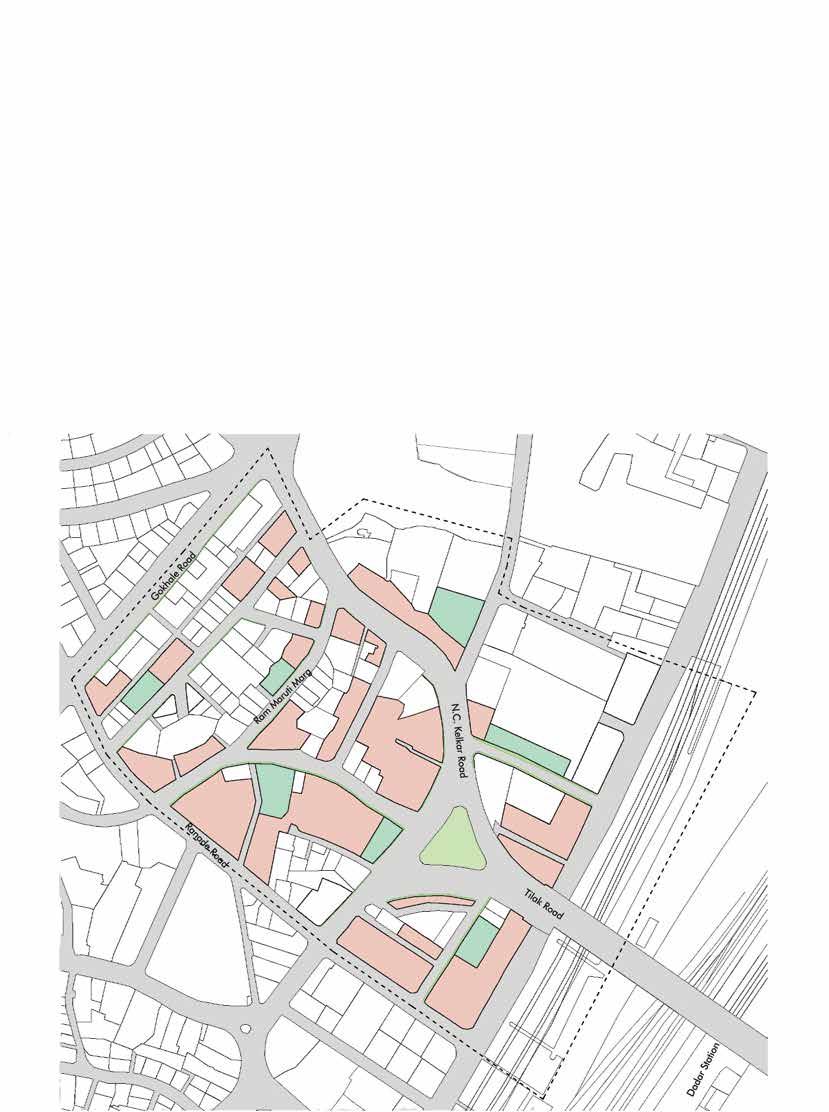
Plot amalgamation shows plots lesser than 500 sqm area amalgamated along with multiple plots being amalgamated that lie in proximity to each other. This is a result of redevelopment which has been factored w.r.t. Building age.
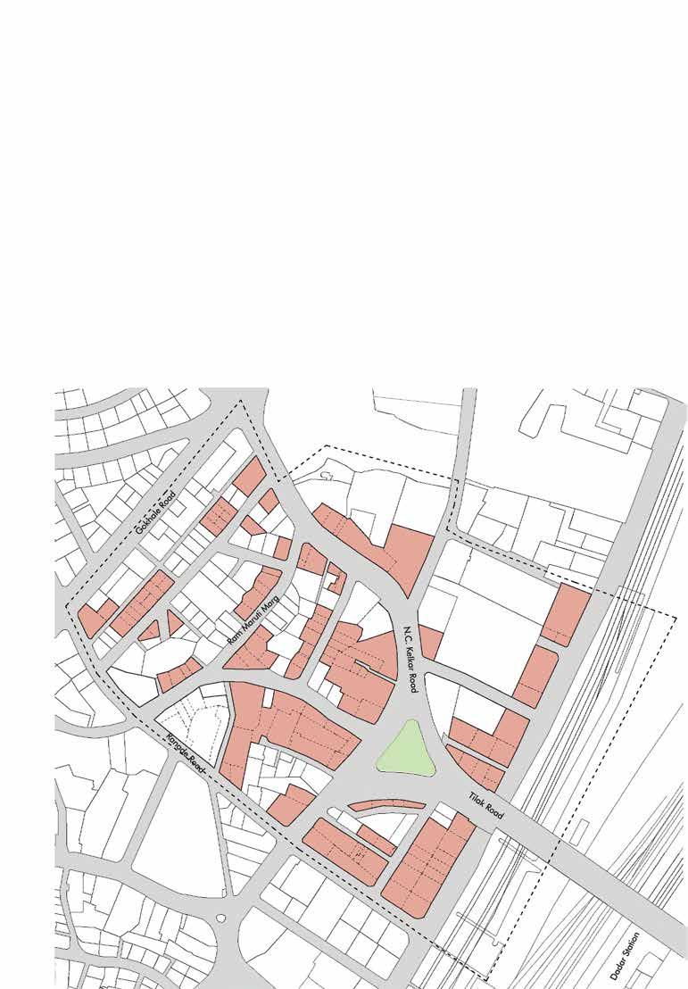
Most structures are G+3 or less and hence have redevelopment potential in the near future.
Mixed use will be promoted due to proximity to market areas. It also Increases Floor Space Index Utilization and aids in creating larger Open spaces and Social amenities which are currently lacking.
1.19 : Block Plan showing Plot Amalgamation


Green and Open spaces are to be distributed well amongst blocks creating a network of green spaces.


This increases an organized interaction with the streets and Ensures Eyes on the streets and activates the streets.
For existing plots/developments such as G AND G+1 structures, the Active edge provision for High Density Mixed use Zones and Medium Density Mixed use Zones shall focus on Retail and Business
For Residential Zone the proposed Active edge shall focus on Local Businesses Canopies for High Density Mixed Zone and Medium Density Mixed Zone zones to be made mandatory.
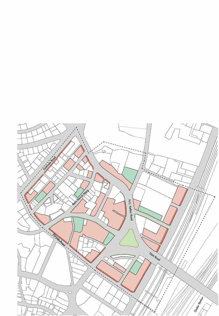
The Organized shop line is to be maintained in the future.
Figure 1.21 : Block Plan showing Active Edge Formation`


The purpose of these are to Organize and regulate the Traffic Movement and Parking in the Locality
Relocating the slums into an affordable housing zone will improve their standard of living.
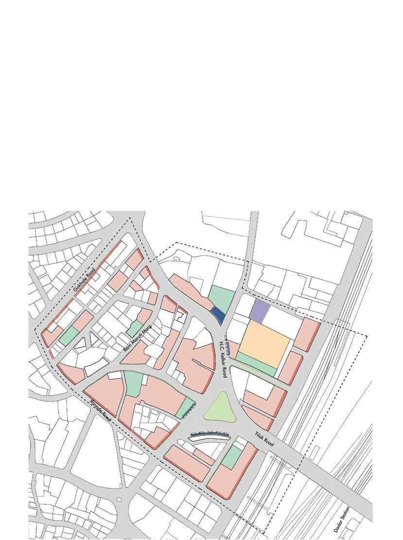


Street elevation adapts to a new character with increase in Floor Space Index, alternate green corridors utilizing the junctions to its better economic potential reducing the horizontal spread. This as a result increases the Permeability for the user making them more active for alloted utilities.
Green breakouts enhance the space quality and add an expanse to each glance. Organizing markets vertically helps in reducing haphazard sprawls improving mobility and management, also resulting in organized vehicular and pedestrian paths leading to hygienic neighborhoods.
Lever differences have been dealt with micro details such as stepped landscape. Urban sprawl is attempted to be controlled by a higher level plinth bordering the arcade network that also serves as a seating for the moving population. This indirectly creates a space hierarchy that continues in perspective vision, visually interactive yet confined to an alloted territory.Street disturbances as a result get resolved and transits are not hindered.
Arcades add a linear running character to the high density mixed use zones considering user density during both day and night ensuring the element of safety during odd hours.
Rehabilitation Housing
Vegetable Market
Green Open spaces
Two wheeler Parking
Amalgamated Plots




The commercial edge of Ranade Road is organised as a High Density Mixed use zone with colonnade. Green Open Spaces are provided such that they have proximity to all the three zones.
Along with the layout open space of the amalgamated plots, these green open spaces form a buffer in order to cater to the increase in vertical mass of the buildings as well as act as recreational spaces.
The Hierarchy of High density, medium density and residential mixed use zones is seen with changing proximity from the arterial transit roads.
High Density Mixed Use Medium Density Mixed Use Residential + Mixed Use Green Spaces Transport Modes Commercial Residential Affordable Housing Scheme Incentive based
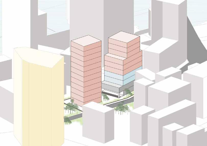
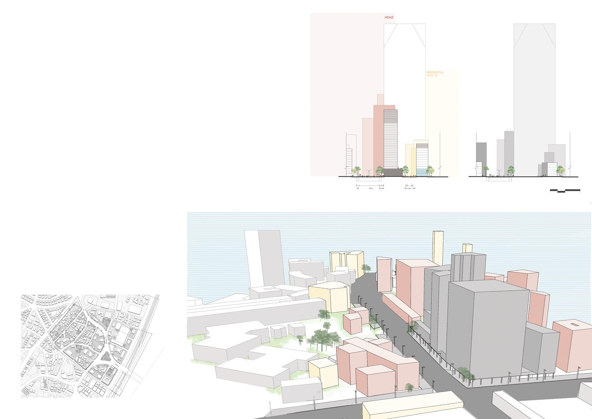
 Figure 1.24 : Existing and Proposed Section highlighting the impact of the Design scheme, Cut across N.C. Kelkar Road and Ranade Road via internal Ram Maruti Marg.


The section highlights zoning of the High Density mixed use component at Gokhale road and the upcoming Line 3 of mumbai metro. Gokhale Road being one of the arterial roads of dadar, High Density zone would benefit the commercial zone, retail shops, organise haphazard vendors and encroachments. A 4 m wide colonnade would aid in creating a buffer for transition and thoroughfare through the high density commercial and mixed use zones.
At the anterior part, we can observe Residential plus local mixed use zones which also accompany affordable Housing. Thus the local residents have proximity to High density Mixed zones.
High Density Mixed Use Medium Density Mixed Use Residential + Mixed Use Green Spaces Transport Modes Commercial Residential Affordable Housing Scheme Incentive based


 Figure 1.24 : Existing and Proposed Section highlighting the impact of the Design scheme, Cut across Gokhale Road and the Metro Line No. 3( Aqua Line)

The change from Dadar Railway station across Tilak Road can be observed here. High Density mixed use zones occupy near Dadar Station along with green spaces as buffers. Improvement of Transport modes is catered to as a result of road widening of Tilak road. A dedicated branch line is provided to the buses at the bus stop, to reduce congestion. The section then shows formation of Medium Density zones as we move further from N.C. Kelkar marg. Colonnades, 3m wide walkways, Organised store fronts and a proposed active edge with improvement of transit infrastructure is the key highlight of the section.

Figure 1.24 : Existing and Proposed Section highlighting the impact of the Design scheme, Cut from Dadar Railway Station across Tilak Road and N.C. Kelkar Road



The section focuses on zoning high density mixed use zones across tilak and N.C. Kelkar Road with organisation of the Vegetable Market into a plaza with raised plinth and a subsequent open buffer. The Residential zone is a “Rehabilitated Housing” Facility where the worker squatters are rehabilitated and thus the zone is made free from land encroachments and haphazard zoning of activities.
High Density Mixed Use Medium Density Mixed Use Residential + Mixed Use Green Spaces Transport Modes Commercial Residential Affordable Housing Scheme Incentive based

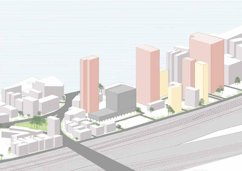 Figure 1.24 : Existing and Proposed Section highlighting the impact of the Design scheme, Cut across Janata Market, Proposed Organization of Vegetable market, Tilak Bridge and Symbiosis Hospital
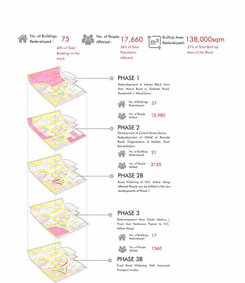
The Proposal shall be executed in 3 phases in 10,10 and 7 years each. Phasing is very important in planning the on-site utility system and infrastructure construction. The utility service systems can be expanded from existing lines within developed portions of the block in an easterly direction to serve each particular phase of development.
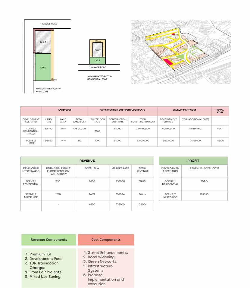

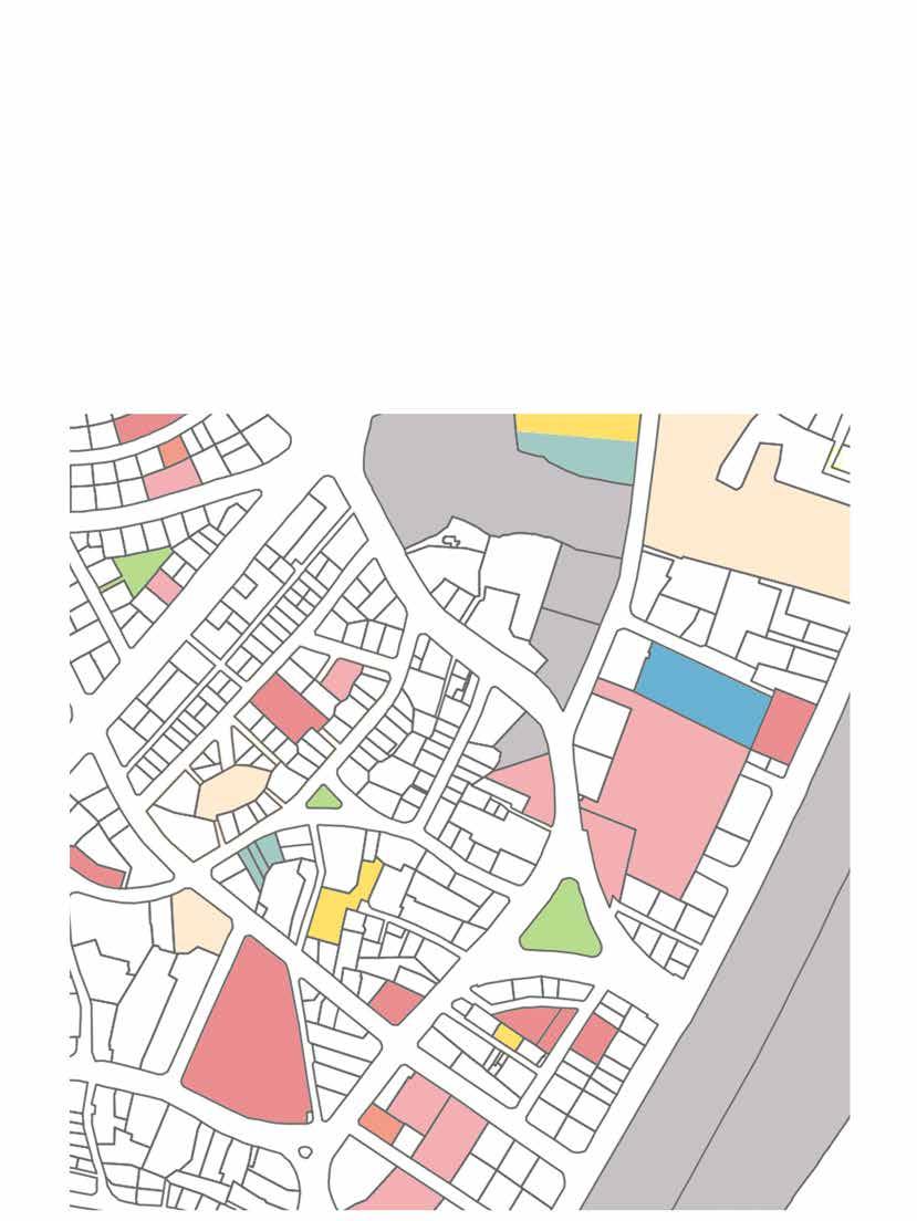
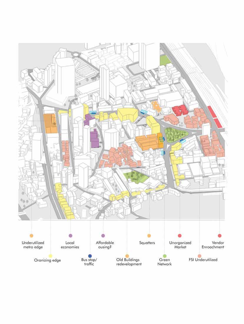
The existing land use depicts the clusters of housing and residential along with minimal amenities to cater to them. Open recreational and green spaces are lacking when seen at a macro level. This scenario is hence not inviting enough for the floating population.
Majority of the derelict plots and plot clusters fall at potential revenue generating nodes and junctions running alongside the road. This offers the opportunity for plot amalgamation and efficient rehabilitation within the locality in return creating negative spaces for landscape cultivation.

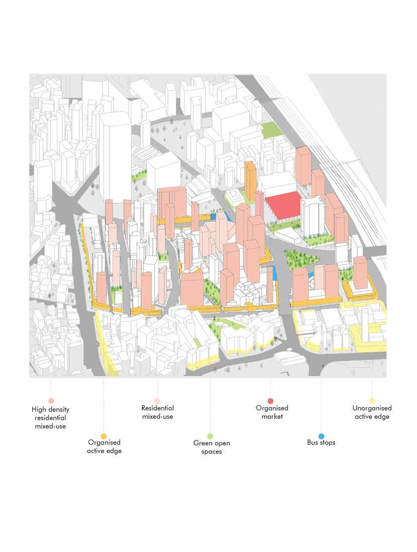
The proposal intends to modify the scenario upgrading the locality at macro scale. Revenue generating potential plots majorly form defined junctions, being allotted as mixed use inviting a versatile user group, thus increasing the demand for land eventually influencing values of Floor Space Index and Ready Reckoner Rates.
Increase in per capita green open spaces directs the users in quality spatial experience and organizing streets, hawkers and vendors, amplified and ordered amenities and an upgraded neighborhood. Increase in commercial activity activates the locality to floating population as well as serves effectively to the rehabilitated and existing residential spread. Overall, it contributes positively towards the economy and sociality of the site.
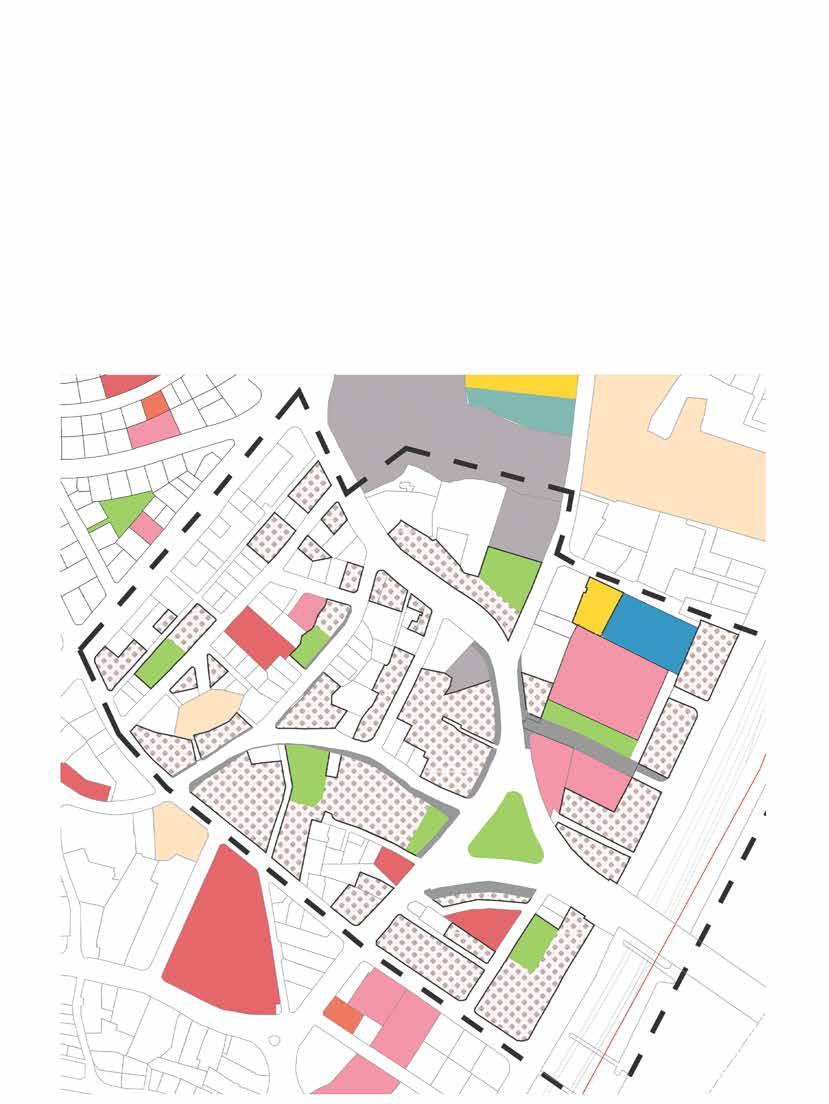

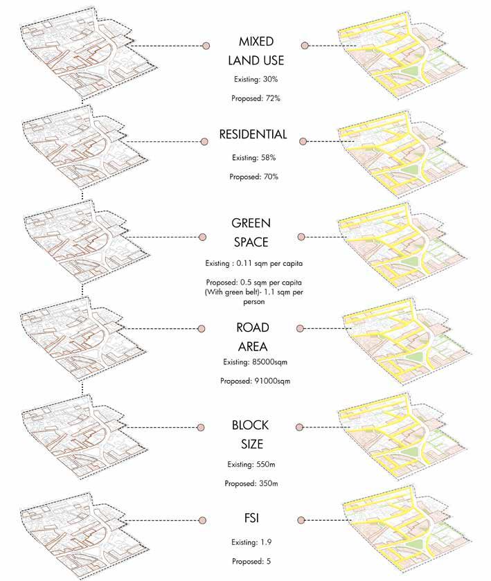
With an Average Floor Space Index of 1.9, the block has potential to exploit Floor Space Index, Integrate commercial, retail and residential zones and thus organize the economies haphazardly present in the current scenario.
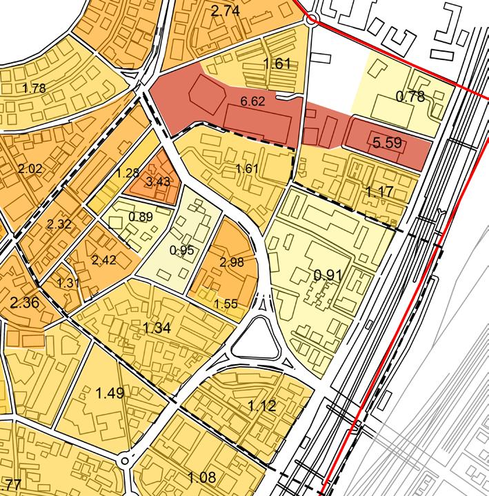
Lack of development ultimately strains the transport infrastructure, economy, imageability of the city and the street experience.
Proposed Floor Space Index would work on incentive Floor Space Index with increase in premium Floor Space Index.

With an average Floor Space Index of 5, THE Proposed Floor Space Index for amalgamated plots shall be efficiently utilized and increased to accommodate open recreational spaces. Multi-typology plot amalgamation initiates mixed use construction that increases the demand for property. It shall impact the average Floor Space Index for the locality and identity transformation.
Active edge formation and redevelopment of derelict land parcels upgrades the area with better living standards and demand for vertical development to avoid commercial unorganized sprawl.
Green spaces interventions shall impact the density per unit area along with now allowance of public participation

The existing spread on the site comprises derelict structures, under utilized Floor Space Index that showcased comparatively smaller structures, haphazard and out of scope of major demand. Hence, the property rates don’t shoot up. With comparatively less commercial activity, the user group in the state restricted to the local vicinity that directed the property rates making them comparatively lesser.
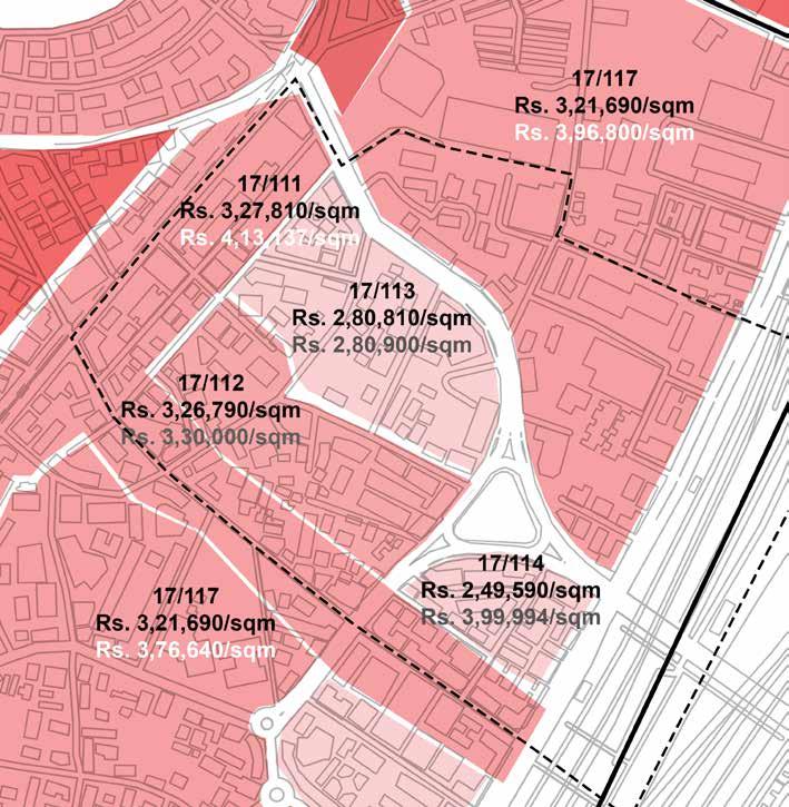

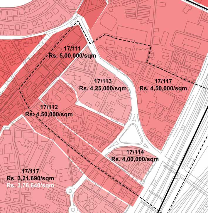
Commercial Spaces:
There is a decrease due to increased availability by promotion of High-Density Mixed Use in the Zone.
Residential Spaces:
Increase due to Provision of better amenities, increased recreational spaces and proximity to organized commercial/market areas.
Proximity to the Upcoming Metro Station and the existing Dadar Railway Station along with planned green space network would allow an increase in Property Rates for all types of uses.
Local area planning can help create a better sense of place, where place-making initiatives can help to highlight the special characteristic of the community and create the area’s own unique identity.
Incentivizing Plot Amalgamation : To enable better Floor Space Index utilization.
Regulating Open Spaces : To increase previous surfaces.
Regulating Setback and Step-back : To avoid overwhelming built forms.
Mandating Active Edges : To ensure eyes on the street and active streets.
Setting Parking Maximums : To promote use of public transit.
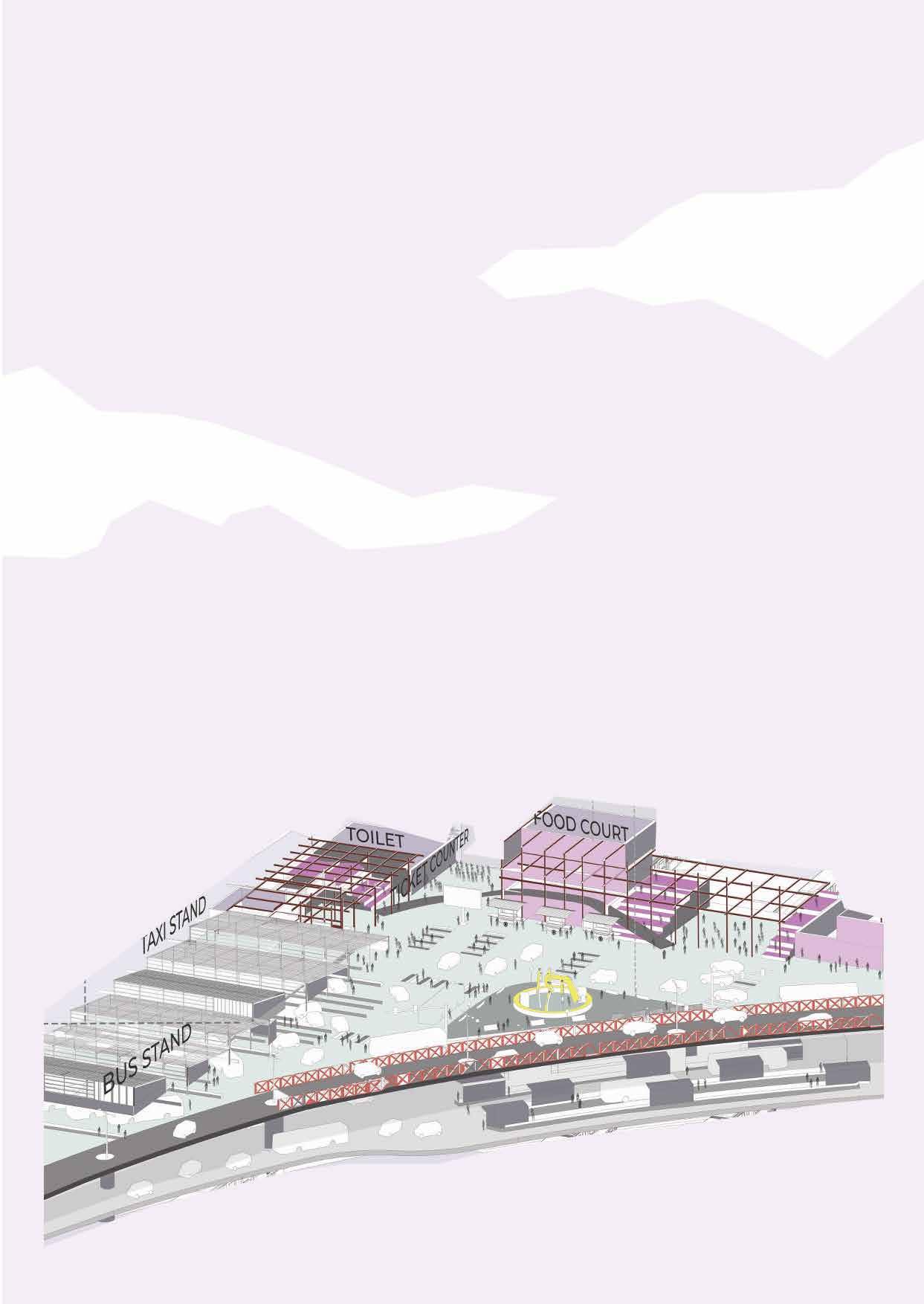
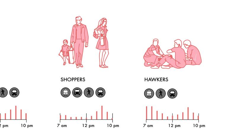
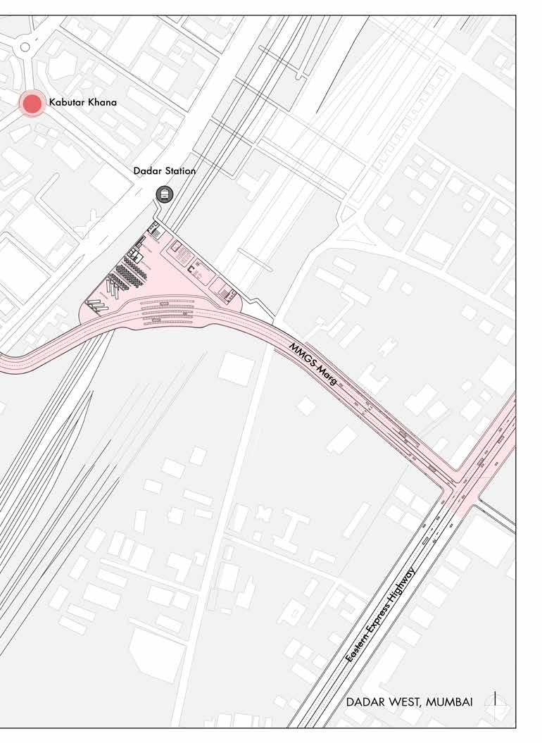
Dadar, which is home to numerous business and educational buildings, must contend with an upsurge in floaters during the busiest times of the day. The proposal seeks to act as a connecting path between the East and West Dadar with an aim to reduce this traffic congestion during peak hours while acting as a smooth transit alternative to that of Tilak Bridge. It also aims to divert the influx of pedestrian density who get to access public transport system via the designed vehicular plaza.
• EAST-WEST CONNECTIVITY :
Lack of efficient connectivity from Dadar east to west via public transport. This is the main cause for traffic congestion during peak hours.
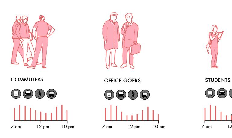
• INFLUX OF FLOATING POPULATION :
Dadar is a hub of commercial and educational complexes and thus has to deal with an increase in floating population at peak hours of the day.
• EXISTING ROAD WIDTH :

The road widths of roads connecting major nodes is less to that of the transport congestion they have to deal with. Pedestrian movement is also hampered dure to lesser widths of footpaths.
• Reduce pedestrian traffic around dadar Station near KabutarKhana and flower Market.
• Diversion of bus routes will allow the buses to use theproposed route for bus movement avoiding congestion.
• Connecting the private vehicles and public transport to the east via an overheard route.
• Overhead vehicular plaza designed will host taxi and bus pickup and drop off points avoiding congestion on the already congested roads
STARTING OF THE BRDIGE AND THE FLYOVER TOWARDS THE EAST
DESIGNED VEHICULAR AND PEESTRIAN PLAZA CONNECTING THE BRIDGE CONNECTING THE BRIDGE TO THE DADAR EASTERN
DROP OFF ON DADAR EAST
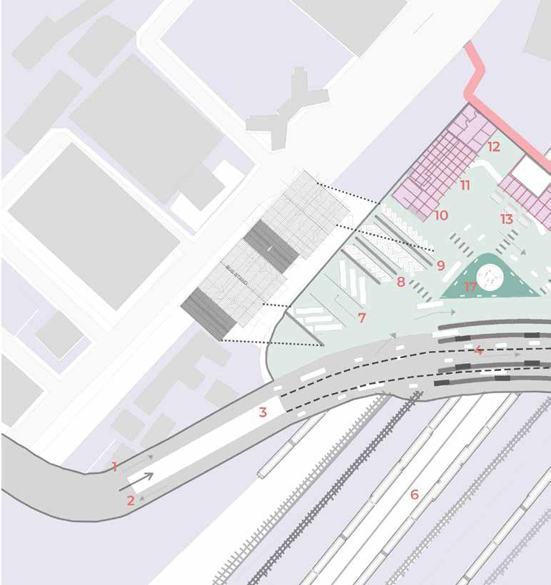
LEGEND 1. ENTRY FROM AGAGSHE MARG TO THE VEHICULAR PLAZA
EXIT TOWARDS AGAGSHE MARG TO THE VEHICULAR PLAZA
BRIDGE FOR EXPRESS HIGHWAY
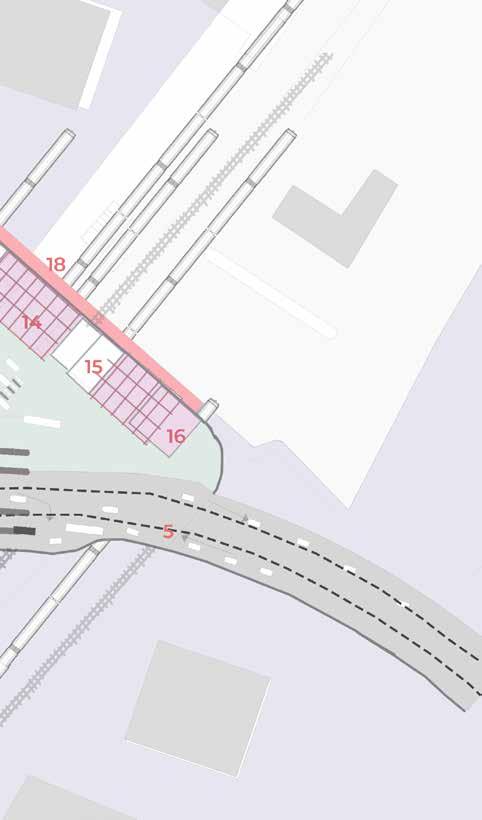
BUS STOP UNDER THE FLYOVER
WAY TOWARDS DADAR EAST
EXISTING RAILWAY ROUTE
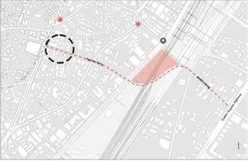
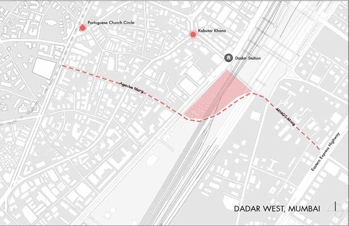
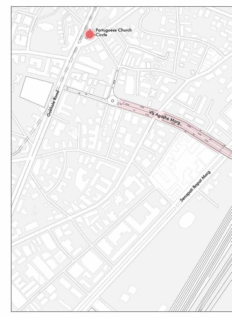
The starting point of the proposal lies on the Agashe Road .
A roundabout is created at the commencement of the bridge . This further continues to act as a junction for efficient vehicular movement from the one way road back to the Gokhale Road.
FIG 4.2.3.
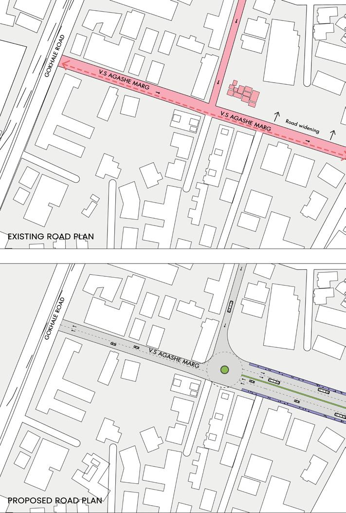
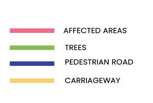
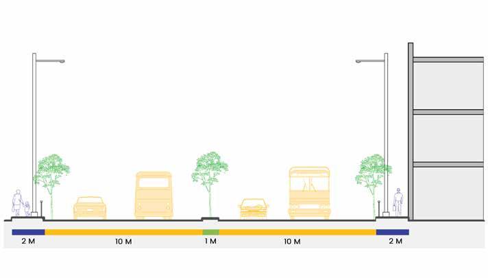
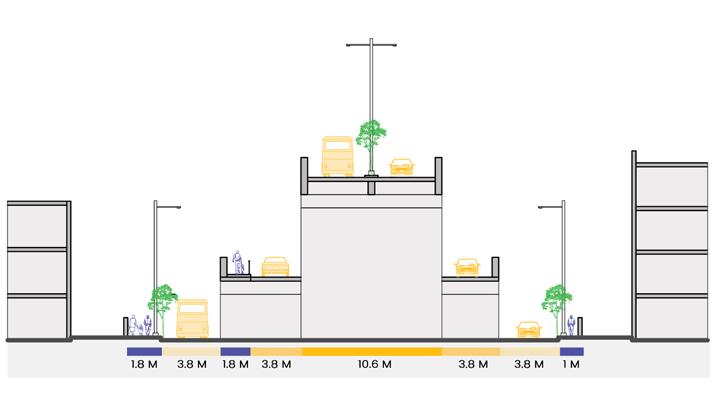
The proposed bridge is a 4 laner which initiates from the V.S Agashe Marg.The bridge is created by widening the already existing 9m road to a 21m widtth for the road and 2 m pedestrian pathways on both the sides by proposing the removal of the low rise existing structures on the current site.


FIG 4.2.6.
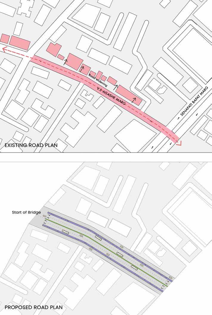

The starting point of the proposal lies on the Agashe Road .
A roundabout is created at the commencement of the bridge . This further continues to act as a junction for efficient vehicular movement from the one way road back to the Gokhale Road.
FIG 4.2.7 -
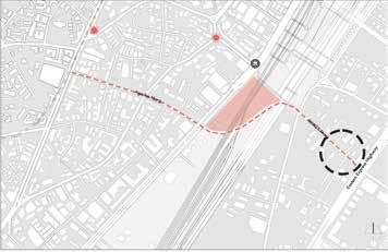
FIG 4.2.9 -
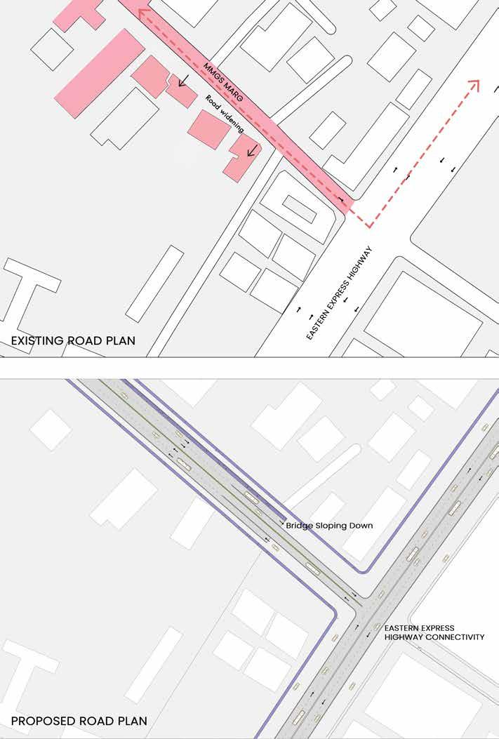
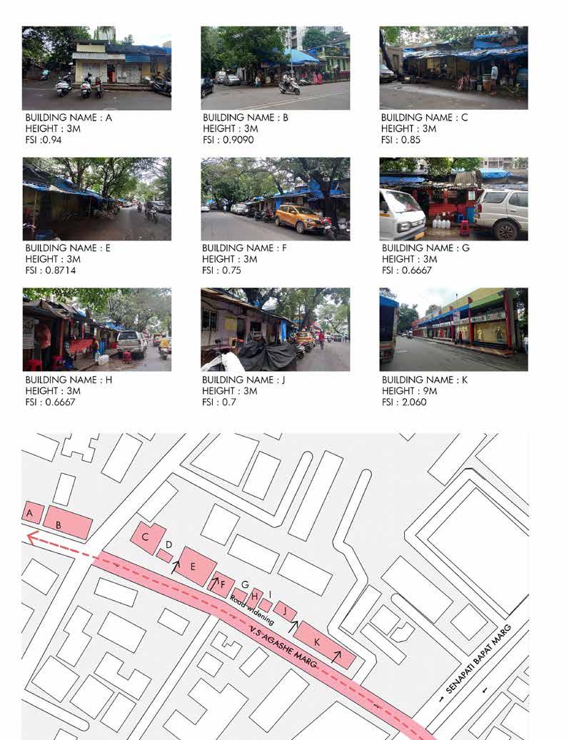
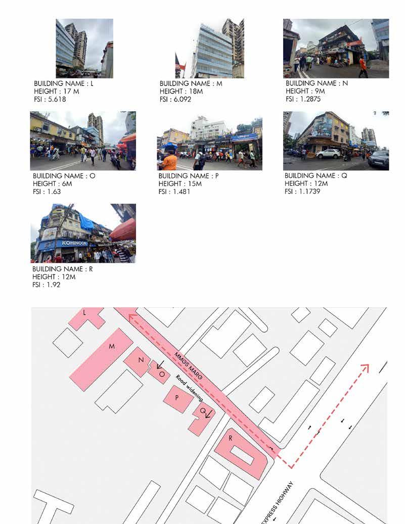
Image showing location of proposed bridge on already existing railway lines and usage of the bridge according to different user groups.
View of movement to and from the proposed bus stop.

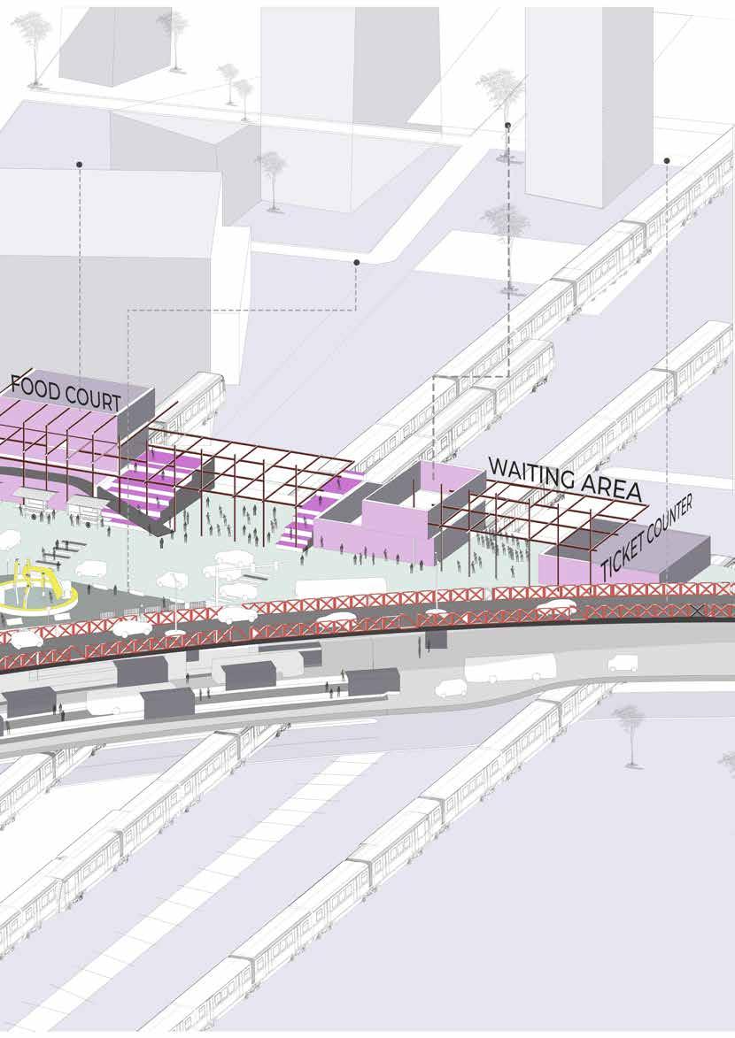
Aerial view showing circulation of taxis and buses on the proposed recreational area and different types of facilities provided on the elevated space.
Aerial view of the bridge showing access to the proposed elevated slab and vehicular movement on the 4 lanes of the bridge.
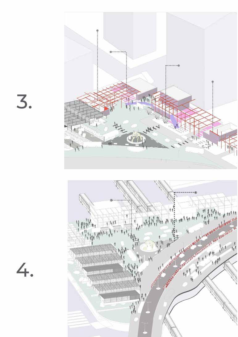
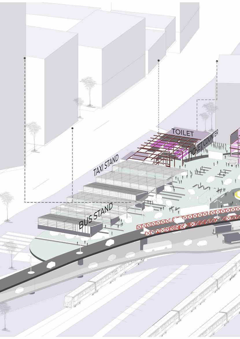 Toilet Provisions
Ticket Counter and Resting area for the bus and the taxi drivers .
Bus Depot for bus no. 118
Food court and stalls forming as a part of the entrance Lounge
Ticket Counter and Toilet
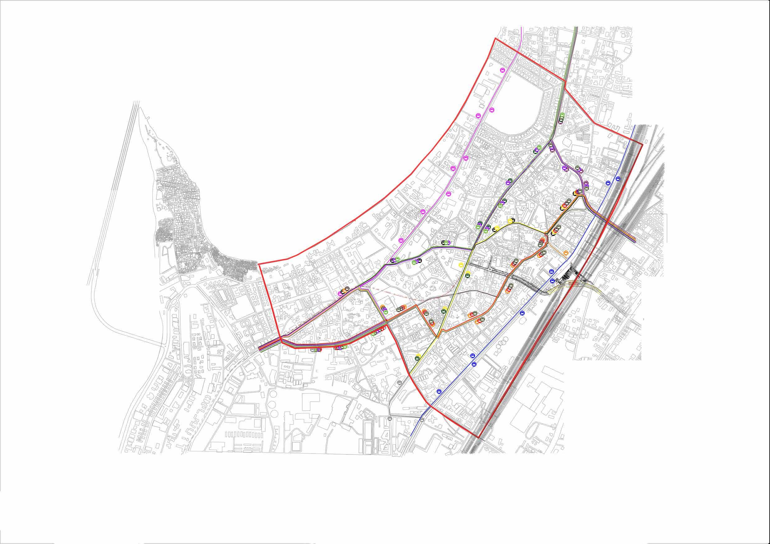


The bus number highlighted in grey have now been rerouted in such a manner that they cover almost all the bus stops without disturbing the existing system.


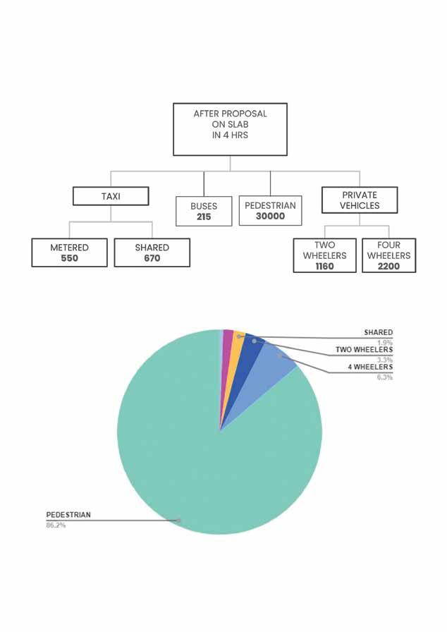
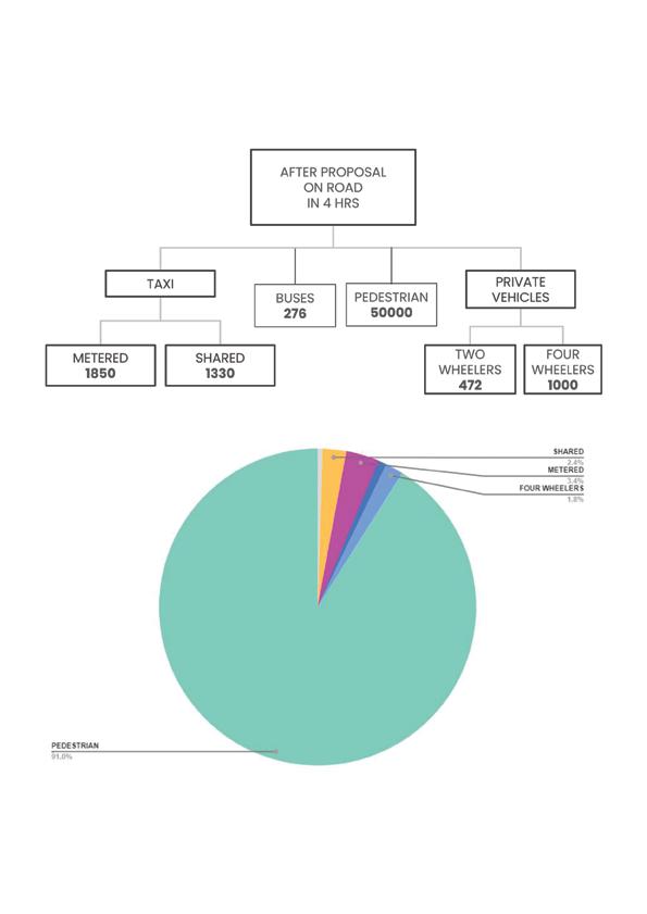
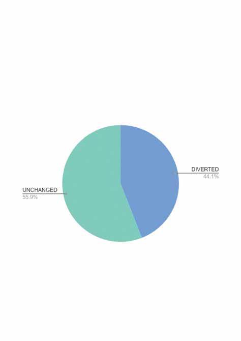
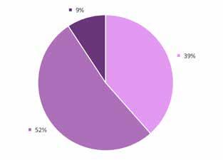
The proposed bridge takes 60 % of the vehicular load from the above mentioned three nodes namely Kabutar Elphinstone bridge and acts as an additional connector for East-West connectivity.Aditionally as the proposed Dadar Railway station a diversion in pedestrian movement can be seen from the pie charts above.The elevated Bus stand, Taxi stand,Toilets,Ticket counter, Cafeteria and waiting area for the ease of the passengers.
The seperation of the 4 vehicular lanes leads to smooth movement of the vehicles resulting in reduced traffic 2 lanes connecting directly to the Eastern Express Highway also leading to increased connectivity with other THUS 44.1% OF THE VEHICULAR MOVEMENT IS DIVERTED AND THIS REDUCES THE STRAIN ON THE TILAK AND IN TURN STRENGTHENS THE EAST-WEST CONNECTIVITY.
Kabutar Khana , Tilak Bridge Junction and proposed elevated platform is connected to the elevated platform also houses amenities like a on the bridge.The bridge is seperated with other parts of the city.

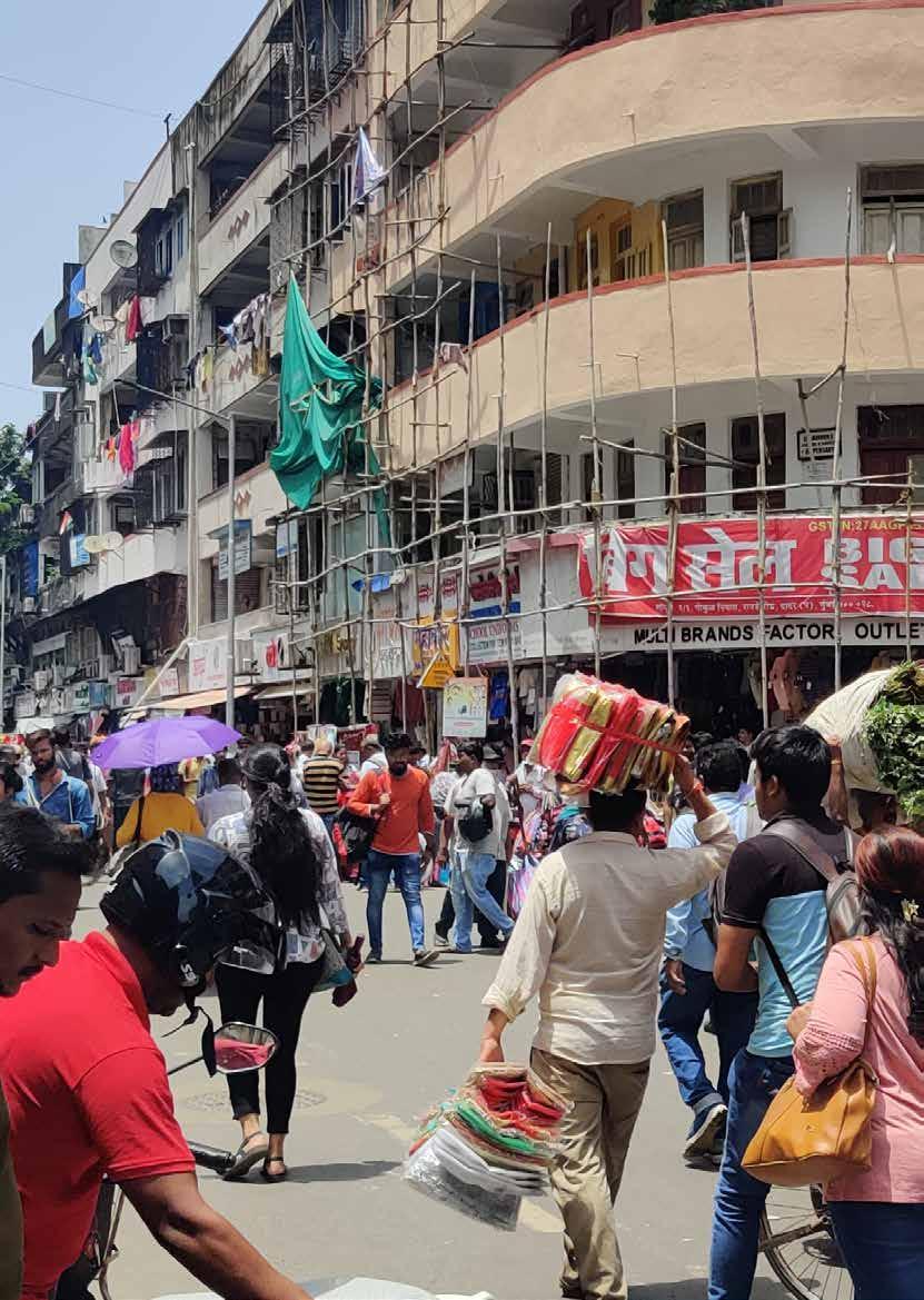
The site is located beside the Dadar Railway Station. The Two blocks exhibit a dense network of narrow market streets. These streets are lined with a wide variety of shops and commercial establishments. The blocks form a gateway to Dadar from the Railway Station. The selected area for study is that of the Dadar Market; chosen so, due to the presence of various typologies in and around it that are advantageous as an aspect of study as well as scope of design interventions. The area is a transit oriented hub due to the presence of the Dadar Railway station that broadens the variety of mob, from daily comers to visitors


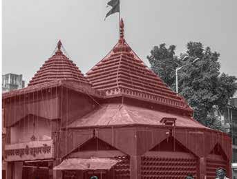
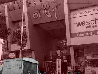
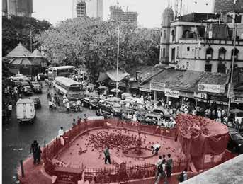
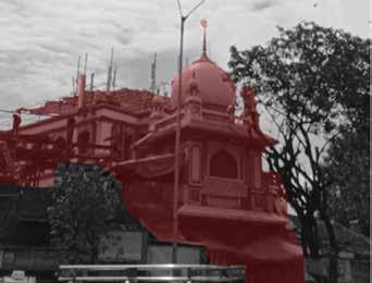
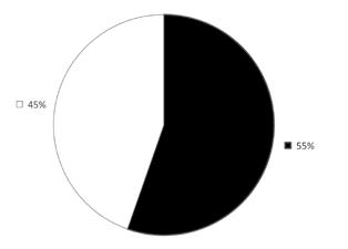
The built area is greater than unbuilt Dense urban fabric is observed - forming non-uniform open spaces

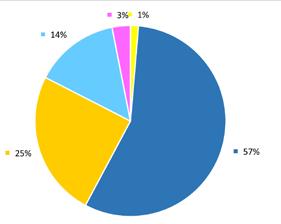
The area consists of mainly low-mid rise buildings Relatively taller buildings are of mixed use typology Buildings along the road edge are low rise mainly
These are the existing plots on the site characterised by different typologies in each plot. It was modifies based on our proposal.
Changes in vehicular density due to road width
Road towards Kabutarkhana with maximum density than other two lanes
Middle lane has less density mostly used for loading and unloading




The movement is majorly oriented around the market area as the entry and exit of the station open directy towards it.


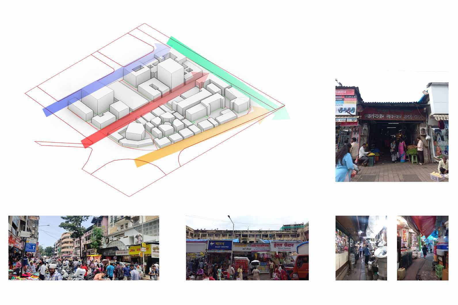
Overall massing of the site can be seen through this isometric view. The lanes are identified by the type of market it caters to i.e., flower market. Vegetable market, stationery and clothing market, etc. which further connect at the flower market lane. Due to proximity to railway station and Transit Oriented Developemnt, it is crowded most of the time.

 Image 01 : Entrance to the vegetable market
Image 02 & 03 : Utensils market in the interior lanes of market area
the ground floor of the chawls
Station acts as a node creating a varied and large user group
SMultiple modes of transport
The FSI of the existing plot area is more than what is being used currently
Major traffic congestion due to presence of railway station nearby
Due to high density of commercial activity, there is less vegetation and open spaces on site
WShop owners use footpaths as spill out spaces in addition to hawkers for their purpose leaving no space for pedestrian movement
Old-closed concrete facades have made it hard to recognize the inside of shopping area for unfamiliar public
Waste disposal is done on the streets itself
Pedestrian centric network
O TMaximising space usage by utilising maximum FSI
The plot area’s reconstruction presents an economic opportunity as well. Separation of pedestrian and vehicular traffic
Due to increased space congestion, there is ventilation issue in the interior spaces of the market
Traffic congestion could pose an issue if not dealt with
To limit vehicular activity within the area for better pedestrian friendly premise design.
To increase the dispersal area near the station
To enhance various forms of mixed use ( residential-commercial) co-dependent typology near the station.
To increase the amount of light and ventilation entering into the innermost pockets of the zone.
To provide a breathable space to a person coming right out of the station through the area under the flyover.
To retain the character of the Typical Market and other Mixed Typologies.
To limit vehicular activity within the area for better pedestrian friendly premise design.
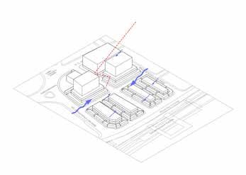
To increase the amount of light and ventilation entering into the innermost pockets of the zone.
To enhance various forms of mixed use (residential-commercial) co-dependent typology near the station.
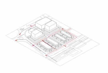
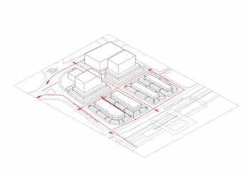
To increase the dispersal area near the station
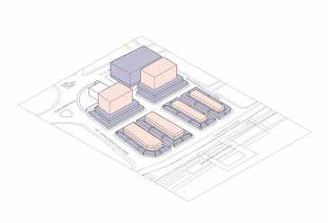
The built to unbuilt ratio has been modified to 49:51 thereby making the ubuilt area is greater than built.
A dense urban fabric has been proposed to form uniform open spaces.
Majority of the area has been alloted to commercial establishments.
Residential units are mainly observed above commercial establishments
Commercial establishments include- Clothing shops, vegetable and daily needs market, lodging stays, restaurants etc
A large proportion of the buildings and structures proposed are mainly low rise buildings. Relatively taller buildings are of mixed use typology Buildings along the road edge are low rise mainly.
The overall site was then divided into newer plots basd on the proposal.
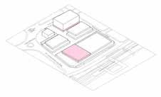
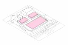
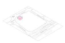
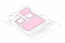
Retaining the Masjid with open space around it and some commercial shops
Mall establishment location shifted to the corner plot of main N.C Kelkar Road
Low rise establishments of height upto 6m proposed in front of the station to maintain hierarchy of buildings on site
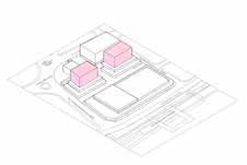
Office establishments provision below residential
G+1 establishments commercial in nature; adjacent to the station to provide a more public zone
Hospitality establishment above commercial including hotels and restaurants; adjacent to station for ease of access
Mid rise residential establishment in the centre for privacy
The straight road from NC Kelkar Road is unchanged while a transverse road is proposed connecting Ranade Road and MC Jawale Road to create an access to the commercial spaces on road as well as the other establishments
The overall layout showing the boundary of establishments within the plots and their open spaces

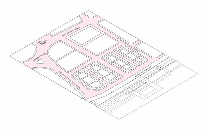
To increase the dispersal area, the establishments in front of the station are low rise and commercial in nature
To provide privacy for the residential spaces, they are proposed away from the station and main road
The mall has been proposed in a corner plot with a node adjacent to it .
The area around the Masjid has been kept open for public activity in addition to a few commercial establishments on the ground floor
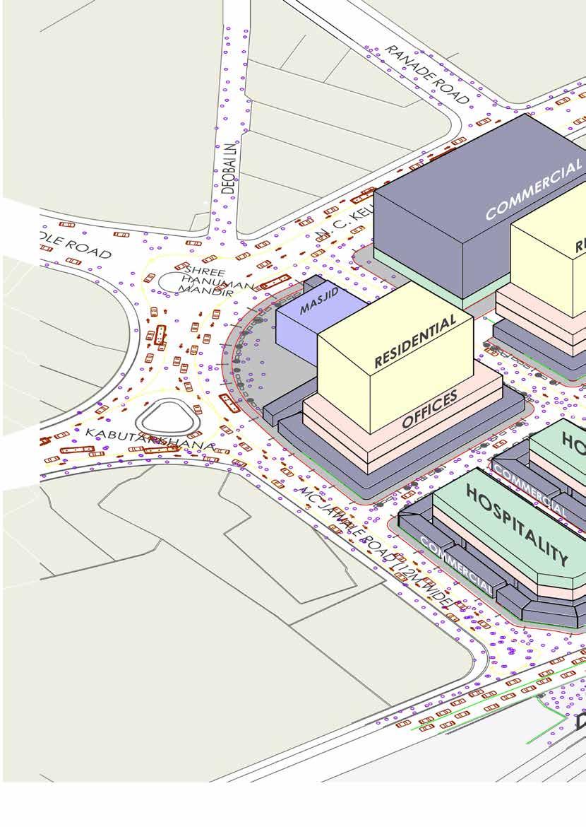
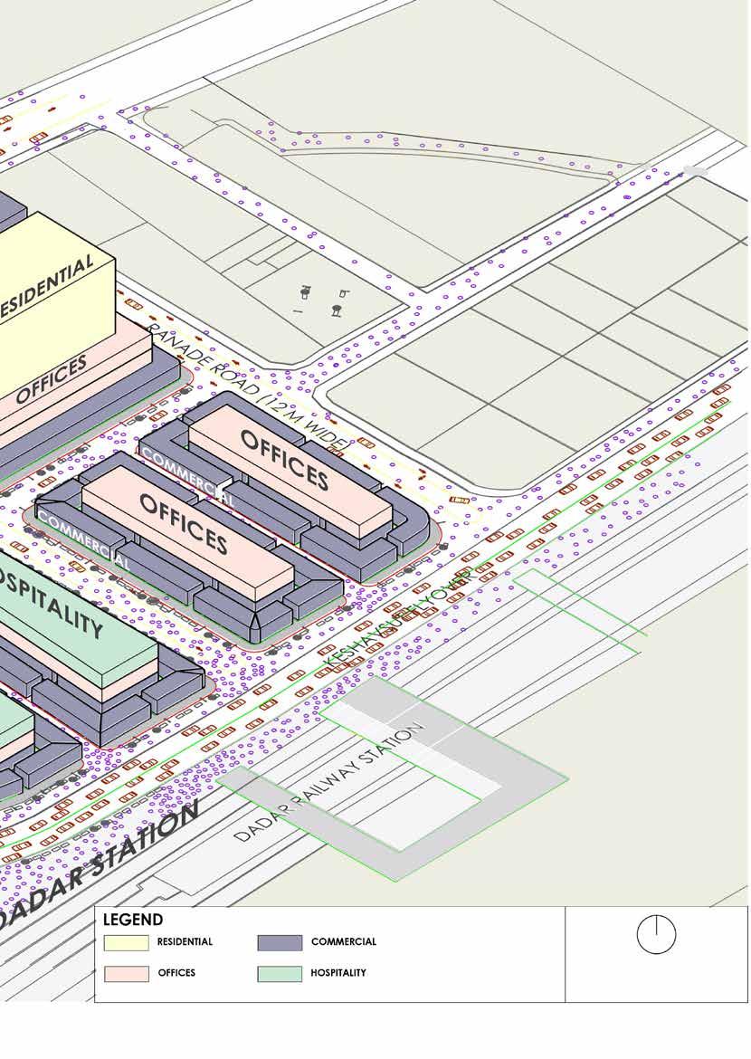
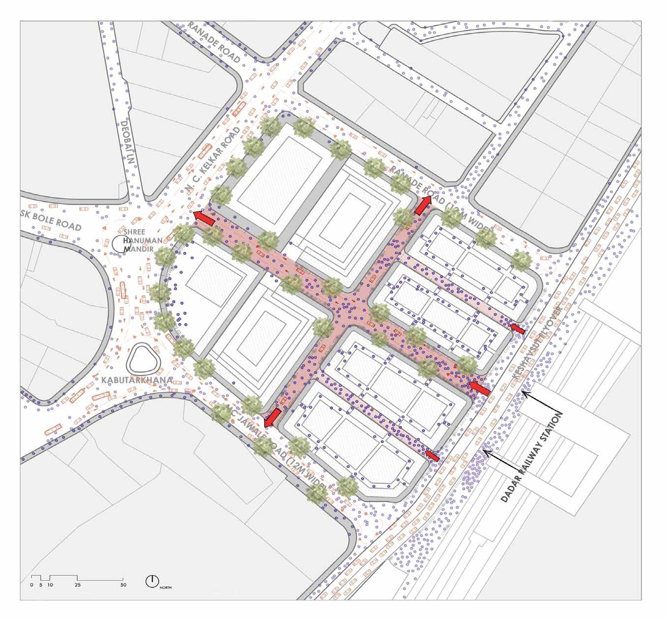
Figure1.2 : The corner plot of Masjid with open space for public activity and low rise commercial spaces
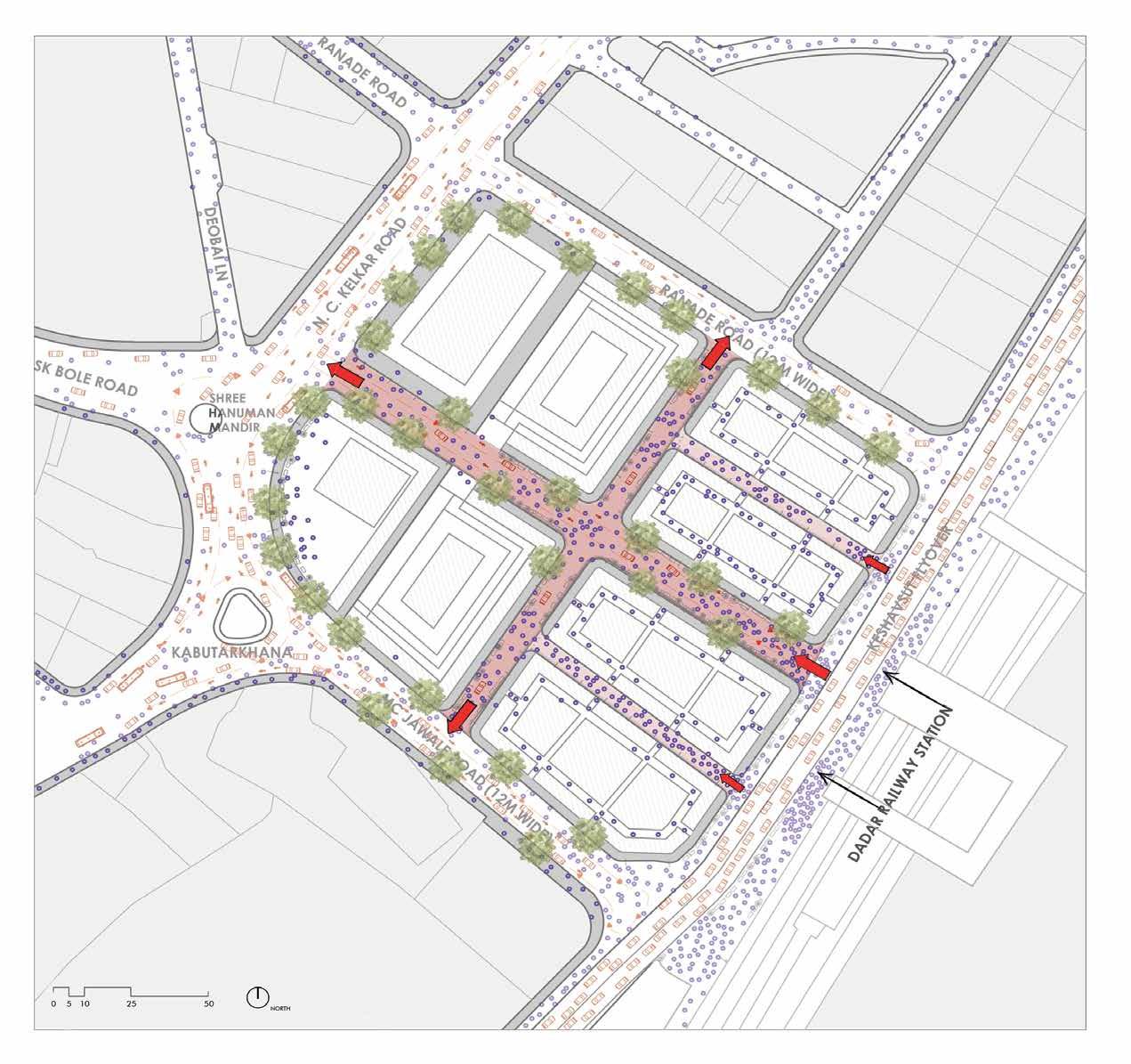


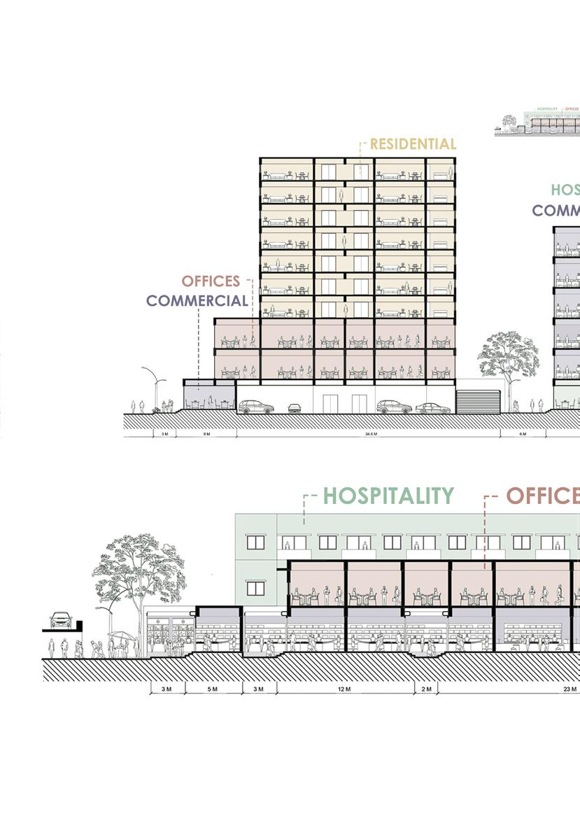
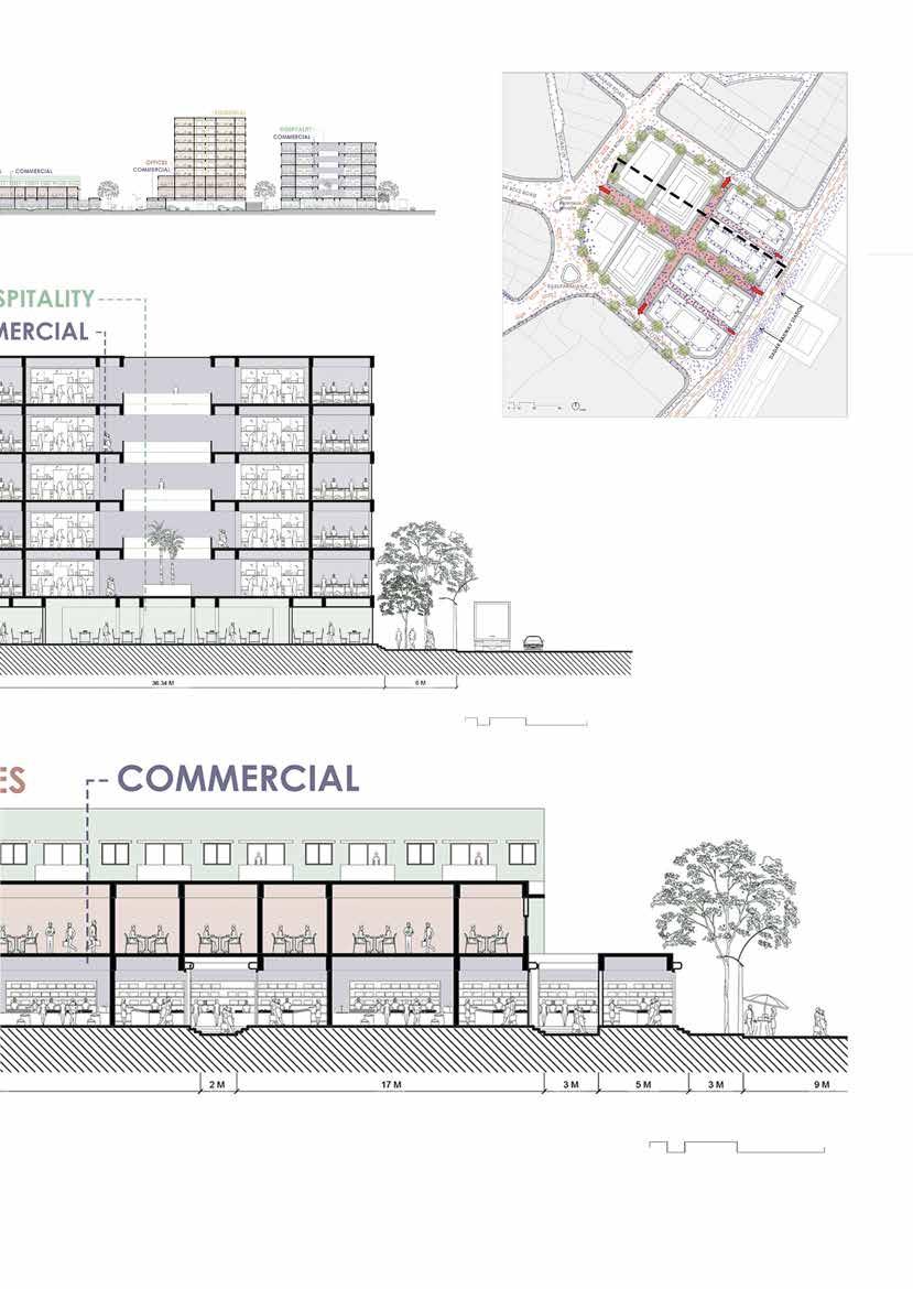
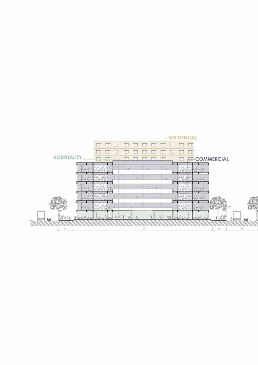
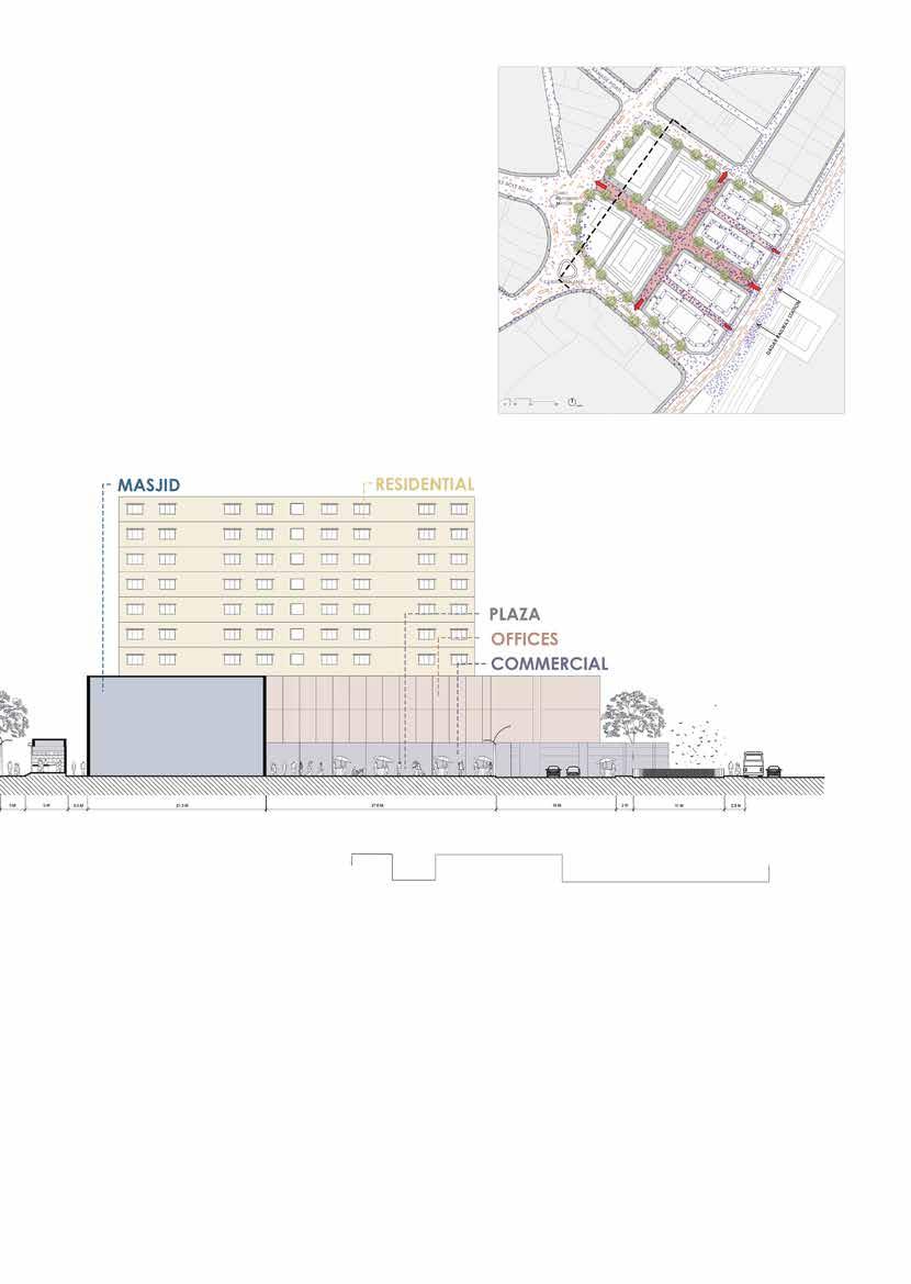

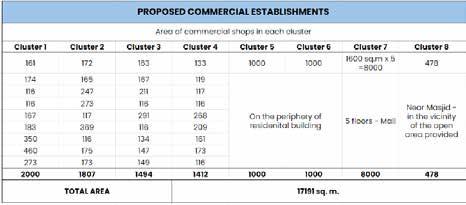
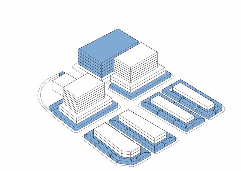
Image 1.1 : Existing plots according to DCPR 2034
Image 1.2 : Modified plots

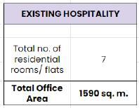
Image 1.1 : Existing plots according to DCPR 2034

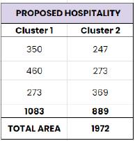
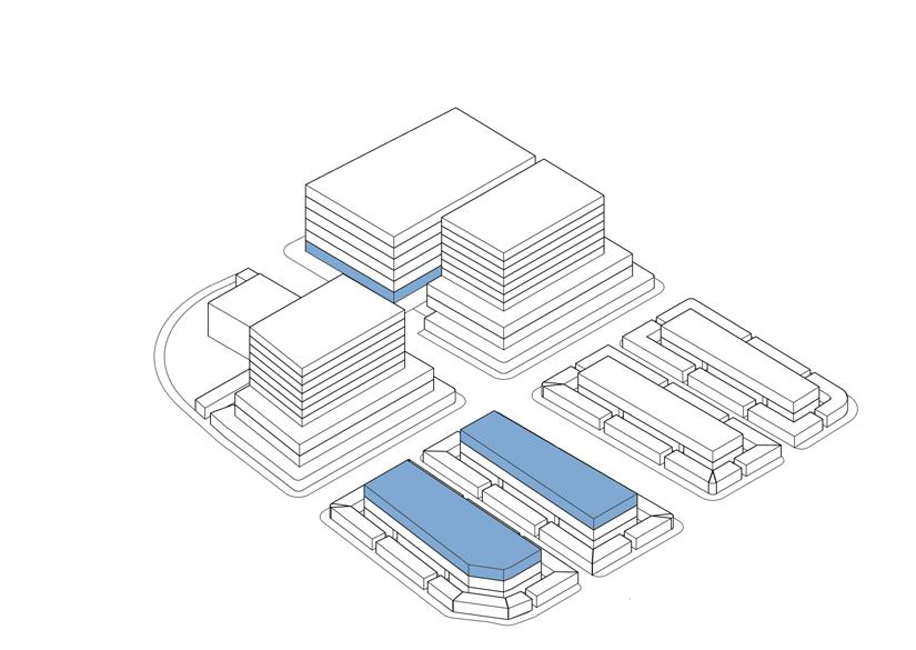
Image 1.2 : Modified plots

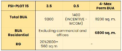
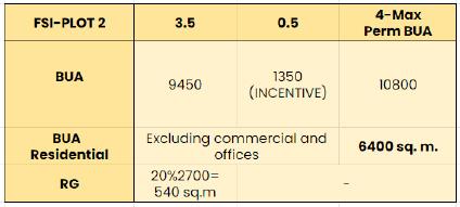

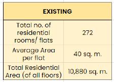

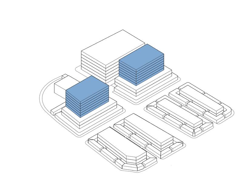

Image 1.1 : Existing plots according to DCPR 2034
Image 1.2 : Modified plots
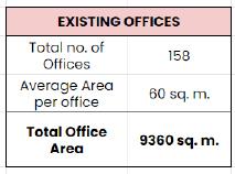
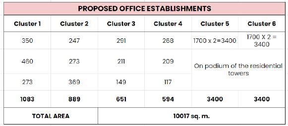

Image 1.1 : Existing plots according to DCPR 2034
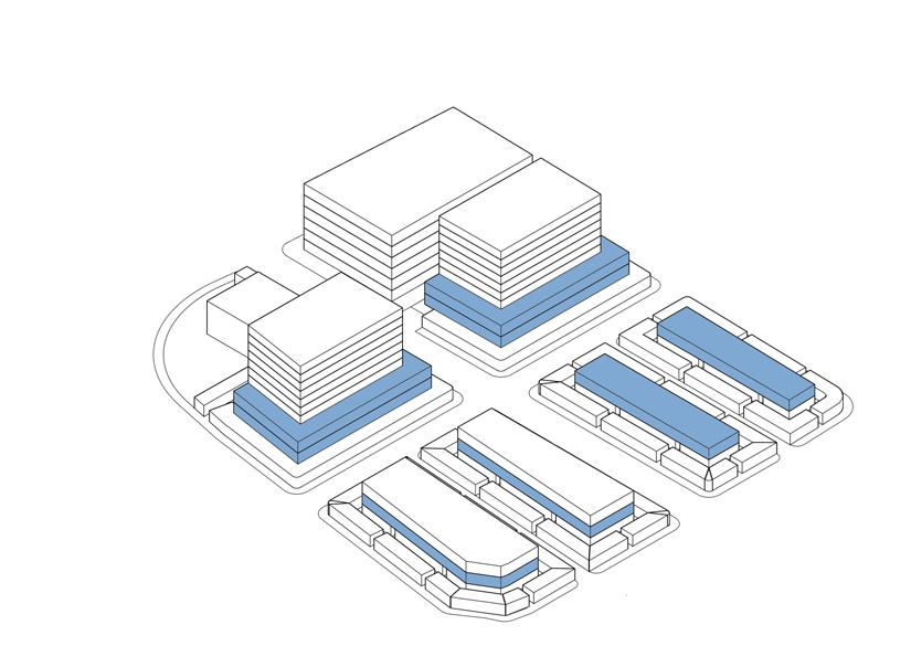
Image 1.2 : Modified plots

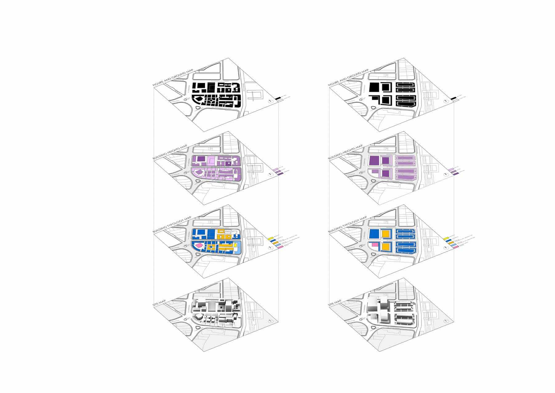
The unbuilt area increased from 45% to 51%. Thus, with more open ground area, the crowd can be controlled by providing increased width of pedestrian and vehicular lanes
Mall opens onto the plaza around Masjid thus redefining boundaries. Gradual increase in geight provides more breathable space to the crowd coming out of the station
The typologies are placed so as to cater to the building height considerationas leading to commercial shops on periphery and residential in between with a mall at the corner plot
Overall massing thus can be seend here of the overall plot

SITE LOCATION: KABUTARKHANA
Dadar Kabutar Khana lane ie. the M.C. Jawale road is selected as the site as it’s a significant node connecting the western part of Dadar to the railway station. Apart from being an arrival point, it is an origin-destination for various activities in Dadar.
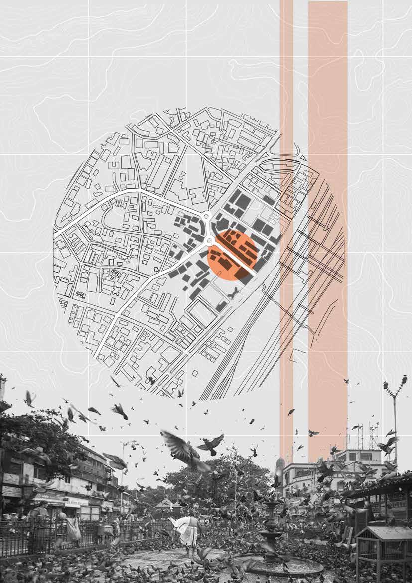
Dadar Kabutar Khana lane ie. the M.C. Jawale road is selected as the site as it’s a significant node connecting the western part of Dadar to the railway station. Apart from being an arrival point, it is an origindestination for various activities in Dadar. One can observe, the diversity of activities within this single lane like shopping, selling, eating, transportation, etc daily. This lane gives a significant idea of how vehicular traffic transport functions with pedestrian movement, shops, and hawkers. The market also observes changes due to festivals and seasons.
NO OF STALLS STALLS DIMENSIONSAREA TOTAL AREA (SQ.M)
1 Icecream2m x 1.2m 2.4 2.4
1 Pulav and rice1.2m x 1.8m 2.16 2.16
1 Pulav and rice1.2m x 1.8m 2.16 2.16
1 Idli south indian1m x 1.5m 1.5 1.5
1 Juice 1.2m x 1.2m 1.44 1.44
1 Papad 1.2m X 0.6m 0.72 0.72
1 Waffer 1.2m X 0.6m 0.72 0.72
2 Dabeli 0.6m x 1m 0.72 1.44
3 Sandwich1.2m x 1.8m 2.16 6.48
3 Panipuri 1.2m x 1.8m 2.16 6.48
3 Frankie o.6m x 1.2m 0.72 2.16
3 Vadapav 1.5m x 2m 3 9
4 Chinese 1.2m x 1.8m 2.16 8.64
25 45.3
NO OF STALLS STALLS DIMENSIONSAREA TOTAL AREA (SQ.M)
2 Fruit seller 21.2m x 1m 1.2 2.4
2 Vegetable vendor1.2m x 1.8m 2.16 4.32
3 Fruit seller 31.2m x 1.8m 2.16 6.48 4 Fruit seller 11m x 1m 1 4 5 Gajre flower hawkers1m x 1m 1 5 6 Banana leaf seller1m x 1m 1 6 22 28.2
CLOTHES
NO OF STALLS STALLS DIMENSIONSAREA TOTAL AERA (SQ.M)
9 Clothes 1.5m x 3 m 4.5 40.5
1 Curtain wala1.5m x 3 m 4.5 4.5 2 Lingerie shop1.5m x 2m 3 6 12 51
NO OF STALLS STALLS DIMENSIONSAREA TOTAL AERA (SQ.M)
2 Accessories 0.6m x 0.6m 0.36 0.72 2 Belt 1m X 1.5 m 1.5 3 1 Carpet 1.2 M X 2.4 M 3.6 3.6 2 Carpet seller1m x 1.5m 1.5 3 2 Diva wala1.5m x 2m 3 6 2 Dust bin bag wala0.8m

LOADING AND 4:00 AM TO 6:00 AM
PEAK TIME OF FLOWER SELLERS
6:00 AM TO 10:00 AM
10:00 AM TO 2:00 PM
2:00 PM TO 9:00 PM
5:00 PM TO 9:00 PM
FLOATING POPULA TION - OFFICE, COLLEGIANS, COMMUTERS
STORES OPEN @10:00AM CROWD OF PEOPLE FOR SHOPPING
FOOD STALLS OPENS @2:00PM CROWD AROUND VARIOUS FOOD
CROWD OF PEOPLE FOR SHOPPING
6:00 PM TO 9:00 PM
FLOATING POPULATIONOFFICE, COLLEGIANS, COMMUTERS

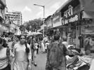
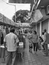
DADAR MARKET CLOSING 10:00 PM
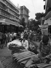
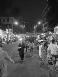
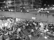
Dadar market and kabutarkhana acts as an important node and landmark.The challenge is to organize the chaos and maintain is identity for ease of both hawkers and commuters. The justification for selecting this site is that it is important to see the variation in users, uses, and identity of the space in relation to the process of spatial design and presence of transportation reorganized in a organized system.
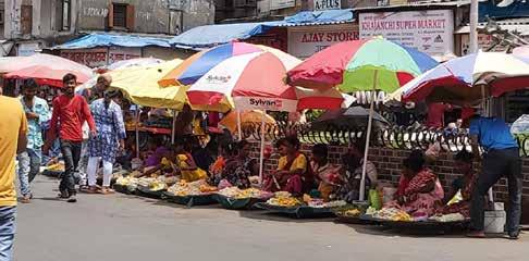
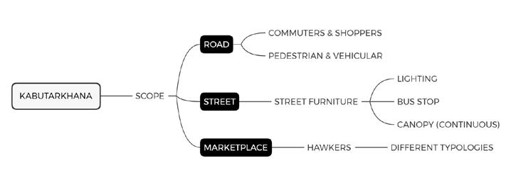
Fig 5.1: Mindmap for scope of intervention
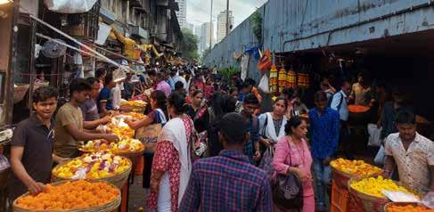
In this proposal, a walkway is created between the shops and hawkers lane such that the hawkers are facing towards the shops, to create a separate lane for the shoppers. A distinct sidewalk is created for the commuters along the vehicular road to segregate them from the shoppers crowd..
One single market lane is formed
Dedicated pedestrian pathway is provided
People who want to travel through the market can use a different lane, while those who want to just access the station can pass by.
Shops and hawkers do not have different access
Shops do not have their own distinct identity. • Since the pedestrian walkway is next to the vehicular access, sufficient separation must be made to avoid compromising the length of the road.
In this proposal, sidewalk in front of the store is used for commuters and people coming to buy from the stores. A separate lane in front of the hawkers, on the roadside, is created for the floating population who interact with these hawkers.
• Separate lanes for shops and floating population (Hawkers) • Shop get their own identity and separate lane • The commuters and shoppers must share the same path, which will result in overcrowding in the sidewalk.
A skywalk for the floating population will directly link to the railway station making it convenient and time-saving for office, school, and university people. The sole Purpose of this skywalk is to segregate the floating and market population thus reducing the tension on roads and footpaths.
• This will reduce unwanted pedestrian traffic.
• Faster and convenient route for school, university, and office people.
• Easy vehicular movement on the street as pedestrian movement will be restricted to the footpaths.
• The width of the already narrow road will also get more compromised
• Light and air quality will be reduced, the functioning of the street will get hindered by the long construction time.
This proposal includes restricting vehicular entry till the fountain and making the entire street a pedestrian street only.
• Restricting vehicular access to Kabutarkhana road generates more space for pedestrian movement
• Entire street can accommodate more number of hawkers and vendors.
• The current system of share taxi and bus movement is hindered. People have to walk longer to reach public transport.
Allotment of stalls in time slots, Thus the area for the vendors remain the same for morning and evening. So one vendor sits in the morning and another vendor occupies the same space from 4 pm onwards.
Morning Time Evening Time Total
Vegetable vendor 1 12
Fruit wala 4 48
Gajre flower hawkers3 25
Watch 1 12
Mobile Cover 1 12 Newspaper 1 -1 Clothes 5 49
Lingerie shop 1 12 Diva wala 1 12 Plastic utensils 1 12
Banana leaf seller 3 36
Saree cover 11
Toran wala 1 12
Flower Decoration 22
Dust bin 1 12
Pooja saman 1 12
Rope 1 12 Rubber cap 1 12 Devgar 1 -1
Carpet Seller 1 23 Scissor wala 1 12
Accessories 1 12 Belt 1 12 Shoe 2 24
Papad 1 -1
Waffer 11
Nursery 1 -1 Sandwich 3 3 Chinese 4 4
Panipuri 3 3
Frankie 3 3
Dabeli 2 2
Icecream 1 1
Vadapav 3 3
Pulav and rice 1 1
Idli south indian 1 1 Juice 1 1
Total 585793
• Reduces the crowd of hawkers on the street, more space for pedestrian and vehicular movement
• Customers might not get certain items due to the time allotment
• Reduces the income of the vendor due to time constraints on them
• Can result in dispute between the vendor working on same area
Changing location according to odd / even days
EVEN DAYS (LEFT SIDE)
ODD DAYS (LEFT SIDE)
• One dedicated lane for pedestrian traffic and other one for hawkers, organises the street
• Different paces of activities get divided into
• Reduces congestion in one lane, thus making allocation possible
• Alternating pattern of allocated area disturbs the flow of pre decided areas for vendors
• System collapses during festival time due to demand for more area
• All hawkers will have to be moved to the right side and pedestrian to the left
DAYS
Segregating activities in specific area on Normal Days & Festive Days
1. Normal days 6am to 12pm ‘Only Taxi stand’
2. Normal days 12pm to 10pm ‘Half part Taxi stand & Half part daily accessory vendors’
3. Festive days ‘Only hawkers and vendors’
TAXI STAND HAWKERS HAWKERS
TAXI STAND
TAXI STAND HAWKERS M.C. JAWALE ROAD M.C. JAWALE ROAD M.C. JAWALE ROAD
6AM - 12PM
12PM -10PM FESTIVE DAYS
• Reduces the crowd of hawkers on the street, more space for pedestrian and vehicular movement
• Customers might not get certain items due to the time allotment
• Reduces the income of the vendor due to time constraints on them
• Can result in dispute between the vendor working on same area
Several proposed interventions were tabulated, critically analyzed, and categorized based on their strengths and weaknesses for the problems analyzed. From there, the most appropriate and efficient solution to the identified problem was determined.
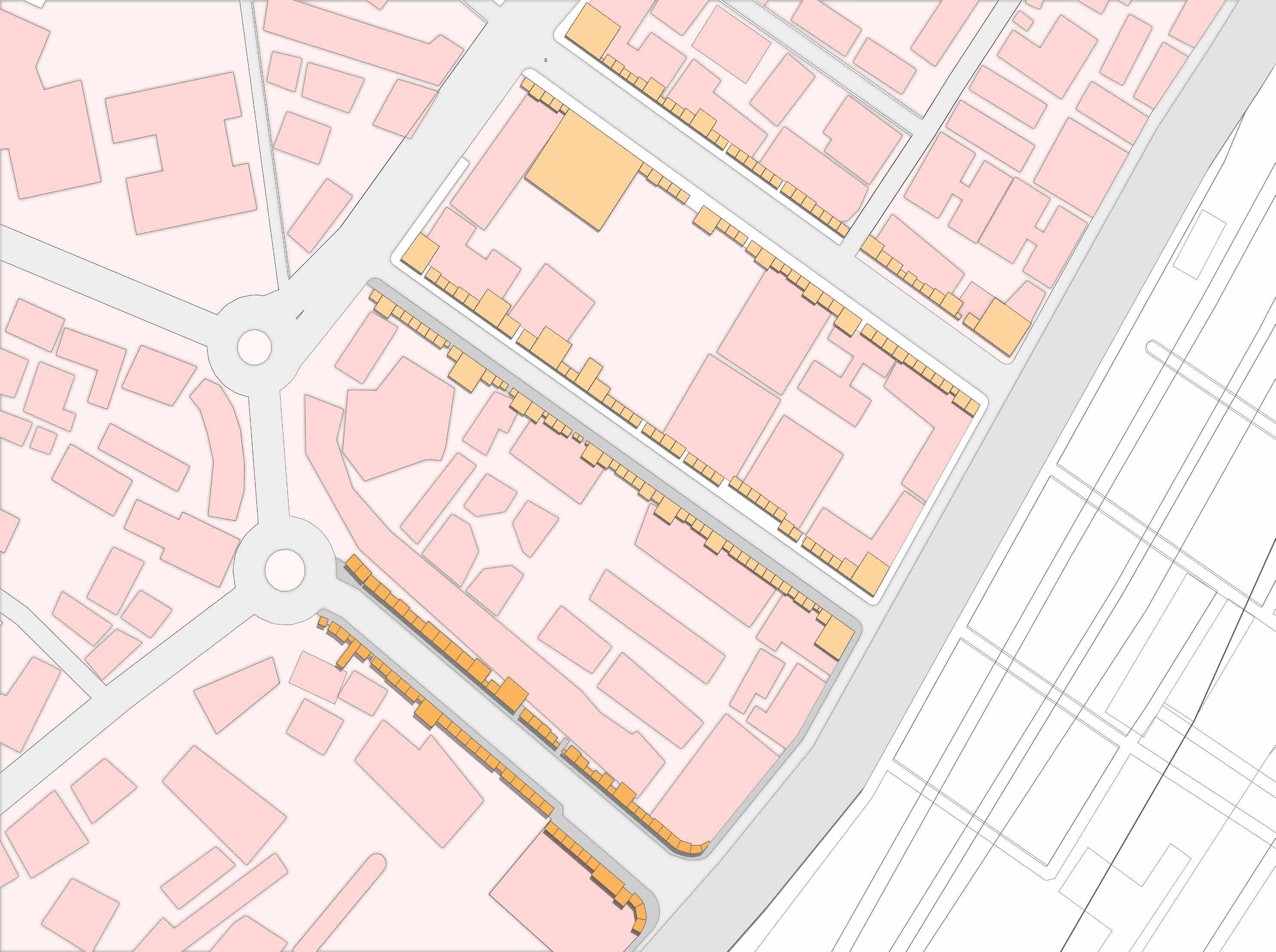


The M. C. Jawale road was chosen because of the diversity of users, uses, identities of the space, and the presence of transportation along a busy street. This makes the streets crowded with pedestrians and shoppers.
It is therefore imperative to organize this informal marketplace to combat the chaos created on the streets. The proposal considered the following factors:
• Active pick-up and drop-off points for buses and taxis
• Commuters from the station
• traders and buyers
The proposal limits vendors to one side of the road, allowing commuters to follow a clear path. The wide sidewalks will be converted into trade areas, and the narrow lanes across the road will be converted into primarily pedestrian sidewalks.
The proposal consists of design elements that can be used as furniture that can also delineate spaces for individual hawkers.

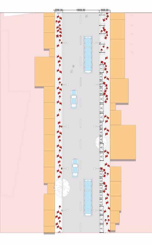
The large offset area is transformed into an area for cloth vendors, since they need more space to display and store their products.
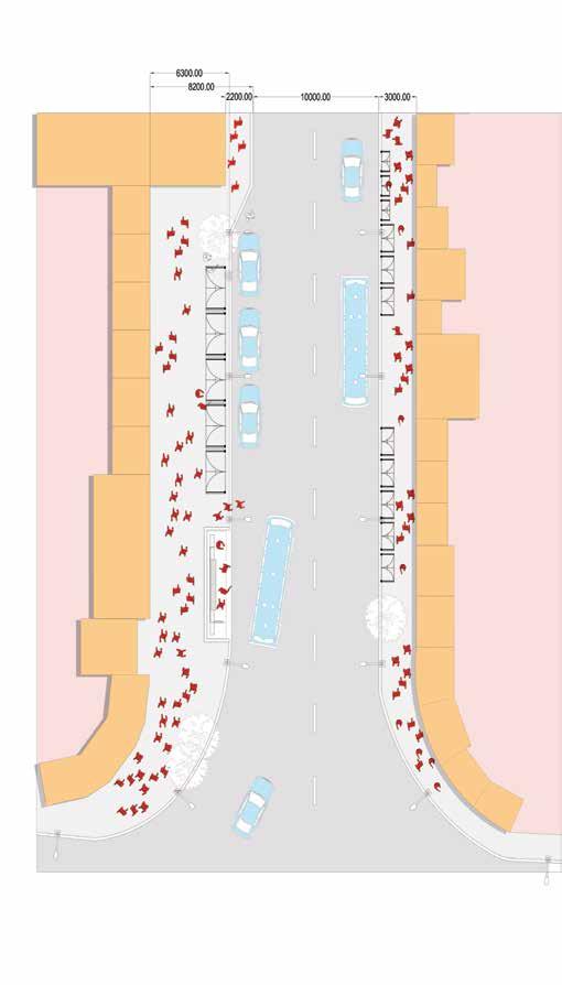
Image 6.1 : The view shows a breakdown of different hawkers and how they are placed on the street. As a person walks from Kabutar Khana to the train station, they are greeted by food stalls. As they move further stalls of different types are organised until the end of the street. Clothing sellers need more space, so they are located on the other side of the street.
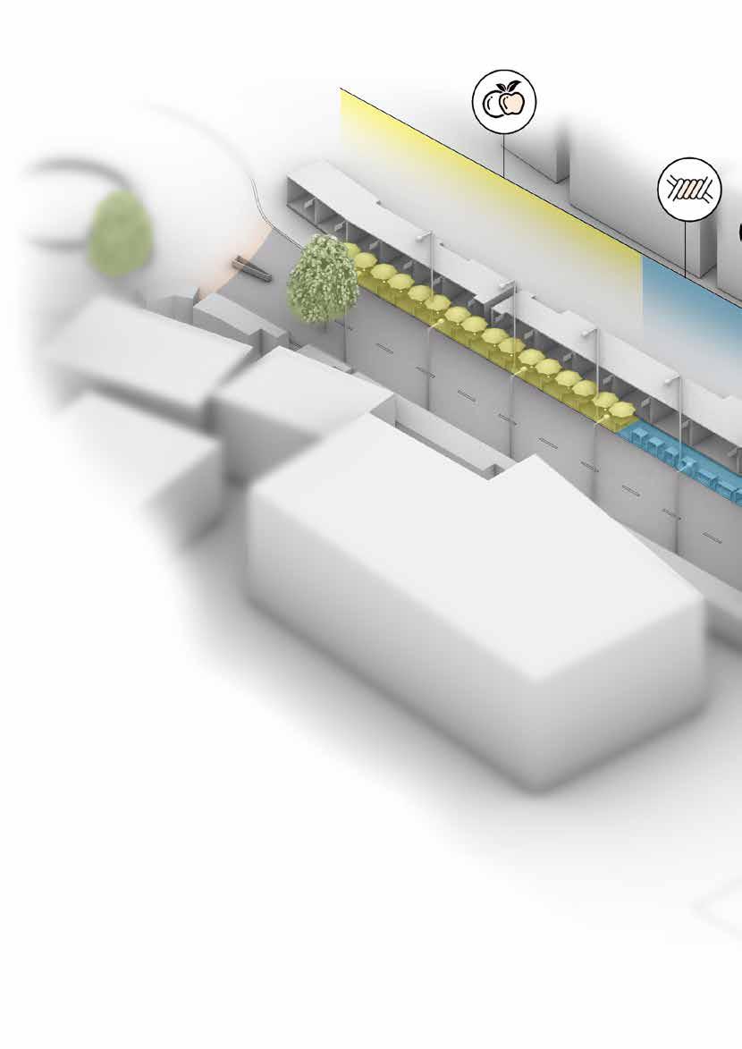
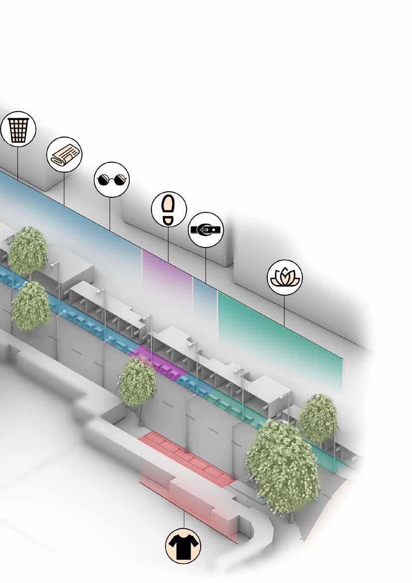
Image 5.1 : Plan for Design 1 (a): A platform area dedicated to product display and height dimensions that can be adjusted according to the vendor’s anthropometric requirement, in this case the design can be used by hawkers sitting on the ground and selling their products
Image 5.1.1 : This design also has steel loops that provide the ability to lock the furniture when not in use.
Image 5.2 : Plan for Design 1(b): A platform area dedicated to product display and height dimensions that can be adjusted according to the vendor’s anthropometric requirements, in this case, the design can be used by hawkers who display products at a height and often stand to sell.
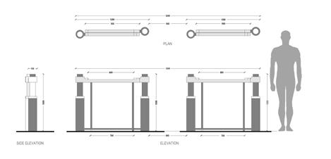
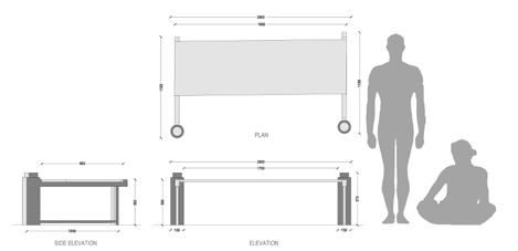
Image5.2.1 : The notch on the top is provided to place the wooden plank, which the vendor brings himself.
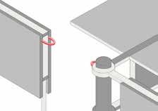
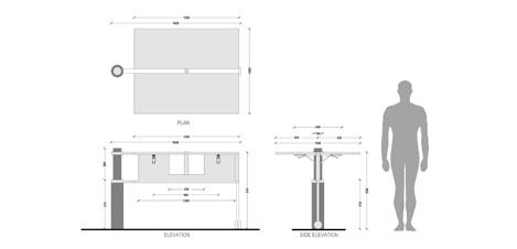
Image 5.3 : Plan for Design 2: A platform area dedicated to both cooking and serving for food stalls and the height dimension of the food stalls.
Image 5.3.1 : Supports are added below to hold the planks on both sides and ensure platform rigidity
Image 5.1.2: (Design 1)When not is use, the bollards act as barricade dividing the road from the lanes.
Image 5.1.3 : (Design 1) The bollards rotate on either side and demarcate areas for individual vendors.
Image 5.1.4: (Design 1) Two bollards, along with the plank added by the vendor form the platform for selling.
Image 5.1.5: (Design 1) The Axonometric view of the platforms used by vendor.
Image 5.3.2: (Design 2) This design is primarily intended for stalls that require less space, so one bollard is used per stall.
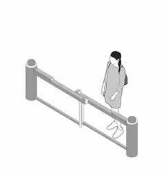
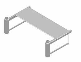
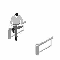
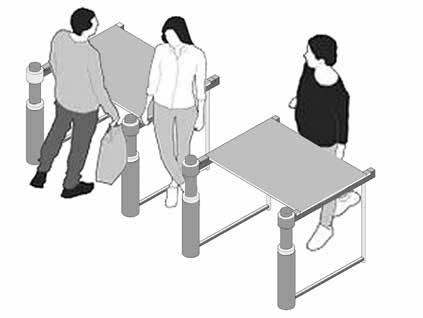
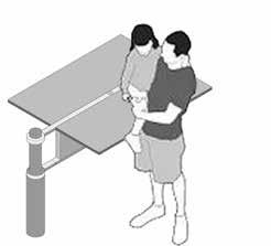
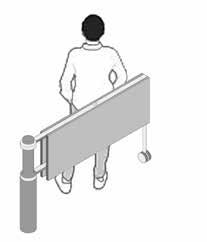
Image 5.3.3: (Design 2) The planks on the system, are flapped open which forms the work area. The planks are cantilevered on both sides, dividing areas for cooking and serving.
Image 5.3.4: (Design 2) Provision to hold umbrellas are an added advantage.
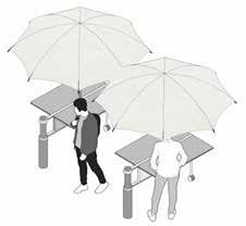

Ar. Shekoba Sanap
Ar. Omkar Gupta
Ar. Pooja Chinchkar
Ar. Paragi

Sejal Umare
Puneet Maru Vaibhavi Khedkar Abhishek Suryawanshi Rohit Chopade Shivanjay Bhagat Kimaya Churi Gaurang Rajput Palak BhattadW Sarthak Ekal Neha Jayashanker Isha Patil Bhoomika Chaudhari Aditya Kanade Shrutee Patil Shweta Utekar Vaishnavi Gurnalkar
Shakti Jadhav Viresh Desai
Ishan Lathia Prajakta Pai Laxaree Sawant Sakshi Gothankar Simran Ajgaonkar Krishna Khurusane Siddhi Shinde Atharva Girme Manasa Ravikumar Roshani Chabhare Rashmita Dake Saloni Pawar Aishwarya Raikar Nidhi Khot Sairaj Halpatrao Anjali Karpate Pranali Thool Ameya Thanawala Sharvil More


Dhruvanshi Sanghavi Karishma Kaur Hooda Harsh Tank Tarika Deshpande Prajakta Gosavi Sanchita Tandel Rasika Salgaonakar Jigisha Soni Pooja Tambe Vaishnavi Siddhapara Kartika Pinjarkar Vardhan Arora Krissh Chavan Mansi Bhatia Harshwardhan Shirpurkar Aakash Kharade Aditi Wadate Mithila Gadag Arya Jumde

