 Benjamin Murphy
 Benjamin Murphy
2024 Portfolio
Master of Architecture Liverpool School of Art and Design
About Me
I have studied Construction and Architecture since 2015.
Initially, I started studying a Level 3 Extended Diploma in Construction at the City of Liverpool College, before progressing onto Liverpool John Moores University in 2018, to study a BA(Hons) in Architecture; which I graduated from in 2021.
I am immensely proud of my achievements in academia since 2015: In 2018, I achieved Distinction* in Constuction at City of Liverpool College; the highest achievable grade.
In 2021, I graduated my BA(Hons) in Architecture with a 1st Class Qualification at Liverpool John Moores University.
Also in 2021, I recieved the Claire Wrigley Lighting Prize for my Architectural project ‘The Northern PowerHouse Assembly’.
Since starting my Masters’ Degree at LJMU (2022 - 2024), I have recieved a 1st Class Grade for every project (to date).
Alongside my studies, I have worked in practice since 2016, when I got my first Architectural job as an ‘Architectural Assistant’ at a practice in St Helens, Merseyside; where I worked on many projects, including Residential, Commercial, Industrial, and Regeneration. Upon my graduation in 2021, I became an official ‘Part 1 Architectural Assistant’ within the practice.
In June 2023, after 7 years, I relocated practices to the Mersey Design Group (MDG) in Liverpool to experience working on a wider range of projects, including many within the Healtcare, Public Transport, and Education Sectors.
Additionally, I have worked at St Helens RLFC since 2014 within their Operations and Hospitality department; originally as a Bar Assistant, before progressing to a Supervising Manager, responsible for teams of up to 14 staff, running events of up to 350 people.
Away from work and education,
I enjoy staying active and busy; particularly taking trips to experience different places around the world. In 2023 alone, I was lucky enough to visit London, Paris, Berlin, and Edinburgh - and in 2024 am going to take various trips around Lithuania, the UAE, and Greece - to experience their culture, but also, of course, the Architecture.


Stitching the City was the first project completed during the 2nd year of my Masters’ Degree. It focused on regenerating a largely derelict post-industrial island, Zorrotzaurre, in Bilbao. Our main intention was adressing the lack of connectivity and weak relationship with the rest of the city, by creating new access points and encouraging the existing city’s urban logic to ‘spill’ onto the island. Furthermore, we recognised that Bilbao’s urban areas lack greenery and public open-spaces; therefore, our project has a strong emphasis on creating a ‘green’ islan - with many natural parks and tree-lined streets.
The completion of this unit would also form the basis for my final Thesis Project. (see page 14 for this project)
The existing island is rather empty. Extensive site clearance was conducted to make-way for an ill-fated regeneration plan, by Zaha Hadid Architects. The plan was negatively recieved by locals, ultimately pausing the project whilst the design was revised.
A contentious point for local residents was the overall loss of the island’s character through demolition of the characterful industrial buildings, in favour of “bland” modern buildings.
Aware of this, our masterplan sought to retain as many of the few remaining buildings as possible - ensuring that the island’s remaining character was saved and enhanced by our designs.

Planoftheexistingisland

Earlysketchedexploringdesigndevelopment
As evidenced on many of the above sketches, we explored developing a masterplan which includes all existing buildings. We also considered the lack of physical connections between the island and the rest of the city; we saw the bridges as ways to ‘Stitch’ the city together. Additionally, we wanted to encourage nature growth on the island by creating large parks, treelines streets, and a soft-shoreline.


The masterplan includes 3 main areas:
Recreational Area
Low density parkland
Southern Residential Area
High-density as it is closest to the main city centre,
Northern Residential Area
A lower-density area, furthest from the city centre and closer to other Bilbao suburbs.

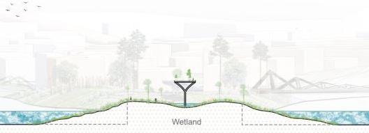


ConceptualimagesalongtheGreen-Spine


Examplesofdifferentshoreconditions
Further in-line with the ‘green’ nature of this masterplan was the perimeter parkland. Surrounding the island was a soft-edged parkland - which could be sacrificed for rising sea-levels to protect the island. The park is not a consistent width all around the island, resulting in various possible edge conditions - as shown above.

Connecting the City
A new Multi-Modal Transport Hub for Bilbao


Connecting Bilbao was the final project completed during my Masters’ Degree. It focused on creating a new, Multi-Modal Transport Hub for Bilbao, where all forms of existing Public Transport in the city would converge - creating a convinient ‘Hub’ location for commuters; whilst redevloping a large piece of brownfield land.
This project stemmed from an earlier unit in Year 2. As a group, we created a masterplan for the redevelopment of an area of Bilbao; the site of this thesis project (and surrounding context) was informed by the masterplan. (see page 4 for more detail on the Masterplan)
Our original masterplan involved the proposal of a new Ferry Terminal on Zorrotzaurre, which would become a major gateway into Bilbao for Tourists.
We also proposed introducing a new tram line on the island - an extension of the existing Bilbao Tramway Network.
Upon revisiting the masterplan, I considered the Ferry Terminal’s accessibility in detail. Logically, tourists arriving into Bilbao will require onward travel onto their destination (possibly elsewhere in the ciy); our current plan doesn’t address this issue well.
Studying existing transport in the area (alongside our tram proposal) there were potential connections which could be made with the Ferry Terminal - but it became clear that East/West connections were lacking; as was the connectivity between transport modes.
As such, the ‘Ferry Terminal’ concept needs better Public Transport Connectivity - and the chance arose to improve the whole area by introducing East/West connections by creating a new Transport Hub.


Onward Ferry Route
Thesis Site
San Ignazio
Before commencing any detail designs, it was important to grasp an understanding of what transport connections were possible.
A tram connection to the island was always intended; it’s route could be amended to serve this project. An ‘spur’ extension to the Metro could serve the island easily, as could a new station on 2 adjacent Railway Lines. WaterBus and Ferry connections are easily achievable along the Nervion River.
This plan improves connections with the island and the city, but also permits East/West travel; currently, passengers travelling from Deusto or San Ignazio (East) heading West, have to travel into the city centre - prolonging their journey.
Deusto

DiagramstudyingtransportinBilbao
Onward Waterbus Route
Studying travel patterns and connections across the site cemented the East/West axial logic of this project; it was clear that a linear, East/West circulation building would be ideal in this location.
It also became clear that it could intersect with our strong North/South ‘Spine’ axis (on our Masterplan); creating a key interaction space for the whole city - which this project could overlook - such as a plaza or public square.


Informed by the exploratory diagrams, the project progressed into the preliminary design phase. Many early sketches and diagrams experimented with East/West connections and level-changes.
Connectivity between levels and transport types was a key consideration throughout the project. I recognised than efficiency and circulation would play key roles in the design of a transport hub.
Very early designs explored the creation of an Artificial ‘Hill’, which would gently raise people up to bridge level - whilst being inhabited by a building beneath. Although this idea evolved immensely, the ‘stepped’ nature remained and is evident in the final design.


Earlypreliminarysketchesexploringdesignideas-mainlythebridge;levelchanges;andhowtoconnecteachelement


MassingStudy-Exploringtheevolutionoftheproject’sform


The bridge access and level change was a key consideration through the project’s evolution; the images show different pivotal design stages in the design process.
Most notably, the physical stepped ‘hill’ connecting Ground Level with Bridge Level evolved to a stepped plaza, before evolving into a ‘stepped’ atrium. Additionally, the main admin building (right of image) didn’t originally exist; yet upon introduction, it’s form shifted through a vairety of stepped forms until a more linear and uniform design was reached - offset by the adjacent stepped atrium.


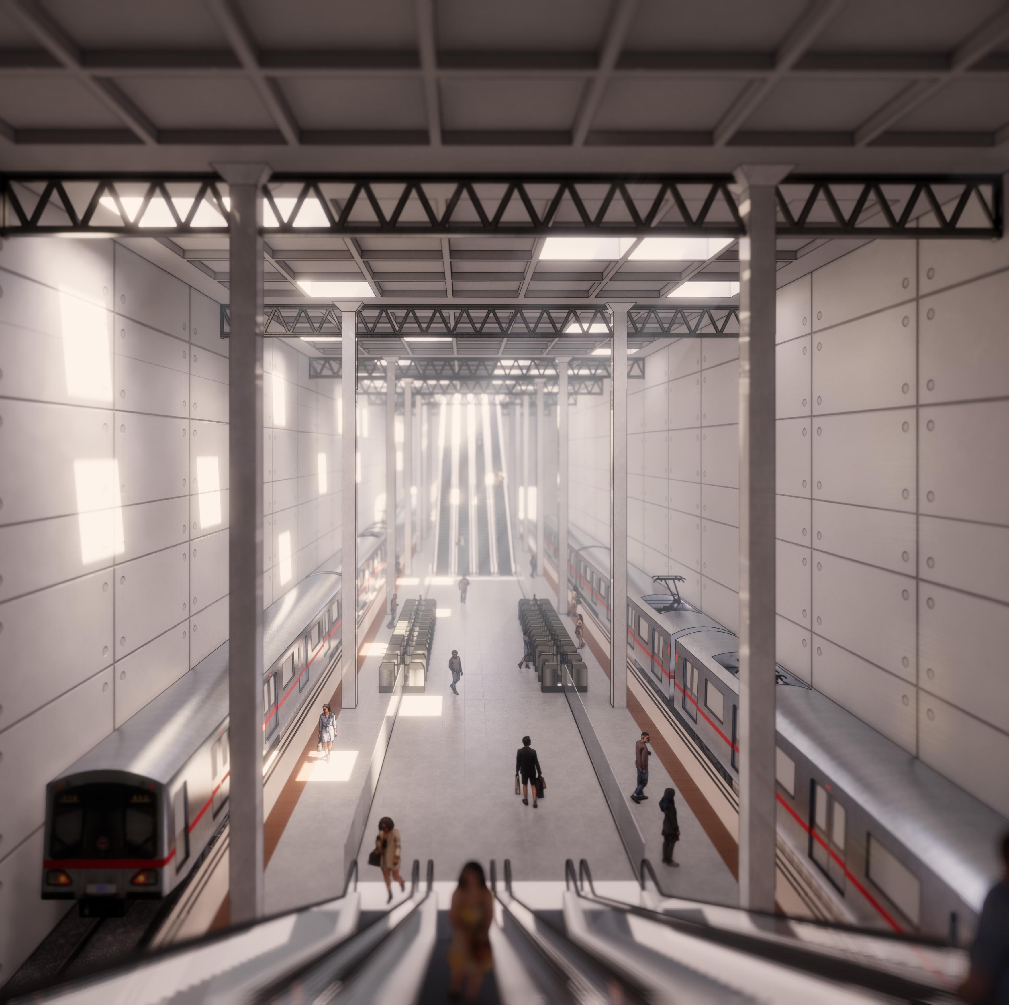
The final design comprises a publicly accessible ‘stepped’ atrium for circulation between transport modes, and a large Headquarters building to accomodate the appropriate admin/management staff that run/plan transport in Bilbao; both are seperated by a vertical services core.
To the front of the building is a large, clear, direct path leading into the building through a public plaza; with natural ponds (which are part of the SUDs strategy). At the rear is the large landscaped pedestrian suspension bridge crossing the river; which is tall enough to allow the safe passage of ships.


FirstFloorPlan[1:200atA0]

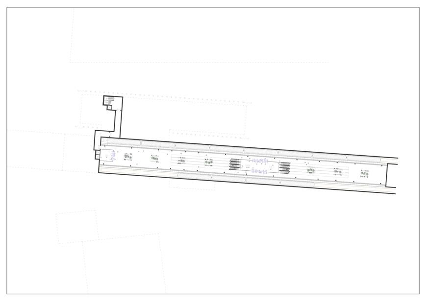
MetroStation(-2)Plan[1:500atA0]

SecondFloorPlan[1:200atA0]

Basement(-1)Plan[1:500atA0]

ThirdFloorPlan[1:200atA0]
The large main building includes:

GroundFloorPlan[1:200atA0]
• Circulation Space between transport modes (Metro, Rail, Tram, Bus, Ferry, WaterBus, Taxi),
• Commercial Units for passenger usage
• Passenger Facilities (toilets, luggage storage, waiting areas)
• Large Headquarters building (for the management and operation of the Network)


ThemainAtrium-viewedfromthetopoftheescalators(leadingfromtheMetroStation)
Urban Design Project
Connecting Edge Hill
The Urban Design Project focussed on the redevelopment of Edge Hill, an inner-city neighbourhood in Liverpool.
As a group of 3, we created a large masterplan; entitled ‘Connecting Edge Hill’.
We started the project by visiting the neighbourhood and witnessing first-hand it’s character, residents, and design.
Upon visiting the site, we were largely inspired by Tunnel Road, a linear North/South street running through Edge Hill; connecting Toxteth and Kensington.
The street appears ‘unloved’ in comparison to other streets in the area, due to it’s heavy congestion, lack of development, and poor state. Despite this, the street is one of the oldest in the area and vital to the area’s success; being the only direct North/South route in Edge Hill. The street accommodates Edge Hill Railway Station and Goods Yards (a major catalyst for the area’s historic growth), and intersects 2 major routes.


Inspired by Tunnel Road, we conducted large amounts of detailed research into to site; through maps, data, and historic images.
Using the analysed research, we identified ‘problem’ areas along Tunnel Road:
The Northern-end
A major 5-way road intersection which is bounded by a hard-landscaped low-density retail park; a site which is uncharacteristic of the neighbourhood.
The Southern-end
Another 5-way junction (which was historically a 6-way junction), where the road-alignment dictates the area’s growth.
Furthermore, we acknowledged that the rail-yards act as a ‘barrier’, segmenting the neighbourhood and forcing activity around it’s perimeter; hence the congestion.
We also recognised the lack of public openspace in Edge Hill; particularly along Tunnel Road which is often bounded by 2m+ brick walls.


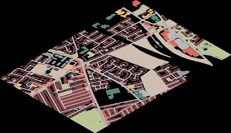


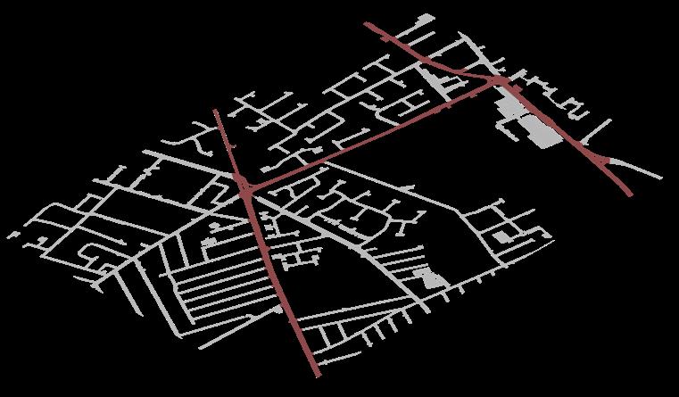


Therefore, based on our research’s findings, we decided to redevelop the Eastern side of Tunnel Road between the 2-identified ‘problem’ sites.
The Eastern-side of Tunnel Road is where the former rail-yards are located, which currently act as an obstacle - segmenting the neighbourhood.
We grew the Southern-end of Edge Hill Northwards towards the railway; and replaced the low-density retail park with a residential area - which grew the Northernend of Edge Hill Southwards (again, towards the railway).
We then connected the 2-halves of the neighbourhood over the railway with a pedestrian ‘Garden Bridge’.
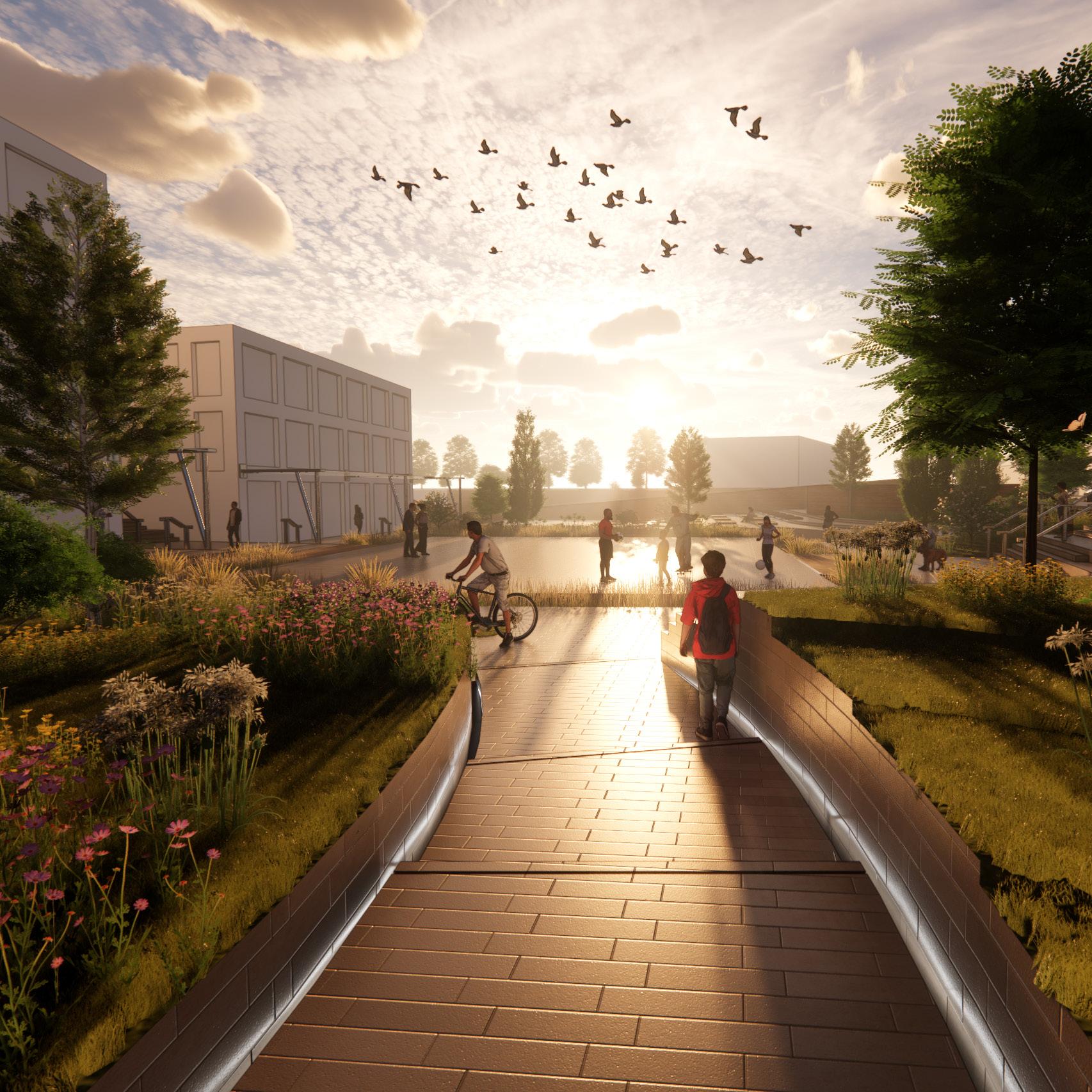
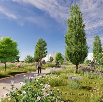
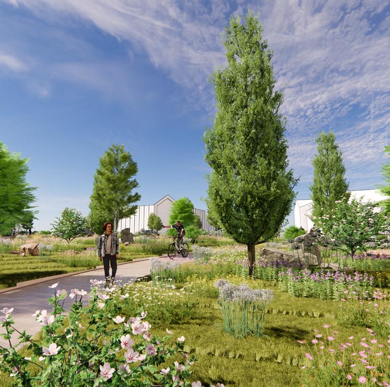
We adressed the lack of public open-space and the existing ‘hard’ image by integrating nature into our proposal; creating wide, open, tree-lined roads; footpaths; and public recreation-spaces around key nodes.

The Northern End Looking North

The Northern End Looking South


Urban Design Project
Edge Hill Station Approach
Upon completion of our group masterplan for the whole neighbourhood, I developed a smaller part of the design further, in more detail.
I focused on designing the public realm at the Northern-end of the site, between the major 5-way road intersection and Edge Hill Train Station.
My main aim was to improves access between the major road intersection (a key node) and the train station; as it forms a main desireline, and any view of the station is currently obscured by poor building placement.
Whilst enhancing the visual and physical connection between these 2 nodes, I also intended to create an attractive public openspace; addressing Edge Hill’s neighbourhoodwide lack of recreation areas.
This project was titled ‘Edge Hill Station Approach’.
WeakBuildingLine, needsstrengthening Overbearingbuilding to be demolished

Firstly, I re-visited our group design and critically analysed the initial design. This acknowledged it’s strengths and weaknesses to provide a starting point for the design.
Additionally, I revisited our site research. which originally covered the whole neighbourhood; this time, I focused specifically on my chosen area. I dissected the area in detail to further realise how the public realm could be enhanced. It was aparent that the major concerns which required addressing were:
• the lack of public open-space,
• weak building lines,
• obstructed sight-lines to the station,
• level variation between road and railway.


NoBuildingsNorelationshipto restofproject
NoBuildingsNorelationshipto restofproject
ComplicatedJunctionnot well resolved - divorces projectfromNorthofArea
WeakBuildingLinePoorrelationship withwiderproject
Landscapedarea appearslimitedin termsofdesign
Basicandsteepstaircase connectingtoTrainStation.
DiagramoutliningmainpointsfromCriticalAnalysis


Various experimental configurations for the public-realm were considered.
Each iteration explored addressing the level change across site, as well as how desirelines could be ‘opened-up’, whilst providing multi-purpose public open-space.
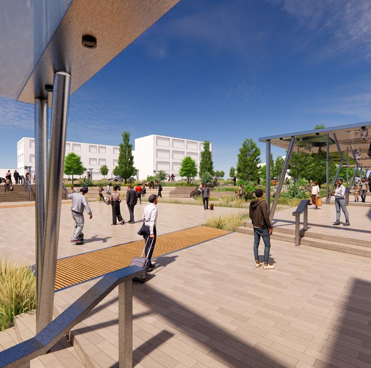
The final site plan addressed all concerns; providing a nature-heavy public realm, with various spaces for public events, and providing physical/visual connections between the intersection (key node) and Train Station.




Covered Walking Routes
Providesshelterfromnaturalelementsalongamainwalkingroute.
Also creates an interaction between Ground Floor and the environment.
Stepped Building Line
Followingthesteppednatureof thesite;visuallydirectingpeople to/fromthetrainstation.
Balconies
Overlookingtheplaza,creatingan interationbetweenthebuilding’s upperfloorsandthepublicplaza.

Stepped Building Line
Followingthesteppednatureofthesite;visually directingpeopleto/fromthetrainstation.
Balconies and Large Windows Creates interactionbetweentheupperfloorsofthe buildingsandtheGroundLevelpublicplaza.
Covered Walkway Createsashelteredwalkingrouteandaninteraction betweenthebuilding’sgroundfloorandpublicplaza.
Edge Hill Train Station
Thenewsteppedwalkingrouteprovides improvedaccesstothetrainstation.

The stepped-nature of the site was a key contributing factor in the project’s development. The site had to ‘step’ gently down towards the train station, as it is located in a cutting, and accessed from steep ramps; however, railway tunnels below the site limited the overall ‘maximum fall’.
To emphasise the site’s slope and subtly guide people towards the train station, buildings which were proposed to form the plaza’s edge mirror the direction of land-fall.
When designing this public realm, multipurpose public open-space was a key consideration.
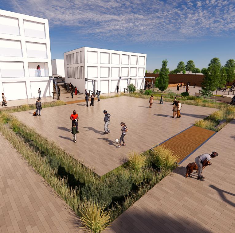
Multiple events spaces were created, to be used for a variety of events. To ensure that the spaces were appropriately proportioned and well laid out, a series of diagrams and drawings were produced.
The spaces were intended to be well-sized, to maximise their usage and potential activity variation.

Providingasafe,intimate spaceforBonfireNight/ Firework Celebrations.

Currentlyaverypopulartrend whichrequiresopen-spacesfor vendors,andfootfall.

Presently,nofairgroundsfor childrenvisitthislocality.Thisis anappropriatelypositioned/sized spaceforvariousfairgrounds.

Various seasonal events could takeplacesuchasHalloween festivals;hereaWinter/ Christmasvillageisshown.

Theareahasaverystrongmixed community,LodgeLaneinparticular. Thisprovidesacommonmarket-place forretailandcommunitymeets.

Largeopenplazasprovide spacesforArtexhibitions/ performances.Ideallylocatedfor ‘Metal’,basedinEdgeHillStation.
Community Markets







Integrated Design Options for Resilient Living
Edge Hill Garden Village
The Integrated design project involved designing high-quality, thoughtful dwellings.
I decided to continue developing the area surrounding Edge Hill Train Station to create a comprehensive project: starting as a masterplan, and ending with a complex nature and public-space oriented neighbourhood, complete with detailed Architectural designs and technical specifications.
Therefore, this complex project became known as ‘Edge Hill Garden Village’.
Similar to my previous unit, I firstly critically analysed previous work to identify strengths and weaknesses within my own project; to form a strong basis for the design
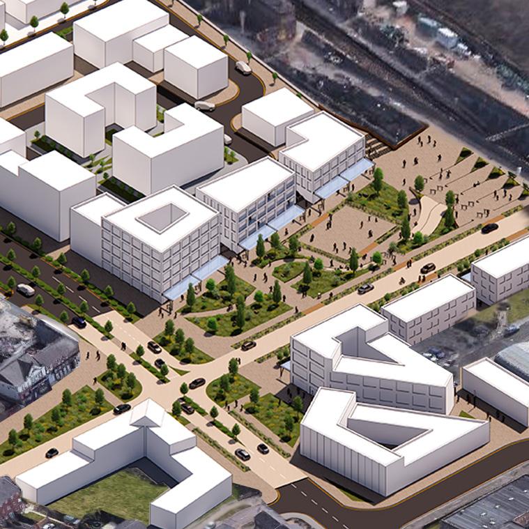
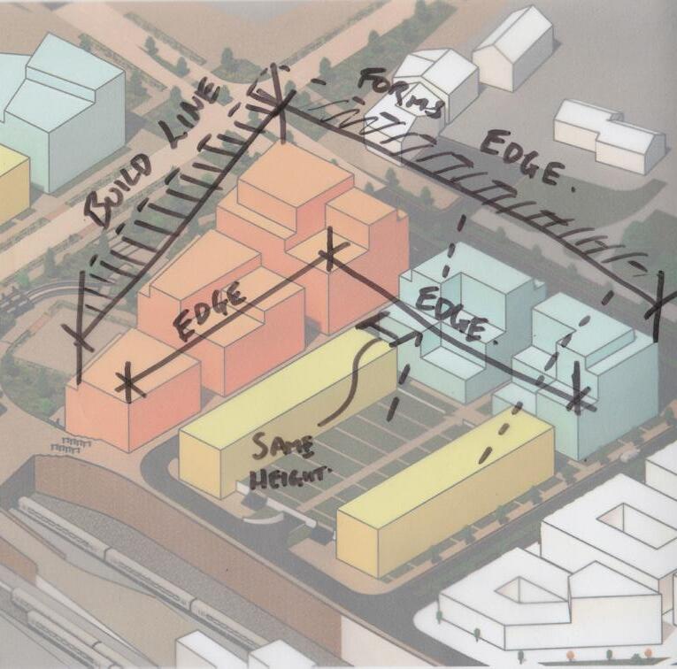
The project was analysed in 2D, and translated to 3D massing models, to explore how my designs would affect the surrounding neighbourhood and interact with each other. I wanted to ensure that my proposals compliment the rest of Edge Hill.



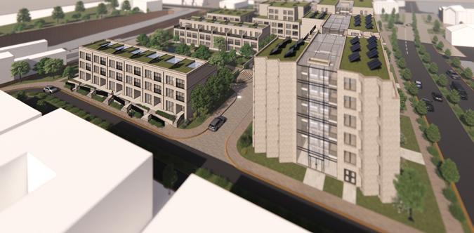
‘Plaza-View Mews’
3 & 4 bedroom terrace houses with Private Gardens, Roof-Terraces, and Driveways.

‘Station Approach’
3x mixed-use buildings which line the main approach route to Edge Hill Station.
Commercial Units at Ground Level with Residential Dwellings above.

‘Wavertree Road Apartments’
Mix of 1, 2, & 3-bedroom apartments, distributed over 2x 6-storey buildings.

‘Garden-View Mews’
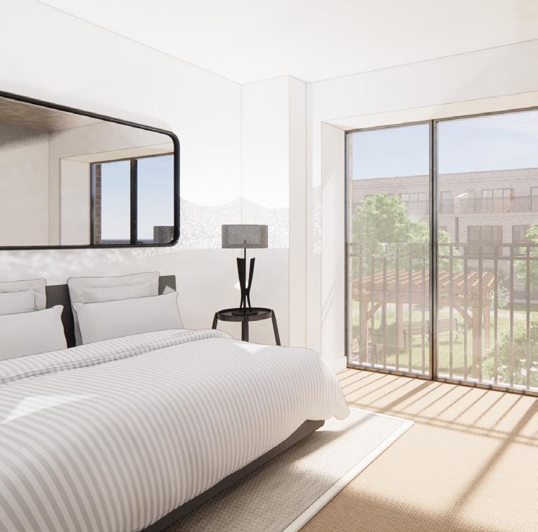
Mix of 3 & 4 bedroom Terrace Houses. Surrounded by landscaping, with Underground Parking, Private Roof Terraces, and direct access to a communal garden.


Garden Walks
Landscaped ‘Garden Walks’ snake between buildings. A green alternative to a typical road; softening the urban environment, encouraging pollination, and promoting walking/cycling.


Hierarchy through Design
Different materials & dimensions are used to clearly distinguish different street conditions and highlight areas.

‘Village Green’
Directly accessible to the ‘Garden-View Mews’, this South-Facing communal garden provides a large, uninterrupted publicly accessible OpenSpace.
Sheltered Community
Taller apartment buildings line the main roads at the North, shielding the houses and outdoor spaces from constant passing traffic and noise.


The site’s redesign incorporated a variety of different house types, interspersed by a significant amount of nature and public open-spaces.
4x different typologies were designed:
• ‘Plaza-View Mews’
• ‘Station Approach’ Mixed-use Buildings
• ‘Wavertree Road Apartments’
• ‘Garden-View Mews’
The dwellings were a mix of terraced houses and apartments. The mixed-use buildings offer commercial units at ground-level which front onto the public plaza.
The ‘Garden-View Mews’ (right) were developed in the most technical detail. The dwelling’s structural intention, facade logic, employed materiality, and environmental performance were all designed/explored.


First Floor Plan
Showing Wall Construction and Possible Furniture Arrangement
Second Floor Plan
Showing Wall Construction and Possible Furniture Arrangement
Partial First Floor Plans
Showing examples of alternative furniture arrangements
Partial Second Floor Plans
Showing examples of alternative furniture arrangements


 Hallway/ Atrium
Bedroom
Dressing Area
Ensuite
Roof Terrace


Suspended Ground Floor
U-value = 0.13W/m²K
kgCO2e/kg per m² = 48.20
1. 20mm Floor Finish
2. 20mm Chipboard
3. Underfloor Heating System
4. 0.15mm Low Density Polythene
5. 130mm Rigid Insulation
6. 100mm Rigid Insulation
7. 100mm Dense Concrete (Beam & Block Floor)


Party Wall
U-value = 0.036W/m²K
kgCO2e/kg per m² = 40.96
1. 12.5mm Plasterboard
2. 100m Timber-leaf with infill insulation
3. 9mm Plywood
4. 50mm Clear Cavity
5. 9mm Plywood
6. 100mm Timber-leaf with infill insulation 7. 12.5mm Plasterboard
External Walls
U-value = 0.10W/m²K kgCO2e/kg per m² = 7,944.88
1. 102.5mm Facing Brick
2. 50mm Clear Cavity
3. 200mm Rainscreen Insulation
4. 0.1mm Breather Membrane
9mm Plywood 6. 140mm Timber-Frame Inner Leaf with in-fill
Internal Walls

Roof Terrace
U-value = 0.1W/m²K
kgCO2e/kg per m² = 37.48
1. Terrace Decking with 2mm drainage gaps, on pedestals
2. 5mm Waterproof Membrane
3. 18mm Plywood Deck
4. 100mm Rigid Insulation
5. 130mm Rigid Insulation
6. 18mm Plywood with Vapour Control Layer
7. 75x225mm Timber Joists with infill insulation
8. 12.5mm Plasterboard Ceiling

Sedum Roof
U-value = 0.1W/m²K
kgCO2e/kg per m² = 41.19
1. 350mm Soil (Sedum Roof)
2. Filter Layer on Drainage Layer
3. 5mm Waterproof Membrane on 18mm Plywood
4. 100mm Rigid Insulation
5. 130mm Rigid Insulation
6. Vapour Control Layer on 18mm Plywood
7. 75x225mm Timber Joists with infill insulation 8. 12.5mm Plasterboard Ceiling
Internal Upper Floors

As the overall project had a large focus on bringing nature into an urban environment, the impact of construction was considered heavily throughout the design.
A timber structure was adopted for the whole project; which was clad in tanned facing brick - an existing material characteristic of the wider Edge Hill neighbourhood.
Overall, each of my proposed dwellings contained 0.78tCO2e/m², which is considerably lower than the average newbuild UK average home. Therefore, my nature-focused project had a significantly reduced environmental impact.


Dense Concrete Block (100mm), [Beam & Block Floor]
Facing Brick (102.5mm)
Insulation (200mm)

Total (estimated) Embodied Carbon (excluding footings):
142,473.26kgCO2e = 142.47tCO2e
The average UK new build home contains approximately 80tCO2e, therefore, overall this dwelling contains almost double the Carbon than an average newbuild UK house; this project has a surplus of 62.47tCO2e.

Average UK new-build House

This project’s design
However, according to the LABC, in 2023, the average new-build UK house:
Measures 67.8m²
Contains 80tCO2e embodied Carbon
Equating to 1.18tCO2e/m².
This project:
Measures 188.64m²
Nearly 3x larger than the average UK home Contains 142.47tCO2e embodied Carbon
Equating to 0.78tCO2e/m².
Therefore, the embodied carbon (per m²) is 0.78tCO2e/m² It is less than the UK new-build home average of 1.18tCO2e/m².

Timber frame construction, clad with sand/brown facing brick.
The brick appearance is a characteristic of the whole masterplan (and wider Edge Hill neighbourhood). U-Value 0.10W/m²K Overall Wall Thickness 514mm




Project
Another Mystery in Elefsina


ThesitelocationfortheLiveProject-‘AnotherMysteryforElefsina’
For a second group project, where we were given a genuine client and had to produce a realistic, working Architectural proposal to suit their brief.
Initially as a team of 8 (which at the client’s request, became 2 teams of 4) we produced a proposal for the re-use of a dilapidated camp site in Elefsina, Greece (near Athens).
This year (2023), Elefsina is the European Capital of Culture, and is therefore expected to benefit from a tourism boost. Our Client, was the European Capital of Culture team, who wanted to re-use the old camp-ground for multiple purposes: an event-space, a park, and a camp-ground.
This project was very detailed, with unique logistical challenges. Although we couldn’t visit the site, as a team, we had to conduct as much research to obtain as much relevant information as possible, producing a thorough, detailed proposal for our client.
Sourcing information proved challenging. Although we had data, images, and CAD plans of the site; we couldn’t verify their accuracy to develop a detailed and accurate proposal. Also, the site was covered in dense foliage which the client wished to retain; however we had no access to tree-survey information.
This lack of guaranteed accuracy inspired our proposal... Modular Elements.


We considered how we could produce a masterplan for the site, using our modular element idea, to create a themed cultural site. From our research, we understood that Elefsina is core to much Ancient-Greek Mythology; it was the location of where Persephone was taken from Olympus to Hades after being tricked into picking scented flowers. Using this theme, we settled on dividing the site into 2 halves; Olympus and Hades, with a central transition space forming a main activity area. Olympus would for the activity/park area, and Hades the quieter camp-ground portion.


We translated our theme into a diagrammatic site plan, to demonstrate how the site could be divided.
Following this, we produced an example site Masterplan, which included our theme, alongside various structures which would be made from our proposed ‘Modular Elements’.
Structures built from the ‘modular elements’ could include: bases for events stages, level bases for camping areas, above-ground planters, tables, etc.


Our modular design was very simple and very cost-effective. A series of regular sized timber bases would be constructed and attach together in a variety of ways; any size/shape could be manufactured, in any quantity.


Curriculum Vitae
Employment History
Present (Since June 2023)
RIBA Part 1 Architectural Assistant
Mersey Design Group, Liverpool, Merseyside
Present (Since February 2017)
Hospitality & Bar Supervisor
St Helens RLFC, Totally Wicked Stadium, Merseyside
2023, June (Since June 2021)
RIBA Part 1 Architectural Assistant
Lawrenson Associates, St Helens, Merseyside
2022, September (Since May 2015)
Stadium Operations Team Member
St Helens RLFC, Totally Wicked Stadium, Merseyside
2021, June (Since July 2016)
Architectural Apprentice
Lawrenson Associates, St Helens, Merseyside
2017, February (Since May 2015)
Hospitality Staff & Bar Assistant
St Helens RLFC, Totally Wicked Stadium, Merseyside
Experience
Education
Present (commenced study September 2022)
MArch, Masters of Architecture (RIBA Part II)
Liverpool John Moores University
2021, May (Since September 2018)
BA(Hons), Bachelor of Architecture (RIBA Part I)
Obtained a 1st Class Degree
Liverpool John Moores University
2018, June (Since September 2015)
Level 3 Extended Diploma in Construction and the Built Environment Obtained Distinction*
Level 3 Subsidiary Diploma in Construction and the Built Environment
Obtained Distinction*
The City of Liverpool College
2015, June (Since September 2010)
10x GCSEs, A*- C
De La Salle Catholic High School
I have worked as a member of an Architectural Team since 2016, at 2 different practices.
Over a 7 year period at my original practice I worked on a wide range of projects, including: TownCentre regeneration, residential, commercial, leisure, and industrial. I became very experienced at conducting measured surveys of domestic properties, as well as liasing with Clients in person, over the phone, and via email. I was the office’s main point of contact for Planning and Building Controlas such, I am well versed in liasing with other Construction Industry Professionals and I am familiar with UK Building Regulations and Planning Policy (both local and national).
I have been at my current practice for over 1 year and managed to continuously work during my degree without having a negative impact on work performance, or the quality of my work. Through my current practice, I have gained experience working on Public Sector projects, including: Healthcare, Transport, and Education; I also complete regular CPD (usually 2 per month) as part of the practice structure. I am regularly involved in various meetings, as well as working closely alongside the Quantity Surveying Department to ensure we produce a quality design which falls within budget.
Contact Telephone 07411 633 603
Email ben6562@gmail.com
Software Knowledge
Computer Aided Design Software
Autodesk - AutoCad
Autodesk - Revit
Dassault Systems - Draftight Pro
Loigtech - Generic Cad
Trimble - SketchUp Pro
3D Visualisation Software
Chaos Group - EnScape
Digital Design Software
Adobe - InDesign
Adobe - Photoshop
Adobe - Premiere Pro
Adobe - Illustrator
Office Operations Software
Microsoft - Word
Microsoft - PowerPoint
Microsoft - Excel
Microsoft - Outlook


