A Landscape Model to Enhance Cultural Importance Along Watercourse
A Thesis Submitted To The School Of Environmental Design And Architecture, Navrachana University As Partial Fulfillment Of The Requirement For The Degree Of Bachelor Of Design (Landscape) 2020-2021
Location & Year : Vadodara, Gujarat, IN (2020) Type : Bachelors Thesis Project
Abstract -
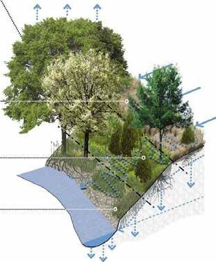
Vishwamitri river is the heart line of Vadodara city in Gujarat State, India. Its unique ecosystem comprises the main river corridor, its associated tributaries, ravines, small streams, creeks, wetlands, oxbow lakes, and artificially created ponds.
Historically, this rich ecosystem has provided natural floodwater control, groundwater recharge, and a habitat for diverse flora and fauna, thus promoting biodiversity and ameliorating adverse climatic conditions. The ecosystem has provided various communities alternative sources of irrigation, water supply, food, recreation, and livelihoods.
However, there is major deterioration of the river on account of rapid urbanization resulting into pollution, encroachment, and neglect. Because of that it has lost its cultural importance too in the process. The river now stays dry most of the time throughout the year so it is very important for source of the river to survive and to thrive in order to keep the river water flowing throughout the season.
The origin of the river is the most important place as it channelizes and forms larger river further hence it cannot be deteriorated. Therefore, this design project is an attempt along a short river stretch that enables the origin of river tributary to thrive and people to connect to it passively. This will eventually enhance the watercourse by bringing back its ecological and cultural significance through passive design approach.
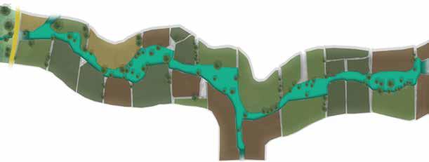
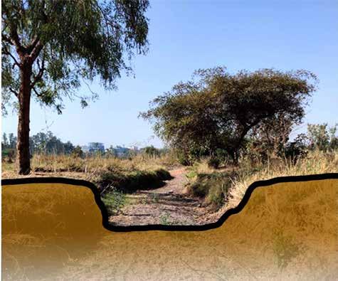
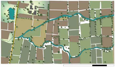
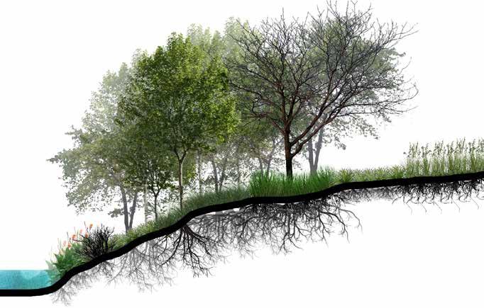
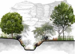
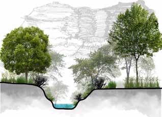
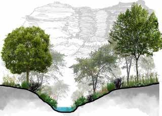
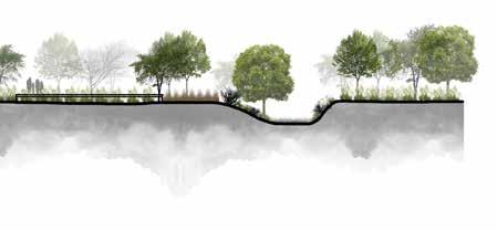
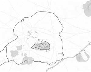
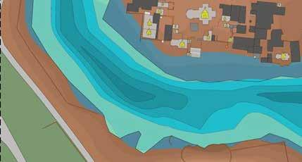
Water level during winters
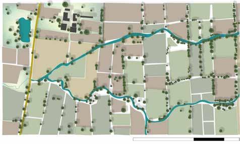
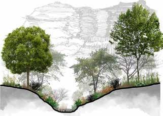
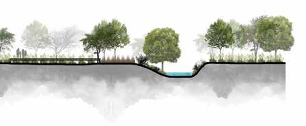
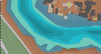
Water level during summers
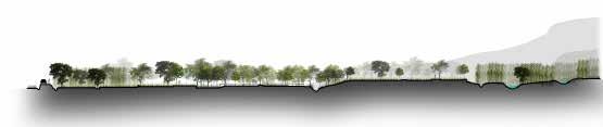
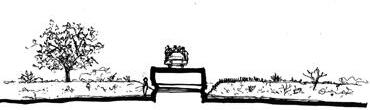
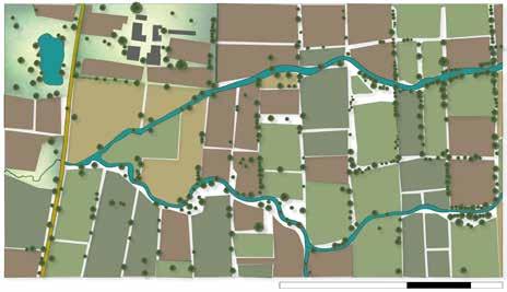
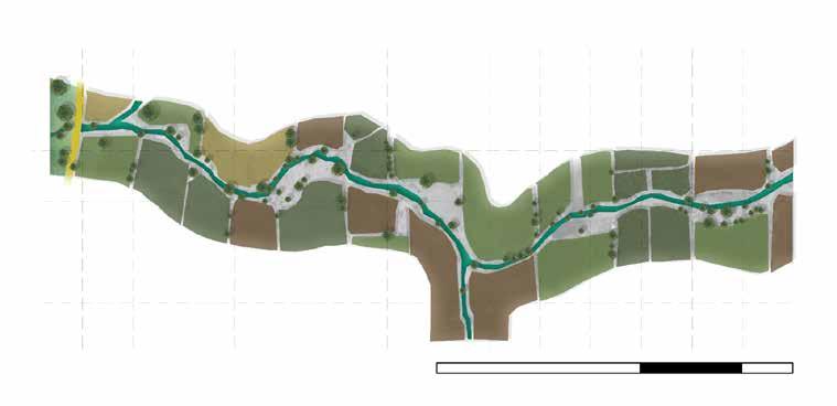
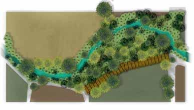
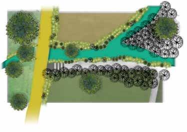
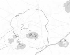
The sections show the land profile of the whole trail including the river bed and the change in type of vegetation throughout. Man-made changes have been made partially.
The stream through which Vishwamitri flows has not been hindered but a secondary canal network has been made in order to meet the demands of agricultural lands.
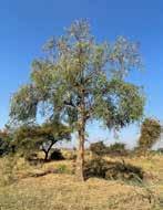
Natural vegetation has not been hindered instead new plantation has been done.
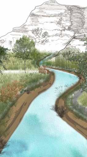
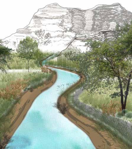
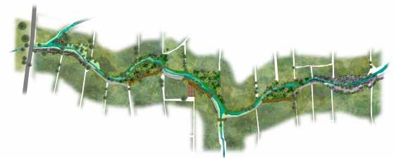
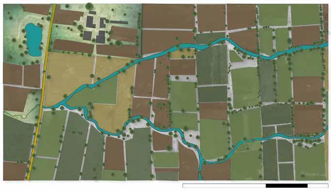
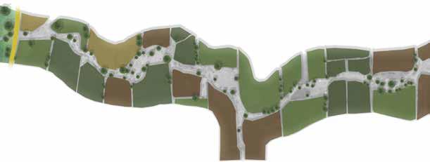
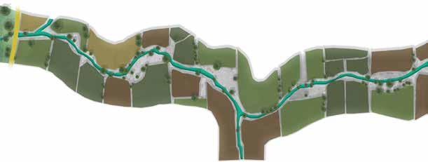
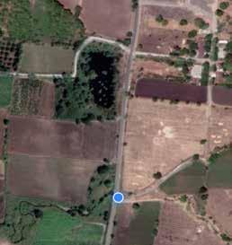
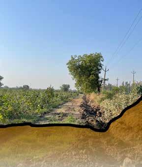
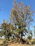
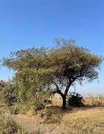
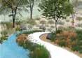
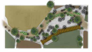
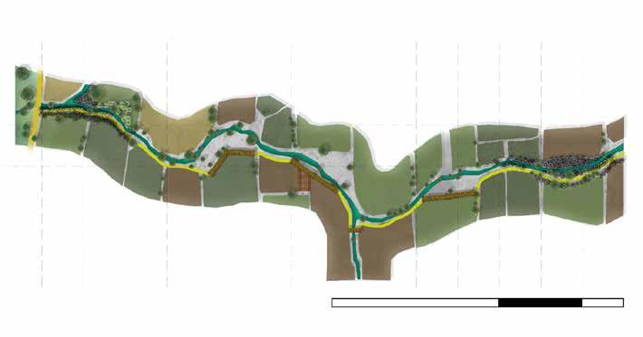
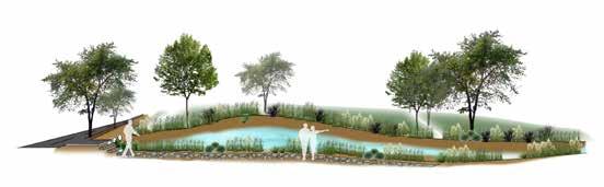
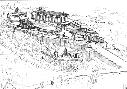
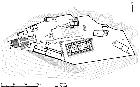
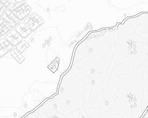
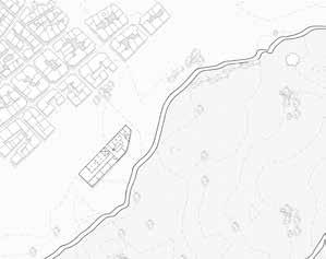
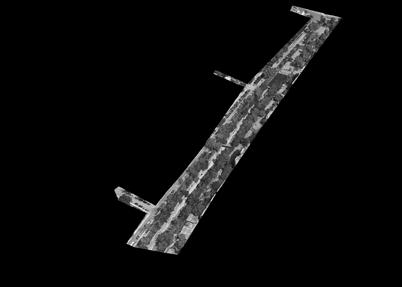
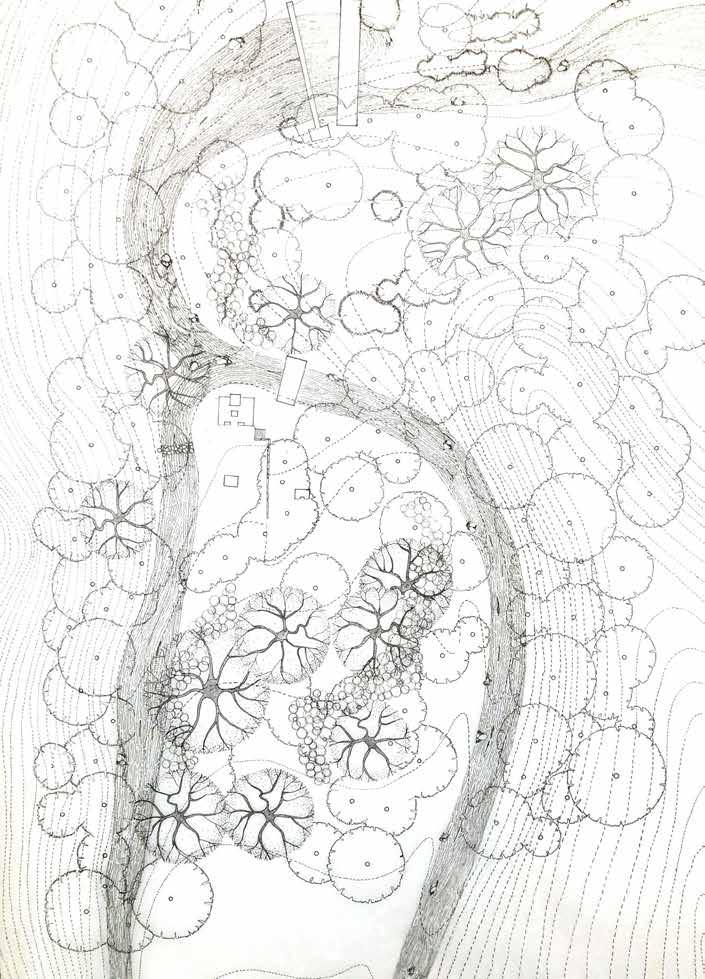
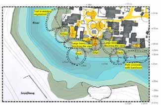
This design aims at creating a self-sustaining ecosystem while having a passive recreational space along 1 km long stretch of a river near the foothills of Pavagadh. One of the tributaries of origin of river Vishwamitri is situated in this region so it holds cultural importance, hence this area can be considered as a source of the river. Eventually, this design process will help the river thrive with its minimal design approach.
Passive Design Space
In this design, the spaces will be made with reduced human intervention where it can be approached visually but not physically. There will be free flow of movement while keeping the vegetation as well the river stream untouched and unhindered. All together this design will enable stream of the river origin to thrive by selfsustained ecosystem and will allow people to experience its cultural importance with minimal design approach.
Designing Stretch of a River
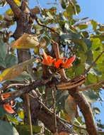
The most unique aspect of the site is that it is located near the foothills of Pavagadh where one of the tributaries of River Vishwamitri originates. So this place holds cultural importance.
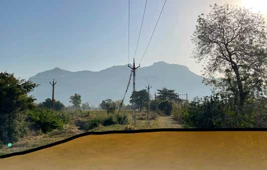
This river stays dry most of the time in entire year, so the spaces in this design will enable origin of the river belt to survive. With minimum design intervention and self-sustaining properties, this design will ultimately come together as a passive experiential space along with different physical and visual connections. It will also help the river belt to thrive as native plant species will be introduced to purify the river water.
The origin of the river is the most important place as it channelizes and forms larger river further hence it cannot be deteriorated . Therefore, this design project is an attempt along a short river stretch that enables the origin of river tributary to thrive and people to connect to it passively.
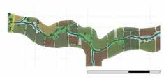
Design Development
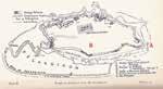
Buffer Zone Study - R. Vishwamitri
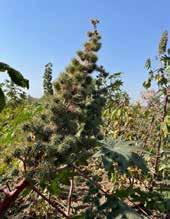
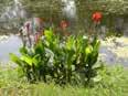
Canna x generalis (Canna
Pennisetum setaceum (fountain grass)
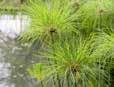
Cyperus papyrus (Papyrus)
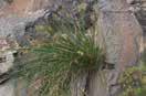
Scirpoides holoschoenus (Bulrushes)
Pennisetum purpureum (Elephant grass )
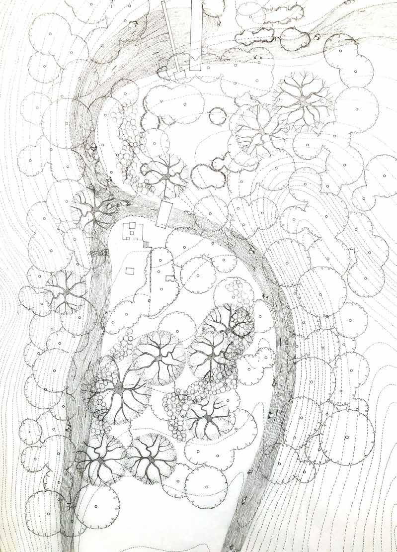
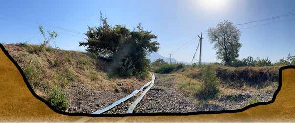
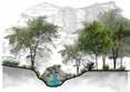
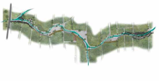
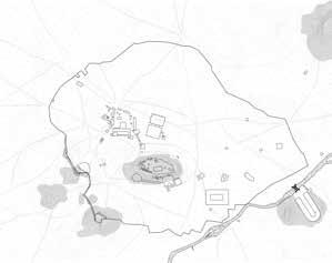
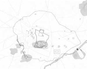
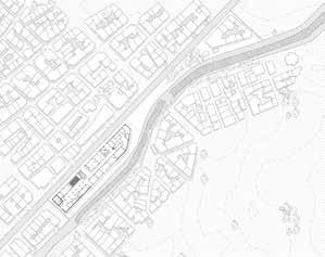
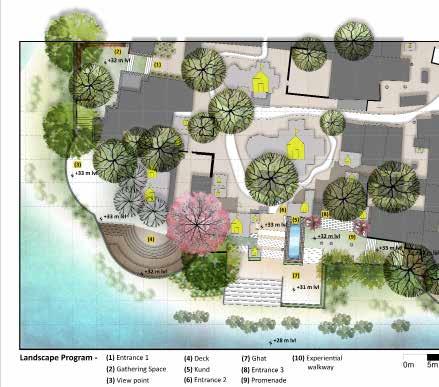
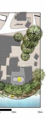
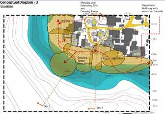
The Vishwamitri River emerges from the hills of Pavagadh and flows through the heart of Vadodara city in Gujarat. It empties into the Gulf of Khambhat. Sage Vishwamitra ,who the river is named after created a moksh-dwar (gateway to heaven) for downtrodden Hindu people at Kayavarohan, a village in the Vadodara district. The river is named after him. The experiential walkway is designed in a way that will make people experience the same journey from the origin of the river. The entrance and the assumed origin of river Vishwamitri follows same language with two pause points and raised platform making the area passively approachable.
Steps leading to the walkway with bamboo plantation on both the sides of the stream
platform connected to walkway
Origin Providing benches for people to take a break while walking towards the origin of the river Creating a “dwar” like structure with the help of bamboo plantation along a small part of river stretch
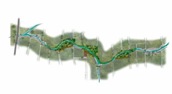
- Part Plan
- Part Plan
Pause Points
Steps leading to the walkway with bamboo plantation on both the sides of the stream
Origin
Creating a “dwar” like structure with the help of bamboo plantation along a small part of river stretch
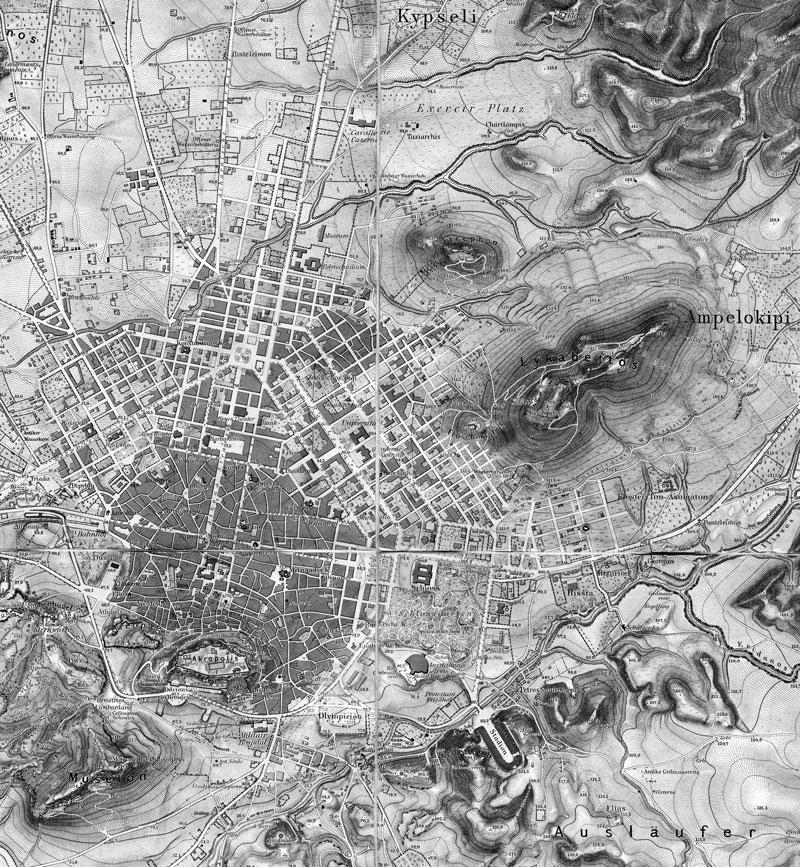
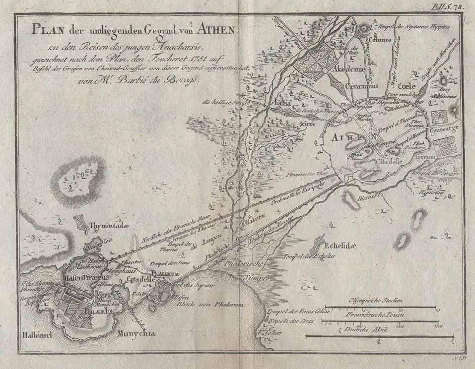
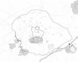
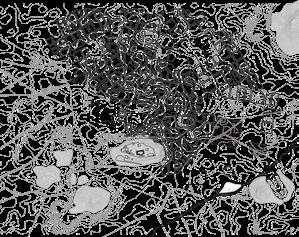
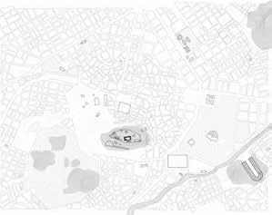
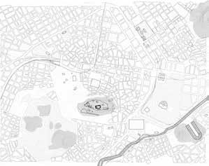
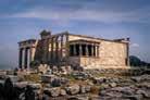
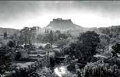
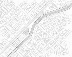
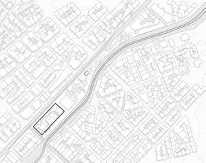
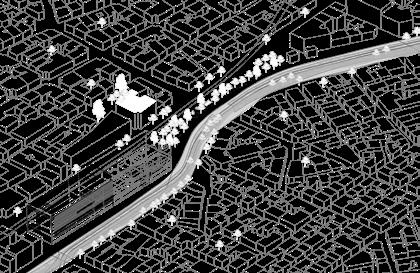
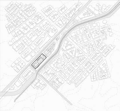
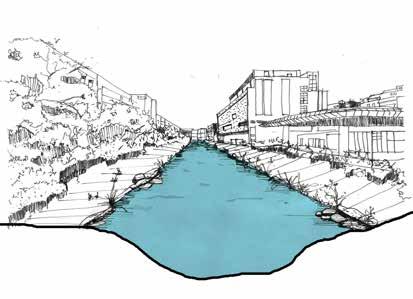
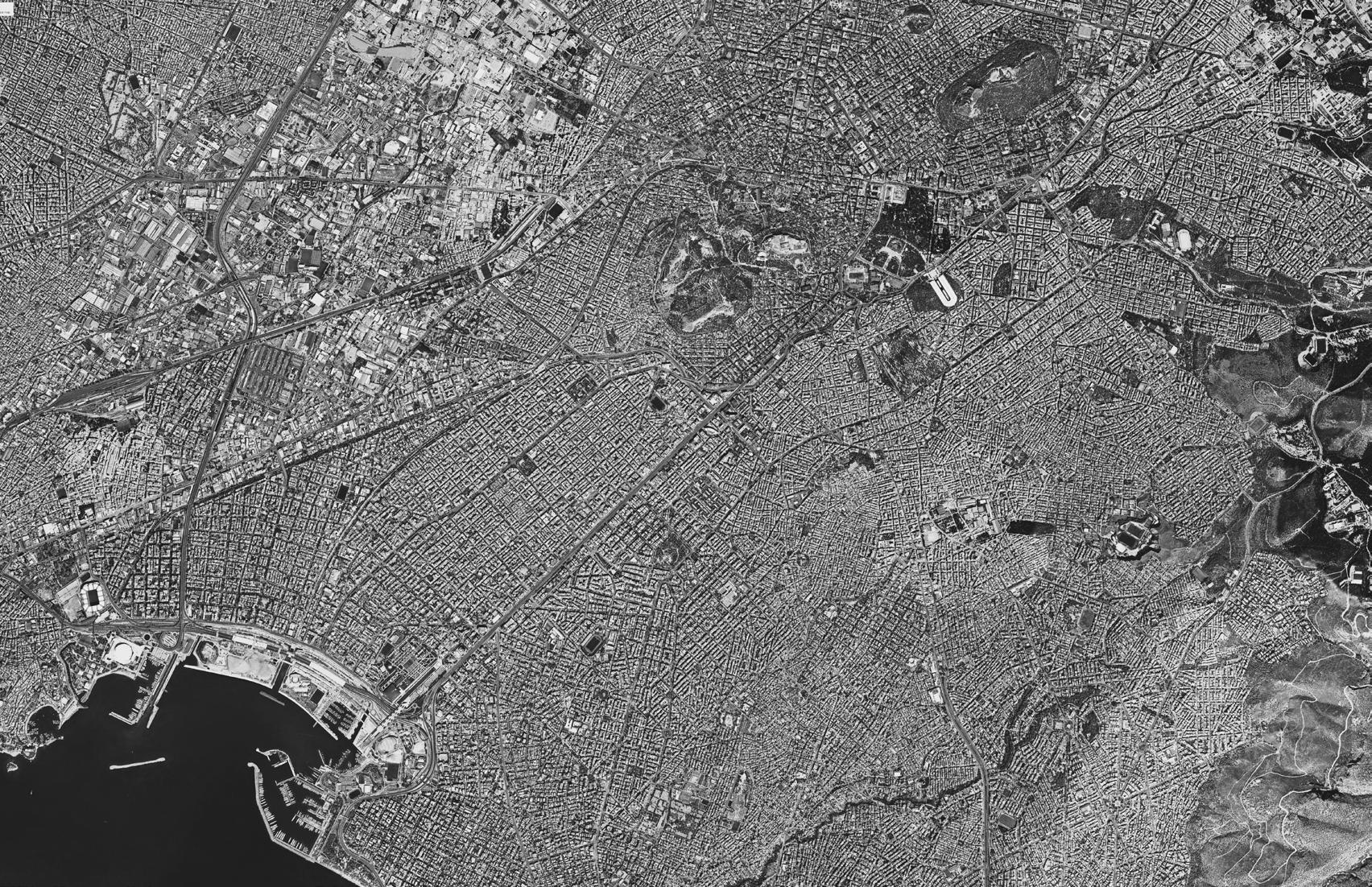
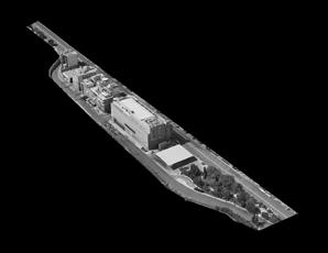
River Ilissos : Unveiling Urban Palimpsest
Exploring layers of Historical Monuments and Urban Landmarks of River Ilissos in the city of Athens
Location & Year : Athens, Greece (2024)
Type : Masters Thesis Project
Abstract -
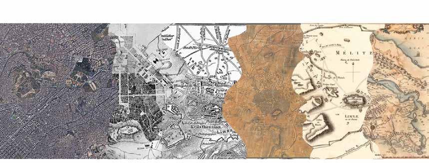
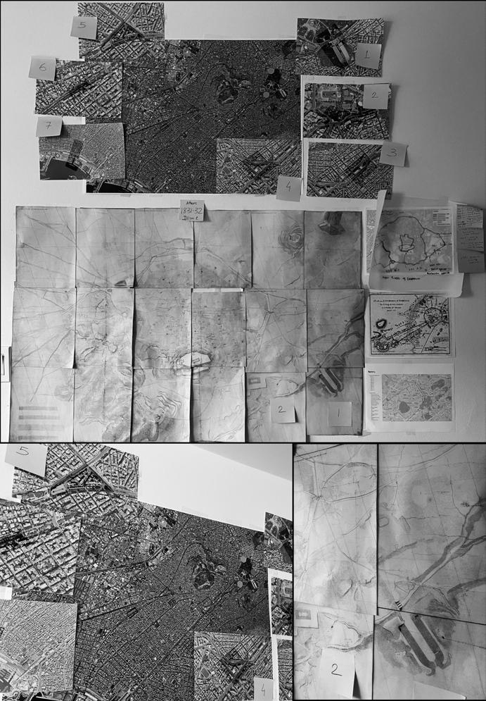
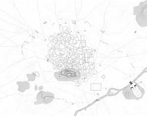
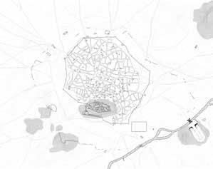
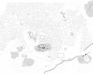
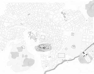
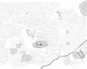
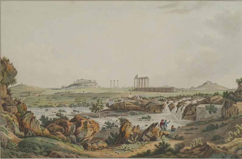
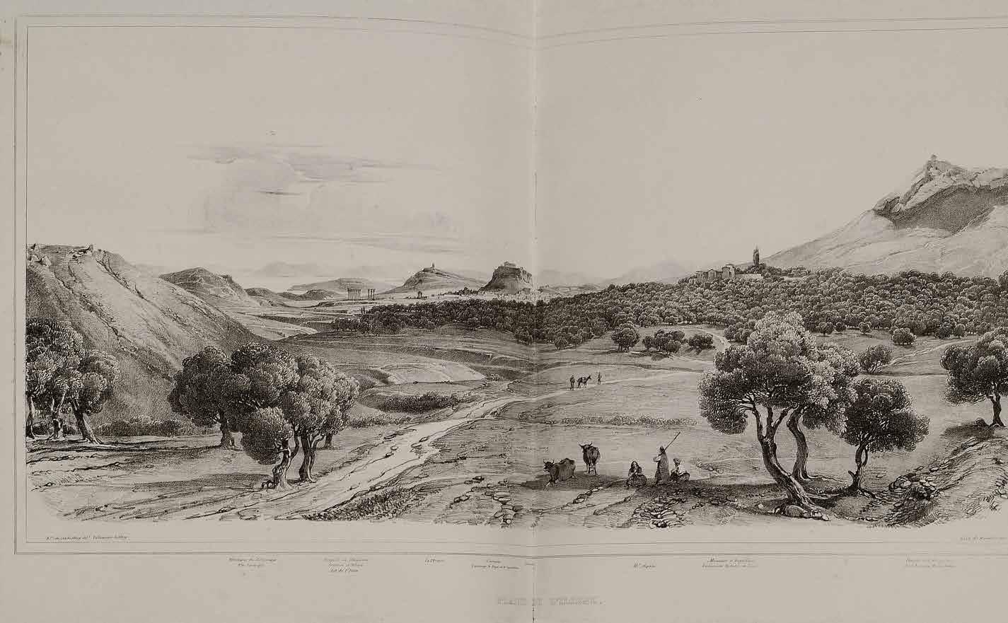
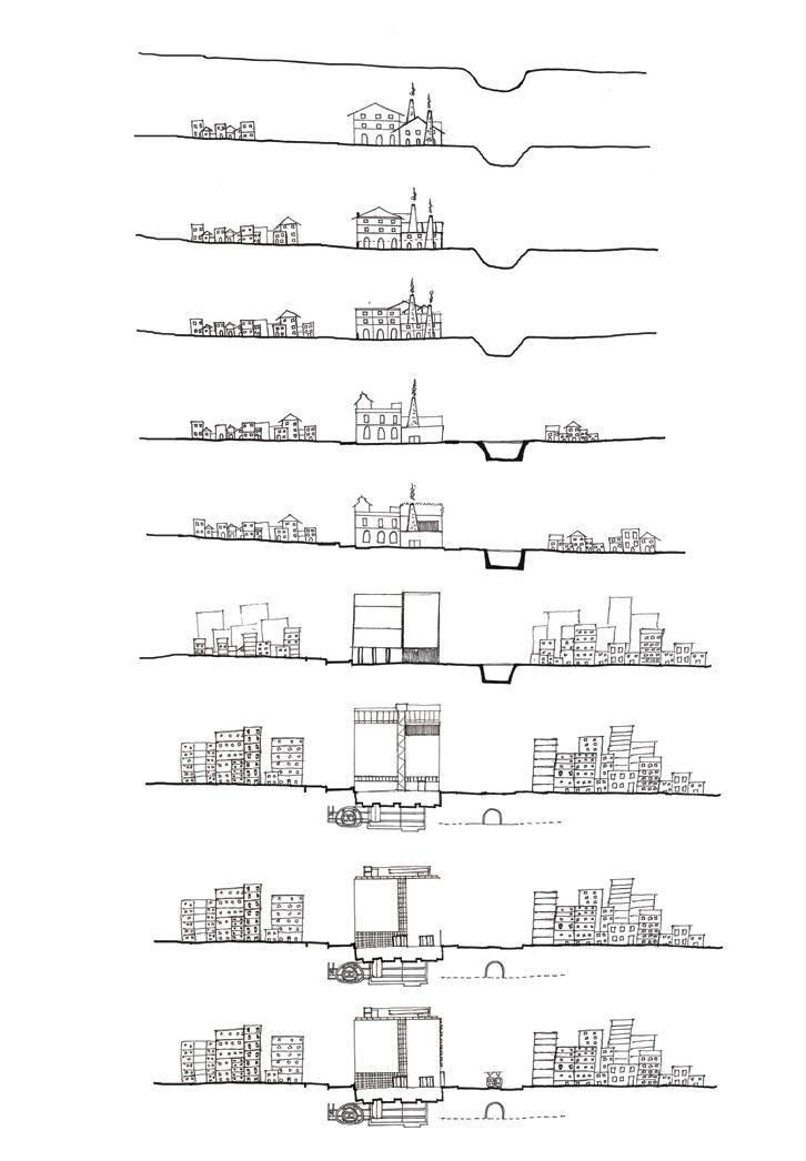
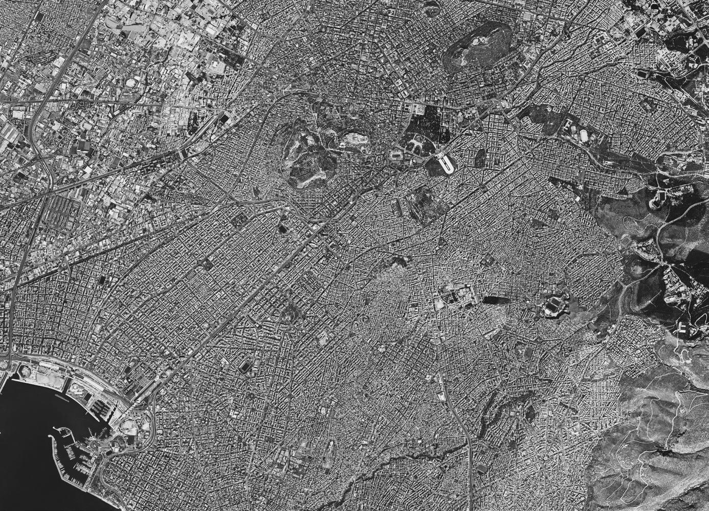
This thesis is a atlas-like documentation of the historical evolution of the Ilissos River (named after a god), once considered to be a person in the city of Athens, Greece. However, as urban power changed, so did the river. The river, outside the city, became a part of it, and as the city grew, it was integrated into the urban infrastructure, becoming an avenue. The river is prone to catastrophic flooding. By using the image of a palimpsest through the lens of the river, it seeks to reveal these stories in a sequence of detailed illustrations and drawings. It emphasizes two main urban landmarks and historical monuments along the river, covering a total of seven significant landmarks, terminating at the point where the river meets the bay.
Athens’ social and urban structure was formerly shaped by the Ilissos River, which ran alongside the Kifissos and Iridanos. The river was the focal point of the city of Athens and was regarded by every monarch as the city’s sacred river. Throughout its history, it served as waterfalls at a few points, fountains, and streams. However, problems with floods and urbanization forced the Ilissos River to be rerouted and eventually covered, leaving it little to serve as a channel flowing into the Faliro Bay. Although the river is covered, the Athenians are completely aware of its presence. The river is not forgotten. Through a comprehensive atlas-like approach to reestablish a connection with the river’s natural and cultural value and promote a more resilient and sustainable urban environment, it also makes suggestions for potential daylighting the river.
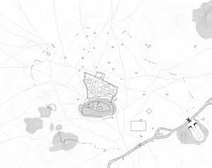
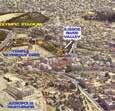
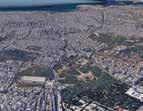
River on Historical Monuments and Urban Landmarks.....
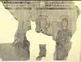
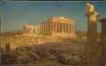
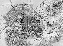
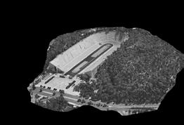
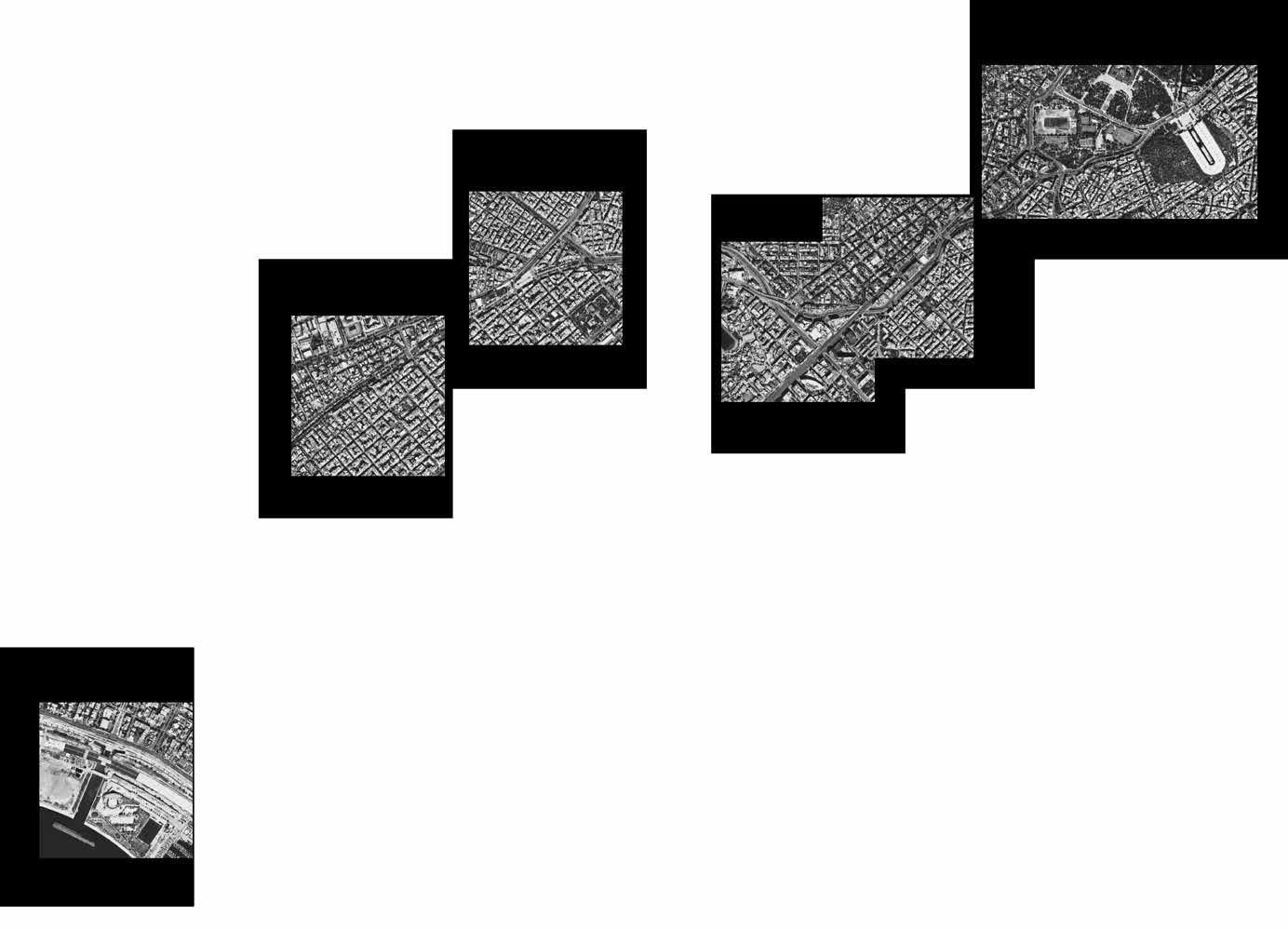
By using the image of the river, this thesis works as an Atlas documentation which seeks to reveal stories in a sequence of detailed illustrations and drawings, providing a comprehensive analysis of two primary landmarks and historical sites along the river with an overview of a total of seven historical monuments and urban landmarks along its bank, lastly flowing into the bay. The two historical monuments and landmarks include the National Museum of Contemporary Art (EMST) and Panathenaic Stadium.
The primary purpose of choosing the seven sites which are all along the banks of the Ilissos River, was to look into the layers of the river and how they have a relationship to the landmarks that are situated on its bank, both above and below ground. This facilitates comprehension of the river’s previously unexplored categories.
The main focal point is River Ilissos here because it has been considered the most important entity since ancient times. Although it flows as a drain into the bay and is covered with modern avenues, the river has not been forgotten by Athenians. They are very well aware of its existence even if it flows underground. The river is one entity but now 10 different municipalities handle 10 different stretches of the river, and it is not doing good to anybody in the context, but if we look at its past, it was considered as a person.
Furthermore, to bring back its value by documenting the river, if daylighting the river at a few stretches is possible, my analysis can support that suggestion as well.
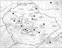
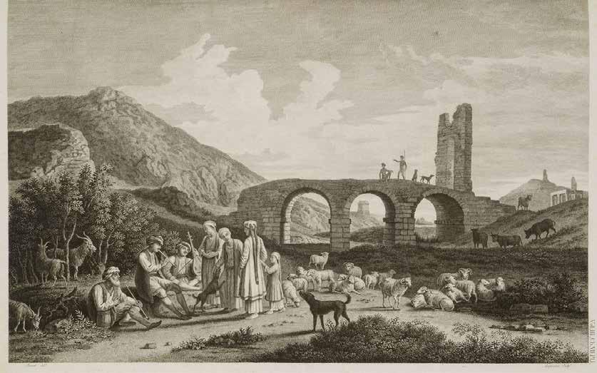
Sites
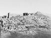
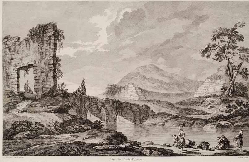
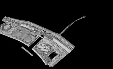
Panathenaic Stadium and Ardittos Hill
Holy Church of Saint Photine and Bridge of Otto
Playground Pl. KountouriotouKoukaki
The Ilissos River Diversion Point
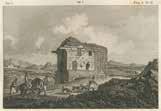
NMCA
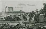
Órmos Falírou (Faliro Bay)
Ilissos Park
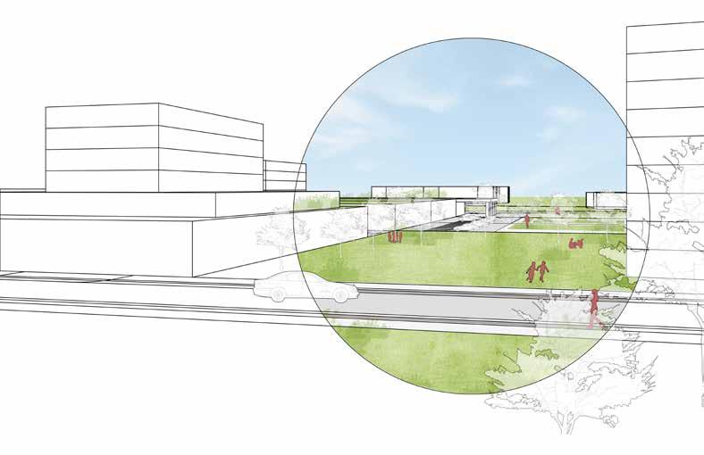
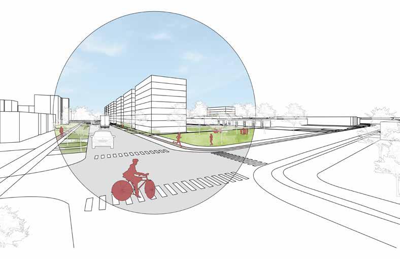
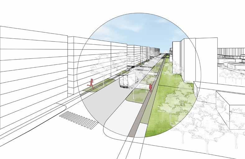
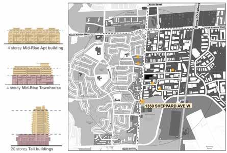
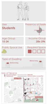
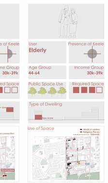
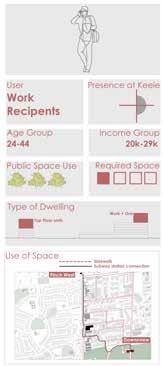
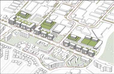
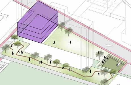
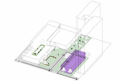
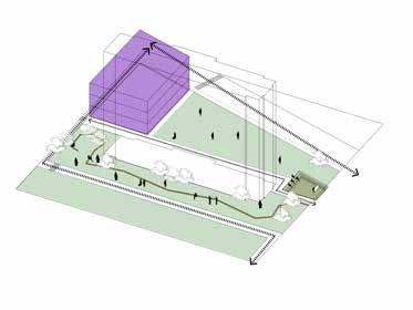
KEELE STREET IN TRANSITION
Preserving Employment Uses in General Employment Areas
Context
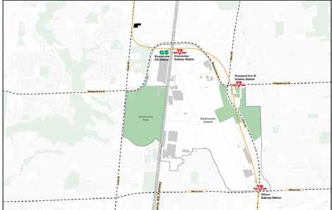
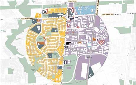
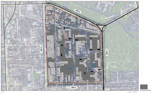
Downsview Airport is now being converted into a mixed use development projects with all the ammenities and facilities along with public parks, which will create a town in itself. This project is going to completely change the quality north york region.
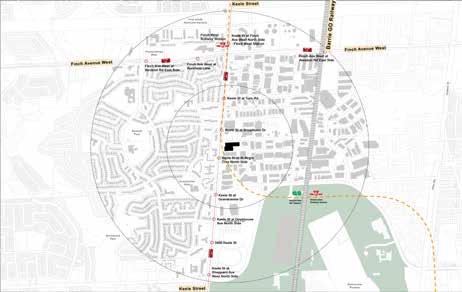
The site, 3711 Keele St is located exactly between the two min subway stations- finch avenue west and downsview. It falls under 20 mins proximity of the site, therefore, there is a potential of introducing new developments for transit oriented communities.
The east side of keele street is highly a place of employment which is not allowing any other activity to take place. The west side of keele street is highly residential. A strong division of the street quality is noticed on the Keele Street.
Keele St already has a diverse quality of uses which includes retail, medical services, religious spaces, storages, car services, restaurants. The missing quality on the keele st is enough common public places and residency which can add more life to the street.
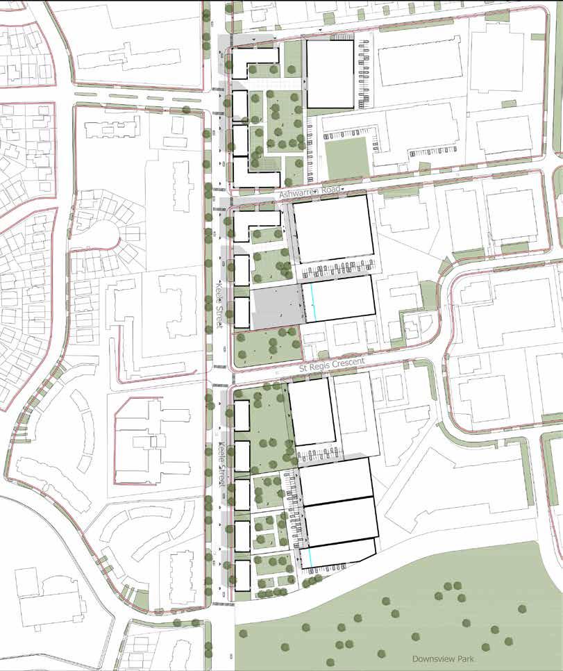
The main idea of this project is to preserve the employment land while providing opportunities for other functions to thrive on.
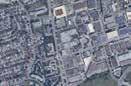
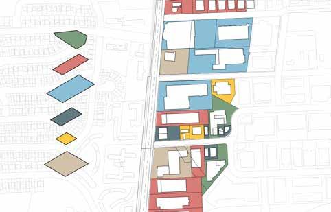
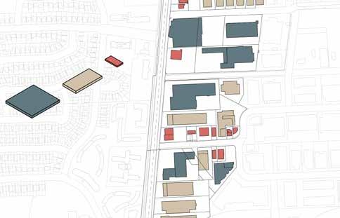
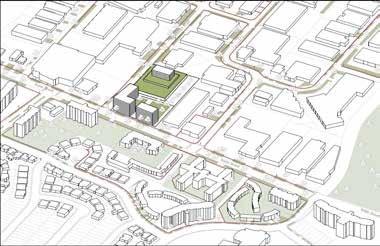
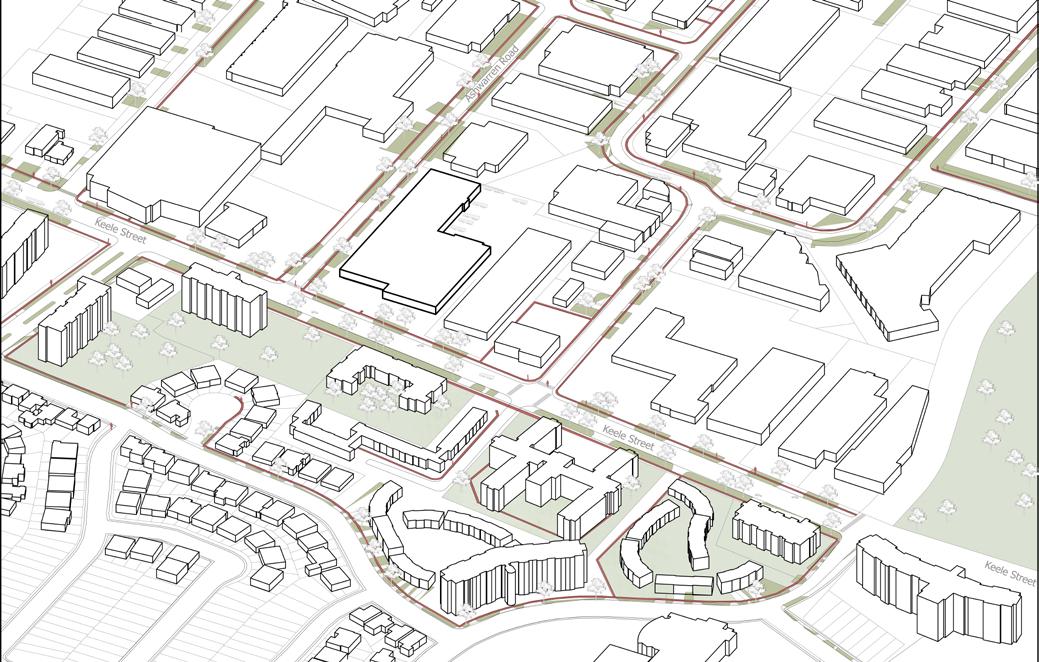
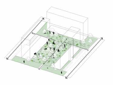
Site
Existing Site with setback of 4.5 meters
The Existing site only have employment areas.
Existing
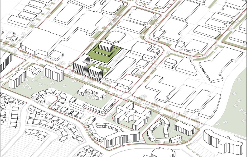
The Proposed Site includes the existing employment lands, residential housing, commercial buildings, places of worship, day care, parking and public spaces
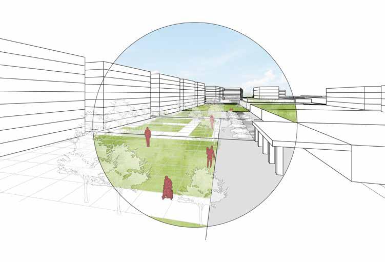
-
Space -
SpaceRoofttop -
HEALTH AND BUILT
ENVIRONMENT
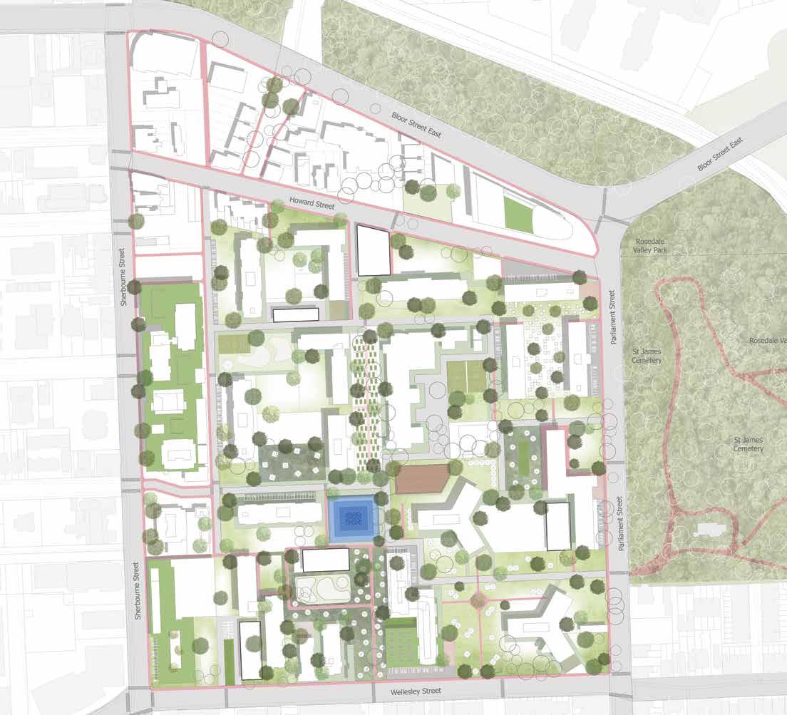
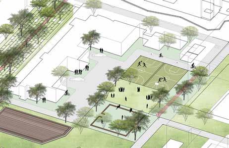
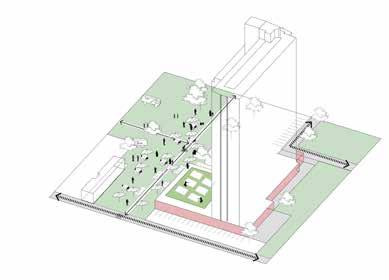
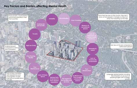
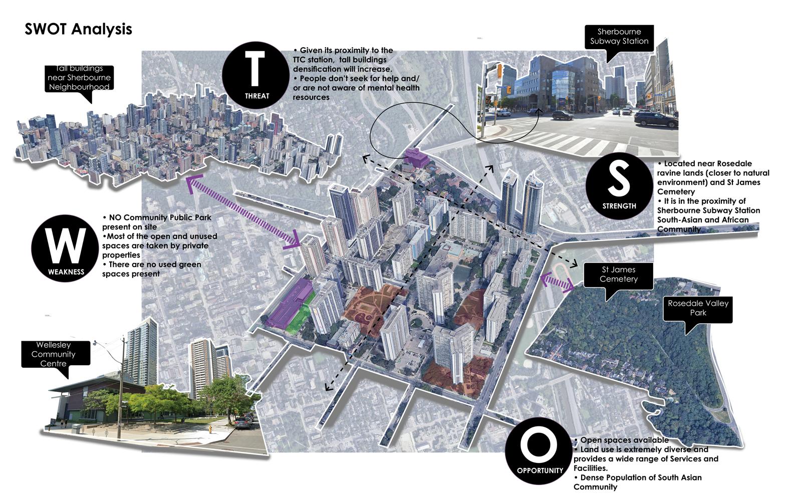
Mental Health and Stress among South Asian Immigrants in Toronto, Canada
Urban interventions in North St James Town helping mental health problems faced by South Asian immigrants in the city of Toronto
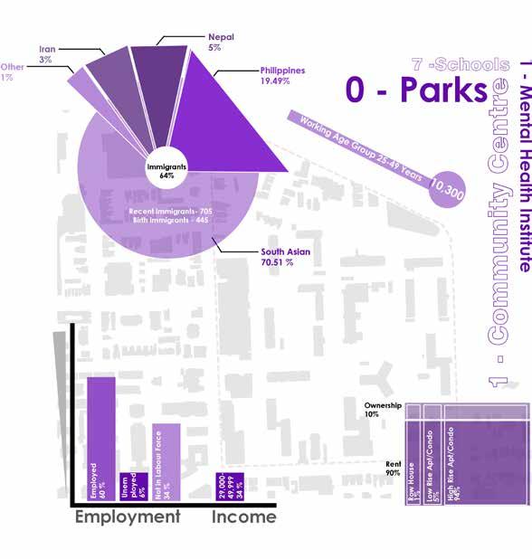
Over 17% of the foreign-born population were recent immigrants from 2016 till the present. Since the 1990s Canada has been accepting over 200,000 immigrants from around the world. In the past few decades, these immigrants have typically migrated from countries in Asia and Africa.
A majority of immigrants to Canada are “economic immigrants” from South Asia, and ethnic minorities are underrepresented in the mental health care system and have been known to underutilize mental health services.
World Health Organization defines mental health as “a state of mental well-being that enables people to cope with the stresses of life, realize their abilities, learn well and work well, and contribute to their community.”
Research Question - What contribution does increased community engagement and collaborative design have on developing public spaces for the mental well-being of South Asian immigrants
living in North St James ?
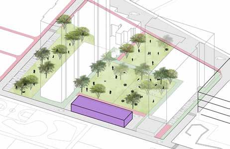
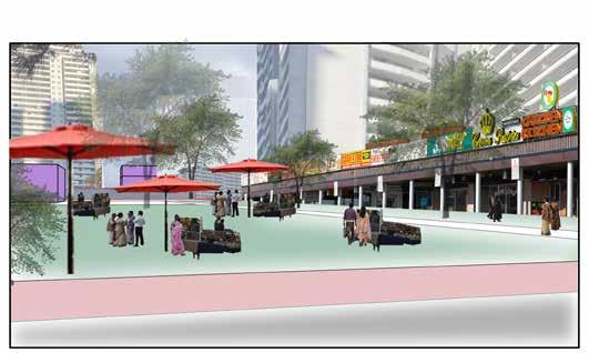
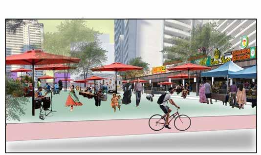
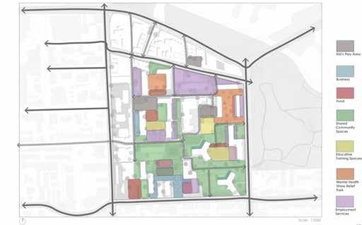
Event/Festival Spaces and Shared Community Gardens/ Multipurpose Building
Pet Park/Shared Community Spaces/Parking Lots/Charity Food Building
Meditation Space/Pet Park
School Gardens/Kid’s Play Area Market and Retail Spaces/ Kid’s Play Area/Outdoor Restaurant Spaces
Concept Diagrams and Functions: - The idea for North of St. James Town includes several installations, including art made by the community, clothing donations, drinking water, pet waste supplies, access to all libraries and tools, and a few charitable installations, in addition to offering urban spaces for the community
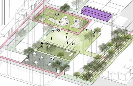
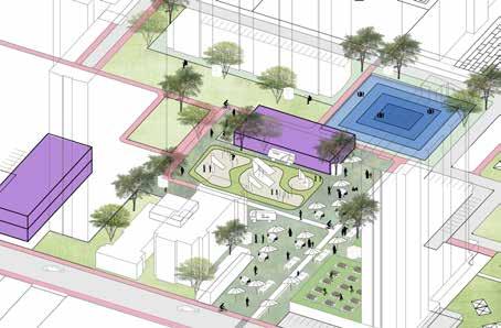
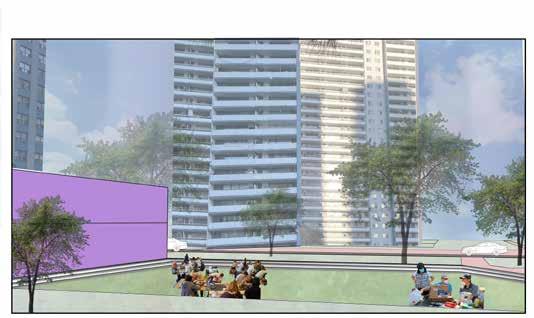
Typical Day
There is less activity on a typical day in the St. James Town neighbourhood close to Wellesley Street. With community shopping for household necessities, it seems to be just another day in the town.
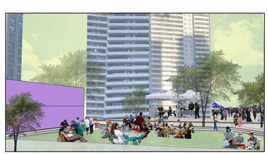
Weekends
In contrast, it seems like there is more activity on weekends in the St. James Town neighbourhood. People may use the open communal area most actively for the weekend small business market. Though it appears to be simply another day in the town, this area might be used flexibly for outdoor eating businesses along with tasks like grocery shopping. As word of mouth is crucial in this situation, it promotes the community to profit from small businesses.
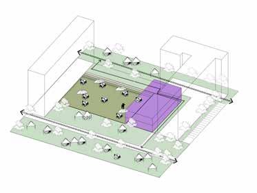
Typical Day
Training Space
Weekends
An educational space can double as an outdoor workshop on a typical day for those who wish to learn how to use tools, sew clothes, and perform small-scale house repair tasks on their own. When the community wants to know fundamental daily information, the stakeholders may approach them during a regular day.
On weekends, adults, kids, and senior citizens could all get educational programming in the same location. The community could potentially use this area as a creative activity space. The area behind these stair-step seating could be utilized for festivals or events. The entire area has the potential to provide a flexible program depending on the situation.
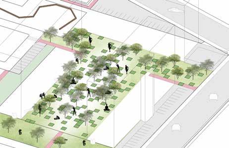
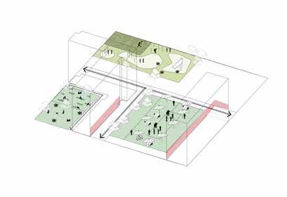
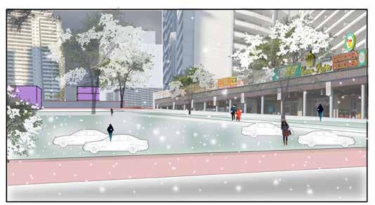
Winter Days
The area might be used for parking for the nearby restaurants and retail stores since winter is the most difficult time for several people and they dislike being outside.
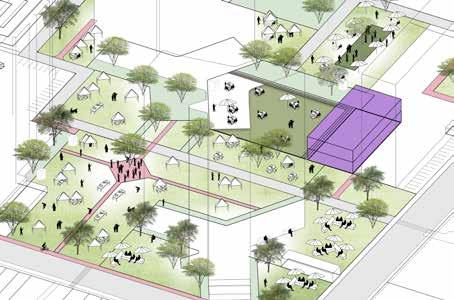
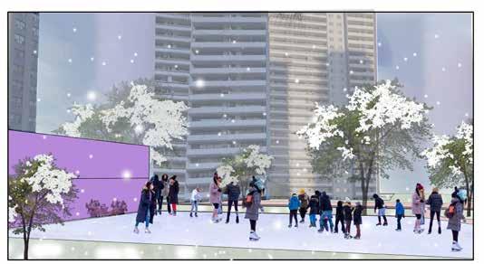
Winter Days
This area near Parliament Street and Wellesley Street may be completely covered in ice, which makes it the ideal place for ice skating lovers. In addition, the outdoor workshop area may be relocated to the multipurpose building next to it, allowing people to continue using it for everyday purposes.
Educative
Underground/Surface Parkings
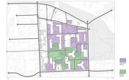
Urban Design Principles
Improved Internal and External physical connections, Public Interactive spaces
Employment Opportunity and Awareness Spaces, Increased Resources, Educative Spaces, Spaces for Workshops
Community Gathering Spaces, Green spaces
Zoning Diagram
PLANTING DESIGN
Zone of Seperation
Location & Year : Bhayli Lake, Vadodara, IN (2019)
Project : Designing a public friendly eco-trail
Type : Group initiatives that eventually divided into independent projects
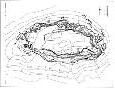
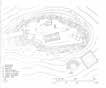
The Bhayli lake created its own ecosystem; scratchy and uneven. Additionally, because of the lake’s steep slope, erosion occured frequently.
Each of the landscape students initially had to travel to the lake as part of a class project. Then, we all developed site-specific drawings and recorded significant data, including ground and contour levels, tree positions, public usage, and site condition. We endured on the scene for a few days to observe any corresponding changes before selecting each section of the riverbank and beginning our study.
The goal of this course was a to-and-fro process of learning the techniques of planting, designing shrubs, trees, ground covers, and civil work keeping the existing levels in mind creating new levels as per the need on-site as well as drafting them on paper. These are hand-drawn technical drawings that I made as a result of the planting design plan of action, complete with exact ground level and plant sizes and distances between them. (c/c)
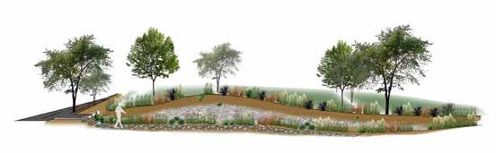
Design Objective - My main concept was to build a public ecological route that would have supported both thriving wildlife and an unusual canopy of lovely blooms that would have drawn people’s attention to it. In order for visitors to experience the lake and its innate nature as well as appreciate it while walking on the trail, the area was effectively defined and had a sufficient number of public interactive places. The aim was for guests to enjoy a cup of tea or coffee from the kiosk that would have been built on the site while sitting under a tree and listening to the sound of the trees rustling. The design also contained cascade waterbodies, which filtered the lake’s water and provided a unique walking experience for those who visited. The plant components had visually appealing textures and hues that added to the lake’s character.
Civil Design Drafting
Ground covers and Grasses Design Drafting
RESEARCH STUDY
Bathing Kund
Location & Year : Sitamata Forest, Rajasthan, India (2018)
Project : Designing a bathing kund.
Type : Group initiatives that eventually divided into independent projects
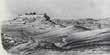
The location has numerous holy hot springs, which are not far from Udaipur. Priests visit an ashram close to the river every day to worship and perform rituals, but first, they wash their feet in the water of the river.
All of the students majoring in landscape design were required to remain in the Sitamata Forest for four to five days as part of this research and study program. During this time, we explored the entire sanctuary, took the necessary photos, marked the trees, measured their sizes, measured the diameters of their trunks, measured the ground levels, determined their contours, and then came up with a plan with the precise tree markings and tree species that are depicted on the plan. The entire drawing is the result of collective work that includes night and day precision hand drawing using technical pens. In an effort to fully represent the distinctive characteristics of the land and the trees, we also created a few elevations and sections of the entire site as well as of all the different species of trees in detail with branching systems.
Our task following our trip to Sitamata was to choose a site location from the entire region and complete the individual assessments as detailed below.
Design Objective - The project’s major objective was to create a bathing kund connected to the existing river of the sanctuary for pilgrims to take baths before and after their prayers which are based on its historical and cultural importance.
The bathing pond, or kund, was split into sections for men and women in this design. Either they can take a bath, or they can simply dip and wash their feet. They can either take a bath or just dip and wash their feet. Because this area of the forest is not well known, few people visit it, so the seclusion was preserved. Around 5–6 persons might be accommodated at a time in a Kund.
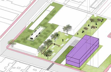
AUGMENTING URBAN GREENS
Reviving Ghats And Recreating Spaces
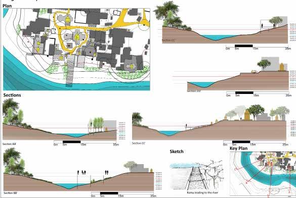
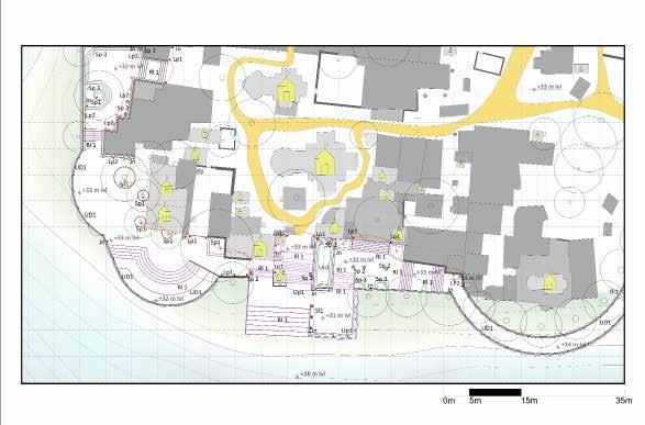
Location & Year : Vishwamitri River, Vadodara, Gujarat, India (2020)
Project : Augmenting Urban Greens
Type : Group initiatives that eventually divided into independent projects
All of the students were required to personally visit the location for this studio exercise in order to collect the necessary data, which included measurements of the site’s contour levels, walkway widths, biodiversity, number of temples, types of people, forms of activity, sound and activity mapping, etc. Each student was required to select a site patch and do a SWOT analysis, which led to individual designs, based on the group study.
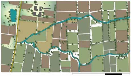
As the riverfront was mostly a deserted location with religious significance and crumbling steps to the river, my site was situated close to the major temple of the site. I completely reworked the riverbanks in this design. To restore the significance of the location, I created an appropriate entrance to the bank and temple, established new walkways, created a gathering area and a Kund for religious purposes, and restored the Ghat. Overall, the new strategy was merely a minor architectural adjustment for the historic holy site that integrated with the neighbourhood in the Vadodara District along the Vishwamitri River.
Design Approach
Strength
Ghat and Samadhis
Vegetation and Views
Weakness
Connectivity to Ghat
Garbage dump
Growth of invasive plant species
Design Development Stages
Opportunity
Wide Open Grounds
Vegetation on the opposite side of the river
Conceptual Diagrams
Crocodiles and Snakes
Inundation of water
This stage includes gathering spaces and steep steps towards the water from the Ghat without levelling the platforms N
Vision Statement -
To develop a passive recreation area that also increases Ghat’s accessibility. Through various settings at various altitudes connected to the river, this design attempts to provide numerous visual and tactile experiences. Together, it creates a different experience from city living, and the local plant species help the area blend in. This design will ultimately assist in the site’s cultural worth being recovered.
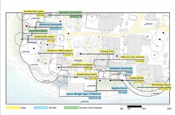
Design Development
Grasses and Creepers
Shrubs Trees
RESIDENTIAL LANDSCAPE DESIGN
Residential
Landscape Construction
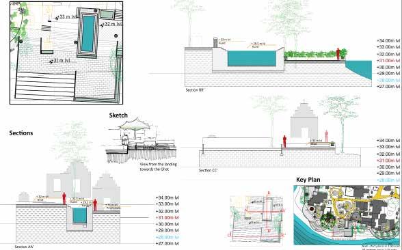
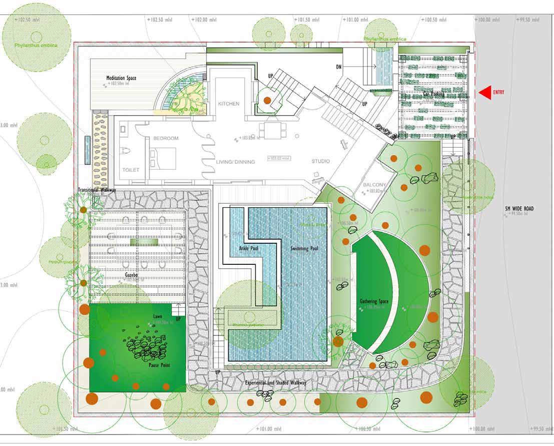
Design Drawing for a Private Guest House in the City of Udaipur, Rajasthan
Location & Year : Udaipur, Rajasthan, India (2020)
Project : Designing Landscape on existing Residential House Type : Group initiatives that eventually divided into independent projects
Client Brief - “I and my wife both are doctors, recently married with limited but quality have time early in the morning till about 8:00 a.m. and post 8 p.m. at night with weekends for us. We have selective friends who visit us during weekends and often spend time as one large family.“
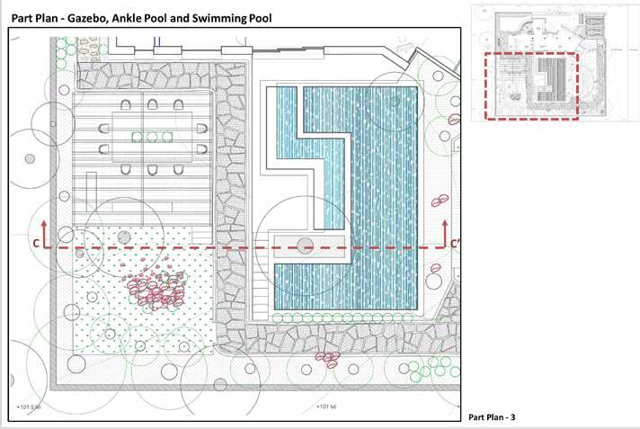
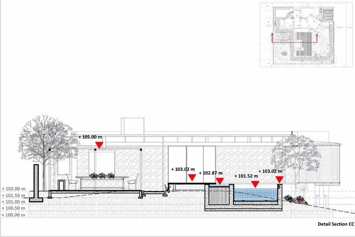
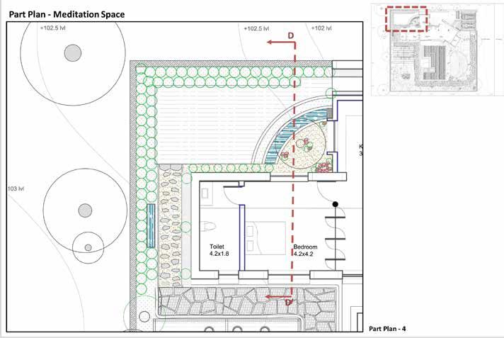
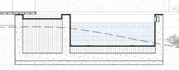
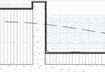
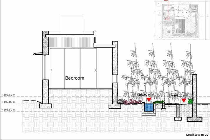
In response to the client’s proposal, the home was planned to include areas for regular physical activity, such as a meditation area with relaxing bamboo water sounds as well as swimming pool, since it was assumed the doctor pair would need a place to exercise or meditate. I also made a few gathering spots for friends to hang out, such as a tiered sitting area and a gazebo. The ground had a slope so that an experienced pathway with gradually shifting levels ran around the whole perimeter of the house. The residence also had a paved car parking space and a few planters to complement Udaipur’s hot and arid plant palette. The residence also included an ankle pool where the husband and wife could relax after a long day at work. Overall, the landscape provided the quality and elegance required for the existing stone house.
Part of the design includes a gazebo, an interactive pathway, and swimming pools
Part Plan of the Meditation Space
Detailed section cutting through the gazebo, walkway and two pools
Detailed section through the residence and meditation space