Passive Design Approach Along Watercourse
A landscape model to enhance cultural importance along watercourse
by Ashna Modi

Along Watercourse 2 Page Intentionallty Left Blank
Passive Design Approach

PASSIVE DESIGN APPROACH ALONG WATERCOURSE
A THESIS SUBMITTED TO THE SCHOOL OF ENVIRONMENTAL DESIGN AND ARCHITECTURE,
AS PARTIAL FULFILLMENT OF THE REQUIREMENT FOR THE DEGREE OF BACHELOR OF DESIGN (LANDSCAPE) 2020 -2021


Passive
3
Design Approach Along Watercourse
Ashna Modi
Priyanka Kanhare Patel Pratyush Shankar
Student Guide
Dean SEDA
Design Approach Along Watercourse 4 Page Intentionallty Left Blank
Passive
Declaration
I hereby declare that the thesis titled Passive Design Approach along Watercourse is an independent work by me and has not been submitted at any other forum.
I am submitting this work for as partial fulfillment of the Thesis course for the Bachelor of Design (Landscape) Program at SEDA, Navrachana University.
In my capacity as a guide of the student’s thesis, I certify that this work can be submitted for partial fulfillment of the Thesis course for Bachelor of Design (Landscape) Program at SEDA, Navrachana University.
Priyanka Kanhare Patel - Guide
Passive Design
Along Watercourse 5
Approach
Ashna Modi – Student
Along Watercourse 6 Page Intentionallty Left Blank
Passive Design Approach
Acknowledgement
First and foremost, I would like to thank my thesis mentor Priyanka Kanhare Patel. Without her assistance and dedicated involvement in every step throughout the process, this thesis would have never been accomplished. I would like to thank you very much for your support and understanding over these past pandemic months.
I take this opportunity to express my gratitude to all of my Design Department faculty members of SEDA for their help and support. I might want to pay my unique respects to Prof. Pragya Shankar for always guiding me and supporting me throughout my time at this school. She has always been my ongoing source of inspiration.
Most importantly, none of this could have happened without my family. I would like to thank my parents and my entire family for their unshaken support through my journey and giving me the opportunity to learn and explore my interests.
Getting through my thesis required more than academic support, and I have to thank Binoli Patel, Dhrumi Patel, Jay Choudhary, Ryan Bhadlawala,Tanvi Patel and Yash Bokil for listening to and, at times, having to tolerate me over the past four years. I cannot begin to express my gratitude and appreciation for their friendship and support.
Lastly, I would like to thank Varun Sangani and my fellow classmates for their immense support and guidance through the past 4 years.
Passive Design Approach Along Watercourse 7

Passive Design Approach Along Watercourse 8
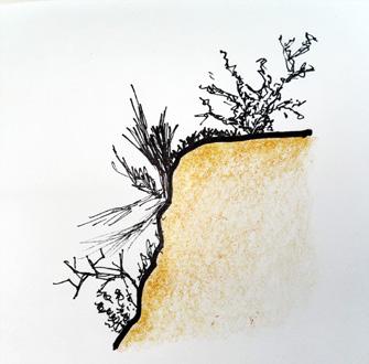
fig 1. Sketch of Pavagadh Hills
Abstract
Passive Design Approach maintains a comfortable temperature within the design space using the basic landscape features to get the optimum benefit and to reduce or eliminate the public intervention. And the idea of passive design in a landscape design project can be achieved to the fullest when it is implemented near a watercourse by taking advantage of the landscape features (refer chapter 1) at a micro level.
Vishwamitri river is the heart line of Vadodara city in Gujarat State, India. Its unique ecosystem comprises the main river corridor, its associated tributaries, ravines, small streams, creeks, wetlands, oxbow lakes, and artificially created ponds. Historically, this rich ecosystem has provided natural floodwater control, groundwater recharge, and a habitat for diverse flora and fauna, thus promoting biodiversity and ameliorating adverse climatic conditions. The ecosystem has provided various communities alternative sources of irrigation, water supply, food, recreation, and livelihoods. But there is major deterioration of the river on account of rapid urbanization resulting into pollution, encroachment, and neglect. Because of that it has lost its cultural importance too in the process. The river now stays dry most of the time throughout the year so it is very important for source of the river to survive and to thrive in order to keep the river water flowing throughout the season.
The origin of the river is the most important place as it channelizes and forms larger river further hence it cannot be deteriorated. Therefore, this design project is an attempt along a short river stretch that enables the origin of river tributary to thrive and people to connect to it passively. This will eventually enhance the watercourse by bringing back its ecological and cultural significance through passive design approach.
Passive Design Approach Along Watercourse 9
1.1
1.1.2
1.1.3
1.1.4
1.1.5
1.1.6
1.1.7
2.1
2.1.1
2.1.2
2.1.3
2.1.4
2.1.4.1
2.1.4.1.1
2.1.4.1.2
Passive Design Approach Along Watercourse 10 Contents.
Introduction...............................................................13
01.
Impacts of landscape features on a design..................14
Climate................................................................14
1.1.1
Microclimates......................................................14
Land....................................................................15
Land Use.............................................................15
Water...................................................................16
Vegetation...........................................................16
Topography..........................................................17 02. Preface.......................................................................19
Case Studies................................................................20
Timba Basalt Quarry Restoration........................20
Red Ribbon Park / Turenscape...........................21
Mother River Recovered: Qian’an Sanlihe Greenway...............................................22
A
Rivers and its Cultural Importance......................24
Rivers and the cultural importance of its origin............................26
Ganga : Gangotri Glacier.........27
Krishna : Mahabaleshwar.........28
Inference......................................................................29 2.3 Research Questions.....................................................30 2.4 Aim...............................................................................30 2.5 Objectives.....................................................................30 2.6 Methodology.................................................................30 03. About River Vishwamitri..........................................31 04. Study Area.................................................................32 05. Site Delineation.........................................................34 06. SWOT Analysis.........................................................34 07. Observing the channels of water............................36 08. Site Study..................................................................38 09. Site Analysis..............................................................42 10. Water Level................................................................58 11. Vision Statement.......................................................60 12. Designing Stretch of a River....................................60
2.2
Passive Design Approach Along Watercourse 11 Contents. 13. Passive Design Space..............................................60 14. Design Program........................................................60 15. Conceptual Diagrams...............................................64 15.1 Conceptual Diagram : 1..............................................64 15.2 Conceptual Diagram : 2..............................................66 16. Design Development................................................68 16.1 Widening of the river and Improving of the ground line.....................................70 16.2 Buffer Zone................................................................72 16.2.1 Introduction.....................................................73 16.2.2 How will a buffer zone work along a stream of R. Vishwamitri.............................................73 16.2.3 Plant species for buffer zones.........................74 16.2.4 Conceptual Sections.......................................75 16.2.5 Part Plans..................................................77,79 16.3 Experiential walkway..................................................80 16.3.1 Entrance..........................................................82 16.3.1.1 Views.................................................83 16.3.1.2 Conceptual sections..........................85 16.3.1.3 Part Plans.....................................87,89 16.3.2 Pause Point and Board Walk...........................90 16.3.2.1 Views................................................91 16.3.2.2 Conceptual Sections.........................93 16.3.2.3 Part Plan......................................95,97 16.3.3 Origin of the River Stream..............................98 16.3.3.1 Views.........................................99,101 16.3.3.2 Part Plans................................103,105 17. Master Plan Layers.................................................106 17.1 Entrance and Origin of the River Stream.......................................107 17.2 Buffer Zone...............................................................109 17.3 Experiential walkway.................................................111 18. Master Plan..............................................................113 19. Site Section.............................................................115 20. Bibliography............................................................116 21. List of Figures.........................................................118
01. Introduction
1.1 Impacts of landscape features on a design
1.1.1 Climate
1.1.2 Microclimates
1.1.3 Land
1.1.4 Land Use
1.1.5 Water
1.1.6 Vegetation
1.1.7 Topography
Passive Design Approach Along Watercourse 12
01. Introduction
Landscape consists of the geographic features that mark, or are characteristic of, a particular area. And a natural landscape is made up of these main features-
i. Climate
ii. Land
iii. Water
iv. Vegetation
iiv Topography
And in combination of these features, landscape is formed. Each of these features are inter-related and interdependent. All the living things are interdependent and landscape is where all they come together.
Landscape provides context that is built and for the activities of our daily lives. Anything that is built in landscape needs to take into account its surroundings and its situation to be sustainable and successful. All together, these features have impact on a design site in one way or the other.
All landscapes are defined by the sum of the attributes for better or worse. Geology, soils, topography and water features are all elements of landscape character. To these elements, plants can be added which can be the most defining elements of landscape. A forest is a very different place from a prairie. The way animals have used land may change the character of landscape. Beaver dams, for example, can change a landscape overnight. Animal grazing can also have very visible impacts. However, the human animal often has the most profound influence, with built forms making a strong impact on the landscape, and intensive land uses such us forestry can utterly erase or radically restructure the landscape.
Passive Design Approach Along Watercourse 13
1.1
Impacts of landscape features on a design
1.1.1 Climate
There are four broadly defined climatic regions of the globe. These are cold, cool-temperate, warm-humid and hot-dry regions. Each of these have distinct types of vegetation and topography. The kinds of human activities that take place in these four regions are all very different as well.
The seasons animate landscapes throughout the year. The rhythms and patterns of daily life change slowly from one season to next, giving life pleasing texture and experience. The seasons make planting choices exciting, with something new to look forward to in each season. Some plants give full measure in every season.
1.1.2 Microclimates
The patterns in which we use everyday spaces, such us urban squares and gardens are shaped largely by microclimates. Again, climate in this sense refers to an average of conditions on a given site, but in this case to a very specific location. It is important for planting choices and affects the way people use a space. In winter, a square with a little shade might be an attraction on sunny days. However, it would be pitilessly exposed place in summer, which would attract few people. Design can do little to change climate, but microclimate maybe manipulated very effectively on the smallest of sites. Extremes can be moderated by the provision of windbreaks or by channeling cool breezes. Water in any form can have cooling effect in an urban space. Plants also have an strong influence on microclimates, providing shade, moisture and protection from wind. Every place has a different mix and the manipulation of microclimates makes for stimulating design work.
Passive Design Approach Along Watercourse 14
1.1.3 Land
Land is a resource that provides us with food, habitat, building materials and fuel. It provides both work and recreation and those activities that gives meaning to our lives. A number of intangibles are provided by the land as well as a sense of belonging, identity, beauty and even love.
The earth’s crust is formed of rocks of various types, extruded, exploded, heated, squeezed, or laid down in layers of sediments which further forms layer of soil. Good fertile soil is formed as plants gain a foothold in the minerals particles and begin to build up the levels of organic matter within the soil . Grassland soils can be among the most fertile, with generations of plants layered over each other and held in place by the strong roots and fine structure of the grasses. Grazing animals contribute their dung to the mix, and the result is deep and productive topsoil.
The soils vary in response to sediment types and climatic conditions under the influence of their geomorphic settings. The vertical distribution patterns of carbonates in soil profiles show considerable differences among different geomorphic units, reflecting their contrasting water balance and migration pathways. The complex entanglement of fine earths and massive grassroots make the surface horizon extremely resilient, which helps to preserve the soils and to shape the landscapes. By integrating geomorphology, sedimentology, ecology and pedology, the outcomes gives the understanding of the evolution of typical landscapes and ecosystems.
1.1.4 Land use
Changes in landscape patterns have a strong relationship with changes in various land uses. Land use is the human activity that takes place on a site. Often this use is exploitative, where people are extracting sources for example, forestry, for commerce, for transportation, or for dwelling, among many other possibilities. Some land uses have a very light touch on landscape like bird preserve for bird watching, others have devastating impact, such as deforestation.
Passive Design Approach Along Watercourse 15
1.1.5 Water
The constant motion of water creates the climate and weather systems that shape the landscape and thus the nature of life on earth. Water falls on land and it is absorbed by the plants or soil. The land run off forming streams meets the sea. It also has other kinds of system such as removing water from the streets and pavements, systems of water transportation such as rivers or canals, at a small scale it includes fountains, ponds or pools in landscape and garden design.
Water is also a resource for more than merely supporting life. It can make life more pleasurable in the form of water-based recreation and water sports. It can cool the air in a city square or a garden on a hot summer day. It can provide us with beauty, scenery, along with sights and sounds that reduce stress, increase happiness and enrich our lives.
1.1.6 Vegetation
Plants form a thin layer over the whole surface of the earth, on both land and in the oceans. Plants also circulate moisture in the atmosphere, which helps to moderate the climate.
Plants give us pleasure, stimulating all the senses. Plants provide us with delicious food, attractive flowers and foliage and delightful scents. Plants give us comfort in ways beyond their basic qualities. Trees provide shade, keep strong winds at bay, clean polluted air, moderate temperatures and frame views.
Plants can also be used to hold soil in place against the action of erosion, to absorb access surface water during storms, or to draw contaminants out of polluted soil, and among so many other positive attributes.
Plants fall into few basic categories : trees, shrubs, vines, etc. which are further subdivided into endless categories. This provides an inexhaustible variety of ways to combine plants to make compositions. With the facts that plant change through the seasons and grow larger from year to year, it adds up to the most interesting and dynamic palette of design materials imaginable.
Passive Design Approach Along Watercourse 16
1.1.7 Topography
If a site is flat, the topography may not influence the location and layout of the building, but on a sloping site, the topography is likely to be a significant design factor.
The slope of a site and/or the slope of adjacent sites may affect access to sun and views.
Topography simply means the shape of the land and how it is described on maps using contour lines. Contours can convey much more information than merely the shape of the land. Drainage patterns, which impact on topography through the act of erosion, can be read and can indicate whether a landscape is arid or wet.
From a design point of view, a sloping site will be more challenging. If a site is sloping, the exact slope can be interpreted from a detailed Contour map. The contour locations and spacing of contours will play a big role in the setting of the building. Higher elevations with wind exposure are warmer and prevent soil from getting swampy. If it’s too windy where plants are to be plants, crops might get blocked with larger plants or planting in containers. Lower elevations tucked into valleys even shallow ones are generally colder and wetter. Valleys trap water, resulting in boggy soil and chilly roots on cold mornings.
All these landscape features hold important place in a design process but I specifically want to focus on the combination of Land and Water and Water and Vegetation along with its its effects in a landscape design project.
Passive Design Approach Along Watercourse 17
Along Watercourse 18 Page Intentionallty Left Blank
Passive Design Approach
02. Preface
2.1 Case Studies
2.1.1 Timba Basalt Quarry Restoration
2.1.2 Red Ribbon Park / Turenscape
2.1.3 A Mother River Recovered: Qian’an Sanlihe Greenway
2.1.4 Rivers and its Cultural Importance
2.1.4.1 Rivers and the cultural importance of its origin
2.1.4.1.1 Ganga : Gangotri Glacier
2.1.4.1.2 Krishna : Mahabaleshwar
2.2 Inference
2.3 Research Questions
2.4 Aim
2.5 Objectives
2.6 Methodology
Passive Design Approach Along Watercourse 19
02 Preface
2.1 Case Studies
2.1.1 Timba Basalt Quarry Restoration
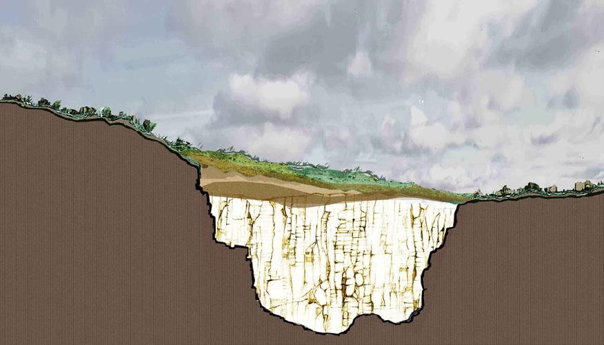
“What was once a barren quarry is now a protected forest.”
In the making for close to 8 years - the site is a result of indepth knowledge and a curated process that ultimately led to the rejuvenation of land (area - 70 Hectares) and the creation of multiple micro-ecosystems.
The site is a rejection of the conventionally accepted hierarchy between man and nature. It allows for an inversing of this relationship; allowing human intervention in only so much as to protect the ecosystem that has now been created.
Creating a self-sustaining ecosystem process involved improving the quality of soil; allowing local species of grasses and trees to grow, to slowly regain control. The top soil was layered on the rock; this top soil became mulch and created the micro-environments necessary for the growth of grasses, native shrubs, and trees. A nearby stream was diverted to fill the quarry basin, and then stocked with fish.
With the optimum amount of intervention, the site has rapidly undergone the various stages of succession. It has allowed for interactions between the various forms of flora, and also flora and fauna.

fig 2.
Source: Landscapeindia
Passive Design Approach Along Watercourse 20
Plan highlighting the restoration site In Timba.


Source: Landscapeindia


Source: Landscapeindia
Passive
Along Watercourse 21
Design Approach
Source: Landscapeindia 01 02 03 04 05 06 Before After Before
fig 3.
Stages of formation of a Self-Sustaining Ecosystem
fig 5. Images of the quarry after formation of multiple micro ecosystems
fig 4. Image of the quarry during construction
2.1.2 Red Ribbon Park / Turenscape
The Red Ribbon runs through the Qinhuangdao park against the background of natural terrain and vegetation, spanning 500 meters, integrating the functions of lighting, seating, environmental interpretation, and orientation.
While preserving as much of the natural river corridor as possible, this project demonstrates how a minimal design solution can achieve a dramatic improvement to the landscape.
The Red Ribbon was designed as a vivid element within a setting of green vegetation and blue water, curving with the terrain. Made of fiberglass, it is lit from the inside, glowing red at night. Crossings for small animals are built. Perforations were made on the ribbon’s top surface, creating a dotted pattern, in which lights and various grasses from the site grow. The bright red of the ribbon lights up this densely vegetated site, linking the diverse natural vegetation and the four flower gardens.

Along Watercourse 22
Passive Design Approach
fig 6
Plan of Red Ribbon Park Source : Archdaily
Sketch showing all the elements used in Red Ribbon Park
Source : Archdaily
Source : Archdaily
Passive Design Approach Along Watercourse


23
fig 8
Images of Red Ribbon Park
fig 7
Native Species
Fiber Steel Lights
Board Walk
Native Species
2.1.3
A Mother River Recovered: Qian’an
Sanlihe Greenway
The Qian’an Sanlihe Greenway is transformed from the former garbage dump and sewage drainage.
Located in Qian’an City, Hebei Province, the Sanlihe River uses landscape to revive and construct both existing and new city infrastructure. Covering approximately 135 hectares, this ecological corridor stretches 13.4 km in length and varies 100300m in width. Within this linear park, water is diverted from the Luan River, through the city, before returning to Luan River. This project has transformed this seriously polluted landscape back to its previous splendor as a scenic urban ecological corridor. It exemplifies how a neglected landscape can be recovered as an green infrastructure and everyday landscape with restored ecosystem providing multiple services.
The combined pedestrian and cycle paths for both commuting and recreational use are integrated with art, revitalizing social identity by reflecting local traditions. Through the generation of ecological and aesthetic benefits, the project catalyzes sustainable urban development in the region.


Passive Design Approach Along Watercourse 24
fig 9
Plan and Analysis of Qian’an Sanlihe Greenway
Source : Archdaily
fig 10
Images of Qian’an Sanlihe Greenway
Source : Archdaily
fig 11
Image showing red folding paper structure made in of Qian’an Sanlihe Greenway
Source : Archdaily


Passive
Along Watercourse 25
Design Approach
2.1.4 Rivers and its Cultural Importance
The importance of rivers have always been recognized for water resources, protection of nature, fisheries and recreation in view of their considerable contributions to landscape. In addition, rivers have certain definite environmental, social, cultural and economic values, as well. They are used by humans on a wide variety of purposes such as drinking water, irrigation, industry, power production, transportation, flood control, fishing, boating, swimming and aesthetic enjoyment. Rivers have many functions like providing connection between landscapes and communities and they also gather people around the same idea for a creative and sustainable environment. There is an apparent interaction between cultural level of societies and the use of water in all fields. Many cities in the world have been established along the river banks.
India is recognized as a river nation and has had a long history of mystical affiliation with its rivers. Here rivers are considered sacred and venerated. All human activities and rituals are innately associated with the riverfront. Rivers have functioned as crucial socio-cultural religious spaces.
But however, in today’s times however Rivers present a gory picture of neglect. Fresh water is polluted by domestic, industrial, agricultural and religious waste. Loss of life and property and damages to wildlife habitats can be cited among the risks caused by civilization on water sides. Past uses of rivers and social tendencies are effective on the present condition of rivers. Despite the unsatisfactory conditions of water sources in many parts, the increasing efficacy of sewage treatment systems provides new opportunities for inhabitants and improvement of rivers in morphological and economic sense. For attaining a normal level of life quality along river banks, necessary consideration and importance is be given to flood control systems and water quality.
Passive Design Approach Along Watercourse 26
2.1.4.1 Rivers and the cultural importance of its origin
2.1.4.1.1 Ganga - Gangotri Glacier
The ever-famous Ganga river originates in the Gangotri Glacier of Uttarkashi district in Uttarakhand. Gangotri Glacier is surrounded by snow-clad Himalayan peaks. This beautiful place is also a well-known pilgrimage site. Interestingly, a place called Goumukh near Gangotri Glacier is the source of Bhagirathi river which is one of the major tributaries of Ganga. Gangotri Glacier is an exciting place as you have to trek through the mountainous landscapes to reach the holy spot.


Source : Internet
Passive
27
Design Approach Along Watercourse
fig 12
Images of Gangotri Glacier and Temples
2.1.4.1 Rivers and the cultural importance of its origin
2.1.4.1.2 Krishna – Mahabaleshwar
Krishna River is also one of the largest West flowing rivers in India. A place called Jor Village near the hill station of Mahabaleshwar is the primary source of the Krishna River. Krishna Bai Temple or Krishna Devi Temple is where Krishna River is said to originate near Mahabaleshwar. There is a small spring in this ancient temple and the water which flows from the mouth of a bull statue is said to be the Krishna River.


Source : Internet
Passive Design Approach Along Watercourse 28
fig 13
Images of Mahabaleshwar Temple
2.2 Inference
It can be said from all the case studies that, landscape features do play an important role in a design process. And it can be concluded that landscape features play important roles in combinations, for e.g., land and water, land and vegetation, water and vegetation and many more.
Moreover, in all the three projects land, water and vegetation has played a vital role in formation of a sustainable landscape. For e.g., Timba Basalt Quarry was restored allowing local species of grasses and trees to grow, to slowly regain control whereas in red ribbon park, the site was preserved by minimal design solution. And in Qian’an Sanlihe Greenway, landscape was recovered by diverting the water flow before the water returns to its original path. Every design has a specific kind of approach based on the type changes required in order to achieve the idea of self sustainability and the outcome is completely in favour of the design.
In all the case studies, major changes have not been made in terms of landscape features but modification or addition have been done. More of the native plant species have been introduced to the site or basic terrain changes have been made. The concept of minimal design intervention is used which has worked completely in favour of the design.
Rivers are the lifelines of every creature on earth and we can’t imagine a life without them. The birth places of the river has its cultural and historical importance. It is fascinating to see how they originate as a small spring and further become large rivers that flows for several kilometers. These landscape features play a significant role for the river to thrive.
Hence, through my research, I would want to show the potential of land, water and vegetation in combinations for a design project along a watercourse with the importance of all landscape features and how can one use it through different approaches. Moreover playing with those features in combination such as land and water or land and vegetation would result is exceptionally promising design project.
Passive Design Approach Along Watercourse 29
2.3 Research Questions
• How does landscape design get influenced with change in landscape? And if design is influenced by these features then why emphasis is not put on it?
• How is the change or modification of these features related to the cultural importance of origin of any river?
2.4
Aim
To understand and imply the importance of landscape features using passive design approach and to introduce cultural significance to the origin of river.
2.5 Objectives
• To understand the idea of passive design
• To understand the importance of a water course and its source
• To suggest an idea of minimal design approach
• Providing an idea of a landscape space which is selfsustaining and ecologically sound
2.6
Methodology
• Literature Study
• Case Studies
• Data Collection
• Site Identification and Analysis
• Developing Drawings
• Final Design Output
Design Approach Along Watercourse 30
Passive
03. About River Vishwamitri
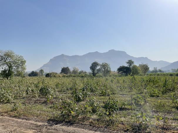
Vishwamitri river is the heart line of Vadodara city. The river originates in the western and southern slopes of the Pavagadh Hill and flows westward through Vadodara for 26.8 kilometers (km) before draining into the Gulf of Khambhat.
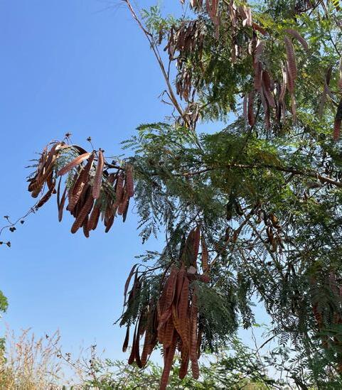
Its unique ecosystem comprises the main river corridor, its associated tributaries, ravines, nalas/kaans (small streams/ creeks), wetlands, oxbow lakes, and artificially created ponds. These serve as a natural habitat for legally protected and vulnerable species, such as crocodiles, and are also home to abundant flora and fauna, including vulnerable species such as Ravan taad (Hyphaene dichotoma) and turtles.
Historically, this rich ecosystem has provided natural floodwater control, groundwater recharge, and a habitat for diverse flora and fauna, thus promoting biodiversity and ameliorating adverse climatic conditions. The ecosystem has provided various communities alternative sources of irrigation, water supply, food, recreation, and livelihoods.
Vadodara, the third largest city in Gujarat, equally famous for its industrial development as for its environmental pollution, is located on the banks of Vishwamitri river. The city has suffered enormously from the river’s deterioration on account of rapid urbanisation and the resulting pollution, encroachment, and neglect. Broadly speaking, the major causes of the degradation are improper sewage management, an increase in impervious surface coverage, deforestation throughout the watershed, encroachment on the floodplains, a lack of concern for ecological processes, proliferation of invasive species (such as Prosopis juli ora), open dumping of solid waste, and a general lack of sensitivity to the historical repercussions of development. Indiscriminate and rampant encroachment, the dumping of waste in ravines—including construction debris, municipal and industrial waste, dead carcasses, and untreated or inadequately treated sewer water—and neglect or even active participation by the local authorities in the pollution and dumping have led to the choking of ravines and wetlands, and the shrinking of the river. Consequently, the monsoons cause inundation of low-lying areas in Vadodara due to the loss of natural floodwater drainage. The deterioration of Vishwamitri river has caused severe misery among the underprivileged living in highly vulnerable, low-lying areas.
Therefore, it is very important for the source of the river to survive and thrive in order to keep the river water flowing throughout the season.
Passive Design Approach Along Watercourse 31 Page Intentionallty Left Blank
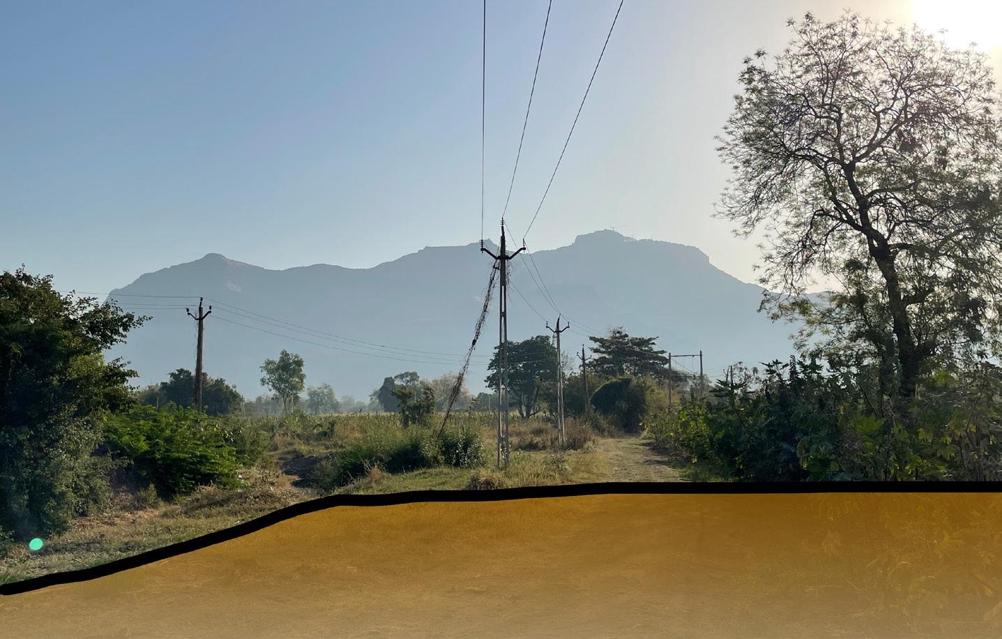
04. Study Area
Passive Design Approach Along Watercourse 32

fig 14
Plan indicating important Landmarks near Pavagadh Hills

Source : Google Earth


fig 15

Passive
33 5 1 6 3 2 4 7 Hills Waterbodies Vegetation Agricultural Land Built Area River
Trails Main Road Agricultural Land Agricultural Land 1. Agricultural Land Soil Texture Pathway
2. 3. 4. 5. 6. 7.
Design Approach Along Watercourse
Trails
River Trail Scarce Land
Images of tributrary of R. Vishwamitri
Pavagadh
Pavagadh Foothills
Sand Mining
N
Champaner
05. Site Delineation
06. SWOT Analysis
Passive Design Approach Along Watercourse 34

fig 16
Site Dlineation
Site Selection Parameters –
• Less slopy
• Cultural Importance
• Easily Accessible
• Moderately Vegetated
• Less Built Up area
• Near a waterbody
Strength – - Foothills of Pavagadh
- Part of origin of the River
- Cultural Importance
- Connected to main road
Weakness – Water doesn’t flow throughout the season
-Surrounded by agricultural land
Opportunity – Open river bed and open grounds
Threat – Pollution
fig 17
Image of the Site near tributary of R. Vishwamitri


Passive
Along Watercourse 35 Vegetation Agricultural land -1 Agricultural land -2 Agricultural land -3 Agricultural land -4 Waterbody Existing Trees Main Road Built Area
Design Approach
0 m 5 m 10 m 20 m N
07. Observing the channels of water
Passive Design Approach Along Watercourse 36


Google Eath Images of tributary of R. Vishwamitri, 2020.
Source : Google Earth

Along
37
Passive Design Approach
Watercourse
fig 18
Summer Year 2020
N
Monsoon Year 2020
Winter Year 2020
Site Study
Passive Design Approach Along Watercourse 38
08.


Passive Design Approach Along Watercourse 39 fig 19 Site Study
This river section shows proper land profile of the dried stream of river Vishwamitri and vegetation taking over the river bed. The soil on the slope contains moisture allowing the plants to grow. And the area covered with gravels is the path for water to flow. Gradual change is seen land profile and texture of this particular area.
Ziziphus mauritiana
Crop soil
Azadirachta indica
Black clayey soil
Gravels Location
Pavagadh Hills
Main road
Unidentified wild plant
Unidentified wild plant
N
Wild grass
Site Study
Passive Design Approach Along Watercourse 40
08.
The sections show the land profile of the whole trail including the river bed and the change in type of vegetation throughout. Man-made changes have been made partially.

The stream through which Vishwamitri flows has not been hindered but a secondary canal network has been made in order to meet the demands of agricultural lands. Natural vegetation has not been hindered instead new plantation has been done.


Passive Design Approach Along Watercourse 41 fig
Site
20
Study
Main road
Land Profile Location Land Profile
Ricinus communis
Psidium guajava Thorny bushes
Butea monosperma
Tamarindus indica
Calotropis gigantea
Moringa oleifera Ziziphus mauritiana Washingtonia filifera N
09. Site Analysis Built and Open
Passive Design Approach Along Watercourse 42


Passive Design Approach Along Watercourse 43 0 m 5 m 10 m 20 m fig 21 Site Analysis Main Road Built N
Site Analysis Vegetation
Passive Design Approach Along Watercourse 44
09.

Passive Design Approach Along Watercourse 45 0 m 5 m 10 m 20 m fig 22 Site Analysis Vegetation Main Road Built Agricultural land -1 Agricultural land -2 Agricultural land -3 Agricultural land -4 Waterbody Existing Trees N
09. Site Analysis Accessibility
Passive Design Approach Along Watercourse 46
Passive Design Approach Along Watercourse 47 0 m 5 m 10 m 20 m Accessibility fig 23 Site Analysis N
09. Site Analysis
Physical and Visual Accessibility
Passive Design Approach Along Watercourse 48
Passive Design Approach Along Watercourse 49 0 m 5 m 10 m fig 24 Site Analysis V. Accessibility P. Accessibility N
Passive Design Approach Along Watercourse 50
09. Site Analysis Sun

Passive Design Approach Along Watercourse 51 0 m 5 m 10 m 20 m Sun Direction fig 25 Site Analysis N
Passive Design Approach Along Watercourse 52
09. Site Analysis Wind
Passive Design Approach Along Watercourse 53 0 m 5 m 10 m 20 m Wind Direction fig 26 Site Analysis N
09. Site Analysis Elevation
Passive Design Approach Along Watercourse 54

+60m +61m +62m +63m +64m +65m +66m +67m +68m +69m +70m +71m +72m +73m +75m +74m +76m +59m +58m 0 m 5 m 10 m 20 m fig 27 Site Analysis Passive Design Approach Along Watercourse 55 N
Along Watercourse 56
09.
Site Analysis Slope
Passive Design Approach

N 0 m 5 m 10 m 20 m Steep fig 28 Site Analysis
57 Moderate Flat
Passive Design Approach Along Watercourse
Along Watercourse 58
10. Water
Level Passive Design Approach


fig 29
throughout the year
Water level
Water level during monsoon
Water level during winters
Water level during summers
59 N
Passive Design Approach Along Watercourse
11. Vision Statement
12. Designing Stretch of a River
13. Passive Design Space
14. Design Program
Passive Design Approach Along Watercourse 60
11. Vision Statement
This design aims at creating a self-sustaining ecosystem while having a passive recreational space along 1 km long stretch of a river near the foothills of Pavagadh. One of the tributaries of origin of river Vishwamitri is situated in this region so it holds cultural importance, hence this area can be considered as a source of the river. Eventually, this design process will help the river thrive with its minimal design approach.
12. Designing Stretch of a River
The most unique aspect of the site is that it is located near the foothills of Pavagadh where one of the tributaries of River Vishwamitri originates. So this place holds cultural importance.
This river stays dry most of the time in entire year, so the spaces in this design will enable origin of the river belt to survive. With minimum design intervention and self-sustaining properties, this design will ultimately come together as a passive experiential space along with different physical and visual connections. It will also help the river belt to thrive as native plant species will be introduced to purify the river water.
The origin of the river is the most important place as it channelizes and forms larger river further hence it cannot be deteriorated . Therefore, this design project is an attempt along a short river stretch that enables the origin of river tributary to thrive and people to connect to it passively.
13. Passive Design Space
The design that maintains a comfortable temperature within the design space using the climate and natural elements to get the optimum benefit and to reduce or eliminate the independence on mechanical systems for heating, cooling and lighting, is called ‘Passive Design’. In this design, the spaces will be made with reduced human intervention where it can be approached visually but not physically. There will be free flow of movement while keeping the vegetation as well the river stream untouched and unhindered. All together this design will enable stream of the river origin to thrive by self-sustained ecosystem and will allow people to experience its cultural importance with minimal design approach.
Passive Design Approach Along Watercourse 61
14. Design Program
• Self-sustaining ecosystem process of the river includes widening of the channel at points where necessary.
• Improving ground line and introducing a fertile layer of soil with high moisture retaining capacity.
• Introducing various layers of vegetation
• Pockets of buffer zone where the polluted water can be filtered naturally with the help of aquatic plant species.
• Spaces that will connect people to the river passively.
• An experiential pathway along the river stretch.
Design Approach Along Watercourse 62
Passive
63 Page Intentionallty Left Blank
Passive Design Approach Along Watercourse
15. Conceptual Diagrams
Conceptual Diagram - 1
Passive Design Approach Along Watercourse 64


fig 30 Conceptual Diagrams Passive Design Approach Along Watercourse 65 0 m 5 m 10 m 20 m Vegetation Main Road Built Agricultural land -1 Agricultural land -2 Agricultural land -3 Agricultural land -4 Waterbody Existing Trees Entrance Viewing deck Walkway Walkway at a height Levelled (terraced) space Cleaning area Seating at a height Shaded sitting space Levelled (terraced) space Viewing deck 0 m 5 m 10 m 20 m Bridge
N
15. Conceptual Diagram - 1
15. Conceptual Diagrams
Conceptual Diagram - 2
Passive Design Approach Along Watercourse 66
Conceptual Diagram - 2


Passive Design Approach Along Watercourse 67 0 m 5 m 10 m 20 m Entrance Walkway Walkway at a height Levelled (terraced) space Cleaning area Space to perform rituals Source of river
river
Vegetation Main Road Built Agricultural land -1 Agricultural land -2 Agricultural land -3 Agricultural land -4 Waterbody Existing Trees fig 31 Conceptual Diagrams Buffer Zone Bridge Entrance 15.
N
Source of
Walkway
16. Design Development
16.1 Widening of the river and Improving of the ground line
16.2 Buffer Zone
16.2.1 Introduction
16.2.2 How will a buffer zone work along a stream of R. Vishwamitri
16.2.3 Plant species for buffer zones
16.2.4 Conceptual Sections
16.2.5 Part Plan
16.3 Experiential walkway
16.3.1 Entrance
16.3.1.1 Views
16.3.1.2 Conceptual sections
16.3.1.3 Part Plan
16.3.2 Pause Point and Board Walk
16.3.2.1 Views
16.3.2.2 Conceptual Sections
16.3.2.3 Part Plan
16.3.3 Origin of the River Stream
16.3.3.1 Views
16.3.3.2 Part Plan
Design Approach Along Watercourse 68
Passive
16. Design Development
Stepping stones and tree plantation
• Space enclosed within bamboo planting,
• Open spaces with raised platforms
• Pause points
Planting different species of aquatic plants to filter the river water
Origin
Creating a “dwar” like structure by growing bamboos along a part of river stretch
Passive Design Approach Along Watercourse 69 0 m 5 m 10 m 20 m
Main Road Built Agricultural land -1 Agricultural land -2 Agricultural land -3 Agricultural land -4 Waterbody Existing Trees fig 32 Design Development Entrance Buffer Zone Experiential
walkway
N
16. Design Development
16.1 Widening of the river and Improving of the ground line
Passive Design Approach Along Watercourse 70
16.1 Widening of the river and Improving of the ground line


Passive Design Approach Along Watercourse 71 fig 33
Widening of the river and Improving of the ground line
N Before After Existing Ground Line 0 m 5 m 1 m 2 m 0 m 5 m 1 m 2 m 0 m 5 m 10 m 20 m
Passive Design Approach Along Watercourse
16. Design Development
16.2 Buffer Zone
16.2.1 Introduction
16.2.2 How will a buffer zone work along a stream of R. Vishwamitri
16.2.3 Plant species for buffer zones
16.2.4 Conceptual Sections
16.2.5 Part Plan
72
16.2 Buffer Zone 16.2.1 Introduction
A riparian buffer, also known as a stream buffer, is an area that is vegetated near a stream. It is usually forested and helps to provide shade and protection to the stream from the impact of adjacent land use (agricultural or industrial).It is vital to help increase water quality in associated streams, lakes, and rivers. This is beneficial for marine life and environment.
The plains and areas surrounding a river, or any water body for that matter, are called Riparian zones. Not only do riparian zones include floodplains, but also the riparian buffers bordering the flood plains. Riparian zones offer recreational benefits to streams, many environmental benefits, groundwater, and downstream land areas.
Ground water is mostly found at shallower depths in Riparian Zones. Riparian zones are clearly visible by a green belt hugging the river with suitable plants that are modified to depend on the shallow water table.
A mat of decay material over the soil is created because of the extra moisture in riparian zones and related wet lands, along with large amounts of vegetation. It is mostly wet because the water table is at the surface or close to it. The moisture is conserved because of this organic rich layer. The surface water is protected in many ways due to the vegetation and sponge like quality of the soil in wetlands, flood plains, and riparian zones.
16.2.2 How will a buffer zone work along a stream of R. Vishwamitri

representation of a Riparian Buffer Zone
How do buffer zones work? Functions and Values of Riparian areas -
1. Base flow
2. Nutrient cycling
3. Hydrology
4. Water quality
5. Aquatic life
6. Downstream flooding
7. Transfer of energy
8. Terrestrial life

Benefits of Riparian Buffer Zones
1. Water Quality
2. Flood Protection
3. Provide Habitats
4. Increased Biodiversity
5. Economically beneficial
6. Other Benefits of Riparian Areas
How will a buffer zone work along a stream of R. Vishwamitri


representing working of a riparian buffer zone
Zone 1 (Stream-side zone) Zone 2 (Middle Zone) Zone 3 (Outer Zone) Stream Aquatic Plants Crop Field Run-off control Undisturbed Vegetation Managed Vegetation Zone
Zone
Zone
1 – Streamside consist of fast growing, flood tolerant plants and trees that stabilize bank and cool water through shading
2 – Consists of slow growing trees and shrubs that absorbs remaining contaminants from zone 3
3 – Consist of perennial grasses and woody vegetation that slow the surface runoff and absorb most contaminants
Three-Zone
(Stream-side) (Middle) (Outer)
Riparian Buffer
Passive
Along
73 0 m 5 m 10 m 20 m fig
Buffer
Design Approach
Watercourse
34
Zone diagram
fig 36
Sectional
fig 37
fig
Indicating
Diagram
35
Buffer Zones on plan
Ground layers
Trees N
Shrubs
16.2.3 Plant species for buffer zones


74
Passive Design Approach Along Watercourse
fig 38
Plant species used in Riparian Buffer zones of R. Vishwamitri
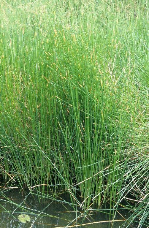
Scirpoides holoschoenus (Bulrushes)
Canna x generalis (Canna
Cyperus papyrus (Papyrus)
Pennisetum setaceum (fountain grass)
Eleocharis dulcis (Water chestnut)
Pennisetum purpureum (Elephant grass )
Typha (Cattails)
16.2.4 Conceptual Sections


Passive Design Approach Along Watercourse 75 fig 39 Conceptual Sections of Riparian Buffer zone N 0 m 5 m 10 m 20 m Dry Season Wet Season Existing Ground Line Existing Ground Line Dry Season Wet Season 0 m 5 m 1 m 2 m 0 m 5 m 1 m 2 m 0 m 5 m 1 m 2 m 0 m 5 m 1 m 2 m
Passive
76 Page Intentionallty Left Blank
Design Approach Along Watercourse


Passive Design Approach Along Watercourse 77 fig 40
during dry season
N 0 m 5 m 10 m 20 m
Part Plan of Riparian Buffer zone
16.2.5 Part Plan
River Trail
Existing Trees
0 m 5 m 1 m 2 m
Board Walkway
Dry Season
Passive
78 Page Intentionallty Left Blank
Design Approach Along Watercourse

Grasses
Existing Trees
Passive Design Approach Along Watercourse 79
N 0 m 5 m 10 m 20 m
16.2.5 Part Plan
0 m 5 m 1 m 2 m Wet Season
Board Walkway
fig 41
wet
Part Plan of Riparian Buffer zone
during
season
River
Seasonal Trees
16. Design Development
16.3 Experiential walkway
16.3.1 Entrance
16.3.1.1 Views
16.3.1.2 Conceptual sections
16.3.1.3 Part Plan
16.3.2 Pause Point and Board Walk
16.3.2.1 Views
16.3.2.2 Conceptual Sections
16.3.2.3 Part Plan
16.3.3 Origin of the River Stream
16.3.3.1 Views
16.3.3.2 Part Plan
Design Approach Along Watercourse 80
Passive
16.3 Experiential Walkway
The Vishwamitri River emerges from the hills of Pavagadh and flows through the heart of Vadodara city in Gujarat. It empties into the Gulf of Khambhat. Sage Vishwamitra ,who the river is named after created a mokshdwar (gateway to heaven) for downtrodden Hindu people at Kayavarohan, a village in the Vadodara district. The river is named after him. The experiential walkway is designed in a way that will make people experience the same journey from the origin of the river. The entrance and the assumed origin of river Vishwamitri follows same language with two pause points and raised platform making the area passively approachable.
Steps leading to the walkway with bamboo plantation on both the sides of the stream
Raised platform connected to walkway
Pause Point 2 Pause Point 1
Providing benches for people to take a break while walking towards the origin of the river

Creating a “dwar” like structure with the help of bamboo plantation along a small part of river stretch
Passive Design Approach Along Watercourse 81 0 m 5 m 10 m 20 m
Main Road Built Agricultural land -1 Agricultural land -2 Agricultural land -3 Agricultural land -4 Waterbody Existing Trees fig 42 Plan of Experiential Walkway Entrance
Origin
N
Board Walk
Board Walk
Board Walk
16. Design Development
16.3 Experiential walkway
16.3.1 Entrance
16.3.1.1 Views
16.3.1.2 Conceptual sections
16.3.1.3 Part Plan
Design
Along Watercourse 82
Passive
Approach
16.3.1 Entrance
16.3.1.1 Views


Passive Design Approach Along Watercourse 83
N 0 m 5 m 10 m 20 m Wet Season
Season
fig 43 Views of the Entrance Dry
84 Page Intentionallty Left Blank
Passive Design Approach Along Watercourse
16.3.1 Entrance
16.3.1.2 Conceptual sections


Conceptual Sections of the Entrance
Passive Design Approach Along Watercourse 85
N 0 m 5 m 10 m 20 m
Wet Season fig 44
0 m 5 m 1 m 2 m 0 m 5 m 1 m 2 m
Dry Season
Passive
86 Page Intentionallty Left Blank
Design Approach Along Watercourse


Passive Design Approach Along Watercourse 87
N 0 m 5 m 10 m 20 m fig 45 Part Plan of the Entrance during dry season
16.3.1 Entrance 16.3.1.3 Part Plan
Dry Season
River Trail
Existing Trees
0 m 5 m 1 m 2 m
Main Road
Passive
88 Page Intentionallty Left Blank
Design Approach Along Watercourse

Grasses
Existing Trees
River Seasonal Trees Main Road
Bamboo Plantation
Passive Design Approach Along Watercourse 89
Plan N 0 m 5 m 10 m 20 m Wet Season fig 46 Part Plan of the Entrance during wet season
16.3.1 Entrance 16.3.1.3 Part
0 m 5 m 1 m 2 m
16. Design Development
16.3.2 Pause Point and Board Walk
16.3.2.1 Views
16.3.2.2 Conceptual Sections
16.3.2.3 Part Plan
Approach Along Watercourse 90
Passive Design
16.3.2 Pause Point and Board Walk
16.3.2.1 Views


Passive Design Approach Along Watercourse 91
N 0 m 5 m 10 m 20 m
fig 47
Views of the Pause Point and Board Walk
Wet Season
Dry Season
Passive
92 Page Intentionallty Left Blank
Design Approach Along Watercourse
16.3.2 Pause Point and Board Walk
16.3.2.2 Conceptual Sections


Sections of Pause Point and Board Walk
Passive Design Approach Along Watercourse 93
N 0 m 5 m 10 m 20 m
fig 48
Before After 0 m 5 m 10 m 20 m 0 m 5 m 10 m 20 m
Conceptual
Passive
94 Page Intentionallty Left Blank
Design Approach Along Watercourse
16.3.2


Passive Design Approach Along Watercourse 95
N 0 m 5 m 10 m 20 m fig 49 Part Plan of Pause Point and Board Walk during dry season
Pause Point and Board Walk 16.3.2.3 Part Plan
Raised Platform
Engineered
used for boardwalk, bridge and platform 0 m 5 m 1 m 2 m Dry Season
Bridge
Teak Wood Material
Passive
96 Page Intentionallty Left Blank
Design Approach Along Watercourse
16.3.2 Pause Point and Board Walk
16.3.2.3 Part Plan

Passive Design Approach Along Watercourse 97
N 0 m 5 m 10 m 20 m fig 50 Part Plan of Pause Point and Board Walk during dry season Wet Season 0 m 5 m 1 m 2 m
16. Design Development
16.3.3 Origin of the River Stream
16.3.3.1 Views
16.3.3.2 Part Plan
Design Approach Along
98
Passive
Watercourse
16.3.3 Origin of the River Stream
16.3.3.1 Views
“Dwar”(Door)
Creating a “dwar” like structure with bamboo plantation along a part of river stretch.
Bamboo planation creates a door like structure here through which Pavagadh is visible. This creates a vision of water coming from foothills of Pavagadh with bamboo structure as a door.


Views of the Origin

Passive Design Approach Along Watercourse 99
N 0 m 5 m 10 m 20 m
fig 51
Wet Season
Dry Season
Passive Design Approach Along Watercourse
100 Page Intentionallty Left Blank
16.3.3 Origin of the River Stream
16.3.3.1 Views


Passive Design Approach Along Watercourse 101
N 0 m 5 m 10 m 20 m
fig 52 Views of the Origin
Wet Season
Dry Season
Passive
102 Page Intentionallty Left Blank
Design Approach Along Watercourse
16.3.3 Origin of the River Stream
16.3.3.2 Part Plan

Passive Design Approach Along Watercourse 103
N 0 m 5 m 10 m 20 m fig 53 Part Plan of the Origin during dry season
River Trail
Existing Trees
0 m 5 m 1 m 2 m
Walkway
104 Page Intentionallty Left Blank
Passive Design Approach Along Watercourse
16.3.3 Origin of the River Stream
16.3.3.2 Part Plan

Passive Design Approach Along Watercourse 105
N 0 m 5 m 10 m 20 m fig 54 Part Plan of the Origin during wet season
River
Existing Trees
0 m 5 m 1 m 2 m
Walkway
Bamboo Plantation
17. Master Plan Layers
17.1 Entrance and Origin of the River Stream
17.2 Buffer Zone
17.3 Experiential walkway
Passive Design Approach Along Watercourse 106
17. Master Plan Layers
17.1 Entrance and Origin of the River Stream
Steps leading to the walkway with bamboo plantation on both the sides of the stream Entrance
Creating a “dwar” like structure with the help of bamboo plantation along a small part of river stretch

Master Plan highlighting Entrance and Origin of the River Stream
fig 55
Passive Design Approach Along Watercourse 107
N 0 m 5 m 10 m 20 m
Origin
Passive
108 Page Intentionallty Left Blank
Design Approach Along Watercourse
17. Master Plan Layers
17.2 Buffer Zone

Master Plan highlighting three pockets of Riparian Buffer Zones
fig
56
Passive Design Approach Along Watercourse 109
N 0 m 5 m 10 m 20 m Buffer Zone
filter the water
Planting different aquatic and native plant species to
Passive
110 Page Intentionallty Left Blank
Design Approach Along Watercourse
17. Master Plan Layers
17.3 Experiential Walkway
• Bridge Experiential Walkway
• Space enclosed within bamboo plantation
• Open spaces with raised platforms
• Pause points

fig 57
Master Plan highlighting the spaces of Experiential Walkway
111
Passive Design Approach Along Watercourse
N 0 m 5 m 10 m 20 m
18. Master Plan Passive Design
Along
112
Approach
Watercourse
18. Master Plan

fig 58 Master Plan with levels Passive Design Approach Along Watercourse 113
N 0 m 5 m 10 m 20 m +71 m lvl +69 m lvl +63 m lvl +66 m lvl +61 m lvl +60 m lvl +58 m lvl +61 m lvl +63.30 m lvl +66.30 m lvl +68 m lvl
19. Site Section
Along
114
Passive Design Approach
Watercourse

fig
Site
levels Passive Design Approach Along Watercourse 115
N +66 m +71 m +51 m +61 m +56 m Main Road Agricultural Land Agricultural Land Bamboo Plantation Buffer Zone Raised Platform Walkway Buffer Zone +66 m lvl +71 m lvl +51 m lvl +61 m lvl +56 m lvl 0 m 5 m 10 m 20 m
59
Section with
19. Site Section
20. Bibliography
ASLA 2013 Professional Awards | A Mother River Recovered: Qian’an Sanlihe Greenway. (2013).American Society of Landscape Architects (ASLA). https://www.asla.org/2013awards/062.html
Culture and changing landscape structure. (2018, January 11). Culture and Changing Landscape Structure. http:// www.environmentguide.org.nz/issues/landscape/why-arelandscapes-and-features-important/
Gaete, J. (2019, October 24). Red Ribbon Park / Turenscape. ArchDaily. https://www.archdaily.com/445661/red-ribbon-parkturenscape?ad_medium=office_landing&ad_name=article
Goyal, A. (2014, November 4). HISTORIC PAVAGADH HILL, GUJARAT – UNESCO WORLD HERITAGE SITE. Travel Blog From India. https://www.inditales.com/historic-pavagadh-hillgujarat/
Kombol, M. (2015). 30:30 Landscape Architecture (Illustrated ed.). Phaidon Press.
Landscapeindia. (2014). TIMBA BASALT QUARRY RESTORATION. http://www.landscapeindia.net/projects/ landscape-architecture/restoration-of-basalt-quarry
Passive Design. (2016, June). K. Tabet Aoul, Akash Deep, Haşim Altan, Mona Hajibandeh. https://doi.org/10.1007/978-3-31931967-4_8
Saving the Vishwamitri : An Ongoing Tussle between Waterfront. (2018, November 26). Economic and Political Weekly. https:// www.epw.in/journal/2018/46/insight/saving-vishwamitri.html
Sinha, A. (2018). Conservation of historic water systems in Champaner-Pavagadh, Gujarat, India. Landscape Research, 44(5), 588–599. https://doi.org/10.1080/01426397.2018.149570 2
Design Approach Along Watercourse 116
Passive
20. Bibliography
Soomro, A. (2020, November 1). Riparian Buffer Zone: Function, Benefits, Design. Environment Buddy. https://www. environmentbuddy.com/farming/riparian-buffer-zone-functionbenefits-designs/
Vinayak, A. (2018, April 12). Birthplaces of Famous Rivers That Originate in India - Nativeplanet. Birthplaces of Famous Rivers That Originate in India. https://www.nativeplanet.com/travelguide/birthplace-famous-rivers-that-originate-in-india-002652. html
Waterman, T. (2015). The Fundamentals of Landscape Architecture (2nd ed.). Fairchild Books.
WIENS, J. A. (2002). Riverine landscapes: taking landscape ecology into the water. Freshwater Biology, 47(4), 501–515. https://doi.org/10.1046/j.1365-2427.2002.00887.x
Passive Design Approach Along Watercourse 117
21. List Of Figures
fig.0 Cover Page
Produced by Author
fig.1 Sketch of Pavagadh Hills
Produced by Author
fig. 2 Plan highlighting the restoration site In Timba.
Source: Landscapeindia
fig 3.Stages of formation of a Self-Sustaining Ecosystem
Source: Landscapeindia
fig 4.Image of the quarry during construction
Source: Landscapeindia
fig 5.Images of the quarry after formation of multiple micro ecosystems
Source: Landscapeindia
fig 6 Plan of Red Ribbon Park
Source : Archdaily
fig 7 Sketch showing all the elements used in Red Ribbon Park
Source : Archdaily
fig 8 Images of Red Ribbon Park
Source : Archdaily
fig 9 Plan and Analysis of Qian’an Sanlihe Greenway
Source : Archdaily
fig 10 Images of Qian’an Sanlihe Greenway
Source : Archdaily
fig 11 Image showing red folding paper structure made in of Qian’an Sanlihe Greenway
Source : Archdaily
fig 12 Images of Gangotri Glacier and Temples
Source : Internet
fig 13 Images of Mahabaleshwar Temple
Source : Internet
fig 14
Plan indicating important Landmarks near Pavagadh Hills
Source : Google Earth
Passive Design Approach Along Watercourse 118
21. List Of Figures
fig 15 Images of tributrary of R. Vishwamitri
Clicked by Author
fig 16 Site Dlineation Produced by Author
fig 17 Image of the Site near tributary of R. Vishwamitri Produced by Author
fig 18 Google Eath Images of tributary of R. Vishwamitri, 2020. Source : Google Earth
fig 19-20 Site Study Produced by Author
fig 21-28 Site Analysis Produced by Author
fig 29 Water level throughout the year Produced by Author
fig 30-31Conceptual Diagrams Produced by Author
fig 32 Design Development Produced by Author
fig 33
Widening of the river and Improving of the ground line Produced by Author
fig 34 Buffer Zone diagram Produced by Author
fig 35 Indicating Buffer Zones on plan Produced by Author
fig 36 Sectional representation of a Riparian Buffer Zone Produced by Author
fig 37 Diagram representing working of a riparian buffer zone
Source : Internet
fig 38 Plant species used in Riparian Buffer zones of R. Vishwamitri
Source : Internet
Passive Design Approach Along Watercourse 119
21. List Of Figures
fig 39 Conceptual Sections of Riparian Buffer zone Produced by Author
fig 40 Part Plan of Riparian Buffer zone during dry season Produced by Author
fig 41 Part Plan of Riparian Buffer zone during wet season Produced by Author
fig 42 Plan of Experiential Walkway Produced by Author
fig 43 Views of the Entrance Produced by Author
fig 44 Conceptual Sections of the Entrance Produced by Author
fig 45 Part Plan of the Entrance during dry season Produced by Author
fig 46 Part Plan of the Entrance during wet season Produced by Author
fig 47 Views of the Pause Point and Board Walk Produced by Author
fig 48 Conceptual Sections of Pause Point and Board Walk Produced by Author
fig 49 Part Plan of Pause Point and Board Walk during dry season Produced by Author
fig 50 Part Plan of Pause Point and Board Walk during wet season Produced by Author
fig 51-52 Views of the Origin Produced by Author
fig 53 Part Plan of the Origin during dry season Produced by Author
fig 54 Part Plan of the Origin Produced by Author
fig 55 Master Plan highlighting Entrance and Origin of the River Stream Produced by Author
Passive Design Approach Along Watercourse 120
21. List Of Figures
fig 56 Master Plan highlighting three pockets of Riparian Buffer Zones
Produced by Author
fig 57 Master Plan highlighting the spaces of Experiential Walkway Produced by Author
fig 58 Master Plan with levels Produced by Author
fig 59 Site Section with levels Produced by Author
Passive Design Approach Along Watercourse 121
